

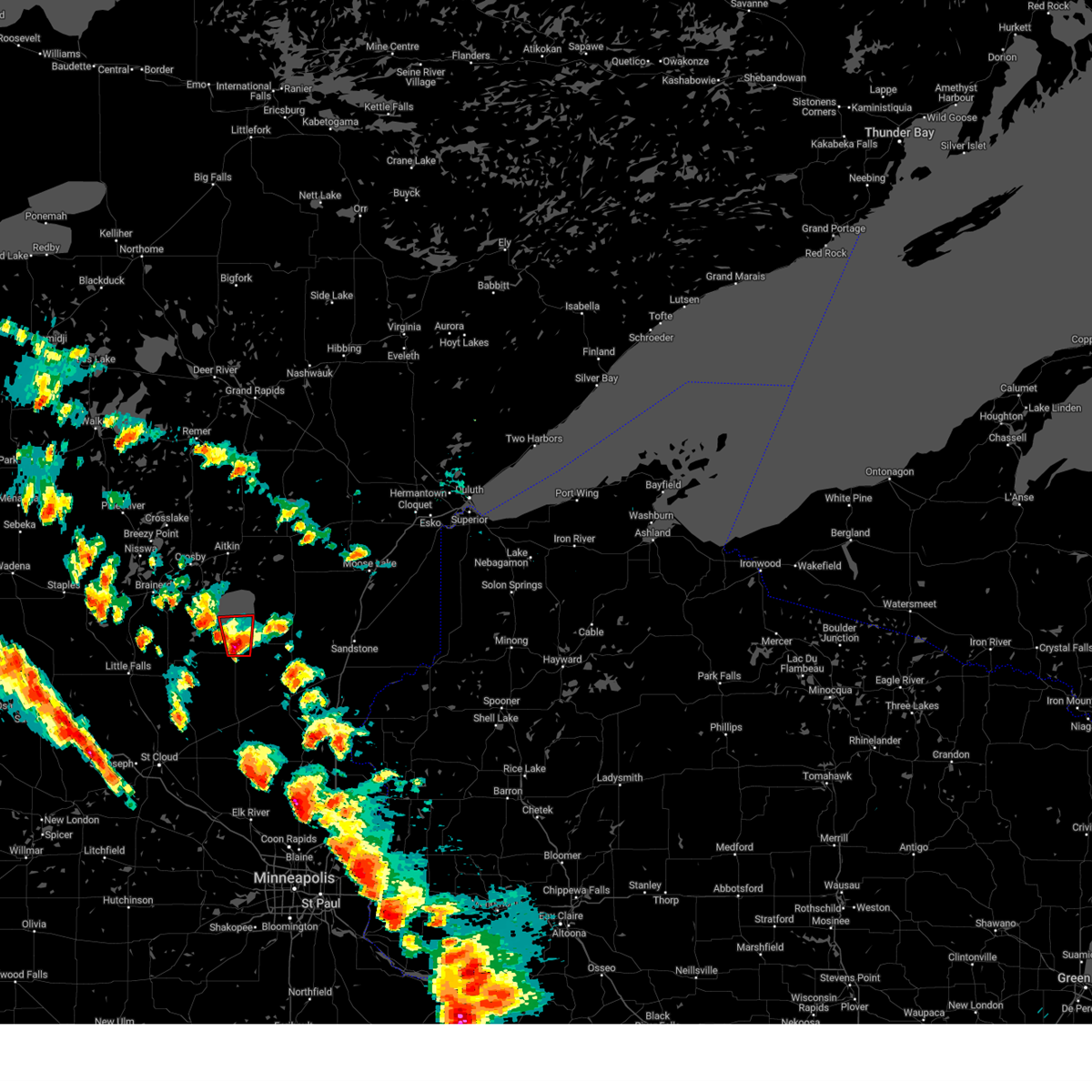
Hail Map for Vineland, MN
The Vineland, MN area has had 0 reports of on-the-ground hail by trained spotters, and has been under severe weather warnings 22 times during the past 12 months. Doppler radar has detected hail at or near Vineland, MN on 51 occasions, including 3 occasions during the past year.
| Name: | Vineland, MN |
| Where Located: | 86.8 miles NNW of Minneapolis, MN |
| Map: | Google Map for Vineland, MN |
| Population: | 1001 |
| Housing Units: | 369 |
| More Info: | Search Google for Vineland, MN |
1
The Top Recent Hail Date for Vineland, MN is Thursday, April 17, 2025 (18th out of 51)
Hail and Wind Damage Spotted near Vineland, MN
| Date / Time | Report Details |
|---|---|
| 6/23/2025 2:11 AM CDT |
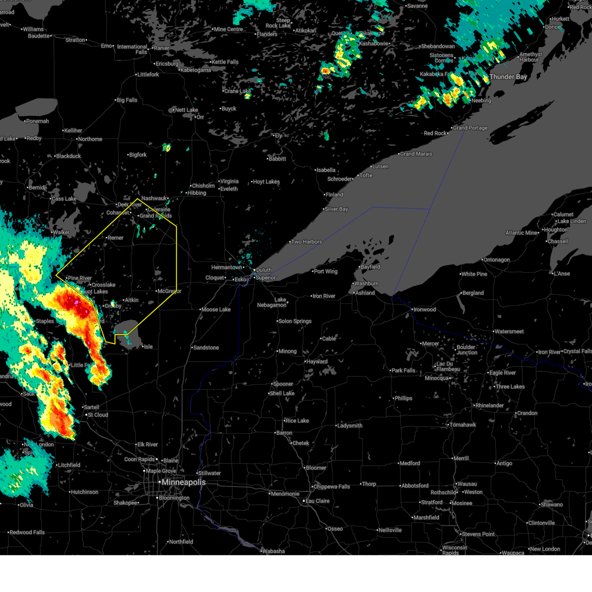 Svrdlh the national weather service in duluth mn has issued a * severe thunderstorm warning for, southeastern itasca county in north central minnesota, aitkin county in east central minnesota, east central cass county in north central minnesota, crow wing county in east central minnesota, * until 315 am cdt. * at 210 am cdt, severe thunderstorms were located along a line extending from near pine river to near cuyuna country state park to near garrison, moving northeast at 50 mph (brainerd airport reported a 56 mph wind gust). Hazards include 60 mph wind gusts and quarter size hail. Hail damage to vehicles is expected. expect wind damage to roofs, siding, and trees. severe thunderstorms will be near, mille lacs lake, crosby, crosslake, emily, deerwood, fifty lakes, cuyuna, and garrison around 215 am cdt. aitkin around 220 am cdt. outing around 225 am cdt. Other locations in the path of these severe thunderstorms include remer, palisade, swatara, hill city, mcgregor, big sandy lake, libby, savanna portage state park, grand rapids, cohasset, jacobson and pokegama lake. Svrdlh the national weather service in duluth mn has issued a * severe thunderstorm warning for, southeastern itasca county in north central minnesota, aitkin county in east central minnesota, east central cass county in north central minnesota, crow wing county in east central minnesota, * until 315 am cdt. * at 210 am cdt, severe thunderstorms were located along a line extending from near pine river to near cuyuna country state park to near garrison, moving northeast at 50 mph (brainerd airport reported a 56 mph wind gust). Hazards include 60 mph wind gusts and quarter size hail. Hail damage to vehicles is expected. expect wind damage to roofs, siding, and trees. severe thunderstorms will be near, mille lacs lake, crosby, crosslake, emily, deerwood, fifty lakes, cuyuna, and garrison around 215 am cdt. aitkin around 220 am cdt. outing around 225 am cdt. Other locations in the path of these severe thunderstorms include remer, palisade, swatara, hill city, mcgregor, big sandy lake, libby, savanna portage state park, grand rapids, cohasset, jacobson and pokegama lake.
|
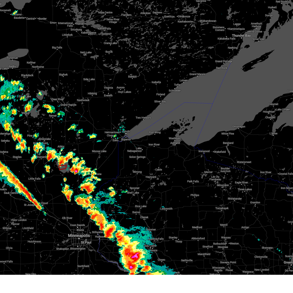
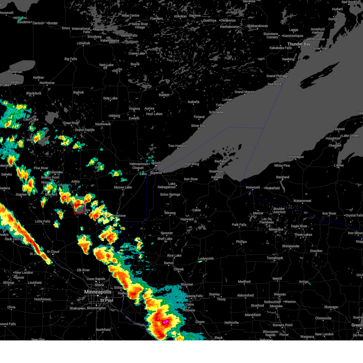
| 6/16/2025 5:56 PM CDT | Svrmpx the national weather service in the twin cities has issued a * severe thunderstorm warning for, southeastern morrison county in central minnesota, kanabec county in east central minnesota, mille lacs county in east central minnesota, * until 645 pm cdt. * at 556 pm cdt, severe thunderstorms were located along a line from 8 miles north of isle to 8 miles southeast of lastrup, or along a line from 45 miles northeast of little falls to 21 miles east of little falls, moving east at 50 mph (radar indicated). Hazards include 60 mph wind gusts and quarter size hail. Hail damage to vehicles is expected. expect wind damage to roofs, siding, and trees. this severe thunderstorm will be near, wahkon and onamia around 605 pm cdt. isle around 610 pm cdt. Other locations impacted by the severe thunderstorm include hillman, lake mille lacs, mille lacs kathio state park, bayview and father hennepin state park. |
| 5/15/2025 3:27 PM CDT |
 The storm which prompted the warning has weakened below severe limits, and has exited the warned area. therefore, the warning will be allowed to expire. The storm which prompted the warning has weakened below severe limits, and has exited the warned area. therefore, the warning will be allowed to expire.
|
| 5/15/2025 3:21 PM CDT |
 At 321 pm cdt, a severe thunderstorm capable of producing a tornado was located 7 miles northeast of vineland, or 38 miles northeast of little falls, moving north at 35 mph (radar indicated rotation). Hazards include tornado and quarter size hail. Flying debris will be dangerous to those caught without shelter. mobile homes will be damaged or destroyed. damage to roofs, windows and vehicles will occur. tree damage is likely. Locations impacted include, vineland and lake mille lacs. At 321 pm cdt, a severe thunderstorm capable of producing a tornado was located 7 miles northeast of vineland, or 38 miles northeast of little falls, moving north at 35 mph (radar indicated rotation). Hazards include tornado and quarter size hail. Flying debris will be dangerous to those caught without shelter. mobile homes will be damaged or destroyed. damage to roofs, windows and vehicles will occur. tree damage is likely. Locations impacted include, vineland and lake mille lacs.
|
| 5/15/2025 3:16 PM CDT |
 At 316 pm cdt, a severe thunderstorm capable of producing a tornado was located 6 miles northeast of vineland, or 38 miles northeast of little falls, moving north at 45 mph (radar indicated rotation). Hazards include tornado and quarter size hail. Flying debris will be dangerous to those caught without shelter. mobile homes will be damaged or destroyed. damage to roofs, windows and vehicles will occur. tree damage is likely. Locations impacted include, vineland, lake mille lacs and mille lacs kathio state park. At 316 pm cdt, a severe thunderstorm capable of producing a tornado was located 6 miles northeast of vineland, or 38 miles northeast of little falls, moving north at 45 mph (radar indicated rotation). Hazards include tornado and quarter size hail. Flying debris will be dangerous to those caught without shelter. mobile homes will be damaged or destroyed. damage to roofs, windows and vehicles will occur. tree damage is likely. Locations impacted include, vineland, lake mille lacs and mille lacs kathio state park.
|
| 5/15/2025 3:06 PM CDT |
 Tormpx the national weather service in the twin cities has issued a * tornado warning for, north central mille lacs county in east central minnesota, * until 330 pm cdt. * at 306 pm cdt, a severe thunderstorm capable of producing a tornado was located near onamia, or 36 miles east of little falls, moving north at 55 mph (radar indicated rotation). Hazards include tornado and quarter size hail. Flying debris will be dangerous to those caught without shelter. mobile homes will be damaged or destroyed. damage to roofs, windows and vehicles will occur. Tree damage is likely. Tormpx the national weather service in the twin cities has issued a * tornado warning for, north central mille lacs county in east central minnesota, * until 330 pm cdt. * at 306 pm cdt, a severe thunderstorm capable of producing a tornado was located near onamia, or 36 miles east of little falls, moving north at 55 mph (radar indicated rotation). Hazards include tornado and quarter size hail. Flying debris will be dangerous to those caught without shelter. mobile homes will be damaged or destroyed. damage to roofs, windows and vehicles will occur. Tree damage is likely.
|
| 8/29/2024 4:21 PM CDT | The storms which prompted the warning have weakened below severe limits, and no longer pose an immediate threat to life or property. therefore, the warning will be allowed to expire. however, gusty winds are still possible with these thunderstorms. a severe thunderstorm watch remains in effect until 900 pm cdt for central and east central minnesota. |
| 8/29/2024 4:10 PM CDT |
 At 410 pm cdt, severe thunderstorms were located along a line extending from upper south long lake to near onamia, moving northeast at 40 mph (radar indicated). Hazards include 60 mph wind gusts. Expect damage to roofs, siding, and trees. these severe storms will be near, mille lacs lake, garrison, and upper south long lake around 415 pm cdt. Other locations in the path of these severe thunderstorms include deerwood, aitkin, malmo, mcgrath, palisade, mille lacs band east lake area, mcgregor, big sandy lake, tamarack, libby and savanna portage state park. At 410 pm cdt, severe thunderstorms were located along a line extending from upper south long lake to near onamia, moving northeast at 40 mph (radar indicated). Hazards include 60 mph wind gusts. Expect damage to roofs, siding, and trees. these severe storms will be near, mille lacs lake, garrison, and upper south long lake around 415 pm cdt. Other locations in the path of these severe thunderstorms include deerwood, aitkin, malmo, mcgrath, palisade, mille lacs band east lake area, mcgregor, big sandy lake, tamarack, libby and savanna portage state park.
|
| 8/29/2024 4:03 PM CDT |
 At 403 pm cdt, severe thunderstorms were located along a line extending from near vineland to near onamia to near foreston, moving northeast at 50 mph (radar indicated). Hazards include 60 mph wind gusts. Expect damage to roofs, siding, and trees. these severe storms will be near, mille lacs lake, isle, wahkon, and bock around 410 pm cdt. Other locations impacted by these severe thunderstorms include mille lacs kathio state park, glendorado, father hennepin state park, pease, oak park, rum river, lake mille lacs, rum river state forest, and bayview. At 403 pm cdt, severe thunderstorms were located along a line extending from near vineland to near onamia to near foreston, moving northeast at 50 mph (radar indicated). Hazards include 60 mph wind gusts. Expect damage to roofs, siding, and trees. these severe storms will be near, mille lacs lake, isle, wahkon, and bock around 410 pm cdt. Other locations impacted by these severe thunderstorms include mille lacs kathio state park, glendorado, father hennepin state park, pease, oak park, rum river, lake mille lacs, rum river state forest, and bayview.
|
| 8/29/2024 3:56 PM CDT |
 At 356 pm cdt, severe thunderstorms were located along a line extending from near saint mathias to 11 miles east of pierz, moving northeast at 40 mph (radar indicated). Hazards include 60 mph wind gusts and quarter size hail. Hail damage to vehicles is expected. expect wind damage to roofs, siding, and trees. these severe storms will be near, south long lake around 400 pm cdt. upper south long lake around 405 pm cdt. Other locations in the path of these severe thunderstorms include mille lacs lake, garrison, deerwood, aitkin, malmo, mcgrath, mcgregor, palisade and mille lacs band east lake area. At 356 pm cdt, severe thunderstorms were located along a line extending from near saint mathias to 11 miles east of pierz, moving northeast at 40 mph (radar indicated). Hazards include 60 mph wind gusts and quarter size hail. Hail damage to vehicles is expected. expect wind damage to roofs, siding, and trees. these severe storms will be near, south long lake around 400 pm cdt. upper south long lake around 405 pm cdt. Other locations in the path of these severe thunderstorms include mille lacs lake, garrison, deerwood, aitkin, malmo, mcgrath, mcgregor, palisade and mille lacs band east lake area.
|
| 8/29/2024 3:56 PM CDT |
 the severe thunderstorm warning has been cancelled and is no longer in effect the severe thunderstorm warning has been cancelled and is no longer in effect
|
| 8/29/2024 3:53 PM CDT |
 The tornado threat has diminished and the tornado warning will be allowed to expire. however, damaging winds remain likely and a severe thunderstorm warning remains in effect for the area. a severe thunderstorm watch remains in effect until 900 pm cdt for central and east central minnesota. The tornado threat has diminished and the tornado warning will be allowed to expire. however, damaging winds remain likely and a severe thunderstorm warning remains in effect for the area. a severe thunderstorm watch remains in effect until 900 pm cdt for central and east central minnesota.
|
| 8/29/2024 3:45 PM CDT |
 Svrdlh the national weather service in duluth mn has issued a * severe thunderstorm warning for, aitkin county in east central minnesota, southern cass county in north central minnesota, crow wing county in east central minnesota, * until 500 pm cdt. * at 344 pm cdt, severe thunderstorms were located along a line extending from near fort ripley to 9 miles southeast of pierz, moving northeast at 40 mph (radar indicated). Hazards include 60 mph wind gusts and quarter size hail. Hail damage to vehicles is expected. expect wind damage to roofs, siding, and trees. severe thunderstorms will be near, saint mathias around 350 pm cdt. south long lake around 355 pm cdt. upper south long lake around 400 pm cdt. Other locations in the path of these severe thunderstorms include mille lacs lake, garrison, deerwood, aitkin, malmo and mcgrath. Svrdlh the national weather service in duluth mn has issued a * severe thunderstorm warning for, aitkin county in east central minnesota, southern cass county in north central minnesota, crow wing county in east central minnesota, * until 500 pm cdt. * at 344 pm cdt, severe thunderstorms were located along a line extending from near fort ripley to 9 miles southeast of pierz, moving northeast at 40 mph (radar indicated). Hazards include 60 mph wind gusts and quarter size hail. Hail damage to vehicles is expected. expect wind damage to roofs, siding, and trees. severe thunderstorms will be near, saint mathias around 350 pm cdt. south long lake around 355 pm cdt. upper south long lake around 400 pm cdt. Other locations in the path of these severe thunderstorms include mille lacs lake, garrison, deerwood, aitkin, malmo and mcgrath.
|
| 8/29/2024 3:45 PM CDT |
 At 345 pm cdt, a severe thunderstorm capable of producing a tornado was located near lastrup, or 19 miles east of little falls, moving northeast at 55 mph (radar indicated rotation). Hazards include tornado. Flying debris will be dangerous to those caught without shelter. mobile homes will be damaged or destroyed. damage to roofs, windows, and vehicles will occur. tree damage is likely. this dangerous storm will be near, mille lacs lake and vineland around 355 pm cdt. Other locations impacted by this tornadic thunderstorm include mille lacs kathio state park, hillman, harding, and rum river state forest. At 345 pm cdt, a severe thunderstorm capable of producing a tornado was located near lastrup, or 19 miles east of little falls, moving northeast at 55 mph (radar indicated rotation). Hazards include tornado. Flying debris will be dangerous to those caught without shelter. mobile homes will be damaged or destroyed. damage to roofs, windows, and vehicles will occur. tree damage is likely. this dangerous storm will be near, mille lacs lake and vineland around 355 pm cdt. Other locations impacted by this tornadic thunderstorm include mille lacs kathio state park, hillman, harding, and rum river state forest.
|
| 8/29/2024 3:37 PM CDT | Svrmpx the national weather service in the twin cities has issued a * severe thunderstorm warning for, mille lacs county in east central minnesota, benton county in central minnesota, southeastern morrison county in central minnesota, * until 430 pm cdt. * at 337 pm cdt, severe thunderstorms were located along a line extending from near camp ripley to 7 miles south of pierz to near sauk rapids, moving northeast at 50 mph (radar indicated). Hazards include 60 mph wind gusts. Expect damage to roofs, siding, and trees. severe thunderstorms will be near, st. cloud, foley, pierz, and lastrup around 340 pm cdt. foreston around 355 pm cdt. mille lacs lake, milaca, onamia, and vineland around 400 pm cdt. bock around 405 pm cdt. wahkon around 410 pm cdt. isle around 415 pm cdt. Other locations impacted by these severe thunderstorms include duelm, mayhew, morrill, mille lacs kathio state park, glendorado, parent, father hennepin state park, pease, oak park, and lake mille lacs. |
| 8/29/2024 3:31 PM CDT |
 Tormpx the national weather service in the twin cities has issued a * tornado warning for, northwestern mille lacs county in east central minnesota, southeastern morrison county in central minnesota, * until 400 pm cdt. * at 330 pm cdt, a severe thunderstorm capable of producing a tornado was located near pierz, or 7 miles east of little falls, moving northeast at 55 mph (radar indicated rotation). Hazards include tornado. Flying debris will be dangerous to those caught without shelter. mobile homes will be damaged or destroyed. damage to roofs, windows, and vehicles will occur. tree damage is likely. this dangerous storm will be near, pierz and lastrup around 335 pm cdt. vineland around 355 pm cdt. Other locations impacted by this tornadic thunderstorm include mille lacs kathio state park, hillman, genola, harding, and rum river state forest. Tormpx the national weather service in the twin cities has issued a * tornado warning for, northwestern mille lacs county in east central minnesota, southeastern morrison county in central minnesota, * until 400 pm cdt. * at 330 pm cdt, a severe thunderstorm capable of producing a tornado was located near pierz, or 7 miles east of little falls, moving northeast at 55 mph (radar indicated rotation). Hazards include tornado. Flying debris will be dangerous to those caught without shelter. mobile homes will be damaged or destroyed. damage to roofs, windows, and vehicles will occur. tree damage is likely. this dangerous storm will be near, pierz and lastrup around 335 pm cdt. vineland around 355 pm cdt. Other locations impacted by this tornadic thunderstorm include mille lacs kathio state park, hillman, genola, harding, and rum river state forest.
|
| 7/31/2024 4:03 PM CDT |
 At 402 pm cdt, severe thunderstorms were located along a line extending from near emily to near vineland, moving east at 25 mph (emergency management reported tree down on power lines near emily). Hazards include 60 mph wind gusts and penny size hail. Expect damage to roofs, siding, and trees. Locations impacted include, mille lacs lake, big sandy lake, crosby, aitkin, crosslake, emily, ironton, deerwood, mcgregor, fifty lakes, malmo, cuyuna, garrison, palisade, mcgrath, upper south long lake, mille lacs band east lake area, cuyuna country state park, cedar lake, and bay lake. At 402 pm cdt, severe thunderstorms were located along a line extending from near emily to near vineland, moving east at 25 mph (emergency management reported tree down on power lines near emily). Hazards include 60 mph wind gusts and penny size hail. Expect damage to roofs, siding, and trees. Locations impacted include, mille lacs lake, big sandy lake, crosby, aitkin, crosslake, emily, ironton, deerwood, mcgregor, fifty lakes, malmo, cuyuna, garrison, palisade, mcgrath, upper south long lake, mille lacs band east lake area, cuyuna country state park, cedar lake, and bay lake.
|
| 7/31/2024 3:58 PM CDT |
 the severe thunderstorm warning has been cancelled and is no longer in effect the severe thunderstorm warning has been cancelled and is no longer in effect
|
| 7/31/2024 3:58 PM CDT |
 At 358 pm cdt, severe thunderstorms were located along a line extending from near emily to near vineland, moving east at 25 mph (radar indicated). Hazards include 60 mph wind gusts and penny size hail. Expect damage to roofs, siding, and trees. Locations impacted include, mille lacs lake, aitkin, malmo, palisade, mcgrath, mcgregor and mille lacs band east lake area. At 358 pm cdt, severe thunderstorms were located along a line extending from near emily to near vineland, moving east at 25 mph (radar indicated). Hazards include 60 mph wind gusts and penny size hail. Expect damage to roofs, siding, and trees. Locations impacted include, mille lacs lake, aitkin, malmo, palisade, mcgrath, mcgregor and mille lacs band east lake area.
|
| 7/31/2024 3:40 PM CDT |
 Svrdlh the national weather service in duluth mn has issued a * severe thunderstorm warning for, aitkin county in east central minnesota, east central cass county in north central minnesota, crow wing county in east central minnesota, * until 445 pm cdt. * at 340 pm cdt, severe thunderstorms were located along a line extending from near fifty lakes to near vineland, moving east at 25 mph (radar indicated). Hazards include 60 mph wind gusts and quarter size hail. Hail damage to vehicles is expected. expect wind damage to roofs, siding, and trees. severe thunderstorms will be near, mille lacs lake, crosby, emily, deerwood, fifty lakes, cuyuna, and garrison around 345 pm cdt. outing around 350 pm cdt. aitkin around 355 pm cdt. Other locations in the path of these severe thunderstorms include malmo and palisade. Svrdlh the national weather service in duluth mn has issued a * severe thunderstorm warning for, aitkin county in east central minnesota, east central cass county in north central minnesota, crow wing county in east central minnesota, * until 445 pm cdt. * at 340 pm cdt, severe thunderstorms were located along a line extending from near fifty lakes to near vineland, moving east at 25 mph (radar indicated). Hazards include 60 mph wind gusts and quarter size hail. Hail damage to vehicles is expected. expect wind damage to roofs, siding, and trees. severe thunderstorms will be near, mille lacs lake, crosby, emily, deerwood, fifty lakes, cuyuna, and garrison around 345 pm cdt. outing around 350 pm cdt. aitkin around 355 pm cdt. Other locations in the path of these severe thunderstorms include malmo and palisade.
|
| 7/31/2024 3:33 PM CDT |
 At 332 pm cdt, severe thunderstorms were located along a line extending from 7 miles north of laporte to near emily to near upper south long lake, moving northeast at 50 mph (radar indicated). Hazards include 60 mph wind gusts and quarter size hail. Hail damage to vehicles is expected. expect wind damage to roofs, siding, and trees. Locations impacted include, crosby, emily, ironton, deerwood, cuyuna, longville, outing, leech lake, federal dam and boy river. At 332 pm cdt, severe thunderstorms were located along a line extending from 7 miles north of laporte to near emily to near upper south long lake, moving northeast at 50 mph (radar indicated). Hazards include 60 mph wind gusts and quarter size hail. Hail damage to vehicles is expected. expect wind damage to roofs, siding, and trees. Locations impacted include, crosby, emily, ironton, deerwood, cuyuna, longville, outing, leech lake, federal dam and boy river.
|
| 7/31/2024 2:45 PM CDT |
 Svrdlh the national weather service in duluth mn has issued a * severe thunderstorm warning for, cass county in north central minnesota, crow wing county in east central minnesota, * until 345 pm cdt. * at 245 pm cdt, severe thunderstorms were located along a line extending from near pine point to near motley to 6 miles northwest of flensburg, moving northeast at 50 mph (radar indicated). Hazards include 60 mph wind gusts. Expect damage to roofs, siding, and trees. severe thunderstorms will be near, pillager, poplar, gull lake, and leader around 250 pm cdt. baxter, pequot lakes, nisswa, fort ripley, and crow wing state park around 300 pm cdt. brainerd, breezy point, pine river, and saint mathias around 305 pm cdt. Other locations in the path of these severe thunderstorms include backus, merrifield, crosslake, hackensack, walker, fifty lakes, leech lake, south long lake, crosby, emily, ironton, cuyuna country state park, upper south long lake, woman lake, wabedo, cuyuna and longville. Svrdlh the national weather service in duluth mn has issued a * severe thunderstorm warning for, cass county in north central minnesota, crow wing county in east central minnesota, * until 345 pm cdt. * at 245 pm cdt, severe thunderstorms were located along a line extending from near pine point to near motley to 6 miles northwest of flensburg, moving northeast at 50 mph (radar indicated). Hazards include 60 mph wind gusts. Expect damage to roofs, siding, and trees. severe thunderstorms will be near, pillager, poplar, gull lake, and leader around 250 pm cdt. baxter, pequot lakes, nisswa, fort ripley, and crow wing state park around 300 pm cdt. brainerd, breezy point, pine river, and saint mathias around 305 pm cdt. Other locations in the path of these severe thunderstorms include backus, merrifield, crosslake, hackensack, walker, fifty lakes, leech lake, south long lake, crosby, emily, ironton, cuyuna country state park, upper south long lake, woman lake, wabedo, cuyuna and longville.
|
| 6/12/2024 7:13 PM CDT |
 The storm which prompted the warning has weakened below severe limits, and no longer appears capable of producing a tornado. therefore, the warning will be allowed to expire. a tornado watch remains in effect until 1000 pm cdt for central and east central minnesota. to report severe weather, contact your nearest law enforcement agency. they will relay your report to the national weather service the twin cities. The storm which prompted the warning has weakened below severe limits, and no longer appears capable of producing a tornado. therefore, the warning will be allowed to expire. a tornado watch remains in effect until 1000 pm cdt for central and east central minnesota. to report severe weather, contact your nearest law enforcement agency. they will relay your report to the national weather service the twin cities.
|
| 6/12/2024 7:09 PM CDT |
 At 708 pm cdt, a confirmed tornado was located over lastrup, or 15 miles northeast of little falls, moving east at 35 mph (weather spotters confirmed tornado). Hazards include damaging tornado. Flying debris will be dangerous to those caught without shelter. mobile homes will be damaged or destroyed. damage to roofs, windows, and vehicles will occur. tree damage is likely. Locations impacted include, lastrup and harding. At 708 pm cdt, a confirmed tornado was located over lastrup, or 15 miles northeast of little falls, moving east at 35 mph (weather spotters confirmed tornado). Hazards include damaging tornado. Flying debris will be dangerous to those caught without shelter. mobile homes will be damaged or destroyed. damage to roofs, windows, and vehicles will occur. tree damage is likely. Locations impacted include, lastrup and harding.
|
| 6/12/2024 7:00 PM CDT |
 At 700 pm cdt, a confirmed tornado was located near deerwood, or 12 miles northwest of mille lacs lake, moving southeast at 35 mph (weather spotters confirmed tornado near deerwood). Hazards include damaging tornado and tennis ball size hail. Flying debris will be dangerous to those caught without shelter. mobile homes will be damaged or destroyed. damage to roofs, windows, and vehicles will occur. tree damage is likely. Locations impacted include, mille lacs lake, crosby, aitkin, ironton, deerwood, cuyuna, garrison, cuyuna country state park, cedar lake, bay lake, glen, wolford, wealthwood, trommald, ripple lake, glory, and farm island lake. At 700 pm cdt, a confirmed tornado was located near deerwood, or 12 miles northwest of mille lacs lake, moving southeast at 35 mph (weather spotters confirmed tornado near deerwood). Hazards include damaging tornado and tennis ball size hail. Flying debris will be dangerous to those caught without shelter. mobile homes will be damaged or destroyed. damage to roofs, windows, and vehicles will occur. tree damage is likely. Locations impacted include, mille lacs lake, crosby, aitkin, ironton, deerwood, cuyuna, garrison, cuyuna country state park, cedar lake, bay lake, glen, wolford, wealthwood, trommald, ripple lake, glory, and farm island lake.
|
| 6/12/2024 6:55 PM CDT |
 At 655 pm cdt, a severe thunderstorm capable of producing a tornado was located over deerwood, or 13 miles northwest of mille lacs lake, moving southeast at 35 mph (radar indicated rotation). Hazards include tornado and tennis ball size hail. Flying debris will be dangerous to those caught without shelter. mobile homes will be damaged or destroyed. damage to roofs, windows, and vehicles will occur. tree damage is likely. Locations impacted include, mille lacs lake. At 655 pm cdt, a severe thunderstorm capable of producing a tornado was located over deerwood, or 13 miles northwest of mille lacs lake, moving southeast at 35 mph (radar indicated rotation). Hazards include tornado and tennis ball size hail. Flying debris will be dangerous to those caught without shelter. mobile homes will be damaged or destroyed. damage to roofs, windows, and vehicles will occur. tree damage is likely. Locations impacted include, mille lacs lake.
|
| 6/12/2024 6:55 PM CDT |
 At 652 pm cdt, a confirmed tornado was located near camp ripley, or 7 miles northeast of little falls, moving east at 30 mph (weather spotters confirmed tornado). Hazards include damaging tornado. Flying debris will be dangerous to those caught without shelter. mobile homes will be damaged or destroyed. damage to roofs, windows, and vehicles will occur. tree damage is likely. This tornadic thunderstorm will remain over mainly rural areas of east central morrison county, including the following locations, camp ripley junction, hillman, and harding. At 652 pm cdt, a confirmed tornado was located near camp ripley, or 7 miles northeast of little falls, moving east at 30 mph (weather spotters confirmed tornado). Hazards include damaging tornado. Flying debris will be dangerous to those caught without shelter. mobile homes will be damaged or destroyed. damage to roofs, windows, and vehicles will occur. tree damage is likely. This tornadic thunderstorm will remain over mainly rural areas of east central morrison county, including the following locations, camp ripley junction, hillman, and harding.
|
| 6/12/2024 6:50 PM CDT |
 At 649 pm cdt, a severe thunderstorm was located near cuyuna, or 19 miles northwest of mille lacs lake, moving southeast at 35 mph (radar indicated). Hazards include tennis ball size hail and 70 mph wind gusts. People and animals outdoors will be injured. expect hail damage to roofs, siding, windows, and vehicles. expect considerable tree damage. wind damage is also likely to mobile homes, roofs, and outbuildings. this severe storm will be near, deerwood and cuyuna around 655 pm cdt. Other locations in the path of this severe thunderstorm include aitkin, mille lacs lake and malmo. At 649 pm cdt, a severe thunderstorm was located near cuyuna, or 19 miles northwest of mille lacs lake, moving southeast at 35 mph (radar indicated). Hazards include tennis ball size hail and 70 mph wind gusts. People and animals outdoors will be injured. expect hail damage to roofs, siding, windows, and vehicles. expect considerable tree damage. wind damage is also likely to mobile homes, roofs, and outbuildings. this severe storm will be near, deerwood and cuyuna around 655 pm cdt. Other locations in the path of this severe thunderstorm include aitkin, mille lacs lake and malmo.
|
| 6/12/2024 6:47 PM CDT |
 Tormpx the national weather service in the twin cities has issued a * tornado warning for, north central morrison county in central minnesota, * until 715 pm cdt. * at 647 pm cdt, a confirmed tornado was located near camp ripley, or 6 miles northeast of little falls, moving east at 40 mph (weather spotters confirmed tornado). Hazards include damaging tornado. Flying debris will be dangerous to those caught without shelter. mobile homes will be damaged or destroyed. damage to roofs, windows, and vehicles will occur. tree damage is likely. the tornado will be near, lastrup around 700 pm cdt. Other locations impacted by this tornadic thunderstorm include camp ripley junction, hillman, and harding. Tormpx the national weather service in the twin cities has issued a * tornado warning for, north central morrison county in central minnesota, * until 715 pm cdt. * at 647 pm cdt, a confirmed tornado was located near camp ripley, or 6 miles northeast of little falls, moving east at 40 mph (weather spotters confirmed tornado). Hazards include damaging tornado. Flying debris will be dangerous to those caught without shelter. mobile homes will be damaged or destroyed. damage to roofs, windows, and vehicles will occur. tree damage is likely. the tornado will be near, lastrup around 700 pm cdt. Other locations impacted by this tornadic thunderstorm include camp ripley junction, hillman, and harding.
|
| 6/12/2024 6:40 PM CDT |
 Tordlh the national weather service in duluth mn has issued a * tornado warning for, southwestern aitkin county in east central minnesota, eastern crow wing county in east central minnesota, * until 715 pm cdt. * at 639 pm cdt, a severe thunderstorm capable of producing a tornado was located near cuyuna country state park, or 16 miles northeast of brainerd, moving southeast at 35 mph (radar indicated rotation. emergency managers in cross lake reported a rotating wall cloud). Hazards include tornado and tennis ball size hail. Flying debris will be dangerous to those caught without shelter. mobile homes will be damaged or destroyed. damage to roofs, windows, and vehicles will occur. tree damage is likely. This dangerous storm will be near, crosby, ironton, deerwood, cuyuna, and cuyuna country state park around 645 pm cdt. Tordlh the national weather service in duluth mn has issued a * tornado warning for, southwestern aitkin county in east central minnesota, eastern crow wing county in east central minnesota, * until 715 pm cdt. * at 639 pm cdt, a severe thunderstorm capable of producing a tornado was located near cuyuna country state park, or 16 miles northeast of brainerd, moving southeast at 35 mph (radar indicated rotation. emergency managers in cross lake reported a rotating wall cloud). Hazards include tornado and tennis ball size hail. Flying debris will be dangerous to those caught without shelter. mobile homes will be damaged or destroyed. damage to roofs, windows, and vehicles will occur. tree damage is likely. This dangerous storm will be near, crosby, ironton, deerwood, cuyuna, and cuyuna country state park around 645 pm cdt.
|
| 6/12/2024 6:39 PM CDT |
 Svrdlh the national weather service in duluth mn has issued a * severe thunderstorm warning for, southwestern aitkin county in east central minnesota, eastern crow wing county in east central minnesota, * until 730 pm cdt. * at 638 pm cdt, a severe thunderstorm was located near crosslake, or 19 miles northeast of brainerd, moving southeast at 35 mph (trained weather spotters). Hazards include tennis ball size hail and 70 mph wind gusts. People and animals outdoors will be injured. expect hail damage to roofs, siding, windows, and vehicles. expect considerable tree damage. wind damage is also likely to mobile homes, roofs, and outbuildings. this severe thunderstorm will be near, cuyuna around 645 pm cdt. deerwood around 655 pm cdt. Other locations in the path of this severe thunderstorm include aitkin and mille lacs lake. Svrdlh the national weather service in duluth mn has issued a * severe thunderstorm warning for, southwestern aitkin county in east central minnesota, eastern crow wing county in east central minnesota, * until 730 pm cdt. * at 638 pm cdt, a severe thunderstorm was located near crosslake, or 19 miles northeast of brainerd, moving southeast at 35 mph (trained weather spotters). Hazards include tennis ball size hail and 70 mph wind gusts. People and animals outdoors will be injured. expect hail damage to roofs, siding, windows, and vehicles. expect considerable tree damage. wind damage is also likely to mobile homes, roofs, and outbuildings. this severe thunderstorm will be near, cuyuna around 645 pm cdt. deerwood around 655 pm cdt. Other locations in the path of this severe thunderstorm include aitkin and mille lacs lake.
|
| 8/11/2023 2:32 PM CDT |
 At 232 pm cdt, a severe thunderstorm was located near onamia, or 16 miles south of mille lacs lake, moving southeast at 45 mph (radar indicated). Hazards include 60 mph wind gusts and quarter size hail. Hail damage to vehicles is expected. expect wind damage to roofs, siding, and trees. locations impacted include, onamia, vineland, harding, hillman, mille lacs kathio state park and rum river state forest. hail threat, radar indicated max hail size, 1. 00 in wind threat, radar indicated max wind gust, 60 mph. At 232 pm cdt, a severe thunderstorm was located near onamia, or 16 miles south of mille lacs lake, moving southeast at 45 mph (radar indicated). Hazards include 60 mph wind gusts and quarter size hail. Hail damage to vehicles is expected. expect wind damage to roofs, siding, and trees. locations impacted include, onamia, vineland, harding, hillman, mille lacs kathio state park and rum river state forest. hail threat, radar indicated max hail size, 1. 00 in wind threat, radar indicated max wind gust, 60 mph.
|
| 8/11/2023 2:02 PM CDT |
 At 202 pm cdt, a severe thunderstorm was located near saint mathias, or 10 miles south of brainerd, moving southeast at 45 mph (radar indicated). Hazards include ping pong ball size hail and 60 mph wind gusts. People and animals outdoors will be injured. expect hail damage to roofs, siding, windows, and vehicles. Expect wind damage to roofs, siding, and trees. At 202 pm cdt, a severe thunderstorm was located near saint mathias, or 10 miles south of brainerd, moving southeast at 45 mph (radar indicated). Hazards include ping pong ball size hail and 60 mph wind gusts. People and animals outdoors will be injured. expect hail damage to roofs, siding, windows, and vehicles. Expect wind damage to roofs, siding, and trees.
|
| 8/11/2023 2:02 PM CDT |
 At 201 pm cdt, a severe thunderstorm was located near saint mathias, or 7 miles south of brainerd, moving east at 45 mph (radar indicated). Hazards include 60 mph wind gusts and half dollar size hail. Hail damage to vehicles is expected. expect wind damage to roofs, siding, and trees. this severe storm will be near, south long lake around 205 pm cdt. other locations in the path of this severe thunderstorm include upper south long lake. hail threat, radar indicated max hail size, 1. 25 in wind threat, radar indicated max wind gust, 60 mph. At 201 pm cdt, a severe thunderstorm was located near saint mathias, or 7 miles south of brainerd, moving east at 45 mph (radar indicated). Hazards include 60 mph wind gusts and half dollar size hail. Hail damage to vehicles is expected. expect wind damage to roofs, siding, and trees. this severe storm will be near, south long lake around 205 pm cdt. other locations in the path of this severe thunderstorm include upper south long lake. hail threat, radar indicated max hail size, 1. 25 in wind threat, radar indicated max wind gust, 60 mph.
|
| 8/11/2023 1:47 PM CDT |
 At 146 pm cdt, a severe thunderstorm was located near pillager, or 10 miles west of brainerd, moving east at 45 mph (radar indicated). Hazards include 60 mph wind gusts and half dollar size hail. Hail damage to vehicles is expected. expect wind damage to roofs, siding, and trees. this severe thunderstorm will be near, saint mathias around 200 pm cdt. south long lake around 205 pm cdt. other locations in the path of this severe thunderstorm include upper south long lake. hail threat, radar indicated max hail size, 1. 25 in wind threat, radar indicated max wind gust, 60 mph. At 146 pm cdt, a severe thunderstorm was located near pillager, or 10 miles west of brainerd, moving east at 45 mph (radar indicated). Hazards include 60 mph wind gusts and half dollar size hail. Hail damage to vehicles is expected. expect wind damage to roofs, siding, and trees. this severe thunderstorm will be near, saint mathias around 200 pm cdt. south long lake around 205 pm cdt. other locations in the path of this severe thunderstorm include upper south long lake. hail threat, radar indicated max hail size, 1. 25 in wind threat, radar indicated max wind gust, 60 mph.
|
| 6/23/2022 8:55 PM CDT |
 At 854 pm cdt, severe thunderstorms were located along a line extending from mille lacs lake, to near vineland, to 7 miles south of south long lake, moving southeast at 10 mph (radar indicated). Hazards include 60 mph wind gusts and half dollar size hail. Hail damage to vehicles is expected. expect wind damage to roofs, siding, and trees. these severe thunderstorms will remain over mainly rural areas of southeastern crow wing county, including the following locations, st. mathias, pine center, erskin lake, shephard and camp lake. hail threat, radar indicated max hail size, 1. 25 in wind threat, radar indicated max wind gust, 60 mph. At 854 pm cdt, severe thunderstorms were located along a line extending from mille lacs lake, to near vineland, to 7 miles south of south long lake, moving southeast at 10 mph (radar indicated). Hazards include 60 mph wind gusts and half dollar size hail. Hail damage to vehicles is expected. expect wind damage to roofs, siding, and trees. these severe thunderstorms will remain over mainly rural areas of southeastern crow wing county, including the following locations, st. mathias, pine center, erskin lake, shephard and camp lake. hail threat, radar indicated max hail size, 1. 25 in wind threat, radar indicated max wind gust, 60 mph.
|
| 6/23/2022 8:30 PM CDT |
 At 830 pm cdt, a severe thunderstorm was located 6 miles southwest of vineland, or 14 miles southwest of mille lacs lake, moving southeast at 15 mph (radar indicated). Hazards include 60 mph wind gusts and half dollar size hail. Hail damage to vehicles is expected. expect wind damage to roofs, siding, and trees. this severe thunderstorm will be near, vineland around 845 pm cdt. other locations in the path of this severe thunderstorm include onamia and wahkon. hail threat, radar indicated max hail size, 1. 25 in wind threat, radar indicated max wind gust, 60 mph. At 830 pm cdt, a severe thunderstorm was located 6 miles southwest of vineland, or 14 miles southwest of mille lacs lake, moving southeast at 15 mph (radar indicated). Hazards include 60 mph wind gusts and half dollar size hail. Hail damage to vehicles is expected. expect wind damage to roofs, siding, and trees. this severe thunderstorm will be near, vineland around 845 pm cdt. other locations in the path of this severe thunderstorm include onamia and wahkon. hail threat, radar indicated max hail size, 1. 25 in wind threat, radar indicated max wind gust, 60 mph.
|
| 6/23/2022 8:23 PM CDT |
 At 823 pm cdt, severe thunderstorms were located along a line extending from near garrison, to near vineland, to near saint mathias, moving southeast at 10 mph (radar indicated). Hazards include 60 mph wind gusts and half dollar size hail. Hail damage to vehicles is expected. expect wind damage to roofs, siding, and trees. severe thunderstorms will be near, garrison around 840 pm cdt. other locations in the path of these severe thunderstorms include mille lacs lake and malmo. hail threat, radar indicated max hail size, 1. 25 in wind threat, radar indicated max wind gust, 60 mph. At 823 pm cdt, severe thunderstorms were located along a line extending from near garrison, to near vineland, to near saint mathias, moving southeast at 10 mph (radar indicated). Hazards include 60 mph wind gusts and half dollar size hail. Hail damage to vehicles is expected. expect wind damage to roofs, siding, and trees. severe thunderstorms will be near, garrison around 840 pm cdt. other locations in the path of these severe thunderstorms include mille lacs lake and malmo. hail threat, radar indicated max hail size, 1. 25 in wind threat, radar indicated max wind gust, 60 mph.
|
| 5/30/2022 6:41 PM CDT |
 At 641 pm cdt, a severe thunderstorm was located over upper south long lake, or 8 miles east of brainerd, moving northeast at 70 mph (radar indicated). Hazards include 70 mph wind gusts and ping pong ball size hail. People and animals outdoors will be injured. expect hail damage to roofs, siding, windows, and vehicles. expect considerable tree damage. wind damage is also likely to mobile homes, roofs, and outbuildings. this severe thunderstorm will be near, crosby, ironton and deerwood around 650 pm cdt. cuyuna around 655 pm cdt. Aitkin around 700 pm cdt. At 641 pm cdt, a severe thunderstorm was located over upper south long lake, or 8 miles east of brainerd, moving northeast at 70 mph (radar indicated). Hazards include 70 mph wind gusts and ping pong ball size hail. People and animals outdoors will be injured. expect hail damage to roofs, siding, windows, and vehicles. expect considerable tree damage. wind damage is also likely to mobile homes, roofs, and outbuildings. this severe thunderstorm will be near, crosby, ironton and deerwood around 650 pm cdt. cuyuna around 655 pm cdt. Aitkin around 700 pm cdt.
|
| 5/30/2022 5:41 AM CDT |
 The severe thunderstorm warning for kanabec and northern mille lacs counties will expire at 545 am cdt, the storms which prompted the warning have moved out of the area. therefore, the warning will be allowed to expire. a severe thunderstorm watch remains in effect until 800 am cdt for east central minnesota. to report severe weather, contact your nearest law enforcement agency. they will relay your report to the national weather service the twin cities. The severe thunderstorm warning for kanabec and northern mille lacs counties will expire at 545 am cdt, the storms which prompted the warning have moved out of the area. therefore, the warning will be allowed to expire. a severe thunderstorm watch remains in effect until 800 am cdt for east central minnesota. to report severe weather, contact your nearest law enforcement agency. they will relay your report to the national weather service the twin cities.
|
| 5/30/2022 5:27 AM CDT |
 At 527 am cdt, severe thunderstorms were located along a line extending from near vineland to henriette, moving east at 70 mph (radar indicated). Hazards include 70 mph wind gusts. Expect considerable tree damage. damage is likely to mobile homes, roofs, and outbuildings. locations impacted include, mille lacs lake, mora, onamia, isle, ogilvie, wahkon, grasston, quamba, vineland, knife lake, mora airport and lake mille lacs. thunderstorm damage threat, considerable hail threat, radar indicated max hail size, <. 75 in wind threat, radar indicated max wind gust, 70 mph. At 527 am cdt, severe thunderstorms were located along a line extending from near vineland to henriette, moving east at 70 mph (radar indicated). Hazards include 70 mph wind gusts. Expect considerable tree damage. damage is likely to mobile homes, roofs, and outbuildings. locations impacted include, mille lacs lake, mora, onamia, isle, ogilvie, wahkon, grasston, quamba, vineland, knife lake, mora airport and lake mille lacs. thunderstorm damage threat, considerable hail threat, radar indicated max hail size, <. 75 in wind threat, radar indicated max wind gust, 70 mph.
|
| 5/30/2022 5:11 AM CDT |
 At 510 am cdt, severe thunderstorms were located along a line extending from near lastrup to 6 miles south of ogilvie, moving northeast at 70 mph (radar indicated). Hazards include 70 mph wind gusts. Expect considerable tree damage. damage is likely to mobile homes, roofs, and outbuildings. locations impacted include, brunswick, ogilvie, mora, grasston, quamba, vineland and mille lacs lake. thunderstorm damage threat, considerable hail threat, radar indicated max hail size, <. 75 in wind threat, radar indicated max wind gust, 70 mph. At 510 am cdt, severe thunderstorms were located along a line extending from near lastrup to 6 miles south of ogilvie, moving northeast at 70 mph (radar indicated). Hazards include 70 mph wind gusts. Expect considerable tree damage. damage is likely to mobile homes, roofs, and outbuildings. locations impacted include, brunswick, ogilvie, mora, grasston, quamba, vineland and mille lacs lake. thunderstorm damage threat, considerable hail threat, radar indicated max hail size, <. 75 in wind threat, radar indicated max wind gust, 70 mph.
|
| 5/30/2022 5:05 AM CDT |
 At 505 am cdt, severe thunderstorms were located along a line extending from near motley, to 7 miles southeast of south long lake, to near bock, moving northeast at 75 mph (radar indicated). Hazards include 70 mph wind gusts and quarter size hail. Hail damage to vehicles is expected. expect considerable tree damage. wind damage is also likely to mobile homes, roofs, and outbuildings. severe thunderstorms will be near, upper south long lake and south long lake around 510 am cdt. garrison around 515 am cdt. deerwood around 520 am cdt. pequot lakes and pine river around 525 am cdt. other locations in the path of these severe thunderstorms include aitkin, mcgrath, wabedo, palisade, woman lake and longville. thunderstorm damage threat, considerable hail threat, radar indicated max hail size, 1. 00 in wind threat, radar indicated max wind gust, 70 mph. At 505 am cdt, severe thunderstorms were located along a line extending from near motley, to 7 miles southeast of south long lake, to near bock, moving northeast at 75 mph (radar indicated). Hazards include 70 mph wind gusts and quarter size hail. Hail damage to vehicles is expected. expect considerable tree damage. wind damage is also likely to mobile homes, roofs, and outbuildings. severe thunderstorms will be near, upper south long lake and south long lake around 510 am cdt. garrison around 515 am cdt. deerwood around 520 am cdt. pequot lakes and pine river around 525 am cdt. other locations in the path of these severe thunderstorms include aitkin, mcgrath, wabedo, palisade, woman lake and longville. thunderstorm damage threat, considerable hail threat, radar indicated max hail size, 1. 00 in wind threat, radar indicated max wind gust, 70 mph.
|
| 5/30/2022 4:48 AM CDT |
 At 448 am cdt, severe thunderstorms were located along a line extending from near bowlus to 6 miles west of zimmerman, moving northeast at 70 mph (radar indicated). Hazards include 70 mph wind gusts. Expect considerable tree damage. damage is likely to mobile homes, roofs, and outbuildings. severe thunderstorms will be near, princeton around 455 am cdt. pierz, bock and lastrup around 505 am cdt. other locations in the path of these severe thunderstorms include ogilvie, mora, brunswick, grasston, quamba, vineland and mille lacs lake. thunderstorm damage threat, considerable hail threat, radar indicated max hail size, <. 75 in wind threat, radar indicated max wind gust, 70 mph. At 448 am cdt, severe thunderstorms were located along a line extending from near bowlus to 6 miles west of zimmerman, moving northeast at 70 mph (radar indicated). Hazards include 70 mph wind gusts. Expect considerable tree damage. damage is likely to mobile homes, roofs, and outbuildings. severe thunderstorms will be near, princeton around 455 am cdt. pierz, bock and lastrup around 505 am cdt. other locations in the path of these severe thunderstorms include ogilvie, mora, brunswick, grasston, quamba, vineland and mille lacs lake. thunderstorm damage threat, considerable hail threat, radar indicated max hail size, <. 75 in wind threat, radar indicated max wind gust, 70 mph.
|
| 5/12/2022 8:56 PM CDT |
 The severe thunderstorm warning for kanabec, mille lacs and southeastern morrison counties will expire at 900 pm cdt, the storms which prompted the warning have weakened below severe limits, and have exited the warned area. therefore, the warning will be allowed to expire. however gusty winds are still possible with these thunderstorms. a tornado watch remains in effect until midnight cdt for central and east central minnesota. The severe thunderstorm warning for kanabec, mille lacs and southeastern morrison counties will expire at 900 pm cdt, the storms which prompted the warning have weakened below severe limits, and have exited the warned area. therefore, the warning will be allowed to expire. however gusty winds are still possible with these thunderstorms. a tornado watch remains in effect until midnight cdt for central and east central minnesota.
|
| 5/12/2022 8:37 PM CDT |
 At 837 pm cdt, severe thunderstorms were located along a line extending from 7 miles south of malmo to near brunswick, moving northeast at 45 mph (radar indicated). Hazards include 60 mph wind gusts. Expect damage to roofs, siding, and trees. these severe storms will be near, mora, brunswick and isle around 840 pm cdt. grasston and quamba around 850 pm cdt. other locations impacted by these severe thunderstorms include knife lake, mora airport, warman, lake mille lacs, lewis lake and bayview. hail threat, radar indicated max hail size, <. 75 in wind threat, radar indicated max wind gust, 60 mph. At 837 pm cdt, severe thunderstorms were located along a line extending from 7 miles south of malmo to near brunswick, moving northeast at 45 mph (radar indicated). Hazards include 60 mph wind gusts. Expect damage to roofs, siding, and trees. these severe storms will be near, mora, brunswick and isle around 840 pm cdt. grasston and quamba around 850 pm cdt. other locations impacted by these severe thunderstorms include knife lake, mora airport, warman, lake mille lacs, lewis lake and bayview. hail threat, radar indicated max hail size, <. 75 in wind threat, radar indicated max wind gust, 60 mph.
|
| 5/12/2022 8:32 PM CDT |
 At 832 pm cdt, severe thunderstorms were located along a line extending from near backus, to near deerwood, to near milaca, moving northeast at 65 mph (radar indicated). Hazards include 70 mph wind gusts and quarter size hail. Hail damage to vehicles is expected. expect considerable tree damage. wind damage is also likely to mobile homes, roofs, and outbuildings. Locations impacted include, deerwood, aitkin, wabedo, woman lake, longville, palisade, boy river, leech lake, big sandy lake, libby, zemple, ball club, days high landing, deer river and jacobson. At 832 pm cdt, severe thunderstorms were located along a line extending from near backus, to near deerwood, to near milaca, moving northeast at 65 mph (radar indicated). Hazards include 70 mph wind gusts and quarter size hail. Hail damage to vehicles is expected. expect considerable tree damage. wind damage is also likely to mobile homes, roofs, and outbuildings. Locations impacted include, deerwood, aitkin, wabedo, woman lake, longville, palisade, boy river, leech lake, big sandy lake, libby, zemple, ball club, days high landing, deer river and jacobson.
|
| 5/12/2022 8:09 PM CDT |
 At 809 pm cdt, severe thunderstorms were located along a line extending from near poplar, to 7 miles southeast of saint mathias, to near clear lake, moving northeast at 65 mph (radar indicated). Hazards include 70 mph wind gusts and quarter size hail. Hail damage to vehicles is expected. expect considerable tree damage. wind damage is also likely to mobile homes, roofs, and outbuildings. severe thunderstorms will be near, south long lake around 815 pm cdt. upper south long lake around 820 pm cdt. garrison around 825 pm cdt. Other locations in the path of these severe thunderstorms include deerwood, backus, hackensack, aitkin, wabedo, woman lake, longville and leech lake. At 809 pm cdt, severe thunderstorms were located along a line extending from near poplar, to 7 miles southeast of saint mathias, to near clear lake, moving northeast at 65 mph (radar indicated). Hazards include 70 mph wind gusts and quarter size hail. Hail damage to vehicles is expected. expect considerable tree damage. wind damage is also likely to mobile homes, roofs, and outbuildings. severe thunderstorms will be near, south long lake around 815 pm cdt. upper south long lake around 820 pm cdt. garrison around 825 pm cdt. Other locations in the path of these severe thunderstorms include deerwood, backus, hackensack, aitkin, wabedo, woman lake, longville and leech lake.
|
| 5/12/2022 8:06 PM CDT |
 At 806 pm cdt, severe thunderstorms were located along a line extending from near lastrup to near foreston, moving northeast at 55 mph (radar indicated). Hazards include 60 mph wind gusts. Expect damage to roofs, siding, and trees. severe thunderstorms will be near, vineland around 820 pm cdt. ogilvie around 825 pm cdt. mora and brunswick around 830 pm cdt. grasston around 835 pm cdt. mille lacs lake and quamba around 840 pm cdt. Other locations impacted by these severe thunderstorms include mora airport, morrill, warman, knife lake, lake mille lacs, harding, hillman, lewis lake and bayview. At 806 pm cdt, severe thunderstorms were located along a line extending from near lastrup to near foreston, moving northeast at 55 mph (radar indicated). Hazards include 60 mph wind gusts. Expect damage to roofs, siding, and trees. severe thunderstorms will be near, vineland around 820 pm cdt. ogilvie around 825 pm cdt. mora and brunswick around 830 pm cdt. grasston around 835 pm cdt. mille lacs lake and quamba around 840 pm cdt. Other locations impacted by these severe thunderstorms include mora airport, morrill, warman, knife lake, lake mille lacs, harding, hillman, lewis lake and bayview.
|
| 5/12/2022 7:39 PM CDT |
 At 739 pm cdt, severe thunderstorms were located along a line extending from near bertha, to grey eagle, to near litchfield, moving northeast at 80 mph (radar indicated). Hazards include 70 mph wind gusts. Expect considerable tree damage. Damage is likely to mobile homes, roofs, and outbuildings. At 739 pm cdt, severe thunderstorms were located along a line extending from near bertha, to grey eagle, to near litchfield, moving northeast at 80 mph (radar indicated). Hazards include 70 mph wind gusts. Expect considerable tree damage. Damage is likely to mobile homes, roofs, and outbuildings.
|
| 5/12/2022 7:31 PM CDT |
 At 731 pm cdt, severe thunderstorms were located along a line extending from near bertha to 5 miles east of long prairie to near avon, moving northeast at 75 mph (radar indicated). Hazards include 70 mph wind gusts. Expect considerable tree damage. damage is likely to mobile homes, roofs, and outbuildings. severe thunderstorms will be near, bertha and hewitt around 735 pm cdt. royalton around 740 pm cdt. staples airport around 745 pm cdt. motley around 750 pm cdt. thunderstorm damage threat, considerable hail threat, radar indicated max hail size, <. 75 in wind threat, radar indicated max wind gust, 70 mph. At 731 pm cdt, severe thunderstorms were located along a line extending from near bertha to 5 miles east of long prairie to near avon, moving northeast at 75 mph (radar indicated). Hazards include 70 mph wind gusts. Expect considerable tree damage. damage is likely to mobile homes, roofs, and outbuildings. severe thunderstorms will be near, bertha and hewitt around 735 pm cdt. royalton around 740 pm cdt. staples airport around 745 pm cdt. motley around 750 pm cdt. thunderstorm damage threat, considerable hail threat, radar indicated max hail size, <. 75 in wind threat, radar indicated max wind gust, 70 mph.
|
| 5/12/2022 11:05 AM CDT |
 The severe thunderstorm warning for northwestern kanabec, northern mille lacs and east central morrison counties will expire at 1115 am cdt, the storm which prompted the warning has weakened below severe limits, and no longer poses an immediate threat to life or property. therefore, the warning will be allowed to expire. to report severe weather, contact your nearest law enforcement agency. they will relay your report to the national weather service the twin cities. The severe thunderstorm warning for northwestern kanabec, northern mille lacs and east central morrison counties will expire at 1115 am cdt, the storm which prompted the warning has weakened below severe limits, and no longer poses an immediate threat to life or property. therefore, the warning will be allowed to expire. to report severe weather, contact your nearest law enforcement agency. they will relay your report to the national weather service the twin cities.
|
| 5/12/2022 10:46 AM CDT |
 At 1045 am cdt, a severe thunderstorm was located near onamia, or 14 miles south of mille lacs lake, moving east at 55 mph (trained weather spotters). Hazards include 60 mph wind gusts and quarter size hail. Hail damage to vehicles is expected. expect wind damage to roofs, siding, and trees. this severe storm will be near, onamia around 1050 am cdt. other locations in the path of this severe thunderstorm include isle and wahkon. hail threat, observed max hail size, 1. 00 in wind threat, observed max wind gust, 60 mph. At 1045 am cdt, a severe thunderstorm was located near onamia, or 14 miles south of mille lacs lake, moving east at 55 mph (trained weather spotters). Hazards include 60 mph wind gusts and quarter size hail. Hail damage to vehicles is expected. expect wind damage to roofs, siding, and trees. this severe storm will be near, onamia around 1050 am cdt. other locations in the path of this severe thunderstorm include isle and wahkon. hail threat, observed max hail size, 1. 00 in wind threat, observed max wind gust, 60 mph.
|
| 5/12/2022 10:32 AM CDT |
 At 1032 am cdt, a severe thunderstorm was located near lastrup, or 17 miles east of little falls, moving east at 55 mph (trained weather spotters). Hazards include 60 mph wind gusts and quarter size hail. Hail damage to vehicles is expected. expect wind damage to roofs, siding, and trees. this severe thunderstorm will be near, onamia and vineland around 1050 am cdt. other locations in the path of this severe thunderstorm include isle and wahkon. hail threat, observed max hail size, 1. 00 in wind threat, observed max wind gust, 60 mph. At 1032 am cdt, a severe thunderstorm was located near lastrup, or 17 miles east of little falls, moving east at 55 mph (trained weather spotters). Hazards include 60 mph wind gusts and quarter size hail. Hail damage to vehicles is expected. expect wind damage to roofs, siding, and trees. this severe thunderstorm will be near, onamia and vineland around 1050 am cdt. other locations in the path of this severe thunderstorm include isle and wahkon. hail threat, observed max hail size, 1. 00 in wind threat, observed max wind gust, 60 mph.
|
| 9/16/2021 7:53 PM CDT |
 At 753 pm cdt, a severe thunderstorm was located over onamia, or 14 miles south of mille lacs lake, moving northeast at 45 mph (radar indicated). Hazards include 60 mph wind gusts and half dollar size hail. Hail damage to vehicles is expected. expect wind damage to roofs, siding, and trees. this severe thunderstorm will be near, isle and wahkon around 805 pm cdt. hail threat, radar indicated max hail size, 1. 25 in wind threat, radar indicated max wind gust, 60 mph. At 753 pm cdt, a severe thunderstorm was located over onamia, or 14 miles south of mille lacs lake, moving northeast at 45 mph (radar indicated). Hazards include 60 mph wind gusts and half dollar size hail. Hail damage to vehicles is expected. expect wind damage to roofs, siding, and trees. this severe thunderstorm will be near, isle and wahkon around 805 pm cdt. hail threat, radar indicated max hail size, 1. 25 in wind threat, radar indicated max wind gust, 60 mph.
|
| 9/16/2021 7:11 PM CDT |
 The tornado warning for northern mille lacs and east central morrison counties will expire at 715 pm cdt, the storm which prompted the warning has moved out of the area. therefore, the warning will be allowed to expire. a tornado watch remains in effect until midnight cdt for central and east central minnesota. remember, a tornado warning still remains in effect for southeastern morrison and west-central mille lacs counties. The tornado warning for northern mille lacs and east central morrison counties will expire at 715 pm cdt, the storm which prompted the warning has moved out of the area. therefore, the warning will be allowed to expire. a tornado watch remains in effect until midnight cdt for central and east central minnesota. remember, a tornado warning still remains in effect for southeastern morrison and west-central mille lacs counties.
|
| 9/16/2021 6:51 PM CDT |
 At 650 pm cdt, a severe thunderstorm was located over vineland, or 9 miles southwest of mille lacs lake, moving northeast at 50 mph. storm has a history of producing large hail across morrison county (radar indicated). Hazards include ping pong ball size hail and 60 mph wind gusts. People and animals outdoors will be injured. expect hail damage to roofs, siding, windows, and vehicles. expect wind damage to roofs, siding, and trees. This severe thunderstorm will remain over mainly rural areas of east central morrison county, including the following locations, harding, genola and hillman. At 650 pm cdt, a severe thunderstorm was located over vineland, or 9 miles southwest of mille lacs lake, moving northeast at 50 mph. storm has a history of producing large hail across morrison county (radar indicated). Hazards include ping pong ball size hail and 60 mph wind gusts. People and animals outdoors will be injured. expect hail damage to roofs, siding, windows, and vehicles. expect wind damage to roofs, siding, and trees. This severe thunderstorm will remain over mainly rural areas of east central morrison county, including the following locations, harding, genola and hillman.
|
| 9/16/2021 6:32 PM CDT |
 At 632 pm cdt, a severe thunderstorm capable of producing a tornado was located over lastrup, or 13 miles east of little falls, moving northeast at 45 mph (radar indicated rotation). Hazards include tornado. Flying debris will be dangerous to those caught without shelter. mobile homes will be damaged or destroyed. damage to roofs, windows, and vehicles will occur. Tree damage is likely. At 632 pm cdt, a severe thunderstorm capable of producing a tornado was located over lastrup, or 13 miles east of little falls, moving northeast at 45 mph (radar indicated rotation). Hazards include tornado. Flying debris will be dangerous to those caught without shelter. mobile homes will be damaged or destroyed. damage to roofs, windows, and vehicles will occur. Tree damage is likely.
|
| 9/16/2021 6:25 PM CDT |
 At 625 pm cdt, a severe thunderstorm was located 7 miles west of lastrup, or 9 miles northeast of little falls, moving northeast at 55 mph (radar indicated). Hazards include ping pong ball size hail and 60 mph wind gusts. People and animals outdoors will be injured. expect hail damage to roofs, siding, windows, and vehicles. expect wind damage to roofs, siding, and trees. This severe thunderstorm will be near, lastrup around 630 pm cdt. At 625 pm cdt, a severe thunderstorm was located 7 miles west of lastrup, or 9 miles northeast of little falls, moving northeast at 55 mph (radar indicated). Hazards include ping pong ball size hail and 60 mph wind gusts. People and animals outdoors will be injured. expect hail damage to roofs, siding, windows, and vehicles. expect wind damage to roofs, siding, and trees. This severe thunderstorm will be near, lastrup around 630 pm cdt.
|
| 8/22/2020 9:04 PM CDT |
 At 903 pm cdt, a severe thunderstorm was located near vineland, or on the western side of mille lacs lake, moving south at 25 mph (radar indicated). Hazards include ping pong ball size hail and 60 mph wind gusts. People and animals outdoors will be injured. expect hail damage to roofs, siding, windows, and vehicles. expect wind damage to roofs, siding, and trees. this severe storm will be near, onamia around 930 pm cdt. Other locations impacted by this severe thunderstorm include bayview and lake mille lacs. At 903 pm cdt, a severe thunderstorm was located near vineland, or on the western side of mille lacs lake, moving south at 25 mph (radar indicated). Hazards include ping pong ball size hail and 60 mph wind gusts. People and animals outdoors will be injured. expect hail damage to roofs, siding, windows, and vehicles. expect wind damage to roofs, siding, and trees. this severe storm will be near, onamia around 930 pm cdt. Other locations impacted by this severe thunderstorm include bayview and lake mille lacs.
|
| 8/22/2020 8:50 PM CDT |
 At 849 pm cdt, a severe thunderstorm was located over mille lacs lake, moving south at 25 mph (radar indicated). Hazards include ping pong ball size hail and 60 mph wind gusts. People and animals outdoors will be injured. expect hail damage to roofs, siding, windows, and vehicles. expect wind damage to roofs, siding, and trees. this severe thunderstorm will be near, vineland around 910 pm cdt. wahkon around 920 pm cdt. onamia around 930 pm cdt. other locations impacted by this severe thunderstorm include bayview and lake mille lacs. This includes grand casino mille lacs. At 849 pm cdt, a severe thunderstorm was located over mille lacs lake, moving south at 25 mph (radar indicated). Hazards include ping pong ball size hail and 60 mph wind gusts. People and animals outdoors will be injured. expect hail damage to roofs, siding, windows, and vehicles. expect wind damage to roofs, siding, and trees. this severe thunderstorm will be near, vineland around 910 pm cdt. wahkon around 920 pm cdt. onamia around 930 pm cdt. other locations impacted by this severe thunderstorm include bayview and lake mille lacs. This includes grand casino mille lacs.
|
| 8/14/2020 6:10 PM CDT |
 At 610 pm cdt, a severe thunderstorm was located over mille lacs lake, moving northeast at 65 mph (radar indicated). Hazards include 60 mph wind gusts and quarter size hail. Hail damage to vehicles is expected. expect wind damage to roofs, siding, and trees. Locations impacted include, mille lacs lake, malmo, garrison, glen, wealthwood, and glory. At 610 pm cdt, a severe thunderstorm was located over mille lacs lake, moving northeast at 65 mph (radar indicated). Hazards include 60 mph wind gusts and quarter size hail. Hail damage to vehicles is expected. expect wind damage to roofs, siding, and trees. Locations impacted include, mille lacs lake, malmo, garrison, glen, wealthwood, and glory.
|
| 8/14/2020 5:59 PM CDT |
 At 558 pm cdt, a severe thunderstorm was located 7 miles west of vineland, or 14 miles southwest of mille lacs lake, moving northeast at 55 mph (radar indicated). Hazards include 60 mph wind gusts and quarter size hail. Hail damage to vehicles is expected. Expect wind damage to roofs, siding, and trees. At 558 pm cdt, a severe thunderstorm was located 7 miles west of vineland, or 14 miles southwest of mille lacs lake, moving northeast at 55 mph (radar indicated). Hazards include 60 mph wind gusts and quarter size hail. Hail damage to vehicles is expected. Expect wind damage to roofs, siding, and trees.
|
| 7/17/2020 11:41 PM CDT |
 At 1141 pm cdt, severe thunderstorms were located along a line extending from 6 miles southeast of malmo to near little falls to sauk centre, moving southeast at 20 mph (radar indicated). Hazards include 60 mph wind gusts. Expect damage to roofs, siding, and trees. these severe storms will be near, isle around 1155 pm cdt. royalton around 1205 am cdt. st. anthony around 1225 am cdt. other locations impacted by these severe thunderstorms include st. Rosa, round prairie, camp ripley junction, sobieski, burtrum, lake mille lacs, harding, hillman, pleasant beach and long prairie airport. At 1141 pm cdt, severe thunderstorms were located along a line extending from 6 miles southeast of malmo to near little falls to sauk centre, moving southeast at 20 mph (radar indicated). Hazards include 60 mph wind gusts. Expect damage to roofs, siding, and trees. these severe storms will be near, isle around 1155 pm cdt. royalton around 1205 am cdt. st. anthony around 1225 am cdt. other locations impacted by these severe thunderstorms include st. Rosa, round prairie, camp ripley junction, sobieski, burtrum, lake mille lacs, harding, hillman, pleasant beach and long prairie airport.
|
| 7/17/2020 11:18 PM CDT |
 At 1118 pm cdt, severe thunderstorms were located along a line extending from near mille lacs lake to near camp ripley to near lake osakis, moving southeast at 25 mph (radar indicated). Hazards include 60 mph wind gusts. Expect damage to roofs, siding, and trees. these severe storms will be near, little falls and mille lacs lake around 1125 pm cdt. lastrup around 1145 pm cdt. pierz and isle around 1150 pm cdt. melrose around 1200 am cdt. st. anthony around 1220 am cdt. other locations impacted by these severe thunderstorms include st. Rosa, round prairie, camp ripley junction, sobieski, burtrum, lake mille lacs, harding, hillman, pleasant beach and long prairie airport. At 1118 pm cdt, severe thunderstorms were located along a line extending from near mille lacs lake to near camp ripley to near lake osakis, moving southeast at 25 mph (radar indicated). Hazards include 60 mph wind gusts. Expect damage to roofs, siding, and trees. these severe storms will be near, little falls and mille lacs lake around 1125 pm cdt. lastrup around 1145 pm cdt. pierz and isle around 1150 pm cdt. melrose around 1200 am cdt. st. anthony around 1220 am cdt. other locations impacted by these severe thunderstorms include st. Rosa, round prairie, camp ripley junction, sobieski, burtrum, lake mille lacs, harding, hillman, pleasant beach and long prairie airport.
|
| 7/17/2020 10:58 PM CDT |
 At 1057 pm cdt, severe thunderstorms were located along a line extending from 6 miles northwest of mille lacs lake to near randall to near alexandria, moving southeast at 25 mph (radar indicated). Hazards include 60 mph wind gusts. Expect damage to roofs, siding, and trees. severe thunderstorms will be near, camp ripley around 1110 pm cdt. little falls and mille lacs lake around 1120 pm cdt. sauk centre around 1140 pm cdt. lastrup around 1145 pm cdt. pierz and isle around 1150 pm cdt. melrose around 1200 am cdt. other locations impacted by these severe thunderstorms include st. rosa, round prairie, camp ripley junction, sobieski, burtrum, lake mille lacs, harding, hillman, pleasant beach and long prairie airport. This also includes grand casino mille lacs. At 1057 pm cdt, severe thunderstorms were located along a line extending from 6 miles northwest of mille lacs lake to near randall to near alexandria, moving southeast at 25 mph (radar indicated). Hazards include 60 mph wind gusts. Expect damage to roofs, siding, and trees. severe thunderstorms will be near, camp ripley around 1110 pm cdt. little falls and mille lacs lake around 1120 pm cdt. sauk centre around 1140 pm cdt. lastrup around 1145 pm cdt. pierz and isle around 1150 pm cdt. melrose around 1200 am cdt. other locations impacted by these severe thunderstorms include st. rosa, round prairie, camp ripley junction, sobieski, burtrum, lake mille lacs, harding, hillman, pleasant beach and long prairie airport. This also includes grand casino mille lacs.
|
| 7/8/2020 8:24 PM CDT |
 At 823 pm cdt, a severe thunderstorm was located near vineland, or near mille lacs lake, moving southeast at 30 mph (radar indicated). Hazards include 60 mph wind gusts. expect damage to roofs, siding, and trees At 823 pm cdt, a severe thunderstorm was located near vineland, or near mille lacs lake, moving southeast at 30 mph (radar indicated). Hazards include 60 mph wind gusts. expect damage to roofs, siding, and trees
|
| 7/8/2020 6:53 PM CDT |
 At 652 pm cdt, severe thunderstorms were located along a line extending from near upper south long lake, to near mille lacs lake, moving northeast at 25 mph (radar indicated). Hazards include 60 mph wind gusts and half dollar size hail. Hail damage to vehicles is expected. Expect wind damage to roofs, siding, and trees. At 652 pm cdt, severe thunderstorms were located along a line extending from near upper south long lake, to near mille lacs lake, moving northeast at 25 mph (radar indicated). Hazards include 60 mph wind gusts and half dollar size hail. Hail damage to vehicles is expected. Expect wind damage to roofs, siding, and trees.
|
| 6/1/2020 10:47 AM CDT |
 At 1046 am cdt, a severe thunderstorm was located near onamia, or 13 miles south of mille lacs lake, moving southeast at 40 mph (radar indicated). Hazards include quarter size hail. Damage to vehicles is expected. Locations impacted include, mille lacs lake, isle, wahkon, vineland, lake mille lacs and bayview. At 1046 am cdt, a severe thunderstorm was located near onamia, or 13 miles south of mille lacs lake, moving southeast at 40 mph (radar indicated). Hazards include quarter size hail. Damage to vehicles is expected. Locations impacted include, mille lacs lake, isle, wahkon, vineland, lake mille lacs and bayview.
|
| 6/1/2020 10:43 AM CDT |
 The severe thunderstorm warning for southwestern aitkin and southeastern crow wing counties will expire at 1045 am cdt, the storm which prompted the warning has moved out of the area. therefore, the warning will be allowed to expire. The severe thunderstorm warning for southwestern aitkin and southeastern crow wing counties will expire at 1045 am cdt, the storm which prompted the warning has moved out of the area. therefore, the warning will be allowed to expire.
|
| 6/1/2020 10:34 AM CDT |
 At 1033 am cdt, a severe thunderstorm was located over vineland, or 8 miles southwest of mille lacs lake, moving east at 40 mph. at 10:24 am, a trained spotter reported 1" hail 1 mile north of pine center (trained weather spotters). Hazards include quarter size hail. Damage to vehicles is expected. Locations impacted include, mille lacs lake, garrison, camp lake, pine center, and erskin lake. At 1033 am cdt, a severe thunderstorm was located over vineland, or 8 miles southwest of mille lacs lake, moving east at 40 mph. at 10:24 am, a trained spotter reported 1" hail 1 mile north of pine center (trained weather spotters). Hazards include quarter size hail. Damage to vehicles is expected. Locations impacted include, mille lacs lake, garrison, camp lake, pine center, and erskin lake.
|
| 6/1/2020 10:28 AM CDT |
 At 1028 am cdt, a severe thunderstorm was located over vineland, or 10 miles southwest of mille lacs lake, moving east at 45 mph (radar indicated). Hazards include quarter size hail. damage to vehicles is expected At 1028 am cdt, a severe thunderstorm was located over vineland, or 10 miles southwest of mille lacs lake, moving east at 45 mph (radar indicated). Hazards include quarter size hail. damage to vehicles is expected
|
| 6/1/2020 10:19 AM CDT |
 At 1018 am cdt, a severe thunderstorm was located near south long lake, or 13 miles southeast of brainerd, moving east at 40 mph (radar indicated). Hazards include quarter size hail. damage to vehicles is expected At 1018 am cdt, a severe thunderstorm was located near south long lake, or 13 miles southeast of brainerd, moving east at 40 mph (radar indicated). Hazards include quarter size hail. damage to vehicles is expected
|
| 8/20/2019 7:14 AM CDT |
 At 714 am cdt, a severe thunderstorm was located near saint mathias, or 11 miles south of brainerd, moving southeast at 40 mph (radar indicated). Hazards include 60 mph wind gusts and quarter size hail. Hail damage to vehicles is expected. expect wind damage to roofs, siding, and trees. locations impacted include, brainerd, mille lacs lake, baxter, garrison, fort ripley, upper south long lake, south long lake, merrifield, saint mathias, st. Mathias, camp lake, riverton, woodrow, legionville, crow wing state park, lennox, barrows, pine center, shephard, and erskin lake. At 714 am cdt, a severe thunderstorm was located near saint mathias, or 11 miles south of brainerd, moving southeast at 40 mph (radar indicated). Hazards include 60 mph wind gusts and quarter size hail. Hail damage to vehicles is expected. expect wind damage to roofs, siding, and trees. locations impacted include, brainerd, mille lacs lake, baxter, garrison, fort ripley, upper south long lake, south long lake, merrifield, saint mathias, st. Mathias, camp lake, riverton, woodrow, legionville, crow wing state park, lennox, barrows, pine center, shephard, and erskin lake.
|
| 8/20/2019 6:53 AM CDT |
 The national weather service in duluth mn has issued a * severe thunderstorm warning for. southwestern aitkin county in east central minnesota. southern cass county in north central minnesota. southern crow wing county in east central minnesota. Until 730 am cdt. The national weather service in duluth mn has issued a * severe thunderstorm warning for. southwestern aitkin county in east central minnesota. southern cass county in north central minnesota. southern crow wing county in east central minnesota. Until 730 am cdt.
|
| 7/26/2019 3:37 AM CDT |
 At 337 am cdt, a severe thunderstorm was located 7 miles southwest of garrison, or 12 miles southwest of mille lacs lake, moving east at 20 mph (radar indicated). Hazards include quarter size hail. Damage to vehicles is expected. Locations impacted include, mille lacs lake, garrison, south long lake, upper south long lake, camp lake, pine center, shephard, and erskin lake. At 337 am cdt, a severe thunderstorm was located 7 miles southwest of garrison, or 12 miles southwest of mille lacs lake, moving east at 20 mph (radar indicated). Hazards include quarter size hail. Damage to vehicles is expected. Locations impacted include, mille lacs lake, garrison, south long lake, upper south long lake, camp lake, pine center, shephard, and erskin lake.
|
| 7/26/2019 3:20 AM CDT |
 At 319 am cdt, a severe thunderstorm was located near south long lake, or 12 miles southeast of brainerd, moving east at 20 mph (radar indicated). Hazards include half dollar size hail. Damage to vehicles is expected. this severe storm will be near, garrison around 345 am cdt. Other locations impacted by this severe thunderstorm include pine center, erskin lake, shephard and camp lake. At 319 am cdt, a severe thunderstorm was located near south long lake, or 12 miles southeast of brainerd, moving east at 20 mph (radar indicated). Hazards include half dollar size hail. Damage to vehicles is expected. this severe storm will be near, garrison around 345 am cdt. Other locations impacted by this severe thunderstorm include pine center, erskin lake, shephard and camp lake.
|
| 7/26/2019 3:01 AM CDT |
 At 301 am cdt, a severe thunderstorm was located over saint mathias, or 9 miles south of brainerd, moving east at 20 mph (radar indicated). Hazards include half dollar size hail. Damage to vehicles is expected. this severe thunderstorm will be near, south long lake around 320 am cdt. upper south long lake around 325 am cdt. garrison around 345 am cdt. other locations impacted by this severe thunderstorm include st. Mathias, barrows, pine center, erskin lake, shephard and camp lake. At 301 am cdt, a severe thunderstorm was located over saint mathias, or 9 miles south of brainerd, moving east at 20 mph (radar indicated). Hazards include half dollar size hail. Damage to vehicles is expected. this severe thunderstorm will be near, south long lake around 320 am cdt. upper south long lake around 325 am cdt. garrison around 345 am cdt. other locations impacted by this severe thunderstorm include st. Mathias, barrows, pine center, erskin lake, shephard and camp lake.
|
| 7/19/2019 3:45 PM CDT |
 At 344 pm cdt, a severe thunderstorm was located over camp ripley, or near little falls, moving east at 45 mph (radar indicated). Hazards include golf ball size hail and 60 mph wind gusts. People and animals outdoors will be injured. expect hail damage to roofs, siding, windows, and vehicles. Expect wind damage to roofs, siding, and trees. At 344 pm cdt, a severe thunderstorm was located over camp ripley, or near little falls, moving east at 45 mph (radar indicated). Hazards include golf ball size hail and 60 mph wind gusts. People and animals outdoors will be injured. expect hail damage to roofs, siding, windows, and vehicles. Expect wind damage to roofs, siding, and trees.
|
| 7/19/2019 3:30 PM CDT |
 At 329 pm cdt, a severe thunderstorm was located over vineland, or 8 miles south of mille lacs lake, moving east at 40 mph (radar indicated). Hazards include ping pong ball size hail and 60 mph wind gusts. People and animals outdoors will be injured. expect hail damage to roofs, siding, windows, and vehicles. expect wind damage to roofs, siding, and trees. Locations impacted include, mille lacs lake, onamia, isle, wahkon, vineland, lake mille lacs and bayview. At 329 pm cdt, a severe thunderstorm was located over vineland, or 8 miles south of mille lacs lake, moving east at 40 mph (radar indicated). Hazards include ping pong ball size hail and 60 mph wind gusts. People and animals outdoors will be injured. expect hail damage to roofs, siding, windows, and vehicles. expect wind damage to roofs, siding, and trees. Locations impacted include, mille lacs lake, onamia, isle, wahkon, vineland, lake mille lacs and bayview.
|
| 7/19/2019 3:23 PM CDT |
 At 323 pm cdt, a severe thunderstorm was located over vineland, or 9 miles southwest of mille lacs lake, moving east at 40 mph (radar indicated). Hazards include ping pong ball size hail and 60 mph wind gusts. People and animals outdoors will be injured. expect hail damage to roofs, siding, windows, and vehicles. expect wind damage to roofs, siding, and trees. Locations impacted include, mille lacs lake, malmo, garrison, camp lake, pine center, and erskin lake. At 323 pm cdt, a severe thunderstorm was located over vineland, or 9 miles southwest of mille lacs lake, moving east at 40 mph (radar indicated). Hazards include ping pong ball size hail and 60 mph wind gusts. People and animals outdoors will be injured. expect hail damage to roofs, siding, windows, and vehicles. expect wind damage to roofs, siding, and trees. Locations impacted include, mille lacs lake, malmo, garrison, camp lake, pine center, and erskin lake.
|
| 7/19/2019 3:11 PM CDT |
 At 311 pm cdt, a severe thunderstorm was located 8 miles northeast of lastrup, or 16 miles southwest of mille lacs lake, moving east at 40 mph (radar indicated). Hazards include ping pong ball size hail and 60 mph wind gusts. People and animals outdoors will be injured. expect hail damage to roofs, siding, windows, and vehicles. Expect wind damage to roofs, siding, and trees. At 311 pm cdt, a severe thunderstorm was located 8 miles northeast of lastrup, or 16 miles southwest of mille lacs lake, moving east at 40 mph (radar indicated). Hazards include ping pong ball size hail and 60 mph wind gusts. People and animals outdoors will be injured. expect hail damage to roofs, siding, windows, and vehicles. Expect wind damage to roofs, siding, and trees.
|
| 7/19/2019 3:07 PM CDT |
 At 306 pm cdt, a severe thunderstorm was located 8 miles north of lastrup, or 16 miles southeast of brainerd, moving east at 40 mph (radar indicated). Hazards include ping pong ball size hail and 60 mph wind gusts. People and animals outdoors will be injured. expect hail damage to roofs, siding, windows, and vehicles. Expect wind damage to roofs, siding, and trees. At 306 pm cdt, a severe thunderstorm was located 8 miles north of lastrup, or 16 miles southeast of brainerd, moving east at 40 mph (radar indicated). Hazards include ping pong ball size hail and 60 mph wind gusts. People and animals outdoors will be injured. expect hail damage to roofs, siding, windows, and vehicles. Expect wind damage to roofs, siding, and trees.
|
| 7/14/2019 6:56 PM CDT |
 At 656 pm cdt, a severe thunderstorm was located over garrison, or 8 miles southwest of mille lacs lake, moving east at 35 mph (radar indicated). Hazards include golf ball size hail and 60 mph wind gusts. People and animals outdoors will be injured. expect hail damage to roofs, siding, windows, and vehicles. expect wind damage to roofs, siding, and trees. Locations impacted include, mille lacs lake, malmo, garrison, glen, wealthwood, camp lake, pine center, and erskin lake. At 656 pm cdt, a severe thunderstorm was located over garrison, or 8 miles southwest of mille lacs lake, moving east at 35 mph (radar indicated). Hazards include golf ball size hail and 60 mph wind gusts. People and animals outdoors will be injured. expect hail damage to roofs, siding, windows, and vehicles. expect wind damage to roofs, siding, and trees. Locations impacted include, mille lacs lake, malmo, garrison, glen, wealthwood, camp lake, pine center, and erskin lake.
|
| 7/14/2019 6:49 PM CDT |
 At 648 pm cdt, a severe thunderstorm was located 7 miles southwest of garrison, or 12 miles southwest of mille lacs lake, moving east at 35 mph (radar indicated). Hazards include 60 mph wind gusts and half dollar size hail. Hail damage to vehicles is expected. Expect wind damage to roofs, siding, and trees. At 648 pm cdt, a severe thunderstorm was located 7 miles southwest of garrison, or 12 miles southwest of mille lacs lake, moving east at 35 mph (radar indicated). Hazards include 60 mph wind gusts and half dollar size hail. Hail damage to vehicles is expected. Expect wind damage to roofs, siding, and trees.
|
| 6/30/2019 10:07 AM CDT |
 At 1006 am cdt, a severe thunderstorm was located over lastrup, or 17 miles east of little falls, moving southeast at 30 mph (trained weather spotters). Hazards include 60 mph wind gusts and quarter size hail. Hail damage to vehicles is expected. Expect wind damage to roofs, siding, and trees. At 1006 am cdt, a severe thunderstorm was located over lastrup, or 17 miles east of little falls, moving southeast at 30 mph (trained weather spotters). Hazards include 60 mph wind gusts and quarter size hail. Hail damage to vehicles is expected. Expect wind damage to roofs, siding, and trees.
|
| 6/30/2019 4:51 AM CDT |
 At 451 am cdt, severe thunderstorms were located along a line extending from willow river to near malmo to near garrison, moving southeast at 35 mph (radar indicated). Hazards include 60 mph wind gusts. Expect damage to roofs, siding, and trees. severe thunderstorms will be near, isle around 505 am cdt. vineland around 515 am cdt. onamia and wahkon around 530 am cdt. quamba around 540 am cdt. other locations impacted by these severe thunderstorms include knife lake, warman, lake mille lacs and bayview. this includes u. s. highway 169 between mile markers 206 and 229. This includes grand casino mille lacs. At 451 am cdt, severe thunderstorms were located along a line extending from willow river to near malmo to near garrison, moving southeast at 35 mph (radar indicated). Hazards include 60 mph wind gusts. Expect damage to roofs, siding, and trees. severe thunderstorms will be near, isle around 505 am cdt. vineland around 515 am cdt. onamia and wahkon around 530 am cdt. quamba around 540 am cdt. other locations impacted by these severe thunderstorms include knife lake, warman, lake mille lacs and bayview. this includes u. s. highway 169 between mile markers 206 and 229. This includes grand casino mille lacs.
|
| 9/2/2018 7:11 AM CDT |
 The severe thunderstorm warning for southwestern aitkin and crow wing counties will expire at 715 am cdt, the storms which prompted the warning have weakened below severe limits, and no longer pose an immediate threat to life or property. therefore, the warning will be allowed to expire. however gusty winds and small hail are still possible with these thunderstorms. The severe thunderstorm warning for southwestern aitkin and crow wing counties will expire at 715 am cdt, the storms which prompted the warning have weakened below severe limits, and no longer pose an immediate threat to life or property. therefore, the warning will be allowed to expire. however gusty winds and small hail are still possible with these thunderstorms.
|
| 9/2/2018 6:47 AM CDT |
 At 646 am cdt, severe thunderstorms were located along a line extending from near pine river, to near brainerd, moving east at 35 mph (radar indicated). Hazards include 60 mph wind gusts and quarter size hail. Hail damage to vehicles is expected. Expect wind damage to roofs, siding, and trees. At 646 am cdt, severe thunderstorms were located along a line extending from near pine river, to near brainerd, moving east at 35 mph (radar indicated). Hazards include 60 mph wind gusts and quarter size hail. Hail damage to vehicles is expected. Expect wind damage to roofs, siding, and trees.
|
| 7/12/2018 3:03 AM CDT |
 At 303 am cdt, severe thunderstorms were located along a line extending from 6 miles southeast of tamarack, to near deerwood, to near pillager, moving southeast at 20 mph (radar indicated). Hazards include 60 mph wind gusts. Expect damage to roofs, siding, and trees. Locations impacted include, brainerd, mille lacs lake, big sandy lake, baxter, crosby, aitkin, nisswa, ironton, deerwood, pillager, mcgregor, malmo, cuyuna, garrison, kettle river, tamarack, fort ripley, upper south long lake, gull lake, and south long lake. At 303 am cdt, severe thunderstorms were located along a line extending from 6 miles southeast of tamarack, to near deerwood, to near pillager, moving southeast at 20 mph (radar indicated). Hazards include 60 mph wind gusts. Expect damage to roofs, siding, and trees. Locations impacted include, brainerd, mille lacs lake, big sandy lake, baxter, crosby, aitkin, nisswa, ironton, deerwood, pillager, mcgregor, malmo, cuyuna, garrison, kettle river, tamarack, fort ripley, upper south long lake, gull lake, and south long lake.
|
| 7/12/2018 2:41 AM CDT |
 At 240 am cdt, severe thunderstorms were located along a line extending from near palisade, to near deerwood, to 6 miles south of leader, moving east at 25 mph. other strong storms were occurring ahead of this line (radar indicated). Hazards include 60 mph wind gusts and penny size hail. expect damage to roofs, siding, and trees At 240 am cdt, severe thunderstorms were located along a line extending from near palisade, to near deerwood, to 6 miles south of leader, moving east at 25 mph. other strong storms were occurring ahead of this line (radar indicated). Hazards include 60 mph wind gusts and penny size hail. expect damage to roofs, siding, and trees
|
| 6/30/2018 2:42 AM CDT |
 The severe thunderstorm warning for mille lacs and southeastern morrison counties will expire at 245 am cdt, the storms which prompted the warning have moved out of the area. therefore, the warning will be allowed to expire. a severe thunderstorm watch remains in effect until 700 am cdt for central and east central minnesota. remember, a severe thunderstorm warning still remains in effect for central mille lacs county until 3 am. The severe thunderstorm warning for mille lacs and southeastern morrison counties will expire at 245 am cdt, the storms which prompted the warning have moved out of the area. therefore, the warning will be allowed to expire. a severe thunderstorm watch remains in effect until 700 am cdt for central and east central minnesota. remember, a severe thunderstorm warning still remains in effect for central mille lacs county until 3 am.
|
| 6/30/2018 2:31 AM CDT |
 At 230 am cdt, severe thunderstorms were located along a line extending from 6 miles west of mcgrath to near onamia to near morrill, moving east at 45 mph (radar indicated). Hazards include 60 mph wind gusts and penny size hail. Expect damage to roofs, siding, and trees. Locations impacted include, mille lacs lake, onamia, isle, wahkon, vineland, morrill, hillman, lake mille lacs and bayview. At 230 am cdt, severe thunderstorms were located along a line extending from 6 miles west of mcgrath to near onamia to near morrill, moving east at 45 mph (radar indicated). Hazards include 60 mph wind gusts and penny size hail. Expect damage to roofs, siding, and trees. Locations impacted include, mille lacs lake, onamia, isle, wahkon, vineland, morrill, hillman, lake mille lacs and bayview.
|
| 6/30/2018 2:12 AM CDT |
 At 212 am cdt, severe thunderstorms were located along a line extending from palisade, to near wahkon, moving east at 50 mph (radar indicated). Hazards include 60 mph wind gusts and quarter size hail. Hail damage to vehicles is expected. expect wind damage to roofs, siding, and trees. Locations impacted include, big sandy lake, mille lacs lake, aitkin, mcgregor, malmo, garrison, palisade, tamarack, mcgrath, libby, cedar lake, bay lake, glen, waukenabo, wealthwood, camp lake, kimberly, balsam, arthyde, and sheshebee. At 212 am cdt, severe thunderstorms were located along a line extending from palisade, to near wahkon, moving east at 50 mph (radar indicated). Hazards include 60 mph wind gusts and quarter size hail. Hail damage to vehicles is expected. expect wind damage to roofs, siding, and trees. Locations impacted include, big sandy lake, mille lacs lake, aitkin, mcgregor, malmo, garrison, palisade, tamarack, mcgrath, libby, cedar lake, bay lake, glen, waukenabo, wealthwood, camp lake, kimberly, balsam, arthyde, and sheshebee.
|
| 6/30/2018 2:02 AM CDT |
 At 201 am cdt, severe thunderstorms were located along a line extending from near erskin lake to near pierz to near st wendel, moving east at 45 mph (radar indicated. at 155 am, a 61 mph wind gust was reported in little falls). Hazards include 60 mph wind gusts and quarter size hail. Hail damage to vehicles is expected. Expect wind damage to roofs, siding, and trees. At 201 am cdt, severe thunderstorms were located along a line extending from near erskin lake to near pierz to near st wendel, moving east at 45 mph (radar indicated. at 155 am, a 61 mph wind gust was reported in little falls). Hazards include 60 mph wind gusts and quarter size hail. Hail damage to vehicles is expected. Expect wind damage to roofs, siding, and trees.
|
| 6/30/2018 2:01 AM CDT |
 At 154 am cdt, severe thunderstorms were located along a line extending from 9 miles southeast of emily, to near vineland, moving east at 50 mph (radar indicated). Hazards include 60 mph wind gusts and quarter size hail. Hail damage to vehicles is expected. expect wind damage to roofs, siding, and trees. these severe storms will be near, palisade around 210 am cdt. big sandy lake, mcgregor and libby around 220 am cdt. mcgrath around 225 am cdt. tamarack around 230 am cdt. Other locations impacted by these severe thunderstorms include waukenabo, arthyde, cedar lake, camp lake, sheshebee, riverton, ripple lake, cuyuna country state park, dads corner, and glory. At 154 am cdt, severe thunderstorms were located along a line extending from 9 miles southeast of emily, to near vineland, moving east at 50 mph (radar indicated). Hazards include 60 mph wind gusts and quarter size hail. Hail damage to vehicles is expected. expect wind damage to roofs, siding, and trees. these severe storms will be near, palisade around 210 am cdt. big sandy lake, mcgregor and libby around 220 am cdt. mcgrath around 225 am cdt. tamarack around 230 am cdt. Other locations impacted by these severe thunderstorms include waukenabo, arthyde, cedar lake, camp lake, sheshebee, riverton, ripple lake, cuyuna country state park, dads corner, and glory.
|
| 6/30/2018 1:54 AM CDT |
 At 154 am cdt, severe thunderstorms were located along a line extending from 9 miles southeast of emily, to near vineland, moving east at 50 mph (radar indicated). Hazards include 60 mph wind gusts and quarter size hail. Hail damage to vehicles is expected. expect wind damage to roofs, siding, and trees. these severe storms will be near, palisade around 210 am cdt. big sandy lake, mcgregor and libby around 220 am cdt. mcgrath around 225 am cdt. tamarack around 230 am cdt. Other locations impacted by these severe thunderstorms include waukenabo, arthyde, cedar lake, camp lake, sheshebee, riverton, ripple lake, cuyuna country state park, dads corner, and glory. At 154 am cdt, severe thunderstorms were located along a line extending from 9 miles southeast of emily, to near vineland, moving east at 50 mph (radar indicated). Hazards include 60 mph wind gusts and quarter size hail. Hail damage to vehicles is expected. expect wind damage to roofs, siding, and trees. these severe storms will be near, palisade around 210 am cdt. big sandy lake, mcgregor and libby around 220 am cdt. mcgrath around 225 am cdt. tamarack around 230 am cdt. Other locations impacted by these severe thunderstorms include waukenabo, arthyde, cedar lake, camp lake, sheshebee, riverton, ripple lake, cuyuna country state park, dads corner, and glory.
|
| 6/30/2018 1:41 AM CDT |
 At 141 am cdt, severe thunderstorms were located along a line extending from near crosslake, to near lastrup, moving east at 50 mph (radar indicated). Hazards include 60 mph wind gusts and quarter size hail. Hail damage to vehicles is expected. expect wind damage to roofs, siding, and trees. severe thunderstorms will be near, cuyuna around 145 am cdt. aitkin around 200 am cdt. palisade around 210 am cdt. big sandy lake, mcgregor and libby around 220 am cdt. tamarack around 230 am cdt. Other locations impacted by these severe thunderstorms include waukenabo, arthyde, cedar lake, camp lake, sheshebee, riverton, ripple lake, cuyuna country state park, dads corner, and glory. At 141 am cdt, severe thunderstorms were located along a line extending from near crosslake, to near lastrup, moving east at 50 mph (radar indicated). Hazards include 60 mph wind gusts and quarter size hail. Hail damage to vehicles is expected. expect wind damage to roofs, siding, and trees. severe thunderstorms will be near, cuyuna around 145 am cdt. aitkin around 200 am cdt. palisade around 210 am cdt. big sandy lake, mcgregor and libby around 220 am cdt. tamarack around 230 am cdt. Other locations impacted by these severe thunderstorms include waukenabo, arthyde, cedar lake, camp lake, sheshebee, riverton, ripple lake, cuyuna country state park, dads corner, and glory.
|
| 6/17/2018 1:22 PM CDT |
 At 121 pm cdt, severe thunderstorms were located along a line extending from near ironton, to near garrison, moving east at 45 mph (radar indicated). Hazards include 70 mph wind gusts and quarter size hail. Hail damage to vehicles is expected. expect considerable tree damage. wind damage is also likely to mobile homes, roofs, and outbuildings. locations impacted include, brainerd, mille lacs lake, baxter, crosby, aitkin, ironton, deerwood, cuyuna, garrison, upper south long lake, south long lake, merrifield, cedar lake, bay lake, wolford, wealthwood, camp lake, riverton, trommald, and woodrow. A tornado watch remains in effect until 900 pm cdt for east central minnesota. At 121 pm cdt, severe thunderstorms were located along a line extending from near ironton, to near garrison, moving east at 45 mph (radar indicated). Hazards include 70 mph wind gusts and quarter size hail. Hail damage to vehicles is expected. expect considerable tree damage. wind damage is also likely to mobile homes, roofs, and outbuildings. locations impacted include, brainerd, mille lacs lake, baxter, crosby, aitkin, ironton, deerwood, cuyuna, garrison, upper south long lake, south long lake, merrifield, cedar lake, bay lake, wolford, wealthwood, camp lake, riverton, trommald, and woodrow. A tornado watch remains in effect until 900 pm cdt for east central minnesota.
|
| 6/17/2018 1:09 PM CDT |
 At 108 pm cdt, severe thunderstorms were located along a line extending from near brainerd, to 6 miles south of south long lake, moving east at 40 mph (radar indicated). Hazards include 70 mph wind gusts and quarter size hail. Hail damage to vehicles is expected. expect considerable tree damage. Wind damage is also likely to mobile homes, roofs, and outbuildings. At 108 pm cdt, severe thunderstorms were located along a line extending from near brainerd, to 6 miles south of south long lake, moving east at 40 mph (radar indicated). Hazards include 70 mph wind gusts and quarter size hail. Hail damage to vehicles is expected. expect considerable tree damage. Wind damage is also likely to mobile homes, roofs, and outbuildings.
|
| 5/29/2018 5:06 PM CDT |
 The severe thunderstorm warning for northwestern kanabec and northern mille lacs counties will expire at 515 pm cdt, the storm which prompted the warning has weakened below severe limits, and has exited the warned area. therefore, the warning will be allowed to expire. however gusty winds and heavy rain are still possible with this thunderstorm. a severe thunderstorm watch remains in effect until 800 pm cdt for east central minnesota. The severe thunderstorm warning for northwestern kanabec and northern mille lacs counties will expire at 515 pm cdt, the storm which prompted the warning has weakened below severe limits, and has exited the warned area. therefore, the warning will be allowed to expire. however gusty winds and heavy rain are still possible with this thunderstorm. a severe thunderstorm watch remains in effect until 800 pm cdt for east central minnesota.
|
| 5/29/2018 4:24 PM CDT |
 At 424 pm cdt, a severe thunderstorm was located 8 miles northwest of ogilvie, or 26 miles west of pine city, moving north at 30 mph (radar indicated). Hazards include 60 mph wind gusts and half dollar size hail. Hail damage to vehicles is expected. expect wind damage to roofs, siding, and trees. this severe thunderstorm will be near, onamia around 440 pm cdt. wahkon around 445 pm cdt. isle around 450 pm cdt. mille lacs lake around 515 pm cdt. other locations impacted by this severe thunderstorm include bayview and lake mille lacs. this includes u. s. highway 169 between mile markers 203 and 229. This includes grand casino mille lacs. At 424 pm cdt, a severe thunderstorm was located 8 miles northwest of ogilvie, or 26 miles west of pine city, moving north at 30 mph (radar indicated). Hazards include 60 mph wind gusts and half dollar size hail. Hail damage to vehicles is expected. expect wind damage to roofs, siding, and trees. this severe thunderstorm will be near, onamia around 440 pm cdt. wahkon around 445 pm cdt. isle around 450 pm cdt. mille lacs lake around 515 pm cdt. other locations impacted by this severe thunderstorm include bayview and lake mille lacs. this includes u. s. highway 169 between mile markers 203 and 229. This includes grand casino mille lacs.
|
| 5/28/2018 8:06 PM CDT |
 The severe thunderstorm warning for northeastern mille lacs county will expire at 815 pm cdt, the storm which prompted the warning has weakened below severe limits, and has exited the warned area. therefore, the warning will be allowed to expire. The severe thunderstorm warning for northeastern mille lacs county will expire at 815 pm cdt, the storm which prompted the warning has weakened below severe limits, and has exited the warned area. therefore, the warning will be allowed to expire.
|
| 5/28/2018 7:54 PM CDT |
 At 754 pm cdt, a severe thunderstorm was located over bayview, or 11 miles south of mille lacs lake, moving north at 15 mph (radar indicated). Hazards include 60 mph wind gusts and half dollar size hail. Hail damage to vehicles is expected. expect wind damage to roofs, siding, and trees. this severe storm will be near, vineland around 800 pm cdt. Other locations impacted by this severe thunderstorm include lake mille lacs. At 754 pm cdt, a severe thunderstorm was located over bayview, or 11 miles south of mille lacs lake, moving north at 15 mph (radar indicated). Hazards include 60 mph wind gusts and half dollar size hail. Hail damage to vehicles is expected. expect wind damage to roofs, siding, and trees. this severe storm will be near, vineland around 800 pm cdt. Other locations impacted by this severe thunderstorm include lake mille lacs.
|
| 5/28/2018 7:32 PM CDT |
 At 731 pm cdt, a severe thunderstorm was located over onamia, or 17 miles south of mille lacs lake, moving north at 15 mph (radar indicated). Hazards include 60 mph wind gusts and half dollar size hail. Hail damage to vehicles is expected. expect wind damage to roofs, siding, and trees. this severe thunderstorm will be near, wahkon around 745 pm cdt. isle around 755 pm cdt. vineland around 800 pm cdt. other locations impacted by this severe thunderstorm include bayview and lake mille lacs. this includes u. s. Highway 169 between mile markers 208 and 222. At 731 pm cdt, a severe thunderstorm was located over onamia, or 17 miles south of mille lacs lake, moving north at 15 mph (radar indicated). Hazards include 60 mph wind gusts and half dollar size hail. Hail damage to vehicles is expected. expect wind damage to roofs, siding, and trees. this severe thunderstorm will be near, wahkon around 745 pm cdt. isle around 755 pm cdt. vineland around 800 pm cdt. other locations impacted by this severe thunderstorm include bayview and lake mille lacs. this includes u. s. Highway 169 between mile markers 208 and 222.
|
| 9/24/2017 4:27 PM CDT |
 At 427 pm cdt, severe thunderstorms were located along a line extending from near merrifield, to 6 miles southwest of garrison, moving northeast at 50 mph (radar indicated). Hazards include 60 mph wind gusts and quarter size hail. Hail damage to vehicles is expected. Expect wind damage to roofs, siding, and trees. At 427 pm cdt, severe thunderstorms were located along a line extending from near merrifield, to 6 miles southwest of garrison, moving northeast at 50 mph (radar indicated). Hazards include 60 mph wind gusts and quarter size hail. Hail damage to vehicles is expected. Expect wind damage to roofs, siding, and trees.
|
| 9/22/2017 5:29 AM CDT |
 At 527 am cdt, a severe thunderstorm was located over fort ripley, or 13 miles southwest of brainerd, moving northeast at 35 mph (radar indicated). Hazards include 60 mph wind gusts and quarter size hail. a trained spotter in fort ripley reported hail slightly smaller than 1 inch in diameter at 525 am. Hail damage to vehicles is expected. Expect wind damage to roofs, siding, and trees. At 527 am cdt, a severe thunderstorm was located over fort ripley, or 13 miles southwest of brainerd, moving northeast at 35 mph (radar indicated). Hazards include 60 mph wind gusts and quarter size hail. a trained spotter in fort ripley reported hail slightly smaller than 1 inch in diameter at 525 am. Hail damage to vehicles is expected. Expect wind damage to roofs, siding, and trees.
|
| 9/20/2017 1:51 AM CDT |
 At 151 am cdt, severe thunderstorms were located along a line extending from wabedo, to near cuyuna, to 7 miles west of vineland, moving northeast at 70 mph (radar indicated). Hazards include 70 mph wind gusts and penny size hail. Expect considerable tree damage. damage is likely to mobile homes, roofs, and outbuildings. Locations impacted include, brainerd, mille lacs lake, baxter, crosby, breezy point, aitkin, pequot lakes, crosslake, nisswa, emily, ironton, deerwood, fifty lakes, malmo, cuyuna, garrison, mcgrath, outing, upper south long lake, and south long lake. At 151 am cdt, severe thunderstorms were located along a line extending from wabedo, to near cuyuna, to 7 miles west of vineland, moving northeast at 70 mph (radar indicated). Hazards include 70 mph wind gusts and penny size hail. Expect considerable tree damage. damage is likely to mobile homes, roofs, and outbuildings. Locations impacted include, brainerd, mille lacs lake, baxter, crosby, breezy point, aitkin, pequot lakes, crosslake, nisswa, emily, ironton, deerwood, fifty lakes, malmo, cuyuna, garrison, mcgrath, outing, upper south long lake, and south long lake.
|
| 9/20/2017 1:49 AM CDT |
 At 148 am cdt, severe thunderstorms were located along a line extending from near erskin lake to granite ledge to parent, moving northeast at 60 mph (radar indicated). Hazards include 60 mph wind gusts and nickel size hail. Expect damage to roofs, siding, and trees. severe thunderstorms will be near, vineland around 155 am cdt. foreston around 205 am cdt. mille lacs lake and milaca around 210 am cdt. bock around 215 am cdt. ogilvie around 220 am cdt. mora and brunswick around 225 am cdt. Quamba around 235 am cdt. At 148 am cdt, severe thunderstorms were located along a line extending from near erskin lake to granite ledge to parent, moving northeast at 60 mph (radar indicated). Hazards include 60 mph wind gusts and nickel size hail. Expect damage to roofs, siding, and trees. severe thunderstorms will be near, vineland around 155 am cdt. foreston around 205 am cdt. mille lacs lake and milaca around 210 am cdt. bock around 215 am cdt. ogilvie around 220 am cdt. mora and brunswick around 225 am cdt. Quamba around 235 am cdt.
|
| 9/20/2017 1:42 AM CDT |
 At 142 am cdt, severe thunderstorms were located along a line extending from 7 miles northeast of pine river, to near merrifield, to near lastrup, moving northeast at 70 mph (radar indicated). Hazards include 70 mph wind gusts and penny size hail. Expect considerable tree damage. damage is likely to mobile homes, roofs, and outbuildings. Locations impacted include, brainerd, mille lacs lake, baxter, crosby, breezy point, aitkin, pequot lakes, crosslake, nisswa, pine river, emily, ironton, deerwood, fifty lakes, malmo, cuyuna, backus, garrison, mcgrath, and fort ripley. At 142 am cdt, severe thunderstorms were located along a line extending from 7 miles northeast of pine river, to near merrifield, to near lastrup, moving northeast at 70 mph (radar indicated). Hazards include 70 mph wind gusts and penny size hail. Expect considerable tree damage. damage is likely to mobile homes, roofs, and outbuildings. Locations impacted include, brainerd, mille lacs lake, baxter, crosby, breezy point, aitkin, pequot lakes, crosslake, nisswa, pine river, emily, ironton, deerwood, fifty lakes, malmo, cuyuna, backus, garrison, mcgrath, and fort ripley.
|
| 9/20/2017 1:34 AM CDT |
 At 134 am cdt, severe thunderstorms were located along a line extending from near pine river, to brainerd, to near lastrup, moving northeast at 65 mph (radar indicated). Hazards include 70 mph wind gusts and penny size hail. Expect considerable tree damage. damage is likely to mobile homes, roofs, and outbuildings. Locations impacted include, brainerd, mille lacs lake, baxter, crosby, breezy point, aitkin, pequot lakes, crosslake, nisswa, pine river, emily, ironton, deerwood, pillager, fifty lakes, malmo, cuyuna, backus, garrison, and mcgrath. At 134 am cdt, severe thunderstorms were located along a line extending from near pine river, to brainerd, to near lastrup, moving northeast at 65 mph (radar indicated). Hazards include 70 mph wind gusts and penny size hail. Expect considerable tree damage. damage is likely to mobile homes, roofs, and outbuildings. Locations impacted include, brainerd, mille lacs lake, baxter, crosby, breezy point, aitkin, pequot lakes, crosslake, nisswa, pine river, emily, ironton, deerwood, pillager, fifty lakes, malmo, cuyuna, backus, garrison, and mcgrath.
|
| 9/20/2017 1:27 AM CDT |
 At 127 am cdt, severe thunderstorms were located along a line extending from near camp ripley junction to near royalton to near st. joseph, moving northeast at 70 mph (radar indicated). Hazards include 70 mph wind gusts and nickel size hail. Expect considerable tree damage. damage is likely to mobile homes, roofs, and outbuildings. locations impacted include, st. cloud, little falls, sauk rapids, waite park, st. Joseph, cold spring, collegeville, foley, albany, rockville, paynesville and richmond. At 127 am cdt, severe thunderstorms were located along a line extending from near camp ripley junction to near royalton to near st. joseph, moving northeast at 70 mph (radar indicated). Hazards include 70 mph wind gusts and nickel size hail. Expect considerable tree damage. damage is likely to mobile homes, roofs, and outbuildings. locations impacted include, st. cloud, little falls, sauk rapids, waite park, st. Joseph, cold spring, collegeville, foley, albany, rockville, paynesville and richmond.
|
| 9/20/2017 1:21 AM CDT |
 At 119 am cdt, severe thunderstorms were located along a line extending from near staples airport, to fort ripley, to 10 miles southeast of pierz, moving northeast at 70 mph. these are very dangerous storms (radar indicated. several reports of severe wind gusts from observation sites have also been reported with this line of storms). Hazards include 80 mph wind gusts and penny size hail. Flying debris will be dangerous to those caught without shelter. mobile homes will be heavily damaged. expect considerable damage to roofs, windows, and vehicles. Extensive tree damage and power outages are likely. At 119 am cdt, severe thunderstorms were located along a line extending from near staples airport, to fort ripley, to 10 miles southeast of pierz, moving northeast at 70 mph. these are very dangerous storms (radar indicated. several reports of severe wind gusts from observation sites have also been reported with this line of storms). Hazards include 80 mph wind gusts and penny size hail. Flying debris will be dangerous to those caught without shelter. mobile homes will be heavily damaged. expect considerable damage to roofs, windows, and vehicles. Extensive tree damage and power outages are likely.
|
| 9/20/2017 1:11 AM CDT |
 At 110 am cdt, severe thunderstorms were located along a line extending from swanville to near albany to near manannah, moving northeast at 70 mph (radar indicated). Hazards include 60 mph wind gusts and nickel size hail. Expect damage to roofs, siding, and trees. These severe thunderstorms will remain over mainly rural areas of benton, northwestern sherburne, eastern stearns and morrison counties, including the following locations: mayhew, morrill, glendorado, parent, sobieski, st augusta, opole, pleasant lake, harding and hillman. At 110 am cdt, severe thunderstorms were located along a line extending from swanville to near albany to near manannah, moving northeast at 70 mph (radar indicated). Hazards include 60 mph wind gusts and nickel size hail. Expect damage to roofs, siding, and trees. These severe thunderstorms will remain over mainly rural areas of benton, northwestern sherburne, eastern stearns and morrison counties, including the following locations: mayhew, morrill, glendorado, parent, sobieski, st augusta, opole, pleasant lake, harding and hillman.
|
| 7/17/2017 6:32 PM CDT |
 At 631 pm cdt, severe thunderstorms were located along a line extending from near libby, to 6 miles northwest of mcgrath, moving east at 35 mph (radar indicated). Hazards include 60 mph wind gusts and quarter size hail. Hail damage to vehicles is expected. expect wind damage to roofs, siding, and trees. these severe storms will be near, big sandy lake around 635 pm cdt. Other locations impacted by these severe thunderstorms include arthyde, gun lake, sheshebee, ripple lake, lawler, savanna portage state park, dads corner, glory, rice lake wildlife refuge, and glen. At 631 pm cdt, severe thunderstorms were located along a line extending from near libby, to 6 miles northwest of mcgrath, moving east at 35 mph (radar indicated). Hazards include 60 mph wind gusts and quarter size hail. Hail damage to vehicles is expected. expect wind damage to roofs, siding, and trees. these severe storms will be near, big sandy lake around 635 pm cdt. Other locations impacted by these severe thunderstorms include arthyde, gun lake, sheshebee, ripple lake, lawler, savanna portage state park, dads corner, glory, rice lake wildlife refuge, and glen.
|
| 7/17/2017 6:20 PM CDT |
 At 619 pm cdt, severe thunderstorms were located along a line extending from near libby, to near malmo, moving east at 35 mph (radar indicated). Hazards include 60 mph wind gusts and quarter size hail. Hail damage to vehicles is expected. expect wind damage to roofs, siding, and trees. these severe storms will be near, big sandy lake and libby around 630 pm cdt. mcgrath around 640 pm cdt. Other locations impacted by these severe thunderstorms include waukenabo, arthyde, gun lake, sheshebee, ripple lake, lawler, savanna portage state park, dads corner, glory, and waldeck. At 619 pm cdt, severe thunderstorms were located along a line extending from near libby, to near malmo, moving east at 35 mph (radar indicated). Hazards include 60 mph wind gusts and quarter size hail. Hail damage to vehicles is expected. expect wind damage to roofs, siding, and trees. these severe storms will be near, big sandy lake and libby around 630 pm cdt. mcgrath around 640 pm cdt. Other locations impacted by these severe thunderstorms include waukenabo, arthyde, gun lake, sheshebee, ripple lake, lawler, savanna portage state park, dads corner, glory, and waldeck.
|
| 7/17/2017 6:11 PM CDT |
 At 610 pm cdt, severe thunderstorms were located along a line extending from near palisade, to near malmo, moving east at 35 mph (radar indicated). Hazards include 60 mph wind gusts and quarter size hail. Hail damage to vehicles is expected. expect wind damage to roofs, siding, and trees. these severe storms will be near, palisade around 615 pm cdt. libby around 625 pm cdt. big sandy lake around 630 pm cdt. mcgrath around 635 pm cdt. Other locations impacted by these severe thunderstorms include waukenabo, arthyde, cedar lake, sheshebee, ripple lake, dads corner, glory, waldeck, rice lake wildlife refuge, and glen. At 610 pm cdt, severe thunderstorms were located along a line extending from near palisade, to near malmo, moving east at 35 mph (radar indicated). Hazards include 60 mph wind gusts and quarter size hail. Hail damage to vehicles is expected. expect wind damage to roofs, siding, and trees. these severe storms will be near, palisade around 615 pm cdt. libby around 625 pm cdt. big sandy lake around 630 pm cdt. mcgrath around 635 pm cdt. Other locations impacted by these severe thunderstorms include waukenabo, arthyde, cedar lake, sheshebee, ripple lake, dads corner, glory, waldeck, rice lake wildlife refuge, and glen.
|
| 7/17/2017 5:58 PM CDT |
 At 557 pm cdt, severe thunderstorms were located along a line extending from 7 miles south of swatara, to mille lacs lake, moving east at 35 mph (radar indicated). Hazards include 60 mph wind gusts and quarter size hail. Hail damage to vehicles is expected. expect wind damage to roofs, siding, and trees. severe thunderstorms will be near, malmo and palisade around 615 pm cdt. libby around 625 pm cdt. big sandy lake around 630 pm cdt. mcgrath around 635 pm cdt. Other locations impacted by these severe thunderstorms include waukenabo, arthyde, cedar lake, sheshebee, ripple lake, dads corner, glory, waldeck, rice lake wildlife refuge, and glen. At 557 pm cdt, severe thunderstorms were located along a line extending from 7 miles south of swatara, to mille lacs lake, moving east at 35 mph (radar indicated). Hazards include 60 mph wind gusts and quarter size hail. Hail damage to vehicles is expected. expect wind damage to roofs, siding, and trees. severe thunderstorms will be near, malmo and palisade around 615 pm cdt. libby around 625 pm cdt. big sandy lake around 630 pm cdt. mcgrath around 635 pm cdt. Other locations impacted by these severe thunderstorms include waukenabo, arthyde, cedar lake, sheshebee, ripple lake, dads corner, glory, waldeck, rice lake wildlife refuge, and glen.
|
| 7/12/2017 12:10 AM CDT |
 At 1210 am cdt, a severe thunderstorm was located near onamia, or 15 miles south of mille lacs lake, moving east at 35 mph (radar indicated). Hazards include 60 mph wind gusts and quarter size hail. Hail damage to vehicles is expected. expect wind damage to roofs, siding, and trees. this severe thunderstorm will be near, onamia around 1220 am cdt. isle and wahkon around 1230 am cdt. other locations impacted by this severe thunderstorm include bayview, lake mille lacs and hillman. this includes u. s. highway 169 between mile markers 204 and 229. This includes grand casino mille lacs. At 1210 am cdt, a severe thunderstorm was located near onamia, or 15 miles south of mille lacs lake, moving east at 35 mph (radar indicated). Hazards include 60 mph wind gusts and quarter size hail. Hail damage to vehicles is expected. expect wind damage to roofs, siding, and trees. this severe thunderstorm will be near, onamia around 1220 am cdt. isle and wahkon around 1230 am cdt. other locations impacted by this severe thunderstorm include bayview, lake mille lacs and hillman. this includes u. s. highway 169 between mile markers 204 and 229. This includes grand casino mille lacs.
|
| 7/9/2017 8:10 PM CDT |
 At 809 pm cdt, a severe thunderstorm was located near onamia, or 15 miles south of mille lacs lake, moving southeast at 25 mph (radar indicated). Hazards include ping pong ball size hail and 60 mph wind gusts. People and animals outdoors will be injured. expect hail damage to roofs, siding, windows, and vehicles. expect wind damage to roofs, siding, and trees. this severe storm will be near, onamia around 825 pm cdt. other locations impacted by this severe thunderstorm include bayview. A tornado watch remains in effect until 100 am cdt for central and east central minnesota. At 809 pm cdt, a severe thunderstorm was located near onamia, or 15 miles south of mille lacs lake, moving southeast at 25 mph (radar indicated). Hazards include ping pong ball size hail and 60 mph wind gusts. People and animals outdoors will be injured. expect hail damage to roofs, siding, windows, and vehicles. expect wind damage to roofs, siding, and trees. this severe storm will be near, onamia around 825 pm cdt. other locations impacted by this severe thunderstorm include bayview. A tornado watch remains in effect until 100 am cdt for central and east central minnesota.
|
| 7/9/2017 8:07 PM CDT |
 The severe thunderstorm warning for southeastern crow wing county will expire at 815 pm cdt, the storm which prompted the warning has moved out of the area. therefore, the warning will be allowed to expire. however gusty winds are still possible with this thunderstorm. to report severe weather, contact your nearest law enforcement agency. they will relay your report to the national weather service duluth mn. The severe thunderstorm warning for southeastern crow wing county will expire at 815 pm cdt, the storm which prompted the warning has moved out of the area. therefore, the warning will be allowed to expire. however gusty winds are still possible with this thunderstorm. to report severe weather, contact your nearest law enforcement agency. they will relay your report to the national weather service duluth mn.
|
| 7/9/2017 8:01 PM CDT |
 At 800 pm cdt, a severe thunderstorm was located over vineland, or 12 miles south of mille lacs lake, moving southeast at 30 mph (radar indicated). Hazards include 60 mph wind gusts and half dollar size hail. Hail damage to vehicles is expected. expect wind damage to roofs, siding, and trees. Locations impacted include, camp lake, pine center, and erskin lake. At 800 pm cdt, a severe thunderstorm was located over vineland, or 12 miles south of mille lacs lake, moving southeast at 30 mph (radar indicated). Hazards include 60 mph wind gusts and half dollar size hail. Hail damage to vehicles is expected. expect wind damage to roofs, siding, and trees. Locations impacted include, camp lake, pine center, and erskin lake.
|
| 7/9/2017 7:50 PM CDT |
 At 749 pm cdt, a severe thunderstorm was located near erskin lake, or 12 miles southwest of mille lacs lake, moving southeast at 25 mph (radar indicated). Hazards include ping pong ball size hail and 60 mph wind gusts. People and animals outdoors will be injured. expect hail damage to roofs, siding, windows, and vehicles. expect wind damage to roofs, siding, and trees. this severe thunderstorm will be near, vineland around 800 pm cdt. onamia around 820 pm cdt. wahkon around 825 pm cdt. other locations impacted by this severe thunderstorm include bayview. this includes u. s. highway 169 between mile markers 207 and 229. This includes grand casino mille lacs. At 749 pm cdt, a severe thunderstorm was located near erskin lake, or 12 miles southwest of mille lacs lake, moving southeast at 25 mph (radar indicated). Hazards include ping pong ball size hail and 60 mph wind gusts. People and animals outdoors will be injured. expect hail damage to roofs, siding, windows, and vehicles. expect wind damage to roofs, siding, and trees. this severe thunderstorm will be near, vineland around 800 pm cdt. onamia around 820 pm cdt. wahkon around 825 pm cdt. other locations impacted by this severe thunderstorm include bayview. this includes u. s. highway 169 between mile markers 207 and 229. This includes grand casino mille lacs.
|
| 7/9/2017 7:48 PM CDT |
 At 748 pm cdt, a severe thunderstorm was located near vineland, or 11 miles southwest of mille lacs lake, moving southeast at 25 mph (radar indicated). Hazards include 60 mph wind gusts and half dollar size hail. Hail damage to vehicles is expected. Expect wind damage to roofs, siding, and trees. At 748 pm cdt, a severe thunderstorm was located near vineland, or 11 miles southwest of mille lacs lake, moving southeast at 25 mph (radar indicated). Hazards include 60 mph wind gusts and half dollar size hail. Hail damage to vehicles is expected. Expect wind damage to roofs, siding, and trees.
|
| 8/4/2016 3:46 AM CDT |
 At 346 am cdt, a severe thunderstorm was located over bayview, or 13 miles southeast of mille lacs lake, moving east at 55 mph (radar indicated). Hazards include 60 mph wind gusts. Expect damage to roofs. siding. and trees. this severe thunderstorm will be near, isle around 350 am cdt. other locations impacted by this severe thunderstorm include lake mille lacs, knife lake, bayview and warman. this includes u. s. Highway 169 between mile markers 210 and 229. At 346 am cdt, a severe thunderstorm was located over bayview, or 13 miles southeast of mille lacs lake, moving east at 55 mph (radar indicated). Hazards include 60 mph wind gusts. Expect damage to roofs. siding. and trees. this severe thunderstorm will be near, isle around 350 am cdt. other locations impacted by this severe thunderstorm include lake mille lacs, knife lake, bayview and warman. this includes u. s. Highway 169 between mile markers 210 and 229.
|
| 8/4/2016 3:38 AM CDT |
 At 335 am cdt, severe thunderstorms were located along a line extending from near cuyuna, to 8 miles west of vineland, moving east at 45 mph. these are very dangerous storms (radar indicated. at 322 am there was a report of a 78 mph wind gust at brainerd airport). Hazards include 80 mph wind gusts and penny size hail. Flying debris will be dangerous to those caught without shelter. mobile homes will be heavily damaged. expect considerable damage to roofs, windows, and vehicles. extensive tree damage and power outages are likely. Locations impacted include, mille lacs lake, crosby, aitkin, deerwood, mcgregor, malmo, cuyuna, garrison, mcgrath, cedar lake, bay lake, glen, wealthwood, camp lake, kimberly, pine center, arthyde, ripple lake, glory and pine knoll. At 335 am cdt, severe thunderstorms were located along a line extending from near cuyuna, to 8 miles west of vineland, moving east at 45 mph. these are very dangerous storms (radar indicated. at 322 am there was a report of a 78 mph wind gust at brainerd airport). Hazards include 80 mph wind gusts and penny size hail. Flying debris will be dangerous to those caught without shelter. mobile homes will be heavily damaged. expect considerable damage to roofs, windows, and vehicles. extensive tree damage and power outages are likely. Locations impacted include, mille lacs lake, crosby, aitkin, deerwood, mcgregor, malmo, cuyuna, garrison, mcgrath, cedar lake, bay lake, glen, wealthwood, camp lake, kimberly, pine center, arthyde, ripple lake, glory and pine knoll.
|
| 8/4/2016 3:28 AM CDT |
 At 327 am cdt, severe thunderstorms were located along a line extending from near cuyuna, to 8 miles south of south long lake, moving east at 45 mph. these are very dangerous storms (radar indicated. at 306 am a 73 mph wind gust was observed northwest of brainerd). Hazards include 80 mph wind gusts and penny size hail. Flying debris will be dangerous to those caught without shelter. mobile homes will be heavily damaged. expect considerable damage to roofs, windows, and vehicles. Extensive tree damage and power outages are likely. At 327 am cdt, severe thunderstorms were located along a line extending from near cuyuna, to 8 miles south of south long lake, moving east at 45 mph. these are very dangerous storms (radar indicated. at 306 am a 73 mph wind gust was observed northwest of brainerd). Hazards include 80 mph wind gusts and penny size hail. Flying debris will be dangerous to those caught without shelter. mobile homes will be heavily damaged. expect considerable damage to roofs, windows, and vehicles. Extensive tree damage and power outages are likely.
|
| 7/26/2016 6:49 PM CDT |
 At 649 pm cdt, a severe thunderstorm was located near vineland, or 8 miles southwest of mille lacs lake, moving northeast at 15 mph (radar indicated). Hazards include 60 mph wind gusts and quarter size hail. Hail damage to vehicles is expected. Expect wind damage to roofs, siding, and trees. At 649 pm cdt, a severe thunderstorm was located near vineland, or 8 miles southwest of mille lacs lake, moving northeast at 15 mph (radar indicated). Hazards include 60 mph wind gusts and quarter size hail. Hail damage to vehicles is expected. Expect wind damage to roofs, siding, and trees.
|
| 7/21/2016 3:09 AM CDT |
 The severe thunderstorm warning for western carlton, aitkin, northwestern pine and southeastern crow wing counties will expire at 315 am cdt, the storms which prompted the warning have moved out of the area. therefore the warning will be allowed to expire. however gusty winds are still possible with these thunderstorms. a severe thunderstorm watch remains in effect until 700 am cdt for northeastern and east central minnesota. The severe thunderstorm warning for western carlton, aitkin, northwestern pine and southeastern crow wing counties will expire at 315 am cdt, the storms which prompted the warning have moved out of the area. therefore the warning will be allowed to expire. however gusty winds are still possible with these thunderstorms. a severe thunderstorm watch remains in effect until 700 am cdt for northeastern and east central minnesota.
|
| 7/21/2016 2:47 AM CDT |
 At 247 am cdt, severe thunderstorms were located along a line extending from near libby, to near isle, moving east at 50 mph (trained weather spotters). Hazards include 70 mph wind gusts and quarter size hail. Hail damage to vehicles is expected. expect considerable tree damage. wind damage is also likely to mobile homes, roofs, and outbuildings. these severe storms will be near, big sandy lake around 250 am cdt. sandstone and rutledge around 315 am cdt. Other locations impacted by these severe thunderstorms include glen, pine center, sheshebee, wealthwood, gun lake, automba, finlayson, arthyde, ripple lake and glory. At 247 am cdt, severe thunderstorms were located along a line extending from near libby, to near isle, moving east at 50 mph (trained weather spotters). Hazards include 70 mph wind gusts and quarter size hail. Hail damage to vehicles is expected. expect considerable tree damage. wind damage is also likely to mobile homes, roofs, and outbuildings. these severe storms will be near, big sandy lake around 250 am cdt. sandstone and rutledge around 315 am cdt. Other locations impacted by these severe thunderstorms include glen, pine center, sheshebee, wealthwood, gun lake, automba, finlayson, arthyde, ripple lake and glory.
|
| 7/21/2016 2:40 AM CDT |
 At 239 am cdt, severe thunderstorms were located along a line extending from near libby, to wahkon, moving east at 50 mph (trained weather spotters). Hazards include 70 mph wind gusts and quarter size hail. Hail damage to vehicles is expected. expect considerable tree damage. wind damage is also likely to mobile homes, roofs, and outbuildings. these severe storms will be near, big sandy lake and libby around 245 am cdt. mcgrath around 255 am cdt. sandstone and rutledge around 315 am cdt. Other locations impacted by these severe thunderstorms include glen, pine center, wealthwood, gun lake, mission, automba, arthyde, ripple lake, glory and lower mission lake. At 239 am cdt, severe thunderstorms were located along a line extending from near libby, to wahkon, moving east at 50 mph (trained weather spotters). Hazards include 70 mph wind gusts and quarter size hail. Hail damage to vehicles is expected. expect considerable tree damage. wind damage is also likely to mobile homes, roofs, and outbuildings. these severe storms will be near, big sandy lake and libby around 245 am cdt. mcgrath around 255 am cdt. sandstone and rutledge around 315 am cdt. Other locations impacted by these severe thunderstorms include glen, pine center, wealthwood, gun lake, mission, automba, arthyde, ripple lake, glory and lower mission lake.
|
| 7/21/2016 2:26 AM CDT |
 At 224 am cdt, severe thunderstorms were located along a line extending from 6 miles southeast of swatara, to near onamia, moving east at 45 mph (trained weather spotters reported damaging winds with numerous trees down in the pine river and emily areas). Hazards include 70 mph wind gusts and quarter size hail. Hail damage to vehicles is expected. expect considerable tree damage. wind damage is also likely to mobile homes, roofs, and outbuildings. these severe storms will be near, palisade and aitkin around 230 am cdt. libby around 240 am cdt. big sandy lake around 245 am cdt. mcgrath around 255 am cdt. sandstone and rutledge around 315 am cdt. Other locations impacted by these severe thunderstorms include glen, pine center, edward lake, wealthwood, gun lake, mission, automba, arthyde, swanburg and ripple lake. At 224 am cdt, severe thunderstorms were located along a line extending from 6 miles southeast of swatara, to near onamia, moving east at 45 mph (trained weather spotters reported damaging winds with numerous trees down in the pine river and emily areas). Hazards include 70 mph wind gusts and quarter size hail. Hail damage to vehicles is expected. expect considerable tree damage. wind damage is also likely to mobile homes, roofs, and outbuildings. these severe storms will be near, palisade and aitkin around 230 am cdt. libby around 240 am cdt. big sandy lake around 245 am cdt. mcgrath around 255 am cdt. sandstone and rutledge around 315 am cdt. Other locations impacted by these severe thunderstorms include glen, pine center, edward lake, wealthwood, gun lake, mission, automba, arthyde, swanburg and ripple lake.
|
| 7/21/2016 2:14 AM CDT |
 At 211 am cdt, severe thunderstorms were located along a line extending from 7 miles southwest of swatara, to 8 miles northeast of lastrup, moving east at 50 mph (trained weather spotters). Hazards include 70 mph wind gusts and quarter size hail. Hail damage to vehicles is expected. expect considerable tree damage. wind damage is also likely to mobile homes, roofs, and outbuildings. severe thunderstorms will be near, palisade and aitkin around 230 am cdt. big sandy lake and mcgregor around 240 am cdt. mcgrath around 250 am cdt. sandstone and rutledge around 315 am cdt. Other locations impacted by these severe thunderstorms include glen, pine center, edward lake, wealthwood, gun lake, mission, automba, arthyde, swanburg and ripple lake. At 211 am cdt, severe thunderstorms were located along a line extending from 7 miles southwest of swatara, to 8 miles northeast of lastrup, moving east at 50 mph (trained weather spotters). Hazards include 70 mph wind gusts and quarter size hail. Hail damage to vehicles is expected. expect considerable tree damage. wind damage is also likely to mobile homes, roofs, and outbuildings. severe thunderstorms will be near, palisade and aitkin around 230 am cdt. big sandy lake and mcgregor around 240 am cdt. mcgrath around 250 am cdt. sandstone and rutledge around 315 am cdt. Other locations impacted by these severe thunderstorms include glen, pine center, edward lake, wealthwood, gun lake, mission, automba, arthyde, swanburg and ripple lake.
|
| 7/21/2016 2:06 AM CDT |
 At 206 am cdt, severe thunderstorms were located along a line extending from near emily, to near lastrup, moving east at 55 mph (trained weather spotters). Hazards include 70 mph wind gusts and quarter size hail. Hail damage to vehicles is expected. expect considerable tree damage. wind damage is also likely to mobile homes, roofs, and outbuildings. These severe thunderstorms will remain over mainly rural areas of southern cass, southern aitkin and crow wing counties, including the following locations: glen, pine center, east gull lake, edward lake, wealthwood, gun lake, lennox, chickamaw beach, mission and swanburg. At 206 am cdt, severe thunderstorms were located along a line extending from near emily, to near lastrup, moving east at 55 mph (trained weather spotters). Hazards include 70 mph wind gusts and quarter size hail. Hail damage to vehicles is expected. expect considerable tree damage. wind damage is also likely to mobile homes, roofs, and outbuildings. These severe thunderstorms will remain over mainly rural areas of southern cass, southern aitkin and crow wing counties, including the following locations: glen, pine center, east gull lake, edward lake, wealthwood, gun lake, lennox, chickamaw beach, mission and swanburg.
|
| 7/21/2016 1:46 AM CDT |
 At 145 am cdt, severe thunderstorms were located along a line extending from 7 miles west of fifty lakes, to near pillager, moving east at 50 mph (emergency management). Hazards include 70 mph wind gusts and quarter size hail. Hail damage to vehicles is expected. expect considerable tree damage. wind damage is also likely to mobile homes, roofs, and outbuildings. these severe storms will be near, breezy point, crosslake and fifty lakes around 150 am cdt. saint mathias around 155 am cdt. brainerd and emily around 200 am cdt. south long lake and upper south long lake around 205 am cdt. garrison around 215 am cdt. Other locations impacted by these severe thunderstorms include glen, pine center, east gull lake, edward lake, wealthwood, gun lake, lennox, chickamaw beach, mission and swanburg. At 145 am cdt, severe thunderstorms were located along a line extending from 7 miles west of fifty lakes, to near pillager, moving east at 50 mph (emergency management). Hazards include 70 mph wind gusts and quarter size hail. Hail damage to vehicles is expected. expect considerable tree damage. wind damage is also likely to mobile homes, roofs, and outbuildings. these severe storms will be near, breezy point, crosslake and fifty lakes around 150 am cdt. saint mathias around 155 am cdt. brainerd and emily around 200 am cdt. south long lake and upper south long lake around 205 am cdt. garrison around 215 am cdt. Other locations impacted by these severe thunderstorms include glen, pine center, east gull lake, edward lake, wealthwood, gun lake, lennox, chickamaw beach, mission and swanburg.
|
| 7/21/2016 1:34 AM CDT |
 At 132 am cdt, severe thunderstorms were located along a line extending from backus, to near motley, moving east at 80 mph (emergency management). Hazards include 70 mph wind gusts and quarter size hail. Hail damage to vehicles is expected. expect considerable tree damage. wind damage is also likely to mobile homes, roofs, and outbuildings. severe thunderstorms will be near, baxter, breezy point, crosslake, fifty lakes, fort ripley and brainerd around 145 am cdt. emily and saint mathias around 150 am cdt. garrison around 205 am cdt. palisade around 210 am cdt. big sandy lake, mcgregor and libby around 215 am cdt. Other locations impacted by these severe thunderstorms include glen, pine center, east gull lake, edward lake, wealthwood, gun lake, lennox, chickamaw beach, mission and swanburg. At 132 am cdt, severe thunderstorms were located along a line extending from backus, to near motley, moving east at 80 mph (emergency management). Hazards include 70 mph wind gusts and quarter size hail. Hail damage to vehicles is expected. expect considerable tree damage. wind damage is also likely to mobile homes, roofs, and outbuildings. severe thunderstorms will be near, baxter, breezy point, crosslake, fifty lakes, fort ripley and brainerd around 145 am cdt. emily and saint mathias around 150 am cdt. garrison around 205 am cdt. palisade around 210 am cdt. big sandy lake, mcgregor and libby around 215 am cdt. Other locations impacted by these severe thunderstorms include glen, pine center, east gull lake, edward lake, wealthwood, gun lake, lennox, chickamaw beach, mission and swanburg.
|
| 7/11/2016 5:09 AM CDT |
 The severe thunderstorm warning for kanabec, southeastern morrison and mille lacs counties will expire at 515 am cdt, the storms which prompted the warning have weakened below severe limits, and no longer pose an immediate threat to life or property. therefore the warning will be allowed to expire. a severe thunderstorm watch remains in effect until 900 am cdt for central and east central minnesota. The severe thunderstorm warning for kanabec, southeastern morrison and mille lacs counties will expire at 515 am cdt, the storms which prompted the warning have weakened below severe limits, and no longer pose an immediate threat to life or property. therefore the warning will be allowed to expire. a severe thunderstorm watch remains in effect until 900 am cdt for central and east central minnesota.
|
| 7/11/2016 4:49 AM CDT |
 At 449 am cdt, severe thunderstorms were located along a line extending from near finlayson to 8 miles west of knife lake, moving east at 80 mph (radar indicated). Hazards include 60 mph wind gusts and quarter size hail. Hail damage to vehicles is expected. expect wind damage to roofs, siding, and trees. These severe thunderstorms will remain over mainly rural areas of kanabec, southeastern morrison and mille lacs counties, including the following locations: hillman, warman, lake mille lacs, knife lake, mora airport, bayview and morrill. At 449 am cdt, severe thunderstorms were located along a line extending from near finlayson to 8 miles west of knife lake, moving east at 80 mph (radar indicated). Hazards include 60 mph wind gusts and quarter size hail. Hail damage to vehicles is expected. expect wind damage to roofs, siding, and trees. These severe thunderstorms will remain over mainly rural areas of kanabec, southeastern morrison and mille lacs counties, including the following locations: hillman, warman, lake mille lacs, knife lake, mora airport, bayview and morrill.
|
| 7/11/2016 4:26 AM CDT |
 At 424 am cdt, severe thunderstorms were located along a line extending from jacobson, to 8 miles south of mcgregor, to wahkon, moving east at 45 mph. these are very dangerous storms (radar indicated). Hazards include 80 mph wind gusts and half dollar size hail. Flying debris will be dangerous to those caught without shelter. mobile homes will be heavily damaged. expect considerable damage to roofs, windows, and vehicles. extensive tree damage and power outages are likely. locations impacted include, big sandy lake, mille lacs lake, aitkin, hill city, floodwood, mcgregor, malmo, cromwell, garrison, kettle river, palisade, tamarack, mcgrath, libby, jacobson, swatara and glen. These storms have a history of producing large hail up to ping pong ball size. At 424 am cdt, severe thunderstorms were located along a line extending from jacobson, to 8 miles south of mcgregor, to wahkon, moving east at 45 mph. these are very dangerous storms (radar indicated). Hazards include 80 mph wind gusts and half dollar size hail. Flying debris will be dangerous to those caught without shelter. mobile homes will be heavily damaged. expect considerable damage to roofs, windows, and vehicles. extensive tree damage and power outages are likely. locations impacted include, big sandy lake, mille lacs lake, aitkin, hill city, floodwood, mcgregor, malmo, cromwell, garrison, kettle river, palisade, tamarack, mcgrath, libby, jacobson, swatara and glen. These storms have a history of producing large hail up to ping pong ball size.
|
| 7/11/2016 4:24 AM CDT |
 At 424 am cdt, severe thunderstorms were located along a line extending from lake mille lacs to near buckman, moving east at 60 mph (radar indicated). Hazards include 60 mph wind gusts and quarter size hail. Hail damage to vehicles is expected. expect wind damage to roofs, siding, and trees. severe thunderstorms will be near, isle and wahkon around 430 am cdt. mora around 450 am cdt. quamba around 455 am cdt. other locations impacted by these severe thunderstorms include hillman, genola, harding, warman, buckman, lake mille lacs, morrill, knife lake, mora airport and bayview. this includes the following highways, u. s. highway 10 in minnesota between mile markers 154 and 156. u. s. Highway 169 between mile markers 197 and 229. At 424 am cdt, severe thunderstorms were located along a line extending from lake mille lacs to near buckman, moving east at 60 mph (radar indicated). Hazards include 60 mph wind gusts and quarter size hail. Hail damage to vehicles is expected. expect wind damage to roofs, siding, and trees. severe thunderstorms will be near, isle and wahkon around 430 am cdt. mora around 450 am cdt. quamba around 455 am cdt. other locations impacted by these severe thunderstorms include hillman, genola, harding, warman, buckman, lake mille lacs, morrill, knife lake, mora airport and bayview. this includes the following highways, u. s. highway 10 in minnesota between mile markers 154 and 156. u. s. Highway 169 between mile markers 197 and 229.
|
| 7/11/2016 4:09 AM CDT |
 At 409 am cdt, severe thunderstorms were located along a line extending from 6 miles east of hill city to 7 miles east of aitkin to near vineland, moving east at 45 mph. these are very dangerous storms (radar indicated). Hazards include 80 mph wind gusts and ping pong ball size hail. Flying debris will be dangerous to those caught without shelter. mobile homes will be heavily damaged. expect considerable damage to roofs, windows, and vehicles. extensive tree damage and power outages are likely. locations impacted include, big sandy lake, mille lacs lake, aitkin, hill city, floodwood, mcgregor, malmo, cromwell, garrison, kettle river, palisade, tamarack, mcgrath, libby, jacobson, swatara, cedar lake, bay lake, glen and sturgeon lake. These storms have a history of producing hail up to ping pong ball size. At 409 am cdt, severe thunderstorms were located along a line extending from 6 miles east of hill city to 7 miles east of aitkin to near vineland, moving east at 45 mph. these are very dangerous storms (radar indicated). Hazards include 80 mph wind gusts and ping pong ball size hail. Flying debris will be dangerous to those caught without shelter. mobile homes will be heavily damaged. expect considerable damage to roofs, windows, and vehicles. extensive tree damage and power outages are likely. locations impacted include, big sandy lake, mille lacs lake, aitkin, hill city, floodwood, mcgregor, malmo, cromwell, garrison, kettle river, palisade, tamarack, mcgrath, libby, jacobson, swatara, cedar lake, bay lake, glen and sturgeon lake. These storms have a history of producing hail up to ping pong ball size.
|
| 7/11/2016 3:58 AM CDT |
 At 356 am cdt, severe thunderstorms were located along a line extending from near hill city to aitkin to 7 miles west of vineland, moving east at 45 mph (radar indicated). Hazards include half dollar size hail. Damage to vehicles is expected. severe thunderstorms will be near, mcgregor and jacobson around 420 am cdt. floodwood around 440 am cdt. moose lake and kettle river around 445 am cdt. other locations impacted by these severe thunderstorms include bain, glen, pine center, savanna portage state park, sheshebee and wealthwood. These storms have a history of large hail and high winds as they went through brainerd and crosby. At 356 am cdt, severe thunderstorms were located along a line extending from near hill city to aitkin to 7 miles west of vineland, moving east at 45 mph (radar indicated). Hazards include half dollar size hail. Damage to vehicles is expected. severe thunderstorms will be near, mcgregor and jacobson around 420 am cdt. floodwood around 440 am cdt. moose lake and kettle river around 445 am cdt. other locations impacted by these severe thunderstorms include bain, glen, pine center, savanna portage state park, sheshebee and wealthwood. These storms have a history of large hail and high winds as they went through brainerd and crosby.
|
| 7/11/2016 3:52 AM CDT |
 At 350 am cdt, severe thunderstorms were located along a line extending from 6 miles southeast of remer to near cuyuna to 7 miles south of south long lake, moving east at 40 mph. these are very dangerous storms. hail has been falling in brainerd with these storms. the largest has been ping pong ball size (trained weather spotters). Hazards include 80 mph wind gusts and ping pong ball size hail. Flying debris will be dangerous to those caught without shelter. mobile homes will be heavily damaged. expect considerable damage to roofs, windows, and vehicles. extensive tree damage and power outages are likely. these severe storms will be near, aitkin, hill city and swatara around 400 am cdt. Other locations impacted by these severe thunderstorms include glen, pine center, east gull lake, edward lake, wealthwood, gun lake, washburn lake, lennox, mission and swanburg. At 350 am cdt, severe thunderstorms were located along a line extending from 6 miles southeast of remer to near cuyuna to 7 miles south of south long lake, moving east at 40 mph. these are very dangerous storms. hail has been falling in brainerd with these storms. the largest has been ping pong ball size (trained weather spotters). Hazards include 80 mph wind gusts and ping pong ball size hail. Flying debris will be dangerous to those caught without shelter. mobile homes will be heavily damaged. expect considerable damage to roofs, windows, and vehicles. extensive tree damage and power outages are likely. these severe storms will be near, aitkin, hill city and swatara around 400 am cdt. Other locations impacted by these severe thunderstorms include glen, pine center, east gull lake, edward lake, wealthwood, gun lake, washburn lake, lennox, mission and swanburg.
|
| 7/11/2016 3:28 AM CDT |
 At 325 am cdt, severe thunderstorms were located along a line extending from 7 miles southwest of boy river to near breezy point to pillager, moving east at 45 mph. these are very dangerous storms (radar indicated). Hazards include 80 mph wind gusts and quarter size hail. Flying debris will be dangerous to those caught without shelter. mobile homes will be heavily damaged. expect considerable damage to roofs, windows, and vehicles. extensive tree damage and power outages are likely. these severe storms will be near, crosslake and longville around 330 am cdt. brainerd and crosby around 345 am cdt. remer and cuyuna around 350 am cdt. aitkin and garrison around 400 am cdt. Other locations impacted by these severe thunderstorms include glen, fifty lakes, pine center, east gull lake, edward lake, wealthwood, washburn lake, lennox, chickamaw beach and mission. At 325 am cdt, severe thunderstorms were located along a line extending from 7 miles southwest of boy river to near breezy point to pillager, moving east at 45 mph. these are very dangerous storms (radar indicated). Hazards include 80 mph wind gusts and quarter size hail. Flying debris will be dangerous to those caught without shelter. mobile homes will be heavily damaged. expect considerable damage to roofs, windows, and vehicles. extensive tree damage and power outages are likely. these severe storms will be near, crosslake and longville around 330 am cdt. brainerd and crosby around 345 am cdt. remer and cuyuna around 350 am cdt. aitkin and garrison around 400 am cdt. Other locations impacted by these severe thunderstorms include glen, fifty lakes, pine center, east gull lake, edward lake, wealthwood, washburn lake, lennox, chickamaw beach and mission.
|
| 7/11/2016 3:12 AM CDT |
 At 311 am cdt, severe thunderstorms were located along a line extending from near walker to near pine river to 7 miles southwest of motley, moving southeast at 55 mph. these are very dangerous storms (radar indicated). Hazards include 80 mph wind gusts and quarter size hail. Flying debris will be dangerous to those caught without shelter. mobile homes will be heavily damaged. expect considerable damage to roofs, windows, and vehicles. extensive tree damage and power outages are likely. these severe storms will be near, pine river around 315 am cdt. breezy point, pequot lakes, nisswa and gull lake around 320 am cdt. wabedo, longville, fort ripley and merrifield around 330 am cdt. ironton around 335 am cdt. crosby, deerwood, remer and cuyuna around 340 am cdt. emily and outing around 345 am cdt. garrison around 350 am cdt. Other locations impacted by these severe thunderstorms include glen, pine center, east gull lake, wealthwood, washburn lake, lennox, chickamaw beach and mission. At 311 am cdt, severe thunderstorms were located along a line extending from near walker to near pine river to 7 miles southwest of motley, moving southeast at 55 mph. these are very dangerous storms (radar indicated). Hazards include 80 mph wind gusts and quarter size hail. Flying debris will be dangerous to those caught without shelter. mobile homes will be heavily damaged. expect considerable damage to roofs, windows, and vehicles. extensive tree damage and power outages are likely. these severe storms will be near, pine river around 315 am cdt. breezy point, pequot lakes, nisswa and gull lake around 320 am cdt. wabedo, longville, fort ripley and merrifield around 330 am cdt. ironton around 335 am cdt. crosby, deerwood, remer and cuyuna around 340 am cdt. emily and outing around 345 am cdt. garrison around 350 am cdt. Other locations impacted by these severe thunderstorms include glen, pine center, east gull lake, wealthwood, washburn lake, lennox, chickamaw beach and mission.
|
| 7/11/2016 2:57 AM CDT |
 At 254 am cdt, severe thunderstorms were located along a line extending from near laporte to 6 miles east of poplar to 6 miles northeast of clarissa, moving southeast at 85 mph. these are very dangerous storms (radar indicated). Hazards include 80 mph wind gusts and quarter size hail. Flying debris will be dangerous to those caught without shelter. mobile homes will be heavily damaged. expect considerable damage to roofs, windows, and vehicles. extensive tree damage and power outages are likely. severe thunderstorms will be near, breezy point, pequot lakes, nisswa and gull lake around 305 am cdt. brainerd, baxter, longville, fort ripley and merrifield around 310 am cdt. crosby, ironton, deerwood, cuyuna at 315 am cdt. remer around 320 am cdt. emily, garrison and outing around 325 am cdt. mille lacs lake, hill city, malmo and swatara around 330 am cdt. palisade around 340 am cdt. other locations impacted by these severe thunderstorms include glen, pine center, east gull lake. Chickamaw beach and mission. At 254 am cdt, severe thunderstorms were located along a line extending from near laporte to 6 miles east of poplar to 6 miles northeast of clarissa, moving southeast at 85 mph. these are very dangerous storms (radar indicated). Hazards include 80 mph wind gusts and quarter size hail. Flying debris will be dangerous to those caught without shelter. mobile homes will be heavily damaged. expect considerable damage to roofs, windows, and vehicles. extensive tree damage and power outages are likely. severe thunderstorms will be near, breezy point, pequot lakes, nisswa and gull lake around 305 am cdt. brainerd, baxter, longville, fort ripley and merrifield around 310 am cdt. crosby, ironton, deerwood, cuyuna at 315 am cdt. remer around 320 am cdt. emily, garrison and outing around 325 am cdt. mille lacs lake, hill city, malmo and swatara around 330 am cdt. palisade around 340 am cdt. other locations impacted by these severe thunderstorms include glen, pine center, east gull lake. Chickamaw beach and mission.
|
| 6/25/2016 4:22 PM CDT |
 At 422 pm cdt, severe thunderstorms were located along a line extending from near shephard to near harding to pierz, moving east at 35 mph (radar indicated). Hazards include 60 mph wind gusts. Expect damage to roofs. siding. and trees. these severe storms will be near, vineland around 440 pm cdt. onamia around 500 pm cdt. other locations impacted by these severe thunderstorms include hillman, lake mille lacs, genola, harding and bayview. A tornado watch remains in effect until 900 pm cdt for central and east central minnesota. At 422 pm cdt, severe thunderstorms were located along a line extending from near shephard to near harding to pierz, moving east at 35 mph (radar indicated). Hazards include 60 mph wind gusts. Expect damage to roofs. siding. and trees. these severe storms will be near, vineland around 440 pm cdt. onamia around 500 pm cdt. other locations impacted by these severe thunderstorms include hillman, lake mille lacs, genola, harding and bayview. A tornado watch remains in effect until 900 pm cdt for central and east central minnesota.
|
| 6/25/2016 4:07 PM CDT |
 At 407 pm cdt, severe thunderstorms were located along a line extending from near shephard to near harding to near little falls airport, moving east at 35 mph (radar indicated). Hazards include 60 mph wind gusts. Expect damage to roofs. siding. and trees. severe thunderstorms will be near, pierz around 420 pm cdt. lastrup around 425 pm cdt. vineland around 440 pm cdt. mille lacs lake and onamia around 500 pm cdt. other locations impacted by these severe thunderstorms include hillman, lake mille lacs, genola, harding and bayview. this includes u. s. highway 169 between mile markers 210 and 229. A tornado watch remains in effect until 900 pm cdt for central and east central minnesota. At 407 pm cdt, severe thunderstorms were located along a line extending from near shephard to near harding to near little falls airport, moving east at 35 mph (radar indicated). Hazards include 60 mph wind gusts. Expect damage to roofs. siding. and trees. severe thunderstorms will be near, pierz around 420 pm cdt. lastrup around 425 pm cdt. vineland around 440 pm cdt. mille lacs lake and onamia around 500 pm cdt. other locations impacted by these severe thunderstorms include hillman, lake mille lacs, genola, harding and bayview. this includes u. s. highway 169 between mile markers 210 and 229. A tornado watch remains in effect until 900 pm cdt for central and east central minnesota.
|
| 6/25/2016 2:39 PM CDT |
 At 239 pm cdt, a severe thunderstorm was located near garrison, or near mille lacs lake, moving east at 35 mph (radar indicated). Hazards include golf ball size hail and 70 mph wind gusts. People and animals outdoors will be injured. expect hail damage to roofs, siding, windows, and vehicles. expect considerable tree damage. wind damage is also likely to mobile homes, roofs, and outbuildings. locations impacted include, mille lacs lake, aitkin, deerwood, malmo, garrison, upper south long lake, bay lake, glen, wealthwood, camp lake, kimberly, pine center, rossburg, farm island lake, ripple lake and glory. A tornado watch remains in effect until 900 pm cdt for east central minnesota. At 239 pm cdt, a severe thunderstorm was located near garrison, or near mille lacs lake, moving east at 35 mph (radar indicated). Hazards include golf ball size hail and 70 mph wind gusts. People and animals outdoors will be injured. expect hail damage to roofs, siding, windows, and vehicles. expect considerable tree damage. wind damage is also likely to mobile homes, roofs, and outbuildings. locations impacted include, mille lacs lake, aitkin, deerwood, malmo, garrison, upper south long lake, bay lake, glen, wealthwood, camp lake, kimberly, pine center, rossburg, farm island lake, ripple lake and glory. A tornado watch remains in effect until 900 pm cdt for east central minnesota.
|
| 6/25/2016 2:30 PM CDT |
 At 229 pm cdt, a severe thunderstorm was located just northwest of garrison, or 8 miles west of mille lacs lake, moving east at 30 mph (radar indicated). Hazards include golf ball size hail and 70 mph wind gusts. People and animals outdoors will be injured. expect hail damage to roofs, siding, windows, and vehicles. expect considerable tree damage. wind damage is also likely to mobile homes, roofs, and outbuildings. locations impacted include, mille lacs lake, aitkin, deerwood, malmo, garrison, upper south long lake, south long lake, bay lake, glen, wealthwood, camp lake, kimberly, woodrow, pine center, rossburg, farm island lake, ripple lake, glory, erskin lake and shephard. A tornado watch remains in effect until 900 pm cdt for east central minnesota. At 229 pm cdt, a severe thunderstorm was located just northwest of garrison, or 8 miles west of mille lacs lake, moving east at 30 mph (radar indicated). Hazards include golf ball size hail and 70 mph wind gusts. People and animals outdoors will be injured. expect hail damage to roofs, siding, windows, and vehicles. expect considerable tree damage. wind damage is also likely to mobile homes, roofs, and outbuildings. locations impacted include, mille lacs lake, aitkin, deerwood, malmo, garrison, upper south long lake, south long lake, bay lake, glen, wealthwood, camp lake, kimberly, woodrow, pine center, rossburg, farm island lake, ripple lake, glory, erskin lake and shephard. A tornado watch remains in effect until 900 pm cdt for east central minnesota.
|
| 6/25/2016 2:17 PM CDT |
 At 217 pm cdt, a severe thunderstorm was located near upper south long lake, or 11 miles west of mille lacs lake, moving east at 35 mph (radar indicated). Hazards include golf ball size hail and 70 mph wind gusts. People and animals outdoors will be injured. expect hail damage to roofs, siding, windows, and vehicles. expect considerable tree damage. wind damage is also likely to mobile homes, roofs, and outbuildings. locations impacted include, brainerd, mille lacs lake, aitkin, deerwood, malmo, garrison, upper south long lake, south long lake, bay lake, glen, wealthwood, camp lake, kimberly, woodrow, pine center, shephard, rossburg, farm island lake, ripple lake and glory. A tornado watch remains in effect until 900 pm cdt for east central minnesota. At 217 pm cdt, a severe thunderstorm was located near upper south long lake, or 11 miles west of mille lacs lake, moving east at 35 mph (radar indicated). Hazards include golf ball size hail and 70 mph wind gusts. People and animals outdoors will be injured. expect hail damage to roofs, siding, windows, and vehicles. expect considerable tree damage. wind damage is also likely to mobile homes, roofs, and outbuildings. locations impacted include, brainerd, mille lacs lake, aitkin, deerwood, malmo, garrison, upper south long lake, south long lake, bay lake, glen, wealthwood, camp lake, kimberly, woodrow, pine center, shephard, rossburg, farm island lake, ripple lake and glory. A tornado watch remains in effect until 900 pm cdt for east central minnesota.
|
| 6/25/2016 2:09 PM CDT |
 At 209 pm cdt, a severe thunderstorm was located over upper south long lake, or 10 miles east of brainerd, moving northeast at 35 mph (radar indicated). Hazards include golf ball size hail and 70 mph wind gusts. People and animals outdoors will be injured. expect hail damage to roofs, siding, windows, and vehicles. expect considerable tree damage. Wind damage is also likely to mobile homes, roofs, and outbuildings. At 209 pm cdt, a severe thunderstorm was located over upper south long lake, or 10 miles east of brainerd, moving northeast at 35 mph (radar indicated). Hazards include golf ball size hail and 70 mph wind gusts. People and animals outdoors will be injured. expect hail damage to roofs, siding, windows, and vehicles. expect considerable tree damage. Wind damage is also likely to mobile homes, roofs, and outbuildings.
|
| 8/22/2015 5:35 PM CDT |
 The severe thunderstorm warning for northern mille lacs and west central kanabec counties will expire at 545 pm cdt, the storm which prompted the warning has weakened below severe limits, and no longer pose an immediate threat to life or property. therefore the warning will be allowed to expire. a tornado watch remains in effect until 1100 pm cdt for east central minnesota. The severe thunderstorm warning for northern mille lacs and west central kanabec counties will expire at 545 pm cdt, the storm which prompted the warning has weakened below severe limits, and no longer pose an immediate threat to life or property. therefore the warning will be allowed to expire. a tornado watch remains in effect until 1100 pm cdt for east central minnesota.
|
| 8/22/2015 5:27 PM CDT |
 At 526 pm cdt, a severe thunderstorm was located 9 miles south of onamia, or 33 miles northwest of cambridge, moving northeast at 55 mph (radar indicated). Hazards include quarter size hail. Damage to vehicles is expected. this severe storm will be near, onamia around 535 pm cdt. this includes u. s. highway 169 between mile markers 199 and 215. A tornado watch remains in effect until 1100 pm cdt for east central minnesota. At 526 pm cdt, a severe thunderstorm was located 9 miles south of onamia, or 33 miles northwest of cambridge, moving northeast at 55 mph (radar indicated). Hazards include quarter size hail. Damage to vehicles is expected. this severe storm will be near, onamia around 535 pm cdt. this includes u. s. highway 169 between mile markers 199 and 215. A tornado watch remains in effect until 1100 pm cdt for east central minnesota.
|
| 8/22/2015 5:11 PM CDT |
 At 510 pm cdt, a severe thunderstorm was located near granite ledge, or 21 miles northeast of st. cloud, moving northeast at 55 mph (radar indicated). Hazards include quarter size hail. Damage to vehicles is expected. this severe thunderstorm will be near, milaca around 515 pm cdt. onamia around 535 pm cdt. other locations impacted by this severe thunderstorm include oak park, granite ledge, rum river and gilman. this includes u. s. highway 169 between mile markers 193 and 215. A tornado watch remains in effect until 1100 pm cdt for east central minnesota. At 510 pm cdt, a severe thunderstorm was located near granite ledge, or 21 miles northeast of st. cloud, moving northeast at 55 mph (radar indicated). Hazards include quarter size hail. Damage to vehicles is expected. this severe thunderstorm will be near, milaca around 515 pm cdt. onamia around 535 pm cdt. other locations impacted by this severe thunderstorm include oak park, granite ledge, rum river and gilman. this includes u. s. highway 169 between mile markers 193 and 215. A tornado watch remains in effect until 1100 pm cdt for east central minnesota.
|
| 8/16/2015 1:30 AM CDT |
 At 130 am cdt, severe thunderstorms were located along a line extending from 7 miles northeast of outing to south long lake, moving east at 45 mph (radar indicated). Hazards include 60 mph wind gusts and quarter size hail. Hail damage to vehicles is expected. expect wind damage to roofs, siding and trees. severe thunderstorms will be near, garrison and swatara around 145 am cdt. hill city around 150 am cdt. mille lacs lake, malmo and libby around 205 am cdt. savanna portage state park around 215 am cdt. Other locations impacted by these severe thunderstorms include glen, pine center, east gull lake, edward lake, wealthwood, gun lake, washburn lake, lennox, mission and swanburg. At 130 am cdt, severe thunderstorms were located along a line extending from 7 miles northeast of outing to south long lake, moving east at 45 mph (radar indicated). Hazards include 60 mph wind gusts and quarter size hail. Hail damage to vehicles is expected. expect wind damage to roofs, siding and trees. severe thunderstorms will be near, garrison and swatara around 145 am cdt. hill city around 150 am cdt. mille lacs lake, malmo and libby around 205 am cdt. savanna portage state park around 215 am cdt. Other locations impacted by these severe thunderstorms include glen, pine center, east gull lake, edward lake, wealthwood, gun lake, washburn lake, lennox, mission and swanburg.
|
| 7/12/2015 7:49 PM CDT |
 At 749 pm cdt, severe thunderstorms were located along a line extending from cuyuna to near deerwood to near garrison, moving east at 35 mph (radar indicated). Hazards include 60 mph wind gusts and nickel size hail. Expect damage to roofs. Siding and trees. At 749 pm cdt, severe thunderstorms were located along a line extending from cuyuna to near deerwood to near garrison, moving east at 35 mph (radar indicated). Hazards include 60 mph wind gusts and nickel size hail. Expect damage to roofs. Siding and trees.
|
| 6/7/2015 8:39 PM CDT | Storm damage reported in crow wing county MN, 7.7 miles ESE of Vineland, MN |
| 6/7/2015 8:33 PM CDT | At 834 pm cdt, a severe thunderstorm was located near pine center, and moving southeast at 35 mph (radar indicated). Hazards include 60 mph wind gusts and quarter size hail. Hail damage to vehicles is expected. expect wind damage to roofs, siding and trees. The severe thunderstorm will affect mainly rural areas of south central aitkin and southern crow wing counties. |
| 6/7/2015 8:10 PM CDT | At 810 pm cdt, a severe thunderstorm was located near brainerd, and moving southeast at 35 mph (radar indicated). Hazards include 60 mph wind gusts and quarter size hail. Hail damage to vehicles is expected. expect wind damage to roofs, siding and trees. the severe thunderstorm will be near, shephard around 820 pm cdt. pine center and garrison around 830 pm cdt. Other locations in the warning include camp lake and erskin lake. |
| 6/10/2012 6:37 PM CDT | Multiple trees down at kathio state par in mille lacs county MN, 4 miles NNW of Vineland, MN |
Hail Maps for Vineland, MN


Connect with Interactive Hail Maps