

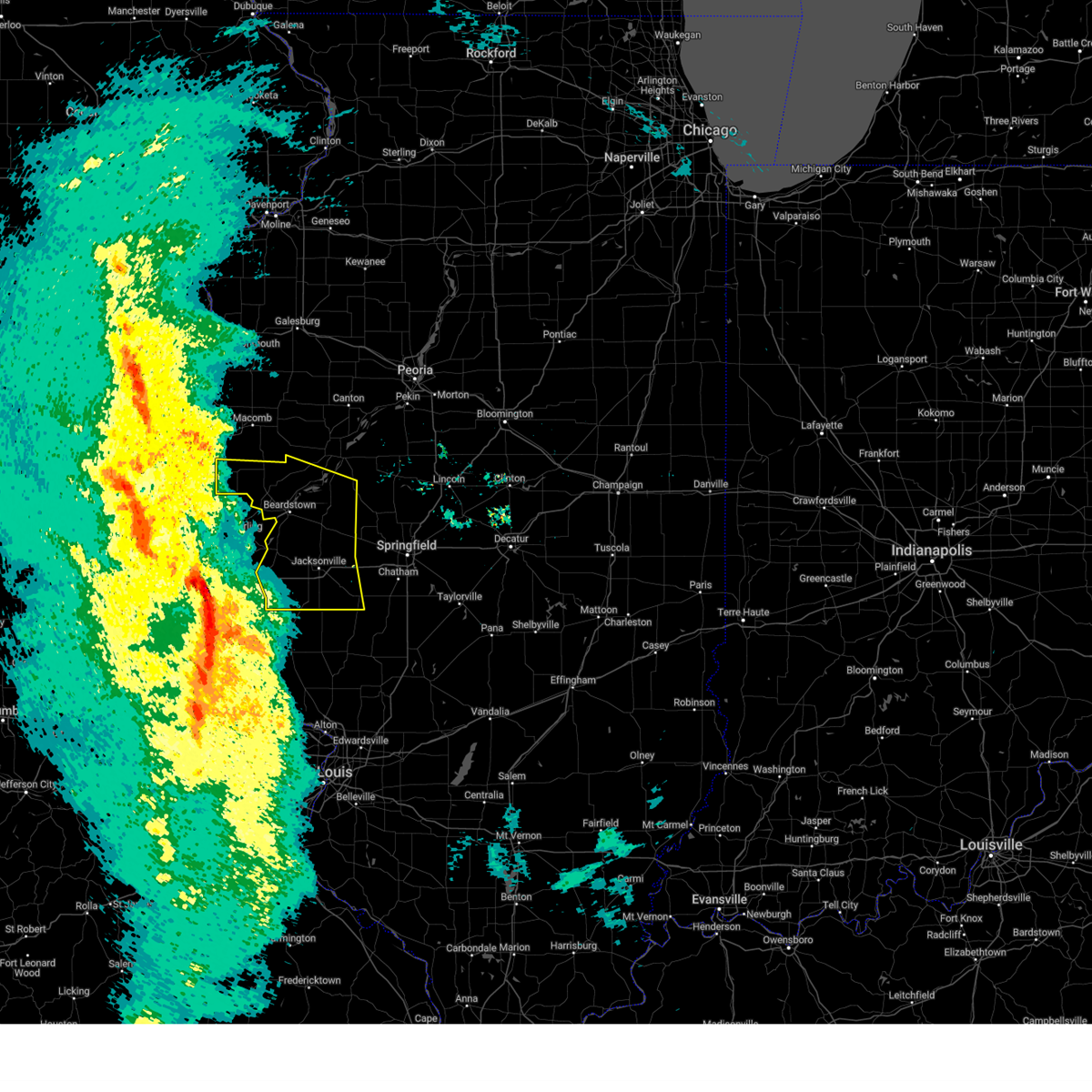
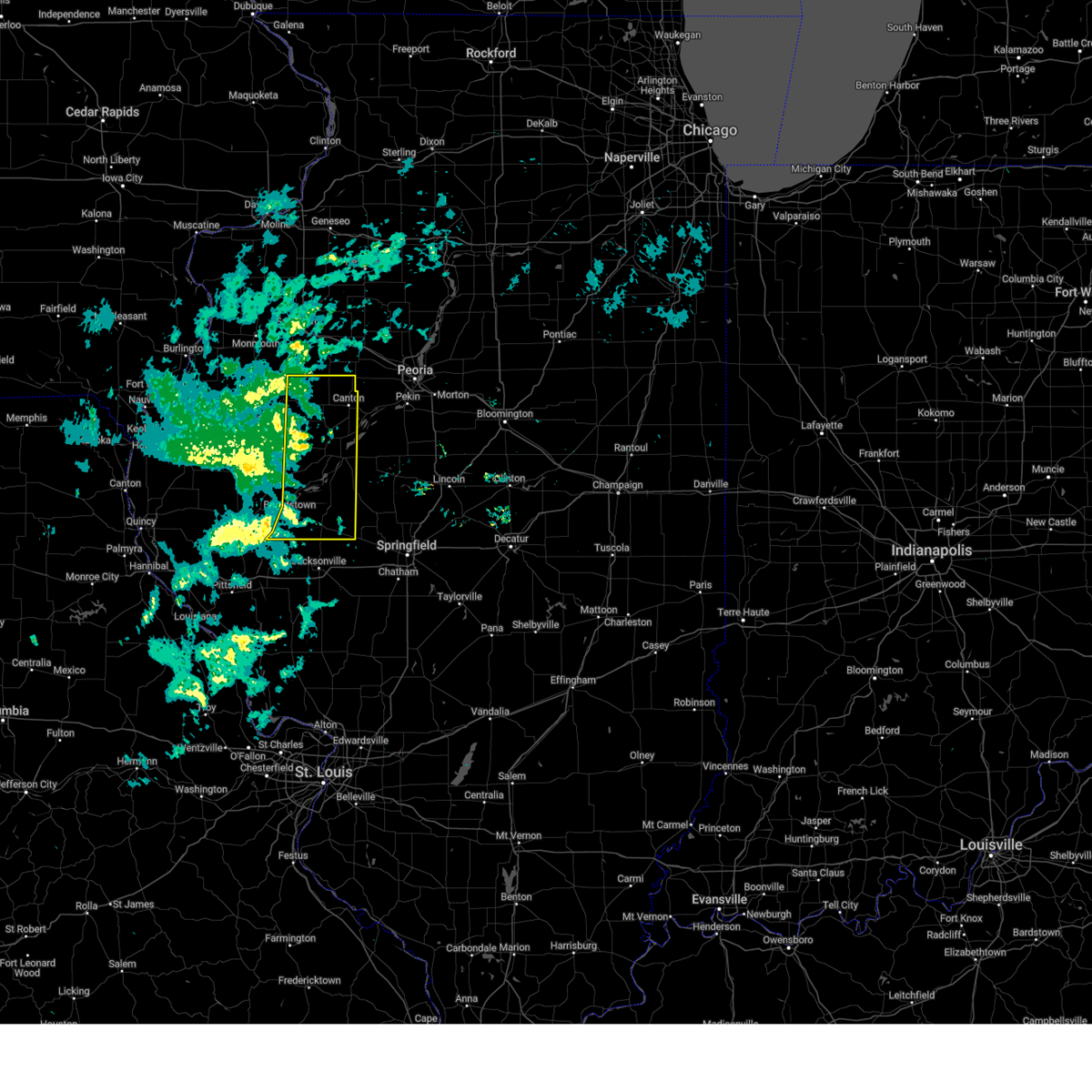
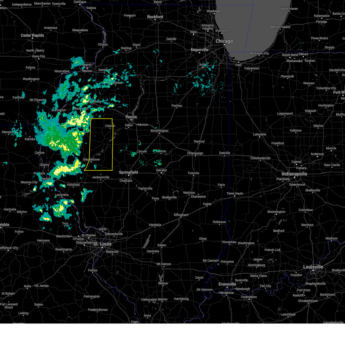
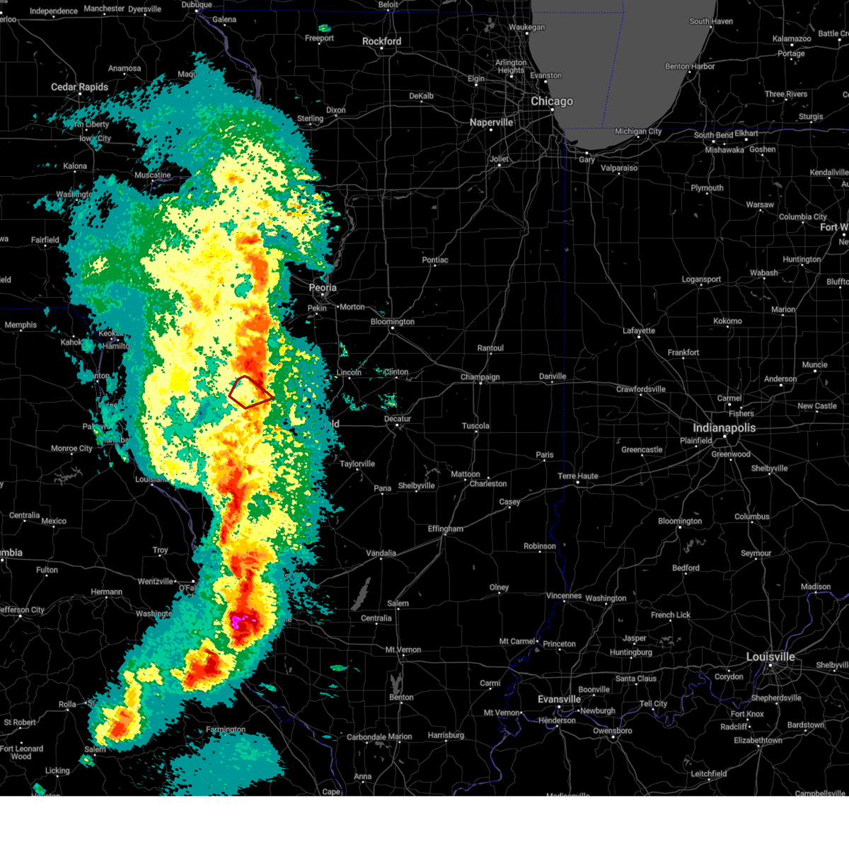
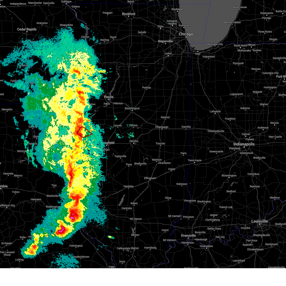
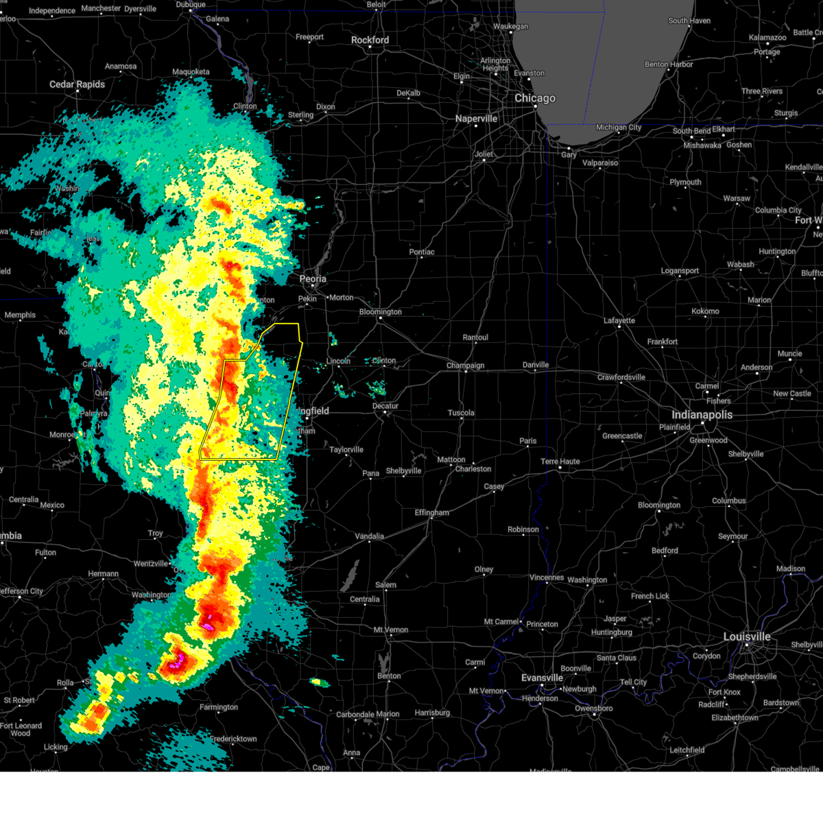
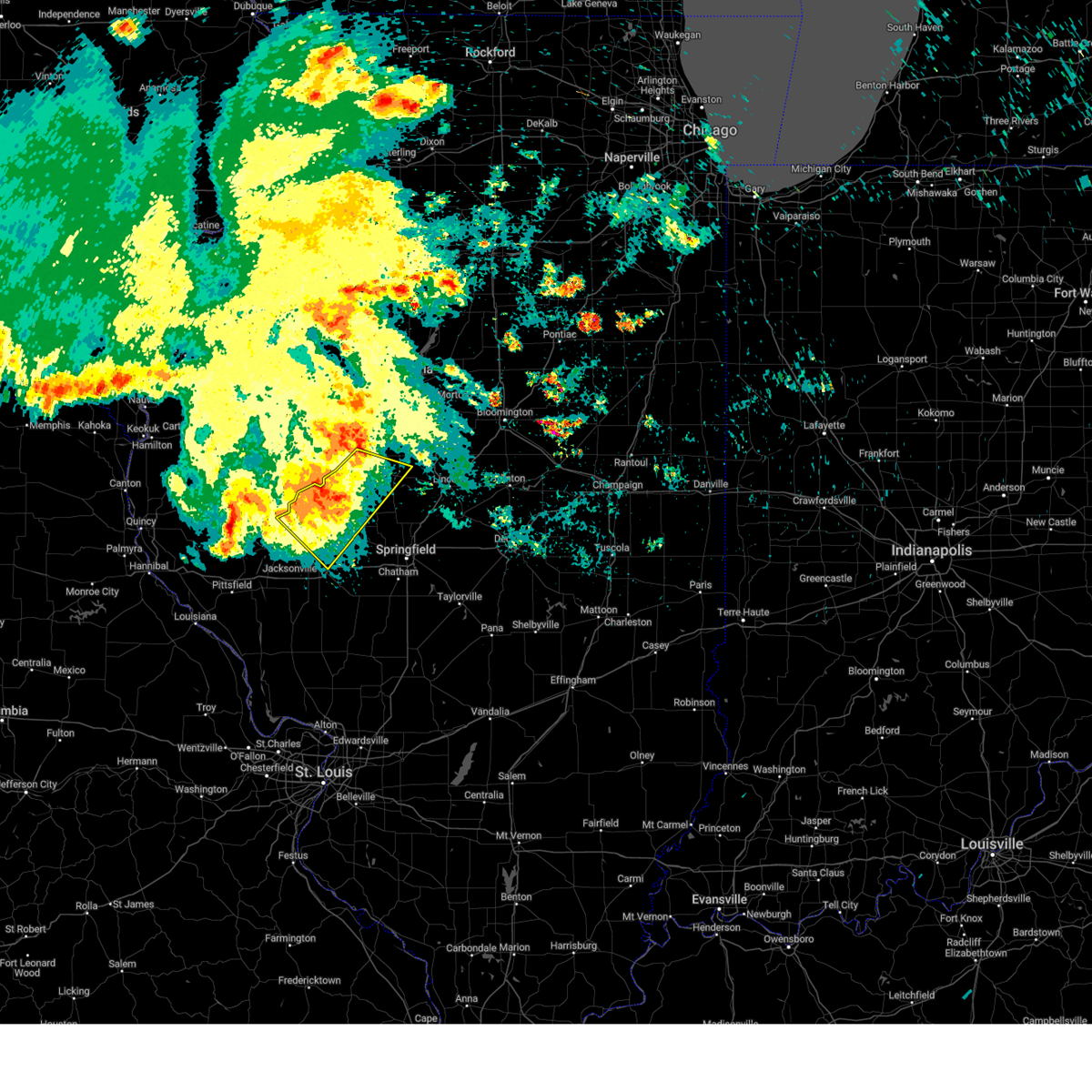
Hail Map for Virginia, IL
The Virginia, IL area has had 3 reports of on-the-ground hail by trained spotters, and has been under severe weather warnings 28 times during the past 12 months. Doppler radar has detected hail at or near Virginia, IL on 48 occasions, including 1 occasion during the past year.
| Name: | Virginia, IL |
| Where Located: | 60.6 miles SSW of Peoria, IL |
| Map: | Google Map for Virginia, IL |
| Population: | 1611 |
| Housing Units: | 752 |
| More Info: | Search Google for Virginia, IL |
0
The Top Recent Hail Date for Virginia, IL is Saturday, September 21, 2024 (45th out of 48)

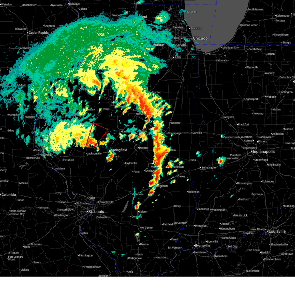
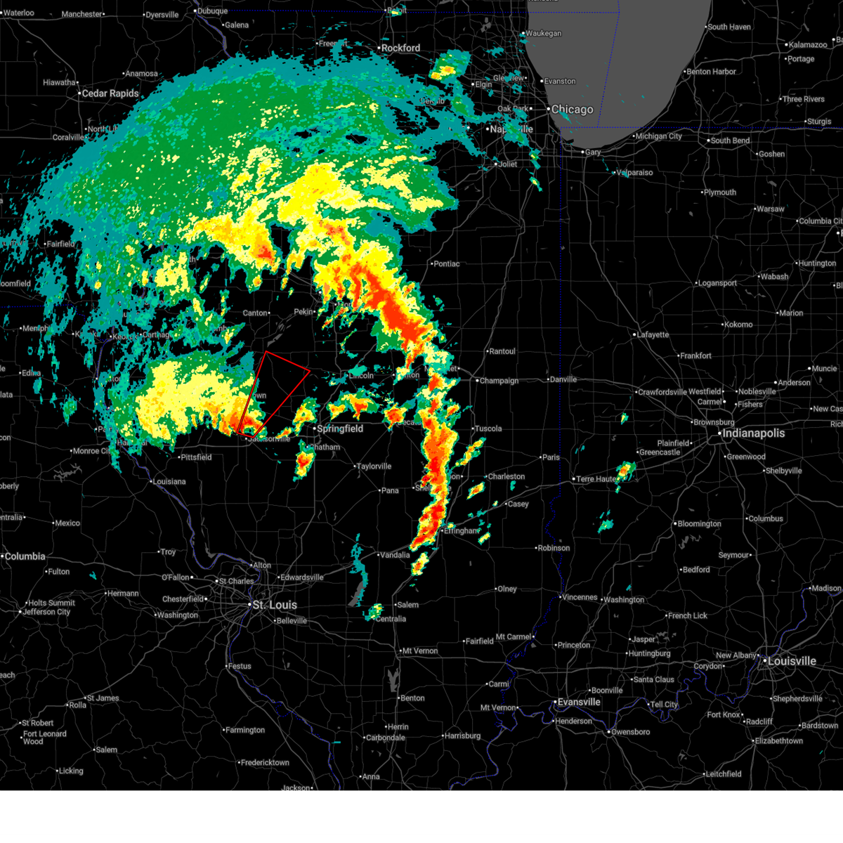
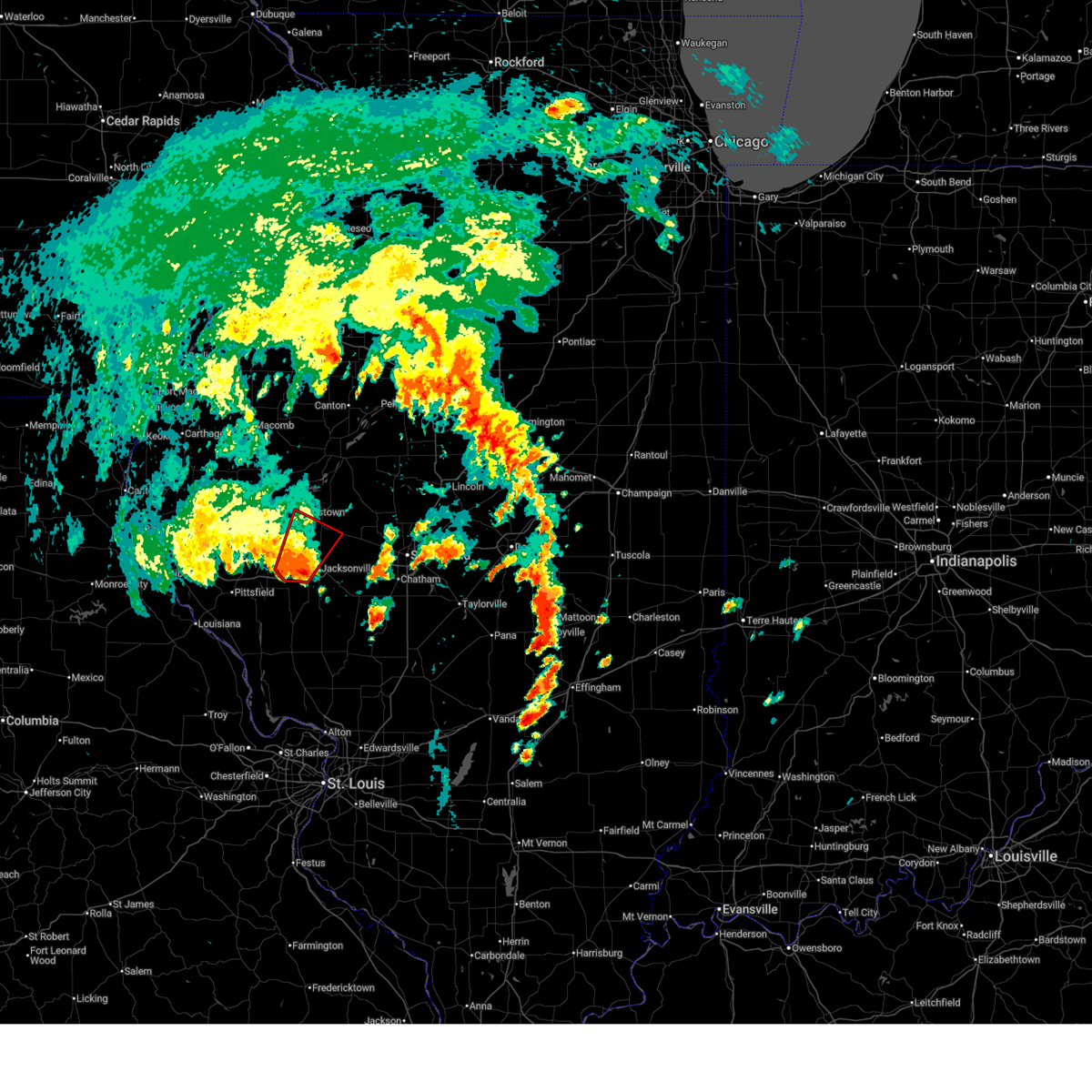
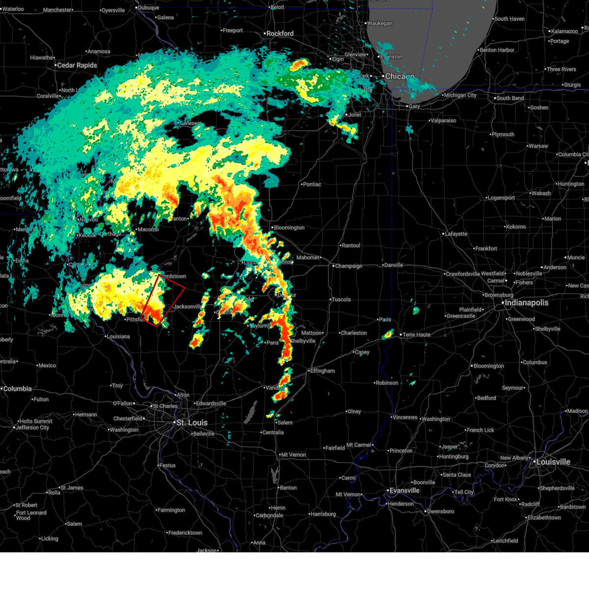
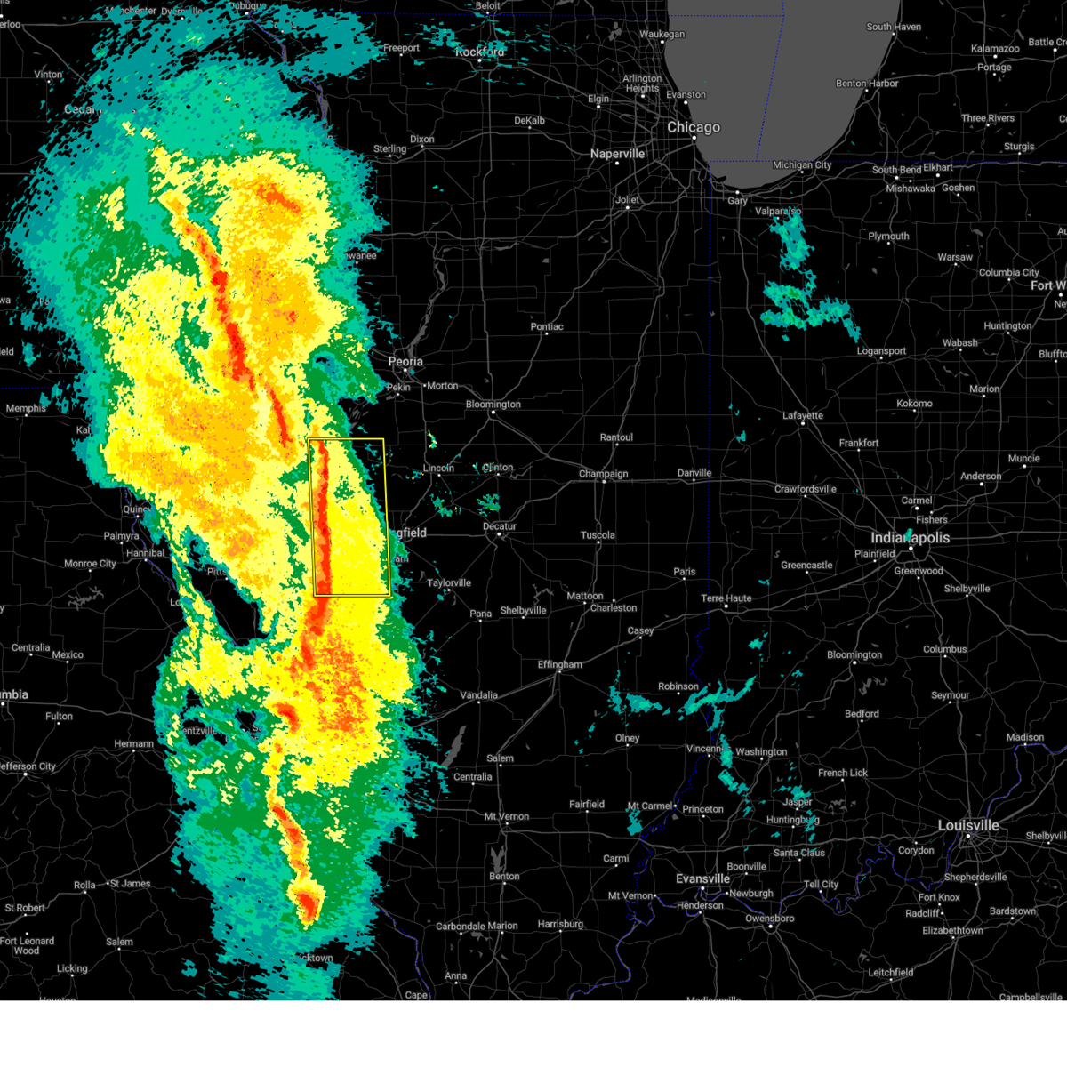
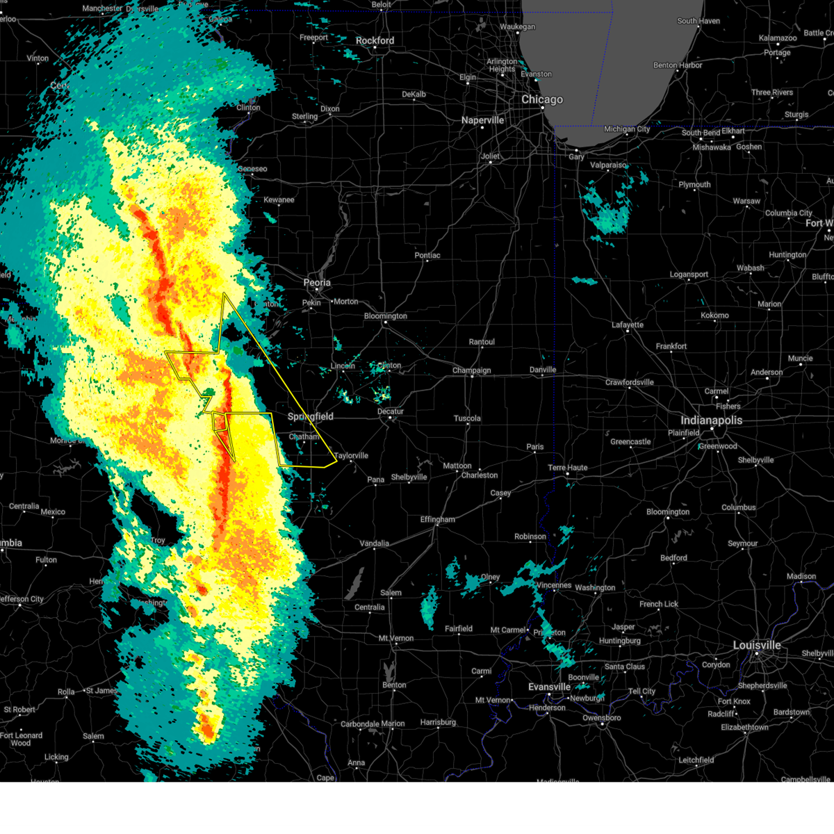
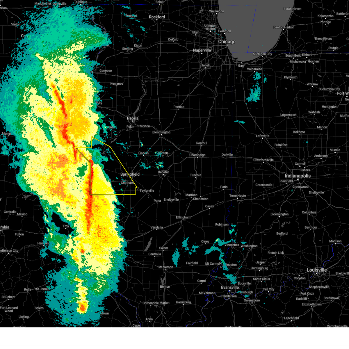
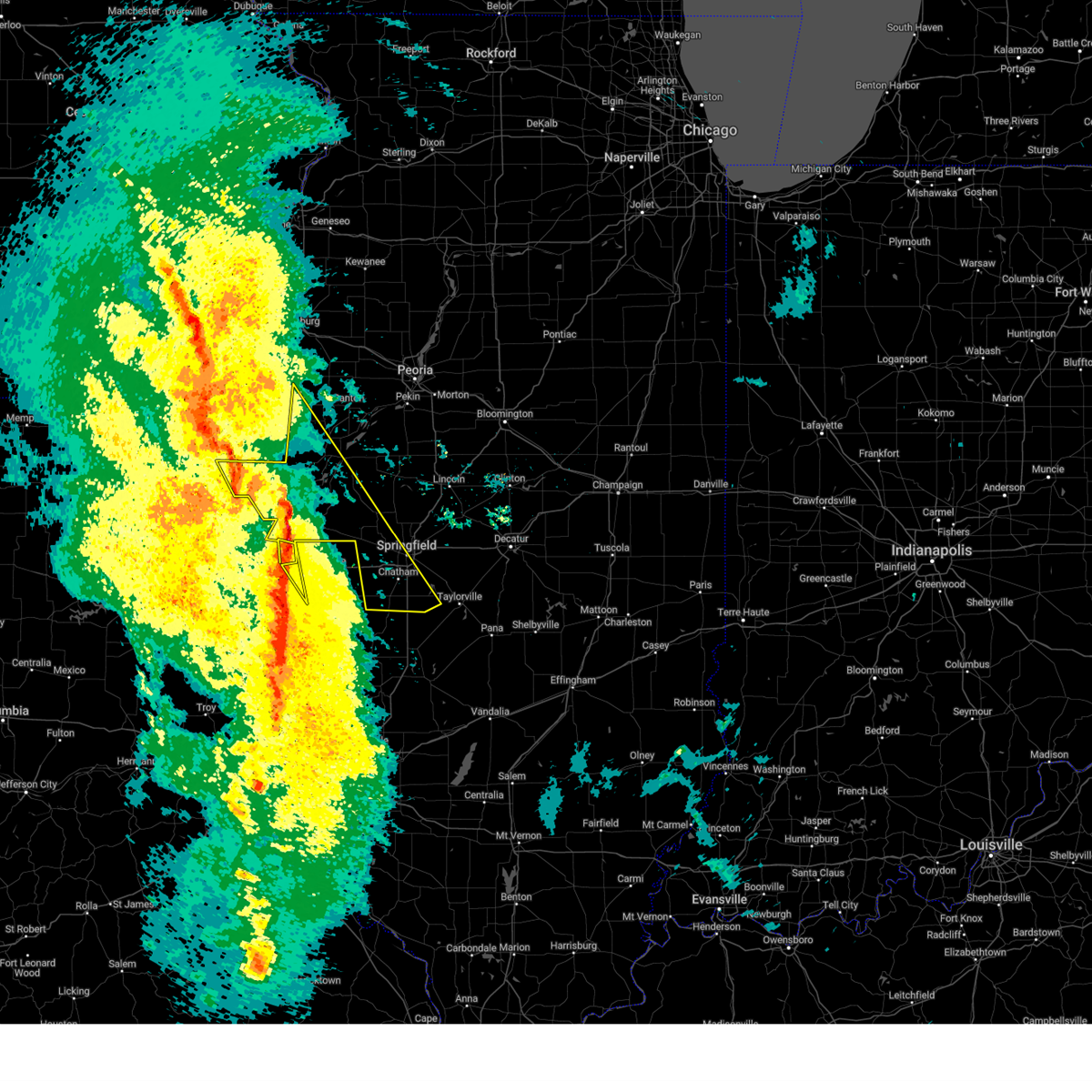
Hail and Wind Damage Spotted near Virginia, IL
| Date / Time | Report Details |
|---|---|
| 6/18/2025 12:22 PM CDT |
 At 1221 pm cdt, a confirmed tornado was located over literberry, or near virginia, moving northeast at 25 mph (emergency management confirmed tornado). Hazards include damaging tornado. Flying debris will be dangerous to those caught without shelter. mobile homes will be damaged or destroyed. damage to roofs, windows, and vehicles will occur. tree damage is likely. Locations impacted include, havana, petersburg, virginia, ashland, chandlerville, tallula, easton, kilbourne, literberry, oakford, philadelphia, prentice, and atterberry. At 1221 pm cdt, a confirmed tornado was located over literberry, or near virginia, moving northeast at 25 mph (emergency management confirmed tornado). Hazards include damaging tornado. Flying debris will be dangerous to those caught without shelter. mobile homes will be damaged or destroyed. damage to roofs, windows, and vehicles will occur. tree damage is likely. Locations impacted include, havana, petersburg, virginia, ashland, chandlerville, tallula, easton, kilbourne, literberry, oakford, philadelphia, prentice, and atterberry.
|
| 6/18/2025 12:13 PM CDT |
 Torilx the national weather service in lincoln has issued a * tornado warning for, western menard county in central illinois, northwestern sangamon county in central illinois, eastern cass county in west central illinois, southeastern mason county in central illinois, north central morgan county in west central illinois, * until 100 pm cdt. * at 1213 pm cdt, a confirmed tornado was located over literberry, or 7 miles northeast of jacksonville, moving northeast at 40 mph (spotter confirmed tornado). Hazards include damaging tornado. Flying debris will be dangerous to those caught without shelter. mobile homes will be damaged or destroyed. damage to roofs, windows, and vehicles will occur. Tree damage is likely. Torilx the national weather service in lincoln has issued a * tornado warning for, western menard county in central illinois, northwestern sangamon county in central illinois, eastern cass county in west central illinois, southeastern mason county in central illinois, north central morgan county in west central illinois, * until 100 pm cdt. * at 1213 pm cdt, a confirmed tornado was located over literberry, or 7 miles northeast of jacksonville, moving northeast at 40 mph (spotter confirmed tornado). Hazards include damaging tornado. Flying debris will be dangerous to those caught without shelter. mobile homes will be damaged or destroyed. damage to roofs, windows, and vehicles will occur. Tree damage is likely.
|
| 6/18/2025 12:00 PM CDT |
 At 1159 am cdt, a severe thunderstorm capable of producing a tornado was located over chapin, or 7 miles north of winchester, moving northeast at 30 mph (radar indicated rotation). Hazards include tornado. Flying debris will be dangerous to those caught without shelter. mobile homes will be damaged or destroyed. damage to roofs, windows, and vehicles will occur. tree damage is likely. this dangerous storm will be near, chapin around 1205 pm cdt. arenzville around 1215 pm cdt. other locations impacted by this tornadic thunderstorm include concord, merritt, lynnville, exeter, jacksonville municipal airport, and philadelphia. This includes interstate 72 between mile markers 52 and 61. At 1159 am cdt, a severe thunderstorm capable of producing a tornado was located over chapin, or 7 miles north of winchester, moving northeast at 30 mph (radar indicated rotation). Hazards include tornado. Flying debris will be dangerous to those caught without shelter. mobile homes will be damaged or destroyed. damage to roofs, windows, and vehicles will occur. tree damage is likely. this dangerous storm will be near, chapin around 1205 pm cdt. arenzville around 1215 pm cdt. other locations impacted by this tornadic thunderstorm include concord, merritt, lynnville, exeter, jacksonville municipal airport, and philadelphia. This includes interstate 72 between mile markers 52 and 61.
|
| 6/18/2025 11:47 AM CDT |
 Torilx the national weather service in lincoln has issued a * tornado warning for, scott county in west central illinois, southeastern cass county in west central illinois, northwestern morgan county in west central illinois, * until 1215 pm cdt. * at 1147 am cdt, a confirmed tornado was located over winchester, moving northeast at 40 mph (law enforcement confirmed tornado). Hazards include damaging tornado. Flying debris will be dangerous to those caught without shelter. mobile homes will be damaged or destroyed. damage to roofs, windows, and vehicles will occur. tree damage is likely. the tornado will be near, chapin around 1155 am cdt. arenzville around 1205 pm cdt. This includes interstate 72 between mile markers 46 and 61. Torilx the national weather service in lincoln has issued a * tornado warning for, scott county in west central illinois, southeastern cass county in west central illinois, northwestern morgan county in west central illinois, * until 1215 pm cdt. * at 1147 am cdt, a confirmed tornado was located over winchester, moving northeast at 40 mph (law enforcement confirmed tornado). Hazards include damaging tornado. Flying debris will be dangerous to those caught without shelter. mobile homes will be damaged or destroyed. damage to roofs, windows, and vehicles will occur. tree damage is likely. the tornado will be near, chapin around 1155 am cdt. arenzville around 1205 pm cdt. This includes interstate 72 between mile markers 46 and 61.
|
| 4/20/2025 7:56 PM CDT |
 Svrilx the national weather service in lincoln has issued a * severe thunderstorm warning for, menard county in central illinois, south central fulton county in west central illinois, western sangamon county in central illinois, eastern cass county in west central illinois, eastern schuyler county in west central illinois, mason county in central illinois, eastern morgan county in west central illinois, * until 830 pm cdt. * at 755 pm cdt, severe thunderstorms were located along a line extending from 6 miles west of havana to near athensville, moving northeast at 50 mph (radar indicated). Hazards include 70 mph wind gusts. Expect considerable tree damage. damage is likely to mobile homes, roofs, and outbuildings. severe thunderstorms will be near, ashland, bath, havana, chandlerville, franklin, alexander, and kilbourne around 800 pm cdt. waverly around 805 pm cdt. new berlin, pleasant plains, and tallula around 810 pm cdt. petersburg, easton, and loami around 815 pm cdt. other locations in the path of these severe thunderstorms include springfield, auburn, greenview and athens. This includes interstate 72 between mile markers 66 and 94. Svrilx the national weather service in lincoln has issued a * severe thunderstorm warning for, menard county in central illinois, south central fulton county in west central illinois, western sangamon county in central illinois, eastern cass county in west central illinois, eastern schuyler county in west central illinois, mason county in central illinois, eastern morgan county in west central illinois, * until 830 pm cdt. * at 755 pm cdt, severe thunderstorms were located along a line extending from 6 miles west of havana to near athensville, moving northeast at 50 mph (radar indicated). Hazards include 70 mph wind gusts. Expect considerable tree damage. damage is likely to mobile homes, roofs, and outbuildings. severe thunderstorms will be near, ashland, bath, havana, chandlerville, franklin, alexander, and kilbourne around 800 pm cdt. waverly around 805 pm cdt. new berlin, pleasant plains, and tallula around 810 pm cdt. petersburg, easton, and loami around 815 pm cdt. other locations in the path of these severe thunderstorms include springfield, auburn, greenview and athens. This includes interstate 72 between mile markers 66 and 94.
|
| 4/20/2025 7:36 PM CDT |
 the severe thunderstorm warning has been cancelled and is no longer in effect the severe thunderstorm warning has been cancelled and is no longer in effect
|
| 4/20/2025 7:33 PM CDT |
 Svrilx the national weather service in lincoln has issued a * severe thunderstorm warning for, western menard county in central illinois, eastern scott county in west central illinois, southwestern fulton county in west central illinois, western sangamon county in central illinois, cass county in west central illinois, central schuyler county in west central illinois, southwestern mason county in central illinois, morgan county in west central illinois, * until 800 pm cdt. * at 732 pm cdt, severe thunderstorms were located along a line extending from fandon to near browning to alsey, moving northeast at 50 mph (radar indicated). Hazards include 70 mph wind gusts. Expect considerable tree damage. damage is likely to mobile homes, roofs, and outbuildings. severe thunderstorms will be near, virginia, astoria, woodson, vermont, bluff springs, south jacksonville, and jacksonville around 740 pm cdt. bath, chandlerville, ipava, and literberry around 745 pm cdt. this includes the following highways, interstate 55 between mile markers 78 and 94. Interstate 72 between mile markers 51 and 100. Svrilx the national weather service in lincoln has issued a * severe thunderstorm warning for, western menard county in central illinois, eastern scott county in west central illinois, southwestern fulton county in west central illinois, western sangamon county in central illinois, cass county in west central illinois, central schuyler county in west central illinois, southwestern mason county in central illinois, morgan county in west central illinois, * until 800 pm cdt. * at 732 pm cdt, severe thunderstorms were located along a line extending from fandon to near browning to alsey, moving northeast at 50 mph (radar indicated). Hazards include 70 mph wind gusts. Expect considerable tree damage. damage is likely to mobile homes, roofs, and outbuildings. severe thunderstorms will be near, virginia, astoria, woodson, vermont, bluff springs, south jacksonville, and jacksonville around 740 pm cdt. bath, chandlerville, ipava, and literberry around 745 pm cdt. this includes the following highways, interstate 55 between mile markers 78 and 94. Interstate 72 between mile markers 51 and 100.
|
| 4/20/2025 7:29 PM CDT |
 Svrilx the national weather service in lincoln has issued a * severe thunderstorm warning for, western menard county in central illinois, northeastern scott county in west central illinois, west central christian county in central illinois, western fulton county in west central illinois, western sangamon county in central illinois, cass county in west central illinois, schuyler county in west central illinois, southwestern mason county in central illinois, * until 800 pm cdt. * at 728 pm cdt, severe thunderstorms were located along a line extending from 7 miles east of augusta to near beardstown to near carrollton, moving northeast at 65 mph (radar indicated). Hazards include 70 mph wind gusts. Expect considerable tree damage. damage is likely to mobile homes, roofs, and outbuildings. severe thunderstorms will be near, astoria, littleton, arenzville, browning, and bluff springs around 735 pm cdt. virginia and vermont around 740 pm cdt. bath, chandlerville, and ipava around 745 pm cdt. other locations in the path of these severe thunderstorms include havana and lewistown. this includes the following highways, interstate 55 between mile markers 77 and 94. Interstate 72 between mile markers 55 and 58, and between mile markers 81 and 100. Svrilx the national weather service in lincoln has issued a * severe thunderstorm warning for, western menard county in central illinois, northeastern scott county in west central illinois, west central christian county in central illinois, western fulton county in west central illinois, western sangamon county in central illinois, cass county in west central illinois, schuyler county in west central illinois, southwestern mason county in central illinois, * until 800 pm cdt. * at 728 pm cdt, severe thunderstorms were located along a line extending from 7 miles east of augusta to near beardstown to near carrollton, moving northeast at 65 mph (radar indicated). Hazards include 70 mph wind gusts. Expect considerable tree damage. damage is likely to mobile homes, roofs, and outbuildings. severe thunderstorms will be near, astoria, littleton, arenzville, browning, and bluff springs around 735 pm cdt. virginia and vermont around 740 pm cdt. bath, chandlerville, and ipava around 745 pm cdt. other locations in the path of these severe thunderstorms include havana and lewistown. this includes the following highways, interstate 55 between mile markers 77 and 94. Interstate 72 between mile markers 55 and 58, and between mile markers 81 and 100.
|
| 4/20/2025 7:14 PM CDT | At 713 pm cdt, severe thunderstorms were located along a line extending from carthage to 6 miles west of meredosia to near hardin, moving northeast at 55 mph (broadcast media. broadcast media reported extensive tree damage across southern adams county around 6:55 pm). Hazards include 70 mph wind gusts and penny size hail. Expect considerable tree damage. damage is likely to mobile homes, roofs, and outbuildings. locations impacted include, franklin, bluffs, vermont, huntsville, alexander, beardstown, glasgow, ray, snicarte, bath, arenzville, nortonville, murrayville, astoria, lynnville, meredosia, jacksonville municipal airport, woodson, naples, and kilbourne. This includes interstate 72 between mile markers 43 and 79. |
| 4/20/2025 6:45 PM CDT |
 Svrilx the national weather service in lincoln has issued a * severe thunderstorm warning for, scott county in west central illinois, southwestern fulton county in west central illinois, cass county in west central illinois, schuyler county in west central illinois, southwestern mason county in central illinois, morgan county in west central illinois, * until 730 pm cdt. * at 644 pm cdt, severe thunderstorms were located along a line extending from near canton to near atlas to moscow mills, moving northeast at 55 mph (radar indicated). Hazards include 70 mph wind gusts and penny size hail. Expect considerable tree damage. Damage is likely to mobile homes, roofs, and outbuildings. Svrilx the national weather service in lincoln has issued a * severe thunderstorm warning for, scott county in west central illinois, southwestern fulton county in west central illinois, cass county in west central illinois, schuyler county in west central illinois, southwestern mason county in central illinois, morgan county in west central illinois, * until 730 pm cdt. * at 644 pm cdt, severe thunderstorms were located along a line extending from near canton to near atlas to moscow mills, moving northeast at 55 mph (radar indicated). Hazards include 70 mph wind gusts and penny size hail. Expect considerable tree damage. Damage is likely to mobile homes, roofs, and outbuildings.
|
| 4/2/2025 9:58 AM CDT |
 The storms still within this warning which prompted it have weakened below severe limits, and the rest have both weakened and exited the warned area. therefore, the warning will be allowed to expire. however, gusty winds are still possible with these thunderstorms. The storms still within this warning which prompted it have weakened below severe limits, and the rest have both weakened and exited the warned area. therefore, the warning will be allowed to expire. however, gusty winds are still possible with these thunderstorms.
|
| 4/2/2025 9:45 AM CDT |
 At 945 am cdt, severe thunderstorms were located along a line extending from st. david to chandlerville to near glasgow, moving northeast at 65 mph (radar indicated). Hazards include 60 mph wind gusts and penny size hail. Expect damage to roofs, siding, and trees. locations impacted include, bluffs, beardstown, glasgow, dunfermline, snicarte, bath, arenzville, murrayville, astoria, lynnville, meredosia, jacksonville municipal airport, woodson, naples, ipava, havana, jacksonville, lewistown, bryant, and frederick. This includes interstate 72 between mile markers 43 and 72. At 945 am cdt, severe thunderstorms were located along a line extending from st. david to chandlerville to near glasgow, moving northeast at 65 mph (radar indicated). Hazards include 60 mph wind gusts and penny size hail. Expect damage to roofs, siding, and trees. locations impacted include, bluffs, beardstown, glasgow, dunfermline, snicarte, bath, arenzville, murrayville, astoria, lynnville, meredosia, jacksonville municipal airport, woodson, naples, ipava, havana, jacksonville, lewistown, bryant, and frederick. This includes interstate 72 between mile markers 43 and 72.
|
| 4/2/2025 9:33 AM CDT | Svrilx the national weather service in lincoln has issued a * severe thunderstorm warning for, scott county in west central illinois, southern fulton county in west central illinois, cass county in west central illinois, central schuyler county in west central illinois, western mason county in central illinois, morgan county in west central illinois, * until 1000 am cdt. * at 932 am cdt, severe thunderstorms were located along a line extending from 8 miles southeast of buckhorn to near pittsfield, moving northeast at 65 mph (radar indicated). Hazards include 60 mph wind gusts and penny size hail. expect damage to roofs, siding, and trees |
| 3/21/2025 9:23 PM CDT |
 The storm which prompted the warning has moved out of the area. therefore, the warning will be allowed to expire. however, gusty winds are still possible with showers moving across the area. The storm which prompted the warning has moved out of the area. therefore, the warning will be allowed to expire. however, gusty winds are still possible with showers moving across the area.
|
| 3/21/2025 9:02 PM CDT |
 At 902 pm cdt, a severe thunderstorm was located over lewistown, moving east at 45 mph (radar indicated). Hazards include 60 mph wind gusts. Expect damage to roofs, siding, and trees. this severe storm will be near, lewistown around 905 pm cdt. Other locations impacted by this severe thunderstorm include bryant, norris, frederick, liverpool, bluff city, bernadotte, ellisville, chatauqua park, dunfermline, and snicarte. At 902 pm cdt, a severe thunderstorm was located over lewistown, moving east at 45 mph (radar indicated). Hazards include 60 mph wind gusts. Expect damage to roofs, siding, and trees. this severe storm will be near, lewistown around 905 pm cdt. Other locations impacted by this severe thunderstorm include bryant, norris, frederick, liverpool, bluff city, bernadotte, ellisville, chatauqua park, dunfermline, and snicarte.
|
| 3/21/2025 8:40 PM CDT |
 Svrilx the national weather service in lincoln has issued a * severe thunderstorm warning for, fulton county in west central illinois, cass county in west central illinois, eastern schuyler county in west central illinois, western mason county in central illinois, * until 930 pm cdt. * at 839 pm cdt, a severe thunderstorm was located over adair, or 9 miles southeast of macomb, moving east at 50 mph (trained weather spotters). Hazards include 60 mph wind gusts. Expect damage to roofs, siding, and trees. this severe thunderstorm will be near, ipava around 850 pm cdt. Other locations in the path of this severe thunderstorm include lewistown. Svrilx the national weather service in lincoln has issued a * severe thunderstorm warning for, fulton county in west central illinois, cass county in west central illinois, eastern schuyler county in west central illinois, western mason county in central illinois, * until 930 pm cdt. * at 839 pm cdt, a severe thunderstorm was located over adair, or 9 miles southeast of macomb, moving east at 50 mph (trained weather spotters). Hazards include 60 mph wind gusts. Expect damage to roofs, siding, and trees. this severe thunderstorm will be near, ipava around 850 pm cdt. Other locations in the path of this severe thunderstorm include lewistown.
|
| 3/14/2025 9:41 PM CDT |
 The storm which prompted the warning has moved out of the area. therefore, the warning will be allowed to expire. however, gusty winds are still possible with this thunderstorm. a tornado watch remains in effect until 300 am cdt for central and west central illinois. remember, a severe thunderstorm warning still remains in effect for portions of cass and mason counties until 1030 pm cdt. The storm which prompted the warning has moved out of the area. therefore, the warning will be allowed to expire. however, gusty winds are still possible with this thunderstorm. a tornado watch remains in effect until 300 am cdt for central and west central illinois. remember, a severe thunderstorm warning still remains in effect for portions of cass and mason counties until 1030 pm cdt.
|
| 3/14/2025 9:28 PM CDT |
 At 928 pm cdt, a severe squall line capable of producing both tornadoes and extensive straight line wind damage was located near chandlerville, or near virginia, moving northeast at 60 mph (radar indicated rotation). Hazards include tornado and quarter size hail. Flying debris will be dangerous to those caught without shelter. mobile homes will be damaged or destroyed. damage to roofs, windows, and vehicles will occur. tree damage is likely. these dangerous storms will be near, chandlerville around 935 pm cdt. Other locations impacted by this tornadic thunderstorm include snicarte. At 928 pm cdt, a severe squall line capable of producing both tornadoes and extensive straight line wind damage was located near chandlerville, or near virginia, moving northeast at 60 mph (radar indicated rotation). Hazards include tornado and quarter size hail. Flying debris will be dangerous to those caught without shelter. mobile homes will be damaged or destroyed. damage to roofs, windows, and vehicles will occur. tree damage is likely. these dangerous storms will be near, chandlerville around 935 pm cdt. Other locations impacted by this tornadic thunderstorm include snicarte.
|
| 3/14/2025 9:27 PM CDT |
 Svrilx the national weather service in lincoln has issued a * severe thunderstorm warning for, menard county in central illinois, scott county in west central illinois, western sangamon county in central illinois, cass county in west central illinois, east central schuyler county in west central illinois, mason county in central illinois, morgan county in west central illinois, * until 1030 pm cdt. * at 927 pm cdt, severe thunderstorms were located along a line extending from near ipava to near chandlerville to near winchester, moving northeast at 65 mph (radar indicated). Hazards include 70 mph wind gusts and quarter size hail. Hail damage to vehicles is expected. expect considerable tree damage. wind damage is also likely to mobile homes, roofs, and outbuildings. severe thunderstorms will be near, bath, chandlerville, virginia, literberry, south jacksonville, and jacksonville around 930 pm cdt. havana around 935 pm cdt. kilbourne around 940 pm cdt. other locations in the path of these severe thunderstorms include ashland, easton, tallula, petersburg, manito and greenview. This includes interstate 72 between mile markers 48 and 86. Svrilx the national weather service in lincoln has issued a * severe thunderstorm warning for, menard county in central illinois, scott county in west central illinois, western sangamon county in central illinois, cass county in west central illinois, east central schuyler county in west central illinois, mason county in central illinois, morgan county in west central illinois, * until 1030 pm cdt. * at 927 pm cdt, severe thunderstorms were located along a line extending from near ipava to near chandlerville to near winchester, moving northeast at 65 mph (radar indicated). Hazards include 70 mph wind gusts and quarter size hail. Hail damage to vehicles is expected. expect considerable tree damage. wind damage is also likely to mobile homes, roofs, and outbuildings. severe thunderstorms will be near, bath, chandlerville, virginia, literberry, south jacksonville, and jacksonville around 930 pm cdt. havana around 935 pm cdt. kilbourne around 940 pm cdt. other locations in the path of these severe thunderstorms include ashland, easton, tallula, petersburg, manito and greenview. This includes interstate 72 between mile markers 48 and 86.
|
| 3/14/2025 9:14 PM CDT | Torilx the national weather service in lincoln has issued a * tornado warning for, central cass county in west central illinois, southwestern mason county in central illinois, * until 945 pm cdt. * at 914 pm cdt, severe thunderstorms capable of producing both tornadoes and extensive straight line wind damage were located near arenzville, or near beardstown, moving northeast at 60 mph (radar indicated rotation). Hazards include tornado and quarter size hail. Flying debris will be dangerous to those caught without shelter. mobile homes will be damaged or destroyed. damage to roofs, windows, and vehicles will occur. tree damage is likely. these dangerous storms will be near, bluff springs around 920 pm cdt. Chandlerville around 930 pm cdt. |
| 3/14/2025 8:51 PM CDT |
 Svrilx the national weather service in lincoln has issued a * severe thunderstorm warning for, scott county in west central illinois, cass county in west central illinois, southeastern schuyler county in west central illinois, southwestern mason county in central illinois, northern morgan county in west central illinois, * until 930 pm cdt. * at 851 pm cdt, a severe thunderstorm was located over griggsville, or near pittsfield, moving northeast at 65 mph (radar indicated). Hazards include 70 mph wind gusts and half dollar size hail. Hail damage to vehicles is expected. expect considerable tree damage. wind damage is also likely to mobile homes, roofs, and outbuildings. this severe thunderstorm will be near, naples around 855 pm cdt. meredosia around 900 pm cdt. arenzville around 910 pm cdt. other locations in the path of this severe thunderstorm include beardstown, bluff springs and chandlerville. This includes interstate 72 between mile markers 43 and 75. Svrilx the national weather service in lincoln has issued a * severe thunderstorm warning for, scott county in west central illinois, cass county in west central illinois, southeastern schuyler county in west central illinois, southwestern mason county in central illinois, northern morgan county in west central illinois, * until 930 pm cdt. * at 851 pm cdt, a severe thunderstorm was located over griggsville, or near pittsfield, moving northeast at 65 mph (radar indicated). Hazards include 70 mph wind gusts and half dollar size hail. Hail damage to vehicles is expected. expect considerable tree damage. wind damage is also likely to mobile homes, roofs, and outbuildings. this severe thunderstorm will be near, naples around 855 pm cdt. meredosia around 900 pm cdt. arenzville around 910 pm cdt. other locations in the path of this severe thunderstorm include beardstown, bluff springs and chandlerville. This includes interstate 72 between mile markers 43 and 75.
|
| 8/1/2024 2:45 AM CDT |
 Svrilx the national weather service in lincoln has issued a * severe thunderstorm warning for, western menard county in central illinois, northwestern sangamon county in central illinois, eastern cass county in west central illinois, mason county in central illinois, northeastern morgan county in west central illinois, * until 330 am cdt. * at 244 am cdt, severe thunderstorms were located along a line extending from 6 miles east of havana to near jacksonville, moving east at 40 mph (radar indicated). Hazards include 60 mph wind gusts and quarter size hail. Hail damage to vehicles is expected. expect wind damage to roofs, siding, and trees. severe thunderstorms will be near, ashland, easton, and kilbourne around 250 am cdt. tallula around 255 am cdt. petersburg and pleasant plains around 300 am cdt. Other locations in the path of these severe thunderstorms include mason city and greenview. Svrilx the national weather service in lincoln has issued a * severe thunderstorm warning for, western menard county in central illinois, northwestern sangamon county in central illinois, eastern cass county in west central illinois, mason county in central illinois, northeastern morgan county in west central illinois, * until 330 am cdt. * at 244 am cdt, severe thunderstorms were located along a line extending from 6 miles east of havana to near jacksonville, moving east at 40 mph (radar indicated). Hazards include 60 mph wind gusts and quarter size hail. Hail damage to vehicles is expected. expect wind damage to roofs, siding, and trees. severe thunderstorms will be near, ashland, easton, and kilbourne around 250 am cdt. tallula around 255 am cdt. petersburg and pleasant plains around 300 am cdt. Other locations in the path of these severe thunderstorms include mason city and greenview.
|
| 7/31/2024 7:31 AM CDT |
 The storms which prompted the warning have moved out of the area. therefore, the warning has been allowed to expire. a severe thunderstorm watch remains in effect until noon cdt for central and west central illinois. a severe thunderstorm warning is in effect for eastern mason and eastern menard counties until 815 am. The storms which prompted the warning have moved out of the area. therefore, the warning has been allowed to expire. a severe thunderstorm watch remains in effect until noon cdt for central and west central illinois. a severe thunderstorm warning is in effect for eastern mason and eastern menard counties until 815 am.
|
| 7/31/2024 7:06 AM CDT |
 At 706 am cdt, severe thunderstorms were located along a line extending from 6 miles east of havana to near chandlerville to near literberry, moving east at 55 mph (radar indicated). Hazards include 60 mph wind gusts. Expect damage to roofs, siding, and trees. these severe storms will be near, ashland, tallula, easton, and literberry around 710 am cdt. mason city and petersburg around 715 am cdt. Other locations impacted by these severe thunderstorms include prentice, oakford, atterberry, snicarte, philadelphia, topeka, and jacksonville municipal airport. At 706 am cdt, severe thunderstorms were located along a line extending from 6 miles east of havana to near chandlerville to near literberry, moving east at 55 mph (radar indicated). Hazards include 60 mph wind gusts. Expect damage to roofs, siding, and trees. these severe storms will be near, ashland, tallula, easton, and literberry around 710 am cdt. mason city and petersburg around 715 am cdt. Other locations impacted by these severe thunderstorms include prentice, oakford, atterberry, snicarte, philadelphia, topeka, and jacksonville municipal airport.
|
| 7/31/2024 6:45 AM CDT |
 Svrilx the national weather service in lincoln has issued a * severe thunderstorm warning for, western menard county in central illinois, cass county in west central illinois, mason county in central illinois, northwestern morgan county in west central illinois, * until 730 am cdt. * at 645 am cdt, severe thunderstorms were located along a line extending from near havana to 6 miles northwest of meredosia, moving east at 55 mph (radar indicated). Hazards include 60 mph wind gusts and penny size hail. Expect damage to roofs, siding, and trees. severe thunderstorms will be near, beardstown, havana, meredosia, bluff springs, and bath around 650 am cdt. virginia, chandlerville, arenzville, easton, and kilbourne around 655 am cdt. mason city and literberry around 705 am cdt. Other locations in the path of these severe thunderstorms include petersburg, ashland and tallula. Svrilx the national weather service in lincoln has issued a * severe thunderstorm warning for, western menard county in central illinois, cass county in west central illinois, mason county in central illinois, northwestern morgan county in west central illinois, * until 730 am cdt. * at 645 am cdt, severe thunderstorms were located along a line extending from near havana to 6 miles northwest of meredosia, moving east at 55 mph (radar indicated). Hazards include 60 mph wind gusts and penny size hail. Expect damage to roofs, siding, and trees. severe thunderstorms will be near, beardstown, havana, meredosia, bluff springs, and bath around 650 am cdt. virginia, chandlerville, arenzville, easton, and kilbourne around 655 am cdt. mason city and literberry around 705 am cdt. Other locations in the path of these severe thunderstorms include petersburg, ashland and tallula.
|
| 7/30/2024 7:14 AM CDT |
 At 713 am cdt, severe thunderstorms were located along a line extending from 6 miles northeast of havana to 7 miles south of kilbourne to near literberry, moving southeast at 45 mph (radar indicated). Hazards include 60 mph wind gusts and penny size hail. Expect damage to roofs, siding, and trees. these severe storms will be near, petersburg, ashland, pleasant plains, tallula, and easton around 720 am cdt. greenview around 725 am cdt. mason city around 730 am cdt. other locations impacted by these severe thunderstorms include prentice, topeka, oakford, chatauqua park, lincolns new salem, atterberry, philadelphia, and liverpool. This includes interstate 72 between mile markers 79 and 82. At 713 am cdt, severe thunderstorms were located along a line extending from 6 miles northeast of havana to 7 miles south of kilbourne to near literberry, moving southeast at 45 mph (radar indicated). Hazards include 60 mph wind gusts and penny size hail. Expect damage to roofs, siding, and trees. these severe storms will be near, petersburg, ashland, pleasant plains, tallula, and easton around 720 am cdt. greenview around 725 am cdt. mason city around 730 am cdt. other locations impacted by these severe thunderstorms include prentice, topeka, oakford, chatauqua park, lincolns new salem, atterberry, philadelphia, and liverpool. This includes interstate 72 between mile markers 79 and 82.
|
| 7/30/2024 7:02 AM CDT |
 Svrilx the national weather service in lincoln has issued a * severe thunderstorm warning for, menard county in central illinois, northwestern sangamon county in central illinois, cass county in west central illinois, mason county in central illinois, northeastern morgan county in west central illinois, * until 745 am cdt. * at 701 am cdt, severe thunderstorms were located along a line extending from near lewistown to near virginia, moving southeast at 40 mph (radar indicated). Hazards include 60 mph wind gusts. Expect damage to roofs, siding, and trees. severe thunderstorms will be near, havana, virginia, chandlerville, bath, kilbourne, and literberry around 705 am cdt. ashland and easton around 715 am cdt. tallula around 720 am cdt. other locations in the path of these severe thunderstorms include petersburg, pleasant plains, mason city and greenview. This includes interstate 72 between mile markers 79 and 82. Svrilx the national weather service in lincoln has issued a * severe thunderstorm warning for, menard county in central illinois, northwestern sangamon county in central illinois, cass county in west central illinois, mason county in central illinois, northeastern morgan county in west central illinois, * until 745 am cdt. * at 701 am cdt, severe thunderstorms were located along a line extending from near lewistown to near virginia, moving southeast at 40 mph (radar indicated). Hazards include 60 mph wind gusts. Expect damage to roofs, siding, and trees. severe thunderstorms will be near, havana, virginia, chandlerville, bath, kilbourne, and literberry around 705 am cdt. ashland and easton around 715 am cdt. tallula around 720 am cdt. other locations in the path of these severe thunderstorms include petersburg, pleasant plains, mason city and greenview. This includes interstate 72 between mile markers 79 and 82.
|
| 7/29/2024 5:56 AM CDT |
 Svrilx the national weather service in lincoln has issued a * severe thunderstorm warning for, menard county in central illinois, scott county in west central illinois, southwestern logan county in central illinois, western sangamon county in central illinois, southeastern cass county in west central illinois, morgan county in west central illinois, * until 630 am cdt. * at 556 am cdt, severe thunderstorms were located along a line extending from 7 miles south of kilbourne to near winchester, moving east at 45 mph (radar indicated). Hazards include 60 mph wind gusts. Expect damage to roofs, siding, and trees. severe thunderstorms will be near, jacksonville, petersburg, winchester, south jacksonville, ashland, tallula, alsey, glasgow, and literberry around 600 am cdt. pleasant plains around 605 am cdt. athens, alexander, murrayville, woodson, and manchester around 610 am cdt. other locations in the path of these severe thunderstorms include new berlin, franklin and abraham lincoln capital airport. this includes the following highways, interstate 55 between mile markers 97 and 116. Interstate 72 between mile markers 43 and 97, and between mile markers 103 and 104. Svrilx the national weather service in lincoln has issued a * severe thunderstorm warning for, menard county in central illinois, scott county in west central illinois, southwestern logan county in central illinois, western sangamon county in central illinois, southeastern cass county in west central illinois, morgan county in west central illinois, * until 630 am cdt. * at 556 am cdt, severe thunderstorms were located along a line extending from 7 miles south of kilbourne to near winchester, moving east at 45 mph (radar indicated). Hazards include 60 mph wind gusts. Expect damage to roofs, siding, and trees. severe thunderstorms will be near, jacksonville, petersburg, winchester, south jacksonville, ashland, tallula, alsey, glasgow, and literberry around 600 am cdt. pleasant plains around 605 am cdt. athens, alexander, murrayville, woodson, and manchester around 610 am cdt. other locations in the path of these severe thunderstorms include new berlin, franklin and abraham lincoln capital airport. this includes the following highways, interstate 55 between mile markers 97 and 116. Interstate 72 between mile markers 43 and 97, and between mile markers 103 and 104.
|
| 6/13/2024 7:26 PM CDT |
 the severe thunderstorm warning has been cancelled and is no longer in effect the severe thunderstorm warning has been cancelled and is no longer in effect
|
| 6/13/2024 7:25 PM CDT |
 The storm which prompted the warning has weakened below severe limits, and no longer poses an immediate threat to life or property. therefore, the warning will be allowed to expire. however, gusty winds and heavy rain are still possible with this thunderstorm. a severe thunderstorm watch remains in effect until 1000 pm cdt for west central illinois. The storm which prompted the warning has weakened below severe limits, and no longer poses an immediate threat to life or property. therefore, the warning will be allowed to expire. however, gusty winds and heavy rain are still possible with this thunderstorm. a severe thunderstorm watch remains in effect until 1000 pm cdt for west central illinois.
|
| 6/13/2024 7:12 PM CDT |
 At 711 pm cdt, a severe thunderstorm was located near literberry, or near virginia, moving east at 40 mph (radar indicated). Hazards include 60 mph wind gusts and quarter size hail. Hail damage to vehicles is expected. expect wind damage to roofs, siding, and trees. this severe storm will be near, virginia around 715 pm cdt. Other locations impacted by this severe thunderstorm include concord and jacksonville municipal airport. At 711 pm cdt, a severe thunderstorm was located near literberry, or near virginia, moving east at 40 mph (radar indicated). Hazards include 60 mph wind gusts and quarter size hail. Hail damage to vehicles is expected. expect wind damage to roofs, siding, and trees. this severe storm will be near, virginia around 715 pm cdt. Other locations impacted by this severe thunderstorm include concord and jacksonville municipal airport.
|
| 6/13/2024 7:12 PM CDT |
 the severe thunderstorm warning has been cancelled and is no longer in effect the severe thunderstorm warning has been cancelled and is no longer in effect
|
| 6/13/2024 7:07 PM CDT |
 Svrilx the national weather service in lincoln has issued a * severe thunderstorm warning for, southwestern menard county in central illinois, northwestern sangamon county in central illinois, southeastern cass county in west central illinois, northeastern morgan county in west central illinois, * until 745 pm cdt. * at 707 pm cdt, a severe thunderstorm was located near literberry, or near virginia, moving east at 45 mph (radar indicated). Hazards include 60 mph wind gusts and quarter size hail. Hail damage to vehicles is expected. expect wind damage to roofs, siding, and trees. this severe thunderstorm will be near, virginia and literberry around 710 pm cdt. ashland around 720 pm cdt. pleasant plains around 725 pm cdt. This includes interstate 72 between mile markers 79 and 92. Svrilx the national weather service in lincoln has issued a * severe thunderstorm warning for, southwestern menard county in central illinois, northwestern sangamon county in central illinois, southeastern cass county in west central illinois, northeastern morgan county in west central illinois, * until 745 pm cdt. * at 707 pm cdt, a severe thunderstorm was located near literberry, or near virginia, moving east at 45 mph (radar indicated). Hazards include 60 mph wind gusts and quarter size hail. Hail damage to vehicles is expected. expect wind damage to roofs, siding, and trees. this severe thunderstorm will be near, virginia and literberry around 710 pm cdt. ashland around 720 pm cdt. pleasant plains around 725 pm cdt. This includes interstate 72 between mile markers 79 and 92.
|
| 6/13/2024 6:38 PM CDT |
 Svrilx the national weather service in lincoln has issued a * severe thunderstorm warning for, southwestern cass county in west central illinois, south central schuyler county in west central illinois, northwestern morgan county in west central illinois, * until 730 pm cdt. * at 637 pm cdt, a severe thunderstorm was located near mount sterling, or 12 miles southwest of rushville, moving east at 45 mph (radar indicated). Hazards include 60 mph wind gusts and quarter size hail. Hail damage to vehicles is expected. expect wind damage to roofs, siding, and trees. this severe thunderstorm will be near, arenzville around 650 pm cdt. bluff springs around 655 pm cdt. Other locations in the path of this severe thunderstorm include virginia. Svrilx the national weather service in lincoln has issued a * severe thunderstorm warning for, southwestern cass county in west central illinois, south central schuyler county in west central illinois, northwestern morgan county in west central illinois, * until 730 pm cdt. * at 637 pm cdt, a severe thunderstorm was located near mount sterling, or 12 miles southwest of rushville, moving east at 45 mph (radar indicated). Hazards include 60 mph wind gusts and quarter size hail. Hail damage to vehicles is expected. expect wind damage to roofs, siding, and trees. this severe thunderstorm will be near, arenzville around 650 pm cdt. bluff springs around 655 pm cdt. Other locations in the path of this severe thunderstorm include virginia.
|
| 5/4/2024 4:56 PM CDT |
 The storm which prompted the warning has weakened below severe limits, and no longer poses an immediate threat to life or property. therefore, the warning will be allowed to expire. The storm which prompted the warning has weakened below severe limits, and no longer poses an immediate threat to life or property. therefore, the warning will be allowed to expire.
|
| 5/4/2024 4:42 PM CDT |
 At 441 pm cdt, a severe thunderstorm was located near literberry, or near virginia, moving east at 20 mph (radar indicated). Hazards include 60 mph wind gusts and quarter size hail. Hail damage to vehicles is expected. expect wind damage to roofs, siding, and trees. this severe storm will be near, ashland around 455 pm cdt. Other locations impacted by this severe thunderstorm include prentice and philadelphia. At 441 pm cdt, a severe thunderstorm was located near literberry, or near virginia, moving east at 20 mph (radar indicated). Hazards include 60 mph wind gusts and quarter size hail. Hail damage to vehicles is expected. expect wind damage to roofs, siding, and trees. this severe storm will be near, ashland around 455 pm cdt. Other locations impacted by this severe thunderstorm include prentice and philadelphia.
|
| 5/4/2024 4:31 PM CDT |
 Svrilx the national weather service in lincoln has issued a * severe thunderstorm warning for, southwestern menard county in central illinois, west central sangamon county in central illinois, southeastern cass county in west central illinois, northeastern morgan county in west central illinois, * until 500 pm cdt. * at 430 pm cdt, a severe thunderstorm was located near virginia, moving east at 20 mph (radar indicated). Hazards include 60 mph wind gusts and quarter size hail. Hail damage to vehicles is expected. expect wind damage to roofs, siding, and trees. This severe thunderstorm will be near, virginia and literberry around 435 pm cdt. Svrilx the national weather service in lincoln has issued a * severe thunderstorm warning for, southwestern menard county in central illinois, west central sangamon county in central illinois, southeastern cass county in west central illinois, northeastern morgan county in west central illinois, * until 500 pm cdt. * at 430 pm cdt, a severe thunderstorm was located near virginia, moving east at 20 mph (radar indicated). Hazards include 60 mph wind gusts and quarter size hail. Hail damage to vehicles is expected. expect wind damage to roofs, siding, and trees. This severe thunderstorm will be near, virginia and literberry around 435 pm cdt.
|
| 5/4/2024 4:18 PM CDT |
 At 418 pm cdt, a severe thunderstorm was located over arenzville, or 7 miles southwest of virginia, moving east at 20 mph (radar indicated). Hazards include 60 mph wind gusts and quarter size hail. Hail damage to vehicles is expected. expect wind damage to roofs, siding, and trees. this severe storm will be near, virginia around 425 pm cdt. Other locations impacted by this severe thunderstorm include philadelphia. At 418 pm cdt, a severe thunderstorm was located over arenzville, or 7 miles southwest of virginia, moving east at 20 mph (radar indicated). Hazards include 60 mph wind gusts and quarter size hail. Hail damage to vehicles is expected. expect wind damage to roofs, siding, and trees. this severe storm will be near, virginia around 425 pm cdt. Other locations impacted by this severe thunderstorm include philadelphia.
|
| 5/4/2024 4:08 PM CDT |
 Svrilx the national weather service in lincoln has issued a * severe thunderstorm warning for, southeastern cass county in west central illinois, * until 430 pm cdt. * at 407 pm cdt, a severe thunderstorm was located over arenzville, or near beardstown, moving east at 20 mph (radar indicated). Hazards include 60 mph wind gusts and quarter size hail. Hail damage to vehicles is expected. expect wind damage to roofs, siding, and trees. This severe thunderstorm will be near, arenzville around 410 pm cdt. Svrilx the national weather service in lincoln has issued a * severe thunderstorm warning for, southeastern cass county in west central illinois, * until 430 pm cdt. * at 407 pm cdt, a severe thunderstorm was located over arenzville, or near beardstown, moving east at 20 mph (radar indicated). Hazards include 60 mph wind gusts and quarter size hail. Hail damage to vehicles is expected. expect wind damage to roofs, siding, and trees. This severe thunderstorm will be near, arenzville around 410 pm cdt.
|
| 7/14/2023 5:03 PM CDT |
 At 502 pm cdt, a severe thunderstorm was located near beardstown, moving northeast at 20 mph (radar indicated). Hazards include 60 mph wind gusts and quarter size hail. Hail damage to vehicles is expected. expect wind damage to roofs, siding, and trees. locations impacted include, beardstown, bluff springs and browning. hail threat, radar indicated max hail size, 1. 00 in wind threat, radar indicated max wind gust, 60 mph. At 502 pm cdt, a severe thunderstorm was located near beardstown, moving northeast at 20 mph (radar indicated). Hazards include 60 mph wind gusts and quarter size hail. Hail damage to vehicles is expected. expect wind damage to roofs, siding, and trees. locations impacted include, beardstown, bluff springs and browning. hail threat, radar indicated max hail size, 1. 00 in wind threat, radar indicated max wind gust, 60 mph.
|
| 7/14/2023 4:43 PM CDT |
 At 443 pm cdt, a severe thunderstorm was located near meredosia, or 9 miles southwest of beardstown, moving northeast at 25 mph (radar indicated). Hazards include 60 mph wind gusts and quarter size hail. Hail damage to vehicles is expected. expect wind damage to roofs, siding, and trees. this severe thunderstorm will be near, arenzville around 500 pm cdt. other locations in the path of this severe thunderstorm include beardstown, bluff springs, browning and virginia. hail threat, radar indicated max hail size, 1. 00 in wind threat, radar indicated max wind gust, 60 mph. At 443 pm cdt, a severe thunderstorm was located near meredosia, or 9 miles southwest of beardstown, moving northeast at 25 mph (radar indicated). Hazards include 60 mph wind gusts and quarter size hail. Hail damage to vehicles is expected. expect wind damage to roofs, siding, and trees. this severe thunderstorm will be near, arenzville around 500 pm cdt. other locations in the path of this severe thunderstorm include beardstown, bluff springs, browning and virginia. hail threat, radar indicated max hail size, 1. 00 in wind threat, radar indicated max wind gust, 60 mph.
|
| 6/29/2023 11:55 AM CDT |
 At 1154 am cdt, severe thunderstorms were located along a line extending from near easton to roodhouse, moving east at 65 mph (emergency management). Hazards include 70 mph wind gusts and half dollar size hail. Hail damage to vehicles is expected. expect considerable tree damage. wind damage is also likely to mobile homes, roofs, and outbuildings. locations impacted include, easton, woodson, franklin and waverly. this includes interstate 72 between mile markers 43 and 86. thunderstorm damage threat, considerable hail threat, radar indicated max hail size, 1. 25 in wind threat, observed max wind gust, 70 mph. At 1154 am cdt, severe thunderstorms were located along a line extending from near easton to roodhouse, moving east at 65 mph (emergency management). Hazards include 70 mph wind gusts and half dollar size hail. Hail damage to vehicles is expected. expect considerable tree damage. wind damage is also likely to mobile homes, roofs, and outbuildings. locations impacted include, easton, woodson, franklin and waverly. this includes interstate 72 between mile markers 43 and 86. thunderstorm damage threat, considerable hail threat, radar indicated max hail size, 1. 25 in wind threat, observed max wind gust, 70 mph.
|
| 6/29/2023 11:29 AM CDT |
 At 1128 am cdt, severe thunderstorms were located along a line extending from 6 miles southwest of astoria to near clarksville, moving east at 80 mph (radar indicated). Hazards include 70 mph wind gusts and quarter size hail. Hail damage to vehicles is expected. expect considerable tree damage. wind damage is also likely to mobile homes, roofs, and outbuildings. severe thunderstorms will be near, astoria and browning around 1135 am cdt. bath around 1140 am cdt. other locations in the path of these severe thunderstorms include kilbourne and easton. this includes interstate 72 between mile markers 43 and 86. thunderstorm damage threat, considerable hail threat, radar indicated max hail size, 1. 00 in wind threat, radar indicated max wind gust, 70 mph. At 1128 am cdt, severe thunderstorms were located along a line extending from 6 miles southwest of astoria to near clarksville, moving east at 80 mph (radar indicated). Hazards include 70 mph wind gusts and quarter size hail. Hail damage to vehicles is expected. expect considerable tree damage. wind damage is also likely to mobile homes, roofs, and outbuildings. severe thunderstorms will be near, astoria and browning around 1135 am cdt. bath around 1140 am cdt. other locations in the path of these severe thunderstorms include kilbourne and easton. this includes interstate 72 between mile markers 43 and 86. thunderstorm damage threat, considerable hail threat, radar indicated max hail size, 1. 00 in wind threat, radar indicated max wind gust, 70 mph.
|
| 5/7/2023 5:20 PM CDT |
 At 520 pm cdt, a severe thunderstorm was located over ashland, or 12 miles east of virginia, moving east at 30 mph (radar indicated). Hazards include ping pong ball size hail. People and animals outdoors will be injured. expect damage to roofs, siding, windows, and vehicles. this severe thunderstorm will be near, pleasant plains and tallula around 525 pm cdt. petersburg around 535 pm cdt. hail threat, radar indicated max hail size, 1. 50 in wind threat, radar indicated max wind gust, <50 mph. At 520 pm cdt, a severe thunderstorm was located over ashland, or 12 miles east of virginia, moving east at 30 mph (radar indicated). Hazards include ping pong ball size hail. People and animals outdoors will be injured. expect damage to roofs, siding, windows, and vehicles. this severe thunderstorm will be near, pleasant plains and tallula around 525 pm cdt. petersburg around 535 pm cdt. hail threat, radar indicated max hail size, 1. 50 in wind threat, radar indicated max wind gust, <50 mph.
|
| 5/7/2023 12:19 AM CDT |
 At 1219 am cdt, a severe thunderstorm was located near chandlerville, or 8 miles northeast of virginia, moving east at 45 mph (radar indicated). Hazards include 60 mph wind gusts and half dollar size hail. Hail damage to vehicles is expected. expect wind damage to roofs, siding, and trees. locations impacted include, virginia, chandlerville, philadelphia and newmansville. hail threat, radar indicated max hail size, 1. 25 in wind threat, radar indicated max wind gust, 60 mph. At 1219 am cdt, a severe thunderstorm was located near chandlerville, or 8 miles northeast of virginia, moving east at 45 mph (radar indicated). Hazards include 60 mph wind gusts and half dollar size hail. Hail damage to vehicles is expected. expect wind damage to roofs, siding, and trees. locations impacted include, virginia, chandlerville, philadelphia and newmansville. hail threat, radar indicated max hail size, 1. 25 in wind threat, radar indicated max wind gust, 60 mph.
|
| 5/7/2023 12:11 AM CDT |
 At 1211 am cdt, a severe thunderstorm was located near virginia, moving east at 45 mph (radar indicated). Hazards include 60 mph wind gusts and quarter size hail. Hail damage to vehicles is expected. expect wind damage to roofs, siding, and trees. this severe thunderstorm will remain over mainly rural areas of cass county, including the following locations, philadelphia and newmansville. hail threat, radar indicated max hail size, 1. 00 in wind threat, radar indicated max wind gust, 60 mph. At 1211 am cdt, a severe thunderstorm was located near virginia, moving east at 45 mph (radar indicated). Hazards include 60 mph wind gusts and quarter size hail. Hail damage to vehicles is expected. expect wind damage to roofs, siding, and trees. this severe thunderstorm will remain over mainly rural areas of cass county, including the following locations, philadelphia and newmansville. hail threat, radar indicated max hail size, 1. 00 in wind threat, radar indicated max wind gust, 60 mph.
|
| 5/6/2023 11:58 PM CDT |
 At 1157 pm cdt, a severe thunderstorm was located over bluff springs, or near beardstown, moving east at 45 mph. another severe storm was located 5 miles northwest of beardstown, also moving east at 45 mph (radar indicated). Hazards include 60 mph wind gusts and quarter size hail. Hail damage to vehicles is expected. expect wind damage to roofs, siding, and trees. this severe thunderstorm will be near, virginia around 1210 am cdt. chandlerville around 1215 am cdt. other locations in the path of this severe thunderstorm include ashland. hail threat, radar indicated max hail size, 1. 00 in wind threat, radar indicated max wind gust, 60 mph. At 1157 pm cdt, a severe thunderstorm was located over bluff springs, or near beardstown, moving east at 45 mph. another severe storm was located 5 miles northwest of beardstown, also moving east at 45 mph (radar indicated). Hazards include 60 mph wind gusts and quarter size hail. Hail damage to vehicles is expected. expect wind damage to roofs, siding, and trees. this severe thunderstorm will be near, virginia around 1210 am cdt. chandlerville around 1215 am cdt. other locations in the path of this severe thunderstorm include ashland. hail threat, radar indicated max hail size, 1. 00 in wind threat, radar indicated max wind gust, 60 mph.
|
| 4/15/2023 7:03 PM CDT |
 At 702 pm cdt, a severe thunderstorm was located over virginia, moving northeast at 35 mph (trained weather spotters). Hazards include 70 mph wind gusts and quarter size hail. Hail damage to vehicles is expected. expect considerable tree damage. wind damage is also likely to mobile homes, roofs, and outbuildings. locations impacted include, beardstown, bluff springs, arenzville and la grange. thunderstorm damage threat, considerable hail threat, radar indicated max hail size, 1. 00 in wind threat, observed max wind gust, 70 mph. At 702 pm cdt, a severe thunderstorm was located over virginia, moving northeast at 35 mph (trained weather spotters). Hazards include 70 mph wind gusts and quarter size hail. Hail damage to vehicles is expected. expect considerable tree damage. wind damage is also likely to mobile homes, roofs, and outbuildings. locations impacted include, beardstown, bluff springs, arenzville and la grange. thunderstorm damage threat, considerable hail threat, radar indicated max hail size, 1. 00 in wind threat, observed max wind gust, 70 mph.
|
| 4/15/2023 6:57 PM CDT |
 At 657 pm cdt, a severe thunderstorm was located near virginia, moving northeast at 50 mph (trained weather spotters). Hazards include 70 mph wind gusts and quarter size hail. Hail damage to vehicles is expected. expect considerable tree damage. wind damage is also likely to mobile homes, roofs, and outbuildings. this severe thunderstorm will be near, chandlerville around 700 pm cdt. kilbourne around 715 pm cdt. other locations in the path of this severe thunderstorm include petersburg. thunderstorm damage threat, considerable hail threat, radar indicated max hail size, 1. 00 in wind threat, observed max wind gust, 70 mph. At 657 pm cdt, a severe thunderstorm was located near virginia, moving northeast at 50 mph (trained weather spotters). Hazards include 70 mph wind gusts and quarter size hail. Hail damage to vehicles is expected. expect considerable tree damage. wind damage is also likely to mobile homes, roofs, and outbuildings. this severe thunderstorm will be near, chandlerville around 700 pm cdt. kilbourne around 715 pm cdt. other locations in the path of this severe thunderstorm include petersburg. thunderstorm damage threat, considerable hail threat, radar indicated max hail size, 1. 00 in wind threat, observed max wind gust, 70 mph.
|
| 4/15/2023 6:44 PM CDT |
 At 643 pm cdt, a severe thunderstorm was located near arenzville, or 9 miles south of beardstown, moving northeast at 40 mph (trained weather spotters). Hazards include 60 mph wind gusts and quarter size hail. Hail damage to vehicles is expected. expect wind damage to roofs, siding, and trees. locations impacted include, bluff springs. this includes interstate 72 between mile markers 71 and 73. hail threat, radar indicated max hail size, 1. 00 in wind threat, observed max wind gust, 60 mph. At 643 pm cdt, a severe thunderstorm was located near arenzville, or 9 miles south of beardstown, moving northeast at 40 mph (trained weather spotters). Hazards include 60 mph wind gusts and quarter size hail. Hail damage to vehicles is expected. expect wind damage to roofs, siding, and trees. locations impacted include, bluff springs. this includes interstate 72 between mile markers 71 and 73. hail threat, radar indicated max hail size, 1. 00 in wind threat, observed max wind gust, 60 mph.
|
| 4/15/2023 6:30 PM CDT |
 At 630 pm cdt, a severe thunderstorm was located over naples, or 10 miles northwest of winchester, moving northeast at 35 mph (radar indicated). Hazards include 60 mph wind gusts and quarter size hail. Hail damage to vehicles is expected. expect wind damage to roofs, siding, and trees. this severe thunderstorm will be near, bluffs and exeter around 635 pm cdt. meredosia around 640 pm cdt. chapin around 645 pm cdt. other locations in the path of this severe thunderstorm include arenzville and literberry. this includes interstate 72 between mile markers 43 and 73. hail threat, radar indicated max hail size, 1. 00 in wind threat, radar indicated max wind gust, 60 mph. At 630 pm cdt, a severe thunderstorm was located over naples, or 10 miles northwest of winchester, moving northeast at 35 mph (radar indicated). Hazards include 60 mph wind gusts and quarter size hail. Hail damage to vehicles is expected. expect wind damage to roofs, siding, and trees. this severe thunderstorm will be near, bluffs and exeter around 635 pm cdt. meredosia around 640 pm cdt. chapin around 645 pm cdt. other locations in the path of this severe thunderstorm include arenzville and literberry. this includes interstate 72 between mile markers 43 and 73. hail threat, radar indicated max hail size, 1. 00 in wind threat, radar indicated max wind gust, 60 mph.
|
| 4/5/2023 5:55 AM CDT |
 At 554 am cdt, a severe thunderstorm was located over mainly rural areas of morgan county, moving northeast at 60 mph (radar indicated). Hazards include 60 mph wind gusts and quarter size hail. Hail damage to vehicles is expected. expect wind damage to roofs, siding, and trees. this severe thunderstorm will remain over mainly rural areas of eastern scott, south central cass and morgan counties, including the following locations, nortonville, riggston, merritt, lynnville, south jacksonville, jacksonville municipal airport, concord and lake jacksonville. this includes interstate 72 between mile markers 51 and 73. hail threat, radar indicated max hail size, 1. 00 in wind threat, radar indicated max wind gust, 60 mph. At 554 am cdt, a severe thunderstorm was located over mainly rural areas of morgan county, moving northeast at 60 mph (radar indicated). Hazards include 60 mph wind gusts and quarter size hail. Hail damage to vehicles is expected. expect wind damage to roofs, siding, and trees. this severe thunderstorm will remain over mainly rural areas of eastern scott, south central cass and morgan counties, including the following locations, nortonville, riggston, merritt, lynnville, south jacksonville, jacksonville municipal airport, concord and lake jacksonville. this includes interstate 72 between mile markers 51 and 73. hail threat, radar indicated max hail size, 1. 00 in wind threat, radar indicated max wind gust, 60 mph.
|
| 4/5/2023 5:35 AM CDT |
 At 534 am cdt, a severe thunderstorm was located 8 miles west of alsey, or 8 miles southwest of winchester, moving northeast at 55 mph (radar indicated). Hazards include 60 mph wind gusts and quarter size hail. Hail damage to vehicles is expected. expect wind damage to roofs, siding, and trees. this severe thunderstorm will be near, alsey around 540 am cdt. winchester, manchester and exeter around 545 am cdt. chapin around 550 am cdt. other locations in the path of this severe thunderstorm include woodson, jacksonville and literberry. this includes interstate 72 between mile markers 43 and 73. hail threat, radar indicated max hail size, 1. 00 in wind threat, radar indicated max wind gust, 60 mph. At 534 am cdt, a severe thunderstorm was located 8 miles west of alsey, or 8 miles southwest of winchester, moving northeast at 55 mph (radar indicated). Hazards include 60 mph wind gusts and quarter size hail. Hail damage to vehicles is expected. expect wind damage to roofs, siding, and trees. this severe thunderstorm will be near, alsey around 540 am cdt. winchester, manchester and exeter around 545 am cdt. chapin around 550 am cdt. other locations in the path of this severe thunderstorm include woodson, jacksonville and literberry. this includes interstate 72 between mile markers 43 and 73. hail threat, radar indicated max hail size, 1. 00 in wind threat, radar indicated max wind gust, 60 mph.
|
| 6/17/2022 4:05 AM CDT |
 At 404 am cdt, a severe thunderstorm was located near chandlerville, or 11 miles north of virginia, moving east at 30 mph (radar indicated). Hazards include 60 mph wind gusts and quarter size hail. Hail damage to vehicles is expected. expect wind damage to roofs, siding, and trees. locations impacted include, beardstown, virginia, bluff springs, chandlerville, arenzville, browning, frederick, bluff city and snicarte. hail threat, observed max hail size, 1. 00 in wind threat, radar indicated max wind gust, 60 mph. At 404 am cdt, a severe thunderstorm was located near chandlerville, or 11 miles north of virginia, moving east at 30 mph (radar indicated). Hazards include 60 mph wind gusts and quarter size hail. Hail damage to vehicles is expected. expect wind damage to roofs, siding, and trees. locations impacted include, beardstown, virginia, bluff springs, chandlerville, arenzville, browning, frederick, bluff city and snicarte. hail threat, observed max hail size, 1. 00 in wind threat, radar indicated max wind gust, 60 mph.
|
| 6/17/2022 3:53 AM CDT |
 At 353 am cdt, a severe thunderstorm was located near ashland, or 13 miles southeast of virginia, moving east at 30 mph. additional strong to severe storms were northwest of virginia and also moving east (radar indicated). Hazards include 60 mph wind gusts and quarter size hail. Hail damage to vehicles is expected. expect wind damage to roofs, siding, and trees. this severe thunderstorm will be near, pleasant plains around 400 am cdt. athens around 420 am cdt. sherman around 435 am cdt. williamsville around 440 am cdt. other locations impacted by this severe thunderstorm include prentice, sinclair, atterberry, cantrall, capital airport, salisbury, farmingdale, newmansville, lincolns new salem and grandview. this includes the following highways, interstate 55 between mile markers 96 and 105. interstate 72 between mile markers 102 and 104. hail threat, radar indicated max hail size, 1. 00 in wind threat, radar indicated max wind gust, 60 mph. At 353 am cdt, a severe thunderstorm was located near ashland, or 13 miles southeast of virginia, moving east at 30 mph. additional strong to severe storms were northwest of virginia and also moving east (radar indicated). Hazards include 60 mph wind gusts and quarter size hail. Hail damage to vehicles is expected. expect wind damage to roofs, siding, and trees. this severe thunderstorm will be near, pleasant plains around 400 am cdt. athens around 420 am cdt. sherman around 435 am cdt. williamsville around 440 am cdt. other locations impacted by this severe thunderstorm include prentice, sinclair, atterberry, cantrall, capital airport, salisbury, farmingdale, newmansville, lincolns new salem and grandview. this includes the following highways, interstate 55 between mile markers 96 and 105. interstate 72 between mile markers 102 and 104. hail threat, radar indicated max hail size, 1. 00 in wind threat, radar indicated max wind gust, 60 mph.
|
| 6/17/2022 3:48 AM CDT |
 At 347 am cdt, a severe thunderstorm was located over browning, or 7 miles north of beardstown, moving east at 30 mph (radar indicated. at 345 am, quarter size hail was reported in rushville). Hazards include 60 mph wind gusts and quarter size hail. Hail damage to vehicles is expected. expect wind damage to roofs, siding, and trees. locations impacted include, chandlerville. hail threat, observed max hail size, 1. 00 in wind threat, radar indicated max wind gust, 60 mph. At 347 am cdt, a severe thunderstorm was located over browning, or 7 miles north of beardstown, moving east at 30 mph (radar indicated. at 345 am, quarter size hail was reported in rushville). Hazards include 60 mph wind gusts and quarter size hail. Hail damage to vehicles is expected. expect wind damage to roofs, siding, and trees. locations impacted include, chandlerville. hail threat, observed max hail size, 1. 00 in wind threat, radar indicated max wind gust, 60 mph.
|
| 6/17/2022 3:27 AM CDT |
 At 327 am cdt, a severe thunderstorm was located over rushville, moving east at 30 mph (radar indicated). Hazards include 60 mph wind gusts and quarter size hail. Hail damage to vehicles is expected. expect wind damage to roofs, siding, and trees. this severe thunderstorm will be near, beardstown around 340 am cdt. other locations in the path of this severe thunderstorm include browning and chandlerville. hail threat, radar indicated max hail size, 1. 00 in wind threat, radar indicated max wind gust, 60 mph. At 327 am cdt, a severe thunderstorm was located over rushville, moving east at 30 mph (radar indicated). Hazards include 60 mph wind gusts and quarter size hail. Hail damage to vehicles is expected. expect wind damage to roofs, siding, and trees. this severe thunderstorm will be near, beardstown around 340 am cdt. other locations in the path of this severe thunderstorm include browning and chandlerville. hail threat, radar indicated max hail size, 1. 00 in wind threat, radar indicated max wind gust, 60 mph.
|
| 12/10/2021 7:50 PM CST | Trees and power lines were blown dow in cass county IL, 4.4 miles N of Virginia, IL |
| 10/24/2021 6:47 PM CDT |
 At 646 pm cdt, severe thunderstorms were located along a line extending from near mason city to near pleasant plains, moving northeast at 40 mph (radar indicated). Hazards include 60 mph wind gusts and quarter size hail. Hail damage to vehicles is expected. expect wind damage to roofs, siding, and trees. locations impacted include, mason city, easton, athens, san jose, sherman and williamsville. this includes the following highways, interstate 55 between mile markers 95 and 105. Interstate 72 between mile markers 68 and 93, and between mile markers 101 and 104. At 646 pm cdt, severe thunderstorms were located along a line extending from near mason city to near pleasant plains, moving northeast at 40 mph (radar indicated). Hazards include 60 mph wind gusts and quarter size hail. Hail damage to vehicles is expected. expect wind damage to roofs, siding, and trees. locations impacted include, mason city, easton, athens, san jose, sherman and williamsville. this includes the following highways, interstate 55 between mile markers 95 and 105. Interstate 72 between mile markers 68 and 93, and between mile markers 101 and 104.
|
| 10/24/2021 6:28 PM CDT |
 At 628 pm cdt, severe thunderstorms were located along a line extending from near kilbourne to near alexander, moving northeast at 40 mph (trained weather spotters). Hazards include golf ball size hail and 60 mph wind gusts. People and animals outdoors will be injured. expect hail damage to roofs, siding, windows, and vehicles. expect wind damage to roofs, siding, and trees. severe thunderstorms will be near, kilbourne around 635 pm cdt. greenview and easton around 640 pm cdt. other locations in the path of these severe thunderstorms include mason city, athens, san jose, sherman and williamsville. this includes the following highways, interstate 55 between mile markers 95 and 105. Interstate 72 between mile markers 68 and 93, and between mile markers 101 and 104. At 628 pm cdt, severe thunderstorms were located along a line extending from near kilbourne to near alexander, moving northeast at 40 mph (trained weather spotters). Hazards include golf ball size hail and 60 mph wind gusts. People and animals outdoors will be injured. expect hail damage to roofs, siding, windows, and vehicles. expect wind damage to roofs, siding, and trees. severe thunderstorms will be near, kilbourne around 635 pm cdt. greenview and easton around 640 pm cdt. other locations in the path of these severe thunderstorms include mason city, athens, san jose, sherman and williamsville. this includes the following highways, interstate 55 between mile markers 95 and 105. Interstate 72 between mile markers 68 and 93, and between mile markers 101 and 104.
|
| 10/24/2021 6:16 PM CDT |
 At 615 pm cdt, a severe thunderstorm capable of producing a tornado was located near literberry, or near jacksonville, moving east at 50 mph (radar indicated rotation). Hazards include tornado and quarter size hail. Flying debris will be dangerous to those caught without shelter. mobile homes will be damaged or destroyed. damage to roofs, windows, and vehicles will occur. tree damage is likely. This tornadic thunderstorm will remain over mainly rural areas of south central cass and northeastern morgan counties, including the following locations, concord, sinclair, philadelphia and jacksonville municipal airport. At 615 pm cdt, a severe thunderstorm capable of producing a tornado was located near literberry, or near jacksonville, moving east at 50 mph (radar indicated rotation). Hazards include tornado and quarter size hail. Flying debris will be dangerous to those caught without shelter. mobile homes will be damaged or destroyed. damage to roofs, windows, and vehicles will occur. tree damage is likely. This tornadic thunderstorm will remain over mainly rural areas of south central cass and northeastern morgan counties, including the following locations, concord, sinclair, philadelphia and jacksonville municipal airport.
|
| 10/24/2021 6:06 PM CDT |
 At 606 pm cdt, a severe thunderstorm capable of producing a tornado was located over chapin, or 8 miles west of jacksonville, moving northeast at 40 mph (radar indicated rotation). Hazards include tornado and quarter size hail. Flying debris will be dangerous to those caught without shelter. mobile homes will be damaged or destroyed. damage to roofs, windows, and vehicles will occur. tree damage is likely. this dangerous storm will be near, jacksonville around 615 pm cdt. literberry around 625 pm cdt. Other locations in the path of this tornadic thunderstorm include virginia. At 606 pm cdt, a severe thunderstorm capable of producing a tornado was located over chapin, or 8 miles west of jacksonville, moving northeast at 40 mph (radar indicated rotation). Hazards include tornado and quarter size hail. Flying debris will be dangerous to those caught without shelter. mobile homes will be damaged or destroyed. damage to roofs, windows, and vehicles will occur. tree damage is likely. this dangerous storm will be near, jacksonville around 615 pm cdt. literberry around 625 pm cdt. Other locations in the path of this tornadic thunderstorm include virginia.
|
| 10/24/2021 5:59 PM CDT |
 At 558 pm cdt, a severe thunderstorm was located near arenzville, or 9 miles southwest of virginia, moving northeast at 55 mph (radar indicated). Hazards include 60 mph wind gusts and quarter size hail. Hail damage to vehicles is expected. expect wind damage to roofs, siding, and trees. locations impacted include, virginia, ashland and chandlerville. This includes interstate 72 between mile markers 43 and 46. At 558 pm cdt, a severe thunderstorm was located near arenzville, or 9 miles southwest of virginia, moving northeast at 55 mph (radar indicated). Hazards include 60 mph wind gusts and quarter size hail. Hail damage to vehicles is expected. expect wind damage to roofs, siding, and trees. locations impacted include, virginia, ashland and chandlerville. This includes interstate 72 between mile markers 43 and 46.
|
| 10/24/2021 5:39 PM CDT |
 At 539 pm cdt, a severe thunderstorm was located over meredosia, or 13 miles north of winchester, moving northeast at 50 mph (radar indicated). Hazards include 60 mph wind gusts and quarter size hail. Hail damage to vehicles is expected. expect wind damage to roofs, siding, and trees. this severe thunderstorm will be near, chapin around 545 pm cdt. arenzville around 550 pm cdt. bluff springs around 555 pm cdt. other locations in the path of this severe thunderstorm include literberry, virginia and chandlerville. This includes interstate 72 between mile markers 43 and 46. At 539 pm cdt, a severe thunderstorm was located over meredosia, or 13 miles north of winchester, moving northeast at 50 mph (radar indicated). Hazards include 60 mph wind gusts and quarter size hail. Hail damage to vehicles is expected. expect wind damage to roofs, siding, and trees. this severe thunderstorm will be near, chapin around 545 pm cdt. arenzville around 550 pm cdt. bluff springs around 555 pm cdt. other locations in the path of this severe thunderstorm include literberry, virginia and chandlerville. This includes interstate 72 between mile markers 43 and 46.
|
| 8/23/2021 2:14 PM CDT |
 At 214 pm cdt, a severe thunderstorm was located near literberry, or 7 miles southeast of virginia, moving southeast at 25 mph (radar indicated). Hazards include 60 mph wind gusts and penny size hail. Expect damage to roofs, siding, and trees. locations impacted include, ashland and alexander. this includes interstate 72 between mile markers 71 and 79. hail threat, radar indicated max hail size, 0. 75 in wind threat, radar indicated max wind gust, 60 mph. At 214 pm cdt, a severe thunderstorm was located near literberry, or 7 miles southeast of virginia, moving southeast at 25 mph (radar indicated). Hazards include 60 mph wind gusts and penny size hail. Expect damage to roofs, siding, and trees. locations impacted include, ashland and alexander. this includes interstate 72 between mile markers 71 and 79. hail threat, radar indicated max hail size, 0. 75 in wind threat, radar indicated max wind gust, 60 mph.
|
| 8/23/2021 1:49 PM CDT |
 At 149 pm cdt, a severe thunderstorm was located over bluff springs, or near beardstown, moving southeast at 25 mph (radar indicated). Hazards include 60 mph wind gusts and quarter size hail. Hail damage to vehicles is expected. expect wind damage to roofs, siding, and trees. locations impacted include, virginia. hail threat, radar indicated max hail size, 1. 00 in wind threat, radar indicated max wind gust, 60 mph. At 149 pm cdt, a severe thunderstorm was located over bluff springs, or near beardstown, moving southeast at 25 mph (radar indicated). Hazards include 60 mph wind gusts and quarter size hail. Hail damage to vehicles is expected. expect wind damage to roofs, siding, and trees. locations impacted include, virginia. hail threat, radar indicated max hail size, 1. 00 in wind threat, radar indicated max wind gust, 60 mph.
|
| 8/23/2021 1:47 PM CDT |
 At 147 pm cdt, a severe thunderstorm was located near bluff springs, or near virginia, moving southeast at 25 mph (radar indicated). Hazards include 60 mph wind gusts and penny size hail. Expect damage to roofs, siding, and trees. this severe thunderstorm will be near, virginia around 200 pm cdt. other locations in the path of this severe thunderstorm include literberry, ashland and alexander. this includes interstate 72 between mile markers 71 and 79. hail threat, radar indicated max hail size, 0. 75 in wind threat, radar indicated max wind gust, 60 mph. At 147 pm cdt, a severe thunderstorm was located near bluff springs, or near virginia, moving southeast at 25 mph (radar indicated). Hazards include 60 mph wind gusts and penny size hail. Expect damage to roofs, siding, and trees. this severe thunderstorm will be near, virginia around 200 pm cdt. other locations in the path of this severe thunderstorm include literberry, ashland and alexander. this includes interstate 72 between mile markers 71 and 79. hail threat, radar indicated max hail size, 0. 75 in wind threat, radar indicated max wind gust, 60 mph.
|
| 8/23/2021 1:26 PM CDT |
 At 126 pm cdt, a severe thunderstorm was located near beardstown, moving southeast at 25 mph (radar indicated). Hazards include 60 mph wind gusts and quarter size hail. Hail damage to vehicles is expected. expect wind damage to roofs, siding, and trees. this severe thunderstorm will be near, beardstown around 135 pm cdt. bluff springs around 145 pm cdt. other locations in the path of this severe thunderstorm include arenzville and virginia. hail threat, radar indicated max hail size, 1. 00 in wind threat, radar indicated max wind gust, 60 mph. At 126 pm cdt, a severe thunderstorm was located near beardstown, moving southeast at 25 mph (radar indicated). Hazards include 60 mph wind gusts and quarter size hail. Hail damage to vehicles is expected. expect wind damage to roofs, siding, and trees. this severe thunderstorm will be near, beardstown around 135 pm cdt. bluff springs around 145 pm cdt. other locations in the path of this severe thunderstorm include arenzville and virginia. hail threat, radar indicated max hail size, 1. 00 in wind threat, radar indicated max wind gust, 60 mph.
|
| 7/10/2021 2:23 PM CDT |
 At 222 pm cdt, a severe thunderstorm capable of producing a tornado was located near bluff springs, moving northeast at 20 mph (radar indicated rotation). Hazards include tornado. Flying debris will be dangerous to those caught without shelter. mobile homes will be damaged or destroyed. damage to roofs, windows, and vehicles will occur. tree damage is likely. Locations impacted include, virginia and chandlerville. At 222 pm cdt, a severe thunderstorm capable of producing a tornado was located near bluff springs, moving northeast at 20 mph (radar indicated rotation). Hazards include tornado. Flying debris will be dangerous to those caught without shelter. mobile homes will be damaged or destroyed. damage to roofs, windows, and vehicles will occur. tree damage is likely. Locations impacted include, virginia and chandlerville.
|
| 7/10/2021 2:08 PM CDT |
 At 207 pm cdt, a severe thunderstorm capable of producing a tornado was located over arenzville, or 8 miles south of beardstown, moving northeast at 25 mph (radar indicated rotation). Hazards include tornado. Flying debris will be dangerous to those caught without shelter. mobile homes will be damaged or destroyed. damage to roofs, windows, and vehicles will occur. Tree damage is likely. At 207 pm cdt, a severe thunderstorm capable of producing a tornado was located over arenzville, or 8 miles south of beardstown, moving northeast at 25 mph (radar indicated rotation). Hazards include tornado. Flying debris will be dangerous to those caught without shelter. mobile homes will be damaged or destroyed. damage to roofs, windows, and vehicles will occur. Tree damage is likely.
|
| 6/25/2021 8:54 PM CDT |
 The severe thunderstorm warning for menard, western sangamon, southeastern cass and morgan counties will expire at 900 pm cdt, the storms which prompted the warning have weakened below severe limits, and have exited the warned area. therefore, the warning will be allowed to expire. a severe thunderstorm watch remains in effect until 1100 pm cdt for central and west central illinois. The severe thunderstorm warning for menard, western sangamon, southeastern cass and morgan counties will expire at 900 pm cdt, the storms which prompted the warning have weakened below severe limits, and have exited the warned area. therefore, the warning will be allowed to expire. a severe thunderstorm watch remains in effect until 1100 pm cdt for central and west central illinois.
|
| 6/25/2021 8:16 PM CDT |
 At 816 pm cdt, severe thunderstorms were located along a line extending from near virginia to near murrayville, moving northeast at 50 mph (radar indicated). Hazards include 60 mph wind gusts and penny size hail. Expect damage to roofs, siding, and trees. severe thunderstorms will be near, virginia around 820 pm cdt. ashland and franklin around 825 pm cdt. alexander, waverly and tallula around 830 pm cdt. other locations in the path of these severe thunderstorms include petersburg, new berlin, loami, chatham, springfield and greenview. this includes the following highways, interstate 55 between mile markers 78 and 92. Interstate 72 between mile markers 64 and 98. At 816 pm cdt, severe thunderstorms were located along a line extending from near virginia to near murrayville, moving northeast at 50 mph (radar indicated). Hazards include 60 mph wind gusts and penny size hail. Expect damage to roofs, siding, and trees. severe thunderstorms will be near, virginia around 820 pm cdt. ashland and franklin around 825 pm cdt. alexander, waverly and tallula around 830 pm cdt. other locations in the path of these severe thunderstorms include petersburg, new berlin, loami, chatham, springfield and greenview. this includes the following highways, interstate 55 between mile markers 78 and 92. Interstate 72 between mile markers 64 and 98.
|
| 6/25/2021 1:21 AM CDT |
 At 121 am cdt, severe thunderstorms were located along a line extending from near meredosia to near chapin to near winchester to roodhouse, moving east at 45 mph (radar indicated). Hazards include 60 mph wind gusts. Expect damage to roofs, siding, and trees. severe thunderstorms will be near, woodson around 130 am cdt. jacksonville and murrayville around 135 am cdt. literberry around 140 am cdt. other locations in the path of these severe thunderstorms include virginia, alexander, franklin, chandlerville, new berlin, ashland, waverly, pleasant plains, loami, tallula and petersburg. This includes interstate 72 between mile markers 61 and 91. At 121 am cdt, severe thunderstorms were located along a line extending from near meredosia to near chapin to near winchester to roodhouse, moving east at 45 mph (radar indicated). Hazards include 60 mph wind gusts. Expect damage to roofs, siding, and trees. severe thunderstorms will be near, woodson around 130 am cdt. jacksonville and murrayville around 135 am cdt. literberry around 140 am cdt. other locations in the path of these severe thunderstorms include virginia, alexander, franklin, chandlerville, new berlin, ashland, waverly, pleasant plains, loami, tallula and petersburg. This includes interstate 72 between mile markers 61 and 91.
|
| 5/3/2021 5:15 PM CDT | Quarter sized hail reported 7.1 miles WSW of Virginia, IL, relayed by ashland fire. |
| 5/3/2021 5:08 PM CDT |
 At 508 pm cdt, a severe thunderstorm capable of producing a tornado was located near virginia, moving east at 30 mph (radar indicated rotation). Hazards include tornado and hail up to two inches in diameter. Flying debris will be dangerous to those caught without shelter. mobile homes will be damaged or destroyed. damage to roofs, windows, and vehicles will occur. tree damage is likely. this dangerous storm will be near, ashland around 525 pm cdt. pleasant plains and tallula around 530 pm cdt. Other locations impacted by this tornadic thunderstorm include prentice, philadelphia and newmansville. At 508 pm cdt, a severe thunderstorm capable of producing a tornado was located near virginia, moving east at 30 mph (radar indicated rotation). Hazards include tornado and hail up to two inches in diameter. Flying debris will be dangerous to those caught without shelter. mobile homes will be damaged or destroyed. damage to roofs, windows, and vehicles will occur. tree damage is likely. this dangerous storm will be near, ashland around 525 pm cdt. pleasant plains and tallula around 530 pm cdt. Other locations impacted by this tornadic thunderstorm include prentice, philadelphia and newmansville.
|
| 5/3/2021 5:04 PM CDT | Ping Pong Ball sized hail reported 0.3 miles N of Virginia, IL, relayed by broadcast media. damage to cars. |
| 5/3/2021 4:57 PM CDT |
 At 450 pm cdt, a severe thunderstorm capable of producing a tornado was located over arenzville, or 7 miles southeast of beardstown, moving east at 30 mph (radar indicated rotation). Hazards include tornado and golf ball size hail. Flying debris will be dangerous to those caught without shelter. mobile homes will be damaged or destroyed. damage to roofs, windows, and vehicles will occur. tree damage is likely. this dangerous storm will be near, virginia and literberry around 510 pm cdt. Other locations impacted by this tornadic thunderstorm include philadelphia. At 450 pm cdt, a severe thunderstorm capable of producing a tornado was located over arenzville, or 7 miles southeast of beardstown, moving east at 30 mph (radar indicated rotation). Hazards include tornado and golf ball size hail. Flying debris will be dangerous to those caught without shelter. mobile homes will be damaged or destroyed. damage to roofs, windows, and vehicles will occur. tree damage is likely. this dangerous storm will be near, virginia and literberry around 510 pm cdt. Other locations impacted by this tornadic thunderstorm include philadelphia.
|
| 5/3/2021 4:50 PM CDT |
 At 450 pm cdt, a severe thunderstorm capable of producing a tornado was located over arenzville, or 7 miles southeast of beardstown, moving east at 30 mph (radar indicated rotation). Hazards include tornado and golf ball size hail. Flying debris will be dangerous to those caught without shelter. mobile homes will be damaged or destroyed. damage to roofs, windows, and vehicles will occur. tree damage is likely. this dangerous storm will be near, virginia and literberry around 510 pm cdt. Other locations impacted by this tornadic thunderstorm include philadelphia. At 450 pm cdt, a severe thunderstorm capable of producing a tornado was located over arenzville, or 7 miles southeast of beardstown, moving east at 30 mph (radar indicated rotation). Hazards include tornado and golf ball size hail. Flying debris will be dangerous to those caught without shelter. mobile homes will be damaged or destroyed. damage to roofs, windows, and vehicles will occur. tree damage is likely. this dangerous storm will be near, virginia and literberry around 510 pm cdt. Other locations impacted by this tornadic thunderstorm include philadelphia.
|
| 5/3/2021 4:43 PM CDT |
 At 442 pm cdt, a severe thunderstorm was located near arenzville, or near beardstown, moving east at 35 mph (radar indicated). Hazards include ping pong ball size hail and 60 mph wind gusts. People and animals outdoors will be injured. expect hail damage to roofs, siding, windows, and vehicles. Expect wind damage to roofs, siding, and trees. At 442 pm cdt, a severe thunderstorm was located near arenzville, or near beardstown, moving east at 35 mph (radar indicated). Hazards include ping pong ball size hail and 60 mph wind gusts. People and animals outdoors will be injured. expect hail damage to roofs, siding, windows, and vehicles. Expect wind damage to roofs, siding, and trees.
|
| 7/21/2020 2:56 PM CDT |
 At 255 pm cdt, a severe thunderstorm was located near winchester, moving east at 30 mph (trained weather spotters). Hazards include 70 mph wind gusts and quarter size hail. Hail damage to vehicles is expected. expect considerable tree damage. wind damage is also likely to mobile homes, roofs, and outbuildings. locations impacted include, jacksonville, virginia, winchester, alexander, ashland, waverly, bluffs, franklin, murrayville, woodson, chapin, arenzville, manchester, alsey, naples, exeter, literberry, south jacksonville, philadelphia and concord. This includes interstate 72 between mile markers 43 and 79. At 255 pm cdt, a severe thunderstorm was located near winchester, moving east at 30 mph (trained weather spotters). Hazards include 70 mph wind gusts and quarter size hail. Hail damage to vehicles is expected. expect considerable tree damage. wind damage is also likely to mobile homes, roofs, and outbuildings. locations impacted include, jacksonville, virginia, winchester, alexander, ashland, waverly, bluffs, franklin, murrayville, woodson, chapin, arenzville, manchester, alsey, naples, exeter, literberry, south jacksonville, philadelphia and concord. This includes interstate 72 between mile markers 43 and 79.
|
| 7/21/2020 2:41 PM CDT |
 At 241 pm cdt, a severe thunderstorm was located near pittsfield, moving east at 35 mph (radar indicated). Hazards include 60 mph wind gusts and quarter size hail. Hail damage to vehicles is expected. Expect wind damage to roofs, siding, and trees. At 241 pm cdt, a severe thunderstorm was located near pittsfield, moving east at 35 mph (radar indicated). Hazards include 60 mph wind gusts and quarter size hail. Hail damage to vehicles is expected. Expect wind damage to roofs, siding, and trees.
|
| 4/28/2020 6:24 PM CDT |
 At 623 pm cdt, a severe thunderstorm was located over literberry, or near virginia, moving northeast at 35 mph (radar indicated). Hazards include 60 mph wind gusts and quarter size hail. Hail damage to vehicles is expected. expect wind damage to roofs, siding, and trees. locations impacted include, jacksonville, virginia, literberry and jacksonville municipal airport. This includes interstate 72 between mile markers 71 and 72. At 623 pm cdt, a severe thunderstorm was located over literberry, or near virginia, moving northeast at 35 mph (radar indicated). Hazards include 60 mph wind gusts and quarter size hail. Hail damage to vehicles is expected. expect wind damage to roofs, siding, and trees. locations impacted include, jacksonville, virginia, literberry and jacksonville municipal airport. This includes interstate 72 between mile markers 71 and 72.
|
| 4/28/2020 5:55 PM CDT |
 At 555 pm cdt, a severe thunderstorm was located over bluffs, or 10 miles north of winchester, moving northeast at 35 mph (radar indicated). Hazards include 60 mph wind gusts and quarter size hail. Hail damage to vehicles is expected. Expect wind damage to roofs, siding, and trees. At 555 pm cdt, a severe thunderstorm was located over bluffs, or 10 miles north of winchester, moving northeast at 35 mph (radar indicated). Hazards include 60 mph wind gusts and quarter size hail. Hail damage to vehicles is expected. Expect wind damage to roofs, siding, and trees.
|
| 4/8/2020 4:34 PM CDT |
 At 433 pm cdt, a severe thunderstorm was located near bluff springs, or 7 miles northwest of virginia, moving east at 45 mph (radar indicated). Hazards include golf ball size hail and 60 mph wind gusts. People and animals outdoors will be injured. expect hail damage to roofs, siding, windows, and vehicles. Expect wind damage to roofs, siding, and trees. At 433 pm cdt, a severe thunderstorm was located near bluff springs, or 7 miles northwest of virginia, moving east at 45 mph (radar indicated). Hazards include golf ball size hail and 60 mph wind gusts. People and animals outdoors will be injured. expect hail damage to roofs, siding, windows, and vehicles. Expect wind damage to roofs, siding, and trees.
|
| 7/17/2019 5:25 PM CDT |
 The severe thunderstorm warning for eastern cass and morgan counties will expire at 530 pm cdt, the storms which prompted the warning have weakened below severe limits, and no longer pose an immediate threat to life or property. therefore, the warning will be allowed to expire. however gusty winds are still possible with these thunderstorms. a severe thunderstorm watch remains in effect until 900 pm cdt for central and west central illinois. The severe thunderstorm warning for eastern cass and morgan counties will expire at 530 pm cdt, the storms which prompted the warning have weakened below severe limits, and no longer pose an immediate threat to life or property. therefore, the warning will be allowed to expire. however gusty winds are still possible with these thunderstorms. a severe thunderstorm watch remains in effect until 900 pm cdt for central and west central illinois.
|
| 7/17/2019 5:12 PM CDT |
 A severe thunderstorm warning remains in effect until 530 pm cdt for eastern cass and morgan counties. at 511 pm cdt, severe thunderstorms were located along a line extending from near virginia to near alexander to 6 miles northeast of athensville, moving southeast at 40 mph. hazard. 60 mph wind gusts and quarter size hail. A severe thunderstorm warning remains in effect until 530 pm cdt for eastern cass and morgan counties. at 511 pm cdt, severe thunderstorms were located along a line extending from near virginia to near alexander to 6 miles northeast of athensville, moving southeast at 40 mph. hazard. 60 mph wind gusts and quarter size hail.
|
| 7/17/2019 4:43 PM CDT |
 At 442 pm cdt, severe thunderstorms were located along a line extending from near virginia to near woodson to 9 miles east of belleview, moving southeast at 45 mph (radar indicated). Hazards include 60 mph wind gusts and quarter size hail. Hail damage to vehicles is expected. expect wind damage to roofs, siding, and trees. locations impacted include, jacksonville, beardstown, virginia, winchester, alexander, ashland, waverly, meredosia, bluff springs, bluffs, franklin, murrayville, woodson, chapin, arenzville, manchester, alsey, naples, exeter and literberry. This includes interstate 72 between mile markers 43 and 79. At 442 pm cdt, severe thunderstorms were located along a line extending from near virginia to near woodson to 9 miles east of belleview, moving southeast at 45 mph (radar indicated). Hazards include 60 mph wind gusts and quarter size hail. Hail damage to vehicles is expected. expect wind damage to roofs, siding, and trees. locations impacted include, jacksonville, beardstown, virginia, winchester, alexander, ashland, waverly, meredosia, bluff springs, bluffs, franklin, murrayville, woodson, chapin, arenzville, manchester, alsey, naples, exeter and literberry. This includes interstate 72 between mile markers 43 and 79.
|
| 7/17/2019 4:14 PM CDT |
 At 414 pm cdt, severe thunderstorms were located along a line extending from near rushville to 6 miles northwest of naples to 7 miles northeast of frankford, moving southeast at 45 mph (radar indicated). Hazards include 60 mph wind gusts and quarter size hail. Hail damage to vehicles is expected. Expect wind damage to roofs, siding, and trees. At 414 pm cdt, severe thunderstorms were located along a line extending from near rushville to 6 miles northwest of naples to 7 miles northeast of frankford, moving southeast at 45 mph (radar indicated). Hazards include 60 mph wind gusts and quarter size hail. Hail damage to vehicles is expected. Expect wind damage to roofs, siding, and trees.
|
| 6/5/2019 3:00 PM CDT |
 At 258 pm cdt, a severe thunderstorm was located near bluff springs, or 3 miles east of beardstown, moving southeast at 10 mph (radar indicated). Hazards include quarter size hail. damage to vehicles is expected At 258 pm cdt, a severe thunderstorm was located near bluff springs, or 3 miles east of beardstown, moving southeast at 10 mph (radar indicated). Hazards include quarter size hail. damage to vehicles is expected
|
| 6/1/2019 6:19 PM CDT |
 At 618 pm cdt, a severe thunderstorm was located over arenzville, or 10 miles south of beardstown, moving southeast at 35 mph (radar indicated). Hazards include 60 mph wind gusts and half dollar size hail. Hail damage to vehicles is expected. expect wind damage to roofs, siding, and trees. locations impacted include, beardstown, virginia, arenzville, literberry, philadelphia, concord, sinclair and jacksonville municipal airport. This includes interstate 72 between mile markers 71 and 73. At 618 pm cdt, a severe thunderstorm was located over arenzville, or 10 miles south of beardstown, moving southeast at 35 mph (radar indicated). Hazards include 60 mph wind gusts and half dollar size hail. Hail damage to vehicles is expected. expect wind damage to roofs, siding, and trees. locations impacted include, beardstown, virginia, arenzville, literberry, philadelphia, concord, sinclair and jacksonville municipal airport. This includes interstate 72 between mile markers 71 and 73.
|
| 6/1/2019 6:01 PM CDT |
 At 601 pm cdt, a severe thunderstorm was located near beardstown, moving east at 35 mph (radar indicated). Hazards include 60 mph wind gusts and quarter size hail. Hail damage to vehicles is expected. Expect wind damage to roofs, siding, and trees. At 601 pm cdt, a severe thunderstorm was located near beardstown, moving east at 35 mph (radar indicated). Hazards include 60 mph wind gusts and quarter size hail. Hail damage to vehicles is expected. Expect wind damage to roofs, siding, and trees.
|
| 5/25/2019 11:07 PM CDT |
 At 1106 pm cdt, severe thunderstorms were located along a line extending from 6 miles southwest of vermont to near mount sterling, moving east at 45 mph (radar indicated). Hazards include 60 mph wind gusts. expect damage to roofs, siding, and trees At 1106 pm cdt, severe thunderstorms were located along a line extending from 6 miles southwest of vermont to near mount sterling, moving east at 45 mph (radar indicated). Hazards include 60 mph wind gusts. expect damage to roofs, siding, and trees
|
| 5/22/2019 11:56 PM CDT |
 At 1155 pm cdt, a severe thunderstorm was located over alexander, or 9 miles east of jacksonville, moving east at 40 mph. this is a very dangerous storm (radar indicated). Hazards include 80 mph wind gusts and half dollar size hail. Flying debris will be dangerous to those caught without shelter. mobile homes will be heavily damaged. expect considerable damage to roofs, windows, and vehicles. Extensive tree damage and power outages are likely. At 1155 pm cdt, a severe thunderstorm was located over alexander, or 9 miles east of jacksonville, moving east at 40 mph. this is a very dangerous storm (radar indicated). Hazards include 80 mph wind gusts and half dollar size hail. Flying debris will be dangerous to those caught without shelter. mobile homes will be heavily damaged. expect considerable damage to roofs, windows, and vehicles. Extensive tree damage and power outages are likely.
|
| 7/14/2018 4:41 PM CDT |
 At 441 pm cdt, severe thunderstorms were located along a line extending from near chandlerville to near franklin, moving east at 25 mph (radar indicated). Hazards include 60 mph wind gusts. expect damage to roofs, siding, and trees At 441 pm cdt, severe thunderstorms were located along a line extending from near chandlerville to near franklin, moving east at 25 mph (radar indicated). Hazards include 60 mph wind gusts. expect damage to roofs, siding, and trees
|
| 6/28/2018 4:22 PM CDT |
 At 421 pm cdt, severe thunderstorms were located along a line extending from manito to near mason city to near pleasant plains, moving east at 50 mph (radar indicated). Hazards include 70 mph wind gusts. Expect considerable tree damage. damage is likely to mobile homes, roofs, and outbuildings. Locations impacted include, pekin, beardstown, havana, virginia, bartonville, petersburg, manito, ashland, south pekin, glasford, bluff springs, green valley, chandlerville, tallula, arenzville, bath, easton, kilbourne, north pekin and kingston mines. At 421 pm cdt, severe thunderstorms were located along a line extending from manito to near mason city to near pleasant plains, moving east at 50 mph (radar indicated). Hazards include 70 mph wind gusts. Expect considerable tree damage. damage is likely to mobile homes, roofs, and outbuildings. Locations impacted include, pekin, beardstown, havana, virginia, bartonville, petersburg, manito, ashland, south pekin, glasford, bluff springs, green valley, chandlerville, tallula, arenzville, bath, easton, kilbourne, north pekin and kingston mines.
|
| 6/28/2018 4:04 PM CDT |
 At 346 pm cdt, severe thunderstorms were located along a line extending from near fairview to near astoria to near beardstown, moving east at 50 mph (radar indicated). Hazards include 70 mph wind gusts. Expect considerable tree damage. Damage is likely to mobile homes, roofs, and outbuildings. At 346 pm cdt, severe thunderstorms were located along a line extending from near fairview to near astoria to near beardstown, moving east at 50 mph (radar indicated). Hazards include 70 mph wind gusts. Expect considerable tree damage. Damage is likely to mobile homes, roofs, and outbuildings.
|
| 6/28/2018 3:47 PM CDT |
 At 346 pm cdt, severe thunderstorms were located along a line extending from near fairview to near astoria to near beardstown, moving east at 50 mph (radar indicated). Hazards include 70 mph wind gusts. Expect considerable tree damage. Damage is likely to mobile homes, roofs, and outbuildings. At 346 pm cdt, severe thunderstorms were located along a line extending from near fairview to near astoria to near beardstown, moving east at 50 mph (radar indicated). Hazards include 70 mph wind gusts. Expect considerable tree damage. Damage is likely to mobile homes, roofs, and outbuildings.
|
| 6/10/2018 5:05 PM CDT |
 At 505 pm cdt, a severe thunderstorm was located over virginia, moving southeast at 25 mph (radar indicated). Hazards include 60 mph wind gusts and quarter size hail. Hail damage to vehicles is expected. expect wind damage to roofs, siding, and trees. Locations impacted include, beardstown, virginia, ashland, bluff springs and philadelphia. At 505 pm cdt, a severe thunderstorm was located over virginia, moving southeast at 25 mph (radar indicated). Hazards include 60 mph wind gusts and quarter size hail. Hail damage to vehicles is expected. expect wind damage to roofs, siding, and trees. Locations impacted include, beardstown, virginia, ashland, bluff springs and philadelphia.
|
| 6/10/2018 4:41 PM CDT |
 At 441 pm cdt, a severe thunderstorm was located over bluff springs, or near beardstown, moving east at 25 mph (radar indicated). Hazards include 60 mph wind gusts and half dollar size hail. Hail damage to vehicles is expected. Expect wind damage to roofs, siding, and trees. At 441 pm cdt, a severe thunderstorm was located over bluff springs, or near beardstown, moving east at 25 mph (radar indicated). Hazards include 60 mph wind gusts and half dollar size hail. Hail damage to vehicles is expected. Expect wind damage to roofs, siding, and trees.
|
| 6/9/2018 12:28 PM CDT |
 At 1227 pm cdt, a severe thunderstorm was located near chandlerville, or 10 miles north of virginia, moving east at 30 mph (radar indicated). Hazards include 60 mph wind gusts and quarter size hail. Hail damage to vehicles is expected. expect wind damage to roofs, siding, and trees. Locations impacted include, beardstown, havana, virginia, astoria, bluff springs, chandlerville, bath, browning, philadelphia, bluff city, snicarte and marbletown. At 1227 pm cdt, a severe thunderstorm was located near chandlerville, or 10 miles north of virginia, moving east at 30 mph (radar indicated). Hazards include 60 mph wind gusts and quarter size hail. Hail damage to vehicles is expected. expect wind damage to roofs, siding, and trees. Locations impacted include, beardstown, havana, virginia, astoria, bluff springs, chandlerville, bath, browning, philadelphia, bluff city, snicarte and marbletown.
|
| 6/9/2018 11:56 AM CDT |
 At 1156 am cdt, a severe thunderstorm was located over rushville, moving east at 25 mph (radar indicated). Hazards include 60 mph wind gusts and quarter size hail. Hail damage to vehicles is expected. Expect wind damage to roofs, siding, and trees. At 1156 am cdt, a severe thunderstorm was located over rushville, moving east at 25 mph (radar indicated). Hazards include 60 mph wind gusts and quarter size hail. Hail damage to vehicles is expected. Expect wind damage to roofs, siding, and trees.
|
| 5/14/2018 6:48 PM CDT |
 At 647 pm cdt, a severe thunderstorm was located near bath, or 12 miles north of virginia, moving northeast at 45 mph (radar indicated). Hazards include 60 mph wind gusts and penny size hail. Expect damage to roofs, siding, and trees. Locations impacted include, beardstown, havana, virginia, ashland, bluff springs, chandlerville, bath, kilbourne, browning, philadelphia, frederick, newmansville, bluff city and snicarte. At 647 pm cdt, a severe thunderstorm was located near bath, or 12 miles north of virginia, moving northeast at 45 mph (radar indicated). Hazards include 60 mph wind gusts and penny size hail. Expect damage to roofs, siding, and trees. Locations impacted include, beardstown, havana, virginia, ashland, bluff springs, chandlerville, bath, kilbourne, browning, philadelphia, frederick, newmansville, bluff city and snicarte.
|
| 5/14/2018 6:28 PM CDT |
 At 627 pm cdt, a severe thunderstorm was located near beardstown, moving northeast at 45 mph (radar indicated). Hazards include 60 mph wind gusts and quarter size hail. Hail damage to vehicles is expected. Expect wind damage to roofs, siding, and trees. At 627 pm cdt, a severe thunderstorm was located near beardstown, moving northeast at 45 mph (radar indicated). Hazards include 60 mph wind gusts and quarter size hail. Hail damage to vehicles is expected. Expect wind damage to roofs, siding, and trees.
|
| 6/17/2017 10:32 PM CDT |
 At 1032 pm cdt, a severe thunderstorm was located near literberry, or 9 miles southeast of virginia, moving east at 40 mph (radar indicated). Hazards include 60 mph wind gusts and quarter size hail. Hail damage to vehicles is expected. expect wind damage to roofs, siding, and trees. locations impacted include, jacksonville, virginia, alexander, ashland, franklin, literberry, south jacksonville, philadelphia, newmansville, prentice, sinclair, jacksonville municipal airport and lake jacksonville. This includes interstate 72 between mile markers 62 and 79. At 1032 pm cdt, a severe thunderstorm was located near literberry, or 9 miles southeast of virginia, moving east at 40 mph (radar indicated). Hazards include 60 mph wind gusts and quarter size hail. Hail damage to vehicles is expected. expect wind damage to roofs, siding, and trees. locations impacted include, jacksonville, virginia, alexander, ashland, franklin, literberry, south jacksonville, philadelphia, newmansville, prentice, sinclair, jacksonville municipal airport and lake jacksonville. This includes interstate 72 between mile markers 62 and 79.
|
| 6/17/2017 10:06 PM CDT |
 At 1006 pm cdt, a severe thunderstorm was located near arenzville, or near beardstown, moving east at 35 mph (radar indicated). Hazards include 60 mph wind gusts and quarter size hail. Hail damage to vehicles is expected. Expect wind damage to roofs, siding, and trees. At 1006 pm cdt, a severe thunderstorm was located near arenzville, or near beardstown, moving east at 35 mph (radar indicated). Hazards include 60 mph wind gusts and quarter size hail. Hail damage to vehicles is expected. Expect wind damage to roofs, siding, and trees.
|
| 6/14/2017 6:12 PM CDT |
 At 612 pm cdt, a severe thunderstorm was located over virginia, moving east at 30 mph (radar indicated). Hazards include 60 mph wind gusts. expect damage to roofs, siding, and trees At 612 pm cdt, a severe thunderstorm was located over virginia, moving east at 30 mph (radar indicated). Hazards include 60 mph wind gusts. expect damage to roofs, siding, and trees
|
| 6/14/2017 6:05 PM CDT |
 At 605 pm cdt, a severe thunderstorm was located near chandlerville, or 11 miles north of virginia, moving east at 30 mph (radar indicated). Hazards include 60 mph wind gusts. Expect damage to roofs, siding, and trees. Locations impacted include, beardstown, virginia, bluff springs, chandlerville, arenzville and frederick. At 605 pm cdt, a severe thunderstorm was located near chandlerville, or 11 miles north of virginia, moving east at 30 mph (radar indicated). Hazards include 60 mph wind gusts. Expect damage to roofs, siding, and trees. Locations impacted include, beardstown, virginia, bluff springs, chandlerville, arenzville and frederick.
|
| 6/14/2017 5:35 PM CDT |
 At 535 pm cdt, a severe thunderstorm was located over rushville, moving east at 25 mph (radar indicated). Hazards include 60 mph wind gusts and quarter size hail. Hail damage to vehicles is expected. expect wind damage to roofs, siding, and trees. Locations impacted include, beardstown, rushville, virginia, astoria, bluff springs, chandlerville, arenzville, bath, littleton, browning, frederick, ripley, bluff city, ray, snicarte and marbletown. At 535 pm cdt, a severe thunderstorm was located over rushville, moving east at 25 mph (radar indicated). Hazards include 60 mph wind gusts and quarter size hail. Hail damage to vehicles is expected. expect wind damage to roofs, siding, and trees. Locations impacted include, beardstown, rushville, virginia, astoria, bluff springs, chandlerville, arenzville, bath, littleton, browning, frederick, ripley, bluff city, ray, snicarte and marbletown.
|
| 6/14/2017 5:18 PM CDT |
 At 518 pm cdt, a severe thunderstorm was located near rushville, moving east at 30 mph (radar indicated). Hazards include 60 mph wind gusts and quarter size hail. Hail damage to vehicles is expected. Expect wind damage to roofs, siding, and trees. At 518 pm cdt, a severe thunderstorm was located near rushville, moving east at 30 mph (radar indicated). Hazards include 60 mph wind gusts and quarter size hail. Hail damage to vehicles is expected. Expect wind damage to roofs, siding, and trees.
|
| 6/14/2017 2:34 PM CDT |
 At 233 pm cdt, a severe thunderstorm was located near browning, or near beardstown, moving east at 45 mph (radar indicated). Hazards include 60 mph wind gusts. Expect damage to roofs, siding, and trees. Locations impacted include, beardstown, virginia, ashland, astoria, bluff springs, chandlerville, arenzville, bath, kilbourne, browning, philadelphia, frederick, newmansville, bluff city, snicarte and marbletown. At 233 pm cdt, a severe thunderstorm was located near browning, or near beardstown, moving east at 45 mph (radar indicated). Hazards include 60 mph wind gusts. Expect damage to roofs, siding, and trees. Locations impacted include, beardstown, virginia, ashland, astoria, bluff springs, chandlerville, arenzville, bath, kilbourne, browning, philadelphia, frederick, newmansville, bluff city, snicarte and marbletown.
|
| 6/14/2017 2:23 PM CDT |
 At 200 pm cdt, a severe thunderstorm was located 7 miles west of rushville, moving east at 45 mph (radar indicated). Hazards include 60 mph wind gusts and quarter size hail. Hail damage to vehicles is expected. Expect wind damage to roofs, siding, and trees. At 200 pm cdt, a severe thunderstorm was located 7 miles west of rushville, moving east at 45 mph (radar indicated). Hazards include 60 mph wind gusts and quarter size hail. Hail damage to vehicles is expected. Expect wind damage to roofs, siding, and trees.
|
| 6/14/2017 2:01 PM CDT |
 At 200 pm cdt, a severe thunderstorm was located 7 miles west of rushville, moving east at 45 mph (radar indicated). Hazards include 60 mph wind gusts and quarter size hail. Hail damage to vehicles is expected. Expect wind damage to roofs, siding, and trees. At 200 pm cdt, a severe thunderstorm was located 7 miles west of rushville, moving east at 45 mph (radar indicated). Hazards include 60 mph wind gusts and quarter size hail. Hail damage to vehicles is expected. Expect wind damage to roofs, siding, and trees.
|
| 5/19/2017 6:41 AM CDT |
 The severe thunderstorm warning for menard, christian, sangamon, cass and northern morgan counties will expire at 645 am cdt, the storms which prompted the warning have weakened below severe limits, and no longer pose an immediate threat to life or property. therefore the warning will be allowed to expire. however gusty winds and heavy rain are still possible with these thunderstorms. The severe thunderstorm warning for menard, christian, sangamon, cass and northern morgan counties will expire at 645 am cdt, the storms which prompted the warning have weakened below severe limits, and no longer pose an immediate threat to life or property. therefore the warning will be allowed to expire. however gusty winds and heavy rain are still possible with these thunderstorms.
|
| 5/19/2017 6:28 AM CDT |
 At 627 am cdt, severe thunderstorms were located along a line extending from near virginia to near pawnee to near schram city, moving northeast at 60 mph (radar indicated). Hazards include 60 mph wind gusts. Expect damage to roofs, siding, and trees. locations impacted include, springfield, jacksonville, taylorville, virginia, chatham, alexander, auburn, sherman, rochester, riverton, pawnee, petersburg, athens, kincaid, williamsville, new berlin, ashland, divernon, edinburg and morrisonville. this includes the following highways, interstate 55 between mile markers 79 and 109. Interstate 72 between mile markers 68 and 124. At 627 am cdt, severe thunderstorms were located along a line extending from near virginia to near pawnee to near schram city, moving northeast at 60 mph (radar indicated). Hazards include 60 mph wind gusts. Expect damage to roofs, siding, and trees. locations impacted include, springfield, jacksonville, taylorville, virginia, chatham, alexander, auburn, sherman, rochester, riverton, pawnee, petersburg, athens, kincaid, williamsville, new berlin, ashland, divernon, edinburg and morrisonville. this includes the following highways, interstate 55 between mile markers 79 and 109. Interstate 72 between mile markers 68 and 124.
|
| 5/19/2017 6:07 AM CDT |
 At 606 am cdt, severe thunderstorms were located along a line extending from near meredosia to near girard to near sorento, moving northeast at 55 mph (radar indicated). Hazards include 70 mph wind gusts. Expect considerable tree damage. damage is likely to mobile homes, roofs, and outbuildings. locations impacted include, springfield, jacksonville, taylorville, virginia, winchester, chatham, alexander, auburn, sherman, rochester, riverton, pawnee, petersburg, athens, kincaid, williamsville, new berlin, ashland, waverly and divernon. this includes the following highways, interstate 55 between mile markers 77 and 109. Interstate 72 between mile markers 46 and 124. At 606 am cdt, severe thunderstorms were located along a line extending from near meredosia to near girard to near sorento, moving northeast at 55 mph (radar indicated). Hazards include 70 mph wind gusts. Expect considerable tree damage. damage is likely to mobile homes, roofs, and outbuildings. locations impacted include, springfield, jacksonville, taylorville, virginia, winchester, chatham, alexander, auburn, sherman, rochester, riverton, pawnee, petersburg, athens, kincaid, williamsville, new berlin, ashland, waverly and divernon. this includes the following highways, interstate 55 between mile markers 77 and 109. Interstate 72 between mile markers 46 and 124.
|
| 5/19/2017 5:47 AM CDT |
 At 547 am cdt, severe thunderstorms were located along a line extending from near naples to 7 miles west of carlinville to near marine, moving northeast at 60 mph (radar indicated). Hazards include 70 mph wind gusts. Expect considerable tree damage. Damage is likely to mobile homes, roofs, and outbuildings. At 547 am cdt, severe thunderstorms were located along a line extending from near naples to 7 miles west of carlinville to near marine, moving northeast at 60 mph (radar indicated). Hazards include 70 mph wind gusts. Expect considerable tree damage. Damage is likely to mobile homes, roofs, and outbuildings.
|
| 5/10/2017 6:38 PM CDT |
 At 638 pm cdt, a severe thunderstorm was located over literberry, or 7 miles north of jacksonville, moving east at 45 mph (radar indicated). Hazards include two inch hail and 70 mph wind gusts. People and animals outdoors will be injured. expect hail damage to roofs, siding, windows, and vehicles. expect considerable tree damage. wind damage is also likely to mobile homes, roofs, and outbuildings. Locations impacted include, virginia, ashland, literberry, philadelphia, prentice, sinclair and jacksonville municipal airport. At 638 pm cdt, a severe thunderstorm was located over literberry, or 7 miles north of jacksonville, moving east at 45 mph (radar indicated). Hazards include two inch hail and 70 mph wind gusts. People and animals outdoors will be injured. expect hail damage to roofs, siding, windows, and vehicles. expect considerable tree damage. wind damage is also likely to mobile homes, roofs, and outbuildings. Locations impacted include, virginia, ashland, literberry, philadelphia, prentice, sinclair and jacksonville municipal airport.
|
| 5/10/2017 6:27 PM CDT |
 At 626 pm cdt, a severe thunderstorm was located near arenzville, or 8 miles northwest of jacksonville, moving east at 45 mph (radar indicated). Hazards include two inch hail and 70 mph wind gusts. People and animals outdoors will be injured. expect hail damage to roofs, siding, windows, and vehicles. expect considerable tree damage. wind damage is also likely to mobile homes, roofs, and outbuildings. Locations impacted include, jacksonville, virginia, ashland, chapin, arenzville, literberry, philadelphia, concord, prentice, sinclair and jacksonville municipal airport. At 626 pm cdt, a severe thunderstorm was located near arenzville, or 8 miles northwest of jacksonville, moving east at 45 mph (radar indicated). Hazards include two inch hail and 70 mph wind gusts. People and animals outdoors will be injured. expect hail damage to roofs, siding, windows, and vehicles. expect considerable tree damage. wind damage is also likely to mobile homes, roofs, and outbuildings. Locations impacted include, jacksonville, virginia, ashland, chapin, arenzville, literberry, philadelphia, concord, prentice, sinclair and jacksonville municipal airport.
|
| 5/10/2017 6:20 PM CDT |
 At 620 pm cdt, a severe thunderstorm was located near chapin, or 12 miles northwest of jacksonville, moving east at 40 mph (radar indicated). Hazards include 70 mph wind gusts and half dollar size hail. Hail damage to vehicles is expected. expect considerable tree damage. Wind damage is also likely to mobile homes, roofs, and outbuildings. At 620 pm cdt, a severe thunderstorm was located near chapin, or 12 miles northwest of jacksonville, moving east at 40 mph (radar indicated). Hazards include 70 mph wind gusts and half dollar size hail. Hail damage to vehicles is expected. expect considerable tree damage. Wind damage is also likely to mobile homes, roofs, and outbuildings.
|
| 3/7/2017 12:12 AM CST |
 The severe thunderstorm warning for scott, cass, central mason and morgan counties will expire at 1215 am cst, the storms which prompted the warning have moved out of the area. therefore the warning will be allowed to expire. a tornado watch remains in effect until 400 am cst for central and west central illinois. The severe thunderstorm warning for scott, cass, central mason and morgan counties will expire at 1215 am cst, the storms which prompted the warning have moved out of the area. therefore the warning will be allowed to expire. a tornado watch remains in effect until 400 am cst for central and west central illinois.
|
| 3/6/2017 11:38 PM CST |
 At 1137 pm cst, severe thunderstorms were located along a line extending from near st. david to near jacksonville, moving east at 65 mph (radar indicated). Hazards include 70 mph wind gusts and quarter size hail. Hail damage to vehicles is expected. expect considerable tree damage. wind damage is also likely to mobile homes, roofs, and outbuildings. locations impacted include, jacksonville, havana, virginia, winchester, alexander, ashland, bluff springs, bluffs, murrayville, chandlerville, woodson, chapin, arenzville, bath, kilbourne, manchester, alsey, exeter, literberry and south jacksonville. this includes interstate 72 between mile markers 44 and 76. A tornado watch remains in effect until 400 am cst for central and west central illinois. At 1137 pm cst, severe thunderstorms were located along a line extending from near st. david to near jacksonville, moving east at 65 mph (radar indicated). Hazards include 70 mph wind gusts and quarter size hail. Hail damage to vehicles is expected. expect considerable tree damage. wind damage is also likely to mobile homes, roofs, and outbuildings. locations impacted include, jacksonville, havana, virginia, winchester, alexander, ashland, bluff springs, bluffs, murrayville, chandlerville, woodson, chapin, arenzville, bath, kilbourne, manchester, alsey, exeter, literberry and south jacksonville. this includes interstate 72 between mile markers 44 and 76. A tornado watch remains in effect until 400 am cst for central and west central illinois.
|
| 3/6/2017 11:21 PM CST |
 At 1120 pm cst, severe thunderstorms were located along a line extending from ipava to 7 miles west of winchester, moving east at 65 mph (radar indicated). Hazards include 70 mph wind gusts and quarter size hail. Hail damage to vehicles is expected. expect considerable tree damage. Wind damage is also likely to mobile homes, roofs, and outbuildings. At 1120 pm cst, severe thunderstorms were located along a line extending from ipava to 7 miles west of winchester, moving east at 65 mph (radar indicated). Hazards include 70 mph wind gusts and quarter size hail. Hail damage to vehicles is expected. expect considerable tree damage. Wind damage is also likely to mobile homes, roofs, and outbuildings.
|
| 2/28/2017 9:45 PM CST |
 At 945 pm cst, a severe thunderstorm capable of producing a tornado was located over beardstown, moving northeast at 60 mph (radar indicated rotation). Hazards include tornado and quarter size hail. Flying debris will be dangerous to those caught without shelter. mobile homes will be damaged or destroyed. damage to roofs, windows, and vehicles will occur. tree damage is likely. this dangerous storm will be near, virginia around 955 pm cst. Other locations impacted by this tornadic thunderstorm include frederick. At 945 pm cst, a severe thunderstorm capable of producing a tornado was located over beardstown, moving northeast at 60 mph (radar indicated rotation). Hazards include tornado and quarter size hail. Flying debris will be dangerous to those caught without shelter. mobile homes will be damaged or destroyed. damage to roofs, windows, and vehicles will occur. tree damage is likely. this dangerous storm will be near, virginia around 955 pm cst. Other locations impacted by this tornadic thunderstorm include frederick.
|
| 2/28/2017 9:29 PM CST |
 At 929 pm cst, a severe thunderstorm capable of producing a tornado was located 7 miles southeast of mount sterling, or 13 miles southwest of beardstown, moving east at 60 mph (radar indicated rotation). Hazards include tornado and quarter size hail. Flying debris will be dangerous to those caught without shelter. mobile homes will be damaged or destroyed. damage to roofs, windows, and vehicles will occur. tree damage is likely. this dangerous storm will be near, beardstown and bluff springs around 945 pm cst. virginia around 955 pm cst. Other locations impacted by this tornadic thunderstorm include frederick and ripley. At 929 pm cst, a severe thunderstorm capable of producing a tornado was located 7 miles southeast of mount sterling, or 13 miles southwest of beardstown, moving east at 60 mph (radar indicated rotation). Hazards include tornado and quarter size hail. Flying debris will be dangerous to those caught without shelter. mobile homes will be damaged or destroyed. damage to roofs, windows, and vehicles will occur. tree damage is likely. this dangerous storm will be near, beardstown and bluff springs around 945 pm cst. virginia around 955 pm cst. Other locations impacted by this tornadic thunderstorm include frederick and ripley.
|
| 8/25/2016 1:02 AM CDT |
 At 102 am cdt, a severe thunderstorm was located near browning, or near rushville, moving east at 30 mph (radar indicated). Hazards include 60 mph wind gusts and nickel size hail. Expect damage to roofs. siding. and trees. Locations impacted include, beardstown, havana, rushville, astoria, bluff springs, chandlerville, bath, kilbourne, littleton, browning, oakford, frederick, bluff city, chatauqua park, snicarte, marbletown and ray. At 102 am cdt, a severe thunderstorm was located near browning, or near rushville, moving east at 30 mph (radar indicated). Hazards include 60 mph wind gusts and nickel size hail. Expect damage to roofs. siding. and trees. Locations impacted include, beardstown, havana, rushville, astoria, bluff springs, chandlerville, bath, kilbourne, littleton, browning, oakford, frederick, bluff city, chatauqua park, snicarte, marbletown and ray.
|
| 8/25/2016 12:40 AM CDT |
 At 1240 am cdt, a severe thunderstorm was located near rushville, moving east at 30 mph (radar indicated). Hazards include 60 mph wind gusts. Expect damage to roofs. siding. And trees. At 1240 am cdt, a severe thunderstorm was located near rushville, moving east at 30 mph (radar indicated). Hazards include 60 mph wind gusts. Expect damage to roofs. siding. And trees.
|
| 7/13/2016 5:45 PM CDT | Large oak tree uprooted...crossing summit ave north between main and william in cass county IL, 0.3 miles N of Virginia, IL |
| 7/13/2016 3:45 PM CDT | Large oak tree uprooted...crossing summit ave north between main and william in cass county IL, 0.3 miles N of Virginia, IL |
| 7/13/2016 3:45 PM CDT |
 At 345 pm cdt, severe thunderstorms were located along a line extending from near bath to near literberry to 6 miles south of franklin, moving northeast at 40 mph (radar indicated). Hazards include 60 mph wind gusts and penny size hail. Expect damage to roofs. siding. And trees. At 345 pm cdt, severe thunderstorms were located along a line extending from near bath to near literberry to 6 miles south of franklin, moving northeast at 40 mph (radar indicated). Hazards include 60 mph wind gusts and penny size hail. Expect damage to roofs. siding. And trees.
|
| 7/13/2016 3:32 PM CDT |
 At 331 pm cdt, severe thunderstorms were located along a line extending from near virginia to jacksonville to near murrayville, moving east at 45 mph (law enforcement). Hazards include 70 mph wind gusts. Expect considerable tree damage. damage is likely to mobile homes, roofs, and outbuildings. locations impacted include, jacksonville, beardstown, virginia, winchester, alexander, ashland, waverly, meredosia, bluff springs, bluffs, franklin, murrayville, chandlerville, chapin, woodson, arenzville, manchester, alsey, exeter and literberry. This includes interstate 72 between mile markers 48 and 79. At 331 pm cdt, severe thunderstorms were located along a line extending from near virginia to jacksonville to near murrayville, moving east at 45 mph (law enforcement). Hazards include 70 mph wind gusts. Expect considerable tree damage. damage is likely to mobile homes, roofs, and outbuildings. locations impacted include, jacksonville, beardstown, virginia, winchester, alexander, ashland, waverly, meredosia, bluff springs, bluffs, franklin, murrayville, chandlerville, chapin, woodson, arenzville, manchester, alsey, exeter and literberry. This includes interstate 72 between mile markers 48 and 79.
|
| 7/13/2016 3:14 PM CDT |
 At 313 pm cdt, severe thunderstorms were located along a line extending from 7 miles north of meredosia to near chapin to near alsey, moving east at 40 mph (radar indicated). Hazards include 70 mph wind gusts and penny size hail. Expect considerable tree damage. damage is likely to mobile homes, roofs, and outbuildings. locations impacted include, jacksonville, beardstown, virginia, winchester, alexander, ashland, waverly, meredosia, bluff springs, bluffs, franklin, murrayville, chandlerville, chapin, woodson, arenzville, manchester, alsey, naples and exeter. This includes interstate 72 between mile markers 43 and 79. At 313 pm cdt, severe thunderstorms were located along a line extending from 7 miles north of meredosia to near chapin to near alsey, moving east at 40 mph (radar indicated). Hazards include 70 mph wind gusts and penny size hail. Expect considerable tree damage. damage is likely to mobile homes, roofs, and outbuildings. locations impacted include, jacksonville, beardstown, virginia, winchester, alexander, ashland, waverly, meredosia, bluff springs, bluffs, franklin, murrayville, chandlerville, chapin, woodson, arenzville, manchester, alsey, naples and exeter. This includes interstate 72 between mile markers 43 and 79.
|
| 7/13/2016 2:53 PM CDT |
 At 252 pm cdt, severe thunderstorms were located along a line extending from buckhorn to near griggsville to 10 miles northeast of belleview, moving east at 60 mph (radar indicated). Hazards include 70 mph wind gusts and penny size hail. Expect considerable tree damage. Damage is likely to mobile homes, roofs, and outbuildings. At 252 pm cdt, severe thunderstorms were located along a line extending from buckhorn to near griggsville to 10 miles northeast of belleview, moving east at 60 mph (radar indicated). Hazards include 70 mph wind gusts and penny size hail. Expect considerable tree damage. Damage is likely to mobile homes, roofs, and outbuildings.
|
| 7/7/2016 9:06 AM CDT |
 At 905 am cdt, severe thunderstorms were located along a line extending from near browning to near jacksonville to near roodhouse, moving east at 55 mph (radar indicated). Hazards include 60 mph wind gusts. Expect damage to roofs. siding. and trees. locations impacted include, jacksonville, beardstown, virginia, alexander, ashland, waverly, bluff springs, franklin, murrayville, chandlerville, woodson, chapin, arenzville, manchester, alsey, literberry, south jacksonville, philadelphia, concord and lynnville. those attending the morgan county fair in jacksonville are in the path of these storms and should seek shelter until the storms pass. This includes interstate 72 between mile markers 56 and 79. At 905 am cdt, severe thunderstorms were located along a line extending from near browning to near jacksonville to near roodhouse, moving east at 55 mph (radar indicated). Hazards include 60 mph wind gusts. Expect damage to roofs. siding. and trees. locations impacted include, jacksonville, beardstown, virginia, alexander, ashland, waverly, bluff springs, franklin, murrayville, chandlerville, woodson, chapin, arenzville, manchester, alsey, literberry, south jacksonville, philadelphia, concord and lynnville. those attending the morgan county fair in jacksonville are in the path of these storms and should seek shelter until the storms pass. This includes interstate 72 between mile markers 56 and 79.
|
| 7/7/2016 8:54 AM CDT |
 At 854 am cdt, severe thunderstorms were located along a line extending from near rushville to near jacksonville to near white hall, moving east at 55 mph (radar indicated). Hazards include 60 mph wind gusts. Expect damage to roofs. siding. and trees. locations impacted include, jacksonville, beardstown, virginia, winchester, alexander, ashland, waverly, meredosia, bluff springs, bluffs, franklin, murrayville, chandlerville, chapin, woodson, arenzville, manchester, alsey, naples and exeter. those attending the morgan county fair in jacksonville are in the path of these storms and should prepare for imminent dangerous weather conditions. Seek shelter now! this includes interstate 72 between mile markers 43 and 79. At 854 am cdt, severe thunderstorms were located along a line extending from near rushville to near jacksonville to near white hall, moving east at 55 mph (radar indicated). Hazards include 60 mph wind gusts. Expect damage to roofs. siding. and trees. locations impacted include, jacksonville, beardstown, virginia, winchester, alexander, ashland, waverly, meredosia, bluff springs, bluffs, franklin, murrayville, chandlerville, chapin, woodson, arenzville, manchester, alsey, naples and exeter. those attending the morgan county fair in jacksonville are in the path of these storms and should prepare for imminent dangerous weather conditions. Seek shelter now! this includes interstate 72 between mile markers 43 and 79.
|
| 7/7/2016 8:36 AM CDT |
 At 835 am cdt, severe thunderstorms were located along a line extending from near clayton to 6 miles northwest of naples to near pleasant hill, moving east at 55 mph (radar indicated). Hazards include 60 mph wind gusts. Expect damage to roofs. siding. And trees. At 835 am cdt, severe thunderstorms were located along a line extending from near clayton to 6 miles northwest of naples to near pleasant hill, moving east at 55 mph (radar indicated). Hazards include 60 mph wind gusts. Expect damage to roofs. siding. And trees.
|
| 6/22/2015 9:15 PM CDT |
 At 915 pm cdt, severe thunderstorms were located along a line extending from 4 miles southwest of rushville to 6 miles southwest of beardstown to 5 miles west of meredosia, moving east at 55 mph (trained weather spotters). Hazards include 60 mph wind gusts. Expect damage to roofs. siding and trees. locations impacted include, jacksonville, beardstown, rushville, virginia, ashland, meredosia, chapin, arenzville, jacksonville municipal airport, literberry, philadelphia, frederick, concord, camden and prentice. this includes interstate 72 between mile markers 71 and 79. A tornado watch remains in effect until 1100 pm cdt for west central illinois. At 915 pm cdt, severe thunderstorms were located along a line extending from 4 miles southwest of rushville to 6 miles southwest of beardstown to 5 miles west of meredosia, moving east at 55 mph (trained weather spotters). Hazards include 60 mph wind gusts. Expect damage to roofs. siding and trees. locations impacted include, jacksonville, beardstown, rushville, virginia, ashland, meredosia, chapin, arenzville, jacksonville municipal airport, literberry, philadelphia, frederick, concord, camden and prentice. this includes interstate 72 between mile markers 71 and 79. A tornado watch remains in effect until 1100 pm cdt for west central illinois.
|
| 6/22/2015 8:54 PM CDT |
 At 854 pm cdt, a severe thunderstorm was located 12 miles southwest of brooklyn, or 16 miles west of rushville, moving east at 60 mph (trained weather spotters). Hazards include 70 mph wind gusts. Expect considerable tree damage. Damage is likely to mobile homes, roofs and outbuildings. At 854 pm cdt, a severe thunderstorm was located 12 miles southwest of brooklyn, or 16 miles west of rushville, moving east at 60 mph (trained weather spotters). Hazards include 70 mph wind gusts. Expect considerable tree damage. Damage is likely to mobile homes, roofs and outbuildings.
|
| 6/20/2015 9:19 PM CDT |
 At 918 pm cdt, severe thunderstorms were located along a line extending from near chandlerville to 5 miles west of arenzville, moving southeast at 45 mph (law enforcement). Hazards include 60 mph wind gusts. Expect damage to roofs. siding and trees. locations impacted include, jacksonville, beardstown, petersburg, virginia, ashland, greenview, chandlerville, chapin, tallula, arenzville, jacksonville municipal airport, literberry, philadelphia, concord, sweetwater, atterberry, lincolns new salem, prentice and salisbury. A tornado watch remains in effect until 1100 pm cdt for west central illinois. At 918 pm cdt, severe thunderstorms were located along a line extending from near chandlerville to 5 miles west of arenzville, moving southeast at 45 mph (law enforcement). Hazards include 60 mph wind gusts. Expect damage to roofs. siding and trees. locations impacted include, jacksonville, beardstown, petersburg, virginia, ashland, greenview, chandlerville, chapin, tallula, arenzville, jacksonville municipal airport, literberry, philadelphia, concord, sweetwater, atterberry, lincolns new salem, prentice and salisbury. A tornado watch remains in effect until 1100 pm cdt for west central illinois.
|
| 6/20/2015 9:06 PM CDT |
 At 906 pm cdt, severe thunderstorms were located along a line extending from chandlerville to 7 miles north of meredosia, moving southeast at 45 mph (law enforcement). Hazards include 60 mph wind gusts. Expect damage to roofs. Siding and trees. At 906 pm cdt, severe thunderstorms were located along a line extending from chandlerville to 7 miles north of meredosia, moving southeast at 45 mph (law enforcement). Hazards include 60 mph wind gusts. Expect damage to roofs. Siding and trees.
|
| 9/5/2014 4:55 PM CDT | Roof damaged at schoo in cass county IL, 0.3 miles N of Virginia, IL |
| 9/5/2014 4:55 PM CDT | Machine shed destroyed in cass county IL, 2.8 miles SE of Virginia, IL |
| 5/20/2013 8:40 PM CDT | Power pole knocked down in cass county IL, 0.3 miles N of Virginia, IL |
| 5/20/2013 8:38 PM CDT | Several tree branches down in cass county IL, 5.1 miles ESE of Virginia, IL |
| 1/1/0001 12:00 AM | Quarter sized hail reported 6.5 miles NW of Virginia, IL, swop report |
| 1/1/0001 12:00 AM | Mobile home walls blown down and out. trees and powerlines dow in morgan county IL, 7.2 miles N of Virginia, IL |
| 1/1/0001 12:00 AM | Large tree limbs and ham radio antenna blown down in cass county IL, 0.3 miles N of Virginia, IL |
| 1/1/0001 12:00 AM | Shed blown down and blocking road in cass county IL, 1.1 miles WNW of Virginia, IL |
Hail Maps for Virginia, IL


Connect with Interactive Hail Maps