

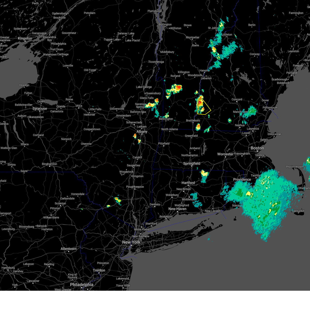
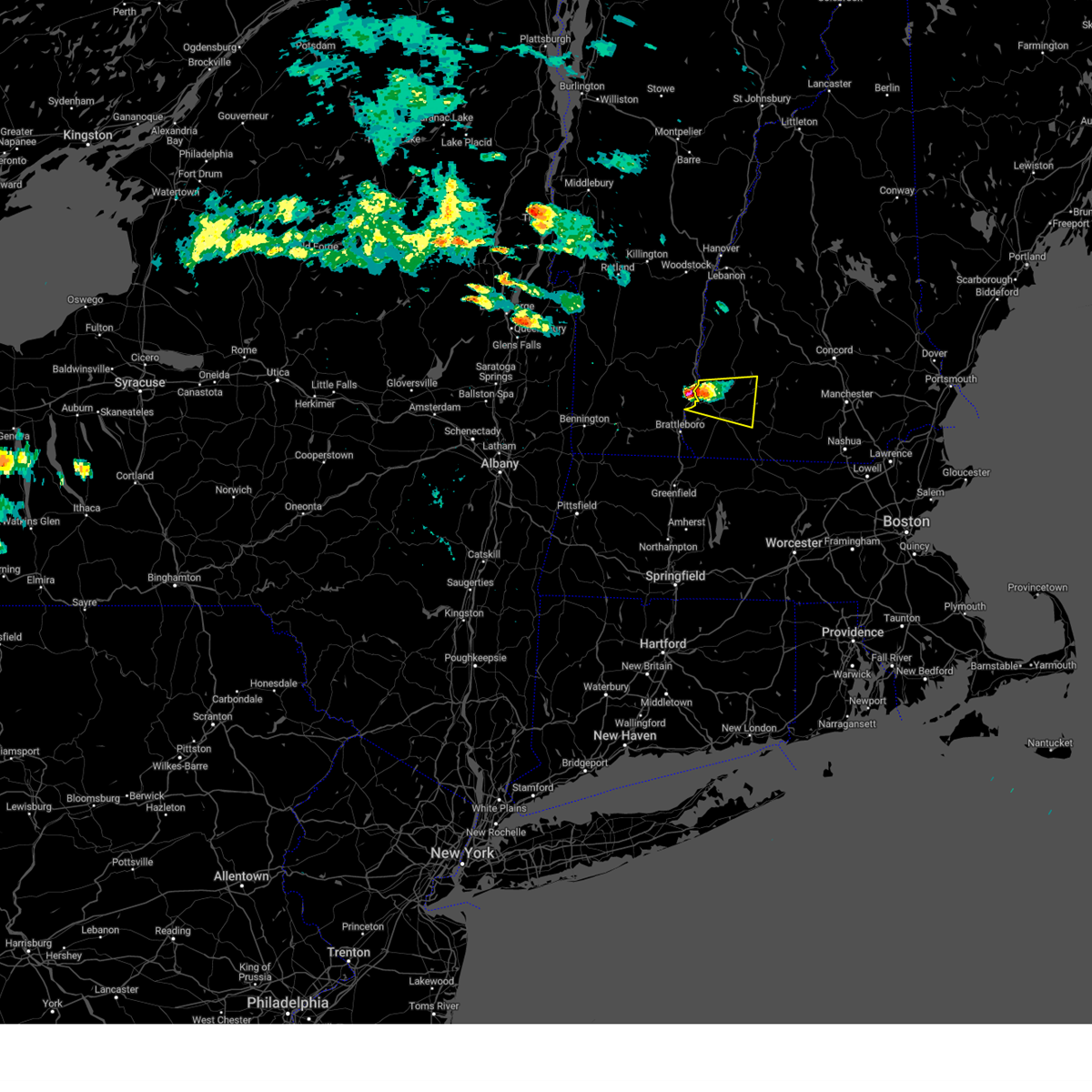
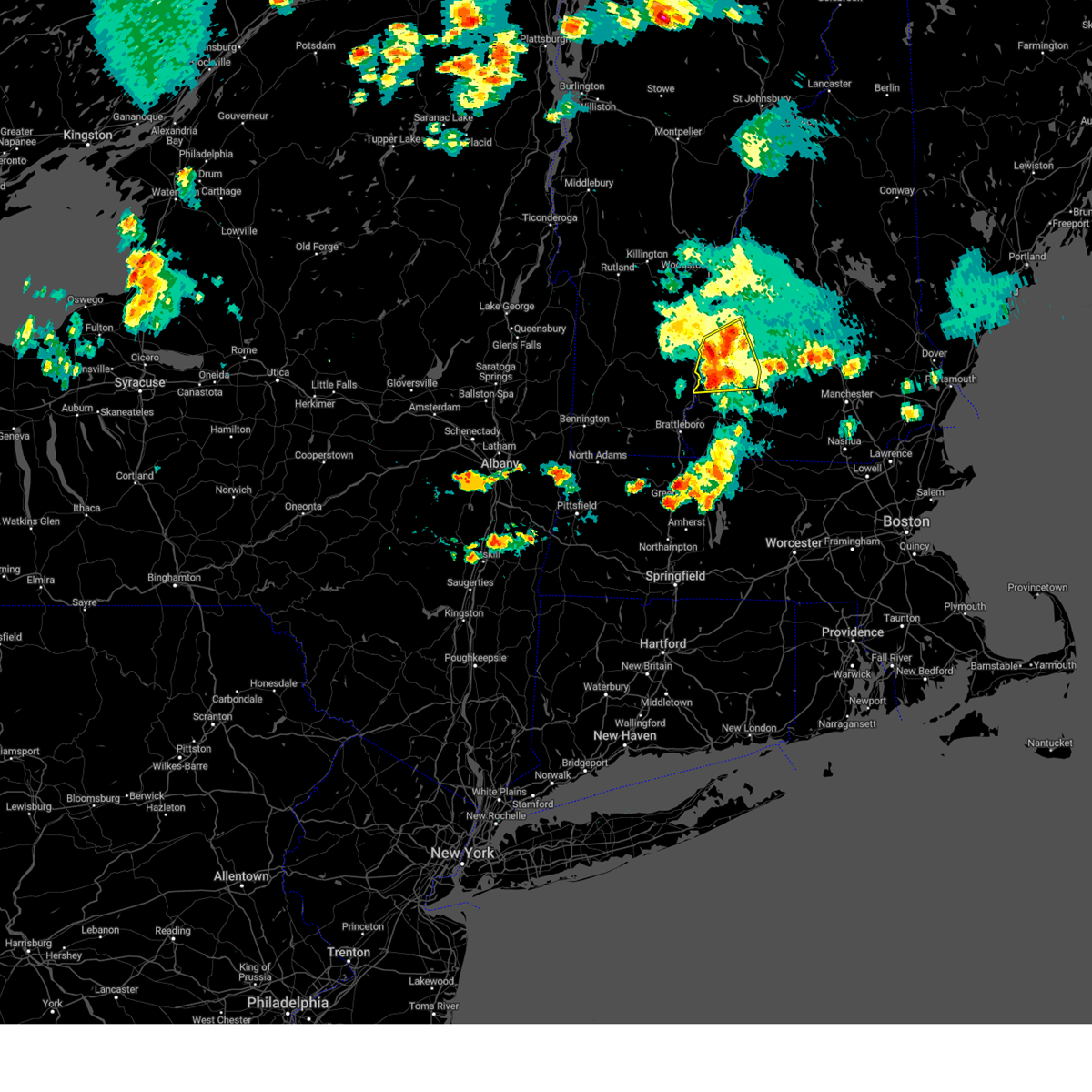
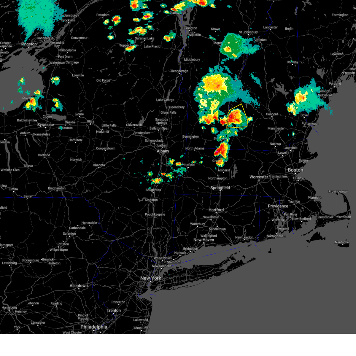
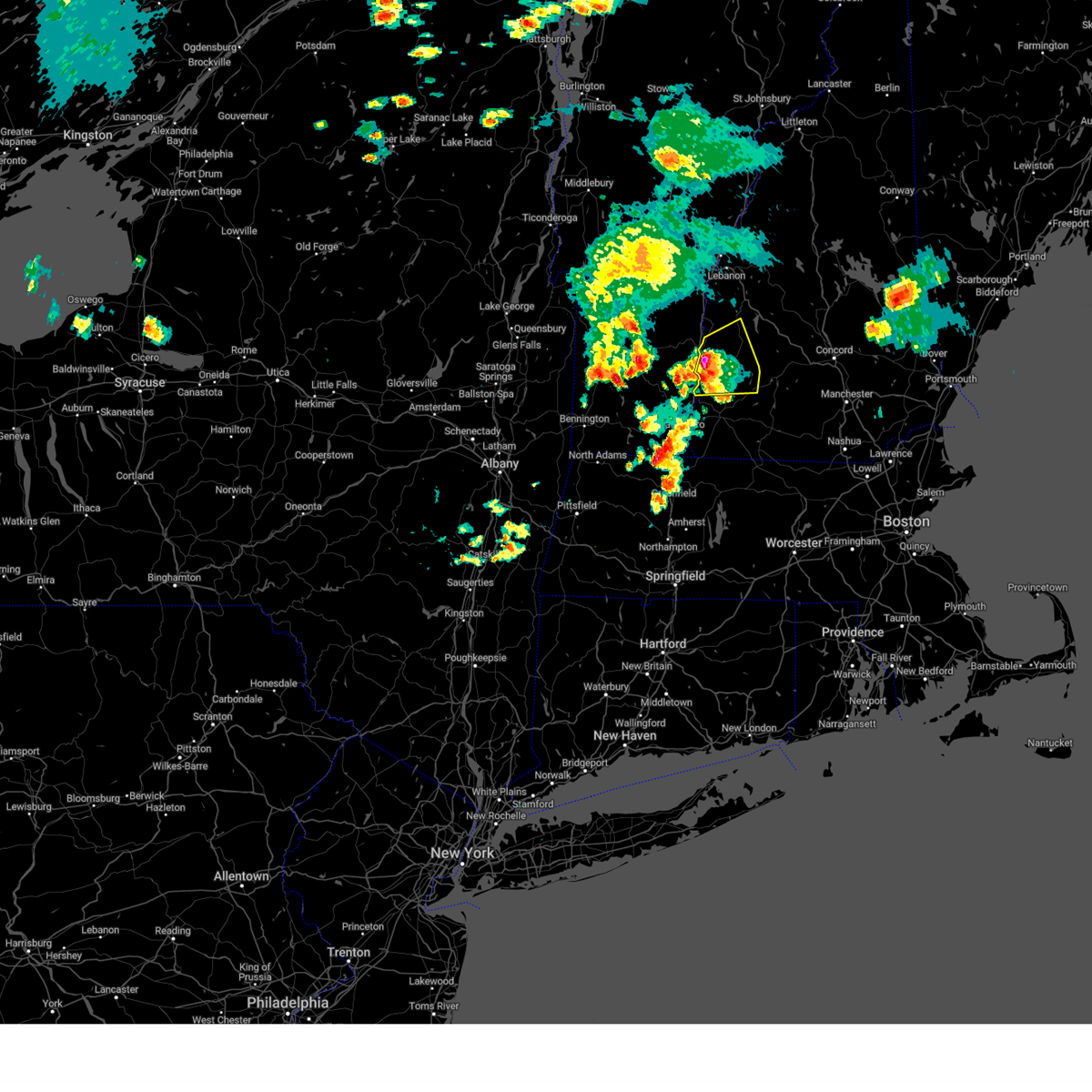
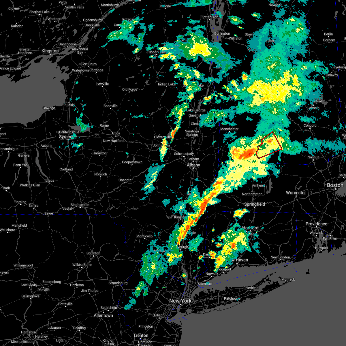
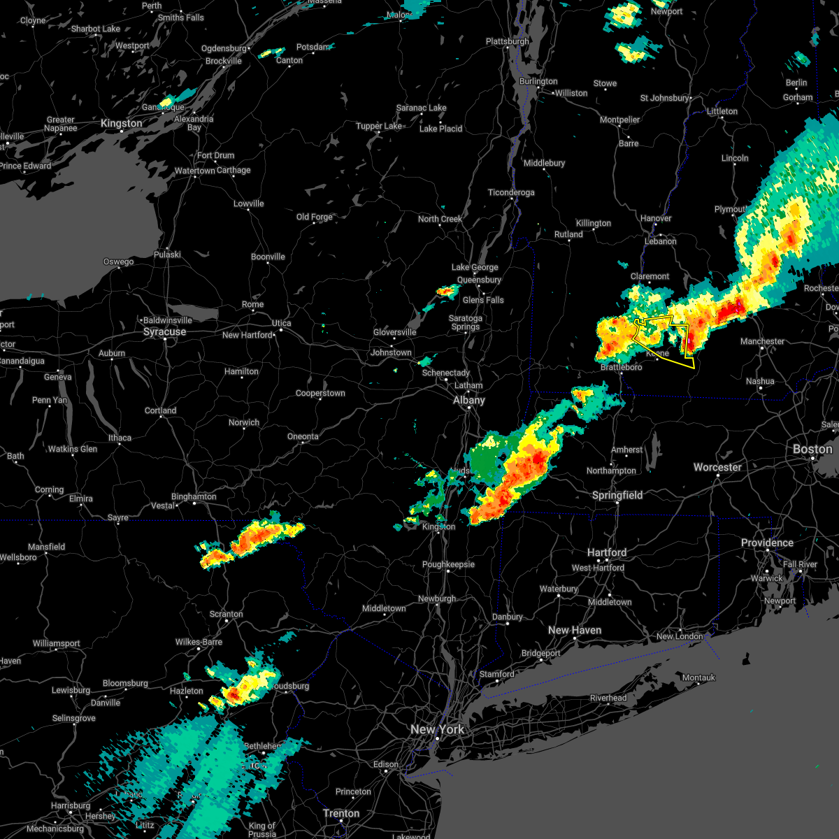
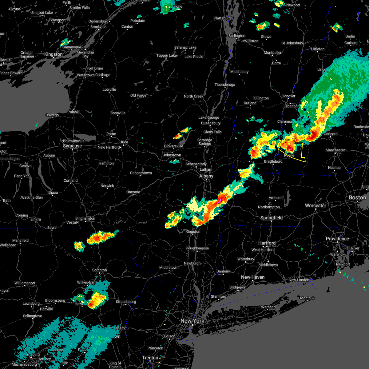
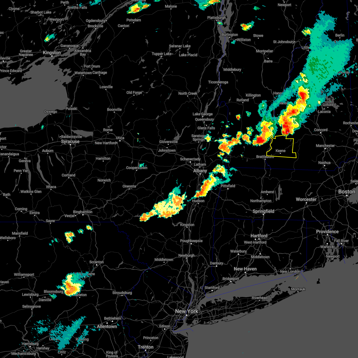
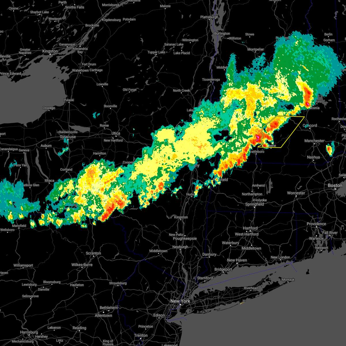
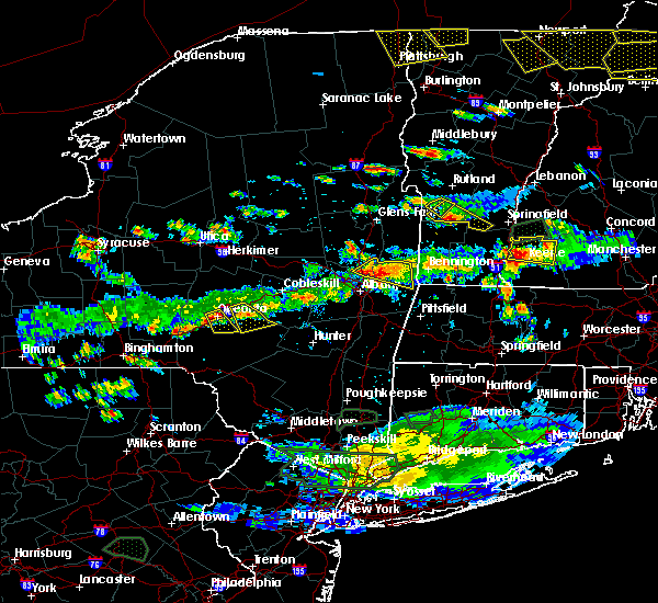
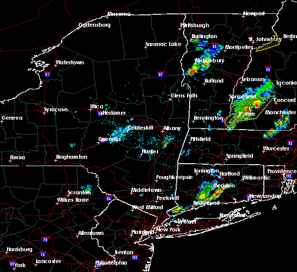
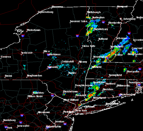
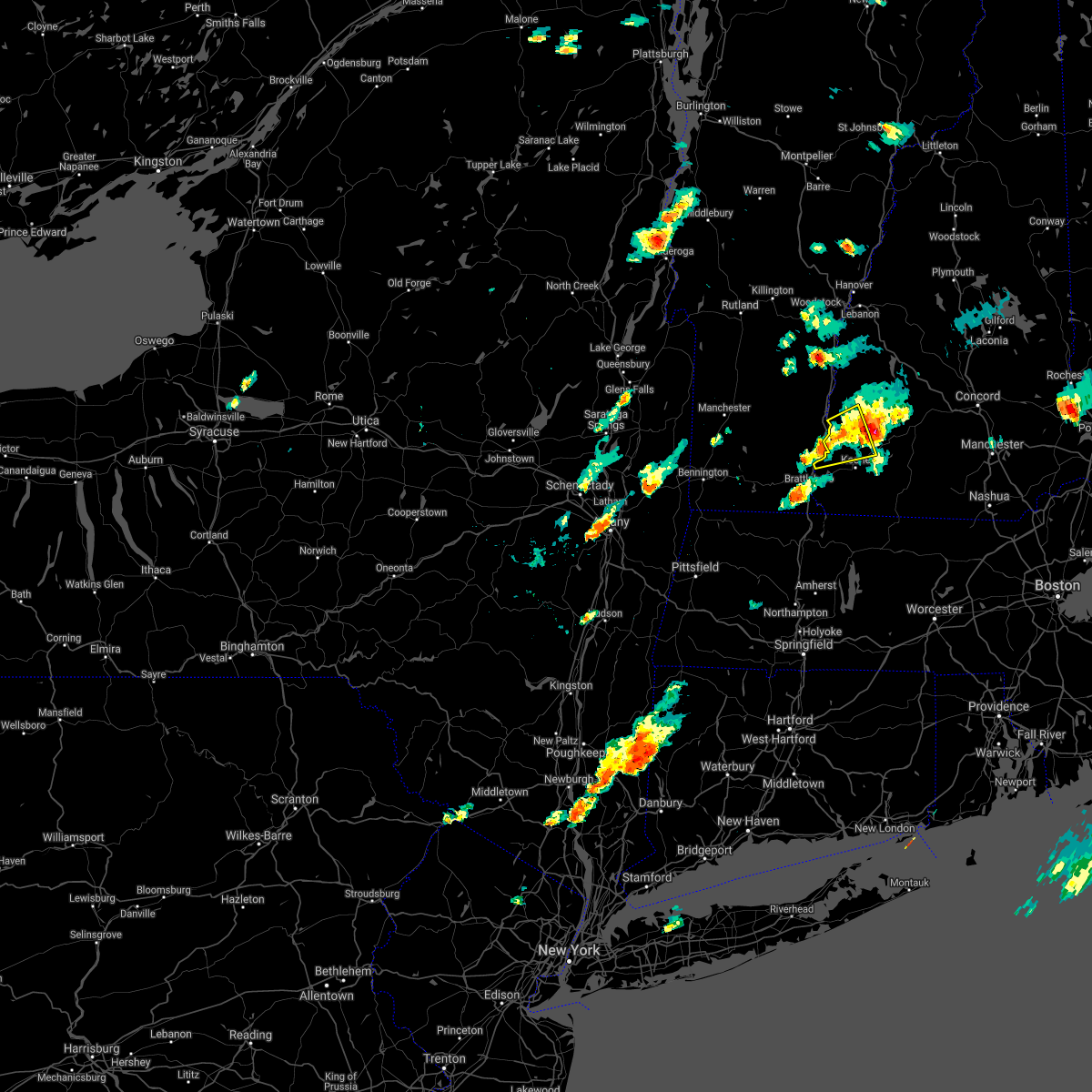
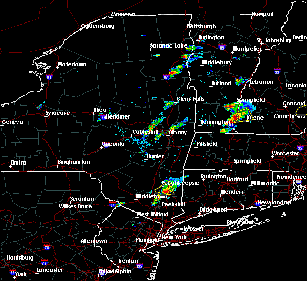
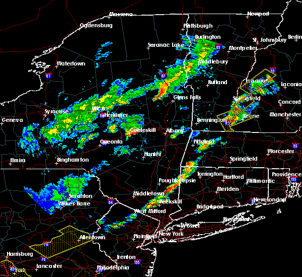
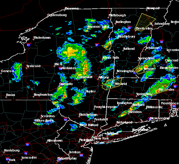
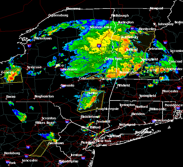
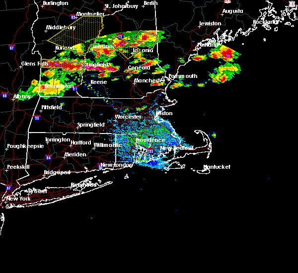
Hail Map for Walpole, NH
The Walpole, NH area has had 8 reports of on-the-ground hail by trained spotters, and has been under severe weather warnings 4 times during the past 12 months. Doppler radar has detected hail at or near Walpole, NH on 19 occasions, including 1 occasion during the past year.
| Name: | Walpole, NH |
| Where Located: | 79.1 miles ENE of Schenectady, NY |
| Map: | Google Map for Walpole, NH |
| Population: | 605 |
| Housing Units: | 346 |
| More Info: | Search Google for Walpole, NH |
0
The Top Recent Hail Date for Walpole, NH is Monday, August 5, 2024 (19th out of 19)

Hail and Wind Damage Spotted near Walpole, NH
| Date / Time | Report Details |
|---|---|
| 8/15/2024 6:35 PM EDT |
 Svrgyx the national weather service in gray maine has issued a * severe thunderstorm warning for, southwestern sullivan county in central new hampshire, northwestern cheshire county in southern new hampshire, * until 715 pm edt. * at 635 pm edt, a severe thunderstorm was located over charlestown, or 12 miles southwest of claremont, moving southeast at 20 mph (radar indicated). Hazards include 60 mph wind gusts and quarter size hail. Hail damage to vehicles is expected. Expect wind damage to roofs, siding, and trees. Svrgyx the national weather service in gray maine has issued a * severe thunderstorm warning for, southwestern sullivan county in central new hampshire, northwestern cheshire county in southern new hampshire, * until 715 pm edt. * at 635 pm edt, a severe thunderstorm was located over charlestown, or 12 miles southwest of claremont, moving southeast at 20 mph (radar indicated). Hazards include 60 mph wind gusts and quarter size hail. Hail damage to vehicles is expected. Expect wind damage to roofs, siding, and trees.
|
| 8/5/2024 1:57 PM EDT | Golf Ball sized hail reported 2.8 miles NNE of Walpole, NH, reported by amateur radio. |
| 8/5/2024 1:57 PM EDT |
 Svrgyx the national weather service in gray maine has issued a * severe thunderstorm warning for, central cheshire county in southern new hampshire, * until 300 pm edt. * at 156 pm edt, a severe thunderstorm was located near westmoreland, or 9 miles northwest of keene, moving east at 15 mph (radar indicated). Hazards include 60 mph wind gusts and quarter size hail. Hail damage to vehicles is expected. Expect wind damage to roofs, siding, and trees. Svrgyx the national weather service in gray maine has issued a * severe thunderstorm warning for, central cheshire county in southern new hampshire, * until 300 pm edt. * at 156 pm edt, a severe thunderstorm was located near westmoreland, or 9 miles northwest of keene, moving east at 15 mph (radar indicated). Hazards include 60 mph wind gusts and quarter size hail. Hail damage to vehicles is expected. Expect wind damage to roofs, siding, and trees.
|
| 7/16/2024 6:38 PM EDT |
 At 638 pm edt, severe thunderstorms were located along a line extending from 9 miles southwest of lebanon to near claremont to charlestown to 11 miles west of westmoreland, moving east at 50 mph (radar indicated). Hazards include 70 mph wind gusts. Expect considerable tree damage. damage is likely to mobile homes, roofs, and outbuildings. locations impacted include, claremont, lebanon, henniker, new london, grafton, hanover, charlestown, enfield, canaan, bradford, danbury, groton, newport, gilsum, walpole, warner, alstead, marlow, stoddard, and surry. this also includes, mount kearsage and mount sunapee. This includes interstate 89 between mile markers 16 and 60. At 638 pm edt, severe thunderstorms were located along a line extending from 9 miles southwest of lebanon to near claremont to charlestown to 11 miles west of westmoreland, moving east at 50 mph (radar indicated). Hazards include 70 mph wind gusts. Expect considerable tree damage. damage is likely to mobile homes, roofs, and outbuildings. locations impacted include, claremont, lebanon, henniker, new london, grafton, hanover, charlestown, enfield, canaan, bradford, danbury, groton, newport, gilsum, walpole, warner, alstead, marlow, stoddard, and surry. this also includes, mount kearsage and mount sunapee. This includes interstate 89 between mile markers 16 and 60.
|
| 7/16/2024 6:25 PM EDT |
 Svrgyx the national weather service in gray maine has issued a * severe thunderstorm warning for, sullivan county in central new hampshire, southwestern grafton county in northern new hampshire, northwestern cheshire county in southern new hampshire, northwestern merrimack county in central new hampshire, * until 715 pm edt. * at 624 pm edt, severe thunderstorms were located along a line extending from 18 miles southwest of lebanon to 6 miles west of claremont to 7 miles southwest of charlestown to 20 miles west of chesterfield, moving east at 55 mph (radar indicated). Hazards include 70 mph wind gusts. Expect considerable tree damage. Damage is likely to mobile homes, roofs, and outbuildings. Svrgyx the national weather service in gray maine has issued a * severe thunderstorm warning for, sullivan county in central new hampshire, southwestern grafton county in northern new hampshire, northwestern cheshire county in southern new hampshire, northwestern merrimack county in central new hampshire, * until 715 pm edt. * at 624 pm edt, severe thunderstorms were located along a line extending from 18 miles southwest of lebanon to 6 miles west of claremont to 7 miles southwest of charlestown to 20 miles west of chesterfield, moving east at 55 mph (radar indicated). Hazards include 70 mph wind gusts. Expect considerable tree damage. Damage is likely to mobile homes, roofs, and outbuildings.
|
| 6/19/2024 3:45 PM EDT |
 At 343 pm edt, a severe thunderstorm was located over stoddard, or 13 miles northeast of keene, moving east at 20 mph (radar indicated). Hazards include 60 mph wind gusts and quarter size hail. Hail damage to vehicles is expected. expect wind damage to roofs, siding, and trees. locations impacted include, keene, henniker, peterborough, antrim, greenfield, bradford, dublin, francestown, bennington, harrisville, nelson, gilsum, windsor, hancock, walpole, deering, warner, hillsborough, alstead, and marlow. This includes interstate 89 between mile markers 17 and 21. At 343 pm edt, a severe thunderstorm was located over stoddard, or 13 miles northeast of keene, moving east at 20 mph (radar indicated). Hazards include 60 mph wind gusts and quarter size hail. Hail damage to vehicles is expected. expect wind damage to roofs, siding, and trees. locations impacted include, keene, henniker, peterborough, antrim, greenfield, bradford, dublin, francestown, bennington, harrisville, nelson, gilsum, windsor, hancock, walpole, deering, warner, hillsborough, alstead, and marlow. This includes interstate 89 between mile markers 17 and 21.
|
| 6/19/2024 3:10 PM EDT | Several large trees downed on river rd south in walpole near ct river. tree diameter ~10 inches. time estimated via rada in cheshire county NH, 2.7 miles NE of Walpole, NH |
| 6/19/2024 3:08 PM EDT |
 Svrgyx the national weather service in gray maine has issued a * severe thunderstorm warning for, southern sullivan county in central new hampshire, northern cheshire county in southern new hampshire, northwestern hillsborough county in southern new hampshire, southwestern merrimack county in central new hampshire, * until 400 pm edt. * at 307 pm edt, a severe thunderstorm was located over alstead, or 12 miles north of keene, moving east at 25 mph (radar indicated). Hazards include 60 mph wind gusts and quarter size hail. Hail damage to vehicles is expected. Expect wind damage to roofs, siding, and trees. Svrgyx the national weather service in gray maine has issued a * severe thunderstorm warning for, southern sullivan county in central new hampshire, northern cheshire county in southern new hampshire, northwestern hillsborough county in southern new hampshire, southwestern merrimack county in central new hampshire, * until 400 pm edt. * at 307 pm edt, a severe thunderstorm was located over alstead, or 12 miles north of keene, moving east at 25 mph (radar indicated). Hazards include 60 mph wind gusts and quarter size hail. Hail damage to vehicles is expected. Expect wind damage to roofs, siding, and trees.
|
| 5/21/2024 5:29 PM EDT |
 The storm which prompted the warning has weakened below severe limits, and no longer poses an immediate threat to life or property. therefore, the warning will be allowed to expire. however, small hail, gusty winds and heavy rain are still possible with this thunderstorm. The storm which prompted the warning has weakened below severe limits, and no longer poses an immediate threat to life or property. therefore, the warning will be allowed to expire. however, small hail, gusty winds and heavy rain are still possible with this thunderstorm.
|
| 5/21/2024 4:59 PM EDT |
 At 458 pm edt, a severe thunderstorm was located near charlestown, or 11 miles south of claremont, moving northeast at 10 mph (trained weather spotters). Hazards include 60 mph wind gusts and quarter size hail. Hail damage to vehicles is expected. expect wind damage to roofs, siding, and trees. Locations impacted include, claremont, charlestown, newport, marlow, stoddard, walpole, alstead, gilsum, windsor, surry, lempster, acworth, goshen, langdon, washington, and unity. At 458 pm edt, a severe thunderstorm was located near charlestown, or 11 miles south of claremont, moving northeast at 10 mph (trained weather spotters). Hazards include 60 mph wind gusts and quarter size hail. Hail damage to vehicles is expected. expect wind damage to roofs, siding, and trees. Locations impacted include, claremont, charlestown, newport, marlow, stoddard, walpole, alstead, gilsum, windsor, surry, lempster, acworth, goshen, langdon, washington, and unity.
|
| 5/21/2024 4:35 PM EDT |
 Svrgyx the national weather service in gray maine has issued a * severe thunderstorm warning for, southwestern sullivan county in central new hampshire, northern cheshire county in southern new hampshire, * until 530 pm edt. * at 435 pm edt, a severe thunderstorm was located near charlestown, or 13 miles south of claremont, moving northeast at 10 mph (radar indicated). Hazards include 60 mph wind gusts and quarter size hail. Hail damage to vehicles is expected. Expect wind damage to roofs, siding, and trees. Svrgyx the national weather service in gray maine has issued a * severe thunderstorm warning for, southwestern sullivan county in central new hampshire, northern cheshire county in southern new hampshire, * until 530 pm edt. * at 435 pm edt, a severe thunderstorm was located near charlestown, or 13 miles south of claremont, moving northeast at 10 mph (radar indicated). Hazards include 60 mph wind gusts and quarter size hail. Hail damage to vehicles is expected. Expect wind damage to roofs, siding, and trees.
|
| 9/8/2023 4:09 PM EDT |
 At 409 pm edt, severe thunderstorms were located along a line extending from near westmoreland to near richmond, moving northeast at 30 mph (radar indicated). Hazards include 60 mph wind gusts and quarter size hail. Hail damage to vehicles is expected. Expect wind damage to roofs, siding, and trees. At 409 pm edt, severe thunderstorms were located along a line extending from near westmoreland to near richmond, moving northeast at 30 mph (radar indicated). Hazards include 60 mph wind gusts and quarter size hail. Hail damage to vehicles is expected. Expect wind damage to roofs, siding, and trees.
|
| 9/8/2023 4:05 PM EDT |
 At 405 pm edt, a severe thunderstorm was located over putney, or near brattleboro, moving northeast at 15 mph (radar indicated). Hazards include 60 mph wind gusts and quarter size hail. Hail damage to vehicles is expected. expect wind damage to roofs, siding, and trees. locations impacted include, brattleboro, putney, vernon, westminster, guilford center, guilford, north vernon, east dummerston, east putney, fairview village, east putney station, dummerston center, west brattleboro, putney station, naulahka and westminster station. hail threat, radar indicated max hail size, 1. 00 in wind threat, radar indicated max wind gust, 60 mph. At 405 pm edt, a severe thunderstorm was located over putney, or near brattleboro, moving northeast at 15 mph (radar indicated). Hazards include 60 mph wind gusts and quarter size hail. Hail damage to vehicles is expected. expect wind damage to roofs, siding, and trees. locations impacted include, brattleboro, putney, vernon, westminster, guilford center, guilford, north vernon, east dummerston, east putney, fairview village, east putney station, dummerston center, west brattleboro, putney station, naulahka and westminster station. hail threat, radar indicated max hail size, 1. 00 in wind threat, radar indicated max wind gust, 60 mph.
|
| 9/8/2023 3:46 PM EDT |
 At 345 pm edt, a severe thunderstorm was located over brattleboro, moving northeast at 15 mph (radar indicated). Hazards include 60 mph wind gusts and quarter size hail. Hail damage to vehicles is expected. Expect wind damage to roofs, siding, and trees. At 345 pm edt, a severe thunderstorm was located over brattleboro, moving northeast at 15 mph (radar indicated). Hazards include 60 mph wind gusts and quarter size hail. Hail damage to vehicles is expected. Expect wind damage to roofs, siding, and trees.
|
| 9/7/2023 9:49 PM EDT |
 At 948 pm edt, severe thunderstorms were located along a line extending from 8 miles west of chesterfield to 8 miles southwest of winchester, moving east at 25 mph (radar indicated). Hazards include 60 mph wind gusts and penny size hail. expect damage to roofs, siding, and trees At 948 pm edt, severe thunderstorms were located along a line extending from 8 miles west of chesterfield to 8 miles southwest of winchester, moving east at 25 mph (radar indicated). Hazards include 60 mph wind gusts and penny size hail. expect damage to roofs, siding, and trees
|
| 7/13/2023 9:55 PM EDT |
 The severe thunderstorm warning for southeastern sullivan, cheshire, western hillsborough and southwestern merrimack counties will expire at 1000 pm edt, the storms which prompted the warning have weakened below severe limits, and have exited the warned area. therefore, the warning will be allowed to expire. however gusty winds are still possible with these thunderstorms. The severe thunderstorm warning for southeastern sullivan, cheshire, western hillsborough and southwestern merrimack counties will expire at 1000 pm edt, the storms which prompted the warning have weakened below severe limits, and have exited the warned area. therefore, the warning will be allowed to expire. however gusty winds are still possible with these thunderstorms.
|
| 7/13/2023 9:34 PM EDT |
 At 933 pm edt, severe thunderstorms were located along a line extending from alstead to fitzwilliam, moving northeast at 30 mph (trained weather spotters. an observed gust of 67 mph was recorded on a hand held anemometer with these storms). Hazards include 60 mph wind gusts. Expect damage to roofs, siding, and trees. locations impacted include, keene, jaffrey, henniker, new london, peterborough, winchester, antrim, greenfield, lyndeborough, bradford, dublin, francestown, bennington, richmond, harrisville, nelson, rindge, walpole, alstead and swanzey. this includes interstate 89 between mile markers 28 and 30. hail threat, radar indicated max hail size, <. 75 in wind threat, radar indicated max wind gust, 60 mph. At 933 pm edt, severe thunderstorms were located along a line extending from alstead to fitzwilliam, moving northeast at 30 mph (trained weather spotters. an observed gust of 67 mph was recorded on a hand held anemometer with these storms). Hazards include 60 mph wind gusts. Expect damage to roofs, siding, and trees. locations impacted include, keene, jaffrey, henniker, new london, peterborough, winchester, antrim, greenfield, lyndeborough, bradford, dublin, francestown, bennington, richmond, harrisville, nelson, rindge, walpole, alstead and swanzey. this includes interstate 89 between mile markers 28 and 30. hail threat, radar indicated max hail size, <. 75 in wind threat, radar indicated max wind gust, 60 mph.
|
| 7/13/2023 9:01 PM EDT |
 At 901 pm edt, severe thunderstorms were located along a line extending from 6 miles west of westmoreland to 10 miles south of winchester, moving northeast at 30 mph (radar indicated). Hazards include 60 mph wind gusts. expect damage to roofs, siding, and trees At 901 pm edt, severe thunderstorms were located along a line extending from 6 miles west of westmoreland to 10 miles south of winchester, moving northeast at 30 mph (radar indicated). Hazards include 60 mph wind gusts. expect damage to roofs, siding, and trees
|
| 8/26/2022 2:29 PM EDT | At 229 pm edt, a severe thunderstorm was located over gilsum, or near keene, moving northeast at 40 mph (radar indicated). Hazards include 60 mph wind gusts and quarter size hail. Hail damage to vehicles is expected. Expect wind damage to roofs, siding, and trees. |
| 8/26/2022 2:10 PM EDT | Half Dollar sized hail reported 3.9 miles SW of Walpole, NH, reported by amateur radio: report of half dollar sized hail damaging a vehicle on homestead road south of alstead. time estimated by radar. |
| 8/26/2022 1:52 PM EDT | At 152 pm edt, severe thunderstorms were located along a line extending from 12 miles northwest of charlestown to near westmoreland to 12 miles west of chesterfield, moving east at 25 mph (radar indicated). Hazards include 60 mph wind gusts and quarter size hail. Hail damage to vehicles is expected. Expect wind damage to roofs, siding, and trees. |
| 8/4/2022 6:29 PM EDT |
 At 629 pm edt, severe thunderstorms were located along a line extending from 26 miles west of lebanon to 13 miles west of claremont to 8 miles northwest of charlestown to 8 miles northwest of walpole to 9 miles northwest of westmoreland, moving east at 30 mph (radar indicated). Hazards include 60 mph wind gusts. expect damage to roofs, siding, and trees At 629 pm edt, severe thunderstorms were located along a line extending from 26 miles west of lebanon to 13 miles west of claremont to 8 miles northwest of charlestown to 8 miles northwest of walpole to 9 miles northwest of westmoreland, moving east at 30 mph (radar indicated). Hazards include 60 mph wind gusts. expect damage to roofs, siding, and trees
|
| 7/21/2022 4:57 PM EDT |
 At 457 pm edt, severe thunderstorms were located along a line extending from alstead to near hinsdale, moving east at 30 mph (radar indicated). Hazards include 60 mph wind gusts and quarter size hail. Hail damage to vehicles is expected. Expect wind damage to roofs, siding, and trees. At 457 pm edt, severe thunderstorms were located along a line extending from alstead to near hinsdale, moving east at 30 mph (radar indicated). Hazards include 60 mph wind gusts and quarter size hail. Hail damage to vehicles is expected. Expect wind damage to roofs, siding, and trees.
|
| 7/21/2022 4:33 PM EDT |
 At 433 pm edt, a severe thunderstorm was located over walpole, or 10 miles north of keene, moving east at 25 mph (radar indicated). Hazards include 60 mph wind gusts and quarter size hail. Hail damage to vehicles is expected. Expect wind damage to roofs, siding, and trees. At 433 pm edt, a severe thunderstorm was located over walpole, or 10 miles north of keene, moving east at 25 mph (radar indicated). Hazards include 60 mph wind gusts and quarter size hail. Hail damage to vehicles is expected. Expect wind damage to roofs, siding, and trees.
|
| 7/21/2022 2:40 PM EDT |
 At 240 pm edt, a severe thunderstorm was located near swanzey, or near keene, moving northeast at 35 mph (radar indicated). Hazards include 60 mph wind gusts and quarter size hail. Hail damage to vehicles is expected. expect wind damage to roofs, siding, and trees. Locations impacted include, keene, jaffrey, winchester, antrim, dublin, harrisville, nelson, gilsum, marlborough, marlow, roxbury, walpole, sullivan, alstead, westmoreland, swanzey, chesterfield, surry, troy and hancock. At 240 pm edt, a severe thunderstorm was located near swanzey, or near keene, moving northeast at 35 mph (radar indicated). Hazards include 60 mph wind gusts and quarter size hail. Hail damage to vehicles is expected. expect wind damage to roofs, siding, and trees. Locations impacted include, keene, jaffrey, winchester, antrim, dublin, harrisville, nelson, gilsum, marlborough, marlow, roxbury, walpole, sullivan, alstead, westmoreland, swanzey, chesterfield, surry, troy and hancock.
|
| 7/21/2022 2:28 PM EDT |
 At 227 pm edt, a severe thunderstorm was located near chesterfield, or 11 miles southwest of keene, moving northeast at 35 mph (radar indicated). Hazards include 60 mph wind gusts and quarter size hail. Hail damage to vehicles is expected. Expect wind damage to roofs, siding, and trees. At 227 pm edt, a severe thunderstorm was located near chesterfield, or 11 miles southwest of keene, moving northeast at 35 mph (radar indicated). Hazards include 60 mph wind gusts and quarter size hail. Hail damage to vehicles is expected. Expect wind damage to roofs, siding, and trees.
|
| 7/18/2022 10:20 PM EDT |
 At 1019 pm edt, a severe thunderstorm capable of producing a tornado was located over westmoreland, or 7 miles west of keene, moving northeast at 30 mph (radar indicated rotation). Hazards include tornado. Flying debris will be dangerous to those caught without shelter. mobile homes will be damaged or destroyed. damage to roofs, windows, and vehicles will occur. tree damage is likely. this dangerous storm will be near, swanzey and swanzey around 1035 pm edt. gilsum and surry around 1040 pm edt. Keene, harrisville, marlow, sullivan, roxbury and marlborough around 1045 pm edt. At 1019 pm edt, a severe thunderstorm capable of producing a tornado was located over westmoreland, or 7 miles west of keene, moving northeast at 30 mph (radar indicated rotation). Hazards include tornado. Flying debris will be dangerous to those caught without shelter. mobile homes will be damaged or destroyed. damage to roofs, windows, and vehicles will occur. tree damage is likely. this dangerous storm will be near, swanzey and swanzey around 1035 pm edt. gilsum and surry around 1040 pm edt. Keene, harrisville, marlow, sullivan, roxbury and marlborough around 1045 pm edt.
|
| 7/18/2022 10:01 PM EDT |
 At 1001 pm edt, a severe thunderstorm capable of producing a tornado was located near hinsdale, or 15 miles west of keene, moving northeast at 40 mph (radar indicated rotation). Hazards include tornado. Flying debris will be dangerous to those caught without shelter. mobile homes will be damaged or destroyed. damage to roofs, windows, and vehicles will occur. tree damage is likely. this dangerous storm will be near, chesterfield around 1020 pm edt. swanzey, westmoreland and swanzey around 1025 pm edt. Keene, harrisville, gilsum, surry, sullivan, roxbury, marlow and marlborough around 1030 pm edt. At 1001 pm edt, a severe thunderstorm capable of producing a tornado was located near hinsdale, or 15 miles west of keene, moving northeast at 40 mph (radar indicated rotation). Hazards include tornado. Flying debris will be dangerous to those caught without shelter. mobile homes will be damaged or destroyed. damage to roofs, windows, and vehicles will occur. tree damage is likely. this dangerous storm will be near, chesterfield around 1020 pm edt. swanzey, westmoreland and swanzey around 1025 pm edt. Keene, harrisville, gilsum, surry, sullivan, roxbury, marlow and marlborough around 1030 pm edt.
|
| 7/12/2022 5:09 PM EDT |
 The severe thunderstorm warning for northern cheshire county will expire at 515 pm edt, the severe thunderstorm which prompted the warning has moved out of the warned area. therefore, the warning will be allowed to expire. a severe thunderstorm watch remains in effect until 900 pm edt for southern and central new hampshire. The severe thunderstorm warning for northern cheshire county will expire at 515 pm edt, the severe thunderstorm which prompted the warning has moved out of the warned area. therefore, the warning will be allowed to expire. a severe thunderstorm watch remains in effect until 900 pm edt for southern and central new hampshire.
|
| 7/12/2022 4:49 PM EDT |
 At 449 pm edt, a severe thunderstorm was located over sullivan, or near keene, moving east at 35 mph (radar indicated). Hazards include 60 mph wind gusts and quarter size hail. Hail damage to vehicles is expected. expect wind damage to roofs, siding, and trees. locations impacted include, keene, peterborough, antrim, dublin, harrisville, nelson, gilsum, marlow, roxbury, walpole, sullivan, alstead, surry, hancock, marlborough, westmoreland and langdon. hail threat, radar indicated max hail size, 1. 00 in wind threat, radar indicated max wind gust, 60 mph. At 449 pm edt, a severe thunderstorm was located over sullivan, or near keene, moving east at 35 mph (radar indicated). Hazards include 60 mph wind gusts and quarter size hail. Hail damage to vehicles is expected. expect wind damage to roofs, siding, and trees. locations impacted include, keene, peterborough, antrim, dublin, harrisville, nelson, gilsum, marlow, roxbury, walpole, sullivan, alstead, surry, hancock, marlborough, westmoreland and langdon. hail threat, radar indicated max hail size, 1. 00 in wind threat, radar indicated max wind gust, 60 mph.
|
| 7/12/2022 4:35 PM EDT | Half Dollar sized hail reported 0.4 miles ESE of Walpole, NH |
| 7/12/2022 4:18 PM EDT |
 At 417 pm edt, a severe thunderstorm was located 9 miles west of walpole, or 17 miles northwest of keene, moving east at 35 mph (radar indicated). Hazards include 60 mph wind gusts and quarter size hail. Hail damage to vehicles is expected. Expect wind damage to roofs, siding, and trees. At 417 pm edt, a severe thunderstorm was located 9 miles west of walpole, or 17 miles northwest of keene, moving east at 35 mph (radar indicated). Hazards include 60 mph wind gusts and quarter size hail. Hail damage to vehicles is expected. Expect wind damage to roofs, siding, and trees.
|
| 5/16/2022 6:20 PM EDT |
 At 619 pm edt, severe thunderstorms were located along a line extending from 6 miles southwest of charlestown to near chesterfield to 23 miles south of hinsdale, moving east at 35 mph (radar indicated). Hazards include 60 mph wind gusts and nickel size hail. Expect damage to roofs, siding, and trees. locations impacted include, keene, claremont, jaffrey, henniker, peterborough, hopkinton, new boston, charlestown, winchester, antrim, mont vernon, greenfield, lyndeborough, bradford, dublin, francestown, bennington, richmond, harrisville and nelson. this includes interstate 89 between mile markers 18 and 30. hail threat, radar indicated max hail size, 0. 88 in wind threat, radar indicated max wind gust, 60 mph. At 619 pm edt, severe thunderstorms were located along a line extending from 6 miles southwest of charlestown to near chesterfield to 23 miles south of hinsdale, moving east at 35 mph (radar indicated). Hazards include 60 mph wind gusts and nickel size hail. Expect damage to roofs, siding, and trees. locations impacted include, keene, claremont, jaffrey, henniker, peterborough, hopkinton, new boston, charlestown, winchester, antrim, mont vernon, greenfield, lyndeborough, bradford, dublin, francestown, bennington, richmond, harrisville and nelson. this includes interstate 89 between mile markers 18 and 30. hail threat, radar indicated max hail size, 0. 88 in wind threat, radar indicated max wind gust, 60 mph.
|
| 5/16/2022 6:13 PM EDT | Trees and wires down along old keene rd. time estimated via rada in cheshire county NH, 1.3 miles NNE of Walpole, NH |
| 5/16/2022 5:43 PM EDT |
 At 543 pm edt, severe thunderstorms were located along a line extending from 22 miles west of westmoreland to 14 miles west of hinsdale to 41 miles southwest of winchester, moving east at 35 mph (radar indicated). Hazards include 60 mph wind gusts and nickel size hail. expect damage to roofs, siding, and trees At 543 pm edt, severe thunderstorms were located along a line extending from 22 miles west of westmoreland to 14 miles west of hinsdale to 41 miles southwest of winchester, moving east at 35 mph (radar indicated). Hazards include 60 mph wind gusts and nickel size hail. expect damage to roofs, siding, and trees
|
| 3/7/2022 9:05 PM EST | Multiple trees down. radar estimated tim in cheshire county NH, 0.2 miles WSW of Walpole, NH |
| 3/7/2022 9:00 PM EST |
 At 859 pm est, severe thunderstorms were located along a line extending from 10 miles west of walpole to 10 miles west of hinsdale to 40 miles southwest of winchester, moving east at 60 mph (radar indicated). Hazards include 60 mph wind gusts. expect damage to roofs, siding, and trees At 859 pm est, severe thunderstorms were located along a line extending from 10 miles west of walpole to 10 miles west of hinsdale to 40 miles southwest of winchester, moving east at 60 mph (radar indicated). Hazards include 60 mph wind gusts. expect damage to roofs, siding, and trees
|
| 9/15/2021 4:10 PM EDT | Numerous trees down north of walpole. penny size hail also reporte in cheshire county NH, 0.9 miles SSE of Walpole, NH |
| 9/15/2021 4:07 PM EDT |
 At 407 pm edt, a severe thunderstorm was located 7 miles north of marlow, or 11 miles southeast of claremont, moving east at 40 mph (radar indicated). Hazards include 60 mph wind gusts and quarter size hail. Hail damage to vehicles is expected. Expect wind damage to roofs, siding, and trees. At 407 pm edt, a severe thunderstorm was located 7 miles north of marlow, or 11 miles southeast of claremont, moving east at 40 mph (radar indicated). Hazards include 60 mph wind gusts and quarter size hail. Hail damage to vehicles is expected. Expect wind damage to roofs, siding, and trees.
|
| 7/27/2021 5:20 PM EDT | Tree down on watkins hill r in cheshire county NH, 2.9 miles NNW of Walpole, NH |
| 7/27/2021 5:00 PM EDT | Tree down on old settlers r in cheshire county NH, 8.4 miles WSW of Walpole, NH |
| 7/27/2021 4:59 PM EDT |
 At 459 pm edt, a severe thunderstorm was located near charlestown, or 10 miles south of claremont, moving southeast at 35 mph (radar indicated). Hazards include 60 mph wind gusts and penny size hail. Expect damage to roofs, siding, and trees. Locations impacted include, claremont, charlestown, antrim, bradford, harrisville, nelson, newport, gilsum, marlow, walpole, sullivan, alstead, surry, windsor, lempster, acworth, goshen, langdon, washington and unity. At 459 pm edt, a severe thunderstorm was located near charlestown, or 10 miles south of claremont, moving southeast at 35 mph (radar indicated). Hazards include 60 mph wind gusts and penny size hail. Expect damage to roofs, siding, and trees. Locations impacted include, claremont, charlestown, antrim, bradford, harrisville, nelson, newport, gilsum, marlow, walpole, sullivan, alstead, surry, windsor, lempster, acworth, goshen, langdon, washington and unity.
|
| 7/27/2021 4:30 PM EDT |
 At 429 pm edt, a severe thunderstorm was located 11 miles northwest of charlestown, or 11 miles west of claremont, moving southeast at 45 mph (radar indicated). Hazards include 60 mph wind gusts and penny size hail. expect damage to roofs, siding, and trees At 429 pm edt, a severe thunderstorm was located 11 miles northwest of charlestown, or 11 miles west of claremont, moving southeast at 45 mph (radar indicated). Hazards include 60 mph wind gusts and penny size hail. expect damage to roofs, siding, and trees
|
| 7/20/2021 10:14 PM EDT |
 At 1014 pm edt, severe thunderstorms were located along a line extending from near newport to near westmoreland, moving east at 35 mph (radar indicated). Hazards include 60 mph wind gusts and quarter size hail. Hail damage to vehicles is expected. Expect wind damage to roofs, siding, and trees. At 1014 pm edt, severe thunderstorms were located along a line extending from near newport to near westmoreland, moving east at 35 mph (radar indicated). Hazards include 60 mph wind gusts and quarter size hail. Hail damage to vehicles is expected. Expect wind damage to roofs, siding, and trees.
|
| 6/30/2021 4:05 PM EDT |
 At 404 pm edt, severe thunderstorms were located along a line extending from 9 miles west of walpole to 13 miles west of hinsdale, moving east at 35 mph (radar indicated). Hazards include 60 mph wind gusts and quarter size hail. Hail damage to vehicles is expected. Expect wind damage to roofs, siding, and trees. At 404 pm edt, severe thunderstorms were located along a line extending from 9 miles west of walpole to 13 miles west of hinsdale, moving east at 35 mph (radar indicated). Hazards include 60 mph wind gusts and quarter size hail. Hail damage to vehicles is expected. Expect wind damage to roofs, siding, and trees.
|
| 5/26/2021 5:14 PM EDT |
 At 514 pm edt, severe thunderstorms were located along a line extending from 11 miles west of charlestown to 12 miles west of chesterfield to 20 miles southwest of hinsdale, moving east at 45 mph (radar indicated). Hazards include 60 mph wind gusts. expect damage to roofs, siding, and trees At 514 pm edt, severe thunderstorms were located along a line extending from 11 miles west of charlestown to 12 miles west of chesterfield to 20 miles southwest of hinsdale, moving east at 45 mph (radar indicated). Hazards include 60 mph wind gusts. expect damage to roofs, siding, and trees
|
| 8/4/2020 9:35 AM EDT |
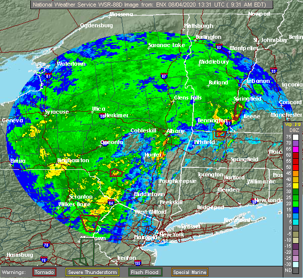 At 935 am edt, a severe thunderstorm capable of producing a tornado was located over walpole, or 12 miles northwest of keene, moving north at 50 mph (radar indicated rotation). Hazards include tornado. Flying debris will be dangerous to those caught without shelter. mobile homes will be damaged or destroyed. damage to roofs, windows, and vehicles will occur. tree damage is likely. this dangerous storm will be near, alstead around 945 am edt. charlestown around 955 am edt. Other locations impacted by this tornadic thunderstorm include langdon and acworth. At 935 am edt, a severe thunderstorm capable of producing a tornado was located over walpole, or 12 miles northwest of keene, moving north at 50 mph (radar indicated rotation). Hazards include tornado. Flying debris will be dangerous to those caught without shelter. mobile homes will be damaged or destroyed. damage to roofs, windows, and vehicles will occur. tree damage is likely. this dangerous storm will be near, alstead around 945 am edt. charlestown around 955 am edt. Other locations impacted by this tornadic thunderstorm include langdon and acworth.
|
| 8/4/2020 9:22 AM EDT |
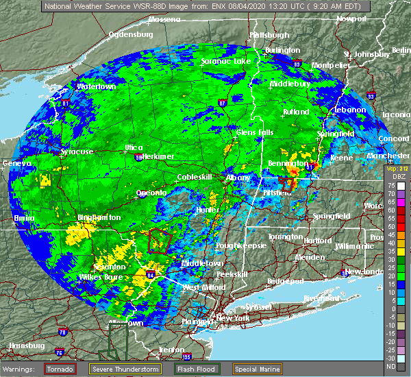 At 921 am edt, a severe thunderstorm capable of producing a tornado was located near westmoreland, or 10 miles west of keene, moving north at 50 mph (radar indicated rotation). Hazards include tornado. Flying debris will be dangerous to those caught without shelter. mobile homes will be damaged or destroyed. damage to roofs, windows, and vehicles will occur. tree damage is likely. this dangerous storm will be near, westmoreland around 930 am edt. walpole around 940 am edt. charlestown and alstead around 945 am edt. Other locations impacted by this tornadic thunderstorm include langdon and acworth. At 921 am edt, a severe thunderstorm capable of producing a tornado was located near westmoreland, or 10 miles west of keene, moving north at 50 mph (radar indicated rotation). Hazards include tornado. Flying debris will be dangerous to those caught without shelter. mobile homes will be damaged or destroyed. damage to roofs, windows, and vehicles will occur. tree damage is likely. this dangerous storm will be near, westmoreland around 930 am edt. walpole around 940 am edt. charlestown and alstead around 945 am edt. Other locations impacted by this tornadic thunderstorm include langdon and acworth.
|
| 7/8/2020 4:16 PM EDT |
 At 416 pm edt, a severe thunderstorm was located over swanzey, or near keene, moving southeast at 10 mph (radar indicated). Hazards include 60 mph wind gusts and quarter size hail. Hail damage to vehicles is expected. expect wind damage to roofs, siding, and trees. Locations impacted include, keene, harrisville, nelson, gilsum, sullivan, roxbury, westmoreland, surry, walpole and alstead. At 416 pm edt, a severe thunderstorm was located over swanzey, or near keene, moving southeast at 10 mph (radar indicated). Hazards include 60 mph wind gusts and quarter size hail. Hail damage to vehicles is expected. expect wind damage to roofs, siding, and trees. Locations impacted include, keene, harrisville, nelson, gilsum, sullivan, roxbury, westmoreland, surry, walpole and alstead.
|
| 7/8/2020 3:37 PM EDT |
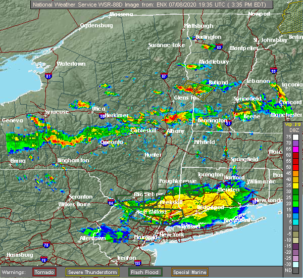 At 337 pm edt, a severe thunderstorm was located over walpole, or 10 miles northwest of keene, moving east at 20 mph (radar indicated). Hazards include 60 mph wind gusts and quarter size hail. Hail damage to vehicles is expected. Expect wind damage to roofs, siding, and trees. At 337 pm edt, a severe thunderstorm was located over walpole, or 10 miles northwest of keene, moving east at 20 mph (radar indicated). Hazards include 60 mph wind gusts and quarter size hail. Hail damage to vehicles is expected. Expect wind damage to roofs, siding, and trees.
|
| 7/8/2020 2:19 PM EDT |
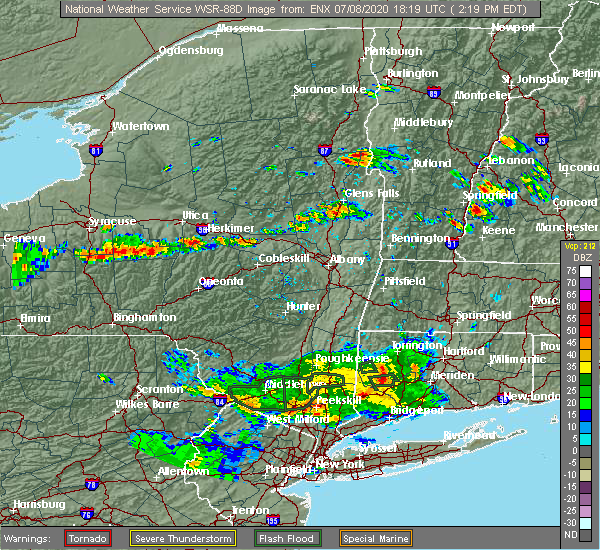 At 218 pm edt, a severe thunderstorm was located near charlestown, or 12 miles south of claremont, moving east at 15 mph (radar indicated). Hazards include 60 mph wind gusts and quarter size hail. Hail damage to vehicles is expected. Expect wind damage to roofs, siding, and trees. At 218 pm edt, a severe thunderstorm was located near charlestown, or 12 miles south of claremont, moving east at 15 mph (radar indicated). Hazards include 60 mph wind gusts and quarter size hail. Hail damage to vehicles is expected. Expect wind damage to roofs, siding, and trees.
|
| 7/5/2020 7:55 PM EDT | Multiple trees dow in cheshire county NH, 5.1 miles WNW of Walpole, NH |
| 7/5/2020 7:55 PM EDT |
 At 755 pm edt, a severe thunderstorm was located over gilsum, or near keene, moving southeast at 30 mph (radar indicated). Hazards include 60 mph wind gusts and quarter size hail. Hail damage to vehicles is expected. Expect wind damage to roofs, siding, and trees. At 755 pm edt, a severe thunderstorm was located over gilsum, or near keene, moving southeast at 30 mph (radar indicated). Hazards include 60 mph wind gusts and quarter size hail. Hail damage to vehicles is expected. Expect wind damage to roofs, siding, and trees.
|
| 7/5/2020 7:45 PM EDT |
 At 744 pm edt, a severe thunderstorm was located over alstead, or 11 miles north of keene, moving southeast at 30 mph (radar indicated). Hazards include 60 mph wind gusts and quarter size hail. Hail damage to vehicles is expected. expect wind damage to roofs, siding, and trees. Locations impacted include, keene, charlestown, walpole, gilsum, alstead, surry, marlow, sullivan, acworth and langdon. At 744 pm edt, a severe thunderstorm was located over alstead, or 11 miles north of keene, moving southeast at 30 mph (radar indicated). Hazards include 60 mph wind gusts and quarter size hail. Hail damage to vehicles is expected. expect wind damage to roofs, siding, and trees. Locations impacted include, keene, charlestown, walpole, gilsum, alstead, surry, marlow, sullivan, acworth and langdon.
|
| 7/5/2020 7:35 PM EDT | Several reported trees down on alstead center road and route 12a on surry lin in cheshire county NH, 5.3 miles W of Walpole, NH |
| 7/5/2020 7:18 PM EDT |
 At 717 pm edt, a severe thunderstorm was located near charlestown, or 11 miles southwest of claremont, moving southeast at 30 mph (radar indicated). Hazards include 60 mph wind gusts and quarter size hail. Hail damage to vehicles is expected. Expect wind damage to roofs, siding, and trees. At 717 pm edt, a severe thunderstorm was located near charlestown, or 11 miles southwest of claremont, moving southeast at 30 mph (radar indicated). Hazards include 60 mph wind gusts and quarter size hail. Hail damage to vehicles is expected. Expect wind damage to roofs, siding, and trees.
|
| 5/15/2020 7:37 PM EDT | Trees down on wire in cheshire county NH, 0.4 miles ESE of Walpole, NH |
| 5/15/2020 7:23 PM EDT |
 At 722 pm edt, severe thunderstorms were located along a line extending from near walpole to near chesterfield to near hinsdale, moving east at 50 mph (radar indicated). Hazards include 70 mph wind gusts and penny size hail. Expect considerable tree damage. damage is likely to mobile homes, roofs, and outbuildings. locations impacted include, keene, jaffrey, peterborough, charlestown, winchester, antrim, bradford, dublin, richmond, harrisville, nelson, gilsum, marlborough, rindge, walpole, alstead, westmoreland, swanzey, marlow and hinsdale. This also includes, mount monadnock. At 722 pm edt, severe thunderstorms were located along a line extending from near walpole to near chesterfield to near hinsdale, moving east at 50 mph (radar indicated). Hazards include 70 mph wind gusts and penny size hail. Expect considerable tree damage. damage is likely to mobile homes, roofs, and outbuildings. locations impacted include, keene, jaffrey, peterborough, charlestown, winchester, antrim, bradford, dublin, richmond, harrisville, nelson, gilsum, marlborough, rindge, walpole, alstead, westmoreland, swanzey, marlow and hinsdale. This also includes, mount monadnock.
|
| 5/15/2020 6:47 PM EDT |
 At 646 pm edt, severe thunderstorms were located along a line extending from 29 miles west of charlestown to 24 miles west of westmoreland to 36 miles west of hinsdale, moving east at 55 mph (radar indicated). Hazards include 70 mph wind gusts and penny size hail. Expect considerable tree damage. Damage is likely to mobile homes, roofs, and outbuildings. At 646 pm edt, severe thunderstorms were located along a line extending from 29 miles west of charlestown to 24 miles west of westmoreland to 36 miles west of hinsdale, moving east at 55 mph (radar indicated). Hazards include 70 mph wind gusts and penny size hail. Expect considerable tree damage. Damage is likely to mobile homes, roofs, and outbuildings.
|
| 8/17/2019 7:36 PM EDT |
 At 736 pm edt, a severe thunderstorm was located near hinsdale, or 17 miles southwest of keene, moving northeast at 30 mph (radar indicated). Hazards include 60 mph wind gusts and penny size hail. expect damage to roofs, siding, and trees At 736 pm edt, a severe thunderstorm was located near hinsdale, or 17 miles southwest of keene, moving northeast at 30 mph (radar indicated). Hazards include 60 mph wind gusts and penny size hail. expect damage to roofs, siding, and trees
|
| 8/3/2018 3:15 PM EDT |
 At 314 pm edt, a severe thunderstorm was located near alstead, or 12 miles south of claremont, moving northeast at 35 mph (radar indicated). Hazards include 60 mph wind gusts and penny size hail. expect damage to roofs, siding, and trees At 314 pm edt, a severe thunderstorm was located near alstead, or 12 miles south of claremont, moving northeast at 35 mph (radar indicated). Hazards include 60 mph wind gusts and penny size hail. expect damage to roofs, siding, and trees
|
| 7/28/2018 7:08 PM EDT |
 The severe thunderstorm warning for southern sullivan and western cheshire counties will expire at 715 pm edt, the storms which prompted the warning have moved out of the warned area. therefore, the warning will be allowed to expire. The severe thunderstorm warning for southern sullivan and western cheshire counties will expire at 715 pm edt, the storms which prompted the warning have moved out of the warned area. therefore, the warning will be allowed to expire.
|
| 7/28/2018 6:17 PM EDT |
 At 616 pm edt, severe thunderstorms were located along a line extending from near alstead to 7 miles west of hinsdale, moving northeast at 15 mph (radar indicated). Hazards include 60 mph wind gusts and nickel size hail. expect damage to roofs, siding, and trees At 616 pm edt, severe thunderstorms were located along a line extending from near alstead to 7 miles west of hinsdale, moving northeast at 15 mph (radar indicated). Hazards include 60 mph wind gusts and nickel size hail. expect damage to roofs, siding, and trees
|
| 7/28/2018 3:40 PM EDT |
 The severe thunderstorm warning for southwestern sullivan and northwestern cheshire counties will expire at 345 pm edt, the storm which prompted the warning has moved out of the area. therefore, the warning will be allowed to expire. The severe thunderstorm warning for southwestern sullivan and northwestern cheshire counties will expire at 345 pm edt, the storm which prompted the warning has moved out of the area. therefore, the warning will be allowed to expire.
|
| 7/28/2018 3:24 PM EDT | Trees and wires down on old cheshire turnpik in cheshire county NH, 2.7 miles SW of Walpole, NH |
| 7/28/2018 3:24 PM EDT | Trees and wires down on wentworth roa in cheshire county NH, 2 miles N of Walpole, NH |
| 7/28/2018 3:24 PM EDT | Trees down on kingsbury rd. from spotter ch112 in cheshire county NH, 1.3 miles N of Walpole, NH |
| 7/28/2018 3:15 PM EDT | Trees down on wires on county roa in cheshire county NH, 3.1 miles NNW of Walpole, NH |
| 7/28/2018 3:04 PM EDT |
 At 303 pm edt, a severe thunderstorm was located near westmoreland, or 12 miles northwest of keene, moving east at 25 mph (radar indicated). Hazards include 60 mph wind gusts and quarter size hail. Hail damage to vehicles is expected. Expect wind damage to roofs, siding, and trees. At 303 pm edt, a severe thunderstorm was located near westmoreland, or 12 miles northwest of keene, moving east at 25 mph (radar indicated). Hazards include 60 mph wind gusts and quarter size hail. Hail damage to vehicles is expected. Expect wind damage to roofs, siding, and trees.
|
| 6/18/2018 5:12 PM EDT |
 At 511 pm edt, severe thunderstorms were located along a line extending from charlestown to near surry to 8 miles south of hinsdale, moving east at 50 mph (radar indicated). Hazards include 60 mph wind gusts. Expect damage to roofs, siding, and trees. locations impacted include, keene, jaffrey, peterborough, charlestown, winchester, antrim, greenfield, bradford, dublin, francestown, bennington, richmond, harrisville, nelson, marlborough, gilsum, rindge, windsor, hancock and walpole. This also includes, mount monadnock. At 511 pm edt, severe thunderstorms were located along a line extending from charlestown to near surry to 8 miles south of hinsdale, moving east at 50 mph (radar indicated). Hazards include 60 mph wind gusts. Expect damage to roofs, siding, and trees. locations impacted include, keene, jaffrey, peterborough, charlestown, winchester, antrim, greenfield, bradford, dublin, francestown, bennington, richmond, harrisville, nelson, marlborough, gilsum, rindge, windsor, hancock and walpole. This also includes, mount monadnock.
|
| 6/18/2018 4:47 PM EDT |
 At 447 pm edt, severe thunderstorms were located along a line extending from 20 miles west of charlestown to 12 miles west of westmoreland to 24 miles southwest of hinsdale, moving east at 50 mph (radar indicated). Hazards include 60 mph wind gusts. expect damage to roofs, siding, and trees At 447 pm edt, severe thunderstorms were located along a line extending from 20 miles west of charlestown to 12 miles west of westmoreland to 24 miles southwest of hinsdale, moving east at 50 mph (radar indicated). Hazards include 60 mph wind gusts. expect damage to roofs, siding, and trees
|
| 5/4/2018 9:30 PM EDT | Tree blown dow in cheshire county NH, 0.4 miles ESE of Walpole, NH |
| 5/4/2018 9:09 PM EDT |
 At 908 pm edt, severe thunderstorms were located along a line extending from 17 miles west of hanover to 8 miles northwest of charlestown to 7 miles west of westmoreland to 8 miles west of hinsdale, moving east at 55 mph (radar indicated). Hazards include 60 mph wind gusts. expect damage to roofs, siding, and trees At 908 pm edt, severe thunderstorms were located along a line extending from 17 miles west of hanover to 8 miles northwest of charlestown to 7 miles west of westmoreland to 8 miles west of hinsdale, moving east at 55 mph (radar indicated). Hazards include 60 mph wind gusts. expect damage to roofs, siding, and trees
|
| 9/5/2017 4:27 PM EDT |
 At 426 pm edt, a severe thunderstorm was located near walpole, or 14 miles northwest of keene, moving northeast at 35 mph (radar indicated). Hazards include 60 mph wind gusts and nickel size hail. expect damage to trees, and power lines At 426 pm edt, a severe thunderstorm was located near walpole, or 14 miles northwest of keene, moving northeast at 35 mph (radar indicated). Hazards include 60 mph wind gusts and nickel size hail. expect damage to trees, and power lines
|
| 9/5/2017 4:25 PM EDT |
 At 425 pm edt, a severe thunderstorm was located near chesterfield, or 14 miles west of keene, moving northeast at 30 mph (radar indicated). Hazards include 60 mph wind gusts and nickel size hail. expect damage to trees, and power lines At 425 pm edt, a severe thunderstorm was located near chesterfield, or 14 miles west of keene, moving northeast at 30 mph (radar indicated). Hazards include 60 mph wind gusts and nickel size hail. expect damage to trees, and power lines
|
| 8/22/2017 9:53 PM EDT |
 At 953 pm edt, severe thunderstorms were located along a line extending from 8 miles north of canaan to new london to near winchester, moving east at 45 mph (radar indicated). Hazards include 60 mph wind gusts. Expect damage to trees, and power lines. locations impacted include, keene, jaffrey, new london, grafton, peterborough, enfield, winchester, canaan, bradford, dublin, danbury, richmond, harrisville, nelson, groton, rindge, walpole, alstead, westmoreland and swanzey. this also includes, mount monadnock and mount sunapee. This includes interstate 89 between mile markers 28 and 39. At 953 pm edt, severe thunderstorms were located along a line extending from 8 miles north of canaan to new london to near winchester, moving east at 45 mph (radar indicated). Hazards include 60 mph wind gusts. Expect damage to trees, and power lines. locations impacted include, keene, jaffrey, new london, grafton, peterborough, enfield, winchester, canaan, bradford, dublin, danbury, richmond, harrisville, nelson, groton, rindge, walpole, alstead, westmoreland and swanzey. this also includes, mount monadnock and mount sunapee. This includes interstate 89 between mile markers 28 and 39.
|
| 8/22/2017 9:20 PM EDT |
 At 920 pm edt, severe thunderstorms were located along a line extending from 10 miles west of hanover to 6 miles west of claremont to 17 miles west of hinsdale, moving east at 45 mph (radar indicated). Hazards include 60 mph wind gusts. expect damage to trees, and power lines At 920 pm edt, severe thunderstorms were located along a line extending from 10 miles west of hanover to 6 miles west of claremont to 17 miles west of hinsdale, moving east at 45 mph (radar indicated). Hazards include 60 mph wind gusts. expect damage to trees, and power lines
|
| 7/1/2017 7:16 PM EDT |
 At 716 pm edt, severe thunderstorms were located along a line extending from 15 miles west of claremont to near charlestown to 9 miles west of chesterfield, moving east at 35 mph (radar indicated). Hazards include 60 mph wind gusts. expect damage to trees, and power lines At 716 pm edt, severe thunderstorms were located along a line extending from 15 miles west of claremont to near charlestown to 9 miles west of chesterfield, moving east at 35 mph (radar indicated). Hazards include 60 mph wind gusts. expect damage to trees, and power lines
|
| 6/27/2017 12:09 PM EDT |
 At 408 pm edt, a severe thunderstorm was located over westmoreland, or 8 miles west of keene, moving northeast at 30 mph (radar indicated). Hazards include 60 mph wind gusts and quarter size hail. Minor hail damage to vehicles is possible. Expect wind damage to roofs, siding, and trees. At 408 pm edt, a severe thunderstorm was located over westmoreland, or 8 miles west of keene, moving northeast at 30 mph (radar indicated). Hazards include 60 mph wind gusts and quarter size hail. Minor hail damage to vehicles is possible. Expect wind damage to roofs, siding, and trees.
|
| 6/19/2017 5:29 PM EDT |
 At 529 pm edt, severe thunderstorms were located along a line extending from near alstead to near richmond, moving northeast at 50 mph (law enforcement). Hazards include 70 mph wind gusts. Expect considerable tree damage. damage is likely to mobile homes, roofs, and outbuildings. locations impacted include, keene, jaffrey, peterborough, charlestown, winchester, antrim, bradford, dublin, richmond, harrisville, nelson, marlborough, gilsum, rindge, walpole, alstead, swanzey, marlow, roxbury and fitzwilliam. This also includes, mount monadnock. At 529 pm edt, severe thunderstorms were located along a line extending from near alstead to near richmond, moving northeast at 50 mph (law enforcement). Hazards include 70 mph wind gusts. Expect considerable tree damage. damage is likely to mobile homes, roofs, and outbuildings. locations impacted include, keene, jaffrey, peterborough, charlestown, winchester, antrim, bradford, dublin, richmond, harrisville, nelson, marlborough, gilsum, rindge, walpole, alstead, swanzey, marlow, roxbury and fitzwilliam. This also includes, mount monadnock.
|
| 6/19/2017 4:57 PM EDT |
 At 456 pm edt, severe thunderstorms were located along a line extending from 10 miles west of westmoreland to 8 miles west of hinsdale, moving northeast at 65 mph (radar indicated). Hazards include 60 mph wind gusts. expect damage to trees, and power lines At 456 pm edt, severe thunderstorms were located along a line extending from 10 miles west of westmoreland to 8 miles west of hinsdale, moving northeast at 65 mph (radar indicated). Hazards include 60 mph wind gusts. expect damage to trees, and power lines
|
| 5/18/2017 9:06 PM EDT | Trees down in cheshire county NH, 0.4 miles ESE of Walpole, NH |
| 5/18/2017 9:00 PM EDT | Trees and wires down on route 12 in cheshire county NH, 0.4 miles ESE of Walpole, NH |
| 5/18/2017 8:42 PM EDT |
 At 841 pm edt, severe thunderstorms were located along a line extending from 24 miles west of charlestown to 13 miles west of westmoreland to 13 miles west of hinsdale to 36 miles southwest of winchester, moving east at 50 mph (radar indicated). Hazards include 60 mph wind gusts. expect damage to trees, and power lines At 841 pm edt, severe thunderstorms were located along a line extending from 24 miles west of charlestown to 13 miles west of westmoreland to 13 miles west of hinsdale to 36 miles southwest of winchester, moving east at 50 mph (radar indicated). Hazards include 60 mph wind gusts. expect damage to trees, and power lines
|
| 9/11/2016 8:23 AM EDT |
 At 822 am edt, severe thunderstorms were located along a line extending from 6 miles southwest of enfield to 6 miles southwest of hinsdale, moving east at 35 mph. this line of storms has the history of producing wind damage (radar indicated). Hazards include 60 mph wind gusts. Expect damage to roofs. siding. And trees. At 822 am edt, severe thunderstorms were located along a line extending from 6 miles southwest of enfield to 6 miles southwest of hinsdale, moving east at 35 mph. this line of storms has the history of producing wind damage (radar indicated). Hazards include 60 mph wind gusts. Expect damage to roofs. siding. And trees.
|
| 8/13/2016 8:13 PM EDT |
 At 813 pm edt, severe thunderstorms were located along a line extending from near charlestown to near bellows falls to newfane, moving east at 30 mph (radar indicated). Hazards include 60 mph wind gusts and penny size hail. Expect damage to roofs. siding. And trees. At 813 pm edt, severe thunderstorms were located along a line extending from near charlestown to near bellows falls to newfane, moving east at 30 mph (radar indicated). Hazards include 60 mph wind gusts and penny size hail. Expect damage to roofs. siding. And trees.
|
| 7/23/2016 6:08 PM EDT |
 At 608 pm edt, severe thunderstorms were located along a line extending from near dover to goffstown to walpole, moving southeast at 25 mph (radar indicated). Hazards include 60 mph wind gusts and nickel size hail. Expect damage to roofs. siding. And trees. At 608 pm edt, severe thunderstorms were located along a line extending from near dover to goffstown to walpole, moving southeast at 25 mph (radar indicated). Hazards include 60 mph wind gusts and nickel size hail. Expect damage to roofs. siding. And trees.
|
| 7/23/2016 5:21 PM EDT |
 At 521 pm edt, severe thunderstorms were located along a line extending from 9 miles southwest of ascutney to warner, moving east at 45 mph (radar indicated). Hazards include 60 mph wind gusts and quarter size hail. Hail damage to vehicles is expected. Expect wind damage to roofs, siding, and trees. At 521 pm edt, severe thunderstorms were located along a line extending from 9 miles southwest of ascutney to warner, moving east at 45 mph (radar indicated). Hazards include 60 mph wind gusts and quarter size hail. Hail damage to vehicles is expected. Expect wind damage to roofs, siding, and trees.
|
| 9/8/2015 2:40 PM EDT | Trees down on old settlers road in east alstead in cheshire county NH, 8.1 miles WSW of Walpole, NH |
| 8/4/2015 12:58 PM EDT |
 At 1258 pm edt, doppler radar indicated a severe thunderstorm capable of producing quarter size hail and damaging winds in excess of 60 mph. this storm was located over roxbury, or near keene, moving east at 25 mph. locations impacted include, keene, jaffrey, henniker, swanzey, peterborough, rindge, hopkinton, new boston, new ipswich, winchester, hinsdale, wilton, chesterfield, antrim, marlborough, fitzwilliam, troy, greenville, westmoreland and greenfield. At 1258 pm edt, doppler radar indicated a severe thunderstorm capable of producing quarter size hail and damaging winds in excess of 60 mph. this storm was located over roxbury, or near keene, moving east at 25 mph. locations impacted include, keene, jaffrey, henniker, swanzey, peterborough, rindge, hopkinton, new boston, new ipswich, winchester, hinsdale, wilton, chesterfield, antrim, marlborough, fitzwilliam, troy, greenville, westmoreland and greenfield.
|
| 8/4/2015 12:46 PM EDT |
 At 1246 pm edt, doppler radar indicated a severe thunderstorm capable of producing quarter size hail and damaging winds in excess of 60 mph. this storm was located over keene, moving east at 30 mph. locations impacted include, keene, jaffrey, henniker, swanzey, peterborough, rindge, hopkinton, new boston, new ipswich, winchester, hinsdale, wilton, chesterfield, antrim, marlborough, fitzwilliam, troy, greenville, westmoreland and greenfield. At 1246 pm edt, doppler radar indicated a severe thunderstorm capable of producing quarter size hail and damaging winds in excess of 60 mph. this storm was located over keene, moving east at 30 mph. locations impacted include, keene, jaffrey, henniker, swanzey, peterborough, rindge, hopkinton, new boston, new ipswich, winchester, hinsdale, wilton, chesterfield, antrim, marlborough, fitzwilliam, troy, greenville, westmoreland and greenfield.
|
| 8/3/2015 5:29 PM EDT |
 At 528 pm edt, doppler radar indicated a line of severe thunderstorms capable of producing damaging winds in excess of 60 mph. these storms were located along a line extending from lebanon to 8 miles north of newport to near claremont to westminster to near guilford center, moving northeast at 35 mph. locations impacted include, keene, claremont, southwestern lebanon, jaffrey, new london, swanzey, charlestown, enfield, winchester, hinsdale, chesterfield, antrim, marlborough, fitzwilliam, troy, westmoreland, bradford, dublin, danbury and richmond. At 528 pm edt, doppler radar indicated a line of severe thunderstorms capable of producing damaging winds in excess of 60 mph. these storms were located along a line extending from lebanon to 8 miles north of newport to near claremont to westminster to near guilford center, moving northeast at 35 mph. locations impacted include, keene, claremont, southwestern lebanon, jaffrey, new london, swanzey, charlestown, enfield, winchester, hinsdale, chesterfield, antrim, marlborough, fitzwilliam, troy, westmoreland, bradford, dublin, danbury and richmond.
|
| 8/3/2015 5:08 PM EDT |
 At 508 pm edt, doppler radar indicated a line of severe thunderstorms capable of producing damaging winds in excess of 60 mph. these storms were located along a line extending from near hartland to near claremont to near charlestown to near putney to near heath, and moving northeast at 35 mph. At 508 pm edt, doppler radar indicated a line of severe thunderstorms capable of producing damaging winds in excess of 60 mph. these storms were located along a line extending from near hartland to near claremont to near charlestown to near putney to near heath, and moving northeast at 35 mph.
|
| 9/2/2014 1:40 PM EDT | Tree and wires down route 12a in cheshire county NH, 5.1 miles WNW of Walpole, NH |
| 8/7/2014 2:13 PM EDT | Quarter sized hail reported 0.4 miles ESE of Walpole, NH |
| 8/7/2014 2:08 PM EDT | Golf Ball sized hail reported 0.4 miles ESE of Walpole, NH |
| 7/9/2014 6:19 PM EDT | Tree on car on westminster street in cheshire county NH, 0.4 miles ESE of Walpole, NH |
| 10/7/2013 5:14 PM EDT | Tree and pole down on route 12 in cheshire county NH, 5.1 miles WNW of Walpole, NH |
| 10/7/2013 5:14 PM EDT | Tree and pole down on toute 12 in cheshire county NH, 5.1 miles WNW of Walpole, NH |
| 10/7/2013 5:08 PM EDT | Tree and wires down on cold river road in cheshire county NH, 0.4 miles ESE of Walpole, NH |
| 10/7/2013 5:04 PM EDT | Tree and wires down on upper walpole road in cheshire county NH, 0.4 miles ESE of Walpole, NH |
| 5/29/2012 6:58 PM EDT | Tree down on book cellar road in cheshire county NH, 0.4 miles ESE of Walpole, NH |
| 5/29/2012 5:10 PM EDT | Quarter sized hail reported 0.4 miles ESE of Walpole, NH, nws coop |
| 5/29/2012 5:08 PM EDT | Tree down on power lines in cheshire county NH, 7.8 miles WSW of Walpole, NH |
| 5/29/2012 4:50 PM EDT | Golf Ball sized hail reported 0.4 miles ESE of Walpole, NH |
| 5/29/2012 3:35 PM EDT | Quarter sized hail reported 4.2 miles SSW of Walpole, NH, quarter sized hail off mellish road |
| 1/1/0001 12:00 AM | Trees and wires down on kingsbury road. large limbs down on county roa in cheshire county NH, 0.4 miles ESE of Walpole, NH |
| 1/1/0001 12:00 AM | Tree down across road on route 12a near fire station in cheshire county NH, 5.1 miles WNW of Walpole, NH |
Hail Maps for Walpole, NH


Connect with Interactive Hail Maps