

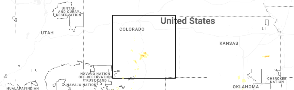
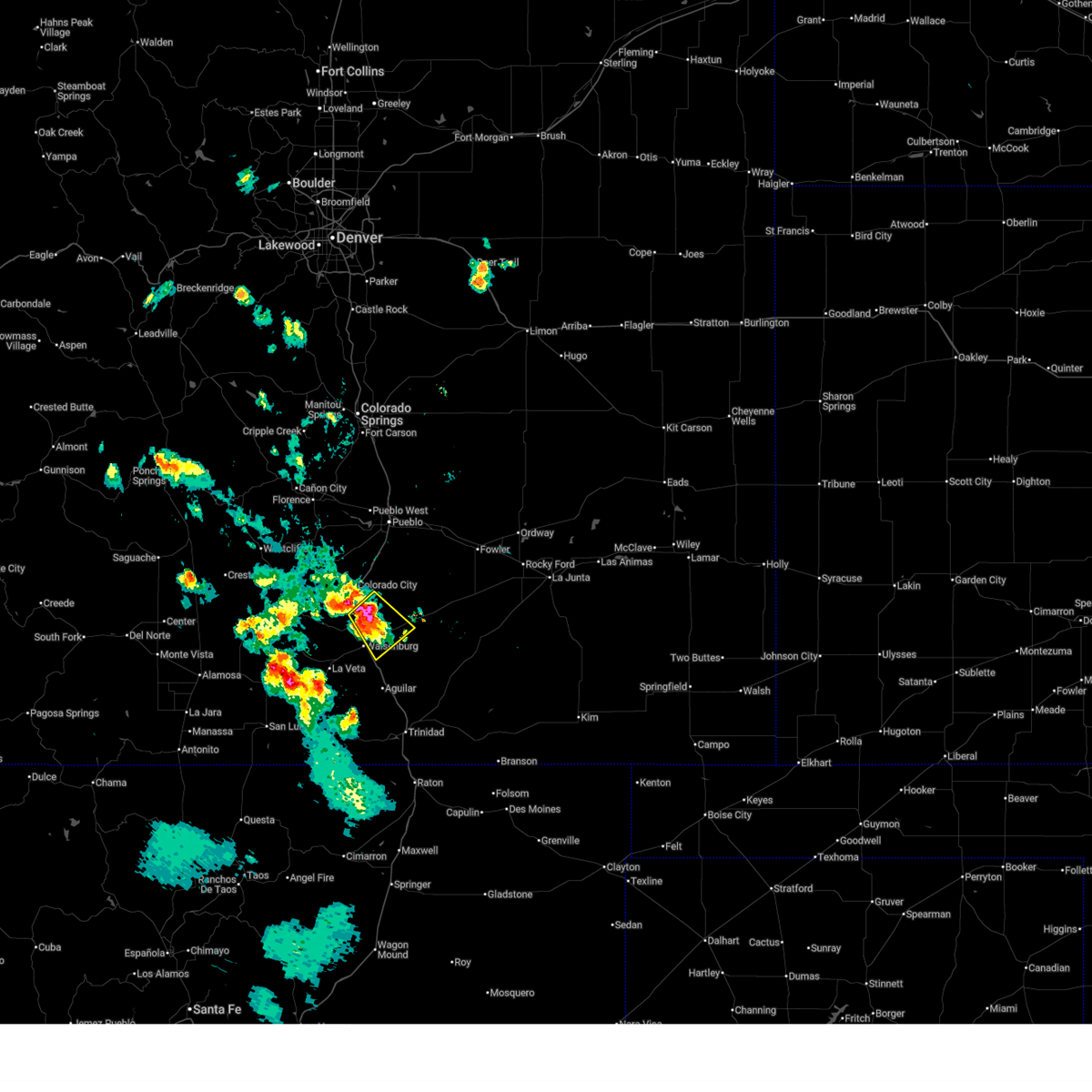
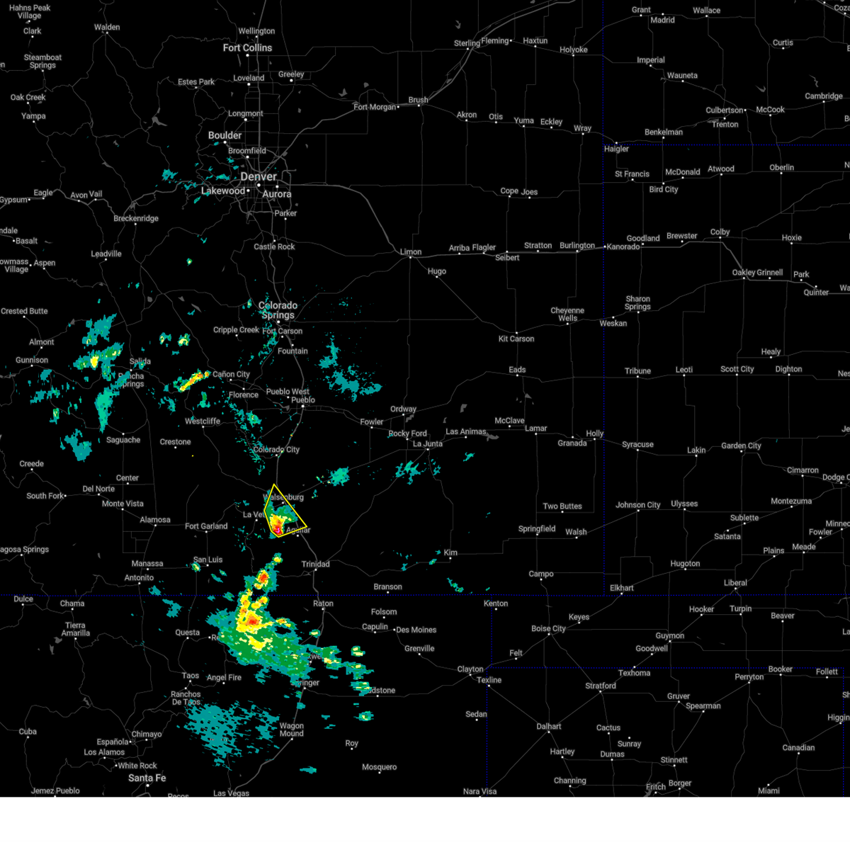
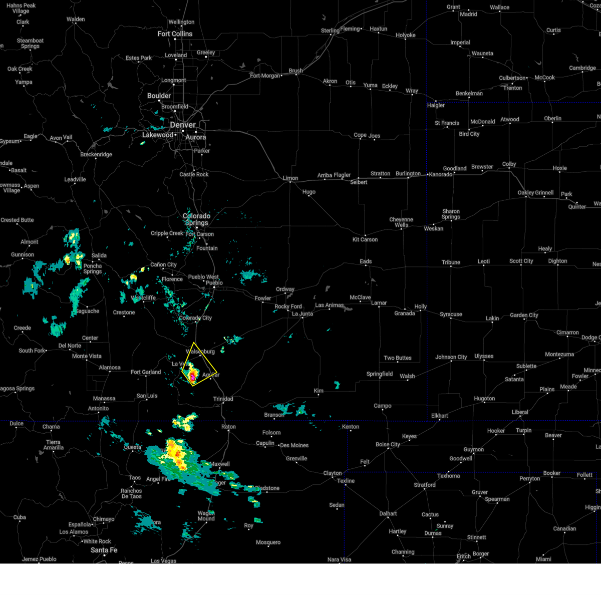
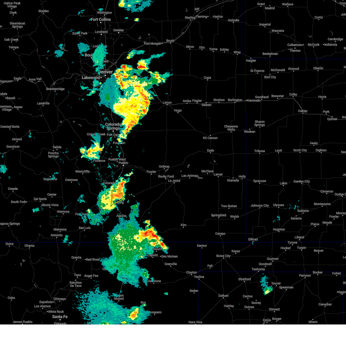
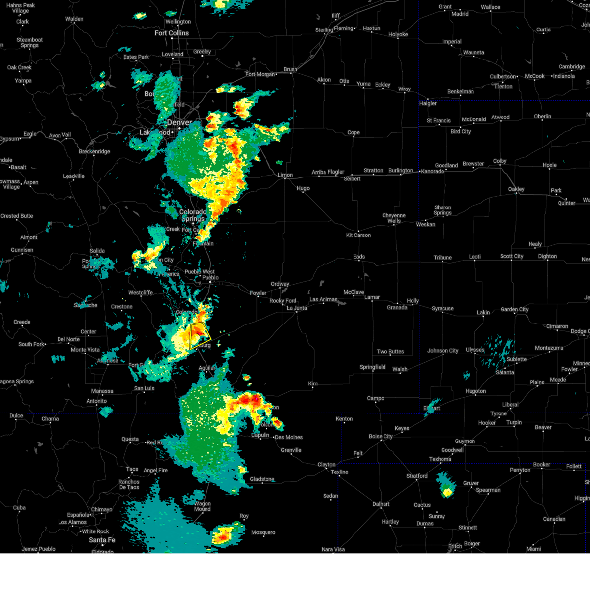
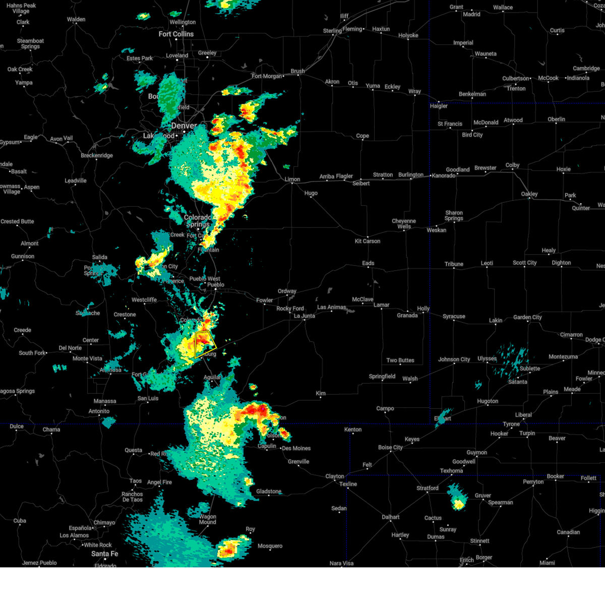
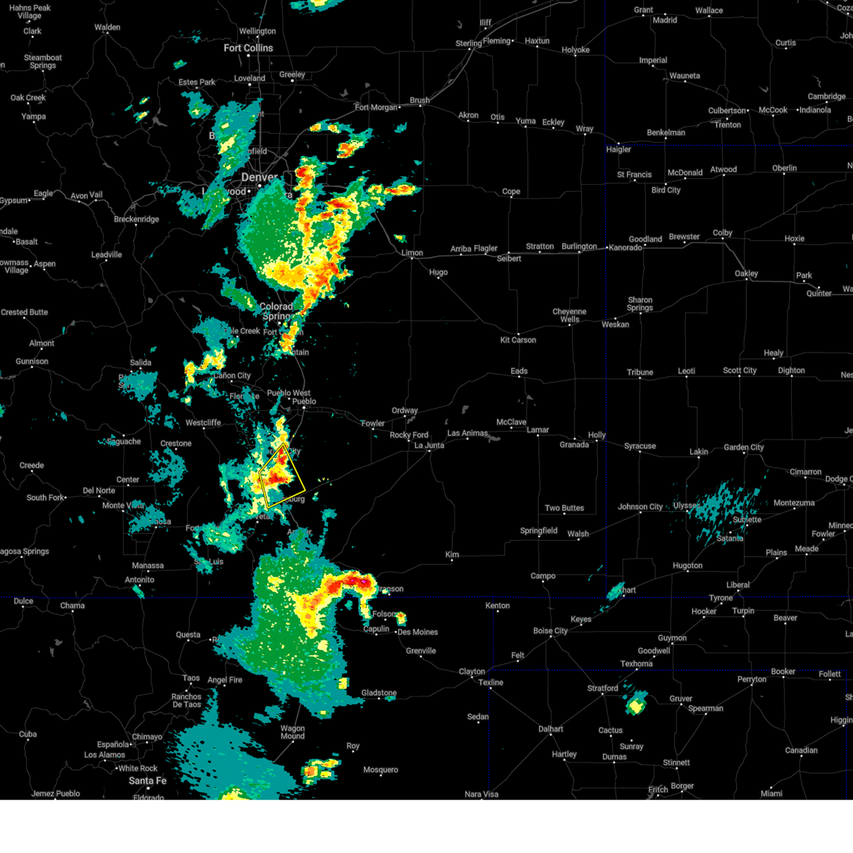
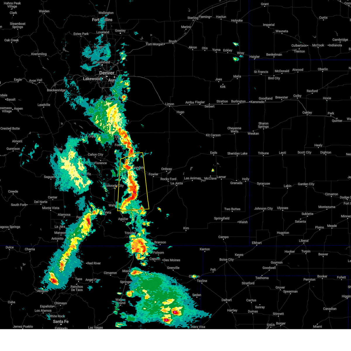
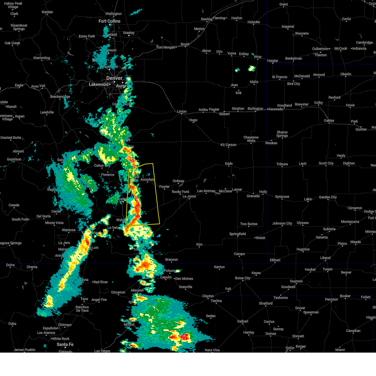
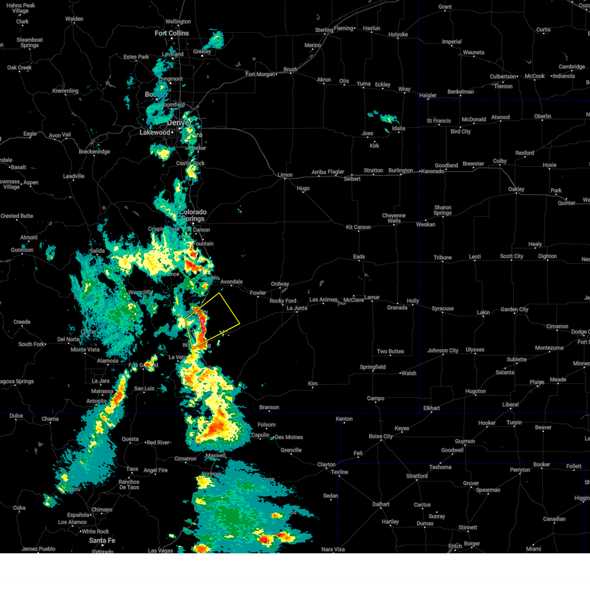
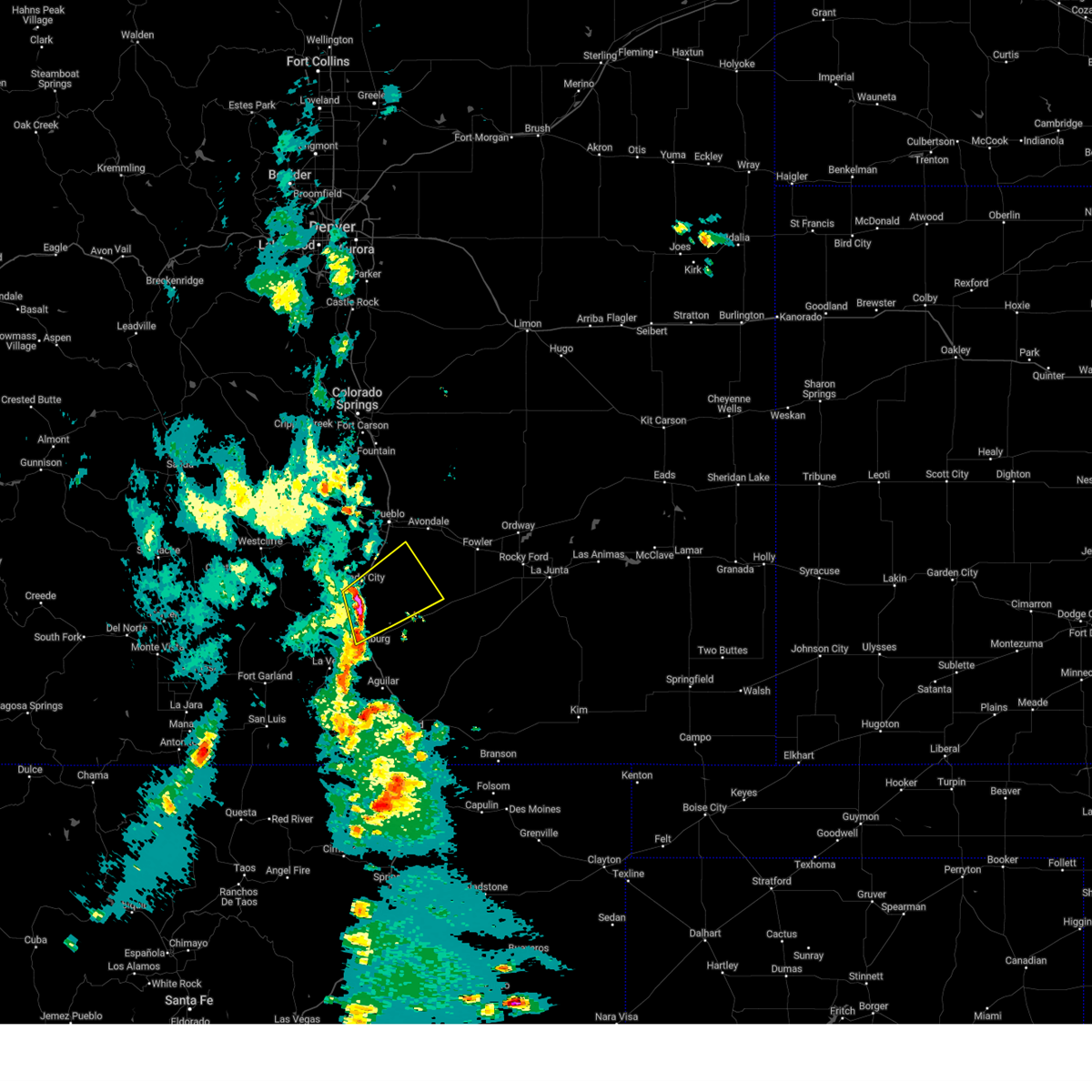
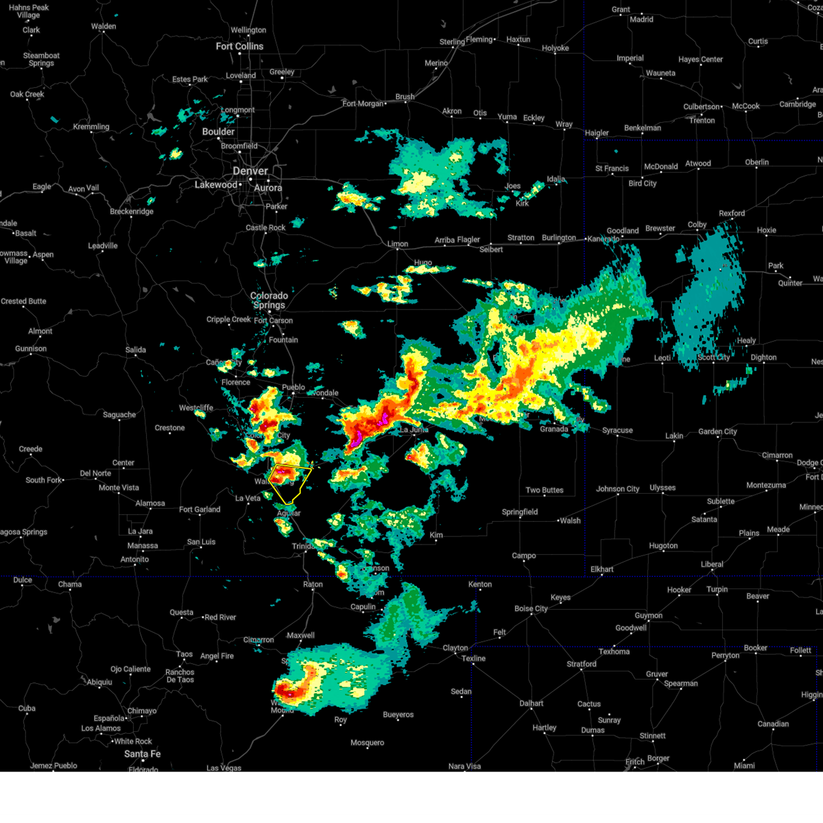
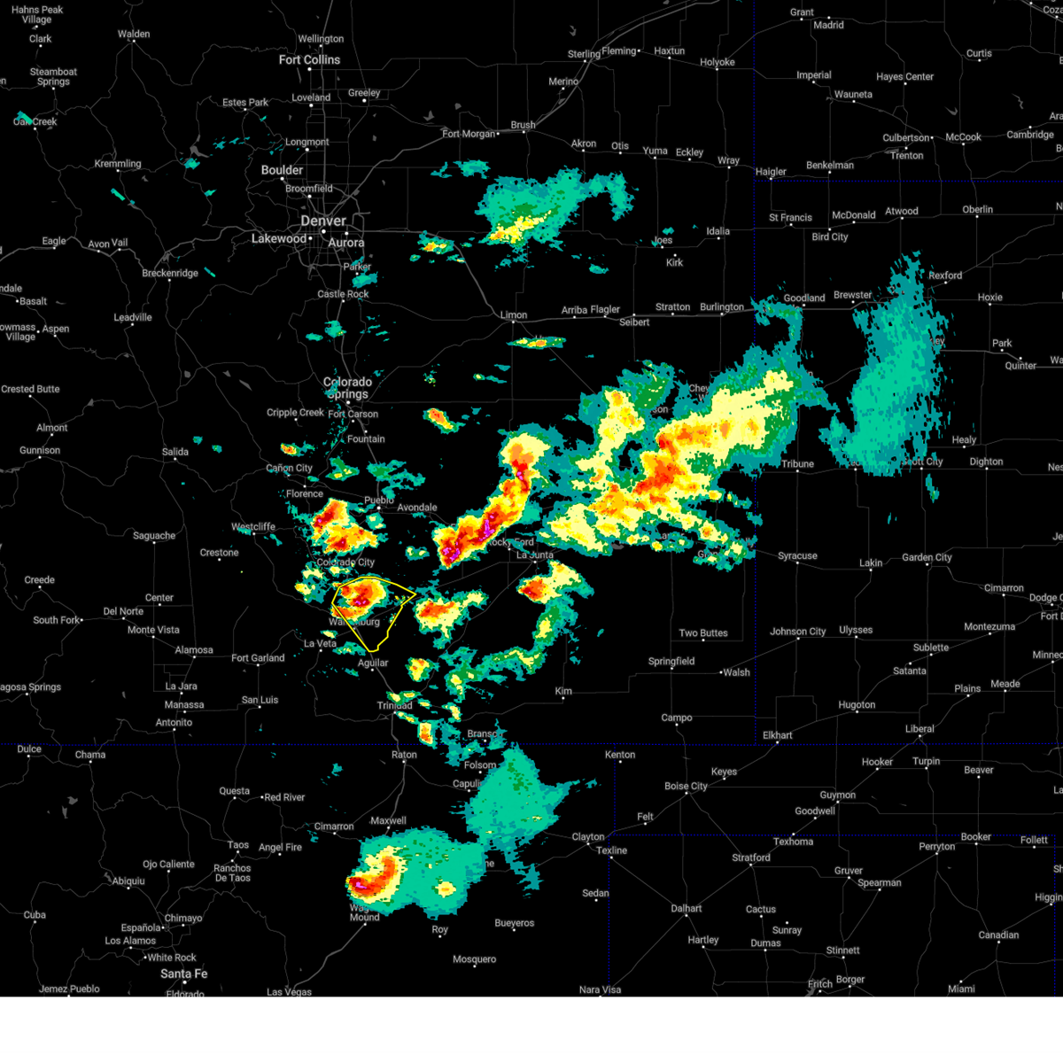
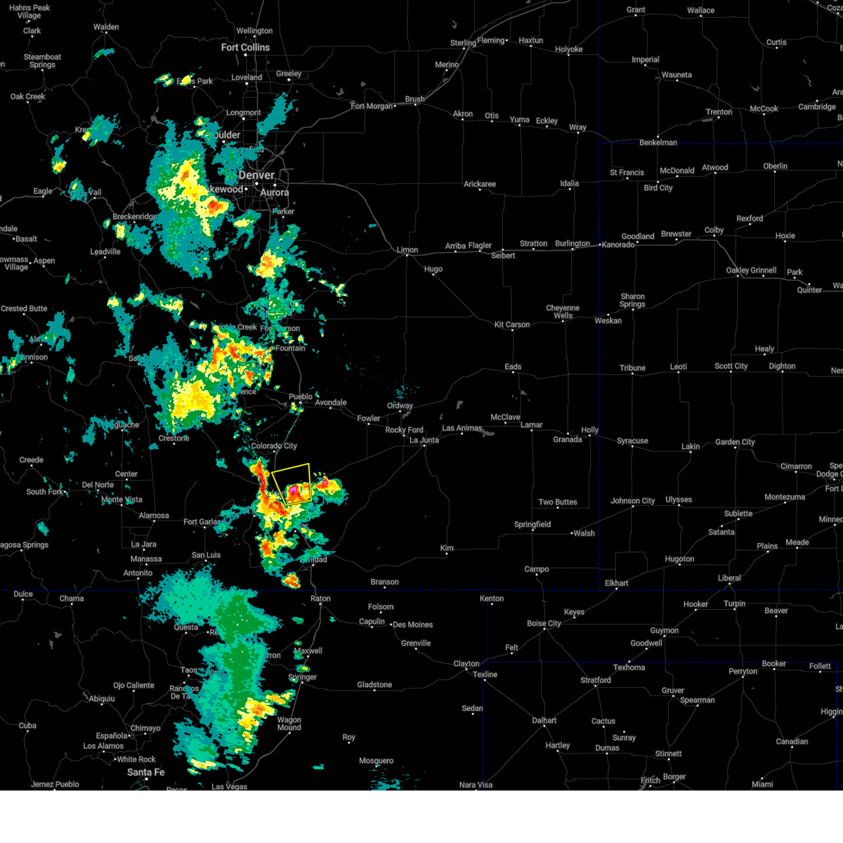
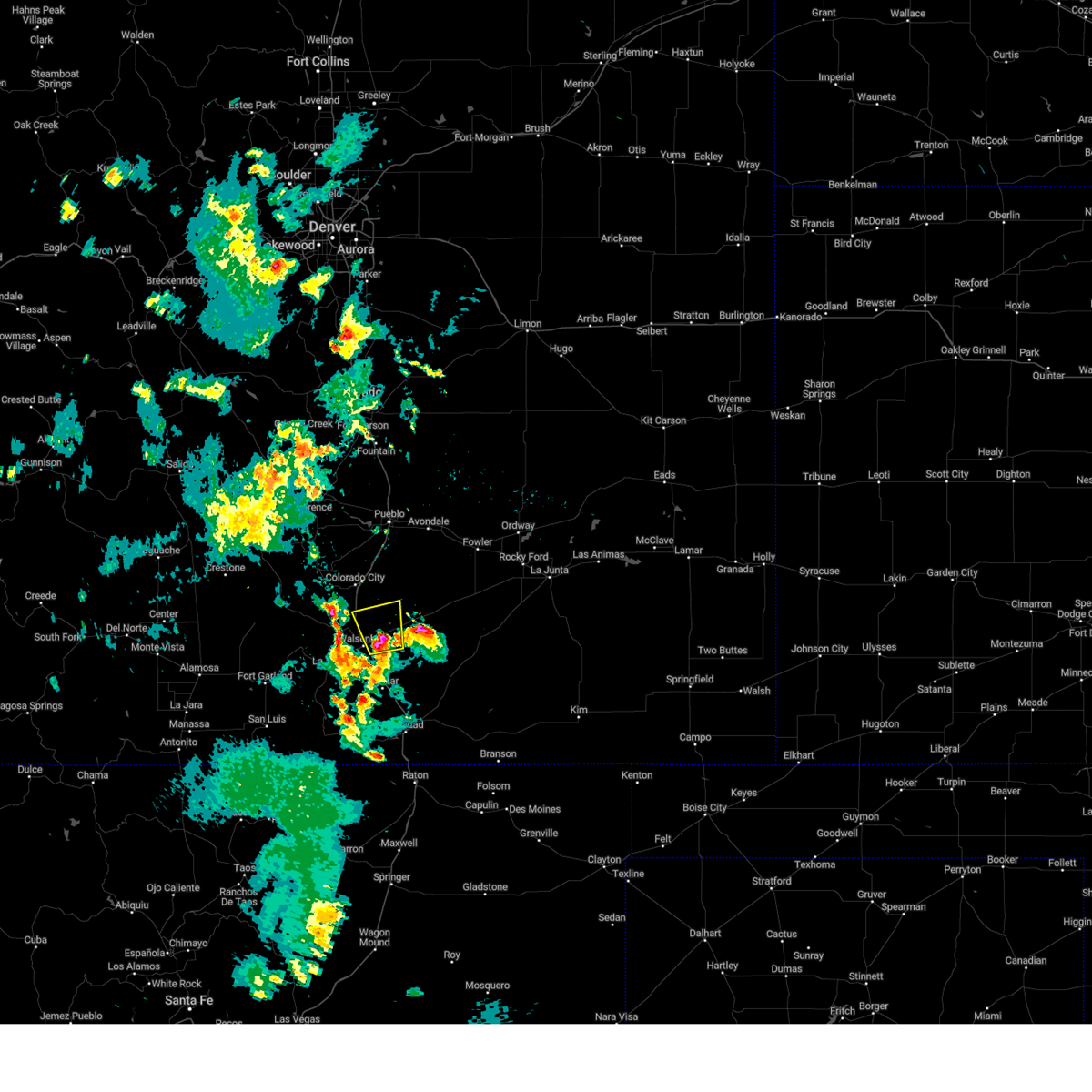
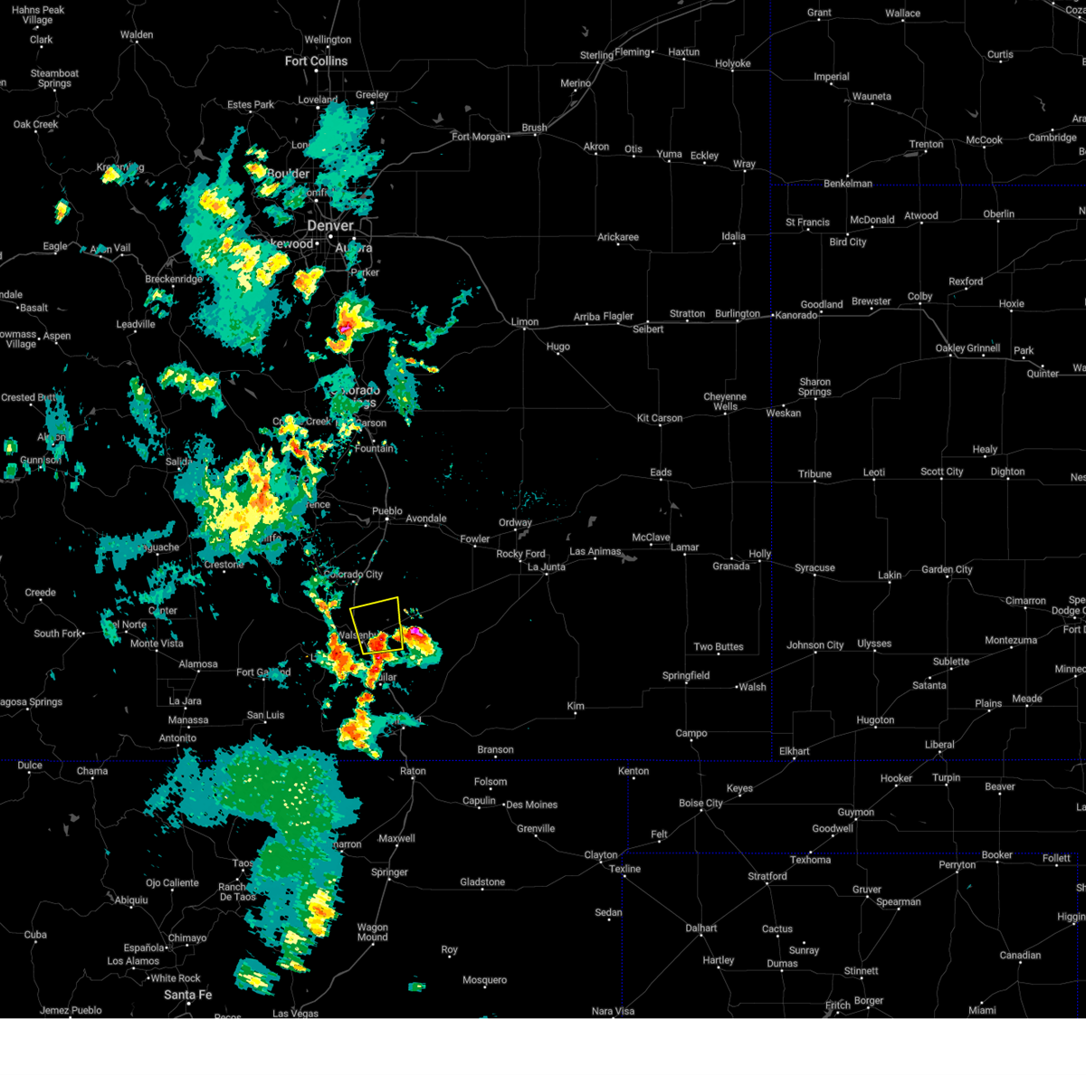
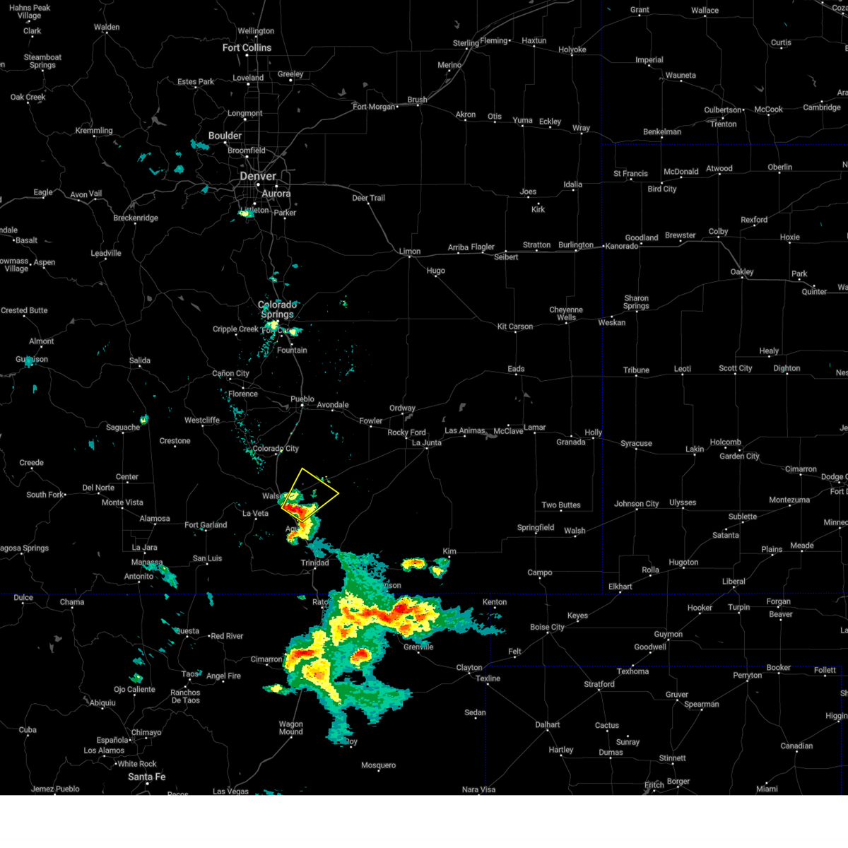
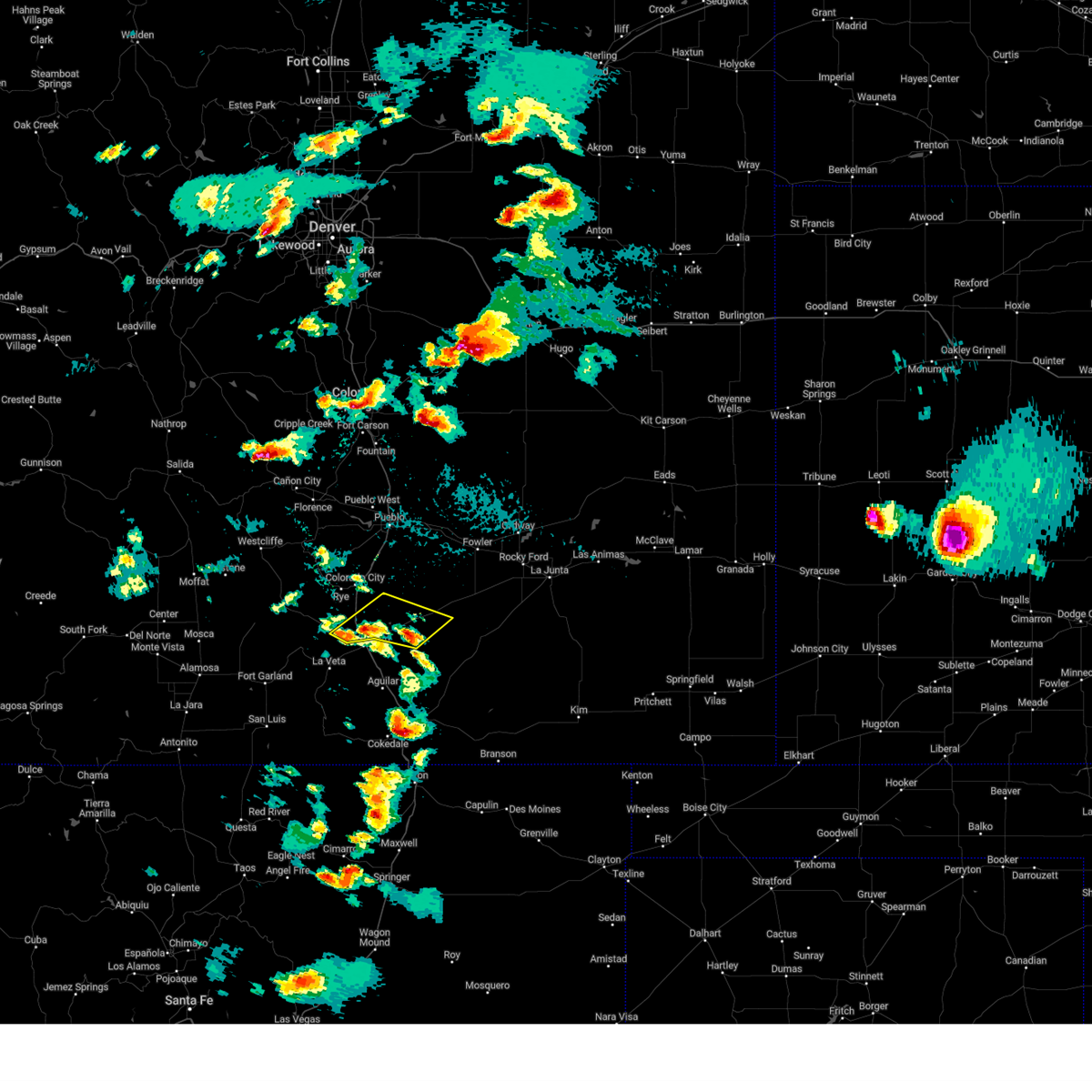
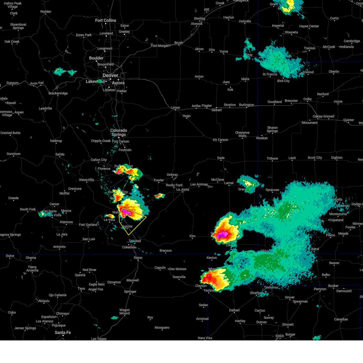
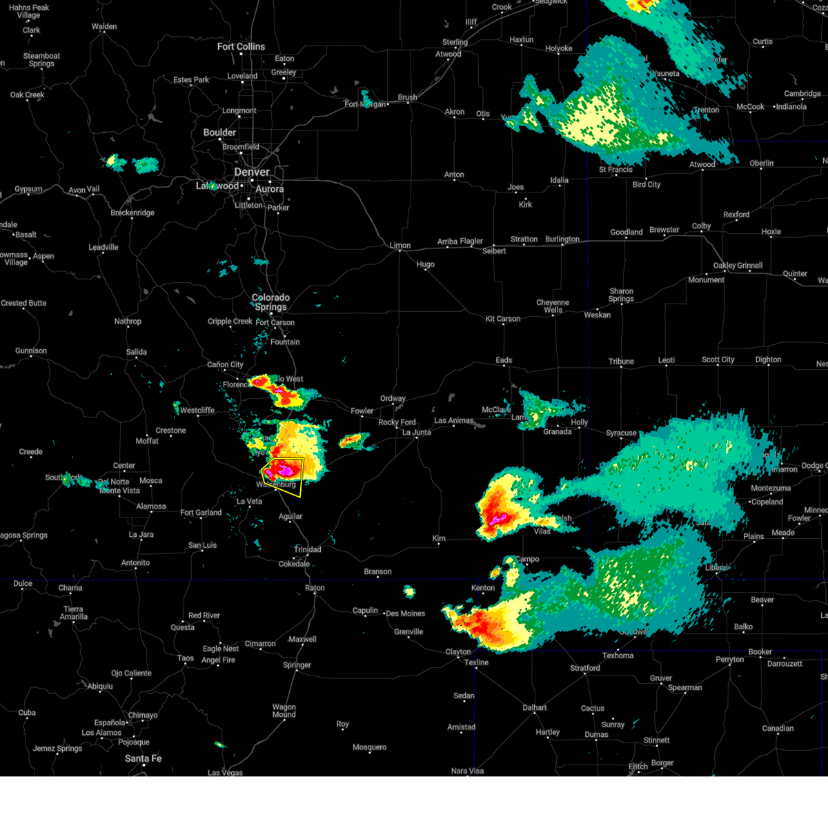
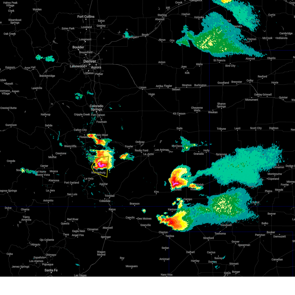
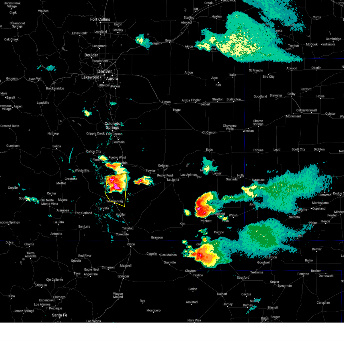
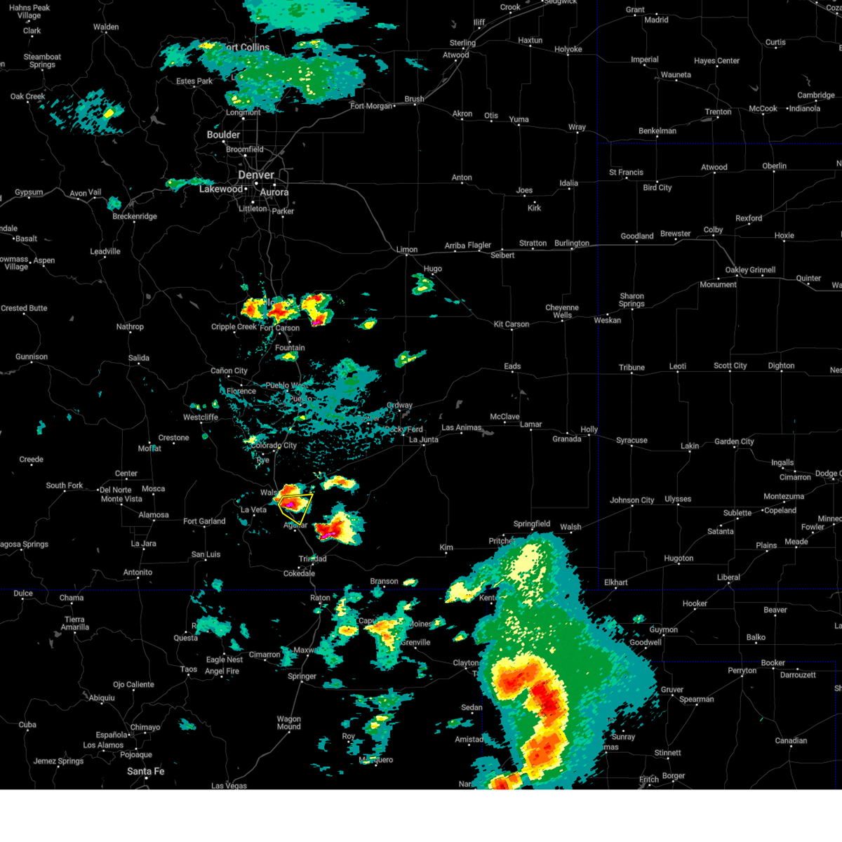
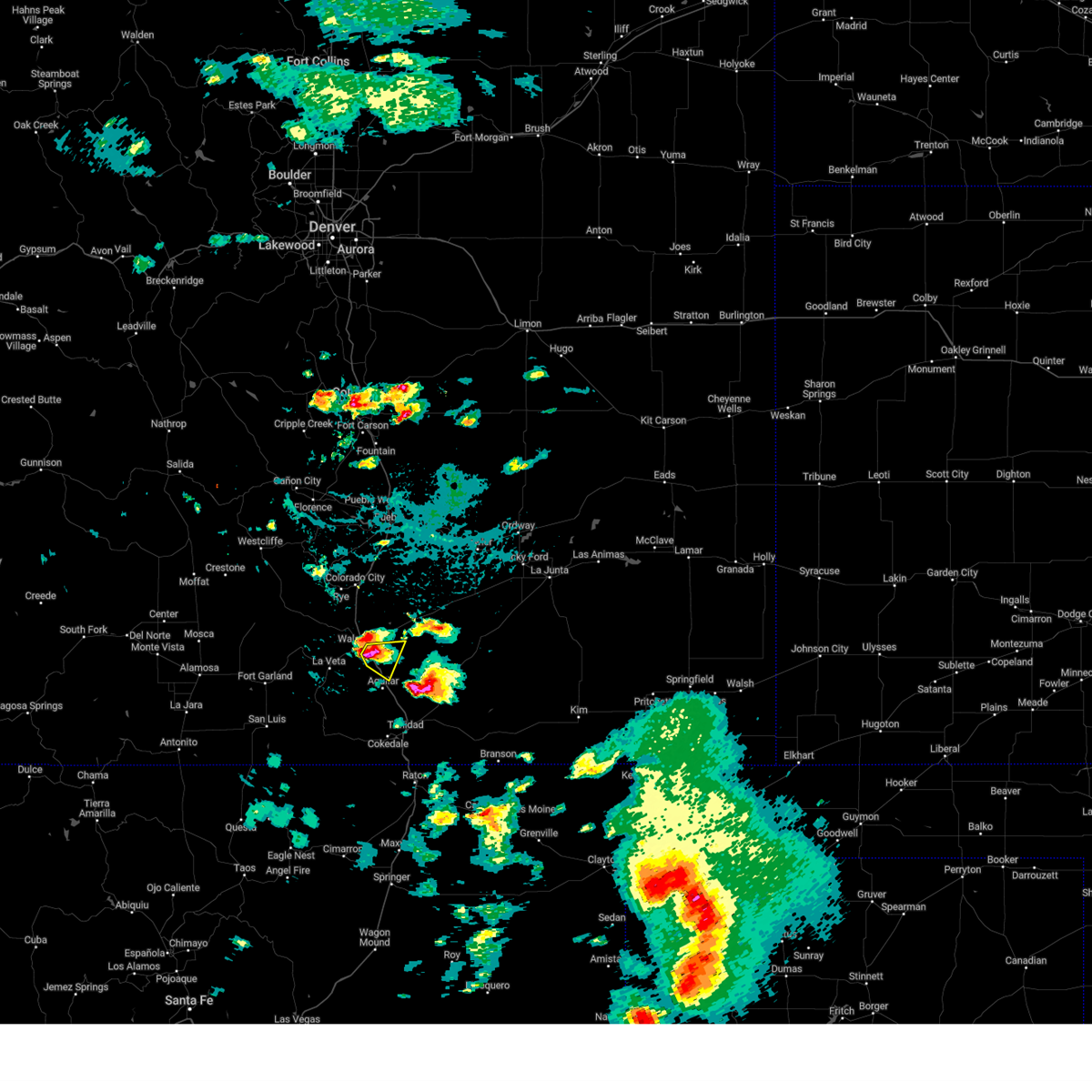
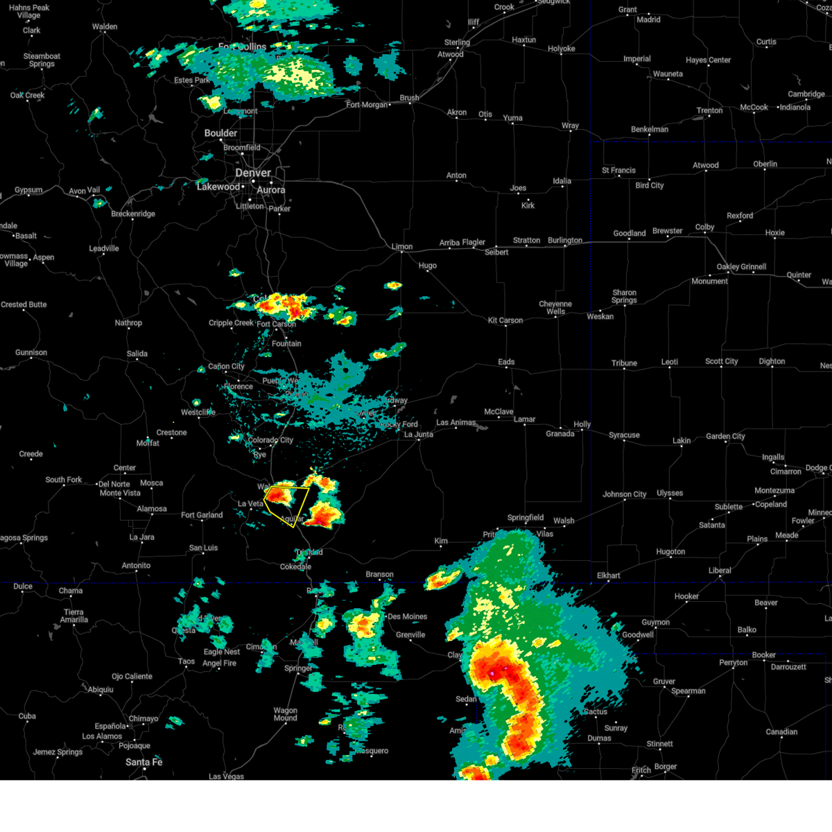
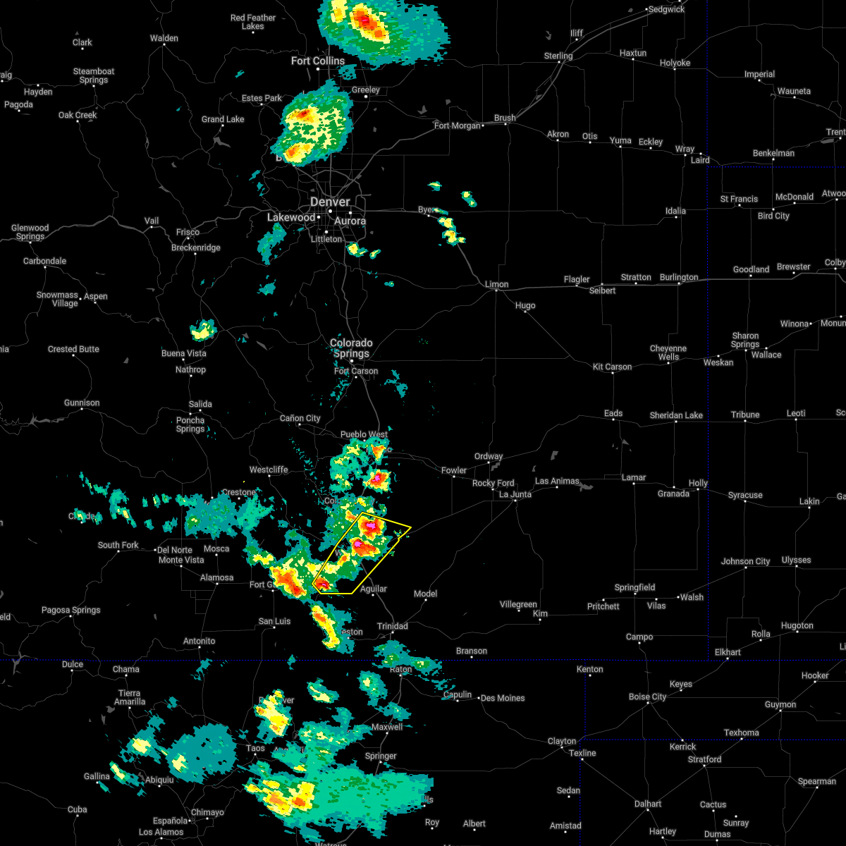
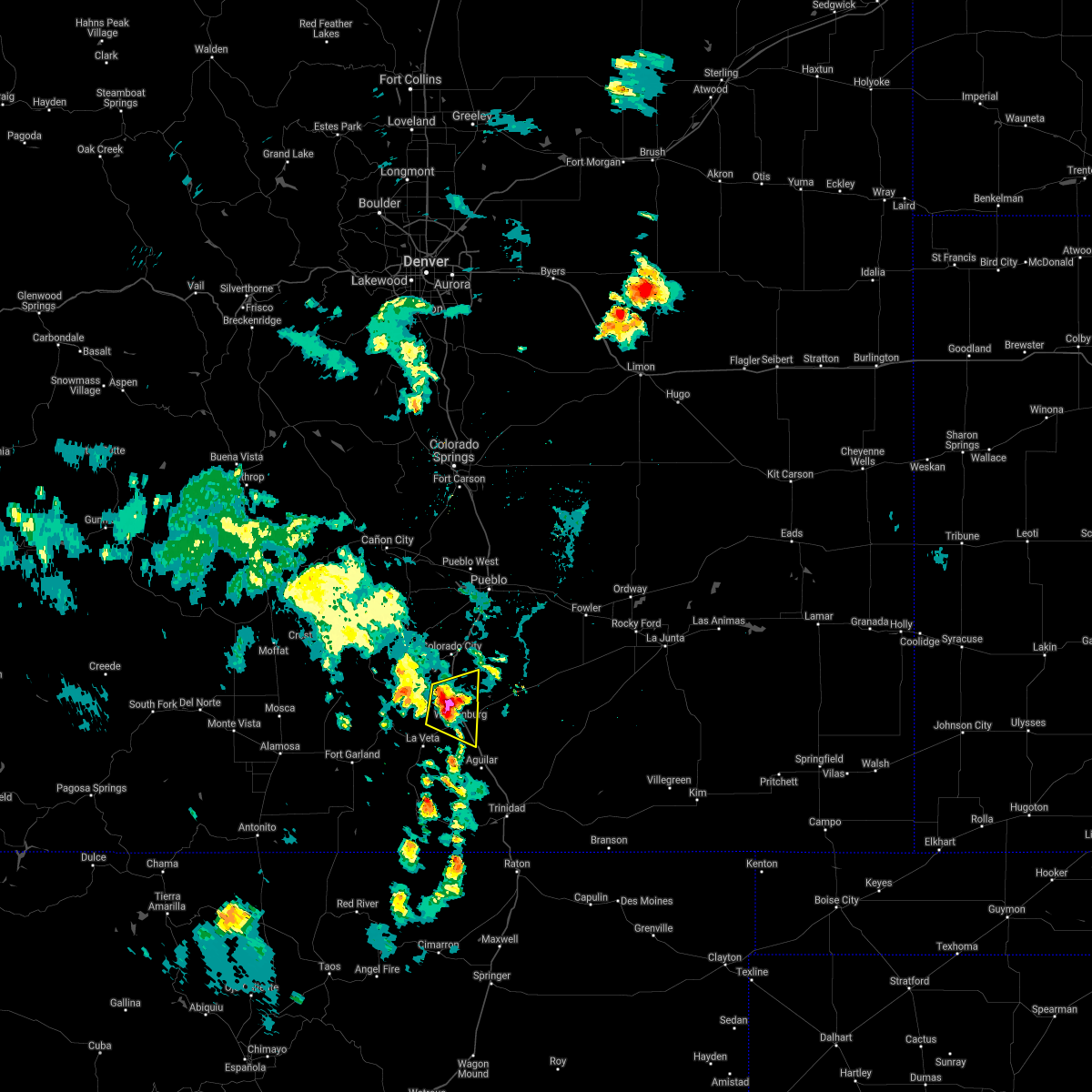
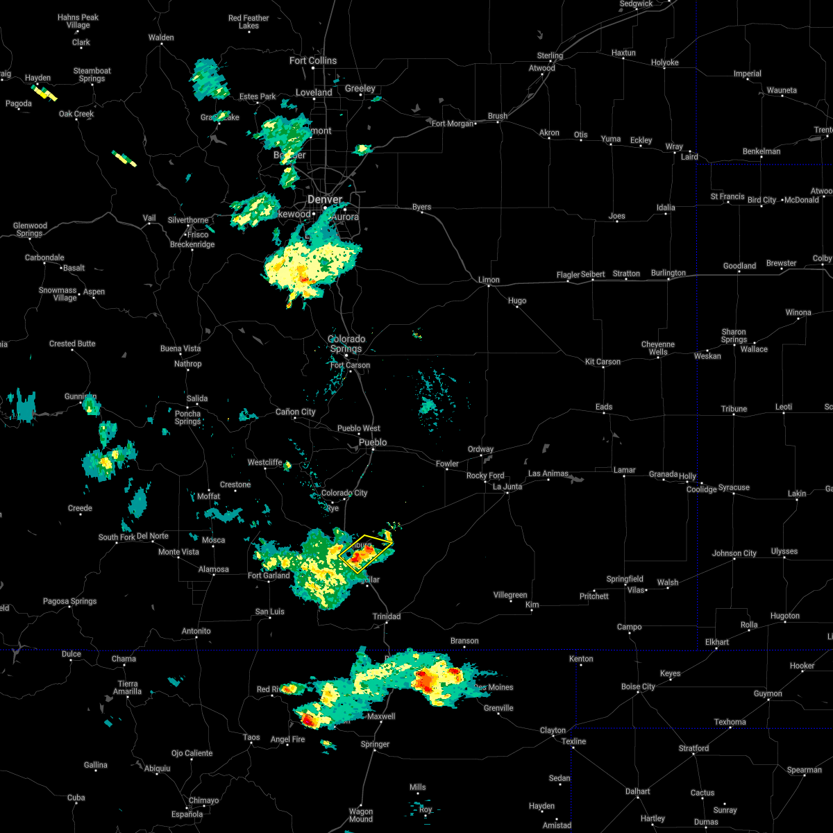
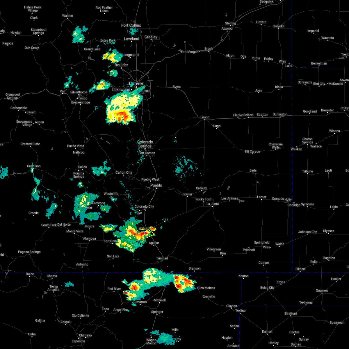
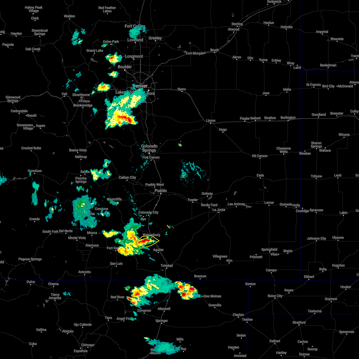
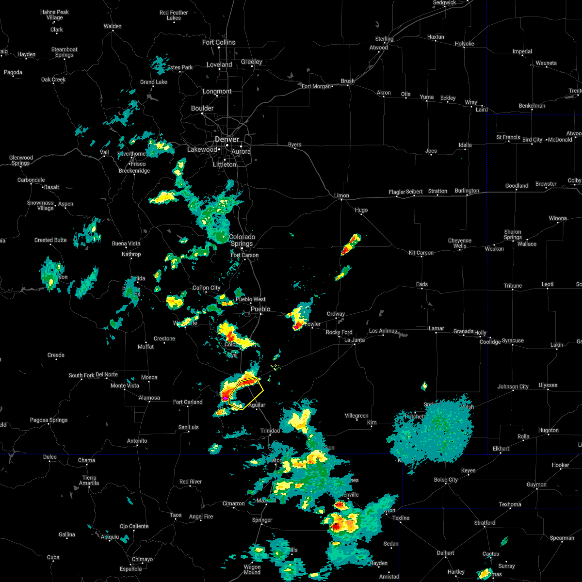
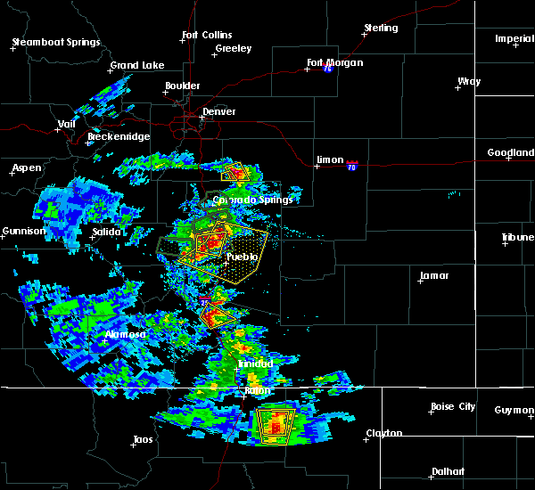
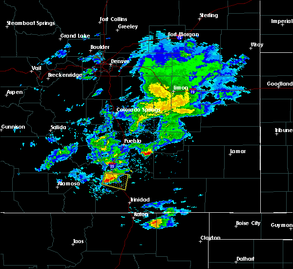
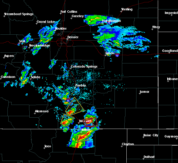
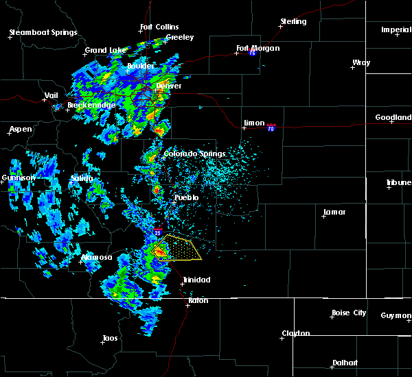
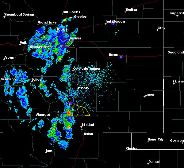
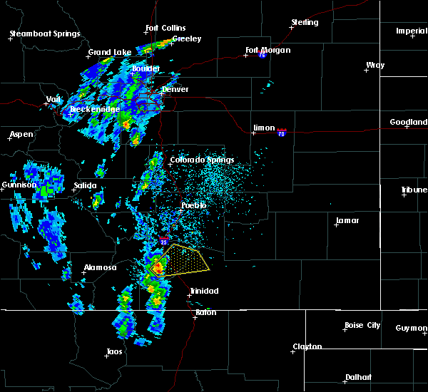
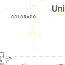
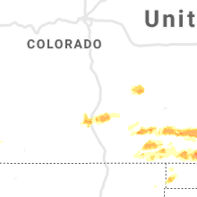
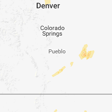
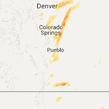
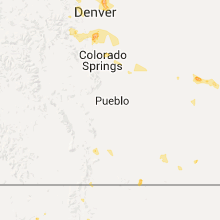
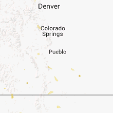
Hail Map for Walsenburg, CO
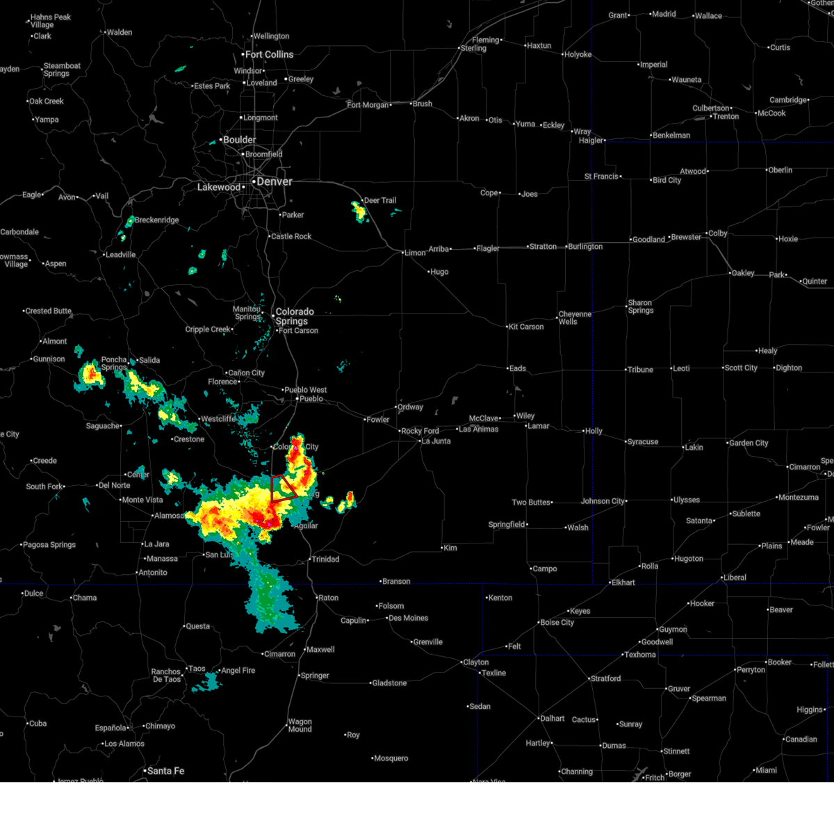
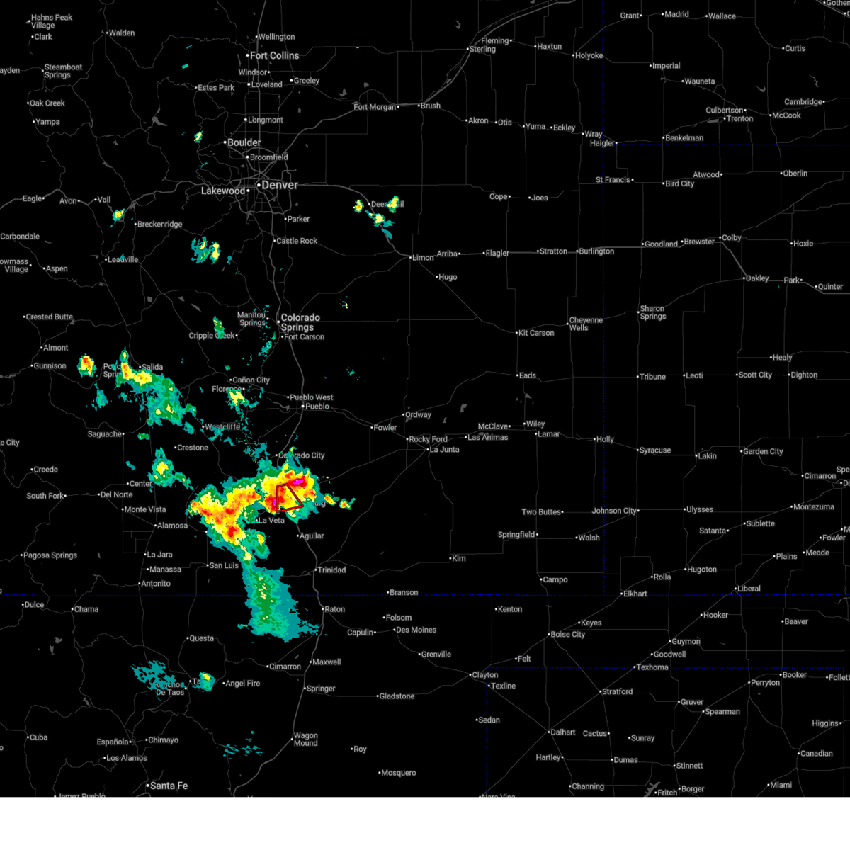
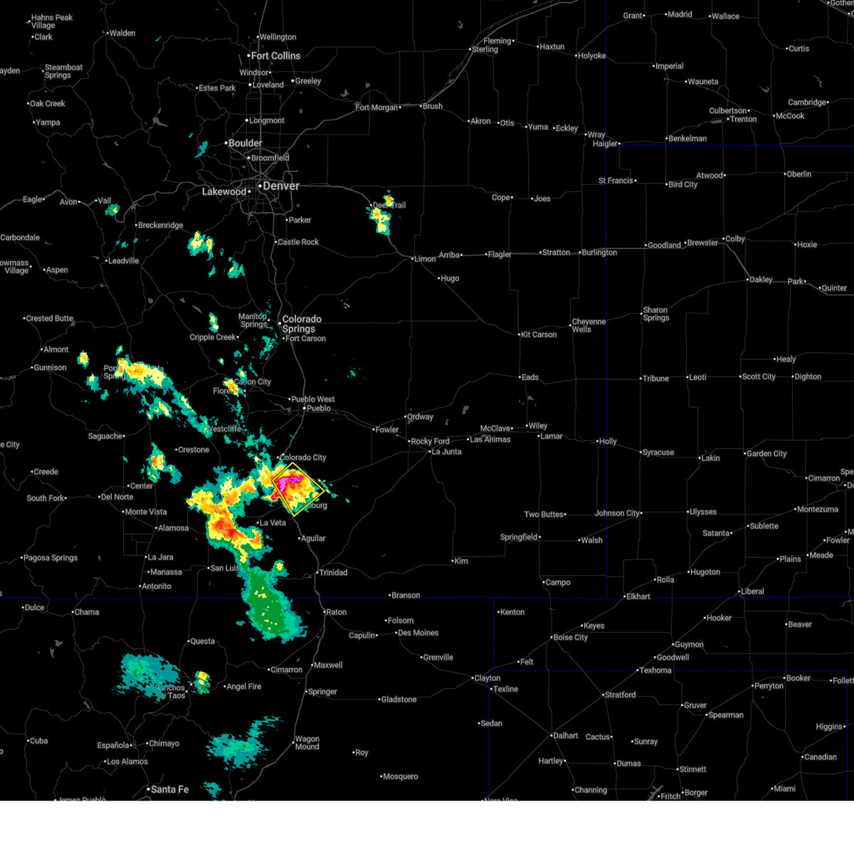
The Walsenburg, CO area has had 7 reports of on-the-ground hail by trained spotters, and has been under severe weather warnings 14 times during the past 12 months. Doppler radar has detected hail at or near Walsenburg, CO on 55 occasions, including 4 occasions during the past year.
| Name: | Walsenburg, CO |
| Where Located: | 44.7 miles SSW of Pueblo, CO |
| Map: | Google Map for Walsenburg, CO |
| Population: | 3068 |
| Housing Units: | 1757 |
| More Info: | Search Google for Walsenburg, CO |
3
The Top Recent Hail Date for Walsenburg, CO is Saturday, July 12, 2025 (11th out of 55)
Hail and Wind Damage Spotted near Walsenburg, CO
| Date / Time | Report Details |
|---|---|
| 7/12/2025 6:41 PM MDT |
 The storm which prompted the warning has weakened below severe limits, and no longer appears capable of producing a tornado. therefore, the warning will be allowed to expire. however, small hail, gusty winds and heavy rain are still possible with this thunderstorm. The storm which prompted the warning has weakened below severe limits, and no longer appears capable of producing a tornado. therefore, the warning will be allowed to expire. however, small hail, gusty winds and heavy rain are still possible with this thunderstorm.
|
| 7/12/2025 6:22 PM MDT |
 Torpub the national weather service in pueblo has issued a * tornado warning for, east central huerfano county in southeastern colorado, * until 645 pm mdt. * at 621 pm mdt, a severe thunderstorm capable of producing a tornado was located near walsenburg, or 39 miles south of pueblo, moving south at 15 mph (radar indicated rotation). Hazards include tornado. Flying debris will be dangerous to those caught without shelter. mobile homes will be damaged or destroyed. damage to roofs, windows, and vehicles will occur. tree damage is likely. This dangerous storm will be near, walsenburg around 625 pm mdt. Torpub the national weather service in pueblo has issued a * tornado warning for, east central huerfano county in southeastern colorado, * until 645 pm mdt. * at 621 pm mdt, a severe thunderstorm capable of producing a tornado was located near walsenburg, or 39 miles south of pueblo, moving south at 15 mph (radar indicated rotation). Hazards include tornado. Flying debris will be dangerous to those caught without shelter. mobile homes will be damaged or destroyed. damage to roofs, windows, and vehicles will occur. tree damage is likely. This dangerous storm will be near, walsenburg around 625 pm mdt.
|
| 7/12/2025 6:15 PM MDT | Awos station k4v1 4 n walsenbur in huerfano county CO, 4.2 miles S of Walsenburg, CO |
| 7/12/2025 6:11 PM MDT |
 At 611 pm mdt, a severe thunderstorm was located 10 miles north of walsenburg, or 34 miles south of pueblo, moving southeast at 15 mph (radar indicated). Hazards include golf ball size hail and 60 mph wind gusts. People and animals outdoors will be injured. expect hail damage to roofs, siding, windows, and vehicles. expect wind damage to roofs, siding, and trees. Locations impacted include, walsenburg. At 611 pm mdt, a severe thunderstorm was located 10 miles north of walsenburg, or 34 miles south of pueblo, moving southeast at 15 mph (radar indicated). Hazards include golf ball size hail and 60 mph wind gusts. People and animals outdoors will be injured. expect hail damage to roofs, siding, windows, and vehicles. expect wind damage to roofs, siding, and trees. Locations impacted include, walsenburg.
|
| 7/12/2025 6:00 PM MDT |
 Svrpub the national weather service in pueblo has issued a * severe thunderstorm warning for, northeastern huerfano county in southeastern colorado, northwestern las animas county in southeastern colorado, southwestern pueblo county in southeastern colorado, * until 630 pm mdt. * at 600 pm mdt, a severe thunderstorm was located 12 miles north of walsenburg, or 33 miles south of pueblo, moving southeast at 15 mph (radar indicated). Hazards include 60 mph wind gusts and quarter size hail. Hail damage to vehicles is expected. Expect wind damage to roofs, siding, and trees. Svrpub the national weather service in pueblo has issued a * severe thunderstorm warning for, northeastern huerfano county in southeastern colorado, northwestern las animas county in southeastern colorado, southwestern pueblo county in southeastern colorado, * until 630 pm mdt. * at 600 pm mdt, a severe thunderstorm was located 12 miles north of walsenburg, or 33 miles south of pueblo, moving southeast at 15 mph (radar indicated). Hazards include 60 mph wind gusts and quarter size hail. Hail damage to vehicles is expected. Expect wind damage to roofs, siding, and trees.
|
| 6/2/2025 12:32 PM MDT |
 At 1232 pm mdt, a severe thunderstorm was located 9 miles northwest of aguilar, or 26 miles northwest of trinidad, moving northeast at 10 mph (radar indicated). Hazards include 60 mph wind gusts and quarter size hail. Hail damage to vehicles is expected. expect wind damage to roofs, siding, and trees. Locations impacted include, walsenburg. At 1232 pm mdt, a severe thunderstorm was located 9 miles northwest of aguilar, or 26 miles northwest of trinidad, moving northeast at 10 mph (radar indicated). Hazards include 60 mph wind gusts and quarter size hail. Hail damage to vehicles is expected. expect wind damage to roofs, siding, and trees. Locations impacted include, walsenburg.
|
| 6/2/2025 12:10 PM MDT |
 Svrpub the national weather service in pueblo has issued a * severe thunderstorm warning for, south central huerfano county in southeastern colorado, west central las animas county in southeastern colorado, * until 1245 pm mdt. * at 1209 pm mdt, a severe thunderstorm was located near spanish peaks, or 26 miles northwest of trinidad, moving northeast at 10 mph (radar indicated). Hazards include 60 mph wind gusts and quarter size hail. Hail damage to vehicles is expected. Expect wind damage to roofs, siding, and trees. Svrpub the national weather service in pueblo has issued a * severe thunderstorm warning for, south central huerfano county in southeastern colorado, west central las animas county in southeastern colorado, * until 1245 pm mdt. * at 1209 pm mdt, a severe thunderstorm was located near spanish peaks, or 26 miles northwest of trinidad, moving northeast at 10 mph (radar indicated). Hazards include 60 mph wind gusts and quarter size hail. Hail damage to vehicles is expected. Expect wind damage to roofs, siding, and trees.
|
| 5/26/2025 3:56 PM MDT |
 the severe thunderstorm warning has been cancelled and is no longer in effect the severe thunderstorm warning has been cancelled and is no longer in effect
|
| 5/26/2025 3:45 PM MDT |
 the severe thunderstorm warning has been cancelled and is no longer in effect the severe thunderstorm warning has been cancelled and is no longer in effect
|
| 5/26/2025 3:45 PM MDT |
 At 344 pm mdt, a severe thunderstorm was located 9 miles north of walsenburg, or 36 miles south of pueblo, moving south at 10 mph (radar indicated). Hazards include quarter size hail. Damage to vehicles is expected. This severe thunderstorm will remain over mainly rural areas of northeastern huerfano county. At 344 pm mdt, a severe thunderstorm was located 9 miles north of walsenburg, or 36 miles south of pueblo, moving south at 10 mph (radar indicated). Hazards include quarter size hail. Damage to vehicles is expected. This severe thunderstorm will remain over mainly rural areas of northeastern huerfano county.
|
| 5/26/2025 3:27 PM MDT |
 Svrpub the national weather service in pueblo has issued a * severe thunderstorm warning for, northeastern huerfano county in southeastern colorado, southwestern pueblo county in southeastern colorado, * until 415 pm mdt. * at 326 pm mdt, a severe thunderstorm was located 10 miles southeast of greenhorn mountain, or 33 miles south of pueblo, moving south at 10 mph (radar indicated). Hazards include quarter size hail. damage to vehicles is expected Svrpub the national weather service in pueblo has issued a * severe thunderstorm warning for, northeastern huerfano county in southeastern colorado, southwestern pueblo county in southeastern colorado, * until 415 pm mdt. * at 326 pm mdt, a severe thunderstorm was located 10 miles southeast of greenhorn mountain, or 33 miles south of pueblo, moving south at 10 mph (radar indicated). Hazards include quarter size hail. damage to vehicles is expected
|
| 9/17/2024 3:07 PM MDT |
 At 305 pm mdt, severe thunderstorms were located along a line extending from near pueblo airport to 21 miles northeast of walsenburg, moving east at 45 mph. at 405 pm mdt, a 73 mph wind gust was observed at the pueblo airport (radar indicated). Hazards include 70 mph wind gusts and nickel size hail. Expect considerable tree damage. damage is likely to mobile homes, roofs, and outbuildings. Locations impacted include, pueblo, pueblo airport, walsenburg, boone, salt creek, blende, avondale, pueblo depot, and pueblo west. At 305 pm mdt, severe thunderstorms were located along a line extending from near pueblo airport to 21 miles northeast of walsenburg, moving east at 45 mph. at 405 pm mdt, a 73 mph wind gust was observed at the pueblo airport (radar indicated). Hazards include 70 mph wind gusts and nickel size hail. Expect considerable tree damage. damage is likely to mobile homes, roofs, and outbuildings. Locations impacted include, pueblo, pueblo airport, walsenburg, boone, salt creek, blende, avondale, pueblo depot, and pueblo west.
|
| 9/17/2024 2:56 PM MDT |
 Svrpub the national weather service in pueblo has issued a * severe thunderstorm warning for, northeastern huerfano county in southeastern colorado, north central las animas county in southeastern colorado, central pueblo county in southeastern colorado, * until 330 pm mdt. * at 256 pm mdt, severe thunderstorms were located along a line extending from near pueblo west to 16 miles northeast of walsenburg, moving east at 45 mph (radar indicated). Hazards include 60 mph wind gusts and nickel size hail. expect damage to roofs, siding, and trees Svrpub the national weather service in pueblo has issued a * severe thunderstorm warning for, northeastern huerfano county in southeastern colorado, north central las animas county in southeastern colorado, central pueblo county in southeastern colorado, * until 330 pm mdt. * at 256 pm mdt, severe thunderstorms were located along a line extending from near pueblo west to 16 miles northeast of walsenburg, moving east at 45 mph (radar indicated). Hazards include 60 mph wind gusts and nickel size hail. expect damage to roofs, siding, and trees
|
| 9/17/2024 2:42 PM MDT |
 At 242 pm mdt, a severe thunderstorm was located 20 miles northeast of walsenburg, or 25 miles south of pueblo, moving northeast at 35 mph (radar indicated). Hazards include 70 mph wind gusts and nickel size hail. Expect considerable tree damage. damage is likely to mobile homes, roofs, and outbuildings. Locations impacted include, colorado city. At 242 pm mdt, a severe thunderstorm was located 20 miles northeast of walsenburg, or 25 miles south of pueblo, moving northeast at 35 mph (radar indicated). Hazards include 70 mph wind gusts and nickel size hail. Expect considerable tree damage. damage is likely to mobile homes, roofs, and outbuildings. Locations impacted include, colorado city.
|
| 9/17/2024 2:30 PM MDT |
 Svrpub the national weather service in pueblo has issued a * severe thunderstorm warning for, northeastern huerfano county in southeastern colorado, southwestern pueblo county in southeastern colorado, * until 300 pm mdt. * at 229 pm mdt, a severe thunderstorm was located 13 miles east of greenhorn mountain, or 30 miles south of pueblo, moving northeast at 35 mph (radar indicated). Hazards include 70 mph wind gusts and nickel size hail. Expect considerable tree damage. Damage is likely to mobile homes, roofs, and outbuildings. Svrpub the national weather service in pueblo has issued a * severe thunderstorm warning for, northeastern huerfano county in southeastern colorado, southwestern pueblo county in southeastern colorado, * until 300 pm mdt. * at 229 pm mdt, a severe thunderstorm was located 13 miles east of greenhorn mountain, or 30 miles south of pueblo, moving northeast at 35 mph (radar indicated). Hazards include 70 mph wind gusts and nickel size hail. Expect considerable tree damage. Damage is likely to mobile homes, roofs, and outbuildings.
|
| 7/7/2024 8:15 PM MDT |
 At 815 pm mdt, a severe thunderstorm was located 7 miles northeast of walsenburg, or 38 miles north of trinidad, moving southeast at 20 mph (radar indicated). Hazards include 60 mph wind gusts and quarter size hail. Hail damage to vehicles is expected. expect wind damage to roofs, siding, and trees. Locations impacted include, walsenburg. At 815 pm mdt, a severe thunderstorm was located 7 miles northeast of walsenburg, or 38 miles north of trinidad, moving southeast at 20 mph (radar indicated). Hazards include 60 mph wind gusts and quarter size hail. Hail damage to vehicles is expected. expect wind damage to roofs, siding, and trees. Locations impacted include, walsenburg.
|
| 7/7/2024 7:58 PM MDT |
 Svrpub the national weather service in pueblo has issued a * severe thunderstorm warning for, northeastern huerfano county in southeastern colorado, * until 830 pm mdt. * at 757 pm mdt, a severe thunderstorm was located 9 miles north of walsenburg, or 35 miles south of pueblo, moving southeast at 25 mph (radar indicated). Hazards include 60 mph wind gusts and quarter size hail. Hail damage to vehicles is expected. Expect wind damage to roofs, siding, and trees. Svrpub the national weather service in pueblo has issued a * severe thunderstorm warning for, northeastern huerfano county in southeastern colorado, * until 830 pm mdt. * at 757 pm mdt, a severe thunderstorm was located 9 miles north of walsenburg, or 35 miles south of pueblo, moving southeast at 25 mph (radar indicated). Hazards include 60 mph wind gusts and quarter size hail. Hail damage to vehicles is expected. Expect wind damage to roofs, siding, and trees.
|
| 6/9/2024 7:11 PM MDT |
 The storm which prompted the warning has weakened below severe limits, and no longer poses an immediate threat to life or property. therefore, the warning will be allowed to expire. however, small hail, gusty winds and heavy rain are still possible with this thunderstorm. The storm which prompted the warning has weakened below severe limits, and no longer poses an immediate threat to life or property. therefore, the warning will be allowed to expire. however, small hail, gusty winds and heavy rain are still possible with this thunderstorm.
|
| 6/9/2024 7:00 PM MDT |
 At 700 pm mdt, a severe thunderstorm was located 7 miles northeast of walsenburg, or 38 miles north of trinidad, moving north at 15 mph (radar indicated). Hazards include 60 mph wind gusts and half dollar size hail. Hail damage to vehicles is expected. expect wind damage to roofs, siding, and trees. Locations impacted include, walsenburg. At 700 pm mdt, a severe thunderstorm was located 7 miles northeast of walsenburg, or 38 miles north of trinidad, moving north at 15 mph (radar indicated). Hazards include 60 mph wind gusts and half dollar size hail. Hail damage to vehicles is expected. expect wind damage to roofs, siding, and trees. Locations impacted include, walsenburg.
|
| 6/9/2024 6:48 PM MDT |
 Svrpub the national weather service in pueblo has issued a * severe thunderstorm warning for, east central huerfano county in southeastern colorado, northwestern las animas county in southeastern colorado, * until 715 pm mdt. * at 648 pm mdt, a severe thunderstorm was located near walsenburg, or 35 miles north of trinidad, moving north at 15 mph (radar indicated). Hazards include ping pong ball size hail and 60 mph wind gusts. People and animals outdoors will be injured. expect hail damage to roofs, siding, windows, and vehicles. Expect wind damage to roofs, siding, and trees. Svrpub the national weather service in pueblo has issued a * severe thunderstorm warning for, east central huerfano county in southeastern colorado, northwestern las animas county in southeastern colorado, * until 715 pm mdt. * at 648 pm mdt, a severe thunderstorm was located near walsenburg, or 35 miles north of trinidad, moving north at 15 mph (radar indicated). Hazards include ping pong ball size hail and 60 mph wind gusts. People and animals outdoors will be injured. expect hail damage to roofs, siding, windows, and vehicles. Expect wind damage to roofs, siding, and trees.
|
| 5/31/2024 3:19 PM MDT |
 Svrpub the national weather service in pueblo has issued a * severe thunderstorm warning for, east central huerfano county in southeastern colorado, north central las animas county in southeastern colorado, * until 345 pm mdt. * at 319 pm mdt, a severe thunderstorm was located near walsenburg, or 31 miles north of trinidad, moving northeast at 25 mph (radar indicated). Hazards include 60 mph wind gusts and quarter size hail. Hail damage to vehicles is expected. Expect wind damage to roofs, siding, and trees. Svrpub the national weather service in pueblo has issued a * severe thunderstorm warning for, east central huerfano county in southeastern colorado, north central las animas county in southeastern colorado, * until 345 pm mdt. * at 319 pm mdt, a severe thunderstorm was located near walsenburg, or 31 miles north of trinidad, moving northeast at 25 mph (radar indicated). Hazards include 60 mph wind gusts and quarter size hail. Hail damage to vehicles is expected. Expect wind damage to roofs, siding, and trees.
|
| 7/20/2023 3:26 PM MDT |
 At 326 pm mdt, severe thunderstorms were located along a line extending from 6 miles northwest of walsenburg to 16 miles east of farisita to 22 miles northeast of aguilar, moving northeast at 25 mph (radar indicated). Hazards include torrential rainfall, 60 mph wind gusts, and quarter size hail. Hail damage to vehicles is expected. expect wind damage to roofs, siding, and trees. these severe thunderstorms will remain over mainly rural areas of northeastern huerfano and north central las animas counties. hail threat, radar indicated max hail size, 1. 00 in wind threat, radar indicated max wind gust, 60 mph. At 326 pm mdt, severe thunderstorms were located along a line extending from 6 miles northwest of walsenburg to 16 miles east of farisita to 22 miles northeast of aguilar, moving northeast at 25 mph (radar indicated). Hazards include torrential rainfall, 60 mph wind gusts, and quarter size hail. Hail damage to vehicles is expected. expect wind damage to roofs, siding, and trees. these severe thunderstorms will remain over mainly rural areas of northeastern huerfano and north central las animas counties. hail threat, radar indicated max hail size, 1. 00 in wind threat, radar indicated max wind gust, 60 mph.
|
| 7/13/2023 7:18 PM MDT |
 At 718 pm mdt, a severe thunderstorm was located near walsenburg, or 24 miles east of spring burn scar north of highway 160, moving southeast at 20 mph (radar indicated). Hazards include tennis ball size hail and 70 mph wind gusts. People and animals outdoors will be injured. expect hail damage to roofs, siding, windows, and vehicles. expect considerable tree damage. Wind damage is also likely to mobile homes, roofs, and outbuildings. At 718 pm mdt, a severe thunderstorm was located near walsenburg, or 24 miles east of spring burn scar north of highway 160, moving southeast at 20 mph (radar indicated). Hazards include tennis ball size hail and 70 mph wind gusts. People and animals outdoors will be injured. expect hail damage to roofs, siding, windows, and vehicles. expect considerable tree damage. Wind damage is also likely to mobile homes, roofs, and outbuildings.
|
| 7/13/2023 7:05 PM MDT |
 At 705 pm mdt, a severe thunderstorm was located 7 miles northeast of walsenburg, or 25 miles east of spring burn scar north of highway 160, moving southeast at 25 mph (radar indicated). Hazards include tennis ball size hail and 60 mph wind gusts. People and animals outdoors will be injured. expect hail damage to roofs, siding, windows, and vehicles. expect wind damage to roofs, siding, and trees. Locations impacted include, walsenburg. At 705 pm mdt, a severe thunderstorm was located 7 miles northeast of walsenburg, or 25 miles east of spring burn scar north of highway 160, moving southeast at 25 mph (radar indicated). Hazards include tennis ball size hail and 60 mph wind gusts. People and animals outdoors will be injured. expect hail damage to roofs, siding, windows, and vehicles. expect wind damage to roofs, siding, and trees. Locations impacted include, walsenburg.
|
| 7/13/2023 6:53 PM MDT |
 At 653 pm mdt, a severe thunderstorm was located 9 miles north of walsenburg, or 23 miles northeast of spring burn scar north of highway 160, moving southeast at 25 mph (radar indicated). Hazards include tennis ball size hail and 60 mph wind gusts. People and animals outdoors will be injured. expect hail damage to roofs, siding, windows, and vehicles. expect wind damage to roofs, siding, and trees. Locations impacted include, walsenburg and colorado city. At 653 pm mdt, a severe thunderstorm was located 9 miles north of walsenburg, or 23 miles northeast of spring burn scar north of highway 160, moving southeast at 25 mph (radar indicated). Hazards include tennis ball size hail and 60 mph wind gusts. People and animals outdoors will be injured. expect hail damage to roofs, siding, windows, and vehicles. expect wind damage to roofs, siding, and trees. Locations impacted include, walsenburg and colorado city.
|
| 7/13/2023 6:40 PM MDT |
 At 640 pm mdt, a severe thunderstorm was located 11 miles east of greenhorn mountain, or 22 miles northeast of spring burn scar north of highway 160, moving southeast at 25 mph (radar indicated). Hazards include tennis ball size hail and 60 mph wind gusts. People and animals outdoors will be injured. expect hail damage to roofs, siding, windows, and vehicles. Expect wind damage to roofs, siding, and trees. At 640 pm mdt, a severe thunderstorm was located 11 miles east of greenhorn mountain, or 22 miles northeast of spring burn scar north of highway 160, moving southeast at 25 mph (radar indicated). Hazards include tennis ball size hail and 60 mph wind gusts. People and animals outdoors will be injured. expect hail damage to roofs, siding, windows, and vehicles. Expect wind damage to roofs, siding, and trees.
|
| 7/7/2023 4:10 PM MDT |
 The severe thunderstorm warning for east central huerfano and northwestern las animas counties will expire at 415 pm mdt, the storm which prompted the warning has weakened below severe limits, and no longer poses an immediate threat to life or property. therefore, the warning will be allowed to expire. however small hail, gusty winds and heavy rain are still possible with this thunderstorm. a severe thunderstorm watch remains in effect until 800 pm mdt for southeastern colorado. The severe thunderstorm warning for east central huerfano and northwestern las animas counties will expire at 415 pm mdt, the storm which prompted the warning has weakened below severe limits, and no longer poses an immediate threat to life or property. therefore, the warning will be allowed to expire. however small hail, gusty winds and heavy rain are still possible with this thunderstorm. a severe thunderstorm watch remains in effect until 800 pm mdt for southeastern colorado.
|
| 7/7/2023 3:52 PM MDT |
 At 352 pm mdt, a severe thunderstorm was located near walsenburg, or 22 miles east of indian creek on the southeastern spring burn scar, moving southeast at 15 mph (radar indicated). Hazards include quarter size hail. Damage to vehicles is expected. locations impacted include, walsenburg. hail threat, radar indicated max hail size, 1. 00 in wind threat, radar indicated max wind gust, <50 mph. At 352 pm mdt, a severe thunderstorm was located near walsenburg, or 22 miles east of indian creek on the southeastern spring burn scar, moving southeast at 15 mph (radar indicated). Hazards include quarter size hail. Damage to vehicles is expected. locations impacted include, walsenburg. hail threat, radar indicated max hail size, 1. 00 in wind threat, radar indicated max wind gust, <50 mph.
|
| 7/7/2023 3:39 PM MDT |
 At 339 pm mdt, a severe thunderstorm was located near walsenburg, or 19 miles east of spring burn scar north of highway 160, moving southeast at 15 mph (radar indicated). Hazards include half dollar size hail. damage to vehicles is expected At 339 pm mdt, a severe thunderstorm was located near walsenburg, or 19 miles east of spring burn scar north of highway 160, moving southeast at 15 mph (radar indicated). Hazards include half dollar size hail. damage to vehicles is expected
|
| 6/11/2023 1:26 PM MDT | Quarter sized hail reported 12.5 miles NNE of Walsenburg, CO |
| 7/12/2022 5:03 PM MDT |
 At 503 pm mdt, severe thunderstorms were located along a line extending from 28 miles east of greenhorn mountain to near walsenburg, moving southeast at 25 mph (radar indicated). Hazards include 60 mph wind gusts and penny size hail. Expect damage to roofs, siding, and trees. Locations impacted include, walsenburg. At 503 pm mdt, severe thunderstorms were located along a line extending from 28 miles east of greenhorn mountain to near walsenburg, moving southeast at 25 mph (radar indicated). Hazards include 60 mph wind gusts and penny size hail. Expect damage to roofs, siding, and trees. Locations impacted include, walsenburg.
|
| 7/12/2022 4:33 PM MDT |
 At 432 pm mdt, severe thunderstorms were located along a line extending from 16 miles northeast of walsenburg to near la veta, moving southeast at 15 mph (radar indicated). Hazards include ping pong ball size hail and 60 mph wind gusts. People and animals outdoors will be injured. expect hail damage to roofs, siding, windows, and vehicles. expect wind damage to roofs, siding, and trees. Locations impacted include, indian creek on the southeastern spring burn scar, southeastern spring burn scar south of highway 160 in huerfano county, walsenburg and la veta. At 432 pm mdt, severe thunderstorms were located along a line extending from 16 miles northeast of walsenburg to near la veta, moving southeast at 15 mph (radar indicated). Hazards include ping pong ball size hail and 60 mph wind gusts. People and animals outdoors will be injured. expect hail damage to roofs, siding, windows, and vehicles. expect wind damage to roofs, siding, and trees. Locations impacted include, indian creek on the southeastern spring burn scar, southeastern spring burn scar south of highway 160 in huerfano county, walsenburg and la veta.
|
| 7/12/2022 4:26 PM MDT |
 At 426 pm mdt, severe thunderstorms were located along a line extending from 16 miles northeast of walsenburg to near la veta, moving southeast at 15 mph (radar indicated). Hazards include 60 mph wind gusts and quarter size hail. Hail damage to vehicles is expected. Expect wind damage to roofs, siding, and trees. At 426 pm mdt, severe thunderstorms were located along a line extending from 16 miles northeast of walsenburg to near la veta, moving southeast at 15 mph (radar indicated). Hazards include 60 mph wind gusts and quarter size hail. Hail damage to vehicles is expected. Expect wind damage to roofs, siding, and trees.
|
| 4/27/2022 11:53 AM MDT | Mesonet station co030 025s05910rws1rhs - 0.4 mi n of in huerfano county CO, 9 miles SSE of Walsenburg, CO |
| 7/13/2021 5:11 PM MDT |
 The severe thunderstorm warning for north central huerfano county will expire at 515 pm mdt, the storm which prompted the warning has weakened below severe limits, and no longer poses an immediate threat to life or property. therefore, the warning will be allowed to expire. however gusty winds and heavy rain are still possible with this thunderstorm. The severe thunderstorm warning for north central huerfano county will expire at 515 pm mdt, the storm which prompted the warning has weakened below severe limits, and no longer poses an immediate threat to life or property. therefore, the warning will be allowed to expire. however gusty winds and heavy rain are still possible with this thunderstorm.
|
| 7/13/2021 5:04 PM MDT |
 At 503 pm mdt, a severe thunderstorm was located 8 miles north of walsenburg, or 23 miles east of spring burn scar north of highway 160, moving east at 25 mph (radar indicated). Hazards include 60 mph wind gusts and quarter size hail. Hail damage to vehicles is expected. expect wind damage to roofs, siding, and trees. Locations impacted include, walsenburg. At 503 pm mdt, a severe thunderstorm was located 8 miles north of walsenburg, or 23 miles east of spring burn scar north of highway 160, moving east at 25 mph (radar indicated). Hazards include 60 mph wind gusts and quarter size hail. Hail damage to vehicles is expected. expect wind damage to roofs, siding, and trees. Locations impacted include, walsenburg.
|
| 7/13/2021 4:53 PM MDT |
 At 441 pm mdt, a severe thunderstorm was located near walsenburg, or 15 miles east of spring burn scar north of highway 160, moving east at 10 mph (radar indicated). Hazards include 60 mph wind gusts and quarter size hail. Hail damage to vehicles is expected. Expect wind damage to roofs, siding, and trees. At 441 pm mdt, a severe thunderstorm was located near walsenburg, or 15 miles east of spring burn scar north of highway 160, moving east at 10 mph (radar indicated). Hazards include 60 mph wind gusts and quarter size hail. Hail damage to vehicles is expected. Expect wind damage to roofs, siding, and trees.
|
| 7/13/2021 4:43 PM MDT |
 At 441 pm mdt, a severe thunderstorm was located near walsenburg, or 15 miles east of spring burn scar north of highway 160, moving east at 10 mph (radar indicated). Hazards include 60 mph wind gusts and quarter size hail. Hail damage to vehicles is expected. Expect wind damage to roofs, siding, and trees. At 441 pm mdt, a severe thunderstorm was located near walsenburg, or 15 miles east of spring burn scar north of highway 160, moving east at 10 mph (radar indicated). Hazards include 60 mph wind gusts and quarter size hail. Hail damage to vehicles is expected. Expect wind damage to roofs, siding, and trees.
|
| 7/2/2021 6:08 PM MDT |
 At 608 pm mdt, a severe thunderstorm was located near walsenburg, or 24 miles east of spring burn scar north of highway 160, moving southeast at 5 mph (radar indicated). Hazards include 60 mph wind gusts and penny size hail. Expect damage to roofs, siding, and trees. Locations impacted include, walsenburg. At 608 pm mdt, a severe thunderstorm was located near walsenburg, or 24 miles east of spring burn scar north of highway 160, moving southeast at 5 mph (radar indicated). Hazards include 60 mph wind gusts and penny size hail. Expect damage to roofs, siding, and trees. Locations impacted include, walsenburg.
|
| 7/2/2021 5:55 PM MDT |
 At 555 pm mdt, a severe thunderstorm was located near walsenburg, or 23 miles east of spring burn scar north of highway 160, moving southeast at 5 mph (radar indicated). Hazards include 60 mph wind gusts and quarter size hail. Hail damage to vehicles is expected. Expect wind damage to roofs, siding, and trees. At 555 pm mdt, a severe thunderstorm was located near walsenburg, or 23 miles east of spring burn scar north of highway 160, moving southeast at 5 mph (radar indicated). Hazards include 60 mph wind gusts and quarter size hail. Hail damage to vehicles is expected. Expect wind damage to roofs, siding, and trees.
|
| 7/2/2021 5:44 PM MDT |
 At 544 pm mdt, a severe thunderstorm was located near walsenburg, or 17 miles east of spring burn scar north of highway 160, moving east at 10 mph (radar indicated). Hazards include 60 mph wind gusts and half dollar size hail. Hail damage to vehicles is expected. expect wind damage to roofs, siding, and trees. Locations impacted include, walsenburg. At 544 pm mdt, a severe thunderstorm was located near walsenburg, or 17 miles east of spring burn scar north of highway 160, moving east at 10 mph (radar indicated). Hazards include 60 mph wind gusts and half dollar size hail. Hail damage to vehicles is expected. expect wind damage to roofs, siding, and trees. Locations impacted include, walsenburg.
|
| 7/2/2021 5:30 PM MDT |
 At 529 pm mdt, a severe thunderstorm was located near la veta, or 12 miles east of spring burn scar south of highway 160 in huerfano county, moving east at 10 mph (radar indicated). Hazards include 60 mph wind gusts and half dollar size hail. Hail damage to vehicles is expected. Expect wind damage to roofs, siding, and trees. At 529 pm mdt, a severe thunderstorm was located near la veta, or 12 miles east of spring burn scar south of highway 160 in huerfano county, moving east at 10 mph (radar indicated). Hazards include 60 mph wind gusts and half dollar size hail. Hail damage to vehicles is expected. Expect wind damage to roofs, siding, and trees.
|
| 5/16/2021 4:05 PM MDT |
 At 405 pm mdt, severe thunderstorms were located along a line extending from near la veta to near walsenburg, moving southeast at 10 mph (radar indicated). Hazards include 60 mph wind gusts and quarter size hail. Hail damage to vehicles is expected. expect wind damage to roofs, siding, and trees. Locations impacted include, walsenburg. At 405 pm mdt, severe thunderstorms were located along a line extending from near la veta to near walsenburg, moving southeast at 10 mph (radar indicated). Hazards include 60 mph wind gusts and quarter size hail. Hail damage to vehicles is expected. expect wind damage to roofs, siding, and trees. Locations impacted include, walsenburg.
|
| 5/16/2021 3:52 PM MDT | Quarter sized hail reported 0.1 miles ESE of Walsenburg, CO |
| 5/16/2021 3:41 PM MDT |
 At 341 pm mdt, severe thunderstorms were located along a line extending from la veta to walsenburg, moving southeast at 15 mph (radar indicated). Hazards include golf ball size hail and 60 mph wind gusts. People and animals outdoors will be injured. expect hail damage to roofs, siding, windows, and vehicles. Expect wind damage to roofs, siding, and trees. At 341 pm mdt, severe thunderstorms were located along a line extending from la veta to walsenburg, moving southeast at 15 mph (radar indicated). Hazards include golf ball size hail and 60 mph wind gusts. People and animals outdoors will be injured. expect hail damage to roofs, siding, windows, and vehicles. Expect wind damage to roofs, siding, and trees.
|
| 7/15/2020 3:57 PM MDT |
 At 357 pm mdt, a severe thunderstorm was located 7 miles north of walsenburg, or 22 miles east of spring burn scar north of highway 160, moving northeast at 15 mph (radar indicated). Hazards include 60 mph wind gusts and quarter size hail. Hail damage to vehicles is expected. expect wind damage to roofs, siding, and trees. Locations impacted include, walsenburg. At 357 pm mdt, a severe thunderstorm was located 7 miles north of walsenburg, or 22 miles east of spring burn scar north of highway 160, moving northeast at 15 mph (radar indicated). Hazards include 60 mph wind gusts and quarter size hail. Hail damage to vehicles is expected. expect wind damage to roofs, siding, and trees. Locations impacted include, walsenburg.
|
| 7/15/2020 3:41 PM MDT |
 At 341 pm mdt, a severe thunderstorm was located near walsenburg, or 18 miles east of spring burn scar north of highway 160, moving northeast at 15 mph (radar indicated). Hazards include 60 mph wind gusts and quarter size hail. Hail damage to vehicles is expected. Expect wind damage to roofs, siding, and trees. At 341 pm mdt, a severe thunderstorm was located near walsenburg, or 18 miles east of spring burn scar north of highway 160, moving northeast at 15 mph (radar indicated). Hazards include 60 mph wind gusts and quarter size hail. Hail damage to vehicles is expected. Expect wind damage to roofs, siding, and trees.
|
| 6/6/2020 2:58 PM MDT |
 The severe thunderstorm warning for southeastern huerfano and southwestern las animas counties will expire at 300 pm mdt, the storm which prompted the warning has weakened below severe limits, and no longer poses an immediate threat to life or property. therefore, the warning will be allowed to expire. however gusty winds are still possible with this thunderstorm. a severe thunderstorm watch remains in effect until 800 pm mdt for southeastern colorado. The severe thunderstorm warning for southeastern huerfano and southwestern las animas counties will expire at 300 pm mdt, the storm which prompted the warning has weakened below severe limits, and no longer poses an immediate threat to life or property. therefore, the warning will be allowed to expire. however gusty winds are still possible with this thunderstorm. a severe thunderstorm watch remains in effect until 800 pm mdt for southeastern colorado.
|
| 6/6/2020 2:45 PM MDT |
 At 244 pm mdt, a severe thunderstorm was located near segundo, or 19 miles west of trinidad, moving northeast at 50 mph (radar indicated). Hazards include 70 mph wind gusts. Expect considerable tree damage. damage is likely to mobile homes, roofs, and outbuildings. Locations impacted include, walsenburg, aguilar, gulnare, boncarbo, stonewall, segundo and weston. At 244 pm mdt, a severe thunderstorm was located near segundo, or 19 miles west of trinidad, moving northeast at 50 mph (radar indicated). Hazards include 70 mph wind gusts. Expect considerable tree damage. damage is likely to mobile homes, roofs, and outbuildings. Locations impacted include, walsenburg, aguilar, gulnare, boncarbo, stonewall, segundo and weston.
|
| 6/6/2020 2:28 PM MDT |
 At 228 pm mdt, a severe thunderstorm was located 7 miles southeast of stonewall, or 25 miles west of trinidad, moving northeast at 60 mph (radar indicated). Hazards include 70 mph wind gusts. Expect considerable tree damage. Damage is likely to mobile homes, roofs, and outbuildings. At 228 pm mdt, a severe thunderstorm was located 7 miles southeast of stonewall, or 25 miles west of trinidad, moving northeast at 60 mph (radar indicated). Hazards include 70 mph wind gusts. Expect considerable tree damage. Damage is likely to mobile homes, roofs, and outbuildings.
|
| 8/7/2018 3:17 PM MDT |
 At 317 pm mdt, a severe thunderstorm was located 11 miles east of greenhorn mountain, or 28 miles south of pueblo, moving southeast at 20 mph (trained weather spotters). Hazards include quarter size hail. Damage to vehicles is expected. Locations impacted include, colorado city. At 317 pm mdt, a severe thunderstorm was located 11 miles east of greenhorn mountain, or 28 miles south of pueblo, moving southeast at 20 mph (trained weather spotters). Hazards include quarter size hail. Damage to vehicles is expected. Locations impacted include, colorado city.
|
| 8/7/2018 3:05 PM MDT |
 At 305 pm mdt, a severe thunderstorm was located 8 miles east of greenhorn mountain, or 28 miles southwest of pueblo, moving southeast at 20 mph (trained weather spotters). Hazards include quarter size hail. damage to vehicles is expected At 305 pm mdt, a severe thunderstorm was located 8 miles east of greenhorn mountain, or 28 miles southwest of pueblo, moving southeast at 20 mph (trained weather spotters). Hazards include quarter size hail. damage to vehicles is expected
|
| 8/5/2018 6:25 PM MDT |
 The severe thunderstorm warning for east central huerfano and north central las animas counties will expire at 630 pm mdt, the storm which prompted the warning has weakened below severe limits, and no longer poses an immediate threat to life or property. therefore, the warning will be allowed to expire. however small hail is still possible with this thunderstorm. The severe thunderstorm warning for east central huerfano and north central las animas counties will expire at 630 pm mdt, the storm which prompted the warning has weakened below severe limits, and no longer poses an immediate threat to life or property. therefore, the warning will be allowed to expire. however small hail is still possible with this thunderstorm.
|
| 8/5/2018 6:05 PM MDT |
 At 605 pm mdt, a severe thunderstorm was located 7 miles north of walsenburg, or 38 miles south of pueblo, moving southeast at 30 mph (radar indicated). Hazards include 60 mph wind gusts and quarter size hail. Hail damage to vehicles is expected. expect wind damage to roofs, siding, and trees. Locations impacted include, walsenburg. At 605 pm mdt, a severe thunderstorm was located 7 miles north of walsenburg, or 38 miles south of pueblo, moving southeast at 30 mph (radar indicated). Hazards include 60 mph wind gusts and quarter size hail. Hail damage to vehicles is expected. expect wind damage to roofs, siding, and trees. Locations impacted include, walsenburg.
|
| 8/5/2018 5:53 PM MDT |
 At 552 pm mdt, a severe thunderstorm was located 8 miles east of farisita, or 38 miles southwest of pueblo, moving southeast at 30 mph (radar indicated). Hazards include 60 mph wind gusts and half dollar size hail. Hail damage to vehicles is expected. expect wind damage to roofs, siding, and trees. This storm will impact i-25 between mile marker 55 and mile marker 65. At 552 pm mdt, a severe thunderstorm was located 8 miles east of farisita, or 38 miles southwest of pueblo, moving southeast at 30 mph (radar indicated). Hazards include 60 mph wind gusts and half dollar size hail. Hail damage to vehicles is expected. expect wind damage to roofs, siding, and trees. This storm will impact i-25 between mile marker 55 and mile marker 65.
|
| 7/27/2018 3:56 PM MDT |
 At 356 pm mdt, a severe thunderstorm was located near walsenburg, or 37 miles northwest of trinidad, moving southeast at 35 mph (radar indicated). Hazards include ping pong ball size hail and 60 mph wind gusts. People and animals outdoors will be injured. expect hail damage to roofs, siding, windows, and vehicles. expect wind damage to roofs, siding, and trees. Locations impacted include, walsenburg and colorado city. At 356 pm mdt, a severe thunderstorm was located near walsenburg, or 37 miles northwest of trinidad, moving southeast at 35 mph (radar indicated). Hazards include ping pong ball size hail and 60 mph wind gusts. People and animals outdoors will be injured. expect hail damage to roofs, siding, windows, and vehicles. expect wind damage to roofs, siding, and trees. Locations impacted include, walsenburg and colorado city.
|
| 7/27/2018 3:43 PM MDT |
 At 343 pm mdt, a severe thunderstorm was located 7 miles north of walsenburg, or 37 miles south of pueblo, moving southeast at 20 mph (radar indicated). Hazards include ping pong ball size hail and 60 mph wind gusts. People and animals outdoors will be injured. expect hail damage to roofs, siding, windows, and vehicles. Expect wind damage to roofs, siding, and trees. At 343 pm mdt, a severe thunderstorm was located 7 miles north of walsenburg, or 37 miles south of pueblo, moving southeast at 20 mph (radar indicated). Hazards include ping pong ball size hail and 60 mph wind gusts. People and animals outdoors will be injured. expect hail damage to roofs, siding, windows, and vehicles. Expect wind damage to roofs, siding, and trees.
|
| 7/26/2018 4:05 PM MDT |
 At 404 pm mdt, a severe thunderstorm was located over walsenburg, or 37 miles northwest of trinidad, moving east southeast at 15 mph (radar indicated). Hazards include 60 mph wind gusts and quarter size hail. Hail damage to vehicles is expected. Expect wind damage to roofs, siding, and trees. At 404 pm mdt, a severe thunderstorm was located over walsenburg, or 37 miles northwest of trinidad, moving east southeast at 15 mph (radar indicated). Hazards include 60 mph wind gusts and quarter size hail. Hail damage to vehicles is expected. Expect wind damage to roofs, siding, and trees.
|
| 5/27/2017 3:48 PM MDT |
 At 347 pm mdt, a severe thunderstorm was located 11 miles east of walsenburg, or 27 miles north of trinidad, moving east at 50 mph (radar indicated). Hazards include golf ball size hail and 70 mph wind gusts. People and animals outdoors will be injured. expect hail damage to roofs, siding, windows, and vehicles. expect considerable tree damage. Wind damage is also likely to mobile homes, roofs, and outbuildings. At 347 pm mdt, a severe thunderstorm was located 11 miles east of walsenburg, or 27 miles north of trinidad, moving east at 50 mph (radar indicated). Hazards include golf ball size hail and 70 mph wind gusts. People and animals outdoors will be injured. expect hail damage to roofs, siding, windows, and vehicles. expect considerable tree damage. Wind damage is also likely to mobile homes, roofs, and outbuildings.
|
| 5/27/2017 3:37 PM MDT |
 At 336 pm mdt, a severe thunderstorm was located near walsenburg, or 31 miles northwest of trinidad, moving east at 25 mph (trained weather spotters. at 325 pm, 1.5 inch diameter hail was reported in walsenburg). Hazards include ping pong ball size hail and 60 mph wind gusts. People and animals outdoors will be injured. expect hail damage to roofs, siding, windows, and vehicles. expect wind damage to roofs, siding, and trees. Locations impacted include, walsenburg. At 336 pm mdt, a severe thunderstorm was located near walsenburg, or 31 miles northwest of trinidad, moving east at 25 mph (trained weather spotters. at 325 pm, 1.5 inch diameter hail was reported in walsenburg). Hazards include ping pong ball size hail and 60 mph wind gusts. People and animals outdoors will be injured. expect hail damage to roofs, siding, windows, and vehicles. expect wind damage to roofs, siding, and trees. Locations impacted include, walsenburg.
|
| 5/27/2017 3:28 PM MDT |
 At 327 pm mdt, a severe thunderstorm was located near walsenburg, or 34 miles northwest of trinidad, moving east at 20 mph (trained weather spotters). Hazards include ping pong ball size hail and 60 mph wind gusts. People and animals outdoors will be injured. expect hail damage to roofs, siding, windows, and vehicles. expect wind damage to roofs, siding, and trees. Locations impacted include, walsenburg. At 327 pm mdt, a severe thunderstorm was located near walsenburg, or 34 miles northwest of trinidad, moving east at 20 mph (trained weather spotters). Hazards include ping pong ball size hail and 60 mph wind gusts. People and animals outdoors will be injured. expect hail damage to roofs, siding, windows, and vehicles. expect wind damage to roofs, siding, and trees. Locations impacted include, walsenburg.
|
| 5/27/2017 3:25 PM MDT | Ping Pong Ball sized hail reported 5.7 miles ENE of Walsenburg, CO |
| 5/27/2017 3:16 PM MDT |
 At 316 pm mdt, a severe thunderstorm was located near walsenburg, or 37 miles northwest of trinidad, moving east at 25 mph (radar indicated). Hazards include 60 mph wind gusts and half dollar size hail. Hail damage to vehicles is expected. Expect wind damage to roofs, siding, and trees. At 316 pm mdt, a severe thunderstorm was located near walsenburg, or 37 miles northwest of trinidad, moving east at 25 mph (radar indicated). Hazards include 60 mph wind gusts and half dollar size hail. Hail damage to vehicles is expected. Expect wind damage to roofs, siding, and trees.
|
| 6/13/2016 1:53 PM MDT |
 At 152 pm mdt, a severe thunderstorm was located near walsenburg, or 29 miles north of trinidad, moving northeast at 45 mph (radar indicated). Hazards include 60 mph wind gusts and half dollar size hail. Hail damage to vehicles is expected. expect wind damage to roofs, siding, and trees. locations impacted include, walsenburg. A tornado watch remains in effect until 900 pm mdt for southeastern colorado. At 152 pm mdt, a severe thunderstorm was located near walsenburg, or 29 miles north of trinidad, moving northeast at 45 mph (radar indicated). Hazards include 60 mph wind gusts and half dollar size hail. Hail damage to vehicles is expected. expect wind damage to roofs, siding, and trees. locations impacted include, walsenburg. A tornado watch remains in effect until 900 pm mdt for southeastern colorado.
|
| 6/13/2016 1:45 PM MDT |
 At 145 pm mdt, a severe thunderstorm was located near walsenburg, or 28 miles northwest of trinidad, moving east at 55 mph (radar indicated). Hazards include 60 mph wind gusts and half dollar size hail. Hail damage to vehicles is expected. Expect wind damage to roofs, siding, and trees. At 145 pm mdt, a severe thunderstorm was located near walsenburg, or 28 miles northwest of trinidad, moving east at 55 mph (radar indicated). Hazards include 60 mph wind gusts and half dollar size hail. Hail damage to vehicles is expected. Expect wind damage to roofs, siding, and trees.
|
| 5/26/2016 1:23 PM MDT |
 At 122 pm mdt, a severe thunderstorm was located near walsenburg, or 34 miles north of trinidad, moving east at 25 mph (radar indicated). Hazards include 60 mph wind gusts and quarter size hail. Hail damage to vehicles is expected. expect wind damage to roofs, siding, and trees. Locations impacted include, walsenburg. At 122 pm mdt, a severe thunderstorm was located near walsenburg, or 34 miles north of trinidad, moving east at 25 mph (radar indicated). Hazards include 60 mph wind gusts and quarter size hail. Hail damage to vehicles is expected. expect wind damage to roofs, siding, and trees. Locations impacted include, walsenburg.
|
| 5/26/2016 1:04 PM MDT |
 At 103 pm mdt, a severe thunderstorm was located over walsenburg, or 33 miles northwest of trinidad, moving northeast at 20 mph (radar indicated). Hazards include 60 mph wind gusts and quarter size hail. Hail damage to vehicles is expected. expect wind damage to roofs, siding, and trees. Locations impacted include, walsenburg. At 103 pm mdt, a severe thunderstorm was located over walsenburg, or 33 miles northwest of trinidad, moving northeast at 20 mph (radar indicated). Hazards include 60 mph wind gusts and quarter size hail. Hail damage to vehicles is expected. expect wind damage to roofs, siding, and trees. Locations impacted include, walsenburg.
|
| 5/26/2016 12:50 PM MDT |
 At 1249 pm mdt, a severe thunderstorm was located near walsenburg, or 32 miles northwest of trinidad, moving northeast at 15 mph (radar indicated). Hazards include 60 mph wind gusts and quarter size hail. Hail damage to vehicles is expected. expect wind damage to roofs, siding, and trees. Locations impacted include, walsenburg. At 1249 pm mdt, a severe thunderstorm was located near walsenburg, or 32 miles northwest of trinidad, moving northeast at 15 mph (radar indicated). Hazards include 60 mph wind gusts and quarter size hail. Hail damage to vehicles is expected. expect wind damage to roofs, siding, and trees. Locations impacted include, walsenburg.
|
| 5/26/2016 12:45 PM MDT | Quarter sized hail reported 5.7 miles ENE of Walsenburg, CO |
| 5/26/2016 12:40 PM MDT |
 At 1239 pm mdt, a severe thunderstorm was located 7 miles southwest of walsenburg, or 31 miles northwest of trinidad, moving northeast at 15 mph (radar indicated). Hazards include 60 mph wind gusts and quarter size hail. Hail damage to vehicles is expected. expect wind damage to roofs, siding, and trees. Locations impacted include, walsenburg. At 1239 pm mdt, a severe thunderstorm was located 7 miles southwest of walsenburg, or 31 miles northwest of trinidad, moving northeast at 15 mph (radar indicated). Hazards include 60 mph wind gusts and quarter size hail. Hail damage to vehicles is expected. expect wind damage to roofs, siding, and trees. Locations impacted include, walsenburg.
|
| 5/26/2016 12:29 PM MDT |
 At 1228 pm mdt, a severe thunderstorm was located 7 miles east of la veta, or 30 miles northwest of trinidad, moving northeast at 25 mph (radar indicated). Hazards include 60 mph wind gusts and quarter size hail. Hail damage to vehicles is expected. Expect wind damage to roofs, siding, and trees. At 1228 pm mdt, a severe thunderstorm was located 7 miles east of la veta, or 30 miles northwest of trinidad, moving northeast at 25 mph (radar indicated). Hazards include 60 mph wind gusts and quarter size hail. Hail damage to vehicles is expected. Expect wind damage to roofs, siding, and trees.
|
| 5/8/2015 2:14 PM MDT | At 214 pm mdt, a severe thunderstorm was located near walsenburg, or 29 miles north of trinidad, moving northeast at 15 mph (radar indicated). Hazards include ping pong ball size hail. People and animals outdoors will be injured. expect damage to roofs, siding, windows and vehicles. locations impacted include, walsenburg. a tornado watch remains in effect until 900 pm mdt for southeastern colorado. Possible. |
| 5/8/2015 2:07 PM MDT | At 206 pm mdt, a severe thunderstorm was located near walsenburg, or 28 miles northwest of trinidad, moving northeast at 15 mph (radar indicated). Hazards include ping pong ball size hail. People and animals outdoors will be injured. Expect damage to roofs, siding, windows and vehicles. |
| 6/25/2014 1:45 PM MDT | Quarter sized hail reported 13.4 miles SSW of Walsenburg, CO |
| 6/25/2014 1:43 PM MDT | Quarter sized hail reported 12.3 miles SSW of Walsenburg, CO |
| 8/9/2013 7:18 PM MDT | Quarter sized hail reported 5.7 miles ENE of Walsenburg, CO |
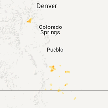
Hail Maps for Walsenburg, CO
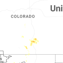
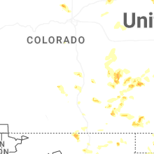
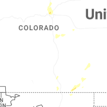


Connect with Interactive Hail Maps