

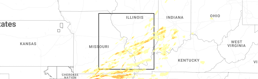
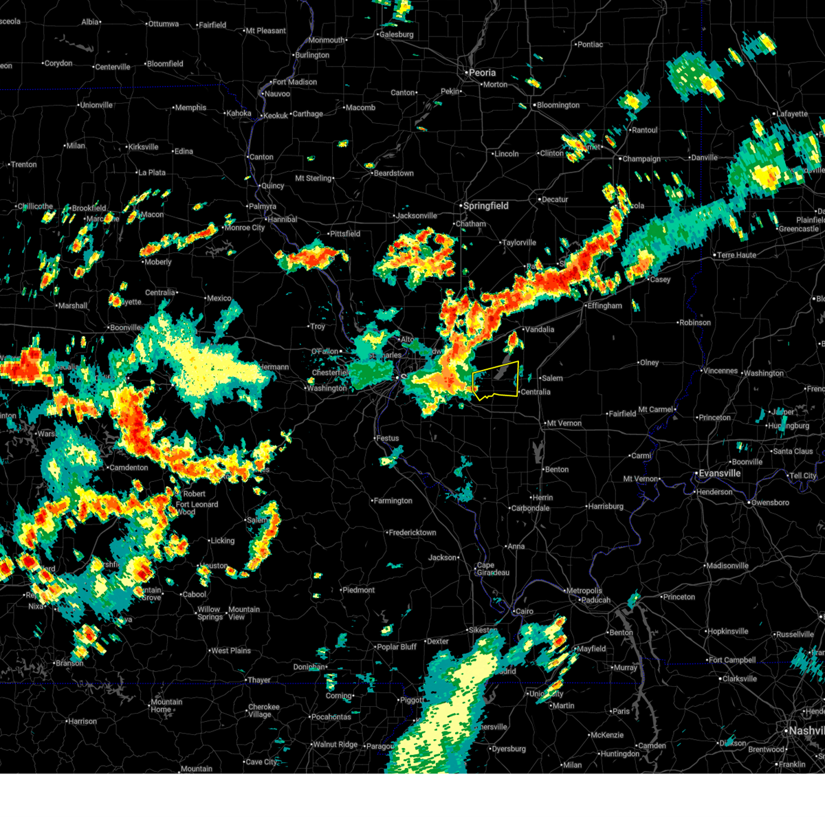
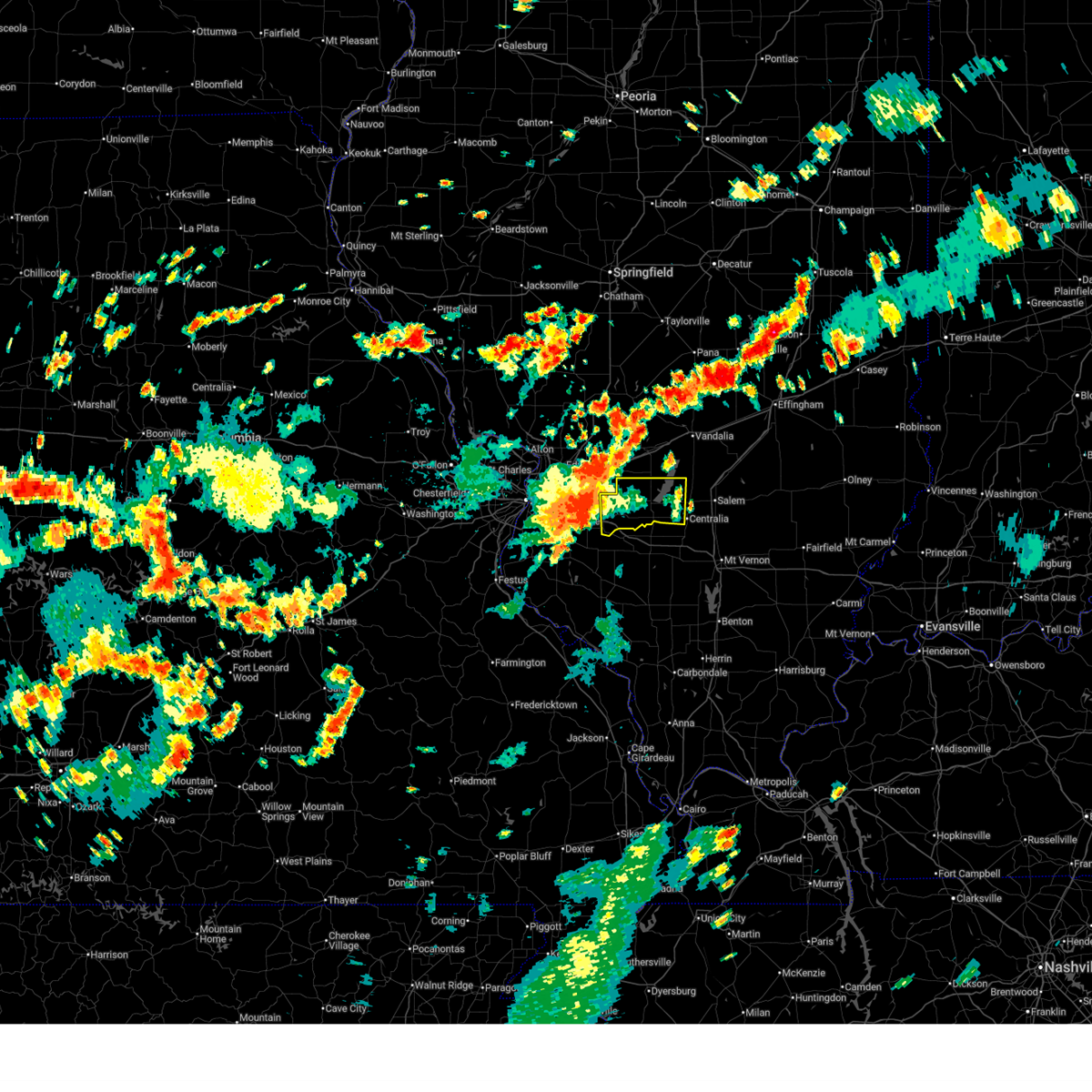
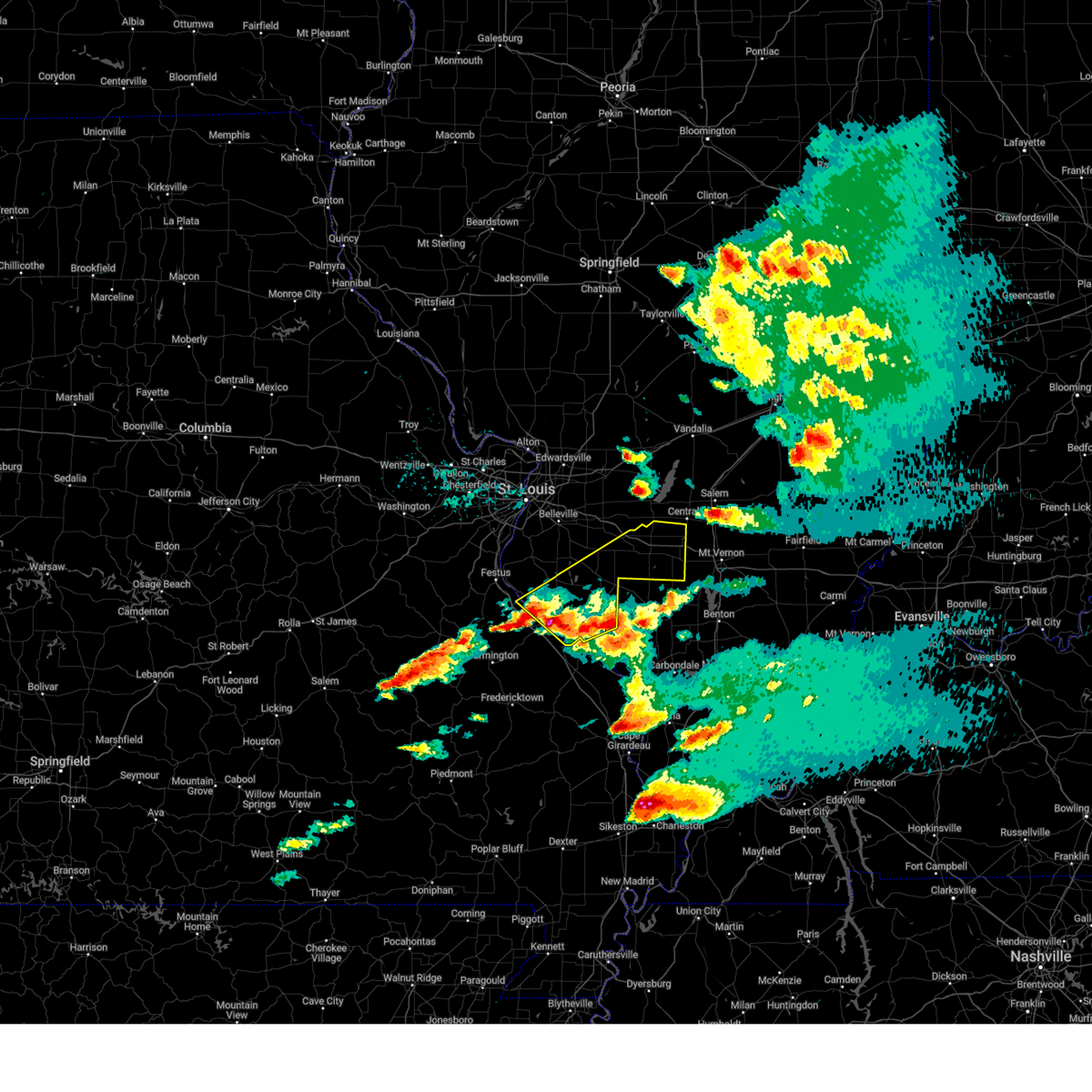
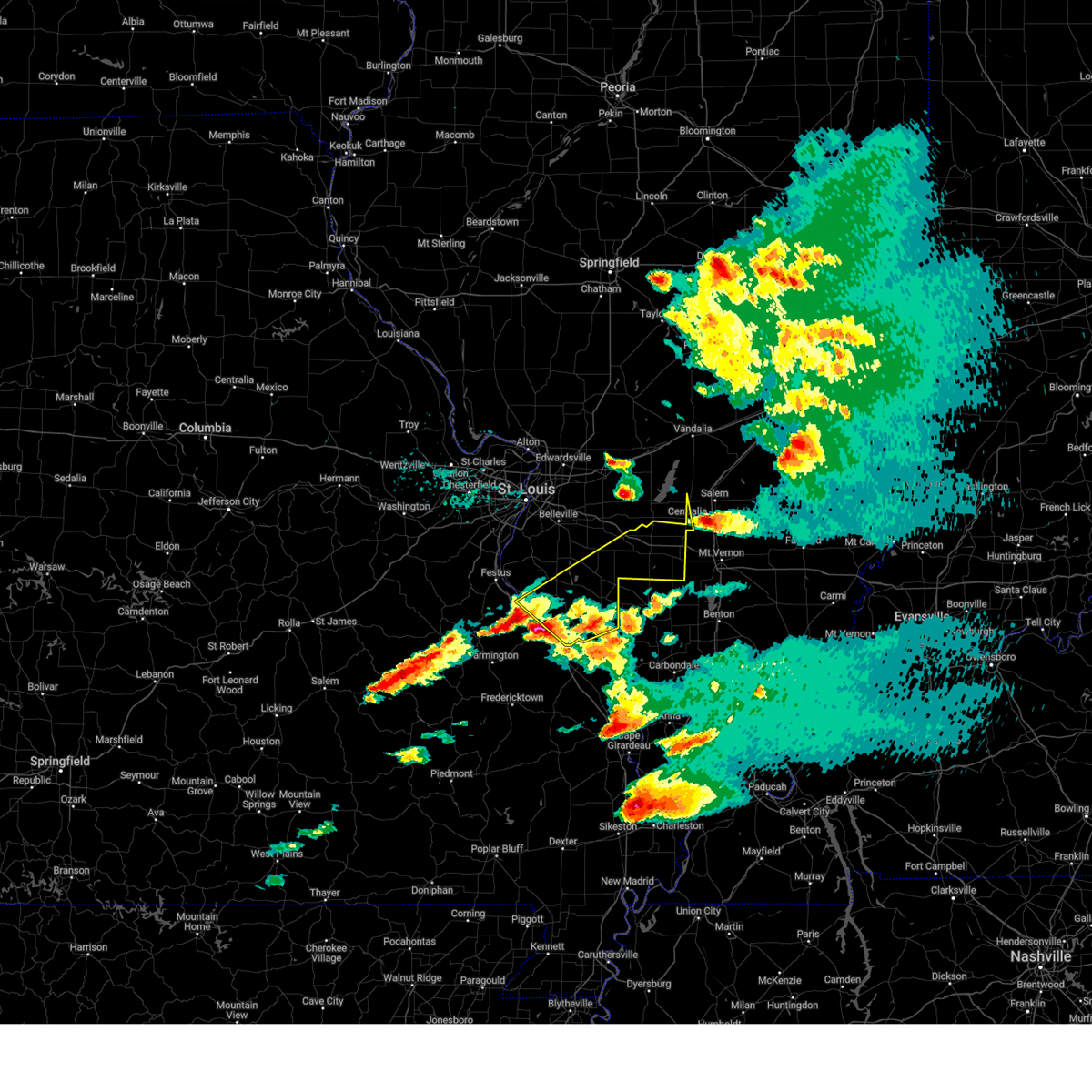
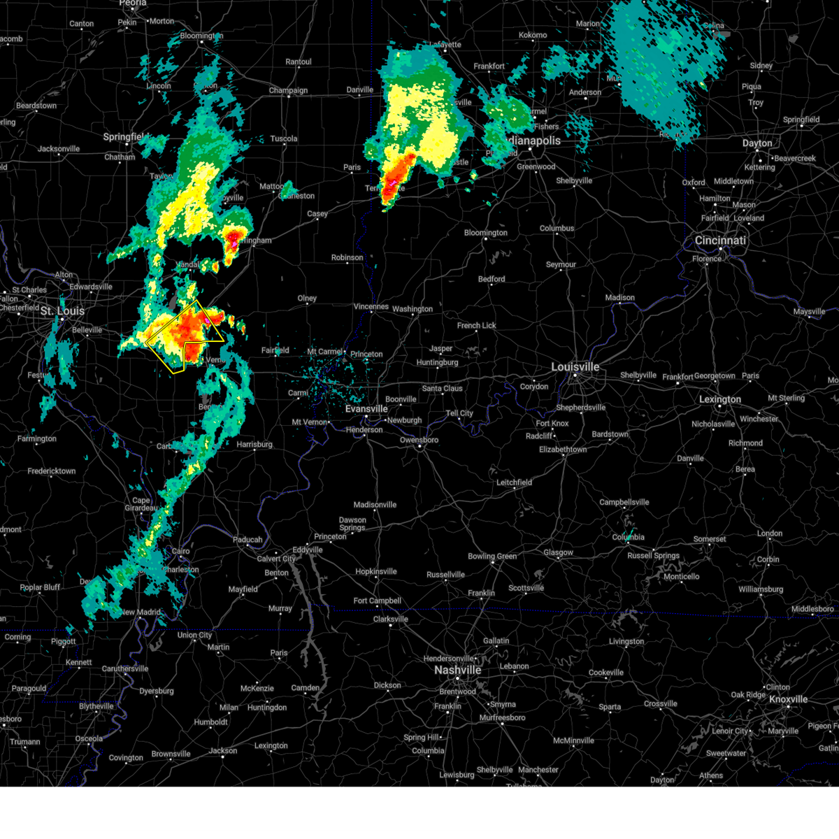
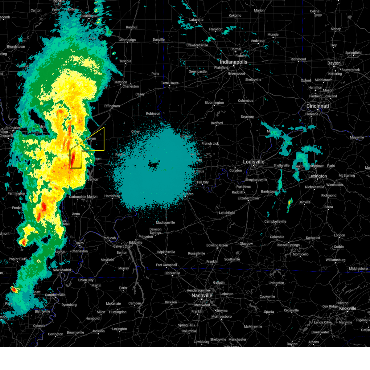
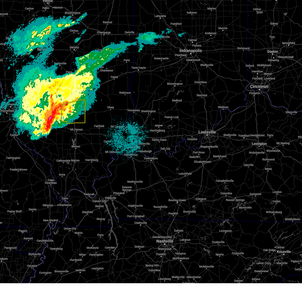
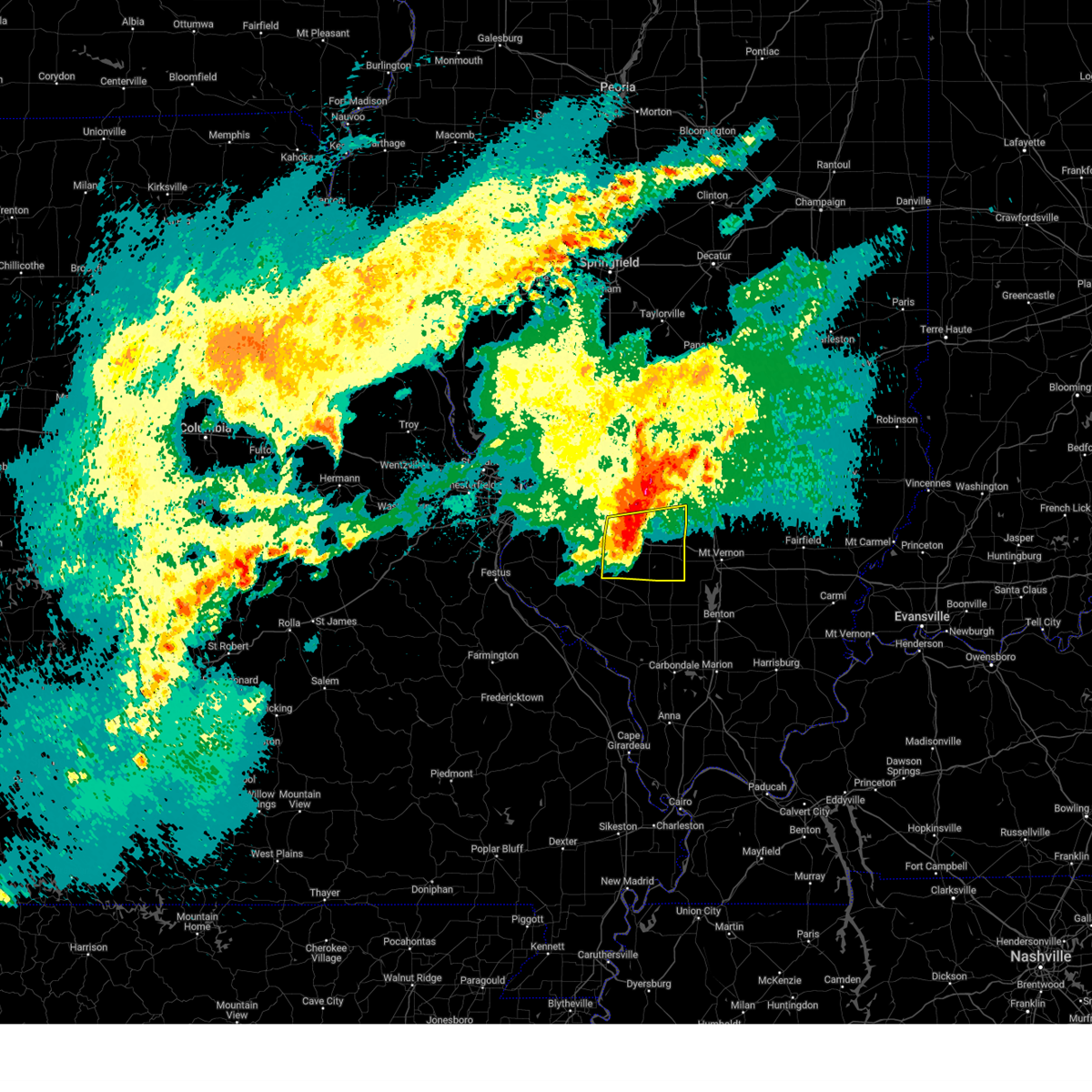
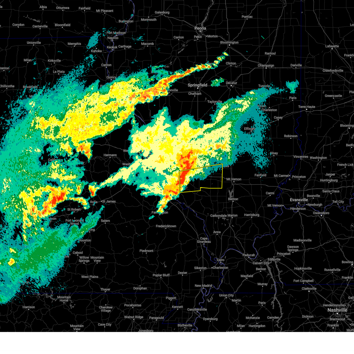
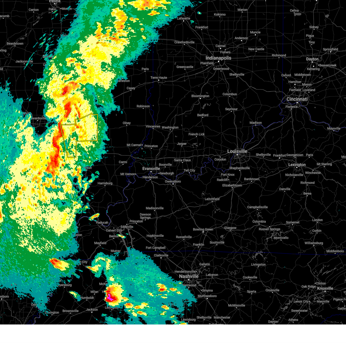
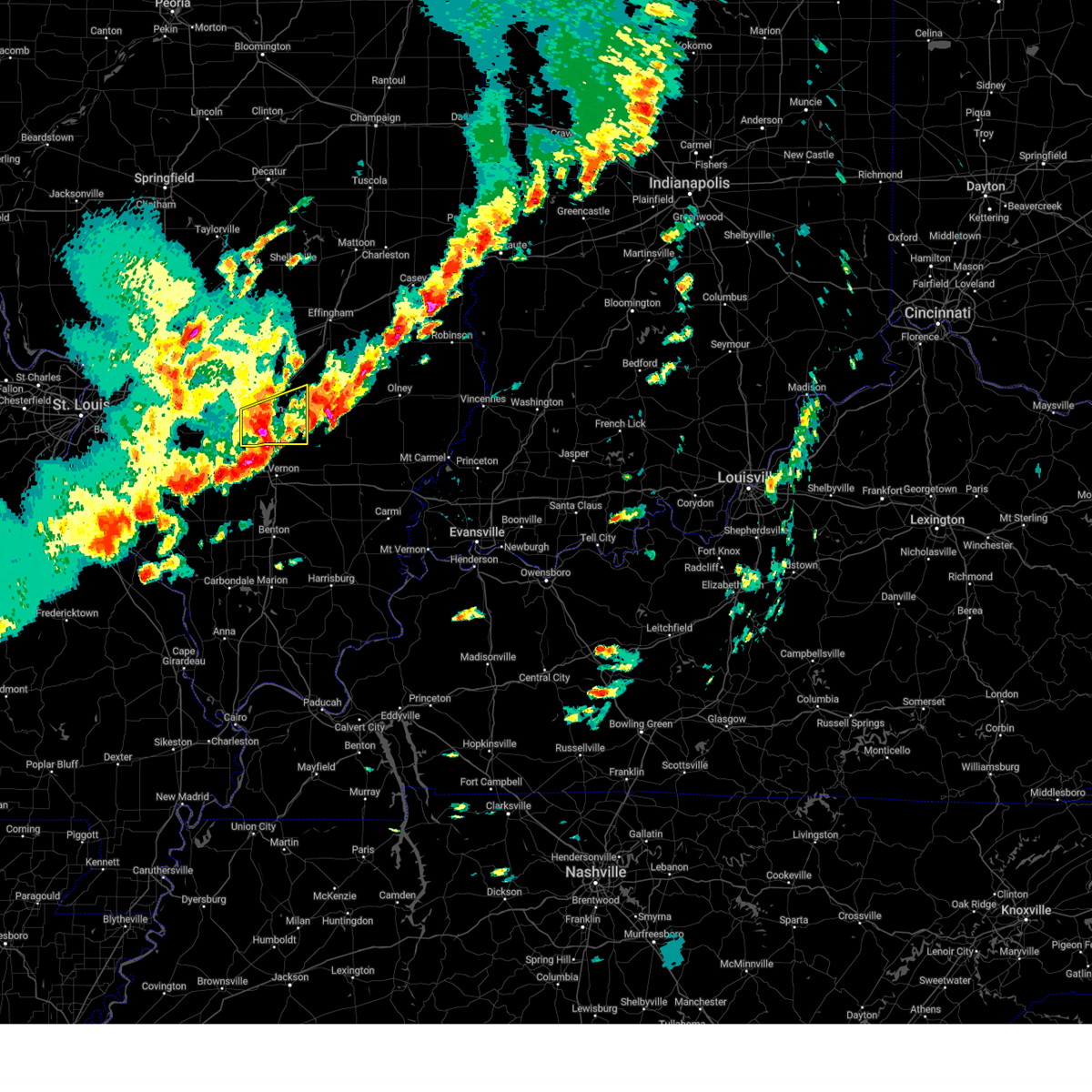
Hail Map for Wamac, IL
The Wamac, IL area has had 0 reports of on-the-ground hail by trained spotters, and has been under severe weather warnings 64 times during the past 12 months. Doppler radar has detected hail at or near Wamac, IL on 65 occasions, including 5 occasions during the past year.
| Name: | Wamac, IL |
| Where Located: | 57.8 miles E of Saint Louis, MO |
| Map: | Google Map for Wamac, IL |
| Population: | 1185 |
| Housing Units: | 588 |
| More Info: | Search Google for Wamac, IL |
2
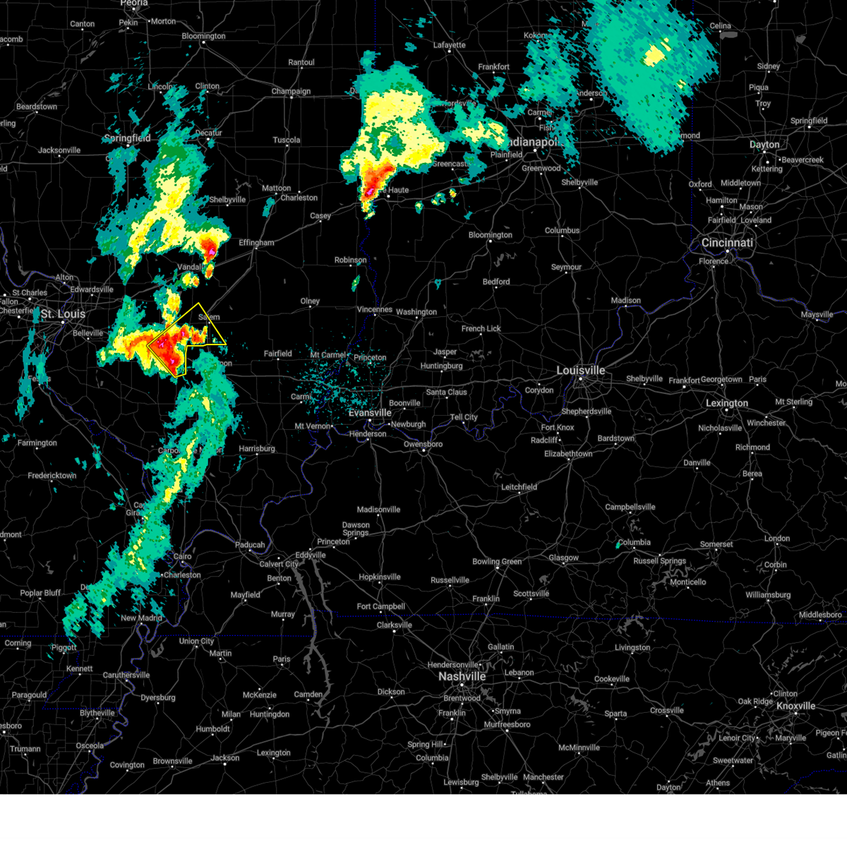
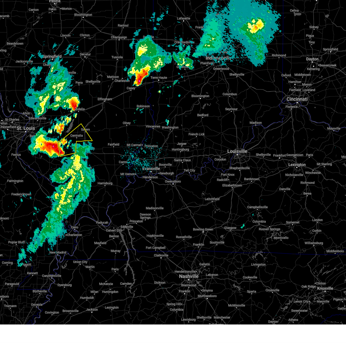
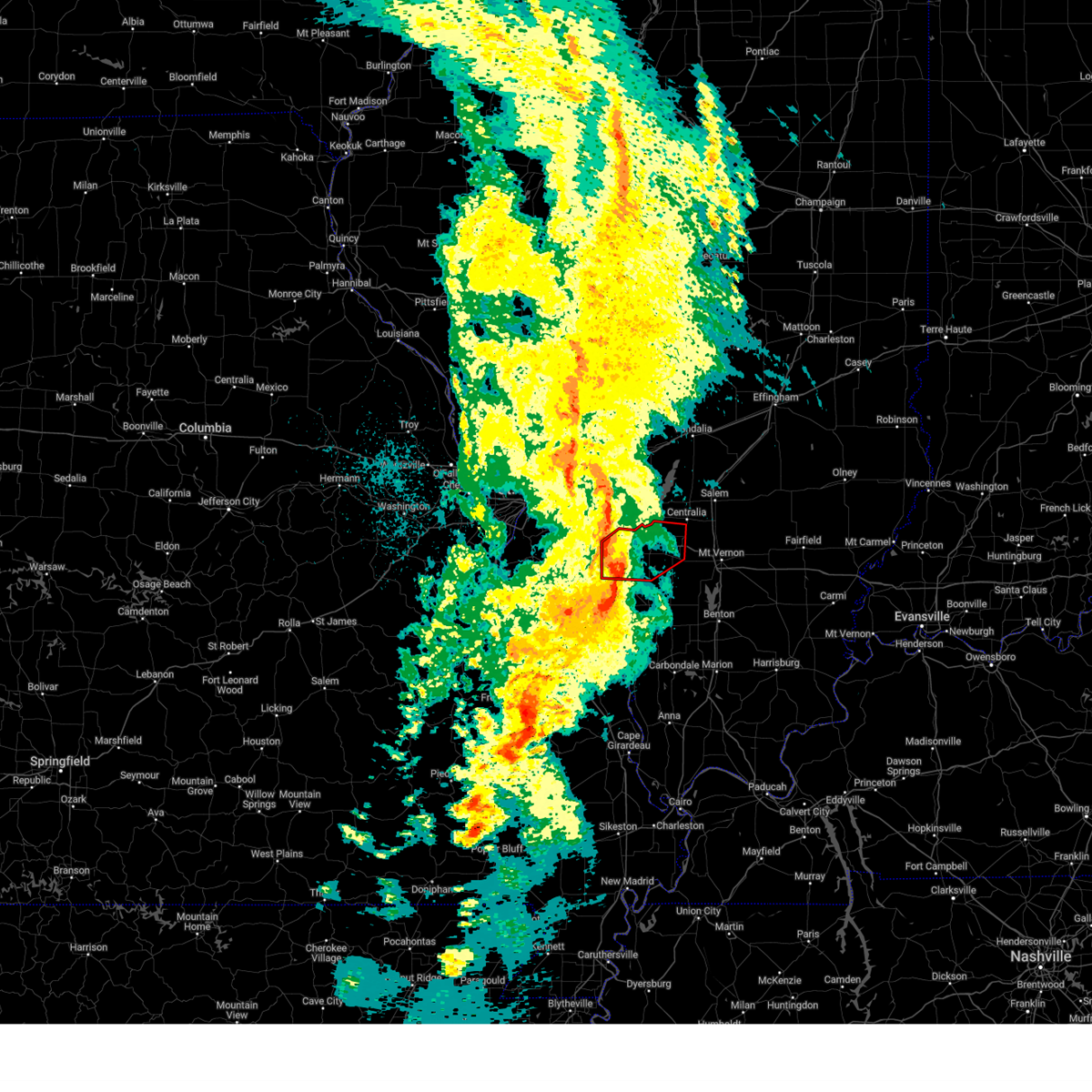
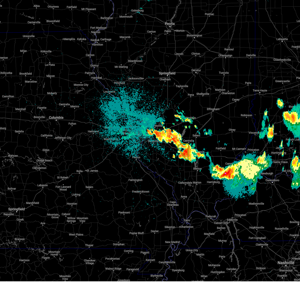
The Top Recent Hail Date for Wamac, IL is Sunday, March 30, 2025 (6th out of 65)
Hail and Wind Damage Spotted near Wamac, IL
| Date / Time | Report Details |
|---|---|
| 7/6/2025 5:11 PM CDT |
 the severe thunderstorm warning has been cancelled and is no longer in effect the severe thunderstorm warning has been cancelled and is no longer in effect
|
| 7/6/2025 5:05 PM CDT |
 At 505 pm cdt, severe thunderstorms were located along a line from near carlyle to near germantown, or along a line from near carlyle to 8 miles south of breese, moving northeast at 30 mph (radar indicated). Hazards include 60 mph wind gusts. Expect damage to roofs, siding, and trees. locations impacted include, breese, carlyle, germantown, wamac, beckemeyer, irvington, shattuc, boulder, bartelso, hoffman, huey, posey and ferrin. This includes the following state parks, carlyle lake recreational area. At 505 pm cdt, severe thunderstorms were located along a line from near carlyle to near germantown, or along a line from near carlyle to 8 miles south of breese, moving northeast at 30 mph (radar indicated). Hazards include 60 mph wind gusts. Expect damage to roofs, siding, and trees. locations impacted include, breese, carlyle, germantown, wamac, beckemeyer, irvington, shattuc, boulder, bartelso, hoffman, huey, posey and ferrin. This includes the following state parks, carlyle lake recreational area.
|
| 7/6/2025 4:46 PM CDT |
 Svrlsx the national weather service in st louis has issued a * severe thunderstorm warning for, clinton county in south central illinois, * until 530 pm cdt. * at 446 pm cdt, severe thunderstorms were located along a line from over aviston to over new memphis, or along a line from 6 miles northwest of breese to near new baden, moving east at 40 mph (radar indicated). Hazards include 60 mph wind gusts and small hail. expect damage to roofs, siding, and trees Svrlsx the national weather service in st louis has issued a * severe thunderstorm warning for, clinton county in south central illinois, * until 530 pm cdt. * at 446 pm cdt, severe thunderstorms were located along a line from over aviston to over new memphis, or along a line from 6 miles northwest of breese to near new baden, moving east at 40 mph (radar indicated). Hazards include 60 mph wind gusts and small hail. expect damage to roofs, siding, and trees
|
| 5/16/2025 4:39 PM CDT | the severe thunderstorm warning has been cancelled and is no longer in effect |
| 5/16/2025 4:19 PM CDT |
 At 419 pm cdt, a severe thunderstorm was located near evansville, or 7 miles northeast of ste. genevieve, moving northeast at 65 mph (public reported quarter size hail in st. genevieve). Hazards include 60 mph wind gusts and quarter size hail. Hail damage to vehicles is expected. expect wind damage to roofs, siding, and trees. locations impacted include, chester, ste. genevieve, sparta, red bud, nashville, bremen, steeleville, marissa, okawville, wamac, percy, coulterville, tilden, evansville, lively grove, irvington, ashley, baldwin, st. mary and posen. this includes the following state parks, felix valle house state park. This includes interstate 64 in illinois between exits 41 and 61. At 419 pm cdt, a severe thunderstorm was located near evansville, or 7 miles northeast of ste. genevieve, moving northeast at 65 mph (public reported quarter size hail in st. genevieve). Hazards include 60 mph wind gusts and quarter size hail. Hail damage to vehicles is expected. expect wind damage to roofs, siding, and trees. locations impacted include, chester, ste. genevieve, sparta, red bud, nashville, bremen, steeleville, marissa, okawville, wamac, percy, coulterville, tilden, evansville, lively grove, irvington, ashley, baldwin, st. mary and posen. this includes the following state parks, felix valle house state park. This includes interstate 64 in illinois between exits 41 and 61.
|
| 5/16/2025 4:16 PM CDT |
 At 416 pm cdt, a severe thunderstorm was located near ste. genevieve, moving northeast at 65 mph (radar indicated). Hazards include 60 mph wind gusts and quarter size hail. Hail damage to vehicles is expected. expect wind damage to roofs, siding, and trees. locations impacted include, chester, ste. genevieve, sparta, red bud, nashville, bremen, steeleville, marissa, okawville, wamac, percy, coulterville, tilden, evansville, lively grove, irvington, ashley, baldwin, st. mary and posen. this includes the following state parks, felix valle house state park. This includes interstate 64 in illinois between exits 41 and 61. At 416 pm cdt, a severe thunderstorm was located near ste. genevieve, moving northeast at 65 mph (radar indicated). Hazards include 60 mph wind gusts and quarter size hail. Hail damage to vehicles is expected. expect wind damage to roofs, siding, and trees. locations impacted include, chester, ste. genevieve, sparta, red bud, nashville, bremen, steeleville, marissa, okawville, wamac, percy, coulterville, tilden, evansville, lively grove, irvington, ashley, baldwin, st. mary and posen. this includes the following state parks, felix valle house state park. This includes interstate 64 in illinois between exits 41 and 61.
|
| 5/16/2025 4:16 PM CDT |
 the severe thunderstorm warning has been cancelled and is no longer in effect the severe thunderstorm warning has been cancelled and is no longer in effect
|
| 5/16/2025 4:15 PM CDT |
 Svrlsx the national weather service in st louis has issued a * severe thunderstorm warning for, southwestern marion county in south central illinois, washington county in south central illinois, southeastern monroe county in southwestern illinois, randolph county in southwestern illinois, southeastern saint clair county in southwestern illinois, northeastern sainte genevieve county in southeastern missouri, * until 500 pm cdt. * at 415 pm cdt, a severe thunderstorm was located over ste. genevieve, moving northeast at 65 mph (radar indicated). Hazards include 60 mph wind gusts and quarter size hail. Hail damage to vehicles is expected. Expect wind damage to roofs, siding, and trees. Svrlsx the national weather service in st louis has issued a * severe thunderstorm warning for, southwestern marion county in south central illinois, washington county in south central illinois, southeastern monroe county in southwestern illinois, randolph county in southwestern illinois, southeastern saint clair county in southwestern illinois, northeastern sainte genevieve county in southeastern missouri, * until 500 pm cdt. * at 415 pm cdt, a severe thunderstorm was located over ste. genevieve, moving northeast at 65 mph (radar indicated). Hazards include 60 mph wind gusts and quarter size hail. Hail damage to vehicles is expected. Expect wind damage to roofs, siding, and trees.
|
| 5/16/2025 3:58 PM CDT | The storm which prompted the warning has moved out of the area. therefore, the warning will be allowed to expire. however, small hail and gusty winds are still possible with this thunderstorm. a tornado watch remains in effect until 700 pm cdt for a portion of south central illinois. |
| 5/16/2025 3:50 PM CDT | At 350 pm cdt, a severe thunderstorm was located near ashley, or 9 miles east of nashville, moving east at 55 mph (radar indicated). Hazards include 60 mph wind gusts and quarter size hail. Hail damage to vehicles is expected. expect wind damage to roofs, siding, and trees. locations impacted include, nashville, wamac, irvington, ashley, beaucoup, hoyleton, richview and huegely. This includes interstate 64 in illinois between exits 50 and 61. |
| 5/16/2025 3:39 PM CDT |
 At 339 pm cdt, a severe thunderstorm was located over nashville, moving east at 55 mph (trained spotters reported). Hazards include golf ball size hail and 60 mph wind gusts. People and animals outdoors will be injured. expect hail damage to roofs, siding, windows, and vehicles. expect wind damage to roofs, siding, and trees. locations impacted include, nashville, wamac, lively grove, irvington, ashley, posen, beaucoup, hoyleton, richview, addieville, oakdale, radom, new minden, huegely, cordes, elkton and stone church. This includes interstate 64 in illinois between exits 50 and 61. At 339 pm cdt, a severe thunderstorm was located over nashville, moving east at 55 mph (trained spotters reported). Hazards include golf ball size hail and 60 mph wind gusts. People and animals outdoors will be injured. expect hail damage to roofs, siding, windows, and vehicles. expect wind damage to roofs, siding, and trees. locations impacted include, nashville, wamac, lively grove, irvington, ashley, posen, beaucoup, hoyleton, richview, addieville, oakdale, radom, new minden, huegely, cordes, elkton and stone church. This includes interstate 64 in illinois between exits 50 and 61.
|
| 5/16/2025 3:29 PM CDT | Svrlsx the national weather service in st louis has issued a * severe thunderstorm warning for, washington county in south central illinois, * until 400 pm cdt. * at 329 pm cdt, a severe thunderstorm was located near lively grove, or 10 miles west of nashville, moving east at 55 mph (radar indicated). Hazards include 60 mph wind gusts and quarter size hail. Hail damage to vehicles is expected. Expect wind damage to roofs, siding, and trees. |
| 4/29/2025 2:35 PM CDT | the severe thunderstorm warning has been cancelled and is no longer in effect |
| 4/29/2025 2:27 PM CDT | At 227 pm cdt, a severe thunderstorm was located near irvington, or 6 miles southeast of centralia, moving northeast at 30 mph (radar indicated). Hazards include 60 mph wind gusts and quarter size hail. Hail damage to vehicles is expected. expect wind damage to roofs, siding, and trees. locations impacted include, centralia, salem, sandoval, wamac, central city, odin, junction city, kell, walnut hill, selmaville and cartter. This includes interstate 57 in illinois between exits 109 and 116. |
| 4/29/2025 2:27 PM CDT | the severe thunderstorm warning has been cancelled and is no longer in effect |
| 4/29/2025 2:13 PM CDT |
 At 213 pm cdt, a severe thunderstorm was located over irvington, or 7 miles south of centralia, moving northeast at 30 mph (radar indicated). Hazards include 60 mph wind gusts and half dollar size hail. Hail damage to vehicles is expected. expect wind damage to roofs, siding, and trees. locations impacted include, centralia, salem, nashville, sandoval, wamac, central city, odin, irvington, ashley, beaucoup, hoyleton, junction city, richview, radom, kell, walnut hill, selmaville, huegely and cartter. this includes the following highways, interstate 64 in illinois between exits 50 and 61. Interstate 57 in illinois between exits 109 and 116. At 213 pm cdt, a severe thunderstorm was located over irvington, or 7 miles south of centralia, moving northeast at 30 mph (radar indicated). Hazards include 60 mph wind gusts and half dollar size hail. Hail damage to vehicles is expected. expect wind damage to roofs, siding, and trees. locations impacted include, centralia, salem, nashville, sandoval, wamac, central city, odin, irvington, ashley, beaucoup, hoyleton, junction city, richview, radom, kell, walnut hill, selmaville, huegely and cartter. this includes the following highways, interstate 64 in illinois between exits 50 and 61. Interstate 57 in illinois between exits 109 and 116.
|
| 4/29/2025 2:04 PM CDT |
 Svrlsx the national weather service in st louis has issued a * severe thunderstorm warning for, east central clinton county in south central illinois, southwestern marion county in south central illinois, eastern washington county in south central illinois, * until 245 pm cdt. * at 204 pm cdt, a severe thunderstorm was located near nashville, moving northeast at 45 mph (public reported half dollar sized hail). Hazards include 60 mph wind gusts and half dollar size hail. Hail damage to vehicles is expected. Expect wind damage to roofs, siding, and trees. Svrlsx the national weather service in st louis has issued a * severe thunderstorm warning for, east central clinton county in south central illinois, southwestern marion county in south central illinois, eastern washington county in south central illinois, * until 245 pm cdt. * at 204 pm cdt, a severe thunderstorm was located near nashville, moving northeast at 45 mph (public reported half dollar sized hail). Hazards include 60 mph wind gusts and half dollar size hail. Hail damage to vehicles is expected. Expect wind damage to roofs, siding, and trees.
|
| 4/29/2025 8:03 AM CDT |
 the severe thunderstorm warning has been cancelled and is no longer in effect the severe thunderstorm warning has been cancelled and is no longer in effect
|
| 4/29/2025 7:51 AM CDT |
 At 751 am cdt, a severe thunderstorm was located near irvington, or 8 miles northeast of nashville, moving east at 55 mph (radar indicated). Hazards include 60 mph wind gusts and quarter size hail. Hail damage to vehicles is expected. expect wind damage to roofs, siding, and trees. locations impacted include, centralia, salem, nashville, sandoval, wamac, central city, odin, irvington, ashley, shattuc, fairman, tonti, beaucoup, hoyleton, hoffman, junction city, covington, richview, radom and kell. this includes the following highways, interstate 64 in illinois between exits 50 and 61. Interstate 57 in illinois between exits 109 and 116. At 751 am cdt, a severe thunderstorm was located near irvington, or 8 miles northeast of nashville, moving east at 55 mph (radar indicated). Hazards include 60 mph wind gusts and quarter size hail. Hail damage to vehicles is expected. expect wind damage to roofs, siding, and trees. locations impacted include, centralia, salem, nashville, sandoval, wamac, central city, odin, irvington, ashley, shattuc, fairman, tonti, beaucoup, hoyleton, hoffman, junction city, covington, richview, radom and kell. this includes the following highways, interstate 64 in illinois between exits 50 and 61. Interstate 57 in illinois between exits 109 and 116.
|
| 4/29/2025 7:34 AM CDT |
 Svrlsx the national weather service in st louis has issued a * severe thunderstorm warning for, southeastern clinton county in south central illinois, western marion county in south central illinois, eastern washington county in south central illinois, * until 815 am cdt. * at 734 am cdt, a severe thunderstorm was located near nashville, moving northeast at 60 mph (radar indicated). Hazards include 60 mph wind gusts and quarter size hail. Hail damage to vehicles is expected. Expect wind damage to roofs, siding, and trees. Svrlsx the national weather service in st louis has issued a * severe thunderstorm warning for, southeastern clinton county in south central illinois, western marion county in south central illinois, eastern washington county in south central illinois, * until 815 am cdt. * at 734 am cdt, a severe thunderstorm was located near nashville, moving northeast at 60 mph (radar indicated). Hazards include 60 mph wind gusts and quarter size hail. Hail damage to vehicles is expected. Expect wind damage to roofs, siding, and trees.
|
| 4/20/2025 9:27 PM CDT |
 At 927 pm cdt, a severe thunderstorm was located near centralia, moving northeast at 50 mph (radar indicated). Hazards include 60 mph wind gusts and small hail. Expect damage to roofs, siding, and trees. locations impacted include, centralia, salem, sandoval, wamac, central city, odin, kinmundy, omega, stephen forbes station, helm, tonti, iuka, junction city, alma, kell, walnut hill, cartter, brubaker and selmaville. This includes interstate 57 in illinois between exits 109 and 116. At 927 pm cdt, a severe thunderstorm was located near centralia, moving northeast at 50 mph (radar indicated). Hazards include 60 mph wind gusts and small hail. Expect damage to roofs, siding, and trees. locations impacted include, centralia, salem, sandoval, wamac, central city, odin, kinmundy, omega, stephen forbes station, helm, tonti, iuka, junction city, alma, kell, walnut hill, cartter, brubaker and selmaville. This includes interstate 57 in illinois between exits 109 and 116.
|
| 4/20/2025 9:27 PM CDT |
 the severe thunderstorm warning has been cancelled and is no longer in effect the severe thunderstorm warning has been cancelled and is no longer in effect
|
| 4/20/2025 9:14 PM CDT | The tornado threat has diminished and the tornado warning has been cancelled. however, large hail and damaging winds remain likely and a severe thunderstorm warning remains in effect for the area. however, small hail and gusty winds are still possible with this thunderstorm. a tornado watch remains in effect until 1100 pm cdt for a portion of south central illinois. |
| 4/20/2025 9:12 PM CDT |
 Svrlsx the national weather service in st louis has issued a * severe thunderstorm warning for, east central clinton county in south central illinois, marion county in south central illinois, eastern washington county in south central illinois, * until 1015 pm cdt. * at 912 pm cdt, a severe thunderstorm was located near ashley, or 7 miles east of nashville, moving northeast at 50 mph (radar indicated). Hazards include 60 mph wind gusts and small hail. expect damage to roofs, siding, and trees Svrlsx the national weather service in st louis has issued a * severe thunderstorm warning for, east central clinton county in south central illinois, marion county in south central illinois, eastern washington county in south central illinois, * until 1015 pm cdt. * at 912 pm cdt, a severe thunderstorm was located near ashley, or 7 miles east of nashville, moving northeast at 50 mph (radar indicated). Hazards include 60 mph wind gusts and small hail. expect damage to roofs, siding, and trees
|
| 4/20/2025 9:02 PM CDT | At 902 pm cdt, a severe thunderstorm capable of producing a tornado was located near nashville, moving northeast at 45 mph (radar indicated rotation). Hazards include tornado. Flying debris will be dangerous to those caught without shelter. mobile homes will be damaged or destroyed. damage to roofs, windows and vehicles will occur. tree damage is likely. locations impacted include, nashville, okawville, wamac, irvington, ashley, posen, beaucoup, hoyleton, covington, richview, addieville, oakdale, new minden, huegely, cordes and frogtown. This includes interstate 64 in illinois between exits 41 and 61. |
| 4/20/2025 8:49 PM CDT |
 At 849 pm cdt, a severe thunderstorm capable of producing a tornado was located over lively grove, or 12 miles west of nashville, moving northeast at 50 mph (radar indicated rotation). Hazards include tornado. Flying debris will be dangerous to those caught without shelter. mobile homes will be damaged or destroyed. damage to roofs, windows and vehicles will occur. tree damage is likely. locations impacted include, nashville, okawville, wamac, tilden, lively grove, irvington, ashley, posen, beaucoup, hoyleton, johannisburg, covington, richview, addieville, oakdale, new minden, venedy, cordes, frogtown and huegely. This includes interstate 64 in illinois between exits 41 and 61. At 849 pm cdt, a severe thunderstorm capable of producing a tornado was located over lively grove, or 12 miles west of nashville, moving northeast at 50 mph (radar indicated rotation). Hazards include tornado. Flying debris will be dangerous to those caught without shelter. mobile homes will be damaged or destroyed. damage to roofs, windows and vehicles will occur. tree damage is likely. locations impacted include, nashville, okawville, wamac, tilden, lively grove, irvington, ashley, posen, beaucoup, hoyleton, johannisburg, covington, richview, addieville, oakdale, new minden, venedy, cordes, frogtown and huegely. This includes interstate 64 in illinois between exits 41 and 61.
|
| 4/20/2025 8:49 PM CDT |
 the tornado warning has been cancelled and is no longer in effect the tornado warning has been cancelled and is no longer in effect
|
| 4/20/2025 8:32 PM CDT | Torlsx the national weather service in st louis has issued a * tornado warning for, washington county in south central illinois, northeastern randolph county in southwestern illinois, southeastern saint clair county in southwestern illinois, * until 915 pm cdt. * at 832 pm cdt, a severe thunderstorm capable of producing a tornado was located near sparta, moving northeast at 55 mph (radar indicated rotation). Hazards include tornado. Flying debris will be dangerous to those caught without shelter. mobile homes will be damaged or destroyed. damage to roofs, windows and vehicles will occur. Tree damage is likely. |
| 4/19/2025 2:39 AM CDT |
 the severe thunderstorm warning has been cancelled and is no longer in effect the severe thunderstorm warning has been cancelled and is no longer in effect
|
| 4/19/2025 2:39 AM CDT |
 At 239 am cdt, severe thunderstorms were located along a line from over farina to near helm, or along a line from 15 miles northeast of salem to 12 miles east of salem, moving east at 70 mph (radar indicated). Hazards include 70 mph wind gusts. Expect considerable tree damage. damage is likely to mobile homes, roofs, and outbuildings. locations impacted include, centralia, salem, sandoval, wamac, central city, odin, kinmundy, patoka, farina, omega, stephen forbes station, fairman, helm, tonti, la clede, iuka, junction city, st. peter, alma and kell. This includes interstate 57 in illinois between exits 109 and 135. At 239 am cdt, severe thunderstorms were located along a line from over farina to near helm, or along a line from 15 miles northeast of salem to 12 miles east of salem, moving east at 70 mph (radar indicated). Hazards include 70 mph wind gusts. Expect considerable tree damage. damage is likely to mobile homes, roofs, and outbuildings. locations impacted include, centralia, salem, sandoval, wamac, central city, odin, kinmundy, patoka, farina, omega, stephen forbes station, fairman, helm, tonti, la clede, iuka, junction city, st. peter, alma and kell. This includes interstate 57 in illinois between exits 109 and 135.
|
| 4/19/2025 2:21 AM CDT |
 At 221 am cdt, severe thunderstorms were located along a line from over fairman to over wamac, or along a line from 11 miles northwest of salem to near centralia, moving east at 70 mph (radar indicated). Hazards include 70 mph wind gusts. Expect considerable tree damage. damage is likely to mobile homes, roofs, and outbuildings. locations impacted include, centralia, salem, sandoval, wamac, central city, odin, kinmundy, irvington, patoka, farina, omega, fairman, stephen forbes station, shattuc, boulder, helm, tonti, la clede, hoffman and iuka. this includes the following state parks, carlyle lake recreational area. This includes interstate 57 in illinois between exits 109 and 135. At 221 am cdt, severe thunderstorms were located along a line from over fairman to over wamac, or along a line from 11 miles northwest of salem to near centralia, moving east at 70 mph (radar indicated). Hazards include 70 mph wind gusts. Expect considerable tree damage. damage is likely to mobile homes, roofs, and outbuildings. locations impacted include, centralia, salem, sandoval, wamac, central city, odin, kinmundy, irvington, patoka, farina, omega, fairman, stephen forbes station, shattuc, boulder, helm, tonti, la clede, hoffman and iuka. this includes the following state parks, carlyle lake recreational area. This includes interstate 57 in illinois between exits 109 and 135.
|
| 4/19/2025 2:16 AM CDT |
 Svrlsx the national weather service in st louis has issued a * severe thunderstorm warning for, northeastern clinton county in south central illinois, southern fayette county in south central illinois, marion county in south central illinois, * until 300 am cdt. * at 216 am cdt, severe thunderstorms were located along a line from near boulder to 6 miles west of irvington, or along a line from 8 miles east of carlyle to 9 miles southwest of centralia, moving east at 80 mph (radar indicated). Hazards include 60 mph wind gusts. expect damage to roofs, siding, and trees Svrlsx the national weather service in st louis has issued a * severe thunderstorm warning for, northeastern clinton county in south central illinois, southern fayette county in south central illinois, marion county in south central illinois, * until 300 am cdt. * at 216 am cdt, severe thunderstorms were located along a line from near boulder to 6 miles west of irvington, or along a line from 8 miles east of carlyle to 9 miles southwest of centralia, moving east at 80 mph (radar indicated). Hazards include 60 mph wind gusts. expect damage to roofs, siding, and trees
|
| 4/19/2025 2:11 AM CDT |
 At 211 am cdt, a severe thunderstorm was located 7 miles north of nashville, moving east at 60 mph (radar indicated). Hazards include 60 mph wind gusts. Expect damage to roofs, siding, and trees. locations impacted include, nashville, okawville, germantown, albers, wamac, lively grove, irvington, ashley, posen, bartelso, beaucoup, hoyleton, johannisburg, hoffman, damiansville, covington, richview, addieville, oakdale and radom. This includes interstate 64 in illinois between exits 34 and 61. At 211 am cdt, a severe thunderstorm was located 7 miles north of nashville, moving east at 60 mph (radar indicated). Hazards include 60 mph wind gusts. Expect damage to roofs, siding, and trees. locations impacted include, nashville, okawville, germantown, albers, wamac, lively grove, irvington, ashley, posen, bartelso, beaucoup, hoyleton, johannisburg, hoffman, damiansville, covington, richview, addieville, oakdale and radom. This includes interstate 64 in illinois between exits 34 and 61.
|
| 4/19/2025 2:11 AM CDT |
 the severe thunderstorm warning has been cancelled and is no longer in effect the severe thunderstorm warning has been cancelled and is no longer in effect
|
| 4/19/2025 1:59 AM CDT |
 At 159 am cdt, a severe thunderstorm was located 5 miles south of new memphis, or 10 miles south of new baden, moving east at 55 mph (radar indicated). Hazards include 60 mph wind gusts. Expect damage to roofs, siding, and trees. locations impacted include, mascoutah, freeburg, new baden, nashville, new athens, marissa, okawville, germantown, albers, wamac, lively grove, irvington, ashley, new memphis, posen, st. libory, bartelso, beaucoup, hoyleton and lenzburg. This includes interstate 64 in illinois between exits 34 and 61. At 159 am cdt, a severe thunderstorm was located 5 miles south of new memphis, or 10 miles south of new baden, moving east at 55 mph (radar indicated). Hazards include 60 mph wind gusts. Expect damage to roofs, siding, and trees. locations impacted include, mascoutah, freeburg, new baden, nashville, new athens, marissa, okawville, germantown, albers, wamac, lively grove, irvington, ashley, new memphis, posen, st. libory, bartelso, beaucoup, hoyleton and lenzburg. This includes interstate 64 in illinois between exits 34 and 61.
|
| 4/19/2025 1:59 AM CDT |
 the severe thunderstorm warning has been cancelled and is no longer in effect the severe thunderstorm warning has been cancelled and is no longer in effect
|
| 4/19/2025 1:43 AM CDT |
 Svrlsx the national weather service in st louis has issued a * severe thunderstorm warning for, southern clinton county in south central illinois, washington county in south central illinois, east central monroe county in southwestern illinois, northeastern randolph county in southwestern illinois, southeastern saint clair county in southwestern illinois, * until 230 am cdt. * at 143 am cdt, a severe thunderstorm was located near freeburg, moving east at 65 mph (radar indicated). Hazards include 60 mph wind gusts. expect damage to roofs, siding, and trees Svrlsx the national weather service in st louis has issued a * severe thunderstorm warning for, southern clinton county in south central illinois, washington county in south central illinois, east central monroe county in southwestern illinois, northeastern randolph county in southwestern illinois, southeastern saint clair county in southwestern illinois, * until 230 am cdt. * at 143 am cdt, a severe thunderstorm was located near freeburg, moving east at 65 mph (radar indicated). Hazards include 60 mph wind gusts. expect damage to roofs, siding, and trees
|
| 4/2/2025 5:54 PM CDT | the tornado warning has been cancelled and is no longer in effect |
| 4/2/2025 5:54 PM CDT | the severe thunderstorm warning has been cancelled and is no longer in effect |
| 4/2/2025 5:54 PM CDT | At 554 pm cdt, severe thunderstorms capable of producing a tornado were located along a line from near salem to near salem, moving northeast at 70 mph (radar indicated rotation). Hazards include tornado. Flying debris will be dangerous to those caught without shelter. mobile homes will be damaged or destroyed. damage to roofs, windows and vehicles will occur. tree damage is likely. locations impacted include, centralia, salem, sandoval, wamac, central city, odin, kinmundy, patoka, farina, omega, fairman, stephen forbes station, tonti, iuka, junction city, alma, vernon, brubaker and selmaville. This includes interstate 57 in illinois between exits 116 and 127. |
| 4/2/2025 5:54 PM CDT | At 554 pm cdt, severe thunderstorms were located along a line from near wrights corner to 7 miles south of salem, or along a line from 16 miles northeast of vandalia to 7 miles south of salem, moving northeast at 75 mph (radar indicated). Hazards include 60 mph wind gusts and quarter size hail. Hail damage to vehicles is expected. expect wind damage to roofs, siding, and trees. locations impacted include, centralia, salem, sandoval, wamac, central city, odin, kinmundy, patoka, farina, omega, stephen forbes station, fairman, helm, tonti, la clede, iuka, junction city, st. peter, alma and kell. This includes interstate 57 in illinois between exits 109 and 135. |
| 4/2/2025 5:48 PM CDT | the tornado warning has been cancelled and is no longer in effect |
| 4/2/2025 5:48 PM CDT | At 548 pm cdt, severe thunderstorms capable of producing a tornado were located along a line from over sandoval to near centralia, or along a line from 7 miles north of centralia to near centralia, moving northeast at 70 mph (radar indicated rotation). Hazards include tornado. Flying debris will be dangerous to those caught without shelter. mobile homes will be damaged or destroyed. damage to roofs, windows and vehicles will occur. tree damage is likely. locations impacted include, centralia, salem, sandoval, wamac, central city, odin, kinmundy, irvington, patoka, farina, omega, fairman, shattuc, boulder, stephen forbes station, tonti, iuka, junction city, alma and vernon. this includes the following state parks, carlyle lake recreational area. This includes interstate 57 in illinois between exits 116 and 127. |
| 4/2/2025 5:42 PM CDT | At 542 pm cdt, severe thunderstorms capable of producing a tornado were located along a line from over shattuc to over irvington, or along a line from 6 miles northwest of centralia to near centralia, moving northeast at 70 mph (radar indicated rotation). Hazards include tornado. Flying debris will be dangerous to those caught without shelter. mobile homes will be damaged or destroyed. damage to roofs, windows and vehicles will occur. tree damage is likely. locations impacted include, centralia, salem, sandoval, wamac, central city, odin, kinmundy, irvington, patoka, farina, omega, fairman, shattuc, boulder, stephen forbes station, tonti, hoyleton, iuka, junction city and alma. this includes the following state parks, carlyle lake recreational area. This includes interstate 57 in illinois between exits 116 and 127. |
| 4/2/2025 5:28 PM CDT | Torlsx the national weather service in st louis has issued a * tornado warning for, eastern clinton county in south central illinois, marion county in south central illinois, northern washington county in south central illinois, * until 615 pm cdt. * at 528 pm cdt, severe thunderstorms capable of producing a tornado were located along a line from near okawville to over nashville, or along a line from 9 miles northwest of nashville to over nashville, moving northeast at 70 mph (radar indicated rotation). Hazards include tornado. Flying debris will be dangerous to those caught without shelter. mobile homes will be damaged or destroyed. damage to roofs, windows and vehicles will occur. Tree damage is likely. |
| 4/2/2025 5:25 PM CDT |
 Svrlsx the national weather service in st louis has issued a * severe thunderstorm warning for, northeastern clinton county in south central illinois, southern fayette county in south central illinois, marion county in south central illinois, eastern washington county in south central illinois, * until 615 pm cdt. * at 525 pm cdt, severe thunderstorms were located along a line from over beaver creek to 9 miles southwest of nashville, or along a line from 7 miles south of greenville to 9 miles southwest of nashville, moving northeast at 75 mph (radar indicated). Hazards include 60 mph wind gusts and quarter size hail. Hail damage to vehicles is expected. Expect wind damage to roofs, siding, and trees. Svrlsx the national weather service in st louis has issued a * severe thunderstorm warning for, northeastern clinton county in south central illinois, southern fayette county in south central illinois, marion county in south central illinois, eastern washington county in south central illinois, * until 615 pm cdt. * at 525 pm cdt, severe thunderstorms were located along a line from over beaver creek to 9 miles southwest of nashville, or along a line from 7 miles south of greenville to 9 miles southwest of nashville, moving northeast at 75 mph (radar indicated). Hazards include 60 mph wind gusts and quarter size hail. Hail damage to vehicles is expected. Expect wind damage to roofs, siding, and trees.
|
| 3/30/2025 3:28 PM CDT |
 the severe thunderstorm warning has been cancelled and is no longer in effect the severe thunderstorm warning has been cancelled and is no longer in effect
|
| 3/30/2025 3:28 PM CDT |
 At 328 pm cdt, a severe thunderstorm was located near salem, moving east at 50 mph (radar indicated). Hazards include 60 mph wind gusts and half dollar size hail. Hail damage to vehicles is expected. expect wind damage to roofs, siding, and trees. locations impacted include, centralia, salem, sandoval, wamac, central city, odin, omega, stephen forbes station, helm, tonti, iuka, junction city, alma, kell, walnut hill, cartter, selmaville and brubaker. This includes interstate 57 in illinois between exits 109 and 116. At 328 pm cdt, a severe thunderstorm was located near salem, moving east at 50 mph (radar indicated). Hazards include 60 mph wind gusts and half dollar size hail. Hail damage to vehicles is expected. expect wind damage to roofs, siding, and trees. locations impacted include, centralia, salem, sandoval, wamac, central city, odin, omega, stephen forbes station, helm, tonti, iuka, junction city, alma, kell, walnut hill, cartter, selmaville and brubaker. This includes interstate 57 in illinois between exits 109 and 116.
|
| 3/30/2025 3:18 PM CDT |
 At 318 pm cdt, a severe thunderstorm was located over centralia, moving east at 50 mph (radar indicated). Hazards include 60 mph wind gusts and half dollar size hail. Hail damage to vehicles is expected. expect wind damage to roofs, siding, and trees. locations impacted include, centralia, salem, sandoval, wamac, central city, odin, irvington, omega, shattuc, stephen forbes station, helm, tonti, hoffman, iuka, junction city, alma, kell, walnut hill, selmaville and cartter. This includes interstate 57 in illinois between exits 109 and 116. At 318 pm cdt, a severe thunderstorm was located over centralia, moving east at 50 mph (radar indicated). Hazards include 60 mph wind gusts and half dollar size hail. Hail damage to vehicles is expected. expect wind damage to roofs, siding, and trees. locations impacted include, centralia, salem, sandoval, wamac, central city, odin, irvington, omega, shattuc, stephen forbes station, helm, tonti, hoffman, iuka, junction city, alma, kell, walnut hill, selmaville and cartter. This includes interstate 57 in illinois between exits 109 and 116.
|
| 3/30/2025 3:12 PM CDT | the tornado warning has been cancelled and is no longer in effect |
| 3/30/2025 3:11 PM CDT |
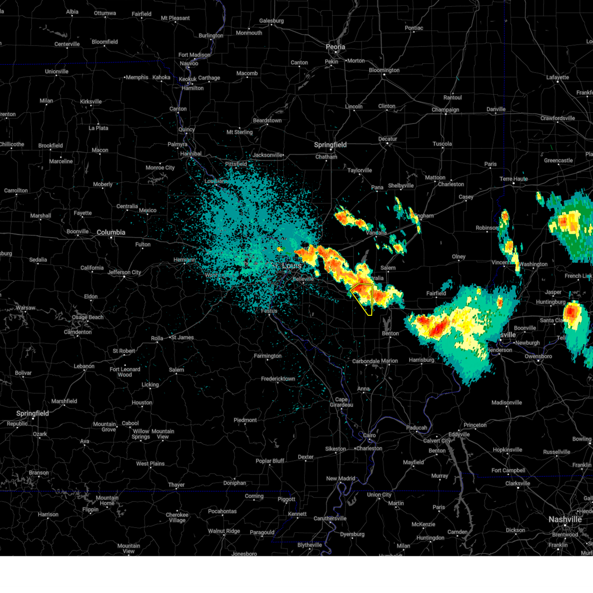
 Svrlsx the national weather service in st louis has issued a * severe thunderstorm warning for, east central clinton county in south central illinois, marion county in south central illinois, northeastern washington county in south central illinois, * until 400 pm cdt. * at 311 pm cdt, a severe thunderstorm was located near wamac, or 6 miles southwest of centralia, moving east at 50 mph. another severe storm was located south of iuka (radar indicated). Hazards include 60 mph wind gusts and half dollar size hail. Hail damage to vehicles is expected. Expect wind damage to roofs, siding, and trees. Svrlsx the national weather service in st louis has issued a * severe thunderstorm warning for, east central clinton county in south central illinois, marion county in south central illinois, northeastern washington county in south central illinois, * until 400 pm cdt. * at 311 pm cdt, a severe thunderstorm was located near wamac, or 6 miles southwest of centralia, moving east at 50 mph. another severe storm was located south of iuka (radar indicated). Hazards include 60 mph wind gusts and half dollar size hail. Hail damage to vehicles is expected. Expect wind damage to roofs, siding, and trees.
|
| 3/30/2025 2:53 PM CDT | Torlsx the national weather service in st louis has issued a * tornado warning for, northeastern washington county in south central illinois, * until 330 pm cdt. * at 253 pm cdt, a severe thunderstorm capable of producing a tornado was located near nashville, moving east at 50 mph (radar indicated rotation). Hazards include tornado and half dollar size hail. Flying debris will be dangerous to those caught without shelter. mobile homes will be damaged or destroyed. damage to roofs, windows and vehicles will occur. Tree damage is likely. |
| 3/30/2025 2:28 PM CDT |
 The storm which prompted the warning has weakened below severe limits, and no longer poses an immediate threat to life or property. therefore, the warning will be allowed to expire. however, small hail and gusty winds are still possible with this thunderstorm. a tornado watch remains in effect until 700 pm cdt sunday for a portion of south central illinois. The storm which prompted the warning has weakened below severe limits, and no longer poses an immediate threat to life or property. therefore, the warning will be allowed to expire. however, small hail and gusty winds are still possible with this thunderstorm. a tornado watch remains in effect until 700 pm cdt sunday for a portion of south central illinois.
|
| 3/30/2025 2:21 PM CDT |
 At 221 pm cdt, a severe thunderstorm was located over ashley, or 9 miles east of nashville, moving northeast at 40 mph (radar indicated). Hazards include 60 mph wind gusts and quarter size hail. Hail damage to vehicles is expected. expect wind damage to roofs, siding, and trees. locations impacted include, wamac, irvington, ashley, beaucoup, richview and radom. This includes interstate 64 in illinois near exit 61. At 221 pm cdt, a severe thunderstorm was located over ashley, or 9 miles east of nashville, moving northeast at 40 mph (radar indicated). Hazards include 60 mph wind gusts and quarter size hail. Hail damage to vehicles is expected. expect wind damage to roofs, siding, and trees. locations impacted include, wamac, irvington, ashley, beaucoup, richview and radom. This includes interstate 64 in illinois near exit 61.
|
| 3/30/2025 2:07 PM CDT | Svrlsx the national weather service in st louis has issued a * severe thunderstorm warning for, eastern washington county in south central illinois, * until 230 pm cdt. * at 207 pm cdt, a severe thunderstorm was located 6 miles southeast of nashville, moving northeast at 45 mph (radar indicated). Hazards include 60 mph wind gusts and quarter size hail. Hail damage to vehicles is expected. Expect wind damage to roofs, siding, and trees. |
| 3/30/2025 12:30 PM CDT |
 the severe thunderstorm warning has been cancelled and is no longer in effect the severe thunderstorm warning has been cancelled and is no longer in effect
|
| 3/30/2025 12:30 PM CDT |
 At 1230 pm cdt, severe thunderstorms were located along a line from 16 miles north of ramsey to over carlyle, or along a line from 14 miles east of nokomis to over carlyle, moving northeast at 60 mph (radar indicated). Hazards include 60 mph wind gusts and quarter size hail. Hail damage to vehicles is expected. expect wind damage to roofs, siding, and trees. locations impacted include, centralia, salem, vandalia, carlyle, st. elmo, sandoval, wamac, central city, odin, beckemeyer, ramsey, kinmundy, brownstown, irvington, mulberry grove, patoka, tamalco, farina, omega and beaver creek. this includes the following state parks, ramsey lake state park and carlyle lake recreational area. this includes the following highways, interstate 70 in illinois between exits 52 and 76. Interstate 57 in illinois between exits 116 and 135. At 1230 pm cdt, severe thunderstorms were located along a line from 16 miles north of ramsey to over carlyle, or along a line from 14 miles east of nokomis to over carlyle, moving northeast at 60 mph (radar indicated). Hazards include 60 mph wind gusts and quarter size hail. Hail damage to vehicles is expected. expect wind damage to roofs, siding, and trees. locations impacted include, centralia, salem, vandalia, carlyle, st. elmo, sandoval, wamac, central city, odin, beckemeyer, ramsey, kinmundy, brownstown, irvington, mulberry grove, patoka, tamalco, farina, omega and beaver creek. this includes the following state parks, ramsey lake state park and carlyle lake recreational area. this includes the following highways, interstate 70 in illinois between exits 52 and 76. Interstate 57 in illinois between exits 116 and 135.
|
| 3/30/2025 12:17 PM CDT |
 Svrlsx the national weather service in st louis has issued a * severe thunderstorm warning for, bond county in south central illinois, clinton county in south central illinois, fayette county in south central illinois, marion county in south central illinois, southeastern montgomery county in south central illinois, northwestern washington county in south central illinois, * until 100 pm cdt. * at 1217 pm cdt, severe thunderstorms were located along a line from 7 miles northwest of ramsey to near okawville, or along a line from 7 miles southeast of nokomis to 9 miles south of breese, moving northeast at 60 mph (radar indicated). Hazards include 60 mph wind gusts and quarter size hail. Hail damage to vehicles is expected. Expect wind damage to roofs, siding, and trees. Svrlsx the national weather service in st louis has issued a * severe thunderstorm warning for, bond county in south central illinois, clinton county in south central illinois, fayette county in south central illinois, marion county in south central illinois, southeastern montgomery county in south central illinois, northwestern washington county in south central illinois, * until 100 pm cdt. * at 1217 pm cdt, severe thunderstorms were located along a line from 7 miles northwest of ramsey to near okawville, or along a line from 7 miles southeast of nokomis to 9 miles south of breese, moving northeast at 60 mph (radar indicated). Hazards include 60 mph wind gusts and quarter size hail. Hail damage to vehicles is expected. Expect wind damage to roofs, siding, and trees.
|
| 3/14/2025 11:13 PM CDT |
 Svrlsx the national weather service in st louis has issued a * severe thunderstorm warning for, southeastern bond county in south central illinois, clinton county in south central illinois, northern washington county in south central illinois, southeastern madison county in southwestern illinois, * until midnight cdt. * at 1113 pm cdt, a severe thunderstorm was located over breese, moving northeast at 70 mph (radar indicated). Hazards include 70 mph wind gusts and quarter size hail. Hail damage to vehicles is expected. expect considerable tree damage. Wind damage is also likely to mobile homes, roofs, and outbuildings. Svrlsx the national weather service in st louis has issued a * severe thunderstorm warning for, southeastern bond county in south central illinois, clinton county in south central illinois, northern washington county in south central illinois, southeastern madison county in southwestern illinois, * until midnight cdt. * at 1113 pm cdt, a severe thunderstorm was located over breese, moving northeast at 70 mph (radar indicated). Hazards include 70 mph wind gusts and quarter size hail. Hail damage to vehicles is expected. expect considerable tree damage. Wind damage is also likely to mobile homes, roofs, and outbuildings.
|
| 7/29/2024 11:14 PM CDT |
 The storm which prompted the warning has weakened below severe limits, and no longer poses an immediate threat to life or property. therefore, the warning will be allowed to expire. a severe thunderstorm watch remains in effect until 300 am cdt for south central illinois. The storm which prompted the warning has weakened below severe limits, and no longer poses an immediate threat to life or property. therefore, the warning will be allowed to expire. a severe thunderstorm watch remains in effect until 300 am cdt for south central illinois.
|
| 7/29/2024 10:51 PM CDT |
 the severe thunderstorm warning has been cancelled and is no longer in effect the severe thunderstorm warning has been cancelled and is no longer in effect
|
| 7/29/2024 10:51 PM CDT |
 At 1051 pm cdt, a severe thunderstorm was located near irvington, moving southeast at 30 mph (radar indicated). Hazards include 60 mph wind gusts and quarter size hail. Hail damage to vehicles is expected. expect wind damage to roofs, siding, and trees. locations impacted include, centralia, wamac, irvington, ashley, beaucoup, hoyleton, richview, radom, new minden, and huegely. This includes interstate 64 in illinois near exit 61. At 1051 pm cdt, a severe thunderstorm was located near irvington, moving southeast at 30 mph (radar indicated). Hazards include 60 mph wind gusts and quarter size hail. Hail damage to vehicles is expected. expect wind damage to roofs, siding, and trees. locations impacted include, centralia, wamac, irvington, ashley, beaucoup, hoyleton, richview, radom, new minden, and huegely. This includes interstate 64 in illinois near exit 61.
|
| 7/29/2024 10:33 PM CDT |
 Svrlsx the national weather service in st louis has issued a * severe thunderstorm warning for, central clinton county in south central illinois, eastern washington county in south central illinois, * until 1115 pm cdt. * at 1033 pm cdt, a severe thunderstorm was located near beckemeyer, moving southeast at 30 mph (radar indicated). Hazards include 60 mph wind gusts and quarter size hail. Hail damage to vehicles is expected. Expect wind damage to roofs, siding, and trees. Svrlsx the national weather service in st louis has issued a * severe thunderstorm warning for, central clinton county in south central illinois, eastern washington county in south central illinois, * until 1115 pm cdt. * at 1033 pm cdt, a severe thunderstorm was located near beckemeyer, moving southeast at 30 mph (radar indicated). Hazards include 60 mph wind gusts and quarter size hail. Hail damage to vehicles is expected. Expect wind damage to roofs, siding, and trees.
|
| 7/29/2024 8:44 PM CDT |
 Svrlsx the national weather service in st louis has issued a * severe thunderstorm warning for, northeastern clinton county in south central illinois, marion county in south central illinois, * until 945 pm cdt. * at 844 pm cdt, a severe thunderstorm was located over shobonier, moving south at 35 mph (radar indicated). Hazards include 60 mph wind gusts and quarter size hail. Hail damage to vehicles is expected. Expect wind damage to roofs, siding, and trees. Svrlsx the national weather service in st louis has issued a * severe thunderstorm warning for, northeastern clinton county in south central illinois, marion county in south central illinois, * until 945 pm cdt. * at 844 pm cdt, a severe thunderstorm was located over shobonier, moving south at 35 mph (radar indicated). Hazards include 60 mph wind gusts and quarter size hail. Hail damage to vehicles is expected. Expect wind damage to roofs, siding, and trees.
|
| 5/26/2024 7:20 PM CDT |
 At 720 pm cdt, a severe squall line capable of producing both tornadoes and extensive straight line wind damage was located along a line extending from central city to ashley to near chester, moving east at 45 mph (radar indicated rotation). Hazards include tornado and quarter size hail. Flying debris will be dangerous to those caught without shelter. mobile homes will be damaged or destroyed. damage to roofs, windows, and vehicles will occur. tree damage is likely. these dangerous storms will be near, steeleville and percy around 725 pm cdt. This includes interstate 64 in illinois between exits 50 and 61. At 720 pm cdt, a severe squall line capable of producing both tornadoes and extensive straight line wind damage was located along a line extending from central city to ashley to near chester, moving east at 45 mph (radar indicated rotation). Hazards include tornado and quarter size hail. Flying debris will be dangerous to those caught without shelter. mobile homes will be damaged or destroyed. damage to roofs, windows, and vehicles will occur. tree damage is likely. these dangerous storms will be near, steeleville and percy around 725 pm cdt. This includes interstate 64 in illinois between exits 50 and 61.
|
| 5/26/2024 7:20 PM CDT |
 the tornado warning has been cancelled and is no longer in effect the tornado warning has been cancelled and is no longer in effect
|
| 5/26/2024 7:11 PM CDT |
 At 711 pm cdt, a severe squall line capable of producing both tornadoes and extensive straight line wind damage was located over salem, moving east at 65 mph (radar indicated rotation). Hazards include tornado and quarter size hail. Flying debris will be dangerous to those caught without shelter. mobile homes will be damaged or destroyed. damage to roofs, windows, and vehicles will occur. tree damage is likely. these dangerous storms will be near, salem around 715 pm cdt. This includes interstate 57 in illinois between exits 109 and 135. At 711 pm cdt, a severe squall line capable of producing both tornadoes and extensive straight line wind damage was located over salem, moving east at 65 mph (radar indicated rotation). Hazards include tornado and quarter size hail. Flying debris will be dangerous to those caught without shelter. mobile homes will be damaged or destroyed. damage to roofs, windows, and vehicles will occur. tree damage is likely. these dangerous storms will be near, salem around 715 pm cdt. This includes interstate 57 in illinois between exits 109 and 135.
|
| 5/26/2024 7:11 PM CDT |
 the tornado warning has been cancelled and is no longer in effect the tornado warning has been cancelled and is no longer in effect
|
| 5/26/2024 7:08 PM CDT |
 At 708 pm cdt, a severe squall line capable of producing both tornadoes and extensive straight line wind damage was located along a line extending from near shattuc to nashville to near ste. genevieve, moving east at 45 mph (radar indicated rotation). Hazards include tornado and quarter size hail. Flying debris will be dangerous to those caught without shelter. mobile homes will be damaged or destroyed. damage to roofs, windows, and vehicles will occur. tree damage is likely. these dangerous storms will be near, chester, bremen, centralia, steeleville, wamac, percy, irvington, and ashley around 715 pm cdt. this also includes carlyle lake recreational area. This includes interstate 64 in illinois between exits 50 and 61. At 708 pm cdt, a severe squall line capable of producing both tornadoes and extensive straight line wind damage was located along a line extending from near shattuc to nashville to near ste. genevieve, moving east at 45 mph (radar indicated rotation). Hazards include tornado and quarter size hail. Flying debris will be dangerous to those caught without shelter. mobile homes will be damaged or destroyed. damage to roofs, windows, and vehicles will occur. tree damage is likely. these dangerous storms will be near, chester, bremen, centralia, steeleville, wamac, percy, irvington, and ashley around 715 pm cdt. this also includes carlyle lake recreational area. This includes interstate 64 in illinois between exits 50 and 61.
|
| 5/26/2024 7:01 PM CDT |
 the tornado warning has been cancelled and is no longer in effect the tornado warning has been cancelled and is no longer in effect
|
| 5/26/2024 7:01 PM CDT |
 At 701 pm cdt, a severe squall line capable of producing both tornadoes and extensive straight line wind damage was located along a line extending from carlyle to near nashville to ste. genevieve, moving east at 45 mph (radar indicated rotation). Hazards include tornado and quarter size hail. Flying debris will be dangerous to those caught without shelter. mobile homes will be damaged or destroyed. damage to roofs, windows, and vehicles will occur. tree damage is likely. locations impacted include, sparta, carlyle, nashville, coulterville, tilden, chester, bremen, centralia, steeleville, irvington, shattuc, wamac, percy and ashley. this also includes carlyle lake recreational area. This includes interstate 64 in illinois between exits 34 and 61. At 701 pm cdt, a severe squall line capable of producing both tornadoes and extensive straight line wind damage was located along a line extending from carlyle to near nashville to ste. genevieve, moving east at 45 mph (radar indicated rotation). Hazards include tornado and quarter size hail. Flying debris will be dangerous to those caught without shelter. mobile homes will be damaged or destroyed. damage to roofs, windows, and vehicles will occur. tree damage is likely. locations impacted include, sparta, carlyle, nashville, coulterville, tilden, chester, bremen, centralia, steeleville, irvington, shattuc, wamac, percy and ashley. this also includes carlyle lake recreational area. This includes interstate 64 in illinois between exits 34 and 61.
|
| 5/26/2024 7:00 PM CDT |
 Torlsx the national weather service in st louis has issued a * tornado warning for, southeastern bond county in south central illinois, marion county in south central illinois, southern fayette county in south central illinois, * until 745 pm cdt. * at 659 pm cdt, severe thunderstorms capable of producing both tornadoes and extensive straight line wind damage were located near boulder, moving east at 65 mph (radar indicated rotation). Hazards include tornado and quarter size hail. Flying debris will be dangerous to those caught without shelter. mobile homes will be damaged or destroyed. damage to roofs, windows, and vehicles will occur. tree damage is likely. these dangerous storms will be near, sandoval, odin, and fairman around 705 pm cdt. salem around 710 pm cdt. this includes the following highways, interstate 70 in illinois near exit 52. Interstate 57 in illinois between exits 109 and 135. Torlsx the national weather service in st louis has issued a * tornado warning for, southeastern bond county in south central illinois, marion county in south central illinois, southern fayette county in south central illinois, * until 745 pm cdt. * at 659 pm cdt, severe thunderstorms capable of producing both tornadoes and extensive straight line wind damage were located near boulder, moving east at 65 mph (radar indicated rotation). Hazards include tornado and quarter size hail. Flying debris will be dangerous to those caught without shelter. mobile homes will be damaged or destroyed. damage to roofs, windows, and vehicles will occur. tree damage is likely. these dangerous storms will be near, sandoval, odin, and fairman around 705 pm cdt. salem around 710 pm cdt. this includes the following highways, interstate 70 in illinois near exit 52. Interstate 57 in illinois between exits 109 and 135.
|
| 5/26/2024 6:38 PM CDT |
 Torlsx the national weather service in st louis has issued a * tornado warning for, clinton county in south central illinois, washington county in south central illinois, randolph county in southwestern illinois, eastern st. clair county in southwestern illinois, * until 745 pm cdt. * at 638 pm cdt, severe thunderstorms capable of producing both tornadoes and extensive straight line wind damage were located along a line extending from near aviston to near new memphis to near bloomsdale, moving east at 45 mph (radar indicated rotation). Hazards include tornado and quarter size hail. Flying debris will be dangerous to those caught without shelter. mobile homes will be damaged or destroyed. damage to roofs, windows, and vehicles will occur. tree damage is likely. these dangerous storms will be near, breese, red bud, marissa, aviston, okawville, st. rose, germantown, albers, and baldwin around 645 pm cdt. sparta, carlyle, beckemeyer, tilden, evansville, and lively grove around 650 pm cdt. nashville around 655 pm cdt. other locations in the path of these tornadic storms include coulterville, chester, bremen, centralia, steeleville, wamac, percy, irvington, ashley and shattuc. this also includes carlyle lake recreational area. This includes interstate 64 in illinois between exits 27 and 61. Torlsx the national weather service in st louis has issued a * tornado warning for, clinton county in south central illinois, washington county in south central illinois, randolph county in southwestern illinois, eastern st. clair county in southwestern illinois, * until 745 pm cdt. * at 638 pm cdt, severe thunderstorms capable of producing both tornadoes and extensive straight line wind damage were located along a line extending from near aviston to near new memphis to near bloomsdale, moving east at 45 mph (radar indicated rotation). Hazards include tornado and quarter size hail. Flying debris will be dangerous to those caught without shelter. mobile homes will be damaged or destroyed. damage to roofs, windows, and vehicles will occur. tree damage is likely. these dangerous storms will be near, breese, red bud, marissa, aviston, okawville, st. rose, germantown, albers, and baldwin around 645 pm cdt. sparta, carlyle, beckemeyer, tilden, evansville, and lively grove around 650 pm cdt. nashville around 655 pm cdt. other locations in the path of these tornadic storms include coulterville, chester, bremen, centralia, steeleville, wamac, percy, irvington, ashley and shattuc. this also includes carlyle lake recreational area. This includes interstate 64 in illinois between exits 27 and 61.
|
| 5/8/2024 7:14 PM CDT |
 The storm which prompted the warning has moved out of the area. therefore, the warning will be allowed to expire. however, gusty winds and heavy rain are still possible with this thunderstorm. to report severe weather, contact your nearest law enforcement agency. they will relay your report to the national weather service st louis. The storm which prompted the warning has moved out of the area. therefore, the warning will be allowed to expire. however, gusty winds and heavy rain are still possible with this thunderstorm. to report severe weather, contact your nearest law enforcement agency. they will relay your report to the national weather service st louis.
|
| 5/8/2024 7:05 PM CDT |
 the severe thunderstorm warning has been cancelled and is no longer in effect the severe thunderstorm warning has been cancelled and is no longer in effect
|
| 5/8/2024 7:05 PM CDT |
 At 705 pm cdt, a severe thunderstorm was located over ashley, moving east at 50 mph (emergency management). Hazards include 60 mph wind gusts. Expect damage to roofs, siding, and trees. locations impacted include, nashville, centralia, wamac, irvington, ashley, posen, beaucoup, hoyleton, richview, radom, du bois, and huegely. This includes interstate 64 in illinois near exit 61. At 705 pm cdt, a severe thunderstorm was located over ashley, moving east at 50 mph (emergency management). Hazards include 60 mph wind gusts. Expect damage to roofs, siding, and trees. locations impacted include, nashville, centralia, wamac, irvington, ashley, posen, beaucoup, hoyleton, richview, radom, du bois, and huegely. This includes interstate 64 in illinois near exit 61.
|
| 5/8/2024 6:57 PM CDT |
 At 656 pm cdt, a severe thunderstorm was located near nashville, moving east at 60 mph (emergency management recorded 58 mph wind gusts in nashville). Hazards include 60 mph wind gusts. Expect damage to roofs, siding, and trees. locations impacted include, nashville, centralia, wamac, irvington, ashley, posen, beaucoup, hoyleton, covington, richview, addieville, oakdale, radom, new minden, du bois, huegely, cordes, and frogtown. This includes interstate 64 in illinois between exits 50 and 61. At 656 pm cdt, a severe thunderstorm was located near nashville, moving east at 60 mph (emergency management recorded 58 mph wind gusts in nashville). Hazards include 60 mph wind gusts. Expect damage to roofs, siding, and trees. locations impacted include, nashville, centralia, wamac, irvington, ashley, posen, beaucoup, hoyleton, covington, richview, addieville, oakdale, radom, new minden, du bois, huegely, cordes, and frogtown. This includes interstate 64 in illinois between exits 50 and 61.
|
| 5/8/2024 6:53 PM CDT |
 At 653 pm cdt, a severe thunderstorm was located near nashville, moving east at 50 mph (radar indicated). Hazards include 60 mph wind gusts. Expect damage to roofs, siding, and trees. locations impacted include, nashville, centralia, okawville, wamac, irvington, ashley, posen, beaucoup, hoyleton, covington, richview, addieville, oakdale, radom, new minden, du bois, huegely, cordes, elkton, and frogtown. This includes interstate 64 in illinois between exits 41 and 61. At 653 pm cdt, a severe thunderstorm was located near nashville, moving east at 50 mph (radar indicated). Hazards include 60 mph wind gusts. Expect damage to roofs, siding, and trees. locations impacted include, nashville, centralia, okawville, wamac, irvington, ashley, posen, beaucoup, hoyleton, covington, richview, addieville, oakdale, radom, new minden, du bois, huegely, cordes, elkton, and frogtown. This includes interstate 64 in illinois between exits 41 and 61.
|
| 5/8/2024 6:43 PM CDT |
 At 643 pm cdt, a severe thunderstorm was located over lively grove, moving east at 50 mph (radar indicated). Hazards include 60 mph wind gusts and quarter size hail. Hail damage to vehicles is expected. expect wind damage to roofs, siding, and trees. locations impacted include, nashville, centralia, okawville, wamac, lively grove, irvington, ashley, new memphis, posen, beaucoup, hoyleton, johannisburg, covington, richview, addieville, oakdale, radom, new minden, du bois, and venedy. This includes interstate 64 in illinois between exits 34 and 61. At 643 pm cdt, a severe thunderstorm was located over lively grove, moving east at 50 mph (radar indicated). Hazards include 60 mph wind gusts and quarter size hail. Hail damage to vehicles is expected. expect wind damage to roofs, siding, and trees. locations impacted include, nashville, centralia, okawville, wamac, lively grove, irvington, ashley, new memphis, posen, beaucoup, hoyleton, johannisburg, covington, richview, addieville, oakdale, radom, new minden, du bois, and venedy. This includes interstate 64 in illinois between exits 34 and 61.
|
| 5/8/2024 6:43 PM CDT |
 the severe thunderstorm warning has been cancelled and is no longer in effect the severe thunderstorm warning has been cancelled and is no longer in effect
|
| 5/8/2024 6:29 PM CDT |
 Svrlsx the national weather service in st louis has issued a * severe thunderstorm warning for, southern clinton county in south central illinois, washington county in south central illinois, southeastern st. clair county in southwestern illinois, * until 715 pm cdt. * at 629 pm cdt, a severe thunderstorm was located near marissa, moving east at 50 mph (radar indicated). Hazards include 60 mph wind gusts and quarter size hail. Hail damage to vehicles is expected. Expect wind damage to roofs, siding, and trees. Svrlsx the national weather service in st louis has issued a * severe thunderstorm warning for, southern clinton county in south central illinois, washington county in south central illinois, southeastern st. clair county in southwestern illinois, * until 715 pm cdt. * at 629 pm cdt, a severe thunderstorm was located near marissa, moving east at 50 mph (radar indicated). Hazards include 60 mph wind gusts and quarter size hail. Hail damage to vehicles is expected. Expect wind damage to roofs, siding, and trees.
|
| 4/18/2024 7:27 PM CDT |
 the tornado warning has been cancelled and is no longer in effect the tornado warning has been cancelled and is no longer in effect
|
| 4/18/2024 7:27 PM CDT |
 At 726 pm cdt, severe thunderstorms capable of producing tornadoes were located along a line extending from near fairman to odin to near centralia, moving east at 55 mph (radar indicated rotation). Hazards include tornado. Flying debris will be dangerous to those caught without shelter. mobile homes will be damaged or destroyed. damage to roofs, windows, and vehicles will occur. tree damage is likely. locations impacted include, salem, kinmundy, farina, omega, stephen forbes station and helm. This includes interstate 57 in illinois between exits 109 and 127. At 726 pm cdt, severe thunderstorms capable of producing tornadoes were located along a line extending from near fairman to odin to near centralia, moving east at 55 mph (radar indicated rotation). Hazards include tornado. Flying debris will be dangerous to those caught without shelter. mobile homes will be damaged or destroyed. damage to roofs, windows, and vehicles will occur. tree damage is likely. locations impacted include, salem, kinmundy, farina, omega, stephen forbes station and helm. This includes interstate 57 in illinois between exits 109 and 127.
|
| 4/18/2024 7:05 PM CDT |
 Torlsx the national weather service in st louis has issued a * tornado warning for, northeastern clinton county in south central illinois, marion county in south central illinois, northeastern washington county in south central illinois, * until 800 pm cdt. * at 704 pm cdt, severe thunderstorms capable of producing a tornado were located along a line extending from near carlyle to near beckemeyer to near nashville, moving east at 50 mph (radar indicated rotation). Hazards include tornado. Flying debris will be dangerous to those caught without shelter. mobile homes will be damaged or destroyed. damage to roofs, windows, and vehicles will occur. tree damage is likely. these dangerous storms will be near, shattuc around 710 pm cdt. centralia, centralia, sandoval, wamac, central city, irvington, and boulder around 715 pm cdt. odin, patoka, and fairman around 720 pm cdt. other locations in the path of these tornadic storms include salem, kinmundy, omega, stephen forbes station, farina and helm. this includes the following highways, interstate 57 in illinois between exits 109 and 127. Interstate 64 in illinois near exit 61. Torlsx the national weather service in st louis has issued a * tornado warning for, northeastern clinton county in south central illinois, marion county in south central illinois, northeastern washington county in south central illinois, * until 800 pm cdt. * at 704 pm cdt, severe thunderstorms capable of producing a tornado were located along a line extending from near carlyle to near beckemeyer to near nashville, moving east at 50 mph (radar indicated rotation). Hazards include tornado. Flying debris will be dangerous to those caught without shelter. mobile homes will be damaged or destroyed. damage to roofs, windows, and vehicles will occur. tree damage is likely. these dangerous storms will be near, shattuc around 710 pm cdt. centralia, centralia, sandoval, wamac, central city, irvington, and boulder around 715 pm cdt. odin, patoka, and fairman around 720 pm cdt. other locations in the path of these tornadic storms include salem, kinmundy, omega, stephen forbes station, farina and helm. this includes the following highways, interstate 57 in illinois between exits 109 and 127. Interstate 64 in illinois near exit 61.
|
| 4/18/2024 7:00 PM CDT |
 At 700 pm cdt, a severe squall line capable of producing both tornadoes and extensive straight line wind damage was located along a line extending from near beckemeyer to 6 miles southwest of carlyle to near okawville, moving east at 50 mph (radar indicated rotation). Hazards include tornado. Flying debris will be dangerous to those caught without shelter. mobile homes will be damaged or destroyed. damage to roofs, windows, and vehicles will occur. tree damage is likely. locations impacted include, breese, carlyle, centralia, okawville, germantown, wamac, beckemeyer, irvington, boulder, shattuc, bartelso, hoyleton, hoffman, covington, richview, addieville, new minden, huey, huegely, and frogtown. this also includes carlyle lake recreational area. This includes interstate 64 in illinois near exit 41. At 700 pm cdt, a severe squall line capable of producing both tornadoes and extensive straight line wind damage was located along a line extending from near beckemeyer to 6 miles southwest of carlyle to near okawville, moving east at 50 mph (radar indicated rotation). Hazards include tornado. Flying debris will be dangerous to those caught without shelter. mobile homes will be damaged or destroyed. damage to roofs, windows, and vehicles will occur. tree damage is likely. locations impacted include, breese, carlyle, centralia, okawville, germantown, wamac, beckemeyer, irvington, boulder, shattuc, bartelso, hoyleton, hoffman, covington, richview, addieville, new minden, huey, huegely, and frogtown. this also includes carlyle lake recreational area. This includes interstate 64 in illinois near exit 41.
|
| 4/18/2024 7:00 PM CDT |
 the tornado warning has been cancelled and is no longer in effect the tornado warning has been cancelled and is no longer in effect
|
| 4/18/2024 6:47 PM CDT |
 the tornado warning has been cancelled and is no longer in effect the tornado warning has been cancelled and is no longer in effect
|
| 4/18/2024 6:47 PM CDT |
 At 647 pm cdt, a severe squall line capable of producing both tornadoes and extensive straight line wind damage was located along a line extending from van burensburg to mulberry grove to near beaver creek to near st. rose to near new memphis, moving east at 40 mph (radar indicated rotation). Hazards include tornado. Flying debris will be dangerous to those caught without shelter. mobile homes will be damaged or destroyed. damage to roofs, windows, and vehicles will occur. tree damage is likely. locations impacted include, greenville, breese, new baden, carlyle, centralia, trenton, aviston, okawville, st. rose, germantown, albers, wamac, beckemeyer, irvington, mulberry grove, tamalco, beaver creek, woburn, new memphis, and boulder. this also includes carlyle lake recreational area. this includes the following highways, interstate 70 in illinois between exits 45 and 52. Interstate 64 in illinois between exits 34 and 41. At 647 pm cdt, a severe squall line capable of producing both tornadoes and extensive straight line wind damage was located along a line extending from van burensburg to mulberry grove to near beaver creek to near st. rose to near new memphis, moving east at 40 mph (radar indicated rotation). Hazards include tornado. Flying debris will be dangerous to those caught without shelter. mobile homes will be damaged or destroyed. damage to roofs, windows, and vehicles will occur. tree damage is likely. locations impacted include, greenville, breese, new baden, carlyle, centralia, trenton, aviston, okawville, st. rose, germantown, albers, wamac, beckemeyer, irvington, mulberry grove, tamalco, beaver creek, woburn, new memphis, and boulder. this also includes carlyle lake recreational area. this includes the following highways, interstate 70 in illinois between exits 45 and 52. Interstate 64 in illinois between exits 34 and 41.
|
| 4/18/2024 6:38 PM CDT |
 At 638 pm cdt, a severe squall line capable of producing both tornadoes and extensive straight line wind damage was located along a line extending from near woburn to st. rose to new memphis, moving east at 45 mph (radar indicated rotation). Hazards include tornado. Flying debris will be dangerous to those caught without shelter. mobile homes will be damaged or destroyed. damage to roofs, windows, and vehicles will occur. tree damage is likely. locations impacted include, greenville, breese, carlyle, okawville, germantown, beckemeyer, mulberry grove, beaver creek, woburn, tamalco, boulder, shattuc, centralia, wamac and irvington. this also includes carlyle lake recreational area. this includes the following highways, interstate 70 in illinois between exits 36 and 52. Interstate 64 in illinois between exits 27 and 41. At 638 pm cdt, a severe squall line capable of producing both tornadoes and extensive straight line wind damage was located along a line extending from near woburn to st. rose to new memphis, moving east at 45 mph (radar indicated rotation). Hazards include tornado. Flying debris will be dangerous to those caught without shelter. mobile homes will be damaged or destroyed. damage to roofs, windows, and vehicles will occur. tree damage is likely. locations impacted include, greenville, breese, carlyle, okawville, germantown, beckemeyer, mulberry grove, beaver creek, woburn, tamalco, boulder, shattuc, centralia, wamac and irvington. this also includes carlyle lake recreational area. this includes the following highways, interstate 70 in illinois between exits 36 and 52. Interstate 64 in illinois between exits 27 and 41.
|
| 4/18/2024 6:38 PM CDT |
 the tornado warning has been cancelled and is no longer in effect the tornado warning has been cancelled and is no longer in effect
|
| 4/18/2024 6:10 PM CDT |
 Torlsx the national weather service in st louis has issued a * tornado warning for, clinton county in south central illinois, bond county in south central illinois, eastern madison county in southwestern illinois, northern washington county in south central illinois, northeastern st. clair county in southwestern illinois, * until 715 pm cdt. * at 610 pm cdt, severe thunderstorms capable of producing both tornadoes and extensive straight line wind damage were located along a line extending from livingston to near o'fallon to near millstadt, moving east at 45 mph (radar indicated rotation). Hazards include tornado. Flying debris will be dangerous to those caught without shelter. mobile homes will be damaged or destroyed. damage to roofs, windows, and vehicles will occur. tree damage is likely. these dangerous storms will be near, belleville, o'fallon, swansea, shiloh, highland, mascoutah, lebanon, freeburg, scott afb, and smithton around 615 pm cdt. trenton and sorento around 620 pm cdt. new baden, aviston, pocahontas, and reno around 625 pm cdt. st. rose, albers, jamestown, and new memphis around 630 pm cdt. other locations in the path of these tornadic storms include greenville, breese, germantown, woburn, okawville, beckemeyer, beaver creek, carlyle, mulberry grove, tamalco and boulder. this also includes carlyle lake recreational area. this includes the following highways, interstate 70 in illinois between exits 24 and 52. Interstate 64 in illinois between exits 12 and 41. Torlsx the national weather service in st louis has issued a * tornado warning for, clinton county in south central illinois, bond county in south central illinois, eastern madison county in southwestern illinois, northern washington county in south central illinois, northeastern st. clair county in southwestern illinois, * until 715 pm cdt. * at 610 pm cdt, severe thunderstorms capable of producing both tornadoes and extensive straight line wind damage were located along a line extending from livingston to near o'fallon to near millstadt, moving east at 45 mph (radar indicated rotation). Hazards include tornado. Flying debris will be dangerous to those caught without shelter. mobile homes will be damaged or destroyed. damage to roofs, windows, and vehicles will occur. tree damage is likely. these dangerous storms will be near, belleville, o'fallon, swansea, shiloh, highland, mascoutah, lebanon, freeburg, scott afb, and smithton around 615 pm cdt. trenton and sorento around 620 pm cdt. new baden, aviston, pocahontas, and reno around 625 pm cdt. st. rose, albers, jamestown, and new memphis around 630 pm cdt. other locations in the path of these tornadic storms include greenville, breese, germantown, woburn, okawville, beckemeyer, beaver creek, carlyle, mulberry grove, tamalco and boulder. this also includes carlyle lake recreational area. this includes the following highways, interstate 70 in illinois between exits 24 and 52. Interstate 64 in illinois between exits 12 and 41.
|
| 4/7/2024 6:28 PM CDT |
 At 627 pm cdt, severe thunderstorms were located along a line extending from farina to near omega to wamac, moving east at 35 mph (radar indicated). Hazards include 60 mph wind gusts and quarter size hail. Hail damage to vehicles is expected. expect wind damage to roofs, siding, and trees. locations impacted include, centralia, salem, wamac, central city, odin, kinmundy, farina, omega, stephen forbes station, helm, tonti, iuka, junction city, alma, kell, walnut hill, cartter, selmaville, and brubaker. This includes interstate 57 in illinois between exits 109 and 127. At 627 pm cdt, severe thunderstorms were located along a line extending from farina to near omega to wamac, moving east at 35 mph (radar indicated). Hazards include 60 mph wind gusts and quarter size hail. Hail damage to vehicles is expected. expect wind damage to roofs, siding, and trees. locations impacted include, centralia, salem, wamac, central city, odin, kinmundy, farina, omega, stephen forbes station, helm, tonti, iuka, junction city, alma, kell, walnut hill, cartter, selmaville, and brubaker. This includes interstate 57 in illinois between exits 109 and 127.
|
| 4/7/2024 6:28 PM CDT |
 the severe thunderstorm warning has been cancelled and is no longer in effect the severe thunderstorm warning has been cancelled and is no longer in effect
|
| 4/7/2024 6:15 PM CDT |
 Svrlsx the national weather service in st louis has issued a * severe thunderstorm warning for, east central clinton county in south central illinois, marion county in south central illinois, northeastern washington county in south central illinois, * until 700 pm cdt. * at 615 pm cdt, severe thunderstorms were located along a line extending from near kinmundy to salem to near irvington, moving east at 35 mph (radar indicated). Hazards include 60 mph wind gusts and quarter size hail. Hail damage to vehicles is expected. Expect wind damage to roofs, siding, and trees. Svrlsx the national weather service in st louis has issued a * severe thunderstorm warning for, east central clinton county in south central illinois, marion county in south central illinois, northeastern washington county in south central illinois, * until 700 pm cdt. * at 615 pm cdt, severe thunderstorms were located along a line extending from near kinmundy to salem to near irvington, moving east at 35 mph (radar indicated). Hazards include 60 mph wind gusts and quarter size hail. Hail damage to vehicles is expected. Expect wind damage to roofs, siding, and trees.
|
| 4/7/2024 5:48 PM CDT |
 At 548 pm cdt, severe thunderstorms were located along a line extending from near boulder to 6 miles southwest of shattuc to near okawville, moving east at 40 mph (radar indicated). Hazards include 60 mph wind gusts and quarter size hail. Hail damage to vehicles is expected. expect wind damage to roofs, siding, and trees. locations impacted include, centralia, salem, carlyle, nashville, okawville, sandoval, wamac, central city, odin, beckemeyer, irvington, shattuc, tonti, bartelso, hoyleton, johannisburg, hoffman, junction city, covington, and richview. this includes the following highways, interstate 57 in illinois near exit 116. Interstate 64 in illinois between exits 41 and 61. At 548 pm cdt, severe thunderstorms were located along a line extending from near boulder to 6 miles southwest of shattuc to near okawville, moving east at 40 mph (radar indicated). Hazards include 60 mph wind gusts and quarter size hail. Hail damage to vehicles is expected. expect wind damage to roofs, siding, and trees. locations impacted include, centralia, salem, carlyle, nashville, okawville, sandoval, wamac, central city, odin, beckemeyer, irvington, shattuc, tonti, bartelso, hoyleton, johannisburg, hoffman, junction city, covington, and richview. this includes the following highways, interstate 57 in illinois near exit 116. Interstate 64 in illinois between exits 41 and 61.
|
| 4/7/2024 5:33 PM CDT |
 Svrlsx the national weather service in st louis has issued a * severe thunderstorm warning for, eastern clinton county in south central illinois, southwestern marion county in south central illinois, northern washington county in south central illinois, * until 615 pm cdt. * at 532 pm cdt, a severe thunderstorm was located near beckemeyer, moving east at 40 mph (radar indicated). Hazards include 60 mph wind gusts and quarter size hail. Hail damage to vehicles is expected. Expect wind damage to roofs, siding, and trees. Svrlsx the national weather service in st louis has issued a * severe thunderstorm warning for, eastern clinton county in south central illinois, southwestern marion county in south central illinois, northern washington county in south central illinois, * until 615 pm cdt. * at 532 pm cdt, a severe thunderstorm was located near beckemeyer, moving east at 40 mph (radar indicated). Hazards include 60 mph wind gusts and quarter size hail. Hail damage to vehicles is expected. Expect wind damage to roofs, siding, and trees.
|
| 3/14/2024 7:57 PM CDT |
 The storm which prompted the warning has moved out of the area. therefore, the warning will be allowed to expire. however, gusty winds and heavy rain are still possible with this thunderstorm. a tornado watch remains in effect until 900 pm cdt for south central illinois. The storm which prompted the warning has moved out of the area. therefore, the warning will be allowed to expire. however, gusty winds and heavy rain are still possible with this thunderstorm. a tornado watch remains in effect until 900 pm cdt for south central illinois.
|
| 3/14/2024 7:41 PM CDT |
 The storm which prompted the warning has weakened below severe limits, and no longer poses an immediate threat to life or property. therefore, the warning will be allowed to expire. however, gusty winds and heavy rain are still possible with this thunderstorm. a tornado watch remains in effect until 900 pm cdt for south central and southwestern illinois. The storm which prompted the warning has weakened below severe limits, and no longer poses an immediate threat to life or property. therefore, the warning will be allowed to expire. however, gusty winds and heavy rain are still possible with this thunderstorm. a tornado watch remains in effect until 900 pm cdt for south central and southwestern illinois.
|
| 3/14/2024 7:31 PM CDT |
 Svrlsx the national weather service in st louis has issued a * severe thunderstorm warning for, southern marion county in south central illinois, * until 800 pm cdt. * at 731 pm cdt, a severe thunderstorm was located near centralia, moving east at 40 mph (radar indicated). Hazards include 60 mph wind gusts and quarter size hail. Hail damage to vehicles is expected. Expect wind damage to roofs, siding, and trees. Svrlsx the national weather service in st louis has issued a * severe thunderstorm warning for, southern marion county in south central illinois, * until 800 pm cdt. * at 731 pm cdt, a severe thunderstorm was located near centralia, moving east at 40 mph (radar indicated). Hazards include 60 mph wind gusts and quarter size hail. Hail damage to vehicles is expected. Expect wind damage to roofs, siding, and trees.
|
| 3/14/2024 7:21 PM CDT |
 At 720 pm cdt, a severe thunderstorm was located near irvington, moving east at 40 mph (trained weather spotters reported one inch hail north of nashville at 710 pm). Hazards include 60 mph wind gusts and quarter size hail. Hail damage to vehicles is expected. expect wind damage to roofs, siding, and trees. locations impacted include, nashville, centralia, marissa, wamac, lively grove, irvington, ashley, posen, st. libory, beaucoup, hoyleton, lenzburg, hoffman, richview, addieville, oakdale, radom, new minden, du bois, and huegely. This includes interstate 64 in illinois between exits 50 and 61. At 720 pm cdt, a severe thunderstorm was located near irvington, moving east at 40 mph (trained weather spotters reported one inch hail north of nashville at 710 pm). Hazards include 60 mph wind gusts and quarter size hail. Hail damage to vehicles is expected. expect wind damage to roofs, siding, and trees. locations impacted include, nashville, centralia, marissa, wamac, lively grove, irvington, ashley, posen, st. libory, beaucoup, hoyleton, lenzburg, hoffman, richview, addieville, oakdale, radom, new minden, du bois, and huegely. This includes interstate 64 in illinois between exits 50 and 61.
|
| 3/14/2024 7:19 PM CDT |
 At 718 pm cdt, a severe thunderstorm was located near nashville, moving east at 90 mph (trained weather spotters reported one inch hail north of nashville at 710 pm). Hazards include 60 mph wind gusts and quarter size hail. Hail damage to vehicles is expected. expect wind damage to roofs, siding, and trees. locations impacted include, nashville, centralia, marissa, wamac, lively grove, irvington, ashley, posen, st. libory, beaucoup, hoyleton, lenzburg, hoffman, richview, addieville, oakdale, radom, new minden, du bois, and huegely. This includes interstate 64 in illinois between exits 50 and 61. At 718 pm cdt, a severe thunderstorm was located near nashville, moving east at 90 mph (trained weather spotters reported one inch hail north of nashville at 710 pm). Hazards include 60 mph wind gusts and quarter size hail. Hail damage to vehicles is expected. expect wind damage to roofs, siding, and trees. locations impacted include, nashville, centralia, marissa, wamac, lively grove, irvington, ashley, posen, st. libory, beaucoup, hoyleton, lenzburg, hoffman, richview, addieville, oakdale, radom, new minden, du bois, and huegely. This includes interstate 64 in illinois between exits 50 and 61.
|
| 3/14/2024 7:06 PM CDT |
 Svrlsx the national weather service in st louis has issued a * severe thunderstorm warning for, east central clinton county in south central illinois, washington county in south central illinois, southeastern st. clair county in southwestern illinois, * until 745 pm cdt. * at 706 pm cdt, severe thunderstorms were located from fayetteville to covington, moving east at 50 mph (trained weather spotters). Hazards include 60 mph wind gusts and quarter size hail. Hail damage to vehicles is expected. Expect wind damage to roofs, siding, and trees. Svrlsx the national weather service in st louis has issued a * severe thunderstorm warning for, east central clinton county in south central illinois, washington county in south central illinois, southeastern st. clair county in southwestern illinois, * until 745 pm cdt. * at 706 pm cdt, severe thunderstorms were located from fayetteville to covington, moving east at 50 mph (trained weather spotters). Hazards include 60 mph wind gusts and quarter size hail. Hail damage to vehicles is expected. Expect wind damage to roofs, siding, and trees.
|
| 3/14/2024 6:11 PM CDT |
 The tornadic thunderstorm which prompted the warning has weakened. moved out of the warned area. therefore, the tornado warning will be allowed to expire. a tornado watch remains in effect until 900 pm cdt for south central illinois. The tornadic thunderstorm which prompted the warning has weakened. moved out of the warned area. therefore, the tornado warning will be allowed to expire. a tornado watch remains in effect until 900 pm cdt for south central illinois.
|
| 3/14/2024 6:04 PM CDT |
 At 603 pm cdt, a severe thunderstorm capable of producing a tornado was located over nashville, moving east at 35 mph (radar indicated rotation). Hazards include tornado and half dollar size hail. one inch hail was reported near oakdale. Flying debris will be dangerous to those caught without shelter. mobile homes will be damaged or destroyed. damage to roofs, windows, and vehicles will occur. tree damage is likely. locations impacted include, nashville, centralia, wamac, irvington, ashley, beaucoup, hoyleton, richview, oakdale, radom, new minden, huegely, and cordes. This includes interstate 64 in illinois between exits 50 and 61. At 603 pm cdt, a severe thunderstorm capable of producing a tornado was located over nashville, moving east at 35 mph (radar indicated rotation). Hazards include tornado and half dollar size hail. one inch hail was reported near oakdale. Flying debris will be dangerous to those caught without shelter. mobile homes will be damaged or destroyed. damage to roofs, windows, and vehicles will occur. tree damage is likely. locations impacted include, nashville, centralia, wamac, irvington, ashley, beaucoup, hoyleton, richview, oakdale, radom, new minden, huegely, and cordes. This includes interstate 64 in illinois between exits 50 and 61.
|
| 3/14/2024 5:51 PM CDT |
 the tornado warning has been cancelled and is no longer in effect the tornado warning has been cancelled and is no longer in effect
|
| 3/14/2024 5:51 PM CDT |
 At 551 pm cdt, a severe thunderstorm capable of producing a tornado was located near lively grove, moving east at 45 mph (radar indicated rotation). Hazards include tornado and ping pong ball size hail. Flying debris will be dangerous to those caught without shelter. mobile homes will be damaged or destroyed. damage to roofs, windows, and vehicles will occur. tree damage is likely. locations impacted include, nashville, centralia, wamac, irvington, ashley, beaucoup, hoyleton, covington, richview, addieville, oakdale, radom, new minden, huegely, cordes, and elkton. This includes interstate 64 in illinois between exits 50 and 61. At 551 pm cdt, a severe thunderstorm capable of producing a tornado was located near lively grove, moving east at 45 mph (radar indicated rotation). Hazards include tornado and ping pong ball size hail. Flying debris will be dangerous to those caught without shelter. mobile homes will be damaged or destroyed. damage to roofs, windows, and vehicles will occur. tree damage is likely. locations impacted include, nashville, centralia, wamac, irvington, ashley, beaucoup, hoyleton, covington, richview, addieville, oakdale, radom, new minden, huegely, cordes, and elkton. This includes interstate 64 in illinois between exits 50 and 61.
|
| 3/14/2024 5:37 PM CDT |
 At 537 pm cdt, a severe thunderstorm capable of producing a tornado was located over lively grove, moving east at 45 mph (radar indicated rotation). Hazards include tornado and golf ball size hail. Flying debris will be dangerous to those caught without shelter. mobile homes will be damaged or destroyed. damage to roofs, windows, and vehicles will occur. tree damage is likely. locations impacted include, nashville, ashley, centralia and irvington. This includes interstate 64 in illinois between exits 50 and 61. At 537 pm cdt, a severe thunderstorm capable of producing a tornado was located over lively grove, moving east at 45 mph (radar indicated rotation). Hazards include tornado and golf ball size hail. Flying debris will be dangerous to those caught without shelter. mobile homes will be damaged or destroyed. damage to roofs, windows, and vehicles will occur. tree damage is likely. locations impacted include, nashville, ashley, centralia and irvington. This includes interstate 64 in illinois between exits 50 and 61.
|
| 3/14/2024 5:28 PM CDT |
 Torlsx the national weather service in st louis has issued a * tornado warning for, washington county in south central illinois, southeastern st. clair county in southwestern illinois, * until 615 pm cdt. * at 528 pm cdt, a severe thunderstorm capable of producing a tornado was located over marissa, moving east at 45 mph (radar indicated rotation). Hazards include tornado and golf ball size hail. Flying debris will be dangerous to those caught without shelter. mobile homes will be damaged or destroyed. damage to roofs, windows, and vehicles will occur. tree damage is likely. this dangerous storm will be near, lively grove around 535 pm cdt. nashville around 545 pm cdt. other locations in the path of this tornadic thunderstorm include centralia, irvington and ashley. This includes interstate 64 in illinois between exits 50 and 61. Torlsx the national weather service in st louis has issued a * tornado warning for, washington county in south central illinois, southeastern st. clair county in southwestern illinois, * until 615 pm cdt. * at 528 pm cdt, a severe thunderstorm capable of producing a tornado was located over marissa, moving east at 45 mph (radar indicated rotation). Hazards include tornado and golf ball size hail. Flying debris will be dangerous to those caught without shelter. mobile homes will be damaged or destroyed. damage to roofs, windows, and vehicles will occur. tree damage is likely. this dangerous storm will be near, lively grove around 535 pm cdt. nashville around 545 pm cdt. other locations in the path of this tornadic thunderstorm include centralia, irvington and ashley. This includes interstate 64 in illinois between exits 50 and 61.
|
| 8/6/2023 9:54 PM CDT |
 At 953 pm cdt, a severe thunderstorm was located over wamac, moving east at 50 mph (radar indicated). Hazards include 60 mph wind gusts and nickel size hail. Expect damage to roofs, siding, and trees. locations impacted include, centralia, wamac, irvington, and hoyleton. hail threat, radar indicated max hail size, 0. 88 in wind threat, radar indicated max wind gust, 60 mph. At 953 pm cdt, a severe thunderstorm was located over wamac, moving east at 50 mph (radar indicated). Hazards include 60 mph wind gusts and nickel size hail. Expect damage to roofs, siding, and trees. locations impacted include, centralia, wamac, irvington, and hoyleton. hail threat, radar indicated max hail size, 0. 88 in wind threat, radar indicated max wind gust, 60 mph.
|
| 8/6/2023 9:43 PM CDT |
 At 943 pm cdt, a severe thunderstorm was located near okawville, moving east at 50 mph (radar indicated). Hazards include 60 mph wind gusts and nickel size hail. Expect damage to roofs, siding, and trees. locations impacted include, nashville, centralia, okawville, wamac, irvington, ashley, beaucoup, hoyleton, covington, richview, addieville, new minden, huegely, and frogtown. this includes interstate 64 in illinois between exits 41 and 61. hail threat, radar indicated max hail size, 0. 88 in wind threat, radar indicated max wind gust, 60 mph. At 943 pm cdt, a severe thunderstorm was located near okawville, moving east at 50 mph (radar indicated). Hazards include 60 mph wind gusts and nickel size hail. Expect damage to roofs, siding, and trees. locations impacted include, nashville, centralia, okawville, wamac, irvington, ashley, beaucoup, hoyleton, covington, richview, addieville, new minden, huegely, and frogtown. this includes interstate 64 in illinois between exits 41 and 61. hail threat, radar indicated max hail size, 0. 88 in wind threat, radar indicated max wind gust, 60 mph.
|
| 8/6/2023 9:32 PM CDT |
 At 932 pm cdt, a severe thunderstorm was located near okawville, moving east at 40 mph (radar indicated). Hazards include 60 mph wind gusts and nickel size hail. expect damage to roofs, siding, and trees At 932 pm cdt, a severe thunderstorm was located near okawville, moving east at 40 mph (radar indicated). Hazards include 60 mph wind gusts and nickel size hail. expect damage to roofs, siding, and trees
|
| 8/6/2023 9:04 PM CDT |
 At 904 pm cdt, a severe thunderstorm was located near st. rose, moving east at 40 mph (radar indicated). Hazards include 60 mph wind gusts and quarter size hail. Hail damage to vehicles is expected. expect wind damage to roofs, siding, and trees. locations impacted include, carlyle, centralia, wamac, beckemeyer, shattuc, jamestown, boulder, hoffman, keyesport, huey, ferrin, and stolletown. this also includes carlyle lake recreational area. hail threat, radar indicated max hail size, 1. 00 in wind threat, radar indicated max wind gust, 60 mph. At 904 pm cdt, a severe thunderstorm was located near st. rose, moving east at 40 mph (radar indicated). Hazards include 60 mph wind gusts and quarter size hail. Hail damage to vehicles is expected. expect wind damage to roofs, siding, and trees. locations impacted include, carlyle, centralia, wamac, beckemeyer, shattuc, jamestown, boulder, hoffman, keyesport, huey, ferrin, and stolletown. this also includes carlyle lake recreational area. hail threat, radar indicated max hail size, 1. 00 in wind threat, radar indicated max wind gust, 60 mph.
|
| 8/6/2023 8:57 PM CDT |
 At 857 pm cdt, a severe thunderstorm was located over st. rose, moving east at 40 mph (radar indicated). Hazards include 60 mph wind gusts and quarter size hail. Hail damage to vehicles is expected. Expect wind damage to roofs, siding, and trees. At 857 pm cdt, a severe thunderstorm was located over st. rose, moving east at 40 mph (radar indicated). Hazards include 60 mph wind gusts and quarter size hail. Hail damage to vehicles is expected. Expect wind damage to roofs, siding, and trees.
|
| 7/29/2023 5:43 PM CDT |
 At 542 pm cdt, severe thunderstorms were located along a line extending from 6 miles northwest of vandalia to near fairman to rend lake area, moving east at 25 mph (radar indicated). Hazards include 60 mph wind gusts. Expect damage to roofs, siding, and trees. severe thunderstorms will be near, salem and vandalia around 550 pm cdt. brownstown around 555 pm cdt. this includes the following highways, interstate 70 in illinois between exits 61 and 68. interstate 57 in illinois between exits 109 and 135. hail threat, radar indicated max hail size, <. 75 in wind threat, radar indicated max wind gust, 60 mph. At 542 pm cdt, severe thunderstorms were located along a line extending from 6 miles northwest of vandalia to near fairman to rend lake area, moving east at 25 mph (radar indicated). Hazards include 60 mph wind gusts. Expect damage to roofs, siding, and trees. severe thunderstorms will be near, salem and vandalia around 550 pm cdt. brownstown around 555 pm cdt. this includes the following highways, interstate 70 in illinois between exits 61 and 68. interstate 57 in illinois between exits 109 and 135. hail threat, radar indicated max hail size, <. 75 in wind threat, radar indicated max wind gust, 60 mph.
|
| 7/29/2023 5:25 PM CDT |
 At 524 pm cdt, severe thunderstorms were located along a line extending from near mulberry grove to wamac to near du quoin, moving east at 40 mph (radar indicated). Hazards include 70 mph wind gusts and quarter size hail. Hail damage to vehicles is expected. expect considerable tree damage. wind damage is also likely to mobile homes, roofs, and outbuildings. these severe storms will be near, centralia, salem, vandalia, centralia, sandoval, wamac, central city, odin, irvington, and patoka around 530 pm cdt. other locations in the path of these severe thunderstorms include kinmundy, farina, omega, stephen forbes station and helm. this also includes carlyle lake recreational area. this includes the following highways, interstate 70 in illinois between exits 36 and 68. interstate 57 in illinois between exits 109 and 135. interstate 64 in illinois between exits 41 and 61. thunderstorm damage threat, considerable hail threat, radar indicated max hail size, 1. 00 in wind threat, radar indicated max wind gust, 70 mph. At 524 pm cdt, severe thunderstorms were located along a line extending from near mulberry grove to wamac to near du quoin, moving east at 40 mph (radar indicated). Hazards include 70 mph wind gusts and quarter size hail. Hail damage to vehicles is expected. expect considerable tree damage. wind damage is also likely to mobile homes, roofs, and outbuildings. these severe storms will be near, centralia, salem, vandalia, centralia, sandoval, wamac, central city, odin, irvington, and patoka around 530 pm cdt. other locations in the path of these severe thunderstorms include kinmundy, farina, omega, stephen forbes station and helm. this also includes carlyle lake recreational area. this includes the following highways, interstate 70 in illinois between exits 36 and 68. interstate 57 in illinois between exits 109 and 135. interstate 64 in illinois between exits 41 and 61. thunderstorm damage threat, considerable hail threat, radar indicated max hail size, 1. 00 in wind threat, radar indicated max wind gust, 70 mph.
|
| 7/29/2023 5:18 PM CDT |
 At 517 pm cdt, severe thunderstorms were located along a line extending from near mulberry grove to near wamac to near pinckneyville, moving east at 40 mph (radar indicated). Hazards include 70 mph wind gusts and quarter size hail. Hail damage to vehicles is expected. expect considerable tree damage. wind damage is also likely to mobile homes, roofs, and outbuildings. locations impacted include, centralia, centralia, sandoval, wamac, central city, irvington, mulberry grove, ashley, shattuc, boulder, odin, patoka, fairman, salem, vandalia, shobonier, kinmundy, farina, omega, stephen forbes station and helm. this also includes carlyle lake recreational area. this includes the following highways, interstate 70 in illinois between exits 24 and 68. interstate 55 in illinois near exit 37. interstate 57 in illinois between exits 109 and 135. interstate 64 in illinois between exits 34 and 61. thunderstorm damage threat, considerable hail threat, radar indicated max hail size, 1. 00 in wind threat, radar indicated max wind gust, 70 mph. At 517 pm cdt, severe thunderstorms were located along a line extending from near mulberry grove to near wamac to near pinckneyville, moving east at 40 mph (radar indicated). Hazards include 70 mph wind gusts and quarter size hail. Hail damage to vehicles is expected. expect considerable tree damage. wind damage is also likely to mobile homes, roofs, and outbuildings. locations impacted include, centralia, centralia, sandoval, wamac, central city, irvington, mulberry grove, ashley, shattuc, boulder, odin, patoka, fairman, salem, vandalia, shobonier, kinmundy, farina, omega, stephen forbes station and helm. this also includes carlyle lake recreational area. this includes the following highways, interstate 70 in illinois between exits 24 and 68. interstate 55 in illinois near exit 37. interstate 57 in illinois between exits 109 and 135. interstate 64 in illinois between exits 34 and 61. thunderstorm damage threat, considerable hail threat, radar indicated max hail size, 1. 00 in wind threat, radar indicated max wind gust, 70 mph.
|
| 7/29/2023 4:47 PM CDT |
 At 447 pm cdt, severe thunderstorms were located along a line extending from near alhambra to albers to near bremen, moving east at 40 mph (radar indicated). Hazards include 70 mph wind gusts and quarter size hail. Hail damage to vehicles is expected. expect considerable tree damage. wind damage is also likely to mobile homes, roofs, and outbuildings. severe thunderstorms will be near, breese, sparta, steeleville, aviston, okawville, st. rose, germantown, percy, coulterville, and tilden around 450 pm cdt. beckemeyer around 455 pm cdt. greenville, carlyle, nashville, beaver creek, and reno around 500 pm cdt. other locations in the path of these severe thunderstorms include tamalco, centralia, wamac, irvington, mulberry grove, shattuc, boulder, centralia, sandoval, central city, ashley, odin, patoka, fairman, salem and shobonier. this includes the following highways, interstate 70 in illinois between exits 24 and 68. interstate 55 in illinois near exit 37. interstate 57 in illinois between exits 109 and 135. interstate 64 in illinois between exits 34 and 61. interstate 55 in missouri between exits 141 and 154. this also includes hawn state park, felix valle house state park, and carlyle lake recreational area. thunderstorm damage threat, considerable hail threat, radar indicated max hail size, 1. 00 in wind threat, radar indicated max wind gust, 70 mph. At 447 pm cdt, severe thunderstorms were located along a line extending from near alhambra to albers to near bremen, moving east at 40 mph (radar indicated). Hazards include 70 mph wind gusts and quarter size hail. Hail damage to vehicles is expected. expect considerable tree damage. wind damage is also likely to mobile homes, roofs, and outbuildings. severe thunderstorms will be near, breese, sparta, steeleville, aviston, okawville, st. rose, germantown, percy, coulterville, and tilden around 450 pm cdt. beckemeyer around 455 pm cdt. greenville, carlyle, nashville, beaver creek, and reno around 500 pm cdt. other locations in the path of these severe thunderstorms include tamalco, centralia, wamac, irvington, mulberry grove, shattuc, boulder, centralia, sandoval, central city, ashley, odin, patoka, fairman, salem and shobonier. this includes the following highways, interstate 70 in illinois between exits 24 and 68. interstate 55 in illinois near exit 37. interstate 57 in illinois between exits 109 and 135. interstate 64 in illinois between exits 34 and 61. interstate 55 in missouri between exits 141 and 154. this also includes hawn state park, felix valle house state park, and carlyle lake recreational area. thunderstorm damage threat, considerable hail threat, radar indicated max hail size, 1. 00 in wind threat, radar indicated max wind gust, 70 mph.
|
| 7/20/2023 11:37 AM CDT |
 At 1136 am cdt, severe thunderstorms were located along a line extending from wamac to 7 miles north of nashville to lebanon, moving southeast at 25 mph (radar indicated). Hazards include 60 mph wind gusts and penny size hail. Expect damage to roofs, siding, and trees. locations impacted include, breese, new baden, carlyle, nashville, centralia, trenton, aviston, okawville, germantown, albers, wamac, beckemeyer, irvington, new memphis, shattuc, bartelso, beaucoup, hoyleton, hoffman, and damiansville. this also includes carlyle lake recreational area. this includes interstate 64 in illinois between exits 34 and 61. hail threat, radar indicated max hail size, 0. 75 in wind threat, radar indicated max wind gust, 60 mph. At 1136 am cdt, severe thunderstorms were located along a line extending from wamac to 7 miles north of nashville to lebanon, moving southeast at 25 mph (radar indicated). Hazards include 60 mph wind gusts and penny size hail. Expect damage to roofs, siding, and trees. locations impacted include, breese, new baden, carlyle, nashville, centralia, trenton, aviston, okawville, germantown, albers, wamac, beckemeyer, irvington, new memphis, shattuc, bartelso, beaucoup, hoyleton, hoffman, and damiansville. this also includes carlyle lake recreational area. this includes interstate 64 in illinois between exits 34 and 61. hail threat, radar indicated max hail size, 0. 75 in wind threat, radar indicated max wind gust, 60 mph.
|
| 7/20/2023 11:29 AM CDT |
 At 1128 am cdt, severe thunderstorms were located along a line extending from wamac to 7 miles south of beckemeyer to near lebanon, moving southeast at 30 mph (radar indicated). Hazards include 60 mph wind gusts and penny size hail. Expect damage to roofs, siding, and trees. locations impacted include, o`fallon, edwardsville, glen carbon, shiloh, troy, maryville, mascoutah, breese, lebanon, new baden, carlyle, nashville, scott afb, centralia, trenton, aviston, okawville, st. rose, germantown, and albers. this also includes carlyle lake recreational area. this includes interstate 64 in illinois between exits 19 and 61. hail threat, radar indicated max hail size, 0. 75 in wind threat, radar indicated max wind gust, 60 mph. At 1128 am cdt, severe thunderstorms were located along a line extending from wamac to 7 miles south of beckemeyer to near lebanon, moving southeast at 30 mph (radar indicated). Hazards include 60 mph wind gusts and penny size hail. Expect damage to roofs, siding, and trees. locations impacted include, o`fallon, edwardsville, glen carbon, shiloh, troy, maryville, mascoutah, breese, lebanon, new baden, carlyle, nashville, scott afb, centralia, trenton, aviston, okawville, st. rose, germantown, and albers. this also includes carlyle lake recreational area. this includes interstate 64 in illinois between exits 19 and 61. hail threat, radar indicated max hail size, 0. 75 in wind threat, radar indicated max wind gust, 60 mph.
|
| 7/20/2023 11:12 AM CDT |
 At 1112 am cdt, severe thunderstorms were located along a line extending from near carlyle to near breese to near troy, moving southeast at 20 mph (radar indicated). Hazards include 60 mph wind gusts and quarter size hail. Hail damage to vehicles is expected. Expect wind damage to roofs, siding, and trees. At 1112 am cdt, severe thunderstorms were located along a line extending from near carlyle to near breese to near troy, moving southeast at 20 mph (radar indicated). Hazards include 60 mph wind gusts and quarter size hail. Hail damage to vehicles is expected. Expect wind damage to roofs, siding, and trees.
|
| 7/20/2023 10:54 AM CDT |
 At 1054 am cdt, a severe thunderstorm was located near st. rose, moving southeast at 30 mph (radar indicated). Hazards include 60 mph wind gusts and penny size hail. Expect damage to roofs, siding, and trees. locations impacted include, breese, carlyle, centralia, st. rose, wamac, beckemeyer, jamestown, shattuc, bartelso, hoffman, huey, stolletown, posey, and ferrin. hail threat, radar indicated max hail size, 0. 75 in wind threat, radar indicated max wind gust, 60 mph. At 1054 am cdt, a severe thunderstorm was located near st. rose, moving southeast at 30 mph (radar indicated). Hazards include 60 mph wind gusts and penny size hail. Expect damage to roofs, siding, and trees. locations impacted include, breese, carlyle, centralia, st. rose, wamac, beckemeyer, jamestown, shattuc, bartelso, hoffman, huey, stolletown, posey, and ferrin. hail threat, radar indicated max hail size, 0. 75 in wind threat, radar indicated max wind gust, 60 mph.
|
| 7/20/2023 10:32 AM CDT |
 At 1032 am cdt, a severe thunderstorm was located over pocahontas, moving southeast at 35 mph (radar indicated). Hazards include 60 mph wind gusts and quarter size hail. Hail damage to vehicles is expected. Expect wind damage to roofs, siding, and trees. At 1032 am cdt, a severe thunderstorm was located over pocahontas, moving southeast at 35 mph (radar indicated). Hazards include 60 mph wind gusts and quarter size hail. Hail damage to vehicles is expected. Expect wind damage to roofs, siding, and trees.
|
| 7/1/2023 5:13 PM CDT |
 At 513 pm cdt, severe thunderstorms were located along a line extending from near shattuc to near sesser, moving east at 60 mph (radar indicated). Hazards include 60 mph wind gusts. Expect damage to roofs, siding, and trees. severe thunderstorms will be near, centralia, centralia, wamac, and central city around 520 pm cdt. salem around 525 pm cdt. other locations in the path of these severe thunderstorms include helm. this includes interstate 57 in illinois near exit 109. hail threat, radar indicated max hail size, <. 75 in wind threat, radar indicated max wind gust, 60 mph. At 513 pm cdt, severe thunderstorms were located along a line extending from near shattuc to near sesser, moving east at 60 mph (radar indicated). Hazards include 60 mph wind gusts. Expect damage to roofs, siding, and trees. severe thunderstorms will be near, centralia, centralia, wamac, and central city around 520 pm cdt. salem around 525 pm cdt. other locations in the path of these severe thunderstorms include helm. this includes interstate 57 in illinois near exit 109. hail threat, radar indicated max hail size, <. 75 in wind threat, radar indicated max wind gust, 60 mph.
|
| 7/1/2023 4:52 PM CDT |
 At 451 pm cdt, severe thunderstorms were located along a line extending from near mascoutah to willisville, moving northeast at 65 mph (radar indicated). Hazards include 60 mph wind gusts. Expect damage to roofs, siding, and trees. these severe storms will be near, new baden, lively grove, and new memphis around 455 pm cdt. aviston, okawville, and albers around 500 pm cdt. breese, nashville, and germantown around 505 pm cdt. other locations in the path of these severe thunderstorms include carlyle, beckemeyer, ashley, centralia, wamac, irvington and shattuc. This includes interstate 64 in illinois between exits 34 and 61. At 451 pm cdt, severe thunderstorms were located along a line extending from near mascoutah to willisville, moving northeast at 65 mph (radar indicated). Hazards include 60 mph wind gusts. Expect damage to roofs, siding, and trees. these severe storms will be near, new baden, lively grove, and new memphis around 455 pm cdt. aviston, okawville, and albers around 500 pm cdt. breese, nashville, and germantown around 505 pm cdt. other locations in the path of these severe thunderstorms include carlyle, beckemeyer, ashley, centralia, wamac, irvington and shattuc. This includes interstate 64 in illinois between exits 34 and 61.
|
| 7/1/2023 4:45 PM CDT |
 A severe thunderstorm warning remains in effect until 515 pm cdt for central clinton, washington, eastern randolph and eastern st. clair counties, at 444 pm cdt, severe thunderstorms were located along a line extending from freeburg to near bremen, moving northeast at 65 mph (radar indicated). Hazards include 60 mph wind gusts. Expect damage to roofs, siding, and trees. these severe storms will be near, mascoutah, sparta, scott afb, steeleville, marissa, percy, coulterville, and tilden around 450 pm cdt. other locations in the path of these severe thunderstorms include new baden, albers, lively grove, new memphis, aviston, okawville, germantown, breese, nashville, carlyle, beckemeyer, ashley, centralia, wamac, irvington and shattuc. This includes interstate 64 in illinois between exits 23 and 61. A severe thunderstorm warning remains in effect until 515 pm cdt for central clinton, washington, eastern randolph and eastern st. clair counties, at 444 pm cdt, severe thunderstorms were located along a line extending from freeburg to near bremen, moving northeast at 65 mph (radar indicated). Hazards include 60 mph wind gusts. Expect damage to roofs, siding, and trees. these severe storms will be near, mascoutah, sparta, scott afb, steeleville, marissa, percy, coulterville, and tilden around 450 pm cdt. other locations in the path of these severe thunderstorms include new baden, albers, lively grove, new memphis, aviston, okawville, germantown, breese, nashville, carlyle, beckemeyer, ashley, centralia, wamac, irvington and shattuc. This includes interstate 64 in illinois between exits 23 and 61.
|
| 7/1/2023 4:34 PM CDT |
 At 434 pm cdt, severe thunderstorms were located along a line extending from near waterloo to near st. mary, moving northeast at 65 mph (radar indicated). Hazards include 60 mph wind gusts. Expect damage to roofs, siding, and trees. severe thunderstorms will be near, sparta, steeleville, marissa, percy, and tilden around 445 pm cdt. mascoutah and coulterville around 450 pm cdt. other locations in the path of these severe thunderstorms include new baden, albers, lively grove, new memphis, aviston, okawville, germantown, breese and nashville. this includes interstate 64 in illinois between exits 23 and 61. hail threat, radar indicated max hail size, <. 75 in wind threat, radar indicated max wind gust, 60 mph. At 434 pm cdt, severe thunderstorms were located along a line extending from near waterloo to near st. mary, moving northeast at 65 mph (radar indicated). Hazards include 60 mph wind gusts. Expect damage to roofs, siding, and trees. severe thunderstorms will be near, sparta, steeleville, marissa, percy, and tilden around 445 pm cdt. mascoutah and coulterville around 450 pm cdt. other locations in the path of these severe thunderstorms include new baden, albers, lively grove, new memphis, aviston, okawville, germantown, breese and nashville. this includes interstate 64 in illinois between exits 23 and 61. hail threat, radar indicated max hail size, <. 75 in wind threat, radar indicated max wind gust, 60 mph.
|
| 7/1/2023 4:16 PM CDT |
 At 416 pm cdt, a severe thunderstorm was located near okawville, moving northeast at 40 mph (radar indicated). Hazards include 60 mph wind gusts and half dollar size hail. Hail damage to vehicles is expected. expect wind damage to roofs, siding, and trees. this severe thunderstorm will be near, nashville around 425 pm cdt. this includes interstate 64 in illinois between exits 41 and 61. hail threat, radar indicated max hail size, 1. 25 in wind threat, radar indicated max wind gust, 60 mph. At 416 pm cdt, a severe thunderstorm was located near okawville, moving northeast at 40 mph (radar indicated). Hazards include 60 mph wind gusts and half dollar size hail. Hail damage to vehicles is expected. expect wind damage to roofs, siding, and trees. this severe thunderstorm will be near, nashville around 425 pm cdt. this includes interstate 64 in illinois between exits 41 and 61. hail threat, radar indicated max hail size, 1. 25 in wind threat, radar indicated max wind gust, 60 mph.
|
| 7/1/2023 3:39 PM CDT |
 At 339 pm cdt, a severe thunderstorm was located near ashley, moving northeast at 25 mph (trained weather spotters). Hazards include 60 mph wind gusts and half dollar size hail. Hail damage to vehicles is expected. expect wind damage to roofs, siding, and trees. locations impacted include, centralia, wamac, irvington, ashley, beaucoup, richview, radom, and du bois. this includes interstate 64 in illinois near exit 61. hail threat, observed max hail size, 1. 25 in wind threat, radar indicated max wind gust, 60 mph. At 339 pm cdt, a severe thunderstorm was located near ashley, moving northeast at 25 mph (trained weather spotters). Hazards include 60 mph wind gusts and half dollar size hail. Hail damage to vehicles is expected. expect wind damage to roofs, siding, and trees. locations impacted include, centralia, wamac, irvington, ashley, beaucoup, richview, radom, and du bois. this includes interstate 64 in illinois near exit 61. hail threat, observed max hail size, 1. 25 in wind threat, radar indicated max wind gust, 60 mph.
|
| 7/1/2023 3:28 PM CDT |
 At 328 pm cdt, a severe thunderstorm was located near nashville, moving northeast at 25 mph (trained weather spotters). Hazards include 60 mph wind gusts and half dollar size hail. Hail damage to vehicles is expected. expect wind damage to roofs, siding, and trees. locations impacted include, ashley, centralia and irvington. this includes interstate 64 in illinois near exit 61. hail threat, observed max hail size, 1. 25 in wind threat, radar indicated max wind gust, 60 mph. At 328 pm cdt, a severe thunderstorm was located near nashville, moving northeast at 25 mph (trained weather spotters). Hazards include 60 mph wind gusts and half dollar size hail. Hail damage to vehicles is expected. expect wind damage to roofs, siding, and trees. locations impacted include, ashley, centralia and irvington. this includes interstate 64 in illinois near exit 61. hail threat, observed max hail size, 1. 25 in wind threat, radar indicated max wind gust, 60 mph.
|
| 7/1/2023 3:10 PM CDT |
 At 310 pm cdt, a severe thunderstorm was located near nashville, moving northeast at 25 mph (radar indicated). Hazards include 60 mph wind gusts and quarter size hail. Hail damage to vehicles is expected. expect wind damage to roofs, siding, and trees. this severe thunderstorm will be near, nashville around 315 pm cdt. ashley around 330 pm cdt. other locations in the path of this severe thunderstorm include centralia and irvington. this includes interstate 64 in illinois between exits 50 and 61. hail threat, radar indicated max hail size, 1. 00 in wind threat, radar indicated max wind gust, 60 mph. At 310 pm cdt, a severe thunderstorm was located near nashville, moving northeast at 25 mph (radar indicated). Hazards include 60 mph wind gusts and quarter size hail. Hail damage to vehicles is expected. expect wind damage to roofs, siding, and trees. this severe thunderstorm will be near, nashville around 315 pm cdt. ashley around 330 pm cdt. other locations in the path of this severe thunderstorm include centralia and irvington. this includes interstate 64 in illinois between exits 50 and 61. hail threat, radar indicated max hail size, 1. 00 in wind threat, radar indicated max wind gust, 60 mph.
|
| 6/30/2023 8:05 PM CDT |
 At 804 pm cdt, a severe thunderstorm was located near ashley, moving east at 35 mph (emergency management). Hazards include 70 mph wind gusts and nickel size hail. Expect considerable tree damage. damage is likely to mobile homes, roofs, and outbuildings. locations impacted include, nashville, centralia, okawville, wamac, irvington, ashley, posen, beaucoup, hoyleton, covington, richview, addieville, oakdale, radom, new minden, du bois, huegely, cordes, elkton, and frogtown. This includes interstate 64 in illinois between exits 41 and 61. At 804 pm cdt, a severe thunderstorm was located near ashley, moving east at 35 mph (emergency management). Hazards include 70 mph wind gusts and nickel size hail. Expect considerable tree damage. damage is likely to mobile homes, roofs, and outbuildings. locations impacted include, nashville, centralia, okawville, wamac, irvington, ashley, posen, beaucoup, hoyleton, covington, richview, addieville, oakdale, radom, new minden, du bois, huegely, cordes, elkton, and frogtown. This includes interstate 64 in illinois between exits 41 and 61.
|
| 6/30/2023 7:59 PM CDT |
 At 759 pm cdt, a severe thunderstorm was located near ashley, moving east at 45 mph (emergency management reported tree damage in nashville). Hazards include 70 mph wind gusts and nickel size hail. Expect considerable tree damage. damage is likely to mobile homes, roofs, and outbuildings. locations impacted include, nashville, centralia, okawville, wamac, lively grove, irvington, ashley, posen, beaucoup, hoyleton, johannisburg, covington, richview, addieville, oakdale, radom, new minden, du bois, venedy, and huegely. This includes interstate 64 in illinois between exits 41 and 61. At 759 pm cdt, a severe thunderstorm was located near ashley, moving east at 45 mph (emergency management reported tree damage in nashville). Hazards include 70 mph wind gusts and nickel size hail. Expect considerable tree damage. damage is likely to mobile homes, roofs, and outbuildings. locations impacted include, nashville, centralia, okawville, wamac, lively grove, irvington, ashley, posen, beaucoup, hoyleton, johannisburg, covington, richview, addieville, oakdale, radom, new minden, du bois, venedy, and huegely. This includes interstate 64 in illinois between exits 41 and 61.
|
| 6/30/2023 7:50 PM CDT |
 At 750 pm cdt, a severe thunderstorm was located near nashville, moving east at 45 mph (radar indicated). Hazards include 70 mph wind gusts and nickel size hail. Expect considerable tree damage. damage is likely to mobile homes, roofs, and outbuildings. locations impacted include, nashville, centralia, okawville, wamac, lively grove, irvington, ashley, posen, beaucoup, hoyleton, johannisburg, covington, richview, addieville, oakdale, radom, new minden, du bois, venedy, and huegely. This includes interstate 64 in illinois between exits 41 and 61. At 750 pm cdt, a severe thunderstorm was located near nashville, moving east at 45 mph (radar indicated). Hazards include 70 mph wind gusts and nickel size hail. Expect considerable tree damage. damage is likely to mobile homes, roofs, and outbuildings. locations impacted include, nashville, centralia, okawville, wamac, lively grove, irvington, ashley, posen, beaucoup, hoyleton, johannisburg, covington, richview, addieville, oakdale, radom, new minden, du bois, venedy, and huegely. This includes interstate 64 in illinois between exits 41 and 61.
|
| 6/30/2023 7:45 PM CDT |
 At 745 pm cdt, a severe thunderstorm was located near nashville, moving east at 45 mph (radar indicated). Hazards include 70 mph wind gusts and nickel size hail. Expect considerable tree damage. Damage is likely to mobile homes, roofs, and outbuildings. At 745 pm cdt, a severe thunderstorm was located near nashville, moving east at 45 mph (radar indicated). Hazards include 70 mph wind gusts and nickel size hail. Expect considerable tree damage. Damage is likely to mobile homes, roofs, and outbuildings.
|
| 6/29/2023 2:13 PM CDT |
 The severe thunderstorm warning for east central clinton, marion and northeastern washington counties will expire at 215 pm cdt, the storms which prompted the warning have moved out of the area. therefore, the warning will be allowed to expire. a severe thunderstorm watch remains in effect until 500 pm cdt for south central illinois. remember, a severe thunderstorm warning still remains in effect for southern and western marion county, illinois until 245 pm cdt. The severe thunderstorm warning for east central clinton, marion and northeastern washington counties will expire at 215 pm cdt, the storms which prompted the warning have moved out of the area. therefore, the warning will be allowed to expire. a severe thunderstorm watch remains in effect until 500 pm cdt for south central illinois. remember, a severe thunderstorm warning still remains in effect for southern and western marion county, illinois until 245 pm cdt.
|
| 6/29/2023 2:12 PM CDT |
 At 212 pm cdt, severe thunderstorms were located along a line extending from xenia to near salem to near wamac, moving east at 35 mph (radar indicated). Hazards include 60 mph wind gusts and quarter size hail. Hail damage to vehicles is expected. expect wind damage to roofs, siding, and trees. severe thunderstorms will be near, helm around 215 pm cdt. This includes interstate 57 in illinois between exits 109 and 116. At 212 pm cdt, severe thunderstorms were located along a line extending from xenia to near salem to near wamac, moving east at 35 mph (radar indicated). Hazards include 60 mph wind gusts and quarter size hail. Hail damage to vehicles is expected. expect wind damage to roofs, siding, and trees. severe thunderstorms will be near, helm around 215 pm cdt. This includes interstate 57 in illinois between exits 109 and 116.
|
| 6/29/2023 2:03 PM CDT |
 At 202 pm cdt, severe thunderstorms were located along a line extending from xenia to near odin to near irvington, moving east at 40 mph (radar indicated). Hazards include 60 mph wind gusts and quarter size hail. Hail damage to vehicles is expected. expect wind damage to roofs, siding, and trees. locations impacted include, centralia, wamac, irvington and helm. This includes interstate 57 in illinois between exits 109 and 127. At 202 pm cdt, severe thunderstorms were located along a line extending from xenia to near odin to near irvington, moving east at 40 mph (radar indicated). Hazards include 60 mph wind gusts and quarter size hail. Hail damage to vehicles is expected. expect wind damage to roofs, siding, and trees. locations impacted include, centralia, wamac, irvington and helm. This includes interstate 57 in illinois between exits 109 and 127.
|
| 6/29/2023 1:43 PM CDT |
 At 143 pm cdt, severe thunderstorms were located along a line extending from farina to sandoval to carlyle, moving south at 25 mph (radar indicated). Hazards include 60 mph wind gusts and quarter size hail. Hail damage to vehicles is expected. expect wind damage to roofs, siding, and trees. severe thunderstorms will be near, centralia, salem, centralia, wamac, central city, odin, kinmundy, irvington, omega, and stephen forbes station around 150 pm cdt. This includes interstate 57 in illinois between exits 109 and 127. At 143 pm cdt, severe thunderstorms were located along a line extending from farina to sandoval to carlyle, moving south at 25 mph (radar indicated). Hazards include 60 mph wind gusts and quarter size hail. Hail damage to vehicles is expected. expect wind damage to roofs, siding, and trees. severe thunderstorms will be near, centralia, salem, centralia, wamac, central city, odin, kinmundy, irvington, omega, and stephen forbes station around 150 pm cdt. This includes interstate 57 in illinois between exits 109 and 127.
|
| 5/7/2023 2:14 PM CDT |
 At 213 pm cdt, a severe thunderstorm was located near nashville, moving east at 25 mph (radar indicated). Hazards include 60 mph wind gusts and quarter size hail. Hail damage to vehicles is expected. expect wind damage to roofs, siding, and trees. this severe thunderstorm will remain over mainly rural areas of northeastern washington county, including the following locations: new minden, radom, hoyleton, huegely, beaucoup and richview. this includes interstate 64 in illinois between exits 50 and 61. hail threat, radar indicated max hail size, 1. 00 in wind threat, radar indicated max wind gust, 60 mph. At 213 pm cdt, a severe thunderstorm was located near nashville, moving east at 25 mph (radar indicated). Hazards include 60 mph wind gusts and quarter size hail. Hail damage to vehicles is expected. expect wind damage to roofs, siding, and trees. this severe thunderstorm will remain over mainly rural areas of northeastern washington county, including the following locations: new minden, radom, hoyleton, huegely, beaucoup and richview. this includes interstate 64 in illinois between exits 50 and 61. hail threat, radar indicated max hail size, 1. 00 in wind threat, radar indicated max wind gust, 60 mph.
|
| 5/7/2023 2:02 PM CDT |
 At 202 pm cdt, a severe thunderstorm was located near nashville, moving east at 20 mph (radar indicated). Hazards include 60 mph wind gusts and quarter size hail. Hail damage to vehicles is expected. expect wind damage to roofs, siding, and trees. this severe thunderstorm will remain over mainly rural areas of eastern washington county, including the following locations: radom, huegely, beaucoup, new minden, addieville, hoyleton, covington, richview and frogtown. this includes interstate 64 in illinois between exits 50 and 61. hail threat, radar indicated max hail size, 1. 00 in wind threat, radar indicated max wind gust, 60 mph. At 202 pm cdt, a severe thunderstorm was located near nashville, moving east at 20 mph (radar indicated). Hazards include 60 mph wind gusts and quarter size hail. Hail damage to vehicles is expected. expect wind damage to roofs, siding, and trees. this severe thunderstorm will remain over mainly rural areas of eastern washington county, including the following locations: radom, huegely, beaucoup, new minden, addieville, hoyleton, covington, richview and frogtown. this includes interstate 64 in illinois between exits 50 and 61. hail threat, radar indicated max hail size, 1. 00 in wind threat, radar indicated max wind gust, 60 mph.
|
| 4/15/2023 8:03 PM CDT |
 At 802 pm cdt, severe thunderstorms were located along a line extending from near fairman to 6 miles southeast of centralia to near woodlawn, moving east at 45 mph (radar indicated). Hazards include 60 mph wind gusts and quarter size hail. Hail damage to vehicles is expected. expect wind damage to roofs, siding, and trees. these severe thunderstorms will remain over mainly rural areas of northeastern clinton and marion counties, including the following locations: alma, iuka, junction city, cartter, brubaker, kell, tonti, walnut hill, selmaville and vernon. this also includes carlyle lake recreational area. This includes interstate 57 in illinois between exits 109 and 127. At 802 pm cdt, severe thunderstorms were located along a line extending from near fairman to 6 miles southeast of centralia to near woodlawn, moving east at 45 mph (radar indicated). Hazards include 60 mph wind gusts and quarter size hail. Hail damage to vehicles is expected. expect wind damage to roofs, siding, and trees. these severe thunderstorms will remain over mainly rural areas of northeastern clinton and marion counties, including the following locations: alma, iuka, junction city, cartter, brubaker, kell, tonti, walnut hill, selmaville and vernon. this also includes carlyle lake recreational area. This includes interstate 57 in illinois between exits 109 and 127.
|
| 4/15/2023 7:58 PM CDT |
 The tornado warning for eastern washington county will expire at 800 pm cdt, the storms which prompted the warning have moved out of the area. therefore, the warning will be allowed to expire. a tornado watch remains in effect until 1000 pm cdt for south central illinois. remember, a severe thunderstorm warning still remains in effect for eastern section of washington county in illinois. The tornado warning for eastern washington county will expire at 800 pm cdt, the storms which prompted the warning have moved out of the area. therefore, the warning will be allowed to expire. a tornado watch remains in effect until 1000 pm cdt for south central illinois. remember, a severe thunderstorm warning still remains in effect for eastern section of washington county in illinois.
|
| 4/15/2023 7:50 PM CDT |
 At 749 pm cdt, severe thunderstorms capable of producing tornadoes were located along a line extending from near beaver creek to near irvington, moving east at 50 mph (radar indicated rotation). Hazards include tornado and quarter size hail. Flying debris will be dangerous to those caught without shelter. mobile homes will be damaged or destroyed. damage to roofs, windows, and vehicles will occur. tree damage is likely. these tornadic storms will remain over mainly rural areas of eastern washington county, including the following locations: radom, huegely, posen, beaucoup, du bois, new minden, hoyleton, covington and richview. This includes interstate 64 in illinois between exits 50 and 61. At 749 pm cdt, severe thunderstorms capable of producing tornadoes were located along a line extending from near beaver creek to near irvington, moving east at 50 mph (radar indicated rotation). Hazards include tornado and quarter size hail. Flying debris will be dangerous to those caught without shelter. mobile homes will be damaged or destroyed. damage to roofs, windows, and vehicles will occur. tree damage is likely. these tornadic storms will remain over mainly rural areas of eastern washington county, including the following locations: radom, huegely, posen, beaucoup, du bois, new minden, hoyleton, covington and richview. This includes interstate 64 in illinois between exits 50 and 61.
|
| 4/15/2023 7:47 PM CDT |
 At 746 pm cdt, severe thunderstorms were located along a line extending from carlyle to near irvington to near ashley, moving east at 45 mph (radar indicated). Hazards include 60 mph wind gusts and quarter size hail. Hail damage to vehicles is expected. Expect wind damage to roofs, siding, and trees. At 746 pm cdt, severe thunderstorms were located along a line extending from carlyle to near irvington to near ashley, moving east at 45 mph (radar indicated). Hazards include 60 mph wind gusts and quarter size hail. Hail damage to vehicles is expected. Expect wind damage to roofs, siding, and trees.
|
| 4/15/2023 7:41 PM CDT |
 At 741 pm cdt, tornado producing storms were located along a line extending from near jamestown to near nashville, moving east at 50 mph (emergency management confirmed tornado north of nashville, il). Hazards include damaging tornado and quarter size hail. Flying debris will be dangerous to those caught without shelter. mobile homes will be damaged or destroyed. damage to roofs, windows, and vehicles will occur. tree damage is likely. these tornadic storms will remain over mainly rural areas of clinton and eastern washington counties, including the following locations: bartelso, radom, huey, huegely, hoffman, posen, new minden, hoyleton, covington and richview. this also includes carlyle lake recreational area. This includes interstate 64 in illinois between exits 50 and 61. At 741 pm cdt, tornado producing storms were located along a line extending from near jamestown to near nashville, moving east at 50 mph (emergency management confirmed tornado north of nashville, il). Hazards include damaging tornado and quarter size hail. Flying debris will be dangerous to those caught without shelter. mobile homes will be damaged or destroyed. damage to roofs, windows, and vehicles will occur. tree damage is likely. these tornadic storms will remain over mainly rural areas of clinton and eastern washington counties, including the following locations: bartelso, radom, huey, huegely, hoffman, posen, new minden, hoyleton, covington and richview. this also includes carlyle lake recreational area. This includes interstate 64 in illinois between exits 50 and 61.
|
| 4/15/2023 7:37 PM CDT |
 At 737 pm cdt, severe thunderstorms capable of producing tornadoes were located along a line extending from st. rose to near nashville, moving east at 50 mph (radar indicated rotation). Hazards include tornado and quarter size hail. Flying debris will be dangerous to those caught without shelter. mobile homes will be damaged or destroyed. damage to roofs, windows, and vehicles will occur. tree damage is likely. these tornadic storms will remain over mainly rural areas of clinton and eastern washington counties, including the following locations: bartelso, radom, huey, huegely, hoffman, posen, new minden, hoyleton, covington and richview. this also includes carlyle lake recreational area. This includes interstate 64 in illinois between exits 50 and 61. At 737 pm cdt, severe thunderstorms capable of producing tornadoes were located along a line extending from st. rose to near nashville, moving east at 50 mph (radar indicated rotation). Hazards include tornado and quarter size hail. Flying debris will be dangerous to those caught without shelter. mobile homes will be damaged or destroyed. damage to roofs, windows, and vehicles will occur. tree damage is likely. these tornadic storms will remain over mainly rural areas of clinton and eastern washington counties, including the following locations: bartelso, radom, huey, huegely, hoffman, posen, new minden, hoyleton, covington and richview. this also includes carlyle lake recreational area. This includes interstate 64 in illinois between exits 50 and 61.
|
| 4/15/2023 7:26 PM CDT |
 At 726 pm cdt, severe thunderstorms capable of producing tornadoes were located along a line extending from near trenton to near okawville, moving northeast at 50 mph (radar indicated rotation). Hazards include tornado. Flying debris will be dangerous to those caught without shelter. mobile homes will be damaged or destroyed. damage to roofs, windows, and vehicles will occur. tree damage is likely. these tornadic storms will remain over mainly rural areas of clinton and washington counties, including the following locations: bartelso, huey, posen, new minden, oakdale, cordes, hoyleton, covington, richview and stolletown. this also includes carlyle lake recreational area. This includes interstate 64 in illinois between exits 34 and 61. At 726 pm cdt, severe thunderstorms capable of producing tornadoes were located along a line extending from near trenton to near okawville, moving northeast at 50 mph (radar indicated rotation). Hazards include tornado. Flying debris will be dangerous to those caught without shelter. mobile homes will be damaged or destroyed. damage to roofs, windows, and vehicles will occur. tree damage is likely. these tornadic storms will remain over mainly rural areas of clinton and washington counties, including the following locations: bartelso, huey, posen, new minden, oakdale, cordes, hoyleton, covington, richview and stolletown. this also includes carlyle lake recreational area. This includes interstate 64 in illinois between exits 34 and 61.
|
| 4/15/2023 7:09 PM CDT |
 At 708 pm cdt, severe thunderstorms capable of producing a tornado were located along a line extending from shiloh to marissa, moving northeast at 50 mph (radar indicated rotation). Hazards include tornado. Flying debris will be dangerous to those caught without shelter. mobile homes will be damaged or destroyed. damage to roofs, windows, and vehicles will occur. tree damage is likely. these tornadic storms will remain over mainly rural areas of clinton, washington, northeastern randolph and eastern st. clair counties, including the following locations, bartelso, huey, posen, new minden, eden, oakdale, cordes, hoyleton, covington , and richview. this also includes carlyle lake recreational area. This includes interstate 64 in illinois between exits 19 and 61. At 708 pm cdt, severe thunderstorms capable of producing a tornado were located along a line extending from shiloh to marissa, moving northeast at 50 mph (radar indicated rotation). Hazards include tornado. Flying debris will be dangerous to those caught without shelter. mobile homes will be damaged or destroyed. damage to roofs, windows, and vehicles will occur. tree damage is likely. these tornadic storms will remain over mainly rural areas of clinton, washington, northeastern randolph and eastern st. clair counties, including the following locations, bartelso, huey, posen, new minden, eden, oakdale, cordes, hoyleton, covington , and richview. this also includes carlyle lake recreational area. This includes interstate 64 in illinois between exits 19 and 61.
|
| 2/22/2023 3:20 PM CST |
 The severe thunderstorm warning for eastern washington county will expire at 330 pm cst, the storms which prompted the warning have moved out of the area. therefore, the warning will be allowed to expire. however gusty winds are still possible with these thunderstorms. a tornado watch remains in effect until 600 pm cst for south central illinois. The severe thunderstorm warning for eastern washington county will expire at 330 pm cst, the storms which prompted the warning have moved out of the area. therefore, the warning will be allowed to expire. however gusty winds are still possible with these thunderstorms. a tornado watch remains in effect until 600 pm cst for south central illinois.
|
| 2/22/2023 3:09 PM CST |
 At 309 pm cst, severe thunderstorms were located along a line extending from near vandalia to shobonier to fairman, moving east at 55 mph (radar indicated). Hazards include 60 mph wind gusts. Expect damage to roofs, siding, and trees. these severe thunderstorms will remain over mainly rural areas of northeastern clinton, marion and fayette counties, including the following locations: alma, la clede, loogootee, st. james, shafter, pittsburg, st. paul, avena, selmaville and vernon. this includes the following highways, interstate 70 in illinois between exits 61 and 76. Interstate 57 in illinois between exits 116 and 135. At 309 pm cst, severe thunderstorms were located along a line extending from near vandalia to shobonier to fairman, moving east at 55 mph (radar indicated). Hazards include 60 mph wind gusts. Expect damage to roofs, siding, and trees. these severe thunderstorms will remain over mainly rural areas of northeastern clinton, marion and fayette counties, including the following locations: alma, la clede, loogootee, st. james, shafter, pittsburg, st. paul, avena, selmaville and vernon. this includes the following highways, interstate 70 in illinois between exits 61 and 76. Interstate 57 in illinois between exits 116 and 135.
|
| 2/22/2023 3:07 PM CST |
 At 307 pm cst, severe thunderstorms were located along a line extending from 9 miles west of irvington to 6 miles south of nashville to near pinckneyville, moving northeast at 50 mph (radar indicated). Hazards include 60 mph wind gusts. Expect damage to roofs, siding, and trees. these severe thunderstorms will remain over mainly rural areas of eastern washington county, including the following locations: radom, huegely, posen, beaucoup, du bois, new minden, cordes, hoyleton and richview. This includes interstate 64 in illinois between exits 50 and 61. At 307 pm cst, severe thunderstorms were located along a line extending from 9 miles west of irvington to 6 miles south of nashville to near pinckneyville, moving northeast at 50 mph (radar indicated). Hazards include 60 mph wind gusts. Expect damage to roofs, siding, and trees. these severe thunderstorms will remain over mainly rural areas of eastern washington county, including the following locations: radom, huegely, posen, beaucoup, du bois, new minden, cordes, hoyleton and richview. This includes interstate 64 in illinois between exits 50 and 61.
|
| 2/22/2023 2:55 PM CST |
 At 255 pm cst, severe thunderstorms were located along a line extending from near lively grove to near coulterville to 8 miles east of perryville, moving east at 50 mph (radar indicated). Hazards include 60 mph wind gusts. Expect damage to roofs, siding, and trees. these severe thunderstorms will remain over mainly rural areas of washington county, including the following locations: radom, huegely, posen, beaucoup, du bois, new minden, oakdale, cordes, hoyleton and elkton. This includes interstate 64 in illinois between exits 50 and 61. At 255 pm cst, severe thunderstorms were located along a line extending from near lively grove to near coulterville to 8 miles east of perryville, moving east at 50 mph (radar indicated). Hazards include 60 mph wind gusts. Expect damage to roofs, siding, and trees. these severe thunderstorms will remain over mainly rural areas of washington county, including the following locations: radom, huegely, posen, beaucoup, du bois, new minden, oakdale, cordes, hoyleton and elkton. This includes interstate 64 in illinois between exits 50 and 61.
|
| 2/22/2023 2:51 PM CST |
 At 250 pm cst, severe thunderstorms were located along a line extending from near reno to near beaver creek to beckemeyer, moving east at 55 mph (radar indicated). Hazards include 60 mph wind gusts. Expect damage to roofs, siding, and trees. these severe thunderstorms will remain over mainly rural areas of northeastern clinton, eastern bond, marion, fayette and northeastern washington counties, including the following locations, alma, loogootee, huey, pittsburg, covington, selmaville, dudleyville, st. peter, brubaker and hagerstown. this includes the following highways, interstate 70 in illinois between exits 41 and 76. interstate 57 in illinois between exits 116 and 135. This also includes carlyle lake recreational area. At 250 pm cst, severe thunderstorms were located along a line extending from near reno to near beaver creek to beckemeyer, moving east at 55 mph (radar indicated). Hazards include 60 mph wind gusts. Expect damage to roofs, siding, and trees. these severe thunderstorms will remain over mainly rural areas of northeastern clinton, eastern bond, marion, fayette and northeastern washington counties, including the following locations, alma, loogootee, huey, pittsburg, covington, selmaville, dudleyville, st. peter, brubaker and hagerstown. this includes the following highways, interstate 70 in illinois between exits 41 and 76. interstate 57 in illinois between exits 116 and 135. This also includes carlyle lake recreational area.
|
| 2/22/2023 2:26 PM CST |
 At 226 pm cst, severe thunderstorms were located along a line extending from near baldwin to near evansville to 6 miles east of womac, moving east at 55 mph (radar indicated). Hazards include 60 mph wind gusts. Expect damage to roofs, siding, and trees. these severe thunderstorms will remain over mainly rural areas of washington, randolph and southeastern st. clair counties, including the following locations, walsh, radom, preston, huegely, welge, posen, new minden, eden, oakdale and cordes. This includes interstate 64 in illinois between exits 50 and 61. At 226 pm cst, severe thunderstorms were located along a line extending from near baldwin to near evansville to 6 miles east of womac, moving east at 55 mph (radar indicated). Hazards include 60 mph wind gusts. Expect damage to roofs, siding, and trees. these severe thunderstorms will remain over mainly rural areas of washington, randolph and southeastern st. clair counties, including the following locations, walsh, radom, preston, huegely, welge, posen, new minden, eden, oakdale and cordes. This includes interstate 64 in illinois between exits 50 and 61.
|
| 8/8/2022 6:20 PM CDT |
 The severe thunderstorm warning for northeastern washington county will expire at 630 pm cdt, the storm which prompted the warning has weakened below severe limits, and no longer poses an immediate threat to life or property. therefore, the warning will be allowed to expire. however heavy rain is still possible with this thunderstorm. The severe thunderstorm warning for northeastern washington county will expire at 630 pm cdt, the storm which prompted the warning has weakened below severe limits, and no longer poses an immediate threat to life or property. therefore, the warning will be allowed to expire. however heavy rain is still possible with this thunderstorm.
|
| 8/8/2022 5:58 PM CDT |
 At 558 pm cdt, a severe thunderstorm was located near hoyleton, moving east at 10 mph (radar indicated). Hazards include 60 mph wind gusts and penny size hail. Expect damage to roofs, siding, and trees. this severe thunderstorm will remain over mainly rural areas of northeastern washington county, including the following locations: hoyleton, huegely, beaucoup, richview and new minden. this includes interstate 64 in illinois near exit 61. hail threat, radar indicated max hail size, 0. 75 in wind threat, radar indicated max wind gust, 60 mph. At 558 pm cdt, a severe thunderstorm was located near hoyleton, moving east at 10 mph (radar indicated). Hazards include 60 mph wind gusts and penny size hail. Expect damage to roofs, siding, and trees. this severe thunderstorm will remain over mainly rural areas of northeastern washington county, including the following locations: hoyleton, huegely, beaucoup, richview and new minden. this includes interstate 64 in illinois near exit 61. hail threat, radar indicated max hail size, 0. 75 in wind threat, radar indicated max wind gust, 60 mph.
|
| 8/8/2022 5:44 PM CDT |
 At 543 pm cdt, a severe thunderstorm was located near nashville, moving east at 10 mph (radar indicated). Hazards include 60 mph wind gusts and penny size hail. Expect damage to roofs, siding, and trees. this severe thunderstorm will remain over mainly rural areas of eastern washington county, including the following locations, new minden, hoyleton, huegely, beaucoup and richview. this includes interstate 64 in illinois between exits 50 and 61. hail threat, radar indicated max hail size, 0. 75 in wind threat, radar indicated max wind gust, 60 mph. At 543 pm cdt, a severe thunderstorm was located near nashville, moving east at 10 mph (radar indicated). Hazards include 60 mph wind gusts and penny size hail. Expect damage to roofs, siding, and trees. this severe thunderstorm will remain over mainly rural areas of eastern washington county, including the following locations, new minden, hoyleton, huegely, beaucoup and richview. this includes interstate 64 in illinois between exits 50 and 61. hail threat, radar indicated max hail size, 0. 75 in wind threat, radar indicated max wind gust, 60 mph.
|
| 8/3/2022 6:15 PM CDT |
 At 614 pm cdt, severe thunderstorms were located along a line extending from near brownstown to germantown, moving east at 35 mph (radar indicated). Hazards include 60 mph wind gusts. Expect damage to roofs, siding, and trees. these severe thunderstorms will remain over areas of clinton, southeastern bond, northwestern marion, central fayette and northeastern washington counties, including the following locations: bartelso, alma, la clede, loogootee, st. james, huey, hoffman, pittsburg, st. paul and avena. this includes the following highways, interstate 70 in illinois between exits 63 and 76. interstate 57 in illinois between exits 116 and 135. this also includes carlyle lake recreational area. hail threat, radar indicated max hail size, <. 75 in wind threat, observed max wind gust, 60 mph. At 614 pm cdt, severe thunderstorms were located along a line extending from near brownstown to germantown, moving east at 35 mph (radar indicated). Hazards include 60 mph wind gusts. Expect damage to roofs, siding, and trees. these severe thunderstorms will remain over areas of clinton, southeastern bond, northwestern marion, central fayette and northeastern washington counties, including the following locations: bartelso, alma, la clede, loogootee, st. james, huey, hoffman, pittsburg, st. paul and avena. this includes the following highways, interstate 70 in illinois between exits 63 and 76. interstate 57 in illinois between exits 116 and 135. this also includes carlyle lake recreational area. hail threat, radar indicated max hail size, <. 75 in wind threat, observed max wind gust, 60 mph.
|
| 7/8/2022 9:17 PM CDT |
 At 917 pm cdt, severe thunderstorms were located along a line extending from near iola to near omega to near central city, moving southeast at 50 mph (radar indicated). Hazards include 60 mph wind gusts. Expect damage to roofs, siding, and trees. locations impacted include, centralia, salem, sandoval, wamac, central city, odin, kinmundy, patoka, farina, omega, fairman, stephen forbes station, tonti, la clede, junction city, st. peter, alma, vernon, st. paul and selmaville. this includes interstate 57 in illinois between exits 116 and 135. hail threat, radar indicated max hail size, <. 75 in wind threat, radar indicated max wind gust, 60 mph. At 917 pm cdt, severe thunderstorms were located along a line extending from near iola to near omega to near central city, moving southeast at 50 mph (radar indicated). Hazards include 60 mph wind gusts. Expect damage to roofs, siding, and trees. locations impacted include, centralia, salem, sandoval, wamac, central city, odin, kinmundy, patoka, farina, omega, fairman, stephen forbes station, tonti, la clede, junction city, st. peter, alma, vernon, st. paul and selmaville. this includes interstate 57 in illinois between exits 116 and 135. hail threat, radar indicated max hail size, <. 75 in wind threat, radar indicated max wind gust, 60 mph.
|
| 7/8/2022 9:03 PM CDT |
 At 902 pm cdt, severe thunderstorms were located along a line extending from near farina to 6 miles southeast of patoka to near carlyle, moving southeast at 35 mph (radar indicated). Hazards include 60 mph wind gusts. Expect damage to roofs, siding, and trees. locations impacted include, salem, odin, farina, sandoval, centralia, wamac, central city, stephen forbes station and centralia. this also includes carlyle lake recreational area. this includes the following highways, interstate 70 in illinois near exit 76. interstate 57 in illinois between exits 116 and 135. hail threat, radar indicated max hail size, <. 75 in wind threat, radar indicated max wind gust, 60 mph. At 902 pm cdt, severe thunderstorms were located along a line extending from near farina to 6 miles southeast of patoka to near carlyle, moving southeast at 35 mph (radar indicated). Hazards include 60 mph wind gusts. Expect damage to roofs, siding, and trees. locations impacted include, salem, odin, farina, sandoval, centralia, wamac, central city, stephen forbes station and centralia. this also includes carlyle lake recreational area. this includes the following highways, interstate 70 in illinois near exit 76. interstate 57 in illinois between exits 116 and 135. hail threat, radar indicated max hail size, <. 75 in wind threat, radar indicated max wind gust, 60 mph.
|
| 7/8/2022 8:40 PM CDT |
 At 840 pm cdt, severe thunderstorms were located along a line extending from near brownstown to near shobonier to near beaver creek, moving southeast at 45 mph (radar indicated). Hazards include 60 mph wind gusts. Expect damage to roofs, siding, and trees. severe thunderstorms will be near, patoka around 850 pm cdt. fairman and boulder around 855 pm cdt. sandoval, odin, farina and shattuc around 900 pm cdt. other locations in the path of these severe thunderstorms include salem, kinmundy, centralia, wamac, central city, stephen forbes station, centralia and omega. this includes the following highways, interstate 70 in illinois between exits 41 and 45, and between exits 63 and 76. interstate 57 in illinois between exits 116 and 135. this also includes carlyle lake recreational area. hail threat, radar indicated max hail size, <. 75 in wind threat, radar indicated max wind gust, 60 mph. At 840 pm cdt, severe thunderstorms were located along a line extending from near brownstown to near shobonier to near beaver creek, moving southeast at 45 mph (radar indicated). Hazards include 60 mph wind gusts. Expect damage to roofs, siding, and trees. severe thunderstorms will be near, patoka around 850 pm cdt. fairman and boulder around 855 pm cdt. sandoval, odin, farina and shattuc around 900 pm cdt. other locations in the path of these severe thunderstorms include salem, kinmundy, centralia, wamac, central city, stephen forbes station, centralia and omega. this includes the following highways, interstate 70 in illinois between exits 41 and 45, and between exits 63 and 76. interstate 57 in illinois between exits 116 and 135. this also includes carlyle lake recreational area. hail threat, radar indicated max hail size, <. 75 in wind threat, radar indicated max wind gust, 60 mph.
|
| 6/17/2022 6:39 AM CDT |
 The severe thunderstorm warning for southeastern marion and southeastern washington counties will expire at 645 am cdt, the storms which prompted the warning have moved out of the area. therefore, the warning will be allowed to expire. a severe thunderstorm watch remains in effect until 800 am cdt for south central illinois. to report severe weather, contact your nearest law enforcement agency. they will relay your report to the national weather service st louis. The severe thunderstorm warning for southeastern marion and southeastern washington counties will expire at 645 am cdt, the storms which prompted the warning have moved out of the area. therefore, the warning will be allowed to expire. a severe thunderstorm watch remains in effect until 800 am cdt for south central illinois. to report severe weather, contact your nearest law enforcement agency. they will relay your report to the national weather service st louis.
|
| 6/17/2022 6:32 AM CDT |
 At 632 am cdt, severe thunderstorms were located along a line extending from near altamont to near salem, moving east at 35 mph (radar indicated). Hazards include 60 mph wind gusts. Expect damage to roofs, siding, and trees. locations impacted include, centralia, nashville, wamac, irvington, ashley, omega, stephen forbes station, helm, posen, beaucoup, iuka, richview, oakdale, radom, kell, du bois, walnut hill, cartter, cordes and huegely. this includes the following highways, interstate 57 in illinois near exit 109. interstate 64 in illinois near exit 61. hail threat, radar indicated max hail size, <. 75 in wind threat, radar indicated max wind gust, 60 mph. At 632 am cdt, severe thunderstorms were located along a line extending from near altamont to near salem, moving east at 35 mph (radar indicated). Hazards include 60 mph wind gusts. Expect damage to roofs, siding, and trees. locations impacted include, centralia, nashville, wamac, irvington, ashley, omega, stephen forbes station, helm, posen, beaucoup, iuka, richview, oakdale, radom, kell, du bois, walnut hill, cartter, cordes and huegely. this includes the following highways, interstate 57 in illinois near exit 109. interstate 64 in illinois near exit 61. hail threat, radar indicated max hail size, <. 75 in wind threat, radar indicated max wind gust, 60 mph.
|
| 6/17/2022 6:23 AM CDT |
 At 622 am cdt, severe thunderstorms were located along a line extending from st. elmo to near odin, moving east at 35 mph (radar indicated). Hazards include 60 mph wind gusts and penny size hail. Expect damage to roofs, siding, and trees. locations impacted include, centralia, salem, nashville, sandoval, wamac, central city, odin, kinmundy, lively grove, irvington, ashley, farina, omega, stephen forbes station, helm, posen, tonti, beaucoup, hoyleton and iuka. this includes the following highways, interstate 57 in illinois between exits 109 and 127. interstate 64 in illinois between exits 50 and 61. hail threat, radar indicated max hail size, 0. 75 in wind threat, radar indicated max wind gust, 60 mph. At 622 am cdt, severe thunderstorms were located along a line extending from st. elmo to near odin, moving east at 35 mph (radar indicated). Hazards include 60 mph wind gusts and penny size hail. Expect damage to roofs, siding, and trees. locations impacted include, centralia, salem, nashville, sandoval, wamac, central city, odin, kinmundy, lively grove, irvington, ashley, farina, omega, stephen forbes station, helm, posen, tonti, beaucoup, hoyleton and iuka. this includes the following highways, interstate 57 in illinois between exits 109 and 127. interstate 64 in illinois between exits 50 and 61. hail threat, radar indicated max hail size, 0. 75 in wind threat, radar indicated max wind gust, 60 mph.
|
| 6/17/2022 6:15 AM CDT |
 At 615 am cdt, severe thunderstorms were located along a line extending from near brownstown to near central city, moving east at 35 mph (radar indicated). Hazards include 60 mph wind gusts and penny size hail. Expect damage to roofs, siding, and trees. locations impacted include, centralia, salem, nashville, okawville, sandoval, wamac, central city, odin, kinmundy, lively grove, irvington, patoka, ashley, farina, omega, stephen forbes station, shobonier, boulder, shattuc and fairman. this also includes carlyle lake recreational area. this includes the following highways, interstate 57 in illinois between exits 109 and 135. interstate 64 in illinois between exits 41 and 61. hail threat, radar indicated max hail size, 0. 75 in wind threat, radar indicated max wind gust, 60 mph. At 615 am cdt, severe thunderstorms were located along a line extending from near brownstown to near central city, moving east at 35 mph (radar indicated). Hazards include 60 mph wind gusts and penny size hail. Expect damage to roofs, siding, and trees. locations impacted include, centralia, salem, nashville, okawville, sandoval, wamac, central city, odin, kinmundy, lively grove, irvington, patoka, ashley, farina, omega, stephen forbes station, shobonier, boulder, shattuc and fairman. this also includes carlyle lake recreational area. this includes the following highways, interstate 57 in illinois between exits 109 and 135. interstate 64 in illinois between exits 41 and 61. hail threat, radar indicated max hail size, 0. 75 in wind threat, radar indicated max wind gust, 60 mph.
|
| 6/17/2022 6:05 AM CDT |
 At 605 am cdt, severe thunderstorms were located along a line extending from near brownstown to near shattuc, moving east at 35 mph (trained weather spotters). Hazards include 70 mph wind gusts and nickel size hail. Expect considerable tree damage. damage is likely to mobile homes, roofs, and outbuildings. locations impacted include, brownstown, st. elmo, fairman, wrights corner, odin, salem and helm. this also includes carlyle lake recreational area. this includes the following highways, interstate 70 in illinois between exits 61 and 76. interstate 57 in illinois between exits 109 and 135. interstate 64 in illinois between exits 41 and 61. thunderstorm damage threat, considerable hail threat, radar indicated max hail size, 0. 88 in wind threat, radar indicated max wind gust, 70 mph. At 605 am cdt, severe thunderstorms were located along a line extending from near brownstown to near shattuc, moving east at 35 mph (trained weather spotters). Hazards include 70 mph wind gusts and nickel size hail. Expect considerable tree damage. damage is likely to mobile homes, roofs, and outbuildings. locations impacted include, brownstown, st. elmo, fairman, wrights corner, odin, salem and helm. this also includes carlyle lake recreational area. this includes the following highways, interstate 70 in illinois between exits 61 and 76. interstate 57 in illinois between exits 109 and 135. interstate 64 in illinois between exits 41 and 61. thunderstorm damage threat, considerable hail threat, radar indicated max hail size, 0. 88 in wind threat, radar indicated max wind gust, 70 mph.
|
| 6/17/2022 5:32 AM CDT |
 At 532 am cdt, severe thunderstorms were located along a line extending from near coffeen to aviston, moving east at 35 mph (trained weather spotters). Hazards include 70 mph wind gusts and nickel size hail. Expect considerable tree damage. damage is likely to mobile homes, roofs, and outbuildings. severe thunderstorms will be near, carlyle and beckemeyer around 550 am cdt. other locations in the path of these severe thunderstorms include ramsey, vandalia, brownstown, shattuc, centralia, sandoval, wamac, central city, fairman, wrights corner, st. elmo, odin and salem. this includes the following highways, interstate 70 in illinois between exits 61 and 76. interstate 57 in illinois between exits 109 and 135. interstate 64 in illinois between exits 34 and 61. this also includes ramsey lake state park and carlyle lake recreational area. thunderstorm damage threat, considerable hail threat, radar indicated max hail size, 0. 88 in wind threat, radar indicated max wind gust, 70 mph. At 532 am cdt, severe thunderstorms were located along a line extending from near coffeen to aviston, moving east at 35 mph (trained weather spotters). Hazards include 70 mph wind gusts and nickel size hail. Expect considerable tree damage. damage is likely to mobile homes, roofs, and outbuildings. severe thunderstorms will be near, carlyle and beckemeyer around 550 am cdt. other locations in the path of these severe thunderstorms include ramsey, vandalia, brownstown, shattuc, centralia, sandoval, wamac, central city, fairman, wrights corner, st. elmo, odin and salem. this includes the following highways, interstate 70 in illinois between exits 61 and 76. interstate 57 in illinois between exits 109 and 135. interstate 64 in illinois between exits 34 and 61. this also includes ramsey lake state park and carlyle lake recreational area. thunderstorm damage threat, considerable hail threat, radar indicated max hail size, 0. 88 in wind threat, radar indicated max wind gust, 70 mph.
|
| 5/19/2022 6:27 PM CDT |
 The severe thunderstorm warning for clinton and washington counties will expire at 630 pm cdt, the storms which prompted the warning have moved out of the area. therefore, the warning will be allowed to expire. a tornado watch remains in effect until 1100 pm cdt for south central illinois. The severe thunderstorm warning for clinton and washington counties will expire at 630 pm cdt, the storms which prompted the warning have moved out of the area. therefore, the warning will be allowed to expire. a tornado watch remains in effect until 1100 pm cdt for south central illinois.
|
| 5/19/2022 6:12 PM CDT |
 At 611 pm cdt, severe thunderstorms were located along a line extending from near tamalco to near tamaroa, moving east at 45 mph (radar indicated). Hazards include 60 mph wind gusts. Expect damage to roofs, siding, and trees. severe thunderstorms will be near, fairman around 625 pm cdt. patoka and shobonier around 630 pm cdt. other locations in the path of these severe thunderstorms include kinmundy, farina, omega and stephen forbes station. this includes the following highways, interstate 70 in illinois between exits 52 and 76. interstate 57 in illinois between exits 109 and 135. This also includes ramsey lake state park. At 611 pm cdt, severe thunderstorms were located along a line extending from near tamalco to near tamaroa, moving east at 45 mph (radar indicated). Hazards include 60 mph wind gusts. Expect damage to roofs, siding, and trees. severe thunderstorms will be near, fairman around 625 pm cdt. patoka and shobonier around 630 pm cdt. other locations in the path of these severe thunderstorms include kinmundy, farina, omega and stephen forbes station. this includes the following highways, interstate 70 in illinois between exits 52 and 76. interstate 57 in illinois between exits 109 and 135. This also includes ramsey lake state park.
|
| 5/19/2022 6:02 PM CDT |
 At 601 pm cdt, severe thunderstorms were located along a line extending from beaver creek to 7 miles southeast of nashville, moving northeast at 60 mph (radar indicated). Hazards include 60 mph wind gusts. Expect damage to roofs, siding, and trees. locations impacted include, breese, carlyle, nashville, centralia, okawville, st. rose, germantown, wamac, beckemeyer, irvington, ashley, boulder, shattuc, jamestown, posen, bartelso, beaucoup, hoyleton, hoffman and keyesport. this also includes carlyle lake recreational area. This includes interstate 64 in illinois between exits 41 and 61. At 601 pm cdt, severe thunderstorms were located along a line extending from beaver creek to 7 miles southeast of nashville, moving northeast at 60 mph (radar indicated). Hazards include 60 mph wind gusts. Expect damage to roofs, siding, and trees. locations impacted include, breese, carlyle, nashville, centralia, okawville, st. rose, germantown, wamac, beckemeyer, irvington, ashley, boulder, shattuc, jamestown, posen, bartelso, beaucoup, hoyleton, hoffman and keyesport. this also includes carlyle lake recreational area. This includes interstate 64 in illinois between exits 41 and 61.
|
| 5/19/2022 5:46 PM CDT |
 At 545 pm cdt, severe thunderstorms were located along a line extending from near trenton to near coulterville, moving northeast at 65 mph (radar indicated). Hazards include 60 mph wind gusts and penny size hail. Expect damage to roofs, siding, and trees. locations impacted include, breese, trenton, aviston, st. rose, jamestown, nashville, ashley, centralia, irvington, wamac and shattuc. this also includes carlyle lake recreational area. this includes interstate 64 in illinois between exits 23 and 61. hail threat, radar indicated max hail size, 0. 75 in wind threat, radar indicated max wind gust, 60 mph. At 545 pm cdt, severe thunderstorms were located along a line extending from near trenton to near coulterville, moving northeast at 65 mph (radar indicated). Hazards include 60 mph wind gusts and penny size hail. Expect damage to roofs, siding, and trees. locations impacted include, breese, trenton, aviston, st. rose, jamestown, nashville, ashley, centralia, irvington, wamac and shattuc. this also includes carlyle lake recreational area. this includes interstate 64 in illinois between exits 23 and 61. hail threat, radar indicated max hail size, 0. 75 in wind threat, radar indicated max wind gust, 60 mph.
|
| 5/19/2022 5:27 PM CDT |
 At 526 pm cdt, severe thunderstorms were located along a line extending from near valmeyer to near coffman, moving northeast at 60 mph (radar indicated). Hazards include 60 mph wind gusts and penny size hail. Expect damage to roofs, siding, and trees. severe thunderstorms will be near, chester, smithton and new athens around 545 pm cdt. other locations in the path of these severe thunderstorms include belleville, freeburg, mascoutah, scott afb, bremen, lebanon, new baden, steeleville, percy, new memphis, trenton, albers, aviston, germantown, breese, st. rose, beckemeyer, carlyle and jamestown. this includes interstate 64 in illinois between exits 23 and 61. this also includes carlyle lake recreational area. hail threat, radar indicated max hail size, 0. 75 in wind threat, radar indicated max wind gust, 60 mph. At 526 pm cdt, severe thunderstorms were located along a line extending from near valmeyer to near coffman, moving northeast at 60 mph (radar indicated). Hazards include 60 mph wind gusts and penny size hail. Expect damage to roofs, siding, and trees. severe thunderstorms will be near, chester, smithton and new athens around 545 pm cdt. other locations in the path of these severe thunderstorms include belleville, freeburg, mascoutah, scott afb, bremen, lebanon, new baden, steeleville, percy, new memphis, trenton, albers, aviston, germantown, breese, st. rose, beckemeyer, carlyle and jamestown. this includes interstate 64 in illinois between exits 23 and 61. this also includes carlyle lake recreational area. hail threat, radar indicated max hail size, 0. 75 in wind threat, radar indicated max wind gust, 60 mph.
|
| 10/24/2021 10:05 PM CDT |
 At 1005 pm cdt, a confirmed tornado was located near centralia, moving northeast at 50 mph (radar confirmed tornado). Hazards include damaging tornado. Flying debris will be dangerous to those caught without shelter. mobile homes will be damaged or destroyed. damage to roofs, windows, and vehicles will occur. tree damage is likely. locations impacted include, salem, omega and stephen forbes station. This includes interstate 57 in illinois between exits 109 and 116. At 1005 pm cdt, a confirmed tornado was located near centralia, moving northeast at 50 mph (radar confirmed tornado). Hazards include damaging tornado. Flying debris will be dangerous to those caught without shelter. mobile homes will be damaged or destroyed. damage to roofs, windows, and vehicles will occur. tree damage is likely. locations impacted include, salem, omega and stephen forbes station. This includes interstate 57 in illinois between exits 109 and 116.
|
| 10/24/2021 9:58 PM CDT |
 At 958 pm cdt, a severe thunderstorm capable of producing a tornado was located near wamac, moving northeast at 65 mph (radar indicated rotation). Hazards include tornado. Flying debris will be dangerous to those caught without shelter. mobile homes will be damaged or destroyed. damage to roofs, windows, and vehicles will occur. tree damage is likely. this dangerous storm will be near, salem around 1010 pm cdt. helm around 1015 pm cdt. other locations in the path of this tornadic thunderstorm include omega and stephen forbes station. this includes the following highways, interstate 57 in illinois between exits 109 and 116. Interstate 64 in illinois near exit 61. At 958 pm cdt, a severe thunderstorm capable of producing a tornado was located near wamac, moving northeast at 65 mph (radar indicated rotation). Hazards include tornado. Flying debris will be dangerous to those caught without shelter. mobile homes will be damaged or destroyed. damage to roofs, windows, and vehicles will occur. tree damage is likely. this dangerous storm will be near, salem around 1010 pm cdt. helm around 1015 pm cdt. other locations in the path of this tornadic thunderstorm include omega and stephen forbes station. this includes the following highways, interstate 57 in illinois between exits 109 and 116. Interstate 64 in illinois near exit 61.
|
| 8/12/2021 7:14 PM CDT |
 At 712 pm cdt, severe thunderstorms were located along a line extending from shiloh to new design to near de soto, moving southeast at 50 mph (this line of storms has a history of damaging wind gusts). Hazards include 70 mph wind gusts. Expect considerable tree damage. damage is likely to mobile homes, roofs, and outbuildings. severe thunderstorms will be near, mascoutah, lebanon, red bud and scott afb around 720 pm cdt. new baden around 725 pm cdt. albers, evansville, baldwin and new memphis around 730 pm cdt. other locations in the path of these severe thunderstorms include bloomsdale, rocky ridge, sparta, okawville, weingarten, ste. genevieve, nashville, steeleville, percy, chester and st. mary. this includes the following highways, interstate 64 in illinois between exits 14 and 61. interstate 55 in missouri between exits 141 and 174. this also includes hawn state park and felix valle house state park. thunderstorm damage threat, considerable hail threat, radar indicated max hail size, <. 75 in wind threat, radar indicated max wind gust, 70 mph. At 712 pm cdt, severe thunderstorms were located along a line extending from shiloh to new design to near de soto, moving southeast at 50 mph (this line of storms has a history of damaging wind gusts). Hazards include 70 mph wind gusts. Expect considerable tree damage. damage is likely to mobile homes, roofs, and outbuildings. severe thunderstorms will be near, mascoutah, lebanon, red bud and scott afb around 720 pm cdt. new baden around 725 pm cdt. albers, evansville, baldwin and new memphis around 730 pm cdt. other locations in the path of these severe thunderstorms include bloomsdale, rocky ridge, sparta, okawville, weingarten, ste. genevieve, nashville, steeleville, percy, chester and st. mary. this includes the following highways, interstate 64 in illinois between exits 14 and 61. interstate 55 in missouri between exits 141 and 174. this also includes hawn state park and felix valle house state park. thunderstorm damage threat, considerable hail threat, radar indicated max hail size, <. 75 in wind threat, radar indicated max wind gust, 70 mph.
|
| 7/10/2021 4:56 PM CDT |
 At 455 pm cdt, severe thunderstorms were located along a line extending from near salem to near percy, moving east at 25 mph (radar indicated). Hazards include 60 mph wind gusts and penny size hail. Expect damage to roofs, siding, and trees. locations impacted include, salem, omega and stephen forbes station. this includes the following highways, interstate 57 in illinois between exits 109 and 127. Interstate 64 in illinois between exits 50 and 61. At 455 pm cdt, severe thunderstorms were located along a line extending from near salem to near percy, moving east at 25 mph (radar indicated). Hazards include 60 mph wind gusts and penny size hail. Expect damage to roofs, siding, and trees. locations impacted include, salem, omega and stephen forbes station. this includes the following highways, interstate 57 in illinois between exits 109 and 127. Interstate 64 in illinois between exits 50 and 61.
|
| 7/10/2021 4:31 PM CDT |
 At 431 pm cdt, severe thunderstorms were located along a line extending from near patoka to near evansville, moving east at 25 mph (radar indicated). Hazards include 60 mph wind gusts and penny size hail. Expect damage to roofs, siding, and trees. severe thunderstorms will be near, sandoval, patoka and fairman around 435 pm cdt. odin around 445 pm cdt. other locations in the path of these severe thunderstorms include salem, steeleville, percy, kinmundy, omega and stephen forbes station. this includes the following highways, interstate 57 in illinois between exits 109 and 127. Interstate 64 in illinois between exits 50 and 61. At 431 pm cdt, severe thunderstorms were located along a line extending from near patoka to near evansville, moving east at 25 mph (radar indicated). Hazards include 60 mph wind gusts and penny size hail. Expect damage to roofs, siding, and trees. severe thunderstorms will be near, sandoval, patoka and fairman around 435 pm cdt. odin around 445 pm cdt. other locations in the path of these severe thunderstorms include salem, steeleville, percy, kinmundy, omega and stephen forbes station. this includes the following highways, interstate 57 in illinois between exits 109 and 127. Interstate 64 in illinois between exits 50 and 61.
|
| 7/10/2021 2:26 AM CDT |
 The severe thunderstorm warning for east central clinton, southern marion and washington counties will expire at 230 am cdt, the storms which prompted the warning have weakened below severe limits, and have exited the warned area. therefore, the warning will be allowed to expire. The severe thunderstorm warning for east central clinton, southern marion and washington counties will expire at 230 am cdt, the storms which prompted the warning have weakened below severe limits, and have exited the warned area. therefore, the warning will be allowed to expire.
|
| 7/10/2021 2:18 AM CDT |
 At 218 am cdt, severe thunderstorms were located along a line extending from salem to near woodlawn to near tamaroa, moving east at 55 mph (radar indicated). Hazards include 60 mph wind gusts. Expect damage to roofs, siding, and trees. locations impacted include, centralia, salem, nashville, sandoval, wamac, central city, odin, irvington, ashley, shattuc, helm, posen, beaucoup, hoyleton, hoffman, iuka, junction city, richview, oakdale and radom. this includes the following highways, interstate 57 in illinois between exits 109 and 116. Interstate 64 in illinois between exits 50 and 61. At 218 am cdt, severe thunderstorms were located along a line extending from salem to near woodlawn to near tamaroa, moving east at 55 mph (radar indicated). Hazards include 60 mph wind gusts. Expect damage to roofs, siding, and trees. locations impacted include, centralia, salem, nashville, sandoval, wamac, central city, odin, irvington, ashley, shattuc, helm, posen, beaucoup, hoyleton, hoffman, iuka, junction city, richview, oakdale and radom. this includes the following highways, interstate 57 in illinois between exits 109 and 116. Interstate 64 in illinois between exits 50 and 61.
|
| 7/10/2021 2:04 AM CDT |
 At 204 am cdt, severe thunderstorms were located along a line extending from near boulder to near nashville to 7 miles northwest of pinckneyville, moving east at 55 mph (radar indicated). Hazards include 60 mph wind gusts. Expect damage to roofs, siding, and trees. locations impacted include, centralia, sandoval, central city, irvington, odin, ashley, salem and helm. this includes the following highways, interstate 57 in illinois between exits 109 and 116. Interstate 64 in illinois between exits 41 and 61. At 204 am cdt, severe thunderstorms were located along a line extending from near boulder to near nashville to 7 miles northwest of pinckneyville, moving east at 55 mph (radar indicated). Hazards include 60 mph wind gusts. Expect damage to roofs, siding, and trees. locations impacted include, centralia, sandoval, central city, irvington, odin, ashley, salem and helm. this includes the following highways, interstate 57 in illinois between exits 109 and 116. Interstate 64 in illinois between exits 41 and 61.
|
| 7/10/2021 1:36 AM CDT |
 At 135 am cdt, severe thunderstorms were located along a line extending from near highland to near new memphis to near baldwin, moving east at 55 mph (trained weather spotters). Hazards include 70 mph wind gusts. Expect considerable tree damage. damage is likely to mobile homes, roofs, and outbuildings. severe thunderstorms will be near, st. rose, albers and jamestown around 140 am cdt. breese and okawville around 145 am cdt. carlyle, beckemeyer and tilden around 150 am cdt. other locations in the path of these severe thunderstorms include nashville, boulder, sandoval, central city, fairman, shattuc, centralia, odin, irvington, ashley, salem and helm. this includes the following highways, interstate 57 in illinois between exits 109 and 116. interstate 64 in illinois between exits 34 and 61. This also includes carlyle lake recreational area. At 135 am cdt, severe thunderstorms were located along a line extending from near highland to near new memphis to near baldwin, moving east at 55 mph (trained weather spotters). Hazards include 70 mph wind gusts. Expect considerable tree damage. damage is likely to mobile homes, roofs, and outbuildings. severe thunderstorms will be near, st. rose, albers and jamestown around 140 am cdt. breese and okawville around 145 am cdt. carlyle, beckemeyer and tilden around 150 am cdt. other locations in the path of these severe thunderstorms include nashville, boulder, sandoval, central city, fairman, shattuc, centralia, odin, irvington, ashley, salem and helm. this includes the following highways, interstate 57 in illinois between exits 109 and 116. interstate 64 in illinois between exits 34 and 61. This also includes carlyle lake recreational area.
|
| 5/27/2021 3:12 PM CDT |
 The severe thunderstorm warning for northeastern clinton, marion and southeastern fayette counties will expire at 315 pm cdt, the storms which prompted the warning have moved out of the area. therefore, the warning will be allowed to expire. however gusty winds and heavy rain are still possible with these thunderstorms. a severe thunderstorm watch remains in effect until 700 pm cdt for south central illinois. The severe thunderstorm warning for northeastern clinton, marion and southeastern fayette counties will expire at 315 pm cdt, the storms which prompted the warning have moved out of the area. therefore, the warning will be allowed to expire. however gusty winds and heavy rain are still possible with these thunderstorms. a severe thunderstorm watch remains in effect until 700 pm cdt for south central illinois.
|
| 5/27/2021 2:50 PM CDT |
 At 250 pm cdt, severe thunderstorms were located along a line extending from near edgewood to omega to near shattuc, moving east at 30 mph (radar indicated). Hazards include 60 mph wind gusts and nickel size hail. Expect damage to roofs, siding, and trees. locations impacted include, kinmundy, omega, stephen forbes station, centralia, odin and salem. this also includes carlyle lake recreational area. This includes interstate 57 in illinois between exits 109 and 135. At 250 pm cdt, severe thunderstorms were located along a line extending from near edgewood to omega to near shattuc, moving east at 30 mph (radar indicated). Hazards include 60 mph wind gusts and nickel size hail. Expect damage to roofs, siding, and trees. locations impacted include, kinmundy, omega, stephen forbes station, centralia, odin and salem. this also includes carlyle lake recreational area. This includes interstate 57 in illinois between exits 109 and 135.
|
| 5/27/2021 2:31 PM CDT |
 At 231 pm cdt, severe thunderstorms were located along a line extending from near brownstown to 6 miles west of kinmundy to near carlyle, moving east at 30 mph (radar indicated). Hazards include 60 mph wind gusts and nickel size hail. Expect damage to roofs, siding, and trees. severe thunderstorms will be near, kinmundy and boulder around 245 pm cdt. farina and omega around 250 pm cdt. other locations in the path of these severe thunderstorms include centralia, wamac, central city, stephen forbes station, sandoval, fairman, odin and salem. this includes the following highways, interstate 70 in illinois between exits 61 and 68. interstate 57 in illinois between exits 109 and 135. This also includes carlyle lake recreational area. At 231 pm cdt, severe thunderstorms were located along a line extending from near brownstown to 6 miles west of kinmundy to near carlyle, moving east at 30 mph (radar indicated). Hazards include 60 mph wind gusts and nickel size hail. Expect damage to roofs, siding, and trees. severe thunderstorms will be near, kinmundy and boulder around 245 pm cdt. farina and omega around 250 pm cdt. other locations in the path of these severe thunderstorms include centralia, wamac, central city, stephen forbes station, sandoval, fairman, odin and salem. this includes the following highways, interstate 70 in illinois between exits 61 and 68. interstate 57 in illinois between exits 109 and 135. This also includes carlyle lake recreational area.
|
| 5/6/2021 3:40 PM CDT |
 At 340 pm cdt, a severe thunderstorm was located near odin, moving southeast at 35 mph (radar indicated). Hazards include 60 mph wind gusts and quarter size hail. Hail damage to vehicles is expected. Expect wind damage to roofs, siding, and trees. At 340 pm cdt, a severe thunderstorm was located near odin, moving southeast at 35 mph (radar indicated). Hazards include 60 mph wind gusts and quarter size hail. Hail damage to vehicles is expected. Expect wind damage to roofs, siding, and trees.
|
| 3/27/2021 8:41 PM CDT |
 At 840 pm cdt, severe thunderstorms were located along a line extending from teutopolis to near iola to near mount vernon, moving east at 50 mph (radar indicated). Hazards include 60 mph wind gusts and quarter size hail. Hail damage to vehicles is expected. expect wind damage to roofs, siding, and trees. locations impacted include, centralia, salem, nashville, wamac, central city, odin, kinmundy, irvington, farina, omega, stephen forbes station, helm, tonti, la clede, beaucoup, hoyleton, iuka, junction city, st. peter and alma. this includes the following highways, interstate 57 in illinois between exits 109 and 135. Interstate 64 in illinois between exits 50 and 61. At 840 pm cdt, severe thunderstorms were located along a line extending from teutopolis to near iola to near mount vernon, moving east at 50 mph (radar indicated). Hazards include 60 mph wind gusts and quarter size hail. Hail damage to vehicles is expected. expect wind damage to roofs, siding, and trees. locations impacted include, centralia, salem, nashville, wamac, central city, odin, kinmundy, irvington, farina, omega, stephen forbes station, helm, tonti, la clede, beaucoup, hoyleton, iuka, junction city, st. peter and alma. this includes the following highways, interstate 57 in illinois between exits 109 and 135. Interstate 64 in illinois between exits 50 and 61.
|
| 3/27/2021 8:21 PM CDT |
 At 818 pm cdt, severe thunderstorms were located along a line extending from near altamont to 6 miles southwest of kinmundy to near ashley, moving east at 50 mph (radar indicated). Hazards include 60 mph wind gusts. expect damage to roofs, siding, and trees At 818 pm cdt, severe thunderstorms were located along a line extending from near altamont to 6 miles southwest of kinmundy to near ashley, moving east at 50 mph (radar indicated). Hazards include 60 mph wind gusts. expect damage to roofs, siding, and trees
|
| 3/27/2021 8:15 PM CDT |
 At 815 pm cdt, a severe thunderstorm capable of producing a tornado was located over central city, moving east at 50 mph (radar indicated rotation). Hazards include tornado and quarter size hail. Flying debris will be dangerous to those caught without shelter. mobile homes will be damaged or destroyed. damage to roofs, windows, and vehicles will occur. tree damage is likely. this dangerous storm will be near, odin around 820 pm cdt. salem around 830 pm cdt. other locations impacted by this tornadic thunderstorm include junction city, tonti, walnut hill, ferrin, hoffman and selmaville. This includes interstate 57 in illinois near exit 116. At 815 pm cdt, a severe thunderstorm capable of producing a tornado was located over central city, moving east at 50 mph (radar indicated rotation). Hazards include tornado and quarter size hail. Flying debris will be dangerous to those caught without shelter. mobile homes will be damaged or destroyed. damage to roofs, windows, and vehicles will occur. tree damage is likely. this dangerous storm will be near, odin around 820 pm cdt. salem around 830 pm cdt. other locations impacted by this tornadic thunderstorm include junction city, tonti, walnut hill, ferrin, hoffman and selmaville. This includes interstate 57 in illinois near exit 116.
|
| 3/27/2021 8:05 PM CDT |
 At 804 pm cdt, severe thunderstorms were located along a line extending from 6 miles northwest of brownstown to near shobonier to near nashville, moving east at 40 mph (public. numerous trees and powerlines were reported snapped in st. jacobs, il and south of pocahontas, il). Hazards include 60 mph wind gusts and quarter size hail. Hail damage to vehicles is expected. expect wind damage to roofs, siding, and trees. locations impacted include, centralia, vandalia, breese, carlyle, nashville, okawville, st. elmo, sandoval, germantown, wamac, central city, odin, beckemeyer, brownstown, irvington, mulberry grove, patoka, tamalco, beaver creek and shobonier. this also includes carlyle lake recreational area. this includes the following highways, interstate 70 in illinois between exits 52 and 76. Interstate 64 in illinois between exits 41 and 61. At 804 pm cdt, severe thunderstorms were located along a line extending from 6 miles northwest of brownstown to near shobonier to near nashville, moving east at 40 mph (public. numerous trees and powerlines were reported snapped in st. jacobs, il and south of pocahontas, il). Hazards include 60 mph wind gusts and quarter size hail. Hail damage to vehicles is expected. expect wind damage to roofs, siding, and trees. locations impacted include, centralia, vandalia, breese, carlyle, nashville, okawville, st. elmo, sandoval, germantown, wamac, central city, odin, beckemeyer, brownstown, irvington, mulberry grove, patoka, tamalco, beaver creek and shobonier. this also includes carlyle lake recreational area. this includes the following highways, interstate 70 in illinois between exits 52 and 76. Interstate 64 in illinois between exits 41 and 61.
|
| 3/27/2021 7:59 PM CDT |
 At 759 pm cdt, a severe thunderstorm capable of producing a tornado was located near beckemeyer, moving east at 50 mph (radar indicated rotation). Hazards include tornado and quarter size hail. Flying debris will be dangerous to those caught without shelter. mobile homes will be damaged or destroyed. damage to roofs, windows, and vehicles will occur. tree damage is likely. this dangerous storm will be near, shattuc around 810 pm cdt. centralia, sandoval, wamac and central city around 815 pm cdt. odin around 820 pm cdt. salem around 830 pm cdt. other locations impacted by this tornadic thunderstorm include bartelso, junction city, posey, huey, hoffman, tonti, walnut hill, ferrin and selmaville. This includes interstate 57 in illinois near exit 116. At 759 pm cdt, a severe thunderstorm capable of producing a tornado was located near beckemeyer, moving east at 50 mph (radar indicated rotation). Hazards include tornado and quarter size hail. Flying debris will be dangerous to those caught without shelter. mobile homes will be damaged or destroyed. damage to roofs, windows, and vehicles will occur. tree damage is likely. this dangerous storm will be near, shattuc around 810 pm cdt. centralia, sandoval, wamac and central city around 815 pm cdt. odin around 820 pm cdt. salem around 830 pm cdt. other locations impacted by this tornadic thunderstorm include bartelso, junction city, posey, huey, hoffman, tonti, walnut hill, ferrin and selmaville. This includes interstate 57 in illinois near exit 116.
|
| 3/27/2021 7:43 PM CDT |
 At 742 pm cdt, severe thunderstorms were located along a line extending from van burensburg to near beaver creek to near lively grove, moving east at 40 mph (public. numerous trees and powerlines were reported snapped in st. jacobs and south of pocahontas). Hazards include 60 mph wind gusts and quarter size hail. Hail damage to vehicles is expected. Expect wind damage to roofs, siding, and trees. At 742 pm cdt, severe thunderstorms were located along a line extending from van burensburg to near beaver creek to near lively grove, moving east at 40 mph (public. numerous trees and powerlines were reported snapped in st. jacobs and south of pocahontas). Hazards include 60 mph wind gusts and quarter size hail. Hail damage to vehicles is expected. Expect wind damage to roofs, siding, and trees.
|
| 8/10/2020 6:56 PM CDT |
 At 655 pm cdt, severe thunderstorms were located along a line extending from near albers to near lively grove to sparta, moving east at 50 mph (emergency management reported roof damage to a store in marissa). Hazards include 60 mph wind gusts. expect damage to roofs, siding, and trees At 655 pm cdt, severe thunderstorms were located along a line extending from near albers to near lively grove to sparta, moving east at 50 mph (emergency management reported roof damage to a store in marissa). Hazards include 60 mph wind gusts. expect damage to roofs, siding, and trees
|
| 8/10/2020 6:51 PM CDT |
 At 651 pm cdt, severe thunderstorms were located along a line extending from near st. jacob to near new athens to 6 miles northeast of bloomsdale, moving east at 40 mph (trained weather spotters). Hazards include 60 mph wind gusts. Expect damage to roofs, siding, and trees. locations impacted include, mascoutah, breese, sparta, new baden, carlyle, nashville, centralia, steeleville, new athens, marissa, aviston, okawville, germantown, albers, wamac, beckemeyer, percy, coulterville, tilden and evansville. This includes interstate 64 in illinois between exits 27 and 61. At 651 pm cdt, severe thunderstorms were located along a line extending from near st. jacob to near new athens to 6 miles northeast of bloomsdale, moving east at 40 mph (trained weather spotters). Hazards include 60 mph wind gusts. Expect damage to roofs, siding, and trees. locations impacted include, mascoutah, breese, sparta, new baden, carlyle, nashville, centralia, steeleville, new athens, marissa, aviston, okawville, germantown, albers, wamac, beckemeyer, percy, coulterville, tilden and evansville. This includes interstate 64 in illinois between exits 27 and 61.
|
| 8/10/2020 6:36 PM CDT |
 At 635 pm cdt, severe thunderstorms were located along a line extending from near troy to near smithton to 7 miles northwest of bloomsdale, moving east at 40 mph (trained weather spotters reported power lines and tree limbs down in waterloo). Hazards include 70 mph wind gusts. Expect considerable tree damage. damage is likely to mobile homes, roofs, and outbuildings. locations impacted include, belleville, o`fallon, fairview heights, swansea, shiloh, mascoutah, breese, lebanon, freeburg, sparta, red bud, new baden, carlyle, nashville, scott afb, centralia, smithton, trenton, steeleville and new athens. this also includes carlyle lake recreational area. This includes interstate 64 in illinois between exits 14 and 61. At 635 pm cdt, severe thunderstorms were located along a line extending from near troy to near smithton to 7 miles northwest of bloomsdale, moving east at 40 mph (trained weather spotters reported power lines and tree limbs down in waterloo). Hazards include 70 mph wind gusts. Expect considerable tree damage. damage is likely to mobile homes, roofs, and outbuildings. locations impacted include, belleville, o`fallon, fairview heights, swansea, shiloh, mascoutah, breese, lebanon, freeburg, sparta, red bud, new baden, carlyle, nashville, scott afb, centralia, smithton, trenton, steeleville and new athens. this also includes carlyle lake recreational area. This includes interstate 64 in illinois between exits 14 and 61.
|
| 8/10/2020 6:22 PM CDT |
 At 622 pm cdt, severe thunderstorms were located along a line extending from glen carbon to near waterloo to near olympian village, moving east at 40 mph (trained weather spotters). Hazards include 70 mph wind gusts. Expect considerable tree damage. damage is likely to mobile homes, roofs, and outbuildings. locations impacted include, st. louis, belleville, granite city, o`fallon, east st. louis, collinsville, fairview heights, cahokia, swansea, glen carbon, shiloh, highland, troy, waterloo, columbia, maryville, mascoutah, pontoon beach, centreville and breese. this also includes scott joplin historic site, carlyle lake recreational area, and horseshoe lake state park. This includes interstate 64 in illinois between exits 9 and 61. At 622 pm cdt, severe thunderstorms were located along a line extending from glen carbon to near waterloo to near olympian village, moving east at 40 mph (trained weather spotters). Hazards include 70 mph wind gusts. Expect considerable tree damage. damage is likely to mobile homes, roofs, and outbuildings. locations impacted include, st. louis, belleville, granite city, o`fallon, east st. louis, collinsville, fairview heights, cahokia, swansea, glen carbon, shiloh, highland, troy, waterloo, columbia, maryville, mascoutah, pontoon beach, centreville and breese. this also includes scott joplin historic site, carlyle lake recreational area, and horseshoe lake state park. This includes interstate 64 in illinois between exits 9 and 61.
|
| 8/10/2020 6:12 PM CDT |
 At 612 pm cdt, severe thunderstorms were located along a line extending from near hartford to near fountain to de soto, moving east at 40 mph (trained weather spotters reported trees and power lines down in arnold). Hazards include 60 mph wind gusts. Expect damage to roofs, siding, and trees. locations impacted include, st. louis, belleville, university city, granite city, o`fallon, east st. louis, collinsville, edwardsville, webster groves, ferguson, arnold, fairview heights, clayton, cahokia, jennings, swansea, glen carbon, shiloh, crestwood and festus. this also includes scott joplin historic site, mastodon historic site, gov. dunklin`s grave historic site, carlyle lake recreational area, and horseshoe lake state park. this includes the following highways, interstate 70 in illinois between exits 21 and 30. interstate 55 in illinois near exit 23. interstate 64 in illinois between exits 9 and 61. Interstate 55 in missouri between exits 170 and 191. At 612 pm cdt, severe thunderstorms were located along a line extending from near hartford to near fountain to de soto, moving east at 40 mph (trained weather spotters reported trees and power lines down in arnold). Hazards include 60 mph wind gusts. Expect damage to roofs, siding, and trees. locations impacted include, st. louis, belleville, university city, granite city, o`fallon, east st. louis, collinsville, edwardsville, webster groves, ferguson, arnold, fairview heights, clayton, cahokia, jennings, swansea, glen carbon, shiloh, crestwood and festus. this also includes scott joplin historic site, mastodon historic site, gov. dunklin`s grave historic site, carlyle lake recreational area, and horseshoe lake state park. this includes the following highways, interstate 70 in illinois between exits 21 and 30. interstate 55 in illinois near exit 23. interstate 64 in illinois between exits 9 and 61. Interstate 55 in missouri between exits 170 and 191.
|
| 8/10/2020 5:59 PM CDT |
 At 559 pm cdt, severe thunderstorms were located along a line extending from black jack to near antonia to near de soto, moving east at 40 mph (trained weather spotters). Hazards include 60 mph wind gusts. expect damage to roofs, siding, and trees At 559 pm cdt, severe thunderstorms were located along a line extending from black jack to near antonia to near de soto, moving east at 40 mph (trained weather spotters). Hazards include 60 mph wind gusts. expect damage to roofs, siding, and trees
|
| 7/15/2020 6:26 PM CDT |
 The severe thunderstorm warning for central clinton and washington counties will expire at 630 pm cdt, the storm which prompted the warning has weakened below severe limits, and has exited the warned area. therefore, the warning will be allowed to expire. a tornado watch remains in effect until 900 pm cdt for south central illinois. The severe thunderstorm warning for central clinton and washington counties will expire at 630 pm cdt, the storm which prompted the warning has weakened below severe limits, and has exited the warned area. therefore, the warning will be allowed to expire. a tornado watch remains in effect until 900 pm cdt for south central illinois.
|
| 7/15/2020 6:13 PM CDT |
 At 613 pm cdt, severe thunderstorms were located along a line extending from near cowden to near wamac, moving east at 50 mph (radar indicated). Hazards include 70 mph wind gusts. Expect considerable tree damage. damage is likely to mobile homes, roofs, and outbuildings. locations impacted include, centralia, salem, st. elmo, sandoval, wamac, central city, odin, kinmundy, brownstown, patoka, farina, omega, stephen forbes station, shobonier, fairman, wrights corner, helm, avena, tonti and la clede. this includes the following highways, interstate 70 in illinois between exits 68 and 76. Interstate 57 in illinois between exits 109 and 135. At 613 pm cdt, severe thunderstorms were located along a line extending from near cowden to near wamac, moving east at 50 mph (radar indicated). Hazards include 70 mph wind gusts. Expect considerable tree damage. damage is likely to mobile homes, roofs, and outbuildings. locations impacted include, centralia, salem, st. elmo, sandoval, wamac, central city, odin, kinmundy, brownstown, patoka, farina, omega, stephen forbes station, shobonier, fairman, wrights corner, helm, avena, tonti and la clede. this includes the following highways, interstate 70 in illinois between exits 68 and 76. Interstate 57 in illinois between exits 109 and 135.
|
| 7/15/2020 6:05 PM CDT |
 At 604 pm cdt, a severe thunderstorm was located 8 miles west of wamac, moving east at 40 mph (radar indicated). Hazards include 70 mph wind gusts. Expect considerable tree damage. damage is likely to mobile homes, roofs, and outbuildings. locations impacted include, breese, carlyle, nashville, centralia, okawville, germantown, wamac, beckemeyer, lively grove, irvington, ashley, shattuc, posen, bartelso, beaucoup, hoyleton, johannisburg, hoffman, covington and richview. This includes interstate 64 in illinois between exits 41 and 61. At 604 pm cdt, a severe thunderstorm was located 8 miles west of wamac, moving east at 40 mph (radar indicated). Hazards include 70 mph wind gusts. Expect considerable tree damage. damage is likely to mobile homes, roofs, and outbuildings. locations impacted include, breese, carlyle, nashville, centralia, okawville, germantown, wamac, beckemeyer, lively grove, irvington, ashley, shattuc, posen, bartelso, beaucoup, hoyleton, johannisburg, hoffman, covington and richview. This includes interstate 64 in illinois between exits 41 and 61.
|
| 7/15/2020 6:01 PM CDT |
 At 600 pm cdt, severe thunderstorms were located along a line extending from near ramsey to 8 miles north of nashville, moving east at 50 mph (radar indicated). Hazards include 70 mph wind gusts. Expect considerable tree damage. Damage is likely to mobile homes, roofs, and outbuildings. At 600 pm cdt, severe thunderstorms were located along a line extending from near ramsey to 8 miles north of nashville, moving east at 50 mph (radar indicated). Hazards include 70 mph wind gusts. Expect considerable tree damage. Damage is likely to mobile homes, roofs, and outbuildings.
|
| 7/15/2020 5:54 PM CDT |
 At 554 pm cdt, a severe thunderstorm was located near germantown, moving east at 40 mph (radar indicated). Hazards include 70 mph wind gusts. Expect considerable tree damage. damage is likely to mobile homes, roofs, and outbuildings. locations impacted include, breese, carlyle, nashville, centralia, marissa, aviston, okawville, germantown, albers, wamac, beckemeyer, lively grove, irvington, ashley, new memphis, shattuc, posen, st. libory, bartelso and beaucoup. This includes interstate 64 in illinois between exits 34 and 61. At 554 pm cdt, a severe thunderstorm was located near germantown, moving east at 40 mph (radar indicated). Hazards include 70 mph wind gusts. Expect considerable tree damage. damage is likely to mobile homes, roofs, and outbuildings. locations impacted include, breese, carlyle, nashville, centralia, marissa, aviston, okawville, germantown, albers, wamac, beckemeyer, lively grove, irvington, ashley, new memphis, shattuc, posen, st. libory, bartelso and beaucoup. This includes interstate 64 in illinois between exits 34 and 61.
|
| 7/15/2020 5:43 PM CDT |
 At 543 pm cdt, a severe thunderstorm was located near okawville, moving east at 40 mph (radar indicated). Hazards include 60 mph wind gusts. expect damage to roofs, siding, and trees At 543 pm cdt, a severe thunderstorm was located near okawville, moving east at 40 mph (radar indicated). Hazards include 60 mph wind gusts. expect damage to roofs, siding, and trees
|
| 4/8/2020 7:55 PM CDT |
 At 755 pm cdt, severe thunderstorms were located along a line extending from patoka to near boulder to breese, moving southeast at 35 mph (radar indicated). Hazards include 60 mph wind gusts and nickel size hail. expect damage to roofs, siding, and trees At 755 pm cdt, severe thunderstorms were located along a line extending from patoka to near boulder to breese, moving southeast at 35 mph (radar indicated). Hazards include 60 mph wind gusts and nickel size hail. expect damage to roofs, siding, and trees
|
| 3/2/2020 7:50 PM CST |
 The severe thunderstorm warning for central washington county will expire at 800 pm cst, the severe thunderstorm which prompted the warning has weakened. therefore, the warning will be allowed to expire. The severe thunderstorm warning for central washington county will expire at 800 pm cst, the severe thunderstorm which prompted the warning has weakened. therefore, the warning will be allowed to expire.
|
| 3/2/2020 7:36 PM CST |
 At 736 pm cst, a severe thunderstorm was located near nashville, moving east at 55 mph (radar indicated). Hazards include quarter size hail. Damage to vehicles is expected. locations impacted include, nashville, centralia, wamac, irvington, ashley, beaucoup, hoyleton, richview, addieville, new minden and huegely. This includes interstate 64 in illinois between exits 50 and 61. At 736 pm cst, a severe thunderstorm was located near nashville, moving east at 55 mph (radar indicated). Hazards include quarter size hail. Damage to vehicles is expected. locations impacted include, nashville, centralia, wamac, irvington, ashley, beaucoup, hoyleton, richview, addieville, new minden and huegely. This includes interstate 64 in illinois between exits 50 and 61.
|
| 3/2/2020 7:20 PM CST |
 At 720 pm cst, a severe thunderstorm was located near lively grove, moving east at 55 mph (radar indicated). Hazards include quarter size hail. damage to vehicles is expected At 720 pm cst, a severe thunderstorm was located near lively grove, moving east at 55 mph (radar indicated). Hazards include quarter size hail. damage to vehicles is expected
|
| 8/17/2019 8:35 PM CDT |
 At 834 pm cdt, a severe thunderstorm was located just northeast of okawville, moving northeast at 15 mph (radar indicated). Hazards include 60 mph wind gusts and quarter size hail. Hail damage to vehicles is expected. expect wind damage to roofs, siding, and trees. locations impacted include, carlyle, centralia, germantown, wamac, beckemeyer, shattuc, bartelso, hoyleton, hoffman, covington, addieville, new minden, huey, frogtown, posey and ferrin. This includes interstate 64 in illinois near exit 41. At 834 pm cdt, a severe thunderstorm was located just northeast of okawville, moving northeast at 15 mph (radar indicated). Hazards include 60 mph wind gusts and quarter size hail. Hail damage to vehicles is expected. expect wind damage to roofs, siding, and trees. locations impacted include, carlyle, centralia, germantown, wamac, beckemeyer, shattuc, bartelso, hoyleton, hoffman, covington, addieville, new minden, huey, frogtown, posey and ferrin. This includes interstate 64 in illinois near exit 41.
|
| 8/17/2019 8:11 PM CDT |
 The national weather service in st louis has issued a * severe thunderstorm warning for. central clinton county in south central illinois. northern washington county in south central illinois. until 900 pm cdt. At 810 pm cdt, a severe thunderstorm was located over okawville,. The national weather service in st louis has issued a * severe thunderstorm warning for. central clinton county in south central illinois. northern washington county in south central illinois. until 900 pm cdt. At 810 pm cdt, a severe thunderstorm was located over okawville,.
|
| 8/13/2019 3:44 AM CDT |
 At 328 am cdt, severe thunderstorms were located along a line extending from near reno to 8 miles south of beckemeyer, moving east at 35 mph (radar indicated). Hazards include 60 mph wind gusts and nickel size hail. expect damage to roofs, siding, and trees At 328 am cdt, severe thunderstorms were located along a line extending from near reno to 8 miles south of beckemeyer, moving east at 35 mph (radar indicated). Hazards include 60 mph wind gusts and nickel size hail. expect damage to roofs, siding, and trees
|
| 8/13/2019 3:28 AM CDT |
 At 328 am cdt, severe thunderstorms were located along a line extending from near reno to 8 miles south of beckemeyer, moving east at 35 mph (radar indicated). Hazards include 60 mph wind gusts and nickel size hail. expect damage to roofs, siding, and trees At 328 am cdt, severe thunderstorms were located along a line extending from near reno to 8 miles south of beckemeyer, moving east at 35 mph (radar indicated). Hazards include 60 mph wind gusts and nickel size hail. expect damage to roofs, siding, and trees
|
| 6/16/2019 3:18 PM CDT |
 At 317 pm cdt, a severe thunderstorm was located over odin, moving east at 25 mph (radar indicated). Hazards include 60 mph wind gusts and quarter size hail. Hail damage to vehicles is expected. expect wind damage to roofs, siding, and trees. locations impacted include, centralia, salem, sandoval, wamac, central city, odin, fairman, tonti, junction city and selmaville. This includes interstate 57 in illinois near exit 116. At 317 pm cdt, a severe thunderstorm was located over odin, moving east at 25 mph (radar indicated). Hazards include 60 mph wind gusts and quarter size hail. Hail damage to vehicles is expected. expect wind damage to roofs, siding, and trees. locations impacted include, centralia, salem, sandoval, wamac, central city, odin, fairman, tonti, junction city and selmaville. This includes interstate 57 in illinois near exit 116.
|
| 6/16/2019 3:04 PM CDT |
 At 304 pm cdt, a severe thunderstorm was located over shattuc, moving northeast at 20 mph (radar indicated). Hazards include 60 mph wind gusts and quarter size hail. Hail damage to vehicles is expected. expect wind damage to roofs, siding, and trees. locations impacted include, centralia, salem, sandoval, wamac, central city, odin, patoka, fairman, shattuc, tonti, hoffman, junction city, huey, selmaville and ferrin. This includes interstate 57 in illinois near exit 116. At 304 pm cdt, a severe thunderstorm was located over shattuc, moving northeast at 20 mph (radar indicated). Hazards include 60 mph wind gusts and quarter size hail. Hail damage to vehicles is expected. expect wind damage to roofs, siding, and trees. locations impacted include, centralia, salem, sandoval, wamac, central city, odin, patoka, fairman, shattuc, tonti, hoffman, junction city, huey, selmaville and ferrin. This includes interstate 57 in illinois near exit 116.
|
| 6/16/2019 2:46 PM CDT |
 At 245 pm cdt, a severe thunderstorm was located near carlyle, moving northeast at 20 mph (radar indicated). Hazards include 60 mph wind gusts and quarter size hail. Hail damage to vehicles is expected. Expect wind damage to roofs, siding, and trees. At 245 pm cdt, a severe thunderstorm was located near carlyle, moving northeast at 20 mph (radar indicated). Hazards include 60 mph wind gusts and quarter size hail. Hail damage to vehicles is expected. Expect wind damage to roofs, siding, and trees.
|
| 5/23/2019 4:54 AM CDT |
 At 454 am cdt, a severe thunderstorm was located over germantown, moving east at 45 mph (radar indicated). Hazards include 60 mph wind gusts and quarter size hail. Hail damage to vehicles is expected. expect wind damage to roofs, siding, and trees. locations impacted include, breese, new baden, carlyle, centralia, trenton, aviston, okawville, st. rose, germantown, albers, wamac, beckemeyer, irvington, new memphis, boulder, shattuc, bartelso, hoyleton, hoffman and damiansville. this also includes carlyle lake recreational area. This includes interstate 64 in illinois between exits 34 and 41. At 454 am cdt, a severe thunderstorm was located over germantown, moving east at 45 mph (radar indicated). Hazards include 60 mph wind gusts and quarter size hail. Hail damage to vehicles is expected. expect wind damage to roofs, siding, and trees. locations impacted include, breese, new baden, carlyle, centralia, trenton, aviston, okawville, st. rose, germantown, albers, wamac, beckemeyer, irvington, new memphis, boulder, shattuc, bartelso, hoyleton, hoffman and damiansville. this also includes carlyle lake recreational area. This includes interstate 64 in illinois between exits 34 and 41.
|
| 5/23/2019 4:40 AM CDT |
 At 440 am cdt, a severe thunderstorm was located over new baden, moving east at 50 mph (radar indicated). Hazards include 60 mph wind gusts and quarter size hail. Hail damage to vehicles is expected. Expect wind damage to roofs, siding, and trees. At 440 am cdt, a severe thunderstorm was located over new baden, moving east at 50 mph (radar indicated). Hazards include 60 mph wind gusts and quarter size hail. Hail damage to vehicles is expected. Expect wind damage to roofs, siding, and trees.
|
| 5/21/2019 2:56 PM CDT |
 At 755 pm cdt, a severe thunderstorm was located near new athens, moving northeast at 50 mph (radar indicated). Hazards include 60 mph wind gusts and nickel size hail. expect damage to roofs, siding, and trees At 755 pm cdt, a severe thunderstorm was located near new athens, moving northeast at 50 mph (radar indicated). Hazards include 60 mph wind gusts and nickel size hail. expect damage to roofs, siding, and trees
|
| 7/14/2018 6:11 PM CDT |
 The severe thunderstorm warning for clinton county will expire at 615 pm cdt, the storm which prompted the warning has weakened below severe limits, and no longer poses an immediate threat to life or property. therefore, the warning will be allowed to expire. however gusty winds and heavy rain are still possible with this thunderstorm. to report severe weather, contact your nearest law enforcement agency. they will relay your report to the national weather service st louis. The severe thunderstorm warning for clinton county will expire at 615 pm cdt, the storm which prompted the warning has weakened below severe limits, and no longer poses an immediate threat to life or property. therefore, the warning will be allowed to expire. however gusty winds and heavy rain are still possible with this thunderstorm. to report severe weather, contact your nearest law enforcement agency. they will relay your report to the national weather service st louis.
|
| 7/14/2018 5:56 PM CDT |
 At 556 pm cdt, a severe thunderstorm was located over beckemeyer, moving east at 15 mph (radar indicated). Hazards include 60 mph wind gusts and penny size hail. Expect damage to roofs, siding, and trees. locations impacted include, breese, carlyle, centralia, aviston, germantown, wamac, beckemeyer, boulder, shattuc, bartelso, hoffman, huey, stolletown, posey and ferrin. This also includes carlyle lake recreational area. At 556 pm cdt, a severe thunderstorm was located over beckemeyer, moving east at 15 mph (radar indicated). Hazards include 60 mph wind gusts and penny size hail. Expect damage to roofs, siding, and trees. locations impacted include, breese, carlyle, centralia, aviston, germantown, wamac, beckemeyer, boulder, shattuc, bartelso, hoffman, huey, stolletown, posey and ferrin. This also includes carlyle lake recreational area.
|
| 7/14/2018 5:33 PM CDT |
 At 532 pm cdt, a severe thunderstorm was located over breese, moving east at 20 mph (radar indicated). Hazards include 60 mph wind gusts and penny size hail. Expect damage to roofs, siding, and trees. locations impacted include, breese, carlyle, centralia, aviston, st. rose, germantown, albers, wamac, beckemeyer, boulder, shattuc, bartelso, hoffman, keyesport, huey, stolletown, posey and ferrin. This also includes carlyle lake recreational area. At 532 pm cdt, a severe thunderstorm was located over breese, moving east at 20 mph (radar indicated). Hazards include 60 mph wind gusts and penny size hail. Expect damage to roofs, siding, and trees. locations impacted include, breese, carlyle, centralia, aviston, st. rose, germantown, albers, wamac, beckemeyer, boulder, shattuc, bartelso, hoffman, keyesport, huey, stolletown, posey and ferrin. This also includes carlyle lake recreational area.
|
| 7/14/2018 5:18 PM CDT |
 At 518 pm cdt, a severe thunderstorm was located over st. rose, moving east at 25 mph (radar indicated). Hazards include 60 mph wind gusts and penny size hail. expect damage to roofs, siding, and trees At 518 pm cdt, a severe thunderstorm was located over st. rose, moving east at 25 mph (radar indicated). Hazards include 60 mph wind gusts and penny size hail. expect damage to roofs, siding, and trees
|
| 6/28/2018 6:28 PM CDT |
 At 628 pm cdt, severe thunderstorms were located along a line extending from near watson to near kinmundy to near okawville to cahokia, moving southeast at 60 mph (trained weather spotters. many trees and power lines have been reported down). Hazards include 60 mph wind gusts. Expect damage to roofs, siding, and trees. locations impacted include, st. louis, belleville, o`fallon, east st. louis, collinsville, fairview heights, cahokia, swansea, centralia, shiloh, highland, waterloo, columbia, salem, mascoutah, centreville, breese, lebanon, freeburg and caseyville. this also includes carlyle lake recreational area. this includes the following highways, interstate 57 in illinois between exits 116 and 135. Interstate 64 in illinois between exits 9 and 41. At 628 pm cdt, severe thunderstorms were located along a line extending from near watson to near kinmundy to near okawville to cahokia, moving southeast at 60 mph (trained weather spotters. many trees and power lines have been reported down). Hazards include 60 mph wind gusts. Expect damage to roofs, siding, and trees. locations impacted include, st. louis, belleville, o`fallon, east st. louis, collinsville, fairview heights, cahokia, swansea, centralia, shiloh, highland, waterloo, columbia, salem, mascoutah, centreville, breese, lebanon, freeburg and caseyville. this also includes carlyle lake recreational area. this includes the following highways, interstate 57 in illinois between exits 116 and 135. Interstate 64 in illinois between exits 9 and 41.
|
| 6/28/2018 6:25 PM CDT |
 A severe thunderstorm warning remains in effect until 645 pm cdt for clinton and southern bond counties in south central illinois. monroe county in southwestern illinois. northern washington county in south central illinois. southeastern madison county in southwestern illinois. marion and southern fayette counties in south central illinois. st. Clair county in southwestern illinois. A severe thunderstorm warning remains in effect until 645 pm cdt for clinton and southern bond counties in south central illinois. monroe county in southwestern illinois. northern washington county in south central illinois. southeastern madison county in southwestern illinois. marion and southern fayette counties in south central illinois. st. Clair county in southwestern illinois.
|
| 6/28/2018 6:21 PM CDT |
 At 621 pm cdt, severe thunderstorms were located along a line extending from near altamont to near new memphis to st. louis, moving southeast at 50 mph (trained weather spotters. numerous power lines and trees have been reported down with this line of storms). Hazards include 60 mph wind gusts. expect damage to roofs, siding, and trees At 621 pm cdt, severe thunderstorms were located along a line extending from near altamont to near new memphis to st. louis, moving southeast at 50 mph (trained weather spotters. numerous power lines and trees have been reported down with this line of storms). Hazards include 60 mph wind gusts. expect damage to roofs, siding, and trees
|
| 6/28/2018 6:06 PM CDT |
 A severe thunderstorm warning remains in effect until 645 pm cdt for bond county in south central illinois. monroe county in southwestern illinois. southeastern montgomery county in south central illinois. st. clair county in southwestern illinois. clinton and northern washington counties in south central illinois. southeastern madison county in southwestern illinois. Marion and. A severe thunderstorm warning remains in effect until 645 pm cdt for bond county in south central illinois. monroe county in southwestern illinois. southeastern montgomery county in south central illinois. st. clair county in southwestern illinois. clinton and northern washington counties in south central illinois. southeastern madison county in southwestern illinois. Marion and.
|
| 6/28/2018 6:06 PM CDT |
 At 605 pm cdt, severe thunderstorms were located along a line extending from 6 miles east of cowden to near mulberry grove to highland to st. louis, moving south at 35 mph (trained weather spotters. numerous trees and power lines have been reported down across the area). Hazards include 60 mph wind gusts. Expect damage to roofs, siding, and trees. locations impacted include, st. louis, chesterfield, belleville, university city, ballwin, granite city, o`fallon, kirkwood, maryland heights, east st. louis, collinsville, edwardsville, webster groves, ferguson, arnold, manchester, creve coeur, fairview heights, overland and clayton. this also includes scott joplin historic site, mastodon historic site, carlyle lake recreational area, and horseshoe lake state park. this includes the following highways, interstate 70 in illinois between exits 21 and 76. interstate 55 in illinois near exit 23. interstate 57 in illinois between exits 116 and 135. interstate 64 in illinois between exits 9 and 41. interstate 44 in missouri between exits 272 and 277. Interstate 55 in missouri between exits 187 and 191. At 605 pm cdt, severe thunderstorms were located along a line extending from 6 miles east of cowden to near mulberry grove to highland to st. louis, moving south at 35 mph (trained weather spotters. numerous trees and power lines have been reported down across the area). Hazards include 60 mph wind gusts. Expect damage to roofs, siding, and trees. locations impacted include, st. louis, chesterfield, belleville, university city, ballwin, granite city, o`fallon, kirkwood, maryland heights, east st. louis, collinsville, edwardsville, webster groves, ferguson, arnold, manchester, creve coeur, fairview heights, overland and clayton. this also includes scott joplin historic site, mastodon historic site, carlyle lake recreational area, and horseshoe lake state park. this includes the following highways, interstate 70 in illinois between exits 21 and 76. interstate 55 in illinois near exit 23. interstate 57 in illinois between exits 116 and 135. interstate 64 in illinois between exits 9 and 41. interstate 44 in missouri between exits 272 and 277. Interstate 55 in missouri between exits 187 and 191.
|
| 6/28/2018 5:22 PM CDT |
 At 521 pm cdt, severe thunderstorms were located along a line extending from near taylorville to witt to near carlinville to near orchard farms, moving southeast at 60 mph (trained weather spotters. numerous trees and power lines have been reported down when this line of storms moved through parts of missouri and illinois). Hazards include 60 mph wind gusts. expect damage to roofs, siding, and trees At 521 pm cdt, severe thunderstorms were located along a line extending from near taylorville to witt to near carlinville to near orchard farms, moving southeast at 60 mph (trained weather spotters. numerous trees and power lines have been reported down when this line of storms moved through parts of missouri and illinois). Hazards include 60 mph wind gusts. expect damage to roofs, siding, and trees
|
| 6/11/2018 8:18 PM CDT |
 At 818 pm cdt, severe thunderstorms were located along a line extending from near salem to near wamac, moving southeast at 35 mph (trained weather spotters). Hazards include 60 mph wind gusts and nickel size hail. Expect damage to roofs, siding, and trees. locations impacted include, centralia, salem, sandoval, wamac, central city, odin, irvington, omega, fairman, shattuc, helm, tonti, hoffman, iuka, junction city, kell, huey, walnut hill, cartter and selmaville. This includes interstate 57 in illinois between exits 109 and 116. At 818 pm cdt, severe thunderstorms were located along a line extending from near salem to near wamac, moving southeast at 35 mph (trained weather spotters). Hazards include 60 mph wind gusts and nickel size hail. Expect damage to roofs, siding, and trees. locations impacted include, centralia, salem, sandoval, wamac, central city, odin, irvington, omega, fairman, shattuc, helm, tonti, hoffman, iuka, junction city, kell, huey, walnut hill, cartter and selmaville. This includes interstate 57 in illinois between exits 109 and 116.
|
| 6/11/2018 7:58 PM CDT |
 At 758 pm cdt, severe thunderstorms were located along a line extending from near fairman to breese, moving southeast at 35 mph (trained weather spotters). Hazards include 60 mph wind gusts and nickel size hail. expect damage to roofs, siding, and trees At 758 pm cdt, severe thunderstorms were located along a line extending from near fairman to breese, moving southeast at 35 mph (trained weather spotters). Hazards include 60 mph wind gusts and nickel size hail. expect damage to roofs, siding, and trees
|
| 6/9/2018 12:51 PM CDT |
 At 1250 pm cdt, a severe thunderstorm was located 8 miles northeast of woodlawn, moving east at 25 mph (radar indicated). Hazards include 60 mph wind gusts and quarter size hail. Hail damage to vehicles is expected. expect wind damage to roofs, siding, and trees. locations impacted include, centralia, wamac, kell and walnut hill. This includes interstate 57 in illinois near exit 109. At 1250 pm cdt, a severe thunderstorm was located 8 miles northeast of woodlawn, moving east at 25 mph (radar indicated). Hazards include 60 mph wind gusts and quarter size hail. Hail damage to vehicles is expected. expect wind damage to roofs, siding, and trees. locations impacted include, centralia, wamac, kell and walnut hill. This includes interstate 57 in illinois near exit 109.
|
| 6/9/2018 12:15 PM CDT |
 At 1215 pm cdt, a severe thunderstorm was located near wamac, moving east at 25 mph (radar indicated). Hazards include 60 mph wind gusts and quarter size hail. Hail damage to vehicles is expected. Expect wind damage to roofs, siding, and trees. At 1215 pm cdt, a severe thunderstorm was located near wamac, moving east at 25 mph (radar indicated). Hazards include 60 mph wind gusts and quarter size hail. Hail damage to vehicles is expected. Expect wind damage to roofs, siding, and trees.
|
| 5/31/2018 10:33 AM CDT |
 At 1033 am cdt, a severe thunderstorm was located near centralia, moving northeast at 55 mph (radar indicated). Hazards include 60 mph wind gusts. Expect damage to roofs, siding, and trees. locations impacted include, centralia, wamac, helm, iuka, kell, walnut hill and cartter. This includes interstate 57 in illinois near exit 109. At 1033 am cdt, a severe thunderstorm was located near centralia, moving northeast at 55 mph (radar indicated). Hazards include 60 mph wind gusts. Expect damage to roofs, siding, and trees. locations impacted include, centralia, wamac, helm, iuka, kell, walnut hill and cartter. This includes interstate 57 in illinois near exit 109.
|
| 5/31/2018 10:19 AM CDT |
 At 1019 am cdt, a severe thunderstorm was located near irvington, moving northeast at 40 mph (radar indicated). Hazards include 60 mph wind gusts. Expect damage to roofs, siding, and trees. locations impacted include, centralia, nashville, okawville, wamac, irvington, ashley, helm, posen, beaucoup, hoyleton, iuka, covington, richview, addieville, radom, kell, new minden, du bois, walnut hill and huegely. this includes the following highways, interstate 57 in illinois near exit 109. Interstate 64 in illinois between exits 41 and 61. At 1019 am cdt, a severe thunderstorm was located near irvington, moving northeast at 40 mph (radar indicated). Hazards include 60 mph wind gusts. Expect damage to roofs, siding, and trees. locations impacted include, centralia, nashville, okawville, wamac, irvington, ashley, helm, posen, beaucoup, hoyleton, iuka, covington, richview, addieville, radom, kell, new minden, du bois, walnut hill and huegely. this includes the following highways, interstate 57 in illinois near exit 109. Interstate 64 in illinois between exits 41 and 61.
|
| 5/31/2018 9:58 AM CDT |
 At 958 am cdt, a severe thunderstorm was located near ashley, moving east at 55 mph (radar indicated). Hazards include 60 mph wind gusts. expect damage to roofs, siding, and trees At 958 am cdt, a severe thunderstorm was located near ashley, moving east at 55 mph (radar indicated). Hazards include 60 mph wind gusts. expect damage to roofs, siding, and trees
|
| 5/14/2018 7:56 PM CDT |
 The severe thunderstorm warning for marion and central fayette counties will expire at 800 pm cdt, the storms which prompted the warning have weakened below severe limits, and have exited the warned area. therefore, the warning will be allowed to expire. however gusty winds are still possible with these thunderstorms. a severe thunderstorm watch remains in effect until 1000 pm cdt for south central illinois. The severe thunderstorm warning for marion and central fayette counties will expire at 800 pm cdt, the storms which prompted the warning have weakened below severe limits, and have exited the warned area. therefore, the warning will be allowed to expire. however gusty winds are still possible with these thunderstorms. a severe thunderstorm watch remains in effect until 1000 pm cdt for south central illinois.
|
| 5/14/2018 7:46 PM CDT |
 At 746 pm cdt, severe thunderstorms were located along a line extending from near shelbyville to near salem, moving east at 40 mph (radar indicated). Hazards include 60 mph wind gusts. Expect damage to roofs, siding, and trees. locations impacted include, centralia, salem, st. elmo, sandoval, wamac, central city, odin, kinmundy, brownstown, patoka, farina, omega, stephen forbes station, fairman, wrights corner, helm, avena, tonti, la clede and iuka. this includes the following highways, interstate 70 in illinois between exits 68 and 76. Interstate 57 in illinois between exits 109 and 135. At 746 pm cdt, severe thunderstorms were located along a line extending from near shelbyville to near salem, moving east at 40 mph (radar indicated). Hazards include 60 mph wind gusts. Expect damage to roofs, siding, and trees. locations impacted include, centralia, salem, st. elmo, sandoval, wamac, central city, odin, kinmundy, brownstown, patoka, farina, omega, stephen forbes station, fairman, wrights corner, helm, avena, tonti, la clede and iuka. this includes the following highways, interstate 70 in illinois between exits 68 and 76. Interstate 57 in illinois between exits 109 and 135.
|
| 5/14/2018 7:41 PM CDT |
 At 741 pm cdt, severe thunderstorms were located along a line extending from irvington to near percy, moving east at 35 mph (radar indicated). Hazards include 60 mph wind gusts. Expect damage to roofs, siding, and trees. locations impacted include, nashville, centralia, wamac, irvington, ashley, posen, beaucoup, hoyleton, richview, oakdale, radom, new minden, du bois, huegely and cordes. This includes interstate 64 in illinois between exits 50 and 61. At 741 pm cdt, severe thunderstorms were located along a line extending from irvington to near percy, moving east at 35 mph (radar indicated). Hazards include 60 mph wind gusts. Expect damage to roofs, siding, and trees. locations impacted include, nashville, centralia, wamac, irvington, ashley, posen, beaucoup, hoyleton, richview, oakdale, radom, new minden, du bois, huegely and cordes. This includes interstate 64 in illinois between exits 50 and 61.
|
| 5/14/2018 7:40 PM CDT |
 The severe thunderstorm warning for northeastern clinton county will expire at 745 pm cdt, the storms which prompted the warning have weakened below severe limits, and have exited the warned area. therefore, the warning will be allowed to expire. however gusty winds are still possible with these thunderstorms. a severe thunderstorm watch remains in effect until 1000 pm cdt for south central illinois. The severe thunderstorm warning for northeastern clinton county will expire at 745 pm cdt, the storms which prompted the warning have weakened below severe limits, and have exited the warned area. therefore, the warning will be allowed to expire. however gusty winds are still possible with these thunderstorms. a severe thunderstorm watch remains in effect until 1000 pm cdt for south central illinois.
|
| 5/14/2018 7:32 PM CDT |
 At 731 pm cdt, severe thunderstorms were located along a line extending from near pana to near shattuc, moving east at 30 mph (radar indicated). Hazards include 60 mph wind gusts. Expect damage to roofs, siding, and trees. locations impacted include, centralia, wamac, shattuc, boulder, hoffman, huey and ferrin. This also includes carlyle lake recreational area. At 731 pm cdt, severe thunderstorms were located along a line extending from near pana to near shattuc, moving east at 30 mph (radar indicated). Hazards include 60 mph wind gusts. Expect damage to roofs, siding, and trees. locations impacted include, centralia, wamac, shattuc, boulder, hoffman, huey and ferrin. This also includes carlyle lake recreational area.
|
| 5/14/2018 7:16 PM CDT |
 At 715 pm cdt, severe thunderstorms were located along a line extending from near taylorville to carlyle, moving east at 45 mph (radar indicated). Hazards include 60 mph wind gusts. Expect damage to roofs, siding, and trees. locations impacted include, greenville, hillsboro, breese, carlyle, nokomis, centralia, aviston, st. rose, germantown, albers, wamac, beckemeyer, witt, pocahontas, taylor springs, coffeen, mulberry grove, schram city, tamalco and sorento. this also includes carlyle lake recreational area. this includes the following highways, interstate 70 in illinois between exits 36 and 52. Interstate 64 in illinois near exit 34. At 715 pm cdt, severe thunderstorms were located along a line extending from near taylorville to carlyle, moving east at 45 mph (radar indicated). Hazards include 60 mph wind gusts. Expect damage to roofs, siding, and trees. locations impacted include, greenville, hillsboro, breese, carlyle, nokomis, centralia, aviston, st. rose, germantown, albers, wamac, beckemeyer, witt, pocahontas, taylor springs, coffeen, mulberry grove, schram city, tamalco and sorento. this also includes carlyle lake recreational area. this includes the following highways, interstate 70 in illinois between exits 36 and 52. Interstate 64 in illinois near exit 34.
|
| 5/14/2018 7:07 PM CDT |
 At 707 pm cdt, severe thunderstorms were located along a line extending from near nokomis to near beckemeyer, moving east at 40 mph (radar indicated). Hazards include 60 mph wind gusts. expect damage to roofs, siding, and trees At 707 pm cdt, severe thunderstorms were located along a line extending from near nokomis to near beckemeyer, moving east at 40 mph (radar indicated). Hazards include 60 mph wind gusts. expect damage to roofs, siding, and trees
|
| 5/14/2018 7:02 PM CDT |
 A severe thunderstorm warning remains in effect until 745 pm cdt for clinton and bond counties in south central illinois. eastern madison county in southwestern illinois and montgomery counties in south central illinois. At 702 pm cdt, severe thunderstorms were located along a line extending from near morrisonville to near aviston, moving east at 30. A severe thunderstorm warning remains in effect until 745 pm cdt for clinton and bond counties in south central illinois. eastern madison county in southwestern illinois and montgomery counties in south central illinois. At 702 pm cdt, severe thunderstorms were located along a line extending from near morrisonville to near aviston, moving east at 30.
|
| 5/14/2018 6:59 PM CDT |
 At 658 pm cdt, severe thunderstorms were located along a line extending from albers to near red bud, moving east at 35 mph (trained weather spotters). Hazards include 60 mph wind gusts. expect damage to roofs, siding, and trees At 658 pm cdt, severe thunderstorms were located along a line extending from albers to near red bud, moving east at 35 mph (trained weather spotters). Hazards include 60 mph wind gusts. expect damage to roofs, siding, and trees
|
| 5/14/2018 6:35 PM CDT |
 At 635 pm cdt, severe thunderstorms were located along a line extending from near girard to near lebanon, moving east at 30 mph (radar indicated). Hazards include 60 mph wind gusts. expect damage to roofs, siding, and trees At 635 pm cdt, severe thunderstorms were located along a line extending from near girard to near lebanon, moving east at 30 mph (radar indicated). Hazards include 60 mph wind gusts. expect damage to roofs, siding, and trees
|
| 9/4/2017 7:55 PM CDT |
 At 754 pm cdt, severe thunderstorms were located along a line extending from near boulder to fairview heights, moving southeast at 25 mph (trained weather spotters. damaging wind gusts were reported in trenton). Hazards include 60 mph wind gusts and penny size hail. expect damage to roofs, siding, and trees At 754 pm cdt, severe thunderstorms were located along a line extending from near boulder to fairview heights, moving southeast at 25 mph (trained weather spotters. damaging wind gusts were reported in trenton). Hazards include 60 mph wind gusts and penny size hail. expect damage to roofs, siding, and trees
|
| 7/23/2017 4:53 AM CDT |
 At 453 am cdt, severe thunderstorms were located along a line extending from near st. elmo to 10 miles north of mount vernon, moving east at 50 mph (radar indicated). Hazards include 70 mph wind gusts and penny size hail. Expect considerable tree damage. damage is likely to mobile homes, roofs, and outbuildings. locations impacted include, centralia, salem, vandalia, sandoval, wamac, central city, odin, kinmundy, brownstown, patoka, farina, omega, stephen forbes station, shobonier, fairman, helm, tonti, la clede, iuka and junction city. this includes the following highways, interstate 70 in illinois between exits 61 and 68. Interstate 57 in illinois between exits 109 and 135. At 453 am cdt, severe thunderstorms were located along a line extending from near st. elmo to 10 miles north of mount vernon, moving east at 50 mph (radar indicated). Hazards include 70 mph wind gusts and penny size hail. Expect considerable tree damage. damage is likely to mobile homes, roofs, and outbuildings. locations impacted include, centralia, salem, vandalia, sandoval, wamac, central city, odin, kinmundy, brownstown, patoka, farina, omega, stephen forbes station, shobonier, fairman, helm, tonti, la clede, iuka and junction city. this includes the following highways, interstate 70 in illinois between exits 61 and 68. Interstate 57 in illinois between exits 109 and 135.
|
| 7/23/2017 4:24 AM CDT |
 At 424 am cdt, severe thunderstorms were located along a line extending from near woburn to nashville, moving east at 35 mph (trained weather spotters). Hazards include 70 mph wind gusts and penny size hail. Expect considerable tree damage. Damage is likely to mobile homes, roofs, and outbuildings. At 424 am cdt, severe thunderstorms were located along a line extending from near woburn to nashville, moving east at 35 mph (trained weather spotters). Hazards include 70 mph wind gusts and penny size hail. Expect considerable tree damage. Damage is likely to mobile homes, roofs, and outbuildings.
|
| 7/23/2017 4:12 AM CDT |
 At 411 am cdt, severe thunderstorms were located along a line extending from near reno to near st. rose to near okawville, moving east at 35 mph (trained weather spotters). Hazards include 70 mph wind gusts and half dollar size hail. Hail damage to vehicles is expected. expect considerable tree damage. wind damage is also likely to mobile homes, roofs, and outbuildings. locations impacted include, highland, greenville, breese, new baden, carlyle, nashville, centralia, trenton, aviston, okawville, st. rose, germantown, albers, wamac, beckemeyer, livingston, pocahontas, alhambra, irvington and mulberry grove. this also includes carlyle lake recreational area. this includes the following highways, interstate 70 in illinois between exits 24 and 52. interstate 55 in illinois near exit 37. Interstate 64 in illinois between exits 27 and 61. At 411 am cdt, severe thunderstorms were located along a line extending from near reno to near st. rose to near okawville, moving east at 35 mph (trained weather spotters). Hazards include 70 mph wind gusts and half dollar size hail. Hail damage to vehicles is expected. expect considerable tree damage. wind damage is also likely to mobile homes, roofs, and outbuildings. locations impacted include, highland, greenville, breese, new baden, carlyle, nashville, centralia, trenton, aviston, okawville, st. rose, germantown, albers, wamac, beckemeyer, livingston, pocahontas, alhambra, irvington and mulberry grove. this also includes carlyle lake recreational area. this includes the following highways, interstate 70 in illinois between exits 24 and 52. interstate 55 in illinois near exit 37. Interstate 64 in illinois between exits 27 and 61.
|
| 7/23/2017 3:48 AM CDT |
 At 348 am cdt, severe thunderstorms were located along a line extending from near livingston to near st. jacob to near new memphis, moving east at 35 mph (radar indicated). Hazards include 70 mph wind gusts and half dollar size hail. Hail damage to vehicles is expected. expect considerable tree damage. Wind damage is also likely to mobile homes, roofs, and outbuildings. At 348 am cdt, severe thunderstorms were located along a line extending from near livingston to near st. jacob to near new memphis, moving east at 35 mph (radar indicated). Hazards include 70 mph wind gusts and half dollar size hail. Hail damage to vehicles is expected. expect considerable tree damage. Wind damage is also likely to mobile homes, roofs, and outbuildings.
|
| 4/26/2017 3:12 PM CDT |
 The severe thunderstorm warning for southeastern clinton. eastern washington and marion counties will expire at 315 pm cdt. the storm which prompted the warning has weakened below severe limits, and no longer poses an immediate threat to life or property. therefore, the warning will be allowed to expire. However gusty winds and heavy rain are still possible with this thunderstorm. The severe thunderstorm warning for southeastern clinton. eastern washington and marion counties will expire at 315 pm cdt. the storm which prompted the warning has weakened below severe limits, and no longer poses an immediate threat to life or property. therefore, the warning will be allowed to expire. However gusty winds and heavy rain are still possible with this thunderstorm.
|
| 4/26/2017 2:52 PM CDT |
 At 252 pm cdt, a severe thunderstorm was located over irvington, moving northeast at 50 mph (radar indicated). Hazards include 60 mph wind gusts. Expect damage to roofs, siding, and trees. locations impacted include, centralia, salem, nashville, sandoval, wamac, central city, odin, irvington, ashley, omega, stephen forbes station, helm, posen, tonti, beaucoup, hoyleton, hoffman, iuka, junction city and covington. this includes the following highways, interstate 57 in illinois between exits 109 and 116. Interstate 64 in illinois between exits 50 and 61. At 252 pm cdt, a severe thunderstorm was located over irvington, moving northeast at 50 mph (radar indicated). Hazards include 60 mph wind gusts. Expect damage to roofs, siding, and trees. locations impacted include, centralia, salem, nashville, sandoval, wamac, central city, odin, irvington, ashley, omega, stephen forbes station, helm, posen, tonti, beaucoup, hoyleton, hoffman, iuka, junction city and covington. this includes the following highways, interstate 57 in illinois between exits 109 and 116. Interstate 64 in illinois between exits 50 and 61.
|
| 4/26/2017 2:32 PM CDT |
 At 232 pm cdt, a severe thunderstorm was located near nashville, moving northeast at 50 mph (radar indicated). Hazards include 60 mph wind gusts. expect damage to roofs, siding, and trees At 232 pm cdt, a severe thunderstorm was located near nashville, moving northeast at 50 mph (radar indicated). Hazards include 60 mph wind gusts. expect damage to roofs, siding, and trees
|
| 4/3/2017 4:39 PM CDT |
 At 439 pm cdt, a severe thunderstorm was located 8 miles northeast of nashville, moving east at 30 mph (radar indicated). Hazards include 60 mph wind gusts. Expect damage to roofs, siding, and trees. locations impacted include, nashville, centralia, wamac, irvington, shattuc, hoyleton, hoffman, richview, new minden, posey and huegely. This includes interstate 64 in illinois between exits 50 and 61. At 439 pm cdt, a severe thunderstorm was located 8 miles northeast of nashville, moving east at 30 mph (radar indicated). Hazards include 60 mph wind gusts. Expect damage to roofs, siding, and trees. locations impacted include, nashville, centralia, wamac, irvington, shattuc, hoyleton, hoffman, richview, new minden, posey and huegely. This includes interstate 64 in illinois between exits 50 and 61.
|
| 4/3/2017 4:23 PM CDT |
 At 423 pm cdt, a severe thunderstorm was located near okawville, moving northeast at 30 mph (radar indicated). Hazards include 60 mph wind gusts and quarter size hail. Hail damage to vehicles is expected. Expect wind damage to roofs, siding, and trees. At 423 pm cdt, a severe thunderstorm was located near okawville, moving northeast at 30 mph (radar indicated). Hazards include 60 mph wind gusts and quarter size hail. Hail damage to vehicles is expected. Expect wind damage to roofs, siding, and trees.
|
| 3/7/2017 2:07 AM CST |
 At 206 am cst, severe thunderstorms were located along a line extending from odin to near ashley to 8 miles south of nashville, moving east at 50 mph (radar indicated). Hazards include 60 mph wind gusts and penny size hail. Expect damage to roofs, siding, and trees. locations impacted include, centralia, salem, nashville, sandoval, wamac, central city, odin, irvington, ashley, shattuc, posen, beaucoup, hoyleton, hoffman, junction city, richview, oakdale, radom, new minden and du bois. this includes the following highways, interstate 57 in illinois near exit 116. interstate 64 in illinois between exits 50 and 61. A tornado watch remains in effect until 400 am cst for south central illinois. At 206 am cst, severe thunderstorms were located along a line extending from odin to near ashley to 8 miles south of nashville, moving east at 50 mph (radar indicated). Hazards include 60 mph wind gusts and penny size hail. Expect damage to roofs, siding, and trees. locations impacted include, centralia, salem, nashville, sandoval, wamac, central city, odin, irvington, ashley, shattuc, posen, beaucoup, hoyleton, hoffman, junction city, richview, oakdale, radom, new minden and du bois. this includes the following highways, interstate 57 in illinois near exit 116. interstate 64 in illinois between exits 50 and 61. A tornado watch remains in effect until 400 am cst for south central illinois.
|
| 3/7/2017 1:54 AM CST |
 At 154 am cst, severe thunderstorms were located along a line extending from shattuc to near nashville to near coulterville, moving east at 45 mph (radar indicated). Hazards include 60 mph wind gusts and penny size hail. Expect damage to roofs, siding, and trees. locations impacted include, centralia, salem, breese, sparta, carlyle, nashville, marissa, okawville, sandoval, germantown, wamac, central city, odin, beckemeyer, coulterville, tilden, lively grove, irvington, ashley and baldwin. this includes the following highways, interstate 57 in illinois near exit 116. interstate 64 in illinois between exits 41 and 61. A tornado watch remains in effect until 400 am cst for south central and southwestern illinois. At 154 am cst, severe thunderstorms were located along a line extending from shattuc to near nashville to near coulterville, moving east at 45 mph (radar indicated). Hazards include 60 mph wind gusts and penny size hail. Expect damage to roofs, siding, and trees. locations impacted include, centralia, salem, breese, sparta, carlyle, nashville, marissa, okawville, sandoval, germantown, wamac, central city, odin, beckemeyer, coulterville, tilden, lively grove, irvington, ashley and baldwin. this includes the following highways, interstate 57 in illinois near exit 116. interstate 64 in illinois between exits 41 and 61. A tornado watch remains in effect until 400 am cst for south central and southwestern illinois.
|
| 3/7/2017 1:35 AM CST |
 At 134 am cst, severe thunderstorms were located along a line extending from aviston to near baldwin, moving east at 55 mph (trained weather spotters. trained spotters measured a 60 mph wind gust in mascoutah). Hazards include 60 mph wind gusts and penny size hail. expect damage to roofs, siding, and trees At 134 am cst, severe thunderstorms were located along a line extending from aviston to near baldwin, moving east at 55 mph (trained weather spotters. trained spotters measured a 60 mph wind gust in mascoutah). Hazards include 60 mph wind gusts and penny size hail. expect damage to roofs, siding, and trees
|
| 3/1/2017 2:39 AM CST |
 At 239 am cst, a severe thunderstorm was located over new baden, moving east at 50 mph (radar indicated). Hazards include 60 mph wind gusts. expect damage to roofs, siding, and trees At 239 am cst, a severe thunderstorm was located over new baden, moving east at 50 mph (radar indicated). Hazards include 60 mph wind gusts. expect damage to roofs, siding, and trees
|
| 2/28/2017 7:41 PM CST |
 The severe thunderstorm warning for marion county will expire at 745 pm cst, the storm which prompted the warning has weakened below severe limits, and no longer poses an immediate threat to life or property. therefore, the warning will be allowed to expire. a tornado watch remains in effect until 900 pm cst for south central illinois. The severe thunderstorm warning for marion county will expire at 745 pm cst, the storm which prompted the warning has weakened below severe limits, and no longer poses an immediate threat to life or property. therefore, the warning will be allowed to expire. a tornado watch remains in effect until 900 pm cst for south central illinois.
|
| 2/28/2017 7:30 PM CST |
 At 728 pm cst, a severe thunderstorm was located near salem, moving east at 60 mph (trained weather spotters). Hazards include 60 mph wind gusts and quarter size hail. Hail damage to vehicles is expected. expect wind damage to roofs, siding, and trees. locations impacted include, centralia, salem, wamac, central city, odin, kinmundy, omega, stephen forbes station, helm, tonti, iuka, junction city, alma, kell, walnut hill, cartter, selmaville and brubaker. this includes interstate 57 in illinois between exits 109 and 127. A tornado watch remains in effect until 900 pm cst for south central illinois. At 728 pm cst, a severe thunderstorm was located near salem, moving east at 60 mph (trained weather spotters). Hazards include 60 mph wind gusts and quarter size hail. Hail damage to vehicles is expected. expect wind damage to roofs, siding, and trees. locations impacted include, centralia, salem, wamac, central city, odin, kinmundy, omega, stephen forbes station, helm, tonti, iuka, junction city, alma, kell, walnut hill, cartter, selmaville and brubaker. this includes interstate 57 in illinois between exits 109 and 127. A tornado watch remains in effect until 900 pm cst for south central illinois.
|
| 2/28/2017 7:17 PM CST |
 At 716 pm cst, severe thunderstorms were located along a line extending from near patoka to near centralia to near irvington, moving east at 50 mph (radar indicated). Hazards include 60 mph wind gusts and quarter size hail. Hail damage to vehicles is expected. expect wind damage to roofs, siding, and trees. locations impacted include, centralia, salem, sandoval, wamac, central city, odin, kinmundy, irvington, omega, stephen forbes station, fairman, shattuc, helm, tonti, hoyleton, hoffman, iuka, junction city, alma and richview. this includes the following highways, interstate 57 in illinois between exits 109 and 127. interstate 64 in illinois near exit 61. A tornado watch remains in effect until 900 pm cst for south central illinois. At 716 pm cst, severe thunderstorms were located along a line extending from near patoka to near centralia to near irvington, moving east at 50 mph (radar indicated). Hazards include 60 mph wind gusts and quarter size hail. Hail damage to vehicles is expected. expect wind damage to roofs, siding, and trees. locations impacted include, centralia, salem, sandoval, wamac, central city, odin, kinmundy, irvington, omega, stephen forbes station, fairman, shattuc, helm, tonti, hoyleton, hoffman, iuka, junction city, alma and richview. this includes the following highways, interstate 57 in illinois between exits 109 and 127. interstate 64 in illinois near exit 61. A tornado watch remains in effect until 900 pm cst for south central illinois.
|
| 2/28/2017 6:57 PM CST |
 At 656 pm cst, severe thunderstorms were located along a line extending from near carlyle to near nashville, moving northeast at 55 mph (radar indicated). Hazards include 70 mph wind gusts and quarter size hail. Hail damage to vehicles is expected. expect considerable tree damage. Wind damage is also likely to mobile homes, roofs, and outbuildings. At 656 pm cst, severe thunderstorms were located along a line extending from near carlyle to near nashville, moving northeast at 55 mph (radar indicated). Hazards include 70 mph wind gusts and quarter size hail. Hail damage to vehicles is expected. expect considerable tree damage. Wind damage is also likely to mobile homes, roofs, and outbuildings.
|
| 9/9/2016 6:43 PM CDT |
 At 642 pm cdt, a severe thunderstorm was located near ashley, moving east at 25 mph (radar indicated). Hazards include 60 mph wind gusts. Expect damage to roofs. siding. and trees. locations impacted include, nashville, centralia, wamac, irvington, ashley, posen, beaucoup, hoyleton, richview, radom, new minden and huegely. this includes interstate 64 in illinois between exits 50 and 61. A tornado watch remains in effect until 100 am cdt for south central illinois. At 642 pm cdt, a severe thunderstorm was located near ashley, moving east at 25 mph (radar indicated). Hazards include 60 mph wind gusts. Expect damage to roofs. siding. and trees. locations impacted include, nashville, centralia, wamac, irvington, ashley, posen, beaucoup, hoyleton, richview, radom, new minden and huegely. this includes interstate 64 in illinois between exits 50 and 61. A tornado watch remains in effect until 100 am cdt for south central illinois.
|
| 9/9/2016 6:21 PM CDT |
 At 621 pm cdt, a severe thunderstorm was located over nashville, moving east at 30 mph (radar indicated). Hazards include 60 mph wind gusts. Expect damage to roofs. siding. And trees. At 621 pm cdt, a severe thunderstorm was located over nashville, moving east at 30 mph (radar indicated). Hazards include 60 mph wind gusts. Expect damage to roofs. siding. And trees.
|
| 7/13/2016 5:11 PM CDT | The severe thunderstorm warning for southeastern montgomery. fayette and marion counties will expire at 515 pm cdt. the storms which prompted the warning have moved out of the area. therefore the warning will be allowed to expire. however gusty winds are still possible with these thunderstorms. A severe thunderstorm watch remains in effect until 900 pm cdt for. |
| 7/13/2016 4:58 PM CDT |
 At 458 pm cdt, severe thunderstorms were located along a line extending from near findlay to near bluford, moving east at 60 mph (trained weather spotters. this storm has a long history of damaging winds of 60 to 70 mph). Hazards include 70 mph wind gusts. Expect considerable tree damage. damage is likely to mobile homes, roofs, and outbuildings. locations impacted include, centralia, salem, vandalia, nokomis, st. elmo, sandoval, wamac, central city, odin, ramsey, witt, kinmundy, brownstown, patoka, farina, omega, stephen forbes station, fairman, wrights corner and helm. this also includes ramsey lake state park. this includes the following highways, interstate 70 in illinois between exits 61 and 76. Interstate 57 in illinois between exits 109 and 135. At 458 pm cdt, severe thunderstorms were located along a line extending from near findlay to near bluford, moving east at 60 mph (trained weather spotters. this storm has a long history of damaging winds of 60 to 70 mph). Hazards include 70 mph wind gusts. Expect considerable tree damage. damage is likely to mobile homes, roofs, and outbuildings. locations impacted include, centralia, salem, vandalia, nokomis, st. elmo, sandoval, wamac, central city, odin, ramsey, witt, kinmundy, brownstown, patoka, farina, omega, stephen forbes station, fairman, wrights corner and helm. this also includes ramsey lake state park. this includes the following highways, interstate 70 in illinois between exits 61 and 76. Interstate 57 in illinois between exits 109 and 135.
|
| 7/13/2016 4:47 PM CDT |
 At 445 pm cdt, severe thunderstorms were located along a line extending from near tower hill to near woodlawn, moving east at 60 mph (trained weather spotters. this storm has a long history of damaging winds of 60 to 70 mph). Hazards include 70 mph wind gusts. Expect considerable tree damage. damage is likely to mobile homes, roofs, and outbuildings. locations impacted include, centralia, salem, vandalia, greenville, carlyle, nashville, nokomis, st. elmo, sandoval, wamac, central city, odin, ramsey, witt, kinmundy, brownstown, coffeen, irvington, mulberry grove and patoka. this also includes ramsey lake state park and carlyle lake recreational area. this includes the following highways, interstate 70 in illinois between exits 45 and 76. interstate 57 in illinois between exits 109 and 135. Interstate 64 in illinois between exits 50 and 61. At 445 pm cdt, severe thunderstorms were located along a line extending from near tower hill to near woodlawn, moving east at 60 mph (trained weather spotters. this storm has a long history of damaging winds of 60 to 70 mph). Hazards include 70 mph wind gusts. Expect considerable tree damage. damage is likely to mobile homes, roofs, and outbuildings. locations impacted include, centralia, salem, vandalia, greenville, carlyle, nashville, nokomis, st. elmo, sandoval, wamac, central city, odin, ramsey, witt, kinmundy, brownstown, coffeen, irvington, mulberry grove and patoka. this also includes ramsey lake state park and carlyle lake recreational area. this includes the following highways, interstate 70 in illinois between exits 45 and 76. interstate 57 in illinois between exits 109 and 135. Interstate 64 in illinois between exits 50 and 61.
|
| 7/13/2016 4:20 PM CDT |
 At 420 pm cdt, severe thunderstorms were located along a line extending from morrisonville to 6 miles east of coulterville, moving east at 60 mph (trained weather spotters. numerous reports of wind damage and measured wind gusts of 60 to 70 mph). Hazards include 70 mph wind gusts. Expect considerable tree damage. Damage is likely to mobile homes, roofs, and outbuildings. At 420 pm cdt, severe thunderstorms were located along a line extending from morrisonville to 6 miles east of coulterville, moving east at 60 mph (trained weather spotters. numerous reports of wind damage and measured wind gusts of 60 to 70 mph). Hazards include 70 mph wind gusts. Expect considerable tree damage. Damage is likely to mobile homes, roofs, and outbuildings.
|
| 5/31/2016 2:09 PM CDT |
 At 208 pm cdt, a severe thunderstorm was located near wamac, moving north at 20 mph (radar indicated). Hazards include 60 mph wind gusts and quarter size hail. Hail damage to vehicles is expected. Expect wind damage to roofs, siding, and trees. At 208 pm cdt, a severe thunderstorm was located near wamac, moving north at 20 mph (radar indicated). Hazards include 60 mph wind gusts and quarter size hail. Hail damage to vehicles is expected. Expect wind damage to roofs, siding, and trees.
|
| 5/11/2016 3:55 PM CDT |
 The severe thunderstorm warning for washington, clinton, bond and southwestern fayette counties will expire at 400 pm cdt, the storm which prompted the warning has weakened below severe limits, and have exited the warned area. therefore the warning will be allowed to expire. a severe thunderstorm watch remains in effect until 700 pm cdt for southwestern illinois. The severe thunderstorm warning for washington, clinton, bond and southwestern fayette counties will expire at 400 pm cdt, the storm which prompted the warning has weakened below severe limits, and have exited the warned area. therefore the warning will be allowed to expire. a severe thunderstorm watch remains in effect until 700 pm cdt for southwestern illinois.
|
| 5/11/2016 3:38 PM CDT |
 At 338 pm cdt, a severe thunderstorm was located near omega, moving east at 35 mph (radar indicated). Hazards include 70 mph wind gusts and half dollar size hail. Hail damage to vehicles is expected. expect considerable tree damage. wind damage is also likely to mobile homes, roofs, and outbuildings. locations impacted include, centralia, salem, vandalia, sandoval, wamac, central city, odin, kinmundy, brownstown, patoka, farina, omega, stephen forbes station, fairman, helm, shobonier, avena, tonti, la clede and iuka. this includes the following highways, interstate 70 in illinois between exits 63 and 68. Interstate 57 in illinois between exits 109 and 135. At 338 pm cdt, a severe thunderstorm was located near omega, moving east at 35 mph (radar indicated). Hazards include 70 mph wind gusts and half dollar size hail. Hail damage to vehicles is expected. expect considerable tree damage. wind damage is also likely to mobile homes, roofs, and outbuildings. locations impacted include, centralia, salem, vandalia, sandoval, wamac, central city, odin, kinmundy, brownstown, patoka, farina, omega, stephen forbes station, fairman, helm, shobonier, avena, tonti, la clede and iuka. this includes the following highways, interstate 70 in illinois between exits 63 and 68. Interstate 57 in illinois between exits 109 and 135.
|
| 5/11/2016 3:22 PM CDT |
 At 322 pm cdt, a severe thunderstorm was located near salem, moving east at 50 mph (radar indicated). Hazards include 60 mph wind gusts and half dollar size hail. Hail damage to vehicles is expected. expect wind damage to roofs, siding, and trees. locations impacted include, centralia, salem, vandalia, sandoval, wamac, central city, odin, kinmundy, brownstown, patoka, farina, omega, stephen forbes station, fairman, helm, shobonier, avena, tonti, la clede and iuka. this includes the following highways, interstate 70 in illinois between exits 63 and 68. Interstate 57 in illinois between exits 109 and 135. At 322 pm cdt, a severe thunderstorm was located near salem, moving east at 50 mph (radar indicated). Hazards include 60 mph wind gusts and half dollar size hail. Hail damage to vehicles is expected. expect wind damage to roofs, siding, and trees. locations impacted include, centralia, salem, vandalia, sandoval, wamac, central city, odin, kinmundy, brownstown, patoka, farina, omega, stephen forbes station, fairman, helm, shobonier, avena, tonti, la clede and iuka. this includes the following highways, interstate 70 in illinois between exits 63 and 68. Interstate 57 in illinois between exits 109 and 135.
|
| 5/11/2016 3:13 PM CDT |
 At 313 pm cdt, a severe thunderstorm was located over carlyle, moving east at 55 mph (radar indicated). Hazards include 70 mph wind gusts and ping pong ball size hail. People and animals outdoors will be injured. expect hail damage to roofs, siding, windows, and vehicles. expect considerable tree damage. Wind damage is also likely to mobile homes, roofs, and outbuildings. At 313 pm cdt, a severe thunderstorm was located over carlyle, moving east at 55 mph (radar indicated). Hazards include 70 mph wind gusts and ping pong ball size hail. People and animals outdoors will be injured. expect hail damage to roofs, siding, windows, and vehicles. expect considerable tree damage. Wind damage is also likely to mobile homes, roofs, and outbuildings.
|
| 5/11/2016 3:02 PM CDT |
 At 302 pm cdt, a severe thunderstorm was located near boulder, moving east at 55 mph. this is a very dangerous storm (radar indicated). Hazards include 80 mph wind gusts and ping pong ball size hail. Flying debris will be dangerous to those caught without shelter. mobile homes will be heavily damaged. expect considerable damage to roofs, windows, and vehicles. Extensive tree damage and power outages are likely. At 302 pm cdt, a severe thunderstorm was located near boulder, moving east at 55 mph. this is a very dangerous storm (radar indicated). Hazards include 80 mph wind gusts and ping pong ball size hail. Flying debris will be dangerous to those caught without shelter. mobile homes will be heavily damaged. expect considerable damage to roofs, windows, and vehicles. Extensive tree damage and power outages are likely.
|
| 5/11/2016 2:58 PM CDT |
 At 258 pm cdt, severe thunderstorms were located along a line extending from near beaver creek to nashville, moving east at 55 mph (trained weather spotters). Hazards include 70 mph wind gusts and ping pong ball size hail. People and animals outdoors will be injured. expect hail damage to roofs, siding, windows, and vehicles. expect considerable tree damage. wind damage is also likely to mobile homes, roofs, and outbuildings. locations impacted include, highland, vandalia, greenville, breese, new baden, carlyle, nashville, centralia, trenton, aviston, okawville, st. rose, germantown, albers, wamac, beckemeyer, livingston, pocahontas, lively grove and alhambra. this also includes carlyle lake recreational area. this includes the following highways, interstate 70 in illinois between exits 30 and 61. interstate 55 in illinois near exit 37. Interstate 64 in illinois between exits 34 and 61. At 258 pm cdt, severe thunderstorms were located along a line extending from near beaver creek to nashville, moving east at 55 mph (trained weather spotters). Hazards include 70 mph wind gusts and ping pong ball size hail. People and animals outdoors will be injured. expect hail damage to roofs, siding, windows, and vehicles. expect considerable tree damage. wind damage is also likely to mobile homes, roofs, and outbuildings. locations impacted include, highland, vandalia, greenville, breese, new baden, carlyle, nashville, centralia, trenton, aviston, okawville, st. rose, germantown, albers, wamac, beckemeyer, livingston, pocahontas, lively grove and alhambra. this also includes carlyle lake recreational area. this includes the following highways, interstate 70 in illinois between exits 30 and 61. interstate 55 in illinois near exit 37. Interstate 64 in illinois between exits 34 and 61.
|
| 5/11/2016 2:42 PM CDT |
 At 242 pm cdt, severe thunderstorms were located along a line extending from near pocahontas to near okawville, moving east at 60 mph (radar indicated). Hazards include 70 mph wind gusts and half dollar size hail. Hail damage to vehicles is expected. expect considerable tree damage. wind damage is also likely to mobile homes, roofs, and outbuildings. locations impacted include, highland, vandalia, greenville, breese, new baden, carlyle, nashville, centralia, trenton, aviston, okawville, st. rose, germantown, albers, wamac, beckemeyer, livingston, pocahontas, lively grove and alhambra. this also includes carlyle lake recreational area. this includes the following highways, interstate 70 in illinois between exits 30 and 61. interstate 55 in illinois near exit 37. Interstate 64 in illinois between exits 34 and 61. At 242 pm cdt, severe thunderstorms were located along a line extending from near pocahontas to near okawville, moving east at 60 mph (radar indicated). Hazards include 70 mph wind gusts and half dollar size hail. Hail damage to vehicles is expected. expect considerable tree damage. wind damage is also likely to mobile homes, roofs, and outbuildings. locations impacted include, highland, vandalia, greenville, breese, new baden, carlyle, nashville, centralia, trenton, aviston, okawville, st. rose, germantown, albers, wamac, beckemeyer, livingston, pocahontas, lively grove and alhambra. this also includes carlyle lake recreational area. this includes the following highways, interstate 70 in illinois between exits 30 and 61. interstate 55 in illinois near exit 37. Interstate 64 in illinois between exits 34 and 61.
|
| 5/11/2016 2:32 PM CDT |
 At 232 pm cdt, severe thunderstorms were located along a line extending from near alhambra to 6 miles northeast of new athens, moving east at 55 mph (radar indicated). Hazards include 60 mph wind gusts and half dollar size hail. Hail damage to vehicles is expected. Expect wind damage to roofs, siding, and trees. At 232 pm cdt, severe thunderstorms were located along a line extending from near alhambra to 6 miles northeast of new athens, moving east at 55 mph (radar indicated). Hazards include 60 mph wind gusts and half dollar size hail. Hail damage to vehicles is expected. Expect wind damage to roofs, siding, and trees.
|
| 5/7/2016 5:55 PM CDT |
 The severe thunderstorm warning for northeastern washington county will expire at 600 pm cdt, the storms which prompted the warning have moved out of the area. therefore the warning will be allowed to expire. however gusty winds are still possible with these thunderstorms. a severe thunderstorm watch remains in effect until 900 pm cdt for south central illinois. The severe thunderstorm warning for northeastern washington county will expire at 600 pm cdt, the storms which prompted the warning have moved out of the area. therefore the warning will be allowed to expire. however gusty winds are still possible with these thunderstorms. a severe thunderstorm watch remains in effect until 900 pm cdt for south central illinois.
|
| 5/7/2016 5:46 PM CDT |
 At 546 pm cdt, severe thunderstorms were located along a line extending from 7 miles east of centralia to near ashley, moving east at 55 mph (trained weather spotters). Hazards include 70 mph wind gusts. Expect considerable tree damage. damage is likely to mobile homes, roofs, and outbuildings. locations impacted include, centralia, wamac, irvington, ashley, beaucoup, hoyleton, richview, radom and huegely. This includes interstate 64 in illinois near exit 61. At 546 pm cdt, severe thunderstorms were located along a line extending from 7 miles east of centralia to near ashley, moving east at 55 mph (trained weather spotters). Hazards include 70 mph wind gusts. Expect considerable tree damage. damage is likely to mobile homes, roofs, and outbuildings. locations impacted include, centralia, wamac, irvington, ashley, beaucoup, hoyleton, richview, radom and huegely. This includes interstate 64 in illinois near exit 61.
|
| 5/7/2016 5:31 PM CDT |
 At 530 pm cdt, severe thunderstorms were located along a line extending from near st. elmo to 8 miles south of beckemeyer, moving southeast at 55 mph (trained weather spotters). Hazards include 70 mph wind gusts. Expect considerable tree damage. damage is likely to mobile homes, roofs, and outbuildings. locations impacted include, vandalia, greenville, breese, carlyle, centralia, st. elmo, germantown, albers, wamac, beckemeyer, ramsey, brownstown, mulberry grove, tamalco, farina, beaver creek, boulder, wrights corner, shobonier and shattuc. this also includes ramsey lake state park and carlyle lake recreational area. this includes the following highways, interstate 70 in illinois between exits 45 and 76. interstate 57 in illinois near exit 135. Interstate 64 in illinois near exit 34. At 530 pm cdt, severe thunderstorms were located along a line extending from near st. elmo to 8 miles south of beckemeyer, moving southeast at 55 mph (trained weather spotters). Hazards include 70 mph wind gusts. Expect considerable tree damage. damage is likely to mobile homes, roofs, and outbuildings. locations impacted include, vandalia, greenville, breese, carlyle, centralia, st. elmo, germantown, albers, wamac, beckemeyer, ramsey, brownstown, mulberry grove, tamalco, farina, beaver creek, boulder, wrights corner, shobonier and shattuc. this also includes ramsey lake state park and carlyle lake recreational area. this includes the following highways, interstate 70 in illinois between exits 45 and 76. interstate 57 in illinois near exit 135. Interstate 64 in illinois near exit 34.
|
| 5/7/2016 5:27 PM CDT |
 At 527 pm cdt, severe thunderstorms were located along a line extending from shobonier to near carlyle, moving east at 55 mph (trained weather spotters). Hazards include 70 mph wind gusts. Expect considerable tree damage. Damage is likely to mobile homes, roofs, and outbuildings. At 527 pm cdt, severe thunderstorms were located along a line extending from shobonier to near carlyle, moving east at 55 mph (trained weather spotters). Hazards include 70 mph wind gusts. Expect considerable tree damage. Damage is likely to mobile homes, roofs, and outbuildings.
|
| 5/7/2016 5:26 PM CDT |
 At 526 pm cdt, severe thunderstorms were located along a line extending from near shattuc to near okawville, moving east at 55 mph (trained weather spotters). Hazards include 70 mph wind gusts. Expect considerable tree damage. Damage is likely to mobile homes, roofs, and outbuildings. At 526 pm cdt, severe thunderstorms were located along a line extending from near shattuc to near okawville, moving east at 55 mph (trained weather spotters). Hazards include 70 mph wind gusts. Expect considerable tree damage. Damage is likely to mobile homes, roofs, and outbuildings.
|
| 5/7/2016 5:20 PM CDT |
 At 519 pm cdt, severe thunderstorms were located along a line extending from 6 miles west of wrights corner to albers, moving east at 60 mph (trained weather spotters). Hazards include 70 mph wind gusts. Expect considerable tree damage. damage is likely to mobile homes, roofs, and outbuildings. locations impacted include, belleville, o`fallon, shiloh, highland, mascoutah, vandalia, greenville, breese, lebanon, new baden, carlyle, scott afb, centralia, trenton, aviston, st. elmo, st. rose, germantown, albers and wamac. this also includes ramsey lake state park and carlyle lake recreational area. this includes the following highways, interstate 70 in illinois between exits 30 and 76. interstate 57 in illinois near exit 135. Interstate 64 in illinois between exits 19 and 34. At 519 pm cdt, severe thunderstorms were located along a line extending from 6 miles west of wrights corner to albers, moving east at 60 mph (trained weather spotters). Hazards include 70 mph wind gusts. Expect considerable tree damage. damage is likely to mobile homes, roofs, and outbuildings. locations impacted include, belleville, o`fallon, shiloh, highland, mascoutah, vandalia, greenville, breese, lebanon, new baden, carlyle, scott afb, centralia, trenton, aviston, st. elmo, st. rose, germantown, albers and wamac. this also includes ramsey lake state park and carlyle lake recreational area. this includes the following highways, interstate 70 in illinois between exits 30 and 76. interstate 57 in illinois near exit 135. Interstate 64 in illinois between exits 19 and 34.
|
| 5/7/2016 4:58 PM CDT |
 At 457 pm cdt, severe thunderstorms were located along a line extending from 6 miles southeast of witt to near caseyville, moving southeast at 55 mph (trained weather spotters). Hazards include 70 mph wind gusts. Expect considerable tree damage. Damage is likely to mobile homes, roofs, and outbuildings. At 457 pm cdt, severe thunderstorms were located along a line extending from 6 miles southeast of witt to near caseyville, moving southeast at 55 mph (trained weather spotters). Hazards include 70 mph wind gusts. Expect considerable tree damage. Damage is likely to mobile homes, roofs, and outbuildings.
|
| 3/31/2016 3:31 PM CDT |
 At 331 pm cdt, a severe thunderstorm was located near central city, moving east at 35 mph (radar indicated). Hazards include 60 mph wind gusts and quarter size hail. Hail damage to vehicles is expected. Expect wind damage to roofs, siding and trees. At 331 pm cdt, a severe thunderstorm was located near central city, moving east at 35 mph (radar indicated). Hazards include 60 mph wind gusts and quarter size hail. Hail damage to vehicles is expected. Expect wind damage to roofs, siding and trees.
|
| 3/31/2016 3:28 PM CDT |
 At 328 pm cdt, a severe thunderstorm was located near nashville, moving east at 40 mph (radar indicated). Hazards include 60 mph wind gusts and quarter size hail. Hail damage to vehicles is expected. Expect wind damage to roofs, siding and trees. At 328 pm cdt, a severe thunderstorm was located near nashville, moving east at 40 mph (radar indicated). Hazards include 60 mph wind gusts and quarter size hail. Hail damage to vehicles is expected. Expect wind damage to roofs, siding and trees.
|
| 12/23/2015 11:38 AM CST | At 1138 am cst, severe thunderstorms were located along a line extending from near carlyle to woodlawn, moving northeast at 60 mph (radar indicated). Hazards include 60 mph wind gusts. Expect damage to roofs. siding and trees. locations impacted include, carlyle, centralia, wamac, beckemeyer, irvington, ashley, boulder, shattuc, hoyleton, hoffman, richview, huey, ferrin and posey. this warning also includes carlyle lake recreational area. this includes interstate 64 in illinois near exit 61. A tornado watch remains in effect until 500 pm cst for south central illinois. |
| 12/23/2015 11:38 AM CST | At 1138 am cst, severe thunderstorms were located along a line extending from beaver creek to near irvington to near sesser, moving northeast at 65 mph (radar indicated). Hazards include 60 mph wind gusts. Expect damage to roofs. Siding and trees. |
| 12/23/2015 11:27 AM CST | At 1127 am cst, severe thunderstorms were located along a line extending from germantown to near nashville, moving northeast at 65 mph (radar indicated). Hazards include 60 mph wind gusts. Expect damage to roofs. siding and trees. locations impacted include, carlyle, nashville, centralia, okawville, germantown, wamac, beckemeyer, irvington, ashley, boulder, shattuc, posen, bartelso, beaucoup, hoyleton, hoffman, damiansville, covington, richview and addieville. this warning also includes carlyle lake recreational area. this includes interstate 64 in illinois between exits 34 and 61. A tornado watch remains in effect until 500 pm cst for south central illinois. |
| 12/23/2015 11:12 AM CST | At 1112 am cst, severe thunderstorms were located along a line extending from 7 miles northeast of new athens to near coulterville, moving northeast at 75 mph (radar indicated. at 1109 am...a 62 mph wind gust was reported at the sparta airport with this line of storms). Hazards include 60 mph wind gusts. Expect damage to roofs. siding and trees. locations impacted include, carlyle, nashville, centralia, okawville, germantown, wamac, beckemeyer, lively grove, irvington, ashley, boulder, shattuc, posen, st. libory, bartelso, beaucoup, hoyleton, johannisburg, hoffman and covington. this warning also includes carlyle lake recreational area. this includes interstate 64 in illinois between exits 34 and 61. A tornado watch remains in effect until 500 pm cst for southwestern illinois. |
| 12/23/2015 11:06 AM CST | At 1106 am cst, severe thunderstorms were located along a line extending from new athens to near steeleville, moving northeast at 65 mph (radar indicated). Hazards include 60 mph wind gusts. Expect damage to roofs. Siding and trees. |
| 7/13/2015 8:54 PM CDT |
 At 853 pm cdt, a severe thunderstorm was located near boulder, moving southeast at 40 mph (trained weather spotters). Hazards include 60 mph wind gusts and quarter size hail. Hail damage to vehicles is expected. Expect wind damage to roofs, siding and trees. At 853 pm cdt, a severe thunderstorm was located near boulder, moving southeast at 40 mph (trained weather spotters). Hazards include 60 mph wind gusts and quarter size hail. Hail damage to vehicles is expected. Expect wind damage to roofs, siding and trees.
|
| 6/18/2015 4:51 PM CDT | At 450 pm cdt, a severe thunderstorm was located near okawville, and moving northeast at 25 mph (radar indicated). Hazards include 60 mph wind gusts. Expect damage to roofs. Siding and trees. |
| 5/24/2015 10:33 PM CDT | At 1031 pm cdt, severe thunderstorms were located along a line extending from hillsboro to carlyle, and moving northeast at 45 mph (radar indicated). Hazards include 60 mph wind gusts. Expect damage to roofs. siding and trees. locations impacted include, greenville, centralia, vandalia, salem, coffeen, woburn, tamalco, witt, shattuc, mulberry grove, boulder, central city, van burensburg, sandoval, fairman, odin, patoka, shobonier, ramsey and brownstown. this warning includes carlyle lake recreational area and ramsey lake state park. this warning also includes, interstate 70 in illinois from exit 30 to exit 76. Interstate 57 from exit 109 to exit 127. |
| 5/24/2015 10:15 PM CDT | At 1012 pm cdt, severe thunderstorms were located along a line extending from litchfield to 6 miles west of nashville, and moving northeast at 45 mph (radar indicated). Hazards include 60 mph wind gusts. Expect damage to roofs. Siding and trees. |
| 4/9/2015 9:52 PM CDT | The severe thunderstorm warning for eastern washington county will expire at 1000 pm cdt. the storm which prompted the warning has moved out of the warned area. however. gusty winds and heavy rain are still possible with this thunderstorm. in addition. strong thunderstorms may redevelop. And a tornado. |
| 4/9/2015 9:21 PM CDT | The national weather service in st louis has issued a * severe thunderstorm warning for. eastern washington county in south central illinois. until 1000 pm cdt * at 919 pm cdt. a severe thunderstorm was located near ashley. And moving east at 30 mph. |
| 4/8/2015 1:22 PM CDT | A severe thunderstorm warning remains in effect for marion county until 200 pm cdt. at 118 pm cdt. a severe thunderstorm was located near salem. and moving east at 30 mph. hazard. quarter size hail. source. Trained weather spotters reported quarter size hail in. |
| 4/8/2015 1:13 PM CDT | The national weather service in st louis has issued a * severe thunderstorm warning for. marion county in south central illinois. until 200 pm cdt * at 110 pm cdt. a severe thunderstorm was located near odin. And moving east at 30 mph. |
Hail Maps for Wamac, IL


Connect with Interactive Hail Maps