

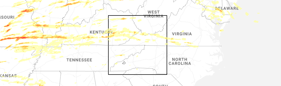
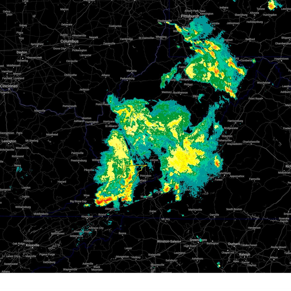
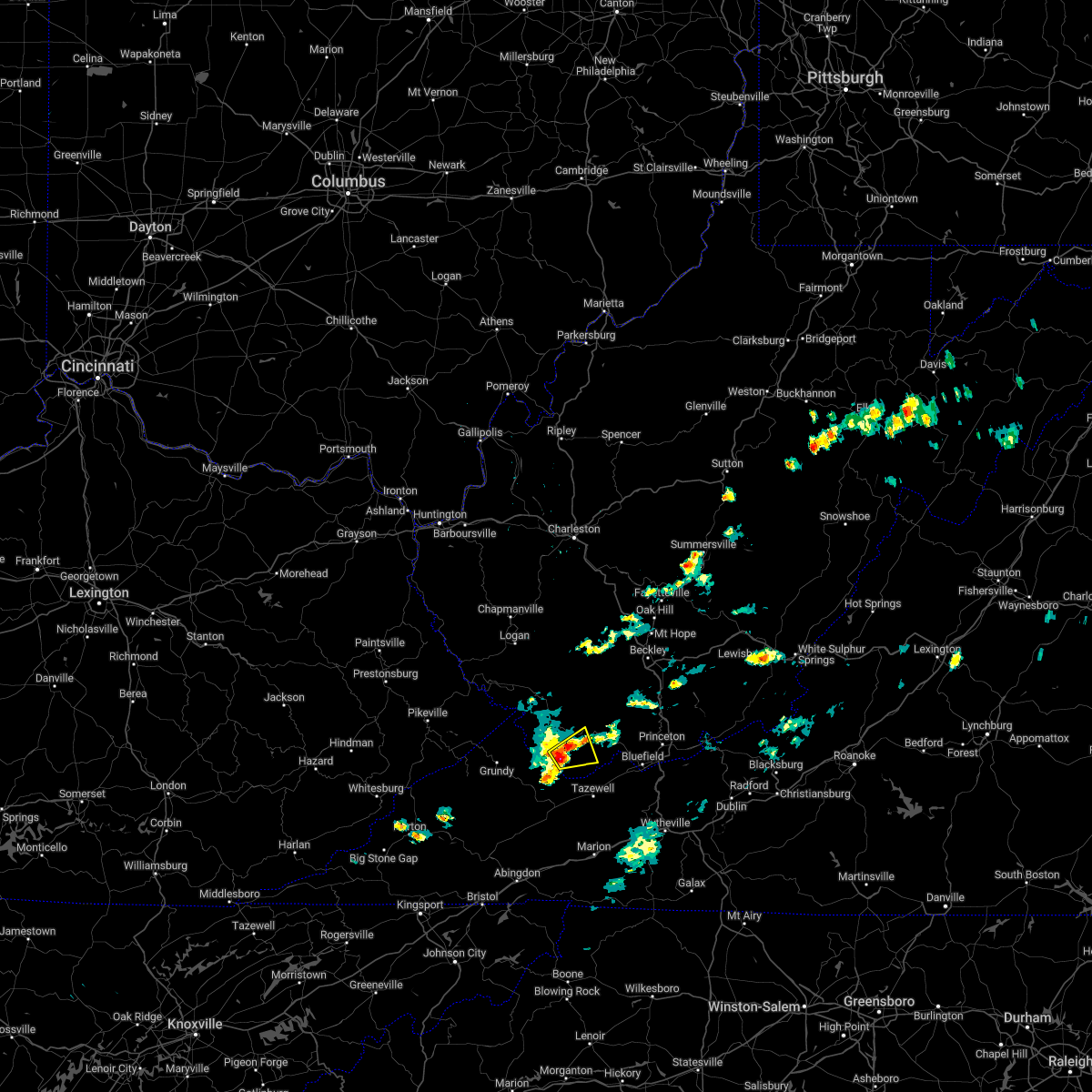
Hail Map for War, WV
The War, WV area has had 2 reports of on-the-ground hail by trained spotters, and has been under severe weather warnings 26 times during the past 12 months. Doppler radar has detected hail at or near War, WV on 28 occasions, including 1 occasion during the past year.
| Name: | War, WV |
| Where Located: | 57.2 miles NNE of Bristol, TN |
| Map: | Google Map for War, WV |
| Population: | 862 |
| Housing Units: | 436 |
| More Info: | Search Google for War, WV |
3
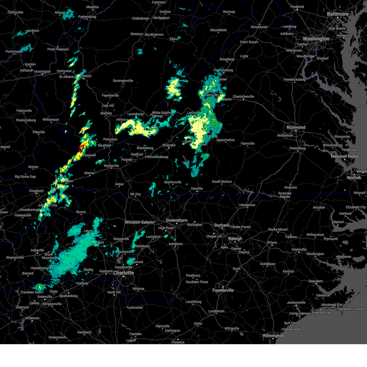
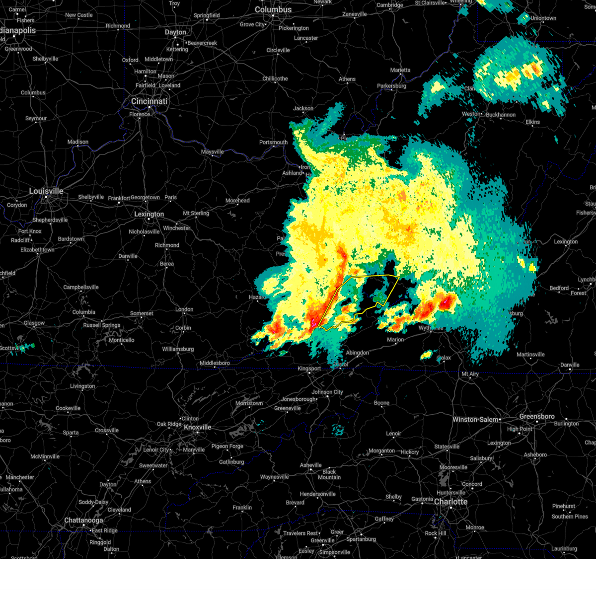
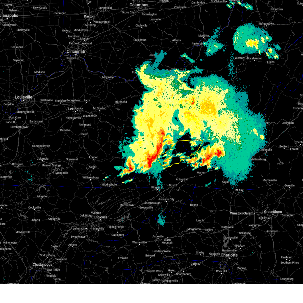
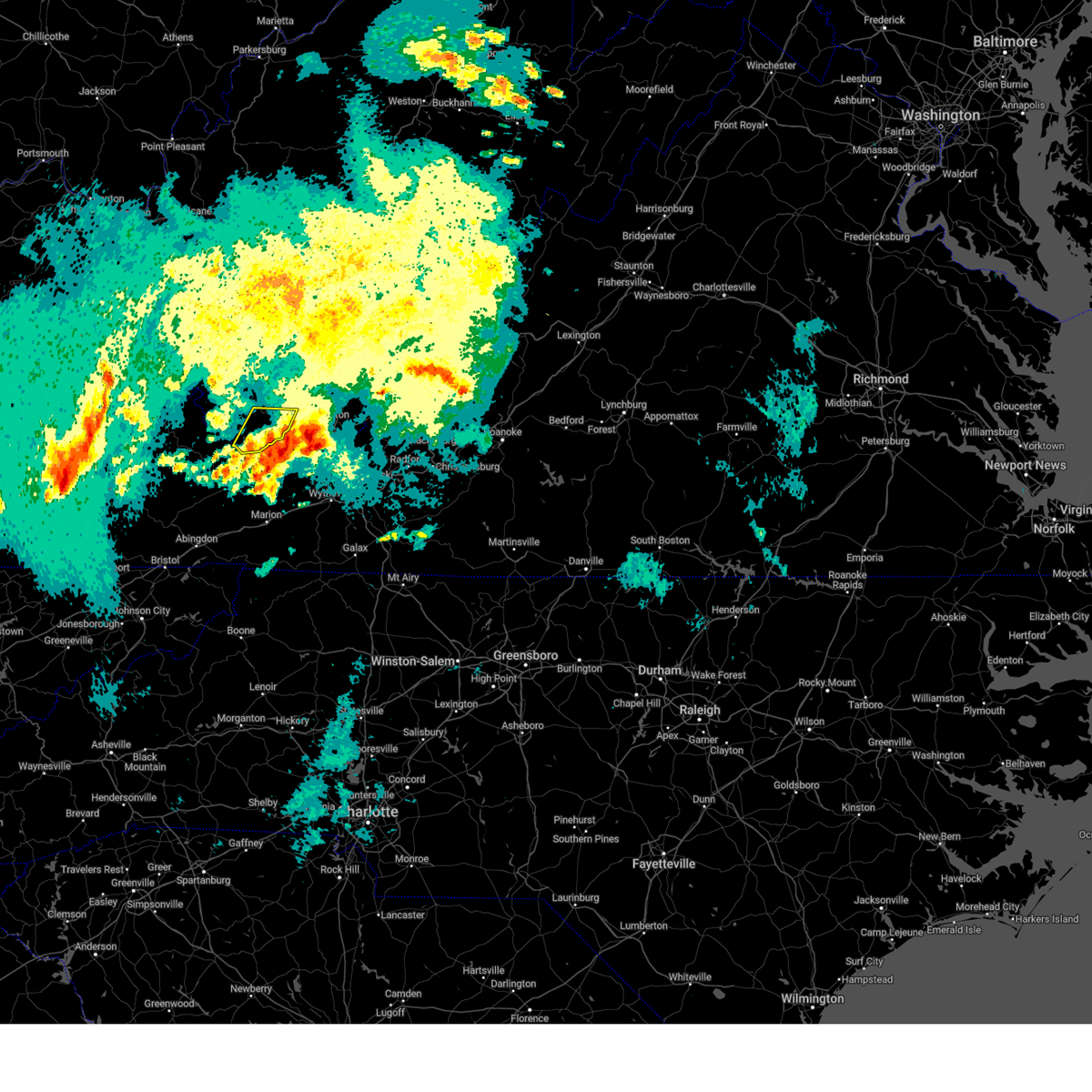
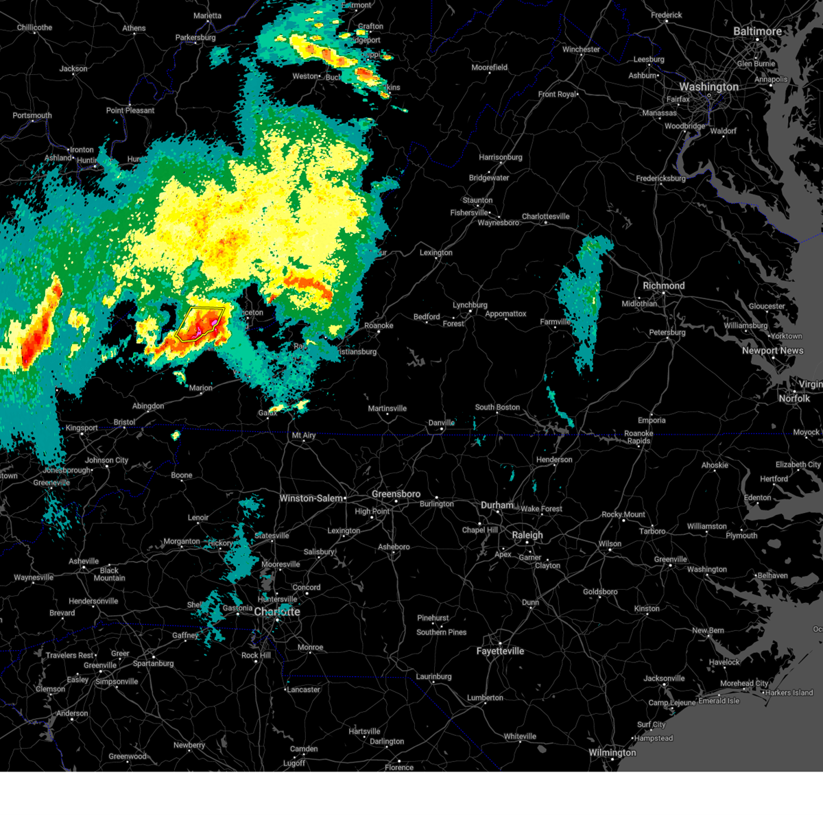
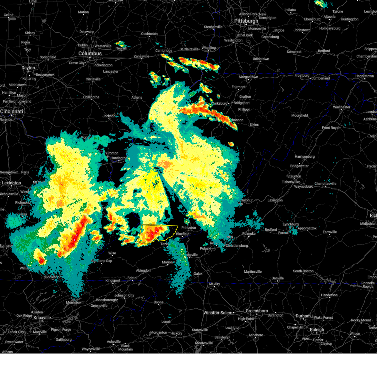
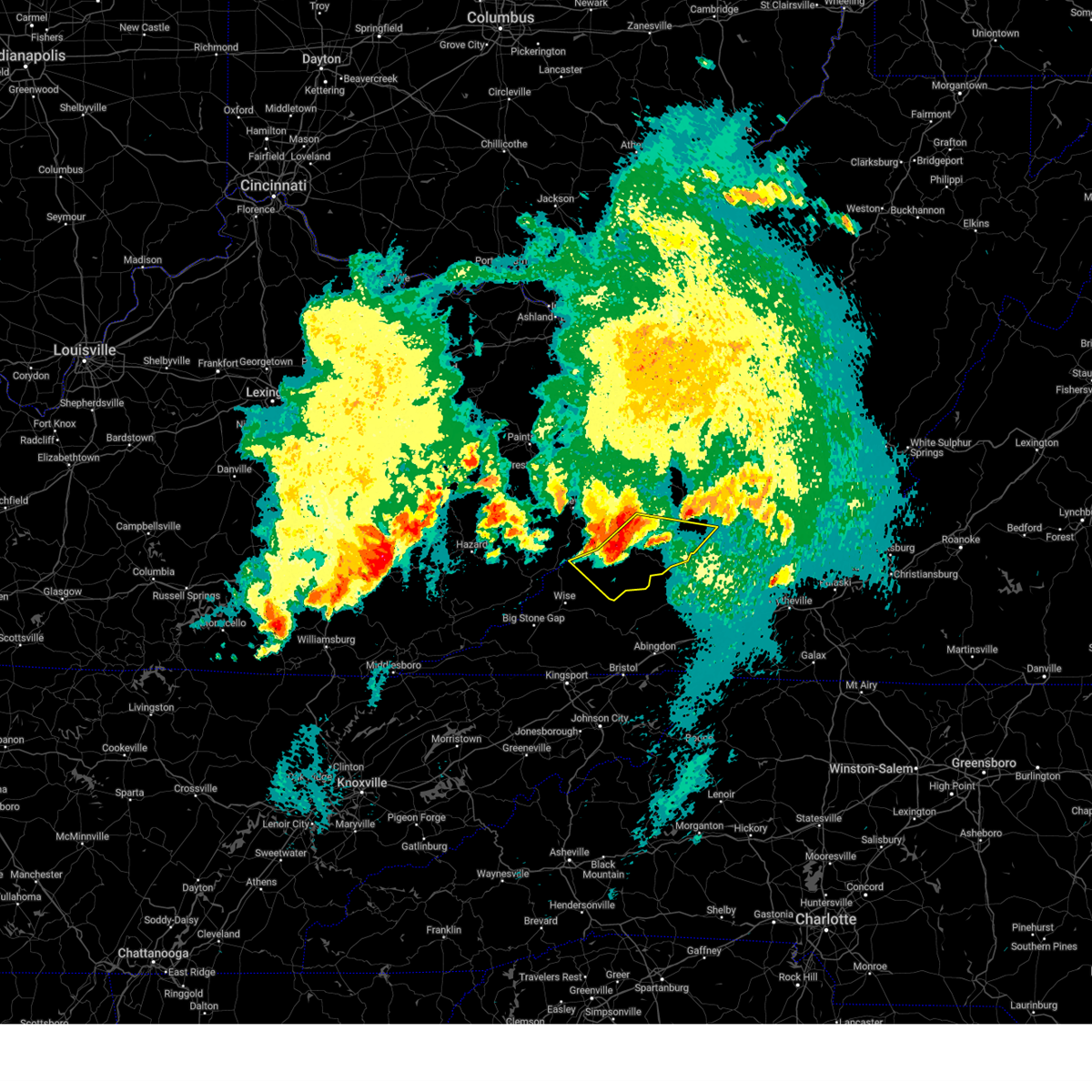
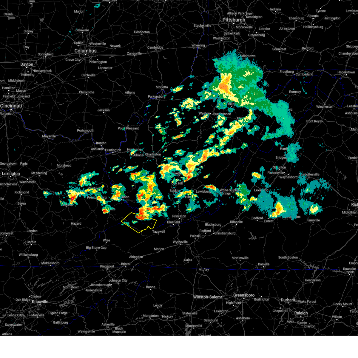
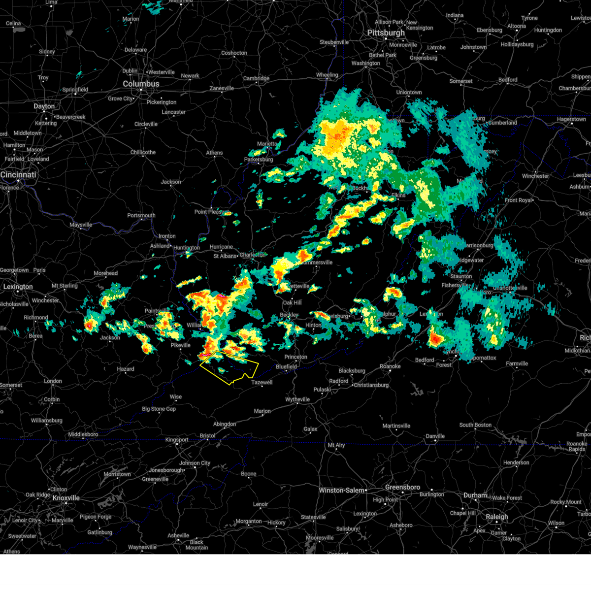
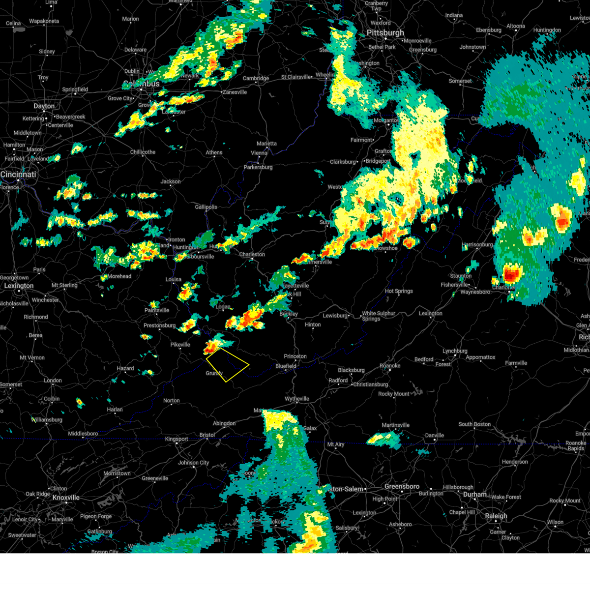
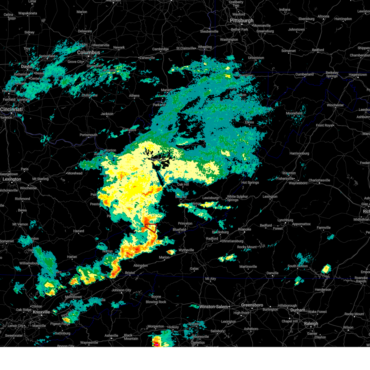
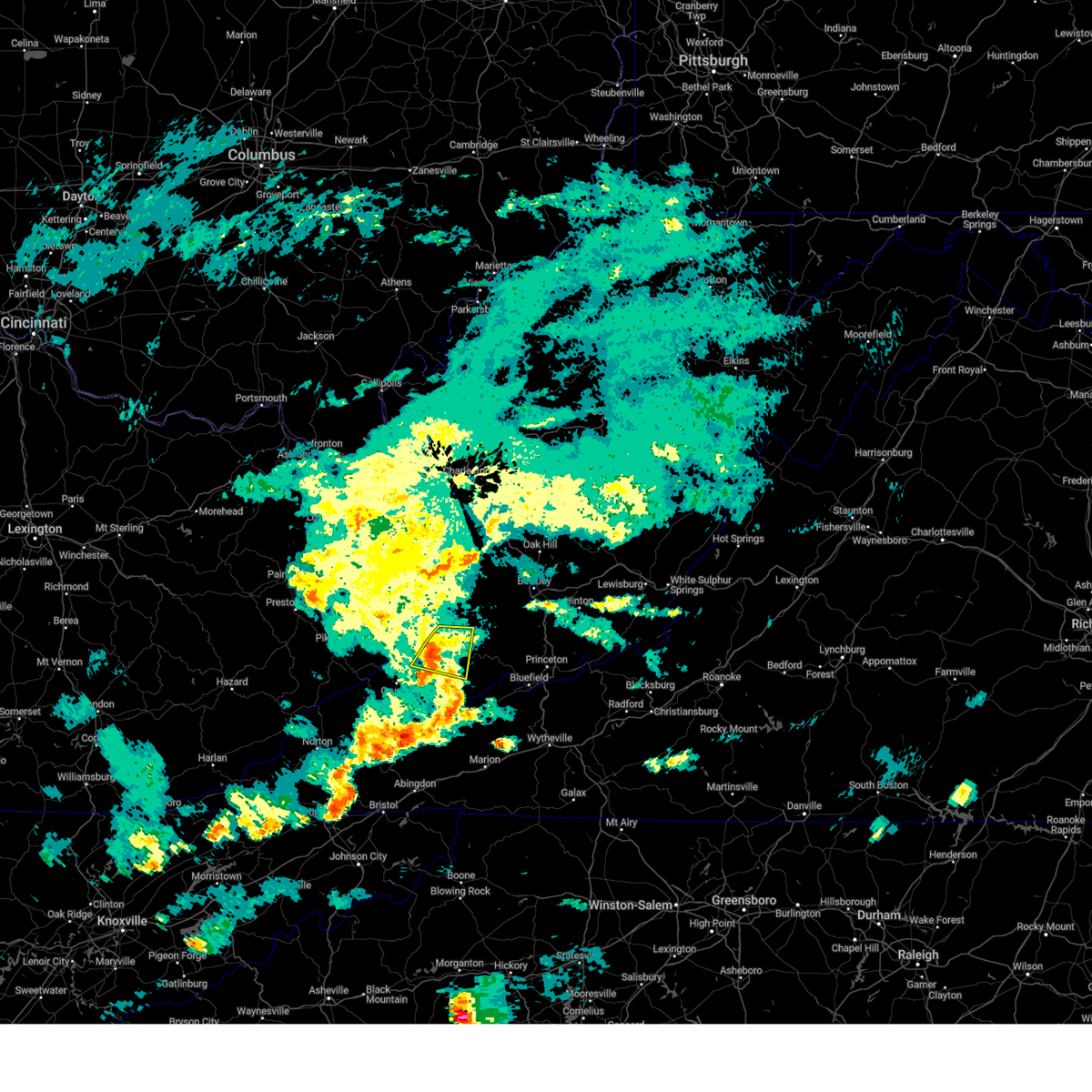
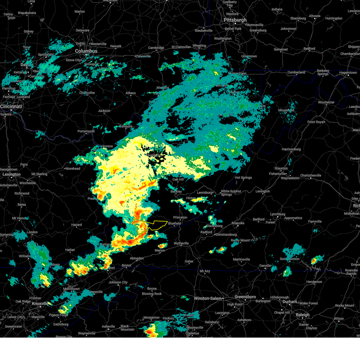
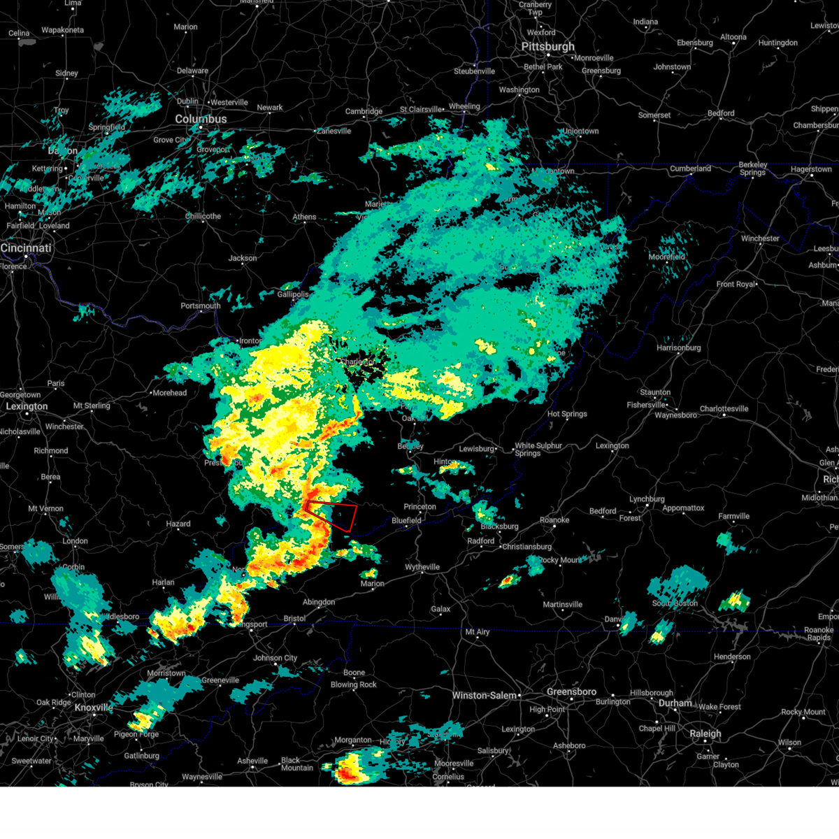
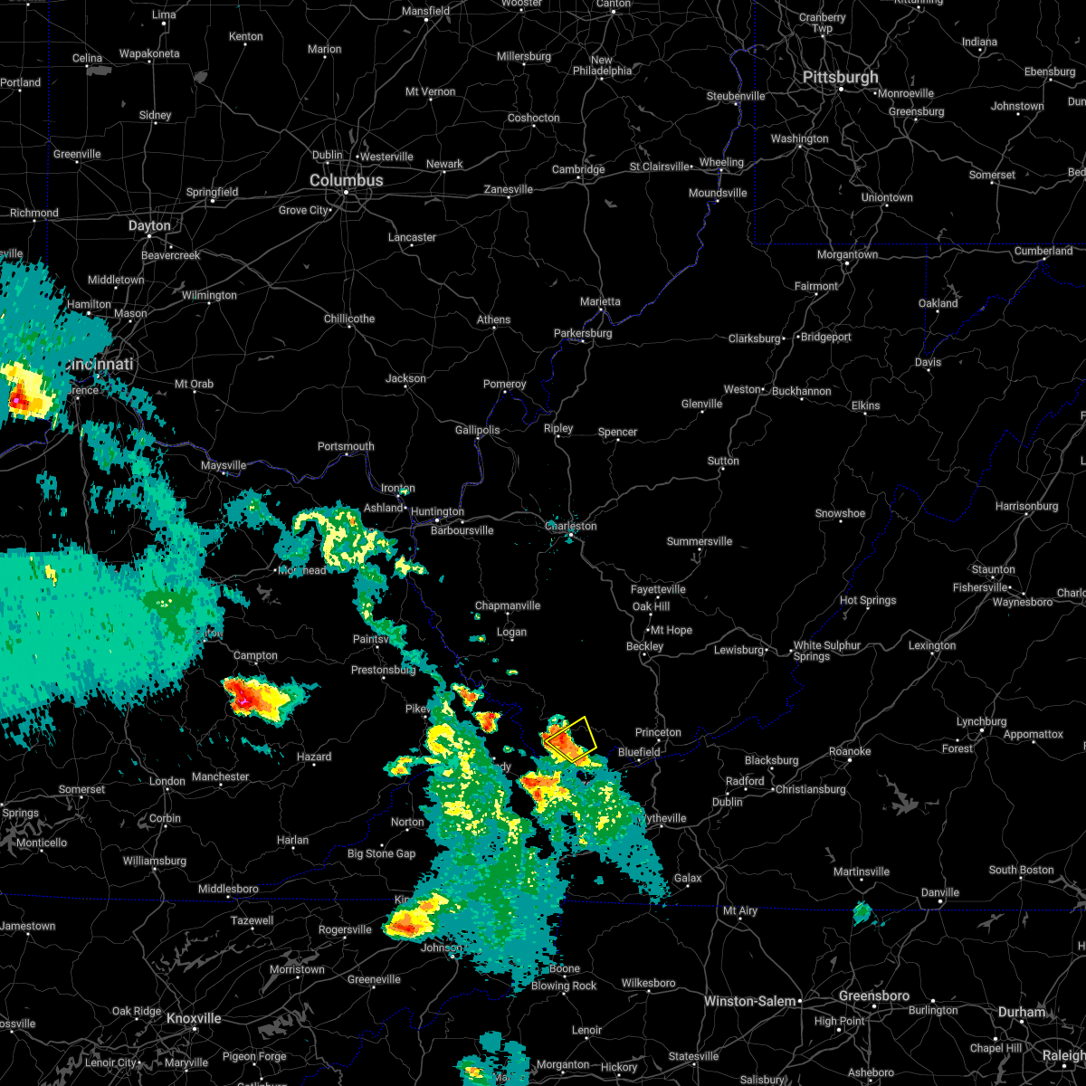
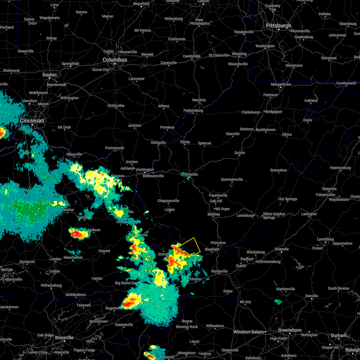
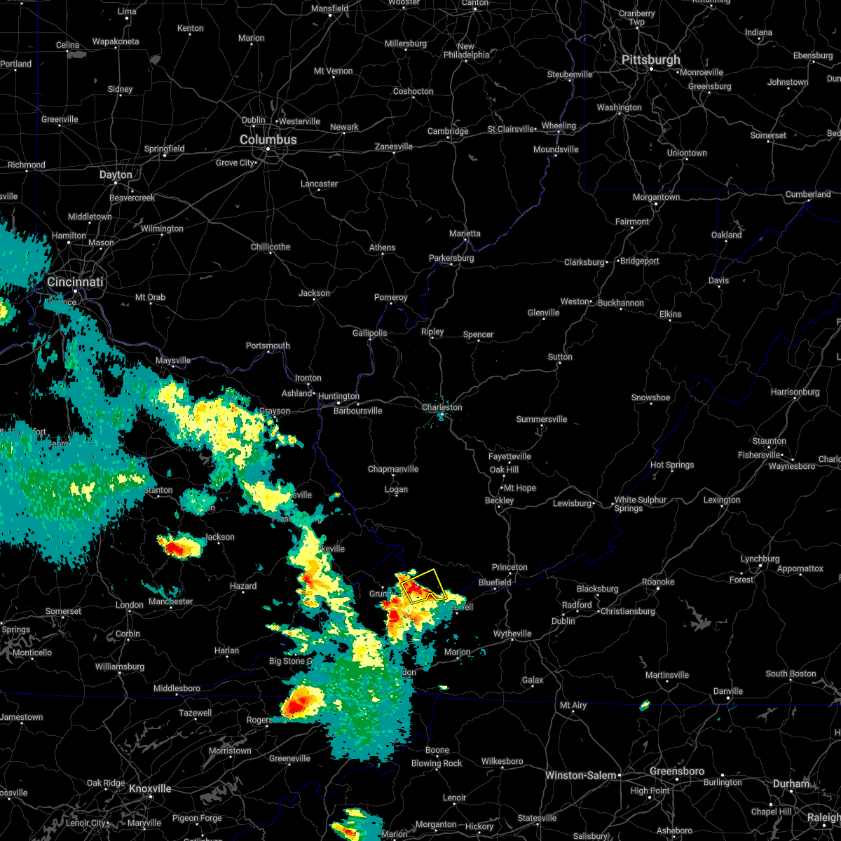
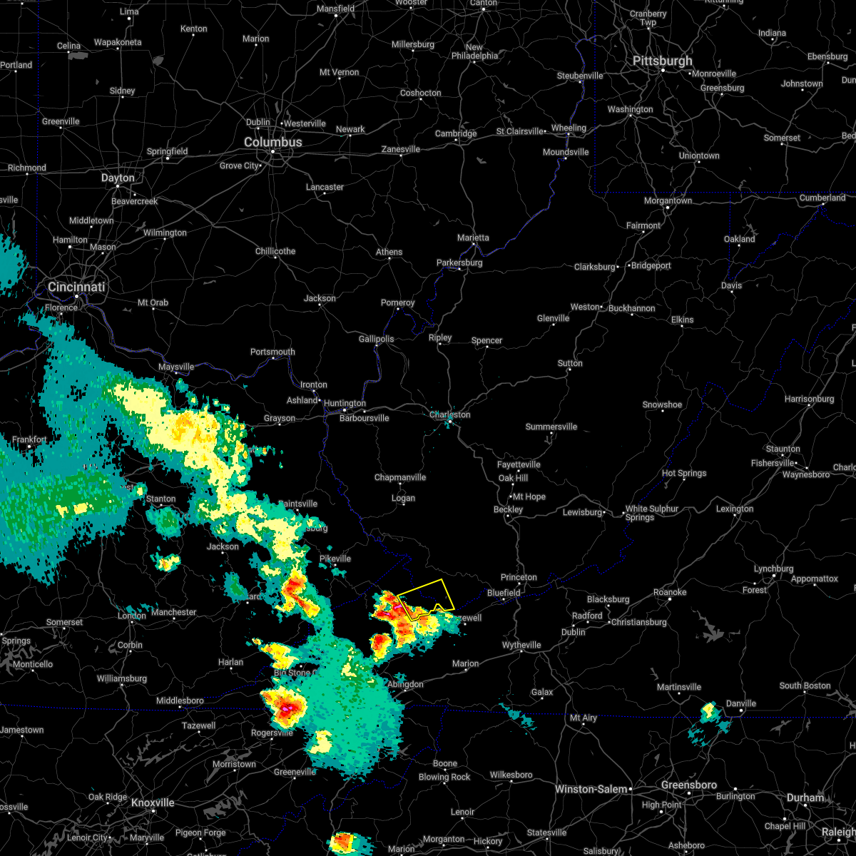
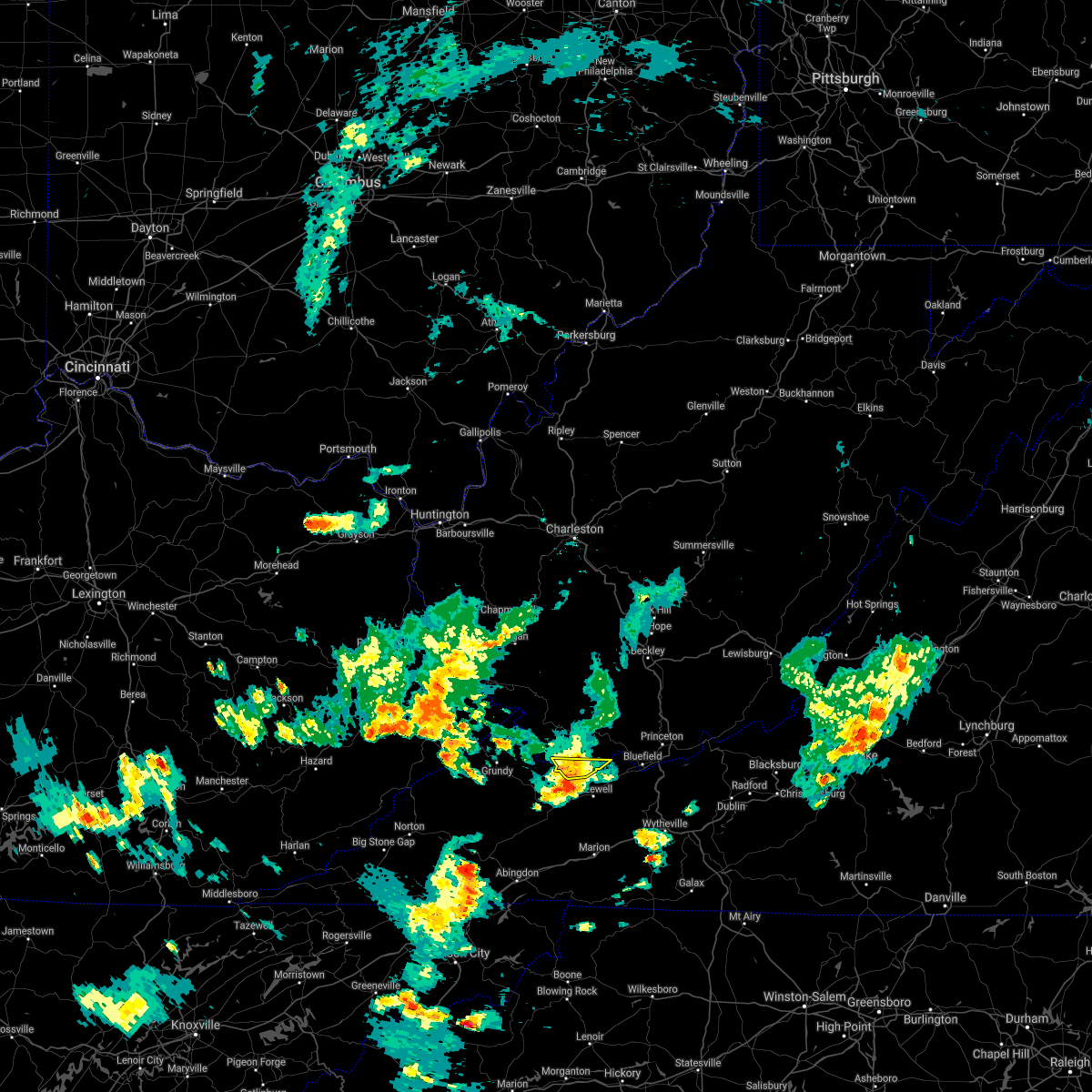
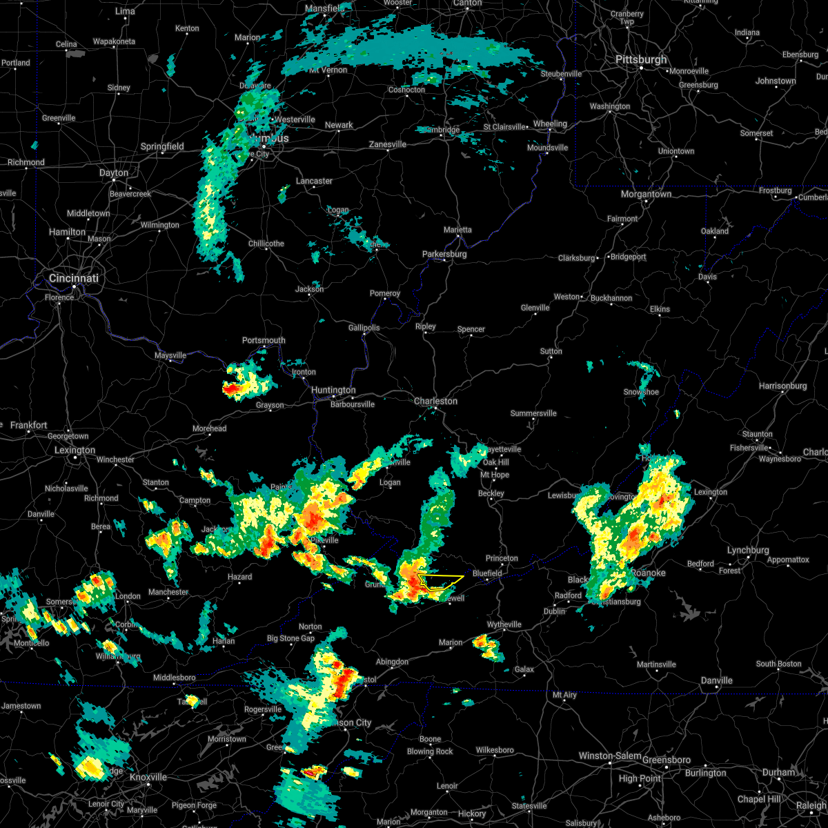
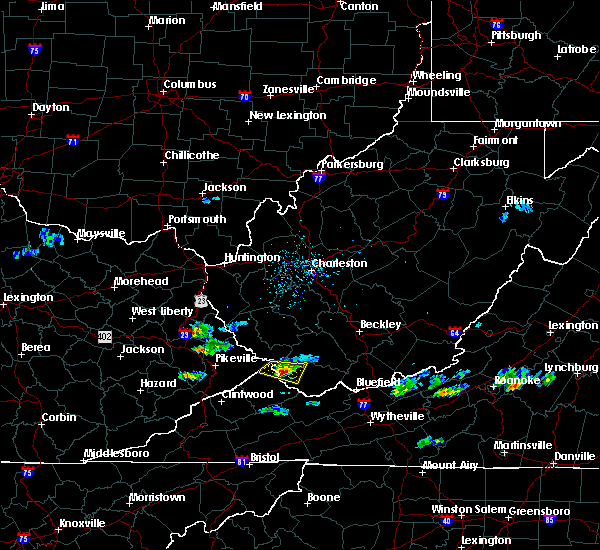
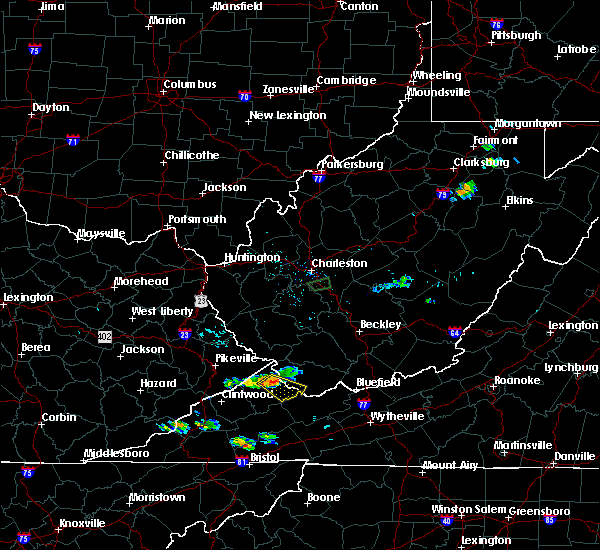
The Top Recent Hail Date for War, WV is Friday, May 16, 2025 (3rd out of 28)
Hail and Wind Damage Spotted near War, WV
| Date / Time | Report Details |
|---|---|
| 6/28/2025 8:30 PM EDT | Tree down in a curve in the road on rocket boys drive near wa in mcdowell county WV, 1 miles W of War, WV |
| 5/30/2025 1:13 PM EDT |
 The storm which prompted the warning has weakened below severe limits, and no longer appears capable of producing a tornado. therefore, the warning will be allowed to expire. The storm which prompted the warning has weakened below severe limits, and no longer appears capable of producing a tornado. therefore, the warning will be allowed to expire.
|
| 5/30/2025 1:08 PM EDT |
 the tornado warning has been cancelled and is no longer in effect the tornado warning has been cancelled and is no longer in effect
|
| 5/30/2025 1:08 PM EDT |
 At 108 pm edt, a severe thunderstorm capable of producing a tornado was located over war, or 12 miles north of cedar bluff, moving east at 35 mph (radar indicated rotation). Hazards include tornado. Flying debris will be dangerous to those caught without shelter. mobile homes will be damaged or destroyed. damage to roofs, windows, and vehicles will occur. tree damage is likely. This tornadic thunderstorm will remain over mainly rural areas of south central mcdowell county. At 108 pm edt, a severe thunderstorm capable of producing a tornado was located over war, or 12 miles north of cedar bluff, moving east at 35 mph (radar indicated rotation). Hazards include tornado. Flying debris will be dangerous to those caught without shelter. mobile homes will be damaged or destroyed. damage to roofs, windows, and vehicles will occur. tree damage is likely. This tornadic thunderstorm will remain over mainly rural areas of south central mcdowell county.
|
| 5/30/2025 12:55 PM EDT |
 At 1254 pm edt, a severe thunderstorm capable of producing a tornado was located near jewell ridge, or 11 miles north of richlands, moving east at 35 mph (radar indicated rotation). Hazards include tornado. Flying debris will be dangerous to those caught without shelter. mobile homes will be damaged or destroyed. damage to roofs, windows, and vehicles will occur. tree damage is likely. This dangerous storm will be near, war around 100 pm edt. At 1254 pm edt, a severe thunderstorm capable of producing a tornado was located near jewell ridge, or 11 miles north of richlands, moving east at 35 mph (radar indicated rotation). Hazards include tornado. Flying debris will be dangerous to those caught without shelter. mobile homes will be damaged or destroyed. damage to roofs, windows, and vehicles will occur. tree damage is likely. This dangerous storm will be near, war around 100 pm edt.
|
| 5/30/2025 12:46 PM EDT |
 Torrlx the national weather service in charleston west virginia has issued a * tornado warning for, east central buchanan county in southwestern virginia, southwestern mcdowell county in southern west virginia, * until 115 pm edt. * at 1245 pm edt, a severe thunderstorm capable of producing a tornado was located 7 miles northwest of glen burke, or 9 miles east of grundy, moving east at 35 mph (radar indicated rotation). Hazards include tornado. Flying debris will be dangerous to those caught without shelter. mobile homes will be damaged or destroyed. damage to roofs, windows, and vehicles will occur. tree damage is likely. This dangerous storm will be near, war around 1255 pm edt. Torrlx the national weather service in charleston west virginia has issued a * tornado warning for, east central buchanan county in southwestern virginia, southwestern mcdowell county in southern west virginia, * until 115 pm edt. * at 1245 pm edt, a severe thunderstorm capable of producing a tornado was located 7 miles northwest of glen burke, or 9 miles east of grundy, moving east at 35 mph (radar indicated rotation). Hazards include tornado. Flying debris will be dangerous to those caught without shelter. mobile homes will be damaged or destroyed. damage to roofs, windows, and vehicles will occur. tree damage is likely. This dangerous storm will be near, war around 1255 pm edt.
|
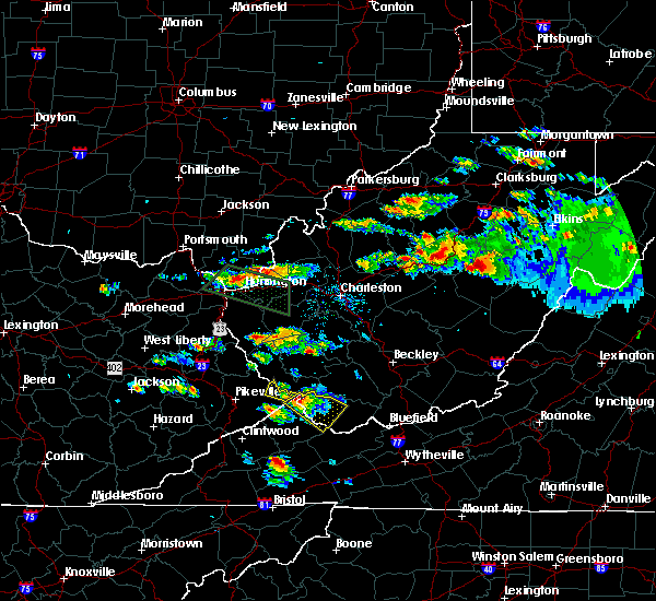
| 5/16/2025 3:25 PM EDT | The storms which prompted the warning have weakened below severe limits, and have exited the warned area. therefore, the warning will be allowed to expire. a severe thunderstorm watch remains in effect until 600 pm edt for southwestern virginia, and southern and southeastern west virginia. to report severe weather, contact your nearest law enforcement agency. they will relay your report to the national weather service charleston west virginia. |
| 5/16/2025 3:14 PM EDT |
 At 313 pm edt, severe thunderstorms were located along a line extending from near northfork to near amonate, moving east at 70 mph (radar indicated). Hazards include 60 mph wind gusts. Expect damage to roofs, siding, and trees. Locations impacted include, welch, pineville, mullens, gary, war, northfork, davy, keystone, anawalt, kimball, rhodell, maybeury, elbert, coalwood, wolf pen, cucumber, jenkinjones, and herndon. At 313 pm edt, severe thunderstorms were located along a line extending from near northfork to near amonate, moving east at 70 mph (radar indicated). Hazards include 60 mph wind gusts. Expect damage to roofs, siding, and trees. Locations impacted include, welch, pineville, mullens, gary, war, northfork, davy, keystone, anawalt, kimball, rhodell, maybeury, elbert, coalwood, wolf pen, cucumber, jenkinjones, and herndon.
|
| 5/16/2025 3:14 PM EDT |
 the severe thunderstorm warning has been cancelled and is no longer in effect the severe thunderstorm warning has been cancelled and is no longer in effect
|
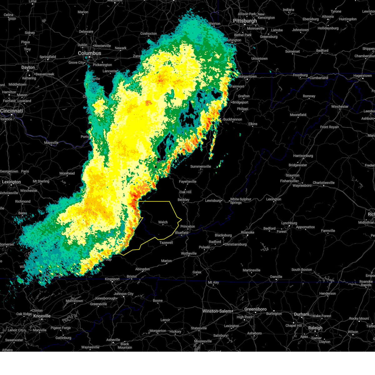
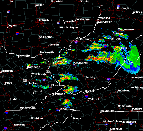
| 5/16/2025 2:59 PM EDT | Svrrlx the national weather service in charleston west virginia has issued a * severe thunderstorm warning for, southeastern buchanan county in southwestern virginia, mcdowell county in southern west virginia, south central raleigh county in southeastern west virginia, southern wyoming county in southern west virginia, * until 330 pm edt. * at 259 pm edt, severe thunderstorms were located along a line extending from near hanover to near glen burke, moving east at 70 mph (radar indicated). Hazards include 60 mph wind gusts. expect damage to roofs, siding, and trees |
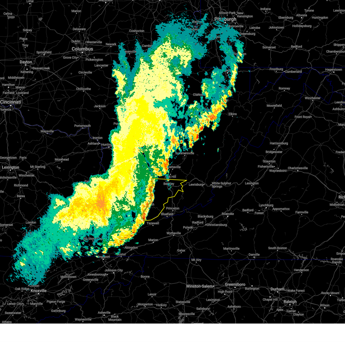
| 5/16/2025 2:54 PM EDT | At 254 pm edt, severe thunderstorms were located along a line extending from 9 miles south of gilbert creek to near cleveland va, moving east at 60 mph (radar indicated). Hazards include 60 mph wind gusts and quarter size hail. Hail damage to vehicles is expected. expect wind damage to roofs, siding, and trees. Locations impacted include, welch, grundy, davenport, gary, war, trammel, davy, bradshaw, iaeger, kimball, jolo, oakwood, stacy, vansant, coalwood, avondale, and cucumber. |
| 5/16/2025 2:43 PM EDT |
 At 243 pm edt, severe thunderstorms were located along a line extending from near paw paw to near trammel, moving east at 60 mph (radar indicated). Hazards include 60 mph wind gusts and penny size hail. Expect damage to roofs, siding, and trees. Locations impacted include, welch, grundy, haysi, davenport, gary, war, trammel, big rock, davy, bradshaw, clinchco, iaeger, kimball, jolo, oakwood, coalwood, hurley, avondale, mcclure, and panther. At 243 pm edt, severe thunderstorms were located along a line extending from near paw paw to near trammel, moving east at 60 mph (radar indicated). Hazards include 60 mph wind gusts and penny size hail. Expect damage to roofs, siding, and trees. Locations impacted include, welch, grundy, haysi, davenport, gary, war, trammel, big rock, davy, bradshaw, clinchco, iaeger, kimball, jolo, oakwood, coalwood, hurley, avondale, mcclure, and panther.
|
| 5/16/2025 2:23 PM EDT |
 Svrrlx the national weather service in charleston west virginia has issued a * severe thunderstorm warning for, dickenson county in southwestern virginia, buchanan county in southwestern virginia, mcdowell county in southern west virginia, * until 300 pm edt. * at 222 pm edt, severe thunderstorms were located along a line extending from garden village to near eolia, moving east at 60 mph (radar indicated). Hazards include 60 mph wind gusts and penny size hail. expect damage to roofs, siding, and trees Svrrlx the national weather service in charleston west virginia has issued a * severe thunderstorm warning for, dickenson county in southwestern virginia, buchanan county in southwestern virginia, mcdowell county in southern west virginia, * until 300 pm edt. * at 222 pm edt, severe thunderstorms were located along a line extending from garden village to near eolia, moving east at 60 mph (radar indicated). Hazards include 60 mph wind gusts and penny size hail. expect damage to roofs, siding, and trees
|
| 5/16/2025 2:14 PM EDT |
 The storm which prompted the warning has weakened below severe limits, and has exited the warned area. therefore, the warning will be allowed to expire. a severe thunderstorm watch remains in effect until 600 pm edt for southern west virginia. to report severe weather, contact your nearest law enforcement agency. they will relay your report to the national weather service charleston west virginia. The storm which prompted the warning has weakened below severe limits, and has exited the warned area. therefore, the warning will be allowed to expire. a severe thunderstorm watch remains in effect until 600 pm edt for southern west virginia. to report severe weather, contact your nearest law enforcement agency. they will relay your report to the national weather service charleston west virginia.
|
| 5/16/2025 2:03 PM EDT |
 At 202 pm edt, a severe thunderstorm was located near gary, or 10 miles north of tazewell, moving east at 50 mph (radar indicated). Hazards include 60 mph wind gusts and quarter size hail. Hail damage to vehicles is expected. expect wind damage to roofs, siding, and trees. Locations impacted include, welch, gary, war, northfork, keystone, anawalt, kimball, maybeury, elbert, cucumber, and jenkinjones. At 202 pm edt, a severe thunderstorm was located near gary, or 10 miles north of tazewell, moving east at 50 mph (radar indicated). Hazards include 60 mph wind gusts and quarter size hail. Hail damage to vehicles is expected. expect wind damage to roofs, siding, and trees. Locations impacted include, welch, gary, war, northfork, keystone, anawalt, kimball, maybeury, elbert, cucumber, and jenkinjones.
|
| 5/16/2025 2:03 PM EDT |
 the severe thunderstorm warning has been cancelled and is no longer in effect the severe thunderstorm warning has been cancelled and is no longer in effect
|
| 5/16/2025 1:48 PM EDT |
 Svrrlx the national weather service in charleston west virginia has issued a * severe thunderstorm warning for, northeastern buchanan county in southwestern virginia, mcdowell county in southern west virginia, * until 215 pm edt. * at 147 pm edt, a severe thunderstorm was located near jewell ridge, or 12 miles north of richlands, moving east at 50 mph (radar indicated). Hazards include 70 mph wind gusts and half dollar size hail. Hail damage to vehicles is expected. expect considerable tree damage. Wind damage is also likely to mobile homes, roofs, and outbuildings. Svrrlx the national weather service in charleston west virginia has issued a * severe thunderstorm warning for, northeastern buchanan county in southwestern virginia, mcdowell county in southern west virginia, * until 215 pm edt. * at 147 pm edt, a severe thunderstorm was located near jewell ridge, or 12 miles north of richlands, moving east at 50 mph (radar indicated). Hazards include 70 mph wind gusts and half dollar size hail. Hail damage to vehicles is expected. expect considerable tree damage. Wind damage is also likely to mobile homes, roofs, and outbuildings.
|
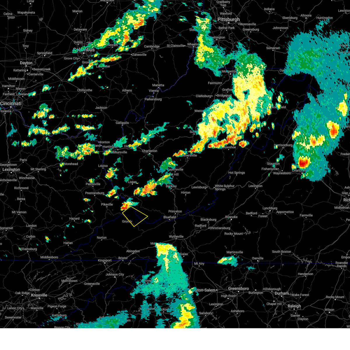
| 5/16/2025 1:35 PM EDT | At 134 pm edt, a severe thunderstorm was located near grundy, moving east at 50 mph (radar indicated). Hazards include 60 mph wind gusts and quarter size hail. Hail damage to vehicles is expected. expect wind damage to roofs, siding, and trees. Locations impacted include, grundy, gary, war, bradshaw, stacy, vansant, coalwood, hurley, jolo, oakwood, and roseann. |
| 5/16/2025 1:35 PM EDT | the severe thunderstorm warning has been cancelled and is no longer in effect |
| 5/16/2025 1:23 PM EDT |
 At 123 pm edt, a severe thunderstorm was located near big rock, or near grundy, moving east at 40 mph (radar indicated). Hazards include 60 mph wind gusts and quarter size hail. Hail damage to vehicles is expected. expect wind damage to roofs, siding, and trees. Locations impacted include, clintwood, grundy, haysi, breaks interstate, davenport, john flannagan lake, gary, war, big rock, trammel, clinchco, bradshaw, jolo, oakwood, stacy, nora, vansant, coalwood, hurley, and mcclure. At 123 pm edt, a severe thunderstorm was located near big rock, or near grundy, moving east at 40 mph (radar indicated). Hazards include 60 mph wind gusts and quarter size hail. Hail damage to vehicles is expected. expect wind damage to roofs, siding, and trees. Locations impacted include, clintwood, grundy, haysi, breaks interstate, davenport, john flannagan lake, gary, war, big rock, trammel, clinchco, bradshaw, jolo, oakwood, stacy, nora, vansant, coalwood, hurley, and mcclure.
|
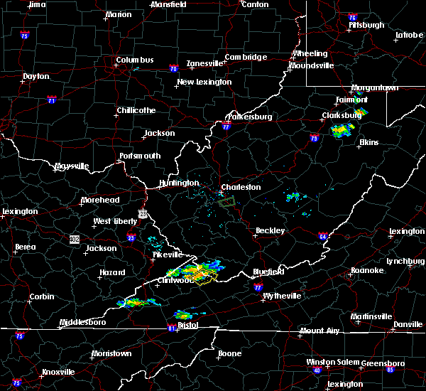
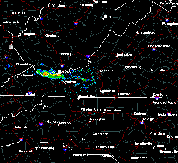
| 5/16/2025 12:51 PM EDT | Svrrlx the national weather service in charleston west virginia has issued a * severe thunderstorm warning for, dickenson county in southwestern virginia, buchanan county in southwestern virginia, southwestern mcdowell county in southern west virginia, * until 145 pm edt. * at 1250 pm edt, a severe thunderstorm was located near beaver, or 7 miles southwest of pikeville, moving east at 50 mph (radar indicated). Hazards include ping pong ball size hail and 60 mph wind gusts. People and animals outdoors will be injured. expect hail damage to roofs, siding, windows, and vehicles. Expect wind damage to roofs, siding, and trees. |
| 4/14/2025 9:55 PM EDT |
 The storm which prompted the warning has weakened below severe limits, and no longer poses an immediate threat to life or property. therefore, the warning will be allowed to expire. a severe thunderstorm watch remains in effect until 1100 pm edt for southwestern virginia, and southern west virginia. to report severe weather, contact your nearest law enforcement agency. they will relay your report to the national weather service charleston west virginia. The storm which prompted the warning has weakened below severe limits, and no longer poses an immediate threat to life or property. therefore, the warning will be allowed to expire. a severe thunderstorm watch remains in effect until 1100 pm edt for southwestern virginia, and southern west virginia. to report severe weather, contact your nearest law enforcement agency. they will relay your report to the national weather service charleston west virginia.
|
| 4/14/2025 9:34 PM EDT |
 Svrrlx the national weather service in charleston west virginia has issued a * severe thunderstorm warning for, buchanan county in southwestern virginia, southwestern mcdowell county in southern west virginia, * until 1000 pm edt. * at 934 pm edt, a severe thunderstorm was located over big rock, or 9 miles northwest of grundy, moving east at 55 mph (radar indicated). Hazards include 60 mph wind gusts and quarter size hail. Hail damage to vehicles is expected. Expect wind damage to roofs, siding, and trees. Svrrlx the national weather service in charleston west virginia has issued a * severe thunderstorm warning for, buchanan county in southwestern virginia, southwestern mcdowell county in southern west virginia, * until 1000 pm edt. * at 934 pm edt, a severe thunderstorm was located over big rock, or 9 miles northwest of grundy, moving east at 55 mph (radar indicated). Hazards include 60 mph wind gusts and quarter size hail. Hail damage to vehicles is expected. Expect wind damage to roofs, siding, and trees.
|
| 3/31/2025 3:28 AM EDT |
 Svrrlx the national weather service in charleston west virginia has issued a * severe thunderstorm warning for, eastern mcdowell county in southern west virginia, raleigh county in southeastern west virginia, eastern wyoming county in southern west virginia, southwestern fayette county in southeastern west virginia, * until 400 am edt. * at 327 am edt, severe thunderstorms were located along a line extending from 6 miles east of bald knob to near mullens to near amonate, moving east at 50 mph (radar indicated). Hazards include 60 mph wind gusts. expect damage to roofs, siding, and trees Svrrlx the national weather service in charleston west virginia has issued a * severe thunderstorm warning for, eastern mcdowell county in southern west virginia, raleigh county in southeastern west virginia, eastern wyoming county in southern west virginia, southwestern fayette county in southeastern west virginia, * until 400 am edt. * at 327 am edt, severe thunderstorms were located along a line extending from 6 miles east of bald knob to near mullens to near amonate, moving east at 50 mph (radar indicated). Hazards include 60 mph wind gusts. expect damage to roofs, siding, and trees
|
| 3/31/2025 3:16 AM EDT | the severe thunderstorm warning has been cancelled and is no longer in effect |
| 3/31/2025 3:16 AM EDT | At 316 am edt, severe thunderstorms were located along a line extending from near amherstdale-robinette to near welch to near davenport, moving east at 55 mph (radar indicated). Hazards include 60 mph wind gusts and penny size hail. Expect damage to roofs, siding, and trees. locations impacted include, davy, hanover, r. d. Bailey lake, gilbert, war, coal mountain, jolo, oakwood, gilbert creek, bradshaw, bruno, elbert, keystone, coalwood, avondale, wolf pen, welch, jenkinjones, herndon, and iaeger. |
| 3/31/2025 2:58 AM EDT |
 Svrrlx the national weather service in charleston west virginia has issued a * severe thunderstorm warning for, southeastern dickenson county in southwestern virginia, buchanan county in southwestern virginia, mcdowell county in southern west virginia, southeastern mingo county in southern west virginia, wyoming county in southern west virginia, southern logan county in southern west virginia, * until 330 am edt. * at 257 am edt, severe thunderstorms were located along a line extending from near holden to 6 miles southeast of argo to near trammel, moving east at 55 mph (radar indicated). Hazards include 60 mph wind gusts and penny size hail. expect damage to roofs, siding, and trees Svrrlx the national weather service in charleston west virginia has issued a * severe thunderstorm warning for, southeastern dickenson county in southwestern virginia, buchanan county in southwestern virginia, mcdowell county in southern west virginia, southeastern mingo county in southern west virginia, wyoming county in southern west virginia, southern logan county in southern west virginia, * until 330 am edt. * at 257 am edt, severe thunderstorms were located along a line extending from near holden to 6 miles southeast of argo to near trammel, moving east at 55 mph (radar indicated). Hazards include 60 mph wind gusts and penny size hail. expect damage to roofs, siding, and trees
|
| 5/26/2024 4:37 PM EDT |
 The storms which prompted the warning have moved out of the warned area. therefore, the warning will be allowed to expire. a severe thunderstorm watch remains in effect until 900 pm edt for southwestern virginia, and southern west virginia. The storms which prompted the warning have moved out of the warned area. therefore, the warning will be allowed to expire. a severe thunderstorm watch remains in effect until 900 pm edt for southwestern virginia, and southern west virginia.
|
| 5/26/2024 4:29 PM EDT | Big pine tree down on main caretta road in war. time estimated from rada in mcdowell county WV, 2.2 miles SSW of War, WV |
| 5/26/2024 4:16 PM EDT |
 the severe thunderstorm warning has been cancelled and is no longer in effect the severe thunderstorm warning has been cancelled and is no longer in effect
|
| 5/26/2024 4:16 PM EDT |
 At 415 pm edt, severe thunderstorms were located along a line extending from gilbert creek to 9 miles northwest of jewell ridge to 6 miles east of davenport, moving east at 55 mph (radar indicated). Hazards include 60 mph wind gusts and penny size hail. Expect damage to roofs, siding, and trees. locations impacted include, welch, davenport, gary, war, northfork, hanover, r. d. Bailey lake, gilbert creek, gilbert, davy, bradshaw, iaeger, keystone, anawalt, kimball, coal mountain, jolo, oakwood, elbert, and coalwood. At 415 pm edt, severe thunderstorms were located along a line extending from gilbert creek to 9 miles northwest of jewell ridge to 6 miles east of davenport, moving east at 55 mph (radar indicated). Hazards include 60 mph wind gusts and penny size hail. Expect damage to roofs, siding, and trees. locations impacted include, welch, davenport, gary, war, northfork, hanover, r. d. Bailey lake, gilbert creek, gilbert, davy, bradshaw, iaeger, keystone, anawalt, kimball, coal mountain, jolo, oakwood, elbert, and coalwood.
|
| 5/26/2024 3:56 PM EDT |
 Svrrlx the national weather service in charleston west virginia has issued a * severe thunderstorm warning for, eastern dickenson county in southwestern virginia, buchanan county in southwestern virginia, mcdowell county in southern west virginia, southeastern mingo county in southern west virginia, southwestern wyoming county in southern west virginia, south central logan county in southern west virginia, * until 445 pm edt. * at 355 pm edt, a severe thunderstorm was located near grundy, moving east at 45 mph (radar indicated). Hazards include 60 mph wind gusts and penny size hail. expect damage to roofs, siding, and trees Svrrlx the national weather service in charleston west virginia has issued a * severe thunderstorm warning for, eastern dickenson county in southwestern virginia, buchanan county in southwestern virginia, mcdowell county in southern west virginia, southeastern mingo county in southern west virginia, southwestern wyoming county in southern west virginia, south central logan county in southern west virginia, * until 445 pm edt. * at 355 pm edt, a severe thunderstorm was located near grundy, moving east at 45 mph (radar indicated). Hazards include 60 mph wind gusts and penny size hail. expect damage to roofs, siding, and trees
|
| 8/7/2023 5:10 PM EDT |
 At 510 pm edt, a severe thunderstorm was located near paw paw, or 7 miles north of grundy, moving southeast at 40 mph (radar indicated). Hazards include ping pong ball size hail and 60 mph wind gusts. People and animals outdoors will be injured. expect hail damage to roofs, siding, windows, and vehicles. Expect wind damage to roofs, siding, and trees. At 510 pm edt, a severe thunderstorm was located near paw paw, or 7 miles north of grundy, moving southeast at 40 mph (radar indicated). Hazards include ping pong ball size hail and 60 mph wind gusts. People and animals outdoors will be injured. expect hail damage to roofs, siding, windows, and vehicles. Expect wind damage to roofs, siding, and trees.
|
| 7/29/2023 3:55 PM EDT | Tree down blocking both lanes of rocket boys drive below high rock in mcdowell county WV, 0.9 miles NNW of War, WV |
| 5/16/2023 6:27 PM EDT |
 The severe thunderstorm warning for southeastern mcdowell county will expire at 630 pm edt, the storm which prompted the warning has moved out of the area. therefore, the warning will be allowed to expire. however gusty winds are still possible with this thunderstorm. a severe thunderstorm watch remains in effect until 800 pm edt for southern west virginia. The severe thunderstorm warning for southeastern mcdowell county will expire at 630 pm edt, the storm which prompted the warning has moved out of the area. therefore, the warning will be allowed to expire. however gusty winds are still possible with this thunderstorm. a severe thunderstorm watch remains in effect until 800 pm edt for southern west virginia.
|
| 5/16/2023 6:19 PM EDT |
 At 619 pm edt, a severe thunderstorm was located near gary, or 10 miles north of tazewell, moving east at 55 mph (radar indicated). Hazards include 60 mph wind gusts. Expect damage to roofs, siding, and trees. locations impacted include, gary, war, anawalt, elbert, cucumber and jenkinjones. hail threat, radar indicated max hail size, <. 75 in wind threat, radar indicated max wind gust, 60 mph. At 619 pm edt, a severe thunderstorm was located near gary, or 10 miles north of tazewell, moving east at 55 mph (radar indicated). Hazards include 60 mph wind gusts. Expect damage to roofs, siding, and trees. locations impacted include, gary, war, anawalt, elbert, cucumber and jenkinjones. hail threat, radar indicated max hail size, <. 75 in wind threat, radar indicated max wind gust, 60 mph.
|
| 5/16/2023 6:13 PM EDT | Tree in the road along rocket boys driv in mcdowell county WV, 1 miles W of War, WV |
| 5/16/2023 6:11 PM EDT |
 The tornado warning for southwestern mcdowell county will expire at 615 pm edt, the storm which prompted the warning has weakened below severe limits, and no longer appears capable of producing a tornado. therefore, the warning will be allowed to expire. however gusty winds are still possible with this thunderstorm. a severe thunderstorm watch remains in effect until 800 pm edt for southern west virginia. The tornado warning for southwestern mcdowell county will expire at 615 pm edt, the storm which prompted the warning has weakened below severe limits, and no longer appears capable of producing a tornado. therefore, the warning will be allowed to expire. however gusty winds are still possible with this thunderstorm. a severe thunderstorm watch remains in effect until 800 pm edt for southern west virginia.
|
| 5/16/2023 6:06 PM EDT |
 The severe thunderstorm warning for north central buchanan, northwestern mcdowell and southwestern wyoming counties will expire at 615 pm edt, the storm which prompted the warning has weakened below severe limits, and no longer poses an immediate threat to life or property. therefore, the warning will be allowed to expire. however gusty winds are still possible with this thunderstorm. a severe thunderstorm watch remains in effect until 800 pm edt for southwestern virginia, and southern west virginia. The severe thunderstorm warning for north central buchanan, northwestern mcdowell and southwestern wyoming counties will expire at 615 pm edt, the storm which prompted the warning has weakened below severe limits, and no longer poses an immediate threat to life or property. therefore, the warning will be allowed to expire. however gusty winds are still possible with this thunderstorm. a severe thunderstorm watch remains in effect until 800 pm edt for southwestern virginia, and southern west virginia.
|
| 5/16/2023 6:01 PM EDT |
 At 600 pm edt, a severe thunderstorm capable of producing a tornado was located 10 miles northwest of war, or 15 miles west of welch, moving east at 35 mph (radar indicated rotation). Hazards include tornado. Flying debris will be dangerous to those caught without shelter. mobile homes will be damaged or destroyed. damage to roofs, windows, and vehicles will occur. tree damage is likely. this dangerous storm will be near, war around 620 pm edt. Other locations impacted by this tornadic thunderstorm include bradshaw and jolo. At 600 pm edt, a severe thunderstorm capable of producing a tornado was located 10 miles northwest of war, or 15 miles west of welch, moving east at 35 mph (radar indicated rotation). Hazards include tornado. Flying debris will be dangerous to those caught without shelter. mobile homes will be damaged or destroyed. damage to roofs, windows, and vehicles will occur. tree damage is likely. this dangerous storm will be near, war around 620 pm edt. Other locations impacted by this tornadic thunderstorm include bradshaw and jolo.
|
| 5/16/2023 5:58 PM EDT |
 At 557 pm edt, a severe thunderstorm was located 7 miles south of gilbert creek, or 17 miles west of welch, moving east at 30 mph (radar indicated). Hazards include 60 mph wind gusts. Expect damage to roofs, siding, and trees. Locations impacted include, war, davy, bradshaw, iaeger, panther, coalwood and avondale. At 557 pm edt, a severe thunderstorm was located 7 miles south of gilbert creek, or 17 miles west of welch, moving east at 30 mph (radar indicated). Hazards include 60 mph wind gusts. Expect damage to roofs, siding, and trees. Locations impacted include, war, davy, bradshaw, iaeger, panther, coalwood and avondale.
|
| 5/16/2023 5:52 PM EDT |
 At 551 pm edt, a severe thunderstorm was located over jewell ridge, or near richlands, moving east at 60 mph. this is a destructive storm for southern mcdowell county (radar indicated). Hazards include 80 mph wind gusts. Flying debris will be dangerous to those caught without shelter. mobile homes will be heavily damaged. expect considerable damage to roofs, windows, and vehicles. Extensive tree damage and power outages are likely. At 551 pm edt, a severe thunderstorm was located over jewell ridge, or near richlands, moving east at 60 mph. this is a destructive storm for southern mcdowell county (radar indicated). Hazards include 80 mph wind gusts. Flying debris will be dangerous to those caught without shelter. mobile homes will be heavily damaged. expect considerable damage to roofs, windows, and vehicles. Extensive tree damage and power outages are likely.
|
| 5/16/2023 5:44 PM EDT |
 At 544 pm edt, a severe thunderstorm capable of producing a tornado was located near paw paw, or 9 miles north of grundy, moving east at 45 mph (radar indicated rotation). Hazards include tornado. Flying debris will be dangerous to those caught without shelter. mobile homes will be damaged or destroyed. damage to roofs, windows, and vehicles will occur. tree damage is likely. this dangerous storm will be near, war around 615 pm edt. Other locations impacted by this tornadic thunderstorm include hurley, avondale, jolo and bradshaw. At 544 pm edt, a severe thunderstorm capable of producing a tornado was located near paw paw, or 9 miles north of grundy, moving east at 45 mph (radar indicated rotation). Hazards include tornado. Flying debris will be dangerous to those caught without shelter. mobile homes will be damaged or destroyed. damage to roofs, windows, and vehicles will occur. tree damage is likely. this dangerous storm will be near, war around 615 pm edt. Other locations impacted by this tornadic thunderstorm include hurley, avondale, jolo and bradshaw.
|
| 5/16/2023 5:41 PM EDT |
 At 540 pm edt, a severe thunderstorm was located over argo, or 15 miles north of grundy, moving east at 30 mph (radar indicated). Hazards include 70 mph wind gusts. Expect considerable tree damage. damage is likely to mobile homes, roofs, and outbuildings. Locations impacted include, war, hanover, gilbert creek, davy, bradshaw, iaeger, panther, edgarton, coalwood, hurley and avondale. At 540 pm edt, a severe thunderstorm was located over argo, or 15 miles north of grundy, moving east at 30 mph (radar indicated). Hazards include 70 mph wind gusts. Expect considerable tree damage. damage is likely to mobile homes, roofs, and outbuildings. Locations impacted include, war, hanover, gilbert creek, davy, bradshaw, iaeger, panther, edgarton, coalwood, hurley and avondale.
|
| 5/16/2023 5:17 PM EDT |
 At 516 pm edt, a severe thunderstorm was located near mcandrews, or 10 miles south of williamson, moving east at 30 mph (radar indicated). Hazards include 70 mph wind gusts. Expect considerable tree damage. Damage is likely to mobile homes, roofs, and outbuildings. At 516 pm edt, a severe thunderstorm was located near mcandrews, or 10 miles south of williamson, moving east at 30 mph (radar indicated). Hazards include 70 mph wind gusts. Expect considerable tree damage. Damage is likely to mobile homes, roofs, and outbuildings.
|
| 8/19/2022 3:55 PM EDT | Mcdowell county 911 advised there is a tree down in the town of war. time estimated by rada in mcdowell county WV, 0.2 miles NE of War, WV |
| 8/19/2022 3:43 PM EDT |
 At 343 pm edt, a severe thunderstorm was located over war, or 8 miles southwest of welch, moving northeast at 15 mph (radar indicated). Hazards include 60 mph wind gusts and quarter size hail. Hail damage to vehicles is expected. Expect wind damage to roofs, siding, and trees. At 343 pm edt, a severe thunderstorm was located over war, or 8 miles southwest of welch, moving northeast at 15 mph (radar indicated). Hazards include 60 mph wind gusts and quarter size hail. Hail damage to vehicles is expected. Expect wind damage to roofs, siding, and trees.
|
| 6/17/2022 2:30 PM EDT |
 At 230 pm edt, severe thunderstorms were located along a line extending from jenkins to near bald knob, moving southeast at 45 mph (radar indicated). Hazards include 60 mph wind gusts. expect damage to roofs, siding, and trees At 230 pm edt, severe thunderstorms were located along a line extending from jenkins to near bald knob, moving southeast at 45 mph (radar indicated). Hazards include 60 mph wind gusts. expect damage to roofs, siding, and trees
|
| 5/19/2022 7:11 PM EDT |
 At 711 pm edt, a severe thunderstorm was located over war, or 8 miles southwest of welch, moving east at 30 mph (radar indicated). Hazards include 60 mph wind gusts and quarter size hail. Hail damage to vehicles is expected. expect wind damage to roofs, siding, and trees. Locations impacted include, welch, gary, war, elbert, cucumber and coalwood. At 711 pm edt, a severe thunderstorm was located over war, or 8 miles southwest of welch, moving east at 30 mph (radar indicated). Hazards include 60 mph wind gusts and quarter size hail. Hail damage to vehicles is expected. expect wind damage to roofs, siding, and trees. Locations impacted include, welch, gary, war, elbert, cucumber and coalwood.
|
| 5/19/2022 6:55 PM EDT |
 At 655 pm edt, a severe thunderstorm was located 7 miles north of jewell ridge, or 13 miles north of richlands, moving east at 30 mph (radar indicated). Hazards include two inch hail and 60 mph wind gusts. People and animals outdoors will be injured. expect hail damage to roofs, siding, windows, and vehicles. Expect wind damage to roofs, siding, and trees. At 655 pm edt, a severe thunderstorm was located 7 miles north of jewell ridge, or 13 miles north of richlands, moving east at 30 mph (radar indicated). Hazards include two inch hail and 60 mph wind gusts. People and animals outdoors will be injured. expect hail damage to roofs, siding, windows, and vehicles. Expect wind damage to roofs, siding, and trees.
|
| 5/19/2022 6:51 PM EDT |
 At 651 pm edt, a severe thunderstorm was located near jewell ridge, or 10 miles north of richlands, moving east at 30 mph (radar indicated). Hazards include two inch hail and 70 mph wind gusts. People and animals outdoors will be injured. expect hail damage to roofs, siding, windows, and vehicles. expect considerable tree damage. wind damage is also likely to mobile homes, roofs, and outbuildings. Locations impacted include, war, bradshaw and jolo. At 651 pm edt, a severe thunderstorm was located near jewell ridge, or 10 miles north of richlands, moving east at 30 mph (radar indicated). Hazards include two inch hail and 70 mph wind gusts. People and animals outdoors will be injured. expect hail damage to roofs, siding, windows, and vehicles. expect considerable tree damage. wind damage is also likely to mobile homes, roofs, and outbuildings. Locations impacted include, war, bradshaw and jolo.
|
| 5/19/2022 6:35 PM EDT |
 At 634 pm edt, a severe thunderstorm was located 7 miles southeast of grundy, moving east at 30 mph (radar indicated). Hazards include two inch hail and 70 mph wind gusts. People and animals outdoors will be injured. expect hail damage to roofs, siding, windows, and vehicles. expect considerable tree damage. Wind damage is also likely to mobile homes, roofs, and outbuildings. At 634 pm edt, a severe thunderstorm was located 7 miles southeast of grundy, moving east at 30 mph (radar indicated). Hazards include two inch hail and 70 mph wind gusts. People and animals outdoors will be injured. expect hail damage to roofs, siding, windows, and vehicles. expect considerable tree damage. Wind damage is also likely to mobile homes, roofs, and outbuildings.
|
| 8/15/2021 4:57 PM EDT | Part of roof blown off bank and onto its drive-through canopy. photo supplie in mcdowell county WV, 0.4 miles WNW of War, WV |
| 7/10/2021 5:39 PM EDT |
 The severe thunderstorm warning for southeastern mcdowell county will expire at 545 pm edt, the storm which prompted the warning has weakened below severe limits, and no longer poses an immediate threat to life or property. therefore, the warning will be allowed to expire. however heavy rain is still possible with this thunderstorm. The severe thunderstorm warning for southeastern mcdowell county will expire at 545 pm edt, the storm which prompted the warning has weakened below severe limits, and no longer poses an immediate threat to life or property. therefore, the warning will be allowed to expire. however heavy rain is still possible with this thunderstorm.
|
| 7/10/2021 5:16 PM EDT |
 At 515 pm edt, a severe thunderstorm was located near war, or 11 miles north of cedar bluff, moving east at 25 mph (radar indicated). Hazards include 60 mph wind gusts and penny size hail. expect damage to roofs, siding, and trees At 515 pm edt, a severe thunderstorm was located near war, or 11 miles north of cedar bluff, moving east at 25 mph (radar indicated). Hazards include 60 mph wind gusts and penny size hail. expect damage to roofs, siding, and trees
|
| 6/16/2019 5:02 PM EDT |
 At 502 pm edt, a severe thunderstorm was located near war, or 10 miles southwest of welch, moving southeast at 25 mph (radar indicated). Hazards include two inch hail and 70 mph wind gusts. People and animals outdoors will be injured. expect hail damage to roofs, siding, windows, and vehicles. expect considerable tree damage. wind damage is also likely to mobile homes, roofs, and outbuildings. Locations impacted include, welch, war, bradshaw, jolo and coalwood. At 502 pm edt, a severe thunderstorm was located near war, or 10 miles southwest of welch, moving southeast at 25 mph (radar indicated). Hazards include two inch hail and 70 mph wind gusts. People and animals outdoors will be injured. expect hail damage to roofs, siding, windows, and vehicles. expect considerable tree damage. wind damage is also likely to mobile homes, roofs, and outbuildings. Locations impacted include, welch, war, bradshaw, jolo and coalwood.
|
| 6/16/2019 4:43 PM EDT |
 At 443 pm edt, a severe thunderstorm was located 10 miles southeast of argo, or 14 miles northeast of grundy, moving southeast at 20 mph (radar indicated). Hazards include tennis ball size hail and 70 mph wind gusts. People and animals outdoors will be injured. expect hail damage to roofs, siding, windows, and vehicles. expect considerable tree damage. Wind damage is also likely to mobile homes, roofs, and outbuildings. At 443 pm edt, a severe thunderstorm was located 10 miles southeast of argo, or 14 miles northeast of grundy, moving southeast at 20 mph (radar indicated). Hazards include tennis ball size hail and 70 mph wind gusts. People and animals outdoors will be injured. expect hail damage to roofs, siding, windows, and vehicles. expect considerable tree damage. Wind damage is also likely to mobile homes, roofs, and outbuildings.
|
| 6/2/2019 4:40 PM EDT |
 The severe thunderstorm warning for northwestern mcdowell county will expire at 445 pm edt, the storm which prompted the warning has weakened below severe limits, and no longer poses an immediate threat to life or property. therefore, the warning will be allowed to expire. however gusty winds and heavy rain are still possible with this thunderstorm. a severe thunderstorm watch remains in effect until 800 pm edt for southern west virginia. The severe thunderstorm warning for northwestern mcdowell county will expire at 445 pm edt, the storm which prompted the warning has weakened below severe limits, and no longer poses an immediate threat to life or property. therefore, the warning will be allowed to expire. however gusty winds and heavy rain are still possible with this thunderstorm. a severe thunderstorm watch remains in effect until 800 pm edt for southern west virginia.
|
| 6/2/2019 4:30 PM EDT |
 At 429 pm edt, a severe thunderstorm was located 10 miles south of gilbert creek, or 13 miles west of welch, moving southeast at 30 mph (radar indicated). Hazards include 60 mph wind gusts and quarter size hail. Hail damage to vehicles is expected. expect wind damage to roofs, siding, and trees. Locations impacted include, welch, war, davy, bradshaw, iaeger, panther, coalwood, avondale and jolo. At 429 pm edt, a severe thunderstorm was located 10 miles south of gilbert creek, or 13 miles west of welch, moving southeast at 30 mph (radar indicated). Hazards include 60 mph wind gusts and quarter size hail. Hail damage to vehicles is expected. expect wind damage to roofs, siding, and trees. Locations impacted include, welch, war, davy, bradshaw, iaeger, panther, coalwood, avondale and jolo.
|
| 6/2/2019 4:11 PM EDT |
 At 411 pm edt, a severe thunderstorm was located near woodman, or 16 miles northeast of grundy, moving southeast at 30 mph (radar indicated). Hazards include 60 mph wind gusts and quarter size hail. Hail damage to vehicles is expected. Expect wind damage to roofs, siding, and trees. At 411 pm edt, a severe thunderstorm was located near woodman, or 16 miles northeast of grundy, moving southeast at 30 mph (radar indicated). Hazards include 60 mph wind gusts and quarter size hail. Hail damage to vehicles is expected. Expect wind damage to roofs, siding, and trees.
|
| 5/29/2019 4:22 PM EDT |
 The severe thunderstorm warning for southeastern buchanan and mcdowell counties will expire at 430 pm edt, the storm which prompted the warning has moved out of the area. therefore, the warning will be allowed to expire. however gusty winds are still possible with this thunderstorm. a severe thunderstorm watch remains in effect until 700 pm edt for southwestern virginia, and southern west virginia. The severe thunderstorm warning for southeastern buchanan and mcdowell counties will expire at 430 pm edt, the storm which prompted the warning has moved out of the area. therefore, the warning will be allowed to expire. however gusty winds are still possible with this thunderstorm. a severe thunderstorm watch remains in effect until 700 pm edt for southwestern virginia, and southern west virginia.
|
| 5/29/2019 4:05 PM EDT |
 At 405 pm edt, a severe thunderstorm was located near gary, or 8 miles southeast of welch, moving east at 45 mph (radar indicated). Hazards include 60 mph wind gusts and nickel size hail. Expect damage to roofs, siding, and trees. Locations impacted include, welch, gary, war, northfork, bradshaw, keystone, anawalt, kimball, jolo, maybeury, elbert, coalwood, cucumber and jenkinjones. At 405 pm edt, a severe thunderstorm was located near gary, or 8 miles southeast of welch, moving east at 45 mph (radar indicated). Hazards include 60 mph wind gusts and nickel size hail. Expect damage to roofs, siding, and trees. Locations impacted include, welch, gary, war, northfork, bradshaw, keystone, anawalt, kimball, jolo, maybeury, elbert, coalwood, cucumber and jenkinjones.
|
| 5/29/2019 3:51 PM EDT |
 At 351 pm edt, a severe thunderstorm was located near war, or 7 miles southwest of welch, moving east at 50 mph (radar indicated). Hazards include 60 mph wind gusts and penny size hail. expect damage to roofs, siding, and trees At 351 pm edt, a severe thunderstorm was located near war, or 7 miles southwest of welch, moving east at 50 mph (radar indicated). Hazards include 60 mph wind gusts and penny size hail. expect damage to roofs, siding, and trees
|
| 4/14/2019 8:53 PM EDT |
 The severe thunderstorm warning for east central buchanan, mcdowell, south central raleigh and central wyoming counties will expire at 900 pm edt, the storms which prompted the warning have weakened below severe limits, and no longer pose an immediate threat to life or property. therefore, the warning will be allowed to expire. The severe thunderstorm warning for east central buchanan, mcdowell, south central raleigh and central wyoming counties will expire at 900 pm edt, the storms which prompted the warning have weakened below severe limits, and no longer pose an immediate threat to life or property. therefore, the warning will be allowed to expire.
|
| 4/14/2019 8:20 PM EDT | Trees reported down along route 1 in mcdowell county WV, 2.8 miles SSW of War, WV |
| 4/14/2019 8:20 PM EDT |
 At 819 pm edt, severe thunderstorms were located along a line extending from near oceana to near jewell ridge to quarry, moving east at 40 mph (radar indicated). Hazards include 60 mph wind gusts. expect damage to roofs, siding, and trees At 819 pm edt, severe thunderstorms were located along a line extending from near oceana to near jewell ridge to quarry, moving east at 40 mph (radar indicated). Hazards include 60 mph wind gusts. expect damage to roofs, siding, and trees
|
| 7/27/2018 7:34 PM EDT |
 At 734 pm edt, a severe thunderstorm was located 7 miles northwest of jewell ridge, or 12 miles east of grundy, moving southeast at 20 mph (radar indicated). Hazards include 60 mph wind gusts and quarter size hail. Hail damage to vehicles is expected. expect wind damage to roofs, siding, and trees. Locations impacted include, war and jolo. At 734 pm edt, a severe thunderstorm was located 7 miles northwest of jewell ridge, or 12 miles east of grundy, moving southeast at 20 mph (radar indicated). Hazards include 60 mph wind gusts and quarter size hail. Hail damage to vehicles is expected. expect wind damage to roofs, siding, and trees. Locations impacted include, war and jolo.
|
| 7/27/2018 7:16 PM EDT |
 At 716 pm edt, a severe thunderstorm was located 7 miles northeast of grundy, moving southeast at 20 mph (radar indicated). Hazards include 60 mph wind gusts and quarter size hail. Hail damage to vehicles is expected. Expect wind damage to roofs, siding, and trees. At 716 pm edt, a severe thunderstorm was located 7 miles northeast of grundy, moving southeast at 20 mph (radar indicated). Hazards include 60 mph wind gusts and quarter size hail. Hail damage to vehicles is expected. Expect wind damage to roofs, siding, and trees.
|
| 4/4/2018 2:16 AM EDT |
 At 215 am edt, a severe thunderstorm was located over argo, or 14 miles north of grundy, moving northeast at 65 mph (radar indicated). Hazards include 60 mph wind gusts. expect damage to roofs, siding, and trees At 215 am edt, a severe thunderstorm was located over argo, or 14 miles north of grundy, moving northeast at 65 mph (radar indicated). Hazards include 60 mph wind gusts. expect damage to roofs, siding, and trees
|
| 3/17/2018 5:03 PM EDT |
 At 503 pm edt, a severe thunderstorm was located near war, or 12 miles north of cedar bluff, moving east at 20 mph (radar indicated). Hazards include 60 mph wind gusts and quarter size hail. Hail damage to vehicles is expected. Expect wind damage to roofs, siding, and trees. At 503 pm edt, a severe thunderstorm was located near war, or 12 miles north of cedar bluff, moving east at 20 mph (radar indicated). Hazards include 60 mph wind gusts and quarter size hail. Hail damage to vehicles is expected. Expect wind damage to roofs, siding, and trees.
|
| 3/1/2017 10:44 AM EST |
 At 1044 am est, a severe thunderstorm was located over welch, moving east at 60 mph (radar indicated). Hazards include 60 mph wind gusts. Expect damage to roofs, siding, and trees. Locations impacted include, welch, pineville, gary, war, northfork, hanover, davy, bradshaw, iaeger, keystone, anawalt, kimball, jolo, maybeury, elbert, coalwood, avondale, wolf pen, cucumber and baileysville. At 1044 am est, a severe thunderstorm was located over welch, moving east at 60 mph (radar indicated). Hazards include 60 mph wind gusts. Expect damage to roofs, siding, and trees. Locations impacted include, welch, pineville, gary, war, northfork, hanover, davy, bradshaw, iaeger, keystone, anawalt, kimball, jolo, maybeury, elbert, coalwood, avondale, wolf pen, cucumber and baileysville.
|
| 3/1/2017 10:28 AM EST |
 At 1028 am est, a severe thunderstorm was located near gilbert creek, or 16 miles west of welch, moving east at 60 mph (radar indicated). Hazards include 60 mph wind gusts. expect damage to roofs, siding, and trees At 1028 am est, a severe thunderstorm was located near gilbert creek, or 16 miles west of welch, moving east at 60 mph (radar indicated). Hazards include 60 mph wind gusts. expect damage to roofs, siding, and trees
|
| 6/23/2016 7:53 PM EDT |
 The severe thunderstorm warning for east central buchanan, southern mcdowell and southeastern wyoming counties will expire at 800 pm edt, the storm which prompted the warning has moved out of the area. therefore, the warning will be allowed to expire. a tornado watch remains in effect until 1000 pm edt for southwestern virginia, and southern west virginia. The severe thunderstorm warning for east central buchanan, southern mcdowell and southeastern wyoming counties will expire at 800 pm edt, the storm which prompted the warning has moved out of the area. therefore, the warning will be allowed to expire. a tornado watch remains in effect until 1000 pm edt for southwestern virginia, and southern west virginia.
|
| 6/23/2016 7:41 PM EDT |
 At 741 pm edt, a severe thunderstorm was located near gary, or 8 miles southeast of welch, moving southeast at 30 mph (radar indicated). Hazards include 60 mph wind gusts. Expect damage to roofs. siding. and trees. locations impacted include, gary, war, northfork, bradshaw, keystone, anawalt, kimball, elbert, jolo, jenkinjones, maybeury and cucumber. A tornado watch remains in effect until 1000 pm edt for southwestern virginia, and southern west virginia. At 741 pm edt, a severe thunderstorm was located near gary, or 8 miles southeast of welch, moving southeast at 30 mph (radar indicated). Hazards include 60 mph wind gusts. Expect damage to roofs. siding. and trees. locations impacted include, gary, war, northfork, bradshaw, keystone, anawalt, kimball, elbert, jolo, jenkinjones, maybeury and cucumber. A tornado watch remains in effect until 1000 pm edt for southwestern virginia, and southern west virginia.
|
| 6/23/2016 7:33 PM EDT |
 At 732 pm edt, a severe thunderstorm was located over gary, or near welch, moving southeast at 30 mph (radar indicated). Hazards include 60 mph wind gusts. Expect damage to roofs. siding. and trees. locations impacted include, welch, gary, war, northfork, bradshaw, keystone, anawalt, kimball, jolo, maybeury, avondale, elbert, jenkinjones, coalwood and cucumber. A tornado watch remains in effect until 1000 pm edt for southwestern virginia, and southern west virginia. At 732 pm edt, a severe thunderstorm was located over gary, or near welch, moving southeast at 30 mph (radar indicated). Hazards include 60 mph wind gusts. Expect damage to roofs. siding. and trees. locations impacted include, welch, gary, war, northfork, bradshaw, keystone, anawalt, kimball, jolo, maybeury, avondale, elbert, jenkinjones, coalwood and cucumber. A tornado watch remains in effect until 1000 pm edt for southwestern virginia, and southern west virginia.
|
| 6/23/2016 7:27 PM EDT |
 At 727 pm edt, a severe thunderstorm was located near welch, moving southeast at 30 mph (radar indicated). Hazards include 60 mph wind gusts. Expect damage to roofs. siding. and trees. locations impacted include, welch, pineville, gary, war, northfork, davy, bradshaw, iaeger, keystone, anawalt, kimball, jolo, maybeury, wolf pen, avondale, elbert, jenkinjones, coalwood and cucumber. A tornado watch remains in effect until 1000 pm edt for southwestern virginia, and southern west virginia. At 727 pm edt, a severe thunderstorm was located near welch, moving southeast at 30 mph (radar indicated). Hazards include 60 mph wind gusts. Expect damage to roofs. siding. and trees. locations impacted include, welch, pineville, gary, war, northfork, davy, bradshaw, iaeger, keystone, anawalt, kimball, jolo, maybeury, wolf pen, avondale, elbert, jenkinjones, coalwood and cucumber. A tornado watch remains in effect until 1000 pm edt for southwestern virginia, and southern west virginia.
|
| 6/23/2016 7:18 PM EDT |
 At 717 pm edt, a severe thunderstorm was located near welch, moving southeast at 30 mph (radar indicated). Hazards include 60 mph wind gusts. Expect damage to roofs. siding. and trees. locations impacted include, welch, pineville, gary, war, northfork, davy, bradshaw, iaeger, keystone, anawalt, kimball, jolo, maybeury, panther, wolf pen, avondale, elbert, jenkinjones, coalwood and cucumber. A tornado watch remains in effect until 1000 pm edt for southwestern virginia, and southern west virginia. At 717 pm edt, a severe thunderstorm was located near welch, moving southeast at 30 mph (radar indicated). Hazards include 60 mph wind gusts. Expect damage to roofs. siding. and trees. locations impacted include, welch, pineville, gary, war, northfork, davy, bradshaw, iaeger, keystone, anawalt, kimball, jolo, maybeury, panther, wolf pen, avondale, elbert, jenkinjones, coalwood and cucumber. A tornado watch remains in effect until 1000 pm edt for southwestern virginia, and southern west virginia.
|
| 6/23/2016 7:00 PM EDT |
 At 700 pm edt, a severe thunderstorm was located near hanover, or 14 miles northwest of welch, moving southeast at 30 mph (radar indicated). Hazards include 60 mph wind gusts. Expect damage to roofs. siding. And trees. At 700 pm edt, a severe thunderstorm was located near hanover, or 14 miles northwest of welch, moving southeast at 30 mph (radar indicated). Hazards include 60 mph wind gusts. Expect damage to roofs. siding. And trees.
|
| 6/23/2016 8:57 AM EDT | The severe thunderstorm warning for northeastern buchanan, raleigh, mingo, mcdowell, southwestern fayette, southeastern boone, logan, wyoming and south central kanawha counties will expire at 900 am edt, the storms which prompted the warning weakened below severe limits and exited the warned area. therefore, the warning will be allowed to expire. |
| 6/23/2016 8:57 AM EDT | The severe thunderstorm warning for northeastern buchanan, raleigh, mingo, mcdowell, southwestern fayette, southeastern boone, logan, wyoming and south central kanawha counties will expire at 900 am edt, the storms which prompted the warning weakened below severe limits and exited the warned area. therefore, the warning will be allowed to expire. |
| 6/23/2016 8:27 AM EDT |
 At 827 am edt, severe thunderstorms were located along a line extending from near hinton to mallory, moving south at 45 mph (radar indicated). Hazards include 60 mph wind gusts. Expect damage to roofs. siding. And trees. At 827 am edt, severe thunderstorms were located along a line extending from near hinton to mallory, moving south at 45 mph (radar indicated). Hazards include 60 mph wind gusts. Expect damage to roofs. siding. And trees.
|
| 6/23/2016 8:10 AM EDT |
 At 809 am edt, severe thunderstorms were located along a line extending from near burnwell to oppy, moving southeast at 50 mph (radar indicated). Hazards include 60 mph wind gusts. Expect damage to roofs. siding. and trees. locations impacted include, beckley, welch, logan, pineville, oak hill, mullens, mount hope, mabscott, oceana, sophia, gary, war, man, delbarton, northfork, shady spring, r. d. Bailey lake, wharton, holden and daniels. At 809 am edt, severe thunderstorms were located along a line extending from near burnwell to oppy, moving southeast at 50 mph (radar indicated). Hazards include 60 mph wind gusts. Expect damage to roofs. siding. and trees. locations impacted include, beckley, welch, logan, pineville, oak hill, mullens, mount hope, mabscott, oceana, sophia, gary, war, man, delbarton, northfork, shady spring, r. d. Bailey lake, wharton, holden and daniels.
|
| 6/23/2016 7:47 AM EDT |
 At 746 am edt, severe thunderstorms were located along a line extending from 8 miles south of chesapeake to coalpoint, moving southeast at 45 mph (radar indicated). Hazards include 60 mph wind gusts. Expect damage to roofs. siding. And trees. At 746 am edt, severe thunderstorms were located along a line extending from 8 miles south of chesapeake to coalpoint, moving southeast at 45 mph (radar indicated). Hazards include 60 mph wind gusts. Expect damage to roofs. siding. And trees.
|
| 6/16/2016 9:24 PM EDT |
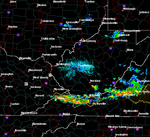 The severe thunderstorm warning for central buchanan and southwestern mcdowell counties will expire at 930 pm edt, the storm which prompted the warning has weakened below severe limits, and no longer pose an immediate threat to life or property. therefore, the warning will be allowed to expire. however gusty winds are still possible with this thunderstorm. a severe thunderstorm watch remains in effect until 1000 pm edt for southern west virginia. The severe thunderstorm warning for central buchanan and southwestern mcdowell counties will expire at 930 pm edt, the storm which prompted the warning has weakened below severe limits, and no longer pose an immediate threat to life or property. therefore, the warning will be allowed to expire. however gusty winds are still possible with this thunderstorm. a severe thunderstorm watch remains in effect until 1000 pm edt for southern west virginia.
|
| 6/16/2016 8:53 PM EDT |
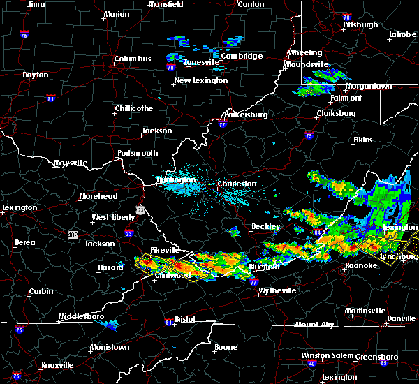 At 852 pm edt, a severe thunderstorm was located near hanover, or 10 miles northwest of welch, and is nearly stationary (radar indicated). Hazards include 60 mph wind gusts. Expect damage to roofs. siding. and trees. Locations impacted include, grundy, war, big rock, jolo, oakwood, roseann, stacy and vansant. At 852 pm edt, a severe thunderstorm was located near hanover, or 10 miles northwest of welch, and is nearly stationary (radar indicated). Hazards include 60 mph wind gusts. Expect damage to roofs. siding. and trees. Locations impacted include, grundy, war, big rock, jolo, oakwood, roseann, stacy and vansant.
|
| 6/16/2016 8:53 PM EDT |
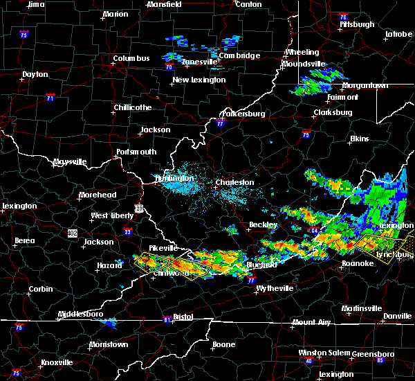 At 852 pm edt, a severe thunderstorm was located near hanover, or 10 miles northwest of welch, and is nearly stationary (radar indicated). Hazards include 60 mph wind gusts. Expect damage to roofs. siding. and trees. Locations impacted include, grundy, war, big rock, jolo, oakwood, roseann, stacy and vansant. At 852 pm edt, a severe thunderstorm was located near hanover, or 10 miles northwest of welch, and is nearly stationary (radar indicated). Hazards include 60 mph wind gusts. Expect damage to roofs. siding. and trees. Locations impacted include, grundy, war, big rock, jolo, oakwood, roseann, stacy and vansant.
|
| 6/16/2016 8:32 PM EDT |
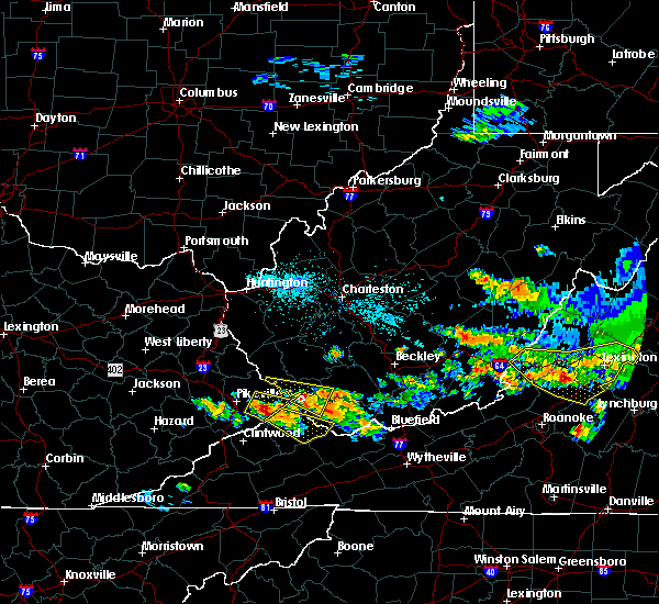 At 831 pm edt, a severe thunderstorm was located over fedscreek, or 8 miles north of breaks interstate, moving southeast at 35 mph (radar indicated). Hazards include 70 mph wind gusts and quarter size hail. Hail damage to vehicles is expected. expect considerable tree damage. Wind damage is also likely to mobile homes, roofs, and outbuildings. At 831 pm edt, a severe thunderstorm was located over fedscreek, or 8 miles north of breaks interstate, moving southeast at 35 mph (radar indicated). Hazards include 70 mph wind gusts and quarter size hail. Hail damage to vehicles is expected. expect considerable tree damage. Wind damage is also likely to mobile homes, roofs, and outbuildings.
|
| 5/1/2016 8:17 PM EDT |
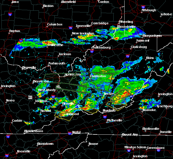 At 816 pm edt, a severe thunderstorm was located near war, or 8 miles southwest of welch, moving east at 30 mph (public). Hazards include golf ball size hail. People and animals outdoors will be injured. expect damage to roofs, siding, windows, and vehicles. Locations impacted include, welch, gary, war, coaldale, bradshaw, anawalt, elbert, jenkinjones, coalwood, cucumber and avondale. At 816 pm edt, a severe thunderstorm was located near war, or 8 miles southwest of welch, moving east at 30 mph (public). Hazards include golf ball size hail. People and animals outdoors will be injured. expect damage to roofs, siding, windows, and vehicles. Locations impacted include, welch, gary, war, coaldale, bradshaw, anawalt, elbert, jenkinjones, coalwood, cucumber and avondale.
|
| 5/1/2016 7:54 PM EDT |
 At 754 pm edt, a severe thunderstorm was located 11 miles southeast of argo, or 14 miles northeast of grundy, moving southeast at 45 mph (radar indicated). Hazards include golf ball size hail. People and animals outdoors will be injured. Expect damage to roofs, siding, windows, and vehicles. At 754 pm edt, a severe thunderstorm was located 11 miles southeast of argo, or 14 miles northeast of grundy, moving southeast at 45 mph (radar indicated). Hazards include golf ball size hail. People and animals outdoors will be injured. Expect damage to roofs, siding, windows, and vehicles.
|
| 5/1/2016 7:54 PM EDT |
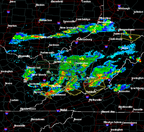 At 754 pm edt, a severe thunderstorm was located 11 miles southeast of argo, or 14 miles northeast of grundy, moving southeast at 45 mph (radar indicated). Hazards include golf ball size hail. People and animals outdoors will be injured. Expect damage to roofs, siding, windows, and vehicles. At 754 pm edt, a severe thunderstorm was located 11 miles southeast of argo, or 14 miles northeast of grundy, moving southeast at 45 mph (radar indicated). Hazards include golf ball size hail. People and animals outdoors will be injured. Expect damage to roofs, siding, windows, and vehicles.
|
| 5/1/2016 7:42 PM EDT |
 At 742 pm edt, a severe thunderstorm was located 11 miles northwest of war, or 13 miles northeast of grundy, moving southeast at 50 mph (radar indicated). Hazards include 60 mph wind gusts and half dollar size hail. Hail damage to vehicles is expected. expect wind damage to roofs, siding, and trees. Locations impacted include, welch, gary, war, paw paw, bradshaw, iaeger, anawalt, jolo, panther, avondale, elbert, coalwood, cucumber and hurley. At 742 pm edt, a severe thunderstorm was located 11 miles northwest of war, or 13 miles northeast of grundy, moving southeast at 50 mph (radar indicated). Hazards include 60 mph wind gusts and half dollar size hail. Hail damage to vehicles is expected. expect wind damage to roofs, siding, and trees. Locations impacted include, welch, gary, war, paw paw, bradshaw, iaeger, anawalt, jolo, panther, avondale, elbert, coalwood, cucumber and hurley.
|
| 5/1/2016 7:42 PM EDT |
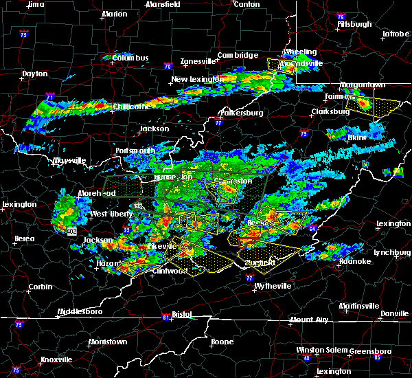 At 742 pm edt, a severe thunderstorm was located 11 miles northwest of war, or 13 miles northeast of grundy, moving southeast at 50 mph (radar indicated). Hazards include 60 mph wind gusts and half dollar size hail. Hail damage to vehicles is expected. expect wind damage to roofs, siding, and trees. Locations impacted include, welch, gary, war, paw paw, bradshaw, iaeger, anawalt, jolo, panther, avondale, elbert, coalwood, cucumber and hurley. At 742 pm edt, a severe thunderstorm was located 11 miles northwest of war, or 13 miles northeast of grundy, moving southeast at 50 mph (radar indicated). Hazards include 60 mph wind gusts and half dollar size hail. Hail damage to vehicles is expected. expect wind damage to roofs, siding, and trees. Locations impacted include, welch, gary, war, paw paw, bradshaw, iaeger, anawalt, jolo, panther, avondale, elbert, coalwood, cucumber and hurley.
|
| 5/1/2016 7:23 PM EDT |
 At 723 pm edt, a severe thunderstorm was located over paw paw, or 12 miles north of grundy, moving southeast at 50 mph (radar indicated). Hazards include 60 mph wind gusts and quarter size hail. Hail damage to vehicles is expected. Expect wind damage to roofs, siding, and trees. At 723 pm edt, a severe thunderstorm was located over paw paw, or 12 miles north of grundy, moving southeast at 50 mph (radar indicated). Hazards include 60 mph wind gusts and quarter size hail. Hail damage to vehicles is expected. Expect wind damage to roofs, siding, and trees.
|
| 7/13/2015 5:46 PM EDT |
 At 545 pm edt, doppler radar indicated a line of severe thunderstorms capable of producing damaging winds in excess of 60 mph. these storms were located along a line extending from near bradley to near mullens to near war, moving southeast at 40 mph. locations impacted include, beckley, fayetteville, welch, pineville, oak hill, mullens, mount hope, mabscott, sophia, gary, war, northfork, shady spring, prosperity, dry creek, twin falls state park, daniels, macarthur, crab orchard and bradley. At 545 pm edt, doppler radar indicated a line of severe thunderstorms capable of producing damaging winds in excess of 60 mph. these storms were located along a line extending from near bradley to near mullens to near war, moving southeast at 40 mph. locations impacted include, beckley, fayetteville, welch, pineville, oak hill, mullens, mount hope, mabscott, sophia, gary, war, northfork, shady spring, prosperity, dry creek, twin falls state park, daniels, macarthur, crab orchard and bradley.
|
| 7/13/2015 5:05 PM EDT |
 At 505 pm edt, doppler radar indicated a line of severe thunderstorms capable of producing damaging winds in excess of 60 mph. these storms were located along a line extending from 9 miles south of chesapeake to near amherstdale-robinette to majestic, and moving southeast at 40 mph. At 505 pm edt, doppler radar indicated a line of severe thunderstorms capable of producing damaging winds in excess of 60 mph. these storms were located along a line extending from 9 miles south of chesapeake to near amherstdale-robinette to majestic, and moving southeast at 40 mph.
|
| 6/26/2015 4:27 AM EDT |
 At 426 am edt, doppler radar indicated a severe thunderstorm capable of producing quarter size hail and damaging winds in excess of 60 mph. this storm was located 10 miles southeast of argo, or 12 miles northeast of grundy, and moving southeast at 20 mph. At 426 am edt, doppler radar indicated a severe thunderstorm capable of producing quarter size hail and damaging winds in excess of 60 mph. this storm was located 10 miles southeast of argo, or 12 miles northeast of grundy, and moving southeast at 20 mph.
|
| 6/26/2015 4:27 AM EDT |
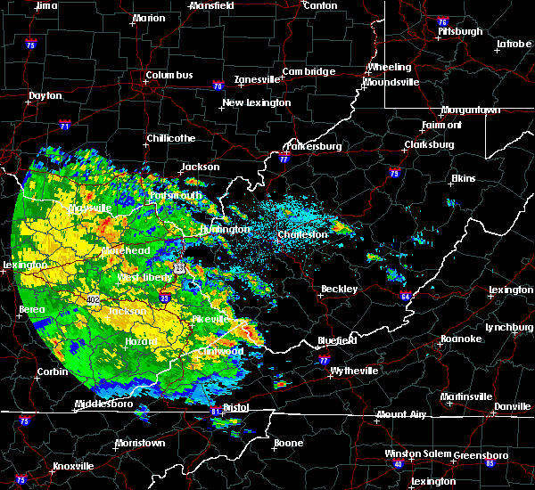 At 426 am edt, doppler radar indicated a severe thunderstorm capable of producing quarter size hail and damaging winds in excess of 60 mph. this storm was located 10 miles southeast of argo, or 12 miles northeast of grundy, and moving southeast at 20 mph. At 426 am edt, doppler radar indicated a severe thunderstorm capable of producing quarter size hail and damaging winds in excess of 60 mph. this storm was located 10 miles southeast of argo, or 12 miles northeast of grundy, and moving southeast at 20 mph.
|
| 6/26/2015 4:14 AM EDT |
 At 414 am edt, doppler radar indicated a severe thunderstorm capable of producing quarter size hail and damaging winds in excess of 60 mph. this storm was located 10 miles south of gilbert creek, or 16 miles west of welch, moving east at 60 mph. locations impacted include, welch, war, big rock, paw paw, davy, bradshaw, iaeger, jolo, roseann, panther, avondale, coalwood, stacy and hurley. At 414 am edt, doppler radar indicated a severe thunderstorm capable of producing quarter size hail and damaging winds in excess of 60 mph. this storm was located 10 miles south of gilbert creek, or 16 miles west of welch, moving east at 60 mph. locations impacted include, welch, war, big rock, paw paw, davy, bradshaw, iaeger, jolo, roseann, panther, avondale, coalwood, stacy and hurley.
|
| 6/26/2015 4:14 AM EDT |
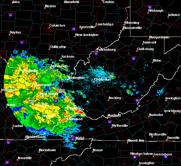 At 414 am edt, doppler radar indicated a severe thunderstorm capable of producing quarter size hail and damaging winds in excess of 60 mph. this storm was located 10 miles south of gilbert creek, or 16 miles west of welch, moving east at 60 mph. locations impacted include, welch, war, big rock, paw paw, davy, bradshaw, iaeger, jolo, roseann, panther, avondale, coalwood, stacy and hurley. At 414 am edt, doppler radar indicated a severe thunderstorm capable of producing quarter size hail and damaging winds in excess of 60 mph. this storm was located 10 miles south of gilbert creek, or 16 miles west of welch, moving east at 60 mph. locations impacted include, welch, war, big rock, paw paw, davy, bradshaw, iaeger, jolo, roseann, panther, avondale, coalwood, stacy and hurley.
|
| 6/26/2015 4:00 AM EDT |
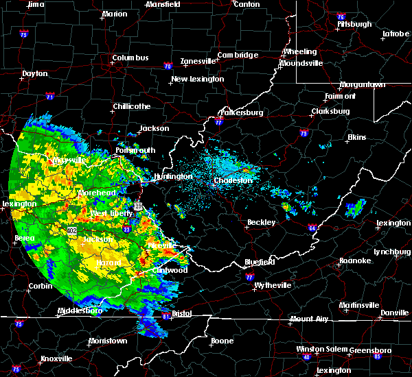 At 359 am edt, doppler radar indicated a severe thunderstorm capable of producing quarter size hail. this storm was located over paw paw, or 12 miles north of grundy, and moving east at 60 mph. At 359 am edt, doppler radar indicated a severe thunderstorm capable of producing quarter size hail. this storm was located over paw paw, or 12 miles north of grundy, and moving east at 60 mph.
|
| 4/8/2015 5:23 PM EDT | A severe thunderstorm warning remains in effect until 545 pm edt for central mcdowell county. at 514 pm edt. national weather service doppler radar continued to indicate a severe thunderstorm still capable of producing quarter size hail. and damaging winds in excess of 60 mph. this storm was located near coalwood. or 9 miles southwest of welch. Moving. |
| 4/8/2015 5:01 PM EDT | The national weather service in charleston has issued a * severe thunderstorm warning for. mcdowell county in west virginia. this includes the city of welch. until 545 pm edt * at 454 pm edt. National weather service doppler radar indicated a. |
| 4/8/2015 4:28 PM EDT | A severe thunderstorm warning remains in effect until 500 pm edt for wyoming. southeastern logan. mcdowell. southeastern mingo and northeastern buchanan counties. at 417 pm edt. national weather service doppler radar continued to indicate a severe thunderstorm capable of producing golf ball size hail. and damaging winds in excess of 60 mph. This storm was. |
| 4/8/2015 4:28 PM EDT | A severe thunderstorm warning remains in effect until 500 pm edt for wyoming. southeastern logan. mcdowell. southeastern mingo and northeastern buchanan counties. at 417 pm edt. national weather service doppler radar continued to indicate a severe thunderstorm capable of producing golf ball size hail. and damaging winds in excess of 60 mph. This storm was. |
| 4/8/2015 4:05 PM EDT | The national weather service in charleston has issued a * severe thunderstorm warning for. northeastern buchanan county in virginia. southeastern logan county in west virginia. mcdowell county in west virginia. This includes the city of welch. |
| 4/8/2015 4:05 PM EDT | The national weather service in charleston has issued a * severe thunderstorm warning for. northeastern buchanan county in virginia. southeastern logan county in west virginia. mcdowell county in west virginia. This includes the city of welch. |
| 4/28/2014 4:52 PM EDT | Quarter sized hail reported 0.4 miles WNW of War, WV, quarter size hail from spotter in war west virginia. 30-40 mph hour winds estimated |
| 4/28/2014 4:50 PM EDT | Half Dollar sized hail reported 0.4 miles WNW of War, WV, observer in war observed hail the size of half dollar coins |
| 1/1/0001 12:00 AM | Tree down coretta coalwood mountain in mcdowell county WV, 2 miles SSW of War, WV |
Hail Maps for War, WV
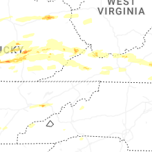

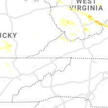


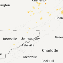


Connect with Interactive Hail Maps