

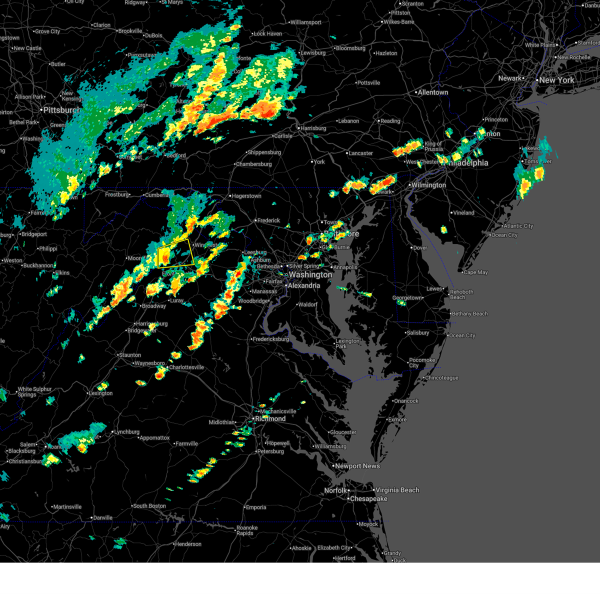
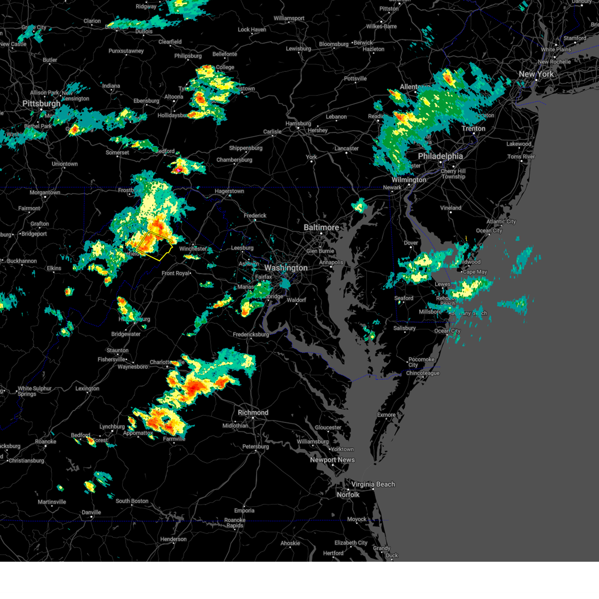
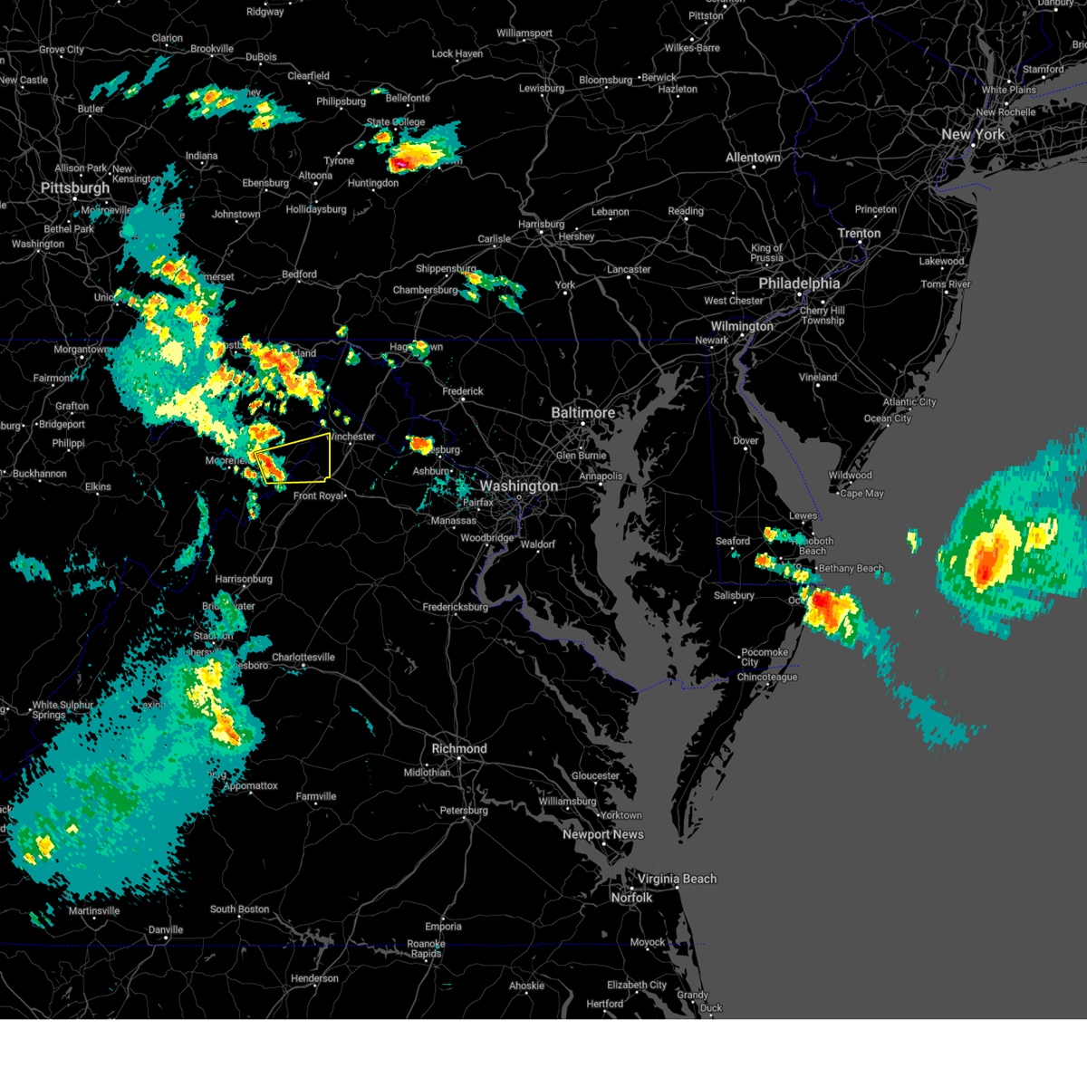
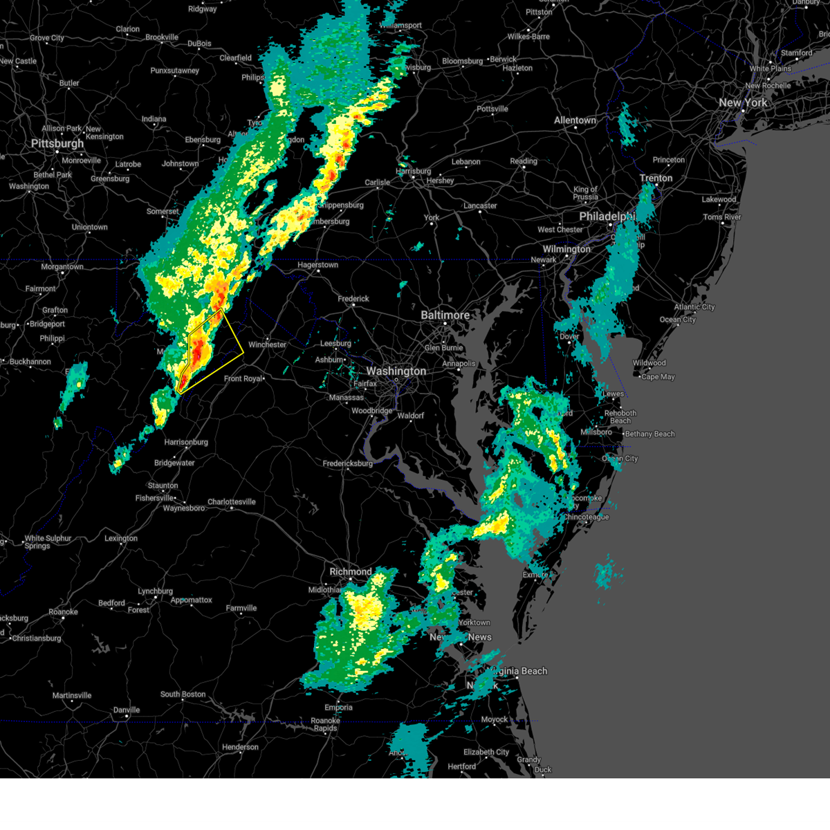
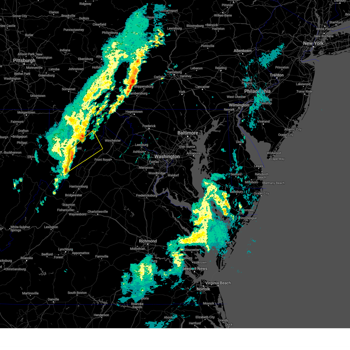
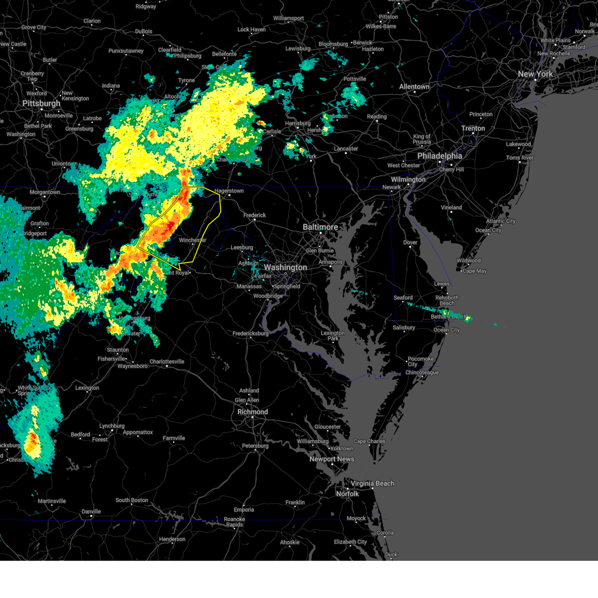
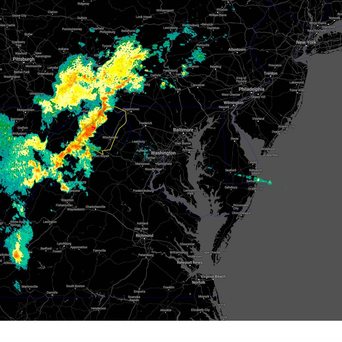
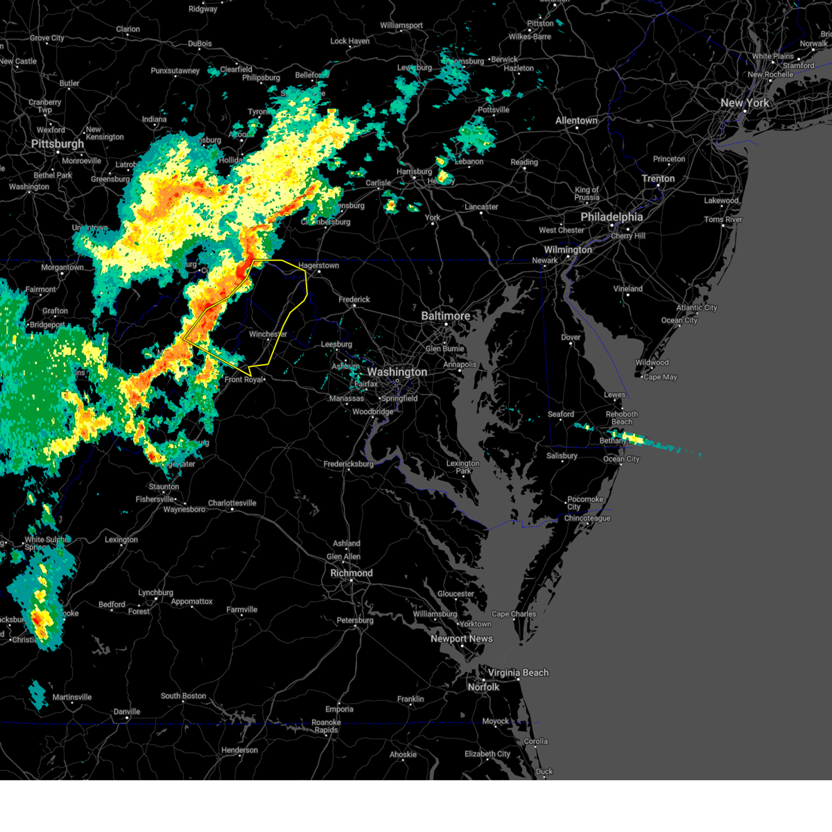
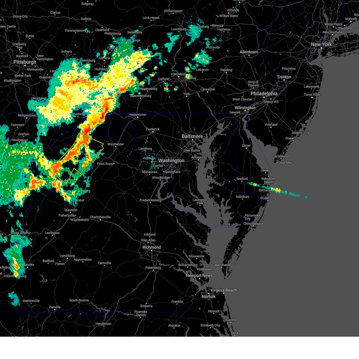
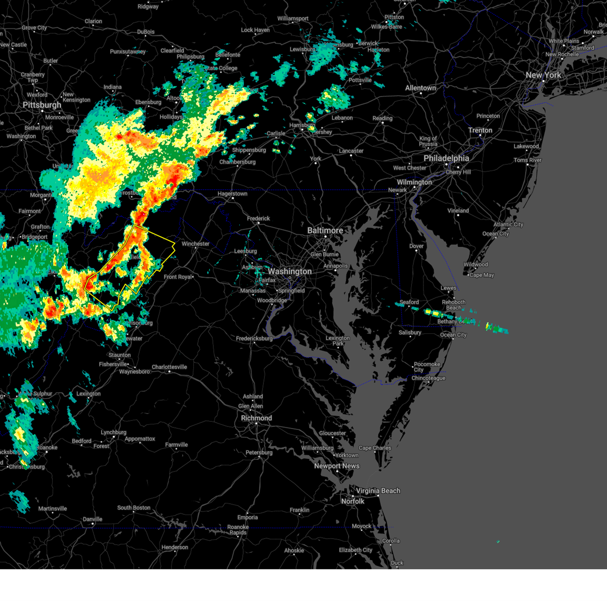
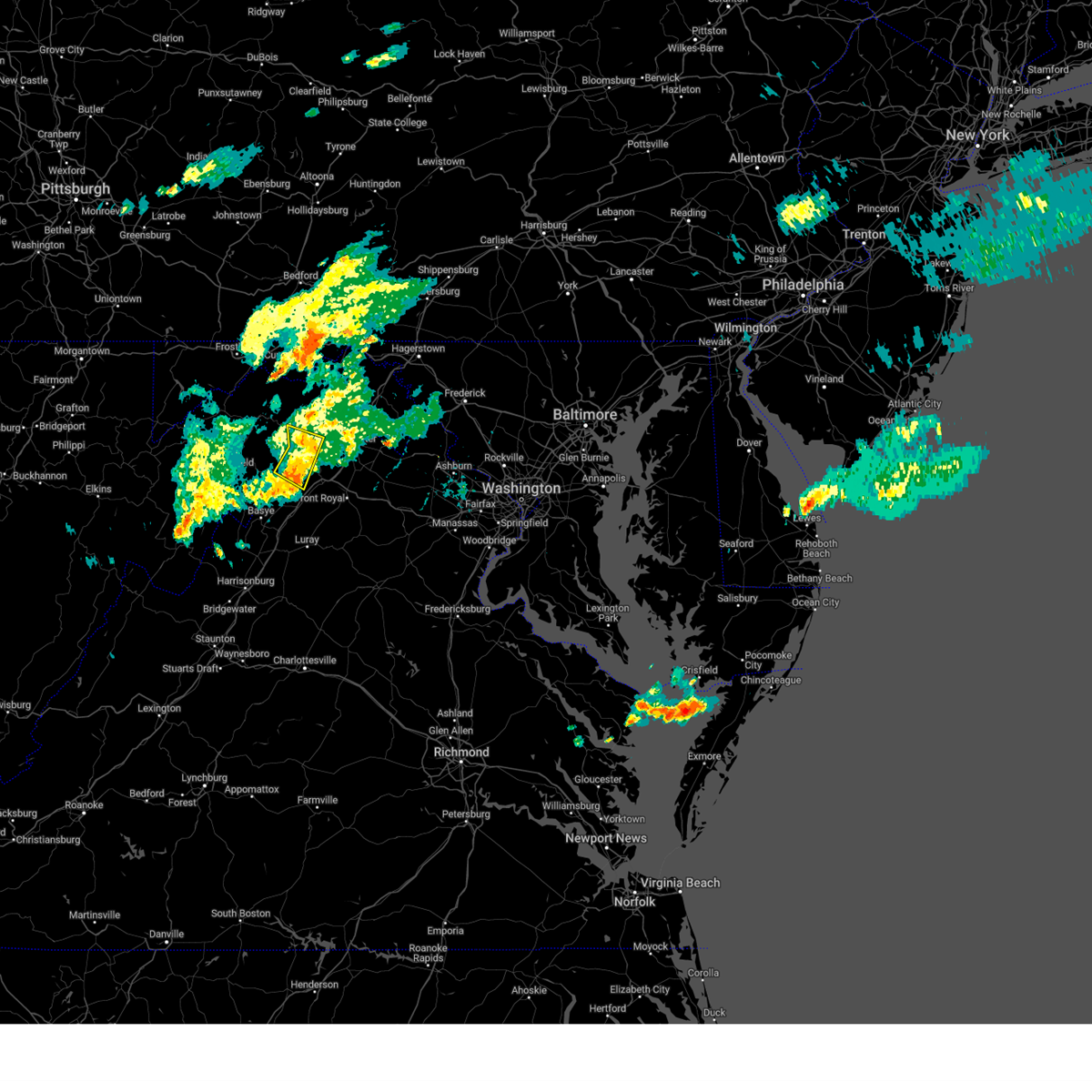
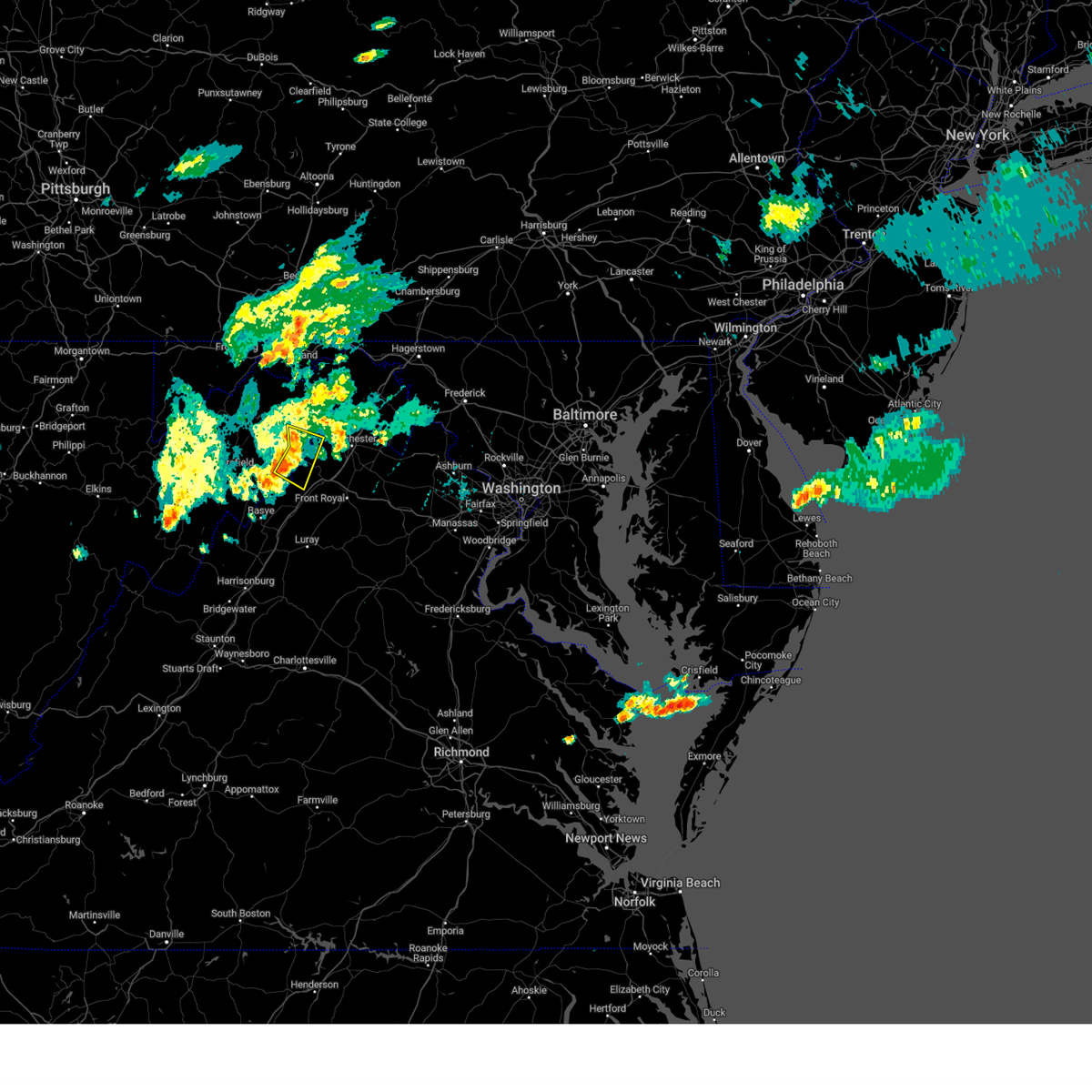
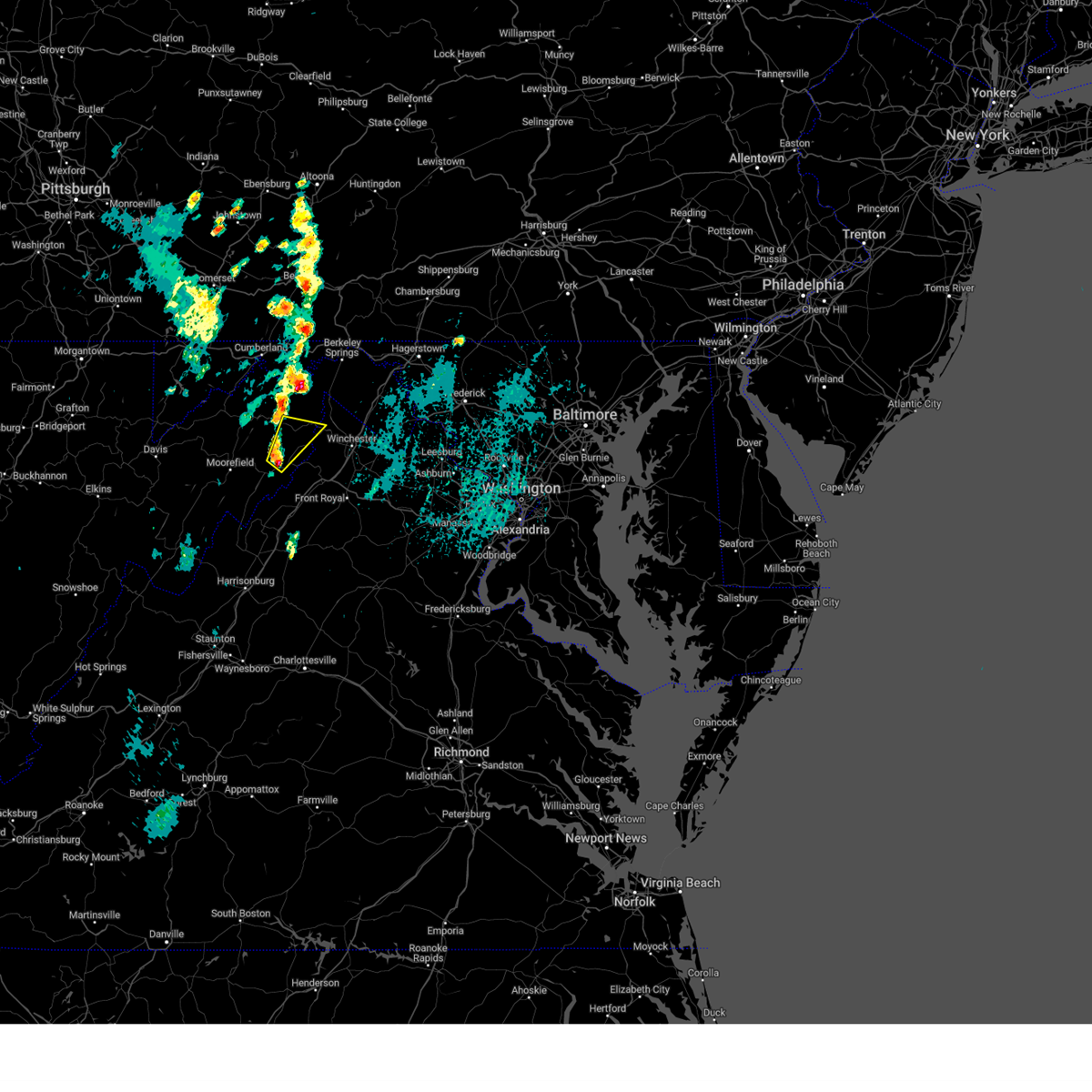
Hail Map for Wardensville, WV
The Wardensville, WV area has had 3 reports of on-the-ground hail by trained spotters, and has been under severe weather warnings 23 times during the past 12 months. Doppler radar has detected hail at or near Wardensville, WV on 24 occasions.
| Name: | Wardensville, WV |
| Where Located: | 68.2 miles E of Elkins, WV |
| Map: | Google Map for Wardensville, WV |
| Population: | 271 |
| Housing Units: | 154 |
| More Info: | Search Google for Wardensville, WV |
0
The Top Recent Hail Date for Wardensville, WV is Thursday, September 7, 2023 (24th out of 24)

Hail and Wind Damage Spotted near Wardensville, WV
| Date / Time | Report Details |
|---|---|
| 7/1/2025 1:58 PM EDT |
 The storm which prompted the warning has weakened below severe limits, and no longer poses an immediate threat to life or property. therefore, the warning will be allowed to expire. a severe thunderstorm watch remains in effect until 900 pm edt for northwestern virginia, and eastern west virginia. to report severe weather, contact your nearest law enforcement agency. they will relay your report to the national weather service sterling virginia. The storm which prompted the warning has weakened below severe limits, and no longer poses an immediate threat to life or property. therefore, the warning will be allowed to expire. a severe thunderstorm watch remains in effect until 900 pm edt for northwestern virginia, and eastern west virginia. to report severe weather, contact your nearest law enforcement agency. they will relay your report to the national weather service sterling virginia.
|
| 7/1/2025 1:47 PM EDT |
 the severe thunderstorm warning has been cancelled and is no longer in effect the severe thunderstorm warning has been cancelled and is no longer in effect
|
| 7/1/2025 1:47 PM EDT |
 At 146 pm edt, a severe thunderstorm was located near star tannery, or 8 miles northwest of strasburg, moving east at 35 mph (radar indicated). Hazards include 60 mph wind gusts. Damaging winds will cause some trees and large branches to fall. this could injure those outdoors, as well as damage homes and vehicles. roadways may become blocked by downed trees. localized power outages are possible. unsecured light objects may become projectiles. Locations impacted include, strasburg, stephens city, wardensville, star tannery, middletown, gravel springs, high view manor, wilde acres, reliance, nineveh, fishers hill, clary, and capon springs. At 146 pm edt, a severe thunderstorm was located near star tannery, or 8 miles northwest of strasburg, moving east at 35 mph (radar indicated). Hazards include 60 mph wind gusts. Damaging winds will cause some trees and large branches to fall. this could injure those outdoors, as well as damage homes and vehicles. roadways may become blocked by downed trees. localized power outages are possible. unsecured light objects may become projectiles. Locations impacted include, strasburg, stephens city, wardensville, star tannery, middletown, gravel springs, high view manor, wilde acres, reliance, nineveh, fishers hill, clary, and capon springs.
|
| 7/1/2025 1:35 PM EDT | Three trees down on trout run road... one mile south of wardensvill in hardy county WV, 6.5 miles NNE of Wardensville, WV |
| 7/1/2025 1:22 PM EDT |
 Svrlwx the national weather service in sterling virginia has issued a * severe thunderstorm warning for, northeastern shenandoah county in northwestern virginia, southwestern frederick county in northwestern virginia, northwestern warren county in northwestern virginia, the southwestern city of winchester in northwestern virginia, east central hardy county in eastern west virginia, southeastern hampshire county in eastern west virginia, * until 200 pm edt. * at 121 pm edt, a severe thunderstorm was located near wardensville, or 14 miles northwest of woodstock, moving east at 45 mph (radar indicated). Hazards include 60 mph wind gusts. Damaging winds will cause some trees and large branches to fall. this could injure those outdoors, as well as damage homes and vehicles. roadways may become blocked by downed trees. localized power outages are possible. Unsecured light objects may become projectiles. Svrlwx the national weather service in sterling virginia has issued a * severe thunderstorm warning for, northeastern shenandoah county in northwestern virginia, southwestern frederick county in northwestern virginia, northwestern warren county in northwestern virginia, the southwestern city of winchester in northwestern virginia, east central hardy county in eastern west virginia, southeastern hampshire county in eastern west virginia, * until 200 pm edt. * at 121 pm edt, a severe thunderstorm was located near wardensville, or 14 miles northwest of woodstock, moving east at 45 mph (radar indicated). Hazards include 60 mph wind gusts. Damaging winds will cause some trees and large branches to fall. this could injure those outdoors, as well as damage homes and vehicles. roadways may become blocked by downed trees. localized power outages are possible. Unsecured light objects may become projectiles.
|
| 6/19/2025 1:35 PM EDT |
 Svrlwx the national weather service in sterling virginia has issued a * severe thunderstorm warning for, north central shenandoah county in northwestern virginia, frederick county in northwestern virginia, the city of winchester in northwestern virginia, northeastern hardy county in eastern west virginia, southwestern berkeley county in the panhandle of west virginia, southeastern hampshire county in eastern west virginia, * until 215 pm edt. * at 134 pm edt, a severe thunderstorm was located near wardensville, or 16 miles east of moorefield, moving northeast at 45 mph (radar indicated). Hazards include 60 mph wind gusts. Damaging winds will cause some trees and large branches to fall. this could injure those outdoors, as well as damage homes and vehicles. roadways may become blocked by downed trees. localized power outages are possible. Unsecured light objects may become projectiles. Svrlwx the national weather service in sterling virginia has issued a * severe thunderstorm warning for, north central shenandoah county in northwestern virginia, frederick county in northwestern virginia, the city of winchester in northwestern virginia, northeastern hardy county in eastern west virginia, southwestern berkeley county in the panhandle of west virginia, southeastern hampshire county in eastern west virginia, * until 215 pm edt. * at 134 pm edt, a severe thunderstorm was located near wardensville, or 16 miles east of moorefield, moving northeast at 45 mph (radar indicated). Hazards include 60 mph wind gusts. Damaging winds will cause some trees and large branches to fall. this could injure those outdoors, as well as damage homes and vehicles. roadways may become blocked by downed trees. localized power outages are possible. Unsecured light objects may become projectiles.
|
| 6/6/2025 5:09 PM EDT |
 At 509 pm edt, a severe thunderstorm was located near wardensville, or 16 miles northwest of strasburg, moving east at 30 mph (radar indicated). Hazards include 60 mph wind gusts. Damaging winds will cause some trees and large branches to fall. this could injure those outdoors, as well as damage homes and vehicles. roadways may become blocked by downed trees. localized power outages are possible. unsecured light objects may become projectiles. Locations impacted include, yellow spring, delray, inkerman, kirby, rio, wardensville, capon springs, and lehew. At 509 pm edt, a severe thunderstorm was located near wardensville, or 16 miles northwest of strasburg, moving east at 30 mph (radar indicated). Hazards include 60 mph wind gusts. Damaging winds will cause some trees and large branches to fall. this could injure those outdoors, as well as damage homes and vehicles. roadways may become blocked by downed trees. localized power outages are possible. unsecured light objects may become projectiles. Locations impacted include, yellow spring, delray, inkerman, kirby, rio, wardensville, capon springs, and lehew.
|
| 6/6/2025 4:58 PM EDT |
 the severe thunderstorm warning has been cancelled and is no longer in effect the severe thunderstorm warning has been cancelled and is no longer in effect
|
| 6/6/2025 4:58 PM EDT |
 At 458 pm edt, a severe thunderstorm was located 8 miles northwest of wardensville, or 12 miles south of romney, moving east at 30 mph (radar indicated). Hazards include 60 mph wind gusts. Damaging winds will cause some trees and large branches to fall. this could injure those outdoors, as well as damage homes and vehicles. roadways may become blocked by downed trees. localized power outages are possible. unsecured light objects may become projectiles. Locations impacted include, mcneill, bean settlement, yellow spring, delray, baker, inkerman, kirby, rio, wardensville, capon springs, mccauley, and lehew. At 458 pm edt, a severe thunderstorm was located 8 miles northwest of wardensville, or 12 miles south of romney, moving east at 30 mph (radar indicated). Hazards include 60 mph wind gusts. Damaging winds will cause some trees and large branches to fall. this could injure those outdoors, as well as damage homes and vehicles. roadways may become blocked by downed trees. localized power outages are possible. unsecured light objects may become projectiles. Locations impacted include, mcneill, bean settlement, yellow spring, delray, baker, inkerman, kirby, rio, wardensville, capon springs, mccauley, and lehew.
|
| 6/6/2025 4:33 PM EDT |
 Svrlwx the national weather service in sterling virginia has issued a * severe thunderstorm warning for, northeastern grant county in eastern west virginia, south central mineral county in eastern west virginia, northeastern hardy county in eastern west virginia, southern hampshire county in eastern west virginia, * until 515 pm edt. * at 433 pm edt, a severe thunderstorm was located 11 miles southwest of romney, moving east at 35 mph (radar indicated). Hazards include 60 mph wind gusts and quarter size hail. Damaging winds will cause some trees and large branches to fall. this could injure those outdoors, as well as damage homes and vehicles. roadways may become blocked by downed trees. localized power outages are possible. Unsecured light objects may become projectiles. Svrlwx the national weather service in sterling virginia has issued a * severe thunderstorm warning for, northeastern grant county in eastern west virginia, south central mineral county in eastern west virginia, northeastern hardy county in eastern west virginia, southern hampshire county in eastern west virginia, * until 515 pm edt. * at 433 pm edt, a severe thunderstorm was located 11 miles southwest of romney, moving east at 35 mph (radar indicated). Hazards include 60 mph wind gusts and quarter size hail. Damaging winds will cause some trees and large branches to fall. this could injure those outdoors, as well as damage homes and vehicles. roadways may become blocked by downed trees. localized power outages are possible. Unsecured light objects may become projectiles.
|
| 5/16/2025 3:55 PM EDT |
 At 355 pm edt, a severe thunderstorm was located over star tannery, or near strasburg, moving east at 40 mph (radar indicated). Hazards include 60 mph wind gusts. Damaging winds will cause some trees and large branches to fall. this could injure those outdoors, as well as damage homes and vehicles. roadways may become blocked by downed trees. localized power outages are possible. unsecured light objects may become projectiles. Locations impacted include, gravel springs, high view manor, wilde acres, strasburg, wardensville, clary, star tannery, and capon springs. At 355 pm edt, a severe thunderstorm was located over star tannery, or near strasburg, moving east at 40 mph (radar indicated). Hazards include 60 mph wind gusts. Damaging winds will cause some trees and large branches to fall. this could injure those outdoors, as well as damage homes and vehicles. roadways may become blocked by downed trees. localized power outages are possible. unsecured light objects may become projectiles. Locations impacted include, gravel springs, high view manor, wilde acres, strasburg, wardensville, clary, star tannery, and capon springs.
|
| 5/16/2025 3:37 PM EDT |
 Svrlwx the national weather service in sterling virginia has issued a * severe thunderstorm warning for, northeastern shenandoah county in northwestern virginia, southwestern frederick county in northwestern virginia, northeastern hardy county in eastern west virginia, southeastern hampshire county in eastern west virginia, * until 415 pm edt. * at 337 pm edt, a severe thunderstorm was located over wardensville, or 15 miles northwest of woodstock, moving east at 40 mph (radar indicated). Hazards include 60 mph wind gusts. Damaging winds will cause some trees and large branches to fall. this could injure those outdoors, as well as damage homes and vehicles. roadways may become blocked by downed trees. localized power outages are possible. Unsecured light objects may become projectiles. Svrlwx the national weather service in sterling virginia has issued a * severe thunderstorm warning for, northeastern shenandoah county in northwestern virginia, southwestern frederick county in northwestern virginia, northeastern hardy county in eastern west virginia, southeastern hampshire county in eastern west virginia, * until 415 pm edt. * at 337 pm edt, a severe thunderstorm was located over wardensville, or 15 miles northwest of woodstock, moving east at 40 mph (radar indicated). Hazards include 60 mph wind gusts. Damaging winds will cause some trees and large branches to fall. this could injure those outdoors, as well as damage homes and vehicles. roadways may become blocked by downed trees. localized power outages are possible. Unsecured light objects may become projectiles.
|
| 3/16/2025 6:13 PM EDT |
 the severe thunderstorm warning has been cancelled and is no longer in effect the severe thunderstorm warning has been cancelled and is no longer in effect
|
| 3/16/2025 6:13 PM EDT |
 At 613 pm edt, a severe thunderstorm was located near mathias, or 14 miles southeast of moorefield, moving northeast at 55 mph (radar indicated). Hazards include 60 mph wind gusts and quarter size hail. Damaging winds will cause some trees and large branches to fall. this could injure those outdoors, as well as damage homes and vehicles. roadways may become blocked by downed trees. localized power outages are possible. unsecured light objects may become projectiles. Locations impacted include, orkney springs, perry, lost city, lost river, baker, mathias, jerome, mccauley, wardensville, basye, and basye-bryce mountain. At 613 pm edt, a severe thunderstorm was located near mathias, or 14 miles southeast of moorefield, moving northeast at 55 mph (radar indicated). Hazards include 60 mph wind gusts and quarter size hail. Damaging winds will cause some trees and large branches to fall. this could injure those outdoors, as well as damage homes and vehicles. roadways may become blocked by downed trees. localized power outages are possible. unsecured light objects may become projectiles. Locations impacted include, orkney springs, perry, lost city, lost river, baker, mathias, jerome, mccauley, wardensville, basye, and basye-bryce mountain.
|
| 3/16/2025 6:03 PM EDT |
 Svrlwx the national weather service in sterling virginia has issued a * severe thunderstorm warning for, northwestern shenandoah county in northwestern virginia, northern rockingham county in western virginia, central hardy county in eastern west virginia, * until 630 pm edt. * at 603 pm edt, a severe thunderstorm was located near mathias, or 12 miles southeast of rough run, moving northeast at 55 mph (radar indicated). Hazards include 60 mph wind gusts and quarter size hail. Damaging winds will cause some trees and large branches to fall. this could injure those outdoors, as well as damage homes and vehicles. roadways may become blocked by downed trees. localized power outages are possible. Unsecured light objects may become projectiles. Svrlwx the national weather service in sterling virginia has issued a * severe thunderstorm warning for, northwestern shenandoah county in northwestern virginia, northern rockingham county in western virginia, central hardy county in eastern west virginia, * until 630 pm edt. * at 603 pm edt, a severe thunderstorm was located near mathias, or 12 miles southeast of rough run, moving northeast at 55 mph (radar indicated). Hazards include 60 mph wind gusts and quarter size hail. Damaging winds will cause some trees and large branches to fall. this could injure those outdoors, as well as damage homes and vehicles. roadways may become blocked by downed trees. localized power outages are possible. Unsecured light objects may become projectiles.
|
| 3/16/2025 4:56 PM EDT |
 The line of storms which prompted the warning have moved out of the area. therefore, the warning will be allowed to expire. however, gusty winds are still possible with additional thunderstorms that have popped up, but appear to be below severe limits. . a tornado watch remains in effect until 700 pm edt for northwestern virginia, and eastern west virginia. The line of storms which prompted the warning have moved out of the area. therefore, the warning will be allowed to expire. however, gusty winds are still possible with additional thunderstorms that have popped up, but appear to be below severe limits. . a tornado watch remains in effect until 700 pm edt for northwestern virginia, and eastern west virginia.
|
| 3/16/2025 4:37 PM EDT |
 At 436 pm edt, severe thunderstorms were located along a line extending from 10 miles south of romney to 10 miles west of wardensville to 9 miles east of moorefield to near mathias, moving northeast at 50 mph (radar indicated). Hazards include 60 mph wind gusts. Damaging winds will cause some trees and large branches to fall. this could injure those outdoors, as well as damage homes and vehicles. roadways may become blocked by downed trees. localized power outages are possible. unsecured light objects may become projectiles. Locations impacted include, augusta, gravel springs, bean settlement, yellow spring, shanks, frenchburg, mathias, wardensville, star tannery, perry, lost city, lost river, delray, baker, inkerman, kirby, rio, capon springs, and mccauley. At 436 pm edt, severe thunderstorms were located along a line extending from 10 miles south of romney to 10 miles west of wardensville to 9 miles east of moorefield to near mathias, moving northeast at 50 mph (radar indicated). Hazards include 60 mph wind gusts. Damaging winds will cause some trees and large branches to fall. this could injure those outdoors, as well as damage homes and vehicles. roadways may become blocked by downed trees. localized power outages are possible. unsecured light objects may become projectiles. Locations impacted include, augusta, gravel springs, bean settlement, yellow spring, shanks, frenchburg, mathias, wardensville, star tannery, perry, lost city, lost river, delray, baker, inkerman, kirby, rio, capon springs, and mccauley.
|
| 3/16/2025 4:37 PM EDT |
 the severe thunderstorm warning has been cancelled and is no longer in effect the severe thunderstorm warning has been cancelled and is no longer in effect
|
| 3/16/2025 4:20 PM EDT |
 Svrlwx the national weather service in sterling virginia has issued a * severe thunderstorm warning for, northwestern shenandoah county in northwestern virginia, southwestern frederick county in northwestern virginia, northwestern rockingham county in western virginia, northeastern pendleton county in eastern west virginia, southeastern grant county in eastern west virginia, hardy county in eastern west virginia, southern hampshire county in eastern west virginia, * until 500 pm edt. * at 420 pm edt, severe thunderstorms were located along a line extending from near moorefield to 8 miles east of petersburg to 6 miles east of rough run to 9 miles east of upper tract, moving northeast at 50 mph (radar indicated). Hazards include 60 mph wind gusts. Damaging winds will cause some trees and large branches to fall. this could injure those outdoors, as well as damage homes and vehicles. roadways may become blocked by downed trees. localized power outages are possible. Unsecured light objects may become projectiles. Svrlwx the national weather service in sterling virginia has issued a * severe thunderstorm warning for, northwestern shenandoah county in northwestern virginia, southwestern frederick county in northwestern virginia, northwestern rockingham county in western virginia, northeastern pendleton county in eastern west virginia, southeastern grant county in eastern west virginia, hardy county in eastern west virginia, southern hampshire county in eastern west virginia, * until 500 pm edt. * at 420 pm edt, severe thunderstorms were located along a line extending from near moorefield to 8 miles east of petersburg to 6 miles east of rough run to 9 miles east of upper tract, moving northeast at 50 mph (radar indicated). Hazards include 60 mph wind gusts. Damaging winds will cause some trees and large branches to fall. this could injure those outdoors, as well as damage homes and vehicles. roadways may become blocked by downed trees. localized power outages are possible. Unsecured light objects may become projectiles.
|
| 8/31/2024 4:58 PM EDT | Tree down at the intersection of old route 55 and leisure acres rd in hardy county WV, 7.1 miles ENE of Wardensville, WV |
| 8/31/2024 4:53 PM EDT |
 At 453 pm edt, severe thunderstorms were located along a line extending from berkeley springs to near greenwood to 14 miles south of paw paw to 7 miles north of wardensville, moving southeast at 30 mph (radar indicated). Hazards include 70 mph wind gusts and quarter size hail. Damaging winds will cause some trees and large branches to fall. this could injure those outdoors, as well as damage homes and vehicles. roadways may become blocked by downed trees. localized power outages are possible. unsecured light objects may become projectiles. Locations impacted include, winchester, martinsburg, strasburg, hancock, millwood pike, inwood, wilson-conococheague, stephens city, berkeley springs, wardensville, star tannery, berkeley, middletown, falling waters, great cacapon, clear spring, capon bridge, hedgesville, pecktonville, and big spring. At 453 pm edt, severe thunderstorms were located along a line extending from berkeley springs to near greenwood to 14 miles south of paw paw to 7 miles north of wardensville, moving southeast at 30 mph (radar indicated). Hazards include 70 mph wind gusts and quarter size hail. Damaging winds will cause some trees and large branches to fall. this could injure those outdoors, as well as damage homes and vehicles. roadways may become blocked by downed trees. localized power outages are possible. unsecured light objects may become projectiles. Locations impacted include, winchester, martinsburg, strasburg, hancock, millwood pike, inwood, wilson-conococheague, stephens city, berkeley springs, wardensville, star tannery, berkeley, middletown, falling waters, great cacapon, clear spring, capon bridge, hedgesville, pecktonville, and big spring.
|
| 8/31/2024 4:44 PM EDT |
 At 444 pm edt, severe thunderstorms were located along a line extending from near berkeley springs to near greenwood to 10 miles south of paw paw to 10 miles north of wardensville, moving southeast at 35 mph (radar indicated). Hazards include 70 mph wind gusts and quarter size hail. Damaging winds will cause some trees and large branches to fall. this could injure those outdoors, as well as damage homes and vehicles. roadways may become blocked by downed trees. localized power outages are possible. unsecured light objects may become projectiles. Locations impacted include, winchester, martinsburg, strasburg, romney, hancock, millwood pike, inwood, wilson-conococheague, stephens city, berkeley springs, wardensville, star tannery, berkeley, middletown, falling waters, great cacapon, clear spring, capon bridge, hedgesville, and pecktonville. At 444 pm edt, severe thunderstorms were located along a line extending from near berkeley springs to near greenwood to 10 miles south of paw paw to 10 miles north of wardensville, moving southeast at 35 mph (radar indicated). Hazards include 70 mph wind gusts and quarter size hail. Damaging winds will cause some trees and large branches to fall. this could injure those outdoors, as well as damage homes and vehicles. roadways may become blocked by downed trees. localized power outages are possible. unsecured light objects may become projectiles. Locations impacted include, winchester, martinsburg, strasburg, romney, hancock, millwood pike, inwood, wilson-conococheague, stephens city, berkeley springs, wardensville, star tannery, berkeley, middletown, falling waters, great cacapon, clear spring, capon bridge, hedgesville, and pecktonville.
|
| 8/31/2024 4:37 PM EDT |
 Svrlwx the national weather service in sterling virginia has issued a * severe thunderstorm warning for, northwestern washington county in north central maryland, northeastern shenandoah county in northwestern virginia, frederick county in northwestern virginia, the city of winchester in northwestern virginia, morgan county in the panhandle of west virginia, northeastern hardy county in eastern west virginia, berkeley county in the panhandle of west virginia, hampshire county in eastern west virginia, * until 515 pm edt. * at 437 pm edt, severe thunderstorms were located along a line extending from near barnes gap to near greenwood to 7 miles south of paw paw to 9 miles southeast of romney, moving southeast at 35 mph (radar indicated). Hazards include 70 mph wind gusts. Damaging winds will cause some trees and large branches to fall. this could injure those outdoors, as well as damage homes and vehicles. roadways may become blocked by downed trees. localized power outages are possible. Unsecured light objects may become projectiles. Svrlwx the national weather service in sterling virginia has issued a * severe thunderstorm warning for, northwestern washington county in north central maryland, northeastern shenandoah county in northwestern virginia, frederick county in northwestern virginia, the city of winchester in northwestern virginia, morgan county in the panhandle of west virginia, northeastern hardy county in eastern west virginia, berkeley county in the panhandle of west virginia, hampshire county in eastern west virginia, * until 515 pm edt. * at 437 pm edt, severe thunderstorms were located along a line extending from near barnes gap to near greenwood to 7 miles south of paw paw to 9 miles southeast of romney, moving southeast at 35 mph (radar indicated). Hazards include 70 mph wind gusts. Damaging winds will cause some trees and large branches to fall. this could injure those outdoors, as well as damage homes and vehicles. roadways may become blocked by downed trees. localized power outages are possible. Unsecured light objects may become projectiles.
|
| 8/31/2024 4:29 PM EDT |
 At 429 pm edt, severe thunderstorms were located along a line extending from near romney to 12 miles northeast of moorefield to 7 miles north of upper tract, moving east at 20 mph (radar indicated). Hazards include 60 mph wind gusts. Damaging winds will cause some trees and large branches to fall. this could injure those outdoors, as well as damage homes and vehicles. roadways may become blocked by downed trees. localized power outages are possible. unsecured light objects may become projectiles. Locations impacted include, moorefield, petersburg, romney, rough run, wardensville, upper tract, mathias, burlington, russelldale, bean settlement, yellow spring, shanks, landes, arthur, brushy run, deer run, seymourville, lahmansville, ruddle, and masonville. At 429 pm edt, severe thunderstorms were located along a line extending from near romney to 12 miles northeast of moorefield to 7 miles north of upper tract, moving east at 20 mph (radar indicated). Hazards include 60 mph wind gusts. Damaging winds will cause some trees and large branches to fall. this could injure those outdoors, as well as damage homes and vehicles. roadways may become blocked by downed trees. localized power outages are possible. unsecured light objects may become projectiles. Locations impacted include, moorefield, petersburg, romney, rough run, wardensville, upper tract, mathias, burlington, russelldale, bean settlement, yellow spring, shanks, landes, arthur, brushy run, deer run, seymourville, lahmansville, ruddle, and masonville.
|
| 8/31/2024 4:18 PM EDT |
 Svrlwx the national weather service in sterling virginia has issued a * severe thunderstorm warning for, northeastern pendleton county in eastern west virginia, southeastern grant county in eastern west virginia, south central mineral county in eastern west virginia, hardy county in eastern west virginia, southern hampshire county in eastern west virginia, * until 515 pm edt. * at 418 pm edt, severe thunderstorms were located along a line extending from near romney to 10 miles north of moorefield to near petersburg, moving east at 20 mph (radar indicated). Hazards include 60 mph wind gusts. Damaging winds will cause some trees and large branches to fall. this could injure those outdoors, as well as damage homes and vehicles. roadways may become blocked by downed trees. localized power outages are possible. Unsecured light objects may become projectiles. Svrlwx the national weather service in sterling virginia has issued a * severe thunderstorm warning for, northeastern pendleton county in eastern west virginia, southeastern grant county in eastern west virginia, south central mineral county in eastern west virginia, hardy county in eastern west virginia, southern hampshire county in eastern west virginia, * until 515 pm edt. * at 418 pm edt, severe thunderstorms were located along a line extending from near romney to 10 miles north of moorefield to near petersburg, moving east at 20 mph (radar indicated). Hazards include 60 mph wind gusts. Damaging winds will cause some trees and large branches to fall. this could injure those outdoors, as well as damage homes and vehicles. roadways may become blocked by downed trees. localized power outages are possible. Unsecured light objects may become projectiles.
|
| 6/14/2024 7:42 PM EDT |
 The storms which prompted the warning have weakened below severe limits. therefore, the warning will be allowed to expire. to report severe weather, contact your nearest law enforcement agency. they will relay your report to the national weather service sterling virginia. The storms which prompted the warning have weakened below severe limits. therefore, the warning will be allowed to expire. to report severe weather, contact your nearest law enforcement agency. they will relay your report to the national weather service sterling virginia.
|
| 6/14/2024 7:31 PM EDT |
 At 730 pm edt, severe thunderstorms were located along a line extending from 15 miles southeast of romney to 6 miles north of star tannery to near wardensville, moving southeast at 35 mph (radar indicated). Hazards include 60 mph wind gusts. Damaging winds will cause some trees and large branches to fall. this could injure those outdoors, as well as damage homes and vehicles. roadways may become blocked by downed trees. localized power outages are possible. unsecured light objects may become projectiles. Locations impacted include, wardensville, star tannery, gravel springs, yellow spring, high view, wilde acres, rock enon springs, capon springs, and lehew. At 730 pm edt, severe thunderstorms were located along a line extending from 15 miles southeast of romney to 6 miles north of star tannery to near wardensville, moving southeast at 35 mph (radar indicated). Hazards include 60 mph wind gusts. Damaging winds will cause some trees and large branches to fall. this could injure those outdoors, as well as damage homes and vehicles. roadways may become blocked by downed trees. localized power outages are possible. unsecured light objects may become projectiles. Locations impacted include, wardensville, star tannery, gravel springs, yellow spring, high view, wilde acres, rock enon springs, capon springs, and lehew.
|
| 6/14/2024 7:13 PM EDT |
 Svrlwx the national weather service in sterling virginia has issued a * severe thunderstorm warning for, north central shenandoah county in northwestern virginia, southwestern frederick county in northwestern virginia, northeastern hardy county in eastern west virginia, southeastern hampshire county in eastern west virginia, * until 745 pm edt. * at 713 pm edt, a severe thunderstorm was located 9 miles north of wardensville, or 11 miles southeast of romney, moving southeast at 30 mph (radar indicated). Hazards include 60 mph wind gusts. Damaging winds will cause some trees and large branches to fall. this could injure those outdoors, as well as damage homes and vehicles. roadways may become blocked by downed trees. localized power outages are possible. Unsecured light objects may become projectiles. Svrlwx the national weather service in sterling virginia has issued a * severe thunderstorm warning for, north central shenandoah county in northwestern virginia, southwestern frederick county in northwestern virginia, northeastern hardy county in eastern west virginia, southeastern hampshire county in eastern west virginia, * until 745 pm edt. * at 713 pm edt, a severe thunderstorm was located 9 miles north of wardensville, or 11 miles southeast of romney, moving southeast at 30 mph (radar indicated). Hazards include 60 mph wind gusts. Damaging winds will cause some trees and large branches to fall. this could injure those outdoors, as well as damage homes and vehicles. roadways may become blocked by downed trees. localized power outages are possible. Unsecured light objects may become projectiles.
|
| 5/26/2024 9:05 PM EDT |
 Svrlwx the national weather service in sterling virginia has issued a * severe thunderstorm warning for, northwestern washington county in north central maryland, northeastern allegany county in western maryland, southwestern stafford county in northern virginia, southwestern loudoun county in northern virginia, northeastern shenandoah county in northwestern virginia, frederick county in northwestern virginia, orange county in central virginia, the city of fredericksburg in central virginia, rappahannock county in northwestern virginia, central fauquier county in northern virginia, culpeper county in northern virginia, central madison county in northwestern virginia, warren county in northwestern virginia, western clarke county in northwestern virginia, northeastern page county in northwestern virginia, the city of winchester in northwestern virginia, spotsylvania county in central virginia, west central jefferson county in the panhandle of west virginia, morgan county in the panhandle of west virginia, northeastern mineral county in eastern west virginia, northeastern hardy county in eastern west virginia, western berkeley county in the panhandle of west virginia, hampshire county in eastern west virginia, * until 1000 pm edt. * at 905 pm edt, severe thunderstorms were located along a line extending from near la vale to 6 miles south of romney to 6 miles north of basye-bryce mountain to near mount jackson to 6 miles north of boswells tavern, moving east at 35 mph (radar indicated). Hazards include 60 mph wind gusts. Damaging winds will cause some trees and large branches to fall. this could injure those outdoors, as well as damage homes and vehicles. roadways may become blocked by downed trees. localized power outages are possible. Unsecured light objects may become projectiles. Svrlwx the national weather service in sterling virginia has issued a * severe thunderstorm warning for, northwestern washington county in north central maryland, northeastern allegany county in western maryland, southwestern stafford county in northern virginia, southwestern loudoun county in northern virginia, northeastern shenandoah county in northwestern virginia, frederick county in northwestern virginia, orange county in central virginia, the city of fredericksburg in central virginia, rappahannock county in northwestern virginia, central fauquier county in northern virginia, culpeper county in northern virginia, central madison county in northwestern virginia, warren county in northwestern virginia, western clarke county in northwestern virginia, northeastern page county in northwestern virginia, the city of winchester in northwestern virginia, spotsylvania county in central virginia, west central jefferson county in the panhandle of west virginia, morgan county in the panhandle of west virginia, northeastern mineral county in eastern west virginia, northeastern hardy county in eastern west virginia, western berkeley county in the panhandle of west virginia, hampshire county in eastern west virginia, * until 1000 pm edt. * at 905 pm edt, severe thunderstorms were located along a line extending from near la vale to 6 miles south of romney to 6 miles north of basye-bryce mountain to near mount jackson to 6 miles north of boswells tavern, moving east at 35 mph (radar indicated). Hazards include 60 mph wind gusts. Damaging winds will cause some trees and large branches to fall. this could injure those outdoors, as well as damage homes and vehicles. roadways may become blocked by downed trees. localized power outages are possible. Unsecured light objects may become projectiles.
|
| 9/8/2023 4:25 PM EDT |
 At 425 pm edt, a severe thunderstorm was located near woodstock, moving north at 10 mph (radar indicated). Hazards include 60 mph wind gusts and quarter size hail. Damaging winds will cause some trees and large branches to fall. this could injure those outdoors, as well as damage homes and vehicles. roadways may become blocked by downed trees. localized power outages are possible. unsecured light objects may become projectiles. locations impacted include, wardensville. hail threat, radar indicated max hail size, 1. 00 in wind threat, radar indicated max wind gust, 60 mph. At 425 pm edt, a severe thunderstorm was located near woodstock, moving north at 10 mph (radar indicated). Hazards include 60 mph wind gusts and quarter size hail. Damaging winds will cause some trees and large branches to fall. this could injure those outdoors, as well as damage homes and vehicles. roadways may become blocked by downed trees. localized power outages are possible. unsecured light objects may become projectiles. locations impacted include, wardensville. hail threat, radar indicated max hail size, 1. 00 in wind threat, radar indicated max wind gust, 60 mph.
|
| 9/8/2023 4:17 PM EDT |
 At 417 pm edt, a severe thunderstorm was located near woodstock, moving north at 10 mph (radar indicated). Hazards include 60 mph wind gusts and quarter size hail. Damaging winds will cause some trees and large branches to fall. this could injure those outdoors, as well as damage homes and vehicles. roadways may become blocked by downed trees. localized power outages are possible. Unsecured light objects may become projectiles. At 417 pm edt, a severe thunderstorm was located near woodstock, moving north at 10 mph (radar indicated). Hazards include 60 mph wind gusts and quarter size hail. Damaging winds will cause some trees and large branches to fall. this could injure those outdoors, as well as damage homes and vehicles. roadways may become blocked by downed trees. localized power outages are possible. Unsecured light objects may become projectiles.
|
| 9/7/2023 11:49 AM EDT | There were several calls for multiple trees blown down in northeastern hardy county... including along cr-23/10 trout run road to near the national forest just outside in hardy county WV, 3.1 miles ESE of Wardensville, WV |
| 9/7/2023 11:49 AM EDT |
 At 1149 am edt, a severe thunderstorm was located near wardensville, or 17 miles southeast of romney, moving northeast at 25 mph (radar indicated). Hazards include 60 mph wind gusts and quarter size hail. Damaging winds will cause some trees and large branches to fall. this could injure those outdoors, as well as damage homes and vehicles. roadways may become blocked by downed trees. localized power outages are possible. Unsecured light objects may become projectiles. At 1149 am edt, a severe thunderstorm was located near wardensville, or 17 miles southeast of romney, moving northeast at 25 mph (radar indicated). Hazards include 60 mph wind gusts and quarter size hail. Damaging winds will cause some trees and large branches to fall. this could injure those outdoors, as well as damage homes and vehicles. roadways may become blocked by downed trees. localized power outages are possible. Unsecured light objects may become projectiles.
|
| 8/7/2023 3:57 PM EDT |
 The severe thunderstorm warning for northwestern frederick county in northwestern virginia, northeastern grant county in eastern west virginia, south central morgan county in the panhandle of west virginia, southeastern mineral, northeastern hardy and hampshire counties in eastern west virginia will expire at 400 pm edt, the storms which prompted the warning have moved out of the area. therefore, the warning will be allowed to expire. a tornado watch remains in effect until 900 pm edt for northwestern virginia, and eastern and the panhandle of west virginia. to report severe weather, contact your nearest law enforcement agency. they will relay your report to the national weather service sterling virginia. The severe thunderstorm warning for northwestern frederick county in northwestern virginia, northeastern grant county in eastern west virginia, south central morgan county in the panhandle of west virginia, southeastern mineral, northeastern hardy and hampshire counties in eastern west virginia will expire at 400 pm edt, the storms which prompted the warning have moved out of the area. therefore, the warning will be allowed to expire. a tornado watch remains in effect until 900 pm edt for northwestern virginia, and eastern and the panhandle of west virginia. to report severe weather, contact your nearest law enforcement agency. they will relay your report to the national weather service sterling virginia.
|
| 8/7/2023 3:43 PM EDT | Dozens of trees down in delray. multiple wires down and power poles down as wel in hampshire county WV, 7.7 miles S of Wardensville, WV |
| 8/7/2023 3:36 PM EDT |
 At 336 pm edt, severe thunderstorms were located along a line extending from near keyser to mathias, moving east at 50 mph (radar indicated). Hazards include 60 mph wind gusts and quarter size hail. Damaging winds will cause some trees and large branches to fall. this could injure those outdoors, as well as damage homes and vehicles. roadways may become blocked by downed trees. localized power outages are possible. unsecured light objects may become projectiles. locations impacted include, moorefield, romney, wardensville, capon bridge, burlington, russelldale, bean settlement, yellow spring, high view, shanks, bloomery, delray, baker, kirby, junction, wapocomo, capon springs, ridgeville, mccauley and augusta. hail threat, radar indicated max hail size, 1. 00 in wind threat, radar indicated max wind gust, 60 mph. At 336 pm edt, severe thunderstorms were located along a line extending from near keyser to mathias, moving east at 50 mph (radar indicated). Hazards include 60 mph wind gusts and quarter size hail. Damaging winds will cause some trees and large branches to fall. this could injure those outdoors, as well as damage homes and vehicles. roadways may become blocked by downed trees. localized power outages are possible. unsecured light objects may become projectiles. locations impacted include, moorefield, romney, wardensville, capon bridge, burlington, russelldale, bean settlement, yellow spring, high view, shanks, bloomery, delray, baker, kirby, junction, wapocomo, capon springs, ridgeville, mccauley and augusta. hail threat, radar indicated max hail size, 1. 00 in wind threat, radar indicated max wind gust, 60 mph.
|
| 8/7/2023 3:21 PM EDT |
 At 321 pm edt, severe thunderstorms were located along a line extending from near fort ashby to near rough run, moving east at 55 mph (radar indicated). Hazards include 60 mph wind gusts and quarter size hail. Damaging winds will cause some trees and large branches to fall. this could injure those outdoors, as well as damage homes and vehicles. roadways may become blocked by downed trees. localized power outages are possible. unsecured light objects may become projectiles. locations impacted include, moorefield, petersburg, romney, wardensville, elk garden, capon bridge, burlington, russelldale, yellow spring, arthur, new creek, lahmansville, perry, delray, williamsport, capon springs, ridgeville, old fields, purgitsville and emoryville. hail threat, radar indicated max hail size, 1. 00 in wind threat, radar indicated max wind gust, 60 mph. At 321 pm edt, severe thunderstorms were located along a line extending from near fort ashby to near rough run, moving east at 55 mph (radar indicated). Hazards include 60 mph wind gusts and quarter size hail. Damaging winds will cause some trees and large branches to fall. this could injure those outdoors, as well as damage homes and vehicles. roadways may become blocked by downed trees. localized power outages are possible. unsecured light objects may become projectiles. locations impacted include, moorefield, petersburg, romney, wardensville, elk garden, capon bridge, burlington, russelldale, yellow spring, arthur, new creek, lahmansville, perry, delray, williamsport, capon springs, ridgeville, old fields, purgitsville and emoryville. hail threat, radar indicated max hail size, 1. 00 in wind threat, radar indicated max wind gust, 60 mph.
|
| 8/7/2023 3:06 PM EDT |
 At 306 pm edt, severe thunderstorms were located along a line extending from near piedmont to upper tract, moving east at 55 mph (radar indicated). Hazards include 60 mph wind gusts and quarter size hail. Damaging winds will cause some trees and large branches to fall. this could injure those outdoors, as well as damage homes and vehicles. roadways may become blocked by downed trees. localized power outages are possible. unsecured light objects may become projectiles. locations impacted include, moorefield, petersburg, romney, bayard, rough run, wardensville, elk garden, kitzmiller, upper tract, mathias, capon bridge, burlington, gorman, russelldale, yellow spring, arthur, brushy run, new creek, lahmansville and perry. hail threat, radar indicated max hail size, 1. 00 in wind threat, radar indicated max wind gust, 60 mph. At 306 pm edt, severe thunderstorms were located along a line extending from near piedmont to upper tract, moving east at 55 mph (radar indicated). Hazards include 60 mph wind gusts and quarter size hail. Damaging winds will cause some trees and large branches to fall. this could injure those outdoors, as well as damage homes and vehicles. roadways may become blocked by downed trees. localized power outages are possible. unsecured light objects may become projectiles. locations impacted include, moorefield, petersburg, romney, bayard, rough run, wardensville, elk garden, kitzmiller, upper tract, mathias, capon bridge, burlington, gorman, russelldale, yellow spring, arthur, brushy run, new creek, lahmansville and perry. hail threat, radar indicated max hail size, 1. 00 in wind threat, radar indicated max wind gust, 60 mph.
|
| 8/7/2023 2:55 PM EDT |
 At 254 pm edt, severe thunderstorms were located along a line extending from near kitzmiller to 7 miles west of upper tract, moving east at 65 mph (radar indicated). Hazards include 60 mph wind gusts and quarter size hail. Damaging winds will cause some trees and large branches to fall. this could injure those outdoors, as well as damage homes and vehicles. roadways may become blocked by downed trees. localized power outages are possible. Unsecured light objects may become projectiles. At 254 pm edt, severe thunderstorms were located along a line extending from near kitzmiller to 7 miles west of upper tract, moving east at 65 mph (radar indicated). Hazards include 60 mph wind gusts and quarter size hail. Damaging winds will cause some trees and large branches to fall. this could injure those outdoors, as well as damage homes and vehicles. roadways may become blocked by downed trees. localized power outages are possible. Unsecured light objects may become projectiles.
|
| 7/1/2023 4:45 PM EDT |
 At 444 pm edt, severe thunderstorms were located along a line extending from near fort ashby to near strasburg, moving northeast at 30 mph (radar indicated). Hazards include 60 mph wind gusts and quarter size hail. Damaging winds will cause some trees and large branches to fall. this could injure those outdoors, as well as damage homes and vehicles. roadways may become blocked by downed trees. localized power outages are possible. unsecured light objects may become projectiles. locations impacted include, woodstock, romney, wardensville, star tannery, maurertown, springfield, capon bridge, toms brook, yellow spring, high view, shanks, alonzaville, points, delray, baker, kirby, wapocomo, capon springs, mccauley and augusta. hail threat, radar indicated max hail size, 1. 00 in wind threat, radar indicated max wind gust, 60 mph. At 444 pm edt, severe thunderstorms were located along a line extending from near fort ashby to near strasburg, moving northeast at 30 mph (radar indicated). Hazards include 60 mph wind gusts and quarter size hail. Damaging winds will cause some trees and large branches to fall. this could injure those outdoors, as well as damage homes and vehicles. roadways may become blocked by downed trees. localized power outages are possible. unsecured light objects may become projectiles. locations impacted include, woodstock, romney, wardensville, star tannery, maurertown, springfield, capon bridge, toms brook, yellow spring, high view, shanks, alonzaville, points, delray, baker, kirby, wapocomo, capon springs, mccauley and augusta. hail threat, radar indicated max hail size, 1. 00 in wind threat, radar indicated max wind gust, 60 mph.
|
| 7/1/2023 4:44 PM EDT | Tree down on delray road near n texas roa in hampshire county WV, 7.7 miles S of Wardensville, WV |
| 7/1/2023 4:26 PM EDT |
 At 426 pm edt, severe thunderstorms were located along a line extending from near romney to woodstock, moving northeast at 25 mph (radar indicated). Hazards include 60 mph wind gusts and quarter size hail. Damaging winds will cause some trees and large branches to fall. this could injure those outdoors, as well as damage homes and vehicles. roadways may become blocked by downed trees. localized power outages are possible. Unsecured light objects may become projectiles. At 426 pm edt, severe thunderstorms were located along a line extending from near romney to woodstock, moving northeast at 25 mph (radar indicated). Hazards include 60 mph wind gusts and quarter size hail. Damaging winds will cause some trees and large branches to fall. this could injure those outdoors, as well as damage homes and vehicles. roadways may become blocked by downed trees. localized power outages are possible. Unsecured light objects may become projectiles.
|
| 7/1/2023 4:17 PM EDT |
 At 417 pm edt, severe thunderstorms were located along a line extending from near moorefield to 6 miles southwest of mathias, moving east at 30 mph (radar indicated). Hazards include 60 mph wind gusts and quarter size hail. Damaging winds will cause some trees and large branches to fall. this could injure those outdoors, as well as damage homes and vehicles. roadways may become blocked by downed trees. localized power outages are possible. unsecured light objects may become projectiles. locations impacted include, mount jackson, wardensville, basye-bryce mountain, mathias, basye, orkney springs, bean settlement, shenandoah caverns, bergton, perry, lost city, lost river, baker, mount clifton, inkerman, rio, jerome and mccauley. hail threat, radar indicated max hail size, 1. 00 in wind threat, radar indicated max wind gust, 60 mph. At 417 pm edt, severe thunderstorms were located along a line extending from near moorefield to 6 miles southwest of mathias, moving east at 30 mph (radar indicated). Hazards include 60 mph wind gusts and quarter size hail. Damaging winds will cause some trees and large branches to fall. this could injure those outdoors, as well as damage homes and vehicles. roadways may become blocked by downed trees. localized power outages are possible. unsecured light objects may become projectiles. locations impacted include, mount jackson, wardensville, basye-bryce mountain, mathias, basye, orkney springs, bean settlement, shenandoah caverns, bergton, perry, lost city, lost river, baker, mount clifton, inkerman, rio, jerome and mccauley. hail threat, radar indicated max hail size, 1. 00 in wind threat, radar indicated max wind gust, 60 mph.
|
| 7/1/2023 4:08 PM EDT |
 At 408 pm edt, severe thunderstorms were located along a line extending from near moorefield to 8 miles southeast of rough run, moving east at 30 mph (radar indicated). Hazards include 60 mph wind gusts and quarter size hail. Damaging winds will cause some trees and large branches to fall. this could injure those outdoors, as well as damage homes and vehicles. roadways may become blocked by downed trees. localized power outages are possible. unsecured light objects may become projectiles. locations impacted include, moorefield, mount jackson, wardensville, basye-bryce mountain, mathias, basye, orkney springs, bean settlement, shenandoah caverns, bergton, perry, lost city, lost river, baker, mount clifton, inkerman, rio, jerome and mccauley. hail threat, radar indicated max hail size, 1. 00 in wind threat, radar indicated max wind gust, 60 mph. At 408 pm edt, severe thunderstorms were located along a line extending from near moorefield to 8 miles southeast of rough run, moving east at 30 mph (radar indicated). Hazards include 60 mph wind gusts and quarter size hail. Damaging winds will cause some trees and large branches to fall. this could injure those outdoors, as well as damage homes and vehicles. roadways may become blocked by downed trees. localized power outages are possible. unsecured light objects may become projectiles. locations impacted include, moorefield, mount jackson, wardensville, basye-bryce mountain, mathias, basye, orkney springs, bean settlement, shenandoah caverns, bergton, perry, lost city, lost river, baker, mount clifton, inkerman, rio, jerome and mccauley. hail threat, radar indicated max hail size, 1. 00 in wind threat, radar indicated max wind gust, 60 mph.
|
| 7/1/2023 3:50 PM EDT |
 At 350 pm edt, severe thunderstorms were located along a line extending from near moorefield to 7 miles south of rough run, moving east at 30 mph (radar indicated). Hazards include 60 mph wind gusts and quarter size hail. Damaging winds will cause some trees and large branches to fall. this could injure those outdoors, as well as damage homes and vehicles. roadways may become blocked by downed trees. localized power outages are possible. Unsecured light objects may become projectiles. At 350 pm edt, severe thunderstorms were located along a line extending from near moorefield to 7 miles south of rough run, moving east at 30 mph (radar indicated). Hazards include 60 mph wind gusts and quarter size hail. Damaging winds will cause some trees and large branches to fall. this could injure those outdoors, as well as damage homes and vehicles. roadways may become blocked by downed trees. localized power outages are possible. Unsecured light objects may become projectiles.
|
| 11/30/2022 1:53 PM EST |
 The severe thunderstorm warning for north central washington county in north central maryland, shenandoah, frederick, northwestern warren and northwestern clarke counties in northwestern virginia, northwestern jefferson and central morgan counties in the panhandle of west virginia, southeastern hardy county in eastern west virginia, berkeley county in the panhandle of west virginia and southeastern hampshire counties in eastern west virginia and the city of winchester will expire at 200 pm est, the storms which prompted the warning have moved out of the area. therefore, the warning will be allowed to expire. however gusty winds are still possible with these thunderstorms. The severe thunderstorm warning for north central washington county in north central maryland, shenandoah, frederick, northwestern warren and northwestern clarke counties in northwestern virginia, northwestern jefferson and central morgan counties in the panhandle of west virginia, southeastern hardy county in eastern west virginia, berkeley county in the panhandle of west virginia and southeastern hampshire counties in eastern west virginia and the city of winchester will expire at 200 pm est, the storms which prompted the warning have moved out of the area. therefore, the warning will be allowed to expire. however gusty winds are still possible with these thunderstorms.
|
| 11/30/2022 1:15 PM EST |
 At 115 pm est, severe thunderstorms were located along a line extending from 7 miles southeast of berkeley springs to near star tannery to near mathias, moving east at 45 mph (radar indicated). Hazards include 60 mph wind gusts. Damaging winds will cause some trees and large branches to fall. this could injure those outdoors, as well as damage homes and vehicles. roadways may become blocked by downed trees. localized power outages are possible. Unsecured light objects may become projectiles. At 115 pm est, severe thunderstorms were located along a line extending from 7 miles southeast of berkeley springs to near star tannery to near mathias, moving east at 45 mph (radar indicated). Hazards include 60 mph wind gusts. Damaging winds will cause some trees and large branches to fall. this could injure those outdoors, as well as damage homes and vehicles. roadways may become blocked by downed trees. localized power outages are possible. Unsecured light objects may become projectiles.
|
| 9/25/2022 1:16 PM EDT |
 At 115 pm edt, severe thunderstorms were located along a line extending from 13 miles southeast of romney to near wardensville, moving east at 60 mph (radar indicated). Hazards include 60 mph wind gusts and quarter size hail. Damaging winds will cause some trees and large branches to fall. this could injure those outdoors, as well as damage homes and vehicles. roadways may become blocked by downed trees. localized power outages are possible. unsecured light objects may become projectiles. locations impacted include, winchester, strasburg, millwood pike, stephens city, wardensville, star tannery, middletown, capon bridge, toms brook, yellow spring, high view, cedar grove, clear brook, stephenson, cross junction, cedar hill, nineveh, albin, gore and clary. hail threat, radar indicated max hail size, 1. 00 in wind threat, radar indicated max wind gust, 60 mph. At 115 pm edt, severe thunderstorms were located along a line extending from 13 miles southeast of romney to near wardensville, moving east at 60 mph (radar indicated). Hazards include 60 mph wind gusts and quarter size hail. Damaging winds will cause some trees and large branches to fall. this could injure those outdoors, as well as damage homes and vehicles. roadways may become blocked by downed trees. localized power outages are possible. unsecured light objects may become projectiles. locations impacted include, winchester, strasburg, millwood pike, stephens city, wardensville, star tannery, middletown, capon bridge, toms brook, yellow spring, high view, cedar grove, clear brook, stephenson, cross junction, cedar hill, nineveh, albin, gore and clary. hail threat, radar indicated max hail size, 1. 00 in wind threat, radar indicated max wind gust, 60 mph.
|
| 9/25/2022 1:05 PM EDT |
 At 105 pm edt, severe thunderstorms were located along a line extending from 7 miles southeast of romney to 8 miles northeast of mathias, moving east at 60 mph (radar indicated). Hazards include 60 mph wind gusts and quarter size hail. Damaging winds will cause some trees and large branches to fall. this could injure those outdoors, as well as damage homes and vehicles. roadways may become blocked by downed trees. localized power outages are possible. Unsecured light objects may become projectiles. At 105 pm edt, severe thunderstorms were located along a line extending from 7 miles southeast of romney to 8 miles northeast of mathias, moving east at 60 mph (radar indicated). Hazards include 60 mph wind gusts and quarter size hail. Damaging winds will cause some trees and large branches to fall. this could injure those outdoors, as well as damage homes and vehicles. roadways may become blocked by downed trees. localized power outages are possible. Unsecured light objects may become projectiles.
|
| 7/23/2022 5:38 PM EDT | Numerous trees down on ford hill road near kirb in hampshire county WV, 9.4 miles SE of Wardensville, WV |
| 7/17/2022 2:33 PM EDT |
 At 233 pm edt, a severe thunderstorm was located over wardensville, or 14 miles northwest of strasburg, moving east at 10 mph (radar indicated). Hazards include 60 mph wind gusts and quarter size hail. Damaging winds will cause some trees and large branches to fall. this could injure those outdoors, as well as damage homes and vehicles. roadways may become blocked by downed trees. localized power outages are possible. unsecured light objects may become projectiles. locations impacted include, wardensville, gravel springs, capon springs and wilde acres. hail threat, radar indicated max hail size, 1. 00 in wind threat, radar indicated max wind gust, 60 mph. At 233 pm edt, a severe thunderstorm was located over wardensville, or 14 miles northwest of strasburg, moving east at 10 mph (radar indicated). Hazards include 60 mph wind gusts and quarter size hail. Damaging winds will cause some trees and large branches to fall. this could injure those outdoors, as well as damage homes and vehicles. roadways may become blocked by downed trees. localized power outages are possible. unsecured light objects may become projectiles. locations impacted include, wardensville, gravel springs, capon springs and wilde acres. hail threat, radar indicated max hail size, 1. 00 in wind threat, radar indicated max wind gust, 60 mph.
|
| 7/17/2022 2:33 PM EDT |
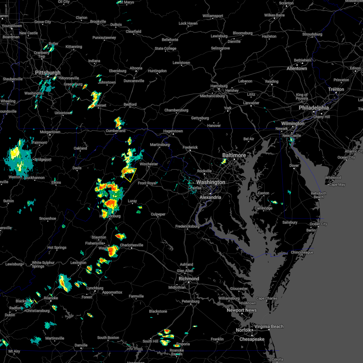 At 233 pm edt, a severe thunderstorm was located over wardensville, or 14 miles northwest of strasburg, moving east at 10 mph (radar indicated). Hazards include 60 mph wind gusts and quarter size hail. Damaging winds will cause some trees and large branches to fall. this could injure those outdoors, as well as damage homes and vehicles. roadways may become blocked by downed trees. localized power outages are possible. unsecured light objects may become projectiles. locations impacted include, wardensville, gravel springs, capon springs and wilde acres. hail threat, radar indicated max hail size, 1. 00 in wind threat, radar indicated max wind gust, 60 mph. At 233 pm edt, a severe thunderstorm was located over wardensville, or 14 miles northwest of strasburg, moving east at 10 mph (radar indicated). Hazards include 60 mph wind gusts and quarter size hail. Damaging winds will cause some trees and large branches to fall. this could injure those outdoors, as well as damage homes and vehicles. roadways may become blocked by downed trees. localized power outages are possible. unsecured light objects may become projectiles. locations impacted include, wardensville, gravel springs, capon springs and wilde acres. hail threat, radar indicated max hail size, 1. 00 in wind threat, radar indicated max wind gust, 60 mph.
|
| 7/17/2022 2:15 PM EDT | Several trees blew down in the area of pine ridge rd and pine ridge extensio in hardy county WV, 4.6 miles ESE of Wardensville, WV |
| 7/17/2022 2:14 PM EDT |
 At 214 pm edt, a severe thunderstorm was located near wardensville, or 16 miles south of romney, moving east at 10 mph (radar indicated). Hazards include 60 mph wind gusts and quarter size hail. Damaging winds will cause some trees and large branches to fall. this could injure those outdoors, as well as damage homes and vehicles. roadways may become blocked by downed trees. localized power outages are possible. Unsecured light objects may become projectiles. At 214 pm edt, a severe thunderstorm was located near wardensville, or 16 miles south of romney, moving east at 10 mph (radar indicated). Hazards include 60 mph wind gusts and quarter size hail. Damaging winds will cause some trees and large branches to fall. this could injure those outdoors, as well as damage homes and vehicles. roadways may become blocked by downed trees. localized power outages are possible. Unsecured light objects may become projectiles.
|
| 7/17/2022 2:14 PM EDT |
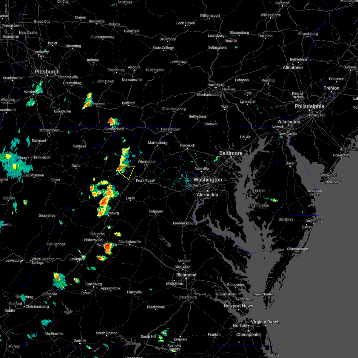 At 214 pm edt, a severe thunderstorm was located near wardensville, or 16 miles south of romney, moving east at 10 mph (radar indicated). Hazards include 60 mph wind gusts and quarter size hail. Damaging winds will cause some trees and large branches to fall. this could injure those outdoors, as well as damage homes and vehicles. roadways may become blocked by downed trees. localized power outages are possible. Unsecured light objects may become projectiles. At 214 pm edt, a severe thunderstorm was located near wardensville, or 16 miles south of romney, moving east at 10 mph (radar indicated). Hazards include 60 mph wind gusts and quarter size hail. Damaging winds will cause some trees and large branches to fall. this could injure those outdoors, as well as damage homes and vehicles. roadways may become blocked by downed trees. localized power outages are possible. Unsecured light objects may become projectiles.
|
| 7/12/2022 4:00 PM EDT | Quarter sized hail reported 3 miles NNW of Wardensville, WV |
| 7/12/2022 3:59 PM EDT | A tree blew down near the 8800 block of back creek r in hampshire county WV, 7 miles SW of Wardensville, WV |
| 7/12/2022 3:58 PM EDT | Multiple trees and large branches snappe in hardy county WV, 0.2 miles WSW of Wardensville, WV |
| 7/12/2022 3:57 PM EDT | Numerous trees down in wardensvill in hardy county WV, 0.2 miles WSW of Wardensville, WV |
| 7/12/2022 3:55 PM EDT | Numerous trees down around capon springs. trees on roadways shut down multiple roads in the are in hampshire county WV, 6.6 miles WSW of Wardensville, WV |
| 7/12/2022 3:54 PM EDT |
 At 352 pm edt, a severe thunderstorm was located near wardensville, or 15 miles southeast of romney, moving east at 55 mph. this is a destructive storm for portions of frederick county, shenandoah county, warren county, and clarke county in va including the city of winchester (radar indicated). Hazards include 80 mph wind gusts and tennis ball size hail. Expect considerable damage to trees and power lines. your life is at significant risk if outdoors. In addition to some trees falling into homes, wind damage is possible to roofs, sheds, open garages, and mobile homes. At 352 pm edt, a severe thunderstorm was located near wardensville, or 15 miles southeast of romney, moving east at 55 mph. this is a destructive storm for portions of frederick county, shenandoah county, warren county, and clarke county in va including the city of winchester (radar indicated). Hazards include 80 mph wind gusts and tennis ball size hail. Expect considerable damage to trees and power lines. your life is at significant risk if outdoors. In addition to some trees falling into homes, wind damage is possible to roofs, sheds, open garages, and mobile homes.
|
| 7/12/2022 3:52 PM EDT | Numerous trees down around delray. trees on roadways shut down multiple roads in the are in hampshire county WV, 7.7 miles S of Wardensville, WV |
| 7/12/2022 3:49 PM EDT | Downed trees damaging a tin she in hardy county WV, 5.8 miles SE of Wardensville, WV |
| 7/12/2022 3:47 PM EDT | A tree blew down near the 730 block of tanager trai in hampshire county WV, 8.7 miles SSE of Wardensville, WV |
| 7/12/2022 3:47 PM EDT | Numerous trees down in ri in hardy county WV, 5.4 miles SE of Wardensville, WV |
| 7/12/2022 3:46 PM EDT |
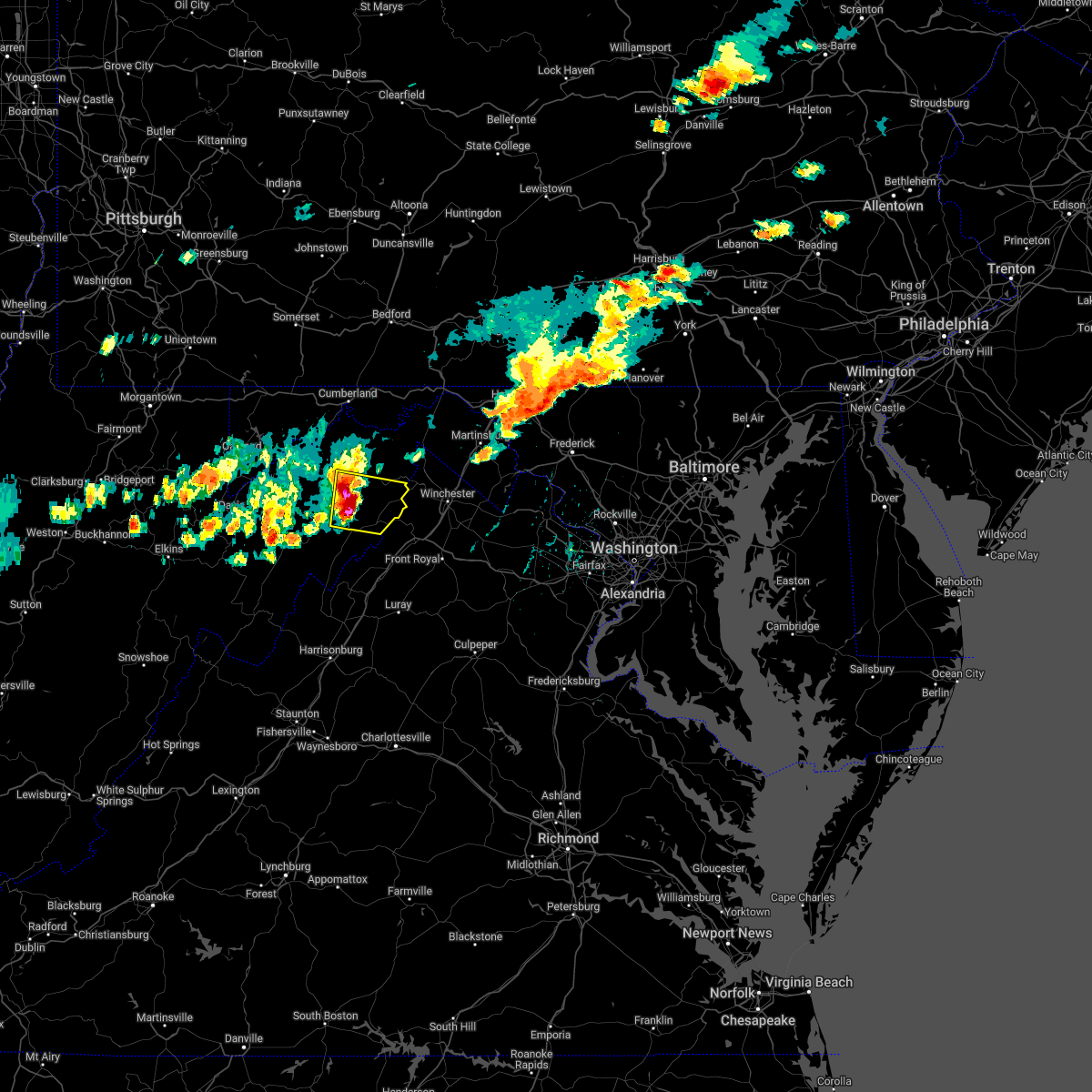 At 345 pm edt, a severe thunderstorm was located 9 miles northwest of wardensville, or 12 miles south of romney, moving east at 50 mph. this is a destructive storm for northern hardy and southern hampshire counties in wv (radar indicated). Hazards include 80 mph wind gusts and tennis ball size hail. Expect considerable damage to trees and power lines. your life is at significant risk if outdoors. in addition to some trees falling into homes, wind damage is possible to roofs, sheds, open garages, and mobile homes. Locations impacted include, wardensville, augusta, bean settlement, yellow spring, delray, inkerman, kirby, rio, capon springs, high view and lehew. At 345 pm edt, a severe thunderstorm was located 9 miles northwest of wardensville, or 12 miles south of romney, moving east at 50 mph. this is a destructive storm for northern hardy and southern hampshire counties in wv (radar indicated). Hazards include 80 mph wind gusts and tennis ball size hail. Expect considerable damage to trees and power lines. your life is at significant risk if outdoors. in addition to some trees falling into homes, wind damage is possible to roofs, sheds, open garages, and mobile homes. Locations impacted include, wardensville, augusta, bean settlement, yellow spring, delray, inkerman, kirby, rio, capon springs, high view and lehew.
|
| 7/12/2022 3:43 PM EDT | A tree blew down near the 12500 block of grassy lick r in hampshire county WV, 9.7 miles SE of Wardensville, WV |
| 7/12/2022 3:36 PM EDT |
 At 335 pm edt, a severe thunderstorm was located 9 miles northeast of moorefield, moving east at 50 mph. this is a destructive storm for northern hardy and southern hampshire county wv (radar indicated). Hazards include 80 mph wind gusts and two inch hail. Expect considerable damage to trees and power lines. your life is at significant risk if outdoors. In addition to some trees falling into homes, wind damage is possible to roofs, sheds, open garages, and mobile homes. At 335 pm edt, a severe thunderstorm was located 9 miles northeast of moorefield, moving east at 50 mph. this is a destructive storm for northern hardy and southern hampshire county wv (radar indicated). Hazards include 80 mph wind gusts and two inch hail. Expect considerable damage to trees and power lines. your life is at significant risk if outdoors. In addition to some trees falling into homes, wind damage is possible to roofs, sheds, open garages, and mobile homes.
|
| 7/1/2022 2:52 PM EDT | Tree and branches down in capon lake near capon springs roa in hampshire county WV, 5.7 miles SSW of Wardensville, WV |
| 8/26/2021 5:30 PM EDT | Tree down along wv-29 sperrys runs roa in hardy county WV, 5.8 miles E of Wardensville, WV |
| 8/13/2021 2:54 PM EDT |
 The severe thunderstorm warning for northeastern shenandoah, southern frederick counties in northwestern virginia and east central hardy counties in eastern west virginia and the city of winchester will expire at 300 pm edt, the storms which prompted the warning have weakened below severe limits, and no longer pose an immediate threat to life or property. therefore, the warning will be allowed to expire. however gusty winds are still possible with these thunderstorms. a severe thunderstorm watch remains in effect until 800 pm edt for northwestern virginia. The severe thunderstorm warning for northeastern shenandoah, southern frederick counties in northwestern virginia and east central hardy counties in eastern west virginia and the city of winchester will expire at 300 pm edt, the storms which prompted the warning have weakened below severe limits, and no longer pose an immediate threat to life or property. therefore, the warning will be allowed to expire. however gusty winds are still possible with these thunderstorms. a severe thunderstorm watch remains in effect until 800 pm edt for northwestern virginia.
|
| 8/13/2021 2:45 PM EDT |
 At 244 pm edt, severe thunderstorms were located along a line extending from 7 miles northeast of winchester to near wardensville, moving southeast at 15 mph (radar indicated). Hazards include 60 mph wind gusts. Damaging winds will cause some trees and large branches to fall. this could injure those outdoors, as well as damage homes and vehicles. roadways may become blocked by downed trees. localized power outages are possible. unsecured light objects may become projectiles. locations impacted include, winchester, millwood pike, stephens city, wardensville, star tannery, stephenson, brucetown, gravel springs, greenwood and clear brook. hail threat, radar indicated max hail size, <. 75 in wind threat, radar indicated max wind gust, 60 mph. At 244 pm edt, severe thunderstorms were located along a line extending from 7 miles northeast of winchester to near wardensville, moving southeast at 15 mph (radar indicated). Hazards include 60 mph wind gusts. Damaging winds will cause some trees and large branches to fall. this could injure those outdoors, as well as damage homes and vehicles. roadways may become blocked by downed trees. localized power outages are possible. unsecured light objects may become projectiles. locations impacted include, winchester, millwood pike, stephens city, wardensville, star tannery, stephenson, brucetown, gravel springs, greenwood and clear brook. hail threat, radar indicated max hail size, <. 75 in wind threat, radar indicated max wind gust, 60 mph.
|
| 8/13/2021 2:40 PM EDT | Trees down on wires on dogwood hollow roa in hardy county WV, 0.2 miles WSW of Wardensville, WV |
| 8/13/2021 2:19 PM EDT | Large tree onto powerlines near intersection of rt. 259 and rt 55 in hardy county WV, 0.2 miles WSW of Wardensville, WV |
| 8/13/2021 2:18 PM EDT |
 At 218 pm edt, severe thunderstorms were located along a line extending from 7 miles north of winchester to near wardensville, moving south at 5 mph (radar indicated). Hazards include 60 mph wind gusts and quarter size hail. Damaging winds will cause some trees and large branches to fall. this could injure those outdoors, as well as damage homes and vehicles. roadways may become blocked by downed trees. localized power outages are possible. Unsecured light objects may become projectiles. At 218 pm edt, severe thunderstorms were located along a line extending from 7 miles north of winchester to near wardensville, moving south at 5 mph (radar indicated). Hazards include 60 mph wind gusts and quarter size hail. Damaging winds will cause some trees and large branches to fall. this could injure those outdoors, as well as damage homes and vehicles. roadways may become blocked by downed trees. localized power outages are possible. Unsecured light objects may become projectiles.
|
| 8/11/2021 3:35 PM EDT |
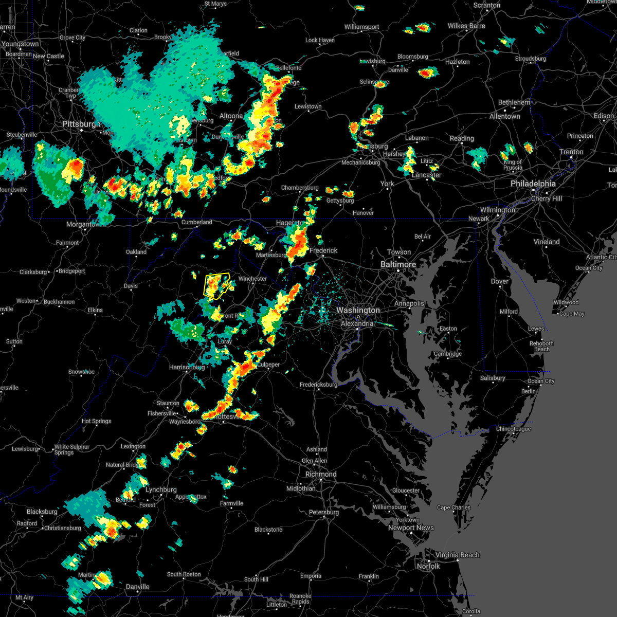 At 335 pm edt, severe thunderstorms were located along a line extending from 12 miles northwest of star tannery to near wardensville, moving east at 20 mph (radar indicated). Hazards include 60 mph wind gusts. Damaging winds will cause some trees and large branches to fall. this could injure those outdoors, as well as damage homes and vehicles. roadways may become blocked by downed trees. localized power outages are possible. unsecured light objects may become projectiles. locations impacted include, wardensville, rio, yellow spring, delray, capon springs and lehew. hail threat, radar indicated max hail size, <. 75 in wind threat, radar indicated max wind gust, 60 mph. At 335 pm edt, severe thunderstorms were located along a line extending from 12 miles northwest of star tannery to near wardensville, moving east at 20 mph (radar indicated). Hazards include 60 mph wind gusts. Damaging winds will cause some trees and large branches to fall. this could injure those outdoors, as well as damage homes and vehicles. roadways may become blocked by downed trees. localized power outages are possible. unsecured light objects may become projectiles. locations impacted include, wardensville, rio, yellow spring, delray, capon springs and lehew. hail threat, radar indicated max hail size, <. 75 in wind threat, radar indicated max wind gust, 60 mph.
|
| 8/11/2021 3:24 PM EDT |
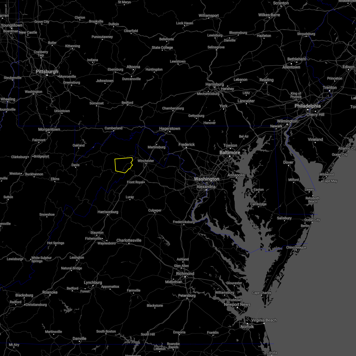 At 324 pm edt, severe thunderstorms were located along a line extending from 10 miles south of romney to near wardensville, moving east at 15 mph (radar indicated). Hazards include 60 mph wind gusts. Damaging winds will cause some trees and large branches to fall. this could injure those outdoors, as well as damage homes and vehicles. roadways may become blocked by downed trees. localized power outages are possible. unsecured light objects may become projectiles. locations impacted include, wardensville, yellow spring, delray, kirby, rio, capon springs and lehew. hail threat, radar indicated max hail size, <. 75 in wind threat, radar indicated max wind gust, 60 mph. At 324 pm edt, severe thunderstorms were located along a line extending from 10 miles south of romney to near wardensville, moving east at 15 mph (radar indicated). Hazards include 60 mph wind gusts. Damaging winds will cause some trees and large branches to fall. this could injure those outdoors, as well as damage homes and vehicles. roadways may become blocked by downed trees. localized power outages are possible. unsecured light objects may become projectiles. locations impacted include, wardensville, yellow spring, delray, kirby, rio, capon springs and lehew. hail threat, radar indicated max hail size, <. 75 in wind threat, radar indicated max wind gust, 60 mph.
|
| 8/11/2021 3:20 PM EDT |
 The severe thunderstorm warning for northwestern shenandoah and central hardy counties will expire at 330 pm edt, the storms which prompted the warning have weakened below severe limits, and have exited the warned area. therefore, the warning will be allowed to expire. a severe thunderstorm watch remains in effect until 900 pm edt for northwestern virginia, and eastern west virginia. to report severe weather, contact your nearest law enforcement agency. they will relay your report to the national weather service sterling virginia. The severe thunderstorm warning for northwestern shenandoah and central hardy counties will expire at 330 pm edt, the storms which prompted the warning have weakened below severe limits, and have exited the warned area. therefore, the warning will be allowed to expire. a severe thunderstorm watch remains in effect until 900 pm edt for northwestern virginia, and eastern west virginia. to report severe weather, contact your nearest law enforcement agency. they will relay your report to the national weather service sterling virginia.
|
| 8/11/2021 3:18 PM EDT |
 At 318 pm edt, severe thunderstorms were located along a line extending from 10 miles south of romney to near wardensville, moving east at 15 mph (radar indicated). Hazards include 60 mph wind gusts. Damaging winds will cause some trees and large branches to fall. this could injure those outdoors, as well as damage homes and vehicles. roadways may become blocked by downed trees. localized power outages are possible. Unsecured light objects may become projectiles. At 318 pm edt, severe thunderstorms were located along a line extending from 10 miles south of romney to near wardensville, moving east at 15 mph (radar indicated). Hazards include 60 mph wind gusts. Damaging winds will cause some trees and large branches to fall. this could injure those outdoors, as well as damage homes and vehicles. roadways may become blocked by downed trees. localized power outages are possible. Unsecured light objects may become projectiles.
|
| 8/11/2021 3:00 PM EDT |
 At 300 pm edt, severe thunderstorms were located along a line extending from near moorefield to near basye-bryce mountain, moving east at 20 mph (radar indicated). Hazards include 60 mph wind gusts. Damaging winds will cause some trees and large branches to fall. this could injure those outdoors, as well as damage homes and vehicles. roadways may become blocked by downed trees. localized power outages are possible. unsecured light objects may become projectiles. locations impacted include, wardensville, basye-bryce mountain, basye, perry, bean settlement, lost city, lost river, baker, harmony, jerome and mccauley. hail threat, radar indicated max hail size, <. 75 in wind threat, radar indicated max wind gust, 60 mph. At 300 pm edt, severe thunderstorms were located along a line extending from near moorefield to near basye-bryce mountain, moving east at 20 mph (radar indicated). Hazards include 60 mph wind gusts. Damaging winds will cause some trees and large branches to fall. this could injure those outdoors, as well as damage homes and vehicles. roadways may become blocked by downed trees. localized power outages are possible. unsecured light objects may become projectiles. locations impacted include, wardensville, basye-bryce mountain, basye, perry, bean settlement, lost city, lost river, baker, harmony, jerome and mccauley. hail threat, radar indicated max hail size, <. 75 in wind threat, radar indicated max wind gust, 60 mph.
|
| 8/11/2021 2:44 PM EDT |
 At 244 pm edt, severe thunderstorms were located along a line extending from near moorefield to mathias, moving east at 20 mph (radar indicated). Hazards include 60 mph wind gusts. Damaging winds will cause some trees and large branches to fall. this could injure those outdoors, as well as damage homes and vehicles. roadways may become blocked by downed trees. localized power outages are possible. Unsecured light objects may become projectiles. At 244 pm edt, severe thunderstorms were located along a line extending from near moorefield to mathias, moving east at 20 mph (radar indicated). Hazards include 60 mph wind gusts. Damaging winds will cause some trees and large branches to fall. this could injure those outdoors, as well as damage homes and vehicles. roadways may become blocked by downed trees. localized power outages are possible. Unsecured light objects may become projectiles.
|
| 11/15/2020 5:00 PM EST |
 At 459 pm est, severe thunderstorms were located along a line extending from near star tannery to wardensville to 10 miles northeast of mathias, moving east at 25 mph (radar indicated). Hazards include 60 mph wind gusts. Damaging winds will cause some trees and large branches to fall. this could injure those outdoors, as well as damage homes and vehicles. roadways may become blocked by downed trees. localized power outages are possible. Unsecured light objects may become projectiles. At 459 pm est, severe thunderstorms were located along a line extending from near star tannery to wardensville to 10 miles northeast of mathias, moving east at 25 mph (radar indicated). Hazards include 60 mph wind gusts. Damaging winds will cause some trees and large branches to fall. this could injure those outdoors, as well as damage homes and vehicles. roadways may become blocked by downed trees. localized power outages are possible. Unsecured light objects may become projectiles.
|
| 8/25/2020 5:55 PM EDT | Multiple reports of trees and wires down across southeastern hampshire county in hampshire county WV, 7.7 miles S of Wardensville, WV |
| 7/22/2020 1:41 PM EDT |
 At 118 pm edt, severe thunderstorms were located along a line extending from near romney to near moorefield, moving east at 25 mph (radar indicated). Hazards include 60 mph wind gusts. Damaging winds will cause some trees and large branches to fall. this could injure those outdoors, as well as damage homes and vehicles. roadways may become blocked by downed trees. localized power outages are possible. Unsecured light objects may become projectiles. At 118 pm edt, severe thunderstorms were located along a line extending from near romney to near moorefield, moving east at 25 mph (radar indicated). Hazards include 60 mph wind gusts. Damaging winds will cause some trees and large branches to fall. this could injure those outdoors, as well as damage homes and vehicles. roadways may become blocked by downed trees. localized power outages are possible. Unsecured light objects may become projectiles.
|
| 7/22/2020 1:41 PM EDT |
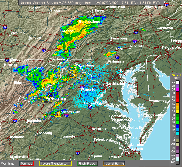 At 140 pm edt, severe thunderstorms were located along a line extending from 9 miles southeast of romney to near wardensville to 12 miles northeast of mathias, moving east at 25 mph (radar indicated). Hazards include 60 mph wind gusts. Damaging winds will cause some trees and large branches to fall. this could injure those outdoors, as well as damage homes and vehicles. roadways may become blocked by downed trees. localized power outages are possible. unsecured light objects may become projectiles. Locations impacted include, wardensville, augusta, yellow spring, delray, baker, rio, capon springs and mccauley. At 140 pm edt, severe thunderstorms were located along a line extending from 9 miles southeast of romney to near wardensville to 12 miles northeast of mathias, moving east at 25 mph (radar indicated). Hazards include 60 mph wind gusts. Damaging winds will cause some trees and large branches to fall. this could injure those outdoors, as well as damage homes and vehicles. roadways may become blocked by downed trees. localized power outages are possible. unsecured light objects may become projectiles. Locations impacted include, wardensville, augusta, yellow spring, delray, baker, rio, capon springs and mccauley.
|
| 7/22/2020 1:18 PM EDT |
 At 118 pm edt, severe thunderstorms were located along a line extending from near romney to near moorefield, moving east at 25 mph (radar indicated). Hazards include 60 mph wind gusts. Damaging winds will cause some trees and large branches to fall. this could injure those outdoors, as well as damage homes and vehicles. roadways may become blocked by downed trees. localized power outages are possible. Unsecured light objects may become projectiles. At 118 pm edt, severe thunderstorms were located along a line extending from near romney to near moorefield, moving east at 25 mph (radar indicated). Hazards include 60 mph wind gusts. Damaging winds will cause some trees and large branches to fall. this could injure those outdoors, as well as damage homes and vehicles. roadways may become blocked by downed trees. localized power outages are possible. Unsecured light objects may become projectiles.
|
| 6/22/2020 4:02 PM EDT |
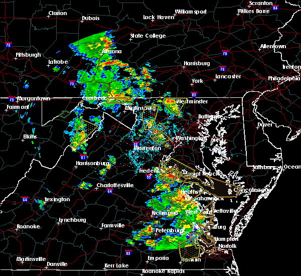 A severe thunderstorm warning remains in effect until 430 pm edt for eastern hardy county. at 401 pm edt, a severe thunderstorm was located 7 miles southwest of wardensville, or 13 miles northwest of woodstock, moving northeast at 25 mph. hazard. 60 mph wind gusts. A severe thunderstorm warning remains in effect until 430 pm edt for eastern hardy county. at 401 pm edt, a severe thunderstorm was located 7 miles southwest of wardensville, or 13 miles northwest of woodstock, moving northeast at 25 mph. hazard. 60 mph wind gusts.
|
| 6/22/2020 3:44 PM EDT |
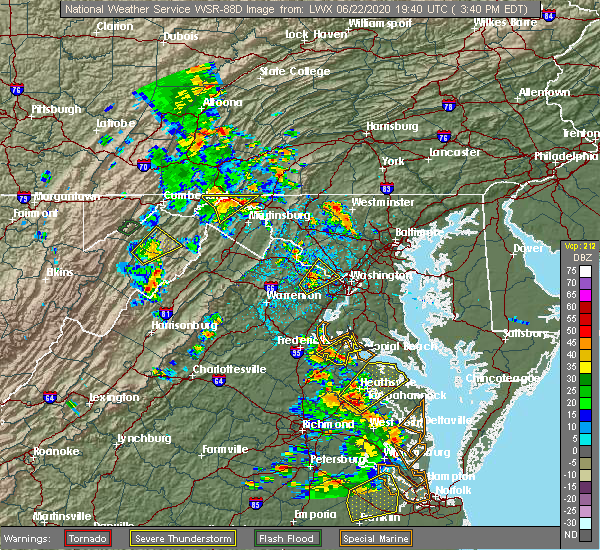 At 344 pm edt, a severe thunderstorm was located 9 miles east of moorefield, moving northeast at 25 mph (radar indicated). Hazards include 60 mph wind gusts and quarter size hail. Damaging winds will cause some trees and large branches to fall. this could injure those outdoors, as well as damage homes and vehicles. roadways may become blocked by downed trees. localized power outages are possible. Unsecured light objects may become projectiles. At 344 pm edt, a severe thunderstorm was located 9 miles east of moorefield, moving northeast at 25 mph (radar indicated). Hazards include 60 mph wind gusts and quarter size hail. Damaging winds will cause some trees and large branches to fall. this could injure those outdoors, as well as damage homes and vehicles. roadways may become blocked by downed trees. localized power outages are possible. Unsecured light objects may become projectiles.
|
| 6/22/2020 2:45 PM EDT |
 At 245 pm edt, a severe thunderstorm was located near wardensville, or 9 miles north of woodstock, moving northeast at 20 mph (radar indicated). Hazards include 60 mph wind gusts and quarter size hail. Damaging winds will cause some trees and large branches to fall. this could injure those outdoors, as well as damage homes and vehicles. roadways may become blocked by downed trees. localized power outages are possible. unsecured light objects may become projectiles. Locations impacted include, strasburg, wardensville, star tannery, middletown, maurertown, toms brook, gravel springs, yellow spring, wilde acres, alonzaville, perry, fishers hill, clary, capon springs and lehew. At 245 pm edt, a severe thunderstorm was located near wardensville, or 9 miles north of woodstock, moving northeast at 20 mph (radar indicated). Hazards include 60 mph wind gusts and quarter size hail. Damaging winds will cause some trees and large branches to fall. this could injure those outdoors, as well as damage homes and vehicles. roadways may become blocked by downed trees. localized power outages are possible. unsecured light objects may become projectiles. Locations impacted include, strasburg, wardensville, star tannery, middletown, maurertown, toms brook, gravel springs, yellow spring, wilde acres, alonzaville, perry, fishers hill, clary, capon springs and lehew.
|
| 6/22/2020 2:30 PM EDT |
 At 229 pm edt, a severe thunderstorm was located 8 miles southwest of wardensville, or 9 miles northwest of woodstock, moving northeast at 20 mph (radar indicated). Hazards include 60 mph wind gusts and quarter size hail. Damaging winds will cause some trees and large branches to fall. this could injure those outdoors, as well as damage homes and vehicles. roadways may become blocked by downed trees. localized power outages are possible. Unsecured light objects may become projectiles. At 229 pm edt, a severe thunderstorm was located 8 miles southwest of wardensville, or 9 miles northwest of woodstock, moving northeast at 20 mph (radar indicated). Hazards include 60 mph wind gusts and quarter size hail. Damaging winds will cause some trees and large branches to fall. this could injure those outdoors, as well as damage homes and vehicles. roadways may become blocked by downed trees. localized power outages are possible. Unsecured light objects may become projectiles.
|
| 4/13/2020 12:27 PM EDT |
 At 1227 pm edt, severe thunderstorms were located along a line extending from 7 miles southwest of greenwood to wardensville, moving east at 40 mph (radar indicated). Hazards include 60 mph wind gusts. Damaging winds will cause some trees and large branches to fall. this could injure those outdoors, as well as damage homes and vehicles. roadways may become blocked by downed trees. localized power outages are possible. Unsecured light objects may become projectiles. At 1227 pm edt, severe thunderstorms were located along a line extending from 7 miles southwest of greenwood to wardensville, moving east at 40 mph (radar indicated). Hazards include 60 mph wind gusts. Damaging winds will cause some trees and large branches to fall. this could injure those outdoors, as well as damage homes and vehicles. roadways may become blocked by downed trees. localized power outages are possible. Unsecured light objects may become projectiles.
|
| 3/3/2020 10:47 PM EST |
 At 1047 pm est, severe thunderstorms were located along a line extending from near wardensville to 7 miles south of rough run, moving southeast at 45 mph (trained weather spotters). Hazards include 60 mph wind gusts. Damaging winds will cause some trees and large branches to fall. this could injure those outdoors, as well as damage homes and vehicles. roadways may become blocked by downed trees. localized power outages are possible. unsecured light objects may become projectiles. Locations impacted include, winchester, front royal, strasburg, woodstock, millwood pike, berryville, broadway, timberville, mount jackson, stephens city, wardensville, basye-bryce mountain, mathias, star tannery, new market, middletown, basye, edinburg, maurertown and boyce. At 1047 pm est, severe thunderstorms were located along a line extending from near wardensville to 7 miles south of rough run, moving southeast at 45 mph (trained weather spotters). Hazards include 60 mph wind gusts. Damaging winds will cause some trees and large branches to fall. this could injure those outdoors, as well as damage homes and vehicles. roadways may become blocked by downed trees. localized power outages are possible. unsecured light objects may become projectiles. Locations impacted include, winchester, front royal, strasburg, woodstock, millwood pike, berryville, broadway, timberville, mount jackson, stephens city, wardensville, basye-bryce mountain, mathias, star tannery, new market, middletown, basye, edinburg, maurertown and boyce.
|
| 3/3/2020 10:28 PM EST |
 At 1028 pm est, severe thunderstorms were located along a line extending from 11 miles southwest of romney to 6 miles north of upper tract, moving southeast at 45 mph (trained weather spotters). Hazards include 60 mph wind gusts. Damaging winds will cause some trees and large branches to fall. this could injure those outdoors, as well as damage homes and vehicles. roadways may become blocked by downed trees. localized power outages are possible. Unsecured light objects may become projectiles. At 1028 pm est, severe thunderstorms were located along a line extending from 11 miles southwest of romney to 6 miles north of upper tract, moving southeast at 45 mph (trained weather spotters). Hazards include 60 mph wind gusts. Damaging winds will cause some trees and large branches to fall. this could injure those outdoors, as well as damage homes and vehicles. roadways may become blocked by downed trees. localized power outages are possible. Unsecured light objects may become projectiles.
|
| 8/18/2019 6:50 PM EDT |
 At 615 pm edt, a severe thunderstorm was located near moorefield, moving east at 15 mph (radar indicated). Hazards include 60 mph wind gusts and half dollar size hail. Damaging winds will cause some trees and large branches to fall. this could injure those outdoors, as well as damage homes and vehicles. roadways may become blocked by downed trees. localized power outages are possible. Unsecured light objects may become projectiles. At 615 pm edt, a severe thunderstorm was located near moorefield, moving east at 15 mph (radar indicated). Hazards include 60 mph wind gusts and half dollar size hail. Damaging winds will cause some trees and large branches to fall. this could injure those outdoors, as well as damage homes and vehicles. roadways may become blocked by downed trees. localized power outages are possible. Unsecured light objects may become projectiles.
|
| 8/18/2019 6:50 PM EDT |
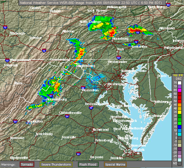 At 615 pm edt, a severe thunderstorm was located near moorefield, moving east at 15 mph (radar indicated). Hazards include 60 mph wind gusts and half dollar size hail. Damaging winds will cause some trees and large branches to fall. this could injure those outdoors, as well as damage homes and vehicles. roadways may become blocked by downed trees. localized power outages are possible. Unsecured light objects may become projectiles. At 615 pm edt, a severe thunderstorm was located near moorefield, moving east at 15 mph (radar indicated). Hazards include 60 mph wind gusts and half dollar size hail. Damaging winds will cause some trees and large branches to fall. this could injure those outdoors, as well as damage homes and vehicles. roadways may become blocked by downed trees. localized power outages are possible. Unsecured light objects may become projectiles.
|
| 8/18/2019 6:16 PM EDT |
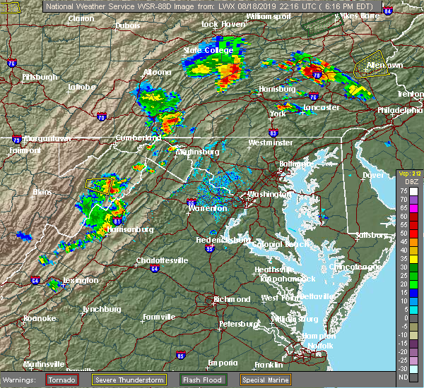 At 615 pm edt, a severe thunderstorm was located near moorefield, moving east at 15 mph (radar indicated). Hazards include 60 mph wind gusts and half dollar size hail. Damaging winds will cause some trees and large branches to fall. this could injure those outdoors, as well as damage homes and vehicles. roadways may become blocked by downed trees. localized power outages are possible. Unsecured light objects may become projectiles. At 615 pm edt, a severe thunderstorm was located near moorefield, moving east at 15 mph (radar indicated). Hazards include 60 mph wind gusts and half dollar size hail. Damaging winds will cause some trees and large branches to fall. this could injure those outdoors, as well as damage homes and vehicles. roadways may become blocked by downed trees. localized power outages are possible. Unsecured light objects may become projectiles.
|
| 7/5/2019 4:44 PM EDT |
 At 443 pm edt, a severe thunderstorm was located near wardensville, or 14 miles northwest of strasburg, moving northeast at 20 mph (radar indicated). Hazards include 60 mph wind gusts. Damaging winds will cause some trees and large branches to fall. this could injure those outdoors, as well as damage homes and vehicles. roadways may become blocked by downed trees. localized power outages are possible. unsecured light objects may become projectiles. Locations impacted include, wardensville, yellow spring, capon springs and lehew. At 443 pm edt, a severe thunderstorm was located near wardensville, or 14 miles northwest of strasburg, moving northeast at 20 mph (radar indicated). Hazards include 60 mph wind gusts. Damaging winds will cause some trees and large branches to fall. this could injure those outdoors, as well as damage homes and vehicles. roadways may become blocked by downed trees. localized power outages are possible. unsecured light objects may become projectiles. Locations impacted include, wardensville, yellow spring, capon springs and lehew.
|
| 7/5/2019 4:44 PM EDT |
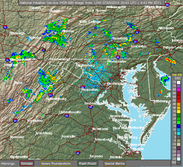 At 443 pm edt, a severe thunderstorm was located near wardensville, or 14 miles northwest of strasburg, moving northeast at 20 mph (radar indicated). Hazards include 60 mph wind gusts. Damaging winds will cause some trees and large branches to fall. this could injure those outdoors, as well as damage homes and vehicles. roadways may become blocked by downed trees. localized power outages are possible. unsecured light objects may become projectiles. Locations impacted include, wardensville, yellow spring, capon springs and lehew. At 443 pm edt, a severe thunderstorm was located near wardensville, or 14 miles northwest of strasburg, moving northeast at 20 mph (radar indicated). Hazards include 60 mph wind gusts. Damaging winds will cause some trees and large branches to fall. this could injure those outdoors, as well as damage homes and vehicles. roadways may become blocked by downed trees. localized power outages are possible. unsecured light objects may become projectiles. Locations impacted include, wardensville, yellow spring, capon springs and lehew.
|
| 7/5/2019 4:28 PM EDT |
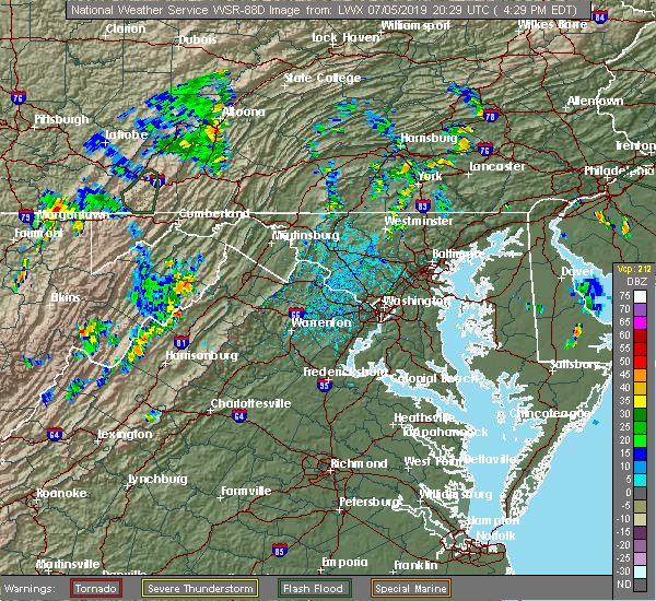 At 428 pm edt, a severe thunderstorm was located near wardensville, or 16 miles east of moorefield, moving east at 10 mph (radar indicated). Hazards include 60 mph wind gusts and quarter size hail. Damaging winds will cause some trees and large branches to fall. this could injure those outdoors, as well as damage homes and vehicles. roadways may become blocked by downed trees. localized power outages are possible. Unsecured light objects may become projectiles. At 428 pm edt, a severe thunderstorm was located near wardensville, or 16 miles east of moorefield, moving east at 10 mph (radar indicated). Hazards include 60 mph wind gusts and quarter size hail. Damaging winds will cause some trees and large branches to fall. this could injure those outdoors, as well as damage homes and vehicles. roadways may become blocked by downed trees. localized power outages are possible. Unsecured light objects may become projectiles.
|
| 5/25/2019 5:21 PM EDT |
 At 521 pm edt, severe thunderstorms were located along a line extending from near star tannery to near wardensville, moving east at 25 mph (radar indicated). Hazards include 60 mph wind gusts and quarter size hail. Damaging winds will cause some trees and large branches to fall. this could injure those outdoors, as well as damage homes and vehicles. roadways may become blocked by downed trees. localized power outages are possible. Unsecured light objects may become projectiles. At 521 pm edt, severe thunderstorms were located along a line extending from near star tannery to near wardensville, moving east at 25 mph (radar indicated). Hazards include 60 mph wind gusts and quarter size hail. Damaging winds will cause some trees and large branches to fall. this could injure those outdoors, as well as damage homes and vehicles. roadways may become blocked by downed trees. localized power outages are possible. Unsecured light objects may become projectiles.
|
| 4/19/2019 5:37 PM EDT |
 The severe thunderstorm warning for northwestern shenandoah, northwestern rockingham and central hardy counties will expire at 545 pm edt, the storm which prompted the warning has weakened below severe limits, and no longer poses an immediate threat to life or property. therefore, the warning will be allowed to expire. a tornado watch remains in effect until midnight edt for western and northwestern virginia, and eastern west virginia. The severe thunderstorm warning for northwestern shenandoah, northwestern rockingham and central hardy counties will expire at 545 pm edt, the storm which prompted the warning has weakened below severe limits, and no longer poses an immediate threat to life or property. therefore, the warning will be allowed to expire. a tornado watch remains in effect until midnight edt for western and northwestern virginia, and eastern west virginia.
|
| 4/19/2019 5:14 PM EDT |
 At 514 pm edt, a severe thunderstorm was located near mathias, or 10 miles east of rough run, moving northeast at 45 mph (radar indicated). Hazards include 60 mph wind gusts. Damaging winds will cause some trees and large branches to fall. this could injure those outdoors, as well as damage homes and vehicles. roadways may become blocked by downed trees. localized power outages are possible. unsecured light objects may become projectiles. Locations impacted include, wardensville, basye-bryce mountain, mathias, basye, orkney springs, yankeetown, bergton, perry, lost city, lost river, baker, jerome, criders and mccauley. At 514 pm edt, a severe thunderstorm was located near mathias, or 10 miles east of rough run, moving northeast at 45 mph (radar indicated). Hazards include 60 mph wind gusts. Damaging winds will cause some trees and large branches to fall. this could injure those outdoors, as well as damage homes and vehicles. roadways may become blocked by downed trees. localized power outages are possible. unsecured light objects may become projectiles. Locations impacted include, wardensville, basye-bryce mountain, mathias, basye, orkney springs, yankeetown, bergton, perry, lost city, lost river, baker, jerome, criders and mccauley.
|
| 4/19/2019 4:52 PM EDT |
 At 452 pm edt, a severe thunderstorm was located 8 miles northeast of brandywine, or 12 miles east of franklin, moving northeast at 45 mph (radar indicated). Hazards include 60 mph wind gusts. Damaging winds will cause some trees and large branches to fall. this could injure those outdoors, as well as damage homes and vehicles. roadways may become blocked by downed trees. localized power outages are possible. Unsecured light objects may become projectiles. At 452 pm edt, a severe thunderstorm was located 8 miles northeast of brandywine, or 12 miles east of franklin, moving northeast at 45 mph (radar indicated). Hazards include 60 mph wind gusts. Damaging winds will cause some trees and large branches to fall. this could injure those outdoors, as well as damage homes and vehicles. roadways may become blocked by downed trees. localized power outages are possible. Unsecured light objects may become projectiles.
|
| 4/14/2019 11:47 PM EDT |
 At 1146 pm edt, severe thunderstorms were located along a line extending from 7 miles west of wardensville to 7 miles west of broadway, moving east at 40 mph (radar indicated). Hazards include 60 mph wind gusts. Damaging winds will cause some trees and large branches to fall. this could injure those outdoors, as well as damage homes and vehicles. roadways may become blocked by downed trees. localized power outages are possible. unsecured light objects may become projectiles. Locations impacted include, broadway, wardensville, basye-bryce mountain, mathias, basye, tunis, orkney springs, harmony, yankeetown, cherry grove, alonzaville, singers glen, fulks run, bergton, perry, lost city, lost river, forestville, baker and mount clifton. At 1146 pm edt, severe thunderstorms were located along a line extending from 7 miles west of wardensville to 7 miles west of broadway, moving east at 40 mph (radar indicated). Hazards include 60 mph wind gusts. Damaging winds will cause some trees and large branches to fall. this could injure those outdoors, as well as damage homes and vehicles. roadways may become blocked by downed trees. localized power outages are possible. unsecured light objects may become projectiles. Locations impacted include, broadway, wardensville, basye-bryce mountain, mathias, basye, tunis, orkney springs, harmony, yankeetown, cherry grove, alonzaville, singers glen, fulks run, bergton, perry, lost city, lost river, forestville, baker and mount clifton.
|
| 4/14/2019 11:37 PM EDT |
 At 1136 pm edt, severe thunderstorms were located along a line extending from 8 miles west of wardensville to near bridgewater, moving east at 40 mph (radar indicated). Hazards include 60 mph wind gusts. Damaging winds will cause some trees and large branches to fall. this could injure those outdoors, as well as damage homes and vehicles. roadways may become blocked by downed trees. localized power outages are possible. unsecured light objects may become projectiles. Locations impacted include, broadway, wardensville, basye-bryce mountain, mathias, basye, tunis, yankeetown, alonzaville, bergton, perry, lost city, lost river, clover hill, baker, hinton, mccauley, orkney springs, harmony, cherry grove and singers glen. At 1136 pm edt, severe thunderstorms were located along a line extending from 8 miles west of wardensville to near bridgewater, moving east at 40 mph (radar indicated). Hazards include 60 mph wind gusts. Damaging winds will cause some trees and large branches to fall. this could injure those outdoors, as well as damage homes and vehicles. roadways may become blocked by downed trees. localized power outages are possible. unsecured light objects may become projectiles. Locations impacted include, broadway, wardensville, basye-bryce mountain, mathias, basye, tunis, yankeetown, alonzaville, bergton, perry, lost city, lost river, clover hill, baker, hinton, mccauley, orkney springs, harmony, cherry grove and singers glen.
|
| 4/14/2019 11:08 PM EDT |
 At 1107 pm edt, severe thunderstorms were located along a line extending from near petersburg to 13 miles southeast of monterey, moving east at 50 mph (radar indicated). Hazards include 60 mph wind gusts. Damaging winds will cause some trees and large branches to fall. this could injure those outdoors, as well as damage homes and vehicles. roadways may become blocked by downed trees. localized power outages are possible. Unsecured light objects may become projectiles. At 1107 pm edt, severe thunderstorms were located along a line extending from near petersburg to 13 miles southeast of monterey, moving east at 50 mph (radar indicated). Hazards include 60 mph wind gusts. Damaging winds will cause some trees and large branches to fall. this could injure those outdoors, as well as damage homes and vehicles. roadways may become blocked by downed trees. localized power outages are possible. Unsecured light objects may become projectiles.
|
| 8/21/2018 8:02 PM EDT |
 At 802 pm edt, severe thunderstorms were located along a line extending from 9 miles southwest of paw paw to near wardensville, moving east at 30 mph (radar indicated). Hazards include 60 mph wind gusts. Damaging winds will cause some trees and large branches to fall. this could injure those outdoors, as well as damage homes and vehicles. roadways may become blocked by downed trees. localized power outages are possible. Unsecured light objects may become projectiles. At 802 pm edt, severe thunderstorms were located along a line extending from 9 miles southwest of paw paw to near wardensville, moving east at 30 mph (radar indicated). Hazards include 60 mph wind gusts. Damaging winds will cause some trees and large branches to fall. this could injure those outdoors, as well as damage homes and vehicles. roadways may become blocked by downed trees. localized power outages are possible. Unsecured light objects may become projectiles.
|
| 8/21/2018 8:02 PM EDT |
 The national weather service in sterling virginia has issued a * severe thunderstorm warning for. north central shenandoah county in northwestern virginia. frederick county in northwestern virginia. the northwestern city of winchester in northwestern virginia. Southern morgan county in the panhandle of west virginia. The national weather service in sterling virginia has issued a * severe thunderstorm warning for. north central shenandoah county in northwestern virginia. frederick county in northwestern virginia. the northwestern city of winchester in northwestern virginia. Southern morgan county in the panhandle of west virginia.
|
| 8/17/2018 3:56 PM EDT |
 At 356 pm edt, severe thunderstorms were located along a line extending from 11 miles southeast of romney to 8 miles southwest of wardensville, moving northeast at 40 mph (radar indicated). Hazards include 60 mph wind gusts. Damaging winds will cause some trees and large branches to fall. this could injure those outdoors, as well as damage homes and vehicles. roadways may become blocked by downed trees. localized power outages are possible. unsecured light objects may become projectiles. Locations impacted include, wardensville, perry, lost river, baker, inkerman, mccauley and lost city. At 356 pm edt, severe thunderstorms were located along a line extending from 11 miles southeast of romney to 8 miles southwest of wardensville, moving northeast at 40 mph (radar indicated). Hazards include 60 mph wind gusts. Damaging winds will cause some trees and large branches to fall. this could injure those outdoors, as well as damage homes and vehicles. roadways may become blocked by downed trees. localized power outages are possible. unsecured light objects may become projectiles. Locations impacted include, wardensville, perry, lost river, baker, inkerman, mccauley and lost city.
|
| 8/17/2018 3:37 PM EDT |
 At 337 pm edt, severe thunderstorms were located along a line extending from 10 miles northeast of moorefield to near mathias, moving northeast at 40 mph (radar indicated). Hazards include 60 mph wind gusts. Damaging winds will cause some trees and large branches to fall. this could injure those outdoors, as well as damage homes and vehicles. roadways may become blocked by downed trees. localized power outages are possible. unsecured light objects may become projectiles. Locations impacted include, moorefield, wardensville, mcneill, perry, bean settlement, lost city, lost river, baker, inkerman and mccauley. At 337 pm edt, severe thunderstorms were located along a line extending from 10 miles northeast of moorefield to near mathias, moving northeast at 40 mph (radar indicated). Hazards include 60 mph wind gusts. Damaging winds will cause some trees and large branches to fall. this could injure those outdoors, as well as damage homes and vehicles. roadways may become blocked by downed trees. localized power outages are possible. unsecured light objects may become projectiles. Locations impacted include, moorefield, wardensville, mcneill, perry, bean settlement, lost city, lost river, baker, inkerman and mccauley.
|
| 8/17/2018 3:26 PM EDT |
 At 326 pm edt, severe thunderstorms were located along a line extending from near moorefield to 6 miles west of mathias, moving northeast at 40 mph (radar indicated). Hazards include 60 mph wind gusts. Damaging winds will cause some trees and large branches to fall. this could injure those outdoors, as well as damage homes and vehicles. roadways may become blocked by downed trees. localized power outages are possible. Unsecured light objects may become projectiles. At 326 pm edt, severe thunderstorms were located along a line extending from near moorefield to 6 miles west of mathias, moving northeast at 40 mph (radar indicated). Hazards include 60 mph wind gusts. Damaging winds will cause some trees and large branches to fall. this could injure those outdoors, as well as damage homes and vehicles. roadways may become blocked by downed trees. localized power outages are possible. Unsecured light objects may become projectiles.
|
| 8/17/2018 2:06 PM EDT |
 At 206 pm edt, a severe thunderstorm was located near wardensville, or 16 miles northwest of strasburg, moving east at 25 mph (radar indicated). Hazards include 60 mph wind gusts. Damaging winds will cause some trees and large branches to fall. this could injure those outdoors, as well as damage homes and vehicles. roadways may become blocked by downed trees. localized power outages are possible. Unsecured light objects may become projectiles. At 206 pm edt, a severe thunderstorm was located near wardensville, or 16 miles northwest of strasburg, moving east at 25 mph (radar indicated). Hazards include 60 mph wind gusts. Damaging winds will cause some trees and large branches to fall. this could injure those outdoors, as well as damage homes and vehicles. roadways may become blocked by downed trees. localized power outages are possible. Unsecured light objects may become projectiles.
|
| 5/27/2018 6:21 PM EDT |
 The severe thunderstorm warning for northeastern hardy and southwestern hampshire counties will expire at 630 pm edt, the storm which prompted the warning has weakened below severe limits, and no longer pose an immediate threat to life or property. therefore the warning will be allowed to expire. however gusty winds are still possible with this thunderstorm. The severe thunderstorm warning for northeastern hardy and southwestern hampshire counties will expire at 630 pm edt, the storm which prompted the warning has weakened below severe limits, and no longer pose an immediate threat to life or property. therefore the warning will be allowed to expire. however gusty winds are still possible with this thunderstorm.
|
| 5/27/2018 6:20 PM EDT |
 The tornado warning for northeastern hardy county will expire at 630 pm edt, the storm which prompted the warning has weakened below severe limits, and no longer appears capable of producing a tornado. therefore the warning will be allowed to expire. however gusty winds are still possible with this thunderstorm. The tornado warning for northeastern hardy county will expire at 630 pm edt, the storm which prompted the warning has weakened below severe limits, and no longer appears capable of producing a tornado. therefore the warning will be allowed to expire. however gusty winds are still possible with this thunderstorm.
|
| 5/27/2018 6:16 PM EDT |
 At 615 pm edt, a severe thunderstorm capable of producing a tornado was located 9 miles east of moorefield, moving southeast at 15 mph (radar indicated rotation). Hazards include tornado and quarter size hail. For those in the direct path of a tornado touchdown, flying debris will be dangerous to those caught without shelter. damage to roofs, siding, and windows may occur. mobile homes may be damaged or destroyed. tree damage is likely. This tornadic thunderstorm will remain over mainly rural areas of northeastern hardy county, including the following locations, inkerman, perry, bean settlement, baker and mccauley. At 615 pm edt, a severe thunderstorm capable of producing a tornado was located 9 miles east of moorefield, moving southeast at 15 mph (radar indicated rotation). Hazards include tornado and quarter size hail. For those in the direct path of a tornado touchdown, flying debris will be dangerous to those caught without shelter. damage to roofs, siding, and windows may occur. mobile homes may be damaged or destroyed. tree damage is likely. This tornadic thunderstorm will remain over mainly rural areas of northeastern hardy county, including the following locations, inkerman, perry, bean settlement, baker and mccauley.
|
| 5/27/2018 6:05 PM EDT |
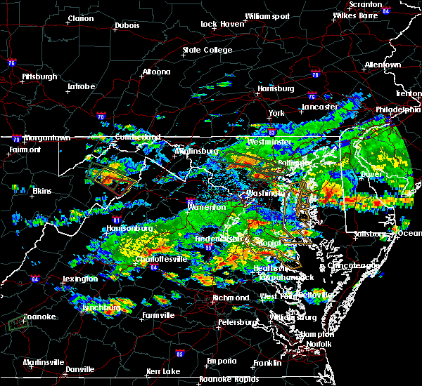 The national weather service in sterling virginia has issued a * tornado warning for. northeastern hardy county in eastern west virginia. south central hampshire county in eastern west virginia. until 630 pm edt. At 604 pm edt, a severe thunderstorm capable of producing a tornado. The national weather service in sterling virginia has issued a * tornado warning for. northeastern hardy county in eastern west virginia. south central hampshire county in eastern west virginia. until 630 pm edt. At 604 pm edt, a severe thunderstorm capable of producing a tornado.
|
| 5/27/2018 5:52 PM EDT |
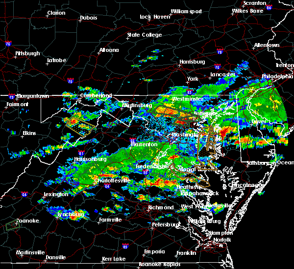 At 552 pm edt, a severe thunderstorm was located 9 miles northeast of moorefield, moving southeast at 20 mph (radar indicated). Hazards include 60 mph wind gusts and quarter size hail. Damaging winds will cause some trees and large branches to fall. this could injure those outdoors, as well as damage homes and vehicles. roadways may become blocked by downed trees. localized power outages are possible. Unsecured light objects may become projectiles. At 552 pm edt, a severe thunderstorm was located 9 miles northeast of moorefield, moving southeast at 20 mph (radar indicated). Hazards include 60 mph wind gusts and quarter size hail. Damaging winds will cause some trees and large branches to fall. this could injure those outdoors, as well as damage homes and vehicles. roadways may become blocked by downed trees. localized power outages are possible. Unsecured light objects may become projectiles.
|
| 5/14/2018 4:51 PM EDT |
 At 451 pm edt, severe thunderstorms were located along a line extending from near martinsburg to near wardensville, moving southeast at 40 mph (radar indicated). Hazards include 70 mph wind gusts and quarter size hail. Damaging winds will cause some trees and large branches to fall. this could injure those outdoors, as well as damage homes and vehicles. roadways may become blocked by downed trees. localized power outages are possible. Unsecured light objects may become projectiles. At 451 pm edt, severe thunderstorms were located along a line extending from near martinsburg to near wardensville, moving southeast at 40 mph (radar indicated). Hazards include 70 mph wind gusts and quarter size hail. Damaging winds will cause some trees and large branches to fall. this could injure those outdoors, as well as damage homes and vehicles. roadways may become blocked by downed trees. localized power outages are possible. Unsecured light objects may become projectiles.
|
| 9/5/2017 3:21 PM EDT |
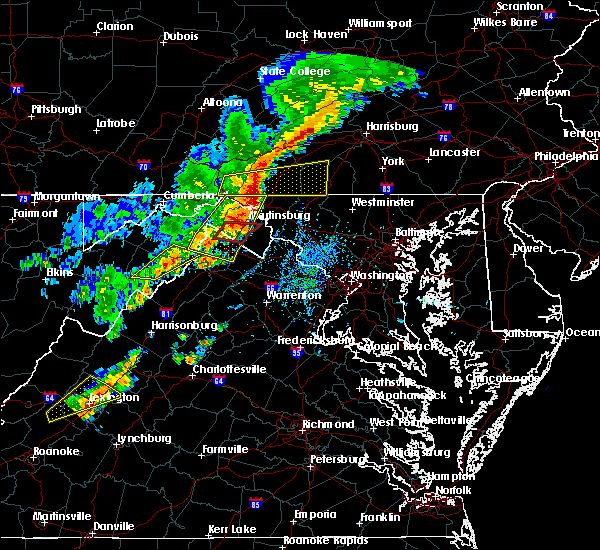 The severe thunderstorm warning for central frederick county in northwestern virginia, central hardy and southeastern hampshire counties in eastern west virginia will expire at 330 pm edt, the storms which prompted the warning have weakened below severe limits, and no longer pose an immediate threat to life or property. therefore the warning will be allowed to expire. The severe thunderstorm warning for central frederick county in northwestern virginia, central hardy and southeastern hampshire counties in eastern west virginia will expire at 330 pm edt, the storms which prompted the warning have weakened below severe limits, and no longer pose an immediate threat to life or property. therefore the warning will be allowed to expire.
|
| 9/5/2017 3:09 PM EDT |
 At 308 pm edt, severe thunderstorms were located along a line extending from 13 miles east of romney to near moorefield, moving east at 25 mph (radar indicated). Hazards include 60 mph wind gusts. Damaging winds will cause some trees and large branches to fall. this could injure those outdoors, as well as damage homes and vehicles. roadways may become blocked by downed trees. localized power outages are possible. unsecured light objects may become projectiles. Locations impacted include, wardensville, bean settlement, yellow spring, delray, baker, inkerman, kirby, rio, capon springs and mccauley. At 308 pm edt, severe thunderstorms were located along a line extending from 13 miles east of romney to near moorefield, moving east at 25 mph (radar indicated). Hazards include 60 mph wind gusts. Damaging winds will cause some trees and large branches to fall. this could injure those outdoors, as well as damage homes and vehicles. roadways may become blocked by downed trees. localized power outages are possible. unsecured light objects may become projectiles. Locations impacted include, wardensville, bean settlement, yellow spring, delray, baker, inkerman, kirby, rio, capon springs and mccauley.
|
| 9/5/2017 3:09 PM EDT |
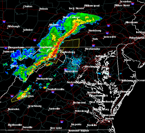 At 308 pm edt, severe thunderstorms were located along a line extending from 13 miles east of romney to near moorefield, moving east at 25 mph (radar indicated). Hazards include 60 mph wind gusts. Damaging winds will cause some trees and large branches to fall. this could injure those outdoors, as well as damage homes and vehicles. roadways may become blocked by downed trees. localized power outages are possible. unsecured light objects may become projectiles. Locations impacted include, wardensville, bean settlement, yellow spring, delray, baker, inkerman, kirby, rio, capon springs and mccauley. At 308 pm edt, severe thunderstorms were located along a line extending from 13 miles east of romney to near moorefield, moving east at 25 mph (radar indicated). Hazards include 60 mph wind gusts. Damaging winds will cause some trees and large branches to fall. this could injure those outdoors, as well as damage homes and vehicles. roadways may become blocked by downed trees. localized power outages are possible. unsecured light objects may become projectiles. Locations impacted include, wardensville, bean settlement, yellow spring, delray, baker, inkerman, kirby, rio, capon springs and mccauley.
|
| 9/5/2017 2:43 PM EDT |
 At 243 pm edt, severe thunderstorms were located along a line extending from 8 miles southeast of romney to near rough run, moving east at 20 mph (radar indicated). Hazards include 60 mph wind gusts. Damaging winds will cause some trees and large branches to fall. this could injure those outdoors, as well as damage homes and vehicles. roadways may become blocked by downed trees. localized power outages are possible. Unsecured light objects may become projectiles. At 243 pm edt, severe thunderstorms were located along a line extending from 8 miles southeast of romney to near rough run, moving east at 20 mph (radar indicated). Hazards include 60 mph wind gusts. Damaging winds will cause some trees and large branches to fall. this could injure those outdoors, as well as damage homes and vehicles. roadways may become blocked by downed trees. localized power outages are possible. Unsecured light objects may become projectiles.
|
| 3/1/2017 12:30 PM EST |
 At 1230 pm est, severe thunderstorms were located along a line extending from near berkeley springs to near wardensville, moving east at 60 mph (radar indicated). Hazards include 60 mph wind gusts. Damaging winds will cause some trees and large branches to fall. this could injure those outdoors, as well as damage homes and vehicles. roadways may become blocked by downed trees. localized power outages are possible. unsecured light objects may become projectiles. Locations impacted include, winchester, martinsburg, strasburg, hancock, paw paw, millwood pike, inwood, stephens city, berkeley springs, wardensville, star tannery, middletown, great cacapon, clear spring, capon bridge, hedgesville, pecktonville, big spring, big pool and little orleans. At 1230 pm est, severe thunderstorms were located along a line extending from near berkeley springs to near wardensville, moving east at 60 mph (radar indicated). Hazards include 60 mph wind gusts. Damaging winds will cause some trees and large branches to fall. this could injure those outdoors, as well as damage homes and vehicles. roadways may become blocked by downed trees. localized power outages are possible. unsecured light objects may become projectiles. Locations impacted include, winchester, martinsburg, strasburg, hancock, paw paw, millwood pike, inwood, stephens city, berkeley springs, wardensville, star tannery, middletown, great cacapon, clear spring, capon bridge, hedgesville, pecktonville, big spring, big pool and little orleans.
|
| 3/1/2017 12:12 PM EST |
 At 1212 pm est, severe thunderstorms were located along a line extending from 8 miles northeast of lake gordon to 7 miles west of wardensville, moving east at 50 mph (radar indicated). Hazards include 60 mph wind gusts. Damaging winds will cause some trees and large branches to fall. this could injure those outdoors, as well as damage homes and vehicles. roadways may become blocked by downed trees. localized power outages are possible. Unsecured light objects may become projectiles. At 1212 pm est, severe thunderstorms were located along a line extending from 8 miles northeast of lake gordon to 7 miles west of wardensville, moving east at 50 mph (radar indicated). Hazards include 60 mph wind gusts. Damaging winds will cause some trees and large branches to fall. this could injure those outdoors, as well as damage homes and vehicles. roadways may become blocked by downed trees. localized power outages are possible. Unsecured light objects may become projectiles.
|
| 2/12/2017 10:40 PM EST |
 The severe thunderstorm warning for eastern washington county in north central maryland, northwestern montgomery county in central maryland, frederick and northwestern carroll counties in north central maryland, northern loudoun county in northern virginia, northeastern shenandoah and frederick counties in northwestern virginia, northwestern fauquier county in northern virginia, northern warren and clarke counties in northwestern virginia, jefferson county in the panhandle of west virginia, northeastern hardy county in eastern west virginia, southern berkeley county in the panhandle of west virginia and southern hampshire counties in eastern west virginia and the city of winchester will expire at 1045 pm est, the storms which prompted the warning have moved out of the area. therefore the warning will be allowed to expire. to report severe weather, contact your nearest law enforcement agency. they will relay your report to the national weather service sterling virginia. The severe thunderstorm warning for eastern washington county in north central maryland, northwestern montgomery county in central maryland, frederick and northwestern carroll counties in north central maryland, northern loudoun county in northern virginia, northeastern shenandoah and frederick counties in northwestern virginia, northwestern fauquier county in northern virginia, northern warren and clarke counties in northwestern virginia, jefferson county in the panhandle of west virginia, northeastern hardy county in eastern west virginia, southern berkeley county in the panhandle of west virginia and southern hampshire counties in eastern west virginia and the city of winchester will expire at 1045 pm est, the storms which prompted the warning have moved out of the area. therefore the warning will be allowed to expire. to report severe weather, contact your nearest law enforcement agency. they will relay your report to the national weather service sterling virginia.
|
| 2/12/2017 10:22 PM EST |
 At 1020 pm est, severe thunderstorms were located along a line extending from near taneytown to near corporation of ranson to wardensville, moving southeast at 50 mph (radar indicated). Hazards include 60 mph wind gusts. Damaging winds will cause some trees and large branches to fall. this could injure those outdoors, as well as damage homes and vehicles. roadways may become blocked by downed trees. localized power outages are possible. unsecured light objects may become projectiles. locations impacted include, frederick, leesburg, hagerstown, winchester, westminster, martinsburg, lansdowne, strasburg, thurmont, charles town, poolesville, emmitsburg, shepherdstown, harry grove stadium, millwood pike, ballenger creek, mount airy, purcellville, robinwood and taneytown. There have been numerous reports of downed trees across berkeley county. At 1020 pm est, severe thunderstorms were located along a line extending from near taneytown to near corporation of ranson to wardensville, moving southeast at 50 mph (radar indicated). Hazards include 60 mph wind gusts. Damaging winds will cause some trees and large branches to fall. this could injure those outdoors, as well as damage homes and vehicles. roadways may become blocked by downed trees. localized power outages are possible. unsecured light objects may become projectiles. locations impacted include, frederick, leesburg, hagerstown, winchester, westminster, martinsburg, lansdowne, strasburg, thurmont, charles town, poolesville, emmitsburg, shepherdstown, harry grove stadium, millwood pike, ballenger creek, mount airy, purcellville, robinwood and taneytown. There have been numerous reports of downed trees across berkeley county.
|
| 2/12/2017 10:01 PM EST |
 At 1001 pm est, severe thunderstorms were located along a line extending from hagerstown to near inwood to 6 miles south of romney, moving southeast at 45 mph (radar indicated). Hazards include 60 mph wind gusts. Damaging winds will cause some trees and large branches to fall. this could injure those outdoors, as well as damage homes and vehicles. roadways may become blocked by downed trees. localized power outages are possible. Unsecured light objects may become projectiles. At 1001 pm est, severe thunderstorms were located along a line extending from hagerstown to near inwood to 6 miles south of romney, moving southeast at 45 mph (radar indicated). Hazards include 60 mph wind gusts. Damaging winds will cause some trees and large branches to fall. this could injure those outdoors, as well as damage homes and vehicles. roadways may become blocked by downed trees. localized power outages are possible. Unsecured light objects may become projectiles.
|
| 6/16/2016 6:59 PM EDT | A tree was reported down at the intersection of east main street and corridor in hardy county WV, 0.2 miles WSW of Wardensville, WV |
| 6/16/2016 6:59 PM EDT |
 At 659 pm edt, severe thunderstorms were located along a line extending from paw paw to 11 miles southeast of romney to 6 miles northwest of wardensville, moving east at 45 mph (radar indicated). Hazards include 60 mph wind gusts and quarter size hail. Damaging winds will cause some trees and large branches to fall. this could injure those outdoors, as well as damage homes and vehicles. roadways may become blocked by downed trees. localized power outages are possible. Unsecured light objects may become projectiles. At 659 pm edt, severe thunderstorms were located along a line extending from paw paw to 11 miles southeast of romney to 6 miles northwest of wardensville, moving east at 45 mph (radar indicated). Hazards include 60 mph wind gusts and quarter size hail. Damaging winds will cause some trees and large branches to fall. this could injure those outdoors, as well as damage homes and vehicles. roadways may become blocked by downed trees. localized power outages are possible. Unsecured light objects may become projectiles.
|
| 6/16/2016 6:55 PM EDT |
 At 654 pm edt, severe thunderstorms were located along a line extending from 6 miles east of moorefield to near brandywine to 6 miles northeast of burnsville, moving east at 45 mph (radar indicated). Hazards include 60 mph wind gusts and quarter size hail. Damaging winds will cause some trees and large branches to fall. this could injure those outdoors, as well as damage homes and vehicles. roadways may become blocked by downed trees. localized power outages are possible. Unsecured light objects may become projectiles. At 654 pm edt, severe thunderstorms were located along a line extending from 6 miles east of moorefield to near brandywine to 6 miles northeast of burnsville, moving east at 45 mph (radar indicated). Hazards include 60 mph wind gusts and quarter size hail. Damaging winds will cause some trees and large branches to fall. this could injure those outdoors, as well as damage homes and vehicles. roadways may become blocked by downed trees. localized power outages are possible. Unsecured light objects may become projectiles.
|
| 8/4/2015 3:06 AM EDT |
 At 306 am edt, doppler radar indicated a severe thunderstorm capable of producing quarter size hail and damaging winds in excess of 60 mph. this storm was located 9 miles east of moorefield, and moving east at 35 mph. At 306 am edt, doppler radar indicated a severe thunderstorm capable of producing quarter size hail and damaging winds in excess of 60 mph. this storm was located 9 miles east of moorefield, and moving east at 35 mph.
|
| 7/14/2015 5:44 PM EDT |
 At 544 pm edt, doppler radar indicated a severe thunderstorm capable of producing quarter size hail and damaging winds in excess of 60 mph. this storm was located over star tannery, or 9 miles northwest of strasburg, moving east at 25 mph. locations impacted include, strasburg, wardensville, star tannery, lehew, capon springs, gravel springs, rock enon springs, wilde acres, middletown, clary, high view manor and yellow spring. At 544 pm edt, doppler radar indicated a severe thunderstorm capable of producing quarter size hail and damaging winds in excess of 60 mph. this storm was located over star tannery, or 9 miles northwest of strasburg, moving east at 25 mph. locations impacted include, strasburg, wardensville, star tannery, lehew, capon springs, gravel springs, rock enon springs, wilde acres, middletown, clary, high view manor and yellow spring.
|
| 7/14/2015 5:24 PM EDT |
 At 524 pm edt, doppler radar indicated a severe thunderstorm capable of producing quarter size hail and damaging winds in excess of 60 mph. this storm was located near wardensville, or 15 miles northwest of strasburg, and moving east at 25 mph. At 524 pm edt, doppler radar indicated a severe thunderstorm capable of producing quarter size hail and damaging winds in excess of 60 mph. this storm was located near wardensville, or 15 miles northwest of strasburg, and moving east at 25 mph.
|
| 7/14/2015 4:49 PM EDT |
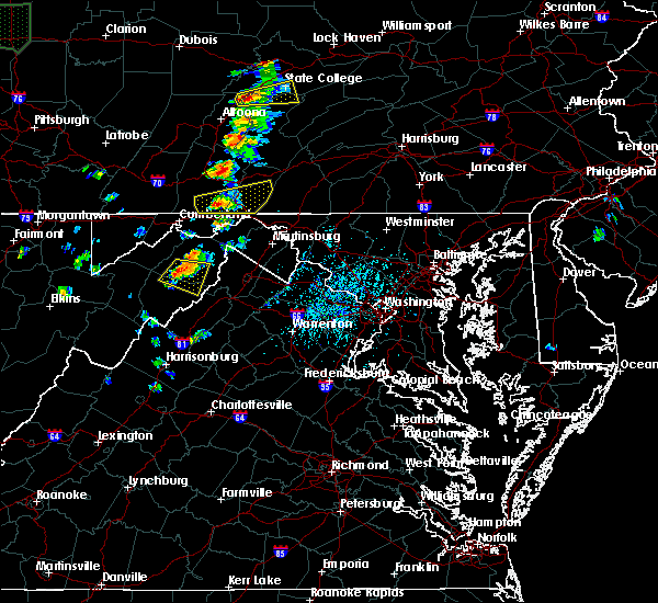 At 449 pm edt, doppler radar indicated a severe thunderstorm capable of producing quarter size hail and damaging winds in excess of 60 mph. this storm was located 8 miles south of romney, moving east at 25 mph. locations impacted include, wardensville, rio, shanks, inkerman, delray, kirby, augusta and frenchburg. At 449 pm edt, doppler radar indicated a severe thunderstorm capable of producing quarter size hail and damaging winds in excess of 60 mph. this storm was located 8 miles south of romney, moving east at 25 mph. locations impacted include, wardensville, rio, shanks, inkerman, delray, kirby, augusta and frenchburg.
|
| 7/14/2015 4:39 PM EDT |
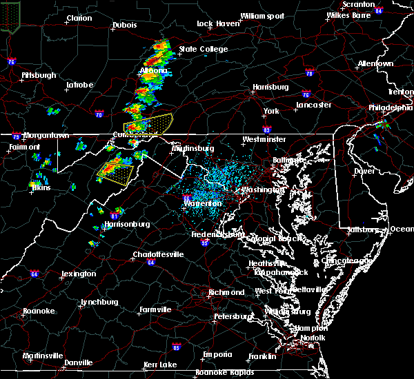 At 438 pm edt, doppler radar indicated a severe thunderstorm capable of producing quarter size hail and damaging winds in excess of 60 mph. this storm was located 7 miles southwest of romney, moving east at 25 mph. locations impacted include, wardensville, rio, shanks, inkerman, delray, purgitsville, kirby, augusta, frenchburg and junction. At 438 pm edt, doppler radar indicated a severe thunderstorm capable of producing quarter size hail and damaging winds in excess of 60 mph. this storm was located 7 miles southwest of romney, moving east at 25 mph. locations impacted include, wardensville, rio, shanks, inkerman, delray, purgitsville, kirby, augusta, frenchburg and junction.
|
| 7/14/2015 4:33 PM EDT |
 At 432 pm edt, doppler radar indicated a severe thunderstorm capable of producing quarter size hail and damaging winds in excess of 60 mph. this storm was located 9 miles southwest of romney, and moving east at 25 mph. At 432 pm edt, doppler radar indicated a severe thunderstorm capable of producing quarter size hail and damaging winds in excess of 60 mph. this storm was located 9 miles southwest of romney, and moving east at 25 mph.
|
| 7/8/2014 5:18 PM EDT | Tree down on 800 block of pinnacle drive in hardy county WV, 3.1 miles E of Wardensville, WV |
| 7/8/2014 5:14 PM EDT | Tree down across road at 300 block sperrys run rd in hardy county WV, 5.4 miles ESE of Wardensville, WV |
| 7/8/2014 5:14 PM EDT | Tree down on leisure acres road in hardy county WV, 5.9 miles ENE of Wardensville, WV |
| 7/2/2014 5:26 PM EDT | Quarter sized hail reported 10.1 miles SE of Wardensville, WV |
| 8/7/2013 3:10 PM EDT | Tree down on ford hill rd south of ri in hardy county WV, 5.5 miles ESE of Wardensville, WV |
| 7/18/2012 2:26 PM EDT | A tree was down near ri in hardy county WV, 5.4 miles SE of Wardensville, WV |
| 7/8/2012 3:46 PM EDT | Limbs dow in hampshire county WV, 6.3 miles SE of Wardensville, WV |
| 7/4/2012 8:59 PM EDT | Large tree limb blocking road along route 55 northeast of wardensvill in hardy county WV, 1.9 miles WSW of Wardensville, WV |
| 7/4/2012 8:56 PM EDT | Storm damage reported in hardy county WV, 0.8 miles SSW of Wardensville, WV |
| 1/1/0001 12:00 AM | Tree damage along lower arkansas road in hardy county WV, 5.8 miles SE of Wardensville, WV |
| 9/14/2011 4:12 PM EDT | Quarter sized hail reported 5.4 miles SE of Wardensville, WV, hail up to the size of quarters observed |
| 1/1/0001 12:00 AM | Treee down on wires behind convenice stor in hardy county WV, 0.4 miles ESE of Wardensville, WV |
| 1/1/0001 12:00 AM | Trees down at waites run. much of wardensville w o powe in hardy county WV, 2 miles N of Wardensville, WV |
| 1/1/0001 12:00 AM | A few trees were down along lower arkansas roa in hardy county WV, 8.7 miles ENE of Wardensville, WV |
Hail Maps for Wardensville, WV


Connect with Interactive Hail Maps