

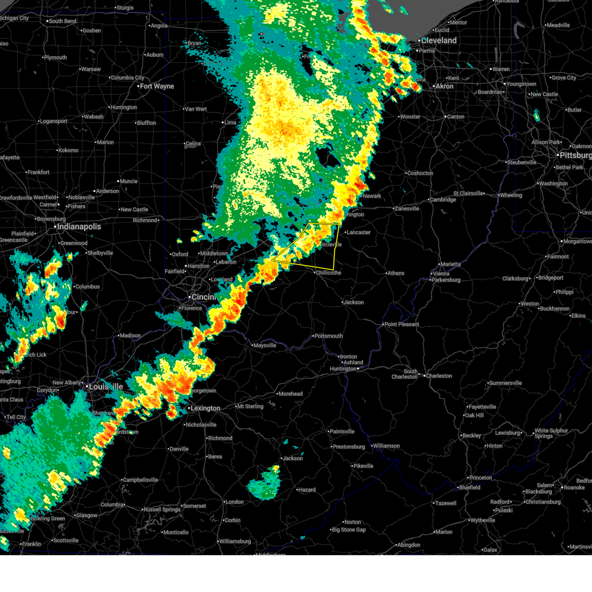
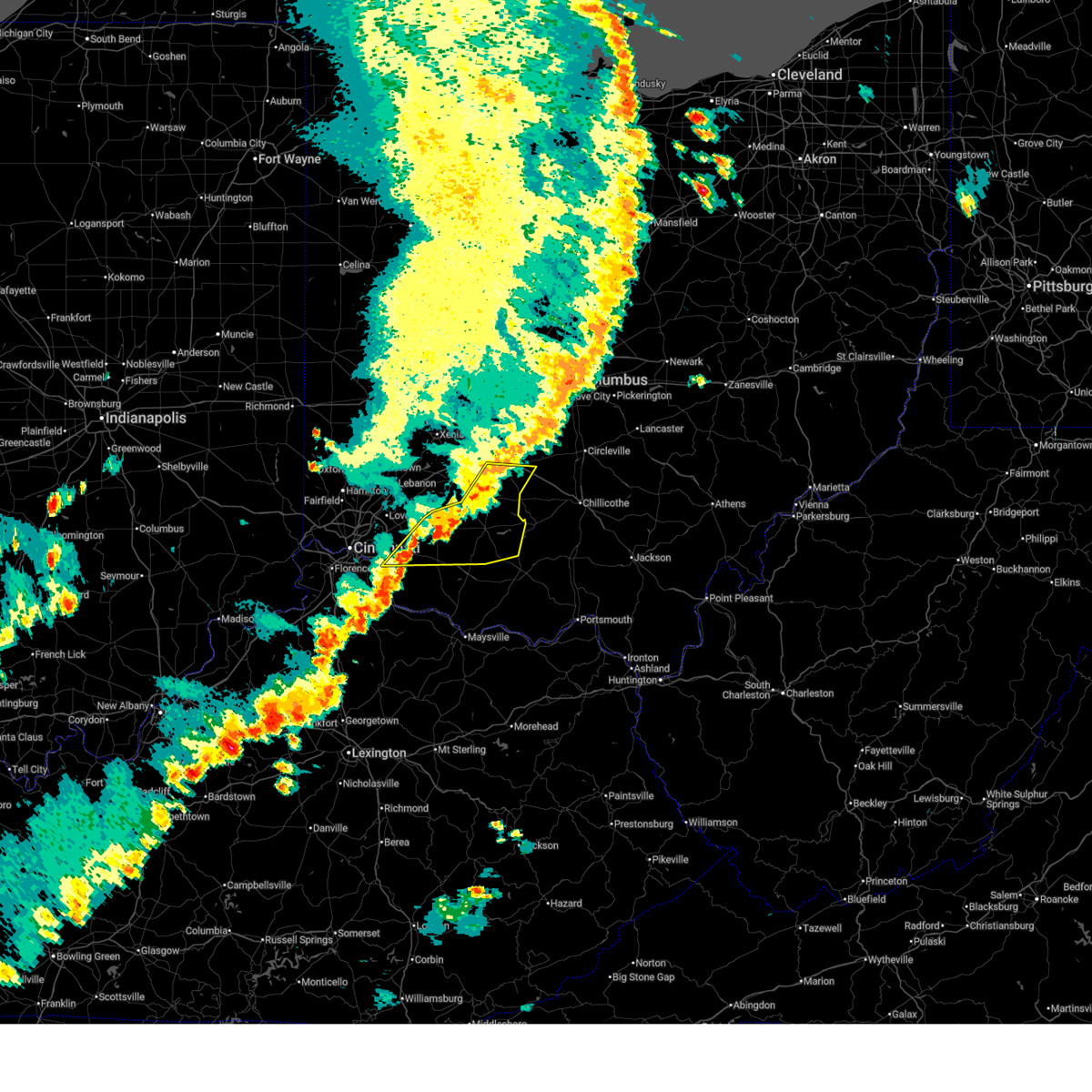
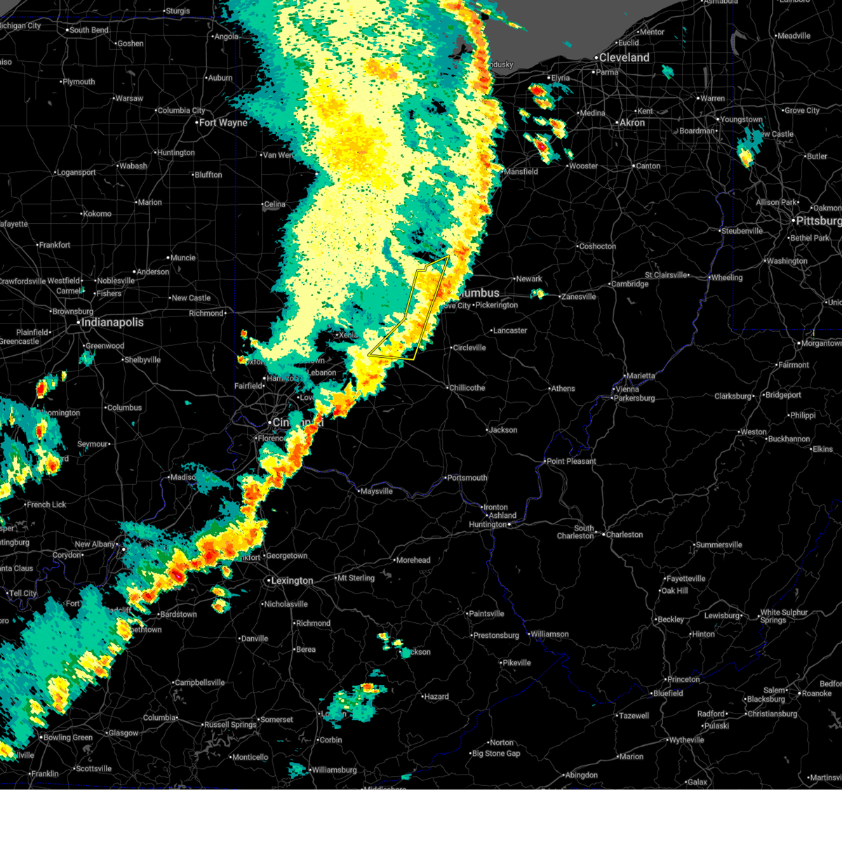
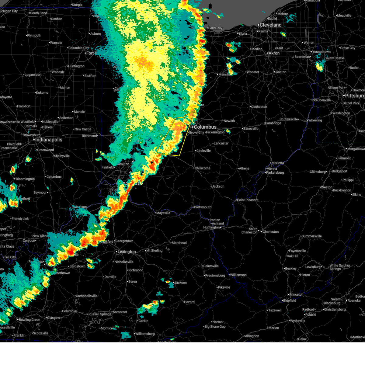
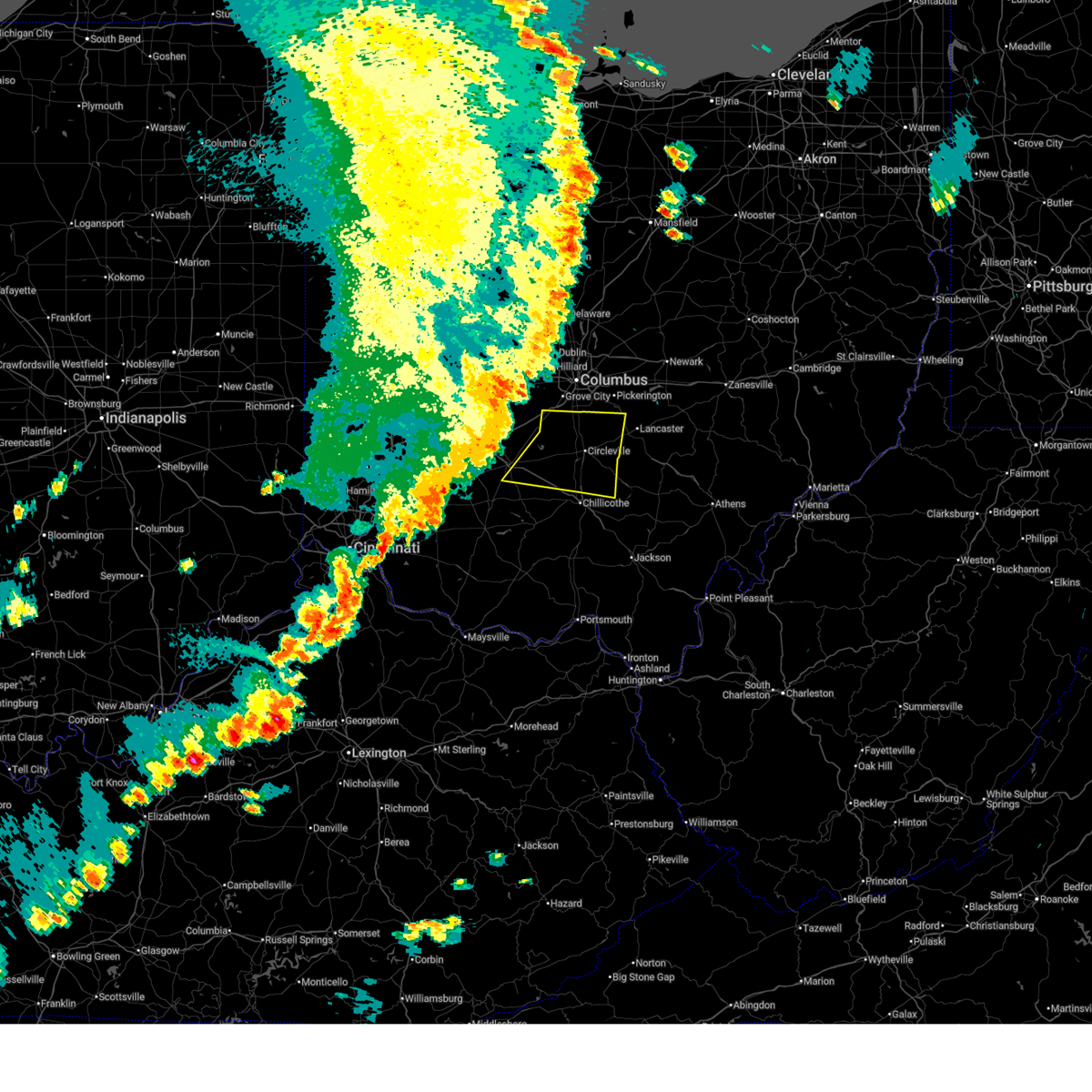
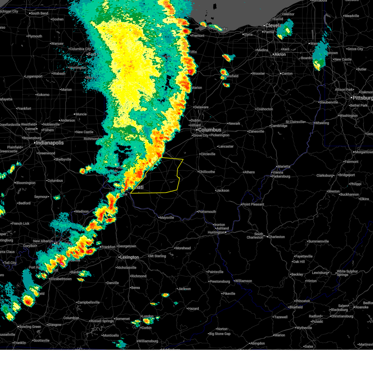
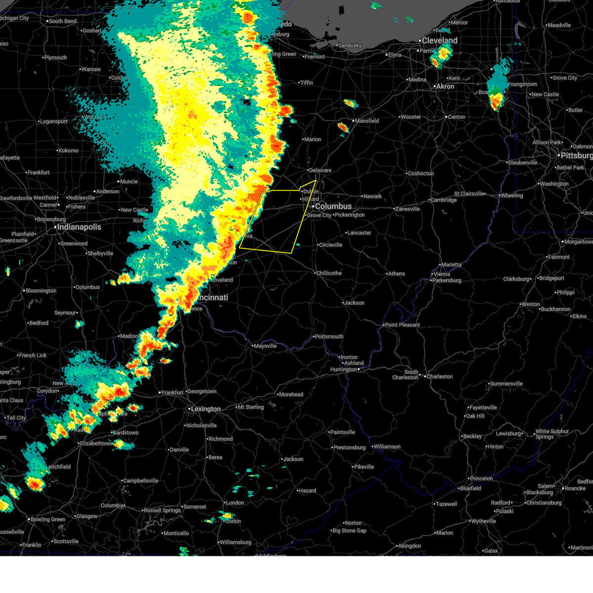
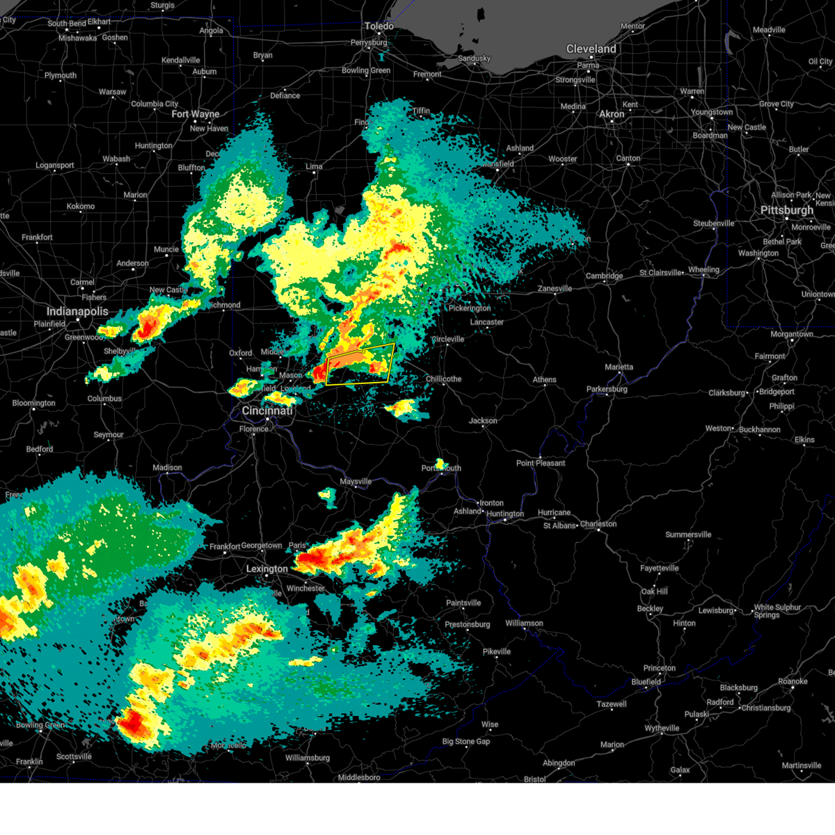
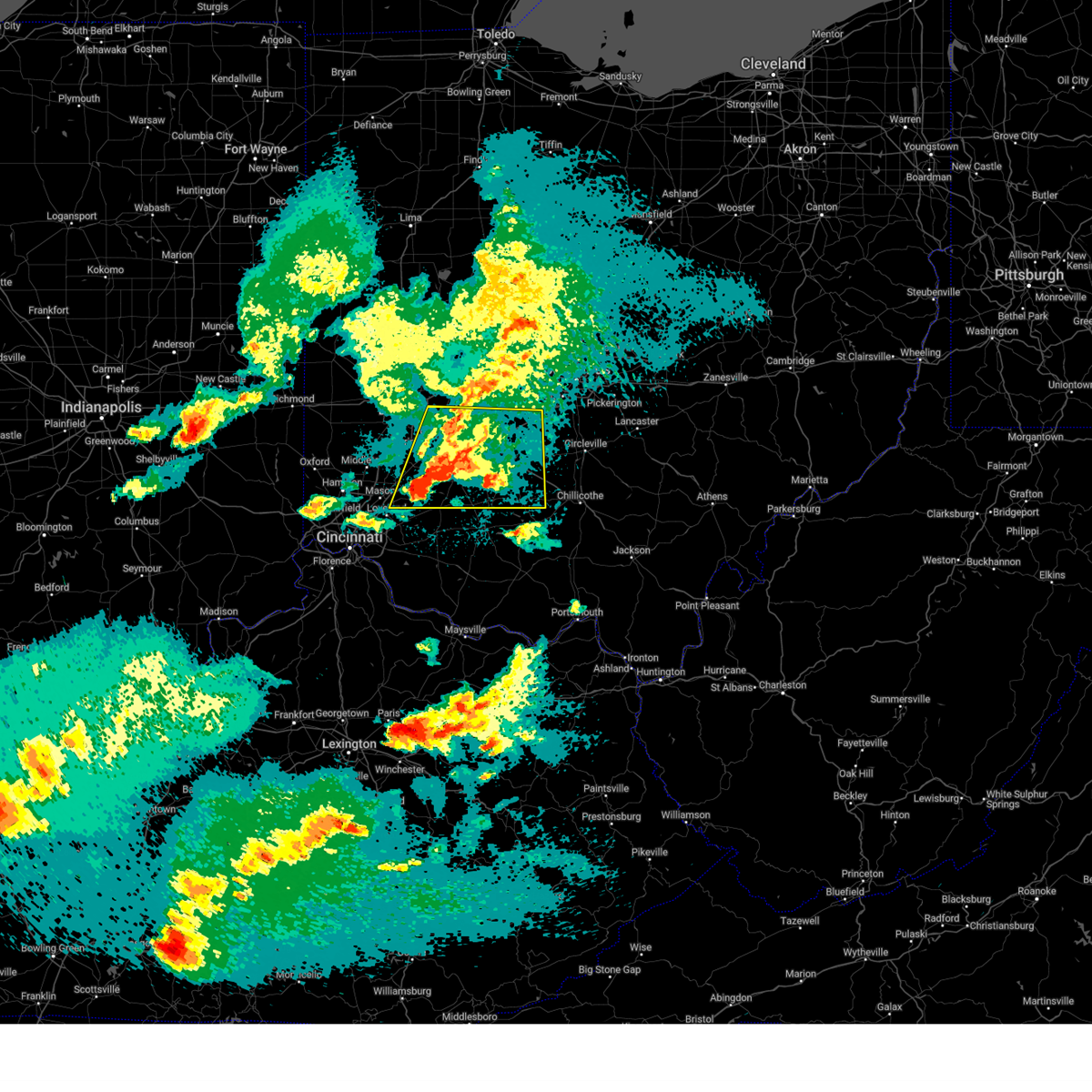
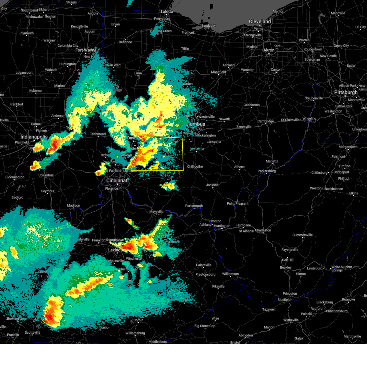
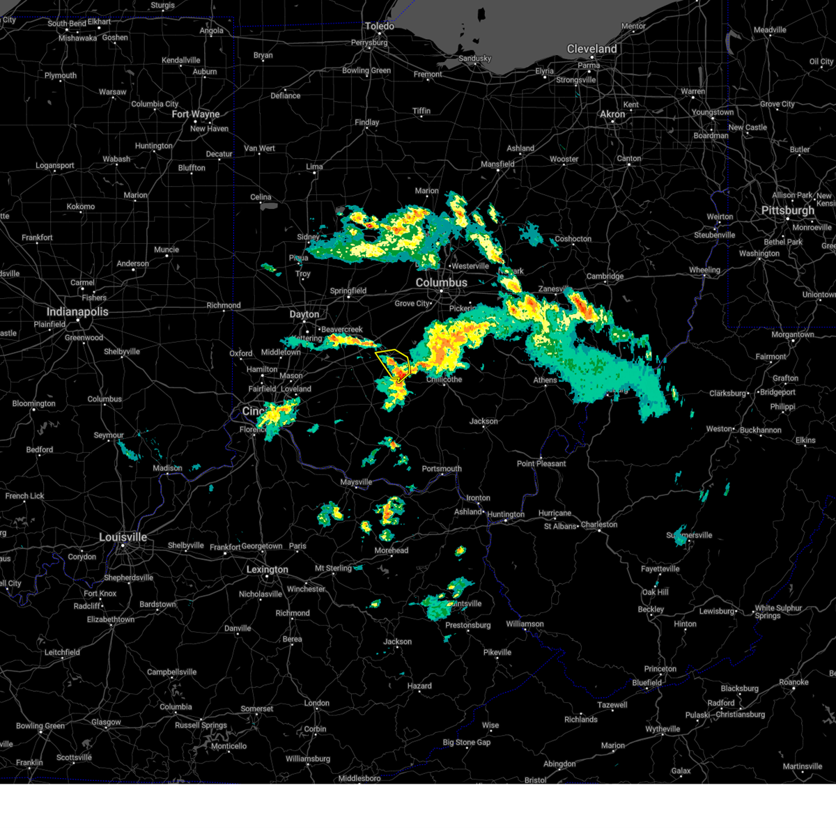
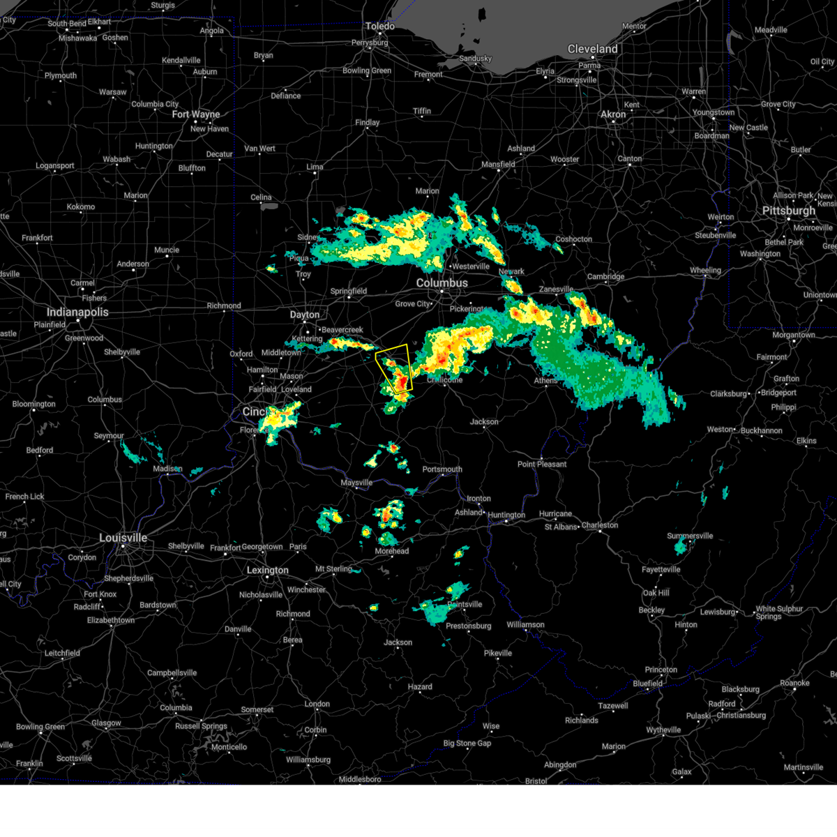
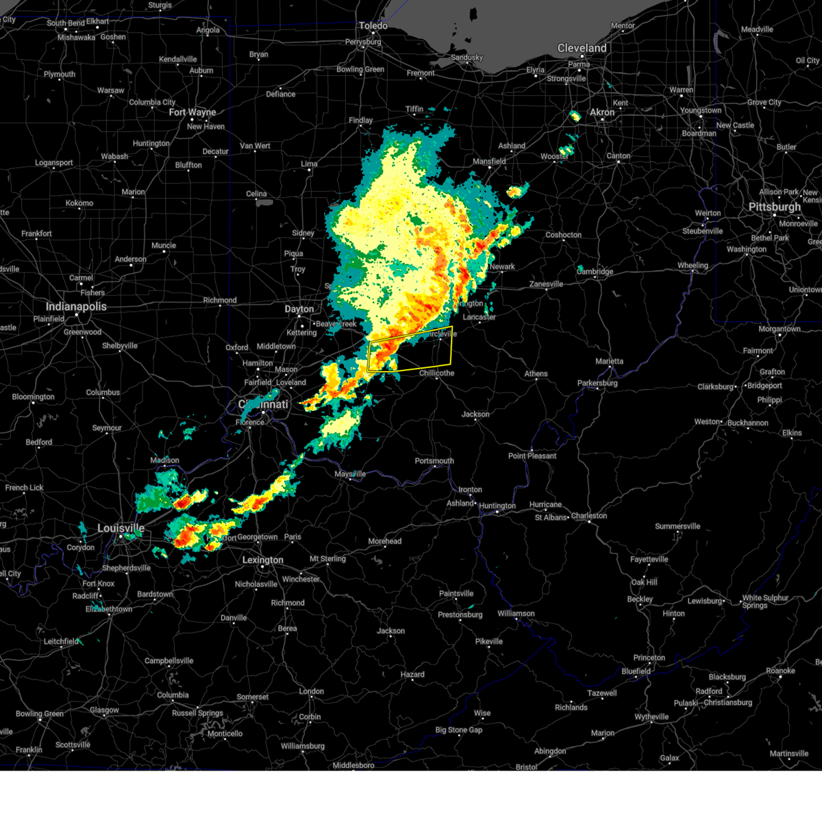
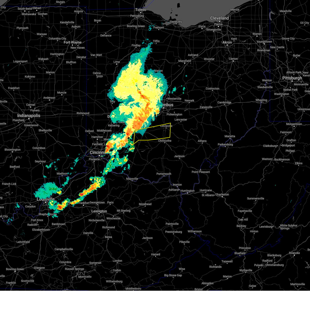
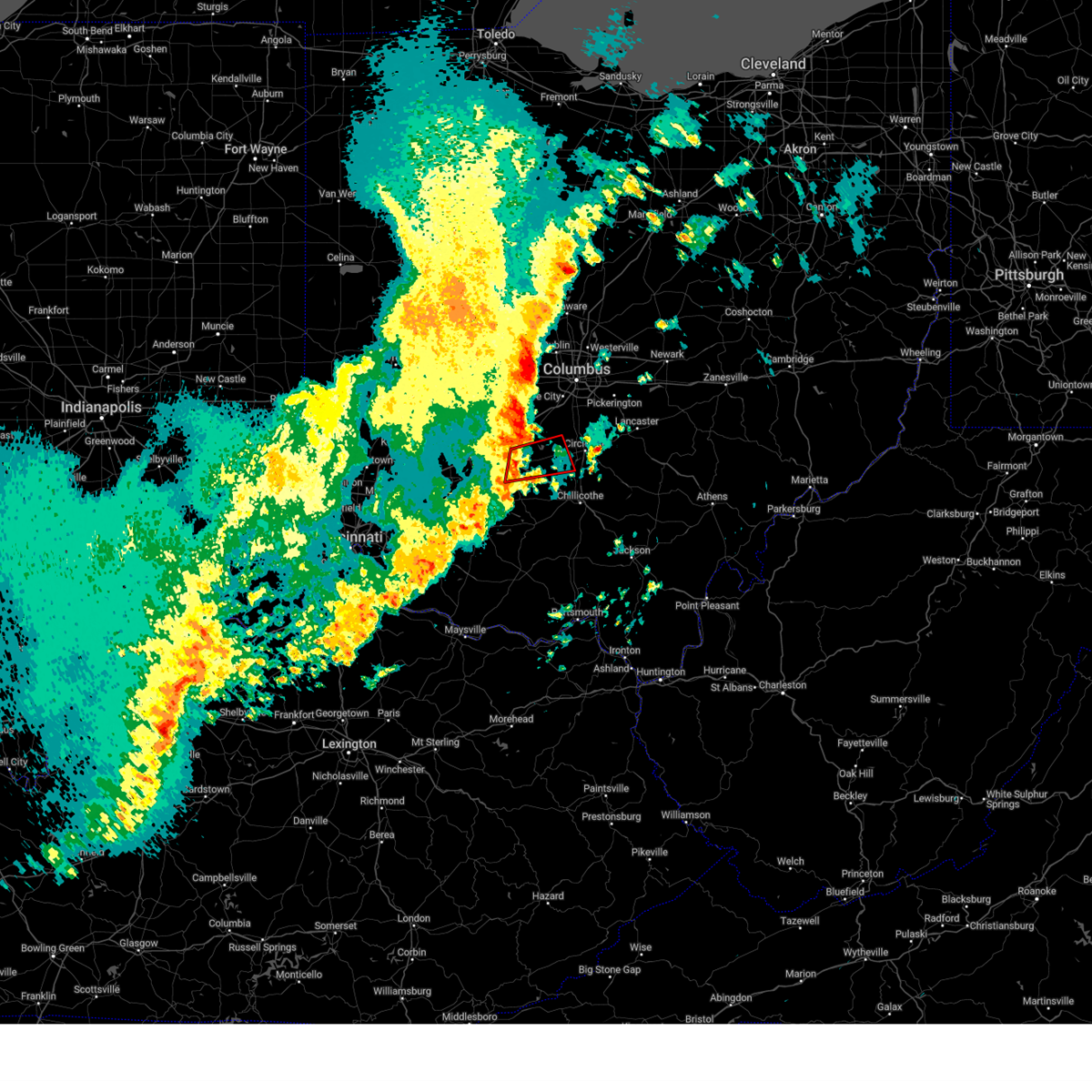
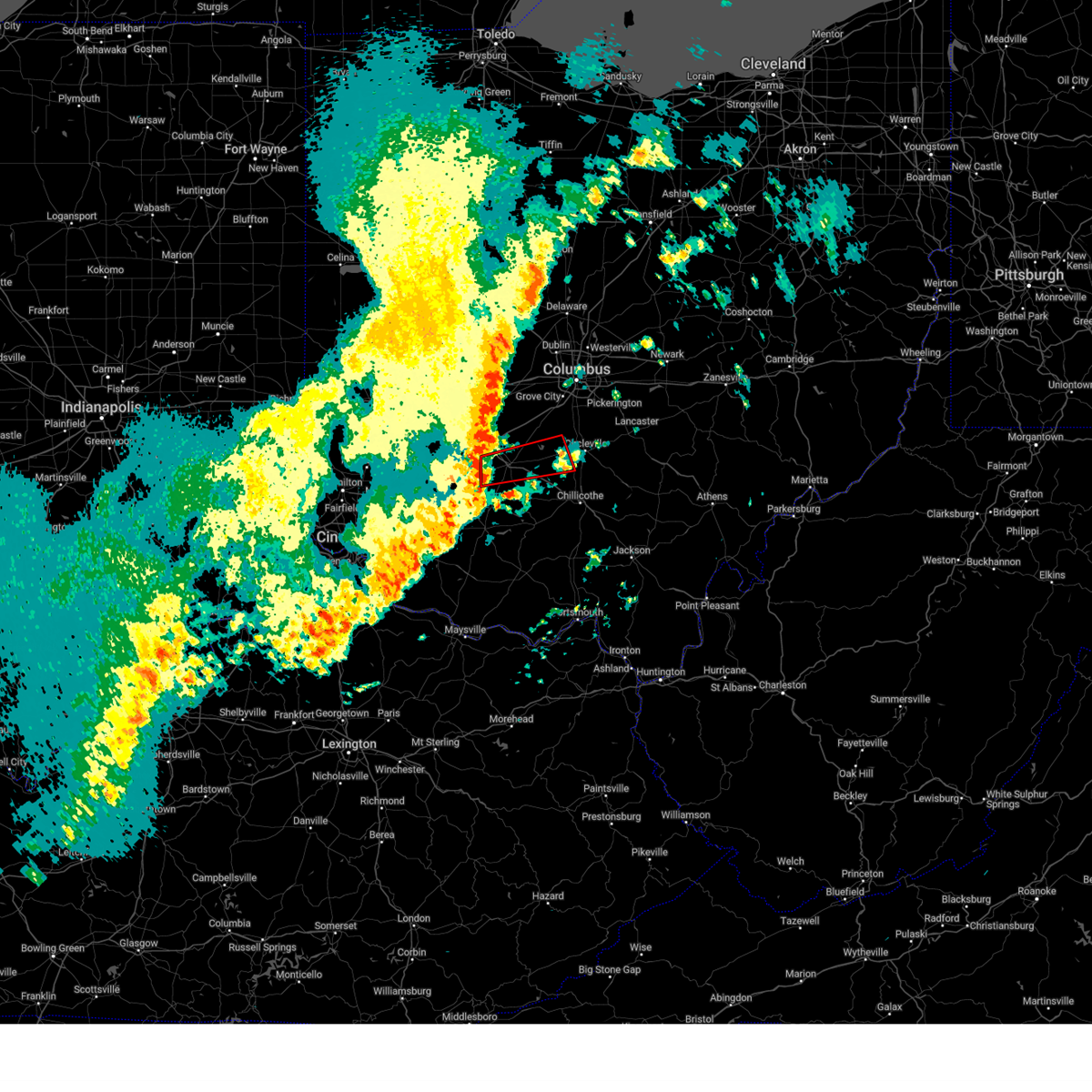
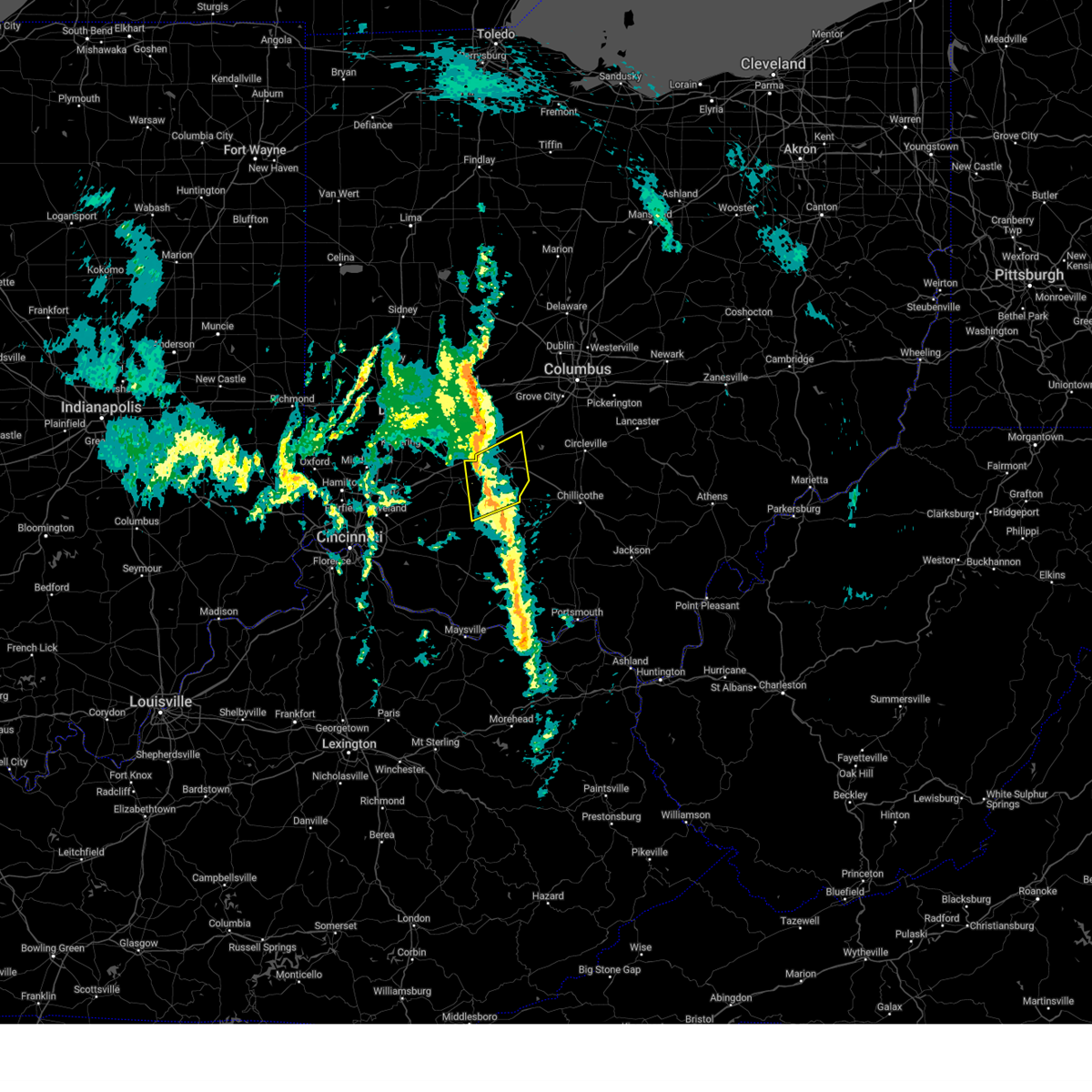
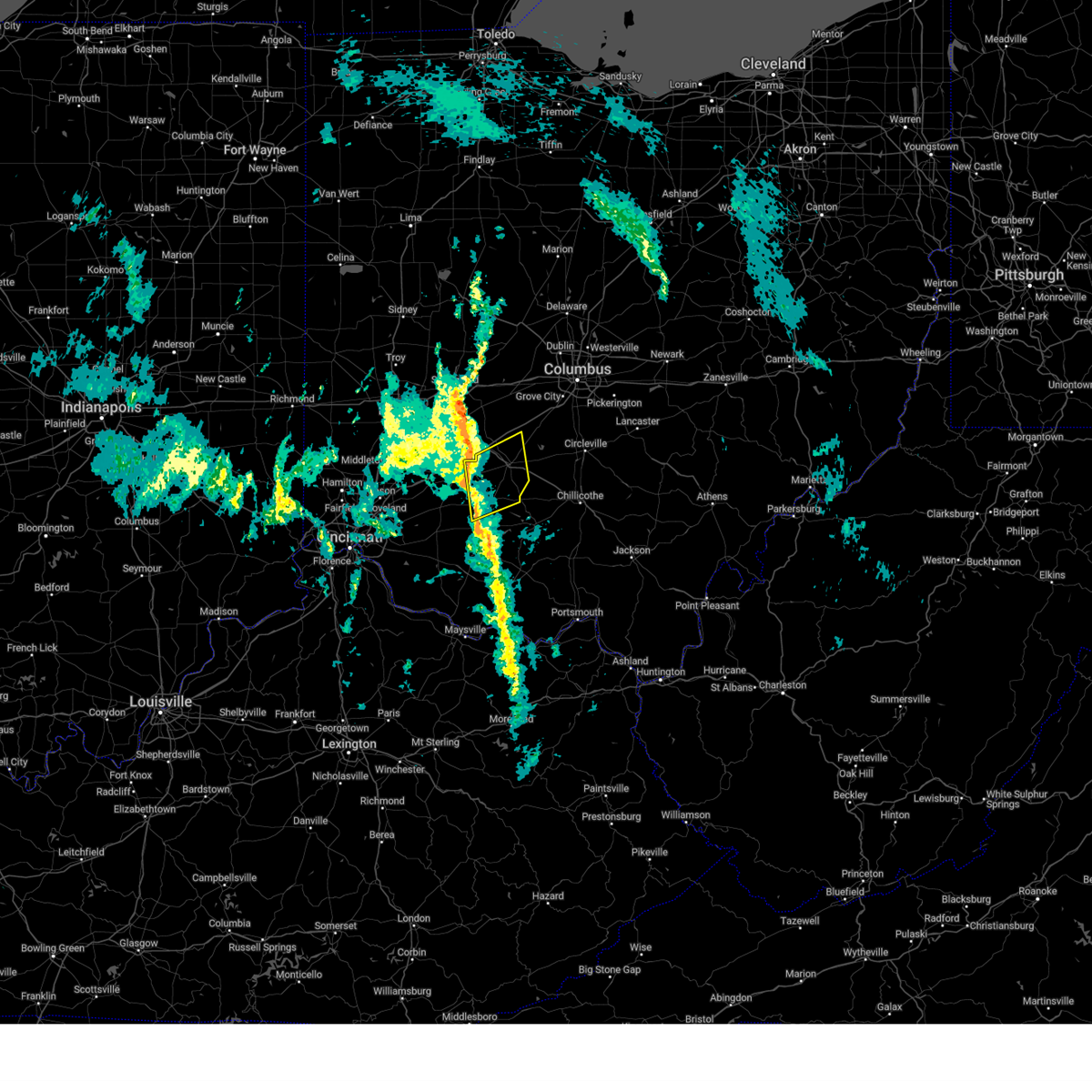
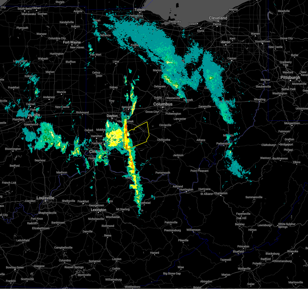
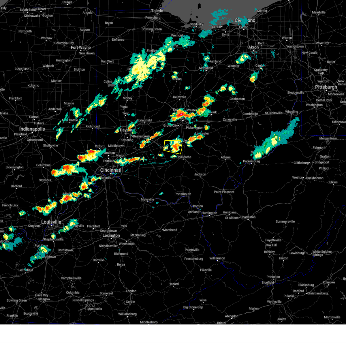
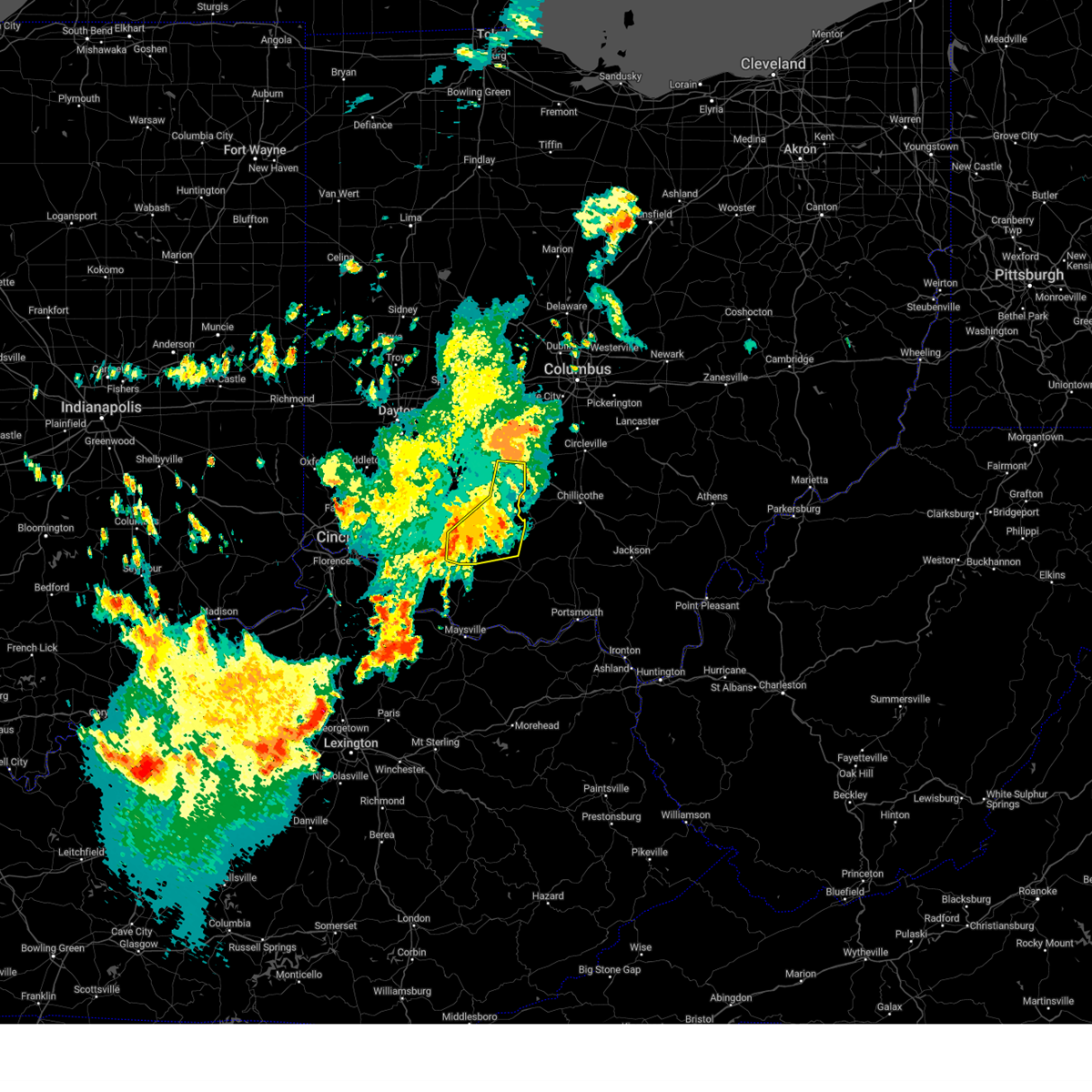
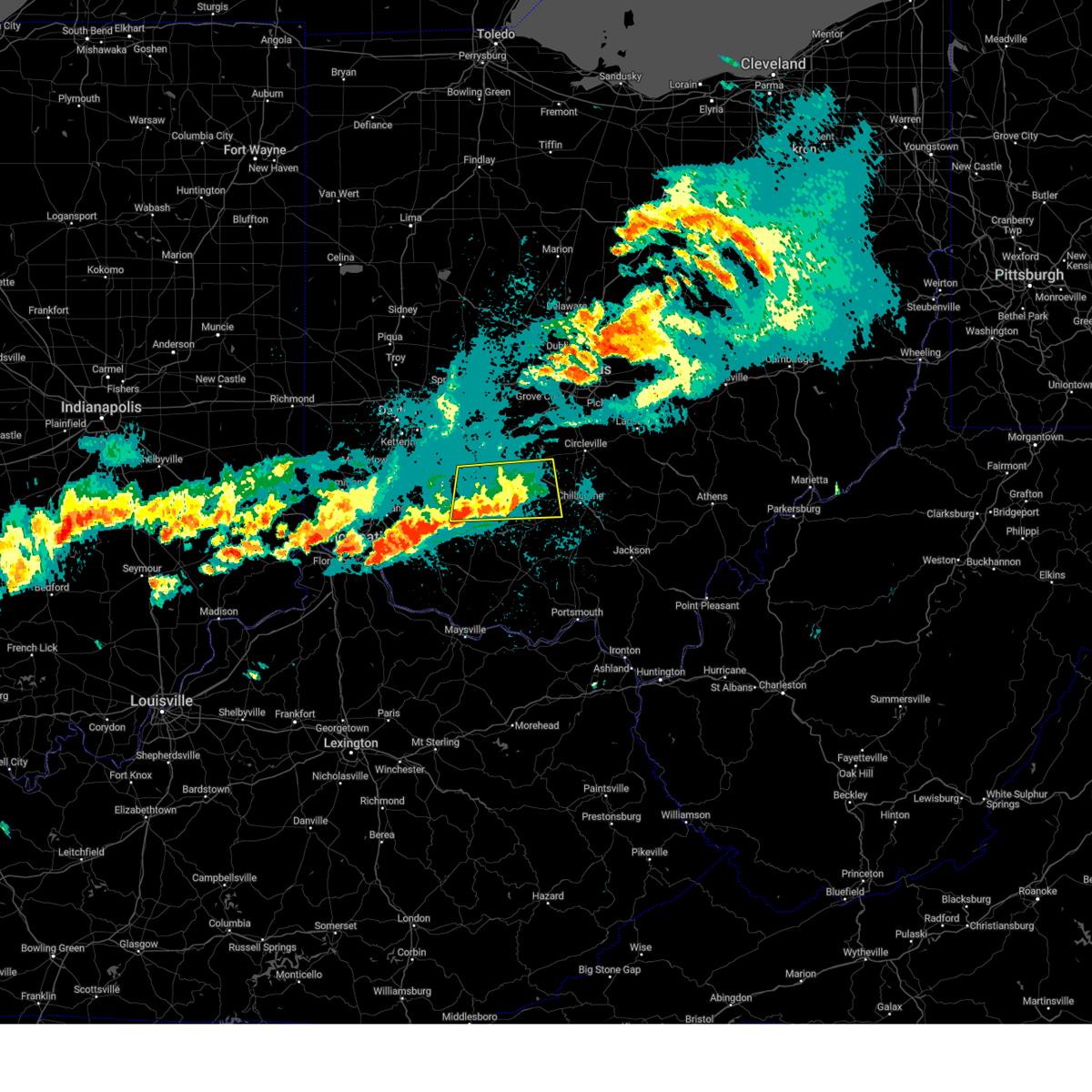
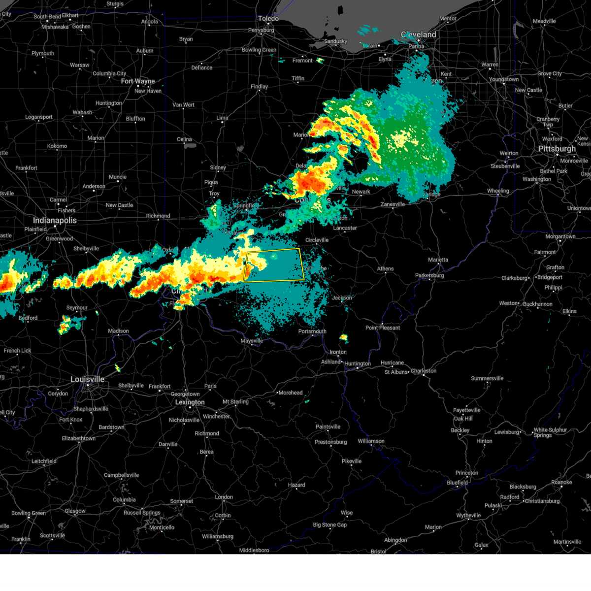
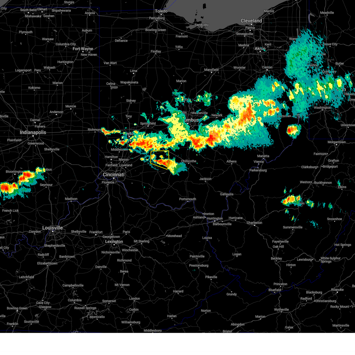
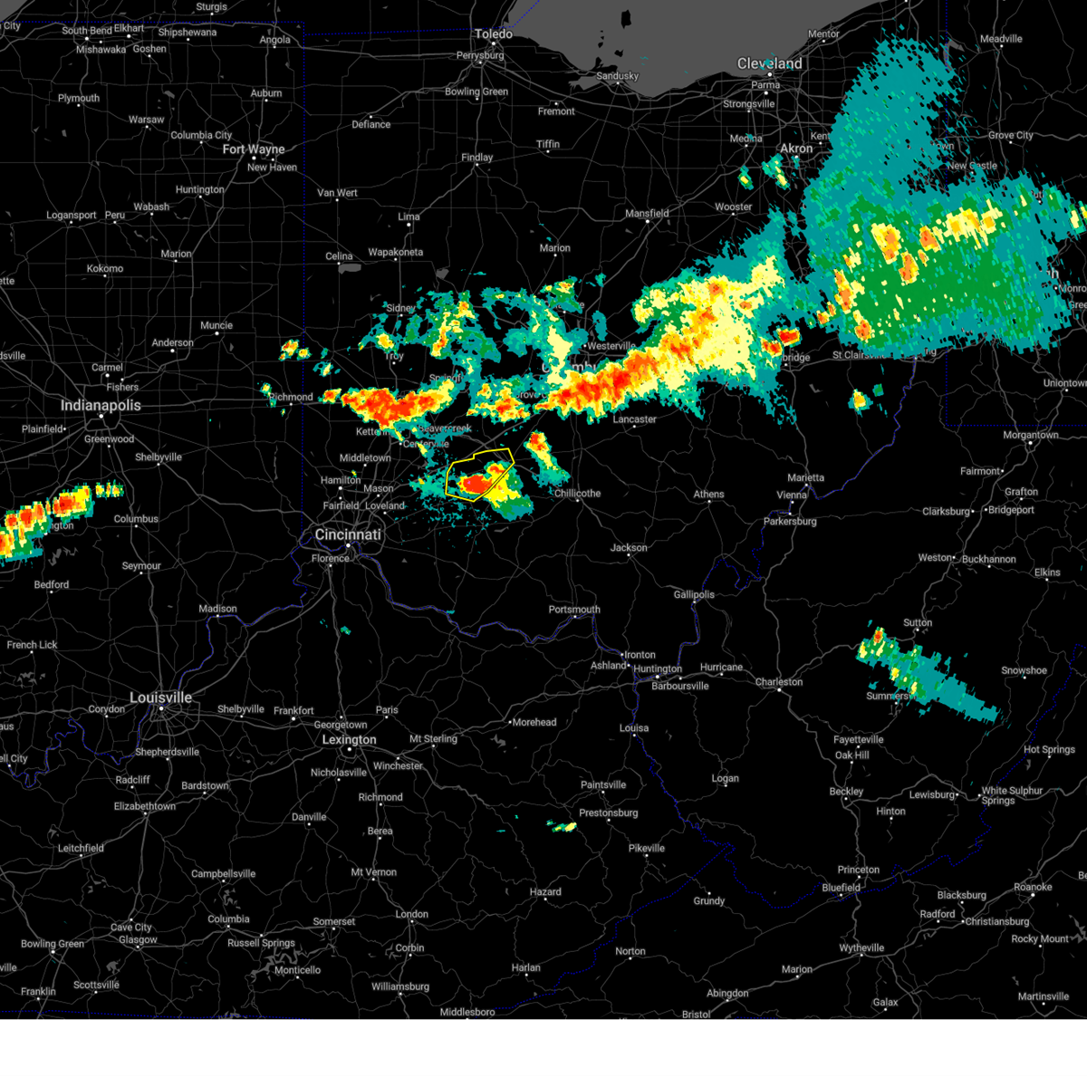
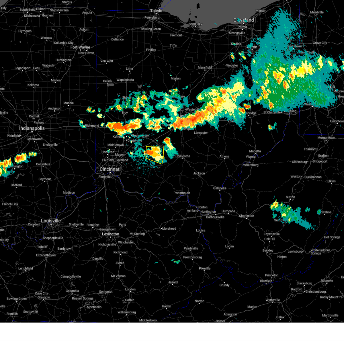
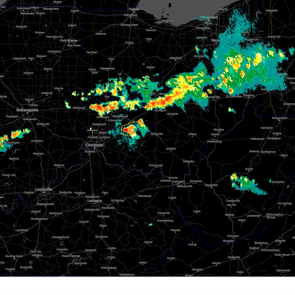
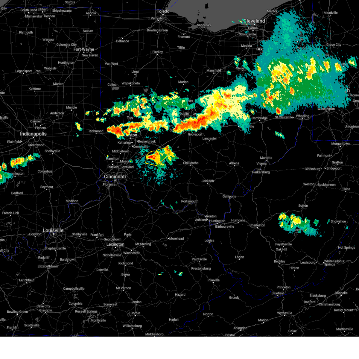
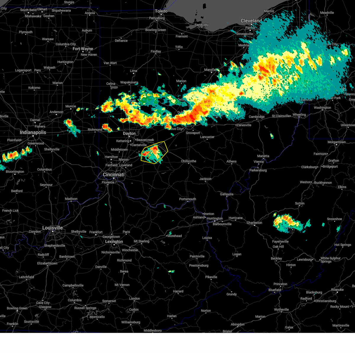
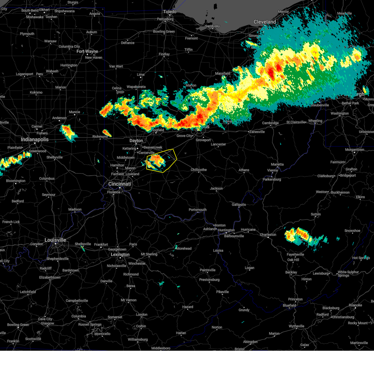
Hail Map for Washington Court House, OH
The Washington Court House, OH area has had 9 reports of on-the-ground hail by trained spotters, and has been under severe weather warnings 70 times during the past 12 months. Doppler radar has detected hail at or near Washington Court House, OH on 50 occasions, including 4 occasions during the past year.
| Name: | Washington Court House, OH |
| Where Located: | 37.1 miles SW of Columbus, OH |
| Map: | Google Map for Washington Court House, OH |
| Population: | 14192 |
| Housing Units: | 6433 |
| More Info: | Search Google for Washington Court House, OH |
1
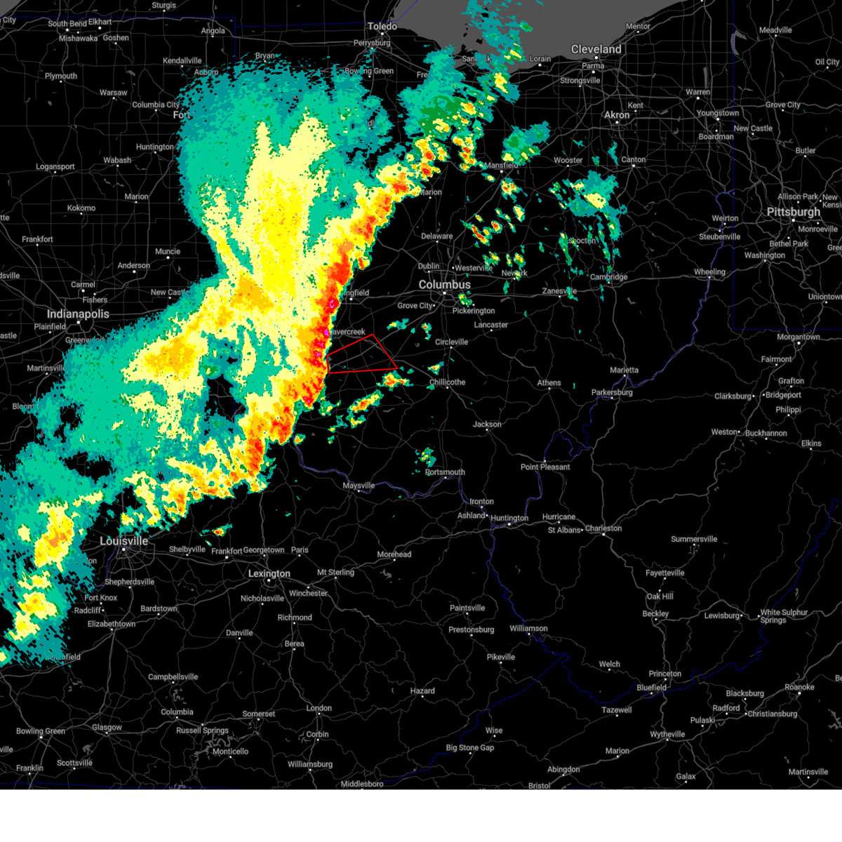
The Top Recent Hail Date for Washington Court House, OH is Friday, September 6, 2024 (13th out of 50)

Hail and Wind Damage Spotted near Washington Court House, OH
| Date / Time | Report Details |
|---|---|
| 6/18/2025 8:44 PM EDT |
 At 844 pm edt, severe thunderstorms were located along a line extending from 7 miles west of lancaster to near kingston, moving east at 55 mph (radar indicated). Hazards include 60 mph wind gusts. Expect damage to trees and power lines. Locations impacted include, circleville, ashville, south bloomfield, kingston, williamsport, new holland, logan elm village, commercial point, royalton, good hope, frankfort, fox, amanda, stoutsville, laurelville, clarksburg, adelphi, tarlton, darbyville, and east ringgold. At 844 pm edt, severe thunderstorms were located along a line extending from 7 miles west of lancaster to near kingston, moving east at 55 mph (radar indicated). Hazards include 60 mph wind gusts. Expect damage to trees and power lines. Locations impacted include, circleville, ashville, south bloomfield, kingston, williamsport, new holland, logan elm village, commercial point, royalton, good hope, frankfort, fox, amanda, stoutsville, laurelville, clarksburg, adelphi, tarlton, darbyville, and east ringgold.
|
| 6/18/2025 8:23 PM EDT |
 At 822 pm edt, severe thunderstorms were located along a line extending from bloomingburg to mount orab, moving east at 30 mph (radar indicated). Hazards include 60 mph wind gusts. Expect damage to trees and power lines. Locations impacted include, washington court house, hillsboro, greenfield, blanchester, amelia, mount orab, sabina, williamsburg, batavia, lynchburg, leesburg, new vienna, marshall, sardinia, belfast, highland holiday, rocky fork point, russell, woodville, and staunton. At 822 pm edt, severe thunderstorms were located along a line extending from bloomingburg to mount orab, moving east at 30 mph (radar indicated). Hazards include 60 mph wind gusts. Expect damage to trees and power lines. Locations impacted include, washington court house, hillsboro, greenfield, blanchester, amelia, mount orab, sabina, williamsburg, batavia, lynchburg, leesburg, new vienna, marshall, sardinia, belfast, highland holiday, rocky fork point, russell, woodville, and staunton.
|
| 6/18/2025 8:21 PM EDT |
 the severe thunderstorm warning has been cancelled and is no longer in effect the severe thunderstorm warning has been cancelled and is no longer in effect
|
| 6/18/2025 8:21 PM EDT |
 At 820 pm edt, severe thunderstorms were located along a line extending from powell to near bloomingburg, moving east at 35 mph (radar indicated). Hazards include 60 mph wind gusts. Expect damage to trees and power lines. locations impacted include, columbus, dublin, grove city, upper arlington, hilliard, washington court house, worthington, jefferson, powell, west jefferson, mount sterling, jeffersonville, bloomingburg, new holland, lake darby, valleyview, marble cliff, riverlea, harrisburg, and orient. this includes the following interstates, i-70 in ohio between mile markers 84 and 95. I-71 in ohio between mile markers 72 and 94. At 820 pm edt, severe thunderstorms were located along a line extending from powell to near bloomingburg, moving east at 35 mph (radar indicated). Hazards include 60 mph wind gusts. Expect damage to trees and power lines. locations impacted include, columbus, dublin, grove city, upper arlington, hilliard, washington court house, worthington, jefferson, powell, west jefferson, mount sterling, jeffersonville, bloomingburg, new holland, lake darby, valleyview, marble cliff, riverlea, harrisburg, and orient. this includes the following interstates, i-70 in ohio between mile markers 84 and 95. I-71 in ohio between mile markers 72 and 94.
|
| 6/18/2025 8:11 PM EDT |
 the severe thunderstorm warning has been cancelled and is no longer in effect the severe thunderstorm warning has been cancelled and is no longer in effect
|
| 6/18/2025 8:11 PM EDT |
 At 810 pm edt, severe thunderstorms were located along a line extending from new california to jeffersonville, moving east at 35 mph (a 56 mph wind gust was reported at columbus ohio state university aiport at 759 pm). Hazards include 60 mph wind gusts. Expect damage to trees and power lines. locations impacted include, columbus, dublin, grove city, upper arlington, hilliard, washington court house, worthington, london, jefferson, powell, plain city, west jefferson, mount sterling, jeffersonville, bloomingburg, new holland, lake darby, valleyview, marble cliff, and riverlea. this includes the following interstates, i-70 in ohio between mile markers 75 and 95. I-71 in ohio between mile markers 59 and 94. At 810 pm edt, severe thunderstorms were located along a line extending from new california to jeffersonville, moving east at 35 mph (a 56 mph wind gust was reported at columbus ohio state university aiport at 759 pm). Hazards include 60 mph wind gusts. Expect damage to trees and power lines. locations impacted include, columbus, dublin, grove city, upper arlington, hilliard, washington court house, worthington, london, jefferson, powell, plain city, west jefferson, mount sterling, jeffersonville, bloomingburg, new holland, lake darby, valleyview, marble cliff, and riverlea. this includes the following interstates, i-70 in ohio between mile markers 75 and 95. I-71 in ohio between mile markers 59 and 94.
|
| 6/18/2025 8:05 PM EDT |
 Svriln the national weather service in wilmington has issued a * severe thunderstorm warning for, southwestern fairfield county in central ohio, southeastern fayette county in central ohio, pickaway county in central ohio, northern ross county in south central ohio, * until 900 pm edt. * at 805 pm edt, severe thunderstorms were located along a line extending from near mount sterling to near washington court house, moving southeast at 45 mph (radar indicated). Hazards include 60 mph wind gusts. expect damage to trees and power lines Svriln the national weather service in wilmington has issued a * severe thunderstorm warning for, southwestern fairfield county in central ohio, southeastern fayette county in central ohio, pickaway county in central ohio, northern ross county in south central ohio, * until 900 pm edt. * at 805 pm edt, severe thunderstorms were located along a line extending from near mount sterling to near washington court house, moving southeast at 45 mph (radar indicated). Hazards include 60 mph wind gusts. expect damage to trees and power lines
|
| 6/18/2025 7:43 PM EDT |
 Svriln the national weather service in wilmington has issued a * severe thunderstorm warning for, northern clermont county in southwestern ohio, northern brown county in southwestern ohio, southern fayette county in central ohio, clinton county in southwestern ohio, highland county in south central ohio, * until 845 pm edt. * at 743 pm edt, severe thunderstorms were located along a line extending from 7 miles south of jamestown to withamsville, moving east at 35 mph (radar indicated). Hazards include 60 mph wind gusts. expect damage to trees and power lines Svriln the national weather service in wilmington has issued a * severe thunderstorm warning for, northern clermont county in southwestern ohio, northern brown county in southwestern ohio, southern fayette county in central ohio, clinton county in southwestern ohio, highland county in south central ohio, * until 845 pm edt. * at 743 pm edt, severe thunderstorms were located along a line extending from 7 miles south of jamestown to withamsville, moving east at 35 mph (radar indicated). Hazards include 60 mph wind gusts. expect damage to trees and power lines
|
| 6/18/2025 7:35 PM EDT | At 735 pm edt, severe thunderstorms were located along a line extending from mechanicsburg to 6 miles southeast of xenia, moving east at 35 mph (radar indicated). Hazards include 60 mph wind gusts. Expect damage to trees and power lines. locations impacted include, columbus, springfield, dublin, grove city, upper arlington, hilliard, washington court house, worthington, london, jefferson, powell, plain city, west jefferson, cedarville, jamestown, mount sterling, south charleston, mechanicsburg, jeffersonville, and bloomingburg. this includes the following interstates, i-70 in ohio between mile markers 59 and 95. I-71 in ohio between mile markers 58 and 94. |
| 6/18/2025 7:26 PM EDT |
 Svriln the national weather service in wilmington has issued a * severe thunderstorm warning for, southeastern champaign county in west central ohio, western franklin county in central ohio, fayette county in central ohio, northwestern pickaway county in central ohio, south central delaware county in central ohio, eastern greene county in west central ohio, eastern clark county in west central ohio, madison county in central ohio, * until 830 pm edt. * at 725 pm edt, severe thunderstorms were located along a line extending from near mechanicsburg to 6 miles south of xenia, moving east at 35 mph (a 69 mph wind gust was reported at dayton airport at 654 pm). Hazards include 70 mph wind gusts. Expect considerable tree damage. Damage is likely to mobile homes, roofs, and outbuildings. Svriln the national weather service in wilmington has issued a * severe thunderstorm warning for, southeastern champaign county in west central ohio, western franklin county in central ohio, fayette county in central ohio, northwestern pickaway county in central ohio, south central delaware county in central ohio, eastern greene county in west central ohio, eastern clark county in west central ohio, madison county in central ohio, * until 830 pm edt. * at 725 pm edt, severe thunderstorms were located along a line extending from near mechanicsburg to 6 miles south of xenia, moving east at 35 mph (a 69 mph wind gust was reported at dayton airport at 654 pm). Hazards include 70 mph wind gusts. Expect considerable tree damage. Damage is likely to mobile homes, roofs, and outbuildings.
|
| 5/16/2025 10:14 PM EDT | At 1014 pm edt, a severe thunderstorm was located near new holland, moving east at 55 mph (radar indicated). Hazards include 60 mph wind gusts and quarter size hail. Minor hail damage to vehicles is possible. expect wind damage to trees and power lines. Locations impacted include, deer creek lake, leesburg, darbyville, good hope, east monroe, mooresville, kingston, austin, circleville, rock mills, williamsport, south salem, new holland, washington court house, new martinsburg, pancoastburg, plano, aw marion state park, clarksburg, and staunton. |
| 5/16/2025 10:14 PM EDT | the severe thunderstorm warning has been cancelled and is no longer in effect |
| 5/16/2025 10:13 PM EDT | Hen Egg sized hail reported 9.2 miles NNE of Washington Court House, OH |
| 5/16/2025 10:05 PM EDT | At 1004 pm edt, a severe thunderstorm was located 7 miles northwest of greenfield, moving east at 55 mph (radar indicated). Hazards include 70 mph wind gusts and quarter size hail. Minor hail damage to vehicles is possible. expect considerable tree damage. wind damage is also likely to mobile homes, roofs, and outbuildings. locations impacted include, deer creek lake, chenoweth, interstate 71 at state route 38, leesburg, new vienna, darbyville, good hope, east monroe, mooresville, kingston, austin, bloomingburg, circleville, lees creek, madison mills, rock mills, williamsport, south salem, new holland, and mount sterling. This includes i-71 in ohio between mile markers 73 and 84. |
| 5/16/2025 10:05 PM EDT | the severe thunderstorm warning has been cancelled and is no longer in effect |
| 5/16/2025 9:57 PM EDT | Svriln the national weather service in wilmington has issued a * severe thunderstorm warning for, fayette county in central ohio, northeastern clinton county in southwestern ohio, pickaway county in central ohio, southeastern greene county in west central ohio, northeastern highland county in south central ohio, southern madison county in central ohio, northern ross county in south central ohio, * until 1045 pm edt. * at 957 pm edt, a severe thunderstorm was located near sabina, moving east at 55 mph (radar indicated). Hazards include 70 mph wind gusts and quarter size hail. Minor hail damage to vehicles is possible. expect considerable tree damage. Wind damage is also likely to mobile homes, roofs, and outbuildings. |
| 5/16/2025 9:52 PM EDT | At 950 pm edt, a severe thunderstorm was located over washington court house, moving east at 50 mph (radar indicated). Hazards include 70 mph wind gusts and half dollar size hail. Minor hail damage to vehicles is possible. expect considerable tree damage. wind damage is also likely to mobile homes, roofs, and outbuildings. locations impacted include, clarksville, interstate 71 at state route 38, new vienna, east monroe, lumberton, austin, oakland, sabina, lees creek, madison mills, martinsville, midway, morrisville, south salem, new holland, wilmington, ogden, kingman, cowan lake state park, and milledgeville. This includes i-71 in ohio between mile markers 43 and 57, and between mile markers 62 and 88. |
| 5/16/2025 9:52 PM EDT | the severe thunderstorm warning has been cancelled and is no longer in effect |
| 5/16/2025 9:49 PM EDT | At 949 pm edt, a severe thunderstorm was located near wilmington, moving east at 45 mph (radar indicated). Hazards include 70 mph wind gusts and half dollar size hail. Minor hail damage to vehicles is possible. expect considerable tree damage. wind damage is also likely to mobile homes, roofs, and outbuildings. locations impacted include, melvin, staunton, east monroe, bloomington, new antioch, jasper mills, sabina, cuba, lees creek, reesville, morrisville, wilmington, washington court house, new martinsburg, interstate 71 at us route 68, cowan lake state park, burtonville, highland, port william, and leesburg. This includes i-71 in ohio between mile markers 51 and 58. |
| 5/16/2025 9:37 PM EDT |
 Svriln the national weather service in wilmington has issued a * severe thunderstorm warning for, southwestern fayette county in central ohio, clinton county in southwestern ohio, north central highland county in south central ohio, * until 1000 pm edt. * at 937 pm edt, a severe thunderstorm was located near wilmington, moving east at 40 mph. this is a destructive storm for clinton county (radar indicated). Hazards include 80 mph wind gusts and half dollar size hail. Flying debris will be dangerous to those caught without shelter. mobile homes will be heavily damaged. expect considerable damage to roofs, windows, and vehicles. Extensive tree damage and power outages are likely. Svriln the national weather service in wilmington has issued a * severe thunderstorm warning for, southwestern fayette county in central ohio, clinton county in southwestern ohio, north central highland county in south central ohio, * until 1000 pm edt. * at 937 pm edt, a severe thunderstorm was located near wilmington, moving east at 40 mph. this is a destructive storm for clinton county (radar indicated). Hazards include 80 mph wind gusts and half dollar size hail. Flying debris will be dangerous to those caught without shelter. mobile homes will be heavily damaged. expect considerable damage to roofs, windows, and vehicles. Extensive tree damage and power outages are likely.
|
| 5/16/2025 9:32 PM EDT |
 At 932 pm edt, a severe thunderstorm was located near sabina, moving east at 50 mph (radar indicated). Hazards include 70 mph wind gusts and half dollar size hail. Minor hail damage to vehicles is possible. expect considerable tree damage. wind damage is also likely to mobile homes, roofs, and outbuildings. locations impacted include, paintersville, clarksville, interstate 71 at state route 38, new vienna, fort ancient, east monroe, rosemoor, lumberton, austin, oakland, selma, sabina, corwin, genntown, lees creek, madison mills, oldtown, gladstone, caesar creek state park, and yellow springs. This includes i-71 in ohio between mile markers 29 and 88. At 932 pm edt, a severe thunderstorm was located near sabina, moving east at 50 mph (radar indicated). Hazards include 70 mph wind gusts and half dollar size hail. Minor hail damage to vehicles is possible. expect considerable tree damage. wind damage is also likely to mobile homes, roofs, and outbuildings. locations impacted include, paintersville, clarksville, interstate 71 at state route 38, new vienna, fort ancient, east monroe, rosemoor, lumberton, austin, oakland, selma, sabina, corwin, genntown, lees creek, madison mills, oldtown, gladstone, caesar creek state park, and yellow springs. This includes i-71 in ohio between mile markers 29 and 88.
|
| 5/16/2025 9:19 PM EDT |
 Svriln the national weather service in wilmington has issued a * severe thunderstorm warning for, eastern warren county in southwestern ohio, fayette county in central ohio, clinton county in southwestern ohio, northwestern pickaway county in central ohio, greene county in west central ohio, southeastern clark county in west central ohio, northeastern highland county in south central ohio, southern madison county in central ohio, northwestern ross county in south central ohio, * until 1000 pm edt. * at 919 pm edt, a severe thunderstorm was located near wilmington, moving east at 50 mph (radar indicated). Hazards include 60 mph wind gusts and quarter size hail. Minor hail damage to vehicles is possible. Expect wind damage to trees and power lines. Svriln the national weather service in wilmington has issued a * severe thunderstorm warning for, eastern warren county in southwestern ohio, fayette county in central ohio, clinton county in southwestern ohio, northwestern pickaway county in central ohio, greene county in west central ohio, southeastern clark county in west central ohio, northeastern highland county in south central ohio, southern madison county in central ohio, northwestern ross county in south central ohio, * until 1000 pm edt. * at 919 pm edt, a severe thunderstorm was located near wilmington, moving east at 50 mph (radar indicated). Hazards include 60 mph wind gusts and quarter size hail. Minor hail damage to vehicles is possible. Expect wind damage to trees and power lines.
|
| 5/4/2025 6:08 PM EDT |
 At 607 pm edt, a severe thunderstorm was located near greenfield, moving northwest at 20 mph (radar indicated). Hazards include quarter size hail. Minor damage to vehicles is possible. Locations impacted include, staunton, good hope, washington court house, jasper mills, rock mills, and greenfield. At 607 pm edt, a severe thunderstorm was located near greenfield, moving northwest at 20 mph (radar indicated). Hazards include quarter size hail. Minor damage to vehicles is possible. Locations impacted include, staunton, good hope, washington court house, jasper mills, rock mills, and greenfield.
|
| 5/4/2025 6:08 PM EDT |
 the severe thunderstorm warning has been cancelled and is no longer in effect the severe thunderstorm warning has been cancelled and is no longer in effect
|
| 5/4/2025 5:52 PM EDT |
 Svriln the national weather service in wilmington has issued a * severe thunderstorm warning for, southern fayette county in central ohio, northeastern highland county in south central ohio, northwestern ross county in south central ohio, * until 615 pm edt. * at 552 pm edt, a severe thunderstorm was located over greenfield, moving northwest at 20 mph (radar indicated). Hazards include quarter size hail. minor damage to vehicles is possible Svriln the national weather service in wilmington has issued a * severe thunderstorm warning for, southern fayette county in central ohio, northeastern highland county in south central ohio, northwestern ross county in south central ohio, * until 615 pm edt. * at 552 pm edt, a severe thunderstorm was located over greenfield, moving northwest at 20 mph (radar indicated). Hazards include quarter size hail. minor damage to vehicles is possible
|
| 4/29/2025 2:50 PM EDT |
 the severe thunderstorm warning has been cancelled and is no longer in effect the severe thunderstorm warning has been cancelled and is no longer in effect
|
| 4/29/2025 2:50 PM EDT |
 At 249 pm edt, a severe thunderstorm was located over new holland, moving east at 45 mph (radar indicated). Hazards include 60 mph wind gusts and penny size hail. Expect damage to trees and power lines. Locations impacted include, deer creek lake, east ringgold, good hope, kingston, austin, circleville, rock mills, williamsport, new holland, washington court house, new martinsburg, pancoastburg, plano, aw marion state park, clarksburg, staunton, andersonville, fox, jasper mills, and logan elm village. At 249 pm edt, a severe thunderstorm was located over new holland, moving east at 45 mph (radar indicated). Hazards include 60 mph wind gusts and penny size hail. Expect damage to trees and power lines. Locations impacted include, deer creek lake, east ringgold, good hope, kingston, austin, circleville, rock mills, williamsport, new holland, washington court house, new martinsburg, pancoastburg, plano, aw marion state park, clarksburg, staunton, andersonville, fox, jasper mills, and logan elm village.
|
| 4/29/2025 2:43 PM EDT | Tree down. time estimated from rada in fayette county OH, 0.6 miles N of Washington Court House, OH |
| 4/29/2025 2:43 PM EDT | Grain silo turned over. time estimated from rada in fayette county OH, 3.4 miles N of Washington Court House, OH |
| 4/29/2025 2:41 PM EDT | Tree downed over roa in fayette county OH, 0.6 miles N of Washington Court House, OH |
| 4/29/2025 2:30 PM EDT | Grain elevator blown dow in fayette county OH, 7.2 miles SE of Washington Court House, OH |
| 4/29/2025 2:26 PM EDT |
 Svriln the national weather service in wilmington has issued a * severe thunderstorm warning for, southern fayette county in central ohio, northeastern clinton county in southwestern ohio, southern pickaway county in central ohio, northern ross county in south central ohio, * until 315 pm edt. * at 226 pm edt, a severe thunderstorm was located over sabina, moving east at 45 mph (radar indicated). Hazards include 60 mph wind gusts and penny size hail. expect damage to trees and power lines Svriln the national weather service in wilmington has issued a * severe thunderstorm warning for, southern fayette county in central ohio, northeastern clinton county in southwestern ohio, southern pickaway county in central ohio, northern ross county in south central ohio, * until 315 pm edt. * at 226 pm edt, a severe thunderstorm was located over sabina, moving east at 45 mph (radar indicated). Hazards include 60 mph wind gusts and penny size hail. expect damage to trees and power lines
|
| 4/3/2025 1:56 AM EDT | The storm which prompted the warning has moved out of the area. therefore, the warning will be allowed to expire. a tornado watch remains in effect until 400 am edt for central, south central, southwestern and west central ohio. please report previous wind damage or hail to the national weather service by going to our website at weather.gov/iln and submitting your report via social media. |
| 4/3/2025 1:40 AM EDT | Svriln the national weather service in wilmington has issued a * severe thunderstorm warning for, franklin county in central ohio, western fairfield county in central ohio, eastern fayette county in central ohio, pickaway county in central ohio, southeastern delaware county in central ohio, western licking county in central ohio, eastern highland county in south central ohio, eastern madison county in central ohio, ross county in south central ohio, * until 230 am edt. * at 140 am edt, a severe thunderstorm was located over mount sterling, moving northeast at 65 mph (radar indicated). Hazards include 60 mph wind gusts. expect damage to trees and power lines |
| 4/3/2025 1:39 AM EDT | At 138 am edt, a severe thunderstorm was located near bloomingburg, moving northeast at 65 mph (radar indicated). Hazards include 70 mph wind gusts and penny size hail. Expect considerable tree damage. damage is likely to mobile homes, roofs, and outbuildings. locations impacted include, interstate 71 at state route 38, new vienna, east monroe, samantha, choctaw lake, state route 32 at us route 68, madison mills, highland holiday, martinsville, hilliard, midway, new holland, highland county airport, rocky fork lake, orient, milledgeville, lilly chapel, marshall, jasper mills, and russell. this includes the following interstates, i-70 in ohio between mile markers 71 and 93. I-71 in ohio between mile markers 66 and 93. |
| 4/3/2025 1:39 AM EDT | the severe thunderstorm warning has been cancelled and is no longer in effect |
| 4/3/2025 1:39 AM EDT | At 139 am edt, a severe thunderstorm capable of producing a tornado was located near washington court house, moving northeast at 60 mph (radar indicated rotation). Hazards include tornado. Flying debris will be dangerous to those caught without shelter. mobile homes will be damaged or destroyed. damage to roofs, windows, and vehicles will occur. tree damage is likely. Locations impacted include, deer creek lake, staunton, state route 207 at us route 22, madison mills, new holland, washington court house, bloomingburg, jasper mills, pancoastburg, and williamsport. |
| 4/3/2025 1:39 AM EDT | the tornado warning has been cancelled and is no longer in effect |
| 4/3/2025 1:32 AM EDT | Toriln the national weather service in wilmington has issued a * tornado warning for, central fayette county in central ohio, northeastern clinton county in southwestern ohio, west central pickaway county in central ohio, * until 200 am edt. * at 132 am edt, a severe thunderstorm capable of producing a tornado was located over sabina, moving northeast at 60 mph (radar indicated rotation). Hazards include tornado. Flying debris will be dangerous to those caught without shelter. mobile homes will be damaged or destroyed. damage to roofs, windows, and vehicles will occur. Tree damage is likely. |
| 4/3/2025 1:14 AM EDT | Svriln the national weather service in wilmington has issued a * severe thunderstorm warning for, western franklin county in central ohio, northwestern brown county in southwestern ohio, fayette county in central ohio, clinton county in southwestern ohio, northwestern pickaway county in central ohio, southeastern greene county in west central ohio, highland county in south central ohio, madison county in central ohio, northwestern ross county in south central ohio, * until 200 am edt. * at 114 am edt, a severe thunderstorm was located near wilmington, moving northeast at 65 mph (radar indicated). Hazards include 70 mph wind gusts and penny size hail. Expect considerable tree damage. Damage is likely to mobile homes, roofs, and outbuildings. |
| 3/30/2025 9:53 PM EDT |
 the tornado warning has been cancelled and is no longer in effect the tornado warning has been cancelled and is no longer in effect
|
| 3/30/2025 9:53 PM EDT |
 At 952 pm edt, a severe thunderstorm capable of producing a tornado was located over washington court house, moving east at 55 mph (radar indicated rotation). Hazards include tornado and quarter size hail. Flying debris will be dangerous to those caught without shelter. mobile homes will be damaged or destroyed. damage to roofs, windows, and vehicles will occur. tree damage is likely. Locations impacted include, deer creek lake, clarksburg, state route 207 at us route 22, williamsport, new holland, washington court house, bloomingburg, pancoastburg, and plano. At 952 pm edt, a severe thunderstorm capable of producing a tornado was located over washington court house, moving east at 55 mph (radar indicated rotation). Hazards include tornado and quarter size hail. Flying debris will be dangerous to those caught without shelter. mobile homes will be damaged or destroyed. damage to roofs, windows, and vehicles will occur. tree damage is likely. Locations impacted include, deer creek lake, clarksburg, state route 207 at us route 22, williamsport, new holland, washington court house, bloomingburg, pancoastburg, and plano.
|
| 3/30/2025 9:52 PM EDT |
 The storms which prompted the warning have moved out of the area. therefore, the warning will be allowed to expire. a tornado watch remains in effect until 100 am edt for central, south central, southwestern and west central ohio. please report previous wind damage or hail to the national weather service by going to our website at weather.gov/iln and submitting your report via social media. remember, a severe thunderstorm warning still remains in effect for southeastern union county, eastern madison county, eastern fayette county, and eastern highland county! remember, a tornado warning still remains in effect for eastern fayette county, northern highland county, and southeast madison county!. The storms which prompted the warning have moved out of the area. therefore, the warning will be allowed to expire. a tornado watch remains in effect until 100 am edt for central, south central, southwestern and west central ohio. please report previous wind damage or hail to the national weather service by going to our website at weather.gov/iln and submitting your report via social media. remember, a severe thunderstorm warning still remains in effect for southeastern union county, eastern madison county, eastern fayette county, and eastern highland county! remember, a tornado warning still remains in effect for eastern fayette county, northern highland county, and southeast madison county!.
|
| 3/30/2025 9:46 PM EDT | Svriln the national weather service in wilmington has issued a * severe thunderstorm warning for, franklin county in central ohio, western fairfield county in central ohio, eastern fayette county in central ohio, pickaway county in central ohio, southern delaware county in central ohio, western licking county in central ohio, northeastern highland county in south central ohio, southeastern union county in central ohio, madison county in central ohio, ross county in south central ohio, * until 1045 pm edt. * at 945 pm edt, severe thunderstorms were located along a line extending from near mechanicsburg to near lynchburg, moving east at 65 mph (radar indicated). Hazards include 60 mph wind gusts and quarter size hail. Minor hail damage to vehicles is possible. Expect wind damage to trees and power lines. |
| 3/30/2025 9:46 PM EDT | The tornado warning that was previously in effect has been reissued for portions of fayette, madison, franklin, pickaway,and ross counties until and is in effect until 10:15 pm edt. please refer to that bulletin for the latest severe weather information. a tornado watch remains in effect until 100 am edt for central, southwestern and west central ohio. please report previous tornadoes, wind damage or hail to the national weather service by going to our website at weather.gov/iln and submitting your report via social media. remember, a tornado warning still remains in effect for portions of fayette, madison, franklin, pickaway,and ross counties until and is in effect until 10:15 pm edt. |
| 3/30/2025 9:41 PM EDT |
 Toriln the national weather service in wilmington has issued a * tornado warning for, central fayette county in central ohio, northeastern clinton county in southwestern ohio, southwestern pickaway county in central ohio, northwestern ross county in south central ohio, * until 1015 pm edt. * at 941 pm edt, a severe thunderstorm capable of producing a tornado was located near sabina, moving east at 55 mph (radar indicated rotation). Hazards include tornado and quarter size hail. Flying debris will be dangerous to those caught without shelter. mobile homes will be damaged or destroyed. damage to roofs, windows, and vehicles will occur. Tree damage is likely. Toriln the national weather service in wilmington has issued a * tornado warning for, central fayette county in central ohio, northeastern clinton county in southwestern ohio, southwestern pickaway county in central ohio, northwestern ross county in south central ohio, * until 1015 pm edt. * at 941 pm edt, a severe thunderstorm capable of producing a tornado was located near sabina, moving east at 55 mph (radar indicated rotation). Hazards include tornado and quarter size hail. Flying debris will be dangerous to those caught without shelter. mobile homes will be damaged or destroyed. damage to roofs, windows, and vehicles will occur. Tree damage is likely.
|
| 3/30/2025 9:37 PM EDT |
 At 937 pm edt, a severe thunderstorm capable of producing a tornado was located near jeffersonville, moving east at 55 mph (radar indicated rotation). Hazards include tornado and quarter size hail. Flying debris will be dangerous to those caught without shelter. mobile homes will be damaged or destroyed. damage to roofs, windows, and vehicles will occur. tree damage is likely. locations impacted include, melvin, staunton, milledgeville, octa, reesville, rosemoor, bloomington, jasper mills, interstate 71 at us route 35, sabina, bowersville, and washington court house. This includes i-71 in ohio between mile markers 58 and 67. At 937 pm edt, a severe thunderstorm capable of producing a tornado was located near jeffersonville, moving east at 55 mph (radar indicated rotation). Hazards include tornado and quarter size hail. Flying debris will be dangerous to those caught without shelter. mobile homes will be damaged or destroyed. damage to roofs, windows, and vehicles will occur. tree damage is likely. locations impacted include, melvin, staunton, milledgeville, octa, reesville, rosemoor, bloomington, jasper mills, interstate 71 at us route 35, sabina, bowersville, and washington court house. This includes i-71 in ohio between mile markers 58 and 67.
|
| 3/30/2025 9:31 PM EDT |
 the severe thunderstorm warning has been cancelled and is no longer in effect the severe thunderstorm warning has been cancelled and is no longer in effect
|
| 3/30/2025 9:31 PM EDT |
 At 930 pm edt, severe thunderstorms were located along a line extending from near north lewisburg to near lynchburg, moving east at 45 mph (radar indicated). Hazards include 60 mph wind gusts and quarter size hail. Minor hail damage to vehicles is possible. expect wind damage to trees and power lines. locations impacted include, paintersville, interstate 71 at state route 38, east monroe, rosemoor, samantha, lumberton, south vienna, lees creek, madison mills, gladstone, martinsville, new california, morrisville, cowan lake state park, amity, harmony, lisbon, south solon, jasper mills, and midland. this includes the following interstates, i-70 in ohio between mile markers 56 and 85. I-71 in ohio between mile markers 46 and 84. At 930 pm edt, severe thunderstorms were located along a line extending from near north lewisburg to near lynchburg, moving east at 45 mph (radar indicated). Hazards include 60 mph wind gusts and quarter size hail. Minor hail damage to vehicles is possible. expect wind damage to trees and power lines. locations impacted include, paintersville, interstate 71 at state route 38, east monroe, rosemoor, samantha, lumberton, south vienna, lees creek, madison mills, gladstone, martinsville, new california, morrisville, cowan lake state park, amity, harmony, lisbon, south solon, jasper mills, and midland. this includes the following interstates, i-70 in ohio between mile markers 56 and 85. I-71 in ohio between mile markers 46 and 84.
|
| 3/30/2025 9:29 PM EDT |
 At 928 pm edt, a severe thunderstorm capable of producing a tornado was located near sabina, moving east at 55 mph (radar indicated rotation). Hazards include tornado and quarter size hail. Flying debris will be dangerous to those caught without shelter. mobile homes will be damaged or destroyed. damage to roofs, windows, and vehicles will occur. tree damage is likely. locations impacted include, melvin, staunton, milledgeville, octa, rosemoor, bloomington, lumberton, jasper mills, sabina, reesville, port william, bowersville, interstate 71 at us route 35, interstate 71 at us route 68, wilmington, and washington court house. This includes i-71 in ohio between mile markers 51 and 67. At 928 pm edt, a severe thunderstorm capable of producing a tornado was located near sabina, moving east at 55 mph (radar indicated rotation). Hazards include tornado and quarter size hail. Flying debris will be dangerous to those caught without shelter. mobile homes will be damaged or destroyed. damage to roofs, windows, and vehicles will occur. tree damage is likely. locations impacted include, melvin, staunton, milledgeville, octa, rosemoor, bloomington, lumberton, jasper mills, sabina, reesville, port william, bowersville, interstate 71 at us route 35, interstate 71 at us route 68, wilmington, and washington court house. This includes i-71 in ohio between mile markers 51 and 67.
|
| 3/30/2025 9:29 PM EDT |
 the tornado warning has been cancelled and is no longer in effect the tornado warning has been cancelled and is no longer in effect
|
| 3/30/2025 9:16 PM EDT |
 At 916 pm edt, a severe thunderstorm capable of producing a tornado was located 8 miles northwest of wilmington, moving east at 55 mph (radar indicated rotation). Hazards include tornado and quarter size hail. Flying debris will be dangerous to those caught without shelter. mobile homes will be damaged or destroyed. damage to roofs, windows, and vehicles will occur. tree damage is likely. locations impacted include, paintersville, melvin, staunton, milledgeville, octa, rosemoor, bloomington, middleton corner, lumberton, oakland, jasper mills, sabina, reesville, harveysburg, port william, kingman, bowersville, interstate 71 at us route 35, interstate 71 at us route 68, and wilmington. This includes i-71 in ohio between mile markers 42 and 67. At 916 pm edt, a severe thunderstorm capable of producing a tornado was located 8 miles northwest of wilmington, moving east at 55 mph (radar indicated rotation). Hazards include tornado and quarter size hail. Flying debris will be dangerous to those caught without shelter. mobile homes will be damaged or destroyed. damage to roofs, windows, and vehicles will occur. tree damage is likely. locations impacted include, paintersville, melvin, staunton, milledgeville, octa, rosemoor, bloomington, middleton corner, lumberton, oakland, jasper mills, sabina, reesville, harveysburg, port william, kingman, bowersville, interstate 71 at us route 35, interstate 71 at us route 68, and wilmington. This includes i-71 in ohio between mile markers 42 and 67.
|
| 3/30/2025 9:11 PM EDT |
 Toriln the national weather service in wilmington has issued a * tornado warning for, northeastern warren county in southwestern ohio, western fayette county in central ohio, northern clinton county in southwestern ohio, southeastern greene county in west central ohio, * until 945 pm edt. * at 910 pm edt, a severe thunderstorm capable of producing a tornado was located near waynesville, moving east at 55 mph (radar indicated rotation). Hazards include tornado and quarter size hail. Flying debris will be dangerous to those caught without shelter. mobile homes will be damaged or destroyed. damage to roofs, windows, and vehicles will occur. Tree damage is likely. Toriln the national weather service in wilmington has issued a * tornado warning for, northeastern warren county in southwestern ohio, western fayette county in central ohio, northern clinton county in southwestern ohio, southeastern greene county in west central ohio, * until 945 pm edt. * at 910 pm edt, a severe thunderstorm capable of producing a tornado was located near waynesville, moving east at 55 mph (radar indicated rotation). Hazards include tornado and quarter size hail. Flying debris will be dangerous to those caught without shelter. mobile homes will be damaged or destroyed. damage to roofs, windows, and vehicles will occur. Tree damage is likely.
|
| 3/30/2025 9:07 PM EDT |
 Svriln the national weather service in wilmington has issued a * severe thunderstorm warning for, southern champaign county in west central ohio, north central brown county in southwestern ohio, eastern warren county in southwestern ohio, fayette county in central ohio, clinton county in southwestern ohio, greene county in west central ohio, clark county in west central ohio, northern highland county in south central ohio, southern union county in central ohio, madison county in central ohio, * until 1000 pm edt. * at 906 pm edt, severe thunderstorms were located along a line extending from near urbana to near morrow, moving east at 50 mph (radar indicated). Hazards include 60 mph wind gusts and quarter size hail. Minor hail damage to vehicles is possible. Expect wind damage to trees and power lines. Svriln the national weather service in wilmington has issued a * severe thunderstorm warning for, southern champaign county in west central ohio, north central brown county in southwestern ohio, eastern warren county in southwestern ohio, fayette county in central ohio, clinton county in southwestern ohio, greene county in west central ohio, clark county in west central ohio, northern highland county in south central ohio, southern union county in central ohio, madison county in central ohio, * until 1000 pm edt. * at 906 pm edt, severe thunderstorms were located along a line extending from near urbana to near morrow, moving east at 50 mph (radar indicated). Hazards include 60 mph wind gusts and quarter size hail. Minor hail damage to vehicles is possible. Expect wind damage to trees and power lines.
|
| 12/29/2024 2:13 PM EST |
 The storm which prompted the warning has weakened below severe limits and has exited the warned area. therefore, the warning will be allowed to expire. however, gusty winds are still possible with this thunderstorm. please report previous wind damage or hail to the national weather service by going to our website at weather.gov/iln and submitting your report via social media. The storm which prompted the warning has weakened below severe limits and has exited the warned area. therefore, the warning will be allowed to expire. however, gusty winds are still possible with this thunderstorm. please report previous wind damage or hail to the national weather service by going to our website at weather.gov/iln and submitting your report via social media.
|
| 12/29/2024 2:00 PM EST |
 At 159 pm est, a severe thunderstorm was located near sabina, moving northeast at 25 mph (radar indicated). Hazards include 60 mph wind gusts. Expect damage to trees and power lines. Locations impacted include, washington court house, greenfield, sabina, leesburg, new vienna, bloomingburg, staunton, good hope, highland, milledgeville, octa, melvin, east monroe, bloomington, samantha, jasper mills, lees creek, reesville, rock mills, and new martinsburg. At 159 pm est, a severe thunderstorm was located near sabina, moving northeast at 25 mph (radar indicated). Hazards include 60 mph wind gusts. Expect damage to trees and power lines. Locations impacted include, washington court house, greenfield, sabina, leesburg, new vienna, bloomingburg, staunton, good hope, highland, milledgeville, octa, melvin, east monroe, bloomington, samantha, jasper mills, lees creek, reesville, rock mills, and new martinsburg.
|
| 12/29/2024 1:37 PM EST |
 Svriln the national weather service in wilmington has issued a * severe thunderstorm warning for, fayette county in central ohio, clinton county in southwestern ohio, northern highland county in south central ohio, * until 215 pm est. * at 134 pm est, a severe thunderstorm was located near new vienna, moving northeast at 55 mph (radar indicated). Hazards include 60 mph wind gusts. expect damage to trees and power lines Svriln the national weather service in wilmington has issued a * severe thunderstorm warning for, fayette county in central ohio, clinton county in southwestern ohio, northern highland county in south central ohio, * until 215 pm est. * at 134 pm est, a severe thunderstorm was located near new vienna, moving northeast at 55 mph (radar indicated). Hazards include 60 mph wind gusts. expect damage to trees and power lines
|
| 9/6/2024 4:12 PM EDT |
 The storm which prompted the warning has weakened below severe limits and no longer poses an immediate threat to life or property. therefore, the warning will be allowed to expire. however, small hail and gusty winds are still possible with this thunderstorm. please report previous wind damage or hail to the national weather service by going to our website at weather.gov/iln and submitting your report via social media. The storm which prompted the warning has weakened below severe limits and no longer poses an immediate threat to life or property. therefore, the warning will be allowed to expire. however, small hail and gusty winds are still possible with this thunderstorm. please report previous wind damage or hail to the national weather service by going to our website at weather.gov/iln and submitting your report via social media.
|
| 9/6/2024 3:52 PM EDT |
 Svriln the national weather service in wilmington has issued a * severe thunderstorm warning for, northeastern fayette county in central ohio, southwestern pickaway county in central ohio, northwestern ross county in south central ohio, * until 415 pm edt. * at 352 pm edt, a severe thunderstorm was located near new holland, moving east at 30 mph (law enforcement). Hazards include 60 mph wind gusts and penny size hail. expect damage to trees and power lines Svriln the national weather service in wilmington has issued a * severe thunderstorm warning for, northeastern fayette county in central ohio, southwestern pickaway county in central ohio, northwestern ross county in south central ohio, * until 415 pm edt. * at 352 pm edt, a severe thunderstorm was located near new holland, moving east at 30 mph (law enforcement). Hazards include 60 mph wind gusts and penny size hail. expect damage to trees and power lines
|
| 9/6/2024 3:47 PM EDT |
 At 346 pm edt, a severe thunderstorm was located over bloomingburg, moving east at 30 mph (radar indicated). Hazards include 60 mph wind gusts and quarter size hail. Minor hail damage to vehicles is possible. expect wind damage to trees and power lines. Locations impacted include, washington court house, bloomingburg, and madison mills. At 346 pm edt, a severe thunderstorm was located over bloomingburg, moving east at 30 mph (radar indicated). Hazards include 60 mph wind gusts and quarter size hail. Minor hail damage to vehicles is possible. expect wind damage to trees and power lines. Locations impacted include, washington court house, bloomingburg, and madison mills.
|
| 9/6/2024 3:42 PM EDT | Roof damage to a structure at the intersection of east court street and south north street. time estimated from radar dat in fayette county OH, 0.4 miles ESE of Washington Court House, OH |
| 9/6/2024 3:29 PM EDT |
 Svriln the national weather service in wilmington has issued a * severe thunderstorm warning for, central fayette county in central ohio, * until 400 pm edt. * at 328 pm edt, a severe thunderstorm was located near washington court house, moving east at 30 mph (radar indicated). Hazards include 60 mph wind gusts and quarter size hail. Minor hail damage to vehicles is possible. Expect wind damage to trees and power lines. Svriln the national weather service in wilmington has issued a * severe thunderstorm warning for, central fayette county in central ohio, * until 400 pm edt. * at 328 pm edt, a severe thunderstorm was located near washington court house, moving east at 30 mph (radar indicated). Hazards include 60 mph wind gusts and quarter size hail. Minor hail damage to vehicles is possible. Expect wind damage to trees and power lines.
|
| 7/30/2024 2:44 AM EDT |
 the severe thunderstorm warning has been cancelled and is no longer in effect the severe thunderstorm warning has been cancelled and is no longer in effect
|
| 7/30/2024 2:31 AM EDT |
 At 231 am edt, a severe thunderstorm was located over rocky fork point, moving southeast at 40 mph (radar indicated). Hazards include 60 mph wind gusts. Expect damage to trees and power lines. Locations impacted include, washington court house, hillsboro, greenfield, lynchburg, leesburg, marshall, belfast, rocky fork point, highland holiday, russell, staunton, new market, good hope, mowrystown, highland, sinking spring, east monroe, danville in highland county, samantha, and rock mills. At 231 am edt, a severe thunderstorm was located over rocky fork point, moving southeast at 40 mph (radar indicated). Hazards include 60 mph wind gusts. Expect damage to trees and power lines. Locations impacted include, washington court house, hillsboro, greenfield, lynchburg, leesburg, marshall, belfast, rocky fork point, highland holiday, russell, staunton, new market, good hope, mowrystown, highland, sinking spring, east monroe, danville in highland county, samantha, and rock mills.
|
| 7/30/2024 2:31 AM EDT |
 the severe thunderstorm warning has been cancelled and is no longer in effect the severe thunderstorm warning has been cancelled and is no longer in effect
|
| 7/30/2024 2:19 AM EDT |
 At 218 am edt, a severe thunderstorm was located near leesburg, moving east at 45 mph (radar indicated). Hazards include 60 mph wind gusts. Expect damage to trees and power lines. Locations impacted include, washington court house, hillsboro, greenfield, mount orab, sabina, lynchburg, leesburg, new vienna, marshall, sardinia, belfast, rocky fork point, highland holiday, russell, staunton, new market, good hope, martinsville, mowrystown, and fayetteville. At 218 am edt, a severe thunderstorm was located near leesburg, moving east at 45 mph (radar indicated). Hazards include 60 mph wind gusts. Expect damage to trees and power lines. Locations impacted include, washington court house, hillsboro, greenfield, mount orab, sabina, lynchburg, leesburg, new vienna, marshall, sardinia, belfast, rocky fork point, highland holiday, russell, staunton, new market, good hope, martinsville, mowrystown, and fayetteville.
|
| 7/30/2024 2:09 AM EDT |
 Svriln the national weather service in wilmington has issued a * severe thunderstorm warning for, northern brown county in southwestern ohio, southwestern fayette county in central ohio, clinton county in southwestern ohio, highland county in south central ohio, * until 300 am edt. * at 209 am edt, a severe thunderstorm was located over new vienna, moving east at 50 mph (radar indicated). Hazards include 60 mph wind gusts. expect damage to trees and power lines Svriln the national weather service in wilmington has issued a * severe thunderstorm warning for, northern brown county in southwestern ohio, southwestern fayette county in central ohio, clinton county in southwestern ohio, highland county in south central ohio, * until 300 am edt. * at 209 am edt, a severe thunderstorm was located over new vienna, moving east at 50 mph (radar indicated). Hazards include 60 mph wind gusts. expect damage to trees and power lines
|
| 7/14/2024 4:12 PM EDT |
 The storms which prompted the warning have moved out of the warned area. therefore, the warning will be allowed to expire. a severe thunderstorm watch remains in effect until 700 pm edt for central, south central and southwestern ohio. please report previous wind damage or hail to the national weather service by going to our website at weather.gov/iln and submitting your report via social media. remember, a severe thunderstorm warning still remains in effect for highland county. The storms which prompted the warning have moved out of the warned area. therefore, the warning will be allowed to expire. a severe thunderstorm watch remains in effect until 700 pm edt for central, south central and southwestern ohio. please report previous wind damage or hail to the national weather service by going to our website at weather.gov/iln and submitting your report via social media. remember, a severe thunderstorm warning still remains in effect for highland county.
|
| 7/14/2024 4:06 PM EDT |
 At 406 pm edt, severe thunderstorms were located along a line extending from near south bloomfield to near leesburg, moving east at 65 mph (radar indicated). Hazards include 60 mph wind gusts. Expect damage to trees and power lines. Locations impacted include, washington court house, hillsboro, mount sterling, lynchburg, leesburg, bloomingburg, russell, good hope, highland, east monroe, samantha, madison mills, rock mills, and new martinsburg. At 406 pm edt, severe thunderstorms were located along a line extending from near south bloomfield to near leesburg, moving east at 65 mph (radar indicated). Hazards include 60 mph wind gusts. Expect damage to trees and power lines. Locations impacted include, washington court house, hillsboro, mount sterling, lynchburg, leesburg, bloomingburg, russell, good hope, highland, east monroe, samantha, madison mills, rock mills, and new martinsburg.
|
| 7/14/2024 4:06 PM EDT |
 the severe thunderstorm warning has been cancelled and is no longer in effect the severe thunderstorm warning has been cancelled and is no longer in effect
|
| 7/14/2024 4:03 PM EDT |
 Svriln the national weather service in wilmington has issued a * severe thunderstorm warning for, southeastern fayette county in central ohio, northwestern pike county in south central ohio, highland county in south central ohio, western ross county in south central ohio, * until 500 pm edt. * at 403 pm edt, severe thunderstorms were located along a line extending from near new holland to 7 miles southwest of lynchburg, moving east at 60 mph. a 66 mph wind gust was observed at wilmington airpark (radar indicated). Hazards include 60 mph wind gusts. expect damage to trees and power lines Svriln the national weather service in wilmington has issued a * severe thunderstorm warning for, southeastern fayette county in central ohio, northwestern pike county in south central ohio, highland county in south central ohio, western ross county in south central ohio, * until 500 pm edt. * at 403 pm edt, severe thunderstorms were located along a line extending from near new holland to 7 miles southwest of lynchburg, moving east at 60 mph. a 66 mph wind gust was observed at wilmington airpark (radar indicated). Hazards include 60 mph wind gusts. expect damage to trees and power lines
|
| 7/14/2024 3:58 PM EDT |
 At 357 pm edt, severe thunderstorms were located along a line extending from near mount sterling to new vienna, moving east at 65 mph. a 66 mph wind gust was observed at wilmington airpark (radar indicated). Hazards include 60 mph wind gusts. Expect damage to trees and power lines. locations impacted include, washington court house, wilmington, hillsboro, blanchester, sabina, mount sterling, lynchburg, leesburg, new vienna, jeffersonville, bloomingburg, russell, staunton, good hope, martinsville, midway, midland, highland, milledgeville, and octa. This includes i-71 in ohio between mile markers 66 and 81. At 357 pm edt, severe thunderstorms were located along a line extending from near mount sterling to new vienna, moving east at 65 mph. a 66 mph wind gust was observed at wilmington airpark (radar indicated). Hazards include 60 mph wind gusts. Expect damage to trees and power lines. locations impacted include, washington court house, wilmington, hillsboro, blanchester, sabina, mount sterling, lynchburg, leesburg, new vienna, jeffersonville, bloomingburg, russell, staunton, good hope, martinsville, midway, midland, highland, milledgeville, and octa. This includes i-71 in ohio between mile markers 66 and 81.
|
| 7/14/2024 3:58 PM EDT |
 the severe thunderstorm warning has been cancelled and is no longer in effect the severe thunderstorm warning has been cancelled and is no longer in effect
|
| 7/14/2024 3:56 PM EDT | Trees down countywide... concentrated in washington court hous in fayette county OH, 0.4 miles ESE of Washington Court House, OH |
| 7/14/2024 3:47 PM EDT |
 At 347 pm edt, severe thunderstorms were located along a line extending from 7 miles northwest of mount sterling to 6 miles southwest of wilmington, moving east at 65 mph (radar indicated). Hazards include 60 mph wind gusts. Expect damage to trees and power lines. locations impacted include, washington court house, wilmington, hillsboro, blanchester, sabina, jamestown, mount sterling, lynchburg, leesburg, new vienna, jeffersonville, morrow, bloomingburg, russell, staunton, good hope, clarksville, martinsville, south solon, and midway. This includes i-71 in ohio between mile markers 47 and 81. At 347 pm edt, severe thunderstorms were located along a line extending from 7 miles northwest of mount sterling to 6 miles southwest of wilmington, moving east at 65 mph (radar indicated). Hazards include 60 mph wind gusts. Expect damage to trees and power lines. locations impacted include, washington court house, wilmington, hillsboro, blanchester, sabina, jamestown, mount sterling, lynchburg, leesburg, new vienna, jeffersonville, morrow, bloomingburg, russell, staunton, good hope, clarksville, martinsville, south solon, and midway. This includes i-71 in ohio between mile markers 47 and 81.
|
| 7/14/2024 3:47 PM EDT |
 the severe thunderstorm warning has been cancelled and is no longer in effect the severe thunderstorm warning has been cancelled and is no longer in effect
|
| 7/14/2024 3:38 PM EDT |
 Svriln the national weather service in wilmington has issued a * severe thunderstorm warning for, east central warren county in southwestern ohio, fayette county in central ohio, clinton county in southwestern ohio, south central clark county in west central ohio, southeastern greene county in west central ohio, northwestern highland county in south central ohio, southwestern madison county in central ohio, * until 415 pm edt. * at 338 pm edt, severe thunderstorms were located along a line extending from near south charleston to near morrow, moving east at 65 mph (radar indicated). Hazards include 60 mph wind gusts. expect damage to trees and power lines Svriln the national weather service in wilmington has issued a * severe thunderstorm warning for, east central warren county in southwestern ohio, fayette county in central ohio, clinton county in southwestern ohio, south central clark county in west central ohio, southeastern greene county in west central ohio, northwestern highland county in south central ohio, southwestern madison county in central ohio, * until 415 pm edt. * at 338 pm edt, severe thunderstorms were located along a line extending from near south charleston to near morrow, moving east at 65 mph (radar indicated). Hazards include 60 mph wind gusts. expect damage to trees and power lines
|
| 6/17/2024 3:48 PM EDT |
 the severe thunderstorm warning has been cancelled and is no longer in effect the severe thunderstorm warning has been cancelled and is no longer in effect
|
| 6/17/2024 3:35 PM EDT |
 At 334 pm edt, a severe thunderstorm was located near bloomingburg, moving northeast at 15 mph (radar indicated). Hazards include 60 mph wind gusts and penny size hail. Expect damage to trees and power lines. Locations impacted include, washington court house, mount sterling, williamsport, bloomingburg, new holland, good hope, deer creek lake, state route 207 at us route 22, madison mills, rock mills, and pancoastburg. At 334 pm edt, a severe thunderstorm was located near bloomingburg, moving northeast at 15 mph (radar indicated). Hazards include 60 mph wind gusts and penny size hail. Expect damage to trees and power lines. Locations impacted include, washington court house, mount sterling, williamsport, bloomingburg, new holland, good hope, deer creek lake, state route 207 at us route 22, madison mills, rock mills, and pancoastburg.
|
| 6/17/2024 3:25 PM EDT | Three branches from dead trees down between jasper mill and washington court house along us-22. the one in washington court house fell on a porch roof. time estimated f in fayette county OH, 2.6 miles ENE of Washington Court House, OH |
| 6/17/2024 3:13 PM EDT |
 Svriln the national weather service in wilmington has issued a * severe thunderstorm warning for, eastern fayette county in central ohio, west central pickaway county in central ohio, southeastern madison county in central ohio, * until 400 pm edt. * at 313 pm edt, a severe thunderstorm was located over washington court house, moving northeast at 15 mph (radar indicated). Hazards include 60 mph wind gusts and penny size hail. expect damage to trees and power lines Svriln the national weather service in wilmington has issued a * severe thunderstorm warning for, eastern fayette county in central ohio, west central pickaway county in central ohio, southeastern madison county in central ohio, * until 400 pm edt. * at 313 pm edt, a severe thunderstorm was located over washington court house, moving northeast at 15 mph (radar indicated). Hazards include 60 mph wind gusts and penny size hail. expect damage to trees and power lines
|
| 5/26/2024 3:24 PM EDT |
 The storms which prompted the warning have moved out of the area. therefore, the warning will be allowed to expire. a severe thunderstorm watch remains in effect until 800 pm edt for central, south central, southwestern and west central ohio. please report previous wind damage or hail to the national weather service by going to our website at weather.gov/iln and submitting your report via social media. remember, a severe thunderstorm warning still remains in effect for northeast ross county!. The storms which prompted the warning have moved out of the area. therefore, the warning will be allowed to expire. a severe thunderstorm watch remains in effect until 800 pm edt for central, south central, southwestern and west central ohio. please report previous wind damage or hail to the national weather service by going to our website at weather.gov/iln and submitting your report via social media. remember, a severe thunderstorm warning still remains in effect for northeast ross county!.
|
| 5/26/2024 3:11 PM EDT | Large trees down in the washington court house are in fayette county OH, 0.6 miles N of Washington Court House, OH |
| 5/26/2024 3:11 PM EDT | Corrects previous tstm wnd dmg report from 1 wsw washington court house. tree down on golf course. photo verified. time estimated from rada in fayette county OH, 1.1 miles ENE of Washington Court House, OH |
| 5/26/2024 3:11 PM EDT | Corrects previous tstm wnd dmg report from 1 wsw washington court house. tree down on golf course. photo verified. time estimated from rada in fayette county OH, 1.1 miles ENE of Washington Court House, OH |
| 5/26/2024 2:45 PM EDT |
 Svriln the national weather service in wilmington has issued a * severe thunderstorm warning for, fayette county in central ohio, northeastern clinton county in southwestern ohio, northwestern pike county in south central ohio, southeastern greene county in west central ohio, northeastern highland county in south central ohio, ross county in south central ohio, * until 330 pm edt. * at 244 pm edt, severe thunderstorms were located along a line extending from 7 miles northeast of morrow to near kincaid springs, moving north at 40 mph (radar indicated). Hazards include 60 mph wind gusts. expect damage to trees and power lines Svriln the national weather service in wilmington has issued a * severe thunderstorm warning for, fayette county in central ohio, northeastern clinton county in southwestern ohio, northwestern pike county in south central ohio, southeastern greene county in west central ohio, northeastern highland county in south central ohio, ross county in south central ohio, * until 330 pm edt. * at 244 pm edt, severe thunderstorms were located along a line extending from 7 miles northeast of morrow to near kincaid springs, moving north at 40 mph (radar indicated). Hazards include 60 mph wind gusts. expect damage to trees and power lines
|
| 5/7/2024 11:14 PM EDT |
 the severe thunderstorm warning has been cancelled and is no longer in effect the severe thunderstorm warning has been cancelled and is no longer in effect
|
| 5/7/2024 10:41 PM EDT |
 Svriln the national weather service in wilmington has issued a * severe thunderstorm warning for, southern fayette county in central ohio, eastern clinton county in southwestern ohio, southwestern pickaway county in central ohio, northern highland county in south central ohio, northwestern ross county in south central ohio, * until 1130 pm edt. * at 1041 pm edt, a severe thunderstorm was located near new vienna, moving east at 45 mph (radar indicated). Hazards include 60 mph wind gusts. expect damage to trees and power lines Svriln the national weather service in wilmington has issued a * severe thunderstorm warning for, southern fayette county in central ohio, eastern clinton county in southwestern ohio, southwestern pickaway county in central ohio, northern highland county in south central ohio, northwestern ross county in south central ohio, * until 1130 pm edt. * at 1041 pm edt, a severe thunderstorm was located near new vienna, moving east at 45 mph (radar indicated). Hazards include 60 mph wind gusts. expect damage to trees and power lines
|
| 4/2/2024 7:45 PM EDT |
 The storm which prompted the warning has moved out of the area. therefore, the warning has been allowed to expire. a tornado watch remains in effect until 1000 pm edt for central ohio. please report previous wind damage or hail to the national weather service by going to our website at weather.gov/iln and submitting your report via social media. The storm which prompted the warning has moved out of the area. therefore, the warning has been allowed to expire. a tornado watch remains in effect until 1000 pm edt for central ohio. please report previous wind damage or hail to the national weather service by going to our website at weather.gov/iln and submitting your report via social media.
|
| 4/2/2024 7:16 PM EDT |
 At 716 pm edt, a severe thunderstorm was located near mount sterling, moving northeast at 40 mph (radar indicated). Hazards include 60 mph wind gusts and quarter size hail. Minor hail damage to vehicles is possible. expect wind damage to trees and power lines. locations impacted include, columbus, grove city, washington court house, mount sterling, south bloomfield, williamsport, bloomingburg, new holland, commercial point, fox, urbancrest, midway, harrisburg, orient, darbyville, deer creek lake, chenoweth, interstate 71 at state route 38, madison mills, and darbydale. This includes i-71 in ohio between mile markers 73 and 100. At 716 pm edt, a severe thunderstorm was located near mount sterling, moving northeast at 40 mph (radar indicated). Hazards include 60 mph wind gusts and quarter size hail. Minor hail damage to vehicles is possible. expect wind damage to trees and power lines. locations impacted include, columbus, grove city, washington court house, mount sterling, south bloomfield, williamsport, bloomingburg, new holland, commercial point, fox, urbancrest, midway, harrisburg, orient, darbyville, deer creek lake, chenoweth, interstate 71 at state route 38, madison mills, and darbydale. This includes i-71 in ohio between mile markers 73 and 100.
|
| 4/2/2024 7:16 PM EDT |
 the severe thunderstorm warning has been cancelled and is no longer in effect the severe thunderstorm warning has been cancelled and is no longer in effect
|
| 4/2/2024 6:54 PM EDT |
 Svriln the national weather service in wilmington has issued a * severe thunderstorm warning for, southwestern franklin county in central ohio, fayette county in central ohio, northeastern clinton county in southwestern ohio, northwestern pickaway county in central ohio, southeastern greene county in west central ohio, southern madison county in central ohio, * until 745 pm edt. * at 653 pm edt, a severe thunderstorm was located near sabina, moving northeast at 45 mph (radar indicated). Hazards include 60 mph wind gusts and quarter size hail. Minor hail damage to vehicles is possible. Expect wind damage to trees and power lines. Svriln the national weather service in wilmington has issued a * severe thunderstorm warning for, southwestern franklin county in central ohio, fayette county in central ohio, northeastern clinton county in southwestern ohio, northwestern pickaway county in central ohio, southeastern greene county in west central ohio, southern madison county in central ohio, * until 745 pm edt. * at 653 pm edt, a severe thunderstorm was located near sabina, moving northeast at 45 mph (radar indicated). Hazards include 60 mph wind gusts and quarter size hail. Minor hail damage to vehicles is possible. Expect wind damage to trees and power lines.
|
| 7/29/2023 5:41 AM EDT |
 At 538 am edt, a severe thunderstorm was located over bloomingburg, moving east at 55 mph (radar indicated). Hazards include 60 mph wind gusts. Expect damage to trees and power lines. locations impacted include, washington court house, williamsport, bloomingburg, new holland, staunton, good hope, frankfort, clarksburg, deer creek lake, lattaville, austin, jasper mills, rock mills, new martinsburg, pancoastburg and plano. hail threat, radar indicated max hail size, <. 75 in wind threat, radar indicated max wind gust, 60 mph. At 538 am edt, a severe thunderstorm was located over bloomingburg, moving east at 55 mph (radar indicated). Hazards include 60 mph wind gusts. Expect damage to trees and power lines. locations impacted include, washington court house, williamsport, bloomingburg, new holland, staunton, good hope, frankfort, clarksburg, deer creek lake, lattaville, austin, jasper mills, rock mills, new martinsburg, pancoastburg and plano. hail threat, radar indicated max hail size, <. 75 in wind threat, radar indicated max wind gust, 60 mph.
|
| 7/29/2023 5:26 AM EDT |
 At 526 am edt, a severe thunderstorm was located near jeffersonville, moving east at 55 mph (radar indicated). Hazards include 60 mph wind gusts. expect damage to trees and power lines At 526 am edt, a severe thunderstorm was located near jeffersonville, moving east at 55 mph (radar indicated). Hazards include 60 mph wind gusts. expect damage to trees and power lines
|
| 7/20/2023 10:11 PM EDT |
 The severe thunderstorm warning for southwestern fayette, northeastern clinton and northeastern highland counties will expire at 1015 pm edt, the storm which prompted the warning has weakened below severe limits, and no longer poses an immediate threat to life or property. therefore, the warning will be allowed to expire. small hail and gusty winds are still possible with this thunderstorm. a severe thunderstorm watch remains in effect until 1100 pm edt for central ohio. please report previous wind damage or hail to the national weather service by going to our website at weather.gov/iln and submitting your report via social media. The severe thunderstorm warning for southwestern fayette, northeastern clinton and northeastern highland counties will expire at 1015 pm edt, the storm which prompted the warning has weakened below severe limits, and no longer poses an immediate threat to life or property. therefore, the warning will be allowed to expire. small hail and gusty winds are still possible with this thunderstorm. a severe thunderstorm watch remains in effect until 1100 pm edt for central ohio. please report previous wind damage or hail to the national weather service by going to our website at weather.gov/iln and submitting your report via social media.
|
| 7/20/2023 9:40 PM EDT |
 The severe thunderstorm warning for southwestern fayette and northeastern clinton counties will expire at 945 pm edt, an additional severe thunderstorm warning is in effect for portions of clinton and fayette counties until 1015 pm. a severe thunderstorm watch remains in effect until 1100 pm edt for central and west central ohio. please report previous wind damage or hail to the national weather service by going to our website at weather.gov/iln and submitting your report via social media. The severe thunderstorm warning for southwestern fayette and northeastern clinton counties will expire at 945 pm edt, an additional severe thunderstorm warning is in effect for portions of clinton and fayette counties until 1015 pm. a severe thunderstorm watch remains in effect until 1100 pm edt for central and west central ohio. please report previous wind damage or hail to the national weather service by going to our website at weather.gov/iln and submitting your report via social media.
|
| 7/20/2023 9:33 PM EDT |
 At 933 pm edt, a severe thunderstorm was located near sabina, moving east at 25 mph (radar indicated). Hazards include 60 mph wind gusts and quarter size hail. Minor hail damage to vehicles is possible. Expect wind damage to trees and power lines. At 933 pm edt, a severe thunderstorm was located near sabina, moving east at 25 mph (radar indicated). Hazards include 60 mph wind gusts and quarter size hail. Minor hail damage to vehicles is possible. Expect wind damage to trees and power lines.
|
| 7/20/2023 9:27 PM EDT |
 At 927 pm edt, a severe thunderstorm was located near wilmington, moving east at 25 mph (radar indicated). Hazards include 70 mph wind gusts and quarter size hail. Minor hail damage to vehicles is possible. expect considerable tree damage. wind damage is also likely to mobile homes, roofs, and outbuildings. locations impacted include, washington court house, wilmington, sabina, new vienna, staunton, melvin, lees creek, reesville, bloomington, new antioch, jasper mills and burtonville. this includes i-71 in ohio near mile marker 53. thunderstorm damage threat, considerable hail threat, radar indicated max hail size, 1. 00 in wind threat, radar indicated max wind gust, 70 mph. At 927 pm edt, a severe thunderstorm was located near wilmington, moving east at 25 mph (radar indicated). Hazards include 70 mph wind gusts and quarter size hail. Minor hail damage to vehicles is possible. expect considerable tree damage. wind damage is also likely to mobile homes, roofs, and outbuildings. locations impacted include, washington court house, wilmington, sabina, new vienna, staunton, melvin, lees creek, reesville, bloomington, new antioch, jasper mills and burtonville. this includes i-71 in ohio near mile marker 53. thunderstorm damage threat, considerable hail threat, radar indicated max hail size, 1. 00 in wind threat, radar indicated max wind gust, 70 mph.
|
| 7/20/2023 9:25 PM EDT |
 At 924 pm edt, a severe thunderstorm was located near wilmington, moving east at 15 mph (radar indicated). Hazards include 60 mph wind gusts and quarter size hail. Minor hail damage to vehicles is possible. expect wind damage to trees and power lines. locations impacted include, washington court house, wilmington, sabina, new vienna, staunton, melvin, bloomington, new antioch, jasper mills, lees creek, reesville, morrisville and burtonville. this includes i-71 in ohio between mile markers 52 and 58. hail threat, radar indicated max hail size, 1. 00 in wind threat, radar indicated max wind gust, 60 mph. At 924 pm edt, a severe thunderstorm was located near wilmington, moving east at 15 mph (radar indicated). Hazards include 60 mph wind gusts and quarter size hail. Minor hail damage to vehicles is possible. expect wind damage to trees and power lines. locations impacted include, washington court house, wilmington, sabina, new vienna, staunton, melvin, bloomington, new antioch, jasper mills, lees creek, reesville, morrisville and burtonville. this includes i-71 in ohio between mile markers 52 and 58. hail threat, radar indicated max hail size, 1. 00 in wind threat, radar indicated max wind gust, 60 mph.
|
| 7/20/2023 9:09 PM EDT |
 At 909 pm edt, a severe thunderstorm was located over wilmington, moving east at 20 mph (radar indicated). Hazards include 60 mph wind gusts and quarter size hail. Minor hail damage to vehicles is possible. expect wind damage to trees and power lines. locations impacted include, washington court house, wilmington, sabina, new vienna, jeffersonville, staunton, bowersville, port william, milledgeville, octa, paintersville, melvin, rosemoor, lumberton, oakland, lees creek, morrisville, ogden, kingman and interstate 71 at us route 68. this includes i-71 in ohio between mile markers 46 and 72. hail threat, radar indicated max hail size, 1. 00 in wind threat, radar indicated max wind gust, 60 mph. At 909 pm edt, a severe thunderstorm was located over wilmington, moving east at 20 mph (radar indicated). Hazards include 60 mph wind gusts and quarter size hail. Minor hail damage to vehicles is possible. expect wind damage to trees and power lines. locations impacted include, washington court house, wilmington, sabina, new vienna, jeffersonville, staunton, bowersville, port william, milledgeville, octa, paintersville, melvin, rosemoor, lumberton, oakland, lees creek, morrisville, ogden, kingman and interstate 71 at us route 68. this includes i-71 in ohio between mile markers 46 and 72. hail threat, radar indicated max hail size, 1. 00 in wind threat, radar indicated max wind gust, 60 mph.
|
| 7/20/2023 8:58 PM EDT |
 At 858 pm edt, a severe thunderstorm was located near wilmington, moving east at 20 mph (radar indicated). Hazards include 60 mph wind gusts and quarter size hail. Minor hail damage to vehicles is possible. Expect wind damage to trees and power lines. At 858 pm edt, a severe thunderstorm was located near wilmington, moving east at 20 mph (radar indicated). Hazards include 60 mph wind gusts and quarter size hail. Minor hail damage to vehicles is possible. Expect wind damage to trees and power lines.
|
| 7/17/2023 9:42 PM EDT |
 At 942 pm edt, a severe thunderstorm was located over bloomingburg, moving northeast at 25 mph (radar indicated). Hazards include 60 mph wind gusts and penny size hail. Expect damage to trees and power lines. locations impacted include, washington court house, mount sterling, bloomingburg, new holland, staunton, madison mills, jasper mills and pancoastburg. this includes i-71 in ohio between mile markers 71 and 76. hail threat, radar indicated max hail size, 0. 75 in wind threat, radar indicated max wind gust, 60 mph. At 942 pm edt, a severe thunderstorm was located over bloomingburg, moving northeast at 25 mph (radar indicated). Hazards include 60 mph wind gusts and penny size hail. Expect damage to trees and power lines. locations impacted include, washington court house, mount sterling, bloomingburg, new holland, staunton, madison mills, jasper mills and pancoastburg. this includes i-71 in ohio between mile markers 71 and 76. hail threat, radar indicated max hail size, 0. 75 in wind threat, radar indicated max wind gust, 60 mph.
|
| 7/17/2023 9:30 PM EDT |
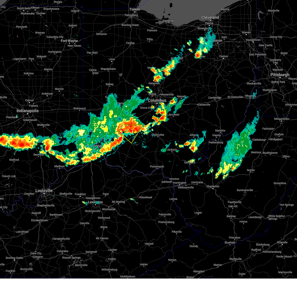 At 929 pm edt, a severe thunderstorm was located near sabina, moving east at 40 mph (radar indicated). Hazards include 60 mph wind gusts and penny size hail. Expect damage to trees and power lines. locations impacted include, washington court house, wilmington, hillsboro, sabina, leesburg, new vienna, staunton, port william, highland, melvin, bloomington, new antioch, samantha, jasper mills, lees creek, reesville, morrisville, ogden, burtonville and interstate 71 at us route 68. this includes i-71 in ohio between mile markers 50 and 57. hail threat, radar indicated max hail size, 0. 75 in wind threat, radar indicated max wind gust, 60 mph. At 929 pm edt, a severe thunderstorm was located near sabina, moving east at 40 mph (radar indicated). Hazards include 60 mph wind gusts and penny size hail. Expect damage to trees and power lines. locations impacted include, washington court house, wilmington, hillsboro, sabina, leesburg, new vienna, staunton, port william, highland, melvin, bloomington, new antioch, samantha, jasper mills, lees creek, reesville, morrisville, ogden, burtonville and interstate 71 at us route 68. this includes i-71 in ohio between mile markers 50 and 57. hail threat, radar indicated max hail size, 0. 75 in wind threat, radar indicated max wind gust, 60 mph.
|
| 7/17/2023 9:24 PM EDT |
 At 924 pm edt, a severe thunderstorm was located near jeffersonville, moving northeast at 25 mph (radar indicated). Hazards include 60 mph wind gusts and penny size hail. expect damage to trees and power lines At 924 pm edt, a severe thunderstorm was located near jeffersonville, moving northeast at 25 mph (radar indicated). Hazards include 60 mph wind gusts and penny size hail. expect damage to trees and power lines
|
| 7/17/2023 9:19 PM EDT |
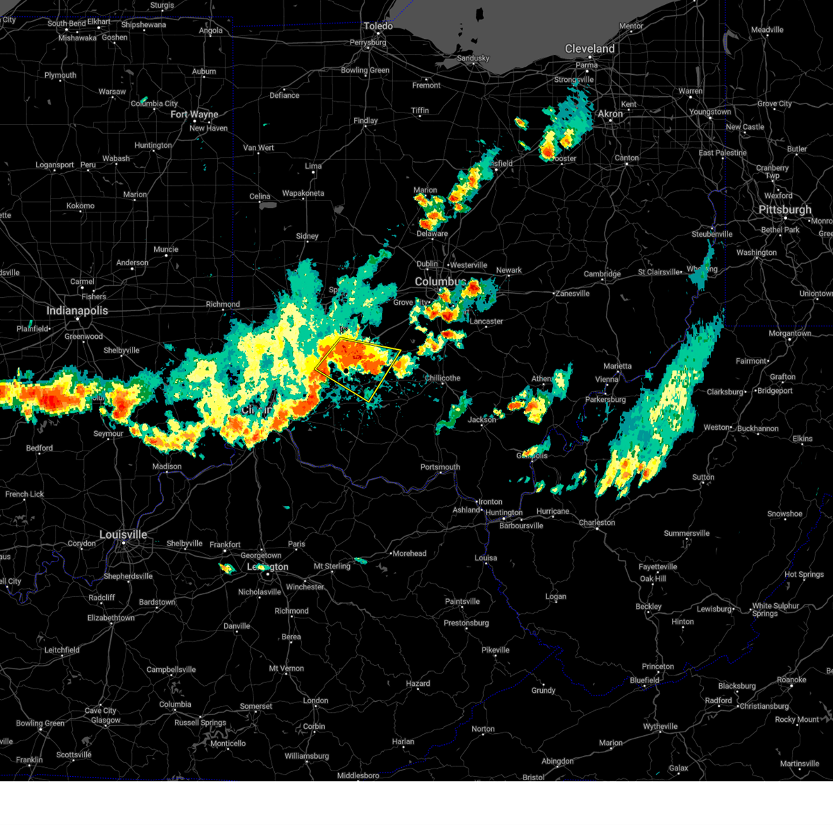 At 919 pm edt, a severe thunderstorm was located over sabina, moving east at 40 mph (radar indicated). Hazards include 60 mph wind gusts and penny size hail. Expect damage to trees and power lines. locations impacted include, washington court house, wilmington, hillsboro, sabina, leesburg, new vienna, staunton, clarksville, harveysburg, martinsville, bowersville, highland, port william, milledgeville, paintersville, melvin, lumberton, samantha, oakland and lees creek. this includes i-71 in ohio between mile markers 37 and 63. hail threat, radar indicated max hail size, 0. 75 in wind threat, radar indicated max wind gust, 60 mph. At 919 pm edt, a severe thunderstorm was located over sabina, moving east at 40 mph (radar indicated). Hazards include 60 mph wind gusts and penny size hail. Expect damage to trees and power lines. locations impacted include, washington court house, wilmington, hillsboro, sabina, leesburg, new vienna, staunton, clarksville, harveysburg, martinsville, bowersville, highland, port william, milledgeville, paintersville, melvin, lumberton, samantha, oakland and lees creek. this includes i-71 in ohio between mile markers 37 and 63. hail threat, radar indicated max hail size, 0. 75 in wind threat, radar indicated max wind gust, 60 mph.
|
| 7/17/2023 9:07 PM EDT |
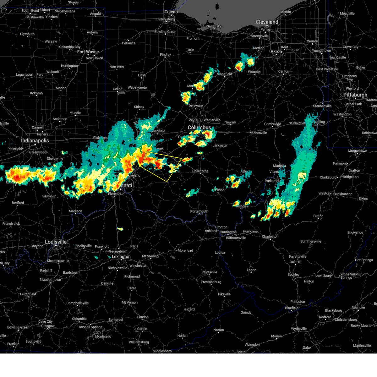 At 907 pm edt, a severe thunderstorm was located near wilmington, moving east at 40 mph (radar indicated). Hazards include 70 mph wind gusts and penny size hail. Expect considerable tree damage. damage is likely to mobile homes, roofs, and outbuildings. locations impacted include, xenia, washington court house, wilmington, hillsboro, sabina, leesburg, new vienna, staunton, clarksville, harveysburg, spring valley, martinsville, corwin, bowersville, highland, port william, milledgeville, paintersville, melvin and lumberton. this includes i-71 in ohio between mile markers 36 and 63. thunderstorm damage threat, considerable hail threat, radar indicated max hail size, 0. 75 in wind threat, radar indicated max wind gust, 70 mph. At 907 pm edt, a severe thunderstorm was located near wilmington, moving east at 40 mph (radar indicated). Hazards include 70 mph wind gusts and penny size hail. Expect considerable tree damage. damage is likely to mobile homes, roofs, and outbuildings. locations impacted include, xenia, washington court house, wilmington, hillsboro, sabina, leesburg, new vienna, staunton, clarksville, harveysburg, spring valley, martinsville, corwin, bowersville, highland, port william, milledgeville, paintersville, melvin and lumberton. this includes i-71 in ohio between mile markers 36 and 63. thunderstorm damage threat, considerable hail threat, radar indicated max hail size, 0. 75 in wind threat, radar indicated max wind gust, 70 mph.
|
| 7/17/2023 8:59 PM EDT |
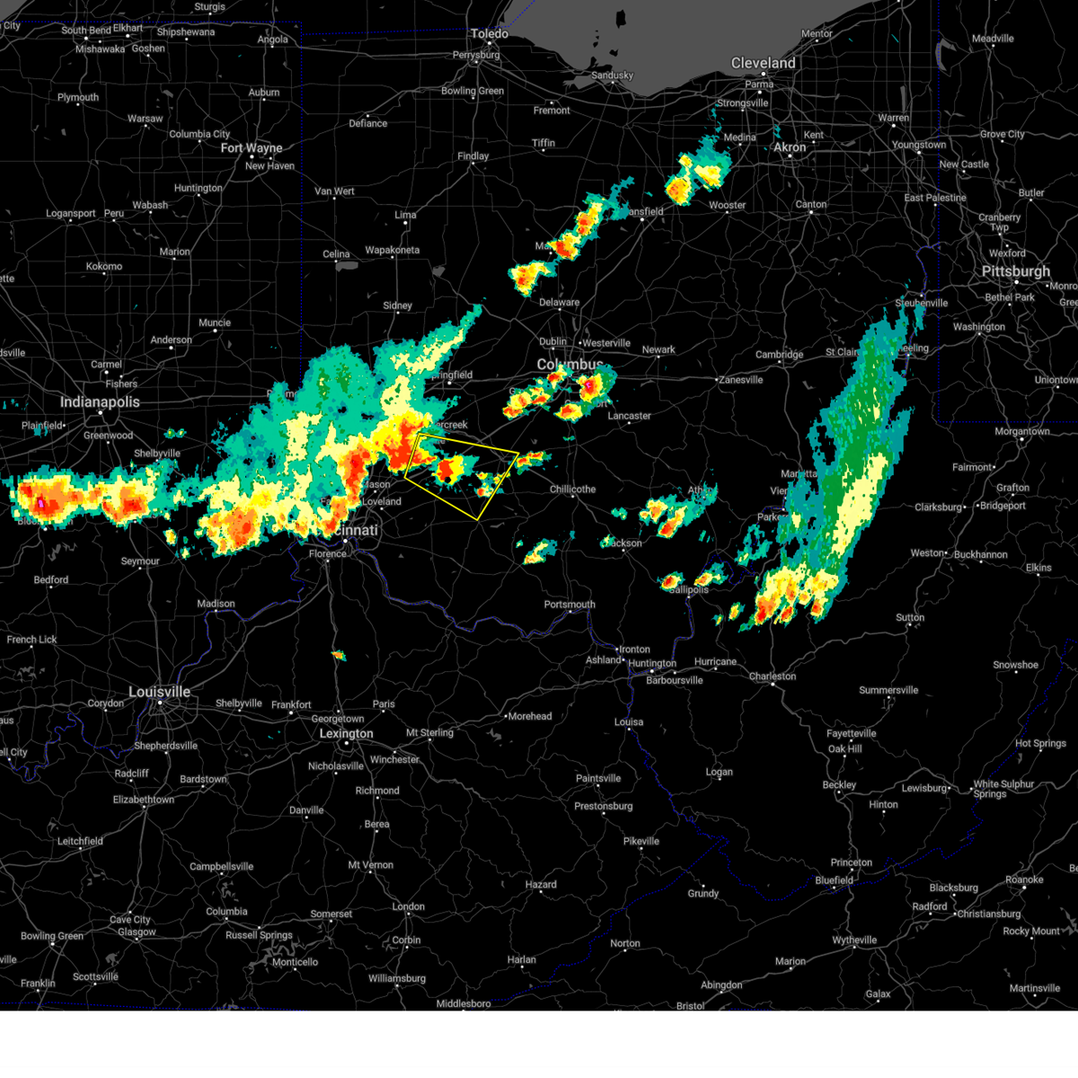 At 858 pm edt, a severe thunderstorm was located 7 miles east of waynesville, moving east at 40 mph (radar indicated). Hazards include 70 mph wind gusts. Expect considerable tree damage. Damage is likely to mobile homes, roofs, and outbuildings. At 858 pm edt, a severe thunderstorm was located 7 miles east of waynesville, moving east at 40 mph (radar indicated). Hazards include 70 mph wind gusts. Expect considerable tree damage. Damage is likely to mobile homes, roofs, and outbuildings.
|
| 4/5/2023 4:50 PM EDT |
 At 449 pm edt, a severe thunderstorm was located near washington court house, moving east at 55 mph (radar indicated). Hazards include 60 mph wind gusts and penny size hail. Expect damage to trees and power lines. locations impacted include, chillicothe, washington court house, circleville, greenfield, south bloomfield, leesburg, jeffersonville, kingston, williamsport, bloomingburg, new holland, logan elm village, staunton, good hope, frankfort, fox, clarksburg, highland, south salem and east ringgold. hail threat, radar indicated max hail size, 0. 75 in wind threat, radar indicated max wind gust, 60 mph. At 449 pm edt, a severe thunderstorm was located near washington court house, moving east at 55 mph (radar indicated). Hazards include 60 mph wind gusts and penny size hail. Expect damage to trees and power lines. locations impacted include, chillicothe, washington court house, circleville, greenfield, south bloomfield, leesburg, jeffersonville, kingston, williamsport, bloomingburg, new holland, logan elm village, staunton, good hope, frankfort, fox, clarksburg, highland, south salem and east ringgold. hail threat, radar indicated max hail size, 0. 75 in wind threat, radar indicated max wind gust, 60 mph.
|
| 4/5/2023 4:39 PM EDT |
 At 439 pm edt, a severe thunderstorm was located near sabina, moving east at 55 mph (radar indicated). Hazards include 60 mph wind gusts and penny size hail. expect damage to trees and power lines At 439 pm edt, a severe thunderstorm was located near sabina, moving east at 55 mph (radar indicated). Hazards include 60 mph wind gusts and penny size hail. expect damage to trees and power lines
|
| 3/25/2023 12:54 PM EDT |
 The severe thunderstorm warning for northeastern fayette county will expire at 100 pm edt, the storms which prompted the warning have moved out of the area. therefore, the warning will be allowed to expire. however gusty winds are still possible with these thunderstorms. please report previous wind damage or hail to the national weather service by going to our website at weather.gov/iln and submitting your report via social media. The severe thunderstorm warning for northeastern fayette county will expire at 100 pm edt, the storms which prompted the warning have moved out of the area. therefore, the warning will be allowed to expire. however gusty winds are still possible with these thunderstorms. please report previous wind damage or hail to the national weather service by going to our website at weather.gov/iln and submitting your report via social media.
|
| 3/25/2023 12:51 PM EDT |
 At 1251 pm edt, severe thunderstorms were located along a line extending from mount sterling to washington court house, moving northeast at 35 mph (radar indicated). Hazards include 60 mph wind gusts. Expect damage to trees and power lines. locations impacted include, washington court house, mount sterling, bloomingburg, new holland, madison mills and pancoastburg. hail threat, radar indicated max hail size, <. 75 in wind threat, radar indicated max wind gust, 60 mph. At 1251 pm edt, severe thunderstorms were located along a line extending from mount sterling to washington court house, moving northeast at 35 mph (radar indicated). Hazards include 60 mph wind gusts. Expect damage to trees and power lines. locations impacted include, washington court house, mount sterling, bloomingburg, new holland, madison mills and pancoastburg. hail threat, radar indicated max hail size, <. 75 in wind threat, radar indicated max wind gust, 60 mph.
|
| 3/25/2023 12:43 PM EDT |
 At 1242 pm edt, severe thunderstorms were located along a line extending from 6 miles west of mount sterling to near lynchburg, moving east at 35 mph (radar indicated). Hazards include 60 mph wind gusts. Expect damage to trees and power lines. locations impacted include, washington court house, hillsboro, greenfield, sabina, mount sterling, lynchburg, leesburg, new vienna, jeffersonville, bloomingburg, new holland, staunton, good hope, martinsville, highland, milledgeville, interstate 71 at state route 38, east monroe, samantha and lees creek. this includes i-71 in ohio between mile markers 68 and 76. hail threat, radar indicated max hail size, <. 75 in wind threat, radar indicated max wind gust, 60 mph. At 1242 pm edt, severe thunderstorms were located along a line extending from 6 miles west of mount sterling to near lynchburg, moving east at 35 mph (radar indicated). Hazards include 60 mph wind gusts. Expect damage to trees and power lines. locations impacted include, washington court house, hillsboro, greenfield, sabina, mount sterling, lynchburg, leesburg, new vienna, jeffersonville, bloomingburg, new holland, staunton, good hope, martinsville, highland, milledgeville, interstate 71 at state route 38, east monroe, samantha and lees creek. this includes i-71 in ohio between mile markers 68 and 76. hail threat, radar indicated max hail size, <. 75 in wind threat, radar indicated max wind gust, 60 mph.
|
| 3/25/2023 12:32 PM EDT |
 At 1232 pm edt, severe thunderstorms were located along a line extending from near jeffersonville to near lynchburg, moving east at 35 mph (radar indicated). Hazards include 60 mph wind gusts. Expect damage to trees and power lines. locations impacted include, washington court house, wilmington, hillsboro, greenfield, blanchester, sabina, mount sterling, lynchburg, leesburg, new vienna, jeffersonville, bloomingburg, new holland, staunton, good hope, martinsville, midland, bowersville, highland and milledgeville. this includes i-71 in ohio between mile markers 56 and 77. hail threat, radar indicated max hail size, <. 75 in wind threat, radar indicated max wind gust, 60 mph. At 1232 pm edt, severe thunderstorms were located along a line extending from near jeffersonville to near lynchburg, moving east at 35 mph (radar indicated). Hazards include 60 mph wind gusts. Expect damage to trees and power lines. locations impacted include, washington court house, wilmington, hillsboro, greenfield, blanchester, sabina, mount sterling, lynchburg, leesburg, new vienna, jeffersonville, bloomingburg, new holland, staunton, good hope, martinsville, midland, bowersville, highland and milledgeville. this includes i-71 in ohio between mile markers 56 and 77. hail threat, radar indicated max hail size, <. 75 in wind threat, radar indicated max wind gust, 60 mph.
|
| 3/25/2023 12:20 PM EDT |
 At 1219 pm edt, severe thunderstorms were located along a line extending from near jeffersonville to near blanchester, moving east at 35 mph (radar indicated). Hazards include 60 mph wind gusts. expect damage to trees and power lines At 1219 pm edt, severe thunderstorms were located along a line extending from near jeffersonville to near blanchester, moving east at 35 mph (radar indicated). Hazards include 60 mph wind gusts. expect damage to trees and power lines
|
| 3/3/2023 6:03 PM EST |
 At 602 pm est, severe thunderstorms were located along a line extending from near new holland to near kincaid springs, moving northeast at 55 mph. gusty winds are expected immediately behind the line of storms (radar indicated). Hazards include 70 mph wind gusts. Expect considerable tree damage. damage is likely to mobile homes, roofs, and outbuildings. locations impacted include, washington court house, greenfield, west union, peebles, leesburg, marshall, seaman, belfast, rocky fork point, highland holiday, staunton, good hope, sinking spring, east monroe, dunkinsville, may hill, rock mills, berrysville, cedar mills and new martinsburg. thunderstorm damage threat, considerable hail threat, radar indicated max hail size, <. 75 in wind threat, radar indicated max wind gust, 70 mph. At 602 pm est, severe thunderstorms were located along a line extending from near new holland to near kincaid springs, moving northeast at 55 mph. gusty winds are expected immediately behind the line of storms (radar indicated). Hazards include 70 mph wind gusts. Expect considerable tree damage. damage is likely to mobile homes, roofs, and outbuildings. locations impacted include, washington court house, greenfield, west union, peebles, leesburg, marshall, seaman, belfast, rocky fork point, highland holiday, staunton, good hope, sinking spring, east monroe, dunkinsville, may hill, rock mills, berrysville, cedar mills and new martinsburg. thunderstorm damage threat, considerable hail threat, radar indicated max hail size, <. 75 in wind threat, radar indicated max wind gust, 70 mph.
|
| 3/3/2023 5:51 PM EST |
 At 551 pm est, severe thunderstorms were located along a line extending from 6 miles southwest of washington court house to near belfast, moving northeast at 55 mph (radar indicated). Hazards include 70 mph wind gusts. Expect considerable tree damage. damage is likely to mobile homes, roofs, and outbuildings. locations impacted include, washington court house, hillsboro, greenfield, west union, peebles, leesburg, new vienna, winchester, marshall, seaman, belfast, rocky fork point, highland holiday, staunton, new market, good hope, emerald, highland, cherry fork and sinking spring. thunderstorm damage threat, considerable hail threat, radar indicated max hail size, <. 75 in wind threat, radar indicated max wind gust, 70 mph. At 551 pm est, severe thunderstorms were located along a line extending from 6 miles southwest of washington court house to near belfast, moving northeast at 55 mph (radar indicated). Hazards include 70 mph wind gusts. Expect considerable tree damage. damage is likely to mobile homes, roofs, and outbuildings. locations impacted include, washington court house, hillsboro, greenfield, west union, peebles, leesburg, new vienna, winchester, marshall, seaman, belfast, rocky fork point, highland holiday, staunton, new market, good hope, emerald, highland, cherry fork and sinking spring. thunderstorm damage threat, considerable hail threat, radar indicated max hail size, <. 75 in wind threat, radar indicated max wind gust, 70 mph.
|
| 3/3/2023 5:40 PM EST |
 At 540 pm est, severe thunderstorms were located along a line extending from near leesburg to winchester, moving northeast at 55 mph (radar indicated). Hazards include 70 mph wind gusts. Expect considerable tree damage. damage is likely to mobile homes, roofs, and outbuildings. locations impacted include, washington court house, hillsboro, greenfield, west union, sabina, peebles, lynchburg, leesburg, new vienna, winchester, marshall, seaman, belfast, rocky fork point, highland holiday, russell, staunton, new market, good hope and emerald. thunderstorm damage threat, considerable hail threat, radar indicated max hail size, <. 75 in wind threat, radar indicated max wind gust, 70 mph. At 540 pm est, severe thunderstorms were located along a line extending from near leesburg to winchester, moving northeast at 55 mph (radar indicated). Hazards include 70 mph wind gusts. Expect considerable tree damage. damage is likely to mobile homes, roofs, and outbuildings. locations impacted include, washington court house, hillsboro, greenfield, west union, sabina, peebles, lynchburg, leesburg, new vienna, winchester, marshall, seaman, belfast, rocky fork point, highland holiday, russell, staunton, new market, good hope and emerald. thunderstorm damage threat, considerable hail threat, radar indicated max hail size, <. 75 in wind threat, radar indicated max wind gust, 70 mph.
|
| 3/3/2023 5:23 PM EST |
 At 522 pm est, severe thunderstorms were located along a line extending from near lynchburg to near georgetown, moving northeast at 55 mph (radar indicated). Hazards include 70 mph wind gusts. Expect considerable tree damage. Damage is likely to mobile homes, roofs, and outbuildings. At 522 pm est, severe thunderstorms were located along a line extending from near lynchburg to near georgetown, moving northeast at 55 mph (radar indicated). Hazards include 70 mph wind gusts. Expect considerable tree damage. Damage is likely to mobile homes, roofs, and outbuildings.
|
| 2/27/2023 3:45 PM EST |
 At 344 pm est, a severe thunderstorm was located over bloomingburg, moving northeast at 55 mph (radar indicated). Hazards include 60 mph wind gusts and nickel size hail. Expect damage to trees and power lines. locations impacted include, washington court house, williamsport, bloomingburg, new holland, staunton, deer creek lake, madison mills, state route 207 at us route 22, derby, jasper mills and pancoastburg. hail threat, radar indicated max hail size, 0. 88 in wind threat, radar indicated max wind gust, 60 mph. At 344 pm est, a severe thunderstorm was located over bloomingburg, moving northeast at 55 mph (radar indicated). Hazards include 60 mph wind gusts and nickel size hail. Expect damage to trees and power lines. locations impacted include, washington court house, williamsport, bloomingburg, new holland, staunton, deer creek lake, madison mills, state route 207 at us route 22, derby, jasper mills and pancoastburg. hail threat, radar indicated max hail size, 0. 88 in wind threat, radar indicated max wind gust, 60 mph.
|
| 2/27/2023 3:31 PM EST |
 At 331 pm est, a severe thunderstorm was located over sabina, moving northeast at 55 mph (radar indicated). Hazards include 60 mph wind gusts and nickel size hail. expect damage to trees and power lines At 331 pm est, a severe thunderstorm was located over sabina, moving northeast at 55 mph (radar indicated). Hazards include 60 mph wind gusts and nickel size hail. expect damage to trees and power lines
|
| 8/3/2022 8:07 PM EDT |
 At 807 pm edt, a severe thunderstorm was located over sabina, moving northeast at 20 mph (radar indicated). Hazards include 60 mph wind gusts and penny size hail. Expect damage to trees and power lines. locations impacted include, washington court house, sabina, jeffersonville, bloomingburg, staunton, milledgeville, octa, lees creek, reesville, bloomington and jasper mills. this includes i-71 in ohio between mile markers 69 and 70. hail threat, radar indicated max hail size, 0. 75 in wind threat, radar indicated max wind gust, 60 mph. At 807 pm edt, a severe thunderstorm was located over sabina, moving northeast at 20 mph (radar indicated). Hazards include 60 mph wind gusts and penny size hail. Expect damage to trees and power lines. locations impacted include, washington court house, sabina, jeffersonville, bloomingburg, staunton, milledgeville, octa, lees creek, reesville, bloomington and jasper mills. this includes i-71 in ohio between mile markers 69 and 70. hail threat, radar indicated max hail size, 0. 75 in wind threat, radar indicated max wind gust, 60 mph.
|
| 8/3/2022 7:52 PM EDT |
 At 751 pm edt, a severe thunderstorm was located near sabina, moving northeast at 20 mph (radar indicated). Hazards include 60 mph wind gusts and penny size hail. expect damage to trees and power lines At 751 pm edt, a severe thunderstorm was located near sabina, moving northeast at 20 mph (radar indicated). Hazards include 60 mph wind gusts and penny size hail. expect damage to trees and power lines
|
| 7/23/2022 12:14 PM EDT | Large branch fell on house on south hinde. photo verified. time estimated from rada in fayette county OH, 0.6 miles N of Washington Court House, OH |
| 6/13/2022 6:55 PM EDT |
 At 654 pm edt, severe thunderstorms were located along a line extending from near mount sterling to near cynthiana, moving east at 45 mph (radar indicated). Hazards include 60 mph wind gusts and penny size hail. Expect damage to trees and power lines. locations impacted include, washington court house, hillsboro, greenfield, sabina, mount sterling, south charleston, lynchburg, leesburg, jeffersonville, marshall, bloomingburg, new holland, belfast, highland holiday, rocky fork point, russell, lisbon, staunton, new market and good hope. this includes i-71 in ohio between mile markers 65 and 87. hail threat, radar indicated max hail size, 0. 75 in wind threat, radar indicated max wind gust, 60 mph. At 654 pm edt, severe thunderstorms were located along a line extending from near mount sterling to near cynthiana, moving east at 45 mph (radar indicated). Hazards include 60 mph wind gusts and penny size hail. Expect damage to trees and power lines. locations impacted include, washington court house, hillsboro, greenfield, sabina, mount sterling, south charleston, lynchburg, leesburg, jeffersonville, marshall, bloomingburg, new holland, belfast, highland holiday, rocky fork point, russell, lisbon, staunton, new market and good hope. this includes i-71 in ohio between mile markers 65 and 87. hail threat, radar indicated max hail size, 0. 75 in wind threat, radar indicated max wind gust, 60 mph.
|
| 6/13/2022 6:12 PM EDT |
 At 611 pm edt, severe thunderstorms were located along a line extending from near xenia to blanchester, moving east at 45 mph (radar indicated). Hazards include 70 mph wind gusts and penny size hail. Expect considerable tree damage. Damage is likely to mobile homes, roofs, and outbuildings. At 611 pm edt, severe thunderstorms were located along a line extending from near xenia to blanchester, moving east at 45 mph (radar indicated). Hazards include 70 mph wind gusts and penny size hail. Expect considerable tree damage. Damage is likely to mobile homes, roofs, and outbuildings.
|
| 6/6/2022 2:23 PM EDT |
 The severe thunderstorm warning for northern fayette, northwestern pickaway, southeastern clark, east central greene and southern madison counties will expire at 230 pm edt, the storm which prompted the warning has weakened below severe limits, and no longer poses an immediate threat to life or property. therefore, the warning will be allowed to expire. however gusty winds are still possible with this thunderstorm. please report previous wind damage or hail to the national weather service by going to our website at weather.gov/iln and submitting your report via social media. The severe thunderstorm warning for northern fayette, northwestern pickaway, southeastern clark, east central greene and southern madison counties will expire at 230 pm edt, the storm which prompted the warning has weakened below severe limits, and no longer poses an immediate threat to life or property. therefore, the warning will be allowed to expire. however gusty winds are still possible with this thunderstorm. please report previous wind damage or hail to the national weather service by going to our website at weather.gov/iln and submitting your report via social media.
|
| 6/6/2022 2:15 PM EDT | Large tree down blocking residential road in washington court house... oh. time estimated from rada in fayette county OH, 0.1 miles SW of Washington Court House, OH |
| 6/6/2022 2:06 PM EDT |
 At 205 pm edt, a severe thunderstorm was located near jeffersonville, moving northeast at 45 mph (radar indicated). Hazards include 60 mph wind gusts. Expect damage to trees and power lines. locations impacted include, washington court house, mount sterling, jeffersonville, bloomingburg, south solon, midway, milledgeville, octa, newport, chenoweth, interstate 71 at state route 38, derby, rosemoor, madison mills, bookwalter, shady grove and interstate 71 at us route 35. this includes i-71 in ohio between mile markers 64 and 88. hail threat, radar indicated max hail size, <. 75 in wind threat, radar indicated max wind gust, 60 mph. At 205 pm edt, a severe thunderstorm was located near jeffersonville, moving northeast at 45 mph (radar indicated). Hazards include 60 mph wind gusts. Expect damage to trees and power lines. locations impacted include, washington court house, mount sterling, jeffersonville, bloomingburg, south solon, midway, milledgeville, octa, newport, chenoweth, interstate 71 at state route 38, derby, rosemoor, madison mills, bookwalter, shady grove and interstate 71 at us route 35. this includes i-71 in ohio between mile markers 64 and 88. hail threat, radar indicated max hail size, <. 75 in wind threat, radar indicated max wind gust, 60 mph.
|
| 6/6/2022 1:55 PM EDT |
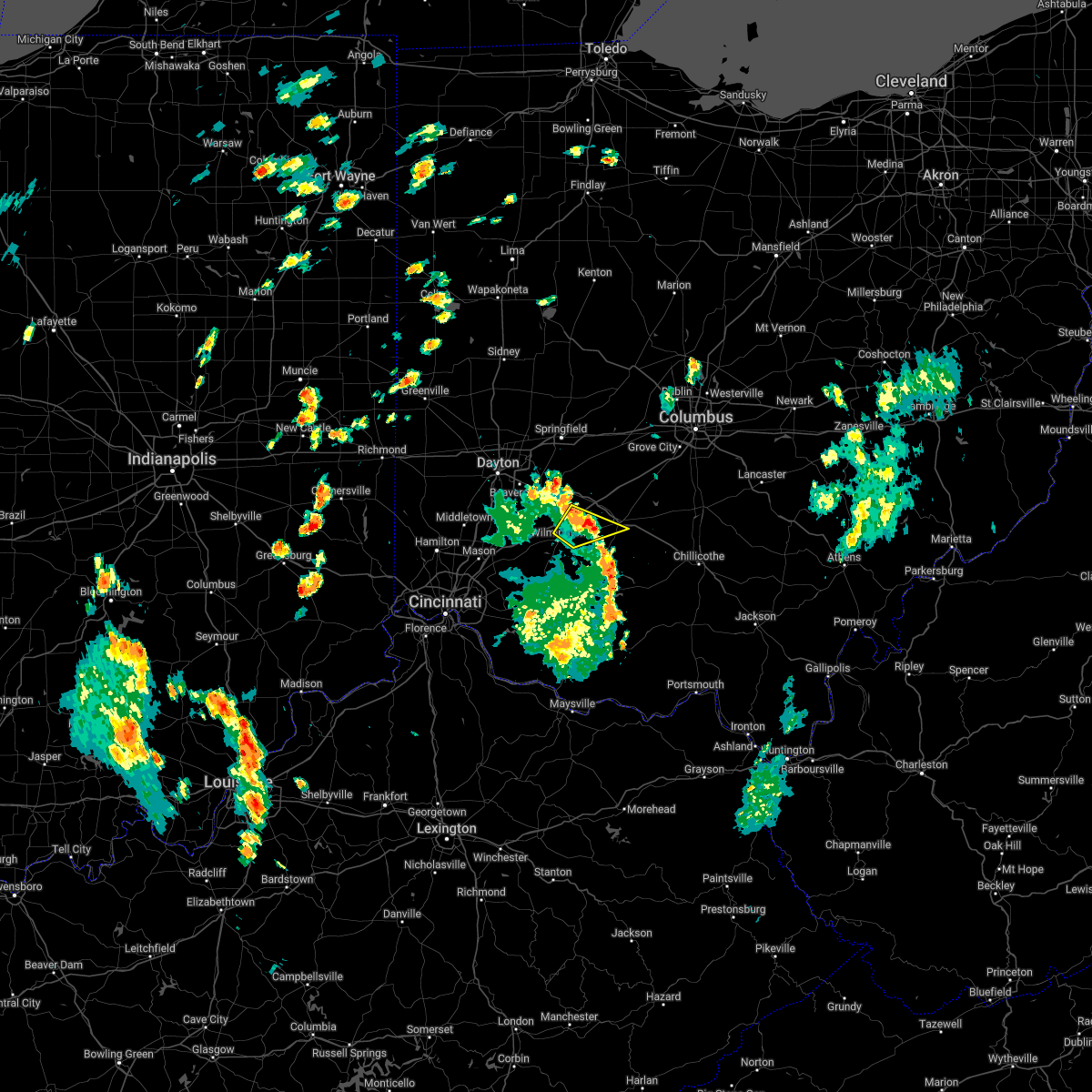 The severe thunderstorm warning for west central fayette, northeastern clinton and southeastern greene counties will expire at 200 pm edt, the storm which prompted the warning has moved out of the area. therefore, the warning will be allowed to expire. a new warning has been issued just to the northeast, which still includes portions of northeastern clinton and southeastern greene counties. please report previous wind damage or hail to the national weather service by going to our website at weather.gov/iln and submitting your report via social media. The severe thunderstorm warning for west central fayette, northeastern clinton and southeastern greene counties will expire at 200 pm edt, the storm which prompted the warning has moved out of the area. therefore, the warning will be allowed to expire. a new warning has been issued just to the northeast, which still includes portions of northeastern clinton and southeastern greene counties. please report previous wind damage or hail to the national weather service by going to our website at weather.gov/iln and submitting your report via social media.
|
| 6/6/2022 1:50 PM EDT |
 At 149 pm edt, a severe thunderstorm was located near sabina, moving northeast at 45 mph (radar indicated). Hazards include 60 mph wind gusts. expect damage to trees and power lines At 149 pm edt, a severe thunderstorm was located near sabina, moving northeast at 45 mph (radar indicated). Hazards include 60 mph wind gusts. expect damage to trees and power lines
|
| 6/6/2022 1:39 PM EDT |
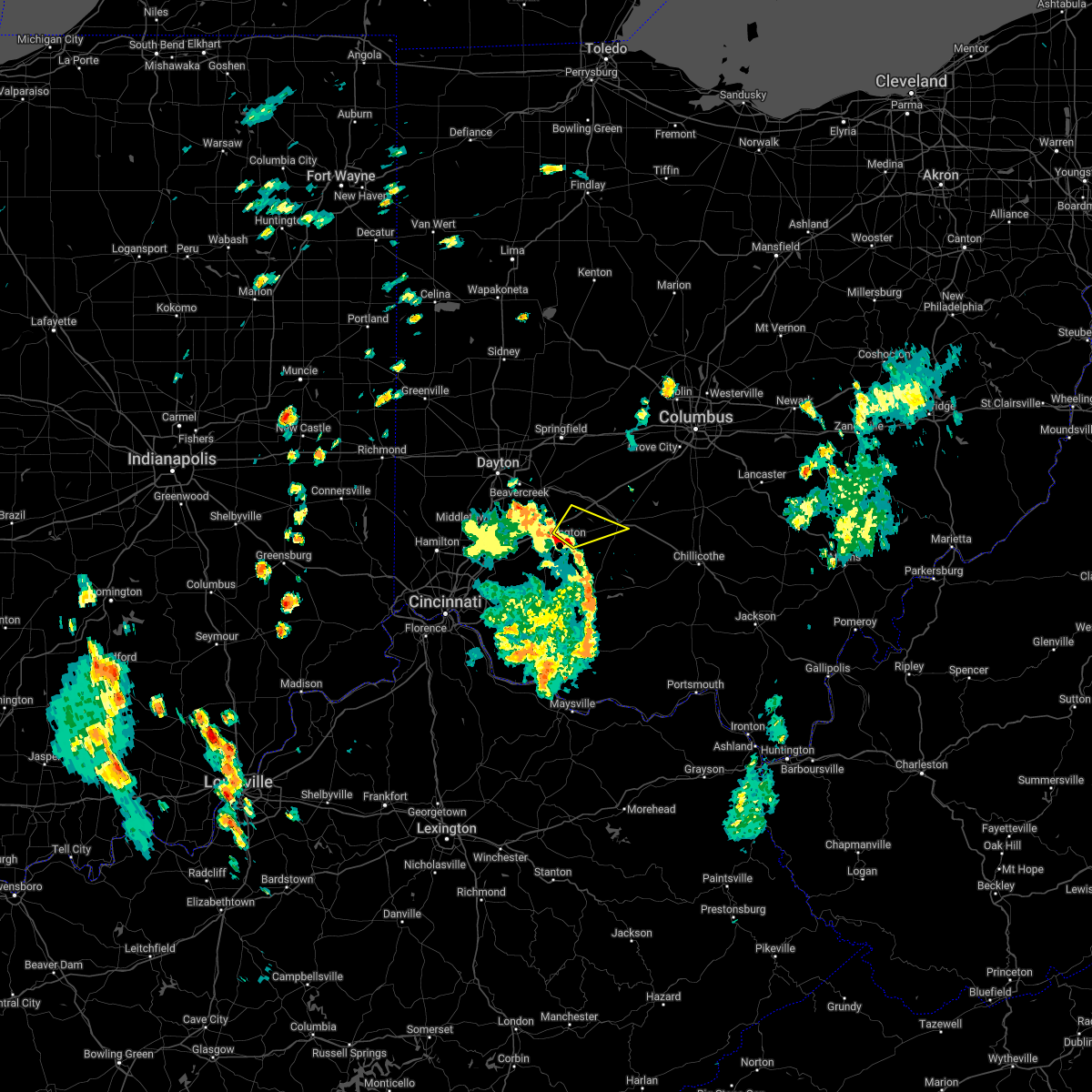 At 138 pm edt, a severe thunderstorm was located near wilmington, moving northeast at 35 mph (64 mph wind gust recorded at wilmington, oh office). Hazards include 60 mph wind gusts. Expect damage to trees and power lines. locations impacted include, washington court house, wilmington, sabina, bowersville, port william, melvin, reesville, bloomington and jasper mills. this includes i-71 in ohio between mile markers 53 and 61. hail threat, radar indicated max hail size, <. 75 in wind threat, radar indicated max wind gust, 60 mph. At 138 pm edt, a severe thunderstorm was located near wilmington, moving northeast at 35 mph (64 mph wind gust recorded at wilmington, oh office). Hazards include 60 mph wind gusts. Expect damage to trees and power lines. locations impacted include, washington court house, wilmington, sabina, bowersville, port william, melvin, reesville, bloomington and jasper mills. this includes i-71 in ohio between mile markers 53 and 61. hail threat, radar indicated max hail size, <. 75 in wind threat, radar indicated max wind gust, 60 mph.
|
| 6/6/2022 1:32 PM EDT |
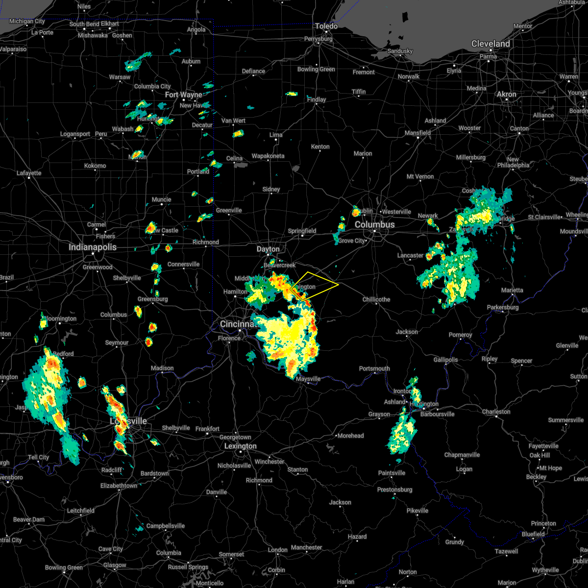 At 131 pm edt, a severe thunderstorm was located over wilmington, moving northeast at 35 mph (radar indicated). Hazards include 60 mph wind gusts. expect damage to trees and power lines At 131 pm edt, a severe thunderstorm was located over wilmington, moving northeast at 35 mph (radar indicated). Hazards include 60 mph wind gusts. expect damage to trees and power lines
|
| 5/21/2022 6:25 PM EDT |
 The severe thunderstorm warning for central fayette county will expire at 630 pm edt, the storm which prompted the warning has weakened below severe limits, and no longer poses an immediate threat to life or property. therefore, the warning will be allowed to expire. however small hail, gusty winds and heavy rain are still possible with this thunderstorm. a severe thunderstorm watch remains in effect until 1000 pm edt for central and southwestern ohio. please report previous wind damage or hail to the national weather service by going to our website at weather.gov/iln and submitting your report via social media. The severe thunderstorm warning for central fayette county will expire at 630 pm edt, the storm which prompted the warning has weakened below severe limits, and no longer poses an immediate threat to life or property. therefore, the warning will be allowed to expire. however small hail, gusty winds and heavy rain are still possible with this thunderstorm. a severe thunderstorm watch remains in effect until 1000 pm edt for central and southwestern ohio. please report previous wind damage or hail to the national weather service by going to our website at weather.gov/iln and submitting your report via social media.
|
| 5/21/2022 6:18 PM EDT |
 At 618 pm edt, a severe thunderstorm was located near washington court house, moving east at 40 mph (radar indicated). Hazards include 60 mph wind gusts and quarter size hail. Minor hail damage to vehicles is possible. expect wind damage to trees and power lines. locations impacted include, washington court house, bloomingburg, madison mills and pancoastburg. hail threat, radar indicated max hail size, 1. 00 in wind threat, radar indicated max wind gust, 60 mph. At 618 pm edt, a severe thunderstorm was located near washington court house, moving east at 40 mph (radar indicated). Hazards include 60 mph wind gusts and quarter size hail. Minor hail damage to vehicles is possible. expect wind damage to trees and power lines. locations impacted include, washington court house, bloomingburg, madison mills and pancoastburg. hail threat, radar indicated max hail size, 1. 00 in wind threat, radar indicated max wind gust, 60 mph.
|
| 5/21/2022 6:04 PM EDT |
 At 604 pm edt, a severe thunderstorm was located over sabina, moving east at 40 mph (radar indicated). Hazards include 60 mph wind gusts and quarter size hail. Minor hail damage to vehicles is possible. Expect wind damage to trees and power lines. At 604 pm edt, a severe thunderstorm was located over sabina, moving east at 40 mph (radar indicated). Hazards include 60 mph wind gusts and quarter size hail. Minor hail damage to vehicles is possible. Expect wind damage to trees and power lines.
|
| 5/21/2022 4:12 PM EDT |
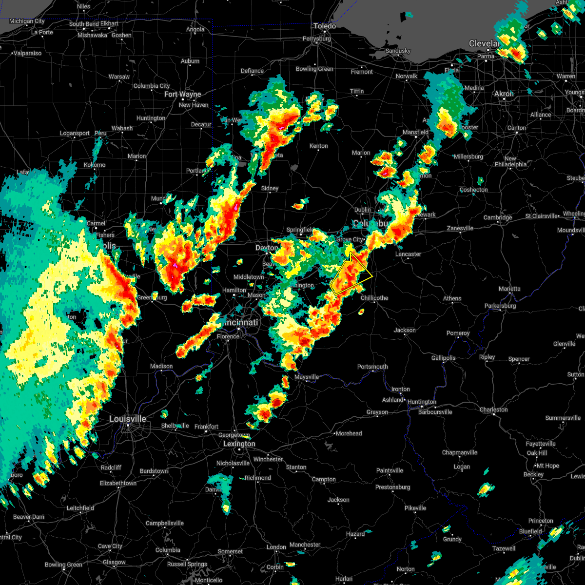 At 411 pm edt, a severe thunderstorm was located near washington court house, moving northeast at 25 mph (radar indicated). Hazards include 60 mph wind gusts and quarter size hail. Minor hail damage to vehicles is possible. expect wind damage to trees and power lines. locations impacted include, washington court house, williamsport, new holland, good hope, clarksburg, deer creek lake, state route 207 at us route 22, rock mills, pancoastburg, plano and madison mills. hail threat, radar indicated max hail size, 1. 00 in wind threat, radar indicated max wind gust, 60 mph. At 411 pm edt, a severe thunderstorm was located near washington court house, moving northeast at 25 mph (radar indicated). Hazards include 60 mph wind gusts and quarter size hail. Minor hail damage to vehicles is possible. expect wind damage to trees and power lines. locations impacted include, washington court house, williamsport, new holland, good hope, clarksburg, deer creek lake, state route 207 at us route 22, rock mills, pancoastburg, plano and madison mills. hail threat, radar indicated max hail size, 1. 00 in wind threat, radar indicated max wind gust, 60 mph.
|
| 5/21/2022 4:01 PM EDT |
 At 400 pm edt, a severe thunderstorm was located near greenfield, moving northeast at 30 mph (radar indicated). Hazards include 60 mph wind gusts and quarter size hail. Minor hail damage to vehicles is possible. expect wind damage to trees and power lines. locations impacted include, washington court house, mount sterling, williamsport, bloomingburg, new holland, staunton, good hope, clarksburg, deer creek lake, jasper mills, madison mills, state route 207 at us route 22, rock mills, new martinsburg, pancoastburg and plano. hail threat, radar indicated max hail size, 1. 00 in wind threat, radar indicated max wind gust, 60 mph. At 400 pm edt, a severe thunderstorm was located near greenfield, moving northeast at 30 mph (radar indicated). Hazards include 60 mph wind gusts and quarter size hail. Minor hail damage to vehicles is possible. expect wind damage to trees and power lines. locations impacted include, washington court house, mount sterling, williamsport, bloomingburg, new holland, staunton, good hope, clarksburg, deer creek lake, jasper mills, madison mills, state route 207 at us route 22, rock mills, new martinsburg, pancoastburg and plano. hail threat, radar indicated max hail size, 1. 00 in wind threat, radar indicated max wind gust, 60 mph.
|
| 5/21/2022 3:41 PM EDT |
 At 341 pm edt, a severe thunderstorm was located near washington court house, moving northeast at 25 mph (radar indicated). Hazards include 60 mph wind gusts and quarter size hail. Minor hail damage to vehicles is possible. Expect wind damage to trees and power lines. At 341 pm edt, a severe thunderstorm was located near washington court house, moving northeast at 25 mph (radar indicated). Hazards include 60 mph wind gusts and quarter size hail. Minor hail damage to vehicles is possible. Expect wind damage to trees and power lines.
|
| 5/3/2022 4:52 PM EDT |
 The severe thunderstorm warning for fayette and southern madison counties will expire at 500 pm edt, the storm which prompted the warning has moved out of the area. therefore, the warning will be allowed to expire. a tornado watch remains in effect until 900 pm edt for central, southwestern and west central ohio. please report previous wind damage or hail to the national weather service by going to our website at weather.gov/iln and submitting your report via social media. remember, a severe thunderstorm warning still remains in effect for franklin, northeast fayette, northern pickaway, southeast madison counties!. The severe thunderstorm warning for fayette and southern madison counties will expire at 500 pm edt, the storm which prompted the warning has moved out of the area. therefore, the warning will be allowed to expire. a tornado watch remains in effect until 900 pm edt for central, southwestern and west central ohio. please report previous wind damage or hail to the national weather service by going to our website at weather.gov/iln and submitting your report via social media. remember, a severe thunderstorm warning still remains in effect for franklin, northeast fayette, northern pickaway, southeast madison counties!.
|
| 5/3/2022 4:36 PM EDT | Barn damaged along with a few downed trees in fayette county OH, 9 miles SSE of Washington Court House, OH |
| 5/3/2022 4:35 PM EDT |
 At 434 pm edt, a severe thunderstorm was located 7 miles north of bloomingburg, moving east at 35 mph (radar indicated). Hazards include ping pong ball size hail and 60 mph wind gusts. People and animals outdoors will be injured. expect hail damage to roofs, siding, windows, and vehicles. expect wind damage to trees and power lines. locations impacted include, washington court house, mount sterling, jeffersonville, bloomingburg, new holland, south solon, midway, milledgeville, octa, newport, chenoweth, interstate 71 at state route 38, lilly chapel, madison mills, madison lake, bookwalter, big plain, shady grove, interstate 71 at us route 35 and pancoastburg. this includes i-71 in ohio between mile markers 62 and 87. hail threat, radar indicated max hail size, 1. 50 in wind threat, radar indicated max wind gust, 60 mph. At 434 pm edt, a severe thunderstorm was located 7 miles north of bloomingburg, moving east at 35 mph (radar indicated). Hazards include ping pong ball size hail and 60 mph wind gusts. People and animals outdoors will be injured. expect hail damage to roofs, siding, windows, and vehicles. expect wind damage to trees and power lines. locations impacted include, washington court house, mount sterling, jeffersonville, bloomingburg, new holland, south solon, midway, milledgeville, octa, newport, chenoweth, interstate 71 at state route 38, lilly chapel, madison mills, madison lake, bookwalter, big plain, shady grove, interstate 71 at us route 35 and pancoastburg. this includes i-71 in ohio between mile markers 62 and 87. hail threat, radar indicated max hail size, 1. 50 in wind threat, radar indicated max wind gust, 60 mph.
|
| 5/3/2022 4:24 PM EDT |
 At 423 pm edt, a severe thunderstorm was located near jeffersonville, moving northeast at 40 mph (radar indicated). Hazards include 60 mph wind gusts and quarter size hail. Minor hail damage to vehicles is possible. expect wind damage to trees and power lines. locations impacted include, washington court house, mount sterling, jeffersonville, bloomingburg, new holland, south solon, midway, milledgeville, octa, newport, chenoweth, interstate 71 at state route 38, lilly chapel, madison mills, madison lake, bookwalter, big plain, shady grove, interstate 71 at us route 35 and pancoastburg. this includes i-71 in ohio between mile markers 62 and 87. hail threat, radar indicated max hail size, 1. 00 in wind threat, radar indicated max wind gust, 60 mph. At 423 pm edt, a severe thunderstorm was located near jeffersonville, moving northeast at 40 mph (radar indicated). Hazards include 60 mph wind gusts and quarter size hail. Minor hail damage to vehicles is possible. expect wind damage to trees and power lines. locations impacted include, washington court house, mount sterling, jeffersonville, bloomingburg, new holland, south solon, midway, milledgeville, octa, newport, chenoweth, interstate 71 at state route 38, lilly chapel, madison mills, madison lake, bookwalter, big plain, shady grove, interstate 71 at us route 35 and pancoastburg. this includes i-71 in ohio between mile markers 62 and 87. hail threat, radar indicated max hail size, 1. 00 in wind threat, radar indicated max wind gust, 60 mph.
|
| 5/3/2022 4:15 PM EDT | Around 10 overturned campers at buckeye rv in jeffersonville. time estimated from rada in fayette county OH, 9.3 miles SE of Washington Court House, OH |
| 5/3/2022 4:08 PM EDT |
 At 408 pm edt, a severe thunderstorm was located near jamestown, moving northeast at 40 mph (radar indicated). Hazards include 60 mph wind gusts and quarter size hail. Minor hail damage to vehicles is possible. Expect wind damage to trees and power lines. At 408 pm edt, a severe thunderstorm was located near jamestown, moving northeast at 40 mph (radar indicated). Hazards include 60 mph wind gusts and quarter size hail. Minor hail damage to vehicles is possible. Expect wind damage to trees and power lines.
|
| 5/3/2022 2:13 PM EDT |
 At 213 pm edt, a severe thunderstorm was located near mount sterling, moving northeast at 50 mph (radar indicated). Hazards include 60 mph wind gusts and quarter size hail. Minor hail damage to vehicles is possible. expect wind damage to trees and power lines. locations impacted include, grove city, washington court house, ashville, mount sterling, south bloomfield, bloomingburg, new holland, commercial point, harrisburg, orient, lockbourne, darbyville, deer creek lake, derby, duvall, madison mills, pancoastburg and darbydale. this includes i-71 in ohio between mile markers 88 and 96. hail threat, radar indicated max hail size, 1. 00 in wind threat, radar indicated max wind gust, 60 mph. At 213 pm edt, a severe thunderstorm was located near mount sterling, moving northeast at 50 mph (radar indicated). Hazards include 60 mph wind gusts and quarter size hail. Minor hail damage to vehicles is possible. expect wind damage to trees and power lines. locations impacted include, grove city, washington court house, ashville, mount sterling, south bloomfield, bloomingburg, new holland, commercial point, harrisburg, orient, lockbourne, darbyville, deer creek lake, derby, duvall, madison mills, pancoastburg and darbydale. this includes i-71 in ohio between mile markers 88 and 96. hail threat, radar indicated max hail size, 1. 00 in wind threat, radar indicated max wind gust, 60 mph.
|
| 5/3/2022 1:57 PM EDT |
 At 156 pm edt, a severe thunderstorm was located over washington court house, moving northeast at 50 mph (radar indicated). Hazards include 60 mph wind gusts and quarter size hail. Minor hail damage to vehicles is possible. Expect wind damage to trees and power lines. At 156 pm edt, a severe thunderstorm was located over washington court house, moving northeast at 50 mph (radar indicated). Hazards include 60 mph wind gusts and quarter size hail. Minor hail damage to vehicles is possible. Expect wind damage to trees and power lines.
|
| 12/11/2021 11:19 AM EST | Storm damage reported in fayette county OH, 2.3 miles SSW of Washington Court House, OH |
| 7/29/2021 6:51 PM EDT |
 The severe thunderstorm warning for southwestern fayette, northeastern clinton and southeastern greene counties will expire at 700 pm edt, the storm which prompted the warning has weakened below severe limits, and no longer poses an immediate threat to life or property. therefore, the warning will be allowed to expire. however gusty winds are still possible with this thunderstorm. a severe thunderstorm watch remains in effect until 1000 pm edt for central, southwestern and west central ohio. The severe thunderstorm warning for southwestern fayette, northeastern clinton and southeastern greene counties will expire at 700 pm edt, the storm which prompted the warning has weakened below severe limits, and no longer poses an immediate threat to life or property. therefore, the warning will be allowed to expire. however gusty winds are still possible with this thunderstorm. a severe thunderstorm watch remains in effect until 1000 pm edt for central, southwestern and west central ohio.
|
| 7/29/2021 6:39 PM EDT |
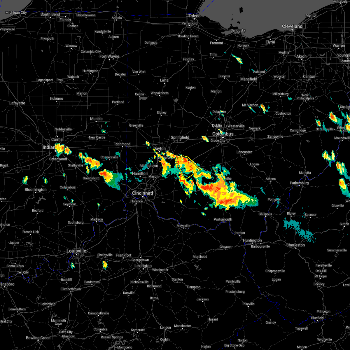 At 638 pm edt, a severe thunderstorm was located over sabina, moving southeast at 25 mph (radar indicated). Hazards include 60 mph wind gusts. Expect damage to trees and power lines. locations impacted include, washington court house, wilmington, sabina, jamestown, new jasper, staunton, bowersville, port william, milledgeville, octa, paintersville, melvin, rosemoor, bloomington, jasper mills, lees creek, reesville, interstate 71 at us route 35 and new antioch. This includes i-71 in ohio between mile markers 53 and 66. At 638 pm edt, a severe thunderstorm was located over sabina, moving southeast at 25 mph (radar indicated). Hazards include 60 mph wind gusts. Expect damage to trees and power lines. locations impacted include, washington court house, wilmington, sabina, jamestown, new jasper, staunton, bowersville, port william, milledgeville, octa, paintersville, melvin, rosemoor, bloomington, jasper mills, lees creek, reesville, interstate 71 at us route 35 and new antioch. This includes i-71 in ohio between mile markers 53 and 66.
|
| 7/29/2021 6:13 PM EDT |
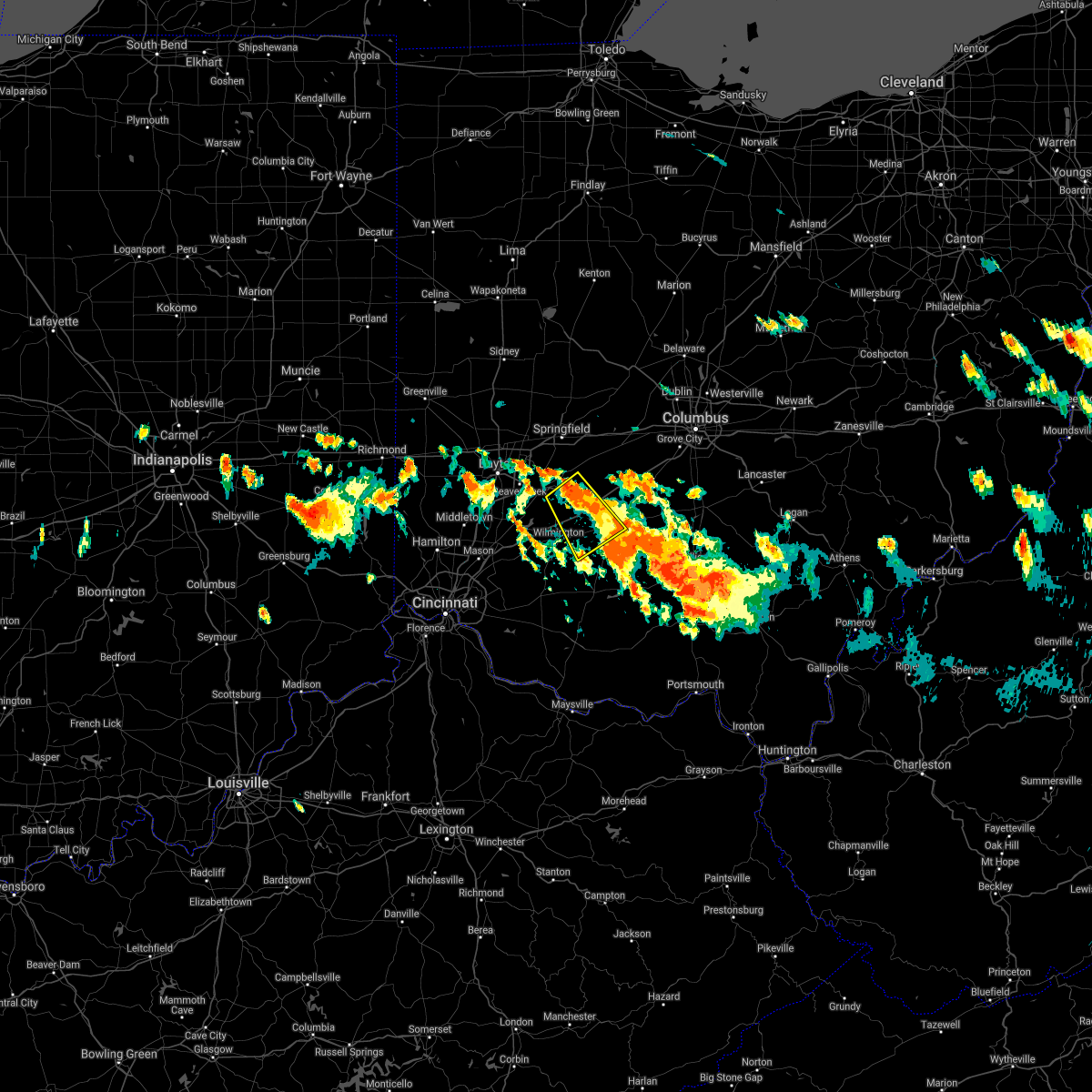 At 613 pm edt, a severe thunderstorm was located over jamestown, moving southeast at 25 mph (radar indicated). Hazards include 60 mph wind gusts and quarter size hail. Minor hail damage to vehicles is possible. Expect wind damage to trees and power lines. At 613 pm edt, a severe thunderstorm was located over jamestown, moving southeast at 25 mph (radar indicated). Hazards include 60 mph wind gusts and quarter size hail. Minor hail damage to vehicles is possible. Expect wind damage to trees and power lines.
|
| 7/29/2021 5:40 PM EDT |
 The severe thunderstorm warning for central fayette, southwestern pickaway and northwestern ross counties will expire at 545 pm edt, an additional severe thunderstorm warning is in effect for fayette and ross counties until 630 pm. a severe thunderstorm watch remains in effect until 1000 pm edt for central and southwestern ohio. please report previous wind damage or hail to the national weather service by going to our website at weather.gov/iln and submitting your report via social media. The severe thunderstorm warning for central fayette, southwestern pickaway and northwestern ross counties will expire at 545 pm edt, an additional severe thunderstorm warning is in effect for fayette and ross counties until 630 pm. a severe thunderstorm watch remains in effect until 1000 pm edt for central and southwestern ohio. please report previous wind damage or hail to the national weather service by going to our website at weather.gov/iln and submitting your report via social media.
|
| 7/29/2021 5:37 PM EDT |
 At 536 pm edt, a severe thunderstorm was located 9 miles south of new holland, moving southeast at 35 mph (radar indicated). Hazards include 70 mph wind gusts and quarter size hail. Minor hail damage to vehicles is possible. expect considerable tree damage. wind damage is also likely to mobile homes, roofs, and outbuildings. Locations impacted include, chillicothe, washington court house, greenfield, leesburg, kingston, bainbridge, new holland, north folk village, staunton, good hope, frankfort, clarksburg, south salem, east monroe, mooresville, austin, knockemstiff, rock mills, massieville and new martinsburg. At 536 pm edt, a severe thunderstorm was located 9 miles south of new holland, moving southeast at 35 mph (radar indicated). Hazards include 70 mph wind gusts and quarter size hail. Minor hail damage to vehicles is possible. expect considerable tree damage. wind damage is also likely to mobile homes, roofs, and outbuildings. Locations impacted include, chillicothe, washington court house, greenfield, leesburg, kingston, bainbridge, new holland, north folk village, staunton, good hope, frankfort, clarksburg, south salem, east monroe, mooresville, austin, knockemstiff, rock mills, massieville and new martinsburg.
|
| 7/29/2021 5:34 PM EDT |
 At 534 pm edt, a severe thunderstorm was located near north folk village, moving southeast at 50 mph (radar indicated). Hazards include 70 mph wind gusts and quarter size hail. Minor hail damage to vehicles is possible. expect considerable tree damage. wind damage is also likely to mobile homes, roofs, and outbuildings. Locations impacted include, washington court house, williamsport, bloomingburg, new holland, staunton, good hope, frankfort, clarksburg, deer creek lake, andersonville, austin, jasper mills, pickaway county airport, rock mills, pancoastburg and plano. At 534 pm edt, a severe thunderstorm was located near north folk village, moving southeast at 50 mph (radar indicated). Hazards include 70 mph wind gusts and quarter size hail. Minor hail damage to vehicles is possible. expect considerable tree damage. wind damage is also likely to mobile homes, roofs, and outbuildings. Locations impacted include, washington court house, williamsport, bloomingburg, new holland, staunton, good hope, frankfort, clarksburg, deer creek lake, andersonville, austin, jasper mills, pickaway county airport, rock mills, pancoastburg and plano.
|
| 7/29/2021 5:24 PM EDT |
 At 524 pm edt, a severe thunderstorm was located near new holland, moving southeast at 35 mph (radar indicated). Hazards include 70 mph wind gusts and quarter size hail. Minor hail damage to vehicles is possible. expect considerable tree damage. Wind damage is also likely to mobile homes, roofs, and outbuildings. At 524 pm edt, a severe thunderstorm was located near new holland, moving southeast at 35 mph (radar indicated). Hazards include 70 mph wind gusts and quarter size hail. Minor hail damage to vehicles is possible. expect considerable tree damage. Wind damage is also likely to mobile homes, roofs, and outbuildings.
|
| 7/29/2021 5:17 PM EDT | Multiple trees down on us-62n. time est from rada in fayette county OH, 6.8 miles SW of Washington Court House, OH |
| 7/29/2021 5:09 PM EDT |
 At 509 pm edt, a severe thunderstorm was located near new holland, moving southeast at 35 mph (radar indicated). Hazards include 70 mph wind gusts and quarter size hail. Minor hail damage to vehicles is possible. expect considerable tree damage. wind damage is also likely to mobile homes, roofs, and outbuildings. locations impacted include, washington court house, jeffersonville, williamsport, bloomingburg, new holland, staunton, good hope, frankfort, clarksburg, milledgeville, deer creek lake, andersonville, austin, jasper mills, madison mills and rock mills. This includes i-71 in ohio between mile markers 66 and 75. At 509 pm edt, a severe thunderstorm was located near new holland, moving southeast at 35 mph (radar indicated). Hazards include 70 mph wind gusts and quarter size hail. Minor hail damage to vehicles is possible. expect considerable tree damage. wind damage is also likely to mobile homes, roofs, and outbuildings. locations impacted include, washington court house, jeffersonville, williamsport, bloomingburg, new holland, staunton, good hope, frankfort, clarksburg, milledgeville, deer creek lake, andersonville, austin, jasper mills, madison mills and rock mills. This includes i-71 in ohio between mile markers 66 and 75.
|
| 7/29/2021 5:00 PM EDT |
 At 459 pm edt, a severe thunderstorm was located near mount sterling, moving southeast at 50 mph (radar indicated). Hazards include 70 mph wind gusts and quarter size hail. Minor hail damage to vehicles is possible. expect considerable tree damage. Wind damage is also likely to mobile homes, roofs, and outbuildings. At 459 pm edt, a severe thunderstorm was located near mount sterling, moving southeast at 50 mph (radar indicated). Hazards include 70 mph wind gusts and quarter size hail. Minor hail damage to vehicles is possible. expect considerable tree damage. Wind damage is also likely to mobile homes, roofs, and outbuildings.
|
| 7/16/2021 3:27 PM EDT |
 At 327 pm edt, a severe thunderstorm was located near jeffersonville, moving northeast at 45 mph (radar indicated). Hazards include 60 mph wind gusts. Expect damage to trees and power lines. locations impacted include, washington court house, london, mount sterling, jeffersonville, bloomingburg, new holland, south solon, midway, milledgeville, octa, newport, chenoweth, interstate 71 at state route 38, lilly chapel, jasper mills, madison mills, madison lake, bookwalter, big plain and shady grove. This includes i-71 in ohio between mile markers 62 and 87. At 327 pm edt, a severe thunderstorm was located near jeffersonville, moving northeast at 45 mph (radar indicated). Hazards include 60 mph wind gusts. Expect damage to trees and power lines. locations impacted include, washington court house, london, mount sterling, jeffersonville, bloomingburg, new holland, south solon, midway, milledgeville, octa, newport, chenoweth, interstate 71 at state route 38, lilly chapel, jasper mills, madison mills, madison lake, bookwalter, big plain and shady grove. This includes i-71 in ohio between mile markers 62 and 87.
|
| 7/16/2021 3:19 PM EDT |
 At 318 pm edt, a severe thunderstorm was located over jeffersonville, moving northeast at 45 mph (radar indicated). Hazards include 60 mph wind gusts. Expect damage to trees and power lines. locations impacted include, washington court house, wilmington, london, sabina, jamestown, mount sterling, jeffersonville, bloomingburg, new holland, new jasper, south solon, midway, bowersville, port william, milledgeville, octa, paintersville, newport, melvin and chenoweth. This includes i-71 in ohio between mile markers 52 and 88. At 318 pm edt, a severe thunderstorm was located over jeffersonville, moving northeast at 45 mph (radar indicated). Hazards include 60 mph wind gusts. Expect damage to trees and power lines. locations impacted include, washington court house, wilmington, london, sabina, jamestown, mount sterling, jeffersonville, bloomingburg, new holland, new jasper, south solon, midway, bowersville, port william, milledgeville, octa, paintersville, newport, melvin and chenoweth. This includes i-71 in ohio between mile markers 52 and 88.
|
| 7/16/2021 3:08 PM EDT |
 At 308 pm edt, a severe thunderstorm was located near jamestown, moving northeast at 45 mph (radar indicated). Hazards include 60 mph wind gusts. expect damage to trees and power lines At 308 pm edt, a severe thunderstorm was located near jamestown, moving northeast at 45 mph (radar indicated). Hazards include 60 mph wind gusts. expect damage to trees and power lines
|
| 7/15/2021 6:16 PM EDT | Trees dow in fayette county OH, 7.2 miles NNW of Washington Court House, OH |
| 7/15/2021 6:16 PM EDT | Trees dow in fayette county OH, 6.8 miles NW of Washington Court House, OH |
| 7/15/2021 6:13 PM EDT |
 At 613 pm edt, a severe thunderstorm was located near greenfield, moving east at 30 mph (radar indicated). Hazards include 60 mph wind gusts. expect damage to trees and power lines At 613 pm edt, a severe thunderstorm was located near greenfield, moving east at 30 mph (radar indicated). Hazards include 60 mph wind gusts. expect damage to trees and power lines
|
| 11/15/2020 11:57 AM EST |
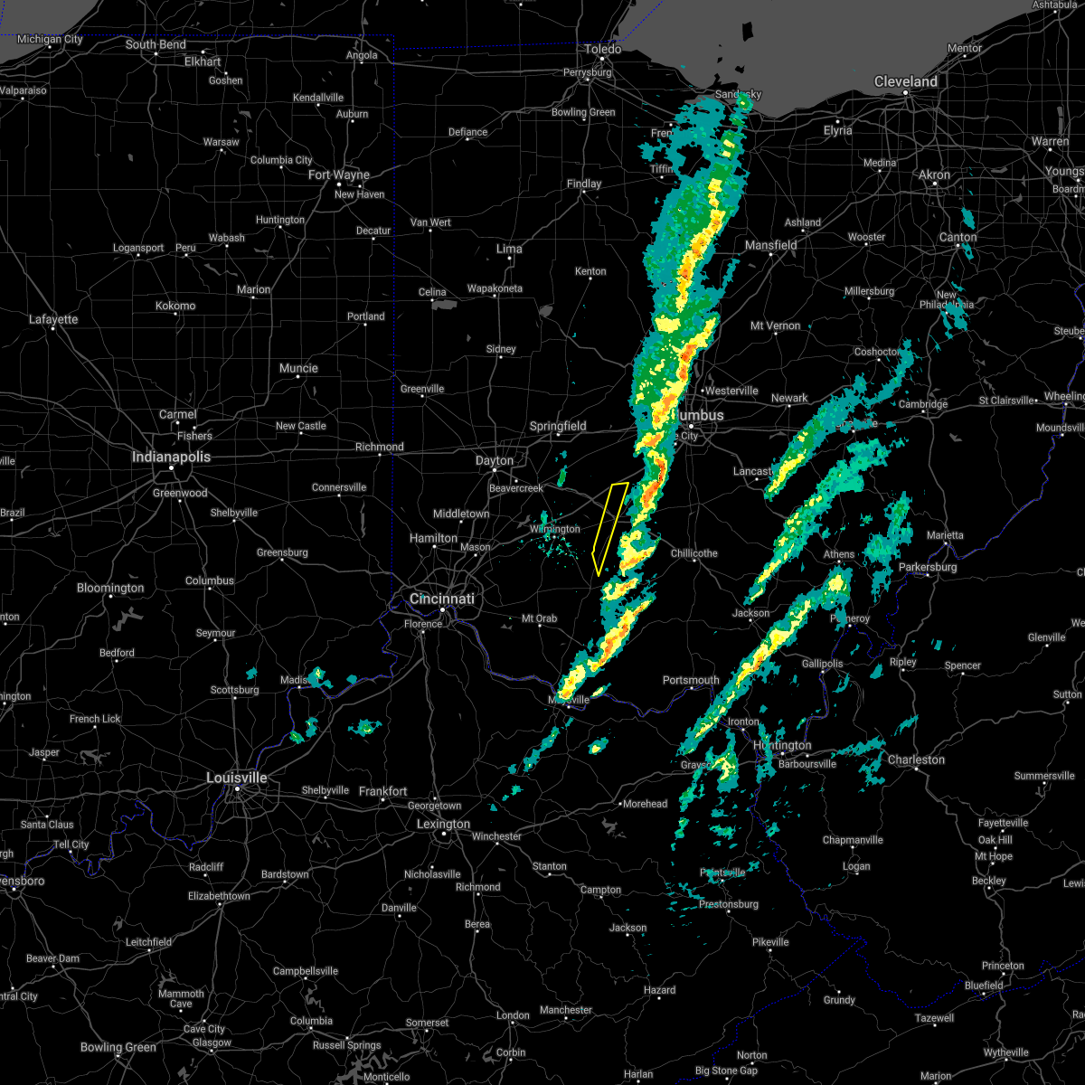 The severe thunderstorm warning for central fayette and north central highland counties will expire at noon est, the storms which prompted the warning have moved out of the area. therefore, the warning will be allowed to expire. please report previous wind damage or hail to the national weather service by going to our website at weather.gov/iln and submitting your report via social media. The severe thunderstorm warning for central fayette and north central highland counties will expire at noon est, the storms which prompted the warning have moved out of the area. therefore, the warning will be allowed to expire. please report previous wind damage or hail to the national weather service by going to our website at weather.gov/iln and submitting your report via social media.
|
| 11/15/2020 11:51 AM EST |
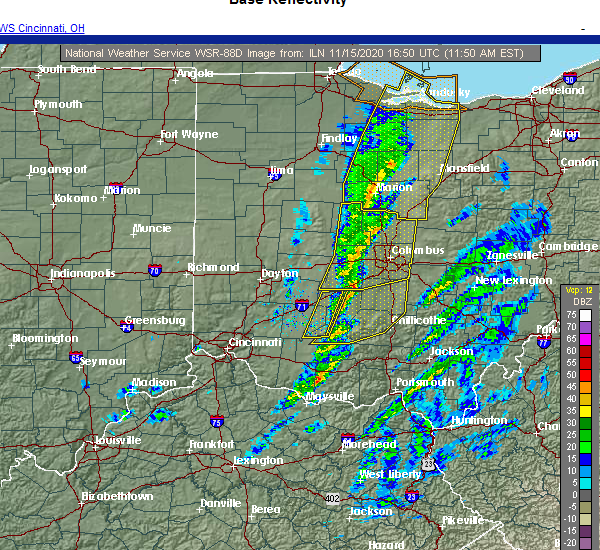 At 1151 am est, severe thunderstorms were located along a line extending from near mount sterling to near sabina, moving east at 65 mph (radar indicated). Hazards include 60 mph wind gusts. Expect damage to trees and power lines. locations impacted include, washington court house, leesburg, staunton and jasper mills. This includes i-71 in ohio near mile marker 74. At 1151 am est, severe thunderstorms were located along a line extending from near mount sterling to near sabina, moving east at 65 mph (radar indicated). Hazards include 60 mph wind gusts. Expect damage to trees and power lines. locations impacted include, washington court house, leesburg, staunton and jasper mills. This includes i-71 in ohio near mile marker 74.
|
| 11/15/2020 11:45 AM EST |
 At 1144 am est, severe thunderstorms were located along a line extending from 6 miles northeast of jeffersonville to near sabina, moving east at 60 mph (radar indicated). Hazards include 60 mph wind gusts. Expect damage to trees and power lines. locations impacted include, washington court house, sabina, leesburg, new vienna, jeffersonville, staunton, highland, milledgeville, octa, samantha, jasper mills, lees creek, reesville and interstate 71 at us route 35. This includes i-71 in ohio between mile markers 63 and 74. At 1144 am est, severe thunderstorms were located along a line extending from 6 miles northeast of jeffersonville to near sabina, moving east at 60 mph (radar indicated). Hazards include 60 mph wind gusts. Expect damage to trees and power lines. locations impacted include, washington court house, sabina, leesburg, new vienna, jeffersonville, staunton, highland, milledgeville, octa, samantha, jasper mills, lees creek, reesville and interstate 71 at us route 35. This includes i-71 in ohio between mile markers 63 and 74.
|
| 11/15/2020 11:43 AM EST |
 At 1142 am est, severe thunderstorms were located along a line extending from near jeffersonville to near new vienna, moving east at 45 mph (radar indicated). Hazards include 60 mph wind gusts. expect damage to trees and power lines At 1142 am est, severe thunderstorms were located along a line extending from near jeffersonville to near new vienna, moving east at 45 mph (radar indicated). Hazards include 60 mph wind gusts. expect damage to trees and power lines
|
| 11/15/2020 11:38 AM EST |
 At 1138 am est, severe thunderstorms were located along a line extending from jeffersonville to near wilmington, moving northeast at 65 mph (radar indicated). Hazards include 60 mph wind gusts. Expect damage to trees and power lines. locations impacted include, washington court house, wilmington, sabina, leesburg, new vienna, jeffersonville, staunton, martinsville, midland, bowersville, highland, port william, milledgeville, octa, melvin, rosemoor, samantha, lees creek, morrisville and bloomington. This includes i-71 in ohio between mile markers 54 and 74. At 1138 am est, severe thunderstorms were located along a line extending from jeffersonville to near wilmington, moving northeast at 65 mph (radar indicated). Hazards include 60 mph wind gusts. Expect damage to trees and power lines. locations impacted include, washington court house, wilmington, sabina, leesburg, new vienna, jeffersonville, staunton, martinsville, midland, bowersville, highland, port william, milledgeville, octa, melvin, rosemoor, samantha, lees creek, morrisville and bloomington. This includes i-71 in ohio between mile markers 54 and 74.
|
| 11/15/2020 11:22 AM EST |
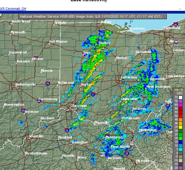 At 1122 am est, severe thunderstorms were located along a line extending from 8 miles north of wilmington to near blanchester, moving northeast at 65 mph (radar indicated). Hazards include 60 mph wind gusts. expect damage to trees and power lines At 1122 am est, severe thunderstorms were located along a line extending from 8 miles north of wilmington to near blanchester, moving northeast at 65 mph (radar indicated). Hazards include 60 mph wind gusts. expect damage to trees and power lines
|
| 7/19/2020 5:52 PM EDT |
 The severe thunderstorm warning for northwestern fayette, clinton, southeastern greene and southeastern madison counties will expire at 600 pm edt, the storm which prompted the warning has moved out of the area. therefore, the warning will be allowed to expire. however gusty winds are still possible with this thunderstorm. a severe thunderstorm watch remains in effect until 1100 pm edt for central ohio. please report previous wind damage or hail to the national weather service by going to our website at weather.gov/iln and submitting your report via social media. The severe thunderstorm warning for northwestern fayette, clinton, southeastern greene and southeastern madison counties will expire at 600 pm edt, the storm which prompted the warning has moved out of the area. therefore, the warning will be allowed to expire. however gusty winds are still possible with this thunderstorm. a severe thunderstorm watch remains in effect until 1100 pm edt for central ohio. please report previous wind damage or hail to the national weather service by going to our website at weather.gov/iln and submitting your report via social media.
|
| 7/19/2020 5:46 PM EDT |
 At 546 pm edt, a severe thunderstorm was located near jeffersonville, moving east at 30 mph (radar indicated). Hazards include 60 mph wind gusts. Expect damage to trees and power lines. locations impacted include, washington court house, wilmington, sabina, mount sterling, jeffersonville, bloomingburg, clarksville, bowersville, port william, milledgeville, octa, paintersville, melvin, chenoweth, interstate 71 at state route 38, rosemoor, lumberton, oakland, lees creek and madison mills. This includes i-71 in ohio between mile markers 43 and 87. At 546 pm edt, a severe thunderstorm was located near jeffersonville, moving east at 30 mph (radar indicated). Hazards include 60 mph wind gusts. Expect damage to trees and power lines. locations impacted include, washington court house, wilmington, sabina, mount sterling, jeffersonville, bloomingburg, clarksville, bowersville, port william, milledgeville, octa, paintersville, melvin, chenoweth, interstate 71 at state route 38, rosemoor, lumberton, oakland, lees creek and madison mills. This includes i-71 in ohio between mile markers 43 and 87.
|
| 7/19/2020 5:36 PM EDT |
 At 536 pm edt, a severe thunderstorm was located near jamestown, moving east at 30 mph (radar indicated). Hazards include 60 mph wind gusts. Expect damage to trees and power lines. locations impacted include, xenia, washington court house, wilmington, sabina, jamestown, mount sterling, jeffersonville, bloomingburg, new jasper, clarksville, harveysburg, spring valley, south solon, midway, bowersville, port william, milledgeville, octa, paintersville and newport. This includes i-71 in ohio between mile markers 40 and 87. At 536 pm edt, a severe thunderstorm was located near jamestown, moving east at 30 mph (radar indicated). Hazards include 60 mph wind gusts. Expect damage to trees and power lines. locations impacted include, xenia, washington court house, wilmington, sabina, jamestown, mount sterling, jeffersonville, bloomingburg, new jasper, clarksville, harveysburg, spring valley, south solon, midway, bowersville, port william, milledgeville, octa, paintersville and newport. This includes i-71 in ohio between mile markers 40 and 87.
|
| 7/19/2020 5:26 PM EDT | Large branches reported down. time estimated from rada in fayette county OH, 0.1 miles SW of Washington Court House, OH |
| 7/19/2020 5:15 PM EDT |
 At 514 pm edt, a severe thunderstorm was located near wilberforce, moving east at 30 mph (radar indicated). Hazards include 60 mph wind gusts. expect damage to trees and power lines At 514 pm edt, a severe thunderstorm was located near wilberforce, moving east at 30 mph (radar indicated). Hazards include 60 mph wind gusts. expect damage to trees and power lines
|
| 7/10/2020 11:49 AM EDT |
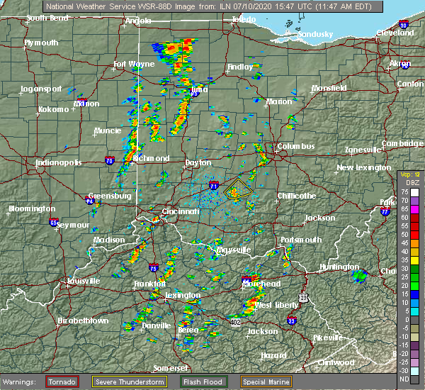 At 1149 am edt, a severe thunderstorm was located near sabina, moving northeast at 25 mph (radar indicated). Hazards include 60 mph wind gusts. Expect damage to trees and power lines. Locations impacted include, washington court house, staunton, good hope, rock mills and jasper mills. At 1149 am edt, a severe thunderstorm was located near sabina, moving northeast at 25 mph (radar indicated). Hazards include 60 mph wind gusts. Expect damage to trees and power lines. Locations impacted include, washington court house, staunton, good hope, rock mills and jasper mills.
|
| 7/10/2020 11:37 AM EDT |
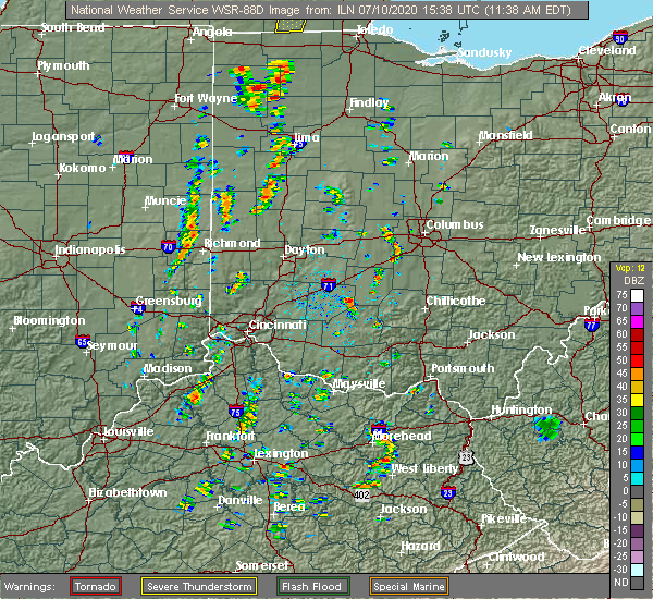 At 1137 am edt, a severe thunderstorm was located near leesburg, moving northeast at 25 mph (radar indicated). Hazards include 60 mph wind gusts and penny size hail. expect damage to trees and power lines At 1137 am edt, a severe thunderstorm was located near leesburg, moving northeast at 25 mph (radar indicated). Hazards include 60 mph wind gusts and penny size hail. expect damage to trees and power lines
|
| 6/10/2020 6:14 PM EDT |
 At 614 pm edt, severe thunderstorms were located along a line extending from near bloomingburg to 6 miles north of bainbridge, moving northeast at 60 mph (radar indicated). Hazards include 70 mph wind gusts. Expect considerable tree damage. damage is likely to mobile homes, roofs, and outbuildings. Locations impacted include, chillicothe, washington court house, circleville, greenfield, waverly, piketon, south bloomfield, leesburg, kingston, marshall, williamsport, bloomingburg, bainbridge, new holland, highland holiday, logan elm village, pike lake, kincaid springs, rocky fork point and cynthiana. At 614 pm edt, severe thunderstorms were located along a line extending from near bloomingburg to 6 miles north of bainbridge, moving northeast at 60 mph (radar indicated). Hazards include 70 mph wind gusts. Expect considerable tree damage. damage is likely to mobile homes, roofs, and outbuildings. Locations impacted include, chillicothe, washington court house, circleville, greenfield, waverly, piketon, south bloomfield, leesburg, kingston, marshall, williamsport, bloomingburg, bainbridge, new holland, highland holiday, logan elm village, pike lake, kincaid springs, rocky fork point and cynthiana.
|
| 6/10/2020 5:58 PM EDT |
 At 557 pm edt, severe thunderstorms were located along a line extending from near leesburg to near marshall, moving northeast at 60 mph (radar indicated). Hazards include 70 mph wind gusts. Expect considerable tree damage. Damage is likely to mobile homes, roofs, and outbuildings. At 557 pm edt, severe thunderstorms were located along a line extending from near leesburg to near marshall, moving northeast at 60 mph (radar indicated). Hazards include 70 mph wind gusts. Expect considerable tree damage. Damage is likely to mobile homes, roofs, and outbuildings.
|
| 6/3/2020 9:06 PM EDT |
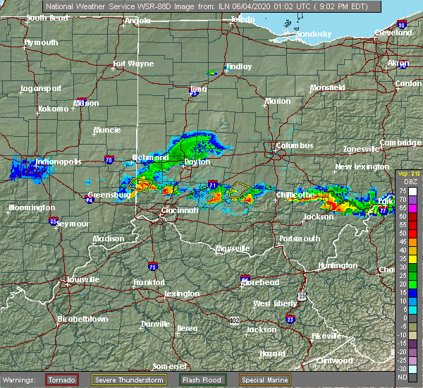 The severe thunderstorm warning for southern fayette county will expire at 915 pm edt, the storm which prompted the warning has weakened below severe limits, and no longer poses an immediate threat to life or property. therefore, the warning will be allowed to expire. please report previous wind damage or hail to the national weather service by going to our website at weather.gov/iln and submitting your report via social media. The severe thunderstorm warning for southern fayette county will expire at 915 pm edt, the storm which prompted the warning has weakened below severe limits, and no longer poses an immediate threat to life or property. therefore, the warning will be allowed to expire. please report previous wind damage or hail to the national weather service by going to our website at weather.gov/iln and submitting your report via social media.
|
| 6/3/2020 8:48 PM EDT |
 At 848 pm edt, a severe thunderstorm was located over washington court house, moving east at 20 mph (radar indicated). Hazards include 60 mph wind gusts and quarter size hail. Minor hail damage to vehicles is possible. expect wind damage to trees and power lines. Locations impacted include, washington court house, staunton, new martinsburg, rock mills and jasper mills. At 848 pm edt, a severe thunderstorm was located over washington court house, moving east at 20 mph (radar indicated). Hazards include 60 mph wind gusts and quarter size hail. Minor hail damage to vehicles is possible. expect wind damage to trees and power lines. Locations impacted include, washington court house, staunton, new martinsburg, rock mills and jasper mills.
|
| 6/3/2020 8:32 PM EDT | Trees down reported between miami trace and palmer roads. time estimated from rada in fayette county OH, 8 miles E of Washington Court House, OH |
| 6/3/2020 8:32 PM EDT |
 At 832 pm edt, a severe thunderstorm was located near sabina, moving east at 20 mph (radar indicated). Hazards include 60 mph wind gusts and quarter size hail. Minor hail damage to vehicles is possible. Expect wind damage to trees and power lines. At 832 pm edt, a severe thunderstorm was located near sabina, moving east at 20 mph (radar indicated). Hazards include 60 mph wind gusts and quarter size hail. Minor hail damage to vehicles is possible. Expect wind damage to trees and power lines.
|
| 5/10/2020 4:41 PM EDT |
 At 441 pm edt, severe thunderstorms were located along a line extending from bloomingburg to leesburg, moving east at 45 mph (radar indicated). Hazards include 60 mph wind gusts. Expect damage to trees and power lines. Locations impacted include, washington court house, greenfield, leesburg, williamsport, bloomingburg, new holland, staunton, good hope, frankfort, clarksburg, darbyville, south salem, deer creek lake, east monroe, lattaville, austin, madison mills, state route 207 at us route 22, rock mills and new martinsburg. At 441 pm edt, severe thunderstorms were located along a line extending from bloomingburg to leesburg, moving east at 45 mph (radar indicated). Hazards include 60 mph wind gusts. Expect damage to trees and power lines. Locations impacted include, washington court house, greenfield, leesburg, williamsport, bloomingburg, new holland, staunton, good hope, frankfort, clarksburg, darbyville, south salem, deer creek lake, east monroe, lattaville, austin, madison mills, state route 207 at us route 22, rock mills and new martinsburg.
|
| 5/10/2020 4:23 PM EDT | Trees fell into power lines at sr-729 and marchant-lutrell road. time estimated from rada in fayette county OH, 8.9 miles ESE of Washington Court House, OH |
| 5/10/2020 4:22 PM EDT |
 At 422 pm edt, severe thunderstorms were located along a line extending from near jeffersonville to lynchburg, moving east at 35 mph (radar indicated). Hazards include 60 mph wind gusts. expect damage to trees and power lines At 422 pm edt, severe thunderstorms were located along a line extending from near jeffersonville to lynchburg, moving east at 35 mph (radar indicated). Hazards include 60 mph wind gusts. expect damage to trees and power lines
|
| 4/8/2020 11:42 PM EDT |
 The severe thunderstorm warning for fayette, eastern clinton and northern highland counties will expire at 1145 pm edt, the storm which prompted the warning has moved out of the area. therefore, the warning will be allowed to expire. however gusty winds and heavy rain are still possible with this thunderstorm. a tornado watch remains in effect until 200 am edt for central and southwestern ohio. please report previous wind damage or hail to the national weather service by going to our website at weather.gov/iln and submitting your report via social media. The severe thunderstorm warning for fayette, eastern clinton and northern highland counties will expire at 1145 pm edt, the storm which prompted the warning has moved out of the area. therefore, the warning will be allowed to expire. however gusty winds and heavy rain are still possible with this thunderstorm. a tornado watch remains in effect until 200 am edt for central and southwestern ohio. please report previous wind damage or hail to the national weather service by going to our website at weather.gov/iln and submitting your report via social media.
|
| 4/8/2020 11:13 PM EDT |
 At 1113 pm edt, a severe thunderstorm was located near leesburg, moving east at 50 mph. a tornado warning is also in effect for southern clinton and eastern highland counties (radar indicated). Hazards include 60 mph wind gusts and penny size hail. Expect damage to trees and power lines. locations impacted include, washington court house, hillsboro, greenfield, sabina, leesburg, new vienna, jeffersonville, bloomingburg, new holland, staunton, good hope, highland, milledgeville, octa, interstate 71 at state route 38, east monroe, samantha, lees creek, madison mills and rock mills. this includes i-71 in ohio between mile markers 62 and 75. A tornado watch remains in effect until 200 am edt for central, southwestern and west central ohio. At 1113 pm edt, a severe thunderstorm was located near leesburg, moving east at 50 mph. a tornado warning is also in effect for southern clinton and eastern highland counties (radar indicated). Hazards include 60 mph wind gusts and penny size hail. Expect damage to trees and power lines. locations impacted include, washington court house, hillsboro, greenfield, sabina, leesburg, new vienna, jeffersonville, bloomingburg, new holland, staunton, good hope, highland, milledgeville, octa, interstate 71 at state route 38, east monroe, samantha, lees creek, madison mills and rock mills. this includes i-71 in ohio between mile markers 62 and 75. A tornado watch remains in effect until 200 am edt for central, southwestern and west central ohio.
|
| 4/8/2020 10:48 PM EDT |
 At 1047 pm edt, a severe thunderstorm was located near new vienna, moving northeast at 30 mph (radar indicated). Hazards include 60 mph wind gusts and quarter size hail. Minor hail damage to vehicles is possible. Expect wind damage to trees and power lines. At 1047 pm edt, a severe thunderstorm was located near new vienna, moving northeast at 30 mph (radar indicated). Hazards include 60 mph wind gusts and quarter size hail. Minor hail damage to vehicles is possible. Expect wind damage to trees and power lines.
|
| 4/8/2020 4:55 AM EDT |
 The severe thunderstorm warning for northern fayette, southeastern greene and southern madison counties will expire at 500 am edt, the storm which prompted the warning has weakened below severe limits, and no longer poses an immediate threat to life or property. therefore, the warning will be allowed to expire. a severe thunderstorm watch remains in effect until 600 am edt for central and west central ohio. please report previous wind damage or hail to the national weather service by going to our website at weather.gov/iln and submitting your report via social media. The severe thunderstorm warning for northern fayette, southeastern greene and southern madison counties will expire at 500 am edt, the storm which prompted the warning has weakened below severe limits, and no longer poses an immediate threat to life or property. therefore, the warning will be allowed to expire. a severe thunderstorm watch remains in effect until 600 am edt for central and west central ohio. please report previous wind damage or hail to the national weather service by going to our website at weather.gov/iln and submitting your report via social media.
|
| 4/8/2020 4:42 AM EDT |
 At 442 am edt, a severe thunderstorm was located 7 miles south of london, moving east at 40 mph (radar indicated). Hazards include 60 mph wind gusts and quarter size hail. Minor hail damage to vehicles is possible. expect wind damage to trees and power lines. locations impacted include, xenia, washington court house, london, cedarville, jamestown, mount sterling, jeffersonville, bloomingburg, new holland, wilberforce, new jasper, south solon, midway, milledgeville, octa, newport, chenoweth, rosemoor and madison mills. This includes i-71 in ohio between mile markers 63 and 87. At 442 am edt, a severe thunderstorm was located 7 miles south of london, moving east at 40 mph (radar indicated). Hazards include 60 mph wind gusts and quarter size hail. Minor hail damage to vehicles is possible. expect wind damage to trees and power lines. locations impacted include, xenia, washington court house, london, cedarville, jamestown, mount sterling, jeffersonville, bloomingburg, new holland, wilberforce, new jasper, south solon, midway, milledgeville, octa, newport, chenoweth, rosemoor and madison mills. This includes i-71 in ohio between mile markers 63 and 87.
|
| 4/8/2020 4:27 AM EDT |
 At 426 am edt, a severe thunderstorm was located over south charleston. another severe thunderstorm was located near bloomingburg. these storms are moving east at 40 mph (radar indicated). Hazards include 60 mph wind gusts and half dollar size hail. Minor hail damage to vehicles is possible. expect wind damage to trees and power lines. locations impacted include, springfield, fairborn, xenia, washington court house, london, yellow springs, cedarville, enon, jamestown, mount sterling, south charleston, jeffersonville, bloomingburg, new holland, wilberforce, lisbon, new jasper, south solon, midway and clifton. this includes the following interstates, i-70 in ohio between mile markers 52 and 61. I-71 in ohio between mile markers 63 and 87. At 426 am edt, a severe thunderstorm was located over south charleston. another severe thunderstorm was located near bloomingburg. these storms are moving east at 40 mph (radar indicated). Hazards include 60 mph wind gusts and half dollar size hail. Minor hail damage to vehicles is possible. expect wind damage to trees and power lines. locations impacted include, springfield, fairborn, xenia, washington court house, london, yellow springs, cedarville, enon, jamestown, mount sterling, south charleston, jeffersonville, bloomingburg, new holland, wilberforce, lisbon, new jasper, south solon, midway and clifton. this includes the following interstates, i-70 in ohio between mile markers 52 and 61. I-71 in ohio between mile markers 63 and 87.
|
| 4/8/2020 4:15 AM EDT |
 At 414 am edt, a severe thunderstorm was located near yellow springs. this storm is capable of producing golf ball size hail. another severe thunderstorm is located 3 miles northwest of jeffersonville. this storm is capable of producing half dollar size hail. these storms are moving east at 35 mph (radar indicated). Hazards include golf ball size hail and 60 mph wind gusts. People and animals outdoors will be injured. expect hail damage to roofs, siding, windows, and vehicles. expect wind damage to trees and power lines. locations impacted include, springfield, kettering, beavercreek, huber heights, fairborn, xenia, washington court house, london, new carlisle, yellow springs, wright-patterson afb, cedarville, enon, jamestown, mount sterling, south charleston, jeffersonville, bloomingburg, new holland and wilberforce. this includes the following interstates, i-70 in ohio between mile markers 42 and 61. I-71 in ohio between mile markers 62 and 87. At 414 am edt, a severe thunderstorm was located near yellow springs. this storm is capable of producing golf ball size hail. another severe thunderstorm is located 3 miles northwest of jeffersonville. this storm is capable of producing half dollar size hail. these storms are moving east at 35 mph (radar indicated). Hazards include golf ball size hail and 60 mph wind gusts. People and animals outdoors will be injured. expect hail damage to roofs, siding, windows, and vehicles. expect wind damage to trees and power lines. locations impacted include, springfield, kettering, beavercreek, huber heights, fairborn, xenia, washington court house, london, new carlisle, yellow springs, wright-patterson afb, cedarville, enon, jamestown, mount sterling, south charleston, jeffersonville, bloomingburg, new holland and wilberforce. this includes the following interstates, i-70 in ohio between mile markers 42 and 61. I-71 in ohio between mile markers 62 and 87.
|
| 4/8/2020 4:12 AM EDT |
 At 412 am edt, a severe thunderstorm was located near yellow springs, moving east at 30 mph (radar indicated). Hazards include golf ball size hail and 60 mph wind gusts. People and animals outdoors will be injured. expect hail damage to roofs, siding, windows, and vehicles. expect wind damage to trees and power lines. locations impacted include, springfield, kettering, beavercreek, huber heights, fairborn, xenia, washington court house, london, new carlisle, yellow springs, wright-patterson afb, cedarville, enon, jamestown, mount sterling, south charleston, jeffersonville, bloomingburg, new holland and wilberforce. this includes the following interstates, i-70 in ohio between mile markers 42 and 61. I-71 in ohio between mile markers 62 and 87. At 412 am edt, a severe thunderstorm was located near yellow springs, moving east at 30 mph (radar indicated). Hazards include golf ball size hail and 60 mph wind gusts. People and animals outdoors will be injured. expect hail damage to roofs, siding, windows, and vehicles. expect wind damage to trees and power lines. locations impacted include, springfield, kettering, beavercreek, huber heights, fairborn, xenia, washington court house, london, new carlisle, yellow springs, wright-patterson afb, cedarville, enon, jamestown, mount sterling, south charleston, jeffersonville, bloomingburg, new holland and wilberforce. this includes the following interstates, i-70 in ohio between mile markers 42 and 61. I-71 in ohio between mile markers 62 and 87.
|
| 4/8/2020 4:08 AM EDT |
 At 408 am edt, a severe thunderstorm was located over yellow springs, moving east at 35 mph (radar indicated). Hazards include 60 mph wind gusts and quarter size hail. Minor hail damage to vehicles is possible. Expect wind damage to trees and power lines. At 408 am edt, a severe thunderstorm was located over yellow springs, moving east at 35 mph (radar indicated). Hazards include 60 mph wind gusts and quarter size hail. Minor hail damage to vehicles is possible. Expect wind damage to trees and power lines.
|
| 5/28/2019 1:06 AM EDT |
 At 1258 am edt, a severe thunderstorm capable of producing a tornado was located over bloomingburg, moving east at 35 mph (radar indicated rotation). Hazards include tornado and quarter size hail. Flying debris will be dangerous to those caught without shelter. mobile homes will be damaged or destroyed. damage to roofs, windows, and vehicles will occur. tree damage is likely. locations impacted include, washington court house, mount sterling, bloomingburg, new holland, madison mills and pancoastburg. This includes i-71 in ohio near mile marker 76. At 1258 am edt, a severe thunderstorm capable of producing a tornado was located over bloomingburg, moving east at 35 mph (radar indicated rotation). Hazards include tornado and quarter size hail. Flying debris will be dangerous to those caught without shelter. mobile homes will be damaged or destroyed. damage to roofs, windows, and vehicles will occur. tree damage is likely. locations impacted include, washington court house, mount sterling, bloomingburg, new holland, madison mills and pancoastburg. This includes i-71 in ohio near mile marker 76.
|
| 5/28/2019 12:58 AM EDT |
 At 1258 am edt, a severe thunderstorm capable of producing a tornado was located over bloomingburg, moving east at 35 mph (radar indicated rotation). Hazards include tornado and quarter size hail. Flying debris will be dangerous to those caught without shelter. mobile homes will be damaged or destroyed. damage to roofs, windows, and vehicles will occur. tree damage is likely. locations impacted include, washington court house, mount sterling, bloomingburg, new holland, madison mills and pancoastburg. This includes i-71 in ohio near mile marker 76. At 1258 am edt, a severe thunderstorm capable of producing a tornado was located over bloomingburg, moving east at 35 mph (radar indicated rotation). Hazards include tornado and quarter size hail. Flying debris will be dangerous to those caught without shelter. mobile homes will be damaged or destroyed. damage to roofs, windows, and vehicles will occur. tree damage is likely. locations impacted include, washington court house, mount sterling, bloomingburg, new holland, madison mills and pancoastburg. This includes i-71 in ohio near mile marker 76.
|
| 5/28/2019 12:48 AM EDT |
 At 1247 am edt, a severe thunderstorm capable of producing a tornado was located over jeffersonville, moving east at 35 mph (radar indicated rotation). Hazards include tornado and quarter size hail. Flying debris will be dangerous to those caught without shelter. mobile homes will be damaged or destroyed. damage to roofs, windows, and vehicles will occur. tree damage is likely. locations impacted include, washington court house, mount sterling, jeffersonville, bloomingburg, new holland, interstate 71 at state route 38, madison mills, bookwalter and pancoastburg. This includes i-71 in ohio between mile markers 68 and 76. At 1247 am edt, a severe thunderstorm capable of producing a tornado was located over jeffersonville, moving east at 35 mph (radar indicated rotation). Hazards include tornado and quarter size hail. Flying debris will be dangerous to those caught without shelter. mobile homes will be damaged or destroyed. damage to roofs, windows, and vehicles will occur. tree damage is likely. locations impacted include, washington court house, mount sterling, jeffersonville, bloomingburg, new holland, interstate 71 at state route 38, madison mills, bookwalter and pancoastburg. This includes i-71 in ohio between mile markers 68 and 76.
|
| 5/28/2019 12:38 AM EDT |
 At 1238 am edt, a severe thunderstorm capable of producing a tornado was located over jeffersonville, moving southeast at 35 mph (radar indicated rotation). Hazards include tornado and quarter size hail. Flying debris will be dangerous to those caught without shelter. mobile homes will be damaged or destroyed. damage to roofs, windows, and vehicles will occur. Tree damage is likely. At 1238 am edt, a severe thunderstorm capable of producing a tornado was located over jeffersonville, moving southeast at 35 mph (radar indicated rotation). Hazards include tornado and quarter size hail. Flying debris will be dangerous to those caught without shelter. mobile homes will be damaged or destroyed. damage to roofs, windows, and vehicles will occur. Tree damage is likely.
|
| 5/28/2019 12:03 AM EDT |
 At 1203 am edt, a severe thunderstorm capable of producing a tornado was located two miles north of jeffersonville, moving east at 45 mph (radar indicated rotation). Hazards include tornado and golf ball size hail. Flying debris will be dangerous to those caught without shelter. mobile homes will be damaged or destroyed. damage to roofs, windows, and vehicles will occur. tree damage is likely. locations impacted include, washington court house, mount sterling, jeffersonville, bloomingburg, new holland, midway, milledgeville, octa, chenoweth, interstate 71 at state route 38, madison mills, bookwalter, interstate 71 at us route 35 and pancoastburg. This includes i-71 in ohio between mile markers 65 and 87. At 1203 am edt, a severe thunderstorm capable of producing a tornado was located two miles north of jeffersonville, moving east at 45 mph (radar indicated rotation). Hazards include tornado and golf ball size hail. Flying debris will be dangerous to those caught without shelter. mobile homes will be damaged or destroyed. damage to roofs, windows, and vehicles will occur. tree damage is likely. locations impacted include, washington court house, mount sterling, jeffersonville, bloomingburg, new holland, midway, milledgeville, octa, chenoweth, interstate 71 at state route 38, madison mills, bookwalter, interstate 71 at us route 35 and pancoastburg. This includes i-71 in ohio between mile markers 65 and 87.
|
| 5/27/2019 11:56 PM EDT |
 At 1156 pm edt, a confirmed tornado was located 4 miles east of jamestown, moving southeast at 40 mph (radar confirmed tornado. radar shows tornado debris in the air). Hazards include damaging tornado and golf ball size hail. Flying debris will be dangerous to those caught without shelter. mobile homes will be damaged or destroyed. damage to roofs, windows, and vehicles will occur. tree damage is likely. locations impacted include, washington court house, mount sterling, jeffersonville, bloomingburg, new holland, south solon, midway, milledgeville, octa, chenoweth, interstate 71 at state route 38, madison mills, bookwalter, shady grove, interstate 71 at us route 35 and pancoastburg. This includes i-71 in ohio between mile markers 62 and 87. At 1156 pm edt, a confirmed tornado was located 4 miles east of jamestown, moving southeast at 40 mph (radar confirmed tornado. radar shows tornado debris in the air). Hazards include damaging tornado and golf ball size hail. Flying debris will be dangerous to those caught without shelter. mobile homes will be damaged or destroyed. damage to roofs, windows, and vehicles will occur. tree damage is likely. locations impacted include, washington court house, mount sterling, jeffersonville, bloomingburg, new holland, south solon, midway, milledgeville, octa, chenoweth, interstate 71 at state route 38, madison mills, bookwalter, shady grove, interstate 71 at us route 35 and pancoastburg. This includes i-71 in ohio between mile markers 62 and 87.
|
| 5/27/2019 11:48 PM EDT |
 At 1148 pm edt, a severe thunderstorm capable of producing a tornado was located near jamestown, moving east at 40 mph (radar indicated rotation). Hazards include tornado and golf ball size hail. Flying debris will be dangerous to those caught without shelter. mobile homes will be damaged or destroyed. damage to roofs, windows, and vehicles will occur. Tree damage is likely. At 1148 pm edt, a severe thunderstorm capable of producing a tornado was located near jamestown, moving east at 40 mph (radar indicated rotation). Hazards include tornado and golf ball size hail. Flying debris will be dangerous to those caught without shelter. mobile homes will be damaged or destroyed. damage to roofs, windows, and vehicles will occur. Tree damage is likely.
|
| 5/23/2019 6:00 PM EDT |
 At 600 pm edt, a severe thunderstorm was located near rocky fork point, moving east at 45 mph (radar indicated). Hazards include 60 mph wind gusts and quarter size hail. Minor hail damage to vehicles is possible. expect wind damage to trees and power lines. Locations impacted include, hillsboro, greenfield, leesburg, marshall, rocky fork point, highland holiday, staunton, good hope, highland, south salem, rocky fork lake, east monroe, samantha, rainsboro, paint creek state park, rock mills, new martinsburg, highland county airport and plano. At 600 pm edt, a severe thunderstorm was located near rocky fork point, moving east at 45 mph (radar indicated). Hazards include 60 mph wind gusts and quarter size hail. Minor hail damage to vehicles is possible. expect wind damage to trees and power lines. Locations impacted include, hillsboro, greenfield, leesburg, marshall, rocky fork point, highland holiday, staunton, good hope, highland, south salem, rocky fork lake, east monroe, samantha, rainsboro, paint creek state park, rock mills, new martinsburg, highland county airport and plano.
|
| 5/23/2019 5:48 PM EDT |
 At 548 pm edt, a severe thunderstorm was located near lynchburg, moving east at 50 mph (radar indicated). Hazards include 60 mph wind gusts and quarter size hail. Minor hail damage to vehicles is possible. Expect wind damage to trees and power lines. At 548 pm edt, a severe thunderstorm was located near lynchburg, moving east at 50 mph (radar indicated). Hazards include 60 mph wind gusts and quarter size hail. Minor hail damage to vehicles is possible. Expect wind damage to trees and power lines.
|
| 3/14/2019 7:48 PM EDT |
 At 747 pm edt, severe thunderstorms were located along a line extending from near washington court house to hillsboro to near georgetown, moving northeast at 45 mph (radar indicated). Hazards include 70 mph wind gusts. Expect considerable tree damage. damage is likely to mobile homes, roofs, and outbuildings. Locations impacted include, washington court house, hillsboro, greenfield, georgetown, mount orab, leesburg, marshall, sardinia, new holland, belfast, rocky fork point, highland holiday, russell, staunton, new market, good hope, hamersville, mowrystown, highland and east monroe. At 747 pm edt, severe thunderstorms were located along a line extending from near washington court house to hillsboro to near georgetown, moving northeast at 45 mph (radar indicated). Hazards include 70 mph wind gusts. Expect considerable tree damage. damage is likely to mobile homes, roofs, and outbuildings. Locations impacted include, washington court house, hillsboro, greenfield, georgetown, mount orab, leesburg, marshall, sardinia, new holland, belfast, rocky fork point, highland holiday, russell, staunton, new market, good hope, hamersville, mowrystown, highland and east monroe.
|
| 3/14/2019 7:42 PM EDT |
 At 741 pm edt, a severe thunderstorm was located over new holland, moving northeast at 60 mph (radar indicated). Hazards include 60 mph wind gusts and nickel size hail. expect damage to trees and power lines At 741 pm edt, a severe thunderstorm was located over new holland, moving northeast at 60 mph (radar indicated). Hazards include 60 mph wind gusts and nickel size hail. expect damage to trees and power lines
|
| 3/14/2019 7:35 PM EDT | Quarter sized hail reported 0.1 miles SW of Washington Court House, OH, via social media. |
| 3/14/2019 7:34 PM EDT |
 At 734 pm edt, severe thunderstorms were located along a line extending from near washington court house to 8 miles west of belfast to 6 miles northwest of brooksville, moving east at 60 mph (radar indicated). Hazards include 70 mph wind gusts. Expect considerable tree damage. damage is likely to mobile homes, roofs, and outbuildings. Locations impacted include, washington court house, hillsboro, greenfield, georgetown, mount orab, bethel, sabina, williamsburg, lynchburg, leesburg, new vienna, marshall, sardinia, felicity, new holland, belfast, highland holiday, rocky fork point, russell and staunton. At 734 pm edt, severe thunderstorms were located along a line extending from near washington court house to 8 miles west of belfast to 6 miles northwest of brooksville, moving east at 60 mph (radar indicated). Hazards include 70 mph wind gusts. Expect considerable tree damage. damage is likely to mobile homes, roofs, and outbuildings. Locations impacted include, washington court house, hillsboro, greenfield, georgetown, mount orab, bethel, sabina, williamsburg, lynchburg, leesburg, new vienna, marshall, sardinia, felicity, new holland, belfast, highland holiday, rocky fork point, russell and staunton.
|
| 3/14/2019 7:21 PM EDT |
 At 721 pm edt, severe thunderstorms were located along a line extending from near sabina to near mount orab to near falmouth, moving east at 60 mph (radar indicated). Hazards include 70 mph wind gusts. Expect considerable tree damage. Damage is likely to mobile homes, roofs, and outbuildings. At 721 pm edt, severe thunderstorms were located along a line extending from near sabina to near mount orab to near falmouth, moving east at 60 mph (radar indicated). Hazards include 70 mph wind gusts. Expect considerable tree damage. Damage is likely to mobile homes, roofs, and outbuildings.
|
| 3/14/2019 7:19 PM EDT |
 At 719 pm edt, severe thunderstorms were located along a line extending from near mount sterling to washington court house, moving east at 50 mph (radar indicated). Hazards include 70 mph wind gusts and penny size hail. Expect considerable tree damage. damage is likely to mobile homes, roofs, and outbuildings. locations impacted include, columbus, grove city, washington court house, mount sterling, south bloomfield, williamsport, bloomingburg, new holland, commercial point, fox, orient, lockbourne, darbyville, deer creek lake, chenoweth, derby, madison mills, state route 207 at us route 22, state route 138 at us route 22 and pancoastburg. This includes i-71 in ohio between mile markers 77 and 87. At 719 pm edt, severe thunderstorms were located along a line extending from near mount sterling to washington court house, moving east at 50 mph (radar indicated). Hazards include 70 mph wind gusts and penny size hail. Expect considerable tree damage. damage is likely to mobile homes, roofs, and outbuildings. locations impacted include, columbus, grove city, washington court house, mount sterling, south bloomfield, williamsport, bloomingburg, new holland, commercial point, fox, orient, lockbourne, darbyville, deer creek lake, chenoweth, derby, madison mills, state route 207 at us route 22, state route 138 at us route 22 and pancoastburg. This includes i-71 in ohio between mile markers 77 and 87.
|
| 3/14/2019 7:10 PM EDT |
 At 710 pm edt, severe thunderstorms were located along a line extending from near london to 6 miles southwest of washington court house, moving east at 65 mph (radar indicated). Hazards include 70 mph wind gusts and quarter size hail. Minor hail damage to vehicles is possible. expect considerable tree damage. wind damage is also likely to mobile homes, roofs, and outbuildings. locations impacted include, columbus, grove city, washington court house, mount sterling, south bloomfield, jeffersonville, williamsport, bloomingburg, new holland, staunton, commercial point, fox, midway, harrisburg, orient, lockbourne, darbyville, deer creek lake, chenoweth and interstate 71 at state route 38. This includes i-71 in ohio between mile markers 70 and 97. At 710 pm edt, severe thunderstorms were located along a line extending from near london to 6 miles southwest of washington court house, moving east at 65 mph (radar indicated). Hazards include 70 mph wind gusts and quarter size hail. Minor hail damage to vehicles is possible. expect considerable tree damage. wind damage is also likely to mobile homes, roofs, and outbuildings. locations impacted include, columbus, grove city, washington court house, mount sterling, south bloomfield, jeffersonville, williamsport, bloomingburg, new holland, staunton, commercial point, fox, midway, harrisburg, orient, lockbourne, darbyville, deer creek lake, chenoweth and interstate 71 at state route 38. This includes i-71 in ohio between mile markers 70 and 97.
|
| 3/14/2019 7:02 PM EDT |
 At 702 pm edt, severe thunderstorms were located along a line extending from near london to near sabina, moving east at 65 mph (radar indicated). Hazards include 70 mph wind gusts and quarter size hail. Minor hail damage to vehicles is possible. expect considerable tree damage. wind damage is also likely to mobile homes, roofs, and outbuildings. locations impacted include, columbus, grove city, washington court house, sabina, mount sterling, south bloomfield, jeffersonville, williamsport, bloomingburg, new holland, staunton, commercial point, good hope, fox, south solon, midway, harrisburg, orient, lockbourne and darbyville. This includes i-71 in ohio between mile markers 62 and 97. At 702 pm edt, severe thunderstorms were located along a line extending from near london to near sabina, moving east at 65 mph (radar indicated). Hazards include 70 mph wind gusts and quarter size hail. Minor hail damage to vehicles is possible. expect considerable tree damage. wind damage is also likely to mobile homes, roofs, and outbuildings. locations impacted include, columbus, grove city, washington court house, sabina, mount sterling, south bloomfield, jeffersonville, williamsport, bloomingburg, new holland, staunton, commercial point, good hope, fox, south solon, midway, harrisburg, orient, lockbourne and darbyville. This includes i-71 in ohio between mile markers 62 and 97.
|
| 3/14/2019 6:56 PM EDT |
 At 656 pm edt, severe thunderstorms were located along a line extending from near south charleston to near new vienna, moving east at 65 mph (radar indicated). Hazards include 70 mph wind gusts and quarter size hail. Minor hail damage to vehicles is possible. expect considerable tree damage. Wind damage is also likely to mobile homes, roofs, and outbuildings. At 656 pm edt, severe thunderstorms were located along a line extending from near south charleston to near new vienna, moving east at 65 mph (radar indicated). Hazards include 70 mph wind gusts and quarter size hail. Minor hail damage to vehicles is possible. expect considerable tree damage. Wind damage is also likely to mobile homes, roofs, and outbuildings.
|
| 3/14/2019 6:04 PM EDT |
 At 604 pm edt, a severe thunderstorm was located near sabina, moving northeast at 55 mph (radar indicated). Hazards include 60 mph wind gusts and nickel size hail. expect damage to trees and power lines At 604 pm edt, a severe thunderstorm was located near sabina, moving northeast at 55 mph (radar indicated). Hazards include 60 mph wind gusts and nickel size hail. expect damage to trees and power lines
|
| 5/13/2018 9:45 PM EDT |
 At 944 pm edt, a severe thunderstorm was located near washington court house, moving southeast at 25 mph (radar indicated). Hazards include 60 mph wind gusts and quarter size hail. Minor hail damage to vehicles is possible. expect wind damage to trees and power lines. Locations impacted include, washington court house, williamsport, new holland, good hope, frankfort, clarksburg, state route 207 at us route 22, austin and plano. At 944 pm edt, a severe thunderstorm was located near washington court house, moving southeast at 25 mph (radar indicated). Hazards include 60 mph wind gusts and quarter size hail. Minor hail damage to vehicles is possible. expect wind damage to trees and power lines. Locations impacted include, washington court house, williamsport, new holland, good hope, frankfort, clarksburg, state route 207 at us route 22, austin and plano.
|
| 5/13/2018 9:33 PM EDT |
 At 932 pm edt, a severe thunderstorm was located over washington court house, moving southeast at 25 mph (radar indicated). Hazards include 60 mph wind gusts and quarter size hail. Minor hail damage to vehicles is possible. Expect wind damage to trees and power lines. At 932 pm edt, a severe thunderstorm was located over washington court house, moving southeast at 25 mph (radar indicated). Hazards include 60 mph wind gusts and quarter size hail. Minor hail damage to vehicles is possible. Expect wind damage to trees and power lines.
|
| 5/13/2018 7:24 PM EDT | One small tree down at clemens road and white road. time estimated from rada in fayette county OH, 6.5 miles W of Washington Court House, OH |
| 5/13/2018 7:24 PM EDT |
 At 724 pm edt, a severe thunderstorm was located near new holland, moving east at 30 mph (radar indicated). Hazards include ping pong ball size hail and 60 mph wind gusts. People and animals outdoors will be injured. expect hail damage to roofs, siding, windows, and vehicles. expect wind damage to trees and power lines. Locations impacted include, washington court house, williamsport, new holland, staunton, good hope, frankfort, clarksburg, lattaville, austin, state route 207 at us route 22, rock mills, plano and andersonville. At 724 pm edt, a severe thunderstorm was located near new holland, moving east at 30 mph (radar indicated). Hazards include ping pong ball size hail and 60 mph wind gusts. People and animals outdoors will be injured. expect hail damage to roofs, siding, windows, and vehicles. expect wind damage to trees and power lines. Locations impacted include, washington court house, williamsport, new holland, staunton, good hope, frankfort, clarksburg, lattaville, austin, state route 207 at us route 22, rock mills, plano and andersonville.
|
| 5/13/2018 7:21 PM EDT |
 The national weather service in wilmington has issued a * severe thunderstorm warning for. southeastern fayette county in central ohio. southwestern pickaway county in central ohio. northwestern ross county in southwestern ohio. Until 745 pm edt. The national weather service in wilmington has issued a * severe thunderstorm warning for. southeastern fayette county in central ohio. southwestern pickaway county in central ohio. northwestern ross county in southwestern ohio. Until 745 pm edt.
|
| 4/3/2018 5:23 PM EDT |
 At 522 pm edt, a severe thunderstorm was located over mount sterling, moving east at 60 mph (radar indicated). Hazards include 60 mph wind gusts and quarter size hail. Minor hail damage to vehicles is possible. Expect wind damage to trees and power lines. At 522 pm edt, a severe thunderstorm was located over mount sterling, moving east at 60 mph (radar indicated). Hazards include 60 mph wind gusts and quarter size hail. Minor hail damage to vehicles is possible. Expect wind damage to trees and power lines.
|
| 7/21/2017 8:40 AM EDT |
 The severe thunderstorm warning for southern shelby, champaign, southern logan, northern fayette, northeastern clinton, clark, eastern greene, madison and northeastern miami counties will expire at 845 am edt, the storms which prompted the warning have weakened below severe limits, and no longer pose an immediate threat to life or property. therefore, the warning will be allowed to expire. however gusty winds are still possible with these thunderstorms. please report previous wind damage or hail to the national weather service by going to our website at weather.gov/iln and submitting your report via social media. The severe thunderstorm warning for southern shelby, champaign, southern logan, northern fayette, northeastern clinton, clark, eastern greene, madison and northeastern miami counties will expire at 845 am edt, the storms which prompted the warning have weakened below severe limits, and no longer pose an immediate threat to life or property. therefore, the warning will be allowed to expire. however gusty winds are still possible with these thunderstorms. please report previous wind damage or hail to the national weather service by going to our website at weather.gov/iln and submitting your report via social media.
|
| 7/21/2017 8:22 AM EDT |
 At 821 am edt, severe thunderstorms were located along a line extending from sidney to near jeffersonville, moving east at 65 mph (radar indicated). Hazards include 60 mph wind gusts. Expect damage to trees and power lines. locations impacted include, springfield, sidney, piqua, washington court house, urbana, london, new carlisle, yellow springs, west jefferson, cedarville, enon, st. paris, jamestown, west liberty, south charleston, mechanicsburg, north lewisburg, fort loramie, de graff and jeffersonville. this includes the following interstates, i-70 in ohio between mile markers 47 and 81. i-71 in ohio between mile markers 53 and 81. I-75 in ohio between mile markers 84 and 99. At 821 am edt, severe thunderstorms were located along a line extending from sidney to near jeffersonville, moving east at 65 mph (radar indicated). Hazards include 60 mph wind gusts. Expect damage to trees and power lines. locations impacted include, springfield, sidney, piqua, washington court house, urbana, london, new carlisle, yellow springs, west jefferson, cedarville, enon, st. paris, jamestown, west liberty, south charleston, mechanicsburg, north lewisburg, fort loramie, de graff and jeffersonville. this includes the following interstates, i-70 in ohio between mile markers 47 and 81. i-71 in ohio between mile markers 53 and 81. I-75 in ohio between mile markers 84 and 99.
|
| 7/21/2017 8:08 AM EDT |
 At 808 am edt, severe thunderstorms were located along a line extending from near newport to 7 miles south of xenia, moving east at 65 mph (radar indicated). Hazards include 60 mph wind gusts. expect damage to trees and power lines At 808 am edt, severe thunderstorms were located along a line extending from near newport to 7 miles south of xenia, moving east at 65 mph (radar indicated). Hazards include 60 mph wind gusts. expect damage to trees and power lines
|
| 4/20/2017 6:34 PM EDT |
 At 633 pm edt, a severe thunderstorm was located 7 miles northeast of greenfield, moving east at 45 mph (radar indicated). Hazards include 60 mph wind gusts and quarter size hail. Hail damage to vehicles is expected. expect wind damage to roofs, siding, and trees. Locations impacted include, chillicothe, washington court house, circleville, greenfield, kingston, new holland, logan elm village, north folk village, good hope, frankfort, clarksburg, south salem, andersonville, lattaville, austin, whisler, pickaway county airport, rock mills, hallsville and plano. At 633 pm edt, a severe thunderstorm was located 7 miles northeast of greenfield, moving east at 45 mph (radar indicated). Hazards include 60 mph wind gusts and quarter size hail. Hail damage to vehicles is expected. expect wind damage to roofs, siding, and trees. Locations impacted include, chillicothe, washington court house, circleville, greenfield, kingston, new holland, logan elm village, north folk village, good hope, frankfort, clarksburg, south salem, andersonville, lattaville, austin, whisler, pickaway county airport, rock mills, hallsville and plano.
|
| 4/20/2017 6:17 PM EDT |
 At 616 pm edt, a severe thunderstorm was located near leesburg, moving east at 45 mph (radar indicated). Hazards include 60 mph wind gusts and quarter size hail. Hail damage to vehicles is expected. Expect wind damage to roofs, siding, and trees. At 616 pm edt, a severe thunderstorm was located near leesburg, moving east at 45 mph (radar indicated). Hazards include 60 mph wind gusts and quarter size hail. Hail damage to vehicles is expected. Expect wind damage to roofs, siding, and trees.
|
| 3/1/2017 7:22 AM EST |
 At 722 am est, severe thunderstorms were located along a line extending from 7 miles south of jamestown to 6 miles northeast of williamsburg, moving east at 55 mph (radar indicated). Hazards include 60 mph wind gusts and quarter size hail. Hail damage to vehicles is expected. Expect wind damage to roofs, siding, and trees. At 722 am est, severe thunderstorms were located along a line extending from 7 miles south of jamestown to 6 miles northeast of williamsburg, moving east at 55 mph (radar indicated). Hazards include 60 mph wind gusts and quarter size hail. Hail damage to vehicles is expected. Expect wind damage to roofs, siding, and trees.
|
| 3/1/2017 6:11 AM EST |
 At 611 am est, a severe thunderstorm was located near jeffersonville, moving east at 30 mph (radar indicated). Hazards include 60 mph wind gusts. Expect damage to roofs, siding, and trees. locations impacted include, washington court house, mount sterling, jeffersonville, bloomingburg, midway, milledgeville, octa, chenoweth, interstate 71 at state route 38, lilly chapel, madison mills, madison lake, bookwalter, big plain, wrightsville and interstate 71 at us route 35. this includes i-71 in ohio between mile markers 64 and 88. a tornado watch remains in effect until 700 am est for central and west central ohio. A tornado watch also remains in effect until 1100 am est for central and southwestern ohio. At 611 am est, a severe thunderstorm was located near jeffersonville, moving east at 30 mph (radar indicated). Hazards include 60 mph wind gusts. Expect damage to roofs, siding, and trees. locations impacted include, washington court house, mount sterling, jeffersonville, bloomingburg, midway, milledgeville, octa, chenoweth, interstate 71 at state route 38, lilly chapel, madison mills, madison lake, bookwalter, big plain, wrightsville and interstate 71 at us route 35. this includes i-71 in ohio between mile markers 64 and 88. a tornado watch remains in effect until 700 am est for central and west central ohio. A tornado watch also remains in effect until 1100 am est for central and southwestern ohio.
|
| 3/1/2017 5:53 AM EST |
 At 553 am est, a severe thunderstorm was located over jamestown, moving east at 30 mph (radar indicated). Hazards include 60 mph wind gusts. expect damage to roofs, siding, and trees At 553 am est, a severe thunderstorm was located over jamestown, moving east at 30 mph (radar indicated). Hazards include 60 mph wind gusts. expect damage to roofs, siding, and trees
|
| 2/24/2017 9:48 PM EST |
 At 948 pm est, severe thunderstorms were located along a line extending from choctaw lake to near mount sterling to near washington court house, moving east at 50 mph (radar indicated). Hazards include 60 mph wind gusts. expect damage to roofs, siding, and trees At 948 pm est, severe thunderstorms were located along a line extending from choctaw lake to near mount sterling to near washington court house, moving east at 50 mph (radar indicated). Hazards include 60 mph wind gusts. expect damage to roofs, siding, and trees
|
| 1/10/2017 10:25 PM EST |
 The severe thunderstorm warning for northwestern ross, fayette, southwestern pickaway, clinton, southeastern greene and northern highland counties will expire at 1030 pm est, the storms which prompted the warning have weakened below severe limits, and no longer pose an immediate threat to life or property. therefore, the warning will be allowed to expire. please report previous wind damage or hail to the national weather service by going to our website at weather.gov/iln and submitting your report via social media. The severe thunderstorm warning for northwestern ross, fayette, southwestern pickaway, clinton, southeastern greene and northern highland counties will expire at 1030 pm est, the storms which prompted the warning have weakened below severe limits, and no longer pose an immediate threat to life or property. therefore, the warning will be allowed to expire. please report previous wind damage or hail to the national weather service by going to our website at weather.gov/iln and submitting your report via social media.
|
| 1/10/2017 10:14 PM EST |
 At 1013 pm est, severe thunderstorms were located along a line extending from washington court house to near wilmington, moving east at 75 mph (radar indicated). Hazards include 60 mph wind gusts. Expect damage to roofs, siding, and trees. locations impacted include, washington court house, wilmington, hillsboro, greenfield, blanchester, sabina, mount sterling, leesburg, new vienna, jeffersonville, bloomingburg, new holland, staunton, good hope, frankfort, clarksville, martinsville, midland, bowersville and highland. This includes i-71 in ohio between mile markers 47 and 76. At 1013 pm est, severe thunderstorms were located along a line extending from washington court house to near wilmington, moving east at 75 mph (radar indicated). Hazards include 60 mph wind gusts. Expect damage to roofs, siding, and trees. locations impacted include, washington court house, wilmington, hillsboro, greenfield, blanchester, sabina, mount sterling, leesburg, new vienna, jeffersonville, bloomingburg, new holland, staunton, good hope, frankfort, clarksville, martinsville, midland, bowersville and highland. This includes i-71 in ohio between mile markers 47 and 76.
|
| 1/10/2017 9:57 PM EST |
 At 957 pm est, severe thunderstorms were located along a line extending from wilmington to morrow, moving east at 75 mph (radar indicated). Hazards include 60 mph wind gusts. expect damage to roofs, siding, and trees At 957 pm est, severe thunderstorms were located along a line extending from wilmington to morrow, moving east at 75 mph (radar indicated). Hazards include 60 mph wind gusts. expect damage to roofs, siding, and trees
|
| 8/28/2016 9:15 PM EDT |
 At 915 pm edt, a severe thunderstorm was located near jamestown, moving southeast at 15 mph (radar indicated). Hazards include 60 mph wind gusts. Expect damage to roofs. siding. and trees. Locations impacted include, xenia, washington court house, cedarville, sabina, jamestown, south charleston, jeffersonville, bloomingburg, wilberforce, new jasper, south solon, midway, bowersville, port william, milledgeville, octa, gladstone, jasper mills, paintersville and bell center. At 915 pm edt, a severe thunderstorm was located near jamestown, moving southeast at 15 mph (radar indicated). Hazards include 60 mph wind gusts. Expect damage to roofs. siding. and trees. Locations impacted include, xenia, washington court house, cedarville, sabina, jamestown, south charleston, jeffersonville, bloomingburg, wilberforce, new jasper, south solon, midway, bowersville, port william, milledgeville, octa, gladstone, jasper mills, paintersville and bell center.
|
| 8/28/2016 8:58 PM EDT |
 At 858 pm edt, a severe thunderstorm was located near jamestown, moving southeast at 15 mph (radar indicated). Hazards include 60 mph wind gusts. Expect damage to roofs. siding. And trees. At 858 pm edt, a severe thunderstorm was located near jamestown, moving southeast at 15 mph (radar indicated). Hazards include 60 mph wind gusts. Expect damage to roofs. siding. And trees.
|
| 8/15/2016 7:15 AM EDT |
 At 714 am edt, a severe thunderstorm was located near jeffersonville, moving northeast at 40 mph (radar indicated). Hazards include 60 mph wind gusts. Expect damage to roofs. siding. and trees. Locations impacted include, washington court house, washington, jeffersonville, bloomingburg, staunton, good hope, milledgeville, octa, jasper mills, rock mills, interstate 71 at us route 35, new martinsburg, madison mills and interstate 71 at state route 38. At 714 am edt, a severe thunderstorm was located near jeffersonville, moving northeast at 40 mph (radar indicated). Hazards include 60 mph wind gusts. Expect damage to roofs. siding. and trees. Locations impacted include, washington court house, washington, jeffersonville, bloomingburg, staunton, good hope, milledgeville, octa, jasper mills, rock mills, interstate 71 at us route 35, new martinsburg, madison mills and interstate 71 at state route 38.
|
| 8/15/2016 7:00 AM EDT |
 At 700 am edt, a severe thunderstorm was located over sabina, moving northeast at 40 mph (radar indicated). Hazards include 60 mph wind gusts. Expect damage to roofs. siding. And trees. At 700 am edt, a severe thunderstorm was located over sabina, moving northeast at 40 mph (radar indicated). Hazards include 60 mph wind gusts. Expect damage to roofs. siding. And trees.
|
| 8/14/2016 10:27 AM EDT | Evergreen tree knocked down... large diameter limb snapped... and siding damag in fayette county OH, 1.5 miles E of Washington Court House, OH |
| 7/13/2016 11:14 PM EDT |
 At 1113 pm edt, a severe thunderstorm was located near washington court house, moving east at 35 mph (radar indicated). Hazards include 60 mph wind gusts. Expect damage to roofs. siding. And trees. At 1113 pm edt, a severe thunderstorm was located near washington court house, moving east at 35 mph (radar indicated). Hazards include 60 mph wind gusts. Expect damage to roofs. siding. And trees.
|
| 7/13/2016 10:56 PM EDT |
 At 1056 pm edt, a severe thunderstorm was located near sabina, moving east at 30 mph (radar indicated). Hazards include 60 mph wind gusts and penny size hail. Expect damage to roofs. siding. and trees. Locations impacted include, sabina, washington, staunton, jasper mills, reesville, lees creek, new martinsburg and melvin. At 1056 pm edt, a severe thunderstorm was located near sabina, moving east at 30 mph (radar indicated). Hazards include 60 mph wind gusts and penny size hail. Expect damage to roofs. siding. and trees. Locations impacted include, sabina, washington, staunton, jasper mills, reesville, lees creek, new martinsburg and melvin.
|
| 7/13/2016 10:43 PM EDT |
 At 1043 pm edt, a severe thunderstorm was located over wilmington, moving east at 35 mph (radar indicated). Hazards include 60 mph wind gusts and penny size hail. Expect damage to roofs. siding. And trees. At 1043 pm edt, a severe thunderstorm was located over wilmington, moving east at 35 mph (radar indicated). Hazards include 60 mph wind gusts and penny size hail. Expect damage to roofs. siding. And trees.
|
| 6/23/2016 10:29 AM EDT | Numerous large trees snapped at bush road cemetary... as well as limbs scattered throughout the are in fayette county OH, 4.4 miles ENE of Washington Court House, OH |
| 6/23/2016 3:40 AM EDT |
 The severe thunderstorm warning for northwestern ross, southern montgomery, fayette, warren, southwestern pickaway, clinton, southeastern butler, northern clermont, northeastern hamilton, southern greene, northwestern brown, northwestern highland and southwestern madison counties will expire at 345 am edt, the storms which prompted the warning have moved out of the area. therefore the warning will be allowed to expire. a tornado watch remains in effect until 500 am edt for west central, central and southwestern ohio. please report previous wind damage or hail to the national weather service by going to our website at weather.gov/iln and submitting your report via social media. The severe thunderstorm warning for northwestern ross, southern montgomery, fayette, warren, southwestern pickaway, clinton, southeastern butler, northern clermont, northeastern hamilton, southern greene, northwestern brown, northwestern highland and southwestern madison counties will expire at 345 am edt, the storms which prompted the warning have moved out of the area. therefore the warning will be allowed to expire. a tornado watch remains in effect until 500 am edt for west central, central and southwestern ohio. please report previous wind damage or hail to the national weather service by going to our website at weather.gov/iln and submitting your report via social media.
|
| 6/23/2016 3:30 AM EDT |
 At 330 am edt, a severe thunderstorm capable of producing a tornado was located near washington, moving southeast at 60 mph (radar indicated rotation). Hazards include tornado. Flying debris will be dangerous to those caught without shelter. mobile homes will be damaged or destroyed. damage to roofs, windows, and vehicles will occur. tree damage is likely. Locations impacted include, washington court house, washington, new holland, staunton, good hope and rock mills. At 330 am edt, a severe thunderstorm capable of producing a tornado was located near washington, moving southeast at 60 mph (radar indicated rotation). Hazards include tornado. Flying debris will be dangerous to those caught without shelter. mobile homes will be damaged or destroyed. damage to roofs, windows, and vehicles will occur. tree damage is likely. Locations impacted include, washington court house, washington, new holland, staunton, good hope and rock mills.
|
| 6/23/2016 3:25 AM EDT |
 At 324 am edt, severe thunderstorms were located along a line extending from near washington court house to near new vienna to near morrow, moving southeast at 75 mph (radar indicated). Hazards include 70 mph wind gusts. Expect considerable tree damage. Damage is likely to mobile homes, roofs, and outbuildings. At 324 am edt, severe thunderstorms were located along a line extending from near washington court house to near new vienna to near morrow, moving southeast at 75 mph (radar indicated). Hazards include 70 mph wind gusts. Expect considerable tree damage. Damage is likely to mobile homes, roofs, and outbuildings.
|
| 6/23/2016 3:19 AM EDT |
 At 319 am edt, a severe thunderstorm capable of producing a tornado was located near sabina, moving southeast at 65 mph (radar indicated rotation). Hazards include tornado. Flying debris will be dangerous to those caught without shelter. mobile homes will be damaged or destroyed. damage to roofs, windows, and vehicles will occur. Tree damage is likely. At 319 am edt, a severe thunderstorm capable of producing a tornado was located near sabina, moving southeast at 65 mph (radar indicated rotation). Hazards include tornado. Flying debris will be dangerous to those caught without shelter. mobile homes will be damaged or destroyed. damage to roofs, windows, and vehicles will occur. Tree damage is likely.
|
| 6/23/2016 2:55 AM EDT |
 At 255 am edt, severe thunderstorms were located along a line extending from near cedarville to near hamilton, moving southeast at 55 mph (radar indicated). Hazards include 70 mph wind gusts. Expect considerable tree damage. Damage is likely to mobile homes, roofs, and outbuildings. At 255 am edt, severe thunderstorms were located along a line extending from near cedarville to near hamilton, moving southeast at 55 mph (radar indicated). Hazards include 70 mph wind gusts. Expect considerable tree damage. Damage is likely to mobile homes, roofs, and outbuildings.
|
| 6/23/2016 2:41 AM EDT |
 At 240 am edt, severe thunderstorms were located along a line extending from near urbana to fairborn, moving east at 70 mph (radar indicated). Hazards include 70 mph wind gusts and penny size hail. Expect considerable tree damage. Damage is likely to mobile homes, roofs, and outbuildings. At 240 am edt, severe thunderstorms were located along a line extending from near urbana to fairborn, moving east at 70 mph (radar indicated). Hazards include 70 mph wind gusts and penny size hail. Expect considerable tree damage. Damage is likely to mobile homes, roofs, and outbuildings.
|
| 6/15/2016 8:42 PM EDT | The severe thunderstorm warning for fayette, northeastern clinton and southeastern greene counties will expire at 845 pm edt, the storms which prompted the warning have weakened below severe limits, and no longer pose an immediate threat to life or property. therefore the warning will be allowed to expire. however gusty winds are still possible with these thunderstorms. please report previous wind damage or hail to the national weather service by going to our website at weather.gov/iln and submitting your report via social media. |
| 6/15/2016 8:23 PM EDT |
 At 823 pm edt, severe thunderstorms were located along a line extending from near bloomingburg to near sabina, moving southeast at 30 mph (radar indicated). Hazards include 60 mph wind gusts. Expect damage to roofs. siding. and trees. Locations impacted include, washington court house, sabina, washington, jeffersonville, bloomingburg, bowersville, port william, milledgeville, octa, jasper mills, bookwalter, interstate 71 at us route 35, bloomington, rosemoor, reesville, madison mills, interstate 71 at state route 38 and melvin. At 823 pm edt, severe thunderstorms were located along a line extending from near bloomingburg to near sabina, moving southeast at 30 mph (radar indicated). Hazards include 60 mph wind gusts. Expect damage to roofs. siding. and trees. Locations impacted include, washington court house, sabina, washington, jeffersonville, bloomingburg, bowersville, port william, milledgeville, octa, jasper mills, bookwalter, interstate 71 at us route 35, bloomington, rosemoor, reesville, madison mills, interstate 71 at state route 38 and melvin.
|
| 6/15/2016 8:11 PM EDT |
 At 811 pm edt, severe thunderstorms were located along a line extending from 8 miles south of london to 6 miles south of jamestown, moving southeast at 30 mph (radar indicated). Hazards include 60 mph wind gusts. Expect damage to roofs. siding. and trees. Locations impacted include, washington court house, sabina, jamestown, washington, mount sterling, jeffersonville, bloomingburg, new jasper, south solon, midway, bowersville, port william, milledgeville, octa, jasper mills, bell center, bookwalter, interstate 71 at us route 35, shady grove and rosemoor. At 811 pm edt, severe thunderstorms were located along a line extending from 8 miles south of london to 6 miles south of jamestown, moving southeast at 30 mph (radar indicated). Hazards include 60 mph wind gusts. Expect damage to roofs. siding. and trees. Locations impacted include, washington court house, sabina, jamestown, washington, mount sterling, jeffersonville, bloomingburg, new jasper, south solon, midway, bowersville, port william, milledgeville, octa, jasper mills, bell center, bookwalter, interstate 71 at us route 35, shady grove and rosemoor.
|
| 6/15/2016 7:58 PM EDT |
 At 757 pm edt, severe thunderstorms were located along a line extending from near london to near jamestown, moving southeast at 30 mph (radar indicated). Hazards include 60 mph wind gusts. Expect damage to roofs. siding. And trees. At 757 pm edt, severe thunderstorms were located along a line extending from near london to near jamestown, moving southeast at 30 mph (radar indicated). Hazards include 60 mph wind gusts. Expect damage to roofs. siding. And trees.
|
| 4/26/2016 3:45 PM EDT |
 At 344 pm edt, a severe thunderstorm was located over jeffersonville, moving southeast at 30 mph (radar indicated). Hazards include 60 mph wind gusts and quarter size hail. Hail damage to vehicles is expected. expect wind damage to roofs, siding, and trees. Locations impacted include, washington court house, washington, jeffersonville, bloomingburg, staunton, south solon, milledgeville, octa, jasper mills, bookwalter, interstate 71 at us route 35, shady grove, interstate 71 at state route 38 and madison mills. At 344 pm edt, a severe thunderstorm was located over jeffersonville, moving southeast at 30 mph (radar indicated). Hazards include 60 mph wind gusts and quarter size hail. Hail damage to vehicles is expected. expect wind damage to roofs, siding, and trees. Locations impacted include, washington court house, washington, jeffersonville, bloomingburg, staunton, south solon, milledgeville, octa, jasper mills, bookwalter, interstate 71 at us route 35, shady grove, interstate 71 at state route 38 and madison mills.
|
| 4/26/2016 3:34 PM EDT |
 At 334 pm edt, a severe thunderstorm was located near jamestown, moving southeast at 25 mph (radar indicated). Hazards include 60 mph wind gusts and quarter size hail. Hail damage to vehicles is expected. Expect wind damage to roofs, siding, and trees. At 334 pm edt, a severe thunderstorm was located near jamestown, moving southeast at 25 mph (radar indicated). Hazards include 60 mph wind gusts and quarter size hail. Hail damage to vehicles is expected. Expect wind damage to roofs, siding, and trees.
|
| 3/31/2016 6:39 PM EDT |
 At 639 pm edt, radar indicated a severe thunderstorm located near new holland, moving east at 50 mph. storm hazards include, winds to 60 mph, penny size hail, locations impacted include, washington court house, washington, bloomingburg, new holland, pancoastburg, deer creek lake, state route 207 at us route 22 and plano. At 639 pm edt, radar indicated a severe thunderstorm located near new holland, moving east at 50 mph. storm hazards include, winds to 60 mph, penny size hail, locations impacted include, washington court house, washington, bloomingburg, new holland, pancoastburg, deer creek lake, state route 207 at us route 22 and plano.
|
| 3/31/2016 6:33 PM EDT |
 At 633 pm edt, radar indicated a severe thunderstorm located over washington, moving east at 50 mph. storm hazards include, winds to 60 mph, penny size hail,. At 633 pm edt, radar indicated a severe thunderstorm located over washington, moving east at 50 mph. storm hazards include, winds to 60 mph, penny size hail,.
|
| 3/31/2016 6:26 PM EDT | Roof off barn on miami trace road near us62 in fayette county OH, 7.1 miles NNE of Washington Court House, OH |
| 3/14/2016 3:06 PM EDT |
 The severe thunderstorm warning for northern fayette county will expire at 315 pm edt, the storm which prompted the warning has moved out of the area. therefore the warning will be allowed to expire. please report previous wind damage or hail to the national weather service by going to our website at weather.gov/iln and submit your report via social media. The severe thunderstorm warning for northern fayette county will expire at 315 pm edt, the storm which prompted the warning has moved out of the area. therefore the warning will be allowed to expire. please report previous wind damage or hail to the national weather service by going to our website at weather.gov/iln and submit your report via social media.
|
| 3/14/2016 2:47 PM EDT |
 At 247 pm edt, radar indicated a severe thunderstorm located near washington court house, moving northeast at 30 mph. storm hazards include, winds to 60 mph, quarter size hail, locations impacted include, washington court house, washington, bloomingburg and interstate 71 at state route 38. this includes i-71 in ohio between mile markers 73 and 75. At 247 pm edt, radar indicated a severe thunderstorm located near washington court house, moving northeast at 30 mph. storm hazards include, winds to 60 mph, quarter size hail, locations impacted include, washington court house, washington, bloomingburg and interstate 71 at state route 38. this includes i-71 in ohio between mile markers 73 and 75.
|
| 3/14/2016 2:36 PM EDT |
 At 235 pm edt, radar indicated a severe thunderstorm located over sabina, moving northeast at 25 mph. storm hazards include, winds to 60 mph, quarter size hail,. At 235 pm edt, radar indicated a severe thunderstorm located over sabina, moving northeast at 25 mph. storm hazards include, winds to 60 mph, quarter size hail,.
|
| 2/24/2016 3:39 PM EST |
 At 337 pm est, radar indicated severe thunderstorms located along a line extending from near jamestown to washington, moving northeast at 50 mph. storm hazards include, winds to 60 mph, locations impacted include, washington court house, jamestown, washington, jeffersonville, bloomingburg, south solon, midway, milledgeville, octa, gladstone, jasper mills, bell center, bookwalter, chenoweth, interstate 71 at us route 35, shady grove, rosemoor, madison mills and interstate 71 at state route 38. this includes i-71 in ohio between mile markers 63 and 81. At 337 pm est, radar indicated severe thunderstorms located along a line extending from near jamestown to washington, moving northeast at 50 mph. storm hazards include, winds to 60 mph, locations impacted include, washington court house, jamestown, washington, jeffersonville, bloomingburg, south solon, midway, milledgeville, octa, gladstone, jasper mills, bell center, bookwalter, chenoweth, interstate 71 at us route 35, shady grove, rosemoor, madison mills and interstate 71 at state route 38. this includes i-71 in ohio between mile markers 63 and 81.
|
| 2/24/2016 3:28 PM EST |
 At 328 pm est, radar indicated severe thunderstorms located along a line extending from near jamestown to 6 miles southwest of washington court house, moving northeast at 45 mph. storm hazards include, winds to 60 mph, locations impacted include, washington court house, sabina, jamestown, washington, jeffersonville, bloomingburg, south solon, midway, bowersville, port william, milledgeville, octa, gladstone, jasper mills, bell center, paintersville, bookwalter, interstate 71 at us route 35, shady grove and rosemoor. this includes i-71 in ohio between mile markers 54 and 81. At 328 pm est, radar indicated severe thunderstorms located along a line extending from near jamestown to 6 miles southwest of washington court house, moving northeast at 45 mph. storm hazards include, winds to 60 mph, locations impacted include, washington court house, sabina, jamestown, washington, jeffersonville, bloomingburg, south solon, midway, bowersville, port william, milledgeville, octa, gladstone, jasper mills, bell center, paintersville, bookwalter, interstate 71 at us route 35, shady grove and rosemoor. this includes i-71 in ohio between mile markers 54 and 81.
|
| 2/24/2016 3:17 PM EST |
 At 317 pm est, radar indicated severe thunderstorms located along a line extending from 6 miles southwest of jamestown to near leesburg, moving northeast at 50 mph. storm hazards include, winds to 60 mph, penny size hail,. At 317 pm est, radar indicated severe thunderstorms located along a line extending from 6 miles southwest of jamestown to near leesburg, moving northeast at 50 mph. storm hazards include, winds to 60 mph, penny size hail,.
|
| 7/14/2015 3:26 PM EDT |
 At 326 pm edt, radar indicated severe thunderstorms located along a line extending from near williamsport to near washington court house, moving southeast at 40 mph. storm hazards include, winds to 60 mph, quarter size hail,. At 326 pm edt, radar indicated severe thunderstorms located along a line extending from near williamsport to near washington court house, moving southeast at 40 mph. storm hazards include, winds to 60 mph, quarter size hail,.
|
| 7/14/2015 3:14 PM EDT |
 At 313 pm edt, radar indicated a severe thunderstorm located over new holland, moving east at 30 mph. storm hazards include, winds to 60 mph, quarter size hail, locations impacted include, washington court house, circleville, washington, kingston, williamsport, bloomingburg, new holland, logan elm village, fox, clarksburg, andersonville, aw marion state park, state route 138 at us route 22, plano, pancoastburg, deer creek lake, pickaway county airport and state route 207 at us route 22. At 313 pm edt, radar indicated a severe thunderstorm located over new holland, moving east at 30 mph. storm hazards include, winds to 60 mph, quarter size hail, locations impacted include, washington court house, circleville, washington, kingston, williamsport, bloomingburg, new holland, logan elm village, fox, clarksburg, andersonville, aw marion state park, state route 138 at us route 22, plano, pancoastburg, deer creek lake, pickaway county airport and state route 207 at us route 22.
|
| 7/14/2015 3:13 PM EDT | Quarter sized hail reported 0.4 miles ESE of Washington Court House, OH |
| 7/14/2015 3:04 PM EDT | Storm damage reported in fayette county OH, 1.5 miles E of Washington Court House, OH |
| 7/14/2015 2:51 PM EDT |
 At 251 pm edt, radar indicated a severe thunderstorm located near bloomingburg, moving east at 40 mph. storm hazards include, winds to 60 mph, quarter size hail,. At 251 pm edt, radar indicated a severe thunderstorm located near bloomingburg, moving east at 40 mph. storm hazards include, winds to 60 mph, quarter size hail,.
|
| 7/13/2015 1:24 PM EDT | Multiple large limbs down across us-62. time estimated from rada in fayette county OH, 2.8 miles NE of Washington Court House, OH |
| 7/13/2015 1:22 PM EDT |
 At 122 pm edt, radar indicated severe thunderstorms located along a line extending from near kings island to near washington court house, moving southeast at 40 mph. storm hazards include, winds to 60 mph, penny size hail, frequent cloud to ground lightning, very heavy rain which may cause minor flooding, locations impacted include, middletown, mason, lebanon, wilmington, monroe, loveland, blanchester, waynesville, sabina, jamestown, washington, morrow, wetherington, kings island, hunter, south lebanon, woodville, staunton, good hope and maineville. At 122 pm edt, radar indicated severe thunderstorms located along a line extending from near kings island to near washington court house, moving southeast at 40 mph. storm hazards include, winds to 60 mph, penny size hail, frequent cloud to ground lightning, very heavy rain which may cause minor flooding, locations impacted include, middletown, mason, lebanon, wilmington, monroe, loveland, blanchester, waynesville, sabina, jamestown, washington, morrow, wetherington, kings island, hunter, south lebanon, woodville, staunton, good hope and maineville.
|
| 7/13/2015 12:52 PM EDT |
 At 1252 pm edt, radar indicated severe thunderstorms located along a line extending from near trenton to near cedarville, moving southeast at 45 mph. storm hazards include, winds to 60 mph, frequent cloud to ground lightning, very heavy rain which may cause minor flooding,. At 1252 pm edt, radar indicated severe thunderstorms located along a line extending from near trenton to near cedarville, moving southeast at 45 mph. storm hazards include, winds to 60 mph, frequent cloud to ground lightning, very heavy rain which may cause minor flooding,.
|
| 6/18/2015 6:22 PM EDT | The severe thunderstorm warning for fayette county in central ohio, and northeastern highland and eastern clinton counties in southwest ohio, and southeastern greene county in west central ohio will expire at 630 pm edt, the storm has moved out of the warned area and weakened below severe limits, therefore the severe thunderstorm warning will be allowed to expire. gusty winds and heavy rain are still possible with this storm. please report previous wind damage or hail to the national weather service by going to our website at weather.gov/iln and submitting your report via social media. |
| 6/18/2015 6:06 PM EDT | At 604 pm edt, radar indicated that the severe thunderstorm had weakened. this storm was located near sabina, moving east at 40 mph. storm hazards include, winds to 60 mph, quarter size hail, very heavy rain which may cause minor flooding, locations impacted include, leesburg, washington court house and greenfield. in addition, highland, samantha, jasper mills, staunton, east monroe, new martinsburg, bloomingburg and rock mills are near the path of this storm. this includes the following interstate, i-71 between mile markers 58 and 70,. |
| 6/18/2015 5:48 PM EDT | At 546 pm edt, radar indicated a severe thunderstorm located near interstate 71 at us route 68, moving east at 40 mph. storm hazards include, winds to 60 mph, quarter size hail,. |
| 5/26/2015 8:04 PM EDT | At 803 pm edt, radar indicated a severe thunderstorm located near plano, moving northeast at 40 mph. storm hazards include, winds to 60 mph,. |
| 4/9/2015 2:47 PM EDT | A severe thunderstorm warning remains in effect until 315 pm edt for western pickaway and fayette counties in central ohio. and northeastern highland and western ross counties in southwest ohio. at 244 pm edt. radar continued to indicate severe thunderstorms located along a line extending from washington court house to rock mills to leesburg. Moving east at 30 mph. |
| 4/9/2015 2:41 PM EDT | The national weather service in wilmington has issued a * severe thunderstorm warning for. northeastern highland county in southwest ohio. western ross county in southwest ohio. western pickaway county in central ohio. Fayette county in central ohio. |
| 4/8/2015 11:38 AM EDT | A severe thunderstorm warning remains in effect until 1145 am edt for southern madison and northeastern fayette counties in central ohio. at 1135 am edt. radar continued to indicate severe thunderstorms located along a line extending from madison lake to chenoweth to bloomingburg. Moving east at 45 mph. |
| 4/8/2015 11:34 AM EDT | A severe thunderstorm warning remains in effect until 1215 pm edt for southern pickaway and southern fayette counties in central ohio. and highland. southeastern clermont. ross. northwestern pike. central brown and northern adams counties in southwest ohio. at 1133 am edt. Radar continued to indicate severe thunderstorms located along a line extending from washington court house to. |
| 4/8/2015 11:26 AM EDT | The national weather service in wilmington has issued a * severe thunderstorm warning for. highland county in southwest ohio. southeastern clermont county in southwest ohio. ross county in southwest ohio. Northwestern pike county in southwest ohio. |
| 4/8/2015 11:26 AM EDT | A severe thunderstorm warning remains in effect until 1145 am edt for southern madison and northern fayette counties in central ohio. and southeastern greene and southeastern clark counties in west central ohio. at 1123 am edt. Radar continued to indicate severe thunderstorms located along a line extending from plattsburg to bookwalter to. |
| 4/8/2015 11:09 AM EDT | The national weather service in wilmington has issued a * severe thunderstorm warning for. southern madison county in central ohio. eastern greene county in west central ohio. northern fayette county in central ohio. Southeastern clark county in west central ohio. |
| 4/8/2015 10:47 AM EDT | The national weather service in wilmington has issued a * severe thunderstorm warning for. northeastern highland county in southwest ohio. northeastern warren county in southwest ohio. southeastern greene county in west central ohio. Southern fayette county in central ohio. |
| 5/11/2014 8:00 PM EDT | Quarter sized hail reported 3.5 miles SE of Washington Court House, OH |
| 5/11/2014 7:45 PM EDT | Quarter sized hail reported 3 miles SE of Washington Court House, OH, tree limbs also reported down. report on 35 near palmer road. |
| 4/29/2014 7:23 PM EDT | A tree was downed and damage occurred to a well due to thunderstorm wind in fayette county OH, 7.3 miles ENE of Washington Court House, OH |
| 7/10/2013 4:08 PM EDT | Tree down on rt 41 n of washington court house and another tree down on creek r in fayette county OH, 1.2 miles SE of Washington Court House, OH |
| 6/29/2012 5:03 PM EDT | Large 100 year old tree uprooted. numerous trees and branches down around fayette county. three semi trucks overturned on i-7 in fayette county OH, 0.1 miles SW of Washington Court House, OH |
| 1/1/0001 12:00 AM | Tree down at 3036 st rte 4 in fayette county OH, 2.6 miles SE of Washington Court House, OH |
| 1/1/0001 12:00 AM | Quarter sized hail reported 0.1 miles SW of Washington Court House, OH |
| 1/1/0001 12:00 AM | Barn destroyed on lewis road. time estimate in fayette county OH, 2.2 miles S of Washington Court House, OH |
| 1/1/0001 12:00 AM | Corrected time of even in fayette county OH, 2.3 miles SSW of Washington Court House, OH |
| 1/1/0001 12:00 AM | Storm damage reported in fayette county OH, 2.3 miles SSW of Washington Court House, OH |
| 1/1/0001 12:00 AM | Quarter sized hail reported 1.2 miles W of Washington Court House, OH |
| 1/1/0001 12:00 AM | Quarter sized hail reported 0.1 miles SW of Washington Court House, OH |
| 1/1/0001 12:00 AM | Several structures had windows blown i in fayette county OH, 0.1 miles SW of Washington Court House, OH |
| 1/1/0001 12:00 AM | Quarter sized hail reported 0.1 miles SW of Washington Court House, OH |
Hail Maps for Washington Court House, OH


Connect with Interactive Hail Maps