

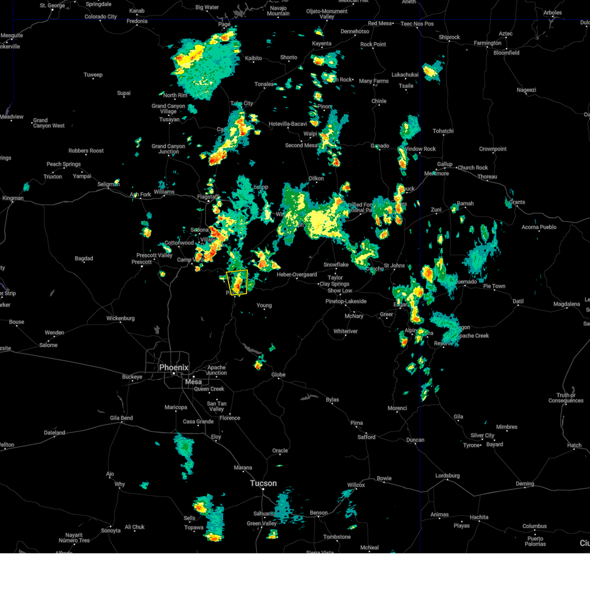
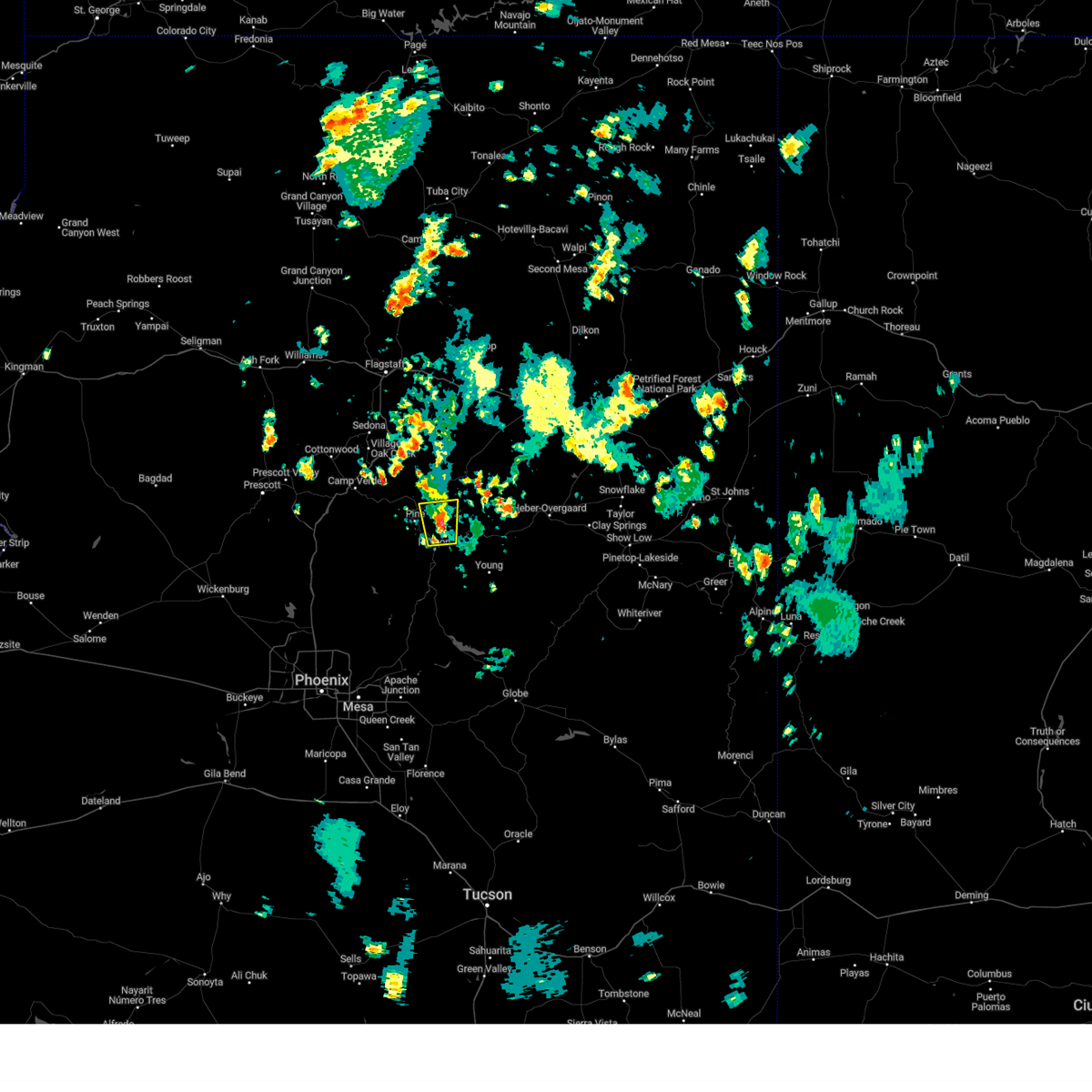
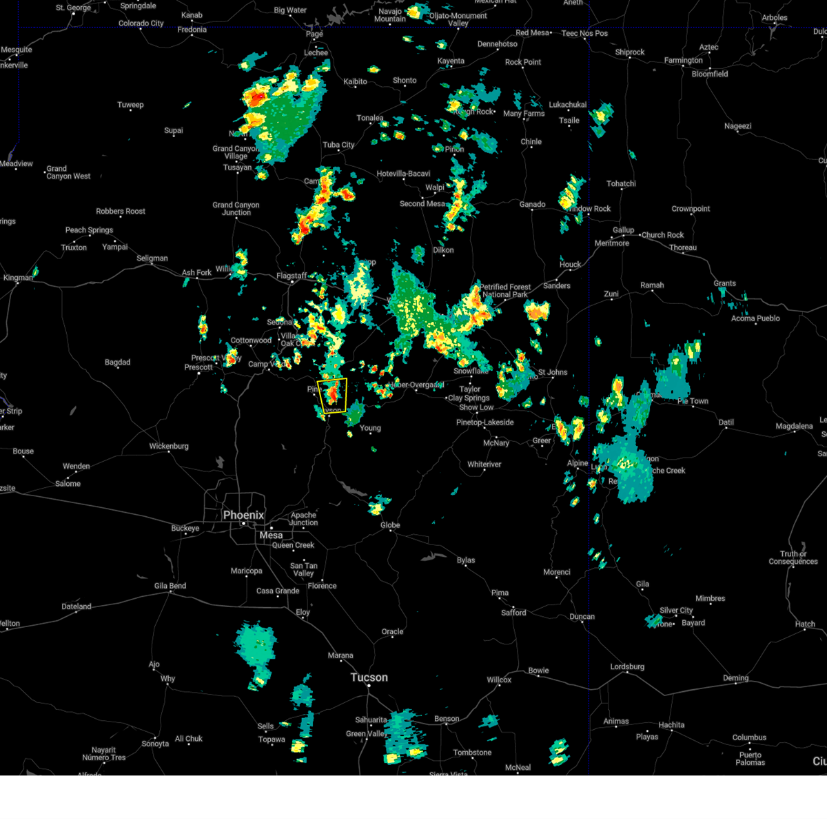
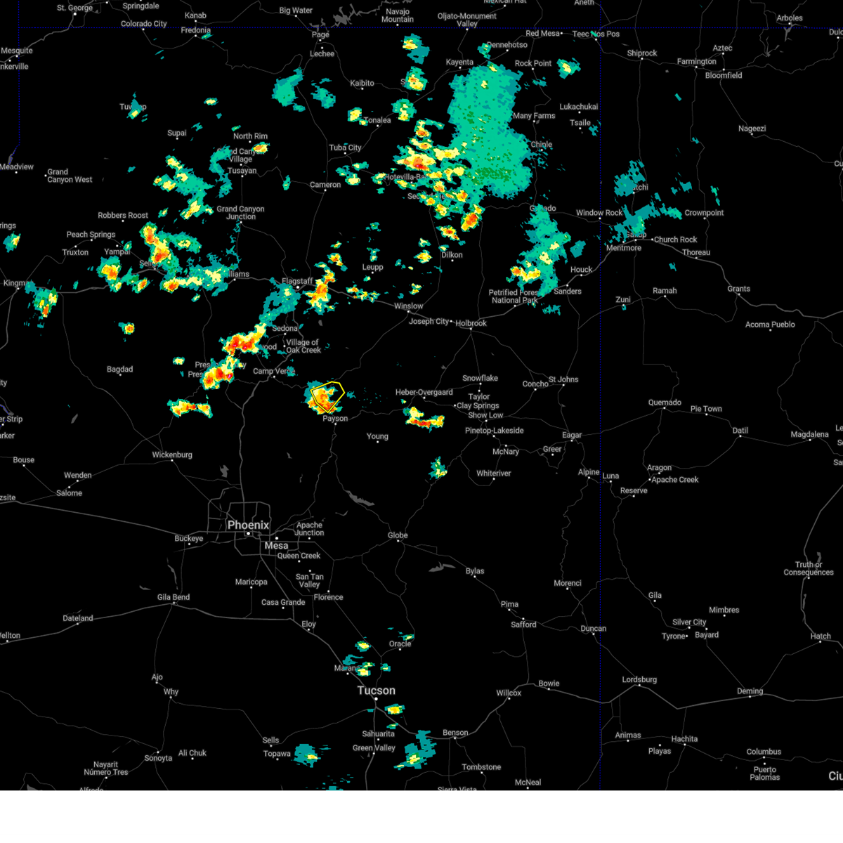
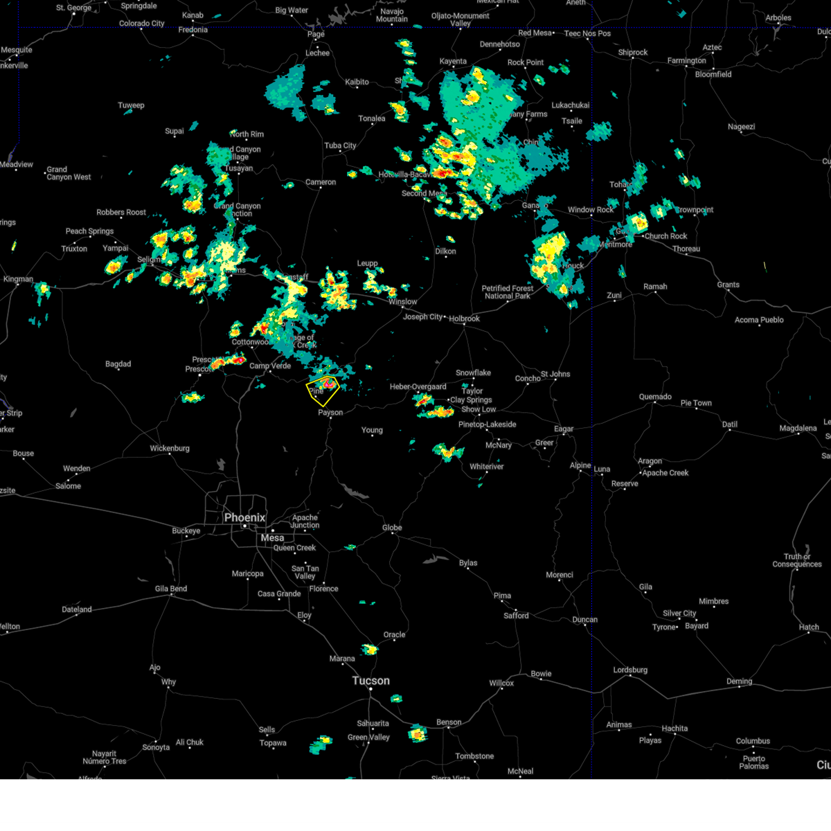
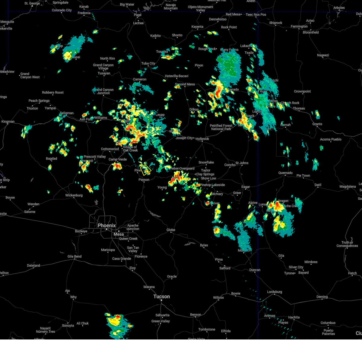
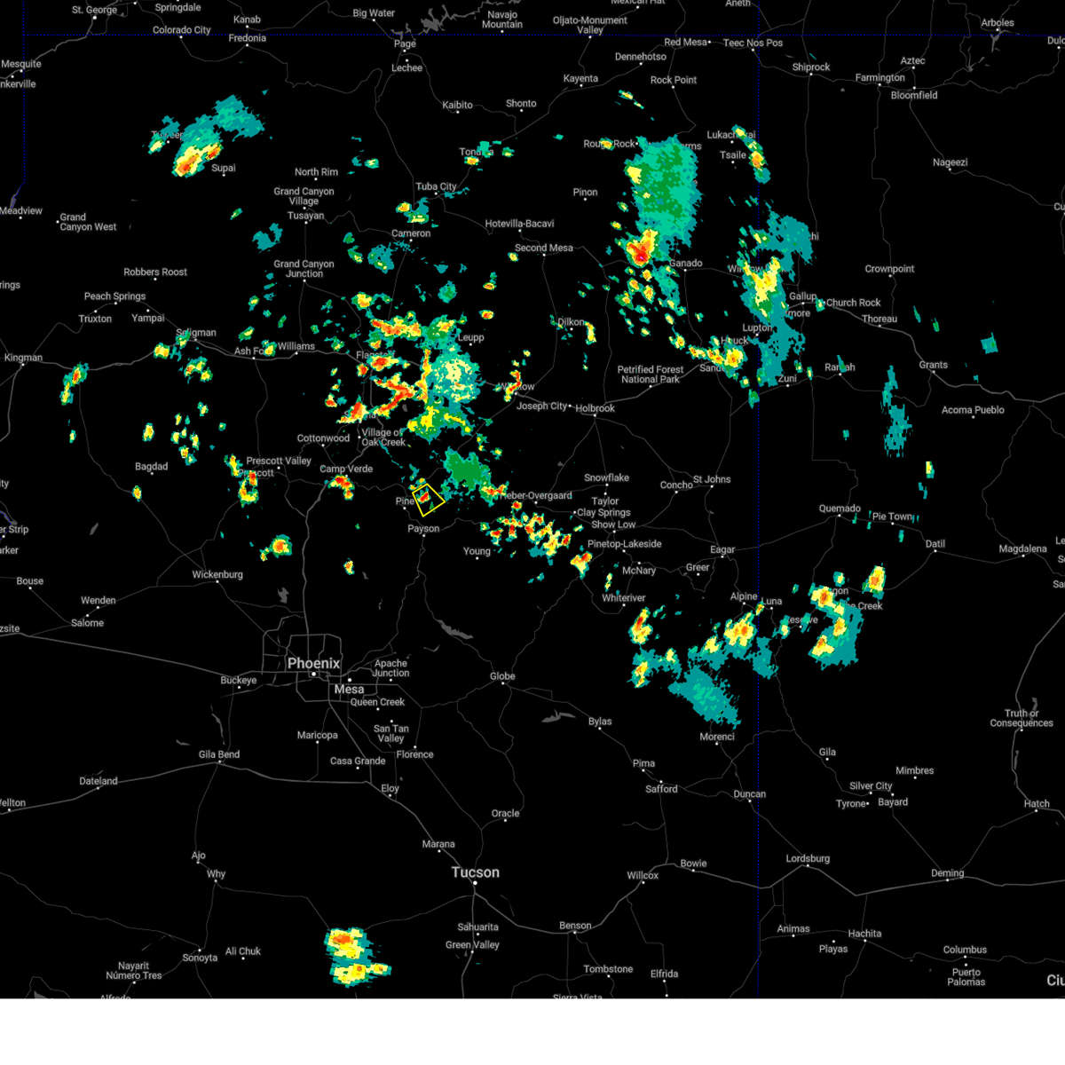
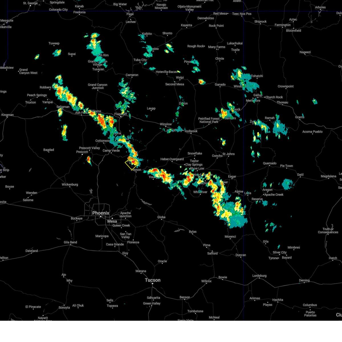
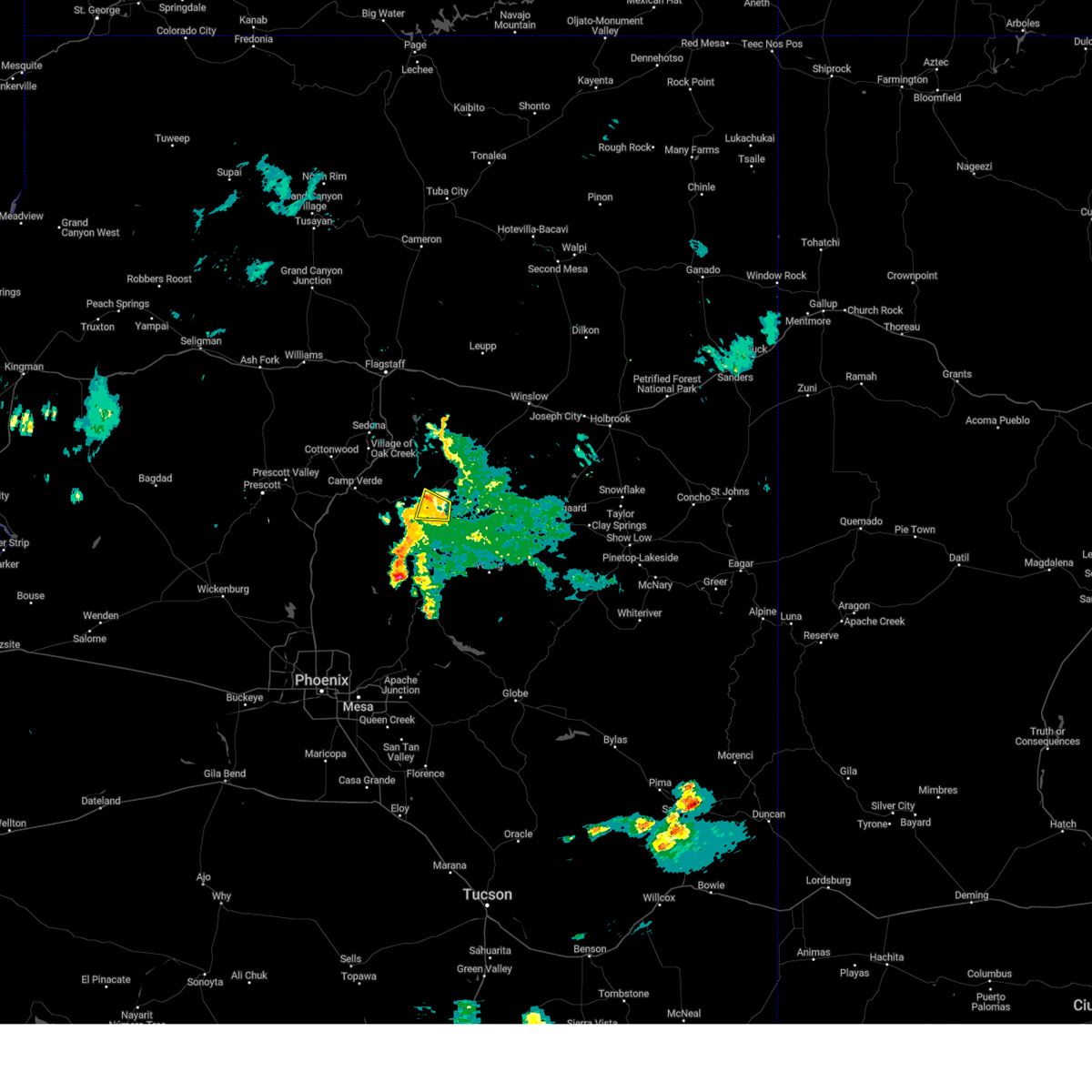
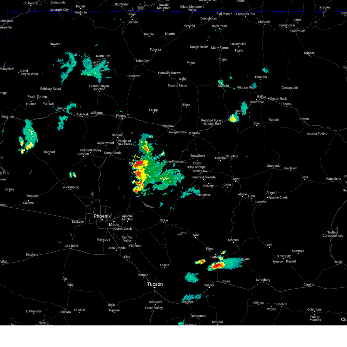
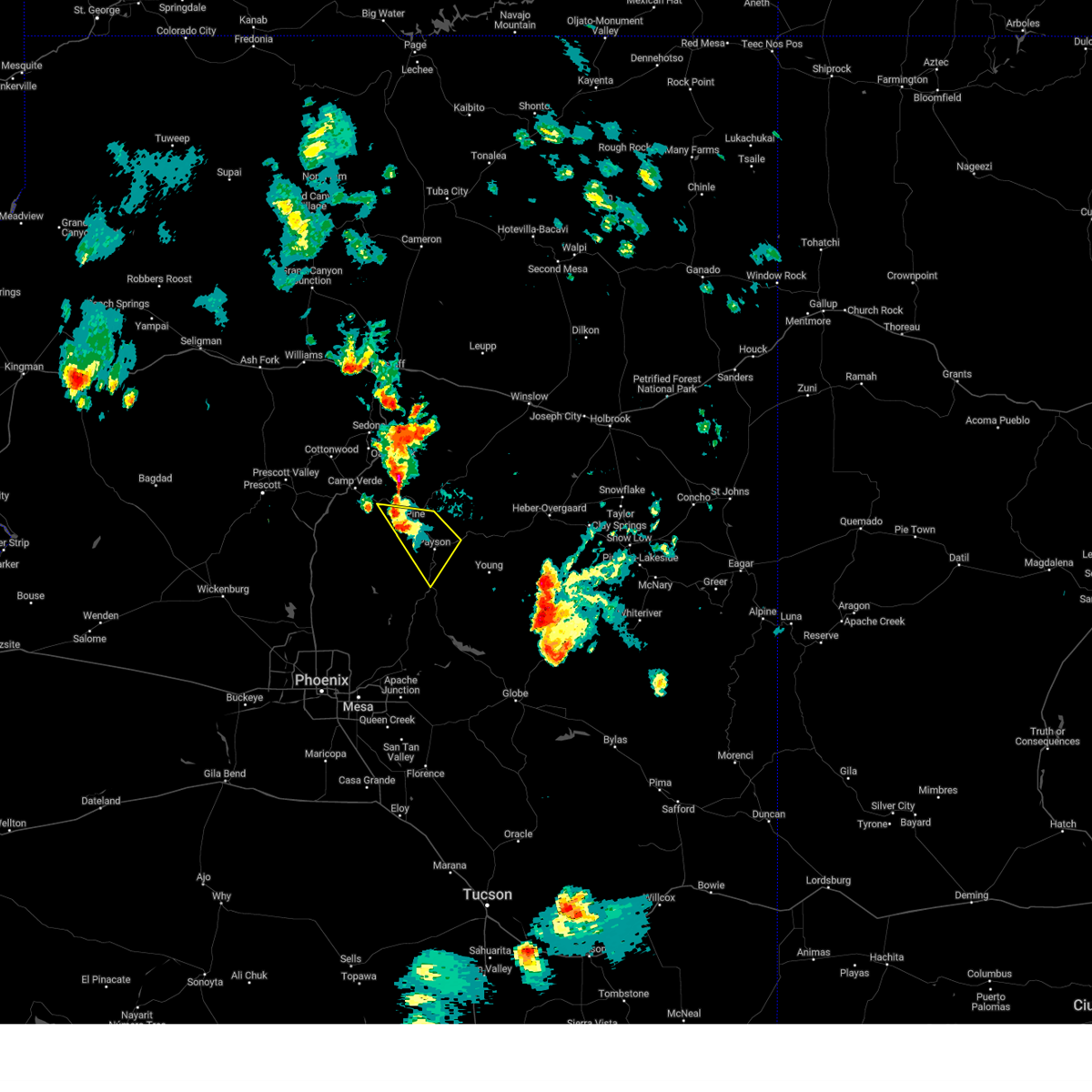
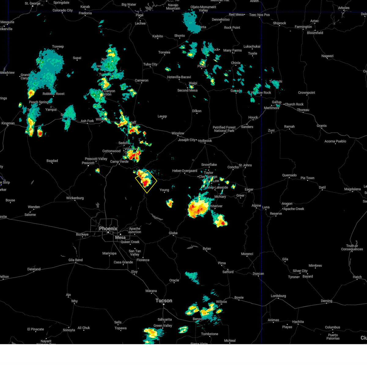
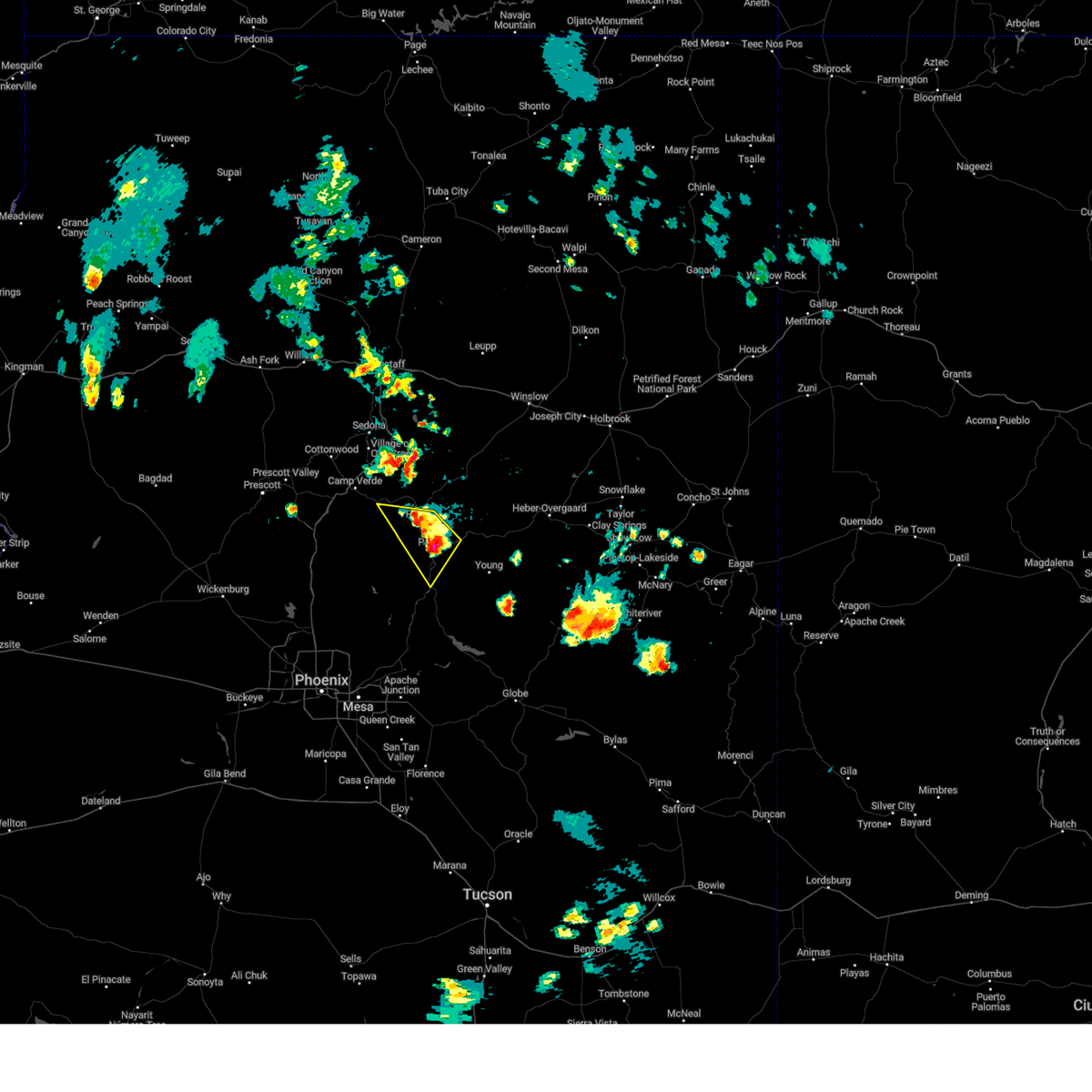
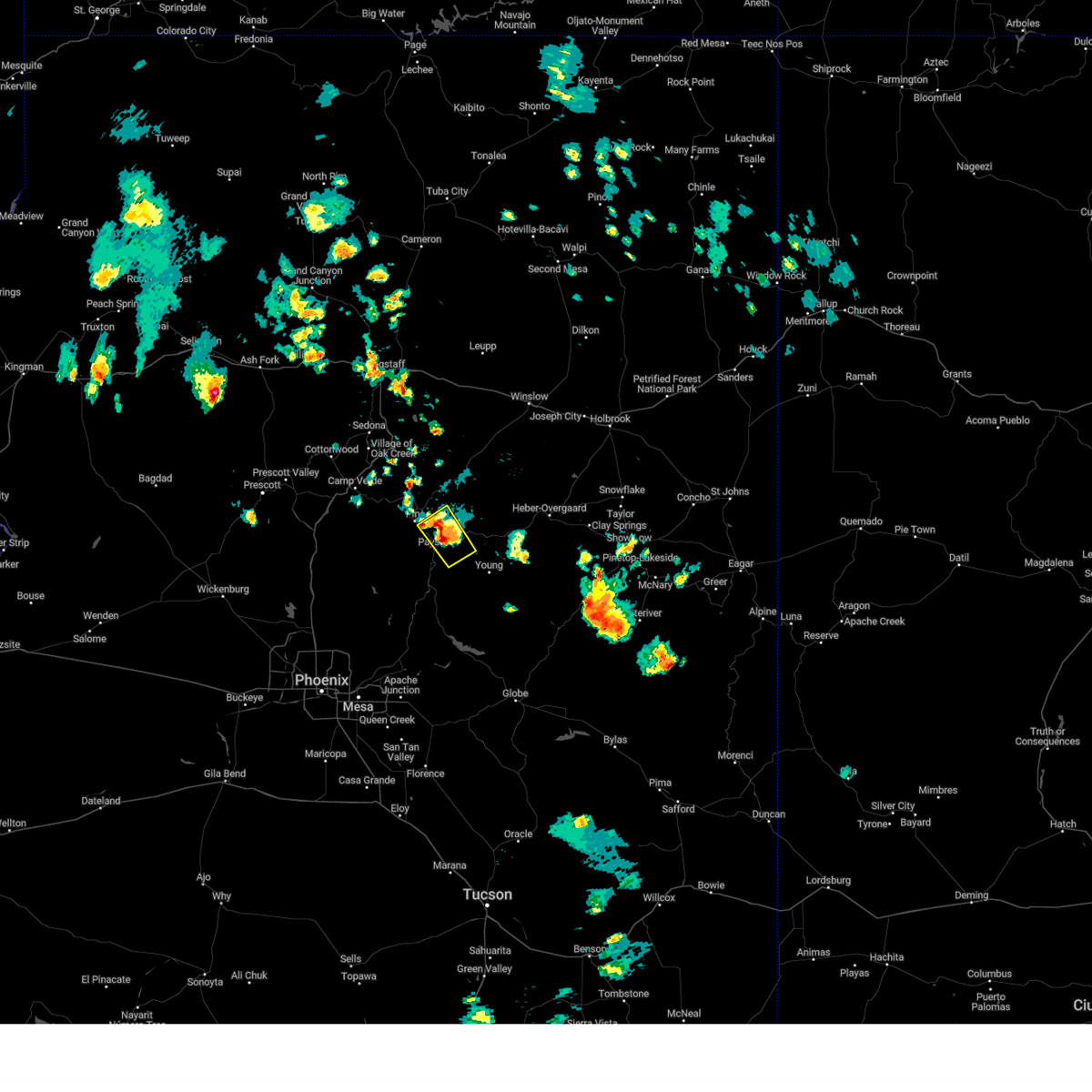
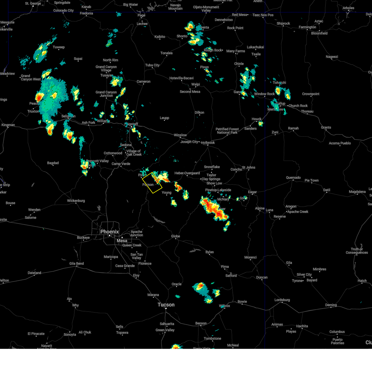
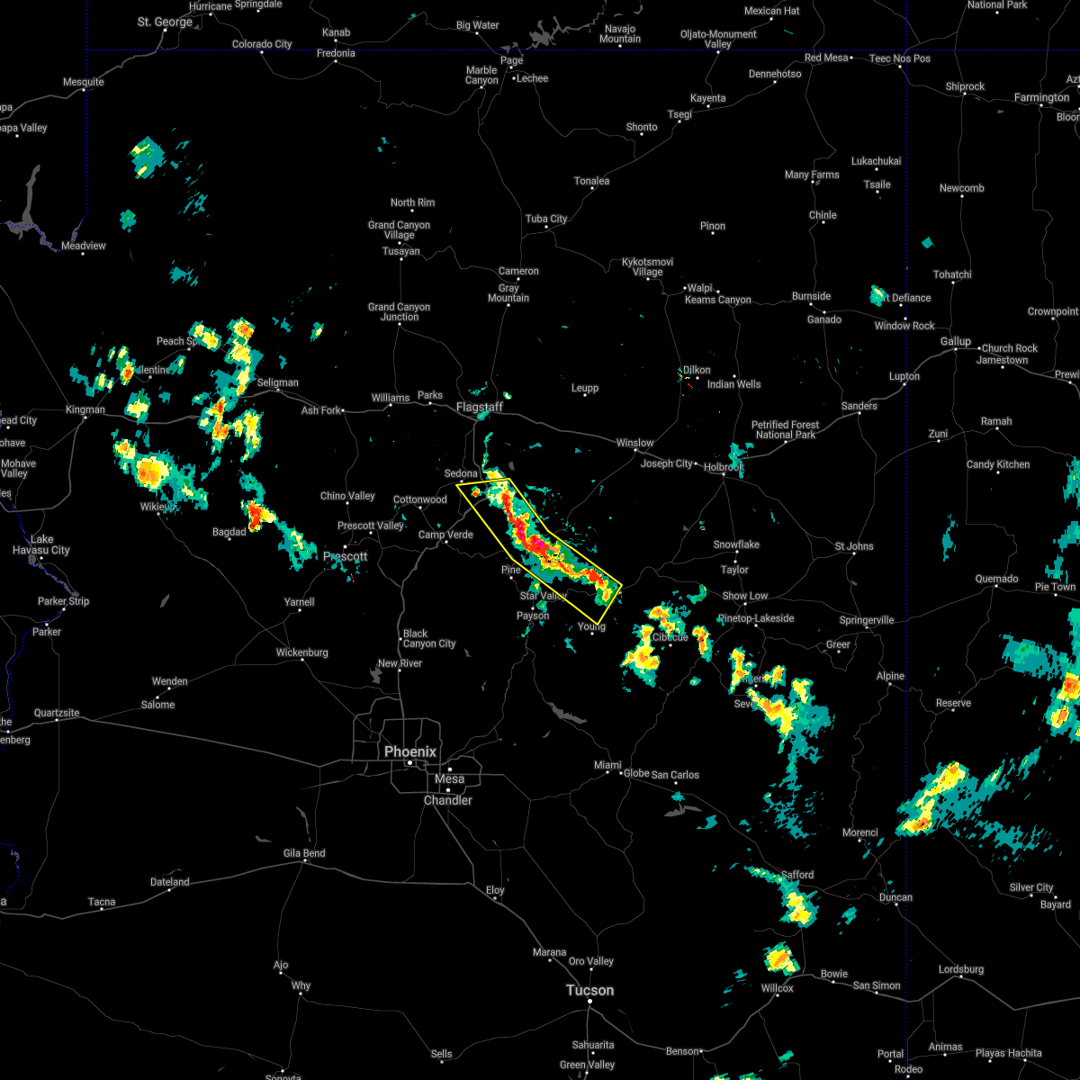
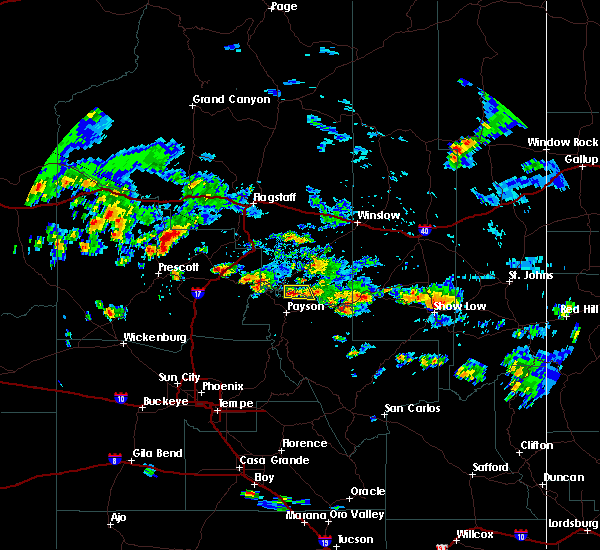
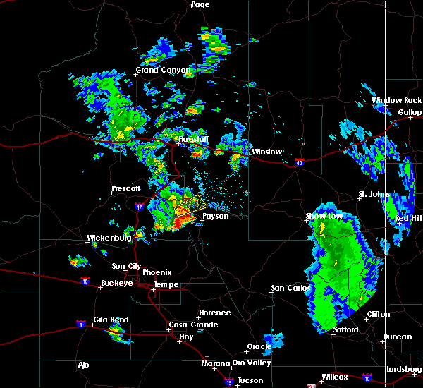
Hail Map for Washington Park, AZ
The Washington Park, AZ area has had 0 reports of on-the-ground hail by trained spotters, and has been under severe weather warnings 8 times during the past 12 months. Doppler radar has detected hail at or near Washington Park, AZ on 52 occasions, including 8 occasions during the past year.
| Name: | Washington Park, AZ |
| Where Located: | 58.8 miles SSE of Flagstaff, AZ |
| Map: | Google Map for Washington Park, AZ |
| Population: | 70 |
| Housing Units: | 206 |
| More Info: | Search Google for Washington Park, AZ |
1
The Top Recent Hail Date for Washington Park, AZ is Friday, July 26, 2024 (8th out of 52)

Hail and Wind Damage Spotted near Washington Park, AZ
| Date / Time | Report Details |
|---|---|
| 8/12/2024 3:24 PM MST |
 The storm which prompted the warning has weakened below severe limits, and no longer poses an immediate threat to life or property. therefore, the warning will be allowed to expire. however, heavy rain is still occurring with this thunderstorm and a flash flood warning is in effect for the washington park area and east verde river through 6:30 pm mst. The storm which prompted the warning has weakened below severe limits, and no longer poses an immediate threat to life or property. therefore, the warning will be allowed to expire. however, heavy rain is still occurring with this thunderstorm and a flash flood warning is in effect for the washington park area and east verde river through 6:30 pm mst.
|
| 8/12/2024 3:03 PM MST |
 At 303 pm mst, a severe thunderstorm was located over whispering pines, or 10 miles north of payson, moving north at 10 mph (radar indicated). Hazards include 60 mph wind gusts and nickel size hail. Expect damage to roofs, siding, and trees. locations impacted include, flowing springs, beaver valley estates, mesa del caballo, water wheel falls, ellison creek estates, ellison creek cascades, geronimo estates, freedom acres, east verde estates, la cienega, bonita creek estates, washington park, whispering pines, baker butte lookout, wonder valley, payson airport, star valley, payson, and pine. this includes the following highways, state route 260 between mile markers 256 and 260. State route 87 between mile markers 254 and 260, and between mile markers 280 and 283. At 303 pm mst, a severe thunderstorm was located over whispering pines, or 10 miles north of payson, moving north at 10 mph (radar indicated). Hazards include 60 mph wind gusts and nickel size hail. Expect damage to roofs, siding, and trees. locations impacted include, flowing springs, beaver valley estates, mesa del caballo, water wheel falls, ellison creek estates, ellison creek cascades, geronimo estates, freedom acres, east verde estates, la cienega, bonita creek estates, washington park, whispering pines, baker butte lookout, wonder valley, payson airport, star valley, payson, and pine. this includes the following highways, state route 260 between mile markers 256 and 260. State route 87 between mile markers 254 and 260, and between mile markers 280 and 283.
|
| 8/12/2024 2:45 PM MST |
 Svrfgz the national weather service in flagstaff has issued a * severe thunderstorm warning for, gila county in east central arizona, coconino county in north central arizona, * until 330 pm mst. * at 245 pm mst, a severe thunderstorm was located over ellison creek cascades, or 7 miles north of payson, moving north at 10 mph (radar indicated). Hazards include 60 mph wind gusts and nickel size hail. expect damage to roofs, siding, and trees Svrfgz the national weather service in flagstaff has issued a * severe thunderstorm warning for, gila county in east central arizona, coconino county in north central arizona, * until 330 pm mst. * at 245 pm mst, a severe thunderstorm was located over ellison creek cascades, or 7 miles north of payson, moving north at 10 mph (radar indicated). Hazards include 60 mph wind gusts and nickel size hail. expect damage to roofs, siding, and trees
|
| 8/6/2024 3:41 PM MST |
 The storm which prompted the warning has weakened below severe limits, and no longer poses an immediate threat to life or property. therefore, the warning will be allowed to expire. however, small hail and heavy rain are still possible with this thunderstorm. The storm which prompted the warning has weakened below severe limits, and no longer poses an immediate threat to life or property. therefore, the warning will be allowed to expire. however, small hail and heavy rain are still possible with this thunderstorm.
|
| 8/6/2024 3:10 PM MST |
 Svrfgz the national weather service in flagstaff has issued a * severe thunderstorm warning for, gila county in east central arizona, coconino county in north central arizona, * until 345 pm mst. * at 309 pm mst, a severe thunderstorm was located over baker butte lookout, or 14 miles north of payson, moving southwest at 10 mph (radar indicated). Hazards include quarter size hail. damage to vehicles is expected Svrfgz the national weather service in flagstaff has issued a * severe thunderstorm warning for, gila county in east central arizona, coconino county in north central arizona, * until 345 pm mst. * at 309 pm mst, a severe thunderstorm was located over baker butte lookout, or 14 miles north of payson, moving southwest at 10 mph (radar indicated). Hazards include quarter size hail. damage to vehicles is expected
|
| 7/25/2024 1:32 PM MST |
 the severe thunderstorm warning has been cancelled and is no longer in effect the severe thunderstorm warning has been cancelled and is no longer in effect
|
| 7/25/2024 1:08 PM MST |
 Svrfgz the national weather service in flagstaff has issued a * severe thunderstorm warning for, gila county in east central arizona, coconino county in north central arizona, * until 145 pm mst. * at 108 pm mst, a severe thunderstorm was located over washington park, or 13 miles north of payson, moving southeast at 10 mph (radar indicated). Hazards include 60 mph wind gusts and quarter size hail. Hail damage to vehicles is expected. Expect wind damage to roofs, siding, and trees. Svrfgz the national weather service in flagstaff has issued a * severe thunderstorm warning for, gila county in east central arizona, coconino county in north central arizona, * until 145 pm mst. * at 108 pm mst, a severe thunderstorm was located over washington park, or 13 miles north of payson, moving southeast at 10 mph (radar indicated). Hazards include 60 mph wind gusts and quarter size hail. Hail damage to vehicles is expected. Expect wind damage to roofs, siding, and trees.
|
| 7/21/2024 12:20 PM MST |
 Svrfgz the national weather service in flagstaff has issued a * severe thunderstorm warning for, gila county in east central arizona, coconino county in north central arizona, * until 1245 pm mst. * at 1219 pm mst, a severe thunderstorm was located near geronimo estates, or 12 miles north of payson, moving southwest at 5 mph (radar indicated). Hazards include quarter size hail. damage to vehicles is expected Svrfgz the national weather service in flagstaff has issued a * severe thunderstorm warning for, gila county in east central arizona, coconino county in north central arizona, * until 1245 pm mst. * at 1219 pm mst, a severe thunderstorm was located near geronimo estates, or 12 miles north of payson, moving southwest at 5 mph (radar indicated). Hazards include quarter size hail. damage to vehicles is expected
|
| 7/15/2024 7:01 PM MST |
 The storm which prompted the severe thunderstorm warning west of washington park has weakened below severe limits. therefore, the warning will be allowed to expire. small hail and very heavy rain are still possible with this thunderstorm. The storm which prompted the severe thunderstorm warning west of washington park has weakened below severe limits. therefore, the warning will be allowed to expire. small hail and very heavy rain are still possible with this thunderstorm.
|
| 7/15/2024 6:23 PM MST |
 Svrfgz the national weather service in flagstaff has issued a * severe thunderstorm warning for, gila county in east central arizona, coconino county in north central arizona, * until 700 pm mst. * at 623 pm mst, a severe thunderstorm was located over washington park, or 13 miles north of payson, moving west at 20 mph (radar indicated). Hazards include 60 mph wind gusts and quarter size hail. Hail damage to vehicles is expected. Expect wind damage to roofs, siding, and trees. Svrfgz the national weather service in flagstaff has issued a * severe thunderstorm warning for, gila county in east central arizona, coconino county in north central arizona, * until 700 pm mst. * at 623 pm mst, a severe thunderstorm was located over washington park, or 13 miles north of payson, moving west at 20 mph (radar indicated). Hazards include 60 mph wind gusts and quarter size hail. Hail damage to vehicles is expected. Expect wind damage to roofs, siding, and trees.
|
| 7/15/2024 6:14 PM MST | The storm which prompted the severe thunderstorm warning near washington park has weakened below severe limits. therefore, the warning will be allowed to expire. as large as dime sized hail and very heavy rain are still possible with this thunderstorm. |
| 7/15/2024 5:45 PM MST | Svrfgz the national weather service in flagstaff has issued a * severe thunderstorm warning for, gila county in east central arizona, coconino county in north central arizona, * until 615 pm mst. * at 545 pm mst, a severe thunderstorm was located near washington park, or 13 miles northeast of payson, moving west at 15 mph (radar indicated). Hazards include 60 mph wind gusts and quarter size hail. Hail damage to vehicles is expected. Expect wind damage to roofs, siding, and trees. |
| 7/14/2024 4:51 PM MST |
 The storm which prompted the warning has weakened below severe limits, and no longer poses an immediate threat to life or property. therefore, the warning will be allowed to expire. however, areas of gusty winds and moderate rain are still possible with this thunderstorm. The storm which prompted the warning has weakened below severe limits, and no longer poses an immediate threat to life or property. therefore, the warning will be allowed to expire. however, areas of gusty winds and moderate rain are still possible with this thunderstorm.
|
| 7/14/2024 4:13 PM MST |
 The storm which prompted the warning has moved out of the area. therefore, the warning will be allowed to expire. remember, a severe thunderstorm warning still remains in effect for areas near pine and payson through 5 pm mst. The storm which prompted the warning has moved out of the area. therefore, the warning will be allowed to expire. remember, a severe thunderstorm warning still remains in effect for areas near pine and payson through 5 pm mst.
|
| 7/14/2024 4:10 PM MST |
 Svrfgz the national weather service in flagstaff has issued a * severe thunderstorm warning for, gila county in east central arizona, yavapai county in west central arizona, coconino county in north central arizona, * until 500 pm mst. * at 409 pm mst, a severe thunderstorm was located near oxbow estates, or near payson, moving southwest at 20 mph (radar indicated). Hazards include 60 mph wind gusts and quarter size hail. Hail damage to vehicles is expected. Expect wind damage to roofs, siding, and trees. Svrfgz the national weather service in flagstaff has issued a * severe thunderstorm warning for, gila county in east central arizona, yavapai county in west central arizona, coconino county in north central arizona, * until 500 pm mst. * at 409 pm mst, a severe thunderstorm was located near oxbow estates, or near payson, moving southwest at 20 mph (radar indicated). Hazards include 60 mph wind gusts and quarter size hail. Hail damage to vehicles is expected. Expect wind damage to roofs, siding, and trees.
|
| 7/14/2024 3:43 PM MST |
 The storm northeast of payson continues to push towards the southwest, so a new severe thunderstorm warning has been issued. the previous warning will expire at 3:45 pm mst. The storm northeast of payson continues to push towards the southwest, so a new severe thunderstorm warning has been issued. the previous warning will expire at 3:45 pm mst.
|
| 7/14/2024 3:39 PM MST |
 Svrfgz the national weather service in flagstaff has issued a * severe thunderstorm warning for, gila county in east central arizona, coconino county in north central arizona, * until 415 pm mst. * at 339 pm mst, a severe thunderstorm was located near mesa del caballo, or near payson, moving southwest at 20 mph (radar indicated). Hazards include 60 mph wind gusts and quarter size hail. Hail damage to vehicles is expected. Expect wind damage to roofs, siding, and trees. Svrfgz the national weather service in flagstaff has issued a * severe thunderstorm warning for, gila county in east central arizona, coconino county in north central arizona, * until 415 pm mst. * at 339 pm mst, a severe thunderstorm was located near mesa del caballo, or near payson, moving southwest at 20 mph (radar indicated). Hazards include 60 mph wind gusts and quarter size hail. Hail damage to vehicles is expected. Expect wind damage to roofs, siding, and trees.
|
| 7/14/2024 3:01 PM MST |
 Svrfgz the national weather service in flagstaff has issued a * severe thunderstorm warning for, gila county in east central arizona, coconino county in north central arizona, * until 345 pm mst. * at 301 pm mst, severe thunderstorms were located along a line extending from near tonto village to washington park, moving southwest at 25 mph (radar indicated). Hazards include 60 mph wind gusts and quarter size hail. Hail damage to vehicles is expected. Expect wind damage to roofs, siding, and trees. Svrfgz the national weather service in flagstaff has issued a * severe thunderstorm warning for, gila county in east central arizona, coconino county in north central arizona, * until 345 pm mst. * at 301 pm mst, severe thunderstorms were located along a line extending from near tonto village to washington park, moving southwest at 25 mph (radar indicated). Hazards include 60 mph wind gusts and quarter size hail. Hail damage to vehicles is expected. Expect wind damage to roofs, siding, and trees.
|
| 8/31/2023 5:38 PM MST |
 At 537 pm mst, a severe thunderstorm was located over mesa del caba, or over payson, moving north at 10 mph (radar indicated). Hazards include 60 mph wind gusts and quarter size hail. Hail damage to vehicles is expected. Expect wind damage to roofs, siding, and trees. At 537 pm mst, a severe thunderstorm was located over mesa del caba, or over payson, moving north at 10 mph (radar indicated). Hazards include 60 mph wind gusts and quarter size hail. Hail damage to vehicles is expected. Expect wind damage to roofs, siding, and trees.
|
| 8/31/2023 3:45 PM MST |
 At 344 pm mst, a severe thunderstorm was located over mesa del caba, or over payson, moving north at 10 mph (public. at 340 pm mst, ping pong ball size hail was reported near payson). Hazards include ping pong ball size hail and 60 mph wind gusts. People and animals outdoors will be injured. expect hail damage to roofs, siding, windows, and vehicles. expect wind damage to roofs, siding, and trees. locations impacted include, payson, star valley, oxbow estates, round valley, flowing springs, beaver valley estates, mesa del caballo, water wheel falls, geronimo estates, ellison creek cascades, freedom acres, east verde estates, whispering pines, mesa del caba, payson airport, houston mesa campground, tonto natural bridge state park, and beaver valley. this includes the following highways, state route 260 between mile markers 252 and 259. state route 87 southbound between mile markers 247 and 251. state route 87 between mile markers 247 and 265. hail threat, observed max hail size, 1. 50 in wind threat, radar indicated max wind gust, 60 mph. At 344 pm mst, a severe thunderstorm was located over mesa del caba, or over payson, moving north at 10 mph (public. at 340 pm mst, ping pong ball size hail was reported near payson). Hazards include ping pong ball size hail and 60 mph wind gusts. People and animals outdoors will be injured. expect hail damage to roofs, siding, windows, and vehicles. expect wind damage to roofs, siding, and trees. locations impacted include, payson, star valley, oxbow estates, round valley, flowing springs, beaver valley estates, mesa del caballo, water wheel falls, geronimo estates, ellison creek cascades, freedom acres, east verde estates, whispering pines, mesa del caba, payson airport, houston mesa campground, tonto natural bridge state park, and beaver valley. this includes the following highways, state route 260 between mile markers 252 and 259. state route 87 southbound between mile markers 247 and 251. state route 87 between mile markers 247 and 265. hail threat, observed max hail size, 1. 50 in wind threat, radar indicated max wind gust, 60 mph.
|
| 8/31/2023 3:32 PM MST |
 At 331 pm mst, a severe thunderstorm was located over payson, moving north at 10 mph (nws employee). Hazards include 60 mph wind gusts and quarter size hail. Hail damage to vehicles is expected. expect wind damage to roofs, siding, and trees. locations impacted include, payson, star valley, oxbow estates, round valley, flowing springs, beaver valley estates, mesa del caballo, water wheel falls, geronimo estates, ellison creek cascades, freedom acres, east verde estates, whispering pines, mesa del caba, payson airport, houston mesa campground, tonto natural bridge state park, and beaver valley. this includes the following highways, state route 260 between mile markers 252 and 259. state route 87 southbound between mile markers 247 and 251. state route 87 between mile markers 247 and 265. hail threat, radar indicated max hail size, 1. 00 in wind threat, radar indicated max wind gust, 60 mph. At 331 pm mst, a severe thunderstorm was located over payson, moving north at 10 mph (nws employee). Hazards include 60 mph wind gusts and quarter size hail. Hail damage to vehicles is expected. expect wind damage to roofs, siding, and trees. locations impacted include, payson, star valley, oxbow estates, round valley, flowing springs, beaver valley estates, mesa del caballo, water wheel falls, geronimo estates, ellison creek cascades, freedom acres, east verde estates, whispering pines, mesa del caba, payson airport, houston mesa campground, tonto natural bridge state park, and beaver valley. this includes the following highways, state route 260 between mile markers 252 and 259. state route 87 southbound between mile markers 247 and 251. state route 87 between mile markers 247 and 265. hail threat, radar indicated max hail size, 1. 00 in wind threat, radar indicated max wind gust, 60 mph.
|
| 8/31/2023 3:26 PM MST |
 At 325 pm mst, a severe thunderstorm was located over payson, moving north at 10 mph (radar indicated). Hazards include 60 mph wind gusts and quarter size hail. Hail damage to vehicles is expected. Expect wind damage to roofs, siding, and trees. At 325 pm mst, a severe thunderstorm was located over payson, moving north at 10 mph (radar indicated). Hazards include 60 mph wind gusts and quarter size hail. Hail damage to vehicles is expected. Expect wind damage to roofs, siding, and trees.
|
| 8/23/2022 1:23 PM MST | The severe thunderstorm warning for gila and coconino counties will expire at 130 pm mst, the severe thunderstorm which prompted the warning has moved out of portions of the area. therefore, the warning will be allowed to expire. a new severe thunderstorm warning for a portion of the previously warned area has been issued. to report severe weather, contact your nearest law enforcement agency. they will relay your report to the national weather service flagstaff. remember, a severe thunderstorm warning still remains in effect for payson arizona. |
| 8/23/2022 12:53 PM MST | At 1253 pm mst, a severe thunderstorm was located over freedom acres, or near payson, moving southwest at 10 mph (radar indicated). Hazards include 60 mph wind gusts and quarter size hail. Hail damage to vehicles is expected. Expect wind damage to roofs, siding, and trees. |
| 8/1/2022 4:58 PM MST |
 The severe thunderstorm warning for gila county will expire at 500 pm mst, the storm which prompted the warning has weakened below severe limits, and no longer poses an immediate threat to life or property. therefore, the warning will be allowed to expire. however, heavy rain is still possible with this thunderstorm. a flash flood warning remains in effect for gila county near payson unitl 745 pm mst this evening. The severe thunderstorm warning for gila county will expire at 500 pm mst, the storm which prompted the warning has weakened below severe limits, and no longer poses an immediate threat to life or property. therefore, the warning will be allowed to expire. however, heavy rain is still possible with this thunderstorm. a flash flood warning remains in effect for gila county near payson unitl 745 pm mst this evening.
|
| 8/1/2022 4:46 PM MST |
 At 446 pm mst, a severe thunderstorm was located near payson, moving northeast at 10 mph (radar indicated). Hazards include 60 mph wind gusts and penny size hail. Expect damage to roofs, siding, and trees. locations impacted include, payson, geronimo estates, freedom acres, flowing springs, east verde estates, mesa del caballo, whispering pines, mead ranch, houston mesa campground, water wheel burn at houston mesa rd- s, beaver valley and water wheel burn at houston mesa rd-n. hail threat, radar indicated max hail size, 0. 75 in wind threat, radar indicated max wind gust, 60 mph. At 446 pm mst, a severe thunderstorm was located near payson, moving northeast at 10 mph (radar indicated). Hazards include 60 mph wind gusts and penny size hail. Expect damage to roofs, siding, and trees. locations impacted include, payson, geronimo estates, freedom acres, flowing springs, east verde estates, mesa del caballo, whispering pines, mead ranch, houston mesa campground, water wheel burn at houston mesa rd- s, beaver valley and water wheel burn at houston mesa rd-n. hail threat, radar indicated max hail size, 0. 75 in wind threat, radar indicated max wind gust, 60 mph.
|
| 8/1/2022 4:15 PM MST |
 At 414 pm mst, a severe thunderstorm was located over payson, moving northeast at 10 mph (doppler radar and trained weather spotters. at 412 pm mst, penny size hail was reported in payson). Hazards include 60 mph wind gusts and quarter size hail. Hail damage to vehicles is expected. Expect wind damage to roofs, siding, and trees. At 414 pm mst, a severe thunderstorm was located over payson, moving northeast at 10 mph (doppler radar and trained weather spotters. at 412 pm mst, penny size hail was reported in payson). Hazards include 60 mph wind gusts and quarter size hail. Hail damage to vehicles is expected. Expect wind damage to roofs, siding, and trees.
|
| 10/11/2021 11:25 PM MST |
 At 1125 pm mst, severe thunderstorms were located along a line extending from near childs power plant to near horseshoe reservoir, moving east at 45 mph (radar indicated). Hazards include 60 mph wind gusts. expect damage to roofs, siding, and trees At 1125 pm mst, severe thunderstorms were located along a line extending from near childs power plant to near horseshoe reservoir, moving east at 45 mph (radar indicated). Hazards include 60 mph wind gusts. expect damage to roofs, siding, and trees
|
| 7/10/2021 5:56 PM MST |
 At 555 pm mst, severe thunderstorms were located along a line extending from 7 miles southeast of rimrock to 7 miles east of gisela to 12 miles northwest of hilltop, moving southwest at 20 mph (radar indicated). Hazards include 60 mph wind gusts. expect damage to roofs, siding, and trees At 555 pm mst, severe thunderstorms were located along a line extending from 7 miles southeast of rimrock to 7 miles east of gisela to 12 miles northwest of hilltop, moving southwest at 20 mph (radar indicated). Hazards include 60 mph wind gusts. expect damage to roofs, siding, and trees
|
| 7/10/2021 5:09 PM MST |
 At 509 pm mst, severe thunderstorms were located along a line extending from 6 miles northwest of stoneman lake to near forest lakes, moving west at 10 mph (radar indicated). Hazards include 70 mph wind gusts and quarter size hail. Hail damage to vehicles is expected. expect considerable tree damage. Wind damage is also likely to mobile homes, roofs, and outbuildings. At 509 pm mst, severe thunderstorms were located along a line extending from 6 miles northwest of stoneman lake to near forest lakes, moving west at 10 mph (radar indicated). Hazards include 70 mph wind gusts and quarter size hail. Hail damage to vehicles is expected. expect considerable tree damage. Wind damage is also likely to mobile homes, roofs, and outbuildings.
|
| 5/8/2019 1:08 PM MST |
 At 1246 pm mst, severe thunderstorms were located along a line extending from near montezuma castle national monument to near star valley, moving east at 30 mph (radar indicated). Hazards include quarter size hail. Damage to vehicles is expected. locations impacted include, payson, star valley, mesa del caballo, tonto village, geronimo estates, freedom acres, strawberry, east verde estates, whispering pines, flowing springs, kohls ranch, pine, hunter creek, washington park, mead ranch, bear flat, upper tonto creek campground, geronimo boy scout camp, ponderosa campground and beaver valley. this includes the following highways, state route 260 between mile markers 246 and 273. state route 87 southbound near mile marker 251. State route 87 between mile markers 251 and 284. At 1246 pm mst, severe thunderstorms were located along a line extending from near montezuma castle national monument to near star valley, moving east at 30 mph (radar indicated). Hazards include quarter size hail. Damage to vehicles is expected. locations impacted include, payson, star valley, mesa del caballo, tonto village, geronimo estates, freedom acres, strawberry, east verde estates, whispering pines, flowing springs, kohls ranch, pine, hunter creek, washington park, mead ranch, bear flat, upper tonto creek campground, geronimo boy scout camp, ponderosa campground and beaver valley. this includes the following highways, state route 260 between mile markers 246 and 273. state route 87 southbound near mile marker 251. State route 87 between mile markers 251 and 284.
|
| 5/8/2019 12:46 PM MST |
 At 1246 pm mst, severe thunderstorms were located along a line extending from near montezuma castle national monument to near star valley, moving east at 30 mph (radar indicated). Hazards include quarter size hail. Damage to vehicles is expected. locations impacted include, payson, star valley, mesa del caballo, tonto village, geronimo estates, freedom acres, strawberry, east verde estates, whispering pines, flowing springs, kohls ranch, pine, hunter creek, washington park, mead ranch, bear flat, upper tonto creek campground, geronimo boy scout camp, ponderosa campground and beaver valley. this includes the following highways, state route 260 between mile markers 246 and 273. state route 87 southbound near mile marker 251. State route 87 between mile markers 251 and 284. At 1246 pm mst, severe thunderstorms were located along a line extending from near montezuma castle national monument to near star valley, moving east at 30 mph (radar indicated). Hazards include quarter size hail. Damage to vehicles is expected. locations impacted include, payson, star valley, mesa del caballo, tonto village, geronimo estates, freedom acres, strawberry, east verde estates, whispering pines, flowing springs, kohls ranch, pine, hunter creek, washington park, mead ranch, bear flat, upper tonto creek campground, geronimo boy scout camp, ponderosa campground and beaver valley. this includes the following highways, state route 260 between mile markers 246 and 273. state route 87 southbound near mile marker 251. State route 87 between mile markers 251 and 284.
|
| 5/8/2019 12:36 PM MST |
 The national weather service in flagstaff has issued a * severe thunderstorm warning for. gila county in east central arizona. yavapai county in west central arizona. coconino county in north central arizona. Until 115 pm mst. The national weather service in flagstaff has issued a * severe thunderstorm warning for. gila county in east central arizona. yavapai county in west central arizona. coconino county in north central arizona. Until 115 pm mst.
|
| 8/12/2018 8:25 PM MST |
 At 824 pm mst, the leading edge of outflow winds from severe thunderstorms was located along a line extending from near childs power plant to 7 miles southwest of pine to near east verde estates, moving west at 25 mph (radar indicated). Hazards include 60 mph wind gusts. expect damage to roofs, siding, and trees At 824 pm mst, the leading edge of outflow winds from severe thunderstorms was located along a line extending from near childs power plant to 7 miles southwest of pine to near east verde estates, moving west at 25 mph (radar indicated). Hazards include 60 mph wind gusts. expect damage to roofs, siding, and trees
|
| 8/12/2018 8:03 PM MST |
 At 745 pm mst, a severe thunderstorm was located near clints well, or 20 miles north of payson, moving southwest at 30 mph (radar indicated). Hazards include 60 mph wind gusts. expect damage to roofs, siding, and trees At 745 pm mst, a severe thunderstorm was located near clints well, or 20 miles north of payson, moving southwest at 30 mph (radar indicated). Hazards include 60 mph wind gusts. expect damage to roofs, siding, and trees
|
| 8/12/2018 7:46 PM MST |
 The national weather service in flagstaff has issued a * severe thunderstorm warning for. gila county in east central arizona. yavapai county in west central arizona. coconino county in north central arizona. Until 830 pm mst. The national weather service in flagstaff has issued a * severe thunderstorm warning for. gila county in east central arizona. yavapai county in west central arizona. coconino county in north central arizona. Until 830 pm mst.
|
| 8/12/2018 7:26 PM MST |
 At 659 pm mst, severe thunderstorms were located along a line extending from 10 miles northeast of tremaine lake to 8 miles northeast of starlight pines to 15 miles north of christopher creek to 10 miles northeast of forest lakes, moving southwest at 30 mph (radar indicated). Hazards include 60 mph wind gusts and half dollar size hail. Hail damage to vehicles is expected. Expect wind damage to roofs, siding, and trees. At 659 pm mst, severe thunderstorms were located along a line extending from 10 miles northeast of tremaine lake to 8 miles northeast of starlight pines to 15 miles north of christopher creek to 10 miles northeast of forest lakes, moving southwest at 30 mph (radar indicated). Hazards include 60 mph wind gusts and half dollar size hail. Hail damage to vehicles is expected. Expect wind damage to roofs, siding, and trees.
|
| 8/12/2018 6:59 PM MST |
 The national weather service in flagstaff has issued a * severe thunderstorm warning for. gila county in east central arizona. navajo county in north central arizona. coconino county in north central arizona. Until 745 pm mst. The national weather service in flagstaff has issued a * severe thunderstorm warning for. gila county in east central arizona. navajo county in north central arizona. coconino county in north central arizona. Until 745 pm mst.
|
| 8/10/2018 2:26 PM MST |
 At 226 pm mst, a severe thunderstorm was located over freedom acres, or near payson, moving west at 10 mph (radar indicated). Hazards include 60 mph wind gusts and half dollar size hail. Hail damage to vehicles is expected. expect wind damage to roofs, siding, and trees. locations impacted include, payson, star valley, oxbow estates, round valley, flowing springs, mesa del caballo, geronimo estates, freedom acres, east verde estates, whispering pines, houston mesa campground, water wheel burn at houston mesa rd- s, tonto natural bridge state park, beaver valley and water wheel burn at houston mesa rd-n. this includes the following highways, state route 260 between mile markers 252 and 263. state route 87 southbound between mile markers 243 and 251. State route 87 between mile markers 246 and 267. At 226 pm mst, a severe thunderstorm was located over freedom acres, or near payson, moving west at 10 mph (radar indicated). Hazards include 60 mph wind gusts and half dollar size hail. Hail damage to vehicles is expected. expect wind damage to roofs, siding, and trees. locations impacted include, payson, star valley, oxbow estates, round valley, flowing springs, mesa del caballo, geronimo estates, freedom acres, east verde estates, whispering pines, houston mesa campground, water wheel burn at houston mesa rd- s, tonto natural bridge state park, beaver valley and water wheel burn at houston mesa rd-n. this includes the following highways, state route 260 between mile markers 252 and 263. state route 87 southbound between mile markers 243 and 251. State route 87 between mile markers 246 and 267.
|
| 8/10/2018 2:14 PM MST |
 At 214 pm mst, a severe thunderstorm was located near freedom acres, or 7 miles northeast of payson, moving west at 10 mph (radar indicated). Hazards include 60 mph wind gusts and half dollar size hail. Hail damage to vehicles is expected. Expect wind damage to roofs, siding, and trees. At 214 pm mst, a severe thunderstorm was located near freedom acres, or 7 miles northeast of payson, moving west at 10 mph (radar indicated). Hazards include 60 mph wind gusts and half dollar size hail. Hail damage to vehicles is expected. Expect wind damage to roofs, siding, and trees.
|
| 8/12/2017 4:38 PM MST |
 At 437 pm mst, a severe thunderstorm was located over washington park, or 14 miles north of payson, moving east at 10 mph (radar indicated). Hazards include quarter size hail. damage to vehicles is expected At 437 pm mst, a severe thunderstorm was located over washington park, or 14 miles north of payson, moving east at 10 mph (radar indicated). Hazards include quarter size hail. damage to vehicles is expected
|
| 8/11/2016 12:53 AM MST |
 At 1251 am mst, doppler radar indicated a severe thunderstorm capable of producing quarter size hail. this storm was located near whispering pines, or 11 miles northeast of payson, moving northeast at 15 mph. an urban and small stream flood advisory is also in effect for this area. locations impacted include, star valley, flowing springs, tonto village, east verde estates, whispering pines, mead ranch, mesa del caba, freedom acres, upper tonto creek campground, beaver valley, water wheel burn at houston mesa rd-s, water wheel burn at houston mesa rd-n and houston mesa campground. At 1251 am mst, doppler radar indicated a severe thunderstorm capable of producing quarter size hail. this storm was located near whispering pines, or 11 miles northeast of payson, moving northeast at 15 mph. an urban and small stream flood advisory is also in effect for this area. locations impacted include, star valley, flowing springs, tonto village, east verde estates, whispering pines, mead ranch, mesa del caba, freedom acres, upper tonto creek campground, beaver valley, water wheel burn at houston mesa rd-s, water wheel burn at houston mesa rd-n and houston mesa campground.
|
| 8/11/2016 12:35 AM MST |
 At 1233 am mst, doppler radar indicated a severe thunderstorm capable of producing quarter size hail and damaging winds in excess of 60 mph. this storm was located over whispering pines, or 7 miles northeast of payson, and moving northeast at 15 mph. At 1233 am mst, doppler radar indicated a severe thunderstorm capable of producing quarter size hail and damaging winds in excess of 60 mph. this storm was located over whispering pines, or 7 miles northeast of payson, and moving northeast at 15 mph.
|
| 7/1/2016 2:26 PM MST |
 At 226 pm mst, doppler radar indicated a severe thunderstorm capable of producing quarter size hail. this storm was located over strawberry, or 16 miles northwest of payson, and moving northeast at 30 mph. At 226 pm mst, doppler radar indicated a severe thunderstorm capable of producing quarter size hail. this storm was located over strawberry, or 16 miles northwest of payson, and moving northeast at 30 mph.
|
Hail Maps for Washington Park, AZ


Connect with Interactive Hail Maps