

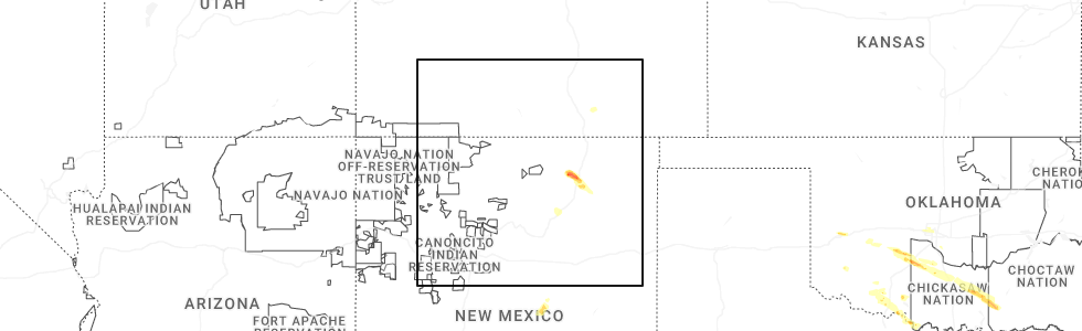
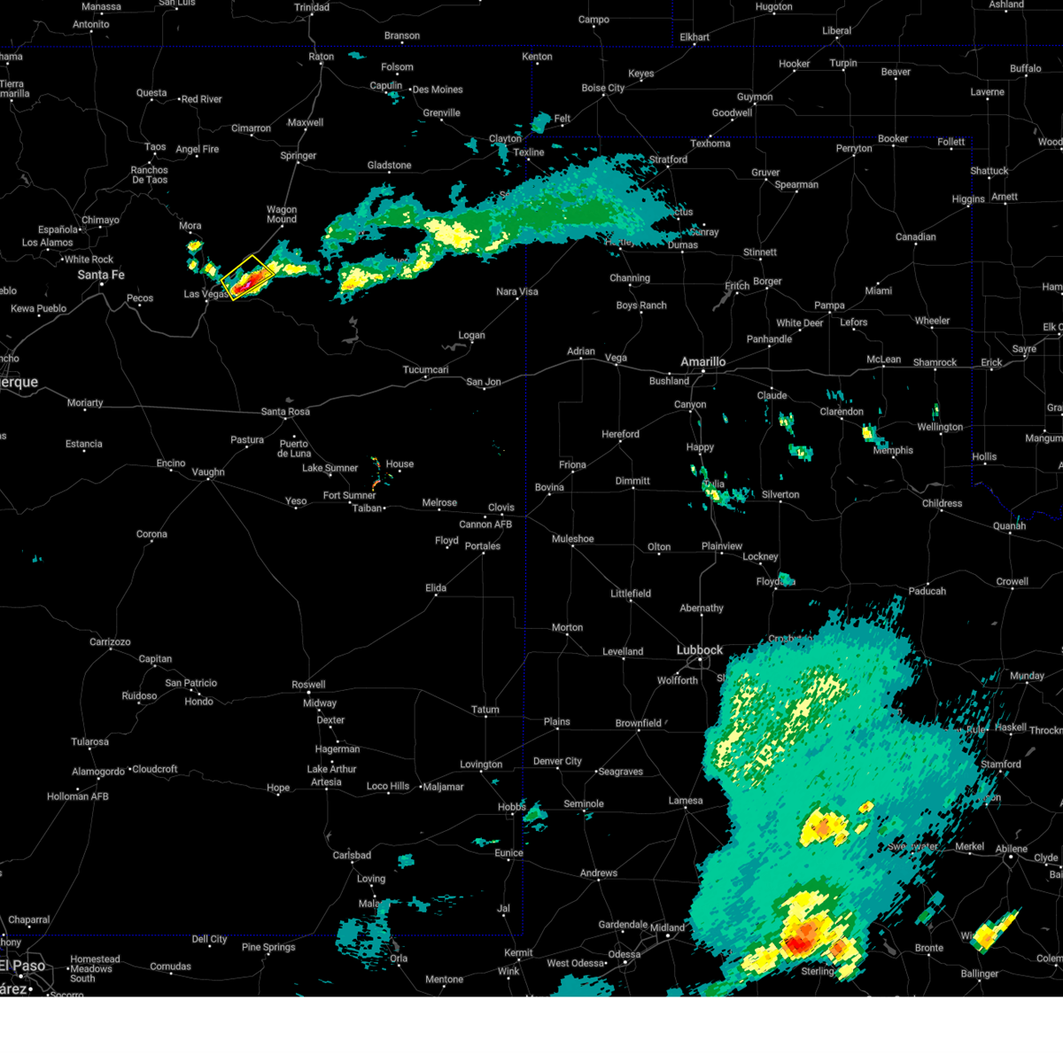
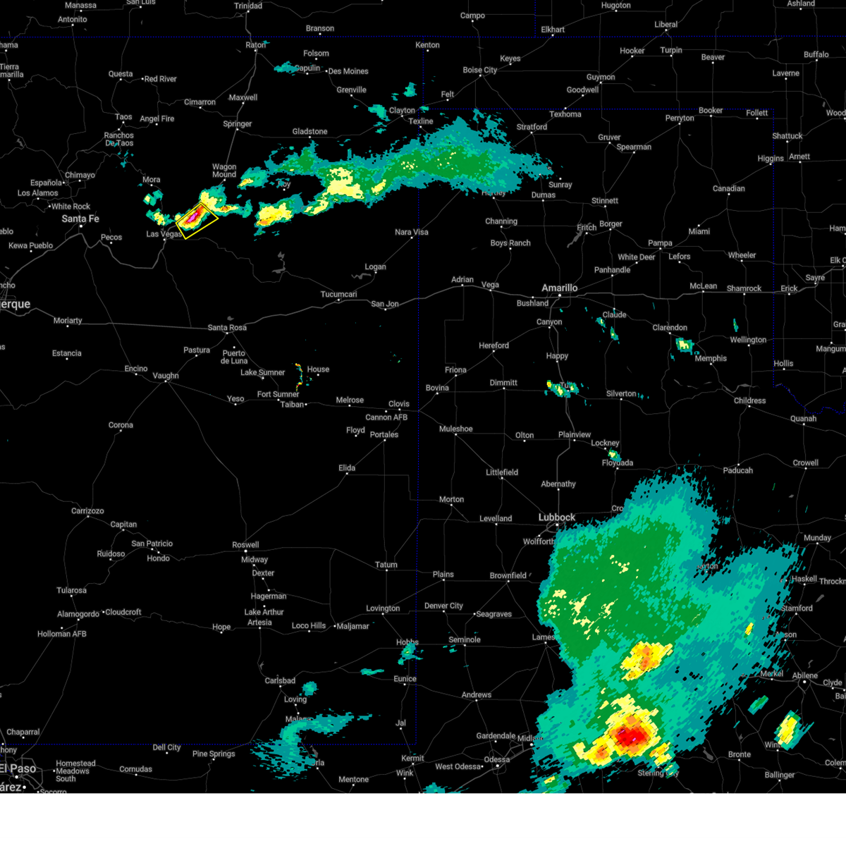
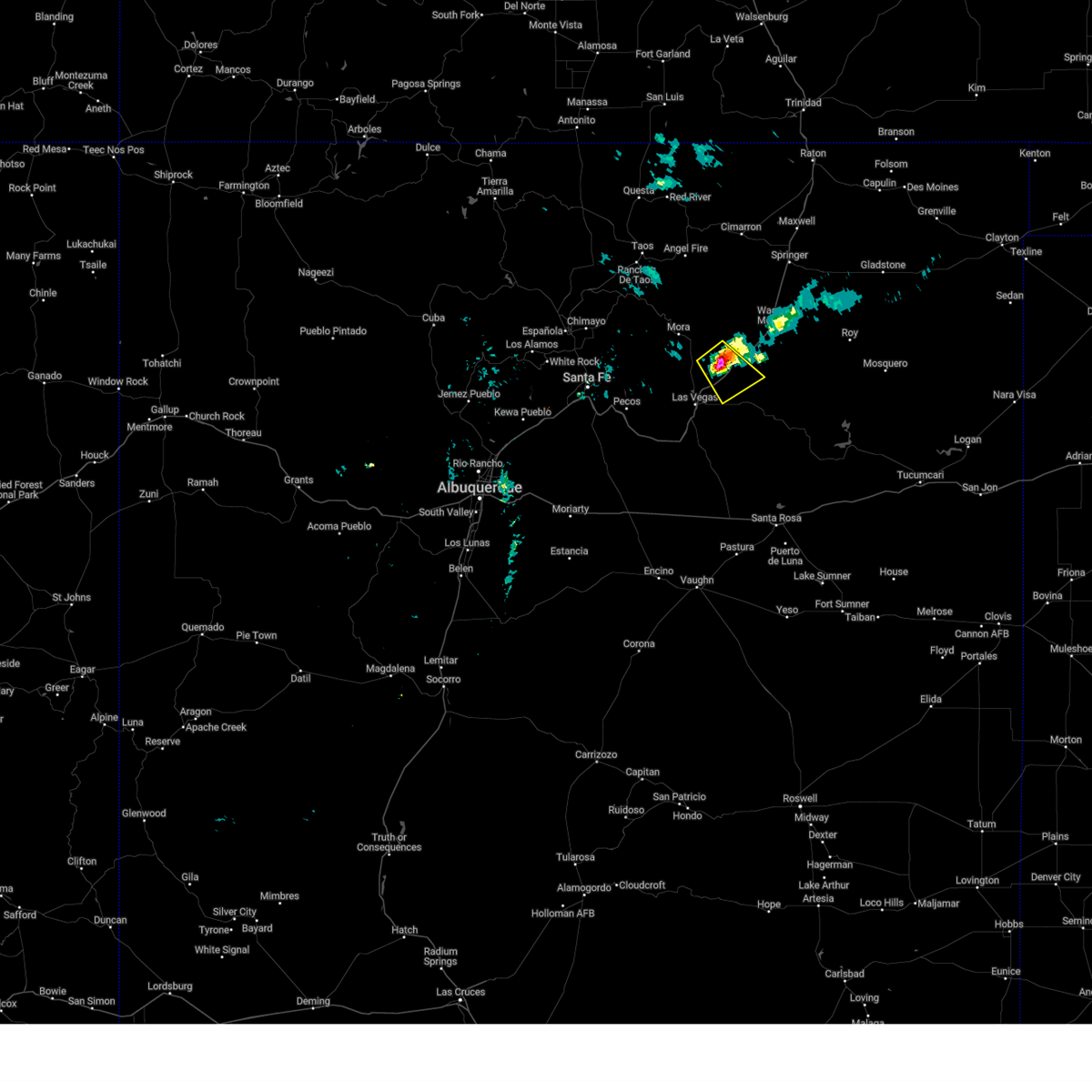
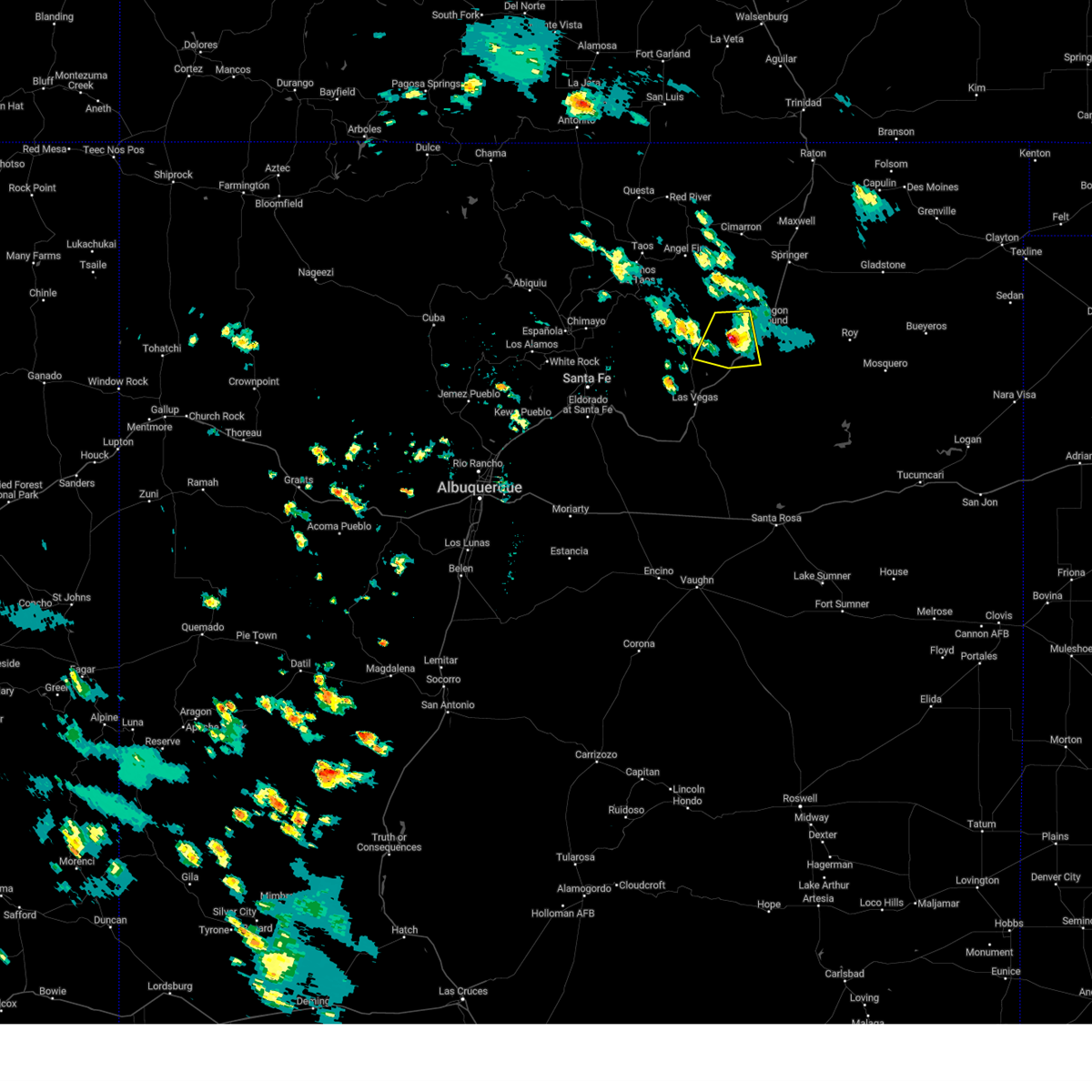
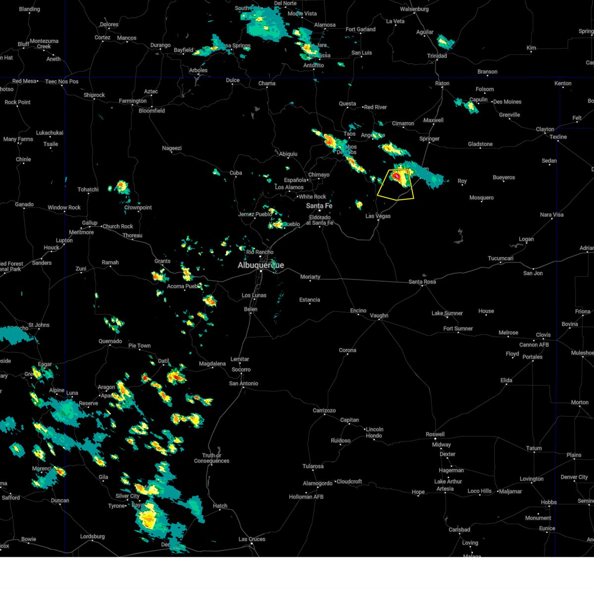
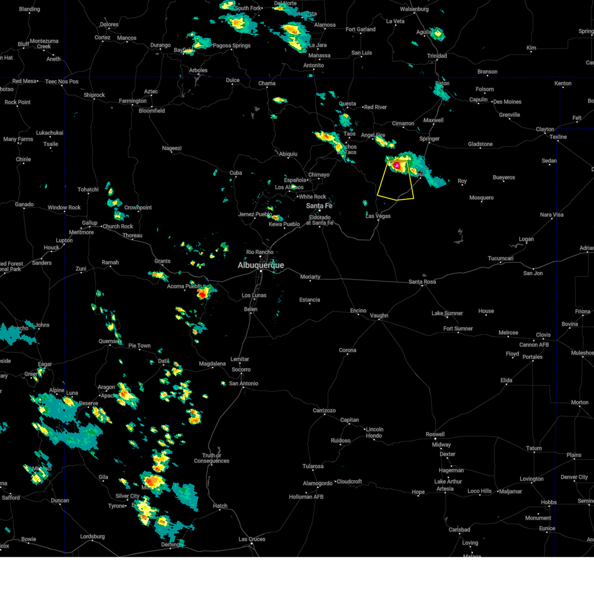
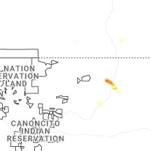
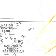
Hail Map for Watrous, NM
The Watrous, NM area has had 5 reports of on-the-ground hail by trained spotters, and has been under severe weather warnings 16 times during the past 12 months. Doppler radar has detected hail at or near Watrous, NM on 43 occasions, including 4 occasions during the past year.
| Name: | Watrous, NM |
| Where Located: | 54.2 miles SE of Taos, NM |
| Map: | Google Map for Watrous, NM |
| Population: | 135 |
| Housing Units: | 60 |
| More Info: | Search Google for Watrous, NM |
2
The Top Recent Hail Date for Watrous, NM is Thursday, May 29, 2025 (13th out of 43)
Hail and Wind Damage Spotted near Watrous, NM
| Date / Time | Report Details |
|---|---|
| 5/29/2025 8:04 PM MDT |
 the severe thunderstorm warning has been cancelled and is no longer in effect the severe thunderstorm warning has been cancelled and is no longer in effect
|
| 5/29/2025 7:45 PM MDT |
 At 745 pm mdt, a severe thunderstorm was located near watrous, or 17 miles northeast of las vegas, moving southeast at 15 mph (radar indicated). Hazards include quarter size hail. Damage to vehicles is expected. locations impacted include, watrous, valmora and shoemaker. This includes interstate 25 between mile markers 356 and 365, and near mile marker 366. At 745 pm mdt, a severe thunderstorm was located near watrous, or 17 miles northeast of las vegas, moving southeast at 15 mph (radar indicated). Hazards include quarter size hail. Damage to vehicles is expected. locations impacted include, watrous, valmora and shoemaker. This includes interstate 25 between mile markers 356 and 365, and near mile marker 366.
|
| 5/29/2025 7:29 PM MDT |
 Svrabq the national weather service in albuquerque has issued a * severe thunderstorm warning for, south central mora county in northeastern new mexico, north central san miguel county in northeastern new mexico, * until 815 pm mdt. * at 729 pm mdt, a severe thunderstorm was located near watrous, or 16 miles northeast of las vegas, moving southeast at 15 mph (radar indicated). Hazards include 60 mph wind gusts and quarter size hail. Hail damage to vehicles is expected. Expect wind damage to roofs, siding, and trees. Svrabq the national weather service in albuquerque has issued a * severe thunderstorm warning for, south central mora county in northeastern new mexico, north central san miguel county in northeastern new mexico, * until 815 pm mdt. * at 729 pm mdt, a severe thunderstorm was located near watrous, or 16 miles northeast of las vegas, moving southeast at 15 mph (radar indicated). Hazards include 60 mph wind gusts and quarter size hail. Hail damage to vehicles is expected. Expect wind damage to roofs, siding, and trees.
|
| 7/27/2024 4:36 PM MDT |
 Svrabq the national weather service in albuquerque has issued a * severe thunderstorm warning for, northwestern san miguel county in northeastern new mexico, south central mora county in northeastern new mexico, * until 515 pm mdt. * at 435 pm mdt, a severe thunderstorm was located over sapello, or 13 miles south of mora, moving southeast at 20 mph (radar indicated). Hazards include 60 mph wind gusts and half dollar size hail. Hail damage to vehicles is expected. Expect wind damage to roofs, siding, and trees. Svrabq the national weather service in albuquerque has issued a * severe thunderstorm warning for, northwestern san miguel county in northeastern new mexico, south central mora county in northeastern new mexico, * until 515 pm mdt. * at 435 pm mdt, a severe thunderstorm was located over sapello, or 13 miles south of mora, moving southeast at 20 mph (radar indicated). Hazards include 60 mph wind gusts and half dollar size hail. Hail damage to vehicles is expected. Expect wind damage to roofs, siding, and trees.
|
| 7/27/2024 3:31 PM MDT |
 The storm which prompted the warning has weakened below severe limits, and no longer poses an immediate threat to life or property. therefore, the warning has been allowed to expire. The storm which prompted the warning has weakened below severe limits, and no longer poses an immediate threat to life or property. therefore, the warning has been allowed to expire.
|
| 7/27/2024 3:17 PM MDT |
 At 316 pm mdt, a severe thunderstorm was located 12 miles south of ocate, or 16 miles west of wagon mound, moving south at 15 mph (radar indicated). Hazards include 60 mph wind gusts and half dollar size hail. Hail damage to vehicles is expected. expect wind damage to roofs, siding, and trees. locations impacted include, valmora, watrous, golondrinas, and shoemaker. This includes interstate 25 between mile markers 367 and 378. At 316 pm mdt, a severe thunderstorm was located 12 miles south of ocate, or 16 miles west of wagon mound, moving south at 15 mph (radar indicated). Hazards include 60 mph wind gusts and half dollar size hail. Hail damage to vehicles is expected. expect wind damage to roofs, siding, and trees. locations impacted include, valmora, watrous, golondrinas, and shoemaker. This includes interstate 25 between mile markers 367 and 378.
|
| 7/27/2024 2:49 PM MDT |
 Svrabq the national weather service in albuquerque has issued a * severe thunderstorm warning for, central mora county in northeastern new mexico, * until 330 pm mdt. * at 249 pm mdt, a severe thunderstorm was located near ocate, or 17 miles northwest of wagon mound, moving south at 15 mph (radar indicated). Hazards include 60 mph wind gusts and half dollar size hail. Hail damage to vehicles is expected. Expect wind damage to roofs, siding, and trees. Svrabq the national weather service in albuquerque has issued a * severe thunderstorm warning for, central mora county in northeastern new mexico, * until 330 pm mdt. * at 249 pm mdt, a severe thunderstorm was located near ocate, or 17 miles northwest of wagon mound, moving south at 15 mph (radar indicated). Hazards include 60 mph wind gusts and half dollar size hail. Hail damage to vehicles is expected. Expect wind damage to roofs, siding, and trees.
|
| 7/8/2024 2:01 AM MDT |
 At 201 am mdt, a severe thunderstorm was located near watrous, or 14 miles northeast of las vegas, moving southeast at 15 mph (radar indicated). Hazards include golf ball size hail and 60 mph wind gusts. People and animals outdoors will be injured. expect hail damage to roofs, siding, windows, and vehicles. expect wind damage to roofs, siding, and trees. locations impacted include, watrous. this includes the following highways, interstate 25 between mile markers 354 and 366. State road 104 between mile markers 8 and 20. At 201 am mdt, a severe thunderstorm was located near watrous, or 14 miles northeast of las vegas, moving southeast at 15 mph (radar indicated). Hazards include golf ball size hail and 60 mph wind gusts. People and animals outdoors will be injured. expect hail damage to roofs, siding, windows, and vehicles. expect wind damage to roofs, siding, and trees. locations impacted include, watrous. this includes the following highways, interstate 25 between mile markers 354 and 366. State road 104 between mile markers 8 and 20.
|
| 7/8/2024 1:50 AM MDT |
 Svrabq the national weather service in albuquerque has issued a * severe thunderstorm warning for, north central san miguel county in northeastern new mexico, south central mora county in northeastern new mexico, * until 230 am mdt. * at 150 am mdt, a severe thunderstorm was located near watrous, or 13 miles northeast of las vegas, moving southeast at 15 mph (radar indicated). Hazards include ping pong ball size hail and 60 mph wind gusts. People and animals outdoors will be injured. expect hail damage to roofs, siding, windows, and vehicles. Expect wind damage to roofs, siding, and trees. Svrabq the national weather service in albuquerque has issued a * severe thunderstorm warning for, north central san miguel county in northeastern new mexico, south central mora county in northeastern new mexico, * until 230 am mdt. * at 150 am mdt, a severe thunderstorm was located near watrous, or 13 miles northeast of las vegas, moving southeast at 15 mph (radar indicated). Hazards include ping pong ball size hail and 60 mph wind gusts. People and animals outdoors will be injured. expect hail damage to roofs, siding, windows, and vehicles. Expect wind damage to roofs, siding, and trees.
|
| 7/5/2024 4:15 PM MDT |
 Svrabq the national weather service in albuquerque has issued a * severe thunderstorm warning for, northwestern san miguel county in northeastern new mexico, south central mora county in northeastern new mexico, * until 515 pm mdt. * at 415 pm mdt, a severe thunderstorm was located near las vegas, moving south at 20 mph (radar indicated). Hazards include 70 mph wind gusts and ping pong ball size hail. People and animals outdoors will be injured. expect hail damage to roofs, siding, windows, and vehicles. expect considerable tree damage. Wind damage is also likely to mobile homes, roofs, and outbuildings. Svrabq the national weather service in albuquerque has issued a * severe thunderstorm warning for, northwestern san miguel county in northeastern new mexico, south central mora county in northeastern new mexico, * until 515 pm mdt. * at 415 pm mdt, a severe thunderstorm was located near las vegas, moving south at 20 mph (radar indicated). Hazards include 70 mph wind gusts and ping pong ball size hail. People and animals outdoors will be injured. expect hail damage to roofs, siding, windows, and vehicles. expect considerable tree damage. Wind damage is also likely to mobile homes, roofs, and outbuildings.
|
| 7/5/2024 3:56 PM MDT |
 At 355 pm mdt, a severe thunderstorm was located 7 miles west of watrous, or 12 miles northeast of las vegas, moving south at 15 mph. trained weather spotters have reported rotation with this storm (radar indicated). Hazards include 60 mph wind gusts and quarter size hail. Hail damage to vehicles is expected. expect wind damage to roofs, siding, and trees. locations impacted include, las vegas, watrous, storrie lake state park, valmora, montezuma, and golondrinas. this includes the following highways, state road 104 between mile markers 1 and 27. state road 65 between mile markers 1 and 4. state road 283 between mile markers 1 and 5. State road 518 between mile markers 1 and 10. At 355 pm mdt, a severe thunderstorm was located 7 miles west of watrous, or 12 miles northeast of las vegas, moving south at 15 mph. trained weather spotters have reported rotation with this storm (radar indicated). Hazards include 60 mph wind gusts and quarter size hail. Hail damage to vehicles is expected. expect wind damage to roofs, siding, and trees. locations impacted include, las vegas, watrous, storrie lake state park, valmora, montezuma, and golondrinas. this includes the following highways, state road 104 between mile markers 1 and 27. state road 65 between mile markers 1 and 4. state road 283 between mile markers 1 and 5. State road 518 between mile markers 1 and 10.
|
| 7/5/2024 3:30 PM MDT |
 Svrabq the national weather service in albuquerque has issued a * severe thunderstorm warning for, northwestern san miguel county in northeastern new mexico, south central mora county in northeastern new mexico, * until 430 pm mdt. * at 330 pm mdt, a severe thunderstorm was located 8 miles southeast of la cueva, or 13 miles southeast of mora, moving south at 15 mph (radar indicated). Hazards include ping pong ball size hail and 60 mph wind gusts. People and animals outdoors will be injured. expect hail damage to roofs, siding, windows, and vehicles. Expect wind damage to roofs, siding, and trees. Svrabq the national weather service in albuquerque has issued a * severe thunderstorm warning for, northwestern san miguel county in northeastern new mexico, south central mora county in northeastern new mexico, * until 430 pm mdt. * at 330 pm mdt, a severe thunderstorm was located 8 miles southeast of la cueva, or 13 miles southeast of mora, moving south at 15 mph (radar indicated). Hazards include ping pong ball size hail and 60 mph wind gusts. People and animals outdoors will be injured. expect hail damage to roofs, siding, windows, and vehicles. Expect wind damage to roofs, siding, and trees.
|
| 7/5/2024 2:55 PM MDT |
 At 254 pm mdt, a severe thunderstorm was located near la cueva, or 7 miles east of mora, moving south at 15 mph (trained weather spotters). Hazards include golf ball size hail and 60 mph wind gusts. People and animals outdoors will be injured. expect hail damage to roofs, siding, windows, and vehicles. expect wind damage to roofs, siding, and trees. locations impacted include, valmora, la cueva, watrous, sapello, ojo feliz, golondrinas, luceros, rainsville, and shoemaker. this includes the following highways, state road 266 near mile marker 0. state road 434 between mile markers 3 and 5. State road 518 between mile markers 5 and 26. At 254 pm mdt, a severe thunderstorm was located near la cueva, or 7 miles east of mora, moving south at 15 mph (trained weather spotters). Hazards include golf ball size hail and 60 mph wind gusts. People and animals outdoors will be injured. expect hail damage to roofs, siding, windows, and vehicles. expect wind damage to roofs, siding, and trees. locations impacted include, valmora, la cueva, watrous, sapello, ojo feliz, golondrinas, luceros, rainsville, and shoemaker. this includes the following highways, state road 266 near mile marker 0. state road 434 between mile markers 3 and 5. State road 518 between mile markers 5 and 26.
|
| 7/5/2024 2:37 PM MDT |
 the severe thunderstorm warning has been cancelled and is no longer in effect the severe thunderstorm warning has been cancelled and is no longer in effect
|
| 7/5/2024 2:35 PM MDT |
 Svrabq the national weather service in albuquerque has issued a * severe thunderstorm warning for, northwestern san miguel county in northeastern new mexico, south central mora county in northeastern new mexico, * until 330 pm mdt. * at 234 pm mdt, a severe thunderstorm was located near la cueva, or 9 miles east of mora, moving south at 15 mph (radar indicated). Hazards include 60 mph wind gusts and quarter size hail. Hail damage to vehicles is expected. Expect wind damage to roofs, siding, and trees. Svrabq the national weather service in albuquerque has issued a * severe thunderstorm warning for, northwestern san miguel county in northeastern new mexico, south central mora county in northeastern new mexico, * until 330 pm mdt. * at 234 pm mdt, a severe thunderstorm was located near la cueva, or 9 miles east of mora, moving south at 15 mph (radar indicated). Hazards include 60 mph wind gusts and quarter size hail. Hail damage to vehicles is expected. Expect wind damage to roofs, siding, and trees.
|
| 7/5/2024 2:15 PM MDT |
 Svrabq the national weather service in albuquerque has issued a * severe thunderstorm warning for, northwestern san miguel county in northeastern new mexico, south central mora county in northeastern new mexico, * until 315 pm mdt. * at 215 pm mdt, a severe thunderstorm was located 11 miles east of la cueva, or 15 miles east of mora, moving south at 10 mph (radar indicated). Hazards include 60 mph wind gusts and half dollar size hail. Hail damage to vehicles is expected. Expect wind damage to roofs, siding, and trees. Svrabq the national weather service in albuquerque has issued a * severe thunderstorm warning for, northwestern san miguel county in northeastern new mexico, south central mora county in northeastern new mexico, * until 315 pm mdt. * at 215 pm mdt, a severe thunderstorm was located 11 miles east of la cueva, or 15 miles east of mora, moving south at 10 mph (radar indicated). Hazards include 60 mph wind gusts and half dollar size hail. Hail damage to vehicles is expected. Expect wind damage to roofs, siding, and trees.
|
| 6/19/2024 6:29 PM MDT |
 the severe thunderstorm warning has been cancelled and is no longer in effect the severe thunderstorm warning has been cancelled and is no longer in effect
|
| 6/19/2024 6:23 PM MDT |
 At 622 pm mdt, a severe thunderstorm was located over watrous, or 17 miles northeast of las vegas, moving northeast at 10 mph (radar indicated). Hazards include 60 mph wind gusts and quarter size hail. Hail damage to vehicles is expected. expect wind damage to roofs, siding, and trees. Locations impacted include, watrous, valmora, and shoemaker. At 622 pm mdt, a severe thunderstorm was located over watrous, or 17 miles northeast of las vegas, moving northeast at 10 mph (radar indicated). Hazards include 60 mph wind gusts and quarter size hail. Hail damage to vehicles is expected. expect wind damage to roofs, siding, and trees. Locations impacted include, watrous, valmora, and shoemaker.
|
| 6/19/2024 5:55 PM MDT |
 Svrabq the national weather service in albuquerque has issued a * severe thunderstorm warning for, north central san miguel county in northeastern new mexico, south central mora county in northeastern new mexico, * until 700 pm mdt. * at 555 pm mdt, a severe thunderstorm was located near watrous, or 12 miles northeast of las vegas, moving northeast at 5 mph (radar indicated). Hazards include 60 mph wind gusts and half dollar size hail. Hail damage to vehicles is expected. Expect wind damage to roofs, siding, and trees. Svrabq the national weather service in albuquerque has issued a * severe thunderstorm warning for, north central san miguel county in northeastern new mexico, south central mora county in northeastern new mexico, * until 700 pm mdt. * at 555 pm mdt, a severe thunderstorm was located near watrous, or 12 miles northeast of las vegas, moving northeast at 5 mph (radar indicated). Hazards include 60 mph wind gusts and half dollar size hail. Hail damage to vehicles is expected. Expect wind damage to roofs, siding, and trees.
|
| 6/19/2024 5:18 PM MDT |
 the severe thunderstorm warning has been cancelled and is no longer in effect the severe thunderstorm warning has been cancelled and is no longer in effect
|
| 6/19/2024 5:03 PM MDT |
 At 503 pm mdt, a severe thunderstorm was located over sapello, or 13 miles north of las vegas, moving northeast at 15 mph (radar indicated). Hazards include 60 mph wind gusts and quarter size hail. Hail damage to vehicles is expected. expect wind damage to roofs, siding, and trees. locations impacted include, watrous, sapello, golondrinas, and manuelitas. this includes the following highways, state road 94 between mile markers 1 and 5. state road 266 between mile markers 0 and 2. State road 518 between mile markers 9 and 19. At 503 pm mdt, a severe thunderstorm was located over sapello, or 13 miles north of las vegas, moving northeast at 15 mph (radar indicated). Hazards include 60 mph wind gusts and quarter size hail. Hail damage to vehicles is expected. expect wind damage to roofs, siding, and trees. locations impacted include, watrous, sapello, golondrinas, and manuelitas. this includes the following highways, state road 94 between mile markers 1 and 5. state road 266 between mile markers 0 and 2. State road 518 between mile markers 9 and 19.
|
| 6/19/2024 4:52 PM MDT |
 Svrabq the national weather service in albuquerque has issued a * severe thunderstorm warning for, northwestern san miguel county in northeastern new mexico, south central mora county in northeastern new mexico, * until 545 pm mdt. * at 452 pm mdt, a severe thunderstorm was located over sapello, or 13 miles north of las vegas, moving northeast at 15 mph (radar indicated). Hazards include 60 mph wind gusts and quarter size hail. Hail damage to vehicles is expected. Expect wind damage to roofs, siding, and trees. Svrabq the national weather service in albuquerque has issued a * severe thunderstorm warning for, northwestern san miguel county in northeastern new mexico, south central mora county in northeastern new mexico, * until 545 pm mdt. * at 452 pm mdt, a severe thunderstorm was located over sapello, or 13 miles north of las vegas, moving northeast at 15 mph (radar indicated). Hazards include 60 mph wind gusts and quarter size hail. Hail damage to vehicles is expected. Expect wind damage to roofs, siding, and trees.
|
| 6/19/2024 4:10 PM MDT |
 The storm which prompted the warning has weakened below severe limits, and no longer poses an immediate threat to life or property. therefore, the warning will be allowed to expire. however, small hail, gusty winds and heavy rain are still possible with this thunderstorm. a severe thunderstorm watch remains in effect until 900 pm mdt for northeastern new mexico. The storm which prompted the warning has weakened below severe limits, and no longer poses an immediate threat to life or property. therefore, the warning will be allowed to expire. however, small hail, gusty winds and heavy rain are still possible with this thunderstorm. a severe thunderstorm watch remains in effect until 900 pm mdt for northeastern new mexico.
|
| 6/19/2024 4:01 PM MDT |
 At 401 pm mdt, a severe thunderstorm was located near sapello, or 12 miles southeast of mora, and is nearly stationary (radar indicated). Hazards include 60 mph wind gusts and quarter size hail. Hail damage to vehicles is expected. expect wind damage to roofs, siding, and trees. locations impacted include, watrous, sapello, and golondrinas. this includes the following highways, state road 94 near mile marker 2. state road 266 near mile marker 0. State road 518 between mile markers 13 and 16. At 401 pm mdt, a severe thunderstorm was located near sapello, or 12 miles southeast of mora, and is nearly stationary (radar indicated). Hazards include 60 mph wind gusts and quarter size hail. Hail damage to vehicles is expected. expect wind damage to roofs, siding, and trees. locations impacted include, watrous, sapello, and golondrinas. this includes the following highways, state road 94 near mile marker 2. state road 266 near mile marker 0. State road 518 between mile markers 13 and 16.
|
| 6/19/2024 3:44 PM MDT |
 At 344 pm mdt, a severe thunderstorm was located near sapello, or 13 miles southeast of mora, moving northeast at 5 mph (radar indicated). Hazards include golf ball size hail and 60 mph wind gusts. People and animals outdoors will be injured. expect hail damage to roofs, siding, windows, and vehicles. expect wind damage to roofs, siding, and trees. locations impacted include, watrous, sapello, la cueva, golondrinas, rainsville, and manuelitas. this includes the following highways, state road 94 between mile markers 1 and 7. state road 266 between mile markers 0 and 5. State road 518 between mile markers 7 and 24. At 344 pm mdt, a severe thunderstorm was located near sapello, or 13 miles southeast of mora, moving northeast at 5 mph (radar indicated). Hazards include golf ball size hail and 60 mph wind gusts. People and animals outdoors will be injured. expect hail damage to roofs, siding, windows, and vehicles. expect wind damage to roofs, siding, and trees. locations impacted include, watrous, sapello, la cueva, golondrinas, rainsville, and manuelitas. this includes the following highways, state road 94 between mile markers 1 and 7. state road 266 between mile markers 0 and 5. State road 518 between mile markers 7 and 24.
|
| 6/19/2024 3:22 PM MDT |
 Svrabq the national weather service in albuquerque has issued a * severe thunderstorm warning for, northwestern san miguel county in northeastern new mexico, south central mora county in northeastern new mexico, * until 415 pm mdt. * at 322 pm mdt, a severe thunderstorm was located over sapello, or 12 miles north of las vegas, and is nearly stationary (radar indicated). Hazards include 60 mph wind gusts and quarter size hail. Hail damage to vehicles is expected. Expect wind damage to roofs, siding, and trees. Svrabq the national weather service in albuquerque has issued a * severe thunderstorm warning for, northwestern san miguel county in northeastern new mexico, south central mora county in northeastern new mexico, * until 415 pm mdt. * at 322 pm mdt, a severe thunderstorm was located over sapello, or 12 miles north of las vegas, and is nearly stationary (radar indicated). Hazards include 60 mph wind gusts and quarter size hail. Hail damage to vehicles is expected. Expect wind damage to roofs, siding, and trees.
|
| 10/2/2023 2:30 PM MDT |
 At 227 pm mdt, a severe thunderstorm was located over valmora, or 15 miles southwest of wagon mound, moving northeast at 30 mph (radar indicated). Hazards include ping pong ball size hail and 60 mph wind gusts. People and animals outdoors will be injured. expect hail damage to roofs, siding, windows, and vehicles. expect wind damage to roofs, siding, and trees. locations impacted include, wagon mound, watrous, valmora, and shoemaker. this includes interstate 25 between mile markers 367 and 402. hail threat, observed max hail size, 1. 50 in wind threat, radar indicated max wind gust, 60 mph. At 227 pm mdt, a severe thunderstorm was located over valmora, or 15 miles southwest of wagon mound, moving northeast at 30 mph (radar indicated). Hazards include ping pong ball size hail and 60 mph wind gusts. People and animals outdoors will be injured. expect hail damage to roofs, siding, windows, and vehicles. expect wind damage to roofs, siding, and trees. locations impacted include, wagon mound, watrous, valmora, and shoemaker. this includes interstate 25 between mile markers 367 and 402. hail threat, observed max hail size, 1. 50 in wind threat, radar indicated max wind gust, 60 mph.
|
| 10/2/2023 2:11 PM MDT |
 At 210 pm mdt, a severe thunderstorm was located over watrous, or 17 miles northeast of las vegas, moving northeast at 35 mph (radar indicated). Hazards include 60 mph wind gusts and half dollar size hail. Hail damage to vehicles is expected. Expect wind damage to roofs, siding, and trees. At 210 pm mdt, a severe thunderstorm was located over watrous, or 17 miles northeast of las vegas, moving northeast at 35 mph (radar indicated). Hazards include 60 mph wind gusts and half dollar size hail. Hail damage to vehicles is expected. Expect wind damage to roofs, siding, and trees.
|
| 10/2/2023 1:54 PM MDT |
 At 153 pm mdt, a severe thunderstorm was located 7 miles east of storrie lake state park, or 8 miles northeast of las vegas, moving northeast at 30 mph (radar indicated). Hazards include 60 mph wind gusts and quarter size hail. Hail damage to vehicles is expected. expect wind damage to roofs, siding, and trees. locations impacted include, las vegas, watrous, and storrie lake state park. the emergency manager reported quarter size hail with this storm over northeast las vegas around 147 pm mdt. this includes the following highways, interstate 25 between mile markers 347 and 367. state road 104 between mile markers 2 and 7. state road 518 between mile markers 1 and 7. hail threat, observed max hail size, 1. 00 in wind threat, radar indicated max wind gust, 60 mph. At 153 pm mdt, a severe thunderstorm was located 7 miles east of storrie lake state park, or 8 miles northeast of las vegas, moving northeast at 30 mph (radar indicated). Hazards include 60 mph wind gusts and quarter size hail. Hail damage to vehicles is expected. expect wind damage to roofs, siding, and trees. locations impacted include, las vegas, watrous, and storrie lake state park. the emergency manager reported quarter size hail with this storm over northeast las vegas around 147 pm mdt. this includes the following highways, interstate 25 between mile markers 347 and 367. state road 104 between mile markers 2 and 7. state road 518 between mile markers 1 and 7. hail threat, observed max hail size, 1. 00 in wind threat, radar indicated max wind gust, 60 mph.
|
| 10/2/2023 1:35 PM MDT |
 At 135 pm mdt, a severe thunderstorm was located over las vegas, moving northeast at 35 mph (radar indicated). Hazards include 60 mph wind gusts and quarter size hail. Hail damage to vehicles is expected. expect wind damage to roofs, siding, and trees. locations impacted include, las vegas, storrie lake state park, sapello, romeroville, montezuma, el porvenir, watrous, manuelitas, san geronimo, and mineral hill. this includes the following highways, interstate 25 between mile markers 336 and 367. state road 104 between mile markers 1 and 7. state road 65 between mile markers 1 and 12. state road 94 between mile markers 1 and 4. state road 266 between mile markers 0 and 4. state road 283 between mile markers 1 and 12. state road 518 between mile markers 1 and 20. hail threat, radar indicated max hail size, 1. 00 in wind threat, radar indicated max wind gust, 60 mph. At 135 pm mdt, a severe thunderstorm was located over las vegas, moving northeast at 35 mph (radar indicated). Hazards include 60 mph wind gusts and quarter size hail. Hail damage to vehicles is expected. expect wind damage to roofs, siding, and trees. locations impacted include, las vegas, storrie lake state park, sapello, romeroville, montezuma, el porvenir, watrous, manuelitas, san geronimo, and mineral hill. this includes the following highways, interstate 25 between mile markers 336 and 367. state road 104 between mile markers 1 and 7. state road 65 between mile markers 1 and 12. state road 94 between mile markers 1 and 4. state road 266 between mile markers 0 and 4. state road 283 between mile markers 1 and 12. state road 518 between mile markers 1 and 20. hail threat, radar indicated max hail size, 1. 00 in wind threat, radar indicated max wind gust, 60 mph.
|
| 10/2/2023 1:23 PM MDT |
 At 122 pm mdt, a severe thunderstorm was located near tecolote, or 11 miles southwest of las vegas, moving northeast at 35 mph (radar indicated). Hazards include 60 mph wind gusts and quarter size hail. Hail damage to vehicles is expected. Expect wind damage to roofs, siding, and trees. At 122 pm mdt, a severe thunderstorm was located near tecolote, or 11 miles southwest of las vegas, moving northeast at 35 mph (radar indicated). Hazards include 60 mph wind gusts and quarter size hail. Hail damage to vehicles is expected. Expect wind damage to roofs, siding, and trees.
|
| 7/20/2023 3:01 PM MDT |
 At 301 pm mdt, a severe thunderstorm was located near la cueva, or 10 miles southeast of mora, moving east at 10 mph (radar indicated). Hazards include 60 mph wind gusts and quarter size hail. Hail damage to vehicles is expected. expect wind damage to roofs, siding, and trees. locations impacted include, watrous and golondrinas. this includes the following highways, interstate 25 between mile markers 362 and 369. state road 518 between mile markers 15 and 22. hail threat, radar indicated max hail size, 1. 00 in wind threat, radar indicated max wind gust, 60 mph. At 301 pm mdt, a severe thunderstorm was located near la cueva, or 10 miles southeast of mora, moving east at 10 mph (radar indicated). Hazards include 60 mph wind gusts and quarter size hail. Hail damage to vehicles is expected. expect wind damage to roofs, siding, and trees. locations impacted include, watrous and golondrinas. this includes the following highways, interstate 25 between mile markers 362 and 369. state road 518 between mile markers 15 and 22. hail threat, radar indicated max hail size, 1. 00 in wind threat, radar indicated max wind gust, 60 mph.
|
| 7/20/2023 2:50 PM MDT |
 At 250 pm mdt, a severe thunderstorm was located near la cueva, or 8 miles southeast of mora, moving east at 10 mph (radar indicated). Hazards include 60 mph wind gusts and half dollar size hail. Hail damage to vehicles is expected. Expect wind damage to roofs, siding, and trees. At 250 pm mdt, a severe thunderstorm was located near la cueva, or 8 miles southeast of mora, moving east at 10 mph (radar indicated). Hazards include 60 mph wind gusts and half dollar size hail. Hail damage to vehicles is expected. Expect wind damage to roofs, siding, and trees.
|
| 7/15/2023 6:02 PM MDT |
 At 601 pm mdt, severe thunderstorms were located along a line extending from near valmora to near trujillo, moving south at 35 mph (radar indicated). Hazards include golf ball size hail and 60 mph wind gusts. People and animals outdoors will be injured. expect hail damage to roofs, siding, windows, and vehicles. expect wind damage to roofs, siding, and trees. locations impacted include, valmora, variadero, maes, watrous, trujillo, trementina and shoemaker. this includes the following highways, interstate 25 between mile markers 367 and 381. State road 104 between mile markers 12 and 67. At 601 pm mdt, severe thunderstorms were located along a line extending from near valmora to near trujillo, moving south at 35 mph (radar indicated). Hazards include golf ball size hail and 60 mph wind gusts. People and animals outdoors will be injured. expect hail damage to roofs, siding, windows, and vehicles. expect wind damage to roofs, siding, and trees. locations impacted include, valmora, variadero, maes, watrous, trujillo, trementina and shoemaker. this includes the following highways, interstate 25 between mile markers 367 and 381. State road 104 between mile markers 12 and 67.
|
| 7/15/2023 5:25 PM MDT |
 At 524 pm mdt, severe thunderstorms were located along a line extending from 11 miles south of ocate to 8 miles east of valmora, moving southeast at 10 mph. these are destructive storms for central san miguel county (radar indicated). Hazards include baseball size hail and 70 mph wind gusts. People and animals outdoors will be severely injured. Expect shattered windows, extensive damage to roofs, siding, and vehicles. At 524 pm mdt, severe thunderstorms were located along a line extending from 11 miles south of ocate to 8 miles east of valmora, moving southeast at 10 mph. these are destructive storms for central san miguel county (radar indicated). Hazards include baseball size hail and 70 mph wind gusts. People and animals outdoors will be severely injured. Expect shattered windows, extensive damage to roofs, siding, and vehicles.
|
| 7/15/2023 5:03 PM MDT |
 At 502 pm mdt, a severe thunderstorm was located 8 miles east of valmora, or 11 miles southwest of wagon mound, moving south at 15 mph (radar indicated). Hazards include two inch hail and 60 mph wind gusts. People and animals outdoors will be injured. expect hail damage to roofs, siding, windows, and vehicles. expect wind damage to roofs, siding, and trees. locations impacted include, wagon mound, watrous, valmora, maes and shoemaker. this includes interstate 25 between mile markers 363 and 394. thunderstorm damage threat, considerable hail threat, radar indicated max hail size, 2. 00 in wind threat, radar indicated max wind gust, 60 mph. At 502 pm mdt, a severe thunderstorm was located 8 miles east of valmora, or 11 miles southwest of wagon mound, moving south at 15 mph (radar indicated). Hazards include two inch hail and 60 mph wind gusts. People and animals outdoors will be injured. expect hail damage to roofs, siding, windows, and vehicles. expect wind damage to roofs, siding, and trees. locations impacted include, wagon mound, watrous, valmora, maes and shoemaker. this includes interstate 25 between mile markers 363 and 394. thunderstorm damage threat, considerable hail threat, radar indicated max hail size, 2. 00 in wind threat, radar indicated max wind gust, 60 mph.
|
| 7/15/2023 4:38 PM MDT |
 At 438 pm mdt, a severe thunderstorm was located near wagon mound, moving south at 15 mph (radar indicated). Hazards include tennis ball size hail and 60 mph wind gusts. People and animals outdoors will be injured. expect hail damage to roofs, siding, windows, and vehicles. expect wind damage to roofs, siding, and trees. locations impacted include, wagon mound, watrous, valmora, maes and shoemaker. this includes interstate 25 between mile markers 362 and 402. thunderstorm damage threat, considerable hail threat, radar indicated max hail size, 2. 50 in wind threat, radar indicated max wind gust, 60 mph. At 438 pm mdt, a severe thunderstorm was located near wagon mound, moving south at 15 mph (radar indicated). Hazards include tennis ball size hail and 60 mph wind gusts. People and animals outdoors will be injured. expect hail damage to roofs, siding, windows, and vehicles. expect wind damage to roofs, siding, and trees. locations impacted include, wagon mound, watrous, valmora, maes and shoemaker. this includes interstate 25 between mile markers 362 and 402. thunderstorm damage threat, considerable hail threat, radar indicated max hail size, 2. 50 in wind threat, radar indicated max wind gust, 60 mph.
|
| 7/15/2023 4:28 PM MDT |
 At 427 pm mdt, a severe thunderstorm was located near wagon mound, moving south at 15 mph (radar indicated). Hazards include ping pong ball size hail and 60 mph wind gusts. People and animals outdoors will be injured. expect hail damage to roofs, siding, windows, and vehicles. Expect wind damage to roofs, siding, and trees. At 427 pm mdt, a severe thunderstorm was located near wagon mound, moving south at 15 mph (radar indicated). Hazards include ping pong ball size hail and 60 mph wind gusts. People and animals outdoors will be injured. expect hail damage to roofs, siding, windows, and vehicles. Expect wind damage to roofs, siding, and trees.
|
| 6/12/2021 5:44 PM MDT |
 At 544 pm mdt, a severe thunderstorm was located near sapello, or 14 miles north of las vegas, moving east at 25 mph (radar indicated). Hazards include 60 mph wind gusts and quarter size hail. Hail damage to vehicles is expected. expect wind damage to roofs, siding, and trees. locations impacted include, watrous, sapello, valmora and golondrinas. This includes interstate 25 between mile markers 359 and 377. At 544 pm mdt, a severe thunderstorm was located near sapello, or 14 miles north of las vegas, moving east at 25 mph (radar indicated). Hazards include 60 mph wind gusts and quarter size hail. Hail damage to vehicles is expected. expect wind damage to roofs, siding, and trees. locations impacted include, watrous, sapello, valmora and golondrinas. This includes interstate 25 between mile markers 359 and 377.
|
| 6/12/2021 5:22 PM MDT |
 At 522 pm mdt, a severe thunderstorm was located near sapello, or 14 miles north of las vegas, moving southeast at 15 mph (radar indicated). Hazards include 60 mph wind gusts and half dollar size hail. Hail damage to vehicles is expected. Expect wind damage to roofs, siding, and trees. At 522 pm mdt, a severe thunderstorm was located near sapello, or 14 miles north of las vegas, moving southeast at 15 mph (radar indicated). Hazards include 60 mph wind gusts and half dollar size hail. Hail damage to vehicles is expected. Expect wind damage to roofs, siding, and trees.
|
| 6/5/2021 3:35 PM MDT |
 At 335 pm mdt, a severe thunderstorm was located near valmora, or 20 miles southwest of wagon mound, moving southeast at 15 mph (radar indicated). Hazards include 60 mph wind gusts and quarter size hail. Hail damage to vehicles is expected. Expect wind damage to roofs, siding, and trees. At 335 pm mdt, a severe thunderstorm was located near valmora, or 20 miles southwest of wagon mound, moving southeast at 15 mph (radar indicated). Hazards include 60 mph wind gusts and quarter size hail. Hail damage to vehicles is expected. Expect wind damage to roofs, siding, and trees.
|
| 5/29/2021 4:16 PM MDT |
 At 416 pm mdt, a severe thunderstorm was located near tierra monte, or 9 miles southeast of mora, moving southeast at 10 mph (radar indicated). Hazards include 60 mph wind gusts and quarter size hail. Hail damage to vehicles is expected. Expect wind damage to roofs, siding, and trees. At 416 pm mdt, a severe thunderstorm was located near tierra monte, or 9 miles southeast of mora, moving southeast at 10 mph (radar indicated). Hazards include 60 mph wind gusts and quarter size hail. Hail damage to vehicles is expected. Expect wind damage to roofs, siding, and trees.
|
| 5/17/2021 4:23 PM MDT |
 The severe thunderstorm warning for northwestern san miguel and southeastern mora counties will expire at 430 pm mdt, the storms which prompted the warning have weakened below severe limits, and no longer pose an immediate threat to life or property. therefore, the warning will be allowed to expire. a severe thunderstorm watch remains in effect until 1000 pm mdt for northeastern new mexico. remember, a severe thunderstorm warning remains in effect for eastern san miguel county until 5 pm mdt. The severe thunderstorm warning for northwestern san miguel and southeastern mora counties will expire at 430 pm mdt, the storms which prompted the warning have weakened below severe limits, and no longer pose an immediate threat to life or property. therefore, the warning will be allowed to expire. a severe thunderstorm watch remains in effect until 1000 pm mdt for northeastern new mexico. remember, a severe thunderstorm warning remains in effect for eastern san miguel county until 5 pm mdt.
|
| 5/17/2021 4:12 PM MDT |
 At 412 pm mdt, severe thunderstorms were located along a line extending from la cueva to 6 miles southeast of trujillo, moving northeast at 30 mph (radar indicated). Hazards include 60 mph wind gusts and nickel size hail. Expect damage to roofs, siding, and trees. locations impacted include, valmora, maes, watrous, storrie lake state park, trujillo, trementina and shoemaker. this includes the following highways, interstate 25 between mile markers 349 and 382. State road 104 between mile markers 3 and 46. At 412 pm mdt, severe thunderstorms were located along a line extending from la cueva to 6 miles southeast of trujillo, moving northeast at 30 mph (radar indicated). Hazards include 60 mph wind gusts and nickel size hail. Expect damage to roofs, siding, and trees. locations impacted include, valmora, maes, watrous, storrie lake state park, trujillo, trementina and shoemaker. this includes the following highways, interstate 25 between mile markers 349 and 382. State road 104 between mile markers 3 and 46.
|
| 5/17/2021 3:44 PM MDT |
 At 344 pm mdt, severe thunderstorms were located along a line extending from near tierra monte to 10 miles south of trujillo, moving northeast at 35 mph (radar indicated). Hazards include 60 mph wind gusts and nickel size hail. expect damage to roofs, siding, and trees At 344 pm mdt, severe thunderstorms were located along a line extending from near tierra monte to 10 miles south of trujillo, moving northeast at 35 mph (radar indicated). Hazards include 60 mph wind gusts and nickel size hail. expect damage to roofs, siding, and trees
|
| 8/2/2020 3:15 PM MDT |
 At 315 pm mdt, a severe thunderstorm was located near watrous, or 19 miles northeast of las vegas, moving south at 20 mph (radar indicated). Hazards include 60 mph wind gusts and quarter size hail. Hail damage to vehicles is expected. Expect wind damage to roofs, siding, and trees. At 315 pm mdt, a severe thunderstorm was located near watrous, or 19 miles northeast of las vegas, moving south at 20 mph (radar indicated). Hazards include 60 mph wind gusts and quarter size hail. Hail damage to vehicles is expected. Expect wind damage to roofs, siding, and trees.
|
| 7/30/2020 8:45 PM MDT |
 At 844 pm mdt, a severe thunderstorm was located near valmora, or 18 miles southwest of wagon mound, moving south at 35 mph (radar indicated). Hazards include 60 mph wind gusts and half dollar size hail. Hail damage to vehicles is expected. Expect wind damage to roofs, siding, and trees. At 844 pm mdt, a severe thunderstorm was located near valmora, or 18 miles southwest of wagon mound, moving south at 35 mph (radar indicated). Hazards include 60 mph wind gusts and half dollar size hail. Hail damage to vehicles is expected. Expect wind damage to roofs, siding, and trees.
|
| 7/30/2020 8:19 PM MDT |
 At 819 pm mdt, a severe thunderstorm was located 9 miles west of wagon mound, moving south at 25 mph (radar indicated). Hazards include ping pong ball size hail and 60 mph wind gusts. People and animals outdoors will be injured. expect hail damage to roofs, siding, windows, and vehicles. expect wind damage to roofs, siding, and trees. locations impacted include, wagon mound, watrous, valmora and shoemaker. This includes interstate 25 between mile markers 365 and 387. At 819 pm mdt, a severe thunderstorm was located 9 miles west of wagon mound, moving south at 25 mph (radar indicated). Hazards include ping pong ball size hail and 60 mph wind gusts. People and animals outdoors will be injured. expect hail damage to roofs, siding, windows, and vehicles. expect wind damage to roofs, siding, and trees. locations impacted include, wagon mound, watrous, valmora and shoemaker. This includes interstate 25 between mile markers 365 and 387.
|
| 7/30/2020 7:56 PM MDT |
 At 756 pm mdt, a severe thunderstorm was located 9 miles southeast of ocate, or 12 miles northwest of wagon mound, moving south at 30 mph (radar indicated). Hazards include 60 mph wind gusts and half dollar size hail. Hail damage to vehicles is expected. Expect wind damage to roofs, siding, and trees. At 756 pm mdt, a severe thunderstorm was located 9 miles southeast of ocate, or 12 miles northwest of wagon mound, moving south at 30 mph (radar indicated). Hazards include 60 mph wind gusts and half dollar size hail. Hail damage to vehicles is expected. Expect wind damage to roofs, siding, and trees.
|
| 7/21/2019 2:34 PM MDT |
 At 233 pm mdt, a severe thunderstorm was located near watrous, or 18 miles northeast of las vegas, moving southeast at 20 mph (radar indicated). Hazards include 60 mph wind gusts and quarter size hail. Hail damage to vehicles is expected. Expect wind damage to roofs, siding, and trees. At 233 pm mdt, a severe thunderstorm was located near watrous, or 18 miles northeast of las vegas, moving southeast at 20 mph (radar indicated). Hazards include 60 mph wind gusts and quarter size hail. Hail damage to vehicles is expected. Expect wind damage to roofs, siding, and trees.
|
| 6/17/2019 2:52 PM MDT |
 The severe thunderstorm warning for northwestern san miguel and south central mora counties will expire at 300 pm mdt, the storm which prompted the warning has weakened below severe limits, and no longer poses an immediate threat to life or property. therefore the warning will be allowed to expire. a severe thunderstorm watch remains in effect until 900 pm mdt for northeastern new mexico. The severe thunderstorm warning for northwestern san miguel and south central mora counties will expire at 300 pm mdt, the storm which prompted the warning has weakened below severe limits, and no longer poses an immediate threat to life or property. therefore the warning will be allowed to expire. a severe thunderstorm watch remains in effect until 900 pm mdt for northeastern new mexico.
|
| 6/17/2019 2:07 PM MDT |
 At 207 pm mdt, a severe thunderstorm was located over tierra monte, or 10 miles south of mora, moving southeast at 10 mph (radar indicated). Hazards include 60 mph wind gusts and half dollar size hail. Hail damage to vehicles is expected. Expect wind damage to roofs, siding, and trees. At 207 pm mdt, a severe thunderstorm was located over tierra monte, or 10 miles south of mora, moving southeast at 10 mph (radar indicated). Hazards include 60 mph wind gusts and half dollar size hail. Hail damage to vehicles is expected. Expect wind damage to roofs, siding, and trees.
|
| 9/9/2018 5:52 PM MDT |
 At 552 pm mdt, severe thunderstorms were located along a line extending from tierra monte to 10 miles northwest of valmora, moving south at 15 mph (radar indicated). Hazards include 60 mph wind gusts and quarter size hail. Hail damage to vehicles is expected. expect wind damage to roofs, siding, and trees. locations impacted include, mora, la cueva, ledoux, sapello, valmora, tierra monte, watrous, south carmen, manuelitas and luceros. This includes interstate 25 between mile markers 362 and 377. At 552 pm mdt, severe thunderstorms were located along a line extending from tierra monte to 10 miles northwest of valmora, moving south at 15 mph (radar indicated). Hazards include 60 mph wind gusts and quarter size hail. Hail damage to vehicles is expected. expect wind damage to roofs, siding, and trees. locations impacted include, mora, la cueva, ledoux, sapello, valmora, tierra monte, watrous, south carmen, manuelitas and luceros. This includes interstate 25 between mile markers 362 and 377.
|
| 9/9/2018 5:39 PM MDT |
 At 539 pm mdt, severe thunderstorms were located along a line extending from ledoux to 10 miles north of valmora, moving south at 15 mph (radar indicated). Hazards include 60 mph wind gusts and quarter size hail. Hail damage to vehicles is expected. Expect wind damage to roofs, siding, and trees. At 539 pm mdt, severe thunderstorms were located along a line extending from ledoux to 10 miles north of valmora, moving south at 15 mph (radar indicated). Hazards include 60 mph wind gusts and quarter size hail. Hail damage to vehicles is expected. Expect wind damage to roofs, siding, and trees.
|
| 9/9/2018 4:49 PM MDT |
 At 449 pm mdt, a severe thunderstorm was located over valmora, or 19 miles southwest of wagon mound, moving south at 15 mph (radar indicated). Hazards include 60 mph wind gusts and half dollar size hail. Hail damage to vehicles is expected. Expect wind damage to roofs, siding, and trees. At 449 pm mdt, a severe thunderstorm was located over valmora, or 19 miles southwest of wagon mound, moving south at 15 mph (radar indicated). Hazards include 60 mph wind gusts and half dollar size hail. Hail damage to vehicles is expected. Expect wind damage to roofs, siding, and trees.
|
| 8/9/2018 5:28 PM MDT |
 At 526 pm mdt, a severe thunderstorm was located 9 miles north of valmora, or 15 miles west of wagon mound, moving southwest at 15 mph. another strong thunderstorm was located over i-25 about 6 miles southwest of wagon mound moving south about 10 mph (radar indicated). Hazards include 60 mph wind gusts and quarter size hail. Hail damage to vehicles is expected. expect wind damage to roofs, siding, and trees. locations impacted include, wagon mound, watrous, valmora and shoemaker. This includes interstate 25 between mile markers 364 and 388. At 526 pm mdt, a severe thunderstorm was located 9 miles north of valmora, or 15 miles west of wagon mound, moving southwest at 15 mph. another strong thunderstorm was located over i-25 about 6 miles southwest of wagon mound moving south about 10 mph (radar indicated). Hazards include 60 mph wind gusts and quarter size hail. Hail damage to vehicles is expected. expect wind damage to roofs, siding, and trees. locations impacted include, wagon mound, watrous, valmora and shoemaker. This includes interstate 25 between mile markers 364 and 388.
|
| 8/9/2018 5:07 PM MDT |
 At 507 pm mdt, a severe thunderstorm was located 8 miles west of wagon mound, moving southwest at 10 mph (radar indicated). Hazards include 60 mph wind gusts and quarter size hail. Hail damage to vehicles is expected. Expect wind damage to roofs, siding, and trees. At 507 pm mdt, a severe thunderstorm was located 8 miles west of wagon mound, moving southwest at 10 mph (radar indicated). Hazards include 60 mph wind gusts and quarter size hail. Hail damage to vehicles is expected. Expect wind damage to roofs, siding, and trees.
|
| 8/8/2018 6:18 PM MDT |
 At 617 pm mdt, a severe thunderstorm was located near watrous, or 12 miles northeast of las vegas, moving south at 20 mph (radar indicated). Hazards include golf ball size hail and 60 mph wind gusts. People and animals outdoors will be injured. expect hail damage to roofs, siding, windows, and vehicles. Expect wind damage to roofs, siding, and trees. At 617 pm mdt, a severe thunderstorm was located near watrous, or 12 miles northeast of las vegas, moving south at 20 mph (radar indicated). Hazards include golf ball size hail and 60 mph wind gusts. People and animals outdoors will be injured. expect hail damage to roofs, siding, windows, and vehicles. Expect wind damage to roofs, siding, and trees.
|
| 8/8/2018 5:52 PM MDT |
 At 551 pm mdt, a severe thunderstorm was located over valmora, or 17 miles southwest of wagon mound, moving south at 20 mph (radar indicated). Hazards include 60 mph wind gusts and half dollar size hail. Hail damage to vehicles is expected. Expect wind damage to roofs, siding, and trees. At 551 pm mdt, a severe thunderstorm was located over valmora, or 17 miles southwest of wagon mound, moving south at 20 mph (radar indicated). Hazards include 60 mph wind gusts and half dollar size hail. Hail damage to vehicles is expected. Expect wind damage to roofs, siding, and trees.
|
| 8/9/2017 3:27 PM MDT |
 At 326 pm mdt, a severe thunderstorm was located near watrous, or 11 miles northeast of las vegas, moving east at 20 mph (radar indicated). Hazards include ping pong ball size hail and 60 mph wind gusts. People and animals outdoors will be injured. expect hail damage to roofs, siding, windows, and vehicles. expect wind damage to roofs, siding, and trees. locations impacted include, watrous and las vegas airport. This includes interstate 25 between mile markers 350 and 366. At 326 pm mdt, a severe thunderstorm was located near watrous, or 11 miles northeast of las vegas, moving east at 20 mph (radar indicated). Hazards include ping pong ball size hail and 60 mph wind gusts. People and animals outdoors will be injured. expect hail damage to roofs, siding, windows, and vehicles. expect wind damage to roofs, siding, and trees. locations impacted include, watrous and las vegas airport. This includes interstate 25 between mile markers 350 and 366.
|
| 8/9/2017 2:55 PM MDT |
 At 255 pm mdt, a severe thunderstorm was located over sapello, or 11 miles north of las vegas, moving east at 20 mph (radar indicated). Hazards include two inch hail and 60 mph wind gusts. People and animals outdoors will be injured. expect hail damage to roofs, siding, windows, and vehicles. Expect wind damage to roofs, siding, and trees. At 255 pm mdt, a severe thunderstorm was located over sapello, or 11 miles north of las vegas, moving east at 20 mph (radar indicated). Hazards include two inch hail and 60 mph wind gusts. People and animals outdoors will be injured. expect hail damage to roofs, siding, windows, and vehicles. Expect wind damage to roofs, siding, and trees.
|
| 6/25/2017 7:34 PM MDT |
 At 734 pm mdt, a severe thunderstorm was located over valmora, or 15 miles southwest of wagon mound, moving southeast at 15 mph (radar indicated). Hazards include 60 mph wind gusts and quarter size hail. Hail damage to vehicles is expected. expect wind damage to roofs, siding, and trees. locations impacted include, watrous, valmora and shoemaker. This includes interstate 25 between mile markers 364 and 378. At 734 pm mdt, a severe thunderstorm was located over valmora, or 15 miles southwest of wagon mound, moving southeast at 15 mph (radar indicated). Hazards include 60 mph wind gusts and quarter size hail. Hail damage to vehicles is expected. expect wind damage to roofs, siding, and trees. locations impacted include, watrous, valmora and shoemaker. This includes interstate 25 between mile markers 364 and 378.
|
| 6/25/2017 7:13 PM MDT |
 At 712 pm mdt, a severe thunderstorm was located near valmora, or 14 miles southwest of wagon mound, moving southeast at 15 mph (radar indicated). Hazards include ping pong ball size hail and 60 mph wind gusts. People and animals outdoors will be injured. expect hail damage to roofs, siding, windows, and vehicles. Expect wind damage to roofs, siding, and trees. At 712 pm mdt, a severe thunderstorm was located near valmora, or 14 miles southwest of wagon mound, moving southeast at 15 mph (radar indicated). Hazards include ping pong ball size hail and 60 mph wind gusts. People and animals outdoors will be injured. expect hail damage to roofs, siding, windows, and vehicles. Expect wind damage to roofs, siding, and trees.
|
| 6/25/2017 6:55 PM MDT |
 The severe thunderstorm warning for north central san miguel and south central mora counties will expire at 700 pm mdt, the storm which prompted the warning has moved out of the area. therefore the warning will be allowed to expire. a severe thunderstorm watch remains in effect until 1000 pm mdt for northeastern new mexico. The severe thunderstorm warning for north central san miguel and south central mora counties will expire at 700 pm mdt, the storm which prompted the warning has moved out of the area. therefore the warning will be allowed to expire. a severe thunderstorm watch remains in effect until 1000 pm mdt for northeastern new mexico.
|
| 6/25/2017 6:54 PM MDT |
 At 653 pm mdt, a severe thunderstorm was located near valmora, or 14 miles southwest of wagon mound, moving southeast at 20 mph (radar indicated). Hazards include ping pong ball size hail and 60 mph wind gusts. People and animals outdoors will be injured. expect hail damage to roofs, siding, windows, and vehicles. Expect wind damage to roofs, siding, and trees. At 653 pm mdt, a severe thunderstorm was located near valmora, or 14 miles southwest of wagon mound, moving southeast at 20 mph (radar indicated). Hazards include ping pong ball size hail and 60 mph wind gusts. People and animals outdoors will be injured. expect hail damage to roofs, siding, windows, and vehicles. Expect wind damage to roofs, siding, and trees.
|
| 6/25/2017 6:40 PM MDT |
 At 640 pm mdt, a severe thunderstorm was located near valmora, or 14 miles southwest of wagon mound, moving southeast at 55 mph (radar indicated). Hazards include two inch hail and 60 mph wind gusts. People and animals outdoors will be injured. expect hail damage to roofs, siding, windows, and vehicles. expect wind damage to roofs, siding, and trees. locations impacted include, watrous, valmora, maes and shoemaker. This includes interstate 25 between mile markers 367 and 380. At 640 pm mdt, a severe thunderstorm was located near valmora, or 14 miles southwest of wagon mound, moving southeast at 55 mph (radar indicated). Hazards include two inch hail and 60 mph wind gusts. People and animals outdoors will be injured. expect hail damage to roofs, siding, windows, and vehicles. expect wind damage to roofs, siding, and trees. locations impacted include, watrous, valmora, maes and shoemaker. This includes interstate 25 between mile markers 367 and 380.
|
| 6/25/2017 6:17 PM MDT |
 At 617 pm mdt, a severe thunderstorm was located near valmora, or 13 miles southwest of wagon mound, moving southeast at 25 mph. this is a very dangerous storm (radar indicated). Hazards include three inch hail and 60 mph wind gusts. People and animals outdoors will be severely injured. Expect shattered windows, extensive damage to roofs, siding, and vehicles. At 617 pm mdt, a severe thunderstorm was located near valmora, or 13 miles southwest of wagon mound, moving southeast at 25 mph. this is a very dangerous storm (radar indicated). Hazards include three inch hail and 60 mph wind gusts. People and animals outdoors will be severely injured. Expect shattered windows, extensive damage to roofs, siding, and vehicles.
|
| 6/25/2017 5:33 PM MDT |
 At 533 pm mdt, a severe thunderstorm capable of producing a tornado was located 10 miles west of wagon mound, moving south at 20 mph (radar indicated rotation). Hazards include tornado and hail up to two inches in diameter. Flying debris will be dangerous to those caught without shelter. mobile homes will be damaged or destroyed. damage to roofs, windows, and vehicles will occur. tree damage is likely. this dangerous storm will be near, valmora and shoemaker around 615 pm mdt. This includes interstate 25 between mile markers 367 and 385. At 533 pm mdt, a severe thunderstorm capable of producing a tornado was located 10 miles west of wagon mound, moving south at 20 mph (radar indicated rotation). Hazards include tornado and hail up to two inches in diameter. Flying debris will be dangerous to those caught without shelter. mobile homes will be damaged or destroyed. damage to roofs, windows, and vehicles will occur. tree damage is likely. this dangerous storm will be near, valmora and shoemaker around 615 pm mdt. This includes interstate 25 between mile markers 367 and 385.
|
| 6/20/2017 6:57 PM MDT |
 At 657 pm mdt, severe thunderstorms were located along a line extending from near la cueva to near trujillo, moving southwest at 20 mph (radar indicated). Hazards include 60 mph wind gusts and half dollar size hail. Hail damage to vehicles is expected. Expect wind damage to roofs, siding, and trees. At 657 pm mdt, severe thunderstorms were located along a line extending from near la cueva to near trujillo, moving southwest at 20 mph (radar indicated). Hazards include 60 mph wind gusts and half dollar size hail. Hail damage to vehicles is expected. Expect wind damage to roofs, siding, and trees.
|
| 6/6/2017 2:29 PM MDT |
 At 229 pm mdt, a severe thunderstorm was located near watrous, or 19 miles northeast of las vegas, moving southeast at 10 mph (radar indicated). Hazards include 60 mph wind gusts and penny size hail. Expect damage to roofs, siding, and trees. locations impacted include, watrous, valmora and shoemaker. This includes interstate 25 between mile markers 361 and 370. At 229 pm mdt, a severe thunderstorm was located near watrous, or 19 miles northeast of las vegas, moving southeast at 10 mph (radar indicated). Hazards include 60 mph wind gusts and penny size hail. Expect damage to roofs, siding, and trees. locations impacted include, watrous, valmora and shoemaker. This includes interstate 25 between mile markers 361 and 370.
|
| 6/6/2017 2:05 PM MDT |
 At 204 pm mdt, a severe thunderstorm was located near valmora, or 19 miles southwest of wagon mound, moving southeast at 15 mph (radar indicated). Hazards include 60 mph wind gusts and quarter size hail. Hail damage to vehicles is expected. Expect wind damage to roofs, siding, and trees. At 204 pm mdt, a severe thunderstorm was located near valmora, or 19 miles southwest of wagon mound, moving southeast at 15 mph (radar indicated). Hazards include 60 mph wind gusts and quarter size hail. Hail damage to vehicles is expected. Expect wind damage to roofs, siding, and trees.
|
| 6/6/2017 1:51 PM MDT | Storm damage reported in mora county NM, 4 miles SSW of Watrous, NM |
| 6/5/2017 3:10 PM MDT |
 At 309 pm mdt, a severe thunderstorm was located over valmora, or 16 miles southwest of wagon mound, moving south at 10 mph (radar indicated). Hazards include 60 mph wind gusts and nickel size hail. a few inches of pea to nickel size hail is expected on i-25 just north of valmora from this storm. Expect damage to roofs, siding, and trees. locations impacted include, watrous, valmora and shoemaker. This includes interstate 25 between mile markers 358 and 379. At 309 pm mdt, a severe thunderstorm was located over valmora, or 16 miles southwest of wagon mound, moving south at 10 mph (radar indicated). Hazards include 60 mph wind gusts and nickel size hail. a few inches of pea to nickel size hail is expected on i-25 just north of valmora from this storm. Expect damage to roofs, siding, and trees. locations impacted include, watrous, valmora and shoemaker. This includes interstate 25 between mile markers 358 and 379.
|
| 6/5/2017 2:53 PM MDT |
 At 252 pm mdt, a severe thunderstorm was located near valmora, or 15 miles southwest of wagon mound, moving south at 10 mph (radar indicated). Hazards include 60 mph wind gusts and quarter size hail. copious amounts of hail is expected to pile up on i-25 near valmora with this storm. Hail damage to vehicles is expected. Expect wind damage to roofs, siding, and trees. At 252 pm mdt, a severe thunderstorm was located near valmora, or 15 miles southwest of wagon mound, moving south at 10 mph (radar indicated). Hazards include 60 mph wind gusts and quarter size hail. copious amounts of hail is expected to pile up on i-25 near valmora with this storm. Hail damage to vehicles is expected. Expect wind damage to roofs, siding, and trees.
|
| 5/22/2017 6:25 PM MDT |
 The severe thunderstorm warning for north central san miguel and southeastern mora counties will expire at 630 pm mdt, the storm which prompted the warning has weakened below severe limits, and no longer pose an immediate threat to life or property. therefore the warning will be allowed to expire. however small hail, gusty winds and heavy rain are still possible with this thunderstorm. The severe thunderstorm warning for north central san miguel and southeastern mora counties will expire at 630 pm mdt, the storm which prompted the warning has weakened below severe limits, and no longer pose an immediate threat to life or property. therefore the warning will be allowed to expire. however small hail, gusty winds and heavy rain are still possible with this thunderstorm.
|
| 5/22/2017 6:12 PM MDT | Quarter sized hail reported 3.2 miles SW of Watrous, NM, along interstate 25 |
| 5/22/2017 5:59 PM MDT |
 At 559 pm mdt, a severe thunderstorm was located near watrous, or 18 miles southeast of mora, moving southeast at 15 mph (radar indicated). Hazards include ping pong ball size hail and 60 mph wind gusts. People and animals outdoors will be injured. expect hail damage to roofs, siding, windows, and vehicles. expect wind damage to roofs, siding, and trees. locations impacted include, watrous, valmora and shoemaker. This includes interstate 25 between mile markers 361 and 381. At 559 pm mdt, a severe thunderstorm was located near watrous, or 18 miles southeast of mora, moving southeast at 15 mph (radar indicated). Hazards include ping pong ball size hail and 60 mph wind gusts. People and animals outdoors will be injured. expect hail damage to roofs, siding, windows, and vehicles. expect wind damage to roofs, siding, and trees. locations impacted include, watrous, valmora and shoemaker. This includes interstate 25 between mile markers 361 and 381.
|
| 5/22/2017 5:39 PM MDT |
 At 538 pm mdt, a severe thunderstorm was located 11 miles northwest of valmora, or 16 miles east of mora, moving southeast at 15 mph (radar indicated). Hazards include ping pong ball size hail and 60 mph wind gusts. People and animals outdoors will be injured. expect hail damage to roofs, siding, windows, and vehicles. Expect wind damage to roofs, siding, and trees. At 538 pm mdt, a severe thunderstorm was located 11 miles northwest of valmora, or 16 miles east of mora, moving southeast at 15 mph (radar indicated). Hazards include ping pong ball size hail and 60 mph wind gusts. People and animals outdoors will be injured. expect hail damage to roofs, siding, windows, and vehicles. Expect wind damage to roofs, siding, and trees.
|
| 5/9/2017 3:54 PM MDT |
 At 354 pm mdt, a severe thunderstorm was located 15 miles north of dilia, or 20 miles southeast of las vegas, moving north at 40 mph (radar indicated). Hazards include 60 mph wind gusts and quarter size hail. Hail damage to vehicles is expected. Expect wind damage to roofs, siding, and trees. At 354 pm mdt, a severe thunderstorm was located 15 miles north of dilia, or 20 miles southeast of las vegas, moving north at 40 mph (radar indicated). Hazards include 60 mph wind gusts and quarter size hail. Hail damage to vehicles is expected. Expect wind damage to roofs, siding, and trees.
|
| 5/9/2017 3:05 PM MDT |
 At 305 pm mdt, a severe thunderstorm was located 9 miles east of las vegas, moving north at 30 mph (radar indicated). Hazards include 60 mph wind gusts and half dollar size hail. Hail damage to vehicles is expected. Expect wind damage to roofs, siding, and trees. At 305 pm mdt, a severe thunderstorm was located 9 miles east of las vegas, moving north at 30 mph (radar indicated). Hazards include 60 mph wind gusts and half dollar size hail. Hail damage to vehicles is expected. Expect wind damage to roofs, siding, and trees.
|
| 7/15/2016 2:34 AM MDT |
 At 234 am mdt, a severe thunderstorm was located 8 miles east of sapello, or 10 miles northeast of las vegas, moving south at 25 mph (radar indicated). Hazards include 60 mph wind gusts and quarter size hail. Hail damage to vehicles is expected. expect wind damage to roofs, siding, and trees. locations impacted include, watrous and golondrinas. This includes interstate 25 between mile markers 353 and 369. At 234 am mdt, a severe thunderstorm was located 8 miles east of sapello, or 10 miles northeast of las vegas, moving south at 25 mph (radar indicated). Hazards include 60 mph wind gusts and quarter size hail. Hail damage to vehicles is expected. expect wind damage to roofs, siding, and trees. locations impacted include, watrous and golondrinas. This includes interstate 25 between mile markers 353 and 369.
|
| 7/15/2016 2:07 AM MDT |
 At 207 am mdt, a severe thunderstorm was located near watrous, or 16 miles southeast of mora, moving south at 20 mph (radar indicated). Hazards include 60 mph wind gusts and quarter size hail. Hail damage to vehicles is expected. Expect wind damage to roofs, siding, and trees. At 207 am mdt, a severe thunderstorm was located near watrous, or 16 miles southeast of mora, moving south at 20 mph (radar indicated). Hazards include 60 mph wind gusts and quarter size hail. Hail damage to vehicles is expected. Expect wind damage to roofs, siding, and trees.
|
| 5/15/2016 6:09 PM MDT |
 At 609 pm mdt, a severe thunderstorm was located near storrie lake state park, or 6 miles northeast of las vegas, moving east at 30 mph (radar indicated). Hazards include 60 mph wind gusts and quarter size hail. Hail damage to vehicles is expected. expect wind damage to roofs, siding and trees. this severe storm will be near, watrous around 630 pm mdt. other locations affected include the following location storrie lake state park. This includes interstate 25 between mile markers 343 and 369. At 609 pm mdt, a severe thunderstorm was located near storrie lake state park, or 6 miles northeast of las vegas, moving east at 30 mph (radar indicated). Hazards include 60 mph wind gusts and quarter size hail. Hail damage to vehicles is expected. expect wind damage to roofs, siding and trees. this severe storm will be near, watrous around 630 pm mdt. other locations affected include the following location storrie lake state park. This includes interstate 25 between mile markers 343 and 369.
|
| 5/15/2016 5:44 PM MDT |
 At 543 pm mdt, a severe thunderstorm was located near montezuma, or 6 miles west of las vegas, moving east at 25 mph (radar indicated). Hazards include quarter size hail and 60 mph wind gusts. Hail damage to vehicles is expected. expect wind damage to roofs, siding and trees. this severe thunderstorm will be near, montezuma around 550 pm mdt. las vegas and storrie lake state park around 555 pm mdt. watrous around 630 pm mdt. This includes interstate 25 between mile markers 339 and 369. At 543 pm mdt, a severe thunderstorm was located near montezuma, or 6 miles west of las vegas, moving east at 25 mph (radar indicated). Hazards include quarter size hail and 60 mph wind gusts. Hail damage to vehicles is expected. expect wind damage to roofs, siding and trees. this severe thunderstorm will be near, montezuma around 550 pm mdt. las vegas and storrie lake state park around 555 pm mdt. watrous around 630 pm mdt. This includes interstate 25 between mile markers 339 and 369.
|
| 8/17/2015 3:48 PM MDT |
 At 348 pm mdt, severe thunderstorms were located along a line extending from near maes to near las vegas, moving south at 30 mph (radar indicated). Hazards include 60 mph wind gusts and quarter size hail. Hail damage to vehicles is expected. expect wind damage to roofs, siding and trees. locations impacted include, las vegas, romeroville, valmora, montezuma, maes, watrous, storrie lake state park, trujillo, san agustin and shoemaker. other locations affected include the following locations las vegas national wildlife refuge, mcallister lake wildlife area, and storrie lake state park. This includes interstate 25 between mile markers 337 and 379. At 348 pm mdt, severe thunderstorms were located along a line extending from near maes to near las vegas, moving south at 30 mph (radar indicated). Hazards include 60 mph wind gusts and quarter size hail. Hail damage to vehicles is expected. expect wind damage to roofs, siding and trees. locations impacted include, las vegas, romeroville, valmora, montezuma, maes, watrous, storrie lake state park, trujillo, san agustin and shoemaker. other locations affected include the following locations las vegas national wildlife refuge, mcallister lake wildlife area, and storrie lake state park. This includes interstate 25 between mile markers 337 and 379.
|
| 8/17/2015 3:13 PM MDT |
 At 312 pm mdt, severe thunderstorms were located along a line extending from 10 miles south of wagon mound to near sapello, moving south at 30 mph (radar indicated). Hazards include ping pong size hail and 60 mph wind gusts. People and animals outdoors will be injured. expect hail damage to roofs, siding, windows and vehicles. Expect wind damage to roofs, siding and trees. At 312 pm mdt, severe thunderstorms were located along a line extending from 10 miles south of wagon mound to near sapello, moving south at 30 mph (radar indicated). Hazards include ping pong size hail and 60 mph wind gusts. People and animals outdoors will be injured. expect hail damage to roofs, siding, windows and vehicles. Expect wind damage to roofs, siding and trees.
|
| 8/17/2015 2:54 PM MDT |
 At 254 pm mdt, severe thunderstorms were located along a line extending from 10 miles north of valmora to near la cueva, moving south at 20 mph (radar indicated). Hazards include golf ball size hail and 60 mph wind gusts. People and animals outdoors will be injured. expect hail damage to roofs, siding, windows and vehicles. expect wind damage to roofs, siding and trees. locations impacted include, wagon mound, valmora, la cueva, sapello, watrous, rainsville, luceros, manuelitas, golondrinas and shoemaker. other locations affected include fort union national monument. This includes interstate 25 between mile markers 359 and 392. At 254 pm mdt, severe thunderstorms were located along a line extending from 10 miles north of valmora to near la cueva, moving south at 20 mph (radar indicated). Hazards include golf ball size hail and 60 mph wind gusts. People and animals outdoors will be injured. expect hail damage to roofs, siding, windows and vehicles. expect wind damage to roofs, siding and trees. locations impacted include, wagon mound, valmora, la cueva, sapello, watrous, rainsville, luceros, manuelitas, golondrinas and shoemaker. other locations affected include fort union national monument. This includes interstate 25 between mile markers 359 and 392.
|
| 8/17/2015 2:33 PM MDT |
 At 233 pm mdt, severe thunderstorms were located along a line extending from 8 miles southeast of ocate to 6 miles northeast of la cueva, moving south at 20 mph (radar indicated). Hazards include ping pong size hail and 60 mph wind gusts. People and animals outdoors will be injured. expect hail damage to roofs, siding, windows and vehicles. Expect wind damage to roofs, siding and trees. At 233 pm mdt, severe thunderstorms were located along a line extending from 8 miles southeast of ocate to 6 miles northeast of la cueva, moving south at 20 mph (radar indicated). Hazards include ping pong size hail and 60 mph wind gusts. People and animals outdoors will be injured. expect hail damage to roofs, siding, windows and vehicles. Expect wind damage to roofs, siding and trees.
|
| 5/22/2014 11:58 AM MDT | Quarter sized hail reported 5.9 miles SW of Watrous, NM, hail up to the size of quarters with accumulations of at least 6 inches deep on interstate 25 resulted in at least 4 traffic accidents. |
| 8/19/2012 4:43 PM MDT | Quarter sized hail reported 0.2 miles WSW of Watrous, NM |
| 8/19/2012 4:34 PM MDT | Quarter sized hail reported 1.5 miles S of Watrous, NM |
| 8/19/2012 3:34 PM MDT | Quarter sized hail reported 1.5 miles S of Watrous, NM |
Hail Maps for Watrous, NM


Connect with Interactive Hail Maps