

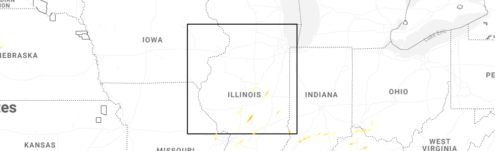
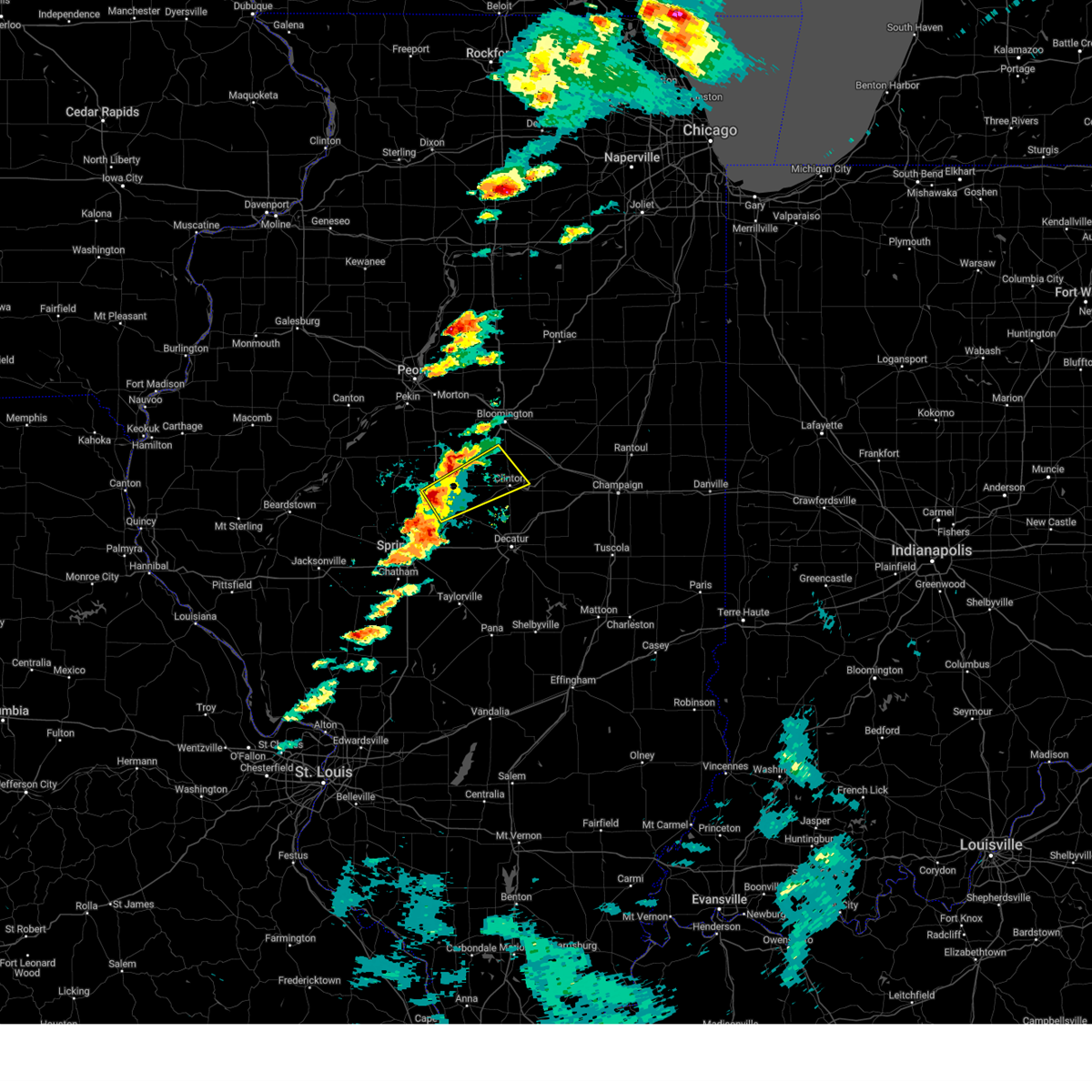
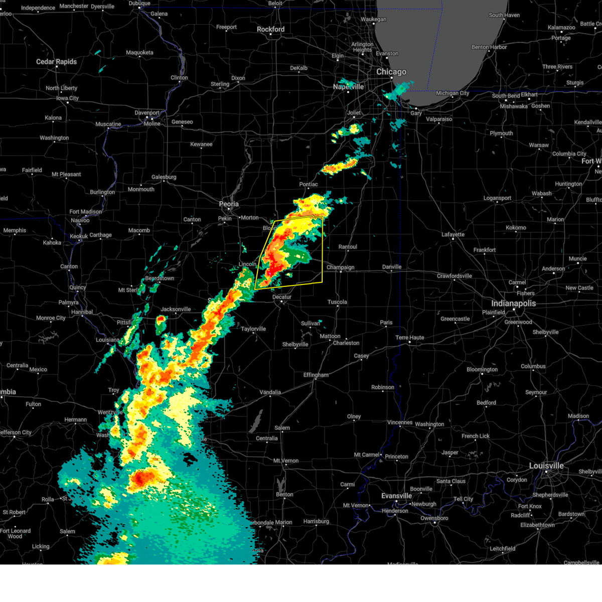
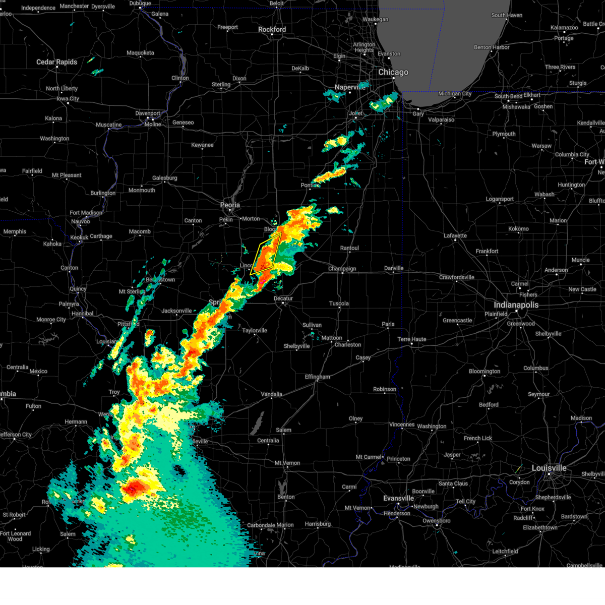
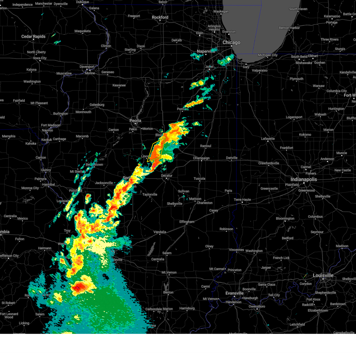
Hail Map for Waynesville, IL
The Waynesville, IL area has had 1 report of on-the-ground hail by trained spotters, and has been under severe weather warnings 28 times during the past 12 months. Doppler radar has detected hail at or near Waynesville, IL on 44 occasions, including 4 occasions during the past year.
| Name: | Waynesville, IL |
| Where Located: | 39.5 miles SE of Peoria, IL |
| Map: | Google Map for Waynesville, IL |
| Population: | 434 |
| Housing Units: | 206 |
| More Info: | Search Google for Waynesville, IL |
1
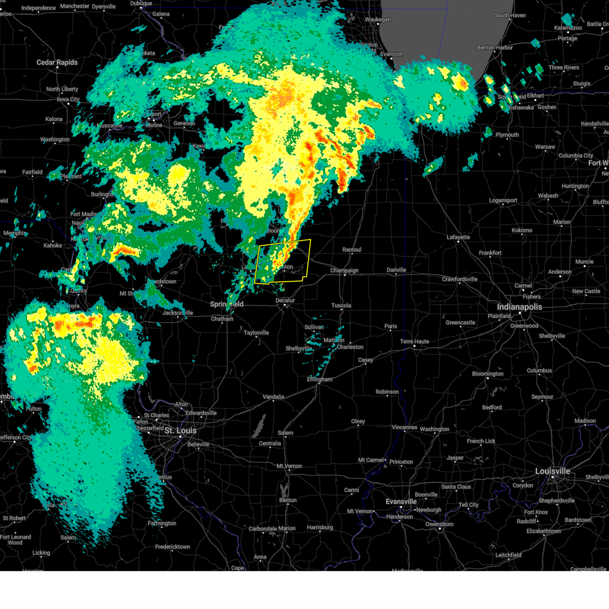
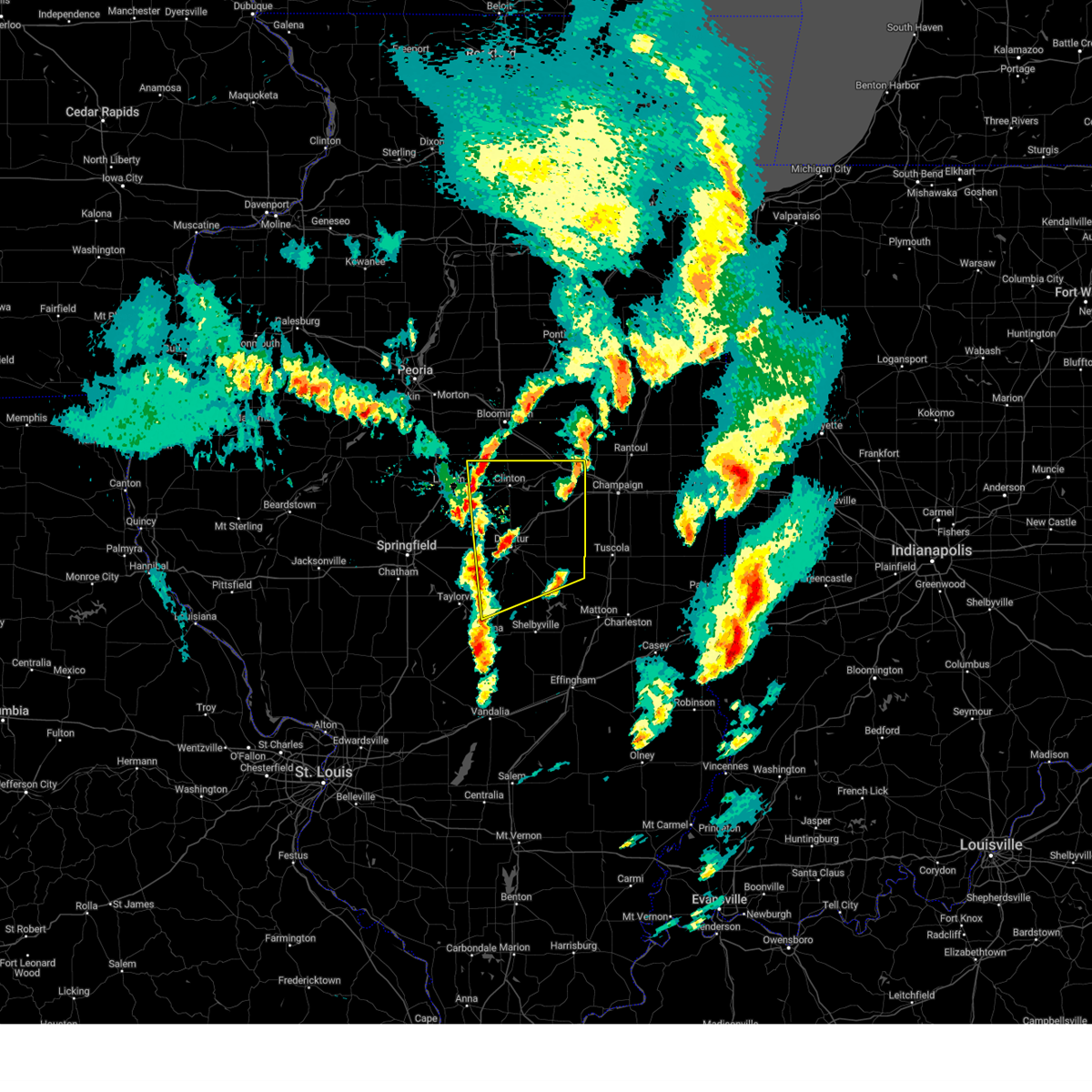
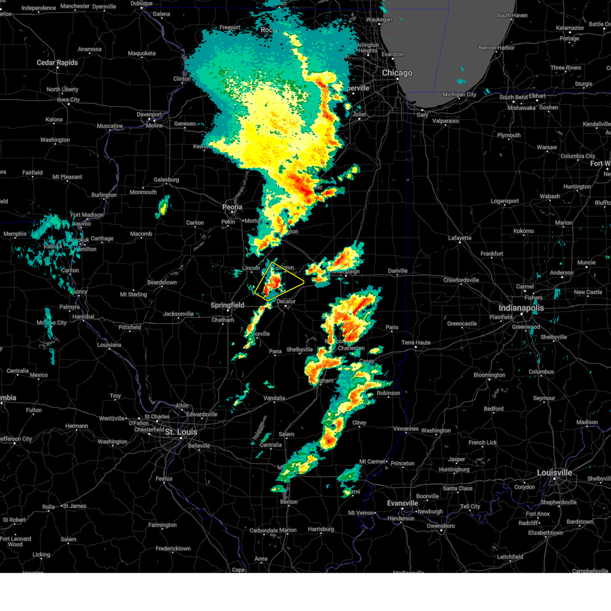
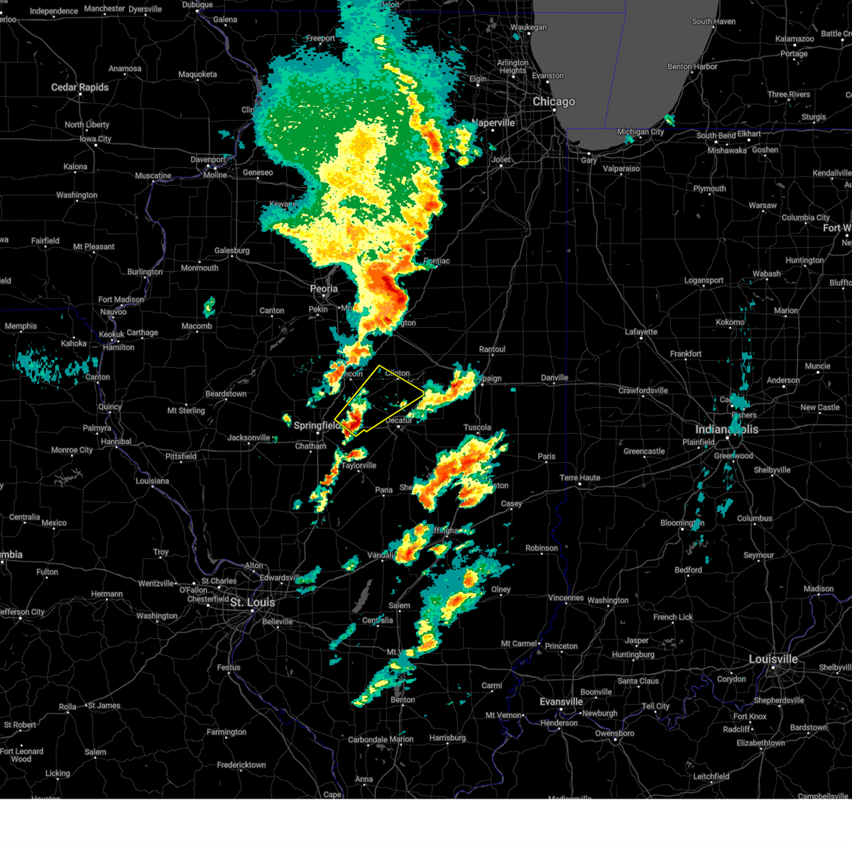
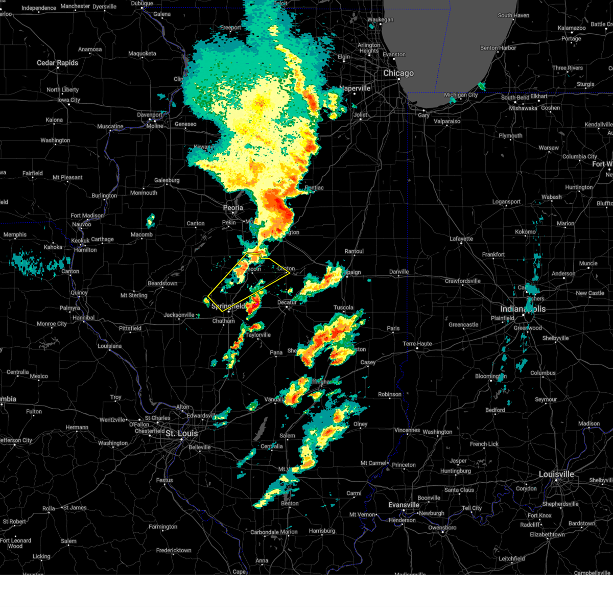
The Top Recent Hail Date for Waynesville, IL is Wednesday, April 30, 2025 (16th out of 44)
Hail and Wind Damage Spotted near Waynesville, IL
| Date / Time | Report Details |
|---|---|
| 5/16/2025 3:48 PM CDT | the severe thunderstorm warning has been cancelled and is no longer in effect |
| 5/16/2025 3:36 PM CDT |
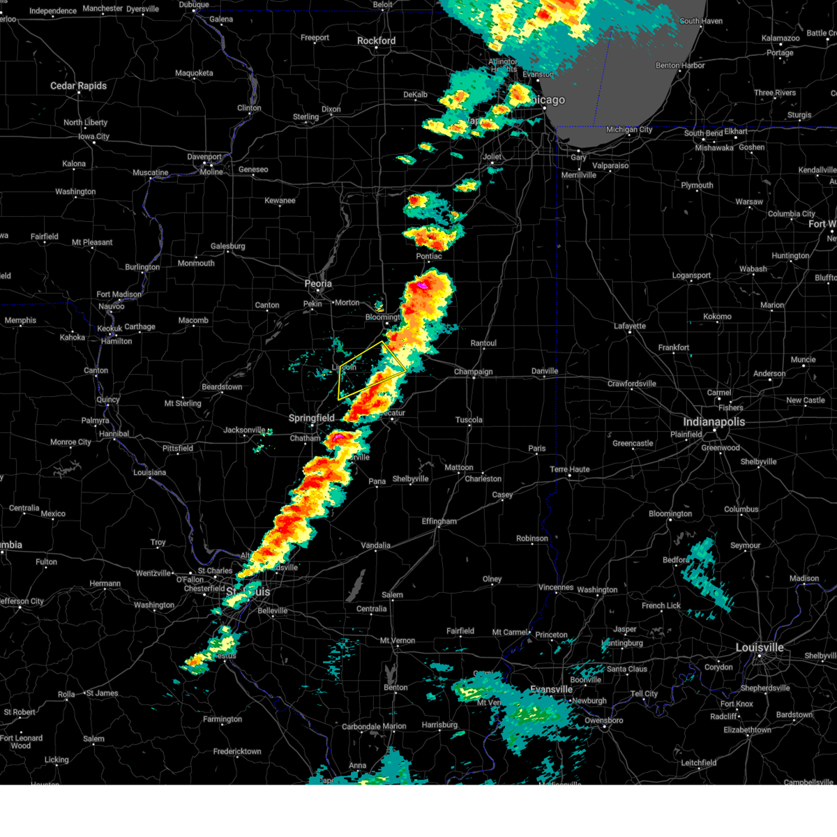
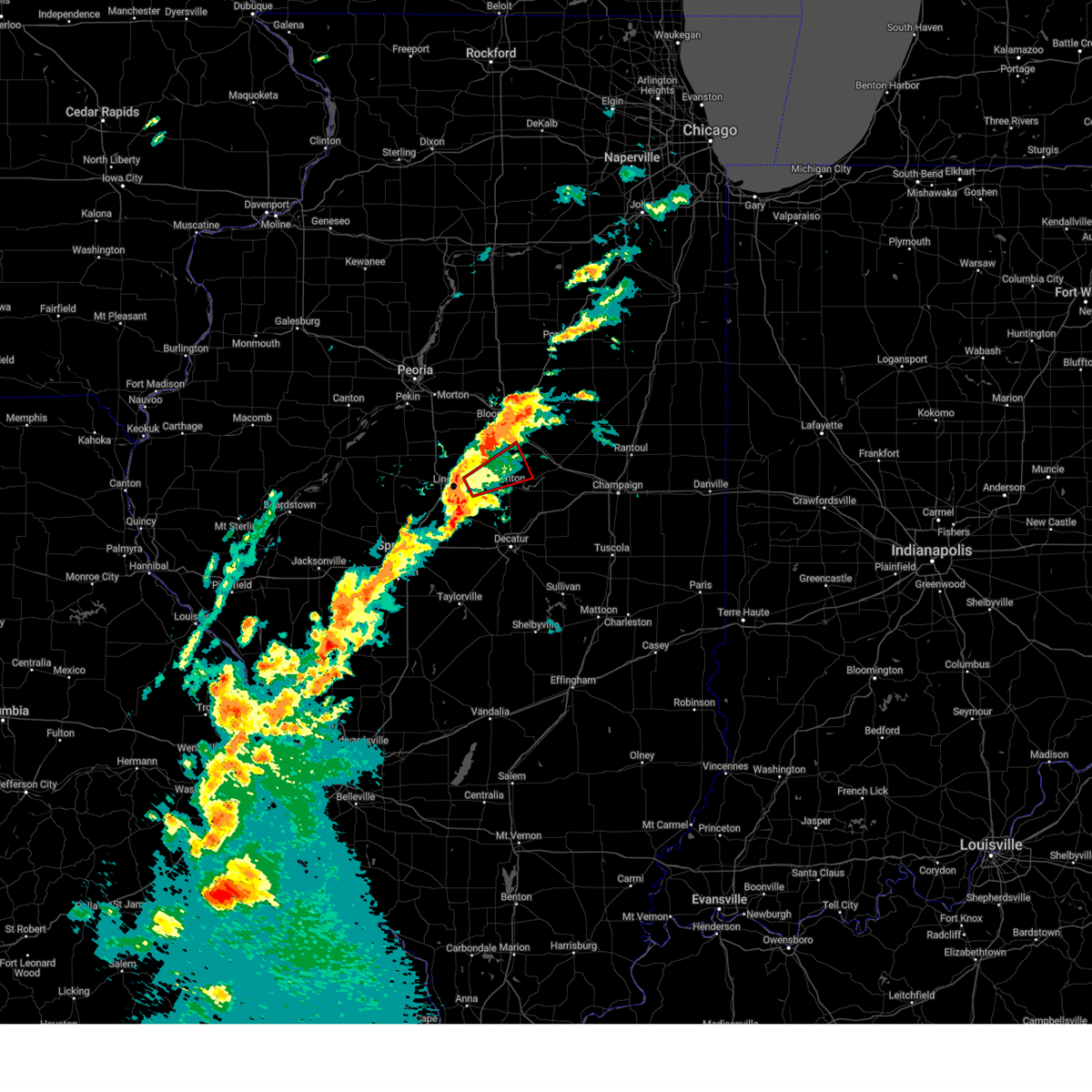
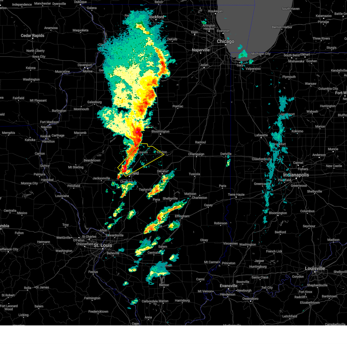
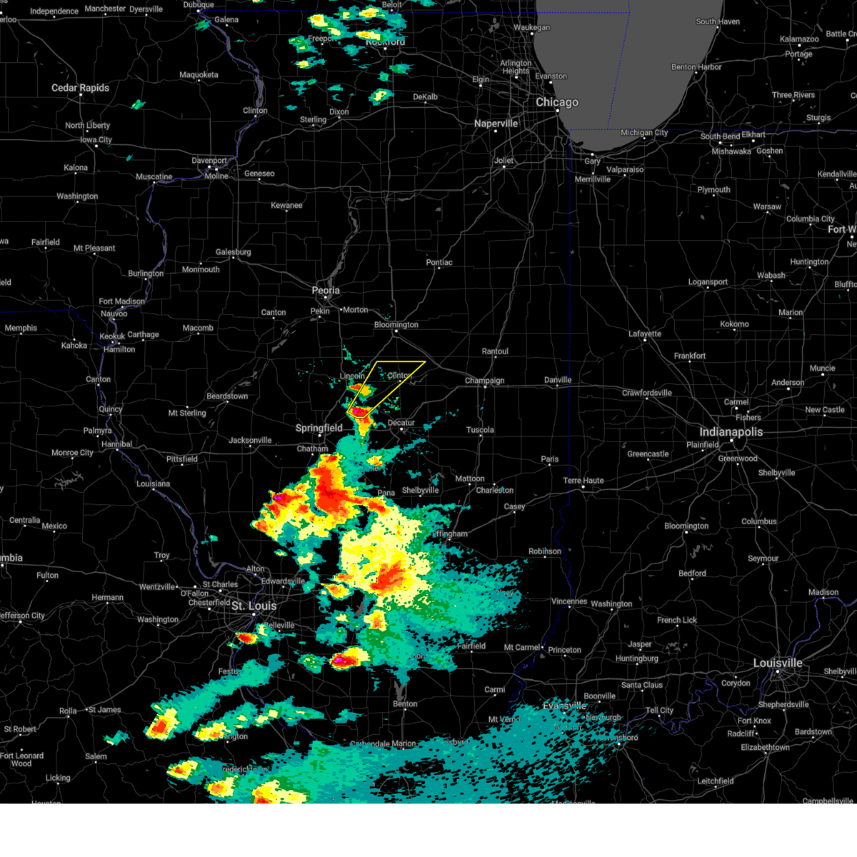 At 336 pm cdt, a severe thunderstorm was located over mount pulaski, or 12 miles southeast of lincoln, moving northeast at 70 mph (radar indicated). Hazards include ping pong ball size hail and 60 mph wind gusts. People and animals outdoors will be injured. expect hail damage to roofs, siding, windows, and vehicles. expect wind damage to roofs, siding, and trees. this severe storm will be near, kenney and chestnut around 340 pm cdt. clinton around 345 pm cdt. wapella around 350 pm cdt. Other locations impacted by this severe thunderstorm include midland city and hallsville. At 336 pm cdt, a severe thunderstorm was located over mount pulaski, or 12 miles southeast of lincoln, moving northeast at 70 mph (radar indicated). Hazards include ping pong ball size hail and 60 mph wind gusts. People and animals outdoors will be injured. expect hail damage to roofs, siding, windows, and vehicles. expect wind damage to roofs, siding, and trees. this severe storm will be near, kenney and chestnut around 340 pm cdt. clinton around 345 pm cdt. wapella around 350 pm cdt. Other locations impacted by this severe thunderstorm include midland city and hallsville.
|
| 5/16/2025 3:36 PM CDT |
 the severe thunderstorm warning has been cancelled and is no longer in effect the severe thunderstorm warning has been cancelled and is no longer in effect
|
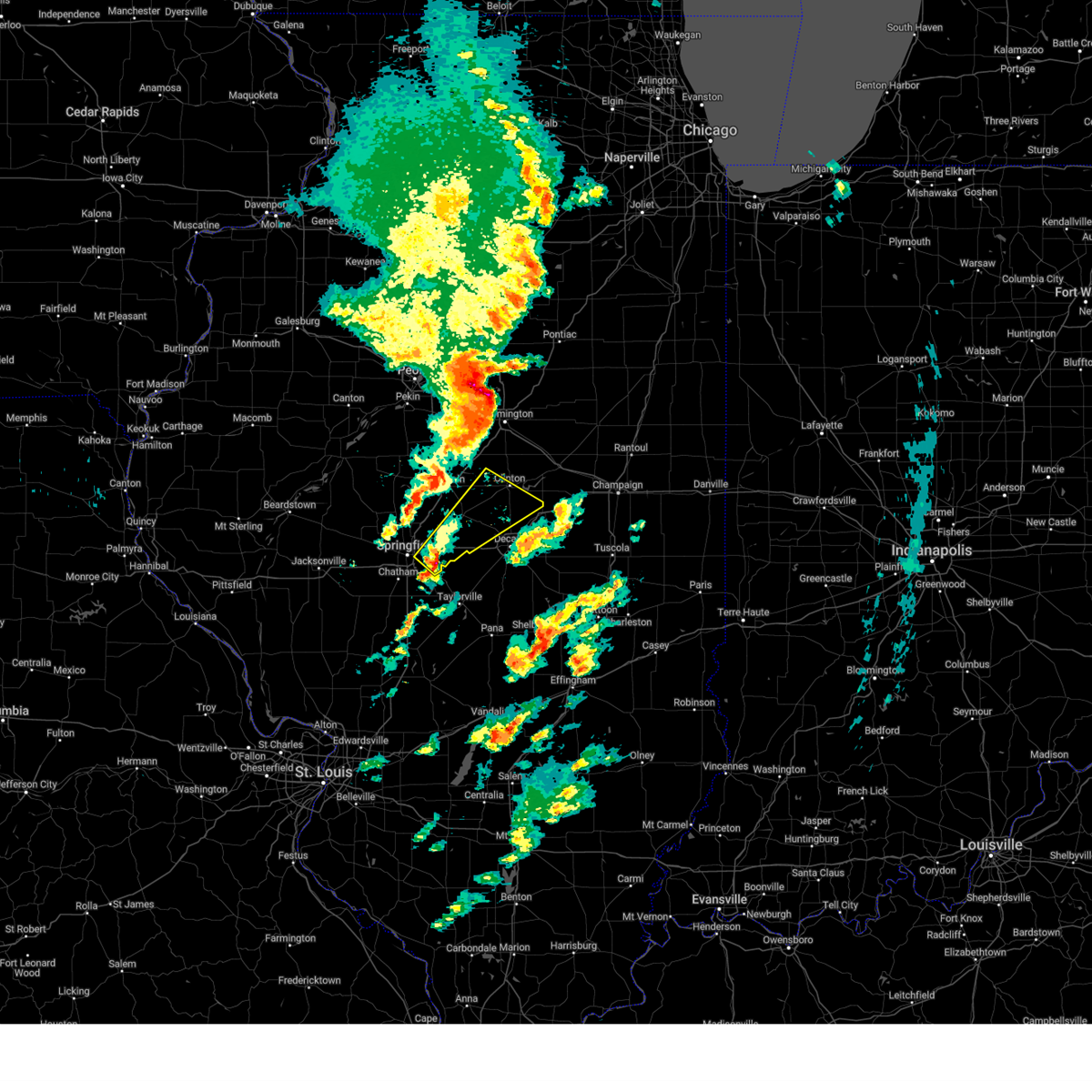
| 5/16/2025 3:24 PM CDT | Svrilx the national weather service in lincoln has issued a * severe thunderstorm warning for, southeastern logan county in central illinois, northeastern sangamon county in central illinois, western de witt county in central illinois, northern macon county in central illinois, * until 415 pm cdt. * at 324 pm cdt, a severe thunderstorm was located over dawson, or 12 miles northeast of springfield, moving northeast at 65 mph (trained weather spotters). Hazards include two inch hail and 60 mph wind gusts. People and animals outdoors will be injured. expect hail damage to roofs, siding, windows, and vehicles. expect wind damage to roofs, siding, and trees. this severe thunderstorm will be near, mount pulaski and cornland around 330 pm cdt. chestnut around 340 pm cdt. other locations in the path of this severe thunderstorm include kenney, beason, clinton and wapella. this includes the following highways, interstate 55 mile marker 103 and near mile marker 140. Interstate 72 between mile markers 108 and 116. |
| 5/15/2025 7:26 PM CDT |
 The storms which prompted the warning have weakened below severe limits, and have exited the warned area. therefore, the warning will be allowed to expire. however, small hail and gusty winds are still possible with these thunderstorms. a tornado watch remains in effect until 1000 pm cdt for central illinois. a severe thunderstorm warning remains in effect for southeast logan and southern de witt co unties. The storms which prompted the warning have weakened below severe limits, and have exited the warned area. therefore, the warning will be allowed to expire. however, small hail and gusty winds are still possible with these thunderstorms. a tornado watch remains in effect until 1000 pm cdt for central illinois. a severe thunderstorm warning remains in effect for southeast logan and southern de witt co unties.
|
| 5/15/2025 7:04 PM CDT |
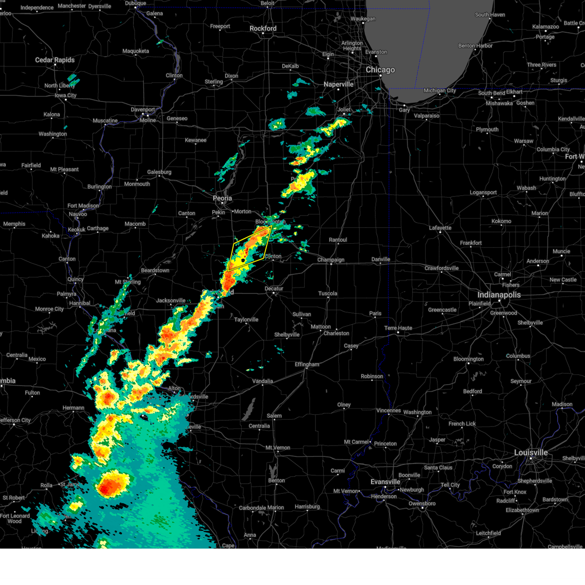
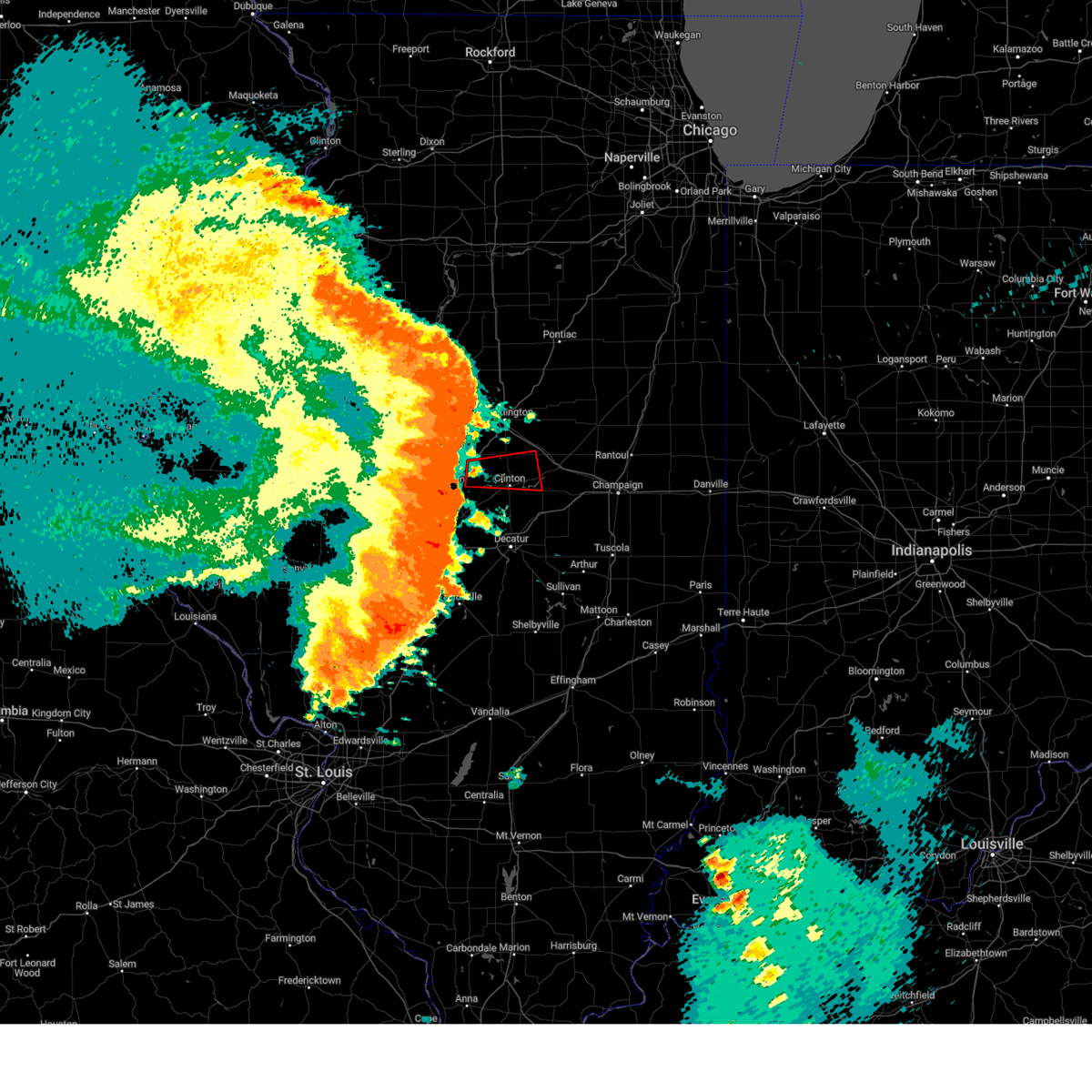
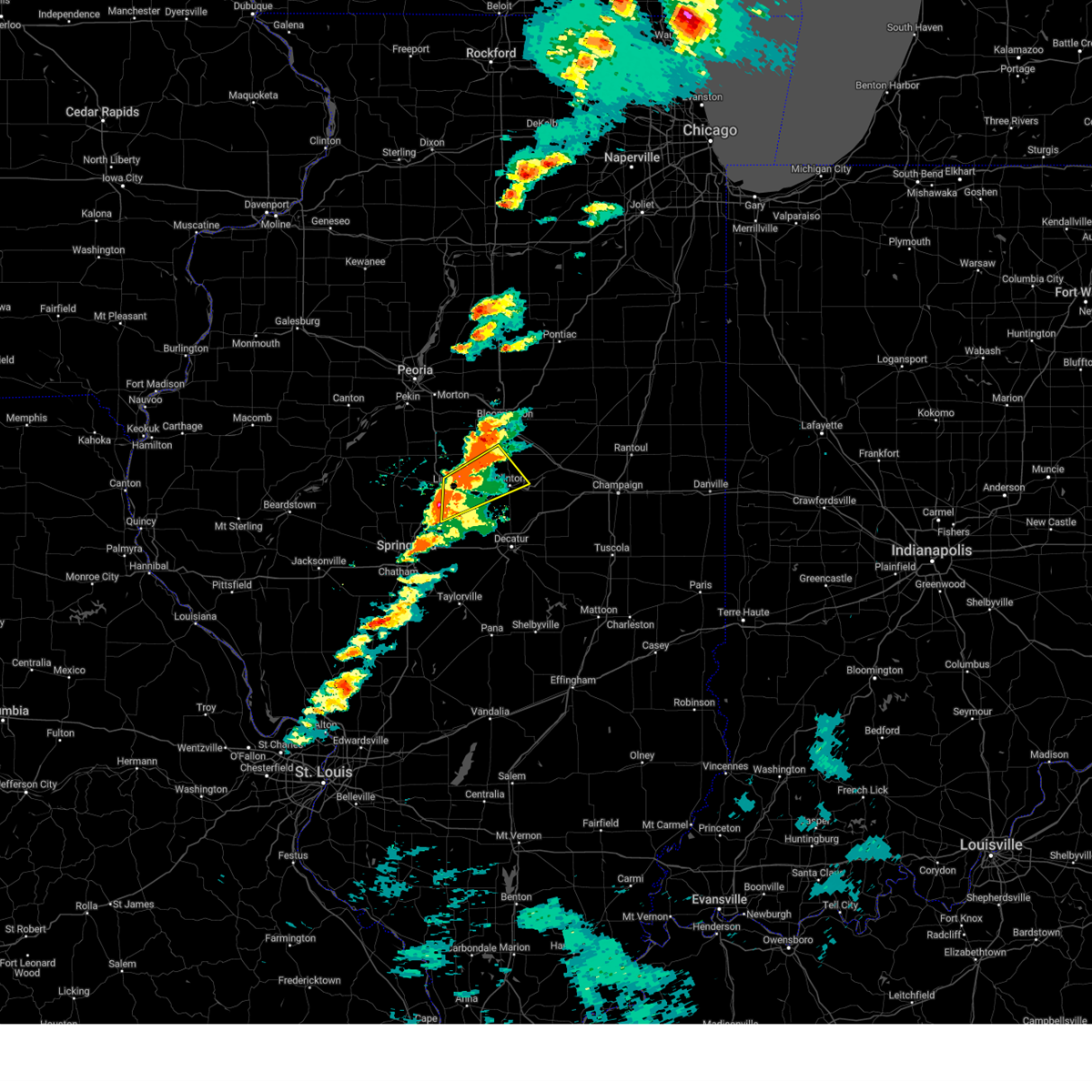 At 704 pm cdt, severe thunderstorms were located along a line extending from near waynesville to mount pulaski, moving east at 45 mph (trained weather spotters). Hazards include 70 mph wind gusts and quarter size hail. Hail damage to vehicles is expected. expect considerable tree damage. wind damage is also likely to mobile homes, roofs, and outbuildings. these severe storms will be near, heyworth, waynesville, kenney, chestnut, and beason around 710 pm cdt. clinton and wapella around 715 pm cdt. other locations impacted by these severe thunderstorms include lawndale, midland city, and hallsville. This includes interstate 55 between mile markers 128 and 141. At 704 pm cdt, severe thunderstorms were located along a line extending from near waynesville to mount pulaski, moving east at 45 mph (trained weather spotters). Hazards include 70 mph wind gusts and quarter size hail. Hail damage to vehicles is expected. expect considerable tree damage. wind damage is also likely to mobile homes, roofs, and outbuildings. these severe storms will be near, heyworth, waynesville, kenney, chestnut, and beason around 710 pm cdt. clinton and wapella around 715 pm cdt. other locations impacted by these severe thunderstorms include lawndale, midland city, and hallsville. This includes interstate 55 between mile markers 128 and 141.
|
| 5/15/2025 6:50 PM CDT | At 649 pm cdt, a severe thunderstorm was located over lincoln, moving northeast at 65 mph (trained weather spotters. at 648 pm, golf ball size hail was reported on the west side of lincoln, and quarter size hail was reported at the national weather service office just south of the airport). Hazards include golf ball size hail and 70 mph wind gusts. People and animals outdoors will be injured. expect hail damage to roofs, siding, windows, and vehicles. expect considerable tree damage. wind damage is also likely to mobile homes, roofs, and outbuildings. this severe storm will be near, beason around 655 pm cdt. waynesville around 700 pm cdt. heyworth around 705 pm cdt. wapella around 710 pm cdt. other locations impacted by this severe thunderstorm include lawndale, midland city, hallsville, and broadwell. this includes the following highways, interstate 155 near mile marker 0. Interstate 55 between mile markers 117 and 142. |
| 5/15/2025 6:44 PM CDT |
 Svrilx the national weather service in lincoln has issued a * severe thunderstorm warning for, central logan county in central illinois, western de witt county in central illinois, southwestern mclean county in central illinois, * until 730 pm cdt. * at 642 pm cdt, a severe thunderstorm was located aobut 5 miles southwest of lincoln, moving northeast at 65 mph (trained weather spotters. at 640 pm, a 70 mph wind gust was estimated near hartsburg, and two semi trucks were blown over on i-155 at mile marker 3. hail up to ping pong size was also reported). Hazards include 70 mph wind gusts and ping pong ball size hail. People and animals outdoors will be injured. expect hail damage to roofs, siding, windows, and vehicles. expect considerable tree damage. wind damage is also likely to mobile homes, roofs, and outbuildings. this severe thunderstorm will be near, lincoln around 650 pm cdt. beason around 655 pm cdt. waynesville around 700 pm cdt. other locations in the path of this severe thunderstorm include heyworth and wapella. this includes the following highways, interstate 155 near mile marker 0. Interstate 55 between mile markers 117 and 142. Svrilx the national weather service in lincoln has issued a * severe thunderstorm warning for, central logan county in central illinois, western de witt county in central illinois, southwestern mclean county in central illinois, * until 730 pm cdt. * at 642 pm cdt, a severe thunderstorm was located aobut 5 miles southwest of lincoln, moving northeast at 65 mph (trained weather spotters. at 640 pm, a 70 mph wind gust was estimated near hartsburg, and two semi trucks were blown over on i-155 at mile marker 3. hail up to ping pong size was also reported). Hazards include 70 mph wind gusts and ping pong ball size hail. People and animals outdoors will be injured. expect hail damage to roofs, siding, windows, and vehicles. expect considerable tree damage. wind damage is also likely to mobile homes, roofs, and outbuildings. this severe thunderstorm will be near, lincoln around 650 pm cdt. beason around 655 pm cdt. waynesville around 700 pm cdt. other locations in the path of this severe thunderstorm include heyworth and wapella. this includes the following highways, interstate 155 near mile marker 0. Interstate 55 between mile markers 117 and 142.
|
| 4/2/2025 3:51 PM CDT |
 the severe thunderstorm warning has been cancelled and is no longer in effect the severe thunderstorm warning has been cancelled and is no longer in effect
|
| 4/2/2025 3:51 PM CDT |
 At 351 pm cdt, severe thunderstorms were located along a line extending from near towanda to near latham, moving northeast at 55 mph (emergency management). Hazards include two inch hail and 70 mph wind gusts. People and animals outdoors will be injured. expect hail damage to roofs, siding, windows, and vehicles. expect considerable tree damage. wind damage is also likely to mobile homes, roofs, and outbuildings. these severe storms will be near, kenney, wapella, downs, maroa, heyworth, and clinton around 355 pm cdt. le roy around 400 pm cdt. colfax around 405 pm cdt. weldon around 410 pm cdt. saybrook and farmer city around 415 pm cdt. de land around 420 pm cdt. other locations impacted by these severe thunderstorms include clinton power station, weldon springs state park, holder, lane, cooksville, moraine view state park, midland city, arrowsmith, cropsey, and ellsworth. this includes the following highways, interstate 39 between mile markers 0 and 3. interstate 55 between mile markers 143 and 174. interstate 72 between mile markers 154 and 173. Interstate 74 between mile markers 126 and 168. At 351 pm cdt, severe thunderstorms were located along a line extending from near towanda to near latham, moving northeast at 55 mph (emergency management). Hazards include two inch hail and 70 mph wind gusts. People and animals outdoors will be injured. expect hail damage to roofs, siding, windows, and vehicles. expect considerable tree damage. wind damage is also likely to mobile homes, roofs, and outbuildings. these severe storms will be near, kenney, wapella, downs, maroa, heyworth, and clinton around 355 pm cdt. le roy around 400 pm cdt. colfax around 405 pm cdt. weldon around 410 pm cdt. saybrook and farmer city around 415 pm cdt. de land around 420 pm cdt. other locations impacted by these severe thunderstorms include clinton power station, weldon springs state park, holder, lane, cooksville, moraine view state park, midland city, arrowsmith, cropsey, and ellsworth. this includes the following highways, interstate 39 between mile markers 0 and 3. interstate 55 between mile markers 143 and 174. interstate 72 between mile markers 154 and 173. Interstate 74 between mile markers 126 and 168.
|
| 4/2/2025 3:48 PM CDT |
 At 347 pm cdt, severe thunderstorms were located along a line extending from near towanda to near latham, moving northeast at 55 mph (emergency management. two inch diameter hail was reported near latham at 344 pm). Hazards include two inch hail and 60 mph wind gusts. People and animals outdoors will be injured. expect hail damage to roofs, siding, windows, and vehicles. expect wind damage to roofs, siding, and trees. these severe storms will be near, wapella, downs, maroa, clinton, and le roy around 355 pm cdt. colfax around 400 pm cdt. weldon around 405 pm cdt. saybrook and farmer city around 410 pm cdt. de land around 415 pm cdt. other locations impacted by these severe thunderstorms include clinton power station, weldon springs state park, holder, lane, cooksville, moraine view state park, midland city, arrowsmith, cropsey, and ellsworth. this includes the following highways, interstate 39 between mile markers 0 and 3. interstate 55 between mile markers 137 and 174. interstate 72 between mile markers 150 and 173. Interstate 74 between mile markers 125 and 168. At 347 pm cdt, severe thunderstorms were located along a line extending from near towanda to near latham, moving northeast at 55 mph (emergency management. two inch diameter hail was reported near latham at 344 pm). Hazards include two inch hail and 60 mph wind gusts. People and animals outdoors will be injured. expect hail damage to roofs, siding, windows, and vehicles. expect wind damage to roofs, siding, and trees. these severe storms will be near, wapella, downs, maroa, clinton, and le roy around 355 pm cdt. colfax around 400 pm cdt. weldon around 405 pm cdt. saybrook and farmer city around 410 pm cdt. de land around 415 pm cdt. other locations impacted by these severe thunderstorms include clinton power station, weldon springs state park, holder, lane, cooksville, moraine view state park, midland city, arrowsmith, cropsey, and ellsworth. this includes the following highways, interstate 39 between mile markers 0 and 3. interstate 55 between mile markers 137 and 174. interstate 72 between mile markers 150 and 173. Interstate 74 between mile markers 125 and 168.
|
| 4/2/2025 3:45 PM CDT |
 Svrilx the national weather service in lincoln has issued a * severe thunderstorm warning for, eastern logan county in central illinois, eastern sangamon county in central illinois, northern piatt county in central illinois, de witt county in central illinois, mclean county in central illinois, northern macon county in central illinois, * until 430 pm cdt. * at 344 pm cdt, severe thunderstorms were located along a line extending from near bloomington to latham, moving northeast at 55 mph (radar indicated). Hazards include ping pong ball size hail and 60 mph wind gusts. People and animals outdoors will be injured. expect hail damage to roofs, siding, windows, and vehicles. expect wind damage to roofs, siding, and trees. severe thunderstorms will be near, kenney, wapella, downs, maroa, heyworth, clinton, and bloomington around 350 pm cdt. le roy around 355 pm cdt. colfax around 400 pm cdt. other locations in the path of these severe thunderstorms include weldon, saybrook, farmer city, de land and mansfield. this includes the following highways, interstate 39 between mile markers 0 and 3. interstate 55 between mile markers 137 and 174. interstate 72 between mile markers 150 and 173. Interstate 74 between mile markers 125 and 168. Svrilx the national weather service in lincoln has issued a * severe thunderstorm warning for, eastern logan county in central illinois, eastern sangamon county in central illinois, northern piatt county in central illinois, de witt county in central illinois, mclean county in central illinois, northern macon county in central illinois, * until 430 pm cdt. * at 344 pm cdt, severe thunderstorms were located along a line extending from near bloomington to latham, moving northeast at 55 mph (radar indicated). Hazards include ping pong ball size hail and 60 mph wind gusts. People and animals outdoors will be injured. expect hail damage to roofs, siding, windows, and vehicles. expect wind damage to roofs, siding, and trees. severe thunderstorms will be near, kenney, wapella, downs, maroa, heyworth, clinton, and bloomington around 350 pm cdt. le roy around 355 pm cdt. colfax around 400 pm cdt. other locations in the path of these severe thunderstorms include weldon, saybrook, farmer city, de land and mansfield. this includes the following highways, interstate 39 between mile markers 0 and 3. interstate 55 between mile markers 137 and 174. interstate 72 between mile markers 150 and 173. Interstate 74 between mile markers 125 and 168.
|
| 4/2/2025 3:41 PM CDT |
 the severe thunderstorm warning has been cancelled and is no longer in effect the severe thunderstorm warning has been cancelled and is no longer in effect
|
| 4/2/2025 3:41 PM CDT |
 At 341 pm cdt, severe thunderstorms were located along a line extending from near heyworth to near beason, moving northeast at 55 mph (radar indicated). Hazards include 60 mph wind gusts and half dollar size hail. Hail damage to vehicles is expected. expect wind damage to roofs, siding, and trees. these severe storms will be near, waynesville around 345 pm cdt. other locations impacted by these severe thunderstorms include shirley and lawndale. this includes the following highways, interstate 55 between mile markers 133 and 157. Interstate 74 between mile markers 133 and 135. At 341 pm cdt, severe thunderstorms were located along a line extending from near heyworth to near beason, moving northeast at 55 mph (radar indicated). Hazards include 60 mph wind gusts and half dollar size hail. Hail damage to vehicles is expected. expect wind damage to roofs, siding, and trees. these severe storms will be near, waynesville around 345 pm cdt. other locations impacted by these severe thunderstorms include shirley and lawndale. this includes the following highways, interstate 55 between mile markers 133 and 157. Interstate 74 between mile markers 133 and 135.
|
| 4/2/2025 3:40 PM CDT |
 Torilx the national weather service in lincoln has issued a * tornado warning for, east central logan county in central illinois, northwestern de witt county in central illinois, southwestern mclean county in central illinois, * until 415 pm cdt. * at 340 pm cdt, a severe thunderstorm capable of producing a tornado was located over beason, or 10 miles east of lincoln, moving northeast at 50 mph (radar indicated rotation). Hazards include tornado and half dollar size hail. Flying debris will be dangerous to those caught without shelter. mobile homes will be damaged or destroyed. damage to roofs, windows, and vehicles will occur. tree damage is likely. this dangerous storm will be near, waynesville around 345 pm cdt. Wapella and heyworth around 350 pm cdt. Torilx the national weather service in lincoln has issued a * tornado warning for, east central logan county in central illinois, northwestern de witt county in central illinois, southwestern mclean county in central illinois, * until 415 pm cdt. * at 340 pm cdt, a severe thunderstorm capable of producing a tornado was located over beason, or 10 miles east of lincoln, moving northeast at 50 mph (radar indicated rotation). Hazards include tornado and half dollar size hail. Flying debris will be dangerous to those caught without shelter. mobile homes will be damaged or destroyed. damage to roofs, windows, and vehicles will occur. tree damage is likely. this dangerous storm will be near, waynesville around 345 pm cdt. Wapella and heyworth around 350 pm cdt.
|
| 4/2/2025 3:26 PM CDT |
 Svrilx the national weather service in lincoln has issued a * severe thunderstorm warning for, northern logan county in central illinois, northwestern de witt county in central illinois, southeastern tazewell county in central illinois, southwestern mclean county in central illinois, * until 400 pm cdt. * at 325 pm cdt, severe thunderstorms were located along a line extending from atlanta to near lincoln, moving northeast at 55 mph (radar indicated). Hazards include 60 mph wind gusts and quarter size hail. Hail damage to vehicles is expected. expect wind damage to roofs, siding, and trees. severe thunderstorms will be near, atlanta, mclean, and lincoln around 330 pm cdt. bloomington around 340 pm cdt. waynesville around 345 pm cdt. this includes the following highways, interstate 155 between mile markers 0 and 9. interstate 55 between mile markers 119 and 157. Interstate 74 between mile markers 133 and 135. Svrilx the national weather service in lincoln has issued a * severe thunderstorm warning for, northern logan county in central illinois, northwestern de witt county in central illinois, southeastern tazewell county in central illinois, southwestern mclean county in central illinois, * until 400 pm cdt. * at 325 pm cdt, severe thunderstorms were located along a line extending from atlanta to near lincoln, moving northeast at 55 mph (radar indicated). Hazards include 60 mph wind gusts and quarter size hail. Hail damage to vehicles is expected. expect wind damage to roofs, siding, and trees. severe thunderstorms will be near, atlanta, mclean, and lincoln around 330 pm cdt. bloomington around 340 pm cdt. waynesville around 345 pm cdt. this includes the following highways, interstate 155 between mile markers 0 and 9. interstate 55 between mile markers 119 and 157. Interstate 74 between mile markers 133 and 135.
|
| 4/2/2025 10:57 AM CDT |
 The storms which prompted the warning have weakened. therefore, the warning will be allowed to expire. however, gusty winds may still be a threat. The storms which prompted the warning have weakened. therefore, the warning will be allowed to expire. however, gusty winds may still be a threat.
|
| 4/2/2025 10:44 AM CDT |
 At 1044 am cdt, severe thunderstorms were located along a line extending from near heyworth to near kenney, moving east at 45 mph (radar indicated). Hazards include 60 mph wind gusts. Expect damage to roofs, siding, and trees. these severe storms will be near, wapella, heyworth, and clinton around 1050 am cdt. downs around 1055 am cdt. le roy around 1100 am cdt. other locations impacted by these severe thunderstorms include lawndale, clinton power station, weldon springs state park, lane, moraine view state park, midland city, hallsville, and de witt. this includes the following highways, interstate 55 between mile markers 135 and 152. Interstate 74 between mile markers 140 and 155. At 1044 am cdt, severe thunderstorms were located along a line extending from near heyworth to near kenney, moving east at 45 mph (radar indicated). Hazards include 60 mph wind gusts. Expect damage to roofs, siding, and trees. these severe storms will be near, wapella, heyworth, and clinton around 1050 am cdt. downs around 1055 am cdt. le roy around 1100 am cdt. other locations impacted by these severe thunderstorms include lawndale, clinton power station, weldon springs state park, lane, moraine view state park, midland city, hallsville, and de witt. this includes the following highways, interstate 55 between mile markers 135 and 152. Interstate 74 between mile markers 140 and 155.
|
| 4/2/2025 10:44 AM CDT |
 the severe thunderstorm warning has been cancelled and is no longer in effect the severe thunderstorm warning has been cancelled and is no longer in effect
|
| 4/2/2025 10:24 AM CDT |
 Svrilx the national weather service in lincoln has issued a * severe thunderstorm warning for, central logan county in central illinois, de witt county in central illinois, southeastern tazewell county in central illinois, southwestern mclean county in central illinois, * until 1100 am cdt. * at 1023 am cdt, severe thunderstorms were located along a line extending from near hartsburg to near lincoln, moving east at 45 mph (radar indicated). Hazards include 70 mph wind gusts. Expect considerable tree damage. damage is likely to mobile homes, roofs, and outbuildings. severe thunderstorms will be near, atlanta, armington, and lincoln around 1030 am cdt. beason and mclean around 1035 am cdt. waynesville around 1040 am cdt. other locations in the path of these severe thunderstorms include heyworth. this includes the following highways, interstate 155 between mile markers 0 and 13. interstate 55 between mile markers 118 and 152. Interstate 74 between mile markers 140 and 155. Svrilx the national weather service in lincoln has issued a * severe thunderstorm warning for, central logan county in central illinois, de witt county in central illinois, southeastern tazewell county in central illinois, southwestern mclean county in central illinois, * until 1100 am cdt. * at 1023 am cdt, severe thunderstorms were located along a line extending from near hartsburg to near lincoln, moving east at 45 mph (radar indicated). Hazards include 70 mph wind gusts. Expect considerable tree damage. damage is likely to mobile homes, roofs, and outbuildings. severe thunderstorms will be near, atlanta, armington, and lincoln around 1030 am cdt. beason and mclean around 1035 am cdt. waynesville around 1040 am cdt. other locations in the path of these severe thunderstorms include heyworth. this includes the following highways, interstate 155 between mile markers 0 and 13. interstate 55 between mile markers 118 and 152. Interstate 74 between mile markers 140 and 155.
|
| 3/19/2025 5:50 PM CDT |
 Svrilx the national weather service in lincoln has issued a * severe thunderstorm warning for, eastern logan county in central illinois, northeastern christian county in central illinois, northern moultrie county in central illinois, northwestern shelby county in central illinois, piatt county in central illinois, de witt county in central illinois, macon county in central illinois, * until 645 pm cdt. * at 549 pm cdt, severe thunderstorms were located along a line extending from near atlanta to near latham to near owaneco, moving northeast at 50 mph (radar indicated). Hazards include 60 mph wind gusts and quarter size hail. Hail damage to vehicles is expected. expect wind damage to roofs, siding, and trees. severe thunderstorms will be near, kenney, assumption, moweaqua, forsyth, clinton, warrensburg, macon, decatur, waynesville, and harristown around 555 pm cdt. wapella, mount zion, and maroa around 600 pm cdt. oreana, decatur airport, long creek, and argenta around 605 pm cdt. other locations in the path of these severe thunderstorms include bethany, dalton city, cerro gordo, weldon, cisco, de land, lovington, farmer city, monticello, hammond, bement, mansfield and white heath. this includes the following highways, interstate 55 between mile markers 139 and 141. interstate 72 between mile markers 126 and 173. Interstate 74 between mile markers 156 and 168. Svrilx the national weather service in lincoln has issued a * severe thunderstorm warning for, eastern logan county in central illinois, northeastern christian county in central illinois, northern moultrie county in central illinois, northwestern shelby county in central illinois, piatt county in central illinois, de witt county in central illinois, macon county in central illinois, * until 645 pm cdt. * at 549 pm cdt, severe thunderstorms were located along a line extending from near atlanta to near latham to near owaneco, moving northeast at 50 mph (radar indicated). Hazards include 60 mph wind gusts and quarter size hail. Hail damage to vehicles is expected. expect wind damage to roofs, siding, and trees. severe thunderstorms will be near, kenney, assumption, moweaqua, forsyth, clinton, warrensburg, macon, decatur, waynesville, and harristown around 555 pm cdt. wapella, mount zion, and maroa around 600 pm cdt. oreana, decatur airport, long creek, and argenta around 605 pm cdt. other locations in the path of these severe thunderstorms include bethany, dalton city, cerro gordo, weldon, cisco, de land, lovington, farmer city, monticello, hammond, bement, mansfield and white heath. this includes the following highways, interstate 55 between mile markers 139 and 141. interstate 72 between mile markers 126 and 173. Interstate 74 between mile markers 156 and 168.
|
| 3/19/2025 4:39 PM CDT |
 At 439 pm cdt, a severe thunderstorm was located over latham, or 14 miles southwest of clinton, moving northeast at 60 mph (radar indicated). Hazards include 70 mph wind gusts and quarter size hail. Hail damage to vehicles is expected. expect considerable tree damage. wind damage is also likely to mobile homes, roofs, and outbuildings. this severe storm will be near, kenney around 445 pm cdt. clinton around 450 pm cdt. Other locations impacted by this severe thunderstorm include midland city, hallsville, weldon springs state park, and lane. At 439 pm cdt, a severe thunderstorm was located over latham, or 14 miles southwest of clinton, moving northeast at 60 mph (radar indicated). Hazards include 70 mph wind gusts and quarter size hail. Hail damage to vehicles is expected. expect considerable tree damage. wind damage is also likely to mobile homes, roofs, and outbuildings. this severe storm will be near, kenney around 445 pm cdt. clinton around 450 pm cdt. Other locations impacted by this severe thunderstorm include midland city, hallsville, weldon springs state park, and lane.
|
| 3/19/2025 4:39 PM CDT |
 the severe thunderstorm warning has been cancelled and is no longer in effect the severe thunderstorm warning has been cancelled and is no longer in effect
|
| 3/19/2025 4:26 PM CDT |
 At 426 pm cdt, a severe thunderstorm was located near illiopolis, or 19 miles east of springfield, moving northeast at 55 mph (radar indicated). Hazards include 70 mph wind gusts and quarter size hail. Hail damage to vehicles is expected. expect considerable tree damage. wind damage is also likely to mobile homes, roofs, and outbuildings. this severe storm will be near, illiopolis around 430 pm cdt. latham around 435 pm cdt. kenney around 445 pm cdt. maroa and clinton around 450 pm cdt. other locations impacted by this severe thunderstorm include midland city, hallsville, weldon springs state park, and lane. This includes interstate 72 between mile markers 115 and 126. At 426 pm cdt, a severe thunderstorm was located near illiopolis, or 19 miles east of springfield, moving northeast at 55 mph (radar indicated). Hazards include 70 mph wind gusts and quarter size hail. Hail damage to vehicles is expected. expect considerable tree damage. wind damage is also likely to mobile homes, roofs, and outbuildings. this severe storm will be near, illiopolis around 430 pm cdt. latham around 435 pm cdt. kenney around 445 pm cdt. maroa and clinton around 450 pm cdt. other locations impacted by this severe thunderstorm include midland city, hallsville, weldon springs state park, and lane. This includes interstate 72 between mile markers 115 and 126.
|
| 3/19/2025 4:18 PM CDT |
 the severe thunderstorm warning has been cancelled and is no longer in effect the severe thunderstorm warning has been cancelled and is no longer in effect
|
| 3/19/2025 4:13 PM CDT |
 Svrilx the national weather service in lincoln has issued a * severe thunderstorm warning for, southeastern logan county in central illinois, northeastern sangamon county in central illinois, southwestern de witt county in central illinois, northern macon county in central illinois, * until 500 pm cdt. * at 413 pm cdt, a severe thunderstorm was located over mechanicsburg, or 15 miles east of springfield, moving northeast at 60 mph (radar indicated). Hazards include 70 mph wind gusts and quarter size hail. Hail damage to vehicles is expected. expect considerable tree damage. wind damage is also likely to mobile homes, roofs, and outbuildings. this severe thunderstorm will be near, illiopolis around 420 pm cdt. latham around 425 pm cdt. other locations in the path of this severe thunderstorm include kenney and clinton. This includes interstate 72 between mile markers 105 and 126. Svrilx the national weather service in lincoln has issued a * severe thunderstorm warning for, southeastern logan county in central illinois, northeastern sangamon county in central illinois, southwestern de witt county in central illinois, northern macon county in central illinois, * until 500 pm cdt. * at 413 pm cdt, a severe thunderstorm was located over mechanicsburg, or 15 miles east of springfield, moving northeast at 60 mph (radar indicated). Hazards include 70 mph wind gusts and quarter size hail. Hail damage to vehicles is expected. expect considerable tree damage. wind damage is also likely to mobile homes, roofs, and outbuildings. this severe thunderstorm will be near, illiopolis around 420 pm cdt. latham around 425 pm cdt. other locations in the path of this severe thunderstorm include kenney and clinton. This includes interstate 72 between mile markers 105 and 126.
|
| 3/19/2025 3:43 PM CDT |
 Svrilx the national weather service in lincoln has issued a * severe thunderstorm warning for, eastern menard county in central illinois, logan county in central illinois, north central sangamon county in central illinois, southwestern de witt county in central illinois, southeastern mason county in central illinois, * until 430 pm cdt. * at 343 pm cdt, a severe thunderstorm was located over athens, moving northeast at 55 mph (radar indicated). Hazards include 70 mph wind gusts and quarter size hail. Hail damage to vehicles is expected. expect considerable tree damage. wind damage is also likely to mobile homes, roofs, and outbuildings. this severe thunderstorm will be near, williamsville around 350 pm cdt. middletown and elkhart around 355 pm cdt. lincoln around 400 pm cdt. other locations in the path of this severe thunderstorm include atlanta. this includes the following highways, interstate 155 between mile markers 0 and 10. Interstate 55 between mile markers 102 and 141. Svrilx the national weather service in lincoln has issued a * severe thunderstorm warning for, eastern menard county in central illinois, logan county in central illinois, north central sangamon county in central illinois, southwestern de witt county in central illinois, southeastern mason county in central illinois, * until 430 pm cdt. * at 343 pm cdt, a severe thunderstorm was located over athens, moving northeast at 55 mph (radar indicated). Hazards include 70 mph wind gusts and quarter size hail. Hail damage to vehicles is expected. expect considerable tree damage. wind damage is also likely to mobile homes, roofs, and outbuildings. this severe thunderstorm will be near, williamsville around 350 pm cdt. middletown and elkhart around 355 pm cdt. lincoln around 400 pm cdt. other locations in the path of this severe thunderstorm include atlanta. this includes the following highways, interstate 155 between mile markers 0 and 10. Interstate 55 between mile markers 102 and 141.
|
| 3/14/2025 10:38 PM CDT | Svrilx the national weather service in lincoln has issued a * severe thunderstorm warning for, eastern logan county in central illinois, piatt county in central illinois, de witt county in central illinois, mclean county in central illinois, northern macon county in central illinois, * until 1115 pm cdt. * at 1038 pm cdt, severe thunderstorms were located along a line extending from near roanoke to near mclean to near mechanicsburg, moving northeast at 60 mph (radar indicated). Hazards include 70 mph wind gusts. Expect considerable tree damage. damage is likely to mobile homes, roofs, and outbuildings. severe thunderstorms will be near, mount pulaski, beason, mclean, chestnut, waynesville, normal, carlock, and bloomington around 1045 pm cdt. kenney, latham, heyworth, and hudson around 1050 pm cdt. wapella, downs, towanda, clinton, warrensburg, and gridley around 1055 pm cdt. other locations in the path of these severe thunderstorms include maroa, lexington, forsyth, le roy and chenoa. this includes the following highways, interstate 39 between mile markers 0 and 9. interstate 55 between mile markers 136 and 187. interstate 72 between mile markers 148 and 173. Interstate 74 between mile markers 121 and 168. |
| 7/15/2024 9:03 PM CDT |
 the severe thunderstorm warning has been cancelled and is no longer in effect the severe thunderstorm warning has been cancelled and is no longer in effect
|
| 7/15/2024 9:03 PM CDT |
 At 902 pm cdt, severe thunderstorms were located along a line extending from near flanagan to near danvers to near san jose, moving southeast at 55 mph. these are destructive storms (trained weather spotters and law enforcement have reported wind gusts of 70-80+ mph). Hazards include 80 mph wind gusts and penny size hail. Flying debris will be dangerous to those caught without shelter. mobile homes will be heavily damaged. expect considerable damage to roofs, windows, and vehicles. extensive tree damage and power outages are likely. these severe storms will be near, bloomington, normal, lincoln, hudson, gridley, danvers, stanford, armington, and hartsburg around 910 pm cdt. atlanta, mclean, and towanda around 915 pm cdt. heyworth and waynesville around 920 pm cdt. other locations impacted by these severe thunderstorms include lawndale, north pekin, kappa, banner, dillon, powerton, panola, cazenovia, low point, and groveland. this includes the following highways, interstate 155 between mile markers 0 and 31. interstate 39 between mile markers 0 and 40. interstate 474 between mile markers 6 and 14. interstate 55 between mile markers 123 and 172. Interstate 74 between mile markers 91 and 139. At 902 pm cdt, severe thunderstorms were located along a line extending from near flanagan to near danvers to near san jose, moving southeast at 55 mph. these are destructive storms (trained weather spotters and law enforcement have reported wind gusts of 70-80+ mph). Hazards include 80 mph wind gusts and penny size hail. Flying debris will be dangerous to those caught without shelter. mobile homes will be heavily damaged. expect considerable damage to roofs, windows, and vehicles. extensive tree damage and power outages are likely. these severe storms will be near, bloomington, normal, lincoln, hudson, gridley, danvers, stanford, armington, and hartsburg around 910 pm cdt. atlanta, mclean, and towanda around 915 pm cdt. heyworth and waynesville around 920 pm cdt. other locations impacted by these severe thunderstorms include lawndale, north pekin, kappa, banner, dillon, powerton, panola, cazenovia, low point, and groveland. this includes the following highways, interstate 155 between mile markers 0 and 31. interstate 39 between mile markers 0 and 40. interstate 474 between mile markers 6 and 14. interstate 55 between mile markers 123 and 172. Interstate 74 between mile markers 91 and 139.
|
| 7/15/2024 8:51 PM CDT |
 At 850 pm cdt, severe thunderstorms were located along a line extending from near minonk to deer creek to near green valley, moving southeast at 60 mph (trained weather spotters reported 70 mph wind gusts near henry, illinois in marshall county). Hazards include 70 mph wind gusts and penny size hail. Expect considerable tree damage. damage is likely to mobile homes, roofs, and outbuildings. these severe storms will be near, el paso, minonk, mackinaw, delavan, minier, hopedale, goodfield, san jose, emden, and congerville around 855 pm cdt. hudson, gridley, danvers, stanford, carlock, armington, and hartsburg around 900 pm cdt. bloomington, normal, lincoln, atlanta, and mclean around 905 pm cdt. towanda and waynesville around 910 pm cdt. heyworth around 915 pm cdt. other locations impacted by these severe thunderstorms include lawndale, smithville, dillon, powerton, panola, norwood, kickapoo, la rose, peoria heights, and shirley. this includes the following highways, interstate 155 between mile markers 0 and 31. interstate 39 between mile markers 0 and 40. interstate 474 between mile markers 0 and 14. interstate 55 between mile markers 123 and 172. Interstate 74 between mile markers 77 and 139. At 850 pm cdt, severe thunderstorms were located along a line extending from near minonk to deer creek to near green valley, moving southeast at 60 mph (trained weather spotters reported 70 mph wind gusts near henry, illinois in marshall county). Hazards include 70 mph wind gusts and penny size hail. Expect considerable tree damage. damage is likely to mobile homes, roofs, and outbuildings. these severe storms will be near, el paso, minonk, mackinaw, delavan, minier, hopedale, goodfield, san jose, emden, and congerville around 855 pm cdt. hudson, gridley, danvers, stanford, carlock, armington, and hartsburg around 900 pm cdt. bloomington, normal, lincoln, atlanta, and mclean around 905 pm cdt. towanda and waynesville around 910 pm cdt. heyworth around 915 pm cdt. other locations impacted by these severe thunderstorms include lawndale, smithville, dillon, powerton, panola, norwood, kickapoo, la rose, peoria heights, and shirley. this includes the following highways, interstate 155 between mile markers 0 and 31. interstate 39 between mile markers 0 and 40. interstate 474 between mile markers 0 and 14. interstate 55 between mile markers 123 and 172. Interstate 74 between mile markers 77 and 139.
|
| 7/15/2024 8:27 PM CDT |
 Svrilx the national weather service in lincoln has issued a * severe thunderstorm warning for, marshall county in central illinois, northern logan county in central illinois, woodford county in central illinois, northeastern fulton county in west central illinois, stark county in north central illinois, southeastern knox county in west central illinois, northwestern de witt county in central illinois, tazewell county in central illinois, western mclean county in central illinois, northeastern mason county in central illinois, peoria county in central illinois, * until 930 pm cdt. * at 827 pm cdt, severe thunderstorms were located along a line extending from near camp grove to near dunlap to near canton, moving southeast at 55 mph (radar indicated). Hazards include 70 mph wind gusts and penny size hail. Expect considerable tree damage. damage is likely to mobile homes, roofs, and outbuildings. severe thunderstorms will be near, peoria, chillicothe, bartonville, west peoria, bellevue, rome, hanna city, glasford, spring bay, and sparland around 830 pm cdt. pekin, east peoria, lacon, washington, creve coeur, germantown hills, marquette heights, manito, and mapleton around 835 pm cdt. morton, metamora, and south pekin around 840 pm cdt. tremont, washburn, green valley, and deer creek around 845 pm cdt. other locations in the path of these severe thunderstorms include eureka, mackinaw, delavan, goodfield, san jose, roanoke, hopedale, emden, congerville, minier, danvers, stanford, carlock, benson, secor, hartsburg, el paso and armington. this includes the following highways, interstate 155 between mile markers 0 and 31. interstate 39 between mile markers 0 and 40. interstate 474 between mile markers 0 and 14. interstate 55 between mile markers 123 and 172. Interstate 74 between mile markers 64 and 139. Svrilx the national weather service in lincoln has issued a * severe thunderstorm warning for, marshall county in central illinois, northern logan county in central illinois, woodford county in central illinois, northeastern fulton county in west central illinois, stark county in north central illinois, southeastern knox county in west central illinois, northwestern de witt county in central illinois, tazewell county in central illinois, western mclean county in central illinois, northeastern mason county in central illinois, peoria county in central illinois, * until 930 pm cdt. * at 827 pm cdt, severe thunderstorms were located along a line extending from near camp grove to near dunlap to near canton, moving southeast at 55 mph (radar indicated). Hazards include 70 mph wind gusts and penny size hail. Expect considerable tree damage. damage is likely to mobile homes, roofs, and outbuildings. severe thunderstorms will be near, peoria, chillicothe, bartonville, west peoria, bellevue, rome, hanna city, glasford, spring bay, and sparland around 830 pm cdt. pekin, east peoria, lacon, washington, creve coeur, germantown hills, marquette heights, manito, and mapleton around 835 pm cdt. morton, metamora, and south pekin around 840 pm cdt. tremont, washburn, green valley, and deer creek around 845 pm cdt. other locations in the path of these severe thunderstorms include eureka, mackinaw, delavan, goodfield, san jose, roanoke, hopedale, emden, congerville, minier, danvers, stanford, carlock, benson, secor, hartsburg, el paso and armington. this includes the following highways, interstate 155 between mile markers 0 and 31. interstate 39 between mile markers 0 and 40. interstate 474 between mile markers 0 and 14. interstate 55 between mile markers 123 and 172. Interstate 74 between mile markers 64 and 139.
|
| 8/25/2023 8:41 PM CDT |
 At 841 pm cdt, a severe thunderstorm was located near heyworth, or 9 miles south of bloomington, moving east at 30 mph (radar indicated). Hazards include 60 mph wind gusts and quarter size hail. Hail damage to vehicles is expected. expect wind damage to roofs, siding, and trees. locations impacted include, heyworth, wapella, downs, le roy and farmer city. this includes the following highways, interstate 55 between mile markers 137 and 158. interstate 74 between mile markers 132 and 157. hail threat, radar indicated max hail size, 1. 00 in wind threat, radar indicated max wind gust, 60 mph. At 841 pm cdt, a severe thunderstorm was located near heyworth, or 9 miles south of bloomington, moving east at 30 mph (radar indicated). Hazards include 60 mph wind gusts and quarter size hail. Hail damage to vehicles is expected. expect wind damage to roofs, siding, and trees. locations impacted include, heyworth, wapella, downs, le roy and farmer city. this includes the following highways, interstate 55 between mile markers 137 and 158. interstate 74 between mile markers 132 and 157. hail threat, radar indicated max hail size, 1. 00 in wind threat, radar indicated max wind gust, 60 mph.
|
| 8/25/2023 8:26 PM CDT |
 At 826 pm cdt, a severe thunderstorm was located near mclean, or 13 miles southwest of bloomington, moving east at 30 mph (radar indicated). Hazards include 60 mph wind gusts and quarter size hail. Hail damage to vehicles is expected. expect wind damage to roofs, siding, and trees. this severe thunderstorm will be near, waynesville around 835 pm cdt. bloomington around 840 pm cdt. other locations in the path of this severe thunderstorm include heyworth, downs, le roy and farmer city. this includes the following highways, interstate 55 between mile markers 132 and 158. interstate 74 between mile markers 133 and 157. hail threat, radar indicated max hail size, 1. 00 in wind threat, radar indicated max wind gust, 60 mph. At 826 pm cdt, a severe thunderstorm was located near mclean, or 13 miles southwest of bloomington, moving east at 30 mph (radar indicated). Hazards include 60 mph wind gusts and quarter size hail. Hail damage to vehicles is expected. expect wind damage to roofs, siding, and trees. this severe thunderstorm will be near, waynesville around 835 pm cdt. bloomington around 840 pm cdt. other locations in the path of this severe thunderstorm include heyworth, downs, le roy and farmer city. this includes the following highways, interstate 55 between mile markers 132 and 158. interstate 74 between mile markers 133 and 157. hail threat, radar indicated max hail size, 1. 00 in wind threat, radar indicated max wind gust, 60 mph.
|
| 6/29/2023 12:41 PM CDT | Tree limbs dow in mclean county IL, 2.6 miles S of Waynesville, IL |
| 6/29/2023 12:40 PM CDT | Several tree limbs down in tow in de witt county IL, 0.3 miles ENE of Waynesville, IL |
| 6/29/2023 12:38 PM CDT | A shed was destroyed and several trees were damaged at the intersection of thorps road and north 100 east roa in de witt county IL, 2.2 miles N of Waynesville, IL |
| 6/29/2023 12:34 PM CDT |
 At 1234 pm cdt, a severe thunderstorm capable of producing a tornado was located near beason, or 9 miles east of lincoln, moving east at 65 mph (radar indicated rotation). Hazards include tornado and half dollar size hail. Flying debris will be dangerous to those caught without shelter. mobile homes will be damaged or destroyed. damage to roofs, windows, and vehicles will occur. tree damage is likely. this dangerous storm will be near, clinton, heyworth and wapella around 1245 pm cdt. This includes interstate 55 between mile markers 139 and 141. At 1234 pm cdt, a severe thunderstorm capable of producing a tornado was located near beason, or 9 miles east of lincoln, moving east at 65 mph (radar indicated rotation). Hazards include tornado and half dollar size hail. Flying debris will be dangerous to those caught without shelter. mobile homes will be damaged or destroyed. damage to roofs, windows, and vehicles will occur. tree damage is likely. this dangerous storm will be near, clinton, heyworth and wapella around 1245 pm cdt. This includes interstate 55 between mile markers 139 and 141.
|
| 6/29/2023 12:10 PM CDT |
 At 1209 pm cdt, severe thunderstorms were located along a line extending from san jose to near waverly, moving east at 70 mph (emergency management). Hazards include 70 mph wind gusts and half dollar size hail. Hail damage to vehicles is expected. expect considerable tree damage. wind damage is also likely to mobile homes, roofs, and outbuildings. severe thunderstorms will be near, san jose and emden around 1215 pm cdt. hartsburg around 1220 pm cdt. auburn and divernon around 1225 pm cdt. other locations in the path of these severe thunderstorms include pawnee, atlanta, waynesville, bulpitt, taylorville, kincaid, edinburg, jeisyville, stonington and moweaqua. this includes the following highways, interstate 155 between mile markers 0 and 11. interstate 55 between mile markers 77 and 141. Interstate 72 between mile markers 77 and 146. At 1209 pm cdt, severe thunderstorms were located along a line extending from san jose to near waverly, moving east at 70 mph (emergency management). Hazards include 70 mph wind gusts and half dollar size hail. Hail damage to vehicles is expected. expect considerable tree damage. wind damage is also likely to mobile homes, roofs, and outbuildings. severe thunderstorms will be near, san jose and emden around 1215 pm cdt. hartsburg around 1220 pm cdt. auburn and divernon around 1225 pm cdt. other locations in the path of these severe thunderstorms include pawnee, atlanta, waynesville, bulpitt, taylorville, kincaid, edinburg, jeisyville, stonington and moweaqua. this includes the following highways, interstate 155 between mile markers 0 and 11. interstate 55 between mile markers 77 and 141. Interstate 72 between mile markers 77 and 146.
|
| 5/7/2023 12:41 AM CDT |
 At 1240 am cdt, severe thunderstorms were located along a line extending from near gridley to near downs to near beason, moving east at 50 mph (radar indicated). Hazards include 60 mph wind gusts. Expect damage to roofs, siding, and trees. these severe storms will be near, lexington and cooksville around 1245 am cdt. chenoa around 1250 am cdt. this includes the following highways, interstate 155 between mile markers 0 and 8. interstate 55 between mile markers 118 and 144, and between mile markers 166 and 186. interstate 74 between mile markers 136 and 148. hail threat, radar indicated max hail size, <. 75 in wind threat, radar indicated max wind gust, 60 mph. At 1240 am cdt, severe thunderstorms were located along a line extending from near gridley to near downs to near beason, moving east at 50 mph (radar indicated). Hazards include 60 mph wind gusts. Expect damage to roofs, siding, and trees. these severe storms will be near, lexington and cooksville around 1245 am cdt. chenoa around 1250 am cdt. this includes the following highways, interstate 155 between mile markers 0 and 8. interstate 55 between mile markers 118 and 144, and between mile markers 166 and 186. interstate 74 between mile markers 136 and 148. hail threat, radar indicated max hail size, <. 75 in wind threat, radar indicated max wind gust, 60 mph.
|
| 5/7/2023 12:31 AM CDT |
 At 1231 am cdt, severe thunderstorms were located along a line extending from near el paso to near downs to near beason, moving east at 55 mph (radar indicated). Hazards include 60 mph wind gusts. Expect damage to roofs, siding, and trees. these severe storms will be near, gridley and downs around 1235 am cdt. cooksville around 1240 am cdt. other locations in the path of these severe thunderstorms include clinton, lexington, chenoa and wapella. this includes the following highways, interstate 155 between mile markers 0 and 8. interstate 39 between mile markers 0 and 16. interstate 55 between mile markers 118 and 186. interstate 74 between mile markers 121 and 148. hail threat, radar indicated max hail size, <. 75 in wind threat, radar indicated max wind gust, 60 mph. At 1231 am cdt, severe thunderstorms were located along a line extending from near el paso to near downs to near beason, moving east at 55 mph (radar indicated). Hazards include 60 mph wind gusts. Expect damage to roofs, siding, and trees. these severe storms will be near, gridley and downs around 1235 am cdt. cooksville around 1240 am cdt. other locations in the path of these severe thunderstorms include clinton, lexington, chenoa and wapella. this includes the following highways, interstate 155 between mile markers 0 and 8. interstate 39 between mile markers 0 and 16. interstate 55 between mile markers 118 and 186. interstate 74 between mile markers 121 and 148. hail threat, radar indicated max hail size, <. 75 in wind threat, radar indicated max wind gust, 60 mph.
|
| 5/7/2023 12:21 AM CDT |
 At 1220 am cdt, severe thunderstorms were located along a line extending from near secor to near stanford to near lincoln, moving east at 50 mph (radar indicated). Hazards include 60 mph wind gusts and nickel size hail. Expect damage to roofs, siding, and trees. these severe storms will be near, el paso around 1225 am cdt. other locations in the path of these severe thunderstorms include bloomington, normal, gridley, downs, waynesville, lexington, kenney, clinton, chenoa, wapella and cooksville. this includes the following highways, interstate 155 between mile markers 0 and 12. interstate 39 between mile markers 0 and 16. interstate 55 between mile markers 118 and 186. interstate 74 between mile markers 110 and 148. hail threat, radar indicated max hail size, 0. 88 in wind threat, radar indicated max wind gust, 60 mph. At 1220 am cdt, severe thunderstorms were located along a line extending from near secor to near stanford to near lincoln, moving east at 50 mph (radar indicated). Hazards include 60 mph wind gusts and nickel size hail. Expect damage to roofs, siding, and trees. these severe storms will be near, el paso around 1225 am cdt. other locations in the path of these severe thunderstorms include bloomington, normal, gridley, downs, waynesville, lexington, kenney, clinton, chenoa, wapella and cooksville. this includes the following highways, interstate 155 between mile markers 0 and 12. interstate 39 between mile markers 0 and 16. interstate 55 between mile markers 118 and 186. interstate 74 between mile markers 110 and 148. hail threat, radar indicated max hail size, 0. 88 in wind threat, radar indicated max wind gust, 60 mph.
|
| 5/7/2023 12:08 AM CDT |
 At 1208 am cdt, severe thunderstorms were located along a line extending from eureka to near hopedale to near mason city, moving east at 50 mph (radar indicated). Hazards include 60 mph wind gusts and quarter size hail. Hail damage to vehicles is expected. expect wind damage to roofs, siding, and trees. severe thunderstorms will be near, eureka around 1215 am cdt. danvers, stanford and secor around 1220 am cdt. lincoln and el paso around 1225 am cdt. other locations in the path of these severe thunderstorms include bloomington, hudson, atlanta, normal, gridley, beason, lexington, downs, waynesville, kenney, chenoa, clinton and wapella. this includes the following highways, interstate 155 between mile markers 0 and 18. interstate 39 between mile markers 0 and 16. interstate 55 between mile markers 118 and 187. interstate 74 between mile markers 106 and 148. hail threat, radar indicated max hail size, 1. 00 in wind threat, radar indicated max wind gust, 60 mph. At 1208 am cdt, severe thunderstorms were located along a line extending from eureka to near hopedale to near mason city, moving east at 50 mph (radar indicated). Hazards include 60 mph wind gusts and quarter size hail. Hail damage to vehicles is expected. expect wind damage to roofs, siding, and trees. severe thunderstorms will be near, eureka around 1215 am cdt. danvers, stanford and secor around 1220 am cdt. lincoln and el paso around 1225 am cdt. other locations in the path of these severe thunderstorms include bloomington, hudson, atlanta, normal, gridley, beason, lexington, downs, waynesville, kenney, chenoa, clinton and wapella. this includes the following highways, interstate 155 between mile markers 0 and 18. interstate 39 between mile markers 0 and 16. interstate 55 between mile markers 118 and 187. interstate 74 between mile markers 106 and 148. hail threat, radar indicated max hail size, 1. 00 in wind threat, radar indicated max wind gust, 60 mph.
|
| 8/2/2022 8:36 AM CDT |
 At 836 am cdt, a severe thunderstorm was located over waynesville, or 13 miles northwest of clinton, moving southeast at 45 mph (radar indicated). Hazards include 60 mph wind gusts. Expect damage to roofs, siding, and trees. locations impacted include, bloomington, lincoln, clinton, eureka, normal, le roy, heyworth, el paso, petersburg, lexington, farmer city, athens, hudson, chenoa, atlanta, mount pulaski, minier, danvers, colfax and downs. this includes the following highways, interstate 155 between mile markers 0 and 5. interstate 39 between mile markers 0 and 14. interstate 55 between mile markers 112 and 186. interstate 74 between mile markers 110 and 157. hail threat, radar indicated max hail size, <. 75 in wind threat, radar indicated max wind gust, 60 mph. At 836 am cdt, a severe thunderstorm was located over waynesville, or 13 miles northwest of clinton, moving southeast at 45 mph (radar indicated). Hazards include 60 mph wind gusts. Expect damage to roofs, siding, and trees. locations impacted include, bloomington, lincoln, clinton, eureka, normal, le roy, heyworth, el paso, petersburg, lexington, farmer city, athens, hudson, chenoa, atlanta, mount pulaski, minier, danvers, colfax and downs. this includes the following highways, interstate 155 between mile markers 0 and 5. interstate 39 between mile markers 0 and 14. interstate 55 between mile markers 112 and 186. interstate 74 between mile markers 110 and 157. hail threat, radar indicated max hail size, <. 75 in wind threat, radar indicated max wind gust, 60 mph.
|
| 8/2/2022 8:12 AM CDT |
 At 812 am cdt, a severe thunderstorm was located over hopedale, or 13 miles southeast of pekin, moving southeast at 55 mph (radar indicated). Hazards include 60 mph wind gusts. expect damage to roofs, siding, and trees At 812 am cdt, a severe thunderstorm was located over hopedale, or 13 miles southeast of pekin, moving southeast at 55 mph (radar indicated). Hazards include 60 mph wind gusts. expect damage to roofs, siding, and trees
|
| 4/30/2022 6:08 PM CDT |
 At 608 pm cdt, a severe thunderstorm was located near mclean, or 12 miles southwest of bloomington, moving northeast at 45 mph (trained weather spotters). Hazards include ping pong ball size hail and 60 mph wind gusts. People and animals outdoors will be injured. expect hail damage to roofs, siding, windows, and vehicles. expect wind damage to roofs, siding, and trees. locations impacted include, bloomington, normal, heyworth, lexington, chenoa, atlanta, colfax, downs, mclean, towanda, waynesville, cooksville, pleasant hill, arrowsmith, cropsey, ellsworth, lawndale, anchor, holder and moraine view state park. this includes the following highways, interstate 39 between mile markers 0 and 3. interstate 55 between mile markers 132 and 187. Interstate 74 between mile markers 126 and 146. At 608 pm cdt, a severe thunderstorm was located near mclean, or 12 miles southwest of bloomington, moving northeast at 45 mph (trained weather spotters). Hazards include ping pong ball size hail and 60 mph wind gusts. People and animals outdoors will be injured. expect hail damage to roofs, siding, windows, and vehicles. expect wind damage to roofs, siding, and trees. locations impacted include, bloomington, normal, heyworth, lexington, chenoa, atlanta, colfax, downs, mclean, towanda, waynesville, cooksville, pleasant hill, arrowsmith, cropsey, ellsworth, lawndale, anchor, holder and moraine view state park. this includes the following highways, interstate 39 between mile markers 0 and 3. interstate 55 between mile markers 132 and 187. Interstate 74 between mile markers 126 and 146.
|
| 4/30/2022 5:58 PM CDT |
 At 558 pm cdt, a severe thunderstorm was located over waynesville, or 13 miles northeast of lincoln, moving northeast at 40 mph (trained weather spotters reported half dollar sized hail 2 miles southwest of atlanta at 553 pm). Hazards include 60 mph wind gusts and half dollar size hail. Hail damage to vehicles is expected. expect wind damage to roofs, siding, and trees. locations impacted include, heyworth, downs, cooksville and colfax. this includes the following highways, interstate 39 between mile markers 0 and 3. interstate 55 between mile markers 132 and 187. interstate 74 between mile markers 126 and 146. hail threat, observed max hail size, 1. 25 in wind threat, radar indicated max wind gust, 60 mph. At 558 pm cdt, a severe thunderstorm was located over waynesville, or 13 miles northeast of lincoln, moving northeast at 40 mph (trained weather spotters reported half dollar sized hail 2 miles southwest of atlanta at 553 pm). Hazards include 60 mph wind gusts and half dollar size hail. Hail damage to vehicles is expected. expect wind damage to roofs, siding, and trees. locations impacted include, heyworth, downs, cooksville and colfax. this includes the following highways, interstate 39 between mile markers 0 and 3. interstate 55 between mile markers 132 and 187. interstate 74 between mile markers 126 and 146. hail threat, observed max hail size, 1. 25 in wind threat, radar indicated max wind gust, 60 mph.
|
| 4/30/2022 5:48 PM CDT |
 At 548 pm cdt, a severe thunderstorm was located over atlanta, or 10 miles northeast of lincoln, moving northeast at 50 mph (radar indicated). Hazards include 60 mph wind gusts and quarter size hail. Hail damage to vehicles is expected. expect wind damage to roofs, siding, and trees. this severe thunderstorm will be near, bloomington and heyworth around 605 pm cdt. other locations in the path of this severe thunderstorm include downs, cooksville and colfax. this includes the following highways, interstate 39 between mile markers 0 and 3. interstate 55 between mile markers 132 and 187. interstate 74 between mile markers 126 and 146. hail threat, radar indicated max hail size, 1. 00 in wind threat, radar indicated max wind gust, 60 mph. At 548 pm cdt, a severe thunderstorm was located over atlanta, or 10 miles northeast of lincoln, moving northeast at 50 mph (radar indicated). Hazards include 60 mph wind gusts and quarter size hail. Hail damage to vehicles is expected. expect wind damage to roofs, siding, and trees. this severe thunderstorm will be near, bloomington and heyworth around 605 pm cdt. other locations in the path of this severe thunderstorm include downs, cooksville and colfax. this includes the following highways, interstate 39 between mile markers 0 and 3. interstate 55 between mile markers 132 and 187. interstate 74 between mile markers 126 and 146. hail threat, radar indicated max hail size, 1. 00 in wind threat, radar indicated max wind gust, 60 mph.
|
| 10/24/2021 7:43 PM CDT |
 The severe thunderstorm warning for eastern menard, logan, northeastern sangamon, western de witt, southeastern tazewell, southwestern mclean and northwestern macon counties will expire at 745 pm cdt, the storms which prompted the warning have weakened below severe limits, and no longer pose an immediate threat to life or property. therefore, the warning will be allowed to expire. however small hail, gusty winds and heavy rain are still possible with these thunderstorms. a tornado watch remains in effect until 100 am cdt for central illinois. The severe thunderstorm warning for eastern menard, logan, northeastern sangamon, western de witt, southeastern tazewell, southwestern mclean and northwestern macon counties will expire at 745 pm cdt, the storms which prompted the warning have weakened below severe limits, and no longer pose an immediate threat to life or property. therefore, the warning will be allowed to expire. however small hail, gusty winds and heavy rain are still possible with these thunderstorms. a tornado watch remains in effect until 100 am cdt for central illinois.
|
| 10/24/2021 7:21 PM CDT |
 At 720 pm cdt, severe thunderstorms were located along a line extending from near mclean to near cornland, moving east at 50 mph (radar indicated). Hazards include 60 mph wind gusts and penny size hail. Expect damage to roofs, siding, and trees. locations impacted include, atlanta, mclean, bloomington, beason and kenney. this includes the following highways, interstate 155 between mile markers 0 and 13. interstate 55 between mile markers 106 and 155. interstate 72 between mile markers 105 and 117. hail threat, radar indicated max hail size, 0. 75 in wind threat, radar indicated max wind gust, 60 mph. At 720 pm cdt, severe thunderstorms were located along a line extending from near mclean to near cornland, moving east at 50 mph (radar indicated). Hazards include 60 mph wind gusts and penny size hail. Expect damage to roofs, siding, and trees. locations impacted include, atlanta, mclean, bloomington, beason and kenney. this includes the following highways, interstate 155 between mile markers 0 and 13. interstate 55 between mile markers 106 and 155. interstate 72 between mile markers 105 and 117. hail threat, radar indicated max hail size, 0. 75 in wind threat, radar indicated max wind gust, 60 mph.
|
| 10/24/2021 7:04 PM CDT |
 At 704 pm cdt, severe thunderstorms were located along a line extending from near delavan to near sherman, moving northeast at 45 mph (radar indicated). Hazards include 60 mph wind gusts and quarter size hail. Hail damage to vehicles is expected. expect wind damage to roofs, siding, and trees. severe thunderstorms will be near, emden around 710 pm cdt. armington around 715 pm cdt. other locations in the path of these severe thunderstorms include mount pulaski, latham, chestnut, bloomington, beason and kenney. this includes the following highways, interstate 155 between mile markers 0 and 13. interstate 55 between mile markers 106 and 155. interstate 72 between mile markers 105 and 117. hail threat, radar indicated max hail size, 1. 00 in wind threat, radar indicated max wind gust, 60 mph. At 704 pm cdt, severe thunderstorms were located along a line extending from near delavan to near sherman, moving northeast at 45 mph (radar indicated). Hazards include 60 mph wind gusts and quarter size hail. Hail damage to vehicles is expected. expect wind damage to roofs, siding, and trees. severe thunderstorms will be near, emden around 710 pm cdt. armington around 715 pm cdt. other locations in the path of these severe thunderstorms include mount pulaski, latham, chestnut, bloomington, beason and kenney. this includes the following highways, interstate 155 between mile markers 0 and 13. interstate 55 between mile markers 106 and 155. interstate 72 between mile markers 105 and 117. hail threat, radar indicated max hail size, 1. 00 in wind threat, radar indicated max wind gust, 60 mph.
|
| 10/11/2021 5:03 PM CDT |
 At 503 pm cdt, severe thunderstorms were located along a line extending from mclean to kenney, moving east at 35 mph (radar indicated). Hazards include 60 mph wind gusts. Expect damage to roofs, siding, and trees. severe thunderstorms will be near, clinton around 520 pm cdt. other locations in the path of these severe thunderstorms include heyworth, downs and le roy. this includes the following highways, interstate 55 between mile markers 140 and 145. Interstate 74 between mile markers 142 and 155. At 503 pm cdt, severe thunderstorms were located along a line extending from mclean to kenney, moving east at 35 mph (radar indicated). Hazards include 60 mph wind gusts. Expect damage to roofs, siding, and trees. severe thunderstorms will be near, clinton around 520 pm cdt. other locations in the path of these severe thunderstorms include heyworth, downs and le roy. this includes the following highways, interstate 55 between mile markers 140 and 145. Interstate 74 between mile markers 142 and 155.
|
| 6/25/2021 8:20 PM CDT |
 At 820 pm cdt, a severe thunderstorm was located over atlanta, or 7 miles northeast of lincoln, moving east at 15 mph (radar indicated). Hazards include 60 mph wind gusts and penny size hail. Expect damage to roofs, siding, and trees. locations impacted include, atlanta and waynesville. This includes interstate 55 between mile markers 132 and 143. At 820 pm cdt, a severe thunderstorm was located over atlanta, or 7 miles northeast of lincoln, moving east at 15 mph (radar indicated). Hazards include 60 mph wind gusts and penny size hail. Expect damage to roofs, siding, and trees. locations impacted include, atlanta and waynesville. This includes interstate 55 between mile markers 132 and 143.
|
| 6/25/2021 7:53 PM CDT |
 At 753 pm cdt, a severe thunderstorm was located near hartsburg, or 7 miles north of lincoln, moving east at 20 mph (radar indicated). Hazards include 60 mph wind gusts and penny size hail. Expect damage to roofs, siding, and trees. this severe thunderstorm will be near, armington around 805 pm cdt. other locations in the path of this severe thunderstorm include atlanta, mclean and waynesville. This includes interstate 55 between mile markers 131 and 148. At 753 pm cdt, a severe thunderstorm was located near hartsburg, or 7 miles north of lincoln, moving east at 20 mph (radar indicated). Hazards include 60 mph wind gusts and penny size hail. Expect damage to roofs, siding, and trees. this severe thunderstorm will be near, armington around 805 pm cdt. other locations in the path of this severe thunderstorm include atlanta, mclean and waynesville. This includes interstate 55 between mile markers 131 and 148.
|
| 7/11/2020 9:34 PM CDT |
 At 933 pm cdt, severe thunderstorms were located along a line extending from near colfax to wapella to near elkhart, moving southeast at 50 mph (radar indicated). Hazards include 70 mph wind gusts and quarter size hail. Hail damage to vehicles is expected. expect considerable tree damage. wind damage is also likely to mobile homes, roofs, and outbuildings. locations impacted include, lincoln, clinton, le roy, heyworth, lexington, chenoa, atlanta, mount pulaski, colfax, downs, wapella, waynesville, kenney, chestnut, cooksville, beason, pleasant hill, arrowsmith, cropsey and ellsworth. this includes the following highways, interstate 155 near mile marker 0. interstate 55 between mile markers 118 and 140, and between mile markers 181 and 185. Interstate 74 between mile markers 138 and 152. At 933 pm cdt, severe thunderstorms were located along a line extending from near colfax to wapella to near elkhart, moving southeast at 50 mph (radar indicated). Hazards include 70 mph wind gusts and quarter size hail. Hail damage to vehicles is expected. expect considerable tree damage. wind damage is also likely to mobile homes, roofs, and outbuildings. locations impacted include, lincoln, clinton, le roy, heyworth, lexington, chenoa, atlanta, mount pulaski, colfax, downs, wapella, waynesville, kenney, chestnut, cooksville, beason, pleasant hill, arrowsmith, cropsey and ellsworth. this includes the following highways, interstate 155 near mile marker 0. interstate 55 between mile markers 118 and 140, and between mile markers 181 and 185. Interstate 74 between mile markers 138 and 152.
|
| 7/11/2020 9:03 PM CDT |
 At 902 pm cdt, severe thunderstorms were located along a line extending from flanagan to near minier to near easton, moving southeast at 50 mph (radar indicated). Hazards include 70 mph wind gusts and quarter size hail. Hail damage to vehicles is expected. expect considerable tree damage. Wind damage is also likely to mobile homes, roofs, and outbuildings. At 902 pm cdt, severe thunderstorms were located along a line extending from flanagan to near minier to near easton, moving southeast at 50 mph (radar indicated). Hazards include 70 mph wind gusts and quarter size hail. Hail damage to vehicles is expected. expect considerable tree damage. Wind damage is also likely to mobile homes, roofs, and outbuildings.
|
| 4/8/2020 5:16 PM CDT |
 At 515 pm cdt, a severe thunderstorm was located near hartsburg, or near lincoln, moving east at 65 mph. this is a very dangerous storm (radar indicated). Hazards include 80 mph wind gusts and golf ball size hail. Flying debris will be dangerous to those caught without shelter. mobile homes will be heavily damaged. expect considerable damage to roofs, windows, and vehicles. Extensive tree damage and power outages are likely. At 515 pm cdt, a severe thunderstorm was located near hartsburg, or near lincoln, moving east at 65 mph. this is a very dangerous storm (radar indicated). Hazards include 80 mph wind gusts and golf ball size hail. Flying debris will be dangerous to those caught without shelter. mobile homes will be heavily damaged. expect considerable damage to roofs, windows, and vehicles. Extensive tree damage and power outages are likely.
|
| 9/29/2019 5:06 PM CDT |
 At 505 pm cdt, a severe thunderstorm was located near waynesville, or 12 miles northwest of clinton, moving east at 35 mph (radar indicated). Hazards include 60 mph wind gusts and quarter size hail. Hail damage to vehicles is expected. Expect wind damage to roofs, siding, and trees. At 505 pm cdt, a severe thunderstorm was located near waynesville, or 12 miles northwest of clinton, moving east at 35 mph (radar indicated). Hazards include 60 mph wind gusts and quarter size hail. Hail damage to vehicles is expected. Expect wind damage to roofs, siding, and trees.
|
| 8/20/2019 10:31 AM CDT |
 At 1030 am cdt, severe thunderstorms were located along a line extending from near lexington to wapella to near latham, moving east at 45 mph (radar indicated). Hazards include 60 mph wind gusts and quarter size hail. Hail damage to vehicles is expected. expect wind damage to roofs, siding, and trees. locations impacted include, bloomington, decatur, clinton, normal, le roy, forsyth, heyworth, lexington, farmer city, maroa, mount pulaski, warrensburg, colfax, downs, argenta, mansfield, oreana, saybrook, wapella and towanda. this includes the following highways, interstate 55 between mile markers 169 and 181. interstate 72 between mile markers 139 and 161. Interstate 74 between mile markers 135 and 166. At 1030 am cdt, severe thunderstorms were located along a line extending from near lexington to wapella to near latham, moving east at 45 mph (radar indicated). Hazards include 60 mph wind gusts and quarter size hail. Hail damage to vehicles is expected. expect wind damage to roofs, siding, and trees. locations impacted include, bloomington, decatur, clinton, normal, le roy, forsyth, heyworth, lexington, farmer city, maroa, mount pulaski, warrensburg, colfax, downs, argenta, mansfield, oreana, saybrook, wapella and towanda. this includes the following highways, interstate 55 between mile markers 169 and 181. interstate 72 between mile markers 139 and 161. Interstate 74 between mile markers 135 and 166.
|
| 8/20/2019 10:06 AM CDT |
 At 1005 am cdt, severe thunderstorms were located along a line extending from hudson to near atlanta to elkhart, moving east at 35 mph (radar indicated). Hazards include 60 mph wind gusts and quarter size hail. Hail damage to vehicles is expected. Expect wind damage to roofs, siding, and trees. At 1005 am cdt, severe thunderstorms were located along a line extending from hudson to near atlanta to elkhart, moving east at 35 mph (radar indicated). Hazards include 60 mph wind gusts and quarter size hail. Hail damage to vehicles is expected. Expect wind damage to roofs, siding, and trees.
|
| 6/30/2019 9:10 PM CDT |
 The severe thunderstorm warning for northeastern logan, northwestern de witt, southeastern tazewell and southwestern mclean counties will expire at 915 pm cdt, the storm which prompted the warning has weakened below severe limits, and no longer poses an immediate threat to life or property. therefore, the warning will be allowed to expire. however gusty winds are still possible with this thunderstorm. The severe thunderstorm warning for northeastern logan, northwestern de witt, southeastern tazewell and southwestern mclean counties will expire at 915 pm cdt, the storm which prompted the warning has weakened below severe limits, and no longer poses an immediate threat to life or property. therefore, the warning will be allowed to expire. however gusty winds are still possible with this thunderstorm.
|
| 6/30/2019 9:02 PM CDT |
 At 901 pm cdt, a severe thunderstorm was located near armington, or 10 miles north of lincoln, moving southeast at 40 mph (radar indicated). Hazards include 60 mph wind gusts. Expect damage to roofs, siding, and trees. locations impacted include, lincoln, heyworth, atlanta, mclean, wapella, waynesville, armington, beason, lawndale, midland city and hallsville. this includes the following highways, interstate 155 between mile markers 9 and 11. Interstate 55 between mile markers 131 and 148. At 901 pm cdt, a severe thunderstorm was located near armington, or 10 miles north of lincoln, moving southeast at 40 mph (radar indicated). Hazards include 60 mph wind gusts. Expect damage to roofs, siding, and trees. locations impacted include, lincoln, heyworth, atlanta, mclean, wapella, waynesville, armington, beason, lawndale, midland city and hallsville. this includes the following highways, interstate 155 between mile markers 9 and 11. Interstate 55 between mile markers 131 and 148.
|
| 6/30/2019 8:51 PM CDT |
 At 851 pm cdt, a severe thunderstorm was located near bloomington, moving southeast at 45 mph (radar indicated). Hazards include 60 mph wind gusts. Expect damage to roofs, siding, and trees. locations impacted include, bloomington, lincoln, normal, le roy, heyworth, lexington, hudson, atlanta, delavan, gridley, minier, danvers, colfax, downs, hopedale, mclean, stanford, wapella, carlock and towanda. this includes the following highways, interstate 155 between mile markers 9 and 17. interstate 39 between mile markers 0 and 9. interstate 55 between mile markers 131 and 181. Interstate 74 between mile markers 119 and 150. At 851 pm cdt, a severe thunderstorm was located near bloomington, moving southeast at 45 mph (radar indicated). Hazards include 60 mph wind gusts. Expect damage to roofs, siding, and trees. locations impacted include, bloomington, lincoln, normal, le roy, heyworth, lexington, hudson, atlanta, delavan, gridley, minier, danvers, colfax, downs, hopedale, mclean, stanford, wapella, carlock and towanda. this includes the following highways, interstate 155 between mile markers 9 and 17. interstate 39 between mile markers 0 and 9. interstate 55 between mile markers 131 and 181. Interstate 74 between mile markers 119 and 150.
|
| 6/30/2019 8:32 PM CDT |
 At 831 pm cdt, a severe thunderstorm was located near goodfield, or 8 miles southeast of eureka, moving southeast at 45 mph (radar indicated). Hazards include 60 mph wind gusts. expect damage to roofs, siding, and trees At 831 pm cdt, a severe thunderstorm was located near goodfield, or 8 miles southeast of eureka, moving southeast at 45 mph (radar indicated). Hazards include 60 mph wind gusts. expect damage to roofs, siding, and trees
|
| 6/15/2019 11:13 PM CDT |
 At 1113 pm cdt, a severe thunderstorm was located near waynesville, or near clinton, moving east at 50 mph (radar indicated). Hazards include 60 mph wind gusts and nickel size hail. expect damage to roofs, siding, and trees At 1113 pm cdt, a severe thunderstorm was located near waynesville, or near clinton, moving east at 50 mph (radar indicated). Hazards include 60 mph wind gusts and nickel size hail. expect damage to roofs, siding, and trees
|
| 5/28/2019 9:45 PM CDT |
 At 945 pm cdt, a severe thunderstorm was located 7 miles northwest of heyworth, or 7 miles southwest of bloomington, moving east at 45 mph (radar indicated). Hazards include 70 mph wind gusts and nickel size hail. Expect considerable tree damage. Damage is likely to mobile homes, roofs, and outbuildings. At 945 pm cdt, a severe thunderstorm was located 7 miles northwest of heyworth, or 7 miles southwest of bloomington, moving east at 45 mph (radar indicated). Hazards include 70 mph wind gusts and nickel size hail. Expect considerable tree damage. Damage is likely to mobile homes, roofs, and outbuildings.
|
| 5/28/2019 9:36 PM CDT |
 At 935 pm cdt, a severe thunderstorm was located over stanford, or 13 miles west of bloomington, moving east at 45 mph (radar indicated). Hazards include 70 mph wind gusts and quarter size hail. Hail damage to vehicles is expected. expect considerable tree damage. wind damage is also likely to mobile homes, roofs, and outbuildings. locations impacted include, bloomington, clinton, normal, heyworth, mackinaw, atlanta, minier, danvers, mclean, stanford, wapella, waynesville, armington, kenney, beason, lawndale, shirley, midland city and hallsville. this includes the following highways, interstate 39 between mile markers 0 and 2. interstate 55 between mile markers 132 and 169. Interstate 74 between mile markers 122 and 139. At 935 pm cdt, a severe thunderstorm was located over stanford, or 13 miles west of bloomington, moving east at 45 mph (radar indicated). Hazards include 70 mph wind gusts and quarter size hail. Hail damage to vehicles is expected. expect considerable tree damage. wind damage is also likely to mobile homes, roofs, and outbuildings. locations impacted include, bloomington, clinton, normal, heyworth, mackinaw, atlanta, minier, danvers, mclean, stanford, wapella, waynesville, armington, kenney, beason, lawndale, shirley, midland city and hallsville. this includes the following highways, interstate 39 between mile markers 0 and 2. interstate 55 between mile markers 132 and 169. Interstate 74 between mile markers 122 and 139.
|
| 5/28/2019 9:04 PM CDT |
 At 904 pm cdt, a severe thunderstorm was located near south pekin, or 8 miles south of pekin, moving east at 45 mph (radar indicated). Hazards include 70 mph wind gusts and quarter size hail. Hail damage to vehicles is expected. expect considerable tree damage. Wind damage is also likely to mobile homes, roofs, and outbuildings. At 904 pm cdt, a severe thunderstorm was located near south pekin, or 8 miles south of pekin, moving east at 45 mph (radar indicated). Hazards include 70 mph wind gusts and quarter size hail. Hail damage to vehicles is expected. expect considerable tree damage. Wind damage is also likely to mobile homes, roofs, and outbuildings.
|
| 5/26/2019 12:19 AM CDT |
 At 1219 am cdt, severe thunderstorms were located along a line extending from near hartsburg to near lincoln to 6 miles northwest of mount pulaski, moving east at 40 mph. additional strong storms were located near waynesville, also moving east at 40 mph (radar indicated). Hazards include 60 mph wind gusts. Expect damage to roofs, siding, and trees. locations impacted include, lincoln, clinton, atlanta, wapella, waynesville, kenney, beason, lawndale, weldon springs state park, lane, clinton lake dam, midland city, rowell and hallsville. This includes the following highways, interstate 55 between mile markers 122 and 141. At 1219 am cdt, severe thunderstorms were located along a line extending from near hartsburg to near lincoln to 6 miles northwest of mount pulaski, moving east at 40 mph. additional strong storms were located near waynesville, also moving east at 40 mph (radar indicated). Hazards include 60 mph wind gusts. Expect damage to roofs, siding, and trees. locations impacted include, lincoln, clinton, atlanta, wapella, waynesville, kenney, beason, lawndale, weldon springs state park, lane, clinton lake dam, midland city, rowell and hallsville. This includes the following highways, interstate 55 between mile markers 122 and 141.
|
| 5/25/2019 11:54 PM CDT |
 At 1153 pm cdt, severe thunderstorms were located along a line extending from near armington to near atlanta to near lincoln, moving east at 45 mph (radar indicated). Hazards include 60 mph wind gusts. expect damage to roofs, siding, and trees At 1153 pm cdt, severe thunderstorms were located along a line extending from near armington to near atlanta to near lincoln, moving east at 45 mph (radar indicated). Hazards include 60 mph wind gusts. expect damage to roofs, siding, and trees
|
| 5/23/2019 12:52 AM CDT |
 At 1251 am cdt, a severe thunderstorm was located near waynesville, or near clinton, moving east at 60 mph. this is a very dangerous storm (radar indicated). Hazards include 80 mph wind gusts and quarter size hail. brief tornados are possible with this storm. Flying debris will be dangerous to those caught without shelter. mobile homes will be heavily damaged. expect considerable damage to roofs, windows, and vehicles. extensive tree damage and power outages are likely. locations impacted include, bloomington, clinton, normal, forsyth, heyworth, maroa, williamsville, minier, warrensburg, argenta, oreana, mclean, stanford, wapella, waynesville, armington, kenney, cantrall, weldon springs state park and clinton lake dam. this includes the following highways, interstate 155 between mile markers 12 and 14. interstate 55 between mile markers 107 and 111, and between mile markers 142 and 163. interstate 72 between mile markers 148 and 156. Interstate 74 between mile markers 128 and 137. At 1251 am cdt, a severe thunderstorm was located near waynesville, or near clinton, moving east at 60 mph. this is a very dangerous storm (radar indicated). Hazards include 80 mph wind gusts and quarter size hail. brief tornados are possible with this storm. Flying debris will be dangerous to those caught without shelter. mobile homes will be heavily damaged. expect considerable damage to roofs, windows, and vehicles. extensive tree damage and power outages are likely. locations impacted include, bloomington, clinton, normal, forsyth, heyworth, maroa, williamsville, minier, warrensburg, argenta, oreana, mclean, stanford, wapella, waynesville, armington, kenney, cantrall, weldon springs state park and clinton lake dam. this includes the following highways, interstate 155 between mile markers 12 and 14. interstate 55 between mile markers 107 and 111, and between mile markers 142 and 163. interstate 72 between mile markers 148 and 156. Interstate 74 between mile markers 128 and 137.
|
| 5/23/2019 12:21 AM CDT |
 At 1220 am cdt, a severe thunderstorm was located near middletown, or 11 miles south of mason city, moving east at 60 mph. this is a very dangerous storm (radar indicated). Hazards include 80 mph wind gusts and quarter size hail. Flying debris will be dangerous to those caught without shelter. mobile homes will be heavily damaged. expect considerable damage to roofs, windows, and vehicles. Extensive tree damage and power outages are likely. At 1220 am cdt, a severe thunderstorm was located near middletown, or 11 miles south of mason city, moving east at 60 mph. this is a very dangerous storm (radar indicated). Hazards include 80 mph wind gusts and quarter size hail. Flying debris will be dangerous to those caught without shelter. mobile homes will be heavily damaged. expect considerable damage to roofs, windows, and vehicles. Extensive tree damage and power outages are likely.
|
| 10/6/2018 12:29 PM CDT |
 At 1227 pm cdt, a severe thunderstorm was located near waynesville, or 7 miles west of clinton, moving northeast at 50 mph (radar indicated). Hazards include 60 mph wind gusts. expect damage to roofs, siding, and trees At 1227 pm cdt, a severe thunderstorm was located near waynesville, or 7 miles west of clinton, moving northeast at 50 mph (radar indicated). Hazards include 60 mph wind gusts. expect damage to roofs, siding, and trees
|
| 8/7/2018 2:13 AM CDT |
 At 212 am cdt, severe thunderstorms were located along a line extending from near bloomington to atlanta to near beason to near cornland, moving east at 35 mph (radar indicated). Hazards include 60 mph wind gusts and nickel size hail. expect damage to roofs, siding, and trees At 212 am cdt, severe thunderstorms were located along a line extending from near bloomington to atlanta to near beason to near cornland, moving east at 35 mph (radar indicated). Hazards include 60 mph wind gusts and nickel size hail. expect damage to roofs, siding, and trees
|
| 7/1/2018 5:15 PM CDT | Large tree broken in de witt county IL, 0.3 miles WNW of Waynesville, IL |
| 6/10/2018 1:53 PM CDT |
 The severe thunderstorm warning for eastern logan, northwestern de witt and southwestern mclean counties will expire at 200 pm cdt, the storm which prompted the warning has weakened below severe limits, and no longer poses an immediate threat to life or property. therefore the warning will be allowed to expire. however gusty winds are still possible with this thunderstorm. a severe thunderstorm watch remains in effect until 800 pm cdt for central illinois. to report severe weather, contact your nearest law enforcement agency. they will relay your report to the national weather service lincoln. The severe thunderstorm warning for eastern logan, northwestern de witt and southwestern mclean counties will expire at 200 pm cdt, the storm which prompted the warning has weakened below severe limits, and no longer poses an immediate threat to life or property. therefore the warning will be allowed to expire. however gusty winds are still possible with this thunderstorm. a severe thunderstorm watch remains in effect until 800 pm cdt for central illinois. to report severe weather, contact your nearest law enforcement agency. they will relay your report to the national weather service lincoln.
|
| 6/10/2018 1:41 PM CDT |
 At 140 pm cdt, a severe thunderstorm was located near atlanta, or near lincoln, moving southeast at 40 mph (radar indicated). Hazards include 60 mph wind gusts and quarter size hail. Hail damage to vehicles is expected. expect wind damage to roofs, siding, and trees. locations impacted include, lincoln, atlanta, wapella, emden, waynesville, hartsburg, chestnut, beason, lawndale, midland city and hallsville. this includes the following highways, interstate 155 between mile markers 1 and 9. Interstate 55 between mile markers 127 and 142. At 140 pm cdt, a severe thunderstorm was located near atlanta, or near lincoln, moving southeast at 40 mph (radar indicated). Hazards include 60 mph wind gusts and quarter size hail. Hail damage to vehicles is expected. expect wind damage to roofs, siding, and trees. locations impacted include, lincoln, atlanta, wapella, emden, waynesville, hartsburg, chestnut, beason, lawndale, midland city and hallsville. this includes the following highways, interstate 155 between mile markers 1 and 9. Interstate 55 between mile markers 127 and 142.
|
| 6/10/2018 1:26 PM CDT |
 At 124 pm cdt, a severe thunderstorm was located near hartsburg, or 10 miles north of lincoln, moving southeast at 45 mph (public reported trees down north of delevan and estimated 60 mph winds). Hazards include 60 mph wind gusts and quarter size hail. Hail damage to vehicles is expected. expect wind damage to roofs, siding, and trees. locations impacted include, lincoln, mason city, atlanta, mount pulaski, mclean, san jose, wapella, emden, waynesville, elkhart, armington, hartsburg, chestnut, beason, new holland, lawndale, broadwell, midland city and hallsville. this includes the following highways, interstate 155 between mile markers 0 and 13. Interstate 55 between mile markers 116 and 149. At 124 pm cdt, a severe thunderstorm was located near hartsburg, or 10 miles north of lincoln, moving southeast at 45 mph (public reported trees down north of delevan and estimated 60 mph winds). Hazards include 60 mph wind gusts and quarter size hail. Hail damage to vehicles is expected. expect wind damage to roofs, siding, and trees. locations impacted include, lincoln, mason city, atlanta, mount pulaski, mclean, san jose, wapella, emden, waynesville, elkhart, armington, hartsburg, chestnut, beason, new holland, lawndale, broadwell, midland city and hallsville. this includes the following highways, interstate 155 between mile markers 0 and 13. Interstate 55 between mile markers 116 and 149.
|
| 6/10/2018 1:12 PM CDT |
 At 112 pm cdt, a severe thunderstorm was located over delavan, or 13 miles south of pekin, moving southeast at 45 mph (radar indicated). Hazards include 60 mph wind gusts and quarter size hail. Hail damage to vehicles is expected. Expect wind damage to roofs, siding, and trees. At 112 pm cdt, a severe thunderstorm was located over delavan, or 13 miles south of pekin, moving southeast at 45 mph (radar indicated). Hazards include 60 mph wind gusts and quarter size hail. Hail damage to vehicles is expected. Expect wind damage to roofs, siding, and trees.
|
| 5/31/2018 4:03 PM CDT |
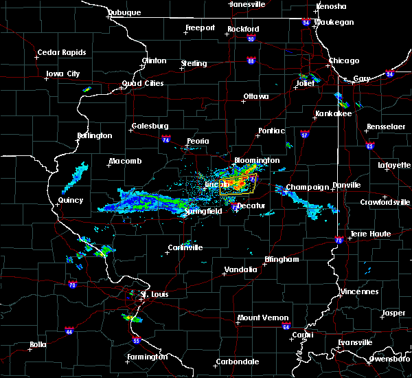 At 403 pm cdt, a severe thunderstorm was located near wapella, moving east at 30 mph (emergency management). Hazards include 60 mph wind gusts and nickel size hail. expect damage to roofs, siding, and trees At 403 pm cdt, a severe thunderstorm was located near wapella, moving east at 30 mph (emergency management). Hazards include 60 mph wind gusts and nickel size hail. expect damage to roofs, siding, and trees
|
| 5/31/2018 3:42 PM CDT | One power pole blown dow in de witt county IL, 0.9 miles NNW of Waynesville, IL |
| 5/31/2018 3:42 PM CDT | Several power lines blown down in de witt county IL, 2.2 miles N of Waynesville, IL |
| 7/11/2017 9:11 AM CDT |
 At 910 am cdt, a severe thunderstorm was located over chestnut, or 11 miles southeast of lincoln, moving east at 40 mph (radar indicated). Hazards include 60 mph wind gusts. Expect damage to roofs, siding, and trees. locations impacted include, clinton, maroa, atlanta, mount pulaski, argenta, wapella, waynesville, weldon, kenney, chestnut, beason, de witt, lawndale, weldon springs state park, lane, clinton lake dam, midland city, rowell and hallsville. this includes the following highways, interstate 55 between mile markers 133 and 140. Interstate 72 between mile markers 152 and 155. At 910 am cdt, a severe thunderstorm was located over chestnut, or 11 miles southeast of lincoln, moving east at 40 mph (radar indicated). Hazards include 60 mph wind gusts. Expect damage to roofs, siding, and trees. locations impacted include, clinton, maroa, atlanta, mount pulaski, argenta, wapella, waynesville, weldon, kenney, chestnut, beason, de witt, lawndale, weldon springs state park, lane, clinton lake dam, midland city, rowell and hallsville. this includes the following highways, interstate 55 between mile markers 133 and 140. Interstate 72 between mile markers 152 and 155.
|
| 7/11/2017 8:54 AM CDT |
 At 854 am cdt, a severe thunderstorm was located over lincoln, moving east at 40 mph (radar indicated). Hazards include 60 mph wind gusts. expect damage to roofs, siding, and trees At 854 am cdt, a severe thunderstorm was located over lincoln, moving east at 40 mph (radar indicated). Hazards include 60 mph wind gusts. expect damage to roofs, siding, and trees
|
| 7/10/2017 8:28 PM CDT |
 A severe thunderstorm warning remains in effect until 845 pm cdt for logan. western de witt and northern macon counties. at 827 pm cdt, a severe thunderstorm was located over chestnut, or 8 miles southeast of lincoln, moving southeast at 35 mph. hazard. 70 mph wind gusts and penny size hail. source. radar indicated. At 827 pm, winds continue to gust to over. A severe thunderstorm warning remains in effect until 845 pm cdt for logan. western de witt and northern macon counties. at 827 pm cdt, a severe thunderstorm was located over chestnut, or 8 miles southeast of lincoln, moving southeast at 35 mph. hazard. 70 mph wind gusts and penny size hail. source. radar indicated. At 827 pm, winds continue to gust to over.
|
| 7/10/2017 8:14 PM CDT |
 At 813 pm cdt, a severe thunderstorm was located from lincoln to beason, moving southeast at 40 mph (radar indicated. at 813 pm, multiple power lines were blown down in lincoln, and a 62 mph wind gust was reported at the national weather service office at the logan county airport). Hazards include 70 mph wind gusts and penny size hail. Expect considerable tree damage. damage is likely to mobile homes, roofs, and outbuildings. locations impacted include, decatur, lincoln, clinton, forsyth, maroa, atlanta, mount pulaski, warrensburg, mclean, emden, waynesville, latham, kenney, hartsburg, chestnut, beason, lawndale, broadwell, weldon springs state park and midland city. this includes the following highways, interstate 155 between mile markers 0 and 11. interstate 55 between mile markers 119 and 145. Interstate 72 between mile markers 136 and 140. At 813 pm cdt, a severe thunderstorm was located from lincoln to beason, moving southeast at 40 mph (radar indicated. at 813 pm, multiple power lines were blown down in lincoln, and a 62 mph wind gust was reported at the national weather service office at the logan county airport). Hazards include 70 mph wind gusts and penny size hail. Expect considerable tree damage. damage is likely to mobile homes, roofs, and outbuildings. locations impacted include, decatur, lincoln, clinton, forsyth, maroa, atlanta, mount pulaski, warrensburg, mclean, emden, waynesville, latham, kenney, hartsburg, chestnut, beason, lawndale, broadwell, weldon springs state park and midland city. this includes the following highways, interstate 155 between mile markers 0 and 11. interstate 55 between mile markers 119 and 145. Interstate 72 between mile markers 136 and 140.
|
| 7/10/2017 8:02 PM CDT |
 At 802 pm cdt, a severe thunderstorm was located near hartsburg, or 6 miles north of lincoln, moving southeast at 45 mph (radar indicated). Hazards include 70 mph wind gusts and penny size hail. Expect considerable tree damage. Damage is likely to mobile homes, roofs, and outbuildings. At 802 pm cdt, a severe thunderstorm was located near hartsburg, or 6 miles north of lincoln, moving southeast at 45 mph (radar indicated). Hazards include 70 mph wind gusts and penny size hail. Expect considerable tree damage. Damage is likely to mobile homes, roofs, and outbuildings.
|
| 3/7/2017 12:43 AM CST |
 At 1242 am cst, severe thunderstorms were located along a line extending from near gridley to near bloomington to chestnut, moving east at 55 mph (radar indicated). Hazards include 70 mph wind gusts and quarter size hail. Hail damage to vehicles is expected. expect considerable tree damage. wind damage is also likely to mobile homes, roofs, and outbuildings. locations impacted include, bloomington, clinton, normal, le roy, heyworth, el paso, minonk, lexington, hudson, chenoa, gridley, downs, mclean, wapella, towanda, waynesville, kenney, chestnut, cooksville and beason. this includes the following highways, interstate 39 between mile markers 0 and 26. interstate 55 between mile markers 144 and 186. Interstate 74 between mile markers 123 and 150. At 1242 am cst, severe thunderstorms were located along a line extending from near gridley to near bloomington to chestnut, moving east at 55 mph (radar indicated). Hazards include 70 mph wind gusts and quarter size hail. Hail damage to vehicles is expected. expect considerable tree damage. wind damage is also likely to mobile homes, roofs, and outbuildings. locations impacted include, bloomington, clinton, normal, le roy, heyworth, el paso, minonk, lexington, hudson, chenoa, gridley, downs, mclean, wapella, towanda, waynesville, kenney, chestnut, cooksville and beason. this includes the following highways, interstate 39 between mile markers 0 and 26. interstate 55 between mile markers 144 and 186. Interstate 74 between mile markers 123 and 150.
|
| 3/7/2017 12:21 AM CST |
 At 1221 am cst, severe thunderstorms were located along a line extending from near toluca to lincoln, moving east at 55 mph (radar indicated). Hazards include 70 mph wind gusts and quarter size hail. Hail damage to vehicles is expected. expect considerable tree damage. Wind damage is also likely to mobile homes, roofs, and outbuildings. At 1221 am cst, severe thunderstorms were located along a line extending from near toluca to lincoln, moving east at 55 mph (radar indicated). Hazards include 70 mph wind gusts and quarter size hail. Hail damage to vehicles is expected. expect considerable tree damage. Wind damage is also likely to mobile homes, roofs, and outbuildings.
|
| 8/25/2016 2:02 AM CDT |
 At 159 am cdt, a severe thunderstorm was located near hartsburg, or 7 miles north of lincoln, moving east at 45 mph (radar indicated). Hazards include 60 mph wind gusts and nickel size hail. Expect damage to roofs. siding. And trees. At 159 am cdt, a severe thunderstorm was located near hartsburg, or 7 miles north of lincoln, moving east at 45 mph (radar indicated). Hazards include 60 mph wind gusts and nickel size hail. Expect damage to roofs. siding. And trees.
|
| 7/13/2016 5:00 PM CDT | Large tree branches down in town in de witt county IL, 0.3 miles WNW of Waynesville, IL |
| 7/13/2016 4:31 PM CDT |
 At 431 pm cdt, severe thunderstorms were located along a line extending from near mason city to near williamsville, moving east at 40 mph (radar indicated). Hazards include 60 mph wind gusts. Expect damage to roofs. siding. And trees. At 431 pm cdt, severe thunderstorms were located along a line extending from near mason city to near williamsville, moving east at 40 mph (radar indicated). Hazards include 60 mph wind gusts. Expect damage to roofs. siding. And trees.
|
| 6/22/2016 5:38 AM CDT |
 At 537 am cdt, severe thunderstorms were located along a line extending from near bloomington to near atlanta to near athens, moving southeast at 45 mph (radar indicated). Hazards include 60 mph wind gusts and penny size hail. Expect damage to roofs. siding. And trees. At 537 am cdt, severe thunderstorms were located along a line extending from near bloomington to near atlanta to near athens, moving southeast at 45 mph (radar indicated). Hazards include 60 mph wind gusts and penny size hail. Expect damage to roofs. siding. And trees.
|
| 6/20/2016 9:44 PM CDT |
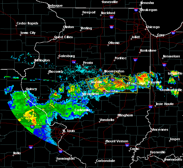 At 944 pm cdt, a severe thunderstorm was located over beason, or 8 miles east of lincoln, moving east at 40 mph (radar indicated). Hazards include 60 mph wind gusts. Expect damage to roofs. siding. And trees. At 944 pm cdt, a severe thunderstorm was located over beason, or 8 miles east of lincoln, moving east at 40 mph (radar indicated). Hazards include 60 mph wind gusts. Expect damage to roofs. siding. And trees.
|
| 6/20/2016 9:38 PM CDT |
 At 938 pm cdt, a severe thunderstorm was located over wapella, or near clinton, moving east at 50 mph (radar indicated). Hazards include 60 mph wind gusts and nickel size hail. Expect damage to roofs. siding. and trees. locations impacted include, lincoln, clinton, le roy, heyworth, farmer city, atlanta, mount pulaski, downs, mclean, wapella, emden, waynesville, weldon, kenney, hartsburg, chestnut, beason, de witt, lawndale and lane. this includes the following highways, interstate 155 between mile markers 0 and 9. interstate 55 between mile markers 121 and 149. Interstate 74 between mile markers 141 and 162. At 938 pm cdt, a severe thunderstorm was located over wapella, or near clinton, moving east at 50 mph (radar indicated). Hazards include 60 mph wind gusts and nickel size hail. Expect damage to roofs. siding. and trees. locations impacted include, lincoln, clinton, le roy, heyworth, farmer city, atlanta, mount pulaski, downs, mclean, wapella, emden, waynesville, weldon, kenney, hartsburg, chestnut, beason, de witt, lawndale and lane. this includes the following highways, interstate 155 between mile markers 0 and 9. interstate 55 between mile markers 121 and 149. Interstate 74 between mile markers 141 and 162.
|
| 6/20/2016 9:15 PM CDT | Golf Ball sized hail reported 1.9 miles S of Waynesville, IL |
| 6/20/2016 9:12 PM CDT |
 At 912 pm cdt, a severe thunderstorm was located near beason, or near lincoln, moving east at 45 mph (radar indicated). Hazards include 70 mph wind gusts and nickel size hail. Expect considerable tree damage. damage is likely to mobile homes, roofs, and outbuildings. locations impacted include, lincoln, clinton, le roy, heyworth, farmer city, atlanta, mount pulaski, downs, mclean, wapella, emden, waynesville, weldon, kenney, hartsburg, chestnut, beason, de witt, lawndale and lane. this includes the following highways, interstate 155 between mile markers 0 and 9. interstate 55 between mile markers 121 and 149. Interstate 74 between mile markers 141 and 162. At 912 pm cdt, a severe thunderstorm was located near beason, or near lincoln, moving east at 45 mph (radar indicated). Hazards include 70 mph wind gusts and nickel size hail. Expect considerable tree damage. damage is likely to mobile homes, roofs, and outbuildings. locations impacted include, lincoln, clinton, le roy, heyworth, farmer city, atlanta, mount pulaski, downs, mclean, wapella, emden, waynesville, weldon, kenney, hartsburg, chestnut, beason, de witt, lawndale and lane. this includes the following highways, interstate 155 between mile markers 0 and 9. interstate 55 between mile markers 121 and 149. Interstate 74 between mile markers 141 and 162.
|
| 6/20/2016 9:04 PM CDT |
 At 904 pm cdt, a severe thunderstorm was located near lincoln, moving east at 55 mph (radar indicated). Hazards include 60 mph wind gusts and nickel size hail. Expect damage to roofs. siding. And trees. At 904 pm cdt, a severe thunderstorm was located near lincoln, moving east at 55 mph (radar indicated). Hazards include 60 mph wind gusts and nickel size hail. Expect damage to roofs. siding. And trees.
|
| 3/15/2016 8:57 PM CDT | The severe thunderstorm warning for east central logan, southwestern mclean and northwestern de witt counties will expire at 900 pm cdt, the storm which prompted the warning has weakened below severe limits, and no longer pose an immediate threat to life or property. therefore the warning will be allowed to expire. however small hail and gusty winds are still possible with this thunderstorm. a tornado watch remains in effect until 1100 pm cdt for central illinois. |
| 3/15/2016 8:42 PM CDT |
 At 841 pm cdt, a severe thunderstorm was located near waynesville, or 7 miles west of clinton, moving northeast at 50 mph (trained weather spotters. at 838 pm...quarter size hail was reported in beason, in eastern logan county). Hazards include 60 mph wind gusts and quarter size hail. Hail damage to vehicles is expected. expect wind damage to roofs, siding and trees. locations impacted include, clinton, wapella, waynesville, beason, midland city and hallsville. A tornado watch remains in effect until 1100 pm cdt for central illinois. At 841 pm cdt, a severe thunderstorm was located near waynesville, or 7 miles west of clinton, moving northeast at 50 mph (trained weather spotters. at 838 pm...quarter size hail was reported in beason, in eastern logan county). Hazards include 60 mph wind gusts and quarter size hail. Hail damage to vehicles is expected. expect wind damage to roofs, siding and trees. locations impacted include, clinton, wapella, waynesville, beason, midland city and hallsville. A tornado watch remains in effect until 1100 pm cdt for central illinois.
|
| 3/15/2016 8:37 PM CDT |
 At 836 pm cdt, a severe thunderstorm was located over beason, or 10 miles west of clinton, moving northeast at 55 mph (radar indicated). Hazards include 60 mph wind gusts and quarter size hail. Hail damage to vehicles is expected. Expect wind damage to roofs, siding and trees. At 836 pm cdt, a severe thunderstorm was located over beason, or 10 miles west of clinton, moving northeast at 55 mph (radar indicated). Hazards include 60 mph wind gusts and quarter size hail. Hail damage to vehicles is expected. Expect wind damage to roofs, siding and trees.
|
| 7/17/2015 1:21 AM CDT |
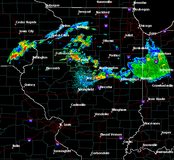 The severe thunderstorm warning for northwestern de witt county will expire at 130 am cdt, the storm which prompted the warning has moved out of the area. therefore the warning will be allowed to expire. The severe thunderstorm warning for northwestern de witt county will expire at 130 am cdt, the storm which prompted the warning has moved out of the area. therefore the warning will be allowed to expire.
|
| 7/17/2015 1:08 AM CDT |
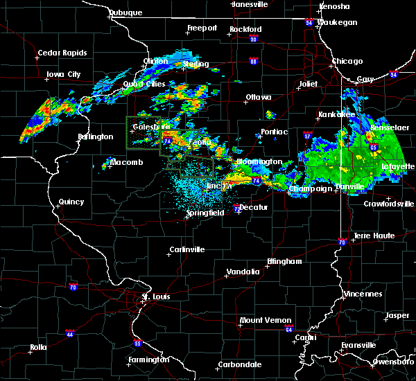 At 107 am cdt, a severe thunderstorm was located over waynesville, or 9 miles northwest of clinton, moving southeast at 15 mph (radar indicated). Hazards include 70 mph wind gusts. Expect considerable tree damage. damage is likely to mobile homes, roofs and outbuildings. Locations impacted include, waynesville. At 107 am cdt, a severe thunderstorm was located over waynesville, or 9 miles northwest of clinton, moving southeast at 15 mph (radar indicated). Hazards include 70 mph wind gusts. Expect considerable tree damage. damage is likely to mobile homes, roofs and outbuildings. Locations impacted include, waynesville.
|
| 7/17/2015 12:38 AM CDT |
 At 1238 am cdt, a severe thunderstorm was located over atlanta, or 10 miles northeast of lincoln, moving southeast at 15 mph (radar indicated). Hazards include 70 mph wind gusts. Expect considerable tree damage. Damage is likely to mobile homes, roofs and outbuildings. At 1238 am cdt, a severe thunderstorm was located over atlanta, or 10 miles northeast of lincoln, moving southeast at 15 mph (radar indicated). Hazards include 70 mph wind gusts. Expect considerable tree damage. Damage is likely to mobile homes, roofs and outbuildings.
|
| 6/20/2015 10:21 PM CDT |
 At 1021 pm cdt, severe thunderstorms were located along a line extending from 10 miles northeast of minonk to 4 miles southwest of heyworth to near mount pulaski, moving east at 40 mph (trained weather spotters). Hazards include 60 mph wind gusts. Expect damage to roofs. siding and trees. locations impacted include, bloomington, normal, clinton, heyworth, lexington, hudson, mount pulaski, gridley, downs, wapella, towanda, waynesville, elkhart, latham, kenney, chestnut, cornland, beason, midland city and hallsville. this includes the following highways, interstate 39 between mile markers 0 and 5. interstate 55 between mile markers 112 and 113, and between mile markers 147 and 179. interstate 74 between mile markers 127 and 147. A tornado watch remains in effect until 1100 pm cdt for central illinois. At 1021 pm cdt, severe thunderstorms were located along a line extending from 10 miles northeast of minonk to 4 miles southwest of heyworth to near mount pulaski, moving east at 40 mph (trained weather spotters). Hazards include 60 mph wind gusts. Expect damage to roofs. siding and trees. locations impacted include, bloomington, normal, clinton, heyworth, lexington, hudson, mount pulaski, gridley, downs, wapella, towanda, waynesville, elkhart, latham, kenney, chestnut, cornland, beason, midland city and hallsville. this includes the following highways, interstate 39 between mile markers 0 and 5. interstate 55 between mile markers 112 and 113, and between mile markers 147 and 179. interstate 74 between mile markers 127 and 147. A tornado watch remains in effect until 1100 pm cdt for central illinois.
|
| 6/20/2015 10:07 PM CDT |
 At 1007 pm cdt, severe thunderstorms were located along a line extending from 4 miles southeast of wenona to mclean to elkhart, moving east at 40 mph (trained weather spotters). Hazards include 60 mph wind gusts. Expect damage to roofs. siding and trees. locations impacted include, bloomington, normal, lincoln, clinton, heyworth, el paso, minonk, lexington, hudson, atlanta, mount pulaski, gridley, danvers, wenona, downs, mclean, stanford, wapella, carlock and towanda. this includes the following highways, interstate 155 between mile markers 0 and 1. interstate 39 between mile markers 0 and 40. interstate 55 between mile markers 112 and 179. interstate 74 between mile markers 116 and 147. A tornado watch remains in effect until 1100 pm cdt for central illinois. At 1007 pm cdt, severe thunderstorms were located along a line extending from 4 miles southeast of wenona to mclean to elkhart, moving east at 40 mph (trained weather spotters). Hazards include 60 mph wind gusts. Expect damage to roofs. siding and trees. locations impacted include, bloomington, normal, lincoln, clinton, heyworth, el paso, minonk, lexington, hudson, atlanta, mount pulaski, gridley, danvers, wenona, downs, mclean, stanford, wapella, carlock and towanda. this includes the following highways, interstate 155 between mile markers 0 and 1. interstate 39 between mile markers 0 and 40. interstate 55 between mile markers 112 and 179. interstate 74 between mile markers 116 and 147. A tornado watch remains in effect until 1100 pm cdt for central illinois.
|
| 6/20/2015 9:39 PM CDT |
 At 939 pm cdt, severe thunderstorms were located along a line extending from henry to near delavan to near greenview, moving east at 40 mph (trained weather spotters). Hazards include 60 mph wind gusts and penny size hail. Expect damage to roofs. Siding and trees. At 939 pm cdt, severe thunderstorms were located along a line extending from henry to near delavan to near greenview, moving east at 40 mph (trained weather spotters). Hazards include 60 mph wind gusts and penny size hail. Expect damage to roofs. Siding and trees.
|
| 6/13/2015 9:10 PM CDT |
 The severe thunderstorm warning for northeastern logan, southeastern tazewell, southwestern mclean and northwestern de witt counties will expire at 915 pm cdt, the storm which prompted the warning has weakened below severe limits and exited the warned area. therefore the warning will be allowed to expire. The severe thunderstorm warning for northeastern logan, southeastern tazewell, southwestern mclean and northwestern de witt counties will expire at 915 pm cdt, the storm which prompted the warning has weakened below severe limits and exited the warned area. therefore the warning will be allowed to expire.
|
| 6/13/2015 8:46 PM CDT |
 At 846 pm cdt, a severe thunderstorm was located over atlanta, or 9 miles northeast of lincoln, moving northeast at 35 mph (radar indicated). Hazards include 70 mph wind gusts. Expect considerable tree damage. Damage is likely to mobile homes, roofs and outbuildings. At 846 pm cdt, a severe thunderstorm was located over atlanta, or 9 miles northeast of lincoln, moving northeast at 35 mph (radar indicated). Hazards include 70 mph wind gusts. Expect considerable tree damage. Damage is likely to mobile homes, roofs and outbuildings.
|
| 6/7/2015 7:52 PM CDT | At 751 pm cdt, severe thunderstorms were located along a line extending from near eureka to delavan to near greenview, moving east at 45 mph (radar indicated). Hazards include 70 mph wind gusts. Expect considerable tree damage. Damage is likely to mobile homes, roofs and outbuildings. |
| 6/7/2015 7:36 PM CDT | At 736 pm cdt, a severe thunderstorm was located near hartsburg, or 6 miles north of lincoln, moving east at 45 mph (radar indicated). Hazards include 60 mph wind gusts. Expect damage to roofs. Siding and trees. |
| 5/10/2015 7:53 PM CDT | At 752 pm cdt, severe thunderstorms were located along a line extending from atlanta to clinton to near argenta, moving northeast at 50 mph (radar indicated). Hazards include 60 mph wind gusts and penny size hail. Expect damage to roofs. siding and trees. locations impacted include, clinton, maroa, atlanta, wapella, waynesville, kenney, midland city, rowell, hallsville, clinton lake dam and weldon springs state park. this includes interstate 55 between mile markers 139 and 140. 0. 75in. |
| 5/10/2015 7:42 PM CDT | At 741 pm cdt, severe thunderstorms were located along a line extending from near atlanta to near waynesville to near maroa, moving northeast at 50 mph (radar indicated). Hazards include 60 mph wind gusts and penny size hail. Expect damage to roofs. siding and trees. locations impacted include, lincoln, clinton, maroa, atlanta, mount pulaski, warrensburg, wapella, waynesville, latham, kenney, chestnut, beason, lawndale, midland city, hallsville, clinton lake dam, weldon springs state park and rowell. this includes interstate 55 between mile markers 130 and 140. 0. 75in. |
| 5/10/2015 7:32 PM CDT | At 732 pm cdt, severe thunderstorms were located along a line extending from lincoln to beason to latham, moving northeast at 50 mph (radar indicated). Hazards include 60 mph wind gusts and penny size hail. Expect damage to roofs. siding and trees. locations impacted include, lincoln, clinton, maroa, atlanta, mount pulaski, warrensburg, illiopolis, wapella, waynesville, latham, kenney, chestnut, beason, lawndale, broadwell, midland city, hallsville, clinton lake dam, weldon springs state park and rowell. this includes the following highways, interstate 55 between mile markers 118 and 125, and between mile markers 130 and 140. interstate 72 near mile marker 122. 0. 75in. |
| 5/10/2015 7:23 PM CDT | At 723 pm cdt, severe thunderstorms were located along a line extending from near elkhart to near mount pulaski to near illiopolis, moving northeast at 50 mph (radar indicated). Hazards include 60 mph wind gusts and penny size hail. Expect damage to roofs. siding and trees. locations impacted include, lincoln, clinton, maroa, atlanta, mount pulaski, warrensburg, illiopolis, wapella, waynesville, elkhart, latham, kenney, chestnut, cornland, beason, lawndale, broadwell, midland city, hallsville and clinton lake dam. this includes the following highways, interstate 55 between mile markers 112 and 125, and between mile markers 129 and 140. interstate 72 between mile markers 116 and 122. 0. 75in. |
| 5/10/2015 7:10 PM CDT | At 709 pm cdt, severe thunderstorms were located along a line extending from near elkhart to near mount pulaski to near illiopolis, moving northeast at 50 mph (radar indicated). Hazards include 60 mph wind gusts and penny size hail. Expect damage to roofs. Siding and trees. |
| 4/8/2015 5:27 AM CDT | A severe thunderstorm warning remains in effect for de witt. northern piatt and southern mclean counties until 600 am cdt. at 524 am cdt. a severe thunderstorm was located near mclean. and moving east at 30 mph. hazard. quarter size hail. source. Radar indicated. |
| 4/8/2015 5:12 AM CDT | The national weather service in lincoln has issued a * severe thunderstorm warning for. de witt county in central illinois. northeastern logan county in central illinois. southern mclean county in central illinois. Northern piatt county in central illinois. |
Hail Maps for Waynesville, IL

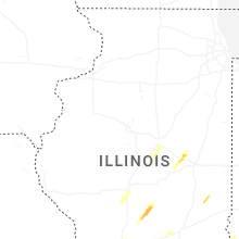
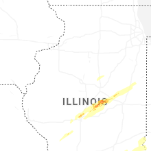


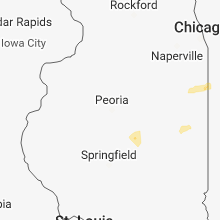


Connect with Interactive Hail Maps