

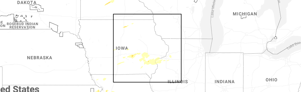
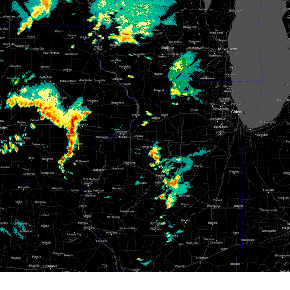
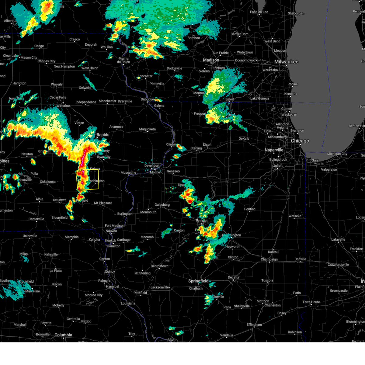
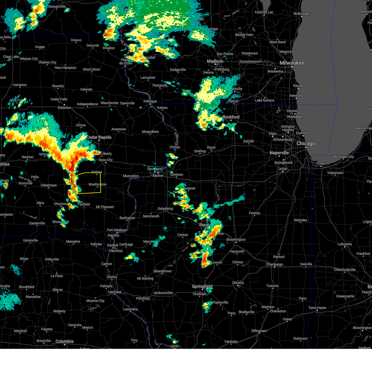
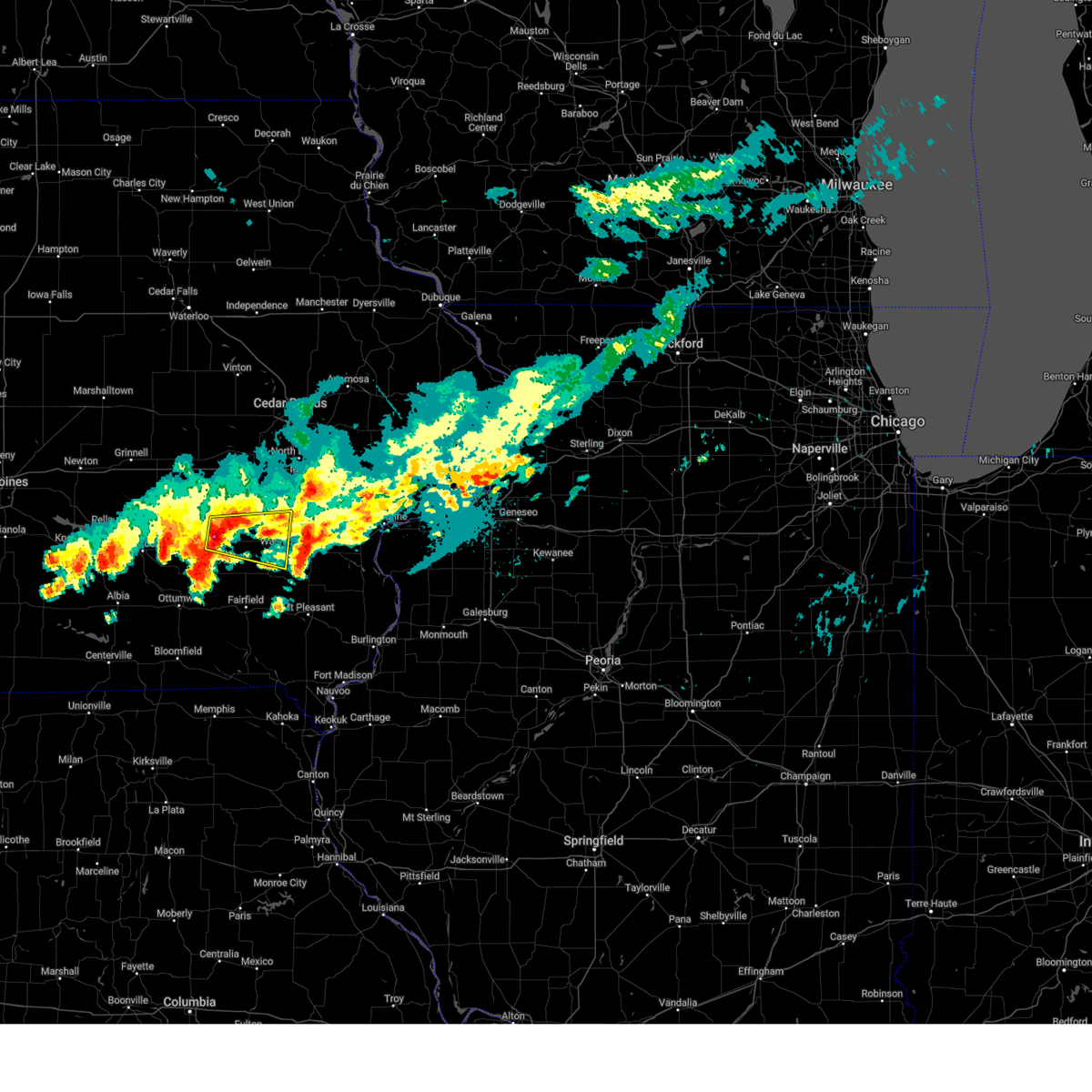
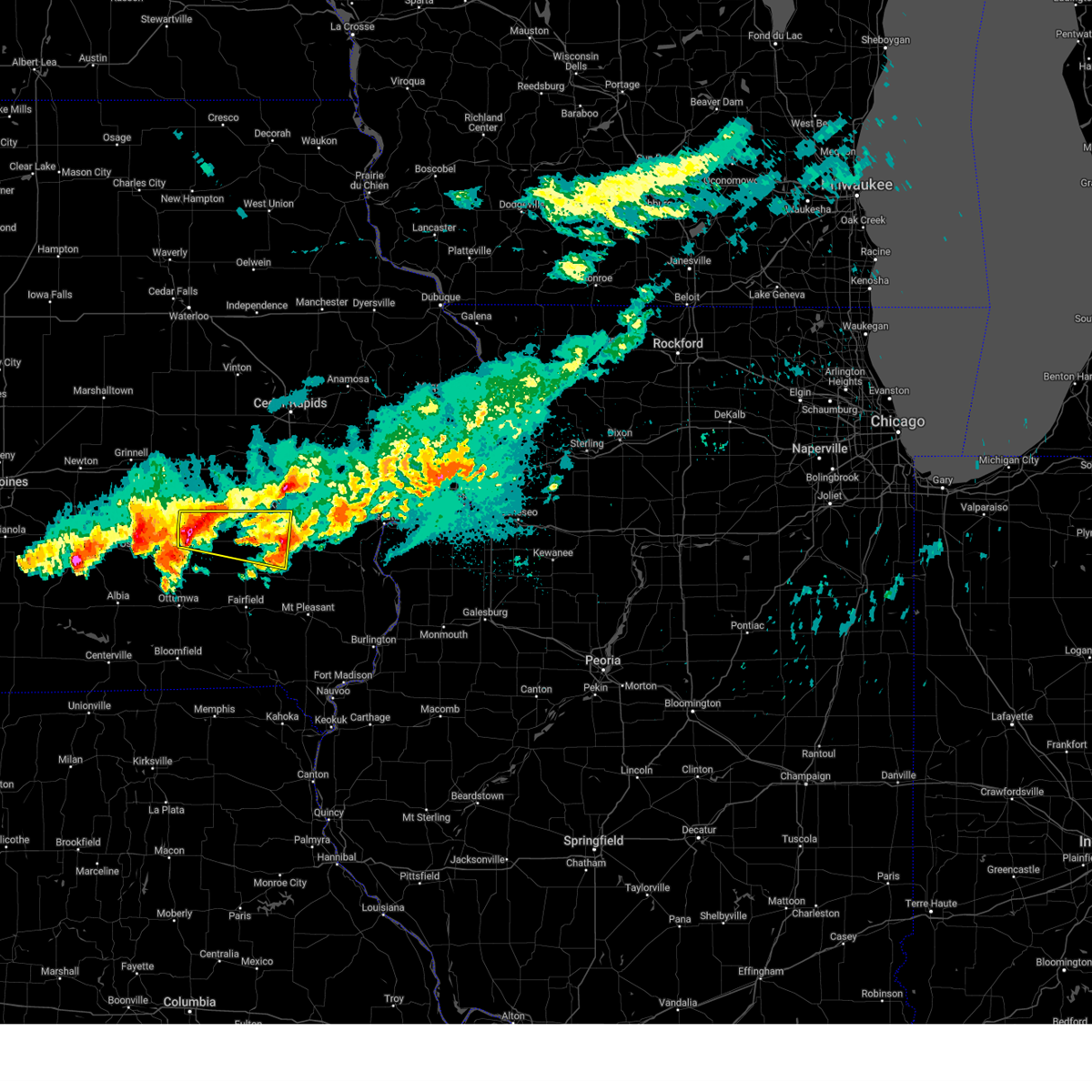
Hail Map for Wellman, IA
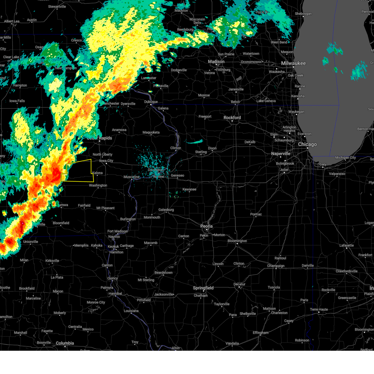
The Wellman, IA area has had 0 reports of on-the-ground hail by trained spotters, and has been under severe weather warnings 20 times during the past 12 months. Doppler radar has detected hail at or near Wellman, IA on 59 occasions, including 2 occasions during the past year.
| Name: | Wellman, IA |
| Where Located: | 36 miles SSW of Cedar Rapids, IA |
| Map: | Google Map for Wellman, IA |
| Population: | 1408 |
| Housing Units: | 659 |
| More Info: | Search Google for Wellman, IA |
0
The Top Recent Hail Date for Wellman, IA is Thursday, October 24, 2024 (54th out of 59)
Hail and Wind Damage Spotted near Wellman, IA
| Date / Time | Report Details |
|---|---|
| 7/5/2025 3:12 PM CDT |
 Svrdvn the national weather service in the quad cities has issued a * severe thunderstorm warning for, east central keokuk county in southeastern iowa, southwestern cedar county in east central iowa, central johnson county in east central iowa, northern washington county in southeastern iowa, northwestern muscatine county in east central iowa, southeastern iowa county in east central iowa, * until 400 pm cdt. * at 312 pm cdt, a severe thunderstorm was located over keota, or 14 miles east of sigourney, moving northeast at 45 mph (radar indicated). Hazards include 60 mph wind gusts. Expect damage to roofs, siding, and trees. this severe thunderstorm will be near, wellman and west chester around 315 pm cdt. kalona, richmond, and amish around 320 pm cdt. riverside, frytown, and sharon center around 325 pm cdt. hills around 330 pm cdt. other locations in the path of this severe thunderstorm include iowa city, river junction, iowa city municipal airport, hills access, johnson county fairgrounds, coralville, lone tree, university heights, university of iowa, west branch, west liberty, oasis, elmira, herbert hoover national historic site and muscatine county fairgrounds. This includes interstate 80 in iowa between mile markers 240 and 260. Svrdvn the national weather service in the quad cities has issued a * severe thunderstorm warning for, east central keokuk county in southeastern iowa, southwestern cedar county in east central iowa, central johnson county in east central iowa, northern washington county in southeastern iowa, northwestern muscatine county in east central iowa, southeastern iowa county in east central iowa, * until 400 pm cdt. * at 312 pm cdt, a severe thunderstorm was located over keota, or 14 miles east of sigourney, moving northeast at 45 mph (radar indicated). Hazards include 60 mph wind gusts. Expect damage to roofs, siding, and trees. this severe thunderstorm will be near, wellman and west chester around 315 pm cdt. kalona, richmond, and amish around 320 pm cdt. riverside, frytown, and sharon center around 325 pm cdt. hills around 330 pm cdt. other locations in the path of this severe thunderstorm include iowa city, river junction, iowa city municipal airport, hills access, johnson county fairgrounds, coralville, lone tree, university heights, university of iowa, west branch, west liberty, oasis, elmira, herbert hoover national historic site and muscatine county fairgrounds. This includes interstate 80 in iowa between mile markers 240 and 260.
|
| 3/14/2025 8:21 PM CDT | At 821 pm cdt, severe thunderstorms were located along a line extending from near kalona to denmark, moving north at 40 mph (trained weather spotters). Hazards include 70 mph wind gusts. Expect considerable tree damage. damage is likely to mobile homes, roofs, and outbuildings. Locations impacted include, geode state park, olds, haskins, cotter, ainsworth, new london, frytown, wyman, mount union, sharon center, marsh, prairie grove, iowa city, pleasant grove, yarmouth, river junction, cairo, columbus city, gladwin, hills, columbus junction, big hollow recreation area, hills access, virginia grove recreation area, iowa city municipal airport, morning sun, johnson county fairgrounds, louisa county fairgrounds, lone tree, garland, fredonia and amber. |
| 3/14/2025 7:53 PM CDT |
 At 750 pm cdt, severe thunderstorms were located along a line extending from near brighton to sandusky, moving north at 40 mph. a trained spotter reported a wind gust of 77 mph in new london iowa at 748 pm. these are destructive storms for henry county and washington county (trained weather spotters). Hazards include 80 mph wind gusts. Flying debris will be dangerous to those caught without shelter. mobile homes will be heavily damaged. expect considerable damage to roofs, windows, and vehicles. extensive tree damage and power outages are likely. these severe storms will be near, coppock, washington airport, west point, bluff park, merrimac, westwood, rome, noble, galland, and washington around 755 pm cdt. fort madison municipal arpt, sawyer, swedesburg, and lowell around 800 pm cdt. Other locations in the path of these severe thunderstorms include geode state park, olds, denmark, new london, niota, richmond, ainsworth, crawfordsville, wellman, kalona, camp l-kee-ta, marr park, augusta, amish, danville, winfield, welter recreation area, haskins, frytown, wyman, mount union, sharon center, riverside, middletown, cotter, cosgrove, windham, marsh, prairie grove, iowa city, pleasant grove and yarmouth. At 750 pm cdt, severe thunderstorms were located along a line extending from near brighton to sandusky, moving north at 40 mph. a trained spotter reported a wind gust of 77 mph in new london iowa at 748 pm. these are destructive storms for henry county and washington county (trained weather spotters). Hazards include 80 mph wind gusts. Flying debris will be dangerous to those caught without shelter. mobile homes will be heavily damaged. expect considerable damage to roofs, windows, and vehicles. extensive tree damage and power outages are likely. these severe storms will be near, coppock, washington airport, west point, bluff park, merrimac, westwood, rome, noble, galland, and washington around 755 pm cdt. fort madison municipal arpt, sawyer, swedesburg, and lowell around 800 pm cdt. Other locations in the path of these severe thunderstorms include geode state park, olds, denmark, new london, niota, richmond, ainsworth, crawfordsville, wellman, kalona, camp l-kee-ta, marr park, augusta, amish, danville, winfield, welter recreation area, haskins, frytown, wyman, mount union, sharon center, riverside, middletown, cotter, cosgrove, windham, marsh, prairie grove, iowa city, pleasant grove and yarmouth.
|
| 3/14/2025 7:41 PM CDT |
 Svrdvn the national weather service in the quad cities has issued a * severe thunderstorm warning for, northern hancock county in west central illinois, southwestern henderson county in west central illinois, henry county in southeastern iowa, des moines county in southeastern iowa, louisa county in southeastern iowa, southern johnson county in east central iowa, washington county in southeastern iowa, southeastern iowa county in east central iowa, lee county in southeastern iowa, central clark county in northeastern missouri, * until 830 pm cdt. * at 741 pm cdt, severe thunderstorms were located along a line extending from near brighton to keokuk, moving north at 40 mph (radar indicated). Hazards include 70 mph wind gusts. Expect considerable tree damage. damage is likely to mobile homes, roofs, and outbuildings. severe thunderstorms will be near, new boston, coppock, summitville, west point, bluff park, merrimac, westwood, mooar, rome, and mt hamill around 745 pm cdt. washington, henry county fairgrounds, and washington county fairgrounds around 750 pm cdt. washington airport, noble, mount pleasant municipal arpt, west chester, lowell, and stephenson park around 755 pm cdt. olds, fort madison municipal arpt, sawyer, and swedesburg around 800 pm cdt. Other locations in the path of these severe thunderstorms include geode state park, denmark, new london, niota, richmond, ainsworth, crawfordsville, kalona, camp l-kee-ta, marr park, augusta, amish, danville, winfield, welter recreation area, haskins, frytown, wyman, mount union, sharon center and middletown. Svrdvn the national weather service in the quad cities has issued a * severe thunderstorm warning for, northern hancock county in west central illinois, southwestern henderson county in west central illinois, henry county in southeastern iowa, des moines county in southeastern iowa, louisa county in southeastern iowa, southern johnson county in east central iowa, washington county in southeastern iowa, southeastern iowa county in east central iowa, lee county in southeastern iowa, central clark county in northeastern missouri, * until 830 pm cdt. * at 741 pm cdt, severe thunderstorms were located along a line extending from near brighton to keokuk, moving north at 40 mph (radar indicated). Hazards include 70 mph wind gusts. Expect considerable tree damage. damage is likely to mobile homes, roofs, and outbuildings. severe thunderstorms will be near, new boston, coppock, summitville, west point, bluff park, merrimac, westwood, mooar, rome, and mt hamill around 745 pm cdt. washington, henry county fairgrounds, and washington county fairgrounds around 750 pm cdt. washington airport, noble, mount pleasant municipal arpt, west chester, lowell, and stephenson park around 755 pm cdt. olds, fort madison municipal arpt, sawyer, and swedesburg around 800 pm cdt. Other locations in the path of these severe thunderstorms include geode state park, denmark, new london, niota, richmond, ainsworth, crawfordsville, kalona, camp l-kee-ta, marr park, augusta, amish, danville, winfield, welter recreation area, haskins, frytown, wyman, mount union, sharon center and middletown.
|
| 10/24/2024 7:52 PM CDT |
 the severe thunderstorm warning has been cancelled and is no longer in effect the severe thunderstorm warning has been cancelled and is no longer in effect
|
| 10/24/2024 7:52 PM CDT |
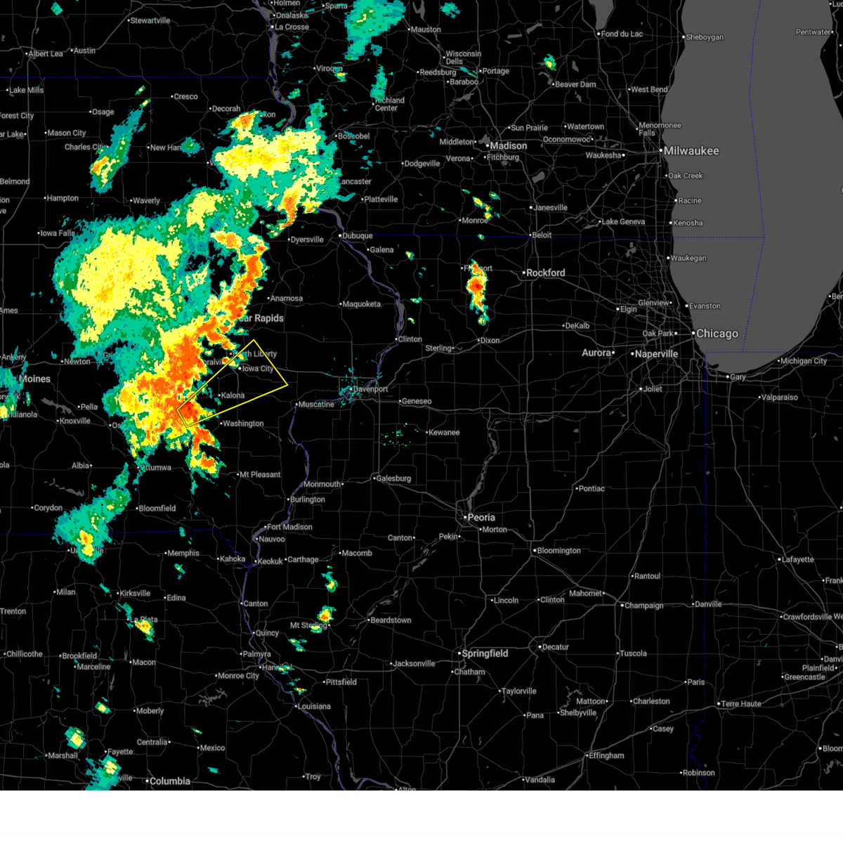
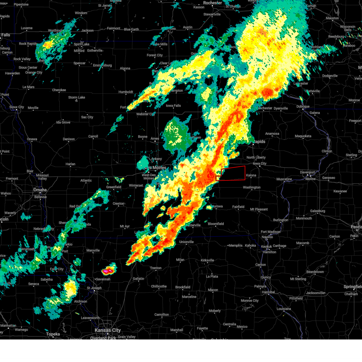
 At 751 pm cdt, severe thunderstorms were located along a line extending from near wellman to near brighton, moving east at 40 mph (radar indicated). Hazards include quarter size hail. Damage to vehicles is expected. Locations impacted include, washington, kalona, wellman, richmond, west chester, washington airport, and washington county fairgrounds. At 751 pm cdt, severe thunderstorms were located along a line extending from near wellman to near brighton, moving east at 40 mph (radar indicated). Hazards include quarter size hail. Damage to vehicles is expected. Locations impacted include, washington, kalona, wellman, richmond, west chester, washington airport, and washington county fairgrounds.
|
| 10/24/2024 7:40 PM CDT |
 At 740 pm cdt, a severe thunderstorm was located 3 miles north of keota, or 12 miles northwest of washington, moving east at 40 mph (radar indicated). Hazards include quarter size hail. Damage to vehicles is expected. Locations impacted include, washington, kalona, wellman, south english, harper, kinross, richmond, keota, west chester, washington airport, talleyrand, washington county fairgrounds, and rubio. At 740 pm cdt, a severe thunderstorm was located 3 miles north of keota, or 12 miles northwest of washington, moving east at 40 mph (radar indicated). Hazards include quarter size hail. Damage to vehicles is expected. Locations impacted include, washington, kalona, wellman, south english, harper, kinross, richmond, keota, west chester, washington airport, talleyrand, washington county fairgrounds, and rubio.
|
| 10/24/2024 7:29 PM CDT |
 Svrdvn the national weather service in the quad cities has issued a * severe thunderstorm warning for, eastern keokuk county in southeastern iowa, western washington county in southeastern iowa, * until 815 pm cdt. * at 729 pm cdt, a severe thunderstorm was located over lancaster, or near sigourney, moving east at 35 mph (radar indicated). Hazards include quarter size hail. damage to vehicles is expected Svrdvn the national weather service in the quad cities has issued a * severe thunderstorm warning for, eastern keokuk county in southeastern iowa, western washington county in southeastern iowa, * until 815 pm cdt. * at 729 pm cdt, a severe thunderstorm was located over lancaster, or near sigourney, moving east at 35 mph (radar indicated). Hazards include quarter size hail. damage to vehicles is expected
|
| 10/4/2024 3:01 AM CDT |
 At 259 am cdt, a severe thunderstorm was located over harper, or near sigourney, moving east at 35 mph (trained weather spotters. at 256 am cdt, a trained spotter in sigourney reported hail to the size of quarters). Hazards include quarter size hail. Damage to vehicles is expected. Locations impacted include, harper, kinross, keota, talleyrand, west chester, wellman, washington county fairgrounds, washington and richmond. At 259 am cdt, a severe thunderstorm was located over harper, or near sigourney, moving east at 35 mph (trained weather spotters. at 256 am cdt, a trained spotter in sigourney reported hail to the size of quarters). Hazards include quarter size hail. Damage to vehicles is expected. Locations impacted include, harper, kinross, keota, talleyrand, west chester, wellman, washington county fairgrounds, washington and richmond.
|
| 10/4/2024 2:40 AM CDT |
 Svrdvn the national weather service in the quad cities has issued a * severe thunderstorm warning for, keokuk county in southeastern iowa, western washington county in southeastern iowa, * until 330 am cdt. * at 238 am cdt, a severe thunderstorm was located over what cheer, or 7 miles northwest of sigourney, moving east at 35 mph (radar indicated). Hazards include quarter size hail. Damage to vehicles is expected. this severe thunderstorm will be near, sigourney, keswick, south english, webster, lancaster, lake belva deer park, yenruogis county park, and keokuk county expo around 245 am cdt. harper around 250 am cdt. keota around 255 am cdt. Other locations in the path of this severe thunderstorm include kinross, talleyrand, west chester, wellman and washington county fairgrounds. Svrdvn the national weather service in the quad cities has issued a * severe thunderstorm warning for, keokuk county in southeastern iowa, western washington county in southeastern iowa, * until 330 am cdt. * at 238 am cdt, a severe thunderstorm was located over what cheer, or 7 miles northwest of sigourney, moving east at 35 mph (radar indicated). Hazards include quarter size hail. Damage to vehicles is expected. this severe thunderstorm will be near, sigourney, keswick, south english, webster, lancaster, lake belva deer park, yenruogis county park, and keokuk county expo around 245 am cdt. harper around 250 am cdt. keota around 255 am cdt. Other locations in the path of this severe thunderstorm include kinross, talleyrand, west chester, wellman and washington county fairgrounds.
|
| 7/30/2024 4:50 AM CDT |
 At 450 am cdt, a severe thunderstorm was located over talleyrand, or 10 miles east of sigourney, moving east at 45 mph (radar indicated). Hazards include 60 mph wind gusts and quarter size hail. Hail damage to vehicles is expected. expect wind damage to roofs, siding, and trees. Locations impacted include, washington, sigourney, wellman, hedrick, brighton, what cheer, richland, delta, keswick, south english, harper, martinsburg, kinross, hayesville, coppock, keota, ollie, west chester, webster, and thornburg. At 450 am cdt, a severe thunderstorm was located over talleyrand, or 10 miles east of sigourney, moving east at 45 mph (radar indicated). Hazards include 60 mph wind gusts and quarter size hail. Hail damage to vehicles is expected. expect wind damage to roofs, siding, and trees. Locations impacted include, washington, sigourney, wellman, hedrick, brighton, what cheer, richland, delta, keswick, south english, harper, martinsburg, kinross, hayesville, coppock, keota, ollie, west chester, webster, and thornburg.
|
| 7/30/2024 4:44 AM CDT |
 Svrdvn the national weather service in the quad cities has issued a * severe thunderstorm warning for, keokuk county in southeastern iowa, western washington county in southeastern iowa, * until 530 am cdt. * at 443 am cdt, a severe thunderstorm was located near keokuk county expo, or near sigourney, moving east at 45 mph (radar indicated). Hazards include 60 mph wind gusts. expect damage to roofs, siding, and trees Svrdvn the national weather service in the quad cities has issued a * severe thunderstorm warning for, keokuk county in southeastern iowa, western washington county in southeastern iowa, * until 530 am cdt. * at 443 am cdt, a severe thunderstorm was located near keokuk county expo, or near sigourney, moving east at 45 mph (radar indicated). Hazards include 60 mph wind gusts. expect damage to roofs, siding, and trees
|
| 7/15/2024 7:14 PM CDT | The storms which prompted the warning have moved out of the area. therefore, the warning will be allowed to expire. however, gusty winds and heavy rain are still possible with these thunderstorms. a severe thunderstorm watch remains in effect until 1100 pm cdt for southeastern and east central iowa. |
| 7/15/2024 6:59 PM CDT |
 At 659 pm cdt, severe thunderstorms were located along a line extending from near haskins to packwood, moving southeast at 45 mph (radar indicated). Hazards include 70 mph wind gusts and penny size hail. Expect considerable tree damage. damage is likely to mobile homes, roofs, and outbuildings. locations impacted include, iowa city, washington, sigourney, coralville, north liberty, kalona, solon, tiffin, wellman, lone tree, university heights, north english, riverside, oxford, hedrick, hills, what cheer, richland, delta, and keswick. this includes the following highways, interstate 80 in iowa between mile markers 228 and 253. Interstate 380 between mile markers 1 and 9. At 659 pm cdt, severe thunderstorms were located along a line extending from near haskins to packwood, moving southeast at 45 mph (radar indicated). Hazards include 70 mph wind gusts and penny size hail. Expect considerable tree damage. damage is likely to mobile homes, roofs, and outbuildings. locations impacted include, iowa city, washington, sigourney, coralville, north liberty, kalona, solon, tiffin, wellman, lone tree, university heights, north english, riverside, oxford, hedrick, hills, what cheer, richland, delta, and keswick. this includes the following highways, interstate 80 in iowa between mile markers 228 and 253. Interstate 380 between mile markers 1 and 9.
|
| 7/15/2024 6:59 PM CDT |
 the severe thunderstorm warning has been cancelled and is no longer in effect the severe thunderstorm warning has been cancelled and is no longer in effect
|
| 7/15/2024 6:47 PM CDT |
 At 646 pm cdt, severe thunderstorms were located along a line extending from near richmond to near pekin, moving southeast at 65 mph (trained weather spotters. a wind gust was estimated of at least 70 mph in sigourney at 645 pm cdt). Hazards include 70 mph wind gusts and penny size hail. Expect considerable tree damage. damage is likely to mobile homes, roofs, and outbuildings. locations impacted include, iowa city, washington, marengo, sigourney, coralville, north liberty, williamsburg, kalona, solon, tiffin, walford, wellman, lone tree, university heights, north english, riverside, victor, swisher, oxford, and hedrick. this includes the following highways, interstate 80 in iowa between mile markers 206 and 253. Interstate 380 between mile markers 1 and 12. At 646 pm cdt, severe thunderstorms were located along a line extending from near richmond to near pekin, moving southeast at 65 mph (trained weather spotters. a wind gust was estimated of at least 70 mph in sigourney at 645 pm cdt). Hazards include 70 mph wind gusts and penny size hail. Expect considerable tree damage. damage is likely to mobile homes, roofs, and outbuildings. locations impacted include, iowa city, washington, marengo, sigourney, coralville, north liberty, williamsburg, kalona, solon, tiffin, walford, wellman, lone tree, university heights, north english, riverside, victor, swisher, oxford, and hedrick. this includes the following highways, interstate 80 in iowa between mile markers 206 and 253. Interstate 380 between mile markers 1 and 12.
|
| 7/15/2024 6:44 PM CDT |
 At 643 pm cdt, severe thunderstorms were located along a line extending from near amish to near hayesville, moving southeast at 45 mph (trained weather spotters. at 643 pm winds were estimated to 60 mph just north of south english). Hazards include 70 mph wind gusts and penny size hail. Expect considerable tree damage. damage is likely to mobile homes, roofs, and outbuildings. locations impacted include, iowa city, washington, marengo, sigourney, coralville, north liberty, williamsburg, kalona, solon, tiffin, walford, wellman, lone tree, university heights, north english, riverside, victor, swisher, oxford, and hedrick. this includes the following highways, interstate 80 in iowa between mile markers 206 and 253. Interstate 380 between mile markers 1 and 12. At 643 pm cdt, severe thunderstorms were located along a line extending from near amish to near hayesville, moving southeast at 45 mph (trained weather spotters. at 643 pm winds were estimated to 60 mph just north of south english). Hazards include 70 mph wind gusts and penny size hail. Expect considerable tree damage. damage is likely to mobile homes, roofs, and outbuildings. locations impacted include, iowa city, washington, marengo, sigourney, coralville, north liberty, williamsburg, kalona, solon, tiffin, walford, wellman, lone tree, university heights, north english, riverside, victor, swisher, oxford, and hedrick. this includes the following highways, interstate 80 in iowa between mile markers 206 and 253. Interstate 380 between mile markers 1 and 12.
|
| 7/15/2024 6:36 PM CDT | At 636 pm cdt, severe thunderstorms were located along a line extending from near amish to delta, moving southeast at 50 mph (radar indicated). Hazards include 70 mph wind gusts and penny size hail. Expect considerable tree damage. damage is likely to mobile homes, roofs, and outbuildings. locations impacted include, iowa city, washington, marengo, sigourney, coralville, north liberty, williamsburg, kalona, solon, tiffin, walford, wellman, lone tree, university heights, north english, riverside, victor, swisher, oxford, and hedrick. this includes the following highways, interstate 80 in iowa between mile markers 206 and 253. Interstate 380 between mile markers 1 and 12. |
| 7/15/2024 6:19 PM CDT |
 At 618 pm cdt, severe thunderstorms were located along a line extending from upper south amana to barnes city, moving southeast at 45 mph (trained weather spotters. at 610 pm a 70 mph wind gust was estimated in swisher). Hazards include 70 mph wind gusts and penny size hail. Expect considerable tree damage. damage is likely to mobile homes, roofs, and outbuildings. locations impacted include, iowa city, washington, marengo, sigourney, coralville, north liberty, williamsburg, kalona, solon, tiffin, walford, wellman, lone tree, university heights, north english, riverside, victor, swisher, oxford, and hedrick. this includes the following highways, interstate 80 in iowa between mile markers 205 and 253. Interstate 380 between mile markers 1 and 12. At 618 pm cdt, severe thunderstorms were located along a line extending from upper south amana to barnes city, moving southeast at 45 mph (trained weather spotters. at 610 pm a 70 mph wind gust was estimated in swisher). Hazards include 70 mph wind gusts and penny size hail. Expect considerable tree damage. damage is likely to mobile homes, roofs, and outbuildings. locations impacted include, iowa city, washington, marengo, sigourney, coralville, north liberty, williamsburg, kalona, solon, tiffin, walford, wellman, lone tree, university heights, north english, riverside, victor, swisher, oxford, and hedrick. this includes the following highways, interstate 80 in iowa between mile markers 205 and 253. Interstate 380 between mile markers 1 and 12.
|
| 7/15/2024 6:10 PM CDT | Svrdvn the national weather service in the quad cities has issued a * severe thunderstorm warning for, keokuk county in southeastern iowa, johnson county in east central iowa, washington county in southeastern iowa, southeastern benton county in east central iowa, northwestern jefferson county in southeastern iowa, southwestern linn county in east central iowa, iowa county in east central iowa, * until 715 pm cdt. * at 610 pm cdt, severe thunderstorms were located along a line extending from near iowa county fairgrounds to montezuma, moving southeast at 45 mph (radar indicated). Hazards include 70 mph wind gusts and penny size hail. Expect considerable tree damage. Damage is likely to mobile homes, roofs, and outbuildings. |
| 7/2/2024 5:52 PM CDT |
 At 550 pm cdt, severe thunderstorms were located along a line extending from amish to washington county fairgrounds, moving east at 35 mph (trained weather spotters). Hazards include 70 mph wind gusts. at 543 pm, it was reported a trailer was flipped over about a mile west of kalona, ia on highway 22. Expect considerable tree damage. damage is likely to mobile homes, roofs, and outbuildings. these severe storms will be near, kalona, riverside, richmond, and sharon center around 555 pm cdt. hills around 600 pm cdt. river junction and hills access around 605 pm cdt. lone tree and gladwin around 610 pm cdt. Other locations impacted by these severe thunderstorms include iowa city municipal airport, frytown, windham, amish, johnson county fairgrounds, holbrook, hills access, river junction, sharon center, and gladwin. At 550 pm cdt, severe thunderstorms were located along a line extending from amish to washington county fairgrounds, moving east at 35 mph (trained weather spotters). Hazards include 70 mph wind gusts. at 543 pm, it was reported a trailer was flipped over about a mile west of kalona, ia on highway 22. Expect considerable tree damage. damage is likely to mobile homes, roofs, and outbuildings. these severe storms will be near, kalona, riverside, richmond, and sharon center around 555 pm cdt. hills around 600 pm cdt. river junction and hills access around 605 pm cdt. lone tree and gladwin around 610 pm cdt. Other locations impacted by these severe thunderstorms include iowa city municipal airport, frytown, windham, amish, johnson county fairgrounds, holbrook, hills access, river junction, sharon center, and gladwin.
|
| 7/2/2024 5:42 PM CDT |
 At 542 pm cdt, severe thunderstorms were located along a line extending from near amish to near west chester, moving east at 35 mph (radar indicated). Hazards include 70 mph wind gusts. Expect considerable tree damage. damage is likely to mobile homes, roofs, and outbuildings. these severe storms will be near, kalona, richmond, frytown, sharon center, and amish around 550 pm cdt. riverside around 555 pm cdt. hills and hills access around 600 pm cdt. iowa city, river junction, and johnson county fairgrounds around 605 pm cdt. lone tree and gladwin around 610 pm cdt. Other locations impacted by these severe thunderstorms include iowa city municipal airport, frytown, windham, amish, johnson county fairgrounds, holbrook, hills access, river junction, sharon center, and gladwin. At 542 pm cdt, severe thunderstorms were located along a line extending from near amish to near west chester, moving east at 35 mph (radar indicated). Hazards include 70 mph wind gusts. Expect considerable tree damage. damage is likely to mobile homes, roofs, and outbuildings. these severe storms will be near, kalona, richmond, frytown, sharon center, and amish around 550 pm cdt. riverside around 555 pm cdt. hills and hills access around 600 pm cdt. iowa city, river junction, and johnson county fairgrounds around 605 pm cdt. lone tree and gladwin around 610 pm cdt. Other locations impacted by these severe thunderstorms include iowa city municipal airport, frytown, windham, amish, johnson county fairgrounds, holbrook, hills access, river junction, sharon center, and gladwin.
|
| 7/2/2024 5:26 PM CDT |
 Svrdvn the national weather service in the quad cities has issued a * severe thunderstorm warning for, northwestern louisa county in southeastern iowa, northeastern keokuk county in southeastern iowa, southern johnson county in east central iowa, northern washington county in southeastern iowa, southeastern iowa county in east central iowa, * until 615 pm cdt. * at 525 pm cdt, severe thunderstorms were located along a line extending from parnell to near harper, moving east at 35 mph (emergency management). Hazards include 70 mph wind gusts. at 524 pm, wind was estimated to be near 70 mph just west of millersburg. Expect considerable tree damage. damage is likely to mobile homes, roofs, and outbuildings. severe thunderstorms will be near, kinross and holbrook around 530 pm cdt. wellman around 535 pm cdt. frytown and amish around 540 pm cdt. kalona and richmond around 545 pm cdt. sharon center around 550 pm cdt. riverside around 555 pm cdt. hills, haskins, river junction, and hills access around 600 pm cdt. Other locations impacted by these severe thunderstorms include webster, iowa city municipal airport, frytown, windham, amish, johnson county fairgrounds, holbrook, hills access, river junction, and sharon center. Svrdvn the national weather service in the quad cities has issued a * severe thunderstorm warning for, northwestern louisa county in southeastern iowa, northeastern keokuk county in southeastern iowa, southern johnson county in east central iowa, northern washington county in southeastern iowa, southeastern iowa county in east central iowa, * until 615 pm cdt. * at 525 pm cdt, severe thunderstorms were located along a line extending from parnell to near harper, moving east at 35 mph (emergency management). Hazards include 70 mph wind gusts. at 524 pm, wind was estimated to be near 70 mph just west of millersburg. Expect considerable tree damage. damage is likely to mobile homes, roofs, and outbuildings. severe thunderstorms will be near, kinross and holbrook around 530 pm cdt. wellman around 535 pm cdt. frytown and amish around 540 pm cdt. kalona and richmond around 545 pm cdt. sharon center around 550 pm cdt. riverside around 555 pm cdt. hills, haskins, river junction, and hills access around 600 pm cdt. Other locations impacted by these severe thunderstorms include webster, iowa city municipal airport, frytown, windham, amish, johnson county fairgrounds, holbrook, hills access, river junction, and sharon center.
|
| 7/2/2024 5:19 PM CDT |
 At 518 pm cdt, a severe thunderstorm capable of producing a tornado was located over north english, or 15 miles north of sigourney, moving east at 35 mph (radar indicated rotation). Hazards include tornado. Flying debris will be dangerous to those caught without shelter. mobile homes will be damaged or destroyed. damage to roofs, windows, and vehicles will occur. tree damage is likely. this dangerous storm will be near, parnell, kinross, and holbrook around 525 pm cdt. Wellman around 530 pm cdt. At 518 pm cdt, a severe thunderstorm capable of producing a tornado was located over north english, or 15 miles north of sigourney, moving east at 35 mph (radar indicated rotation). Hazards include tornado. Flying debris will be dangerous to those caught without shelter. mobile homes will be damaged or destroyed. damage to roofs, windows, and vehicles will occur. tree damage is likely. this dangerous storm will be near, parnell, kinross, and holbrook around 525 pm cdt. Wellman around 530 pm cdt.
|
| 7/2/2024 5:11 PM CDT |
 At 510 pm cdt, a severe thunderstorm capable of producing a tornado was located near millersburg, or 13 miles north of sigourney, moving east at 40 mph (radar indicated rotation). Hazards include tornado. Flying debris will be dangerous to those caught without shelter. mobile homes will be damaged or destroyed. damage to roofs, windows, and vehicles will occur. tree damage is likely. this dangerous storm will be near, north english, south english, parnell, millersburg, and kinross around 515 pm cdt. holbrook around 520 pm cdt. Other locations in the path of this tornadic thunderstorm include wellman. At 510 pm cdt, a severe thunderstorm capable of producing a tornado was located near millersburg, or 13 miles north of sigourney, moving east at 40 mph (radar indicated rotation). Hazards include tornado. Flying debris will be dangerous to those caught without shelter. mobile homes will be damaged or destroyed. damage to roofs, windows, and vehicles will occur. tree damage is likely. this dangerous storm will be near, north english, south english, parnell, millersburg, and kinross around 515 pm cdt. holbrook around 520 pm cdt. Other locations in the path of this tornadic thunderstorm include wellman.
|
| 7/2/2024 5:09 PM CDT |
 At 509 pm cdt, a severe thunderstorm was located over keswick, or 11 miles north of sigourney, moving east at 35 mph (radar indicated). Hazards include 70 mph wind gusts. Expect considerable tree damage. damage is likely to mobile homes, roofs, and outbuildings. this severe storm will be near, north english, south english, millersburg, and webster around 515 pm cdt. kinross around 520 pm cdt. parnell around 525 pm cdt. holbrook around 530 pm cdt. other locations impacted by this severe thunderstorm include holbrook, webster, thornburg, and lake iowa park. This includes interstate 80 in iowa between mile markers 218 and 229. At 509 pm cdt, a severe thunderstorm was located over keswick, or 11 miles north of sigourney, moving east at 35 mph (radar indicated). Hazards include 70 mph wind gusts. Expect considerable tree damage. damage is likely to mobile homes, roofs, and outbuildings. this severe storm will be near, north english, south english, millersburg, and webster around 515 pm cdt. kinross around 520 pm cdt. parnell around 525 pm cdt. holbrook around 530 pm cdt. other locations impacted by this severe thunderstorm include holbrook, webster, thornburg, and lake iowa park. This includes interstate 80 in iowa between mile markers 218 and 229.
|
| 7/2/2024 5:01 PM CDT |
 At 500 pm cdt, a severe thunderstorm capable of producing a tornado was located near thornburg, or 12 miles east of montezuma, moving east at 40 mph (radar indicated rotation). Hazards include tornado. Flying debris will be dangerous to those caught without shelter. mobile homes will be damaged or destroyed. damage to roofs, windows, and vehicles will occur. tree damage is likely. this dangerous storm will be near, north english, keswick, south english, and millersburg around 505 pm cdt. parnell around 510 pm cdt. Other locations in the path of this tornadic thunderstorm include kinross, holbrook and wellman. At 500 pm cdt, a severe thunderstorm capable of producing a tornado was located near thornburg, or 12 miles east of montezuma, moving east at 40 mph (radar indicated rotation). Hazards include tornado. Flying debris will be dangerous to those caught without shelter. mobile homes will be damaged or destroyed. damage to roofs, windows, and vehicles will occur. tree damage is likely. this dangerous storm will be near, north english, keswick, south english, and millersburg around 505 pm cdt. parnell around 510 pm cdt. Other locations in the path of this tornadic thunderstorm include kinross, holbrook and wellman.
|
| 7/2/2024 4:52 PM CDT |
 Tordvn the national weather service in the quad cities has issued a * tornado warning for, northern keokuk county in southeastern iowa, northwestern washington county in southeastern iowa, southern iowa county in east central iowa, * until 530 pm cdt. * at 452 pm cdt, a severe thunderstorm capable of producing a tornado was located over gibson, or 7 miles southeast of montezuma, moving east at 40 mph (radar indicated rotation). Hazards include tornado. Flying debris will be dangerous to those caught without shelter. mobile homes will be damaged or destroyed. damage to roofs, windows, and vehicles will occur. tree damage is likely. this dangerous storm will be near, keswick, thornburg, and gibson around 455 pm cdt. millersburg around 500 pm cdt. north english and south english around 505 pm cdt. parnell around 510 pm cdt. Other locations in the path of this tornadic thunderstorm include kinross and holbrook. Tordvn the national weather service in the quad cities has issued a * tornado warning for, northern keokuk county in southeastern iowa, northwestern washington county in southeastern iowa, southern iowa county in east central iowa, * until 530 pm cdt. * at 452 pm cdt, a severe thunderstorm capable of producing a tornado was located over gibson, or 7 miles southeast of montezuma, moving east at 40 mph (radar indicated rotation). Hazards include tornado. Flying debris will be dangerous to those caught without shelter. mobile homes will be damaged or destroyed. damage to roofs, windows, and vehicles will occur. tree damage is likely. this dangerous storm will be near, keswick, thornburg, and gibson around 455 pm cdt. millersburg around 500 pm cdt. north english and south english around 505 pm cdt. parnell around 510 pm cdt. Other locations in the path of this tornadic thunderstorm include kinross and holbrook.
|
| 7/2/2024 4:50 PM CDT |
 Svrdvn the national weather service in the quad cities has issued a * severe thunderstorm warning for, northern keokuk county in southeastern iowa, northwestern washington county in southeastern iowa, southern iowa county in east central iowa, * until 530 pm cdt. * at 449 pm cdt, a severe thunderstorm was located over barnes city, or near montezuma, moving east at 45 mph (radar indicated). Hazards include 70 mph wind gusts. Expect considerable tree damage. damage is likely to mobile homes, roofs, and outbuildings. this severe thunderstorm will be near, what cheer, keswick, thornburg, gibson, coal creek, and keokuk county fairgrounds around 455 pm cdt. millersburg and webster around 505 pm cdt. north english, south english, and lake iowa park around 510 pm cdt. parnell and kinross around 515 pm cdt. williamsburg around 520 pm cdt. other locations impacted by this severe thunderstorm include webster, holbrook, thornburg, keokuk county fairgrounds, lake iowa park, coal creek, and gibson. This includes interstate 80 in iowa between mile markers 218 and 229. Svrdvn the national weather service in the quad cities has issued a * severe thunderstorm warning for, northern keokuk county in southeastern iowa, northwestern washington county in southeastern iowa, southern iowa county in east central iowa, * until 530 pm cdt. * at 449 pm cdt, a severe thunderstorm was located over barnes city, or near montezuma, moving east at 45 mph (radar indicated). Hazards include 70 mph wind gusts. Expect considerable tree damage. damage is likely to mobile homes, roofs, and outbuildings. this severe thunderstorm will be near, what cheer, keswick, thornburg, gibson, coal creek, and keokuk county fairgrounds around 455 pm cdt. millersburg and webster around 505 pm cdt. north english, south english, and lake iowa park around 510 pm cdt. parnell and kinross around 515 pm cdt. williamsburg around 520 pm cdt. other locations impacted by this severe thunderstorm include webster, holbrook, thornburg, keokuk county fairgrounds, lake iowa park, coal creek, and gibson. This includes interstate 80 in iowa between mile markers 218 and 229.
|
| 6/25/2024 6:50 PM CDT |
 At 650 pm cdt, a severe thunderstorm was located over windham, or 14 miles west of iowa city, moving east at 40 mph (radar indicated). Hazards include 60 mph wind gusts and quarter size hail. Hail damage to vehicles is expected. expect wind damage to roofs, siding, and trees. locations impacted include, williamsburg, tiffin, wellman, oxford, parnell, kinross, windham, f. w. kent park, amish, holbrook, and cosgrove. This includes interstate 80 in iowa between mile markers 221 and 236. At 650 pm cdt, a severe thunderstorm was located over windham, or 14 miles west of iowa city, moving east at 40 mph (radar indicated). Hazards include 60 mph wind gusts and quarter size hail. Hail damage to vehicles is expected. expect wind damage to roofs, siding, and trees. locations impacted include, williamsburg, tiffin, wellman, oxford, parnell, kinross, windham, f. w. kent park, amish, holbrook, and cosgrove. This includes interstate 80 in iowa between mile markers 221 and 236.
|
| 6/25/2024 6:36 PM CDT |
 At 635 pm cdt, a severe thunderstorm was located over parnell, or 15 miles south of marengo, moving east at 40 mph (radar indicated). Hazards include 60 mph wind gusts and quarter size hail. Hail damage to vehicles is expected. expect wind damage to roofs, siding, and trees. locations impacted include, williamsburg, tiffin, wellman, north english, oxford, south english, parnell, millersburg, harper, kinross, conroy, keota, webster, windham, cosgrove, f. w. kent park, amish, holbrook, and talleyrand. This includes interstate 80 in iowa between mile markers 213 and 236. At 635 pm cdt, a severe thunderstorm was located over parnell, or 15 miles south of marengo, moving east at 40 mph (radar indicated). Hazards include 60 mph wind gusts and quarter size hail. Hail damage to vehicles is expected. expect wind damage to roofs, siding, and trees. locations impacted include, williamsburg, tiffin, wellman, north english, oxford, south english, parnell, millersburg, harper, kinross, conroy, keota, webster, windham, cosgrove, f. w. kent park, amish, holbrook, and talleyrand. This includes interstate 80 in iowa between mile markers 213 and 236.
|
| 6/25/2024 6:22 PM CDT |
 Svrdvn the national weather service in the quad cities has issued a * severe thunderstorm warning for, northeastern keokuk county in southeastern iowa, west central johnson county in east central iowa, northwestern washington county in southeastern iowa, iowa county in east central iowa, * until 715 pm cdt. * at 622 pm cdt, a severe thunderstorm was located over lake iowa park, or 13 miles south of marengo, moving east at 40 mph (radar indicated). Hazards include 60 mph wind gusts and quarter size hail. Hail damage to vehicles is expected. Expect wind damage to roofs, siding, and trees. Svrdvn the national weather service in the quad cities has issued a * severe thunderstorm warning for, northeastern keokuk county in southeastern iowa, west central johnson county in east central iowa, northwestern washington county in southeastern iowa, iowa county in east central iowa, * until 715 pm cdt. * at 622 pm cdt, a severe thunderstorm was located over lake iowa park, or 13 miles south of marengo, moving east at 40 mph (radar indicated). Hazards include 60 mph wind gusts and quarter size hail. Hail damage to vehicles is expected. Expect wind damage to roofs, siding, and trees.
|
| 5/24/2024 6:57 AM CDT |
 At 657 am cdt, severe thunderstorms were located along a line extending from palisades-kepler state park to nichols to near glasgow, moving east at 60 mph (radar indicated). Hazards include 70 mph wind gusts and penny size hail. Expect considerable tree damage. damage is likely to mobile homes, roofs, and outbuildings. locations impacted include, davenport, iowa city, muscatine, fairfield, mount pleasant, washington, tipton, west branch, wapello, columbus junction, durant, coralville, north liberty, west liberty, wilton, kalona, solon, tiffin, new london, and walcott. this includes the following highways, interstate 80 in iowa between mile markers 222 and 292. interstate 380 between mile markers 1 and 11. Interstate 280 between mile markers 1 and 8. At 657 am cdt, severe thunderstorms were located along a line extending from palisades-kepler state park to nichols to near glasgow, moving east at 60 mph (radar indicated). Hazards include 70 mph wind gusts and penny size hail. Expect considerable tree damage. damage is likely to mobile homes, roofs, and outbuildings. locations impacted include, davenport, iowa city, muscatine, fairfield, mount pleasant, washington, tipton, west branch, wapello, columbus junction, durant, coralville, north liberty, west liberty, wilton, kalona, solon, tiffin, new london, and walcott. this includes the following highways, interstate 80 in iowa between mile markers 222 and 292. interstate 380 between mile markers 1 and 11. Interstate 280 between mile markers 1 and 8.
|
| 5/24/2024 6:38 AM CDT |
 Svrdvn the national weather service in the quad cities has issued a * severe thunderstorm warning for, southwestern rock island county in northwestern illinois, northwestern mercer county in northwestern illinois, southeastern keokuk county in southeastern iowa, cedar county in east central iowa, washington county in southeastern iowa, muscatine county in east central iowa, jefferson county in southeastern iowa, henry county in southeastern iowa, northwestern des moines county in southeastern iowa, louisa county in southeastern iowa, western scott county in east central iowa, johnson county in east central iowa, southwestern clinton county in east central iowa, eastern iowa county in east central iowa, * until 745 am cdt. * at 638 am cdt, severe thunderstorms were located along a line extending from near walford to near richmond to near libertyville, moving east at 55 mph (radar indicated). Hazards include 70 mph wind gusts and penny size hail. Expect considerable tree damage. Damage is likely to mobile homes, roofs, and outbuildings. Svrdvn the national weather service in the quad cities has issued a * severe thunderstorm warning for, southwestern rock island county in northwestern illinois, northwestern mercer county in northwestern illinois, southeastern keokuk county in southeastern iowa, cedar county in east central iowa, washington county in southeastern iowa, muscatine county in east central iowa, jefferson county in southeastern iowa, henry county in southeastern iowa, northwestern des moines county in southeastern iowa, louisa county in southeastern iowa, western scott county in east central iowa, johnson county in east central iowa, southwestern clinton county in east central iowa, eastern iowa county in east central iowa, * until 745 am cdt. * at 638 am cdt, severe thunderstorms were located along a line extending from near walford to near richmond to near libertyville, moving east at 55 mph (radar indicated). Hazards include 70 mph wind gusts and penny size hail. Expect considerable tree damage. Damage is likely to mobile homes, roofs, and outbuildings.
|
| 5/24/2024 6:35 AM CDT |
 At 634 am cdt, tornado producing storms were located along a line extending from genoa bluff to wellman to near west chester, moving northeast at 45 mph (weather spotters confirmed tornado. at 636 am, spotters reported a tornado on the ground near wellman). Hazards include damaging tornado and ping pong ball size hail. Flying debris will be dangerous to those caught without shelter. mobile homes will be damaged or destroyed. damage to roofs, windows, and vehicles will occur. tree damage is likely. these tornadic storms will be near, marengo, williamsburg, kalona, wellman, conroy, richmond, amish, upper south amana, west amana, and frytown around 640 am cdt. oxford, amana, homestead, high amana, middle amana, sharon center, and cosgrove around 645 am cdt. other locations in the path of these tornadic storms include iowa city, tiffin, riverside, east amana, f. w. kent park, coralville, north liberty, university heights, hills, oakdale, iowa city municipal airport, university of iowa, hills access, johnson county fairgrounds, swisher, shueyville, sugar bottom camp ground, river junction, cou falls, west overlook, sandy beach camp ground, coralville lake dam complex, lake macbride state park, newport and twin view heights. this includes the following highways, interstate 80 in iowa between mile markers 216 and 253. Interstate 380 between mile markers 1 and 11. At 634 am cdt, tornado producing storms were located along a line extending from genoa bluff to wellman to near west chester, moving northeast at 45 mph (weather spotters confirmed tornado. at 636 am, spotters reported a tornado on the ground near wellman). Hazards include damaging tornado and ping pong ball size hail. Flying debris will be dangerous to those caught without shelter. mobile homes will be damaged or destroyed. damage to roofs, windows, and vehicles will occur. tree damage is likely. these tornadic storms will be near, marengo, williamsburg, kalona, wellman, conroy, richmond, amish, upper south amana, west amana, and frytown around 640 am cdt. oxford, amana, homestead, high amana, middle amana, sharon center, and cosgrove around 645 am cdt. other locations in the path of these tornadic storms include iowa city, tiffin, riverside, east amana, f. w. kent park, coralville, north liberty, university heights, hills, oakdale, iowa city municipal airport, university of iowa, hills access, johnson county fairgrounds, swisher, shueyville, sugar bottom camp ground, river junction, cou falls, west overlook, sandy beach camp ground, coralville lake dam complex, lake macbride state park, newport and twin view heights. this includes the following highways, interstate 80 in iowa between mile markers 216 and 253. Interstate 380 between mile markers 1 and 11.
|
| 5/24/2024 6:33 AM CDT |
 At 633 am cdt, severe thunderstorms were located along a line extending from near watkins to near west chester to near brookville, moving east at 55 mph (radar indicated). Hazards include 70 mph wind gusts and nickel size hail. Expect considerable tree damage. damage is likely to mobile homes, roofs, and outbuildings. locations impacted include, iowa city, fairfield, washington, marengo, sigourney, coralville, north liberty, williamsburg, kalona, tiffin, wellman, university heights, north english, riverside, victor, swisher, oxford, hedrick, hills, and brighton. this includes the following highways, interstate 80 in iowa between mile markers 205 and 242. Interstate 380 between mile markers 1 and 11. At 633 am cdt, severe thunderstorms were located along a line extending from near watkins to near west chester to near brookville, moving east at 55 mph (radar indicated). Hazards include 70 mph wind gusts and nickel size hail. Expect considerable tree damage. damage is likely to mobile homes, roofs, and outbuildings. locations impacted include, iowa city, fairfield, washington, marengo, sigourney, coralville, north liberty, williamsburg, kalona, tiffin, wellman, university heights, north english, riverside, victor, swisher, oxford, hedrick, hills, and brighton. this includes the following highways, interstate 80 in iowa between mile markers 205 and 242. Interstate 380 between mile markers 1 and 11.
|
| 5/24/2024 6:29 AM CDT |
 Tordvn the national weather service in the quad cities has issued a * tornado warning for, northwestern louisa county in southeastern iowa, johnson county in east central iowa, washington county in southeastern iowa, eastern iowa county in east central iowa, * until 715 am cdt. * at 628 am cdt, severe thunderstorms capable of producing both tornadoes and extensive straight line wind damage were located along a line extending from genoa bluff to parnell to near washington county fairgrounds, moving northeast at 55 mph (radar indicated rotation). Hazards include tornado and ping pong ball size hail. Flying debris will be dangerous to those caught without shelter. mobile homes will be damaged or destroyed. damage to roofs, windows, and vehicles will occur. tree damage is likely. these dangerous storms will be near, washington, marengo, williamsburg, kalona, wellman, conroy, richmond, west chester, amish, and upper south amana around 635 am cdt. oxford, amana, homestead, east amana, high amana, middle amana, sharon center, cosgrove, and f. w. kent park around 640 am cdt. iowa city, coralville, north liberty, tiffin, and riverside around 645 am cdt. other locations in the path of these tornadic storms include university heights, swisher, hills, shueyville, oakdale, sugar bottom camp ground, river junction, cou falls, iowa city municipal airport, sandy beach camp ground, solon, lone tree, lake macbride state park, west overlook, newport, twin view heights, coralville lake dam complex, oasis, morse, elmira and sutliff. this includes the following highways, interstate 80 in iowa between mile markers 216 and 253. Interstate 380 between mile markers 1 and 11. Tordvn the national weather service in the quad cities has issued a * tornado warning for, northwestern louisa county in southeastern iowa, johnson county in east central iowa, washington county in southeastern iowa, eastern iowa county in east central iowa, * until 715 am cdt. * at 628 am cdt, severe thunderstorms capable of producing both tornadoes and extensive straight line wind damage were located along a line extending from genoa bluff to parnell to near washington county fairgrounds, moving northeast at 55 mph (radar indicated rotation). Hazards include tornado and ping pong ball size hail. Flying debris will be dangerous to those caught without shelter. mobile homes will be damaged or destroyed. damage to roofs, windows, and vehicles will occur. tree damage is likely. these dangerous storms will be near, washington, marengo, williamsburg, kalona, wellman, conroy, richmond, west chester, amish, and upper south amana around 635 am cdt. oxford, amana, homestead, east amana, high amana, middle amana, sharon center, cosgrove, and f. w. kent park around 640 am cdt. iowa city, coralville, north liberty, tiffin, and riverside around 645 am cdt. other locations in the path of these tornadic storms include university heights, swisher, hills, shueyville, oakdale, sugar bottom camp ground, river junction, cou falls, iowa city municipal airport, sandy beach camp ground, solon, lone tree, lake macbride state park, west overlook, newport, twin view heights, coralville lake dam complex, oasis, morse, elmira and sutliff. this includes the following highways, interstate 80 in iowa between mile markers 216 and 253. Interstate 380 between mile markers 1 and 11.
|
| 5/24/2024 6:24 AM CDT |
 At 623 am cdt, a severe squall line capable of producing both tornadoes and extensive straight line wind damage was located over millersburg, or 15 miles south of marengo, moving northeast at 45 mph (radar indicated rotation). Hazards include tornado and quarter size hail. Flying debris will be dangerous to those caught without shelter. mobile homes will be damaged or destroyed. damage to roofs, windows, and vehicles will occur. tree damage is likely. these dangerous storms will be near, williamsburg, parnell, conroy, and holbrook around 630 am cdt. upper south amana, homestead, west amana, high amana, and south amana around 635 am cdt. other locations in the path of this tornadic thunderstorm include amana, east amana and middle amana. This includes interstate 80 in iowa between mile markers 208 and 228. At 623 am cdt, a severe squall line capable of producing both tornadoes and extensive straight line wind damage was located over millersburg, or 15 miles south of marengo, moving northeast at 45 mph (radar indicated rotation). Hazards include tornado and quarter size hail. Flying debris will be dangerous to those caught without shelter. mobile homes will be damaged or destroyed. damage to roofs, windows, and vehicles will occur. tree damage is likely. these dangerous storms will be near, williamsburg, parnell, conroy, and holbrook around 630 am cdt. upper south amana, homestead, west amana, high amana, and south amana around 635 am cdt. other locations in the path of this tornadic thunderstorm include amana, east amana and middle amana. This includes interstate 80 in iowa between mile markers 208 and 228.
|
| 5/24/2024 6:17 AM CDT |
 At 616 am cdt, a severe squall line capable of producing both tornadoes and extensive straight line wind damage was located near north english, or 12 miles north of sigourney, moving east at 55 mph (radar indicated rotation). Hazards include tornado and quarter size hail. Flying debris will be dangerous to those caught without shelter. mobile homes will be damaged or destroyed. damage to roofs, windows, and vehicles will occur. tree damage is likely. these dangerous storms will be near, north english, south english, parnell, kinross, and holbrook around 620 am cdt. other locations in the path of this tornadic thunderstorm include wellman. This includes interstate 80 in iowa between mile markers 208 and 228. At 616 am cdt, a severe squall line capable of producing both tornadoes and extensive straight line wind damage was located near north english, or 12 miles north of sigourney, moving east at 55 mph (radar indicated rotation). Hazards include tornado and quarter size hail. Flying debris will be dangerous to those caught without shelter. mobile homes will be damaged or destroyed. damage to roofs, windows, and vehicles will occur. tree damage is likely. these dangerous storms will be near, north english, south english, parnell, kinross, and holbrook around 620 am cdt. other locations in the path of this tornadic thunderstorm include wellman. This includes interstate 80 in iowa between mile markers 208 and 228.
|
| 5/24/2024 6:15 AM CDT |
 At 614 am cdt, severe thunderstorms were located along a line extending from near koszta to harper to near ottumwa, moving east at 55 mph (radar indicated). Hazards include 70 mph wind gusts and nickel size hail. Expect considerable tree damage. damage is likely to mobile homes, roofs, and outbuildings. locations impacted include, iowa city, fairfield, washington, marengo, sigourney, coralville, north liberty, williamsburg, kalona, tiffin, wellman, university heights, north english, riverside, victor, swisher, oxford, hedrick, hills, and brighton. this includes the following highways, interstate 80 in iowa between mile markers 205 and 242. Interstate 380 between mile markers 1 and 11. At 614 am cdt, severe thunderstorms were located along a line extending from near koszta to harper to near ottumwa, moving east at 55 mph (radar indicated). Hazards include 70 mph wind gusts and nickel size hail. Expect considerable tree damage. damage is likely to mobile homes, roofs, and outbuildings. locations impacted include, iowa city, fairfield, washington, marengo, sigourney, coralville, north liberty, williamsburg, kalona, tiffin, wellman, university heights, north english, riverside, victor, swisher, oxford, hedrick, hills, and brighton. this includes the following highways, interstate 80 in iowa between mile markers 205 and 242. Interstate 380 between mile markers 1 and 11.
|
| 5/24/2024 6:05 AM CDT |
 Svrdvn the national weather service in the quad cities has issued a * severe thunderstorm warning for, keokuk county in southeastern iowa, western johnson county in east central iowa, washington county in southeastern iowa, jefferson county in southeastern iowa, iowa county in east central iowa, * until 645 am cdt. * at 605 am cdt, severe thunderstorms were located along a line extending from holiday lake to sigourney to near blakesburg, moving east at 55 mph (radar indicated). Hazards include 70 mph wind gusts and nickel size hail. Expect considerable tree damage. Damage is likely to mobile homes, roofs, and outbuildings. Svrdvn the national weather service in the quad cities has issued a * severe thunderstorm warning for, keokuk county in southeastern iowa, western johnson county in east central iowa, washington county in southeastern iowa, jefferson county in southeastern iowa, iowa county in east central iowa, * until 645 am cdt. * at 605 am cdt, severe thunderstorms were located along a line extending from holiday lake to sigourney to near blakesburg, moving east at 55 mph (radar indicated). Hazards include 70 mph wind gusts and nickel size hail. Expect considerable tree damage. Damage is likely to mobile homes, roofs, and outbuildings.
|
| 5/24/2024 6:04 AM CDT |
 At 604 am cdt, a severe squall line capable of producing both tornadoes and extensive straight line wind damage was located over gibson, or 10 miles southeast of montezuma, moving northeast at 50 mph (radar indicated rotation). Hazards include tornado and quarter size hail. Flying debris will be dangerous to those caught without shelter. mobile homes will be damaged or destroyed. damage to roofs, windows, and vehicles will occur. tree damage is likely. these dangerous storms will be near, keswick, millersburg, and lake iowa park around 610 am cdt. other locations in the path of this tornadic thunderstorm include williamsburg, north english, genoa bluff, ladora, parnell, conroy, marengo, upper south amana, south amana, iowa county fairgrounds, amana, homestead, west amana, high amana, middle amana and east amana. This includes interstate 80 in iowa between mile markers 208 and 228. At 604 am cdt, a severe squall line capable of producing both tornadoes and extensive straight line wind damage was located over gibson, or 10 miles southeast of montezuma, moving northeast at 50 mph (radar indicated rotation). Hazards include tornado and quarter size hail. Flying debris will be dangerous to those caught without shelter. mobile homes will be damaged or destroyed. damage to roofs, windows, and vehicles will occur. tree damage is likely. these dangerous storms will be near, keswick, millersburg, and lake iowa park around 610 am cdt. other locations in the path of this tornadic thunderstorm include williamsburg, north english, genoa bluff, ladora, parnell, conroy, marengo, upper south amana, south amana, iowa county fairgrounds, amana, homestead, west amana, high amana, middle amana and east amana. This includes interstate 80 in iowa between mile markers 208 and 228.
|
| 5/24/2024 5:54 AM CDT |
 Tordvn the national weather service in the quad cities has issued a * tornado warning for, keokuk county in southeastern iowa, northwestern washington county in southeastern iowa, iowa county in east central iowa, * until 645 am cdt. * at 554 am cdt, severe thunderstorms capable of producing both tornadoes and extensive straight line wind damage were located near thornburg, or 12 miles east of montezuma, moving northeast at 55 mph (radar indicated rotation). Hazards include tornado and quarter size hail. Flying debris will be dangerous to those caught without shelter. mobile homes will be damaged or destroyed. damage to roofs, windows, and vehicles will occur. tree damage is likely. these dangerous storms will be near, north english, millersburg, and lake iowa park around 600 am cdt. williamsburg, parnell, and genoa bluff around 605 am cdt. marengo, conroy, and upper south amana around 610 am cdt. other locations in the path of this tornadic thunderstorm include homestead, west amana, high amana, middle amana, south amana, iowa county fairgrounds, amana and east amana. This includes interstate 80 in iowa between mile markers 208 and 228. Tordvn the national weather service in the quad cities has issued a * tornado warning for, keokuk county in southeastern iowa, northwestern washington county in southeastern iowa, iowa county in east central iowa, * until 645 am cdt. * at 554 am cdt, severe thunderstorms capable of producing both tornadoes and extensive straight line wind damage were located near thornburg, or 12 miles east of montezuma, moving northeast at 55 mph (radar indicated rotation). Hazards include tornado and quarter size hail. Flying debris will be dangerous to those caught without shelter. mobile homes will be damaged or destroyed. damage to roofs, windows, and vehicles will occur. tree damage is likely. these dangerous storms will be near, north english, millersburg, and lake iowa park around 600 am cdt. williamsburg, parnell, and genoa bluff around 605 am cdt. marengo, conroy, and upper south amana around 610 am cdt. other locations in the path of this tornadic thunderstorm include homestead, west amana, high amana, middle amana, south amana, iowa county fairgrounds, amana and east amana. This includes interstate 80 in iowa between mile markers 208 and 228.
|
| 5/24/2024 4:31 AM CDT |
 the severe thunderstorm warning has been cancelled and is no longer in effect the severe thunderstorm warning has been cancelled and is no longer in effect
|
| 5/24/2024 4:31 AM CDT |
 At 430 am cdt, a severe thunderstorm was located over kalona, or 12 miles north of washington, moving northeast at 45 mph (radar indicated). Hazards include quarter size hail. Damage to vehicles is expected. Locations impacted include, iowa city, washington, kalona, wellman, lone tree, riverside, hills, richmond, iowa city municipal airport, frytown, windham, washington airport, johnson county fairgrounds, hills access, cosgrove, amish, river junction, and sharon center. At 430 am cdt, a severe thunderstorm was located over kalona, or 12 miles north of washington, moving northeast at 45 mph (radar indicated). Hazards include quarter size hail. Damage to vehicles is expected. Locations impacted include, iowa city, washington, kalona, wellman, lone tree, riverside, hills, richmond, iowa city municipal airport, frytown, windham, washington airport, johnson county fairgrounds, hills access, cosgrove, amish, river junction, and sharon center.
|
| 5/24/2024 4:25 AM CDT |
 At 424 am cdt, a severe thunderstorm was located near richmond, or 10 miles north of washington, moving northeast at 45 mph (radar indicated). Hazards include 60 mph wind gusts and quarter size hail. Hail damage to vehicles is expected. expect wind damage to roofs, siding, and trees. Locations impacted include, iowa city, washington, kalona, wellman, lone tree, riverside, hills, richmond, west chester, iowa city municipal airport, frytown, windham, washington airport, johnson county fairgrounds, hills access, cosgrove, amish, washington county fairgrounds, river junction, and sharon center. At 424 am cdt, a severe thunderstorm was located near richmond, or 10 miles north of washington, moving northeast at 45 mph (radar indicated). Hazards include 60 mph wind gusts and quarter size hail. Hail damage to vehicles is expected. expect wind damage to roofs, siding, and trees. Locations impacted include, iowa city, washington, kalona, wellman, lone tree, riverside, hills, richmond, west chester, iowa city municipal airport, frytown, windham, washington airport, johnson county fairgrounds, hills access, cosgrove, amish, washington county fairgrounds, river junction, and sharon center.
|
| 5/24/2024 4:19 AM CDT |
 At 419 am cdt, a severe thunderstorm was located near west chester, or 9 miles northwest of washington, moving northeast at 45 mph (radar indicated). Hazards include 60 mph wind gusts and half dollar size hail. Hail damage to vehicles is expected. expect wind damage to roofs, siding, and trees. Locations impacted include, iowa city, washington, kalona, wellman, lone tree, riverside, hills, kinross, richmond, keota, west chester, iowa city municipal airport, frytown, windham, washington airport, johnson county fairgrounds, hills access, cosgrove, amish, and washington county fairgrounds. At 419 am cdt, a severe thunderstorm was located near west chester, or 9 miles northwest of washington, moving northeast at 45 mph (radar indicated). Hazards include 60 mph wind gusts and half dollar size hail. Hail damage to vehicles is expected. expect wind damage to roofs, siding, and trees. Locations impacted include, iowa city, washington, kalona, wellman, lone tree, riverside, hills, kinross, richmond, keota, west chester, iowa city municipal airport, frytown, windham, washington airport, johnson county fairgrounds, hills access, cosgrove, amish, and washington county fairgrounds.
|
| 5/24/2024 4:11 AM CDT |
 Svrdvn the national weather service in the quad cities has issued a * severe thunderstorm warning for, northwestern louisa county in southeastern iowa, northeastern keokuk county in southeastern iowa, southern johnson county in east central iowa, washington county in southeastern iowa, southeastern iowa county in east central iowa, * until 500 am cdt. * at 411 am cdt, a severe thunderstorm was located near keota, or 10 miles west of washington, moving northeast at 40 mph (radar indicated). Hazards include ping pong ball size hail and 60 mph wind gusts. People and animals outdoors will be injured. expect hail damage to roofs, siding, windows, and vehicles. Expect wind damage to roofs, siding, and trees. Svrdvn the national weather service in the quad cities has issued a * severe thunderstorm warning for, northwestern louisa county in southeastern iowa, northeastern keokuk county in southeastern iowa, southern johnson county in east central iowa, washington county in southeastern iowa, southeastern iowa county in east central iowa, * until 500 am cdt. * at 411 am cdt, a severe thunderstorm was located near keota, or 10 miles west of washington, moving northeast at 40 mph (radar indicated). Hazards include ping pong ball size hail and 60 mph wind gusts. People and animals outdoors will be injured. expect hail damage to roofs, siding, windows, and vehicles. Expect wind damage to roofs, siding, and trees.
|
| 5/24/2024 3:59 AM CDT |
 At 359 am cdt, a severe thunderstorm was located over talleyrand, or 10 miles east of sigourney, moving northeast at 45 mph (radar indicated). Hazards include golf ball size hail and 60 mph wind gusts. People and animals outdoors will be injured. expect hail damage to roofs, siding, windows, and vehicles. expect wind damage to roofs, siding, and trees. this severe storm will be near, wellman, kinross, keota, and west chester around 405 am cdt. Other locations impacted by this severe thunderstorm include ollie, yenruogis county park, keota, west chester, lancaster, talleyrand, keokuk county expo, pekin, rubio, and lake belva deer park. At 359 am cdt, a severe thunderstorm was located over talleyrand, or 10 miles east of sigourney, moving northeast at 45 mph (radar indicated). Hazards include golf ball size hail and 60 mph wind gusts. People and animals outdoors will be injured. expect hail damage to roofs, siding, windows, and vehicles. expect wind damage to roofs, siding, and trees. this severe storm will be near, wellman, kinross, keota, and west chester around 405 am cdt. Other locations impacted by this severe thunderstorm include ollie, yenruogis county park, keota, west chester, lancaster, talleyrand, keokuk county expo, pekin, rubio, and lake belva deer park.
|
| 5/24/2024 3:59 AM CDT |
 the severe thunderstorm warning has been cancelled and is no longer in effect the severe thunderstorm warning has been cancelled and is no longer in effect
|
| 5/24/2024 3:55 AM CDT |
 At 354 am cdt, a severe thunderstorm was located near talleyrand, or 8 miles southeast of sigourney, moving northeast at 45 mph (radar indicated). Hazards include ping pong ball size hail and 60 mph wind gusts. People and animals outdoors will be injured. expect hail damage to roofs, siding, windows, and vehicles. expect wind damage to roofs, siding, and trees. this severe storm will be near, harper, kinross, keota, west chester, and talleyrand around 400 am cdt. wellman around 405 am cdt. Other locations impacted by this severe thunderstorm include ollie, yenruogis county park, keota, west chester, linby, lancaster, talleyrand, keokuk county expo, pekin, and rubio. At 354 am cdt, a severe thunderstorm was located near talleyrand, or 8 miles southeast of sigourney, moving northeast at 45 mph (radar indicated). Hazards include ping pong ball size hail and 60 mph wind gusts. People and animals outdoors will be injured. expect hail damage to roofs, siding, windows, and vehicles. expect wind damage to roofs, siding, and trees. this severe storm will be near, harper, kinross, keota, west chester, and talleyrand around 400 am cdt. wellman around 405 am cdt. Other locations impacted by this severe thunderstorm include ollie, yenruogis county park, keota, west chester, linby, lancaster, talleyrand, keokuk county expo, pekin, and rubio.
|
| 5/24/2024 3:47 AM CDT |
 At 347 am cdt, a severe thunderstorm was located over ollie, or 8 miles southeast of sigourney, moving northeast at 45 mph (radar indicated). Hazards include 60 mph wind gusts and quarter size hail. Hail damage to vehicles is expected. expect wind damage to roofs, siding, and trees. this severe storm will be near, harper, keota, rubio, and talleyrand around 355 am cdt. kinross and west chester around 400 am cdt. wellman around 405 am cdt. Other locations impacted by this severe thunderstorm include ollie, yenruogis county park, keota, west chester, linby, lancaster, talleyrand, keokuk county expo, pekin, and rubio. At 347 am cdt, a severe thunderstorm was located over ollie, or 8 miles southeast of sigourney, moving northeast at 45 mph (radar indicated). Hazards include 60 mph wind gusts and quarter size hail. Hail damage to vehicles is expected. expect wind damage to roofs, siding, and trees. this severe storm will be near, harper, keota, rubio, and talleyrand around 355 am cdt. kinross and west chester around 400 am cdt. wellman around 405 am cdt. Other locations impacted by this severe thunderstorm include ollie, yenruogis county park, keota, west chester, linby, lancaster, talleyrand, keokuk county expo, pekin, and rubio.
|
| 5/24/2024 3:37 AM CDT |
 Svrdvn the national weather service in the quad cities has issued a * severe thunderstorm warning for, keokuk county in southeastern iowa, northwestern washington county in southeastern iowa, northwestern jefferson county in southeastern iowa, * until 415 am cdt. * at 336 am cdt, a severe thunderstorm was located near agency, or near ottumwa, moving northeast at 45 mph (radar indicated). Hazards include 60 mph wind gusts and nickel size hail. Expect damage to roofs, siding, and trees. this severe thunderstorm will be near, hedrick, martinsburg, abingdon, linby, and pekin around 340 am cdt. packwood, hayesville, and ollie around 345 am cdt. sigourney and lancaster around 350 am cdt. richland and keokuk county expo around 355 am cdt. harper, keota, talleyrand, and lake belva deer park around 400 am cdt. south english around 405 am cdt. Other locations impacted by this severe thunderstorm include ollie, yenruogis county park, keota, west chester, linby, lancaster, talleyrand, keokuk county expo, pekin, and rubio. Svrdvn the national weather service in the quad cities has issued a * severe thunderstorm warning for, keokuk county in southeastern iowa, northwestern washington county in southeastern iowa, northwestern jefferson county in southeastern iowa, * until 415 am cdt. * at 336 am cdt, a severe thunderstorm was located near agency, or near ottumwa, moving northeast at 45 mph (radar indicated). Hazards include 60 mph wind gusts and nickel size hail. Expect damage to roofs, siding, and trees. this severe thunderstorm will be near, hedrick, martinsburg, abingdon, linby, and pekin around 340 am cdt. packwood, hayesville, and ollie around 345 am cdt. sigourney and lancaster around 350 am cdt. richland and keokuk county expo around 355 am cdt. harper, keota, talleyrand, and lake belva deer park around 400 am cdt. south english around 405 am cdt. Other locations impacted by this severe thunderstorm include ollie, yenruogis county park, keota, west chester, linby, lancaster, talleyrand, keokuk county expo, pekin, and rubio.
|
| 5/7/2024 3:51 AM CDT |
 Svrdvn the national weather service in the quad cities has issued a * severe thunderstorm warning for, southwestern rock island county in northwestern illinois, northwestern mercer county in northwestern illinois, northeastern henry county in southeastern iowa, louisa county in southeastern iowa, southwestern cedar county in east central iowa, johnson county in east central iowa, northeastern washington county in southeastern iowa, muscatine county in east central iowa, * until 430 am cdt. * at 351 am cdt, severe thunderstorms were located along a line extending from near sharon center to near cairo to danville, moving northeast at 45 mph (radar indicated). Hazards include 60 mph wind gusts. expect damage to roofs, siding, and trees Svrdvn the national weather service in the quad cities has issued a * severe thunderstorm warning for, southwestern rock island county in northwestern illinois, northwestern mercer county in northwestern illinois, northeastern henry county in southeastern iowa, louisa county in southeastern iowa, southwestern cedar county in east central iowa, johnson county in east central iowa, northeastern washington county in southeastern iowa, muscatine county in east central iowa, * until 430 am cdt. * at 351 am cdt, severe thunderstorms were located along a line extending from near sharon center to near cairo to danville, moving northeast at 45 mph (radar indicated). Hazards include 60 mph wind gusts. expect damage to roofs, siding, and trees
|
| 4/27/2024 7:32 PM CDT |
 At 732 pm cdt, severe thunderstorms were located along a line extending from sharon center to near washington to near coppock, moving east at 45 mph (radar indicated). Hazards include 60 mph wind gusts and quarter size hail. Hail damage to vehicles is expected. expect wind damage to roofs, siding, and trees. Locations impacted include, iowa city, washington, kalona, wellman, riverside, hills, brighton, ainsworth, crawfordsville, richmond, west chester, iowa city municipal airport, frytown, washington airport, johnson county fairgrounds, marr park, hills access, haskins, amish, and lake darling state park. At 732 pm cdt, severe thunderstorms were located along a line extending from sharon center to near washington to near coppock, moving east at 45 mph (radar indicated). Hazards include 60 mph wind gusts and quarter size hail. Hail damage to vehicles is expected. expect wind damage to roofs, siding, and trees. Locations impacted include, iowa city, washington, kalona, wellman, riverside, hills, brighton, ainsworth, crawfordsville, richmond, west chester, iowa city municipal airport, frytown, washington airport, johnson county fairgrounds, marr park, hills access, haskins, amish, and lake darling state park.
|
| 4/27/2024 7:32 PM CDT |
 the severe thunderstorm warning has been cancelled and is no longer in effect the severe thunderstorm warning has been cancelled and is no longer in effect
|
| 4/27/2024 7:13 PM CDT |
 At 713 pm cdt, severe thunderstorms were located along a line extending from near holbrook to near keota to richland, moving east at 45 mph (radar indicated). Hazards include 60 mph wind gusts and quarter size hail. Hail damage to vehicles is expected. expect wind damage to roofs, siding, and trees. Locations impacted include, iowa city, washington, kalona, wellman, north english, riverside, hills, brighton, richland, ainsworth, crawfordsville, south english, harper, kinross, coppock, richmond, keota, ollie, west chester, and frytown. At 713 pm cdt, severe thunderstorms were located along a line extending from near holbrook to near keota to richland, moving east at 45 mph (radar indicated). Hazards include 60 mph wind gusts and quarter size hail. Hail damage to vehicles is expected. expect wind damage to roofs, siding, and trees. Locations impacted include, iowa city, washington, kalona, wellman, north english, riverside, hills, brighton, richland, ainsworth, crawfordsville, south english, harper, kinross, coppock, richmond, keota, ollie, west chester, and frytown.
|
| 4/27/2024 7:03 PM CDT |
 Svrdvn the national weather service in the quad cities has issued a * severe thunderstorm warning for, keokuk county in southeastern iowa, southwestern johnson county in east central iowa, washington county in southeastern iowa, southeastern iowa county in east central iowa, * until 745 pm cdt. * at 702 pm cdt, severe thunderstorms were located along a line extending from near millersburg to near harper to pekin, moving east at 45 mph (radar indicated). Hazards include 60 mph wind gusts and quarter size hail. Hail damage to vehicles is expected. Expect wind damage to roofs, siding, and trees. Svrdvn the national weather service in the quad cities has issued a * severe thunderstorm warning for, keokuk county in southeastern iowa, southwestern johnson county in east central iowa, washington county in southeastern iowa, southeastern iowa county in east central iowa, * until 745 pm cdt. * at 702 pm cdt, severe thunderstorms were located along a line extending from near millersburg to near harper to pekin, moving east at 45 mph (radar indicated). Hazards include 60 mph wind gusts and quarter size hail. Hail damage to vehicles is expected. Expect wind damage to roofs, siding, and trees.
|
| 4/16/2024 3:57 PM CDT |
 Svrdvn the national weather service in the quad cities has issued a * severe thunderstorm warning for, central washington county in southeastern iowa, * until 430 pm cdt. * at 357 pm cdt, severe thunderstorms were located along a line extending from near kalona to near richmond to near coppock, moving east at 60 mph (radar indicated). Hazards include 60 mph wind gusts. expect damage to roofs, siding, and trees Svrdvn the national weather service in the quad cities has issued a * severe thunderstorm warning for, central washington county in southeastern iowa, * until 430 pm cdt. * at 357 pm cdt, severe thunderstorms were located along a line extending from near kalona to near richmond to near coppock, moving east at 60 mph (radar indicated). Hazards include 60 mph wind gusts. expect damage to roofs, siding, and trees
|
| 4/16/2024 3:48 PM CDT |
 At 348 pm cdt, severe thunderstorms were located along a line extending from near parnell to wellman to near washington county fairgrounds, moving northeast at 65 mph (radar indicated). Hazards include 60 mph wind gusts. Expect damage to roofs, siding, and trees. Locations impacted include, washington, kalona, wellman, riverside, brighton, richland, ainsworth, kinross, coppock, richmond, keota, west chester, washington airport, marr park, haskins, lake darling state park, talleyrand, washington county fairgrounds, and rubio. At 348 pm cdt, severe thunderstorms were located along a line extending from near parnell to wellman to near washington county fairgrounds, moving northeast at 65 mph (radar indicated). Hazards include 60 mph wind gusts. Expect damage to roofs, siding, and trees. Locations impacted include, washington, kalona, wellman, riverside, brighton, richland, ainsworth, kinross, coppock, richmond, keota, west chester, washington airport, marr park, haskins, lake darling state park, talleyrand, washington county fairgrounds, and rubio.
|
| 4/16/2024 3:34 PM CDT |
 At 334 pm cdt, severe thunderstorms were located along a line extending from webster to near talleyrand to near maharishi vedic city, moving northeast at 55 mph (radar indicated). Hazards include 60 mph wind gusts. Expect damage to roofs, siding, and trees. Locations impacted include, washington, sigourney, kalona, wellman, riverside, brighton, richland, ainsworth, keswick, south english, harper, kinross, hayesville, coppock, richmond, keota, ollie, west chester, webster, and washington airport. At 334 pm cdt, severe thunderstorms were located along a line extending from webster to near talleyrand to near maharishi vedic city, moving northeast at 55 mph (radar indicated). Hazards include 60 mph wind gusts. Expect damage to roofs, siding, and trees. Locations impacted include, washington, sigourney, kalona, wellman, riverside, brighton, richland, ainsworth, keswick, south english, harper, kinross, hayesville, coppock, richmond, keota, ollie, west chester, webster, and washington airport.
|
| 4/16/2024 3:29 PM CDT |
 At 329 pm cdt, severe thunderstorms were located along a line extending from yenruogis county park to near ollie to maharishi vedic city, moving northeast at 65 mph (radar indicated). Hazards include 60 mph wind gusts. Expect damage to roofs, siding, and trees. Locations impacted include, washington, sigourney, kalona, wellman, riverside, hedrick, brighton, richland, ainsworth, delta, keswick, south english, harper, martinsburg, kinross, hayesville, coppock, richmond, keota, and ollie. At 329 pm cdt, severe thunderstorms were located along a line extending from yenruogis county park to near ollie to maharishi vedic city, moving northeast at 65 mph (radar indicated). Hazards include 60 mph wind gusts. Expect damage to roofs, siding, and trees. Locations impacted include, washington, sigourney, kalona, wellman, riverside, hedrick, brighton, richland, ainsworth, delta, keswick, south english, harper, martinsburg, kinross, hayesville, coppock, richmond, keota, and ollie.
|
| 4/16/2024 3:17 PM CDT |
 Svrdvn the national weather service in the quad cities has issued a * severe thunderstorm warning for, keokuk county in southeastern iowa, washington county in southeastern iowa, * until 400 pm cdt. * at 316 pm cdt, severe thunderstorms were located along a line extending from near fremont to near martinsburg to near eldon, moving northeast at 65 mph (radar indicated). Hazards include 60 mph wind gusts. expect damage to roofs, siding, and trees Svrdvn the national weather service in the quad cities has issued a * severe thunderstorm warning for, keokuk county in southeastern iowa, washington county in southeastern iowa, * until 400 pm cdt. * at 316 pm cdt, severe thunderstorms were located along a line extending from near fremont to near martinsburg to near eldon, moving northeast at 65 mph (radar indicated). Hazards include 60 mph wind gusts. expect damage to roofs, siding, and trees
|
| 10/11/2023 4:04 PM CDT |
 At 404 pm cdt, a severe thunderstorm was located over amish, or 16 miles southwest of iowa city, moving east at 30 mph (radar indicated). Hazards include quarter size hail. damage to vehicles is expected At 404 pm cdt, a severe thunderstorm was located over amish, or 16 miles southwest of iowa city, moving east at 30 mph (radar indicated). Hazards include quarter size hail. damage to vehicles is expected
|
| 7/28/2023 9:59 PM CDT |
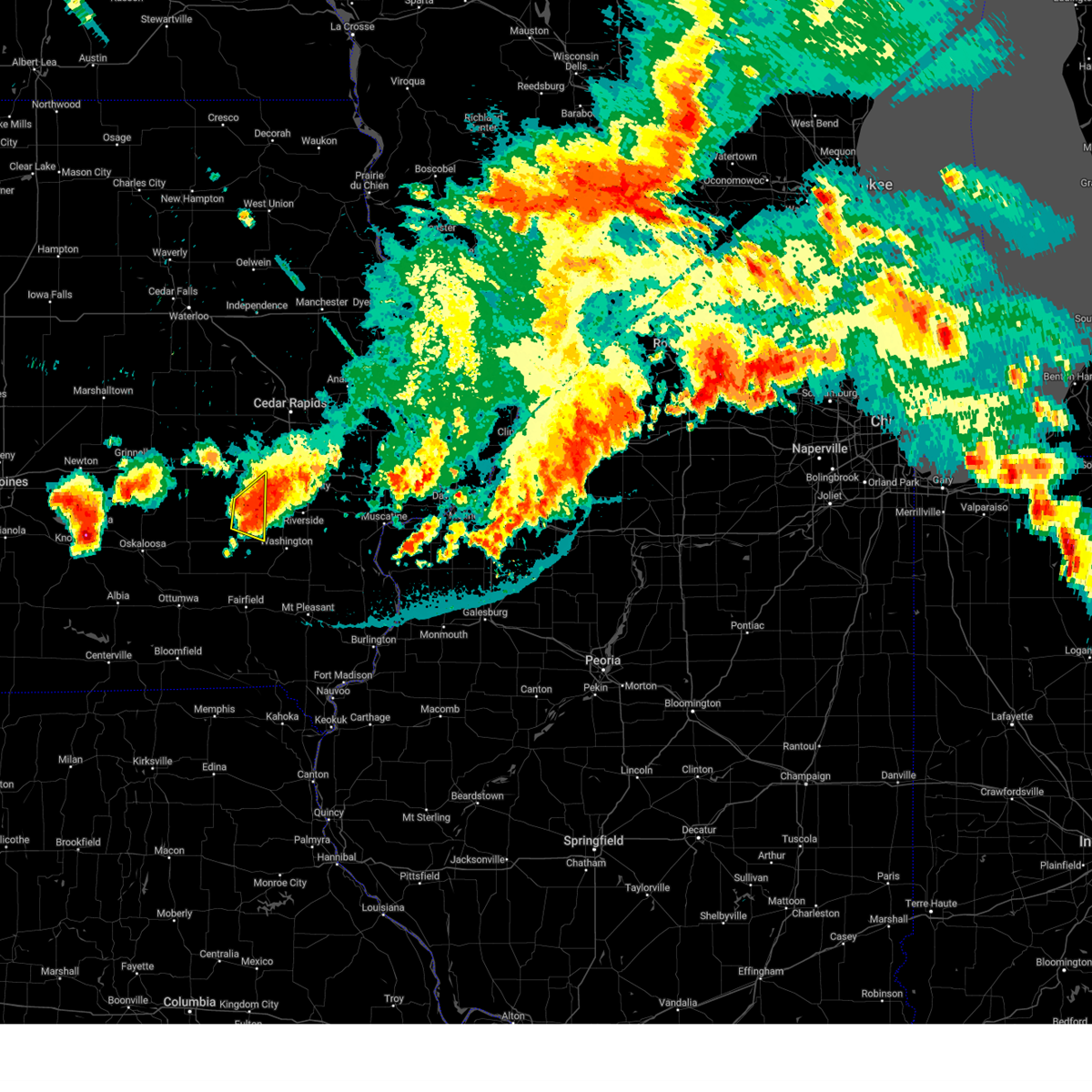 At 958 pm cdt, a severe thunderstorm was located over wellman, or 14 miles northwest of washington, moving east at 30 mph. this storm produced 70 mph winds and nickel size hail in williamsburg. this storm recently has been gradually weakening (emergency management). Hazards include 60 mph wind gusts and quarter size hail. Hail damage to vehicles is expected. expect wind damage to roofs, siding, and trees. locations impacted include, wellman, kinross, keota and holbrook. hail threat, radar indicated max hail size, 1. 00 in wind threat, radar indicated max wind gust, 60 mph. At 958 pm cdt, a severe thunderstorm was located over wellman, or 14 miles northwest of washington, moving east at 30 mph. this storm produced 70 mph winds and nickel size hail in williamsburg. this storm recently has been gradually weakening (emergency management). Hazards include 60 mph wind gusts and quarter size hail. Hail damage to vehicles is expected. expect wind damage to roofs, siding, and trees. locations impacted include, wellman, kinross, keota and holbrook. hail threat, radar indicated max hail size, 1. 00 in wind threat, radar indicated max wind gust, 60 mph.
|
| 7/28/2023 9:50 PM CDT |
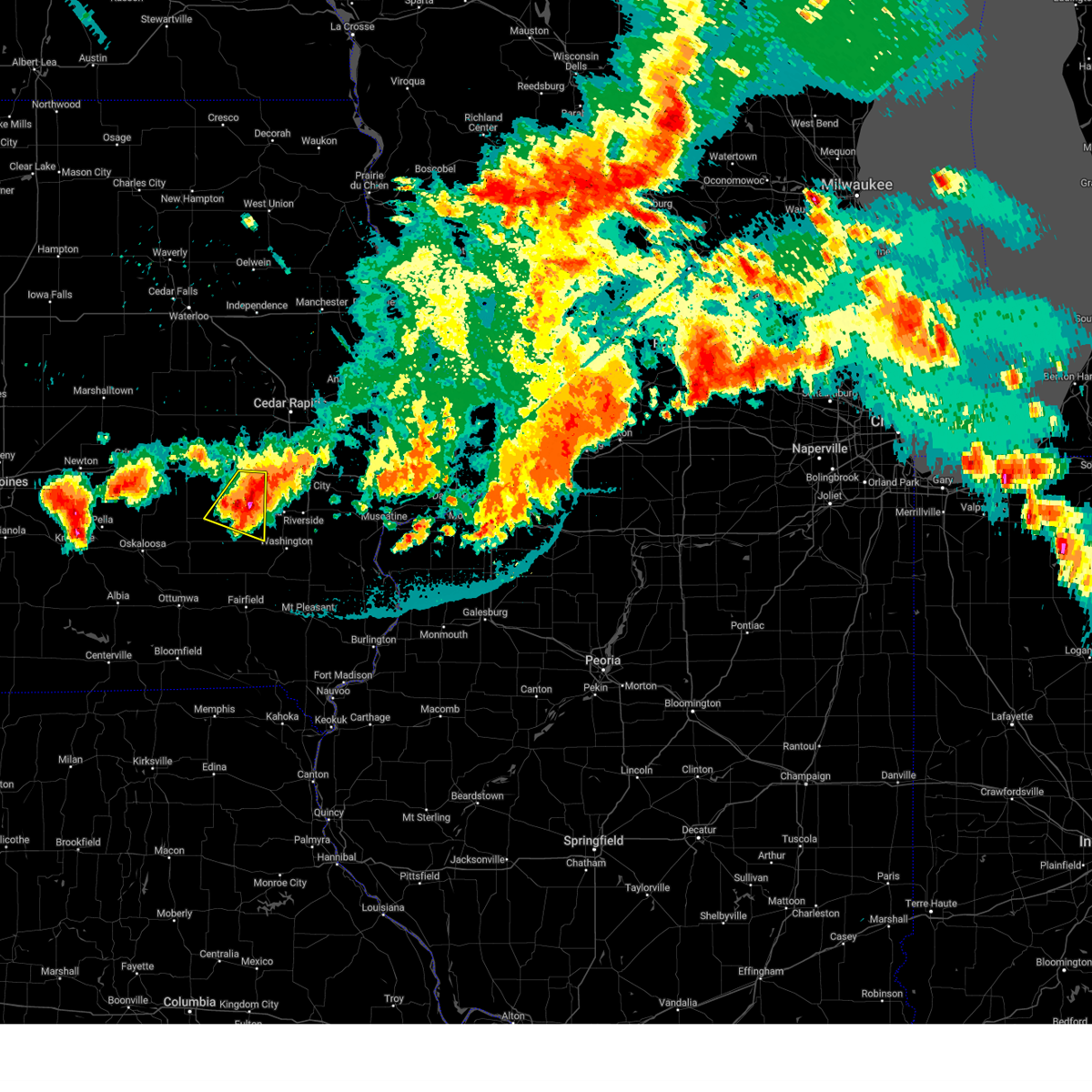 At 950 pm cdt, a severe thunderstorm was located near wellman, or 17 miles northwest of washington, moving east at 30 mph. emergency management reported 70 mph winds and nickel size hail near williamsburg (emergency management). Hazards include 70 mph wind gusts and quarter size hail. Hail damage to vehicles is expected. expect considerable tree damage. wind damage is also likely to mobile homes, roofs, and outbuildings. locations impacted include, williamsburg, wellman, north english, keswick, south english, parnell, kinross, webster and holbrook. thunderstorm damage threat, considerable hail threat, radar indicated max hail size, 1. 00 in wind threat, radar indicated max wind gust, 70 mph. At 950 pm cdt, a severe thunderstorm was located near wellman, or 17 miles northwest of washington, moving east at 30 mph. emergency management reported 70 mph winds and nickel size hail near williamsburg (emergency management). Hazards include 70 mph wind gusts and quarter size hail. Hail damage to vehicles is expected. expect considerable tree damage. wind damage is also likely to mobile homes, roofs, and outbuildings. locations impacted include, williamsburg, wellman, north english, keswick, south english, parnell, kinross, webster and holbrook. thunderstorm damage threat, considerable hail threat, radar indicated max hail size, 1. 00 in wind threat, radar indicated max wind gust, 70 mph.
|
| 7/28/2023 9:41 PM CDT |
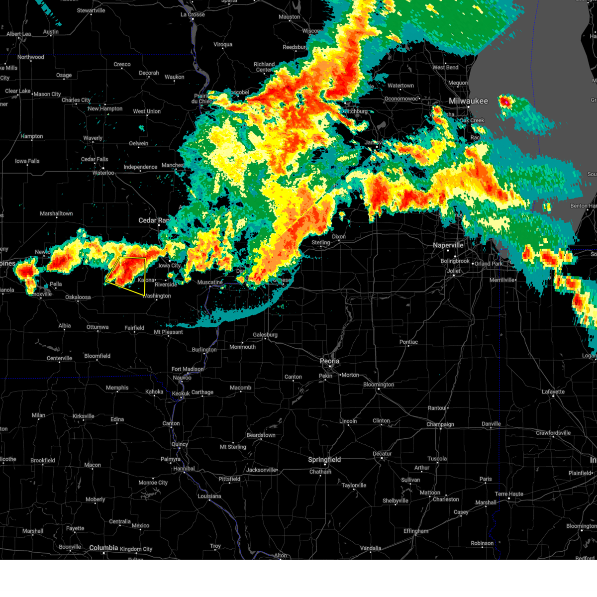 At 940 pm cdt, a severe thunderstorm was located near north english, or 16 miles northeast of sigourney, moving east at 35 mph (radar indicated). Hazards include 60 mph wind gusts and quarter size hail. Hail damage to vehicles is expected. expect wind damage to roofs, siding, and trees. locations impacted include, williamsburg, wellman, north english, keswick, south english, parnell, millersburg, kinross, webster, holbrook and lake iowa park. hail threat, radar indicated max hail size, 1. 00 in wind threat, radar indicated max wind gust, 60 mph. At 940 pm cdt, a severe thunderstorm was located near north english, or 16 miles northeast of sigourney, moving east at 35 mph (radar indicated). Hazards include 60 mph wind gusts and quarter size hail. Hail damage to vehicles is expected. expect wind damage to roofs, siding, and trees. locations impacted include, williamsburg, wellman, north english, keswick, south english, parnell, millersburg, kinross, webster, holbrook and lake iowa park. hail threat, radar indicated max hail size, 1. 00 in wind threat, radar indicated max wind gust, 60 mph.
|
| 7/28/2023 9:27 PM CDT |
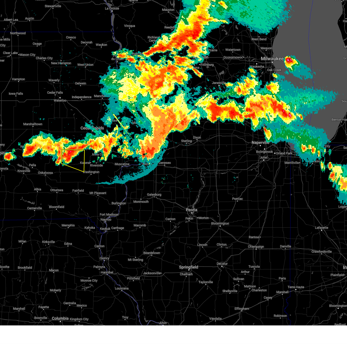 At 926 pm cdt, a severe thunderstorm was located over millersburg, or 15 miles south of marengo, moving east at 30 mph (radar indicated). Hazards include 60 mph wind gusts and quarter size hail. Hail damage to vehicles is expected. Expect wind damage to roofs, siding, and trees. At 926 pm cdt, a severe thunderstorm was located over millersburg, or 15 miles south of marengo, moving east at 30 mph (radar indicated). Hazards include 60 mph wind gusts and quarter size hail. Hail damage to vehicles is expected. Expect wind damage to roofs, siding, and trees.
|
| 7/28/2023 8:45 PM CDT |
 At 844 pm cdt, strong thunderstorm outflow winds were located along a line extending from near west liberty to webster, moving southeast at 55 mph (radar indicated). Hazards include 60 mph wind gusts. expect damage to roofs, siding, and trees At 844 pm cdt, strong thunderstorm outflow winds were located along a line extending from near west liberty to webster, moving southeast at 55 mph (radar indicated). Hazards include 60 mph wind gusts. expect damage to roofs, siding, and trees
|
| 7/12/2023 8:57 AM CDT |
 The severe thunderstorm warning for northeastern keokuk, western johnson, northwestern washington, southwestern linn and southeastern iowa counties will expire at 900 am cdt, the storms which prompted the warning have moved out of the area. therefore, the warning will be allowed to expire. however heavy rain is still possible with these thunderstorms. a severe thunderstorm watch remains in effect until 1100 am cdt for southeastern and east central iowa. to report severe weather, contact your nearest law enforcement agency. they will relay your report to the national weather service the quad cities. The severe thunderstorm warning for northeastern keokuk, western johnson, northwestern washington, southwestern linn and southeastern iowa counties will expire at 900 am cdt, the storms which prompted the warning have moved out of the area. therefore, the warning will be allowed to expire. however heavy rain is still possible with these thunderstorms. a severe thunderstorm watch remains in effect until 1100 am cdt for southeastern and east central iowa. to report severe weather, contact your nearest law enforcement agency. they will relay your report to the national weather service the quad cities.
|
| 7/12/2023 8:53 AM CDT |
 At 853 am cdt, severe thunderstorms were located along a line extending from near palisades-kepler state park to near iowa city to near richmond, moving east at 45 mph (radar indicated). Hazards include 60 mph wind gusts. Expect damage to roofs, siding, and trees. locations impacted include, cedar rapids, iowa city, coralville, north liberty, kalona, tiffin, ely, wellman, swisher, oxford, shueyville, kinross, oakdale, richmond, frytown, windham, sugar bottom camp ground, f. w. kent park, cou falls and cosgrove. hail threat, radar indicated max hail size, <. 75 in wind threat, radar indicated max wind gust, 60 mph. At 853 am cdt, severe thunderstorms were located along a line extending from near palisades-kepler state park to near iowa city to near richmond, moving east at 45 mph (radar indicated). Hazards include 60 mph wind gusts. Expect damage to roofs, siding, and trees. locations impacted include, cedar rapids, iowa city, coralville, north liberty, kalona, tiffin, ely, wellman, swisher, oxford, shueyville, kinross, oakdale, richmond, frytown, windham, sugar bottom camp ground, f. w. kent park, cou falls and cosgrove. hail threat, radar indicated max hail size, <. 75 in wind threat, radar indicated max wind gust, 60 mph.
|
| 7/12/2023 8:45 AM CDT |
 At 844 am cdt, severe thunderstorms were located along a line extending from near cedar rapids municipal airport to near tiffin to near wellman, moving east at 50 mph (radar indicated). Hazards include 60 mph wind gusts. Expect damage to roofs, siding, and trees. locations impacted include, cedar rapids, iowa city, coralville, north liberty, kalona, tiffin, ely, wellman, riverside, swisher, oxford, shueyville, south english, kinross, oakdale, lake macbride state park, richmond, frytown, windham and sugar bottom camp ground. hail threat, radar indicated max hail size, <. 75 in wind threat, radar indicated max wind gust, 60 mph. At 844 am cdt, severe thunderstorms were located along a line extending from near cedar rapids municipal airport to near tiffin to near wellman, moving east at 50 mph (radar indicated). Hazards include 60 mph wind gusts. Expect damage to roofs, siding, and trees. locations impacted include, cedar rapids, iowa city, coralville, north liberty, kalona, tiffin, ely, wellman, riverside, swisher, oxford, shueyville, south english, kinross, oakdale, lake macbride state park, richmond, frytown, windham and sugar bottom camp ground. hail threat, radar indicated max hail size, <. 75 in wind threat, radar indicated max wind gust, 60 mph.
|
| 7/12/2023 8:39 AM CDT |
 At 839 am cdt, severe thunderstorms were located along a line extending from cedar rapids municipal airport to near cosgrove to near wellman, moving east at 50 mph (radar indicated). Hazards include 60 mph wind gusts. Expect damage to roofs, siding, and trees. locations impacted include, cedar rapids, iowa city, coralville, north liberty, williamsburg, kalona, fairfax, tiffin, ely, walford, wellman, north english, riverside, swisher, oxford, what cheer, shueyville, norway, keswick and south english. hail threat, radar indicated max hail size, <. 75 in wind threat, radar indicated max wind gust, 60 mph. At 839 am cdt, severe thunderstorms were located along a line extending from cedar rapids municipal airport to near cosgrove to near wellman, moving east at 50 mph (radar indicated). Hazards include 60 mph wind gusts. Expect damage to roofs, siding, and trees. locations impacted include, cedar rapids, iowa city, coralville, north liberty, williamsburg, kalona, fairfax, tiffin, ely, walford, wellman, north english, riverside, swisher, oxford, what cheer, shueyville, norway, keswick and south english. hail threat, radar indicated max hail size, <. 75 in wind threat, radar indicated max wind gust, 60 mph.
|
| 7/12/2023 8:33 AM CDT |
 At 833 am cdt, severe thunderstorms were located along a line extending from near walford to cosgrove to near wellman, moving east at 50 mph (radar indicated). Hazards include 60 mph wind gusts. Expect damage to roofs, siding, and trees. locations impacted include, cedar rapids, iowa city, coralville, north liberty, williamsburg, kalona, fairfax, tiffin, ely, walford, wellman, north english, riverside, swisher, oxford, what cheer, shueyville, norway, keswick and south english. hail threat, radar indicated max hail size, <. 75 in wind threat, radar indicated max wind gust, 60 mph. At 833 am cdt, severe thunderstorms were located along a line extending from near walford to cosgrove to near wellman, moving east at 50 mph (radar indicated). Hazards include 60 mph wind gusts. Expect damage to roofs, siding, and trees. locations impacted include, cedar rapids, iowa city, coralville, north liberty, williamsburg, kalona, fairfax, tiffin, ely, walford, wellman, north english, riverside, swisher, oxford, what cheer, shueyville, norway, keswick and south english. hail threat, radar indicated max hail size, <. 75 in wind threat, radar indicated max wind gust, 60 mph.
|
| 7/12/2023 8:25 AM CDT |
 At 825 am cdt, severe thunderstorms were located along a line extending from near norway to near holbrook to near kinross, moving east at 50 mph (radar indicated). Hazards include 60 mph wind gusts. Expect damage to roofs, siding, and trees. locations impacted include, cedar rapids, iowa city, marengo, coralville, north liberty, williamsburg, kalona, fairfax, tiffin, ely, walford, wellman, north english, riverside, swisher, oxford, blairstown, what cheer, shueyville and norway. hail threat, radar indicated max hail size, <. 75 in wind threat, radar indicated max wind gust, 60 mph. At 825 am cdt, severe thunderstorms were located along a line extending from near norway to near holbrook to near kinross, moving east at 50 mph (radar indicated). Hazards include 60 mph wind gusts. Expect damage to roofs, siding, and trees. locations impacted include, cedar rapids, iowa city, marengo, coralville, north liberty, williamsburg, kalona, fairfax, tiffin, ely, walford, wellman, north english, riverside, swisher, oxford, blairstown, what cheer, shueyville and norway. hail threat, radar indicated max hail size, <. 75 in wind threat, radar indicated max wind gust, 60 mph.
|
| 7/12/2023 8:17 AM CDT |
 At 817 am cdt, severe thunderstorms were located along a line extending from hannen lake park to near williamsburg to webster, moving east at 50 mph (radar indicated). Hazards include 60 mph wind gusts. Expect damage to roofs, siding, and trees. locations impacted include, cedar rapids, iowa city, marengo, coralville, north liberty, williamsburg, belle plaine, kalona, fairfax, tiffin, ely, walford, wellman, north english, riverside, victor, swisher, oxford, blairstown and what cheer. hail threat, radar indicated max hail size, <. 75 in wind threat, radar indicated max wind gust, 60 mph. At 817 am cdt, severe thunderstorms were located along a line extending from hannen lake park to near williamsburg to webster, moving east at 50 mph (radar indicated). Hazards include 60 mph wind gusts. Expect damage to roofs, siding, and trees. locations impacted include, cedar rapids, iowa city, marengo, coralville, north liberty, williamsburg, belle plaine, kalona, fairfax, tiffin, ely, walford, wellman, north english, riverside, victor, swisher, oxford, blairstown and what cheer. hail threat, radar indicated max hail size, <. 75 in wind threat, radar indicated max wind gust, 60 mph.
|
| 7/12/2023 8:05 AM CDT |
 At 805 am cdt, severe thunderstorms were located along a line extending from koszta to near keswick, moving east at 40 mph (radar indicated). Hazards include 60 mph wind gusts. expect damage to roofs, siding, and trees At 805 am cdt, severe thunderstorms were located along a line extending from koszta to near keswick, moving east at 40 mph (radar indicated). Hazards include 60 mph wind gusts. expect damage to roofs, siding, and trees
|
| 5/7/2023 5:24 PM CDT |
 At 524 pm cdt, severe thunderstorms were located along a line extending from near genoa bluff to millersburg to near keswick, moving east at 35 mph (radar indicated). Hazards include 60 mph wind gusts and quarter size hail. Hail damage to vehicles is expected. expect wind damage to roofs, siding, and trees. locations impacted include, sigourney, williamsburg, wellman, north english, victor, brighton, what cheer, delta, keswick, south english, parnell, millersburg, harper, kinross, keota, west chester, webster, thornburg, gibson and keokuk county fairgrounds. hail threat, radar indicated max hail size, 1. 00 in wind threat, radar indicated max wind gust, 60 mph. At 524 pm cdt, severe thunderstorms were located along a line extending from near genoa bluff to millersburg to near keswick, moving east at 35 mph (radar indicated). Hazards include 60 mph wind gusts and quarter size hail. Hail damage to vehicles is expected. expect wind damage to roofs, siding, and trees. locations impacted include, sigourney, williamsburg, wellman, north english, victor, brighton, what cheer, delta, keswick, south english, parnell, millersburg, harper, kinross, keota, west chester, webster, thornburg, gibson and keokuk county fairgrounds. hail threat, radar indicated max hail size, 1. 00 in wind threat, radar indicated max wind gust, 60 mph.
|
| 5/7/2023 5:10 PM CDT |
 At 510 pm cdt, severe thunderstorms were located along a line extending from near guernsey to near deep river to coal creek, moving southeast at 55 mph (radar indicated). Hazards include 70 mph wind gusts and half dollar size hail. Hail damage to vehicles is expected. expect considerable tree damage. wind damage is also likely to mobile homes, roofs, and outbuildings. locations impacted include, delta, keswick, millersburg, lake iowa park, genoa bluff, sigourney, north english, south english, webster, yenruogis county park, keokuk county expo, lake belva deer park, williamsburg, parnell, harper, kinross, lancaster, keota, holbrook, wellman, talleyrand, rubio, west chester and brighton. thunderstorm damage threat, considerable hail threat, radar indicated max hail size, 1. 25 in wind threat, radar indicated max wind gust, 70 mph. At 510 pm cdt, severe thunderstorms were located along a line extending from near guernsey to near deep river to coal creek, moving southeast at 55 mph (radar indicated). Hazards include 70 mph wind gusts and half dollar size hail. Hail damage to vehicles is expected. expect considerable tree damage. wind damage is also likely to mobile homes, roofs, and outbuildings. locations impacted include, delta, keswick, millersburg, lake iowa park, genoa bluff, sigourney, north english, south english, webster, yenruogis county park, keokuk county expo, lake belva deer park, williamsburg, parnell, harper, kinross, lancaster, keota, holbrook, wellman, talleyrand, rubio, west chester and brighton. thunderstorm damage threat, considerable hail threat, radar indicated max hail size, 1. 25 in wind threat, radar indicated max wind gust, 70 mph.
|
| 5/7/2023 4:57 PM CDT |
 At 457 pm cdt, severe thunderstorms were located along a line extending from near malcom to near barnes city, moving southeast at 55 mph (radar indicated). Hazards include ping pong ball size hail and 60 mph wind gusts. People and animals outdoors will be injured. expect hail damage to roofs, siding, windows, and vehicles. expect wind damage to roofs, siding, and trees. severe thunderstorms will be near, gibson and coal creek around 505 pm cdt. victor, what cheer, victor, thornburg and keokuk county fairgrounds around 510 pm cdt. delta and keswick around 515 pm cdt. other locations in the path of these severe thunderstorms include sigourney, south english, webster, yenruogis county park, lake iowa park, keokuk county expo, lake belva deer park, genoa bluff, millersburg, harper, lancaster, north english, parnell, keota, kinross, talleyrand, holbrook, west chester and rubio. hail threat, radar indicated max hail size, 1. 50 in wind threat, radar indicated max wind gust, 60 mph. At 457 pm cdt, severe thunderstorms were located along a line extending from near malcom to near barnes city, moving southeast at 55 mph (radar indicated). Hazards include ping pong ball size hail and 60 mph wind gusts. People and animals outdoors will be injured. expect hail damage to roofs, siding, windows, and vehicles. expect wind damage to roofs, siding, and trees. severe thunderstorms will be near, gibson and coal creek around 505 pm cdt. victor, what cheer, victor, thornburg and keokuk county fairgrounds around 510 pm cdt. delta and keswick around 515 pm cdt. other locations in the path of these severe thunderstorms include sigourney, south english, webster, yenruogis county park, lake iowa park, keokuk county expo, lake belva deer park, genoa bluff, millersburg, harper, lancaster, north english, parnell, keota, kinross, talleyrand, holbrook, west chester and rubio. hail threat, radar indicated max hail size, 1. 50 in wind threat, radar indicated max wind gust, 60 mph.
|
| 5/6/2023 11:27 PM CDT |
 The severe thunderstorm warning for northeastern keokuk, southern johnson, northern washington and southeastern iowa counties will expire at 1130 pm cdt, the storm which prompted the warning has weakened below severe limits, and no longer poses an immediate threat to life or property. therefore, the warning will be allowed to expire. however small hail is still possible with this thunderstorm. The severe thunderstorm warning for northeastern keokuk, southern johnson, northern washington and southeastern iowa counties will expire at 1130 pm cdt, the storm which prompted the warning has weakened below severe limits, and no longer poses an immediate threat to life or property. therefore, the warning will be allowed to expire. however small hail is still possible with this thunderstorm.
|
| 5/6/2023 11:07 PM CDT |
 At 1107 pm cdt, a severe thunderstorm was located over amish, or 14 miles north of washington, moving east at 30 mph (radar indicated). Hazards include quarter size hail. Damage to vehicles is expected. this severe storm will be near, kalona, richmond and frytown around 1110 pm cdt. sharon center around 1120 pm cdt. other locations in the path of this severe thunderstorm include riverside, hills, johnson county fairgrounds, iowa city municipal airport, hills access, river junction and lone tree. hail threat, radar indicated max hail size, 1. 00 in wind threat, radar indicated max wind gust, <50 mph. At 1107 pm cdt, a severe thunderstorm was located over amish, or 14 miles north of washington, moving east at 30 mph (radar indicated). Hazards include quarter size hail. Damage to vehicles is expected. this severe storm will be near, kalona, richmond and frytown around 1110 pm cdt. sharon center around 1120 pm cdt. other locations in the path of this severe thunderstorm include riverside, hills, johnson county fairgrounds, iowa city municipal airport, hills access, river junction and lone tree. hail threat, radar indicated max hail size, 1. 00 in wind threat, radar indicated max wind gust, <50 mph.
|
| 5/6/2023 11:01 PM CDT |
 At 1101 pm cdt, a severe thunderstorm was located over wellman, or 15 miles northwest of washington, moving east at 30 mph (radar indicated). Hazards include quarter size hail. Damage to vehicles is expected. this severe storm will be near, amish around 1105 pm cdt. kalona, richmond, frytown and windham around 1110 pm cdt. other locations in the path of this severe thunderstorm include sharon center, university heights, riverside, iowa city municipal airport, hills, hills access, river junction, johnson county fairgrounds, university of iowa and lone tree. hail threat, radar indicated max hail size, 1. 00 in wind threat, radar indicated max wind gust, <50 mph. At 1101 pm cdt, a severe thunderstorm was located over wellman, or 15 miles northwest of washington, moving east at 30 mph (radar indicated). Hazards include quarter size hail. Damage to vehicles is expected. this severe storm will be near, amish around 1105 pm cdt. kalona, richmond, frytown and windham around 1110 pm cdt. other locations in the path of this severe thunderstorm include sharon center, university heights, riverside, iowa city municipal airport, hills, hills access, river junction, johnson county fairgrounds, university of iowa and lone tree. hail threat, radar indicated max hail size, 1. 00 in wind threat, radar indicated max wind gust, <50 mph.
|
| 5/6/2023 10:52 PM CDT |
 At 1052 pm cdt, a severe thunderstorm was located near wellman, or 17 miles northwest of washington, moving east at 30 mph (radar indicated). Hazards include quarter size hail. Damage to vehicles is expected. this severe thunderstorm will be near, wellman around 1100 pm cdt. amish around 1105 pm cdt. kalona, richmond, frytown and windham around 1110 pm cdt. other locations in the path of this severe thunderstorm include sharon center, lone tree, riverside, hills, hills access, river junction, johnson county fairgrounds and iowa city municipal airport. hail threat, radar indicated max hail size, 1. 00 in wind threat, radar indicated max wind gust, <50 mph. At 1052 pm cdt, a severe thunderstorm was located near wellman, or 17 miles northwest of washington, moving east at 30 mph (radar indicated). Hazards include quarter size hail. Damage to vehicles is expected. this severe thunderstorm will be near, wellman around 1100 pm cdt. amish around 1105 pm cdt. kalona, richmond, frytown and windham around 1110 pm cdt. other locations in the path of this severe thunderstorm include sharon center, lone tree, riverside, hills, hills access, river junction, johnson county fairgrounds and iowa city municipal airport. hail threat, radar indicated max hail size, 1. 00 in wind threat, radar indicated max wind gust, <50 mph.
|
| 4/4/2023 7:50 AM CDT |
 At 750 am cdt, a severe thunderstorm was located over talleyrand, or 12 miles west of washington, moving northeast at 50 mph (radar indicated). Hazards include quarter size hail. Damage to vehicles is expected. this severe storm will be near, washington county fairgrounds around 755 am cdt. other locations in the path of this severe thunderstorm include west chester, wellman, richmond, kalona and amish. hail threat, radar indicated max hail size, 1. 00 in wind threat, radar indicated max wind gust, <50 mph. At 750 am cdt, a severe thunderstorm was located over talleyrand, or 12 miles west of washington, moving northeast at 50 mph (radar indicated). Hazards include quarter size hail. Damage to vehicles is expected. this severe storm will be near, washington county fairgrounds around 755 am cdt. other locations in the path of this severe thunderstorm include west chester, wellman, richmond, kalona and amish. hail threat, radar indicated max hail size, 1. 00 in wind threat, radar indicated max wind gust, <50 mph.
|
| 4/4/2023 7:38 AM CDT |
 At 738 am cdt, a severe thunderstorm was located over ollie, or 12 miles north of fairfield, moving northeast at 50 mph (radar indicated). Hazards include quarter size hail. Damage to vehicles is expected. this severe thunderstorm will be near, rubio and lake darling state park around 745 am cdt. talleyrand around 750 am cdt. keota and washington county fairgrounds around 755 am cdt. other locations in the path of this severe thunderstorm include west chester, wellman, richmond, amish and kalona. hail threat, radar indicated max hail size, 1. 00 in wind threat, radar indicated max wind gust, <50 mph. At 738 am cdt, a severe thunderstorm was located over ollie, or 12 miles north of fairfield, moving northeast at 50 mph (radar indicated). Hazards include quarter size hail. Damage to vehicles is expected. this severe thunderstorm will be near, rubio and lake darling state park around 745 am cdt. talleyrand around 750 am cdt. keota and washington county fairgrounds around 755 am cdt. other locations in the path of this severe thunderstorm include west chester, wellman, richmond, amish and kalona. hail threat, radar indicated max hail size, 1. 00 in wind threat, radar indicated max wind gust, <50 mph.
|
| 7/11/2022 6:43 AM CDT |
 The severe thunderstorm warning for johnson, eastern benton, northern washington, western linn and eastern iowa counties will expire at 645 am cdt, the storms which prompted the warning have moved out of the area. therefore, the warning will be allowed to expire. however gusty winds and heavy rain are still possible with these thunderstorms. a severe thunderstorm watch remains in effect until 1100 am cdt for east central iowa. The severe thunderstorm warning for johnson, eastern benton, northern washington, western linn and eastern iowa counties will expire at 645 am cdt, the storms which prompted the warning have moved out of the area. therefore, the warning will be allowed to expire. however gusty winds and heavy rain are still possible with these thunderstorms. a severe thunderstorm watch remains in effect until 1100 am cdt for east central iowa.
|
| 7/11/2022 6:23 AM CDT |
 At 623 am cdt, severe thunderstorms were located along a line extending from near shellsburg to lone tree, moving east at 45 mph (radar indicated). Hazards include 60 mph wind gusts. Expect damage to roofs, siding, and trees. locations impacted include, cedar rapids, iowa city, vinton, marengo, marion, coralville, north liberty, hiawatha, robins, williamsburg, center point, kalona, fairfax, solon, tiffin, ely, atkins, walford, urbana and wellman. hail threat, radar indicated max hail size, <. 75 in wind threat, radar indicated max wind gust, 60 mph. At 623 am cdt, severe thunderstorms were located along a line extending from near shellsburg to lone tree, moving east at 45 mph (radar indicated). Hazards include 60 mph wind gusts. Expect damage to roofs, siding, and trees. locations impacted include, cedar rapids, iowa city, vinton, marengo, marion, coralville, north liberty, hiawatha, robins, williamsburg, center point, kalona, fairfax, solon, tiffin, ely, atkins, walford, urbana and wellman. hail threat, radar indicated max hail size, <. 75 in wind threat, radar indicated max wind gust, 60 mph.
|
| 7/11/2022 6:10 AM CDT |
 At 610 am cdt, severe thunderstorms were located along a line extending from near benton county fairgrounds to near riverside, moving east at 40 mph (radar indicated). Hazards include 60 mph wind gusts. Expect damage to roofs, siding, and trees. locations impacted include, cedar rapids, iowa city, vinton, marengo, marion, coralville, north liberty, hiawatha, robins, williamsburg, belle plaine, center point, kalona, fairfax, solon, tiffin, ely, atkins, walford and urbana. hail threat, radar indicated max hail size, <. 75 in wind threat, radar indicated max wind gust, 60 mph. At 610 am cdt, severe thunderstorms were located along a line extending from near benton county fairgrounds to near riverside, moving east at 40 mph (radar indicated). Hazards include 60 mph wind gusts. Expect damage to roofs, siding, and trees. locations impacted include, cedar rapids, iowa city, vinton, marengo, marion, coralville, north liberty, hiawatha, robins, williamsburg, belle plaine, center point, kalona, fairfax, solon, tiffin, ely, atkins, walford and urbana. hail threat, radar indicated max hail size, <. 75 in wind threat, radar indicated max wind gust, 60 mph.
|
| 7/11/2022 6:03 AM CDT |
 At 603 am cdt, severe thunderstorms were located along a line extending from garrison to near riverside, moving east at 45 mph (radar indicated). Hazards include 60 mph wind gusts and quarter size hail. Hail damage to vehicles is expected. expect wind damage to roofs, siding, and trees. locations impacted include, cedar rapids, iowa city, vinton, marengo, marion, coralville, north liberty, hiawatha, robins, williamsburg, belle plaine, center point, kalona, fairfax, solon, tiffin, ely, atkins, walford and urbana. hail threat, radar indicated max hail size, 1. 00 in wind threat, radar indicated max wind gust, 60 mph. At 603 am cdt, severe thunderstorms were located along a line extending from garrison to near riverside, moving east at 45 mph (radar indicated). Hazards include 60 mph wind gusts and quarter size hail. Hail damage to vehicles is expected. expect wind damage to roofs, siding, and trees. locations impacted include, cedar rapids, iowa city, vinton, marengo, marion, coralville, north liberty, hiawatha, robins, williamsburg, belle plaine, center point, kalona, fairfax, solon, tiffin, ely, atkins, walford and urbana. hail threat, radar indicated max hail size, 1. 00 in wind threat, radar indicated max wind gust, 60 mph.
|
| 7/11/2022 5:51 AM CDT |
 At 551 am cdt, severe thunderstorms were located along a line extending from near dysart to amish, moving east at 45 mph (radar indicated). Hazards include 60 mph wind gusts and quarter size hail. Hail damage to vehicles is expected. expect wind damage to roofs, siding, and trees. locations impacted include, cedar rapids, iowa city, vinton, marengo, marion, coralville, north liberty, hiawatha, robins, williamsburg, belle plaine, center point, kalona, fairfax, solon, tiffin, ely, atkins, walford and urbana. hail threat, radar indicated max hail size, 1. 00 in wind threat, radar indicated max wind gust, 60 mph. At 551 am cdt, severe thunderstorms were located along a line extending from near dysart to amish, moving east at 45 mph (radar indicated). Hazards include 60 mph wind gusts and quarter size hail. Hail damage to vehicles is expected. expect wind damage to roofs, siding, and trees. locations impacted include, cedar rapids, iowa city, vinton, marengo, marion, coralville, north liberty, hiawatha, robins, williamsburg, belle plaine, center point, kalona, fairfax, solon, tiffin, ely, atkins, walford and urbana. hail threat, radar indicated max hail size, 1. 00 in wind threat, radar indicated max wind gust, 60 mph.
|
| 7/11/2022 5:43 AM CDT |
 At 543 am cdt, severe thunderstorms were located along a line extending from near clutier to near holbrook, moving east at 45 mph (radar indicated). Hazards include 60 mph wind gusts and quarter size hail. Hail damage to vehicles is expected. Expect wind damage to roofs, siding, and trees. At 543 am cdt, severe thunderstorms were located along a line extending from near clutier to near holbrook, moving east at 45 mph (radar indicated). Hazards include 60 mph wind gusts and quarter size hail. Hail damage to vehicles is expected. Expect wind damage to roofs, siding, and trees.
|
| 6/21/2022 7:21 PM CDT |
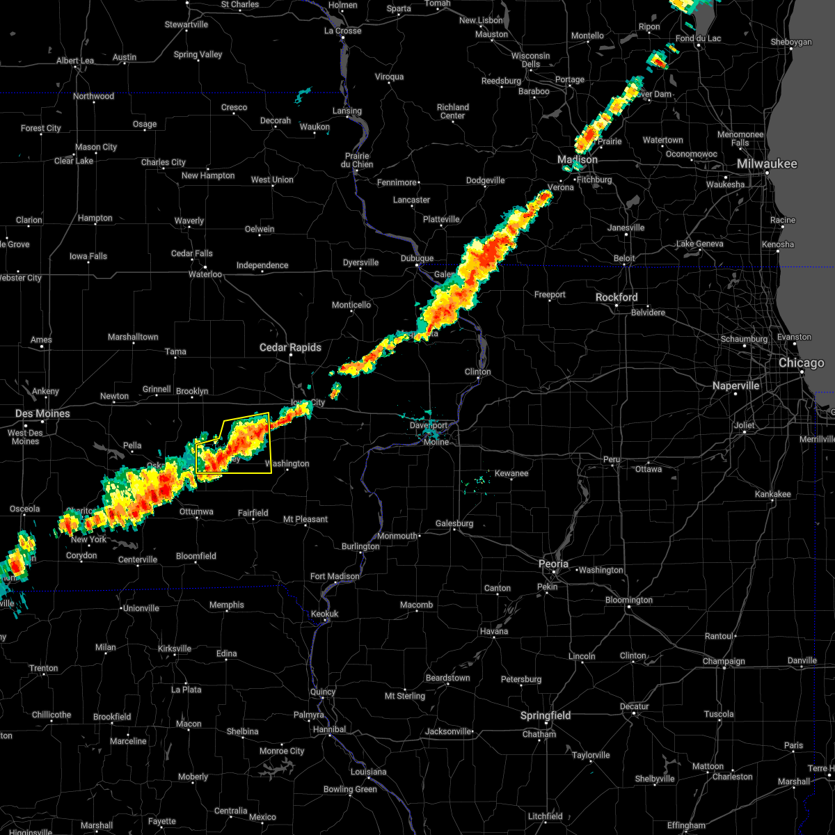 The severe thunderstorm warning for keokuk, northwestern washington and southeastern iowa counties will expire at 730 pm cdt, the storm which prompted the warning has weakened below severe limits, and no longer poses an immediate threat to life or property. therefore, the warning will be allowed to expire. however gusty winds and heavy rain are still possible with this thunderstorm. The severe thunderstorm warning for keokuk, northwestern washington and southeastern iowa counties will expire at 730 pm cdt, the storm which prompted the warning has weakened below severe limits, and no longer poses an immediate threat to life or property. therefore, the warning will be allowed to expire. however gusty winds and heavy rain are still possible with this thunderstorm.
|
| 6/21/2022 7:15 PM CDT |
 At 715 pm cdt, a severe thunderstorm was located over lake belva deer park, or over sigourney, moving east at 30 mph (radar indicated). Hazards include 60 mph wind gusts. Expect damage to roofs, siding, and trees. this severe storm will be near, south english around 720 pm cdt. harper around 725 pm cdt. other locations in the path of this severe thunderstorm include kinross, keota, talleyrand and wellman. hail threat, radar indicated max hail size, <. 75 in wind threat, radar indicated max wind gust, 60 mph. At 715 pm cdt, a severe thunderstorm was located over lake belva deer park, or over sigourney, moving east at 30 mph (radar indicated). Hazards include 60 mph wind gusts. Expect damage to roofs, siding, and trees. this severe storm will be near, south english around 720 pm cdt. harper around 725 pm cdt. other locations in the path of this severe thunderstorm include kinross, keota, talleyrand and wellman. hail threat, radar indicated max hail size, <. 75 in wind threat, radar indicated max wind gust, 60 mph.
|
| 6/21/2022 7:09 PM CDT |
 At 709 pm cdt, a severe thunderstorm was located over kinross, or 13 miles northeast of sigourney, moving east at 35 mph (radar indicated). Hazards include 60 mph wind gusts. Expect damage to roofs, siding, and trees. this severe storm will be near, holbrook around 715 pm cdt. wellman around 725 pm cdt. hail threat, radar indicated max hail size, <. 75 in wind threat, radar indicated max wind gust, 60 mph. At 709 pm cdt, a severe thunderstorm was located over kinross, or 13 miles northeast of sigourney, moving east at 35 mph (radar indicated). Hazards include 60 mph wind gusts. Expect damage to roofs, siding, and trees. this severe storm will be near, holbrook around 715 pm cdt. wellman around 725 pm cdt. hail threat, radar indicated max hail size, <. 75 in wind threat, radar indicated max wind gust, 60 mph.
|
| 6/21/2022 7:05 PM CDT |
 At 705 pm cdt, a severe thunderstorm was located over south english, or 12 miles northeast of sigourney, moving east at 35 mph (radar indicated). Hazards include 60 mph wind gusts. Expect damage to roofs, siding, and trees. this severe storm will be near, kinross and keota around 710 pm cdt. holbrook around 715 pm cdt. other locations in the path of this severe thunderstorm include wellman. hail threat, radar indicated max hail size, <. 75 in wind threat, radar indicated max wind gust, 60 mph. At 705 pm cdt, a severe thunderstorm was located over south english, or 12 miles northeast of sigourney, moving east at 35 mph (radar indicated). Hazards include 60 mph wind gusts. Expect damage to roofs, siding, and trees. this severe storm will be near, kinross and keota around 710 pm cdt. holbrook around 715 pm cdt. other locations in the path of this severe thunderstorm include wellman. hail threat, radar indicated max hail size, <. 75 in wind threat, radar indicated max wind gust, 60 mph.
|
| 6/21/2022 6:56 PM CDT |
 At 655 pm cdt, a severe thunderstorm was located over webster, or 9 miles north of sigourney, moving east at 35 mph (radar indicated). Hazards include 60 mph wind gusts. Expect damage to roofs, siding, and trees. this severe storm will be near, south english around 700 pm cdt. north english and harper around 705 pm cdt. parnell, kinross and keota around 710 pm cdt. other locations in the path of this severe thunderstorm include holbrook and wellman. hail threat, radar indicated max hail size, <. 75 in wind threat, radar indicated max wind gust, 60 mph. At 655 pm cdt, a severe thunderstorm was located over webster, or 9 miles north of sigourney, moving east at 35 mph (radar indicated). Hazards include 60 mph wind gusts. Expect damage to roofs, siding, and trees. this severe storm will be near, south english around 700 pm cdt. north english and harper around 705 pm cdt. parnell, kinross and keota around 710 pm cdt. other locations in the path of this severe thunderstorm include holbrook and wellman. hail threat, radar indicated max hail size, <. 75 in wind threat, radar indicated max wind gust, 60 mph.
|
| 6/21/2022 6:51 PM CDT |
 At 651 pm cdt, a severe thunderstorm was located over keswick, or 9 miles north of sigourney, moving east at 35 mph (radar indicated). Hazards include 60 mph wind gusts. Expect damage to roofs, siding, and trees. this severe storm will be near, millersburg, webster and lake belva deer park around 655 pm cdt. south english around 700 pm cdt. north english and harper around 705 pm cdt. other locations in the path of this severe thunderstorm include parnell, kinross, keota, holbrook and wellman. hail threat, radar indicated max hail size, <. 75 in wind threat, radar indicated max wind gust, 60 mph. At 651 pm cdt, a severe thunderstorm was located over keswick, or 9 miles north of sigourney, moving east at 35 mph (radar indicated). Hazards include 60 mph wind gusts. Expect damage to roofs, siding, and trees. this severe storm will be near, millersburg, webster and lake belva deer park around 655 pm cdt. south english around 700 pm cdt. north english and harper around 705 pm cdt. other locations in the path of this severe thunderstorm include parnell, kinross, keota, holbrook and wellman. hail threat, radar indicated max hail size, <. 75 in wind threat, radar indicated max wind gust, 60 mph.
|
| 6/21/2022 6:46 PM CDT |
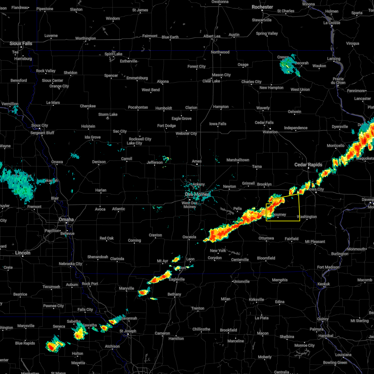 At 646 pm cdt, a severe thunderstorm was located over keswick, or 9 miles north of sigourney, moving east at 40 mph (radar indicated). Hazards include 60 mph wind gusts. Expect damage to roofs, siding, and trees. this severe thunderstorm will be near, sigourney and yenruogis county park around 650 pm cdt. millersburg, webster and lake belva deer park around 655 pm cdt. north english and south english around 700 pm cdt. harper around 705 pm cdt. other locations in the path of this severe thunderstorm include kinross, keota and wellman. hail threat, radar indicated max hail size, <. 75 in wind threat, radar indicated max wind gust, 60 mph. At 646 pm cdt, a severe thunderstorm was located over keswick, or 9 miles north of sigourney, moving east at 40 mph (radar indicated). Hazards include 60 mph wind gusts. Expect damage to roofs, siding, and trees. this severe thunderstorm will be near, sigourney and yenruogis county park around 650 pm cdt. millersburg, webster and lake belva deer park around 655 pm cdt. north english and south english around 700 pm cdt. harper around 705 pm cdt. other locations in the path of this severe thunderstorm include kinross, keota and wellman. hail threat, radar indicated max hail size, <. 75 in wind threat, radar indicated max wind gust, 60 mph.
|
| 3/5/2022 7:56 PM CST |
 At 755 pm cst, severe thunderstorms were located along a line extending from near north liberty to near wellman, moving east at 50 mph (radar indicated). Hazards include 60 mph wind gusts. Expect damage to roofs, siding, and trees. these severe storms will be near, iowa city, north liberty, solon, lake macbride state park and oakdale around 800 pm cst. Other locations in the path of these severe thunderstorms include riverside and lone tree. At 755 pm cst, severe thunderstorms were located along a line extending from near north liberty to near wellman, moving east at 50 mph (radar indicated). Hazards include 60 mph wind gusts. Expect damage to roofs, siding, and trees. these severe storms will be near, iowa city, north liberty, solon, lake macbride state park and oakdale around 800 pm cst. Other locations in the path of these severe thunderstorms include riverside and lone tree.
|
| 3/5/2022 7:49 PM CST |
 At 749 pm cst, severe thunderstorms were located along a line extending from north liberty to near kinross, moving east at 50 mph (radar indicated). Hazards include 60 mph wind gusts. Expect damage to roofs, siding, and trees. these severe storms will be near, iowa city, coralville, north liberty, tiffin, university heights, lake macbride state park and oakdale around 755 pm cst. solon around 800 pm cst. other locations in the path of these severe thunderstorms include kalona, richmond, riverside and lone tree. hail threat, radar indicated max hail size, <. 75 in wind threat, radar indicated max wind gust, 60 mph. At 749 pm cst, severe thunderstorms were located along a line extending from north liberty to near kinross, moving east at 50 mph (radar indicated). Hazards include 60 mph wind gusts. Expect damage to roofs, siding, and trees. these severe storms will be near, iowa city, coralville, north liberty, tiffin, university heights, lake macbride state park and oakdale around 755 pm cst. solon around 800 pm cst. other locations in the path of these severe thunderstorms include kalona, richmond, riverside and lone tree. hail threat, radar indicated max hail size, <. 75 in wind threat, radar indicated max wind gust, 60 mph.
|
| 3/5/2022 7:43 PM CST |
 At 743 pm cst, severe thunderstorms were located along a line extending from near tiffin to near harper, moving east at 50 mph (radar indicated). Hazards include 60 mph wind gusts. Expect damage to roofs, siding, and trees. severe thunderstorms will be near, coralville, north liberty, tiffin, university heights and oakdale around 750 pm cst. iowa city, solon and lake macbride state park around 755 pm cst. other locations in the path of these severe thunderstorms include kalona, richmond, riverside and lone tree. hail threat, radar indicated max hail size, <. 75 in wind threat, radar indicated max wind gust, 60 mph. At 743 pm cst, severe thunderstorms were located along a line extending from near tiffin to near harper, moving east at 50 mph (radar indicated). Hazards include 60 mph wind gusts. Expect damage to roofs, siding, and trees. severe thunderstorms will be near, coralville, north liberty, tiffin, university heights and oakdale around 750 pm cst. iowa city, solon and lake macbride state park around 755 pm cst. other locations in the path of these severe thunderstorms include kalona, richmond, riverside and lone tree. hail threat, radar indicated max hail size, <. 75 in wind threat, radar indicated max wind gust, 60 mph.
|
| 12/15/2021 9:05 PM CST |
 At 905 pm cst, severe thunderstorms were located along a line extending from sageville to millersburg, moving east at 65 mph (trained weather spotters). Hazards include 70 mph wind gusts. Expect considerable tree damage. damage is likely to mobile homes, roofs, and outbuildings. Locations impacted include, cedar rapids, iowa city, washington, manchester, columbus junction, marion, coralville, north liberty, hiawatha, mount vernon, robins, center point, kalona, lisbon, fairfax, solon, tiffin, ely, walford and wellman. At 905 pm cst, severe thunderstorms were located along a line extending from sageville to millersburg, moving east at 65 mph (trained weather spotters). Hazards include 70 mph wind gusts. Expect considerable tree damage. damage is likely to mobile homes, roofs, and outbuildings. Locations impacted include, cedar rapids, iowa city, washington, manchester, columbus junction, marion, coralville, north liberty, hiawatha, mount vernon, robins, center point, kalona, lisbon, fairfax, solon, tiffin, ely, walford and wellman.
|
| 12/15/2021 8:37 PM CST |
 At 836 pm cst, severe thunderstorms were located along a line extending from greeley to columbus junction, moving east at 65 mph (trained weather spotters). Hazards include 70 mph wind gusts. a wind gust of 66 mph was measured at the eastern iowa airport at 830 pm. Expect considerable tree damage. damage is likely to mobile homes, roofs, and outbuildings. Locations impacted include, cedar rapids, iowa city, washington, manchester, columbus junction, marion, coralville, north liberty, hiawatha, mount vernon, robins, center point, kalona, lisbon, fairfax, solon, tiffin, ely, walford and wellman. At 836 pm cst, severe thunderstorms were located along a line extending from greeley to columbus junction, moving east at 65 mph (trained weather spotters). Hazards include 70 mph wind gusts. a wind gust of 66 mph was measured at the eastern iowa airport at 830 pm. Expect considerable tree damage. damage is likely to mobile homes, roofs, and outbuildings. Locations impacted include, cedar rapids, iowa city, washington, manchester, columbus junction, marion, coralville, north liberty, hiawatha, mount vernon, robins, center point, kalona, lisbon, fairfax, solon, tiffin, ely, walford and wellman.
|
| 12/15/2021 8:30 PM CST |
 At 830 pm cst, severe thunderstorms were located along a line extending from near edgewood to cotter, moving east at 65 mph (radar indicated). Hazards include 70 mph wind gusts and penny size hail. Expect considerable tree damage. damage is likely to mobile homes, roofs, and outbuildings. Locations impacted include, cedar rapids, iowa city, washington, manchester, columbus junction, marion, coralville, north liberty, hiawatha, mount vernon, robins, center point, kalona, lisbon, fairfax, solon, tiffin, ely, walford and wellman. At 830 pm cst, severe thunderstorms were located along a line extending from near edgewood to cotter, moving east at 65 mph (radar indicated). Hazards include 70 mph wind gusts and penny size hail. Expect considerable tree damage. damage is likely to mobile homes, roofs, and outbuildings. Locations impacted include, cedar rapids, iowa city, washington, manchester, columbus junction, marion, coralville, north liberty, hiawatha, mount vernon, robins, center point, kalona, lisbon, fairfax, solon, tiffin, ely, walford and wellman.
|
| 12/15/2021 8:27 PM CST |
 At 826 pm cst, severe thunderstorms were located along a line extending from near dundee to ainsworth, moving east at 65 mph (trained weather spotters. a trained spotter measured 70 mph winds in norway). Hazards include 70 mph wind gusts and penny size hail. Expect considerable tree damage. damage is likely to mobile homes, roofs, and outbuildings. Locations impacted include, cedar rapids, iowa city, washington, manchester, columbus junction, marion, coralville, north liberty, hiawatha, mount vernon, robins, center point, kalona, lisbon, fairfax, solon, tiffin, ely, walford and wellman. At 826 pm cst, severe thunderstorms were located along a line extending from near dundee to ainsworth, moving east at 65 mph (trained weather spotters. a trained spotter measured 70 mph winds in norway). Hazards include 70 mph wind gusts and penny size hail. Expect considerable tree damage. damage is likely to mobile homes, roofs, and outbuildings. Locations impacted include, cedar rapids, iowa city, washington, manchester, columbus junction, marion, coralville, north liberty, hiawatha, mount vernon, robins, center point, kalona, lisbon, fairfax, solon, tiffin, ely, walford and wellman.
|
| 12/15/2021 8:08 PM CST |
 At 808 pm cst, severe thunderstorms were located along a line extending from near hazleton to 8 miles southeast of harper, moving east at 65 mph (radar indicated). Hazards include 70 mph wind gusts and penny size hail. Expect considerable tree damage. Damage is likely to mobile homes, roofs, and outbuildings. At 808 pm cst, severe thunderstorms were located along a line extending from near hazleton to 8 miles southeast of harper, moving east at 65 mph (radar indicated). Hazards include 70 mph wind gusts and penny size hail. Expect considerable tree damage. Damage is likely to mobile homes, roofs, and outbuildings.
|
| 7/9/2021 7:41 PM CDT |
 At 740 pm cdt, a severe thunderstorm was located near richmond, or 7 miles northwest of washington, moving southeast at 45 mph (radar indicated). Hazards include 60 mph wind gusts and quarter size hail. Hail damage to vehicles is expected. expect wind damage to roofs, siding, and trees. Locations impacted include, washington, ainsworth and cotter. At 740 pm cdt, a severe thunderstorm was located near richmond, or 7 miles northwest of washington, moving southeast at 45 mph (radar indicated). Hazards include 60 mph wind gusts and quarter size hail. Hail damage to vehicles is expected. expect wind damage to roofs, siding, and trees. Locations impacted include, washington, ainsworth and cotter.
|
| 7/9/2021 7:29 PM CDT |
 At 729 pm cdt, a severe thunderstorm was located near kinross, or 16 miles northwest of washington, moving southeast at 45 mph (radar indicated). Hazards include 60 mph wind gusts and quarter size hail. Hail damage to vehicles is expected. expect wind damage to roofs, siding, and trees. this severe thunderstorm will be near, kalona around 740 pm cdt. richmond around 745 pm cdt. Other locations in the path of this severe thunderstorm include washington, ainsworth and cotter. At 729 pm cdt, a severe thunderstorm was located near kinross, or 16 miles northwest of washington, moving southeast at 45 mph (radar indicated). Hazards include 60 mph wind gusts and quarter size hail. Hail damage to vehicles is expected. expect wind damage to roofs, siding, and trees. this severe thunderstorm will be near, kalona around 740 pm cdt. richmond around 745 pm cdt. Other locations in the path of this severe thunderstorm include washington, ainsworth and cotter.
|
| 7/9/2021 5:35 PM CDT |
 At 535 pm cdt, a severe thunderstorm was located 7 miles north of wellman, or 14 miles southwest of iowa city, moving east at 30 mph (radar indicated). Hazards include quarter size hail. Damage to vehicles is expected. this severe storm will be near, kalona and richmond around 545 pm cdt. Other locations in the path of this severe thunderstorm include riverside. At 535 pm cdt, a severe thunderstorm was located 7 miles north of wellman, or 14 miles southwest of iowa city, moving east at 30 mph (radar indicated). Hazards include quarter size hail. Damage to vehicles is expected. this severe storm will be near, kalona and richmond around 545 pm cdt. Other locations in the path of this severe thunderstorm include riverside.
|
| 7/9/2021 5:25 PM CDT |
 At 525 pm cdt, a severe thunderstorm was located near parnell, or 17 miles southeast of marengo, moving east at 30 mph (radar indicated). Hazards include quarter size hail. Damage to vehicles is expected. this severe storm will be near, wellman around 535 pm cdt. Other locations in the path of this severe thunderstorm include kalona, richmond and riverside. At 525 pm cdt, a severe thunderstorm was located near parnell, or 17 miles southeast of marengo, moving east at 30 mph (radar indicated). Hazards include quarter size hail. Damage to vehicles is expected. this severe storm will be near, wellman around 535 pm cdt. Other locations in the path of this severe thunderstorm include kalona, richmond and riverside.
|
| 7/9/2021 5:16 PM CDT |
 At 515 pm cdt, a severe thunderstorm was located over parnell, or 13 miles south of marengo, moving east at 30 mph (radar indicated). Hazards include quarter size hail. Damage to vehicles is expected. this severe thunderstorm will be near, wellman around 535 pm cdt. Other locations in the path of this severe thunderstorm include kalona and richmond. At 515 pm cdt, a severe thunderstorm was located over parnell, or 13 miles south of marengo, moving east at 30 mph (radar indicated). Hazards include quarter size hail. Damage to vehicles is expected. this severe thunderstorm will be near, wellman around 535 pm cdt. Other locations in the path of this severe thunderstorm include kalona and richmond.
|
| 6/19/2021 12:39 AM CDT |
 The severe thunderstorm warning for northern washington county will expire at 1245 am cdt, the storm which prompted the warning has weakened below severe limits, and has exited the warned area. therefore, the warning will be allowed to expire. however small hail is still possible with this thunderstorm. a severe thunderstorm watch remains in effect until 500 am cdt for southeastern and east central iowa. The severe thunderstorm warning for northern washington county will expire at 1245 am cdt, the storm which prompted the warning has weakened below severe limits, and has exited the warned area. therefore, the warning will be allowed to expire. however small hail is still possible with this thunderstorm. a severe thunderstorm watch remains in effect until 500 am cdt for southeastern and east central iowa.
|
| 6/19/2021 12:28 AM CDT |
 At 1227 am cdt, a severe thunderstorm was located over richmond, or 8 miles north of washington, moving east at 40 mph (radar indicated). Hazards include golf ball size hail and 60 mph wind gusts. People and animals outdoors will be injured. expect hail damage to roofs, siding, windows, and vehicles. expect wind damage to roofs, siding, and trees. Locations impacted include, washington, kalona, wellman, riverside, ainsworth, richmond, west chester, haskins, washington airport, washington county fairgrounds and marr park. At 1227 am cdt, a severe thunderstorm was located over richmond, or 8 miles north of washington, moving east at 40 mph (radar indicated). Hazards include golf ball size hail and 60 mph wind gusts. People and animals outdoors will be injured. expect hail damage to roofs, siding, windows, and vehicles. expect wind damage to roofs, siding, and trees. Locations impacted include, washington, kalona, wellman, riverside, ainsworth, richmond, west chester, haskins, washington airport, washington county fairgrounds and marr park.
|
| 6/19/2021 12:20 AM CDT |
 At 1220 am cdt, a severe thunderstorm was located near richmond, or 7 miles northwest of washington, moving east at 40 mph (radar indicated). Hazards include two inch hail and 60 mph wind gusts. People and animals outdoors will be injured. expect hail damage to roofs, siding, windows, and vehicles. expect wind damage to roofs, siding, and trees. Locations impacted include, washington, kalona, wellman, riverside, ainsworth, richmond, keota, west chester, haskins, washington airport, washington county fairgrounds and marr park. At 1220 am cdt, a severe thunderstorm was located near richmond, or 7 miles northwest of washington, moving east at 40 mph (radar indicated). Hazards include two inch hail and 60 mph wind gusts. People and animals outdoors will be injured. expect hail damage to roofs, siding, windows, and vehicles. expect wind damage to roofs, siding, and trees. Locations impacted include, washington, kalona, wellman, riverside, ainsworth, richmond, keota, west chester, haskins, washington airport, washington county fairgrounds and marr park.
|
| 6/19/2021 12:15 AM CDT |
 At 1215 am cdt, a severe thunderstorm was located near wellman, or 9 miles northwest of washington, moving east at 40 mph (radar indicated). Hazards include golf ball size hail and 60 mph wind gusts. People and animals outdoors will be injured. expect hail damage to roofs, siding, windows, and vehicles. expect wind damage to roofs, siding, and trees. Locations impacted include, washington, kalona, richmond and riverside. At 1215 am cdt, a severe thunderstorm was located near wellman, or 9 miles northwest of washington, moving east at 40 mph (radar indicated). Hazards include golf ball size hail and 60 mph wind gusts. People and animals outdoors will be injured. expect hail damage to roofs, siding, windows, and vehicles. expect wind damage to roofs, siding, and trees. Locations impacted include, washington, kalona, richmond and riverside.
|
| 6/19/2021 12:02 AM CDT |
 At 1201 am cdt, a severe thunderstorm was located near harper, or 9 miles east of sigourney, moving east at 40 mph (radar indicated). Hazards include quarter size hail. Damage to vehicles is expected. this severe thunderstorm will be near, wellman around 1220 am cdt. Other locations in the path of this severe thunderstorm include washington, kalona, richmond and riverside. At 1201 am cdt, a severe thunderstorm was located near harper, or 9 miles east of sigourney, moving east at 40 mph (radar indicated). Hazards include quarter size hail. Damage to vehicles is expected. this severe thunderstorm will be near, wellman around 1220 am cdt. Other locations in the path of this severe thunderstorm include washington, kalona, richmond and riverside.
|
| 8/10/2020 12:09 PM CDT |
 At 1208 pm cdt, severe thunderstorms were located along a line extending from near dysart to 6 miles south of ladora to near what cheer, moving east at 70 mph. these are very dangerous storms (trained weather spotters. this line of storms has a history of producing 80 to 90 mph winds and significant tree damage over parts of central iowa). Hazards include 90 mph wind gusts. You are in a life-threatening situation. flying debris may be deadly to those caught without shelter. mobile homes will be heavily damaged or destroyed. homes and businesses will have substantial roof and window damage. expect extensive tree damage and power outages. locations impacted include, cedar rapids, iowa city, vinton, marengo, west branch, sigourney, marion, coralville, north liberty, hiawatha, mount vernon, robins, williamsburg, belle plaine, center point, kalona, lisbon, fairfax, solon and tiffin. this includes the following highways, interstate 80 in iowa between mile markers 205 and 253. Interstate 380 between mile markers 1 and 40. At 1208 pm cdt, severe thunderstorms were located along a line extending from near dysart to 6 miles south of ladora to near what cheer, moving east at 70 mph. these are very dangerous storms (trained weather spotters. this line of storms has a history of producing 80 to 90 mph winds and significant tree damage over parts of central iowa). Hazards include 90 mph wind gusts. You are in a life-threatening situation. flying debris may be deadly to those caught without shelter. mobile homes will be heavily damaged or destroyed. homes and businesses will have substantial roof and window damage. expect extensive tree damage and power outages. locations impacted include, cedar rapids, iowa city, vinton, marengo, west branch, sigourney, marion, coralville, north liberty, hiawatha, mount vernon, robins, williamsburg, belle plaine, center point, kalona, lisbon, fairfax, solon and tiffin. this includes the following highways, interstate 80 in iowa between mile markers 205 and 253. Interstate 380 between mile markers 1 and 40.
|
| 8/10/2020 11:48 AM CDT |
 At 1148 am cdt, severe thunderstorms were located along a line extending from 7 miles east of conrad to near montezuma to near pella, moving east at 70 mph. these are very dangerous storms! (radar indicated). Hazards include 80 mph wind gusts. Flying debris will be dangerous to those caught without shelter. mobile homes will be heavily damaged. expect considerable damage to roofs, windows, and vehicles. Extensive tree damage and power outages are likely. At 1148 am cdt, severe thunderstorms were located along a line extending from 7 miles east of conrad to near montezuma to near pella, moving east at 70 mph. these are very dangerous storms! (radar indicated). Hazards include 80 mph wind gusts. Flying debris will be dangerous to those caught without shelter. mobile homes will be heavily damaged. expect considerable damage to roofs, windows, and vehicles. Extensive tree damage and power outages are likely.
|
| 7/11/2020 6:52 PM CDT |
 At 651 pm cdt, a severe thunderstorm was located over kinross, or 13 miles northeast of sigourney, moving southeast at 35 mph (radar indicated). Hazards include 60 mph wind gusts and quarter size hail. Hail damage to vehicles is expected. Expect wind damage to roofs, siding, and trees. At 651 pm cdt, a severe thunderstorm was located over kinross, or 13 miles northeast of sigourney, moving southeast at 35 mph (radar indicated). Hazards include 60 mph wind gusts and quarter size hail. Hail damage to vehicles is expected. Expect wind damage to roofs, siding, and trees.
|
| 5/26/2020 2:06 PM CDT |
 At 206 pm cdt, a severe thunderstorm was located near washington, moving northwest at 30 mph (radar indicated). Hazards include 60 mph wind gusts. Expect damage to roofs, siding, and trees. Locations impacted include, washington, kalona, richmond, west chester and washington county fairgrounds. At 206 pm cdt, a severe thunderstorm was located near washington, moving northwest at 30 mph (radar indicated). Hazards include 60 mph wind gusts. Expect damage to roofs, siding, and trees. Locations impacted include, washington, kalona, richmond, west chester and washington county fairgrounds.
|
| 5/26/2020 2:03 PM CDT |
 A severe thunderstorm warning remains in effect until 215 pm cdt for central washington county. at 202 pm cdt, a severe thunderstorm was located near washington, moving north at 35 mph. hazard. 60 mph wind gusts. source. Radar indicated. A severe thunderstorm warning remains in effect until 215 pm cdt for central washington county. at 202 pm cdt, a severe thunderstorm was located near washington, moving north at 35 mph. hazard. 60 mph wind gusts. source. Radar indicated.
|
| 5/26/2020 1:58 PM CDT |
 At 158 pm cdt, a severe thunderstorm was located over washington, moving northwest at 30 mph (radar indicated). Hazards include 60 mph wind gusts. Expect damage to roofs, siding, and trees. Locations impacted include, washington, kalona, ainsworth, richmond, keota, west chester, washington airport, washington county fairgrounds and marr park. At 158 pm cdt, a severe thunderstorm was located over washington, moving northwest at 30 mph (radar indicated). Hazards include 60 mph wind gusts. Expect damage to roofs, siding, and trees. Locations impacted include, washington, kalona, ainsworth, richmond, keota, west chester, washington airport, washington county fairgrounds and marr park.
|
| 5/26/2020 1:53 PM CDT |
 At 153 pm cdt, a severe thunderstorm was located near washington, moving northwest at 30 mph (radar indicated). Hazards include 60 mph wind gusts. Expect damage to roofs, siding, and trees. Locations impacted include, washington, kalona, ainsworth, crawfordsville, coppock, richmond, keota, west chester, noble, washington airport, washington county fairgrounds and marr park. At 153 pm cdt, a severe thunderstorm was located near washington, moving northwest at 30 mph (radar indicated). Hazards include 60 mph wind gusts. Expect damage to roofs, siding, and trees. Locations impacted include, washington, kalona, ainsworth, crawfordsville, coppock, richmond, keota, west chester, noble, washington airport, washington county fairgrounds and marr park.
|
| 5/26/2020 1:44 PM CDT |
 At 144 pm cdt, a severe thunderstorm was located over wayland, or 8 miles south of washington, moving northwest at 30 mph (radar indicated). Hazards include 60 mph wind gusts. expect damage to roofs, siding, and trees At 144 pm cdt, a severe thunderstorm was located over wayland, or 8 miles south of washington, moving northwest at 30 mph (radar indicated). Hazards include 60 mph wind gusts. expect damage to roofs, siding, and trees
|
| 5/23/2020 6:42 AM CDT |
 At 642 am cdt, a severe thunderstorm was located 7 miles south of wellman, or 10 miles northwest of washington, moving northeast at 30 mph (radar indicated). Hazards include quarter size hail. Damage to vehicles is expected. Locations impacted include, kalona, wellman, riverside, richmond, keota, west chester, talleyrand, washington county fairgrounds and lake darling state park. At 642 am cdt, a severe thunderstorm was located 7 miles south of wellman, or 10 miles northwest of washington, moving northeast at 30 mph (radar indicated). Hazards include quarter size hail. Damage to vehicles is expected. Locations impacted include, kalona, wellman, riverside, richmond, keota, west chester, talleyrand, washington county fairgrounds and lake darling state park.
|
| 5/23/2020 6:29 AM CDT |
 At 629 am cdt, a severe thunderstorm was located near richland, or 13 miles west of washington, moving northeast at 30 mph (radar indicated). Hazards include quarter size hail. damage to vehicles is expected At 629 am cdt, a severe thunderstorm was located near richland, or 13 miles west of washington, moving northeast at 30 mph (radar indicated). Hazards include quarter size hail. damage to vehicles is expected
|
| 4/7/2020 9:09 PM CDT |
 At 908 pm cdt, a severe thunderstorm was located over riverside, or 11 miles south of iowa city, moving east at 40 mph (radar indicated). Hazards include ping pong ball size hail. People and animals outdoors will be injured. expect damage to roofs, siding, windows, and vehicles. Locations impacted include, kalona, wellman, riverside, hills, richmond, frytown, amish, hills access, river junction and sharon center. At 908 pm cdt, a severe thunderstorm was located over riverside, or 11 miles south of iowa city, moving east at 40 mph (radar indicated). Hazards include ping pong ball size hail. People and animals outdoors will be injured. expect damage to roofs, siding, windows, and vehicles. Locations impacted include, kalona, wellman, riverside, hills, richmond, frytown, amish, hills access, river junction and sharon center.
|
| 4/7/2020 8:58 PM CDT |
 At 858 pm cdt, a severe thunderstorm was located near kalona, or 12 miles southwest of iowa city, moving east at 45 mph (radar indicated). Hazards include ping pong ball size hail. People and animals outdoors will be injured. expect damage to roofs, siding, windows, and vehicles. Locations impacted include, kalona, wellman, riverside, hills, richmond, frytown, amish, holbrook, hills access, river junction and sharon center. At 858 pm cdt, a severe thunderstorm was located near kalona, or 12 miles southwest of iowa city, moving east at 45 mph (radar indicated). Hazards include ping pong ball size hail. People and animals outdoors will be injured. expect damage to roofs, siding, windows, and vehicles. Locations impacted include, kalona, wellman, riverside, hills, richmond, frytown, amish, holbrook, hills access, river junction and sharon center.
|
| 4/7/2020 8:53 PM CDT |
 At 853 pm cdt, a severe thunderstorm was located near kalona, or 14 miles southwest of iowa city, moving east at 45 mph (radar indicated). Hazards include quarter size hail. Damage to vehicles is expected. Locations impacted include, kalona, wellman, riverside, hills, richmond, frytown, windham, amish, holbrook, hills access, river junction and sharon center. At 853 pm cdt, a severe thunderstorm was located near kalona, or 14 miles southwest of iowa city, moving east at 45 mph (radar indicated). Hazards include quarter size hail. Damage to vehicles is expected. Locations impacted include, kalona, wellman, riverside, hills, richmond, frytown, windham, amish, holbrook, hills access, river junction and sharon center.
|
| 4/7/2020 8:45 PM CDT |
 At 844 pm cdt, a severe thunderstorm was located near parnell, or 18 miles southeast of marengo, moving east at 45 mph (radar indicated). Hazards include quarter size hail. damage to vehicles is expected At 844 pm cdt, a severe thunderstorm was located near parnell, or 18 miles southeast of marengo, moving east at 45 mph (radar indicated). Hazards include quarter size hail. damage to vehicles is expected
|
| 3/28/2020 2:06 AM CDT |
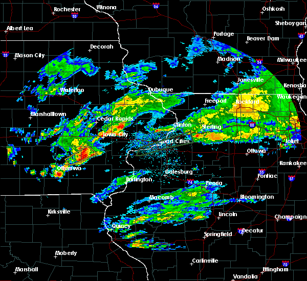 At 205 am cdt, a severe thunderstorm was located near harper, or 12 miles west of washington, moving northeast at 45 mph (radar indicated). Hazards include quarter size hail. Damage to vehicles is expected. Locations impacted include, wellman, harper, keota, west chester, talleyrand and washington county fairgrounds. At 205 am cdt, a severe thunderstorm was located near harper, or 12 miles west of washington, moving northeast at 45 mph (radar indicated). Hazards include quarter size hail. Damage to vehicles is expected. Locations impacted include, wellman, harper, keota, west chester, talleyrand and washington county fairgrounds.
|
| 3/28/2020 1:59 AM CDT |
 At 159 am cdt, a severe thunderstorm was located near harper, or 8 miles east of sigourney, moving northeast at 45 mph (radar indicated). Hazards include quarter size hail. Damage to vehicles is expected. Locations impacted include, wellman, harper, hayesville, keota, ollie, west chester, lancaster, talleyrand, pekin and washington county fairgrounds. At 159 am cdt, a severe thunderstorm was located near harper, or 8 miles east of sigourney, moving northeast at 45 mph (radar indicated). Hazards include quarter size hail. Damage to vehicles is expected. Locations impacted include, wellman, harper, hayesville, keota, ollie, west chester, lancaster, talleyrand, pekin and washington county fairgrounds.
|
| 3/28/2020 1:53 AM CDT |
 At 153 am cdt, a severe thunderstorm was located near sigourney, moving northeast at 45 mph (radar indicated). Hazards include quarter size hail. damage to vehicles is expected At 153 am cdt, a severe thunderstorm was located near sigourney, moving northeast at 45 mph (radar indicated). Hazards include quarter size hail. damage to vehicles is expected
|
| 8/20/2019 7:27 AM CDT |
 The severe thunderstorm warning for northwestern henry, northwestern louisa, eastern keokuk, johnson, washington, western muscatine, jefferson and southeastern iowa counties will expire at 730 am cdt, the storms which prompted the warning have moved out of the area. therefore, the warning will be allowed to expire. however gusty winds and heavy rain are still possible with these thunderstorms. a severe thunderstorm watch remains in effect until 300 pm cdt for southeastern and east central iowa. The severe thunderstorm warning for northwestern henry, northwestern louisa, eastern keokuk, johnson, washington, western muscatine, jefferson and southeastern iowa counties will expire at 730 am cdt, the storms which prompted the warning have moved out of the area. therefore, the warning will be allowed to expire. however gusty winds and heavy rain are still possible with these thunderstorms. a severe thunderstorm watch remains in effect until 300 pm cdt for southeastern and east central iowa.
|
| 8/20/2019 7:18 AM CDT |
 At 716 am cdt, severe thunderstorms were located along a line extending from near oxford to 8 miles west of washington to near leando, moving east at 35 mph (radar indicated). Hazards include 60 mph wind gusts and penny size hail. 70 mph wind gusts from around keota and washington on southward. Expect damage to roofs, siding, and trees. locations impacted include, iowa city, fairfield, washington, west branch, columbus junction, coralville, north liberty, williamsburg, kalona, tiffin, wellman, lone tree, university heights, north english, riverside, wayland, oxford, hills, brighton and richland. this includes the following highways, interstate 80 in iowa between mile markers 215 and 253. Interstate 380 between mile markers 1 and 2. At 716 am cdt, severe thunderstorms were located along a line extending from near oxford to 8 miles west of washington to near leando, moving east at 35 mph (radar indicated). Hazards include 60 mph wind gusts and penny size hail. 70 mph wind gusts from around keota and washington on southward. Expect damage to roofs, siding, and trees. locations impacted include, iowa city, fairfield, washington, west branch, columbus junction, coralville, north liberty, williamsburg, kalona, tiffin, wellman, lone tree, university heights, north english, riverside, wayland, oxford, hills, brighton and richland. this includes the following highways, interstate 80 in iowa between mile markers 215 and 253. Interstate 380 between mile markers 1 and 2.
|
| 8/20/2019 6:53 AM CDT |
 A severe thunderstorm warning remains in effect until 730 am cdt for northwestern henry. northwestern louisa. keokuk. johnson. washington. western muscatine. jefferson and iowa counties. At 653 am cdt, severe thunderstorms were located along a line extending from near ladora to near harper to 7 miles northwest of bloomfield, moving east at 60 mph. A severe thunderstorm warning remains in effect until 730 am cdt for northwestern henry. northwestern louisa. keokuk. johnson. washington. western muscatine. jefferson and iowa counties. At 653 am cdt, severe thunderstorms were located along a line extending from near ladora to near harper to 7 miles northwest of bloomfield, moving east at 60 mph.
|
| 8/20/2019 6:28 AM CDT |
 At 627 am cdt, severe thunderstorms were located along a line extending from near brooklyn to near what cheer to near rathbun lake, moving east at 60 mph (radar indicated). Hazards include 60 mph wind gusts. expect damage to roofs, siding, and trees At 627 am cdt, severe thunderstorms were located along a line extending from near brooklyn to near what cheer to near rathbun lake, moving east at 60 mph (radar indicated). Hazards include 60 mph wind gusts. expect damage to roofs, siding, and trees
|
| 6/30/2019 7:43 PM CDT |
 The severe thunderstorm warning for northeastern henderson, northern warren, rock island, mercer, south central whiteside, henry, northeastern des moines, louisa, southern johnson, washington, southwestern muscatine and southeastern iowa counties will expire at 745 pm cdt, the storms which prompted the warning have moved out of the area. therefore, the warning will be allowed to expire. however gusty winds and heavy rain are still possible with these thunderstorms. a severe thunderstorm watch remains in effect until 900 pm cdt for northwestern and west central illinois, and southeastern and east central iowa. The severe thunderstorm warning for northeastern henderson, northern warren, rock island, mercer, south central whiteside, henry, northeastern des moines, louisa, southern johnson, washington, southwestern muscatine and southeastern iowa counties will expire at 745 pm cdt, the storms which prompted the warning have moved out of the area. therefore, the warning will be allowed to expire. however gusty winds and heavy rain are still possible with these thunderstorms. a severe thunderstorm watch remains in effect until 900 pm cdt for northwestern and west central illinois, and southeastern and east central iowa.
|
| 6/30/2019 7:12 PM CDT |
 A severe thunderstorm warning remains in effect until 745 pm cdt for northeastern henderson. northern warren. rock island. mercer. south central whiteside. henry. northeastern des moines. louisa. southern johnson. washington. southwestern muscatine and southeastern iowa counties. At 712 pm cdt, severe thunderstorms were located along a line. A severe thunderstorm warning remains in effect until 745 pm cdt for northeastern henderson. northern warren. rock island. mercer. south central whiteside. henry. northeastern des moines. louisa. southern johnson. washington. southwestern muscatine and southeastern iowa counties. At 712 pm cdt, severe thunderstorms were located along a line.
|
| 6/30/2019 7:12 PM CDT |
 At 705 pm cdt, severe thunderstorms were located along a line extending from near atkinson to joy to kalona, moving southeast at 40 mph (radar indicated). Hazards include 60 mph wind gusts. Expect damage to roofs, siding, and trees. locations impacted include, davenport, moline, rock island, bettendorf, muscatine, east moline, kewanee, washington, aledo, cambridge, wapello, columbus junction, silvis, geneseo, milan, colona, coal valley, galva, burgess and kalona. if you are at henry county fairgrounds in cambridge you should seek safe shelter immediately! this includes the following highways, interstate 74 in iowa near mile marker 5. interstate 80 in illinois between mile markers 1 and 35. interstate 74 in illinois between mile markers 1 and 33. interstate 88 between mile markers 1 and 11. Interstate 280 between mile markers 8 and 18. At 705 pm cdt, severe thunderstorms were located along a line extending from near atkinson to joy to kalona, moving southeast at 40 mph (radar indicated). Hazards include 60 mph wind gusts. Expect damage to roofs, siding, and trees. locations impacted include, davenport, moline, rock island, bettendorf, muscatine, east moline, kewanee, washington, aledo, cambridge, wapello, columbus junction, silvis, geneseo, milan, colona, coal valley, galva, burgess and kalona. if you are at henry county fairgrounds in cambridge you should seek safe shelter immediately! this includes the following highways, interstate 74 in iowa near mile marker 5. interstate 80 in illinois between mile markers 1 and 35. interstate 74 in illinois between mile markers 1 and 33. interstate 88 between mile markers 1 and 11. Interstate 280 between mile markers 8 and 18.
|
| 6/30/2019 7:06 PM CDT |
 At 705 pm cdt, severe thunderstorms were located along a line extending from near atkinson to joy to kalona, moving southeast at 40 mph (radar indicated). Hazards include 60 mph wind gusts. Expect damage to roofs, siding, and trees. locations impacted include, davenport, moline, rock island, bettendorf, muscatine, east moline, kewanee, washington, aledo, cambridge, wapello, columbus junction, silvis, geneseo, milan, colona, coal valley, galva, burgess and kalona. if you are at henry county fairgrounds in cambridge you should seek safe shelter immediately! this includes the following highways, interstate 74 in iowa near mile marker 5. interstate 80 in illinois between mile markers 1 and 35. interstate 74 in illinois between mile markers 1 and 33. interstate 88 between mile markers 1 and 11. Interstate 280 between mile markers 8 and 18. At 705 pm cdt, severe thunderstorms were located along a line extending from near atkinson to joy to kalona, moving southeast at 40 mph (radar indicated). Hazards include 60 mph wind gusts. Expect damage to roofs, siding, and trees. locations impacted include, davenport, moline, rock island, bettendorf, muscatine, east moline, kewanee, washington, aledo, cambridge, wapello, columbus junction, silvis, geneseo, milan, colona, coal valley, galva, burgess and kalona. if you are at henry county fairgrounds in cambridge you should seek safe shelter immediately! this includes the following highways, interstate 74 in iowa near mile marker 5. interstate 80 in illinois between mile markers 1 and 35. interstate 74 in illinois between mile markers 1 and 33. interstate 88 between mile markers 1 and 11. Interstate 280 between mile markers 8 and 18.
|
| 6/30/2019 7:03 PM CDT |
 At 702 pm cdt, severe thunderstorms were located along a line extending from near hooppole to joy to near kalona, moving southeast at 40 mph (radar indicated). Hazards include 60 mph wind gusts. Expect damage to roofs, siding, and trees. locations impacted include, davenport, iowa city, moline, rock island, bettendorf, muscatine, east moline, kewanee, washington, aledo, cambridge, wapello, columbus junction, silvis, geneseo, milan, colona, le claire, coal valley and west liberty. if you are at henry county fairgrounds in cambridge you should seek safe shelter immediately! this includes the following highways, interstate 74 in iowa between mile markers 1 and 5. interstate 80 in iowa between mile markers 295 and 306. interstate 80 in illinois between mile markers 1 and 35. interstate 74 in illinois between mile markers 1 and 33. interstate 88 between mile markers 1 and 15. Interstate 280 between mile markers 2 and 18. At 702 pm cdt, severe thunderstorms were located along a line extending from near hooppole to joy to near kalona, moving southeast at 40 mph (radar indicated). Hazards include 60 mph wind gusts. Expect damage to roofs, siding, and trees. locations impacted include, davenport, iowa city, moline, rock island, bettendorf, muscatine, east moline, kewanee, washington, aledo, cambridge, wapello, columbus junction, silvis, geneseo, milan, colona, le claire, coal valley and west liberty. if you are at henry county fairgrounds in cambridge you should seek safe shelter immediately! this includes the following highways, interstate 74 in iowa between mile markers 1 and 5. interstate 80 in iowa between mile markers 295 and 306. interstate 80 in illinois between mile markers 1 and 35. interstate 74 in illinois between mile markers 1 and 33. interstate 88 between mile markers 1 and 15. Interstate 280 between mile markers 2 and 18.
|
| 6/30/2019 6:56 PM CDT |
 At 654 pm cdt, severe thunderstorms were located along a line extending from near erie to near eliza to 6 miles southwest of tiffin, moving south at 45 mph (radar indicated). Hazards include 60 mph wind gusts. expect damage to roofs, siding, and trees At 654 pm cdt, severe thunderstorms were located along a line extending from near erie to near eliza to 6 miles southwest of tiffin, moving south at 45 mph (radar indicated). Hazards include 60 mph wind gusts. expect damage to roofs, siding, and trees
|
| 6/30/2019 6:56 PM CDT |
 The national weather service in the quad cities has issued a * severe thunderstorm warning for. northeastern henderson county in west central illinois. rock island county in northwestern illinois. mercer county in northwestern illinois. Southwestern whiteside county in northwestern illinois. The national weather service in the quad cities has issued a * severe thunderstorm warning for. northeastern henderson county in west central illinois. rock island county in northwestern illinois. mercer county in northwestern illinois. Southwestern whiteside county in northwestern illinois.
|
| 6/30/2019 6:45 PM CDT |
 At 645 pm cdt, severe thunderstorms were located along a line extending from near erie to illinois city to near oxford, moving south at 45 mph (trained weather spotters). Hazards include 70 mph wind gusts. Expect considerable tree damage. damage is likely to mobile homes, roofs, and outbuildings. locations impacted include, davenport, iowa city, moline, rock island, bettendorf, muscatine, east moline, sterling, kewanee, rock falls, washington, morrison, aledo, cambridge, wapello, columbus junction, durant, silvis, geneseo and eldridge. if you are at henry county fairgrounds in cambridge, or davenport airport you should seek safe shelter immediately! this includes the following highways, interstate 74 in iowa between mile markers 1 and 5. interstate 80 in iowa between mile markers 280 and 306. interstate 80 in illinois between mile markers 1 and 45. interstate 74 in illinois between mile markers 1 and 33. interstate 88 between mile markers 1 and 43. Interstate 280 between mile markers 1 and 18. At 645 pm cdt, severe thunderstorms were located along a line extending from near erie to illinois city to near oxford, moving south at 45 mph (trained weather spotters). Hazards include 70 mph wind gusts. Expect considerable tree damage. damage is likely to mobile homes, roofs, and outbuildings. locations impacted include, davenport, iowa city, moline, rock island, bettendorf, muscatine, east moline, sterling, kewanee, rock falls, washington, morrison, aledo, cambridge, wapello, columbus junction, durant, silvis, geneseo and eldridge. if you are at henry county fairgrounds in cambridge, or davenport airport you should seek safe shelter immediately! this includes the following highways, interstate 74 in iowa between mile markers 1 and 5. interstate 80 in iowa between mile markers 280 and 306. interstate 80 in illinois between mile markers 1 and 45. interstate 74 in illinois between mile markers 1 and 33. interstate 88 between mile markers 1 and 43. Interstate 280 between mile markers 1 and 18.
|
| 6/30/2019 6:37 PM CDT |
 At 637 pm cdt, severe thunderstorms were located along a line extending from near fulton to fairport to oxford, moving south at 45 mph (trained weather spotters). Hazards include 70 mph wind gusts. Expect considerable tree damage. damage is likely to mobile homes, roofs, and outbuildings. locations impacted include, davenport, iowa city, moline, rock island, bettendorf, muscatine, east moline, sterling, kewanee, rock falls, washington, morrison, aledo, cambridge, wapello, columbus junction, durant, silvis, geneseo and eldridge. if you are at henry county fairgrounds in cambridge, or davenport airport you should seek safe shelter immediately! this includes the following highways, interstate 74 in iowa between mile markers 1 and 5. interstate 80 in iowa between mile markers 280 and 306. interstate 80 in illinois between mile markers 1 and 45. interstate 74 in illinois between mile markers 1 and 33. interstate 88 between mile markers 1 and 43. Interstate 280 between mile markers 1 and 18. At 637 pm cdt, severe thunderstorms were located along a line extending from near fulton to fairport to oxford, moving south at 45 mph (trained weather spotters). Hazards include 70 mph wind gusts. Expect considerable tree damage. damage is likely to mobile homes, roofs, and outbuildings. locations impacted include, davenport, iowa city, moline, rock island, bettendorf, muscatine, east moline, sterling, kewanee, rock falls, washington, morrison, aledo, cambridge, wapello, columbus junction, durant, silvis, geneseo and eldridge. if you are at henry county fairgrounds in cambridge, or davenport airport you should seek safe shelter immediately! this includes the following highways, interstate 74 in iowa between mile markers 1 and 5. interstate 80 in iowa between mile markers 280 and 306. interstate 80 in illinois between mile markers 1 and 45. interstate 74 in illinois between mile markers 1 and 33. interstate 88 between mile markers 1 and 43. Interstate 280 between mile markers 1 and 18.
|
| 6/30/2019 6:29 PM CDT |
 At 622 pm cdt, severe thunderstorms were located along a line extending from near charlotte to near rochester to amana, moving south at 45 mph (trained weather spotters). Hazards include 70 mph wind gusts. Expect considerable tree damage. Damage is likely to mobile homes, roofs, and outbuildings. At 622 pm cdt, severe thunderstorms were located along a line extending from near charlotte to near rochester to amana, moving south at 45 mph (trained weather spotters). Hazards include 70 mph wind gusts. Expect considerable tree damage. Damage is likely to mobile homes, roofs, and outbuildings.
|
| 6/30/2019 6:22 PM CDT |
 At 622 pm cdt, severe thunderstorms were located along a line extending from near charlotte to near rochester to amana, moving south at 45 mph (trained weather spotters). Hazards include 70 mph wind gusts. Expect considerable tree damage. Damage is likely to mobile homes, roofs, and outbuildings. At 622 pm cdt, severe thunderstorms were located along a line extending from near charlotte to near rochester to amana, moving south at 45 mph (trained weather spotters). Hazards include 70 mph wind gusts. Expect considerable tree damage. Damage is likely to mobile homes, roofs, and outbuildings.
|
| 6/15/2019 7:22 PM CDT |
 At 722 pm cdt, severe thunderstorms were located along a line extending from near kalona to near richmond to near richland, moving east at 35 mph (radar indicated). Hazards include 60 mph wind gusts and quarter size hail. Hail damage to vehicles is expected. expect wind damage to roofs, siding, and trees. Locations impacted include, sigourney, kalona, wellman, harper, hayesville, richmond, keota, west chester, lancaster, keokuk county expo, talleyrand, washington county fairgrounds, rubio and sig-nor field airport. At 722 pm cdt, severe thunderstorms were located along a line extending from near kalona to near richmond to near richland, moving east at 35 mph (radar indicated). Hazards include 60 mph wind gusts and quarter size hail. Hail damage to vehicles is expected. expect wind damage to roofs, siding, and trees. Locations impacted include, sigourney, kalona, wellman, harper, hayesville, richmond, keota, west chester, lancaster, keokuk county expo, talleyrand, washington county fairgrounds, rubio and sig-nor field airport.
|
| 6/15/2019 6:41 PM CDT |
 At 641 pm cdt, severe thunderstorms were located along a line extending from near millersburg to near keswick to near oskaloosa, moving east at 35 mph (radar indicated). Hazards include 60 mph wind gusts and quarter size hail. Hail damage to vehicles is expected. Expect wind damage to roofs, siding, and trees. At 641 pm cdt, severe thunderstorms were located along a line extending from near millersburg to near keswick to near oskaloosa, moving east at 35 mph (radar indicated). Hazards include 60 mph wind gusts and quarter size hail. Hail damage to vehicles is expected. Expect wind damage to roofs, siding, and trees.
|
| 5/29/2019 8:08 PM CDT |
 At 808 pm cdt, a severe thunderstorm capable of producing a tornado was located over wellman, or 15 miles northwest of washington, moving northeast at 20 mph (radar indicated rotation). Hazards include tornado. Flying debris will be dangerous to those caught without shelter. mobile homes will be damaged or destroyed. damage to roofs, windows, and vehicles will occur. tree damage is likely. this dangerous storm will be near, kalona around 820 pm cdt. hills around 900 pm cdt. Other locations impacted by this tornadic thunderstorm include frytown, hills access, amish and sharon center. At 808 pm cdt, a severe thunderstorm capable of producing a tornado was located over wellman, or 15 miles northwest of washington, moving northeast at 20 mph (radar indicated rotation). Hazards include tornado. Flying debris will be dangerous to those caught without shelter. mobile homes will be damaged or destroyed. damage to roofs, windows, and vehicles will occur. tree damage is likely. this dangerous storm will be near, kalona around 820 pm cdt. hills around 900 pm cdt. Other locations impacted by this tornadic thunderstorm include frytown, hills access, amish and sharon center.
|
| 5/24/2019 6:24 PM CDT |
 A tornado warning remains in effect until 700 pm cdt for southwestern johnson. northern washington and southeastern iowa counties. At 624 pm cdt, a severe thunderstorm capable of producing a tornado was located near wellman, or 18 miles northwest of washington, moving east at 25 mph. A tornado warning remains in effect until 700 pm cdt for southwestern johnson. northern washington and southeastern iowa counties. At 624 pm cdt, a severe thunderstorm capable of producing a tornado was located near wellman, or 18 miles northwest of washington, moving east at 25 mph.
|
| 5/24/2019 6:18 PM CDT |
 At 618 pm cdt, a severe thunderstorm capable of producing a tornado was located near kinross, or 19 miles northeast of sigourney, moving east at 25 mph (radar indicated rotation). Hazards include tornado and half dollar size hail. Flying debris will be dangerous to those caught without shelter. mobile homes will be damaged or destroyed. damage to roofs, windows, and vehicles will occur. tree damage is likely. this dangerous storm will be near, wellman around 625 pm cdt. kalona around 645 pm cdt. university heights, hills and oakdale around 700 pm cdt. other locations impacted by this tornadic thunderstorm include iowa city municipal airport, frytown, windham, amish, johnson county fairgrounds, holbrook, cosgrove and sharon center. This includes interstate 80 in iowa between mile markers 238 and 243. At 618 pm cdt, a severe thunderstorm capable of producing a tornado was located near kinross, or 19 miles northeast of sigourney, moving east at 25 mph (radar indicated rotation). Hazards include tornado and half dollar size hail. Flying debris will be dangerous to those caught without shelter. mobile homes will be damaged or destroyed. damage to roofs, windows, and vehicles will occur. tree damage is likely. this dangerous storm will be near, wellman around 625 pm cdt. kalona around 645 pm cdt. university heights, hills and oakdale around 700 pm cdt. other locations impacted by this tornadic thunderstorm include iowa city municipal airport, frytown, windham, amish, johnson county fairgrounds, holbrook, cosgrove and sharon center. This includes interstate 80 in iowa between mile markers 238 and 243.
|
| 5/17/2019 6:41 AM CDT |
 At 640 am cdt, a severe thunderstorm was located over richland, or 11 miles north of fairfield, moving east at 30 mph (radar indicated). Hazards include 60 mph wind gusts and quarter size hail. Hail damage to vehicles is expected. Expect wind damage to roofs, siding, and trees. At 640 am cdt, a severe thunderstorm was located over richland, or 11 miles north of fairfield, moving east at 30 mph (radar indicated). Hazards include 60 mph wind gusts and quarter size hail. Hail damage to vehicles is expected. Expect wind damage to roofs, siding, and trees.
|
| 8/28/2018 5:45 PM CDT |
 At 545 pm cdt, severe thunderstorms were located along a line extending from near williamsburg to near harper, moving east at 50 mph (radar indicated). Hazards include 70 mph wind gusts and penny size hail. Expect considerable tree damage. damage is likely to mobile homes, roofs, and outbuildings. locations impacted include, washington, sigourney, williamsburg, kalona, wellman, north english, what cheer, delta, keswick, south english, parnell, millersburg, harper, kinross, hayesville, richmond, keota, west chester, webster and thornburg. This includes interstate 80 in iowa between mile markers 222 and 236. At 545 pm cdt, severe thunderstorms were located along a line extending from near williamsburg to near harper, moving east at 50 mph (radar indicated). Hazards include 70 mph wind gusts and penny size hail. Expect considerable tree damage. damage is likely to mobile homes, roofs, and outbuildings. locations impacted include, washington, sigourney, williamsburg, kalona, wellman, north english, what cheer, delta, keswick, south english, parnell, millersburg, harper, kinross, hayesville, richmond, keota, west chester, webster and thornburg. This includes interstate 80 in iowa between mile markers 222 and 236.
|
| 8/28/2018 5:25 PM CDT |
 At 525 pm cdt, severe thunderstorms were located along a line extending from near brooklyn to near delta, moving east at 45 mph (radar indicated). Hazards include 60 mph wind gusts and penny size hail. Expect damage to roofs, siding, and trees. locations impacted include, washington, sigourney, williamsburg, kalona, wellman, north english, victor, oxford, what cheer, delta, ladora, keswick, south english, parnell, millersburg, harper, kinross, hayesville, conroy and richmond. This includes interstate 80 in iowa between mile markers 205 and 236. At 525 pm cdt, severe thunderstorms were located along a line extending from near brooklyn to near delta, moving east at 45 mph (radar indicated). Hazards include 60 mph wind gusts and penny size hail. Expect damage to roofs, siding, and trees. locations impacted include, washington, sigourney, williamsburg, kalona, wellman, north english, victor, oxford, what cheer, delta, ladora, keswick, south english, parnell, millersburg, harper, kinross, hayesville, conroy and richmond. This includes interstate 80 in iowa between mile markers 205 and 236.
|
| 8/28/2018 5:14 PM CDT |
 At 514 pm cdt, severe thunderstorms were located along a line extending from near montezuma to 6 miles east of oskaloosa, moving east at 45 mph (radar indicated). Hazards include 60 mph wind gusts and penny size hail. expect damage to roofs, siding, and trees At 514 pm cdt, severe thunderstorms were located along a line extending from near montezuma to 6 miles east of oskaloosa, moving east at 45 mph (radar indicated). Hazards include 60 mph wind gusts and penny size hail. expect damage to roofs, siding, and trees
|
| 6/20/2018 3:26 PM CDT |
 At 326 pm cdt, severe thunderstorms were located along a line extending from 6 miles southwest of oxford to kalona to near coppock, moving east at 40 mph (radar indicated). Hazards include 60 mph wind gusts. Expect damage to roofs, siding, and trees. locations impacted include, iowa city, washington, columbus junction, coralville, north liberty, williamsburg, kalona, tiffin, wellman, lone tree, university heights, riverside, oxford, hills, ainsworth, columbus city, parnell, cotter, oakdale and lake macbride state park. this includes the following highways, interstate 80 in iowa between mile markers 222 and 250. interstate 380 between mile markers 1 and 7. A tornado watch remains in effect until 700 pm cdt for southeastern and east central iowa. At 326 pm cdt, severe thunderstorms were located along a line extending from 6 miles southwest of oxford to kalona to near coppock, moving east at 40 mph (radar indicated). Hazards include 60 mph wind gusts. Expect damage to roofs, siding, and trees. locations impacted include, iowa city, washington, columbus junction, coralville, north liberty, williamsburg, kalona, tiffin, wellman, lone tree, university heights, riverside, oxford, hills, ainsworth, columbus city, parnell, cotter, oakdale and lake macbride state park. this includes the following highways, interstate 80 in iowa between mile markers 222 and 250. interstate 380 between mile markers 1 and 7. A tornado watch remains in effect until 700 pm cdt for southeastern and east central iowa.
|
| 6/20/2018 3:20 PM CDT |
 At 320 pm cdt, severe thunderstorms were located along a line extending from near williamsburg to kalona to near brighton, moving northeast at 40 mph (radar indicated). Hazards include 60 mph wind gusts. Expect damage to roofs, siding, and trees. locations impacted include, iowa city, washington, columbus junction, coralville, north liberty, williamsburg, kalona, tiffin, wellman, lone tree, university heights, north english, riverside, oxford, hills, brighton, ainsworth, columbus city, crawfordsville and parnell. this includes the following highways, interstate 80 in iowa between mile markers 222 and 250. interstate 380 between mile markers 1 and 7. A tornado watch remains in effect until 700 pm cdt for southeastern and east central iowa. At 320 pm cdt, severe thunderstorms were located along a line extending from near williamsburg to kalona to near brighton, moving northeast at 40 mph (radar indicated). Hazards include 60 mph wind gusts. Expect damage to roofs, siding, and trees. locations impacted include, iowa city, washington, columbus junction, coralville, north liberty, williamsburg, kalona, tiffin, wellman, lone tree, university heights, north english, riverside, oxford, hills, brighton, ainsworth, columbus city, crawfordsville and parnell. this includes the following highways, interstate 80 in iowa between mile markers 222 and 250. interstate 380 between mile markers 1 and 7. A tornado watch remains in effect until 700 pm cdt for southeastern and east central iowa.
|
| 6/20/2018 3:10 PM CDT |
 At 309 pm cdt, severe thunderstorms were located along a line extending from parnell to 6 miles northwest of washington to near fairfield, moving east at 35 mph (radar indicated). Hazards include 60 mph wind gusts. expect damage to roofs, siding, and trees At 309 pm cdt, severe thunderstorms were located along a line extending from parnell to 6 miles northwest of washington to near fairfield, moving east at 35 mph (radar indicated). Hazards include 60 mph wind gusts. expect damage to roofs, siding, and trees
|
| 6/9/2018 11:41 PM CDT |
 At 1119 pm cdt, a severe thunderstorm was located near keswick, or 13 miles north of sigourney, moving east at 35 mph (radar indicated). Hazards include quarter size hail. Damage to vehicles is expected. Locations impacted include, wellman, north english, keswick, south english, parnell, millersburg, kinross, webster and holbrook. At 1119 pm cdt, a severe thunderstorm was located near keswick, or 13 miles north of sigourney, moving east at 35 mph (radar indicated). Hazards include quarter size hail. Damage to vehicles is expected. Locations impacted include, wellman, north english, keswick, south english, parnell, millersburg, kinross, webster and holbrook.
|
| 6/9/2018 11:19 PM CDT |
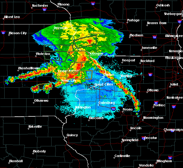 At 1119 pm cdt, a severe thunderstorm was located near keswick, or 13 miles north of sigourney, moving east at 35 mph (radar indicated). Hazards include quarter size hail. Damage to vehicles is expected. Locations impacted include, wellman, north english, keswick, south english, parnell, millersburg, kinross, webster and holbrook. At 1119 pm cdt, a severe thunderstorm was located near keswick, or 13 miles north of sigourney, moving east at 35 mph (radar indicated). Hazards include quarter size hail. Damage to vehicles is expected. Locations impacted include, wellman, north english, keswick, south english, parnell, millersburg, kinross, webster and holbrook.
|
| 6/9/2018 10:56 PM CDT |
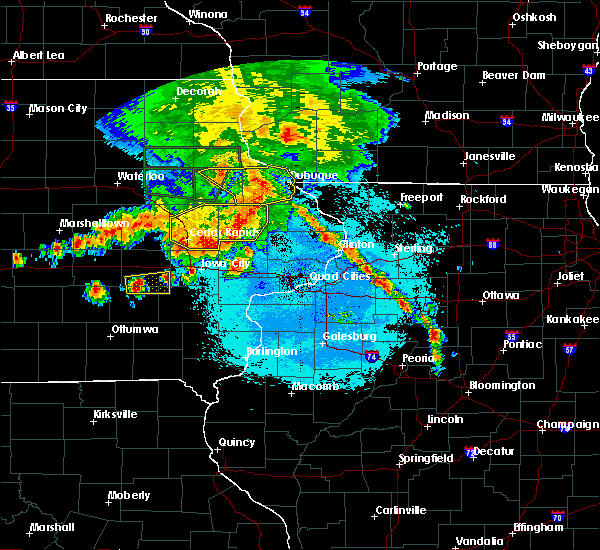 At 1056 pm cdt, a severe thunderstorm was located near millersburg, or 13 miles north of sigourney, moving east at 35 mph (radar indicated). Hazards include quarter size hail. damage to vehicles is expected At 1056 pm cdt, a severe thunderstorm was located near millersburg, or 13 miles north of sigourney, moving east at 35 mph (radar indicated). Hazards include quarter size hail. damage to vehicles is expected
|
| 5/2/2018 8:11 PM CDT |
 At 811 pm cdt, severe thunderstorms were located along a line extending from near parnell to near harper to near richland, moving east at 50 mph (radar indicated). Hazards include 60 mph wind gusts. Expect damage to roofs, siding, and trees. Locations impacted include, washington, sigourney, kalona, wellman, riverside, hedrick, brighton, richland, ainsworth, delta, crawfordsville, keswick, south english, harper, martinsburg, kinross, hayesville, coppock, richmond and keota. At 811 pm cdt, severe thunderstorms were located along a line extending from near parnell to near harper to near richland, moving east at 50 mph (radar indicated). Hazards include 60 mph wind gusts. Expect damage to roofs, siding, and trees. Locations impacted include, washington, sigourney, kalona, wellman, riverside, hedrick, brighton, richland, ainsworth, delta, crawfordsville, keswick, south english, harper, martinsburg, kinross, hayesville, coppock, richmond and keota.
|
| 5/2/2018 7:58 PM CDT |
 The national weather service in the quad cities has issued a * severe thunderstorm warning for. keokuk county in southeastern iowa. washington county in southeastern iowa. Until 845 pm cdt * at 758 pm cdt, severe thunderstorms were located along a line. The national weather service in the quad cities has issued a * severe thunderstorm warning for. keokuk county in southeastern iowa. washington county in southeastern iowa. Until 845 pm cdt * at 758 pm cdt, severe thunderstorms were located along a line.
|
| 5/2/2018 7:24 PM CDT |
 At 724 pm cdt, a severe thunderstorm capable of producing a tornado was located near wellman, or 16 miles northwest of washington, moving east at 15 mph (radar indicated rotation). Hazards include tornado and quarter size hail. Flying debris will be dangerous to those caught without shelter. mobile homes will be damaged or destroyed. damage to roofs, windows, and vehicles will occur. tree damage is likely. this dangerous storm will be near, kalona around 745 pm cdt. riverside and hills around 815 pm cdt. Other locations impacted by this tornadic thunderstorm include amish, sharon center and frytown. At 724 pm cdt, a severe thunderstorm capable of producing a tornado was located near wellman, or 16 miles northwest of washington, moving east at 15 mph (radar indicated rotation). Hazards include tornado and quarter size hail. Flying debris will be dangerous to those caught without shelter. mobile homes will be damaged or destroyed. damage to roofs, windows, and vehicles will occur. tree damage is likely. this dangerous storm will be near, kalona around 745 pm cdt. riverside and hills around 815 pm cdt. Other locations impacted by this tornadic thunderstorm include amish, sharon center and frytown.
|
| 5/2/2018 7:18 PM CDT |
 At 718 pm cdt, a severe thunderstorm was located near wellman, or 17 miles southwest of iowa city, moving northeast at 25 mph (radar indicated). Hazards include 60 mph wind gusts and quarter size hail. Hail damage to vehicles is expected. Expect wind damage to roofs, siding, and trees. At 718 pm cdt, a severe thunderstorm was located near wellman, or 17 miles southwest of iowa city, moving northeast at 25 mph (radar indicated). Hazards include 60 mph wind gusts and quarter size hail. Hail damage to vehicles is expected. Expect wind damage to roofs, siding, and trees.
|
| 8/10/2017 3:37 PM CDT |
 At 337 pm cdt, a severe thunderstorm was located near wellman, or 14 miles north of washington, moving east at 25 mph (radar indicated). Hazards include 60 mph wind gusts and half dollar size hail. Hail damage to vehicles is expected. expect wind damage to roofs, siding, and trees. Locations impacted include, columbus junction, kalona, wellman, lone tree, riverside, hills, ainsworth, columbus city, cotter, richmond, frytown, hills access, haskins, amish, river junction, sharon center and gladwin. At 337 pm cdt, a severe thunderstorm was located near wellman, or 14 miles north of washington, moving east at 25 mph (radar indicated). Hazards include 60 mph wind gusts and half dollar size hail. Hail damage to vehicles is expected. expect wind damage to roofs, siding, and trees. Locations impacted include, columbus junction, kalona, wellman, lone tree, riverside, hills, ainsworth, columbus city, cotter, richmond, frytown, hills access, haskins, amish, river junction, sharon center and gladwin.
|
| 8/10/2017 3:28 PM CDT |
 At 328 pm cdt, a severe thunderstorm was located near wellman, or 17 miles northwest of washington, moving east at 20 mph (radar indicated). Hazards include 60 mph wind gusts and half dollar size hail. Hail damage to vehicles is expected. Expect wind damage to roofs, siding, and trees. At 328 pm cdt, a severe thunderstorm was located near wellman, or 17 miles northwest of washington, moving east at 20 mph (radar indicated). Hazards include 60 mph wind gusts and half dollar size hail. Hail damage to vehicles is expected. Expect wind damage to roofs, siding, and trees.
|
| 7/11/2017 6:24 AM CDT |
 The severe thunderstorm warning for northwestern henry, southern johnson, washington, northeastern jefferson and southeastern iowa counties will expire at 630 am cdt, the storms which prompted the warning have weakened below severe limits, and no longer pose an immediate threat to life or property. therefore, the warning will be allowed to expire. however gusty winds and heavy rain are still possible with these thunderstorms. The severe thunderstorm warning for northwestern henry, southern johnson, washington, northeastern jefferson and southeastern iowa counties will expire at 630 am cdt, the storms which prompted the warning have weakened below severe limits, and no longer pose an immediate threat to life or property. therefore, the warning will be allowed to expire. however gusty winds and heavy rain are still possible with these thunderstorms.
|
| 7/11/2017 6:20 AM CDT |
 At 620 am cdt, severe thunderstorms were located along a line extending from 7 miles north of kalona to near ainsworth to lockridge, moving east at 55 mph (radar indicated). Hazards include 60 mph wind gusts. Expect damage to roofs, siding, and trees. locations impacted include, iowa city, fairfield, mount pleasant, washington, kalona, wellman, lone tree, university heights, riverside, wayland, hills, brighton, ainsworth, lockridge, crawfordsville, olds, rome, pleasant plain, coppock and richmond. This includes interstate 80 in iowa near mile marker 250. At 620 am cdt, severe thunderstorms were located along a line extending from 7 miles north of kalona to near ainsworth to lockridge, moving east at 55 mph (radar indicated). Hazards include 60 mph wind gusts. Expect damage to roofs, siding, and trees. locations impacted include, iowa city, fairfield, mount pleasant, washington, kalona, wellman, lone tree, university heights, riverside, wayland, hills, brighton, ainsworth, lockridge, crawfordsville, olds, rome, pleasant plain, coppock and richmond. This includes interstate 80 in iowa near mile marker 250.
|
| 7/11/2017 6:12 AM CDT |
 At 612 am cdt, severe thunderstorms were located along a line extending from 8 miles north of wellman to near washington to near fairfield, moving east at 60 mph (radar indicated). Hazards include 60 mph wind gusts. Expect damage to roofs, siding, and trees. locations impacted include, iowa city, fairfield, mount pleasant, washington, coralville, kalona, wellman, lone tree, university heights, riverside, wayland, hills, brighton, ainsworth, lockridge, crawfordsville, maharishi vedic city, olds, rome and pleasant plain. This includes interstate 80 in iowa between mile markers 231 and 232, and between mile markers 237 and 250. At 612 am cdt, severe thunderstorms were located along a line extending from 8 miles north of wellman to near washington to near fairfield, moving east at 60 mph (radar indicated). Hazards include 60 mph wind gusts. Expect damage to roofs, siding, and trees. locations impacted include, iowa city, fairfield, mount pleasant, washington, coralville, kalona, wellman, lone tree, university heights, riverside, wayland, hills, brighton, ainsworth, lockridge, crawfordsville, maharishi vedic city, olds, rome and pleasant plain. This includes interstate 80 in iowa between mile markers 231 and 232, and between mile markers 237 and 250.
|
| 7/11/2017 6:06 AM CDT | Limb down across the road in wellma in washington county IA, 0.4 miles E of Wellman, IA |
| 7/11/2017 6:05 AM CDT |
 At 604 am cdt, severe thunderstorms were located along a line extending from near williamsburg to 6 miles south of wellman to maharishi vedic city, moving east at 55 mph (radar indicated). Hazards include 60 mph wind gusts. Expect damage to roofs, siding, and trees. locations impacted include, iowa city, fairfield, mount pleasant, washington, coralville, williamsburg, kalona, tiffin, wellman, lone tree, university heights, north english, riverside, wayland, hills, brighton, richland, ainsworth, lockridge and crawfordsville. This includes interstate 80 in iowa between mile markers 217 and 250. At 604 am cdt, severe thunderstorms were located along a line extending from near williamsburg to 6 miles south of wellman to maharishi vedic city, moving east at 55 mph (radar indicated). Hazards include 60 mph wind gusts. Expect damage to roofs, siding, and trees. locations impacted include, iowa city, fairfield, mount pleasant, washington, coralville, williamsburg, kalona, tiffin, wellman, lone tree, university heights, north english, riverside, wayland, hills, brighton, richland, ainsworth, lockridge and crawfordsville. This includes interstate 80 in iowa between mile markers 217 and 250.
|
| 7/11/2017 5:59 AM CDT |
 At 558 am cdt, severe thunderstorms were located along a line extending from williamsburg to near kinross to near maharishi vedic city, moving east at 55 mph (radar indicated). Hazards include 60 mph wind gusts. Expect damage to roofs, siding, and trees. locations impacted include, iowa city, fairfield, mount pleasant, washington, sigourney, coralville, williamsburg, kalona, tiffin, wellman, lone tree, university heights, north english, riverside, wayland, hills, brighton, richland, ainsworth and lockridge. This includes interstate 80 in iowa between mile markers 209 and 250. At 558 am cdt, severe thunderstorms were located along a line extending from williamsburg to near kinross to near maharishi vedic city, moving east at 55 mph (radar indicated). Hazards include 60 mph wind gusts. Expect damage to roofs, siding, and trees. locations impacted include, iowa city, fairfield, mount pleasant, washington, sigourney, coralville, williamsburg, kalona, tiffin, wellman, lone tree, university heights, north english, riverside, wayland, hills, brighton, richland, ainsworth and lockridge. This includes interstate 80 in iowa between mile markers 209 and 250.
|
| 7/11/2017 5:48 AM CDT |
 At 548 am cdt, severe thunderstorms were located along a line extending from near ladora to near harper to near hedrick, moving east at 55 mph (radar indicated). Hazards include 60 mph wind gusts. Expect damage to roofs, siding, and trees. locations impacted include, iowa city, fairfield, mount pleasant, washington, marengo, sigourney, coralville, north liberty, williamsburg, kalona, solon, tiffin, wellman, lone tree, university heights, north english, riverside, wayland, victor and swisher. this includes the following highways, interstate 80 in iowa between mile markers 205 and 252. Interstate 380 between mile markers 1 and 11. At 548 am cdt, severe thunderstorms were located along a line extending from near ladora to near harper to near hedrick, moving east at 55 mph (radar indicated). Hazards include 60 mph wind gusts. Expect damage to roofs, siding, and trees. locations impacted include, iowa city, fairfield, mount pleasant, washington, marengo, sigourney, coralville, north liberty, williamsburg, kalona, solon, tiffin, wellman, lone tree, university heights, north english, riverside, wayland, victor and swisher. this includes the following highways, interstate 80 in iowa between mile markers 205 and 252. Interstate 380 between mile markers 1 and 11.
|
| 7/11/2017 5:40 AM CDT |
 At 540 am cdt, severe thunderstorms were located along a line extending from victor to near keswick to ottumwa industrial airport, moving east at 55 mph (radar indicated). Hazards include 60 mph wind gusts. expect damage to roofs, siding, and trees At 540 am cdt, severe thunderstorms were located along a line extending from victor to near keswick to ottumwa industrial airport, moving east at 55 mph (radar indicated). Hazards include 60 mph wind gusts. expect damage to roofs, siding, and trees
|
| 6/15/2017 11:04 PM CDT |
 At 1103 pm cdt, a severe thunderstorm was located over richmond, or 11 miles north of washington, moving east at 40 mph (spotter indicated. nickel size hail in wellman at 1059 pm). Hazards include 60 mph wind gusts and quarter size hail. Hail damage to vehicles is expected. expect wind damage to roofs, siding, and trees. Locations impacted include, kalona, wellman, lone tree, riverside, hills, richmond, amish, hills access, river junction and gladwin. At 1103 pm cdt, a severe thunderstorm was located over richmond, or 11 miles north of washington, moving east at 40 mph (spotter indicated. nickel size hail in wellman at 1059 pm). Hazards include 60 mph wind gusts and quarter size hail. Hail damage to vehicles is expected. expect wind damage to roofs, siding, and trees. Locations impacted include, kalona, wellman, lone tree, riverside, hills, richmond, amish, hills access, river junction and gladwin.
|
| 6/15/2017 10:56 PM CDT |
 At 1056 pm cdt, a severe thunderstorm was located over wellman, or 11 miles northwest of washington, moving east at 40 mph (radar indicated). Hazards include 60 mph wind gusts and quarter size hail. Hail damage to vehicles is expected. expect wind damage to roofs, siding, and trees. Locations impacted include, kalona, wellman, lone tree, riverside, hills, richmond, west chester, haskins, amish, hills access, river junction and gladwin. At 1056 pm cdt, a severe thunderstorm was located over wellman, or 11 miles northwest of washington, moving east at 40 mph (radar indicated). Hazards include 60 mph wind gusts and quarter size hail. Hail damage to vehicles is expected. expect wind damage to roofs, siding, and trees. Locations impacted include, kalona, wellman, lone tree, riverside, hills, richmond, west chester, haskins, amish, hills access, river junction and gladwin.
|
| 6/15/2017 10:51 PM CDT |
 At 1051 pm cdt, a severe thunderstorm was located near wellman, or 13 miles northwest of washington, moving east at 40 mph (radar indicated). Hazards include quarter size hail. damage to vehicles is expected At 1051 pm cdt, a severe thunderstorm was located near wellman, or 13 miles northwest of washington, moving east at 40 mph (radar indicated). Hazards include quarter size hail. damage to vehicles is expected
|
| 5/17/2017 6:22 PM CDT |
 At 622 pm cdt, severe thunderstorms were located along a line extending from 6 miles southeast of jesup to near quasqueton to near alburnett to richmond, moving northeast at 45 mph (trained weather spotters). Hazards include 70 mph wind gusts. Expect considerable tree damage. damage is likely to mobile homes, roofs, and outbuildings. locations impacted include, cedar rapids, iowa city, independence, manchester, west branch, marion, coralville, north liberty, hiawatha, mount vernon, robins, jesup, center point, kalona, lisbon, fairfax, solon, tiffin, ely and atkins. this includes the following highways, interstate 80 in iowa between mile markers 224 and 253. interstate 380 between mile markers 1 and 55. A tornado watch remains in effect until 1100 pm cdt for southeastern, northeastern and east central iowa. At 622 pm cdt, severe thunderstorms were located along a line extending from 6 miles southeast of jesup to near quasqueton to near alburnett to richmond, moving northeast at 45 mph (trained weather spotters). Hazards include 70 mph wind gusts. Expect considerable tree damage. damage is likely to mobile homes, roofs, and outbuildings. locations impacted include, cedar rapids, iowa city, independence, manchester, west branch, marion, coralville, north liberty, hiawatha, mount vernon, robins, jesup, center point, kalona, lisbon, fairfax, solon, tiffin, ely and atkins. this includes the following highways, interstate 80 in iowa between mile markers 224 and 253. interstate 380 between mile markers 1 and 55. A tornado watch remains in effect until 1100 pm cdt for southeastern, northeastern and east central iowa.
|
| 5/17/2017 6:21 PM CDT |
 A severe thunderstorm warning remains in effect until 645 pm cdt for northern henry. northwestern van buren. washington and jefferson counties. At 620 pm cdt, severe thunderstorms were located along a line extending from 6 miles south of tiffin to near washington to near lockridge, moving northeast at 60 mph. A severe thunderstorm warning remains in effect until 645 pm cdt for northern henry. northwestern van buren. washington and jefferson counties. At 620 pm cdt, severe thunderstorms were located along a line extending from 6 miles south of tiffin to near washington to near lockridge, moving northeast at 60 mph.
|
| 5/17/2017 6:15 PM CDT |
 At 615 pm cdt, severe thunderstorms were located along a line extending from near brandon to near urbana to robins to near wellman, moving northeast at 55 mph (trained weather spotters). Hazards include 70 mph wind gusts and quarter size hail. Hail damage to vehicles is expected. expect considerable tree damage. wind damage is also likely to mobile homes, roofs, and outbuildings. locations impacted include, cedar rapids, iowa city, independence, vinton, manchester, west branch, marion, coralville, north liberty, hiawatha, mount vernon, robins, jesup, center point, kalona, lisbon, fairfax, solon, tiffin and ely. this includes the following highways, interstate 80 in iowa between mile markers 224 and 253. interstate 380 between mile markers 1 and 55. A tornado watch remains in effect until 1100 pm cdt for southeastern, northeastern and east central iowa. At 615 pm cdt, severe thunderstorms were located along a line extending from near brandon to near urbana to robins to near wellman, moving northeast at 55 mph (trained weather spotters). Hazards include 70 mph wind gusts and quarter size hail. Hail damage to vehicles is expected. expect considerable tree damage. wind damage is also likely to mobile homes, roofs, and outbuildings. locations impacted include, cedar rapids, iowa city, independence, vinton, manchester, west branch, marion, coralville, north liberty, hiawatha, mount vernon, robins, jesup, center point, kalona, lisbon, fairfax, solon, tiffin and ely. this includes the following highways, interstate 80 in iowa between mile markers 224 and 253. interstate 380 between mile markers 1 and 55. A tornado watch remains in effect until 1100 pm cdt for southeastern, northeastern and east central iowa.
|
| 5/17/2017 6:10 PM CDT |
 At 610 pm cdt, severe thunderstorms were located along a line extending from near mount auburn to near shellsburg to near hiawatha to near kinross, moving northeast at 55 mph (trained weather spotters). Hazards include 70 mph wind gusts and quarter size hail. Hail damage to vehicles is expected. expect considerable tree damage. wind damage is also likely to mobile homes, roofs, and outbuildings. locations impacted include, cedar rapids, iowa city, independence, vinton, manchester, west branch, marion, coralville, north liberty, hiawatha, mount vernon, robins, jesup, center point, kalona, lisbon, fairfax, solon, tiffin and ely. this includes the following highways, interstate 80 in iowa between mile markers 224 and 253. interstate 380 between mile markers 1 and 55. A tornado watch remains in effect until 1100 pm cdt for southeastern, northeastern and east central iowa. At 610 pm cdt, severe thunderstorms were located along a line extending from near mount auburn to near shellsburg to near hiawatha to near kinross, moving northeast at 55 mph (trained weather spotters). Hazards include 70 mph wind gusts and quarter size hail. Hail damage to vehicles is expected. expect considerable tree damage. wind damage is also likely to mobile homes, roofs, and outbuildings. locations impacted include, cedar rapids, iowa city, independence, vinton, manchester, west branch, marion, coralville, north liberty, hiawatha, mount vernon, robins, jesup, center point, kalona, lisbon, fairfax, solon, tiffin and ely. this includes the following highways, interstate 80 in iowa between mile markers 224 and 253. interstate 380 between mile markers 1 and 55. A tornado watch remains in effect until 1100 pm cdt for southeastern, northeastern and east central iowa.
|
| 5/17/2017 6:04 PM CDT |
 At 604 pm cdt, severe thunderstorms were located along a line extending from near la porte city to near palo to near kinross, moving northeast at 45 mph (trained weather spotters). Hazards include 70 mph wind gusts and quarter size hail. Hail damage to vehicles is expected. expect considerable tree damage. wind damage is also likely to mobile homes, roofs, and outbuildings. locations impacted include, cedar rapids, iowa city, independence, vinton, manchester, west branch, marion, coralville, north liberty, hiawatha, mount vernon, robins, jesup, center point, kalona, lisbon, fairfax, solon, tiffin and ely. this includes the following highways, interstate 80 in iowa between mile markers 224 and 253. interstate 380 between mile markers 1 and 55. A tornado watch remains in effect until 1100 pm cdt for southeastern, northeastern and east central iowa. At 604 pm cdt, severe thunderstorms were located along a line extending from near la porte city to near palo to near kinross, moving northeast at 45 mph (trained weather spotters). Hazards include 70 mph wind gusts and quarter size hail. Hail damage to vehicles is expected. expect considerable tree damage. wind damage is also likely to mobile homes, roofs, and outbuildings. locations impacted include, cedar rapids, iowa city, independence, vinton, manchester, west branch, marion, coralville, north liberty, hiawatha, mount vernon, robins, jesup, center point, kalona, lisbon, fairfax, solon, tiffin and ely. this includes the following highways, interstate 80 in iowa between mile markers 224 and 253. interstate 380 between mile markers 1 and 55. A tornado watch remains in effect until 1100 pm cdt for southeastern, northeastern and east central iowa.
|
| 5/17/2017 6:03 PM CDT |
 At 603 pm cdt, severe thunderstorms were located along a line extending from near kinross to near pleasant plain to near birmingham, moving northeast at 55 mph (radar indicated). Hazards include 70 mph wind gusts. Expect considerable tree damage. damage is likely to mobile homes, roofs, and outbuildings. locations impacted include, fairfield, washington, kalona, wellman, winfield, riverside, wayland, brighton, richland, ainsworth, batavia, birmingham, libertyville, lockridge, crawfordsville, maharishi vedic city, olds, packwood, rome and mount union. A tornado watch remains in effect until 1100 pm cdt for southeastern and east central iowa. At 603 pm cdt, severe thunderstorms were located along a line extending from near kinross to near pleasant plain to near birmingham, moving northeast at 55 mph (radar indicated). Hazards include 70 mph wind gusts. Expect considerable tree damage. damage is likely to mobile homes, roofs, and outbuildings. locations impacted include, fairfield, washington, kalona, wellman, winfield, riverside, wayland, brighton, richland, ainsworth, batavia, birmingham, libertyville, lockridge, crawfordsville, maharishi vedic city, olds, packwood, rome and mount union. A tornado watch remains in effect until 1100 pm cdt for southeastern and east central iowa.
|
| 5/17/2017 5:56 PM CDT |
 At 555 pm cdt, severe thunderstorms were located along a line extending from near dysart to newhall to kinross, moving northeast at 45 mph (trained weather spotters). Hazards include 70 mph wind gusts and quarter size hail. Hail damage to vehicles is expected. expect considerable tree damage. wind damage is also likely to mobile homes, roofs, and outbuildings. locations impacted include, cedar rapids, iowa city, independence, vinton, manchester, west branch, marion, coralville, north liberty, hiawatha, mount vernon, robins, jesup, center point, kalona, lisbon, fairfax, solon, tiffin and ely. this includes the following highways, interstate 80 in iowa between mile markers 224 and 253. interstate 380 between mile markers 1 and 55. A tornado watch remains in effect until 1100 pm cdt for southeastern, northeastern and east central iowa. At 555 pm cdt, severe thunderstorms were located along a line extending from near dysart to newhall to kinross, moving northeast at 45 mph (trained weather spotters). Hazards include 70 mph wind gusts and quarter size hail. Hail damage to vehicles is expected. expect considerable tree damage. wind damage is also likely to mobile homes, roofs, and outbuildings. locations impacted include, cedar rapids, iowa city, independence, vinton, manchester, west branch, marion, coralville, north liberty, hiawatha, mount vernon, robins, jesup, center point, kalona, lisbon, fairfax, solon, tiffin and ely. this includes the following highways, interstate 80 in iowa between mile markers 224 and 253. interstate 380 between mile markers 1 and 55. A tornado watch remains in effect until 1100 pm cdt for southeastern, northeastern and east central iowa.
|
| 5/17/2017 5:50 PM CDT |
 At 550 pm cdt, severe thunderstorms were located along a line extending from near dysart to near norway to near kinross, moving northeast at 40 mph (radar indicated). Hazards include 70 mph wind gusts and quarter size hail. Hail damage to vehicles is expected. expect considerable tree damage. Wind damage is also likely to mobile homes, roofs, and outbuildings. At 550 pm cdt, severe thunderstorms were located along a line extending from near dysart to near norway to near kinross, moving northeast at 40 mph (radar indicated). Hazards include 70 mph wind gusts and quarter size hail. Hail damage to vehicles is expected. expect considerable tree damage. Wind damage is also likely to mobile homes, roofs, and outbuildings.
|
| 5/17/2017 5:39 PM CDT |
 At 539 pm cdt, severe thunderstorms were located along a line extending from near hedrick to near batavia to near milton, moving northeast at 60 mph (radar indicated). Hazards include 60 mph wind gusts and quarter size hail. Hail damage to vehicles is expected. Expect wind damage to roofs, siding, and trees. At 539 pm cdt, severe thunderstorms were located along a line extending from near hedrick to near batavia to near milton, moving northeast at 60 mph (radar indicated). Hazards include 60 mph wind gusts and quarter size hail. Hail damage to vehicles is expected. Expect wind damage to roofs, siding, and trees.
|
| 5/17/2017 4:23 PM CDT |
 At 423 pm cdt, a severe thunderstorm was located near brighton, or 11 miles west of washington, moving north at 55 mph (radar indicated). Hazards include 60 mph wind gusts and quarter size hail. Hail damage to vehicles is expected. Expect wind damage to roofs, siding, and trees. At 423 pm cdt, a severe thunderstorm was located near brighton, or 11 miles west of washington, moving north at 55 mph (radar indicated). Hazards include 60 mph wind gusts and quarter size hail. Hail damage to vehicles is expected. Expect wind damage to roofs, siding, and trees.
|
| 5/17/2017 4:20 PM CDT | Time estimated - outbuildings... shed... windows and roofs damaged in washington county IA, 0.4 miles E of Wellman, IA |
| 5/17/2017 4:07 PM CDT |
 At 407 pm cdt, a severe thunderstorm capable of producing a tornado was located near kinross, or 13 miles northwest of washington, moving northeast at 45 mph (radar indicated rotation). Hazards include tornado and quarter size hail. Flying debris will be dangerous to those caught without shelter. mobile homes will be damaged or destroyed. damage to roofs, windows, and vehicles will occur. tree damage is likely. this dangerous storm will be near, wellman around 420 pm cdt. Other locations impacted by this tornadic thunderstorm include ollie, keota, linby, lancaster, talleyrand, pekin, rubio and lake belva deer park. At 407 pm cdt, a severe thunderstorm capable of producing a tornado was located near kinross, or 13 miles northwest of washington, moving northeast at 45 mph (radar indicated rotation). Hazards include tornado and quarter size hail. Flying debris will be dangerous to those caught without shelter. mobile homes will be damaged or destroyed. damage to roofs, windows, and vehicles will occur. tree damage is likely. this dangerous storm will be near, wellman around 420 pm cdt. Other locations impacted by this tornadic thunderstorm include ollie, keota, linby, lancaster, talleyrand, pekin, rubio and lake belva deer park.
|
| 5/17/2017 3:41 PM CDT |
 At 341 pm cdt, a severe thunderstorm capable of producing a tornado was located over packwood, or 9 miles northwest of fairfield, moving north at 45 mph (radar indicated rotation). Hazards include tornado and quarter size hail. Flying debris will be dangerous to those caught without shelter. mobile homes will be damaged or destroyed. damage to roofs, windows, and vehicles will occur. tree damage is likely. this dangerous storm will be near, richland around 350 pm cdt. harper around 405 pm cdt. kinross around 415 pm cdt. wellman around 420 pm cdt. Other locations impacted by this tornadic thunderstorm include ollie, keota, linby, lancaster, talleyrand, pekin, rubio and lake belva deer park. At 341 pm cdt, a severe thunderstorm capable of producing a tornado was located over packwood, or 9 miles northwest of fairfield, moving north at 45 mph (radar indicated rotation). Hazards include tornado and quarter size hail. Flying debris will be dangerous to those caught without shelter. mobile homes will be damaged or destroyed. damage to roofs, windows, and vehicles will occur. tree damage is likely. this dangerous storm will be near, richland around 350 pm cdt. harper around 405 pm cdt. kinross around 415 pm cdt. wellman around 420 pm cdt. Other locations impacted by this tornadic thunderstorm include ollie, keota, linby, lancaster, talleyrand, pekin, rubio and lake belva deer park.
|
| 5/17/2017 3:38 PM CDT |
 At 338 pm cdt, a severe thunderstorm capable of producing a tornado was located over abingdon, or 9 miles northwest of fairfield, moving north at 45 mph (radar indicated rotation). Hazards include tornado and quarter size hail. Flying debris will be dangerous to those caught without shelter. mobile homes will be damaged or destroyed. damage to roofs, windows, and vehicles will occur. tree damage is likely. this dangerous storm will be near, richland around 350 pm cdt. harper around 405 pm cdt. kinross around 415 pm cdt. wellman around 420 pm cdt. Other locations impacted by this tornadic thunderstorm include ollie, brookville, keota, linby, lancaster, talleyrand, pekin, rubio and lake belva deer park. At 338 pm cdt, a severe thunderstorm capable of producing a tornado was located over abingdon, or 9 miles northwest of fairfield, moving north at 45 mph (radar indicated rotation). Hazards include tornado and quarter size hail. Flying debris will be dangerous to those caught without shelter. mobile homes will be damaged or destroyed. damage to roofs, windows, and vehicles will occur. tree damage is likely. this dangerous storm will be near, richland around 350 pm cdt. harper around 405 pm cdt. kinross around 415 pm cdt. wellman around 420 pm cdt. Other locations impacted by this tornadic thunderstorm include ollie, brookville, keota, linby, lancaster, talleyrand, pekin, rubio and lake belva deer park.
|
| 4/15/2017 6:58 PM CDT |
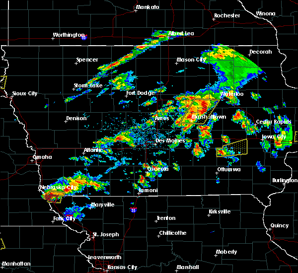 At 658 pm cdt, a severe thunderstorm was located near keswick, or 8 miles northwest of sigourney, moving east at 40 mph (radar indicated). Hazards include quarter size hail. damage to vehicles is expected At 658 pm cdt, a severe thunderstorm was located near keswick, or 8 miles northwest of sigourney, moving east at 40 mph (radar indicated). Hazards include quarter size hail. damage to vehicles is expected
|
| 3/6/2017 9:54 PM CST |
 The severe thunderstorm warning for washington county will expire at 1000 pm cst, the storms which prompted the warning have moved out of the area. therefore the warning will be allowed to expire. however gusty winds are still possible with these thunderstorms. a tornado watch remains in effect until 1000 pm cst for southeastern and east central iowa. a tornado watch also remains in effect until 400 am cst for southeastern iowa. The severe thunderstorm warning for washington county will expire at 1000 pm cst, the storms which prompted the warning have moved out of the area. therefore the warning will be allowed to expire. however gusty winds are still possible with these thunderstorms. a tornado watch remains in effect until 1000 pm cst for southeastern and east central iowa. a tornado watch also remains in effect until 400 am cst for southeastern iowa.
|
| 3/6/2017 9:42 PM CST |
 At 942 pm cst, severe thunderstorms were located along a line extending from near kalona to 6 miles south of riverside to near olds, moving east at 60 mph (trained weather spotters. this line has a history of producing damaging winds). Hazards include 70 mph wind gusts. Expect considerable tree damage. damage is likely to mobile homes, roofs, and outbuildings. locations impacted include, washington, kalona, wellman, riverside, brighton, ainsworth, crawfordsville, coppock, richmond, west chester, noble, washington airport, marr park, haskins and washington county fairgrounds. a tornado watch remains in effect until 1000 pm cst for southeastern and east central iowa. A tornado watch also remains in effect until 400 am cst for southeastern iowa. At 942 pm cst, severe thunderstorms were located along a line extending from near kalona to 6 miles south of riverside to near olds, moving east at 60 mph (trained weather spotters. this line has a history of producing damaging winds). Hazards include 70 mph wind gusts. Expect considerable tree damage. damage is likely to mobile homes, roofs, and outbuildings. locations impacted include, washington, kalona, wellman, riverside, brighton, ainsworth, crawfordsville, coppock, richmond, west chester, noble, washington airport, marr park, haskins and washington county fairgrounds. a tornado watch remains in effect until 1000 pm cst for southeastern and east central iowa. A tornado watch also remains in effect until 400 am cst for southeastern iowa.
|
| 3/6/2017 9:36 PM CST |
 At 936 pm cst, severe thunderstorms were located along a line extending from near kalona to near washington to near wayland, moving east at 60 mph (trained weather spotters. this storm has a history of producing damaging winds). Hazards include 70 mph wind gusts. Expect considerable tree damage. damage is likely to mobile homes, roofs, and outbuildings. locations impacted include, washington, kalona, wellman, riverside, brighton, richland, ainsworth, crawfordsville, kinross, coppock, richmond, keota, west chester, noble, washington airport, marr park, haskins, lake darling state park, talleyrand and washington county fairgrounds. a tornado watch remains in effect until 1000 pm cst for southeastern and east central iowa. A tornado watch also remains in effect until 400 am cst for southeastern iowa. At 936 pm cst, severe thunderstorms were located along a line extending from near kalona to near washington to near wayland, moving east at 60 mph (trained weather spotters. this storm has a history of producing damaging winds). Hazards include 70 mph wind gusts. Expect considerable tree damage. damage is likely to mobile homes, roofs, and outbuildings. locations impacted include, washington, kalona, wellman, riverside, brighton, richland, ainsworth, crawfordsville, kinross, coppock, richmond, keota, west chester, noble, washington airport, marr park, haskins, lake darling state park, talleyrand and washington county fairgrounds. a tornado watch remains in effect until 1000 pm cst for southeastern and east central iowa. A tornado watch also remains in effect until 400 am cst for southeastern iowa.
|
| 3/6/2017 9:19 PM CST | Storm damage reported in washington county IA, 0.4 miles E of Wellman, IA |
| 3/6/2017 9:18 PM CST |
 At 916 pm cst, severe thunderstorms were located along a line extending from near kalona to near harper to near martinsburg, moving east at 35 mph (radar indicated. trained spotters have reported 60 mph with this storm in keokuk county). Hazards include 70 mph wind gusts. Expect considerable tree damage. damage is likely to mobile homes, roofs, and outbuildings. locations impacted include, washington, sigourney, kalona, wellman, riverside, hedrick, brighton, richland, ainsworth, crawfordsville, keswick, south english, harper, martinsburg, kinross, hayesville, coppock, richmond, keota and ollie. a tornado watch remains in effect until 1000 pm cst for southeastern and east central iowa. A tornado watch also remains in effect until 400 am cst for southeastern iowa. At 916 pm cst, severe thunderstorms were located along a line extending from near kalona to near harper to near martinsburg, moving east at 35 mph (radar indicated. trained spotters have reported 60 mph with this storm in keokuk county). Hazards include 70 mph wind gusts. Expect considerable tree damage. damage is likely to mobile homes, roofs, and outbuildings. locations impacted include, washington, sigourney, kalona, wellman, riverside, hedrick, brighton, richland, ainsworth, crawfordsville, keswick, south english, harper, martinsburg, kinross, hayesville, coppock, richmond, keota and ollie. a tornado watch remains in effect until 1000 pm cst for southeastern and east central iowa. A tornado watch also remains in effect until 400 am cst for southeastern iowa.
|
| 3/6/2017 8:46 PM CST |
 At 845 pm cst, severe thunderstorms were located along a line extending from near north english to ottumwa industrial airport to 6 miles northwest of bloomfield, moving east at 45 mph (radar indicated). Hazards include 70 mph wind gusts. Expect considerable tree damage. Damage is likely to mobile homes, roofs, and outbuildings. At 845 pm cst, severe thunderstorms were located along a line extending from near north english to ottumwa industrial airport to 6 miles northwest of bloomfield, moving east at 45 mph (radar indicated). Hazards include 70 mph wind gusts. Expect considerable tree damage. Damage is likely to mobile homes, roofs, and outbuildings.
|
| 2/28/2017 5:29 PM CST |
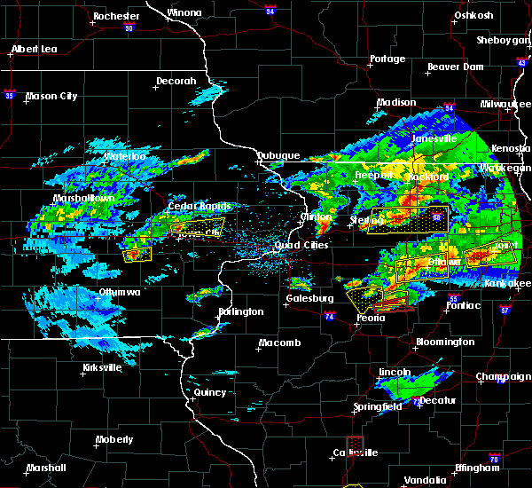 At 529 pm cst, a severe thunderstorm was located over kinross, or 16 miles northeast of sigourney, moving east at 50 mph (radar indicated). Hazards include quarter size hail. Damage to vehicles is expected. locations impacted include, wellman, north english, south english and kinross. A tornado watch remains in effect until 1000 pm cst for southeastern and east central iowa. At 529 pm cst, a severe thunderstorm was located over kinross, or 16 miles northeast of sigourney, moving east at 50 mph (radar indicated). Hazards include quarter size hail. Damage to vehicles is expected. locations impacted include, wellman, north english, south english and kinross. A tornado watch remains in effect until 1000 pm cst for southeastern and east central iowa.
|
| 2/28/2017 5:19 PM CST |
 At 518 pm cst, a severe thunderstorm was located near south english, or 7 miles northeast of sigourney, moving east at 45 mph (law enforcement). Hazards include quarter size hail. damage to vehicles is expected At 518 pm cst, a severe thunderstorm was located near south english, or 7 miles northeast of sigourney, moving east at 45 mph (law enforcement). Hazards include quarter size hail. damage to vehicles is expected
|
| 2/28/2017 3:33 PM CST |
 At 332 pm cst, a severe thunderstorm was located near wellman, or 18 miles northwest of washington, moving east at 40 mph (radar indicated). Hazards include ping pong ball size hail and 60 mph wind gusts. People and animals outdoors will be injured. expect hail damage to roofs, siding, windows, and vehicles. expect wind damage to roofs, siding, and trees. locations impacted include, iowa city, coralville, north liberty, kalona, tiffin, wellman, university heights, riverside, hills, oakdale, richmond, iowa city municipal airport, frytown, windham, johnson county fairgrounds, hills access, cosgrove, amish, holbrook and university of iowa. this includes the following highways, interstate 80 in iowa between mile markers 236 and 244. interstate 380 near mile marker 1. A tornado watch remains in effect until 1000 pm cst for southeastern and east central iowa. At 332 pm cst, a severe thunderstorm was located near wellman, or 18 miles northwest of washington, moving east at 40 mph (radar indicated). Hazards include ping pong ball size hail and 60 mph wind gusts. People and animals outdoors will be injured. expect hail damage to roofs, siding, windows, and vehicles. expect wind damage to roofs, siding, and trees. locations impacted include, iowa city, coralville, north liberty, kalona, tiffin, wellman, university heights, riverside, hills, oakdale, richmond, iowa city municipal airport, frytown, windham, johnson county fairgrounds, hills access, cosgrove, amish, holbrook and university of iowa. this includes the following highways, interstate 80 in iowa between mile markers 236 and 244. interstate 380 near mile marker 1. A tornado watch remains in effect until 1000 pm cst for southeastern and east central iowa.
|
| 2/28/2017 3:26 PM CST |
 At 326 pm cst, a severe thunderstorm was located near kinross, or 17 miles northeast of sigourney, moving east at 30 mph (radar indicated). Hazards include 60 mph wind gusts and half dollar size hail. Hail damage to vehicles is expected. Expect wind damage to roofs, siding, and trees. At 326 pm cst, a severe thunderstorm was located near kinross, or 17 miles northeast of sigourney, moving east at 30 mph (radar indicated). Hazards include 60 mph wind gusts and half dollar size hail. Hail damage to vehicles is expected. Expect wind damage to roofs, siding, and trees.
|
| 7/13/2016 2:23 PM CDT |
 At 222 pm cdt, severe thunderstorms were located along a line extending from 8 miles northwest of kalona to coppock, moving east at 50 mph (trained spotters reported downed trees in portions of keokuk county with this storm). Hazards include 70 mph wind gusts. Expect considerable tree damage. damage is likely to mobile homes, roofs, and outbuildings. locations impacted include, iowa city, muscatine, washington, west branch, wapello, columbus junction, west liberty, kalona, wellman, lone tree, university heights, riverside, hills, brighton, ainsworth, grandview, conesville, columbus city, letts and nichols. This includes interstate 80 in iowa between mile markers 250 and 265. At 222 pm cdt, severe thunderstorms were located along a line extending from 8 miles northwest of kalona to coppock, moving east at 50 mph (trained spotters reported downed trees in portions of keokuk county with this storm). Hazards include 70 mph wind gusts. Expect considerable tree damage. damage is likely to mobile homes, roofs, and outbuildings. locations impacted include, iowa city, muscatine, washington, west branch, wapello, columbus junction, west liberty, kalona, wellman, lone tree, university heights, riverside, hills, brighton, ainsworth, grandview, conesville, columbus city, letts and nichols. This includes interstate 80 in iowa between mile markers 250 and 265.
|
| 7/13/2016 2:01 PM CDT |
 At 200 pm cdt, severe thunderstorms were located along a line extending from north english to near richland, moving east at 50 mph (radar indicated). Hazards include 70 mph wind gusts. Expect considerable tree damage. Damage is likely to mobile homes, roofs, and outbuildings. At 200 pm cdt, severe thunderstorms were located along a line extending from north english to near richland, moving east at 50 mph (radar indicated). Hazards include 70 mph wind gusts. Expect considerable tree damage. Damage is likely to mobile homes, roofs, and outbuildings.
|
| 11/11/2015 4:57 PM CST | The severe thunderstorm warning for jefferson, eastern keokuk, van buren, western washington, clark and eastern scotland counties will expire at 500 pm cst, the storms which prompted the warning have moved out of the area. therefore the warning will be allowed to expire. a tornado watch remains in effect until 900 pm cst for southeastern iowa and northeastern missouri. |
| 11/11/2015 4:57 PM CST | The severe thunderstorm warning for jefferson. eastern keokuk. van buren. western washington. clark and eastern scotland counties will expire at 500 pm cst. the storms which prompted the warning have moved out of the area. therefore the warning will be allowed to expire. A tornado watch remains in effect until 900 pm cst for southeastern. |
| 11/11/2015 4:46 PM CST |
 At 446 pm cst, severe thunderstorms were located along a line extending from near millersburg to 6 miles east of harper to near steffenville, moving northeast at 50 mph (radar indicated). Hazards include 70 mph wind gusts and quarter size hail. Hail damage to vehicles is expected. expect considerable tree damage. wind damage is also likely to mobile homes, roofs and outbuildings. locations impacted include, fairfield, washington, kahoka, keosauqua, wellman, brighton, richland, birmingham, milton, bonaparte, libertyville, stockport, lockridge, maharishi vedic city, wyaconda, cantril, south english, harper, luray and pleasant plain. A tornado watch remains in effect until 900 pm cst for southeastern iowa and northeastern missouri. At 446 pm cst, severe thunderstorms were located along a line extending from near millersburg to 6 miles east of harper to near steffenville, moving northeast at 50 mph (radar indicated). Hazards include 70 mph wind gusts and quarter size hail. Hail damage to vehicles is expected. expect considerable tree damage. wind damage is also likely to mobile homes, roofs and outbuildings. locations impacted include, fairfield, washington, kahoka, keosauqua, wellman, brighton, richland, birmingham, milton, bonaparte, libertyville, stockport, lockridge, maharishi vedic city, wyaconda, cantril, south english, harper, luray and pleasant plain. A tornado watch remains in effect until 900 pm cst for southeastern iowa and northeastern missouri.
|
| 11/11/2015 4:44 PM CST |
 At 444 pm cst, severe thunderstorms were located along a line extending from near marengo to 6 miles south of wellman to near leando, moving northeast at 60 mph (radar indicated). Hazards include 70 mph wind gusts. Expect considerable tree damage. Damage is likely to mobile homes, roofs and outbuildings. At 444 pm cst, severe thunderstorms were located along a line extending from near marengo to 6 miles south of wellman to near leando, moving northeast at 60 mph (radar indicated). Hazards include 70 mph wind gusts. Expect considerable tree damage. Damage is likely to mobile homes, roofs and outbuildings.
|
| 11/11/2015 4:36 PM CST |
 At 435 pm cst, severe thunderstorms were located along a line extending from near keswick to 6 miles south of harper to near plevna, moving northeast at 55 mph (radar indicated). Hazards include 70 mph wind gusts and quarter size hail. Hail damage to vehicles is expected. expect considerable tree damage. wind damage is also likely to mobile homes, roofs and outbuildings. locations impacted include, fairfield, washington, kahoka, sigourney, memphis, keosauqua, wellman, brighton, what cheer, richland, batavia, birmingham, milton, bonaparte, delta, libertyville, stockport, lockridge, maharishi vedic city and keswick. A tornado watch remains in effect until 900 pm cst for southeastern iowa and northeastern missouri. At 435 pm cst, severe thunderstorms were located along a line extending from near keswick to 6 miles south of harper to near plevna, moving northeast at 55 mph (radar indicated). Hazards include 70 mph wind gusts and quarter size hail. Hail damage to vehicles is expected. expect considerable tree damage. wind damage is also likely to mobile homes, roofs and outbuildings. locations impacted include, fairfield, washington, kahoka, sigourney, memphis, keosauqua, wellman, brighton, what cheer, richland, batavia, birmingham, milton, bonaparte, delta, libertyville, stockport, lockridge, maharishi vedic city and keswick. A tornado watch remains in effect until 900 pm cst for southeastern iowa and northeastern missouri.
|
| 11/11/2015 4:21 PM CST |
 At 420 pm cst, severe thunderstorms were located along a line extending from near what cheer to near abingdon to 8 miles southwest of plevna, moving northeast at 50 mph (radar indicated). Hazards include 70 mph wind gusts and quarter size hail. Hail damage to vehicles is expected. expect considerable tree damage. wind damage is also likely to mobile homes, roofs and outbuildings. locations impacted include, fairfield, washington, kahoka, sigourney, memphis, keosauqua, wellman, hedrick, brighton, what cheer, richland, batavia, birmingham, milton, bonaparte, delta, libertyville, stockport, lockridge and maharishi vedic city. A tornado watch remains in effect until 900 pm cst for southeastern iowa and northeastern missouri. At 420 pm cst, severe thunderstorms were located along a line extending from near what cheer to near abingdon to 8 miles southwest of plevna, moving northeast at 50 mph (radar indicated). Hazards include 70 mph wind gusts and quarter size hail. Hail damage to vehicles is expected. expect considerable tree damage. wind damage is also likely to mobile homes, roofs and outbuildings. locations impacted include, fairfield, washington, kahoka, sigourney, memphis, keosauqua, wellman, hedrick, brighton, what cheer, richland, batavia, birmingham, milton, bonaparte, delta, libertyville, stockport, lockridge and maharishi vedic city. A tornado watch remains in effect until 900 pm cst for southeastern iowa and northeastern missouri.
|
| 11/11/2015 4:12 PM CST |
 At 411 pm cst, severe thunderstorms were located along a line extending from 7 miles west of delta to 6 miles southeast of ottumwa to near clarence, moving northeast at 60 mph (radar indicated). Hazards include 70 mph wind gusts and quarter size hail. Hail damage to vehicles is expected. expect considerable tree damage. wind damage is also likely to mobile homes, roofs and outbuildings. locations impacted include, fairfield, washington, kahoka, sigourney, memphis, keosauqua, wellman, hedrick, brighton, what cheer, richland, batavia, birmingham, milton, bonaparte, delta, libertyville, stockport, lockridge and maharishi vedic city. A tornado watch remains in effect until 900 pm cst for southeastern iowa and northeastern missouri. At 411 pm cst, severe thunderstorms were located along a line extending from 7 miles west of delta to 6 miles southeast of ottumwa to near clarence, moving northeast at 60 mph (radar indicated). Hazards include 70 mph wind gusts and quarter size hail. Hail damage to vehicles is expected. expect considerable tree damage. wind damage is also likely to mobile homes, roofs and outbuildings. locations impacted include, fairfield, washington, kahoka, sigourney, memphis, keosauqua, wellman, hedrick, brighton, what cheer, richland, batavia, birmingham, milton, bonaparte, delta, libertyville, stockport, lockridge and maharishi vedic city. A tornado watch remains in effect until 900 pm cst for southeastern iowa and northeastern missouri.
|
| 11/11/2015 3:55 PM CST |
 At 353 pm cst, severe thunderstorms were located along a line extending from eddyville to bevier, moving northeast at 50 mph (radar indicated). Hazards include 70 mph wind gusts and nickel size hail. Expect considerable tree damage. Damage is likely to mobile homes, roofs and outbuildings. At 353 pm cst, severe thunderstorms were located along a line extending from eddyville to bevier, moving northeast at 50 mph (radar indicated). Hazards include 70 mph wind gusts and nickel size hail. Expect considerable tree damage. Damage is likely to mobile homes, roofs and outbuildings.
|
| 9/17/2015 12:04 PM CDT |
 At 1203 pm cdt, severe thunderstorms were located along a line extending from kalona to near washington to 7 miles north of brighton, moving east at 35 mph (radar indicated). Hazards include quarter size hail. Damage to vehicles is expected. Locations impacted include, washington, columbus junction, kalona, wellman, lone tree, riverside, ainsworth, crawfordsville, cotter, richmond, wyman, west chester, marr park, haskins, washington airport, river junction, gladwin and washington county fairgrounds. At 1203 pm cdt, severe thunderstorms were located along a line extending from kalona to near washington to 7 miles north of brighton, moving east at 35 mph (radar indicated). Hazards include quarter size hail. Damage to vehicles is expected. Locations impacted include, washington, columbus junction, kalona, wellman, lone tree, riverside, ainsworth, crawfordsville, cotter, richmond, wyman, west chester, marr park, haskins, washington airport, river junction, gladwin and washington county fairgrounds.
|
| 9/17/2015 11:57 AM CDT |
 At 1156 am cdt, severe thunderstorms were located along a line extending from kalona to near washington to 6 miles north of brighton, moving east at 30 mph (radar indicated). Hazards include ping pong ball size hail and 60 mph wind gusts. People and animals outdoors will be injured. expect hail damage to roofs, siding, windows and vehicles. expect wind damage to roofs, siding and trees. Locations impacted include, washington, columbus junction, kalona, wellman, lone tree, riverside, hills, ainsworth, crawfordsville, cotter, richmond, wyman, west chester, marr park, haskins, washington airport, river junction, amish, gladwin and hills access. At 1156 am cdt, severe thunderstorms were located along a line extending from kalona to near washington to 6 miles north of brighton, moving east at 30 mph (radar indicated). Hazards include ping pong ball size hail and 60 mph wind gusts. People and animals outdoors will be injured. expect hail damage to roofs, siding, windows and vehicles. expect wind damage to roofs, siding and trees. Locations impacted include, washington, columbus junction, kalona, wellman, lone tree, riverside, hills, ainsworth, crawfordsville, cotter, richmond, wyman, west chester, marr park, haskins, washington airport, river junction, amish, gladwin and hills access.
|
| 9/17/2015 11:51 AM CDT |
 At 1151 am cdt, severe thunderstorms were located along a line extending from near kalona to 7 miles south of wellman to near richland, and are nearly stationary (radar indicated). Hazards include ping pong ball size hail and 60 mph wind gusts. People and animals outdoors will be injured. expect hail damage to roofs, siding, windows and vehicles. expect wind damage to roofs, siding and trees. Locations impacted include, washington, columbus junction, kalona, wellman, lone tree, riverside, hills, brighton, richland, ainsworth, crawfordsville, cotter, coppock, richmond, wyman, keota, west chester, marr park, haskins and lake darling state park. At 1151 am cdt, severe thunderstorms were located along a line extending from near kalona to 7 miles south of wellman to near richland, and are nearly stationary (radar indicated). Hazards include ping pong ball size hail and 60 mph wind gusts. People and animals outdoors will be injured. expect hail damage to roofs, siding, windows and vehicles. expect wind damage to roofs, siding and trees. Locations impacted include, washington, columbus junction, kalona, wellman, lone tree, riverside, hills, brighton, richland, ainsworth, crawfordsville, cotter, coppock, richmond, wyman, keota, west chester, marr park, haskins and lake darling state park.
|
| 9/17/2015 11:47 AM CDT |
 At 1146 am cdt, severe thunderstorms were located along a line extending from near kalona to 6 miles southwest of richmond to near richland, moving east at 45 mph (radar indicated). Hazards include 60 mph wind gusts and quarter size hail. Hail damage to vehicles is expected. Expect wind damage to roofs, siding and trees. At 1146 am cdt, severe thunderstorms were located along a line extending from near kalona to 6 miles southwest of richmond to near richland, moving east at 45 mph (radar indicated). Hazards include 60 mph wind gusts and quarter size hail. Hail damage to vehicles is expected. Expect wind damage to roofs, siding and trees.
|
| 7/28/2015 6:57 PM CDT |
 At 657 pm cdt, severe thunderstorms were located along a line extending from north english to hayesville to near hedrick to ottumwa, moving east at 40 mph (radar indicated). Hazards include 70 mph wind gusts. Expect considerable tree damage. damage is likely to mobile homes, roofs and outbuildings. Locations impacted include, fairfield, washington, sigourney, kalona, wellman, hedrick, brighton, what cheer, richland, batavia, delta, libertyville, lockridge, maharishi vedic city, keswick, south english, packwood, harper, martinsburg and pleasant plain. At 657 pm cdt, severe thunderstorms were located along a line extending from north english to hayesville to near hedrick to ottumwa, moving east at 40 mph (radar indicated). Hazards include 70 mph wind gusts. Expect considerable tree damage. damage is likely to mobile homes, roofs and outbuildings. Locations impacted include, fairfield, washington, sigourney, kalona, wellman, hedrick, brighton, what cheer, richland, batavia, delta, libertyville, lockridge, maharishi vedic city, keswick, south english, packwood, harper, martinsburg and pleasant plain.
|
| 7/28/2015 6:52 PM CDT |
 At 652 pm cdt, severe thunderstorms were located along a line extending from near north english to hayesville to near hedrick to near ottumwa, moving east at 40 mph (radar indicated). Hazards include 60 mph wind gusts. Expect damage to roofs. siding and trees. Locations impacted include, fairfield, washington, sigourney, kalona, wellman, hedrick, brighton, what cheer, richland, batavia, delta, libertyville, lockridge, maharishi vedic city, keswick, south english, packwood, harper, martinsburg and pleasant plain. At 652 pm cdt, severe thunderstorms were located along a line extending from near north english to hayesville to near hedrick to near ottumwa, moving east at 40 mph (radar indicated). Hazards include 60 mph wind gusts. Expect damage to roofs. siding and trees. Locations impacted include, fairfield, washington, sigourney, kalona, wellman, hedrick, brighton, what cheer, richland, batavia, delta, libertyville, lockridge, maharishi vedic city, keswick, south english, packwood, harper, martinsburg and pleasant plain.
|
| 7/28/2015 6:39 PM CDT |
 At 639 pm cdt, severe thunderstorms were located along a line extending from millersburg to delta to near hedrick to near ottumwa industrial airport, moving east at 45 mph (radar indicated). Hazards include 60 mph wind gusts. Expect damage to roofs. Siding and trees. At 639 pm cdt, severe thunderstorms were located along a line extending from millersburg to delta to near hedrick to near ottumwa industrial airport, moving east at 45 mph (radar indicated). Hazards include 60 mph wind gusts. Expect damage to roofs. Siding and trees.
|
| 1/1/0001 12:00 AM | Tree limbs and power lines down in washington county IA, 0.4 miles E of Wellman, IA |
Hail Maps for Wellman, IA


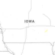


Connect with Interactive Hail Maps