

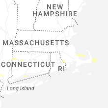
Hail Map for West Chatham, MA
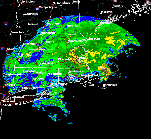
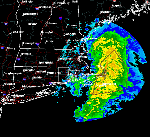
The West Chatham, MA area has had 0 reports of on-the-ground hail by trained spotters, and has been under severe weather warnings 3 times during the past 12 months. Doppler radar has detected hail at or near West Chatham, MA on 3 occasions, including 2 occasions during the past year.
| Name: | West Chatham, MA |
| Where Located: | 74.1 miles E of Providence, RI |
| Map: | Google Map for West Chatham, MA |
| Population: | 1410 |
| Housing Units: | 1856 |
| More Info: | Search Google for West Chatham, MA |
0
The Top Recent Hail Date for West Chatham, MA is Tuesday, July 8, 2025 (3rd out of 3)

Hail and Wind Damage Spotted near West Chatham, MA
| Date / Time | Report Details |
|---|---|
| 8/26/2024 1:04 PM EDT |
 the severe thunderstorm warning has been cancelled and is no longer in effect the severe thunderstorm warning has been cancelled and is no longer in effect
|
| 8/26/2024 12:55 PM EDT |
 At 1255 pm edt, a severe thunderstorm was located over dennis, or near brewster, moving southeast at 5 mph (radar indicated). Hazards include 60 mph wind gusts and quarter size hail. Hail damage to vehicles is expected. expect wind damage to trees and power lines. Locations impacted include, brewster, yarmouth, dennis, harwich, and chatham. At 1255 pm edt, a severe thunderstorm was located over dennis, or near brewster, moving southeast at 5 mph (radar indicated). Hazards include 60 mph wind gusts and quarter size hail. Hail damage to vehicles is expected. expect wind damage to trees and power lines. Locations impacted include, brewster, yarmouth, dennis, harwich, and chatham.
|
| 8/26/2024 12:39 PM EDT |
 Svrbox the national weather service in boston/norton has issued a * severe thunderstorm warning for, southeastern barnstable county in southeastern massachusetts, * until 130 pm edt. * at 1239 pm edt, a severe thunderstorm was located over dennis, or near brewster, moving southeast at 5 mph (radar indicated). Hazards include 60 mph wind gusts and quarter size hail. Hail damage to vehicles is expected. Expect wind damage to trees and power lines. Svrbox the national weather service in boston/norton has issued a * severe thunderstorm warning for, southeastern barnstable county in southeastern massachusetts, * until 130 pm edt. * at 1239 pm edt, a severe thunderstorm was located over dennis, or near brewster, moving southeast at 5 mph (radar indicated). Hazards include 60 mph wind gusts and quarter size hail. Hail damage to vehicles is expected. Expect wind damage to trees and power lines.
|
| 8/8/2023 12:52 PM EDT |
 The severe thunderstorm warning for eastern barnstable county will expire at 100 pm edt, the storms which prompted the warning have weakened below severe limits, and no longer pose an immediate threat to life or property. therefore, the warning will be allowed to expire. however gusty winds are still possible with these thunderstorms. The severe thunderstorm warning for eastern barnstable county will expire at 100 pm edt, the storms which prompted the warning have weakened below severe limits, and no longer pose an immediate threat to life or property. therefore, the warning will be allowed to expire. however gusty winds are still possible with these thunderstorms.
|
| 8/8/2023 12:47 PM EDT |
 At 1247 pm edt, severe thunderstorms were located along a line extending from near truro to eastham to near barnstable, moving northeast at 30 mph (radar indicated). Hazards include 60 mph wind gusts. Expect damage to roofs, siding, and trees. locations impacted include, brewster, yarmouth, dennis, harwich, chatham, orleans, eastham, wellfleet, and truro. hail threat, radar indicated max hail size, <. 75 in wind threat, radar indicated max wind gust, 60 mph. At 1247 pm edt, severe thunderstorms were located along a line extending from near truro to eastham to near barnstable, moving northeast at 30 mph (radar indicated). Hazards include 60 mph wind gusts. Expect damage to roofs, siding, and trees. locations impacted include, brewster, yarmouth, dennis, harwich, chatham, orleans, eastham, wellfleet, and truro. hail threat, radar indicated max hail size, <. 75 in wind threat, radar indicated max wind gust, 60 mph.
|
| 8/8/2023 12:36 PM EDT |
 At 1236 pm edt, severe thunderstorms were located along a line extending from near truro to eastham to near barnstable, moving northeast at 40 mph (radar indicated). Hazards include 60 mph wind gusts. Expect damage to roofs, siding, and trees. Locations impacted include, barnstable, brewster, provincetown, yarmouth, dennis, harwich, chatham, orleans, eastham, wellfleet, truro, and hyannis. At 1236 pm edt, severe thunderstorms were located along a line extending from near truro to eastham to near barnstable, moving northeast at 40 mph (radar indicated). Hazards include 60 mph wind gusts. Expect damage to roofs, siding, and trees. Locations impacted include, barnstable, brewster, provincetown, yarmouth, dennis, harwich, chatham, orleans, eastham, wellfleet, truro, and hyannis.
|
| 8/8/2023 12:19 PM EDT |
 At 1218 pm edt, severe thunderstorms were located along a line extending from 6 miles south of provincetown to near dennis to 6 miles south of mashpee, moving northeast at 40 mph (radar indicated). Hazards include 60 mph wind gusts. expect damage to roofs, siding, and trees At 1218 pm edt, severe thunderstorms were located along a line extending from 6 miles south of provincetown to near dennis to 6 miles south of mashpee, moving northeast at 40 mph (radar indicated). Hazards include 60 mph wind gusts. expect damage to roofs, siding, and trees
|
| 8/8/2023 12:05 PM EDT |
 At 1204 pm edt, severe thunderstorms were located along a line extending from 7 miles north of plymouth to 7 miles northeast of sandwich to near barnstable to near falmouth, moving northeast at 30 mph (radar indicated). Hazards include 60 mph wind gusts. Expect damage to roofs, siding, and trees. Locations impacted include, barnstable, falmouth, brewster, provincetown, yarmouth, sandwich, bourne, dennis, mashpee, harwich, chatham, orleans, eastham, wellfleet, truro, and hyannis. At 1204 pm edt, severe thunderstorms were located along a line extending from 7 miles north of plymouth to 7 miles northeast of sandwich to near barnstable to near falmouth, moving northeast at 30 mph (radar indicated). Hazards include 60 mph wind gusts. Expect damage to roofs, siding, and trees. Locations impacted include, barnstable, falmouth, brewster, provincetown, yarmouth, sandwich, bourne, dennis, mashpee, harwich, chatham, orleans, eastham, wellfleet, truro, and hyannis.
|
| 8/8/2023 11:37 AM EDT |
 At 1137 am edt, severe thunderstorms were located along a line extending from near carver to near bourne to near falmouth to near gosnold, moving northeast at 30 mph (radar indicated). Hazards include 60 mph wind gusts. expect damage to roofs, siding, and trees At 1137 am edt, severe thunderstorms were located along a line extending from near carver to near bourne to near falmouth to near gosnold, moving northeast at 30 mph (radar indicated). Hazards include 60 mph wind gusts. expect damage to roofs, siding, and trees
|
| 7/29/2023 9:43 PM EDT |
 The severe thunderstorm warning for central dukes, barnstable, southern plymouth, southeastern bristol, northeastern newport and east central bristol counties will expire at 945 pm edt, the storms which prompted the warning have weakened below severe limits, and no longer pose an immediate threat to life or property. therefore, the warning will be allowed to expire. however gusty winds are still possible with these thunderstorms. The severe thunderstorm warning for central dukes, barnstable, southern plymouth, southeastern bristol, northeastern newport and east central bristol counties will expire at 945 pm edt, the storms which prompted the warning have weakened below severe limits, and no longer pose an immediate threat to life or property. therefore, the warning will be allowed to expire. however gusty winds are still possible with these thunderstorms.
|
| 7/29/2023 9:12 PM EDT |
 At 912 pm edt, severe thunderstorms were located along a line extending from 6 miles northeast of plymouth to near westport, moving southeast at 30 mph (radar indicated). Hazards include 60 mph wind gusts. Expect damage to trees and power lines. locations impacted include, new bedford, fall river, plymouth, barnstable, dartmouth, falmouth, marion, oak bluffs, edgartown, tisbury, aquinnah, yarmouth, middleborough, wareham, sandwich, bourne, somerset, fairhaven, swansea and tiverton. hail threat, radar indicated max hail size, <. 75 in wind threat, radar indicated max wind gust, 60 mph. At 912 pm edt, severe thunderstorms were located along a line extending from 6 miles northeast of plymouth to near westport, moving southeast at 30 mph (radar indicated). Hazards include 60 mph wind gusts. Expect damage to trees and power lines. locations impacted include, new bedford, fall river, plymouth, barnstable, dartmouth, falmouth, marion, oak bluffs, edgartown, tisbury, aquinnah, yarmouth, middleborough, wareham, sandwich, bourne, somerset, fairhaven, swansea and tiverton. hail threat, radar indicated max hail size, <. 75 in wind threat, radar indicated max wind gust, 60 mph.
|
| 7/29/2023 8:39 PM EDT |
 At 839 pm edt, severe thunderstorms were located along a line extending from near duxbury to near seekonk, moving southeast at 30 mph (radar indicated). Hazards include 60 mph wind gusts. expect damage to trees and power lines At 839 pm edt, severe thunderstorms were located along a line extending from near duxbury to near seekonk, moving southeast at 30 mph (radar indicated). Hazards include 60 mph wind gusts. expect damage to trees and power lines
|
| 11/23/2020 11:40 AM EST |
 At 1136 am est, a severe thunderstorm capable of producing a tornado was located 8 miles south of barnstable, moving northeast at 50 mph (radar indicated rotation. at 1132 am in edgartown ma on marthas vineyard a gusts to 45 mph was reported by skywarn spotter). Hazards include tornado. Flying debris will be dangerous to those caught without shelter. mobile homes will be damaged or destroyed. damage to roofs, windows, and vehicles will occur. tree damage is likely. this dangerous storm will be near, yarmouth around 1140 am est. dennis and harwich around 1145 am est. brewster around 1150 am est. Other locations impacted by this tornadic thunderstorm include hyannis. At 1136 am est, a severe thunderstorm capable of producing a tornado was located 8 miles south of barnstable, moving northeast at 50 mph (radar indicated rotation. at 1132 am in edgartown ma on marthas vineyard a gusts to 45 mph was reported by skywarn spotter). Hazards include tornado. Flying debris will be dangerous to those caught without shelter. mobile homes will be damaged or destroyed. damage to roofs, windows, and vehicles will occur. tree damage is likely. this dangerous storm will be near, yarmouth around 1140 am est. dennis and harwich around 1145 am est. brewster around 1150 am est. Other locations impacted by this tornadic thunderstorm include hyannis.
|
| 11/23/2020 11:23 AM EST |
 At 1122 am est, a severe thunderstorm capable of producing a tornado was located near edgartown, moving northeast at 50 mph (radar indicated rotation). Hazards include tornado. Flying debris will be dangerous to those caught without shelter. mobile homes will be damaged or destroyed. damage to roofs, windows, and vehicles will occur. tree damage is likely. this dangerous storm will be near, yarmouth and dennis around 1145 am est. brewster and harwich around 1150 am est. Other locations impacted by this tornadic thunderstorm include hyannis. At 1122 am est, a severe thunderstorm capable of producing a tornado was located near edgartown, moving northeast at 50 mph (radar indicated rotation). Hazards include tornado. Flying debris will be dangerous to those caught without shelter. mobile homes will be damaged or destroyed. damage to roofs, windows, and vehicles will occur. tree damage is likely. this dangerous storm will be near, yarmouth and dennis around 1145 am est. brewster and harwich around 1150 am est. Other locations impacted by this tornadic thunderstorm include hyannis.
|
| 4/9/2020 5:12 PM EDT |
 At 509 pm edt, severe thunderstorms were located along a line extending from 10 miles north of nantucket to 33 miles southeast of edgartown, moving east at 65 mph. these storms produced 60 mph gusts on block island and 58 mph gusts in marstons mills (radar indicated). Hazards include 60 mph wind gusts. Expect damage to trees and power lines. Locations impacted include, barnstable, nantucket, brewster, yarmouth, dennis, harwich, chatham, orleans, eastham and hyannis. At 509 pm edt, severe thunderstorms were located along a line extending from 10 miles north of nantucket to 33 miles southeast of edgartown, moving east at 65 mph. these storms produced 60 mph gusts on block island and 58 mph gusts in marstons mills (radar indicated). Hazards include 60 mph wind gusts. Expect damage to trees and power lines. Locations impacted include, barnstable, nantucket, brewster, yarmouth, dennis, harwich, chatham, orleans, eastham and hyannis.
|
| 4/9/2020 4:24 PM EDT |
 At 423 pm edt, severe thunderstorms were located along a line extending from near gosnold to 22 miles south of chilmark, moving east at 65 mph. these storms produced 60 mph gusts on block island (radar indicated). Hazards include 60 mph wind gusts. expect damage to trees and power lines At 423 pm edt, severe thunderstorms were located along a line extending from near gosnold to 22 miles south of chilmark, moving east at 65 mph. these storms produced 60 mph gusts on block island (radar indicated). Hazards include 60 mph wind gusts. expect damage to trees and power lines
|
| 8/8/2019 4:57 AM EDT |
 At 438 am edt, a severe thunderstorm was located 12 miles northwest of nantucket, moving northeast at 30 mph (radar indicated). Hazards include 60 mph wind gusts. Expect damage to trees and power lines. Locations impacted include, nantucket, brewster, edgartown, dennis, harwich, chatham, orleans, eastham and wellfleet. At 438 am edt, a severe thunderstorm was located 12 miles northwest of nantucket, moving northeast at 30 mph (radar indicated). Hazards include 60 mph wind gusts. Expect damage to trees and power lines. Locations impacted include, nantucket, brewster, edgartown, dennis, harwich, chatham, orleans, eastham and wellfleet.
|
| 8/8/2019 4:38 AM EDT |
 At 438 am edt, a severe thunderstorm was located 12 miles northwest of nantucket, moving northeast at 30 mph (radar indicated). Hazards include 60 mph wind gusts. Expect damage to trees and power lines. Locations impacted include, nantucket, brewster, edgartown, dennis, harwich, chatham, orleans, eastham and wellfleet. At 438 am edt, a severe thunderstorm was located 12 miles northwest of nantucket, moving northeast at 30 mph (radar indicated). Hazards include 60 mph wind gusts. Expect damage to trees and power lines. Locations impacted include, nantucket, brewster, edgartown, dennis, harwich, chatham, orleans, eastham and wellfleet.
|
| 8/8/2019 4:25 AM EDT |
 At 424 am edt, a severe thunderstorm was located 8 miles east of edgartown, moving northeast at 30 mph (radar indicated). Hazards include 60 mph wind gusts. expect damage to trees and power lines At 424 am edt, a severe thunderstorm was located 8 miles east of edgartown, moving northeast at 30 mph (radar indicated). Hazards include 60 mph wind gusts. expect damage to trees and power lines
|
| 8/8/2019 3:28 AM EDT |
 At 327 am edt, a severe thunderstorm was located near barnstable, moving northeast at 30 mph (radar indicated). Hazards include 60 mph wind gusts. Expect damage to trees and power lines. Locations impacted include, barnstable, brewster, yarmouth, sandwich, dennis, mashpee, harwich, chatham, orleans and hyannis. At 327 am edt, a severe thunderstorm was located near barnstable, moving northeast at 30 mph (radar indicated). Hazards include 60 mph wind gusts. Expect damage to trees and power lines. Locations impacted include, barnstable, brewster, yarmouth, sandwich, dennis, mashpee, harwich, chatham, orleans and hyannis.
|
| 8/8/2019 3:18 AM EDT |
 At 317 am edt, a severe thunderstorm was located 8 miles east of oak bluffs, moving northeast at 30 mph (radar indicated). Hazards include 60 mph wind gusts. Expect damage to trees and power lines. Locations impacted include, barnstable, falmouth, brewster, oak bluffs, edgartown, tisbury, yarmouth, sandwich, dennis, mashpee, harwich, chatham, orleans and hyannis. At 317 am edt, a severe thunderstorm was located 8 miles east of oak bluffs, moving northeast at 30 mph (radar indicated). Hazards include 60 mph wind gusts. Expect damage to trees and power lines. Locations impacted include, barnstable, falmouth, brewster, oak bluffs, edgartown, tisbury, yarmouth, sandwich, dennis, mashpee, harwich, chatham, orleans and hyannis.
|
| 8/8/2019 2:59 AM EDT |
 At 259 am edt, a severe thunderstorm was located over edgartown, moving northeast at 30 mph (radar indicated). Hazards include 60 mph wind gusts. expect damage to trees and power lines At 259 am edt, a severe thunderstorm was located over edgartown, moving northeast at 30 mph (radar indicated). Hazards include 60 mph wind gusts. expect damage to trees and power lines
|
| 7/23/2019 12:19 PM EDT | Storm damage reported in barnstable county MA, 1.3 miles NNW of West Chatham, MA |
| 7/23/2019 12:15 PM EDT | Storm damage reported in barnstable county MA, 1.3 miles NNW of West Chatham, MA |
| 7/23/2019 12:12 PM EDT |
 At 1211 pm edt, a tornado producing storm was located over harwich, or near brewster, moving northeast at 35 mph. * a wind gust to 90 mph was observed at kalmus (radar confirmed tornado). Hazards include damaging tornado. Flying debris will be dangerous to those caught without shelter. mobile homes will be damaged or destroyed. damage to roofs, windows, and vehicles will occur. tree damage is likely. this tornadic storm will be near, brewster around 1215 pm edt. Orleans and eastham around 1225 pm edt. At 1211 pm edt, a tornado producing storm was located over harwich, or near brewster, moving northeast at 35 mph. * a wind gust to 90 mph was observed at kalmus (radar confirmed tornado). Hazards include damaging tornado. Flying debris will be dangerous to those caught without shelter. mobile homes will be damaged or destroyed. damage to roofs, windows, and vehicles will occur. tree damage is likely. this tornadic storm will be near, brewster around 1215 pm edt. Orleans and eastham around 1225 pm edt.
|
| 7/23/2019 12:03 PM EDT |
 At 1202 pm edt, a confirmed tornado was located over yarmouth, or 8 miles east of barnstable, moving northeast at 35 mph (radar confirmed tornado). Hazards include damaging tornado. Flying debris will be dangerous to those caught without shelter. mobile homes will be damaged or destroyed. damage to roofs, windows, and vehicles will occur. tree damage is likely. this tornado will be near, harwich around 1210 pm edt. brewster around 1215 pm edt. Other locations impacted by this tornadic thunderstorm include hyannis. At 1202 pm edt, a confirmed tornado was located over yarmouth, or 8 miles east of barnstable, moving northeast at 35 mph (radar confirmed tornado). Hazards include damaging tornado. Flying debris will be dangerous to those caught without shelter. mobile homes will be damaged or destroyed. damage to roofs, windows, and vehicles will occur. tree damage is likely. this tornado will be near, harwich around 1210 pm edt. brewster around 1215 pm edt. Other locations impacted by this tornadic thunderstorm include hyannis.
|
| 7/23/2019 11:58 AM EDT |
 At 1157 am edt, a severe thunderstorm capable of producing a tornado was located over yarmouth, or near barnstable, moving northeast at 35 mph. wind gusts to 70 mph have been observed (radar indicated rotation). Hazards include tornado. Flying debris will be dangerous to those caught without shelter. mobile homes will be damaged or destroyed. damage to roofs, windows, and vehicles will occur. tree damage is likely. this dangerous storm will be near, dennis around 1205 pm edt. harwich around 1210 pm edt. brewster around 1215 pm edt. Other locations impacted by this tornadic thunderstorm include hyannis. At 1157 am edt, a severe thunderstorm capable of producing a tornado was located over yarmouth, or near barnstable, moving northeast at 35 mph. wind gusts to 70 mph have been observed (radar indicated rotation). Hazards include tornado. Flying debris will be dangerous to those caught without shelter. mobile homes will be damaged or destroyed. damage to roofs, windows, and vehicles will occur. tree damage is likely. this dangerous storm will be near, dennis around 1205 pm edt. harwich around 1210 pm edt. brewster around 1215 pm edt. Other locations impacted by this tornadic thunderstorm include hyannis.
|
| 7/23/2019 11:39 AM EDT |
 The national weather service in boston/norton has issued a * tornado warning for. southern barnstable county in southeastern massachusetts. until 1215 pm edt. At 1138 am edt, a severe thunderstorm capable of producing a tornado was located over mashpee, or 7 miles southwest of. The national weather service in boston/norton has issued a * tornado warning for. southern barnstable county in southeastern massachusetts. until 1215 pm edt. At 1138 am edt, a severe thunderstorm capable of producing a tornado was located over mashpee, or 7 miles southwest of.
|
| 7/22/2019 10:36 PM EDT |
 At 1036 pm edt, a severe thunderstorm was located near wellfleet, or 13 miles northeast of brewster, moving northeast at 55 mph (radar indicated). Hazards include 60 mph wind gusts. Expect damage to trees and power lines. Locations impacted include, chatham, orleans, eastham, wellfleet and truro. At 1036 pm edt, a severe thunderstorm was located near wellfleet, or 13 miles northeast of brewster, moving northeast at 55 mph (radar indicated). Hazards include 60 mph wind gusts. Expect damage to trees and power lines. Locations impacted include, chatham, orleans, eastham, wellfleet and truro.
|
| 7/22/2019 10:29 PM EDT |
 At 1028 pm edt, a severe thunderstorm capable of producing a tornado was located over orleans, or 7 miles east of brewster, moving northeast at 40 mph (radar indicated rotation. west dennis reported a wind gust to 50 mph with this storm at 10:18 pm). Hazards include tornado. Flying debris will be dangerous to those caught without shelter. mobile homes will be damaged or destroyed. damage to roofs, windows, and vehicles will occur. tree damage is likely. This tornadic thunderstorm will remain over mainly rural areas of east central barnstable county. At 1028 pm edt, a severe thunderstorm capable of producing a tornado was located over orleans, or 7 miles east of brewster, moving northeast at 40 mph (radar indicated rotation. west dennis reported a wind gust to 50 mph with this storm at 10:18 pm). Hazards include tornado. Flying debris will be dangerous to those caught without shelter. mobile homes will be damaged or destroyed. damage to roofs, windows, and vehicles will occur. tree damage is likely. This tornadic thunderstorm will remain over mainly rural areas of east central barnstable county.
|
| 7/22/2019 10:21 PM EDT |
 At 1021 pm edt, a severe thunderstorm capable of producing a tornado was located over harwich, or near brewster, moving northeast at 40 mph (radar indicated rotation). Hazards include tornado. Flying debris will be dangerous to those caught without shelter. mobile homes will be damaged or destroyed. damage to roofs, windows, and vehicles will occur. tree damage is likely. This dangerous storm will be near, orleans and eastham around 1030 pm edt. At 1021 pm edt, a severe thunderstorm capable of producing a tornado was located over harwich, or near brewster, moving northeast at 40 mph (radar indicated rotation). Hazards include tornado. Flying debris will be dangerous to those caught without shelter. mobile homes will be damaged or destroyed. damage to roofs, windows, and vehicles will occur. tree damage is likely. This dangerous storm will be near, orleans and eastham around 1030 pm edt.
|
| 7/22/2019 10:17 PM EDT |
 The national weather service in boston/norton has issued a * severe thunderstorm warning for. east central barnstable county in southeastern massachusetts. until 1100 pm edt. At 1017 pm edt, a severe thunderstorm was located over dennis, or near brewster, moving northeast at 25 mph. The national weather service in boston/norton has issued a * severe thunderstorm warning for. east central barnstable county in southeastern massachusetts. until 1100 pm edt. At 1017 pm edt, a severe thunderstorm was located over dennis, or near brewster, moving northeast at 25 mph.
|
| 9/18/2018 3:04 PM EDT |
 At 304 pm edt, a severe thunderstorm was located 9 miles northeast of sandwich, or 10 miles north of barnstable, moving east at 35 mph (radar indicated). Hazards include 60 mph wind gusts. expect damage to trees and power lines At 304 pm edt, a severe thunderstorm was located 9 miles northeast of sandwich, or 10 miles north of barnstable, moving east at 35 mph (radar indicated). Hazards include 60 mph wind gusts. expect damage to trees and power lines
|
| 1/23/2018 4:01 PM EST |
 At 400 pm est, severe thunderstorms were located along a line extending from 21 miles northeast of truro to 6 miles south of harwich, moving northeast at 75 mph (radar indicated). Hazards include 60 mph wind gusts. Expect damage to trees and power lines. Locations impacted include, brewster, harwich, chatham, orleans, eastham and wellfleet. At 400 pm est, severe thunderstorms were located along a line extending from 21 miles northeast of truro to 6 miles south of harwich, moving northeast at 75 mph (radar indicated). Hazards include 60 mph wind gusts. Expect damage to trees and power lines. Locations impacted include, brewster, harwich, chatham, orleans, eastham and wellfleet.
|
| 1/23/2018 3:08 PM EST |
 At 308 pm est, severe thunderstorms were located along a line extending from near falmouth to 30 miles south of chilmark, moving northeast at 75 mph (radar indicated). Hazards include 60 mph wind gusts. expect damage to trees and power lines At 308 pm est, severe thunderstorms were located along a line extending from near falmouth to 30 miles south of chilmark, moving northeast at 75 mph (radar indicated). Hazards include 60 mph wind gusts. expect damage to trees and power lines
|
| 7/22/2016 10:31 PM EDT |
 At 1030 pm edt, a severe thunderstorm was located near brewster, moving east at 30 mph (radar indicated). Hazards include 60 mph wind gusts and penny size hail. Expect damage to roofs. siding. and trees. Locations impacted include, brewster, provincetown, yarmouth, dennis, harwich, chatham, orleans, eastham, wellfleet and truro. At 1030 pm edt, a severe thunderstorm was located near brewster, moving east at 30 mph (radar indicated). Hazards include 60 mph wind gusts and penny size hail. Expect damage to roofs. siding. and trees. Locations impacted include, brewster, provincetown, yarmouth, dennis, harwich, chatham, orleans, eastham, wellfleet and truro.
|
| 7/22/2016 10:05 PM EDT |
 At 1005 pm edt, a severe thunderstorm was located 8 miles northeast of sandwich, or 8 miles north of barnstable, moving east at 30 mph (radar indicated). Hazards include 60 mph wind gusts and penny size hail. Expect damage to roofs. siding. And trees. At 1005 pm edt, a severe thunderstorm was located 8 miles northeast of sandwich, or 8 miles north of barnstable, moving east at 30 mph (radar indicated). Hazards include 60 mph wind gusts and penny size hail. Expect damage to roofs. siding. And trees.
|
| 7/1/2016 11:16 PM EDT |
 At 1115 pm edt, severe thunderstorms were located along a line extending from near oak bluffs to 20 miles south of edgartown, moving northeast at 50 mph (radar indicated). Hazards include 60 mph wind gusts. Expect damage to roofs. siding. And trees. At 1115 pm edt, severe thunderstorms were located along a line extending from near oak bluffs to 20 miles south of edgartown, moving northeast at 50 mph (radar indicated). Hazards include 60 mph wind gusts. Expect damage to roofs. siding. And trees.
|
| 10/16/2015 10:01 AM EDT |
 At 959 am edt, doppler radar indicated a severe thunderstorm capable of producing quarter size hail and damaging winds in excess of 60 mph. this storm was located near mashpee, or 8 miles southwest of barnstable, and was moving northeast at nearly 60 mph. At 959 am edt, doppler radar indicated a severe thunderstorm capable of producing quarter size hail and damaging winds in excess of 60 mph. this storm was located near mashpee, or 8 miles southwest of barnstable, and was moving northeast at nearly 60 mph.
|
| 8/4/2015 7:55 AM EDT |
 At 753 am edt, doppler radar indicated a line of severe thunderstorms capable of producing destructive winds up to 80 mph. these storms were located along a line extending from 11 miles northwest of provincetown to near dennis, moving east at 50 mph. this is a very dangerous situation. widespread significant wind damage is likely from provincetown to wellfleet. locations impacted include, barnstable, brewster, provincetown, yarmouth, dennis, harwich, chatham, orleans, eastham, wellfleet and truro. At 753 am edt, doppler radar indicated a line of severe thunderstorms capable of producing destructive winds up to 80 mph. these storms were located along a line extending from 11 miles northwest of provincetown to near dennis, moving east at 50 mph. this is a very dangerous situation. widespread significant wind damage is likely from provincetown to wellfleet. locations impacted include, barnstable, brewster, provincetown, yarmouth, dennis, harwich, chatham, orleans, eastham, wellfleet and truro.
|
| 8/4/2015 7:45 AM EDT |
 At 744 am edt, doppler radar indicated a line of severe thunderstorms capable of producing destructive winds in excess of 70 mph. these storms were located along a line extending from 13 miles northwest of provincetown to near barnstable, moving east at 45 mph. this is a dangerous situation. widespread wind damage is likely. locations impacted include, plymouth, barnstable, falmouth, brewster, provincetown, yarmouth, sandwich, bourne, dennis, mashpee, harwich, chatham, orleans, eastham, wellfleet, truro and hyannis. At 744 am edt, doppler radar indicated a line of severe thunderstorms capable of producing destructive winds in excess of 70 mph. these storms were located along a line extending from 13 miles northwest of provincetown to near barnstable, moving east at 45 mph. this is a dangerous situation. widespread wind damage is likely. locations impacted include, plymouth, barnstable, falmouth, brewster, provincetown, yarmouth, sandwich, bourne, dennis, mashpee, harwich, chatham, orleans, eastham, wellfleet, truro and hyannis.
|
| 8/4/2015 7:25 AM EDT |
 At 724 am edt, doppler radar indicated a severe thunderstorm capable of producing destructive winds in excess of 70 mph. this storm was located just west of falmouth, moving east at 50 mph. locations impacted include, plymouth, barnstable, falmouth, brewster, provincetown, yarmouth, sandwich, bourne, dennis, mashpee, harwich, chatham, orleans, eastham, wellfleet, truro and hyannis. At 724 am edt, doppler radar indicated a severe thunderstorm capable of producing destructive winds in excess of 70 mph. this storm was located just west of falmouth, moving east at 50 mph. locations impacted include, plymouth, barnstable, falmouth, brewster, provincetown, yarmouth, sandwich, bourne, dennis, mashpee, harwich, chatham, orleans, eastham, wellfleet, truro and hyannis.
|
| 8/4/2015 7:15 AM EDT |
 At 714 am edt, doppler radar indicated a severe thunderstorm capable of producing damaging winds in excess of 60 mph. this storm was located over fairhaven, or near new bedford, and was moving east at 50 mph. * some locations impacted include, plymouth, barnstable, falmouth, brewster, provincetown, yarmouth, sandwich, bourne, dennis, mashpee, harwich, chatham, orleans, eastham, wellfleet, truro and hyannis. At 714 am edt, doppler radar indicated a severe thunderstorm capable of producing damaging winds in excess of 60 mph. this storm was located over fairhaven, or near new bedford, and was moving east at 50 mph. * some locations impacted include, plymouth, barnstable, falmouth, brewster, provincetown, yarmouth, sandwich, bourne, dennis, mashpee, harwich, chatham, orleans, eastham, wellfleet, truro and hyannis.
|
| 6/23/2015 9:58 PM EDT |
 At 957 pm edt, doppler radar continued to indicate a cluster of severe thunderstorms capable of producing damaging winds in excess of 60 mph moving east at 35 mph across the eastern half of cape cod. in addition, within the last 10 minutes, hyannis airport reported a 71 mph gust! numerous reports have been gathered with this storm of wind gusts on average of around 55 to 65 mph. seek shelter immediately! locations impacted include, barnstable, brewster, yarmouth, dennis, harwich, chatham, orleans, eastham, wellfleet and hyannis. At 957 pm edt, doppler radar continued to indicate a cluster of severe thunderstorms capable of producing damaging winds in excess of 60 mph moving east at 35 mph across the eastern half of cape cod. in addition, within the last 10 minutes, hyannis airport reported a 71 mph gust! numerous reports have been gathered with this storm of wind gusts on average of around 55 to 65 mph. seek shelter immediately! locations impacted include, barnstable, brewster, yarmouth, dennis, harwich, chatham, orleans, eastham, wellfleet and hyannis.
|
| 6/23/2015 9:46 PM EDT |
 At 944 pm edt, doppler radar indicated a cluster of severe thunderstorms across the western cape capable of producing damaging winds in excess of 60 mph moving east across the cape at 30 mph. in addition, within the last 10 minutes, numerous locations across the western cape have reported wind gusts of around 55 to 65 mph including west falmouth, otis airforce base, and woods hole. locations impacted include, barnstable, falmouth, brewster, yarmouth, sandwich, bourne, dennis, mashpee, harwich, chatham, orleans, eastham, wellfleet and hyannis. At 944 pm edt, doppler radar indicated a cluster of severe thunderstorms across the western cape capable of producing damaging winds in excess of 60 mph moving east across the cape at 30 mph. in addition, within the last 10 minutes, numerous locations across the western cape have reported wind gusts of around 55 to 65 mph including west falmouth, otis airforce base, and woods hole. locations impacted include, barnstable, falmouth, brewster, yarmouth, sandwich, bourne, dennis, mashpee, harwich, chatham, orleans, eastham, wellfleet and hyannis.
|
| 6/23/2015 9:30 PM EDT |
 At 930 pm edt, doppler radar indicated a line of severe thunderstorms capable of producing damaging winds in excess of 60 mph. these storms were located along a line extending from near bourne to falmouth to tisbury to near gosnold, and was moving east at 40 mph. * some locations impacted include, barnstable, falmouth, brewster, yarmouth, sandwich, bourne, dennis, mashpee, harwich, chatham, orleans, eastham, wellfleet and hyannis. At 930 pm edt, doppler radar indicated a line of severe thunderstorms capable of producing damaging winds in excess of 60 mph. these storms were located along a line extending from near bourne to falmouth to tisbury to near gosnold, and was moving east at 40 mph. * some locations impacted include, barnstable, falmouth, brewster, yarmouth, sandwich, bourne, dennis, mashpee, harwich, chatham, orleans, eastham, wellfleet and hyannis.
|
Hail Maps for West Chatham, MA


Connect with Interactive Hail Maps