

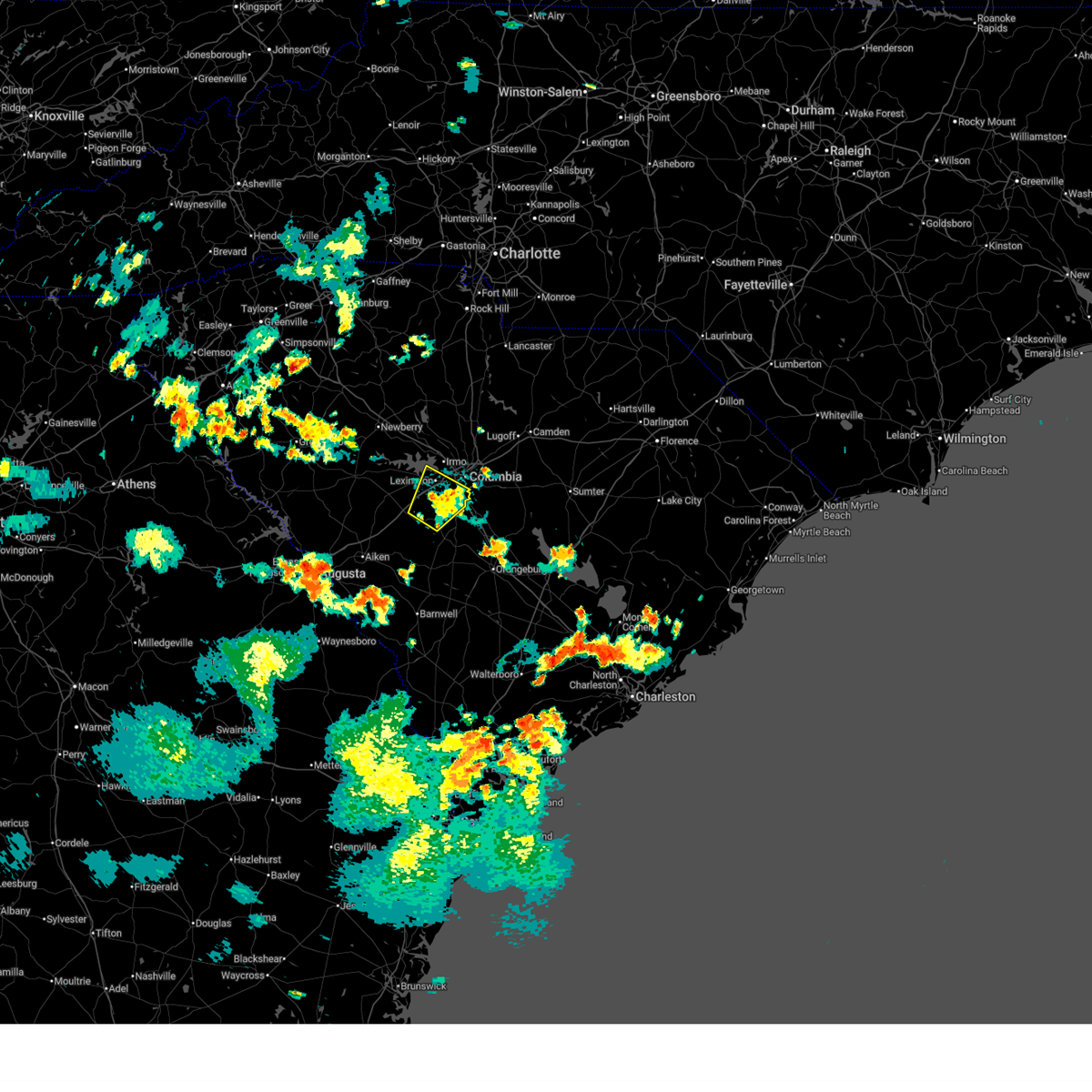
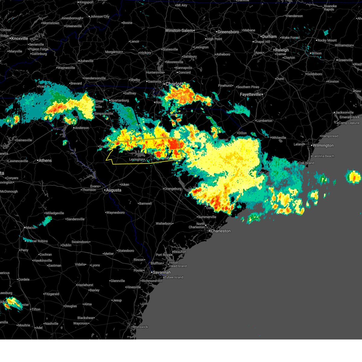
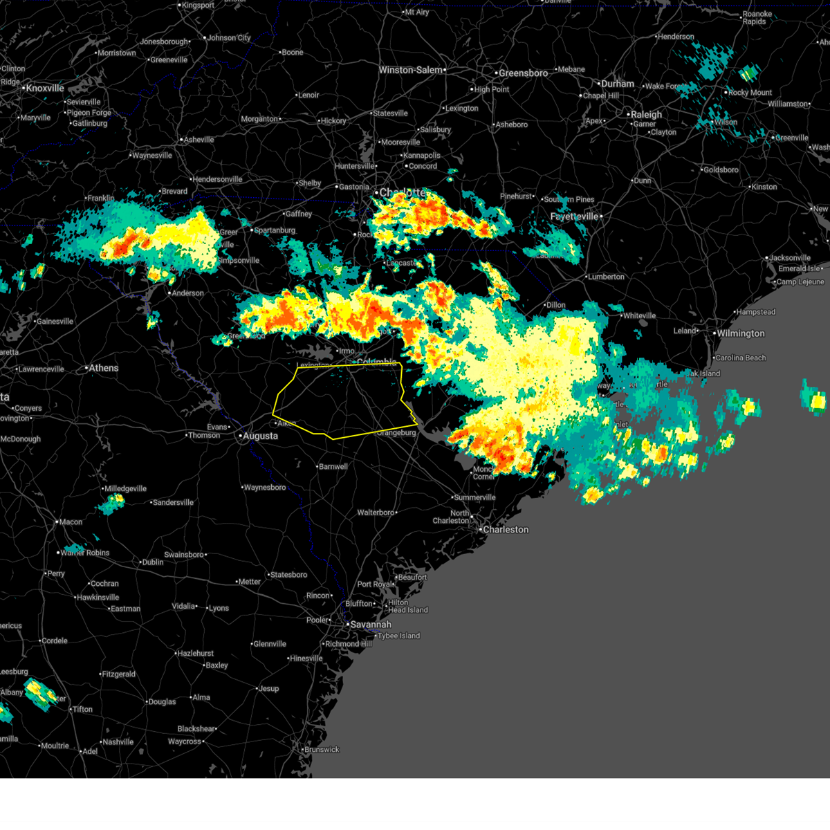
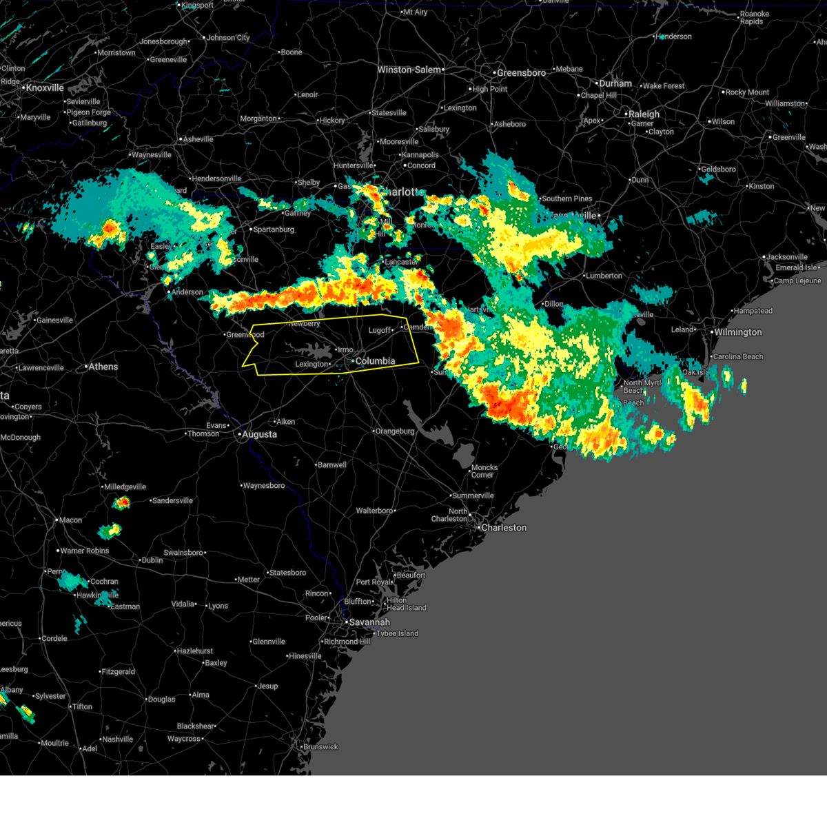
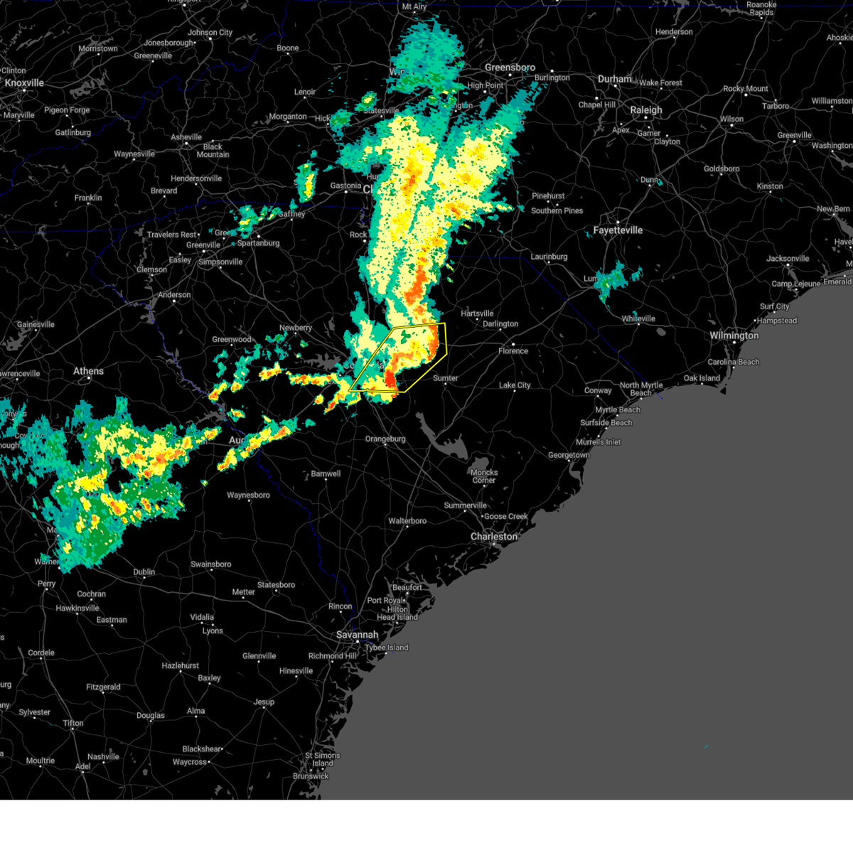
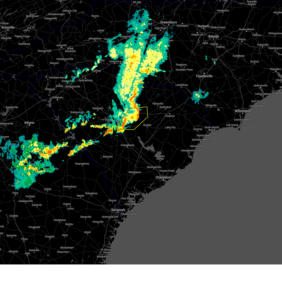
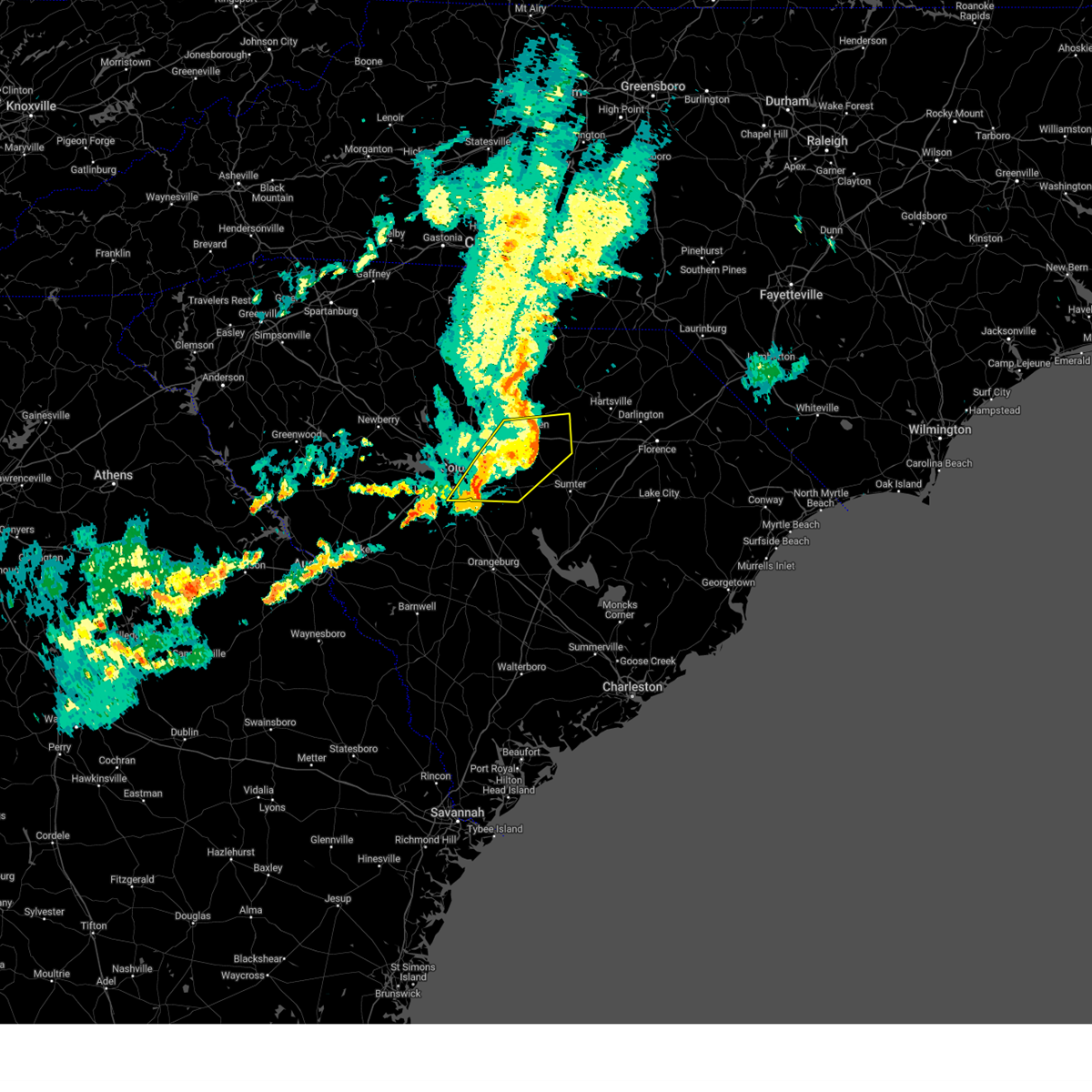
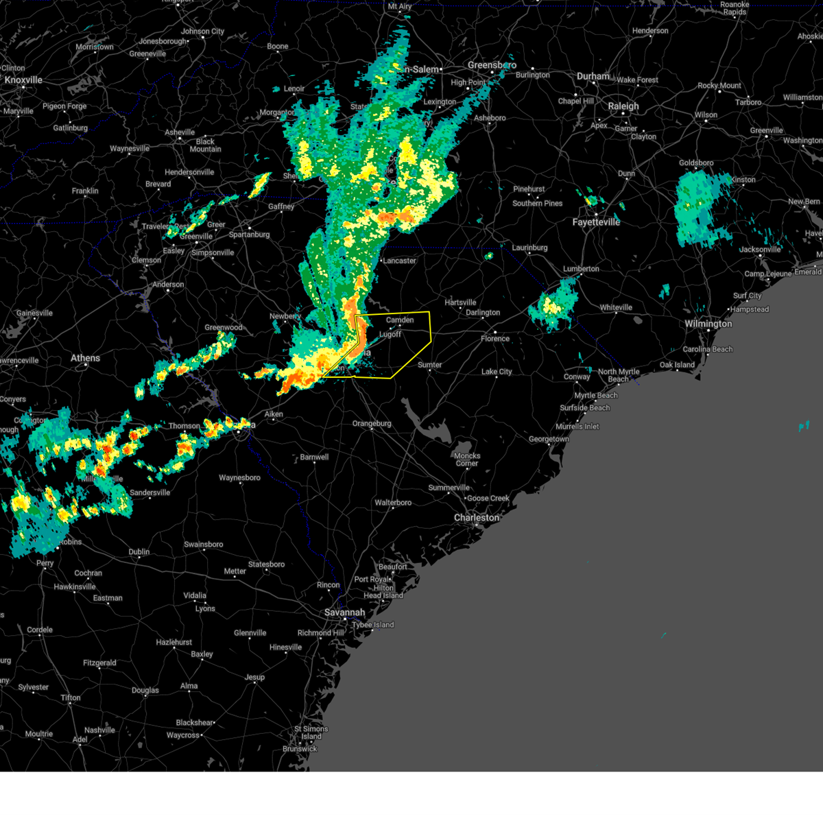
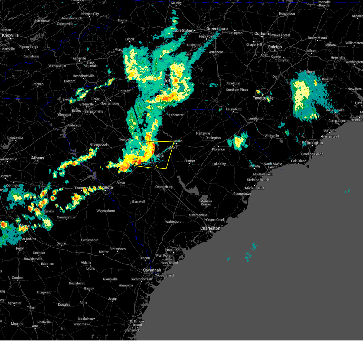
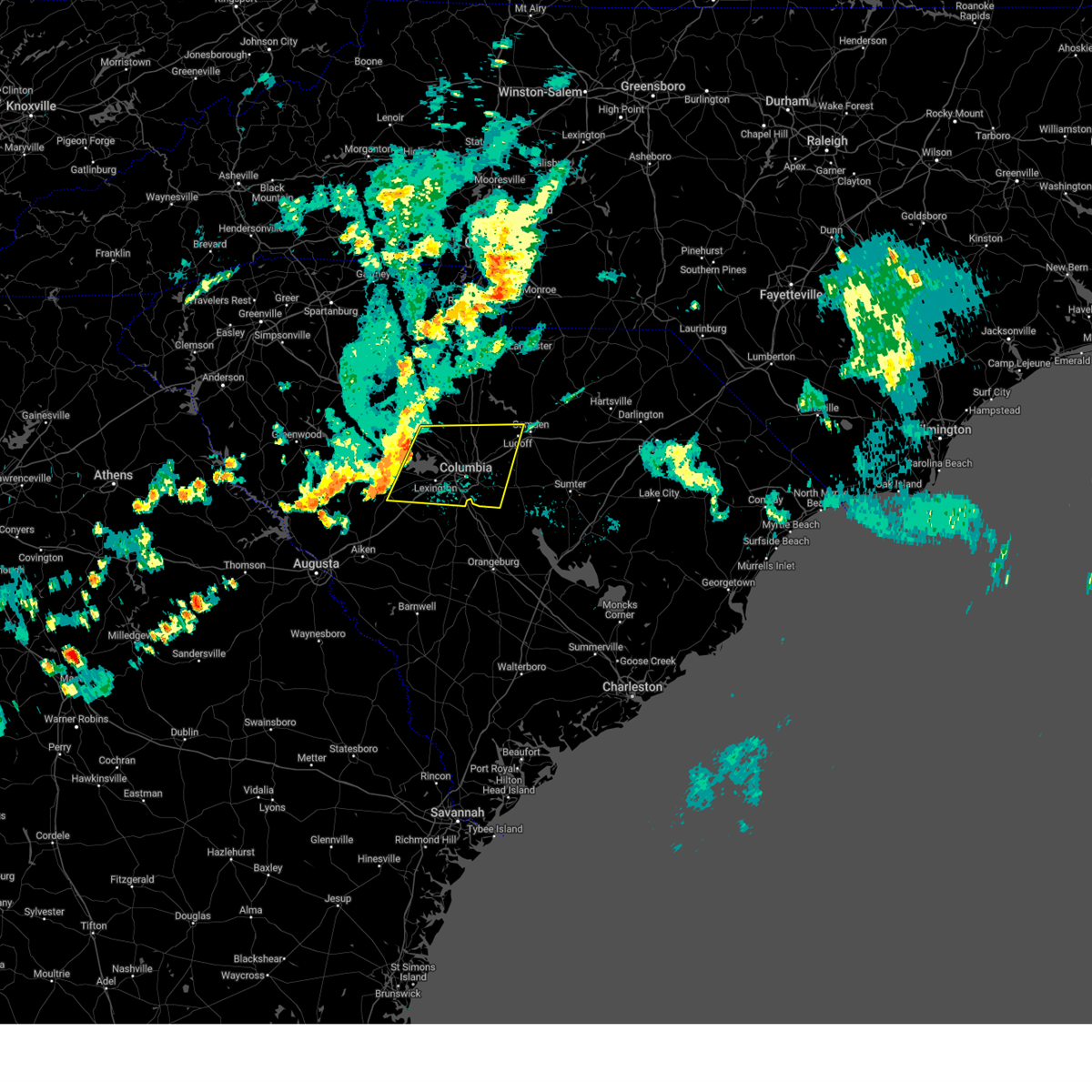
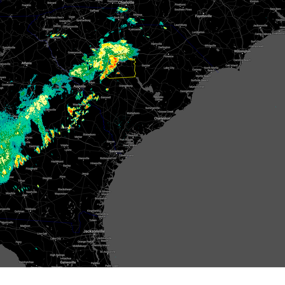
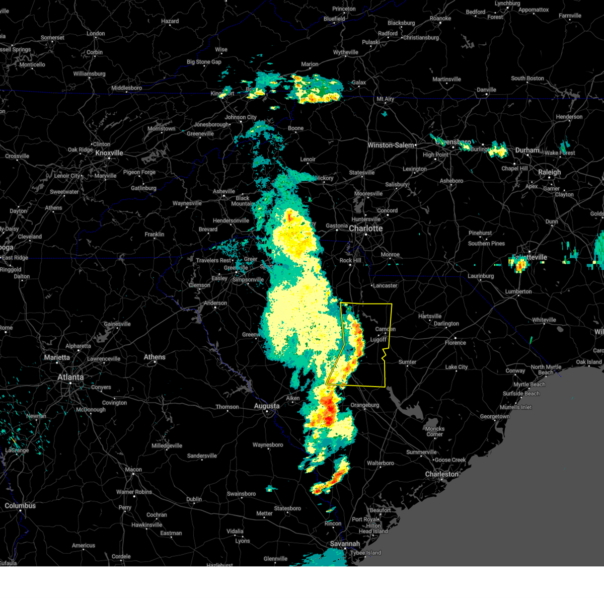
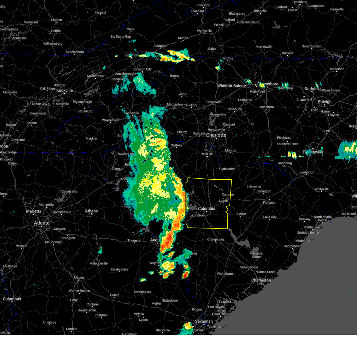
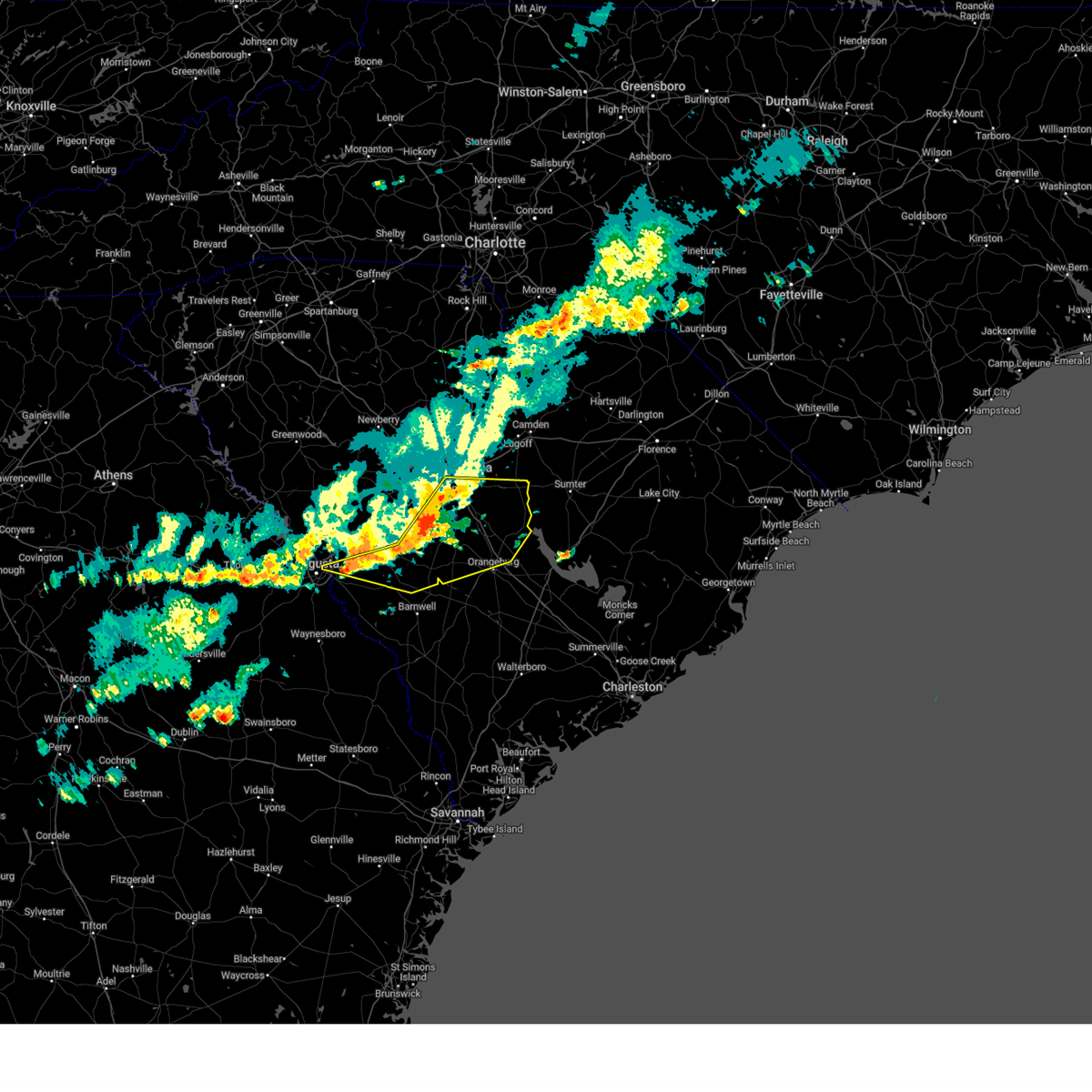
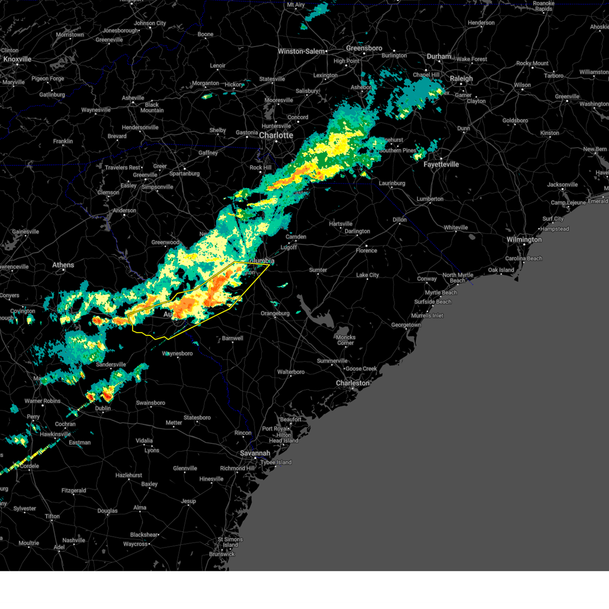
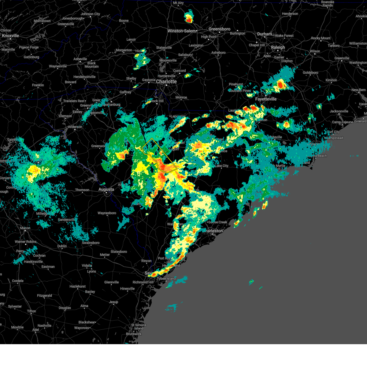
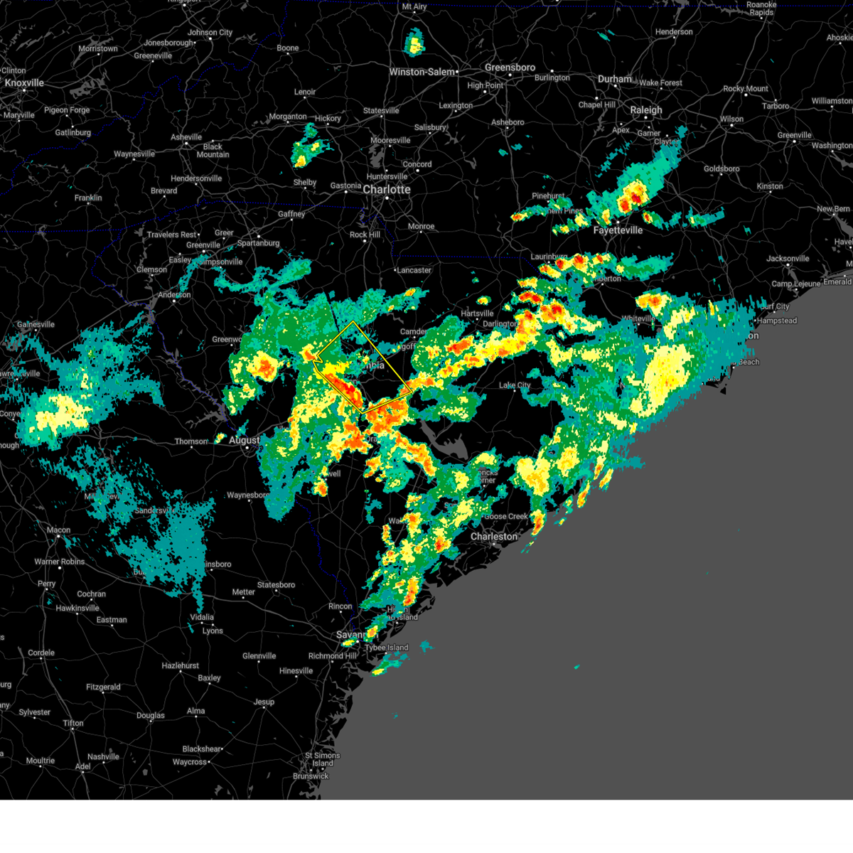
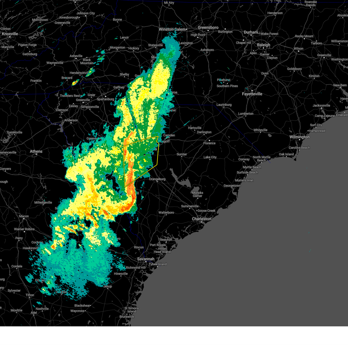
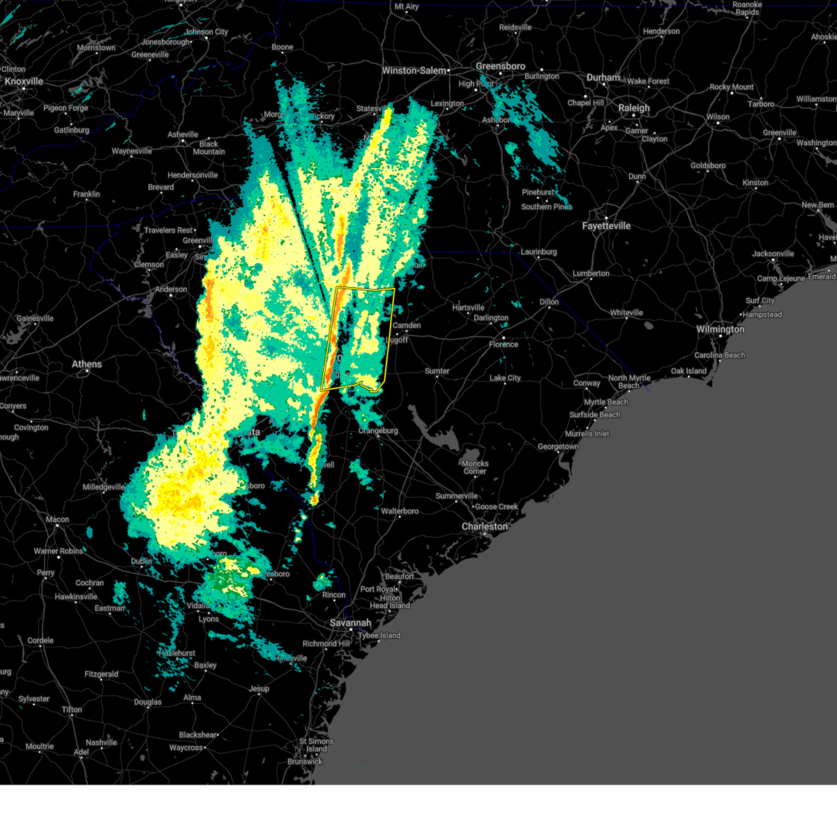
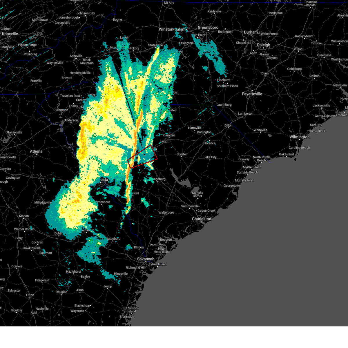
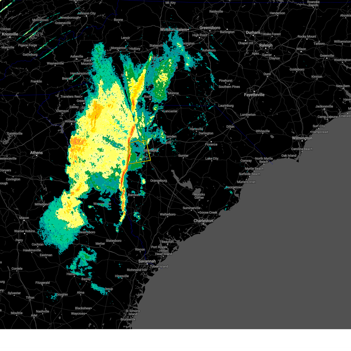
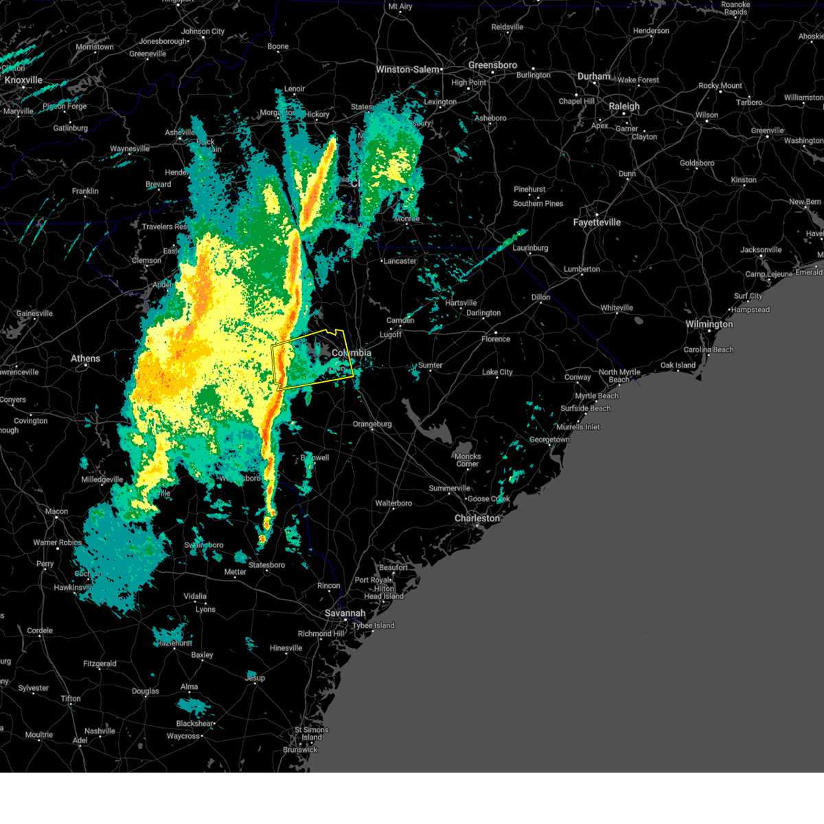
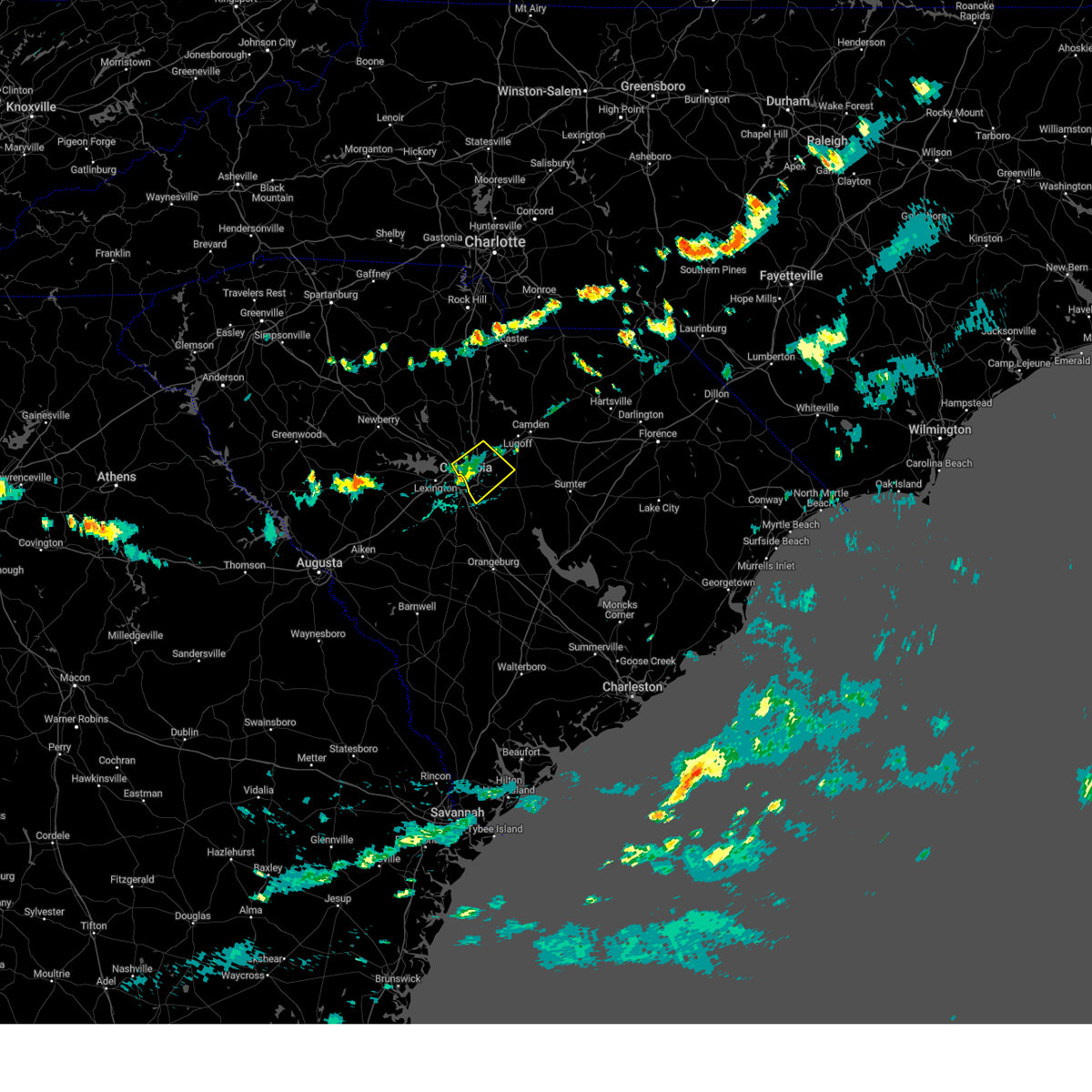
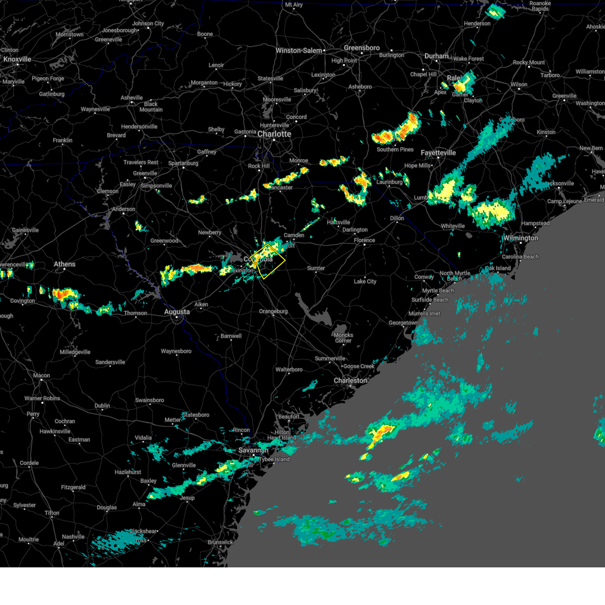
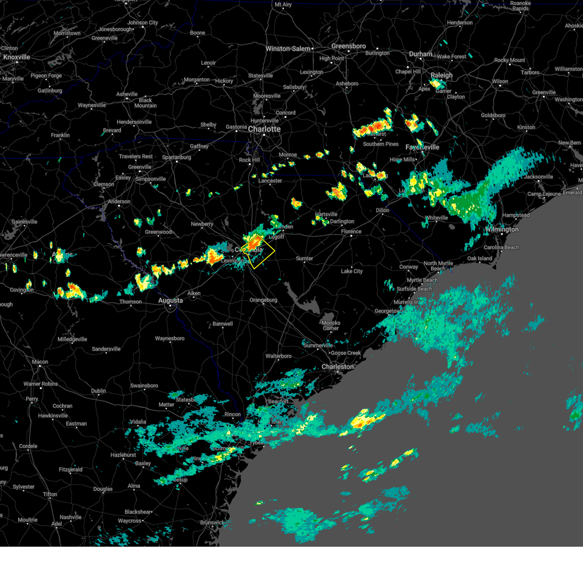
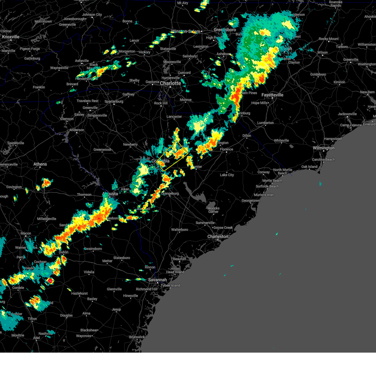
Hail Map for West Columbia, SC
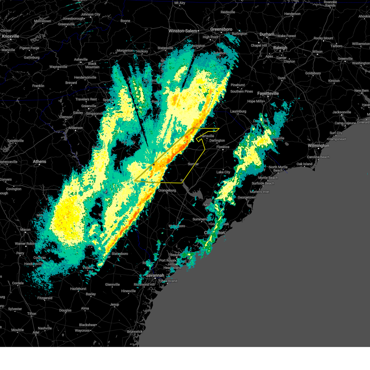
The West Columbia, SC area has had 6 reports of on-the-ground hail by trained spotters, and has been under severe weather warnings 59 times during the past 12 months. Doppler radar has detected hail at or near West Columbia, SC on 42 occasions.
| Name: | West Columbia, SC |
| Where Located: | 62 miles NE of Augusta, GA |
| Map: | Google Map for West Columbia, SC |
| Population: | 14988 |
| Housing Units: | 7665 |
| More Info: | Search Google for West Columbia, SC |
0
The Top Recent Hail Date for West Columbia, SC is Friday, May 10, 2024 (42nd out of 42)

Hail and Wind Damage Spotted near West Columbia, SC
| Date / Time | Report Details |
|---|---|
| 7/11/2025 6:42 PM EDT |
 The storm which prompted the warning has weakened below severe limits, and no longer poses an immediate threat to life or property. therefore, the warning will be allowed to expire. however, gusty winds are still possible with this thunderstorm. to report severe weather, contact your nearest law enforcement agency. they will relay your report to the national weather service columbia. The storm which prompted the warning has weakened below severe limits, and no longer poses an immediate threat to life or property. therefore, the warning will be allowed to expire. however, gusty winds are still possible with this thunderstorm. to report severe weather, contact your nearest law enforcement agency. they will relay your report to the national weather service columbia.
|
| 7/11/2025 6:09 PM EDT |
 Svrcae the national weather service in columbia has issued a * severe thunderstorm warning for, central lexington county in central south carolina, * until 645 pm edt. * at 609 pm edt, a severe thunderstorm was located near red bank, moving northeast at 5 mph (radar indicated). Hazards include 60 mph wind gusts and quarter size hail. Hail damage to vehicles is expected. Expect wind damage to trees and powerlines. Svrcae the national weather service in columbia has issued a * severe thunderstorm warning for, central lexington county in central south carolina, * until 645 pm edt. * at 609 pm edt, a severe thunderstorm was located near red bank, moving northeast at 5 mph (radar indicated). Hazards include 60 mph wind gusts and quarter size hail. Hail damage to vehicles is expected. Expect wind damage to trees and powerlines.
|
| 6/25/2025 9:29 PM EDT |
 The storms which prompted the warning have moved out of the area. therefore, the warning will be allowed to expire. however, heavy rain is still possible with these thunderstorms. a severe thunderstorm watch remains in effect until midnight edt for central south carolina. The storms which prompted the warning have moved out of the area. therefore, the warning will be allowed to expire. however, heavy rain is still possible with these thunderstorms. a severe thunderstorm watch remains in effect until midnight edt for central south carolina.
|
| 6/25/2025 9:00 PM EDT |
 The storms which prompted the warning have moved out of the area. therefore, the warning has been allowed to expire. however, heavy rain is still possible with these thunderstorms. a severe thunderstorm watch remains in effect until midnight edt for central south carolina. The storms which prompted the warning have moved out of the area. therefore, the warning has been allowed to expire. however, heavy rain is still possible with these thunderstorms. a severe thunderstorm watch remains in effect until midnight edt for central south carolina.
|
| 6/25/2025 8:33 PM EDT |
 At 833 pm edt, severe thunderstorms were located along a line extending from near elgin to 9 miles southwest of prosperity, moving southeast at 20 mph (radar indicated). Hazards include 60 mph wind gusts and half dollar size hail. Hail damage to vehicles is expected. expect wind damage to trees and powerlines. locations impacted include, columbia, sumter, lexington, west columbia, cayce, irmo, forest acres, newberry, camden, batesburg-leesville, springdale, dentsville, oak grove, st. andrews, vc summer nuclear station, highway 6 at lake murray dam, red bank, saluda, south congaree, and pine ridge. this includes the following highways, interstate 126 between mile markers 0 and 3. interstate 20 in south carolina between mile markers 49 and 100. interstate 26 between mile markers 77 and 116. Interstate 77 between mile markers 0 and 35. At 833 pm edt, severe thunderstorms were located along a line extending from near elgin to 9 miles southwest of prosperity, moving southeast at 20 mph (radar indicated). Hazards include 60 mph wind gusts and half dollar size hail. Hail damage to vehicles is expected. expect wind damage to trees and powerlines. locations impacted include, columbia, sumter, lexington, west columbia, cayce, irmo, forest acres, newberry, camden, batesburg-leesville, springdale, dentsville, oak grove, st. andrews, vc summer nuclear station, highway 6 at lake murray dam, red bank, saluda, south congaree, and pine ridge. this includes the following highways, interstate 126 between mile markers 0 and 3. interstate 20 in south carolina between mile markers 49 and 100. interstate 26 between mile markers 77 and 116. Interstate 77 between mile markers 0 and 35.
|
| 6/25/2025 8:27 PM EDT |
 Svrcae the national weather service in columbia has issued a * severe thunderstorm warning for, calhoun county in central south carolina, lexington county in central south carolina, northeastern aiken county in central south carolina, northern orangeburg county in central south carolina, southeastern richland county in central south carolina, * until 930 pm edt. * at 827 pm edt, severe thunderstorms were located along a line extending from near horrel hill to near batesburg-leesville, moving southeast at 35 mph (radar indicated). Hazards include 60 mph wind gusts. expect damage to trees and powerlines Svrcae the national weather service in columbia has issued a * severe thunderstorm warning for, calhoun county in central south carolina, lexington county in central south carolina, northeastern aiken county in central south carolina, northern orangeburg county in central south carolina, southeastern richland county in central south carolina, * until 930 pm edt. * at 827 pm edt, severe thunderstorms were located along a line extending from near horrel hill to near batesburg-leesville, moving southeast at 35 mph (radar indicated). Hazards include 60 mph wind gusts. expect damage to trees and powerlines
|
| 6/25/2025 7:56 PM EDT |
 Svrcae the national weather service in columbia has issued a * severe thunderstorm warning for, southern fairfield county in central south carolina, southern newberry county in central south carolina, northern lexington county in central south carolina, northwestern sumter county in central south carolina, saluda county in central south carolina, richland county in central south carolina, southwestern kershaw county in central south carolina, * until 900 pm edt. * at 756 pm edt, severe thunderstorms were located along a line extending from 6 miles south of longtown to 7 miles southwest of newberry college, moving southeast at 20 mph (radar indicated). Hazards include 60 mph wind gusts and quarter size hail. Hail damage to vehicles is expected. Expect wind damage to trees and powerlines. Svrcae the national weather service in columbia has issued a * severe thunderstorm warning for, southern fairfield county in central south carolina, southern newberry county in central south carolina, northern lexington county in central south carolina, northwestern sumter county in central south carolina, saluda county in central south carolina, richland county in central south carolina, southwestern kershaw county in central south carolina, * until 900 pm edt. * at 756 pm edt, severe thunderstorms were located along a line extending from 6 miles south of longtown to 7 miles southwest of newberry college, moving southeast at 20 mph (radar indicated). Hazards include 60 mph wind gusts and quarter size hail. Hail damage to vehicles is expected. Expect wind damage to trees and powerlines.
|
| 6/17/2025 9:42 PM EDT | the severe thunderstorm warning has been cancelled and is no longer in effect |
| 6/17/2025 9:42 PM EDT | At 941 pm edt, severe thunderstorms were located along a line extending from near jenkinsville to near harbison state forest to oak grove to red bank, moving east at 45 mph (radar indicated). Hazards include 60 mph wind gusts. Expect damage to trees and powerlines. locations impacted include, columbia, lexington, west columbia, cayce, irmo, forest acres, springdale, st. andrews, dentsville, oak grove, highway 6 at lake murray dam, red bank, south congaree, pine ridge, arcadia lakes, columbia international university, harbison state forest, sesquicentennial state park, lake carolina, and sc state fair grounds. this includes the following highways, interstate 126 between mile markers 0 and 3. interstate 20 in south carolina between mile markers 48 and 78. interstate 26 between mile markers 90 and 116. Interstate 77 between mile markers 0 and 2, between mile markers 5 and 6, and between mile markers 8 and 37. |
| 6/17/2025 9:15 PM EDT | Svrcae the national weather service in columbia has issued a * severe thunderstorm warning for, southeastern fairfield county in central south carolina, southeastern newberry county in central south carolina, lexington county in central south carolina, northeastern saluda county in central south carolina, northeastern aiken county in central south carolina, northwestern richland county in central south carolina, * until 1000 pm edt. * at 915 pm edt, severe thunderstorms were located along a line extending from 6 miles south of prosperity to near dreher island state park to near batesburg-leesville to 7 miles east of ridge spring, moving northeast at 45 mph (radar indicated). Hazards include 60 mph wind gusts. expect damage to trees and powerlines |
| 6/9/2025 10:10 PM EDT |
 The storms which prompted the warning have weakened below severe limits, and have exited the warned area. therefore, the warning will be allowed to expire. however, gusty winds and heavy rain are still possible with these thunderstorms. The storms which prompted the warning have weakened below severe limits, and have exited the warned area. therefore, the warning will be allowed to expire. however, gusty winds and heavy rain are still possible with these thunderstorms.
|
| 6/9/2025 9:51 PM EDT |
 the severe thunderstorm warning has been cancelled and is no longer in effect the severe thunderstorm warning has been cancelled and is no longer in effect
|
| 6/9/2025 9:51 PM EDT |
 At 951 pm edt, severe thunderstorms were located along a line extending from near camden to 6 miles southeast of lugoff to near sc state farmer's market, moving east at 40 mph (radar indicated). Hazards include 60 mph wind gusts. Expect damage to trees and powerlines. locations impacted include, columbia, west columbia, cayce, forest acres, camden, mcentire air base, dentsville, south congaree, pine ridge, arcadia lakes, eastover, lugoff, hopkins, villages at sandhill, elgin, horrel hill, sc state farmer's market, woodfield, sesquicentennial state park, and lake carolina. this includes the following highways, interstate 20 in south carolina between mile markers 72 and 112. interstate 26 between mile markers 114 and 120. Interstate 77 between mile markers 0 and 20. At 951 pm edt, severe thunderstorms were located along a line extending from near camden to 6 miles southeast of lugoff to near sc state farmer's market, moving east at 40 mph (radar indicated). Hazards include 60 mph wind gusts. Expect damage to trees and powerlines. locations impacted include, columbia, west columbia, cayce, forest acres, camden, mcentire air base, dentsville, south congaree, pine ridge, arcadia lakes, eastover, lugoff, hopkins, villages at sandhill, elgin, horrel hill, sc state farmer's market, woodfield, sesquicentennial state park, and lake carolina. this includes the following highways, interstate 20 in south carolina between mile markers 72 and 112. interstate 26 between mile markers 114 and 120. Interstate 77 between mile markers 0 and 20.
|
| 6/9/2025 9:26 PM EDT |
 Svrcae the national weather service in columbia has issued a * severe thunderstorm warning for, southeastern fairfield county in central south carolina, northwestern lee county in central south carolina, east central lexington county in central south carolina, northwestern sumter county in central south carolina, richland county in central south carolina, southern kershaw county in central south carolina, * until 1015 pm edt. * at 926 pm edt, severe thunderstorms were located along a line extending from near springdale to villages at sandhill to near red bank, moving east at 40 mph (radar indicated). Hazards include 60 mph wind gusts. expect damage to trees and powerlines Svrcae the national weather service in columbia has issued a * severe thunderstorm warning for, southeastern fairfield county in central south carolina, northwestern lee county in central south carolina, east central lexington county in central south carolina, northwestern sumter county in central south carolina, richland county in central south carolina, southern kershaw county in central south carolina, * until 1015 pm edt. * at 926 pm edt, severe thunderstorms were located along a line extending from near springdale to villages at sandhill to near red bank, moving east at 40 mph (radar indicated). Hazards include 60 mph wind gusts. expect damage to trees and powerlines
|
| 6/9/2025 9:12 PM EDT |
 the severe thunderstorm warning has been cancelled and is no longer in effect the severe thunderstorm warning has been cancelled and is no longer in effect
|
| 6/9/2025 9:12 PM EDT |
 At 912 pm edt, severe thunderstorms were located along a line extending from 7 miles northwest of killian to near south congaree, moving east at 45 mph (radar indicated). Hazards include 60 mph wind gusts. Expect damage to trees and powerlines. locations impacted include, columbia, lexington, west columbia, cayce, irmo, forest acres, springdale, st. andrews, dentsville, oak grove, mcentire air base, highway 6 at lake murray dam, red bank, south congaree, pine ridge, arcadia lakes, lugoff, columbia international university, harbison state forest, and sesquicentennial state park. this includes the following highways, interstate 126 between mile markers 0 and 3. interstate 20 in south carolina between mile markers 45 and 91. interstate 26 between mile markers 92 and 120. Interstate 77 between mile markers 0 and 32. At 912 pm edt, severe thunderstorms were located along a line extending from 7 miles northwest of killian to near south congaree, moving east at 45 mph (radar indicated). Hazards include 60 mph wind gusts. Expect damage to trees and powerlines. locations impacted include, columbia, lexington, west columbia, cayce, irmo, forest acres, springdale, st. andrews, dentsville, oak grove, mcentire air base, highway 6 at lake murray dam, red bank, south congaree, pine ridge, arcadia lakes, lugoff, columbia international university, harbison state forest, and sesquicentennial state park. this includes the following highways, interstate 126 between mile markers 0 and 3. interstate 20 in south carolina between mile markers 45 and 91. interstate 26 between mile markers 92 and 120. Interstate 77 between mile markers 0 and 32.
|
| 6/9/2025 8:48 PM EDT |
 Svrcae the national weather service in columbia has issued a * severe thunderstorm warning for, southern fairfield county in central south carolina, southeastern newberry county in central south carolina, central lexington county in central south carolina, richland county in central south carolina, southwestern kershaw county in central south carolina, * until 930 pm edt. * at 847 pm edt, severe thunderstorms were located along a line extending from near jenkinsville to near batesburg-leesville, moving east at 45 mph (radar indicated). Hazards include 60 mph wind gusts. expect damage to trees and powerlines Svrcae the national weather service in columbia has issued a * severe thunderstorm warning for, southern fairfield county in central south carolina, southeastern newberry county in central south carolina, central lexington county in central south carolina, richland county in central south carolina, southwestern kershaw county in central south carolina, * until 930 pm edt. * at 847 pm edt, severe thunderstorms were located along a line extending from near jenkinsville to near batesburg-leesville, moving east at 45 mph (radar indicated). Hazards include 60 mph wind gusts. expect damage to trees and powerlines
|
| 6/8/2025 10:36 AM EDT |
 Svrcae the national weather service in columbia has issued a * severe thunderstorm warning for, northern calhoun county in central south carolina, lexington county in central south carolina, richland county in central south carolina, * until 1115 am edt. * at 1036 am edt, a severe thunderstorm was located over west columbia riverwalk, or over west columbia, moving east at 40 mph (radar indicated). Hazards include 60 mph wind gusts. expect damage to trees and powerlines Svrcae the national weather service in columbia has issued a * severe thunderstorm warning for, northern calhoun county in central south carolina, lexington county in central south carolina, richland county in central south carolina, * until 1115 am edt. * at 1036 am edt, a severe thunderstorm was located over west columbia riverwalk, or over west columbia, moving east at 40 mph (radar indicated). Hazards include 60 mph wind gusts. expect damage to trees and powerlines
|
| 6/7/2025 9:26 PM EDT |
 the severe thunderstorm warning has been cancelled and is no longer in effect the severe thunderstorm warning has been cancelled and is no longer in effect
|
| 6/7/2025 9:26 PM EDT |
 At 926 pm edt, severe thunderstorms were located along a line extending from lake wateree state park to near sandy run, moving east at 55 mph (radar indicated). Hazards include 60 mph wind gusts and penny size hail. these storms have a history of producing damaging wind gusts. Expect damage to trees and powerlines. locations impacted include, columbia, west columbia, cayce, forest acres, camden, winnsboro, springdale, st. andrews, dentsville, oak grove, mcentire air base, lake wateree dam, red bank, south congaree, pine ridge, kershaw, gaston, arcadia lakes, eastover, and lugoff. this includes the following highways, interstate 126 between mile markers 0 and 3. interstate 20 in south carolina between mile markers 60 and 99. interstate 26 between mile markers 105 and 132. Interstate 77 between mile markers 0 and 50. At 926 pm edt, severe thunderstorms were located along a line extending from lake wateree state park to near sandy run, moving east at 55 mph (radar indicated). Hazards include 60 mph wind gusts and penny size hail. these storms have a history of producing damaging wind gusts. Expect damage to trees and powerlines. locations impacted include, columbia, west columbia, cayce, forest acres, camden, winnsboro, springdale, st. andrews, dentsville, oak grove, mcentire air base, lake wateree dam, red bank, south congaree, pine ridge, kershaw, gaston, arcadia lakes, eastover, and lugoff. this includes the following highways, interstate 126 between mile markers 0 and 3. interstate 20 in south carolina between mile markers 60 and 99. interstate 26 between mile markers 105 and 132. Interstate 77 between mile markers 0 and 50.
|
| 6/7/2025 9:11 PM EDT | Kcae recorded a peak wind gust of 60 mph at 9:11 p in lexington county SC, 3.8 miles NNE of West Columbia, SC |
| 6/7/2025 8:54 PM EDT |
 Svrcae the national weather service in columbia has issued a * severe thunderstorm warning for, fairfield county in central south carolina, southwestern lancaster county in central south carolina, eastern newberry county in central south carolina, northern calhoun county in central south carolina, lexington county in central south carolina, west central sumter county in central south carolina, richland county in central south carolina, western kershaw county in central south carolina, * until 945 pm edt. * at 854 pm edt, severe thunderstorms were located along a line extending from near blair to 13 miles southeast of batesburg-leesville, moving east at 55 mph (radar indicated). Hazards include 60 mph wind gusts and penny size hail. expect damage to trees and powerlines Svrcae the national weather service in columbia has issued a * severe thunderstorm warning for, fairfield county in central south carolina, southwestern lancaster county in central south carolina, eastern newberry county in central south carolina, northern calhoun county in central south carolina, lexington county in central south carolina, west central sumter county in central south carolina, richland county in central south carolina, western kershaw county in central south carolina, * until 945 pm edt. * at 854 pm edt, severe thunderstorms were located along a line extending from near blair to 13 miles southeast of batesburg-leesville, moving east at 55 mph (radar indicated). Hazards include 60 mph wind gusts and penny size hail. expect damage to trees and powerlines
|
| 5/30/2025 4:10 PM EDT |
 Svrcae the national weather service in columbia has issued a * severe thunderstorm warning for, calhoun county in central south carolina, northeastern barnwell county in central south carolina, southeastern lexington county in central south carolina, central aiken county in central south carolina, northwestern orangeburg county in central south carolina, southeastern richland county in central south carolina, * until 500 pm edt. * at 409 pm edt, severe thunderstorms were located along a line extending from columbia metro airport to 7 miles northeast of aiken state park to near clearwater, moving east at 35 mph (radar indicated). Hazards include 60 mph wind gusts and quarter size hail. Hail damage to vehicles is expected. Expect wind damage to trees and powerlines. Svrcae the national weather service in columbia has issued a * severe thunderstorm warning for, calhoun county in central south carolina, northeastern barnwell county in central south carolina, southeastern lexington county in central south carolina, central aiken county in central south carolina, northwestern orangeburg county in central south carolina, southeastern richland county in central south carolina, * until 500 pm edt. * at 409 pm edt, severe thunderstorms were located along a line extending from columbia metro airport to 7 miles northeast of aiken state park to near clearwater, moving east at 35 mph (radar indicated). Hazards include 60 mph wind gusts and quarter size hail. Hail damage to vehicles is expected. Expect wind damage to trees and powerlines.
|
| 5/30/2025 3:56 PM EDT |
 At 355 pm edt, severe thunderstorms were located along a line extending from near lexington to near aiken municipal airport to near grovetown, moving east at 50 mph (radar indicated). Hazards include 60 mph wind gusts. Expect damage to trees and powerlines. locations impacted include, columbia, aiken, north augusta, lexington, west columbia, cayce, grovetown, evans, forest acres, thomson, batesburg-leesville, oak grove, fort eisenhower, augusta, clearwater, martinez, aiken mall, red bank, belvedere, and st. andrews. this includes the following highways, interstate 126 between mile markers 1 and 3. interstate 20 in georgia between mile markers 167 and 201. interstate 20 in south carolina between mile markers 0 and 62. interstate 26 between mile markers 109 and 118. interstate 520 in georgia between mile markers 1 and 15. interstate 520 in south carolina between mile markers 16 and 23. Interstate 77 between mile markers 0 and 5, and between mile markers 10 and 11. At 355 pm edt, severe thunderstorms were located along a line extending from near lexington to near aiken municipal airport to near grovetown, moving east at 50 mph (radar indicated). Hazards include 60 mph wind gusts. Expect damage to trees and powerlines. locations impacted include, columbia, aiken, north augusta, lexington, west columbia, cayce, grovetown, evans, forest acres, thomson, batesburg-leesville, oak grove, fort eisenhower, augusta, clearwater, martinez, aiken mall, red bank, belvedere, and st. andrews. this includes the following highways, interstate 126 between mile markers 1 and 3. interstate 20 in georgia between mile markers 167 and 201. interstate 20 in south carolina between mile markers 0 and 62. interstate 26 between mile markers 109 and 118. interstate 520 in georgia between mile markers 1 and 15. interstate 520 in south carolina between mile markers 16 and 23. Interstate 77 between mile markers 0 and 5, and between mile markers 10 and 11.
|
| 5/30/2025 3:56 PM EDT |
 the severe thunderstorm warning has been cancelled and is no longer in effect the severe thunderstorm warning has been cancelled and is no longer in effect
|
| 5/30/2025 3:34 PM EDT |
 Svrcae the national weather service in columbia has issued a * severe thunderstorm warning for, mcduffie county in east central georgia, columbia county in east central georgia, richmond county in east central georgia, southeastern newberry county in central south carolina, central edgefield county in central south carolina, lexington county in central south carolina, eastern saluda county in central south carolina, aiken county in central south carolina, southeastern mccormick county in central south carolina, central richland county in central south carolina, * until 415 pm edt. * at 333 pm edt, severe thunderstorms were located along a line extending from 7 miles north of batesburg-leesville to 9 miles northwest of belvedere to thomson-mcduffie county airport, moving east at 35 mph (radar indicated). Hazards include 60 mph wind gusts. expect damage to trees and powerlines Svrcae the national weather service in columbia has issued a * severe thunderstorm warning for, mcduffie county in east central georgia, columbia county in east central georgia, richmond county in east central georgia, southeastern newberry county in central south carolina, central edgefield county in central south carolina, lexington county in central south carolina, eastern saluda county in central south carolina, aiken county in central south carolina, southeastern mccormick county in central south carolina, central richland county in central south carolina, * until 415 pm edt. * at 333 pm edt, severe thunderstorms were located along a line extending from 7 miles north of batesburg-leesville to 9 miles northwest of belvedere to thomson-mcduffie county airport, moving east at 35 mph (radar indicated). Hazards include 60 mph wind gusts. expect damage to trees and powerlines
|
| 5/29/2025 5:09 PM EDT |
 At 509 pm edt, severe thunderstorms were located along a line extending from near ballentine to sandy run, moving northeast at 30 mph (radar indicated). Hazards include 60 mph wind gusts. Expect damage to trees and powerlines. locations impacted include, columbia, west columbia, cayce, irmo, forest acres, st. andrews, mcentire air base, dentsville, arcadia lakes, eastover, fairfield county airport, congaree national park, hopkins, columbia international university, horrel hill, killian, harbison state forest, riverbanks zoo, woodfield, and sesquicentennial state park. this includes the following highways, interstate 126 between mile markers 0 and 3. interstate 20 in south carolina between mile markers 64 and 79. interstate 26 between mile markers 93 and 108. Interstate 77 between mile markers 3 and 27. At 509 pm edt, severe thunderstorms were located along a line extending from near ballentine to sandy run, moving northeast at 30 mph (radar indicated). Hazards include 60 mph wind gusts. Expect damage to trees and powerlines. locations impacted include, columbia, west columbia, cayce, irmo, forest acres, st. andrews, mcentire air base, dentsville, arcadia lakes, eastover, fairfield county airport, congaree national park, hopkins, columbia international university, horrel hill, killian, harbison state forest, riverbanks zoo, woodfield, and sesquicentennial state park. this includes the following highways, interstate 126 between mile markers 0 and 3. interstate 20 in south carolina between mile markers 64 and 79. interstate 26 between mile markers 93 and 108. Interstate 77 between mile markers 3 and 27.
|
| 5/29/2025 5:09 PM EDT |
 the severe thunderstorm warning has been cancelled and is no longer in effect the severe thunderstorm warning has been cancelled and is no longer in effect
|
| 5/29/2025 5:07 PM EDT | Sc highway patrol reported a tree blocking the roadway on greystone blvd near i-126. time estimated by rada in richland county SC, 1.3 miles SSW of West Columbia, SC |
| 5/29/2025 4:52 PM EDT |
 At 452 pm edt, severe thunderstorms were located along a line extending from dreher island state park to near gaston, moving northeast at 30 mph (radar indicated). Hazards include 60 mph wind gusts. Expect damage to trees and powerlines. locations impacted include, columbia, lexington, west columbia, cayce, irmo, forest acres, springdale, st. andrews, dentsville, oak grove, mcentire air base, highway 6 at lake murray dam, red bank, south congaree, pine ridge, gaston, arcadia lakes, eastover, columbia international university, and harbison state forest. this includes the following highways, interstate 126 between mile markers 0 and 3. interstate 20 in south carolina between mile markers 50 and 79. interstate 26 between mile markers 90 and 130. Interstate 77 between mile markers 0 and 27. At 452 pm edt, severe thunderstorms were located along a line extending from dreher island state park to near gaston, moving northeast at 30 mph (radar indicated). Hazards include 60 mph wind gusts. Expect damage to trees and powerlines. locations impacted include, columbia, lexington, west columbia, cayce, irmo, forest acres, springdale, st. andrews, dentsville, oak grove, mcentire air base, highway 6 at lake murray dam, red bank, south congaree, pine ridge, gaston, arcadia lakes, eastover, columbia international university, and harbison state forest. this includes the following highways, interstate 126 between mile markers 0 and 3. interstate 20 in south carolina between mile markers 50 and 79. interstate 26 between mile markers 90 and 130. Interstate 77 between mile markers 0 and 27.
|
| 5/29/2025 4:38 PM EDT |
 Svrcae the national weather service in columbia has issued a * severe thunderstorm warning for, south central fairfield county in central south carolina, northwestern calhoun county in central south carolina, lexington county in central south carolina, richland county in central south carolina, * until 530 pm edt. * at 438 pm edt, severe thunderstorms were located along a line extending from near dreher island state park to 6 miles southwest of gaston, moving northeast at 30 mph (radar indicated). Hazards include 60 mph wind gusts. expect damage to trees and powerlines Svrcae the national weather service in columbia has issued a * severe thunderstorm warning for, south central fairfield county in central south carolina, northwestern calhoun county in central south carolina, lexington county in central south carolina, richland county in central south carolina, * until 530 pm edt. * at 438 pm edt, severe thunderstorms were located along a line extending from near dreher island state park to 6 miles southwest of gaston, moving northeast at 30 mph (radar indicated). Hazards include 60 mph wind gusts. expect damage to trees and powerlines
|
| 3/31/2025 4:55 PM EDT |
 At 454 pm edt, severe thunderstorms were located along a line extending from near blackstock to near springdale to near pine ridge, moving northeast at 50 mph (radar indicated). Hazards include 60 mph wind gusts. Expect damage to trees and powerlines. locations impacted include, dalzell, lebanon fire station, manville, bell town fire station, community of almond glen, mitford, faith christian school, cayce riverwalk, columbia international university, midway elementary school, pine ridge, heath springs, wateree river correctional institution, woodrow, camden, mulberry, seven oaks, olympia, dentsville, and lake murray marina. this includes the following highways, interstate 126 between mile markers 0 and 3. interstate 20 in south carolina between mile markers 55 and 116. interstate 26 between mile markers 95 and 126. Interstate 77 between mile markers 0 and 51. At 454 pm edt, severe thunderstorms were located along a line extending from near blackstock to near springdale to near pine ridge, moving northeast at 50 mph (radar indicated). Hazards include 60 mph wind gusts. Expect damage to trees and powerlines. locations impacted include, dalzell, lebanon fire station, manville, bell town fire station, community of almond glen, mitford, faith christian school, cayce riverwalk, columbia international university, midway elementary school, pine ridge, heath springs, wateree river correctional institution, woodrow, camden, mulberry, seven oaks, olympia, dentsville, and lake murray marina. this includes the following highways, interstate 126 between mile markers 0 and 3. interstate 20 in south carolina between mile markers 55 and 116. interstate 26 between mile markers 95 and 126. Interstate 77 between mile markers 0 and 51.
|
| 3/31/2025 4:55 PM EDT |
 the severe thunderstorm warning has been cancelled and is no longer in effect the severe thunderstorm warning has been cancelled and is no longer in effect
|
| 3/31/2025 4:32 PM EDT |
 Svrcae the national weather service in columbia has issued a * severe thunderstorm warning for, fairfield county in central south carolina, lancaster county in central south carolina, western lee county in central south carolina, eastern newberry county in central south carolina, northern calhoun county in central south carolina, west central clarendon county in central south carolina, lexington county in central south carolina, sumter county in central south carolina, northeastern aiken county in central south carolina, richland county in central south carolina, kershaw county in central south carolina, * until 530 pm edt. * at 432 pm edt, severe thunderstorms were located along a line extending from 6 miles west of chester state park to near jenkinsville to 13 miles southwest of red bank, moving northeast at 55 mph (radar indicated). Hazards include 60 mph wind gusts. expect damage to trees and powerlines Svrcae the national weather service in columbia has issued a * severe thunderstorm warning for, fairfield county in central south carolina, lancaster county in central south carolina, western lee county in central south carolina, eastern newberry county in central south carolina, northern calhoun county in central south carolina, west central clarendon county in central south carolina, lexington county in central south carolina, sumter county in central south carolina, northeastern aiken county in central south carolina, richland county in central south carolina, kershaw county in central south carolina, * until 530 pm edt. * at 432 pm edt, severe thunderstorms were located along a line extending from 6 miles west of chester state park to near jenkinsville to 13 miles southwest of red bank, moving northeast at 55 mph (radar indicated). Hazards include 60 mph wind gusts. expect damage to trees and powerlines
|
| 3/16/2025 8:25 AM EDT |
 The storms which prompted the warning have weakened below severe limits, and no longer pose an immediate threat to life or property. therefore, the warning will be allowed to expire. a tornado watch remains in effect until 1000 am edt for central south carolina. a tornado watch also remains in effect until 200 pm edt for central south carolina. The storms which prompted the warning have weakened below severe limits, and no longer pose an immediate threat to life or property. therefore, the warning will be allowed to expire. a tornado watch remains in effect until 1000 am edt for central south carolina. a tornado watch also remains in effect until 200 pm edt for central south carolina.
|
| 3/16/2025 7:54 AM EDT |
 the severe thunderstorm warning has been cancelled and is no longer in effect the severe thunderstorm warning has been cancelled and is no longer in effect
|
| 3/16/2025 7:54 AM EDT |
 At 754 am edt, severe thunderstorms were located along a line extending from 7 miles southwest of fairfield county airport to 11 miles south of gaston, moving northeast at 40 mph (radar indicated). Hazards include 60 mph wind gusts. Expect damage to trees and powerlines. locations impacted include, arcadia lakes, cayce, bundrick island, white rock, irmo, st. andrews, lexington, cayce riverwalk, columbia international university, pine ridge, cedar creek fire station, dixiana, harbison state forest, blythewood, seven oaks, olympia, dentsville, lake murray marina, oak grove, and sesquicentennial state park. this includes the following highways, interstate 126 between mile markers 0 and 3. interstate 20 in south carolina between mile markers 51 and 81. interstate 26 between mile markers 92 and 131. Interstate 77 between mile markers 0 and 29. At 754 am edt, severe thunderstorms were located along a line extending from 7 miles southwest of fairfield county airport to 11 miles south of gaston, moving northeast at 40 mph (radar indicated). Hazards include 60 mph wind gusts. Expect damage to trees and powerlines. locations impacted include, arcadia lakes, cayce, bundrick island, white rock, irmo, st. andrews, lexington, cayce riverwalk, columbia international university, pine ridge, cedar creek fire station, dixiana, harbison state forest, blythewood, seven oaks, olympia, dentsville, lake murray marina, oak grove, and sesquicentennial state park. this includes the following highways, interstate 126 between mile markers 0 and 3. interstate 20 in south carolina between mile markers 51 and 81. interstate 26 between mile markers 92 and 131. Interstate 77 between mile markers 0 and 29.
|
| 3/16/2025 7:25 AM EDT |
 Svrcae the national weather service in columbia has issued a * severe thunderstorm warning for, south central newberry county in central south carolina, northwestern calhoun county in central south carolina, lexington county in central south carolina, east central saluda county in central south carolina, northeastern aiken county in central south carolina, northwestern orangeburg county in central south carolina, central richland county in central south carolina, * until 830 am edt. * at 724 am edt, severe thunderstorms were located along a line extending from near dreher island state park to near williston, moving northeast at 40 mph (radar indicated). Hazards include 60 mph wind gusts. expect damage to trees and powerlines Svrcae the national weather service in columbia has issued a * severe thunderstorm warning for, south central newberry county in central south carolina, northwestern calhoun county in central south carolina, lexington county in central south carolina, east central saluda county in central south carolina, northeastern aiken county in central south carolina, northwestern orangeburg county in central south carolina, central richland county in central south carolina, * until 830 am edt. * at 724 am edt, severe thunderstorms were located along a line extending from near dreher island state park to near williston, moving northeast at 40 mph (radar indicated). Hazards include 60 mph wind gusts. expect damage to trees and powerlines
|
| 3/5/2025 8:23 AM EST |
 The storms which prompted the warning have weakened below severe limits, and no longer pose an immediate threat to life or property. therefore, the warning will be allowed to expire. a tornado watch remains in effect until 100 pm est for central south carolina. The storms which prompted the warning have weakened below severe limits, and no longer pose an immediate threat to life or property. therefore, the warning will be allowed to expire. a tornado watch remains in effect until 100 pm est for central south carolina.
|
| 3/5/2025 8:06 AM EST | Trained spotter reported a large tree branch that was large enough to drive around on axtell dr. near riverwalk. time estimated by rada in lexington county SC, 2.4 miles W of West Columbia, SC |
| 3/5/2025 7:58 AM EST |
 The storm which prompted the warning has weakened below severe limits, and no longer appears capable of producing a tornado. therefore, the warning will be allowed to expire. however, gusty winds are still possible with this thunderstorm. a tornado watch remains in effect until 100 pm est for central south carolina. remember, a severe thunderstorm warning still remains in effect for 830 am!. The storm which prompted the warning has weakened below severe limits, and no longer appears capable of producing a tornado. therefore, the warning will be allowed to expire. however, gusty winds are still possible with this thunderstorm. a tornado watch remains in effect until 100 pm est for central south carolina. remember, a severe thunderstorm warning still remains in effect for 830 am!.
|
| 3/5/2025 7:46 AM EST |
 At 746 am est, a severe thunderstorm capable of producing a tornado was located over red bank, moving northeast at 45 mph (radar indicated rotation). Hazards include tornado. Flying debris will be dangerous to those caught without shelter. mobile homes will be damaged or destroyed. damage to roofs, windows, and vehicles will occur. tree damage is likely. this dangerous storm will be near, south congaree, west columbia, gaston, pine ridge, st. andrews, springdale, lexington, oak grove, columbia, and red bank around 750 am est. five points and forest acres around 755 am est. dentsville, arcadia lakes, and columbia international university around 800 am est. other locations impacted by this tornadic thunderstorm include new zion, lexington county airport at pelion, olympia, rosewood, lexington acres pond, peachtree rock, cayce riverwalk, edmund, silver lake, and pelion. this includes the following highways, interstate 126 between mile markers 0 and 3. interstate 20 in south carolina between mile markers 48 and 73. interstate 26 between mile markers 106 and 123. Interstate 77 between mile markers 0 and 13. At 746 am est, a severe thunderstorm capable of producing a tornado was located over red bank, moving northeast at 45 mph (radar indicated rotation). Hazards include tornado. Flying debris will be dangerous to those caught without shelter. mobile homes will be damaged or destroyed. damage to roofs, windows, and vehicles will occur. tree damage is likely. this dangerous storm will be near, south congaree, west columbia, gaston, pine ridge, st. andrews, springdale, lexington, oak grove, columbia, and red bank around 750 am est. five points and forest acres around 755 am est. dentsville, arcadia lakes, and columbia international university around 800 am est. other locations impacted by this tornadic thunderstorm include new zion, lexington county airport at pelion, olympia, rosewood, lexington acres pond, peachtree rock, cayce riverwalk, edmund, silver lake, and pelion. this includes the following highways, interstate 126 between mile markers 0 and 3. interstate 20 in south carolina between mile markers 48 and 73. interstate 26 between mile markers 106 and 123. Interstate 77 between mile markers 0 and 13.
|
| 3/5/2025 7:43 AM EST |
 Svrcae the national weather service in columbia has issued a * severe thunderstorm warning for, fairfield county in central south carolina, southwestern lancaster county in central south carolina, central lexington county in central south carolina, richland county in central south carolina, western kershaw county in central south carolina, * until 830 am est. * at 743 am est, severe thunderstorms were located along a line extending from near blackstock to 9 miles southwest of red bank, moving east at 40 mph (radar indicated). Hazards include 60 mph wind gusts. expect damage to trees and powerlines Svrcae the national weather service in columbia has issued a * severe thunderstorm warning for, fairfield county in central south carolina, southwestern lancaster county in central south carolina, central lexington county in central south carolina, richland county in central south carolina, western kershaw county in central south carolina, * until 830 am est. * at 743 am est, severe thunderstorms were located along a line extending from near blackstock to 9 miles southwest of red bank, moving east at 40 mph (radar indicated). Hazards include 60 mph wind gusts. expect damage to trees and powerlines
|
| 3/5/2025 7:35 AM EST |
 Torcae the national weather service in columbia has issued a * tornado warning for, northwestern calhoun county in central south carolina, central lexington county in central south carolina, central richland county in central south carolina, * until 800 am est. * at 734 am est, a severe thunderstorm capable of producing a tornado was located 9 miles southwest of red bank, moving northeast at 45 mph (radar indicated rotation). Hazards include tornado. Flying debris will be dangerous to those caught without shelter. mobile homes will be damaged or destroyed. damage to roofs, windows, and vehicles will occur. tree damage is likely. this dangerous storm will be near, south congaree, springdale, lexington, red bank, and cayce around 740 am est. west columbia, gaston, pine ridge, oak grove, columbia metro airport, and sc state farmer's market around 745 am est. other locations impacted by this tornadic thunderstorm include new zion, lexington county airport at pelion, olympia, rosewood, lexington acres pond, peachtree rock, cayce riverwalk, edmund, camp kinard, and silver lake. this includes the following highways, interstate 126 between mile markers 0 and 3. interstate 20 in south carolina between mile markers 39 and 73. interstate 26 between mile markers 106 and 123. Interstate 77 between mile markers 0 and 13. Torcae the national weather service in columbia has issued a * tornado warning for, northwestern calhoun county in central south carolina, central lexington county in central south carolina, central richland county in central south carolina, * until 800 am est. * at 734 am est, a severe thunderstorm capable of producing a tornado was located 9 miles southwest of red bank, moving northeast at 45 mph (radar indicated rotation). Hazards include tornado. Flying debris will be dangerous to those caught without shelter. mobile homes will be damaged or destroyed. damage to roofs, windows, and vehicles will occur. tree damage is likely. this dangerous storm will be near, south congaree, springdale, lexington, red bank, and cayce around 740 am est. west columbia, gaston, pine ridge, oak grove, columbia metro airport, and sc state farmer's market around 745 am est. other locations impacted by this tornadic thunderstorm include new zion, lexington county airport at pelion, olympia, rosewood, lexington acres pond, peachtree rock, cayce riverwalk, edmund, camp kinard, and silver lake. this includes the following highways, interstate 126 between mile markers 0 and 3. interstate 20 in south carolina between mile markers 39 and 73. interstate 26 between mile markers 106 and 123. Interstate 77 between mile markers 0 and 13.
|
| 3/5/2025 7:26 AM EST |
 At 726 am est, a severe thunderstorm was located 8 miles west of red bank, moving east at 40 mph (radar indicated). Hazards include 60 mph wind gusts. Expect damage to trees and powerlines. locations impacted include, cedar grove fire station, cayce, south shore marina, oswald park, bundrick island, putnam's landing, gilbert, white rock, irmo, summit, murray, rocky point recreation area, st. andrews, lexington, columbia international university, pine ridge, camp kinard, west columbia, highway 6 at lake murray dam, and south congaree. this includes the following highways, interstate 126 between mile markers 0 and 3. interstate 20 in south carolina between mile markers 39 and 66. interstate 26 between mile markers 89 and 119. Interstate 77 between mile markers 0 and 2. At 726 am est, a severe thunderstorm was located 8 miles west of red bank, moving east at 40 mph (radar indicated). Hazards include 60 mph wind gusts. Expect damage to trees and powerlines. locations impacted include, cedar grove fire station, cayce, south shore marina, oswald park, bundrick island, putnam's landing, gilbert, white rock, irmo, summit, murray, rocky point recreation area, st. andrews, lexington, columbia international university, pine ridge, camp kinard, west columbia, highway 6 at lake murray dam, and south congaree. this includes the following highways, interstate 126 between mile markers 0 and 3. interstate 20 in south carolina between mile markers 39 and 66. interstate 26 between mile markers 89 and 119. Interstate 77 between mile markers 0 and 2.
|
| 3/5/2025 7:26 AM EST |
 the severe thunderstorm warning has been cancelled and is no longer in effect the severe thunderstorm warning has been cancelled and is no longer in effect
|
| 3/5/2025 7:05 AM EST |
 Svrcae the national weather service in columbia has issued a * severe thunderstorm warning for, southeastern newberry county in central south carolina, lexington county in central south carolina, eastern saluda county in central south carolina, north central aiken county in central south carolina, northwestern richland county in central south carolina, * until 745 am est. * at 704 am est, a severe thunderstorm was located near ridge spring, or near batesburg-leesville, moving east at 40 mph (radar indicated). Hazards include 60 mph wind gusts. expect damage to trees and powerlines Svrcae the national weather service in columbia has issued a * severe thunderstorm warning for, southeastern newberry county in central south carolina, lexington county in central south carolina, eastern saluda county in central south carolina, north central aiken county in central south carolina, northwestern richland county in central south carolina, * until 745 am est. * at 704 am est, a severe thunderstorm was located near ridge spring, or near batesburg-leesville, moving east at 40 mph (radar indicated). Hazards include 60 mph wind gusts. expect damage to trees and powerlines
|
| 2/16/2025 8:10 AM EST |
 At 810 am est, severe thunderstorms were located along a line extending from 8 miles southeast of mt pisgah to near sandy run, moving east at 50 mph (radar indicated). Hazards include 60 mph wind gusts. Expect damage to trees and powerlines. locations impacted include, columbia, sumter, west columbia, cayce, forest acres, camden, bishopville, dentsville, shaw air base, mcentire air base, south congaree, pine ridge, st. matthews, gaston, arcadia lakes, eastover, lugoff, oakland, mulberry, and sesquicentennial state park. this includes the following highways, interstate 126 near mile marker 3. interstate 20 in south carolina between mile markers 72 and 126. interstate 26 between mile markers 112 and 137. Interstate 77 between mile markers 0 and 18. At 810 am est, severe thunderstorms were located along a line extending from 8 miles southeast of mt pisgah to near sandy run, moving east at 50 mph (radar indicated). Hazards include 60 mph wind gusts. Expect damage to trees and powerlines. locations impacted include, columbia, sumter, west columbia, cayce, forest acres, camden, bishopville, dentsville, shaw air base, mcentire air base, south congaree, pine ridge, st. matthews, gaston, arcadia lakes, eastover, lugoff, oakland, mulberry, and sesquicentennial state park. this includes the following highways, interstate 126 near mile marker 3. interstate 20 in south carolina between mile markers 72 and 126. interstate 26 between mile markers 112 and 137. Interstate 77 between mile markers 0 and 18.
|
| 2/16/2025 8:10 AM EST |
 the severe thunderstorm warning has been cancelled and is no longer in effect the severe thunderstorm warning has been cancelled and is no longer in effect
|
| 2/16/2025 7:26 AM EST |
 Svrcae the national weather service in columbia has issued a * severe thunderstorm warning for, central fairfield county in central south carolina, southwestern lancaster county in central south carolina, lee county in central south carolina, calhoun county in central south carolina, southeastern chesterfield county in central south carolina, lexington county in central south carolina, western sumter county in central south carolina, northeastern aiken county in central south carolina, northwestern orangeburg county in central south carolina, richland county in central south carolina, kershaw county in central south carolina, * until 830 am est. * at 725 am est, severe thunderstorms were located along a line extending from 7 miles southwest of great falls to 6 miles southeast of ridge spring, moving east at 55 mph (radar indicated). Hazards include 60 mph wind gusts. expect damage to trees and powerlines Svrcae the national weather service in columbia has issued a * severe thunderstorm warning for, central fairfield county in central south carolina, southwestern lancaster county in central south carolina, lee county in central south carolina, calhoun county in central south carolina, southeastern chesterfield county in central south carolina, lexington county in central south carolina, western sumter county in central south carolina, northeastern aiken county in central south carolina, northwestern orangeburg county in central south carolina, richland county in central south carolina, kershaw county in central south carolina, * until 830 am est. * at 725 am est, severe thunderstorms were located along a line extending from 7 miles southwest of great falls to 6 miles southeast of ridge spring, moving east at 55 mph (radar indicated). Hazards include 60 mph wind gusts. expect damage to trees and powerlines
|
| 12/29/2024 8:39 AM EST |
 Svrcae the national weather service in columbia has issued a * severe thunderstorm warning for, fairfield county in central south carolina, lancaster county in central south carolina, northwestern lee county in central south carolina, northern calhoun county in central south carolina, eastern lexington county in central south carolina, sumter county in central south carolina, richland county in central south carolina, kershaw county in central south carolina, * until 945 am est. * at 839 am est, severe thunderstorms were located along a line extending from 7 miles northeast of blair to 13 miles southwest of gaston, moving east at 55 mph (radar indicated). Hazards include 60 mph wind gusts. expect damage to trees and powerlines Svrcae the national weather service in columbia has issued a * severe thunderstorm warning for, fairfield county in central south carolina, lancaster county in central south carolina, northwestern lee county in central south carolina, northern calhoun county in central south carolina, eastern lexington county in central south carolina, sumter county in central south carolina, richland county in central south carolina, kershaw county in central south carolina, * until 945 am est. * at 839 am est, severe thunderstorms were located along a line extending from 7 miles northeast of blair to 13 miles southwest of gaston, moving east at 55 mph (radar indicated). Hazards include 60 mph wind gusts. expect damage to trees and powerlines
|
| 8/17/2024 9:02 PM EDT |
 At 902 pm edt, severe thunderstorms were located along a line extending from killian to west columbia to 6 miles west of lexington, moving southeast at 35 mph (radar indicated). Hazards include 60 mph wind gusts and penny size hail. Expect damage to trees and powerlines. locations impacted include, columbia, lexington, west columbia, cayce, irmo, forest acres, springdale, st. andrews, dentsville, oak grove, highway 6 at lake murray dam, red bank, arcadia lakes, columbia international university, harbison state forest, sesquicentennial state park, sc state fair grounds, west columbia riverwalk, dreher island state park, and five points. this includes the following highways, interstate 126 between mile markers 0 and 3. interstate 20 in south carolina between mile markers 49 and 76. interstate 26 between mile markers 88 and 115. Interstate 77 near mile marker 0, and between mile markers 16 and 26. At 902 pm edt, severe thunderstorms were located along a line extending from killian to west columbia to 6 miles west of lexington, moving southeast at 35 mph (radar indicated). Hazards include 60 mph wind gusts and penny size hail. Expect damage to trees and powerlines. locations impacted include, columbia, lexington, west columbia, cayce, irmo, forest acres, springdale, st. andrews, dentsville, oak grove, highway 6 at lake murray dam, red bank, arcadia lakes, columbia international university, harbison state forest, sesquicentennial state park, sc state fair grounds, west columbia riverwalk, dreher island state park, and five points. this includes the following highways, interstate 126 between mile markers 0 and 3. interstate 20 in south carolina between mile markers 49 and 76. interstate 26 between mile markers 88 and 115. Interstate 77 near mile marker 0, and between mile markers 16 and 26.
|
| 8/17/2024 8:24 PM EDT |
 Svrcae the national weather service in columbia has issued a * severe thunderstorm warning for, southwestern fairfield county in central south carolina, southeastern newberry county in central south carolina, northern lexington county in central south carolina, northwestern richland county in central south carolina, * until 915 pm edt. * at 824 pm edt, severe thunderstorms were located along a line extending from near winnsboro to jenkinsville to near prosperity, moving southeast at 35 mph (radar indicated). Hazards include 60 mph wind gusts and penny size hail. expect damage to trees and powerlines Svrcae the national weather service in columbia has issued a * severe thunderstorm warning for, southwestern fairfield county in central south carolina, southeastern newberry county in central south carolina, northern lexington county in central south carolina, northwestern richland county in central south carolina, * until 915 pm edt. * at 824 pm edt, severe thunderstorms were located along a line extending from near winnsboro to jenkinsville to near prosperity, moving southeast at 35 mph (radar indicated). Hazards include 60 mph wind gusts and penny size hail. expect damage to trees and powerlines
|
| 8/4/2024 6:34 PM EDT |
 the severe thunderstorm warning has been cancelled and is no longer in effect the severe thunderstorm warning has been cancelled and is no longer in effect
|
| 8/4/2024 6:23 PM EDT |
 At 623 pm edt, a severe thunderstorm was located over forest acres, moving southeast at 10 mph (radar indicated). Hazards include 60 mph wind gusts. Expect damage to trees and powerlines. locations impacted include, columbia, west columbia, cayce, forest acres, dentsville, st. andrews, arcadia lakes, woodfield, sesquicentennial state park, lake carolina, sc state fair grounds, villages at sandhill, fort jackson, columbia international university, five points, horrel hill, killian, riverbanks zoo, olympia, and rosewood. this includes the following highways, interstate 126 between mile markers 1 and 3. interstate 20 in south carolina between mile markers 65 and 83. Interstate 77 between mile markers 3 and 23. At 623 pm edt, a severe thunderstorm was located over forest acres, moving southeast at 10 mph (radar indicated). Hazards include 60 mph wind gusts. Expect damage to trees and powerlines. locations impacted include, columbia, west columbia, cayce, forest acres, dentsville, st. andrews, arcadia lakes, woodfield, sesquicentennial state park, lake carolina, sc state fair grounds, villages at sandhill, fort jackson, columbia international university, five points, horrel hill, killian, riverbanks zoo, olympia, and rosewood. this includes the following highways, interstate 126 between mile markers 1 and 3. interstate 20 in south carolina between mile markers 65 and 83. Interstate 77 between mile markers 3 and 23.
|
| 8/4/2024 5:57 PM EDT |
 Svrcae the national weather service in columbia has issued a * severe thunderstorm warning for, central richland county in central south carolina, * until 645 pm edt. * at 556 pm edt, a severe thunderstorm was located over arcadia lakes, or over forest acres, moving southeast at 10 mph (radar indicated). Hazards include 60 mph wind gusts. expect damage to trees and powerlines Svrcae the national weather service in columbia has issued a * severe thunderstorm warning for, central richland county in central south carolina, * until 645 pm edt. * at 556 pm edt, a severe thunderstorm was located over arcadia lakes, or over forest acres, moving southeast at 10 mph (radar indicated). Hazards include 60 mph wind gusts. expect damage to trees and powerlines
|
| 8/3/2024 5:27 PM EDT |
 Svrcae the national weather service in columbia has issued a * severe thunderstorm warning for, central richland county in central south carolina, southwestern kershaw county in central south carolina, * until 615 pm edt. * at 527 pm edt, a severe thunderstorm was located over forest acres, moving northeast at 30 mph (radar indicated). Hazards include 70 mph wind gusts. Expect considerable tree damage. Damage is likely to mobile homes, roofs, and outbuildings. Svrcae the national weather service in columbia has issued a * severe thunderstorm warning for, central richland county in central south carolina, southwestern kershaw county in central south carolina, * until 615 pm edt. * at 527 pm edt, a severe thunderstorm was located over forest acres, moving northeast at 30 mph (radar indicated). Hazards include 70 mph wind gusts. Expect considerable tree damage. Damage is likely to mobile homes, roofs, and outbuildings.
|
| 8/3/2024 5:04 PM EDT |
 At 503 pm edt, a severe thunderstorm was located near red bank, moving northeast at 40 mph (radar indicated). Hazards include 60 mph wind gusts. Expect damage to trees and powerlines. locations impacted include, lexington, cayce, oak grove, red bank, south congaree, pine ridge, gaston, sc state farmer's market, columbia metro airport, pelion, lexington county airport at pelion, lexington acres pond, peachtree rock, edmund, silver lake, barr lake, dixiana, red bank sports complex, and seven oaks. this includes the following highways, interstate 20 in south carolina between mile markers 45 and 61. interstate 26 between mile markers 112 and 120. Interstate 77 near mile marker 0. At 503 pm edt, a severe thunderstorm was located near red bank, moving northeast at 40 mph (radar indicated). Hazards include 60 mph wind gusts. Expect damage to trees and powerlines. locations impacted include, lexington, cayce, oak grove, red bank, south congaree, pine ridge, gaston, sc state farmer's market, columbia metro airport, pelion, lexington county airport at pelion, lexington acres pond, peachtree rock, edmund, silver lake, barr lake, dixiana, red bank sports complex, and seven oaks. this includes the following highways, interstate 20 in south carolina between mile markers 45 and 61. interstate 26 between mile markers 112 and 120. Interstate 77 near mile marker 0.
|
| 8/3/2024 5:04 PM EDT |
 the severe thunderstorm warning has been cancelled and is no longer in effect the severe thunderstorm warning has been cancelled and is no longer in effect
|
| 8/3/2024 4:43 PM EDT |
 Svrcae the national weather service in columbia has issued a * severe thunderstorm warning for, northwestern calhoun county in central south carolina, southern lexington county in central south carolina, northeastern aiken county in central south carolina, * until 530 pm edt. * at 443 pm edt, a severe thunderstorm was located 10 miles northeast of aiken state park, or 17 miles southeast of batesburg-leesville, moving northeast at 30 mph (radar indicated). Hazards include 60 mph wind gusts. expect damage to trees and powerlines Svrcae the national weather service in columbia has issued a * severe thunderstorm warning for, northwestern calhoun county in central south carolina, southern lexington county in central south carolina, northeastern aiken county in central south carolina, * until 530 pm edt. * at 443 pm edt, a severe thunderstorm was located 10 miles northeast of aiken state park, or 17 miles southeast of batesburg-leesville, moving northeast at 30 mph (radar indicated). Hazards include 60 mph wind gusts. expect damage to trees and powerlines
|
| 7/18/2024 7:40 PM EDT |
 The storm which prompted the warning has weakened below severe limits, and has exited the warned area. therefore, the warning will be allowed to expire. however, gusty winds and heavy rain are still possible with this thunderstorm. to report severe weather, contact your nearest law enforcement agency. they will relay your report to the national weather service columbia. The storm which prompted the warning has weakened below severe limits, and has exited the warned area. therefore, the warning will be allowed to expire. however, gusty winds and heavy rain are still possible with this thunderstorm. to report severe weather, contact your nearest law enforcement agency. they will relay your report to the national weather service columbia.
|
| 7/18/2024 6:50 PM EDT |
 Svrcae the national weather service in columbia has issued a * severe thunderstorm warning for, eastern edgefield county in central south carolina, lexington county in central south carolina, southeastern saluda county in central south carolina, north central aiken county in central south carolina, central richland county in central south carolina, * until 745 pm edt. * at 650 pm edt, a severe thunderstorm was located over ridge spring, or 7 miles southwest of batesburg-leesville, moving northeast at 15 mph (radar indicated). Hazards include 60 mph wind gusts and quarter size hail. Hail damage to vehicles is expected. Expect wind damage to trees and powerlines. Svrcae the national weather service in columbia has issued a * severe thunderstorm warning for, eastern edgefield county in central south carolina, lexington county in central south carolina, southeastern saluda county in central south carolina, north central aiken county in central south carolina, central richland county in central south carolina, * until 745 pm edt. * at 650 pm edt, a severe thunderstorm was located over ridge spring, or 7 miles southwest of batesburg-leesville, moving northeast at 15 mph (radar indicated). Hazards include 60 mph wind gusts and quarter size hail. Hail damage to vehicles is expected. Expect wind damage to trees and powerlines.
|
| 7/15/2024 8:24 PM EDT |
 The storm which prompted the warning has weakened below severe limits, and no longer poses an immediate threat to life or property. therefore, the warning will be allowed to expire. The storm which prompted the warning has weakened below severe limits, and no longer poses an immediate threat to life or property. therefore, the warning will be allowed to expire.
|
| 7/15/2024 8:13 PM EDT |
 the severe thunderstorm warning has been cancelled and is no longer in effect the severe thunderstorm warning has been cancelled and is no longer in effect
|
| 7/15/2024 8:13 PM EDT |
 At 812 pm edt, a severe thunderstorm was located near harbison state forest, or 8 miles northeast of irmo, moving northeast at 20 mph (radar indicated). Hazards include 60 mph wind gusts. Expect damage to trees and powerlines. locations impacted include, columbia, west columbia, irmo, forest acres, dentsville, st. andrews, arcadia lakes, fairfield county airport, riverbanks zoo, lake carolina, west columbia riverwalk, villages at sandhill, columbia international university, killian, harbison state forest, five points, woodfield, blythewood, upper richland fire station, and eau claire. this includes the following highways, interstate 126 near mile marker 0, and between mile markers 2 and 3. interstate 20 in south carolina between mile markers 64 and 74. interstate 26 between mile markers 99 and 103, and between mile markers 106 and 107. Interstate 77 between mile markers 17 and 33. At 812 pm edt, a severe thunderstorm was located near harbison state forest, or 8 miles northeast of irmo, moving northeast at 20 mph (radar indicated). Hazards include 60 mph wind gusts. Expect damage to trees and powerlines. locations impacted include, columbia, west columbia, irmo, forest acres, dentsville, st. andrews, arcadia lakes, fairfield county airport, riverbanks zoo, lake carolina, west columbia riverwalk, villages at sandhill, columbia international university, killian, harbison state forest, five points, woodfield, blythewood, upper richland fire station, and eau claire. this includes the following highways, interstate 126 near mile marker 0, and between mile markers 2 and 3. interstate 20 in south carolina between mile markers 64 and 74. interstate 26 between mile markers 99 and 103, and between mile markers 106 and 107. Interstate 77 between mile markers 17 and 33.
|
| 7/15/2024 7:59 PM EDT |
 The storm which prompted the warning has moved out of the area. therefore, the warning will be allowed to expire. remember, a severe thunderstorm warning still remains in effect for portions of richland county until 830p!. The storm which prompted the warning has moved out of the area. therefore, the warning will be allowed to expire. remember, a severe thunderstorm warning still remains in effect for portions of richland county until 830p!.
|
| 7/15/2024 7:58 PM EDT |
 Svrcae the national weather service in columbia has issued a * severe thunderstorm warning for, south central fairfield county in central south carolina, northeastern lexington county in central south carolina, northwestern richland county in central south carolina, western kershaw county in central south carolina, * until 830 pm edt. * at 758 pm edt, a severe thunderstorm was located over harbison state forest, or near irmo, moving northeast at 20 mph (radar indicated). Hazards include 60 mph wind gusts. expect damage to trees and powerlines Svrcae the national weather service in columbia has issued a * severe thunderstorm warning for, south central fairfield county in central south carolina, northeastern lexington county in central south carolina, northwestern richland county in central south carolina, western kershaw county in central south carolina, * until 830 pm edt. * at 758 pm edt, a severe thunderstorm was located over harbison state forest, or near irmo, moving northeast at 20 mph (radar indicated). Hazards include 60 mph wind gusts. expect damage to trees and powerlines
|
| 7/15/2024 7:41 PM EDT | At 741 pm edt, a severe thunderstorm was located over west columbia, moving northeast at 20 mph (radar indicated). Hazards include 60 mph wind gusts and penny size hail. Expect damage to trees and powerlines. locations impacted include, columbia, lexington, west columbia, cayce, irmo, forest acres, st. andrews, highway 6 at lake murray dam, red bank, oak grove, south congaree, pine ridge, columbia international university, harbison state forest, riverbanks zoo, sc state farmer's market, columbia metro airport, sc state fair grounds, west columbia riverwalk, and ballentine. this includes the following highways, interstate 126 between mile markers 0 and 3. interstate 20 in south carolina between mile markers 52 and 68. interstate 26 between mile markers 96 and 118. Interstate 77 between mile markers 0 and 9. |
| 7/15/2024 7:31 PM EDT | Nws employee reported a tree down at olde barnwell and emmanuel church roa in lexington county SC, 5.8 miles NE of West Columbia, SC |
| 7/15/2024 7:29 PM EDT |
 At 729 pm edt, a severe thunderstorm was located over oak grove, moving northeast at 20 mph (radar indicated). Hazards include 60 mph wind gusts and penny size hail. Expect damage to trees and powerlines. locations impacted include, columbia, lexington, west columbia, cayce, irmo, forest acres, st. andrews, highway 6 at lake murray dam, red bank, oak grove, south congaree, pine ridge, columbia international university, harbison state forest, riverbanks zoo, sc state farmer's market, columbia metro airport, sc state fair grounds, west columbia riverwalk, and ballentine. this includes the following highways, interstate 126 between mile markers 0 and 3. interstate 20 in south carolina between mile markers 49 and 68. interstate 26 between mile markers 96 and 118. Interstate 77 between mile markers 0 and 9. At 729 pm edt, a severe thunderstorm was located over oak grove, moving northeast at 20 mph (radar indicated). Hazards include 60 mph wind gusts and penny size hail. Expect damage to trees and powerlines. locations impacted include, columbia, lexington, west columbia, cayce, irmo, forest acres, st. andrews, highway 6 at lake murray dam, red bank, oak grove, south congaree, pine ridge, columbia international university, harbison state forest, riverbanks zoo, sc state farmer's market, columbia metro airport, sc state fair grounds, west columbia riverwalk, and ballentine. this includes the following highways, interstate 126 between mile markers 0 and 3. interstate 20 in south carolina between mile markers 49 and 68. interstate 26 between mile markers 96 and 118. Interstate 77 between mile markers 0 and 9.
|
| 7/15/2024 7:14 PM EDT |
 Svrcae the national weather service in columbia has issued a * severe thunderstorm warning for, central lexington county in central south carolina, northwestern richland county in central south carolina, * until 800 pm edt. * at 714 pm edt, a severe thunderstorm was located over red bank, moving northeast at 20 mph (radar indicated). Hazards include 60 mph wind gusts and penny size hail. expect damage to trees and powerlines Svrcae the national weather service in columbia has issued a * severe thunderstorm warning for, central lexington county in central south carolina, northwestern richland county in central south carolina, * until 800 pm edt. * at 714 pm edt, a severe thunderstorm was located over red bank, moving northeast at 20 mph (radar indicated). Hazards include 60 mph wind gusts and penny size hail. expect damage to trees and powerlines
|
| 6/4/2024 4:20 PM EDT |
 The storm which prompted the warning has weakened below severe limits, and no longer poses an immediate threat to life or property. therefore, the warning will be allowed to expire. The storm which prompted the warning has weakened below severe limits, and no longer poses an immediate threat to life or property. therefore, the warning will be allowed to expire.
|
| 6/4/2024 3:47 PM EDT |
 Svrcae the national weather service in columbia has issued a * severe thunderstorm warning for, northwestern calhoun county in central south carolina, southeastern lexington county in central south carolina, central richland county in central south carolina, * until 430 pm edt. * at 347 pm edt, a severe thunderstorm was located over gaston, or 7 miles south of cayce, moving northeast at 20 mph (radar indicated). Hazards include 60 mph wind gusts and penny size hail. expect damage to trees and powerlines Svrcae the national weather service in columbia has issued a * severe thunderstorm warning for, northwestern calhoun county in central south carolina, southeastern lexington county in central south carolina, central richland county in central south carolina, * until 430 pm edt. * at 347 pm edt, a severe thunderstorm was located over gaston, or 7 miles south of cayce, moving northeast at 20 mph (radar indicated). Hazards include 60 mph wind gusts and penny size hail. expect damage to trees and powerlines
|
| 6/4/2024 3:38 PM EDT |
 The storm which prompted the warning has weakened below severe limits, and no longer poses an immediate threat to life or property. therefore, the warning will be allowed to expire. The storm which prompted the warning has weakened below severe limits, and no longer poses an immediate threat to life or property. therefore, the warning will be allowed to expire.
|
| 6/4/2024 2:55 PM EDT |
 Svrcae the national weather service in columbia has issued a * severe thunderstorm warning for, east central lexington county in central south carolina, central richland county in central south carolina, * until 345 pm edt. * at 255 pm edt, a severe thunderstorm was located over oak grove, moving east at 10 mph (radar indicated). Hazards include 60 mph wind gusts and nickel size hail. expect damage to trees and powerlines Svrcae the national weather service in columbia has issued a * severe thunderstorm warning for, east central lexington county in central south carolina, central richland county in central south carolina, * until 345 pm edt. * at 255 pm edt, a severe thunderstorm was located over oak grove, moving east at 10 mph (radar indicated). Hazards include 60 mph wind gusts and nickel size hail. expect damage to trees and powerlines
|
| 5/10/2024 5:54 PM EDT |
 the severe thunderstorm warning has been cancelled and is no longer in effect the severe thunderstorm warning has been cancelled and is no longer in effect
|
| 5/10/2024 5:54 PM EDT |
 At 554 pm edt, severe thunderstorms were located along a line extending from near oak grove to horrel hill, moving east at 30 mph (radar indicated). Hazards include 60 mph wind gusts and quarter size hail. Hail damage to vehicles is expected. expect wind damage to trees and powerlines. locations impacted include, columbia, lexington, west columbia, cayce, irmo, forest acres, st. andrews, dentsville, oak grove, mcentire air base, highway 6 at lake murray dam, red bank, south congaree, pine ridge, gaston, arcadia lakes, eastover, columbia international university, harbison state forest, and sesquicentennial state park. this includes the following highways, interstate 126 between mile markers 0 and 3. interstate 20 in south carolina between mile markers 51 and 84. interstate 26 between mile markers 97 and 131. Interstate 77 between mile markers 0 and 23. At 554 pm edt, severe thunderstorms were located along a line extending from near oak grove to horrel hill, moving east at 30 mph (radar indicated). Hazards include 60 mph wind gusts and quarter size hail. Hail damage to vehicles is expected. expect wind damage to trees and powerlines. locations impacted include, columbia, lexington, west columbia, cayce, irmo, forest acres, st. andrews, dentsville, oak grove, mcentire air base, highway 6 at lake murray dam, red bank, south congaree, pine ridge, gaston, arcadia lakes, eastover, columbia international university, harbison state forest, and sesquicentennial state park. this includes the following highways, interstate 126 between mile markers 0 and 3. interstate 20 in south carolina between mile markers 51 and 84. interstate 26 between mile markers 97 and 131. Interstate 77 between mile markers 0 and 23.
|
| 5/10/2024 5:10 PM EDT |
 Svrcae the national weather service in columbia has issued a * severe thunderstorm warning for, south central newberry county in central south carolina, northwestern calhoun county in central south carolina, lexington county in central south carolina, west central sumter county in central south carolina, east central saluda county in central south carolina, richland county in central south carolina, * until 630 pm edt. * at 509 pm edt, severe thunderstorms were located along a line extending from near dreher island state park to columbia, moving east at 40 mph (radar indicated). Hazards include 60 mph wind gusts and half dollar size hail. Hail damage to vehicles is expected. Expect wind damage to trees and powerlines. Svrcae the national weather service in columbia has issued a * severe thunderstorm warning for, south central newberry county in central south carolina, northwestern calhoun county in central south carolina, lexington county in central south carolina, west central sumter county in central south carolina, east central saluda county in central south carolina, richland county in central south carolina, * until 630 pm edt. * at 509 pm edt, severe thunderstorms were located along a line extending from near dreher island state park to columbia, moving east at 40 mph (radar indicated). Hazards include 60 mph wind gusts and half dollar size hail. Hail damage to vehicles is expected. Expect wind damage to trees and powerlines.
|
| 5/9/2024 3:57 AM EDT |
 Svrcae the national weather service in columbia has issued a * severe thunderstorm warning for, calhoun county in central south carolina, northwestern clarendon county in central south carolina, southern lexington county in central south carolina, southern sumter county in central south carolina, northeastern aiken county in central south carolina, northwestern orangeburg county in central south carolina, southeastern richland county in central south carolina, * until 500 am edt. * at 357 am edt, severe thunderstorms were located along a line extending from near forest acres to 12 miles southeast of batesburg-leesville, moving east at 45 mph (radar indicated). Hazards include 60 mph wind gusts. expect damage to trees and powerlines Svrcae the national weather service in columbia has issued a * severe thunderstorm warning for, calhoun county in central south carolina, northwestern clarendon county in central south carolina, southern lexington county in central south carolina, southern sumter county in central south carolina, northeastern aiken county in central south carolina, northwestern orangeburg county in central south carolina, southeastern richland county in central south carolina, * until 500 am edt. * at 357 am edt, severe thunderstorms were located along a line extending from near forest acres to 12 miles southeast of batesburg-leesville, moving east at 45 mph (radar indicated). Hazards include 60 mph wind gusts. expect damage to trees and powerlines
|
| 5/9/2024 3:55 AM EDT |
 The storms which prompted the warning have moved out of the area. therefore, the warning will be allowed to expire. a severe thunderstorms warning is still in effect for kershaw and eastern richland counties until 445 am. The storms which prompted the warning have moved out of the area. therefore, the warning will be allowed to expire. a severe thunderstorms warning is still in effect for kershaw and eastern richland counties until 445 am.
|
| 5/9/2024 3:46 AM EDT |
 the severe thunderstorm warning has been cancelled and is no longer in effect the severe thunderstorm warning has been cancelled and is no longer in effect
|
| 5/9/2024 3:46 AM EDT |
 At 346 am edt, severe thunderstorms were located along a line extending from near longtown to 10 miles southwest of red bank, moving southeast at 50 mph (radar indicated). Hazards include 60 mph wind gusts and penny size hail. Expect damage to trees and powerlines. locations impacted include, columbia, lexington, west columbia, cayce, irmo, forest acres, batesburg-leesville, springdale, st. andrews, dentsville, oak grove, highway 6 at lake murray dam, red bank, lake wateree dam, south congaree, pine ridge, gaston, arcadia lakes, columbia international university, and harbison state forest. this includes the following highways, interstate 126 between mile markers 0 and 3. interstate 20 in south carolina between mile markers 38 and 83. interstate 26 between mile markers 95 and 120. Interstate 77 between mile markers 0 and 45. At 346 am edt, severe thunderstorms were located along a line extending from near longtown to 10 miles southwest of red bank, moving southeast at 50 mph (radar indicated). Hazards include 60 mph wind gusts and penny size hail. Expect damage to trees and powerlines. locations impacted include, columbia, lexington, west columbia, cayce, irmo, forest acres, batesburg-leesville, springdale, st. andrews, dentsville, oak grove, highway 6 at lake murray dam, red bank, lake wateree dam, south congaree, pine ridge, gaston, arcadia lakes, columbia international university, and harbison state forest. this includes the following highways, interstate 126 between mile markers 0 and 3. interstate 20 in south carolina between mile markers 38 and 83. interstate 26 between mile markers 95 and 120. Interstate 77 between mile markers 0 and 45.
|
| 5/9/2024 3:36 AM EDT |
 At 336 am edt, severe thunderstorms were located along a line extending from near springdale to 8 miles east of batesburg-leesville, moving southeast at 45 mph (radar indicated). Hazards include 70 mph wind gusts and penny size hail. Expect considerable tree damage. damage is likely to mobile homes, roofs, and outbuildings. locations impacted include, columbia, lexington, west columbia, cayce, irmo, forest acres, batesburg-leesville, winnsboro, springdale, dentsville, oak grove, lake wateree dam, st. andrews, vc summer nuclear station, highway 6 at lake murray dam, red bank, south congaree, pine ridge, gaston, and arcadia lakes. this includes the following highways, interstate 126 between mile markers 0 and 3. interstate 20 in south carolina between mile markers 38 and 83. interstate 26 between mile markers 87 and 120. Interstate 77 between mile markers 0 and 48. At 336 am edt, severe thunderstorms were located along a line extending from near springdale to 8 miles east of batesburg-leesville, moving southeast at 45 mph (radar indicated). Hazards include 70 mph wind gusts and penny size hail. Expect considerable tree damage. damage is likely to mobile homes, roofs, and outbuildings. locations impacted include, columbia, lexington, west columbia, cayce, irmo, forest acres, batesburg-leesville, winnsboro, springdale, dentsville, oak grove, lake wateree dam, st. andrews, vc summer nuclear station, highway 6 at lake murray dam, red bank, south congaree, pine ridge, gaston, and arcadia lakes. this includes the following highways, interstate 126 between mile markers 0 and 3. interstate 20 in south carolina between mile markers 38 and 83. interstate 26 between mile markers 87 and 120. Interstate 77 between mile markers 0 and 48.
|
| 5/9/2024 3:12 AM EDT |
 Svrcae the national weather service in columbia has issued a * severe thunderstorm warning for, fairfield county in central south carolina, southeastern newberry county in central south carolina, lexington county in central south carolina, eastern saluda county in central south carolina, northeastern aiken county in central south carolina, northwestern richland county in central south carolina, southwestern kershaw county in central south carolina, * until 400 am edt. * at 311 am edt, severe thunderstorms were located along a line extending from near blackstock to 6 miles east of saluda, moving southeast at 50 mph (radar indicated). Hazards include 70 mph wind gusts and penny size hail. Expect considerable tree damage. Damage is likely to mobile homes, roofs, and outbuildings. Svrcae the national weather service in columbia has issued a * severe thunderstorm warning for, fairfield county in central south carolina, southeastern newberry county in central south carolina, lexington county in central south carolina, eastern saluda county in central south carolina, northeastern aiken county in central south carolina, northwestern richland county in central south carolina, southwestern kershaw county in central south carolina, * until 400 am edt. * at 311 am edt, severe thunderstorms were located along a line extending from near blackstock to 6 miles east of saluda, moving southeast at 50 mph (radar indicated). Hazards include 70 mph wind gusts and penny size hail. Expect considerable tree damage. Damage is likely to mobile homes, roofs, and outbuildings.
|
| 4/19/2024 10:27 AM EDT |
 The storms which prompted the warning have weakened below severe limits, and no longer pose an immediate threat to life or property. therefore, the warning will be allowed to expire. The storms which prompted the warning have weakened below severe limits, and no longer pose an immediate threat to life or property. therefore, the warning will be allowed to expire.
|
| 4/19/2024 10:07 AM EDT |
 At 1006 am edt, severe thunderstorms were located along a line extending from near dreher island state park to 9 miles southeast of batesburg-leesville to 9 miles north of aiken state park, moving east at 35 mph (radar indicated). Hazards include 60 mph wind gusts and penny size hail. Expect damage to trees and powerlines. locations impacted include, lexington, west columbia, cayce, irmo, batesburg-leesville, st. andrews, oak grove, highway 6 at lake murray dam, red bank, south congaree, pine ridge, gaston, harbison state forest, columbia metro airport, swansea, wagener, pelion, gilbert, summit, and salley. this includes the following highways, interstate 126 between mile markers 0 and 1. interstate 20 in south carolina between mile markers 25 and 65. Interstate 26 between mile markers 101 and 114. At 1006 am edt, severe thunderstorms were located along a line extending from near dreher island state park to 9 miles southeast of batesburg-leesville to 9 miles north of aiken state park, moving east at 35 mph (radar indicated). Hazards include 60 mph wind gusts and penny size hail. Expect damage to trees and powerlines. locations impacted include, lexington, west columbia, cayce, irmo, batesburg-leesville, st. andrews, oak grove, highway 6 at lake murray dam, red bank, south congaree, pine ridge, gaston, harbison state forest, columbia metro airport, swansea, wagener, pelion, gilbert, summit, and salley. this includes the following highways, interstate 126 between mile markers 0 and 1. interstate 20 in south carolina between mile markers 25 and 65. Interstate 26 between mile markers 101 and 114.
|
| 4/19/2024 10:07 AM EDT |
 the severe thunderstorm warning has been cancelled and is no longer in effect the severe thunderstorm warning has been cancelled and is no longer in effect
|
| 4/19/2024 9:37 AM EDT |
 Svrcae the national weather service in columbia has issued a * severe thunderstorm warning for, east central edgefield county in central south carolina, lexington county in central south carolina, southeastern saluda county in central south carolina, northeastern aiken county in central south carolina, northwestern richland county in central south carolina, * until 1030 am edt. * at 937 am edt, severe thunderstorms were located along a line extending from 6 miles northeast of saluda to ridge spring to near aiken municipal airport, moving east at 35 mph (radar indicated). Hazards include 60 mph wind gusts and penny size hail. expect damage to trees and powerlines Svrcae the national weather service in columbia has issued a * severe thunderstorm warning for, east central edgefield county in central south carolina, lexington county in central south carolina, southeastern saluda county in central south carolina, northeastern aiken county in central south carolina, northwestern richland county in central south carolina, * until 1030 am edt. * at 937 am edt, severe thunderstorms were located along a line extending from 6 miles northeast of saluda to ridge spring to near aiken municipal airport, moving east at 35 mph (radar indicated). Hazards include 60 mph wind gusts and penny size hail. expect damage to trees and powerlines
|
| 4/3/2024 5:47 AM EDT |
 At 546 am edt, severe thunderstorms were located along a line extending from sesquicentennial state park to 10 miles southwest of gaston, moving east at 30 mph (radar indicated). Hazards include 60 mph wind gusts. Expect damage to trees and powerlines. locations impacted include, columbia, west columbia, cayce, forest acres, mcentire air base, red bank, dentsville, oak grove, st. andrews, south congaree, pine ridge, gaston, arcadia lakes, hopkins, horrel hill, riverbanks zoo, sc state farmer's market, woodfield, sesquicentennial state park, and columbia metro airport. this includes the following highways, interstate 126 between mile markers 0 and 3. interstate 20 in south carolina between mile markers 65 and 79. interstate 26 between mile markers 108 and 131. Interstate 77 between mile markers 0 and 20. At 546 am edt, severe thunderstorms were located along a line extending from sesquicentennial state park to 10 miles southwest of gaston, moving east at 30 mph (radar indicated). Hazards include 60 mph wind gusts. Expect damage to trees and powerlines. locations impacted include, columbia, west columbia, cayce, forest acres, mcentire air base, red bank, dentsville, oak grove, st. andrews, south congaree, pine ridge, gaston, arcadia lakes, hopkins, horrel hill, riverbanks zoo, sc state farmer's market, woodfield, sesquicentennial state park, and columbia metro airport. this includes the following highways, interstate 126 between mile markers 0 and 3. interstate 20 in south carolina between mile markers 65 and 79. interstate 26 between mile markers 108 and 131. Interstate 77 between mile markers 0 and 20.
|
| 4/3/2024 5:36 AM EDT | Sc highway patrol reports trees down on methodist park rd near the intersection of augusta rd. time estimated from rada in lexington county SC, 1.9 miles ENE of West Columbia, SC |
| 4/3/2024 5:33 AM EDT |
 Svrcae the national weather service in columbia has issued a * severe thunderstorm warning for, northwestern calhoun county in central south carolina, lexington county in central south carolina, central richland county in central south carolina, * until 630 am edt. * at 533 am edt, severe thunderstorms were located along a line extending from near dentsville to 13 miles southeast of batesburg-leesville, moving east at 30 mph (radar indicated). Hazards include 60 mph wind gusts. expect damage to trees and powerlines Svrcae the national weather service in columbia has issued a * severe thunderstorm warning for, northwestern calhoun county in central south carolina, lexington county in central south carolina, central richland county in central south carolina, * until 630 am edt. * at 533 am edt, severe thunderstorms were located along a line extending from near dentsville to 13 miles southeast of batesburg-leesville, moving east at 30 mph (radar indicated). Hazards include 60 mph wind gusts. expect damage to trees and powerlines
|
| 2/28/2024 6:35 PM EST | At 634 pm est, severe thunderstorms were located along a line extending from near mt pisgah to near villages at sandhill to 10 miles southeast of batesburg-leesville, moving southeast at 30 mph (radar indicated). Hazards include 60 mph wind gusts. Expect damage to trees and powerlines. locations impacted include, columbia, lexington, west columbia, cayce, irmo, forest acres, camden, springdale, st. andrews, dentsville, oak grove, mcentire air base, highway 6 at lake murray dam, red bank, lake wateree dam, south congaree, pine ridge, gaston, arcadia lakes, and lugoff. this includes the following highways, interstate 126 between mile markers 0 and 3. interstate 20 in south carolina between mile markers 37 and 113. interstate 26 between mile markers 102 and 129. Interstate 77 between mile markers 0 and 27. |
| 2/28/2024 6:15 PM EST | Svrcae the national weather service in columbia has issued a * severe thunderstorm warning for, southeastern fairfield county in central south carolina, southeastern lancaster county in central south carolina, northwestern lee county in central south carolina, northwestern calhoun county in central south carolina, south central chesterfield county in central south carolina, lexington county in central south carolina, northwestern sumter county in central south carolina, richland county in central south carolina, kershaw county in central south carolina, * until 715 pm est. * at 614 pm est, severe thunderstorms were located along a line extending from liberty hill to 6 miles southeast of fairfield county airport to near batesburg-leesville, moving east at 30 mph (radar indicated). Hazards include 60 mph wind gusts. expect damage to trees and powerlines |
| 1/27/2024 5:59 PM EST |
 At 558 pm est, severe thunderstorms were located along a line extending from near fairfield county airport to oak grove, moving northeast at 40 mph (radar indicated). Hazards include 60 mph wind gusts and quarter size hail. Hail damage to vehicles is expected. Expect wind damage to trees and powerlines. At 558 pm est, severe thunderstorms were located along a line extending from near fairfield county airport to oak grove, moving northeast at 40 mph (radar indicated). Hazards include 60 mph wind gusts and quarter size hail. Hail damage to vehicles is expected. Expect wind damage to trees and powerlines.
|
| 1/27/2024 5:43 PM EST |
 At 542 pm est, a severe thunderstorm was located over red bank, moving northeast at 25 mph (radar indicated). Hazards include 60 mph wind gusts and quarter size hail. Hail damage to vehicles is expected. expect wind damage to trees and powerlines. locations impacted include, lexington, west columbia, cayce, irmo, oak grove, highway 6 at lake murray dam, red bank, south congaree, pine ridge, riverbanks zoo, columbia metro airport, west columbia riverwalk, seven oaks, guignard park, barr lake, and red bank sports complex. this includes the following highways, interstate 20 in south carolina between mile markers 49 and 64. interstate 26 between mile markers 104 and 105, and between mile markers 109 and 115. Interstate 77 near mile marker 0. At 542 pm est, a severe thunderstorm was located over red bank, moving northeast at 25 mph (radar indicated). Hazards include 60 mph wind gusts and quarter size hail. Hail damage to vehicles is expected. expect wind damage to trees and powerlines. locations impacted include, lexington, west columbia, cayce, irmo, oak grove, highway 6 at lake murray dam, red bank, south congaree, pine ridge, riverbanks zoo, columbia metro airport, west columbia riverwalk, seven oaks, guignard park, barr lake, and red bank sports complex. this includes the following highways, interstate 20 in south carolina between mile markers 49 and 64. interstate 26 between mile markers 104 and 105, and between mile markers 109 and 115. Interstate 77 near mile marker 0.
|
| 1/27/2024 5:24 PM EST |
 At 524 pm est, a severe thunderstorm was located 9 miles southwest of red bank, moving northeast at 30 mph (radar indicated). Hazards include 60 mph wind gusts and quarter size hail. Hail damage to vehicles is expected. Expect wind damage to trees and powerlines. At 524 pm est, a severe thunderstorm was located 9 miles southwest of red bank, moving northeast at 30 mph (radar indicated). Hazards include 60 mph wind gusts and quarter size hail. Hail damage to vehicles is expected. Expect wind damage to trees and powerlines.
|
| 1/9/2024 1:57 PM EST |
 At 157 pm est, severe thunderstorms were located along a line extending from near indian land to 6 miles northwest of aiken state park, moving northeast at 65 mph (radar indicated). Hazards include 60 mph wind gusts. Expect damage to trees and powerlines. locations impacted include, columbia, lexington, west columbia, cayce, irmo, forest acres, lancaster, camden, batesburg-leesville, winnsboro, springdale, dentsville, oak grove, lake wateree dam, st. andrews, vc summer nuclear station, highway 6 at lake murray dam, red bank, indian land, and pageland. this includes the following highways, interstate 126 between mile markers 0 and 3. interstate 20 in south carolina between mile markers 29 and 96. interstate 26 between mile markers 85 and 120. Interstate 77 between mile markers 0 and 51. At 157 pm est, severe thunderstorms were located along a line extending from near indian land to 6 miles northwest of aiken state park, moving northeast at 65 mph (radar indicated). Hazards include 60 mph wind gusts. Expect damage to trees and powerlines. locations impacted include, columbia, lexington, west columbia, cayce, irmo, forest acres, lancaster, camden, batesburg-leesville, winnsboro, springdale, dentsville, oak grove, lake wateree dam, st. andrews, vc summer nuclear station, highway 6 at lake murray dam, red bank, indian land, and pageland. this includes the following highways, interstate 126 between mile markers 0 and 3. interstate 20 in south carolina between mile markers 29 and 96. interstate 26 between mile markers 85 and 120. Interstate 77 between mile markers 0 and 51.
|
| 1/9/2024 1:55 PM EST |
 At 155 pm est, severe thunderstorms were located along a line extending from stallings to 12 miles southwest of red bank, moving northeast at 105 mph (radar indicated). Hazards include 60 mph wind gusts. expect damage to trees and powerlines At 155 pm est, severe thunderstorms were located along a line extending from stallings to 12 miles southwest of red bank, moving northeast at 105 mph (radar indicated). Hazards include 60 mph wind gusts. expect damage to trees and powerlines
|
| 9/7/2023 6:24 PM EDT |
 The severe thunderstorm warning for central fairfield, northeastern richland and southwestern kershaw counties will expire at 630 pm edt, the storms which prompted the warning have moved out of the area. therefore, the warning will be allowed to expire. to report severe weather, contact your nearest law enforcement agency. they will relay your report to the national weather service columbia. remember, a severe thunderstorm warning still remains in effect for eastern fairfield, richland, and northern calhoun counties until 6pm!. The severe thunderstorm warning for central fairfield, northeastern richland and southwestern kershaw counties will expire at 630 pm edt, the storms which prompted the warning have moved out of the area. therefore, the warning will be allowed to expire. to report severe weather, contact your nearest law enforcement agency. they will relay your report to the national weather service columbia. remember, a severe thunderstorm warning still remains in effect for eastern fairfield, richland, and northern calhoun counties until 6pm!.
|
| 9/7/2023 6:14 PM EDT |
 At 614 pm edt, severe thunderstorms were located along a line extending from fairfield county airport to 6 miles north of killian to dentsville, moving east at 30 mph (radar indicated). Hazards include 60 mph wind gusts and quarter size hail. Hail damage to vehicles is expected. expect wind damage to trees and powerlines. locations impacted include, columbia, west columbia, forest acres, winnsboro, st. andrews, dentsville, arcadia lakes, fairfield county airport, villages at sandhill, columbia international university, elgin, killian, harbison state forest, woodfield, sesquicentennial state park, lake carolina, fort jackson, riverbanks zoo, blythewood, and ridgeway. this includes the following highways, interstate 126 between mile markers 0 and 2. interstate 20 in south carolina between mile markers 64 and 85. interstate 26 between mile markers 107 and 108. interstate 77 between mile markers 13 and 46. hail threat, radar indicated max hail size, 1. 00 in wind threat, radar indicated max wind gust, 60 mph. At 614 pm edt, severe thunderstorms were located along a line extending from fairfield county airport to 6 miles north of killian to dentsville, moving east at 30 mph (radar indicated). Hazards include 60 mph wind gusts and quarter size hail. Hail damage to vehicles is expected. expect wind damage to trees and powerlines. locations impacted include, columbia, west columbia, forest acres, winnsboro, st. andrews, dentsville, arcadia lakes, fairfield county airport, villages at sandhill, columbia international university, elgin, killian, harbison state forest, woodfield, sesquicentennial state park, lake carolina, fort jackson, riverbanks zoo, blythewood, and ridgeway. this includes the following highways, interstate 126 between mile markers 0 and 2. interstate 20 in south carolina between mile markers 64 and 85. interstate 26 between mile markers 107 and 108. interstate 77 between mile markers 13 and 46. hail threat, radar indicated max hail size, 1. 00 in wind threat, radar indicated max wind gust, 60 mph.
|
| 9/7/2023 5:57 PM EDT |
 At 557 pm edt, severe thunderstorms were located along a line extending from west columbia riverwalk to near sc state farmer`s market to 7 miles southwest of gaston, moving east at 30 mph (radar indicated). Hazards include 60 mph wind gusts. expect damage to trees and powerlines At 557 pm edt, severe thunderstorms were located along a line extending from west columbia riverwalk to near sc state farmer`s market to 7 miles southwest of gaston, moving east at 30 mph (radar indicated). Hazards include 60 mph wind gusts. expect damage to trees and powerlines
|
| 9/7/2023 5:40 PM EDT |
 At 540 pm edt, severe thunderstorms were located along a line extending from near vc summer nuclear station to ballentine to lexington, moving east at 30 mph (radar indicated). Hazards include 70 mph wind gusts and quarter size hail. Hail damage to vehicles is expected. expect considerable tree damage. Wind damage is also likely to mobile homes, roofs, and outbuildings. At 540 pm edt, severe thunderstorms were located along a line extending from near vc summer nuclear station to ballentine to lexington, moving east at 30 mph (radar indicated). Hazards include 70 mph wind gusts and quarter size hail. Hail damage to vehicles is expected. expect considerable tree damage. Wind damage is also likely to mobile homes, roofs, and outbuildings.
|
| 9/7/2023 5:34 PM EDT |
 At 534 pm edt, severe thunderstorms were located along a line extending from near lexington to near red bank to 10 miles southeast of batesburg-leesville, moving east at 30 mph (radar indicated). Hazards include 60 mph wind gusts and nickel size hail. expect damage to trees and powerlines At 534 pm edt, severe thunderstorms were located along a line extending from near lexington to near red bank to 10 miles southeast of batesburg-leesville, moving east at 30 mph (radar indicated). Hazards include 60 mph wind gusts and nickel size hail. expect damage to trees and powerlines
|
| 8/26/2023 6:21 PM EDT | Emergency manager and media reports with photos of a roof blown off a commercial building at charleston highway and lafayette ave. time estimate in lexington county SC, 1.8 miles NNW of West Columbia, SC |
| 8/26/2023 6:21 PM EDT |
 At 621 pm edt, a severe thunderstorm was located over west columbia riverwalk, or over west columbia, moving south at 10 mph (radar indicated). Hazards include 60 mph wind gusts. expect damage to trees and powerlines At 621 pm edt, a severe thunderstorm was located over west columbia riverwalk, or over west columbia, moving south at 10 mph (radar indicated). Hazards include 60 mph wind gusts. expect damage to trees and powerlines
|
| 8/26/2023 6:19 PM EDT | Severe reports of trees and large limbs down with minor structural damage in west columbia... from arlington avenue to b avenue. time estimate in lexington county SC, 1.3 miles W of West Columbia, SC |
| 8/15/2023 4:33 PM EDT |
 At 433 pm edt, severe thunderstorms were located along a line extending from near killian to sc state farmer`s market, moving northeast at 45 mph (radar indicated). Hazards include 70 mph wind gusts. Expect considerable tree damage. damage is likely to mobile homes, roofs, and outbuildings. locations impacted include, columbia, west columbia, cayce, forest acres, camden, springdale, st. andrews, dentsville, oak grove, mcentire air base, south congaree, pine ridge, arcadia lakes, eastover, lugoff, columbia international university, harbison state forest, sesquicentennial state park, lake carolina, and sc state fair grounds. this includes the following highways, interstate 126 between mile markers 0 and 3. interstate 20 in south carolina between mile markers 61 and 94. interstate 26 between mile markers 104 and 122. interstate 77 between mile markers 0 and 28. thunderstorm damage threat, considerable hail threat, radar indicated max hail size, <. 75 in wind threat, radar indicated max wind gust, 70 mph. At 433 pm edt, severe thunderstorms were located along a line extending from near killian to sc state farmer`s market, moving northeast at 45 mph (radar indicated). Hazards include 70 mph wind gusts. Expect considerable tree damage. damage is likely to mobile homes, roofs, and outbuildings. locations impacted include, columbia, west columbia, cayce, forest acres, camden, springdale, st. andrews, dentsville, oak grove, mcentire air base, south congaree, pine ridge, arcadia lakes, eastover, lugoff, columbia international university, harbison state forest, sesquicentennial state park, lake carolina, and sc state fair grounds. this includes the following highways, interstate 126 between mile markers 0 and 3. interstate 20 in south carolina between mile markers 61 and 94. interstate 26 between mile markers 104 and 122. interstate 77 between mile markers 0 and 28. thunderstorm damage threat, considerable hail threat, radar indicated max hail size, <. 75 in wind threat, radar indicated max wind gust, 70 mph.
|
| 8/15/2023 4:31 PM EDT | Columbia metro airport measured an 87 mph wind gus in lexington county SC, 3.8 miles NNE of West Columbia, SC |
| 8/15/2023 4:30 PM EDT | Lexington county em reported trees down on blackbird dr. time estimated by rada in lexington county SC, 2.8 miles SE of West Columbia, SC |
| 8/15/2023 4:30 PM EDT | Lexington em reported trees down on continental dr. with debris in the road. time estimated by rada in lexington county SC, 2.2 miles E of West Columbia, SC |
| 8/15/2023 4:25 PM EDT |
 At 425 pm edt, severe thunderstorms were located along a line extending from near harbison state forest to near south congaree, moving northeast at 45 mph (radar indicated). Hazards include 60 mph wind gusts. expect damage to trees and powerlines At 425 pm edt, severe thunderstorms were located along a line extending from near harbison state forest to near south congaree, moving northeast at 45 mph (radar indicated). Hazards include 60 mph wind gusts. expect damage to trees and powerlines
|
| 8/15/2023 4:20 PM EDT |
 At 420 pm edt, severe thunderstorms were located along a line extending from near jenkinsville to irmo to red bank, moving east at 50 mph (radar indicated). Hazards include 60 mph wind gusts. Expect damage to trees and powerlines. locations impacted include, columbia, lexington, west columbia, cayce, irmo, springdale, st. andrews, highway 6 at lake murray dam, red bank, oak grove, south congaree, pine ridge, columbia international university, harbison state forest, riverbanks zoo, columbia metro airport, ballentine, dreher island state park, chapin, and gilbert. this includes the following highways, interstate 126 between mile markers 0 and 2. interstate 20 in south carolina between mile markers 47 and 67. interstate 26 between mile markers 87 and 114. hail threat, radar indicated max hail size, <. 75 in wind threat, radar indicated max wind gust, 60 mph. At 420 pm edt, severe thunderstorms were located along a line extending from near jenkinsville to irmo to red bank, moving east at 50 mph (radar indicated). Hazards include 60 mph wind gusts. Expect damage to trees and powerlines. locations impacted include, columbia, lexington, west columbia, cayce, irmo, springdale, st. andrews, highway 6 at lake murray dam, red bank, oak grove, south congaree, pine ridge, columbia international university, harbison state forest, riverbanks zoo, columbia metro airport, ballentine, dreher island state park, chapin, and gilbert. this includes the following highways, interstate 126 between mile markers 0 and 2. interstate 20 in south carolina between mile markers 47 and 67. interstate 26 between mile markers 87 and 114. hail threat, radar indicated max hail size, <. 75 in wind threat, radar indicated max wind gust, 60 mph.
|
| 8/15/2023 4:00 PM EDT |
 At 400 pm edt, severe thunderstorms were located along a line extending from near prosperity to 7 miles west of dreher island state park to near batesburg-leesville, moving northeast at 40 mph (radar indicated). Hazards include 60 mph wind gusts. expect damage to trees and powerlines At 400 pm edt, severe thunderstorms were located along a line extending from near prosperity to 7 miles west of dreher island state park to near batesburg-leesville, moving northeast at 40 mph (radar indicated). Hazards include 60 mph wind gusts. expect damage to trees and powerlines
|
| 8/7/2023 7:03 PM EDT |
 At 703 pm edt, severe thunderstorms were located along a line extending from near cassatt to near lugoff to near villages at sandhill to near oak grove, moving east at 45 mph (radar indicated). Hazards include 60 mph wind gusts. Expect damage to trees and powerlines. locations impacted include, columbia, lexington, west columbia, irmo, forest acres, camden, st. andrews, highway 6 at lake murray dam, lake wateree dam, dentsville, oak grove, arcadia lakes, lugoff, westville, villages at sandhill, columbia international university, cassatt, elgin, killian, and harbison state forest. this includes the following highways, interstate 126 between mile markers 0 and 3. interstate 20 in south carolina between mile markers 59 and 102. interstate 26 between mile markers 100 and 110. interstate 77 between mile markers 11 and 29. hail threat, radar indicated max hail size, <. 75 in wind threat, radar indicated max wind gust, 60 mph. At 703 pm edt, severe thunderstorms were located along a line extending from near cassatt to near lugoff to near villages at sandhill to near oak grove, moving east at 45 mph (radar indicated). Hazards include 60 mph wind gusts. Expect damage to trees and powerlines. locations impacted include, columbia, lexington, west columbia, irmo, forest acres, camden, st. andrews, highway 6 at lake murray dam, lake wateree dam, dentsville, oak grove, arcadia lakes, lugoff, westville, villages at sandhill, columbia international university, cassatt, elgin, killian, and harbison state forest. this includes the following highways, interstate 126 between mile markers 0 and 3. interstate 20 in south carolina between mile markers 59 and 102. interstate 26 between mile markers 100 and 110. interstate 77 between mile markers 11 and 29. hail threat, radar indicated max hail size, <. 75 in wind threat, radar indicated max wind gust, 60 mph.
|
| 8/7/2023 6:40 PM EDT |
 The severe thunderstorm warning for northwestern calhoun, southeastern lexington, northeastern aiken and south central richland counties will expire at 645 pm edt, the storms which prompted the warning have moved out of the area. therefore, the warning will be allowed to expire. a severe thunderstorm watch remains in effect until midnight edt for central south carolina. remember, a severe thunderstorm warning still remains in effect for all of lexington and aiken counties until 745pm. The severe thunderstorm warning for northwestern calhoun, southeastern lexington, northeastern aiken and south central richland counties will expire at 645 pm edt, the storms which prompted the warning have moved out of the area. therefore, the warning will be allowed to expire. a severe thunderstorm watch remains in effect until midnight edt for central south carolina. remember, a severe thunderstorm warning still remains in effect for all of lexington and aiken counties until 745pm.
|
| 8/7/2023 6:39 PM EDT |
 At 638 pm edt, a severe thunderstorm was located over gloverville, or near clearwater, moving east at 40 mph (radar indicated). Hazards include 70 mph wind gusts. Expect considerable tree damage. Damage is likely to mobile homes, roofs, and outbuildings. At 638 pm edt, a severe thunderstorm was located over gloverville, or near clearwater, moving east at 40 mph (radar indicated). Hazards include 70 mph wind gusts. Expect considerable tree damage. Damage is likely to mobile homes, roofs, and outbuildings.
|
| 8/7/2023 6:29 PM EDT |
 At 629 pm edt, severe thunderstorms were located along a line extending from near lake wateree state park to near fairfield county airport to near ballentine to near batesburg-leesville, moving east at 45 mph (radar indicated). Hazards include 60 mph wind gusts. expect damage to trees and powerlines At 629 pm edt, severe thunderstorms were located along a line extending from near lake wateree state park to near fairfield county airport to near ballentine to near batesburg-leesville, moving east at 45 mph (radar indicated). Hazards include 60 mph wind gusts. expect damage to trees and powerlines
|
| 8/7/2023 6:23 PM EDT |
 At 623 pm edt, severe thunderstorms were located along a line extending from five points to near gaston to 9 miles north of aiken state park, moving east at 45 mph (radar indicated). Hazards include 60 mph wind gusts and penny size hail. Expect damage to trees and powerlines. locations impacted include, columbia, lexington, west columbia, cayce, red bank, oak grove, south congaree, pine ridge, gaston, hopkins, horrel hill, sc state farmer`s market, columbia metro airport, sc state fair grounds, sandy run, swansea, wagener, pelion, cayce riverwalk, and thor. this includes the following highways, interstate 20 in south carolina between mile markers 52 and 57. interstate 26 between mile markers 111 and 129. interstate 77 between mile markers 0 and 10. hail threat, radar indicated max hail size, 0. 75 in wind threat, radar indicated max wind gust, 60 mph. At 623 pm edt, severe thunderstorms were located along a line extending from five points to near gaston to 9 miles north of aiken state park, moving east at 45 mph (radar indicated). Hazards include 60 mph wind gusts and penny size hail. Expect damage to trees and powerlines. locations impacted include, columbia, lexington, west columbia, cayce, red bank, oak grove, south congaree, pine ridge, gaston, hopkins, horrel hill, sc state farmer`s market, columbia metro airport, sc state fair grounds, sandy run, swansea, wagener, pelion, cayce riverwalk, and thor. this includes the following highways, interstate 20 in south carolina between mile markers 52 and 57. interstate 26 between mile markers 111 and 129. interstate 77 between mile markers 0 and 10. hail threat, radar indicated max hail size, 0. 75 in wind threat, radar indicated max wind gust, 60 mph.
|
| 8/7/2023 6:11 PM EDT |
 At 611 pm edt, severe thunderstorms were located along a line extending from oak grove to 7 miles south of red bank to near aiken municipal airport, moving east at 45 mph (radar indicated). Hazards include 70 mph wind gusts and penny size hail. Expect considerable tree damage. damage is likely to mobile homes, roofs, and outbuildings. locations impacted include, columbia, lexington, west columbia, cayce, red bank, oak grove, south congaree, pine ridge, gaston, hopkins, horrel hill, sc state farmer`s market, columbia metro airport, sc state fair grounds, west columbia riverwalk, sandy run, swansea, wagener, pelion, and cayce riverwalk. this includes the following highways, interstate 20 in south carolina between mile markers 43 and 58. interstate 26 between mile markers 111 and 129. interstate 77 between mile markers 0 and 10. thunderstorm damage threat, considerable hail threat, radar indicated max hail size, 0. 75 in wind threat, radar indicated max wind gust, 70 mph. At 611 pm edt, severe thunderstorms were located along a line extending from oak grove to 7 miles south of red bank to near aiken municipal airport, moving east at 45 mph (radar indicated). Hazards include 70 mph wind gusts and penny size hail. Expect considerable tree damage. damage is likely to mobile homes, roofs, and outbuildings. locations impacted include, columbia, lexington, west columbia, cayce, red bank, oak grove, south congaree, pine ridge, gaston, hopkins, horrel hill, sc state farmer`s market, columbia metro airport, sc state fair grounds, west columbia riverwalk, sandy run, swansea, wagener, pelion, and cayce riverwalk. this includes the following highways, interstate 20 in south carolina between mile markers 43 and 58. interstate 26 between mile markers 111 and 129. interstate 77 between mile markers 0 and 10. thunderstorm damage threat, considerable hail threat, radar indicated max hail size, 0. 75 in wind threat, radar indicated max wind gust, 70 mph.
|
| 8/7/2023 6:07 PM EDT |
 At 606 pm edt, severe thunderstorms were located along a line extending from oak grove to 8 miles southwest of red bank to aiken municipal airport, moving east at 45 mph (radar indicated). Hazards include 60 mph wind gusts and penny size hail. Expect damage to trees and powerlines. locations impacted include, columbia, lexington, west columbia, cayce, red bank, oak grove, south congaree, pine ridge, gaston, hopkins, horrel hill, sc state farmer`s market, columbia metro airport, sc state fair grounds, west columbia riverwalk, sandy run, aiken municipal airport, swansea, wagener, and pelion. this includes the following highways, interstate 20 in south carolina between mile markers 20 and 33, and between mile markers 43 and 58. interstate 26 between mile markers 111 and 129. interstate 77 between mile markers 0 and 10. hail threat, radar indicated max hail size, 0. 75 in wind threat, radar indicated max wind gust, 60 mph. At 606 pm edt, severe thunderstorms were located along a line extending from oak grove to 8 miles southwest of red bank to aiken municipal airport, moving east at 45 mph (radar indicated). Hazards include 60 mph wind gusts and penny size hail. Expect damage to trees and powerlines. locations impacted include, columbia, lexington, west columbia, cayce, red bank, oak grove, south congaree, pine ridge, gaston, hopkins, horrel hill, sc state farmer`s market, columbia metro airport, sc state fair grounds, west columbia riverwalk, sandy run, aiken municipal airport, swansea, wagener, and pelion. this includes the following highways, interstate 20 in south carolina between mile markers 20 and 33, and between mile markers 43 and 58. interstate 26 between mile markers 111 and 129. interstate 77 between mile markers 0 and 10. hail threat, radar indicated max hail size, 0. 75 in wind threat, radar indicated max wind gust, 60 mph.
|
| 8/7/2023 5:54 PM EDT |
 At 553 pm edt, severe thunderstorms were located along a line extending from near red bank to 9 miles southeast of batesburg-leesville to near graniteville, moving east at 45 mph (radar indicated). Hazards include 60 mph wind gusts and penny size hail. expect damage to trees and powerlines At 553 pm edt, severe thunderstorms were located along a line extending from near red bank to 9 miles southeast of batesburg-leesville to near graniteville, moving east at 45 mph (radar indicated). Hazards include 60 mph wind gusts and penny size hail. expect damage to trees and powerlines
|
| 7/9/2023 7:23 PM EDT |
 The severe thunderstorm warning for northeastern lexington and central richland counties will expire at 730 pm edt, the storm which prompted the warning has weakened below severe limits, and no longer poses an immediate threat to life or property. therefore, the warning will be allowed to expire. however gusty winds are still possible with this thunderstorm. The severe thunderstorm warning for northeastern lexington and central richland counties will expire at 730 pm edt, the storm which prompted the warning has weakened below severe limits, and no longer poses an immediate threat to life or property. therefore, the warning will be allowed to expire. however gusty winds are still possible with this thunderstorm.
|
| 7/9/2023 7:11 PM EDT |
 At 710 pm edt, a severe thunderstorm was located over st. andrews, moving southeast at 25 mph (radar indicated). Hazards include 60 mph wind gusts. Expect damage to trees and powerlines. locations impacted include, columbia, lexington, west columbia, cayce, irmo, forest acres, st. andrews, dentsville, oak grove, red bank, south congaree, pine ridge, gaston, arcadia lakes, columbia international university, harbison state forest, riverbanks zoo, sc state farmer`s market, woodfield and columbia metro airport. this includes the following highways, interstate 126 between mile markers 0 and 3. interstate 20 in south carolina between mile markers 56 and 76. interstate 26 between mile markers 103 and 120. interstate 77 between mile markers 0 and 19. hail threat, radar indicated max hail size, <. 75 in wind threat, radar indicated max wind gust, 60 mph. At 710 pm edt, a severe thunderstorm was located over st. andrews, moving southeast at 25 mph (radar indicated). Hazards include 60 mph wind gusts. Expect damage to trees and powerlines. locations impacted include, columbia, lexington, west columbia, cayce, irmo, forest acres, st. andrews, dentsville, oak grove, red bank, south congaree, pine ridge, gaston, arcadia lakes, columbia international university, harbison state forest, riverbanks zoo, sc state farmer`s market, woodfield and columbia metro airport. this includes the following highways, interstate 126 between mile markers 0 and 3. interstate 20 in south carolina between mile markers 56 and 76. interstate 26 between mile markers 103 and 120. interstate 77 between mile markers 0 and 19. hail threat, radar indicated max hail size, <. 75 in wind threat, radar indicated max wind gust, 60 mph.
|
| 7/9/2023 6:48 PM EDT |
 At 648 pm edt, a severe thunderstorm was located over irmo, moving southeast at 25 mph (radar indicated). Hazards include 60 mph wind gusts. expect damage to trees and powerlines At 648 pm edt, a severe thunderstorm was located over irmo, moving southeast at 25 mph (radar indicated). Hazards include 60 mph wind gusts. expect damage to trees and powerlines
|
| 7/7/2023 4:58 PM EDT | Corrects previous tstm wnd dmg report from 1 sse oak grove. corrects previous tstm wnd dmg report from 1 sse oak grove. public report via social media with pictures. tr in lexington county SC, 3.2 miles ENE of West Columbia, SC |
| 6/26/2023 11:56 PM EDT |
 At 1154 pm edt, a cluster of severe thunderstorms was located between mccormick and batesburg-leesville, moving east at 30 mph (radar indicated). Hazards include 60 mph wind gusts and quarter size hail. Hail damage to vehicles is expected. Expect wind damage to trees and powerlines. At 1154 pm edt, a cluster of severe thunderstorms was located between mccormick and batesburg-leesville, moving east at 30 mph (radar indicated). Hazards include 60 mph wind gusts and quarter size hail. Hail damage to vehicles is expected. Expect wind damage to trees and powerlines.
|
| 6/26/2023 11:47 PM EDT |
 At 1146 pm edt, a severe thunderstorm was located over woodfield, or over columbia, moving east at 30 mph (radar indicated). Hazards include 60 mph wind gusts and quarter size hail. Hail damage to vehicles is expected. Expect wind damage to trees and powerlines. At 1146 pm edt, a severe thunderstorm was located over woodfield, or over columbia, moving east at 30 mph (radar indicated). Hazards include 60 mph wind gusts and quarter size hail. Hail damage to vehicles is expected. Expect wind damage to trees and powerlines.
|
| 6/26/2023 11:33 PM EDT |
 At 1132 pm edt, a severe thunderstorm was located near columbia international university, or near dentsville, moving east at 25 mph (radar indicated). Hazards include 60 mph wind gusts and quarter size hail. Hail damage to vehicles is expected. expect wind damage to trees and powerlines. locations impacted include, columbia, irmo, forest acres, dentsville, st. andrews, arcadia lakes, woodfield, sesquicentennial state park, lake carolina, villages at sandhill, fort jackson, columbia international university, killian, harbison state forest, blythewood, ridgeway, seven oaks, upper richland fire station, eau claire and smallwood. this includes the following highways, interstate 126 near mile marker 0. interstate 20 in south carolina between mile markers 63 and 79. interstate 26 between mile markers 99 and 108. interstate 77 between mile markers 13 and 35. hail threat, radar indicated max hail size, 1. 00 in wind threat, radar indicated max wind gust, 60 mph. At 1132 pm edt, a severe thunderstorm was located near columbia international university, or near dentsville, moving east at 25 mph (radar indicated). Hazards include 60 mph wind gusts and quarter size hail. Hail damage to vehicles is expected. expect wind damage to trees and powerlines. locations impacted include, columbia, irmo, forest acres, dentsville, st. andrews, arcadia lakes, woodfield, sesquicentennial state park, lake carolina, villages at sandhill, fort jackson, columbia international university, killian, harbison state forest, blythewood, ridgeway, seven oaks, upper richland fire station, eau claire and smallwood. this includes the following highways, interstate 126 near mile marker 0. interstate 20 in south carolina between mile markers 63 and 79. interstate 26 between mile markers 99 and 108. interstate 77 between mile markers 13 and 35. hail threat, radar indicated max hail size, 1. 00 in wind threat, radar indicated max wind gust, 60 mph.
|
| 6/26/2023 10:51 PM EDT |
 At 1050 pm edt, a severe thunderstorm was located over columbia international university, or near st. andrews, moving east at 35 mph (radar indicated). Hazards include 60 mph wind gusts and quarter size hail. Hail damage to vehicles is expected. expect wind damage to trees and powerlines. locations impacted include, columbia, lexington, west columbia, irmo, forest acres, st. andrews, highway 6 at lake murray dam, ballentine, columbia international university, harbison state forest, seven oaks, lighthouse marina, lake murray marina, white rock, upper richland fire station, pine island, eau claire and cedar creek fire station. this includes the following highways, interstate 126 between mile markers 0 and 2. interstate 20 in south carolina between mile markers 60 and 71. interstate 26 between mile markers 94 and 109. hail threat, radar indicated max hail size, 1. 00 in wind threat, radar indicated max wind gust, 60 mph. At 1050 pm edt, a severe thunderstorm was located over columbia international university, or near st. andrews, moving east at 35 mph (radar indicated). Hazards include 60 mph wind gusts and quarter size hail. Hail damage to vehicles is expected. expect wind damage to trees and powerlines. locations impacted include, columbia, lexington, west columbia, irmo, forest acres, st. andrews, highway 6 at lake murray dam, ballentine, columbia international university, harbison state forest, seven oaks, lighthouse marina, lake murray marina, white rock, upper richland fire station, pine island, eau claire and cedar creek fire station. this includes the following highways, interstate 126 between mile markers 0 and 2. interstate 20 in south carolina between mile markers 60 and 71. interstate 26 between mile markers 94 and 109. hail threat, radar indicated max hail size, 1. 00 in wind threat, radar indicated max wind gust, 60 mph.
|
| 6/26/2023 10:23 PM EDT |
 At 1023 pm edt, a severe thunderstorm was located near dreher island state park, or near highway 6 at lake murray dam, moving east at 35 mph (radar indicated). Hazards include 60 mph wind gusts and quarter size hail. Hail damage to vehicles is expected. Expect wind damage to trees and powerlines. At 1023 pm edt, a severe thunderstorm was located near dreher island state park, or near highway 6 at lake murray dam, moving east at 35 mph (radar indicated). Hazards include 60 mph wind gusts and quarter size hail. Hail damage to vehicles is expected. Expect wind damage to trees and powerlines.
|
| 6/11/2023 2:26 PM EDT |
 At 225 pm edt, a severe thunderstorm was located over five points, or near forest acres, moving northeast at 35 mph (radar indicated. this storm has a history of knocking down large trees). Hazards include 60 mph wind gusts. Expect damage to trees and powerlines. locations impacted include, columbia, west columbia, cayce, forest acres, springdale, st. andrews, dentsville, oak grove, pine ridge, arcadia lakes, villages at sandhill, columbia international university, killian, riverbanks zoo, woodfield, sesquicentennial state park, sc state fair grounds, west columbia riverwalk, fort jackson and five points. this includes the following highways, interstate 126 between mile markers 0 and 3. interstate 20 in south carolina between mile markers 60 and 82. interstate 26 between mile markers 105 and 117. interstate 77 between mile markers 0 and 5, and between mile markers 9 and 28. hail threat, radar indicated max hail size, <. 75 in wind threat, radar indicated max wind gust, 60 mph. At 225 pm edt, a severe thunderstorm was located over five points, or near forest acres, moving northeast at 35 mph (radar indicated. this storm has a history of knocking down large trees). Hazards include 60 mph wind gusts. Expect damage to trees and powerlines. locations impacted include, columbia, west columbia, cayce, forest acres, springdale, st. andrews, dentsville, oak grove, pine ridge, arcadia lakes, villages at sandhill, columbia international university, killian, riverbanks zoo, woodfield, sesquicentennial state park, sc state fair grounds, west columbia riverwalk, fort jackson and five points. this includes the following highways, interstate 126 between mile markers 0 and 3. interstate 20 in south carolina between mile markers 60 and 82. interstate 26 between mile markers 105 and 117. interstate 77 between mile markers 0 and 5, and between mile markers 9 and 28. hail threat, radar indicated max hail size, <. 75 in wind threat, radar indicated max wind gust, 60 mph.
|
| 6/11/2023 2:16 PM EDT |
 At 215 pm edt, a severe thunderstorm was located over oak grove, moving northeast at 30 mph (trained weather spotters. this storm has a history of knocking down large trees). Hazards include 60 mph wind gusts and penny size hail. Expect damage to trees and powerlines. locations impacted include, columbia, lexington, west columbia, cayce, irmo, forest acres, springdale, st. andrews, highway 6 at lake murray dam, red bank, dentsville, oak grove, south congaree, pine ridge, arcadia lakes, villages at sandhill, columbia international university, killian, harbison state forest and riverbanks zoo. this includes the following highways, interstate 126 between mile markers 0 and 3. interstate 20 in south carolina between mile markers 47 and 82. interstate 26 between mile markers 100 and 117. interstate 77 between mile markers 0 and 5, and between mile markers 9 and 30. hail threat, radar indicated max hail size, 0. 75 in wind threat, radar indicated max wind gust, 60 mph. At 215 pm edt, a severe thunderstorm was located over oak grove, moving northeast at 30 mph (trained weather spotters. this storm has a history of knocking down large trees). Hazards include 60 mph wind gusts and penny size hail. Expect damage to trees and powerlines. locations impacted include, columbia, lexington, west columbia, cayce, irmo, forest acres, springdale, st. andrews, highway 6 at lake murray dam, red bank, dentsville, oak grove, south congaree, pine ridge, arcadia lakes, villages at sandhill, columbia international university, killian, harbison state forest and riverbanks zoo. this includes the following highways, interstate 126 between mile markers 0 and 3. interstate 20 in south carolina between mile markers 47 and 82. interstate 26 between mile markers 100 and 117. interstate 77 between mile markers 0 and 5, and between mile markers 9 and 30. hail threat, radar indicated max hail size, 0. 75 in wind threat, radar indicated max wind gust, 60 mph.
|
| 6/11/2023 1:56 PM EDT |
 At 155 pm edt, a severe thunderstorm was located over red bank, moving northeast at 30 mph (radar indicated). Hazards include 60 mph wind gusts and penny size hail. expect damage to trees and powerlines At 155 pm edt, a severe thunderstorm was located over red bank, moving northeast at 30 mph (radar indicated). Hazards include 60 mph wind gusts and penny size hail. expect damage to trees and powerlines
|
| 1/4/2023 11:04 AM EST |
 At 1104 am est, a severe thunderstorm capable of producing a tornado was located near sc state farmer`s market, or near cayce, moving east at 35 mph (radar indicated rotation). Hazards include tornado. Flying debris will be dangerous to those caught without shelter. mobile homes will be damaged or destroyed. damage to roofs, windows, and vehicles will occur. tree damage is likely. this dangerous storm will be near, hopkins and horrel hill around 1120 am est. mcentire air base and congaree national park around 1125 am est. gadsden around 1130 am est. other locations impacted by this tornadic thunderstorm include fort jackson mccrady training center, new zion, silver lake, olympia, rosewood, lexington acres pond, dixiana and cayce riverwalk. this includes the following highways, interstate 26 between mile markers 117 and 125. Interstate 77 between mile markers 1 and 10. At 1104 am est, a severe thunderstorm capable of producing a tornado was located near sc state farmer`s market, or near cayce, moving east at 35 mph (radar indicated rotation). Hazards include tornado. Flying debris will be dangerous to those caught without shelter. mobile homes will be damaged or destroyed. damage to roofs, windows, and vehicles will occur. tree damage is likely. this dangerous storm will be near, hopkins and horrel hill around 1120 am est. mcentire air base and congaree national park around 1125 am est. gadsden around 1130 am est. other locations impacted by this tornadic thunderstorm include fort jackson mccrady training center, new zion, silver lake, olympia, rosewood, lexington acres pond, dixiana and cayce riverwalk. this includes the following highways, interstate 26 between mile markers 117 and 125. Interstate 77 between mile markers 1 and 10.
|
| 1/4/2023 10:55 AM EST |
 At 1055 am est, a severe thunderstorm capable of producing a tornado was located over pine ridge, or near cayce, moving east at 35 mph (radar indicated rotation. this has a history of radar indicated tornadoes!). Hazards include tornado. Flying debris will be dangerous to those caught without shelter. mobile homes will be damaged or destroyed. damage to roofs, windows, and vehicles will occur. tree damage is likely. this dangerous storm will be near, springdale around 1100 am est. sc state fair grounds around 1105 am est. sandy run around 1110 am est. hopkins and horrel hill around 1120 am est. mcentire air base and congaree national park around 1125 am est. gadsden around 1130 am est. other locations impacted by this tornadic thunderstorm include fort jackson mccrady training center, new zion, silver lake, olympia, rosewood, guignard park, lexington acres pond, dixiana and cayce riverwalk. this includes the following highways, interstate 26 between mile markers 112 and 124. Interstate 77 between mile markers 0 and 10. At 1055 am est, a severe thunderstorm capable of producing a tornado was located over pine ridge, or near cayce, moving east at 35 mph (radar indicated rotation. this has a history of radar indicated tornadoes!). Hazards include tornado. Flying debris will be dangerous to those caught without shelter. mobile homes will be damaged or destroyed. damage to roofs, windows, and vehicles will occur. tree damage is likely. this dangerous storm will be near, springdale around 1100 am est. sc state fair grounds around 1105 am est. sandy run around 1110 am est. hopkins and horrel hill around 1120 am est. mcentire air base and congaree national park around 1125 am est. gadsden around 1130 am est. other locations impacted by this tornadic thunderstorm include fort jackson mccrady training center, new zion, silver lake, olympia, rosewood, guignard park, lexington acres pond, dixiana and cayce riverwalk. this includes the following highways, interstate 26 between mile markers 112 and 124. Interstate 77 between mile markers 0 and 10.
|
| 1/4/2023 10:50 AM EST | Corrects previous tstm wnd dmg report from 1 wsw south congaree. incorrect location and will be investigated further. public report of numerous structures damaged in bl in lexington county SC, 7.2 miles NNE of West Columbia, SC |
| 1/4/2023 10:47 AM EST |
 At 1046 am est, a tornado producing storm was located over red bank, moving east at 35 mph (radar confirmed tornado). Hazards include damaging tornado. Flying debris will be dangerous to those caught without shelter. mobile homes will be damaged or destroyed. damage to roofs, windows, and vehicles will occur. tree damage is likely. this tornadic storm will be near, lexington around 1055 am est. cayce, south congaree and columbia metro airport around 1100 am est. springdale, oak grove, pine ridge and sc state farmer`s market around 1105 am est. other locations impacted by this tornadic thunderstorm include seven oaks, barr lake, red bank sports complex, edmund and gilbert. this includes the following highways, interstate 20 in south carolina between mile markers 44 and 63. Interstate 26 between mile markers 111 and 114. At 1046 am est, a tornado producing storm was located over red bank, moving east at 35 mph (radar confirmed tornado). Hazards include damaging tornado. Flying debris will be dangerous to those caught without shelter. mobile homes will be damaged or destroyed. damage to roofs, windows, and vehicles will occur. tree damage is likely. this tornadic storm will be near, lexington around 1055 am est. cayce, south congaree and columbia metro airport around 1100 am est. springdale, oak grove, pine ridge and sc state farmer`s market around 1105 am est. other locations impacted by this tornadic thunderstorm include seven oaks, barr lake, red bank sports complex, edmund and gilbert. this includes the following highways, interstate 20 in south carolina between mile markers 44 and 63. Interstate 26 between mile markers 111 and 114.
|
| 1/4/2023 10:38 AM EST |
 At 1037 am est, a severe thunderstorm capable of producing a tornado was located near red bank, moving east at 35 mph (radar indicated rotation). Hazards include tornado. Flying debris will be dangerous to those caught without shelter. mobile homes will be damaged or destroyed. damage to roofs, windows, and vehicles will occur. tree damage is likely. this dangerous storm will be near, red bank around 1050 am est. lexington, cayce and south congaree around 1055 am est. springdale, oak grove, pine ridge, columbia metro airport and sc state farmer`s market around 1100 am est. other locations impacted by this tornadic thunderstorm include seven oaks, barr lake, red bank sports complex, edmund and gilbert. this includes the following highways, interstate 20 in south carolina between mile markers 44 and 63. Interstate 26 between mile markers 111 and 114. At 1037 am est, a severe thunderstorm capable of producing a tornado was located near red bank, moving east at 35 mph (radar indicated rotation). Hazards include tornado. Flying debris will be dangerous to those caught without shelter. mobile homes will be damaged or destroyed. damage to roofs, windows, and vehicles will occur. tree damage is likely. this dangerous storm will be near, red bank around 1050 am est. lexington, cayce and south congaree around 1055 am est. springdale, oak grove, pine ridge, columbia metro airport and sc state farmer`s market around 1100 am est. other locations impacted by this tornadic thunderstorm include seven oaks, barr lake, red bank sports complex, edmund and gilbert. this includes the following highways, interstate 20 in south carolina between mile markers 44 and 63. Interstate 26 between mile markers 111 and 114.
|
| 1/4/2023 10:16 AM EST |
 At 1016 am est, severe thunderstorms were located along a line extending from 9 miles west of dreher island state park to batesburg-leesville to 8 miles northeast of ridge spring to 10 miles northeast of aiken municipal airport, moving northeast at 65 mph (radar indicated). Hazards include 60 mph wind gusts. expect damage to trees and powerlines At 1016 am est, severe thunderstorms were located along a line extending from 9 miles west of dreher island state park to batesburg-leesville to 8 miles northeast of ridge spring to 10 miles northeast of aiken municipal airport, moving northeast at 65 mph (radar indicated). Hazards include 60 mph wind gusts. expect damage to trees and powerlines
|
| 11/11/2022 3:41 AM EST |
 At 340 am est, a severe thunderstorm capable of producing a tornado was located near gaston, or 10 miles south of cayce, moving north at 40 mph (radar indicated rotation). Hazards include tornado. Flying debris will be dangerous to those caught without shelter. mobile homes will be damaged or destroyed. damage to roofs, windows, and vehicles will occur. tree damage is likely. this dangerous storm will be near, sc state farmer`s market around 350 am est. cayce, red bank, south congaree, pine ridge, columbia metro airport and sc state fair grounds around 355 am est. springdale, oak grove, riverbanks zoo, west columbia riverwalk and five points around 400 am est. lexington, west columbia and st. andrews around 405 am est. columbia and columbia international university around 410 am est. irmo around 415 am est. other locations impacted by this tornadic thunderstorm include seven oaks, new zion, olympia, rosewood, lexington acres pond, cayce riverwalk, edmund, silver lake, eau claire and guignard park. this includes the following highways, interstate 126 between mile markers 0 and 3. interstate 20 in south carolina between mile markers 51 and 71. interstate 26 between mile markers 104 and 132. Interstate 77 between mile markers 0 and 7. At 340 am est, a severe thunderstorm capable of producing a tornado was located near gaston, or 10 miles south of cayce, moving north at 40 mph (radar indicated rotation). Hazards include tornado. Flying debris will be dangerous to those caught without shelter. mobile homes will be damaged or destroyed. damage to roofs, windows, and vehicles will occur. tree damage is likely. this dangerous storm will be near, sc state farmer`s market around 350 am est. cayce, red bank, south congaree, pine ridge, columbia metro airport and sc state fair grounds around 355 am est. springdale, oak grove, riverbanks zoo, west columbia riverwalk and five points around 400 am est. lexington, west columbia and st. andrews around 405 am est. columbia and columbia international university around 410 am est. irmo around 415 am est. other locations impacted by this tornadic thunderstorm include seven oaks, new zion, olympia, rosewood, lexington acres pond, cayce riverwalk, edmund, silver lake, eau claire and guignard park. this includes the following highways, interstate 126 between mile markers 0 and 3. interstate 20 in south carolina between mile markers 51 and 71. interstate 26 between mile markers 104 and 132. Interstate 77 between mile markers 0 and 7.
|
| 11/11/2022 3:22 AM EST |
 At 322 am est, a severe thunderstorm capable of producing a tornado was located 10 miles northwest of brookdale, moving north at 40 mph (radar indicated rotation). Hazards include tornado. Flying debris will be dangerous to those caught without shelter. mobile homes will be damaged or destroyed. damage to roofs, windows, and vehicles will occur. tree damage is likely. this dangerous storm will be near, sandy run around 340 am est. gaston around 345 am est. sc state farmer`s market around 350 am est. south congaree, pine ridge and columbia metro airport around 355 am est. cayce, springdale, oak grove, red bank, riverbanks zoo, west columbia riverwalk, sc state fair grounds and five points around 400 am est. lexington, west columbia and st. andrews around 405 am est. columbia, highway 6 at lake murray dam and columbia international university around 410 am est. irmo around 415 am est. other locations impacted by this tornadic thunderstorm include seven oaks, new zion, lexington county airport at pelion, olympia, rosewood, lexington acres pond, peachtree rock, cayce riverwalk, edmund and silver lake. this includes the following highways, interstate 126 between mile markers 0 and 3. interstate 20 in south carolina between mile markers 48 and 71. interstate 26 between mile markers 104 and 142. Interstate 77 between mile markers 0 and 7. At 322 am est, a severe thunderstorm capable of producing a tornado was located 10 miles northwest of brookdale, moving north at 40 mph (radar indicated rotation). Hazards include tornado. Flying debris will be dangerous to those caught without shelter. mobile homes will be damaged or destroyed. damage to roofs, windows, and vehicles will occur. tree damage is likely. this dangerous storm will be near, sandy run around 340 am est. gaston around 345 am est. sc state farmer`s market around 350 am est. south congaree, pine ridge and columbia metro airport around 355 am est. cayce, springdale, oak grove, red bank, riverbanks zoo, west columbia riverwalk, sc state fair grounds and five points around 400 am est. lexington, west columbia and st. andrews around 405 am est. columbia, highway 6 at lake murray dam and columbia international university around 410 am est. irmo around 415 am est. other locations impacted by this tornadic thunderstorm include seven oaks, new zion, lexington county airport at pelion, olympia, rosewood, lexington acres pond, peachtree rock, cayce riverwalk, edmund and silver lake. this includes the following highways, interstate 126 between mile markers 0 and 3. interstate 20 in south carolina between mile markers 48 and 71. interstate 26 between mile markers 104 and 142. Interstate 77 between mile markers 0 and 7.
|
| 7/24/2022 5:59 PM EDT | Highway patrol reports tree down along fish hatchery rd and arbor gate d in lexington county SC, 5.1 miles N of West Columbia, SC |
| 7/7/2022 8:54 PM EDT |
 The severe thunderstorm warning for southeastern fairfield, northeastern lexington and northwestern richland counties will expire at 900 pm edt, the storm which prompted the warning has weakened below severe limits, and has exited the warned area. therefore, the warning will be allowed to expire. however gusty winds and heavy rain are still possible with this thunderstorm. to report severe weather, contact your nearest law enforcement agency. they will relay your report to the national weather service columbia. The severe thunderstorm warning for southeastern fairfield, northeastern lexington and northwestern richland counties will expire at 900 pm edt, the storm which prompted the warning has weakened below severe limits, and has exited the warned area. therefore, the warning will be allowed to expire. however gusty winds and heavy rain are still possible with this thunderstorm. to report severe weather, contact your nearest law enforcement agency. they will relay your report to the national weather service columbia.
|
| 7/7/2022 8:30 PM EDT |
 At 830 pm edt, a severe thunderstorm was located near columbia international university, or near st. andrews, moving north at 20 mph (radar indicated). Hazards include 60 mph wind gusts. Expect damage to trees and powerlines. locations impacted include, columbia, lexington, west columbia, cayce, irmo, forest acres, winnsboro, springdale, st. andrews, highway 6 at lake murray dam, dentsville, oak grove, arcadia lakes, fairfield county airport, villages at sandhill, columbia international university, killian, harbison state forest, riverbanks zoo and woodfield. this includes the following highways, interstate 126 between mile markers 0 and 3. interstate 20 in south carolina between mile markers 58 and 77. interstate 26 between mile markers 96 and 114. interstate 77 between mile markers 2 and 6, and between mile markers 9 and 37. hail threat, radar indicated max hail size, <. 75 in wind threat, radar indicated max wind gust, 60 mph. At 830 pm edt, a severe thunderstorm was located near columbia international university, or near st. andrews, moving north at 20 mph (radar indicated). Hazards include 60 mph wind gusts. Expect damage to trees and powerlines. locations impacted include, columbia, lexington, west columbia, cayce, irmo, forest acres, winnsboro, springdale, st. andrews, highway 6 at lake murray dam, dentsville, oak grove, arcadia lakes, fairfield county airport, villages at sandhill, columbia international university, killian, harbison state forest, riverbanks zoo and woodfield. this includes the following highways, interstate 126 between mile markers 0 and 3. interstate 20 in south carolina between mile markers 58 and 77. interstate 26 between mile markers 96 and 114. interstate 77 between mile markers 2 and 6, and between mile markers 9 and 37. hail threat, radar indicated max hail size, <. 75 in wind threat, radar indicated max wind gust, 60 mph.
|
| 7/7/2022 8:11 PM EDT |
 At 810 pm edt, a severe thunderstorm was located over st. andrews, moving north at 20 mph (radar indicated). Hazards include 60 mph wind gusts. expect damage to trees and powerlines At 810 pm edt, a severe thunderstorm was located over st. andrews, moving north at 20 mph (radar indicated). Hazards include 60 mph wind gusts. expect damage to trees and powerlines
|
| 7/7/2022 7:37 PM EDT |
 At 736 pm edt, a severe thunderstorm was located near red bank, moving northeast at 25 mph (radar indicated). Hazards include 60 mph wind gusts. expect damage to trees and powerlines At 736 pm edt, a severe thunderstorm was located near red bank, moving northeast at 25 mph (radar indicated). Hazards include 60 mph wind gusts. expect damage to trees and powerlines
|
| 6/17/2022 6:34 PM EDT |
 At 634 pm edt, a severe thunderstorm was located over oak grove, moving south at 15 mph (radar indicated). Hazards include 60 mph wind gusts. expect damage to trees and powerlines At 634 pm edt, a severe thunderstorm was located over oak grove, moving south at 15 mph (radar indicated). Hazards include 60 mph wind gusts. expect damage to trees and powerlines
|
| 6/17/2022 6:12 PM EDT |
 At 612 pm edt, a severe thunderstorm was located near vc summer nuclear station, moving southeast at 30 mph (radar indicated). Hazards include 70 mph wind gusts and quarter size hail. Hail damage to vehicles is expected. expect considerable tree damage. wind damage is also likely to mobile homes, roofs, and outbuildings. locations impacted include, columbia, lexington, west columbia, irmo, newberry, highway 6 at lake murray dam, st. andrews, red bank, oak grove, prosperity, dreher island state park, chapin, little mountain, pomaria, peak, oswald park, us-176 and sc- 34 crossroads, bundrick island, putnam`s landing and white rock. this includes the following highways, interstate 126 near mile marker 0. interstate 20 in south carolina between mile markers 53 and 64. interstate 26 between mile markers 72 and 96, and between mile markers 102 and 108. thunderstorm damage threat, considerable hail threat, radar indicated max hail size, 1. 00 in wind threat, radar indicated max wind gust, 70 mph. At 612 pm edt, a severe thunderstorm was located near vc summer nuclear station, moving southeast at 30 mph (radar indicated). Hazards include 70 mph wind gusts and quarter size hail. Hail damage to vehicles is expected. expect considerable tree damage. wind damage is also likely to mobile homes, roofs, and outbuildings. locations impacted include, columbia, lexington, west columbia, irmo, newberry, highway 6 at lake murray dam, st. andrews, red bank, oak grove, prosperity, dreher island state park, chapin, little mountain, pomaria, peak, oswald park, us-176 and sc- 34 crossroads, bundrick island, putnam`s landing and white rock. this includes the following highways, interstate 126 near mile marker 0. interstate 20 in south carolina between mile markers 53 and 64. interstate 26 between mile markers 72 and 96, and between mile markers 102 and 108. thunderstorm damage threat, considerable hail threat, radar indicated max hail size, 1. 00 in wind threat, radar indicated max wind gust, 70 mph.
|
| 6/17/2022 6:07 PM EDT |
 At 607 pm edt, a severe thunderstorm was located near vc summer nuclear station, moving southeast at 30 mph (radar indicated). Hazards include 60 mph wind gusts and penny size hail. expect damage to trees and powerlines At 607 pm edt, a severe thunderstorm was located near vc summer nuclear station, moving southeast at 30 mph (radar indicated). Hazards include 60 mph wind gusts and penny size hail. expect damage to trees and powerlines
|
| 6/16/2022 7:07 PM EDT |
 The severe thunderstorm warning for northwestern calhoun, central lexington and central richland counties will expire at 715 pm edt, the storm which prompted the warning has moved out of the area. therefore, the warning will be allowed to expire. a severe thunderstorm watch remains in effect until 900 pm edt for central south carolina. The severe thunderstorm warning for northwestern calhoun, central lexington and central richland counties will expire at 715 pm edt, the storm which prompted the warning has moved out of the area. therefore, the warning will be allowed to expire. a severe thunderstorm watch remains in effect until 900 pm edt for central south carolina.
|
| 6/16/2022 6:45 PM EDT |
 At 644 pm edt, a severe thunderstorm was located over horrel hill, or near mcentire air base, moving east at 30 mph (radar indicated). Hazards include 60 mph wind gusts and penny size hail. Expect damage to trees and powerlines. locations impacted include, columbia, lexington, west columbia, cayce, irmo, forest acres, springdale, st. andrews, red bank, oak grove, dentsville, south congaree, pine ridge, gaston, arcadia lakes, columbia international university, riverbanks zoo, sc state farmer`s market, columbia metro airport and sc state fair grounds. this includes the following highways, interstate 126 between mile markers 0 and 3. interstate 20 in south carolina between mile markers 49 and 73. interstate 26 between mile markers 105 and 124. interstate 77 between mile markers 0 and 11. hail threat, radar indicated max hail size, 0. 75 in wind threat, radar indicated max wind gust, 60 mph. At 644 pm edt, a severe thunderstorm was located over horrel hill, or near mcentire air base, moving east at 30 mph (radar indicated). Hazards include 60 mph wind gusts and penny size hail. Expect damage to trees and powerlines. locations impacted include, columbia, lexington, west columbia, cayce, irmo, forest acres, springdale, st. andrews, red bank, oak grove, dentsville, south congaree, pine ridge, gaston, arcadia lakes, columbia international university, riverbanks zoo, sc state farmer`s market, columbia metro airport and sc state fair grounds. this includes the following highways, interstate 126 between mile markers 0 and 3. interstate 20 in south carolina between mile markers 49 and 73. interstate 26 between mile markers 105 and 124. interstate 77 between mile markers 0 and 11. hail threat, radar indicated max hail size, 0. 75 in wind threat, radar indicated max wind gust, 60 mph.
|
| 6/16/2022 6:27 PM EDT |
 At 627 pm edt, a severe thunderstorm was located over five points, or over columbia, moving east at 30 mph (radar indicated). Hazards include 60 mph wind gusts and penny size hail. expect damage to trees and powerlines At 627 pm edt, a severe thunderstorm was located over five points, or over columbia, moving east at 30 mph (radar indicated). Hazards include 60 mph wind gusts and penny size hail. expect damage to trees and powerlines
|
| 6/16/2022 5:47 PM EDT |
 At 547 pm edt, a severe thunderstorm was located over oak grove, moving southeast at 15 mph (radar indicated). Hazards include 60 mph wind gusts and penny size hail. expect damage to trees and powerlines At 547 pm edt, a severe thunderstorm was located over oak grove, moving southeast at 15 mph (radar indicated). Hazards include 60 mph wind gusts and penny size hail. expect damage to trees and powerlines
|
| 5/21/2022 1:46 PM EDT |
 At 145 pm edt, a severe thunderstorm was located over five points, or over columbia, moving north at 15 mph (radar indicated). Hazards include 60 mph wind gusts and penny size hail. expect damage to trees and powerlines At 145 pm edt, a severe thunderstorm was located over five points, or over columbia, moving north at 15 mph (radar indicated). Hazards include 60 mph wind gusts and penny size hail. expect damage to trees and powerlines
|
| 5/6/2022 5:51 PM EDT |
 At 549 pm edt, severe thunderstorms were located along a line extending from near prosperity to near oak grove, moving northeast at 50 mph (radar indicated). Hazards include 70 mph wind gusts and half dollar size hail. Hail damage to vehicles is expected. expect considerable tree damage. wind damage is also likely to mobile homes, roofs, and outbuildings. locations impacted include, columbia, lexington, west columbia, cayce, irmo, newberry, springdale, st. andrews, vc summer nuclear station, oak grove, highway 6 at lake murray dam, red bank, dentsville, south congaree, pine ridge, prosperity, columbia international university, jenkinsville, harbison state forest and west columbia riverwalk. this includes the following highways, interstate 126 between mile markers 0 and 3. interstate 20 in south carolina between mile markers 48 and 72. interstate 26 between mile markers 71 and 114. interstate 77 between mile markers 20 and 22. thunderstorm damage threat, considerable hail threat, radar indicated max hail size, 1. 25 in wind threat, radar indicated max wind gust, 70 mph. At 549 pm edt, severe thunderstorms were located along a line extending from near prosperity to near oak grove, moving northeast at 50 mph (radar indicated). Hazards include 70 mph wind gusts and half dollar size hail. Hail damage to vehicles is expected. expect considerable tree damage. wind damage is also likely to mobile homes, roofs, and outbuildings. locations impacted include, columbia, lexington, west columbia, cayce, irmo, newberry, springdale, st. andrews, vc summer nuclear station, oak grove, highway 6 at lake murray dam, red bank, dentsville, south congaree, pine ridge, prosperity, columbia international university, jenkinsville, harbison state forest and west columbia riverwalk. this includes the following highways, interstate 126 between mile markers 0 and 3. interstate 20 in south carolina between mile markers 48 and 72. interstate 26 between mile markers 71 and 114. interstate 77 between mile markers 20 and 22. thunderstorm damage threat, considerable hail threat, radar indicated max hail size, 1. 25 in wind threat, radar indicated max wind gust, 70 mph.
|
| 5/6/2022 5:37 PM EDT |
 At 536 pm edt, severe thunderstorms were located along a line extending from 8 miles southwest of prosperity to red bank, moving northeast at 50 mph (radar indicated). Hazards include 70 mph wind gusts and half dollar size hail. Hail damage to vehicles is expected. expect considerable tree damage. Wind damage is also likely to mobile homes, roofs, and outbuildings. At 536 pm edt, severe thunderstorms were located along a line extending from 8 miles southwest of prosperity to red bank, moving northeast at 50 mph (radar indicated). Hazards include 70 mph wind gusts and half dollar size hail. Hail damage to vehicles is expected. expect considerable tree damage. Wind damage is also likely to mobile homes, roofs, and outbuildings.
|
| 5/3/2022 3:17 PM EDT | Social media report with photos of downed power line and a tree down on c ave in west columbi in lexington county SC, 1.2 miles NW of West Columbia, SC |
| 5/1/2022 8:54 PM EDT |
 At 853 pm edt, a severe thunderstorm was located over pine ridge, or near springdale, moving east at 15 mph (radar indicated). Hazards include ping pong ball size hail and 60 mph wind gusts. People and animals outdoors will be injured. expect hail damage to roofs, siding, windows, and vehicles. expect wind damage to trees and powerlines. locations impacted include, columbia, west columbia, cayce, springdale, oak grove, red bank, st. andrews, south congaree, pine ridge, gaston, riverbanks zoo, sc state farmer`s market, columbia metro airport, sc state fair grounds, west columbia riverwalk, five points, new zion, olympia, rosewood and lexington acres pond. this includes the following highways, interstate 126 between mile markers 2 and 3. interstate 26 between mile markers 110 and 122. interstate 77 between mile markers 0 and 7. hail threat, radar indicated max hail size, 1. 50 in wind threat, radar indicated max wind gust, 60 mph. At 853 pm edt, a severe thunderstorm was located over pine ridge, or near springdale, moving east at 15 mph (radar indicated). Hazards include ping pong ball size hail and 60 mph wind gusts. People and animals outdoors will be injured. expect hail damage to roofs, siding, windows, and vehicles. expect wind damage to trees and powerlines. locations impacted include, columbia, west columbia, cayce, springdale, oak grove, red bank, st. andrews, south congaree, pine ridge, gaston, riverbanks zoo, sc state farmer`s market, columbia metro airport, sc state fair grounds, west columbia riverwalk, five points, new zion, olympia, rosewood and lexington acres pond. this includes the following highways, interstate 126 between mile markers 2 and 3. interstate 26 between mile markers 110 and 122. interstate 77 between mile markers 0 and 7. hail threat, radar indicated max hail size, 1. 50 in wind threat, radar indicated max wind gust, 60 mph.
|
| 5/1/2022 8:45 PM EDT | Ping Pong Ball sized hail reported 7.9 miles NNE of West Columbia, SC, public sent a picture of ping-pong ball sized hail via facebook. time estimated based on radar. |
| 5/1/2022 8:32 PM EDT |
 At 832 pm edt, a severe thunderstorm was located near red bank, moving northeast at 15 mph (radar indicated). Hazards include ping pong ball size hail and 60 mph wind gusts. People and animals outdoors will be injured. expect hail damage to roofs, siding, windows, and vehicles. Expect wind damage to trees and powerlines. At 832 pm edt, a severe thunderstorm was located near red bank, moving northeast at 15 mph (radar indicated). Hazards include ping pong ball size hail and 60 mph wind gusts. People and animals outdoors will be injured. expect hail damage to roofs, siding, windows, and vehicles. Expect wind damage to trees and powerlines.
|
| 5/1/2022 7:43 PM EDT |
 The severe thunderstorm warning for central lexington county will expire at 745 pm edt, the storm which prompted the warning has weakened below severe limits, and no longer poses an immediate threat to life or property. therefore, the warning will be allowed to expire. however small hail is still possible with this thunderstorm. The severe thunderstorm warning for central lexington county will expire at 745 pm edt, the storm which prompted the warning has weakened below severe limits, and no longer poses an immediate threat to life or property. therefore, the warning will be allowed to expire. however small hail is still possible with this thunderstorm.
|
| 5/1/2022 7:42 PM EDT |
 The severe thunderstorm warning for southern newberry, northwestern lexington, east central saluda and northwestern richland counties will expire at 745 pm edt, the storm which prompted the warning has moved out of the area. therefore, the warning will be allowed to expire. however small hail is still possible with this thunderstorm. The severe thunderstorm warning for southern newberry, northwestern lexington, east central saluda and northwestern richland counties will expire at 745 pm edt, the storm which prompted the warning has moved out of the area. therefore, the warning will be allowed to expire. however small hail is still possible with this thunderstorm.
|
| 5/1/2022 7:29 PM EDT |
 At 727 pm edt, a severe thunderstorm was located near highway 6 at lake murray dam, moving east at 20 mph (radar indicated). Hazards include two inch hail and 60 mph wind gusts. People and animals outdoors will be injured. expect hail damage to roofs, siding, windows, and vehicles. expect wind damage to trees and powerlines. locations impacted include, columbia, lexington, irmo, highway 6 at lake murray dam, oak grove, st. andrews, dreher island state park, ballentine, chapin, cedar grove fire station, south shore marina, oswald park, bundrick island, putnam`s landing, white rock, rocky point recreation area, hollow creek public park, melvin park, seven oaks and lighthouse marina. this includes the following highways, interstate 20 in south carolina between mile markers 59 and 63. interstate 26 between mile markers 91 and 105. thunderstorm damage threat, considerable hail threat, observed max hail size, 2. 00 in wind threat, radar indicated max wind gust, 60 mph. At 727 pm edt, a severe thunderstorm was located near highway 6 at lake murray dam, moving east at 20 mph (radar indicated). Hazards include two inch hail and 60 mph wind gusts. People and animals outdoors will be injured. expect hail damage to roofs, siding, windows, and vehicles. expect wind damage to trees and powerlines. locations impacted include, columbia, lexington, irmo, highway 6 at lake murray dam, oak grove, st. andrews, dreher island state park, ballentine, chapin, cedar grove fire station, south shore marina, oswald park, bundrick island, putnam`s landing, white rock, rocky point recreation area, hollow creek public park, melvin park, seven oaks and lighthouse marina. this includes the following highways, interstate 20 in south carolina between mile markers 59 and 63. interstate 26 between mile markers 91 and 105. thunderstorm damage threat, considerable hail threat, observed max hail size, 2. 00 in wind threat, radar indicated max wind gust, 60 mph.
|
| 5/1/2022 7:26 PM EDT |
 At 726 pm edt, a severe thunderstorm was located over red bank, moving northeast at 25 mph (radar indicated). Hazards include 60 mph wind gusts and quarter size hail. Hail damage to vehicles is expected. expect wind damage to trees and powerlines. locations impacted include, lexington, cayce, springdale, oak grove, red bank, south congaree, pine ridge, columbia metro airport, gilbert, peachtree rock, edmund, barr lake, red bank sports complex and seven oaks. this includes the following highways, interstate 20 in south carolina between mile markers 46 and 62. interstate 26 between mile markers 111 and 114. hail threat, observed max hail size, 1. 00 in wind threat, radar indicated max wind gust, 60 mph. At 726 pm edt, a severe thunderstorm was located over red bank, moving northeast at 25 mph (radar indicated). Hazards include 60 mph wind gusts and quarter size hail. Hail damage to vehicles is expected. expect wind damage to trees and powerlines. locations impacted include, lexington, cayce, springdale, oak grove, red bank, south congaree, pine ridge, columbia metro airport, gilbert, peachtree rock, edmund, barr lake, red bank sports complex and seven oaks. this includes the following highways, interstate 20 in south carolina between mile markers 46 and 62. interstate 26 between mile markers 111 and 114. hail threat, observed max hail size, 1. 00 in wind threat, radar indicated max wind gust, 60 mph.
|
| 5/1/2022 7:09 PM EDT |
 At 709 pm edt, a severe thunderstorm was located near dreher island state park, or 10 miles west of highway 6 at lake murray dam, moving east at 20 mph (radar indicated). Hazards include two inch hail and 60 mph wind gusts. People and animals outdoors will be injured. expect hail damage to roofs, siding, windows, and vehicles. Expect wind damage to trees and powerlines. At 709 pm edt, a severe thunderstorm was located near dreher island state park, or 10 miles west of highway 6 at lake murray dam, moving east at 20 mph (radar indicated). Hazards include two inch hail and 60 mph wind gusts. People and animals outdoors will be injured. expect hail damage to roofs, siding, windows, and vehicles. Expect wind damage to trees and powerlines.
|
| 5/1/2022 7:04 PM EDT |
 At 703 pm edt, a severe thunderstorm was located 7 miles southwest of red bank, moving northeast at 25 mph (radar indicated). Hazards include 60 mph wind gusts and quarter size hail. Hail damage to vehicles is expected. Expect wind damage to trees and powerlines. At 703 pm edt, a severe thunderstorm was located 7 miles southwest of red bank, moving northeast at 25 mph (radar indicated). Hazards include 60 mph wind gusts and quarter size hail. Hail damage to vehicles is expected. Expect wind damage to trees and powerlines.
|
| 4/5/2022 6:06 PM EDT |
 The tornado warning for central lexington and northwestern richland counties will expire at 615 pm edt, the storm which prompted the warning has weakened below severe limits, and no longer appears capable of producing a tornado. therefore, the warning will be allowed to expire. however gusty winds are still possible with this thunderstorm. a tornado watch remains in effect until 900 pm edt for central south carolina. to report severe weather, contact your nearest law enforcement agency. they will relay your report to the national weather service columbia. The tornado warning for central lexington and northwestern richland counties will expire at 615 pm edt, the storm which prompted the warning has weakened below severe limits, and no longer appears capable of producing a tornado. therefore, the warning will be allowed to expire. however gusty winds are still possible with this thunderstorm. a tornado watch remains in effect until 900 pm edt for central south carolina. to report severe weather, contact your nearest law enforcement agency. they will relay your report to the national weather service columbia.
|
| 4/5/2022 5:56 PM EDT |
 At 555 pm edt, a confirmed tornado was located over red bank, moving northeast at 50 mph (radar confirmed tornado). Hazards include damaging tornado. Flying debris will be dangerous to those caught without shelter. mobile homes will be damaged or destroyed. damage to roofs, windows, and vehicles will occur. tree damage is likely. this tornado will be near, cayce, highway 6 at lake murray dam and south congaree around 600 pm edt. west columbia, springdale, oak grove, pine ridge and columbia metro airport around 605 pm edt. columbia, st. andrews, riverbanks zoo, columbia international university, west columbia riverwalk, five points, sc state fair grounds and harbison state forest around 610 pm edt. other locations impacted by this tornadic thunderstorm include seven oaks, olympia, rosewood, gilbert, edmund, cayce riverwalk, camp kinard, eau claire, guignard park and steedman. this includes the following highways, interstate 126 between mile markers 0 and 3. interstate 20 in south carolina between mile markers 38 and 68. interstate 26 between mile markers 101 and 117. Interstate 77 between mile markers 0 and 7. At 555 pm edt, a confirmed tornado was located over red bank, moving northeast at 50 mph (radar confirmed tornado). Hazards include damaging tornado. Flying debris will be dangerous to those caught without shelter. mobile homes will be damaged or destroyed. damage to roofs, windows, and vehicles will occur. tree damage is likely. this tornado will be near, cayce, highway 6 at lake murray dam and south congaree around 600 pm edt. west columbia, springdale, oak grove, pine ridge and columbia metro airport around 605 pm edt. columbia, st. andrews, riverbanks zoo, columbia international university, west columbia riverwalk, five points, sc state fair grounds and harbison state forest around 610 pm edt. other locations impacted by this tornadic thunderstorm include seven oaks, olympia, rosewood, gilbert, edmund, cayce riverwalk, camp kinard, eau claire, guignard park and steedman. this includes the following highways, interstate 126 between mile markers 0 and 3. interstate 20 in south carolina between mile markers 38 and 68. interstate 26 between mile markers 101 and 117. Interstate 77 between mile markers 0 and 7.
|
| 4/5/2022 5:45 PM EDT |
 At 544 pm edt, a confirmed large and extremely dangerous tornado was located 8 miles southeast of batesburg-leesville, moving northeast at 50 mph. this is a particularly dangerous situation. take cover now! (radar confirmed tornado). Hazards include damaging tornado. You are in a life-threatening situation. flying debris may be deadly to those caught without shelter. mobile homes will be destroyed. considerable damage to homes, businesses, and vehicles is likely and complete destruction is possible. the tornado will be near, lexington, cayce, red bank and south congaree around 600 pm edt. springdale, oak grove, highway 6 at lake murray dam, pine ridge and columbia metro airport around 605 pm edt. columbia, west columbia, st. andrews, riverbanks zoo, west columbia riverwalk, columbia international university, five points, sc state fair grounds and harbison state forest around 610 pm edt. other locations impacted by this tornadic thunderstorm include seven oaks, olympia, rosewood, gilbert, edmund, cayce riverwalk, camp kinard, eau claire, guignard park and steedman. this includes the following highways, interstate 126 between mile markers 0 and 3. interstate 20 in south carolina between mile markers 38 and 68. interstate 26 between mile markers 101 and 117. Interstate 77 between mile markers 0 and 7. At 544 pm edt, a confirmed large and extremely dangerous tornado was located 8 miles southeast of batesburg-leesville, moving northeast at 50 mph. this is a particularly dangerous situation. take cover now! (radar confirmed tornado). Hazards include damaging tornado. You are in a life-threatening situation. flying debris may be deadly to those caught without shelter. mobile homes will be destroyed. considerable damage to homes, businesses, and vehicles is likely and complete destruction is possible. the tornado will be near, lexington, cayce, red bank and south congaree around 600 pm edt. springdale, oak grove, highway 6 at lake murray dam, pine ridge and columbia metro airport around 605 pm edt. columbia, west columbia, st. andrews, riverbanks zoo, west columbia riverwalk, columbia international university, five points, sc state fair grounds and harbison state forest around 610 pm edt. other locations impacted by this tornadic thunderstorm include seven oaks, olympia, rosewood, gilbert, edmund, cayce riverwalk, camp kinard, eau claire, guignard park and steedman. this includes the following highways, interstate 126 between mile markers 0 and 3. interstate 20 in south carolina between mile markers 38 and 68. interstate 26 between mile markers 101 and 117. Interstate 77 between mile markers 0 and 7.
|
| 4/5/2022 5:33 PM EDT |
 At 532 pm edt, a severe thunderstorm capable of producing a tornado was located 8 miles southeast of ridge spring, or 9 miles south of batesburg-leesville, moving northeast at 50 mph (radar indicated rotation). Hazards include tornado. Flying debris will be dangerous to those caught without shelter. mobile homes will be damaged or destroyed. damage to roofs, windows, and vehicles will occur. tree damage is likely. this dangerous storm will be near, lexington, red bank and south congaree around 600 pm edt. cayce, springdale, oak grove, highway 6 at lake murray dam, pine ridge, columbia metro airport and sc state farmer`s market around 605 pm edt. columbia, west columbia, st. andrews, riverbanks zoo, west columbia riverwalk, five points, columbia international university, sc state fair grounds and harbison state forest around 610 pm edt. other locations impacted by this tornadic thunderstorm include seven oaks, olympia, rosewood, fredonia, bundrick island, gilbert, summit, murray, edmund and cayce riverwalk. this includes the following highways, interstate 126 between mile markers 0 and 3. interstate 20 in south carolina between mile markers 31 and 68. interstate 26 between mile markers 100 and 117. Interstate 77 between mile markers 0 and 7. At 532 pm edt, a severe thunderstorm capable of producing a tornado was located 8 miles southeast of ridge spring, or 9 miles south of batesburg-leesville, moving northeast at 50 mph (radar indicated rotation). Hazards include tornado. Flying debris will be dangerous to those caught without shelter. mobile homes will be damaged or destroyed. damage to roofs, windows, and vehicles will occur. tree damage is likely. this dangerous storm will be near, lexington, red bank and south congaree around 600 pm edt. cayce, springdale, oak grove, highway 6 at lake murray dam, pine ridge, columbia metro airport and sc state farmer`s market around 605 pm edt. columbia, west columbia, st. andrews, riverbanks zoo, west columbia riverwalk, five points, columbia international university, sc state fair grounds and harbison state forest around 610 pm edt. other locations impacted by this tornadic thunderstorm include seven oaks, olympia, rosewood, fredonia, bundrick island, gilbert, summit, murray, edmund and cayce riverwalk. this includes the following highways, interstate 126 between mile markers 0 and 3. interstate 20 in south carolina between mile markers 31 and 68. interstate 26 between mile markers 100 and 117. Interstate 77 between mile markers 0 and 7.
|
| 7/28/2021 8:05 PM EDT |
 The severe thunderstorm warning for northwestern sumter, richland and southwestern kershaw counties will expire at 815 pm edt, the storm which prompted the warning has weakened below severe limits, and no longer poses an immediate threat to life or property. therefore, the warning will be allowed to expire. however heavy rain is still possible with this thunderstorm. The severe thunderstorm warning for northwestern sumter, richland and southwestern kershaw counties will expire at 815 pm edt, the storm which prompted the warning has weakened below severe limits, and no longer poses an immediate threat to life or property. therefore, the warning will be allowed to expire. however heavy rain is still possible with this thunderstorm.
|
| 7/28/2021 7:14 PM EDT |
 At 713 pm edt, a severe thunderstorm was located near lugoff, or 7 miles southwest of camden, moving southwest at 20 mph. additional storms near columbia may also become severe soon (radar indicated). Hazards include 60 mph wind gusts and penny size hail. expect damage to roofs, siding, and trees At 713 pm edt, a severe thunderstorm was located near lugoff, or 7 miles southwest of camden, moving southwest at 20 mph. additional storms near columbia may also become severe soon (radar indicated). Hazards include 60 mph wind gusts and penny size hail. expect damage to roofs, siding, and trees
|
| 6/12/2021 3:55 PM EDT |
 The severe thunderstorm warning for south central fairfield, southeastern newberry, central lexington and northwestern richland counties will expire at 400 pm edt, the storm which prompted the warning has weakened below severe limits, and no longer poses an immediate threat to life or property. therefore, the warning will be allowed to expire. however gusty winds and heavy rain are still possible with this thunderstorm. The severe thunderstorm warning for south central fairfield, southeastern newberry, central lexington and northwestern richland counties will expire at 400 pm edt, the storm which prompted the warning has weakened below severe limits, and no longer poses an immediate threat to life or property. therefore, the warning will be allowed to expire. however gusty winds and heavy rain are still possible with this thunderstorm.
|
| 6/12/2021 3:34 PM EDT |
 At 334 pm edt, a severe thunderstorm was located over ballentine, or near irmo, moving southeast at 25 mph (radar indicated). Hazards include 70 mph wind gusts. Expect considerable tree damage. Damage is likely to mobile homes, roofs, and outbuildings. At 334 pm edt, a severe thunderstorm was located over ballentine, or near irmo, moving southeast at 25 mph (radar indicated). Hazards include 70 mph wind gusts. Expect considerable tree damage. Damage is likely to mobile homes, roofs, and outbuildings.
|
| 5/4/2021 5:21 PM EDT |
 The severe thunderstorm warning for southwestern fairfield, southeastern newberry, central lexington and northern richland counties will expire at 530 pm edt, the storms which prompted the warning have weakened below severe limits, and no longer pose an immediate threat to life or property. therefore, the warning will be allowed to expire. however gusty winds and heavy rain are still possible with these thunderstorms. a severe thunderstorm watch remains in effect until 900 pm edt for central south carolina. to report severe weather, contact your nearest law enforcement agency. they will relay your report to the national weather service columbia. The severe thunderstorm warning for southwestern fairfield, southeastern newberry, central lexington and northern richland counties will expire at 530 pm edt, the storms which prompted the warning have weakened below severe limits, and no longer pose an immediate threat to life or property. therefore, the warning will be allowed to expire. however gusty winds and heavy rain are still possible with these thunderstorms. a severe thunderstorm watch remains in effect until 900 pm edt for central south carolina. to report severe weather, contact your nearest law enforcement agency. they will relay your report to the national weather service columbia.
|
| 5/4/2021 4:46 PM EDT |
 At 446 pm edt, severe thunderstorms were located along a line extending from near jenkinsville to 7 miles south of prosperity, moving east at 45 mph (radar indicated). Hazards include 60 mph wind gusts. expect damage to roofs, siding, and trees At 446 pm edt, severe thunderstorms were located along a line extending from near jenkinsville to 7 miles south of prosperity, moving east at 45 mph (radar indicated). Hazards include 60 mph wind gusts. expect damage to roofs, siding, and trees
|
| 5/4/2021 4:12 PM EDT | Airport asos measured 65 mph peak gus in lexington county SC, 4 miles NNE of West Columbia, SC |
| 5/4/2021 4:05 PM EDT |
 At 405 pm edt, a severe thunderstorm was located over south congaree, or near springdale, moving northeast at 40 mph (radar indicated). Hazards include 60 mph wind gusts and quarter size hail. Hail damage to vehicles is expected. expect wind damage to roofs, siding, and trees. locations impacted include, columbia, lexington, west columbia, cayce, irmo, forest acres, batesburg-leesville, springdale, st. andrews, highway 6 at lake murray dam, red bank, oak grove, south congaree, pine ridge, gaston, hopkins, columbia international university, harbison state forest, riverbanks zoo and sc state farmer`s market. this includes the following highways, interstate 126 between mile markers 0 and 3. interstate 20 in south carolina between mile markers 44 and 70. interstate 26 between mile markers 102 and 125. Interstate 77 between mile markers 0 and 12. At 405 pm edt, a severe thunderstorm was located over south congaree, or near springdale, moving northeast at 40 mph (radar indicated). Hazards include 60 mph wind gusts and quarter size hail. Hail damage to vehicles is expected. expect wind damage to roofs, siding, and trees. locations impacted include, columbia, lexington, west columbia, cayce, irmo, forest acres, batesburg-leesville, springdale, st. andrews, highway 6 at lake murray dam, red bank, oak grove, south congaree, pine ridge, gaston, hopkins, columbia international university, harbison state forest, riverbanks zoo and sc state farmer`s market. this includes the following highways, interstate 126 between mile markers 0 and 3. interstate 20 in south carolina between mile markers 44 and 70. interstate 26 between mile markers 102 and 125. Interstate 77 between mile markers 0 and 12.
|
| 5/4/2021 3:52 PM EDT |
 At 352 pm edt, a severe thunderstorm was located 7 miles west of gaston, or 8 miles south of red bank, moving northeast at 35 mph (radar indicated). Hazards include 60 mph wind gusts and quarter size hail. Hail damage to vehicles is expected. Expect wind damage to roofs, siding, and trees. At 352 pm edt, a severe thunderstorm was located 7 miles west of gaston, or 8 miles south of red bank, moving northeast at 35 mph (radar indicated). Hazards include 60 mph wind gusts and quarter size hail. Hail damage to vehicles is expected. Expect wind damage to roofs, siding, and trees.
|
| 5/3/2021 4:47 PM EDT | Em reports power line arcing at st davids church rd and sunbright l in lexington county SC, 4.2 miles ENE of West Columbia, SC |
| 5/3/2021 4:30 PM EDT |
 At 430 pm edt, a severe thunderstorm was located over lexington, moving east at 25 mph (radar indicated). Hazards include 60 mph wind gusts and quarter size hail. Hail damage to vehicles is expected. Expect wind damage to roofs, siding, and trees. At 430 pm edt, a severe thunderstorm was located over lexington, moving east at 25 mph (radar indicated). Hazards include 60 mph wind gusts and quarter size hail. Hail damage to vehicles is expected. Expect wind damage to roofs, siding, and trees.
|
| 5/3/2021 4:22 PM EDT |
 At 421 pm edt, a severe thunderstorm was located over sc state fair grounds, or over columbia, moving east at 35 mph (radar indicated). Hazards include 60 mph wind gusts and half dollar size hail. Hail damage to vehicles is expected. Expect wind damage to roofs, siding, and trees. At 421 pm edt, a severe thunderstorm was located over sc state fair grounds, or over columbia, moving east at 35 mph (radar indicated). Hazards include 60 mph wind gusts and half dollar size hail. Hail damage to vehicles is expected. Expect wind damage to roofs, siding, and trees.
|
| 5/3/2021 4:19 PM EDT | Corrects time from previous tstm wnd dmg report from 1 sw oak grove. em reports power line arcing at st davids church rd and sunbright l in lexington county SC, 4.2 miles ENE of West Columbia, SC |
| 5/3/2021 3:59 PM EDT |
 The national weather service in columbia has issued a * severe thunderstorm warning for. central lexington county in central south carolina. west central richland county in central south carolina. until 430 pm edt. At 359 pm edt, a severe thunderstorm was located over red bank,. The national weather service in columbia has issued a * severe thunderstorm warning for. central lexington county in central south carolina. west central richland county in central south carolina. until 430 pm edt. At 359 pm edt, a severe thunderstorm was located over red bank,.
|
| 6/28/2020 8:29 PM EDT |
 At 828 pm edt, severe thunderstorms were located along a line extending from 7 miles northeast of mcentire air base to near batesburg-leesville, moving southeast at 25 mph (radar indicated). Hazards include 60 mph wind gusts. Expect damage to roofs, siding, and trees. locations impacted include, columbia, lexington, west columbia, cayce, forest acres, batesburg-leesville, springdale, oak grove, mcentire air base, red bank, dentsville, st. andrews, south congaree, pine ridge, gaston, arcadia lakes, eastover, sc state fair grounds, west columbia riverwalk and fort jackson. this includes the following highways, interstate 126 between mile markers 0 and 3. interstate 20 in south carolina between mile markers 37 and 62, and between mile markers 75 and 77. interstate 26 between mile markers 108 and 130. Interstate 77 between mile markers 0 and 16. At 828 pm edt, severe thunderstorms were located along a line extending from 7 miles northeast of mcentire air base to near batesburg-leesville, moving southeast at 25 mph (radar indicated). Hazards include 60 mph wind gusts. Expect damage to roofs, siding, and trees. locations impacted include, columbia, lexington, west columbia, cayce, forest acres, batesburg-leesville, springdale, oak grove, mcentire air base, red bank, dentsville, st. andrews, south congaree, pine ridge, gaston, arcadia lakes, eastover, sc state fair grounds, west columbia riverwalk and fort jackson. this includes the following highways, interstate 126 between mile markers 0 and 3. interstate 20 in south carolina between mile markers 37 and 62, and between mile markers 75 and 77. interstate 26 between mile markers 108 and 130. Interstate 77 between mile markers 0 and 16.
|
| 6/28/2020 8:02 PM EDT |
 At 802 pm edt, severe thunderstorms were located along a line extending from columbia international university to 6 miles southwest of dreher island state park, moving east at 40 mph (radar indicated). Hazards include 60 mph wind gusts. expect damage to roofs, siding, and trees At 802 pm edt, severe thunderstorms were located along a line extending from columbia international university to 6 miles southwest of dreher island state park, moving east at 40 mph (radar indicated). Hazards include 60 mph wind gusts. expect damage to roofs, siding, and trees
|
| 6/28/2020 7:50 PM EDT |
 At 750 pm edt, a severe thunderstorm was located over highway 6 at lake murray dam, moving southeast at 40 mph (radar indicated). Hazards include 60 mph wind gusts and penny size hail. Expect damage to roofs, siding, and trees. locations impacted include, columbia, lexington, west columbia, cayce, irmo, forest acres, springdale, st. andrews, dentsville, oak grove, highway 6 at lake murray dam, red bank, south congaree, pine ridge, gaston, arcadia lakes, columbia international university, jenkinsville, harbison state forest and sesquicentennial state park. this includes the following highways, interstate 126 between mile markers 0 and 3. interstate 20 in south carolina between mile markers 49 and 82. interstate 26 between mile markers 85 and 120. Interstate 77 between mile markers 0 and 27. At 750 pm edt, a severe thunderstorm was located over highway 6 at lake murray dam, moving southeast at 40 mph (radar indicated). Hazards include 60 mph wind gusts and penny size hail. Expect damage to roofs, siding, and trees. locations impacted include, columbia, lexington, west columbia, cayce, irmo, forest acres, springdale, st. andrews, dentsville, oak grove, highway 6 at lake murray dam, red bank, south congaree, pine ridge, gaston, arcadia lakes, columbia international university, jenkinsville, harbison state forest and sesquicentennial state park. this includes the following highways, interstate 126 between mile markers 0 and 3. interstate 20 in south carolina between mile markers 49 and 82. interstate 26 between mile markers 85 and 120. Interstate 77 between mile markers 0 and 27.
|
| 6/28/2020 7:22 PM EDT |
 At 720 pm edt, a severe thunderstorm was located near prosperity, or 8 miles southeast of newberry, moving southeast at 40 mph (radar indicated). Hazards include 60 mph wind gusts and penny size hail. expect damage to roofs, siding, and trees At 720 pm edt, a severe thunderstorm was located near prosperity, or 8 miles southeast of newberry, moving southeast at 40 mph (radar indicated). Hazards include 60 mph wind gusts and penny size hail. expect damage to roofs, siding, and trees
|
| 6/27/2020 7:51 PM EDT |
 At 750 pm edt, severe thunderstorms were located along a line extending from near ballentine to near red bank, moving east at 35 mph (radar indicated). Hazards include 60 mph wind gusts. Expect damage to roofs, siding, and trees. locations impacted include, columbia, lexington, west columbia, cayce, irmo, forest acres, springdale, st. andrews, dentsville, oak grove, mcentire air base, highway 6 at lake murray dam, red bank, south congaree, pine ridge, arcadia lakes, columbia international university, harbison state forest, sesquicentennial state park and lake carolina. this includes the following highways, interstate 126 between mile markers 0 and 3. interstate 20 in south carolina between mile markers 43 and 84. interstate 26 between mile markers 92 and 120. Interstate 77 between mile markers 0 and 31. At 750 pm edt, severe thunderstorms were located along a line extending from near ballentine to near red bank, moving east at 35 mph (radar indicated). Hazards include 60 mph wind gusts. Expect damage to roofs, siding, and trees. locations impacted include, columbia, lexington, west columbia, cayce, irmo, forest acres, springdale, st. andrews, dentsville, oak grove, mcentire air base, highway 6 at lake murray dam, red bank, south congaree, pine ridge, arcadia lakes, columbia international university, harbison state forest, sesquicentennial state park and lake carolina. this includes the following highways, interstate 126 between mile markers 0 and 3. interstate 20 in south carolina between mile markers 43 and 84. interstate 26 between mile markers 92 and 120. Interstate 77 between mile markers 0 and 31.
|
| 6/27/2020 7:21 PM EDT |
 At 721 pm edt, severe thunderstorms were located along a line extending from prosperity to near batesburg-leesville, moving east at 30 mph (radar indicated). Hazards include 60 mph wind gusts. expect damage to roofs, siding, and trees At 721 pm edt, severe thunderstorms were located along a line extending from prosperity to near batesburg-leesville, moving east at 30 mph (radar indicated). Hazards include 60 mph wind gusts. expect damage to roofs, siding, and trees
|
| 6/19/2020 7:08 PM EDT |
 The severe thunderstorm warning for central lexington and south central richland counties will expire at 715 pm edt, the storm which prompted the warning has weakened below severe limits, and no longer poses an immediate threat to life or property. therefore, the warning will be allowed to expire. however heavy rain is still possible with this thunderstorm. The severe thunderstorm warning for central lexington and south central richland counties will expire at 715 pm edt, the storm which prompted the warning has weakened below severe limits, and no longer poses an immediate threat to life or property. therefore, the warning will be allowed to expire. however heavy rain is still possible with this thunderstorm.
|
| 6/19/2020 6:58 PM EDT |
 At 658 pm edt, a severe thunderstorm was located near south congaree, or near red bank, and is nearly stationary (radar indicated). Hazards include 60 mph wind gusts. Expect damage to roofs, siding, and trees. locations impacted include, columbia, lexington, west columbia, cayce, springdale, red bank, oak grove, south congaree, pine ridge, gaston, riverbanks zoo, sc state farmer`s market, columbia metro airport, sc state fair grounds, west columbia riverwalk, pelion, cayce riverwalk, guignard park, dixiana and lexington county airport at pelion. this includes the following highways, interstate 126 between mile markers 2 and 3. interstate 20 in south carolina between mile markers 50 and 62. interstate 26 between mile markers 109 and 120. Interstate 77 between mile markers 0 and 7. At 658 pm edt, a severe thunderstorm was located near south congaree, or near red bank, and is nearly stationary (radar indicated). Hazards include 60 mph wind gusts. Expect damage to roofs, siding, and trees. locations impacted include, columbia, lexington, west columbia, cayce, springdale, red bank, oak grove, south congaree, pine ridge, gaston, riverbanks zoo, sc state farmer`s market, columbia metro airport, sc state fair grounds, west columbia riverwalk, pelion, cayce riverwalk, guignard park, dixiana and lexington county airport at pelion. this includes the following highways, interstate 126 between mile markers 2 and 3. interstate 20 in south carolina between mile markers 50 and 62. interstate 26 between mile markers 109 and 120. Interstate 77 between mile markers 0 and 7.
|
| 6/19/2020 6:32 PM EDT |
 At 632 pm edt, a severe thunderstorm was located near gaston, or 7 miles southeast of red bank, moving north at 5 mph (radar indicated). Hazards include 60 mph wind gusts and penny size hail. expect damage to roofs, siding, and trees At 632 pm edt, a severe thunderstorm was located near gaston, or 7 miles southeast of red bank, moving north at 5 mph (radar indicated). Hazards include 60 mph wind gusts and penny size hail. expect damage to roofs, siding, and trees
|
| 5/23/2020 1:23 AM EDT |
 At 118 am edt, severe thunderstorms were located along a line extending from winnsboro to near sc state fair grounds, moving northeast at 35 mph (radar indicated). Hazards include 60 mph wind gusts. Expect damage to roofs, siding, and trees. locations impacted include, columbia, west columbia, cayce, irmo, forest acres, springdale, st. andrews, mcentire air base, dentsville, oak grove, south congaree, pine ridge, arcadia lakes, eastover, lugoff, hopkins, villages at sandhill, columbia international university, elgin and horrel hill. this includes the following highways, interstate 126 between mile markers 0 and 3. interstate 20 in south carolina between mile markers 59 and 93. interstate 26 between mile markers 97 and 118. Interstate 77 between mile markers 0 and 28. At 118 am edt, severe thunderstorms were located along a line extending from winnsboro to near sc state fair grounds, moving northeast at 35 mph (radar indicated). Hazards include 60 mph wind gusts. Expect damage to roofs, siding, and trees. locations impacted include, columbia, west columbia, cayce, irmo, forest acres, springdale, st. andrews, mcentire air base, dentsville, oak grove, south congaree, pine ridge, arcadia lakes, eastover, lugoff, hopkins, villages at sandhill, columbia international university, elgin and horrel hill. this includes the following highways, interstate 126 between mile markers 0 and 3. interstate 20 in south carolina between mile markers 59 and 93. interstate 26 between mile markers 97 and 118. Interstate 77 between mile markers 0 and 28.
|
| 5/23/2020 1:11 AM EDT |
 At 110 am edt, severe thunderstorms were located along a line extending from near fairfield county airport to pine ridge, moving northeast at 45 mph (radar indicated). Hazards include 60 mph wind gusts. Expect damage to roofs, siding, and trees. locations impacted include, columbia, lexington, west columbia, cayce, irmo, forest acres, springdale, st. andrews, dentsville, oak grove, mcentire air base, highway 6 at lake murray dam, red bank, south congaree, pine ridge, arcadia lakes, eastover, lugoff, columbia international university and harbison state forest. this includes the following highways, interstate 126 between mile markers 0 and 3. interstate 20 in south carolina between mile markers 53 and 93. interstate 26 between mile markers 93 and 118. Interstate 77 between mile markers 0 and 29. At 110 am edt, severe thunderstorms were located along a line extending from near fairfield county airport to pine ridge, moving northeast at 45 mph (radar indicated). Hazards include 60 mph wind gusts. Expect damage to roofs, siding, and trees. locations impacted include, columbia, lexington, west columbia, cayce, irmo, forest acres, springdale, st. andrews, dentsville, oak grove, mcentire air base, highway 6 at lake murray dam, red bank, south congaree, pine ridge, arcadia lakes, eastover, lugoff, columbia international university and harbison state forest. this includes the following highways, interstate 126 between mile markers 0 and 3. interstate 20 in south carolina between mile markers 53 and 93. interstate 26 between mile markers 93 and 118. Interstate 77 between mile markers 0 and 29.
|
| 5/23/2020 1:03 AM EDT |
 At 103 am edt, severe thunderstorms were located along a line extending from near jenkinsville to near south congaree, moving northeast at 35 mph (radar indicated). Hazards include 60 mph wind gusts. Expect damage to roofs, siding, and trees. locations impacted include, columbia, lexington, west columbia, cayce, irmo, forest acres, camden, springdale, st. andrews, dentsville, oak grove, mcentire air base, highway 6 at lake murray dam, red bank, south congaree, pine ridge, arcadia lakes, eastover, lugoff and columbia international university. this includes the following highways, interstate 126 between mile markers 0 and 3. interstate 20 in south carolina between mile markers 50 and 95. interstate 26 between mile markers 90 and 122. Interstate 77 between mile markers 0 and 30. At 103 am edt, severe thunderstorms were located along a line extending from near jenkinsville to near south congaree, moving northeast at 35 mph (radar indicated). Hazards include 60 mph wind gusts. Expect damage to roofs, siding, and trees. locations impacted include, columbia, lexington, west columbia, cayce, irmo, forest acres, camden, springdale, st. andrews, dentsville, oak grove, mcentire air base, highway 6 at lake murray dam, red bank, south congaree, pine ridge, arcadia lakes, eastover, lugoff and columbia international university. this includes the following highways, interstate 126 between mile markers 0 and 3. interstate 20 in south carolina between mile markers 50 and 95. interstate 26 between mile markers 90 and 122. Interstate 77 between mile markers 0 and 30.
|
| 5/23/2020 12:52 AM EDT |
 At 1252 am edt, severe thunderstorms were located along a line extending from near jenkinsville to near gaston, moving northeast at 40 mph (radar indicated). Hazards include 60 mph wind gusts and quarter size hail. Hail damage to vehicles is expected. Expect wind damage to roofs, siding, and trees. At 1252 am edt, severe thunderstorms were located along a line extending from near jenkinsville to near gaston, moving northeast at 40 mph (radar indicated). Hazards include 60 mph wind gusts and quarter size hail. Hail damage to vehicles is expected. Expect wind damage to roofs, siding, and trees.
|
| 5/22/2020 5:59 PM EDT |
 At 559 pm edt, severe thunderstorms were located along a line extending from dentsville to lexington, moving east at 35 mph (radar indicated). Hazards include 60 mph wind gusts and quarter size hail. Hail damage to vehicles is expected. Expect wind damage to roofs, siding, and trees. At 559 pm edt, severe thunderstorms were located along a line extending from dentsville to lexington, moving east at 35 mph (radar indicated). Hazards include 60 mph wind gusts and quarter size hail. Hail damage to vehicles is expected. Expect wind damage to roofs, siding, and trees.
|
| 5/22/2020 5:43 PM EDT |
 At 542 pm edt, severe thunderstorms were located along a line extending from near harbison state forest to near dreher island state park, moving east at 40 mph (radar indicated). Hazards include 70 mph wind gusts. Expect considerable tree damage. damage is likely to mobile homes, roofs, and outbuildings. locations impacted include, columbia, lexington, west columbia, cayce, irmo, springdale, st. andrews, highway 6 at lake murray dam, red bank, oak grove, south congaree, pine ridge, columbia international university, harbison state forest, riverbanks zoo, columbia metro airport, west columbia riverwalk, ballentine, blythewood and chapin. this includes the following highways, interstate 126 between mile markers 0 and 3. interstate 20 in south carolina between mile markers 46 and 71. interstate 26 between mile markers 92 and 116. Interstate 77 near mile marker 0, and between mile markers 21 and 28. At 542 pm edt, severe thunderstorms were located along a line extending from near harbison state forest to near dreher island state park, moving east at 40 mph (radar indicated). Hazards include 70 mph wind gusts. Expect considerable tree damage. damage is likely to mobile homes, roofs, and outbuildings. locations impacted include, columbia, lexington, west columbia, cayce, irmo, springdale, st. andrews, highway 6 at lake murray dam, red bank, oak grove, south congaree, pine ridge, columbia international university, harbison state forest, riverbanks zoo, columbia metro airport, west columbia riverwalk, ballentine, blythewood and chapin. this includes the following highways, interstate 126 between mile markers 0 and 3. interstate 20 in south carolina between mile markers 46 and 71. interstate 26 between mile markers 92 and 116. Interstate 77 near mile marker 0, and between mile markers 21 and 28.
|
| 5/22/2020 5:29 PM EDT |
 At 527 pm edt, severe thunderstorms were located along a line extending from near ballentine to 6 miles south of dreher island state park to near ridge spring, moving east at 25 mph. the strongest winds were east of putnam`s landing over lake murray (radar indicated). Hazards include 70 mph wind gusts. Expect considerable tree damage. Damage is likely to mobile homes, roofs, and outbuildings. At 527 pm edt, severe thunderstorms were located along a line extending from near ballentine to 6 miles south of dreher island state park to near ridge spring, moving east at 25 mph. the strongest winds were east of putnam`s landing over lake murray (radar indicated). Hazards include 70 mph wind gusts. Expect considerable tree damage. Damage is likely to mobile homes, roofs, and outbuildings.
|
| 4/30/2020 2:53 AM EDT |
 At 252 am edt, a severe thunderstorm was located over forest acres, moving east at 35 mph (radar indicated). Hazards include 60 mph wind gusts. Expect damage to roofs, siding, and trees. locations impacted include, columbia, west columbia, cayce, forest acres, camden, springdale, mcentire air base, lake wateree dam, dentsville, st. andrews, south congaree, pine ridge, arcadia lakes, eastover, lugoff, hopkins, villages at sandhill, elgin, horrel hill and killian. this includes the following highways, interstate 126 between mile markers 2 and 3. interstate 20 in south carolina between mile markers 68 and 98. interstate 26 between mile markers 113 and 117. Interstate 77 between mile markers 0 and 26. At 252 am edt, a severe thunderstorm was located over forest acres, moving east at 35 mph (radar indicated). Hazards include 60 mph wind gusts. Expect damage to roofs, siding, and trees. locations impacted include, columbia, west columbia, cayce, forest acres, camden, springdale, mcentire air base, lake wateree dam, dentsville, st. andrews, south congaree, pine ridge, arcadia lakes, eastover, lugoff, hopkins, villages at sandhill, elgin, horrel hill and killian. this includes the following highways, interstate 126 between mile markers 2 and 3. interstate 20 in south carolina between mile markers 68 and 98. interstate 26 between mile markers 113 and 117. Interstate 77 between mile markers 0 and 26.
|
| 4/30/2020 2:45 AM EDT |
 At 245 am edt, a severe thunderstorm was located over riverbanks zoo, or over st. andrews, moving east at 35 mph (radar indicated). Hazards include 60 mph wind gusts. expect damage to roofs, siding, and trees At 245 am edt, a severe thunderstorm was located over riverbanks zoo, or over st. andrews, moving east at 35 mph (radar indicated). Hazards include 60 mph wind gusts. expect damage to roofs, siding, and trees
|
| 4/30/2020 2:01 AM EDT |
 At 200 am edt, a severe thunderstorm was located near highway 6 at lake murray dam, moving east at 50 mph (radar indicated). Hazards include 60 mph wind gusts. expect damage to roofs, siding, and trees At 200 am edt, a severe thunderstorm was located near highway 6 at lake murray dam, moving east at 50 mph (radar indicated). Hazards include 60 mph wind gusts. expect damage to roofs, siding, and trees
|
| 4/13/2020 5:34 AM EDT |
 At 533 am edt, severe thunderstorms were located along a line extending from near jenkinsville to 9 miles southwest of red bank, moving northeast at 40 mph (radar indicated). Hazards include 70 mph wind gusts and penny size hail. Expect considerable tree damage. Damage is likely to mobile homes, roofs, and outbuildings. At 533 am edt, severe thunderstorms were located along a line extending from near jenkinsville to 9 miles southwest of red bank, moving northeast at 40 mph (radar indicated). Hazards include 70 mph wind gusts and penny size hail. Expect considerable tree damage. Damage is likely to mobile homes, roofs, and outbuildings.
|
| 2/13/2020 11:51 AM EST |
 At 1150 am est, severe thunderstorms were located along a line extending from near longtown to near gaston, moving east at 65 mph (radar indicated). Hazards include 60 mph wind gusts. expect damage to roofs, siding, and trees At 1150 am est, severe thunderstorms were located along a line extending from near longtown to near gaston, moving east at 65 mph (radar indicated). Hazards include 60 mph wind gusts. expect damage to roofs, siding, and trees
|
| 2/13/2020 11:49 AM EST | Columbia metropolitan airport asos reported a 62 mph wind gus in lexington county SC, 4 miles NNE of West Columbia, SC |
| 2/6/2020 4:02 PM EST |
 At 402 pm est, severe thunderstorms were located along a line extending from kershaw to near elgin to sandy run, moving east at 55 mph (radar indicated). Hazards include 60 mph wind gusts. expect damage to roofs, siding, and trees At 402 pm est, severe thunderstorms were located along a line extending from kershaw to near elgin to sandy run, moving east at 55 mph (radar indicated). Hazards include 60 mph wind gusts. expect damage to roofs, siding, and trees
|
| 2/6/2020 3:45 PM EST | Lexington county em reported tree down on power lines wattling road and delree street. time estimated by rada in lexington county SC, 2.7 miles NE of West Columbia, SC |
| 2/6/2020 3:10 PM EST |
 At 309 pm est, severe thunderstorms were located along a line extending from 7 miles northwest of pageland to near jenkinsville, moving east at 60 mph (radar indicated). Hazards include 60 mph wind gusts. expect damage to roofs, siding, and trees At 309 pm est, severe thunderstorms were located along a line extending from 7 miles northwest of pageland to near jenkinsville, moving east at 60 mph (radar indicated). Hazards include 60 mph wind gusts. expect damage to roofs, siding, and trees
|
| 1/11/2020 10:24 PM EST |
 At 1022 pm est, likely severe thunderstorms extended from the columbia area southwards to along the aiken and orangeburg county line. movement was northeast near 70 mph (radar indicated). Hazards include 60 mph wind gusts. expect damage to roofs, siding, and trees At 1022 pm est, likely severe thunderstorms extended from the columbia area southwards to along the aiken and orangeburg county line. movement was northeast near 70 mph (radar indicated). Hazards include 60 mph wind gusts. expect damage to roofs, siding, and trees
|
| 1/11/2020 10:02 PM EST |
 At 1001 pm est, severe thunderstorms were located along a line extending from near great falls to near columbia international university to near batesburg-leesville, moving east at 55 mph (law enforcement reported trees down in lexington county). Hazards include 60 mph wind gusts. Expect damage to roofs, siding, and trees. locations impacted include, columbia, lexington, west columbia, irmo, batesburg-leesville, winnsboro, st. andrews, highway 6 at lake murray dam, red bank, dentsville, oak grove, columbia international university, killian, harbison state forest, riverbanks zoo, ballentine, fairfield county airport, blythewood, gilbert and summit. this includes the following highways, interstate 126 between mile markers 0 and 2. interstate 20 in south carolina between mile markers 42 and 73. interstate 26 between mile markers 98 and 110. Interstate 77 between mile markers 18 and 44. At 1001 pm est, severe thunderstorms were located along a line extending from near great falls to near columbia international university to near batesburg-leesville, moving east at 55 mph (law enforcement reported trees down in lexington county). Hazards include 60 mph wind gusts. Expect damage to roofs, siding, and trees. locations impacted include, columbia, lexington, west columbia, irmo, batesburg-leesville, winnsboro, st. andrews, highway 6 at lake murray dam, red bank, dentsville, oak grove, columbia international university, killian, harbison state forest, riverbanks zoo, ballentine, fairfield county airport, blythewood, gilbert and summit. this includes the following highways, interstate 126 between mile markers 0 and 2. interstate 20 in south carolina between mile markers 42 and 73. interstate 26 between mile markers 98 and 110. Interstate 77 between mile markers 18 and 44.
|
| 1/11/2020 9:58 PM EST |
 At 957 pm est, severe thunderstorms were located along a line extending through central fairfield county southward through the columbia area. movement was east-northeast near 60 mph (radar indicated). Hazards include 60 mph wind gusts. expect damage to roofs, siding, and trees At 957 pm est, severe thunderstorms were located along a line extending through central fairfield county southward through the columbia area. movement was east-northeast near 60 mph (radar indicated). Hazards include 60 mph wind gusts. expect damage to roofs, siding, and trees
|
| 1/11/2020 9:32 PM EST |
 At 931 pm est, severe thunderstorms were located along a line extending from 6 miles west of vc summer nuclear station to 6 miles northeast of batesburg-leesville to 6 miles east of edgefield county, moving east at 50 mph (radar indicated). Hazards include 60 mph wind gusts. expect damage to roofs, siding, and trees At 931 pm est, severe thunderstorms were located along a line extending from 6 miles west of vc summer nuclear station to 6 miles northeast of batesburg-leesville to 6 miles east of edgefield county, moving east at 50 mph (radar indicated). Hazards include 60 mph wind gusts. expect damage to roofs, siding, and trees
|
| 10/31/2019 6:35 PM EDT |
 At 635 pm edt, severe thunderstorms were located along a line extending from near longtown to near fort jackson, moving east at 35 mph (radar indicated). Hazards include 60 mph wind gusts. Expect damage to roofs, siding, and trees. locations impacted include, columbia, west columbia, cayce, forest acres, camden, springdale, st. andrews, dentsville, oak grove, mcentire air base, lake wateree dam, south congaree, pine ridge, kershaw, gaston, arcadia lakes, heath springs, lugoff, columbia international university and liberty hill. this includes the following highways, interstate 126 between mile markers 0 and 3. interstate 20 in south carolina between mile markers 63 and 95. interstate 26 between mile markers 107 and 126. Interstate 77 between mile markers 0 and 40. At 635 pm edt, severe thunderstorms were located along a line extending from near longtown to near fort jackson, moving east at 35 mph (radar indicated). Hazards include 60 mph wind gusts. Expect damage to roofs, siding, and trees. locations impacted include, columbia, west columbia, cayce, forest acres, camden, springdale, st. andrews, dentsville, oak grove, mcentire air base, lake wateree dam, south congaree, pine ridge, kershaw, gaston, arcadia lakes, heath springs, lugoff, columbia international university and liberty hill. this includes the following highways, interstate 126 between mile markers 0 and 3. interstate 20 in south carolina between mile markers 63 and 95. interstate 26 between mile markers 107 and 126. Interstate 77 between mile markers 0 and 40.
|
| 10/31/2019 6:17 PM EDT |
 At 617 pm edt, a severe thunderstorm capable of producing a tornado was located over st. andrews, moving northeast at 45 mph (radar indicated rotation). Hazards include tornado. Flying debris will be dangerous to those caught without shelter. mobile homes will be damaged or destroyed. damage to roofs, windows, and vehicles will occur. tree damage is likely. this dangerous storm will be near, columbia and columbia international university around 620 pm edt. forest acres, dentsville, arcadia lakes and woodfield around 630 pm edt. killian and sesquicentennial state park around 635 pm edt. other locations impacted by this tornadic thunderstorm include blythewood, seven oaks, eau claire, upper richland fire station and cedar creek fire station. this includes the following highways, interstate 126 between mile markers 0 and 1. interstate 20 in south carolina between mile markers 60 and 78. interstate 26 between mile markers 103 and 109. Interstate 77 between mile markers 15 and 29. At 617 pm edt, a severe thunderstorm capable of producing a tornado was located over st. andrews, moving northeast at 45 mph (radar indicated rotation). Hazards include tornado. Flying debris will be dangerous to those caught without shelter. mobile homes will be damaged or destroyed. damage to roofs, windows, and vehicles will occur. tree damage is likely. this dangerous storm will be near, columbia and columbia international university around 620 pm edt. forest acres, dentsville, arcadia lakes and woodfield around 630 pm edt. killian and sesquicentennial state park around 635 pm edt. other locations impacted by this tornadic thunderstorm include blythewood, seven oaks, eau claire, upper richland fire station and cedar creek fire station. this includes the following highways, interstate 126 between mile markers 0 and 1. interstate 20 in south carolina between mile markers 60 and 78. interstate 26 between mile markers 103 and 109. Interstate 77 between mile markers 15 and 29.
|
| 10/31/2019 6:12 PM EDT |
 At 611 pm edt, severe thunderstorms were located along a line extending from near lake wateree state park to near red bank, moving east at 30 mph (radar indicated). Hazards include 60 mph wind gusts. expect damage to roofs, siding, and trees At 611 pm edt, severe thunderstorms were located along a line extending from near lake wateree state park to near red bank, moving east at 30 mph (radar indicated). Hazards include 60 mph wind gusts. expect damage to roofs, siding, and trees
|
| 10/31/2019 6:06 PM EDT |
 At 605 pm edt, a confirmed tornado was located over lexington, moving northeast at 45 mph. this tornado is approaching lexington now (radar confirmed tornado). Hazards include damaging tornado. Flying debris will be dangerous to those caught without shelter. mobile homes will be damaged or destroyed. damage to roofs, windows, and vehicles will occur. tree damage is likely. this tornado will be near, cayce and highway 6 at lake murray dam around 610 pm edt. irmo and oak grove around 615 pm edt. columbia, west columbia, st. andrews, columbia international university, harbison state forest, riverbanks zoo, west columbia riverwalk and five points around 620 pm edt. forest acres, dentsville, arcadia lakes, killian, woodfield and sesquicentennial state park around 630 pm edt. other locations impacted by this tornadic thunderstorm include blythewood, seven oaks, eau claire, cedar creek fire station, barr lake, fort jackson wildcat road, upper richland fire station and guignard park. this includes the following highways, interstate 126 between mile markers 0 and 3. interstate 20 in south carolina between mile markers 54 and 78. interstate 26 between mile markers 100 and 111. Interstate 77 between mile markers 12 and 29. At 605 pm edt, a confirmed tornado was located over lexington, moving northeast at 45 mph. this tornado is approaching lexington now (radar confirmed tornado). Hazards include damaging tornado. Flying debris will be dangerous to those caught without shelter. mobile homes will be damaged or destroyed. damage to roofs, windows, and vehicles will occur. tree damage is likely. this tornado will be near, cayce and highway 6 at lake murray dam around 610 pm edt. irmo and oak grove around 615 pm edt. columbia, west columbia, st. andrews, columbia international university, harbison state forest, riverbanks zoo, west columbia riverwalk and five points around 620 pm edt. forest acres, dentsville, arcadia lakes, killian, woodfield and sesquicentennial state park around 630 pm edt. other locations impacted by this tornadic thunderstorm include blythewood, seven oaks, eau claire, cedar creek fire station, barr lake, fort jackson wildcat road, upper richland fire station and guignard park. this includes the following highways, interstate 126 between mile markers 0 and 3. interstate 20 in south carolina between mile markers 54 and 78. interstate 26 between mile markers 100 and 111. Interstate 77 between mile markers 12 and 29.
|
| 10/31/2019 5:59 PM EDT |
 At 558 pm edt, a severe thunderstorm capable of producing a tornado was located near red bank, moving northeast at 45 mph (radar indicated rotation). Hazards include tornado. Flying debris will be dangerous to those caught without shelter. mobile homes will be damaged or destroyed. damage to roofs, windows, and vehicles will occur. tree damage is likely. this dangerous storm will be near, lexington, cayce and highway 6 at lake murray dam around 610 pm edt. columbia, west columbia, irmo, springdale and oak grove around 615 pm edt. st. andrews, columbia international university, harbison state forest, riverbanks zoo, west columbia riverwalk, five points and sc state fair grounds around 620 pm edt. forest acres, dentsville, arcadia lakes, killian, sesquicentennial state park, woodfield and fort jackson around 630 pm edt. other locations impacted by this tornadic thunderstorm include blythewood, seven oaks, olympia, bundrick island, gilbert, fort jackson wildcat road, upper richland fire station, pine island, eau claire and cedar creek fire station. this includes the following highways, interstate 126 between mile markers 0 and 3. interstate 20 in south carolina between mile markers 49 and 79. interstate 26 between mile markers 99 and 112. Interstate 77 between mile markers 10 and 29. At 558 pm edt, a severe thunderstorm capable of producing a tornado was located near red bank, moving northeast at 45 mph (radar indicated rotation). Hazards include tornado. Flying debris will be dangerous to those caught without shelter. mobile homes will be damaged or destroyed. damage to roofs, windows, and vehicles will occur. tree damage is likely. this dangerous storm will be near, lexington, cayce and highway 6 at lake murray dam around 610 pm edt. columbia, west columbia, irmo, springdale and oak grove around 615 pm edt. st. andrews, columbia international university, harbison state forest, riverbanks zoo, west columbia riverwalk, five points and sc state fair grounds around 620 pm edt. forest acres, dentsville, arcadia lakes, killian, sesquicentennial state park, woodfield and fort jackson around 630 pm edt. other locations impacted by this tornadic thunderstorm include blythewood, seven oaks, olympia, bundrick island, gilbert, fort jackson wildcat road, upper richland fire station, pine island, eau claire and cedar creek fire station. this includes the following highways, interstate 126 between mile markers 0 and 3. interstate 20 in south carolina between mile markers 49 and 79. interstate 26 between mile markers 99 and 112. Interstate 77 between mile markers 10 and 29.
|
| 10/31/2019 5:53 PM EDT |
 At 551 pm edt, severe thunderstorms were located along a line extending from fairfield county airport to 6 miles southeast of batesburg-leesville, moving east at 40 mph. the strongest winds are currently located near batesburg-leesville moving to the east towards lexington (radar indicated). Hazards include 60 mph wind gusts. Expect damage to roofs, siding, and trees. locations impacted include, columbia, lexington, west columbia, cayce, irmo, forest acres, batesburg-leesville, winnsboro, springdale, dentsville, oak grove, lake wateree dam, st. andrews, vc summer nuclear station, highway 6 at lake murray dam, and red bank. this includes the following highways, interstate 126 between mile markers 0 and 3. interstate 20 in south carolina between mile markers 47 and 88. interstate 26 between mile markers 84 and 120. Interstate 77 between mile markers 0 and 50. At 551 pm edt, severe thunderstorms were located along a line extending from fairfield county airport to 6 miles southeast of batesburg-leesville, moving east at 40 mph. the strongest winds are currently located near batesburg-leesville moving to the east towards lexington (radar indicated). Hazards include 60 mph wind gusts. Expect damage to roofs, siding, and trees. locations impacted include, columbia, lexington, west columbia, cayce, irmo, forest acres, batesburg-leesville, winnsboro, springdale, dentsville, oak grove, lake wateree dam, st. andrews, vc summer nuclear station, highway 6 at lake murray dam, and red bank. this includes the following highways, interstate 126 between mile markers 0 and 3. interstate 20 in south carolina between mile markers 47 and 88. interstate 26 between mile markers 84 and 120. Interstate 77 between mile markers 0 and 50.
|
| 10/31/2019 5:21 PM EDT |
 The national weather service in columbia has issued a * severe thunderstorm warning for. fairfield county in central south carolina. eastern newberry county in central south carolina. central lexington county in central south carolina. Northeastern saluda county in central south carolina. The national weather service in columbia has issued a * severe thunderstorm warning for. fairfield county in central south carolina. eastern newberry county in central south carolina. central lexington county in central south carolina. Northeastern saluda county in central south carolina.
|
| 9/27/2019 4:00 PM EDT |
 At 359 pm edt, a severe thunderstorm was located over sandy run, or 10 miles southeast of cayce, moving north at 10 mph (radar indicated). Hazards include 60 mph wind gusts and quarter size hail. Hail damage to vehicles is expected. Expect wind damage to roofs, siding, and trees. At 359 pm edt, a severe thunderstorm was located over sandy run, or 10 miles southeast of cayce, moving north at 10 mph (radar indicated). Hazards include 60 mph wind gusts and quarter size hail. Hail damage to vehicles is expected. Expect wind damage to roofs, siding, and trees.
|
| 9/13/2019 5:45 PM EDT |
 At 517 pm edt, thunderstorms with wind of 40 to 60 mph were moving into the columbia area from the north. storm movement was south near 15 mph (radar indicated). Hazards include 60 mph wind gusts. expect damage to roofs, siding, and trees At 517 pm edt, thunderstorms with wind of 40 to 60 mph were moving into the columbia area from the north. storm movement was south near 15 mph (radar indicated). Hazards include 60 mph wind gusts. expect damage to roofs, siding, and trees
|
| 9/13/2019 5:18 PM EDT |
 At 517 pm edt, thunderstorms with wind of 40 to 60 mph were moving into the columbia area from the north. storm movement was south near 15 mph (radar indicated). Hazards include 60 mph wind gusts. expect damage to roofs, siding, and trees At 517 pm edt, thunderstorms with wind of 40 to 60 mph were moving into the columbia area from the north. storm movement was south near 15 mph (radar indicated). Hazards include 60 mph wind gusts. expect damage to roofs, siding, and trees
|
| 7/11/2019 11:08 PM EDT |
 The severe thunderstorm warning for central lexington and west central richland counties will expire at 1115 pm edt, the storm which prompted the warning has weakened below severe limits, and no longer poses an immediate threat to life or property. therefore, the warning will be allowed to expire. The severe thunderstorm warning for central lexington and west central richland counties will expire at 1115 pm edt, the storm which prompted the warning has weakened below severe limits, and no longer poses an immediate threat to life or property. therefore, the warning will be allowed to expire.
|
| 7/11/2019 10:39 PM EDT |
 The national weather service in columbia has issued a * severe thunderstorm warning for. central lexington county in central south carolina. west central richland county in central south carolina. until 1115 pm edt. At 1038 pm edt, a severe thunderstorm was located near lexington,. The national weather service in columbia has issued a * severe thunderstorm warning for. central lexington county in central south carolina. west central richland county in central south carolina. until 1115 pm edt. At 1038 pm edt, a severe thunderstorm was located near lexington,.
|
| 6/22/2019 5:36 PM EDT |
 At 535 pm edt, severe thunderstorms were located along a line extending from camden to killian to near irmo, moving southeast at 50 mph (radar indicated). Hazards include 60 mph wind gusts. Expect damage to roofs, siding, and trees. locations impacted include, columbia, west columbia, cayce, irmo, forest acres, camden, springdale, st. andrews, dentsville, lake murray dam, oak grove, lake wateree dam, arcadia lakes, lugoff, columbia international university, harbison state forest, sesquicentennial state park, lake carolina, sc state fair grounds and west columbia riverwalk. this includes the following highways, interstate 126 between mile markers 0 and 3. interstate 20 in south carolina between mile markers 60 and 105. Interstate 26 interstate 77 between mile markers 9 and 33. At 535 pm edt, severe thunderstorms were located along a line extending from camden to killian to near irmo, moving southeast at 50 mph (radar indicated). Hazards include 60 mph wind gusts. Expect damage to roofs, siding, and trees. locations impacted include, columbia, west columbia, cayce, irmo, forest acres, camden, springdale, st. andrews, dentsville, lake murray dam, oak grove, lake wateree dam, arcadia lakes, lugoff, columbia international university, harbison state forest, sesquicentennial state park, lake carolina, sc state fair grounds and west columbia riverwalk. this includes the following highways, interstate 126 between mile markers 0 and 3. interstate 20 in south carolina between mile markers 60 and 105. Interstate 26 interstate 77 between mile markers 9 and 33.
|
| 6/22/2019 5:22 PM EDT |
 At 522 pm edt, severe thunderstorms were located along a line extending from lake wateree dam to 6 miles northwest of killian to near dreher island state park, moving southeast at 50 mph (radar indicated). Hazards include 60 mph wind gusts. expect damage to roofs, siding, and trees At 522 pm edt, severe thunderstorms were located along a line extending from lake wateree dam to 6 miles northwest of killian to near dreher island state park, moving southeast at 50 mph (radar indicated). Hazards include 60 mph wind gusts. expect damage to roofs, siding, and trees
|
| 6/22/2019 4:38 AM EDT |
 The severe thunderstorm warning for southwestern fairfield, lexington and central aiken counties will expire at 445 am edt, the storms which prompted the warning have moved out of the area. therefore, the warning will be allowed to expire. to report severe weather, contact your nearest law enforcement agency. they will relay your report to the national weather service columbia. The severe thunderstorm warning for southwestern fairfield, lexington and central aiken counties will expire at 445 am edt, the storms which prompted the warning have moved out of the area. therefore, the warning will be allowed to expire. to report severe weather, contact your nearest law enforcement agency. they will relay your report to the national weather service columbia.
|
| 6/22/2019 4:20 AM EDT | The kcae asos at the columbia metropolitan airport reported a peak wind gust of 51 kt or 59 mp in lexington county SC, 4 miles NNE of West Columbia, SC |
| 6/22/2019 4:20 AM EDT | Corrects previous tstm wnd dmg report from 2 e pine ridge. sc highway patrol reports tree down in roadway along i-26 e near mile marker 11 in lexington county SC, 6 miles NNW of West Columbia, SC |
| 6/22/2019 4:20 AM EDT | Sc highway patrol reports tree down in roadway along i-26 e near mile marker 11 in lexington county SC, 6 miles NNW of West Columbia, SC |
| 6/22/2019 4:19 AM EDT | Sc highway patrol reports tree down in roadway along enterprise parkway near platt springs roa in lexington county SC, 4.1 miles NE of West Columbia, SC |
| 6/22/2019 4:16 AM EDT |
 At 414 am edt, severe thunderstorms were located along a line extending from near kershaw to near columbia international university, moving east at 65 mph. there is also another severe thunderstorm over fort jackson likely producing damaging winds (radar indicated). Hazards include 70 mph wind gusts. Expect considerable tree damage. damage is likely to mobile homes, roofs, and outbuildings. locations impacted include, columbia, west columbia, cayce, irmo, forest acres, camden, winnsboro, st. andrews, dentsville, mcentire air base, lake wateree dam, kershaw, arcadia lakes, eastover, heath springs, lugoff, columbia international university, liberty hill, harbison state forest and sesquicentennial state park. this includes the following highways, interstate 126 between mile markers 0 and 3. interstate 20 in south carolina between mile markers 65 and 100. interstate 26 between mile markers 65 and 100. Interstate 77 between mile markers 3 and 44. At 414 am edt, severe thunderstorms were located along a line extending from near kershaw to near columbia international university, moving east at 65 mph. there is also another severe thunderstorm over fort jackson likely producing damaging winds (radar indicated). Hazards include 70 mph wind gusts. Expect considerable tree damage. damage is likely to mobile homes, roofs, and outbuildings. locations impacted include, columbia, west columbia, cayce, irmo, forest acres, camden, winnsboro, st. andrews, dentsville, mcentire air base, lake wateree dam, kershaw, arcadia lakes, eastover, heath springs, lugoff, columbia international university, liberty hill, harbison state forest and sesquicentennial state park. this includes the following highways, interstate 126 between mile markers 0 and 3. interstate 20 in south carolina between mile markers 65 and 100. interstate 26 between mile markers 65 and 100. Interstate 77 between mile markers 3 and 44.
|
| 6/22/2019 4:14 AM EDT | Sc highway patrol reports tree down in roadway along i-26 e near exit 11 in lexington county SC, 1.1 miles ESE of West Columbia, SC |
| 6/22/2019 4:14 AM EDT | Corrects previous tstm wnd dmg report from 2 wnw west columbia. sc highway patrol reports tree down in roadway along i-26 e near exit 11 in lexington county SC, 1.1 miles ESE of West Columbia, SC |
| 6/22/2019 4:11 AM EDT |
 At 410 am edt, severe thunderstorms were located along a line extending from near oak grove to near new ellenton, moving east at 30 mph (radar indicated). Hazards include 70 mph wind gusts. Expect considerable tree damage. damage is likely to mobile homes, roofs, and outbuildings. locations impacted include, columbia, aiken, lexington, west columbia, cayce, irmo, springdale, aiken mall, lake murray dam, oak grove, red bank, st. andrews, south congaree, pine ridge, new ellenton, gaston, west columbia riverwalk, citizens park, usc aiken and riverbanks zoo. this includes the following highways, interstate 126 between mile markers 0 and 2. interstate 20 in south carolina between mile markers 24 and 64. interstate 26 between mile markers 24 and 64, between mile markers 24 and 64. Interstate 77 between mile markers 0 and 2. At 410 am edt, severe thunderstorms were located along a line extending from near oak grove to near new ellenton, moving east at 30 mph (radar indicated). Hazards include 70 mph wind gusts. Expect considerable tree damage. damage is likely to mobile homes, roofs, and outbuildings. locations impacted include, columbia, aiken, lexington, west columbia, cayce, irmo, springdale, aiken mall, lake murray dam, oak grove, red bank, st. andrews, south congaree, pine ridge, new ellenton, gaston, west columbia riverwalk, citizens park, usc aiken and riverbanks zoo. this includes the following highways, interstate 126 between mile markers 0 and 2. interstate 20 in south carolina between mile markers 24 and 64. interstate 26 between mile markers 24 and 64, between mile markers 24 and 64. Interstate 77 between mile markers 0 and 2.
|
| 6/22/2019 3:58 AM EDT |
 At 357 am edt, severe thunderstorms were located along a line extending from 7 miles southwest of blackstock to 10 miles southeast of batesburg-leesville, moving east at 55 mph (radar indicated). Hazards include 60 mph wind gusts. expect damage to roofs, siding, and trees At 357 am edt, severe thunderstorms were located along a line extending from 7 miles southwest of blackstock to 10 miles southeast of batesburg-leesville, moving east at 55 mph (radar indicated). Hazards include 60 mph wind gusts. expect damage to roofs, siding, and trees
|
| 6/22/2019 3:44 AM EDT |
 At 343 am edt, severe thunderstorms were located along a line extending from near batesburg-leesville to graniteville, moving east at 50 mph (radar indicated). Hazards include 60 mph wind gusts and penny size hail. expect damage to roofs, siding, and trees At 343 am edt, severe thunderstorms were located along a line extending from near batesburg-leesville to graniteville, moving east at 50 mph (radar indicated). Hazards include 60 mph wind gusts and penny size hail. expect damage to roofs, siding, and trees
|
| 6/20/2019 4:20 PM EDT | Tree uprooted and down on power lines on sunset blvd. spotter report relayed via il in lexington county SC, 1.1 miles ESE of West Columbia, SC |
| 6/20/2019 4:12 PM EDT |
 At 411 pm edt, a severe thunderstorm was located near red bank, moving east at 60 mph (radar indicated). Hazards include 60 mph wind gusts. expect damage to roofs, siding, and trees At 411 pm edt, a severe thunderstorm was located near red bank, moving east at 60 mph (radar indicated). Hazards include 60 mph wind gusts. expect damage to roofs, siding, and trees
|
| 6/8/2019 3:55 PM EDT |
 At 353 pm edt, severe thunderstorms were located along a line extending from 11 miles southeast of batesburg-leesville to near gaston, moving north at 30 mph (radar indicated). Hazards include 60 mph wind gusts and penny size hail. expect damage to roofs, siding, and trees At 353 pm edt, severe thunderstorms were located along a line extending from 11 miles southeast of batesburg-leesville to near gaston, moving north at 30 mph (radar indicated). Hazards include 60 mph wind gusts and penny size hail. expect damage to roofs, siding, and trees
|
| 6/7/2019 6:38 PM EDT |
 At 638 pm edt, severe thunderstorms were located along a line extending from near killian to sc state fair grounds to near red bank, moving east at 35 mph (radar indicated). Hazards include 60 mph wind gusts. Expect damage to roofs, siding, and trees. locations impacted include, columbia, lexington, west columbia, cayce, irmo, forest acres, springdale, st. Andrews, dentsville, oak grove, red bank, south congaree, pine ridge, arcadia lakes, villages at sandhill, columbia international university, elgin, killian, harbison state forest and riverbanks zoo. At 638 pm edt, severe thunderstorms were located along a line extending from near killian to sc state fair grounds to near red bank, moving east at 35 mph (radar indicated). Hazards include 60 mph wind gusts. Expect damage to roofs, siding, and trees. locations impacted include, columbia, lexington, west columbia, cayce, irmo, forest acres, springdale, st. Andrews, dentsville, oak grove, red bank, south congaree, pine ridge, arcadia lakes, villages at sandhill, columbia international university, elgin, killian, harbison state forest and riverbanks zoo.
|
| 6/7/2019 6:22 PM EDT |
 At 621 pm edt, severe thunderstorms were located along a line extending from near harbison state forest to near south congaree to 8 miles east of batesburg-leesville, moving east at 35 mph (radar indicated). Hazards include 60 mph wind gusts. expect damage to roofs, siding, and trees At 621 pm edt, severe thunderstorms were located along a line extending from near harbison state forest to near south congaree to 8 miles east of batesburg-leesville, moving east at 35 mph (radar indicated). Hazards include 60 mph wind gusts. expect damage to roofs, siding, and trees
|
| 6/7/2019 6:07 PM EDT |
 At 606 pm edt, severe thunderstorms were located along a line extending from near ballentine to near red bank, moving east at 20 mph (radar indicated). Hazards include 60 mph wind gusts. Expect damage to roofs, siding, and trees. locations impacted include, columbia, lexington, west columbia, cayce, irmo, batesburg-leesville, springdale, st. Andrews, red bank, lake murray dam, oak grove, south congaree, harbison state forest, columbia metro airport, ballentine, dreher island state park, chapin, gilbert, summit and south shore marina. At 606 pm edt, severe thunderstorms were located along a line extending from near ballentine to near red bank, moving east at 20 mph (radar indicated). Hazards include 60 mph wind gusts. Expect damage to roofs, siding, and trees. locations impacted include, columbia, lexington, west columbia, cayce, irmo, batesburg-leesville, springdale, st. Andrews, red bank, lake murray dam, oak grove, south congaree, harbison state forest, columbia metro airport, ballentine, dreher island state park, chapin, gilbert, summit and south shore marina.
|
| 6/7/2019 5:45 PM EDT |
 At 545 pm edt, severe thunderstorms were located along a line extending from 6 miles southwest of jenkinsville to 6 miles northeast of batesburg-leesville, moving east at 20 mph (radar indicated). Hazards include 60 mph wind gusts. Expect damage to roofs, siding, and trees. locations impacted include, columbia, lexington, west columbia, cayce, irmo, batesburg-leesville, springdale, st. Andrews, red bank, lake murray dam, oak grove, south congaree, harbison state forest, columbia metro airport, ballentine, dreher island state park, chapin, gilbert, summit and little mountain. At 545 pm edt, severe thunderstorms were located along a line extending from 6 miles southwest of jenkinsville to 6 miles northeast of batesburg-leesville, moving east at 20 mph (radar indicated). Hazards include 60 mph wind gusts. Expect damage to roofs, siding, and trees. locations impacted include, columbia, lexington, west columbia, cayce, irmo, batesburg-leesville, springdale, st. Andrews, red bank, lake murray dam, oak grove, south congaree, harbison state forest, columbia metro airport, ballentine, dreher island state park, chapin, gilbert, summit and little mountain.
|
| 6/7/2019 5:35 PM EDT |
 At 534 pm edt, severe thunderstorms were located along a line extending from 7 miles north of dreher island state park to near batesburg-leesville, moving east at 20 mph (radar indicated). Hazards include 60 mph wind gusts. expect damage to roofs, siding, and trees At 534 pm edt, severe thunderstorms were located along a line extending from 7 miles north of dreher island state park to near batesburg-leesville, moving east at 20 mph (radar indicated). Hazards include 60 mph wind gusts. expect damage to roofs, siding, and trees
|
| 3/3/2019 7:17 PM EST |
 At 716 pm est, a severe thunderstorm capable of producing a tornado was located over west columbia, moving east at 40 mph (radar indicated rotation). Hazards include tornado. Flying debris will be dangerous to those caught without shelter. mobile homes will be damaged or destroyed. damage to roofs, windows, and vehicles will occur. tree damage is likely. locations impacted include, columbia, west columbia, cayce, forest acres, springdale, dentsville, oak grove, arcadia lakes, riverbanks zoo, woodfield, sesquicentennial state park, sc state fair grounds, west columbia riverwalk, fort jackson, five points, horrel hill, olympia, rosewood, fort jackson wildcat road and cayce riverwalk. this includes the following highways, interstate 126 between mile markers 1 and 3. interstate 20 in south carolina between mile markers 74 and 84. Interstate 26 interstate 77 between mile markers 4 and 17. At 716 pm est, a severe thunderstorm capable of producing a tornado was located over west columbia, moving east at 40 mph (radar indicated rotation). Hazards include tornado. Flying debris will be dangerous to those caught without shelter. mobile homes will be damaged or destroyed. damage to roofs, windows, and vehicles will occur. tree damage is likely. locations impacted include, columbia, west columbia, cayce, forest acres, springdale, dentsville, oak grove, arcadia lakes, riverbanks zoo, woodfield, sesquicentennial state park, sc state fair grounds, west columbia riverwalk, fort jackson, five points, horrel hill, olympia, rosewood, fort jackson wildcat road and cayce riverwalk. this includes the following highways, interstate 126 between mile markers 1 and 3. interstate 20 in south carolina between mile markers 74 and 84. Interstate 26 interstate 77 between mile markers 4 and 17.
|
| 3/3/2019 7:07 PM EST |
 At 707 pm est, a severe thunderstorm capable of producing a tornado was located over oak grove, moving east at 45 mph (radar indicated rotation). Hazards include tornado. Flying debris will be dangerous to those caught without shelter. mobile homes will be damaged or destroyed. damage to roofs, windows, and vehicles will occur. Tree damage is likely. At 707 pm est, a severe thunderstorm capable of producing a tornado was located over oak grove, moving east at 45 mph (radar indicated rotation). Hazards include tornado. Flying debris will be dangerous to those caught without shelter. mobile homes will be damaged or destroyed. damage to roofs, windows, and vehicles will occur. Tree damage is likely.
|
| 3/3/2019 7:04 PM EST |
 At 703 pm est, a severe thunderstorm capable of producing a tornado was located over red bank, moving east at 50 mph (radar indicated rotation). Hazards include tornado. Flying debris will be dangerous to those caught without shelter. mobile homes will be damaged or destroyed. damage to roofs, windows, and vehicles will occur. tree damage is likely. locations impacted include, lexington, west columbia, cayce, springdale, oak grove, red bank, st. andrews, south congaree, pine ridge, riverbanks zoo, columbia metro airport, west columbia riverwalk, cayce riverwalk, guignard park, barr lake, dixiana and red bank sports complex. this includes the following highways, interstate 126 near mile marker 0. interstate 20 in south carolina between mile markers 53 and 64. Interstate 26 interstate 77 between mile markers 0 and 2. At 703 pm est, a severe thunderstorm capable of producing a tornado was located over red bank, moving east at 50 mph (radar indicated rotation). Hazards include tornado. Flying debris will be dangerous to those caught without shelter. mobile homes will be damaged or destroyed. damage to roofs, windows, and vehicles will occur. tree damage is likely. locations impacted include, lexington, west columbia, cayce, springdale, oak grove, red bank, st. andrews, south congaree, pine ridge, riverbanks zoo, columbia metro airport, west columbia riverwalk, cayce riverwalk, guignard park, barr lake, dixiana and red bank sports complex. this includes the following highways, interstate 126 near mile marker 0. interstate 20 in south carolina between mile markers 53 and 64. Interstate 26 interstate 77 between mile markers 0 and 2.
|
| 3/3/2019 6:57 PM EST |
 At 657 pm est, a severe thunderstorm capable of producing a tornado was located near red bank, moving east at 40 mph (weather spotters reported a funnel cloud. downed trees were reported just south of gilbert with this storm). Hazards include tornado. Flying debris will be dangerous to those caught without shelter. mobile homes will be damaged or destroyed. damage to roofs, windows, and vehicles will occur. tree damage is likely. locations impacted include, lexington, west columbia, cayce, springdale, oak grove, red bank, st. andrews, south congaree, pine ridge, riverbanks zoo, sc state farmer`s market, columbia metro airport, west columbia riverwalk, cayce riverwalk, silver lake, guignard park, barr lake, dixiana and red bank sports complex. this includes the following highways, interstate 126 near mile marker 0. interstate 20 in south carolina between mile markers 47 and 64. Interstate 26 interstate 77 between mile markers 0 and 2. At 657 pm est, a severe thunderstorm capable of producing a tornado was located near red bank, moving east at 40 mph (weather spotters reported a funnel cloud. downed trees were reported just south of gilbert with this storm). Hazards include tornado. Flying debris will be dangerous to those caught without shelter. mobile homes will be damaged or destroyed. damage to roofs, windows, and vehicles will occur. tree damage is likely. locations impacted include, lexington, west columbia, cayce, springdale, oak grove, red bank, st. andrews, south congaree, pine ridge, riverbanks zoo, sc state farmer`s market, columbia metro airport, west columbia riverwalk, cayce riverwalk, silver lake, guignard park, barr lake, dixiana and red bank sports complex. this includes the following highways, interstate 126 near mile marker 0. interstate 20 in south carolina between mile markers 47 and 64. Interstate 26 interstate 77 between mile markers 0 and 2.
|
| 3/3/2019 6:52 PM EST |
 At 652 pm est, a severe thunderstorm capable of producing a tornado was located 7 miles west of red bank, moving east at 45 mph (radar indicated rotation). Hazards include tornado. Flying debris will be dangerous to those caught without shelter. mobile homes will be damaged or destroyed. damage to roofs, windows, and vehicles will occur. tree damage is likely. locations impacted include, lexington, west columbia, cayce, springdale, oak grove, red bank, st. andrews, south congaree, pine ridge, riverbanks zoo, sc state farmer`s market, columbia metro airport, west columbia riverwalk, gilbert, cayce riverwalk, edmund, silver lake, guignard park, barr lake and dixiana. this includes the following highways, interstate 126 near mile marker 0. interstate 20 in south carolina between mile markers 44 and 64. Interstate 26 interstate 77 between mile markers 0 and 2. At 652 pm est, a severe thunderstorm capable of producing a tornado was located 7 miles west of red bank, moving east at 45 mph (radar indicated rotation). Hazards include tornado. Flying debris will be dangerous to those caught without shelter. mobile homes will be damaged or destroyed. damage to roofs, windows, and vehicles will occur. tree damage is likely. locations impacted include, lexington, west columbia, cayce, springdale, oak grove, red bank, st. andrews, south congaree, pine ridge, riverbanks zoo, sc state farmer`s market, columbia metro airport, west columbia riverwalk, gilbert, cayce riverwalk, edmund, silver lake, guignard park, barr lake and dixiana. this includes the following highways, interstate 126 near mile marker 0. interstate 20 in south carolina between mile markers 44 and 64. Interstate 26 interstate 77 between mile markers 0 and 2.
|
| 3/3/2019 6:48 PM EST |
 At 647 pm est, a severe thunderstorm capable of producing a tornado was located near batesburg-leesville, moving northeast at 40 mph (radar indicated rotation). Hazards include tornado. Flying debris will be dangerous to those caught without shelter. mobile homes will be damaged or destroyed. damage to roofs, windows, and vehicles will occur. tree damage is likely. locations impacted include, lexington, west columbia, cayce, springdale, oak grove, red bank, st. andrews, south congaree, pine ridge, riverbanks zoo, sc state farmer`s market, columbia metro airport, west columbia riverwalk, gilbert, summit, cayce riverwalk, edmund, camp kinard, silver lake and guignard park. this includes the following highways, interstate 126 near mile marker 0. interstate 20 in south carolina between mile markers 42 and 64. Interstate 26 interstate 77 between mile markers 0 and 2. At 647 pm est, a severe thunderstorm capable of producing a tornado was located near batesburg-leesville, moving northeast at 40 mph (radar indicated rotation). Hazards include tornado. Flying debris will be dangerous to those caught without shelter. mobile homes will be damaged or destroyed. damage to roofs, windows, and vehicles will occur. tree damage is likely. locations impacted include, lexington, west columbia, cayce, springdale, oak grove, red bank, st. andrews, south congaree, pine ridge, riverbanks zoo, sc state farmer`s market, columbia metro airport, west columbia riverwalk, gilbert, summit, cayce riverwalk, edmund, camp kinard, silver lake and guignard park. this includes the following highways, interstate 126 near mile marker 0. interstate 20 in south carolina between mile markers 42 and 64. Interstate 26 interstate 77 between mile markers 0 and 2.
|
| 3/3/2019 6:40 PM EST |
 At 640 pm est, a severe thunderstorm capable of producing a tornado was located near batesburg-leesville, moving east at 50 mph (radar indicated rotation). Hazards include tornado. Flying debris will be dangerous to those caught without shelter. mobile homes will be damaged or destroyed. damage to roofs, windows, and vehicles will occur. Tree damage is likely. At 640 pm est, a severe thunderstorm capable of producing a tornado was located near batesburg-leesville, moving east at 50 mph (radar indicated rotation). Hazards include tornado. Flying debris will be dangerous to those caught without shelter. mobile homes will be damaged or destroyed. damage to roofs, windows, and vehicles will occur. Tree damage is likely.
|
| 2/12/2019 5:51 PM EST |
 The severe thunderstorm warning for southeastern fairfield, central lexington and northwestern richland counties will expire at 600 pm est, the storms which prompted the warning have weakened below severe limits, and no longer pose an immediate threat to life or property. therefore, the warning will be allowed to expire. however gusty winds to 50 mph are still possible. The severe thunderstorm warning for southeastern fairfield, central lexington and northwestern richland counties will expire at 600 pm est, the storms which prompted the warning have weakened below severe limits, and no longer pose an immediate threat to life or property. therefore, the warning will be allowed to expire. however gusty winds to 50 mph are still possible.
|
| 2/12/2019 5:51 PM EST |
 The severe thunderstorm warning for southeastern fairfield. central lexington and northwestern richland counties will expire at 600 pm est. the storms which prompted the warning have weakened below severe limits, and no longer pose an immediate threat to life or property. therefore, the warning will be allowed to expire. However gusty. The severe thunderstorm warning for southeastern fairfield. central lexington and northwestern richland counties will expire at 600 pm est. the storms which prompted the warning have weakened below severe limits, and no longer pose an immediate threat to life or property. therefore, the warning will be allowed to expire. However gusty.
|
| 2/12/2019 5:41 PM EST |
 At 541 pm est, severe thunderstorms were located along a line extending from winnsboro to near lexington, moving east at 30 mph (radar indicated). Hazards include 60 mph wind gusts. Expect damage to roofs, siding, and trees. locations impacted include, columbia, lexington, west columbia, cayce, irmo, forest acres, winnsboro, springdale, dentsville, oak grove, st. andrews, red bank, woodfields, south congaree, pine ridge, arcadia lakes, woodfield, five points, blythewood and ridgeway. this includes the following highways, interstate 126 between mile markers 0 and 3. interstate 20 in south carolina between mile markers 45 and 76. Interstate 26 interstate 77 between mile markers 0 and 41. At 541 pm est, severe thunderstorms were located along a line extending from winnsboro to near lexington, moving east at 30 mph (radar indicated). Hazards include 60 mph wind gusts. Expect damage to roofs, siding, and trees. locations impacted include, columbia, lexington, west columbia, cayce, irmo, forest acres, winnsboro, springdale, dentsville, oak grove, st. andrews, red bank, woodfields, south congaree, pine ridge, arcadia lakes, woodfield, five points, blythewood and ridgeway. this includes the following highways, interstate 126 between mile markers 0 and 3. interstate 20 in south carolina between mile markers 45 and 76. Interstate 26 interstate 77 between mile markers 0 and 41.
|
| 2/12/2019 5:17 PM EST |
 At 516 pm est, severe thunderstorms were located along a line extending from 12 miles west of winnsboro to batesburg-leesville, moving east at 40 mph (radar indicated). Hazards include 60 mph wind gusts. Expect damage to roofs, siding, and trees. locations impacted include, columbia, lexington, west columbia, cayce, irmo, forest acres, winnsboro, springdale, st. andrews, batesburg, red bank, dentsville, oak grove, woodfields, batesburg-leesville, south congaree, pine ridge, arcadia lakes, leesville and woodfield. this includes the following highways, interstate 126 between mile markers 0 and 3. interstate 20 in south carolina between mile markers 44 and 76. Interstate 26 interstate 77 between mile markers 0 and 41. At 516 pm est, severe thunderstorms were located along a line extending from 12 miles west of winnsboro to batesburg-leesville, moving east at 40 mph (radar indicated). Hazards include 60 mph wind gusts. Expect damage to roofs, siding, and trees. locations impacted include, columbia, lexington, west columbia, cayce, irmo, forest acres, winnsboro, springdale, st. andrews, batesburg, red bank, dentsville, oak grove, woodfields, batesburg-leesville, south congaree, pine ridge, arcadia lakes, leesville and woodfield. this includes the following highways, interstate 126 between mile markers 0 and 3. interstate 20 in south carolina between mile markers 44 and 76. Interstate 26 interstate 77 between mile markers 0 and 41.
|
| 2/12/2019 5:00 PM EST |
 At 500 pm est, severe thunderstorms were located along a line extending from near newberry to near ridge spring, moving east at 30 mph (radar indicated). Hazards include 60 mph wind gusts. expect damage to roofs, siding, and trees At 500 pm est, severe thunderstorms were located along a line extending from near newberry to near ridge spring, moving east at 30 mph (radar indicated). Hazards include 60 mph wind gusts. expect damage to roofs, siding, and trees
|
| 8/9/2018 7:33 PM EDT |
 At 732 pm edt, a likely severe thunderstorm was located 8 miles northwest of irmo, moving southeast at 20 mph. this storm has had some indications of a tornado, but not quite enough for a tornado warning. remember, severe thunderstorms can product tornadoes with little advance warning (radar indicated). Hazards include 60 mph wind gusts. expect damage to roofs, siding, and trees At 732 pm edt, a likely severe thunderstorm was located 8 miles northwest of irmo, moving southeast at 20 mph. this storm has had some indications of a tornado, but not quite enough for a tornado warning. remember, severe thunderstorms can product tornadoes with little advance warning (radar indicated). Hazards include 60 mph wind gusts. expect damage to roofs, siding, and trees
|
| 6/26/2018 7:01 PM EDT |
 At 701 pm edt, a severe thunderstorm was located 9 miles north of irmo, moving southeast at 20 mph (radar indicated). Hazards include 60 mph wind gusts. expect damage to roofs, siding, and trees At 701 pm edt, a severe thunderstorm was located 9 miles north of irmo, moving southeast at 20 mph (radar indicated). Hazards include 60 mph wind gusts. expect damage to roofs, siding, and trees
|
| 6/25/2018 8:06 PM EDT |
 At 806 pm edt, a severe thunderstorm was located 10 miles southeast of wrens, or 13 miles west of waynesboro, moving east at 20 mph (radar indicated). Hazards include 60 mph wind gusts and quarter size hail. Hail damage to vehicles is expected. Expect wind damage to roofs, siding, and trees. At 806 pm edt, a severe thunderstorm was located 10 miles southeast of wrens, or 13 miles west of waynesboro, moving east at 20 mph (radar indicated). Hazards include 60 mph wind gusts and quarter size hail. Hail damage to vehicles is expected. Expect wind damage to roofs, siding, and trees.
|
| 6/25/2018 6:59 PM EDT | Quarter sized hail reported 5.8 miles NE of West Columbia, SC, quarter size hail reported along emanuel church road just west of the airport. |
| 6/3/2018 11:25 PM EDT |
 At 1123 pm edt, a likely severe thunderstorm was located near gaston, moving east at 25 mph and toward northwest calhoun county (radar indicated). Hazards include 60 mph wind gusts and quarter size hail. Hail damage to vehicles is expected. Expect wind damage to roofs, siding, and trees. At 1123 pm edt, a likely severe thunderstorm was located near gaston, moving east at 25 mph and toward northwest calhoun county (radar indicated). Hazards include 60 mph wind gusts and quarter size hail. Hail damage to vehicles is expected. Expect wind damage to roofs, siding, and trees.
|
| 6/1/2018 8:15 PM EDT |
 At 815 pm edt, a severe thunderstorm was located over west columbia, moving northeast at 25 mph (radar indicated). Hazards include 60 mph wind gusts. Expect damage to roofs, siding, and trees. locations impacted include, columbia, west columbia, cayce, forest acres, springdale, dentsville, st. andrews, woodfields, oak grove, arcadia lakes, woodfield, five points and seven oaks. this includes the following highways, interstate 126 between mile markers 0 and 3. interstate 20 in south carolina between mile markers 61 and 75. interstate 26 between mile markers 105 and 114. Interstate 77 between mile markers 4 and 22. At 815 pm edt, a severe thunderstorm was located over west columbia, moving northeast at 25 mph (radar indicated). Hazards include 60 mph wind gusts. Expect damage to roofs, siding, and trees. locations impacted include, columbia, west columbia, cayce, forest acres, springdale, dentsville, st. andrews, woodfields, oak grove, arcadia lakes, woodfield, five points and seven oaks. this includes the following highways, interstate 126 between mile markers 0 and 3. interstate 20 in south carolina between mile markers 61 and 75. interstate 26 between mile markers 105 and 114. Interstate 77 between mile markers 4 and 22.
|
| 6/1/2018 7:57 PM EDT |
 At 757 pm edt, a severe thunderstorm was located over red bank, moving northeast at 25 mph (radar indicated). Hazards include 60 mph wind gusts. expect damage to roofs, siding, and trees At 757 pm edt, a severe thunderstorm was located over red bank, moving northeast at 25 mph (radar indicated). Hazards include 60 mph wind gusts. expect damage to roofs, siding, and trees
|
| 6/1/2018 7:15 PM EDT |
 At 714 pm edt, a severe thunderstorm was located near gaston, or 12 miles south of red bank, moving east at 35 mph (radar indicated). Hazards include 60 mph wind gusts and penny size hail. expect damage to roofs, siding, and trees At 714 pm edt, a severe thunderstorm was located near gaston, or 12 miles south of red bank, moving east at 35 mph (radar indicated). Hazards include 60 mph wind gusts and penny size hail. expect damage to roofs, siding, and trees
|
| 4/15/2018 2:26 PM EDT |
 At 224 pm edt severe thunderstorms were located along a line extending from 10 miles southeast of whitmire to near irmo to near south congaree, moving northeast at 55 mph (nws columbia measured 74 mph wind gust at the columbia metropolitan airport). Hazards include 70 mph wind gusts. Expect considerable tree damage. damage is likely to mobile homes, roofs, and outbuildings. locations impacted include, lexington, west columbia, cayce, irmo, springdale, oak grove, red bank, st. andrews, south congaree, pine ridge, gaston, prosperity, chapin, swansea, pelion, gilbert, summit, salley, little mountain and perry. this includes the following highways, interstate 126 between mile markers 0 and 1. interstate 20 in south carolina between mile markers 43 and 64. interstate 26 between mile markers 76 and 92, and between mile markers 104 and 120. interstate 77 between mile markers 0 and 1. A tornado watch remains in effect until 700 pm edt for central south carolina. At 224 pm edt severe thunderstorms were located along a line extending from 10 miles southeast of whitmire to near irmo to near south congaree, moving northeast at 55 mph (nws columbia measured 74 mph wind gust at the columbia metropolitan airport). Hazards include 70 mph wind gusts. Expect considerable tree damage. damage is likely to mobile homes, roofs, and outbuildings. locations impacted include, lexington, west columbia, cayce, irmo, springdale, oak grove, red bank, st. andrews, south congaree, pine ridge, gaston, prosperity, chapin, swansea, pelion, gilbert, summit, salley, little mountain and perry. this includes the following highways, interstate 126 between mile markers 0 and 1. interstate 20 in south carolina between mile markers 43 and 64. interstate 26 between mile markers 76 and 92, and between mile markers 104 and 120. interstate 77 between mile markers 0 and 1. A tornado watch remains in effect until 700 pm edt for central south carolina.
|
| 4/15/2018 2:21 PM EDT | Sc highway patrol reported power lines down on koon street and monticello stree in lexington county SC, 1.3 miles W of West Columbia, SC |
| 4/15/2018 2:18 PM EDT | Trained spotter reported 72 mph wind gust on home weather station. small to medium tree limbs and debris dow in lexington county SC, 7.1 miles N of West Columbia, SC |
| 4/15/2018 2:18 PM EDT |
 At 217 pm edt, severe thunderstorms extended along the fairfield and newberry county line southeastward and into the columbia area. movement was northeast near 50 mph (radar indicated). Hazards include 70 mph wind gusts. Expect considerable tree damage. Damage is likely to mobile homes, roofs, and outbuildings. At 217 pm edt, severe thunderstorms extended along the fairfield and newberry county line southeastward and into the columbia area. movement was northeast near 50 mph (radar indicated). Hazards include 70 mph wind gusts. Expect considerable tree damage. Damage is likely to mobile homes, roofs, and outbuildings.
|
| 4/15/2018 2:17 PM EDT | 74 mph wind gust recorded at columbia metro airport aso in lexington county SC, 3.4 miles NNE of West Columbia, SC |
| 4/15/2018 1:42 PM EDT |
 At 141 pm edt, severe thunderstorms were located along a line extending from 6 miles northwest of ridge spring to 14 miles east of aiken to near williston, moving northeast at 55 mph (law enforcement reported damaging wind gusts and downed trees with this line of storms). Hazards include 70 mph wind gusts. Expect considerable tree damage. Damage is likely to mobile homes, roofs, and outbuildings. At 141 pm edt, severe thunderstorms were located along a line extending from 6 miles northwest of ridge spring to 14 miles east of aiken to near williston, moving northeast at 55 mph (law enforcement reported damaging wind gusts and downed trees with this line of storms). Hazards include 70 mph wind gusts. Expect considerable tree damage. Damage is likely to mobile homes, roofs, and outbuildings.
|
| 3/1/2018 3:38 PM EST |
 At 337 pm est, showers with damaging wind were in the columbia area moving eastward near 45 mph (radar indicated). Hazards include 60 mph wind gusts. expect damage to roofs, siding, and trees At 337 pm est, showers with damaging wind were in the columbia area moving eastward near 45 mph (radar indicated). Hazards include 60 mph wind gusts. expect damage to roofs, siding, and trees
|
| 7/23/2017 6:38 PM EDT |
 At 637 pm edt, a severe thunderstorm was located over dentsville, moving southwest at 10 mph (radar indicated). Hazards include 60 mph wind gusts and quarter size hail. Hail damage to vehicles is expected. Expect wind damage to roofs, siding, and trees. At 637 pm edt, a severe thunderstorm was located over dentsville, moving southwest at 10 mph (radar indicated). Hazards include 60 mph wind gusts and quarter size hail. Hail damage to vehicles is expected. Expect wind damage to roofs, siding, and trees.
|
| 7/21/2017 5:21 PM EDT |
 At 520 pm edt, a severe thunderstorm was located near five points, or near columbia, nearly stationary. heavy rain has been reported near gills creek (radar indicated). Hazards include 60 mph wind gusts. Expect damage to roofs, siding, and trees. Locations impacted include, columbia, forest acres, dentsville, woodfields, arcadia lakes, five points, woodfield and fort jackson. At 520 pm edt, a severe thunderstorm was located near five points, or near columbia, nearly stationary. heavy rain has been reported near gills creek (radar indicated). Hazards include 60 mph wind gusts. Expect damage to roofs, siding, and trees. Locations impacted include, columbia, forest acres, dentsville, woodfields, arcadia lakes, five points, woodfield and fort jackson.
|
| 7/21/2017 4:56 PM EDT |
 At 456 pm edt, a severe thunderstorm was located over fort jackson, or near woodfields, moving southwest at 25 mph (radar indicated). Hazards include 60 mph wind gusts and penny size hail. expect damage to roofs, siding, and trees At 456 pm edt, a severe thunderstorm was located over fort jackson, or near woodfields, moving southwest at 25 mph (radar indicated). Hazards include 60 mph wind gusts and penny size hail. expect damage to roofs, siding, and trees
|
| 7/16/2017 5:53 PM EDT |
 At 553 pm edt, a severe thunderstorm was located over woodfields, and is nearly stationary (radar indicated). Hazards include 60 mph wind gusts. expect damage to roofs, siding, and trees At 553 pm edt, a severe thunderstorm was located over woodfields, and is nearly stationary (radar indicated). Hazards include 60 mph wind gusts. expect damage to roofs, siding, and trees
|
| 7/7/2017 9:03 PM EDT |
 At 902 pm edt, a severe thunderstorm was located near red bank, moving east at 30 mph (radar indicated). Hazards include 60 mph wind gusts. Expect damage to roofs, siding, and trees. Locations impacted include, lexington, west columbia, springdale, red bank, oak grove, south congaree, pine ridge, gaston, swansea and pelion. At 902 pm edt, a severe thunderstorm was located near red bank, moving east at 30 mph (radar indicated). Hazards include 60 mph wind gusts. Expect damage to roofs, siding, and trees. Locations impacted include, lexington, west columbia, springdale, red bank, oak grove, south congaree, pine ridge, gaston, swansea and pelion.
|
| 7/7/2017 8:41 PM EDT |
 At 841 pm edt, a severe thunderstorm was located near leesville, or 7 miles southeast of batesburg, moving east at 30 mph (radar indicated). Hazards include 60 mph wind gusts. expect damage to roofs, siding, and trees At 841 pm edt, a severe thunderstorm was located near leesville, or 7 miles southeast of batesburg, moving east at 30 mph (radar indicated). Hazards include 60 mph wind gusts. expect damage to roofs, siding, and trees
|
| 5/29/2017 7:35 PM EDT | 60-mph wind gust reported at columbia metro airport aso in lexington county SC, 4 miles NNE of West Columbia, SC |
| 5/29/2017 7:17 PM EDT |
 At 716 pm edt, a severe thunderstorm was located near leesville, or 8 miles east of batesburg, moving east at 35 mph. this is a very dangerous storm (radar indicated). Hazards include 80 mph wind gusts and golf ball size hail. Flying debris will be dangerous to those caught without shelter. mobile homes will be heavily damaged. expect considerable damage to roofs, windows, and vehicles. extensive tree damage and power outages are likely. locations impacted include, columbia, lexington, west columbia, cayce, irmo, forest acres, springdale, dentsville, oak grove, st. Andrews, batesburg, red bank, woodfields, batesburg-leesville, arcadia lakes, leesville, woodfield, fort jackson, five points and gilbert. At 716 pm edt, a severe thunderstorm was located near leesville, or 8 miles east of batesburg, moving east at 35 mph. this is a very dangerous storm (radar indicated). Hazards include 80 mph wind gusts and golf ball size hail. Flying debris will be dangerous to those caught without shelter. mobile homes will be heavily damaged. expect considerable damage to roofs, windows, and vehicles. extensive tree damage and power outages are likely. locations impacted include, columbia, lexington, west columbia, cayce, irmo, forest acres, springdale, dentsville, oak grove, st. Andrews, batesburg, red bank, woodfields, batesburg-leesville, arcadia lakes, leesville, woodfield, fort jackson, five points and gilbert.
|
| 5/29/2017 7:11 PM EDT |
 At 710 pm edt, a severe thunderstorm was located near leesville, or near batesburg, moving east at 35 mph (radar indicated). Hazards include 70 mph wind gusts and half dollar size hail. Hail damage to vehicles is expected. expect considerable tree damage. Wind damage is also likely to mobile homes, roofs, and outbuildings. At 710 pm edt, a severe thunderstorm was located near leesville, or near batesburg, moving east at 35 mph (radar indicated). Hazards include 70 mph wind gusts and half dollar size hail. Hail damage to vehicles is expected. expect considerable tree damage. Wind damage is also likely to mobile homes, roofs, and outbuildings.
|
| 5/28/2017 6:56 PM EDT |
 At 655 pm edt, a severe thunderstorm was located near irmo, moving east at 30 mph (radar indicated). Hazards include 60 mph wind gusts. Expect damage to roofs, siding, and trees. locations impacted include, columbia, lexington, west columbia, irmo, oak grove, st. Andrews, seven oaks and lake murray of richland. At 655 pm edt, a severe thunderstorm was located near irmo, moving east at 30 mph (radar indicated). Hazards include 60 mph wind gusts. Expect damage to roofs, siding, and trees. locations impacted include, columbia, lexington, west columbia, irmo, oak grove, st. Andrews, seven oaks and lake murray of richland.
|
| 5/28/2017 6:42 PM EDT |
 At 641 pm edt, a severe thunderstorm was located 11 miles northwest of lexington, moving east at 30 mph (radar indicated). Hazards include 60 mph wind gusts. expect damage to roofs, siding, and trees At 641 pm edt, a severe thunderstorm was located 11 miles northwest of lexington, moving east at 30 mph (radar indicated). Hazards include 60 mph wind gusts. expect damage to roofs, siding, and trees
|
| 5/22/2017 2:32 PM EDT | Trees and power lines down at buff street and sunset in west columbi in lexington county SC, 1.9 miles WSW of West Columbia, SC |
| 4/24/2017 2:52 PM EDT |
 The severe thunderstorm warning for northwestern calhoun, east central lexington and south central richland counties will expire at 300 pm edt, the storm which prompted the warning has weakened below severe limits, and no longer poses an immediate threat to life or property. therefore the warning will be allowed to expire. however gusty winds are still possible with this thunderstorm. The severe thunderstorm warning for northwestern calhoun, east central lexington and south central richland counties will expire at 300 pm edt, the storm which prompted the warning has weakened below severe limits, and no longer poses an immediate threat to life or property. therefore the warning will be allowed to expire. however gusty winds are still possible with this thunderstorm.
|
| 4/24/2017 2:43 PM EDT |
 At 243 pm edt, a severe thunderstorm was located 10 miles east of gaston, or 14 miles southeast of cayce, moving northwest at 30 mph (radar indicated). Hazards include 60 mph wind gusts and penny size hail. Expect damage to roofs, siding, and trees. Locations impacted include, columbia, west columbia, cayce, forest acres, springdale, woodfields, pine ridge, five points and woodfield. At 243 pm edt, a severe thunderstorm was located 10 miles east of gaston, or 14 miles southeast of cayce, moving northwest at 30 mph (radar indicated). Hazards include 60 mph wind gusts and penny size hail. Expect damage to roofs, siding, and trees. Locations impacted include, columbia, west columbia, cayce, forest acres, springdale, woodfields, pine ridge, five points and woodfield.
|
| 4/24/2017 2:33 PM EDT |
 At 233 pm edt, a severe thunderstorm was located near st. matthews, or 14 miles north of brookdale, moving northwest at 30 mph (radar indicated). Hazards include 60 mph wind gusts and quarter size hail. Hail damage to vehicles is expected. Expect wind damage to roofs, siding, and trees. At 233 pm edt, a severe thunderstorm was located near st. matthews, or 14 miles north of brookdale, moving northwest at 30 mph (radar indicated). Hazards include 60 mph wind gusts and quarter size hail. Hail damage to vehicles is expected. Expect wind damage to roofs, siding, and trees.
|
| 4/5/2017 3:16 PM EDT |
 At 316 pm edt, a severe thunderstorm was located near red bank, moving northeast at 40 mph (radar indicated). Hazards include 70 mph wind gusts and quarter size hail. Hail damage to vehicles is expected. expect considerable tree damage. Wind damage is also likely to mobile homes, roofs, and outbuildings. At 316 pm edt, a severe thunderstorm was located near red bank, moving northeast at 40 mph (radar indicated). Hazards include 70 mph wind gusts and quarter size hail. Hail damage to vehicles is expected. expect considerable tree damage. Wind damage is also likely to mobile homes, roofs, and outbuildings.
|
| 4/5/2017 2:53 PM EDT |
 At 253 pm edt, severe thunderstorms were located along a line extending from 8 miles east of camden to 7 miles south of fort jackson, moving northeast at 50 mph (radar indicated). Hazards include 70 mph wind gusts and half dollar size hail. Hail damage to vehicles is expected. expect considerable tree damage. wind damage is also likely to mobile homes, roofs, and outbuildings. locations impacted include, columbia, lexington, west columbia, cayce, forest acres, springdale, dentsville, oak grove, st. andrews, red bank, woodfields, south congaree, pine ridge, st. matthews, gaston, arcadia lakes, eastover, woodfield, fort jackson and five points. A tornado watch remains in effect until 800 pm edt for central south carolina. At 253 pm edt, severe thunderstorms were located along a line extending from 8 miles east of camden to 7 miles south of fort jackson, moving northeast at 50 mph (radar indicated). Hazards include 70 mph wind gusts and half dollar size hail. Hail damage to vehicles is expected. expect considerable tree damage. wind damage is also likely to mobile homes, roofs, and outbuildings. locations impacted include, columbia, lexington, west columbia, cayce, forest acres, springdale, dentsville, oak grove, st. andrews, red bank, woodfields, south congaree, pine ridge, st. matthews, gaston, arcadia lakes, eastover, woodfield, fort jackson and five points. A tornado watch remains in effect until 800 pm edt for central south carolina.
|
| 4/5/2017 2:24 PM EDT |
 The tornado warning for east central lexington county will expire at 230 pm edt, the storm which prompted the warning will be allowed to expire at 230 pm. however large hail, damaging winds and heavy rain are still possible with this thunderstorm and a severe thunderstorm warning remains in effect until 3:15 pm. in addition, a tornado watch remains in effect until 800 pm edt for central south carolina. report large hail, damaging winds or flooding to local law enforcement. send reports by facebook or twitter to nwscolumbia, e-mail us at [email protected] or call 803-234-4115. The tornado warning for east central lexington county will expire at 230 pm edt, the storm which prompted the warning will be allowed to expire at 230 pm. however large hail, damaging winds and heavy rain are still possible with this thunderstorm and a severe thunderstorm warning remains in effect until 3:15 pm. in addition, a tornado watch remains in effect until 800 pm edt for central south carolina. report large hail, damaging winds or flooding to local law enforcement. send reports by facebook or twitter to nwscolumbia, e-mail us at [email protected] or call 803-234-4115.
|
| 4/5/2017 2:23 PM EDT | 68 mph wind gust recorded at the columbia metropolitan airport (kcae) aso in lexington county SC, 4 miles NNE of West Columbia, SC |
| 4/5/2017 2:22 PM EDT | Reported a couple small trees down near the platt springs road entrance to the columbia metro airpor in lexington county SC, 3.7 miles NE of West Columbia, SC |
| 4/5/2017 2:20 PM EDT | Golf Ball sized hail reported 3.2 miles NE of West Columbia, SC, public reported golf ball size hail at the enterprise car lot near the columbia metropolitan airport. |
| 4/5/2017 2:17 PM EDT |
 At 216 pm edt, severe thunderstorms were located along a line extending from near dentsville to 14 miles southwest of red bank, moving northeast at 50 mph (radar indicated). Hazards include 60 mph wind gusts and half dollar size hail. Hail damage to vehicles is expected. Expect wind damage to roofs, siding, and trees. At 216 pm edt, severe thunderstorms were located along a line extending from near dentsville to 14 miles southwest of red bank, moving northeast at 50 mph (radar indicated). Hazards include 60 mph wind gusts and half dollar size hail. Hail damage to vehicles is expected. Expect wind damage to roofs, siding, and trees.
|
| 4/5/2017 2:14 PM EDT |
 At 214 pm edt, a severe thunderstorm capable of producing a tornado was located over south congaree, or near oak grove, moving east at 35 mph (radar indicated rotation). Hazards include tornado and half dollar size hail. Flying debris will be dangerous to those caught without shelter. mobile homes will be damaged or destroyed. damage to roofs, windows, and vehicles will occur. tree damage is likely. Locations impacted include, lexington, west columbia, cayce, springdale, red bank, oak grove, south congaree and pine ridge. At 214 pm edt, a severe thunderstorm capable of producing a tornado was located over south congaree, or near oak grove, moving east at 35 mph (radar indicated rotation). Hazards include tornado and half dollar size hail. Flying debris will be dangerous to those caught without shelter. mobile homes will be damaged or destroyed. damage to roofs, windows, and vehicles will occur. tree damage is likely. Locations impacted include, lexington, west columbia, cayce, springdale, red bank, oak grove, south congaree and pine ridge.
|
| 4/5/2017 2:04 PM EDT |
 At 203 pm edt, a severe thunderstorm capable of producing a tornado was located over red bank, moving east at 35 mph (radar indicated rotation). Hazards include tornado and ping pong ball size hail. Flying debris will be dangerous to those caught without shelter. mobile homes will be damaged or destroyed. damage to roofs, windows, and vehicles will occur. tree damage is likely. locations impacted include, lexington, west columbia, cayce, springdale, red bank, oak grove, st. Andrews, south congaree, pine ridge and seven oaks. At 203 pm edt, a severe thunderstorm capable of producing a tornado was located over red bank, moving east at 35 mph (radar indicated rotation). Hazards include tornado and ping pong ball size hail. Flying debris will be dangerous to those caught without shelter. mobile homes will be damaged or destroyed. damage to roofs, windows, and vehicles will occur. tree damage is likely. locations impacted include, lexington, west columbia, cayce, springdale, red bank, oak grove, st. Andrews, south congaree, pine ridge and seven oaks.
|
| 4/5/2017 1:56 PM EDT |
 At 155 pm edt, a severe thunderstorm capable of producing a tornado was located 7 miles west of red bank, moving east at 35 mph (radar indicated rotation). Hazards include tornado and ping pong ball size hail. Flying debris will be dangerous to those caught without shelter. mobile homes will be damaged or destroyed. damage to roofs, windows, and vehicles will occur. Tree damage is likely. At 155 pm edt, a severe thunderstorm capable of producing a tornado was located 7 miles west of red bank, moving east at 35 mph (radar indicated rotation). Hazards include tornado and ping pong ball size hail. Flying debris will be dangerous to those caught without shelter. mobile homes will be damaged or destroyed. damage to roofs, windows, and vehicles will occur. Tree damage is likely.
|
| 4/3/2017 5:01 PM EDT |
 At 501 pm edt, severe thunderstorms were located along a line extending from 9 miles west of lugoff to 11 miles east of gaston, moving east at 50 mph (radar indicated). Hazards include 70 mph wind gusts. Expect considerable tree damage. Damage is likely to mobile homes, roofs, and outbuildings. At 501 pm edt, severe thunderstorms were located along a line extending from 9 miles west of lugoff to 11 miles east of gaston, moving east at 50 mph (radar indicated). Hazards include 70 mph wind gusts. Expect considerable tree damage. Damage is likely to mobile homes, roofs, and outbuildings.
|
| 4/3/2017 4:49 PM EDT |
 At 449 pm edt, a severe thunderstorm capable of producing a tornado was located over oak grove, moving northeast at 40 mph (radar indicated rotation). Hazards include tornado and quarter size hail. Flying debris will be dangerous to those caught without shelter. mobile homes will be damaged or destroyed. damage to roofs, windows, and vehicles will occur. tree damage is likely. Locations impacted include, west columbia, cayce, springdale, oak grove, south congaree, pine ridge and seven oaks. At 449 pm edt, a severe thunderstorm capable of producing a tornado was located over oak grove, moving northeast at 40 mph (radar indicated rotation). Hazards include tornado and quarter size hail. Flying debris will be dangerous to those caught without shelter. mobile homes will be damaged or destroyed. damage to roofs, windows, and vehicles will occur. tree damage is likely. Locations impacted include, west columbia, cayce, springdale, oak grove, south congaree, pine ridge and seven oaks.
|
| 4/3/2017 4:39 PM EDT |
 At 439 pm edt, a severe thunderstorm capable of producing a tornado was located near red bank, moving east at 45 mph (radar indicated rotation). Hazards include tornado and quarter size hail. Flying debris will be dangerous to those caught without shelter. mobile homes will be damaged or destroyed. damage to roofs, windows, and vehicles will occur. tree damage is likely. Locations impacted include, lexington, west columbia, cayce, irmo, springdale, red bank, oak grove, south congaree, pine ridge and seven oaks. At 439 pm edt, a severe thunderstorm capable of producing a tornado was located near red bank, moving east at 45 mph (radar indicated rotation). Hazards include tornado and quarter size hail. Flying debris will be dangerous to those caught without shelter. mobile homes will be damaged or destroyed. damage to roofs, windows, and vehicles will occur. tree damage is likely. Locations impacted include, lexington, west columbia, cayce, irmo, springdale, red bank, oak grove, south congaree, pine ridge and seven oaks.
|
| 4/3/2017 4:33 PM EDT |
 At 433 pm edt, a severe thunderstorm capable of producing a tornado was located 8 miles west of red bank, moving northeast at 40 mph (radar indicated rotation). Hazards include tornado and quarter size hail. Flying debris will be dangerous to those caught without shelter. mobile homes will be damaged or destroyed. damage to roofs, windows, and vehicles will occur. Tree damage is likely. At 433 pm edt, a severe thunderstorm capable of producing a tornado was located 8 miles west of red bank, moving northeast at 40 mph (radar indicated rotation). Hazards include tornado and quarter size hail. Flying debris will be dangerous to those caught without shelter. mobile homes will be damaged or destroyed. damage to roofs, windows, and vehicles will occur. Tree damage is likely.
|
| 4/3/2017 4:15 PM EDT |
 At 415 pm edt, severe thunderstorms were located along a line extending from prosperity to 11 miles east of aiken, moving northeast at 80 mph (radar indicated). Hazards include 70 mph wind gusts and penny size hail. Expect considerable tree damage. Damage is likely to mobile homes, roofs, and outbuildings. At 415 pm edt, severe thunderstorms were located along a line extending from prosperity to 11 miles east of aiken, moving northeast at 80 mph (radar indicated). Hazards include 70 mph wind gusts and penny size hail. Expect considerable tree damage. Damage is likely to mobile homes, roofs, and outbuildings.
|
| 3/21/2017 10:05 PM EDT | Sc highway patrol reported a tree down on rainbow drive at rainbow circl in lexington county SC, 1.7 miles NNE of West Columbia, SC |
| 3/21/2017 10:04 PM EDT |
 At 1003 pm edt, severe thunderstorms were located along a line extending from 10 miles northeast of irmo to red bank, moving east at 70 mph (radar indicated). Hazards include 70 mph wind gusts. Expect considerable tree damage. Damage is likely to mobile homes, roofs, and outbuildings. At 1003 pm edt, severe thunderstorms were located along a line extending from 10 miles northeast of irmo to red bank, moving east at 70 mph (radar indicated). Hazards include 70 mph wind gusts. Expect considerable tree damage. Damage is likely to mobile homes, roofs, and outbuildings.
|
| 9/19/2016 8:51 PM EDT |
 At 849 pm edt, severe thunderstorms were located along a line extending from 6 miles southeast of winnsboro to 6 miles northeast of st. andrews to near lexington, moving southeast at 25 mph (radar indicated). Hazards include 60 mph wind gusts. Expect damage to roofs. siding. and trees. locations impacted include, columbia, lexington, west columbia, irmo, springdale, st. Andrews, red bank, batesburg-leesville, arcadia lakes, five points, blythewood, gilbert, summit and ridgeway. At 849 pm edt, severe thunderstorms were located along a line extending from 6 miles southeast of winnsboro to 6 miles northeast of st. andrews to near lexington, moving southeast at 25 mph (radar indicated). Hazards include 60 mph wind gusts. Expect damage to roofs. siding. and trees. locations impacted include, columbia, lexington, west columbia, irmo, springdale, st. Andrews, red bank, batesburg-leesville, arcadia lakes, five points, blythewood, gilbert, summit and ridgeway.
|
| 9/19/2016 8:31 PM EDT |
 At 830 pm edt, severe thunderstorms were located along a line extending from near winnsboro to 7 miles northwest of irmo to 10 miles south of prosperity, moving southwest at 30 mph (radar indicated). Hazards include 60 mph wind gusts. Expect damage to roofs. siding. And trees. At 830 pm edt, severe thunderstorms were located along a line extending from near winnsboro to 7 miles northwest of irmo to 10 miles south of prosperity, moving southwest at 30 mph (radar indicated). Hazards include 60 mph wind gusts. Expect damage to roofs. siding. And trees.
|
| 8/1/2016 9:38 PM EDT |
 The severe thunderstorm warning for north central orangeburg, northwestern calhoun and southeastern lexington counties will expire at 945 pm edt, the storms which prompted the warning have weakened below severe limits, and no longer pose an immediate threat to life or property. therefore the warning will be allowed to expire. however heavy rain and frequent lightning is still possible with these thunderstorms. to report severe weather, contact your nearest law enforcement agency. they will relay your report to the national weather service columbia. The severe thunderstorm warning for north central orangeburg, northwestern calhoun and southeastern lexington counties will expire at 945 pm edt, the storms which prompted the warning have weakened below severe limits, and no longer pose an immediate threat to life or property. therefore the warning will be allowed to expire. however heavy rain and frequent lightning is still possible with these thunderstorms. to report severe weather, contact your nearest law enforcement agency. they will relay your report to the national weather service columbia.
|
| 8/1/2016 9:06 PM EDT |
 At 905 pm edt, severe thunderstorms were located along a line extending from near pine ridge to 12 miles south of gaston, moving southeast at 10 mph (radar indicated). Hazards include 60 mph wind gusts. Expect damage to roofs. siding. and trees. locations impacted include, west columbia, orangeburg, cayce, springdale, south congaree, pine ridge, st. Matthews, gaston, swansea, north, pelion and woodford. At 905 pm edt, severe thunderstorms were located along a line extending from near pine ridge to 12 miles south of gaston, moving southeast at 10 mph (radar indicated). Hazards include 60 mph wind gusts. Expect damage to roofs. siding. and trees. locations impacted include, west columbia, orangeburg, cayce, springdale, south congaree, pine ridge, st. Matthews, gaston, swansea, north, pelion and woodford.
|
| 8/1/2016 9:05 PM EDT | Tree down wattling rd. time estmd by rada in lexington county SC, 2.3 miles NE of West Columbia, SC |
| 8/1/2016 8:41 PM EDT |
 At 841 pm edt, severe thunderstorms were located along a line extending from near cayce to 15 miles southwest of gaston, moving southeast at 15 mph (radar indicated). Hazards include 60 mph wind gusts and penny size hail. Expect damage to roofs. siding. And trees. At 841 pm edt, severe thunderstorms were located along a line extending from near cayce to 15 miles southwest of gaston, moving southeast at 15 mph (radar indicated). Hazards include 60 mph wind gusts and penny size hail. Expect damage to roofs. siding. And trees.
|
| 8/1/2016 8:03 PM EDT |
 At 803 pm edt, severe thunderstorms were located along a line extending from near st. andrews to 10 miles southeast of leesville, moving east at 20 mph (radar indicated). Hazards include 60 mph wind gusts. Expect damage to roofs. siding. and trees. locations impacted include, columbia, lexington, west columbia, cayce, irmo, springdale, st. Andrews, red bank, oak grove, south congaree, pine ridge, gaston, swansea, pelion, gilbert, seven oaks and lake murray of richland. At 803 pm edt, severe thunderstorms were located along a line extending from near st. andrews to 10 miles southeast of leesville, moving east at 20 mph (radar indicated). Hazards include 60 mph wind gusts. Expect damage to roofs. siding. and trees. locations impacted include, columbia, lexington, west columbia, cayce, irmo, springdale, st. Andrews, red bank, oak grove, south congaree, pine ridge, gaston, swansea, pelion, gilbert, seven oaks and lake murray of richland.
|
| 8/1/2016 7:38 PM EDT |
 At 736 pm edt, severe thunderstorms were located along a line extending from 8 miles west of irmo to near leesville, moving east at 20 mph (radar indicated). Hazards include 60 mph wind gusts and penny size hail. Expect damage to roofs. siding. and trees. locations impacted include, columbia, lexington, west columbia, cayce, irmo, springdale, st. Andrews, red bank, oak grove, batesburg-leesville, south congaree, pine ridge, gaston, leesville, chapin, swansea, pelion, gilbert, summit and seven oaks. At 736 pm edt, severe thunderstorms were located along a line extending from 8 miles west of irmo to near leesville, moving east at 20 mph (radar indicated). Hazards include 60 mph wind gusts and penny size hail. Expect damage to roofs. siding. and trees. locations impacted include, columbia, lexington, west columbia, cayce, irmo, springdale, st. Andrews, red bank, oak grove, batesburg-leesville, south congaree, pine ridge, gaston, leesville, chapin, swansea, pelion, gilbert, summit and seven oaks.
|
| 8/1/2016 7:21 PM EDT |
 At 720 pm edt, severe thunderstorms were located along a line extending from near prosperity to near batesburg-leesville, moving east at 20 mph (radar indicated). Hazards include 60 mph wind gusts and penny size hail. Expect damage to roofs. siding. And trees. At 720 pm edt, severe thunderstorms were located along a line extending from near prosperity to near batesburg-leesville, moving east at 20 mph (radar indicated). Hazards include 60 mph wind gusts and penny size hail. Expect damage to roofs. siding. And trees.
|
| 7/18/2016 7:39 PM EDT |
 At 736 pm edt, a severe thunderstorm was located over northeast columbia, moving southeast at 5 mph. this storm was likely producing damaging winds near the intersection of interstates 20, 77 and 277, toward two notch road (radar indicated). Hazards include 60 mph wind gusts and quarter size hail. Hail damage to vehicles is expected. expect wind damage to roofs, siding, and trees. locations impacted include, columbia, west columbia, cayce, irmo, forest acres, springdale, st. Andrews, dentsville, oak grove, arcadia lakes, five points, woodfield and seven oaks. At 736 pm edt, a severe thunderstorm was located over northeast columbia, moving southeast at 5 mph. this storm was likely producing damaging winds near the intersection of interstates 20, 77 and 277, toward two notch road (radar indicated). Hazards include 60 mph wind gusts and quarter size hail. Hail damage to vehicles is expected. expect wind damage to roofs, siding, and trees. locations impacted include, columbia, west columbia, cayce, irmo, forest acres, springdale, st. Andrews, dentsville, oak grove, arcadia lakes, five points, woodfield and seven oaks.
|
| 7/18/2016 7:19 PM EDT |
 At 718 pm edt, a severe thunderstorm was located over north columbia near interstate 20, moving southeast at 5 mph (radar indicated). Hazards include 60 mph wind gusts and quarter size hail. Hail damage to vehicles is expected. Expect wind damage to roofs, siding, and trees. At 718 pm edt, a severe thunderstorm was located over north columbia near interstate 20, moving southeast at 5 mph (radar indicated). Hazards include 60 mph wind gusts and quarter size hail. Hail damage to vehicles is expected. Expect wind damage to roofs, siding, and trees.
|
| 7/15/2016 1:00 PM EDT |
 At 100 pm edt, a severe thunderstorm was located 9 miles northeast of dentsville, moving northeast at 45 mph (radar indicated). Hazards include 60 mph wind gusts. Expect damage to roofs. siding. And trees. At 100 pm edt, a severe thunderstorm was located 9 miles northeast of dentsville, moving northeast at 45 mph (radar indicated). Hazards include 60 mph wind gusts. Expect damage to roofs. siding. And trees.
|
| 7/10/2016 4:36 PM EDT |
 At 435 pm edt, a severe thunderstorm was located over st. andrews, moving east at 20 mph (radar indicated). Hazards include 60 mph wind gusts. Expect damage to roofs. siding. and trees. locations impacted include, columbia, lexington, west columbia, cayce, irmo, forest acres, springdale, st. Andrews, oak grove, red bank, dentsville, south congaree, pine ridge, five points, seven oaks and lake murray of richland. At 435 pm edt, a severe thunderstorm was located over st. andrews, moving east at 20 mph (radar indicated). Hazards include 60 mph wind gusts. Expect damage to roofs. siding. and trees. locations impacted include, columbia, lexington, west columbia, cayce, irmo, forest acres, springdale, st. Andrews, oak grove, red bank, dentsville, south congaree, pine ridge, five points, seven oaks and lake murray of richland.
|
| 7/10/2016 4:23 PM EDT |
 At 422 pm edt, a severe thunderstorm was located over eastern lake murray, moving east at 20 mph (radar indicated). Hazards include 70 mph wind gusts. Expect considerable tree damage. damage is likely to mobile homes, roofs, and outbuildings. locations impacted include, columbia, lexington, west columbia, cayce, irmo, forest acres, springdale, st. Andrews, red bank, oak grove, dentsville, south congaree, pine ridge, five points, seven oaks and lake murray of richland. At 422 pm edt, a severe thunderstorm was located over eastern lake murray, moving east at 20 mph (radar indicated). Hazards include 70 mph wind gusts. Expect considerable tree damage. damage is likely to mobile homes, roofs, and outbuildings. locations impacted include, columbia, lexington, west columbia, cayce, irmo, forest acres, springdale, st. Andrews, red bank, oak grove, dentsville, south congaree, pine ridge, five points, seven oaks and lake murray of richland.
|
| 7/10/2016 4:14 PM EDT |
 At 413 pm edt, a severe thunderstorm was located near lexington, moving east at 20 mph (radar indicated). Hazards include 60 mph wind gusts. Expect damage to roofs. siding. And trees. At 413 pm edt, a severe thunderstorm was located near lexington, moving east at 20 mph (radar indicated). Hazards include 60 mph wind gusts. Expect damage to roofs. siding. And trees.
|
| 7/7/2016 10:37 PM EDT |
 At 1036 pm edt, severe thunderstorms were located along a line extending from 8 miles west of winnsboro to near saluda, moving southeast at 45 mph (radar indicated). Hazards include 70 mph wind gusts. Expect considerable tree damage. damage is likely to mobile homes, roofs, and outbuildings. severe thunderstorms will be near, winnsboro around 1045 pm edt. batesburg, batesburg-leesville and leesville around 1050 pm edt. red bank around 1105 pm edt. south congaree around 1115 pm edt. Other locations impacted by these severe thunderstorms include chapin, ridgeway, peak, seven oaks, pelion, little mountain, gilbert, pomaria, winnsboro mills and blythewood. At 1036 pm edt, severe thunderstorms were located along a line extending from 8 miles west of winnsboro to near saluda, moving southeast at 45 mph (radar indicated). Hazards include 70 mph wind gusts. Expect considerable tree damage. damage is likely to mobile homes, roofs, and outbuildings. severe thunderstorms will be near, winnsboro around 1045 pm edt. batesburg, batesburg-leesville and leesville around 1050 pm edt. red bank around 1105 pm edt. south congaree around 1115 pm edt. Other locations impacted by these severe thunderstorms include chapin, ridgeway, peak, seven oaks, pelion, little mountain, gilbert, pomaria, winnsboro mills and blythewood.
|
| 7/6/2016 3:45 PM EDT |
 At 344 pm edt, thunderstorms extended from west columbia southward to swansea. movement was eastward near 30 mph. some of the storms contained wind gusts of 40 to 60 mph (radar indicated). Hazards include 60 mph wind gusts. Expect damage to roofs. siding. and trees. locations impacted include, columbia, west columbia, cayce, irmo, forest acres, springdale, st. Andrews, woodfields, dentsville, oak grove, south congaree, pine ridge, gaston, arcadia lakes, woodfield, five points, fort jackson, swansea and seven oaks. At 344 pm edt, thunderstorms extended from west columbia southward to swansea. movement was eastward near 30 mph. some of the storms contained wind gusts of 40 to 60 mph (radar indicated). Hazards include 60 mph wind gusts. Expect damage to roofs. siding. and trees. locations impacted include, columbia, west columbia, cayce, irmo, forest acres, springdale, st. Andrews, woodfields, dentsville, oak grove, south congaree, pine ridge, gaston, arcadia lakes, woodfield, five points, fort jackson, swansea and seven oaks.
|
| 7/6/2016 3:21 PM EDT |
 At 321 pm edt, severe thunderstorms were located along a line extending from 11 miles west of irmo to 12 miles southeast of leesville, moving east at 25 mph (radar indicated). Hazards include 60 mph wind gusts. Expect damage to roofs. siding. And trees. At 321 pm edt, severe thunderstorms were located along a line extending from 11 miles west of irmo to 12 miles southeast of leesville, moving east at 25 mph (radar indicated). Hazards include 60 mph wind gusts. Expect damage to roofs. siding. And trees.
|
| 7/5/2016 5:17 PM EDT |
 At 515 pm edt, a line of thunderstorms extended from lancaster county southward through columbia and swansea. movement was east northeastward near 35 mph. some of the storms likely contained wind gusts of 40 to 60 mph (radar indicated). Hazards include 60 mph wind gusts. Expect damage to roofs. siding. and trees. locations impacted include, columbia, orangeburg, cayce, forest acres, lancaster, camden, springdale, st. andrews, dentsville, oak grove, woodfields, brookdale, pageland, south congaree, pine ridge, st. Matthews, kershaw, gaston and elgin. At 515 pm edt, a line of thunderstorms extended from lancaster county southward through columbia and swansea. movement was east northeastward near 35 mph. some of the storms likely contained wind gusts of 40 to 60 mph (radar indicated). Hazards include 60 mph wind gusts. Expect damage to roofs. siding. and trees. locations impacted include, columbia, orangeburg, cayce, forest acres, lancaster, camden, springdale, st. andrews, dentsville, oak grove, woodfields, brookdale, pageland, south congaree, pine ridge, st. Matthews, kershaw, gaston and elgin.
|
| 7/5/2016 5:05 PM EDT |
 At 504 pm edt, severe thunderstorms were located along a line extending from 8 miles northeast of winnsboro to 15 miles southeast of batesburg-leesville, moving northeast at 75 mph (radar indicated). Hazards include 60 mph wind gusts. Expect damage to roofs. siding. And trees. At 504 pm edt, severe thunderstorms were located along a line extending from 8 miles northeast of winnsboro to 15 miles southeast of batesburg-leesville, moving northeast at 75 mph (radar indicated). Hazards include 60 mph wind gusts. Expect damage to roofs. siding. And trees.
|
| 6/17/2016 1:59 PM EDT |
 At 159 pm edt, a severe thunderstorm was located near fort jackson, or near forest acres, moving southeast at 40 mph (radar indicated). Hazards include 70 mph wind gusts and quarter size hail. Hail damage to vehicles is expected. expect considerable tree damage. wind damage is also likely to mobile homes, roofs, and outbuildings. locations impacted include, columbia, west columbia, cayce, irmo, forest acres, springdale, st. Andrews, woodfields, dentsville, oak grove, pine ridge, arcadia lakes, woodfield, five points, fort jackson, seven oaks and lake murray of richland. At 159 pm edt, a severe thunderstorm was located near fort jackson, or near forest acres, moving southeast at 40 mph (radar indicated). Hazards include 70 mph wind gusts and quarter size hail. Hail damage to vehicles is expected. expect considerable tree damage. wind damage is also likely to mobile homes, roofs, and outbuildings. locations impacted include, columbia, west columbia, cayce, irmo, forest acres, springdale, st. Andrews, woodfields, dentsville, oak grove, pine ridge, arcadia lakes, woodfield, five points, fort jackson, seven oaks and lake murray of richland.
|
| 6/17/2016 1:38 PM EDT |
 At 136 pm edt, a severe thunderstorm was located near irmo, moving southeast at 30 mph (radar indicated). Hazards include 70 mph wind gusts and quarter size hail. Hail damage to vehicles is expected. expect considerable tree damage. wind damage is also likely to mobile homes, roofs, and outbuildings. locations impacted include, columbia, west columbia, cayce, irmo, forest acres, springdale, st. andrews, woodfields, dentsville, oak grove, pine ridge, arcadia lakes, woodfield, five points, fort jackson, seven oaks and lake murray of richland. the core of the strong winds are headed for downtown columbia. Please seek shelter inddors! this is a dangerous storm. At 136 pm edt, a severe thunderstorm was located near irmo, moving southeast at 30 mph (radar indicated). Hazards include 70 mph wind gusts and quarter size hail. Hail damage to vehicles is expected. expect considerable tree damage. wind damage is also likely to mobile homes, roofs, and outbuildings. locations impacted include, columbia, west columbia, cayce, irmo, forest acres, springdale, st. andrews, woodfields, dentsville, oak grove, pine ridge, arcadia lakes, woodfield, five points, fort jackson, seven oaks and lake murray of richland. the core of the strong winds are headed for downtown columbia. Please seek shelter inddors! this is a dangerous storm.
|
| 6/17/2016 1:31 PM EDT |
 At 131 pm edt, a severe thunderstorm was located over irmo, moving southeast at 30 mph (radar indicated). Hazards include 60 mph wind gusts and quarter size hail. Hail damage to vehicles is expected. Expect wind damage to roofs, siding, and trees. At 131 pm edt, a severe thunderstorm was located over irmo, moving southeast at 30 mph (radar indicated). Hazards include 60 mph wind gusts and quarter size hail. Hail damage to vehicles is expected. Expect wind damage to roofs, siding, and trees.
|
| 6/14/2016 3:30 PM EDT |
 At 330 pm edt, a severe thunderstorm was located near pine ridge, or near cayce, and is nearly stationary (radar indicated). Hazards include 60 mph wind gusts. Expect damage to roofs. siding. And trees. At 330 pm edt, a severe thunderstorm was located near pine ridge, or near cayce, and is nearly stationary (radar indicated). Hazards include 60 mph wind gusts. Expect damage to roofs. siding. And trees.
|
| 4/1/2016 4:34 PM EDT | Trees down greystone blvd and i126 in richland county SC, 1.3 miles SSW of West Columbia, SC |
| 4/1/2016 4:29 PM EDT |
 At 429 pm edt, doppler radar indicated a severe thunderstorm capable of producing damaging winds in excess of 60 mph. this storm was located over arcadia lakes, or over forest acres, and moving east at 30 mph. At 429 pm edt, doppler radar indicated a severe thunderstorm capable of producing damaging winds in excess of 60 mph. this storm was located over arcadia lakes, or over forest acres, and moving east at 30 mph.
|
| 4/1/2016 3:59 PM EDT |
 At 357 pm edt, doppler radar indicated a severe thunderstorm capable of producing damaging winds in excess of 60 mph. the strongest winds were moving across southwest lexington county between pelion and batesburg-leesville. this storm was located 9 miles west of gaston, or 11 miles south of red bank, moving northeast at 45 mph. locations impacted include, columbia, lexington, west columbia, cayce, irmo, forest acres, springdale, st. andrews, batesburg, dentsville, oak grove, woodfields, red bank, batesburg-leesville, south congaree, pine ridge, gaston, arcadia lakes, eastover and ridge spring. At 357 pm edt, doppler radar indicated a severe thunderstorm capable of producing damaging winds in excess of 60 mph. the strongest winds were moving across southwest lexington county between pelion and batesburg-leesville. this storm was located 9 miles west of gaston, or 11 miles south of red bank, moving northeast at 45 mph. locations impacted include, columbia, lexington, west columbia, cayce, irmo, forest acres, springdale, st. andrews, batesburg, dentsville, oak grove, woodfields, red bank, batesburg-leesville, south congaree, pine ridge, gaston, arcadia lakes, eastover and ridge spring.
|
| 4/1/2016 3:45 PM EDT |
 At 345 pm edt, doppler radar indicated a severe thunderstorm capable of producing damaging winds in excess of 60 mph. this storm was located 17 miles southeast of leesville, or 18 miles southeast of batesburg, and moving northeast at 45 mph. At 345 pm edt, doppler radar indicated a severe thunderstorm capable of producing damaging winds in excess of 60 mph. this storm was located 17 miles southeast of leesville, or 18 miles southeast of batesburg, and moving northeast at 45 mph.
|
| 3/31/2016 7:02 PM EDT |
 At 659 pm edt, doppler radar indicated a severe thunderstorm capable of producing quarter size hail and damaging winds around 60 mph, just southwest of south congaree. movement was northeast near 35 mph and toward the south congaree and pine ridge ares, and the area near cayce and just south of cayce. At 659 pm edt, doppler radar indicated a severe thunderstorm capable of producing quarter size hail and damaging winds around 60 mph, just southwest of south congaree. movement was northeast near 35 mph and toward the south congaree and pine ridge ares, and the area near cayce and just south of cayce.
|
| 3/31/2016 6:53 PM EDT |
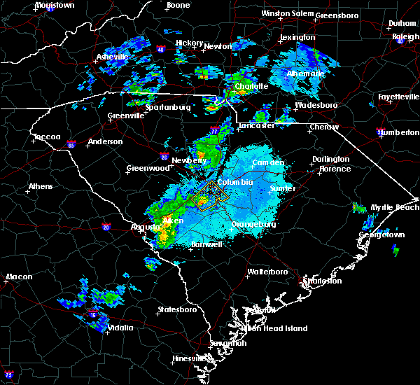 At 652 pm edt, doppler radar indicated a severe thunderstorm capable of producing quarter size hail and damaging winds in excess of 60 mph. this storm was located just north of pelion, and moving northeast at 35 mph. At 652 pm edt, doppler radar indicated a severe thunderstorm capable of producing quarter size hail and damaging winds in excess of 60 mph. this storm was located just north of pelion, and moving northeast at 35 mph.
|
| 2/3/2016 3:00 PM EST |
 At 259 pm est, doppler radar indicated a severe thunderstorm capable of producing destructive winds in excess of 70 mph. this storm was located near fort jackson, or 8 miles east of woodfields, moving east-northeast at 40 mph. locations impacted include, columbia, sumter, west columbia, cayce, forest acres, camden, woodfields, dentsville, pine ridge, gaston, arcadia lakes, eastover, woodfield, five points, oakland, fort jackson, lugoff, swansea, rembert and stateburg. At 259 pm est, doppler radar indicated a severe thunderstorm capable of producing destructive winds in excess of 70 mph. this storm was located near fort jackson, or 8 miles east of woodfields, moving east-northeast at 40 mph. locations impacted include, columbia, sumter, west columbia, cayce, forest acres, camden, woodfields, dentsville, pine ridge, gaston, arcadia lakes, eastover, woodfield, five points, oakland, fort jackson, lugoff, swansea, rembert and stateburg.
|
| 2/3/2016 2:31 PM EST | Rotation/reports of funnel cloud 3200 block old charleston hw in lexington county SC, 5.9 miles NNW of West Columbia, SC |
| 2/3/2016 2:27 PM EST |
 At 226 pm est, doppler radar indicated a severe thunderstorm capable of producing damaging winds in excess of 60 mph. this storm was located over south congaree, or near springdale, and moving east-northeast at 40 mph. At 226 pm est, doppler radar indicated a severe thunderstorm capable of producing damaging winds in excess of 60 mph. this storm was located over south congaree, or near springdale, and moving east-northeast at 40 mph.
|
| 2/3/2016 2:03 PM EST |
 At 201 pm est, doppler radar indicated a severe thunderstorm capable of producing damaging winds in excess of 60 mph. this storm was located over red bank, moving east-northeast at 40 mph. locations impacted include, columbia, aiken, lexington, west columbia, cayce, irmo, forest acres, winnsboro, springdale, st. andrews, batesburg, oak grove, red bank, dentsville, batesburg-leesville, south congaree, pine ridge, gaston, ridge spring and leesville. At 201 pm est, doppler radar indicated a severe thunderstorm capable of producing damaging winds in excess of 60 mph. this storm was located over red bank, moving east-northeast at 40 mph. locations impacted include, columbia, aiken, lexington, west columbia, cayce, irmo, forest acres, winnsboro, springdale, st. andrews, batesburg, oak grove, red bank, dentsville, batesburg-leesville, south congaree, pine ridge, gaston, ridge spring and leesville.
|
| 2/3/2016 1:40 PM EST |
 At 139 pm est, doppler radar indicated a severe thunderstorm capable of producing damaging winds in excess of 60 mph. this storm was located near leesville, or near batesburg, moving east at 40 mph. locations impacted include, columbia, aiken, lexington, west columbia, cayce, irmo, forest acres, winnsboro, springdale, st. andrews, batesburg, oak grove, red bank, dentsville, batesburg-leesville, south congaree, pine ridge, gaston, ridge spring and leesville. At 139 pm est, doppler radar indicated a severe thunderstorm capable of producing damaging winds in excess of 60 mph. this storm was located near leesville, or near batesburg, moving east at 40 mph. locations impacted include, columbia, aiken, lexington, west columbia, cayce, irmo, forest acres, winnsboro, springdale, st. andrews, batesburg, oak grove, red bank, dentsville, batesburg-leesville, south congaree, pine ridge, gaston, ridge spring and leesville.
|
| 2/3/2016 1:25 PM EST |
 At 124 pm est, doppler radar indicated a severe thunderstorm capable of producing damaging winds in excess of 60 mph. this storm was located over ridge spring, or 9 miles southwest of batesburg, and moving east-northeast at 45 mph. At 124 pm est, doppler radar indicated a severe thunderstorm capable of producing damaging winds in excess of 60 mph. this storm was located over ridge spring, or 9 miles southwest of batesburg, and moving east-northeast at 45 mph.
|
| 9/3/2015 5:46 PM EDT |
 At 545 pm edt, doppler radar indicated a likely severe thunderstorm in the northeast part of columbia. movement was south near 10 mph. the storm will likely contain wind gusts of 40 to 60 mph. large hail may occur. At 545 pm edt, doppler radar indicated a likely severe thunderstorm in the northeast part of columbia. movement was south near 10 mph. the storm will likely contain wind gusts of 40 to 60 mph. large hail may occur.
|
| 8/6/2015 5:46 PM EDT |
 At 546 pm edt, doppler radar indicated a severe thunderstorm capable of producing damaging winds in excess of 60 mph. this storm was located near pine ridge, or near cayce, and moving east at 40 mph. At 546 pm edt, doppler radar indicated a severe thunderstorm capable of producing damaging winds in excess of 60 mph. this storm was located near pine ridge, or near cayce, and moving east at 40 mph.
|
| 8/6/2015 4:50 PM EDT |
 At 449 pm edt, doppler radar indicated an area of severe thunderstorms over the csra capable of producing damaging winds in excess of 60 mph. these storms were moving east at 30 mph. At 449 pm edt, doppler radar indicated an area of severe thunderstorms over the csra capable of producing damaging winds in excess of 60 mph. these storms were moving east at 30 mph.
|
| 8/6/2015 4:32 PM EDT |
 At 432 pm edt, doppler radar indicated a line of severe thunderstorms capable of producing damaging winds in excess of 60 mph. these storms were located along a line extending from 6 miles west of lugoff to near leesville, and moving east at 25 mph. At 432 pm edt, doppler radar indicated a line of severe thunderstorms capable of producing damaging winds in excess of 60 mph. these storms were located along a line extending from 6 miles west of lugoff to near leesville, and moving east at 25 mph.
|
| 8/6/2015 3:55 PM EDT |
 At 354 pm edt, doppler radar indicated a severe thunderstorm capable of producing damaging winds in excess of 60 mph. this storm was located 7 miles northwest of irmo, and moving east at 25 mph. At 354 pm edt, doppler radar indicated a severe thunderstorm capable of producing damaging winds in excess of 60 mph. this storm was located 7 miles northwest of irmo, and moving east at 25 mph.
|
| 8/5/2015 3:17 PM EDT |
 At 317 pm edt, doppler radar indicated a severe thunderstorm capable of producing damaging winds in excess of 60 mph. this storm was located over cayce, and moving northeast at 15 mph. At 317 pm edt, doppler radar indicated a severe thunderstorm capable of producing damaging winds in excess of 60 mph. this storm was located over cayce, and moving northeast at 15 mph.
|
| 7/30/2015 2:33 PM EDT |
 At 232 pm edt, doppler radar indicated a severe thunderstorm capable of producing damaging winds in excess of 60 mph. this storm was located near irmo, and moving south at 10 mph. At 232 pm edt, doppler radar indicated a severe thunderstorm capable of producing damaging winds in excess of 60 mph. this storm was located near irmo, and moving south at 10 mph.
|
| 7/19/2015 7:26 PM EDT |
 At 725 pm edt, doppler radar indicated a line of severe thunderstorms capable of producing damaging winds in excess of 60 mph. these storms were located along a line extending from 8 miles south of lugoff to 6 miles south of ridge spring, and moving southeast at 15 mph. * these severe thunderstorms will remain over mainly rural areas of northeastern barnwell, calhoun, central aiken, lexington, southwestern sumter, south central kershaw, southeastern richland, east central edgefield and northwestern orangeburg counties, including the following locations, salley, wedgewood, woodford, springfield, pelion, livingston, wagener, neeses, gilbert and swansea. At 725 pm edt, doppler radar indicated a line of severe thunderstorms capable of producing damaging winds in excess of 60 mph. these storms were located along a line extending from 8 miles south of lugoff to 6 miles south of ridge spring, and moving southeast at 15 mph. * these severe thunderstorms will remain over mainly rural areas of northeastern barnwell, calhoun, central aiken, lexington, southwestern sumter, south central kershaw, southeastern richland, east central edgefield and northwestern orangeburg counties, including the following locations, salley, wedgewood, woodford, springfield, pelion, livingston, wagener, neeses, gilbert and swansea.
|
| 7/19/2015 7:00 PM EDT |
 At 659 pm edt, doppler radar indicated a severe thunderstorm capable of producing damaging winds in excess of 60 mph. this storm was located over arcadia lakes, or over dentsville, moving southwest at 5 mph. this severe storm will be near, west columbia, st. andrews and oak grove around 715 pm edt. other locations impacted by this severe thunderstorm include seven oaks, gilbert and summit. At 659 pm edt, doppler radar indicated a severe thunderstorm capable of producing damaging winds in excess of 60 mph. this storm was located over arcadia lakes, or over dentsville, moving southwest at 5 mph. this severe storm will be near, west columbia, st. andrews and oak grove around 715 pm edt. other locations impacted by this severe thunderstorm include seven oaks, gilbert and summit.
|
| 7/19/2015 6:08 PM EDT |
 At 607 pm edt, doppler radar indicated a severe thunderstorm capable of producing damaging winds in excess of 60 mph. this storm was located 11 miles northwest of lexington, and moving south at 25 mph. * this severe thunderstorm will be near, lexington around 625 pm edt. red bank around 635 pm edt. other locations impacted by this severe thunderstorm include chapin, little mountain, ridgeway, peak, seven oaks, gilbert, blythewood, lake murray of richland and summit. At 607 pm edt, doppler radar indicated a severe thunderstorm capable of producing damaging winds in excess of 60 mph. this storm was located 11 miles northwest of lexington, and moving south at 25 mph. * this severe thunderstorm will be near, lexington around 625 pm edt. red bank around 635 pm edt. other locations impacted by this severe thunderstorm include chapin, little mountain, ridgeway, peak, seven oaks, gilbert, blythewood, lake murray of richland and summit.
|
| 7/18/2015 6:22 PM EDT |
 At 622 pm edt, doppler radar indicated a line of severe thunderstorms capable of producing damaging winds in excess of 60 mph. these storms were located along a line extending from near pageland to near columbia, and moving southeast at 55 mph. penny size hail may also accompany the damaging winds. At 622 pm edt, doppler radar indicated a line of severe thunderstorms capable of producing damaging winds in excess of 60 mph. these storms were located along a line extending from near pageland to near columbia, and moving southeast at 55 mph. penny size hail may also accompany the damaging winds.
|
| 7/18/2015 6:07 PM EDT |
 At 606 pm edt, doppler radar indicated a line of severe thunderstorms capable of producing damaging winds in excess of 60 mph. these storms were located along a line extending from 11 miles northwest of irmo to 9 miles northeast of greenwood state park, and moving south at 15 mph. penny size hail may also accompany the damaging winds. At 606 pm edt, doppler radar indicated a line of severe thunderstorms capable of producing damaging winds in excess of 60 mph. these storms were located along a line extending from 11 miles northwest of irmo to 9 miles northeast of greenwood state park, and moving south at 15 mph. penny size hail may also accompany the damaging winds.
|
| 7/2/2015 4:29 PM EDT |
 At 429 pm edt, doppler radar indicated a line of severe thunderstorms capable of producing damaging winds in excess of 60 mph. these storms were located along a line extending from 7 miles southwest of great falls to near irmo to 6 miles east of leesville, and moving southeast at 30 mph. At 429 pm edt, doppler radar indicated a line of severe thunderstorms capable of producing damaging winds in excess of 60 mph. these storms were located along a line extending from 7 miles southwest of great falls to near irmo to 6 miles east of leesville, and moving southeast at 30 mph.
|
| 6/30/2015 4:46 PM EDT |
 At 446 pm edt, doppler radar indicated a severe thunderstorm capable of producing quarter size hail and damaging winds in excess of 60 mph. this storm was located over five points, or over cayce, and moving northeast at 55 mph. At 446 pm edt, doppler radar indicated a severe thunderstorm capable of producing quarter size hail and damaging winds in excess of 60 mph. this storm was located over five points, or over cayce, and moving northeast at 55 mph.
|
| 6/30/2015 4:30 PM EDT |
 At 429 pm edt, doppler radar indicated a severe thunderstorm capable of producing quarter size hail and damaging winds in excess of 60 mph. this storm was located over red bank, and moving east at 35 mph. At 429 pm edt, doppler radar indicated a severe thunderstorm capable of producing quarter size hail and damaging winds in excess of 60 mph. this storm was located over red bank, and moving east at 35 mph.
|
| 6/27/2015 6:02 PM EDT |
 At 601 pm edt, doppler radar indicated a line of severe thunderstorms capable of producing damaging winds in excess of 60 mph. these storms were located along a line extending from st. andrews to south congaree to 17 miles southwest of gaston, moving east at 45 mph. locations impacted include, columbia, lexington, west columbia, cayce, irmo, forest acres, springdale, st. andrews, dentsville, oak grove, woodfields, red bank, south congaree, pine ridge, gaston, arcadia lakes, eastover, fort jackson, woodfield and five points. At 601 pm edt, doppler radar indicated a line of severe thunderstorms capable of producing damaging winds in excess of 60 mph. these storms were located along a line extending from st. andrews to south congaree to 17 miles southwest of gaston, moving east at 45 mph. locations impacted include, columbia, lexington, west columbia, cayce, irmo, forest acres, springdale, st. andrews, dentsville, oak grove, woodfields, red bank, south congaree, pine ridge, gaston, arcadia lakes, eastover, fort jackson, woodfield and five points.
|
| 6/27/2015 5:42 PM EDT |
 At 541 pm edt, doppler radar indicated a line of severe thunderstorms capable of producing damaging winds in excess of 60 mph. these storms were located along a line extending from 8 miles northwest of lexington to 12 miles south of batesburg-leesville, and moving east at 40 mph. At 541 pm edt, doppler radar indicated a line of severe thunderstorms capable of producing damaging winds in excess of 60 mph. these storms were located along a line extending from 8 miles northwest of lexington to 12 miles south of batesburg-leesville, and moving east at 40 mph.
|
| 6/23/2015 6:35 PM EDT |
 At 634 pm edt, doppler radar indicated a severe thunderstorm capable of producing damaging winds in excess of 60 mph. this storm was located near st. andrews, and moving east at 10 mph. nickel size hail may also accompany the damaging winds. At 634 pm edt, doppler radar indicated a severe thunderstorm capable of producing damaging winds in excess of 60 mph. this storm was located near st. andrews, and moving east at 10 mph. nickel size hail may also accompany the damaging winds.
|
| 6/18/2015 3:46 PM EDT | At 346 pm edt, doppler radar indicated a severe thunderstorm capable of producing damaging winds in excess of 60 mph. this storm was located 7 miles southeast of cayce, and moving east at 25 mph. |
| 6/18/2015 2:57 PM EDT | At 256 pm edt, doppler radar indicated a line of severe thunderstorms capable of producing quarter size hail and damaging winds in excess of 60 mph. these storms were located along a line extending from mulberry to 9 miles east of aiken, and moving east northeast at 20 mph. |
| 6/1/2015 2:17 PM EDT | At 212 pm edt, doppler radar indicated thunderstorms extending from kershaw county southward into southern lexington county. storms near camdan, swansea, and near the fairfield and richland county line near interstate 77, were likely severe with wind gusts of 40 to 60 mph and quarter-size hail. storm movement was northeast near 15 mph. a small interior room on the lowest flood usually offers the best protection from severe thunderstorms. |
| 6/1/2015 2:06 PM EDT | At 204 pm edt, doppler radar indicated thunderstorms, some of which were likely severe with wind gusts of 40 to 60 mph. the storms extended from southern lexington county northward into fairfield and kershaw counties. movement was northeast near 15 mph. |
| 5/11/2015 4:50 PM EDT | Public reported trees and debris blocking the roadway on north lucas drive in west columbia. time estimated from rada in lexington county SC, 1.3 miles WSW of West Columbia, SC |
| 5/11/2015 4:35 PM EDT | At 435 pm edt, doppler radar indicated a severe thunderstorm capable of producing damaging winds in excess of 60 mph. this storm was located near red bank, and moving northeast at 20 mph. penny size hail may also accompany the damaging winds. |
| 4/19/2015 4:46 PM EDT | At 444 pm edt, national weather service doppler radar indicated a line of severe thunderstorms capable of producing damaging winds in excess of 60 mph. these storms were located along a line extending from 9 miles north of saluda to 14 miles south of red bank, or along a line extending from 14 miles southwest of newberry to 14 miles south of red bank, and moving northeast at 45 mph. * some communities in the warning area include five points, fort jackson, woodfields, west columbia, st. andrews, springdale, south congaree, saluda, red bank, prosperity, pine ridge, oak grove, newberry, lexington, leesville, irmo, forest acres, dentsville, columbia, cayce, batesburg and arcadia lakes report large hail, damaging winds or flooding to your county sheriff, or use www.facebook.com/nwscolumbia and email [email protected] to relay severe weather reports. |
| 4/7/2015 10:00 PM EDT | The national weather service in columbia has issued a * severe thunderstorm warning for. Southern fairfield county in central south carolina southwestern kershaw county in central south carolina northern lexington county in central south carolina northwestern richland county in central south carolina. |
| 11/4/2012 6:44 PM EDT | Quarter sized hail reported 7.2 miles NNE of West Columbia, SC |
| 7/1/2012 4:45 PM EDT | Hen Egg sized hail reported 2.2 miles E of West Columbia, SC, report from old barnwell road. |
| 7/1/2012 4:30 PM EDT | Hen Egg sized hail reported 0.7 miles WNW of West Columbia, SC, report from graydon court. |
| 1/1/0001 12:00 AM | Tree in roadway. i-126 at greystone blv in richland county SC, 1.3 miles SSW of West Columbia, SC |
| 1/1/0001 12:00 AM | Highway patrol reported a tree down at i-126 and greystone boulevar in richland county SC, 1.3 miles SSW of West Columbia, SC |
| 1/1/0001 12:00 AM | Highway patrol reporgted trees down near the interchange of hwy 378 and i-2 in lexington county SC, 1.1 miles ESE of West Columbia, SC |
| 1/1/0001 12:00 AM | Event occurred between 813 pm 06/02/2011 and 828 pm 06/02/2011 in lexington county SC, 0.6 miles SE of West Columbia, SC |
| 1/1/0001 12:00 AM | Pieces of sheet metal blew off a building and damaged a vehicl in lexington county SC, 0.7 miles WNW of West Columbia, SC |
Hail Maps for West Columbia, SC


Connect with Interactive Hail Maps