

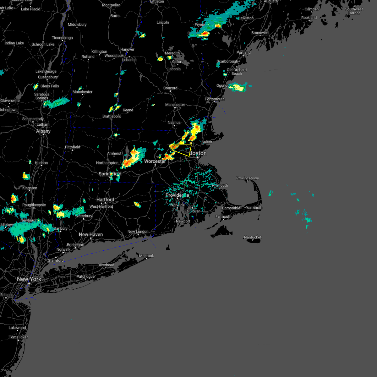
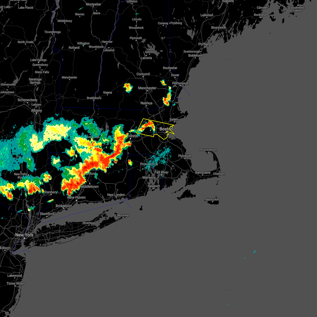
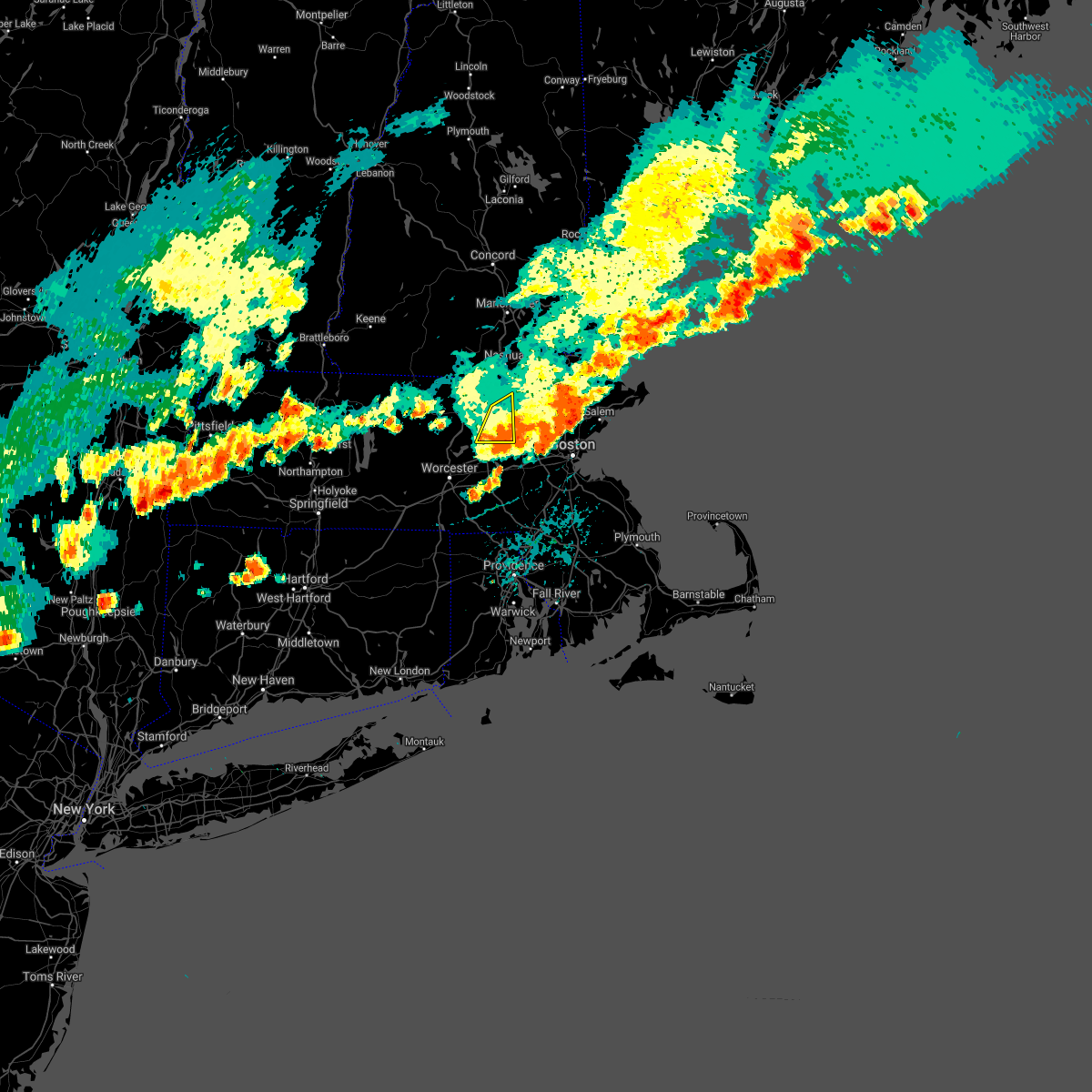
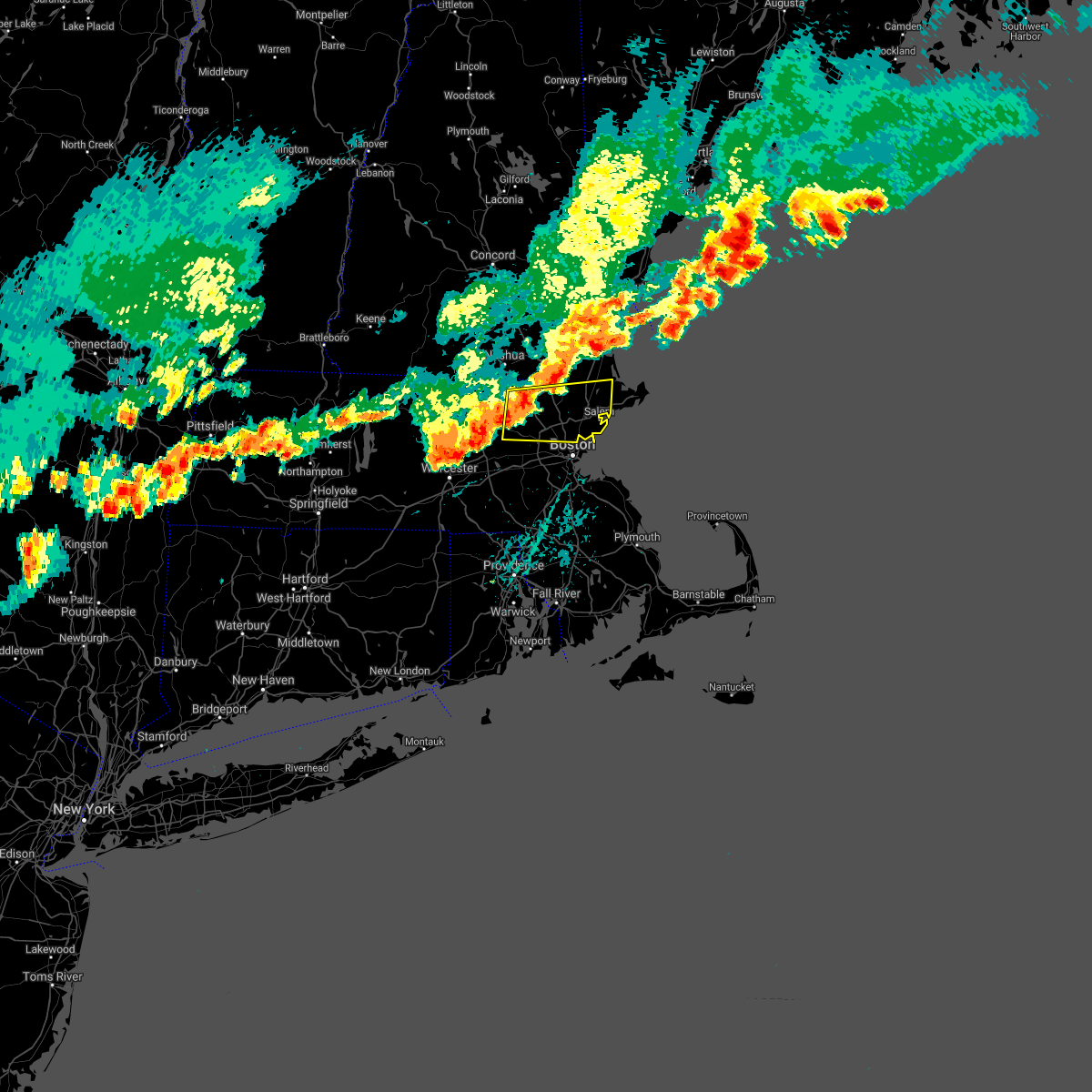
Hail Map for West Concord, MA
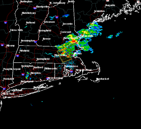
The West Concord, MA area has had 1 report of on-the-ground hail by trained spotters, and has been under severe weather warnings 20 times during the past 12 months. Doppler radar has detected hail at or near West Concord, MA on 13 occasions, including 1 occasion during the past year.
| Name: | West Concord, MA |
| Where Located: | 43.1 miles N of Providence, RI |
| Map: | Google Map for West Concord, MA |
| Population: | 6028 |
| Housing Units: | 2240 |
| More Info: | Search Google for West Concord, MA |
0
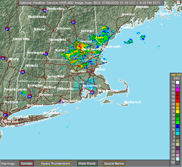
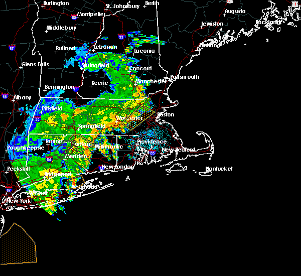
The Top Recent Hail Date for West Concord, MA is Thursday, August 15, 2024 (13th out of 13)

Hail and Wind Damage Spotted near West Concord, MA
| Date / Time | Report Details |
|---|---|
| 5/3/2025 5:29 PM EDT |
 At 528 pm edt, severe thunderstorms were located along a line extending from tyngsborough to near concord to hopedale, moving east at 40 mph (automated weather station reported. at 455 pm edt, a wind gust of 61 mph was reported at worcester airport). Hazards include 60 mph wind gusts. Expect damage to trees and power lines. Locations impacted include, sudbury, woburn, belmont, lynn, dunstable, everett, carlisle, cambridge, lexington, waltham, dracut, acton, north reading, dedham, hopedale, chelsea, wilmington, lincoln, arlington, and methuen. At 528 pm edt, severe thunderstorms were located along a line extending from tyngsborough to near concord to hopedale, moving east at 40 mph (automated weather station reported. at 455 pm edt, a wind gust of 61 mph was reported at worcester airport). Hazards include 60 mph wind gusts. Expect damage to trees and power lines. Locations impacted include, sudbury, woburn, belmont, lynn, dunstable, everett, carlisle, cambridge, lexington, waltham, dracut, acton, north reading, dedham, hopedale, chelsea, wilmington, lincoln, arlington, and methuen.
|
| 5/3/2025 5:29 PM EDT |
 the severe thunderstorm warning has been cancelled and is no longer in effect the severe thunderstorm warning has been cancelled and is no longer in effect
|
| 5/3/2025 5:08 PM EDT | At 507 pm edt, a severe thunderstorm was located over lancaster, or near leominster, moving east at 55 mph (automated weather station reported. at 455 pm edt, a wind gust of 61 mph was reported at worcester airport). Hazards include 60 mph wind gusts. Expect damage to trees and power lines. Locations impacted include, leominster, west boylston, marlborough, boylston, sterling, northborough, sudbury, maynard, carlisle, stow, harvard, acton, shirley, ayer, lincoln, westford, princeton, berlin, hudson, and lancaster. |
| 5/3/2025 5:06 PM EDT | Svrbox the national weather service in boston/norton has issued a * severe thunderstorm warning for, northeastern windham county in northern connecticut, western essex county in northeastern massachusetts, suffolk county in eastern massachusetts, eastern worcester county in central massachusetts, central norfolk county in eastern massachusetts, middlesex county in northeastern massachusetts, * until 545 pm edt. * at 505 pm edt, severe thunderstorms were located along a line extending from fitchburg to near berlin to webster, moving east at 40 mph (automated weather station reported. at 455 pm edt, a wind gust of 61 mph was reported at worcester airport). Hazards include 60 mph wind gusts. expect damage to trees and power lines |
| 5/3/2025 4:41 PM EDT |
 Svrbox the national weather service in boston/norton has issued a * severe thunderstorm warning for, central worcester county in central massachusetts, central middlesex county in northeastern massachusetts, * until 530 pm edt. * at 441 pm edt, a severe thunderstorm was located over oakham, or 15 miles west of worcester, moving east at 55 mph (radar indicated). Hazards include 60 mph wind gusts and nickel size hail. expect damage to trees and power lines Svrbox the national weather service in boston/norton has issued a * severe thunderstorm warning for, central worcester county in central massachusetts, central middlesex county in northeastern massachusetts, * until 530 pm edt. * at 441 pm edt, a severe thunderstorm was located over oakham, or 15 miles west of worcester, moving east at 55 mph (radar indicated). Hazards include 60 mph wind gusts and nickel size hail. expect damage to trees and power lines
|
| 8/15/2024 3:42 PM EDT |
 Svrbox the national weather service in boston/norton has issued a * severe thunderstorm warning for, southwestern essex county in northeastern massachusetts, east central worcester county in central massachusetts, northern norfolk county in eastern massachusetts, suffolk county in eastern massachusetts, eastern middlesex county in northeastern massachusetts, northern plymouth county in southeastern massachusetts, * until 430 pm edt. * at 340 pm edt, a severe thunderstorm was located over carlisle, or over billerica, moving southeast at 30 mph (law enforcement. this storm has a history of producing strong winds capable of minor tree damage). Hazards include 60 mph wind gusts and nickel size hail. expect damage to trees and power lines Svrbox the national weather service in boston/norton has issued a * severe thunderstorm warning for, southwestern essex county in northeastern massachusetts, east central worcester county in central massachusetts, northern norfolk county in eastern massachusetts, suffolk county in eastern massachusetts, eastern middlesex county in northeastern massachusetts, northern plymouth county in southeastern massachusetts, * until 430 pm edt. * at 340 pm edt, a severe thunderstorm was located over carlisle, or over billerica, moving southeast at 30 mph (law enforcement. this storm has a history of producing strong winds capable of minor tree damage). Hazards include 60 mph wind gusts and nickel size hail. expect damage to trees and power lines
|
| 7/17/2024 7:35 PM EDT |
 the severe thunderstorm warning has been cancelled and is no longer in effect the severe thunderstorm warning has been cancelled and is no longer in effect
|
| 7/17/2024 7:32 PM EDT |
 At 731 pm edt, severe thunderstorms were located along a line extending from near dracut to near wilmington to near weston, moving east at 35 mph (radar indicated). Hazards include 60 mph wind gusts. Expect damage to roofs, siding, and trees. Locations impacted include, lowell, lynn, lawrence, haverhill, waltham, malden, medford, revere, peabody, methuen, arlington, salem, billerica, beverly, woburn, chelmsford, andover, lexington, dracut, and tewksbury. At 731 pm edt, severe thunderstorms were located along a line extending from near dracut to near wilmington to near weston, moving east at 35 mph (radar indicated). Hazards include 60 mph wind gusts. Expect damage to roofs, siding, and trees. Locations impacted include, lowell, lynn, lawrence, haverhill, waltham, malden, medford, revere, peabody, methuen, arlington, salem, billerica, beverly, woburn, chelmsford, andover, lexington, dracut, and tewksbury.
|
| 7/17/2024 7:32 PM EDT |
 the severe thunderstorm warning has been cancelled and is no longer in effect the severe thunderstorm warning has been cancelled and is no longer in effect
|
| 7/17/2024 7:13 PM EDT |
 At 712 pm edt, severe thunderstorms were located along a line extending from tyngsborough to southborough to near webster, moving east at 35 mph (radar indicated). Hazards include 60 mph wind gusts. Expect damage to roofs, siding, and trees. Locations impacted include, lowell, framingham, billerica, marlborough, chelmsford, natick, dracut, westford, acton, hudson, westborough, concord, sudbury, ashland, northborough, wayland, pepperell, tyngsborough, groton, and maynard. At 712 pm edt, severe thunderstorms were located along a line extending from tyngsborough to southborough to near webster, moving east at 35 mph (radar indicated). Hazards include 60 mph wind gusts. Expect damage to roofs, siding, and trees. Locations impacted include, lowell, framingham, billerica, marlborough, chelmsford, natick, dracut, westford, acton, hudson, westborough, concord, sudbury, ashland, northborough, wayland, pepperell, tyngsborough, groton, and maynard.
|
| 7/17/2024 7:12 PM EDT |
 Svrbox the national weather service in boston/norton has issued a * severe thunderstorm warning for, essex county in northeastern massachusetts, east central worcester county in central massachusetts, north central suffolk county in eastern massachusetts, middlesex county in northeastern massachusetts, * until 815 pm edt. * at 711 pm edt, severe thunderstorms were located along a line extending from dunstable to near acton to marlborough, moving east at 35 mph (radar indicated). Hazards include 60 mph wind gusts. expect damage to roofs, siding, and trees Svrbox the national weather service in boston/norton has issued a * severe thunderstorm warning for, essex county in northeastern massachusetts, east central worcester county in central massachusetts, north central suffolk county in eastern massachusetts, middlesex county in northeastern massachusetts, * until 815 pm edt. * at 711 pm edt, severe thunderstorms were located along a line extending from dunstable to near acton to marlborough, moving east at 35 mph (radar indicated). Hazards include 60 mph wind gusts. expect damage to roofs, siding, and trees
|
| 7/17/2024 7:02 PM EDT | In acton a tree was reported blocking a lane of travel. relayed via amateur radio. time estimated by rada in middlesex county MA, 1.7 miles ESE of West Concord, MA |
| 7/17/2024 7:00 PM EDT | At 700 pm edt, severe thunderstorms were located along a line extending from near groton to westborough to near dudley, moving east at 30 mph (radar indicated). Hazards include 60 mph wind gusts and penny size hail. Expect damage to roofs, siding, and trees. Locations impacted include, worcester, lowell, framingham, leominster, fitchburg, billerica, marlborough, shrewsbury, chelmsford, natick, dracut, westford, acton, hudson, westborough, concord, sudbury, ashland, hopkinton, and northborough. |
| 7/17/2024 6:49 PM EDT |
 At 648 pm edt, severe thunderstorms were located along a line extending from near groton to shrewsbury to southbridge, moving east at 60 mph (radar indicated). Hazards include 60 mph wind gusts and penny size hail. Expect damage to roofs, siding, and trees. Locations impacted include, worcester, lowell, framingham, leominster, fitchburg, billerica, marlborough, shrewsbury, chelmsford, natick, dracut, westford, acton, hudson, westborough, concord, sudbury, holden, ashland, and hopkinton. At 648 pm edt, severe thunderstorms were located along a line extending from near groton to shrewsbury to southbridge, moving east at 60 mph (radar indicated). Hazards include 60 mph wind gusts and penny size hail. Expect damage to roofs, siding, and trees. Locations impacted include, worcester, lowell, framingham, leominster, fitchburg, billerica, marlborough, shrewsbury, chelmsford, natick, dracut, westford, acton, hudson, westborough, concord, sudbury, holden, ashland, and hopkinton.
|
| 7/17/2024 6:49 PM EDT |
 the severe thunderstorm warning has been cancelled and is no longer in effect the severe thunderstorm warning has been cancelled and is no longer in effect
|
| 7/17/2024 6:23 PM EDT | Svrbox the national weather service in boston/norton has issued a * severe thunderstorm warning for, worcester county in central massachusetts, central middlesex county in northeastern massachusetts, southeastern hampden county in western massachusetts, * until 730 pm edt. * at 622 pm edt, severe thunderstorms were located along a line extending from near ashburnham to spencer to near monson, moving east at 30 mph (radar indicated). Hazards include 60 mph wind gusts and penny size hail. expect damage to roofs, siding, and trees |
| 7/16/2024 9:25 PM EDT | the severe thunderstorm warning has been cancelled and is no longer in effect |
| 7/16/2024 9:10 PM EDT |
 Svrbox the national weather service in boston/norton has issued a * severe thunderstorm warning for, southern essex county in northeastern massachusetts, east central worcester county in central massachusetts, north central norfolk county in eastern massachusetts, suffolk county in eastern massachusetts, middlesex county in northeastern massachusetts, * until 1015 pm edt. * at 910 pm edt, severe thunderstorms were located along a line extending from chelmsford to near lincoln to westborough, moving east at 45 mph (radar indicated). Hazards include 60 mph wind gusts. expect damage to roofs, siding, and trees Svrbox the national weather service in boston/norton has issued a * severe thunderstorm warning for, southern essex county in northeastern massachusetts, east central worcester county in central massachusetts, north central norfolk county in eastern massachusetts, suffolk county in eastern massachusetts, middlesex county in northeastern massachusetts, * until 1015 pm edt. * at 910 pm edt, severe thunderstorms were located along a line extending from chelmsford to near lincoln to westborough, moving east at 45 mph (radar indicated). Hazards include 60 mph wind gusts. expect damage to roofs, siding, and trees
|
| 7/16/2024 8:51 PM EDT |
 At 851 pm edt, severe thunderstorms were located along a line extending from near nashua to ayer to near worcester, moving east at 55 mph (radar indicated). Hazards include 60 mph wind gusts. Expect damage to roofs, siding, and trees. Locations impacted include, boston, worcester, lowell, cambridge, lynn, newton, lawrence, somerville, framingham, haverhill, waltham, malden, medford, peabody, methuen, arlington, leominster, fitchburg, billerica, and marlborough. At 851 pm edt, severe thunderstorms were located along a line extending from near nashua to ayer to near worcester, moving east at 55 mph (radar indicated). Hazards include 60 mph wind gusts. Expect damage to roofs, siding, and trees. Locations impacted include, boston, worcester, lowell, cambridge, lynn, newton, lawrence, somerville, framingham, haverhill, waltham, malden, medford, peabody, methuen, arlington, leominster, fitchburg, billerica, and marlborough.
|
| 7/16/2024 8:51 PM EDT |
 the severe thunderstorm warning has been cancelled and is no longer in effect the severe thunderstorm warning has been cancelled and is no longer in effect
|
| 7/16/2024 8:32 PM EDT |
 Svrbox the national weather service in boston/norton has issued a * severe thunderstorm warning for, essex county in northeastern massachusetts, central worcester county in central massachusetts, north central norfolk county in eastern massachusetts, northwestern suffolk county in eastern massachusetts, eastern hampshire county in western massachusetts, middlesex county in northeastern massachusetts, northeastern hampden county in western massachusetts, * until 915 pm edt. * at 830 pm edt, severe thunderstorms were located along a line extending from greenville to westminster to west brookfield, moving east at 45 mph (radar indicated). Hazards include 60 mph wind gusts. expect damage to roofs, siding, and trees Svrbox the national weather service in boston/norton has issued a * severe thunderstorm warning for, essex county in northeastern massachusetts, central worcester county in central massachusetts, north central norfolk county in eastern massachusetts, northwestern suffolk county in eastern massachusetts, eastern hampshire county in western massachusetts, middlesex county in northeastern massachusetts, northeastern hampden county in western massachusetts, * until 915 pm edt. * at 830 pm edt, severe thunderstorms were located along a line extending from greenville to westminster to west brookfield, moving east at 45 mph (radar indicated). Hazards include 60 mph wind gusts. expect damage to roofs, siding, and trees
|
| 6/20/2024 8:50 PM EDT |
 The storms which prompted the warning have weakened below severe limits, and no longer pose an immediate threat to life or property. therefore, the warning will be allowed to expire. however gusty winds and heavy rain are still possible with these thunderstorms. a severe thunderstorm watch remains in effect until 1100 pm edt for eastern, central and northeastern massachusetts. The storms which prompted the warning have weakened below severe limits, and no longer pose an immediate threat to life or property. therefore, the warning will be allowed to expire. however gusty winds and heavy rain are still possible with these thunderstorms. a severe thunderstorm watch remains in effect until 1100 pm edt for eastern, central and northeastern massachusetts.
|
| 6/20/2024 8:22 PM EDT |
 At 822 pm edt, severe thunderstorms were located along a line extending from middleton to carlisle to harvard, moving southeast at 25 mph (radar indicated). Hazards include 60 mph wind gusts. Expect damage to roofs, siding, and trees. Locations impacted include, lowell, cambridge, lynn, somerville, waltham, malden, medford, revere, peabody, arlington, everett, salem, billerica, woburn, chelmsford, andover, watertown, lexington, tewksbury, and melrose. At 822 pm edt, severe thunderstorms were located along a line extending from middleton to carlisle to harvard, moving southeast at 25 mph (radar indicated). Hazards include 60 mph wind gusts. Expect damage to roofs, siding, and trees. Locations impacted include, lowell, cambridge, lynn, somerville, waltham, malden, medford, revere, peabody, arlington, everett, salem, billerica, woburn, chelmsford, andover, watertown, lexington, tewksbury, and melrose.
|
| 6/20/2024 8:05 PM EDT |
 Svrbox the national weather service in boston/norton has issued a * severe thunderstorm warning for, southwestern essex county in northeastern massachusetts, northeastern worcester county in central massachusetts, northeastern middlesex county in northeastern massachusetts, * until 900 pm edt. * at 804 pm edt, severe thunderstorms were located along a line extending from andover to near westford to near lunenburg, moving east at 25 mph (radar indicated). Hazards include 60 mph wind gusts. expect damage to roofs, siding, and trees Svrbox the national weather service in boston/norton has issued a * severe thunderstorm warning for, southwestern essex county in northeastern massachusetts, northeastern worcester county in central massachusetts, northeastern middlesex county in northeastern massachusetts, * until 900 pm edt. * at 804 pm edt, severe thunderstorms were located along a line extending from andover to near westford to near lunenburg, moving east at 25 mph (radar indicated). Hazards include 60 mph wind gusts. expect damage to roofs, siding, and trees
|
| 9/8/2023 2:56 PM EDT |
 At 256 pm edt, severe thunderstorms were located along a line extending from near tyngsborough to tewksbury to natick, moving northeast at 35 mph (radar indicated). Hazards include 60 mph wind gusts and quarter size hail. Hail damage to vehicles is expected. expect wind damage to roofs, siding, and trees. locations impacted include, lowell, lawrence, methuen, billerica, chelmsford, andover, dracut, tewksbury, north andover, wilmington, westford, acton, concord, north reading, bedford, pepperell, tyngsborough, groton, littleton, and ayer. hail threat, radar indicated max hail size, 1. 00 in wind threat, radar indicated max wind gust, 60 mph. At 256 pm edt, severe thunderstorms were located along a line extending from near tyngsborough to tewksbury to natick, moving northeast at 35 mph (radar indicated). Hazards include 60 mph wind gusts and quarter size hail. Hail damage to vehicles is expected. expect wind damage to roofs, siding, and trees. locations impacted include, lowell, lawrence, methuen, billerica, chelmsford, andover, dracut, tewksbury, north andover, wilmington, westford, acton, concord, north reading, bedford, pepperell, tyngsborough, groton, littleton, and ayer. hail threat, radar indicated max hail size, 1. 00 in wind threat, radar indicated max wind gust, 60 mph.
|
| 9/8/2023 2:52 PM EDT |
 At 252 pm edt, severe thunderstorms were located along a line extending from pepperell to carlisle to sherborn, moving northeast at 40 mph (radar indicated). Hazards include 60 mph wind gusts and quarter size hail. Hail damage to vehicles is expected. Expect wind damage to roofs, siding, and trees. At 252 pm edt, severe thunderstorms were located along a line extending from pepperell to carlisle to sherborn, moving northeast at 40 mph (radar indicated). Hazards include 60 mph wind gusts and quarter size hail. Hail damage to vehicles is expected. Expect wind damage to roofs, siding, and trees.
|
| 9/8/2023 2:40 PM EDT |
 At 240 pm edt, severe thunderstorms were located along a line extending from pepperell to near chelmsford to sudbury, moving northeast at 40 mph (radar indicated). Hazards include 60 mph wind gusts and quarter size hail. Hail damage to vehicles is expected. expect wind damage to roofs, siding, and trees. locations impacted include, lowell, lawrence, methuen, billerica, marlborough, chelmsford, andover, dracut, tewksbury, north andover, wilmington, westford, acton, hudson, concord, north reading, bedford, pepperell, tyngsborough, and groton. hail threat, radar indicated max hail size, 1. 00 in wind threat, radar indicated max wind gust, 60 mph. At 240 pm edt, severe thunderstorms were located along a line extending from pepperell to near chelmsford to sudbury, moving northeast at 40 mph (radar indicated). Hazards include 60 mph wind gusts and quarter size hail. Hail damage to vehicles is expected. expect wind damage to roofs, siding, and trees. locations impacted include, lowell, lawrence, methuen, billerica, marlborough, chelmsford, andover, dracut, tewksbury, north andover, wilmington, westford, acton, hudson, concord, north reading, bedford, pepperell, tyngsborough, and groton. hail threat, radar indicated max hail size, 1. 00 in wind threat, radar indicated max wind gust, 60 mph.
|
| 9/8/2023 2:38 PM EDT |
 At 238 pm edt, a severe thunderstorm was located over wayland, or over framingham, moving northeast at 40 mph (radar indicated). Hazards include 60 mph wind gusts and quarter size hail. Hail damage to vehicles is expected. expect wind damage to roofs, siding, and trees. locations impacted include, newton, framingham, waltham, medford, arlington, billerica, marlborough, woburn, andover, natick, watertown, lexington, tewksbury, wellesley, melrose, saugus, wakefield, reading, belmont, and burlington. hail threat, radar indicated max hail size, 1. 00 in wind threat, radar indicated max wind gust, 60 mph. At 238 pm edt, a severe thunderstorm was located over wayland, or over framingham, moving northeast at 40 mph (radar indicated). Hazards include 60 mph wind gusts and quarter size hail. Hail damage to vehicles is expected. expect wind damage to roofs, siding, and trees. locations impacted include, newton, framingham, waltham, medford, arlington, billerica, marlborough, woburn, andover, natick, watertown, lexington, tewksbury, wellesley, melrose, saugus, wakefield, reading, belmont, and burlington. hail threat, radar indicated max hail size, 1. 00 in wind threat, radar indicated max wind gust, 60 mph.
|
| 9/8/2023 2:37 PM EDT | Numerous reports of trees downed across town. time estimated from rada in middlesex county MA, 2.5 miles W of West Concord, MA |
| 9/8/2023 2:25 PM EDT |
 At 225 pm edt, severe thunderstorms were located along a line extending from shirley to boxborough to northborough, moving northeast at 45 mph (radar indicated). Hazards include 60 mph wind gusts and quarter size hail. Hail damage to vehicles is expected. Expect wind damage to roofs, siding, and trees. At 225 pm edt, severe thunderstorms were located along a line extending from shirley to boxborough to northborough, moving northeast at 45 mph (radar indicated). Hazards include 60 mph wind gusts and quarter size hail. Hail damage to vehicles is expected. Expect wind damage to roofs, siding, and trees.
|
| 9/8/2023 2:15 PM EDT |
 At 215 pm edt, a severe thunderstorm was located over grafton, or near shrewsbury, moving northeast at 35 mph (radar indicated). Hazards include 60 mph wind gusts and quarter size hail. Hail damage to vehicles is expected. Expect wind damage to roofs, siding, and trees. At 215 pm edt, a severe thunderstorm was located over grafton, or near shrewsbury, moving northeast at 35 mph (radar indicated). Hazards include 60 mph wind gusts and quarter size hail. Hail damage to vehicles is expected. Expect wind damage to roofs, siding, and trees.
|
| 9/8/2023 2:05 PM EDT |
 At 204 pm edt, a severe thunderstorm was located over clinton, or 7 miles north of shrewsbury, moving northeast at 25 mph (radar indicated). Hazards include 60 mph wind gusts and quarter size hail. Hail damage to vehicles is expected. Expect wind damage to roofs, siding, and trees. At 204 pm edt, a severe thunderstorm was located over clinton, or 7 miles north of shrewsbury, moving northeast at 25 mph (radar indicated). Hazards include 60 mph wind gusts and quarter size hail. Hail damage to vehicles is expected. Expect wind damage to roofs, siding, and trees.
|
| 8/18/2023 8:56 AM EDT |
 At 855 am edt, a severe thunderstorm was located over hopedale, or near milford, moving northeast at 40 mph (radar indicated). Hazards include 60 mph wind gusts and nickel size hail. expect damage to roofs, siding, and trees At 855 am edt, a severe thunderstorm was located over hopedale, or near milford, moving northeast at 40 mph (radar indicated). Hazards include 60 mph wind gusts and nickel size hail. expect damage to roofs, siding, and trees
|
| 7/25/2023 3:48 PM EDT |
 At 347 pm edt, a severe thunderstorm was located over westborough, or near marlborough, moving east at 20 mph (radar indicated). Hazards include 60 mph wind gusts and quarter size hail. Expect wind damage to trees and power lines. Minor hail damage to vehicles is possible. At 347 pm edt, a severe thunderstorm was located over westborough, or near marlborough, moving east at 20 mph (radar indicated). Hazards include 60 mph wind gusts and quarter size hail. Expect wind damage to trees and power lines. Minor hail damage to vehicles is possible.
|
| 7/16/2023 8:17 AM EDT |
 At 817 am edt, a severe thunderstorm capable of producing a tornado was located over maynard, or 9 miles northeast of marlborough, moving northeast at 30 mph (radar indicated rotation). Hazards include tornado. Flying debris will be dangerous to those caught without shelter. mobile homes will be damaged or destroyed. damage to roofs, windows, and vehicles will occur. tree damage is likely. this dangerous storm will be near, lowell, billerica, chelmsford, westford, acton, concord, bedford, groton, littleton and carlisle around 825 am edt. Tyngsborough around 830 am edt. At 817 am edt, a severe thunderstorm capable of producing a tornado was located over maynard, or 9 miles northeast of marlborough, moving northeast at 30 mph (radar indicated rotation). Hazards include tornado. Flying debris will be dangerous to those caught without shelter. mobile homes will be damaged or destroyed. damage to roofs, windows, and vehicles will occur. tree damage is likely. this dangerous storm will be near, lowell, billerica, chelmsford, westford, acton, concord, bedford, groton, littleton and carlisle around 825 am edt. Tyngsborough around 830 am edt.
|
| 7/16/2023 8:15 AM EDT |
 At 814 am edt, a severe thunderstorm was located over maynard, or near marlborough, moving northeast at 30 mph (radar indicated). Hazards include 60 mph wind gusts. expect damage to trees and power lines At 814 am edt, a severe thunderstorm was located over maynard, or near marlborough, moving northeast at 30 mph (radar indicated). Hazards include 60 mph wind gusts. expect damage to trees and power lines
|
| 8/26/2022 4:07 PM EDT | At 407 pm edt, severe thunderstorms were located along a line extending from everett to norfolk to near killingly, moving east at 30 mph (radar indicated). Hazards include 60 mph wind gusts and nickel size hail. Expect damage to trees and power lines. locations impacted include, boston, cambridge, quincy, lynn, newton, somerville, framingham, waltham, malden, brookline, medford, revere, peabody, arlington, everett, salem, woonsocket, marlborough, woburn and chelsea. hail threat, radar indicated max hail size, 0. 88 in wind threat, radar indicated max wind gust, 60 mph. |
| 8/26/2022 4:07 PM EDT | At 407 pm edt, severe thunderstorms were located along a line extending from everett to norfolk to near killingly, moving east at 30 mph (radar indicated). Hazards include 60 mph wind gusts and nickel size hail. Expect damage to trees and power lines. locations impacted include, boston, cambridge, quincy, lynn, newton, somerville, framingham, waltham, malden, brookline, medford, revere, peabody, arlington, everett, salem, woonsocket, marlborough, woburn and chelsea. hail threat, radar indicated max hail size, 0. 88 in wind threat, radar indicated max wind gust, 60 mph. |
| 8/26/2022 4:07 PM EDT | At 407 pm edt, severe thunderstorms were located along a line extending from everett to norfolk to near killingly, moving east at 30 mph (radar indicated). Hazards include 60 mph wind gusts and nickel size hail. Expect damage to trees and power lines. locations impacted include, boston, cambridge, quincy, lynn, newton, somerville, framingham, waltham, malden, brookline, medford, revere, peabody, arlington, everett, salem, woonsocket, marlborough, woburn and chelsea. hail threat, radar indicated max hail size, 0. 88 in wind threat, radar indicated max wind gust, 60 mph. |
| 8/26/2022 3:47 PM EDT | At 346 pm edt, severe thunderstorms were located along a line extending from waltham to bellingham to near scotland, moving east at 35 mph (radar indicated). Hazards include 60 mph wind gusts and nickel size hail. Expect damage to trees and power lines. locations impacted include, boston, worcester, cambridge, quincy, lynn, newton, somerville, framingham, waltham, malden, brookline, medford, revere, peabody, arlington, everett, salem, woonsocket, marlborough and woburn. hail threat, radar indicated max hail size, 0. 88 in wind threat, radar indicated max wind gust, 60 mph. |
| 8/26/2022 3:47 PM EDT | At 346 pm edt, severe thunderstorms were located along a line extending from waltham to bellingham to near scotland, moving east at 35 mph (radar indicated). Hazards include 60 mph wind gusts and nickel size hail. Expect damage to trees and power lines. locations impacted include, boston, worcester, cambridge, quincy, lynn, newton, somerville, framingham, waltham, malden, brookline, medford, revere, peabody, arlington, everett, salem, woonsocket, marlborough and woburn. hail threat, radar indicated max hail size, 0. 88 in wind threat, radar indicated max wind gust, 60 mph. |
| 8/26/2022 3:47 PM EDT | At 346 pm edt, severe thunderstorms were located along a line extending from waltham to bellingham to near scotland, moving east at 35 mph (radar indicated). Hazards include 60 mph wind gusts and nickel size hail. Expect damage to trees and power lines. locations impacted include, boston, worcester, cambridge, quincy, lynn, newton, somerville, framingham, waltham, malden, brookline, medford, revere, peabody, arlington, everett, salem, woonsocket, marlborough and woburn. hail threat, radar indicated max hail size, 0. 88 in wind threat, radar indicated max wind gust, 60 mph. |
| 8/26/2022 3:30 PM EDT | At 330 pm edt, a severe thunderstorm was located over harvard, or 9 miles east of leominster, moving east at 30 mph (radar indicated). Hazards include 60 mph wind gusts and quarter size hail. Expect wind damage to trees and power lines. minor hail damage to vehicles is possible. locations impacted include, marlborough, acton, hudson, concord, sudbury, northborough, clinton, wayland, weston, maynard, littleton, lancaster, stow, harvard, lincoln, boxborough, bolton, carlisle, boylston and berlin. hail threat, radar indicated max hail size, 1. 00 in wind threat, radar indicated max wind gust, 60 mph. |
| 8/26/2022 3:24 PM EDT | At 324 pm edt, severe thunderstorms were located along a line extending from near framingham to douglas to columbia, moving east at 35 mph (radar indicated). Hazards include 60 mph wind gusts and nickel size hail. expect damage to trees and power lines |
| 8/26/2022 3:24 PM EDT | At 324 pm edt, severe thunderstorms were located along a line extending from near framingham to douglas to columbia, moving east at 35 mph (radar indicated). Hazards include 60 mph wind gusts and nickel size hail. expect damage to trees and power lines |
| 8/26/2022 3:24 PM EDT | At 324 pm edt, severe thunderstorms were located along a line extending from near framingham to douglas to columbia, moving east at 35 mph (radar indicated). Hazards include 60 mph wind gusts and nickel size hail. expect damage to trees and power lines |
| 8/26/2022 3:03 PM EDT | At 302 pm edt, a severe thunderstorm was located over princeton, or near leominster, moving east at 25 mph (radar indicated). Hazards include 60 mph wind gusts and quarter size hail. Expect wind damage to trees and power lines. Minor hail damage to vehicles is possible. |
| 8/26/2022 2:27 PM EDT | At 227 pm edt, a severe thunderstorm was located over ware, or 11 miles southeast of amherst, moving east at 50 mph (radar indicated). Hazards include 60 mph wind gusts and nickel size hail. expect damage to trees and power lines |
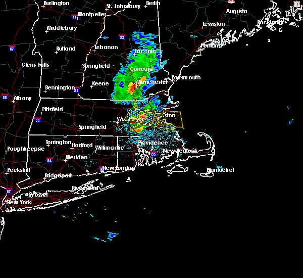
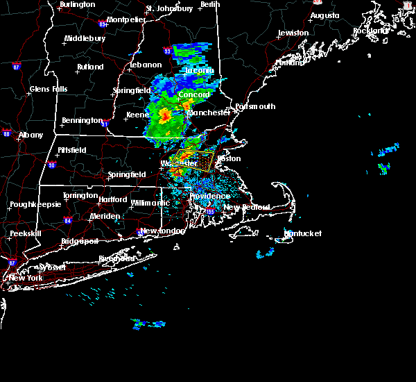
| 8/7/2022 6:42 PM EDT |
 At 641 pm edt, a severe thunderstorm was located over marlborough, moving east at 40 mph (radar indicated). Hazards include 60 mph wind gusts. expect damage to trees and power lines At 641 pm edt, a severe thunderstorm was located over marlborough, moving east at 40 mph (radar indicated). Hazards include 60 mph wind gusts. expect damage to trees and power lines
|
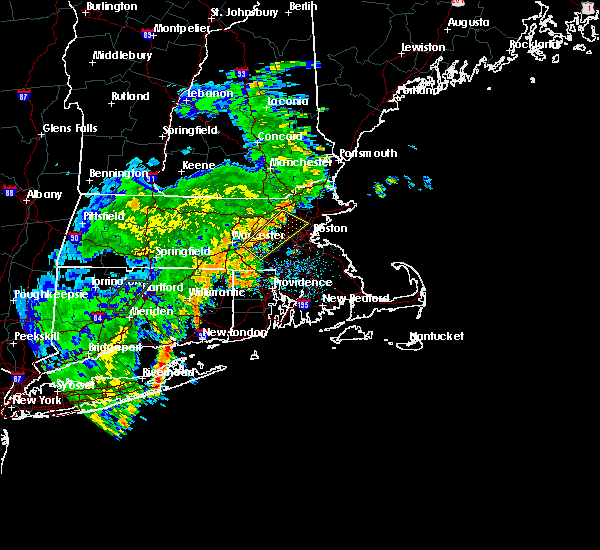
| 8/5/2022 3:45 PM EDT |
 At 344 pm edt, a severe thunderstorm was located over concord, or near lexington, moving east at 15 mph (radar indicated). Hazards include 60 mph wind gusts and quarter size hail. Expect wind damage to trees and power lines. minor hail damage to vehicles is possible. at 333 pm edt, amateur radio reported tree damage in acton, ma. locations impacted include, waltham, arlington, billerica, woburn, lexington, belmont, burlington, acton, concord, bedford, weston, lincoln and carlisle. hail threat, radar indicated max hail size, 1. 00 in wind threat, radar indicated max wind gust, 60 mph. At 344 pm edt, a severe thunderstorm was located over concord, or near lexington, moving east at 15 mph (radar indicated). Hazards include 60 mph wind gusts and quarter size hail. Expect wind damage to trees and power lines. minor hail damage to vehicles is possible. at 333 pm edt, amateur radio reported tree damage in acton, ma. locations impacted include, waltham, arlington, billerica, woburn, lexington, belmont, burlington, acton, concord, bedford, weston, lincoln and carlisle. hail threat, radar indicated max hail size, 1. 00 in wind threat, radar indicated max wind gust, 60 mph.
|
| 8/5/2022 3:35 PM EDT | Tree down at 100 block of main street and 700 block of main street. relayed by amateur radi in middlesex county MA, 2.5 miles W of West Concord, MA |
| 8/5/2022 3:24 PM EDT |
 At 324 pm edt, a severe thunderstorm was located over acton, or 9 miles southwest of chelmsford, moving east at 15 mph (radar indicated). Hazards include 60 mph wind gusts and quarter size hail. Expect wind damage to trees and power lines. Minor hail damage to vehicles is possible. At 324 pm edt, a severe thunderstorm was located over acton, or 9 miles southwest of chelmsford, moving east at 15 mph (radar indicated). Hazards include 60 mph wind gusts and quarter size hail. Expect wind damage to trees and power lines. Minor hail damage to vehicles is possible.
|
| 3/7/2022 10:16 PM EST |
 At 1015 pm est, severe thunderstorms were located along a line extending from near haverhill to near southbridge, moving east at 70 mph (radar indicated). Hazards include 60 mph wind gusts. expect damage to trees and power lines At 1015 pm est, severe thunderstorms were located along a line extending from near haverhill to near southbridge, moving east at 70 mph (radar indicated). Hazards include 60 mph wind gusts. expect damage to trees and power lines
|
| 7/27/2021 7:14 PM EDT |
 At 713 pm edt, severe thunderstorms were located along a line extending from littleton to near sutton, moving east at 40 mph (trained weather spotters. multiple trees and powerlines have been downed in worcester and westborough from these severe thunderstorms). Hazards include 60 mph wind gusts and nickel size hail. Expect damage to trees and power lines. Locations impacted include, boston, worcester, cambridge, brockton, quincy, newton, somerville, framingham, waltham, malden, brookline, medford, weymouth, revere, arlington, everett, billerica, marlborough, woburn and braintree. At 713 pm edt, severe thunderstorms were located along a line extending from littleton to near sutton, moving east at 40 mph (trained weather spotters. multiple trees and powerlines have been downed in worcester and westborough from these severe thunderstorms). Hazards include 60 mph wind gusts and nickel size hail. Expect damage to trees and power lines. Locations impacted include, boston, worcester, cambridge, brockton, quincy, newton, somerville, framingham, waltham, malden, brookline, medford, weymouth, revere, arlington, everett, billerica, marlborough, woburn and braintree.
|
| 7/27/2021 6:57 PM EDT |
 At 656 pm edt, severe thunderstorms were located along a line extending from ayer to auburn, moving east at 35 mph (trained weather spotters. multiple trees and powerlines been downed in worcester from these severe thunderstorms. in addition, a 52 mph wind gust was reported at worcester airport at 633 pm). Hazards include 60 mph wind gusts and quarter size hail. Expect wind damage to trees and power lines. minor hail damage to vehicles is possible. Locations impacted include, boston, worcester, cambridge, brockton, quincy, newton, somerville, framingham, waltham, malden, brookline, medford, weymouth, revere, arlington, everett, leominster, fitchburg, billerica and marlborough. At 656 pm edt, severe thunderstorms were located along a line extending from ayer to auburn, moving east at 35 mph (trained weather spotters. multiple trees and powerlines been downed in worcester from these severe thunderstorms. in addition, a 52 mph wind gust was reported at worcester airport at 633 pm). Hazards include 60 mph wind gusts and quarter size hail. Expect wind damage to trees and power lines. minor hail damage to vehicles is possible. Locations impacted include, boston, worcester, cambridge, brockton, quincy, newton, somerville, framingham, waltham, malden, brookline, medford, weymouth, revere, arlington, everett, leominster, fitchburg, billerica and marlborough.
|
| 7/27/2021 6:33 PM EDT |
 At 632 pm edt, severe thunderstorms were located along a line extending from near fitchburg to leicester, moving east at 40 mph (radar indicated). Hazards include 60 mph wind gusts and nickel size hail. expect damage to trees and power lines At 632 pm edt, severe thunderstorms were located along a line extending from near fitchburg to leicester, moving east at 40 mph (radar indicated). Hazards include 60 mph wind gusts and nickel size hail. expect damage to trees and power lines
|
| 7/7/2021 6:38 PM EDT |
 At 638 pm edt, a severe thunderstorm was located over berlin, or near shrewsbury, moving east at 15 mph (radar indicated). Hazards include 60 mph wind gusts. Expect damage to trees and power lines. Locations impacted include, worcester, framingham, leominster, marlborough, shrewsbury, westford, acton, hudson, westborough, concord, sudbury, northborough, clinton, wayland, groton, maynard, southborough, littleton, lancaster and sterling. At 638 pm edt, a severe thunderstorm was located over berlin, or near shrewsbury, moving east at 15 mph (radar indicated). Hazards include 60 mph wind gusts. Expect damage to trees and power lines. Locations impacted include, worcester, framingham, leominster, marlborough, shrewsbury, westford, acton, hudson, westborough, concord, sudbury, northborough, clinton, wayland, groton, maynard, southborough, littleton, lancaster and sterling.
|
| 7/7/2021 6:18 PM EDT |
 At 617 pm edt, a severe thunderstorm was located over west boylston, or near shrewsbury, moving east at 15 mph (radar indicated). Hazards include 60 mph wind gusts and penny size hail. expect damage to trees and power lines At 617 pm edt, a severe thunderstorm was located over west boylston, or near shrewsbury, moving east at 15 mph (radar indicated). Hazards include 60 mph wind gusts and penny size hail. expect damage to trees and power lines
|
| 7/6/2021 5:30 PM EDT | Tree down on car on elm streetat park lane. trees down on lexington road... near the concord and lincoin line in middlesex county MA, 2.5 miles W of West Concord, MA |
| 7/6/2021 5:13 PM EDT |
 At 512 pm edt, a severe thunderstorm was located over stow, or near marlborough, moving east at 30 mph (radar indicated). Hazards include 60 mph wind gusts and penny size hail. expect damage to trees and power lines At 512 pm edt, a severe thunderstorm was located over stow, or near marlborough, moving east at 30 mph (radar indicated). Hazards include 60 mph wind gusts and penny size hail. expect damage to trees and power lines
|
| 6/30/2021 6:06 PM EDT |
 At 605 pm edt, a severe thunderstorm was located over acton, or near chelmsford, moving east at 35 mph (radar indicated). Hazards include 60 mph wind gusts. Expect damage to trees and power lines. Locations impacted include, westford, acton, concord, sudbury, groton, maynard, littleton, ayer, stow, harvard, boxborough and bolton. At 605 pm edt, a severe thunderstorm was located over acton, or near chelmsford, moving east at 35 mph (radar indicated). Hazards include 60 mph wind gusts. Expect damage to trees and power lines. Locations impacted include, westford, acton, concord, sudbury, groton, maynard, littleton, ayer, stow, harvard, boxborough and bolton.
|
| 6/30/2021 5:54 PM EDT |
 At 553 pm edt, a severe thunderstorm was located over northborough, or near marlborough, moving east at 35 mph (radar indicated). Hazards include 60 mph wind gusts. expect damage to trees and power lines At 553 pm edt, a severe thunderstorm was located over northborough, or near marlborough, moving east at 35 mph (radar indicated). Hazards include 60 mph wind gusts. expect damage to trees and power lines
|
| 6/30/2021 5:43 PM EDT |
 At 543 pm edt, a severe thunderstorm was located over carlisle, or over chelmsford, moving east at 25 mph (radar indicated). Hazards include 60 mph wind gusts and penny size hail. expect damage to trees and power lines At 543 pm edt, a severe thunderstorm was located over carlisle, or over chelmsford, moving east at 25 mph (radar indicated). Hazards include 60 mph wind gusts and penny size hail. expect damage to trees and power lines
|
| 6/30/2021 5:34 PM EDT |
 At 534 pm edt, a severe thunderstorm was located over harvard, or 8 miles east of leominster, moving east at 20 mph (trained weather spotters have reported a history of wind damage with this storm). Hazards include 60 mph wind gusts and penny size hail. Expect damage to trees and power lines. Locations impacted include, leominster, fitchburg, westford, acton, concord, sudbury, holden, clinton, pepperell, tyngsborough, groton, maynard, lunenburg, townsend, littleton, lancaster, rutland, sterling, ayer and westminster. At 534 pm edt, a severe thunderstorm was located over harvard, or 8 miles east of leominster, moving east at 20 mph (trained weather spotters have reported a history of wind damage with this storm). Hazards include 60 mph wind gusts and penny size hail. Expect damage to trees and power lines. Locations impacted include, leominster, fitchburg, westford, acton, concord, sudbury, holden, clinton, pepperell, tyngsborough, groton, maynard, lunenburg, townsend, littleton, lancaster, rutland, sterling, ayer and westminster.
|
| 6/30/2021 5:13 PM EDT |
 At 513 pm edt, a severe thunderstorm was located over westminster, or near fitchburg, moving east at 25 mph (trained weather spotters have reported a history of wind damage with these storms). Hazards include 60 mph wind gusts and quarter size hail. Expect wind damage to trees and power lines. Minor hail damage to vehicles is possible. At 513 pm edt, a severe thunderstorm was located over westminster, or near fitchburg, moving east at 25 mph (trained weather spotters have reported a history of wind damage with these storms). Hazards include 60 mph wind gusts and quarter size hail. Expect wind damage to trees and power lines. Minor hail damage to vehicles is possible.
|
| 11/15/2020 10:48 PM EST |
 At 1047 pm est, severe thunderstorms were located along a line extending from litchfield to near littleton to near mendon, moving east at 50 mph (radar indicated). Hazards include 60 mph wind gusts. Expect damage to trees and power lines. Locations impacted include, boston, lowell, cambridge, brockton, quincy, lynn, newton, lawrence, somerville, framingham, haverhill, waltham, malden, brookline, medford, weymouth, revere, peabody, methuen and arlington. At 1047 pm est, severe thunderstorms were located along a line extending from litchfield to near littleton to near mendon, moving east at 50 mph (radar indicated). Hazards include 60 mph wind gusts. Expect damage to trees and power lines. Locations impacted include, boston, lowell, cambridge, brockton, quincy, lynn, newton, lawrence, somerville, framingham, haverhill, waltham, malden, brookline, medford, weymouth, revere, peabody, methuen and arlington.
|
| 11/15/2020 10:22 PM EST |
 At 1022 pm est, severe thunderstorms were located along a line extending from new ipswich to princeton to near woodstock, moving east at 50 mph (radar indicated). Hazards include 60 mph wind gusts. expect damage to trees and power lines At 1022 pm est, severe thunderstorms were located along a line extending from new ipswich to princeton to near woodstock, moving east at 50 mph (radar indicated). Hazards include 60 mph wind gusts. expect damage to trees and power lines
|
| 10/7/2020 6:00 PM EDT | Tree uprooted and tree split in half on wright rd in west concord. telephone pole down at lawsbrook rd in middlesex county MA, 2.5 miles W of West Concord, MA |
| 10/7/2020 5:27 PM EDT |
 At 526 pm edt, severe thunderstorms were located along a line extending from brookline to near sterling to near spencer, moving east at 70 mph (radar indicated). Hazards include 70 mph wind gusts. Expect considerable damage to trees and power lines. Damage is likely to mobile homes and outbuildings. At 526 pm edt, severe thunderstorms were located along a line extending from brookline to near sterling to near spencer, moving east at 70 mph (radar indicated). Hazards include 70 mph wind gusts. Expect considerable damage to trees and power lines. Damage is likely to mobile homes and outbuildings.
|
| 8/23/2020 4:42 PM EDT |
 At 440 pm edt, a severe thunderstorm was located over reading, or near woburn, moving east at 15 mph (trained weather spotters have indicated numerous reports of wind damage and downed trees across parts of this region over the past hour. current radar indicates strong winds will be entering watertown, stoneham, melrose, cambridge and boston). Hazards include 60 mph wind gusts and quarter size hail. Expect wind damage to trees and power lines. minor hail damage to vehicles is possible. Locations impacted include, boston, cambridge, lynn, newton, somerville, framingham, waltham, malden, brookline, medford, revere, peabody, arlington, everett, salem, billerica, beverly, marlborough, woburn and chelsea. At 440 pm edt, a severe thunderstorm was located over reading, or near woburn, moving east at 15 mph (trained weather spotters have indicated numerous reports of wind damage and downed trees across parts of this region over the past hour. current radar indicates strong winds will be entering watertown, stoneham, melrose, cambridge and boston). Hazards include 60 mph wind gusts and quarter size hail. Expect wind damage to trees and power lines. minor hail damage to vehicles is possible. Locations impacted include, boston, cambridge, lynn, newton, somerville, framingham, waltham, malden, brookline, medford, revere, peabody, arlington, everett, salem, billerica, beverly, marlborough, woburn and chelsea.
|
| 8/23/2020 4:34 PM EDT |
 At 433 pm edt, a severe thunderstorm was located over reading, or near woburn, moving east at 15 mph (radar indicated). Hazards include 60 mph wind gusts and quarter size hail. Expect wind damage to trees and power lines. Minor hail damage to vehicles is possible. At 433 pm edt, a severe thunderstorm was located over reading, or near woburn, moving east at 15 mph (radar indicated). Hazards include 60 mph wind gusts and quarter size hail. Expect wind damage to trees and power lines. Minor hail damage to vehicles is possible.
|
| 8/23/2020 4:26 PM EDT |
 At 426 pm edt, a severe thunderstorm was located over sudbury, or near framingham, moving east at 15 mph (radar indicated). Hazards include 60 mph wind gusts and quarter size hail. Expect wind damage to trees and power lines. minor hail damage to vehicles is possible. Locations impacted include, boston, cambridge, newton, somerville, framingham, waltham, malden, brookline, medford, arlington, marlborough, woburn, natick, watertown, lexington, wellesley, reading, belmont, burlington and acton. At 426 pm edt, a severe thunderstorm was located over sudbury, or near framingham, moving east at 15 mph (radar indicated). Hazards include 60 mph wind gusts and quarter size hail. Expect wind damage to trees and power lines. minor hail damage to vehicles is possible. Locations impacted include, boston, cambridge, newton, somerville, framingham, waltham, malden, brookline, medford, arlington, marlborough, woburn, natick, watertown, lexington, wellesley, reading, belmont, burlington and acton.
|
| 8/23/2020 4:12 PM EDT |
 At 412 pm edt, a severe thunderstorm was located over stow, or near marlborough, moving east at 15 mph (radar indicated). Hazards include 60 mph wind gusts and quarter size hail. Expect wind damage to trees and power lines. Minor hail damage to vehicles is possible. At 412 pm edt, a severe thunderstorm was located over stow, or near marlborough, moving east at 15 mph (radar indicated). Hazards include 60 mph wind gusts and quarter size hail. Expect wind damage to trees and power lines. Minor hail damage to vehicles is possible.
|
| 8/23/2020 4:10 PM EDT | Tree down on college rd in middlesex county MA, 2.5 miles W of West Concord, MA |
| 8/22/2020 10:55 AM EDT |
 At 1053 am edt, a severe thunderstorm was located over chelmsford, moving east at 40 mph (trained weather spotters report multiple trees down in townsend and pepperell). Hazards include 60 mph wind gusts and quarter size hail. Expect wind damage to trees and power lines. minor hail damage to vehicles is possible. Locations impacted include, lowell, lawrence, methuen, billerica, chelmsford, andover, dracut, tewksbury, north andover, wilmington, westford, acton, concord, bedford, tyngsborough, groton, littleton, ayer, shirley and harvard. At 1053 am edt, a severe thunderstorm was located over chelmsford, moving east at 40 mph (trained weather spotters report multiple trees down in townsend and pepperell). Hazards include 60 mph wind gusts and quarter size hail. Expect wind damage to trees and power lines. minor hail damage to vehicles is possible. Locations impacted include, lowell, lawrence, methuen, billerica, chelmsford, andover, dracut, tewksbury, north andover, wilmington, westford, acton, concord, bedford, tyngsborough, groton, littleton, ayer, shirley and harvard.
|
| 8/22/2020 10:38 AM EDT |
 At 1038 am edt, a severe thunderstorm was located over pepperell, or 8 miles southwest of nashua, moving east at 40 mph (radar indicated). Hazards include 60 mph wind gusts and quarter size hail. Expect wind damage to trees and power lines. Minor hail damage to vehicles is possible. At 1038 am edt, a severe thunderstorm was located over pepperell, or 8 miles southwest of nashua, moving east at 40 mph (radar indicated). Hazards include 60 mph wind gusts and quarter size hail. Expect wind damage to trees and power lines. Minor hail damage to vehicles is possible.
|
| 7/23/2020 4:19 PM EDT |
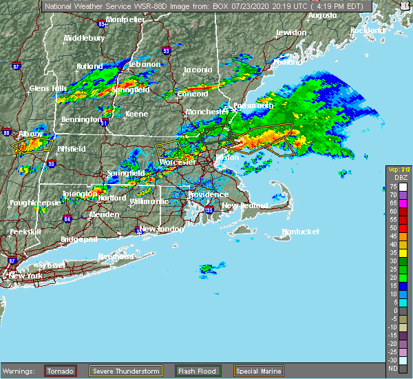 The national weather service in boston/norton has issued a * severe thunderstorm warning for. north central norfolk county in eastern massachusetts. eastern worcester county in central massachusetts. southeastern middlesex county in northeastern massachusetts. Until 515 pm edt. The national weather service in boston/norton has issued a * severe thunderstorm warning for. north central norfolk county in eastern massachusetts. eastern worcester county in central massachusetts. southeastern middlesex county in northeastern massachusetts. Until 515 pm edt.
|
| 7/5/2020 10:28 PM EDT |
 The severe thunderstorm warning for southwestern suffolk, northwestern norfolk, east central worcester and southeastern middlesex counties will expire at 1030 pm edt, the severe thunderstorm which prompted the warning remains severe. a new severe thunderstorm warning has been issued for suffolk and norfolk counties until 1130 pm. The severe thunderstorm warning for southwestern suffolk, northwestern norfolk, east central worcester and southeastern middlesex counties will expire at 1030 pm edt, the severe thunderstorm which prompted the warning remains severe. a new severe thunderstorm warning has been issued for suffolk and norfolk counties until 1130 pm.
|
| 7/5/2020 10:25 PM EDT |
 At 1024 pm edt, a severe thunderstorm was located over wayland, or near framingham, moving southeast at 15 mph (radar indicated. at 1013 pm, trees were downed in stow from this severe thunderstorm). Hazards include 60 mph wind gusts and quarter size hail. Expect wind damage to trees and power lines. Minor hail damage to vehicles is possible. At 1024 pm edt, a severe thunderstorm was located over wayland, or near framingham, moving southeast at 15 mph (radar indicated. at 1013 pm, trees were downed in stow from this severe thunderstorm). Hazards include 60 mph wind gusts and quarter size hail. Expect wind damage to trees and power lines. Minor hail damage to vehicles is possible.
|
| 7/5/2020 10:17 PM EDT |
 At 1015 pm edt, a severe thunderstorm was located over dover, or over natick. another severe thunderstorm was over maynard. each of these storms were moving southeast at 25 mph (radar indicated. at 1012 pm, mutiple trees and wires were downed in wayland). Hazards include 60 mph wind gusts and quarter size hail. Expect wind damage to trees and power lines. minor hail damage to vehicles is possible. Locations impacted include, boston, newton, framingham, waltham, marlborough, natick, franklin, needham, norwood, milford, wellesley, dedham, walpole, acton, canton, hudson, westborough, concord, sudbury and ashland. At 1015 pm edt, a severe thunderstorm was located over dover, or over natick. another severe thunderstorm was over maynard. each of these storms were moving southeast at 25 mph (radar indicated. at 1012 pm, mutiple trees and wires were downed in wayland). Hazards include 60 mph wind gusts and quarter size hail. Expect wind damage to trees and power lines. minor hail damage to vehicles is possible. Locations impacted include, boston, newton, framingham, waltham, marlborough, natick, franklin, needham, norwood, milford, wellesley, dedham, walpole, acton, canton, hudson, westborough, concord, sudbury and ashland.
|
| 7/5/2020 10:02 PM EDT |
 At 1000 pm edt, a severe thunderstorm was located over wayland. another severe thunderstorm was located 2 miles west of harvard. each of these storms were moving southeast at 25 mph (radar indicated. several trees have been downed in the acton and boxborough between 935 and 945 pm). Hazards include hail up to ping pong ball size and 60 mph wind gusts. Expect wind damage to trees and power lines. minor hail damage to vehicles is possible. Locations impacted include, boston, newton, framingham, waltham, marlborough, chelmsford, natick, franklin, needham, norwood, milford, wellesley, dedham, walpole, westford, acton, canton, hudson, westborough and concord. At 1000 pm edt, a severe thunderstorm was located over wayland. another severe thunderstorm was located 2 miles west of harvard. each of these storms were moving southeast at 25 mph (radar indicated. several trees have been downed in the acton and boxborough between 935 and 945 pm). Hazards include hail up to ping pong ball size and 60 mph wind gusts. Expect wind damage to trees and power lines. minor hail damage to vehicles is possible. Locations impacted include, boston, newton, framingham, waltham, marlborough, chelmsford, natick, franklin, needham, norwood, milford, wellesley, dedham, walpole, westford, acton, canton, hudson, westborough and concord.
|
| 7/5/2020 9:45 PM EDT |
 At 944 pm edt, a severe thunderstorm was located over stow, or near maynard, moving southeast at 25 mph (radar indicated. at 924 pm, a tree was downed in harvard, ma from this severe storm). Hazards include ping pong ball size hail and 60 mph wind gusts. Expect wind damage to trees and power lines. minor hail damage to vehicles is possible. Locations impacted include, boston, newton, framingham, waltham, marlborough, chelmsford, natick, franklin, needham, norwood, milford, wellesley, dedham, walpole, westford, acton, canton, hudson, westborough and concord. At 944 pm edt, a severe thunderstorm was located over stow, or near maynard, moving southeast at 25 mph (radar indicated. at 924 pm, a tree was downed in harvard, ma from this severe storm). Hazards include ping pong ball size hail and 60 mph wind gusts. Expect wind damage to trees and power lines. minor hail damage to vehicles is possible. Locations impacted include, boston, newton, framingham, waltham, marlborough, chelmsford, natick, franklin, needham, norwood, milford, wellesley, dedham, walpole, westford, acton, canton, hudson, westborough and concord.
|
| 7/5/2020 9:31 PM EDT |
 At 930 pm edt, a severe thunderstorm was located over boxborough, or 8 miles north of marlborough, moving southeast at 25 mph (radar indicated). Hazards include ping pong ball size hail and 60 mph wind gusts. Expect wind damage to trees and power lines. Minor hail damage to vehicles is possible. At 930 pm edt, a severe thunderstorm was located over boxborough, or 8 miles north of marlborough, moving southeast at 25 mph (radar indicated). Hazards include ping pong ball size hail and 60 mph wind gusts. Expect wind damage to trees and power lines. Minor hail damage to vehicles is possible.
|
| 7/5/2020 8:59 PM EDT |
 At 858 pm edt, a severe thunderstorm was located over lunenburg, moving southeast at 20 mph. another strong storm was moving southeast from sharon, new hampshire (radar indicated). Hazards include 60 mph wind gusts and quarter size hail. Expect wind damage to trees and power lines. minor hail damage to vehicles is possible. Locations impacted include, leominster, fitchburg, marlborough, chelmsford, westford, acton, hudson, concord, clinton, pepperell, tyngsborough, groton, maynard, lunenburg, townsend, littleton, lancaster, ayer, shirley and stow. At 858 pm edt, a severe thunderstorm was located over lunenburg, moving southeast at 20 mph. another strong storm was moving southeast from sharon, new hampshire (radar indicated). Hazards include 60 mph wind gusts and quarter size hail. Expect wind damage to trees and power lines. minor hail damage to vehicles is possible. Locations impacted include, leominster, fitchburg, marlborough, chelmsford, westford, acton, hudson, concord, clinton, pepperell, tyngsborough, groton, maynard, lunenburg, townsend, littleton, lancaster, ayer, shirley and stow.
|
| 7/5/2020 8:37 PM EDT |
 At 837 pm edt, a severe thunderstorm was located over mason, or 7 miles northeast of fitchburg, moving southeast at 25 mph (radar indicated). Hazards include 60 mph wind gusts and quarter size hail. Expect wind damage to trees and power lines. Minor hail damage to vehicles is possible. At 837 pm edt, a severe thunderstorm was located over mason, or 7 miles northeast of fitchburg, moving southeast at 25 mph (radar indicated). Hazards include 60 mph wind gusts and quarter size hail. Expect wind damage to trees and power lines. Minor hail damage to vehicles is possible.
|
| 7/2/2020 8:43 PM EDT |
 At 841 pm edt, a severe thunderstorm was located over waltham, moving south at 25 mph (trained weather spotters and doppler radar. multiple trees and were downed in carlisle and bedford between 830 and 832 pm). Hazards include 60 mph wind gusts. Expect damage to trees and power lines. Locations impacted include, boston, cambridge, quincy, newton, somerville, framingham, waltham, brookline, medford, arlington, billerica, woburn, braintree, natick, randolph, watertown, lexington, needham, norwood and wellesley. At 841 pm edt, a severe thunderstorm was located over waltham, moving south at 25 mph (trained weather spotters and doppler radar. multiple trees and were downed in carlisle and bedford between 830 and 832 pm). Hazards include 60 mph wind gusts. Expect damage to trees and power lines. Locations impacted include, boston, cambridge, quincy, newton, somerville, framingham, waltham, brookline, medford, arlington, billerica, woburn, braintree, natick, randolph, watertown, lexington, needham, norwood and wellesley.
|
| 7/2/2020 8:22 PM EDT |
 At 821 pm edt, a severe thunderstorm was located over bedford, or near lexington, moving south at 25 mph (radar indicated). Hazards include 60 mph wind gusts. expect damage to trees and power lines At 821 pm edt, a severe thunderstorm was located over bedford, or near lexington, moving south at 25 mph (radar indicated). Hazards include 60 mph wind gusts. expect damage to trees and power lines
|
| 6/6/2020 9:15 PM EDT |
 At 914 pm edt, a severe thunderstorm was located over weston, or over waltham, moving east at 30 mph (trained weather spotters report that this storm has a history of producing wind damage across the stow and hudson massachusetts areas). Hazards include 60 mph wind gusts and quarter size hail. Expect wind damage to trees and power lines. minor hail damage to vehicles is possible. Locations impacted include, boston, cambridge, newton, somerville, framingham, waltham, malden, brookline, medford, arlington, woburn, natick, watertown, lexington, needham, wellesley, melrose, wakefield, belmont and dedham. At 914 pm edt, a severe thunderstorm was located over weston, or over waltham, moving east at 30 mph (trained weather spotters report that this storm has a history of producing wind damage across the stow and hudson massachusetts areas). Hazards include 60 mph wind gusts and quarter size hail. Expect wind damage to trees and power lines. minor hail damage to vehicles is possible. Locations impacted include, boston, cambridge, newton, somerville, framingham, waltham, malden, brookline, medford, arlington, woburn, natick, watertown, lexington, needham, wellesley, melrose, wakefield, belmont and dedham.
|
| 6/6/2020 9:12 PM EDT |
 At 911 pm edt, a severe thunderstorm was located over weston, or near waltham, moving east at 30 mph (radar indicated and this storm has a history of producing wind damage). Hazards include 60 mph wind gusts and quarter size hail. Expect wind damage to trees and power lines. Minor hail damage to vehicles is possible. At 911 pm edt, a severe thunderstorm was located over weston, or near waltham, moving east at 30 mph (radar indicated and this storm has a history of producing wind damage). Hazards include 60 mph wind gusts and quarter size hail. Expect wind damage to trees and power lines. Minor hail damage to vehicles is possible.
|
| 6/6/2020 9:00 PM EDT |
 At 900 pm edt, a severe thunderstorm was located over maynard, or 7 miles north of framingham, moving east at 30 mph (trained weather spotters). Hazards include 60 mph wind gusts and quarter size hail. Expect wind damage to trees and power lines. minor hail damage to vehicles is possible. Locations impacted include, boston, cambridge, newton, somerville, framingham, waltham, malden, brookline, medford, arlington, marlborough, woburn, natick, watertown, lexington, needham, wellesley, melrose, wakefield and belmont. At 900 pm edt, a severe thunderstorm was located over maynard, or 7 miles north of framingham, moving east at 30 mph (trained weather spotters). Hazards include 60 mph wind gusts and quarter size hail. Expect wind damage to trees and power lines. minor hail damage to vehicles is possible. Locations impacted include, boston, cambridge, newton, somerville, framingham, waltham, malden, brookline, medford, arlington, marlborough, woburn, natick, watertown, lexington, needham, wellesley, melrose, wakefield and belmont.
|
| 6/6/2020 8:53 PM EDT |
 At 851 pm edt, a severe thunderstorm was located over stow, or near marlborough, moving east at 30 mph (trained weather spotters reported part of a tree and wires down in lancaster at 847 pm. a tree was also reported down in clinton at 843 pm). Hazards include 60 mph wind gusts and quarter size hail. Expect wind damage to trees and power lines. minor hail damage to vehicles is possible. Locations impacted include, boston, cambridge, newton, somerville, framingham, waltham, malden, brookline, medford, arlington, marlborough, woburn, natick, watertown, lexington, needham, wellesley, melrose, wakefield and belmont. At 851 pm edt, a severe thunderstorm was located over stow, or near marlborough, moving east at 30 mph (trained weather spotters reported part of a tree and wires down in lancaster at 847 pm. a tree was also reported down in clinton at 843 pm). Hazards include 60 mph wind gusts and quarter size hail. Expect wind damage to trees and power lines. minor hail damage to vehicles is possible. Locations impacted include, boston, cambridge, newton, somerville, framingham, waltham, malden, brookline, medford, arlington, marlborough, woburn, natick, watertown, lexington, needham, wellesley, melrose, wakefield and belmont.
|
| 6/6/2020 8:47 PM EDT |
 At 847 pm edt, a severe thunderstorm was located over bolton, or near marlborough, moving east at 30 mph (radar indicated). Hazards include 60 mph wind gusts and quarter size hail. Expect wind damage to trees and power lines. minor hail damage to vehicles is possible. Locations impacted include, boston, cambridge, newton, somerville, framingham, waltham, malden, brookline, medford, arlington, marlborough, woburn, natick, watertown, lexington, needham, wellesley, melrose, wakefield and belmont. At 847 pm edt, a severe thunderstorm was located over bolton, or near marlborough, moving east at 30 mph (radar indicated). Hazards include 60 mph wind gusts and quarter size hail. Expect wind damage to trees and power lines. minor hail damage to vehicles is possible. Locations impacted include, boston, cambridge, newton, somerville, framingham, waltham, malden, brookline, medford, arlington, marlborough, woburn, natick, watertown, lexington, needham, wellesley, melrose, wakefield and belmont.
|
| 6/6/2020 8:38 PM EDT |
 At 837 pm edt, a severe thunderstorm was located over lancaster, or near leominster, moving east at 30 mph (radar indicated). Hazards include 60 mph wind gusts and quarter size hail. Expect wind damage to trees and power lines. Minor hail damage to vehicles is possible. At 837 pm edt, a severe thunderstorm was located over lancaster, or near leominster, moving east at 30 mph (radar indicated). Hazards include 60 mph wind gusts and quarter size hail. Expect wind damage to trees and power lines. Minor hail damage to vehicles is possible.
|
| 5/15/2020 8:51 PM EDT |
 At 850 pm edt, a severe thunderstorm was located over reading, or near woburn, moving east at 45 mph (radar indicated. at 837 pm, two trees were downed in north chelmsford from these storms). Hazards include 60 mph wind gusts. Expect damage to trees and power lines. Locations impacted include, lowell, newton, lawrence, framingham, haverhill, waltham, methuen, arlington, billerica, marlborough, woburn, chelmsford, andover, lexington, dracut, tewksbury, north andover, wellesley, reading and belmont. At 850 pm edt, a severe thunderstorm was located over reading, or near woburn, moving east at 45 mph (radar indicated. at 837 pm, two trees were downed in north chelmsford from these storms). Hazards include 60 mph wind gusts. Expect damage to trees and power lines. Locations impacted include, lowell, newton, lawrence, framingham, haverhill, waltham, methuen, arlington, billerica, marlborough, woburn, chelmsford, andover, lexington, dracut, tewksbury, north andover, wellesley, reading and belmont.
|
| 5/15/2020 8:08 PM EDT |
 At 808 pm edt, a severe thunderstorm was located over townsend, or near fitchburg, moving east at 45 mph (radar indicated). Hazards include 60 mph wind gusts and quarter size hail. Expect wind damage to trees and power lines. Minor hail damage to vehicles is possible. At 808 pm edt, a severe thunderstorm was located over townsend, or near fitchburg, moving east at 45 mph (radar indicated). Hazards include 60 mph wind gusts and quarter size hail. Expect wind damage to trees and power lines. Minor hail damage to vehicles is possible.
|
| 3/29/2020 9:15 PM EDT |
 At 914 pm edt, a severe thunderstorm was located over westborough, or near shrewsbury, moving northeast at 60 mph (radar indicated). Hazards include quarter size hail. Minor hail damage to vehicles is possible. Locations impacted include, worcester, newton, framingham, marlborough, shrewsbury, chelmsford, natick, needham, milford, wellesley, dedham, westford, acton, hudson, westborough, grafton, concord, sudbury, holden and ashland. At 914 pm edt, a severe thunderstorm was located over westborough, or near shrewsbury, moving northeast at 60 mph (radar indicated). Hazards include quarter size hail. Minor hail damage to vehicles is possible. Locations impacted include, worcester, newton, framingham, marlborough, shrewsbury, chelmsford, natick, needham, milford, wellesley, dedham, westford, acton, hudson, westborough, grafton, concord, sudbury, holden and ashland.
|
| 3/29/2020 9:03 PM EDT |
 At 903 pm edt, a severe thunderstorm was located over berlin, or near marlborough, moving northeast at 55 mph (radar indicated). Hazards include quarter size hail. Minor hail damage to vehicles is possible. Locations impacted include, worcester, newton, framingham, marlborough, shrewsbury, chelmsford, natick, needham, milford, wellesley, dedham, westford, acton, hudson, westborough, grafton, concord, sudbury, holden and webster. At 903 pm edt, a severe thunderstorm was located over berlin, or near marlborough, moving northeast at 55 mph (radar indicated). Hazards include quarter size hail. Minor hail damage to vehicles is possible. Locations impacted include, worcester, newton, framingham, marlborough, shrewsbury, chelmsford, natick, needham, milford, wellesley, dedham, westford, acton, hudson, westborough, grafton, concord, sudbury, holden and webster.
|
| 3/29/2020 8:56 PM EDT |
 At 856 pm edt, a severe thunderstorm was located over shrewsbury, moving northeast at 55 mph (radar indicated. a spotter reported golf ball size hail in the western part of worcester at 8:53 pm). Hazards include golf ball size hail. Large hail may injure people caught outdoors. expect damage to roofs, siding, windows, and vehicles. Locations impacted include, worcester, newton, framingham, marlborough, shrewsbury, chelmsford, natick, needham, milford, wellesley, dedham, westford, acton, hudson, westborough, grafton, concord, sudbury, holden and webster. At 856 pm edt, a severe thunderstorm was located over shrewsbury, moving northeast at 55 mph (radar indicated. a spotter reported golf ball size hail in the western part of worcester at 8:53 pm). Hazards include golf ball size hail. Large hail may injure people caught outdoors. expect damage to roofs, siding, windows, and vehicles. Locations impacted include, worcester, newton, framingham, marlborough, shrewsbury, chelmsford, natick, needham, milford, wellesley, dedham, westford, acton, hudson, westborough, grafton, concord, sudbury, holden and webster.
|
| 3/29/2020 8:55 PM EDT |
 At 854 pm edt, a severe thunderstorm was located over shrewsbury, moving northeast at 55 mph (radar indicated). Hazards include quarter size hail. minor hail damage to vehicles is possible At 854 pm edt, a severe thunderstorm was located over shrewsbury, moving northeast at 55 mph (radar indicated). Hazards include quarter size hail. minor hail damage to vehicles is possible
|
| 8/7/2019 9:45 PM EDT |
 At 945 pm edt, a severe thunderstorm was located over bedford, or near lexington, moving northeast at 25 mph (radar indicated). Hazards include 60 mph wind gusts. Expect damage to trees and power lines. Locations impacted include, cambridge, newton, somerville, framingham, waltham, medford, arlington, billerica, marlborough, woburn, shrewsbury, chelmsford, natick, watertown, lexington, milford, wellesley, melrose, belmont and burlington. At 945 pm edt, a severe thunderstorm was located over bedford, or near lexington, moving northeast at 25 mph (radar indicated). Hazards include 60 mph wind gusts. Expect damage to trees and power lines. Locations impacted include, cambridge, newton, somerville, framingham, waltham, medford, arlington, billerica, marlborough, woburn, shrewsbury, chelmsford, natick, watertown, lexington, milford, wellesley, melrose, belmont and burlington.
|
| 8/7/2019 9:31 PM EDT |
 At 931 pm edt, a severe thunderstorm was located over lincoln, or near waltham, moving northeast at 25 mph (radar indicated). Hazards include 60 mph wind gusts. Expect damage to trees and power lines. Locations impacted include, cambridge, newton, somerville, framingham, waltham, medford, arlington, billerica, marlborough, woburn, shrewsbury, chelmsford, natick, watertown, lexington, milford, wellesley, melrose, belmont and burlington. At 931 pm edt, a severe thunderstorm was located over lincoln, or near waltham, moving northeast at 25 mph (radar indicated). Hazards include 60 mph wind gusts. Expect damage to trees and power lines. Locations impacted include, cambridge, newton, somerville, framingham, waltham, medford, arlington, billerica, marlborough, woburn, shrewsbury, chelmsford, natick, watertown, lexington, milford, wellesley, melrose, belmont and burlington.
|
| 8/7/2019 9:14 PM EDT |
 At 858 pm edt, a severe thunderstorm was located over southborough, or near framingham, moving northeast at 25 mph (radar indicated). Hazards include 60 mph wind gusts. expect damage to trees and power lines At 858 pm edt, a severe thunderstorm was located over southborough, or near framingham, moving northeast at 25 mph (radar indicated). Hazards include 60 mph wind gusts. expect damage to trees and power lines
|
| 8/7/2019 8:58 PM EDT |
 At 858 pm edt, a severe thunderstorm was located over southborough, or near framingham, moving northeast at 25 mph (radar indicated). Hazards include 60 mph wind gusts. expect damage to trees and power lines At 858 pm edt, a severe thunderstorm was located over southborough, or near framingham, moving northeast at 25 mph (radar indicated). Hazards include 60 mph wind gusts. expect damage to trees and power lines
|
| 7/17/2019 5:21 PM EDT |
 The severe thunderstorm warning for east central worcester, southwestern essex and central middlesex counties will expire at 530 pm edt, the storms which prompted the warning have moved out of the area. therefore, the warning will be allowed to expire. a severe thunderstorm watch remains in effect until 1000 pm edt for central and northeastern massachusetts. &&. The severe thunderstorm warning for east central worcester, southwestern essex and central middlesex counties will expire at 530 pm edt, the storms which prompted the warning have moved out of the area. therefore, the warning will be allowed to expire. a severe thunderstorm watch remains in effect until 1000 pm edt for central and northeastern massachusetts. &&.
|
| 7/17/2019 4:42 PM EDT |
 At 442 pm edt, severe thunderstorms were located along a line extending from near lancaster to near west boylston to east brookfield, moving east at 40 mph (radar indicated). Hazards include 60 mph wind gusts. expect damage to trees and power lines At 442 pm edt, severe thunderstorms were located along a line extending from near lancaster to near west boylston to east brookfield, moving east at 40 mph (radar indicated). Hazards include 60 mph wind gusts. expect damage to trees and power lines
|
| 6/29/2019 3:17 PM EDT |
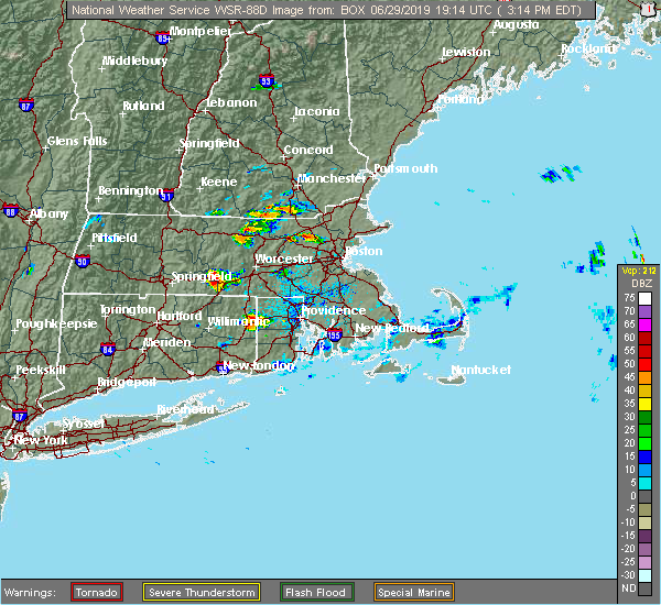 At 317 pm edt, a severe thunderstorm was located over bedford, or near billerica, moving east at 20 mph (radar indicated). Hazards include 60 mph wind gusts and penny size hail. expect damage to trees and power lines At 317 pm edt, a severe thunderstorm was located over bedford, or near billerica, moving east at 20 mph (radar indicated). Hazards include 60 mph wind gusts and penny size hail. expect damage to trees and power lines
|
| 6/29/2019 5:54 AM EDT |
 At 553 am edt, a severe thunderstorm was located over princeton, or near leominster, moving east at 30 mph (radar indicated). Hazards include 60 mph wind gusts and quarter size hail. Hail damage to vehicles is possible. Expect damage to trees and power lines. At 553 am edt, a severe thunderstorm was located over princeton, or near leominster, moving east at 30 mph (radar indicated). Hazards include 60 mph wind gusts and quarter size hail. Hail damage to vehicles is possible. Expect damage to trees and power lines.
|
| 8/17/2018 3:43 PM EDT |
 At 343 pm edt, a severe thunderstorm was located over acton, or near chelmsford, moving northeast at 30 mph (radar indicated). Hazards include 60 mph wind gusts and quarter size hail. Hail damage to vehicles is possible. Expect damage to trees and power lines. At 343 pm edt, a severe thunderstorm was located over acton, or near chelmsford, moving northeast at 30 mph (radar indicated). Hazards include 60 mph wind gusts and quarter size hail. Hail damage to vehicles is possible. Expect damage to trees and power lines.
|
| 8/8/2018 7:58 PM EDT |
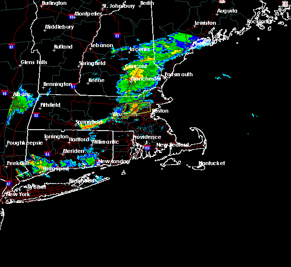 At 757 pm edt, a severe thunderstorm was located over lexington, moving east at 35 mph (radar indicated). Hazards include 60 mph wind gusts. Expect damage to trees and power lines. Locations impacted include, cambridge, somerville, framingham, waltham, malden, medford, arlington, everett, billerica, marlborough, woburn, chelmsford, watertown, lexington, tewksbury, melrose, saugus, wakefield, reading and belmont. At 757 pm edt, a severe thunderstorm was located over lexington, moving east at 35 mph (radar indicated). Hazards include 60 mph wind gusts. Expect damage to trees and power lines. Locations impacted include, cambridge, somerville, framingham, waltham, malden, medford, arlington, everett, billerica, marlborough, woburn, chelmsford, watertown, lexington, tewksbury, melrose, saugus, wakefield, reading and belmont.
|
| 8/8/2018 7:50 PM EDT |
 At 749 pm edt, a severe thunderstorm was located over lincoln, or near lexington, moving east at 40 mph (radar indicated). Hazards include 60 mph wind gusts. expect damage to trees and power lines At 749 pm edt, a severe thunderstorm was located over lincoln, or near lexington, moving east at 40 mph (radar indicated). Hazards include 60 mph wind gusts. expect damage to trees and power lines
|
| 7/26/2018 3:00 AM EDT |
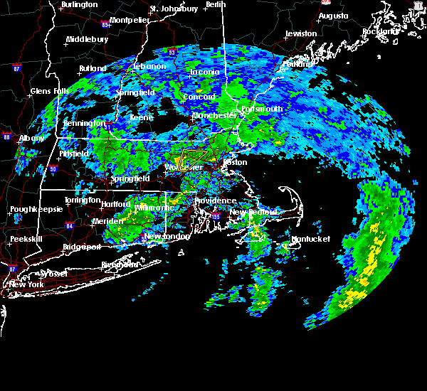 At 300 am edt, a severe thunderstorm was located over marlborough, moving northeast at 35 mph (radar indicated). Hazards include 60 mph wind gusts. expect damage to trees and power lines At 300 am edt, a severe thunderstorm was located over marlborough, moving northeast at 35 mph (radar indicated). Hazards include 60 mph wind gusts. expect damage to trees and power lines
|
| 7/17/2018 1:41 PM EDT |
 The severe thunderstorm warning for northeastern worcester and central middlesex counties will expire at 145 pm edt, the storm which prompted the warning has moved out of the area. therefore, the warning will be allowed to expire. a severe thunderstorm watch remains in effect until 700 pm edt for central and northeastern massachusetts. The severe thunderstorm warning for northeastern worcester and central middlesex counties will expire at 145 pm edt, the storm which prompted the warning has moved out of the area. therefore, the warning will be allowed to expire. a severe thunderstorm watch remains in effect until 700 pm edt for central and northeastern massachusetts.
|
| 7/17/2018 1:33 PM EDT |
 At 133 pm edt, severe thunderstorms were located along a line extending from georgetown to acton, moving east at 35 mph (radar indicated). Hazards include 60 mph wind gusts. expect damage to trees and power lines At 133 pm edt, severe thunderstorms were located along a line extending from georgetown to acton, moving east at 35 mph (radar indicated). Hazards include 60 mph wind gusts. expect damage to trees and power lines
|
| 7/17/2018 12:57 PM EDT |
 The national weather service in boston/norton has issued a * severe thunderstorm warning for. northeastern worcester county in central massachusetts. central middlesex county in northeastern massachusetts. until 145 pm edt. At 1257 pm edt, a severe thunderstorm was located over leominster,. The national weather service in boston/norton has issued a * severe thunderstorm warning for. northeastern worcester county in central massachusetts. central middlesex county in northeastern massachusetts. until 145 pm edt. At 1257 pm edt, a severe thunderstorm was located over leominster,.
|
| 6/18/2018 6:50 PM EDT |
 At 649 pm edt, severe thunderstorms were located along a line extending from bedford to near lincoln to near maynard, moving east at 40 mph (radar indicated). Hazards include 70 mph wind gusts. Expect considerable tree damage. damage is likely to mobile homes and outbuildings. Locations impacted include, boston, cambridge, lynn, newton, somerville, waltham, malden, brookline, medford, revere, peabody, arlington, everett, salem, leominster, billerica, beverly, marlborough, woburn and chelsea. At 649 pm edt, severe thunderstorms were located along a line extending from bedford to near lincoln to near maynard, moving east at 40 mph (radar indicated). Hazards include 70 mph wind gusts. Expect considerable tree damage. damage is likely to mobile homes and outbuildings. Locations impacted include, boston, cambridge, lynn, newton, somerville, waltham, malden, brookline, medford, revere, peabody, arlington, everett, salem, leominster, billerica, beverly, marlborough, woburn and chelsea.
|
| 6/18/2018 6:26 PM EDT |
 At 625 pm edt, severe thunderstorms were located along a line extending from near shirley to lancaster to sterling, moving east at 55 mph (radar indicated). Hazards include 70 mph wind gusts. Expect considerable tree damage. Damage is likely to mobile homes and outbuildings. At 625 pm edt, severe thunderstorms were located along a line extending from near shirley to lancaster to sterling, moving east at 55 mph (radar indicated). Hazards include 70 mph wind gusts. Expect considerable tree damage. Damage is likely to mobile homes and outbuildings.
|
| 5/15/2018 4:59 PM EDT |
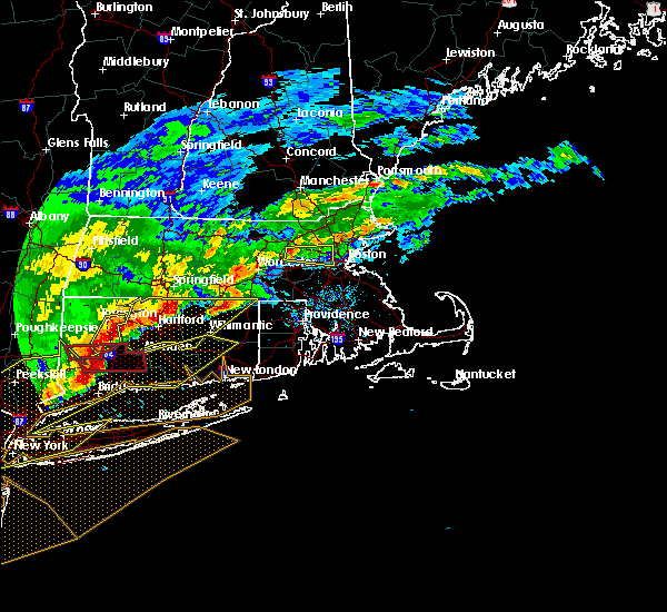 At 458 pm edt, a severe thunderstorm was located over sudbury, or near framingham, moving east at 40 mph (radar indicated). Hazards include 60 mph wind gusts and quarter size hail. Hail damage to vehicles is possible. Expect damage to trees and power lines. At 458 pm edt, a severe thunderstorm was located over sudbury, or near framingham, moving east at 40 mph (radar indicated). Hazards include 60 mph wind gusts and quarter size hail. Hail damage to vehicles is possible. Expect damage to trees and power lines.
|
| 8/2/2017 3:52 PM EDT | Large tree limb down on old marlboro road at emerson road in middlesex county MA, 2.5 miles W of West Concord, MA |
| 8/2/2017 3:42 PM EDT |
 At 341 pm edt, a severe thunderstorm was located over acton, or 8 miles northeast of marlborough, moving east at 10 mph (radar indicated). Hazards include 60 mph wind gusts and quarter size hail. Hail damage to vehicles is possible. expect damage to trees and power lines. Locations impacted include, lowell, waltham, billerica, marlborough, chelmsford, lexington, burlington, westford, acton, hudson, concord, sudbury, bedford, wayland, tyngsborough, groton, maynard, littleton, lancaster and ayer. At 341 pm edt, a severe thunderstorm was located over acton, or 8 miles northeast of marlborough, moving east at 10 mph (radar indicated). Hazards include 60 mph wind gusts and quarter size hail. Hail damage to vehicles is possible. expect damage to trees and power lines. Locations impacted include, lowell, waltham, billerica, marlborough, chelmsford, lexington, burlington, westford, acton, hudson, concord, sudbury, bedford, wayland, tyngsborough, groton, maynard, littleton, lancaster and ayer.
|
| 8/2/2017 3:29 PM EDT |
 At 329 pm edt, a severe thunderstorm was located over acton, or 8 miles northeast of marlborough, and is nearly stationary (radar indicated). Hazards include 60 mph wind gusts and quarter size hail. Hail damage to vehicles is possible. Expect damage to trees and power lines. At 329 pm edt, a severe thunderstorm was located over acton, or 8 miles northeast of marlborough, and is nearly stationary (radar indicated). Hazards include 60 mph wind gusts and quarter size hail. Hail damage to vehicles is possible. Expect damage to trees and power lines.
|
| 8/2/2017 2:52 PM EDT |
 At 251 pm edt, a severe thunderstorm was located over maynard, or 7 miles northeast of marlborough, moving northeast at 15 mph (radar indicated). Hazards include 60 mph wind gusts and quarter size hail. Hail damage to vehicles is possible. Expect damage to trees and power lines. At 251 pm edt, a severe thunderstorm was located over maynard, or 7 miles northeast of marlborough, moving northeast at 15 mph (radar indicated). Hazards include 60 mph wind gusts and quarter size hail. Hail damage to vehicles is possible. Expect damage to trees and power lines.
|
| 7/12/2017 6:20 PM EDT |
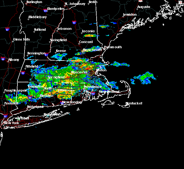 At 620 pm edt, a severe thunderstorm was located over lincoln, or over waltham, moving southeast at 15 mph (radar indicated). Hazards include 60 mph wind gusts. expect damage to trees and power lines At 620 pm edt, a severe thunderstorm was located over lincoln, or over waltham, moving southeast at 15 mph (radar indicated). Hazards include 60 mph wind gusts. expect damage to trees and power lines
|
| 6/27/2017 5:00 PM EDT | Tree down on ridgewood road in middlesex county MA, 2.5 miles W of West Concord, MA |
| 6/27/2017 1:12 PM EDT |
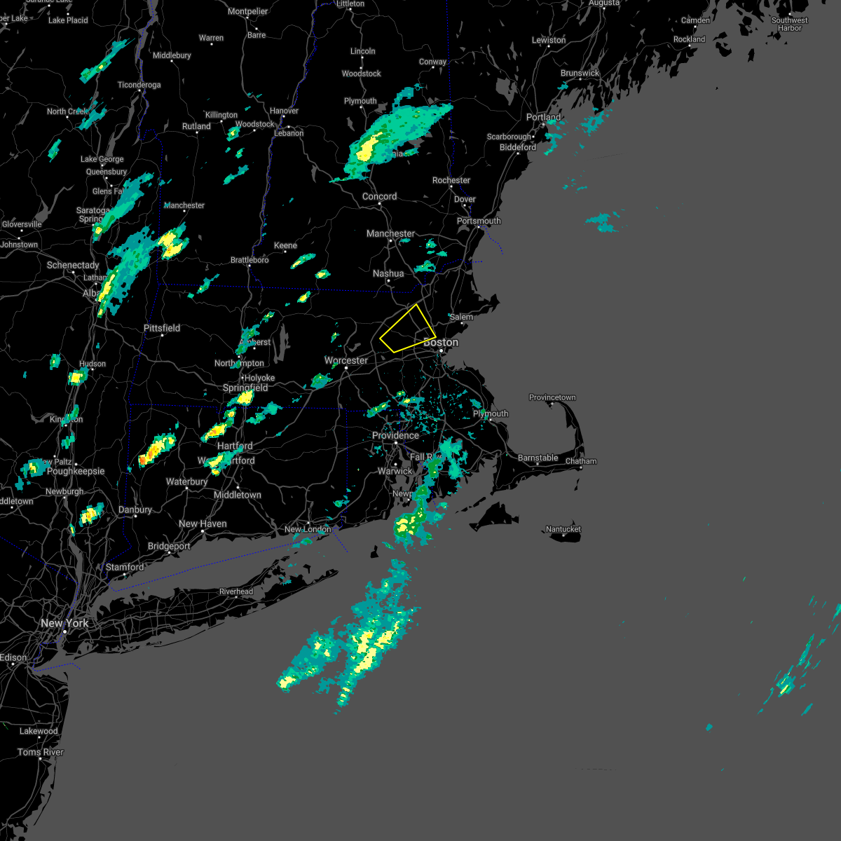 The severe thunderstorm warning for northeastern middlesex county will expire at 515 pm edt, the storm which prompted the warning has weakened below severe limits, and no longer poses an immediate threat to life or property. therefore the warning will be allowed to expire. however small hail is still possible with this thunderstorm. The severe thunderstorm warning for northeastern middlesex county will expire at 515 pm edt, the storm which prompted the warning has weakened below severe limits, and no longer poses an immediate threat to life or property. therefore the warning will be allowed to expire. however small hail is still possible with this thunderstorm.
|
| 6/27/2017 12:51 PM EDT |
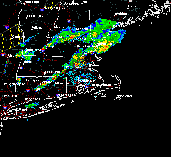 At 450 pm edt, a severe thunderstorm was located over maynard, or 8 miles north of framingham, moving northeast at 35 mph (trained weather spotters reported quarter sized hail in maynard massachusetts). Hazards include quarter size hail. Damage to vehicles is possible. Locations impacted include, waltham, medford, arlington, billerica, woburn, chelmsford, lexington, tewksbury, belmont, burlington, wilmington, acton, stoneham, winchester, hudson, concord, sudbury, bedford, wayland and weston. At 450 pm edt, a severe thunderstorm was located over maynard, or 8 miles north of framingham, moving northeast at 35 mph (trained weather spotters reported quarter sized hail in maynard massachusetts). Hazards include quarter size hail. Damage to vehicles is possible. Locations impacted include, waltham, medford, arlington, billerica, woburn, chelmsford, lexington, tewksbury, belmont, burlington, wilmington, acton, stoneham, winchester, hudson, concord, sudbury, bedford, wayland and weston.
|
| 6/27/2017 12:46 PM EDT |
 At 444 pm edt, a severe thunderstorm was located over maynard, or near marlborough, moving northeast at 35 mph (radar indicated. hail up to half inch has been reported with this size). Hazards include quarter size hail and wind gusts up to 40 mph. damage to vehicles is possible At 444 pm edt, a severe thunderstorm was located over maynard, or near marlborough, moving northeast at 35 mph (radar indicated. hail up to half inch has been reported with this size). Hazards include quarter size hail and wind gusts up to 40 mph. damage to vehicles is possible
|
| 5/19/2017 12:26 AM EDT |
 At 1225 am edt, severe thunderstorms were located along a line extending from near concord to near mendon to near putnam, moving east at 45 mph (radar indicated). Hazards include 60 mph wind gusts. Expect damage to trees and power lines. Locations impacted include, boston, cambridge, quincy, newton, somerville, pawtucket, framingham, waltham, malden, brookline, medford, revere, arlington, everett, woonsocket, billerica, woburn, chelsea, coventry and cumberland. At 1225 am edt, severe thunderstorms were located along a line extending from near concord to near mendon to near putnam, moving east at 45 mph (radar indicated). Hazards include 60 mph wind gusts. Expect damage to trees and power lines. Locations impacted include, boston, cambridge, quincy, newton, somerville, pawtucket, framingham, waltham, malden, brookline, medford, revere, arlington, everett, woonsocket, billerica, woburn, chelsea, coventry and cumberland.
|
| 5/19/2017 12:04 AM EDT |
 At 1204 am edt, severe thunderstorms were located along a line extending from clinton to near douglas to near ashford, moving east at 40 mph (radar indicated). Hazards include 60 mph wind gusts. expect damage to trees and power lines At 1204 am edt, severe thunderstorms were located along a line extending from clinton to near douglas to near ashford, moving east at 40 mph (radar indicated). Hazards include 60 mph wind gusts. expect damage to trees and power lines
|
| 5/18/2017 9:43 PM EDT |
 At 942 pm edt, a severe thunderstorm was located near templeton, or 10 miles east of orange, moving east at 55 mph (radar indicated). Hazards include 60 mph wind gusts. expect damage to trees and power lines At 942 pm edt, a severe thunderstorm was located near templeton, or 10 miles east of orange, moving east at 55 mph (radar indicated). Hazards include 60 mph wind gusts. expect damage to trees and power lines
|
| 9/11/2016 10:25 AM EDT | Trees and wires down on powder mill and sudbury roads in middlesex county MA, 2.5 miles W of West Concord, MA |
| 9/11/2016 10:10 AM EDT |
 The severe thunderstorm warning for northwestern essex, southeastern hampshire, southeastern hampden, worcester and middlesex counties will expire at 1015 am edt, the storms which prompted the warning have moved out of the area. therefore, the warning will be allowed to expire. The severe thunderstorm warning for northwestern essex, southeastern hampshire, southeastern hampden, worcester and middlesex counties will expire at 1015 am edt, the storms which prompted the warning have moved out of the area. therefore, the warning will be allowed to expire.
|
| 9/11/2016 9:53 AM EDT |
 At 952 am edt, severe thunderstorms were located along a line extending from tyngsborough to near oxford, moving east at 45 mph (radar indicated). Hazards include 60 mph wind gusts. Expect damage to roofs. siding. And trees. At 952 am edt, severe thunderstorms were located along a line extending from tyngsborough to near oxford, moving east at 45 mph (radar indicated). Hazards include 60 mph wind gusts. Expect damage to roofs. siding. And trees.
|
| 9/11/2016 9:23 AM EDT |
 At 922 am edt, severe thunderstorms were located along a line extending from near new boston to near westminster to north brookfield to west hartford, moving east at 45 mph (radar indicated). Hazards include 60 mph wind gusts. Expect damage to roofs. siding. And trees. At 922 am edt, severe thunderstorms were located along a line extending from near new boston to near westminster to north brookfield to west hartford, moving east at 45 mph (radar indicated). Hazards include 60 mph wind gusts. Expect damage to roofs. siding. And trees.
|
| 8/22/2016 4:00 AM EDT | Trees down on independence r in middlesex county MA, 2.5 miles W of West Concord, MA |
| 8/22/2016 3:59 AM EDT | All telephone poles knocked down from 204 independence rd to alcrott r in middlesex county MA, 2.5 miles W of West Concord, MA |
| 8/22/2016 3:50 AM EDT | Trees down on alcott r in middlesex county MA, 2.5 miles W of West Concord, MA |
| 8/22/2016 3:29 AM EDT | Multiple trees and powerlines down on multiple homes...lexington rd. road completely blocke in middlesex county MA, 2.5 miles W of West Concord, MA |
| 8/22/2016 3:24 AM EDT |
 At 323 am edt, a severe thunderstorm capable of producing a tornado was located over bedford, or near lexington, moving northeast at 35 mph (radar indicated rotation). Hazards include tornado. Flying debris will be dangerous to those caught without shelter. mobile homes will be damaged or destroyed. damage to roofs, windows, and vehicles will occur. tree damage is likely. this dangerous storm will be near, billerica, woburn and burlington around 335 am edt. tewksbury around 340 am edt. wakefield, reading and wilmington around 345 am edt. North reading and lynnfield around 350 am edt. At 323 am edt, a severe thunderstorm capable of producing a tornado was located over bedford, or near lexington, moving northeast at 35 mph (radar indicated rotation). Hazards include tornado. Flying debris will be dangerous to those caught without shelter. mobile homes will be damaged or destroyed. damage to roofs, windows, and vehicles will occur. tree damage is likely. this dangerous storm will be near, billerica, woburn and burlington around 335 am edt. tewksbury around 340 am edt. wakefield, reading and wilmington around 345 am edt. North reading and lynnfield around 350 am edt.
|
| 8/22/2016 3:19 AM EDT |
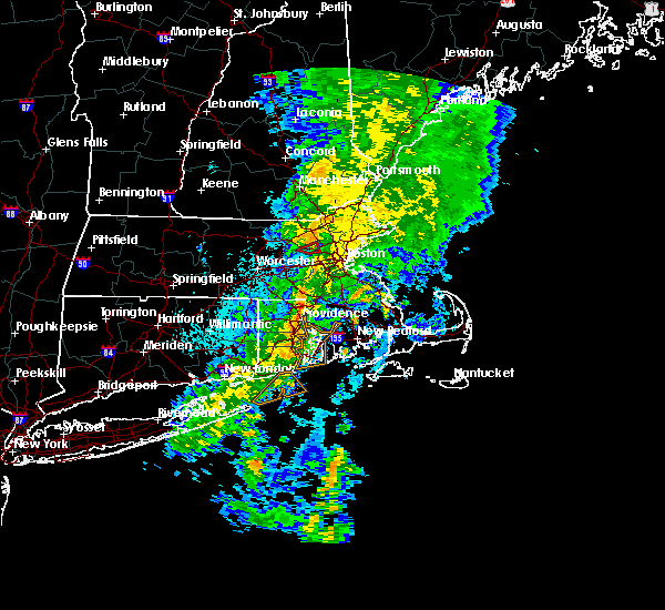 At 319 am edt, a severe thunderstorm capable of producing a tornado was located over concord, or near lexington, moving northeast at 35 mph (radar indicated rotation). Hazards include tornado. Flying debris will be dangerous to those caught without shelter. mobile homes will be damaged or destroyed. damage to roofs, windows, and vehicles will occur. tree damage is likely. This dangerous storm will be near, lexington around 330 am edt. At 319 am edt, a severe thunderstorm capable of producing a tornado was located over concord, or near lexington, moving northeast at 35 mph (radar indicated rotation). Hazards include tornado. Flying debris will be dangerous to those caught without shelter. mobile homes will be damaged or destroyed. damage to roofs, windows, and vehicles will occur. tree damage is likely. This dangerous storm will be near, lexington around 330 am edt.
|
| 8/22/2016 3:01 AM EDT |
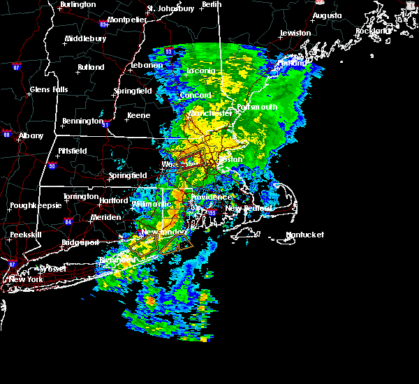 At 300 am edt, a severe thunderstorm capable of producing a tornado was located near sudbury, or near marlborough, moving northeast at 35 mph (radar indicated rotation). Hazards include tornado. Flying debris will be dangerous to those caught without shelter. mobile homes will be damaged or destroyed. damage to roofs, windows, and vehicles will occur. tree damage is likely. this dangerous storm will be near, natick, sudbury, wayland and maynard around 310 am edt. acton and weston around 315 am edt. waltham, concord and lincoln around 320 am edt. Newton, lexington and bedford around 325 am edt. At 300 am edt, a severe thunderstorm capable of producing a tornado was located near sudbury, or near marlborough, moving northeast at 35 mph (radar indicated rotation). Hazards include tornado. Flying debris will be dangerous to those caught without shelter. mobile homes will be damaged or destroyed. damage to roofs, windows, and vehicles will occur. tree damage is likely. this dangerous storm will be near, natick, sudbury, wayland and maynard around 310 am edt. acton and weston around 315 am edt. waltham, concord and lincoln around 320 am edt. Newton, lexington and bedford around 325 am edt.
|
| 8/22/2016 2:51 AM EDT |
 At 250 am edt, severe thunderstorms were located along a line extending from berlin to westborough, moving northeast at 35 mph (radar indicated). Hazards include 60 mph wind gusts. Expect damage to roofs. siding. And trees. At 250 am edt, severe thunderstorms were located along a line extending from berlin to westborough, moving northeast at 35 mph (radar indicated). Hazards include 60 mph wind gusts. Expect damage to roofs. siding. And trees.
|
| 7/23/2016 7:25 PM EDT | Tree down on car on westford road. tree down on wires on old stow road. wires downed on lindsay pond roa in middlesex county MA, 2.5 miles W of West Concord, MA |
| 7/23/2016 7:12 PM EDT | Tree down onto the colonial inn. tree down across shagbark road...everett street...and main stree in middlesex county MA, 2.5 miles W of West Concord, MA |
| 7/23/2016 7:06 PM EDT |
 At 704 pm edt, a cluster of severe thunderstorms was dropping south from far northern new hampshire. however, damaging wind gusts were occurring out of ahead the actual thunderstorms (trained weather spotters have reported wind damage in north central and northeast massachusetts). Hazards include 60 mph wind gusts. Expect damage to roofs. siding. And trees. At 704 pm edt, a cluster of severe thunderstorms was dropping south from far northern new hampshire. however, damaging wind gusts were occurring out of ahead the actual thunderstorms (trained weather spotters have reported wind damage in north central and northeast massachusetts). Hazards include 60 mph wind gusts. Expect damage to roofs. siding. And trees.
|
| 2/25/2016 3:27 AM EST | Pole and wires down blocking musketequid roa in middlesex county MA, 2.5 miles W of West Concord, MA |
| 2/25/2016 3:21 AM EST |
 The severe thunderstorm warning for northwestern bristol, west central essex, western norfolk, southeastern worcester and middlesex counties will expire at 330 am est, the storm which prompted the warning has weakened below severe limits although strong winds may linger. The severe thunderstorm warning for northwestern bristol, west central essex, western norfolk, southeastern worcester and middlesex counties will expire at 330 am est, the storm which prompted the warning has weakened below severe limits although strong winds may linger.
|
| 2/25/2016 3:19 AM EST | Elm street blocked in 3 locations with snapped utility poles. sudbury road is blocked with trees and wires dow in middlesex county MA, 2.5 miles W of West Concord, MA |
| 2/25/2016 3:11 AM EST | Trees...wires...and poles down. roads closed in multiple locations including elm street...crescent street...macarthur road...and ornac road near route in middlesex county MA, 2.5 miles W of West Concord, MA |
| 2/25/2016 2:47 AM EST | Winds shattered storm windo in middlesex county MA, 2.5 miles W of West Concord, MA |
| 2/25/2016 2:40 AM EST |
 At 239 am est, doppler radar indicated a severe thunderstorm capable of producing destructive winds in excess of 70 mph. this storm was located over upton, or near milford, and was moving northeast at 115 mph. At 239 am est, doppler radar indicated a severe thunderstorm capable of producing destructive winds in excess of 70 mph. this storm was located over upton, or near milford, and was moving northeast at 115 mph.
|
| 8/4/2015 3:50 PM EDT |
 At 349 pm edt, doppler radar indicated a line of severe thunderstorms capable of producing half dollar size hail and damaging winds in excess of 60 mph. these storms were located along a line extending from littleton to framingham to near northbridge, and was moving east at 40 mph. * some locations impacted include, boston, cambridge, brockton, quincy, lynn, newton, somerville, framingham, waltham, malden, brookline, medford, weymouth, revere, peabody, arlington, everett, salem, billerica and beverly. At 349 pm edt, doppler radar indicated a line of severe thunderstorms capable of producing half dollar size hail and damaging winds in excess of 60 mph. these storms were located along a line extending from littleton to framingham to near northbridge, and was moving east at 40 mph. * some locations impacted include, boston, cambridge, brockton, quincy, lynn, newton, somerville, framingham, waltham, malden, brookline, medford, weymouth, revere, peabody, arlington, everett, salem, billerica and beverly.
|
| 8/4/2015 3:50 PM EDT |
 The national weather service in taunton has issued a * severe thunderstorm warning for. southern essex county in northeastern massachusetts. northwestern plymouth county in southeastern massachusetts. norfolk county in eastern massachusetts. Southeastern worcester county in central massachusetts. The national weather service in taunton has issued a * severe thunderstorm warning for. southern essex county in northeastern massachusetts. northwestern plymouth county in southeastern massachusetts. norfolk county in eastern massachusetts. Southeastern worcester county in central massachusetts.
|
| 8/4/2015 3:45 PM EDT |
 At 344 pm edt, doppler radar indicated a severe thunderstorm capable of producing large damaging hail up to golf ball size and damaging winds in excess of 60 mph. this storm was located over marlborough, moving east at 30 mph. in addition, at 3:44 pm, golf ball size hail was reported in marlborough. locations impacted include, worcester, framingham, waltham, billerica, marlborough, shrewsbury, chelmsford, natick, lexington, milford, burlington, wilmington, westford, acton, hudson, westborough, grafton, concord, sudbury and ashland. At 344 pm edt, doppler radar indicated a severe thunderstorm capable of producing large damaging hail up to golf ball size and damaging winds in excess of 60 mph. this storm was located over marlborough, moving east at 30 mph. in addition, at 3:44 pm, golf ball size hail was reported in marlborough. locations impacted include, worcester, framingham, waltham, billerica, marlborough, shrewsbury, chelmsford, natick, lexington, milford, burlington, wilmington, westford, acton, hudson, westborough, grafton, concord, sudbury and ashland.
|
| 8/4/2015 3:35 PM EDT |
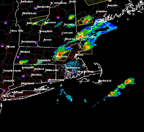 At 335 pm edt, doppler radar indicated a severe thunderstorm capable of producing large hail up to ping pong ball size and damaging winds in excess of 60 mph. this storm was located over northborough, or near marlborough, moving east at 40 mph. locations impacted include, worcester, framingham, waltham, leominster, billerica, marlborough, shrewsbury, chelmsford, natick, lexington, milford, burlington, wilmington, westford, acton, hudson, westborough, grafton, concord and sudbury. At 335 pm edt, doppler radar indicated a severe thunderstorm capable of producing large hail up to ping pong ball size and damaging winds in excess of 60 mph. this storm was located over northborough, or near marlborough, moving east at 40 mph. locations impacted include, worcester, framingham, waltham, leominster, billerica, marlborough, shrewsbury, chelmsford, natick, lexington, milford, burlington, wilmington, westford, acton, hudson, westborough, grafton, concord and sudbury.
|
| 8/4/2015 3:24 PM EDT |
 At 323 pm edt, doppler radar indicated a severe thunderstorm capable of producing quarter size hail and damaging winds in excess of 60 mph. this storm was located over princeton, or 8 miles southwest of leominster, and was moving east at 30 mph. * some locations impacted include, worcester, framingham, waltham, leominster, fitchburg, billerica, marlborough, shrewsbury, chelmsford, natick, lexington, milford, burlington, wilmington, westford, acton, hudson, westborough, grafton and concord. At 323 pm edt, doppler radar indicated a severe thunderstorm capable of producing quarter size hail and damaging winds in excess of 60 mph. this storm was located over princeton, or 8 miles southwest of leominster, and was moving east at 30 mph. * some locations impacted include, worcester, framingham, waltham, leominster, fitchburg, billerica, marlborough, shrewsbury, chelmsford, natick, lexington, milford, burlington, wilmington, westford, acton, hudson, westborough, grafton and concord.
|
| 8/4/2015 3:00 PM EDT | Multiple trees down. tree on car on old marlboro road in middlesex county MA, 2.6 miles WSW of West Concord, MA |
| 8/4/2015 2:34 PM EDT | Quarter sized hail reported 3.2 miles SSE of West Concord, MA |
| 7/7/2014 5:32 PM EDT | Trees down at concord country clu in middlesex county MA, 2.5 miles W of West Concord, MA |
| 9/7/2012 6:14 PM EDT | Trees down on sudbury r in middlesex county MA, 2.5 miles W of West Concord, MA |
| 1/1/0001 12:00 AM | Several 4 to 6 inch diameter trees dow in middlesex county MA, 2.5 miles W of West Concord, MA |
Hail Maps for West Concord, MA


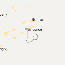

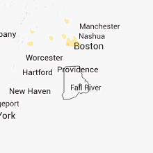


Connect with Interactive Hail Maps