

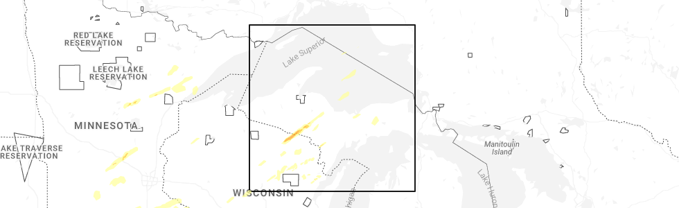
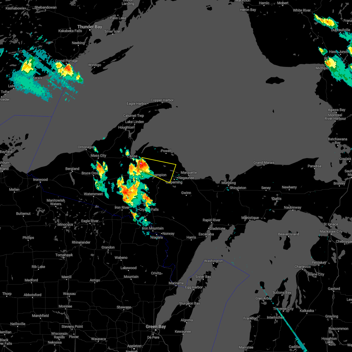
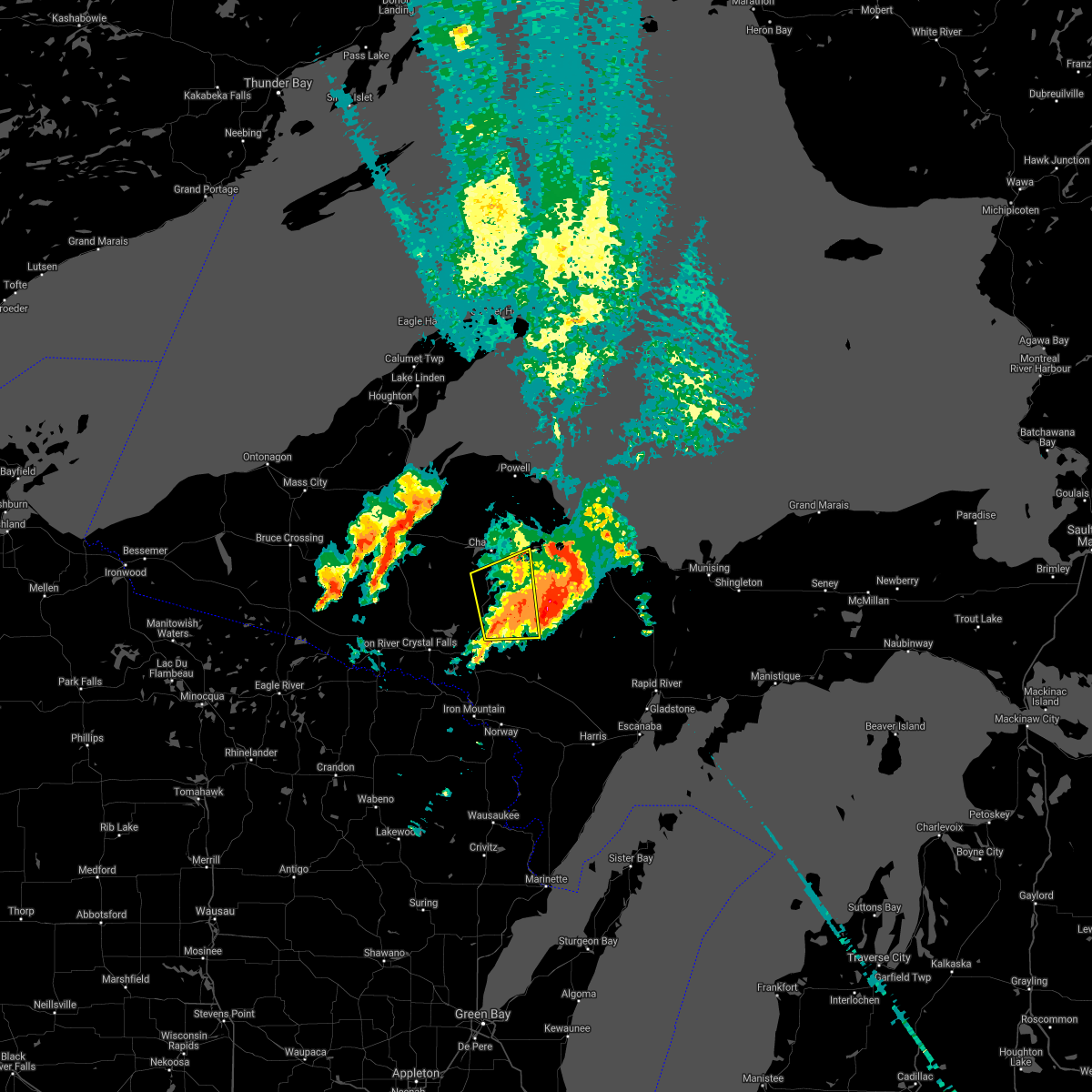
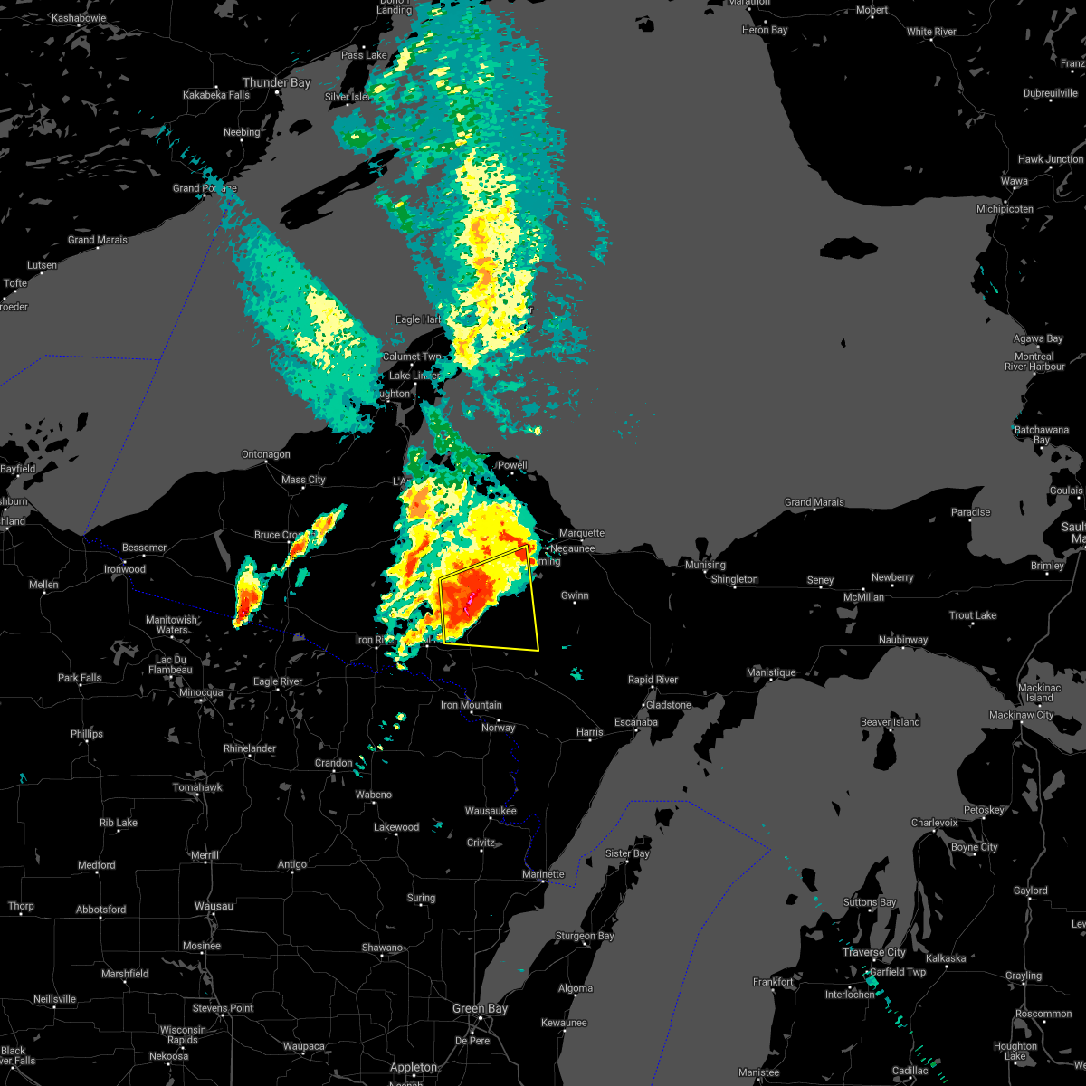
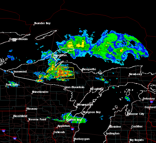
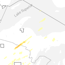
Hail Map for West Ishpeming, MI
The West Ishpeming, MI area has had 2 reports of on-the-ground hail by trained spotters, and has been under severe weather warnings 4 times during the past 12 months. Doppler radar has detected hail at or near West Ishpeming, MI on 14 occasions, including 2 occasions during the past year.
| Name: | West Ishpeming, MI |
| Where Located: | 14.9 miles WSW of Marquette, MI |
| Map: | Google Map for West Ishpeming, MI |
| Population: | 2662 |
| Housing Units: | 1073 |
| More Info: | Search Google for West Ishpeming, MI |
4
The Top Recent Hail Date for West Ishpeming, MI is Monday, April 28, 2025 (2nd out of 14)
Hail and Wind Damage Spotted near West Ishpeming, MI
| Date / Time | Report Details |
|---|---|
| 6/21/2025 7:52 AM EDT |
 The storms which prompted the warning have weakened below severe limits, and have exited the warned area. therefore, the warning will be allowed to expire. The storms which prompted the warning have weakened below severe limits, and have exited the warned area. therefore, the warning will be allowed to expire.
|
| 6/21/2025 7:24 AM EDT |
 the severe thunderstorm warning has been cancelled and is no longer in effect the severe thunderstorm warning has been cancelled and is no longer in effect
|
| 6/21/2025 7:24 AM EDT |
 At 724 am edt/624 am cdt/, severe thunderstorms were located along a line extending from 8 miles south of the huron islands to tipler, moving east at 55 mph (radar indicated). Hazards include 60 mph wind gusts and penny size hail. Expect damage to roofs, siding, and trees. Locations impacted include, ishpeming, l'anse, negaunee, covington, michigamme, champion, alberta, west ishpeming, squaw lake, the huron islands, skanee, and big bay. At 724 am edt/624 am cdt/, severe thunderstorms were located along a line extending from 8 miles south of the huron islands to tipler, moving east at 55 mph (radar indicated). Hazards include 60 mph wind gusts and penny size hail. Expect damage to roofs, siding, and trees. Locations impacted include, ishpeming, l'anse, negaunee, covington, michigamme, champion, alberta, west ishpeming, squaw lake, the huron islands, skanee, and big bay.
|
| 6/21/2025 5:56 AM CDT |
 Svrmqt the national weather service in marquette has issued a * severe thunderstorm warning for, iron county in south central upper michigan, northwestern dickinson county in south central upper michigan, northwestern marquette county in north central upper michigan, central houghton county in western upper michigan, baraga county in north central upper michigan, * until 800 am edt/700 am cdt/. * at 655 am edt/555 am cdt/, severe thunderstorms were located along a line extending from near the lower entrance of portage canal to near phelps, moving east at 55 mph (radar indicated). Hazards include 60 mph wind gusts and penny size hail. expect damage to roofs, siding, and trees Svrmqt the national weather service in marquette has issued a * severe thunderstorm warning for, iron county in south central upper michigan, northwestern dickinson county in south central upper michigan, northwestern marquette county in north central upper michigan, central houghton county in western upper michigan, baraga county in north central upper michigan, * until 800 am edt/700 am cdt/. * at 655 am edt/555 am cdt/, severe thunderstorms were located along a line extending from near the lower entrance of portage canal to near phelps, moving east at 55 mph (radar indicated). Hazards include 60 mph wind gusts and penny size hail. expect damage to roofs, siding, and trees
|
| 6/17/2024 12:33 PM EDT |
 At 1232 pm edt, a severe thunderstorm was located over west ishpeming, moving northeast at 40 mph (radar indicated). Hazards include 60 mph wind gusts and penny size hail. Expect damage to roofs, siding, and trees. Locations impacted include, ishpeming, negaunee, west ishpeming, humboldt, national mine, and diorite. At 1232 pm edt, a severe thunderstorm was located over west ishpeming, moving northeast at 40 mph (radar indicated). Hazards include 60 mph wind gusts and penny size hail. Expect damage to roofs, siding, and trees. Locations impacted include, ishpeming, negaunee, west ishpeming, humboldt, national mine, and diorite.
|
| 6/17/2024 12:21 PM EDT |
 Svrmqt the national weather service in marquette has issued a * severe thunderstorm warning for, central marquette county in north central upper michigan, * until 1245 pm edt. * at 1221 pm edt, a severe thunderstorm was located near west ishpeming, or 8 miles west of ishpeming, moving northeast at 40 mph (radar indicated). Hazards include 60 mph wind gusts and penny size hail. expect damage to roofs, siding, and trees Svrmqt the national weather service in marquette has issued a * severe thunderstorm warning for, central marquette county in north central upper michigan, * until 1245 pm edt. * at 1221 pm edt, a severe thunderstorm was located near west ishpeming, or 8 miles west of ishpeming, moving northeast at 40 mph (radar indicated). Hazards include 60 mph wind gusts and penny size hail. expect damage to roofs, siding, and trees
|
| 7/27/2023 8:54 PM EDT |
 The severe thunderstorm warning for central marquette county will expire at 900 pm edt, the storm which prompted the warning has moved out of the area. therefore, the warning will be allowed to expire. however gusty winds and heavy rain are still possible with this thunderstorm. a severe thunderstorm watch remains in effect until midnight edt for north central upper michigan. The severe thunderstorm warning for central marquette county will expire at 900 pm edt, the storm which prompted the warning has moved out of the area. therefore, the warning will be allowed to expire. however gusty winds and heavy rain are still possible with this thunderstorm. a severe thunderstorm watch remains in effect until midnight edt for north central upper michigan.
|
| 7/27/2023 8:41 PM EDT |
 At 841 pm edt, a severe thunderstorm was located over ishpeming, moving east at 50 mph (radar indicated). Hazards include 60 mph wind gusts and penny size hail. Expect damage to roofs, siding, and trees. locations impacted include, marquette and trowbridge park. hail threat, radar indicated max hail size, 0. 75 in wind threat, radar indicated max wind gust, 60 mph. At 841 pm edt, a severe thunderstorm was located over ishpeming, moving east at 50 mph (radar indicated). Hazards include 60 mph wind gusts and penny size hail. Expect damage to roofs, siding, and trees. locations impacted include, marquette and trowbridge park. hail threat, radar indicated max hail size, 0. 75 in wind threat, radar indicated max wind gust, 60 mph.
|
| 7/27/2023 8:22 PM EDT |
 At 822 pm edt, a severe thunderstorm was located over champion, or 15 miles west of ishpeming, moving east at 50 mph (radar indicated). Hazards include 60 mph wind gusts and penny size hail. Expect damage to roofs, siding, and trees. this severe thunderstorm will be near, west ishpeming around 835 pm edt. ishpeming around 840 pm edt. other locations in the path of this severe thunderstorm include negaunee, marquette and trowbridge park. hail threat, radar indicated max hail size, 0. 75 in wind threat, radar indicated max wind gust, 60 mph. At 822 pm edt, a severe thunderstorm was located over champion, or 15 miles west of ishpeming, moving east at 50 mph (radar indicated). Hazards include 60 mph wind gusts and penny size hail. Expect damage to roofs, siding, and trees. this severe thunderstorm will be near, west ishpeming around 835 pm edt. ishpeming around 840 pm edt. other locations in the path of this severe thunderstorm include negaunee, marquette and trowbridge park. hail threat, radar indicated max hail size, 0. 75 in wind threat, radar indicated max wind gust, 60 mph.
|
| 7/10/2023 6:34 PM CDT |
 At 734 pm edt/634 pm cdt/, a severe thunderstorm was located over witch lake, or 18 miles northeast of crystal falls, moving east at 50 mph (radar indicated). Hazards include 60 mph wind gusts and quarter size hail. Hail damage to vehicles is expected. expect wind damage to roofs, siding, and trees. locations impacted include, ishpeming, crystal falls, covington, michigamme, champion, squaw lake, amasa, u. s. 141 between covington and amasa, west ishpeming, channing, lake michigamme and witch lake. hail threat, radar indicated max hail size, 1. 00 in wind threat, radar indicated max wind gust, 60 mph. At 734 pm edt/634 pm cdt/, a severe thunderstorm was located over witch lake, or 18 miles northeast of crystal falls, moving east at 50 mph (radar indicated). Hazards include 60 mph wind gusts and quarter size hail. Hail damage to vehicles is expected. expect wind damage to roofs, siding, and trees. locations impacted include, ishpeming, crystal falls, covington, michigamme, champion, squaw lake, amasa, u. s. 141 between covington and amasa, west ishpeming, channing, lake michigamme and witch lake. hail threat, radar indicated max hail size, 1. 00 in wind threat, radar indicated max wind gust, 60 mph.
|
| 7/10/2023 6:22 PM CDT |
 At 722 pm edt/622 pm cdt/, a severe thunderstorm was located 8 miles southwest of squaw lake, or 10 miles northeast of crystal falls, moving east at 50 mph (radar indicated). Hazards include 60 mph wind gusts and quarter size hail. Hail damage to vehicles is expected. Expect wind damage to roofs, siding, and trees. At 722 pm edt/622 pm cdt/, a severe thunderstorm was located 8 miles southwest of squaw lake, or 10 miles northeast of crystal falls, moving east at 50 mph (radar indicated). Hazards include 60 mph wind gusts and quarter size hail. Hail damage to vehicles is expected. Expect wind damage to roofs, siding, and trees.
|
| 8/2/2022 10:02 PM EDT |
 At 1002 pm edt, a severe thunderstorm was located near west ishpeming, moving east at 35 mph (radar indicated). Hazards include 60 mph wind gusts and quarter size hail. Hail damage to vehicles is expected. expect wind damage to roofs, siding, and trees. this severe storm will be near, negaunee around 1005 pm edt. gwinn around 1025 pm edt. other locations impacted by this severe thunderstorm include national mine and palmer. hail threat, radar indicated max hail size, 1. 00 in wind threat, radar indicated max wind gust, 60 mph. At 1002 pm edt, a severe thunderstorm was located near west ishpeming, moving east at 35 mph (radar indicated). Hazards include 60 mph wind gusts and quarter size hail. Hail damage to vehicles is expected. expect wind damage to roofs, siding, and trees. this severe storm will be near, negaunee around 1005 pm edt. gwinn around 1025 pm edt. other locations impacted by this severe thunderstorm include national mine and palmer. hail threat, radar indicated max hail size, 1. 00 in wind threat, radar indicated max wind gust, 60 mph.
|
| 8/2/2022 9:43 PM EDT |
 At 943 pm edt, a severe thunderstorm was located near champion, or 13 miles west of ishpeming, moving east at 30 mph (radar indicated). Hazards include 60 mph wind gusts and quarter size hail. Hail damage to vehicles is expected. expect wind damage to roofs, siding, and trees. this severe storm will be near, west ishpeming around 1000 pm edt. ishpeming around 1005 pm edt. negaunee around 1010 pm edt. other locations impacted by this severe thunderstorm include humboldt, national mine, palmer, diorite, van riper state park and republic. hail threat, radar indicated max hail size, 1. 00 in wind threat, radar indicated max wind gust, 60 mph. At 943 pm edt, a severe thunderstorm was located near champion, or 13 miles west of ishpeming, moving east at 30 mph (radar indicated). Hazards include 60 mph wind gusts and quarter size hail. Hail damage to vehicles is expected. expect wind damage to roofs, siding, and trees. this severe storm will be near, west ishpeming around 1000 pm edt. ishpeming around 1005 pm edt. negaunee around 1010 pm edt. other locations impacted by this severe thunderstorm include humboldt, national mine, palmer, diorite, van riper state park and republic. hail threat, radar indicated max hail size, 1. 00 in wind threat, radar indicated max wind gust, 60 mph.
|
| 8/2/2022 9:26 PM EDT |
 At 925 pm edt, a severe thunderstorm was located over lake michigamme, or 16 miles west of ishpeming, moving east at 35 mph (radar indicated). Hazards include 60 mph wind gusts and quarter size hail. Hail damage to vehicles is expected. expect wind damage to roofs, siding, and trees. this severe thunderstorm will be near, west ishpeming around 945 pm edt. ishpeming around 950 pm edt. negaunee around 955 pm edt. marquette and trowbridge park around 1010 pm edt. other locations impacted by this severe thunderstorm include palmer, diorite, van riper state park, humboldt, national mine, big bass lake and republic. hail threat, radar indicated max hail size, 1. 00 in wind threat, radar indicated max wind gust, 60 mph. At 925 pm edt, a severe thunderstorm was located over lake michigamme, or 16 miles west of ishpeming, moving east at 35 mph (radar indicated). Hazards include 60 mph wind gusts and quarter size hail. Hail damage to vehicles is expected. expect wind damage to roofs, siding, and trees. this severe thunderstorm will be near, west ishpeming around 945 pm edt. ishpeming around 950 pm edt. negaunee around 955 pm edt. marquette and trowbridge park around 1010 pm edt. other locations impacted by this severe thunderstorm include palmer, diorite, van riper state park, humboldt, national mine, big bass lake and republic. hail threat, radar indicated max hail size, 1. 00 in wind threat, radar indicated max wind gust, 60 mph.
|
| 7/19/2022 3:28 AM EDT |
 At 328 am edt, a severe thunderstorm was located near west ishpeming, or near ishpeming, moving southeast at 25 mph (radar indicated). Hazards include 60 mph wind gusts and half dollar size hail. Hail damage to vehicles is expected. expect wind damage to roofs, siding, and trees. this severe thunderstorm will remain over mainly rural areas of central marquette county, including the following locations, national mine, big bass lake and palmer. hail threat, radar indicated max hail size, 1. 25 in wind threat, radar indicated max wind gust, 60 mph. At 328 am edt, a severe thunderstorm was located near west ishpeming, or near ishpeming, moving southeast at 25 mph (radar indicated). Hazards include 60 mph wind gusts and half dollar size hail. Hail damage to vehicles is expected. expect wind damage to roofs, siding, and trees. this severe thunderstorm will remain over mainly rural areas of central marquette county, including the following locations, national mine, big bass lake and palmer. hail threat, radar indicated max hail size, 1. 25 in wind threat, radar indicated max wind gust, 60 mph.
|
| 7/19/2022 3:19 AM EDT |
 At 319 am edt, a severe thunderstorm was located near west ishpeming, or 7 miles southwest of ishpeming, moving southeast at 25 mph (radar indicated). Hazards include 60 mph wind gusts and half dollar size hail. Hail damage to vehicles is expected. expect wind damage to roofs, siding, and trees. this severe storm will be near, ishpeming and west ishpeming around 325 am edt. negaunee around 330 am edt. hail threat, radar indicated max hail size, 1. 25 in wind threat, radar indicated max wind gust, 60 mph. At 319 am edt, a severe thunderstorm was located near west ishpeming, or 7 miles southwest of ishpeming, moving southeast at 25 mph (radar indicated). Hazards include 60 mph wind gusts and half dollar size hail. Hail damage to vehicles is expected. expect wind damage to roofs, siding, and trees. this severe storm will be near, ishpeming and west ishpeming around 325 am edt. negaunee around 330 am edt. hail threat, radar indicated max hail size, 1. 25 in wind threat, radar indicated max wind gust, 60 mph.
|
| 7/19/2022 3:10 AM EDT |
 At 310 am edt, a severe thunderstorm was located near champion, or 10 miles west of ishpeming, moving southeast at 25 mph (radar indicated). Hazards include 60 mph wind gusts and half dollar size hail. Hail damage to vehicles is expected. expect wind damage to roofs, siding, and trees. this severe thunderstorm will be near, west ishpeming around 320 am edt. hail threat, radar indicated max hail size, 1. 25 in wind threat, radar indicated max wind gust, 60 mph. At 310 am edt, a severe thunderstorm was located near champion, or 10 miles west of ishpeming, moving southeast at 25 mph (radar indicated). Hazards include 60 mph wind gusts and half dollar size hail. Hail damage to vehicles is expected. expect wind damage to roofs, siding, and trees. this severe thunderstorm will be near, west ishpeming around 320 am edt. hail threat, radar indicated max hail size, 1. 25 in wind threat, radar indicated max wind gust, 60 mph.
|
| 7/19/2022 12:50 AM EDT |
 At 1250 am edt, a severe thunderstorm was located 7 miles north of michigamme, or 20 miles east of l`anse, moving east at 45 mph (radar indicated). Hazards include two inch hail and 60 mph wind gusts. People and animals outdoors will be injured. expect hail damage to roofs, siding, windows, and vehicles. expect wind damage to roofs, siding, and trees. locations impacted include, champion and west ishpeming. thunderstorm damage threat, considerable hail threat, radar indicated max hail size, 2. 00 in wind threat, radar indicated max wind gust, 60 mph. At 1250 am edt, a severe thunderstorm was located 7 miles north of michigamme, or 20 miles east of l`anse, moving east at 45 mph (radar indicated). Hazards include two inch hail and 60 mph wind gusts. People and animals outdoors will be injured. expect hail damage to roofs, siding, windows, and vehicles. expect wind damage to roofs, siding, and trees. locations impacted include, champion and west ishpeming. thunderstorm damage threat, considerable hail threat, radar indicated max hail size, 2. 00 in wind threat, radar indicated max wind gust, 60 mph.
|
| 7/19/2022 12:37 AM EDT |
 At 1236 am edt, a severe thunderstorm was located 9 miles north of three lakes, or 10 miles southeast of l`anse, moving east at 45 mph (radar indicated). Hazards include two inch hail and 60 mph wind gusts. People and animals outdoors will be injured. expect hail damage to roofs, siding, windows, and vehicles. expect wind damage to roofs, siding, and trees. this severe thunderstorm will be near, michigamme around 1250 am edt. other locations in the path of this severe thunderstorm include champion and west ishpeming. thunderstorm damage threat, considerable hail threat, radar indicated max hail size, 2. 00 in wind threat, radar indicated max wind gust, 60 mph. At 1236 am edt, a severe thunderstorm was located 9 miles north of three lakes, or 10 miles southeast of l`anse, moving east at 45 mph (radar indicated). Hazards include two inch hail and 60 mph wind gusts. People and animals outdoors will be injured. expect hail damage to roofs, siding, windows, and vehicles. expect wind damage to roofs, siding, and trees. this severe thunderstorm will be near, michigamme around 1250 am edt. other locations in the path of this severe thunderstorm include champion and west ishpeming. thunderstorm damage threat, considerable hail threat, radar indicated max hail size, 2. 00 in wind threat, radar indicated max wind gust, 60 mph.
|
| 6/30/2022 1:37 AM EDT |
 At 137 am edt, severe thunderstorms were located along a line extending from near l`anse to near covington, moving east at 50 mph (radar indicated). Hazards include 60 mph wind gusts and quarter size hail. Hail damage to vehicles is expected. expect wind damage to roofs, siding, and trees. locations impacted include, ishpeming, l`anse, negaunee, covington, michigamme, champion, alberta, west ishpeming, big bay, lake michigamme, three lakes and republic. hail threat, radar indicated max hail size, 1. 00 in wind threat, radar indicated max wind gust, 60 mph. At 137 am edt, severe thunderstorms were located along a line extending from near l`anse to near covington, moving east at 50 mph (radar indicated). Hazards include 60 mph wind gusts and quarter size hail. Hail damage to vehicles is expected. expect wind damage to roofs, siding, and trees. locations impacted include, ishpeming, l`anse, negaunee, covington, michigamme, champion, alberta, west ishpeming, big bay, lake michigamme, three lakes and republic. hail threat, radar indicated max hail size, 1. 00 in wind threat, radar indicated max wind gust, 60 mph.
|
| 6/30/2022 1:26 AM EDT |
 At 125 am edt, severe thunderstorms were located along a line extending from near keweenaw bay to 6 miles northwest of covington, moving east at 50 mph (radar indicated). Hazards include 60 mph wind gusts and half dollar size hail. Hail damage to vehicles is expected. Expect wind damage to roofs, siding, and trees. At 125 am edt, severe thunderstorms were located along a line extending from near keweenaw bay to 6 miles northwest of covington, moving east at 50 mph (radar indicated). Hazards include 60 mph wind gusts and half dollar size hail. Hail damage to vehicles is expected. Expect wind damage to roofs, siding, and trees.
|
| 8/28/2021 6:51 PM EDT |
 At 651 pm edt, a severe thunderstorm was located over michigamme, or 21 miles west of ishpeming, moving east at 40 mph (radar indicated). Hazards include 60 mph wind gusts and penny size hail. Expect damage to roofs, siding, and trees. this severe storm will be near, champion around 700 pm edt. west ishpeming around 720 pm edt. ishpeming around 725 pm edt. other locations impacted by this severe thunderstorm include humboldt, national mine, craig lake state park, silver lake basin, diorite and van riper state park. hail threat, radar indicated max hail size, 0. 75 in wind threat, radar indicated max wind gust, 60 mph. At 651 pm edt, a severe thunderstorm was located over michigamme, or 21 miles west of ishpeming, moving east at 40 mph (radar indicated). Hazards include 60 mph wind gusts and penny size hail. Expect damage to roofs, siding, and trees. this severe storm will be near, champion around 700 pm edt. west ishpeming around 720 pm edt. ishpeming around 725 pm edt. other locations impacted by this severe thunderstorm include humboldt, national mine, craig lake state park, silver lake basin, diorite and van riper state park. hail threat, radar indicated max hail size, 0. 75 in wind threat, radar indicated max wind gust, 60 mph.
|
| 8/28/2021 6:28 PM EDT |
 At 628 pm edt, a severe thunderstorm was located near alberta, or 12 miles south of l`anse, moving east at 40 mph (radar indicated). Hazards include 60 mph wind gusts and quarter size hail. Hail damage to vehicles is expected. expect wind damage to roofs, siding, and trees. this severe thunderstorm will be near, three lakes around 645 pm edt. michigamme around 650 pm edt. lake michigamme around 655 pm edt. champion around 700 pm edt. ishpeming and west ishpeming around 715 pm edt. other locations impacted by this severe thunderstorm include canyon falls, craig lake state park, diorite, van riper state park, king lake, humboldt, national mine and silver lake basin. hail threat, radar indicated max hail size, 1. 00 in wind threat, radar indicated max wind gust, 60 mph. At 628 pm edt, a severe thunderstorm was located near alberta, or 12 miles south of l`anse, moving east at 40 mph (radar indicated). Hazards include 60 mph wind gusts and quarter size hail. Hail damage to vehicles is expected. expect wind damage to roofs, siding, and trees. this severe thunderstorm will be near, three lakes around 645 pm edt. michigamme around 650 pm edt. lake michigamme around 655 pm edt. champion around 700 pm edt. ishpeming and west ishpeming around 715 pm edt. other locations impacted by this severe thunderstorm include canyon falls, craig lake state park, diorite, van riper state park, king lake, humboldt, national mine and silver lake basin. hail threat, radar indicated max hail size, 1. 00 in wind threat, radar indicated max wind gust, 60 mph.
|
| 8/10/2021 4:21 PM EDT |
 The severe thunderstorm warning for northeastern dickinson and west central marquette counties will expire at 430 pm edt/330 pm cdt/, the storm which prompted the warning has weakened below severe limits, and no longer poses an immediate threat to life or property. therefore, the warning will be allowed to expire. however gusty winds and heavy rain are still possible with this thunderstorm. The severe thunderstorm warning for northeastern dickinson and west central marquette counties will expire at 430 pm edt/330 pm cdt/, the storm which prompted the warning has weakened below severe limits, and no longer poses an immediate threat to life or property. therefore, the warning will be allowed to expire. however gusty winds and heavy rain are still possible with this thunderstorm.
|
| 8/10/2021 4:00 PM EDT |
 At 359 pm edt/259 pm cdt/, a severe thunderstorm was located 10 miles east of witch lake, or 16 miles southwest of ishpeming, moving east at 35 mph (radar indicated). Hazards include 60 mph wind gusts and quarter size hail. Hail damage to vehicles is expected. expect wind damage to roofs, siding, and trees. Locations impacted include, witch lake, west ishpeming, republic and silver lake near channing. At 359 pm edt/259 pm cdt/, a severe thunderstorm was located 10 miles east of witch lake, or 16 miles southwest of ishpeming, moving east at 35 mph (radar indicated). Hazards include 60 mph wind gusts and quarter size hail. Hail damage to vehicles is expected. expect wind damage to roofs, siding, and trees. Locations impacted include, witch lake, west ishpeming, republic and silver lake near channing.
|
| 8/10/2021 3:46 PM EDT |
 At 345 pm edt/245 pm cdt/, a severe thunderstorm was located over witch lake, or 19 miles northeast of crystal falls, moving east at 35 mph (radar indicated). Hazards include 60 mph wind gusts and quarter size hail. Hail damage to vehicles is expected. expect wind damage to roofs, siding, and trees. this severe thunderstorm will remain over mainly rural areas of northeastern iron, northern dickinson and west central marquette counties, including the following locations, ralph, silver lake near channing and republic. hail threat, radar indicated max hail size, 1. 00 in wind threat, radar indicated max wind gust, 60 mph. At 345 pm edt/245 pm cdt/, a severe thunderstorm was located over witch lake, or 19 miles northeast of crystal falls, moving east at 35 mph (radar indicated). Hazards include 60 mph wind gusts and quarter size hail. Hail damage to vehicles is expected. expect wind damage to roofs, siding, and trees. this severe thunderstorm will remain over mainly rural areas of northeastern iron, northern dickinson and west central marquette counties, including the following locations, ralph, silver lake near channing and republic. hail threat, radar indicated max hail size, 1. 00 in wind threat, radar indicated max wind gust, 60 mph.
|
| 9/25/2020 10:31 PM EDT |
 At 1031 pm edt, severe thunderstorms were located along a line extending from near big bay to near champion, moving east- southeast at 40 mph (radar indicated). Hazards include 60 mph wind gusts and quarter size hail. Hail damage to vehicles is expected. Expect wind damage to roofs, siding, and trees. At 1031 pm edt, severe thunderstorms were located along a line extending from near big bay to near champion, moving east- southeast at 40 mph (radar indicated). Hazards include 60 mph wind gusts and quarter size hail. Hail damage to vehicles is expected. Expect wind damage to roofs, siding, and trees.
|
| 8/9/2020 11:15 PM EDT |
 At 1115 pm edt/1015 pm cdt/, severe thunderstorms were located along a line extending from near negaunee to near gwinn to 13 miles northwest of watson to near felch, moving east at 50 mph (radar indicated). Hazards include 60 mph wind gusts and penny size hail. Expect damage to roofs, siding, and trees. locations impacted include, marquette, ishpeming, presque isle, negaunee, felch, little presque isle, west ishpeming, k. i. Sawyer airport, k i sawyer, trowbridge park, harvey and gwinn. At 1115 pm edt/1015 pm cdt/, severe thunderstorms were located along a line extending from near negaunee to near gwinn to 13 miles northwest of watson to near felch, moving east at 50 mph (radar indicated). Hazards include 60 mph wind gusts and penny size hail. Expect damage to roofs, siding, and trees. locations impacted include, marquette, ishpeming, presque isle, negaunee, felch, little presque isle, west ishpeming, k. i. Sawyer airport, k i sawyer, trowbridge park, harvey and gwinn.
|
| 8/9/2020 10:53 PM EDT |
 At 1053 pm edt/953 pm cdt/, severe thunderstorms were located along a line extending from near champion to 12 miles south of west ishpeming to 11 miles southeast of witch lake to 6 miles south of channing, moving east at 50 mph (radar indicated). Hazards include 60 mph wind gusts and penny size hail. expect damage to roofs, siding, and trees At 1053 pm edt/953 pm cdt/, severe thunderstorms were located along a line extending from near champion to 12 miles south of west ishpeming to 11 miles southeast of witch lake to 6 miles south of channing, moving east at 50 mph (radar indicated). Hazards include 60 mph wind gusts and penny size hail. expect damage to roofs, siding, and trees
|
| 9/24/2019 10:28 PM CDT |
 At 1127 pm edt/1027 pm cdt/, severe thunderstorms were located along a line extending from near champion to near witch lake to near crystal falls, moving east at 35 mph (radar indicated). Hazards include 60 mph wind gusts and penny size hail. Expect damage to roofs, siding, and trees. locations impacted include, ishpeming, crystal falls, negaunee, michigamme, champion, squaw lake, west ishpeming, channing, lake michigamme, witch lake, sagola and republic. A tornado watch remains in effect until 100 am edt/midnight cdt/ for north central upper and south central upper michigan. At 1127 pm edt/1027 pm cdt/, severe thunderstorms were located along a line extending from near champion to near witch lake to near crystal falls, moving east at 35 mph (radar indicated). Hazards include 60 mph wind gusts and penny size hail. Expect damage to roofs, siding, and trees. locations impacted include, ishpeming, crystal falls, negaunee, michigamme, champion, squaw lake, west ishpeming, channing, lake michigamme, witch lake, sagola and republic. A tornado watch remains in effect until 100 am edt/midnight cdt/ for north central upper and south central upper michigan.
|
| 9/24/2019 9:54 PM CDT |
 At 1054 pm edt/954 pm cdt/, severe thunderstorms were located along a line extending from 6 miles east of covington to amasa to near stambaugh, moving east at 35 mph (radar indicated). Hazards include 60 mph wind gusts. expect damage to roofs, siding, and trees At 1054 pm edt/954 pm cdt/, severe thunderstorms were located along a line extending from 6 miles east of covington to amasa to near stambaugh, moving east at 35 mph (radar indicated). Hazards include 60 mph wind gusts. expect damage to roofs, siding, and trees
|
| 8/27/2019 3:11 PM EDT |
 At 310 pm edt/210 pm cdt/, severe thunderstorms were located along a line extending from 8 miles south of skanee to 10 miles north of champion to near west ishpeming to near channing, moving east at 45 mph (radar indicated). Hazards include 60 mph wind gusts and penny size hail. Expect damage to roofs, siding, and trees. Locations impacted include, marquette, ishpeming, baraga, l`anse, presque isle, negaunee, michigamme, champion, little presque isle, west ishpeming, squaw lake and trowbridge park. At 310 pm edt/210 pm cdt/, severe thunderstorms were located along a line extending from 8 miles south of skanee to 10 miles north of champion to near west ishpeming to near channing, moving east at 45 mph (radar indicated). Hazards include 60 mph wind gusts and penny size hail. Expect damage to roofs, siding, and trees. Locations impacted include, marquette, ishpeming, baraga, l`anse, presque isle, negaunee, michigamme, champion, little presque isle, west ishpeming, squaw lake and trowbridge park.
|
| 8/27/2019 2:57 PM EDT |
 At 256 pm edt/156 pm cdt/, severe thunderstorms were located along a line extending from l`anse to 7 miles north of michigamme to 6 miles south of champion to near channing, moving east at 45 mph (radar indicated). Hazards include 60 mph wind gusts and penny size hail. expect damage to roofs, siding, and trees At 256 pm edt/156 pm cdt/, severe thunderstorms were located along a line extending from l`anse to 7 miles north of michigamme to 6 miles south of champion to near channing, moving east at 45 mph (radar indicated). Hazards include 60 mph wind gusts and penny size hail. expect damage to roofs, siding, and trees
|
| 6/30/2018 6:41 PM EDT |
 At 641 pm edt, a severe thunderstorm was located over west ishpeming, or over ishpeming, moving northeast at 10 mph (radar indicated). Hazards include 60 mph wind gusts and penny size hail. expect damage to roofs, siding, and trees At 641 pm edt, a severe thunderstorm was located over west ishpeming, or over ishpeming, moving northeast at 10 mph (radar indicated). Hazards include 60 mph wind gusts and penny size hail. expect damage to roofs, siding, and trees
|
| 6/29/2018 1:17 PM EDT |
 At 116 pm edt, severe thunderstorms were located along a line extending from 10 miles northeast of presque isle to 9 miles east of witch lake, moving east at 40 mph (radar indicated). Hazards include 60 mph wind gusts and quarter size hail. Hail damage to vehicles is expected. expect wind damage to roofs, siding, and trees. locations impacted include, marquette, ishpeming, presque isle, negaunee, michigamme, champion, little presque isle, west ishpeming, k. i. Sawyer airport, the huron islands, k i sawyer and trowbridge park. At 116 pm edt, severe thunderstorms were located along a line extending from 10 miles northeast of presque isle to 9 miles east of witch lake, moving east at 40 mph (radar indicated). Hazards include 60 mph wind gusts and quarter size hail. Hail damage to vehicles is expected. expect wind damage to roofs, siding, and trees. locations impacted include, marquette, ishpeming, presque isle, negaunee, michigamme, champion, little presque isle, west ishpeming, k. i. Sawyer airport, the huron islands, k i sawyer and trowbridge park.
|
| 6/29/2018 12:48 PM EDT |
 At 1247 pm edt, severe thunderstorms were located along a line extending from 9 miles northeast of big bay to 7 miles north of squaw lake, moving east at 45 mph (radar indicated). Hazards include 60 mph wind gusts and quarter size hail. Hail damage to vehicles is expected. expect considerable tree damage. wind damage is also likely to mobile homes, roofs, and outbuildings. locations impacted include, marquette, ishpeming, presque isle, negaunee, michigamme, champion, little presque isle, west ishpeming, k. i. Sawyer airport, the huron islands, k i sawyer and trowbridge park. At 1247 pm edt, severe thunderstorms were located along a line extending from 9 miles northeast of big bay to 7 miles north of squaw lake, moving east at 45 mph (radar indicated). Hazards include 60 mph wind gusts and quarter size hail. Hail damage to vehicles is expected. expect considerable tree damage. wind damage is also likely to mobile homes, roofs, and outbuildings. locations impacted include, marquette, ishpeming, presque isle, negaunee, michigamme, champion, little presque isle, west ishpeming, k. i. Sawyer airport, the huron islands, k i sawyer and trowbridge park.
|
| 6/29/2018 12:24 PM EDT |
 At 1223 pm edt, severe thunderstorms were located along a line extending from 10 miles north of the huron islands to near three lakes, moving east at 50 mph (radar indicated). Hazards include 70 mph wind gusts and quarter size hail. Hail damage to vehicles is expected. expect considerable tree damage. Wind damage is also likely to mobile homes, roofs, and outbuildings. At 1223 pm edt, severe thunderstorms were located along a line extending from 10 miles north of the huron islands to near three lakes, moving east at 50 mph (radar indicated). Hazards include 70 mph wind gusts and quarter size hail. Hail damage to vehicles is expected. expect considerable tree damage. Wind damage is also likely to mobile homes, roofs, and outbuildings.
|
| 6/16/2018 6:36 AM EDT |
 At 635 am edt, a severe thunderstorm was located over negaunee, or near ishpeming, moving east at 30 mph (trained weather spotters). Hazards include quarter size hail. Damage to vehicles is expected. this severe storm will be near, marquette and trowbridge park around 645 am edt. presque isle around 650 am edt. harvey around 655 am edt. Other locations impacted by this severe thunderstorm include sands, skandia, palmer, beaver grove, the 553 and 480 crossroads, national mine and sugarloaf mountain. At 635 am edt, a severe thunderstorm was located over negaunee, or near ishpeming, moving east at 30 mph (trained weather spotters). Hazards include quarter size hail. Damage to vehicles is expected. this severe storm will be near, marquette and trowbridge park around 645 am edt. presque isle around 650 am edt. harvey around 655 am edt. Other locations impacted by this severe thunderstorm include sands, skandia, palmer, beaver grove, the 553 and 480 crossroads, national mine and sugarloaf mountain.
|
| 6/16/2018 6:25 AM EDT |
 At 624 am edt, a severe thunderstorm was located over ishpeming, moving east at 30 mph (trained weather spotters reported quarter sized hail in ishpeming at 622 am edt). Hazards include quarter size hail. Damage to vehicles is expected. this severe thunderstorm will be near, negaunee around 630 am edt. marquette and trowbridge park around 645 am edt. presque isle around 650 am edt. harvey around 655 am edt. Other locations impacted by this severe thunderstorm include sands, skandia, palmer, beaver grove, the 553 and 480 crossroads, national mine and sugarloaf mountain. At 624 am edt, a severe thunderstorm was located over ishpeming, moving east at 30 mph (trained weather spotters reported quarter sized hail in ishpeming at 622 am edt). Hazards include quarter size hail. Damage to vehicles is expected. this severe thunderstorm will be near, negaunee around 630 am edt. marquette and trowbridge park around 645 am edt. presque isle around 650 am edt. harvey around 655 am edt. Other locations impacted by this severe thunderstorm include sands, skandia, palmer, beaver grove, the 553 and 480 crossroads, national mine and sugarloaf mountain.
|
| 5/26/2018 5:08 PM EDT |
 At 507 pm edt, a severe thunderstorm was located near squaw lake, or 20 miles west of ishpeming, moving southeast at 10 mph (radar indicated). Hazards include quarter size hail. Damage to vehicles is expected. Locations impacted include, ishpeming, champion, squaw lake, west ishpeming, republic, humboldt, diorite and national mine. At 507 pm edt, a severe thunderstorm was located near squaw lake, or 20 miles west of ishpeming, moving southeast at 10 mph (radar indicated). Hazards include quarter size hail. Damage to vehicles is expected. Locations impacted include, ishpeming, champion, squaw lake, west ishpeming, republic, humboldt, diorite and national mine.
|
| 5/26/2018 4:49 PM EDT |
 At 449 pm edt/349 pm cdt/, a severe thunderstorm was located 7 miles southwest of lake michigamme, or 22 miles west of ishpeming, moving southeast at 10 mph (radar indicated). Hazards include quarter size hail. damage to vehicles is expected At 449 pm edt/349 pm cdt/, a severe thunderstorm was located 7 miles southwest of lake michigamme, or 22 miles west of ishpeming, moving southeast at 10 mph (radar indicated). Hazards include quarter size hail. damage to vehicles is expected
|
| 9/22/2017 2:02 PM EDT |
 At 201 pm edt, a severe thunderstorm was located near negaunee, moving northeast at 35 mph (radar indicated). Hazards include quarter size hail. Damage to vehicles is expected. Locations impacted include, ishpeming, negaunee, little presque isle, trowbridge park, halfway village and sugarloaf mountain. At 201 pm edt, a severe thunderstorm was located near negaunee, moving northeast at 35 mph (radar indicated). Hazards include quarter size hail. Damage to vehicles is expected. Locations impacted include, ishpeming, negaunee, little presque isle, trowbridge park, halfway village and sugarloaf mountain.
|
| 9/22/2017 1:50 PM EDT |
 At 149 pm edt, a severe thunderstorm was located over west ishpeming, or over ishpeming, moving northeast at 35 mph (radar indicated). Hazards include quarter size hail. damage to vehicles is expected At 149 pm edt, a severe thunderstorm was located over west ishpeming, or over ishpeming, moving northeast at 35 mph (radar indicated). Hazards include quarter size hail. damage to vehicles is expected
|
| 4/10/2017 2:34 AM EDT |
 At 233 am edt, a severe thunderstorm was located near champion, or 12 miles west of ishpeming, moving northeast at 45 mph (radar indicated). Hazards include 60 mph wind gusts and quarter size hail. Hail damage to vehicles is expected. expect wind damage to roofs, siding, and trees. Locations impacted include, ishpeming, negaunee, champion, squaw lake, trowbridge park, west ishpeming, witch lake, lake michigamme, harvey, republic, humboldt, van riper state park, palmer, diorite and national mine. At 233 am edt, a severe thunderstorm was located near champion, or 12 miles west of ishpeming, moving northeast at 45 mph (radar indicated). Hazards include 60 mph wind gusts and quarter size hail. Hail damage to vehicles is expected. expect wind damage to roofs, siding, and trees. Locations impacted include, ishpeming, negaunee, champion, squaw lake, trowbridge park, west ishpeming, witch lake, lake michigamme, harvey, republic, humboldt, van riper state park, palmer, diorite and national mine.
|
| 4/10/2017 2:20 AM EDT |
 At 216 am edt/116 am cdt/, a severe thunderstorm was located near squaw lake, or 19 miles northeast of crystal falls, moving northeast at 45 mph (radar indicated). Hazards include 60 mph wind gusts and quarter size hail. Hail damage to vehicles is expected. Expect wind damage to roofs, siding, and trees. At 216 am edt/116 am cdt/, a severe thunderstorm was located near squaw lake, or 19 miles northeast of crystal falls, moving northeast at 45 mph (radar indicated). Hazards include 60 mph wind gusts and quarter size hail. Hail damage to vehicles is expected. Expect wind damage to roofs, siding, and trees.
|
| 7/21/2016 8:02 AM EDT |
 At 802 am edt, severe thunderstorms were located along a line extending from 19 miles northeast of big bay to saux head point to near west ishpeming to near witch lake, moving east at 55 mph (law enforcement. numerous trees and powerlines were reported down across baraga county). Hazards include 60 mph wind gusts and penny size hail. Expect damage to roofs. siding and trees. Locations impacted include, marquette, ishpeming, presque isle, negaunee, gwinn, shot point, harvey, k i sawyer, trowbridge park, witch lake, halfway village, little presque isle, saux head point, west ishpeming, sands, republic, skandia, humboldt, national mine and the 553 and 480 crossroads. At 802 am edt, severe thunderstorms were located along a line extending from 19 miles northeast of big bay to saux head point to near west ishpeming to near witch lake, moving east at 55 mph (law enforcement. numerous trees and powerlines were reported down across baraga county). Hazards include 60 mph wind gusts and penny size hail. Expect damage to roofs. siding and trees. Locations impacted include, marquette, ishpeming, presque isle, negaunee, gwinn, shot point, harvey, k i sawyer, trowbridge park, witch lake, halfway village, little presque isle, saux head point, west ishpeming, sands, republic, skandia, humboldt, national mine and the 553 and 480 crossroads.
|
| 7/21/2016 7:49 AM EDT |
 At 748 am edt, severe thunderstorms were located along a line extending from 8 miles north of big bay to 13 miles south of huron river point to near lake michigamme to 7 miles northwest of channing, moving east at 55 mph (law enforcement. numerous trees and powerlines were reported down across baraga county). Hazards include 60 mph wind gusts and penny size hail. Expect damage to roofs. siding and trees. Locations impacted include, marquette, ishpeming, presque isle, negaunee, michigamme, champion, the huron islands, gwinn, shot point, squaw lake, harvey, lake michigamme, big bay, k i sawyer, trowbridge park, witch lake, halfway village, little presque isle, saux head point and huron river point. At 748 am edt, severe thunderstorms were located along a line extending from 8 miles north of big bay to 13 miles south of huron river point to near lake michigamme to 7 miles northwest of channing, moving east at 55 mph (law enforcement. numerous trees and powerlines were reported down across baraga county). Hazards include 60 mph wind gusts and penny size hail. Expect damage to roofs. siding and trees. Locations impacted include, marquette, ishpeming, presque isle, negaunee, michigamme, champion, the huron islands, gwinn, shot point, squaw lake, harvey, lake michigamme, big bay, k i sawyer, trowbridge park, witch lake, halfway village, little presque isle, saux head point and huron river point.
|
| 7/21/2016 7:33 AM EDT |
 At 731 am edt, severe thunderstorms were located along a line extending from near point abbaye to 7 miles east of skanee to 7 miles north of three lakes to near amasa, moving east at 55 mph (law enforcement. at 725 am edt numerous trees and powerlines were reported down across baraga county). Hazards include 70 mph wind gusts and nickel size hail. Expect considerable tree damage. damage is likely to mobile homes, roofs and outbuildings. Locations impacted include, marquette, ishpeming, presque isle, negaunee, michigamme, champion, the huron islands, gwinn, shot point, squaw lake, harvey, lake michigamme, big bay, k i sawyer, trowbridge park, witch lake, halfway village, little presque isle, saux head point and huron river point. At 731 am edt, severe thunderstorms were located along a line extending from near point abbaye to 7 miles east of skanee to 7 miles north of three lakes to near amasa, moving east at 55 mph (law enforcement. at 725 am edt numerous trees and powerlines were reported down across baraga county). Hazards include 70 mph wind gusts and nickel size hail. Expect considerable tree damage. damage is likely to mobile homes, roofs and outbuildings. Locations impacted include, marquette, ishpeming, presque isle, negaunee, michigamme, champion, the huron islands, gwinn, shot point, squaw lake, harvey, lake michigamme, big bay, k i sawyer, trowbridge park, witch lake, halfway village, little presque isle, saux head point and huron river point.
|
| 7/21/2016 7:14 AM EDT |
 At 712 am edt, severe thunderstorms were located along a line extending from near the lower entrance of portage canal to near assinins to near alberta to 14 miles northwest of iron river, moving east at 65 mph (law enforcement. these storms have downed numerous trees and powerlines with measured wind gusts over 60 mph over western upper michigan). Hazards include 70 mph wind gusts and nickel size hail. Expect considerable tree damage. Damage is likely to mobile homes, roofs and outbuildings. At 712 am edt, severe thunderstorms were located along a line extending from near the lower entrance of portage canal to near assinins to near alberta to 14 miles northwest of iron river, moving east at 65 mph (law enforcement. these storms have downed numerous trees and powerlines with measured wind gusts over 60 mph over western upper michigan). Hazards include 70 mph wind gusts and nickel size hail. Expect considerable tree damage. Damage is likely to mobile homes, roofs and outbuildings.
|
| 7/17/2016 6:29 PM EDT |
 At 628 pm edt, a severe thunderstorm was located over negaunee, or near ishpeming, moving southeast at 40 mph (radar indicated). Hazards include 60 mph wind gusts and penny size hail. Expect damage to roofs. Siding and trees. At 628 pm edt, a severe thunderstorm was located over negaunee, or near ishpeming, moving southeast at 40 mph (radar indicated). Hazards include 60 mph wind gusts and penny size hail. Expect damage to roofs. Siding and trees.
|
| 7/6/2016 12:07 AM EDT |
 At 1206 am edt, severe thunderstorms were located along a line extending from the huron islands to near michigamme to 8 miles southwest of u.s. 141 between covington and amasa, moving east at 70 mph (radar indicated). Hazards include 60 mph wind gusts. Expect damage to roofs. Siding and trees. At 1206 am edt, severe thunderstorms were located along a line extending from the huron islands to near michigamme to 8 miles southwest of u.s. 141 between covington and amasa, moving east at 70 mph (radar indicated). Hazards include 60 mph wind gusts. Expect damage to roofs. Siding and trees.
|
| 5/24/2016 2:45 PM EDT | At 245 pm edt, a severe thunderstorm capable of producing a tornado was located near west ishpeming, or 7 miles northwest of ishpeming, moving northeast at 45 mph (radar indicated rotation). Hazards include tornado and quarter size hail. Mobile homes will be damaged or destroyed. damage to roofs, windows and vehicles will occur. flying debris will be deadly to people and animals. tree damage is likely. Locations impacted include, ishpeming, negaunee, west ishpeming and diorite. |
| 5/24/2016 2:27 PM EDT |
 At 226 pm edt, a severe thunderstorm capable of producing a tornado was located near lake michigamme, or 17 miles west of ishpeming, moving northeast at 45 mph (radar indicated rotation). Hazards include tornado and quarter size hail. Mobile homes will be damaged or destroyed. damage to roofs, windows and vehicles will occur. flying debris will be deadly to people and animals. Tree damage is likely. At 226 pm edt, a severe thunderstorm capable of producing a tornado was located near lake michigamme, or 17 miles west of ishpeming, moving northeast at 45 mph (radar indicated rotation). Hazards include tornado and quarter size hail. Mobile homes will be damaged or destroyed. damage to roofs, windows and vehicles will occur. flying debris will be deadly to people and animals. Tree damage is likely.
|
| 9/7/2015 2:24 AM EDT |
 At 223 am edt, a severe thunderstorm was located over saux head point, or 14 miles northwest of presque isle, moving east at 40 mph (radar indicated). Hazards include 60 mph wind gusts. Expect damage to roofs. siding and trees. This severe thunderstorm will remain over mainly rural areas of central marquette county, including the following locations, national mine, the 553 and 480 crossroads, palmer, sands, silver lake basin, diorite, sugarloaf mountain and beaver grove. At 223 am edt, a severe thunderstorm was located over saux head point, or 14 miles northwest of presque isle, moving east at 40 mph (radar indicated). Hazards include 60 mph wind gusts. Expect damage to roofs. siding and trees. This severe thunderstorm will remain over mainly rural areas of central marquette county, including the following locations, national mine, the 553 and 480 crossroads, palmer, sands, silver lake basin, diorite, sugarloaf mountain and beaver grove.
|
| 9/7/2015 2:13 AM EDT |
 At 213 am edt, a severe thunderstorm was located near big bay, or 18 miles north of ishpeming, moving east at 35 mph (radar indicated). Hazards include 60 mph wind gusts. Expect damage to roofs. siding and trees. this severe storm will be near, halfway village around 225 am edt. Other locations impacted by this severe thunderstorm include national mine, the 553 and 480 crossroads, palmer, sands, silver lake basin, humboldt, diorite, sugarloaf mountain, van riper state park and mountain lake. At 213 am edt, a severe thunderstorm was located near big bay, or 18 miles north of ishpeming, moving east at 35 mph (radar indicated). Hazards include 60 mph wind gusts. Expect damage to roofs. siding and trees. this severe storm will be near, halfway village around 225 am edt. Other locations impacted by this severe thunderstorm include national mine, the 553 and 480 crossroads, palmer, sands, silver lake basin, humboldt, diorite, sugarloaf mountain, van riper state park and mountain lake.
|
| 9/7/2015 1:57 AM EDT |
 At 156 am edt, a severe thunderstorm was located 10 miles southwest of big bay, or 22 miles northwest of ishpeming, moving east at 35 mph (radar indicated). Hazards include 60 mph wind gusts. Expect damage to roofs. siding and trees. this severe storm will be near, big bay around 210 am edt. halfway village around 225 am edt. Other locations impacted by this severe thunderstorm include national mine, the 553 and 480 crossroads, palmer, diorite, mountain lake, mount arvon, island lake, sands, silver lake basin and humboldt. At 156 am edt, a severe thunderstorm was located 10 miles southwest of big bay, or 22 miles northwest of ishpeming, moving east at 35 mph (radar indicated). Hazards include 60 mph wind gusts. Expect damage to roofs. siding and trees. this severe storm will be near, big bay around 210 am edt. halfway village around 225 am edt. Other locations impacted by this severe thunderstorm include national mine, the 553 and 480 crossroads, palmer, diorite, mountain lake, mount arvon, island lake, sands, silver lake basin and humboldt.
|
| 9/7/2015 1:46 AM EDT |
 At 146 am edt, a severe thunderstorm was located 11 miles southeast of skanee, or 19 miles east of l`anse, moving east at 50 mph (radar indicated). Hazards include 60 mph wind gusts. Expect damage to roofs. siding and trees. this severe thunderstorm will be near, big bay around 205 am edt. halfway village around 210 am edt. Other locations impacted by this severe thunderstorm include national mine, the 553 and 480 crossroads, palmer, diorite, mountain lake, mount arvon, island lake, sands, silver lake basin and humboldt. At 146 am edt, a severe thunderstorm was located 11 miles southeast of skanee, or 19 miles east of l`anse, moving east at 50 mph (radar indicated). Hazards include 60 mph wind gusts. Expect damage to roofs. siding and trees. this severe thunderstorm will be near, big bay around 205 am edt. halfway village around 210 am edt. Other locations impacted by this severe thunderstorm include national mine, the 553 and 480 crossroads, palmer, diorite, mountain lake, mount arvon, island lake, sands, silver lake basin and humboldt.
|
| 8/2/2015 7:18 AM EDT |
 At 715 am edt /615 am cdt/, severe thunderstorms were located along a line extending from 7 miles north of michigamme to champion to near witch lake, moving east at 50 mph. an additional severe thunderstorm was located east of clarksburg, moving east at 50 mph (trained weather spotters). Hazards include 60 mph wind gusts and quarter size hail. Hail damage to vehicles is expected. expect wind damage to roofs, siding and trees. Locations impacted include, michigamme, champion, witch lake, squaw lake, three lakes, lake michigamme, west ishpeming, republic, humboldt, diorite, island lake, silver lake basin, craig lake state park and van riper state park. At 715 am edt /615 am cdt/, severe thunderstorms were located along a line extending from 7 miles north of michigamme to champion to near witch lake, moving east at 50 mph. an additional severe thunderstorm was located east of clarksburg, moving east at 50 mph (trained weather spotters). Hazards include 60 mph wind gusts and quarter size hail. Hail damage to vehicles is expected. expect wind damage to roofs, siding and trees. Locations impacted include, michigamme, champion, witch lake, squaw lake, three lakes, lake michigamme, west ishpeming, republic, humboldt, diorite, island lake, silver lake basin, craig lake state park and van riper state park.
|
| 8/2/2015 7:11 AM EDT | Quarter sized hail reported 6.2 miles ESE of West Ishpeming, MI, fell for about one minute. |
| 8/2/2015 7:06 AM EDT |
 At 706 am edt /606 am cdt/, severe thunderstorms were located along a line extending from 8 miles north of three lakes to near squaw lake, moving east at 40 mph (radar indicated). Hazards include 60 mph wind gusts. Expect damage to roofs. Siding and trees. At 706 am edt /606 am cdt/, severe thunderstorms were located along a line extending from 8 miles north of three lakes to near squaw lake, moving east at 40 mph (radar indicated). Hazards include 60 mph wind gusts. Expect damage to roofs. Siding and trees.
|
| 5/3/2015 5:48 PM EDT | Quarter sized hail reported 6.2 miles ESE of West Ishpeming, MI, co-op observer in clarksburg measured quarter-sized hail. observer location clarksburg. |
| 8/26/2013 3:05 AM EDT | Isolated tree damage around the area of west ishpeming. most tree damage in the immediate area was near the intersection of randall/greenwood/hollyhock streets. largest in marquette county MI, 0.5 miles SSW of West Ishpeming, MI |
| 8/26/2013 3:05 AM EDT | 2 trees roughly a foot in diameter fell near the intersection of cr-478 and m28 west of ishpeming. one tree clipped the corner of a mobile home and another fell on a ca in marquette county MI, 2.7 miles E of West Ishpeming, MI |
| 8/26/2013 3:05 AM EDT | 43 trees uprooted or snapped at wawonowin golf course. some trees were up to around 2 feet in diameter and all fell in the same directio in marquette county MI, 2.7 miles E of West Ishpeming, MI |
| 8/26/2013 3:00 AM EDT | Relayed through tv6 news and social media. numerous trees down around ishpeming...especially west and south of town. time estimated from rada in marquette county MI, 2.7 miles E of West Ishpeming, MI |
| 8/26/2013 2:55 AM EDT | Foot diameter pine tree down across wawonowin club road. via tv6. time estimated from rada in marquette county MI, 2.7 miles E of West Ishpeming, MI |
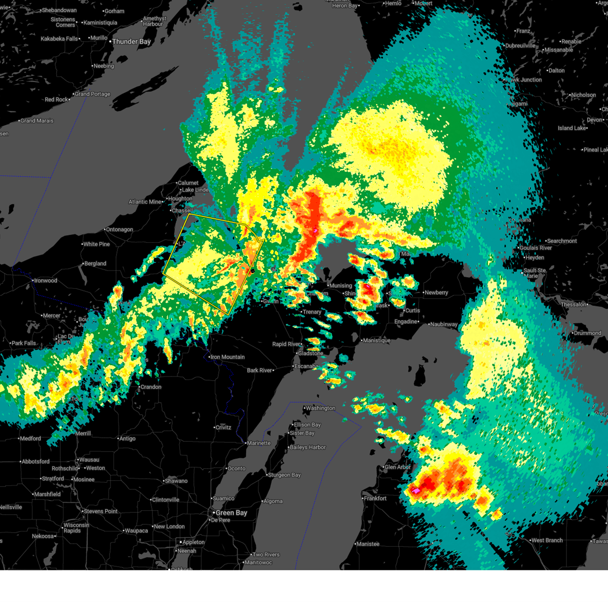
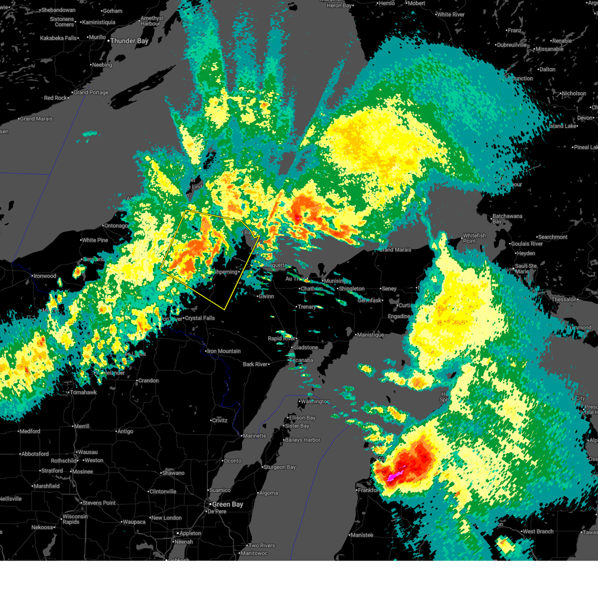
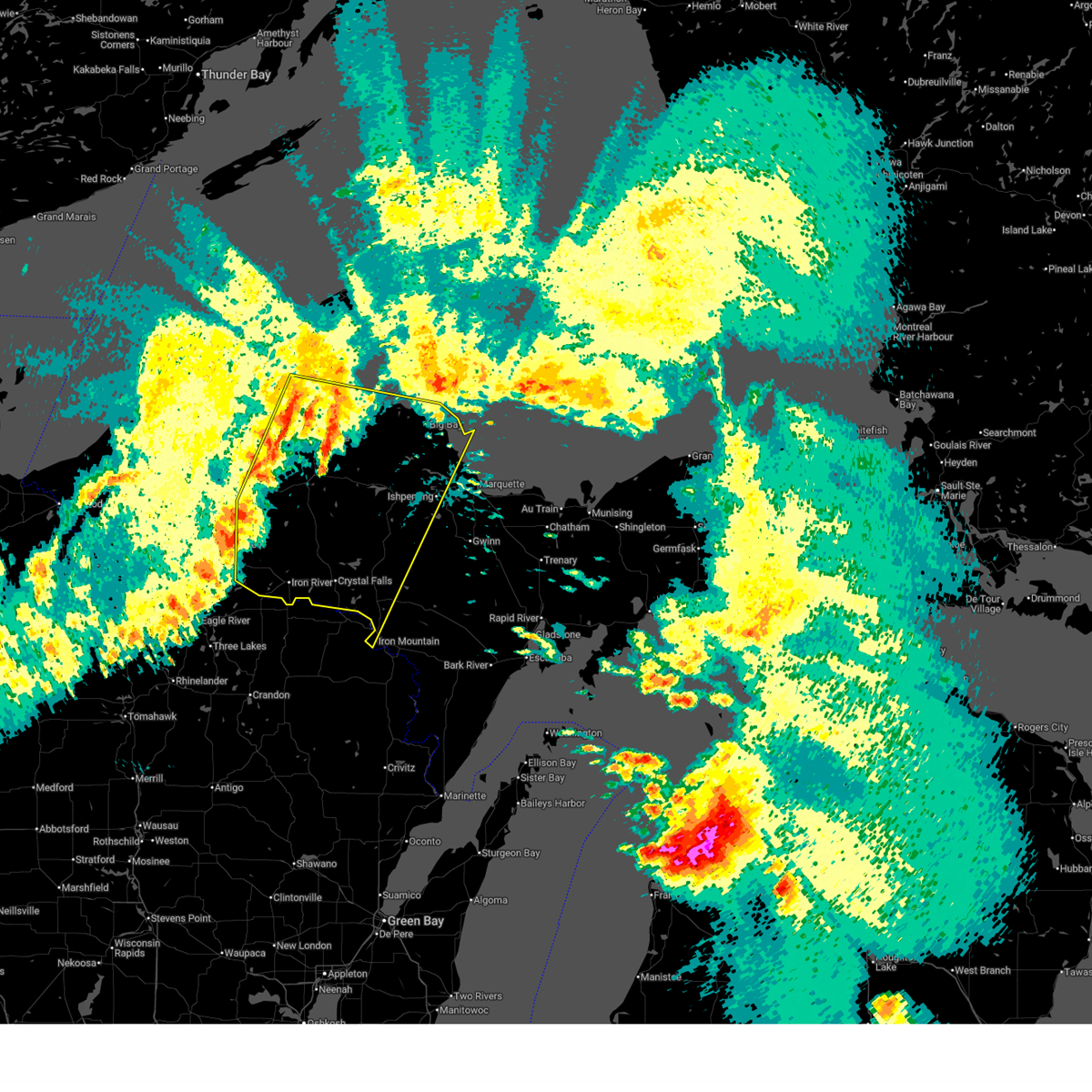
Hail Maps for West Ishpeming, MI


Connect with Interactive Hail Maps