

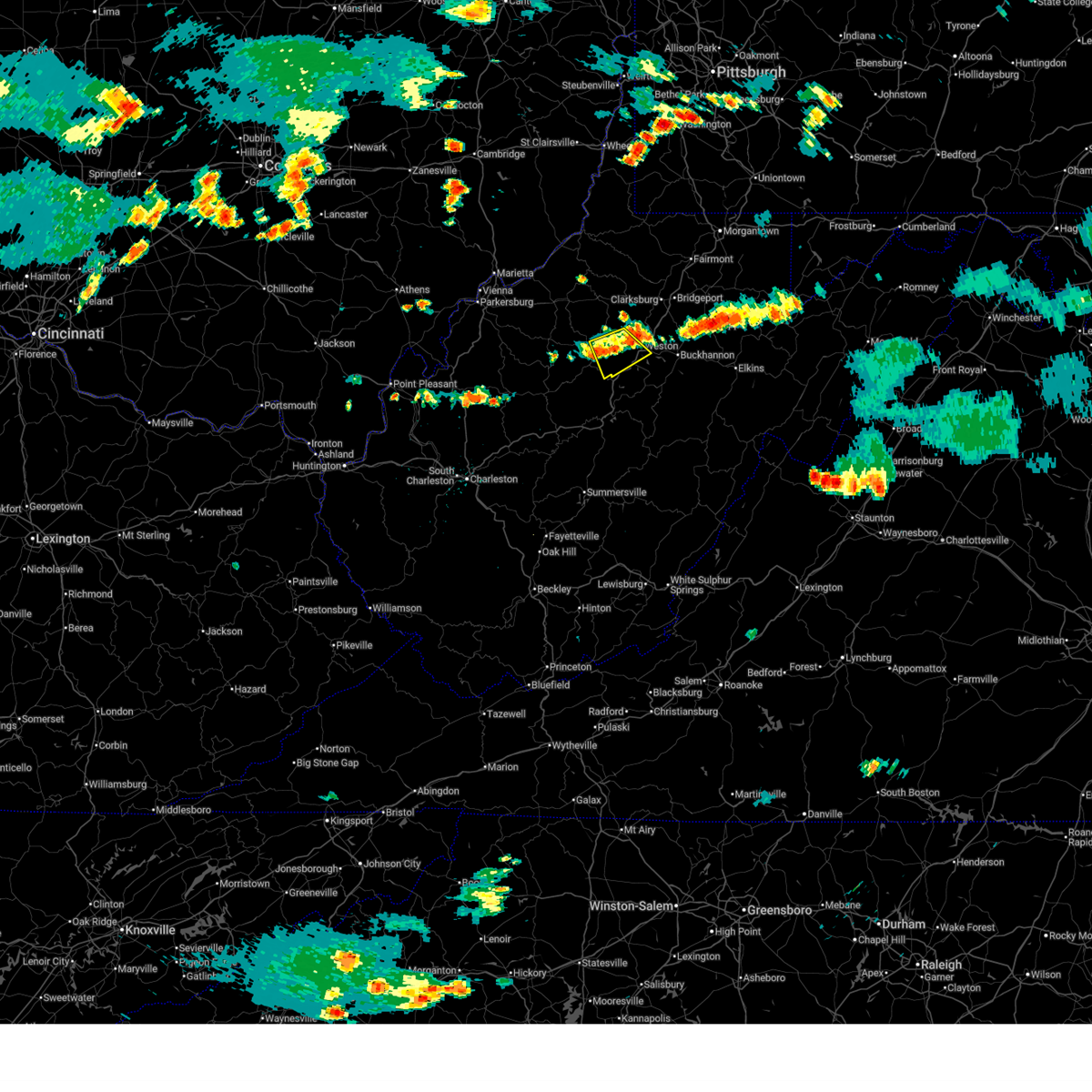
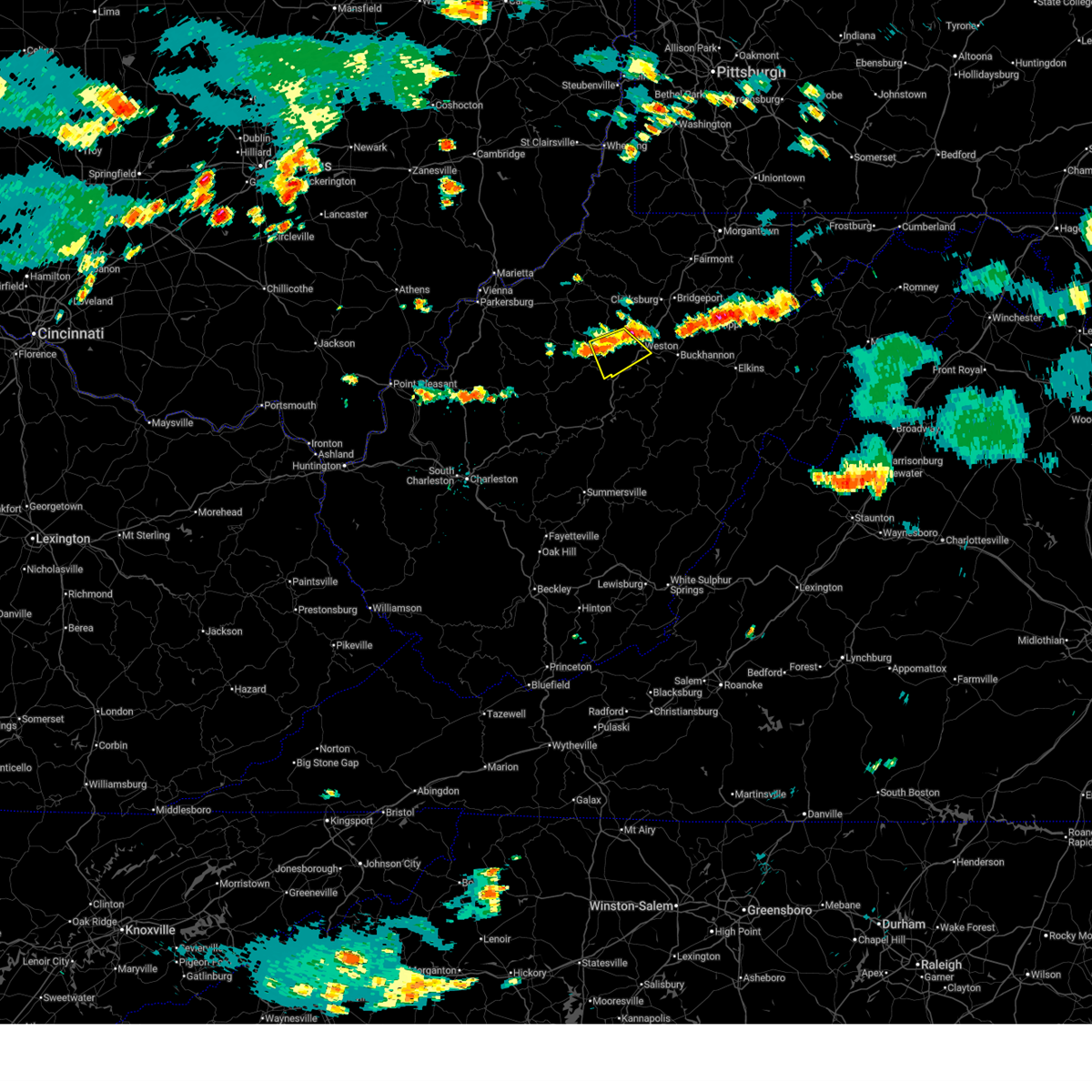
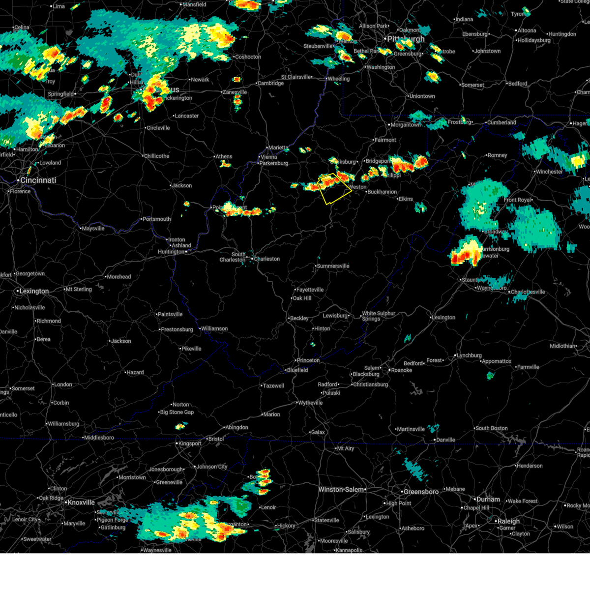
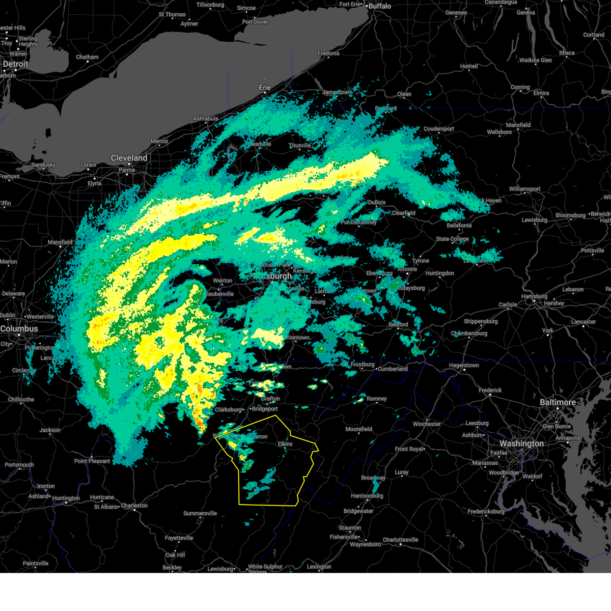
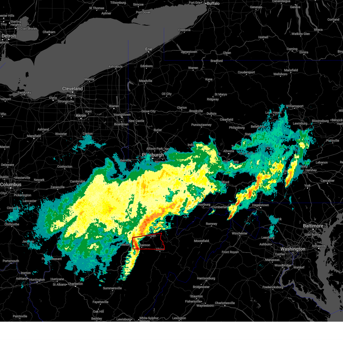
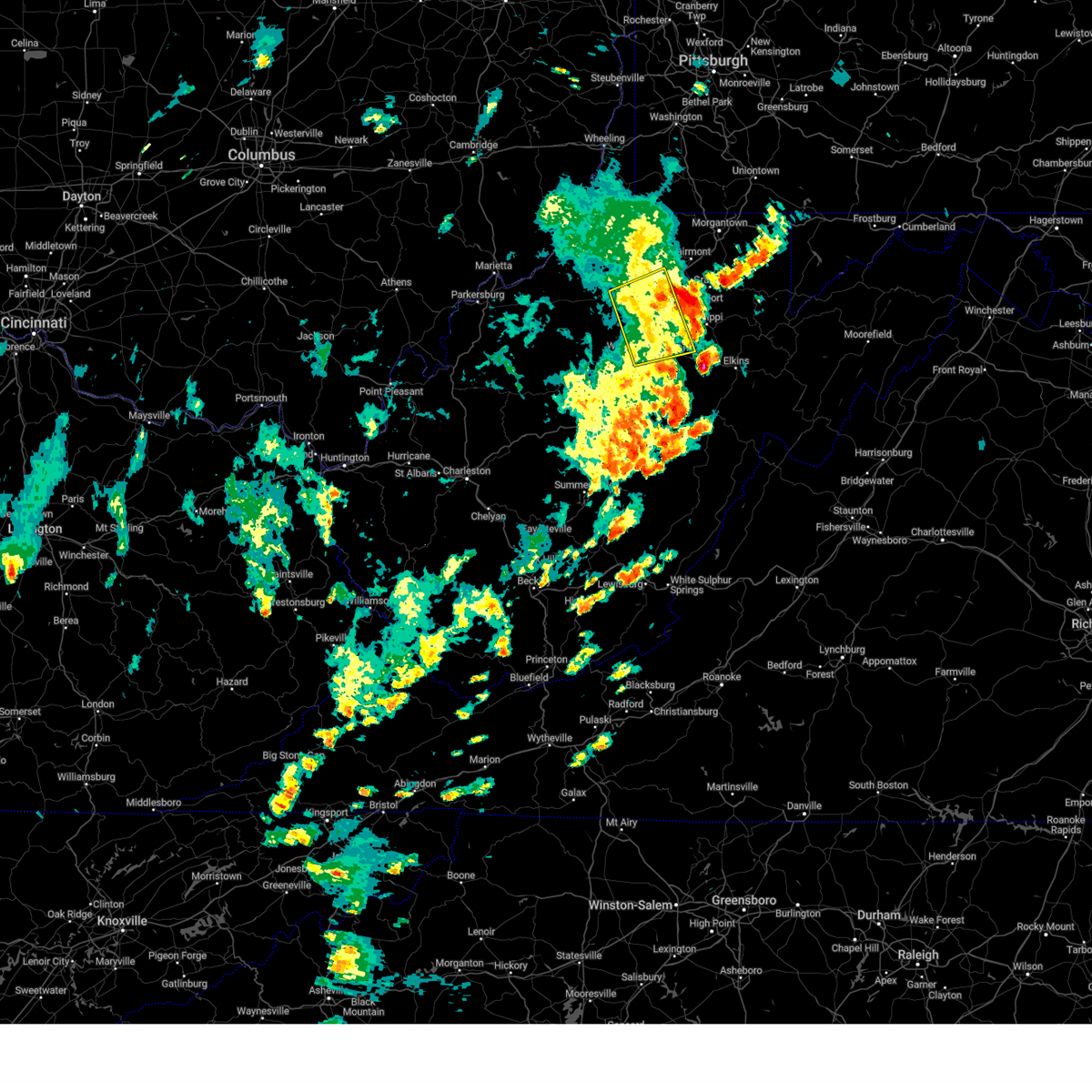
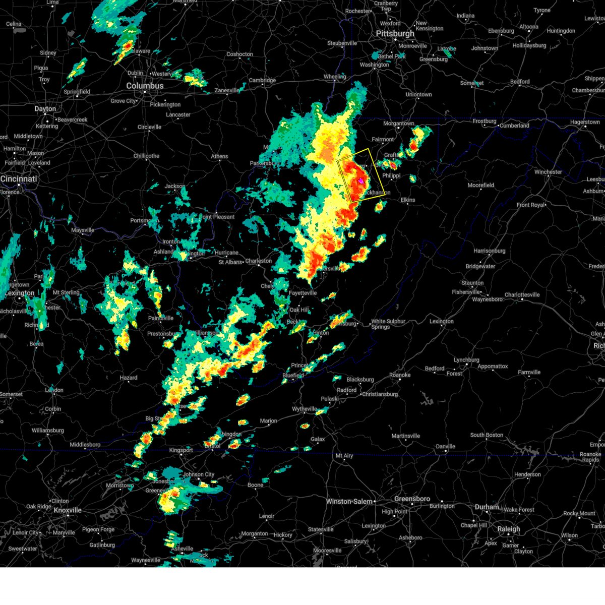
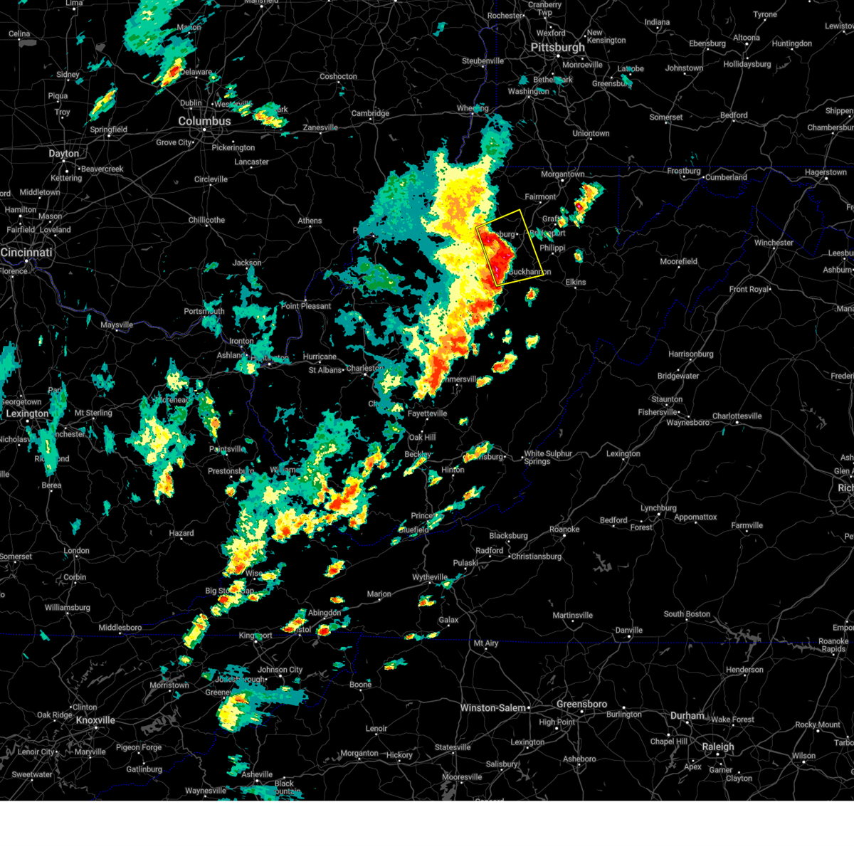
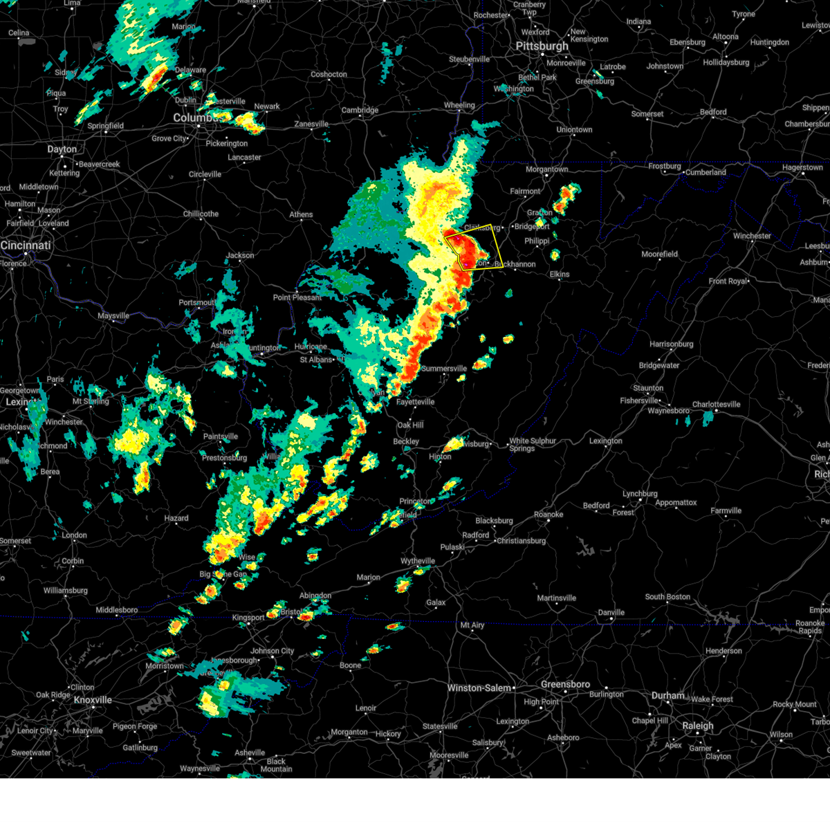
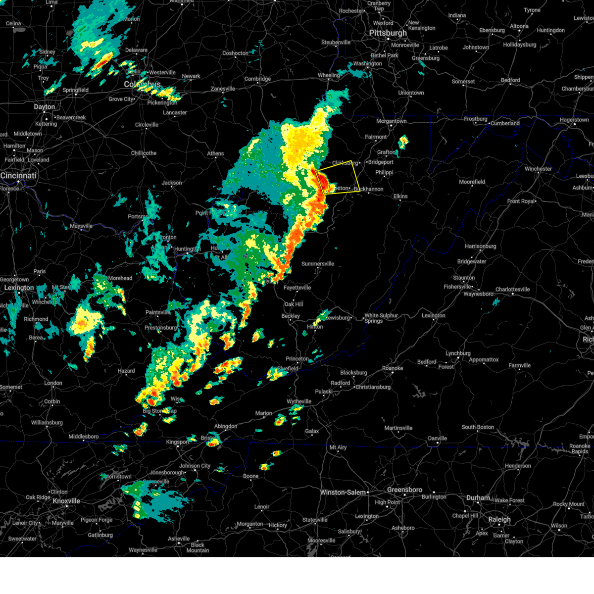
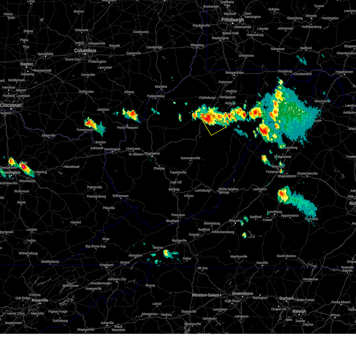
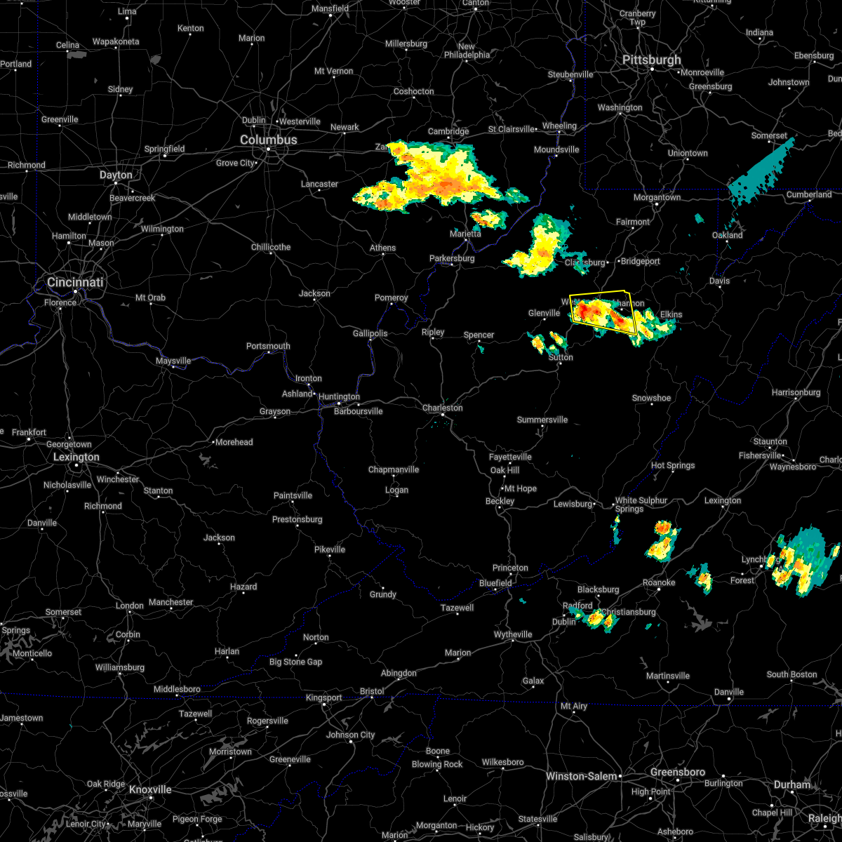
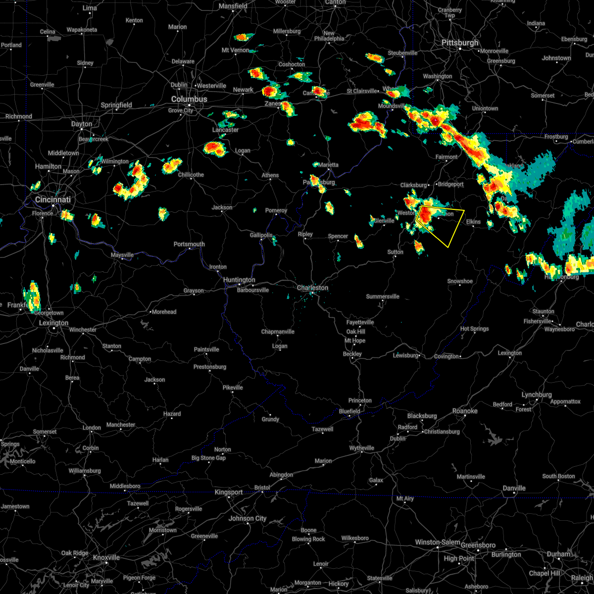
Hail Map for Weston, WV
The Weston, WV area has had 13 reports of on-the-ground hail by trained spotters, and has been under severe weather warnings 20 times during the past 12 months. Doppler radar has detected hail at or near Weston, WV on 27 occasions, including 1 occasion during the past year.
| Name: | Weston, WV |
| Where Located: | 33.6 miles WNW of Elkins, WV |
| Map: | Google Map for Weston, WV |
| Population: | 4110 |
| Housing Units: | 2135 |
| More Info: | Search Google for Weston, WV |
3
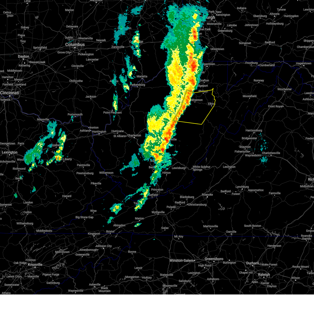
The Top Recent Hail Date for Weston, WV is Tuesday, September 24, 2024 (6th out of 27)

Hail and Wind Damage Spotted near Weston, WV
| Date / Time | Report Details |
|---|---|
| 6/25/2025 4:26 PM EDT |
 The storm which prompted the warning has weakened below severe limits, and no longer poses an immediate threat to life or property. therefore, the warning will be allowed to expire. however, small hail, gusty winds and heavy rain are still possible with this thunderstorm. The storm which prompted the warning has weakened below severe limits, and no longer poses an immediate threat to life or property. therefore, the warning will be allowed to expire. however, small hail, gusty winds and heavy rain are still possible with this thunderstorm.
|
| 6/25/2025 4:20 PM EDT | Tree down on us-3 in lewis county WV, 4.3 miles ESE of Weston, WV |
| 6/25/2025 4:18 PM EDT |
 At 418 pm edt, a severe thunderstorm was located 10 miles west of weston, moving southeast at 15 mph (radar indicated). Hazards include 60 mph wind gusts and quarter size hail. Hail damage to vehicles is expected. expect wind damage to roofs, siding, and trees. Locations impacted include, weston, stonewall jackson, sand fork, camden, alum bridge, baldwin, linn, stouts mills, and troy. At 418 pm edt, a severe thunderstorm was located 10 miles west of weston, moving southeast at 15 mph (radar indicated). Hazards include 60 mph wind gusts and quarter size hail. Hail damage to vehicles is expected. expect wind damage to roofs, siding, and trees. Locations impacted include, weston, stonewall jackson, sand fork, camden, alum bridge, baldwin, linn, stouts mills, and troy.
|
| 6/25/2025 4:18 PM EDT |
 the severe thunderstorm warning has been cancelled and is no longer in effect the severe thunderstorm warning has been cancelled and is no longer in effect
|
| 6/25/2025 4:07 PM EDT |
 Svrrlx the national weather service in charleston west virginia has issued a * severe thunderstorm warning for, south central doddridge county in northern west virginia, northeastern gilmer county in north central west virginia, northwestern lewis county in northern west virginia, * until 430 pm edt. * at 407 pm edt, a severe thunderstorm was located 11 miles northeast of glenville, moving southeast at 15 mph (radar indicated). Hazards include 60 mph wind gusts and quarter size hail. Hail damage to vehicles is expected. Expect wind damage to roofs, siding, and trees. Svrrlx the national weather service in charleston west virginia has issued a * severe thunderstorm warning for, south central doddridge county in northern west virginia, northeastern gilmer county in north central west virginia, northwestern lewis county in northern west virginia, * until 430 pm edt. * at 407 pm edt, a severe thunderstorm was located 11 miles northeast of glenville, moving southeast at 15 mph (radar indicated). Hazards include 60 mph wind gusts and quarter size hail. Hail damage to vehicles is expected. Expect wind damage to roofs, siding, and trees.
|
| 5/30/2025 3:29 PM EDT |
 Svrrlx the national weather service in charleston west virginia has issued a * severe thunderstorm warning for, randolph county in northeastern west virginia, northern pocahontas county in northeastern west virginia, lewis county in northern west virginia, upshur county in northeastern west virginia, northeastern webster county in northeastern west virginia, barbour county in northeastern west virginia, south central harrison county in northern west virginia, * until 430 pm edt. * at 328 pm edt, severe thunderstorms were located along a line extending from near weston to near holly river state park to 6 miles southeast of addison (webster springs), moving east at 40 mph (radar indicated). Hazards include 60 mph wind gusts. expect damage to roofs, siding, and trees Svrrlx the national weather service in charleston west virginia has issued a * severe thunderstorm warning for, randolph county in northeastern west virginia, northern pocahontas county in northeastern west virginia, lewis county in northern west virginia, upshur county in northeastern west virginia, northeastern webster county in northeastern west virginia, barbour county in northeastern west virginia, south central harrison county in northern west virginia, * until 430 pm edt. * at 328 pm edt, severe thunderstorms were located along a line extending from near weston to near holly river state park to 6 miles southeast of addison (webster springs), moving east at 40 mph (radar indicated). Hazards include 60 mph wind gusts. expect damage to roofs, siding, and trees
|
| 4/4/2025 3:07 AM EDT |
 Torrlx the national weather service in charleston west virginia has issued a * tornado warning for, north central randolph county in northeastern west virginia, northeastern lewis county in northern west virginia, northern upshur county in northeastern west virginia, barbour county in northeastern west virginia, southeastern harrison county in northern west virginia, * until 330 am edt. * at 306 am edt, a severe thunderstorm capable of producing a tornado was located 7 miles northwest of buckhannon, moving east at 50 mph (radar indicated rotation). Hazards include tornado. Flying debris will be dangerous to those caught without shelter. mobile homes will be damaged or destroyed. damage to roofs, windows, and vehicles will occur. tree damage is likely. this dangerous storm will be near, buckhannon around 310 am edt. philippi and audra state park around 315 am edt. belington around 325 am edt. Other locations impacted by this tornadic thunderstorm include kerens, volga, junior, lorentz, century, hodgesville, jane lew, montrose, nestorville, and horner. Torrlx the national weather service in charleston west virginia has issued a * tornado warning for, north central randolph county in northeastern west virginia, northeastern lewis county in northern west virginia, northern upshur county in northeastern west virginia, barbour county in northeastern west virginia, southeastern harrison county in northern west virginia, * until 330 am edt. * at 306 am edt, a severe thunderstorm capable of producing a tornado was located 7 miles northwest of buckhannon, moving east at 50 mph (radar indicated rotation). Hazards include tornado. Flying debris will be dangerous to those caught without shelter. mobile homes will be damaged or destroyed. damage to roofs, windows, and vehicles will occur. tree damage is likely. this dangerous storm will be near, buckhannon around 310 am edt. philippi and audra state park around 315 am edt. belington around 325 am edt. Other locations impacted by this tornadic thunderstorm include kerens, volga, junior, lorentz, century, hodgesville, jane lew, montrose, nestorville, and horner.
|
| 4/3/2025 6:18 AM EDT | the severe thunderstorm warning has been cancelled and is no longer in effect |
| 4/3/2025 6:18 AM EDT | At 617 am edt, severe thunderstorms were located along a line extending from 6 miles west of grafton to near buckhannon to near rock cave to 7 miles west of birch river, moving east at 60 mph (radar indicated). Hazards include 60 mph wind gusts. Expect damage to roofs, siding, and trees. Locations impacted include, flemington, knottsville, eden, grafton, jane lew, anmoore, meadland, bridgeport, little birch, jackson mill, hacker valley, french creek, moatsville, frametown, volga, junior, clarksburg, rosemont, wilsie, and gassaway. |
| 4/3/2025 5:57 AM EDT | Svrrlx the national weather service in charleston west virginia has issued a * severe thunderstorm warning for, southeastern calhoun county in north central west virginia, northwestern randolph county in northeastern west virginia, northeastern kanawha county in central west virginia, upshur county in northeastern west virginia, southeastern roane county in central west virginia, northwestern webster county in northeastern west virginia, barbour county in northeastern west virginia, harrison county in northern west virginia, southeastern doddridge county in northern west virginia, taylor county in northern west virginia, north central nicholas county in southeastern west virginia, central gilmer county in north central west virginia, lewis county in northern west virginia, braxton county in north central west virginia, northern clay county in north central west virginia, * until 645 am edt. * at 557 am edt, severe thunderstorms were located along a line extending from near salem to 7 miles northwest of gassaway to near amma, moving east at 65 mph (radar indicated). Hazards include 60 mph wind gusts. expect damage to roofs, siding, and trees |
| 3/16/2025 12:15 PM EDT | Multiple trees and powerlines down blocking roads across southern end of the count in lewis county WV, 11.3 miles N of Weston, WV |
| 3/16/2025 12:15 PM EDT |
 Svrrlx the national weather service in charleston west virginia has issued a * severe thunderstorm warning for, northwestern randolph county in northeastern west virginia, eastern lewis county in northern west virginia, northeastern braxton county in north central west virginia, upshur county in northeastern west virginia, northeastern webster county in northeastern west virginia, barbour county in northeastern west virginia, southeastern harrison county in northern west virginia, * until 100 pm edt. * at 1215 pm edt, severe thunderstorms were located along a line extending from near stonewood to near rock cave to near sutton, moving east at 30 mph (radar indicated). Hazards include 60 mph wind gusts. expect damage to roofs, siding, and trees Svrrlx the national weather service in charleston west virginia has issued a * severe thunderstorm warning for, northwestern randolph county in northeastern west virginia, eastern lewis county in northern west virginia, northeastern braxton county in north central west virginia, upshur county in northeastern west virginia, northeastern webster county in northeastern west virginia, barbour county in northeastern west virginia, southeastern harrison county in northern west virginia, * until 100 pm edt. * at 1215 pm edt, severe thunderstorms were located along a line extending from near stonewood to near rock cave to near sutton, moving east at 30 mph (radar indicated). Hazards include 60 mph wind gusts. expect damage to roofs, siding, and trees
|
| 3/16/2025 12:05 PM EDT | Update to add information to previous report. wall from a building fell into the roadway. also... numerous trees and powerlines down and across roads in town and over t in lewis county WV, 1 miles ESE of Weston, WV |
| 3/16/2025 12:01 PM EDT |
 the severe thunderstorm warning has been cancelled and is no longer in effect the severe thunderstorm warning has been cancelled and is no longer in effect
|
| 3/16/2025 12:01 PM EDT |
 At 1200 pm edt, severe thunderstorms were located along a line extending from 6 miles north of jackson mill to 7 miles southwest of stonewall jackson to sutton, moving east at 25 mph (radar indicated). Hazards include 60 mph wind gusts. Expect damage to roofs, siding, and trees. Locations impacted include, eden, flatwoods, jane lew, cleveland, jackson mill, west milford, weston, alum bridge, hacker valley, kanawha head, ireland, french creek, camden, stonewall jackson, gassaway, baldwin, lorentz, sutton, stouts mills, and sand run. At 1200 pm edt, severe thunderstorms were located along a line extending from 6 miles north of jackson mill to 7 miles southwest of stonewall jackson to sutton, moving east at 25 mph (radar indicated). Hazards include 60 mph wind gusts. Expect damage to roofs, siding, and trees. Locations impacted include, eden, flatwoods, jane lew, cleveland, jackson mill, west milford, weston, alum bridge, hacker valley, kanawha head, ireland, french creek, camden, stonewall jackson, gassaway, baldwin, lorentz, sutton, stouts mills, and sand run.
|
| 3/16/2025 11:45 AM EDT | Multiple trees and powerlines down including vadis rd and simms ru in lewis county WV, 11.2 miles E of Weston, WV |
| 3/16/2025 11:34 AM EDT |
 Svrrlx the national weather service in charleston west virginia has issued a * severe thunderstorm warning for, southeastern ritchie county in northwestern west virginia, southern doddridge county in northern west virginia, gilmer county in north central west virginia, lewis county in northern west virginia, braxton county in north central west virginia, western upshur county in northeastern west virginia, north central webster county in northeastern west virginia, southwestern harrison county in northern west virginia, * until 1215 pm edt. * at 1133 am edt, severe thunderstorms were located along a line extending from 6 miles southeast of harrisville to near glenville to 7 miles northeast of big otter, moving east at 40 mph (radar indicated). Hazards include 60 mph wind gusts. expect damage to roofs, siding, and trees Svrrlx the national weather service in charleston west virginia has issued a * severe thunderstorm warning for, southeastern ritchie county in northwestern west virginia, southern doddridge county in northern west virginia, gilmer county in north central west virginia, lewis county in northern west virginia, braxton county in north central west virginia, western upshur county in northeastern west virginia, north central webster county in northeastern west virginia, southwestern harrison county in northern west virginia, * until 1215 pm edt. * at 1133 am edt, severe thunderstorms were located along a line extending from 6 miles southeast of harrisville to near glenville to 7 miles northeast of big otter, moving east at 40 mph (radar indicated). Hazards include 60 mph wind gusts. expect damage to roofs, siding, and trees
|
| 9/24/2024 2:14 PM EDT |
 The storm which prompted the warning has moved out of the area. therefore, the warning will be allowed to expire. however, gusty winds are still possible with this thunderstorm. The storm which prompted the warning has moved out of the area. therefore, the warning will be allowed to expire. however, gusty winds are still possible with this thunderstorm.
|
| 9/24/2024 1:51 PM EDT |
 At 151 pm edt, a severe thunderstorm was located near jackson mill, or 8 miles northeast of weston, moving east at 30 mph (radar indicated). Hazards include 60 mph wind gusts and quarter size hail. Hail damage to vehicles is expected. expect wind damage to roofs, siding, and trees. Locations impacted include, clarksburg, buckhannon, weston, bridgeport, shinnston, stonewood, nutter fort, salem, lumberport, anmoore, stonewall jackson, jackson mill, west milford, lost creek, jane lew, camden, lorentz, century, wolf summit, and hodgesville. At 151 pm edt, a severe thunderstorm was located near jackson mill, or 8 miles northeast of weston, moving east at 30 mph (radar indicated). Hazards include 60 mph wind gusts and quarter size hail. Hail damage to vehicles is expected. expect wind damage to roofs, siding, and trees. Locations impacted include, clarksburg, buckhannon, weston, bridgeport, shinnston, stonewood, nutter fort, salem, lumberport, anmoore, stonewall jackson, jackson mill, west milford, lost creek, jane lew, camden, lorentz, century, wolf summit, and hodgesville.
|
| 9/24/2024 1:50 PM EDT | Tree reported down on mobile home. time estimated from rada in lewis county WV, 8 miles NNE of Weston, WV |
| 9/24/2024 1:42 PM EDT |
 Svrrlx the national weather service in charleston west virginia has issued a * severe thunderstorm warning for, southeastern doddridge county in northern west virginia, northeastern lewis county in northern west virginia, northern upshur county in northeastern west virginia, west central barbour county in northeastern west virginia, harrison county in northern west virginia, * until 215 pm edt. * at 141 pm edt, a severe thunderstorm was located over jackson mill, or near weston, moving east at 30 mph (radar indicated). Hazards include 60 mph wind gusts. expect damage to roofs, siding, and trees Svrrlx the national weather service in charleston west virginia has issued a * severe thunderstorm warning for, southeastern doddridge county in northern west virginia, northeastern lewis county in northern west virginia, northern upshur county in northeastern west virginia, west central barbour county in northeastern west virginia, harrison county in northern west virginia, * until 215 pm edt. * at 141 pm edt, a severe thunderstorm was located over jackson mill, or near weston, moving east at 30 mph (radar indicated). Hazards include 60 mph wind gusts. expect damage to roofs, siding, and trees
|
| 9/24/2024 1:34 PM EDT |
 At 133 pm edt, a severe thunderstorm was located near jackson mill, or 8 miles northwest of weston, moving east at 30 mph (radar indicated). Hazards include 60 mph wind gusts. Expect damage to roofs, siding, and trees. Locations impacted include, weston, jackson mill, stonewall jackson, jane lew, new milton, camden, alum bridge, avon, grove, leopold, and wolf summit. At 133 pm edt, a severe thunderstorm was located near jackson mill, or 8 miles northwest of weston, moving east at 30 mph (radar indicated). Hazards include 60 mph wind gusts. Expect damage to roofs, siding, and trees. Locations impacted include, weston, jackson mill, stonewall jackson, jane lew, new milton, camden, alum bridge, avon, grove, leopold, and wolf summit.
|
| 9/24/2024 1:34 PM EDT |
 the severe thunderstorm warning has been cancelled and is no longer in effect the severe thunderstorm warning has been cancelled and is no longer in effect
|
| 9/24/2024 1:18 PM EDT |
 Svrrlx the national weather service in charleston west virginia has issued a * severe thunderstorm warning for, east central ritchie county in northwestern west virginia, southern doddridge county in northern west virginia, northeastern gilmer county in north central west virginia, northern lewis county in northern west virginia, southwestern harrison county in northern west virginia, * until 145 pm edt. * at 118 pm edt, a severe thunderstorm was located 12 miles northeast of glenville, moving east at 30 mph (radar indicated). Hazards include 60 mph wind gusts. expect damage to roofs, siding, and trees Svrrlx the national weather service in charleston west virginia has issued a * severe thunderstorm warning for, east central ritchie county in northwestern west virginia, southern doddridge county in northern west virginia, northeastern gilmer county in north central west virginia, northern lewis county in northern west virginia, southwestern harrison county in northern west virginia, * until 145 pm edt. * at 118 pm edt, a severe thunderstorm was located 12 miles northeast of glenville, moving east at 30 mph (radar indicated). Hazards include 60 mph wind gusts. expect damage to roofs, siding, and trees
|
| 9/21/2024 5:18 PM EDT | Tree dow in lewis county WV, 10.6 miles N of Weston, WV |
| 9/21/2024 5:09 PM EDT |
 Svrrlx the national weather service in charleston west virginia has issued a * severe thunderstorm warning for, central lewis county in northern west virginia, northeastern braxton county in north central west virginia, southern upshur county in northeastern west virginia, north central webster county in northeastern west virginia, * until 545 pm edt. * at 509 pm edt, a severe thunderstorm was located near stonewall jackson, or near weston, moving southeast at 40 mph (radar indicated). Hazards include 60 mph wind gusts and quarter size hail. Hail damage to vehicles is expected. Expect wind damage to roofs, siding, and trees. Svrrlx the national weather service in charleston west virginia has issued a * severe thunderstorm warning for, central lewis county in northern west virginia, northeastern braxton county in north central west virginia, southern upshur county in northeastern west virginia, north central webster county in northeastern west virginia, * until 545 pm edt. * at 509 pm edt, a severe thunderstorm was located near stonewall jackson, or near weston, moving southeast at 40 mph (radar indicated). Hazards include 60 mph wind gusts and quarter size hail. Hail damage to vehicles is expected. Expect wind damage to roofs, siding, and trees.
|
| 8/31/2024 3:00 PM EDT | One tree down with power or phone line blocking entire roadway. time estimated from rada in lewis county WV, 7.5 miles ESE of Weston, WV |
| 5/26/2024 7:36 PM EDT | Tree down with lines involve in lewis county WV, 3.7 miles NW of Weston, WV |
| 5/26/2024 6:53 PM EDT |
 The storm which prompted the warning has moved out of the area. therefore, the warning will be allowed to expire. a severe thunderstorm watch remains in effect until 900 pm edt for northern, north central and northeastern west virginia. The storm which prompted the warning has moved out of the area. therefore, the warning will be allowed to expire. a severe thunderstorm watch remains in effect until 900 pm edt for northern, north central and northeastern west virginia.
|
| 5/26/2024 6:46 PM EDT | Tree and lines blocking the road. time estimated from rada in lewis county WV, 3.7 miles NW of Weston, WV |
| 5/26/2024 6:45 PM EDT | Tree down blocking road. time estimated from rada in lewis county WV, 3.5 miles NNW of Weston, WV |
| 5/26/2024 6:44 PM EDT | Lewis county 911 center reports large tree down blocking a lane of us hwy 19 s and resort dr near walkersville. time estimated from rada in lewis county WV, 7 miles NNE of Weston, WV |
| 5/26/2024 6:44 PM EDT | Tree down. time estimated from rada in lewis county WV, 2.3 miles W of Weston, WV |
| 5/26/2024 6:37 PM EDT | Lewis county 911 center reports multiple trees down blocking the road along grass run rd and old route 33 in weston. time estimated by rada in lewis county WV, 3.5 miles WNW of Weston, WV |
| 5/26/2024 6:37 PM EDT | Lewis county 911 center reports trees and lines down on sauls run rd in horner. time estimated by rada in lewis county WV, 4.1 miles NW of Weston, WV |
| 5/26/2024 6:37 PM EDT | Received a call about wind damage along the 2500 block of glady fork rd. a swath of trees are down on some property as well as sections of a wooden roof are missing. ti in lewis county WV, 3.3 miles NNW of Weston, WV |
| 5/26/2024 6:31 PM EDT | Multiple trees down along the stonewall resort marin in lewis county WV, 6.8 miles NNE of Weston, WV |
| 5/26/2024 6:08 PM EDT |
 Svrrlx the national weather service in charleston west virginia has issued a * severe thunderstorm warning for, west central randolph county in northeastern west virginia, east central gilmer county in north central west virginia, lewis county in northern west virginia, northeastern braxton county in north central west virginia, upshur county in northeastern west virginia, northeastern webster county in northeastern west virginia, south central harrison county in northern west virginia, * until 700 pm edt. * at 608 pm edt, a severe thunderstorm was located near sutton, moving northeast at 70 mph (radar indicated). Hazards include 60 mph wind gusts and penny size hail. expect damage to roofs, siding, and trees Svrrlx the national weather service in charleston west virginia has issued a * severe thunderstorm warning for, west central randolph county in northeastern west virginia, east central gilmer county in north central west virginia, lewis county in northern west virginia, northeastern braxton county in north central west virginia, upshur county in northeastern west virginia, northeastern webster county in northeastern west virginia, south central harrison county in northern west virginia, * until 700 pm edt. * at 608 pm edt, a severe thunderstorm was located near sutton, moving northeast at 70 mph (radar indicated). Hazards include 60 mph wind gusts and penny size hail. expect damage to roofs, siding, and trees
|
| 5/9/2024 7:36 PM EDT | Multiple trees down on multiple house in lewis county WV, 8.3 miles NNE of Weston, WV |
| 4/2/2024 12:05 PM EDT |
 the severe thunderstorm warning has been cancelled and is no longer in effect the severe thunderstorm warning has been cancelled and is no longer in effect
|
| 4/2/2024 12:05 PM EDT |
 At 1204 pm edt, severe thunderstorms were located along a line extending from 9 miles west of stonewall jackson to near sutton to 6 miles northeast of camden on gauley to 6 miles north of quinwood, moving east at 70 mph (radar indicated). Hazards include 70 mph wind gusts. Expect considerable tree damage. damage is likely to mobile homes, roofs, and outbuildings. Locations impacted include, elkins, buckhannon, weston, philippi, richwood, marlinton, audra state park, greenbank, webster springs, cass scenic railroad, belington, addison (webster springs), mill creek, camden-on-gauley, snowshoe, dailey, holly river state park, stonewall jackson, camden on gauley, and rock cave. At 1204 pm edt, severe thunderstorms were located along a line extending from 9 miles west of stonewall jackson to near sutton to 6 miles northeast of camden on gauley to 6 miles north of quinwood, moving east at 70 mph (radar indicated). Hazards include 70 mph wind gusts. Expect considerable tree damage. damage is likely to mobile homes, roofs, and outbuildings. Locations impacted include, elkins, buckhannon, weston, philippi, richwood, marlinton, audra state park, greenbank, webster springs, cass scenic railroad, belington, addison (webster springs), mill creek, camden-on-gauley, snowshoe, dailey, holly river state park, stonewall jackson, camden on gauley, and rock cave.
|
| 4/2/2024 11:44 AM EDT |
 Svrrlx the national weather service in charleston west virginia has issued a * severe thunderstorm warning for, southeastern calhoun county in north central west virginia, randolph county in northeastern west virginia, upshur county in northeastern west virginia, webster county in northeastern west virginia, southern barbour county in northeastern west virginia, pocahontas county in northeastern west virginia, southeastern ritchie county in northwestern west virginia, nicholas county in southeastern west virginia, gilmer county in north central west virginia, lewis county in northern west virginia, braxton county in north central west virginia, northeastern clay county in north central west virginia, northeastern fayette county in southeastern west virginia, * until 100 pm edt. * at 1144 am edt, severe thunderstorms were located along a line extending from 9 miles north of grantsville to 6 miles east of arnoldsburg to 8 miles east of clay to near ansted, moving east at 65 mph (radar indicated). Hazards include 70 mph wind gusts. Expect considerable tree damage. Damage is likely to mobile homes, roofs, and outbuildings. Svrrlx the national weather service in charleston west virginia has issued a * severe thunderstorm warning for, southeastern calhoun county in north central west virginia, randolph county in northeastern west virginia, upshur county in northeastern west virginia, webster county in northeastern west virginia, southern barbour county in northeastern west virginia, pocahontas county in northeastern west virginia, southeastern ritchie county in northwestern west virginia, nicholas county in southeastern west virginia, gilmer county in north central west virginia, lewis county in northern west virginia, braxton county in north central west virginia, northeastern clay county in north central west virginia, northeastern fayette county in southeastern west virginia, * until 100 pm edt. * at 1144 am edt, severe thunderstorms were located along a line extending from 9 miles north of grantsville to 6 miles east of arnoldsburg to 8 miles east of clay to near ansted, moving east at 65 mph (radar indicated). Hazards include 70 mph wind gusts. Expect considerable tree damage. Damage is likely to mobile homes, roofs, and outbuildings.
|
| 3/30/2024 8:44 PM EDT |
 The storm which prompted the warning has weakened below severe limits, and no longer poses an immediate threat to life or property. therefore, the warning will be allowed to expire. however, small hail and gusty winds are still possible with this thunderstorm. a severe thunderstorm watch remains in effect until 1000 pm edt for northern and northeastern west virginia. The storm which prompted the warning has weakened below severe limits, and no longer poses an immediate threat to life or property. therefore, the warning will be allowed to expire. however, small hail and gusty winds are still possible with this thunderstorm. a severe thunderstorm watch remains in effect until 1000 pm edt for northern and northeastern west virginia.
|
| 3/30/2024 8:31 PM EDT |
 At 831 pm edt, a severe thunderstorm was located near weston, moving southeast at 45 mph (radar indicated). Hazards include 60 mph wind gusts and quarter size hail. Hail damage to vehicles is expected. expect wind damage to roofs, siding, and trees. Locations impacted include, buckhannon, weston, jackson mill, jane lew, lorentz, hodgesville, and horner. At 831 pm edt, a severe thunderstorm was located near weston, moving southeast at 45 mph (radar indicated). Hazards include 60 mph wind gusts and quarter size hail. Hail damage to vehicles is expected. expect wind damage to roofs, siding, and trees. Locations impacted include, buckhannon, weston, jackson mill, jane lew, lorentz, hodgesville, and horner.
|
| 3/30/2024 8:31 PM EDT |
 the severe thunderstorm warning has been cancelled and is no longer in effect the severe thunderstorm warning has been cancelled and is no longer in effect
|
| 3/30/2024 8:16 PM EDT |
 Svrrlx the national weather service in charleston west virginia has issued a * severe thunderstorm warning for, southeastern doddridge county in northern west virginia, northeastern lewis county in northern west virginia, northwestern upshur county in northeastern west virginia, southwestern harrison county in northern west virginia, * until 845 pm edt. * at 816 pm edt, a severe thunderstorm was located near jackson mill, or 7 miles northwest of weston, moving southeast at 45 mph (radar indicated). Hazards include 60 mph wind gusts and quarter size hail. Hail damage to vehicles is expected. Expect wind damage to roofs, siding, and trees. Svrrlx the national weather service in charleston west virginia has issued a * severe thunderstorm warning for, southeastern doddridge county in northern west virginia, northeastern lewis county in northern west virginia, northwestern upshur county in northeastern west virginia, southwestern harrison county in northern west virginia, * until 845 pm edt. * at 816 pm edt, a severe thunderstorm was located near jackson mill, or 7 miles northwest of weston, moving southeast at 45 mph (radar indicated). Hazards include 60 mph wind gusts and quarter size hail. Hail damage to vehicles is expected. Expect wind damage to roofs, siding, and trees.
|
| 7/28/2023 4:25 PM EDT |
 The severe thunderstorm warning for northeastern doddridge, northeastern lewis, northwestern upshur and harrison counties will expire at 430 pm edt, the storms which prompted the warning are moving out of the area. therefore, the warning will be allowed to expire. a severe thunderstorm watch remains in effect until 800 pm edt for northern and northeastern west virginia. The severe thunderstorm warning for northeastern doddridge, northeastern lewis, northwestern upshur and harrison counties will expire at 430 pm edt, the storms which prompted the warning are moving out of the area. therefore, the warning will be allowed to expire. a severe thunderstorm watch remains in effect until 800 pm edt for northern and northeastern west virginia.
|
| 7/28/2023 4:11 PM EDT |
 At 411 pm edt, severe thunderstorms were located along a line extending from 8 miles south of jacksonburg to near stonewall jackson, moving east at 25 mph (radar indicated). Hazards include 60 mph wind gusts and nickel size hail. Expect damage to roofs, siding, and trees. locations impacted include, clarksburg, weston, shinnston, stonewood, nutter fort, salem, lumberport, anmoore, stonewall jackson, jackson mill, west milford, lost creek, jane lew, wolf summit, wallace, sedalia, meadowbrook, horner, and despard. hail threat, radar indicated max hail size, 0. 88 in wind threat, radar indicated max wind gust, 60 mph. At 411 pm edt, severe thunderstorms were located along a line extending from 8 miles south of jacksonburg to near stonewall jackson, moving east at 25 mph (radar indicated). Hazards include 60 mph wind gusts and nickel size hail. Expect damage to roofs, siding, and trees. locations impacted include, clarksburg, weston, shinnston, stonewood, nutter fort, salem, lumberport, anmoore, stonewall jackson, jackson mill, west milford, lost creek, jane lew, wolf summit, wallace, sedalia, meadowbrook, horner, and despard. hail threat, radar indicated max hail size, 0. 88 in wind threat, radar indicated max wind gust, 60 mph.
|
| 7/28/2023 3:43 PM EDT |
 At 343 pm edt, severe thunderstorms were located along a line extending from near west union to near glenville, moving east at 25 mph (radar indicated). Hazards include 60 mph wind gusts and quarter size hail. Hail damage to vehicles is expected. Expect wind damage to roofs, siding, and trees. At 343 pm edt, severe thunderstorms were located along a line extending from near west union to near glenville, moving east at 25 mph (radar indicated). Hazards include 60 mph wind gusts and quarter size hail. Hail damage to vehicles is expected. Expect wind damage to roofs, siding, and trees.
|
| 7/23/2022 4:18 PM EDT |
 At 417 pm edt, a severe thunderstorm was located over buckhannon, moving southeast at 30 mph (radar indicated). Hazards include 60 mph wind gusts and penny size hail. Expect damage to roofs, siding, and trees. locations impacted include, elkins, buckhannon, grafton, philippi, audra state park, belington, mill creek, dailey, rock cave, beverly, junior, flemington, womelsdorf (coalton), huttonsville, montrose, alexander, knottsville, eden, glady and helvetia. hail threat, radar indicated max hail size, 0. 75 in wind threat, radar indicated max wind gust, 60 mph. At 417 pm edt, a severe thunderstorm was located over buckhannon, moving southeast at 30 mph (radar indicated). Hazards include 60 mph wind gusts and penny size hail. Expect damage to roofs, siding, and trees. locations impacted include, elkins, buckhannon, grafton, philippi, audra state park, belington, mill creek, dailey, rock cave, beverly, junior, flemington, womelsdorf (coalton), huttonsville, montrose, alexander, knottsville, eden, glady and helvetia. hail threat, radar indicated max hail size, 0. 75 in wind threat, radar indicated max wind gust, 60 mph.
|
| 7/23/2022 4:00 PM EDT |
 At 400 pm edt, a severe thunderstorm was located near weston, moving southeast at 30 mph (radar indicated). Hazards include 60 mph wind gusts and penny size hail. expect damage to roofs, siding, and trees At 400 pm edt, a severe thunderstorm was located near weston, moving southeast at 30 mph (radar indicated). Hazards include 60 mph wind gusts and penny size hail. expect damage to roofs, siding, and trees
|
| 7/23/2022 3:58 PM EDT | Multiple trees down across the tow in lewis county WV, 1 miles ESE of Weston, WV |
| 7/23/2022 3:52 PM EDT |
 At 352 pm edt, a severe thunderstorm was located over buckhannon, moving southeast at 50 mph (radar indicated). Hazards include 60 mph wind gusts and penny size hail. Expect damage to roofs, siding, and trees. locations impacted include, clarksburg, weston, bridgeport, shinnston, stonewood, nutter fort, anmoore, stonewall jackson, jackson mill, enterprise, west milford, lost creek, jane lew, camden, meadowbrook, horner and despard. hail threat, radar indicated max hail size, 0. 75 in wind threat, radar indicated max wind gust, 60 mph. At 352 pm edt, a severe thunderstorm was located over buckhannon, moving southeast at 50 mph (radar indicated). Hazards include 60 mph wind gusts and penny size hail. Expect damage to roofs, siding, and trees. locations impacted include, clarksburg, weston, bridgeport, shinnston, stonewood, nutter fort, anmoore, stonewall jackson, jackson mill, enterprise, west milford, lost creek, jane lew, camden, meadowbrook, horner and despard. hail threat, radar indicated max hail size, 0. 75 in wind threat, radar indicated max wind gust, 60 mph.
|
| 7/23/2022 3:28 PM EDT |
 At 328 pm edt, a severe thunderstorm was located near jackson mill, or 8 miles northwest of weston, moving southeast at 50 mph (radar indicated). Hazards include 60 mph wind gusts and penny size hail. expect damage to roofs, siding, and trees At 328 pm edt, a severe thunderstorm was located near jackson mill, or 8 miles northwest of weston, moving southeast at 50 mph (radar indicated). Hazards include 60 mph wind gusts and penny size hail. expect damage to roofs, siding, and trees
|
| 6/16/2022 9:14 PM EDT |
 At 914 pm edt, a severe thunderstorm was located near weston, moving southeast at 45 mph (radar indicated). Hazards include 60 mph wind gusts and quarter size hail. Hail damage to vehicles is expected. Expect wind damage to roofs, siding, and trees. At 914 pm edt, a severe thunderstorm was located near weston, moving southeast at 45 mph (radar indicated). Hazards include 60 mph wind gusts and quarter size hail. Hail damage to vehicles is expected. Expect wind damage to roofs, siding, and trees.
|
| 6/16/2022 8:54 PM EDT | Multiple trees and powerlines down from weston to glenville. time estimated by rada in lewis county WV, 1 miles ESE of Weston, WV |
| 6/16/2022 8:53 PM EDT |
 At 852 pm edt, a severe thunderstorm was located over weston, moving east at 25 mph (radar indicated). Hazards include 60 mph wind gusts and quarter size hail. Hail damage to vehicles is expected. expect wind damage to roofs, siding, and trees. locations impacted include, buckhannon, weston, stonewall jackson, camden, lorentz, tallmansville, overhill, hodgesville, sand run, horner and french creek. hail threat, radar indicated max hail size, 1. 00 in wind threat, radar indicated max wind gust, 60 mph. At 852 pm edt, a severe thunderstorm was located over weston, moving east at 25 mph (radar indicated). Hazards include 60 mph wind gusts and quarter size hail. Hail damage to vehicles is expected. expect wind damage to roofs, siding, and trees. locations impacted include, buckhannon, weston, stonewall jackson, camden, lorentz, tallmansville, overhill, hodgesville, sand run, horner and french creek. hail threat, radar indicated max hail size, 1. 00 in wind threat, radar indicated max wind gust, 60 mph.
|
| 6/16/2022 8:23 PM EDT |
 At 823 pm edt, a severe thunderstorm was located 7 miles northeast of glenville, moving east at 25 mph (radar indicated). Hazards include 60 mph wind gusts and quarter size hail. Hail damage to vehicles is expected. Expect wind damage to roofs, siding, and trees. At 823 pm edt, a severe thunderstorm was located 7 miles northeast of glenville, moving east at 25 mph (radar indicated). Hazards include 60 mph wind gusts and quarter size hail. Hail damage to vehicles is expected. Expect wind damage to roofs, siding, and trees.
|
| 6/14/2022 10:52 AM EDT |
 At 1052 am edt, a severe thunderstorm was located over buckhannon, moving south at 40 mph (radar indicated). Hazards include 60 mph wind gusts and nickel size hail. Expect damage to roofs, siding, and trees. locations impacted include, clarksburg, buckhannon, bridgeport, stonewood, nutter fort, anmoore, rock cave, west milford, lost creek, jane lew, lorentz, century, wolf summit, tallmansville, overhill, hodgesville, meadowbrook, horner, french creek and despard. hail threat, radar indicated max hail size, 0. 88 in wind threat, radar indicated max wind gust, 60 mph. At 1052 am edt, a severe thunderstorm was located over buckhannon, moving south at 40 mph (radar indicated). Hazards include 60 mph wind gusts and nickel size hail. Expect damage to roofs, siding, and trees. locations impacted include, clarksburg, buckhannon, bridgeport, stonewood, nutter fort, anmoore, rock cave, west milford, lost creek, jane lew, lorentz, century, wolf summit, tallmansville, overhill, hodgesville, meadowbrook, horner, french creek and despard. hail threat, radar indicated max hail size, 0. 88 in wind threat, radar indicated max wind gust, 60 mph.
|
| 6/14/2022 10:28 AM EDT |
 At 1028 am edt, a severe thunderstorm was located near nutter fort, or near clarksburg, moving south at 35 mph (radar indicated). Hazards include 60 mph wind gusts and quarter size hail. Hail damage to vehicles is expected. Expect wind damage to roofs, siding, and trees. At 1028 am edt, a severe thunderstorm was located near nutter fort, or near clarksburg, moving south at 35 mph (radar indicated). Hazards include 60 mph wind gusts and quarter size hail. Hail damage to vehicles is expected. Expect wind damage to roofs, siding, and trees.
|
| 7/29/2021 1:41 PM EDT |
 The severe thunderstorm warning for southeastern doddridge, northeastern lewis, northwestern upshur, western barbour and southwestern harrison counties will expire at 145 pm edt, the storm which prompted the warning has weakened below severe limits, and no longer poses an immediate threat to life or property. therefore, the warning will be allowed to expire. The severe thunderstorm warning for southeastern doddridge, northeastern lewis, northwestern upshur, western barbour and southwestern harrison counties will expire at 145 pm edt, the storm which prompted the warning has weakened below severe limits, and no longer poses an immediate threat to life or property. therefore, the warning will be allowed to expire.
|
| 7/29/2021 1:30 PM EDT |
 At 130 pm edt, a severe thunderstorm was located near jackson mill, or 8 miles north of weston, moving southeast at 35 mph (radar indicated). Hazards include 60 mph wind gusts and quarter size hail. Hail damage to vehicles is expected. expect wind damage to roofs, siding, and trees. Locations impacted include, weston, salem, jackson mill, stonewall jackson, west milford, lost creek, jane lew, lorentz, century, hodgesville, avon and horner. At 130 pm edt, a severe thunderstorm was located near jackson mill, or 8 miles north of weston, moving southeast at 35 mph (radar indicated). Hazards include 60 mph wind gusts and quarter size hail. Hail damage to vehicles is expected. expect wind damage to roofs, siding, and trees. Locations impacted include, weston, salem, jackson mill, stonewall jackson, west milford, lost creek, jane lew, lorentz, century, hodgesville, avon and horner.
|
| 7/29/2021 1:16 PM EDT |
 At 116 pm edt, a severe thunderstorm was located over salem, or 14 miles west of clarksburg, moving southeast at 35 mph (radar indicated). Hazards include 60 mph wind gusts and quarter size hail. Hail damage to vehicles is expected. Expect wind damage to roofs, siding, and trees. At 116 pm edt, a severe thunderstorm was located over salem, or 14 miles west of clarksburg, moving southeast at 35 mph (radar indicated). Hazards include 60 mph wind gusts and quarter size hail. Hail damage to vehicles is expected. Expect wind damage to roofs, siding, and trees.
|
| 7/7/2021 5:55 PM EDT |
 At 554 pm edt, a severe thunderstorm was located near jackson mill, or 8 miles northwest of weston, moving northeast at 15 mph (radar indicated). Hazards include 60 mph wind gusts and penny size hail. Expect damage to roofs, siding, and trees. Locations impacted include, weston, salem, jackson mill, jane lew, camden, alum bridge and avon. At 554 pm edt, a severe thunderstorm was located near jackson mill, or 8 miles northwest of weston, moving northeast at 15 mph (radar indicated). Hazards include 60 mph wind gusts and penny size hail. Expect damage to roofs, siding, and trees. Locations impacted include, weston, salem, jackson mill, jane lew, camden, alum bridge and avon.
|
| 7/7/2021 5:50 PM EDT | Several trees dow in lewis county WV, 3.8 miles ESE of Weston, WV |
| 7/7/2021 5:50 PM EDT | Trees down in the pricetown communit in lewis county WV, 4.3 miles ESE of Weston, WV |
| 7/7/2021 5:42 PM EDT | Trees down in the camden and alum bridge communitie in lewis county WV, 8.5 miles E of Weston, WV |
| 7/7/2021 5:35 PM EDT |
 At 534 pm edt, a severe thunderstorm was located 11 miles west of jackson mill, or 11 miles west of weston, moving northeast at 15 mph (radar indicated). Hazards include 60 mph wind gusts and penny size hail. expect damage to roofs, siding, and trees At 534 pm edt, a severe thunderstorm was located 11 miles west of jackson mill, or 11 miles west of weston, moving northeast at 15 mph (radar indicated). Hazards include 60 mph wind gusts and penny size hail. expect damage to roofs, siding, and trees
|
| 6/14/2021 8:07 PM EDT | Tree down across buckhannon run road near county line. dispatcher said the call came when the storm started. time corroborated with rada in lewis county WV, 6 miles WNW of Weston, WV |
| 6/14/2021 8:01 PM EDT | Tree down across beech lick road. time estimated from rada in lewis county WV, 4.6 miles WNW of Weston, WV |
| 6/14/2021 8:00 PM EDT |
 At 800 pm edt, a severe thunderstorm was located near weston, moving southeast at 30 mph (radar indicated). Hazards include 60 mph wind gusts. Expect damage to roofs, siding, and trees. Locations impacted include, buckhannon, weston, stonewall jackson, jackson mill, rock cave, jane lew, lorentz, eden, alton, walkersville, kanawha head, tallmansville, overhill, horner and french creek. At 800 pm edt, a severe thunderstorm was located near weston, moving southeast at 30 mph (radar indicated). Hazards include 60 mph wind gusts. Expect damage to roofs, siding, and trees. Locations impacted include, buckhannon, weston, stonewall jackson, jackson mill, rock cave, jane lew, lorentz, eden, alton, walkersville, kanawha head, tallmansville, overhill, horner and french creek.
|
| 6/14/2021 7:43 PM EDT | Multiple trees down in the valley chapel area. pictures provided via faceboo in lewis county WV, 5.6 miles SSE of Weston, WV |
| 6/14/2021 7:41 PM EDT |
 At 741 pm edt, a severe thunderstorm was located over jackson mill, or near weston, moving southeast at 50 mph (radar indicated). Hazards include 60 mph wind gusts. expect damage to roofs, siding, and trees At 741 pm edt, a severe thunderstorm was located over jackson mill, or near weston, moving southeast at 50 mph (radar indicated). Hazards include 60 mph wind gusts. expect damage to roofs, siding, and trees
|
| 6/13/2021 2:02 PM EDT |
 At 201 pm edt, a severe thunderstorm was located near stonewall jackson, or near weston, moving east at 25 mph (radar indicated). Hazards include 60 mph wind gusts and penny size hail. expect damage to roofs, siding, and trees At 201 pm edt, a severe thunderstorm was located near stonewall jackson, or near weston, moving east at 25 mph (radar indicated). Hazards include 60 mph wind gusts and penny size hail. expect damage to roofs, siding, and trees
|
| 11/15/2020 4:30 PM EST | One tree down along route 33. report received via twitter with pictur in lewis county WV, 6 miles WNW of Weston, WV |
| 7/20/2020 6:58 PM EDT | Trees and power lines down at 19 north road. time estimated by rada in lewis county WV, 2.6 miles SSE of Weston, WV |
| 7/20/2020 6:45 PM EDT | Several trees down on buchannan run roa in lewis county WV, 6.4 miles E of Weston, WV |
| 7/20/2020 6:24 PM EDT |
 At 623 pm edt, a severe thunderstorm was located near glenville, moving east at 15 mph (radar indicated). Hazards include 60 mph wind gusts and quarter size hail. Hail damage to vehicles is expected. Expect wind damage to roofs, siding, and trees. At 623 pm edt, a severe thunderstorm was located near glenville, moving east at 15 mph (radar indicated). Hazards include 60 mph wind gusts and quarter size hail. Hail damage to vehicles is expected. Expect wind damage to roofs, siding, and trees.
|
| 4/9/2020 2:30 AM EDT |
 At 229 am edt, severe thunderstorms were located along a line extending from near buckhannon to near duo, moving east at 60 mph (radar indicated). Hazards include 70 mph wind gusts and quarter size hail. Hail damage to vehicles is expected. expect considerable tree damage. wind damage is also likely to mobile homes, roofs, and outbuildings. Locations impacted include, elkins, buckhannon, weston, philippi, richwood, marlinton, audra state park, greenbank, webster springs, cass scenic railroad, belington, addison (webster springs), mill creek, camden-on-gauley, snowshoe, dailey, craigsville, camden on gauley, rock cave and holly river state. At 229 am edt, severe thunderstorms were located along a line extending from near buckhannon to near duo, moving east at 60 mph (radar indicated). Hazards include 70 mph wind gusts and quarter size hail. Hail damage to vehicles is expected. expect considerable tree damage. wind damage is also likely to mobile homes, roofs, and outbuildings. Locations impacted include, elkins, buckhannon, weston, philippi, richwood, marlinton, audra state park, greenbank, webster springs, cass scenic railroad, belington, addison (webster springs), mill creek, camden-on-gauley, snowshoe, dailey, craigsville, camden on gauley, rock cave and holly river state.
|
| 4/9/2020 2:09 AM EDT |
 At 208 am edt, severe thunderstorms were located along a line extending from 10 miles west of jackson mill to 12 miles northeast of sutton, moving east at 65 mph (radar indicated). Hazards include 70 mph wind gusts and penny size hail. Expect considerable tree damage. damage is likely to mobile homes, roofs, and outbuildings. Locations impacted include, buckhannon, weston, stonewall jackson, jackson mill, rock cave, burnsville, jane lew, sand fork, camden, baldwin, lorentz, stouts mills, sand run, alton, troy, walkersville, alum bridge, ireland, linn and horner. At 208 am edt, severe thunderstorms were located along a line extending from 10 miles west of jackson mill to 12 miles northeast of sutton, moving east at 65 mph (radar indicated). Hazards include 70 mph wind gusts and penny size hail. Expect considerable tree damage. damage is likely to mobile homes, roofs, and outbuildings. Locations impacted include, buckhannon, weston, stonewall jackson, jackson mill, rock cave, burnsville, jane lew, sand fork, camden, baldwin, lorentz, stouts mills, sand run, alton, troy, walkersville, alum bridge, ireland, linn and horner.
|
| 4/9/2020 2:04 AM EDT |
 At 203 am edt, severe thunderstorms were located along a line extending from 7 miles west of stonewall jackson to 6 miles north of babcock state park, moving east at 60 mph (radar indicated). Hazards include 70 mph wind gusts and quarter size hail. Hail damage to vehicles is expected. expect considerable tree damage. Wind damage is also likely to mobile homes, roofs, and outbuildings. At 203 am edt, severe thunderstorms were located along a line extending from 7 miles west of stonewall jackson to 6 miles north of babcock state park, moving east at 60 mph (radar indicated). Hazards include 70 mph wind gusts and quarter size hail. Hail damage to vehicles is expected. expect considerable tree damage. Wind damage is also likely to mobile homes, roofs, and outbuildings.
|
| 4/9/2020 2:01 AM EDT |
 At 158 am edt, severe thunderstorms were located along a line extending from 8 miles north of glenville to 6 miles southeast of cedar creek state park, moving east at 55 mph (radar indicated). Hazards include 70 mph wind gusts and penny size hail. Expect considerable tree damage. damage is likely to mobile homes, roofs, and outbuildings. Locations impacted include, buckhannon, weston, glenville, jackson mill, stonewall jackson, rock cave, cedar creek state park, burnsville, jane lew, sand fork, auburn, newberne, alum bridge, ireland, stumptown, tanner, french creek, burnt house, camden and baldwin. At 158 am edt, severe thunderstorms were located along a line extending from 8 miles north of glenville to 6 miles southeast of cedar creek state park, moving east at 55 mph (radar indicated). Hazards include 70 mph wind gusts and penny size hail. Expect considerable tree damage. damage is likely to mobile homes, roofs, and outbuildings. Locations impacted include, buckhannon, weston, glenville, jackson mill, stonewall jackson, rock cave, cedar creek state park, burnsville, jane lew, sand fork, auburn, newberne, alum bridge, ireland, stumptown, tanner, french creek, burnt house, camden and baldwin.
|
| 4/9/2020 1:36 AM EDT |
 At 136 am edt, a severe thunderstorm was located near grantsville, moving east at 75 mph (radar indicated). Hazards include 70 mph wind gusts and penny size hail. Expect considerable tree damage. Damage is likely to mobile homes, roofs, and outbuildings. At 136 am edt, a severe thunderstorm was located near grantsville, moving east at 75 mph (radar indicated). Hazards include 70 mph wind gusts and penny size hail. Expect considerable tree damage. Damage is likely to mobile homes, roofs, and outbuildings.
|
| 4/7/2020 7:39 PM EDT | Golf Ball sized hail reported 1.9 miles NNE of Weston, WV, golf ball size hail. |
| 4/7/2020 7:35 PM EDT | Golf Ball sized hail reported 3.5 miles ENE of Weston, WV, golf ball size hail covering the ground. |
| 4/7/2020 7:30 PM EDT | Half Dollar sized hail reported 7.2 miles NNE of Weston, WV, half dollar size hail. |
| 4/7/2020 7:23 PM EDT |
 At 722 pm edt, a severe thunderstorm was located over stonewall jackson, or over weston, moving southeast at 35 mph (radar indicated). Hazards include 60 mph wind gusts and half dollar size hail. Hail damage to vehicles is expected. expect wind damage to roofs, siding, and trees. Locations impacted include, weston, jackson mill, stonewall jackson, jane lew, camden, walkersville, alum bridge, ireland, lorentz, sand run and horner. At 722 pm edt, a severe thunderstorm was located over stonewall jackson, or over weston, moving southeast at 35 mph (radar indicated). Hazards include 60 mph wind gusts and half dollar size hail. Hail damage to vehicles is expected. expect wind damage to roofs, siding, and trees. Locations impacted include, weston, jackson mill, stonewall jackson, jane lew, camden, walkersville, alum bridge, ireland, lorentz, sand run and horner.
|
| 4/7/2020 6:53 PM EDT |
 At 653 pm edt, a severe thunderstorm was located 10 miles southwest of salem, or 12 miles northwest of weston, moving southeast at 55 mph (radar indicated). Hazards include 60 mph wind gusts and half dollar size hail. Hail damage to vehicles is expected. Expect wind damage to roofs, siding, and trees. At 653 pm edt, a severe thunderstorm was located 10 miles southwest of salem, or 12 miles northwest of weston, moving southeast at 55 mph (radar indicated). Hazards include 60 mph wind gusts and half dollar size hail. Hail damage to vehicles is expected. Expect wind damage to roofs, siding, and trees.
|
| 1/11/2020 5:36 PM EST |
 At 536 pm est, severe thunderstorms were located along a line extending from near hundred to near mannington to near clarksburg to 6 miles southwest of stonewood to near weston, moving east at 55 mph (radar indicated). Hazards include 60 mph wind gusts. Expect damage to roofs, siding, and trees. Locations impacted include, clarksburg, weston, bridgeport, shinnston, stonewood, nutter fort, salem, lumberport, anmoore, stonewall jackson, jackson mill, west milford, lost creek, jane lew, camden, wolf summit, wallace, meadowbrook, horner and despard. At 536 pm est, severe thunderstorms were located along a line extending from near hundred to near mannington to near clarksburg to 6 miles southwest of stonewood to near weston, moving east at 55 mph (radar indicated). Hazards include 60 mph wind gusts. Expect damage to roofs, siding, and trees. Locations impacted include, clarksburg, weston, bridgeport, shinnston, stonewood, nutter fort, salem, lumberport, anmoore, stonewall jackson, jackson mill, west milford, lost creek, jane lew, camden, wolf summit, wallace, meadowbrook, horner and despard.
|
| 1/11/2020 5:15 PM EST |
 At 515 pm est, severe thunderstorms were located along a line extending from near fairview to near jacksonburg to 8 miles south of west union to 11 miles west of jackson mill to glenville, moving east at 55 mph (radar indicated). Hazards include 60 mph wind gusts. Expect damage to roofs, siding, and trees. Locations impacted include, clarksburg, weston, glenville, bridgeport, shinnston, stonewood, nutter fort, salem, lumberport, west union, anmoore, jackson mill, stonewall jackson, west milford, lost creek, jane lew, wolf summit, alum bridge, center point and sedalia. At 515 pm est, severe thunderstorms were located along a line extending from near fairview to near jacksonburg to 8 miles south of west union to 11 miles west of jackson mill to glenville, moving east at 55 mph (radar indicated). Hazards include 60 mph wind gusts. Expect damage to roofs, siding, and trees. Locations impacted include, clarksburg, weston, glenville, bridgeport, shinnston, stonewood, nutter fort, salem, lumberport, west union, anmoore, jackson mill, stonewall jackson, west milford, lost creek, jane lew, wolf summit, alum bridge, center point and sedalia.
|
| 1/11/2020 5:00 PM EST |
 At 500 pm est, severe thunderstorms were located along a line extending from near paden city to 7 miles southeast of middlebourne to 8 miles southeast of harrisville to 6 miles northwest of glenville to near grantsville, moving east at 55 mph (radar indicated). Hazards include 70 mph wind gusts. Expect considerable tree damage. Damage is likely to mobile homes, roofs, and outbuildings. At 500 pm est, severe thunderstorms were located along a line extending from near paden city to 7 miles southeast of middlebourne to 8 miles southeast of harrisville to 6 miles northwest of glenville to near grantsville, moving east at 55 mph (radar indicated). Hazards include 70 mph wind gusts. Expect considerable tree damage. Damage is likely to mobile homes, roofs, and outbuildings.
|
| 10/31/2019 3:19 PM EDT |
 At 318 pm edt, severe thunderstorms were located along a line extending from fairmont to 8 miles east of addison (webster springs), moving northeast at 60 mph (radar indicated). Hazards include 60 mph wind gusts. Expect damage to roofs, siding, and trees. Locations impacted include, clarksburg, elkins, buckhannon, grafton, weston, philippi, richwood, audra state park, webster springs, cass scenic railroad, greenbank, bridgeport, shinnston, belington, stonewood, nutter fort, lumberport, addison (webster springs), anmoore and mill creek. At 318 pm edt, severe thunderstorms were located along a line extending from fairmont to 8 miles east of addison (webster springs), moving northeast at 60 mph (radar indicated). Hazards include 60 mph wind gusts. Expect damage to roofs, siding, and trees. Locations impacted include, clarksburg, elkins, buckhannon, grafton, weston, philippi, richwood, audra state park, webster springs, cass scenic railroad, greenbank, bridgeport, shinnston, belington, stonewood, nutter fort, lumberport, addison (webster springs), anmoore and mill creek.
|
| 10/31/2019 3:06 PM EDT |
 At 305 pm edt, severe thunderstorms were located along a line extending from lumberport to 8 miles northeast of richwood, moving northeast at 60 mph (radar indicated). Hazards include 60 mph wind gusts. Expect damage to roofs, siding, and trees. Locations impacted include, clarksburg, elkins, buckhannon, grafton, weston, philippi, richwood, audra state park, webster springs, cass scenic railroad, greenbank, bridgeport, shinnston, belington, stonewood, nutter fort, lumberport, addison (webster springs), anmoore and mill creek. At 305 pm edt, severe thunderstorms were located along a line extending from lumberport to 8 miles northeast of richwood, moving northeast at 60 mph (radar indicated). Hazards include 60 mph wind gusts. Expect damage to roofs, siding, and trees. Locations impacted include, clarksburg, elkins, buckhannon, grafton, weston, philippi, richwood, audra state park, webster springs, cass scenic railroad, greenbank, bridgeport, shinnston, belington, stonewood, nutter fort, lumberport, addison (webster springs), anmoore and mill creek.
|
| 10/31/2019 2:43 PM EDT |
 At 242 pm edt, severe thunderstorms were located along a line extending from 7 miles southwest of salem to 6 miles north of quinwood, moving northeast at 60 mph (radar indicated). Hazards include 60 mph wind gusts. expect damage to roofs, siding, and trees At 242 pm edt, severe thunderstorms were located along a line extending from 7 miles southwest of salem to 6 miles north of quinwood, moving northeast at 60 mph (radar indicated). Hazards include 60 mph wind gusts. expect damage to roofs, siding, and trees
|
| 10/31/2019 2:35 PM EDT |
 At 234 pm edt, severe thunderstorms were located along a line extending from 6 miles north of glenville to 8 miles north of summersville, moving northeast at 65 mph (radar indicated). Hazards include 60 mph wind gusts. Expect damage to roofs, siding, and trees. Locations impacted include, weston, summersville, richwood, glenville, sutton, webster springs, babcock state park, gassaway, addison (webster springs), camden-on-gauley, birch river, cedar creek state park, craigsville, big otter, camden on gauley, harrison, cowen, burnsville, flatwoods and sand fork. At 234 pm edt, severe thunderstorms were located along a line extending from 6 miles north of glenville to 8 miles north of summersville, moving northeast at 65 mph (radar indicated). Hazards include 60 mph wind gusts. Expect damage to roofs, siding, and trees. Locations impacted include, weston, summersville, richwood, glenville, sutton, webster springs, babcock state park, gassaway, addison (webster springs), camden-on-gauley, birch river, cedar creek state park, craigsville, big otter, camden on gauley, harrison, cowen, burnsville, flatwoods and sand fork.
|
| 10/31/2019 2:22 PM EDT |
 At 222 pm edt, severe thunderstorms were located along a line extending from near grantsville to 9 miles west of summersville, moving northeast at 65 mph (radar indicated). Hazards include 60 mph wind gusts. Expect damage to roofs, siding, and trees. Locations impacted include, weston, summersville, fayetteville, richwood, glenville, sutton, clay, webster springs, babcock state park, oak hill, ansted, gassaway, addison (webster springs), gauley bridge, camden-on-gauley, birch river, arnoldsburg, cedar creek state park, hawks nest state park and craigsville. At 222 pm edt, severe thunderstorms were located along a line extending from near grantsville to 9 miles west of summersville, moving northeast at 65 mph (radar indicated). Hazards include 60 mph wind gusts. Expect damage to roofs, siding, and trees. Locations impacted include, weston, summersville, fayetteville, richwood, glenville, sutton, clay, webster springs, babcock state park, oak hill, ansted, gassaway, addison (webster springs), gauley bridge, camden-on-gauley, birch river, arnoldsburg, cedar creek state park, hawks nest state park and craigsville.
|
| 10/31/2019 2:12 PM EDT |
 At 211 pm edt, severe thunderstorms were located along a line extending from near arnoldsburg to near gauley bridge, moving northeast at 65 mph (radar indicated). Hazards include 60 mph wind gusts. Expect damage to roofs, siding, and trees. Locations impacted include, weston, summersville, fayetteville, richwood, glenville, sutton, clay, webster springs, babcock state park, oak hill, ansted, gassaway, addison (webster springs), gauley bridge, camden-on-gauley, birch river, arnoldsburg, cedar creek state park, glen and hawks nest state park. At 211 pm edt, severe thunderstorms were located along a line extending from near arnoldsburg to near gauley bridge, moving northeast at 65 mph (radar indicated). Hazards include 60 mph wind gusts. Expect damage to roofs, siding, and trees. Locations impacted include, weston, summersville, fayetteville, richwood, glenville, sutton, clay, webster springs, babcock state park, oak hill, ansted, gassaway, addison (webster springs), gauley bridge, camden-on-gauley, birch river, arnoldsburg, cedar creek state park, glen and hawks nest state park.
|
| 10/31/2019 1:51 PM EDT |
 At 150 pm edt, severe thunderstorms were located along a line extending from 8 miles northwest of amma to near burnwell, moving northeast at 65 mph (radar indicated). Hazards include 60 mph wind gusts. expect damage to roofs, siding, and trees At 150 pm edt, severe thunderstorms were located along a line extending from 8 miles northwest of amma to near burnwell, moving northeast at 65 mph (radar indicated). Hazards include 60 mph wind gusts. expect damage to roofs, siding, and trees
|
| 5/3/2019 4:17 PM EDT |
 At 416 pm edt, severe thunderstorms were located along a line extending from near glenville to 12 miles northeast of cedar creek state park to 12 miles northwest of holly river state to near sutton, moving northeast at 35 mph (radar indicated). Hazards include 60 mph wind gusts and half dollar size hail. Hail damage to vehicles is expected. expect wind damage to roofs, siding, and trees. Locations impacted include, buckhannon, weston, glenville, jackson mill, stonewall jackson, rock cave, burnsville, lost creek, jane lew, flatwoods, sand fork, cleveland, alum bridge, kanawha head, ireland, french creek, camden, baldwin, lorentz and stouts mills. At 416 pm edt, severe thunderstorms were located along a line extending from near glenville to 12 miles northeast of cedar creek state park to 12 miles northwest of holly river state to near sutton, moving northeast at 35 mph (radar indicated). Hazards include 60 mph wind gusts and half dollar size hail. Hail damage to vehicles is expected. expect wind damage to roofs, siding, and trees. Locations impacted include, buckhannon, weston, glenville, jackson mill, stonewall jackson, rock cave, burnsville, lost creek, jane lew, flatwoods, sand fork, cleveland, alum bridge, kanawha head, ireland, french creek, camden, baldwin, lorentz and stouts mills.
|
| 5/3/2019 3:58 PM EDT |
 At 357 pm edt, severe thunderstorms were located along a line extending from near grantsville to near glenville to sutton to near birch river, moving northeast at 35 mph (radar indicated). Hazards include ping pong ball size hail and 60 mph wind gusts. People and animals outdoors will be injured. expect hail damage to roofs, siding, windows, and vehicles. Expect wind damage to roofs, siding, and trees. At 357 pm edt, severe thunderstorms were located along a line extending from near grantsville to near glenville to sutton to near birch river, moving northeast at 35 mph (radar indicated). Hazards include ping pong ball size hail and 60 mph wind gusts. People and animals outdoors will be injured. expect hail damage to roofs, siding, windows, and vehicles. Expect wind damage to roofs, siding, and trees.
|
| 4/23/2019 10:27 PM EDT |
 The severe thunderstorm warning for northeastern lewis, northwestern upshur and southern harrison counties will expire at 1030 pm edt, the storm which prompted the warning has weakened below severe limits, and has exited most of the warned area. therefore, the warning will be allowed to expire. however small hail, gusty winds and heavy rain are still possible with this thunderstorm. to report severe weather, contact your nearest law enforcement agency. they will relay your report to the national weather service charleston west virginia. The severe thunderstorm warning for northeastern lewis, northwestern upshur and southern harrison counties will expire at 1030 pm edt, the storm which prompted the warning has weakened below severe limits, and has exited most of the warned area. therefore, the warning will be allowed to expire. however small hail, gusty winds and heavy rain are still possible with this thunderstorm. to report severe weather, contact your nearest law enforcement agency. they will relay your report to the national weather service charleston west virginia.
|
| 4/23/2019 10:17 PM EDT |
 At 1016 pm edt, a severe thunderstorm was located over jackson mill, or over weston, moving east at 40 mph (radar indicated). Hazards include 60 mph wind gusts and half dollar size hail. Hail damage to vehicles is expected. expect wind damage to roofs, siding, and trees. Locations impacted include, buckhannon, weston, jackson mill, stonewall jackson, lost creek, jane lew, lorentz and horner. At 1016 pm edt, a severe thunderstorm was located over jackson mill, or over weston, moving east at 40 mph (radar indicated). Hazards include 60 mph wind gusts and half dollar size hail. Hail damage to vehicles is expected. expect wind damage to roofs, siding, and trees. Locations impacted include, buckhannon, weston, jackson mill, stonewall jackson, lost creek, jane lew, lorentz and horner.
|
| 4/23/2019 9:56 PM EDT |
 At 955 pm edt, a severe thunderstorm was located 10 miles northeast of glenville, moving east at 40 mph (radar indicated). Hazards include 60 mph wind gusts and half dollar size hail. Hail damage to vehicles is expected. Expect wind damage to roofs, siding, and trees. At 955 pm edt, a severe thunderstorm was located 10 miles northeast of glenville, moving east at 40 mph (radar indicated). Hazards include 60 mph wind gusts and half dollar size hail. Hail damage to vehicles is expected. Expect wind damage to roofs, siding, and trees.
|
| 4/14/2019 9:02 PM EDT |
 At 902 pm edt, severe thunderstorms were located along a line extending from near south connellsville to 6 miles north of belington, moving northeast at 70 mph (radar indicated). Hazards include 70 mph wind gusts. Expect considerable tree damage. damage is likely to mobile homes, roofs, and outbuildings. Locations impacted include, clarksburg, buckhannon, weston, philippi, bridgeport, shinnston, stonewood, nutter fort, lumberport, anmoore, jackson mill, stonewall jackson, rock cave, enterprise, west milford, lost creek, jane lew, flemington, meadland and ireland. At 902 pm edt, severe thunderstorms were located along a line extending from near south connellsville to 6 miles north of belington, moving northeast at 70 mph (radar indicated). Hazards include 70 mph wind gusts. Expect considerable tree damage. damage is likely to mobile homes, roofs, and outbuildings. Locations impacted include, clarksburg, buckhannon, weston, philippi, bridgeport, shinnston, stonewood, nutter fort, lumberport, anmoore, jackson mill, stonewall jackson, rock cave, enterprise, west milford, lost creek, jane lew, flemington, meadland and ireland.
|
| 4/14/2019 8:52 PM EDT |
 At 852 pm edt, a severe thunderstorm was located near buckhannon, moving northeast at 65 mph (radar indicated). Hazards include 70 mph wind gusts. Expect considerable tree damage. Damage is likely to mobile homes, roofs, and outbuildings. At 852 pm edt, a severe thunderstorm was located near buckhannon, moving northeast at 65 mph (radar indicated). Hazards include 70 mph wind gusts. Expect considerable tree damage. Damage is likely to mobile homes, roofs, and outbuildings.
|
| 4/14/2019 8:25 PM EDT |
 At 824 pm edt, severe thunderstorms were located along a line extending from 6 miles west of mannington to near gassaway, moving northeast at 60 mph (radar indicated). Hazards include 60 mph wind gusts. expect damage to roofs, siding, and trees At 824 pm edt, severe thunderstorms were located along a line extending from 6 miles west of mannington to near gassaway, moving northeast at 60 mph (radar indicated). Hazards include 60 mph wind gusts. expect damage to roofs, siding, and trees
|
| 4/14/2019 8:14 PM EDT |
 At 814 pm edt, severe thunderstorms were located along a line extending from 7 miles west of mannington to 9 miles northwest of gassaway, moving east at 35 mph (radar indicated). Hazards include 60 mph wind gusts. Expect damage to roofs, siding, and trees. Locations impacted include, clarksburg, weston, glenville, bridgeport, shinnston, stonewood, nutter fort, salem, lumberport, west union, anmoore, jackson mill, cedar creek state park, stonewall jackson, enterprise, west milford, burnsville, lost creek, jane lew and sand fork. At 814 pm edt, severe thunderstorms were located along a line extending from 7 miles west of mannington to 9 miles northwest of gassaway, moving east at 35 mph (radar indicated). Hazards include 60 mph wind gusts. Expect damage to roofs, siding, and trees. Locations impacted include, clarksburg, weston, glenville, bridgeport, shinnston, stonewood, nutter fort, salem, lumberport, west union, anmoore, jackson mill, cedar creek state park, stonewall jackson, enterprise, west milford, burnsville, lost creek, jane lew and sand fork.
|
| 4/14/2019 7:40 PM EDT |
 At 740 pm edt, severe thunderstorms were located along a line extending from near pine grove to near arnoldsburg, moving northeast at 50 mph (radar indicated). Hazards include 60 mph wind gusts. expect damage to roofs, siding, and trees At 740 pm edt, severe thunderstorms were located along a line extending from near pine grove to near arnoldsburg, moving northeast at 50 mph (radar indicated). Hazards include 60 mph wind gusts. expect damage to roofs, siding, and trees
|
| 10/2/2018 7:09 PM EDT |
 The severe thunderstorm warning for northeastern lewis county will expire at 715 pm edt, the storm which prompted the warning has weakened below severe limits, and no longer poses an immediate threat to life or property. therefore, the warning will be allowed to expire. however, gusty winds and heavy rain are still possible with this thunderstorm. The severe thunderstorm warning for northeastern lewis county will expire at 715 pm edt, the storm which prompted the warning has weakened below severe limits, and no longer poses an immediate threat to life or property. therefore, the warning will be allowed to expire. however, gusty winds and heavy rain are still possible with this thunderstorm.
|
| 10/2/2018 6:48 PM EDT |
 At 648 pm edt, a severe thunderstorm was located over weston, moving southeast at 25 mph (radar indicated). Hazards include 60 mph wind gusts and quarter size hail. Hail damage to vehicles is expected. expect wind damage to roofs, siding, and trees. Locations impacted include, weston, stonewall jackson and horner. At 648 pm edt, a severe thunderstorm was located over weston, moving southeast at 25 mph (radar indicated). Hazards include 60 mph wind gusts and quarter size hail. Hail damage to vehicles is expected. expect wind damage to roofs, siding, and trees. Locations impacted include, weston, stonewall jackson and horner.
|
| 10/2/2018 6:45 PM EDT | Quarter sized hail reported 3.8 miles ESE of Weston, WV |
| 10/2/2018 6:34 PM EDT |
 At 634 pm edt, a severe thunderstorm was located near jackson mill, or near weston, moving southeast at 25 mph (radar indicated). Hazards include 60 mph wind gusts and quarter size hail. Hail damage to vehicles is expected. Expect wind damage to roofs, siding, and trees. At 634 pm edt, a severe thunderstorm was located near jackson mill, or near weston, moving southeast at 25 mph (radar indicated). Hazards include 60 mph wind gusts and quarter size hail. Hail damage to vehicles is expected. Expect wind damage to roofs, siding, and trees.
|
| 7/22/2017 6:46 PM EDT |
 At 645 pm edt, severe thunderstorms were located along a line extending from near jackson mill to glenville, moving east at 45 mph (radar indicated). Hazards include 60 mph wind gusts and quarter size hail. Hail damage to vehicles is expected. expect wind damage to roofs, siding, and trees. locations impacted include, weston, glenville, stonewall jackson, jackson mill, burnsville, jane lew, sand fork, camden, baldwin, stouts mills, sand run, troy, heaters, alum bridge, coxs mills, linn and tanner. This includes interstate 79 between mile markers 73 and 105. At 645 pm edt, severe thunderstorms were located along a line extending from near jackson mill to glenville, moving east at 45 mph (radar indicated). Hazards include 60 mph wind gusts and quarter size hail. Hail damage to vehicles is expected. expect wind damage to roofs, siding, and trees. locations impacted include, weston, glenville, stonewall jackson, jackson mill, burnsville, jane lew, sand fork, camden, baldwin, stouts mills, sand run, troy, heaters, alum bridge, coxs mills, linn and tanner. This includes interstate 79 between mile markers 73 and 105.
|
| 7/22/2017 6:16 PM EDT |
 At 616 pm edt, severe thunderstorms were located along a line extending from 7 miles southwest of west union to 7 miles northwest of grantsville, moving southeast at 45 mph (radar indicated). Hazards include 70 mph wind gusts and ping pong ball size hail. People and animals outdoors will be injured. expect hail damage to roofs, siding, windows, and vehicles. expect considerable tree damage. Wind damage is also likely to mobile homes, roofs, and outbuildings. At 616 pm edt, severe thunderstorms were located along a line extending from 7 miles southwest of west union to 7 miles northwest of grantsville, moving southeast at 45 mph (radar indicated). Hazards include 70 mph wind gusts and ping pong ball size hail. People and animals outdoors will be injured. expect hail damage to roofs, siding, windows, and vehicles. expect considerable tree damage. Wind damage is also likely to mobile homes, roofs, and outbuildings.
|
| 7/22/2017 5:39 PM EDT |
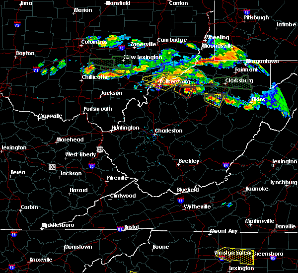 At 538 pm edt, a severe thunderstorm was located 8 miles west of stonewall jackson, or 9 miles west of weston, moving east at 25 mph (radar indicated). Hazards include 70 mph wind gusts and half dollar size hail. Hail damage to vehicles is expected. expect considerable tree damage. wind damage is also likely to mobile homes, roofs, and outbuildings. locations impacted include, weston, stonewall jackson, camden, walkersville, alum bridge and horner. This includes interstate 79 between mile markers 86 and 103. At 538 pm edt, a severe thunderstorm was located 8 miles west of stonewall jackson, or 9 miles west of weston, moving east at 25 mph (radar indicated). Hazards include 70 mph wind gusts and half dollar size hail. Hail damage to vehicles is expected. expect considerable tree damage. wind damage is also likely to mobile homes, roofs, and outbuildings. locations impacted include, weston, stonewall jackson, camden, walkersville, alum bridge and horner. This includes interstate 79 between mile markers 86 and 103.
|
| 7/22/2017 5:26 PM EDT |
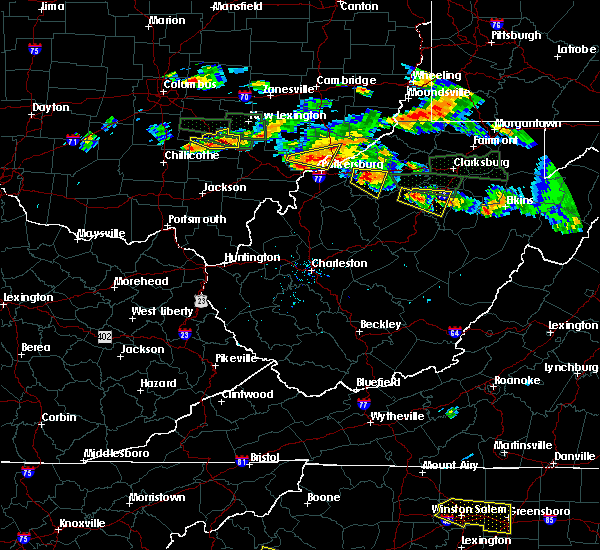 At 526 pm edt, a severe thunderstorm was located 7 miles northeast of glenville, moving east at 20 mph (radar indicated). Hazards include 70 mph wind gusts and half dollar size hail. Hail damage to vehicles is expected. expect considerable tree damage. wind damage is also likely to mobile homes, roofs, and outbuildings. locations impacted include, weston, stonewall jackson, camden, walkersville, alum bridge, baldwin, linn, sand run, horner and troy. This includes interstate 79 between mile markers 85 and 103. At 526 pm edt, a severe thunderstorm was located 7 miles northeast of glenville, moving east at 20 mph (radar indicated). Hazards include 70 mph wind gusts and half dollar size hail. Hail damage to vehicles is expected. expect considerable tree damage. wind damage is also likely to mobile homes, roofs, and outbuildings. locations impacted include, weston, stonewall jackson, camden, walkersville, alum bridge, baldwin, linn, sand run, horner and troy. This includes interstate 79 between mile markers 85 and 103.
|
| 7/22/2017 5:18 PM EDT |
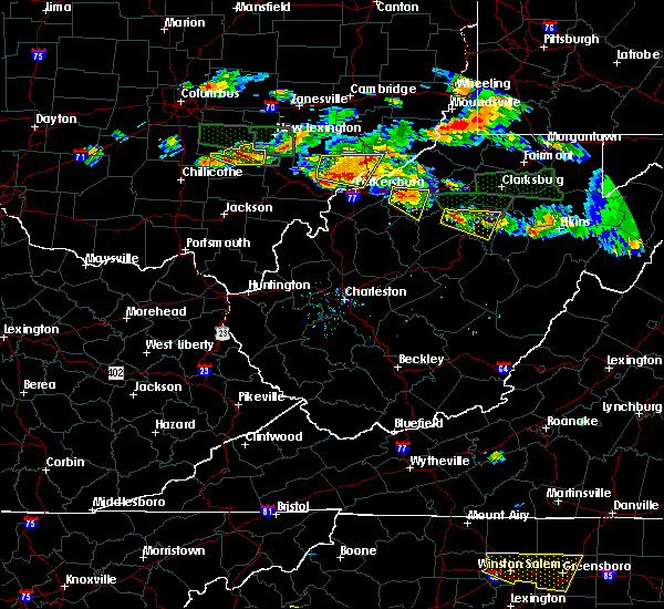 At 518 pm edt, a severe thunderstorm was located 8 miles northeast of glenville, moving east at 25 mph (radar indicated). Hazards include 60 mph wind gusts and half dollar size hail. Hail damage to vehicles is expected. Expect wind damage to roofs, siding, and trees. At 518 pm edt, a severe thunderstorm was located 8 miles northeast of glenville, moving east at 25 mph (radar indicated). Hazards include 60 mph wind gusts and half dollar size hail. Hail damage to vehicles is expected. Expect wind damage to roofs, siding, and trees.
|
| 7/22/2017 4:49 PM EDT |
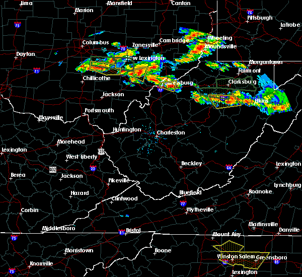 At 448 pm edt, severe thunderstorms were located along a line extending from near buckhannon to 8 miles west of weston, moving southeast at 25 mph (radar indicated). Hazards include 60 mph wind gusts and quarter size hail. Hail damage to vehicles is expected. expect wind damage to roofs, siding, and trees. locations impacted include, buckhannon, weston, jackson mill, stonewall jackson, camden, alum bridge, lorentz, tallmansville, overhill, horner and walkersville. This includes interstate 79 between mile markers 86 and 105. At 448 pm edt, severe thunderstorms were located along a line extending from near buckhannon to 8 miles west of weston, moving southeast at 25 mph (radar indicated). Hazards include 60 mph wind gusts and quarter size hail. Hail damage to vehicles is expected. expect wind damage to roofs, siding, and trees. locations impacted include, buckhannon, weston, jackson mill, stonewall jackson, camden, alum bridge, lorentz, tallmansville, overhill, horner and walkersville. This includes interstate 79 between mile markers 86 and 105.
|
| 7/22/2017 4:30 PM EDT |
 At 429 pm edt, severe thunderstorms were located along a line extending from near weston to 10 miles northeast of glenville, moving southeast at 25 mph (radar indicated). Hazards include 60 mph wind gusts and nickel size hail. expect damage to roofs, siding, and trees At 429 pm edt, severe thunderstorms were located along a line extending from near weston to 10 miles northeast of glenville, moving southeast at 25 mph (radar indicated). Hazards include 60 mph wind gusts and nickel size hail. expect damage to roofs, siding, and trees
|
| 7/22/2017 3:49 PM EDT |
 At 349 pm edt, a severe thunderstorm was located 10 miles south of west union, or 14 miles northwest of weston, moving east at 30 mph (radar indicated). Hazards include 60 mph wind gusts and quarter size hail. Hail damage to vehicles is expected. Expect wind damage to roofs, siding, and trees. At 349 pm edt, a severe thunderstorm was located 10 miles south of west union, or 14 miles northwest of weston, moving east at 30 mph (radar indicated). Hazards include 60 mph wind gusts and quarter size hail. Hail damage to vehicles is expected. Expect wind damage to roofs, siding, and trees.
|
| 7/10/2017 7:58 PM EDT |
 At 758 pm edt, a severe thunderstorm was located near stonewall jackson, or near weston, moving east at 35 mph (radar indicated). Hazards include 60 mph wind gusts and half dollar size hail. Hail damage to vehicles is expected. expect wind damage to roofs, siding, and trees. locations impacted include, weston, jackson mill, stonewall jackson, camden and alum bridge. This includes interstate 79 between mile markers 86 and 100. At 758 pm edt, a severe thunderstorm was located near stonewall jackson, or near weston, moving east at 35 mph (radar indicated). Hazards include 60 mph wind gusts and half dollar size hail. Hail damage to vehicles is expected. expect wind damage to roofs, siding, and trees. locations impacted include, weston, jackson mill, stonewall jackson, camden and alum bridge. This includes interstate 79 between mile markers 86 and 100.
|
| 7/10/2017 7:45 PM EDT |
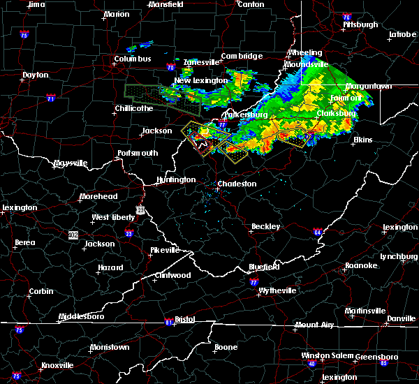 At 744 pm edt, a severe thunderstorm was located 8 miles northeast of glenville, moving east at 35 mph (radar indicated). Hazards include 60 mph wind gusts and half dollar size hail. Hail damage to vehicles is expected. Expect wind damage to roofs, siding, and trees. At 744 pm edt, a severe thunderstorm was located 8 miles northeast of glenville, moving east at 35 mph (radar indicated). Hazards include 60 mph wind gusts and half dollar size hail. Hail damage to vehicles is expected. Expect wind damage to roofs, siding, and trees.
|
| 5/27/2017 5:01 PM EDT |
 At 446 pm edt, a severe thunderstorm was located near stonewall jackson, or near weston, moving southeast at 15 mph (radar indicated). Hazards include quarter size hail. damage to vehicles is expected At 446 pm edt, a severe thunderstorm was located near stonewall jackson, or near weston, moving southeast at 15 mph (radar indicated). Hazards include quarter size hail. damage to vehicles is expected
|
| 5/27/2017 4:46 PM EDT |
 At 446 pm edt, a severe thunderstorm was located near stonewall jackson, or near weston, moving southeast at 15 mph (radar indicated). Hazards include quarter size hail. damage to vehicles is expected At 446 pm edt, a severe thunderstorm was located near stonewall jackson, or near weston, moving southeast at 15 mph (radar indicated). Hazards include quarter size hail. damage to vehicles is expected
|
| 5/27/2017 3:20 PM EDT |
 At 320 pm edt, a severe thunderstorm was located 7 miles south of west union, or 17 miles northwest of weston, moving southeast at 20 mph (radar indicated). Hazards include 60 mph wind gusts and half dollar size hail. Hail damage to vehicles is expected. Expect wind damage to roofs, siding, and trees. At 320 pm edt, a severe thunderstorm was located 7 miles south of west union, or 17 miles northwest of weston, moving southeast at 20 mph (radar indicated). Hazards include 60 mph wind gusts and half dollar size hail. Hail damage to vehicles is expected. Expect wind damage to roofs, siding, and trees.
|
| 3/1/2017 7:00 AM EST |
 At 659 am est, a severe thunderstorm was located near stonewall jackson, or near weston, moving east at 85 mph (radar indicated). Hazards include 70 mph wind gusts and ping pong ball size hail. People and animals outdoors will be injured. expect hail damage to roofs, siding, windows, and vehicles. expect considerable tree damage. wind damage is also likely to mobile homes, roofs, and outbuildings. locations impacted include, buckhannon, weston, glenville, audra state park, jackson mill, stonewall jackson, cedar creek state park, lost creek, jane lew, sand fork, newberne, alum bridge, stumptown, tanner, burnt house, camden, volga, baldwin, lorentz and century. This includes interstate 79 between mile markers 83 and 113. At 659 am est, a severe thunderstorm was located near stonewall jackson, or near weston, moving east at 85 mph (radar indicated). Hazards include 70 mph wind gusts and ping pong ball size hail. People and animals outdoors will be injured. expect hail damage to roofs, siding, windows, and vehicles. expect considerable tree damage. wind damage is also likely to mobile homes, roofs, and outbuildings. locations impacted include, buckhannon, weston, glenville, audra state park, jackson mill, stonewall jackson, cedar creek state park, lost creek, jane lew, sand fork, newberne, alum bridge, stumptown, tanner, burnt house, camden, volga, baldwin, lorentz and century. This includes interstate 79 between mile markers 83 and 113.
|
| 3/1/2017 6:46 AM EST |
 At 646 am est, a severe thunderstorm was located near glenville, moving east at 85 mph (radar indicated). Hazards include 70 mph wind gusts and ping pong ball size hail. People and animals outdoors will be injured. expect hail damage to roofs, siding, windows, and vehicles. expect considerable tree damage. Wind damage is also likely to mobile homes, roofs, and outbuildings. At 646 am est, a severe thunderstorm was located near glenville, moving east at 85 mph (radar indicated). Hazards include 70 mph wind gusts and ping pong ball size hail. People and animals outdoors will be injured. expect hail damage to roofs, siding, windows, and vehicles. expect considerable tree damage. Wind damage is also likely to mobile homes, roofs, and outbuildings.
|
| 10/20/2016 7:05 PM EDT |
 At 705 pm edt, a severe thunderstorm was located over jackson mill, or near weston, moving northeast at 30 mph (radar indicated). Hazards include golf ball size hail and 60 mph wind gusts. People and animals outdoors will be injured. expect hail damage to roofs, siding, windows, and vehicles. Expect wind damage to roofs, siding, and trees. At 705 pm edt, a severe thunderstorm was located over jackson mill, or near weston, moving northeast at 30 mph (radar indicated). Hazards include golf ball size hail and 60 mph wind gusts. People and animals outdoors will be injured. expect hail damage to roofs, siding, windows, and vehicles. Expect wind damage to roofs, siding, and trees.
|
| 6/23/2016 4:43 AM EDT | Trees down along route 33 in pricetow in lewis county WV, 3.8 miles ESE of Weston, WV |
| 6/23/2016 3:57 AM EDT | Trees down in weston... including one on a house in lewis county WV, 1 miles ESE of Weston, WV |
| 6/23/2016 3:42 AM EDT | Trees down in weston... including one on a house...corrected time based on radar in lewis county WV, 1 miles ESE of Weston, WV |
| 6/23/2016 3:40 AM EDT |
 At 340 am edt, a severe thunderstorm was located near stonewall jackson, or near weston, moving southeast at 50 mph (radar indicated). Hazards include 60 mph wind gusts and penny size hail. Expect damage to roofs. siding. And trees. At 340 am edt, a severe thunderstorm was located near stonewall jackson, or near weston, moving southeast at 50 mph (radar indicated). Hazards include 60 mph wind gusts and penny size hail. Expect damage to roofs. siding. And trees.
|
| 6/23/2016 3:31 AM EDT |
 At 331 am edt, severe thunderstorms were located along a line extending from near lumberport to 11 miles north of glenville, moving east at 45 mph (radar indicated). Hazards include 60 mph wind gusts and penny size hail. Expect damage to roofs. siding. and trees. Locations impacted include, clarksburg, grafton, weston, bridgeport, shinnston, stonewood, nutter fort, salem, lumberport, anmoore, jackson mill, west milford, lost creek, jane lew, flemington, auburn, coxs mills, despard, galloway and wolf summit. At 331 am edt, severe thunderstorms were located along a line extending from near lumberport to 11 miles north of glenville, moving east at 45 mph (radar indicated). Hazards include 60 mph wind gusts and penny size hail. Expect damage to roofs. siding. and trees. Locations impacted include, clarksburg, grafton, weston, bridgeport, shinnston, stonewood, nutter fort, salem, lumberport, anmoore, jackson mill, west milford, lost creek, jane lew, flemington, auburn, coxs mills, despard, galloway and wolf summit.
|
| 6/23/2016 3:14 AM EDT |
 At 314 am edt, severe thunderstorms were located along a line extending from 6 miles north of salem to near harrisville, moving east at 40 mph (radar indicated). Hazards include 60 mph wind gusts and quarter size hail. Hail damage to vehicles is expected. Expect wind damage to roofs, siding, and trees. At 314 am edt, severe thunderstorms were located along a line extending from 6 miles north of salem to near harrisville, moving east at 40 mph (radar indicated). Hazards include 60 mph wind gusts and quarter size hail. Hail damage to vehicles is expected. Expect wind damage to roofs, siding, and trees.
|
| 6/16/2016 5:31 PM EDT |
 At 531 pm edt, a severe thunderstorm was located 7 miles north of buckhannon, moving east at 40 mph (radar indicated). Hazards include 60 mph wind gusts and quarter size hail. Hail damage to vehicles is expected. expect wind damage to roofs, siding, and trees. Locations impacted include, buckhannon, lost creek, jane lew, century, overhill, lorentz, hodgesville, horner and volga. At 531 pm edt, a severe thunderstorm was located 7 miles north of buckhannon, moving east at 40 mph (radar indicated). Hazards include 60 mph wind gusts and quarter size hail. Hail damage to vehicles is expected. expect wind damage to roofs, siding, and trees. Locations impacted include, buckhannon, lost creek, jane lew, century, overhill, lorentz, hodgesville, horner and volga.
|
| 6/16/2016 5:09 PM EDT | Quarter sized hail reported 2 miles ESE of Weston, WV |
| 6/16/2016 5:01 PM EDT | Lewis county 911 reports numerous trees down throughout the county between weston and alum bridg in lewis county WV, 8.1 miles ESE of Weston, WV |
| 6/16/2016 4:56 PM EDT |
 At 456 pm edt, a severe thunderstorm was located 9 miles west of jackson mill, or 10 miles west of weston, moving east at 40 mph (radar indicated). Hazards include 70 mph wind gusts and half dollar size hail. Hail damage to vehicles is expected. expect considerable tree damage. Wind damage is also likely to mobile homes, roofs, and outbuildings. At 456 pm edt, a severe thunderstorm was located 9 miles west of jackson mill, or 10 miles west of weston, moving east at 40 mph (radar indicated). Hazards include 70 mph wind gusts and half dollar size hail. Hail damage to vehicles is expected. expect considerable tree damage. Wind damage is also likely to mobile homes, roofs, and outbuildings.
|
| 4/26/2016 6:26 PM EDT |
 At 626 pm edt, a severe thunderstorm was located near stonewall jackson, or 8 miles southwest of weston, moving southeast at 40 mph (radar indicated). Hazards include ping pong ball size hail. People and animals outdoors will be injured. expect damage to roofs, siding, windows, and vehicles. Locations impacted include, weston, stonewall jackson, jackson mill, jane lew, camden, alum bridge and horner. At 626 pm edt, a severe thunderstorm was located near stonewall jackson, or 8 miles southwest of weston, moving southeast at 40 mph (radar indicated). Hazards include ping pong ball size hail. People and animals outdoors will be injured. expect damage to roofs, siding, windows, and vehicles. Locations impacted include, weston, stonewall jackson, jackson mill, jane lew, camden, alum bridge and horner.
|
| 4/26/2016 5:58 PM EDT |
 At 557 pm edt, doppler radar indicated a severe thunderstorm capable of producing large hail up to ping pong ball size. this storm was located 11 miles south of west union, or 12 miles southeast of harrisville, and moving east at 30 mph. At 557 pm edt, doppler radar indicated a severe thunderstorm capable of producing large hail up to ping pong ball size. this storm was located 11 miles south of west union, or 12 miles southeast of harrisville, and moving east at 30 mph.
|
| 6/17/2015 6:18 PM EDT |
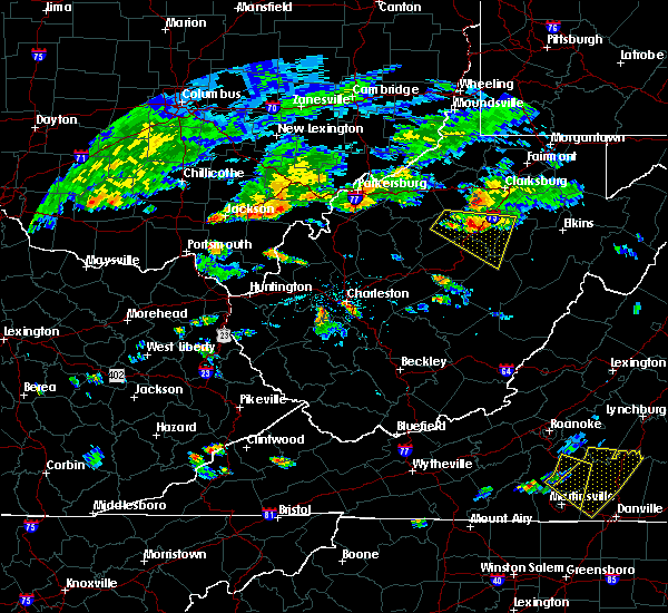 At 617 pm edt, doppler radar indicated a severe thunderstorm capable of producing quarter size hail and damaging winds in excess of 60 mph. this storm was located near stonewall jackson, or 7 miles southwest of weston, moving east at 30 mph. locations impacted include, buckhannon, weston, rock cave, stonewall jackson, burnsville, lorentz, cleveland, hacker valley, falls mills, ireland, sand run, kanawha head, french creek, walkersville, eden, camden and horner. At 617 pm edt, doppler radar indicated a severe thunderstorm capable of producing quarter size hail and damaging winds in excess of 60 mph. this storm was located near stonewall jackson, or 7 miles southwest of weston, moving east at 30 mph. locations impacted include, buckhannon, weston, rock cave, stonewall jackson, burnsville, lorentz, cleveland, hacker valley, falls mills, ireland, sand run, kanawha head, french creek, walkersville, eden, camden and horner.
|
| 6/17/2015 5:54 PM EDT |
 At 554 pm edt, doppler radar indicated a severe thunderstorm capable of producing quarter size hail and damaging winds in excess of 60 mph. this storm was located near glenville, and moving east at 30 mph. At 554 pm edt, doppler radar indicated a severe thunderstorm capable of producing quarter size hail and damaging winds in excess of 60 mph. this storm was located near glenville, and moving east at 30 mph.
|
| 4/9/2015 7:11 PM EDT | The severe thunderstorm warning for lewis. extreme north central braxton. east central calhoun and central gilmer counties will expire at 715 pm edt. the storm which prompted the warning has moved out of the warned area. A severe thunderstorm watch remains in effect until 1000 pm edt. |
| 4/9/2015 7:09 PM EDT | The national weather service in charleston has issued a * severe thunderstorm warning for. southern barbour county in west virginia. this includes the city of audra state park. northeastern braxton county in west virginia. East central gilmer county in west virginia. |
| 4/9/2015 6:50 PM EDT | Quarter sized hail reported 5.8 miles SSE of Weston, WV |
| 4/9/2015 6:34 PM EDT | A severe thunderstorm warning remains in effect until 715 pm edt for lewis. north central braxton. east central calhoun and central gilmer counties. at 631 pm edt. national weather service doppler radar continued to indicate a severe thunderstorm capable of producing quarter size hail. this storm was located near stumptown. Or near grantsville. |
| 4/9/2015 6:26 PM EDT | A severe thunderstorm warning remains in effect until 700 pm edt for southern doddridge. western harrison. northern lewis. east central ritchie and north central gilmer counties. at 624 pm edt. national weather service doppler radar continued to indicate a severe thunderstorm capable of producing half dollar size hail. this storm was located near grove. Or 14 miles east of. |
| 4/9/2015 6:11 PM EDT | The national weather service in charleston has issued a * severe thunderstorm warning for. north central braxton county in west virginia. northern calhoun county in west virginia. this includes the city of grantsville. South central doddridge county in west virginia. |
| 4/9/2015 6:11 PM EDT | The national weather service in charleston has issued a * severe thunderstorm warning for. north central braxton county in west virginia. northern calhoun county in west virginia. this includes the city of grantsville. South central doddridge county in west virginia. |
| 4/9/2015 5:59 PM EDT | The national weather service in charleston has issued a * severe thunderstorm warning for. north central calhoun county in west virginia. doddridge county in west virginia. northern gilmer county in west virginia. Western harrison county in west virginia. |
| 7/8/2014 3:37 PM EDT | Trees and powerlines down in jacksons mill in lewis county WV, 4.8 miles SSE of Weston, WV |
| 6/13/2013 12:20 PM EDT | Multiple trees down along jackson mill road headed towards westo in lewis county WV, 4.6 miles SSE of Weston, WV |
| 6/13/2013 12:20 PM EDT | Part of roof blown off trailer home on geelick r in lewis county WV, 1.8 miles SE of Weston, WV |
| 6/13/2013 12:17 PM EDT | Trees down along route 19 near jackson mill intersection in lewis county WV, 1.2 miles SSE of Weston, WV |
| 9/26/2012 6:42 PM EDT | Quarter sized hail reported 1.9 miles NNE of Weston, WV |
| 6/29/2012 9:00 PM EDT | Structural damage. event occurred between 830 pm 06/29/2012 and 900 pm 06/29/2012 in lewis county WV, 3.1 miles E of Weston, WV |
| 6/29/2012 7:30 PM EDT | Measured wind at 73mph... large trees... 2ft in diameter... down in lewis county WV, 1 miles ESE of Weston, WV |
| 6/29/2012 7:18 PM EDT | Large branches broken. event occurred 713 pm 06/29/2012 in lewis county WV, 3.1 miles E of Weston, WV |
| 3/28/2012 2:32 PM EDT | Quarter sized hail reported 8.3 miles NE of Weston, WV, dime to quarter size hail covering the ground. |
| 9/15/2011 1:15 AM EDT | Half Dollar sized hail reported 3.1 miles E of Weston, WV |
| 9/15/2011 1:15 AM EDT | Golf Ball sized hail reported 1 miles ESE of Weston, WV |
| 9/15/2011 1:11 AM EDT | Quarter sized hail reported 3.1 miles E of Weston, WV |
| 1/1/0001 12:00 AM | Tree and power lines down on rte 19 in weston in lewis county WV, 1 miles ESE of Weston, WV |
| 1/1/0001 12:00 AM | Tree down on simson run rd in lewis county WV, 4 miles SE of Weston, WV |
| 1/1/0001 12:00 AM | Half Dollar sized hail reported 3.1 miles E of Weston, WV |
| 1/1/0001 12:00 AM | Quarter sized hail reported 3.1 miles E of Weston, WV |
| 1/1/0001 12:00 AM | Several tree limbs 6 to 8 inches in diameter down. penny size hail. 40 to 50 mph wind gust in lewis county WV, 1 miles ESE of Weston, WV |
| 1/1/0001 12:00 AM | Trees are down on glady creek road in weston in lewis county WV, 1 miles ESE of Weston, WV |
Hail Maps for Weston, WV


Connect with Interactive Hail Maps