

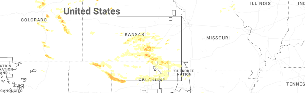
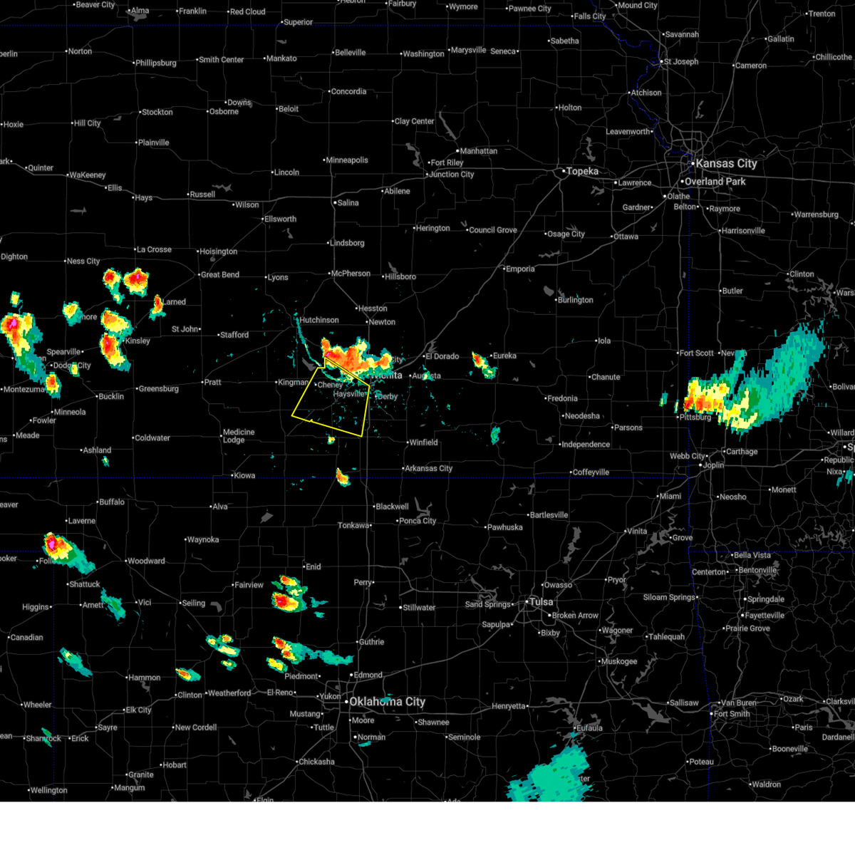
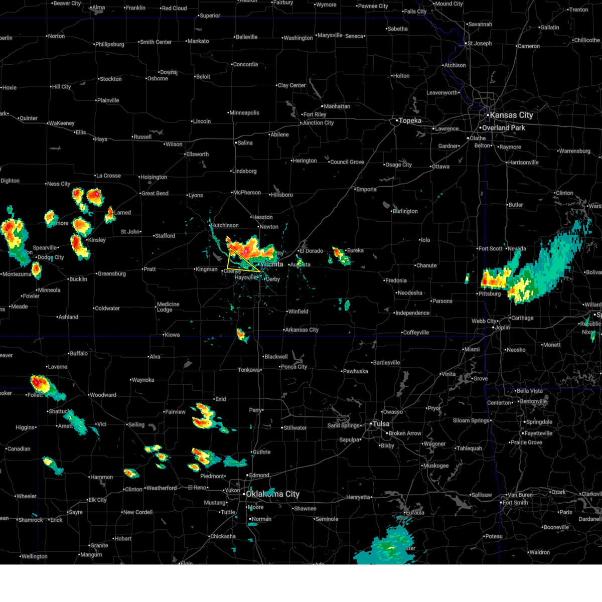
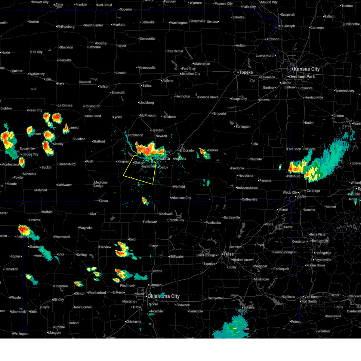
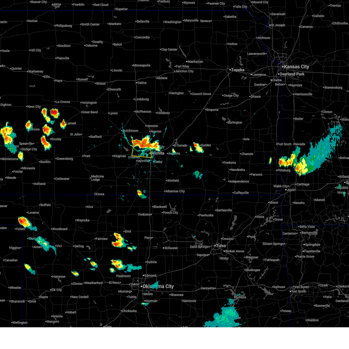
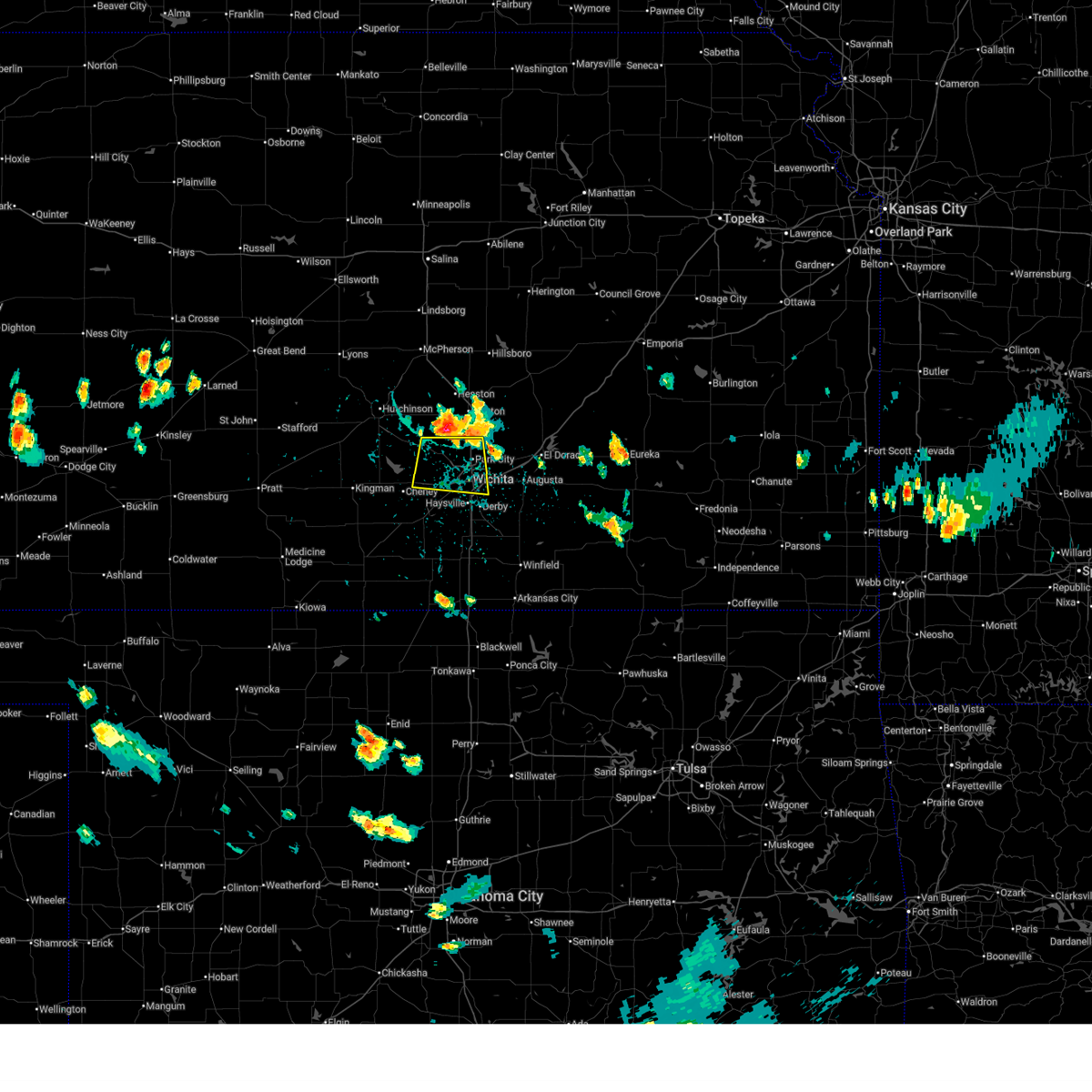
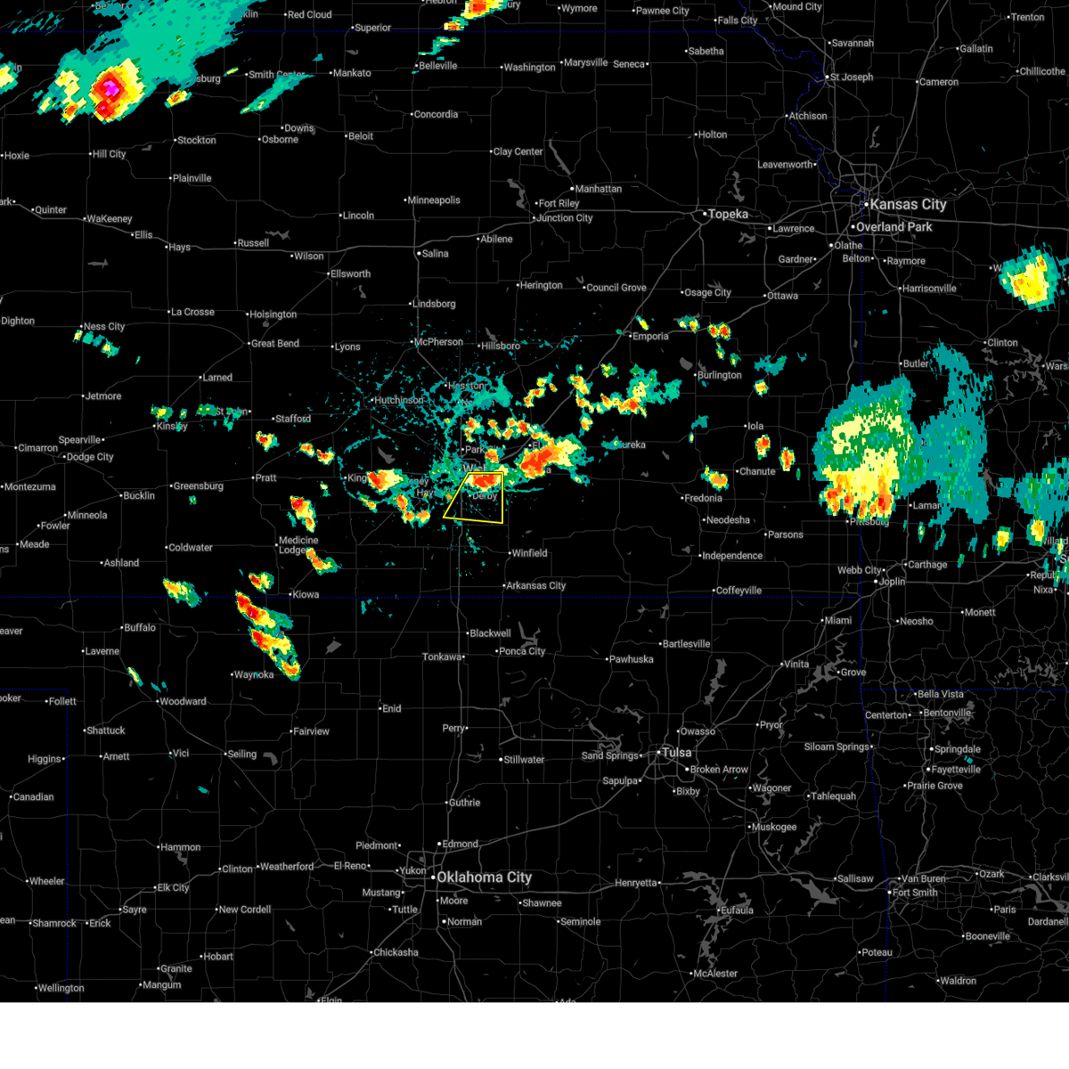
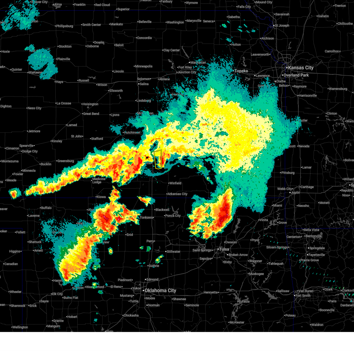
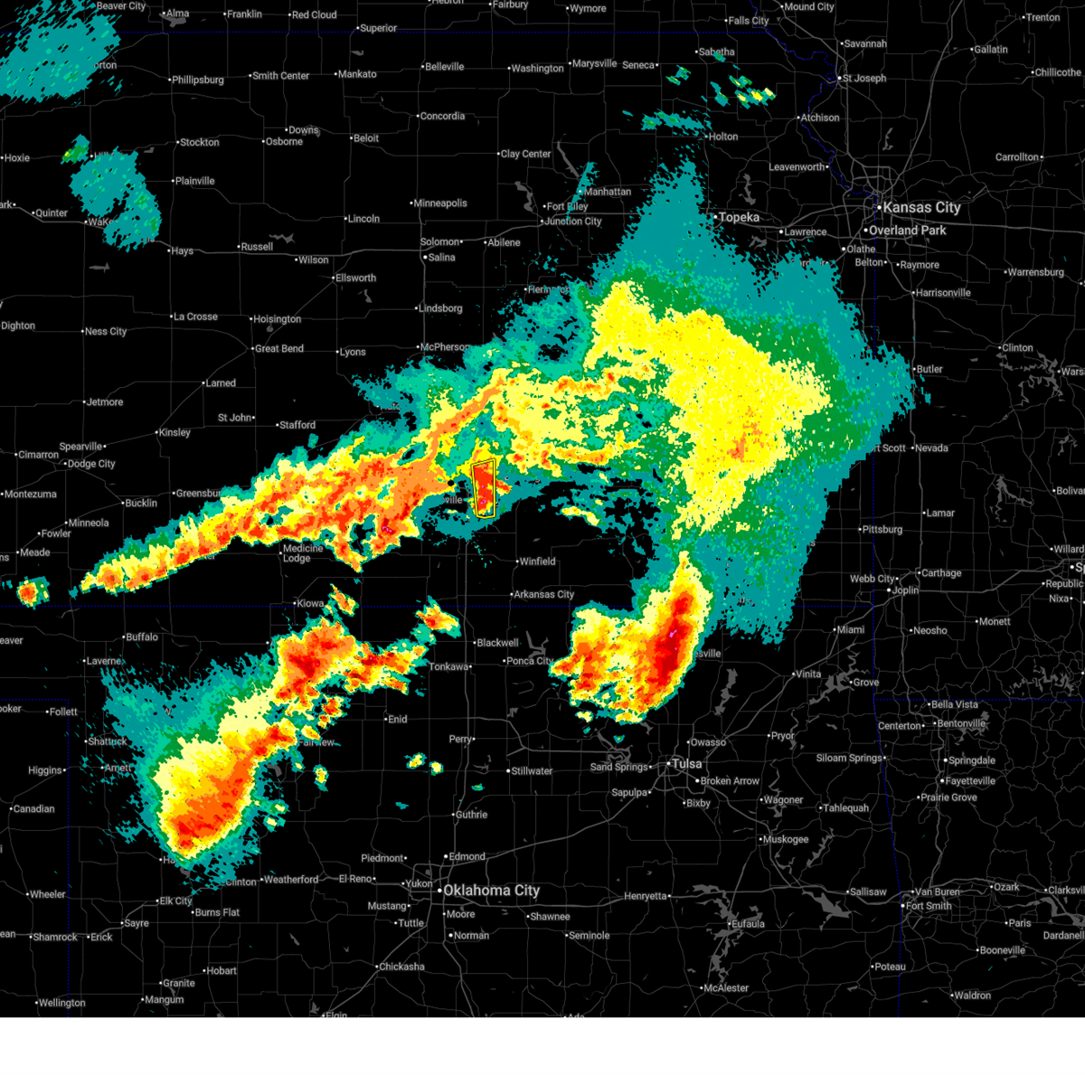
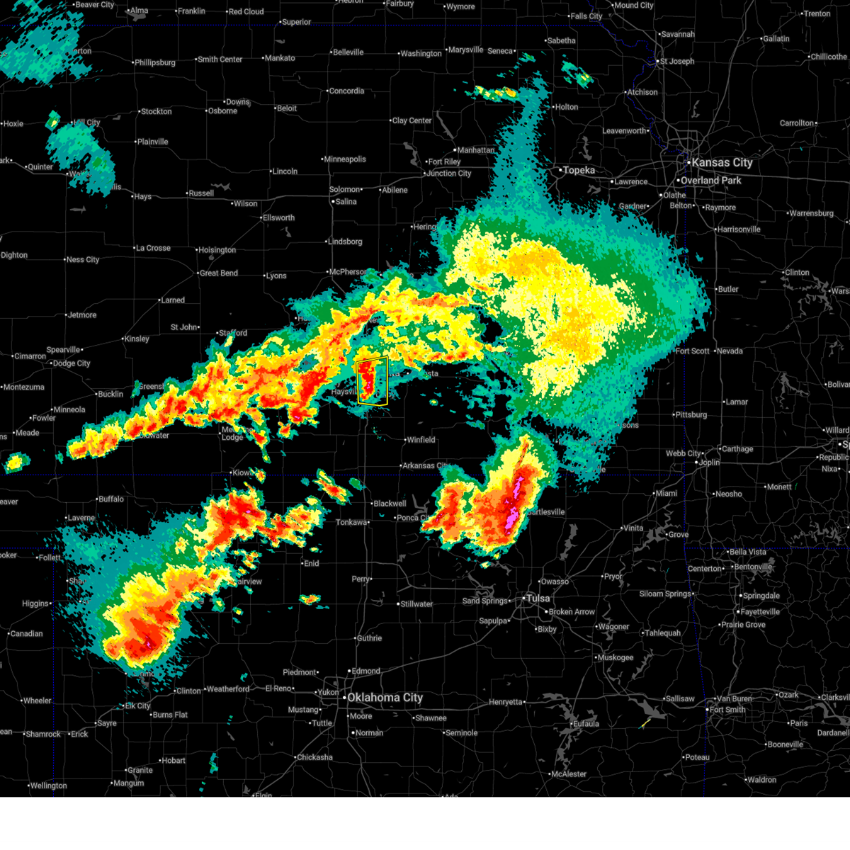
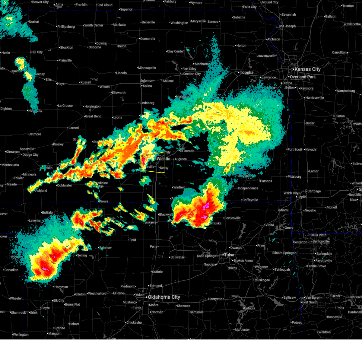
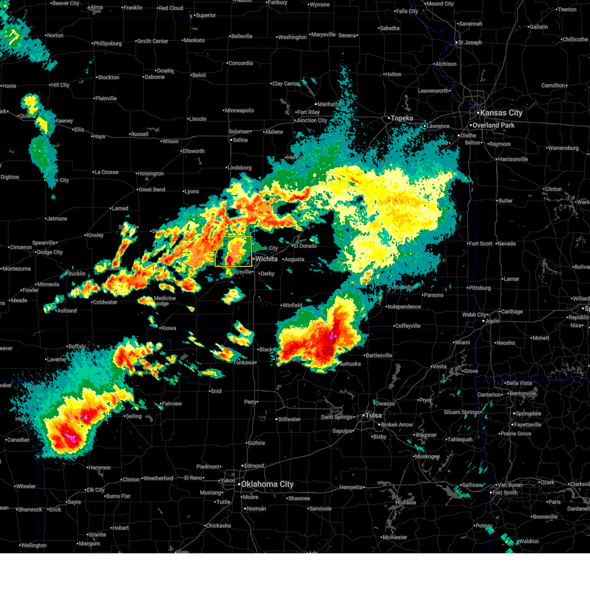
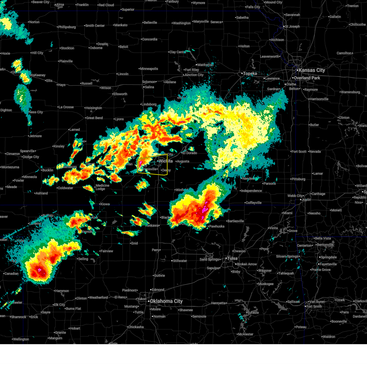
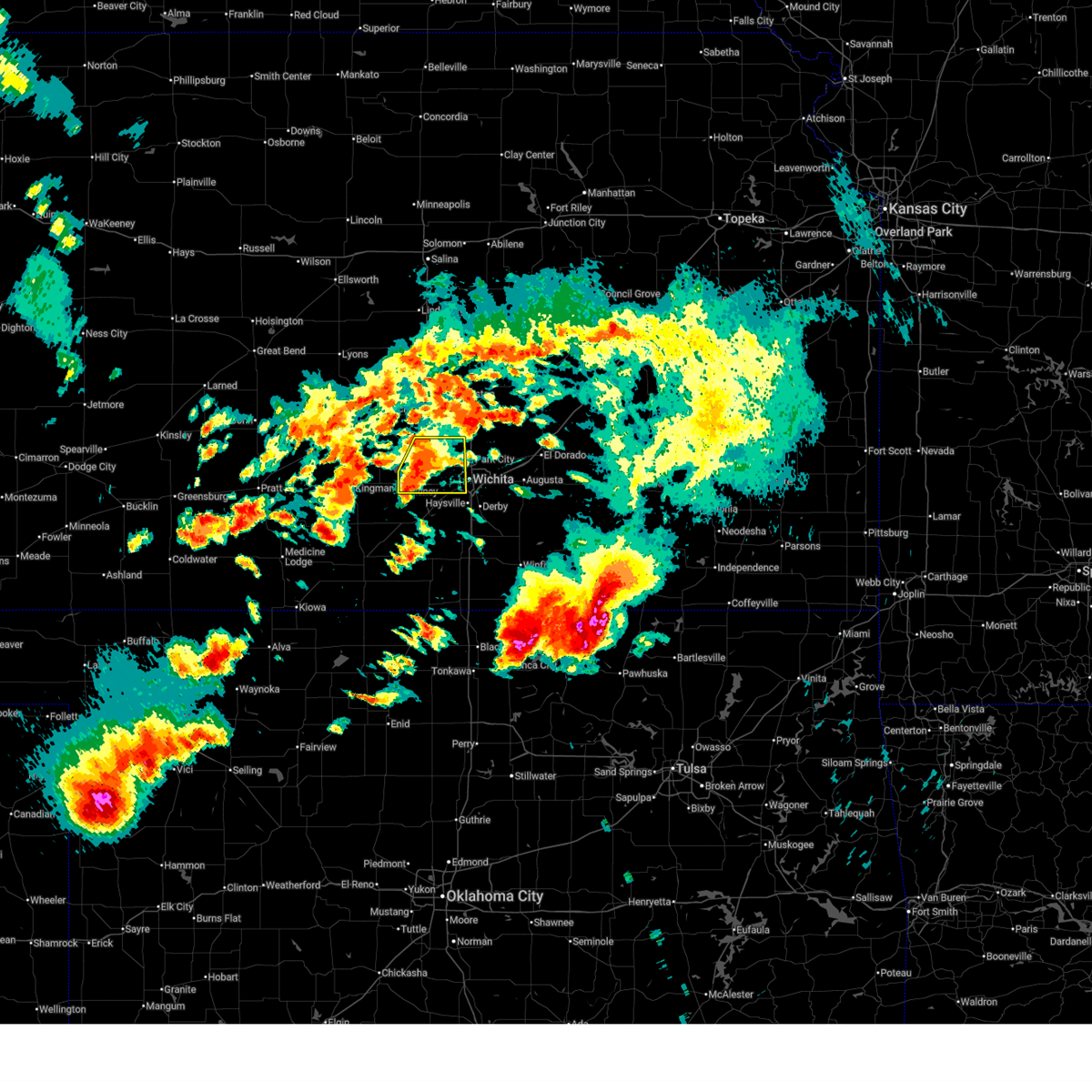
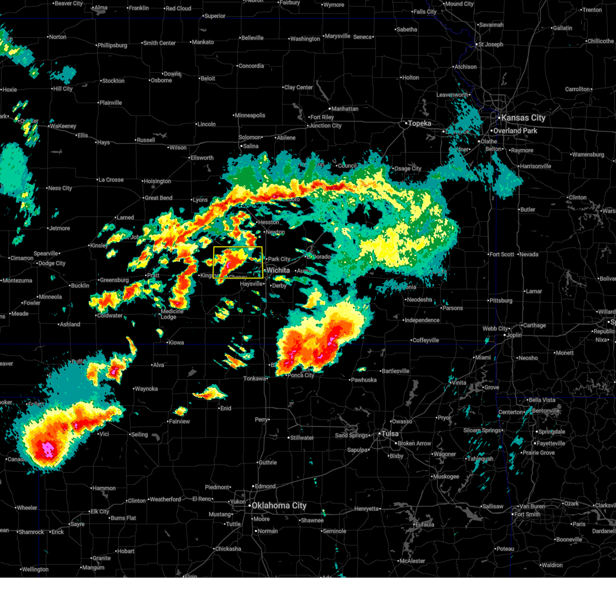
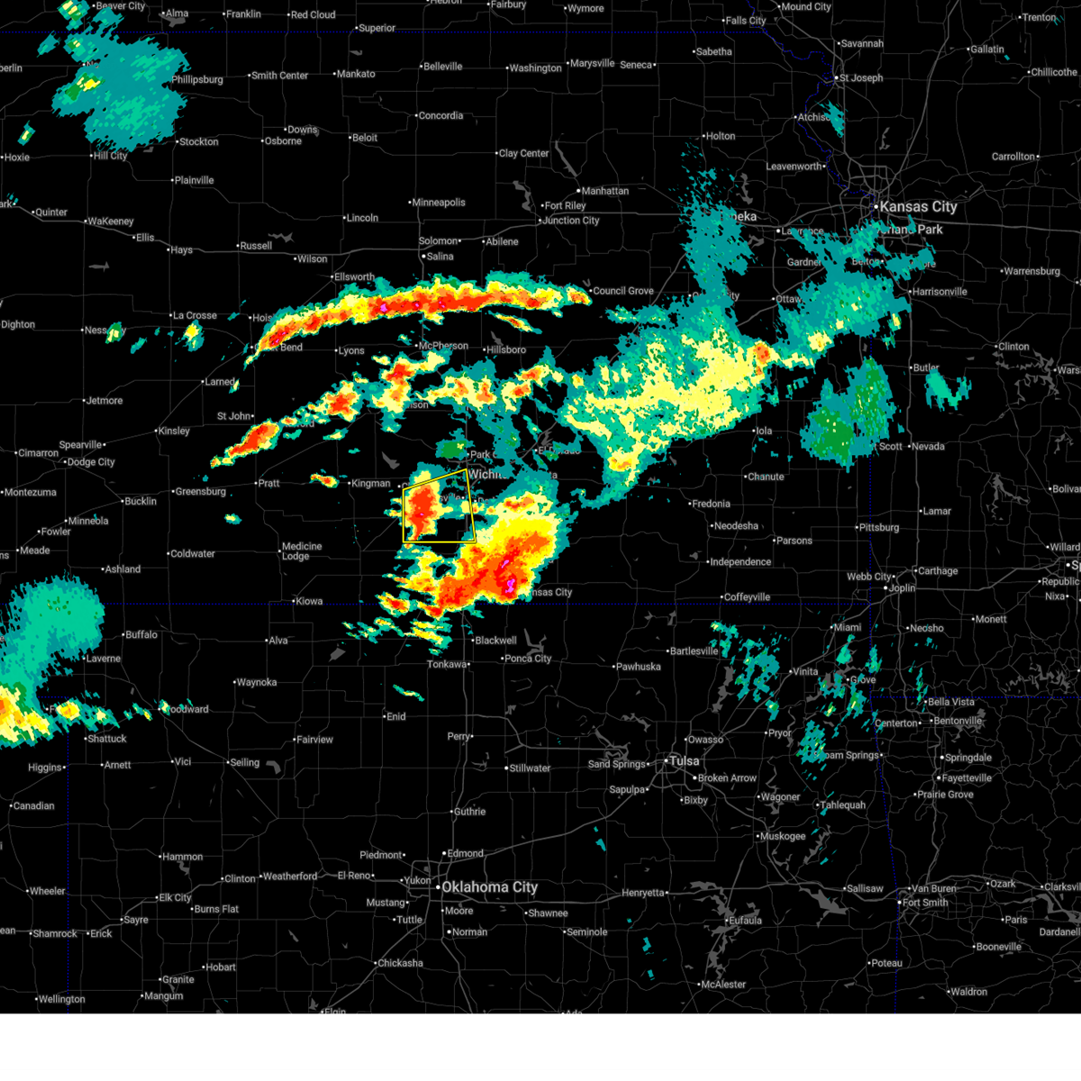
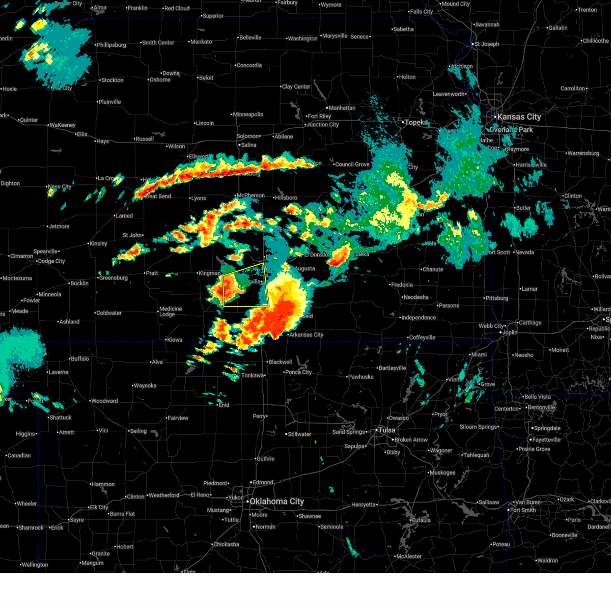
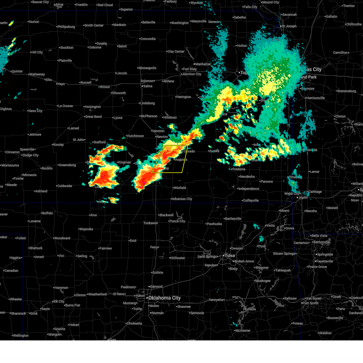
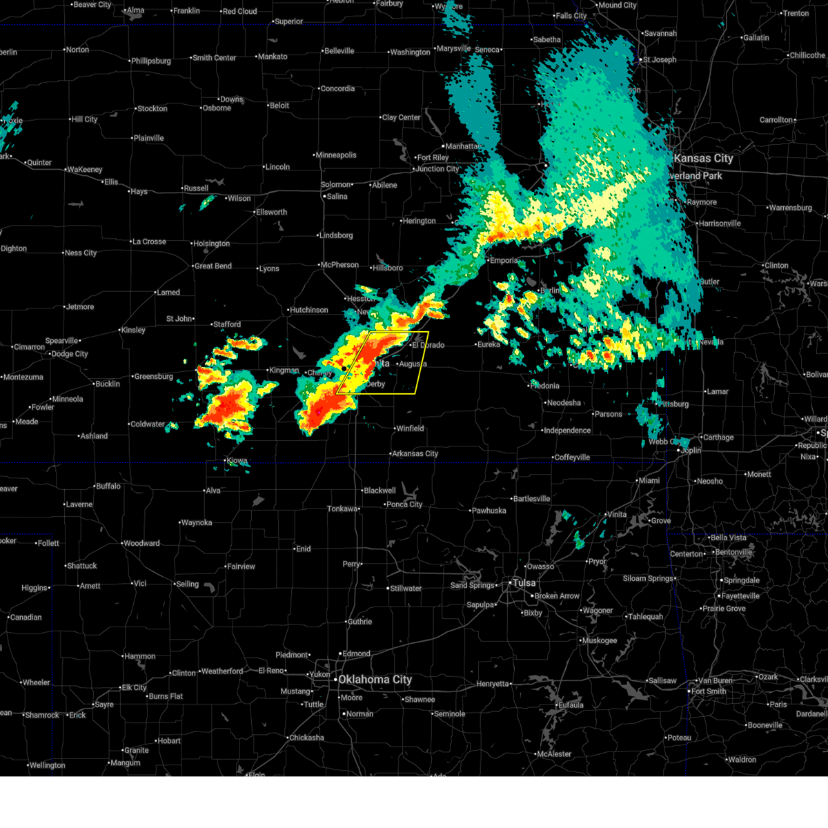
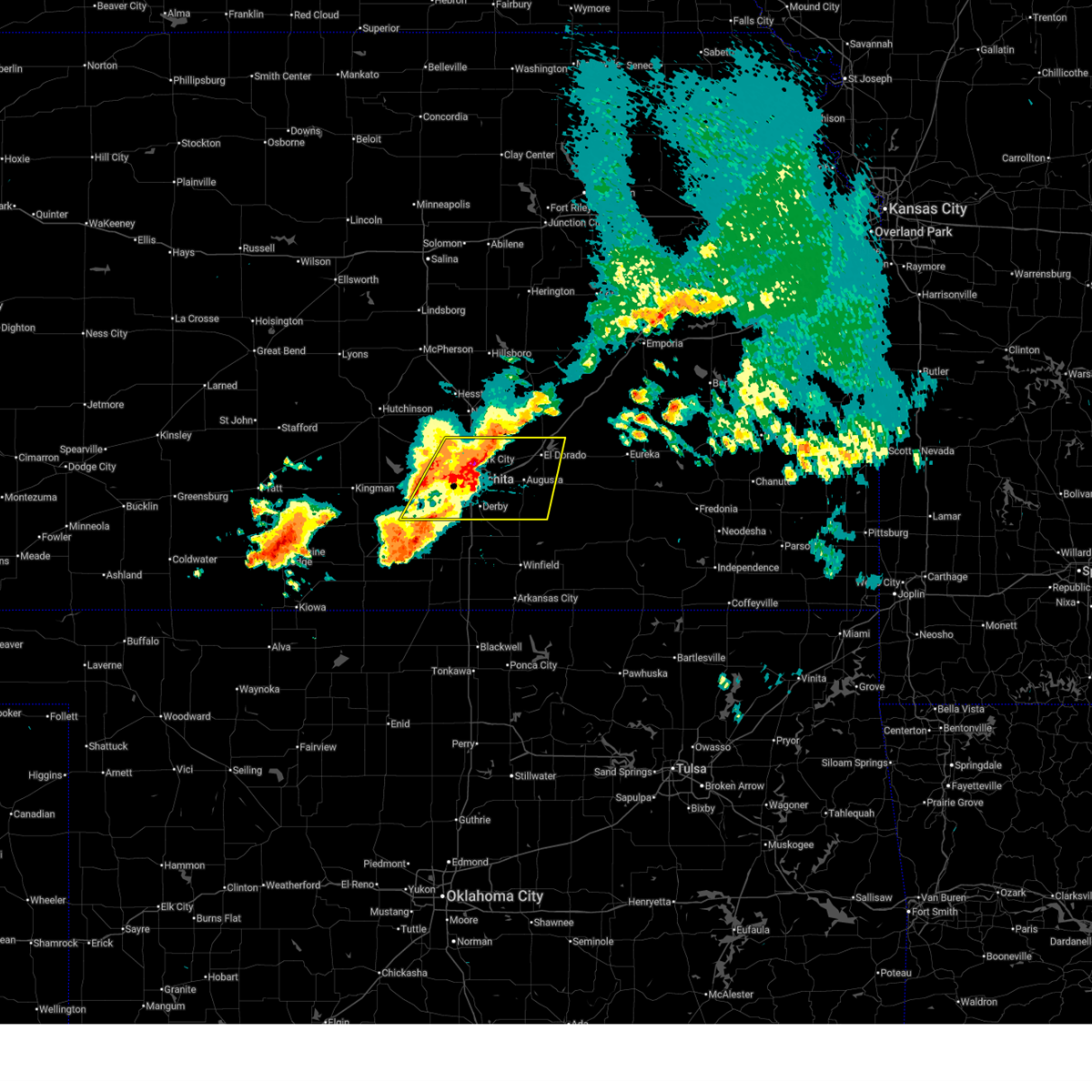
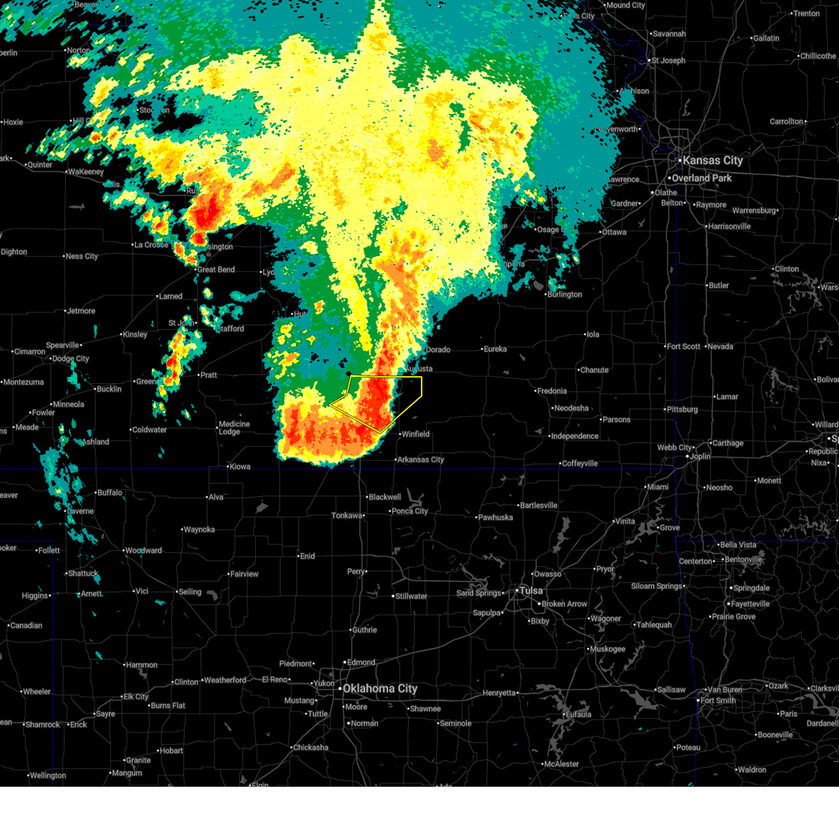
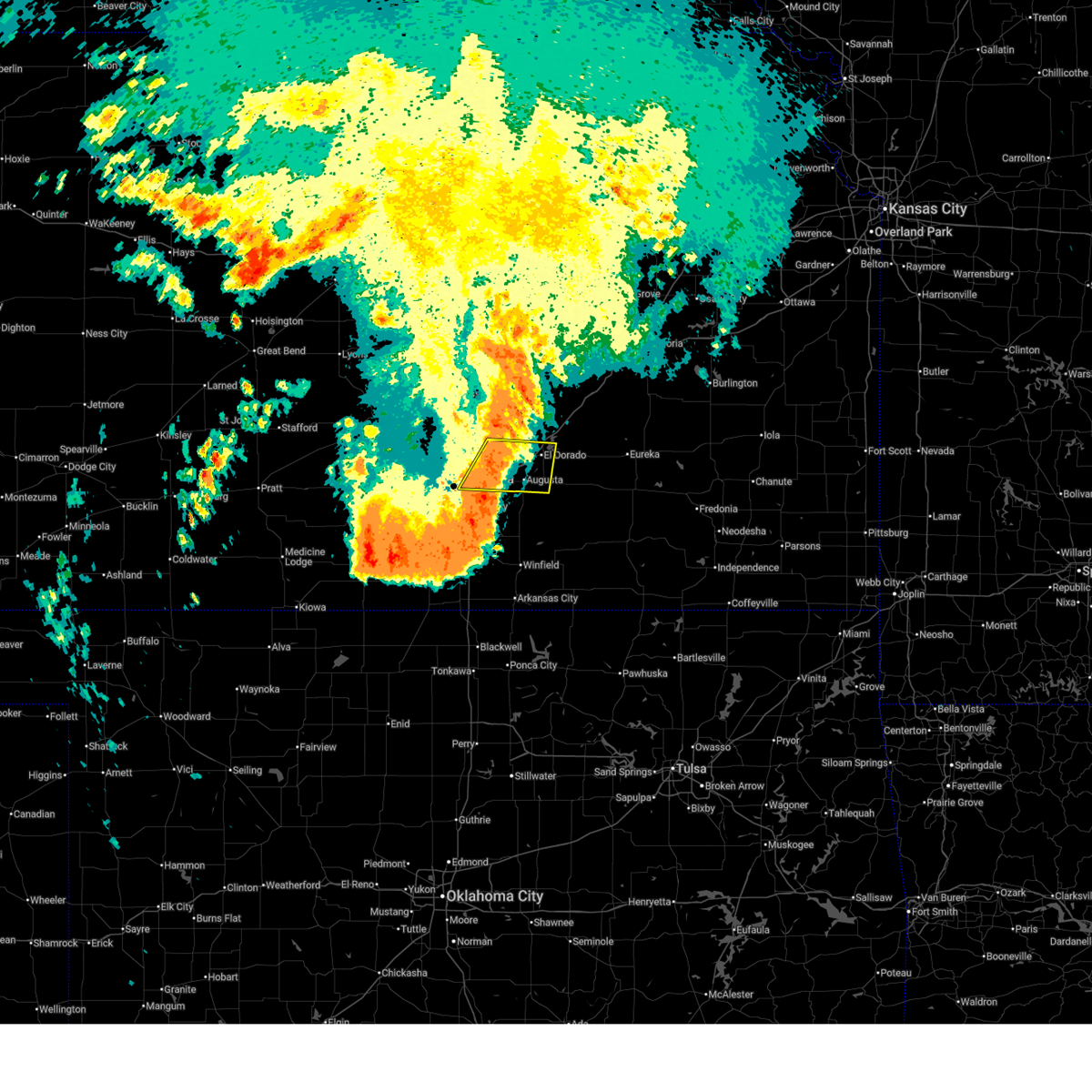
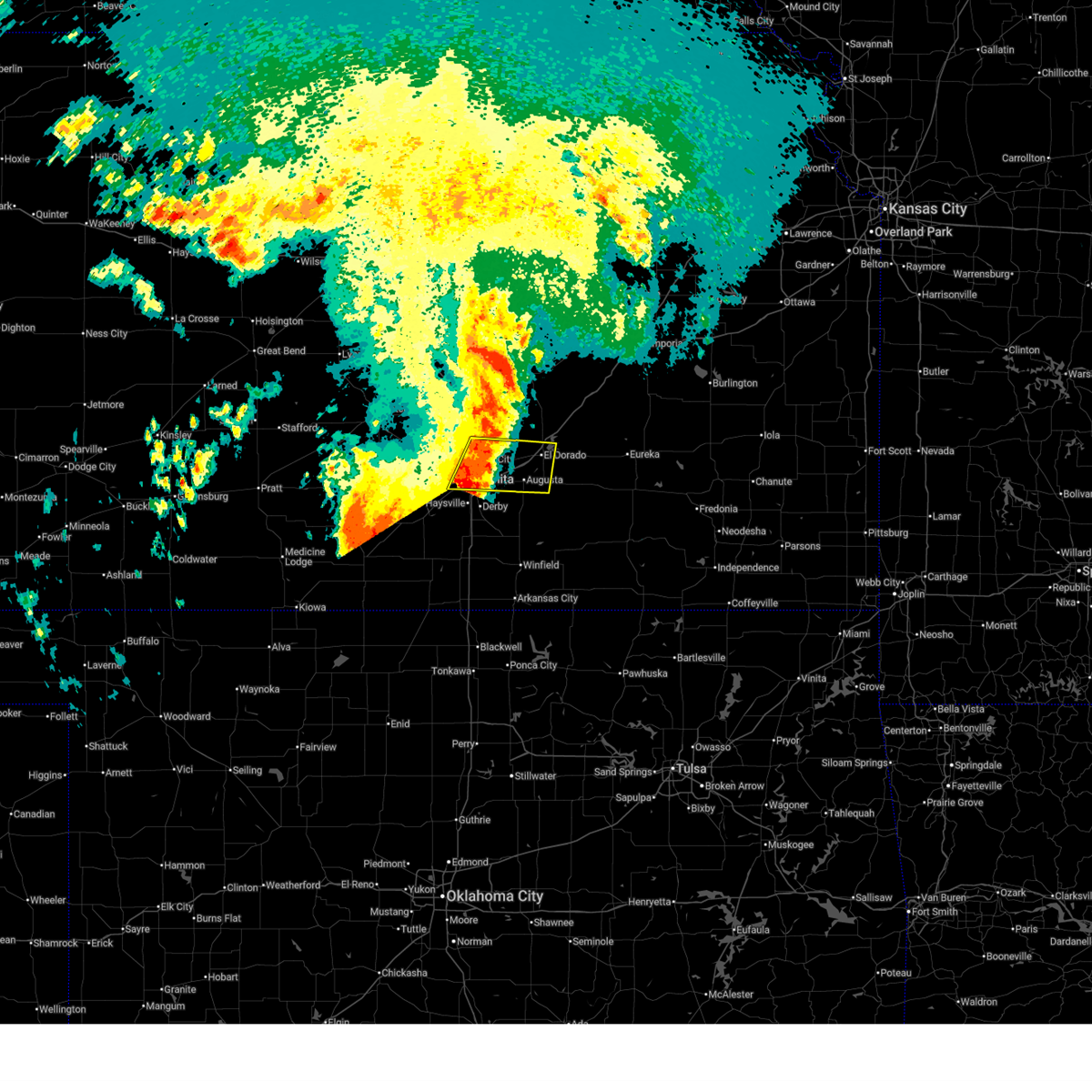
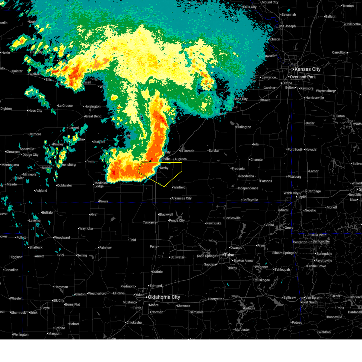
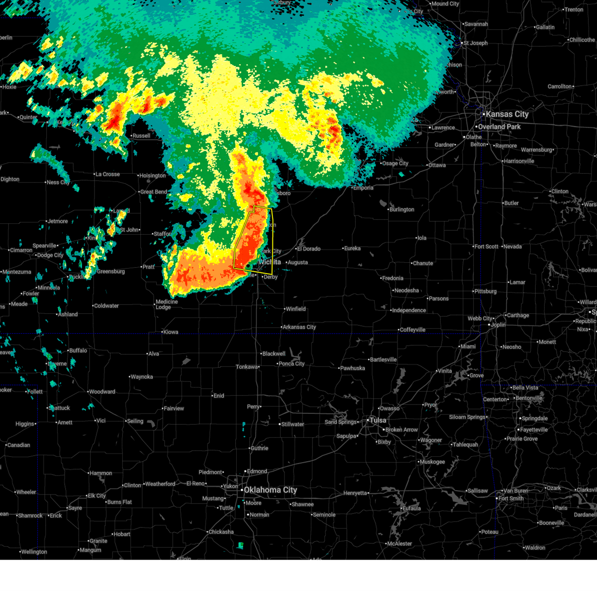
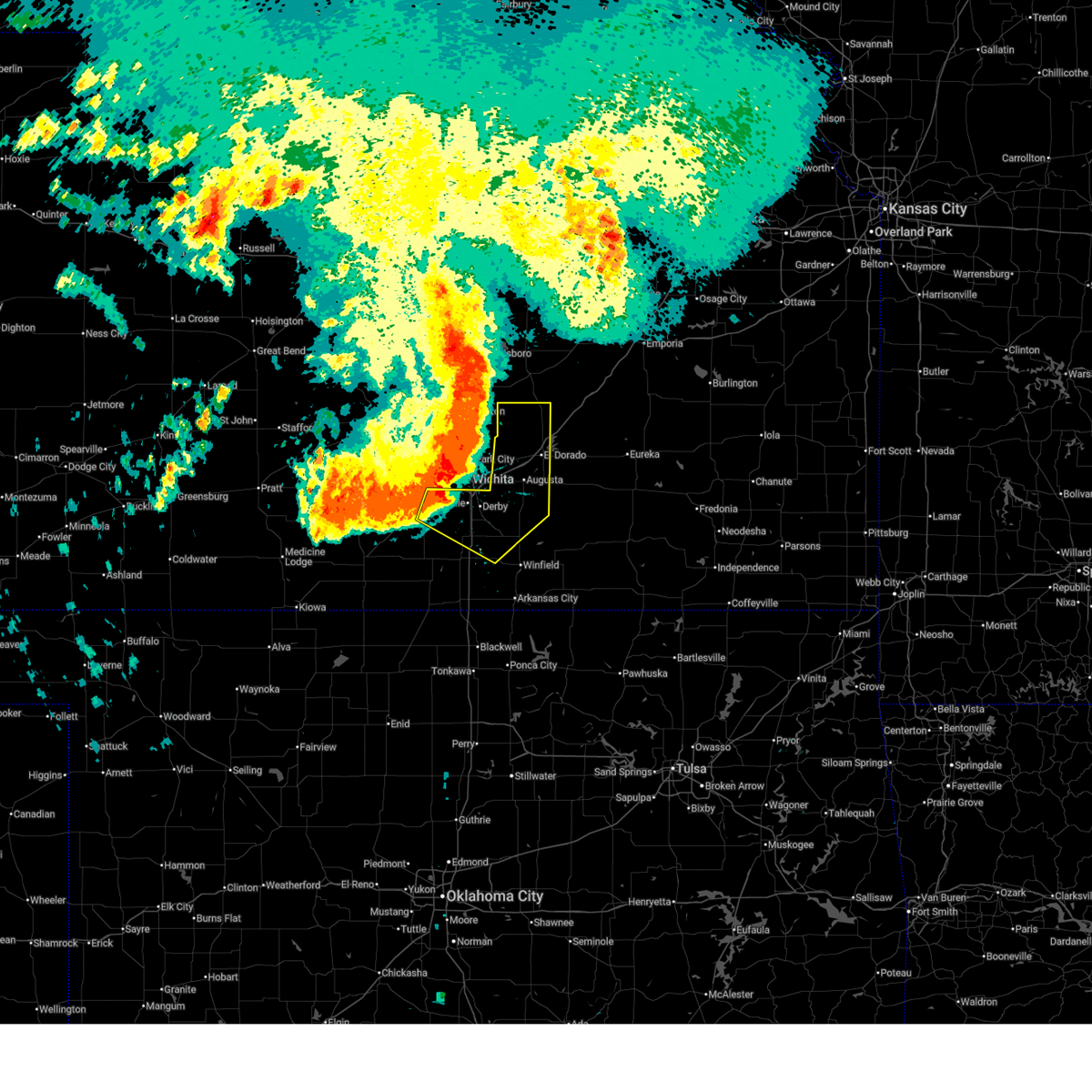
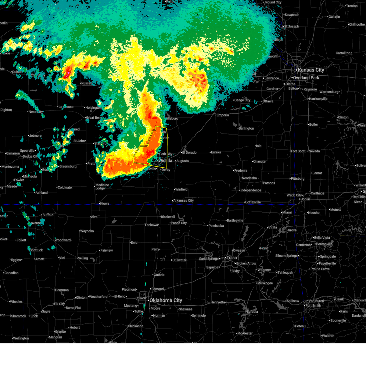
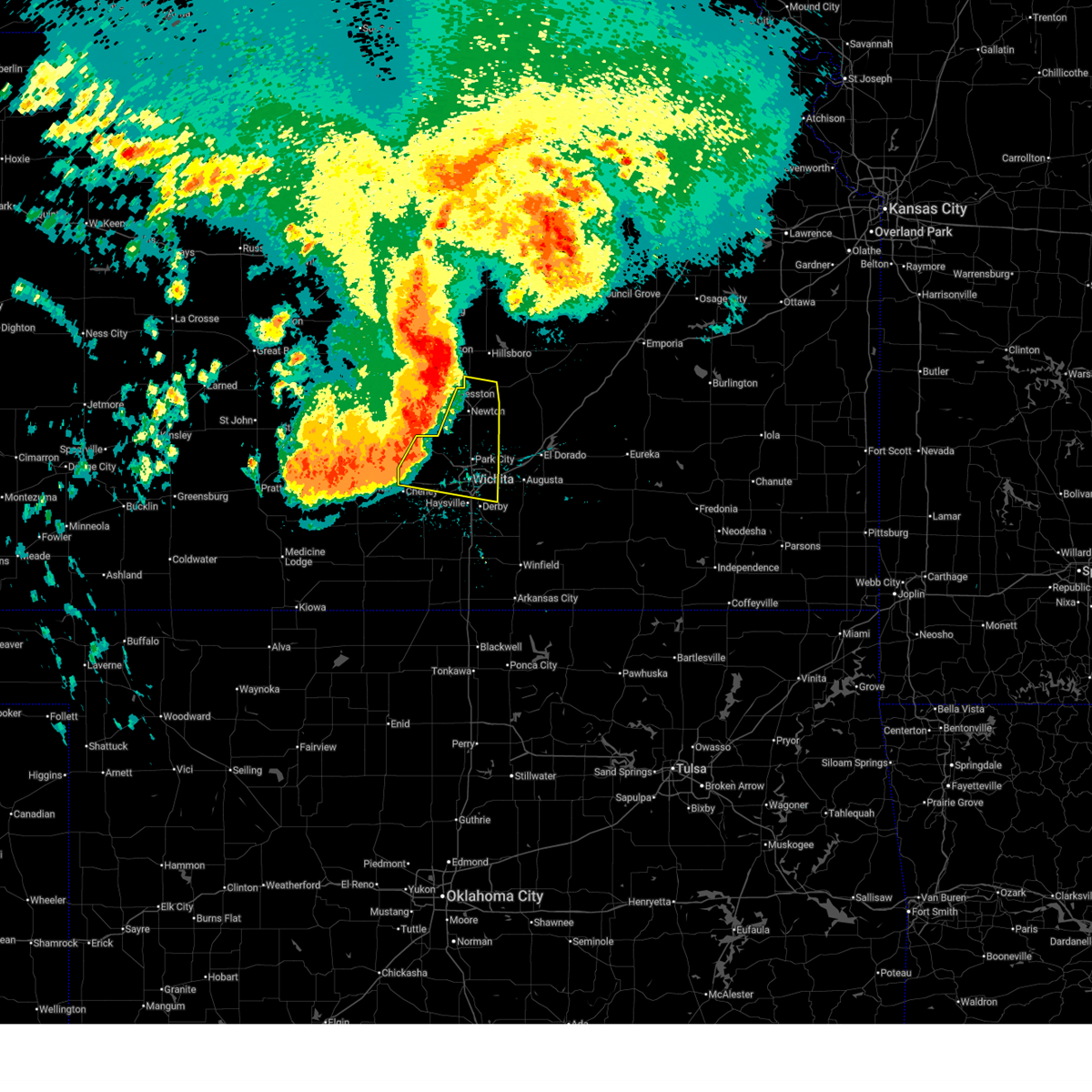
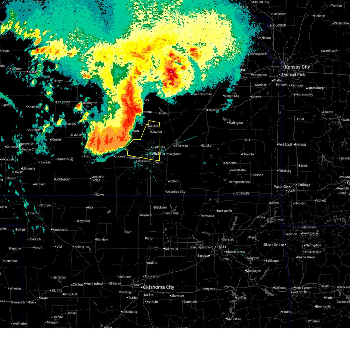
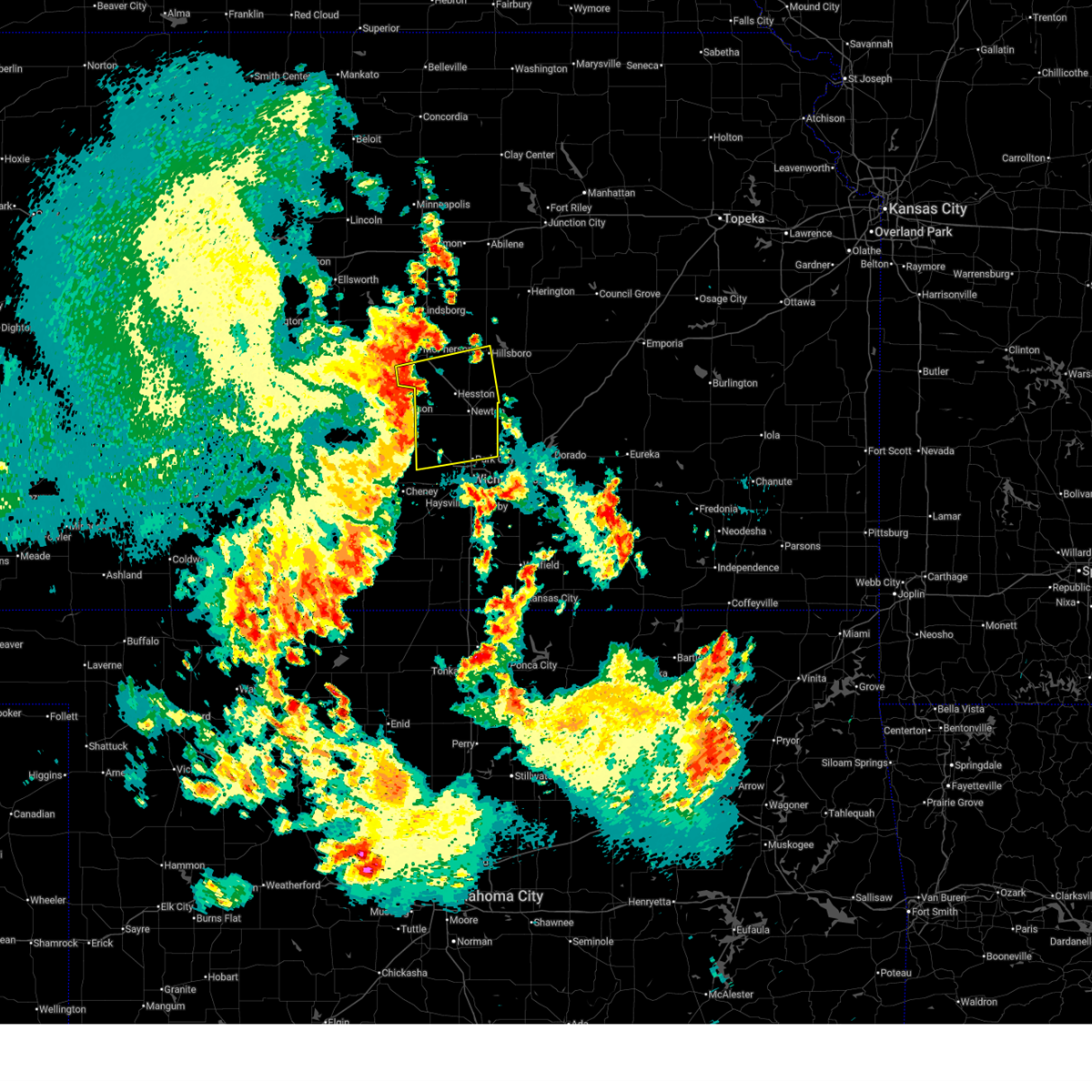
Hail Map for Wichita, KS
The Wichita, KS area has had 201 reports of on-the-ground hail by trained spotters, and has been under severe weather warnings 143 times during the past 12 months. Doppler radar has detected hail at or near Wichita, KS on 231 occasions, including 17 occasions during the past year.
| Name: | Wichita, KS |
| Where Located: | 0.4 miles WSW of Wichita, KS |
| Map: | Google Map for Wichita, KS |
| Population: | 382368 |
| Housing Units: | 167310 |
| More Info: | Search Google for Wichita, KS |
3
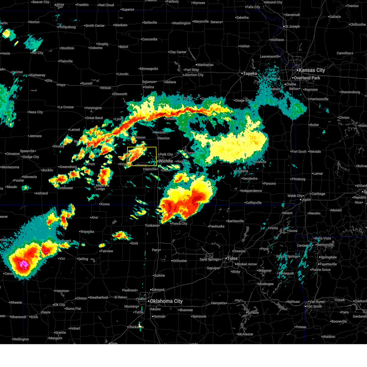
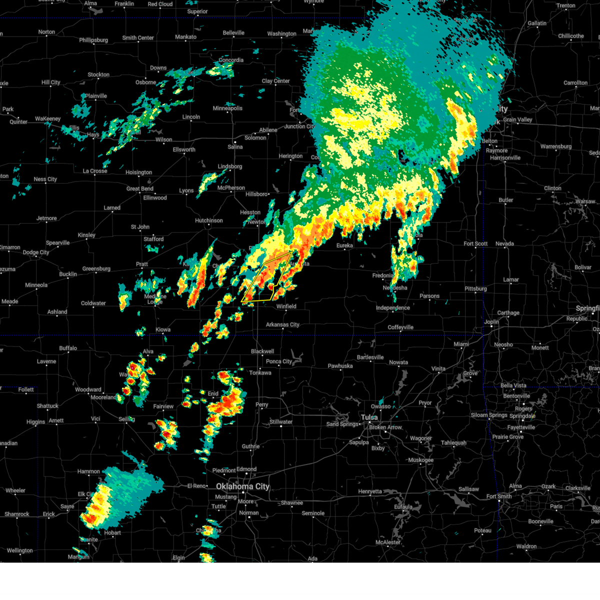
The Top Recent Hail Date for Wichita, KS is Tuesday, June 17, 2025 (7th out of 231)
Hail and Wind Damage Spotted near Wichita, KS
| Date / Time | Report Details |
|---|---|
| 7/8/2025 6:06 PM CDT |
 At 605 pm cdt, a severe thunderstorm was located near conway springs, moving south at 25 mph (trained weather spotters). Hazards include 70 mph wind gusts. Expect considerable tree damage. damage is likely to mobile homes, roofs, and outbuildings. Locations impacted include, wellington, clearwater, conway springs, norwich, viola, riverdale, and wellington airport. At 605 pm cdt, a severe thunderstorm was located near conway springs, moving south at 25 mph (trained weather spotters). Hazards include 70 mph wind gusts. Expect considerable tree damage. damage is likely to mobile homes, roofs, and outbuildings. Locations impacted include, wellington, clearwater, conway springs, norwich, viola, riverdale, and wellington airport.
|
| 7/8/2025 6:04 PM CDT |
 At 604 pm cdt, a severe thunderstorm was located over conway springs, moving south at 25 mph (trained weather spotters). Hazards include 70 mph wind gusts. Expect considerable tree damage. damage is likely to mobile homes, roofs, and outbuildings. Locations impacted include, clearwater, conway springs, argonia, viola, mayfield, milan, and perth. At 604 pm cdt, a severe thunderstorm was located over conway springs, moving south at 25 mph (trained weather spotters). Hazards include 70 mph wind gusts. Expect considerable tree damage. damage is likely to mobile homes, roofs, and outbuildings. Locations impacted include, clearwater, conway springs, argonia, viola, mayfield, milan, and perth.
|
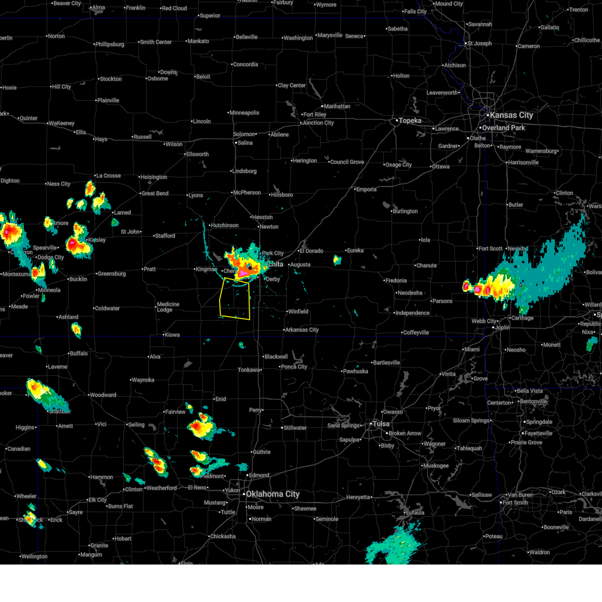
| 7/8/2025 5:57 PM CDT |
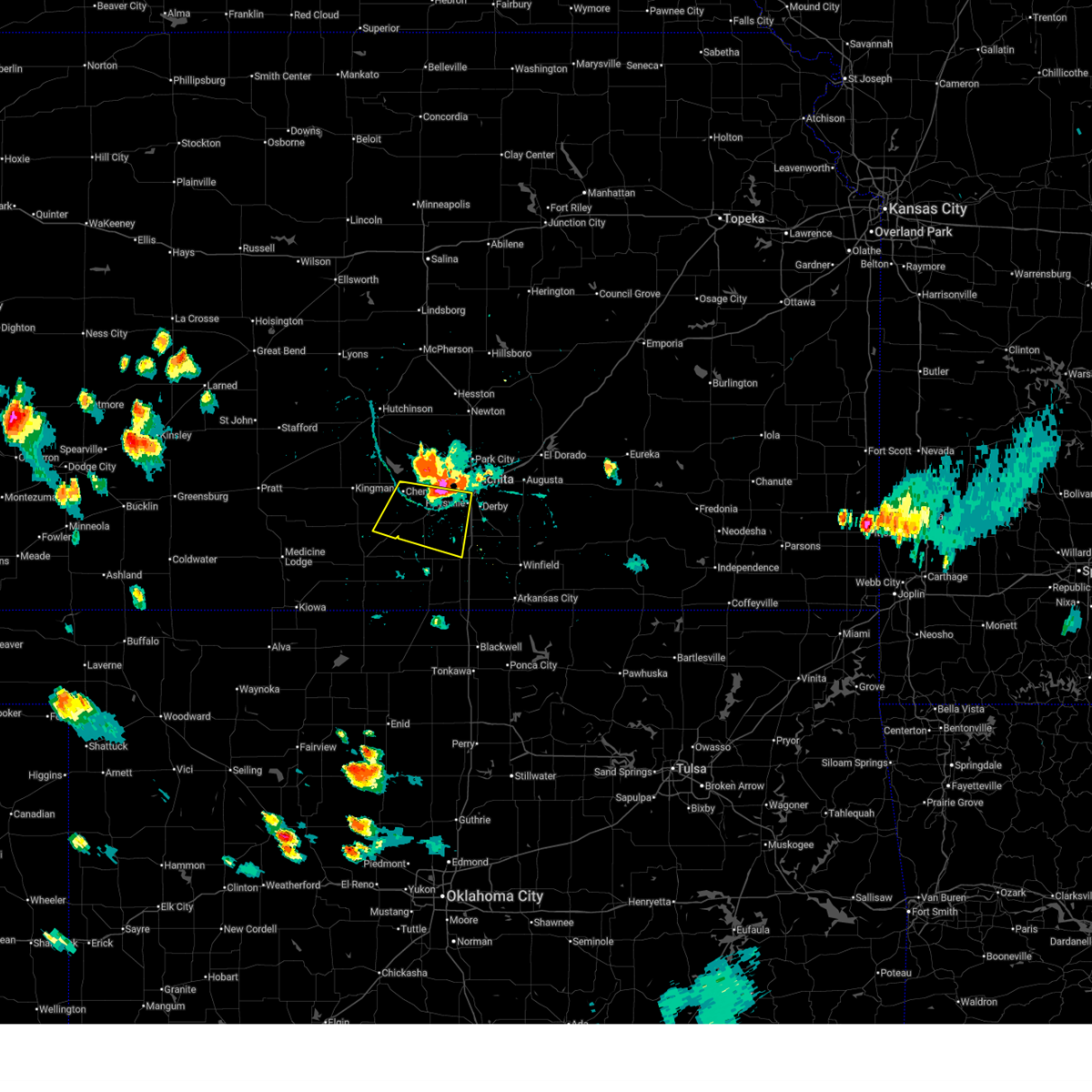 At 557 pm cdt, a severe thunderstorm was located near clearwater, moving south at 25 mph (trained weather spotters). Hazards include 70 mph wind gusts and ping pong ball size hail. People and animals outdoors will be injured. expect hail damage to roofs, siding, windows, and vehicles. expect considerable tree damage. wind damage is also likely to mobile homes, roofs, and outbuildings. locations impacted include, wichita, haysville, wellington, goddard, clearwater, cheney, conway springs, garden plain, norwich, viola, lake afton, riverdale, and wellington airport. This includes interstate 135 near mile marker 1. At 557 pm cdt, a severe thunderstorm was located near clearwater, moving south at 25 mph (trained weather spotters). Hazards include 70 mph wind gusts and ping pong ball size hail. People and animals outdoors will be injured. expect hail damage to roofs, siding, windows, and vehicles. expect considerable tree damage. wind damage is also likely to mobile homes, roofs, and outbuildings. locations impacted include, wichita, haysville, wellington, goddard, clearwater, cheney, conway springs, garden plain, norwich, viola, lake afton, riverdale, and wellington airport. This includes interstate 135 near mile marker 1.
|
| 7/8/2025 5:47 PM CDT |
 Svrict the national weather service in wichita has issued a * severe thunderstorm warning for, southwestern sedgwick county in south central kansas, northwestern sumner county in south central kansas, * until 645 pm cdt. * at 547 pm cdt, a severe thunderstorm was located near viola, or 6 miles west of clearwater, moving south at 20 mph. this is a destructive storm for viola and conway springs (radar indicated). Hazards include 80 mph wind gusts. Flying debris will be dangerous to those caught without shelter. mobile homes will be heavily damaged. expect considerable damage to roofs, windows, and vehicles. Extensive tree damage and power outages are likely. Svrict the national weather service in wichita has issued a * severe thunderstorm warning for, southwestern sedgwick county in south central kansas, northwestern sumner county in south central kansas, * until 645 pm cdt. * at 547 pm cdt, a severe thunderstorm was located near viola, or 6 miles west of clearwater, moving south at 20 mph. this is a destructive storm for viola and conway springs (radar indicated). Hazards include 80 mph wind gusts. Flying debris will be dangerous to those caught without shelter. mobile homes will be heavily damaged. expect considerable damage to roofs, windows, and vehicles. Extensive tree damage and power outages are likely.
|
| 7/8/2025 5:43 PM CDT |
 At 542 pm cdt, a severe thunderstorm was located over goddard, moving south at 20 mph (trained weather spotters). Hazards include golf ball size hail and 70 mph wind gusts. People and animals outdoors will be injured. expect hail damage to roofs, siding, windows, and vehicles. expect considerable tree damage. wind damage is also likely to mobile homes, roofs, and outbuildings. locations impacted include, wichita, haysville, wellington, goddard, clearwater, cheney, conway springs, garden plain, norwich, viola, west wichita, eisenhower national airport, lake afton, riverdale, and wellington airport. This includes interstate 135 near mile marker 1. At 542 pm cdt, a severe thunderstorm was located over goddard, moving south at 20 mph (trained weather spotters). Hazards include golf ball size hail and 70 mph wind gusts. People and animals outdoors will be injured. expect hail damage to roofs, siding, windows, and vehicles. expect considerable tree damage. wind damage is also likely to mobile homes, roofs, and outbuildings. locations impacted include, wichita, haysville, wellington, goddard, clearwater, cheney, conway springs, garden plain, norwich, viola, west wichita, eisenhower national airport, lake afton, riverdale, and wellington airport. This includes interstate 135 near mile marker 1.
|
| 7/8/2025 5:40 PM CDT |
 At 540 pm cdt, a severe thunderstorm was located over goddard, moving south at 20 mph (trained weather spotters). Hazards include 60 mph wind gusts and half dollar size hail. Hail damage to vehicles is expected. expect wind damage to roofs, siding, and trees. Locations impacted include, wichita, goddard, garden plain, andale, west wichita, and eisenhower national airport. At 540 pm cdt, a severe thunderstorm was located over goddard, moving south at 20 mph (trained weather spotters). Hazards include 60 mph wind gusts and half dollar size hail. Hail damage to vehicles is expected. expect wind damage to roofs, siding, and trees. Locations impacted include, wichita, goddard, garden plain, andale, west wichita, and eisenhower national airport.
|
| 7/8/2025 5:38 PM CDT |
 At 538 pm cdt, a severe thunderstorm was located over goddard, moving south at 20 mph (trained weather spotters). Hazards include 60 mph wind gusts and half dollar size hail. Hail damage to vehicles is expected. expect wind damage to roofs, siding, and trees. locations impacted include, wichita, haysville, wellington, goddard, clearwater, cheney, conway springs, garden plain, andale, norwich, viola, west wichita, eisenhower national airport, lake afton, riverdale, and wellington airport. This includes interstate 135 near mile marker 1. At 538 pm cdt, a severe thunderstorm was located over goddard, moving south at 20 mph (trained weather spotters). Hazards include 60 mph wind gusts and half dollar size hail. Hail damage to vehicles is expected. expect wind damage to roofs, siding, and trees. locations impacted include, wichita, haysville, wellington, goddard, clearwater, cheney, conway springs, garden plain, andale, norwich, viola, west wichita, eisenhower national airport, lake afton, riverdale, and wellington airport. This includes interstate 135 near mile marker 1.
|
| 7/8/2025 5:35 PM CDT |
 Svrict the national weather service in wichita has issued a * severe thunderstorm warning for, western sedgwick county in south central kansas, southeastern kingman county in south central kansas, northwestern sumner county in south central kansas, * until 630 pm cdt. * at 534 pm cdt, a severe thunderstorm was located over goddard, moving south at 20 mph (trained weather spotters). Hazards include 60 mph wind gusts and quarter size hail. Hail damage to vehicles is expected. Expect wind damage to roofs, siding, and trees. Svrict the national weather service in wichita has issued a * severe thunderstorm warning for, western sedgwick county in south central kansas, southeastern kingman county in south central kansas, northwestern sumner county in south central kansas, * until 630 pm cdt. * at 534 pm cdt, a severe thunderstorm was located over goddard, moving south at 20 mph (trained weather spotters). Hazards include 60 mph wind gusts and quarter size hail. Hail damage to vehicles is expected. Expect wind damage to roofs, siding, and trees.
|
| 7/8/2025 5:32 PM CDT |
 At 531 pm cdt, a severe thunderstorm was located over west wichita, or near maize, moving south at 20 mph (trained weather spotters). Hazards include 60 mph wind gusts and quarter size hail. Hail damage to vehicles is expected. expect wind damage to roofs, siding, and trees. locations impacted include, wichita, goddard, maize, colwich, garden plain, mount hope, downtown wichita, andale, west wichita, and eisenhower national airport. This includes interstate 135 mile marker 2 and near mile marker 8. At 531 pm cdt, a severe thunderstorm was located over west wichita, or near maize, moving south at 20 mph (trained weather spotters). Hazards include 60 mph wind gusts and quarter size hail. Hail damage to vehicles is expected. expect wind damage to roofs, siding, and trees. locations impacted include, wichita, goddard, maize, colwich, garden plain, mount hope, downtown wichita, andale, west wichita, and eisenhower national airport. This includes interstate 135 mile marker 2 and near mile marker 8.
|
| 7/8/2025 5:30 PM CDT | Report received via social medi in sedgwick county KS, 7.5 miles E of Wichita, KS |
| 7/8/2025 5:30 PM CDT | Picture received via social media of 1-foot diameter cottonwood tree blown ove in sedgwick county KS, 9.2 miles E of Wichita, KS |
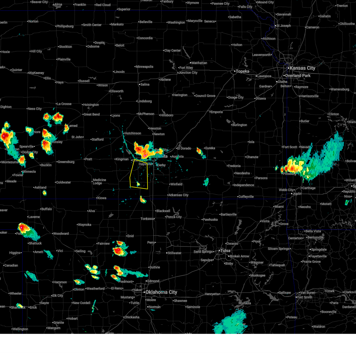
| 7/8/2025 5:29 PM CDT | Quarter sized hail reported 5.9 miles SW of Wichita, KS |
| 7/8/2025 5:11 PM CDT |
 the severe thunderstorm warning has been cancelled and is no longer in effect the severe thunderstorm warning has been cancelled and is no longer in effect
|
| 7/8/2025 5:11 PM CDT |
 At 510 pm cdt, a severe thunderstorm was located near maize, moving south at 25 mph (radar indicated). Hazards include 60 mph wind gusts and quarter size hail. Hail damage to vehicles is expected. expect wind damage to roofs, siding, and trees. locations impacted include, wichita, park city, valley center, bel aire, goddard, maize, sedgwick, colwich, garden plain, mount hope, downtown wichita, kechi, andale, eastborough, bentley, west wichita, east wichita, eisenhower national airport, and mcconnell air force base. this includes the following highways, interstate 135 between mile markers 2 and 22. Interstate 35 between mile markers 44 and 50. At 510 pm cdt, a severe thunderstorm was located near maize, moving south at 25 mph (radar indicated). Hazards include 60 mph wind gusts and quarter size hail. Hail damage to vehicles is expected. expect wind damage to roofs, siding, and trees. locations impacted include, wichita, park city, valley center, bel aire, goddard, maize, sedgwick, colwich, garden plain, mount hope, downtown wichita, kechi, andale, eastborough, bentley, west wichita, east wichita, eisenhower national airport, and mcconnell air force base. this includes the following highways, interstate 135 between mile markers 2 and 22. Interstate 35 between mile markers 44 and 50.
|
| 7/8/2025 4:53 PM CDT |
 Svrict the national weather service in wichita has issued a * severe thunderstorm warning for, northern sedgwick county in south central kansas, southern harvey county in south central kansas, * until 600 pm cdt. * at 453 pm cdt, a severe thunderstorm was located over sedgwick, moving south at 20 mph (radar indicated). Hazards include 60 mph wind gusts and quarter size hail. Hail damage to vehicles is expected. Expect wind damage to roofs, siding, and trees. Svrict the national weather service in wichita has issued a * severe thunderstorm warning for, northern sedgwick county in south central kansas, southern harvey county in south central kansas, * until 600 pm cdt. * at 453 pm cdt, a severe thunderstorm was located over sedgwick, moving south at 20 mph (radar indicated). Hazards include 60 mph wind gusts and quarter size hail. Hail damage to vehicles is expected. Expect wind damage to roofs, siding, and trees.
|
| 7/6/2025 5:45 PM CDT |
 the severe thunderstorm warning has been cancelled and is no longer in effect the severe thunderstorm warning has been cancelled and is no longer in effect
|
| 7/6/2025 5:35 PM CDT |
 the severe thunderstorm warning has been cancelled and is no longer in effect the severe thunderstorm warning has been cancelled and is no longer in effect
|
| 7/6/2025 5:35 PM CDT |
 At 535 pm cdt, a severe thunderstorm was located over mulvane, moving south at 10 mph (trained weather spotters). Hazards include 60 mph wind gusts. Expect damage to roofs, siding, and trees. locations impacted include, derby, haysville, and mulvane. This includes interstate 35 between mile markers 30 and 39. At 535 pm cdt, a severe thunderstorm was located over mulvane, moving south at 10 mph (trained weather spotters). Hazards include 60 mph wind gusts. Expect damage to roofs, siding, and trees. locations impacted include, derby, haysville, and mulvane. This includes interstate 35 between mile markers 30 and 39.
|
| 7/6/2025 5:28 PM CDT | Four inch diameter maple branch broken of in sedgwick county KS, 8 miles S of Wichita, KS |
| 7/6/2025 5:16 PM CDT |
 At 516 pm cdt, a severe thunderstorm was located over derby, moving south at 10 mph (trained weather spotters). Hazards include 60 mph wind gusts and penny size hail. Expect damage to roofs, siding, and trees. locations impacted include, wichita, derby, haysville, mulvane, rose hill, mcconnell air force base, south wichita, and oaklawn. this includes the following highways, interstate 135 near mile marker 0. Interstate 35 between mile markers 30 and 47. At 516 pm cdt, a severe thunderstorm was located over derby, moving south at 10 mph (trained weather spotters). Hazards include 60 mph wind gusts and penny size hail. Expect damage to roofs, siding, and trees. locations impacted include, wichita, derby, haysville, mulvane, rose hill, mcconnell air force base, south wichita, and oaklawn. this includes the following highways, interstate 135 near mile marker 0. Interstate 35 between mile markers 30 and 47.
|
| 7/6/2025 5:00 PM CDT |
 Svrict the national weather service in wichita has issued a * severe thunderstorm warning for, northwestern cowley county in south central kansas, southeastern sedgwick county in south central kansas, southwestern butler county in south central kansas, northeastern sumner county in south central kansas, * until 600 pm cdt. * at 500 pm cdt, a severe thunderstorm was located near mcconnell air force base, or near derby, moving south at 10 mph (radar indicated). Hazards include 60 mph wind gusts and quarter size hail. Hail damage to vehicles is expected. Expect wind damage to roofs, siding, and trees. Svrict the national weather service in wichita has issued a * severe thunderstorm warning for, northwestern cowley county in south central kansas, southeastern sedgwick county in south central kansas, southwestern butler county in south central kansas, northeastern sumner county in south central kansas, * until 600 pm cdt. * at 500 pm cdt, a severe thunderstorm was located near mcconnell air force base, or near derby, moving south at 10 mph (radar indicated). Hazards include 60 mph wind gusts and quarter size hail. Hail damage to vehicles is expected. Expect wind damage to roofs, siding, and trees.
|
| 6/17/2025 9:38 PM CDT |
 The storm which prompted the warning has weakened below severe limits, and has exited the warned area. therefore, the warning will be allowed to expire. however, gusty winds and heavy rain are still possible with this thunderstorm. a tornado watch remains in effect until 1000 pm cdt for south central kansas. a severe thunderstorm watch remains in effect until 400 am cdt for south central kansas. The storm which prompted the warning has weakened below severe limits, and has exited the warned area. therefore, the warning will be allowed to expire. however, gusty winds and heavy rain are still possible with this thunderstorm. a tornado watch remains in effect until 1000 pm cdt for south central kansas. a severe thunderstorm watch remains in effect until 400 am cdt for south central kansas.
|
| 6/17/2025 9:30 PM CDT |
 At 930 pm cdt, a severe thunderstorm was located over rose hill, moving east at 30 mph (radar indicated). Hazards include 60 mph wind gusts. Expect damage to roofs, siding, and trees. locations impacted include, wichita, derby, andover, mulvane, rose hill, eastborough, east wichita, mcconnell air force base, northeast wichita, and jabara airport. This includes interstate 35 between mile markers 46 and 54. At 930 pm cdt, a severe thunderstorm was located over rose hill, moving east at 30 mph (radar indicated). Hazards include 60 mph wind gusts. Expect damage to roofs, siding, and trees. locations impacted include, wichita, derby, andover, mulvane, rose hill, eastborough, east wichita, mcconnell air force base, northeast wichita, and jabara airport. This includes interstate 35 between mile markers 46 and 54.
|
| 6/17/2025 9:19 PM CDT |
 At 919 pm cdt, a severe thunderstorm was located over downtown wichita, moving east at 25 mph (radar indicated). Hazards include 70 mph wind gusts and half dollar size hail. Hail damage to vehicles is expected. expect considerable tree damage. wind damage is also likely to mobile homes, roofs, and outbuildings. locations impacted include, wichita, derby, andover, haysville, park city, bel aire, mulvane, rose hill, downtown wichita, eastborough, east wichita, northeast wichita, mcconnell air force base, south wichita, oaklawn, and jabara airport. this includes the following highways, interstate 135 between mile markers 0 and 12. Interstate 35 between mile markers 34 and 54. At 919 pm cdt, a severe thunderstorm was located over downtown wichita, moving east at 25 mph (radar indicated). Hazards include 70 mph wind gusts and half dollar size hail. Hail damage to vehicles is expected. expect considerable tree damage. wind damage is also likely to mobile homes, roofs, and outbuildings. locations impacted include, wichita, derby, andover, haysville, park city, bel aire, mulvane, rose hill, downtown wichita, eastborough, east wichita, northeast wichita, mcconnell air force base, south wichita, oaklawn, and jabara airport. this includes the following highways, interstate 135 between mile markers 0 and 12. Interstate 35 between mile markers 34 and 54.
|
| 6/17/2025 9:12 PM CDT | Quarter sized hail reported 1.4 miles NE of Wichita, KS |
| 6/17/2025 9:12 PM CDT | Ks storm info estimates 60 to 65 mph and pea to dime sized hai in sedgwick county KS, 2.5 miles N of Wichita, KS |
| 6/17/2025 9:08 PM CDT | At 908 pm cdt, a severe thunderstorm was located over eisenhower national airport, or near downtown wichita, moving east at 25 mph (radar indicated). Hazards include 70 mph wind gusts and half dollar size hail. Hail damage to vehicles is expected. expect considerable tree damage. wind damage is also likely to mobile homes, roofs, and outbuildings. locations impacted include, wichita, derby, andover, haysville, park city, bel aire, mulvane, rose hill, maize, clearwater, downtown wichita, eastborough, west wichita, east wichita, eisenhower national airport, northeast wichita, mcconnell air force base, south wichita, oaklawn, and jabara airport. this includes the following highways, interstate 135 between mile markers 0 and 12. Interstate 35 between mile markers 34 and 54. |
| 6/17/2025 9:06 PM CDT | Combined with dime sized hai in sedgwick county KS, 7.5 miles E of Wichita, KS |
| 6/17/2025 8:51 PM CDT |
 At 851 pm cdt, a severe thunderstorm was located over goddard, moving east at 25 mph (radar indicated). Hazards include golf ball size hail and 70 mph wind gusts. People and animals outdoors will be injured. expect hail damage to roofs, siding, windows, and vehicles. expect considerable tree damage. wind damage is also likely to mobile homes, roofs, and outbuildings. locations impacted include, wichita, derby, andover, haysville, park city, bel aire, mulvane, goddard, rose hill, maize, clearwater, downtown wichita, eastborough, west wichita, east wichita, eisenhower national airport, northeast wichita, mcconnell air force base, south wichita, and oaklawn. this includes the following highways, interstate 135 between mile markers 0 and 12. Interstate 35 between mile markers 34 and 54. At 851 pm cdt, a severe thunderstorm was located over goddard, moving east at 25 mph (radar indicated). Hazards include golf ball size hail and 70 mph wind gusts. People and animals outdoors will be injured. expect hail damage to roofs, siding, windows, and vehicles. expect considerable tree damage. wind damage is also likely to mobile homes, roofs, and outbuildings. locations impacted include, wichita, derby, andover, haysville, park city, bel aire, mulvane, goddard, rose hill, maize, clearwater, downtown wichita, eastborough, west wichita, east wichita, eisenhower national airport, northeast wichita, mcconnell air force base, south wichita, and oaklawn. this includes the following highways, interstate 135 between mile markers 0 and 12. Interstate 35 between mile markers 34 and 54.
|
| 6/17/2025 8:41 PM CDT |
 the severe thunderstorm warning has been cancelled and is no longer in effect the severe thunderstorm warning has been cancelled and is no longer in effect
|
| 6/17/2025 8:40 PM CDT |
 Svrict the national weather service in wichita has issued a * severe thunderstorm warning for, southern sedgwick county in south central kansas, * until 945 pm cdt. * at 840 pm cdt, a severe thunderstorm was located near garden plain, moving east at 25 mph (radar indicated). Hazards include golf ball size hail and 70 mph wind gusts. People and animals outdoors will be injured. expect hail damage to roofs, siding, windows, and vehicles. expect considerable tree damage. Wind damage is also likely to mobile homes, roofs, and outbuildings. Svrict the national weather service in wichita has issued a * severe thunderstorm warning for, southern sedgwick county in south central kansas, * until 945 pm cdt. * at 840 pm cdt, a severe thunderstorm was located near garden plain, moving east at 25 mph (radar indicated). Hazards include golf ball size hail and 70 mph wind gusts. People and animals outdoors will be injured. expect hail damage to roofs, siding, windows, and vehicles. expect considerable tree damage. Wind damage is also likely to mobile homes, roofs, and outbuildings.
|
| 6/17/2025 8:30 PM CDT |
 the severe thunderstorm warning has been cancelled and is no longer in effect the severe thunderstorm warning has been cancelled and is no longer in effect
|
| 6/17/2025 8:30 PM CDT |
 At 829 pm cdt, a severe thunderstorm was located over garden plain, moving east at 25 mph (radar indicated). Hazards include quarter size hail. Damage to vehicles is expected. Locations impacted include, wichita, valley center, goddard, maize, cheney, sedgwick, colwich, garden plain, mount hope, andale, bentley, west wichita, eisenhower national airport, lake afton, cheney state park, and cheney lake. At 829 pm cdt, a severe thunderstorm was located over garden plain, moving east at 25 mph (radar indicated). Hazards include quarter size hail. Damage to vehicles is expected. Locations impacted include, wichita, valley center, goddard, maize, cheney, sedgwick, colwich, garden plain, mount hope, andale, bentley, west wichita, eisenhower national airport, lake afton, cheney state park, and cheney lake.
|
| 6/17/2025 8:17 PM CDT |
 At 816 pm cdt, a severe thunderstorm was located near cheney lake, moving east at 25 mph (radar indicated). Hazards include ping pong ball size hail. People and animals outdoors will be injured. expect damage to roofs, siding, windows, and vehicles. Locations impacted include, wichita, valley center, goddard, maize, cheney, sedgwick, colwich, haven, garden plain, mount hope, andale, bentley, west wichita, eisenhower national airport, waterloo, cheney lake, mt vernon, cheney state park, and lake afton. At 816 pm cdt, a severe thunderstorm was located near cheney lake, moving east at 25 mph (radar indicated). Hazards include ping pong ball size hail. People and animals outdoors will be injured. expect damage to roofs, siding, windows, and vehicles. Locations impacted include, wichita, valley center, goddard, maize, cheney, sedgwick, colwich, haven, garden plain, mount hope, andale, bentley, west wichita, eisenhower national airport, waterloo, cheney lake, mt vernon, cheney state park, and lake afton.
|
| 6/17/2025 8:08 PM CDT |
 Svrict the national weather service in wichita has issued a * severe thunderstorm warning for, southeastern reno county in south central kansas, central sedgwick county in south central kansas, northeastern kingman county in south central kansas, * until 915 pm cdt. * at 808 pm cdt, a severe thunderstorm was located 6 miles north of cheney, moving east at 25 mph (radar indicated). Hazards include ping pong ball size hail. People and animals outdoors will be injured. Expect damage to roofs, siding, windows, and vehicles. Svrict the national weather service in wichita has issued a * severe thunderstorm warning for, southeastern reno county in south central kansas, central sedgwick county in south central kansas, northeastern kingman county in south central kansas, * until 915 pm cdt. * at 808 pm cdt, a severe thunderstorm was located 6 miles north of cheney, moving east at 25 mph (radar indicated). Hazards include ping pong ball size hail. People and animals outdoors will be injured. Expect damage to roofs, siding, windows, and vehicles.
|
| 6/17/2025 7:31 PM CDT |
 the severe thunderstorm warning has been cancelled and is no longer in effect the severe thunderstorm warning has been cancelled and is no longer in effect
|
| 6/17/2025 7:16 PM CDT |
 At 716 pm cdt, a severe thunderstorm was located south of clearwater, moving east at 30 mph (radar indicated). Hazards include quarter size hail. Damage to vehicles is expected. locations impacted include, haysville, clearwater, belle plaine, south wichita, and riverdale. this includes the following highways, interstate 135 between mile markers 0 and 1. Interstate 35 between mile markers 23 and 43. At 716 pm cdt, a severe thunderstorm was located south of clearwater, moving east at 30 mph (radar indicated). Hazards include quarter size hail. Damage to vehicles is expected. locations impacted include, haysville, clearwater, belle plaine, south wichita, and riverdale. this includes the following highways, interstate 135 between mile markers 0 and 1. Interstate 35 between mile markers 23 and 43.
|
| 6/17/2025 7:06 PM CDT |
 At 705 pm cdt, a severe thunderstorm was located over viola, or near conway springs, moving east at 30 mph (radar indicated). Hazards include quarter size hail. Damage to vehicles is expected. locations impacted include, wichita, haysville, goddard, clearwater, belle plaine, conway springs, downtown wichita, viola, eisenhower national airport, lake afton, and riverdale. this includes the following highways, interstate 135 between mile markers 0 and 2. Interstate 35 between mile markers 23 and 42. At 705 pm cdt, a severe thunderstorm was located over viola, or near conway springs, moving east at 30 mph (radar indicated). Hazards include quarter size hail. Damage to vehicles is expected. locations impacted include, wichita, haysville, goddard, clearwater, belle plaine, conway springs, downtown wichita, viola, eisenhower national airport, lake afton, and riverdale. this includes the following highways, interstate 135 between mile markers 0 and 2. Interstate 35 between mile markers 23 and 42.
|
| 6/17/2025 6:50 PM CDT |
 Svrict the national weather service in wichita has issued a * severe thunderstorm warning for, southwestern sedgwick county in south central kansas, northern sumner county in south central kansas, * until 745 pm cdt. * at 649 pm cdt, a severe thunderstorm was located near norwich, or 7 miles northwest of conway springs, moving east at 30 mph (radar indicated). Hazards include quarter size hail. damage to vehicles is expected Svrict the national weather service in wichita has issued a * severe thunderstorm warning for, southwestern sedgwick county in south central kansas, northern sumner county in south central kansas, * until 745 pm cdt. * at 649 pm cdt, a severe thunderstorm was located near norwich, or 7 miles northwest of conway springs, moving east at 30 mph (radar indicated). Hazards include quarter size hail. damage to vehicles is expected
|
| 6/17/2025 5:31 PM CDT |
 At 531 pm cdt, a severe thunderstorm was located near andover, moving east at 30 mph (radar indicated). Hazards include 70 mph wind gusts and ping pong ball size hail. People and animals outdoors will be injured. expect hail damage to roofs, siding, windows, and vehicles. expect considerable tree damage. wind damage is also likely to mobile homes, roofs, and outbuildings. locations impacted include, wichita, derby, el dorado, andover, haysville, augusta, bel aire, mulvane, rose hill, douglass, towanda, benton, leon, eastborough, northeast wichita, east wichita, mcconnell air force base, south wichita, santa fe lake, and el dorado state park. this includes the following highways, interstate 135 between mile markers 0 and 4. Interstate 35 between mile markers 34 and 78. At 531 pm cdt, a severe thunderstorm was located near andover, moving east at 30 mph (radar indicated). Hazards include 70 mph wind gusts and ping pong ball size hail. People and animals outdoors will be injured. expect hail damage to roofs, siding, windows, and vehicles. expect considerable tree damage. wind damage is also likely to mobile homes, roofs, and outbuildings. locations impacted include, wichita, derby, el dorado, andover, haysville, augusta, bel aire, mulvane, rose hill, douglass, towanda, benton, leon, eastborough, northeast wichita, east wichita, mcconnell air force base, south wichita, santa fe lake, and el dorado state park. this includes the following highways, interstate 135 between mile markers 0 and 4. Interstate 35 between mile markers 34 and 78.
|
| 6/17/2025 5:30 PM CDT | Asos station kict wichita eisenhower airpor in sedgwick county KS, 5.4 miles ENE of Wichita, KS |
| 6/17/2025 5:22 PM CDT |
 At 522 pm cdt, a severe thunderstorm was located near benton, moving east at 25 mph (radar indicated). Hazards include 70 mph wind gusts and ping pong ball size hail. People and animals outdoors will be injured. expect hail damage to roofs, siding, windows, and vehicles. expect considerable tree damage. wind damage is also likely to mobile homes, roofs, and outbuildings. locations impacted include, wichita, derby, el dorado, andover, haysville, augusta, bel aire, mulvane, rose hill, clearwater, douglass, towanda, benton, leon, downtown wichita, kechi, eastborough, northeast wichita, east wichita, and mcconnell air force base. this includes the following highways, interstate 135 between mile markers 0 and 11. Interstate 35 between mile markers 34 and 78. At 522 pm cdt, a severe thunderstorm was located near benton, moving east at 25 mph (radar indicated). Hazards include 70 mph wind gusts and ping pong ball size hail. People and animals outdoors will be injured. expect hail damage to roofs, siding, windows, and vehicles. expect considerable tree damage. wind damage is also likely to mobile homes, roofs, and outbuildings. locations impacted include, wichita, derby, el dorado, andover, haysville, augusta, bel aire, mulvane, rose hill, clearwater, douglass, towanda, benton, leon, downtown wichita, kechi, eastborough, northeast wichita, east wichita, and mcconnell air force base. this includes the following highways, interstate 135 between mile markers 0 and 11. Interstate 35 between mile markers 34 and 78.
|
| 6/17/2025 5:19 PM CDT | Quarter sized hail reported 8.4 miles W of Wichita, KS |
| 6/17/2025 5:16 PM CDT | Storm damage reported in sedgwick county KS, 6.4 miles NW of Wichita, KS |
| 6/17/2025 5:13 PM CDT | 60 to 70 mph wind estimate at pawnee and olive in sedgwick county KS, 4.2 miles NW of Wichita, KS |
| 6/17/2025 5:10 PM CDT | Half Dollar sized hail reported 4.3 miles WSW of Wichita, KS |
| 6/17/2025 5:09 PM CDT | Storm damage reported in sedgwick county KS, 5.5 miles SW of Wichita, KS |
| 6/17/2025 5:08 PM CDT | Several powerlines down throughout the metr in sedgwick county KS, 0.8 miles WSW of Wichita, KS |
| 6/17/2025 5:07 PM CDT |
 Svrict the national weather service in wichita has issued a * severe thunderstorm warning for, sedgwick county in south central kansas, southwestern butler county in south central kansas, * until 600 pm cdt. * at 506 pm cdt, a severe thunderstorm was located over northeast wichita, or over bel aire, moving east at 25 mph (radar indicated). Hazards include 70 mph wind gusts and ping pong ball size hail. People and animals outdoors will be injured. expect hail damage to roofs, siding, windows, and vehicles. expect considerable tree damage. Wind damage is also likely to mobile homes, roofs, and outbuildings. Svrict the national weather service in wichita has issued a * severe thunderstorm warning for, sedgwick county in south central kansas, southwestern butler county in south central kansas, * until 600 pm cdt. * at 506 pm cdt, a severe thunderstorm was located over northeast wichita, or over bel aire, moving east at 25 mph (radar indicated). Hazards include 70 mph wind gusts and ping pong ball size hail. People and animals outdoors will be injured. expect hail damage to roofs, siding, windows, and vehicles. expect considerable tree damage. Wind damage is also likely to mobile homes, roofs, and outbuildings.
|
| 6/17/2025 5:06 PM CDT | Six inch diameter branches dow in sedgwick county KS, 3.7 miles SW of Wichita, KS |
| 6/17/2025 5:01 PM CDT | Overturned semi truck based on view from highway camer in sedgwick county KS, 3.6 miles ESE of Wichita, KS |
| 6/17/2025 4:59 PM CDT | Half Dollar sized hail reported 8 miles S of Wichita, KS |
| 6/17/2025 4:57 PM CDT | At 457 pm cdt, a severe thunderstorm was located over kechi, or over bel aire, moving east at 30 mph (radar indicated). Hazards include 70 mph wind gusts and ping pong ball size hail. People and animals outdoors will be injured. expect hail damage to roofs, siding, windows, and vehicles. expect considerable tree damage. wind damage is also likely to mobile homes, roofs, and outbuildings. locations impacted include, wichita, park city, valley center, bel aire, maize, sedgwick, colwich, mount hope, kechi, andale, bentley, northeast wichita, and jabara airport. This includes interstate 135 between mile markers 9 and 22. |
| 6/17/2025 4:56 PM CDT | At 456 pm cdt, a severe thunderstorm was located over garden plain, moving east at 30 mph (radar indicated). Hazards include 60 mph wind gusts and quarter size hail. Hail damage to vehicles is expected. expect wind damage to roofs, siding, and trees. locations impacted include, wichita, derby, andover, haysville, mulvane, goddard, rose hill, clearwater, cheney, garden plain, downtown wichita, eastborough, viola, west wichita, east wichita, eisenhower national airport, mcconnell air force base, south wichita, oaklawn, and lake afton. this includes the following highways, interstate 135 between mile markers 0 and 8. Interstate 35 between mile markers 34 and 54. |
| 6/17/2025 4:56 PM CDT | the severe thunderstorm warning has been cancelled and is no longer in effect |
| 6/17/2025 4:49 PM CDT | Storm damage reported in sedgwick county KS, 6.3 miles ESE of Wichita, KS |
| 6/17/2025 4:49 PM CDT | At 449 pm cdt, a severe thunderstorm was located near cheney, moving east at 30 mph (radar indicated). Hazards include 60 mph wind gusts and quarter size hail. Hail damage to vehicles is expected. expect wind damage to roofs, siding, and trees. locations impacted include, wichita, derby, andover, haysville, mulvane, goddard, rose hill, clearwater, cheney, garden plain, downtown wichita, eastborough, viola, west wichita, east wichita, eisenhower national airport, mcconnell air force base, south wichita, cheney lake, and mt vernon. this includes the following highways, interstate 135 between mile markers 0 and 8. Interstate 35 between mile markers 34 and 54. |
| 6/17/2025 4:47 PM CDT | Tree limbs down with the 60 mph wind in sedgwick county KS, 8.1 miles ESE of Wichita, KS |
| 6/17/2025 4:46 PM CDT | At 446 pm cdt, a severe thunderstorm was located near park city, moving east at 25 mph (radar indicated). Hazards include 70 mph wind gusts and ping pong ball size hail. People and animals outdoors will be injured. expect hail damage to roofs, siding, windows, and vehicles. expect considerable tree damage. wind damage is also likely to mobile homes, roofs, and outbuildings. locations impacted include, wichita, park city, valley center, bel aire, maize, sedgwick, colwich, mount hope, kechi, andale, bentley, northeast wichita, and jabara airport. This includes interstate 135 between mile markers 9 and 22. |
| 6/17/2025 4:42 PM CDT | Estimated 60 to 70 mph winds near 34th n & ridge r in sedgwick county KS, 6.1 miles SE of Wichita, KS |
| 6/17/2025 4:36 PM CDT | At 436 pm cdt, a severe thunderstorm was located near valley center, moving east at 30 mph (radar indicated). Hazards include 60 mph wind gusts and quarter size hail. Hail damage to vehicles is expected. expect wind damage to roofs, siding, and trees. locations impacted include, wichita, park city, valley center, bel aire, maize, sedgwick, colwich, mount hope, kechi, andale, bentley, northeast wichita, and jabara airport. This includes interstate 135 between mile markers 9 and 22. |
| 6/17/2025 4:34 PM CDT | Svrict the national weather service in wichita has issued a * severe thunderstorm warning for, southeastern reno county in south central kansas, sedgwick county in south central kansas, eastern kingman county in south central kansas, * until 515 pm cdt. * at 434 pm cdt, a severe thunderstorm was located 6 miles northwest of cheney, moving east at 30 mph (radar indicated). Hazards include 60 mph wind gusts and quarter size hail. Hail damage to vehicles is expected. Expect wind damage to roofs, siding, and trees. |
| 6/17/2025 4:21 PM CDT | Svrict the national weather service in wichita has issued a * severe thunderstorm warning for, northern sedgwick county in south central kansas, * until 515 pm cdt. * at 421 pm cdt, a severe thunderstorm was located near colwich, moving east at 30 mph (radar indicated). Hazards include 60 mph wind gusts and quarter size hail. Hail damage to vehicles is expected. Expect wind damage to roofs, siding, and trees. |
| 6/17/2025 8:13 AM CDT |
 Svrict the national weather service in wichita has issued a * severe thunderstorm warning for, cowley county in south central kansas, southeastern sedgwick county in south central kansas, southern butler county in south central kansas, northeastern sumner county in south central kansas, * until 915 am cdt. * at 812 am cdt, a severe thunderstorm was located near belle plaine, moving east at 50 mph (radar indicated). Hazards include 60 mph wind gusts. expect damage to roofs, siding, and trees Svrict the national weather service in wichita has issued a * severe thunderstorm warning for, cowley county in south central kansas, southeastern sedgwick county in south central kansas, southern butler county in south central kansas, northeastern sumner county in south central kansas, * until 915 am cdt. * at 812 am cdt, a severe thunderstorm was located near belle plaine, moving east at 50 mph (radar indicated). Hazards include 60 mph wind gusts. expect damage to roofs, siding, and trees
|
| 6/17/2025 5:27 AM CDT |
 At 527 am cdt, severe thunderstorms were located along a line extending from 5 miles southeast of potwin to near mulvane, moving east at 20 mph (radar indicated). Hazards include 60 mph wind gusts. Expect damage to roofs, siding, and trees. locations impacted include, wichita, derby, el dorado, andover, haysville, augusta, park city, valley center, bel aire, mulvane, rose hill, maize, clearwater, douglass, sedgwick, towanda, benton, leon, downtown wichita, and kechi. this includes the following highways, interstate 135 between mile markers 0 and 22. Interstate 35 between mile markers 34 and 78. At 527 am cdt, severe thunderstorms were located along a line extending from 5 miles southeast of potwin to near mulvane, moving east at 20 mph (radar indicated). Hazards include 60 mph wind gusts. Expect damage to roofs, siding, and trees. locations impacted include, wichita, derby, el dorado, andover, haysville, augusta, park city, valley center, bel aire, mulvane, rose hill, maize, clearwater, douglass, sedgwick, towanda, benton, leon, downtown wichita, and kechi. this includes the following highways, interstate 135 between mile markers 0 and 22. Interstate 35 between mile markers 34 and 78.
|
| 6/17/2025 5:14 AM CDT |
 Svrict the national weather service in wichita has issued a * severe thunderstorm warning for, eastern sedgwick county in south central kansas, butler county in south central kansas, * until 615 am cdt. * at 514 am cdt, severe thunderstorms were located along a line extending from near potwin to near mulvane, moving east at 20 mph (radar indicated). Hazards include 70 mph wind gusts. Expect considerable tree damage. Damage is likely to mobile homes, roofs, and outbuildings. Svrict the national weather service in wichita has issued a * severe thunderstorm warning for, eastern sedgwick county in south central kansas, butler county in south central kansas, * until 615 am cdt. * at 514 am cdt, severe thunderstorms were located along a line extending from near potwin to near mulvane, moving east at 20 mph (radar indicated). Hazards include 70 mph wind gusts. Expect considerable tree damage. Damage is likely to mobile homes, roofs, and outbuildings.
|
| 6/17/2025 5:12 AM CDT |
 At 512 am cdt, severe thunderstorms were located along a line extending from near rose hill to udall to near oxford, moving south at 25 mph (trained weather spotters). Hazards include 70 mph wind gusts. Expect considerable tree damage. damage is likely to mobile homes, roofs, and outbuildings. locations impacted include, wichita, derby, haysville, mulvane, rose hill, douglass, belle plaine, oxford, udall, mcconnell air force base, south wichita, rock, oaklawn, and riverdale. this includes the following highways, interstate 135 between mile markers 0 and 2. Interstate 35 between mile markers 23 and 45. At 512 am cdt, severe thunderstorms were located along a line extending from near rose hill to udall to near oxford, moving south at 25 mph (trained weather spotters). Hazards include 70 mph wind gusts. Expect considerable tree damage. damage is likely to mobile homes, roofs, and outbuildings. locations impacted include, wichita, derby, haysville, mulvane, rose hill, douglass, belle plaine, oxford, udall, mcconnell air force base, south wichita, rock, oaklawn, and riverdale. this includes the following highways, interstate 135 between mile markers 0 and 2. Interstate 35 between mile markers 23 and 45.
|
| 6/17/2025 5:08 AM CDT |
 At 508 am cdt, severe thunderstorms were located along a line extending from near towanda to rose hill, moving southeast at 30 mph (trained weather spotters). Hazards include 70 mph wind gusts. Expect considerable tree damage. damage is likely to mobile homes, roofs, and outbuildings. locations impacted include, wichita, el dorado, andover, augusta, bel aire, towanda, benton, downtown wichita, kechi, eastborough, east wichita, northeast wichita, mcconnell air force base, santa fe lake, el dorado state park, augusta municipal airport, el dorado airport, el dorado lake, and jabara airport. this includes the following highways, interstate 135 between mile markers 4 and 11. Interstate 35 between mile markers 46 and 76. At 508 am cdt, severe thunderstorms were located along a line extending from near towanda to rose hill, moving southeast at 30 mph (trained weather spotters). Hazards include 70 mph wind gusts. Expect considerable tree damage. damage is likely to mobile homes, roofs, and outbuildings. locations impacted include, wichita, el dorado, andover, augusta, bel aire, towanda, benton, downtown wichita, kechi, eastborough, east wichita, northeast wichita, mcconnell air force base, santa fe lake, el dorado state park, augusta municipal airport, el dorado airport, el dorado lake, and jabara airport. this includes the following highways, interstate 135 between mile markers 4 and 11. Interstate 35 between mile markers 46 and 76.
|
| 6/17/2025 5:00 AM CDT |
 At 500 am cdt, severe thunderstorms were located along a line extending from near potwin to near mcconnell air force base, moving southeast at 40 mph. these are destructive storms for wichita and andover (trained weather spotters). Hazards include 80 mph wind gusts. Flying debris will be dangerous to those caught without shelter. mobile homes will be heavily damaged. expect considerable damage to roofs, windows, and vehicles. extensive tree damage and power outages are likely. locations impacted include, wichita, el dorado, andover, augusta, bel aire, towanda, benton, downtown wichita, kechi, eastborough, east wichita, northeast wichita, mcconnell air force base, santa fe lake, el dorado state park, augusta municipal airport, el dorado airport, el dorado lake, and jabara airport. this includes the following highways, interstate 135 between mile markers 4 and 11. Interstate 35 between mile markers 46 and 76. At 500 am cdt, severe thunderstorms were located along a line extending from near potwin to near mcconnell air force base, moving southeast at 40 mph. these are destructive storms for wichita and andover (trained weather spotters). Hazards include 80 mph wind gusts. Flying debris will be dangerous to those caught without shelter. mobile homes will be heavily damaged. expect considerable damage to roofs, windows, and vehicles. extensive tree damage and power outages are likely. locations impacted include, wichita, el dorado, andover, augusta, bel aire, towanda, benton, downtown wichita, kechi, eastborough, east wichita, northeast wichita, mcconnell air force base, santa fe lake, el dorado state park, augusta municipal airport, el dorado airport, el dorado lake, and jabara airport. this includes the following highways, interstate 135 between mile markers 4 and 11. Interstate 35 between mile markers 46 and 76.
|
| 6/17/2025 4:59 AM CDT |
 At 458 am cdt, severe thunderstorms were located along a line extending from near towanda to 5 miles northeast of udall to 8 miles northeast of south haven, moving southeast at 45 mph. these are destructive storms for belle plaine and udall (trained weather spotters). Hazards include 80 mph wind gusts. Flying debris will be dangerous to those caught without shelter. mobile homes will be heavily damaged. expect considerable damage to roofs, windows, and vehicles. extensive tree damage and power outages are likely. locations impacted include, wichita, derby, haysville, mulvane, rose hill, douglass, belle plaine, oxford, udall, mcconnell air force base, south wichita, rock, oaklawn, and riverdale. this includes the following highways, interstate 135 between mile markers 0 and 2. Interstate 35 between mile markers 23 and 45. At 458 am cdt, severe thunderstorms were located along a line extending from near towanda to 5 miles northeast of udall to 8 miles northeast of south haven, moving southeast at 45 mph. these are destructive storms for belle plaine and udall (trained weather spotters). Hazards include 80 mph wind gusts. Flying debris will be dangerous to those caught without shelter. mobile homes will be heavily damaged. expect considerable damage to roofs, windows, and vehicles. extensive tree damage and power outages are likely. locations impacted include, wichita, derby, haysville, mulvane, rose hill, douglass, belle plaine, oxford, udall, mcconnell air force base, south wichita, rock, oaklawn, and riverdale. this includes the following highways, interstate 135 between mile markers 0 and 2. Interstate 35 between mile markers 23 and 45.
|
| 6/17/2025 4:57 AM CDT |
 the severe thunderstorm warning has been cancelled and is no longer in effect the severe thunderstorm warning has been cancelled and is no longer in effect
|
| 6/17/2025 4:57 AM CDT |
 At 457 am cdt, severe thunderstorms were located along a line extending from florence to 6 miles east of burns to near leon to near douglass, moving southeast at 45 mph (trained weather spotters). Hazards include 70 mph wind gusts. Expect considerable tree damage. damage is likely to mobile homes, roofs, and outbuildings. locations impacted include, wichita, derby, newton, el dorado, andover, haysville, augusta, park city, valley center, bel aire, mulvane, goddard, rose hill, maize, clearwater, north newton, douglass, sedgwick, towanda, and benton. this includes the following highways, interstate 135 between mile markers 0 and 37. Interstate 35 between mile markers 34 and 95. At 457 am cdt, severe thunderstorms were located along a line extending from florence to 6 miles east of burns to near leon to near douglass, moving southeast at 45 mph (trained weather spotters). Hazards include 70 mph wind gusts. Expect considerable tree damage. damage is likely to mobile homes, roofs, and outbuildings. locations impacted include, wichita, derby, newton, el dorado, andover, haysville, augusta, park city, valley center, bel aire, mulvane, goddard, rose hill, maize, clearwater, north newton, douglass, sedgwick, towanda, and benton. this includes the following highways, interstate 135 between mile markers 0 and 37. Interstate 35 between mile markers 34 and 95.
|
| 6/17/2025 4:55 AM CDT | Awos station kiab mcconnell af in sedgwick county KS, 6 miles NW of Wichita, KS |
| 6/17/2025 4:55 AM CDT | Awos station kbec beech factory airpor in sedgwick county KS, 7.3 miles W of Wichita, KS |
| 6/17/2025 4:53 AM CDT | Several power lines down across wichita metr in sedgwick county KS, 1.3 miles WNW of Wichita, KS |
| 6/17/2025 4:45 AM CDT |
 Svrict the national weather service in wichita has issued a * severe thunderstorm warning for, northeastern sedgwick county in south central kansas, west central butler county in south central kansas, * until 530 am cdt. * at 444 am cdt, severe thunderstorms were located along a line extending from near walton to south wichita, moving southeast at 30 mph. these are destructive storms for wichtia, andover, augusta, and el dorado (trained weather spotters). Hazards include 90 mph wind gusts. You are in a life-threatening situation. flying debris may be deadly to those caught without shelter. mobile homes will be heavily damaged or destroyed. homes and businesses will have substantial roof and window damage. Expect extensive tree damage and power outages. Svrict the national weather service in wichita has issued a * severe thunderstorm warning for, northeastern sedgwick county in south central kansas, west central butler county in south central kansas, * until 530 am cdt. * at 444 am cdt, severe thunderstorms were located along a line extending from near walton to south wichita, moving southeast at 30 mph. these are destructive storms for wichtia, andover, augusta, and el dorado (trained weather spotters). Hazards include 90 mph wind gusts. You are in a life-threatening situation. flying debris may be deadly to those caught without shelter. mobile homes will be heavily damaged or destroyed. homes and businesses will have substantial roof and window damage. Expect extensive tree damage and power outages.
|
| 6/17/2025 4:42 AM CDT | Reported large tree fell on homes and a person was stuck inside home at 1200 block s pershing. no injurie in sedgwick county KS, 3.6 miles WNW of Wichita, KS |
| 6/17/2025 4:40 AM CDT |
 At 440 am cdt, severe thunderstorms were located along a line extending from near hillsboro to near florence to near towanda to derby, moving southeast at 45 mph (trained weather spotters). Hazards include 70 mph wind gusts. Expect considerable tree damage. damage is likely to mobile homes, roofs, and outbuildings. locations impacted include, wichita, derby, newton, el dorado, andover, haysville, augusta, park city, valley center, bel aire, mulvane, goddard, rose hill, hesston, maize, hillsboro, clearwater, cheney, halstead, and marion. this includes the following highways, interstate 135 between mile markers 0 and 42. Interstate 35 between mile markers 34 and 99. At 440 am cdt, severe thunderstorms were located along a line extending from near hillsboro to near florence to near towanda to derby, moving southeast at 45 mph (trained weather spotters). Hazards include 70 mph wind gusts. Expect considerable tree damage. damage is likely to mobile homes, roofs, and outbuildings. locations impacted include, wichita, derby, newton, el dorado, andover, haysville, augusta, park city, valley center, bel aire, mulvane, goddard, rose hill, hesston, maize, hillsboro, clearwater, cheney, halstead, and marion. this includes the following highways, interstate 135 between mile markers 0 and 42. Interstate 35 between mile markers 34 and 99.
|
| 6/17/2025 4:40 AM CDT |
 the severe thunderstorm warning has been cancelled and is no longer in effect the severe thunderstorm warning has been cancelled and is no longer in effect
|
| 6/17/2025 4:37 AM CDT | Storm damage reported in sedgwick county KS, 3.4 miles W of Wichita, KS |
| 6/17/2025 4:35 AM CDT | Awos station kaao 2 ese bel air in sedgwick county KS, 8.1 miles WSW of Wichita, KS |
| 6/17/2025 4:35 AM CDT | Reported at kaa in sedgwick county KS, 8.1 miles WSW of Wichita, KS |
| 6/17/2025 4:35 AM CDT |
 At 435 am cdt, severe thunderstorms were located along a line extending from near whitewater to mcconnell air force base to 7 miles northwest of wellington, moving southeast at 45 mph. these are destructive storms for derby and belle plaine (trained weather spotters). Hazards include 100 mph wind gusts. You are in a life-threatening situation. flying debris may be deadly to those caught without shelter. mobile homes will be destroyed. expect considerable damage to homes and businesses. expect extensive tree damage and power outages. locations impacted include, wichita, derby, haysville, mulvane, rose hill, clearwater, douglass, belle plaine, oxford, udall, viola, mcconnell air force base, south wichita, rock, oaklawn, lake afton, and riverdale. this includes the following highways, interstate 135 between mile markers 0 and 2. Interstate 35 between mile markers 23 and 45. At 435 am cdt, severe thunderstorms were located along a line extending from near whitewater to mcconnell air force base to 7 miles northwest of wellington, moving southeast at 45 mph. these are destructive storms for derby and belle plaine (trained weather spotters). Hazards include 100 mph wind gusts. You are in a life-threatening situation. flying debris may be deadly to those caught without shelter. mobile homes will be destroyed. expect considerable damage to homes and businesses. expect extensive tree damage and power outages. locations impacted include, wichita, derby, haysville, mulvane, rose hill, clearwater, douglass, belle plaine, oxford, udall, viola, mcconnell air force base, south wichita, rock, oaklawn, lake afton, and riverdale. this includes the following highways, interstate 135 between mile markers 0 and 2. Interstate 35 between mile markers 23 and 45.
|
| 6/17/2025 4:34 AM CDT | Storm damage reported in sedgwick county KS, 8.1 miles WSW of Wichita, KS |
| 6/17/2025 4:25 AM CDT |
 the severe thunderstorm warning has been cancelled and is no longer in effect the severe thunderstorm warning has been cancelled and is no longer in effect
|
| 6/17/2025 4:25 AM CDT |
 At 424 am cdt, severe thunderstorms were located along a line extending from 6 miles northeast of park city to near south wichita, moving southeast at 45 mph. these are destructive storms for wichita and newton (trained weather spotters). Hazards include 100 mph wind gusts. You are in a life-threatening situation. flying debris may be deadly to those caught without shelter. mobile homes will be destroyed. expect considerable damage to homes and businesses. expect extensive tree damage and power outages. locations impacted include, wichita, newton, andover, park city, valley center, bel aire, goddard, hesston, maize, halstead, north newton, sedgwick, colwich, whitewater, downtown wichita, kechi, eastborough, bentley, walton, and west wichita. this includes the following highways, interstate 135 between mile markers 0 and 41. Interstate 35 between mile markers 42 and 54. At 424 am cdt, severe thunderstorms were located along a line extending from 6 miles northeast of park city to near south wichita, moving southeast at 45 mph. these are destructive storms for wichita and newton (trained weather spotters). Hazards include 100 mph wind gusts. You are in a life-threatening situation. flying debris may be deadly to those caught without shelter. mobile homes will be destroyed. expect considerable damage to homes and businesses. expect extensive tree damage and power outages. locations impacted include, wichita, newton, andover, park city, valley center, bel aire, goddard, hesston, maize, halstead, north newton, sedgwick, colwich, whitewater, downtown wichita, kechi, eastborough, bentley, walton, and west wichita. this includes the following highways, interstate 135 between mile markers 0 and 41. Interstate 35 between mile markers 42 and 54.
|
| 6/17/2025 4:24 AM CDT |
 Svrict the national weather service in wichita has issued a * severe thunderstorm warning for, northwestern cowley county in south central kansas, eastern sedgwick county in south central kansas, western butler county in south central kansas, northeastern sumner county in south central kansas, * until 530 am cdt. * at 423 am cdt, severe thunderstorms were located along a line extending from near north newton to near wichita to near viola, moving southeast at 45 mph. these are destructive storms for wichita, derby, and andover (radar indicated). Hazards include 100 mph wind gusts. You are in a life-threatening situation. flying debris may be deadly to those caught without shelter. mobile homes will be destroyed. expect considerable damage to homes and businesses. Expect extensive tree damage and power outages. Svrict the national weather service in wichita has issued a * severe thunderstorm warning for, northwestern cowley county in south central kansas, eastern sedgwick county in south central kansas, western butler county in south central kansas, northeastern sumner county in south central kansas, * until 530 am cdt. * at 423 am cdt, severe thunderstorms were located along a line extending from near north newton to near wichita to near viola, moving southeast at 45 mph. these are destructive storms for wichita, derby, and andover (radar indicated). Hazards include 100 mph wind gusts. You are in a life-threatening situation. flying debris may be deadly to those caught without shelter. mobile homes will be destroyed. expect considerable damage to homes and businesses. Expect extensive tree damage and power outages.
|
| 6/17/2025 4:22 AM CDT | Reported at kic in sedgwick county KS, 5.4 miles ENE of Wichita, KS |
| 6/17/2025 4:19 AM CDT |
 At 418 am cdt, severe thunderstorms were located along a line extending from 6 miles east of sedgwick to near eisenhower national airport, moving southeast at 45 mph. these are destructive storms for wichita and newton (trained weather spotters). Hazards include 80 mph wind gusts. Flying debris will be dangerous to those caught without shelter. mobile homes will be heavily damaged. expect considerable damage to roofs, windows, and vehicles. extensive tree damage and power outages are likely. locations impacted include, wichita, newton, andover, park city, valley center, bel aire, goddard, hesston, maize, halstead, north newton, sedgwick, colwich, garden plain, mount hope, whitewater, downtown wichita, kechi, andale, and eastborough. this includes the following highways, interstate 135 between mile markers 0 and 41. Interstate 35 between mile markers 42 and 54. At 418 am cdt, severe thunderstorms were located along a line extending from 6 miles east of sedgwick to near eisenhower national airport, moving southeast at 45 mph. these are destructive storms for wichita and newton (trained weather spotters). Hazards include 80 mph wind gusts. Flying debris will be dangerous to those caught without shelter. mobile homes will be heavily damaged. expect considerable damage to roofs, windows, and vehicles. extensive tree damage and power outages are likely. locations impacted include, wichita, newton, andover, park city, valley center, bel aire, goddard, hesston, maize, halstead, north newton, sedgwick, colwich, garden plain, mount hope, whitewater, downtown wichita, kechi, andale, and eastborough. this includes the following highways, interstate 135 between mile markers 0 and 41. Interstate 35 between mile markers 42 and 54.
|
| 6/17/2025 4:17 AM CDT |
 Svrict the national weather service in wichita has issued a * severe thunderstorm warning for, eastern mcpherson county in central kansas, sedgwick county in south central kansas, harvey county in south central kansas, southwestern chase county in east central kansas, butler county in south central kansas, marion county in central kansas, * until 515 am cdt. * at 417 am cdt, severe thunderstorms were located along a line extending from near canton to 5 miles southwest of hillsboro to near park city to near eisenhower national airport, moving southeast at 45 mph (radar indicated). Hazards include 70 mph wind gusts. Expect considerable tree damage. Damage is likely to mobile homes, roofs, and outbuildings. Svrict the national weather service in wichita has issued a * severe thunderstorm warning for, eastern mcpherson county in central kansas, sedgwick county in south central kansas, harvey county in south central kansas, southwestern chase county in east central kansas, butler county in south central kansas, marion county in central kansas, * until 515 am cdt. * at 417 am cdt, severe thunderstorms were located along a line extending from near canton to 5 miles southwest of hillsboro to near park city to near eisenhower national airport, moving southeast at 45 mph (radar indicated). Hazards include 70 mph wind gusts. Expect considerable tree damage. Damage is likely to mobile homes, roofs, and outbuildings.
|
| 6/17/2025 4:04 AM CDT |
 At 404 am cdt, severe thunderstorms were located along a line extending from near halstead to near colwich, moving southeast at 45 mph. these are destructive storms for wichita and newton (trained weather spotters). Hazards include 80 mph wind gusts. Flying debris will be dangerous to those caught without shelter. mobile homes will be heavily damaged. expect considerable damage to roofs, windows, and vehicles. extensive tree damage and power outages are likely. locations impacted include, wichita, newton, andover, park city, valley center, bel aire, goddard, hesston, maize, halstead, north newton, sedgwick, colwich, garden plain, mount hope, whitewater, downtown wichita, kechi, andale, and eastborough. this includes the following highways, interstate 135 between mile markers 0 and 41. Interstate 35 between mile markers 42 and 54. At 404 am cdt, severe thunderstorms were located along a line extending from near halstead to near colwich, moving southeast at 45 mph. these are destructive storms for wichita and newton (trained weather spotters). Hazards include 80 mph wind gusts. Flying debris will be dangerous to those caught without shelter. mobile homes will be heavily damaged. expect considerable damage to roofs, windows, and vehicles. extensive tree damage and power outages are likely. locations impacted include, wichita, newton, andover, park city, valley center, bel aire, goddard, hesston, maize, halstead, north newton, sedgwick, colwich, garden plain, mount hope, whitewater, downtown wichita, kechi, andale, and eastborough. this includes the following highways, interstate 135 between mile markers 0 and 41. Interstate 35 between mile markers 42 and 54.
|
| 6/17/2025 3:41 AM CDT |
 Svrict the national weather service in wichita has issued a * severe thunderstorm warning for, southeastern reno county in south central kansas, sedgwick county in south central kansas, harvey county in south central kansas, southwestern marion county in central kansas, * until 445 am cdt. * at 340 am cdt, severe thunderstorms were located along a line extending from 5 miles northeast of buhler to haven, moving southeast at 45 mph. these are destructive storms for wichita and newton (trained weather spotters). Hazards include 90 mph wind gusts. You are in a life-threatening situation. flying debris may be deadly to those caught without shelter. mobile homes will be heavily damaged or destroyed. homes and businesses will have substantial roof and window damage. Expect extensive tree damage and power outages. Svrict the national weather service in wichita has issued a * severe thunderstorm warning for, southeastern reno county in south central kansas, sedgwick county in south central kansas, harvey county in south central kansas, southwestern marion county in central kansas, * until 445 am cdt. * at 340 am cdt, severe thunderstorms were located along a line extending from 5 miles northeast of buhler to haven, moving southeast at 45 mph. these are destructive storms for wichita and newton (trained weather spotters). Hazards include 90 mph wind gusts. You are in a life-threatening situation. flying debris may be deadly to those caught without shelter. mobile homes will be heavily damaged or destroyed. homes and businesses will have substantial roof and window damage. Expect extensive tree damage and power outages.
|
| 6/17/2025 3:34 AM CDT |
 Svrict the national weather service in wichita has issued a * severe thunderstorm warning for, southern mcpherson county in central kansas, southeastern reno county in south central kansas, sedgwick county in south central kansas, harvey county in south central kansas, harper county in south central kansas, kingman county in south central kansas, southwestern marion county in central kansas, northern sumner county in south central kansas, * until 430 am cdt. * at 333 am cdt, severe thunderstorms were located along a line extending from 6 miles north of mcpherson to 7 miles northeast of pretty prairie to 6 miles east of cunningham, moving southeast at 45 mph (trained weather spotters). Hazards include 70 mph wind gusts. Expect considerable tree damage. Damage is likely to mobile homes, roofs, and outbuildings. Svrict the national weather service in wichita has issued a * severe thunderstorm warning for, southern mcpherson county in central kansas, southeastern reno county in south central kansas, sedgwick county in south central kansas, harvey county in south central kansas, harper county in south central kansas, kingman county in south central kansas, southwestern marion county in central kansas, northern sumner county in south central kansas, * until 430 am cdt. * at 333 am cdt, severe thunderstorms were located along a line extending from 6 miles north of mcpherson to 7 miles northeast of pretty prairie to 6 miles east of cunningham, moving southeast at 45 mph (trained weather spotters). Hazards include 70 mph wind gusts. Expect considerable tree damage. Damage is likely to mobile homes, roofs, and outbuildings.
|
| 6/14/2025 8:30 AM CDT |
 the severe thunderstorm warning has been cancelled and is no longer in effect the severe thunderstorm warning has been cancelled and is no longer in effect
|
| 6/14/2025 8:10 AM CDT |
 At 809 am cdt, severe thunderstorms were located along a line extending from 6 miles north of moundridge to near sedgwick to near bentley, moving east at 45 mph (radar indicated). Hazards include 60 mph wind gusts. Expect damage to roofs, siding, and trees. locations impacted include, newton, park city, valley center, hesston, maize, hillsboro, halstead, north newton, moundridge, sedgwick, colwich, burrton, mount hope, whitewater, kechi, andale, goessel, bentley, walton, and lehigh. This includes interstate 135 between mile markers 14 and 56. At 809 am cdt, severe thunderstorms were located along a line extending from 6 miles north of moundridge to near sedgwick to near bentley, moving east at 45 mph (radar indicated). Hazards include 60 mph wind gusts. Expect damage to roofs, siding, and trees. locations impacted include, newton, park city, valley center, hesston, maize, hillsboro, halstead, north newton, moundridge, sedgwick, colwich, burrton, mount hope, whitewater, kechi, andale, goessel, bentley, walton, and lehigh. This includes interstate 135 between mile markers 14 and 56.
|
| 6/14/2025 8:04 AM CDT |
 At 803 am cdt, severe thunderstorms were located along a line extending from 5 miles northwest of moundridge to near halstead to near bentley, moving east at 45 mph (a personal weather station 4 miles of moundridge measured a 65 mph wind gust at 801 am). Hazards include 60 mph wind gusts. Expect damage to roofs, siding, and trees. locations impacted include, newton, park city, valley center, hesston, maize, hillsboro, halstead, north newton, moundridge, sedgwick, inman, colwich, burrton, mount hope, whitewater, kechi, andale, goessel, bentley, and walton. This includes interstate 135 between mile markers 14 and 56. At 803 am cdt, severe thunderstorms were located along a line extending from 5 miles northwest of moundridge to near halstead to near bentley, moving east at 45 mph (a personal weather station 4 miles of moundridge measured a 65 mph wind gust at 801 am). Hazards include 60 mph wind gusts. Expect damage to roofs, siding, and trees. locations impacted include, newton, park city, valley center, hesston, maize, hillsboro, halstead, north newton, moundridge, sedgwick, inman, colwich, burrton, mount hope, whitewater, kechi, andale, goessel, bentley, and walton. This includes interstate 135 between mile markers 14 and 56.
|
| 6/14/2025 7:53 AM CDT |
 At 752 am cdt, severe thunderstorms were located along a line extending from near inman to near burrton to near mount hope, moving east at 45 mph (a 62 mph wind gust was measured at the hutchinson regional airport at 751 am). Hazards include 60 mph wind gusts. Expect damage to roofs, siding, and trees. locations impacted include, newton, park city, valley center, hesston, maize, hillsboro, halstead, north newton, moundridge, sedgwick, inman, colwich, burrton, mount hope, whitewater, kechi, andale, goessel, bentley, and walton. This includes interstate 135 between mile markers 14 and 56. At 752 am cdt, severe thunderstorms were located along a line extending from near inman to near burrton to near mount hope, moving east at 45 mph (a 62 mph wind gust was measured at the hutchinson regional airport at 751 am). Hazards include 60 mph wind gusts. Expect damage to roofs, siding, and trees. locations impacted include, newton, park city, valley center, hesston, maize, hillsboro, halstead, north newton, moundridge, sedgwick, inman, colwich, burrton, mount hope, whitewater, kechi, andale, goessel, bentley, and walton. This includes interstate 135 between mile markers 14 and 56.
|
| 6/14/2025 7:49 AM CDT |
 Svrict the national weather service in wichita has issued a * severe thunderstorm warning for, southern mcpherson county in central kansas, northern sedgwick county in south central kansas, harvey county in south central kansas, southwestern marion county in central kansas, * until 845 am cdt. * at 748 am cdt, severe thunderstorms were located along a line extending from near inman to near burrton to 5 miles southwest of mount hope, moving east at 45 mph (automated weather observation station). Hazards include a 56 mph wind gust was reported at hutchinson regional airport at 742 am. expect damage to roofs, siding, and trees Svrict the national weather service in wichita has issued a * severe thunderstorm warning for, southern mcpherson county in central kansas, northern sedgwick county in south central kansas, harvey county in south central kansas, southwestern marion county in central kansas, * until 845 am cdt. * at 748 am cdt, severe thunderstorms were located along a line extending from near inman to near burrton to 5 miles southwest of mount hope, moving east at 45 mph (automated weather observation station). Hazards include a 56 mph wind gust was reported at hutchinson regional airport at 742 am. expect damage to roofs, siding, and trees
|
| 6/7/2025 2:49 AM CDT | Storm damage reported in sedgwick county KS, 6.2 miles ENE of Wichita, KS |
| 6/7/2025 2:49 AM CDT | 4-inch tree limbs reported down along with power outage. received via social medi in sedgwick county KS, 1.8 miles NE of Wichita, KS |
| 6/7/2025 2:45 AM CDT | Delayed report. several large tree limbs down along ridge road between central and 29th street nort in sedgwick county KS, 5.1 miles ESE of Wichita, KS |
| 6/7/2025 2:43 AM CDT | Estimated speed at nws offic in sedgwick county KS, 5.6 miles ENE of Wichita, KS |
| 6/7/2025 2:42 AM CDT | Storm damage reported in sedgwick county KS, 7.4 miles ESE of Wichita, KS |
| 6/7/2025 2:42 AM CDT | Svrict the national weather service in wichita has issued a * severe thunderstorm warning for, northwestern cowley county in south central kansas, sedgwick county in south central kansas, southwestern butler county in south central kansas, northeastern sumner county in south central kansas, * until 315 am cdt. * at 241 am cdt, severe thunderstorms were located along a line extending from bentley to near wellington, moving east at 50 mph (radar indicated). Hazards include 60 mph wind gusts. expect damage to roofs, siding, and trees |
| 6/7/2025 2:37 AM CDT | Storm damage reported in sedgwick county KS, 7.9 miles ESE of Wichita, KS |
| 6/3/2025 2:20 PM CDT |
 The storms which prompted the warning have weakened below severe limits, and no longer pose an immediate threat to life or property. therefore, the warning will be allowed to expire. however, heavy rain is still possible with these thunderstorms. a severe thunderstorm watch remains in effect until 900 pm cdt for south central kansas. The storms which prompted the warning have weakened below severe limits, and no longer pose an immediate threat to life or property. therefore, the warning will be allowed to expire. however, heavy rain is still possible with these thunderstorms. a severe thunderstorm watch remains in effect until 900 pm cdt for south central kansas.
|
| 6/3/2025 2:08 PM CDT |
 At 207 pm cdt, severe thunderstorms were located along a line extending from andover to 3 miles northwest of belle plaine, moving northeast at 30 mph (radar indicated). Hazards include 60 mph wind gusts. Expect damage to roofs, siding, and trees. Locations impacted include, derby, andover, mulvane, rose hill and augusta. At 207 pm cdt, severe thunderstorms were located along a line extending from andover to 3 miles northwest of belle plaine, moving northeast at 30 mph (radar indicated). Hazards include 60 mph wind gusts. Expect damage to roofs, siding, and trees. Locations impacted include, derby, andover, mulvane, rose hill and augusta.
|
| 6/3/2025 1:49 PM CDT |
 Svrict the national weather service in wichita has issued a * severe thunderstorm warning for, southeastern sedgwick county in south central kansas, southwestern butler county in south central kansas, northeastern sumner county in south central kansas, * until 230 pm cdt. * at 149 pm cdt, severe thunderstorms were located along a line extending from mcconnell air force base to 6 miles southeast of clearwater, moving northeast at 30 mph (radar indicated). Hazards include 60 mph wind gusts. Expect damage to roofs, siding, and trees. severe thunderstorms will be near, wichita, derby, andover, haysville, mulvane, eastborough, south wichita, and mcconnell air force base around 155 pm cdt. rose hill around 200 pm cdt. Other locations in the path of these severe thunderstorms include augusta. Svrict the national weather service in wichita has issued a * severe thunderstorm warning for, southeastern sedgwick county in south central kansas, southwestern butler county in south central kansas, northeastern sumner county in south central kansas, * until 230 pm cdt. * at 149 pm cdt, severe thunderstorms were located along a line extending from mcconnell air force base to 6 miles southeast of clearwater, moving northeast at 30 mph (radar indicated). Hazards include 60 mph wind gusts. Expect damage to roofs, siding, and trees. severe thunderstorms will be near, wichita, derby, andover, haysville, mulvane, eastborough, south wichita, and mcconnell air force base around 155 pm cdt. rose hill around 200 pm cdt. Other locations in the path of these severe thunderstorms include augusta.
|
| 6/3/2025 1:13 PM CDT |
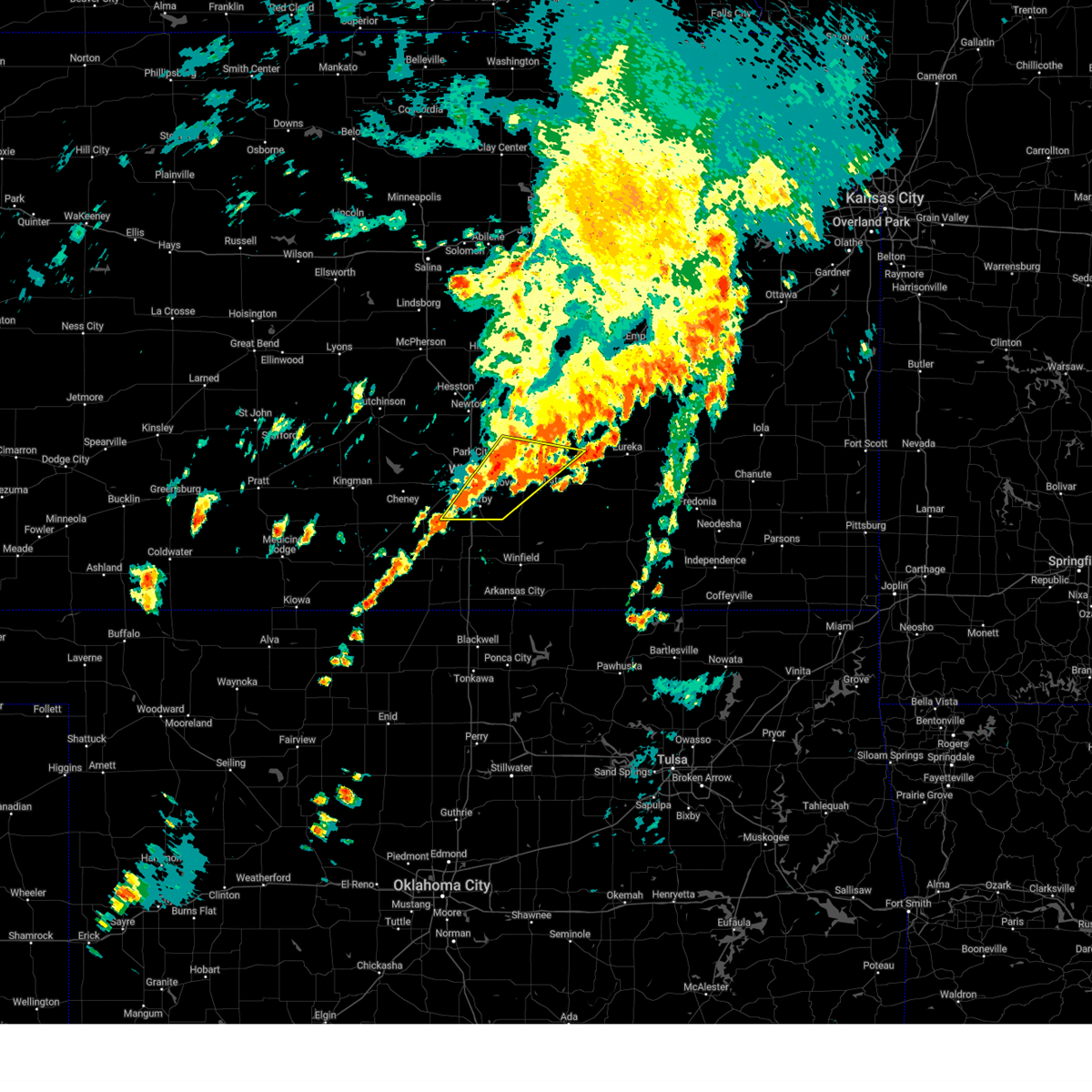 At 112 pm cdt, severe thunderstorms were located along a line extending from near northeast wichita to near clearwater, moving northeast at 40 mph (trained weather spotters). Hazards include 60 mph wind gusts and quarter size hail. Hail damage to vehicles is expected. expect wind damage to roofs, siding, and trees. Locations impacted include, wichita, andover, haysville, bel aire, benton, eastborough, south wichita, east wichita, mcconnell air force base and northeast wichita. At 112 pm cdt, severe thunderstorms were located along a line extending from near northeast wichita to near clearwater, moving northeast at 40 mph (trained weather spotters). Hazards include 60 mph wind gusts and quarter size hail. Hail damage to vehicles is expected. expect wind damage to roofs, siding, and trees. Locations impacted include, wichita, andover, haysville, bel aire, benton, eastborough, south wichita, east wichita, mcconnell air force base and northeast wichita.
|
| 6/3/2025 12:46 PM CDT |
 Svrict the national weather service in wichita has issued a * severe thunderstorm warning for, southeastern sedgwick county in south central kansas, southern butler county in south central kansas, * until 130 pm cdt. * at 1245 pm cdt, a severe thunderstorm was located very near east wichita, or 5 miles west of andover, moving northeast at 30 mph (trained weather spotters. at 1238 pm cdt, quarter size hail was reported by trained spotters 3 miles north of oaklawn). Hazards include 60 mph wind gusts and quarter size hail. Hail damage to vehicles is expected. expect wind damage to roofs, siding, and trees. this severe thunderstorm will be near, wichita, andover, and northeast wichita around 1250 pm cdt. bel aire around 1255 pm cdt. benton around 100 pm cdt. Other locations in the path of this severe thunderstorm include towanda. Svrict the national weather service in wichita has issued a * severe thunderstorm warning for, southeastern sedgwick county in south central kansas, southern butler county in south central kansas, * until 130 pm cdt. * at 1245 pm cdt, a severe thunderstorm was located very near east wichita, or 5 miles west of andover, moving northeast at 30 mph (trained weather spotters. at 1238 pm cdt, quarter size hail was reported by trained spotters 3 miles north of oaklawn). Hazards include 60 mph wind gusts and quarter size hail. Hail damage to vehicles is expected. expect wind damage to roofs, siding, and trees. this severe thunderstorm will be near, wichita, andover, and northeast wichita around 1250 pm cdt. bel aire around 1255 pm cdt. benton around 100 pm cdt. Other locations in the path of this severe thunderstorm include towanda.
|
| 6/3/2025 12:39 PM CDT |
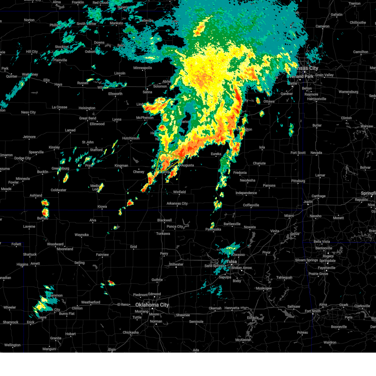 The storm which prompted the warning has weakened below severe limits, and no longer poses an immediate threat to life or property. therefore, the warning will be allowed to expire. however, small hail and heavy rain are still possible with this thunderstorm. The storm which prompted the warning has weakened below severe limits, and no longer poses an immediate threat to life or property. therefore, the warning will be allowed to expire. however, small hail and heavy rain are still possible with this thunderstorm.
|
| 6/3/2025 12:38 PM CDT | Quarter sized hail reported 3.6 miles NNW of Wichita, KS |
| 6/3/2025 12:20 PM CDT |
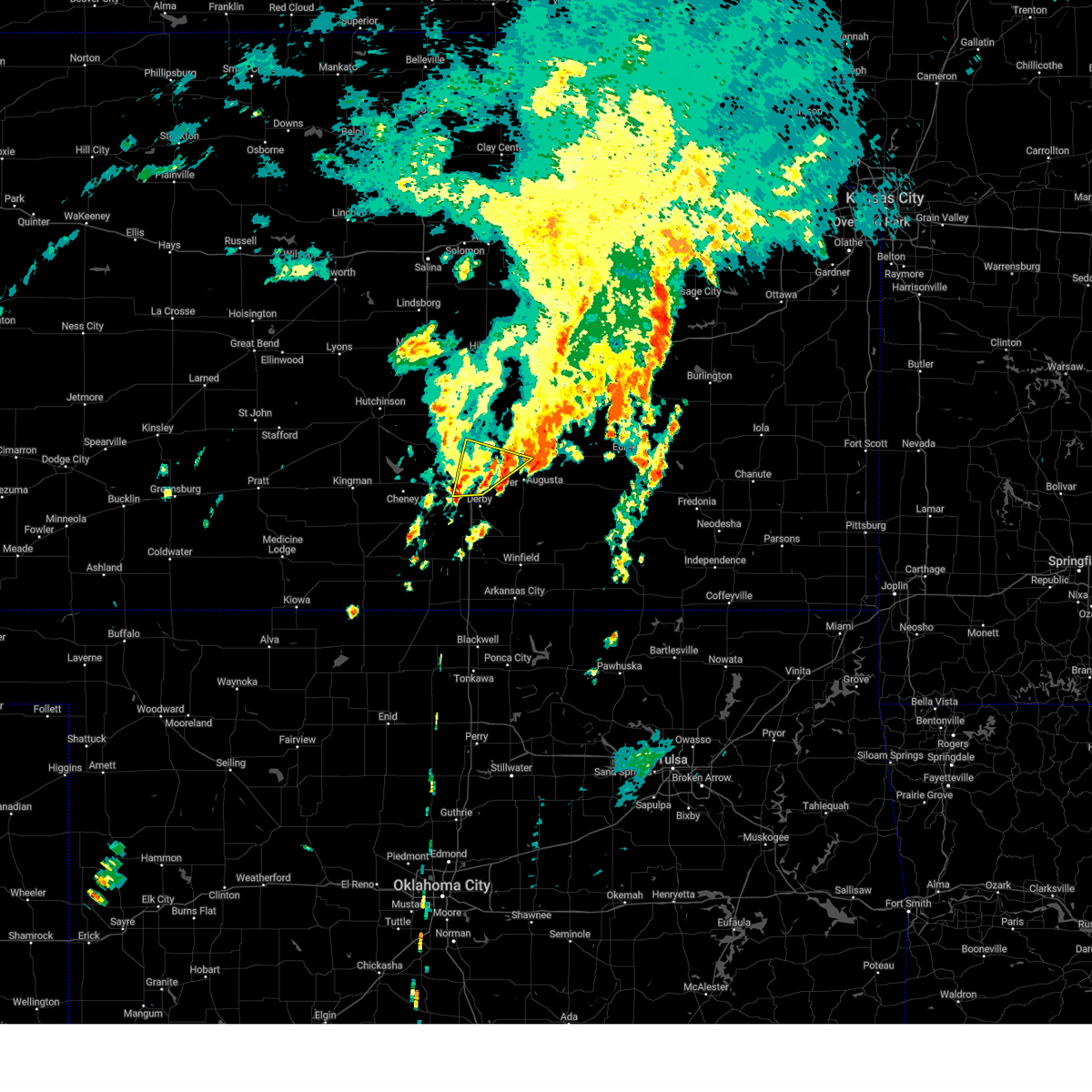 At 1219 pm cdt, a severe thunderstorm was located 3 miles southeast of eisenhower national airport, or 4 miles southwest of downtown wichita, moving northeast at 30 mph (radar indicated). Hazards include 60 mph wind gusts and quarter size hail. Hail damage to vehicles is expected. expect wind damage to roofs, siding, and trees. this severe storm will be near, wichita and downtown wichita around 1225 pm cdt. Other locations in the path of this severe thunderstorm include eastborough, east wichita, park city, bel aire, northeast wichita, kechi and benton. At 1219 pm cdt, a severe thunderstorm was located 3 miles southeast of eisenhower national airport, or 4 miles southwest of downtown wichita, moving northeast at 30 mph (radar indicated). Hazards include 60 mph wind gusts and quarter size hail. Hail damage to vehicles is expected. expect wind damage to roofs, siding, and trees. this severe storm will be near, wichita and downtown wichita around 1225 pm cdt. Other locations in the path of this severe thunderstorm include eastborough, east wichita, park city, bel aire, northeast wichita, kechi and benton.
|
| 6/3/2025 12:05 PM CDT |
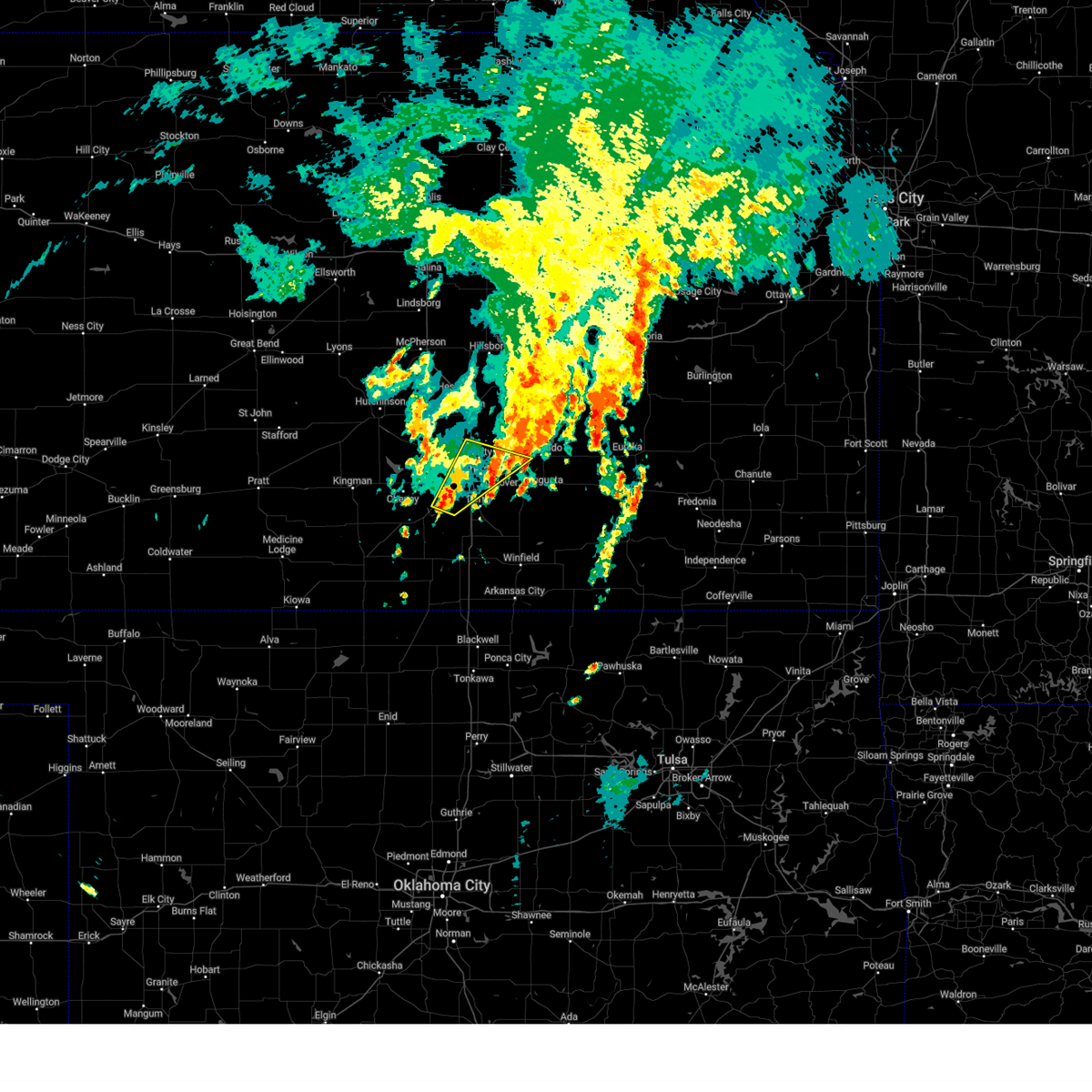 Svrict the national weather service in wichita has issued a * severe thunderstorm warning for, eastern sedgwick county in south central kansas, west central butler county in south central kansas, * until 1245 pm cdt. * at 1204 pm cdt, a severe thunderstorm was located 3 miles north of clearwater, moving northeast at 35 mph (radar indicated). Hazards include 60 mph wind gusts and quarter size hail. Hail damage to vehicles is expected. expect wind damage to roofs, siding, and trees. this severe thunderstorm will be near, wichita and haysville around 1210 pm cdt. eisenhower national airport around 1215 pm cdt. downtown wichita around 1220 pm cdt. Other locations in the path of this severe thunderstorm include eastborough, east wichita, park city, bel aire, kechi and northeast wichita. Svrict the national weather service in wichita has issued a * severe thunderstorm warning for, eastern sedgwick county in south central kansas, west central butler county in south central kansas, * until 1245 pm cdt. * at 1204 pm cdt, a severe thunderstorm was located 3 miles north of clearwater, moving northeast at 35 mph (radar indicated). Hazards include 60 mph wind gusts and quarter size hail. Hail damage to vehicles is expected. expect wind damage to roofs, siding, and trees. this severe thunderstorm will be near, wichita and haysville around 1210 pm cdt. eisenhower national airport around 1215 pm cdt. downtown wichita around 1220 pm cdt. Other locations in the path of this severe thunderstorm include eastborough, east wichita, park city, bel aire, kechi and northeast wichita.
|
| 6/2/2025 10:18 PM CDT |
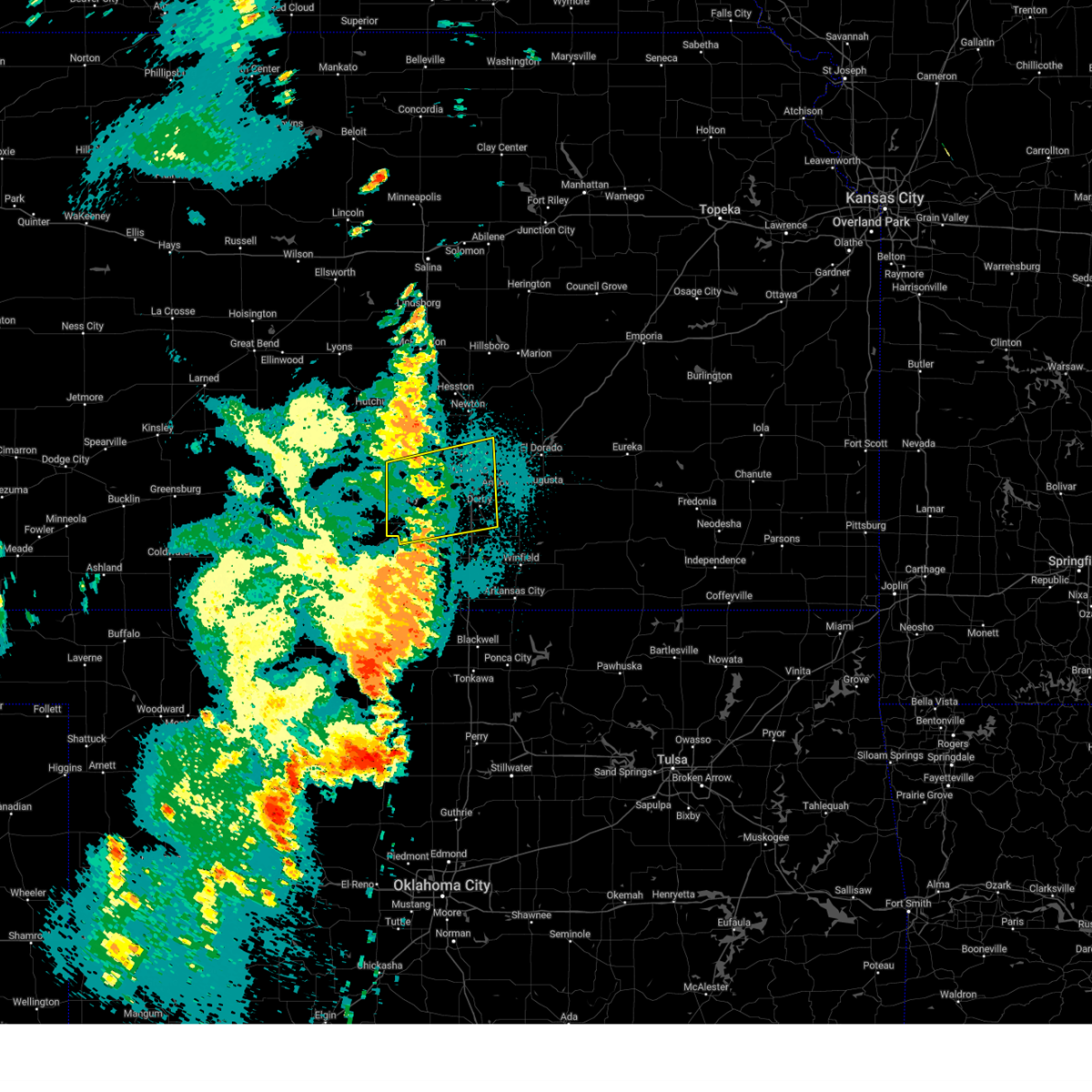 the severe thunderstorm warning has been cancelled and is no longer in effect the severe thunderstorm warning has been cancelled and is no longer in effect
|
| 6/2/2025 9:58 PM CDT |
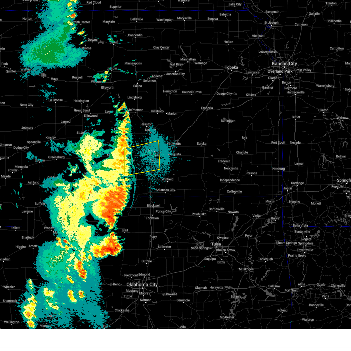 Svrict the national weather service in wichita has issued a * severe thunderstorm warning for, southeastern reno county in south central kansas, sedgwick county in south central kansas, eastern kingman county in south central kansas, northern sumner county in south central kansas, * until 1045 pm cdt. * at 958 pm cdt, severe thunderstorms were located along a line extending from near haven to near garden plain to 3 miles southwest of caldwell, moving northeast at 45 mph (radar indicated). Hazards include 60 mph wind gusts. expect damage to roofs, siding, and trees Svrict the national weather service in wichita has issued a * severe thunderstorm warning for, southeastern reno county in south central kansas, sedgwick county in south central kansas, eastern kingman county in south central kansas, northern sumner county in south central kansas, * until 1045 pm cdt. * at 958 pm cdt, severe thunderstorms were located along a line extending from near haven to near garden plain to 3 miles southwest of caldwell, moving northeast at 45 mph (radar indicated). Hazards include 60 mph wind gusts. expect damage to roofs, siding, and trees
|
| 6/2/2025 9:29 PM CDT |
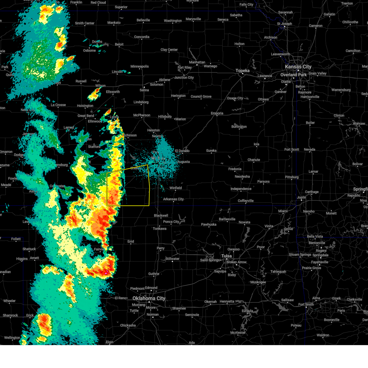 Svrict the national weather service in wichita has issued a * severe thunderstorm warning for, southwestern sedgwick county in south central kansas, harper county in south central kansas, southern kingman county in south central kansas, western sumner county in south central kansas, * until 1000 pm cdt. * at 929 pm cdt, severe thunderstorms were located along a line extending from 8 miles northwest of norwich to 5 miles southeast of harper to 5 miles northeast of nash, moving east at 50 mph (radar indicated). Hazards include 60 mph wind gusts and nickel size hail. expect damage to roofs, siding, and trees Svrict the national weather service in wichita has issued a * severe thunderstorm warning for, southwestern sedgwick county in south central kansas, harper county in south central kansas, southern kingman county in south central kansas, western sumner county in south central kansas, * until 1000 pm cdt. * at 929 pm cdt, severe thunderstorms were located along a line extending from 8 miles northwest of norwich to 5 miles southeast of harper to 5 miles northeast of nash, moving east at 50 mph (radar indicated). Hazards include 60 mph wind gusts and nickel size hail. expect damage to roofs, siding, and trees
|
| 5/25/2025 2:26 AM CDT |
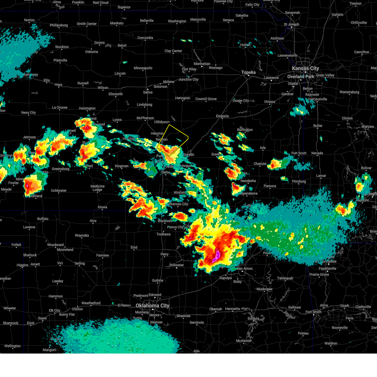 Svrict the national weather service in wichita has issued a * severe thunderstorm warning for, northeastern sedgwick county in south central kansas, eastern harvey county in south central kansas, northwestern butler county in south central kansas, southern marion county in central kansas, * until 330 am cdt. * at 226 am cdt, a severe thunderstorm was located 7 miles southeast of newton, moving northeast at 25 mph (radar indicated). Hazards include half dollar size hail. damage to vehicles is expected Svrict the national weather service in wichita has issued a * severe thunderstorm warning for, northeastern sedgwick county in south central kansas, eastern harvey county in south central kansas, northwestern butler county in south central kansas, southern marion county in central kansas, * until 330 am cdt. * at 226 am cdt, a severe thunderstorm was located 7 miles southeast of newton, moving northeast at 25 mph (radar indicated). Hazards include half dollar size hail. damage to vehicles is expected
|
| 5/24/2025 3:05 AM CDT |
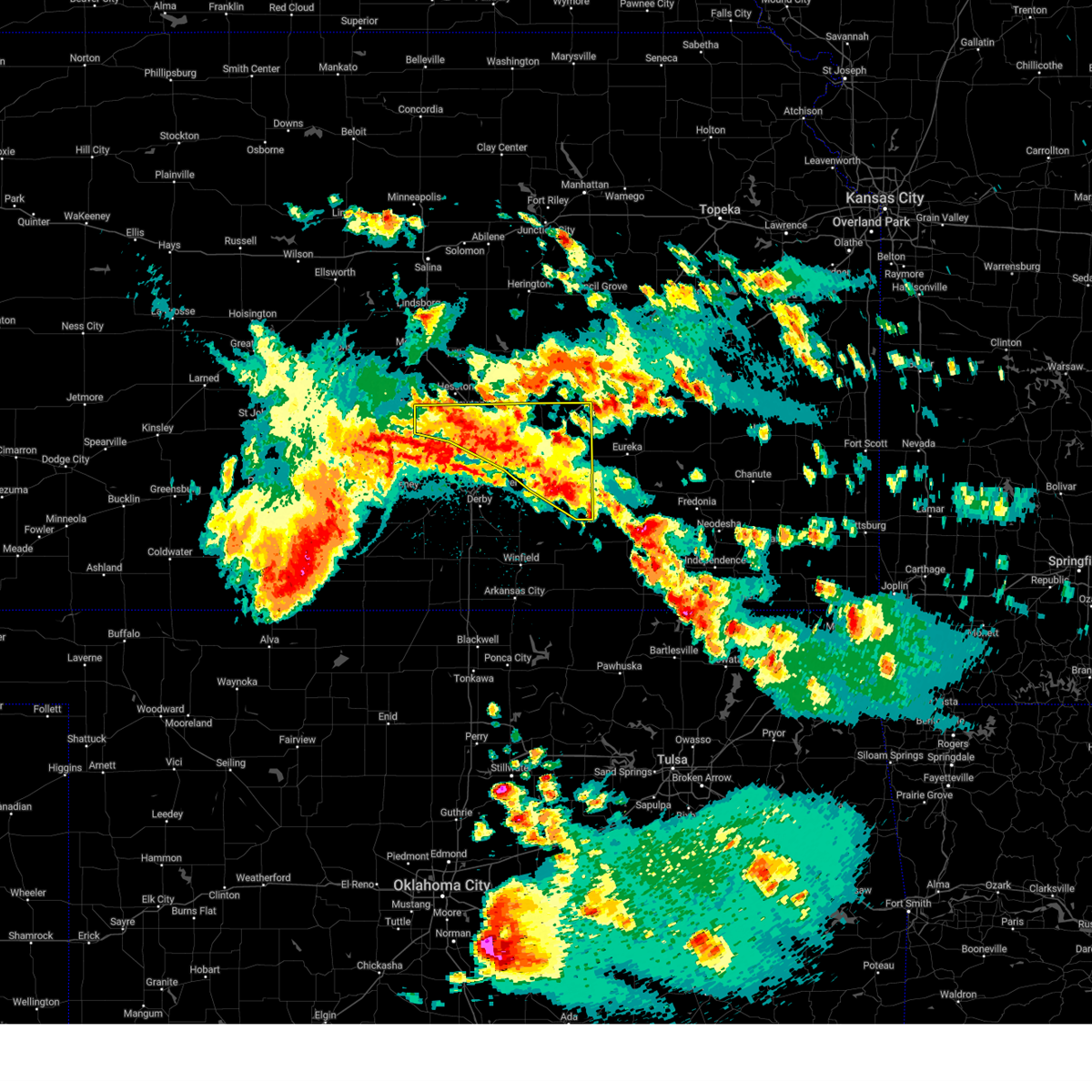 At 304 am cdt, severe thunderstorms were located along a line extending from near newton to near el dorado to 6 miles southeast of leon, moving east at 15 mph (radar indicated). Hazards include ping pong ball size hail. People and animals outdoors will be injured. expect damage to roofs, siding, windows, and vehicles. locations impacted include, newton, el dorado, augusta, park city, valley center, bel aire, halstead, north newton, sedgwick, towanda, burrton, benton, whitewater, leon, kechi, potwin, elbing, burns, latham, and rosalia. this includes the following highways, interstate 135 between mile markers 17 and 34. Interstate 35 between mile markers 59 and 96. At 304 am cdt, severe thunderstorms were located along a line extending from near newton to near el dorado to 6 miles southeast of leon, moving east at 15 mph (radar indicated). Hazards include ping pong ball size hail. People and animals outdoors will be injured. expect damage to roofs, siding, windows, and vehicles. locations impacted include, newton, el dorado, augusta, park city, valley center, bel aire, halstead, north newton, sedgwick, towanda, burrton, benton, whitewater, leon, kechi, potwin, elbing, burns, latham, and rosalia. this includes the following highways, interstate 135 between mile markers 17 and 34. Interstate 35 between mile markers 59 and 96.
|
| 5/24/2025 2:44 AM CDT |
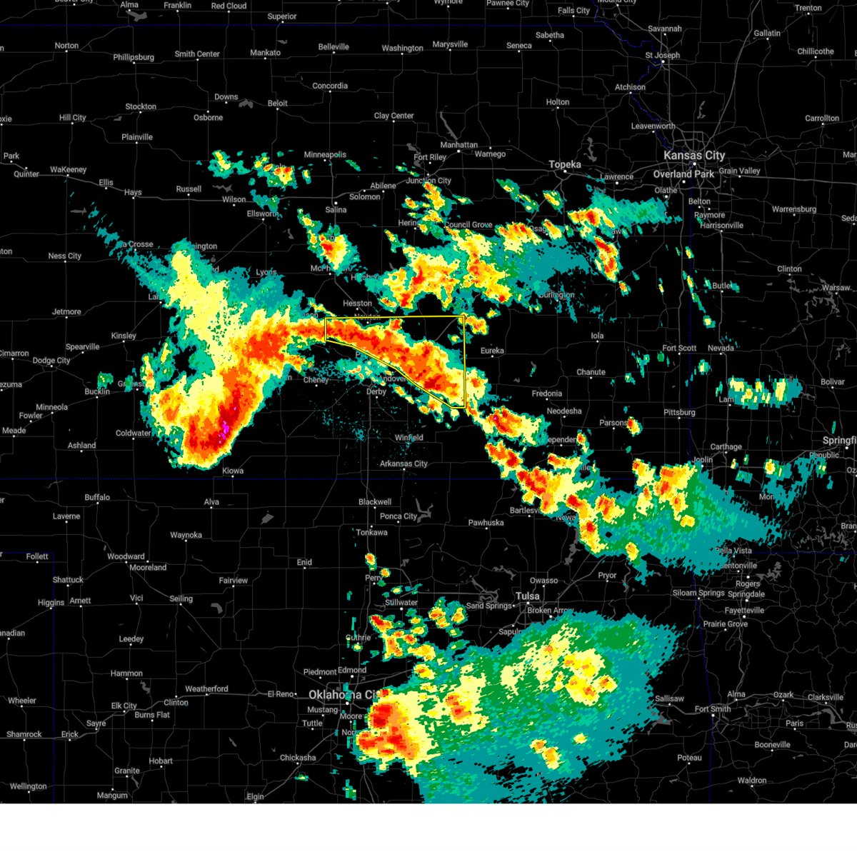 Svrict the national weather service in wichita has issued a * severe thunderstorm warning for, northeastern sedgwick county in south central kansas, harvey county in south central kansas, butler county in south central kansas, * until 330 am cdt. * at 242 am cdt, severe thunderstorms were located along a line extending from near burrton to 5 miles southeast of potwin to 5 miles southeast of leon, moving east at 25 mph. this warning replaces the previous warning in effect for the area, which expires at 245 am cdt (radar indicated). Hazards include ping pong ball size hail. People and animals outdoors will be injured. Expect damage to roofs, siding, windows, and vehicles. Svrict the national weather service in wichita has issued a * severe thunderstorm warning for, northeastern sedgwick county in south central kansas, harvey county in south central kansas, butler county in south central kansas, * until 330 am cdt. * at 242 am cdt, severe thunderstorms were located along a line extending from near burrton to 5 miles southeast of potwin to 5 miles southeast of leon, moving east at 25 mph. this warning replaces the previous warning in effect for the area, which expires at 245 am cdt (radar indicated). Hazards include ping pong ball size hail. People and animals outdoors will be injured. Expect damage to roofs, siding, windows, and vehicles.
|
| 5/24/2025 2:18 AM CDT |
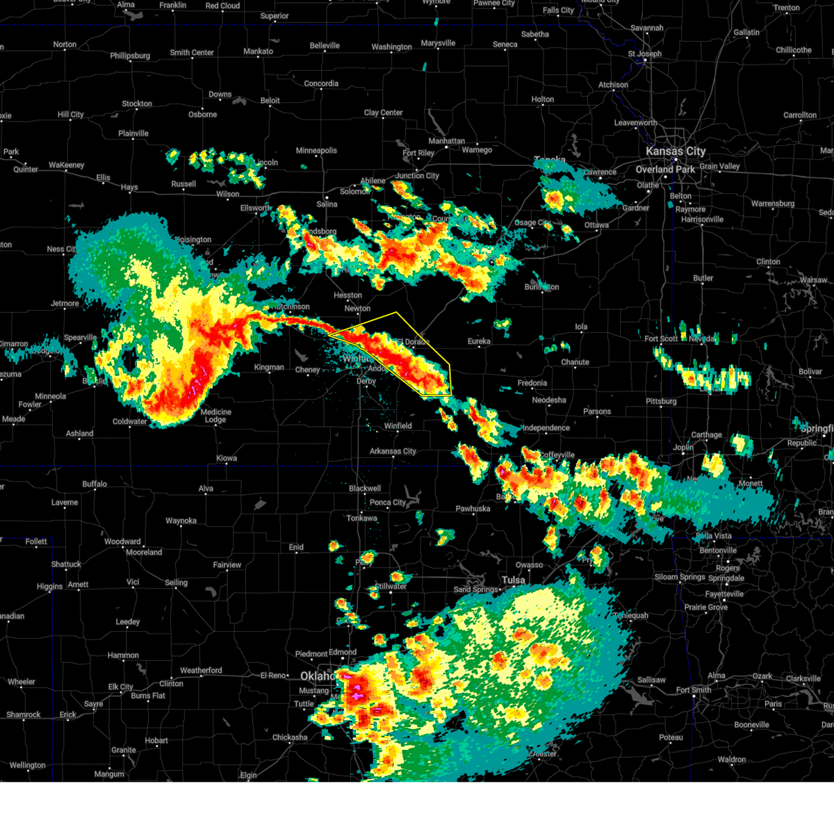 At 218 am cdt, severe thunderstorms were located along a line extending from near sedgwick to 5 miles southwest of potwin to near latham, moving east at 35 mph (radar indicated). Hazards include quarter size hail. Damage to vehicles is expected. locations impacted include, el dorado, andover, augusta, park city, valley center, bel aire, sedgwick, towanda, benton, whitewater, leon, kechi, bentley, potwin, latham, santa fe lake, el dorado state park, augusta municipal airport, el dorado airport, and el dorado lake. this includes the following highways, interstate 135 between mile markers 16 and 26. Interstate 35 between mile markers 56 and 78. At 218 am cdt, severe thunderstorms were located along a line extending from near sedgwick to 5 miles southwest of potwin to near latham, moving east at 35 mph (radar indicated). Hazards include quarter size hail. Damage to vehicles is expected. locations impacted include, el dorado, andover, augusta, park city, valley center, bel aire, sedgwick, towanda, benton, whitewater, leon, kechi, bentley, potwin, latham, santa fe lake, el dorado state park, augusta municipal airport, el dorado airport, and el dorado lake. this includes the following highways, interstate 135 between mile markers 16 and 26. Interstate 35 between mile markers 56 and 78.
|
| 5/24/2025 1:59 AM CDT |
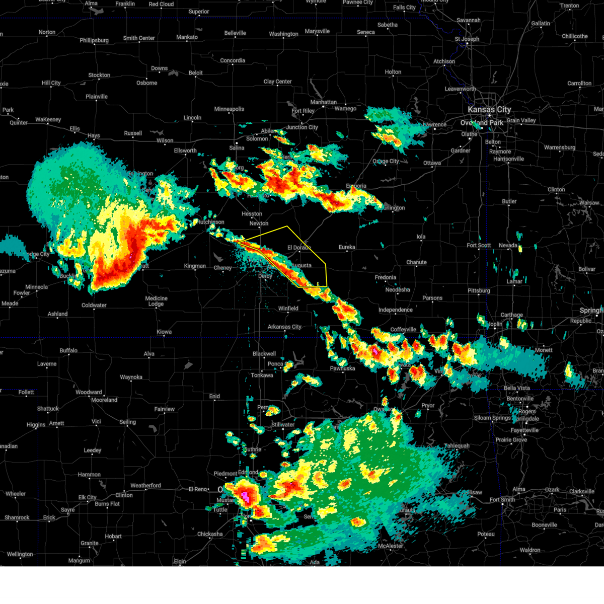 Svrict the national weather service in wichita has issued a * severe thunderstorm warning for, northeastern sedgwick county in south central kansas, southeastern harvey county in south central kansas, butler county in south central kansas, * until 245 am cdt. * at 158 am cdt, severe thunderstorms were located along a line extending from bentley to near kechi to near augusta, moving east at 35 mph (radar indicated). Hazards include quarter size hail. damage to vehicles is expected Svrict the national weather service in wichita has issued a * severe thunderstorm warning for, northeastern sedgwick county in south central kansas, southeastern harvey county in south central kansas, butler county in south central kansas, * until 245 am cdt. * at 158 am cdt, severe thunderstorms were located along a line extending from bentley to near kechi to near augusta, moving east at 35 mph (radar indicated). Hazards include quarter size hail. damage to vehicles is expected
|
| 5/20/2025 12:00 AM CDT | At 1200 am cdt, severe thunderstorms were located along a line extending from near newton to near augusta, moving northeast at 30 mph (a wind gust of 63 mph was reported at jabara airport). Hazards include 60 mph wind gusts and quarter size hail. Hail damage to vehicles is expected. expect wind damage to roofs, siding, and trees. locations impacted include, wichita, newton, el dorado, andover, augusta, park city, bel aire, towanda, benton, whitewater, kechi, potwin, elbing, northeast wichita, newton airport, el dorado state park, el dorado airport, el dorado lake, jabara airport, and santa fe lake. this includes the following highways, interstate 135 between mile markers 9 and 32. Interstate 35 between mile markers 57 and 82. |
| 5/19/2025 11:54 PM CDT | Awos station kaao 2 ese bel air in sedgwick county KS, 8.1 miles WSW of Wichita, KS |
| 5/19/2025 11:40 PM CDT | Large tree fell on a hous in sedgwick county KS, 3.4 miles W of Wichita, KS |
| 5/19/2025 11:39 PM CDT | Tree fell on house causing damag in sedgwick county KS, 2.9 miles W of Wichita, KS |
| 5/19/2025 11:37 PM CDT |
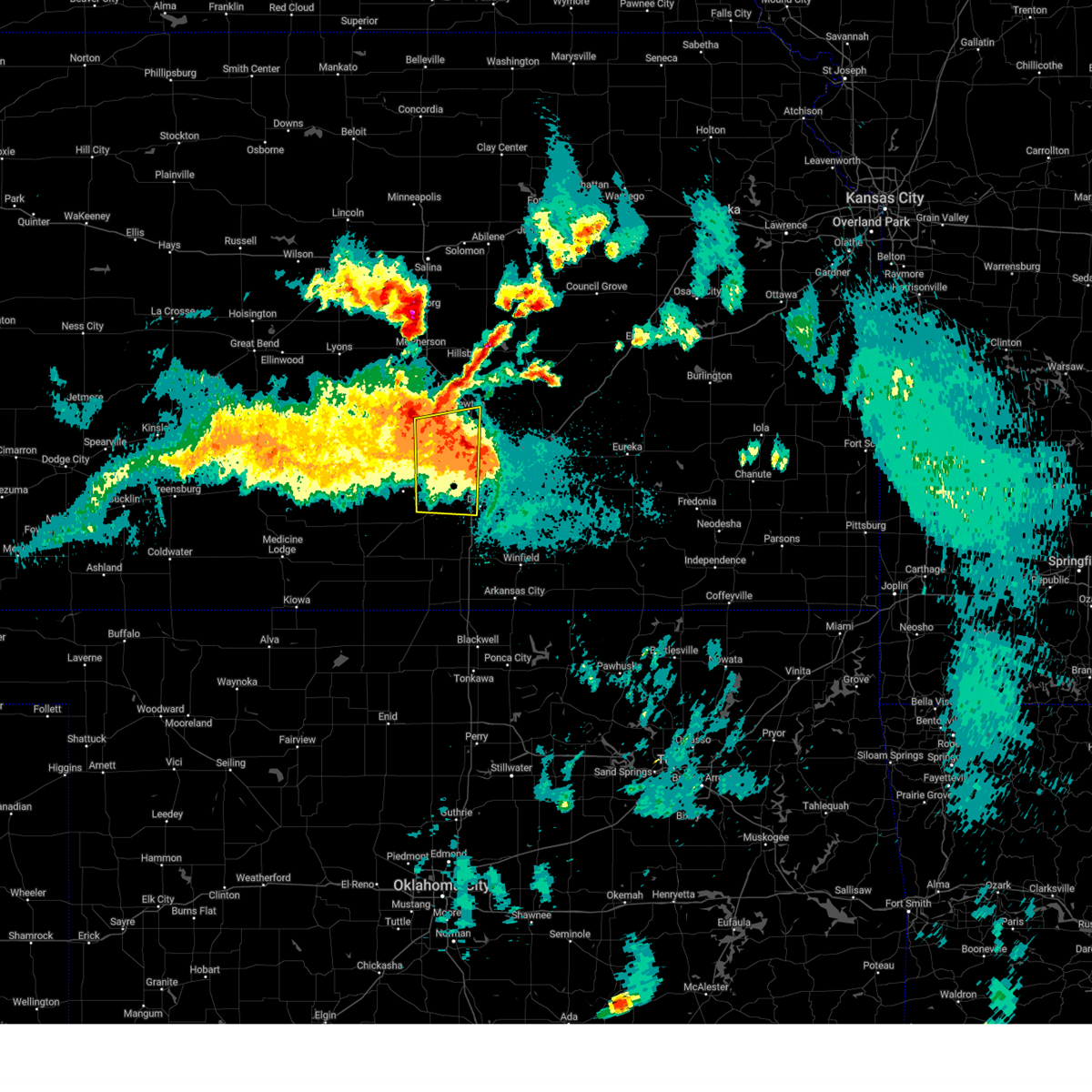 At 1136 pm cdt, severe thunderstorms were located along a line extending from near park city to south wichita, moving east at 55 mph (a 61 mph wind gust was reported at wichita eisenhower national airport). Hazards include 60 mph wind gusts and quarter size hail. Hail damage to vehicles is expected. expect wind damage to roofs, siding, and trees. locations impacted include, wichita, newton, haysville, park city, valley center, goddard, maize, clearwater, halstead, sedgwick, colwich, garden plain, mount hope, downtown wichita, kechi, andale, bentley, west wichita, eisenhower national airport, and south wichita. this includes the following highways, interstate 135 between mile markers 0 and 32. Interstate 35 between mile markers 36 and 45. At 1136 pm cdt, severe thunderstorms were located along a line extending from near park city to south wichita, moving east at 55 mph (a 61 mph wind gust was reported at wichita eisenhower national airport). Hazards include 60 mph wind gusts and quarter size hail. Hail damage to vehicles is expected. expect wind damage to roofs, siding, and trees. locations impacted include, wichita, newton, haysville, park city, valley center, goddard, maize, clearwater, halstead, sedgwick, colwich, garden plain, mount hope, downtown wichita, kechi, andale, bentley, west wichita, eisenhower national airport, and south wichita. this includes the following highways, interstate 135 between mile markers 0 and 32. Interstate 35 between mile markers 36 and 45.
|
| 5/19/2025 11:37 PM CDT |
 the severe thunderstorm warning has been cancelled and is no longer in effect the severe thunderstorm warning has been cancelled and is no longer in effect
|
| 5/19/2025 11:33 PM CDT | Storm damage reported in sedgwick county KS, 7.5 miles E of Wichita, KS |
| 5/19/2025 11:28 PM CDT | Svrict the national weather service in wichita has issued a * severe thunderstorm warning for, eastern sedgwick county in south central kansas, southeastern harvey county in south central kansas, butler county in south central kansas, * until 1215 am cdt. * at 1127 pm cdt, severe thunderstorms were located along a line extending from 6 miles northeast of valley center to near derby, moving east at 30 mph (a 61 mph wind gust was reported at wichita eisenhower national). Hazards include 60 mph wind gusts and penny size hail. expect damage to roofs, siding, and trees |
| 5/19/2025 11:25 PM CDT | Asos station kict wichita eisenhower airpor in sedgwick county KS, 5.4 miles ENE of Wichita, KS |
| 5/19/2025 11:01 PM CDT | Svrict the national weather service in wichita has issued a * severe thunderstorm warning for, southeastern reno county in south central kansas, sedgwick county in south central kansas, southern harvey county in south central kansas, northeastern kingman county in south central kansas, * until midnight cdt. * at 1100 pm cdt, severe thunderstorms were located along a line extending from near haven to cheney, moving east at 35 mph (radar indicated). Hazards include 60 mph wind gusts and quarter size hail. Hail damage to vehicles is expected. Expect wind damage to roofs, siding, and trees. |
| 5/18/2025 3:41 PM CDT |
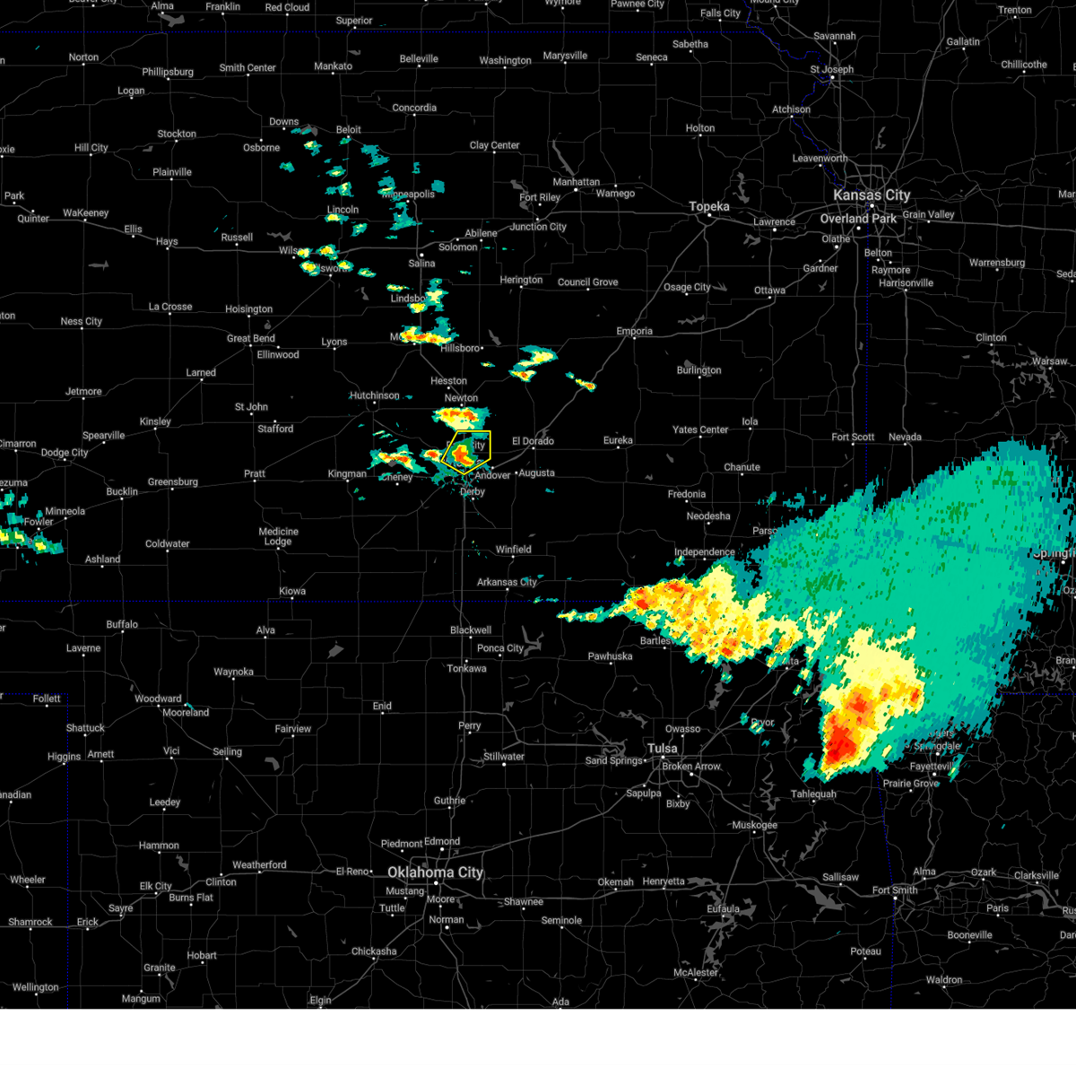 the severe thunderstorm warning has been cancelled and is no longer in effect the severe thunderstorm warning has been cancelled and is no longer in effect
|
| 5/18/2025 3:32 PM CDT |
 At 331 pm cdt, a severe thunderstorm was located near maize, moving northeast at 30 mph (radar indicated). Hazards include 60 mph wind gusts and half dollar size hail. Hail damage to vehicles is expected. expect wind damage to roofs, siding, and trees. locations impacted include, wichita, park city, valley center, bel aire, maize, downtown wichita, kechi, northeast wichita, and jabara airport. This includes interstate 135 between mile markers 7 and 22. At 331 pm cdt, a severe thunderstorm was located near maize, moving northeast at 30 mph (radar indicated). Hazards include 60 mph wind gusts and half dollar size hail. Hail damage to vehicles is expected. expect wind damage to roofs, siding, and trees. locations impacted include, wichita, park city, valley center, bel aire, maize, downtown wichita, kechi, northeast wichita, and jabara airport. This includes interstate 135 between mile markers 7 and 22.
|
| 5/18/2025 3:29 PM CDT | Golf Ball sized hail reported 3.1 miles ESE of Wichita, KS, near 13th and west... courtesy of kake tv. |
| 5/18/2025 3:28 PM CDT | Golf Ball sized hail reported 2.8 miles ESE of Wichita, KS, near 9th and zoo boulevard. |
| 5/18/2025 3:27 PM CDT |
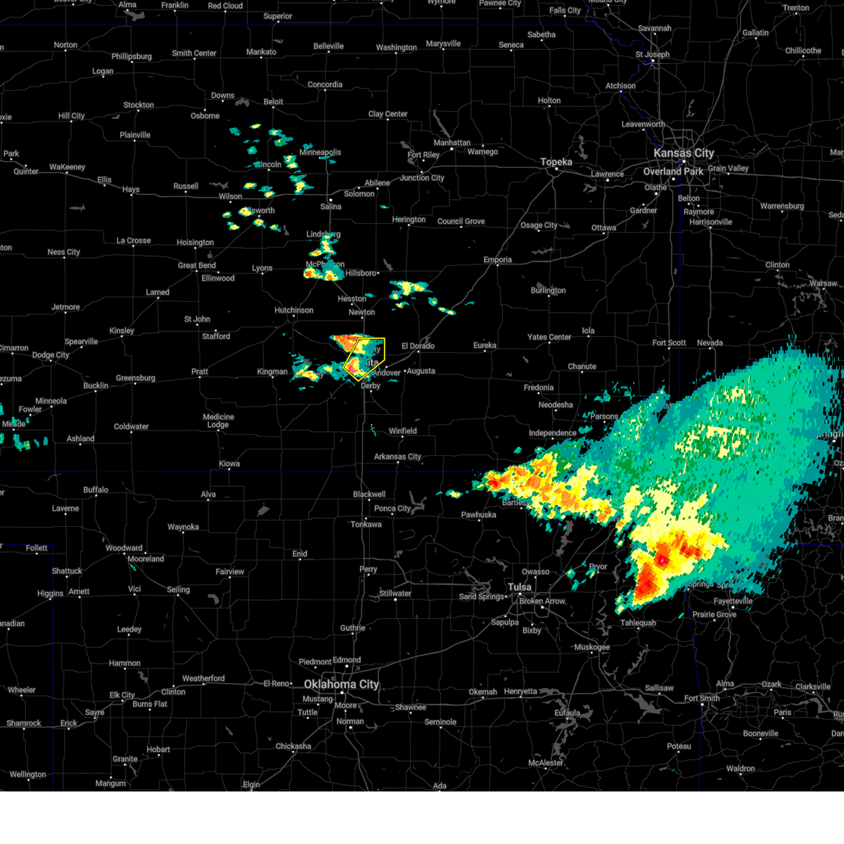 At 326 pm cdt, a severe thunderstorm was located near west wichita, or near wichita, moving northeast at 30 mph (radar indicated). Hazards include golf ball size hail and 60 mph wind gusts. People and animals outdoors will be injured. expect hail damage to roofs, siding, windows, and vehicles. expect wind damage to roofs, siding, and trees. locations impacted include, wichita, park city, valley center, bel aire, maize, downtown wichita, kechi, west wichita, northeast wichita, and jabara airport. This includes interstate 135 between mile markers 6 and 22. At 326 pm cdt, a severe thunderstorm was located near west wichita, or near wichita, moving northeast at 30 mph (radar indicated). Hazards include golf ball size hail and 60 mph wind gusts. People and animals outdoors will be injured. expect hail damage to roofs, siding, windows, and vehicles. expect wind damage to roofs, siding, and trees. locations impacted include, wichita, park city, valley center, bel aire, maize, downtown wichita, kechi, west wichita, northeast wichita, and jabara airport. This includes interstate 135 between mile markers 6 and 22.
|
| 5/18/2025 3:25 PM CDT | Golf Ball sized hail reported 4.8 miles E of Wichita, KS, near kellogg and ridge. |
| 5/18/2025 3:24 PM CDT | Half Dollar sized hail reported 5.9 miles ENE of Wichita, KS, half dollar size hail at nws office. |
| 5/18/2025 3:22 PM CDT |
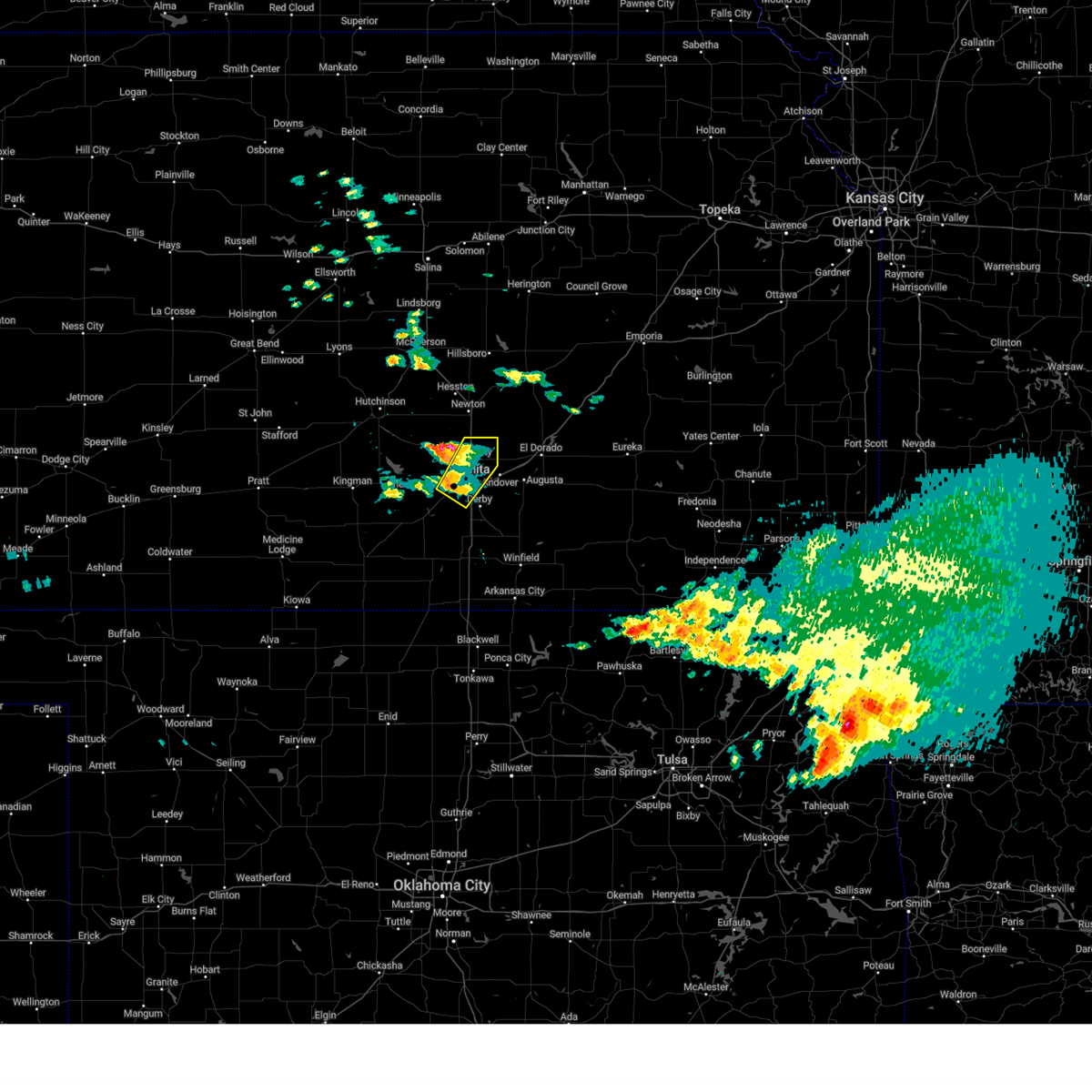 Svrict the national weather service in wichita has issued a * severe thunderstorm warning for, eastern sedgwick county in south central kansas, * until 415 pm cdt. * at 322 pm cdt, a severe thunderstorm was located over eisenhower national airport, or near downtown wichita, moving northeast at 30 mph (radar indicated). Hazards include 60 mph wind gusts and half dollar size hail. Hail damage to vehicles is expected. Expect wind damage to roofs, siding, and trees. Svrict the national weather service in wichita has issued a * severe thunderstorm warning for, eastern sedgwick county in south central kansas, * until 415 pm cdt. * at 322 pm cdt, a severe thunderstorm was located over eisenhower national airport, or near downtown wichita, moving northeast at 30 mph (radar indicated). Hazards include 60 mph wind gusts and half dollar size hail. Hail damage to vehicles is expected. Expect wind damage to roofs, siding, and trees.
|
| 5/18/2025 3:13 PM CDT |
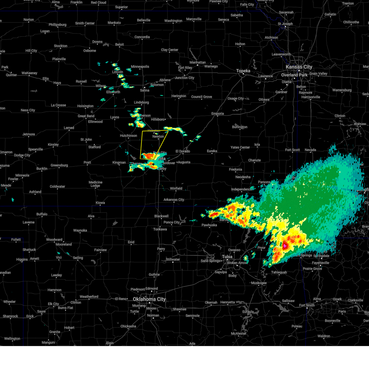 Svrict the national weather service in wichita has issued a * severe thunderstorm warning for, northwestern sedgwick county in south central kansas, harvey county in south central kansas, * until 415 pm cdt. * at 313 pm cdt, a severe thunderstorm was located over colwich, moving north at 40 mph (radar indicated). Hazards include 60 mph wind gusts and half dollar size hail. Hail damage to vehicles is expected. Expect wind damage to roofs, siding, and trees. Svrict the national weather service in wichita has issued a * severe thunderstorm warning for, northwestern sedgwick county in south central kansas, harvey county in south central kansas, * until 415 pm cdt. * at 313 pm cdt, a severe thunderstorm was located over colwich, moving north at 40 mph (radar indicated). Hazards include 60 mph wind gusts and half dollar size hail. Hail damage to vehicles is expected. Expect wind damage to roofs, siding, and trees.
|
| 5/18/2025 3:01 PM CDT |
 At 301 pm cdt, a severe thunderstorm was located near garden plain, moving north at 40 mph (radar indicated). Hazards include golf ball size hail and 60 mph wind gusts. People and animals outdoors will be injured. expect hail damage to roofs, siding, windows, and vehicles. expect wind damage to roofs, siding, and trees. Locations impacted include, wichita, goddard, maize, colwich, garden plain, andale, west wichita, and lake afton. At 301 pm cdt, a severe thunderstorm was located near garden plain, moving north at 40 mph (radar indicated). Hazards include golf ball size hail and 60 mph wind gusts. People and animals outdoors will be injured. expect hail damage to roofs, siding, windows, and vehicles. expect wind damage to roofs, siding, and trees. Locations impacted include, wichita, goddard, maize, colwich, garden plain, andale, west wichita, and lake afton.
|
| 5/18/2025 3:01 PM CDT |
 the severe thunderstorm warning has been cancelled and is no longer in effect the severe thunderstorm warning has been cancelled and is no longer in effect
|
| 5/18/2025 2:58 PM CDT |
 At 258 pm cdt, a severe thunderstorm was located over garden plain, moving north at 40 mph (radar indicated). Hazards include 60 mph wind gusts and half dollar size hail. Hail damage to vehicles is expected. expect wind damage to roofs, siding, and trees. Locations impacted include, wichita, goddard, maize, cheney, colwich, garden plain, andale, west wichita, and lake afton. At 258 pm cdt, a severe thunderstorm was located over garden plain, moving north at 40 mph (radar indicated). Hazards include 60 mph wind gusts and half dollar size hail. Hail damage to vehicles is expected. expect wind damage to roofs, siding, and trees. Locations impacted include, wichita, goddard, maize, cheney, colwich, garden plain, andale, west wichita, and lake afton.
|
| 5/18/2025 2:54 PM CDT |
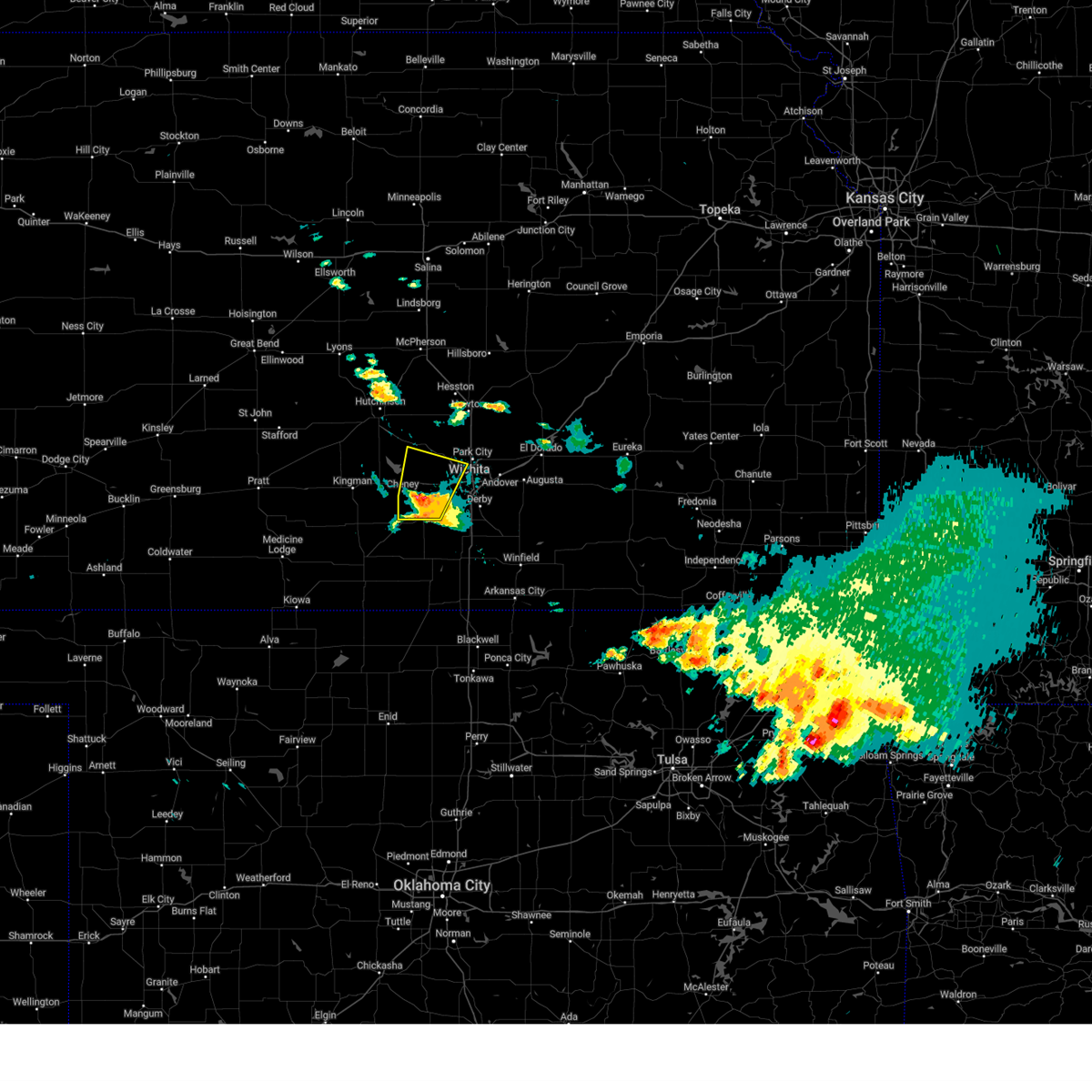 the severe thunderstorm warning has been cancelled and is no longer in effect the severe thunderstorm warning has been cancelled and is no longer in effect
|
| 5/18/2025 2:54 PM CDT |
 At 253 pm cdt, a severe thunderstorm was located near garden plain, moving north at 45 mph (radar indicated). Hazards include 60 mph wind gusts and half dollar size hail. Hail damage to vehicles is expected. expect wind damage to roofs, siding, and trees. Locations impacted include, wichita, goddard, maize, cheney, colwich, garden plain, andale, viola, west wichita, eisenhower national airport, and lake afton. At 253 pm cdt, a severe thunderstorm was located near garden plain, moving north at 45 mph (radar indicated). Hazards include 60 mph wind gusts and half dollar size hail. Hail damage to vehicles is expected. expect wind damage to roofs, siding, and trees. Locations impacted include, wichita, goddard, maize, cheney, colwich, garden plain, andale, viola, west wichita, eisenhower national airport, and lake afton.
|
| 5/18/2025 2:46 PM CDT |
 At 246 pm cdt, a severe thunderstorm was located over viola, or 8 miles north of conway springs, moving north at 40 mph (radar indicated). Hazards include 60 mph wind gusts and quarter size hail. Hail damage to vehicles is expected. expect wind damage to roofs, siding, and trees. Locations impacted include, wichita, goddard, maize, clearwater, cheney, colwich, conway springs, garden plain, andale, viola, west wichita, eisenhower national airport, and lake afton. At 246 pm cdt, a severe thunderstorm was located over viola, or 8 miles north of conway springs, moving north at 40 mph (radar indicated). Hazards include 60 mph wind gusts and quarter size hail. Hail damage to vehicles is expected. expect wind damage to roofs, siding, and trees. Locations impacted include, wichita, goddard, maize, clearwater, cheney, colwich, conway springs, garden plain, andale, viola, west wichita, eisenhower national airport, and lake afton.
|
| 5/18/2025 2:46 PM CDT |
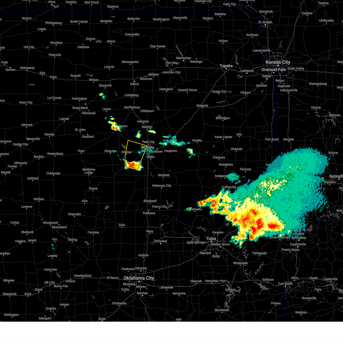 the severe thunderstorm warning has been cancelled and is no longer in effect the severe thunderstorm warning has been cancelled and is no longer in effect
|
| 5/18/2025 2:37 PM CDT |
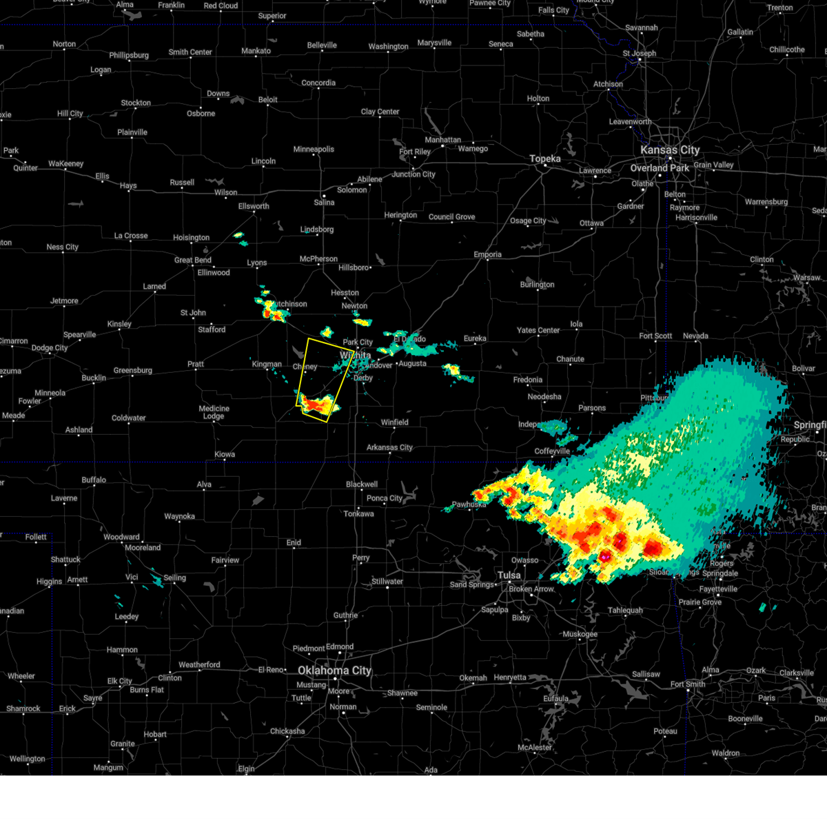 Svrict the national weather service in wichita has issued a * severe thunderstorm warning for, southeastern reno county in south central kansas, western sedgwick county in south central kansas, southeastern kingman county in south central kansas, northwestern sumner county in south central kansas, * until 315 pm cdt. * at 235 pm cdt, a severe thunderstorm was located near conway springs, moving north at 40 mph (radar indicated). Hazards include 60 mph wind gusts and quarter size hail. Hail damage to vehicles is expected. Expect wind damage to roofs, siding, and trees. Svrict the national weather service in wichita has issued a * severe thunderstorm warning for, southeastern reno county in south central kansas, western sedgwick county in south central kansas, southeastern kingman county in south central kansas, northwestern sumner county in south central kansas, * until 315 pm cdt. * at 235 pm cdt, a severe thunderstorm was located near conway springs, moving north at 40 mph (radar indicated). Hazards include 60 mph wind gusts and quarter size hail. Hail damage to vehicles is expected. Expect wind damage to roofs, siding, and trees.
|
| 4/2/2025 3:08 AM CDT |
 At 307 am cdt, a severe thunderstorm was located over kechi, or near bel aire, moving northeast at 65 mph (radar indicated). Hazards include quarter size hail. Damage to vehicles is expected. Locations impacted include, newton airport, bel aire, northeast wichita, benton, whitewater, north newton, walton, valley center, bentley, potwin, sedgwick, newton, park city, elbing, kechi, jabara airport, andover, and wichita. At 307 am cdt, a severe thunderstorm was located over kechi, or near bel aire, moving northeast at 65 mph (radar indicated). Hazards include quarter size hail. Damage to vehicles is expected. Locations impacted include, newton airport, bel aire, northeast wichita, benton, whitewater, north newton, walton, valley center, bentley, potwin, sedgwick, newton, park city, elbing, kechi, jabara airport, andover, and wichita.
|
| 4/2/2025 3:04 AM CDT |
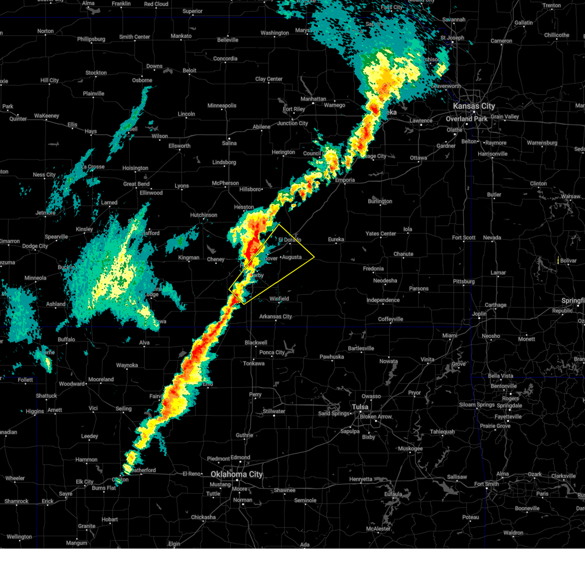 Svrict the national weather service in wichita has issued a * severe thunderstorm warning for, northwestern cowley county in south central kansas, southeastern sedgwick county in south central kansas, southwestern butler county in south central kansas, northeastern sumner county in south central kansas, * until 345 am cdt. * at 303 am cdt, a severe thunderstorm was located 6 miles north of wellington, moving northeast at 70 mph (radar indicated). Hazards include quarter size hail. damage to vehicles is expected Svrict the national weather service in wichita has issued a * severe thunderstorm warning for, northwestern cowley county in south central kansas, southeastern sedgwick county in south central kansas, southwestern butler county in south central kansas, northeastern sumner county in south central kansas, * until 345 am cdt. * at 303 am cdt, a severe thunderstorm was located 6 miles north of wellington, moving northeast at 70 mph (radar indicated). Hazards include quarter size hail. damage to vehicles is expected
|
| 4/2/2025 2:57 AM CDT |
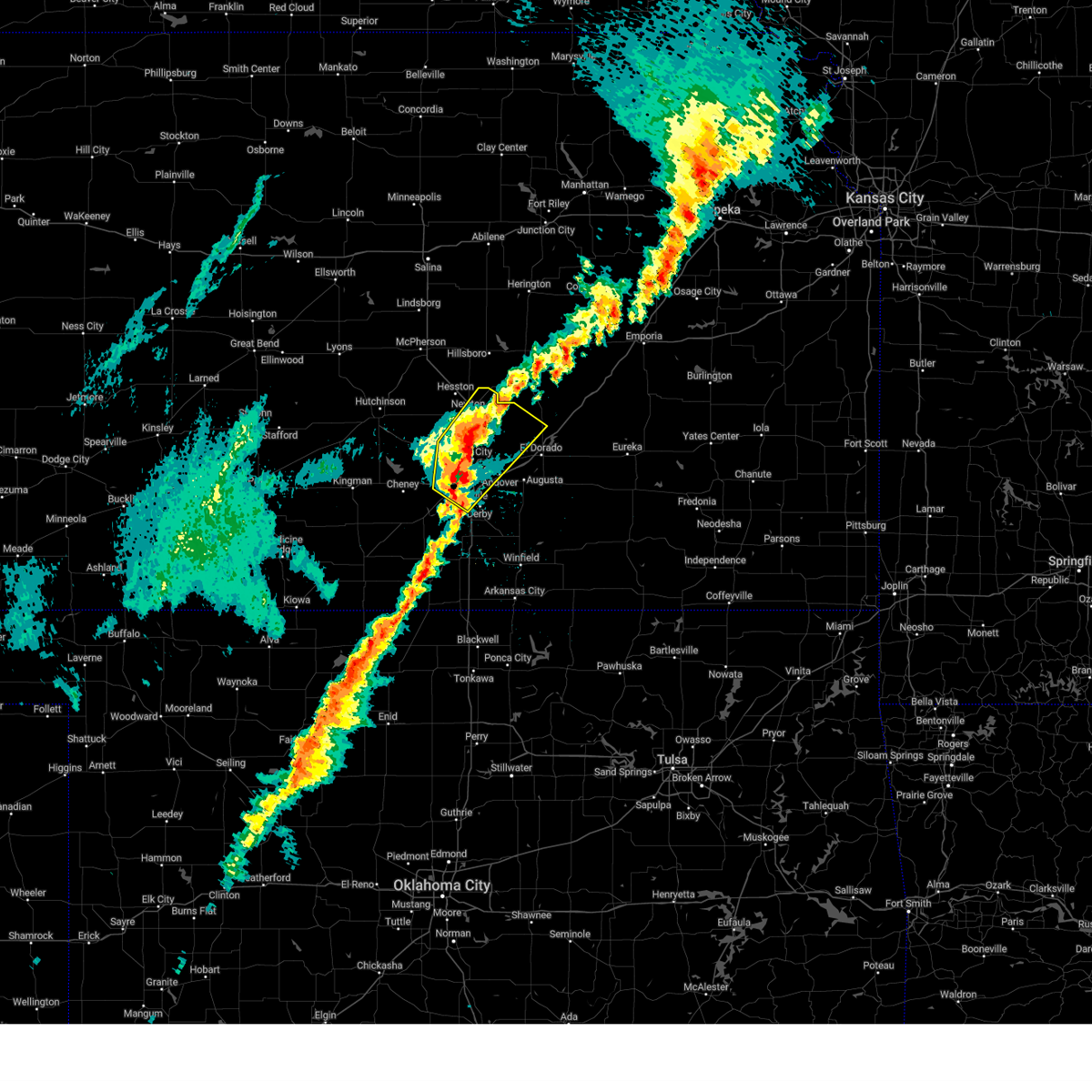 At 256 am cdt, a severe thunderstorm was located over downtown wichita, moving northeast at 65 mph (trained weather spotters. at 255 am, quarter size hail was reported at eisenhower national airport). Hazards include quarter size hail. Damage to vehicles is expected. Locations impacted include, west wichita, bel aire, colwich, eisenhower national airport, northeast wichita, eastborough, maize, north newton, potwin, wichita, park city, elbing, jabara airport, east wichita, newton airport, benton, whitewater, oaklawn, walton, and valley center. At 256 am cdt, a severe thunderstorm was located over downtown wichita, moving northeast at 65 mph (trained weather spotters. at 255 am, quarter size hail was reported at eisenhower national airport). Hazards include quarter size hail. Damage to vehicles is expected. Locations impacted include, west wichita, bel aire, colwich, eisenhower national airport, northeast wichita, eastborough, maize, north newton, potwin, wichita, park city, elbing, jabara airport, east wichita, newton airport, benton, whitewater, oaklawn, walton, and valley center.
|
| 4/2/2025 2:55 AM CDT | Quarter sized hail reported 5.9 miles ENE of Wichita, KS, mostly peas and dimes... but a couple of hail stones measured up to 1 inch in diameter. |
| 4/2/2025 2:48 AM CDT |
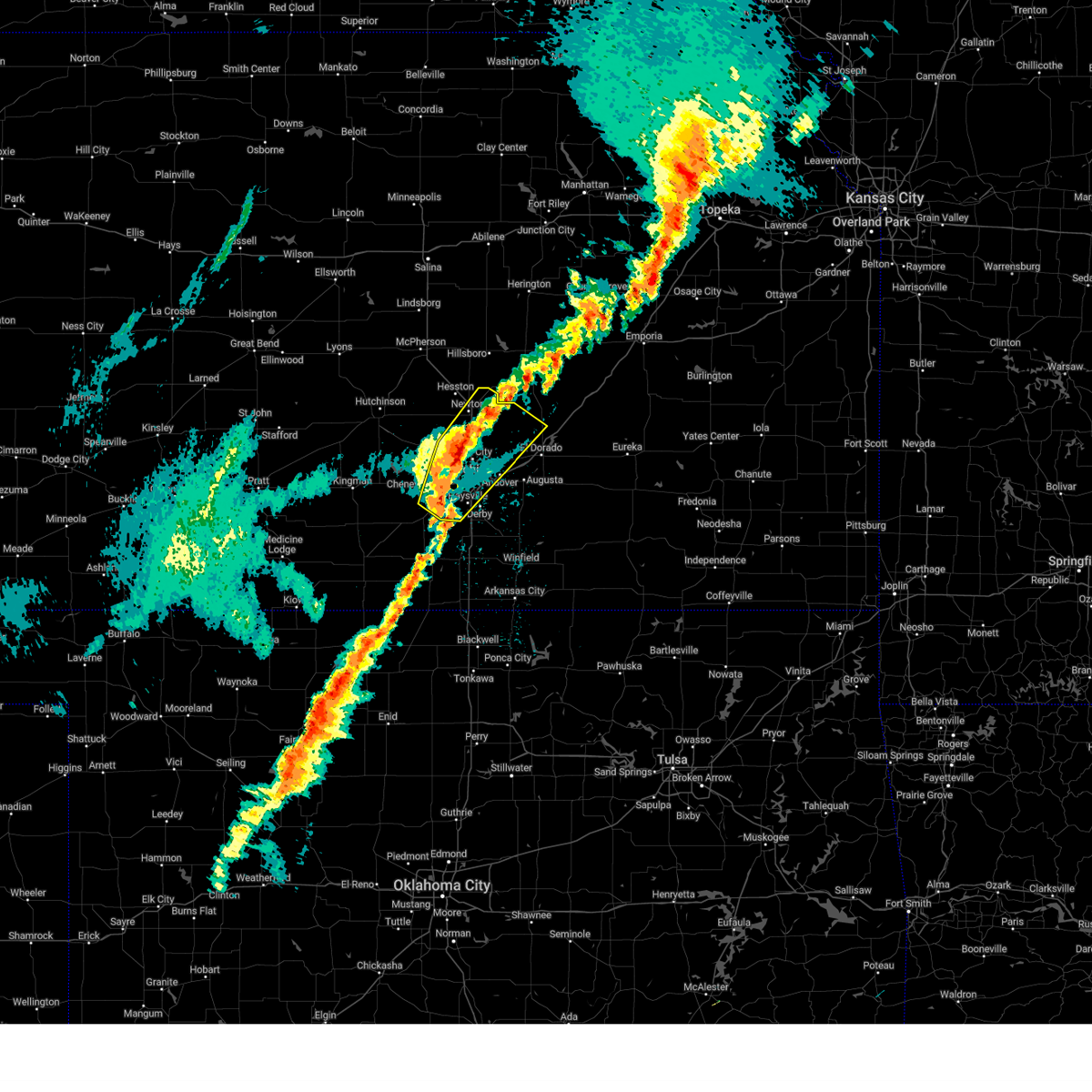 Svrict the national weather service in wichita has issued a * severe thunderstorm warning for, sedgwick county in south central kansas, eastern harvey county in south central kansas, northwestern butler county in south central kansas, * until 330 am cdt. * at 248 am cdt, a severe thunderstorm was located near goddard, moving northeast at 65 mph (radar indicated). Hazards include quarter size hail. damage to vehicles is expected Svrict the national weather service in wichita has issued a * severe thunderstorm warning for, sedgwick county in south central kansas, eastern harvey county in south central kansas, northwestern butler county in south central kansas, * until 330 am cdt. * at 248 am cdt, a severe thunderstorm was located near goddard, moving northeast at 65 mph (radar indicated). Hazards include quarter size hail. damage to vehicles is expected
|
| 11/18/2024 3:20 PM CST | Gust measured at jabara airpor in sedgwick county KS, 8.1 miles WSW of Wichita, KS |
| 11/3/2024 5:31 PM CST |
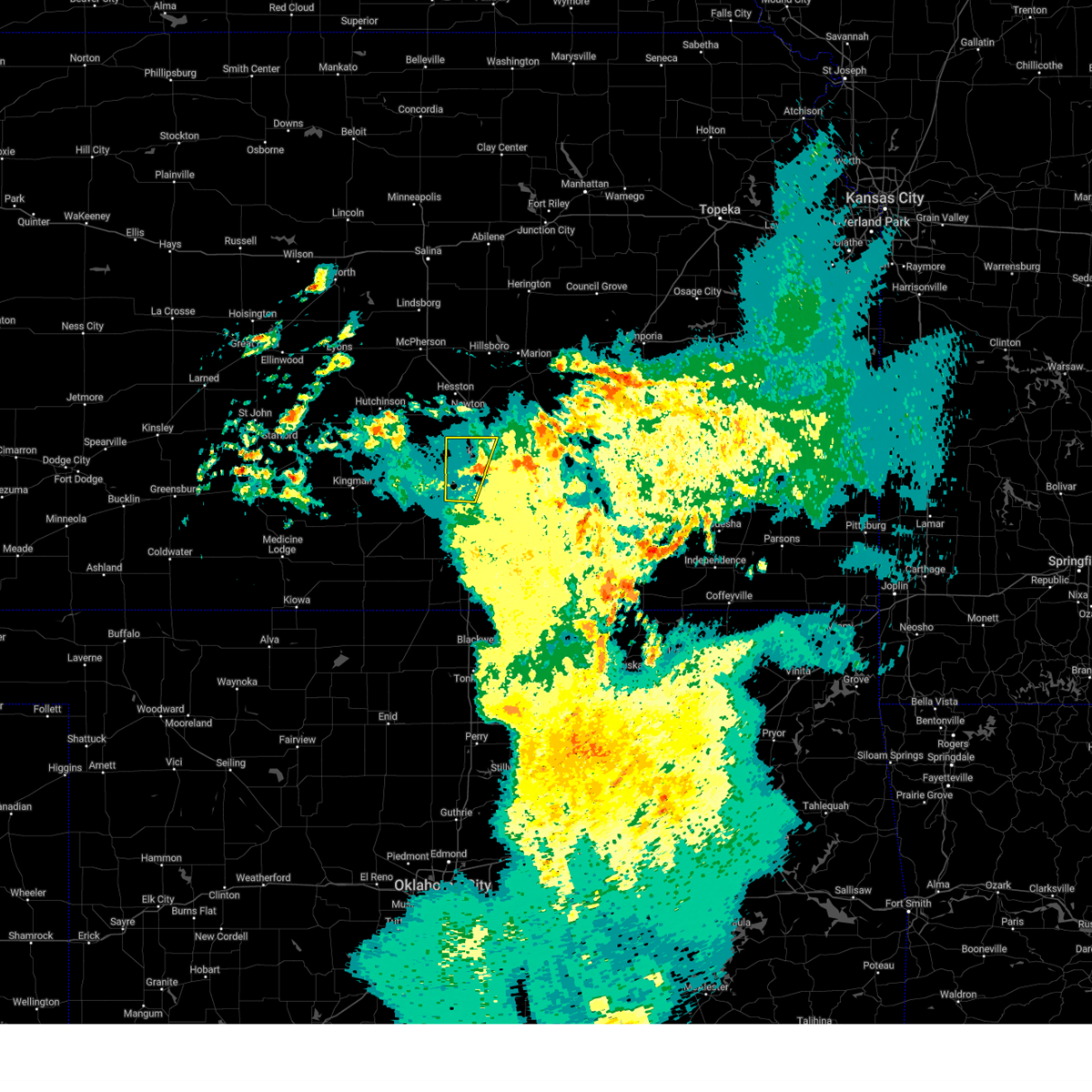 the severe thunderstorm warning has been cancelled and is no longer in effect the severe thunderstorm warning has been cancelled and is no longer in effect
|
| 11/3/2024 5:22 PM CST | Estimation of 50-60 mph wind gust in sedgwick county KS, 2.6 miles E of Wichita, KS |
| 11/3/2024 5:22 PM CST |
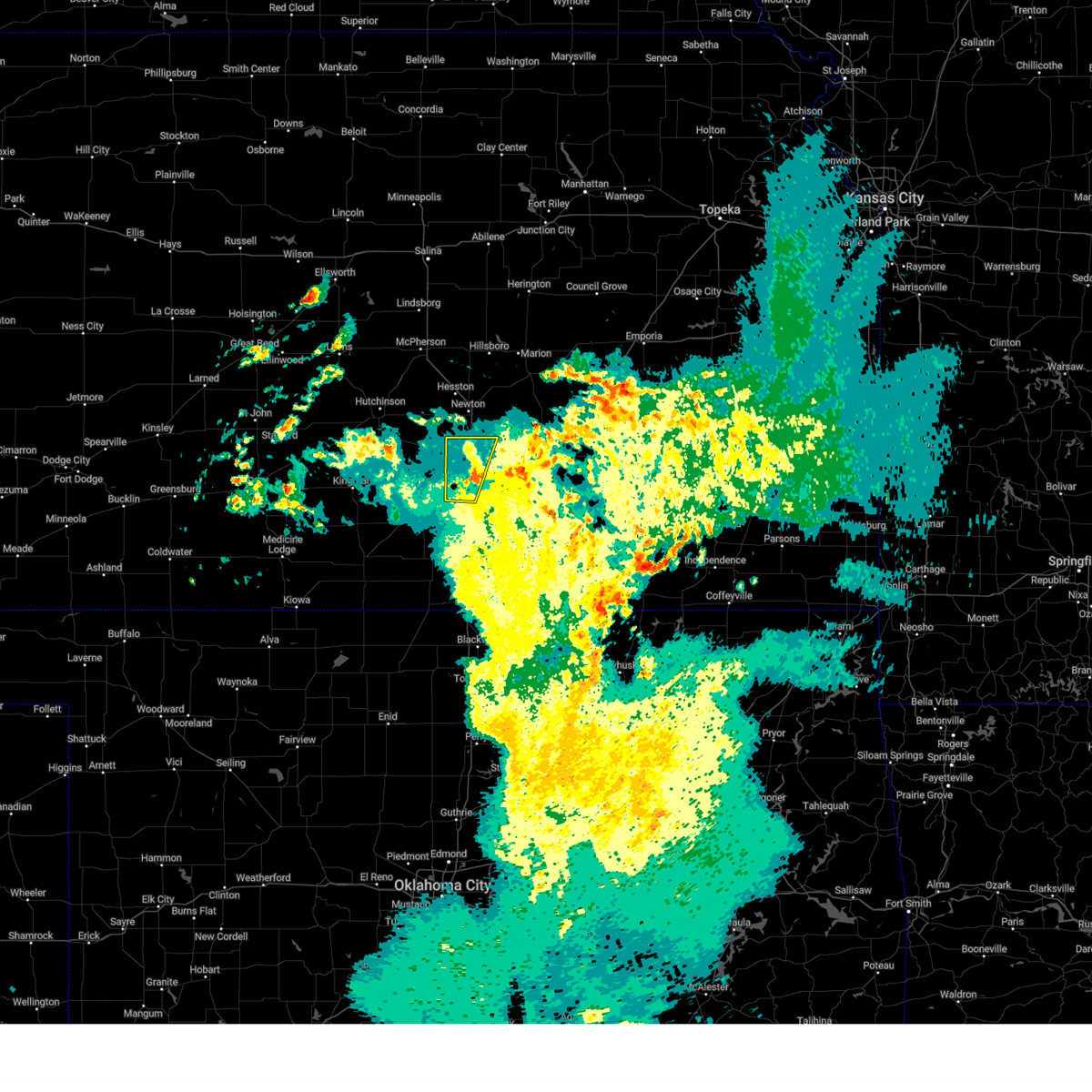 At 521 pm cst, a severe thunderstorm was located over downtown wichita, moving north at 40 mph (radar indicated. at 518 pm cst, wichita eisenhower airport recorded a 57 mph wind gust). Hazards include 60 mph wind gusts. Expect damage to roofs, siding, and trees. Locations impacted include, wichita, haysville, park city, valley center, bel aire, maize, sedgwick, downtown wichita, kechi, eastborough, west wichita, east wichita, eisenhower national airport, south wichita, oaklawn, and jabara airport. At 521 pm cst, a severe thunderstorm was located over downtown wichita, moving north at 40 mph (radar indicated. at 518 pm cst, wichita eisenhower airport recorded a 57 mph wind gust). Hazards include 60 mph wind gusts. Expect damage to roofs, siding, and trees. Locations impacted include, wichita, haysville, park city, valley center, bel aire, maize, sedgwick, downtown wichita, kechi, eastborough, west wichita, east wichita, eisenhower national airport, south wichita, oaklawn, and jabara airport.
|
| 11/3/2024 5:04 PM CST |
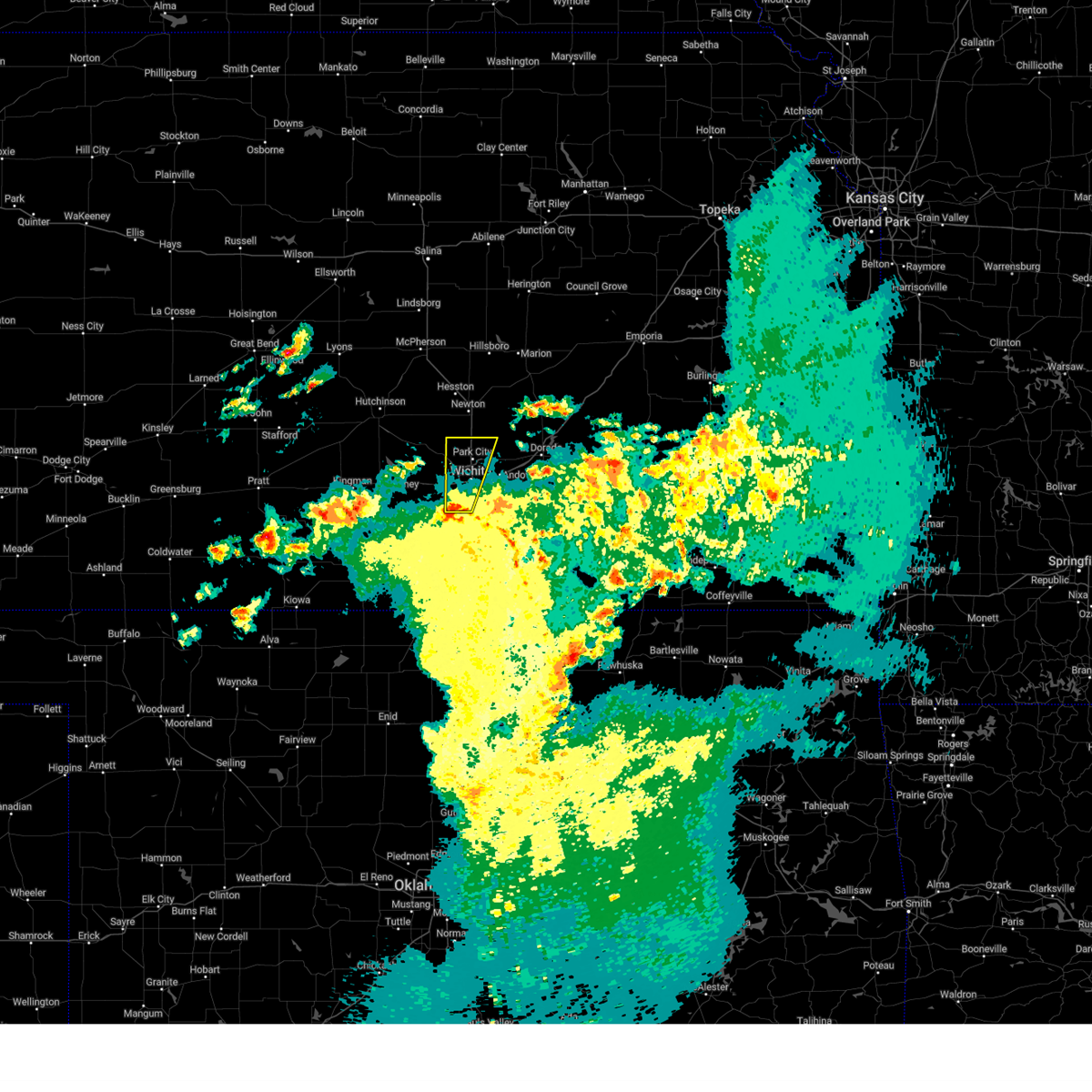 Svrict the national weather service in wichita has issued a * severe thunderstorm warning for, eastern sedgwick county in south central kansas, * until 545 pm cst. * at 504 pm cst, a severe thunderstorm was located near eisenhower national airport, or near haysville, moving north at 20 mph (radar indicated). Hazards include 60 mph wind gusts. expect damage to roofs, siding, and trees Svrict the national weather service in wichita has issued a * severe thunderstorm warning for, eastern sedgwick county in south central kansas, * until 545 pm cst. * at 504 pm cst, a severe thunderstorm was located near eisenhower national airport, or near haysville, moving north at 20 mph (radar indicated). Hazards include 60 mph wind gusts. expect damage to roofs, siding, and trees
|
| 9/20/2024 9:42 PM CDT |
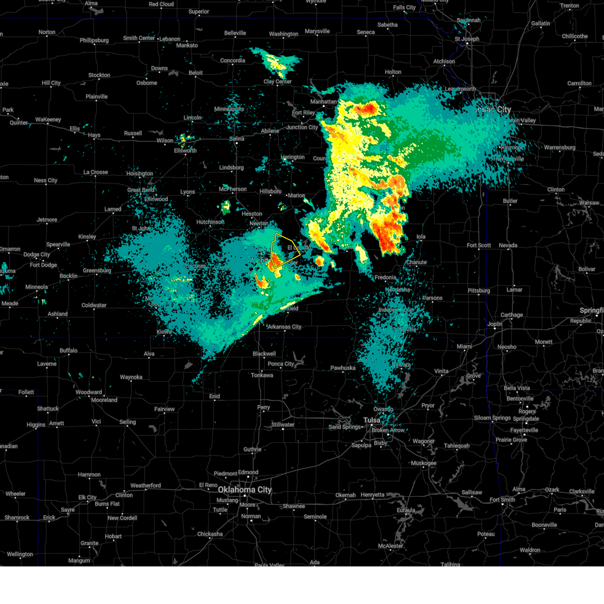 At 941 pm cdt, severe thunderstorms were located along a line extending from 7 miles northeast of bel aire to near benton to near towanda, moving northeast at 40 mph. these are destructive storms for benton, towanda, rural portions of northeast sedgwick county, and northwest butler county (trained weather spotters). Hazards include 80 mph wind gusts and penny size hail. Flying debris will be dangerous to those caught without shelter. mobile homes will be heavily damaged. expect considerable damage to roofs, windows, and vehicles. extensive tree damage and power outages are likely. Locations impacted include, el dorado, andover, towanda, benton, whitewater, potwin, and santa fe lake. At 941 pm cdt, severe thunderstorms were located along a line extending from 7 miles northeast of bel aire to near benton to near towanda, moving northeast at 40 mph. these are destructive storms for benton, towanda, rural portions of northeast sedgwick county, and northwest butler county (trained weather spotters). Hazards include 80 mph wind gusts and penny size hail. Flying debris will be dangerous to those caught without shelter. mobile homes will be heavily damaged. expect considerable damage to roofs, windows, and vehicles. extensive tree damage and power outages are likely. Locations impacted include, el dorado, andover, towanda, benton, whitewater, potwin, and santa fe lake.
|
| 9/20/2024 9:38 PM CDT |
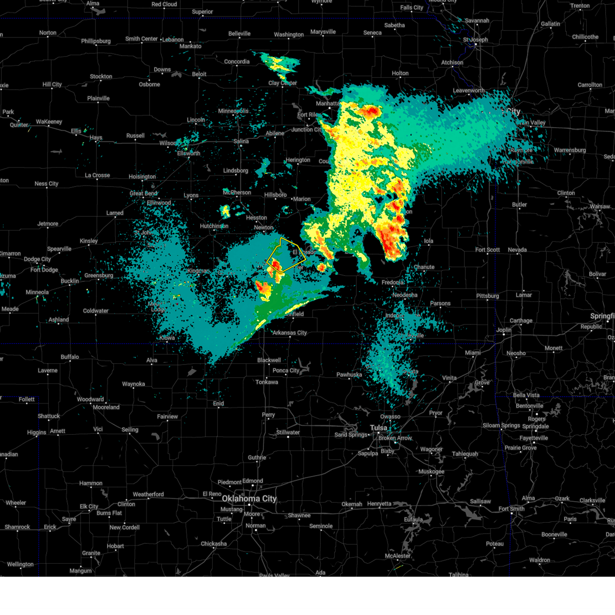 At 936 pm cdt, severe thunderstorms were located along a line extending from near bel aire to near benton to near andover, moving northeast at 40 mph. these are destructive storms for benton, towanda, rural portions of northeast sedgwick county, and northwest butler county (trained weather spotters). Hazards include 80 mph wind gusts and penny size hail. Flying debris will be dangerous to those caught without shelter. mobile homes will be heavily damaged. expect considerable damage to roofs, windows, and vehicles. extensive tree damage and power outages are likely. Locations impacted include, wichita, el dorado, andover, bel aire, towanda, benton, whitewater, kechi, potwin, northeast wichita, santa fe lake, and jabara airport. At 936 pm cdt, severe thunderstorms were located along a line extending from near bel aire to near benton to near andover, moving northeast at 40 mph. these are destructive storms for benton, towanda, rural portions of northeast sedgwick county, and northwest butler county (trained weather spotters). Hazards include 80 mph wind gusts and penny size hail. Flying debris will be dangerous to those caught without shelter. mobile homes will be heavily damaged. expect considerable damage to roofs, windows, and vehicles. extensive tree damage and power outages are likely. Locations impacted include, wichita, el dorado, andover, bel aire, towanda, benton, whitewater, kechi, potwin, northeast wichita, santa fe lake, and jabara airport.
|
| 9/20/2024 9:34 PM CDT |
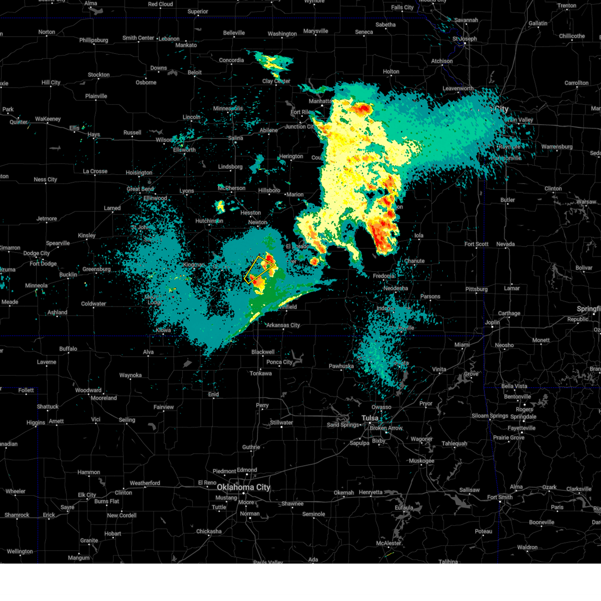 At 933 pm cdt, severe thunderstorms were located along a line extending from near eisenhower national airport to haysville to 5 miles southwest of derby, moving northeast at 15 mph (radar indicated). Hazards include 60 mph wind gusts. Expect damage to roofs, siding, and trees. Locations impacted include, wichita, haysville, downtown wichita, eastborough, east wichita, mcconnell air force base, south wichita, and oaklawn. At 933 pm cdt, severe thunderstorms were located along a line extending from near eisenhower national airport to haysville to 5 miles southwest of derby, moving northeast at 15 mph (radar indicated). Hazards include 60 mph wind gusts. Expect damage to roofs, siding, and trees. Locations impacted include, wichita, haysville, downtown wichita, eastborough, east wichita, mcconnell air force base, south wichita, and oaklawn.
|
| 9/20/2024 9:33 PM CDT | Quarter sized hail reported 7.6 miles SW of Wichita, KS, ksn relayed viewer report of nickle to quarter sized hail near jabara airport. |
| 9/20/2024 9:33 PM CDT | Several small trees are down in an apartment complex. relayed via emergency managmen in sedgwick county KS, 6.3 miles SW of Wichita, KS |
| 9/20/2024 9:33 PM CDT |
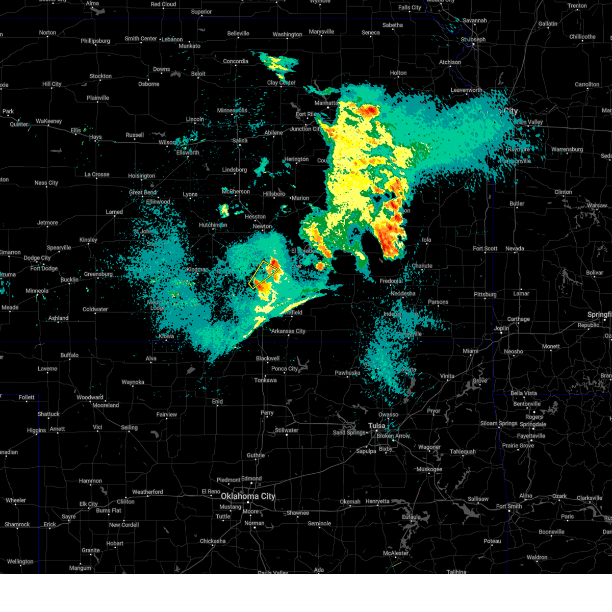 At 933 pm cdt, severe thunderstorms were located along a line extending from near eisenhower national airport to haysville to 5 miles southwest of derby, moving northeast at 15 mph (radar indicated). Hazards include 60 mph wind gusts. Expect damage to roofs, siding, and trees. Locations impacted include, wichita, haysville, downtown wichita, eastborough, east wichita, mcconnell air force base, south wichita, and oaklawn. At 933 pm cdt, severe thunderstorms were located along a line extending from near eisenhower national airport to haysville to 5 miles southwest of derby, moving northeast at 15 mph (radar indicated). Hazards include 60 mph wind gusts. Expect damage to roofs, siding, and trees. Locations impacted include, wichita, haysville, downtown wichita, eastborough, east wichita, mcconnell air force base, south wichita, and oaklawn.
|
| 9/20/2024 9:32 PM CDT | Storm damage reported in sedgwick county KS, 7.7 miles WSW of Wichita, KS |
| 9/20/2024 9:31 PM CDT |
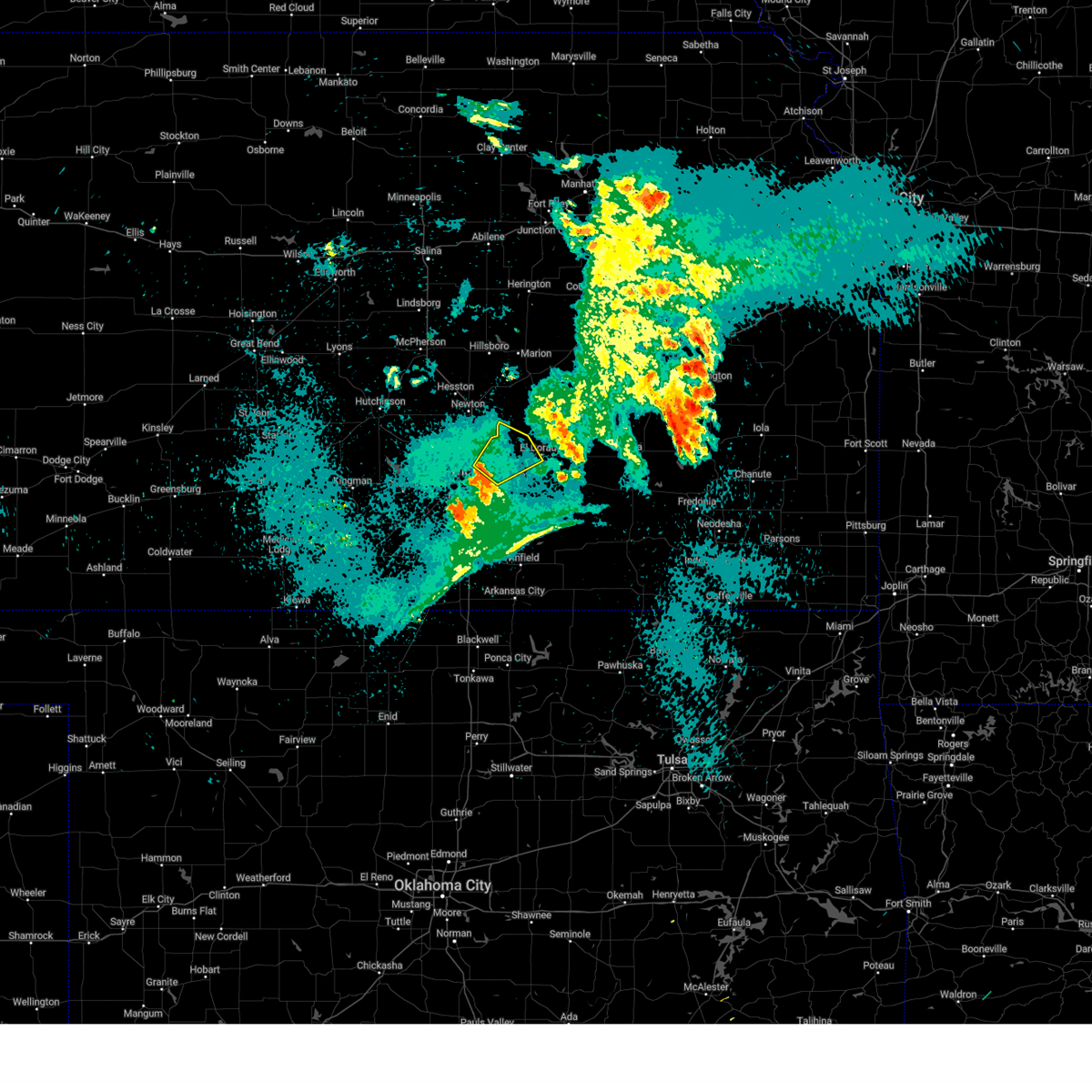 Svrict the national weather service in wichita has issued a * severe thunderstorm warning for, northeastern sedgwick county in south central kansas, west central butler county in south central kansas, * until 1015 pm cdt. * at 931 pm cdt, severe thunderstorms were located along a line extending from bel aire to near northeast wichita to near andover, moving northeast at 40 mph (radar indicated). Hazards include 60 mph wind gusts and penny size hail. expect damage to roofs, siding, and trees Svrict the national weather service in wichita has issued a * severe thunderstorm warning for, northeastern sedgwick county in south central kansas, west central butler county in south central kansas, * until 1015 pm cdt. * at 931 pm cdt, severe thunderstorms were located along a line extending from bel aire to near northeast wichita to near andover, moving northeast at 40 mph (radar indicated). Hazards include 60 mph wind gusts and penny size hail. expect damage to roofs, siding, and trees
|
| 9/20/2024 9:27 PM CDT | Report relayed via ksn of an estimated 60 mph winds with 0.5 inch hai in sedgwick county KS, 7.2 miles SW of Wichita, KS |
| 9/20/2024 9:10 PM CDT |
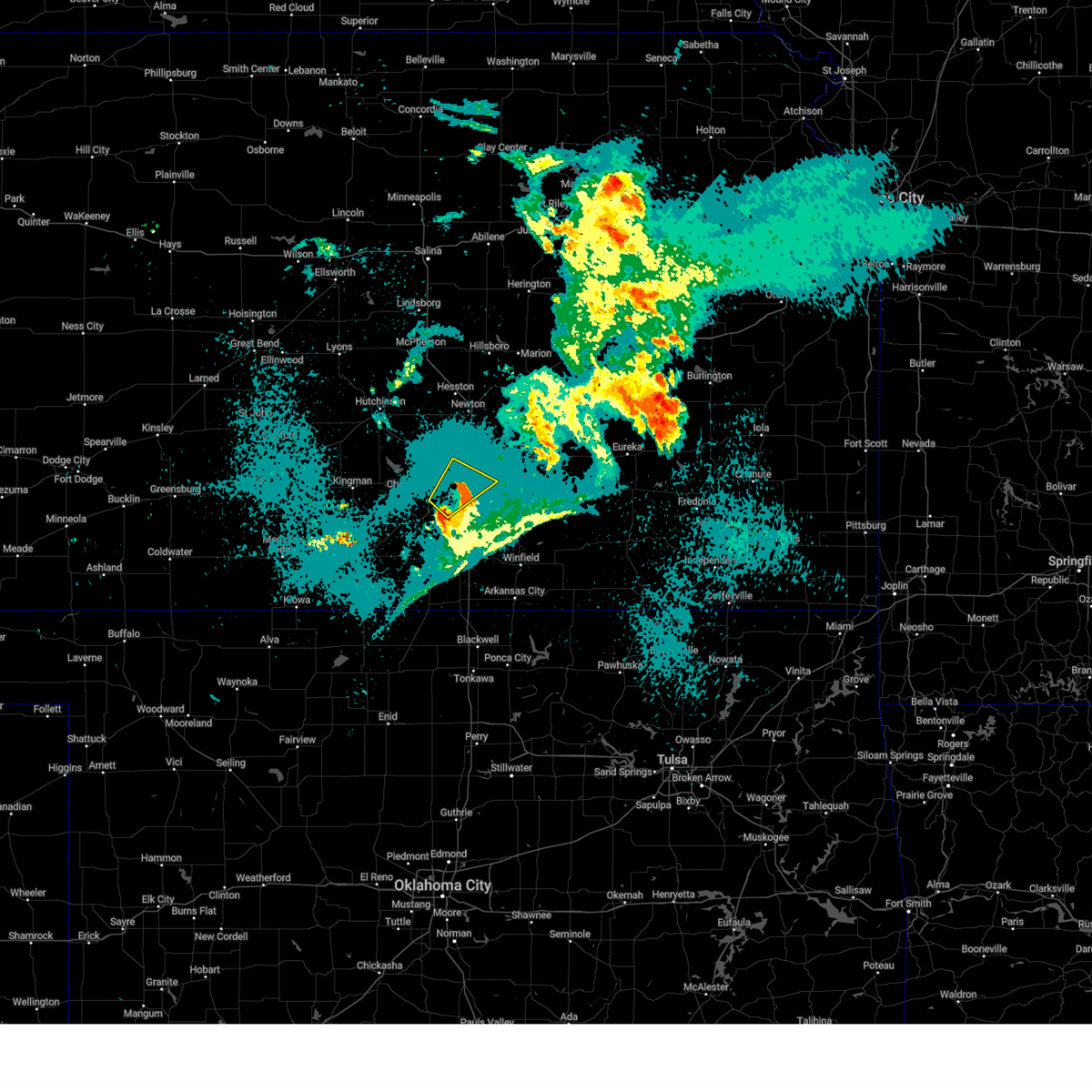 At 909 pm cdt, severe thunderstorms were located along a line extending from west wichita to near downtown wichita to near south wichita, moving northeast at 40 mph. a second severe thunderstorm is near clearwater moving northeast at 40 mph (radar indicated). Hazards include 60 mph wind gusts. Expect damage to roofs, siding, and trees. Locations impacted include, wichita, haysville, goddard, maize, clearwater, downtown wichita, eastborough, west wichita, east wichita, eisenhower national airport, mcconnell air force base, south wichita, and oaklawn. At 909 pm cdt, severe thunderstorms were located along a line extending from west wichita to near downtown wichita to near south wichita, moving northeast at 40 mph. a second severe thunderstorm is near clearwater moving northeast at 40 mph (radar indicated). Hazards include 60 mph wind gusts. Expect damage to roofs, siding, and trees. Locations impacted include, wichita, haysville, goddard, maize, clearwater, downtown wichita, eastborough, west wichita, east wichita, eisenhower national airport, mcconnell air force base, south wichita, and oaklawn.
|
| 9/20/2024 9:06 PM CDT |
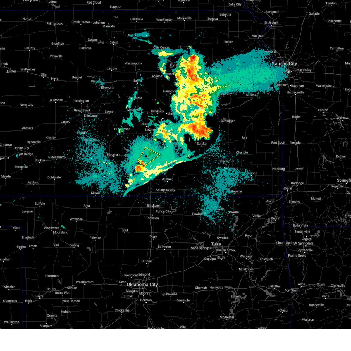 Svrict the national weather service in wichita has issued a * severe thunderstorm warning for, central sedgwick county in south central kansas, * until 945 pm cdt. * at 906 pm cdt, severe thunderstorms were located along a line extending from eisenhower national airport to near west wichita to haysville, moving northeast at 40 mph (radar indicated). Hazards include 60 mph wind gusts. expect damage to roofs, siding, and trees Svrict the national weather service in wichita has issued a * severe thunderstorm warning for, central sedgwick county in south central kansas, * until 945 pm cdt. * at 906 pm cdt, severe thunderstorms were located along a line extending from eisenhower national airport to near west wichita to haysville, moving northeast at 40 mph (radar indicated). Hazards include 60 mph wind gusts. expect damage to roofs, siding, and trees
|
| 9/20/2024 8:58 PM CDT |
 Svrict the national weather service in wichita has issued a * severe thunderstorm warning for, central sedgwick county in south central kansas, * until 945 pm cdt. * at 858 pm cdt, severe thunderstorms were located along a line extending from 5 miles southeast of goddard to 5 miles southwest of eisenhower national airport to near clearwater, moving northeast at 35 mph (radar indicated). Hazards include 60 mph wind gusts. expect damage to roofs, siding, and trees Svrict the national weather service in wichita has issued a * severe thunderstorm warning for, central sedgwick county in south central kansas, * until 945 pm cdt. * at 858 pm cdt, severe thunderstorms were located along a line extending from 5 miles southeast of goddard to 5 miles southwest of eisenhower national airport to near clearwater, moving northeast at 35 mph (radar indicated). Hazards include 60 mph wind gusts. expect damage to roofs, siding, and trees
|
| 9/20/2024 7:56 PM CDT |
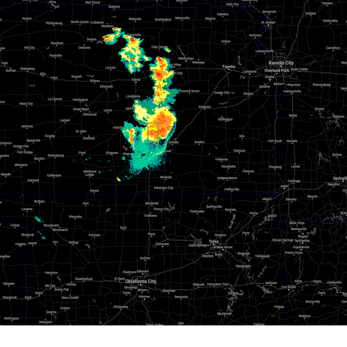 At 756 pm cdt, severe thunderstorms were located along a line extending from near florence to 5 miles southwest of burns to 5 miles north of benton, moving east at 30 mph (radar indicated). Hazards include 60 mph wind gusts. Expect damage to roofs, siding, and trees. Locations impacted include, newton, park city, north newton, walton, and newton airport. At 756 pm cdt, severe thunderstorms were located along a line extending from near florence to 5 miles southwest of burns to 5 miles north of benton, moving east at 30 mph (radar indicated). Hazards include 60 mph wind gusts. Expect damage to roofs, siding, and trees. Locations impacted include, newton, park city, north newton, walton, and newton airport.
|
| 9/20/2024 7:38 PM CDT |
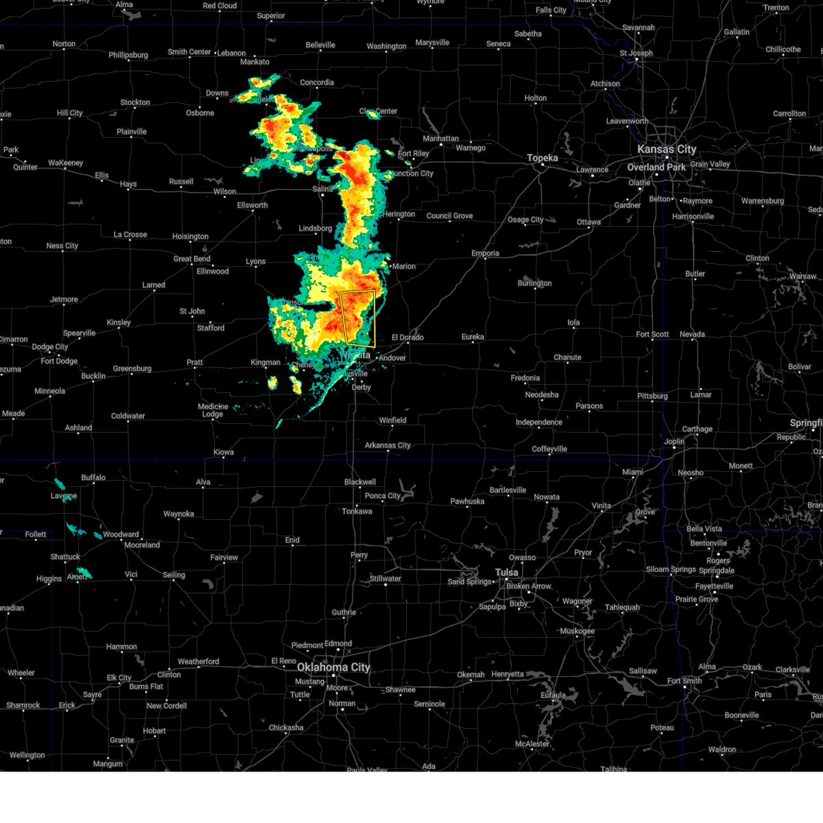 At 738 pm cdt, severe thunderstorms were located along a line extending from 6 miles southeast of hillsboro to elbing to kechi, moving east at 55 mph (radar indicated). Hazards include 70 mph wind gusts. Expect considerable tree damage. damage is likely to mobile homes, roofs, and outbuildings. Locations impacted include, newton, park city, valley center, hesston, north newton, sedgwick, kechi, walton, and newton airport. At 738 pm cdt, severe thunderstorms were located along a line extending from 6 miles southeast of hillsboro to elbing to kechi, moving east at 55 mph (radar indicated). Hazards include 70 mph wind gusts. Expect considerable tree damage. damage is likely to mobile homes, roofs, and outbuildings. Locations impacted include, newton, park city, valley center, hesston, north newton, sedgwick, kechi, walton, and newton airport.
|
| 9/20/2024 7:35 PM CDT |
 At 735 pm cdt, severe thunderstorms were located along a line extending from 6 miles south of hillsboro to near elbing to near park city, moving east at 55 mph (radar indicated). Hazards include 70 mph wind gusts. Expect considerable tree damage. damage is likely to mobile homes, roofs, and outbuildings. Locations impacted include, wichita, newton, andover, park city, valley center, bel aire, hesston, maize, north newton, sedgwick, kechi, eastborough, walton, east wichita, northeast wichita, newton airport, and jabara airport. At 735 pm cdt, severe thunderstorms were located along a line extending from 6 miles south of hillsboro to near elbing to near park city, moving east at 55 mph (radar indicated). Hazards include 70 mph wind gusts. Expect considerable tree damage. damage is likely to mobile homes, roofs, and outbuildings. Locations impacted include, wichita, newton, andover, park city, valley center, bel aire, hesston, maize, north newton, sedgwick, kechi, eastborough, walton, east wichita, northeast wichita, newton airport, and jabara airport.
|
| 9/20/2024 7:17 PM CDT |
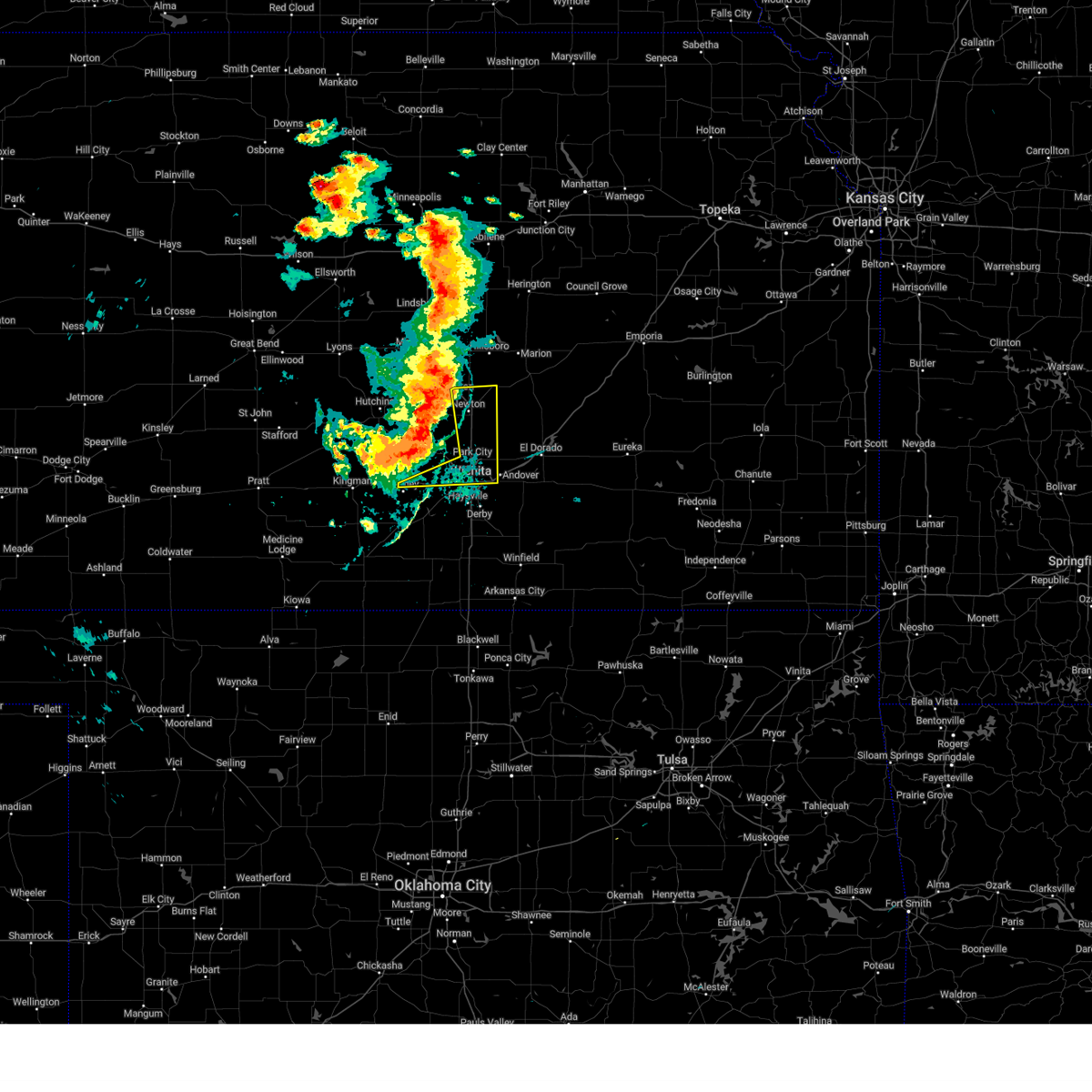 At 717 pm cdt, severe thunderstorms were located along a line extending from moundridge to near halstead to near garden plain, moving east at 40 mph (emergency management reported a 60 mph wind gust in hesston at 716 pm). Hazards include 70 mph wind gusts. Expect considerable tree damage. damage is likely to mobile homes, roofs, and outbuildings. Locations impacted include, wichita, newton, andover, park city, valley center, bel aire, goddard, hesston, maize, north newton, sedgwick, garden plain, downtown wichita, kechi, eastborough, walton, west wichita, east wichita, northeast wichita, and newton airport. At 717 pm cdt, severe thunderstorms were located along a line extending from moundridge to near halstead to near garden plain, moving east at 40 mph (emergency management reported a 60 mph wind gust in hesston at 716 pm). Hazards include 70 mph wind gusts. Expect considerable tree damage. damage is likely to mobile homes, roofs, and outbuildings. Locations impacted include, wichita, newton, andover, park city, valley center, bel aire, goddard, hesston, maize, north newton, sedgwick, garden plain, downtown wichita, kechi, eastborough, walton, west wichita, east wichita, northeast wichita, and newton airport.
|
| 9/20/2024 7:14 PM CDT |
 At 714 pm cdt, severe thunderstorms were located along a line extending from 6 miles southwest of moundridge to near mount hope to near cheney, moving east at 30 mph (at 712 a trained spotter reported a 65 mph wind gust in mount hope). Hazards include 70 mph wind gusts. Expect considerable tree damage. damage is likely to mobile homes, roofs, and outbuildings. Locations impacted include, wichita, newton, andover, park city, valley center, bel aire, goddard, hesston, maize, north newton, sedgwick, garden plain, downtown wichita, kechi, eastborough, walton, west wichita, east wichita, northeast wichita, and newton airport. At 714 pm cdt, severe thunderstorms were located along a line extending from 6 miles southwest of moundridge to near mount hope to near cheney, moving east at 30 mph (at 712 a trained spotter reported a 65 mph wind gust in mount hope). Hazards include 70 mph wind gusts. Expect considerable tree damage. damage is likely to mobile homes, roofs, and outbuildings. Locations impacted include, wichita, newton, andover, park city, valley center, bel aire, goddard, hesston, maize, north newton, sedgwick, garden plain, downtown wichita, kechi, eastborough, walton, west wichita, east wichita, northeast wichita, and newton airport.
|
| 9/20/2024 7:06 PM CDT |
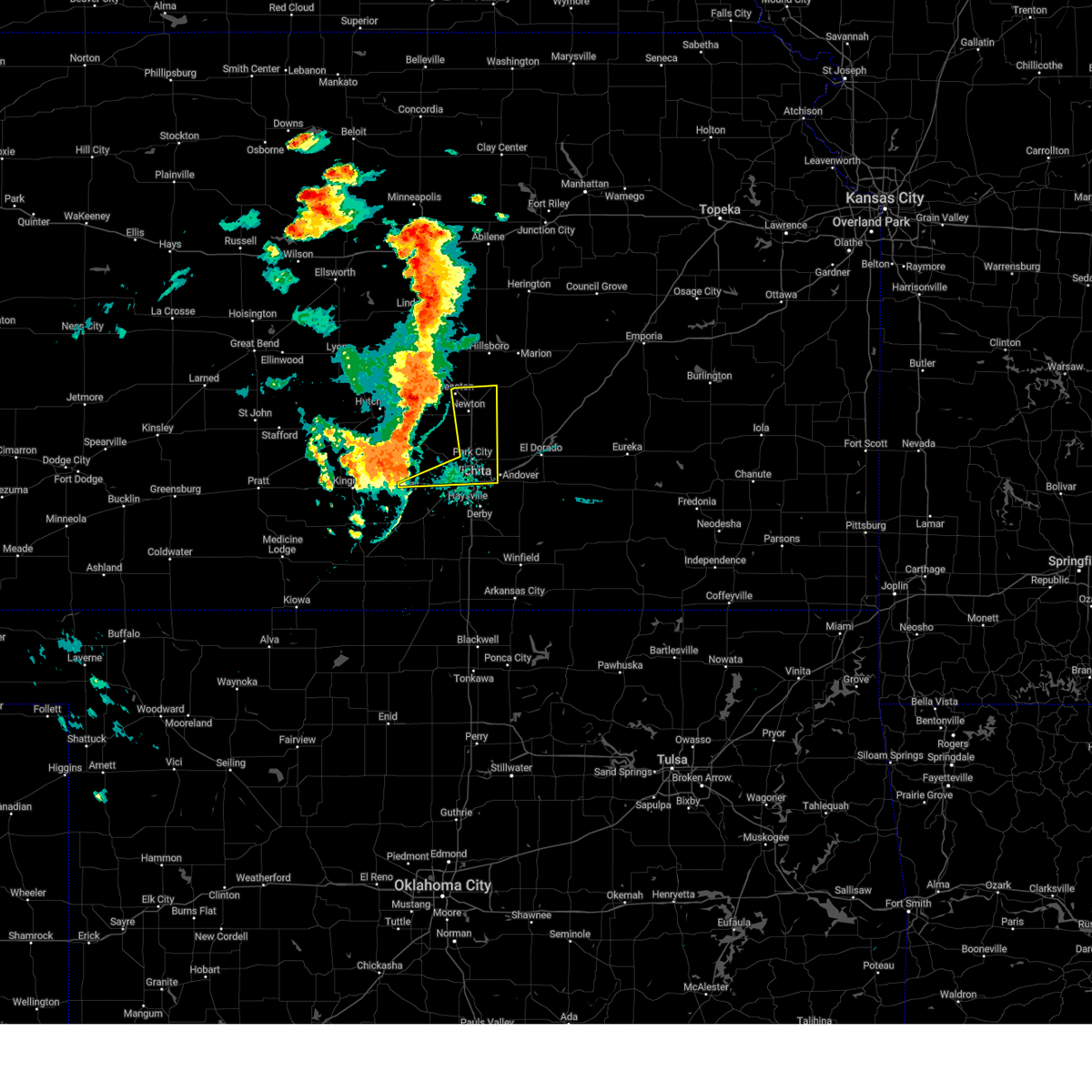 At 706 pm cdt, severe thunderstorms were located along a line extending from near buhler to near haven to 5 miles northwest of cheney, moving east at 30 mph (radar indicated). Hazards include 70 mph wind gusts. Expect considerable tree damage. damage is likely to mobile homes, roofs, and outbuildings. Locations impacted include, wichita, newton, andover, park city, valley center, bel aire, goddard, hesston, maize, north newton, sedgwick, garden plain, downtown wichita, kechi, eastborough, walton, west wichita, east wichita, northeast wichita, and newton airport. At 706 pm cdt, severe thunderstorms were located along a line extending from near buhler to near haven to 5 miles northwest of cheney, moving east at 30 mph (radar indicated). Hazards include 70 mph wind gusts. Expect considerable tree damage. damage is likely to mobile homes, roofs, and outbuildings. Locations impacted include, wichita, newton, andover, park city, valley center, bel aire, goddard, hesston, maize, north newton, sedgwick, garden plain, downtown wichita, kechi, eastborough, walton, west wichita, east wichita, northeast wichita, and newton airport.
|
| 9/20/2024 7:02 PM CDT |
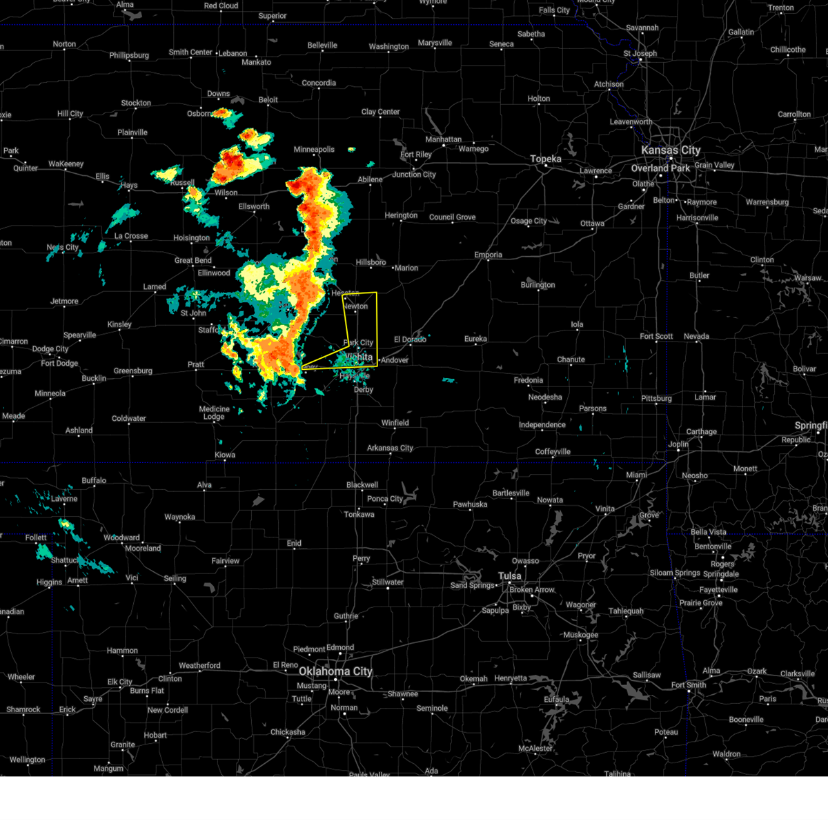 Svrict the national weather service in wichita has issued a * severe thunderstorm warning for, northern sedgwick county in south central kansas, eastern harvey county in south central kansas, * until 815 pm cdt. * at 701 pm cdt, severe thunderstorms were located along a line extending from near buhler to near haven to 6 miles northwest of cheney, moving east at 30 mph (radar indicated). Hazards include 60 mph wind gusts. expect damage to roofs, siding, and trees Svrict the national weather service in wichita has issued a * severe thunderstorm warning for, northern sedgwick county in south central kansas, eastern harvey county in south central kansas, * until 815 pm cdt. * at 701 pm cdt, severe thunderstorms were located along a line extending from near buhler to near haven to 6 miles northwest of cheney, moving east at 30 mph (radar indicated). Hazards include 60 mph wind gusts. expect damage to roofs, siding, and trees
|
| 8/15/2024 12:35 AM CDT | Awos station kiab mcconnell af in sedgwick county KS, 6 miles NW of Wichita, KS |
| 8/14/2024 11:43 PM CDT |
 The storms which prompted the warning have weakened below severe limits or have exited the warned area. therefore, the warning will be allowed to expire. however, gusty winds are still possible with these thunderstorms. The storms which prompted the warning have weakened below severe limits or have exited the warned area. therefore, the warning will be allowed to expire. however, gusty winds are still possible with these thunderstorms.
|
| 8/14/2024 11:39 PM CDT |
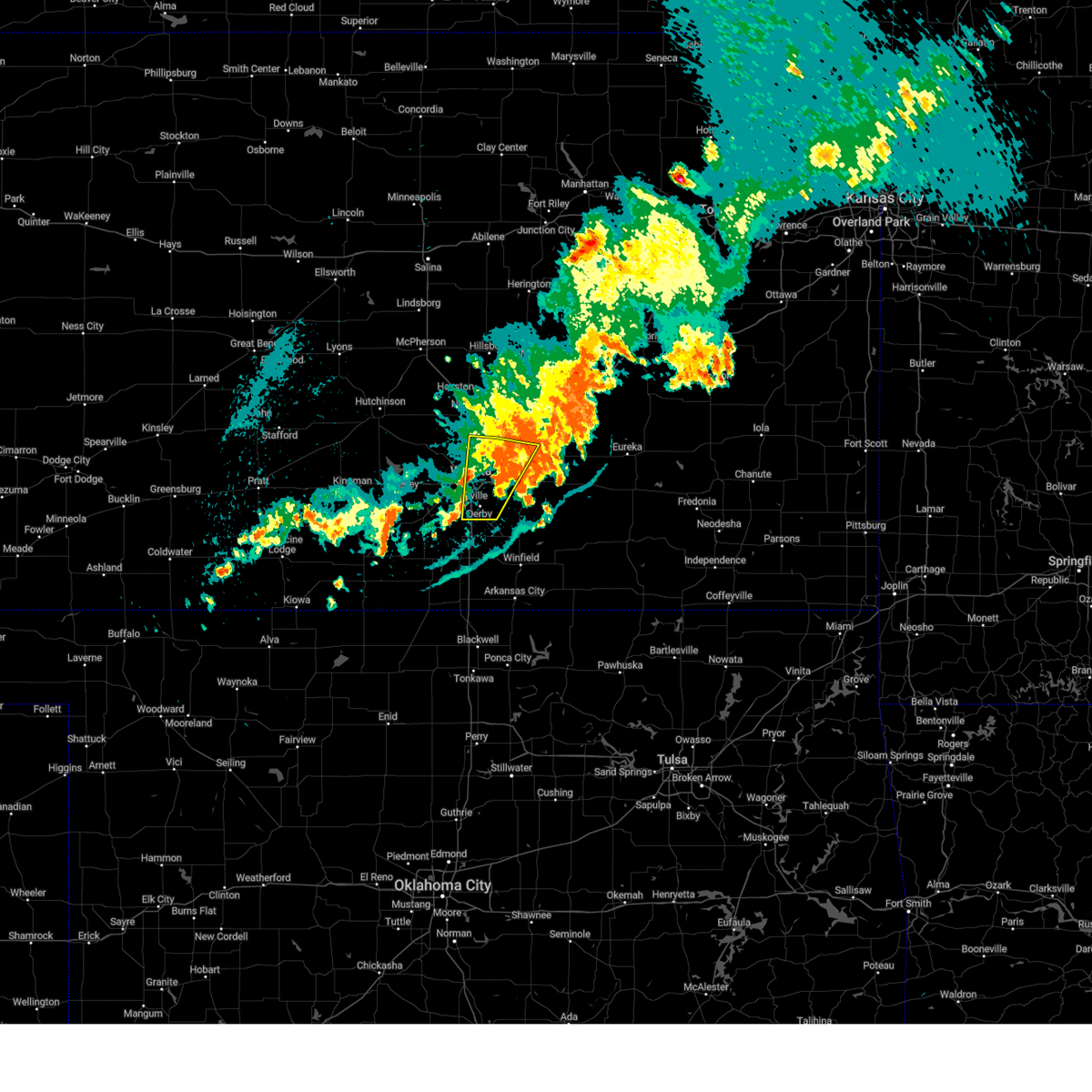 the severe thunderstorm warning has been cancelled and is no longer in effect the severe thunderstorm warning has been cancelled and is no longer in effect
|
| 8/14/2024 11:39 PM CDT |
 At 1138 pm cdt, severe thunderstorms were located along a line extending from 5 miles northwest of el dorado to near andover to near rose hill, moving east at 20 mph (radar indicated). Hazards include 60 mph wind gusts. Expect damage to roofs, siding, and trees. Locations impacted include, wichita, derby, andover, haysville, park city, valley center, bel aire, mulvane, rose hill, towanda, benton, downtown wichita, kechi, eastborough, east wichita, northeast wichita, mcconnell air force base, south wichita, santa fe lake, and augusta municipal airport. At 1138 pm cdt, severe thunderstorms were located along a line extending from 5 miles northwest of el dorado to near andover to near rose hill, moving east at 20 mph (radar indicated). Hazards include 60 mph wind gusts. Expect damage to roofs, siding, and trees. Locations impacted include, wichita, derby, andover, haysville, park city, valley center, bel aire, mulvane, rose hill, towanda, benton, downtown wichita, kechi, eastborough, east wichita, northeast wichita, mcconnell air force base, south wichita, santa fe lake, and augusta municipal airport.
|
| 8/14/2024 11:26 PM CDT |
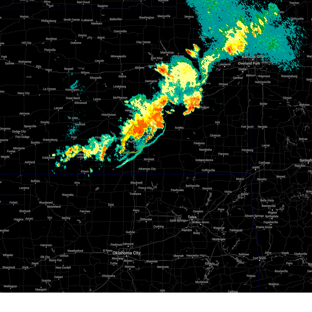 At 1125 pm cdt, severe thunderstorms were located along a line extending from just north of towanda to near andover to 5 miles east of conway springs, moving east at 30 mph (radar indicated). Hazards include 60 mph wind gusts. Expect damage to roofs, siding, and trees. Locations impacted include, wichita, derby, andover, haysville, park city, valley center, bel aire, mulvane, goddard, rose hill, maize, clearwater, towanda, benton, downtown wichita, kechi, eastborough, west wichita, northeast wichita, and eisenhower national airport. At 1125 pm cdt, severe thunderstorms were located along a line extending from just north of towanda to near andover to 5 miles east of conway springs, moving east at 30 mph (radar indicated). Hazards include 60 mph wind gusts. Expect damage to roofs, siding, and trees. Locations impacted include, wichita, derby, andover, haysville, park city, valley center, bel aire, mulvane, goddard, rose hill, maize, clearwater, towanda, benton, downtown wichita, kechi, eastborough, west wichita, northeast wichita, and eisenhower national airport.
|
| 8/14/2024 11:16 PM CDT | Storm damage reported in sedgwick county KS, 7.7 miles WSW of Wichita, KS |
| 8/14/2024 11:14 PM CDT |
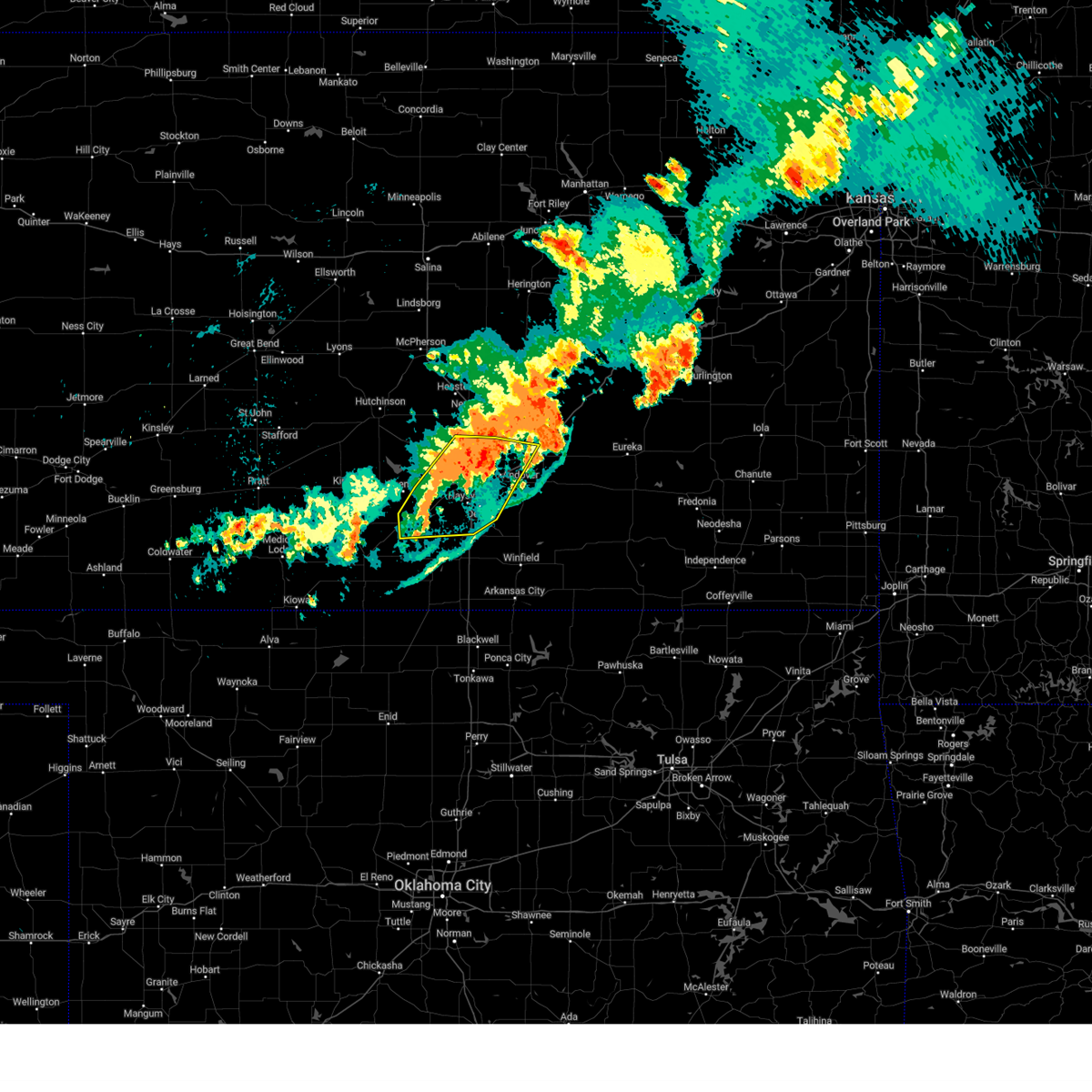 At 1113 pm cdt, severe thunderstorms were located along a line extending from near potwin to mcconnell air force base to near conway springs, moving east at 30 mph (radar indicated). Hazards include 60 mph wind gusts. Expect damage to roofs, siding, and trees. Locations impacted include, wichita, derby, andover, haysville, park city, valley center, bel aire, mulvane, goddard, rose hill, maize, clearwater, sedgwick, towanda, colwich, conway springs, benton, garden plain, downtown wichita, and kechi. At 1113 pm cdt, severe thunderstorms were located along a line extending from near potwin to mcconnell air force base to near conway springs, moving east at 30 mph (radar indicated). Hazards include 60 mph wind gusts. Expect damage to roofs, siding, and trees. Locations impacted include, wichita, derby, andover, haysville, park city, valley center, bel aire, mulvane, goddard, rose hill, maize, clearwater, sedgwick, towanda, colwich, conway springs, benton, garden plain, downtown wichita, and kechi.
|
| 8/14/2024 11:14 PM CDT |
 the severe thunderstorm warning has been cancelled and is no longer in effect the severe thunderstorm warning has been cancelled and is no longer in effect
|
| 8/14/2024 10:52 PM CDT |
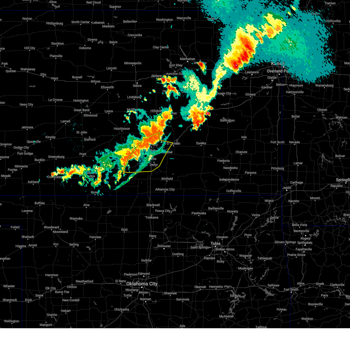 Svrict the national weather service in wichita has issued a * severe thunderstorm warning for, sedgwick county in south central kansas, southeastern harvey county in south central kansas, west central butler county in south central kansas, southeastern kingman county in south central kansas, northwestern sumner county in south central kansas, * until 1145 pm cdt. * at 1052 pm cdt, severe thunderstorms were located along a line extending from near whitewater to just west of eisenhower national airport to 6 miles east of harper, moving east at 30 mph (radar indicated). Hazards include 70 mph wind gusts. Expect considerable tree damage. Damage is likely to mobile homes, roofs, and outbuildings. Svrict the national weather service in wichita has issued a * severe thunderstorm warning for, sedgwick county in south central kansas, southeastern harvey county in south central kansas, west central butler county in south central kansas, southeastern kingman county in south central kansas, northwestern sumner county in south central kansas, * until 1145 pm cdt. * at 1052 pm cdt, severe thunderstorms were located along a line extending from near whitewater to just west of eisenhower national airport to 6 miles east of harper, moving east at 30 mph (radar indicated). Hazards include 70 mph wind gusts. Expect considerable tree damage. Damage is likely to mobile homes, roofs, and outbuildings.
|
| 8/14/2024 10:16 PM CDT |
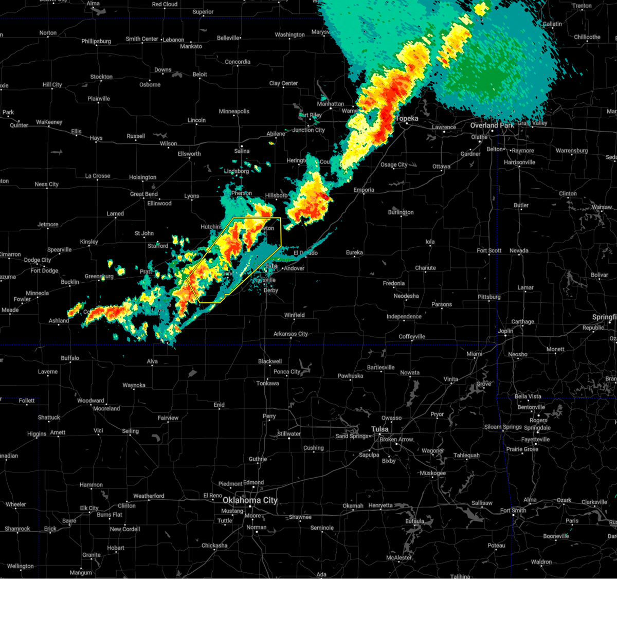 Svrict the national weather service in wichita has issued a * severe thunderstorm warning for, eastern reno county in south central kansas, northwestern sedgwick county in south central kansas, harvey county in south central kansas, eastern kingman county in south central kansas, * until 1100 pm cdt. * at 1015 pm cdt, severe thunderstorms were located along a line extending from 5 miles northeast of burrton to near colwich to 10 miles west of norwich, moving northeast at 40 mph (radar indicated). Hazards include 60 mph wind gusts and nickel size hail. expect damage to roofs, siding, and trees Svrict the national weather service in wichita has issued a * severe thunderstorm warning for, eastern reno county in south central kansas, northwestern sedgwick county in south central kansas, harvey county in south central kansas, eastern kingman county in south central kansas, * until 1100 pm cdt. * at 1015 pm cdt, severe thunderstorms were located along a line extending from 5 miles northeast of burrton to near colwich to 10 miles west of norwich, moving northeast at 40 mph (radar indicated). Hazards include 60 mph wind gusts and nickel size hail. expect damage to roofs, siding, and trees
|
| 8/13/2024 5:09 AM CDT |
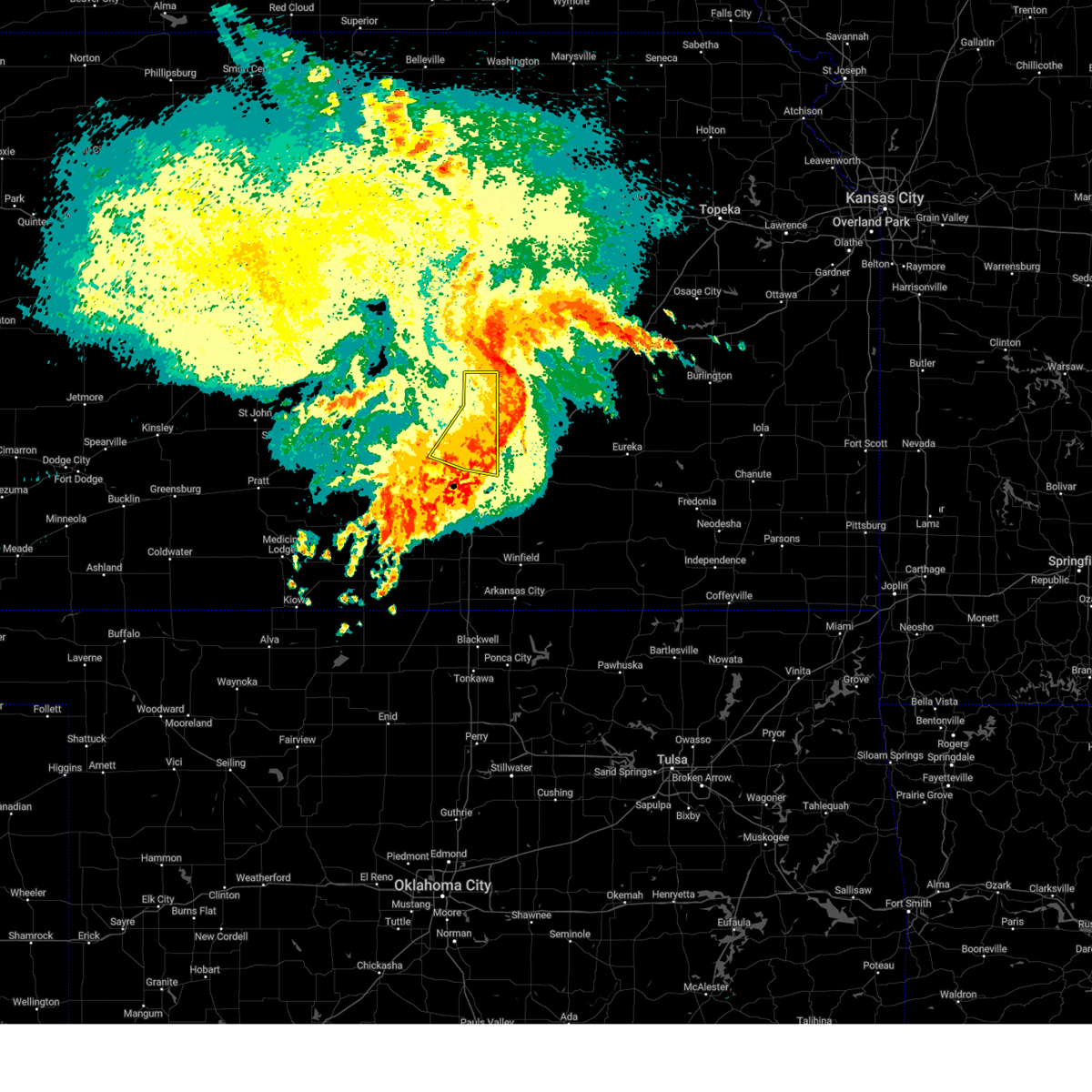 The storms which prompted the warning have moved out of the area. therefore, the warning will be allowed to expire. however, gusty winds and heavy rain are still possible with these thunderstorms. The storms which prompted the warning have moved out of the area. therefore, the warning will be allowed to expire. however, gusty winds and heavy rain are still possible with these thunderstorms.
|
| 8/13/2024 5:08 AM CDT | Awos station kiab mcconnell af in sedgwick county KS, 6 miles NW of Wichita, KS |
| 8/13/2024 5:01 AM CDT | Kict aso in sedgwick county KS, 5.9 miles ENE of Wichita, KS |
| 8/13/2024 4:51 AM CDT |
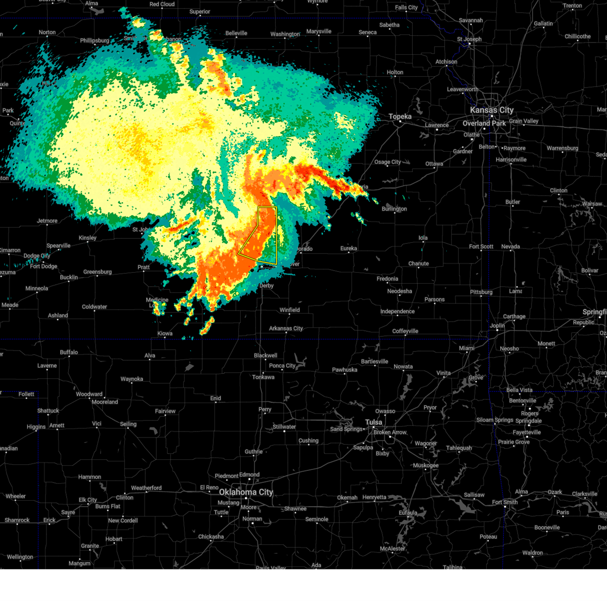 At 450 am cdt, severe thunderstorms were located along a line extending from 5 miles northwest of peabody to near walton to near maize, moving east at 35 mph (radar indicated). Hazards include 60 mph wind gusts. Expect damage to roofs, siding, and trees. Locations impacted include, wichita, newton, park city, valley center, bel aire, maize, north newton, sedgwick, colwich, whitewater, kechi, goessel, bentley, walton, northeast wichita, newton airport, and jabara airport. At 450 am cdt, severe thunderstorms were located along a line extending from 5 miles northwest of peabody to near walton to near maize, moving east at 35 mph (radar indicated). Hazards include 60 mph wind gusts. Expect damage to roofs, siding, and trees. Locations impacted include, wichita, newton, park city, valley center, bel aire, maize, north newton, sedgwick, colwich, whitewater, kechi, goessel, bentley, walton, northeast wichita, newton airport, and jabara airport.
|
| 8/13/2024 4:51 AM CDT |
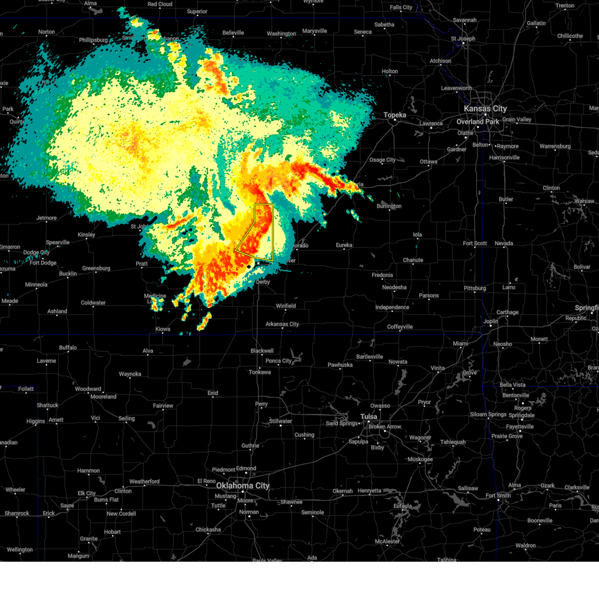 the severe thunderstorm warning has been cancelled and is no longer in effect the severe thunderstorm warning has been cancelled and is no longer in effect
|
| 8/13/2024 4:42 AM CDT |
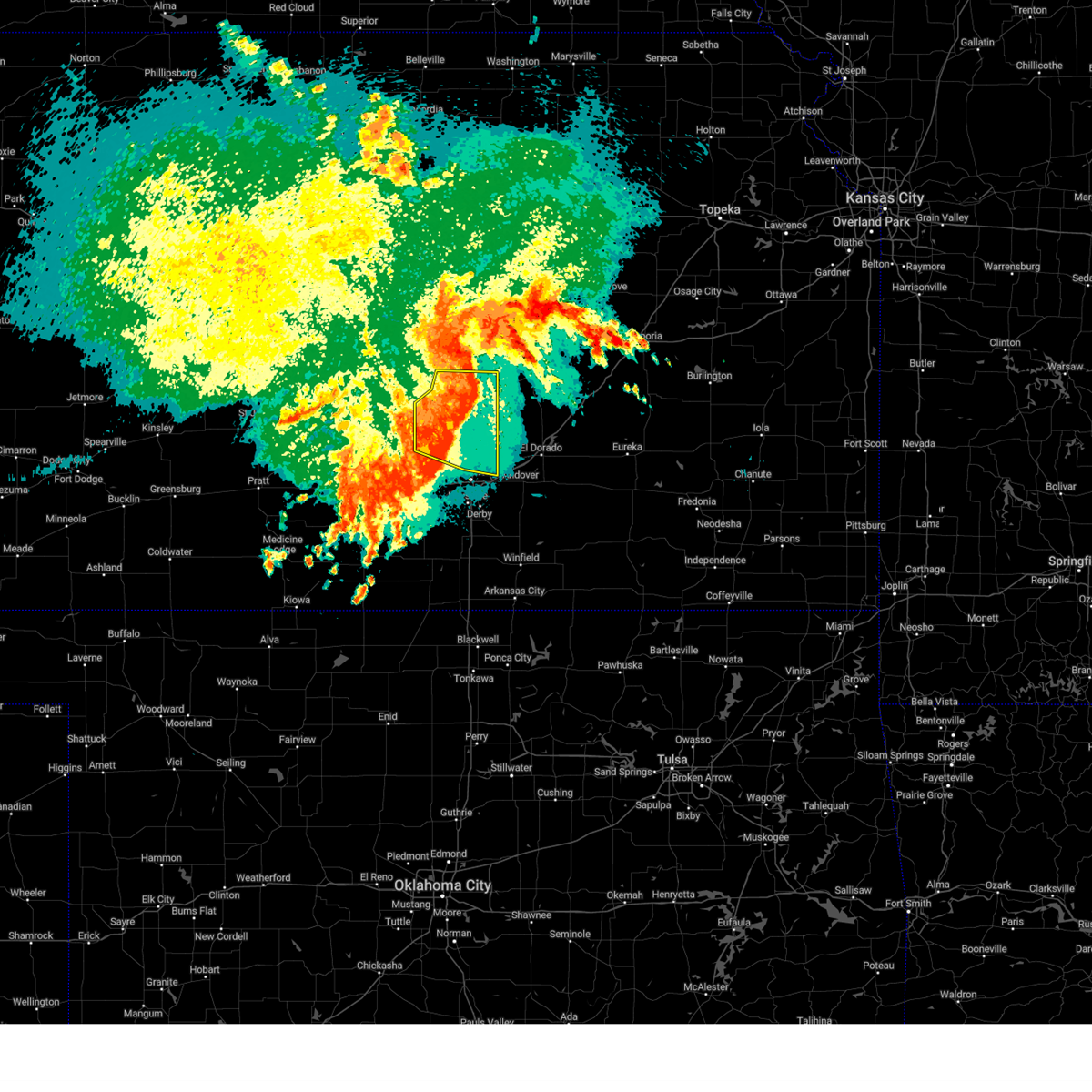 At 441 am cdt, severe thunderstorms were located along a line extending from near goessel to walton to colwich, moving east at 35 mph (radar indicated). Hazards include 60 mph wind gusts. Expect damage to roofs, siding, and trees. Locations impacted include, wichita, newton, park city, valley center, bel aire, hesston, maize, halstead, north newton, moundridge, sedgwick, colwich, burrton, mount hope, whitewater, kechi, goessel, bentley, walton, and northeast wichita. At 441 am cdt, severe thunderstorms were located along a line extending from near goessel to walton to colwich, moving east at 35 mph (radar indicated). Hazards include 60 mph wind gusts. Expect damage to roofs, siding, and trees. Locations impacted include, wichita, newton, park city, valley center, bel aire, hesston, maize, halstead, north newton, moundridge, sedgwick, colwich, burrton, mount hope, whitewater, kechi, goessel, bentley, walton, and northeast wichita.
|
| 8/13/2024 4:42 AM CDT |
 the severe thunderstorm warning has been cancelled and is no longer in effect the severe thunderstorm warning has been cancelled and is no longer in effect
|
| 8/13/2024 4:10 AM CDT |
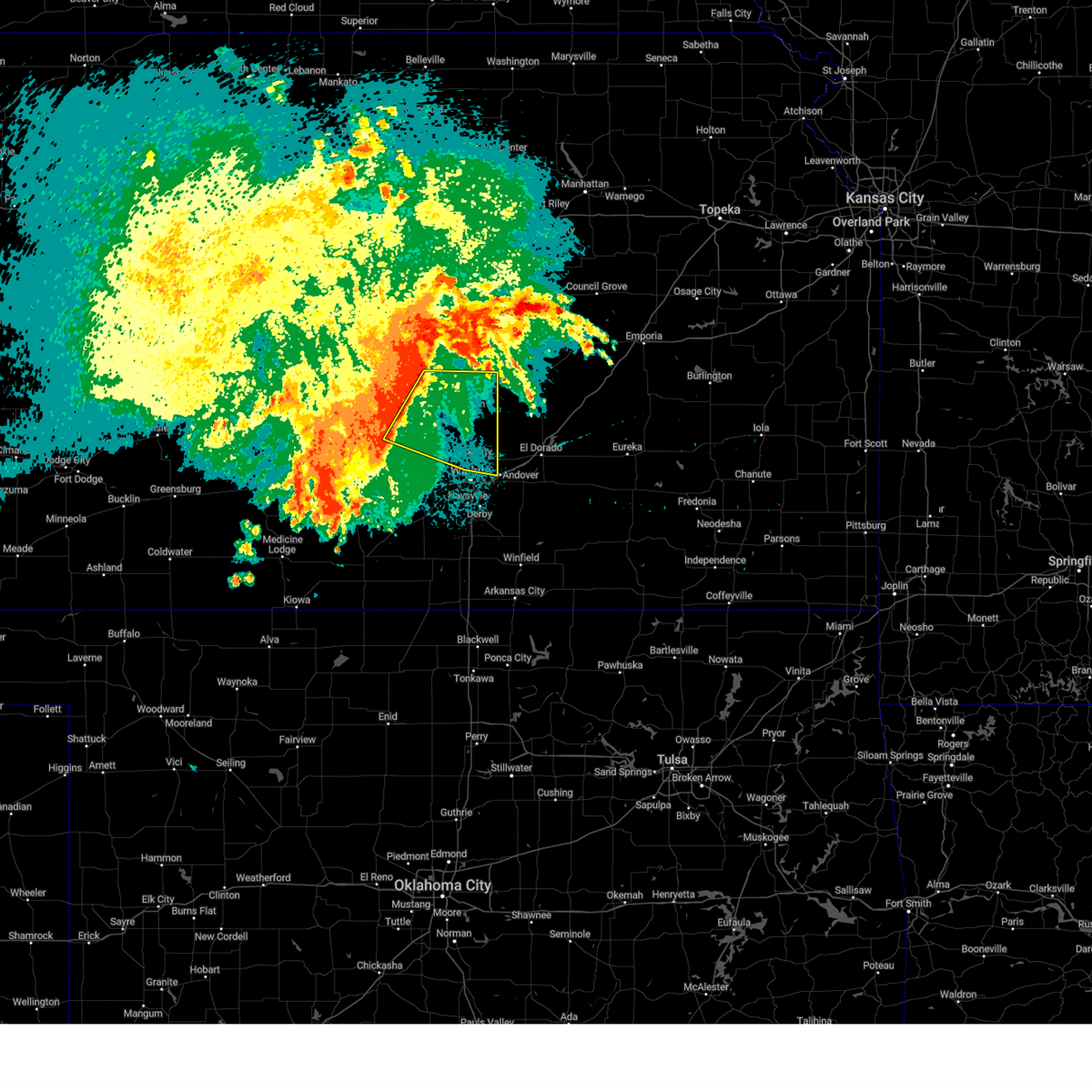 Svrict the national weather service in wichita has issued a * severe thunderstorm warning for, southeastern mcpherson county in central kansas, east central reno county in south central kansas, northern sedgwick county in south central kansas, harvey county in south central kansas, southwestern marion county in central kansas, * until 515 am cdt. * at 410 am cdt, severe thunderstorms were located along a line extending from 6 miles northwest of moundridge to near haven, moving east at 35 mph (radar indicated). Hazards include 60 mph wind gusts. expect damage to roofs, siding, and trees Svrict the national weather service in wichita has issued a * severe thunderstorm warning for, southeastern mcpherson county in central kansas, east central reno county in south central kansas, northern sedgwick county in south central kansas, harvey county in south central kansas, southwestern marion county in central kansas, * until 515 am cdt. * at 410 am cdt, severe thunderstorms were located along a line extending from 6 miles northwest of moundridge to near haven, moving east at 35 mph (radar indicated). Hazards include 60 mph wind gusts. expect damage to roofs, siding, and trees
|
| 7/31/2024 5:10 AM CDT |
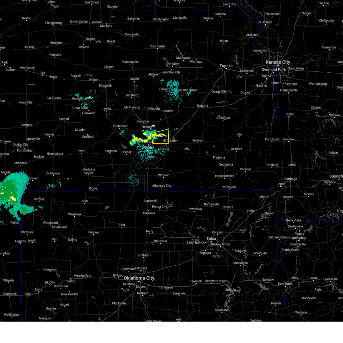 The storm which prompted the warning has weakened below severe limits, and no longer poses an immediate threat to life or property. therefore, the warning will be allowed to expire. The storm which prompted the warning has weakened below severe limits, and no longer poses an immediate threat to life or property. therefore, the warning will be allowed to expire.
|
| 7/31/2024 4:37 AM CDT |
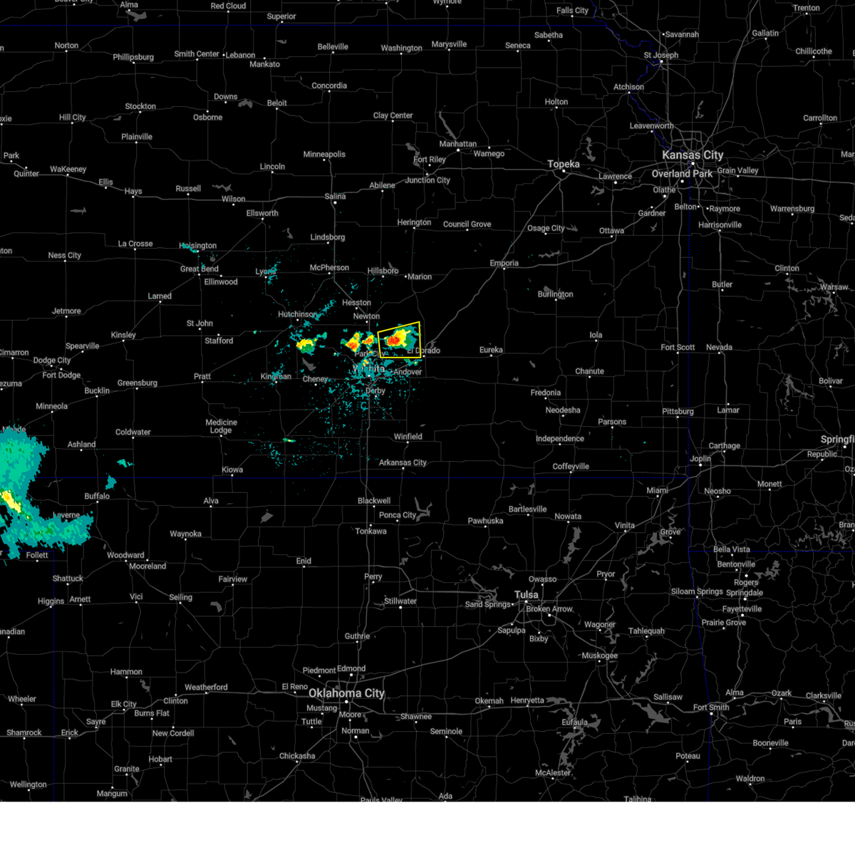 At 436 am cdt, a severe thunderstorm was located near potwin, or just southeast of whitewater, moving east at 15 mph (radar indicated). Hazards include 60 mph wind gusts and quarter size hail. Hail damage to vehicles is expected. expect wind damage to roofs, siding, and trees. Locations impacted include, whitewater and potwin. At 436 am cdt, a severe thunderstorm was located near potwin, or just southeast of whitewater, moving east at 15 mph (radar indicated). Hazards include 60 mph wind gusts and quarter size hail. Hail damage to vehicles is expected. expect wind damage to roofs, siding, and trees. Locations impacted include, whitewater and potwin.
|
| 7/31/2024 4:12 AM CDT |
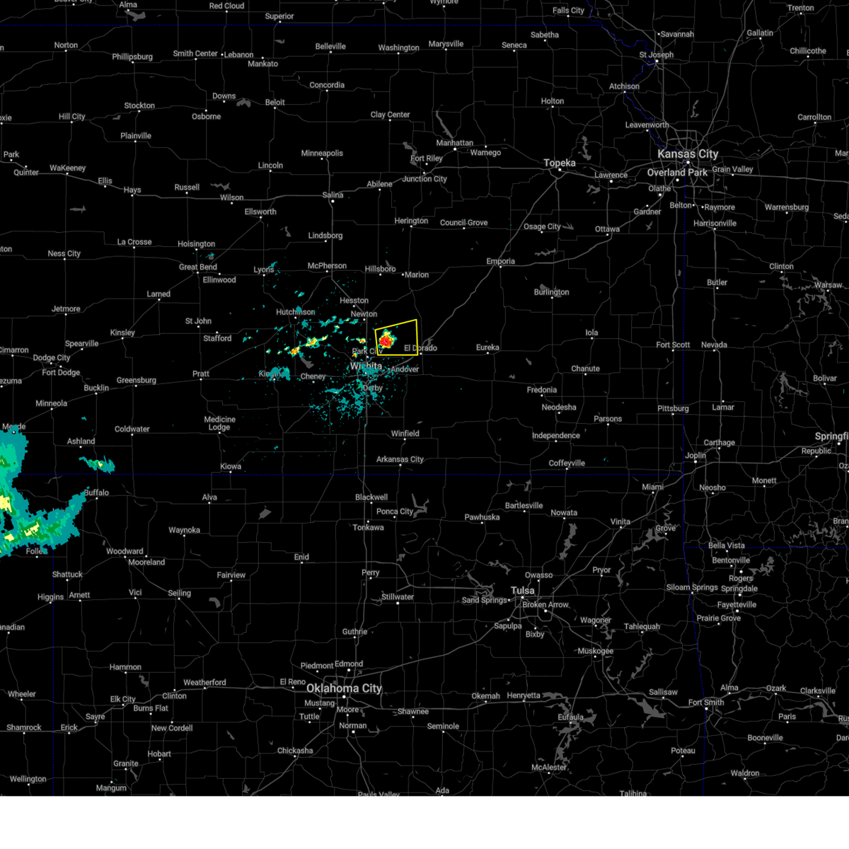 Svrict the national weather service in wichita has issued a * severe thunderstorm warning for, northeastern sedgwick county in south central kansas, southeastern harvey county in south central kansas, northwestern butler county in south central kansas, * until 515 am cdt. * at 412 am cdt, a severe thunderstorm was located near whitewater, moving east at 15 mph (radar indicated). Hazards include 60 mph wind gusts and quarter size hail. Hail damage to vehicles is expected. Expect wind damage to roofs, siding, and trees. Svrict the national weather service in wichita has issued a * severe thunderstorm warning for, northeastern sedgwick county in south central kansas, southeastern harvey county in south central kansas, northwestern butler county in south central kansas, * until 515 am cdt. * at 412 am cdt, a severe thunderstorm was located near whitewater, moving east at 15 mph (radar indicated). Hazards include 60 mph wind gusts and quarter size hail. Hail damage to vehicles is expected. Expect wind damage to roofs, siding, and trees.
|
| 7/4/2024 2:24 AM CDT |
 The storms which prompted the warning have weakened below severe limits, and no longer pose an immediate threat to life or property. therefore, the warning will be allowed to expire. The storms which prompted the warning have weakened below severe limits, and no longer pose an immediate threat to life or property. therefore, the warning will be allowed to expire.
|
| 7/4/2024 1:32 AM CDT |
 Svrict the national weather service in wichita has issued a * severe thunderstorm warning for, sedgwick county in south central kansas, * until 230 am cdt. * at 132 am cdt, severe thunderstorms were located along a line extending from near walton to near halstead to near haven, moving southeast at 50 mph (radar indicated). Hazards include 60 mph wind gusts. expect damage to roofs, siding, and trees Svrict the national weather service in wichita has issued a * severe thunderstorm warning for, sedgwick county in south central kansas, * until 230 am cdt. * at 132 am cdt, severe thunderstorms were located along a line extending from near walton to near halstead to near haven, moving southeast at 50 mph (radar indicated). Hazards include 60 mph wind gusts. expect damage to roofs, siding, and trees
|
| 7/2/2024 5:59 PM CDT |
 The storms which prompted the warning have moved out of the area. therefore, the warning will be allowed to expire. however, gusty winds and heavy rain are still possible with these thunderstorms. a severe thunderstorm watch remains in effect until 1000 pm cdt for south central kansas. The storms which prompted the warning have moved out of the area. therefore, the warning will be allowed to expire. however, gusty winds and heavy rain are still possible with these thunderstorms. a severe thunderstorm watch remains in effect until 1000 pm cdt for south central kansas.
|
| 7/2/2024 5:58 PM CDT | Awos station kaao 2 ese bel air in sedgwick county KS, 8.1 miles WSW of Wichita, KS |
| 7/2/2024 5:55 PM CDT | Reported several large tree limbs down in riverside par in sedgwick county KS, 1.1 miles SSE of Wichita, KS |
| 7/2/2024 5:50 PM CDT | Trees down. report came in via social medi in sedgwick county KS, 6.1 miles SE of Wichita, KS |
| 7/2/2024 5:50 PM CDT | Tree blocking road near 21st and tyle in sedgwick county KS, 5.8 miles ESE of Wichita, KS |
| 7/2/2024 5:49 PM CDT | Reported by kake broadcast medi in sedgwick county KS, 6.4 miles WSW of Wichita, KS |
| 7/2/2024 5:49 PM CDT |
 the severe thunderstorm warning has been cancelled and is no longer in effect the severe thunderstorm warning has been cancelled and is no longer in effect
|
| 7/2/2024 5:49 PM CDT |
 At 548 pm cdt, severe thunderstorms were located along a line extending from 6 miles east of sedgwick to near northeast wichita to near oxford to 8 miles southeast of wellington, moving east at 45 mph (radar indicated). Hazards include 70 mph wind gusts. Expect considerable tree damage. damage is likely to mobile homes, roofs, and outbuildings. Locations impacted include, wichita, derby, andover, haysville, wellington, park city, valley center, bel aire, mulvane, goddard, rose hill, maize, clearwater, sedgwick, belle plaine, colwich, caldwell, oxford, downtown wichita, and kechi. At 548 pm cdt, severe thunderstorms were located along a line extending from 6 miles east of sedgwick to near northeast wichita to near oxford to 8 miles southeast of wellington, moving east at 45 mph (radar indicated). Hazards include 70 mph wind gusts. Expect considerable tree damage. damage is likely to mobile homes, roofs, and outbuildings. Locations impacted include, wichita, derby, andover, haysville, wellington, park city, valley center, bel aire, mulvane, goddard, rose hill, maize, clearwater, sedgwick, belle plaine, colwich, caldwell, oxford, downtown wichita, and kechi.
|
| 7/2/2024 5:46 PM CDT | Large tree down on home near 13th and west. report came in via social medi in sedgwick county KS, 3.1 miles ESE of Wichita, KS |
| 7/2/2024 5:45 PM CDT | Storm damage reported in sedgwick county KS, 5.4 miles ENE of Wichita, KS |
| 7/2/2024 5:32 PM CDT | Storm damage reported in sedgwick county KS, 5.4 miles ENE of Wichita, KS |
| 7/2/2024 5:32 PM CDT | Storm damage reported in sedgwick county KS, 7 miles E of Wichita, KS |
| 7/2/2024 5:30 PM CDT |
 the severe thunderstorm warning has been cancelled and is no longer in effect the severe thunderstorm warning has been cancelled and is no longer in effect
|
| 7/2/2024 5:30 PM CDT |
 At 530 pm cdt, severe thunderstorms were located along a line extending from bentley to eisenhower national airport to near wellington to 5 miles northeast of caldwell, moving east at 45 mph (radar indicated). Hazards include 70 mph wind gusts. Expect considerable tree damage. damage is likely to mobile homes, roofs, and outbuildings. Locations impacted include, wichita, derby, andover, haysville, wellington, park city, valley center, bel aire, mulvane, goddard, rose hill, maize, clearwater, sedgwick, belle plaine, colwich, conway springs, haven, caldwell, and oxford. At 530 pm cdt, severe thunderstorms were located along a line extending from bentley to eisenhower national airport to near wellington to 5 miles northeast of caldwell, moving east at 45 mph (radar indicated). Hazards include 70 mph wind gusts. Expect considerable tree damage. damage is likely to mobile homes, roofs, and outbuildings. Locations impacted include, wichita, derby, andover, haysville, wellington, park city, valley center, bel aire, mulvane, goddard, rose hill, maize, clearwater, sedgwick, belle plaine, colwich, conway springs, haven, caldwell, and oxford.
|
| 7/2/2024 5:01 PM CDT |
 Svrict the national weather service in wichita has issued a * severe thunderstorm warning for, southeastern reno county in south central kansas, sedgwick county in south central kansas, eastern harper county in south central kansas, eastern kingman county in south central kansas, sumner county in south central kansas, * until 600 pm cdt. * at 501 pm cdt, severe thunderstorms were located along a line extending from 5 miles west of cheney to 5 miles southeast of norwich to argonia, moving east at 45 mph (radar indicated). Hazards include 70 mph wind gusts. Expect considerable tree damage. Damage is likely to mobile homes, roofs, and outbuildings. Svrict the national weather service in wichita has issued a * severe thunderstorm warning for, southeastern reno county in south central kansas, sedgwick county in south central kansas, eastern harper county in south central kansas, eastern kingman county in south central kansas, sumner county in south central kansas, * until 600 pm cdt. * at 501 pm cdt, severe thunderstorms were located along a line extending from 5 miles west of cheney to 5 miles southeast of norwich to argonia, moving east at 45 mph (radar indicated). Hazards include 70 mph wind gusts. Expect considerable tree damage. Damage is likely to mobile homes, roofs, and outbuildings.
|
| 6/9/2024 2:47 AM CDT |
 Svrict the national weather service in wichita has issued a * severe thunderstorm warning for, northern cowley county in south central kansas, eastern sedgwick county in south central kansas, harvey county in south central kansas, southwestern chase county in east central kansas, butler county in south central kansas, southern marion county in central kansas, northeastern sumner county in south central kansas, * until 345 am cdt. * at 247 am cdt, severe thunderstorms were located along a line extending from halstead to south wichita to near udall, moving east at 50 mph (radar indicated). Hazards include 70 mph wind gusts and penny size hail. Expect considerable tree damage. Damage is likely to mobile homes, roofs, and outbuildings. Svrict the national weather service in wichita has issued a * severe thunderstorm warning for, northern cowley county in south central kansas, eastern sedgwick county in south central kansas, harvey county in south central kansas, southwestern chase county in east central kansas, butler county in south central kansas, southern marion county in central kansas, northeastern sumner county in south central kansas, * until 345 am cdt. * at 247 am cdt, severe thunderstorms were located along a line extending from halstead to south wichita to near udall, moving east at 50 mph (radar indicated). Hazards include 70 mph wind gusts and penny size hail. Expect considerable tree damage. Damage is likely to mobile homes, roofs, and outbuildings.
|
| 6/9/2024 2:45 AM CDT | Power lines down at greenwich & dougla in sedgwick county KS, 6.9 miles WNW of Wichita, KS |
| 6/9/2024 2:38 AM CDT | Storm damage reported in sedgwick county KS, 5.6 miles ENE of Wichita, KS |
| 6/9/2024 2:36 AM CDT |
 At 236 am cdt, severe thunderstorms were located along a line extending from near andale to near clearwater to 5 miles west of belle plaine, moving east at 50 mph (radar indicated). Hazards include 70 mph wind gusts and penny size hail. Expect considerable tree damage. damage is likely to mobile homes, roofs, and outbuildings. Locations impacted include, wichita, derby, andover, haysville, park city, valley center, bel aire, mulvane, goddard, rose hill, maize, clearwater, sedgwick, belle plaine, colwich, conway springs, garden plain, mount hope, downtown wichita, and kechi. At 236 am cdt, severe thunderstorms were located along a line extending from near andale to near clearwater to 5 miles west of belle plaine, moving east at 50 mph (radar indicated). Hazards include 70 mph wind gusts and penny size hail. Expect considerable tree damage. damage is likely to mobile homes, roofs, and outbuildings. Locations impacted include, wichita, derby, andover, haysville, park city, valley center, bel aire, mulvane, goddard, rose hill, maize, clearwater, sedgwick, belle plaine, colwich, conway springs, garden plain, mount hope, downtown wichita, and kechi.
|
| 6/9/2024 2:36 AM CDT |
 the severe thunderstorm warning has been cancelled and is no longer in effect the severe thunderstorm warning has been cancelled and is no longer in effect
|
| 6/9/2024 2:24 AM CDT |
 At 224 am cdt, severe thunderstorms were located along a line extending from 5 miles south of haven to near viola to 6 miles east of conway springs, moving east at 45 mph (radar indicated). Hazards include 70 mph wind gusts and penny size hail. Expect considerable tree damage. damage is likely to mobile homes, roofs, and outbuildings. Locations impacted include, wichita, derby, andover, haysville, park city, valley center, bel aire, mulvane, goddard, rose hill, maize, clearwater, cheney, sedgwick, belle plaine, colwich, conway springs, haven, garden plain, and mount hope. At 224 am cdt, severe thunderstorms were located along a line extending from 5 miles south of haven to near viola to 6 miles east of conway springs, moving east at 45 mph (radar indicated). Hazards include 70 mph wind gusts and penny size hail. Expect considerable tree damage. damage is likely to mobile homes, roofs, and outbuildings. Locations impacted include, wichita, derby, andover, haysville, park city, valley center, bel aire, mulvane, goddard, rose hill, maize, clearwater, cheney, sedgwick, belle plaine, colwich, conway springs, haven, garden plain, and mount hope.
|
| 6/9/2024 2:02 AM CDT |
 Svrict the national weather service in wichita has issued a * severe thunderstorm warning for, southeastern reno county in south central kansas, sedgwick county in south central kansas, northeastern kingman county in south central kansas, northern sumner county in south central kansas, * until 300 am cdt. * at 201 am cdt, severe thunderstorms were located along a line extending from near pretty prairie to 5 miles northwest of norwich to 5 miles north of argonia, moving east at 50 mph (radar indicated). Hazards include 70 mph wind gusts and penny size hail. Expect considerable tree damage. Damage is likely to mobile homes, roofs, and outbuildings. Svrict the national weather service in wichita has issued a * severe thunderstorm warning for, southeastern reno county in south central kansas, sedgwick county in south central kansas, northeastern kingman county in south central kansas, northern sumner county in south central kansas, * until 300 am cdt. * at 201 am cdt, severe thunderstorms were located along a line extending from near pretty prairie to 5 miles northwest of norwich to 5 miles north of argonia, moving east at 50 mph (radar indicated). Hazards include 70 mph wind gusts and penny size hail. Expect considerable tree damage. Damage is likely to mobile homes, roofs, and outbuildings.
|
| 6/4/2024 7:57 PM CDT |
 At 757 pm cdt, severe thunderstorms were located along a line extending from near potwin to near mulvane, moving east at 30 mph (radar indicated). Hazards include 60 mph wind gusts and quarter size hail. Hail damage to vehicles is expected. expect wind damage to roofs, siding, and trees. Locations impacted include, derby, el dorado, andover, haysville, augusta, mulvane, rose hill, douglass, towanda, benton, whitewater, leon, potwin, latham, rosalia, santa fe lake, el dorado state park, augusta municipal airport, el dorado airport, and beaumont. At 757 pm cdt, severe thunderstorms were located along a line extending from near potwin to near mulvane, moving east at 30 mph (radar indicated). Hazards include 60 mph wind gusts and quarter size hail. Hail damage to vehicles is expected. expect wind damage to roofs, siding, and trees. Locations impacted include, derby, el dorado, andover, haysville, augusta, mulvane, rose hill, douglass, towanda, benton, whitewater, leon, potwin, latham, rosalia, santa fe lake, el dorado state park, augusta municipal airport, el dorado airport, and beaumont.
|
| 6/4/2024 7:54 PM CDT |
 the severe thunderstorm warning has been cancelled and is no longer in effect the severe thunderstorm warning has been cancelled and is no longer in effect
|
| 6/4/2024 7:54 PM CDT |
 At 754 pm cdt, a severe thunderstorm was located over northeast wichita, or over bel aire, moving east at 20 mph (trained weather spotters). Hazards include 60 mph wind gusts and quarter size hail. Hail damage to vehicles is expected. expect wind damage to roofs, siding, and trees. Locations impacted include, wichita, derby, andover, haysville, park city, bel aire, downtown wichita, kechi, eastborough, east wichita, northeast wichita, mcconnell air force base, south wichita, oaklawn, and jabara airport. At 754 pm cdt, a severe thunderstorm was located over northeast wichita, or over bel aire, moving east at 20 mph (trained weather spotters). Hazards include 60 mph wind gusts and quarter size hail. Hail damage to vehicles is expected. expect wind damage to roofs, siding, and trees. Locations impacted include, wichita, derby, andover, haysville, park city, bel aire, downtown wichita, kechi, eastborough, east wichita, northeast wichita, mcconnell air force base, south wichita, oaklawn, and jabara airport.
|
| 6/4/2024 7:46 PM CDT | Report from mping: 3-inch tree limbs broken; power poles broke in sedgwick county KS, 6.1 miles NNE of Wichita, KS |
| 6/4/2024 7:46 PM CDT |
 Svrict the national weather service in wichita has issued a * severe thunderstorm warning for, southeastern sedgwick county in south central kansas, butler county in south central kansas, * until 845 pm cdt. * at 745 pm cdt, a severe thunderstorm was located over northeast wichita, or near bel aire, moving east at 30 mph (radar indicated). Hazards include 60 mph wind gusts and quarter size hail. Hail damage to vehicles is expected. Expect wind damage to roofs, siding, and trees. Svrict the national weather service in wichita has issued a * severe thunderstorm warning for, southeastern sedgwick county in south central kansas, butler county in south central kansas, * until 845 pm cdt. * at 745 pm cdt, a severe thunderstorm was located over northeast wichita, or near bel aire, moving east at 30 mph (radar indicated). Hazards include 60 mph wind gusts and quarter size hail. Hail damage to vehicles is expected. Expect wind damage to roofs, siding, and trees.
|
| 6/4/2024 7:43 PM CDT | Estimating 50 to 60 mph winds near pawnee and seneca. courtesy of ks storm inf in sedgwick county KS, 2.5 miles N of Wichita, KS |
| 6/4/2024 7:39 PM CDT |
 At 738 pm cdt, a severe thunderstorm was located near kechi, or near bel aire, moving east at 25 mph (asos observation). Hazards include ping pong ball size hail and 60 mph wind gusts. People and animals outdoors will be injured. expect hail damage to roofs, siding, windows, and vehicles. expect wind damage to roofs, siding, and trees. Locations impacted include, wichita, derby, andover, haysville, park city, valley center, bel aire, goddard, maize, sedgwick, colwich, whitewater, downtown wichita, kechi, eastborough, bentley, west wichita, east wichita, northeast wichita, and eisenhower national airport. At 738 pm cdt, a severe thunderstorm was located near kechi, or near bel aire, moving east at 25 mph (asos observation). Hazards include ping pong ball size hail and 60 mph wind gusts. People and animals outdoors will be injured. expect hail damage to roofs, siding, windows, and vehicles. expect wind damage to roofs, siding, and trees. Locations impacted include, wichita, derby, andover, haysville, park city, valley center, bel aire, goddard, maize, sedgwick, colwich, whitewater, downtown wichita, kechi, eastborough, bentley, west wichita, east wichita, northeast wichita, and eisenhower national airport.
|
| 6/4/2024 7:28 PM CDT | Storm damage reported in sedgwick county KS, 5.4 miles ENE of Wichita, KS |
| 6/4/2024 7:24 PM CDT |
 At 724 pm cdt, a severe thunderstorm was located over maize, moving east at 20 mph (radar indicated). Hazards include ping pong ball size hail and 60 mph wind gusts. People and animals outdoors will be injured. expect hail damage to roofs, siding, windows, and vehicles. expect wind damage to roofs, siding, and trees. Locations impacted include, wichita, derby, newton, andover, haysville, park city, valley center, bel aire, goddard, maize, cheney, halstead, north newton, sedgwick, colwich, burrton, garden plain, mount hope, whitewater, and downtown wichita. At 724 pm cdt, a severe thunderstorm was located over maize, moving east at 20 mph (radar indicated). Hazards include ping pong ball size hail and 60 mph wind gusts. People and animals outdoors will be injured. expect hail damage to roofs, siding, windows, and vehicles. expect wind damage to roofs, siding, and trees. Locations impacted include, wichita, derby, newton, andover, haysville, park city, valley center, bel aire, goddard, maize, cheney, halstead, north newton, sedgwick, colwich, burrton, garden plain, mount hope, whitewater, and downtown wichita.
|
| 6/4/2024 7:15 PM CDT |
 Svrict the national weather service in wichita has issued a * severe thunderstorm warning for, sedgwick county in south central kansas, harvey county in south central kansas, * until 815 pm cdt. * at 714 pm cdt, severe thunderstorms were located along a line extending from 5 miles northeast of kechi to near mount hope, moving east at 20 mph (radar indicated). Hazards include 60 mph wind gusts and quarter size hail. Hail damage to vehicles is expected. Expect wind damage to roofs, siding, and trees. Svrict the national weather service in wichita has issued a * severe thunderstorm warning for, sedgwick county in south central kansas, harvey county in south central kansas, * until 815 pm cdt. * at 714 pm cdt, severe thunderstorms were located along a line extending from 5 miles northeast of kechi to near mount hope, moving east at 20 mph (radar indicated). Hazards include 60 mph wind gusts and quarter size hail. Hail damage to vehicles is expected. Expect wind damage to roofs, siding, and trees.
|
| 6/3/2024 1:15 AM CDT |
 the severe thunderstorm warning has been cancelled and is no longer in effect the severe thunderstorm warning has been cancelled and is no longer in effect
|
| 6/3/2024 1:01 AM CDT |
 At 101 am cdt, a severe thunderstorm was located near goddard, moving east at 30 mph (radar indicated). Hazards include quarter size hail. Damage to vehicles is expected. Locations impacted include, wichita, haysville, goddard, clearwater, cheney, garden plain, viola, west wichita, eisenhower national airport, and lake afton. At 101 am cdt, a severe thunderstorm was located near goddard, moving east at 30 mph (radar indicated). Hazards include quarter size hail. Damage to vehicles is expected. Locations impacted include, wichita, haysville, goddard, clearwater, cheney, garden plain, viola, west wichita, eisenhower national airport, and lake afton.
|
| 6/3/2024 1:01 AM CDT |
 the severe thunderstorm warning has been cancelled and is no longer in effect the severe thunderstorm warning has been cancelled and is no longer in effect
|
| 6/3/2024 12:44 AM CDT |
 Svrict the national weather service in wichita has issued a * severe thunderstorm warning for, southwestern sedgwick county in south central kansas, northwestern sumner county in south central kansas, * until 145 am cdt. * at 1244 am cdt, a severe thunderstorm was located 6 miles southeast of cheney, moving east at 30 mph (radar indicated). Hazards include 60 mph wind gusts and half dollar size hail. Hail damage to vehicles is expected. Expect wind damage to roofs, siding, and trees. Svrict the national weather service in wichita has issued a * severe thunderstorm warning for, southwestern sedgwick county in south central kansas, northwestern sumner county in south central kansas, * until 145 am cdt. * at 1244 am cdt, a severe thunderstorm was located 6 miles southeast of cheney, moving east at 30 mph (radar indicated). Hazards include 60 mph wind gusts and half dollar size hail. Hail damage to vehicles is expected. Expect wind damage to roofs, siding, and trees.
|
| 5/25/2024 8:56 PM CDT |
 At 856 pm cdt, a severe thunderstorm was located near whitewater, moving northeast at 40 mph (radar indicated). Hazards include 70 mph wind gusts and penny size hail. Expect considerable tree damage. damage is likely to mobile homes, roofs, and outbuildings. Locations impacted include, newton, andover, park city, valley center, halstead, north newton, sedgwick, benton, whitewater, bentley, elbing, newton airport, and santa fe lake. At 856 pm cdt, a severe thunderstorm was located near whitewater, moving northeast at 40 mph (radar indicated). Hazards include 70 mph wind gusts and penny size hail. Expect considerable tree damage. damage is likely to mobile homes, roofs, and outbuildings. Locations impacted include, newton, andover, park city, valley center, halstead, north newton, sedgwick, benton, whitewater, bentley, elbing, newton airport, and santa fe lake.
|
| 5/25/2024 8:53 PM CDT |
 the severe thunderstorm warning has been cancelled and is no longer in effect the severe thunderstorm warning has been cancelled and is no longer in effect
|
| 5/25/2024 8:40 PM CDT |
 At 840 pm cdt, a severe thunderstorm was located over park city, moving north-northast at 35 mph (radar indicated). Hazards include 70 mph wind gusts and nickel size hail. Expect considerable tree damage. damage is likely to mobile homes, roofs, and outbuildings. Locations impacted include, wichita, derby, haysville, park city, valley center, bel aire, mulvane, goddard, maize, colwich, downtown wichita, kechi, eastborough, west wichita, east wichita, northeast wichita, eisenhower national airport, mcconnell air force base, south wichita, and oaklawn. At 840 pm cdt, a severe thunderstorm was located over park city, moving north-northast at 35 mph (radar indicated). Hazards include 70 mph wind gusts and nickel size hail. Expect considerable tree damage. damage is likely to mobile homes, roofs, and outbuildings. Locations impacted include, wichita, derby, haysville, park city, valley center, bel aire, mulvane, goddard, maize, colwich, downtown wichita, kechi, eastborough, west wichita, east wichita, northeast wichita, eisenhower national airport, mcconnell air force base, south wichita, and oaklawn.
|
| 5/25/2024 8:39 PM CDT | Estimated 60-70 mp in sedgwick county KS, 6.9 miles WSW of Wichita, KS |
| 5/25/2024 8:39 PM CDT |
 At 839 pm cdt, a severe thunderstorm was located over valley center, moving north-northeast at 35 mph (radar indicated). Hazards include 70 mph wind gusts and nickel size hail. Expect considerable tree damage. damage is likely to mobile homes, roofs, and outbuildings. Locations impacted include, newton, andover, park city, valley center, halstead, north newton, sedgwick, benton, whitewater, bentley, elbing, newton airport, and santa fe lake. At 839 pm cdt, a severe thunderstorm was located over valley center, moving north-northeast at 35 mph (radar indicated). Hazards include 70 mph wind gusts and nickel size hail. Expect considerable tree damage. damage is likely to mobile homes, roofs, and outbuildings. Locations impacted include, newton, andover, park city, valley center, halstead, north newton, sedgwick, benton, whitewater, bentley, elbing, newton airport, and santa fe lake.
|
| 5/25/2024 8:26 PM CDT |
 Svrict the national weather service in wichita has issued a * severe thunderstorm warning for, northeastern sedgwick county in south central kansas, southeastern harvey county in south central kansas, northwestern butler county in south central kansas, * until 930 pm cdt. * at 825 pm cdt, a severe thunderstorm was located near west wichita, moving north-northeast at 35 mph (radar indicated). Hazards include 70 mph wind gusts and nickel size hail. Expect considerable tree damage. Damage is likely to mobile homes, roofs, and outbuildings. Svrict the national weather service in wichita has issued a * severe thunderstorm warning for, northeastern sedgwick county in south central kansas, southeastern harvey county in south central kansas, northwestern butler county in south central kansas, * until 930 pm cdt. * at 825 pm cdt, a severe thunderstorm was located near west wichita, moving north-northeast at 35 mph (radar indicated). Hazards include 70 mph wind gusts and nickel size hail. Expect considerable tree damage. Damage is likely to mobile homes, roofs, and outbuildings.
|
| 5/25/2024 8:25 PM CDT | Powerlines are reported dow in sedgwick county KS, 5.7 miles NE of Wichita, KS |
| 5/25/2024 8:24 PM CDT | 8 inch diameter tree snapped onto vehicle in sedgwick county KS, 5.4 miles E of Wichita, KS |
| 5/25/2024 8:23 PM CDT |
 At 822 pm cdt, a severe thunderstorm was located over eisenhower national airport, or near downtown wichita, moving north at 40 mph. this storm produced a 72 mph wind gust at eisenhower airport (trained weather spotters). Hazards include 70 mph wind gusts and nickel size hail. Expect considerable tree damage. damage is likely to mobile homes, roofs, and outbuildings. Locations impacted include, wichita, derby, haysville, park city, valley center, bel aire, mulvane, goddard, maize, clearwater, colwich, downtown wichita, kechi, eastborough, viola, west wichita, east wichita, northeast wichita, eisenhower national airport, and mcconnell air force base. At 822 pm cdt, a severe thunderstorm was located over eisenhower national airport, or near downtown wichita, moving north at 40 mph. this storm produced a 72 mph wind gust at eisenhower airport (trained weather spotters). Hazards include 70 mph wind gusts and nickel size hail. Expect considerable tree damage. damage is likely to mobile homes, roofs, and outbuildings. Locations impacted include, wichita, derby, haysville, park city, valley center, bel aire, mulvane, goddard, maize, clearwater, colwich, downtown wichita, kechi, eastborough, viola, west wichita, east wichita, northeast wichita, eisenhower national airport, and mcconnell air force base.
|
| 5/25/2024 8:21 PM CDT | Storm damage reported in sedgwick county KS, 5.9 miles ENE of Wichita, KS |
| 5/25/2024 8:17 PM CDT |
 Svrict the national weather service in wichita has issued a * severe thunderstorm warning for, central sedgwick county in south central kansas, * until 915 pm cdt. * at 817 pm cdt, a severe thunderstorm was located near clearwater, moving north-northeast at 35 mph (radar indicated). Hazards include 60 mph wind gusts and penny size hail. expect damage to roofs, siding, and trees Svrict the national weather service in wichita has issued a * severe thunderstorm warning for, central sedgwick county in south central kansas, * until 915 pm cdt. * at 817 pm cdt, a severe thunderstorm was located near clearwater, moving north-northeast at 35 mph (radar indicated). Hazards include 60 mph wind gusts and penny size hail. expect damage to roofs, siding, and trees
|
| 5/19/2024 8:24 PM CDT |
 The storms which prompted the warning have moved out of the area. therefore, the warning will be allowed to expire. however, gusty winds and heavy rain are still possible with these thunderstorms. a severe thunderstorm watch remains in effect until 1000 pm cdt for south central kansas. The storms which prompted the warning have moved out of the area. therefore, the warning will be allowed to expire. however, gusty winds and heavy rain are still possible with these thunderstorms. a severe thunderstorm watch remains in effect until 1000 pm cdt for south central kansas.
|
| 5/19/2024 8:11 PM CDT | Measured near 13th and webb. courtesy of kake t in sedgwick county KS, 6.4 miles WSW of Wichita, KS |
| 5/19/2024 8:06 PM CDT | Measured at jabara airpor in sedgwick county KS, 8.1 miles WSW of Wichita, KS |
| 5/19/2024 7:55 PM CDT | Several power lines reported down in northwest wichit in sedgwick county KS, 4 miles SSE of Wichita, KS |
| 5/19/2024 7:53 PM CDT | Davis weather station near 34th st. n and ridge r in sedgwick county KS, 6.1 miles SE of Wichita, KS |
| 5/19/2024 7:47 PM CDT |
 At 747 pm cdt, severe thunderstorms were located along a line extending from 6 miles north of burrton to near andale to near cheney, moving east at 70 mph (radar indicated). Hazards include 90 mph wind gusts and half dollar size hail. You are in a life-threatening situation. flying debris may be deadly to those caught without shelter. mobile homes will be heavily damaged or destroyed. homes and businesses will have substantial roof and window damage. expect extensive tree damage and power outages. Locations impacted include, wichita, derby, newton, haysville, park city, valley center, bel aire, mulvane, goddard, hesston, maize, clearwater, cheney, halstead, north newton, sedgwick, colwich, burrton, garden plain, and mount hope. At 747 pm cdt, severe thunderstorms were located along a line extending from 6 miles north of burrton to near andale to near cheney, moving east at 70 mph (radar indicated). Hazards include 90 mph wind gusts and half dollar size hail. You are in a life-threatening situation. flying debris may be deadly to those caught without shelter. mobile homes will be heavily damaged or destroyed. homes and businesses will have substantial roof and window damage. expect extensive tree damage and power outages. Locations impacted include, wichita, derby, newton, haysville, park city, valley center, bel aire, mulvane, goddard, hesston, maize, clearwater, cheney, halstead, north newton, sedgwick, colwich, burrton, garden plain, and mount hope.
|
| 5/19/2024 7:33 PM CDT |
 Svrict the national weather service in wichita has issued a * severe thunderstorm warning for, sedgwick county in south central kansas, harvey county in south central kansas, * until 830 pm cdt. * at 732 pm cdt, severe thunderstorms were located along a line extending from near hutchinson to near pretty prairie to 6 miles southwest of kingman, moving east at 55 mph (radar indicated). Hazards include 80 mph wind gusts and half dollar size hail. Flying debris will be dangerous to those caught without shelter. mobile homes will be heavily damaged. expect considerable damage to roofs, windows, and vehicles. Extensive tree damage and power outages are likely. Svrict the national weather service in wichita has issued a * severe thunderstorm warning for, sedgwick county in south central kansas, harvey county in south central kansas, * until 830 pm cdt. * at 732 pm cdt, severe thunderstorms were located along a line extending from near hutchinson to near pretty prairie to 6 miles southwest of kingman, moving east at 55 mph (radar indicated). Hazards include 80 mph wind gusts and half dollar size hail. Flying debris will be dangerous to those caught without shelter. mobile homes will be heavily damaged. expect considerable damage to roofs, windows, and vehicles. Extensive tree damage and power outages are likely.
|
| 5/15/2024 7:13 PM CDT |
 At 713 pm cdt, a severe thunderstorm was located over rose hill, moving northeast at 40 mph (trained weather spotters reported quarter size hail in mulvane at 701 pm). Hazards include 60 mph wind gusts and half dollar size hail. Hail damage to vehicles is expected. expect wind damage to roofs, siding, and trees. Locations impacted include, derby, andover, rose hill, and douglass. At 713 pm cdt, a severe thunderstorm was located over rose hill, moving northeast at 40 mph (trained weather spotters reported quarter size hail in mulvane at 701 pm). Hazards include 60 mph wind gusts and half dollar size hail. Hail damage to vehicles is expected. expect wind damage to roofs, siding, and trees. Locations impacted include, derby, andover, rose hill, and douglass.
|
| 5/15/2024 7:09 PM CDT |
 At 709 pm cdt, a severe thunderstorm was located near mulvane, moving northeast at 35 mph (radar indicated). Hazards include 60 mph wind gusts and half dollar size hail. Hail damage to vehicles is expected. expect wind damage to roofs, siding, and trees. Locations impacted include, wichita, derby, andover, mulvane, rose hill, douglass, and mcconnell air force base. At 709 pm cdt, a severe thunderstorm was located near mulvane, moving northeast at 35 mph (radar indicated). Hazards include 60 mph wind gusts and half dollar size hail. Hail damage to vehicles is expected. expect wind damage to roofs, siding, and trees. Locations impacted include, wichita, derby, andover, mulvane, rose hill, douglass, and mcconnell air force base.
|
| 5/15/2024 7:09 PM CDT |
 the severe thunderstorm warning has been cancelled and is no longer in effect the severe thunderstorm warning has been cancelled and is no longer in effect
|
| 5/15/2024 6:59 PM CDT |
 At 659 pm cdt, a severe thunderstorm was located over mulvane, moving northeast at 35 mph (radar indicated). Hazards include 60 mph wind gusts and quarter size hail. Hail damage to vehicles is expected. expect wind damage to roofs, siding, and trees. Locations impacted include, wichita, derby, andover, mulvane, rose hill, douglass, and mcconnell air force base. At 659 pm cdt, a severe thunderstorm was located over mulvane, moving northeast at 35 mph (radar indicated). Hazards include 60 mph wind gusts and quarter size hail. Hail damage to vehicles is expected. expect wind damage to roofs, siding, and trees. Locations impacted include, wichita, derby, andover, mulvane, rose hill, douglass, and mcconnell air force base.
|
| 5/15/2024 6:53 PM CDT |
 At 652 pm cdt, a severe thunderstorm was located near belle plaine, moving northeast at 40 mph (trained weather spotters reported quarter size hail 5 miles south of peck at 651 pm). Hazards include ping pong ball size hail and 60 mph wind gusts. People and animals outdoors will be injured. expect hail damage to roofs, siding, windows, and vehicles. expect wind damage to roofs, siding, and trees. Locations impacted include, wichita, derby, andover, haysville, mulvane, rose hill, douglass, belle plaine, mcconnell air force base, south wichita, and oaklawn. At 652 pm cdt, a severe thunderstorm was located near belle plaine, moving northeast at 40 mph (trained weather spotters reported quarter size hail 5 miles south of peck at 651 pm). Hazards include ping pong ball size hail and 60 mph wind gusts. People and animals outdoors will be injured. expect hail damage to roofs, siding, windows, and vehicles. expect wind damage to roofs, siding, and trees. Locations impacted include, wichita, derby, andover, haysville, mulvane, rose hill, douglass, belle plaine, mcconnell air force base, south wichita, and oaklawn.
|
| 5/15/2024 6:40 PM CDT |
 Svrict the national weather service in wichita has issued a * severe thunderstorm warning for, northwestern cowley county in south central kansas, southeastern sedgwick county in south central kansas, southwestern butler county in south central kansas, northeastern sumner county in south central kansas, * until 745 pm cdt. * at 640 pm cdt, a severe thunderstorm was located 6 miles north of wellington, moving northeast at 35 mph (radar indicated). Hazards include ping pong ball size hail and 60 mph wind gusts. People and animals outdoors will be injured. expect hail damage to roofs, siding, windows, and vehicles. Expect wind damage to roofs, siding, and trees. Svrict the national weather service in wichita has issued a * severe thunderstorm warning for, northwestern cowley county in south central kansas, southeastern sedgwick county in south central kansas, southwestern butler county in south central kansas, northeastern sumner county in south central kansas, * until 745 pm cdt. * at 640 pm cdt, a severe thunderstorm was located 6 miles north of wellington, moving northeast at 35 mph (radar indicated). Hazards include ping pong ball size hail and 60 mph wind gusts. People and animals outdoors will be injured. expect hail damage to roofs, siding, windows, and vehicles. Expect wind damage to roofs, siding, and trees.
|
| 4/30/2024 6:55 PM CDT |
 At 655 pm cdt, a severe thunderstorm was located 6 miles northeast of rose hill, moving east at 20 mph (radar indicated). Hazards include 60 mph wind gusts and quarter size hail. Hail damage to vehicles is expected. expect wind damage to roofs, siding, and trees. Locations impacted include, wichita, derby, andover, haysville, augusta, mulvane, rose hill, douglass, mcconnell air force base, south wichita, santa fe lake, augusta municipal airport, and oaklawn. At 655 pm cdt, a severe thunderstorm was located 6 miles northeast of rose hill, moving east at 20 mph (radar indicated). Hazards include 60 mph wind gusts and quarter size hail. Hail damage to vehicles is expected. expect wind damage to roofs, siding, and trees. Locations impacted include, wichita, derby, andover, haysville, augusta, mulvane, rose hill, douglass, mcconnell air force base, south wichita, santa fe lake, augusta municipal airport, and oaklawn.
|
| 4/30/2024 6:38 PM CDT |
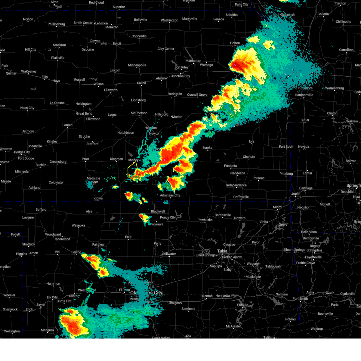 The storm which prompted the warning has moved out of the area. therefore, the warning will be allowed to expire. a tornado watch remains in effect until 1100 pm cdt for south central kansas. The storm which prompted the warning has moved out of the area. therefore, the warning will be allowed to expire. a tornado watch remains in effect until 1100 pm cdt for south central kansas.
|
| 4/30/2024 6:32 PM CDT |
 At 632 pm cdt, a severe thunderstorm was located over andover, moving east at 35 mph (radar indicated). Hazards include 60 mph wind gusts and quarter size hail. Hail damage to vehicles is expected. expect wind damage to roofs, siding, and trees. Locations impacted include, wichita, derby, andover, haysville, augusta, mulvane, rose hill, clearwater, douglass, downtown wichita, eastborough, east wichita, mcconnell air force base, south wichita, santa fe lake, augusta municipal airport, oaklawn, and jabara airport. At 632 pm cdt, a severe thunderstorm was located over andover, moving east at 35 mph (radar indicated). Hazards include 60 mph wind gusts and quarter size hail. Hail damage to vehicles is expected. expect wind damage to roofs, siding, and trees. Locations impacted include, wichita, derby, andover, haysville, augusta, mulvane, rose hill, clearwater, douglass, downtown wichita, eastborough, east wichita, mcconnell air force base, south wichita, santa fe lake, augusta municipal airport, oaklawn, and jabara airport.
|
| 4/30/2024 6:30 PM CDT | Quarter sized hail reported 5.6 miles W of Wichita, KS |
| 4/30/2024 6:29 PM CDT |
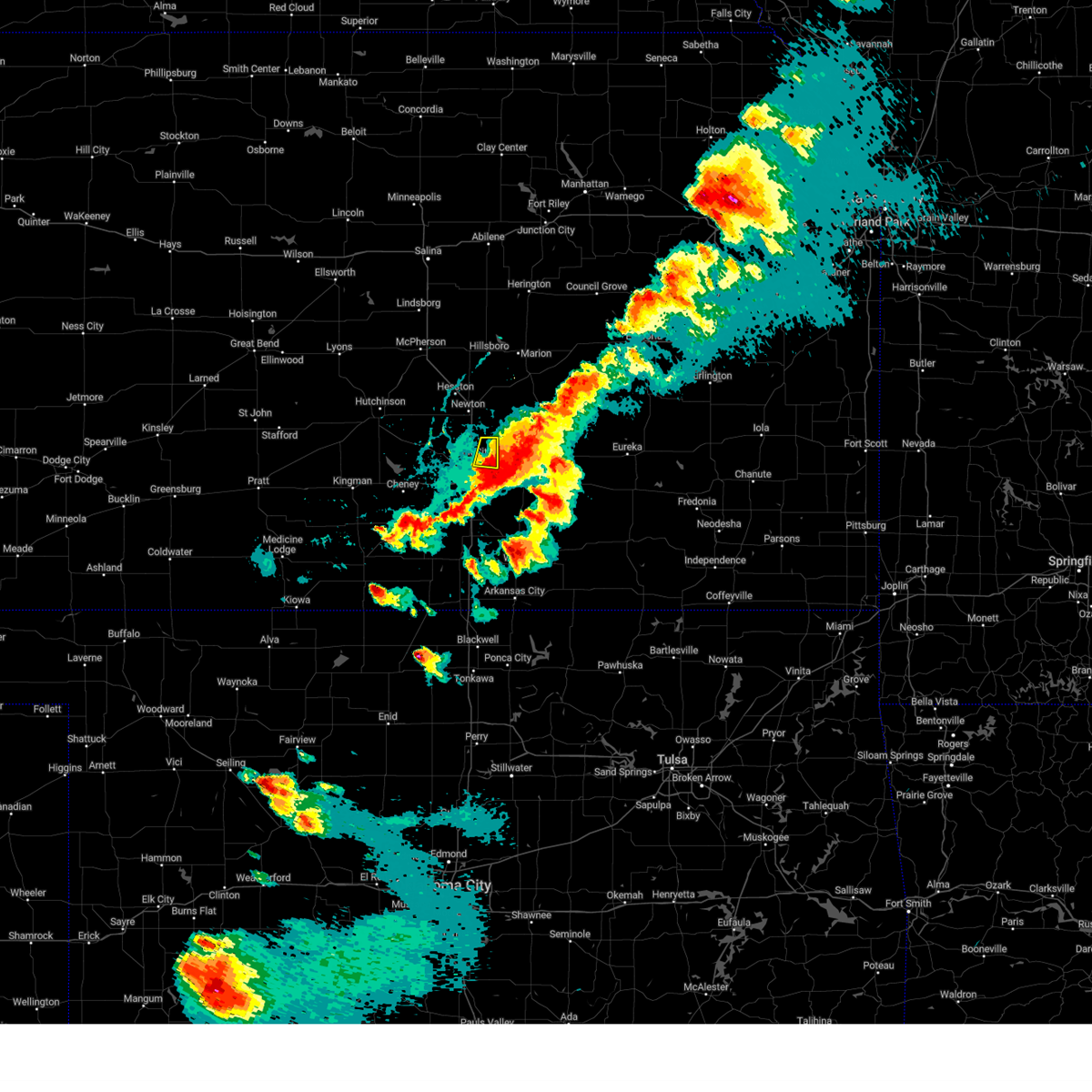 the severe thunderstorm warning has been cancelled and is no longer in effect the severe thunderstorm warning has been cancelled and is no longer in effect
|
| 4/30/2024 6:27 PM CDT |
 the severe thunderstorm warning has been cancelled and is no longer in effect the severe thunderstorm warning has been cancelled and is no longer in effect
|
| 4/30/2024 6:27 PM CDT |
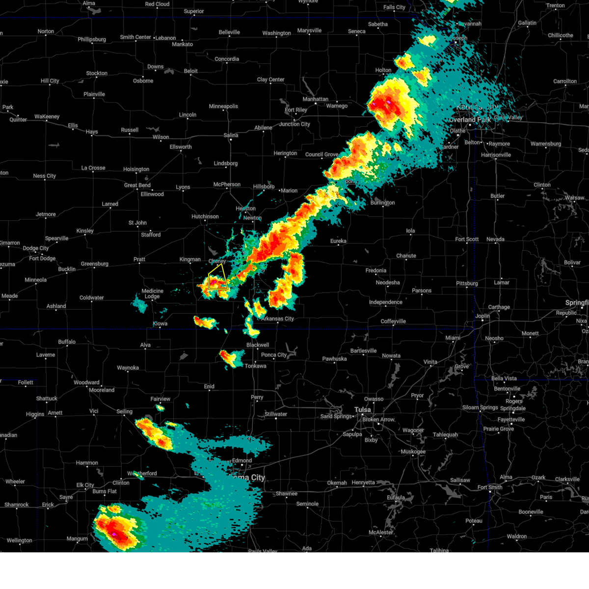 At 626 pm cdt, a severe thunderstorm was located near norwich, or 9 miles northwest of conway springs, moving east at 40 mph (radar indicated). Hazards include 60 mph wind gusts and quarter size hail. Hail damage to vehicles is expected. expect wind damage to roofs, siding, and trees. Locations impacted include, norwich. At 626 pm cdt, a severe thunderstorm was located near norwich, or 9 miles northwest of conway springs, moving east at 40 mph (radar indicated). Hazards include 60 mph wind gusts and quarter size hail. Hail damage to vehicles is expected. expect wind damage to roofs, siding, and trees. Locations impacted include, norwich.
|
| 4/30/2024 6:22 PM CDT |
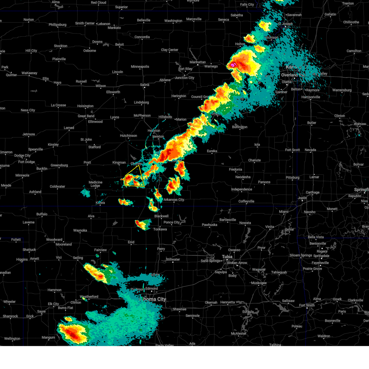 At 622 pm cdt, a severe thunderstorm was located over norwich, or 11 miles northwest of conway springs, moving east at 40 mph (radar indicated). Hazards include golf ball size hail and 60 mph wind gusts. People and animals outdoors will be injured. expect hail damage to roofs, siding, windows, and vehicles. expect wind damage to roofs, siding, and trees. Locations impacted include, conway springs, norwich, and runnymede. At 622 pm cdt, a severe thunderstorm was located over norwich, or 11 miles northwest of conway springs, moving east at 40 mph (radar indicated). Hazards include golf ball size hail and 60 mph wind gusts. People and animals outdoors will be injured. expect hail damage to roofs, siding, windows, and vehicles. expect wind damage to roofs, siding, and trees. Locations impacted include, conway springs, norwich, and runnymede.
|
| 4/30/2024 6:20 PM CDT |
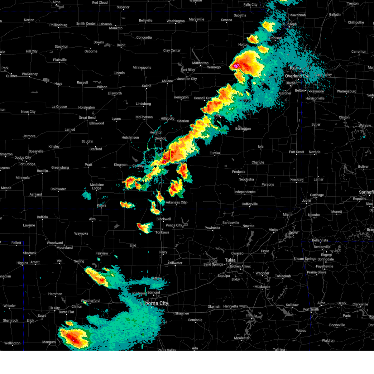 Svrict the national weather service in wichita has issued a * severe thunderstorm warning for, northeastern sedgwick county in south central kansas, * until 645 pm cdt. * at 620 pm cdt, a severe thunderstorm was located over northeast wichita, or over bel aire, moving east at 25 mph (radar indicated). Hazards include 60 mph wind gusts and half dollar size hail. Hail damage to vehicles is expected. Expect wind damage to roofs, siding, and trees. Svrict the national weather service in wichita has issued a * severe thunderstorm warning for, northeastern sedgwick county in south central kansas, * until 645 pm cdt. * at 620 pm cdt, a severe thunderstorm was located over northeast wichita, or over bel aire, moving east at 25 mph (radar indicated). Hazards include 60 mph wind gusts and half dollar size hail. Hail damage to vehicles is expected. Expect wind damage to roofs, siding, and trees.
|
| 4/30/2024 6:15 PM CDT |
 Svrict the national weather service in wichita has issued a * severe thunderstorm warning for, southwestern sedgwick county in south central kansas, northeastern harper county in south central kansas, southeastern kingman county in south central kansas, northwestern sumner county in south central kansas, * until 645 pm cdt. * at 614 pm cdt, a severe thunderstorm was located 6 miles west of norwich, or 10 miles north of harper, moving east at 40 mph (radar indicated). Hazards include 60 mph wind gusts and half dollar size hail. Hail damage to vehicles is expected. Expect wind damage to roofs, siding, and trees. Svrict the national weather service in wichita has issued a * severe thunderstorm warning for, southwestern sedgwick county in south central kansas, northeastern harper county in south central kansas, southeastern kingman county in south central kansas, northwestern sumner county in south central kansas, * until 645 pm cdt. * at 614 pm cdt, a severe thunderstorm was located 6 miles west of norwich, or 10 miles north of harper, moving east at 40 mph (radar indicated). Hazards include 60 mph wind gusts and half dollar size hail. Hail damage to vehicles is expected. Expect wind damage to roofs, siding, and trees.
|
| 4/30/2024 6:02 PM CDT | Ping Pong Ball sized hail reported 8 miles S of Wichita, KS |
| 4/30/2024 5:59 PM CDT |
 the severe thunderstorm warning has been cancelled and is no longer in effect the severe thunderstorm warning has been cancelled and is no longer in effect
|
| 4/30/2024 5:59 PM CDT |
 At 558 pm cdt, a severe thunderstorm was located over park city, moving east at 20 mph (radar indicated). Hazards include golf ball size hail and 60 mph wind gusts. People and animals outdoors will be injured. expect hail damage to roofs, siding, windows, and vehicles. expect wind damage to roofs, siding, and trees. Locations impacted include, wichita, park city, valley center, bel aire, maize, kechi, northeast wichita, and jabara airport. At 558 pm cdt, a severe thunderstorm was located over park city, moving east at 20 mph (radar indicated). Hazards include golf ball size hail and 60 mph wind gusts. People and animals outdoors will be injured. expect hail damage to roofs, siding, windows, and vehicles. expect wind damage to roofs, siding, and trees. Locations impacted include, wichita, park city, valley center, bel aire, maize, kechi, northeast wichita, and jabara airport.
|
| 4/30/2024 5:54 PM CDT |
 Svrict the national weather service in wichita has issued a * severe thunderstorm warning for, southeastern sedgwick county in south central kansas, southwestern butler county in south central kansas, * until 730 pm cdt. * at 554 pm cdt, a severe thunderstorm was located over maize, moving east at 20 mph (radar indicated). Hazards include 60 mph wind gusts and quarter size hail. Hail damage to vehicles is expected. Expect wind damage to roofs, siding, and trees. Svrict the national weather service in wichita has issued a * severe thunderstorm warning for, southeastern sedgwick county in south central kansas, southwestern butler county in south central kansas, * until 730 pm cdt. * at 554 pm cdt, a severe thunderstorm was located over maize, moving east at 20 mph (radar indicated). Hazards include 60 mph wind gusts and quarter size hail. Hail damage to vehicles is expected. Expect wind damage to roofs, siding, and trees.
|
| 4/30/2024 5:42 PM CDT |
 the severe thunderstorm warning has been cancelled and is no longer in effect the severe thunderstorm warning has been cancelled and is no longer in effect
|
| 4/30/2024 5:42 PM CDT |
 At 542 pm cdt, a severe thunderstorm was located near cheney, moving east at 20 mph (radar indicated). Hazards include 60 mph wind gusts and quarter size hail. Hail damage to vehicles is expected. expect wind damage to roofs, siding, and trees. Locations impacted include, goddard, cheney, garden plain, viola, and lake afton. At 542 pm cdt, a severe thunderstorm was located near cheney, moving east at 20 mph (radar indicated). Hazards include 60 mph wind gusts and quarter size hail. Hail damage to vehicles is expected. expect wind damage to roofs, siding, and trees. Locations impacted include, goddard, cheney, garden plain, viola, and lake afton.
|
| 4/30/2024 5:41 PM CDT |
 At 541 pm cdt, a severe thunderstorm was located over valley center, moving east at 25 mph (radar indicated). Hazards include 60 mph wind gusts and half dollar size hail. Hail damage to vehicles is expected. expect wind damage to roofs, siding, and trees. Locations impacted include, wichita, park city, valley center, bel aire, maize, sedgwick, colwich, mount hope, kechi, andale, bentley, northeast wichita, and jabara airport. At 541 pm cdt, a severe thunderstorm was located over valley center, moving east at 25 mph (radar indicated). Hazards include 60 mph wind gusts and half dollar size hail. Hail damage to vehicles is expected. expect wind damage to roofs, siding, and trees. Locations impacted include, wichita, park city, valley center, bel aire, maize, sedgwick, colwich, mount hope, kechi, andale, bentley, northeast wichita, and jabara airport.
|
| 4/30/2024 5:30 PM CDT |
 Svrict the national weather service in wichita has issued a * severe thunderstorm warning for, southwestern sedgwick county in south central kansas, northeastern kingman county in south central kansas, * until 615 pm cdt. * at 530 pm cdt, a severe thunderstorm was located 7 miles northwest of norwich, or 10 miles southwest of cheney, moving east at 45 mph (radar indicated). Hazards include 60 mph wind gusts and half dollar size hail. Hail damage to vehicles is expected. Expect wind damage to roofs, siding, and trees. Svrict the national weather service in wichita has issued a * severe thunderstorm warning for, southwestern sedgwick county in south central kansas, northeastern kingman county in south central kansas, * until 615 pm cdt. * at 530 pm cdt, a severe thunderstorm was located 7 miles northwest of norwich, or 10 miles southwest of cheney, moving east at 45 mph (radar indicated). Hazards include 60 mph wind gusts and half dollar size hail. Hail damage to vehicles is expected. Expect wind damage to roofs, siding, and trees.
|
| 4/30/2024 5:10 PM CDT |
 Svrict the national weather service in wichita has issued a * severe thunderstorm warning for, northern sedgwick county in south central kansas, southern harvey county in south central kansas, * until 615 pm cdt. * at 510 pm cdt, a severe thunderstorm was located over mount hope, moving east at 25 mph (radar indicated). Hazards include 60 mph wind gusts and half dollar size hail. Hail damage to vehicles is expected. Expect wind damage to roofs, siding, and trees. Svrict the national weather service in wichita has issued a * severe thunderstorm warning for, northern sedgwick county in south central kansas, southern harvey county in south central kansas, * until 615 pm cdt. * at 510 pm cdt, a severe thunderstorm was located over mount hope, moving east at 25 mph (radar indicated). Hazards include 60 mph wind gusts and half dollar size hail. Hail damage to vehicles is expected. Expect wind damage to roofs, siding, and trees.
|
| 8/6/2023 12:03 AM CDT |
 At 1202 am cdt, severe thunderstorms were located along a line extending from 5 miles north of florence to towanda to clearwater, moving east-southeast at 55 mph (radar indicated). Hazards include 70 mph wind gusts and nickel size hail. Expect considerable tree damage. damage is likely to mobile homes, roofs, and outbuildings. locations impacted include, wichita, derby, newton, andover, haysville, augusta, park city, valley center, bel aire, mulvane, goddard, rose hill, hesston, maize, hillsboro, clearwater, cheney, marion, north newton and sedgwick. thunderstorm damage threat, considerable hail threat, radar indicated max hail size, 0. 88 in wind threat, radar indicated max wind gust, 70 mph. At 1202 am cdt, severe thunderstorms were located along a line extending from 5 miles north of florence to towanda to clearwater, moving east-southeast at 55 mph (radar indicated). Hazards include 70 mph wind gusts and nickel size hail. Expect considerable tree damage. damage is likely to mobile homes, roofs, and outbuildings. locations impacted include, wichita, derby, newton, andover, haysville, augusta, park city, valley center, bel aire, mulvane, goddard, rose hill, hesston, maize, hillsboro, clearwater, cheney, marion, north newton and sedgwick. thunderstorm damage threat, considerable hail threat, radar indicated max hail size, 0. 88 in wind threat, radar indicated max wind gust, 70 mph.
|
| 8/6/2023 12:02 AM CDT | Lines down... poles on fire in wichita metro are in sedgwick county KS, 0.3 miles SSW of Wichita, KS |
| 8/5/2023 11:54 PM CDT | Several branches dow in sedgwick county KS, 4.5 miles W of Wichita, KS |
| 8/5/2023 11:51 PM CDT | Storm damage reported in sedgwick county KS, 8.1 miles WSW of Wichita, KS |
| 8/5/2023 11:47 PM CDT |
 At 1146 pm cdt, severe thunderstorms were located along a line extending from near hillsboro to near bel aire to near cheney, moving east-southeast at 60 mph. these are destructive storms with winds of 70 to 80 mph (radar indicated). Hazards include 80 mph wind gusts and nickel size hail. Flying debris will be dangerous to those caught without shelter. mobile homes will be heavily damaged. expect considerable damage to roofs, windows, and vehicles. extensive tree damage and power outages are likely. locations impacted include, wichita, derby, newton, andover, haysville, augusta, park city, valley center, bel aire, mulvane, goddard, rose hill, hesston, maize, kingman, hillsboro, clearwater, cheney, marion and north newton. thunderstorm damage threat, destructive hail threat, radar indicated max hail size, 0. 88 in wind threat, radar indicated max wind gust, 80 mph. At 1146 pm cdt, severe thunderstorms were located along a line extending from near hillsboro to near bel aire to near cheney, moving east-southeast at 60 mph. these are destructive storms with winds of 70 to 80 mph (radar indicated). Hazards include 80 mph wind gusts and nickel size hail. Flying debris will be dangerous to those caught without shelter. mobile homes will be heavily damaged. expect considerable damage to roofs, windows, and vehicles. extensive tree damage and power outages are likely. locations impacted include, wichita, derby, newton, andover, haysville, augusta, park city, valley center, bel aire, mulvane, goddard, rose hill, hesston, maize, kingman, hillsboro, clearwater, cheney, marion and north newton. thunderstorm damage threat, destructive hail threat, radar indicated max hail size, 0. 88 in wind threat, radar indicated max wind gust, 80 mph.
|
| 8/5/2023 11:45 PM CDT | Corrects previous tstm wnd dmg report from 4 s maize. delayed report. time based on radar. approximately 12 inch diameter tree branch downe in sedgwick county KS, 6.9 miles ESE of Wichita, KS |
| 8/5/2023 11:25 PM CDT |
 At 1124 pm cdt, severe thunderstorms were located along a line extending from 5 miles northeast of galva to near halstead to near kingman, moving east-southeast at 60 mph. these are destructive storms for winds to 80 mph (radar indicated). Hazards include 80 mph wind gusts and nickel size hail. Flying debris will be dangerous to those caught without shelter. mobile homes will be heavily damaged. expect considerable damage to roofs, windows, and vehicles. Extensive tree damage and power outages are likely. At 1124 pm cdt, severe thunderstorms were located along a line extending from 5 miles northeast of galva to near halstead to near kingman, moving east-southeast at 60 mph. these are destructive storms for winds to 80 mph (radar indicated). Hazards include 80 mph wind gusts and nickel size hail. Flying debris will be dangerous to those caught without shelter. mobile homes will be heavily damaged. expect considerable damage to roofs, windows, and vehicles. Extensive tree damage and power outages are likely.
|
| 8/5/2023 5:36 AM CDT |
 At 536 am cdt, severe thunderstorms were located along a line extending from viola to near caldwell, moving east at 40 mph (radar indicated). Hazards include 60 mph wind gusts. Expect damage to roofs, siding, and trees. locations impacted include, derby, haysville, wellington, mulvane, clearwater, belle plaine, conway springs, caldwell, oxford, argonia, south haven, geuda springs, viola, mayfield, milan, hunnewell, perth, riverdale and wellington airport. hail threat, radar indicated max hail size, <. 75 in wind threat, radar indicated max wind gust, 60 mph. At 536 am cdt, severe thunderstorms were located along a line extending from viola to near caldwell, moving east at 40 mph (radar indicated). Hazards include 60 mph wind gusts. Expect damage to roofs, siding, and trees. locations impacted include, derby, haysville, wellington, mulvane, clearwater, belle plaine, conway springs, caldwell, oxford, argonia, south haven, geuda springs, viola, mayfield, milan, hunnewell, perth, riverdale and wellington airport. hail threat, radar indicated max hail size, <. 75 in wind threat, radar indicated max wind gust, 60 mph.
|
| 8/5/2023 5:14 AM CDT |
 At 514 am cdt, severe thunderstorms were located along a line extending from 6 miles west of norwich to 9 miles northeast of manchester, moving east at 35 mph (radar indicated). Hazards include 60 to 70 mph wind gusts. Expect considerable tree damage. Damage is likely to mobile homes, roofs, and outbuildings. At 514 am cdt, severe thunderstorms were located along a line extending from 6 miles west of norwich to 9 miles northeast of manchester, moving east at 35 mph (radar indicated). Hazards include 60 to 70 mph wind gusts. Expect considerable tree damage. Damage is likely to mobile homes, roofs, and outbuildings.
|
| 7/14/2023 5:11 PM CDT |
 The severe thunderstorm warning for southwestern sedgwick, northern harper, southern kingman and northwestern sumner counties will expire at 515 pm cdt, the storms which prompted the warning have weakened below severe limits, and no longer pose an immediate threat to life or property. therefore, the warning will be allowed to expire. however gusty winds and heavy rain are still possible with these thunderstorms. a severe thunderstorm watch remains in effect until 700 pm cdt for south central kansas. The severe thunderstorm warning for southwestern sedgwick, northern harper, southern kingman and northwestern sumner counties will expire at 515 pm cdt, the storms which prompted the warning have weakened below severe limits, and no longer pose an immediate threat to life or property. therefore, the warning will be allowed to expire. however gusty winds and heavy rain are still possible with these thunderstorms. a severe thunderstorm watch remains in effect until 700 pm cdt for south central kansas.
|
| 7/14/2023 5:00 PM CDT |
 At 500 pm cdt, severe thunderstorms were located along a line extending from near sharon to near harper to near conway springs, moving south at 30 mph (radar indicated). Hazards include 60 mph wind gusts. Expect damage to roofs, siding, and trees. locations impacted include, norwich, zenda, spivey, rago and runnymede. hail threat, radar indicated max hail size, <. 75 in wind threat, radar indicated max wind gust, 60 mph. At 500 pm cdt, severe thunderstorms were located along a line extending from near sharon to near harper to near conway springs, moving south at 30 mph (radar indicated). Hazards include 60 mph wind gusts. Expect damage to roofs, siding, and trees. locations impacted include, norwich, zenda, spivey, rago and runnymede. hail threat, radar indicated max hail size, <. 75 in wind threat, radar indicated max wind gust, 60 mph.
|
| 7/14/2023 4:50 PM CDT |
 At 449 pm cdt, severe thunderstorms were located along a line extending from near nashville to 5 miles north of harper to near conway springs, moving south at 30 mph (radar indicated). Hazards include 60 mph wind gusts and penny size hail. Expect damage to roofs, siding, and trees. locations impacted include, kingman, cheney, norwich, nashville, murdock, willowdale, zenda, spivey, cleveland, rago and runnymede. hail threat, radar indicated max hail size, 0. 75 in wind threat, radar indicated max wind gust, 60 mph. At 449 pm cdt, severe thunderstorms were located along a line extending from near nashville to 5 miles north of harper to near conway springs, moving south at 30 mph (radar indicated). Hazards include 60 mph wind gusts and penny size hail. Expect damage to roofs, siding, and trees. locations impacted include, kingman, cheney, norwich, nashville, murdock, willowdale, zenda, spivey, cleveland, rago and runnymede. hail threat, radar indicated max hail size, 0. 75 in wind threat, radar indicated max wind gust, 60 mph.
|
| 7/14/2023 4:49 PM CDT |
 At 449 pm cdt, severe thunderstorms were located along a line extending from near leon to near douglass to conway springs, moving southeast at 40 mph (radar indicated). Hazards include 60 mph wind gusts. Expect damage to roofs, siding, and trees. locations impacted include, wichita, derby, el dorado, andover, haysville, augusta, park city, bel aire, mulvane, goddard, rose hill, maize, clearwater, douglass, belle plaine, towanda, colwich, conway springs, benton and garden plain. hail threat, radar indicated max hail size, <. 75 in wind threat, radar indicated max wind gust, 60 mph. At 449 pm cdt, severe thunderstorms were located along a line extending from near leon to near douglass to conway springs, moving southeast at 40 mph (radar indicated). Hazards include 60 mph wind gusts. Expect damage to roofs, siding, and trees. locations impacted include, wichita, derby, el dorado, andover, haysville, augusta, park city, bel aire, mulvane, goddard, rose hill, maize, clearwater, douglass, belle plaine, towanda, colwich, conway springs, benton and garden plain. hail threat, radar indicated max hail size, <. 75 in wind threat, radar indicated max wind gust, 60 mph.
|
| 7/14/2023 4:33 PM CDT |
 At 432 pm cdt, severe thunderstorms were located along a line extending from near nashville to 9 miles west of norwich to 5 miles northwest of viola, moving south at 30 mph (radar indicated). Hazards include 60 mph wind gusts and penny size hail. Expect damage to roofs, siding, and trees. locations impacted include, kingman, cheney, norwich, nashville, murdock, willowdale, zenda, spivey, cleveland, rago and runnymede. hail threat, radar indicated max hail size, 0. 75 in wind threat, radar indicated max wind gust, 60 mph. At 432 pm cdt, severe thunderstorms were located along a line extending from near nashville to 9 miles west of norwich to 5 miles northwest of viola, moving south at 30 mph (radar indicated). Hazards include 60 mph wind gusts and penny size hail. Expect damage to roofs, siding, and trees. locations impacted include, kingman, cheney, norwich, nashville, murdock, willowdale, zenda, spivey, cleveland, rago and runnymede. hail threat, radar indicated max hail size, 0. 75 in wind threat, radar indicated max wind gust, 60 mph.
|
| 7/14/2023 4:32 PM CDT |
 At 432 pm cdt, severe thunderstorms were located along a line extending from leon to near rose hill to near eisenhower national airport, moving southeast at 35 mph (radar indicated). Hazards include 60 mph wind gusts. Expect damage to roofs, siding, and trees. locations impacted include, wichita, derby, el dorado, andover, haysville, augusta, park city, bel aire, mulvane, goddard, rose hill, maize, clearwater, douglass, belle plaine, towanda, colwich, conway springs, benton and garden plain. hail threat, radar indicated max hail size, <. 75 in wind threat, radar indicated max wind gust, 60 mph. At 432 pm cdt, severe thunderstorms were located along a line extending from leon to near rose hill to near eisenhower national airport, moving southeast at 35 mph (radar indicated). Hazards include 60 mph wind gusts. Expect damage to roofs, siding, and trees. locations impacted include, wichita, derby, el dorado, andover, haysville, augusta, park city, bel aire, mulvane, goddard, rose hill, maize, clearwater, douglass, belle plaine, towanda, colwich, conway springs, benton and garden plain. hail threat, radar indicated max hail size, <. 75 in wind threat, radar indicated max wind gust, 60 mph.
|
| 7/14/2023 4:20 PM CDT | Multiple reports of power lines and tree limbs dow in sedgwick county KS, 3 miles SW of Wichita, KS |
| 7/14/2023 4:13 PM CDT |
 At 412 pm cdt, severe thunderstorms were located along a line extending from near el dorado to near east wichita to near colwich, moving southeast at 40 mph (radar indicated). Hazards include 60 mph wind gusts. Expect damage to roofs, siding, and trees. locations impacted include, wichita, derby, el dorado, andover, haysville, augusta, park city, bel aire, mulvane, goddard, rose hill, maize, clearwater, douglass, belle plaine, towanda, colwich, conway springs, benton and garden plain. hail threat, radar indicated max hail size, <. 75 in wind threat, radar indicated max wind gust, 60 mph. At 412 pm cdt, severe thunderstorms were located along a line extending from near el dorado to near east wichita to near colwich, moving southeast at 40 mph (radar indicated). Hazards include 60 mph wind gusts. Expect damage to roofs, siding, and trees. locations impacted include, wichita, derby, el dorado, andover, haysville, augusta, park city, bel aire, mulvane, goddard, rose hill, maize, clearwater, douglass, belle plaine, towanda, colwich, conway springs, benton and garden plain. hail threat, radar indicated max hail size, <. 75 in wind threat, radar indicated max wind gust, 60 mph.
|
| 7/14/2023 4:12 PM CDT |
 At 412 pm cdt, severe thunderstorms were located along a line extending from cunningham to near kingman to near garden plain, moving south at 30 mph (radar indicated). Hazards include 60 mph wind gusts and penny size hail. expect damage to roofs, siding, and trees At 412 pm cdt, severe thunderstorms were located along a line extending from cunningham to near kingman to near garden plain, moving south at 30 mph (radar indicated). Hazards include 60 mph wind gusts and penny size hail. expect damage to roofs, siding, and trees
|
| 7/14/2023 4:04 PM CDT | 21 inch diameter tree down at vine and mapl in sedgwick county KS, 1 miles ENE of Wichita, KS |
| 7/14/2023 3:57 PM CDT |
 At 357 pm cdt, severe thunderstorms were located along a line extending from near potwin to near eastborough to 5 miles south of garden plain, moving southeast at 35 mph (radar indicated). Hazards include 60 mph wind gusts. expect damage to roofs, siding, and trees At 357 pm cdt, severe thunderstorms were located along a line extending from near potwin to near eastborough to 5 miles south of garden plain, moving southeast at 35 mph (radar indicated). Hazards include 60 mph wind gusts. expect damage to roofs, siding, and trees
|
| 7/14/2023 3:52 PM CDT |
 At 352 pm cdt, severe thunderstorms were located along a line extending from near whitewater to near valley center to near bentley, moving east at 40 mph (radar indicated). Hazards include 60 mph wind gusts. Expect damage to roofs, siding, and trees. locations impacted include, park city, valley center, bel aire, maize, sedgwick, kechi and bentley. hail threat, radar indicated max hail size, <. 75 in wind threat, radar indicated max wind gust, 60 mph. At 352 pm cdt, severe thunderstorms were located along a line extending from near whitewater to near valley center to near bentley, moving east at 40 mph (radar indicated). Hazards include 60 mph wind gusts. Expect damage to roofs, siding, and trees. locations impacted include, park city, valley center, bel aire, maize, sedgwick, kechi and bentley. hail threat, radar indicated max hail size, <. 75 in wind threat, radar indicated max wind gust, 60 mph.
|
| 7/14/2023 3:34 PM CDT |
 At 333 pm cdt, severe thunderstorms were located along a line extending from near halstead to near bentley to mount hope, moving east at 55 mph (radar indicated). Hazards include 60 mph wind gusts. Expect damage to roofs, siding, and trees. locations impacted include, park city, valley center, bel aire, maize, halstead, sedgwick, burrton, mount hope, kechi and bentley. hail threat, radar indicated max hail size, <. 75 in wind threat, radar indicated max wind gust, 60 mph. At 333 pm cdt, severe thunderstorms were located along a line extending from near halstead to near bentley to mount hope, moving east at 55 mph (radar indicated). Hazards include 60 mph wind gusts. Expect damage to roofs, siding, and trees. locations impacted include, park city, valley center, bel aire, maize, halstead, sedgwick, burrton, mount hope, kechi and bentley. hail threat, radar indicated max hail size, <. 75 in wind threat, radar indicated max wind gust, 60 mph.
|
| 7/14/2023 3:22 PM CDT |
 At 321 pm cdt, severe thunderstorms were located along a line extending from near burrton to near mount hope to 5 miles south of haven, moving east at 55 mph (radar indicated). Hazards include 60 mph wind gusts. expect damage to roofs, siding, and trees At 321 pm cdt, severe thunderstorms were located along a line extending from near burrton to near mount hope to 5 miles south of haven, moving east at 55 mph (radar indicated). Hazards include 60 mph wind gusts. expect damage to roofs, siding, and trees
|
| 7/5/2023 4:37 AM CDT |
 At 437 am cdt, a severe thunderstorm was located near leon, moving east at 30 mph (radar indicated). Hazards include 60 mph wind gusts and quarter size hail. Hail damage to vehicles is expected. expect wind damage to roofs, siding, and trees. locations impacted include, wichita, el dorado, andover, augusta, bel aire, towanda, benton, leon, northeast wichita, mcconnell air force base, santa fe lake, el dorado state park, augusta municipal airport, el dorado airport, el dorado lake and jabara airport. hail threat, radar indicated max hail size, 1. 00 in wind threat, radar indicated max wind gust, 60 mph. At 437 am cdt, a severe thunderstorm was located near leon, moving east at 30 mph (radar indicated). Hazards include 60 mph wind gusts and quarter size hail. Hail damage to vehicles is expected. expect wind damage to roofs, siding, and trees. locations impacted include, wichita, el dorado, andover, augusta, bel aire, towanda, benton, leon, northeast wichita, mcconnell air force base, santa fe lake, el dorado state park, augusta municipal airport, el dorado airport, el dorado lake and jabara airport. hail threat, radar indicated max hail size, 1. 00 in wind threat, radar indicated max wind gust, 60 mph.
|
| 7/5/2023 4:12 AM CDT |
 At 412 am cdt, a severe thunderstorm was located near andover, moving east at 30 mph (radar indicated). Hazards include 60 mph wind gusts and quarter size hail. Hail damage to vehicles is expected. expect wind damage to roofs, siding, and trees. locations impacted include, wichita, el dorado, andover, augusta, park city, bel aire, towanda, benton, leon, downtown wichita, kechi, eastborough, east wichita, northeast wichita, mcconnell air force base, santa fe lake, el dorado state park, augusta municipal airport, el dorado airport and el dorado lake. hail threat, radar indicated max hail size, 1. 00 in wind threat, radar indicated max wind gust, 60 mph. At 412 am cdt, a severe thunderstorm was located near andover, moving east at 30 mph (radar indicated). Hazards include 60 mph wind gusts and quarter size hail. Hail damage to vehicles is expected. expect wind damage to roofs, siding, and trees. locations impacted include, wichita, el dorado, andover, augusta, park city, bel aire, towanda, benton, leon, downtown wichita, kechi, eastborough, east wichita, northeast wichita, mcconnell air force base, santa fe lake, el dorado state park, augusta municipal airport, el dorado airport and el dorado lake. hail threat, radar indicated max hail size, 1. 00 in wind threat, radar indicated max wind gust, 60 mph.
|
| 7/5/2023 3:52 AM CDT |
 At 352 am cdt, a severe thunderstorm was located over bel aire, moving east at 30 mph (radar indicated). Hazards include 60 mph wind gusts and quarter size hail. Hail damage to vehicles is expected. Expect wind damage to roofs, siding, and trees. At 352 am cdt, a severe thunderstorm was located over bel aire, moving east at 30 mph (radar indicated). Hazards include 60 mph wind gusts and quarter size hail. Hail damage to vehicles is expected. Expect wind damage to roofs, siding, and trees.
|
| 6/27/2023 9:21 AM CDT |
 At 920 am cdt, a severe thunderstorm was located over benton, moving southeast at 40 mph (radar indicated). Hazards include 60 mph wind gusts. Expect damage to roofs, siding, and trees. locations impacted include, wichita, derby, el dorado, andover, haysville, augusta, park city, bel aire, mulvane, goddard, rose hill, maize, clearwater, towanda, benton, garden plain, whitewater, downtown wichita, kechi and eastborough. hail threat, radar indicated max hail size, <. 75 in wind threat, radar indicated max wind gust, 60 mph. At 920 am cdt, a severe thunderstorm was located over benton, moving southeast at 40 mph (radar indicated). Hazards include 60 mph wind gusts. Expect damage to roofs, siding, and trees. locations impacted include, wichita, derby, el dorado, andover, haysville, augusta, park city, bel aire, mulvane, goddard, rose hill, maize, clearwater, towanda, benton, garden plain, whitewater, downtown wichita, kechi and eastborough. hail threat, radar indicated max hail size, <. 75 in wind threat, radar indicated max wind gust, 60 mph.
|
| 6/27/2023 9:11 AM CDT | Nickel hai in sedgwick county KS, 8 miles S of Wichita, KS |
| 6/27/2023 9:04 AM CDT |
 At 904 am cdt, a severe thunderstorm was located near park city, moving southeast at 40 mph (radar indicated). Hazards include 60 to 70 mph wind gusts. Expect considerable tree damage. Damage is likely to mobile homes, roofs, and outbuildings. At 904 am cdt, a severe thunderstorm was located near park city, moving southeast at 40 mph (radar indicated). Hazards include 60 to 70 mph wind gusts. Expect considerable tree damage. Damage is likely to mobile homes, roofs, and outbuildings.
|
| 6/27/2023 8:49 AM CDT |
 At 848 am cdt, a severe thunderstorm was located near halstead, moving east at 45 mph (law enforcement). Hazards include 70 mph wind gusts and penny size hail. Expect considerable tree damage. damage is likely to mobile homes, roofs, and outbuildings. locations impacted include, wichita, newton, park city, valley center, hesston, maize, halstead, north newton, sedgwick, colwich, burrton, mount hope, kechi, andale, bentley, walton and newton airport. thunderstorm damage threat, considerable hail threat, radar indicated max hail size, 0. 75 in wind threat, observed max wind gust, 70 mph. At 848 am cdt, a severe thunderstorm was located near halstead, moving east at 45 mph (law enforcement). Hazards include 70 mph wind gusts and penny size hail. Expect considerable tree damage. damage is likely to mobile homes, roofs, and outbuildings. locations impacted include, wichita, newton, park city, valley center, hesston, maize, halstead, north newton, sedgwick, colwich, burrton, mount hope, kechi, andale, bentley, walton and newton airport. thunderstorm damage threat, considerable hail threat, radar indicated max hail size, 0. 75 in wind threat, observed max wind gust, 70 mph.
|
| 6/27/2023 8:32 AM CDT |
 At 832 am cdt, a severe thunderstorm was located near burrton, moving east at 45 mph (radar indicated). Hazards include 60 mph wind gusts and nickel size hail. expect damage to roofs, siding, and trees At 832 am cdt, a severe thunderstorm was located near burrton, moving east at 45 mph (radar indicated). Hazards include 60 mph wind gusts and nickel size hail. expect damage to roofs, siding, and trees
|
| 6/21/2023 7:51 AM CDT |
 The severe thunderstorm warning for southeastern reno, western sedgwick and northeastern kingman counties will expire at 800 am cdt, the storms which prompted the warning have weakened below severe limits, and no longer pose an immediate threat to life or property. therefore, the warning will be allowed to expire. however gusty winds up to 40 mph are still possible with these thunderstorms. a severe thunderstorm watch remains in effect until 1100 am cdt for south central kansas. The severe thunderstorm warning for southeastern reno, western sedgwick and northeastern kingman counties will expire at 800 am cdt, the storms which prompted the warning have weakened below severe limits, and no longer pose an immediate threat to life or property. therefore, the warning will be allowed to expire. however gusty winds up to 40 mph are still possible with these thunderstorms. a severe thunderstorm watch remains in effect until 1100 am cdt for south central kansas.
|
| 6/21/2023 7:15 AM CDT |
 At 714 am cdt, severe thunderstorms were located along a line extending from near pretty prairie to 5 miles southeast of kingman, moving east at 45 mph (radar indicated). Hazards include 60 to 70 mph wind gusts. Expect considerable tree damage. damage is likely to mobile homes, roofs, and outbuildings. locations impacted include, cheney, haven, garden plain, pretty prairie, viola, waterloo, lake afton, cheney lake, mt vernon and cheney state park. thunderstorm damage threat, considerable hail threat, radar indicated max hail size, <. 75 in wind threat, radar indicated max wind gust, 70 mph. At 714 am cdt, severe thunderstorms were located along a line extending from near pretty prairie to 5 miles southeast of kingman, moving east at 45 mph (radar indicated). Hazards include 60 to 70 mph wind gusts. Expect considerable tree damage. damage is likely to mobile homes, roofs, and outbuildings. locations impacted include, cheney, haven, garden plain, pretty prairie, viola, waterloo, lake afton, cheney lake, mt vernon and cheney state park. thunderstorm damage threat, considerable hail threat, radar indicated max hail size, <. 75 in wind threat, radar indicated max wind gust, 70 mph.
|
| 6/21/2023 7:02 AM CDT |
 At 702 am cdt, severe thunderstorms were located along a line extending from 5 miles northwest of pretty prairie to near kingman to 13 miles east of cunningham, moving east at 45 mph (radar indicated). Hazards include 60 to 70 mph wind gusts. Expect considerable tree damage. Damage is likely to mobile homes, roofs, and outbuildings. At 702 am cdt, severe thunderstorms were located along a line extending from 5 miles northwest of pretty prairie to near kingman to 13 miles east of cunningham, moving east at 45 mph (radar indicated). Hazards include 60 to 70 mph wind gusts. Expect considerable tree damage. Damage is likely to mobile homes, roofs, and outbuildings.
|
| 6/17/2023 11:43 PM CDT |
 At 1143 pm cdt, severe thunderstorms were located along a line extending from 5 miles south of marion to near leon to 6 miles southwest of cedar vale, moving northeast at 55 mph (radar indicated). Hazards include 70 mph wind gusts and quarter size hail. Hail damage to vehicles is expected. expect considerable tree damage. wind damage is also likely to mobile homes, roofs, and outbuildings. locations impacted include, wichita, derby, newton, el dorado, arkansas city, winfield, andover, haysville, augusta, wellington, park city, valley center, bel aire, mulvane, rose hill, hesston, maize, hillsboro, clearwater and marion. thunderstorm damage threat, considerable hail threat, radar indicated max hail size, 1. 00 in wind threat, radar indicated max wind gust, 70 mph. At 1143 pm cdt, severe thunderstorms were located along a line extending from 5 miles south of marion to near leon to 6 miles southwest of cedar vale, moving northeast at 55 mph (radar indicated). Hazards include 70 mph wind gusts and quarter size hail. Hail damage to vehicles is expected. expect considerable tree damage. wind damage is also likely to mobile homes, roofs, and outbuildings. locations impacted include, wichita, derby, newton, el dorado, arkansas city, winfield, andover, haysville, augusta, wellington, park city, valley center, bel aire, mulvane, rose hill, hesston, maize, hillsboro, clearwater and marion. thunderstorm damage threat, considerable hail threat, radar indicated max hail size, 1. 00 in wind threat, radar indicated max wind gust, 70 mph.
|
| 6/17/2023 11:30 PM CDT | Powerlines down and large tree limbs down in road way of the 6100 block of e douglas av in sedgwick county KS, 4.5 miles W of Wichita, KS |
| 6/17/2023 11:26 PM CDT |
 At 1125 pm cdt, severe thunderstorms were located along a line extending from near potwin to 8 miles east of arkansas city, moving east at 40 mph (radar indicated). Hazards include 70 mph wind gusts and quarter size hail. Hail damage to vehicles is expected. expect considerable tree damage. Wind damage is also likely to mobile homes, roofs, and outbuildings. At 1125 pm cdt, severe thunderstorms were located along a line extending from near potwin to 8 miles east of arkansas city, moving east at 40 mph (radar indicated). Hazards include 70 mph wind gusts and quarter size hail. Hail damage to vehicles is expected. expect considerable tree damage. Wind damage is also likely to mobile homes, roofs, and outbuildings.
|
| 6/17/2023 11:18 PM CDT |
 At 1117 pm cdt, a severe thunderstorm capable of producing a tornado was located over benton, moving northeast at 30 mph (radar indicated rotation). Hazards include tornado. Flying debris will be dangerous to those caught without shelter. mobile homes will be damaged or destroyed. damage to roofs, windows, and vehicles will occur. tree damage is likely. this dangerous storm will be near, towanda around 1130 pm cdt. potwin around 1135 pm cdt. This includes interstate 35 between mile markers 69 and 71. At 1117 pm cdt, a severe thunderstorm capable of producing a tornado was located over benton, moving northeast at 30 mph (radar indicated rotation). Hazards include tornado. Flying debris will be dangerous to those caught without shelter. mobile homes will be damaged or destroyed. damage to roofs, windows, and vehicles will occur. tree damage is likely. this dangerous storm will be near, towanda around 1130 pm cdt. potwin around 1135 pm cdt. This includes interstate 35 between mile markers 69 and 71.
|
| 6/17/2023 11:15 PM CDT | Storm damage reported in sedgwick county KS, 8.1 miles WSW of Wichita, KS |
| 6/17/2023 11:09 PM CDT |
 At 1109 pm cdt, a severe thunderstorm capable of producing a tornado was located near rose hill, moving northeast at 40 mph (radar indicated rotation). Hazards include tornado. Flying debris will be dangerous to those caught without shelter. mobile homes will be damaged or destroyed. damage to roofs, windows, and vehicles will occur. tree damage is likely. this dangerous storm will be near, andover around 1115 pm cdt. Other locations impacted by this tornadic thunderstorm include augusta municipal airport. At 1109 pm cdt, a severe thunderstorm capable of producing a tornado was located near rose hill, moving northeast at 40 mph (radar indicated rotation). Hazards include tornado. Flying debris will be dangerous to those caught without shelter. mobile homes will be damaged or destroyed. damage to roofs, windows, and vehicles will occur. tree damage is likely. this dangerous storm will be near, andover around 1115 pm cdt. Other locations impacted by this tornadic thunderstorm include augusta municipal airport.
|
| 6/17/2023 11:01 PM CDT |
 At 1101 pm cdt, a severe thunderstorm capable of producing a tornado was located over derby, moving northeast at 35 mph (radar indicated rotation). Hazards include tornado. Flying debris will be dangerous to those caught without shelter. mobile homes will be damaged or destroyed. damage to roofs, windows, and vehicles will occur. tree damage is likely. this dangerous storm will be near, wichita and rose hill around 1105 pm cdt. eastborough, mcconnell air force base and east wichita around 1110 pm cdt. andover and northeast wichita around 1120 pm cdt. other locations impacted by this tornadic thunderstorm include jabara airport and augusta municipal airport. This includes interstate 35 between mile markers 46 and 56. At 1101 pm cdt, a severe thunderstorm capable of producing a tornado was located over derby, moving northeast at 35 mph (radar indicated rotation). Hazards include tornado. Flying debris will be dangerous to those caught without shelter. mobile homes will be damaged or destroyed. damage to roofs, windows, and vehicles will occur. tree damage is likely. this dangerous storm will be near, wichita and rose hill around 1105 pm cdt. eastborough, mcconnell air force base and east wichita around 1110 pm cdt. andover and northeast wichita around 1120 pm cdt. other locations impacted by this tornadic thunderstorm include jabara airport and augusta municipal airport. This includes interstate 35 between mile markers 46 and 56.
|
| 6/17/2023 10:56 PM CDT | Storm damage reported in sedgwick county KS, 5.4 miles ENE of Wichita, KS |
| 6/17/2023 10:51 PM CDT | Storm damage reported in sedgwick county KS, 5.4 miles ENE of Wichita, KS |
| 6/17/2023 10:50 PM CDT |
 At 1050 pm cdt, severe thunderstorms were located along a line extending from halstead to 6 miles northeast of braman, moving east at 40 mph (radar indicated). Hazards include 70 mph wind gusts and quarter size hail. Hail damage to vehicles is expected. expect considerable tree damage. wind damage is also likely to mobile homes, roofs, and outbuildings. locations impacted include, wichita, derby, newton, arkansas city, winfield, andover, haysville, augusta, wellington, park city, valley center, bel aire, mulvane, goddard, rose hill, hesston, maize, clearwater, cheney and halstead. thunderstorm damage threat, considerable hail threat, radar indicated max hail size, 1. 00 in wind threat, observed max wind gust, 70 mph. At 1050 pm cdt, severe thunderstorms were located along a line extending from halstead to 6 miles northeast of braman, moving east at 40 mph (radar indicated). Hazards include 70 mph wind gusts and quarter size hail. Hail damage to vehicles is expected. expect considerable tree damage. wind damage is also likely to mobile homes, roofs, and outbuildings. locations impacted include, wichita, derby, newton, arkansas city, winfield, andover, haysville, augusta, wellington, park city, valley center, bel aire, mulvane, goddard, rose hill, hesston, maize, clearwater, cheney and halstead. thunderstorm damage threat, considerable hail threat, radar indicated max hail size, 1. 00 in wind threat, observed max wind gust, 70 mph.
|
| 6/17/2023 10:39 PM CDT |
 At 1038 pm cdt, severe thunderstorms were located along a line extending from near burrton to near south haven, moving east at 40 mph. a 62 mph wind gust was measured 2 miles west of clonmel (radar indicated). Hazards include 60 mph wind gusts and quarter size hail. Hail damage to vehicles is expected. expect wind damage to roofs, siding, and trees. locations impacted include, wichita, derby, newton, arkansas city, winfield, andover, haysville, augusta, wellington, park city, valley center, bel aire, mulvane, goddard, rose hill, hesston, maize, clearwater, cheney and halstead. hail threat, radar indicated max hail size, 1. 00 in wind threat, observed max wind gust, 60 mph. At 1038 pm cdt, severe thunderstorms were located along a line extending from near burrton to near south haven, moving east at 40 mph. a 62 mph wind gust was measured 2 miles west of clonmel (radar indicated). Hazards include 60 mph wind gusts and quarter size hail. Hail damage to vehicles is expected. expect wind damage to roofs, siding, and trees. locations impacted include, wichita, derby, newton, arkansas city, winfield, andover, haysville, augusta, wellington, park city, valley center, bel aire, mulvane, goddard, rose hill, hesston, maize, clearwater, cheney and halstead. hail threat, radar indicated max hail size, 1. 00 in wind threat, observed max wind gust, 60 mph.
|
| 6/17/2023 10:32 PM CDT |
 At 1031 pm cdt, severe thunderstorms were located along a line extending from near burrton to near south haven, moving east at 40 mph (radar indicated). Hazards include 60 mph wind gusts and quarter size hail. Hail damage to vehicles is expected. Expect wind damage to roofs, siding, and trees. At 1031 pm cdt, severe thunderstorms were located along a line extending from near burrton to near south haven, moving east at 40 mph (radar indicated). Hazards include 60 mph wind gusts and quarter size hail. Hail damage to vehicles is expected. Expect wind damage to roofs, siding, and trees.
|
| 6/17/2023 10:11 PM CDT |
 At 1011 pm cdt, a severe thunderstorm was located near pretty prairie, moving northeast at 20 mph (radar indicated). Hazards include 70 mph wind gusts and quarter size hail. Hail damage to vehicles is expected. expect considerable tree damage. Wind damage is also likely to mobile homes, roofs, and outbuildings. At 1011 pm cdt, a severe thunderstorm was located near pretty prairie, moving northeast at 20 mph (radar indicated). Hazards include 70 mph wind gusts and quarter size hail. Hail damage to vehicles is expected. expect considerable tree damage. Wind damage is also likely to mobile homes, roofs, and outbuildings.
|
| 6/17/2023 8:48 PM CDT | Quarter sized hail reported 8 miles S of Wichita, KS |
| 6/9/2023 4:48 PM CDT |
 At 447 pm cdt, a severe thunderstorm was located over benton, moving north at 5 mph (radar indicated). Hazards include 60 mph wind gusts and quarter size hail. Hail damage to vehicles is expected. expect wind damage to roofs, siding, and trees. locations impacted include, andover, bel aire, towanda, benton and santa fe lake. hail threat, radar indicated max hail size, 1. 00 in wind threat, radar indicated max wind gust, 60 mph. At 447 pm cdt, a severe thunderstorm was located over benton, moving north at 5 mph (radar indicated). Hazards include 60 mph wind gusts and quarter size hail. Hail damage to vehicles is expected. expect wind damage to roofs, siding, and trees. locations impacted include, andover, bel aire, towanda, benton and santa fe lake. hail threat, radar indicated max hail size, 1. 00 in wind threat, radar indicated max wind gust, 60 mph.
|
| 6/9/2023 4:29 PM CDT |
 At 429 pm cdt, a severe thunderstorm was located over benton, moving north at 5 mph (radar indicated). Hazards include 60 mph wind gusts and quarter size hail. Hail damage to vehicles is expected. Expect wind damage to roofs, siding, and trees. At 429 pm cdt, a severe thunderstorm was located over benton, moving north at 5 mph (radar indicated). Hazards include 60 mph wind gusts and quarter size hail. Hail damage to vehicles is expected. Expect wind damage to roofs, siding, and trees.
|
| 6/9/2023 2:42 PM CDT |
 At 242 pm cdt, a severe thunderstorm was located near goddard, and is nearly stationary (radar indicated. at 238 pm, quarter sized hail was reported north of goddard). Hazards include 60 mph wind gusts and quarter size hail. Hail damage to vehicles is expected. expect wind damage to roofs, siding, and trees. locations impacted include, wichita, goddard, maize, colwich, andale, west wichita and lake afton. hail threat, radar indicated max hail size, 1. 00 in wind threat, radar indicated max wind gust, 60 mph. At 242 pm cdt, a severe thunderstorm was located near goddard, and is nearly stationary (radar indicated. at 238 pm, quarter sized hail was reported north of goddard). Hazards include 60 mph wind gusts and quarter size hail. Hail damage to vehicles is expected. expect wind damage to roofs, siding, and trees. locations impacted include, wichita, goddard, maize, colwich, andale, west wichita and lake afton. hail threat, radar indicated max hail size, 1. 00 in wind threat, radar indicated max wind gust, 60 mph.
|
| 6/9/2023 2:35 PM CDT |
 At 235 pm cdt, a severe thunderstorm was located near andale, or near goddard, and is nearly stationary (radar indicated). Hazards include 60 mph wind gusts and penny size hail. expect damage to roofs, siding, and trees At 235 pm cdt, a severe thunderstorm was located near andale, or near goddard, and is nearly stationary (radar indicated). Hazards include 60 mph wind gusts and penny size hail. expect damage to roofs, siding, and trees
|
| 6/5/2023 3:03 PM CDT |
 At 303 pm cdt, severe thunderstorms were located along a line extending from near bentley to near conway springs, moving southwest at 10 mph (radar indicated). Hazards include 60 mph wind gusts and quarter size hail. Hail damage to vehicles is expected. expect wind damage to roofs, siding, and trees. locations impacted include, goddard, maize, cheney, sedgwick, colwich, conway springs, garden plain, mount hope, andale, bentley, viola and lake afton. hail threat, radar indicated max hail size, 1. 00 in wind threat, radar indicated max wind gust, 60 mph. At 303 pm cdt, severe thunderstorms were located along a line extending from near bentley to near conway springs, moving southwest at 10 mph (radar indicated). Hazards include 60 mph wind gusts and quarter size hail. Hail damage to vehicles is expected. expect wind damage to roofs, siding, and trees. locations impacted include, goddard, maize, cheney, sedgwick, colwich, conway springs, garden plain, mount hope, andale, bentley, viola and lake afton. hail threat, radar indicated max hail size, 1. 00 in wind threat, radar indicated max wind gust, 60 mph.
|
| 6/5/2023 2:53 PM CDT |
 The severe thunderstorm warning for eastern sedgwick and west central butler counties will expire at 300 pm cdt, the storm which prompted the warning has moved out of the area. therefore, the warning will be allowed to expire. however gusty winds and heavy rain are still possible with this thunderstorm. remember, a severe thunderstorm warning still remains in effect for the western half of sedgwick county. The severe thunderstorm warning for eastern sedgwick and west central butler counties will expire at 300 pm cdt, the storm which prompted the warning has moved out of the area. therefore, the warning will be allowed to expire. however gusty winds and heavy rain are still possible with this thunderstorm. remember, a severe thunderstorm warning still remains in effect for the western half of sedgwick county.
|
| 6/5/2023 2:41 PM CDT | Quarter sized hail reported 7.9 miles ESE of Wichita, KS |
| 6/5/2023 2:37 PM CDT |
 At 236 pm cdt, severe thunderstorms were located along a line extending from near maize to near viola, and are nearly stationary (radar indicated). Hazards include 70 mph wind gusts and quarter size hail. Hail damage to vehicles is expected. expect considerable tree damage. wind damage is also likely to mobile homes, roofs, and outbuildings. locations impacted include, wichita, park city, valley center, goddard, maize, clearwater, cheney, sedgwick, colwich, conway springs, garden plain, mount hope, andale, bentley, viola, west wichita, eisenhower national airport and lake afton. thunderstorm damage threat, considerable hail threat, radar indicated max hail size, 1. 00 in wind threat, radar indicated max wind gust, 70 mph. At 236 pm cdt, severe thunderstorms were located along a line extending from near maize to near viola, and are nearly stationary (radar indicated). Hazards include 70 mph wind gusts and quarter size hail. Hail damage to vehicles is expected. expect considerable tree damage. wind damage is also likely to mobile homes, roofs, and outbuildings. locations impacted include, wichita, park city, valley center, goddard, maize, clearwater, cheney, sedgwick, colwich, conway springs, garden plain, mount hope, andale, bentley, viola, west wichita, eisenhower national airport and lake afton. thunderstorm damage threat, considerable hail threat, radar indicated max hail size, 1. 00 in wind threat, radar indicated max wind gust, 70 mph.
|
| 6/5/2023 2:28 PM CDT |
 At 228 pm cdt, severe thunderstorms were located along a line extending from near maize to near clearwater, and are nearly stationary (radar indicated). Hazards include 60 mph wind gusts and quarter size hail. Hail damage to vehicles is expected. Expect wind damage to roofs, siding, and trees. At 228 pm cdt, severe thunderstorms were located along a line extending from near maize to near clearwater, and are nearly stationary (radar indicated). Hazards include 60 mph wind gusts and quarter size hail. Hail damage to vehicles is expected. Expect wind damage to roofs, siding, and trees.
|
| 6/5/2023 2:23 PM CDT | Storm damage reported in sedgwick county KS, 6.1 miles SE of Wichita, KS |
| 6/5/2023 2:15 PM CDT | Power lines blown over. time estimated via rada in sedgwick county KS, 6.6 miles S of Wichita, KS |
| 6/5/2023 2:07 PM CDT |
 At 206 pm cdt, a severe thunderstorm was located over wichita, and is nearly stationary (radar indicated). Hazards include 60 mph wind gusts and quarter size hail. Hail damage to vehicles is expected. expect wind damage to roofs, siding, and trees. locations impacted include, wichita, derby, andover, haysville, park city, valley center, bel aire, clearwater, downtown wichita, kechi, eastborough, west wichita, east wichita, eisenhower national airport, northeast wichita, mcconnell air force base, south wichita, oaklawn and jabara airport. hail threat, radar indicated max hail size, 1. 00 in wind threat, radar indicated max wind gust, 60 mph. At 206 pm cdt, a severe thunderstorm was located over wichita, and is nearly stationary (radar indicated). Hazards include 60 mph wind gusts and quarter size hail. Hail damage to vehicles is expected. expect wind damage to roofs, siding, and trees. locations impacted include, wichita, derby, andover, haysville, park city, valley center, bel aire, clearwater, downtown wichita, kechi, eastborough, west wichita, east wichita, eisenhower national airport, northeast wichita, mcconnell air force base, south wichita, oaklawn and jabara airport. hail threat, radar indicated max hail size, 1. 00 in wind threat, radar indicated max wind gust, 60 mph.
|
| 6/5/2023 1:58 PM CDT | Quarter sized hail reported 1.3 miles WSW of Wichita, KS |
| 6/5/2023 1:58 PM CDT | Storm damage reported in sedgwick county KS, 5.6 miles ENE of Wichita, KS |
| 6/5/2023 1:58 PM CDT |
 At 158 pm cdt, a severe thunderstorm was located over eastborough, or over wichita, and is nearly stationary (radar indicated). Hazards include 60 mph wind gusts and nickel size hail. expect damage to roofs, siding, and trees At 158 pm cdt, a severe thunderstorm was located over eastborough, or over wichita, and is nearly stationary (radar indicated). Hazards include 60 mph wind gusts and nickel size hail. expect damage to roofs, siding, and trees
|
| 5/9/2023 10:35 PM CDT |
 At 1034 pm cdt, a severe thunderstorm was located over downtown wichita, moving east at 25 mph (radar indicated). Hazards include 60 mph wind gusts and penny size hail. Expect damage to roofs, siding, and trees. locations impacted include, wichita, derby, haysville, park city, valley center, bel aire, rose hill, maize, downtown wichita, kechi, eastborough, west wichita, east wichita, eisenhower national airport, northeast wichita, mcconnell air force base, south wichita, oaklawn and jabara airport. hail threat, radar indicated max hail size, 0. 75 in wind threat, radar indicated max wind gust, 60 mph. At 1034 pm cdt, a severe thunderstorm was located over downtown wichita, moving east at 25 mph (radar indicated). Hazards include 60 mph wind gusts and penny size hail. Expect damage to roofs, siding, and trees. locations impacted include, wichita, derby, haysville, park city, valley center, bel aire, rose hill, maize, downtown wichita, kechi, eastborough, west wichita, east wichita, eisenhower national airport, northeast wichita, mcconnell air force base, south wichita, oaklawn and jabara airport. hail threat, radar indicated max hail size, 0. 75 in wind threat, radar indicated max wind gust, 60 mph.
|
| 5/9/2023 10:25 PM CDT | Storm damage reported in sedgwick county KS, 5.4 miles ENE of Wichita, KS |
| 5/9/2023 10:22 PM CDT |
 At 1022 pm cdt, a severe thunderstorm was located over eisenhower national airport, or near downtown wichita, moving east at 25 mph (radar indicated). Hazards include 60 mph wind gusts and nickel size hail. expect damage to roofs, siding, and trees At 1022 pm cdt, a severe thunderstorm was located over eisenhower national airport, or near downtown wichita, moving east at 25 mph (radar indicated). Hazards include 60 mph wind gusts and nickel size hail. expect damage to roofs, siding, and trees
|
| 5/9/2023 5:19 PM CDT | Public reports to 911 of tree fell on house 400th block and 15th street north wichita. no injuries reporte in sedgwick county KS, 1.8 miles SSW of Wichita, KS |
| 5/9/2023 5:15 PM CDT |
 At 514 pm cdt, severe thunderstorms were located along a line extending from near latham to near udall to near viola, moving south at 25 mph. damaging winds are occurring far beyond the area of precipitation, and along the leading gust front (public). Hazards include 60 mph wind gusts and penny size hail. Expect damage to roofs, siding, and trees. locations impacted include, wichita, derby, el dorado, arkansas city, winfield, andover, haysville, augusta, wellington, park city, valley center, bel aire, mulvane, goddard, rose hill, maize, clearwater, cheney, douglass and belle plaine. hail threat, radar indicated max hail size, 0. 75 in wind threat, observed max wind gust, 60 mph. At 514 pm cdt, severe thunderstorms were located along a line extending from near latham to near udall to near viola, moving south at 25 mph. damaging winds are occurring far beyond the area of precipitation, and along the leading gust front (public). Hazards include 60 mph wind gusts and penny size hail. Expect damage to roofs, siding, and trees. locations impacted include, wichita, derby, el dorado, arkansas city, winfield, andover, haysville, augusta, wellington, park city, valley center, bel aire, mulvane, goddard, rose hill, maize, clearwater, cheney, douglass and belle plaine. hail threat, radar indicated max hail size, 0. 75 in wind threat, observed max wind gust, 60 mph.
|
| 5/9/2023 4:51 PM CDT |
 At 451 pm cdt, severe thunderstorms were located along a line extending from 9 miles northeast of leon to andale, moving southeast at 10 mph. 60 mph winds are occurring well ahead of the precipitation area, along the leading gust front (radar indicated). Hazards include 60 mph wind gusts. expect damage to roofs, siding, and trees At 451 pm cdt, severe thunderstorms were located along a line extending from 9 miles northeast of leon to andale, moving southeast at 10 mph. 60 mph winds are occurring well ahead of the precipitation area, along the leading gust front (radar indicated). Hazards include 60 mph wind gusts. expect damage to roofs, siding, and trees
|
| 5/9/2023 4:47 PM CDT | Trees blown onto houses in the 1300 block n forest and 400 block n erie. person trapped on second floor of house with rescue in progres in sedgwick county KS, 1.1 miles SSE of Wichita, KS |
| 5/9/2023 4:20 PM CDT | Unconfirmed report to 911 that power lines are down around the 2300 block s victoria... wichita. lines were down on a yard. delayed repor in sedgwick county KS, 5.4 miles NNW of Wichita, KS |
| 4/4/2023 10:40 PM CDT |
 At 1038 pm cdt, severe thunderstorms were located along a line extending from potwin to near rose hill, moving east at 60 mph (radar indicated). Hazards include 60 mph wind gusts and half dollar size hail. Hail damage to vehicles is expected. expect wind damage to roofs, siding, and trees. locations impacted include, wichita, derby, el dorado, andover, haysville, augusta, bel aire, mulvane, rose hill, douglass, towanda, benton, whitewater, leon, kechi, eastborough, potwin, elbing, burns and northeast wichita. hail threat, radar indicated max hail size, 1. 25 in wind threat, radar indicated max wind gust, 60 mph. At 1038 pm cdt, severe thunderstorms were located along a line extending from potwin to near rose hill, moving east at 60 mph (radar indicated). Hazards include 60 mph wind gusts and half dollar size hail. Hail damage to vehicles is expected. expect wind damage to roofs, siding, and trees. locations impacted include, wichita, derby, el dorado, andover, haysville, augusta, bel aire, mulvane, rose hill, douglass, towanda, benton, whitewater, leon, kechi, eastborough, potwin, elbing, burns and northeast wichita. hail threat, radar indicated max hail size, 1. 25 in wind threat, radar indicated max wind gust, 60 mph.
|
| 4/4/2023 10:36 PM CDT |
 At 1036 pm cdt, severe thunderstorms were located along a line extending from near potwin to near rose hill, moving northeast at 55 mph (radar indicated). Hazards include 60 mph wind gusts and half dollar size hail. Hail damage to vehicles is expected. Expect wind damage to roofs, siding, and trees. At 1036 pm cdt, severe thunderstorms were located along a line extending from near potwin to near rose hill, moving northeast at 55 mph (radar indicated). Hazards include 60 mph wind gusts and half dollar size hail. Hail damage to vehicles is expected. Expect wind damage to roofs, siding, and trees.
|
| 4/4/2023 10:33 PM CDT |
 At 1033 pm cdt, severe thunderstorms were located along a line extending from near whitewater to derby, moving northeast at 55 mph (radar indicated). Hazards include 60 mph wind gusts and half dollar size hail. Hail damage to vehicles is expected. Expect wind damage to roofs, siding, and trees. At 1033 pm cdt, severe thunderstorms were located along a line extending from near whitewater to derby, moving northeast at 55 mph (radar indicated). Hazards include 60 mph wind gusts and half dollar size hail. Hail damage to vehicles is expected. Expect wind damage to roofs, siding, and trees.
|
| 4/4/2023 10:25 PM CDT | Half Dollar sized hail reported 6.7 miles SW of Wichita, KS, cracked windshield of car. |
| 2/26/2023 10:25 PM CST |
 The severe thunderstorm warning for eastern sedgwick, southeastern harvey and western butler counties will expire at 1030 pm cst, the storm which prompted the warning has moved out of the area. therefore, the warning will be allowed to expire. a severe thunderstorm watch remains in effect until 100 am cst for south central kansas. remember, a severe thunderstorm warning still remains in effect for eastern butler county. The severe thunderstorm warning for eastern sedgwick, southeastern harvey and western butler counties will expire at 1030 pm cst, the storm which prompted the warning has moved out of the area. therefore, the warning will be allowed to expire. a severe thunderstorm watch remains in effect until 100 am cst for south central kansas. remember, a severe thunderstorm warning still remains in effect for eastern butler county.
|
| 2/26/2023 10:07 PM CST |
 At 1007 pm cst, a severe thunderstorm was located over andover, moving northeast at 50 mph (radar indicated). Hazards include 60 mph wind gusts. Expect damage to roofs, siding, and trees. locations impacted include, wichita, derby, andover, augusta, bel aire, mulvane, rose hill, douglass, towanda, benton, whitewater, potwin, elbing, northeast wichita, santa fe lake, augusta municipal airport and jabara airport. hail threat, radar indicated max hail size, <. 75 in wind threat, radar indicated max wind gust, 60 mph. At 1007 pm cst, a severe thunderstorm was located over andover, moving northeast at 50 mph (radar indicated). Hazards include 60 mph wind gusts. Expect damage to roofs, siding, and trees. locations impacted include, wichita, derby, andover, augusta, bel aire, mulvane, rose hill, douglass, towanda, benton, whitewater, potwin, elbing, northeast wichita, santa fe lake, augusta municipal airport and jabara airport. hail threat, radar indicated max hail size, <. 75 in wind threat, radar indicated max wind gust, 60 mph.
|
| 2/26/2023 10:02 PM CST | Spotter reported 60 mph wind in sedgwick county KS, 2.1 miles E of Wichita, KS |
| 2/26/2023 9:57 PM CST | Storm damage reported in sedgwick county KS, 6 miles NW of Wichita, KS |
| 2/26/2023 9:53 PM CST | 58 mph wind recorded at the airpor in sedgwick county KS, 5.9 miles ENE of Wichita, KS |
| 2/26/2023 9:33 PM CST |
 At 933 pm cst, a severe thunderstorm was located over clearwater, moving northeast at 45 mph. 70mph gust were recently reported 7 miles south of goddard kansas (law enforcement). Hazards include 70 mph wind gusts. Expect considerable tree damage. Damage is likely to mobile homes, roofs, and outbuildings. At 933 pm cst, a severe thunderstorm was located over clearwater, moving northeast at 45 mph. 70mph gust were recently reported 7 miles south of goddard kansas (law enforcement). Hazards include 70 mph wind gusts. Expect considerable tree damage. Damage is likely to mobile homes, roofs, and outbuildings.
|
| 2/26/2023 9:09 PM CST |
 At 909 pm cst, a severe thunderstorm was located over norwich, or 11 miles southwest of cheney, moving northeast at 40 mph (radar indicated). Hazards include 70 mph wind gusts. Expect considerable tree damage. Damage is likely to mobile homes, roofs, and outbuildings. At 909 pm cst, a severe thunderstorm was located over norwich, or 11 miles southwest of cheney, moving northeast at 40 mph (radar indicated). Hazards include 70 mph wind gusts. Expect considerable tree damage. Damage is likely to mobile homes, roofs, and outbuildings.
|
| 7/2/2022 6:57 PM CDT |
 At 657 pm cdt, a severe thunderstorm was located near clearwater, moving southeast at 10 mph (radar indicated). Hazards include 60 mph wind gusts. Expect damage to roofs, siding, and trees. locations impacted include, clearwater, viola and lake afton. hail threat, radar indicated max hail size, <. 75 in wind threat, radar indicated max wind gust, 60 mph. At 657 pm cdt, a severe thunderstorm was located near clearwater, moving southeast at 10 mph (radar indicated). Hazards include 60 mph wind gusts. Expect damage to roofs, siding, and trees. locations impacted include, clearwater, viola and lake afton. hail threat, radar indicated max hail size, <. 75 in wind threat, radar indicated max wind gust, 60 mph.
|
| 7/2/2022 6:36 PM CDT |
 At 636 pm cdt, a severe thunderstorm was located near viola, or 7 miles west of clearwater, moving southeast at 10 mph (radar indicated). Hazards include 60 mph wind gusts and quarter size hail. Hail damage to vehicles is expected. Expect wind damage to roofs, siding, and trees. At 636 pm cdt, a severe thunderstorm was located near viola, or 7 miles west of clearwater, moving southeast at 10 mph (radar indicated). Hazards include 60 mph wind gusts and quarter size hail. Hail damage to vehicles is expected. Expect wind damage to roofs, siding, and trees.
|
| 6/26/2022 12:35 AM CDT |
 At 1234 am cdt, a severe thunderstorm was located near belle plaine, moving northeast at 15 mph (trained weather spotters). Hazards include quarter size hail. damage to vehicles is expected At 1234 am cdt, a severe thunderstorm was located near belle plaine, moving northeast at 15 mph (trained weather spotters). Hazards include quarter size hail. damage to vehicles is expected
|
| 6/22/2022 4:50 PM CDT |
 At 450 pm cdt, a severe thunderstorm was located over bentley, or near colwich, moving northeast at 15 mph (radar indicated). Hazards include 70 mph wind gusts and ping pong ball size hail. People and animals outdoors will be injured. expect hail damage to roofs, siding, windows, and vehicles. expect considerable tree damage. wind damage is also likely to mobile homes, roofs, and outbuildings. locations impacted include, wichita, derby, andover, haysville, park city, valley center, bel aire, mulvane, goddard, rose hill, maize, clearwater, cheney, sedgwick, colwich, garden plain, mount hope, downtown wichita, kechi and andale. thunderstorm damage threat, considerable hail threat, radar indicated max hail size, 1. 50 in wind threat, radar indicated max wind gust, 70 mph. At 450 pm cdt, a severe thunderstorm was located over bentley, or near colwich, moving northeast at 15 mph (radar indicated). Hazards include 70 mph wind gusts and ping pong ball size hail. People and animals outdoors will be injured. expect hail damage to roofs, siding, windows, and vehicles. expect considerable tree damage. wind damage is also likely to mobile homes, roofs, and outbuildings. locations impacted include, wichita, derby, andover, haysville, park city, valley center, bel aire, mulvane, goddard, rose hill, maize, clearwater, cheney, sedgwick, colwich, garden plain, mount hope, downtown wichita, kechi and andale. thunderstorm damage threat, considerable hail threat, radar indicated max hail size, 1. 50 in wind threat, radar indicated max wind gust, 70 mph.
|
| 6/22/2022 4:30 PM CDT |
 At 430 pm cdt, a severe thunderstorm was located over colwich, moving northeast at 10 mph (radar indicated). Hazards include ping pong ball size hail and 60 mph wind gusts. People and animals outdoors will be injured. expect hail damage to roofs, siding, windows, and vehicles. expect wind damage to roofs, siding, and trees. locations impacted include, wichita, derby, andover, haysville, park city, valley center, bel aire, mulvane, goddard, rose hill, maize, clearwater, cheney, sedgwick, colwich, garden plain, mount hope, downtown wichita, kechi and andale. hail threat, radar indicated max hail size, 1. 50 in wind threat, radar indicated max wind gust, 60 mph. At 430 pm cdt, a severe thunderstorm was located over colwich, moving northeast at 10 mph (radar indicated). Hazards include ping pong ball size hail and 60 mph wind gusts. People and animals outdoors will be injured. expect hail damage to roofs, siding, windows, and vehicles. expect wind damage to roofs, siding, and trees. locations impacted include, wichita, derby, andover, haysville, park city, valley center, bel aire, mulvane, goddard, rose hill, maize, clearwater, cheney, sedgwick, colwich, garden plain, mount hope, downtown wichita, kechi and andale. hail threat, radar indicated max hail size, 1. 50 in wind threat, radar indicated max wind gust, 60 mph.
|
| 6/22/2022 4:18 PM CDT |
 At 417 pm cdt, a severe thunderstorm was located near goddard, moving east at 10 mph (radar indicated). Hazards include 60 mph wind gusts and quarter size hail. Hail damage to vehicles is expected. Expect wind damage to roofs, siding, and trees. At 417 pm cdt, a severe thunderstorm was located near goddard, moving east at 10 mph (radar indicated). Hazards include 60 mph wind gusts and quarter size hail. Hail damage to vehicles is expected. Expect wind damage to roofs, siding, and trees.
|
| 6/21/2022 8:16 PM CDT |
 At 816 pm cdt, a severe thunderstorm was located over rose hill, moving east-northeast at 20 mph (radar indicated). Hazards include 60 mph wind gusts and nickel size hail. expect damage to roofs, siding, and trees At 816 pm cdt, a severe thunderstorm was located over rose hill, moving east-northeast at 20 mph (radar indicated). Hazards include 60 mph wind gusts and nickel size hail. expect damage to roofs, siding, and trees
|
| 6/21/2022 7:15 PM CDT |
 At 715 pm cdt, a severe thunderstorm was located near derby, moving northeast at 25 mph (radar indicated). Hazards include 60 mph wind gusts and penny size hail. expect damage to roofs, siding, and trees At 715 pm cdt, a severe thunderstorm was located near derby, moving northeast at 25 mph (radar indicated). Hazards include 60 mph wind gusts and penny size hail. expect damage to roofs, siding, and trees
|
| 6/21/2022 5:30 PM CDT | Storm damage reported in sedgwick county KS, 7.2 miles SW of Wichita, KS |
| 6/21/2022 5:30 PM CDT | Damage reported to the roof of a tire stor in sedgwick county KS, 6.7 miles SW of Wichita, KS |
| 6/21/2022 5:11 PM CDT |
 At 510 pm cdt, a severe thunderstorm was located near clearwater, moving northeast at 20 mph (radar indicated). Hazards include 60 mph wind gusts. expect damage to roofs, siding, and trees At 510 pm cdt, a severe thunderstorm was located near clearwater, moving northeast at 20 mph (radar indicated). Hazards include 60 mph wind gusts. expect damage to roofs, siding, and trees
|
| 6/10/2022 3:07 AM CDT |
 At 307 am cdt, severe thunderstorms were located along a line extending from conway springs to near udall, moving southeast at 60 mph (radar indicated). Hazards include 70 mph wind gusts and penny size hail. Expect considerable tree damage. damage is likely to mobile homes, roofs, and outbuildings. locations impacted include, derby, arkansas city, winfield, haysville, wellington, mulvane, rose hill, clearwater, douglass, belle plaine, conway springs, caldwell, oxford, udall, argonia, south haven, geuda springs, viola, rock and mayfield. thunderstorm damage threat, considerable hail threat, radar indicated max hail size, 0. 75 in wind threat, radar indicated max wind gust, 70 mph. At 307 am cdt, severe thunderstorms were located along a line extending from conway springs to near udall, moving southeast at 60 mph (radar indicated). Hazards include 70 mph wind gusts and penny size hail. Expect considerable tree damage. damage is likely to mobile homes, roofs, and outbuildings. locations impacted include, derby, arkansas city, winfield, haysville, wellington, mulvane, rose hill, clearwater, douglass, belle plaine, conway springs, caldwell, oxford, udall, argonia, south haven, geuda springs, viola, rock and mayfield. thunderstorm damage threat, considerable hail threat, radar indicated max hail size, 0. 75 in wind threat, radar indicated max wind gust, 70 mph.
|
| 6/10/2022 2:58 AM CDT | Awos station kiab mcconnell af in sedgwick county KS, 6 miles NW of Wichita, KS |
| 6/10/2022 2:55 AM CDT |
 At 254 am cdt, severe thunderstorms were located along a line extending from near mcconnell air force base to near viola, moving south at 40 mph (radar indicated). Hazards include 60 mph wind gusts and nickel size hail. Expect damage to roofs, siding, and trees. locations impacted include, wichita, derby, haysville, goddard, cheney, downtown wichita, eastborough, eisenhower national airport, mcconnell air force base, south wichita, lake afton and oaklawn. hail threat, radar indicated max hail size, 0. 88 in wind threat, radar indicated max wind gust, 60 mph. At 254 am cdt, severe thunderstorms were located along a line extending from near mcconnell air force base to near viola, moving south at 40 mph (radar indicated). Hazards include 60 mph wind gusts and nickel size hail. Expect damage to roofs, siding, and trees. locations impacted include, wichita, derby, haysville, goddard, cheney, downtown wichita, eastborough, eisenhower national airport, mcconnell air force base, south wichita, lake afton and oaklawn. hail threat, radar indicated max hail size, 0. 88 in wind threat, radar indicated max wind gust, 60 mph.
|
| 6/10/2022 2:50 AM CDT | Delayed report. picture of large tree branch snapped off tree. time estimated by rada in sedgwick county KS, 4.7 miles NNW of Wichita, KS |
| 6/10/2022 2:50 AM CDT |
 At 250 am cdt, severe thunderstorms were located along a line extending from 5 miles southeast of cheney to near rose hill, moving southeast at 45 mph (radar indicated). Hazards include 60 mph wind gusts and penny size hail. expect damage to roofs, siding, and trees At 250 am cdt, severe thunderstorms were located along a line extending from 5 miles southeast of cheney to near rose hill, moving southeast at 45 mph (radar indicated). Hazards include 60 mph wind gusts and penny size hail. expect damage to roofs, siding, and trees
|
| 6/10/2022 2:43 AM CDT | Asos station kict wichita eisenhower airpor in sedgwick county KS, 5.4 miles ENE of Wichita, KS |
| 6/10/2022 2:35 AM CDT | Storm damage reported in sedgwick county KS, 6.9 miles ESE of Wichita, KS |
| 6/10/2022 2:32 AM CDT |
 At 232 am cdt, severe thunderstorms were located along a line extending from near park city to near garden plain, moving southeast at 45 mph (radar indicated). Hazards include 60 mph wind gusts and nickel size hail. Expect damage to roofs, siding, and trees. locations impacted include, wichita, derby, haysville, park city, valley center, goddard, maize, cheney, colwich, garden plain, downtown wichita, andale, eastborough, west wichita, east wichita, eisenhower national airport, mcconnell air force base, south wichita, cheney lake and oaklawn. hail threat, radar indicated max hail size, 0. 88 in wind threat, radar indicated max wind gust, 60 mph. At 232 am cdt, severe thunderstorms were located along a line extending from near park city to near garden plain, moving southeast at 45 mph (radar indicated). Hazards include 60 mph wind gusts and nickel size hail. Expect damage to roofs, siding, and trees. locations impacted include, wichita, derby, haysville, park city, valley center, goddard, maize, cheney, colwich, garden plain, downtown wichita, andale, eastborough, west wichita, east wichita, eisenhower national airport, mcconnell air force base, south wichita, cheney lake and oaklawn. hail threat, radar indicated max hail size, 0. 88 in wind threat, radar indicated max wind gust, 60 mph.
|
| 6/10/2022 2:13 AM CDT |
 At 212 am cdt, a severe thunderstorm was located near haven, moving southeast at 40 mph (radar indicated). Hazards include 60 mph wind gusts and quarter size hail. Hail damage to vehicles is expected. Expect wind damage to roofs, siding, and trees. At 212 am cdt, a severe thunderstorm was located near haven, moving southeast at 40 mph (radar indicated). Hazards include 60 mph wind gusts and quarter size hail. Hail damage to vehicles is expected. Expect wind damage to roofs, siding, and trees.
|
| 6/9/2022 3:57 PM CDT |
 At 357 pm cdt, a severe thunderstorm was located near mulvane, moving east at 55 mph (radar indicated). Hazards include 60 mph wind gusts and quarter size hail. Hail damage to vehicles is expected. expect wind damage to roofs, siding, and trees. locations impacted include, wichita, derby, haysville, mulvane, rose hill, douglass, mcconnell air force base, south wichita, rock, winfield city lake and oaklawn. hail threat, radar indicated max hail size, 1. 00 in wind threat, radar indicated max wind gust, 60 mph. At 357 pm cdt, a severe thunderstorm was located near mulvane, moving east at 55 mph (radar indicated). Hazards include 60 mph wind gusts and quarter size hail. Hail damage to vehicles is expected. expect wind damage to roofs, siding, and trees. locations impacted include, wichita, derby, haysville, mulvane, rose hill, douglass, mcconnell air force base, south wichita, rock, winfield city lake and oaklawn. hail threat, radar indicated max hail size, 1. 00 in wind threat, radar indicated max wind gust, 60 mph.
|
| 6/9/2022 3:46 PM CDT |
 At 346 pm cdt, a severe thunderstorm was located near haysville, moving east at 55 mph (trained weather spotters). Hazards include 60 mph wind gusts and quarter size hail. Hail damage to vehicles is expected. Expect wind damage to roofs, siding, and trees. At 346 pm cdt, a severe thunderstorm was located near haysville, moving east at 55 mph (trained weather spotters). Hazards include 60 mph wind gusts and quarter size hail. Hail damage to vehicles is expected. Expect wind damage to roofs, siding, and trees.
|
| 6/5/2022 11:55 PM CDT |
 The severe thunderstorm warning for sedgwick and southwestern butler counties will expire at midnight cdt, the storms which prompted the warning have weakened below severe limits, and no longer pose an immediate threat to life or property. therefore, the warning will be allowed to expire. however gusty winds and heavy rain are still possible with these thunderstorms. a severe thunderstorm watch remains in effect until 300 am cdt for south central kansas. The severe thunderstorm warning for sedgwick and southwestern butler counties will expire at midnight cdt, the storms which prompted the warning have weakened below severe limits, and no longer pose an immediate threat to life or property. therefore, the warning will be allowed to expire. however gusty winds and heavy rain are still possible with these thunderstorms. a severe thunderstorm watch remains in effect until 300 am cdt for south central kansas.
|
| 6/5/2022 11:30 PM CDT |
 At 1129 pm cdt, severe thunderstorms were located along a line extending from near kechi to near eisenhower national airport to near clearwater, moving southeast at 35 mph (radar indicated). Hazards include 60 mph wind gusts and penny size hail. Expect damage to roofs, siding, and trees. locations impacted include, wichita, derby, andover, haysville, augusta, park city, valley center, bel aire, mulvane, goddard, rose hill, maize, clearwater, benton, garden plain, downtown wichita, kechi, eastborough, viola and west wichita. hail threat, radar indicated max hail size, 0. 75 in wind threat, observed max wind gust, 60 mph. At 1129 pm cdt, severe thunderstorms were located along a line extending from near kechi to near eisenhower national airport to near clearwater, moving southeast at 35 mph (radar indicated). Hazards include 60 mph wind gusts and penny size hail. Expect damage to roofs, siding, and trees. locations impacted include, wichita, derby, andover, haysville, augusta, park city, valley center, bel aire, mulvane, goddard, rose hill, maize, clearwater, benton, garden plain, downtown wichita, kechi, eastborough, viola and west wichita. hail threat, radar indicated max hail size, 0. 75 in wind threat, observed max wind gust, 60 mph.
|
| 6/5/2022 11:25 PM CDT | Report from mping: 3-inch tree limbs broken; power poles broke in sedgwick county KS, 0.3 miles SSW of Wichita, KS |
| 6/5/2022 10:56 PM CDT |
 At 1056 pm cdt, severe thunderstorms were located along a line extending from newton to near bentley to 6 miles west of andale, moving southeast at 35 mph (radar indicated). Hazards include 60 mph wind gusts and quarter size hail. Hail damage to vehicles is expected. Expect wind damage to roofs, siding, and trees. At 1056 pm cdt, severe thunderstorms were located along a line extending from newton to near bentley to 6 miles west of andale, moving southeast at 35 mph (radar indicated). Hazards include 60 mph wind gusts and quarter size hail. Hail damage to vehicles is expected. Expect wind damage to roofs, siding, and trees.
|
| 6/5/2022 3:55 AM CDT | Storm damage reported in sedgwick county KS, 8.1 miles WSW of Wichita, KS |
| 5/31/2022 9:49 PM CDT |
 At 948 pm cdt, a severe thunderstorm was located over rose hill, moving east at 25 mph (radar indicated). Hazards include 60 mph wind gusts and quarter size hail. Hail damage to vehicles is expected. Expect wind damage to roofs, siding, and trees. At 948 pm cdt, a severe thunderstorm was located over rose hill, moving east at 25 mph (radar indicated). Hazards include 60 mph wind gusts and quarter size hail. Hail damage to vehicles is expected. Expect wind damage to roofs, siding, and trees.
|
| 5/31/2022 9:40 PM CDT |
 The severe thunderstorm warning for sedgwick county will expire at 945 pm cdt, the storm which prompted the warning has weakened below severe limits, and no longer poses an immediate threat to life or property. therefore, the warning will be allowed to expire. however small hail, gusty winds and heavy rain are still possible with this thunderstorm. a severe thunderstorm watch remains in effect until 1000 pm cdt for south central kansas. The severe thunderstorm warning for sedgwick county will expire at 945 pm cdt, the storm which prompted the warning has weakened below severe limits, and no longer poses an immediate threat to life or property. therefore, the warning will be allowed to expire. however small hail, gusty winds and heavy rain are still possible with this thunderstorm. a severe thunderstorm watch remains in effect until 1000 pm cdt for south central kansas.
|
| 5/31/2022 9:23 PM CDT | 3-4 inch diameter tree limbs down near 63rd s and hydraulic s in sedgwick county KS, 7.4 miles N of Wichita, KS |
| 5/31/2022 9:21 PM CDT |
 At 921 pm cdt, a severe thunderstorm was located over haysville, moving east at 20 mph (radar indicated). Hazards include two inch hail and 60 mph wind gusts. People and animals outdoors will be injured. expect hail damage to roofs, siding, windows, and vehicles. expect wind damage to roofs, siding, and trees. locations impacted include, wichita, derby, haysville, park city, valley center, bel aire, mulvane, goddard, maize, clearwater, cheney, sedgwick, colwich, garden plain, mount hope, downtown wichita, kechi, andale, eastborough and bentley. thunderstorm damage threat, considerable hail threat, radar indicated max hail size, 2. 00 in wind threat, radar indicated max wind gust, 60 mph. At 921 pm cdt, a severe thunderstorm was located over haysville, moving east at 20 mph (radar indicated). Hazards include two inch hail and 60 mph wind gusts. People and animals outdoors will be injured. expect hail damage to roofs, siding, windows, and vehicles. expect wind damage to roofs, siding, and trees. locations impacted include, wichita, derby, haysville, park city, valley center, bel aire, mulvane, goddard, maize, clearwater, cheney, sedgwick, colwich, garden plain, mount hope, downtown wichita, kechi, andale, eastborough and bentley. thunderstorm damage threat, considerable hail threat, radar indicated max hail size, 2. 00 in wind threat, radar indicated max wind gust, 60 mph.
|
| 5/31/2022 9:12 PM CDT |
 At 912 pm cdt, a severe thunderstorm was located near haysville, moving east at 25 mph (radar indicated). Hazards include quarter size hail. Damage to vehicles is expected. locations impacted include, wichita, derby, haysville, park city, valley center, bel aire, mulvane, goddard, maize, clearwater, cheney, sedgwick, colwich, garden plain, mount hope, downtown wichita, kechi, andale, eastborough and bentley. hail threat, radar indicated max hail size, 1. 00 in wind threat, radar indicated max wind gust, <50 mph. At 912 pm cdt, a severe thunderstorm was located near haysville, moving east at 25 mph (radar indicated). Hazards include quarter size hail. Damage to vehicles is expected. locations impacted include, wichita, derby, haysville, park city, valley center, bel aire, mulvane, goddard, maize, clearwater, cheney, sedgwick, colwich, garden plain, mount hope, downtown wichita, kechi, andale, eastborough and bentley. hail threat, radar indicated max hail size, 1. 00 in wind threat, radar indicated max wind gust, <50 mph.
|
| 5/31/2022 8:51 PM CDT |
 At 850 pm cdt, a severe thunderstorm was located near north newton, moving northeast at 40 mph. other strong to severe thunderstorms were located over western sedgwick county (radar indicated). Hazards include ping pong ball size hail. People and animals outdoors will be injured. Expect damage to roofs, siding, windows, and vehicles. At 850 pm cdt, a severe thunderstorm was located near north newton, moving northeast at 40 mph. other strong to severe thunderstorms were located over western sedgwick county (radar indicated). Hazards include ping pong ball size hail. People and animals outdoors will be injured. Expect damage to roofs, siding, windows, and vehicles.
|
| 5/31/2022 8:05 PM CDT |
 At 804 pm cdt, a severe thunderstorm was located over whitewater, moving northeast at 40 mph (radar indicated. this storm has a history of producing large hail). Hazards include golf ball size hail. People and animals outdoors will be injured. expect damage to roofs, siding, windows, and vehicles. locations impacted include, wichita, derby, newton, el dorado, andover, haysville, augusta, park city, valley center, bel aire, mulvane, goddard, rose hill, hesston, maize, hillsboro, clearwater, halstead, marion and north newton. thunderstorm damage threat, considerable hail threat, radar indicated max hail size, 1. 75 in wind threat, radar indicated max wind gust, <50 mph. At 804 pm cdt, a severe thunderstorm was located over whitewater, moving northeast at 40 mph (radar indicated. this storm has a history of producing large hail). Hazards include golf ball size hail. People and animals outdoors will be injured. expect damage to roofs, siding, windows, and vehicles. locations impacted include, wichita, derby, newton, el dorado, andover, haysville, augusta, park city, valley center, bel aire, mulvane, goddard, rose hill, hesston, maize, hillsboro, clearwater, halstead, marion and north newton. thunderstorm damage threat, considerable hail threat, radar indicated max hail size, 1. 75 in wind threat, radar indicated max wind gust, <50 mph.
|
| 5/31/2022 7:49 PM CDT | Quarter sized hail reported 8.1 miles SSW of Wichita, KS |
| 5/31/2022 7:43 PM CDT |
 At 743 pm cdt, a severe thunderstorm was located near peabody, moving northeast at 35 mph (radar indicated. this storm has a history of large hail). Hazards include half dollar size hail. Damage to vehicles is expected. locations impacted include, wichita, derby, newton, el dorado, andover, haysville, augusta, park city, valley center, bel aire, mulvane, goddard, rose hill, hesston, maize, hillsboro, clearwater, halstead, marion and north newton. hail threat, radar indicated max hail size, 1. 25 in wind threat, radar indicated max wind gust, <50 mph. At 743 pm cdt, a severe thunderstorm was located near peabody, moving northeast at 35 mph (radar indicated. this storm has a history of large hail). Hazards include half dollar size hail. Damage to vehicles is expected. locations impacted include, wichita, derby, newton, el dorado, andover, haysville, augusta, park city, valley center, bel aire, mulvane, goddard, rose hill, hesston, maize, hillsboro, clearwater, halstead, marion and north newton. hail threat, radar indicated max hail size, 1. 25 in wind threat, radar indicated max wind gust, <50 mph.
|
| 5/31/2022 7:34 PM CDT | Golf Ball sized hail reported 0.3 miles SSW of Wichita, KS |
| 5/31/2022 7:33 PM CDT | Hen Egg sized hail reported 1.5 miles ENE of Wichita, KS, pictures sent via facebook. |
| 5/31/2022 7:30 PM CDT | Golf Ball sized hail reported 2.6 miles E of Wichita, KS |
| 5/31/2022 7:29 PM CDT | Quarter sized hail reported 3.3 miles ENE of Wichita, KS |
| 5/31/2022 7:25 PM CDT | Quarter sized hail reported 5.6 miles ENE of Wichita, KS |
| 5/31/2022 7:19 PM CDT |
 At 719 pm cdt, a severe thunderstorm was located near eisenhower national airport, or 6 miles northwest of haysville, moving northeast at 25 mph (radar indicated). Hazards include quarter size hail. damage to vehicles is expected At 719 pm cdt, a severe thunderstorm was located near eisenhower national airport, or 6 miles northwest of haysville, moving northeast at 25 mph (radar indicated). Hazards include quarter size hail. damage to vehicles is expected
|
| 5/31/2022 5:38 PM CDT |
 At 538 pm cdt, a severe thunderstorm was located near el dorado, moving northeast at 40 mph (radar indicated). Hazards include two inch hail and 60 mph wind gusts. People and animals outdoors will be injured. expect hail damage to roofs, siding, windows, and vehicles. expect wind damage to roofs, siding, and trees. locations impacted include, wichita, derby, el dorado, arkansas city, winfield, andover, haysville, augusta, wellington, bel aire, mulvane, rose hill, douglass, belle plaine, towanda, caldwell, oxford, benton, udall and whitewater. thunderstorm damage threat, considerable hail threat, radar indicated max hail size, 2. 00 in wind threat, radar indicated max wind gust, 60 mph. At 538 pm cdt, a severe thunderstorm was located near el dorado, moving northeast at 40 mph (radar indicated). Hazards include two inch hail and 60 mph wind gusts. People and animals outdoors will be injured. expect hail damage to roofs, siding, windows, and vehicles. expect wind damage to roofs, siding, and trees. locations impacted include, wichita, derby, el dorado, arkansas city, winfield, andover, haysville, augusta, wellington, bel aire, mulvane, rose hill, douglass, belle plaine, towanda, caldwell, oxford, benton, udall and whitewater. thunderstorm damage threat, considerable hail threat, radar indicated max hail size, 2. 00 in wind threat, radar indicated max wind gust, 60 mph.
|
| 5/31/2022 5:14 PM CDT |
 At 512 pm cdt, a severe thunderstorm was located near udall, moving northeast at 30 mph. other strong to severe thunderstorms are located north of douglass, and also west of geuda springs. the storm west of geuda springs has some weak rotation that we are monitoring (radar indicated). Hazards include ping pong ball size hail and 60 mph wind gusts. People and animals outdoors will be injured. expect hail damage to roofs, siding, windows, and vehicles. expect wind damage to roofs, siding, and trees. Locations impacted include, wichita, derby, el dorado, arkansas city, winfield, andover, haysville, augusta, wellington, bel aire, mulvane, rose hill, douglass, belle plaine, towanda, caldwell, oxford, benton, udall and whitewater. At 512 pm cdt, a severe thunderstorm was located near udall, moving northeast at 30 mph. other strong to severe thunderstorms are located north of douglass, and also west of geuda springs. the storm west of geuda springs has some weak rotation that we are monitoring (radar indicated). Hazards include ping pong ball size hail and 60 mph wind gusts. People and animals outdoors will be injured. expect hail damage to roofs, siding, windows, and vehicles. expect wind damage to roofs, siding, and trees. Locations impacted include, wichita, derby, el dorado, arkansas city, winfield, andover, haysville, augusta, wellington, bel aire, mulvane, rose hill, douglass, belle plaine, towanda, caldwell, oxford, benton, udall and whitewater.
|
| 5/31/2022 5:05 PM CDT |
 At 505 pm cdt, a severe thunderstorm was located near belle plaine, moving northeast at 30 mph (radar indicated). Hazards include ping pong ball size hail and 60 mph wind gusts. People and animals outdoors will be injured. expect hail damage to roofs, siding, windows, and vehicles. Expect wind damage to roofs, siding, and trees. At 505 pm cdt, a severe thunderstorm was located near belle plaine, moving northeast at 30 mph (radar indicated). Hazards include ping pong ball size hail and 60 mph wind gusts. People and animals outdoors will be injured. expect hail damage to roofs, siding, windows, and vehicles. Expect wind damage to roofs, siding, and trees.
|
| 5/30/2022 7:22 PM CDT |
 At 722 pm cdt, a severe thunderstorm was located near mulvane, moving northeast at 25 mph (radar indicated). Hazards include 60 mph wind gusts and quarter size hail. Hail damage to vehicles is expected. expect wind damage to roofs, siding, and trees. locations impacted include, andover, mulvane, rose hill, douglass, udall, atlanta, rock, augusta municipal airport and santa fe lake. hail threat, radar indicated max hail size, 1. 00 in wind threat, radar indicated max wind gust, 60 mph. At 722 pm cdt, a severe thunderstorm was located near mulvane, moving northeast at 25 mph (radar indicated). Hazards include 60 mph wind gusts and quarter size hail. Hail damage to vehicles is expected. expect wind damage to roofs, siding, and trees. locations impacted include, andover, mulvane, rose hill, douglass, udall, atlanta, rock, augusta municipal airport and santa fe lake. hail threat, radar indicated max hail size, 1. 00 in wind threat, radar indicated max wind gust, 60 mph.
|
| 5/30/2022 7:03 PM CDT |
 At 702 pm cdt, a severe thunderstorm was located near mulvane, moving northeast at 30 mph (radar indicated). Hazards include 60 mph wind gusts and quarter size hail. Hail damage to vehicles is expected. Expect wind damage to roofs, siding, and trees. At 702 pm cdt, a severe thunderstorm was located near mulvane, moving northeast at 30 mph (radar indicated). Hazards include 60 mph wind gusts and quarter size hail. Hail damage to vehicles is expected. Expect wind damage to roofs, siding, and trees.
|
| 5/30/2022 6:25 PM CDT |
 At 625 pm cdt, a severe thunderstorm was located over conway springs, moving northeast at 30 mph (radar indicated). Hazards include 60 mph wind gusts and quarter size hail. Hail damage to vehicles is expected. expect wind damage to roofs, siding, and trees. locations impacted include, wichita, derby, haysville, goddard, clearwater, conway springs, downtown wichita, eastborough, viola, west wichita, east wichita, eisenhower national airport, mcconnell air force base, south wichita, mayfield, oaklawn and riverdale. hail threat, radar indicated max hail size, 1. 00 in wind threat, radar indicated max wind gust, 60 mph. At 625 pm cdt, a severe thunderstorm was located over conway springs, moving northeast at 30 mph (radar indicated). Hazards include 60 mph wind gusts and quarter size hail. Hail damage to vehicles is expected. expect wind damage to roofs, siding, and trees. locations impacted include, wichita, derby, haysville, goddard, clearwater, conway springs, downtown wichita, eastborough, viola, west wichita, east wichita, eisenhower national airport, mcconnell air force base, south wichita, mayfield, oaklawn and riverdale. hail threat, radar indicated max hail size, 1. 00 in wind threat, radar indicated max wind gust, 60 mph.
|
| 5/30/2022 6:05 PM CDT |
 At 605 pm cdt, a severe thunderstorm was located near clearwater, moving northeast at 45 mph (radar indicated). Hazards include 60 mph wind gusts and quarter size hail. Hail damage to vehicles is expected. expect wind damage to roofs, siding, and trees. locations impacted include, wichita, derby, haysville, goddard, clearwater, conway springs, garden plain, downtown wichita, eastborough, argonia, viola, west wichita, east wichita, eisenhower national airport, mcconnell air force base, south wichita, mayfield, milan, danville and freeport. hail threat, radar indicated max hail size, 1. 00 in wind threat, radar indicated max wind gust, 60 mph. At 605 pm cdt, a severe thunderstorm was located near clearwater, moving northeast at 45 mph (radar indicated). Hazards include 60 mph wind gusts and quarter size hail. Hail damage to vehicles is expected. expect wind damage to roofs, siding, and trees. locations impacted include, wichita, derby, haysville, goddard, clearwater, conway springs, garden plain, downtown wichita, eastborough, argonia, viola, west wichita, east wichita, eisenhower national airport, mcconnell air force base, south wichita, mayfield, milan, danville and freeport. hail threat, radar indicated max hail size, 1. 00 in wind threat, radar indicated max wind gust, 60 mph.
|
| 5/30/2022 5:55 PM CDT |
 At 555 pm cdt, severe thunderstorms were located along a line extending from near florence to near valley center, moving northeast at 55 mph (radar indicated). Hazards include 60 mph wind gusts and quarter size hail. Hail damage to vehicles is expected. expect wind damage to roofs, siding, and trees. locations impacted include, wichita, newton, park city, valley center, bel aire, maize, marion, north newton, sedgwick, colwich, peabody, cottonwood falls, whitewater, strong city, florence, kechi, andale, bentley, potwin and walton. hail threat, radar indicated max hail size, 1. 00 in wind threat, radar indicated max wind gust, 60 mph. At 555 pm cdt, severe thunderstorms were located along a line extending from near florence to near valley center, moving northeast at 55 mph (radar indicated). Hazards include 60 mph wind gusts and quarter size hail. Hail damage to vehicles is expected. expect wind damage to roofs, siding, and trees. locations impacted include, wichita, newton, park city, valley center, bel aire, maize, marion, north newton, sedgwick, colwich, peabody, cottonwood falls, whitewater, strong city, florence, kechi, andale, bentley, potwin and walton. hail threat, radar indicated max hail size, 1. 00 in wind threat, radar indicated max wind gust, 60 mph.
|
| 5/30/2022 5:46 PM CDT |
 At 545 pm cdt, a severe thunderstorm was located over argonia, or 11 miles southwest of conway springs, moving northeast at 40 mph (radar indicated). Hazards include 60 mph wind gusts and half dollar size hail. Hail damage to vehicles is expected. Expect wind damage to roofs, siding, and trees. At 545 pm cdt, a severe thunderstorm was located over argonia, or 11 miles southwest of conway springs, moving northeast at 40 mph (radar indicated). Hazards include 60 mph wind gusts and half dollar size hail. Hail damage to vehicles is expected. Expect wind damage to roofs, siding, and trees.
|
| 5/30/2022 5:42 PM CDT |
 At 542 pm cdt, severe thunderstorms were located along a line extending from near peabody to colwich, moving northeast at 55 mph (radar indicated). Hazards include 60 mph wind gusts and quarter size hail. Hail damage to vehicles is expected. Expect wind damage to roofs, siding, and trees. At 542 pm cdt, severe thunderstorms were located along a line extending from near peabody to colwich, moving northeast at 55 mph (radar indicated). Hazards include 60 mph wind gusts and quarter size hail. Hail damage to vehicles is expected. Expect wind damage to roofs, siding, and trees.
|
| 5/18/2022 12:10 AM CDT | Storm damage reported in sedgwick county KS, 6 miles NW of Wichita, KS |
| 5/18/2022 12:03 AM CDT | Report from mping: 1-inch tree limbs broken; shingles blown off or roo in sedgwick county KS, 4.6 miles NNE of Wichita, KS |
| 5/18/2022 12:02 AM CDT | Report from mping: 3-inch tree limbs broken; power poles broke in sedgwick county KS, 5 miles NNE of Wichita, KS |
| 5/17/2022 11:56 PM CDT |
 At 1156 pm cdt, a severe thunderstorm was located near haysville, moving southeast at 30 mph. there will be little to no rain with this wind (radar indicated). Hazards include 60 mph wind gusts. expect damage to roofs, siding, and trees At 1156 pm cdt, a severe thunderstorm was located near haysville, moving southeast at 30 mph. there will be little to no rain with this wind (radar indicated). Hazards include 60 mph wind gusts. expect damage to roofs, siding, and trees
|
| 5/17/2022 11:55 PM CDT | Storm damage reported in sedgwick county KS, 5.6 miles ENE of Wichita, KS |
| 5/13/2022 9:51 PM CDT |
 At 951 pm cdt, a severe thunderstorm was located over garden plain, moving northeast at 15 mph (radar indicated). Hazards include ping pong ball size hail and 60 mph wind gusts. People and animals outdoors will be injured. expect hail damage to roofs, siding, windows, and vehicles. Expect wind damage to roofs, siding, and trees. At 951 pm cdt, a severe thunderstorm was located over garden plain, moving northeast at 15 mph (radar indicated). Hazards include ping pong ball size hail and 60 mph wind gusts. People and animals outdoors will be injured. expect hail damage to roofs, siding, windows, and vehicles. Expect wind damage to roofs, siding, and trees.
|
| 5/13/2022 9:29 PM CDT |
 At 929 pm cdt, a severe thunderstorm was located over cheney, moving northeast at 15 mph (radar indicated). Hazards include 60 mph wind gusts and half dollar size hail. Hail damage to vehicles is expected. expect wind damage to roofs, siding, and trees. locations impacted include, clearwater, cheney, garden plain, viola and lake afton. hail threat, radar indicated max hail size, 1. 25 in wind threat, radar indicated max wind gust, 60 mph. At 929 pm cdt, a severe thunderstorm was located over cheney, moving northeast at 15 mph (radar indicated). Hazards include 60 mph wind gusts and half dollar size hail. Hail damage to vehicles is expected. expect wind damage to roofs, siding, and trees. locations impacted include, clearwater, cheney, garden plain, viola and lake afton. hail threat, radar indicated max hail size, 1. 25 in wind threat, radar indicated max wind gust, 60 mph.
|
| 5/13/2022 9:08 PM CDT |
 At 907 pm cdt, a severe thunderstorm was located near norwich, or 8 miles southwest of cheney, moving northeast at 15 mph (radar indicated). Hazards include 60 mph wind gusts and half dollar size hail. Hail damage to vehicles is expected. Expect wind damage to roofs, siding, and trees. At 907 pm cdt, a severe thunderstorm was located near norwich, or 8 miles southwest of cheney, moving northeast at 15 mph (radar indicated). Hazards include 60 mph wind gusts and half dollar size hail. Hail damage to vehicles is expected. Expect wind damage to roofs, siding, and trees.
|
| 5/2/2022 6:23 PM CDT |
 At 623 pm cdt, a severe thunderstorm was located over eisenhower national airport, or 6 miles east of goddard, moving east at 35 mph (radar indicated). Hazards include 60 mph wind gusts and quarter size hail. Hail damage to vehicles is expected. expect wind damage to roofs, siding, and trees. locations impacted include, wichita, derby, haysville, bel aire, mulvane, goddard, clearwater, downtown wichita, kechi, eastborough, west wichita, east wichita, eisenhower national airport, northeast wichita, mcconnell air force base, south wichita, oaklawn and jabara airport. hail threat, radar indicated max hail size, 1. 00 in wind threat, radar indicated max wind gust, 60 mph. At 623 pm cdt, a severe thunderstorm was located over eisenhower national airport, or 6 miles east of goddard, moving east at 35 mph (radar indicated). Hazards include 60 mph wind gusts and quarter size hail. Hail damage to vehicles is expected. expect wind damage to roofs, siding, and trees. locations impacted include, wichita, derby, haysville, bel aire, mulvane, goddard, clearwater, downtown wichita, kechi, eastborough, west wichita, east wichita, eisenhower national airport, northeast wichita, mcconnell air force base, south wichita, oaklawn and jabara airport. hail threat, radar indicated max hail size, 1. 00 in wind threat, radar indicated max wind gust, 60 mph.
|
| 5/2/2022 6:08 PM CDT |
 At 608 pm cdt, a severe thunderstorm was located near goddard, moving east at 35 mph (radar indicated). Hazards include 60 mph wind gusts and quarter size hail. Hail damage to vehicles is expected. Expect wind damage to roofs, siding, and trees. At 608 pm cdt, a severe thunderstorm was located near goddard, moving east at 35 mph (radar indicated). Hazards include 60 mph wind gusts and quarter size hail. Hail damage to vehicles is expected. Expect wind damage to roofs, siding, and trees.
|
| 4/29/2022 10:02 PM CDT |
 At 1002 pm cdt, a severe thunderstorm was located near mulvane, moving southeast at 25 mph (radar indicated). Hazards include 60 mph wind gusts and quarter size hail. Hail damage to vehicles is expected. Expect wind damage to roofs, siding, and trees. At 1002 pm cdt, a severe thunderstorm was located near mulvane, moving southeast at 25 mph (radar indicated). Hazards include 60 mph wind gusts and quarter size hail. Hail damage to vehicles is expected. Expect wind damage to roofs, siding, and trees.
|
| 4/29/2022 9:49 PM CDT |
 At 949 pm cdt, a severe thunderstorm was located over andover, moving east at 30 mph (radar indicated). Hazards include two inch hail and 60 mph wind gusts. People and animals outdoors will be injured. expect hail damage to roofs, siding, windows, and vehicles. expect wind damage to roofs, siding, and trees. locations impacted include, wichita, derby, el dorado, andover, haysville, augusta, rose hill, towanda, leon, latham, mcconnell air force base, santa fe lake, el dorado state park, augusta municipal airport, el dorado airport, el dorado lake and oaklawn. thunderstorm damage threat, considerable hail threat, radar indicated max hail size, 2. 00 in wind threat, radar indicated max wind gust, 60 mph. At 949 pm cdt, a severe thunderstorm was located over andover, moving east at 30 mph (radar indicated). Hazards include two inch hail and 60 mph wind gusts. People and animals outdoors will be injured. expect hail damage to roofs, siding, windows, and vehicles. expect wind damage to roofs, siding, and trees. locations impacted include, wichita, derby, el dorado, andover, haysville, augusta, rose hill, towanda, leon, latham, mcconnell air force base, santa fe lake, el dorado state park, augusta municipal airport, el dorado airport, el dorado lake and oaklawn. thunderstorm damage threat, considerable hail threat, radar indicated max hail size, 2. 00 in wind threat, radar indicated max wind gust, 60 mph.
|
| 4/29/2022 9:37 PM CDT | Half Dollar sized hail reported 6.8 miles W of Wichita, KS, delayed report. |
| 4/29/2022 9:36 PM CDT |
 At 936 pm cdt, a severe thunderstorm was located near east wichita, or near andover, moving east at 30 mph (trained weather spotters). Hazards include two inch hail and 60 mph wind gusts. People and animals outdoors will be injured. expect hail damage to roofs, siding, windows, and vehicles. Expect wind damage to roofs, siding, and trees. At 936 pm cdt, a severe thunderstorm was located near east wichita, or near andover, moving east at 30 mph (trained weather spotters). Hazards include two inch hail and 60 mph wind gusts. People and animals outdoors will be injured. expect hail damage to roofs, siding, windows, and vehicles. Expect wind damage to roofs, siding, and trees.
|
| 4/29/2022 9:35 PM CDT | Quarter sized hail reported 3.9 miles WNW of Wichita, KS, delayed report. received via mping. |
| 4/29/2022 9:33 PM CDT | Hen Egg sized hail reported 4.9 miles WNW of Wichita, KS |
| 4/29/2022 9:32 PM CDT |
 At 932 pm cdt, a severe thunderstorm was located near east wichita, or near andover, moving east at 30 mph (trained weather spotters). Hazards include 60 mph wind gusts and quarter size hail. Hail damage to vehicles is expected. expect wind damage to roofs, siding, and trees. locations impacted include, wichita, derby, el dorado, andover, haysville, augusta, bel aire, rose hill, towanda, benton, downtown wichita, kechi, eastborough, east wichita, northeast wichita, mcconnell air force base, south wichita, santa fe lake, augusta municipal airport and oaklawn. hail threat, radar indicated max hail size, 1. 00 in wind threat, radar indicated max wind gust, 60 mph. At 932 pm cdt, a severe thunderstorm was located near east wichita, or near andover, moving east at 30 mph (trained weather spotters). Hazards include 60 mph wind gusts and quarter size hail. Hail damage to vehicles is expected. expect wind damage to roofs, siding, and trees. locations impacted include, wichita, derby, el dorado, andover, haysville, augusta, bel aire, rose hill, towanda, benton, downtown wichita, kechi, eastborough, east wichita, northeast wichita, mcconnell air force base, south wichita, santa fe lake, augusta municipal airport and oaklawn. hail threat, radar indicated max hail size, 1. 00 in wind threat, radar indicated max wind gust, 60 mph.
|
| 4/29/2022 9:29 PM CDT | Ping Pong Ball sized hail reported 6.4 miles NE of Wichita, KS, delayed report. |
| 4/29/2022 9:29 PM CDT | Quarter sized hail reported 4.5 miles W of Wichita, KS, wind driven hail. |
| 4/29/2022 9:20 PM CDT | Quarter sized hail reported 6.9 miles ENE of Wichita, KS, delayed report. received via mping. |
| 4/29/2022 9:19 PM CDT | Quarter sized hail reported 5.6 miles ENE of Wichita, KS, wind driven hail at nws office. |
| 4/29/2022 9:15 PM CDT |
 At 915 pm cdt, a severe thunderstorm was located near towanda, moving east at 35 mph (radar indicated). Hazards include 70 mph wind gusts and quarter size hail. Hail damage to vehicles is expected. expect considerable tree damage. Wind damage is also likely to mobile homes, roofs, and outbuildings. At 915 pm cdt, a severe thunderstorm was located near towanda, moving east at 35 mph (radar indicated). Hazards include 70 mph wind gusts and quarter size hail. Hail damage to vehicles is expected. expect considerable tree damage. Wind damage is also likely to mobile homes, roofs, and outbuildings.
|
| 4/29/2022 9:01 PM CDT | Public citizen reported wind gusts of 65 to 70 mph in eastborough near the wsu campu in sedgwick county KS, 4.5 miles W of Wichita, KS |
| 4/29/2022 9:01 PM CDT |
 At 900 pm cdt, severe thunderstorms were located along a line extending from near potwin to downtown wichita, moving east at 40 mph (public). Hazards include 70 mph wind gusts and quarter size hail. Hail damage to vehicles is expected. expect considerable tree damage. wind damage is also likely to mobile homes, roofs, and outbuildings. locations impacted include, wichita, andover, park city, valley center, bel aire, goddard, maize, benton, downtown wichita, kechi, eastborough, west wichita, east wichita, eisenhower national airport, northeast wichita, mcconnell air force base, jabara airport and oaklawn. thunderstorm damage threat, considerable hail threat, radar indicated max hail size, 1. 00 in wind threat, radar indicated max wind gust, 70 mph. At 900 pm cdt, severe thunderstorms were located along a line extending from near potwin to downtown wichita, moving east at 40 mph (public). Hazards include 70 mph wind gusts and quarter size hail. Hail damage to vehicles is expected. expect considerable tree damage. wind damage is also likely to mobile homes, roofs, and outbuildings. locations impacted include, wichita, andover, park city, valley center, bel aire, goddard, maize, benton, downtown wichita, kechi, eastborough, west wichita, east wichita, eisenhower national airport, northeast wichita, mcconnell air force base, jabara airport and oaklawn. thunderstorm damage threat, considerable hail threat, radar indicated max hail size, 1. 00 in wind threat, radar indicated max wind gust, 70 mph.
|
| 4/29/2022 8:44 PM CDT |
 At 843 pm cdt, severe thunderstorms were located along a line extending from 7 miles southwest of whitewater to near west wichita, moving east at 40 mph (radar indicated). Hazards include 60 mph wind gusts and quarter size hail. Hail damage to vehicles is expected. Expect wind damage to roofs, siding, and trees. At 843 pm cdt, severe thunderstorms were located along a line extending from 7 miles southwest of whitewater to near west wichita, moving east at 40 mph (radar indicated). Hazards include 60 mph wind gusts and quarter size hail. Hail damage to vehicles is expected. Expect wind damage to roofs, siding, and trees.
|
| 4/29/2022 8:18 PM CDT |
 At 817 pm cdt, a confirmed tornado was located over andover, moving northeast at 25 mph (weather spotters confirmed tornado). Hazards include damaging tornado and half dollar size hail. Flying debris will be dangerous to those caught without shelter. mobile homes will be damaged or destroyed. damage to roofs, windows, and vehicles will occur. tree damage is likely. this tornado will be near, augusta and benton around 835 pm cdt. towanda around 845 pm cdt. el dorado around 905 pm cdt. Other locations impacted by this tornadic thunderstorm include el dorado airport, santa fe lake and augusta municipal airport. At 817 pm cdt, a confirmed tornado was located over andover, moving northeast at 25 mph (weather spotters confirmed tornado). Hazards include damaging tornado and half dollar size hail. Flying debris will be dangerous to those caught without shelter. mobile homes will be damaged or destroyed. damage to roofs, windows, and vehicles will occur. tree damage is likely. this tornado will be near, augusta and benton around 835 pm cdt. towanda around 845 pm cdt. el dorado around 905 pm cdt. Other locations impacted by this tornadic thunderstorm include el dorado airport, santa fe lake and augusta municipal airport.
|
| 4/29/2022 8:13 PM CDT |
 At 813 pm cdt, a confirmed tornado was located near andover, moving northeast at 20 mph (radar confirmed tornado). Hazards include damaging tornado and half dollar size hail. Flying debris will be dangerous to those caught without shelter. mobile homes will be damaged or destroyed. damage to roofs, windows, and vehicles will occur. tree damage is likely. this tornado will be near, andover around 825 pm cdt. augusta and benton around 840 pm cdt. towanda around 855 pm cdt. el dorado around 900 pm cdt. Other locations impacted by this tornadic thunderstorm include el dorado airport, santa fe lake and augusta municipal airport. At 813 pm cdt, a confirmed tornado was located near andover, moving northeast at 20 mph (radar confirmed tornado). Hazards include damaging tornado and half dollar size hail. Flying debris will be dangerous to those caught without shelter. mobile homes will be damaged or destroyed. damage to roofs, windows, and vehicles will occur. tree damage is likely. this tornado will be near, andover around 825 pm cdt. augusta and benton around 840 pm cdt. towanda around 855 pm cdt. el dorado around 900 pm cdt. Other locations impacted by this tornadic thunderstorm include el dorado airport, santa fe lake and augusta municipal airport.
|
| 4/29/2022 8:10 PM CDT |
 At 810 pm cdt, a severe thunderstorm capable of producing a tornado was located near andover, moving northeast at 20 mph (radar indicated rotation). Hazards include tornado and half dollar size hail. Flying debris will be dangerous to those caught without shelter. mobile homes will be damaged or destroyed. damage to roofs, windows, and vehicles will occur. tree damage is likely. this dangerous storm will be near, andover around 825 pm cdt. augusta and benton around 840 pm cdt. towanda around 855 pm cdt. el dorado around 900 pm cdt. other locations impacted by this tornadic thunderstorm include el dorado airport, santa fe lake and augusta municipal airport. This includes interstate 35 between mile markers 47 and 74. At 810 pm cdt, a severe thunderstorm capable of producing a tornado was located near andover, moving northeast at 20 mph (radar indicated rotation). Hazards include tornado and half dollar size hail. Flying debris will be dangerous to those caught without shelter. mobile homes will be damaged or destroyed. damage to roofs, windows, and vehicles will occur. tree damage is likely. this dangerous storm will be near, andover around 825 pm cdt. augusta and benton around 840 pm cdt. towanda around 855 pm cdt. el dorado around 900 pm cdt. other locations impacted by this tornadic thunderstorm include el dorado airport, santa fe lake and augusta municipal airport. This includes interstate 35 between mile markers 47 and 74.
|
| 4/29/2022 8:07 PM CDT |
 At 807 pm cdt, a severe thunderstorm was located over andover, moving northeast at 20 mph (radar indicated). Hazards include 60 mph wind gusts and half dollar size hail. Hail damage to vehicles is expected. Expect wind damage to roofs, siding, and trees. At 807 pm cdt, a severe thunderstorm was located over andover, moving northeast at 20 mph (radar indicated). Hazards include 60 mph wind gusts and half dollar size hail. Hail damage to vehicles is expected. Expect wind damage to roofs, siding, and trees.
|
| 4/29/2022 7:52 PM CDT |
 At 751 pm cdt, a severe thunderstorm was located over northeast wichita, or near andover, moving northeast at 35 mph (radar indicated). Hazards include 60 mph wind gusts and half dollar size hail. Hail damage to vehicles is expected. expect wind damage to roofs, siding, and trees. Locations impacted include, wichita, derby, andover, bel aire, towanda, benton, downtown wichita, kechi, eastborough, east wichita, northeast wichita, mcconnell air force base, south wichita, oaklawn and jabara airport. At 751 pm cdt, a severe thunderstorm was located over northeast wichita, or near andover, moving northeast at 35 mph (radar indicated). Hazards include 60 mph wind gusts and half dollar size hail. Hail damage to vehicles is expected. expect wind damage to roofs, siding, and trees. Locations impacted include, wichita, derby, andover, bel aire, towanda, benton, downtown wichita, kechi, eastborough, east wichita, northeast wichita, mcconnell air force base, south wichita, oaklawn and jabara airport.
|
| 4/29/2022 7:47 PM CDT | Half Dollar sized hail reported 4.5 miles W of Wichita, KS |
| 4/29/2022 7:42 PM CDT |
 At 742 pm cdt, a severe thunderstorm was located over east wichita, or near andover, moving northeast at 25 mph (radar indicated). Hazards include 60 mph wind gusts and quarter size hail. Hail damage to vehicles is expected. expect wind damage to roofs, siding, and trees. Locations impacted include, wichita, derby, andover, bel aire, towanda, benton, downtown wichita, kechi, eastborough, east wichita, northeast wichita, mcconnell air force base, south wichita, oaklawn and jabara airport. At 742 pm cdt, a severe thunderstorm was located over east wichita, or near andover, moving northeast at 25 mph (radar indicated). Hazards include 60 mph wind gusts and quarter size hail. Hail damage to vehicles is expected. expect wind damage to roofs, siding, and trees. Locations impacted include, wichita, derby, andover, bel aire, towanda, benton, downtown wichita, kechi, eastborough, east wichita, northeast wichita, mcconnell air force base, south wichita, oaklawn and jabara airport.
|
| 4/29/2022 7:32 PM CDT |
 At 732 pm cdt, a severe thunderstorm was located over eastborough, or near bel aire, moving northeast at 45 mph (radar indicated). Hazards include 60 mph wind gusts and quarter size hail. Hail damage to vehicles is expected. Expect wind damage to roofs, siding, and trees. At 732 pm cdt, a severe thunderstorm was located over eastborough, or near bel aire, moving northeast at 45 mph (radar indicated). Hazards include 60 mph wind gusts and quarter size hail. Hail damage to vehicles is expected. Expect wind damage to roofs, siding, and trees.
|
| 4/29/2022 7:00 PM CDT |
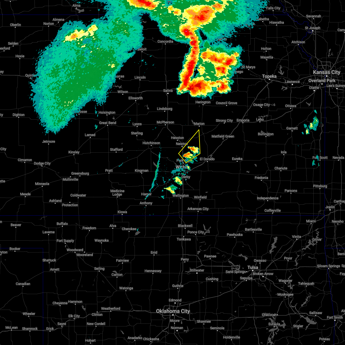 At 700 pm cdt, a severe thunderstorm was located 6 miles west of whitewater, moving northeast at 40 mph (radar indicated). Hazards include 60 mph wind gusts and half dollar size hail. Hail damage to vehicles is expected. Expect wind damage to roofs, siding, and trees. At 700 pm cdt, a severe thunderstorm was located 6 miles west of whitewater, moving northeast at 40 mph (radar indicated). Hazards include 60 mph wind gusts and half dollar size hail. Hail damage to vehicles is expected. Expect wind damage to roofs, siding, and trees.
|
| 4/29/2022 2:53 AM CDT |
 At 253 am cdt, a severe thunderstorm was located near andale, or near colwich, moving northeast at 30 mph (radar indicated). Hazards include quarter size hail. damage to vehicles is expected At 253 am cdt, a severe thunderstorm was located near andale, or near colwich, moving northeast at 30 mph (radar indicated). Hazards include quarter size hail. damage to vehicles is expected
|
| 3/29/2022 9:36 PM CDT |
 At 935 pm cdt, a severe thunderstorm was located near haysville, moving northeast at 65 mph (radar indicated). Hazards include 60 mph wind gusts and nickel size hail. expect damage to roofs, siding, and trees At 935 pm cdt, a severe thunderstorm was located near haysville, moving northeast at 65 mph (radar indicated). Hazards include 60 mph wind gusts and nickel size hail. expect damage to roofs, siding, and trees
|
| 3/29/2022 8:52 PM CDT | Storm damage reported in sedgwick county KS, 4.5 miles W of Wichita, KS |
| 3/29/2022 8:52 PM CDT |
 At 851 pm cdt, a severe thunderstorm was located over maize, moving northeast at 50 mph (trained spotters have reported 60 mph winds in eastborough). Hazards include 60 mph wind gusts and nickel size hail. Expect damage to roofs, siding, and trees. locations impacted include, wichita, derby, haysville, park city, valley center, bel aire, mulvane, goddard, maize, clearwater, cheney, colwich, garden plain, mount hope, downtown wichita, kechi, andale, eastborough, bentley and viola. hail threat, radar indicated max hail size, 0. 88 in wind threat, radar indicated max wind gust, 60 mph. At 851 pm cdt, a severe thunderstorm was located over maize, moving northeast at 50 mph (trained spotters have reported 60 mph winds in eastborough). Hazards include 60 mph wind gusts and nickel size hail. Expect damage to roofs, siding, and trees. locations impacted include, wichita, derby, haysville, park city, valley center, bel aire, mulvane, goddard, maize, clearwater, cheney, colwich, garden plain, mount hope, downtown wichita, kechi, andale, eastborough, bentley and viola. hail threat, radar indicated max hail size, 0. 88 in wind threat, radar indicated max wind gust, 60 mph.
|
| 3/29/2022 8:25 PM CDT |
 At 824 pm cdt, a severe thunderstorm was located 6 miles southeast of cheney, moving northeast at 50 mph (radar indicated). Hazards include 60 mph wind gusts and nickel size hail. expect damage to roofs, siding, and trees At 824 pm cdt, a severe thunderstorm was located 6 miles southeast of cheney, moving northeast at 50 mph (radar indicated). Hazards include 60 mph wind gusts and nickel size hail. expect damage to roofs, siding, and trees
|
| 3/29/2022 6:35 PM CDT |
 At 634 pm cdt, a severe thunderstorm was located over sedgwick, moving northeast at 35 mph (radar indicated). Hazards include 60 mph wind gusts and penny size hail. expect damage to roofs, siding, and trees At 634 pm cdt, a severe thunderstorm was located over sedgwick, moving northeast at 35 mph (radar indicated). Hazards include 60 mph wind gusts and penny size hail. expect damage to roofs, siding, and trees
|
| 11/10/2021 10:49 AM CST | Quarter sized hail reported 5.8 miles ESE of Wichita, KS, nickel to quarter sized hail reported at 21st and tyler. |
| 10/13/2021 3:44 AM CDT |
 At 342 am cdt, severe thunderstorms were located along a line extending from near burns to near andover to belle plaine, moving east at 35 mph (public. this storm has a history of producing wind gusts to 60 mph and tree damage). Hazards include 60 mph wind gusts. Expect damage to roofs, siding, and trees. locations impacted include, wichita, derby, el dorado, andover, haysville, augusta, park city, valley center, bel aire, mulvane, rose hill, maize, clearwater, douglass, towanda, benton, whitewater, leon, downtown wichita and kechi. hail threat, radar indicated max hail size, <. 75 in wind threat, radar indicated max wind gust, 60 mph. At 342 am cdt, severe thunderstorms were located along a line extending from near burns to near andover to belle plaine, moving east at 35 mph (public. this storm has a history of producing wind gusts to 60 mph and tree damage). Hazards include 60 mph wind gusts. Expect damage to roofs, siding, and trees. locations impacted include, wichita, derby, el dorado, andover, haysville, augusta, park city, valley center, bel aire, mulvane, rose hill, maize, clearwater, douglass, towanda, benton, whitewater, leon, downtown wichita and kechi. hail threat, radar indicated max hail size, <. 75 in wind threat, radar indicated max wind gust, 60 mph.
|
| 10/13/2021 3:16 AM CDT | Numerous large tree branches dow in sedgwick county KS, 4.9 miles ESE of Wichita, KS |
| 10/13/2021 3:15 AM CDT | Large tree branch down. report came in via faceboo in sedgwick county KS, 4.9 miles ESE of Wichita, KS |
| 10/13/2021 3:14 AM CDT |
 At 313 am cdt, severe thunderstorms were located along a line extending from walton to eisenhower national airport to near conway springs, moving east at 35 mph (automated weather observation. at 310 am, a 58 mph wind gust was measured at the wichita eisenhower airport). Hazards include 60 mph wind gusts. expect damage to roofs, siding, and trees At 313 am cdt, severe thunderstorms were located along a line extending from walton to eisenhower national airport to near conway springs, moving east at 35 mph (automated weather observation. at 310 am, a 58 mph wind gust was measured at the wichita eisenhower airport). Hazards include 60 mph wind gusts. expect damage to roofs, siding, and trees
|
| 10/13/2021 3:10 AM CDT | Asos station kict wichita eisenhower airpor in sedgwick county KS, 5.4 miles ENE of Wichita, KS |
| 8/20/2021 10:55 PM CDT |
 The severe thunderstorm warning for northern sedgwick, harvey, western butler and southeastern marion counties will expire at 1100 pm cdt, the storms which prompted the warning have weakened below severe limits, and no longer pose an immediate threat to life or property. therefore, the warning will be allowed to expire. The severe thunderstorm warning for northern sedgwick, harvey, western butler and southeastern marion counties will expire at 1100 pm cdt, the storms which prompted the warning have weakened below severe limits, and no longer pose an immediate threat to life or property. therefore, the warning will be allowed to expire.
|
| 8/20/2021 10:25 PM CDT |
 At 1024 pm cdt, severe thunderstorms were located along a line extending from near north newton to near sedgwick to near bentley, moving east at 15 mph (radar indicated). Hazards include 60 mph wind gusts. Expect damage to roofs, siding, and trees. locations impacted include, wichita, newton, andover, augusta, park city, valley center, bel aire, goddard, hesston, maize, halstead, north newton, sedgwick, towanda, colwich, peabody, burrton, benton, mount hope and whitewater. hail threat, radar indicated max hail size, <. 75 in wind threat, radar indicated max wind gust, 60 mph. At 1024 pm cdt, severe thunderstorms were located along a line extending from near north newton to near sedgwick to near bentley, moving east at 15 mph (radar indicated). Hazards include 60 mph wind gusts. Expect damage to roofs, siding, and trees. locations impacted include, wichita, newton, andover, augusta, park city, valley center, bel aire, goddard, hesston, maize, halstead, north newton, sedgwick, towanda, colwich, peabody, burrton, benton, mount hope and whitewater. hail threat, radar indicated max hail size, <. 75 in wind threat, radar indicated max wind gust, 60 mph.
|
| 8/20/2021 10:07 PM CDT |
 At 1007 pm cdt, severe thunderstorms were located along a line extending from walton to sedgwick to mount hope, moving east to southeast at 30 mph (radar indicated). Hazards include 60 mph wind gusts. expect damage to roofs, siding, and trees At 1007 pm cdt, severe thunderstorms were located along a line extending from walton to sedgwick to mount hope, moving east to southeast at 30 mph (radar indicated). Hazards include 60 mph wind gusts. expect damage to roofs, siding, and trees
|
| 8/20/2021 9:52 PM CDT |
 At 952 pm cdt, severe thunderstorms were located along a line extending from hesston to sedgwick to 7 miles east of pretty prairie, moving east at 25 mph (radar indicated). Hazards include 60 mph wind gusts and nickel size hail. Expect damage to roofs, siding, and trees. locations impacted include, hutchinson, newton, park city, valley center, hesston, south hutchinson, halstead, north newton, sedgwick, buhler, haven, burrton, mount hope, whitewater, pretty prairie, bentley, arlington, partridge, walton and yoder. hail threat, radar indicated max hail size, 0. 88 in wind threat, radar indicated max wind gust, 60 mph. At 952 pm cdt, severe thunderstorms were located along a line extending from hesston to sedgwick to 7 miles east of pretty prairie, moving east at 25 mph (radar indicated). Hazards include 60 mph wind gusts and nickel size hail. Expect damage to roofs, siding, and trees. locations impacted include, hutchinson, newton, park city, valley center, hesston, south hutchinson, halstead, north newton, sedgwick, buhler, haven, burrton, mount hope, whitewater, pretty prairie, bentley, arlington, partridge, walton and yoder. hail threat, radar indicated max hail size, 0. 88 in wind threat, radar indicated max wind gust, 60 mph.
|
| 8/20/2021 9:32 PM CDT |
 At 931 pm cdt, severe thunderstorms were located along a line extending from near moundridge to near halstead to 6 miles north of pretty prairie, moving east at 30 mph (radar indicated). Hazards include 60 mph wind gusts and penny size hail. Expect damage to roofs, siding, and trees. locations impacted include, hutchinson, newton, park city, valley center, hesston, south hutchinson, halstead, north newton, sedgwick, buhler, haven, burrton, mount hope, whitewater, pretty prairie, bentley, arlington, partridge, walton and yoder. hail threat, radar indicated max hail size, 0. 75 in wind threat, radar indicated max wind gust, 60 mph. At 931 pm cdt, severe thunderstorms were located along a line extending from near moundridge to near halstead to 6 miles north of pretty prairie, moving east at 30 mph (radar indicated). Hazards include 60 mph wind gusts and penny size hail. Expect damage to roofs, siding, and trees. locations impacted include, hutchinson, newton, park city, valley center, hesston, south hutchinson, halstead, north newton, sedgwick, buhler, haven, burrton, mount hope, whitewater, pretty prairie, bentley, arlington, partridge, walton and yoder. hail threat, radar indicated max hail size, 0. 75 in wind threat, radar indicated max wind gust, 60 mph.
|
| 8/20/2021 9:20 PM CDT |
 At 919 pm cdt, severe thunderstorms were located along a line extending from 6 miles southwest of moundridge to near haven, moving east at 25 mph (radar indicated). Hazards include 60 mph wind gusts and quarter size hail. Hail damage to vehicles is expected. Expect wind damage to roofs, siding, and trees. At 919 pm cdt, severe thunderstorms were located along a line extending from 6 miles southwest of moundridge to near haven, moving east at 25 mph (radar indicated). Hazards include 60 mph wind gusts and quarter size hail. Hail damage to vehicles is expected. Expect wind damage to roofs, siding, and trees.
|
| 7/31/2021 8:56 PM CDT |
 The severe thunderstorm warning for southeastern sedgwick and north central sumner counties will expire at 900 pm cdt, the storm which prompted the warning has weakened below severe limits, and no longer poses an immediate threat to life or property. therefore, the warning will be allowed to expire. however gusty winds and heavy rain are still possible with this thunderstorm. The severe thunderstorm warning for southeastern sedgwick and north central sumner counties will expire at 900 pm cdt, the storm which prompted the warning has weakened below severe limits, and no longer poses an immediate threat to life or property. therefore, the warning will be allowed to expire. however gusty winds and heavy rain are still possible with this thunderstorm.
|
| 7/31/2021 8:26 PM CDT |
 At 825 pm cdt, a severe thunderstorm was located near clearwater, moving northeast at 10 mph (radar indicated). Hazards include 60 mph wind gusts. expect damage to roofs, siding, and trees At 825 pm cdt, a severe thunderstorm was located near clearwater, moving northeast at 10 mph (radar indicated). Hazards include 60 mph wind gusts. expect damage to roofs, siding, and trees
|
| 7/26/2021 4:42 PM CDT |
 At 442 pm cdt, a severe thunderstorm was located over mcconnell air force base, or 6 miles southwest of andover, and is nearly stationary (radar indicated). Hazards include 60 mph wind gusts. Expect damage to roofs, siding, and trees. this severe thunderstorm will be near, wichita around 445 pm cdt. south wichita around 455 pm cdt. other locations in the path of this severe thunderstorm include mcconnell air force base, eastborough and east wichita. this includes the following highways, interstate 135 between mile markers 1 and 7. Interstate 35 between mile markers 43 and 54. At 442 pm cdt, a severe thunderstorm was located over mcconnell air force base, or 6 miles southwest of andover, and is nearly stationary (radar indicated). Hazards include 60 mph wind gusts. Expect damage to roofs, siding, and trees. this severe thunderstorm will be near, wichita around 445 pm cdt. south wichita around 455 pm cdt. other locations in the path of this severe thunderstorm include mcconnell air force base, eastborough and east wichita. this includes the following highways, interstate 135 between mile markers 1 and 7. Interstate 35 between mile markers 43 and 54.
|
| 7/26/2021 4:36 PM CDT | Awos station kiab mcconnell af in sedgwick county KS, 6 miles NW of Wichita, KS |
| 6/25/2021 8:22 PM CDT |
 At 821 pm cdt, a severe thunderstorm was located 7 miles southwest of whitewater, moving northeast at 40 mph (radar indicated). Hazards include 60 mph wind gusts and penny size hail. Expect damage to roofs, siding, and trees. Locations impacted include, wichita, park city, valley center, bel aire, maize, sedgwick, downtown wichita, kechi, eastborough, bentley, east wichita, northeast wichita and jabara airport. At 821 pm cdt, a severe thunderstorm was located 7 miles southwest of whitewater, moving northeast at 40 mph (radar indicated). Hazards include 60 mph wind gusts and penny size hail. Expect damage to roofs, siding, and trees. Locations impacted include, wichita, park city, valley center, bel aire, maize, sedgwick, downtown wichita, kechi, eastborough, bentley, east wichita, northeast wichita and jabara airport.
|
| 6/25/2021 8:06 PM CDT |
 At 805 pm cdt, a severe thunderstorm was located near maize, moving northeast at 40 mph (radar indicated). Hazards include 60 mph wind gusts and penny size hail. Expect damage to roofs, siding, and trees. Locations impacted include, park city, valley center, sedgwick, kechi and bel aire. At 805 pm cdt, a severe thunderstorm was located near maize, moving northeast at 40 mph (radar indicated). Hazards include 60 mph wind gusts and penny size hail. Expect damage to roofs, siding, and trees. Locations impacted include, park city, valley center, sedgwick, kechi and bel aire.
|
| 6/25/2021 8:05 PM CDT | Measured on home weather statio in sedgwick county KS, 6.7 miles SSE of Wichita, KS |
| 6/25/2021 7:27 PM CDT |
 At 726 pm cdt, a severe thunderstorm was located near cheney, moving northeast at 40 mph (radar indicated). Hazards include 70 mph wind gusts and penny size hail. Expect considerable tree damage. damage is likely to mobile homes, roofs, and outbuildings. this severe thunderstorm will be near, cheney around 735 pm cdt. garden plain around 740 pm cdt. other locations in the path of this severe thunderstorm include goddard, andale, west wichita, eisenhower national airport, maize, colwich, bentley, park city, valley center, sedgwick, kechi and bel aire. this includes the following highways, interstate 135 between mile markers 0 and 22. Interstate 35 between mile markers 39 and 54. At 726 pm cdt, a severe thunderstorm was located near cheney, moving northeast at 40 mph (radar indicated). Hazards include 70 mph wind gusts and penny size hail. Expect considerable tree damage. damage is likely to mobile homes, roofs, and outbuildings. this severe thunderstorm will be near, cheney around 735 pm cdt. garden plain around 740 pm cdt. other locations in the path of this severe thunderstorm include goddard, andale, west wichita, eisenhower national airport, maize, colwich, bentley, park city, valley center, sedgwick, kechi and bel aire. this includes the following highways, interstate 135 between mile markers 0 and 22. Interstate 35 between mile markers 39 and 54.
|
| 6/25/2021 1:00 PM CDT | Viewer called into kake to report two utility poles were down along with several tree limbs of unknown size. time is based on rada in sedgwick county KS, 8 miles SW of Wichita, KS |
| 6/11/2021 9:52 PM CDT |
 The severe thunderstorm warning for northwestern cowley, southeastern sedgwick, southwestern butler and northeastern sumner counties will expire at 1000 pm cdt, the storm which prompted the warning has moved out of the area. therefore, the warning will be allowed to expire. however gusty winds and heavy rain are still possible with this thunderstorm. a severe thunderstorm watch remains in effect until 200 am cdt for south central kansas. The severe thunderstorm warning for northwestern cowley, southeastern sedgwick, southwestern butler and northeastern sumner counties will expire at 1000 pm cdt, the storm which prompted the warning has moved out of the area. therefore, the warning will be allowed to expire. however gusty winds and heavy rain are still possible with this thunderstorm. a severe thunderstorm watch remains in effect until 200 am cdt for south central kansas.
|
| 6/11/2021 9:36 PM CDT |
 At 935 pm cdt, a severe thunderstorm was located 5 miles south of haysville, moving south at 10 mph (radar indicated). Hazards include 60 mph wind gusts and penny size hail. Expect damage to roofs, siding, and trees. Locations impacted include, wichita, derby, andover, haysville, augusta, mulvane, rose hill, clearwater, douglass, eastborough, east wichita, mcconnell air force base, south wichita, santa fe lake, augusta municipal airport and oaklawn. At 935 pm cdt, a severe thunderstorm was located 5 miles south of haysville, moving south at 10 mph (radar indicated). Hazards include 60 mph wind gusts and penny size hail. Expect damage to roofs, siding, and trees. Locations impacted include, wichita, derby, andover, haysville, augusta, mulvane, rose hill, clearwater, douglass, eastborough, east wichita, mcconnell air force base, south wichita, santa fe lake, augusta municipal airport and oaklawn.
|
| 6/11/2021 9:16 PM CDT |
 At 915 pm cdt, a severe thunderstorm was located over haysville, moving south at 10 mph (radar indicated). Hazards include 60 mph wind gusts and penny size hail. Expect damage to roofs, siding, and trees. Locations impacted include, clearwater, derby and mulvane. At 915 pm cdt, a severe thunderstorm was located over haysville, moving south at 10 mph (radar indicated). Hazards include 60 mph wind gusts and penny size hail. Expect damage to roofs, siding, and trees. Locations impacted include, clearwater, derby and mulvane.
|
| 6/11/2021 8:59 PM CDT |
 At 857 pm cdt, a severe thunderstorm was located near haysville, moving south at 10 mph. another severe storm was located near benton, moving south at 10 mph. this severe thunderstorm warning replaces the previous warning in effect for the area (radar indicated). Hazards include 60 mph wind gusts and penny size hail. Expect damage to roofs, siding, and trees. this severe thunderstorm will be near, mcconnell air force base around 900 pm cdt. south wichita around 910 pm cdt. other locations in the path of this severe thunderstorm include derby, haysville and mulvane. this includes the following highways, interstate 135 between mile markers 0 and 9. Interstate 35 between mile markers 31 and 66. At 857 pm cdt, a severe thunderstorm was located near haysville, moving south at 10 mph. another severe storm was located near benton, moving south at 10 mph. this severe thunderstorm warning replaces the previous warning in effect for the area (radar indicated). Hazards include 60 mph wind gusts and penny size hail. Expect damage to roofs, siding, and trees. this severe thunderstorm will be near, mcconnell air force base around 900 pm cdt. south wichita around 910 pm cdt. other locations in the path of this severe thunderstorm include derby, haysville and mulvane. this includes the following highways, interstate 135 between mile markers 0 and 9. Interstate 35 between mile markers 31 and 66.
|
| 6/11/2021 8:39 PM CDT |
 At 838 pm cdt, a severe thunderstorm was located over south wichita, or near downtown wichita, moving east at 5 mph (radar indicated). Hazards include 60 mph wind gusts, penny size hail, and torrential rainfall. Expect damage to roofs, siding, and trees. Locations impacted include, south wichita, east wichita, eastborough, mcconnell air force base, derby and rose hill. At 838 pm cdt, a severe thunderstorm was located over south wichita, or near downtown wichita, moving east at 5 mph (radar indicated). Hazards include 60 mph wind gusts, penny size hail, and torrential rainfall. Expect damage to roofs, siding, and trees. Locations impacted include, south wichita, east wichita, eastborough, mcconnell air force base, derby and rose hill.
|
| 6/11/2021 8:27 PM CDT |
 At 827 pm cdt, a severe thunderstorm was located over downtown wichita, moving east at 10 mph (radar indicated). Hazards include 60 mph wind gusts and penny size hail. Expect damage to roofs, siding, and trees. this severe thunderstorm will be near, east wichita around 845 pm cdt. other locations in the path of this severe thunderstorm include eastborough, mcconnell air force base, northeast wichita, andover and rose hill. this includes the following highways, interstate 135 between mile markers 0 and 13. Interstate 35 between mile markers 41 and 54. At 827 pm cdt, a severe thunderstorm was located over downtown wichita, moving east at 10 mph (radar indicated). Hazards include 60 mph wind gusts and penny size hail. Expect damage to roofs, siding, and trees. this severe thunderstorm will be near, east wichita around 845 pm cdt. other locations in the path of this severe thunderstorm include eastborough, mcconnell air force base, northeast wichita, andover and rose hill. this includes the following highways, interstate 135 between mile markers 0 and 13. Interstate 35 between mile markers 41 and 54.
|
| 6/11/2021 7:56 PM CDT |
 At 756 pm cdt, a severe thunderstorm was located over benton, moving east at 10 mph (radar indicated). Hazards include 60 mph wind gusts and quarter size hail. Hail damage to vehicles is expected. Expect wind damage to roofs, siding, and trees. At 756 pm cdt, a severe thunderstorm was located over benton, moving east at 10 mph (radar indicated). Hazards include 60 mph wind gusts and quarter size hail. Hail damage to vehicles is expected. Expect wind damage to roofs, siding, and trees.
|
| 5/27/2021 12:40 AM CDT | Storm damage reported in sedgwick county KS, 6 miles NW of Wichita, KS |
| 5/27/2021 12:24 AM CDT | Storm damage reported in sedgwick county KS, 8.1 miles WSW of Wichita, KS |
| 5/27/2021 12:15 AM CDT | Storm damage reported in sedgwick county KS, 4.6 miles WSW of Wichita, KS |
| 5/27/2021 12:04 AM CDT | Storm damage reported in sedgwick county KS, 5.6 miles ENE of Wichita, KS |
| 5/27/2021 12:04 AM CDT |
 At 1204 am cdt, a severe thunderstorm was located near eisenhower national airport, or 6 miles southeast of goddard, moving northeast at 30 mph (radar indicated). Hazards include 60 mph wind gusts and penny size hail. Expect damage to roofs, siding, and trees. this severe thunderstorm will be near, eisenhower national airport around 1210 am cdt. west wichita and south wichita around 1215 am cdt. downtown wichita around 1220 am cdt. other locations in the path of this severe thunderstorm include maize, eastborough, east wichita, northeast wichita, park city, valley center, bel aire and kechi. this includes the following highways, interstate 135 between mile markers 0 and 22. Interstate 35 between mile markers 34 and 54. At 1204 am cdt, a severe thunderstorm was located near eisenhower national airport, or 6 miles southeast of goddard, moving northeast at 30 mph (radar indicated). Hazards include 60 mph wind gusts and penny size hail. Expect damage to roofs, siding, and trees. this severe thunderstorm will be near, eisenhower national airport around 1210 am cdt. west wichita and south wichita around 1215 am cdt. downtown wichita around 1220 am cdt. other locations in the path of this severe thunderstorm include maize, eastborough, east wichita, northeast wichita, park city, valley center, bel aire and kechi. this includes the following highways, interstate 135 between mile markers 0 and 22. Interstate 35 between mile markers 34 and 54.
|
| 5/27/2021 12:03 AM CDT | Storm damage reported in sedgwick county KS, 6 miles NW of Wichita, KS |
| 5/27/2021 12:00 AM CDT | Storm damage reported in sedgwick county KS, 2.7 miles SE of Wichita, KS |
| 5/26/2021 11:55 PM CDT |
 The severe thunderstorm warning for southwestern sedgwick and northwestern sumner counties will expire at midnight cdt, the storm which prompted the warning has weakened below severe limits, and no longer poses an immediate threat to life or property. therefore, the warning will be allowed to expire. however gusty winds to around 50 mph are still likely with this thunderstorm. The severe thunderstorm warning for southwestern sedgwick and northwestern sumner counties will expire at midnight cdt, the storm which prompted the warning has weakened below severe limits, and no longer poses an immediate threat to life or property. therefore, the warning will be allowed to expire. however gusty winds to around 50 mph are still likely with this thunderstorm.
|
| 5/26/2021 11:35 PM CDT |
 At 1135 pm cdt, a severe thunderstorm was located near viola, or near conway springs, moving northeast at 25 mph. this storm produced a 56 mph measured wind gust near viola (radar indicated). Hazards include 60 mph wind gusts. Expect damage to roofs, siding, and trees. this severe thunderstorm will be near, clearwater around 1155 pm cdt. Other locations in the path of this severe thunderstorm include goddard and eisenhower national airport. At 1135 pm cdt, a severe thunderstorm was located near viola, or near conway springs, moving northeast at 25 mph. this storm produced a 56 mph measured wind gust near viola (radar indicated). Hazards include 60 mph wind gusts. Expect damage to roofs, siding, and trees. this severe thunderstorm will be near, clearwater around 1155 pm cdt. Other locations in the path of this severe thunderstorm include goddard and eisenhower national airport.
|
| 5/16/2021 12:14 AM CDT |
 At 1214 am cdt, a severe thunderstorm was located near maize, moving north at 15 mph (radar indicated). Hazards include 60 mph wind gusts and quarter size hail. Hail damage to vehicles is expected. Expect wind damage to roofs, siding, and trees. At 1214 am cdt, a severe thunderstorm was located near maize, moving north at 15 mph (radar indicated). Hazards include 60 mph wind gusts and quarter size hail. Hail damage to vehicles is expected. Expect wind damage to roofs, siding, and trees.
|
| 3/12/2021 6:41 AM CST |
 At 641 am cst, a severe thunderstorm was located near augusta, moving east at 50 mph (radar indicated). Hazards include 60 mph wind gusts and penny size hail. Expect damage to roofs, siding, and trees. Locations impacted include, wichita, el dorado, andover, augusta, park city, valley center, bel aire, rose hill, towanda, benton, kechi, eastborough, east wichita, northeast wichita, mcconnell air force base, santa fe lake, augusta municipal airport and jabara airport. At 641 am cst, a severe thunderstorm was located near augusta, moving east at 50 mph (radar indicated). Hazards include 60 mph wind gusts and penny size hail. Expect damage to roofs, siding, and trees. Locations impacted include, wichita, el dorado, andover, augusta, park city, valley center, bel aire, rose hill, towanda, benton, kechi, eastborough, east wichita, northeast wichita, mcconnell air force base, santa fe lake, augusta municipal airport and jabara airport.
|
| 3/12/2021 6:25 AM CST | Penny sized hail was reported as wel in sedgwick county KS, 2.5 miles NW of Wichita, KS |
| 3/12/2021 6:21 AM CST |
 The severe thunderstorm warning for northwestern sedgwick county will expire at 630 am cst, the storm which prompted the warning has moved out of the area. therefore, the warning will be allowed to expire. however small hail and gusty winds are still possible with this thunderstorm. The severe thunderstorm warning for northwestern sedgwick county will expire at 630 am cst, the storm which prompted the warning has moved out of the area. therefore, the warning will be allowed to expire. however small hail and gusty winds are still possible with this thunderstorm.
|
| 3/12/2021 6:10 AM CST |
 At 610 am cst, a severe thunderstorm was located near valley center, moving east at 50 mph (radar indicated). Hazards include 60 mph wind gusts and penny size hail. Expect damage to roofs, siding, and trees. Locations impacted include, goddard, maize, colwich, mount hope, andale and bentley. At 610 am cst, a severe thunderstorm was located near valley center, moving east at 50 mph (radar indicated). Hazards include 60 mph wind gusts and penny size hail. Expect damage to roofs, siding, and trees. Locations impacted include, goddard, maize, colwich, mount hope, andale and bentley.
|
| 3/12/2021 6:07 AM CST |
 At 606 am cst, a severe thunderstorm was located over colwich, moving east at 50 mph (radar indicated). Hazards include 60 mph wind gusts and penny size hail. expect damage to roofs, siding, and trees At 606 am cst, a severe thunderstorm was located over colwich, moving east at 50 mph (radar indicated). Hazards include 60 mph wind gusts and penny size hail. expect damage to roofs, siding, and trees
|
| 3/12/2021 6:00 AM CST |
 At 559 am cst, a severe thunderstorm was located over andale, or near mount hope, moving east at 50 mph (radar indicated). Hazards include 60 mph wind gusts and penny size hail. Expect damage to roofs, siding, and trees. Locations impacted include, goddard, maize, colwich, haven, mount hope, pretty prairie, andale, bentley, cheney state park and cheney lake. At 559 am cst, a severe thunderstorm was located over andale, or near mount hope, moving east at 50 mph (radar indicated). Hazards include 60 mph wind gusts and penny size hail. Expect damage to roofs, siding, and trees. Locations impacted include, goddard, maize, colwich, haven, mount hope, pretty prairie, andale, bentley, cheney state park and cheney lake.
|
| 3/12/2021 5:35 AM CST |
 At 534 am cst, a severe thunderstorm was located over pretty prairie, moving east at 50 mph (radar indicated). Hazards include 60 mph wind gusts and penny size hail. expect damage to roofs, siding, and trees At 534 am cst, a severe thunderstorm was located over pretty prairie, moving east at 50 mph (radar indicated). Hazards include 60 mph wind gusts and penny size hail. expect damage to roofs, siding, and trees
|
| 11/24/2020 6:22 PM CST |
 At 621 pm cst, severe thunderstorms were located along a line extending from near bentley to near east wichita to near rose hill, moving east at 60 mph (radar indicated). Hazards include 60 mph wind gusts and penny size hail. Expect damage to roofs, siding, and trees. Locations impacted include, wichita, derby, andover, haysville, park city, valley center, bel aire, mulvane, goddard, rose hill, maize, clearwater, douglass, sedgwick, towanda, colwich, benton, mount hope, downtown wichita and kechi. At 621 pm cst, severe thunderstorms were located along a line extending from near bentley to near east wichita to near rose hill, moving east at 60 mph (radar indicated). Hazards include 60 mph wind gusts and penny size hail. Expect damage to roofs, siding, and trees. Locations impacted include, wichita, derby, andover, haysville, park city, valley center, bel aire, mulvane, goddard, rose hill, maize, clearwater, douglass, sedgwick, towanda, colwich, benton, mount hope, downtown wichita and kechi.
|
| 11/24/2020 6:13 PM CST | Accuweather meteorologist measured 59 mph at the intersection of central and west street in sedgwick county KS, 4.5 miles S of Wichita, KS |
| 11/24/2020 6:10 PM CST | Storm damage reported in sedgwick county KS, 5.4 miles ENE of Wichita, KS |
| 11/24/2020 6:09 PM CST |
 At 609 pm cst, severe thunderstorms were located along a line extending from near andale to 5 miles south of haysville, moving east-northeast at 50 mph (radar indicated). Hazards include 60 mph wind gusts and penny size hail. expect damage to roofs, siding, and trees At 609 pm cst, severe thunderstorms were located along a line extending from near andale to 5 miles south of haysville, moving east-northeast at 50 mph (radar indicated). Hazards include 60 mph wind gusts and penny size hail. expect damage to roofs, siding, and trees
|
| 8/29/2020 4:53 AM CDT |
 The severe thunderstorm warning for southeastern sedgwick county will expire at 500 am cdt, the storm which prompted the warning has weakened below severe limits, and has exited the warned area. therefore, the warning will be allowed to expire. however gusty winds are still possible with this thunderstorm. The severe thunderstorm warning for southeastern sedgwick county will expire at 500 am cdt, the storm which prompted the warning has weakened below severe limits, and has exited the warned area. therefore, the warning will be allowed to expire. however gusty winds are still possible with this thunderstorm.
|
| 8/29/2020 4:35 AM CDT |
 At 435 am cdt, a severe thunderstorm was located over eastborough, or near downtown wichita, moving northeast at 40 mph (radar indicated). Hazards include 60 mph wind gusts and penny size hail. Expect damage to roofs, siding, and trees. Locations impacted include, wichita, derby, haysville, bel aire, mulvane, clearwater, downtown wichita, eastborough, east wichita, eisenhower national airport, northeast wichita, mcconnell air force base, south wichita, oaklawn and jabara airport. At 435 am cdt, a severe thunderstorm was located over eastborough, or near downtown wichita, moving northeast at 40 mph (radar indicated). Hazards include 60 mph wind gusts and penny size hail. Expect damage to roofs, siding, and trees. Locations impacted include, wichita, derby, haysville, bel aire, mulvane, clearwater, downtown wichita, eastborough, east wichita, eisenhower national airport, northeast wichita, mcconnell air force base, south wichita, oaklawn and jabara airport.
|
| 8/29/2020 4:21 AM CDT |
 At 421 am cdt, a severe thunderstorm was located near haysville, moving northeast at 40 mph (radar indicated). Hazards include 60 mph wind gusts and penny size hail. Expect damage to roofs, siding, and trees. Locations impacted include, wichita, derby, haysville, bel aire, mulvane, clearwater, downtown wichita, eastborough, viola, east wichita, eisenhower national airport, northeast wichita, mcconnell air force base, south wichita, oaklawn and jabara airport. At 421 am cdt, a severe thunderstorm was located near haysville, moving northeast at 40 mph (radar indicated). Hazards include 60 mph wind gusts and penny size hail. Expect damage to roofs, siding, and trees. Locations impacted include, wichita, derby, haysville, bel aire, mulvane, clearwater, downtown wichita, eastborough, viola, east wichita, eisenhower national airport, northeast wichita, mcconnell air force base, south wichita, oaklawn and jabara airport.
|
| 8/29/2020 4:01 AM CDT |
 At 401 am cdt, a severe thunderstorm was located over viola, or near conway springs, moving northeast at 40 mph (radar indicated). Hazards include 60 mph wind gusts and penny size hail. expect damage to roofs, siding, and trees At 401 am cdt, a severe thunderstorm was located over viola, or near conway springs, moving northeast at 40 mph (radar indicated). Hazards include 60 mph wind gusts and penny size hail. expect damage to roofs, siding, and trees
|
| 8/13/2020 12:48 AM CDT | Quarter sized hail reported 9.5 miles W of Wichita, KS, public report relayed via ksn. report based off picture submitted on social media. |
| 7/29/2020 11:11 PM CDT |
 The severe thunderstorm warning for southern sedgwick county will expire at 1115 pm cdt, the storm which prompted the warning has moved out of the area. therefore, the warning will be allowed to expire. however gusty winds are still possible with this thunderstorm. The severe thunderstorm warning for southern sedgwick county will expire at 1115 pm cdt, the storm which prompted the warning has moved out of the area. therefore, the warning will be allowed to expire. however gusty winds are still possible with this thunderstorm.
|
| 7/29/2020 10:58 PM CDT |
 At 1057 pm cdt, a severe thunderstorm was located over haysville, moving southeast at 20 mph (radar indicated). Hazards include 60 mph wind gusts and nickel size hail. Expect damage to roofs, siding, and trees. Locations impacted include, wichita, derby, haysville, mulvane, rose hill, clearwater, viola, mcconnell air force base, south wichita and oaklawn. At 1057 pm cdt, a severe thunderstorm was located over haysville, moving southeast at 20 mph (radar indicated). Hazards include 60 mph wind gusts and nickel size hail. Expect damage to roofs, siding, and trees. Locations impacted include, wichita, derby, haysville, mulvane, rose hill, clearwater, viola, mcconnell air force base, south wichita and oaklawn.
|
| 7/29/2020 10:37 PM CDT |
 At 1037 pm cdt, severe thunderstorms were located along a line extending from near valley center to colwich to near cheney, moving southeast at 35 mph (radar indicated). Hazards include 60 mph wind gusts and nickel size hail. Expect damage to roofs, siding, and trees. Locations impacted include, wichita, derby, andover, haysville, park city, valley center, bel aire, mulvane, goddard, rose hill, maize, clearwater, cheney, sedgwick, colwich, garden plain, mount hope, downtown wichita, kechi and andale. At 1037 pm cdt, severe thunderstorms were located along a line extending from near valley center to colwich to near cheney, moving southeast at 35 mph (radar indicated). Hazards include 60 mph wind gusts and nickel size hail. Expect damage to roofs, siding, and trees. Locations impacted include, wichita, derby, andover, haysville, park city, valley center, bel aire, mulvane, goddard, rose hill, maize, clearwater, cheney, sedgwick, colwich, garden plain, mount hope, downtown wichita, kechi and andale.
|
| 7/29/2020 10:12 PM CDT |
 At 1011 pm cdt, severe thunderstorms were located along a line extending from halstead to near mount hope to 7 miles northeast of pretty prairie, moving southeast at 40 mph (radar indicated). Hazards include 60 mph wind gusts and nickel size hail. expect damage to roofs, siding, and trees At 1011 pm cdt, severe thunderstorms were located along a line extending from halstead to near mount hope to 7 miles northeast of pretty prairie, moving southeast at 40 mph (radar indicated). Hazards include 60 mph wind gusts and nickel size hail. expect damage to roofs, siding, and trees
|
| 7/29/2020 9:56 PM CDT |
 At 955 pm cdt, a severe thunderstorm was located near colwich, moving southeast at 20 mph (radar indicated). Hazards include 60 mph wind gusts and penny size hail. Expect damage to roofs, siding, and trees. Locations impacted include, wichita, goddard, maize, clearwater, colwich, downtown wichita, west wichita and eisenhower national airport. At 955 pm cdt, a severe thunderstorm was located near colwich, moving southeast at 20 mph (radar indicated). Hazards include 60 mph wind gusts and penny size hail. Expect damage to roofs, siding, and trees. Locations impacted include, wichita, goddard, maize, clearwater, colwich, downtown wichita, west wichita and eisenhower national airport.
|
| 7/29/2020 9:13 PM CDT |
 At 913 pm cdt, a severe thunderstorm was located over colwich, moving southeast at 10 mph (radar indicated). Hazards include 60 mph wind gusts and penny size hail. expect damage to roofs, siding, and trees At 913 pm cdt, a severe thunderstorm was located over colwich, moving southeast at 10 mph (radar indicated). Hazards include 60 mph wind gusts and penny size hail. expect damage to roofs, siding, and trees
|
| 7/29/2020 9:00 PM CDT |
 At 849 pm cdt, a severe thunderstorm was located over colwich, moving southeast at 15 mph (radar indicated). Hazards include 60 mph wind gusts and penny size hail. Expect damage to roofs, siding, and trees. Locations impacted include, wichita, derby, andover, haysville, park city, valley center, bel aire, goddard, maize, colwich, mount hope, downtown wichita, kechi, andale, eastborough, bentley, west wichita, east wichita, eisenhower national airport and northeast wichita. At 849 pm cdt, a severe thunderstorm was located over colwich, moving southeast at 15 mph (radar indicated). Hazards include 60 mph wind gusts and penny size hail. Expect damage to roofs, siding, and trees. Locations impacted include, wichita, derby, andover, haysville, park city, valley center, bel aire, goddard, maize, colwich, mount hope, downtown wichita, kechi, andale, eastborough, bentley, west wichita, east wichita, eisenhower national airport and northeast wichita.
|
| 7/29/2020 8:50 PM CDT |
 At 849 pm cdt, a severe thunderstorm was located over colwich, moving southeast at 15 mph (radar indicated). Hazards include 60 mph wind gusts and penny size hail. Expect damage to roofs, siding, and trees. Locations impacted include, wichita, derby, andover, haysville, park city, valley center, bel aire, goddard, maize, colwich, mount hope, downtown wichita, kechi, andale, eastborough, bentley, west wichita, east wichita, eisenhower national airport and northeast wichita. At 849 pm cdt, a severe thunderstorm was located over colwich, moving southeast at 15 mph (radar indicated). Hazards include 60 mph wind gusts and penny size hail. Expect damage to roofs, siding, and trees. Locations impacted include, wichita, derby, andover, haysville, park city, valley center, bel aire, goddard, maize, colwich, mount hope, downtown wichita, kechi, andale, eastborough, bentley, west wichita, east wichita, eisenhower national airport and northeast wichita.
|
| 7/29/2020 8:24 PM CDT |
 At 824 pm cdt, a severe thunderstorm was located near maize, moving southeast at 10 mph (radar indicated). Hazards include 60 mph wind gusts and penny size hail. Expect damage to roofs, siding, and trees. Locations impacted include, wichita, derby, andover, haysville, park city, valley center, bel aire, goddard, maize, colwich, mount hope, downtown wichita, kechi, andale, eastborough, bentley, west wichita, east wichita, eisenhower national airport and northeast wichita. At 824 pm cdt, a severe thunderstorm was located near maize, moving southeast at 10 mph (radar indicated). Hazards include 60 mph wind gusts and penny size hail. Expect damage to roofs, siding, and trees. Locations impacted include, wichita, derby, andover, haysville, park city, valley center, bel aire, goddard, maize, colwich, mount hope, downtown wichita, kechi, andale, eastborough, bentley, west wichita, east wichita, eisenhower national airport and northeast wichita.
|
| 7/29/2020 8:13 PM CDT |
 At 812 pm cdt, a severe thunderstorm was located over valley center, moving southeast at 20 mph (radar indicated). Hazards include 60 mph wind gusts and penny size hail. expect damage to roofs, siding, and trees At 812 pm cdt, a severe thunderstorm was located over valley center, moving southeast at 20 mph (radar indicated). Hazards include 60 mph wind gusts and penny size hail. expect damage to roofs, siding, and trees
|
| 7/10/2020 5:08 AM CDT |
 The national weather service in wichita has issued a * severe thunderstorm warning for. southwestern sedgwick county in south central kansas. northeastern kingman county in south central kansas. until 615 am cdt. At 508 am cdt, a severe thunderstorm was located near cheney,. The national weather service in wichita has issued a * severe thunderstorm warning for. southwestern sedgwick county in south central kansas. northeastern kingman county in south central kansas. until 615 am cdt. At 508 am cdt, a severe thunderstorm was located near cheney,.
|
| 7/10/2020 4:13 AM CDT |
 At 413 am cdt, a severe thunderstorm was located over haven, moving east at 15 mph (radar indicated). Hazards include 60 mph wind gusts and penny size hail. expect damage to roofs, siding, and trees At 413 am cdt, a severe thunderstorm was located over haven, moving east at 15 mph (radar indicated). Hazards include 60 mph wind gusts and penny size hail. expect damage to roofs, siding, and trees
|
| 7/6/2020 4:17 PM CDT |
 At 416 pm cdt, a severe thunderstorms were located from near garden plain to viola, and are nearly stationary (radar indicated). Hazards include 60 mph wind gusts. Expect damage to roofs, siding, and trees. Locations impacted include, goddard, cheney, garden plain, viola and lake afton. At 416 pm cdt, a severe thunderstorms were located from near garden plain to viola, and are nearly stationary (radar indicated). Hazards include 60 mph wind gusts. Expect damage to roofs, siding, and trees. Locations impacted include, goddard, cheney, garden plain, viola and lake afton.
|
| 7/6/2020 4:02 PM CDT |
 At 402 pm cdt, a severe thunderstorm was located over viola, or 7 miles north of conway springs, and is nearly stationary (radar indicated). Hazards include 60 mph wind gusts. expect damage to roofs, siding, and trees At 402 pm cdt, a severe thunderstorm was located over viola, or 7 miles north of conway springs, and is nearly stationary (radar indicated). Hazards include 60 mph wind gusts. expect damage to roofs, siding, and trees
|
| 7/3/2020 2:06 AM CDT |
 The severe thunderstorm warning for sedgwick and western butler counties will expire at 215 am cdt, the storms which prompted the warning have moved out of the area. therefore, the warning will be allowed to expire. however gusty winds are still possible with these thunderstorms. The severe thunderstorm warning for sedgwick and western butler counties will expire at 215 am cdt, the storms which prompted the warning have moved out of the area. therefore, the warning will be allowed to expire. however gusty winds are still possible with these thunderstorms.
|
| 7/3/2020 1:39 AM CDT |
 At 139 am cdt, collapsing severe thunderstorms were located along a line extending from 7 miles northwest of atlanta to 5 miles southeast of wellington, moving southeast at 45 mph (radar indicated). Hazards include 60 mph wind gusts. Expect damage to roofs, siding, and trees. Locations impacted include, wichita, derby, el dorado, andover, haysville, augusta, park city, valley center, bel aire, mulvane, goddard, rose hill, maize, clearwater, cheney, towanda, benton, garden plain, downtown wichita and kechi. At 139 am cdt, collapsing severe thunderstorms were located along a line extending from 7 miles northwest of atlanta to 5 miles southeast of wellington, moving southeast at 45 mph (radar indicated). Hazards include 60 mph wind gusts. Expect damage to roofs, siding, and trees. Locations impacted include, wichita, derby, el dorado, andover, haysville, augusta, park city, valley center, bel aire, mulvane, goddard, rose hill, maize, clearwater, cheney, towanda, benton, garden plain, downtown wichita and kechi.
|
| 7/3/2020 1:07 AM CDT |
 At 107 am cdt, severe thunderstorms were located along a line extending from near benton to near viola, moving southeast at 50 mph (radar indicated). Hazards include 60 mph wind gusts. expect damage to roofs, siding, and trees At 107 am cdt, severe thunderstorms were located along a line extending from near benton to near viola, moving southeast at 50 mph (radar indicated). Hazards include 60 mph wind gusts. expect damage to roofs, siding, and trees
|
| 7/3/2020 1:04 AM CDT | Measured at eisenhower nationa in sedgwick county KS, 5.4 miles ENE of Wichita, KS |
| 6/21/2020 8:09 PM CDT |
 At 808 pm cdt, severe thunderstorms were located along a line extending from haven to near norwich, moving east at 25 mph (radar indicated). Hazards include 60 mph wind gusts and penny size hail. expect damage to roofs, siding, and trees At 808 pm cdt, severe thunderstorms were located along a line extending from haven to near norwich, moving east at 25 mph (radar indicated). Hazards include 60 mph wind gusts and penny size hail. expect damage to roofs, siding, and trees
|
| 5/15/2020 6:35 AM CDT |
 At 635 am cdt, a severe thunderstorm was located near maize, moving east at 25 mph (radar indicated). Hazards include 60 mph wind gusts and quarter size hail. Hail damage to vehicles is expected. expect wind damage to roofs, siding, and trees. Locations impacted include, wichita, park city, valley center, bel aire, maize, sedgwick, colwich, whitewater, kechi, andale, bentley, northeast wichita and jabara airport. At 635 am cdt, a severe thunderstorm was located near maize, moving east at 25 mph (radar indicated). Hazards include 60 mph wind gusts and quarter size hail. Hail damage to vehicles is expected. expect wind damage to roofs, siding, and trees. Locations impacted include, wichita, park city, valley center, bel aire, maize, sedgwick, colwich, whitewater, kechi, andale, bentley, northeast wichita and jabara airport.
|
| 5/15/2020 6:07 AM CDT |
 The national weather service in wichita has issued a * severe thunderstorm warning for. northern sedgwick county in south central kansas. southern harvey county in south central kansas. until 700 am cdt. At 607 am cdt, a severe thunderstorm was located near mount hope,. The national weather service in wichita has issued a * severe thunderstorm warning for. northern sedgwick county in south central kansas. southern harvey county in south central kansas. until 700 am cdt. At 607 am cdt, a severe thunderstorm was located near mount hope,.
|
| 5/15/2020 1:57 AM CDT |
 The severe thunderstorm warning for southeastern sedgwick county will expire at 200 am cdt, the storm which prompted the warning has weakened below severe limits, and has exited the warned area. therefore, the warning will be allowed to expire. however small hail, gusty winds and heavy rain are still possible with this thunderstorm. a severe thunderstorm watch remains in effect until 500 am cdt for south central kansas. The severe thunderstorm warning for southeastern sedgwick county will expire at 200 am cdt, the storm which prompted the warning has weakened below severe limits, and has exited the warned area. therefore, the warning will be allowed to expire. however small hail, gusty winds and heavy rain are still possible with this thunderstorm. a severe thunderstorm watch remains in effect until 500 am cdt for south central kansas.
|
| 5/15/2020 1:29 AM CDT |
 At 128 am cdt, a severe thunderstorm was located over derby, moving east at 15 mph (radar indicated). Hazards include quarter size hail. Damage to vehicles is expected. Locations impacted include, wichita, derby, haysville, mulvane, goddard, rose hill, clearwater, eisenhower national airport, mcconnell air force base, south wichita, lake afton and oaklawn. At 128 am cdt, a severe thunderstorm was located over derby, moving east at 15 mph (radar indicated). Hazards include quarter size hail. Damage to vehicles is expected. Locations impacted include, wichita, derby, haysville, mulvane, goddard, rose hill, clearwater, eisenhower national airport, mcconnell air force base, south wichita, lake afton and oaklawn.
|
| 5/15/2020 12:56 AM CDT |
 At 1256 am cdt, a severe thunderstorm was located north of derby, moving east at 20 mph (radar indicated). Hazards include quarter size hail. damage to vehicles is expected At 1256 am cdt, a severe thunderstorm was located north of derby, moving east at 20 mph (radar indicated). Hazards include quarter size hail. damage to vehicles is expected
|
| 5/15/2020 12:19 AM CDT |
 At 1219 am cdt, a severe thunderstorm was located over east wichita, or near andover, moving east at 20 mph (radar indicated). Hazards include 60 mph wind gusts and half dollar size hail. Hail damage to vehicles is expected. expect wind damage to roofs, siding, and trees. Locations impacted include, wichita, derby, andover, haysville, bel aire, mulvane, goddard, rose hill, clearwater, cheney, garden plain, downtown wichita, eastborough, viola, west wichita, east wichita, eisenhower national airport, northeast wichita, mcconnell air force base and south wichita. At 1219 am cdt, a severe thunderstorm was located over east wichita, or near andover, moving east at 20 mph (radar indicated). Hazards include 60 mph wind gusts and half dollar size hail. Hail damage to vehicles is expected. expect wind damage to roofs, siding, and trees. Locations impacted include, wichita, derby, andover, haysville, bel aire, mulvane, goddard, rose hill, clearwater, cheney, garden plain, downtown wichita, eastborough, viola, west wichita, east wichita, eisenhower national airport, northeast wichita, mcconnell air force base and south wichita.
|
| 5/15/2020 12:06 AM CDT |
 At 1206 am cdt, severe thunderstorms were located along a line extending from near andover to eisenhower national airport, moving east at 20 mph (radar indicated). Hazards include 60 mph wind gusts and quarter size hail. Hail damage to vehicles is expected. Expect wind damage to roofs, siding, and trees. At 1206 am cdt, severe thunderstorms were located along a line extending from near andover to eisenhower national airport, moving east at 20 mph (radar indicated). Hazards include 60 mph wind gusts and quarter size hail. Hail damage to vehicles is expected. Expect wind damage to roofs, siding, and trees.
|
| 5/7/2020 3:17 PM CDT | Peak wind gust at the wichita airport (kict in sedgwick county KS, 5.4 miles ENE of Wichita, KS |
| 5/3/2020 6:52 AM CDT |
 At 651 am cdt, severe thunderstorms were located along a line extending from 6 miles south of goddard to near clearwater, moving east at 35 mph (radar indicated). Hazards include 60 mph wind gusts and half dollar size hail. Hail damage to vehicles is expected. expect wind damage to roofs, siding, and trees. Locations impacted include, wichita, derby, andover, haysville, wellington, mulvane, goddard, rose hill, clearwater, cheney, belle plaine, conway springs, oxford, garden plain, downtown wichita, eastborough, argonia, viola, west wichita and eisenhower national airport. At 651 am cdt, severe thunderstorms were located along a line extending from 6 miles south of goddard to near clearwater, moving east at 35 mph (radar indicated). Hazards include 60 mph wind gusts and half dollar size hail. Hail damage to vehicles is expected. expect wind damage to roofs, siding, and trees. Locations impacted include, wichita, derby, andover, haysville, wellington, mulvane, goddard, rose hill, clearwater, cheney, belle plaine, conway springs, oxford, garden plain, downtown wichita, eastborough, argonia, viola, west wichita and eisenhower national airport.
|
| 1/1/0001 12:00 AM | Half Dollar sized hail reported 25.1 miles NE of Wichita, KS, off duty firefighter now reports that hail the size of half dollars is mixed in. |
| 5/3/2020 6:35 AM CDT |
 At 634 am cdt, a severe thunderstorm was located near viola, or 8 miles southeast of cheney, moving east at 30 mph (radar indicated). Hazards include 60 mph wind gusts and quarter size hail. Hail damage to vehicles is expected. Expect wind damage to roofs, siding, and trees. At 634 am cdt, a severe thunderstorm was located near viola, or 8 miles southeast of cheney, moving east at 30 mph (radar indicated). Hazards include 60 mph wind gusts and quarter size hail. Hail damage to vehicles is expected. Expect wind damage to roofs, siding, and trees.
|
| 5/3/2020 6:03 AM CDT |
 At 603 am cdt, a severe thunderstorm was located over sedgwick, moving east at 30 mph (radar indicated). Hazards include ping pong ball size hail. People and animals outdoors will be injured. expect damage to roofs, siding, windows, and vehicles. Locations impacted include, wichita, park city, valley center, bel aire, maize, sedgwick, colwich, mount hope, kechi, andale, bentley, northeast wichita and jabara airport. At 603 am cdt, a severe thunderstorm was located over sedgwick, moving east at 30 mph (radar indicated). Hazards include ping pong ball size hail. People and animals outdoors will be injured. expect damage to roofs, siding, windows, and vehicles. Locations impacted include, wichita, park city, valley center, bel aire, maize, sedgwick, colwich, mount hope, kechi, andale, bentley, northeast wichita and jabara airport.
|
| 5/3/2020 5:50 AM CDT |
 At 550 am cdt, a severe thunderstorm was located over bentley, or near sedgwick, moving east at 30 mph (radar indicated). Hazards include quarter size hail. damage to vehicles is expected At 550 am cdt, a severe thunderstorm was located over bentley, or near sedgwick, moving east at 30 mph (radar indicated). Hazards include quarter size hail. damage to vehicles is expected
|
| 10/10/2019 1:58 AM CDT |
 The severe thunderstorm warning for central sedgwick county will expire at 200 am cdt, the storms which prompted the warning have weakened below severe limits, and no longer pose an immediate threat to life or property. therefore, the warning will be allowed to expire. however small hail, gusty winds and heavy rain are still possible with these thunderstorms. The severe thunderstorm warning for central sedgwick county will expire at 200 am cdt, the storms which prompted the warning have weakened below severe limits, and no longer pose an immediate threat to life or property. therefore, the warning will be allowed to expire. however small hail, gusty winds and heavy rain are still possible with these thunderstorms.
|
| 10/10/2019 1:57 AM CDT |
 At 150 am cdt, a severe thunderstorm was located near mulvane, moving northeast at 35 mph (radar indicated). Hazards include quarter size hail. Damage to vehicles is expected. Locations impacted include, wichita, derby, andover, mulvane, rose hill, belle plaine, mcconnell air force base and riverdale. At 150 am cdt, a severe thunderstorm was located near mulvane, moving northeast at 35 mph (radar indicated). Hazards include quarter size hail. Damage to vehicles is expected. Locations impacted include, wichita, derby, andover, mulvane, rose hill, belle plaine, mcconnell air force base and riverdale.
|
| 10/10/2019 1:54 AM CDT |
 At 154 am cdt, severe thunderstorms were located along a line extending from near mount hope to south wichita, moving northeast at 40 mph (radar indicated). Hazards include quarter size hail. Damage to vehicles is expected. Locations impacted include, wichita, derby, haysville, park city, valley center, bel aire, goddard, maize, sedgwick, colwich, mount hope, downtown wichita, kechi, andale, eastborough, bentley, west wichita, east wichita, eisenhower national airport and northeast wichita. At 154 am cdt, severe thunderstorms were located along a line extending from near mount hope to south wichita, moving northeast at 40 mph (radar indicated). Hazards include quarter size hail. Damage to vehicles is expected. Locations impacted include, wichita, derby, haysville, park city, valley center, bel aire, goddard, maize, sedgwick, colwich, mount hope, downtown wichita, kechi, andale, eastborough, bentley, west wichita, east wichita, eisenhower national airport and northeast wichita.
|
| 10/10/2019 1:50 AM CDT |
 At 150 am cdt, a severe thunderstorm was located near mulvane, moving northeast at 35 mph (radar indicated). Hazards include quarter size hail. Damage to vehicles is expected. Locations impacted include, wichita, derby, andover, mulvane, rose hill, belle plaine, mcconnell air force base and riverdale. At 150 am cdt, a severe thunderstorm was located near mulvane, moving northeast at 35 mph (radar indicated). Hazards include quarter size hail. Damage to vehicles is expected. Locations impacted include, wichita, derby, andover, mulvane, rose hill, belle plaine, mcconnell air force base and riverdale.
|
| 10/10/2019 1:40 AM CDT |
 At 139 am cdt, severe thunderstorms were located along a line extending from 5 miles west of andale to near haysville, moving northeast at 40 mph (radar indicated). Hazards include 60 mph wind gusts and half dollar size hail. Hail damage to vehicles is expected. expect wind damage to roofs, siding, and trees. Locations impacted include, wichita, derby, haysville, park city, valley center, bel aire, goddard, maize, clearwater, sedgwick, colwich, garden plain, mount hope, downtown wichita, kechi, andale, eastborough, bentley, west wichita and eisenhower national airport. At 139 am cdt, severe thunderstorms were located along a line extending from 5 miles west of andale to near haysville, moving northeast at 40 mph (radar indicated). Hazards include 60 mph wind gusts and half dollar size hail. Hail damage to vehicles is expected. expect wind damage to roofs, siding, and trees. Locations impacted include, wichita, derby, haysville, park city, valley center, bel aire, goddard, maize, clearwater, sedgwick, colwich, garden plain, mount hope, downtown wichita, kechi, andale, eastborough, bentley, west wichita and eisenhower national airport.
|
| 10/10/2019 1:36 AM CDT |
 At 136 am cdt, a severe thunderstorm was located near belle plaine, moving northeast at 20 mph (trained weather spotters). Hazards include quarter size hail. damage to vehicles is expected At 136 am cdt, a severe thunderstorm was located near belle plaine, moving northeast at 20 mph (trained weather spotters). Hazards include quarter size hail. damage to vehicles is expected
|
| 10/10/2019 1:21 AM CDT |
 At 120 am cdt, severe thunderstorms were located along a line extending from near cheney to near clearwater, moving northeast at 35 mph (radar indicated). Hazards include 60 mph wind gusts and quarter size hail. Hail damage to vehicles is expected. Expect wind damage to roofs, siding, and trees. At 120 am cdt, severe thunderstorms were located along a line extending from near cheney to near clearwater, moving northeast at 35 mph (radar indicated). Hazards include 60 mph wind gusts and quarter size hail. Hail damage to vehicles is expected. Expect wind damage to roofs, siding, and trees.
|
| 9/25/2019 9:33 PM CDT |
 At 932 pm cdt, severe thunderstorms were located along a line extending from 11 miles east of nashville to 5 miles west of viola to near clearwater to near belle plaine, and are nearly stationary (radar indicated). Hazards include 60 mph wind gusts and quarter size hail. Hail damage to vehicles is expected. expect wind damage to roofs, siding, and trees. Locations impacted include, mulvane, clearwater, belle plaine, conway springs, oxford, norwich, viola, murdock, zenda, spivey, cleveland, rago, riverdale and wellington airport. At 932 pm cdt, severe thunderstorms were located along a line extending from 11 miles east of nashville to 5 miles west of viola to near clearwater to near belle plaine, and are nearly stationary (radar indicated). Hazards include 60 mph wind gusts and quarter size hail. Hail damage to vehicles is expected. expect wind damage to roofs, siding, and trees. Locations impacted include, mulvane, clearwater, belle plaine, conway springs, oxford, norwich, viola, murdock, zenda, spivey, cleveland, rago, riverdale and wellington airport.
|
| 9/25/2019 9:05 PM CDT |
 At 904 pm cdt, severe thunderstorms were located along a line extending from 10 miles northeast of nashville to near viola to near clearwater to near belle plaine, moving northeast at 15 mph (radar indicated). Hazards include 60 mph wind gusts and quarter size hail. Hail damage to vehicles is expected. expect wind damage to roofs, siding, and trees. Locations impacted include, mulvane, clearwater, belle plaine, conway springs, oxford, norwich, viola, murdock, zenda, spivey, cleveland, rago, riverdale and wellington airport. At 904 pm cdt, severe thunderstorms were located along a line extending from 10 miles northeast of nashville to near viola to near clearwater to near belle plaine, moving northeast at 15 mph (radar indicated). Hazards include 60 mph wind gusts and quarter size hail. Hail damage to vehicles is expected. expect wind damage to roofs, siding, and trees. Locations impacted include, mulvane, clearwater, belle plaine, conway springs, oxford, norwich, viola, murdock, zenda, spivey, cleveland, rago, riverdale and wellington airport.
|
| 9/25/2019 8:48 PM CDT |
 At 848 pm cdt, severe thunderstorms were located along a line extending from 11 miles northeast of nashville to norwich to near clearwater to near belle plaine, moving north at 10 mph (radar indicated). Hazards include 60 mph wind gusts and quarter size hail. Hail damage to vehicles is expected. Expect wind damage to roofs, siding, and trees. At 848 pm cdt, severe thunderstorms were located along a line extending from 11 miles northeast of nashville to norwich to near clearwater to near belle plaine, moving north at 10 mph (radar indicated). Hazards include 60 mph wind gusts and quarter size hail. Hail damage to vehicles is expected. Expect wind damage to roofs, siding, and trees.
|
| 8/30/2019 12:42 AM CDT |
 The severe thunderstorm warning for southeastern reno, sedgwick, eastern harvey and eastern kingman counties will expire at 1245 am cdt, the storms which prompted the warning have weakened below severe limits, and no longer pose an immediate threat to life or property. therefore, the warning will be allowed to expire. however gusty winds and heavy rain are still possible with these thunderstorms. a severe thunderstorm watch remains in effect until 300 am cdt for south central and central kansas. The severe thunderstorm warning for southeastern reno, sedgwick, eastern harvey and eastern kingman counties will expire at 1245 am cdt, the storms which prompted the warning have weakened below severe limits, and no longer pose an immediate threat to life or property. therefore, the warning will be allowed to expire. however gusty winds and heavy rain are still possible with these thunderstorms. a severe thunderstorm watch remains in effect until 300 am cdt for south central and central kansas.
|
| 8/30/2019 12:35 AM CDT |
 At 1235 am cdt, severe thunderstorms were located along a line extending from near towanda to haysville to 9 miles west of norwich, moving southeast at 50 mph (radar indicated). Hazards include 60 mph wind gusts and penny size hail. Expect damage to roofs, siding, and trees. Locations impacted include, wichita, derby, newton, andover, haysville, park city, valley center, bel aire, mulvane, goddard, rose hill, maize, clearwater, cheney, colwich, garden plain, whitewater, downtown wichita, kechi and andale. At 1235 am cdt, severe thunderstorms were located along a line extending from near towanda to haysville to 9 miles west of norwich, moving southeast at 50 mph (radar indicated). Hazards include 60 mph wind gusts and penny size hail. Expect damage to roofs, siding, and trees. Locations impacted include, wichita, derby, newton, andover, haysville, park city, valley center, bel aire, mulvane, goddard, rose hill, maize, clearwater, cheney, colwich, garden plain, whitewater, downtown wichita, kechi and andale.
|
| 8/30/2019 12:28 AM CDT | Storm damage reported in sedgwick county KS, 7.9 miles ENE of Wichita, KS |
| 8/30/2019 12:19 AM CDT |
 At 1219 am cdt, severe thunderstorms were located along a line extending from whitewater to near west wichita to near kingman, moving southeast at 50 mph (radar indicated). Hazards include 60 mph wind gusts and penny size hail. Expect damage to roofs, siding, and trees. Locations impacted include, wichita, derby, newton, andover, haysville, park city, valley center, bel aire, mulvane, goddard, rose hill, hesston, maize, kingman, clearwater, cheney, halstead, north newton, sedgwick and colwich. At 1219 am cdt, severe thunderstorms were located along a line extending from whitewater to near west wichita to near kingman, moving southeast at 50 mph (radar indicated). Hazards include 60 mph wind gusts and penny size hail. Expect damage to roofs, siding, and trees. Locations impacted include, wichita, derby, newton, andover, haysville, park city, valley center, bel aire, mulvane, goddard, rose hill, hesston, maize, kingman, clearwater, cheney, halstead, north newton, sedgwick and colwich.
|
| 8/29/2019 11:56 PM CDT |
 At 1156 pm cdt, severe thunderstorms were located along a line extending from near hesston to near mount hope to near turon, moving southeast at 55 mph (radar indicated). Hazards include 60 mph wind gusts and penny size hail. Expect damage to roofs, siding, and trees. Locations impacted include, wichita, hutchinson, derby, newton, andover, haysville, park city, valley center, bel aire, mulvane, goddard, rose hill, hesston, maize, kingman, clearwater, south hutchinson, cheney, halstead and north newton. At 1156 pm cdt, severe thunderstorms were located along a line extending from near hesston to near mount hope to near turon, moving southeast at 55 mph (radar indicated). Hazards include 60 mph wind gusts and penny size hail. Expect damage to roofs, siding, and trees. Locations impacted include, wichita, hutchinson, derby, newton, andover, haysville, park city, valley center, bel aire, mulvane, goddard, rose hill, hesston, maize, kingman, clearwater, south hutchinson, cheney, halstead and north newton.
|
| 8/29/2019 11:16 PM CDT |
 At 1115 pm cdt, severe thunderstorms were located along a line extending from near marquette to near sterling to near radium, moving southeast at 50 mph. these are very dangerous storms (radar indicated). Hazards include 80 mph wind gusts and quarter size hail. Flying debris will be dangerous to those caught without shelter. mobile homes will be heavily damaged. expect considerable damage to roofs, windows, and vehicles. Extensive tree damage and power outages are likely. At 1115 pm cdt, severe thunderstorms were located along a line extending from near marquette to near sterling to near radium, moving southeast at 50 mph. these are very dangerous storms (radar indicated). Hazards include 80 mph wind gusts and quarter size hail. Flying debris will be dangerous to those caught without shelter. mobile homes will be heavily damaged. expect considerable damage to roofs, windows, and vehicles. Extensive tree damage and power outages are likely.
|
| 8/25/2019 2:55 AM CDT |
 The severe thunderstorm warning for southeastern reno, sedgwick, harvey, western butler and marion counties will expire at 300 am cdt, the storms which prompted the warning have weakened below severe limits, and no longer pose an immediate threat to life or property. therefore, the warning will be allowed to expire. however gusty winds to 50 mph and heavy rain are still likely with these thunderstorms. a severe thunderstorm watch remains in effect until 700 am cdt for south central, central and east central kansas. The severe thunderstorm warning for southeastern reno, sedgwick, harvey, western butler and marion counties will expire at 300 am cdt, the storms which prompted the warning have weakened below severe limits, and no longer pose an immediate threat to life or property. therefore, the warning will be allowed to expire. however gusty winds to 50 mph and heavy rain are still likely with these thunderstorms. a severe thunderstorm watch remains in effect until 700 am cdt for south central, central and east central kansas.
|
| 8/25/2019 2:45 AM CDT |
 At 244 am cdt, severe thunderstorms were located along a line extending from 7 miles southeast of lincolnville to near potwin to near northeast wichita to 5 miles southwest of cheney, moving southeast at 40 mph (radar indicated). Hazards include 60 mph wind gusts. Expect damage to roofs, siding, and trees. Locations impacted include, wichita, derby, newton, el dorado, andover, haysville, augusta, park city, valley center, bel aire, mulvane, goddard, rose hill, hesston, maize, clearwater, cheney, halstead, marion and north newton. At 244 am cdt, severe thunderstorms were located along a line extending from 7 miles southeast of lincolnville to near potwin to near northeast wichita to 5 miles southwest of cheney, moving southeast at 40 mph (radar indicated). Hazards include 60 mph wind gusts. Expect damage to roofs, siding, and trees. Locations impacted include, wichita, derby, newton, el dorado, andover, haysville, augusta, park city, valley center, bel aire, mulvane, goddard, rose hill, hesston, maize, clearwater, cheney, halstead, marion and north newton.
|
| 8/25/2019 2:33 AM CDT |
 At 232 am cdt, severe thunderstorms were located along a line extending from near lincolnville to 5 miles southeast of elbing to kechi to 8 miles west of cheney, moving southeast at 40 mph (radar indicated). Hazards include 60 mph wind gusts. Expect damage to roofs, siding, and trees. Locations impacted include, wichita, hutchinson, derby, newton, el dorado, andover, haysville, augusta, park city, valley center, bel aire, mulvane, goddard, rose hill, hesston, maize, kingman, hillsboro, clearwater and south hutchinson. At 232 am cdt, severe thunderstorms were located along a line extending from near lincolnville to 5 miles southeast of elbing to kechi to 8 miles west of cheney, moving southeast at 40 mph (radar indicated). Hazards include 60 mph wind gusts. Expect damage to roofs, siding, and trees. Locations impacted include, wichita, hutchinson, derby, newton, el dorado, andover, haysville, augusta, park city, valley center, bel aire, mulvane, goddard, rose hill, hesston, maize, kingman, hillsboro, clearwater and south hutchinson.
|
| 8/25/2019 2:21 AM CDT |
 At 221 am cdt, severe thunderstorms were located along a line extending from near tampa to near elbing to near valley center to near kingman, moving southeast at 40 mph (radar indicated). Hazards include 60 mph wind gusts. Expect damage to roofs, siding, and trees. Locations impacted include, wichita, hutchinson, derby, newton, el dorado, andover, haysville, augusta, park city, valley center, bel aire, mulvane, goddard, rose hill, hesston, maize, kingman, hillsboro, clearwater and south hutchinson. At 221 am cdt, severe thunderstorms were located along a line extending from near tampa to near elbing to near valley center to near kingman, moving southeast at 40 mph (radar indicated). Hazards include 60 mph wind gusts. Expect damage to roofs, siding, and trees. Locations impacted include, wichita, hutchinson, derby, newton, el dorado, andover, haysville, augusta, park city, valley center, bel aire, mulvane, goddard, rose hill, hesston, maize, kingman, hillsboro, clearwater and south hutchinson.
|
| 8/25/2019 2:00 AM CDT |
 At 159 am cdt, severe thunderstorms were located along a line extending from 5 miles southwest of carlton to near hesston to 5 miles northwest of bentley to near arlington, moving southeast at 40 mph (radar indicated). Hazards include 60 mph wind gusts and penny size hail. Expect damage to roofs, siding, and trees. Locations impacted include, wichita, hutchinson, derby, newton, el dorado, andover, haysville, augusta, park city, valley center, bel aire, mulvane, goddard, rose hill, hesston, maize, kingman, hillsboro, clearwater and south hutchinson. At 159 am cdt, severe thunderstorms were located along a line extending from 5 miles southwest of carlton to near hesston to 5 miles northwest of bentley to near arlington, moving southeast at 40 mph (radar indicated). Hazards include 60 mph wind gusts and penny size hail. Expect damage to roofs, siding, and trees. Locations impacted include, wichita, hutchinson, derby, newton, el dorado, andover, haysville, augusta, park city, valley center, bel aire, mulvane, goddard, rose hill, hesston, maize, kingman, hillsboro, clearwater and south hutchinson.
|
| 8/25/2019 1:44 AM CDT |
 At 144 am cdt, severe thunderstorms were located along a line extending from near gypsum to near moundridge to near burrton to near plevna, moving southeast at 40 mph (radar indicated). Hazards include 60 mph wind gusts and nickel size hail. expect damage to roofs, siding, and trees At 144 am cdt, severe thunderstorms were located along a line extending from near gypsum to near moundridge to near burrton to near plevna, moving southeast at 40 mph (radar indicated). Hazards include 60 mph wind gusts and nickel size hail. expect damage to roofs, siding, and trees
|
| 8/21/2019 10:01 PM CDT |
 At 1000 pm cdt, a severe thunderstorm was located over andale, or near mount hope, moving east at 15 mph (radar indicated). Hazards include 60 mph wind gusts and half dollar size hail. Hail damage to vehicles is expected. Expect wind damage to roofs, siding, and trees. At 1000 pm cdt, a severe thunderstorm was located over andale, or near mount hope, moving east at 15 mph (radar indicated). Hazards include 60 mph wind gusts and half dollar size hail. Hail damage to vehicles is expected. Expect wind damage to roofs, siding, and trees.
|
| 8/21/2019 8:55 PM CDT |
 At 855 pm cdt, severe thunderstorms were located along a line extending from near towanda to 5 miles northeast of douglass to 5 miles north of udall to 5 miles northwest of belle plaine, moving southeast at 30 mph (radar indicated). Hazards include 70 mph wind gusts and half dollar size hail. Hail damage to vehicles is expected. expect considerable tree damage. Wind damage is also likely to mobile homes, roofs, and outbuildings. At 855 pm cdt, severe thunderstorms were located along a line extending from near towanda to 5 miles northeast of douglass to 5 miles north of udall to 5 miles northwest of belle plaine, moving southeast at 30 mph (radar indicated). Hazards include 70 mph wind gusts and half dollar size hail. Hail damage to vehicles is expected. expect considerable tree damage. Wind damage is also likely to mobile homes, roofs, and outbuildings.
|
| 8/21/2019 8:37 PM CDT | Large tree down at estelle and funston in east wichita in sedgwick county KS, 1.9 miles NNW of Wichita, KS |
| 8/21/2019 8:25 PM CDT |
 A severe thunderstorm warning remains in effect until 900 pm cdt for northwestern cowley. sedgwick. butler and eastern sumner counties. At 824 pm cdt, severe thunderstorms were located along a line extending from 7 miles east of potwin to near clearwater, moving southeast at 20 mph. A severe thunderstorm warning remains in effect until 900 pm cdt for northwestern cowley. sedgwick. butler and eastern sumner counties. At 824 pm cdt, severe thunderstorms were located along a line extending from 7 miles east of potwin to near clearwater, moving southeast at 20 mph.
|
| 8/21/2019 8:21 PM CDT | Estimated 70 mph gust at i-235 and central. report via twitte in sedgwick county KS, 3.7 miles E of Wichita, KS |
| 8/21/2019 8:18 PM CDT | Delayed report. tree down at oliver and lincoln. time estimated based on rada in sedgwick county KS, 3.6 miles WNW of Wichita, KS |
| 8/21/2019 8:18 PM CDT | Storm damage reported in sedgwick county KS, 5.6 miles ENE of Wichita, KS |
| 8/21/2019 8:12 PM CDT | Storm damage reported in sedgwick county KS, 5.6 miles ENE of Wichita, KS |
| 8/21/2019 8:09 PM CDT | Storm damage reported in sedgwick county KS, 5.8 miles ESE of Wichita, KS |
| 8/21/2019 7:56 PM CDT |
 At 756 pm cdt, severe thunderstorms were located along a line extending from 5 miles southwest of burns to near viola, moving southeast at 25 mph (public). Hazards include 70 mph wind gusts and half dollar size hail. Hail damage to vehicles is expected. expect considerable tree damage. Wind damage is also likely to mobile homes, roofs, and outbuildings. At 756 pm cdt, severe thunderstorms were located along a line extending from 5 miles southwest of burns to near viola, moving southeast at 25 mph (public). Hazards include 70 mph wind gusts and half dollar size hail. Hail damage to vehicles is expected. expect considerable tree damage. Wind damage is also likely to mobile homes, roofs, and outbuildings.
|
| 8/21/2019 7:45 PM CDT |
 At 745 pm cdt, severe thunderstorms were located along a line extending from sedgwick to goddard, moving southeast at 25 mph (radar indicated). Hazards include 70 mph wind gusts and half dollar size hail. Hail damage to vehicles is expected. expect considerable tree damage. wind damage is also likely to mobile homes, roofs, and outbuildings. Locations impacted include, wichita, park city, valley center, goddard, maize, sedgwick, colwich, kechi, andale, bentley, west wichita, eisenhower national airport and lake afton. At 745 pm cdt, severe thunderstorms were located along a line extending from sedgwick to goddard, moving southeast at 25 mph (radar indicated). Hazards include 70 mph wind gusts and half dollar size hail. Hail damage to vehicles is expected. expect considerable tree damage. wind damage is also likely to mobile homes, roofs, and outbuildings. Locations impacted include, wichita, park city, valley center, goddard, maize, sedgwick, colwich, kechi, andale, bentley, west wichita, eisenhower national airport and lake afton.
|
| 8/21/2019 7:25 PM CDT |
 At 725 pm cdt, severe thunderstorms were located along a line extending from halstead to near garden plain, moving southeast at 20 mph (radar indicated). Hazards include 70 mph wind gusts and ping pong ball size hail. People and animals outdoors will be injured. expect hail damage to roofs, siding, windows, and vehicles. expect considerable tree damage. wind damage is also likely to mobile homes, roofs, and outbuildings. Locations impacted include, wichita, park city, valley center, goddard, maize, sedgwick, colwich, haven, mount hope, kechi, andale, bentley, west wichita, eisenhower national airport and lake afton. At 725 pm cdt, severe thunderstorms were located along a line extending from halstead to near garden plain, moving southeast at 20 mph (radar indicated). Hazards include 70 mph wind gusts and ping pong ball size hail. People and animals outdoors will be injured. expect hail damage to roofs, siding, windows, and vehicles. expect considerable tree damage. wind damage is also likely to mobile homes, roofs, and outbuildings. Locations impacted include, wichita, park city, valley center, goddard, maize, sedgwick, colwich, haven, mount hope, kechi, andale, bentley, west wichita, eisenhower national airport and lake afton.
|
| 8/21/2019 6:56 PM CDT |
 At 656 pm cdt, a severe thunderstorm was located over haven, moving southeast at 25 mph (radar indicated). Hazards include ping pong ball size hail and 60 mph wind gusts. People and animals outdoors will be injured. expect hail damage to roofs, siding, windows, and vehicles. Expect wind damage to roofs, siding, and trees. At 656 pm cdt, a severe thunderstorm was located over haven, moving southeast at 25 mph (radar indicated). Hazards include ping pong ball size hail and 60 mph wind gusts. People and animals outdoors will be injured. expect hail damage to roofs, siding, windows, and vehicles. Expect wind damage to roofs, siding, and trees.
|
| 8/18/2019 1:50 AM CDT |
 The severe thunderstorm warning for northeastern sedgwick county will expire at 200 am cdt, the storm which prompted the warning has moved out of the area. therefore, the warning will be allowed to expire. a severe thunderstorm watch remains in effect until 300 am cdt for south central kansas. The severe thunderstorm warning for northeastern sedgwick county will expire at 200 am cdt, the storm which prompted the warning has moved out of the area. therefore, the warning will be allowed to expire. a severe thunderstorm watch remains in effect until 300 am cdt for south central kansas.
|
| 8/18/2019 1:36 AM CDT |
 A severe thunderstorm warning remains in effect until 200 am cdt for northeastern sedgwick county. at 136 am cdt, a severe thunderstorm was located near east wichita, or near andover, moving south at 20 mph. hazard. 60 mph wind gusts. source. Radar indicated. A severe thunderstorm warning remains in effect until 200 am cdt for northeastern sedgwick county. at 136 am cdt, a severe thunderstorm was located near east wichita, or near andover, moving south at 20 mph. hazard. 60 mph wind gusts. source. Radar indicated.
|
| 8/18/2019 12:44 AM CDT |
 At 1244 am cdt, severe thunderstorms were located along a line extending from 5 miles south of whitewater to bentley, moving southeast at 25 mph (radar indicated). Hazards include 60 mph wind gusts. expect damage to roofs, siding, and trees At 1244 am cdt, severe thunderstorms were located along a line extending from 5 miles south of whitewater to bentley, moving southeast at 25 mph (radar indicated). Hazards include 60 mph wind gusts. expect damage to roofs, siding, and trees
|
| 8/14/2019 12:13 AM CDT |
 The severe thunderstorm warning for sedgwick, harvey and sumner counties will expire at 1215 am cdt, the thunderstorms that prompted the warning are no longer severe and no longer pose an immediate threat to life or property. therefore, the warning will be allowed to expire. severe thunderstorm watch number 580 remains in effect until 200 am cdt for south central kansas. to report severe weather, contact your nearest law enforcement agency. they will relay your report to the national weather service in wichita. The severe thunderstorm warning for sedgwick, harvey and sumner counties will expire at 1215 am cdt, the thunderstorms that prompted the warning are no longer severe and no longer pose an immediate threat to life or property. therefore, the warning will be allowed to expire. severe thunderstorm watch number 580 remains in effect until 200 am cdt for south central kansas. to report severe weather, contact your nearest law enforcement agency. they will relay your report to the national weather service in wichita.
|
| 8/13/2019 11:45 PM CDT |
 At 1142 pm cdt, severe thunderstorms were located along a line extending from near burrton to near clearwater to 8 miles northwest of renfrow, moving east at 35 mph (radar indicated). Hazards include 60 mph wind gusts. Expect damage to roofs, siding, and trees. Locations impacted include, wichita, derby, newton, haysville, wellington, park city, valley center, bel aire, goddard, hesston, maize, clearwater, cheney, halstead, north newton, sedgwick, colwich, conway springs, caldwell and burrton. At 1142 pm cdt, severe thunderstorms were located along a line extending from near burrton to near clearwater to 8 miles northwest of renfrow, moving east at 35 mph (radar indicated). Hazards include 60 mph wind gusts. Expect damage to roofs, siding, and trees. Locations impacted include, wichita, derby, newton, haysville, wellington, park city, valley center, bel aire, goddard, hesston, maize, clearwater, cheney, halstead, north newton, sedgwick, colwich, conway springs, caldwell and burrton.
|
| 8/13/2019 11:33 PM CDT |
 At 1130 pm cdt, severe thunderstorms were located along a line extending from 5 miles southwest of burrton to viola to 8 miles northeast of manchester, moving east at 40 mph (radar indicated). Hazards include 60 mph wind gusts. Expect damage to roofs, siding, and trees. Locations impacted include, wichita, hutchinson, derby, newton, haysville, wellington, park city, valley center, bel aire, goddard, hesston, maize, clearwater, south hutchinson, anthony, cheney, halstead, north newton, sedgwick and harper. At 1130 pm cdt, severe thunderstorms were located along a line extending from 5 miles southwest of burrton to viola to 8 miles northeast of manchester, moving east at 40 mph (radar indicated). Hazards include 60 mph wind gusts. Expect damage to roofs, siding, and trees. Locations impacted include, wichita, hutchinson, derby, newton, haysville, wellington, park city, valley center, bel aire, goddard, hesston, maize, clearwater, south hutchinson, anthony, cheney, halstead, north newton, sedgwick and harper.
|
| 8/13/2019 11:10 PM CDT |
 At 1108 pm cdt, severe thunderstorms were located along a line extending from near haven to near norwich to 6 miles southwest of anthony, moving east at 35 mph (radar indicated). Hazards include 60 mph wind gusts. expect damage to roofs, siding, and trees At 1108 pm cdt, severe thunderstorms were located along a line extending from near haven to near norwich to 6 miles southwest of anthony, moving east at 35 mph (radar indicated). Hazards include 60 mph wind gusts. expect damage to roofs, siding, and trees
|
| 8/12/2019 10:05 PM CDT |
 At 1005 pm cdt, a severe thunderstorm was located over kingman, moving east at 40 mph (radar indicated). Hazards include 60 mph wind gusts and half dollar size hail. Hail damage to vehicles is expected. Expect wind damage to roofs, siding, and trees. At 1005 pm cdt, a severe thunderstorm was located over kingman, moving east at 40 mph (radar indicated). Hazards include 60 mph wind gusts and half dollar size hail. Hail damage to vehicles is expected. Expect wind damage to roofs, siding, and trees.
|
| 8/6/2019 4:45 PM CDT |
 At 445 pm cdt, a severe thunderstorm was located near viola, or near clearwater, moving southeast at 30 mph (radar indicated). Hazards include 70 mph wind gusts and quarter size hail. Hail damage to vehicles is expected. expect considerable tree damage. wind damage is also likely to mobile homes, roofs, and outbuildings. Locations impacted include, wichita, derby, haysville, wellington, mulvane, goddard, clearwater, belle plaine, conway springs, viola, eisenhower national airport, mayfield, riverdale and wellington airport. At 445 pm cdt, a severe thunderstorm was located near viola, or near clearwater, moving southeast at 30 mph (radar indicated). Hazards include 70 mph wind gusts and quarter size hail. Hail damage to vehicles is expected. expect considerable tree damage. wind damage is also likely to mobile homes, roofs, and outbuildings. Locations impacted include, wichita, derby, haysville, wellington, mulvane, goddard, clearwater, belle plaine, conway springs, viola, eisenhower national airport, mayfield, riverdale and wellington airport.
|
| 8/6/2019 4:35 PM CDT |
 At 434 pm cdt, a severe thunderstorm was located over clearwater, moving southeast at 35 mph (radar indicated). Hazards include 60 mph wind gusts and quarter size hail. Hail damage to vehicles is expected. Expect wind damage to roofs, siding, and trees. At 434 pm cdt, a severe thunderstorm was located over clearwater, moving southeast at 35 mph (radar indicated). Hazards include 60 mph wind gusts and quarter size hail. Hail damage to vehicles is expected. Expect wind damage to roofs, siding, and trees.
|
| 8/6/2019 3:33 PM CDT |
 At 332 pm cdt, a severe thunderstorm was located north of valley center, moving southeast at 25 mph (radar indicated). Hazards include 60 mph wind gusts and quarter size hail. Hail damage to vehicles is expected. expect wind damage to roofs, siding, and trees. Locations impacted include, wichita, newton, park city, valley center, bel aire, goddard, maize, halstead, sedgwick, colwich, garden plain, mount hope, whitewater, downtown wichita, kechi, andale, eastborough, bentley, west wichita and east wichita. At 332 pm cdt, a severe thunderstorm was located north of valley center, moving southeast at 25 mph (radar indicated). Hazards include 60 mph wind gusts and quarter size hail. Hail damage to vehicles is expected. expect wind damage to roofs, siding, and trees. Locations impacted include, wichita, newton, park city, valley center, bel aire, goddard, maize, halstead, sedgwick, colwich, garden plain, mount hope, whitewater, downtown wichita, kechi, andale, eastborough, bentley, west wichita and east wichita.
|
| 8/6/2019 3:20 PM CDT |
 At 320 pm cdt, a severe thunderstorm was located over sedgwick, moving southeast at 20 mph (radar indicated). Hazards include 60 mph wind gusts and half dollar size hail. Hail damage to vehicles is expected. Expect wind damage to roofs, siding, and trees. At 320 pm cdt, a severe thunderstorm was located over sedgwick, moving southeast at 20 mph (radar indicated). Hazards include 60 mph wind gusts and half dollar size hail. Hail damage to vehicles is expected. Expect wind damage to roofs, siding, and trees.
|
| 7/21/2019 7:42 PM CDT |
 At 741 pm cdt, a severe thunderstorm was located near mulvane, moving southeast at 15 mph (radar indicated). Hazards include 60 mph wind gusts and half dollar size hail. Hail damage to vehicles is expected. Expect wind damage to roofs, siding, and trees. At 741 pm cdt, a severe thunderstorm was located near mulvane, moving southeast at 15 mph (radar indicated). Hazards include 60 mph wind gusts and half dollar size hail. Hail damage to vehicles is expected. Expect wind damage to roofs, siding, and trees.
|
| 7/2/2019 7:22 PM CDT |
 At 722 pm cdt, a severe thunderstorm was located over south wichita, or near derby, moving north at 10 mph (trained weather spotters have reported 1 inch hail in derby). Hazards include quarter size hail. Damage to vehicles is expected. Locations impacted include, wichita, derby, haysville, park city, valley center, bel aire, mulvane, maize, downtown wichita, kechi, eastborough, west wichita, east wichita, eisenhower national airport, northeast wichita, mcconnell air force base, south wichita, oaklawn and jabara airport. At 722 pm cdt, a severe thunderstorm was located over south wichita, or near derby, moving north at 10 mph (trained weather spotters have reported 1 inch hail in derby). Hazards include quarter size hail. Damage to vehicles is expected. Locations impacted include, wichita, derby, haysville, park city, valley center, bel aire, mulvane, maize, downtown wichita, kechi, eastborough, west wichita, east wichita, eisenhower national airport, northeast wichita, mcconnell air force base, south wichita, oaklawn and jabara airport.
|
| 7/2/2019 7:01 PM CDT |
 At 700 pm cdt, a severe thunderstorm was located over derby, moving north at 10 mph (trained weather spotter have reported 1 inch hail in derby). Hazards include 60 mph wind gusts. expect damage to roofs, siding, and trees At 700 pm cdt, a severe thunderstorm was located over derby, moving north at 10 mph (trained weather spotter have reported 1 inch hail in derby). Hazards include 60 mph wind gusts. expect damage to roofs, siding, and trees
|
| 6/23/2019 5:07 AM CDT |
 At 507 am cdt, a severe thunderstorm capable of producing a tornado was located near derby, moving northeast at 40 mph (radar indicated rotation). Hazards include tornado and quarter size hail. Flying debris will be dangerous to those caught without shelter. mobile homes will be damaged or destroyed. damage to roofs, windows, and vehicles will occur. tree damage is likely. Locations impacted include, wichita, derby, andover, augusta, mulvane, rose hill, douglass, mcconnell air force base, south wichita, augusta municipal airport, oaklawn and santa fe lake. At 507 am cdt, a severe thunderstorm capable of producing a tornado was located near derby, moving northeast at 40 mph (radar indicated rotation). Hazards include tornado and quarter size hail. Flying debris will be dangerous to those caught without shelter. mobile homes will be damaged or destroyed. damage to roofs, windows, and vehicles will occur. tree damage is likely. Locations impacted include, wichita, derby, andover, augusta, mulvane, rose hill, douglass, mcconnell air force base, south wichita, augusta municipal airport, oaklawn and santa fe lake.
|
| 6/23/2019 4:58 AM CDT |
 At 458 am cdt, a severe thunderstorm capable of producing a tornado was located just west of derby, moving east at 45 mph (radar indicated rotation). Hazards include tornado and quarter size hail. Flying debris will be dangerous to those caught without shelter. mobile homes will be damaged or destroyed. damage to roofs, windows, and vehicles will occur. Tree damage is likely. At 458 am cdt, a severe thunderstorm capable of producing a tornado was located just west of derby, moving east at 45 mph (radar indicated rotation). Hazards include tornado and quarter size hail. Flying debris will be dangerous to those caught without shelter. mobile homes will be damaged or destroyed. damage to roofs, windows, and vehicles will occur. Tree damage is likely.
|
| 6/23/2019 4:55 AM CDT |
 At 455 am cdt, a severe thunderstorm was located near haysville, moving east at 45 mph (radar indicated). Hazards include 70 mph wind gusts and quarter size hail. Hail damage to vehicles is expected. expect considerable tree damage. Wind damage is also likely to mobile homes, roofs, and outbuildings. At 455 am cdt, a severe thunderstorm was located near haysville, moving east at 45 mph (radar indicated). Hazards include 70 mph wind gusts and quarter size hail. Hail damage to vehicles is expected. expect considerable tree damage. Wind damage is also likely to mobile homes, roofs, and outbuildings.
|
| 6/23/2019 4:31 AM CDT |
 At 431 am cdt, a severe thunderstorm was located 7 miles northwest of caldwell, moving northeast at 45 mph (radar indicated). Hazards include 70 mph wind gusts and quarter size hail. Hail damage to vehicles is expected. expect considerable tree damage. Wind damage is also likely to mobile homes, roofs, and outbuildings. At 431 am cdt, a severe thunderstorm was located 7 miles northwest of caldwell, moving northeast at 45 mph (radar indicated). Hazards include 70 mph wind gusts and quarter size hail. Hail damage to vehicles is expected. expect considerable tree damage. Wind damage is also likely to mobile homes, roofs, and outbuildings.
|
| 6/22/2019 8:50 PM CDT |
 At 848 pm cdt, severe thunderstorms were located along a line extending from near andover to near belle plaine to near conway springs, moving northeast at 30 mph. at 8:39 pm cdt 75 mph winds were reported near rose hill (radar indicated). Hazards include 70 mph wind gusts and nickel size hail. Expect considerable tree damage. Damage is likely to mobile homes, roofs, and outbuildings. At 848 pm cdt, severe thunderstorms were located along a line extending from near andover to near belle plaine to near conway springs, moving northeast at 30 mph. at 8:39 pm cdt 75 mph winds were reported near rose hill (radar indicated). Hazards include 70 mph wind gusts and nickel size hail. Expect considerable tree damage. Damage is likely to mobile homes, roofs, and outbuildings.
|
| 6/22/2019 8:32 PM CDT |
 At 831 pm cdt, a severe thunderstorm was located near argonia, or 7 miles southwest of conway springs, moving northeast at 35 mph. this storm has produced winds up to 60 mph (radar indicated). Hazards include 60 mph wind gusts and quarter size hail. Hail damage to vehicles is expected. expect wind damage to roofs, siding, and trees. Locations impacted include, derby, haysville, mulvane, clearwater, anthony, harper, conway springs, argonia, norwich, viola, mayfield, milan, danville, freeport, lake afton, riverdale and runnymede. At 831 pm cdt, a severe thunderstorm was located near argonia, or 7 miles southwest of conway springs, moving northeast at 35 mph. this storm has produced winds up to 60 mph (radar indicated). Hazards include 60 mph wind gusts and quarter size hail. Hail damage to vehicles is expected. expect wind damage to roofs, siding, and trees. Locations impacted include, derby, haysville, mulvane, clearwater, anthony, harper, conway springs, argonia, norwich, viola, mayfield, milan, danville, freeport, lake afton, riverdale and runnymede.
|
| 6/22/2019 8:04 PM CDT |
 At 804 pm cdt, a severe thunderstorm was located near clearwater, moving northeast at 25 mph (radar indicated). Hazards include 70 mph wind gusts. Expect considerable tree damage. Damage is likely to mobile homes, roofs, and outbuildings. At 804 pm cdt, a severe thunderstorm was located near clearwater, moving northeast at 25 mph (radar indicated). Hazards include 70 mph wind gusts. Expect considerable tree damage. Damage is likely to mobile homes, roofs, and outbuildings.
|
| 6/22/2019 7:40 PM CDT |
 The national weather service in wichita has issued a * severe thunderstorm warning for. southern sedgwick county in south central kansas. harper county in south central kansas. southeastern kingman county in south central kansas. Northwestern sumner county in south central kansas. The national weather service in wichita has issued a * severe thunderstorm warning for. southern sedgwick county in south central kansas. harper county in south central kansas. southeastern kingman county in south central kansas. Northwestern sumner county in south central kansas.
|
| 6/22/2019 7:30 PM CDT |
 At 729 pm cdt, severe thunderstorms were located along a line extending from near towanda to near haysville, moving northeast at 35 mph (radar indicated). Hazards include 60 mph wind gusts. Expect damage to roofs, siding, and trees. Locations impacted include, wichita, derby, andover, haysville, augusta, park city, valley center, bel aire, goddard, rose hill, maize, towanda, benton, whitewater, downtown wichita, kechi, eastborough, west wichita, eisenhower national airport and northeast wichita. At 729 pm cdt, severe thunderstorms were located along a line extending from near towanda to near haysville, moving northeast at 35 mph (radar indicated). Hazards include 60 mph wind gusts. Expect damage to roofs, siding, and trees. Locations impacted include, wichita, derby, andover, haysville, augusta, park city, valley center, bel aire, goddard, rose hill, maize, towanda, benton, whitewater, downtown wichita, kechi, eastborough, west wichita, eisenhower national airport and northeast wichita.
|
| 6/22/2019 7:15 PM CDT | Tree limbs down on a power line at mansfield and gilbert. report via twitte in sedgwick county KS, 5.6 miles W of Wichita, KS |
| 6/22/2019 7:15 PM CDT | Storm damage reported in sedgwick county KS, 6.5 miles SW of Wichita, KS |
| 6/22/2019 7:12 PM CDT | Large tree limbs down on zoo blv in sedgwick county KS, 6.9 miles ESE of Wichita, KS |
| 6/22/2019 7:02 PM CDT | 24 inch tree laying across the road near 21st and ridge. numerous reports of tree damage are being reported across west wichita in sedgwick county KS, 6.4 miles E of Wichita, KS |
| 6/22/2019 6:58 PM CDT | Pea size hail also reporte in sedgwick county KS, 5.6 miles ENE of Wichita, KS |
| 6/22/2019 6:55 PM CDT |
 At 654 pm cdt, a severe thunderstorm was located over eisenhower national airport, or near downtown wichita, moving northeast at 30 mph. this storm has produced winds of 70 to 80 mph (radar indicated). Hazards include 70 mph wind gusts and nickel size hail. Expect considerable tree damage. Damage is likely to mobile homes, roofs, and outbuildings. At 654 pm cdt, a severe thunderstorm was located over eisenhower national airport, or near downtown wichita, moving northeast at 30 mph. this storm has produced winds of 70 to 80 mph (radar indicated). Hazards include 70 mph wind gusts and nickel size hail. Expect considerable tree damage. Damage is likely to mobile homes, roofs, and outbuildings.
|
| 6/22/2019 6:53 PM CDT | Storm damage reported in sedgwick county KS, 6.2 miles ESE of Wichita, KS |
| 6/22/2019 6:53 PM CDT | Nws employee reported the gus in sedgwick county KS, 7.9 miles ESE of Wichita, KS |
| 6/22/2019 6:46 PM CDT | Estimated 65-70 mph winds in west wichita in sedgwick county KS, 6.4 miles E of Wichita, KS |
| 6/22/2019 6:45 PM CDT | 60-65 mph winds at maize and kellog in sedgwick county KS, 7.5 miles E of Wichita, KS |
| 6/22/2019 6:43 PM CDT | Storm damage reported in sedgwick county KS, 6.4 miles E of Wichita, KS |
| 6/22/2019 6:34 PM CDT |
 At 633 pm cdt, severe thunderstorms were located along a line extending from near west wichita to near viola, moving northeast at 35 mph. winds of 75-80 mph have been reported with this storm. these are very dangerous storms (radar indicated). Hazards include 80 mph wind gusts and nickel size hail. Flying debris will be dangerous to those caught without shelter. mobile homes will be heavily damaged. expect considerable damage to roofs, windows, and vehicles. extensive tree damage and power outages are likely. Locations impacted include, wichita, derby, andover, haysville, park city, valley center, bel aire, goddard, maize, clearwater, towanda, colwich, benton, downtown wichita, kechi, eastborough, viola, west wichita, eisenhower national airport and northeast wichita. At 633 pm cdt, severe thunderstorms were located along a line extending from near west wichita to near viola, moving northeast at 35 mph. winds of 75-80 mph have been reported with this storm. these are very dangerous storms (radar indicated). Hazards include 80 mph wind gusts and nickel size hail. Flying debris will be dangerous to those caught without shelter. mobile homes will be heavily damaged. expect considerable damage to roofs, windows, and vehicles. extensive tree damage and power outages are likely. Locations impacted include, wichita, derby, andover, haysville, park city, valley center, bel aire, goddard, maize, clearwater, towanda, colwich, benton, downtown wichita, kechi, eastborough, viola, west wichita, eisenhower national airport and northeast wichita.
|
| 6/22/2019 6:22 PM CDT |
 At 621 pm cdt, severe thunderstorms were located along a line extending from near goddard to 5 miles west of viola, moving northeast at 15 mph. 60 to 70 mph winds have been reported 4 west of goddard (radar indicated). Hazards include 70 mph wind gusts and nickel size hail. Expect considerable tree damage. damage is likely to mobile homes, roofs, and outbuildings. Locations impacted include, wichita, derby, andover, haysville, park city, valley center, bel aire, goddard, maize, clearwater, towanda, colwich, benton, downtown wichita, kechi, eastborough, viola, west wichita, eisenhower national airport and northeast wichita. At 621 pm cdt, severe thunderstorms were located along a line extending from near goddard to 5 miles west of viola, moving northeast at 15 mph. 60 to 70 mph winds have been reported 4 west of goddard (radar indicated). Hazards include 70 mph wind gusts and nickel size hail. Expect considerable tree damage. damage is likely to mobile homes, roofs, and outbuildings. Locations impacted include, wichita, derby, andover, haysville, park city, valley center, bel aire, goddard, maize, clearwater, towanda, colwich, benton, downtown wichita, kechi, eastborough, viola, west wichita, eisenhower national airport and northeast wichita.
|
| 6/22/2019 6:20 PM CDT |
 At 619 pm cdt, severe thunderstorms were located along a line extending from garden plain to near norwich, moving northeast at 25 mph. 60 to 70 mph winds have been reported 4 west of goddard (radar indicated). Hazards include 70 mph wind gusts and nickel size hail. Expect considerable tree damage. damage is likely to mobile homes, roofs, and outbuildings. Locations impacted include, cheney, colwich, haven, garden plain, mount hope, andale, norwich, murdock, waterloo, cheney lake, mt vernon, lake afton and cheney state park. At 619 pm cdt, severe thunderstorms were located along a line extending from garden plain to near norwich, moving northeast at 25 mph. 60 to 70 mph winds have been reported 4 west of goddard (radar indicated). Hazards include 70 mph wind gusts and nickel size hail. Expect considerable tree damage. damage is likely to mobile homes, roofs, and outbuildings. Locations impacted include, cheney, colwich, haven, garden plain, mount hope, andale, norwich, murdock, waterloo, cheney lake, mt vernon, lake afton and cheney state park.
|
| 6/22/2019 6:06 PM CDT |
 At 605 pm cdt, a severe thunderstorm was located near viola, or 6 miles southeast of cheney, moving northeast at 35 mph (radar indicated). Hazards include 70 mph wind gusts and nickel size hail. Expect considerable tree damage. Damage is likely to mobile homes, roofs, and outbuildings. At 605 pm cdt, a severe thunderstorm was located near viola, or 6 miles southeast of cheney, moving northeast at 35 mph (radar indicated). Hazards include 70 mph wind gusts and nickel size hail. Expect considerable tree damage. Damage is likely to mobile homes, roofs, and outbuildings.
|
| 6/22/2019 5:42 PM CDT |
 At 541 pm cdt, a severe thunderstorm was located 8 miles northwest of norwich, or 10 miles southwest of cheney, moving northeast at 15 mph (radar indicated). Hazards include 70 mph wind gusts and half dollar size hail. Hail damage to vehicles is expected. expect considerable tree damage. Wind damage is also likely to mobile homes, roofs, and outbuildings. At 541 pm cdt, a severe thunderstorm was located 8 miles northwest of norwich, or 10 miles southwest of cheney, moving northeast at 15 mph (radar indicated). Hazards include 70 mph wind gusts and half dollar size hail. Hail damage to vehicles is expected. expect considerable tree damage. Wind damage is also likely to mobile homes, roofs, and outbuildings.
|
| 6/18/2019 6:19 PM CDT |
 At 618 pm cdt, a severe thunderstorm was located 6 miles northeast of harper, moving northeast at 15 mph (radar indicated). Hazards include 60 mph wind gusts and half dollar size hail. Hail damage to vehicles is expected. Expect wind damage to roofs, siding, and trees. At 618 pm cdt, a severe thunderstorm was located 6 miles northeast of harper, moving northeast at 15 mph (radar indicated). Hazards include 60 mph wind gusts and half dollar size hail. Hail damage to vehicles is expected. Expect wind damage to roofs, siding, and trees.
|
| 6/18/2019 5:41 PM CDT |
 At 541 pm cdt, a severe thunderstorm was located near conway springs, moving east at 30 mph (radar indicated). Hazards include 60 mph wind gusts and half dollar size hail. Hail damage to vehicles is expected. expect wind damage to roofs, siding, and trees. Locations impacted include, clearwater, conway springs, viola and riverdale. At 541 pm cdt, a severe thunderstorm was located near conway springs, moving east at 30 mph (radar indicated). Hazards include 60 mph wind gusts and half dollar size hail. Hail damage to vehicles is expected. expect wind damage to roofs, siding, and trees. Locations impacted include, clearwater, conway springs, viola and riverdale.
|
| 6/18/2019 5:34 PM CDT |
 At 533 pm cdt, a severe thunderstorm was located near eisenhower national airport, or near haysville, moving east at 35 mph (radar indicated). Hazards include 60 mph wind gusts and quarter size hail. Hail damage to vehicles is expected. expect wind damage to roofs, siding, and trees. Locations impacted include, wichita, derby, haysville, goddard, maize, downtown wichita, eastborough, west wichita, eisenhower national airport, mcconnell air force base, south wichita, oaklawn and lake afton. At 533 pm cdt, a severe thunderstorm was located near eisenhower national airport, or near haysville, moving east at 35 mph (radar indicated). Hazards include 60 mph wind gusts and quarter size hail. Hail damage to vehicles is expected. expect wind damage to roofs, siding, and trees. Locations impacted include, wichita, derby, haysville, goddard, maize, downtown wichita, eastborough, west wichita, eisenhower national airport, mcconnell air force base, south wichita, oaklawn and lake afton.
|
| 6/18/2019 5:28 PM CDT |
 At 527 pm cdt, a severe thunderstorm was located over conway springs, moving east at 40 mph (radar indicated). Hazards include 60 mph wind gusts and quarter size hail. Hail damage to vehicles is expected. expect wind damage to roofs, siding, and trees. Locations impacted include, clearwater, conway springs, viola and riverdale. At 527 pm cdt, a severe thunderstorm was located over conway springs, moving east at 40 mph (radar indicated). Hazards include 60 mph wind gusts and quarter size hail. Hail damage to vehicles is expected. expect wind damage to roofs, siding, and trees. Locations impacted include, clearwater, conway springs, viola and riverdale.
|
| 6/18/2019 5:26 PM CDT |
 The severe thunderstorm warning for southeastern sedgwick and southwestern butler counties will expire at 530 pm cdt, the storm which prompted the warning has weakened below severe limits, and has exited the warned area. therefore, the warning will be allowed to expire. a tornado watch remains in effect until 1000 pm cdt for south central kansas. The severe thunderstorm warning for southeastern sedgwick and southwestern butler counties will expire at 530 pm cdt, the storm which prompted the warning has weakened below severe limits, and has exited the warned area. therefore, the warning will be allowed to expire. a tornado watch remains in effect until 1000 pm cdt for south central kansas.
|
| 6/18/2019 5:14 PM CDT |
 At 514 pm cdt, a severe thunderstorm was located near norwich, or 11 miles west of conway springs, moving east at 15 mph (radar indicated). Hazards include 60 mph wind gusts and quarter size hail. Hail damage to vehicles is expected. Expect wind damage to roofs, siding, and trees. At 514 pm cdt, a severe thunderstorm was located near norwich, or 11 miles west of conway springs, moving east at 15 mph (radar indicated). Hazards include 60 mph wind gusts and quarter size hail. Hail damage to vehicles is expected. Expect wind damage to roofs, siding, and trees.
|
| 6/18/2019 5:11 PM CDT |
 At 510 pm cdt, a severe thunderstorm was located over garden plain, moving east at 30 mph (radar indicated). Hazards include ping pong ball size hail and 60 mph wind gusts. People and animals outdoors will be injured. expect hail damage to roofs, siding, windows, and vehicles. Expect wind damage to roofs, siding, and trees. At 510 pm cdt, a severe thunderstorm was located over garden plain, moving east at 30 mph (radar indicated). Hazards include ping pong ball size hail and 60 mph wind gusts. People and animals outdoors will be injured. expect hail damage to roofs, siding, windows, and vehicles. Expect wind damage to roofs, siding, and trees.
|
| 6/18/2019 5:03 PM CDT |
 At 503 pm cdt, a severe thunderstorm was located over andover, moving east at 20 mph (radar indicated). Hazards include 60 mph wind gusts and half dollar size hail. Hail damage to vehicles is expected. Expect wind damage to roofs, siding, and trees. At 503 pm cdt, a severe thunderstorm was located over andover, moving east at 20 mph (radar indicated). Hazards include 60 mph wind gusts and half dollar size hail. Hail damage to vehicles is expected. Expect wind damage to roofs, siding, and trees.
|
| 6/18/2019 4:29 PM CDT | Quarter sized hail reported 5.1 miles W of Wichita, KS |
| 6/18/2019 4:27 PM CDT |
 At 427 pm cdt, a severe thunderstorm was located over eisenhower national airport, or near goddard, moving northeast at 35 mph (radar indicated). Hazards include 60 mph wind gusts and half dollar size hail. Hail damage to vehicles is expected. Expect wind damage to roofs, siding, and trees. At 427 pm cdt, a severe thunderstorm was located over eisenhower national airport, or near goddard, moving northeast at 35 mph (radar indicated). Hazards include 60 mph wind gusts and half dollar size hail. Hail damage to vehicles is expected. Expect wind damage to roofs, siding, and trees.
|
| 6/18/2019 4:25 PM CDT |
 At 425 pm cdt, a severe thunderstorm was located over andover, moving east at 20 mph (radar indicated). Hazards include golf ball size hail and 60 mph wind gusts. People and animals outdoors will be injured. expect hail damage to roofs, siding, windows, and vehicles. Expect wind damage to roofs, siding, and trees. At 425 pm cdt, a severe thunderstorm was located over andover, moving east at 20 mph (radar indicated). Hazards include golf ball size hail and 60 mph wind gusts. People and animals outdoors will be injured. expect hail damage to roofs, siding, windows, and vehicles. Expect wind damage to roofs, siding, and trees.
|
| 6/18/2019 4:24 PM CDT | Golf Ball sized hail reported 8.2 miles WSW of Wichita, KS, lots of golf ball reported at k96 and 21st. |
| 6/18/2019 4:17 PM CDT | Half Dollar sized hail reported 9.4 miles WSW of Wichita, KS, report relayed by family member of nws employee. |
| 6/18/2019 4:12 PM CDT | Golf Ball sized hail reported 5.1 miles SW of Wichita, KS, 29th and webb rd. |
| 6/18/2019 4:08 PM CDT |
 At 408 pm cdt, a severe thunderstorm was located over northeast wichita, or near bel aire, moving east at 20 mph (radar indicated). Hazards include two inch hail and 60 mph wind gusts. People and animals outdoors will be injured. expect hail damage to roofs, siding, windows, and vehicles. expect wind damage to roofs, siding, and trees. Locations impacted include, wichita, andover, augusta, park city, bel aire, towanda, benton, kechi, eastborough, east wichita, northeast wichita, santa fe lake, augusta municipal airport and jabara airport. At 408 pm cdt, a severe thunderstorm was located over northeast wichita, or near bel aire, moving east at 20 mph (radar indicated). Hazards include two inch hail and 60 mph wind gusts. People and animals outdoors will be injured. expect hail damage to roofs, siding, windows, and vehicles. expect wind damage to roofs, siding, and trees. Locations impacted include, wichita, andover, augusta, park city, bel aire, towanda, benton, kechi, eastborough, east wichita, northeast wichita, santa fe lake, augusta municipal airport and jabara airport.
|
| 6/18/2019 4:06 PM CDT | Golf Ball sized hail reported 4.2 miles SW of Wichita, KS, 29th and rock. |
| 6/18/2019 3:47 PM CDT | Half Dollar sized hail reported 6.1 miles SE of Wichita, KS, mping report. |
| 6/18/2019 3:43 PM CDT | Tennis Ball sized hail reported 6.4 miles E of Wichita, KS, near 21st and ridge. |
| 6/18/2019 3:41 PM CDT | Hen Egg sized hail reported 8.4 miles ESE of Wichita, KS |
| 6/18/2019 3:41 PM CDT |
 At 341 pm cdt, a severe thunderstorm was located over downtown wichita, moving east at 20 mph (public). Hazards include two inch hail and 60 mph wind gusts. People and animals outdoors will be injured. expect hail damage to roofs, siding, windows, and vehicles. expect wind damage to roofs, siding, and trees. Locations impacted include, wichita, andover, augusta, park city, valley center, bel aire, maize, towanda, benton, downtown wichita, kechi, eastborough, west wichita, east wichita, northeast wichita, santa fe lake, augusta municipal airport and jabara airport. At 341 pm cdt, a severe thunderstorm was located over downtown wichita, moving east at 20 mph (public). Hazards include two inch hail and 60 mph wind gusts. People and animals outdoors will be injured. expect hail damage to roofs, siding, windows, and vehicles. expect wind damage to roofs, siding, and trees. Locations impacted include, wichita, andover, augusta, park city, valley center, bel aire, maize, towanda, benton, downtown wichita, kechi, eastborough, west wichita, east wichita, northeast wichita, santa fe lake, augusta municipal airport and jabara airport.
|
| 6/18/2019 3:40 PM CDT | Ping Pong Ball sized hail reported 6.4 miles E of Wichita, KS, near 21st and ridge. |
| 6/18/2019 3:36 PM CDT |
 At 336 pm cdt, a severe thunderstorm was located near west wichita, or near downtown wichita, moving east at 20 mph (radar indicated). Hazards include 60 mph wind gusts and quarter size hail. Hail damage to vehicles is expected. Expect wind damage to roofs, siding, and trees. At 336 pm cdt, a severe thunderstorm was located near west wichita, or near downtown wichita, moving east at 20 mph (radar indicated). Hazards include 60 mph wind gusts and quarter size hail. Hail damage to vehicles is expected. Expect wind damage to roofs, siding, and trees.
|
| 6/18/2019 3:35 PM CDT | Quarter sized hail reported 6.4 miles E of Wichita, KS, near maple and ridge. |
| 6/18/2019 3:31 PM CDT |
 At 331 pm cdt, a severe thunderstorm was located over bentley, or near mount hope, moving northeast at 30 mph (radar indicated). Hazards include 60 mph wind gusts and quarter size hail. Hail damage to vehicles is expected. expect wind damage to roofs, siding, and trees. Locations impacted include, valley center, maize, halstead, sedgwick, mount hope and bentley. At 331 pm cdt, a severe thunderstorm was located over bentley, or near mount hope, moving northeast at 30 mph (radar indicated). Hazards include 60 mph wind gusts and quarter size hail. Hail damage to vehicles is expected. expect wind damage to roofs, siding, and trees. Locations impacted include, valley center, maize, halstead, sedgwick, mount hope and bentley.
|
| 6/18/2019 3:17 PM CDT |
 At 316 pm cdt, a severe thunderstorm was located over mount hope, moving east at 25 mph (radar indicated). Hazards include 60 mph wind gusts and quarter size hail. Hail damage to vehicles is expected. expect wind damage to roofs, siding, and trees. Locations impacted include, valley center, maize, halstead, sedgwick, burrton, mount hope and bentley. At 316 pm cdt, a severe thunderstorm was located over mount hope, moving east at 25 mph (radar indicated). Hazards include 60 mph wind gusts and quarter size hail. Hail damage to vehicles is expected. expect wind damage to roofs, siding, and trees. Locations impacted include, valley center, maize, halstead, sedgwick, burrton, mount hope and bentley.
|
| 6/18/2019 2:49 PM CDT |
 At 249 pm cdt, a severe thunderstorm was located over haven, moving northeast at 20 mph (radar indicated). Hazards include 60 mph wind gusts and quarter size hail. Hail damage to vehicles is expected. Expect wind damage to roofs, siding, and trees. At 249 pm cdt, a severe thunderstorm was located over haven, moving northeast at 20 mph (radar indicated). Hazards include 60 mph wind gusts and quarter size hail. Hail damage to vehicles is expected. Expect wind damage to roofs, siding, and trees.
|
| 6/15/2019 11:16 PM CDT |
 At 1115 pm cdt, severe thunderstorms were located along a line extending from near colwich to 8 miles south of haven, and are nearly stationary (radar indicated). Hazards include 60 mph wind gusts and quarter size hail. Hail damage to vehicles is expected. expect wind damage to roofs, siding, and trees. Locations impacted include, wichita, park city, valley center, goddard, maize, cheney, colwich, garden plain, andale, west wichita, cheney lake and cheney state park. At 1115 pm cdt, severe thunderstorms were located along a line extending from near colwich to 8 miles south of haven, and are nearly stationary (radar indicated). Hazards include 60 mph wind gusts and quarter size hail. Hail damage to vehicles is expected. expect wind damage to roofs, siding, and trees. Locations impacted include, wichita, park city, valley center, goddard, maize, cheney, colwich, garden plain, andale, west wichita, cheney lake and cheney state park.
|
| 6/15/2019 11:04 PM CDT |
 At 1104 pm cdt, severe thunderstorms were located along a line extending from 5 miles northwest of benton to maize to 7 miles west of andale, moving southeast at 10 mph (radar indicated). Hazards include 60 mph wind gusts and quarter size hail. Hail damage to vehicles is expected. expect wind damage to roofs, siding, and trees. Locations impacted include, wichita, park city, valley center, bel aire, goddard, maize, cheney, colwich, garden plain, downtown wichita, kechi, andale, eastborough, west wichita, eisenhower national airport, northeast wichita, east wichita, cheney lake, cheney state park and jabara airport. At 1104 pm cdt, severe thunderstorms were located along a line extending from 5 miles northwest of benton to maize to 7 miles west of andale, moving southeast at 10 mph (radar indicated). Hazards include 60 mph wind gusts and quarter size hail. Hail damage to vehicles is expected. expect wind damage to roofs, siding, and trees. Locations impacted include, wichita, park city, valley center, bel aire, goddard, maize, cheney, colwich, garden plain, downtown wichita, kechi, andale, eastborough, west wichita, eisenhower national airport, northeast wichita, east wichita, cheney lake, cheney state park and jabara airport.
|
| 6/15/2019 10:52 PM CDT |
 At 1052 pm cdt, severe thunderstorms were located along a line extending from 5 miles south of whitewater to near colwich to 7 miles northwest of garden plain, moving southeast at 10 mph (radar indicated). Hazards include 60 mph wind gusts and half dollar size hail. Hail damage to vehicles is expected. Expect wind damage to roofs, siding, and trees. At 1052 pm cdt, severe thunderstorms were located along a line extending from 5 miles south of whitewater to near colwich to 7 miles northwest of garden plain, moving southeast at 10 mph (radar indicated). Hazards include 60 mph wind gusts and half dollar size hail. Hail damage to vehicles is expected. Expect wind damage to roofs, siding, and trees.
|
| 6/15/2019 10:09 PM CDT |
 At 950 pm cdt, a severe thunderstorm was located near colwich, and is nearly stationary (radar indicated). Hazards include ping pong ball size hail and 60 mph wind gusts. People and animals outdoors will be injured. expect hail damage to roofs, siding, windows, and vehicles. Expect wind damage to roofs, siding, and trees. At 950 pm cdt, a severe thunderstorm was located near colwich, and is nearly stationary (radar indicated). Hazards include ping pong ball size hail and 60 mph wind gusts. People and animals outdoors will be injured. expect hail damage to roofs, siding, windows, and vehicles. Expect wind damage to roofs, siding, and trees.
|
| 6/15/2019 9:50 PM CDT |
 At 950 pm cdt, a severe thunderstorm was located near colwich, and is nearly stationary (radar indicated). Hazards include ping pong ball size hail and 60 mph wind gusts. People and animals outdoors will be injured. expect hail damage to roofs, siding, windows, and vehicles. Expect wind damage to roofs, siding, and trees. At 950 pm cdt, a severe thunderstorm was located near colwich, and is nearly stationary (radar indicated). Hazards include ping pong ball size hail and 60 mph wind gusts. People and animals outdoors will be injured. expect hail damage to roofs, siding, windows, and vehicles. Expect wind damage to roofs, siding, and trees.
|
| 6/15/2019 1:05 AM CDT |
 At 105 am cdt, severe thunderstorms were located along a line extending from near elbing to near rose hill to near chilocco, moving east at 65 mph (radar indicated). Hazards include 70 mph wind gusts. Expect considerable tree damage. damage is likely to mobile homes, roofs, and outbuildings. Locations impacted include, wichita, derby, newton, el dorado, arkansas city, winfield, andover, haysville, augusta, wellington, park city, valley center, bel aire, mulvane, rose hill, hesston, north newton, douglass, sedgwick and belle plaine. At 105 am cdt, severe thunderstorms were located along a line extending from near elbing to near rose hill to near chilocco, moving east at 65 mph (radar indicated). Hazards include 70 mph wind gusts. Expect considerable tree damage. damage is likely to mobile homes, roofs, and outbuildings. Locations impacted include, wichita, derby, newton, el dorado, arkansas city, winfield, andover, haysville, augusta, wellington, park city, valley center, bel aire, mulvane, rose hill, hesston, north newton, douglass, sedgwick and belle plaine.
|
| 6/15/2019 12:58 AM CDT |
 At 1258 am cdt, severe thunderstorms were located along a line extending from near elbing to rose hill to 6 miles southwest of geuda springs, moving east at 60 mph (radar indicated). Hazards include 70 mph wind gusts and penny size hail. Expect considerable tree damage. damage is likely to mobile homes, roofs, and outbuildings. Locations impacted include, wichita, derby, newton, el dorado, arkansas city, winfield, andover, haysville, augusta, wellington, park city, valley center, bel aire, mulvane, rose hill, hesston, maize, clearwater, halstead and north newton. At 1258 am cdt, severe thunderstorms were located along a line extending from near elbing to rose hill to 6 miles southwest of geuda springs, moving east at 60 mph (radar indicated). Hazards include 70 mph wind gusts and penny size hail. Expect considerable tree damage. damage is likely to mobile homes, roofs, and outbuildings. Locations impacted include, wichita, derby, newton, el dorado, arkansas city, winfield, andover, haysville, augusta, wellington, park city, valley center, bel aire, mulvane, rose hill, hesston, maize, clearwater, halstead and north newton.
|
| 6/15/2019 12:47 AM CDT | Storm damage reported in sedgwick county KS, 5.6 miles ENE of Wichita, KS |
| 6/15/2019 12:47 AM CDT | 60-70 estimated in sedgwick county KS, 6.4 miles E of Wichita, KS |
| 6/15/2019 12:46 AM CDT | Several branches ranging from 1-4 inches downed in sedgwick county KS, 6.4 miles E of Wichita, KS |
| 6/15/2019 12:16 AM CDT |
 At 1215 am cdt, severe thunderstorms were located along a line extending from 6 miles southeast of pretty prairie to 7 miles northwest of argonia to manchester, moving east at 65 mph (radar indicated). Hazards include 70 mph wind gusts and penny size hail. Expect considerable tree damage. Damage is likely to mobile homes, roofs, and outbuildings. At 1215 am cdt, severe thunderstorms were located along a line extending from 6 miles southeast of pretty prairie to 7 miles northwest of argonia to manchester, moving east at 65 mph (radar indicated). Hazards include 70 mph wind gusts and penny size hail. Expect considerable tree damage. Damage is likely to mobile homes, roofs, and outbuildings.
|
| 6/11/2019 11:50 PM CDT |
 The severe thunderstorm warning for southeastern reno and western sedgwick counties will expire at midnight cdt, the storm which prompted the warning has weakened below severe limits, and no longer poses an immediate threat to life or property. therefore, the warning will be allowed to expire. The severe thunderstorm warning for southeastern reno and western sedgwick counties will expire at midnight cdt, the storm which prompted the warning has weakened below severe limits, and no longer poses an immediate threat to life or property. therefore, the warning will be allowed to expire.
|
| 6/11/2019 11:37 PM CDT |
 At 1136 pm cdt, a severe thunderstorm was located 6 miles northwest of garden plain, moving southeast at 30 mph (radar indicated). Hazards include quarter size hail. Damage to vehicles is expected. Locations impacted include, goddard, cheney, garden plain, andale, lake afton, cheney lake and cheney state park. At 1136 pm cdt, a severe thunderstorm was located 6 miles northwest of garden plain, moving southeast at 30 mph (radar indicated). Hazards include quarter size hail. Damage to vehicles is expected. Locations impacted include, goddard, cheney, garden plain, andale, lake afton, cheney lake and cheney state park.
|
| 6/11/2019 11:25 PM CDT |
 At 1125 pm cdt, a severe thunderstorm was located 6 miles south of haven, moving southeast at 35 mph (radar indicated). Hazards include 60 mph wind gusts and quarter size hail. Hail damage to vehicles is expected. Expect wind damage to roofs, siding, and trees. At 1125 pm cdt, a severe thunderstorm was located 6 miles south of haven, moving southeast at 35 mph (radar indicated). Hazards include 60 mph wind gusts and quarter size hail. Hail damage to vehicles is expected. Expect wind damage to roofs, siding, and trees.
|
| 6/9/2019 4:11 AM CDT |
 The severe thunderstorm warning for reno, sedgwick, harvey and northeastern kingman counties will expire at 415 am cdt, the storms which prompted the warning have moved out of the area. therefore, the warning will be allowed to expire. a severe thunderstorm watch remains in effect until 500 am cdt for south central kansas. The severe thunderstorm warning for reno, sedgwick, harvey and northeastern kingman counties will expire at 415 am cdt, the storms which prompted the warning have moved out of the area. therefore, the warning will be allowed to expire. a severe thunderstorm watch remains in effect until 500 am cdt for south central kansas.
|
| 6/9/2019 4:10 AM CDT | Storm damage reported in sedgwick county KS, 6.9 miles ESE of Wichita, KS |
| 6/9/2019 3:50 AM CDT |
 At 349 am cdt, severe thunderstorms were located along a line extending from hesston to near halstead to bentley to near andale to 6 miles east of kingman, moving southeast at 50 mph (radar indicated). Hazards include 60 mph wind gusts and penny size hail. Expect damage to roofs, siding, and trees. Locations impacted include, wichita, hutchinson, derby, newton, haysville, park city, valley center, bel aire, goddard, hesston, maize, kingman, clearwater, south hutchinson, cheney, halstead, north newton, sedgwick, colwich and buhler. At 349 am cdt, severe thunderstorms were located along a line extending from hesston to near halstead to bentley to near andale to 6 miles east of kingman, moving southeast at 50 mph (radar indicated). Hazards include 60 mph wind gusts and penny size hail. Expect damage to roofs, siding, and trees. Locations impacted include, wichita, hutchinson, derby, newton, haysville, park city, valley center, bel aire, goddard, hesston, maize, kingman, clearwater, south hutchinson, cheney, halstead, north newton, sedgwick, colwich and buhler.
|
| 6/9/2019 3:29 AM CDT |
 The national weather service in wichita has issued a * severe thunderstorm warning for. southern mcpherson county in central kansas. reno county in south central kansas. sedgwick county in south central kansas. Harvey county in south central kansas. The national weather service in wichita has issued a * severe thunderstorm warning for. southern mcpherson county in central kansas. reno county in south central kansas. sedgwick county in south central kansas. Harvey county in south central kansas.
|
| 6/4/2019 4:55 AM CDT |
 The severe thunderstorm warning for eastern sedgwick and southwestern butler counties will expire at 500 am cdt, the storms which prompted the warning have weakened below severe limits, and no longer pose an immediate threat to life or property. therefore, the warning will be allowed to expire. however gusty winds are still possible with these thunderstorms. The severe thunderstorm warning for eastern sedgwick and southwestern butler counties will expire at 500 am cdt, the storms which prompted the warning have weakened below severe limits, and no longer pose an immediate threat to life or property. therefore, the warning will be allowed to expire. however gusty winds are still possible with these thunderstorms.
|
| 6/4/2019 4:33 AM CDT |
 At 432 am cdt, a collapsing line of thunderstorms were located along a line extending from near colwich to near rose hill, moving northeast at 15 mph (radar indicated). Hazards include 60 mph wind gusts. Expect damage to roofs, siding, and trees. Locations impacted include, wichita, derby, andover, haysville, augusta, park city, valley center, bel aire, goddard, rose hill, maize, douglass, towanda, colwich, benton, downtown wichita, kechi, andale, eastborough and bentley. At 432 am cdt, a collapsing line of thunderstorms were located along a line extending from near colwich to near rose hill, moving northeast at 15 mph (radar indicated). Hazards include 60 mph wind gusts. Expect damage to roofs, siding, and trees. Locations impacted include, wichita, derby, andover, haysville, augusta, park city, valley center, bel aire, goddard, rose hill, maize, douglass, towanda, colwich, benton, downtown wichita, kechi, andale, eastborough and bentley.
|
| 6/4/2019 4:22 AM CDT |
 At 420 am cdt, a collapsing line of thunderstorms were located along a line extending from colwich to rose hill, moving northeast at 15 mph. as the storms collaspe they will produce damaging wind gusts (radar indicated). Hazards include 60 mph wind gusts. Expect damage to roofs, siding, and trees. Locations impacted include, wichita, derby, andover, haysville, augusta, park city, valley center, bel aire, mulvane, goddard, rose hill, maize, clearwater, douglass, towanda, colwich, benton, garden plain, mount hope and downtown wichita. At 420 am cdt, a collapsing line of thunderstorms were located along a line extending from colwich to rose hill, moving northeast at 15 mph. as the storms collaspe they will produce damaging wind gusts (radar indicated). Hazards include 60 mph wind gusts. Expect damage to roofs, siding, and trees. Locations impacted include, wichita, derby, andover, haysville, augusta, park city, valley center, bel aire, mulvane, goddard, rose hill, maize, clearwater, douglass, towanda, colwich, benton, garden plain, mount hope and downtown wichita.
|
| 6/4/2019 4:02 AM CDT | Storm damage reported in sedgwick county KS, 5.6 miles ENE of Wichita, KS |
| 6/4/2019 3:57 AM CDT |
 At 356 am cdt, a collapsing line of thunderstorms were located along a line extending from near andale to near mulvane, moving northeast at 10 mph. as the storms collapse they will produce damaging wind gusts (radar indicated). Hazards include 60 mph wind gusts. expect damage to roofs, siding, and trees At 356 am cdt, a collapsing line of thunderstorms were located along a line extending from near andale to near mulvane, moving northeast at 10 mph. as the storms collapse they will produce damaging wind gusts (radar indicated). Hazards include 60 mph wind gusts. expect damage to roofs, siding, and trees
|
| 5/28/2019 7:06 PM CDT |
 At 706 pm cdt, a severe thunderstorm was located over newton, moving northeast at 40 mph (radar indicated). Hazards include 60 mph wind gusts and quarter size hail. Hail damage to vehicles is expected. expect wind damage to roofs, siding, and trees. Locations impacted include, wichita, newton, park city, valley center, bel aire, hesston, maize, halstead, north newton, sedgwick, colwich, kechi, andale, bentley, walton and newton airport. At 706 pm cdt, a severe thunderstorm was located over newton, moving northeast at 40 mph (radar indicated). Hazards include 60 mph wind gusts and quarter size hail. Hail damage to vehicles is expected. expect wind damage to roofs, siding, and trees. Locations impacted include, wichita, newton, park city, valley center, bel aire, hesston, maize, halstead, north newton, sedgwick, colwich, kechi, andale, bentley, walton and newton airport.
|
| 5/28/2019 6:46 PM CDT |
 At 645 pm cdt, a severe thunderstorm was located over valley center, moving northeast at 40 mph (radar indicated). Hazards include 60 mph wind gusts and quarter size hail. Hail damage to vehicles is expected. expect wind damage to roofs, siding, and trees. Locations impacted include, wichita, newton, park city, valley center, bel aire, hesston, maize, halstead, north newton, sedgwick, colwich, kechi, andale, bentley, walton and newton airport. At 645 pm cdt, a severe thunderstorm was located over valley center, moving northeast at 40 mph (radar indicated). Hazards include 60 mph wind gusts and quarter size hail. Hail damage to vehicles is expected. expect wind damage to roofs, siding, and trees. Locations impacted include, wichita, newton, park city, valley center, bel aire, hesston, maize, halstead, north newton, sedgwick, colwich, kechi, andale, bentley, walton and newton airport.
|
| 5/28/2019 6:30 PM CDT |
 At 630 pm cdt, a severe thunderstorm was located near west wichita, or near goddard, moving northeast at 40 mph. this storm is rapidly intensifying (radar indicated). Hazards include 60 mph wind gusts and half dollar size hail. Hail damage to vehicles is expected. Expect wind damage to roofs, siding, and trees. At 630 pm cdt, a severe thunderstorm was located near west wichita, or near goddard, moving northeast at 40 mph. this storm is rapidly intensifying (radar indicated). Hazards include 60 mph wind gusts and half dollar size hail. Hail damage to vehicles is expected. Expect wind damage to roofs, siding, and trees.
|
| 5/27/2019 2:53 AM CDT |
 The severe thunderstorm warning for western elk, cowley, eastern sedgwick, southeastern harvey, chase, butler, southeastern marion, eastern sumner, western chautauqua and western greenwood counties will expire at 300 am cdt, the storms which prompted the warning have moved out of the area. therefore, the warning will be allowed to expire. however gusty winds are still possible with these thunderstorms. a severe thunderstorm watch remains in effect until 500 am cdt for south central, central, southeastern and east central kansas. The severe thunderstorm warning for western elk, cowley, eastern sedgwick, southeastern harvey, chase, butler, southeastern marion, eastern sumner, western chautauqua and western greenwood counties will expire at 300 am cdt, the storms which prompted the warning have moved out of the area. therefore, the warning will be allowed to expire. however gusty winds are still possible with these thunderstorms. a severe thunderstorm watch remains in effect until 500 am cdt for south central, central, southeastern and east central kansas.
|
| 5/27/2019 2:29 AM CDT |
 At 229 am cdt, severe thunderstorms were located along a line extending from 10 miles west of cottonwood falls to near leon to 6 miles north of arkansas city, moving east at 40 mph (radar indicated). Hazards include 60 mph wind gusts and penny size hail. Expect damage to roofs, siding, and trees. Locations impacted include, wichita, derby, el dorado, arkansas city, winfield, andover, augusta, bel aire, mulvane, rose hill, douglass, towanda, oxford, cottonwood falls, benton, udall, whitewater, leon, cedar vale and strong city. At 229 am cdt, severe thunderstorms were located along a line extending from 10 miles west of cottonwood falls to near leon to 6 miles north of arkansas city, moving east at 40 mph (radar indicated). Hazards include 60 mph wind gusts and penny size hail. Expect damage to roofs, siding, and trees. Locations impacted include, wichita, derby, el dorado, arkansas city, winfield, andover, augusta, bel aire, mulvane, rose hill, douglass, towanda, oxford, cottonwood falls, benton, udall, whitewater, leon, cedar vale and strong city.
|
| 5/27/2019 2:07 AM CDT |
 The severe thunderstorm warning for sedgwick, harvey and sumner counties will expire at 215 am cdt, the storms which prompted the warning have moved out of the area. therefore, the warning will be allowed to expire. however gusty winds are still possible with these thunderstorms. a severe thunderstorm watch remains in effect until 500 am cdt for south central kansas. The severe thunderstorm warning for sedgwick, harvey and sumner counties will expire at 215 am cdt, the storms which prompted the warning have moved out of the area. therefore, the warning will be allowed to expire. however gusty winds are still possible with these thunderstorms. a severe thunderstorm watch remains in effect until 500 am cdt for south central kansas.
|
| 5/27/2019 2:02 AM CDT | Storm damage reported in sedgwick county KS, 8.1 miles WSW of Wichita, KS |
| 5/27/2019 1:53 AM CDT |
 At 153 am cdt, severe thunderstorms were located along a line extending from near elbing to near mulvane to near south haven, moving east at 55 mph (trained weather spotters). Hazards include 70 mph wind gusts and nickel size hail. Expect considerable tree damage. damage is likely to mobile homes, roofs, and outbuildings. Locations impacted include, wichita, derby, newton, haysville, wellington, park city, valley center, bel aire, mulvane, goddard, hesston, maize, clearwater, cheney, halstead, north newton, sedgwick, belle plaine, colwich and conway springs. At 153 am cdt, severe thunderstorms were located along a line extending from near elbing to near mulvane to near south haven, moving east at 55 mph (trained weather spotters). Hazards include 70 mph wind gusts and nickel size hail. Expect considerable tree damage. damage is likely to mobile homes, roofs, and outbuildings. Locations impacted include, wichita, derby, newton, haysville, wellington, park city, valley center, bel aire, mulvane, goddard, hesston, maize, clearwater, cheney, halstead, north newton, sedgwick, belle plaine, colwich and conway springs.
|
| 5/27/2019 1:43 AM CDT |
 At 142 am cdt, severe thunderstorms were located along a line extending from near north newton to near eisenhower national airport to 5 miles northwest of caldwell, moving east at 55 mph (radar indicated). Hazards include 70 mph wind gusts and penny size hail. Expect considerable tree damage. Damage is likely to mobile homes, roofs, and outbuildings. At 142 am cdt, severe thunderstorms were located along a line extending from near north newton to near eisenhower national airport to 5 miles northwest of caldwell, moving east at 55 mph (radar indicated). Hazards include 70 mph wind gusts and penny size hail. Expect considerable tree damage. Damage is likely to mobile homes, roofs, and outbuildings.
|
| 5/27/2019 1:39 AM CDT |
 At 139 am cdt, severe thunderstorms were located along a line extending from near north newton to near haysville to near caldwell, moving east at 55 mph (trained weather spotters). Hazards include 70 mph wind gusts and nickel size hail. Expect considerable tree damage. damage is likely to mobile homes, roofs, and outbuildings. Locations impacted include, wichita, hutchinson, derby, newton, haysville, wellington, park city, valley center, bel aire, mulvane, goddard, hesston, maize, kingman, clearwater, south hutchinson, anthony, cheney, halstead and north newton. At 139 am cdt, severe thunderstorms were located along a line extending from near north newton to near haysville to near caldwell, moving east at 55 mph (trained weather spotters). Hazards include 70 mph wind gusts and nickel size hail. Expect considerable tree damage. damage is likely to mobile homes, roofs, and outbuildings. Locations impacted include, wichita, hutchinson, derby, newton, haysville, wellington, park city, valley center, bel aire, mulvane, goddard, hesston, maize, kingman, clearwater, south hutchinson, anthony, cheney, halstead and north newton.
|
| 5/27/2019 1:19 AM CDT |
 At 119 am cdt, severe thunderstorms were located along a line extending from near buhler to 5 miles northwest of viola to 8 miles southeast of anthony, moving east at 50 mph (radar indicated). Hazards include 70 mph wind gusts and nickel size hail. Expect considerable tree damage. damage is likely to mobile homes, roofs, and outbuildings. Locations impacted include, wichita, hutchinson, derby, newton, haysville, wellington, park city, valley center, bel aire, mulvane, goddard, hesston, maize, kingman, clearwater, south hutchinson, anthony, cheney, halstead and north newton. At 119 am cdt, severe thunderstorms were located along a line extending from near buhler to 5 miles northwest of viola to 8 miles southeast of anthony, moving east at 50 mph (radar indicated). Hazards include 70 mph wind gusts and nickel size hail. Expect considerable tree damage. damage is likely to mobile homes, roofs, and outbuildings. Locations impacted include, wichita, hutchinson, derby, newton, haysville, wellington, park city, valley center, bel aire, mulvane, goddard, hesston, maize, kingman, clearwater, south hutchinson, anthony, cheney, halstead and north newton.
|
| 5/27/2019 12:54 AM CDT |
 At 1253 am cdt, severe thunderstorms were located along a line extending from near nickerson to 8 miles south of kingman to 7 miles east of hazelton, moving east at 55 mph (radar indicated). Hazards include 70 mph wind gusts and nickel size hail. Expect considerable tree damage. Damage is likely to mobile homes, roofs, and outbuildings. At 1253 am cdt, severe thunderstorms were located along a line extending from near nickerson to 8 miles south of kingman to 7 miles east of hazelton, moving east at 55 mph (radar indicated). Hazards include 70 mph wind gusts and nickel size hail. Expect considerable tree damage. Damage is likely to mobile homes, roofs, and outbuildings.
|
| 5/26/2019 11:51 PM CDT |
 At 1150 pm cdt, severe thunderstorms were located along a line extending from hopewell to 11 miles south of aetna, moving east at 60 mph (radar indicated). Hazards include 70 mph wind gusts and quarter size hail. Hail damage to vehicles is expected. expect considerable tree damage. Wind damage is also likely to mobile homes, roofs, and outbuildings. At 1150 pm cdt, severe thunderstorms were located along a line extending from hopewell to 11 miles south of aetna, moving east at 60 mph (radar indicated). Hazards include 70 mph wind gusts and quarter size hail. Hail damage to vehicles is expected. expect considerable tree damage. Wind damage is also likely to mobile homes, roofs, and outbuildings.
|
| 5/25/2019 9:13 PM CDT |
 The severe thunderstorm warning for eastern sedgwick and eastern sumner counties will expire at 915 pm cdt, the storms which prompted the warning have moved out of the area. therefore, the warning will be allowed to expire. however heavy rain is still possible with these thunderstorms. a severe thunderstorm watch remains in effect until midnight cdt for south central kansas. The severe thunderstorm warning for eastern sedgwick and eastern sumner counties will expire at 915 pm cdt, the storms which prompted the warning have moved out of the area. therefore, the warning will be allowed to expire. however heavy rain is still possible with these thunderstorms. a severe thunderstorm watch remains in effect until midnight cdt for south central kansas.
|
| 5/25/2019 9:03 PM CDT |
 At 903 pm cdt, severe thunderstorms were located along a line extending from valley center to near downtown wichita to near belle plaine, moving northeast at 35 mph (radar indicated). Hazards include 60 mph wind gusts. Expect damage to roofs, siding, and trees. Locations impacted include, wichita, derby, andover, haysville, wellington, park city, valley center, bel aire, mulvane, goddard, rose hill, maize, clearwater, belle plaine, colwich, oxford, downtown wichita, kechi, eastborough and west wichita. At 903 pm cdt, severe thunderstorms were located along a line extending from valley center to near downtown wichita to near belle plaine, moving northeast at 35 mph (radar indicated). Hazards include 60 mph wind gusts. Expect damage to roofs, siding, and trees. Locations impacted include, wichita, derby, andover, haysville, wellington, park city, valley center, bel aire, mulvane, goddard, rose hill, maize, clearwater, belle plaine, colwich, oxford, downtown wichita, kechi, eastborough and west wichita.
|
| 5/25/2019 8:53 PM CDT | Storm damage reported in sedgwick county KS, 6.4 miles E of Wichita, KS |
| 5/25/2019 8:48 PM CDT |
 At 848 pm cdt, severe thunderstorms were located along a line extending from colwich to near eisenhower national airport to near wellington, moving northeast at 35 mph (radar indicated). Hazards include 60 mph wind gusts. Expect damage to roofs, siding, and trees. Locations impacted include, wichita, derby, andover, haysville, wellington, park city, valley center, bel aire, mulvane, goddard, rose hill, maize, clearwater, belle plaine, colwich, conway springs, oxford, garden plain, downtown wichita and kechi. At 848 pm cdt, severe thunderstorms were located along a line extending from colwich to near eisenhower national airport to near wellington, moving northeast at 35 mph (radar indicated). Hazards include 60 mph wind gusts. Expect damage to roofs, siding, and trees. Locations impacted include, wichita, derby, andover, haysville, wellington, park city, valley center, bel aire, mulvane, goddard, rose hill, maize, clearwater, belle plaine, colwich, conway springs, oxford, garden plain, downtown wichita and kechi.
|
| 5/25/2019 8:42 PM CDT | Delayed report of 6-8 inch diameter tree snapped off at ground in sedgwick county KS, 6.4 miles E of Wichita, KS |
| 5/25/2019 8:42 PM CDT | Delayed report of 6-8 inch diameter tree snapped off at ground in sedgwick county KS, 6.4 miles E of Wichita, KS |
| 5/25/2019 8:12 PM CDT |
 At 811 pm cdt, severe thunderstorms were located along a line extending from near cheney to near norwich to 10 miles south of argonia, moving northeast at 35 mph (radar indicated). Hazards include 60 mph wind gusts. expect damage to roofs, siding, and trees At 811 pm cdt, severe thunderstorms were located along a line extending from near cheney to near norwich to 10 miles south of argonia, moving northeast at 35 mph (radar indicated). Hazards include 60 mph wind gusts. expect damage to roofs, siding, and trees
|
| 1/1/0001 12:00 AM | Storm damage reported in sedgwick county KS, 0.3 miles SSW of Wichita, KS |
| 5/24/2019 5:22 PM CDT | Delayed report...downed tree. time estimated based on rada in sedgwick county KS, 1.5 miles ESE of Wichita, KS |
| 1/1/0001 12:00 AM | Tree damage reporte in sedgwick county KS, 6 miles E of Wichita, KS |
| 1/1/0001 12:00 AM | Storm damage reported in sedgwick county KS, 5.8 miles ESE of Wichita, KS |
| 5/24/2019 5:18 PM CDT |
 At 518 pm cdt, a severe thunderstorm was located over south wichita, or near haysville, moving northeast at 55 mph (radar indicated). Hazards include 70 mph wind gusts and quarter size hail. Hail damage to vehicles is expected. expect considerable tree damage. Wind damage is also likely to mobile homes, roofs, and outbuildings. At 518 pm cdt, a severe thunderstorm was located over south wichita, or near haysville, moving northeast at 55 mph (radar indicated). Hazards include 70 mph wind gusts and quarter size hail. Hail damage to vehicles is expected. expect considerable tree damage. Wind damage is also likely to mobile homes, roofs, and outbuildings.
|
| 1/1/0001 12:00 AM | Storm damage reported in sedgwick county KS, 6.6 miles ESE of Wichita, KS |
| 5/24/2019 5:11 PM CDT |
 At 511 pm cdt, a severe thunderstorm was located over west wichita, or near goddard, moving northeast at 15 mph (radar indicated). Hazards include 70 mph wind gusts and quarter size hail. Hail damage to vehicles is expected. expect considerable tree damage. wind damage is also likely to mobile homes, roofs, and outbuildings. Locations impacted include, wichita, newton, park city, valley center, bel aire, goddard, maize, halstead, sedgwick, colwich, garden plain, downtown wichita, kechi, andale, bentley, west wichita, eisenhower national airport, northeast wichita, lake afton and jabara airport. At 511 pm cdt, a severe thunderstorm was located over west wichita, or near goddard, moving northeast at 15 mph (radar indicated). Hazards include 70 mph wind gusts and quarter size hail. Hail damage to vehicles is expected. expect considerable tree damage. wind damage is also likely to mobile homes, roofs, and outbuildings. Locations impacted include, wichita, newton, park city, valley center, bel aire, goddard, maize, halstead, sedgwick, colwich, garden plain, downtown wichita, kechi, andale, bentley, west wichita, eisenhower national airport, northeast wichita, lake afton and jabara airport.
|
| 1/1/0001 12:00 AM | Power lines down from wind damage in sedgwick county KS, 6.6 miles ESE of Wichita, KS |
| 5/24/2019 4:56 PM CDT |
 At 456 pm cdt, a severe thunderstorm was located over goddard, moving northeast at 35 mph (radar indicated). Hazards include 60 mph wind gusts and quarter size hail. Hail damage to vehicles is expected. Expect wind damage to roofs, siding, and trees. At 456 pm cdt, a severe thunderstorm was located over goddard, moving northeast at 35 mph (radar indicated). Hazards include 60 mph wind gusts and quarter size hail. Hail damage to vehicles is expected. Expect wind damage to roofs, siding, and trees.
|
| 5/24/2019 3:55 PM CDT |
 At 355 pm cdt, a severe thunderstorm was located over udall, moving northeast at 40 mph (radar indicated). Hazards include 70 mph wind gusts and ping pong ball size hail. People and animals outdoors will be injured. expect hail damage to roofs, siding, windows, and vehicles. expect considerable tree damage. wind damage is also likely to mobile homes, roofs, and outbuildings. Locations impacted include, derby, winfield, andover, augusta, mulvane, rose hill, douglass, belle plaine, oxford, udall, leon, burden, dexter, atlanta, latham, rock, cambridge, el dorado airport and winfield city lake. At 355 pm cdt, a severe thunderstorm was located over udall, moving northeast at 40 mph (radar indicated). Hazards include 70 mph wind gusts and ping pong ball size hail. People and animals outdoors will be injured. expect hail damage to roofs, siding, windows, and vehicles. expect considerable tree damage. wind damage is also likely to mobile homes, roofs, and outbuildings. Locations impacted include, derby, winfield, andover, augusta, mulvane, rose hill, douglass, belle plaine, oxford, udall, leon, burden, dexter, atlanta, latham, rock, cambridge, el dorado airport and winfield city lake.
|
| 5/24/2019 3:30 PM CDT |
 At 330 pm cdt, severe thunderstorms were located along a line extending from near derby to 6 miles northeast of south haven, moving northeast at 40 mph (radar indicated). Hazards include 70 mph wind gusts and quarter size hail. Hail damage to vehicles is expected. expect considerable tree damage. Wind damage is also likely to mobile homes, roofs, and outbuildings. At 330 pm cdt, severe thunderstorms were located along a line extending from near derby to 6 miles northeast of south haven, moving northeast at 40 mph (radar indicated). Hazards include 70 mph wind gusts and quarter size hail. Hail damage to vehicles is expected. expect considerable tree damage. Wind damage is also likely to mobile homes, roofs, and outbuildings.
|
| 5/24/2019 2:12 PM CDT |
 At 212 pm cdt, a severe thunderstorm was located over mulvane, moving northeast at 35 mph (radar indicated). Hazards include 60 mph wind gusts and quarter size hail. Hail damage to vehicles is expected. expect wind damage to roofs, siding, and trees. Locations impacted include, derby, andover, augusta, mulvane, rose hill, douglass, towanda, leon, augusta municipal airport and santa fe lake. At 212 pm cdt, a severe thunderstorm was located over mulvane, moving northeast at 35 mph (radar indicated). Hazards include 60 mph wind gusts and quarter size hail. Hail damage to vehicles is expected. expect wind damage to roofs, siding, and trees. Locations impacted include, derby, andover, augusta, mulvane, rose hill, douglass, towanda, leon, augusta municipal airport and santa fe lake.
|
| 5/24/2019 2:09 PM CDT |
 At 207 pm cdt, severe thunderstorms were located over benton in butler county and 2 miles southwest of wonsevu in chase county, moving northeast at 35 mph (radar indicated). Hazards include 60 mph wind gusts and quarter size hail. Hail damage to vehicles is expected. Expect wind damage to roofs, siding, and trees. At 207 pm cdt, severe thunderstorms were located over benton in butler county and 2 miles southwest of wonsevu in chase county, moving northeast at 35 mph (radar indicated). Hazards include 60 mph wind gusts and quarter size hail. Hail damage to vehicles is expected. Expect wind damage to roofs, siding, and trees.
|
| 5/24/2019 2:07 PM CDT | Quarter sized hail reported 1.6 miles NW of Wichita, KS |
| 5/24/2019 2:00 PM CDT | Quarter sized hail reported 1 miles ENE of Wichita, KS, via social media. |
| 5/24/2019 1:55 PM CDT | Quarter sized hail reported 4.3 miles NNE of Wichita, KS, mping report of quarter size hail. |
| 5/24/2019 1:52 PM CDT |
 At 151 pm cdt, a severe thunderstorms were located near belle plaine and 2 miles south of wichita moving northeast at 40 mph (public). Hazards include 60 mph wind gusts and quarter size hail. Hail damage to vehicles is expected. Expect wind damage to roofs, siding, and trees. At 151 pm cdt, a severe thunderstorms were located near belle plaine and 2 miles south of wichita moving northeast at 40 mph (public). Hazards include 60 mph wind gusts and quarter size hail. Hail damage to vehicles is expected. Expect wind damage to roofs, siding, and trees.
|
| 5/24/2019 1:50 PM CDT | Quarter sized hail reported 5.8 miles NNE of Wichita, KS, kwch relayed report of nickel to quarter size hail at 47th and west. |
| 5/7/2019 4:49 PM CDT |
 At 449 pm cdt, a severe thunderstorm was located over rose hill, moving northeast at 15 mph (trained weather spotters have reported half dollar sized hail just west of rose hill). Hazards include 60 mph wind gusts and half dollar size hail. Hail damage to vehicles is expected. expect wind damage to roofs, siding, and trees. Locations impacted include, derby, andover, mulvane, rose hill, douglass and augusta municipal airport. At 449 pm cdt, a severe thunderstorm was located over rose hill, moving northeast at 15 mph (trained weather spotters have reported half dollar sized hail just west of rose hill). Hazards include 60 mph wind gusts and half dollar size hail. Hail damage to vehicles is expected. expect wind damage to roofs, siding, and trees. Locations impacted include, derby, andover, mulvane, rose hill, douglass and augusta municipal airport.
|
| 5/7/2019 4:39 PM CDT |
 At 439 pm cdt, a severe thunderstorm was located over rose hill, moving northeast at 15 mph (radar indicated). Hazards include 60 mph wind gusts and half dollar size hail. Hail damage to vehicles is expected. Expect wind damage to roofs, siding, and trees. At 439 pm cdt, a severe thunderstorm was located over rose hill, moving northeast at 15 mph (radar indicated). Hazards include 60 mph wind gusts and half dollar size hail. Hail damage to vehicles is expected. Expect wind damage to roofs, siding, and trees.
|
| 5/7/2019 4:20 PM CDT |
 At 420 pm cdt, a severe thunderstorm was located over derby, moving northeast at 15 mph (radar indicated). Hazards include 60 mph wind gusts and penny size hail. Expect damage to roofs, siding, and trees. Locations impacted include, wichita, derby, haysville, mulvane, mcconnell air force base, south wichita and oaklawn. At 420 pm cdt, a severe thunderstorm was located over derby, moving northeast at 15 mph (radar indicated). Hazards include 60 mph wind gusts and penny size hail. Expect damage to roofs, siding, and trees. Locations impacted include, wichita, derby, haysville, mulvane, mcconnell air force base, south wichita and oaklawn.
|
| 5/7/2019 3:58 PM CDT |
 At 358 pm cdt, a severe thunderstorm was located near haysville, moving northeast at 15 mph (radar indicated). Hazards include 60 mph wind gusts and penny size hail. expect damage to roofs, siding, and trees At 358 pm cdt, a severe thunderstorm was located near haysville, moving northeast at 15 mph (radar indicated). Hazards include 60 mph wind gusts and penny size hail. expect damage to roofs, siding, and trees
|
| 5/7/2019 3:42 PM CDT |
 At 342 pm cdt, a severe thunderstorm was located near clearwater, moving northeast at 15 mph (radar indicated). Hazards include 60 mph wind gusts and quarter size hail. Hail damage to vehicles is expected. expect wind damage to roofs, siding, and trees. Locations impacted include, wichita, haysville, goddard, maize, clearwater, conway springs, downtown wichita, eastborough, west wichita, eisenhower national airport, mcconnell air force base, south wichita, mayfield, milan and oaklawn. At 342 pm cdt, a severe thunderstorm was located near clearwater, moving northeast at 15 mph (radar indicated). Hazards include 60 mph wind gusts and quarter size hail. Hail damage to vehicles is expected. expect wind damage to roofs, siding, and trees. Locations impacted include, wichita, haysville, goddard, maize, clearwater, conway springs, downtown wichita, eastborough, west wichita, eisenhower national airport, mcconnell air force base, south wichita, mayfield, milan and oaklawn.
|
| 5/7/2019 3:16 PM CDT |
 At 316 pm cdt, a severe thunderstorm was located over clearwater, moving northeast at 20 mph (radar indicated). Hazards include half dollar size hail. damage to vehicles is expected At 316 pm cdt, a severe thunderstorm was located over clearwater, moving northeast at 20 mph (radar indicated). Hazards include half dollar size hail. damage to vehicles is expected
|
| 5/7/2019 1:53 AM CDT |
 The severe thunderstorm warning for central sedgwick and harvey counties will expire at 200 am cdt, the storms which prompted the warning have weakened below severe limits, and have exited the warned area. therefore, the warning will be allowed to expire. however gusty winds and heavy rain are still possible with these thunderstorms. a severe thunderstorm watch remains in effect until 400 am cdt for south central and central kansas. The severe thunderstorm warning for central sedgwick and harvey counties will expire at 200 am cdt, the storms which prompted the warning have weakened below severe limits, and have exited the warned area. therefore, the warning will be allowed to expire. however gusty winds and heavy rain are still possible with these thunderstorms. a severe thunderstorm watch remains in effect until 400 am cdt for south central and central kansas.
|
| 5/7/2019 1:35 AM CDT |
 At 134 am cdt, severe thunderstorms were located along a line extending from walton to 5 miles north of viola, moving east at 45 mph (radar indicated). Hazards include 60 mph wind gusts. Expect damage to roofs, siding, and trees. Locations impacted include, wichita, newton, park city, valley center, goddard, hesston, maize, halstead, north newton, sedgwick, colwich, garden plain, mount hope, whitewater, kechi, andale, bentley, walton, viola and west wichita. At 134 am cdt, severe thunderstorms were located along a line extending from walton to 5 miles north of viola, moving east at 45 mph (radar indicated). Hazards include 60 mph wind gusts. Expect damage to roofs, siding, and trees. Locations impacted include, wichita, newton, park city, valley center, goddard, hesston, maize, halstead, north newton, sedgwick, colwich, garden plain, mount hope, whitewater, kechi, andale, bentley, walton, viola and west wichita.
|
| 5/7/2019 1:25 AM CDT |
 At 125 am cdt, severe thunderstorms were located along a line extending from near hesston to near viola, moving east at 35 mph (radar indicated). Hazards include 60 mph wind gusts. Expect damage to roofs, siding, and trees. Locations impacted include, wichita, newton, park city, valley center, goddard, hesston, maize, cheney, halstead, north newton, sedgwick, colwich, haven, burrton, garden plain, mount hope, whitewater, kechi, andale and bentley. At 125 am cdt, severe thunderstorms were located along a line extending from near hesston to near viola, moving east at 35 mph (radar indicated). Hazards include 60 mph wind gusts. Expect damage to roofs, siding, and trees. Locations impacted include, wichita, newton, park city, valley center, goddard, hesston, maize, cheney, halstead, north newton, sedgwick, colwich, haven, burrton, garden plain, mount hope, whitewater, kechi, andale and bentley.
|
| 5/7/2019 12:59 AM CDT |
 The national weather service in wichita has issued a * severe thunderstorm warning for. eastern reno county in south central kansas. sedgwick county in south central kansas. harvey county in south central kansas. Eastern kingman county in south central kansas. The national weather service in wichita has issued a * severe thunderstorm warning for. eastern reno county in south central kansas. sedgwick county in south central kansas. harvey county in south central kansas. Eastern kingman county in south central kansas.
|
| 5/5/2019 10:38 PM CDT |
 The severe thunderstorm warning for northwestern cowley, southeastern sedgwick, southwestern butler and northeastern sumner counties will expire at 1045 pm cdt, the storms which prompted the warning are moving out of the area. therefore, the warning will be allowed to expire. a severe thunderstorm watch remains in effect until 100 am cdt for south central kansas. severe thunderstorm warnings have been extended across parts of eastern sumner county and western cowley county. The severe thunderstorm warning for northwestern cowley, southeastern sedgwick, southwestern butler and northeastern sumner counties will expire at 1045 pm cdt, the storms which prompted the warning are moving out of the area. therefore, the warning will be allowed to expire. a severe thunderstorm watch remains in effect until 100 am cdt for south central kansas. severe thunderstorm warnings have been extended across parts of eastern sumner county and western cowley county.
|
| 5/5/2019 10:17 PM CDT |
 At 1017 pm cdt, severe thunderstorms were located along a line extending from near derby to near belle plaine to 7 miles south of clearwater, moving south at 35 mph (radar indicated). Hazards include golf ball size hail and 60 mph wind gusts. People and animals outdoors will be injured. expect hail damage to roofs, siding, windows, and vehicles. expect wind damage to roofs, siding, and trees. Locations impacted include, wichita, derby, haysville, wellington, mulvane, rose hill, clearwater, belle plaine, udall, mcconnell air force base, south wichita, rock, oaklawn, riverdale and wellington airport. At 1017 pm cdt, severe thunderstorms were located along a line extending from near derby to near belle plaine to 7 miles south of clearwater, moving south at 35 mph (radar indicated). Hazards include golf ball size hail and 60 mph wind gusts. People and animals outdoors will be injured. expect hail damage to roofs, siding, windows, and vehicles. expect wind damage to roofs, siding, and trees. Locations impacted include, wichita, derby, haysville, wellington, mulvane, rose hill, clearwater, belle plaine, udall, mcconnell air force base, south wichita, rock, oaklawn, riverdale and wellington airport.
|
| 5/5/2019 9:58 PM CDT |
 At 958 pm cdt, a severe thunderstorm was located over haysville, moving southeast at 20 mph (radar indicated). Hazards include 60 mph wind gusts and nickel size hail. expect damage to roofs, siding, and trees At 958 pm cdt, a severe thunderstorm was located over haysville, moving southeast at 20 mph (radar indicated). Hazards include 60 mph wind gusts and nickel size hail. expect damage to roofs, siding, and trees
|
| 5/5/2019 9:36 PM CDT | Quarter sized hail reported 7.5 miles E of Wichita, KS, covering the ground near 119th and west central. |
| 5/5/2019 9:35 PM CDT | Quarter sized hail reported 7.5 miles E of Wichita, KS, mostly dime size or smaller covered the ground... though a few bigger stones to quarter size. near 119th street and central in far west wichita. |
| 5/5/2019 9:32 PM CDT |
 At 931 pm cdt, a severe thunderstorm capable of producing a tornado was located near goddard, moving southeast at 15 mph (weather spotters reported a funnel cloud). Hazards include tornado and half dollar size hail. Flying debris will be dangerous to those caught without shelter. mobile homes will be damaged or destroyed. damage to roofs, windows, and vehicles will occur. tree damage is likely. Locations impacted include, wichita, haysville, park city, bel aire, goddard, maize, clearwater, colwich, garden plain, downtown wichita, eastborough, west wichita, east wichita, eisenhower national airport, mcconnell air force base, south wichita, oaklawn and lake afton. At 931 pm cdt, a severe thunderstorm capable of producing a tornado was located near goddard, moving southeast at 15 mph (weather spotters reported a funnel cloud). Hazards include tornado and half dollar size hail. Flying debris will be dangerous to those caught without shelter. mobile homes will be damaged or destroyed. damage to roofs, windows, and vehicles will occur. tree damage is likely. Locations impacted include, wichita, haysville, park city, bel aire, goddard, maize, clearwater, colwich, garden plain, downtown wichita, eastborough, west wichita, east wichita, eisenhower national airport, mcconnell air force base, south wichita, oaklawn and lake afton.
|
| 5/5/2019 9:10 PM CDT |
 At 909 pm cdt, a severe thunderstorm capable of producing a tornado was located over andale, or near colwich, moving southeast at 20 mph. this storm has a history of producing tornadoes. multiple spotters continue to report funnel clouds north of goddard (weather spotters reported funnel cloud). Hazards include tornado and half dollar size hail. Flying debris will be dangerous to those caught without shelter. mobile homes will be damaged or destroyed. damage to roofs, windows, and vehicles will occur. Tree damage is likely. At 909 pm cdt, a severe thunderstorm capable of producing a tornado was located over andale, or near colwich, moving southeast at 20 mph. this storm has a history of producing tornadoes. multiple spotters continue to report funnel clouds north of goddard (weather spotters reported funnel cloud). Hazards include tornado and half dollar size hail. Flying debris will be dangerous to those caught without shelter. mobile homes will be damaged or destroyed. damage to roofs, windows, and vehicles will occur. Tree damage is likely.
|
| 5/5/2019 8:10 PM CDT |
 At 810 pm cdt, a severe thunderstorm was located near bentley, or near colwich, moving east at 20 mph. a trained spotter reported quarter sized hail at 53rd n and 167th w (radar indicated). Hazards include 60 mph wind gusts and half dollar size hail. Hail damage to vehicles is expected. Expect wind damage to roofs, siding, and trees. At 810 pm cdt, a severe thunderstorm was located near bentley, or near colwich, moving east at 20 mph. a trained spotter reported quarter sized hail at 53rd n and 167th w (radar indicated). Hazards include 60 mph wind gusts and half dollar size hail. Hail damage to vehicles is expected. Expect wind damage to roofs, siding, and trees.
|
| 4/29/2019 3:01 AM CDT |
 At 301 am cdt, a severe thunderstorm was located over benton, moving east at 45 mph (radar indicated). Hazards include 60 mph wind gusts. Expect damage to roofs, siding, and trees. Locations impacted include, wichita, derby, el dorado, andover, haysville, augusta, park city, valley center, bel aire, mulvane, rose hill, maize, clearwater, douglass, sedgwick, towanda, benton, whitewater, leon and downtown wichita. At 301 am cdt, a severe thunderstorm was located over benton, moving east at 45 mph (radar indicated). Hazards include 60 mph wind gusts. Expect damage to roofs, siding, and trees. Locations impacted include, wichita, derby, el dorado, andover, haysville, augusta, park city, valley center, bel aire, mulvane, rose hill, maize, clearwater, douglass, sedgwick, towanda, benton, whitewater, leon and downtown wichita.
|
| 4/29/2019 2:54 AM CDT |
 At 253 am cdt, a severe thunderstorm was located near northeast wichita, or near benton, and is nearly stationary (radar indicated). Hazards include 60 mph wind gusts. Expect damage to roofs, siding, and trees. Locations impacted include, wichita, derby, el dorado, andover, haysville, augusta, park city, valley center, bel aire, mulvane, goddard, rose hill, maize, clearwater, cheney, douglass, sedgwick, towanda, colwich and benton. At 253 am cdt, a severe thunderstorm was located near northeast wichita, or near benton, and is nearly stationary (radar indicated). Hazards include 60 mph wind gusts. Expect damage to roofs, siding, and trees. Locations impacted include, wichita, derby, el dorado, andover, haysville, augusta, park city, valley center, bel aire, mulvane, goddard, rose hill, maize, clearwater, cheney, douglass, sedgwick, towanda, colwich and benton.
|
| 4/29/2019 2:39 AM CDT |
 At 239 am cdt, a severe thunderstorm was located over andale, or near mount hope, moving east at 45 mph (radar indicated. jabarra airport has reported 60 mph associated with the thunderstorm gust front). Hazards include 60 mph wind gusts. expect damage to roofs, siding, and trees At 239 am cdt, a severe thunderstorm was located over andale, or near mount hope, moving east at 45 mph (radar indicated. jabarra airport has reported 60 mph associated with the thunderstorm gust front). Hazards include 60 mph wind gusts. expect damage to roofs, siding, and trees
|
| 4/29/2019 2:34 AM CDT | Peak wind gust from thunderstorm outflow at jabara airpor in sedgwick county KS, 8.1 miles WSW of Wichita, KS |
| 4/17/2019 9:32 PM CDT |
 At 931 pm cdt, a severe thunderstorm was located near winfield, moving northeast at 35 mph (radar indicated). Hazards include 60 mph wind gusts and quarter size hail. Hail damage to vehicles is expected. expect wind damage to roofs, siding, and trees. Locations impacted include, winfield, andover, rose hill, douglass, oxford, udall and rock. At 931 pm cdt, a severe thunderstorm was located near winfield, moving northeast at 35 mph (radar indicated). Hazards include 60 mph wind gusts and quarter size hail. Hail damage to vehicles is expected. expect wind damage to roofs, siding, and trees. Locations impacted include, winfield, andover, rose hill, douglass, oxford, udall and rock.
|
| 4/17/2019 9:09 PM CDT |
 At 908 pm cdt, a severe thunderstorm was located 6 miles east of udall, moving northeast at 40 mph (radar indicated). Hazards include 60 mph wind gusts and quarter size hail. Hail damage to vehicles is expected. expect wind damage to roofs, siding, and trees. Locations impacted include, winfield, andover, rose hill, douglass, oxford, udall and rock. At 908 pm cdt, a severe thunderstorm was located 6 miles east of udall, moving northeast at 40 mph (radar indicated). Hazards include 60 mph wind gusts and quarter size hail. Hail damage to vehicles is expected. expect wind damage to roofs, siding, and trees. Locations impacted include, winfield, andover, rose hill, douglass, oxford, udall and rock.
|
| 4/17/2019 8:42 PM CDT |
 At 842 pm cdt, a severe thunderstorm was located near oxford, moving north at 30 mph (radar indicated). Hazards include 60 mph wind gusts and half dollar size hail. Hail damage to vehicles is expected. Expect wind damage to roofs, siding, and trees. At 842 pm cdt, a severe thunderstorm was located near oxford, moving north at 30 mph (radar indicated). Hazards include 60 mph wind gusts and half dollar size hail. Hail damage to vehicles is expected. Expect wind damage to roofs, siding, and trees.
|
| 4/17/2019 8:02 PM CDT |
 At 802 pm cdt, a severe thunderstorm was located near haysville, moving northeast at 25 mph (radar indicated). Hazards include 60 mph wind gusts and quarter size hail. Hail damage to vehicles is expected. expect wind damage to roofs, siding, and trees. Locations impacted include, wichita, derby, haysville, mulvane, goddard, clearwater, viola, south wichita, mcconnell air force base, riverdale and oaklawn. At 802 pm cdt, a severe thunderstorm was located near haysville, moving northeast at 25 mph (radar indicated). Hazards include 60 mph wind gusts and quarter size hail. Hail damage to vehicles is expected. expect wind damage to roofs, siding, and trees. Locations impacted include, wichita, derby, haysville, mulvane, goddard, clearwater, viola, south wichita, mcconnell air force base, riverdale and oaklawn.
|
| 4/17/2019 7:54 PM CDT |
 The severe thunderstorm warning for southeastern sedgwick, southwestern butler and northeastern sumner counties will expire at 800 pm cdt, the storm which prompted the warning has moved out of the area. therefore, the warning will be allowed to expire. a severe thunderstorm watch remains in effect until midnight cdt for south central kansas. The severe thunderstorm warning for southeastern sedgwick, southwestern butler and northeastern sumner counties will expire at 800 pm cdt, the storm which prompted the warning has moved out of the area. therefore, the warning will be allowed to expire. a severe thunderstorm watch remains in effect until midnight cdt for south central kansas.
|
| 4/17/2019 7:45 PM CDT |
 At 745 pm cdt, a severe thunderstorm was located near clearwater, moving northeast at 35 mph (radar indicated). Hazards include 60 mph wind gusts and half dollar size hail. Hail damage to vehicles is expected. expect wind damage to roofs, siding, and trees. Locations impacted include, wichita, derby, haysville, mulvane, goddard, clearwater, conway springs, viola, south wichita, mcconnell air force base, oaklawn, lake afton and riverdale. At 745 pm cdt, a severe thunderstorm was located near clearwater, moving northeast at 35 mph (radar indicated). Hazards include 60 mph wind gusts and half dollar size hail. Hail damage to vehicles is expected. expect wind damage to roofs, siding, and trees. Locations impacted include, wichita, derby, haysville, mulvane, goddard, clearwater, conway springs, viola, south wichita, mcconnell air force base, oaklawn, lake afton and riverdale.
|
| 4/17/2019 7:43 PM CDT |
 At 743 pm cdt, a severe thunderstorm was located near leon, moving northeast at 25 mph (radar indicated). Hazards include 60 mph wind gusts and quarter size hail. Hail damage to vehicles is expected. expect wind damage to roofs, siding, and trees. Locations impacted include, wichita, derby, andover, augusta, mulvane, rose hill, douglass, belle plaine, leon, downtown wichita, eastborough, east wichita, eisenhower national airport, northeast wichita, mcconnell air force base, south wichita, santa fe lake, augusta municipal airport, oaklawn and jabara airport. At 743 pm cdt, a severe thunderstorm was located near leon, moving northeast at 25 mph (radar indicated). Hazards include 60 mph wind gusts and quarter size hail. Hail damage to vehicles is expected. expect wind damage to roofs, siding, and trees. Locations impacted include, wichita, derby, andover, augusta, mulvane, rose hill, douglass, belle plaine, leon, downtown wichita, eastborough, east wichita, eisenhower national airport, northeast wichita, mcconnell air force base, south wichita, santa fe lake, augusta municipal airport, oaklawn and jabara airport.
|
| 4/17/2019 7:27 PM CDT |
 At 727 pm cdt, severe thunderstorms were located along a line extending from 5 miles south of el dorado to near rose hill, moving north at 10 mph (radar indicated). Hazards include 60 mph wind gusts and quarter size hail. Hail damage to vehicles is expected. expect wind damage to roofs, siding, and trees. Locations impacted include, wichita, derby, andover, augusta, mulvane, rose hill, douglass, belle plaine, leon, downtown wichita, eastborough, east wichita, eisenhower national airport, northeast wichita, mcconnell air force base, south wichita, santa fe lake, augusta municipal airport, oaklawn and jabara airport. At 727 pm cdt, severe thunderstorms were located along a line extending from 5 miles south of el dorado to near rose hill, moving north at 10 mph (radar indicated). Hazards include 60 mph wind gusts and quarter size hail. Hail damage to vehicles is expected. expect wind damage to roofs, siding, and trees. Locations impacted include, wichita, derby, andover, augusta, mulvane, rose hill, douglass, belle plaine, leon, downtown wichita, eastborough, east wichita, eisenhower national airport, northeast wichita, mcconnell air force base, south wichita, santa fe lake, augusta municipal airport, oaklawn and jabara airport.
|
| 4/17/2019 7:27 PM CDT |
 At 725 pm cdt, a severe thunderstorm was located over conway springs, moving northeast at 20 mph (radar indicated). Hazards include 60 mph wind gusts and half dollar size hail. Hail damage to vehicles is expected. Expect wind damage to roofs, siding, and trees. At 725 pm cdt, a severe thunderstorm was located over conway springs, moving northeast at 20 mph (radar indicated). Hazards include 60 mph wind gusts and half dollar size hail. Hail damage to vehicles is expected. Expect wind damage to roofs, siding, and trees.
|
| 4/17/2019 7:08 PM CDT |
 At 707 pm cdt, a line of severe thunderstorms was located near argonia to 6 miles south of haysville, moving northeast at 20 mph (radar indicated). Hazards include 60 mph wind gusts and half dollar size hail. Hail damage to vehicles is expected. expect wind damage to roofs, siding, and trees. Locations impacted include, derby, haysville, clearwater, conway springs, argonia, viola, milan, lake afton and riverdale. At 707 pm cdt, a line of severe thunderstorms was located near argonia to 6 miles south of haysville, moving northeast at 20 mph (radar indicated). Hazards include 60 mph wind gusts and half dollar size hail. Hail damage to vehicles is expected. expect wind damage to roofs, siding, and trees. Locations impacted include, derby, haysville, clearwater, conway springs, argonia, viola, milan, lake afton and riverdale.
|
| 4/17/2019 7:06 PM CDT |
 At 706 pm cdt, severe thunderstorms were located along a line extending from near leon to near rose hill, moving northeast at 40 mph (radar indicated). Hazards include 60 mph wind gusts and quarter size hail. Hail damage to vehicles is expected. Expect wind damage to roofs, siding, and trees. At 706 pm cdt, severe thunderstorms were located along a line extending from near leon to near rose hill, moving northeast at 40 mph (radar indicated). Hazards include 60 mph wind gusts and quarter size hail. Hail damage to vehicles is expected. Expect wind damage to roofs, siding, and trees.
|
| 4/17/2019 6:31 PM CDT |
 At 631 pm cdt, a severe thunderstorm was located 6 miles southeast of conway springs, moving northeast at 20 mph (radar indicated). Hazards include 60 mph wind gusts and half dollar size hail. Hail damage to vehicles is expected. Expect wind damage to roofs, siding, and trees. At 631 pm cdt, a severe thunderstorm was located 6 miles southeast of conway springs, moving northeast at 20 mph (radar indicated). Hazards include 60 mph wind gusts and half dollar size hail. Hail damage to vehicles is expected. Expect wind damage to roofs, siding, and trees.
|
| 8/30/2018 2:58 AM CDT |
 At 258 am cdt, a severe thunderstorm was located over whitewater, moving northeast at 25 mph (radar indicated). Hazards include 60 mph wind gusts and quarter size hail. Hail damage to vehicles is expected. expect wind damage to roofs, siding, and trees. Locations impacted include, newton, park city, valley center, whitewater, kechi, potwin and elbing. At 258 am cdt, a severe thunderstorm was located over whitewater, moving northeast at 25 mph (radar indicated). Hazards include 60 mph wind gusts and quarter size hail. Hail damage to vehicles is expected. expect wind damage to roofs, siding, and trees. Locations impacted include, newton, park city, valley center, whitewater, kechi, potwin and elbing.
|
| 8/30/2018 2:42 AM CDT |
 At 242 am cdt, a severe thunderstorm was located over bentley, or 6 miles east of mount hope, moving northeast at 15 mph (radar indicated). Hazards include quarter size hail. Damage to vehicles is expected. Locations impacted include, valley center, maize, sedgwick, colwich, mount hope and bentley. At 242 am cdt, a severe thunderstorm was located over bentley, or 6 miles east of mount hope, moving northeast at 15 mph (radar indicated). Hazards include quarter size hail. Damage to vehicles is expected. Locations impacted include, valley center, maize, sedgwick, colwich, mount hope and bentley.
|
| 8/30/2018 2:39 AM CDT |
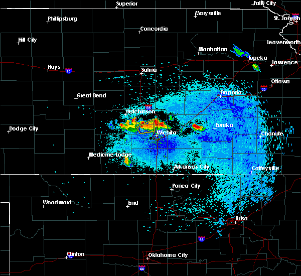 At 239 am cdt, a severe thunderstorm was located 6 miles northeast of valley center, moving northeast at 25 mph (radar indicated). Hazards include 60 mph wind gusts and quarter size hail. Hail damage to vehicles is expected. Expect wind damage to roofs, siding, and trees. At 239 am cdt, a severe thunderstorm was located 6 miles northeast of valley center, moving northeast at 25 mph (radar indicated). Hazards include 60 mph wind gusts and quarter size hail. Hail damage to vehicles is expected. Expect wind damage to roofs, siding, and trees.
|
| 8/30/2018 2:24 AM CDT |
 At 224 am cdt, a severe thunderstorm was located over andale, or near mount hope, moving northeast at 15 mph (radar indicated). Hazards include 60 mph wind gusts and quarter size hail. Hail damage to vehicles is expected. expect wind damage to roofs, siding, and trees. Locations impacted include, valley center, maize, sedgwick, colwich, mount hope, andale and bentley. At 224 am cdt, a severe thunderstorm was located over andale, or near mount hope, moving northeast at 15 mph (radar indicated). Hazards include 60 mph wind gusts and quarter size hail. Hail damage to vehicles is expected. expect wind damage to roofs, siding, and trees. Locations impacted include, valley center, maize, sedgwick, colwich, mount hope, andale and bentley.
|
| 8/30/2018 2:10 AM CDT |
 At 210 am cdt, a severe thunderstorm was located over andale, or near mount hope, moving northeast at 15 mph (radar indicated). Hazards include 60 mph wind gusts and quarter size hail. Hail damage to vehicles is expected. Expect wind damage to roofs, siding, and trees. At 210 am cdt, a severe thunderstorm was located over andale, or near mount hope, moving northeast at 15 mph (radar indicated). Hazards include 60 mph wind gusts and quarter size hail. Hail damage to vehicles is expected. Expect wind damage to roofs, siding, and trees.
|
| 8/26/2018 2:35 AM CDT |
 The severe thunderstorm warning for southeastern sedgwick and northwestern sumner counties will expire at 245 am cdt, the storm which prompted the warning has weakened below severe limits, and no longer poses an immediate threat to life or property. therefore, the warning will be allowed to expire. The severe thunderstorm warning for southeastern sedgwick and northwestern sumner counties will expire at 245 am cdt, the storm which prompted the warning has weakened below severe limits, and no longer poses an immediate threat to life or property. therefore, the warning will be allowed to expire.
|
| 8/26/2018 2:18 AM CDT |
 At 218 am cdt, a severe thunderstorm was located near conway springs, moving northeast at 10 mph (radar indicated). Hazards include 60 mph wind gusts. Expect damage to roofs, siding, and trees. Locations impacted include, haysville, goddard, clearwater, conway springs and viola. At 218 am cdt, a severe thunderstorm was located near conway springs, moving northeast at 10 mph (radar indicated). Hazards include 60 mph wind gusts. Expect damage to roofs, siding, and trees. Locations impacted include, haysville, goddard, clearwater, conway springs and viola.
|
| 8/26/2018 1:50 AM CDT |
 At 149 am cdt, a severe thunderstorm was located over conway springs, moving northeast at 20 mph (radar indicated). Hazards include 60 mph wind gusts. expect damage to roofs, siding, and trees At 149 am cdt, a severe thunderstorm was located over conway springs, moving northeast at 20 mph (radar indicated). Hazards include 60 mph wind gusts. expect damage to roofs, siding, and trees
|
| 7/29/2018 3:27 AM CDT |
 At 327 am cdt, a severe thunderstorm was located over colwich, moving east at 30 mph (radar indicated). Hazards include 60 mph wind gusts. Expect damage to roofs, siding, and trees. Locations impacted include, wichita, park city, valley center, maize, sedgwick, colwich, garden plain, mount hope, kechi, andale and bentley. At 327 am cdt, a severe thunderstorm was located over colwich, moving east at 30 mph (radar indicated). Hazards include 60 mph wind gusts. Expect damage to roofs, siding, and trees. Locations impacted include, wichita, park city, valley center, maize, sedgwick, colwich, garden plain, mount hope, kechi, andale and bentley.
|
| 7/29/2018 3:08 AM CDT |
 At 308 am cdt, a severe thunderstorm was located over mount hope, moving east at 40 mph (radar indicated). Hazards include 60 mph wind gusts. expect damage to roofs, siding, and trees At 308 am cdt, a severe thunderstorm was located over mount hope, moving east at 40 mph (radar indicated). Hazards include 60 mph wind gusts. expect damage to roofs, siding, and trees
|
| 6/30/2018 7:16 PM CDT |
 At 715 pm cdt, severe thunderstorms were located along a line extending from 5 miles north of kechi to towanda to 8 miles east of douglass, moving northeast at 40 mph (radar indicated). Hazards include 60 to 70 mph winds and nickel size hail. expect damage to roofs, siding, and trees At 715 pm cdt, severe thunderstorms were located along a line extending from 5 miles north of kechi to towanda to 8 miles east of douglass, moving northeast at 40 mph (radar indicated). Hazards include 60 to 70 mph winds and nickel size hail. expect damage to roofs, siding, and trees
|
| 6/30/2018 7:10 PM CDT |
 The severe thunderstorm warning for northwestern cowley, sedgwick, southwestern butler and sumner counties will expire at 715 pm cdt, the storms which prompted the warning have moved out of the area. therefore, the warning will be allowed to expire. however gusty winds are still possible with these thunderstorms. a severe thunderstorm watch remains in effect until 900 pm cdt for south central kansas. The severe thunderstorm warning for northwestern cowley, sedgwick, southwestern butler and sumner counties will expire at 715 pm cdt, the storms which prompted the warning have moved out of the area. therefore, the warning will be allowed to expire. however gusty winds are still possible with these thunderstorms. a severe thunderstorm watch remains in effect until 900 pm cdt for south central kansas.
|
| 6/30/2018 7:08 PM CDT | Storm damage reported in sedgwick county KS, 8.1 miles WSW of Wichita, KS |
| 6/30/2018 6:55 PM CDT |
 At 652 pm cdt, severe thunderstorms were located along a line extending from 5 miles south of cheney to derby to winfield, moving northeast at 35 mph (radar indicated). Hazards include 60 to 70 mph winds and penny size hail. Expect considerable tree damage. damage is likely to mobile homes, roofs, and outbuildings. Locations impacted include, wichita, derby, andover, haysville, wellington, park city, valley center, bel aire, mulvane, goddard, rose hill, maize, clearwater, cheney, douglass, sedgwick, belle plaine, colwich, conway springs and oxford. At 652 pm cdt, severe thunderstorms were located along a line extending from 5 miles south of cheney to derby to winfield, moving northeast at 35 mph (radar indicated). Hazards include 60 to 70 mph winds and penny size hail. Expect considerable tree damage. damage is likely to mobile homes, roofs, and outbuildings. Locations impacted include, wichita, derby, andover, haysville, wellington, park city, valley center, bel aire, mulvane, goddard, rose hill, maize, clearwater, cheney, douglass, sedgwick, belle plaine, colwich, conway springs and oxford.
|
| 6/30/2018 6:49 PM CDT | Tree branches reported down in town. via social medi in sedgwick county KS, 0.3 miles SSW of Wichita, KS |
| 6/30/2018 6:40 PM CDT | 4 inch tree limb down at nws offic in sedgwick county KS, 5.6 miles ENE of Wichita, KS |
| 6/30/2018 6:32 PM CDT |
 At 630 pm cdt, severe thunderstorms were located along a line extending from 11 miles north of harper to 5 miles southeast of clearwater to 5 miles south of belle plaine to 5 miles west of geuda springs, moving northeast at 40 mph (radar indicated). Hazards include 70 mph winds and penny size hail. Expect considerable tree damage. damage is likely to mobile homes, roofs, and outbuildings. Locations impacted include, wichita, derby, andover, haysville, wellington, park city, valley center, bel aire, mulvane, goddard, rose hill, maize, kingman, clearwater, cheney, douglass, sedgwick, belle plaine, harper and colwich. At 630 pm cdt, severe thunderstorms were located along a line extending from 11 miles north of harper to 5 miles southeast of clearwater to 5 miles south of belle plaine to 5 miles west of geuda springs, moving northeast at 40 mph (radar indicated). Hazards include 70 mph winds and penny size hail. Expect considerable tree damage. damage is likely to mobile homes, roofs, and outbuildings. Locations impacted include, wichita, derby, andover, haysville, wellington, park city, valley center, bel aire, mulvane, goddard, rose hill, maize, kingman, clearwater, cheney, douglass, sedgwick, belle plaine, harper and colwich.
|
| 6/30/2018 6:17 PM CDT |
 At 614 pm cdt, severe thunderstorms were located along a line extending from 6 miles north of attica to 5 miles southeast of conway springs to near south haven, moving northeast at 40 mph (radar indicated). Hazards include 70 mph wind gusts and penny size hail. Expect considerable tree damage. Damage is likely to mobile homes, roofs, and outbuildings. At 614 pm cdt, severe thunderstorms were located along a line extending from 6 miles north of attica to 5 miles southeast of conway springs to near south haven, moving northeast at 40 mph (radar indicated). Hazards include 70 mph wind gusts and penny size hail. Expect considerable tree damage. Damage is likely to mobile homes, roofs, and outbuildings.
|
| 6/26/2018 11:10 PM CDT |
 The severe thunderstorm warning for southwestern sedgwick county will expire at 1115 pm cdt, the storm which prompted the warning is moving out of the area. therefore, the warning will be allowed to expire. however gusty winds are still possible with this thunderstorm. The severe thunderstorm warning for southwestern sedgwick county will expire at 1115 pm cdt, the storm which prompted the warning is moving out of the area. therefore, the warning will be allowed to expire. however gusty winds are still possible with this thunderstorm.
|
| 6/26/2018 10:59 PM CDT |
 At 1033 pm cdt, a severe thunderstorm was located near viola, or 7 miles west of clearwater, moving south at 25 mph (radar indicated). Hazards include two inch hail and 70 mph wind gusts. People and animals outdoors will be injured. expect hail damage to roofs, siding, windows, and vehicles. expect considerable tree damage. wind damage is also likely to mobile homes, roofs, and outbuildings. Locations impacted include, goddard, cheney, garden plain, viola and lake afton. At 1033 pm cdt, a severe thunderstorm was located near viola, or 7 miles west of clearwater, moving south at 25 mph (radar indicated). Hazards include two inch hail and 70 mph wind gusts. People and animals outdoors will be injured. expect hail damage to roofs, siding, windows, and vehicles. expect considerable tree damage. wind damage is also likely to mobile homes, roofs, and outbuildings. Locations impacted include, goddard, cheney, garden plain, viola and lake afton.
|
| 6/26/2018 10:33 PM CDT |
 At 1033 pm cdt, a severe thunderstorm was located near viola, or 7 miles west of clearwater, moving south at 25 mph (radar indicated). Hazards include two inch hail and 70 mph wind gusts. People and animals outdoors will be injured. expect hail damage to roofs, siding, windows, and vehicles. expect considerable tree damage. wind damage is also likely to mobile homes, roofs, and outbuildings. Locations impacted include, goddard, cheney, garden plain, viola and lake afton. At 1033 pm cdt, a severe thunderstorm was located near viola, or 7 miles west of clearwater, moving south at 25 mph (radar indicated). Hazards include two inch hail and 70 mph wind gusts. People and animals outdoors will be injured. expect hail damage to roofs, siding, windows, and vehicles. expect considerable tree damage. wind damage is also likely to mobile homes, roofs, and outbuildings. Locations impacted include, goddard, cheney, garden plain, viola and lake afton.
|
| 6/26/2018 10:31 PM CDT |
 At 1031 pm cdt, a severe thunderstorm was located near goddard, moving south at 20 mph (radar indicated). Hazards include tennis ball size hail and 70 mph wind gusts. People and animals outdoors will be injured. expect hail damage to roofs, siding, windows, and vehicles. expect considerable tree damage. Wind damage is also likely to mobile homes, roofs, and outbuildings. At 1031 pm cdt, a severe thunderstorm was located near goddard, moving south at 20 mph (radar indicated). Hazards include tennis ball size hail and 70 mph wind gusts. People and animals outdoors will be injured. expect hail damage to roofs, siding, windows, and vehicles. expect considerable tree damage. Wind damage is also likely to mobile homes, roofs, and outbuildings.
|
| 6/26/2018 10:21 PM CDT |
 At 1021 pm cdt, a severe thunderstorm was located over garden plain, moving south at 15 mph (radar indicated). Hazards include tennis ball size hail and 70 mph wind gusts. People and animals outdoors will be injured. expect hail damage to roofs, siding, windows, and vehicles. expect considerable tree damage. wind damage is also likely to mobile homes, roofs, and outbuildings. Locations impacted include, goddard, cheney, garden plain, andale, viola and lake afton. At 1021 pm cdt, a severe thunderstorm was located over garden plain, moving south at 15 mph (radar indicated). Hazards include tennis ball size hail and 70 mph wind gusts. People and animals outdoors will be injured. expect hail damage to roofs, siding, windows, and vehicles. expect considerable tree damage. wind damage is also likely to mobile homes, roofs, and outbuildings. Locations impacted include, goddard, cheney, garden plain, andale, viola and lake afton.
|
| 6/26/2018 10:19 PM CDT |
 At 1019 pm cdt, severe thunderstorms were located along a line extending from eisenhower national airport to near goddard, moving south at 15 mph (radar indicated). Hazards include ping pong ball size hail and 60 mph wind gusts. People and animals outdoors will be injured. expect hail damage to roofs, siding, windows, and vehicles. expect wind damage to roofs, siding, and trees. Locations impacted include, wichita, derby, andover, haysville, mulvane, goddard, rose hill, maize, clearwater, downtown wichita, eastborough, west wichita, east wichita, eisenhower national airport, mcconnell air force base, south wichita and oaklawn. At 1019 pm cdt, severe thunderstorms were located along a line extending from eisenhower national airport to near goddard, moving south at 15 mph (radar indicated). Hazards include ping pong ball size hail and 60 mph wind gusts. People and animals outdoors will be injured. expect hail damage to roofs, siding, windows, and vehicles. expect wind damage to roofs, siding, and trees. Locations impacted include, wichita, derby, andover, haysville, mulvane, goddard, rose hill, maize, clearwater, downtown wichita, eastborough, west wichita, east wichita, eisenhower national airport, mcconnell air force base, south wichita and oaklawn.
|
| 6/26/2018 10:08 PM CDT |
 At 1008 pm cdt, severe thunderstorms were located along a line extending from 6 miles north of cheney to near goddard, moving southeast at 15 mph (radar indicated). Hazards include tennis ball size hail and 70 mph wind gusts. People and animals outdoors will be injured. expect hail damage to roofs, siding, windows, and vehicles. expect considerable tree damage. Wind damage is also likely to mobile homes, roofs, and outbuildings. At 1008 pm cdt, severe thunderstorms were located along a line extending from 6 miles north of cheney to near goddard, moving southeast at 15 mph (radar indicated). Hazards include tennis ball size hail and 70 mph wind gusts. People and animals outdoors will be injured. expect hail damage to roofs, siding, windows, and vehicles. expect considerable tree damage. Wind damage is also likely to mobile homes, roofs, and outbuildings.
|
| 6/26/2018 10:05 PM CDT |
 At 1005 pm cdt, severe thunderstorms were located along a line extending from south wichita to near goddard, moving south at 15 mph (radar indicated). Hazards include two inch hail and 70 mph wind gusts. People and animals outdoors will be injured. expect hail damage to roofs, siding, windows, and vehicles. expect considerable tree damage. wind damage is also likely to mobile homes, roofs, and outbuildings. Locations impacted include, wichita, derby, andover, haysville, park city, bel aire, mulvane, goddard, rose hill, maize, clearwater, colwich, downtown wichita, eastborough, west wichita, east wichita, eisenhower national airport, northeast wichita, mcconnell air force base and south wichita. At 1005 pm cdt, severe thunderstorms were located along a line extending from south wichita to near goddard, moving south at 15 mph (radar indicated). Hazards include two inch hail and 70 mph wind gusts. People and animals outdoors will be injured. expect hail damage to roofs, siding, windows, and vehicles. expect considerable tree damage. wind damage is also likely to mobile homes, roofs, and outbuildings. Locations impacted include, wichita, derby, andover, haysville, park city, bel aire, mulvane, goddard, rose hill, maize, clearwater, colwich, downtown wichita, eastborough, west wichita, east wichita, eisenhower national airport, northeast wichita, mcconnell air force base and south wichita.
|
| 6/26/2018 9:30 PM CDT |
 At 929 pm cdt, a severe thunderstorm was located over maize, moving southeast at 25 mph (radar indicated). Hazards include tennis ball size hail and 70 mph wind gusts. People and animals outdoors will be injured. expect hail damage to roofs, siding, windows, and vehicles. expect considerable tree damage. Wind damage is also likely to mobile homes, roofs, and outbuildings. At 929 pm cdt, a severe thunderstorm was located over maize, moving southeast at 25 mph (radar indicated). Hazards include tennis ball size hail and 70 mph wind gusts. People and animals outdoors will be injured. expect hail damage to roofs, siding, windows, and vehicles. expect considerable tree damage. Wind damage is also likely to mobile homes, roofs, and outbuildings.
|
| 6/26/2018 9:01 PM CDT |
 At 901 pm cdt, severe thunderstorms were located along a line extending from 5 miles northeast of valley center to near maize, moving southeast at 15 mph (radar indicated). Hazards include 60 mph wind gusts and quarter size hail. Hail damage to vehicles is expected. expect wind damage to roofs, siding, and trees. Locations impacted include, wichita, park city, valley center, bel aire, maize, sedgwick, colwich, whitewater, kechi, bentley, northeast wichita and jabara airport. At 901 pm cdt, severe thunderstorms were located along a line extending from 5 miles northeast of valley center to near maize, moving southeast at 15 mph (radar indicated). Hazards include 60 mph wind gusts and quarter size hail. Hail damage to vehicles is expected. expect wind damage to roofs, siding, and trees. Locations impacted include, wichita, park city, valley center, bel aire, maize, sedgwick, colwich, whitewater, kechi, bentley, northeast wichita and jabara airport.
|
| 6/26/2018 8:38 PM CDT |
 At 838 pm cdt, a severe thunderstorm was located over sedgwick, moving east at 25 mph (radar indicated). Hazards include 60 mph wind gusts and quarter size hail. Hail damage to vehicles is expected. Expect wind damage to roofs, siding, and trees. At 838 pm cdt, a severe thunderstorm was located over sedgwick, moving east at 25 mph (radar indicated). Hazards include 60 mph wind gusts and quarter size hail. Hail damage to vehicles is expected. Expect wind damage to roofs, siding, and trees.
|
| 5/31/2018 2:06 AM CDT |
 At 205 am cdt, a severe thunderstorm was located over augusta, moving east at 30 mph (radar indicated). Hazards include 60 mph wind gusts. Expect damage to roofs, siding, and trees. Locations impacted include, wichita, derby, el dorado, andover, augusta, park city, valley center, bel aire, rose hill, douglass, towanda, benton, leon, kechi, eastborough, latham, northeast wichita, east wichita, mcconnell air force base and rosalia. At 205 am cdt, a severe thunderstorm was located over augusta, moving east at 30 mph (radar indicated). Hazards include 60 mph wind gusts. Expect damage to roofs, siding, and trees. Locations impacted include, wichita, derby, el dorado, andover, augusta, park city, valley center, bel aire, rose hill, douglass, towanda, benton, leon, kechi, eastborough, latham, northeast wichita, east wichita, mcconnell air force base and rosalia.
|
| 5/31/2018 1:52 AM CDT |
 At 151 am cdt, a severe thunderstorm was located near andover, moving east at 30 mph (radar indicated). Hazards include 60 to 70 mph wind gusts. Expect considerable tree damage. damage is likely to mobile homes, roofs, and outbuildings. Locations impacted include, wichita, derby, el dorado, andover, haysville, augusta, park city, valley center, bel aire, mulvane, rose hill, maize, douglass, towanda, benton, leon, downtown wichita, kechi, eastborough and atlanta. At 151 am cdt, a severe thunderstorm was located near andover, moving east at 30 mph (radar indicated). Hazards include 60 to 70 mph wind gusts. Expect considerable tree damage. damage is likely to mobile homes, roofs, and outbuildings. Locations impacted include, wichita, derby, el dorado, andover, haysville, augusta, park city, valley center, bel aire, mulvane, rose hill, maize, douglass, towanda, benton, leon, downtown wichita, kechi, eastborough and atlanta.
|
| 5/31/2018 1:48 AM CDT | Storm damage reported in sedgwick county KS, 0.3 miles SSW of Wichita, KS |
| 5/31/2018 1:45 AM CDT | Storm damage reported in sedgwick county KS, 5.8 miles ESE of Wichita, KS |
| 5/31/2018 1:40 AM CDT | Large tree limbs downed near 32nd and amidon. delayed report. time estimated from rada in sedgwick county KS, 4 miles SSE of Wichita, KS |
| 5/31/2018 1:33 AM CDT | Storm damage reported in sedgwick county KS, 0.8 miles WNW of Wichita, KS |
| 5/31/2018 1:33 AM CDT |
 At 133 am cdt, a severe thunderstorm was located over mcconnell air force base, or near downtown wichita, moving east at 35 mph (radar indicated). Hazards include 70 mph wind gusts. Expect considerable tree damage. damage is likely to mobile homes, roofs, and outbuildings. Locations impacted include, wichita, derby, el dorado, andover, haysville, augusta, park city, valley center, bel aire, mulvane, rose hill, maize, douglass, towanda, benton, leon, downtown wichita, kechi, eastborough and atlanta. At 133 am cdt, a severe thunderstorm was located over mcconnell air force base, or near downtown wichita, moving east at 35 mph (radar indicated). Hazards include 70 mph wind gusts. Expect considerable tree damage. damage is likely to mobile homes, roofs, and outbuildings. Locations impacted include, wichita, derby, el dorado, andover, haysville, augusta, park city, valley center, bel aire, mulvane, rose hill, maize, douglass, towanda, benton, leon, downtown wichita, kechi, eastborough and atlanta.
|
| 5/31/2018 1:32 AM CDT | Storm damage reported in sedgwick county KS, 5.8 miles ESE of Wichita, KS |
| 5/31/2018 1:21 AM CDT |
 At 120 am cdt, severe thunderstorms were located along a line extending from 5 miles north of kechi to near northeast wichita to near rose hill, moving east at 70 mph (radar indicated). Hazards include 70 mph wind gusts. Expect considerable tree damage. damage is likely to mobile homes, roofs, and outbuildings. Locations impacted include, wichita, derby, andover, haysville, augusta, park city, valley center, bel aire, mulvane, goddard, rose hill, maize, clearwater, douglass, sedgwick, towanda, colwich, benton, garden plain and downtown wichita. At 120 am cdt, severe thunderstorms were located along a line extending from 5 miles north of kechi to near northeast wichita to near rose hill, moving east at 70 mph (radar indicated). Hazards include 70 mph wind gusts. Expect considerable tree damage. damage is likely to mobile homes, roofs, and outbuildings. Locations impacted include, wichita, derby, andover, haysville, augusta, park city, valley center, bel aire, mulvane, goddard, rose hill, maize, clearwater, douglass, sedgwick, towanda, colwich, benton, garden plain and downtown wichita.
|
| 5/31/2018 1:02 AM CDT |
 At 102 am cdt, severe thunderstorms were located along a line extending from andale to near goddard to clearwater, moving east at 40 mph (radar indicated). Hazards include 60 to 70 mph wind gusts. Expect considerable tree damage. damage is likely to mobile homes, roofs, and outbuildings. Locations impacted include, wichita, derby, andover, haysville, augusta, park city, valley center, bel aire, mulvane, goddard, rose hill, maize, clearwater, cheney, douglass, sedgwick, towanda, colwich, benton and garden plain. At 102 am cdt, severe thunderstorms were located along a line extending from andale to near goddard to clearwater, moving east at 40 mph (radar indicated). Hazards include 60 to 70 mph wind gusts. Expect considerable tree damage. damage is likely to mobile homes, roofs, and outbuildings. Locations impacted include, wichita, derby, andover, haysville, augusta, park city, valley center, bel aire, mulvane, goddard, rose hill, maize, clearwater, cheney, douglass, sedgwick, towanda, colwich, benton and garden plain.
|
| 5/31/2018 12:41 AM CDT |
 At 1241 am cdt, severe thunderstorms were located along a line extending from 7 miles east of pretty prairie to cheney to near norwich, moving east at 45 mph (radar indicated). Hazards include 60 to 70 mph wind gusts and nickel size hail. Expect considerable tree damage. damage is likely to mobile homes, roofs, and outbuildings. Locations impacted include, wichita, derby, andover, haysville, augusta, park city, valley center, bel aire, mulvane, goddard, rose hill, maize, kingman, clearwater, cheney, douglass, sedgwick, towanda, colwich and benton. At 1241 am cdt, severe thunderstorms were located along a line extending from 7 miles east of pretty prairie to cheney to near norwich, moving east at 45 mph (radar indicated). Hazards include 60 to 70 mph wind gusts and nickel size hail. Expect considerable tree damage. damage is likely to mobile homes, roofs, and outbuildings. Locations impacted include, wichita, derby, andover, haysville, augusta, park city, valley center, bel aire, mulvane, goddard, rose hill, maize, kingman, clearwater, cheney, douglass, sedgwick, towanda, colwich and benton.
|
| 5/31/2018 12:26 AM CDT |
 At 1225 am cdt, severe thunderstorms were located along a line extending from near pretty prairie to 9 miles west of cheney to 5 miles west of norwich, moving east at 60 mph. these are very dangerous storms (radar indicated). Hazards include 80 mph wind gusts and quarter size hail. Flying debris will be dangerous to those caught without shelter. mobile homes will be heavily damaged. expect considerable damage to roofs, windows, and vehicles. Extensive tree damage and power outages are likely. At 1225 am cdt, severe thunderstorms were located along a line extending from near pretty prairie to 9 miles west of cheney to 5 miles west of norwich, moving east at 60 mph. these are very dangerous storms (radar indicated). Hazards include 80 mph wind gusts and quarter size hail. Flying debris will be dangerous to those caught without shelter. mobile homes will be heavily damaged. expect considerable damage to roofs, windows, and vehicles. Extensive tree damage and power outages are likely.
|
| 5/29/2018 4:07 PM CDT |
 At 407 pm cdt, a severe thunderstorm was located over andover, moving northeast at 10 mph (radar indicated). Hazards include 60 mph wind gusts and half dollar size hail. Hail damage to vehicles is expected. expect wind damage to roofs, siding, and trees. locations impacted include, wichita, andover, bel aire, towanda, benton, northeast wichita, santa fe lake, augusta municipal airport and jabara airport. A tornado watch remains in effect until 900 pm cdt for south central kansas. At 407 pm cdt, a severe thunderstorm was located over andover, moving northeast at 10 mph (radar indicated). Hazards include 60 mph wind gusts and half dollar size hail. Hail damage to vehicles is expected. expect wind damage to roofs, siding, and trees. locations impacted include, wichita, andover, bel aire, towanda, benton, northeast wichita, santa fe lake, augusta municipal airport and jabara airport. A tornado watch remains in effect until 900 pm cdt for south central kansas.
|
| 5/29/2018 4:00 PM CDT | Golf Ball sized hail reported 6.1 miles WSW of Wichita, KS |
| 5/29/2018 3:56 PM CDT | Ping Pong Ball sized hail reported 5.6 miles W of Wichita, KS, report of windows broken out of cars. |
| 5/29/2018 3:54 PM CDT | Hen Egg sized hail reported 6.4 miles WNW of Wichita, KS |
| 5/29/2018 3:54 PM CDT | Golf Ball sized hail reported 4.5 miles W of Wichita, KS |
| 5/29/2018 3:51 PM CDT | Ping Pong Ball sized hail reported 6.2 miles W of Wichita, KS |
| 5/29/2018 3:51 PM CDT | Storm damage reported in sedgwick county KS, 6.2 miles W of Wichita, KS |
| 5/29/2018 3:51 PM CDT |
 At 351 pm cdt, a severe thunderstorm was located over andover, moving northeast at 10 mph (radar indicated). Hazards include golf ball size hail and 60 mph wind gusts. People and animals outdoors will be injured. expect hail damage to roofs, siding, windows, and vehicles. expect wind damage to roofs, siding, and trees. locations impacted include, wichita, andover, bel aire, rose hill, towanda, benton, eastborough, east wichita, northeast wichita, mcconnell air force base, santa fe lake, augusta municipal airport, jabara airport and oaklawn. A tornado watch remains in effect until 900 pm cdt for south central kansas. At 351 pm cdt, a severe thunderstorm was located over andover, moving northeast at 10 mph (radar indicated). Hazards include golf ball size hail and 60 mph wind gusts. People and animals outdoors will be injured. expect hail damage to roofs, siding, windows, and vehicles. expect wind damage to roofs, siding, and trees. locations impacted include, wichita, andover, bel aire, rose hill, towanda, benton, eastborough, east wichita, northeast wichita, mcconnell air force base, santa fe lake, augusta municipal airport, jabara airport and oaklawn. A tornado watch remains in effect until 900 pm cdt for south central kansas.
|
| 5/29/2018 3:50 PM CDT | Quarter sized hail reported 5.1 miles W of Wichita, KS |
| 5/29/2018 3:38 PM CDT |
 At 338 pm cdt, a severe thunderstorm was located over east wichita, or near andover, moving northeast at 15 mph (radar indicated). Hazards include ping pong ball size hail and 60 mph wind gusts. People and animals outdoors will be injured. expect hail damage to roofs, siding, windows, and vehicles. Expect wind damage to roofs, siding, and trees. At 338 pm cdt, a severe thunderstorm was located over east wichita, or near andover, moving northeast at 15 mph (radar indicated). Hazards include ping pong ball size hail and 60 mph wind gusts. People and animals outdoors will be injured. expect hail damage to roofs, siding, windows, and vehicles. Expect wind damage to roofs, siding, and trees.
|
| 5/19/2018 12:27 AM CDT |
 At 1226 am cdt, severe thunderstorms were located along a line extending from near mulvane, to 7 miles south of douglass, to 6 miles east of arkansas city, moving northeast at 40 mph (radar indicated). Hazards include 60 mph wind gusts. expect damage to roofs, siding, and trees At 1226 am cdt, severe thunderstorms were located along a line extending from near mulvane, to 7 miles south of douglass, to 6 miles east of arkansas city, moving northeast at 40 mph (radar indicated). Hazards include 60 mph wind gusts. expect damage to roofs, siding, and trees
|
| 5/14/2018 9:26 PM CDT |
 At 925 pm cdt, severe thunderstorms were located along a line extending from near latham to 6 miles northwest of caldwell, moving east at 35 mph (radar indicated). Hazards include 70 mph wind gusts and ping pong ball size hail. People and animals outdoors will be injured. expect hail damage to roofs, siding, windows, and vehicles. expect considerable tree damage. Wind damage is also likely to mobile homes, roofs, and outbuildings. At 925 pm cdt, severe thunderstorms were located along a line extending from near latham to 6 miles northwest of caldwell, moving east at 35 mph (radar indicated). Hazards include 70 mph wind gusts and ping pong ball size hail. People and animals outdoors will be injured. expect hail damage to roofs, siding, windows, and vehicles. expect considerable tree damage. Wind damage is also likely to mobile homes, roofs, and outbuildings.
|
| 5/14/2018 8:53 PM CDT |
 At 853 pm cdt, a severe thunderstorm was located over rose hill, moving east at 15 mph (radar indicated). Hazards include 60 mph wind gusts and quarter size hail. Hail damage to vehicles is expected. expect wind damage to roofs, siding, and trees. Locations impacted include, derby, andover, augusta, mulvane, rose hill, douglass, augusta municipal airport, el dorado airport and santa fe lake. At 853 pm cdt, a severe thunderstorm was located over rose hill, moving east at 15 mph (radar indicated). Hazards include 60 mph wind gusts and quarter size hail. Hail damage to vehicles is expected. expect wind damage to roofs, siding, and trees. Locations impacted include, derby, andover, augusta, mulvane, rose hill, douglass, augusta municipal airport, el dorado airport and santa fe lake.
|
| 5/14/2018 8:27 PM CDT |
 At 827 pm cdt, a severe thunderstorm was located near derby, moving east at 25 mph (radar indicated). Hazards include 60 mph wind gusts and half dollar size hail. Hail damage to vehicles is expected. Expect wind damage to roofs, siding, and trees. At 827 pm cdt, a severe thunderstorm was located near derby, moving east at 25 mph (radar indicated). Hazards include 60 mph wind gusts and half dollar size hail. Hail damage to vehicles is expected. Expect wind damage to roofs, siding, and trees.
|
| 10/21/2017 4:05 PM CDT |
 At 405 pm cdt, a severe thunderstorm was located over benton, moving northeast at 45 mph (radar indicated). Hazards include 60 mph wind gusts and quarter size hail. Hail damage to vehicles is expected. expect wind damage to roofs, siding, and trees. Locations impacted include, wichita, el dorado, andover, bel aire, rose hill, towanda, benton, kechi, eastborough, east wichita, northeast wichita, mcconnell air force base, santa fe lake, augusta municipal airport and jabara airport. At 405 pm cdt, a severe thunderstorm was located over benton, moving northeast at 45 mph (radar indicated). Hazards include 60 mph wind gusts and quarter size hail. Hail damage to vehicles is expected. expect wind damage to roofs, siding, and trees. Locations impacted include, wichita, el dorado, andover, bel aire, rose hill, towanda, benton, kechi, eastborough, east wichita, northeast wichita, mcconnell air force base, santa fe lake, augusta municipal airport and jabara airport.
|
| 10/21/2017 3:55 PM CDT | Quarter sized hail reported 4.5 miles W of Wichita, KS, estimated quarter size hail observed 13th and k-96. report received via social media. |
| 10/21/2017 3:53 PM CDT |
 At 352 pm cdt, a severe thunderstorm was located near andover, moving northeast at 40 mph (radar indicated). Hazards include 60 mph wind gusts and quarter size hail. Hail damage to vehicles is expected. Expect wind damage to roofs, siding, and trees. At 352 pm cdt, a severe thunderstorm was located near andover, moving northeast at 40 mph (radar indicated). Hazards include 60 mph wind gusts and quarter size hail. Hail damage to vehicles is expected. Expect wind damage to roofs, siding, and trees.
|
| 9/25/2017 1:52 PM CDT |
 The severe thunderstorm warning for southeastern sedgwick county will expire at 200 pm cdt, the storm which prompted the warning has weakened, though gusty winds of 40 to 50 mph are expected for the next 30 minutes across northern sedgwick and southwestern harvey county associated with this storm. The severe thunderstorm warning for southeastern sedgwick county will expire at 200 pm cdt, the storm which prompted the warning has weakened, though gusty winds of 40 to 50 mph are expected for the next 30 minutes across northern sedgwick and southwestern harvey county associated with this storm.
|
| 9/25/2017 1:45 PM CDT | Storm damage reported in sedgwick county KS, 3.2 miles E of Wichita, KS |
| 9/25/2017 1:45 PM CDT | Storm damage reported in sedgwick county KS, 3.2 miles E of Wichita, KS |
| 9/25/2017 1:43 PM CDT |
 At 142 pm cdt, a severe thunderstorm was located over west wichita, or near maize, moving north at 30 mph (off duty nws employee). Hazards include 60 mph wind gusts. Expect damage to roofs, siding, and trees. Locations impacted include, wichita, haysville, bel aire, goddard, maize, clearwater, colwich, downtown wichita, andale, eastborough, west wichita, east wichita, eisenhower national airport, northeast wichita, south wichita, mcconnell air force base, oaklawn and jabara airport. At 142 pm cdt, a severe thunderstorm was located over west wichita, or near maize, moving north at 30 mph (off duty nws employee). Hazards include 60 mph wind gusts. Expect damage to roofs, siding, and trees. Locations impacted include, wichita, haysville, bel aire, goddard, maize, clearwater, colwich, downtown wichita, andale, eastborough, west wichita, east wichita, eisenhower national airport, northeast wichita, south wichita, mcconnell air force base, oaklawn and jabara airport.
|
| 9/25/2017 1:30 PM CDT |
 At 130 pm cdt, a severe thunderstorm was located near eisenhower national airport, or 6 miles north of clearwater, moving north at 35 mph (trained weather spotters). Hazards include 70 mph wind gusts. Expect considerable tree damage. Damage is likely to mobile homes, roofs, and outbuildings. At 130 pm cdt, a severe thunderstorm was located near eisenhower national airport, or 6 miles north of clearwater, moving north at 35 mph (trained weather spotters). Hazards include 70 mph wind gusts. Expect considerable tree damage. Damage is likely to mobile homes, roofs, and outbuildings.
|
| 8/21/2017 9:11 PM CDT |
 The severe thunderstorm warning for eastern sedgwick county will expire at 915 pm cdt, the storm which prompted the warning has moved out of the area. therefore the warning will be allowed to expire. however gusty winds are still possible with this thunderstorm and locally heavy rainfall. The severe thunderstorm warning for eastern sedgwick county will expire at 915 pm cdt, the storm which prompted the warning has moved out of the area. therefore the warning will be allowed to expire. however gusty winds are still possible with this thunderstorm and locally heavy rainfall.
|
| 8/21/2017 9:02 PM CDT |
 At 901 pm cdt, a severe thunderstorm was located over east wichita, moving northeast at 40 mph (radar indicated). Hazards include 60 mph wind gusts and nickel size hail. Expect damage to roofs, siding, and trees. Locations impacted include, wichita, derby, andover, haysville, park city, bel aire, downtown wichita, kechi, eastborough, east wichita, northeast wichita, mcconnell air force base, south wichita, oaklawn and jabara airport. At 901 pm cdt, a severe thunderstorm was located over east wichita, moving northeast at 40 mph (radar indicated). Hazards include 60 mph wind gusts and nickel size hail. Expect damage to roofs, siding, and trees. Locations impacted include, wichita, derby, andover, haysville, park city, bel aire, downtown wichita, kechi, eastborough, east wichita, northeast wichita, mcconnell air force base, south wichita, oaklawn and jabara airport.
|
| 8/21/2017 8:49 PM CDT |
 At 849 pm cdt, a severe thunderstorm was located over downtown wichita, moving northeast at 35 mph (radar indicated). Hazards include 60 mph wind gusts and nickel size hail. Expect damage to roofs, siding, and trees. Locations impacted include, wichita, derby, andover, haysville, park city, bel aire, downtown wichita, kechi, eastborough, west wichita, east wichita, eisenhower national airport, northeast wichita, mcconnell air force base, south wichita, oaklawn and jabara airport. At 849 pm cdt, a severe thunderstorm was located over downtown wichita, moving northeast at 35 mph (radar indicated). Hazards include 60 mph wind gusts and nickel size hail. Expect damage to roofs, siding, and trees. Locations impacted include, wichita, derby, andover, haysville, park city, bel aire, downtown wichita, kechi, eastborough, west wichita, east wichita, eisenhower national airport, northeast wichita, mcconnell air force base, south wichita, oaklawn and jabara airport.
|
| 8/21/2017 8:45 PM CDT | Measured near central and zo in sedgwick county KS, 2.1 miles E of Wichita, KS |
| 8/21/2017 8:40 PM CDT |
 At 840 pm cdt, a severe thunderstorm was located over eisenhower national airport, or 6 miles southwest of downtown wichita, moving northeast at 35 mph (radar indicated). Hazards include 60 mph wind gusts and nickel size hail. expect damage to roofs, siding, and trees At 840 pm cdt, a severe thunderstorm was located over eisenhower national airport, or 6 miles southwest of downtown wichita, moving northeast at 35 mph (radar indicated). Hazards include 60 mph wind gusts and nickel size hail. expect damage to roofs, siding, and trees
|
| 8/19/2017 4:58 PM CDT |
 The severe thunderstorm warning for southeastern sedgwick and northeastern sumner counties will expire at 500 pm cdt, the storm which prompted the warning has weakened below severe limits, and no longer poses an immediate threat to life or property. therefore the warning will be allowed to expire. however gusty winds to 50 mph and heavy rain are still possible with this thunderstorm. The severe thunderstorm warning for southeastern sedgwick and northeastern sumner counties will expire at 500 pm cdt, the storm which prompted the warning has weakened below severe limits, and no longer poses an immediate threat to life or property. therefore the warning will be allowed to expire. however gusty winds to 50 mph and heavy rain are still possible with this thunderstorm.
|
| 8/19/2017 4:39 PM CDT |
 At 438 pm cdt, a severe thunderstorm was located 7 miles south of haysville, and is drifting slowly south at 5 mph (radar indicated). Hazards include 60 mph wind gusts and quarter size hail. Hail damage to vehicles is expected. expect wind damage to roofs, siding, and trees. Locations impacted include, derby, haysville, mulvane, rose hill, clearwater, belle plaine and riverdale. At 438 pm cdt, a severe thunderstorm was located 7 miles south of haysville, and is drifting slowly south at 5 mph (radar indicated). Hazards include 60 mph wind gusts and quarter size hail. Hail damage to vehicles is expected. expect wind damage to roofs, siding, and trees. Locations impacted include, derby, haysville, mulvane, rose hill, clearwater, belle plaine and riverdale.
|
| 8/19/2017 4:24 PM CDT |
 At 423 pm cdt, a severe thunderstorm was located 5 miles south of haysville, and drifting slowly south at 5 miles an hour (radar indicated). Hazards include 60 mph wind gusts and quarter size hail. Hail damage to vehicles is expected. Expect wind damage to roofs, siding, and trees. At 423 pm cdt, a severe thunderstorm was located 5 miles south of haysville, and drifting slowly south at 5 miles an hour (radar indicated). Hazards include 60 mph wind gusts and quarter size hail. Hail damage to vehicles is expected. Expect wind damage to roofs, siding, and trees.
|
| 8/19/2017 4:14 PM CDT |
 At 413 pm cdt, a severe thunderstorm was located near mulvane, moving southeast at 5 mph (radar indicated). Hazards include 60 mph wind gusts and quarter size hail. Hail damage to vehicles is expected. expect wind damage to roofs, siding, and trees. Locations impacted include, derby, haysville, mulvane, rose hill, belle plaine and udall. At 413 pm cdt, a severe thunderstorm was located near mulvane, moving southeast at 5 mph (radar indicated). Hazards include 60 mph wind gusts and quarter size hail. Hail damage to vehicles is expected. expect wind damage to roofs, siding, and trees. Locations impacted include, derby, haysville, mulvane, rose hill, belle plaine and udall.
|
| 8/19/2017 3:59 PM CDT |
 At 358 pm cdt, a severe thunderstorm was located just south of derby, moving east at 10 mph (radar indicated). Hazards include 60 mph wind gusts and quarter size hail. Hail damage to vehicles is expected. expect wind damage to roofs, siding, and trees. Locations impacted include, derby, haysville, mulvane, rose hill, belle plaine and udall. At 358 pm cdt, a severe thunderstorm was located just south of derby, moving east at 10 mph (radar indicated). Hazards include 60 mph wind gusts and quarter size hail. Hail damage to vehicles is expected. expect wind damage to roofs, siding, and trees. Locations impacted include, derby, haysville, mulvane, rose hill, belle plaine and udall.
|
| 8/19/2017 3:44 PM CDT |
 At 344 pm cdt, a severe thunderstorm was located near derby, moving east at 15 mph (radar indicated). Hazards include 60 mph wind gusts and quarter size hail. Hail damage to vehicles is expected. Expect wind damage to roofs, siding, and trees. At 344 pm cdt, a severe thunderstorm was located near derby, moving east at 15 mph (radar indicated). Hazards include 60 mph wind gusts and quarter size hail. Hail damage to vehicles is expected. Expect wind damage to roofs, siding, and trees.
|
| 8/16/2017 3:20 PM CDT |
 At 320 pm cdt, a severe thunderstorm was located near northeast wichita, or near benton, moving northeast at 25 mph (radar indicated). Hazards include ping pong ball size hail and 60 mph wind gusts. People and animals outdoors will be injured. expect hail damage to roofs, siding, windows, and vehicles. expect wind damage to roofs, siding, and trees. Locations impacted include, wichita, andover, park city, bel aire, downtown wichita, kechi, eastborough, east wichita, northeast wichita, mcconnell air force base and jabara airport. At 320 pm cdt, a severe thunderstorm was located near northeast wichita, or near benton, moving northeast at 25 mph (radar indicated). Hazards include ping pong ball size hail and 60 mph wind gusts. People and animals outdoors will be injured. expect hail damage to roofs, siding, windows, and vehicles. expect wind damage to roofs, siding, and trees. Locations impacted include, wichita, andover, park city, bel aire, downtown wichita, kechi, eastborough, east wichita, northeast wichita, mcconnell air force base and jabara airport.
|
| 8/16/2017 3:19 PM CDT | Quarter sized hail reported 5.1 miles SW of Wichita, KS |
| 8/16/2017 3:11 PM CDT |
 At 311 pm cdt, a severe thunderstorm was located over northeast wichita, or over bel aire, moving east at 25 mph (radar indicated). Hazards include 60 mph wind gusts and half dollar size hail. Hail damage to vehicles is expected. expect wind damage to roofs, siding, and trees. Locations impacted include, wichita, andover, park city, bel aire, downtown wichita, kechi, eastborough, east wichita, northeast wichita, mcconnell air force base and jabara airport. At 311 pm cdt, a severe thunderstorm was located over northeast wichita, or over bel aire, moving east at 25 mph (radar indicated). Hazards include 60 mph wind gusts and half dollar size hail. Hail damage to vehicles is expected. expect wind damage to roofs, siding, and trees. Locations impacted include, wichita, andover, park city, bel aire, downtown wichita, kechi, eastborough, east wichita, northeast wichita, mcconnell air force base and jabara airport.
|
| 8/16/2017 2:56 PM CDT |
 At 255 pm cdt, a severe thunderstorm was located over downtown wichita, moving east to northeast at 20 mph (radar indicated). Hazards include 60 mph wind gusts and half dollar size hail. Hail damage to vehicles is expected. expect wind damage to roofs, siding, and trees. Locations impacted include, wichita, andover, park city, valley center, bel aire, maize, downtown wichita, kechi, eastborough, west wichita, east wichita, eisenhower national airport, northeast wichita, mcconnell air force base and jabara airport. At 255 pm cdt, a severe thunderstorm was located over downtown wichita, moving east to northeast at 20 mph (radar indicated). Hazards include 60 mph wind gusts and half dollar size hail. Hail damage to vehicles is expected. expect wind damage to roofs, siding, and trees. Locations impacted include, wichita, andover, park city, valley center, bel aire, maize, downtown wichita, kechi, eastborough, west wichita, east wichita, eisenhower national airport, northeast wichita, mcconnell air force base and jabara airport.
|
| 8/16/2017 2:46 PM CDT |
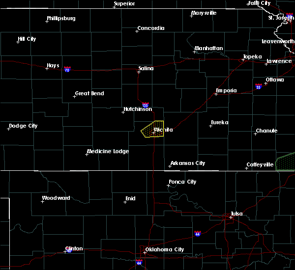 At 245 pm cdt, a severe thunderstorm was located near west wichita, or near downtown wichita, moving northeast at 30 mph (radar indicated). Hazards include 60 mph wind gusts and half dollar size hail. Hail damage to vehicles is expected. Expect wind damage to roofs, siding, and trees. At 245 pm cdt, a severe thunderstorm was located near west wichita, or near downtown wichita, moving northeast at 30 mph (radar indicated). Hazards include 60 mph wind gusts and half dollar size hail. Hail damage to vehicles is expected. Expect wind damage to roofs, siding, and trees.
|
| 7/26/2017 4:42 PM CDT |
 The severe thunderstorm warning for central sedgwick county will expire at 445 pm cdt, the storms which prompted the warning have moved out of the area. therefore the warning will be allowed to expire. however gusty winds around 35 mph are still possible with these thunderstorms. The severe thunderstorm warning for central sedgwick county will expire at 445 pm cdt, the storms which prompted the warning have moved out of the area. therefore the warning will be allowed to expire. however gusty winds around 35 mph are still possible with these thunderstorms.
|
| 7/26/2017 4:33 PM CDT | Storm damage reported in sedgwick county KS, 8.1 miles WSW of Wichita, KS |
| 7/26/2017 4:32 PM CDT |
 At 431 pm cdt, severe thunderstorms were located along a line extending from 5 miles northwest of benton to near northeast wichita to near mcconnell air force base, moving east at 40 mph (radar indicated). Hazards include 60 mph wind gusts and nickel size hail. Expect damage to roofs, siding, and trees. Locations impacted include, wichita, derby, andover, haysville, park city, valley center, bel aire, goddard, rose hill, maize, colwich, garden plain, downtown wichita, kechi, eastborough, west wichita, east wichita, eisenhower national airport, northeast wichita and mcconnell air force base. At 431 pm cdt, severe thunderstorms were located along a line extending from 5 miles northwest of benton to near northeast wichita to near mcconnell air force base, moving east at 40 mph (radar indicated). Hazards include 60 mph wind gusts and nickel size hail. Expect damage to roofs, siding, and trees. Locations impacted include, wichita, derby, andover, haysville, park city, valley center, bel aire, goddard, rose hill, maize, colwich, garden plain, downtown wichita, kechi, eastborough, west wichita, east wichita, eisenhower national airport, northeast wichita and mcconnell air force base.
|
| 7/26/2017 4:31 PM CDT | A 15 foot tree was split and blown over onto 37th street about halfway between rock and webb roads. a sign was also blown dow in sedgwick county KS, 6.3 miles SW of Wichita, KS |
| 7/26/2017 4:29 PM CDT | An 8 inch diameter tree limb fell onto a dec in sedgwick county KS, 4.5 miles W of Wichita, KS |
| 7/26/2017 4:29 PM CDT | An 8 inch diameter tree limb fell onto a dec in sedgwick county KS, 4.5 miles W of Wichita, KS |
| 7/26/2017 4:22 PM CDT | Limbs were reported downed at the intersection of douglas and edgemoor. the traffic lights were out als in sedgwick county KS, 2.9 miles W of Wichita, KS |
| 7/26/2017 4:15 PM CDT |
 At 414 pm cdt, a severe thunderstorm was located over eisenhower national airport, or 6 miles east of goddard, moving east at 35 mph (radar indicated). Hazards include 60 mph wind gusts and nickel size hail. Expect damage to roofs, siding, and trees. Locations impacted include, wichita, derby, andover, haysville, park city, valley center, bel aire, goddard, rose hill, maize, colwich, garden plain, downtown wichita, kechi, eastborough, west wichita, east wichita, eisenhower national airport, northeast wichita and mcconnell air force base. At 414 pm cdt, a severe thunderstorm was located over eisenhower national airport, or 6 miles east of goddard, moving east at 35 mph (radar indicated). Hazards include 60 mph wind gusts and nickel size hail. Expect damage to roofs, siding, and trees. Locations impacted include, wichita, derby, andover, haysville, park city, valley center, bel aire, goddard, rose hill, maize, colwich, garden plain, downtown wichita, kechi, eastborough, west wichita, east wichita, eisenhower national airport, northeast wichita and mcconnell air force base.
|
| 7/26/2017 4:05 PM CDT |
 At 405 pm cdt, a severe thunderstorm was located over goddard, moving east at 25 mph (radar indicated). Hazards include 60 mph wind gusts and nickel size hail. expect damage to roofs, siding, and trees At 405 pm cdt, a severe thunderstorm was located over goddard, moving east at 25 mph (radar indicated). Hazards include 60 mph wind gusts and nickel size hail. expect damage to roofs, siding, and trees
|
| 6/30/2017 1:46 AM CDT | Storm damage reported in sedgwick county KS, 6 miles NW of Wichita, KS |
| 6/29/2017 8:51 PM CDT |
 The severe thunderstorm warning for eastern sedgwick county will expire at 200 am cdt, the storm which prompted the warning has moved out of the area. therefore the warning will be allowed to expire. a severe thunderstorm watch remains in effect until 500 am cdt for south central kansas. The severe thunderstorm warning for eastern sedgwick county will expire at 200 am cdt, the storm which prompted the warning has moved out of the area. therefore the warning will be allowed to expire. a severe thunderstorm watch remains in effect until 500 am cdt for south central kansas.
|
| 6/29/2017 8:39 PM CDT |
 At 139 am cdt, a severe thunderstorm was located over wichita, moving east at 40 mph (radar indicated). Hazards include 60 mph wind gusts. Expect damage to roofs, siding, and trees. Locations impacted include, wichita, andover, haysville, park city, valley center, bel aire, goddard, maize, clearwater, colwich, downtown wichita, kechi, eastborough, west wichita, east wichita, eisenhower national airport, northeast wichita, mcconnell air force base, south wichita and oaklawn. At 139 am cdt, a severe thunderstorm was located over wichita, moving east at 40 mph (radar indicated). Hazards include 60 mph wind gusts. Expect damage to roofs, siding, and trees. Locations impacted include, wichita, andover, haysville, park city, valley center, bel aire, goddard, maize, clearwater, colwich, downtown wichita, kechi, eastborough, west wichita, east wichita, eisenhower national airport, northeast wichita, mcconnell air force base, south wichita and oaklawn.
|
| 6/29/2017 8:24 PM CDT |
 The severe thunderstorm warning for southwestern sedgwick county will expire at 130 am cdt, the storm which prompted the warning has moved out of the area. therefore the warning will be allowed to expire. a severe thunderstorm watch remains in effect until 500 am cdt for south central kansas. The severe thunderstorm warning for southwestern sedgwick county will expire at 130 am cdt, the storm which prompted the warning has moved out of the area. therefore the warning will be allowed to expire. a severe thunderstorm watch remains in effect until 500 am cdt for south central kansas.
|
| 6/29/2017 8:16 PM CDT |
 At 116 am cdt, a severe thunderstorm was located near goddard, moving east at 40 mph (radar indicated). Hazards include 60 mph wind gusts. Expect damage to roofs, siding, and trees. Locations impacted include, cheney, garden plain, viola and lake afton. At 116 am cdt, a severe thunderstorm was located near goddard, moving east at 40 mph (radar indicated). Hazards include 60 mph wind gusts. Expect damage to roofs, siding, and trees. Locations impacted include, cheney, garden plain, viola and lake afton.
|
| 6/29/2017 8:12 PM CDT |
 At 112 am cdt, a severe thunderstorm was located over garden plain, moving northeast at 35 mph (radar indicated). Hazards include 60 mph wind gusts. expect damage to roofs, siding, and trees At 112 am cdt, a severe thunderstorm was located over garden plain, moving northeast at 35 mph (radar indicated). Hazards include 60 mph wind gusts. expect damage to roofs, siding, and trees
|
| 6/29/2017 7:44 PM CDT |
 At 1244 am cdt, a severe thunderstorm was located 8 miles east of kingman, moving east at 40 mph (radar indicated). Hazards include 60 mph wind gusts. expect damage to roofs, siding, and trees At 1244 am cdt, a severe thunderstorm was located 8 miles east of kingman, moving east at 40 mph (radar indicated). Hazards include 60 mph wind gusts. expect damage to roofs, siding, and trees
|
| 6/17/2017 10:55 PM CDT |
 The severe thunderstorm warning for southeastern sedgwick and northern sumner counties will expire at 1100 pm cdt, the storms which prompted the warning have weakened below severe limits, and no longer pose an immediate threat to life or property. therefore the warning will be allowed to expire. a severe thunderstorm watch remains in effect until 200 am cdt for south central kansas. The severe thunderstorm warning for southeastern sedgwick and northern sumner counties will expire at 1100 pm cdt, the storms which prompted the warning have weakened below severe limits, and no longer pose an immediate threat to life or property. therefore the warning will be allowed to expire. a severe thunderstorm watch remains in effect until 200 am cdt for south central kansas.
|
| 6/17/2017 10:44 PM CDT |
 At 1044 pm cdt, severe thunderstorms were located along a line extending from near conway springs to belle plaine to near udall, moving south at 20 mph (radar indicated). Hazards include 60 mph wind gusts and quarter size hail. Hail damage to vehicles is expected. expect wind damage to roofs, siding, and trees. Locations impacted include, derby, haysville, wellington, mulvane, clearwater, belle plaine, conway springs, oxford, argonia, mayfield, milan, riverdale and wellington airport. At 1044 pm cdt, severe thunderstorms were located along a line extending from near conway springs to belle plaine to near udall, moving south at 20 mph (radar indicated). Hazards include 60 mph wind gusts and quarter size hail. Hail damage to vehicles is expected. expect wind damage to roofs, siding, and trees. Locations impacted include, derby, haysville, wellington, mulvane, clearwater, belle plaine, conway springs, oxford, argonia, mayfield, milan, riverdale and wellington airport.
|
| 6/17/2017 10:24 PM CDT |
 At 1024 pm cdt, severe thunderstorms were located along a line extending from near clearwater to near mulvane to near rose hill, moving south at 20 mph (radar indicated). Hazards include golf ball size hail and 70 mph wind gusts. People and animals outdoors will be injured. expect hail damage to roofs, siding, windows, and vehicles. expect considerable tree damage. wind damage is also likely to mobile homes, roofs, and outbuildings. Locations impacted include, wichita, derby, haysville, wellington, mulvane, clearwater, belle plaine, conway springs, oxford, argonia, viola, eisenhower national airport, mcconnell air force base, south wichita, mayfield, milan, oaklawn, riverdale and wellington airport. At 1024 pm cdt, severe thunderstorms were located along a line extending from near clearwater to near mulvane to near rose hill, moving south at 20 mph (radar indicated). Hazards include golf ball size hail and 70 mph wind gusts. People and animals outdoors will be injured. expect hail damage to roofs, siding, windows, and vehicles. expect considerable tree damage. wind damage is also likely to mobile homes, roofs, and outbuildings. Locations impacted include, wichita, derby, haysville, wellington, mulvane, clearwater, belle plaine, conway springs, oxford, argonia, viola, eisenhower national airport, mcconnell air force base, south wichita, mayfield, milan, oaklawn, riverdale and wellington airport.
|
| 6/17/2017 10:13 PM CDT | Ping Pong Ball sized hail reported 6.4 miles NW of Wichita, KS, pea to ping-pong ball size hail. |
| 6/17/2017 10:09 PM CDT |
 At 1009 pm cdt, severe thunderstorms were located along a line extending from rose hill to 13 miles northeast of latham to 5 miles northwest of fall river, moving southeast at 25 mph (radar indicated). Hazards include 70 mph wind gusts and nickel size hail. Expect considerable tree damage. damage is likely to mobile homes, roofs, and outbuildings. Locations impacted include, wichita, derby, el dorado, andover, augusta, bel aire, mulvane, rose hill, eureka, douglass, towanda, benton, leon, severy, latham, northeast wichita, rosalia, climax, eureka city lake and santa fe lake. At 1009 pm cdt, severe thunderstorms were located along a line extending from rose hill to 13 miles northeast of latham to 5 miles northwest of fall river, moving southeast at 25 mph (radar indicated). Hazards include 70 mph wind gusts and nickel size hail. Expect considerable tree damage. damage is likely to mobile homes, roofs, and outbuildings. Locations impacted include, wichita, derby, el dorado, andover, augusta, bel aire, mulvane, rose hill, eureka, douglass, towanda, benton, leon, severy, latham, northeast wichita, rosalia, climax, eureka city lake and santa fe lake.
|
| 6/17/2017 10:01 PM CDT |
 At 1001 pm cdt, severe thunderstorms were located along a line extending from near goddard to haysville to near andover, moving south at 35 mph (radar indicated). Hazards include golf ball size hail and 70 mph wind gusts. People and animals outdoors will be injured. expect hail damage to roofs, siding, windows, and vehicles. expect considerable tree damage. wind damage is also likely to mobile homes, roofs, and outbuildings. Locations impacted include, wichita, derby, haysville, wellington, park city, valley center, bel aire, mulvane, goddard, maize, clearwater, belle plaine, colwich, conway springs, oxford, garden plain, downtown wichita, kechi, eastborough and argonia. At 1001 pm cdt, severe thunderstorms were located along a line extending from near goddard to haysville to near andover, moving south at 35 mph (radar indicated). Hazards include golf ball size hail and 70 mph wind gusts. People and animals outdoors will be injured. expect hail damage to roofs, siding, windows, and vehicles. expect considerable tree damage. wind damage is also likely to mobile homes, roofs, and outbuildings. Locations impacted include, wichita, derby, haysville, wellington, park city, valley center, bel aire, mulvane, goddard, maize, clearwater, belle plaine, colwich, conway springs, oxford, garden plain, downtown wichita, kechi, eastborough and argonia.
|
| 6/17/2017 9:50 PM CDT |
 At 949 pm cdt, severe thunderstorms were located along a line extending from andover to 12 miles northeast of leon to 5 miles east of eureka, moving southeast at 30 mph (radar indicated). Hazards include 70 mph wind gusts and quarter size hail. Hail damage to vehicles is expected. expect considerable tree damage. wind damage is also likely to mobile homes, roofs, and outbuildings. Locations impacted include, wichita, derby, el dorado, andover, augusta, bel aire, mulvane, rose hill, eureka, douglass, towanda, benton, leon, severy, latham, northeast wichita, rosalia, climax, eureka city lake and santa fe lake. At 949 pm cdt, severe thunderstorms were located along a line extending from andover to 12 miles northeast of leon to 5 miles east of eureka, moving southeast at 30 mph (radar indicated). Hazards include 70 mph wind gusts and quarter size hail. Hail damage to vehicles is expected. expect considerable tree damage. wind damage is also likely to mobile homes, roofs, and outbuildings. Locations impacted include, wichita, derby, el dorado, andover, augusta, bel aire, mulvane, rose hill, eureka, douglass, towanda, benton, leon, severy, latham, northeast wichita, rosalia, climax, eureka city lake and santa fe lake.
|
| 6/17/2017 9:42 PM CDT |
 At 941 pm cdt, severe thunderstorms were located along a line extending from 6 miles northwest of garden plain to near andover, moving south at 30 mph (radar indicated). Hazards include golf ball size hail and 70 mph wind gusts. People and animals outdoors will be injured. expect hail damage to roofs, siding, windows, and vehicles. expect considerable tree damage. Wind damage is also likely to mobile homes, roofs, and outbuildings. At 941 pm cdt, severe thunderstorms were located along a line extending from 6 miles northwest of garden plain to near andover, moving south at 30 mph (radar indicated). Hazards include golf ball size hail and 70 mph wind gusts. People and animals outdoors will be injured. expect hail damage to roofs, siding, windows, and vehicles. expect considerable tree damage. Wind damage is also likely to mobile homes, roofs, and outbuildings.
|
| 6/17/2017 9:39 PM CDT |
 At 939 pm cdt, severe thunderstorms were located along a line extending from northeast wichita to 13 miles northeast of leon to near eureka, moving southeast at 30 mph (radar indicated). Hazards include 70 mph wind gusts and quarter size hail. Hail damage to vehicles is expected. expect considerable tree damage. wind damage is also likely to mobile homes, roofs, and outbuildings. Locations impacted include, wichita, derby, el dorado, andover, augusta, bel aire, mulvane, rose hill, eureka, douglass, towanda, benton, leon, potwin, severy, burns, latham, northeast wichita, rosalia and cassoday. At 939 pm cdt, severe thunderstorms were located along a line extending from northeast wichita to 13 miles northeast of leon to near eureka, moving southeast at 30 mph (radar indicated). Hazards include 70 mph wind gusts and quarter size hail. Hail damage to vehicles is expected. expect considerable tree damage. wind damage is also likely to mobile homes, roofs, and outbuildings. Locations impacted include, wichita, derby, el dorado, andover, augusta, bel aire, mulvane, rose hill, eureka, douglass, towanda, benton, leon, potwin, severy, burns, latham, northeast wichita, rosalia and cassoday.
|
| 6/17/2017 9:22 PM CDT |
 At 922 pm cdt, severe thunderstorms were located along a line extending from near kechi to 8 miles northeast of el dorado to 5 miles northwest of eureka, moving southeast at 30 mph (radar indicated). Hazards include golf ball size hail and 70 mph wind gusts. People and animals outdoors will be injured. expect hail damage to roofs, siding, windows, and vehicles. expect considerable tree damage. Wind damage is also likely to mobile homes, roofs, and outbuildings. At 922 pm cdt, severe thunderstorms were located along a line extending from near kechi to 8 miles northeast of el dorado to 5 miles northwest of eureka, moving southeast at 30 mph (radar indicated). Hazards include golf ball size hail and 70 mph wind gusts. People and animals outdoors will be injured. expect hail damage to roofs, siding, windows, and vehicles. expect considerable tree damage. Wind damage is also likely to mobile homes, roofs, and outbuildings.
|
| 6/15/2017 8:40 PM CDT | At kwch tv studio in sedgwick county KS, 4.5 miles W of Wichita, KS |
| 6/15/2017 8:30 PM CDT |
 At 829 pm cdt, severe thunderstorms were located along a line extending from 7 miles west of eureka to 5 miles south of haysville to 6 miles northeast of nashville, moving southeast at 30 mph (trained weather spotters). Hazards include 60 mph wind gusts and quarter size hail. Hail damage to vehicles is expected. expect wind damage to roofs, siding, and trees. Locations impacted include, wichita, park city, valley center, bel aire, goddard, maize, kingman, cheney, colwich, garden plain, downtown wichita, kechi, andale, eastborough, norwich, viola, west wichita, eisenhower national airport, northeast wichita and east wichita. At 829 pm cdt, severe thunderstorms were located along a line extending from 7 miles west of eureka to 5 miles south of haysville to 6 miles northeast of nashville, moving southeast at 30 mph (trained weather spotters). Hazards include 60 mph wind gusts and quarter size hail. Hail damage to vehicles is expected. expect wind damage to roofs, siding, and trees. Locations impacted include, wichita, park city, valley center, bel aire, goddard, maize, kingman, cheney, colwich, garden plain, downtown wichita, kechi, andale, eastborough, norwich, viola, west wichita, eisenhower national airport, northeast wichita and east wichita.
|
| 6/15/2017 8:19 PM CDT |
 At 818 pm cdt, severe thunderstorms were located along a line extending from 10 miles northwest of eureka to near haysville to 6 miles southeast of cunningham, moving southeast at 30 mph (trained weather spotters). Hazards include 60 mph wind gusts and half dollar size hail. Hail damage to vehicles is expected. expect wind damage to roofs, siding, and trees. Locations impacted include, wichita, el dorado, andover, park city, valley center, bel aire, goddard, maize, kingman, cheney, towanda, colwich, benton, garden plain, downtown wichita, kechi, andale, eastborough, norwich and cunningham. At 818 pm cdt, severe thunderstorms were located along a line extending from 10 miles northwest of eureka to near haysville to 6 miles southeast of cunningham, moving southeast at 30 mph (trained weather spotters). Hazards include 60 mph wind gusts and half dollar size hail. Hail damage to vehicles is expected. expect wind damage to roofs, siding, and trees. Locations impacted include, wichita, el dorado, andover, park city, valley center, bel aire, goddard, maize, kingman, cheney, towanda, colwich, benton, garden plain, downtown wichita, kechi, andale, eastborough, norwich and cunningham.
|
| 6/15/2017 8:08 PM CDT |
 At 808 pm cdt, severe thunderstorms were located along a line extending from 13 miles northwest of eureka to near eisenhower national airport to near cunningham, moving southeast at 30 mph (trained weather spotters). Hazards include 60 mph wind gusts and half dollar size hail. Hail damage to vehicles is expected. expect wind damage to roofs, siding, and trees. Locations impacted include, wichita, el dorado, andover, park city, valley center, bel aire, goddard, maize, kingman, cheney, towanda, colwich, benton, garden plain, mount hope, pretty prairie, downtown wichita, kechi, andale and eastborough. At 808 pm cdt, severe thunderstorms were located along a line extending from 13 miles northwest of eureka to near eisenhower national airport to near cunningham, moving southeast at 30 mph (trained weather spotters). Hazards include 60 mph wind gusts and half dollar size hail. Hail damage to vehicles is expected. expect wind damage to roofs, siding, and trees. Locations impacted include, wichita, el dorado, andover, park city, valley center, bel aire, goddard, maize, kingman, cheney, towanda, colwich, benton, garden plain, mount hope, pretty prairie, downtown wichita, kechi, andale and eastborough.
|
| 6/15/2017 8:06 PM CDT |
 At 805 pm cdt, severe thunderstorms were located along a line extending from 6 miles south of toronto to 6 miles southeast of augusta to near viola, moving southeast at 25 mph (trained weather spotters). Hazards include 70 mph wind gusts and quarter size hail. Hail damage to vehicles is expected. expect considerable tree damage. wind damage is also likely to mobile homes, roofs, and outbuildings. Locations impacted include, wichita, derby, andover, haysville, augusta, wellington, mulvane, rose hill, clearwater, douglass, belle plaine, conway springs, oxford, udall, leon, burden, argonia, atlanta, latham and viola. At 805 pm cdt, severe thunderstorms were located along a line extending from 6 miles south of toronto to 6 miles southeast of augusta to near viola, moving southeast at 25 mph (trained weather spotters). Hazards include 70 mph wind gusts and quarter size hail. Hail damage to vehicles is expected. expect considerable tree damage. wind damage is also likely to mobile homes, roofs, and outbuildings. Locations impacted include, wichita, derby, andover, haysville, augusta, wellington, mulvane, rose hill, clearwater, douglass, belle plaine, conway springs, oxford, udall, leon, burden, argonia, atlanta, latham and viola.
|
| 6/15/2017 7:58 PM CDT |
 At 757 pm cdt, severe thunderstorms were located along a line extending from near toronto to near augusta to near viola, moving southeast at 25 mph. these are very dangerous storms (trained weather spotters). Hazards include 80 mph wind gusts and quarter size hail. Flying debris will be dangerous to those caught without shelter. mobile homes will be heavily damaged. expect considerable damage to roofs, windows, and vehicles. extensive tree damage and power outages are likely. Locations impacted include, wichita, derby, andover, haysville, augusta, wellington, mulvane, rose hill, clearwater, douglass, belle plaine, conway springs, oxford, udall, leon, burden, argonia, severy, atlanta and latham. At 757 pm cdt, severe thunderstorms were located along a line extending from near toronto to near augusta to near viola, moving southeast at 25 mph. these are very dangerous storms (trained weather spotters). Hazards include 80 mph wind gusts and quarter size hail. Flying debris will be dangerous to those caught without shelter. mobile homes will be heavily damaged. expect considerable damage to roofs, windows, and vehicles. extensive tree damage and power outages are likely. Locations impacted include, wichita, derby, andover, haysville, augusta, wellington, mulvane, rose hill, clearwater, douglass, belle plaine, conway springs, oxford, udall, leon, burden, argonia, severy, atlanta and latham.
|
| 6/15/2017 7:53 PM CDT |
 At 752 pm cdt, severe thunderstorms were located along a line extending from 18 miles northwest of eureka to eisenhower national airport to cunningham, moving southeast at 30 mph (radar indicated). Hazards include 60 mph wind gusts and quarter size hail. Hail damage to vehicles is expected. Expect wind damage to roofs, siding, and trees. At 752 pm cdt, severe thunderstorms were located along a line extending from 18 miles northwest of eureka to eisenhower national airport to cunningham, moving southeast at 30 mph (radar indicated). Hazards include 60 mph wind gusts and quarter size hail. Hail damage to vehicles is expected. Expect wind damage to roofs, siding, and trees.
|
| 6/15/2017 7:45 PM CDT | 21st and amido in sedgwick county KS, 4.5 miles W of Wichita, KS |
| 6/15/2017 7:40 PM CDT |
 At 740 pm cdt, severe thunderstorms were located along a line extending from 7 miles south of hamilton to 5 miles southeast of augusta to near cheney, moving southeast at 40 mph. these are very dangerous storms (trained weather spotters). Hazards include 80 mph wind gusts and quarter size hail. Flying debris will be dangerous to those caught without shelter. mobile homes will be heavily damaged. expect considerable damage to roofs, windows, and vehicles. extensive tree damage and power outages are likely. Locations impacted include, wichita, derby, andover, haysville, augusta, wellington, mulvane, rose hill, clearwater, douglass, belle plaine, conway springs, oxford, udall, leon, burden, argonia, severy, atlanta and latham. At 740 pm cdt, severe thunderstorms were located along a line extending from 7 miles south of hamilton to 5 miles southeast of augusta to near cheney, moving southeast at 40 mph. these are very dangerous storms (trained weather spotters). Hazards include 80 mph wind gusts and quarter size hail. Flying debris will be dangerous to those caught without shelter. mobile homes will be heavily damaged. expect considerable damage to roofs, windows, and vehicles. extensive tree damage and power outages are likely. Locations impacted include, wichita, derby, andover, haysville, augusta, wellington, mulvane, rose hill, clearwater, douglass, belle plaine, conway springs, oxford, udall, leon, burden, argonia, severy, atlanta and latham.
|
| 6/15/2017 7:36 PM CDT |
 At 734 pm cdt, severe thunderstorms were located along a line extending from near valley center to near garden plain to 5 miles west of kingman, moving southeast at 30 mph. these are very dangerous storms (law enforcement). Hazards include 90 mph wind gusts and quarter size hail. reports of 85 mph winds have been reported in the wichita metro area. You are in a life-threatening situation. flying debris may be deadly to those caught without shelter. mobile homes will be heavily damaged or destroyed. homes and businesses will have substantial roof and window damage. expect extensive tree damage and power outages. Locations impacted include, wichita, newton, park city, valley center, bel aire, goddard, hesston, maize, kingman, cheney, halstead, north newton, sedgwick, colwich, haven, benton, garden plain, mount hope, whitewater and pretty prairie. At 734 pm cdt, severe thunderstorms were located along a line extending from near valley center to near garden plain to 5 miles west of kingman, moving southeast at 30 mph. these are very dangerous storms (law enforcement). Hazards include 90 mph wind gusts and quarter size hail. reports of 85 mph winds have been reported in the wichita metro area. You are in a life-threatening situation. flying debris may be deadly to those caught without shelter. mobile homes will be heavily damaged or destroyed. homes and businesses will have substantial roof and window damage. expect extensive tree damage and power outages. Locations impacted include, wichita, newton, park city, valley center, bel aire, goddard, hesston, maize, kingman, cheney, halstead, north newton, sedgwick, colwich, haven, benton, garden plain, mount hope, whitewater and pretty prairie.
|
| 6/15/2017 7:34 PM CDT | Storm damage reported in sedgwick county KS, 5.6 miles ENE of Wichita, KS |
| 6/15/2017 7:34 PM CDT | 29th and tyler. via social medi in sedgwick county KS, 6.4 miles E of Wichita, KS |
| 6/15/2017 7:30 PM CDT |
 At 730 pm cdt, severe thunderstorms were located along a line extending from near hamilton to near augusta to 7 miles northwest of cheney, moving southeast at 40 mph. these are very dangerous storms (radar indicated). Hazards include 80 mph wind gusts and quarter size hail. Flying debris will be dangerous to those caught without shelter. mobile homes will be heavily damaged. expect considerable damage to roofs, windows, and vehicles. extensive tree damage and power outages are likely. Locations impacted include, wichita, derby, andover, haysville, augusta, wellington, mulvane, rose hill, clearwater, douglass, belle plaine, conway springs, oxford, udall, leon, burden, argonia, severy, atlanta and latham. At 730 pm cdt, severe thunderstorms were located along a line extending from near hamilton to near augusta to 7 miles northwest of cheney, moving southeast at 40 mph. these are very dangerous storms (radar indicated). Hazards include 80 mph wind gusts and quarter size hail. Flying debris will be dangerous to those caught without shelter. mobile homes will be heavily damaged. expect considerable damage to roofs, windows, and vehicles. extensive tree damage and power outages are likely. Locations impacted include, wichita, derby, andover, haysville, augusta, wellington, mulvane, rose hill, clearwater, douglass, belle plaine, conway springs, oxford, udall, leon, burden, argonia, severy, atlanta and latham.
|
| 6/15/2017 7:27 PM CDT |
 At 726 pm cdt, a severe thunderstorm located along a line extending from near valley center to 5 miles southwest of andale to 7 miles northwest of kingman, moving southeast at 30 mph. these are very dangerous storms (radar indicated). Hazards include 90 mph wind gusts and quarter size hail. You are in a life-threatening situation. flying debris may be deadly to those caught without shelter. mobile homes will be heavily damaged or destroyed. homes and businesses will have substantial roof and window damage. expect extensive tree damage and power outages. Locations impacted include, wichita, newton, park city, valley center, bel aire, goddard, hesston, maize, kingman, cheney, halstead, north newton, sedgwick, colwich, haven, benton, garden plain, mount hope, whitewater and pretty prairie. At 726 pm cdt, a severe thunderstorm located along a line extending from near valley center to 5 miles southwest of andale to 7 miles northwest of kingman, moving southeast at 30 mph. these are very dangerous storms (radar indicated). Hazards include 90 mph wind gusts and quarter size hail. You are in a life-threatening situation. flying debris may be deadly to those caught without shelter. mobile homes will be heavily damaged or destroyed. homes and businesses will have substantial roof and window damage. expect extensive tree damage and power outages. Locations impacted include, wichita, newton, park city, valley center, bel aire, goddard, hesston, maize, kingman, cheney, halstead, north newton, sedgwick, colwich, haven, benton, garden plain, mount hope, whitewater and pretty prairie.
|
| 6/15/2017 7:14 PM CDT |
 At 713 pm cdt, severe thunderstorms were located along a line extending from 12 miles northwest of hamilton to near benton to pretty prairie, moving southeast at 40 mph. these are very dangerous storms (radar indicated). Hazards include 80 mph wind gusts and quarter size hail. Flying debris will be dangerous to those caught without shelter. mobile homes will be heavily damaged. expect considerable damage to roofs, windows, and vehicles. Extensive tree damage and power outages are likely. At 713 pm cdt, severe thunderstorms were located along a line extending from 12 miles northwest of hamilton to near benton to pretty prairie, moving southeast at 40 mph. these are very dangerous storms (radar indicated). Hazards include 80 mph wind gusts and quarter size hail. Flying debris will be dangerous to those caught without shelter. mobile homes will be heavily damaged. expect considerable damage to roofs, windows, and vehicles. Extensive tree damage and power outages are likely.
|
| 6/15/2017 7:08 PM CDT |
 At 705 pm cdt, a severe thunderstorm was located along a line extending from near halstead to haven to 6 miles northeast of turon, moving southeast at 30 mph. these are very dangerous storms (law enforcement). Hazards include 80 mph wind gusts and quarter size hail. Flying debris will be dangerous to those caught without shelter. mobile homes will be heavily damaged. expect considerable damage to roofs, windows, and vehicles. extensive tree damage and power outages are likely. Locations impacted include, wichita, newton, park city, valley center, bel aire, goddard, hesston, maize, kingman, cheney, halstead, north newton, sedgwick, colwich, haven, benton, garden plain, mount hope, whitewater and pretty prairie. At 705 pm cdt, a severe thunderstorm was located along a line extending from near halstead to haven to 6 miles northeast of turon, moving southeast at 30 mph. these are very dangerous storms (law enforcement). Hazards include 80 mph wind gusts and quarter size hail. Flying debris will be dangerous to those caught without shelter. mobile homes will be heavily damaged. expect considerable damage to roofs, windows, and vehicles. extensive tree damage and power outages are likely. Locations impacted include, wichita, newton, park city, valley center, bel aire, goddard, hesston, maize, kingman, cheney, halstead, north newton, sedgwick, colwich, haven, benton, garden plain, mount hope, whitewater and pretty prairie.
|
| 6/15/2017 7:00 PM CDT |
 At 657 pm cdt, severe thunderstorms were located along a line extending from near hesston to near haven to 5 miles southeast of sylvia, moving southeast at 30 mph (trained spotters). Hazards include 70 mph wind gusts and quarter size hail. Hail damage to vehicles is expected. expect considerable tree damage. wind damage is also likely to mobile homes, roofs, and outbuildings. Locations impacted include, wichita, newton, park city, valley center, bel aire, goddard, hesston, maize, kingman, cheney, halstead, north newton, sedgwick, colwich, haven, benton, garden plain, mount hope, whitewater and pretty prairie. At 657 pm cdt, severe thunderstorms were located along a line extending from near hesston to near haven to 5 miles southeast of sylvia, moving southeast at 30 mph (trained spotters). Hazards include 70 mph wind gusts and quarter size hail. Hail damage to vehicles is expected. expect considerable tree damage. wind damage is also likely to mobile homes, roofs, and outbuildings. Locations impacted include, wichita, newton, park city, valley center, bel aire, goddard, hesston, maize, kingman, cheney, halstead, north newton, sedgwick, colwich, haven, benton, garden plain, mount hope, whitewater and pretty prairie.
|
| 6/15/2017 6:39 PM CDT |
 At 638 pm cdt, severe thunderstorms were located along a line extending from moundridge to hutchinson to near sylvia, moving southeast at 30 mph (radar indicated). Hazards include 70 mph wind gusts and quarter size hail. Hail damage to vehicles is expected. expect considerable tree damage. Wind damage is also likely to mobile homes, roofs, and outbuildings. At 638 pm cdt, severe thunderstorms were located along a line extending from moundridge to hutchinson to near sylvia, moving southeast at 30 mph (radar indicated). Hazards include 70 mph wind gusts and quarter size hail. Hail damage to vehicles is expected. expect considerable tree damage. Wind damage is also likely to mobile homes, roofs, and outbuildings.
|
| 6/14/2017 11:53 PM CDT |
 At 1153 pm cdt, a severe thunderstorm was located over south wichita, or over haysville, and is nearly stationary (radar indicated). Hazards include 60 mph wind gusts and penny size hail. Expect damage to roofs, siding, and trees. Locations impacted include, derby, haysville, mcconnell air force base, south wichita and oaklawn. At 1153 pm cdt, a severe thunderstorm was located over south wichita, or over haysville, and is nearly stationary (radar indicated). Hazards include 60 mph wind gusts and penny size hail. Expect damage to roofs, siding, and trees. Locations impacted include, derby, haysville, mcconnell air force base, south wichita and oaklawn.
|
| 6/14/2017 11:26 PM CDT |
 At 1126 pm cdt, a severe thunderstorm was located over south wichita, or over haysville, and is nearly stationary (radar indicated). Hazards include 60 mph wind gusts and half dollar size hail. Hail damage to vehicles is expected. Expect wind damage to roofs, siding, and trees. At 1126 pm cdt, a severe thunderstorm was located over south wichita, or over haysville, and is nearly stationary (radar indicated). Hazards include 60 mph wind gusts and half dollar size hail. Hail damage to vehicles is expected. Expect wind damage to roofs, siding, and trees.
|
| 6/14/2017 11:13 PM CDT |
 At 1113 pm cdt, a severe thunderstorm was located over south wichita, or over haysville, and is nearly stationary (radar indicated). Hazards include 60 mph wind gusts and quarter size hail. Hail damage to vehicles is expected. expect wind damage to roofs, siding, and trees. Locations impacted include, wichita, derby, andover, haysville, mulvane, rose hill, mcconnell air force base, south wichita and oaklawn. At 1113 pm cdt, a severe thunderstorm was located over south wichita, or over haysville, and is nearly stationary (radar indicated). Hazards include 60 mph wind gusts and quarter size hail. Hail damage to vehicles is expected. expect wind damage to roofs, siding, and trees. Locations impacted include, wichita, derby, andover, haysville, mulvane, rose hill, mcconnell air force base, south wichita and oaklawn.
|
| 6/14/2017 10:48 PM CDT |
 At 1048 pm cdt, a severe thunderstorm was located over south wichita, or near haysville, and is nearly stationary (radar indicated). Hazards include 60 mph wind gusts and half dollar size hail. Hail damage to vehicles is expected. expect wind damage to roofs, siding, and trees. Locations impacted include, wichita, derby, andover, haysville, mulvane, rose hill, mcconnell air force base, south wichita and oaklawn. At 1048 pm cdt, a severe thunderstorm was located over south wichita, or near haysville, and is nearly stationary (radar indicated). Hazards include 60 mph wind gusts and half dollar size hail. Hail damage to vehicles is expected. expect wind damage to roofs, siding, and trees. Locations impacted include, wichita, derby, andover, haysville, mulvane, rose hill, mcconnell air force base, south wichita and oaklawn.
|
| 6/14/2017 10:40 PM CDT | Quarter sized hail reported 5.7 miles NNW of Wichita, KS, quarter sized hail at 47th street south and clifton. there is also minor street flooding. |
| 6/14/2017 10:35 PM CDT |
 At 1035 pm cdt, a severe thunderstorm was located over south wichita, or over haysville, and is nearly stationary (radar indicated). Hazards include 60 mph wind gusts and half dollar size hail. Hail damage to vehicles is expected. Expect wind damage to roofs, siding, and trees. At 1035 pm cdt, a severe thunderstorm was located over south wichita, or over haysville, and is nearly stationary (radar indicated). Hazards include 60 mph wind gusts and half dollar size hail. Hail damage to vehicles is expected. Expect wind damage to roofs, siding, and trees.
|
| 6/14/2017 10:24 PM CDT |
 At 1024 pm cdt, a severe thunderstorm was located over mcconnell air force base, or near derby, and is nearly stationary (radar indicated). Hazards include 60 mph wind gusts and quarter size hail. Hail damage to vehicles is expected. expect wind damage to roofs, siding, and trees. Locations impacted include, wichita, derby, andover, augusta, mulvane, rose hill, douglass, mcconnell air force base, augusta municipal airport, oaklawn, el dorado airport and santa fe lake. At 1024 pm cdt, a severe thunderstorm was located over mcconnell air force base, or near derby, and is nearly stationary (radar indicated). Hazards include 60 mph wind gusts and quarter size hail. Hail damage to vehicles is expected. expect wind damage to roofs, siding, and trees. Locations impacted include, wichita, derby, andover, augusta, mulvane, rose hill, douglass, mcconnell air force base, augusta municipal airport, oaklawn, el dorado airport and santa fe lake.
|
| 6/14/2017 9:56 PM CDT |
 At 956 pm cdt, a severe thunderstorm was located near rose hill, moving east at 10 mph (radar indicated). Hazards include 60 mph wind gusts and quarter size hail. Hail damage to vehicles is expected. expect wind damage to roofs, siding, and trees. Locations impacted include, wichita, derby, andover, augusta, mulvane, rose hill, douglass, mcconnell air force base, augusta municipal airport, oaklawn, el dorado airport and santa fe lake. At 956 pm cdt, a severe thunderstorm was located near rose hill, moving east at 10 mph (radar indicated). Hazards include 60 mph wind gusts and quarter size hail. Hail damage to vehicles is expected. expect wind damage to roofs, siding, and trees. Locations impacted include, wichita, derby, andover, augusta, mulvane, rose hill, douglass, mcconnell air force base, augusta municipal airport, oaklawn, el dorado airport and santa fe lake.
|
| 6/14/2017 9:38 PM CDT |
 At 937 pm cdt, a severe thunderstorm was located near rose hill, moving east at 20 mph (radar indicated). Hazards include 60 mph wind gusts and quarter size hail. Hail damage to vehicles is expected. Expect wind damage to roofs, siding, and trees. At 937 pm cdt, a severe thunderstorm was located near rose hill, moving east at 20 mph (radar indicated). Hazards include 60 mph wind gusts and quarter size hail. Hail damage to vehicles is expected. Expect wind damage to roofs, siding, and trees.
|
| 6/14/2017 7:01 PM CDT |
 At 700 pm cdt, a severe thunderstorm was located near rose hill, moving east at 20 mph (radar indicated). Hazards include 60 mph wind gusts and nickel size hail. Expect damage to roofs, siding, and trees. Locations impacted include, wichita, el dorado, andover, augusta, rose hill, leon, mcconnell air force base, el dorado airport, santa fe lake, augusta municipal airport and el dorado state park. At 700 pm cdt, a severe thunderstorm was located near rose hill, moving east at 20 mph (radar indicated). Hazards include 60 mph wind gusts and nickel size hail. Expect damage to roofs, siding, and trees. Locations impacted include, wichita, el dorado, andover, augusta, rose hill, leon, mcconnell air force base, el dorado airport, santa fe lake, augusta municipal airport and el dorado state park.
|
| 6/14/2017 6:50 PM CDT |
 At 649 pm cdt, a severe thunderstorm was located near mcconnell air force base, or near rose hill, moving east at 20 mph (radar indicated). Hazards include 60 mph wind gusts and quarter size hail. Hail damage to vehicles is expected. Expect wind damage to roofs, siding, and trees. At 649 pm cdt, a severe thunderstorm was located near mcconnell air force base, or near rose hill, moving east at 20 mph (radar indicated). Hazards include 60 mph wind gusts and quarter size hail. Hail damage to vehicles is expected. Expect wind damage to roofs, siding, and trees.
|
| 5/31/2017 3:25 PM CDT |
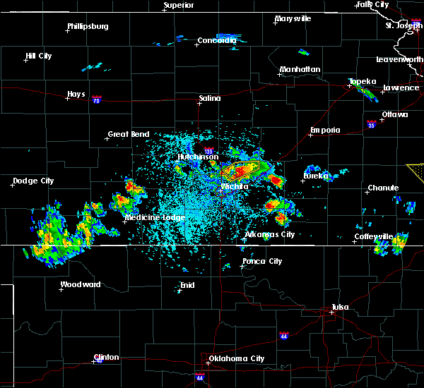 At 324 pm cdt, a severe thunderstorm was located 5 miles west of potwin, or near whitewater, moving east at 15 mph (radar indicated). Hazards include ping pong ball size hail and 60 mph wind gusts. People and animals outdoors will be injured. expect hail damage to roofs, siding, windows, and vehicles. expect wind damage to roofs, siding, and trees. Locations impacted include, whitewater, potwin and elbing. At 324 pm cdt, a severe thunderstorm was located 5 miles west of potwin, or near whitewater, moving east at 15 mph (radar indicated). Hazards include ping pong ball size hail and 60 mph wind gusts. People and animals outdoors will be injured. expect hail damage to roofs, siding, windows, and vehicles. expect wind damage to roofs, siding, and trees. Locations impacted include, whitewater, potwin and elbing.
|
| 5/31/2017 3:07 PM CDT |
 At 306 pm cdt, a severe thunderstorm was located over whitewater, moving east at 10 mph (radar indicated). Hazards include ping pong ball size hail and 60 mph wind gusts. People and animals outdoors will be injured. expect hail damage to roofs, siding, windows, and vehicles. expect wind damage to roofs, siding, and trees. Locations impacted include, whitewater, potwin, elbing and burns. At 306 pm cdt, a severe thunderstorm was located over whitewater, moving east at 10 mph (radar indicated). Hazards include ping pong ball size hail and 60 mph wind gusts. People and animals outdoors will be injured. expect hail damage to roofs, siding, windows, and vehicles. expect wind damage to roofs, siding, and trees. Locations impacted include, whitewater, potwin, elbing and burns.
|
| 5/31/2017 2:55 PM CDT |
 The national weather service in wichita has issued a * severe thunderstorm warning for. northeastern sedgwick county in south central kansas. southeastern harvey county in south central kansas. northwestern butler county in south central kansas. Southeastern marion county in central kansas. The national weather service in wichita has issued a * severe thunderstorm warning for. northeastern sedgwick county in south central kansas. southeastern harvey county in south central kansas. northwestern butler county in south central kansas. Southeastern marion county in central kansas.
|
| 5/19/2017 11:02 AM CDT |
 At 1102 am cdt, severe thunderstorms were located along a line extending from near conway springs to 5 miles west of wellington to near south haven, moving northeast at 40 mph (radar indicated). Hazards include 60 mph wind gusts and nickel size hail. Expect damage to roofs, siding, and trees. Locations impacted include, wichita, derby, arkansas city, winfield, andover, haysville, wellington, mulvane, rose hill, clearwater, douglass, belle plaine, conway springs, oxford, udall, burden, argonia, south haven, atlanta and geuda springs. At 1102 am cdt, severe thunderstorms were located along a line extending from near conway springs to 5 miles west of wellington to near south haven, moving northeast at 40 mph (radar indicated). Hazards include 60 mph wind gusts and nickel size hail. Expect damage to roofs, siding, and trees. Locations impacted include, wichita, derby, arkansas city, winfield, andover, haysville, wellington, mulvane, rose hill, clearwater, douglass, belle plaine, conway springs, oxford, udall, burden, argonia, south haven, atlanta and geuda springs.
|
| 5/19/2017 10:53 AM CDT |
 At 1053 am cdt, severe thunderstorms were located along a line extending from near argonia to 10 miles north of caldwell to near south haven, moving north at 50 mph (radar indicated). Hazards include 60 mph wind gusts and nickel size hail. Expect damage to roofs, siding, and trees. Locations impacted include, wichita, derby, arkansas city, winfield, andover, haysville, wellington, mulvane, rose hill, clearwater, douglass, belle plaine, conway springs, caldwell, oxford, udall, burden, argonia, south haven and dexter. At 1053 am cdt, severe thunderstorms were located along a line extending from near argonia to 10 miles north of caldwell to near south haven, moving north at 50 mph (radar indicated). Hazards include 60 mph wind gusts and nickel size hail. Expect damage to roofs, siding, and trees. Locations impacted include, wichita, derby, arkansas city, winfield, andover, haysville, wellington, mulvane, rose hill, clearwater, douglass, belle plaine, conway springs, caldwell, oxford, udall, burden, argonia, south haven and dexter.
|
| 5/19/2017 10:38 AM CDT |
 At 1038 am cdt, severe thunderstorms were located along a line extending from 8 miles northeast of manchester to near caldwell to near nardin, moving northeast at 50 mph (radar indicated). Hazards include 60 mph wind gusts and nickel size hail. expect damage to roofs, siding, and trees At 1038 am cdt, severe thunderstorms were located along a line extending from 8 miles northeast of manchester to near caldwell to near nardin, moving northeast at 50 mph (radar indicated). Hazards include 60 mph wind gusts and nickel size hail. expect damage to roofs, siding, and trees
|
| 5/18/2017 6:49 PM CDT |
 At 649 pm cdt, severe thunderstorms were located along a line extending from near west wichita to near rose hill, moving north at 50 mph (radar indicated). Hazards include 60 mph wind gusts. Expect damage to roofs, siding, and trees. locations impacted include, wichita, derby, haysville, park city, valley center, bel aire, mulvane, goddard, maize, sedgwick, colwich, downtown wichita, kechi, eastborough, bentley, west wichita, east wichita, eisenhower national airport, northeast wichita and mcconnell air force base. A tornado watch remains in effect until 1100 pm cdt for south central kansas. At 649 pm cdt, severe thunderstorms were located along a line extending from near west wichita to near rose hill, moving north at 50 mph (radar indicated). Hazards include 60 mph wind gusts. Expect damage to roofs, siding, and trees. locations impacted include, wichita, derby, haysville, park city, valley center, bel aire, mulvane, goddard, maize, sedgwick, colwich, downtown wichita, kechi, eastborough, bentley, west wichita, east wichita, eisenhower national airport, northeast wichita and mcconnell air force base. A tornado watch remains in effect until 1100 pm cdt for south central kansas.
|
| 5/18/2017 6:35 PM CDT |
 At 635 pm cdt, severe thunderstorms were located along a line extending from near clearwater to 5 miles southwest of haysville, moving northeast at 50 mph (radar indicated). Hazards include 60 mph wind gusts. expect damage to roofs, siding, and trees At 635 pm cdt, severe thunderstorms were located along a line extending from near clearwater to 5 miles southwest of haysville, moving northeast at 50 mph (radar indicated). Hazards include 60 mph wind gusts. expect damage to roofs, siding, and trees
|
| 5/11/2017 4:05 PM CDT |
 At 405 pm cdt, a severe thunderstorm was located near viola, or 6 miles northwest of conway springs, moving east at 15 mph (radar indicated). Hazards include 60 mph wind gusts and half dollar size hail. Hail damage to vehicles is expected. expect wind damage to roofs, siding, and trees. Locations impacted include, conway springs, viola and lake afton. At 405 pm cdt, a severe thunderstorm was located near viola, or 6 miles northwest of conway springs, moving east at 15 mph (radar indicated). Hazards include 60 mph wind gusts and half dollar size hail. Hail damage to vehicles is expected. expect wind damage to roofs, siding, and trees. Locations impacted include, conway springs, viola and lake afton.
|
| 5/11/2017 3:43 PM CDT |
 At 342 pm cdt, a severe thunderstorm was located over norwich, or 11 miles northwest of conway springs, moving east at 20 mph (radar indicated). Hazards include 60 mph wind gusts and half dollar size hail. Hail damage to vehicles is expected. Expect wind damage to roofs, siding, and trees. At 342 pm cdt, a severe thunderstorm was located over norwich, or 11 miles northwest of conway springs, moving east at 20 mph (radar indicated). Hazards include 60 mph wind gusts and half dollar size hail. Hail damage to vehicles is expected. Expect wind damage to roofs, siding, and trees.
|
| 4/16/2017 2:26 AM CDT |
 At 226 am cdt, a severe thunderstorm was located near clearwater, moving southeast at 30 mph (radar indicated). Hazards include 60 mph wind gusts and penny size hail. Expect damage to roofs, siding, and trees. Locations impacted include, wichita, haysville, goddard, clearwater, garden plain, viola, eisenhower national airport, south wichita and lake afton. At 226 am cdt, a severe thunderstorm was located near clearwater, moving southeast at 30 mph (radar indicated). Hazards include 60 mph wind gusts and penny size hail. Expect damage to roofs, siding, and trees. Locations impacted include, wichita, haysville, goddard, clearwater, garden plain, viola, eisenhower national airport, south wichita and lake afton.
|
| 4/16/2017 2:06 AM CDT |
 At 205 am cdt, a severe thunderstorm was located near garden plain, moving southeast at 30 mph (radar indicated). Hazards include 60 mph wind gusts and penny size hail. expect damage to roofs, siding, and trees At 205 am cdt, a severe thunderstorm was located near garden plain, moving southeast at 30 mph (radar indicated). Hazards include 60 mph wind gusts and penny size hail. expect damage to roofs, siding, and trees
|
| 3/24/2017 5:36 PM CDT |
 At 536 pm cdt, a severe thunderstorm was located over west wichita, or near goddard, moving north at 20 mph (radar indicated). Hazards include quarter size hail. Damage to vehicles is expected. Locations impacted include, wichita, goddard, maize, colwich, andale, west wichita and eisenhower national airport. At 536 pm cdt, a severe thunderstorm was located over west wichita, or near goddard, moving north at 20 mph (radar indicated). Hazards include quarter size hail. Damage to vehicles is expected. Locations impacted include, wichita, goddard, maize, colwich, andale, west wichita and eisenhower national airport.
|
| 3/24/2017 5:21 PM CDT |
 At 521 pm cdt, a severe thunderstorm was located near eisenhower national airport, or near goddard, moving north at 20 mph (radar indicated). Hazards include quarter size hail. Damage to vehicles is expected. Locations impacted include, wichita, goddard, maize, colwich, andale, west wichita, eisenhower national airport and lake afton. At 521 pm cdt, a severe thunderstorm was located near eisenhower national airport, or near goddard, moving north at 20 mph (radar indicated). Hazards include quarter size hail. Damage to vehicles is expected. Locations impacted include, wichita, goddard, maize, colwich, andale, west wichita, eisenhower national airport and lake afton.
|
| 3/24/2017 5:10 PM CDT |
 At 510 pm cdt, a severe thunderstorm was located near clearwater, moving north at 20 mph (radar indicated). Hazards include quarter size hail. damage to vehicles is expected At 510 pm cdt, a severe thunderstorm was located near clearwater, moving north at 20 mph (radar indicated). Hazards include quarter size hail. damage to vehicles is expected
|
| 10/4/2016 8:09 PM CDT |
 At 809 pm cdt, a severe thunderstorm was located over northeast wichita, or near andover, moving northeast at 55 mph (radar indicated). Hazards include 60 mph wind gusts and quarter size hail. Hail damage to vehicles is expected. expect wind damage to roofs, siding, and trees. locations impacted include, wichita, andover, downtown wichita, eastborough, east wichita and mcconnell air force base. A tornado watch remains in effect until 900 pm cdt for south central kansas. At 809 pm cdt, a severe thunderstorm was located over northeast wichita, or near andover, moving northeast at 55 mph (radar indicated). Hazards include 60 mph wind gusts and quarter size hail. Hail damage to vehicles is expected. expect wind damage to roofs, siding, and trees. locations impacted include, wichita, andover, downtown wichita, eastborough, east wichita and mcconnell air force base. A tornado watch remains in effect until 900 pm cdt for south central kansas.
|
| 10/4/2016 8:05 PM CDT | Tree fell on hous in sedgwick county KS, 1 miles ENE of Wichita, KS |
| 10/4/2016 8:03 PM CDT |
 At 803 pm cdt, a severe thunderstorm was located over south wichita, or near haysville, moving northeast at 45 mph (radar indicated). Hazards include 60 mph wind gusts and quarter size hail. Hail damage to vehicles is expected. expect wind damage to roofs, siding, and trees. locations impacted include, wichita, derby, andover, haysville, downtown wichita, eastborough, mcconnell air force base, south wichita, east wichita, santa fe lake and oaklawn. A tornado watch remains in effect until 900 pm cdt for south central kansas. At 803 pm cdt, a severe thunderstorm was located over south wichita, or near haysville, moving northeast at 45 mph (radar indicated). Hazards include 60 mph wind gusts and quarter size hail. Hail damage to vehicles is expected. expect wind damage to roofs, siding, and trees. locations impacted include, wichita, derby, andover, haysville, downtown wichita, eastborough, mcconnell air force base, south wichita, east wichita, santa fe lake and oaklawn. A tornado watch remains in effect until 900 pm cdt for south central kansas.
|
| 10/4/2016 8:01 PM CDT |
 At 801 pm cdt, a severe thunderstorm was located near northeast wichita, or near bel aire, moving northeast at 55 mph (radar indicated). Hazards include 60 mph wind gusts and quarter size hail. Hail damage to vehicles is expected. expect wind damage to roofs, siding, and trees. locations impacted include, wichita, park city, bel aire, towanda, benton, whitewater, kechi, northeast wichita and jabara airport. A tornado watch remains in effect until 900 pm cdt for south central kansas. At 801 pm cdt, a severe thunderstorm was located near northeast wichita, or near bel aire, moving northeast at 55 mph (radar indicated). Hazards include 60 mph wind gusts and quarter size hail. Hail damage to vehicles is expected. expect wind damage to roofs, siding, and trees. locations impacted include, wichita, park city, bel aire, towanda, benton, whitewater, kechi, northeast wichita and jabara airport. A tornado watch remains in effect until 900 pm cdt for south central kansas.
|
| 10/4/2016 7:55 PM CDT |
 At 754 pm cdt, a severe thunderstorm was located near haysville, moving northeast at 45 mph (radar indicated). Hazards include 60 mph wind gusts and quarter size hail. Hail damage to vehicles is expected. Expect wind damage to roofs, siding, and trees. At 754 pm cdt, a severe thunderstorm was located near haysville, moving northeast at 45 mph (radar indicated). Hazards include 60 mph wind gusts and quarter size hail. Hail damage to vehicles is expected. Expect wind damage to roofs, siding, and trees.
|
| 10/4/2016 7:43 PM CDT | Eisenhower national airpor in sedgwick county KS, 5.6 miles ENE of Wichita, KS |
| 10/4/2016 7:42 PM CDT |
 At 742 pm cdt, a severe thunderstorm was located near kechi, or 7 miles northeast of bel aire, moving northeast at 50 mph (radar indicated). Hazards include 60 mph wind gusts and quarter size hail. Hail damage to vehicles is expected. Expect wind damage to roofs, siding, and trees. At 742 pm cdt, a severe thunderstorm was located near kechi, or 7 miles northeast of bel aire, moving northeast at 50 mph (radar indicated). Hazards include 60 mph wind gusts and quarter size hail. Hail damage to vehicles is expected. Expect wind damage to roofs, siding, and trees.
|
| 10/4/2016 7:30 PM CDT | Storm damage reported in sedgwick county KS, 5.4 miles E of Wichita, KS |
| 10/4/2016 7:29 PM CDT | Storm damage reported in sedgwick county KS, 7.6 miles ESE of Wichita, KS |
| 10/4/2016 7:29 PM CDT |
 At 728 pm cdt, a severe thunderstorm was located over maize, moving northeast at 60 mph (radar indicated). Hazards include 70 mph wind gusts and ping pong ball size hail. People and animals outdoors will be injured. expect hail damage to roofs, siding, windows, and vehicles. expect considerable tree damage. wind damage is also likely to mobile homes, roofs, and outbuildings. locations impacted include, wichita, goddard and west wichita. A tornado watch remains in effect until 900 pm cdt for south central kansas. At 728 pm cdt, a severe thunderstorm was located over maize, moving northeast at 60 mph (radar indicated). Hazards include 70 mph wind gusts and ping pong ball size hail. People and animals outdoors will be injured. expect hail damage to roofs, siding, windows, and vehicles. expect considerable tree damage. wind damage is also likely to mobile homes, roofs, and outbuildings. locations impacted include, wichita, goddard and west wichita. A tornado watch remains in effect until 900 pm cdt for south central kansas.
|
| 10/4/2016 7:28 PM CDT | Wind driven half inch diameter hai in sedgwick county KS, 7.9 miles ESE of Wichita, KS |
| 10/4/2016 7:22 PM CDT |
 At 721 pm cdt, a severe thunderstorm was located over goddard, moving northeast at 60 mph (radar indicated). Hazards include ping pong ball size hail and 60 mph wind gusts. People and animals outdoors will be injured. expect hail damage to roofs, siding, windows, and vehicles. expect wind damage to roofs, siding, and trees. locations impacted include, wichita, goddard, clearwater, garden plain, downtown wichita, west wichita, eisenhower national airport and lake afton. A tornado watch remains in effect until 900 pm cdt for south central kansas. At 721 pm cdt, a severe thunderstorm was located over goddard, moving northeast at 60 mph (radar indicated). Hazards include ping pong ball size hail and 60 mph wind gusts. People and animals outdoors will be injured. expect hail damage to roofs, siding, windows, and vehicles. expect wind damage to roofs, siding, and trees. locations impacted include, wichita, goddard, clearwater, garden plain, downtown wichita, west wichita, eisenhower national airport and lake afton. A tornado watch remains in effect until 900 pm cdt for south central kansas.
|
| 10/4/2016 7:16 PM CDT |
 At 715 pm cdt, a severe thunderstorm was located over valley center, moving northeast at 35 mph (radar indicated). Hazards include 70 mph wind gusts and half dollar size hail. Hail damage to vehicles is expected. expect considerable tree damage. wind damage is also likely to mobile homes, roofs, and outbuildings. locations impacted include, wichita, park city, valley center, bel aire, maize, sedgwick, towanda, benton, whitewater, kechi, elbing, northeast wichita and jabara airport. A tornado watch remains in effect until 900 pm cdt for south central and central kansas. At 715 pm cdt, a severe thunderstorm was located over valley center, moving northeast at 35 mph (radar indicated). Hazards include 70 mph wind gusts and half dollar size hail. Hail damage to vehicles is expected. expect considerable tree damage. wind damage is also likely to mobile homes, roofs, and outbuildings. locations impacted include, wichita, park city, valley center, bel aire, maize, sedgwick, towanda, benton, whitewater, kechi, elbing, northeast wichita and jabara airport. A tornado watch remains in effect until 900 pm cdt for south central and central kansas.
|
| 10/4/2016 7:15 PM CDT | Storm damage reported in sedgwick county KS, 8.7 miles S of Wichita, KS |
| 10/4/2016 7:11 PM CDT |
 At 710 pm cdt, a severe thunderstorm was located over valley center, moving northeast at 35 mph (radar indicated). Hazards include 60 mph wind gusts and half dollar size hail. Hail damage to vehicles is expected. Expect wind damage to roofs, siding, and trees. At 710 pm cdt, a severe thunderstorm was located over valley center, moving northeast at 35 mph (radar indicated). Hazards include 60 mph wind gusts and half dollar size hail. Hail damage to vehicles is expected. Expect wind damage to roofs, siding, and trees.
|
| 10/4/2016 7:08 PM CDT |
 At 707 pm cdt, a severe thunderstorm was located near viola, or 8 miles northwest of conway springs, moving northeast at 55 mph (radar indicated). Hazards include 60 mph wind gusts and half dollar size hail. Hail damage to vehicles is expected. Expect wind damage to roofs, siding, and trees. At 707 pm cdt, a severe thunderstorm was located near viola, or 8 miles northwest of conway springs, moving northeast at 55 mph (radar indicated). Hazards include 60 mph wind gusts and half dollar size hail. Hail damage to vehicles is expected. Expect wind damage to roofs, siding, and trees.
|
| 10/4/2016 7:00 PM CDT |
 At 700 pm cdt, a severe thunderstorm was located near maize, moving northeast at 30 mph (trained weather spotters). Hazards include two inch hail and 60 mph wind gusts. People and animals outdoors will be injured. expect hail damage to roofs, siding, windows, and vehicles. expect wind damage to roofs, siding, and trees. locations impacted include, wichita, park city, valley center, maize, colwich, kechi, andale and bentley. A tornado watch remains in effect until 900 pm cdt for south central kansas. At 700 pm cdt, a severe thunderstorm was located near maize, moving northeast at 30 mph (trained weather spotters). Hazards include two inch hail and 60 mph wind gusts. People and animals outdoors will be injured. expect hail damage to roofs, siding, windows, and vehicles. expect wind damage to roofs, siding, and trees. locations impacted include, wichita, park city, valley center, maize, colwich, kechi, andale and bentley. A tornado watch remains in effect until 900 pm cdt for south central kansas.
|
| 10/4/2016 6:55 PM CDT |
 The severe thunderstorm warning for west central sedgwick and southeastern reno counties will expire at 700 pm cdt, the storm which prompted the warning has moved out of the area. therefore, the warning will be allowed to expire. a tornado watch remains in effect until 900 pm cdt for south central kansas. remember, a severe thunderstorm warning still remains in effect for northern sedgwick county until 715 pm. The severe thunderstorm warning for west central sedgwick and southeastern reno counties will expire at 700 pm cdt, the storm which prompted the warning has moved out of the area. therefore, the warning will be allowed to expire. a tornado watch remains in effect until 900 pm cdt for south central kansas. remember, a severe thunderstorm warning still remains in effect for northern sedgwick county until 715 pm.
|
| 10/4/2016 6:36 PM CDT |
 At 635 pm cdt, a severe thunderstorm was located near andale, or near garden plain, moving northeast at 35 mph (trained weather spotters). Hazards include two inch hail and 60 mph wind gusts. People and animals outdoors will be injured. expect hail damage to roofs, siding, windows, and vehicles. Expect wind damage to roofs, siding, and trees. At 635 pm cdt, a severe thunderstorm was located near andale, or near garden plain, moving northeast at 35 mph (trained weather spotters). Hazards include two inch hail and 60 mph wind gusts. People and animals outdoors will be injured. expect hail damage to roofs, siding, windows, and vehicles. Expect wind damage to roofs, siding, and trees.
|
| 10/4/2016 6:28 PM CDT |
 At 627 pm cdt, a severe thunderstorm was located over garden plain, moving northeast at 35 mph (radar indicated). Hazards include ping pong ball size hail and 60 mph wind gusts. People and animals outdoors will be injured. expect hail damage to roofs, siding, windows, and vehicles. expect wind damage to roofs, siding, and trees. locations impacted include, goddard, cheney, garden plain, cheney lake and cheney state park. A tornado watch remains in effect until 900 pm cdt for south central kansas. At 627 pm cdt, a severe thunderstorm was located over garden plain, moving northeast at 35 mph (radar indicated). Hazards include ping pong ball size hail and 60 mph wind gusts. People and animals outdoors will be injured. expect hail damage to roofs, siding, windows, and vehicles. expect wind damage to roofs, siding, and trees. locations impacted include, goddard, cheney, garden plain, cheney lake and cheney state park. A tornado watch remains in effect until 900 pm cdt for south central kansas.
|
| 10/4/2016 6:21 PM CDT |
 At 621 pm cdt, a severe thunderstorm was located near cheney, moving northeast at 35 mph (radar indicated). Hazards include ping pong ball size hail and 60 mph wind gusts. People and animals outdoors will be injured. expect hail damage to roofs, siding, windows, and vehicles. expect wind damage to roofs, siding, and trees. locations impacted include, goddard, cheney, garden plain, cheney lake, mt vernon and cheney state park. A tornado watch remains in effect until 900 pm cdt for south central kansas. At 621 pm cdt, a severe thunderstorm was located near cheney, moving northeast at 35 mph (radar indicated). Hazards include ping pong ball size hail and 60 mph wind gusts. People and animals outdoors will be injured. expect hail damage to roofs, siding, windows, and vehicles. expect wind damage to roofs, siding, and trees. locations impacted include, goddard, cheney, garden plain, cheney lake, mt vernon and cheney state park. A tornado watch remains in effect until 900 pm cdt for south central kansas.
|
| 10/4/2016 6:08 PM CDT |
 At 608 pm cdt, a severe thunderstorm was located 6 miles west of cheney, moving northeast at 35 mph (radar indicated). Hazards include 60 mph wind gusts and quarter size hail. Hail damage to vehicles is expected. Expect wind damage to roofs, siding, and trees. At 608 pm cdt, a severe thunderstorm was located 6 miles west of cheney, moving northeast at 35 mph (radar indicated). Hazards include 60 mph wind gusts and quarter size hail. Hail damage to vehicles is expected. Expect wind damage to roofs, siding, and trees.
|
| 9/24/2016 5:56 PM CDT |
 At 555 pm cdt, a severe thunderstorm was located near sedgwick, moving northeast at 35 mph (radar indicated). Hazards include 60 mph wind gusts. Expect damage to roofs. siding. and trees. Locations impacted include, newton, park city, valley center, maize, halstead, north newton, sedgwick, colwich, burrton, mount hope, bentley and newton airport. At 555 pm cdt, a severe thunderstorm was located near sedgwick, moving northeast at 35 mph (radar indicated). Hazards include 60 mph wind gusts. Expect damage to roofs. siding. and trees. Locations impacted include, newton, park city, valley center, maize, halstead, north newton, sedgwick, colwich, burrton, mount hope, bentley and newton airport.
|
| 9/24/2016 5:43 PM CDT |
 At 542 pm cdt, a severe thunderstorm was located over colwich, moving northeast at 30 mph (radar indicated). Hazards include 60 mph wind gusts and penny size hail. Expect damage to roofs. siding. and trees. Locations impacted include, wichita, newton, park city, valley center, goddard, maize, halstead, north newton, sedgwick, colwich, burrton, garden plain, mount hope, andale, bentley, west wichita and newton airport. At 542 pm cdt, a severe thunderstorm was located over colwich, moving northeast at 30 mph (radar indicated). Hazards include 60 mph wind gusts and penny size hail. Expect damage to roofs. siding. and trees. Locations impacted include, wichita, newton, park city, valley center, goddard, maize, halstead, north newton, sedgwick, colwich, burrton, garden plain, mount hope, andale, bentley, west wichita and newton airport.
|
| 9/24/2016 5:30 PM CDT |
 At 530 pm cdt, a severe thunderstorm was located near andale, or near colwich, moving northeast at 35 mph (radar indicated). Hazards include 60 mph wind gusts and quarter size hail. Hail damage to vehicles is expected. Expect wind damage to roofs, siding, and trees. At 530 pm cdt, a severe thunderstorm was located near andale, or near colwich, moving northeast at 35 mph (radar indicated). Hazards include 60 mph wind gusts and quarter size hail. Hail damage to vehicles is expected. Expect wind damage to roofs, siding, and trees.
|
| 9/9/2016 8:22 PM CDT |
 The severe thunderstorm warning for southern sedgwick county will expire at 830 pm cdt, the storm which prompted the warning has weakened below severe limits, however torrential rain is still falling with this thunderstorm and a flash flood warning remains in effect. The severe thunderstorm warning for southern sedgwick county will expire at 830 pm cdt, the storm which prompted the warning has weakened below severe limits, however torrential rain is still falling with this thunderstorm and a flash flood warning remains in effect.
|
| 9/9/2016 7:32 PM CDT |
 At 732 pm cdt, a severe thunderstorm was located near clearwater, moving northeast at 20 mph (radar indicated). Hazards include 60 mph wind gusts and penny size hail. Expect damage to roofs. siding. And trees. At 732 pm cdt, a severe thunderstorm was located near clearwater, moving northeast at 20 mph (radar indicated). Hazards include 60 mph wind gusts and penny size hail. Expect damage to roofs. siding. And trees.
|
| 9/8/2016 8:44 PM CDT |
 At 844 pm cdt, a severe thunderstorm was located near rose hill, moving east at 15 mph (law enforcement has reported 60 mph winds and quarter sized hail with this storm). Hazards include 60 mph wind gusts and quarter size hail. Hail damage to vehicles is expected. expect wind damage to roofs, siding, and trees. Locations impacted include, wichita, derby, andover, augusta, park city, bel aire, mulvane, rose hill, douglass, belle plaine, towanda, benton, udall, kechi, eastborough, mcconnell air force base, south wichita, northeast wichita, east wichita and rock. At 844 pm cdt, a severe thunderstorm was located near rose hill, moving east at 15 mph (law enforcement has reported 60 mph winds and quarter sized hail with this storm). Hazards include 60 mph wind gusts and quarter size hail. Hail damage to vehicles is expected. expect wind damage to roofs, siding, and trees. Locations impacted include, wichita, derby, andover, augusta, park city, bel aire, mulvane, rose hill, douglass, belle plaine, towanda, benton, udall, kechi, eastborough, mcconnell air force base, south wichita, northeast wichita, east wichita and rock.
|
| 9/8/2016 8:31 PM CDT |
 At 830 pm cdt, a severe thunderstorm was located over derby, moving east at 15 mph (law enforcement has reported 60 mph winds in southwest wichita and the public has reported quarter sized hail in haysville). Hazards include 60 mph wind gusts and quarter size hail. Hail damage to vehicles is expected. expect wind damage to roofs, siding, and trees. Locations impacted include, wichita, derby, andover, haysville, augusta, park city, valley center, bel aire, mulvane, rose hill, maize, clearwater, douglass, belle plaine, towanda, benton, udall, downtown wichita, kechi and eastborough. At 830 pm cdt, a severe thunderstorm was located over derby, moving east at 15 mph (law enforcement has reported 60 mph winds in southwest wichita and the public has reported quarter sized hail in haysville). Hazards include 60 mph wind gusts and quarter size hail. Hail damage to vehicles is expected. expect wind damage to roofs, siding, and trees. Locations impacted include, wichita, derby, andover, haysville, augusta, park city, valley center, bel aire, mulvane, rose hill, maize, clearwater, douglass, belle plaine, towanda, benton, udall, downtown wichita, kechi and eastborough.
|
| 9/8/2016 8:17 PM CDT |
 At 816 pm cdt, a severe thunderstorm was located over haysville, moving east at 15 mph (public has reported quarter sized hail in haysville). Hazards include 60 mph wind gusts and quarter size hail. Hail damage to vehicles is expected. expect wind damage to roofs, siding, and trees. Locations impacted include, wichita, derby, andover, haysville, augusta, park city, valley center, bel aire, mulvane, rose hill, maize, clearwater, douglass, belle plaine, towanda, benton, udall, downtown wichita, kechi and eastborough. At 816 pm cdt, a severe thunderstorm was located over haysville, moving east at 15 mph (public has reported quarter sized hail in haysville). Hazards include 60 mph wind gusts and quarter size hail. Hail damage to vehicles is expected. expect wind damage to roofs, siding, and trees. Locations impacted include, wichita, derby, andover, haysville, augusta, park city, valley center, bel aire, mulvane, rose hill, maize, clearwater, douglass, belle plaine, towanda, benton, udall, downtown wichita, kechi and eastborough.
|
| 9/8/2016 8:10 PM CDT |
 At 810 pm cdt, a severe thunderstorm was located over haysville, moving east at 15 mph (radar indicated). Hazards include 60 mph wind gusts and quarter size hail. Hail damage to vehicles is expected. Expect wind damage to roofs, siding, and trees. At 810 pm cdt, a severe thunderstorm was located over haysville, moving east at 15 mph (radar indicated). Hazards include 60 mph wind gusts and quarter size hail. Hail damage to vehicles is expected. Expect wind damage to roofs, siding, and trees.
|
| 9/8/2016 7:44 PM CDT |
 At 726 pm cdt, a severe thunderstorm was located near clearwater, and is nearly stationary (radar indicated). Hazards include 60 mph wind gusts and quarter size hail. Hail damage to vehicles is expected. expect wind damage to roofs, siding, and trees. Locations impacted include, wichita, derby, haysville, park city, valley center, bel aire, mulvane, goddard, maize, clearwater, cheney, colwich, garden plain, downtown wichita, kechi, andale, eastborough, viola, south wichita and northeast wichita. At 726 pm cdt, a severe thunderstorm was located near clearwater, and is nearly stationary (radar indicated). Hazards include 60 mph wind gusts and quarter size hail. Hail damage to vehicles is expected. expect wind damage to roofs, siding, and trees. Locations impacted include, wichita, derby, haysville, park city, valley center, bel aire, mulvane, goddard, maize, clearwater, cheney, colwich, garden plain, downtown wichita, kechi, andale, eastborough, viola, south wichita and northeast wichita.
|
| 9/8/2016 7:27 PM CDT |
 At 726 pm cdt, a severe thunderstorm was located near clearwater, and is nearly stationary (radar indicated). Hazards include 60 mph wind gusts and quarter size hail. Hail damage to vehicles is expected. expect wind damage to roofs, siding, and trees. Locations impacted include, wichita, derby, haysville, park city, valley center, bel aire, mulvane, goddard, maize, clearwater, cheney, colwich, garden plain, downtown wichita, kechi, andale, eastborough, viola, south wichita and northeast wichita. At 726 pm cdt, a severe thunderstorm was located near clearwater, and is nearly stationary (radar indicated). Hazards include 60 mph wind gusts and quarter size hail. Hail damage to vehicles is expected. expect wind damage to roofs, siding, and trees. Locations impacted include, wichita, derby, haysville, park city, valley center, bel aire, mulvane, goddard, maize, clearwater, cheney, colwich, garden plain, downtown wichita, kechi, andale, eastborough, viola, south wichita and northeast wichita.
|
| 9/8/2016 7:12 PM CDT |
 At 711 pm cdt, a severe thunderstorm was located near clearwater, and is nearly stationary (radar indicated). Hazards include 60 mph wind gusts and quarter size hail. Hail damage to vehicles is expected. Expect wind damage to roofs, siding, and trees. At 711 pm cdt, a severe thunderstorm was located near clearwater, and is nearly stationary (radar indicated). Hazards include 60 mph wind gusts and quarter size hail. Hail damage to vehicles is expected. Expect wind damage to roofs, siding, and trees.
|
| 8/24/2016 5:14 PM CDT | Former law enforcement officer estimates winds of 60 to 70 mph from a microburst at meridian and macarthu in sedgwick county KS, 6.2 miles NNW of Wichita, KS |
| 8/24/2016 5:14 PM CDT | Former law enforcement officer estimates winds of 60 to 70 mph from a microburst at meridian and macarthu in sedgwick county KS, 6.2 miles NNW of Wichita, KS |
| 7/28/2016 8:43 PM CDT | Storm damage reported in sedgwick county KS, 4.8 miles WSW of Wichita, KS |
| 7/28/2016 8:32 PM CDT | Half a bradford pear tree broken of in sedgwick county KS, 6.9 miles ESE of Wichita, KS |
| 7/28/2016 8:28 PM CDT | Near 119th and 21s in sedgwick county KS, 7.9 miles ESE of Wichita, KS |
| 7/28/2016 8:28 PM CDT | Large tree limbs down near 21st and tyler. report via twitte in sedgwick county KS, 6.5 miles E of Wichita, KS |
| 7/28/2016 8:28 PM CDT |
 At 827 pm cdt, severe thunderstorms were located along a line extending from 5 miles south of whitewater to near haysville to 11 miles south of kingman, moving southeast at 50 mph. these are very dangerous storms (radar indicated). Hazards include 80 mph wind gusts and golf ball size hail. Flying debris will be dangerous to those caught without shelter. mobile homes will be heavily damaged. expect considerable damage to roofs, windows, and vehicles. extensive tree damage and power outages are likely. Locations impacted include, wichita, derby, el dorado, andover, haysville, augusta, park city, valley center, bel aire, mulvane, goddard, rose hill, maize, kingman, clearwater, cheney, douglass, sedgwick, belle plaine and harper. At 827 pm cdt, severe thunderstorms were located along a line extending from 5 miles south of whitewater to near haysville to 11 miles south of kingman, moving southeast at 50 mph. these are very dangerous storms (radar indicated). Hazards include 80 mph wind gusts and golf ball size hail. Flying debris will be dangerous to those caught without shelter. mobile homes will be heavily damaged. expect considerable damage to roofs, windows, and vehicles. extensive tree damage and power outages are likely. Locations impacted include, wichita, derby, el dorado, andover, haysville, augusta, park city, valley center, bel aire, mulvane, goddard, rose hill, maize, kingman, clearwater, cheney, douglass, sedgwick, belle plaine and harper.
|
| 7/28/2016 8:24 PM CDT | 75-80 mph winds between tyler and maize road on 21st stree in sedgwick county KS, 6.9 miles ESE of Wichita, KS |
| 7/28/2016 8:23 PM CDT | Storm damage reported in sedgwick county KS, 5.6 miles ENE of Wichita, KS |
| 7/28/2016 8:15 PM CDT |
 At 815 pm cdt, severe thunderstorms were located along a line extending from near walton to west wichita to 10 miles southwest of kingman, moving southeast at 45 mph. these are very dangerous storms (radar indicated). Hazards include 80 mph wind gusts and two inch hail. Flying debris will be dangerous to those caught without shelter. mobile homes will be heavily damaged. expect considerable damage to roofs, windows, and vehicles. Extensive tree damage and power outages are likely. At 815 pm cdt, severe thunderstorms were located along a line extending from near walton to west wichita to 10 miles southwest of kingman, moving southeast at 45 mph. these are very dangerous storms (radar indicated). Hazards include 80 mph wind gusts and two inch hail. Flying debris will be dangerous to those caught without shelter. mobile homes will be heavily damaged. expect considerable damage to roofs, windows, and vehicles. Extensive tree damage and power outages are likely.
|
| 7/28/2016 8:00 PM CDT |
 At 800 pm cdt, severe thunderstorms were located along a line extending from near goessel to near mount hope to 7 miles west of kingman, moving southeast at 45 mph. these are very dangerous storms (radar indicated). Hazards include 80 mph wind gusts and two inch hail. Flying debris will be dangerous to those caught without shelter. mobile homes will be heavily damaged. expect considerable damage to roofs, windows, and vehicles. extensive tree damage and power outages are likely. Locations impacted include, wichita, newton, park city, valley center, bel aire, goddard, hesston, maize, kingman, cheney, halstead, north newton, moundridge, sedgwick, colwich, haven, burrton, garden plain, mount hope and whitewater. At 800 pm cdt, severe thunderstorms were located along a line extending from near goessel to near mount hope to 7 miles west of kingman, moving southeast at 45 mph. these are very dangerous storms (radar indicated). Hazards include 80 mph wind gusts and two inch hail. Flying debris will be dangerous to those caught without shelter. mobile homes will be heavily damaged. expect considerable damage to roofs, windows, and vehicles. extensive tree damage and power outages are likely. Locations impacted include, wichita, newton, park city, valley center, bel aire, goddard, hesston, maize, kingman, cheney, halstead, north newton, moundridge, sedgwick, colwich, haven, burrton, garden plain, mount hope and whitewater.
|
| 7/28/2016 7:50 PM CDT |
 At 749 pm cdt, severe thunderstorms were located along a line extending from near goessel to near mount hope to 9 miles northwest of kingman, moving southeast at 45 mph. these are very dangerous storms (radar indicated). Hazards include 80 mph wind gusts and golf ball size hail. Flying debris will be dangerous to those caught without shelter. mobile homes will be heavily damaged. expect considerable damage to roofs, windows, and vehicles. Extensive tree damage and power outages are likely. At 749 pm cdt, severe thunderstorms were located along a line extending from near goessel to near mount hope to 9 miles northwest of kingman, moving southeast at 45 mph. these are very dangerous storms (radar indicated). Hazards include 80 mph wind gusts and golf ball size hail. Flying debris will be dangerous to those caught without shelter. mobile homes will be heavily damaged. expect considerable damage to roofs, windows, and vehicles. Extensive tree damage and power outages are likely.
|
| 7/14/2016 9:22 AM CDT |
 The severe thunderstorm warning for butler, northwestern cowley and eastern sedgwick counties will expire at 930 am cdt, the storms which prompted the warning have weakened below severe limits, and no longer pose an immediate threat to life or property. therefore the warning will be allowed to expire. however gusty winds to 40 mph are still possible with these thunderstorms. The severe thunderstorm warning for butler, northwestern cowley and eastern sedgwick counties will expire at 930 am cdt, the storms which prompted the warning have weakened below severe limits, and no longer pose an immediate threat to life or property. therefore the warning will be allowed to expire. however gusty winds to 40 mph are still possible with these thunderstorms.
|
| 7/14/2016 9:11 AM CDT |
 At 910 am cdt, severe thunderstorms were located along a line extending from 7 miles northeast of el dorado to 5 miles east of udall, moving east at 30 mph (radar indicated). Hazards include 60 mph wind gusts and nickel size hail. Expect damage to roofs. siding. and trees. Locations impacted include, wichita, derby, el dorado, andover, augusta, bel aire, rose hill, douglass, towanda, benton, whitewater, leon, eastborough, burden, potwin, elbing, atlanta, northeast wichita, east wichita and mcconnell air force base. At 910 am cdt, severe thunderstorms were located along a line extending from 7 miles northeast of el dorado to 5 miles east of udall, moving east at 30 mph (radar indicated). Hazards include 60 mph wind gusts and nickel size hail. Expect damage to roofs. siding. and trees. Locations impacted include, wichita, derby, el dorado, andover, augusta, bel aire, rose hill, douglass, towanda, benton, whitewater, leon, eastborough, burden, potwin, elbing, atlanta, northeast wichita, east wichita and mcconnell air force base.
|
| 7/14/2016 8:55 AM CDT |
 At 853 am cdt, a severe thunderstorm was located over northeast wichita, or near bel aire, moving east at 20 mph (trained weather spotters). Hazards include 70 mph wind gusts and nickel size hail. Expect considerable tree damage. damage is likely to mobile homes, roofs, and outbuildings. Locations impacted include, wichita, derby, el dorado, andover, haysville, augusta, bel aire, mulvane, rose hill, douglass, belle plaine, towanda, benton, udall, whitewater, leon, kechi, eastborough, burden and potwin. At 853 am cdt, a severe thunderstorm was located over northeast wichita, or near bel aire, moving east at 20 mph (trained weather spotters). Hazards include 70 mph wind gusts and nickel size hail. Expect considerable tree damage. damage is likely to mobile homes, roofs, and outbuildings. Locations impacted include, wichita, derby, el dorado, andover, haysville, augusta, bel aire, mulvane, rose hill, douglass, belle plaine, towanda, benton, udall, whitewater, leon, kechi, eastborough, burden and potwin.
|
| 7/14/2016 8:46 AM CDT | Numerous poles down reported by emergency management in sedgwick county KS, 6.4 miles E of Wichita, KS |
| 7/14/2016 8:44 AM CDT | Poles down near illinois and zoo blv in sedgwick county KS, 6.4 miles E of Wichita, KS |
| 7/14/2016 8:41 AM CDT | Estimated between 60 and 70 mp in sedgwick county KS, 6.5 miles SW of Wichita, KS |
| 7/14/2016 8:41 AM CDT |
 At 840 am cdt, a severe thunderstorm was located over valley center, moving east at 25 mph. this is a very dangerous storm (trained weather spotters). Hazards include 80 mph wind gusts and nickel size hail. Flying debris will be dangerous to those caught without shelter. mobile homes will be heavily damaged. expect considerable damage to roofs, windows, and vehicles. extensive tree damage and power outages are likely. Locations impacted include, wichita, derby, andover, haysville, park city, valley center, bel aire, mulvane, rose hill, maize, sedgwick, whitewater, downtown wichita, kechi, eastborough, west wichita, mcconnell air force base, south wichita, northeast wichita and eisenhower national airport. At 840 am cdt, a severe thunderstorm was located over valley center, moving east at 25 mph. this is a very dangerous storm (trained weather spotters). Hazards include 80 mph wind gusts and nickel size hail. Flying debris will be dangerous to those caught without shelter. mobile homes will be heavily damaged. expect considerable damage to roofs, windows, and vehicles. extensive tree damage and power outages are likely. Locations impacted include, wichita, derby, andover, haysville, park city, valley center, bel aire, mulvane, rose hill, maize, sedgwick, whitewater, downtown wichita, kechi, eastborough, west wichita, mcconnell air force base, south wichita, northeast wichita and eisenhower national airport.
|
| 7/14/2016 8:39 AM CDT | Storm damage reported in sedgwick county KS, 8.1 miles WSW of Wichita, KS |
| 7/14/2016 8:36 AM CDT | Storm damage reported in sedgwick county KS, 4.8 miles E of Wichita, KS |
| 7/14/2016 8:35 AM CDT |
 At 834 am cdt, a severe thunderstorm was located over park city, moving east at 20 mph (trained weather spotters). Hazards include 70 mph wind gusts and nickel size hail. Expect considerable tree damage. Damage is likely to mobile homes, roofs, and outbuildings. At 834 am cdt, a severe thunderstorm was located over park city, moving east at 20 mph (trained weather spotters). Hazards include 70 mph wind gusts and nickel size hail. Expect considerable tree damage. Damage is likely to mobile homes, roofs, and outbuildings.
|
| 7/14/2016 8:22 AM CDT | Three inch tree limb dow in sedgwick county KS, 6.9 miles ESE of Wichita, KS |
| 7/14/2016 8:22 AM CDT |
 At 821 am cdt, a severe thunderstorm was located near colwich, moving east at 25 mph. this is a very dangerous storm (trained weather spotters). Hazards include 80 mph wind gusts and nickel size hail. Flying debris will be dangerous to those caught without shelter. mobile homes will be heavily damaged. expect considerable damage to roofs, windows, and vehicles. extensive tree damage and power outages are likely. Locations impacted include, wichita, derby, andover, haysville, park city, valley center, bel aire, mulvane, goddard, rose hill, maize, halstead, sedgwick, colwich, whitewater, downtown wichita, kechi, eastborough, bentley and south wichita. At 821 am cdt, a severe thunderstorm was located near colwich, moving east at 25 mph. this is a very dangerous storm (trained weather spotters). Hazards include 80 mph wind gusts and nickel size hail. Flying debris will be dangerous to those caught without shelter. mobile homes will be heavily damaged. expect considerable damage to roofs, windows, and vehicles. extensive tree damage and power outages are likely. Locations impacted include, wichita, derby, andover, haysville, park city, valley center, bel aire, mulvane, goddard, rose hill, maize, halstead, sedgwick, colwich, whitewater, downtown wichita, kechi, eastborough, bentley and south wichita.
|
| 7/14/2016 8:18 AM CDT |
 At 817 am cdt, a severe thunderstorm was located near colwich, moving east at 25 mph. this is a very dangerous storm (trained weather spotters). Hazards include 80 mph wind gusts and nickel size hail. trained spotters have reported 70mph winds in far western wichita. Flying debris will be dangerous to those caught without shelter. mobile homes will be heavily damaged. expect considerable damage to roofs, windows, and vehicles. extensive tree damage and power outages are likely. Locations impacted include, wichita, derby, andover, haysville, park city, valley center, bel aire, mulvane, goddard, rose hill, maize, halstead, sedgwick, colwich, whitewater, downtown wichita, kechi, eastborough, bentley and south wichita. At 817 am cdt, a severe thunderstorm was located near colwich, moving east at 25 mph. this is a very dangerous storm (trained weather spotters). Hazards include 80 mph wind gusts and nickel size hail. trained spotters have reported 70mph winds in far western wichita. Flying debris will be dangerous to those caught without shelter. mobile homes will be heavily damaged. expect considerable damage to roofs, windows, and vehicles. extensive tree damage and power outages are likely. Locations impacted include, wichita, derby, andover, haysville, park city, valley center, bel aire, mulvane, goddard, rose hill, maize, halstead, sedgwick, colwich, whitewater, downtown wichita, kechi, eastborough, bentley and south wichita.
|
| 7/14/2016 8:17 AM CDT | Storm damage reported in sedgwick county KS, 5.6 miles ENE of Wichita, KS |
| 7/14/2016 8:15 AM CDT | Storm damage reported in sedgwick county KS, 8.7 miles S of Wichita, KS |
| 7/14/2016 8:14 AM CDT | Storm damage reported in sedgwick county KS, 7.1 miles E of Wichita, KS |
| 7/14/2016 7:57 AM CDT |
 At 756 am cdt, a severe thunderstorm was located over mount hope, moving east at 25 mph (radar indicated). Hazards include 70 mph wind gusts and nickel size hail. Expect considerable tree damage. Damage is likely to mobile homes, roofs, and outbuildings. At 756 am cdt, a severe thunderstorm was located over mount hope, moving east at 25 mph (radar indicated). Hazards include 70 mph wind gusts and nickel size hail. Expect considerable tree damage. Damage is likely to mobile homes, roofs, and outbuildings.
|
| 7/12/2016 4:19 AM CDT |
 At 419 am cdt, a severe thunderstorm was located over elbing, or 7 miles northeast of whitewater, moving southeast at 35 mph (radar indicated). Hazards include 60 mph wind gusts. Expect damage to roofs. siding. And trees. At 419 am cdt, a severe thunderstorm was located over elbing, or 7 miles northeast of whitewater, moving southeast at 35 mph (radar indicated). Hazards include 60 mph wind gusts. Expect damage to roofs. siding. And trees.
|
| 7/6/2016 2:57 AM CDT |
 The severe thunderstorm warning for southwestern butler, northwestern cowley, southeastern sedgwick and northeastern sumner counties will expire at 300 am cdt, the storms which prompted the warning have weakened below severe limits, and no longer pose an immediate threat to life or property. therefore the warning will be allowed to expire. however gusty winds to 45 mph and heavy rain are still likely with these thunderstorms. a severe thunderstorm watch remains in effect until 400 am cdt for south central kansas. a severe thunderstorm watch also remains in effect until 900 am cdt for south central kansas. The severe thunderstorm warning for southwestern butler, northwestern cowley, southeastern sedgwick and northeastern sumner counties will expire at 300 am cdt, the storms which prompted the warning have weakened below severe limits, and no longer pose an immediate threat to life or property. therefore the warning will be allowed to expire. however gusty winds to 45 mph and heavy rain are still likely with these thunderstorms. a severe thunderstorm watch remains in effect until 400 am cdt for south central kansas. a severe thunderstorm watch also remains in effect until 900 am cdt for south central kansas.
|
| 7/6/2016 2:56 AM CDT |
 The severe thunderstorm warning for northern butler, chase, northeastern sedgwick, eastern harvey and marion counties will expire at 300 am cdt, the storms which prompted the warning have weakened below severe limits, and no longer pose an immediate threat to life or property. therefore the warning will be allowed to expire. however heavy rain is still possible with these thunderstorms. a severe thunderstorm watch remains in effect until 400 am cdt for south central and central kansas. a severe thunderstorm watch also remains in effect until 900 am cdt for south central, central and east central kansas. The severe thunderstorm warning for northern butler, chase, northeastern sedgwick, eastern harvey and marion counties will expire at 300 am cdt, the storms which prompted the warning have weakened below severe limits, and no longer pose an immediate threat to life or property. therefore the warning will be allowed to expire. however heavy rain is still possible with these thunderstorms. a severe thunderstorm watch remains in effect until 400 am cdt for south central and central kansas. a severe thunderstorm watch also remains in effect until 900 am cdt for south central, central and east central kansas.
|
| 7/6/2016 2:52 AM CDT |
 At 251 am cdt, severe thunderstorms were located along a line extending from augusta to near belle plaine, moving east at 40 mph (radar indicated). Hazards include 60 mph wind gusts and nickel size hail. Expect damage to roofs. siding. and trees. Locations impacted include, wichita, derby, andover, haysville, mulvane, rose hill, douglass, belle plaine, udall, eastborough, mcconnell air force base, south wichita, east wichita, rock, riverdale, oaklawn and augusta municipal airport. At 251 am cdt, severe thunderstorms were located along a line extending from augusta to near belle plaine, moving east at 40 mph (radar indicated). Hazards include 60 mph wind gusts and nickel size hail. Expect damage to roofs. siding. and trees. Locations impacted include, wichita, derby, andover, haysville, mulvane, rose hill, douglass, belle plaine, udall, eastborough, mcconnell air force base, south wichita, east wichita, rock, riverdale, oaklawn and augusta municipal airport.
|
| 7/6/2016 2:32 AM CDT |
 At 231 am cdt, severe thunderstorms were located along a line extending from near marion to near whitewater to eastborough, moving east at 55 mph (radar indicated). Hazards include 70 mph wind gusts and nickel size hail. Expect considerable tree damage. damage is likely to mobile homes, roofs, and outbuildings. Locations impacted include, wichita, newton, el dorado, andover, augusta, park city, valley center, bel aire, maize, hillsboro, marion, north newton, sedgwick, towanda, colwich, peabody, cottonwood falls, benton, whitewater and leon. At 231 am cdt, severe thunderstorms were located along a line extending from near marion to near whitewater to eastborough, moving east at 55 mph (radar indicated). Hazards include 70 mph wind gusts and nickel size hail. Expect considerable tree damage. damage is likely to mobile homes, roofs, and outbuildings. Locations impacted include, wichita, newton, el dorado, andover, augusta, park city, valley center, bel aire, maize, hillsboro, marion, north newton, sedgwick, towanda, colwich, peabody, cottonwood falls, benton, whitewater and leon.
|
| 7/6/2016 2:29 AM CDT |
 At 229 am cdt, severe thunderstorms were located along a line extending from near downtown wichita to near norwich, moving east at 45 mph (radar indicated). Hazards include 60 mph wind gusts and quarter size hail. Hail damage to vehicles is expected. Expect wind damage to roofs, siding, and trees. At 229 am cdt, severe thunderstorms were located along a line extending from near downtown wichita to near norwich, moving east at 45 mph (radar indicated). Hazards include 60 mph wind gusts and quarter size hail. Hail damage to vehicles is expected. Expect wind damage to roofs, siding, and trees.
|
| 7/6/2016 2:04 AM CDT |
 At 204 am cdt, severe thunderstorms were located along a line extending from 5 miles northwest of tampa to near walton to near colwich, moving east at 50 mph (radar indicated). Hazards include 70 mph wind gusts and nickel size hail. Expect considerable tree damage. Damage is likely to mobile homes, roofs, and outbuildings. At 204 am cdt, severe thunderstorms were located along a line extending from 5 miles northwest of tampa to near walton to near colwich, moving east at 50 mph (radar indicated). Hazards include 70 mph wind gusts and nickel size hail. Expect considerable tree damage. Damage is likely to mobile homes, roofs, and outbuildings.
|
| 7/2/2016 10:35 PM CDT |
 The severe thunderstorm warning for sedgwick and harvey counties will expire at 1045 pm cdt, the storms which prompted the warning have weakened below severe limits, and no longer pose an immediate threat to life or property. therefore the warning will be allowed to expire. however gusty winds and heavy rain are still possible with these thunderstorms. a severe thunderstorm watch remains in effect until 1100 pm cdt for south central and central kansas. The severe thunderstorm warning for sedgwick and harvey counties will expire at 1045 pm cdt, the storms which prompted the warning have weakened below severe limits, and no longer pose an immediate threat to life or property. therefore the warning will be allowed to expire. however gusty winds and heavy rain are still possible with these thunderstorms. a severe thunderstorm watch remains in effect until 1100 pm cdt for south central and central kansas.
|
| 7/2/2016 10:09 PM CDT |
 At 1008 pm cdt, severe thunderstorms were located along a line extending from near hesston to sedgwick to near andale, moving southeast at 40 mph (radar indicated). Hazards include 60 mph wind gusts. Expect damage to roofs. siding. and trees. Locations impacted include, wichita, derby, newton, andover, haysville, park city, valley center, bel aire, mulvane, goddard, rose hill, hesston, maize, halstead, north newton, sedgwick, colwich, burrton, garden plain and mount hope. At 1008 pm cdt, severe thunderstorms were located along a line extending from near hesston to sedgwick to near andale, moving southeast at 40 mph (radar indicated). Hazards include 60 mph wind gusts. Expect damage to roofs. siding. and trees. Locations impacted include, wichita, derby, newton, andover, haysville, park city, valley center, bel aire, mulvane, goddard, rose hill, hesston, maize, halstead, north newton, sedgwick, colwich, burrton, garden plain and mount hope.
|
| 7/2/2016 9:40 PM CDT |
 At 939 pm cdt, severe thunderstorms were located along a line extending from near galva, to near burrton, to 8 miles north of cheney, moving east to southeast at 45 mph (radar indicated). Hazards include 60 mph wind gusts and penny size hail. Expect damage to roofs. siding. And trees. At 939 pm cdt, severe thunderstorms were located along a line extending from near galva, to near burrton, to 8 miles north of cheney, moving east to southeast at 45 mph (radar indicated). Hazards include 60 mph wind gusts and penny size hail. Expect damage to roofs. siding. And trees.
|
| 7/2/2016 8:53 PM CDT |
 At 852 pm cdt, a severe thunderstorm was located near rose hill, moving east at 20 mph (radar indicated). Hazards include 60 mph wind gusts and penny size hail. Expect damage to roofs. siding. and trees. Locations impacted include, derby, andover, mulvane, rose hill, douglass and mcconnell air force base. At 852 pm cdt, a severe thunderstorm was located near rose hill, moving east at 20 mph (radar indicated). Hazards include 60 mph wind gusts and penny size hail. Expect damage to roofs. siding. and trees. Locations impacted include, derby, andover, mulvane, rose hill, douglass and mcconnell air force base.
|
| 7/2/2016 8:41 PM CDT | Storm damage reported in sedgwick county KS, 6 miles NW of Wichita, KS |
| 7/2/2016 8:39 PM CDT |
 At 838 pm cdt, a severe thunderstorm was located over rose hill, moving east at 25 mph (radar indicated). Hazards include 60 mph wind gusts and penny size hail. Expect damage to roofs. siding. And trees. At 838 pm cdt, a severe thunderstorm was located over rose hill, moving east at 25 mph (radar indicated). Hazards include 60 mph wind gusts and penny size hail. Expect damage to roofs. siding. And trees.
|
| 7/2/2016 8:36 PM CDT | Storm damage reported in sedgwick county KS, 6 miles NW of Wichita, KS |
| 7/2/2016 8:29 PM CDT | Storm damage reported in sedgwick county KS, 6 miles NW of Wichita, KS |
| 7/2/2016 7:03 PM CDT |
 At 702 pm cdt, a severe thunderstorm was located near rose hill, moving east at 25 mph (radar indicated). Hazards include 60 mph wind gusts and nickel size hail. Expect damage to roofs. siding. And trees. At 702 pm cdt, a severe thunderstorm was located near rose hill, moving east at 25 mph (radar indicated). Hazards include 60 mph wind gusts and nickel size hail. Expect damage to roofs. siding. And trees.
|
| 7/2/2016 5:06 PM CDT |
 At 506 pm cdt, a severe thunderstorm was located over northeast wichita, or over bel aire, moving east at 25 mph (radar indicated). Hazards include ping pong ball size hail and 60 mph wind gusts. People and animals outdoors will be injured. expect hail damage to roofs, siding, windows, and vehicles. expect wind damage to roofs, siding, and trees. Locations impacted include, wichita, el dorado, andover, park city, valley center, bel aire, goddard, maize, sedgwick, towanda, colwich, benton, garden plain, mount hope, whitewater, downtown wichita, kechi, andale, eastborough and bentley. At 506 pm cdt, a severe thunderstorm was located over northeast wichita, or over bel aire, moving east at 25 mph (radar indicated). Hazards include ping pong ball size hail and 60 mph wind gusts. People and animals outdoors will be injured. expect hail damage to roofs, siding, windows, and vehicles. expect wind damage to roofs, siding, and trees. Locations impacted include, wichita, el dorado, andover, park city, valley center, bel aire, goddard, maize, sedgwick, towanda, colwich, benton, garden plain, mount hope, whitewater, downtown wichita, kechi, andale, eastborough and bentley.
|
| 7/2/2016 4:55 PM CDT |
 At 455 pm cdt, severe thunderstorms were located along a line extending from near west wichita to near benton, moving northeast at 25 mph (radar indicated). Hazards include 60 mph wind gusts and quarter size hail. Hail damage to vehicles is expected. Expect wind damage to roofs, siding, and trees. At 455 pm cdt, severe thunderstorms were located along a line extending from near west wichita to near benton, moving northeast at 25 mph (radar indicated). Hazards include 60 mph wind gusts and quarter size hail. Hail damage to vehicles is expected. Expect wind damage to roofs, siding, and trees.
|
| 7/2/2016 4:47 PM CDT |
 At 447 pm cdt, severe thunderstorms were located along a line extending from near wichita to near benton, moving northeast at 30 mph (radar indicated). Hazards include 60 mph wind gusts and penny size hail. Expect damage to roofs. siding. and trees. Locations impacted include, wichita, derby, andover, haysville, park city, valley center, bel aire, goddard, maize, cheney, sedgwick, colwich, garden plain, mount hope, downtown wichita, kechi, andale, eastborough, bentley and south wichita. At 447 pm cdt, severe thunderstorms were located along a line extending from near wichita to near benton, moving northeast at 30 mph (radar indicated). Hazards include 60 mph wind gusts and penny size hail. Expect damage to roofs. siding. and trees. Locations impacted include, wichita, derby, andover, haysville, park city, valley center, bel aire, goddard, maize, cheney, sedgwick, colwich, garden plain, mount hope, downtown wichita, kechi, andale, eastborough, bentley and south wichita.
|
| 7/2/2016 4:07 PM CDT |
 At 405 pm cdt, a severe thunderstorm was located north of downtown wichita, moving northeast at 25 mph. another strong to severe thunderstorm was located between garden plain and andale, also moving northeast (radar indicated). Hazards include 60 mph wind gusts and quarter size hail. Hail damage to vehicles is expected. expect wind damage to roofs, siding, and trees. Locations impacted include, wichita, derby, andover, haysville, park city, valley center, bel aire, goddard, maize, cheney, sedgwick, colwich, garden plain, mount hope, downtown wichita, kechi, andale, eastborough, bentley and south wichita. At 405 pm cdt, a severe thunderstorm was located north of downtown wichita, moving northeast at 25 mph. another strong to severe thunderstorm was located between garden plain and andale, also moving northeast (radar indicated). Hazards include 60 mph wind gusts and quarter size hail. Hail damage to vehicles is expected. expect wind damage to roofs, siding, and trees. Locations impacted include, wichita, derby, andover, haysville, park city, valley center, bel aire, goddard, maize, cheney, sedgwick, colwich, garden plain, mount hope, downtown wichita, kechi, andale, eastborough, bentley and south wichita.
|
| 7/2/2016 3:59 PM CDT |
 At 358 pm cdt, a severe thunderstorm was located near garden plain, moving northeast at 30 mph (radar indicated). Hazards include 60 mph wind gusts and quarter size hail. Hail damage to vehicles is expected. Expect wind damage to roofs, siding, and trees. At 358 pm cdt, a severe thunderstorm was located near garden plain, moving northeast at 30 mph (radar indicated). Hazards include 60 mph wind gusts and quarter size hail. Hail damage to vehicles is expected. Expect wind damage to roofs, siding, and trees.
|
| 6/18/2016 2:05 AM CDT |
 The severe thunderstorm warning for southwestern butler, northeastern harper, northwestern cowley, sedgwick, kingman and northern sumner counties will expire at 215 am cdt, the storms which prompted the warning have weakened below severe limits, and no longer pose an immediate threat to life or property. therefore the warning will be allowed to expire. however gusty winds and heavy rain are still possible with these thunderstorms. The severe thunderstorm warning for southwestern butler, northeastern harper, northwestern cowley, sedgwick, kingman and northern sumner counties will expire at 215 am cdt, the storms which prompted the warning have weakened below severe limits, and no longer pose an immediate threat to life or property. therefore the warning will be allowed to expire. however gusty winds and heavy rain are still possible with these thunderstorms.
|
| 6/18/2016 1:52 AM CDT |
 At 151 am cdt, severe thunderstorms were located along a line extending from 5 miles northwest of benton to haysville to near norwich, moving southeast at 30 mph (radar indicated). Hazards include 60 mph wind gusts. Expect damage to roofs. siding. and trees. Locations impacted include, wichita, derby, el dorado, andover, haysville, augusta, wellington, park city, valley center, bel aire, mulvane, goddard, rose hill, maize, kingman, clearwater, cheney, douglass, belle plaine and harper. At 151 am cdt, severe thunderstorms were located along a line extending from 5 miles northwest of benton to haysville to near norwich, moving southeast at 30 mph (radar indicated). Hazards include 60 mph wind gusts. Expect damage to roofs. siding. and trees. Locations impacted include, wichita, derby, el dorado, andover, haysville, augusta, wellington, park city, valley center, bel aire, mulvane, goddard, rose hill, maize, kingman, clearwater, cheney, douglass, belle plaine and harper.
|
| 6/18/2016 1:39 AM CDT | Estimated near 135th and centra in sedgwick county KS, 6.4 miles E of Wichita, KS |
| 6/18/2016 1:36 AM CDT |
 At 135 am cdt, severe thunderstorms were located along a line extending from 6 miles south of newton to west wichita to 8 miles southeast of kingman, moving southeast at 25 mph (radar indicated). Hazards include 60 mph wind gusts. Expect damage to roofs. siding. and trees. Locations impacted include, wichita, derby, newton, el dorado, andover, haysville, augusta, wellington, park city, valley center, bel aire, mulvane, goddard, rose hill, hesston, maize, kingman, clearwater, cheney and halstead. At 135 am cdt, severe thunderstorms were located along a line extending from 6 miles south of newton to west wichita to 8 miles southeast of kingman, moving southeast at 25 mph (radar indicated). Hazards include 60 mph wind gusts. Expect damage to roofs. siding. and trees. Locations impacted include, wichita, derby, newton, el dorado, andover, haysville, augusta, wellington, park city, valley center, bel aire, mulvane, goddard, rose hill, hesston, maize, kingman, clearwater, cheney and halstead.
|
| 6/18/2016 1:28 AM CDT | Near 21st and 119th. estimated by an off-duty nws employe in sedgwick county KS, 7.9 miles ESE of Wichita, KS |
| 6/18/2016 1:26 AM CDT | Measured near the intersection of central and zo in sedgwick county KS, 6.4 miles E of Wichita, KS |
| 6/18/2016 1:25 AM CDT | Delayed repor in sedgwick county KS, 6 miles NW of Wichita, KS |
| 6/18/2016 1:22 AM CDT |
 At 121 am cdt, severe thunderstorms were located along a line extending from near newton to near goddard to near kingman, moving southeast at 25 mph (radar indicated). Hazards include 60 mph wind gusts. Expect damage to roofs. siding. and trees. This warning replaces the previous severe warning in effect for the warned area. At 121 am cdt, severe thunderstorms were located along a line extending from near newton to near goddard to near kingman, moving southeast at 25 mph (radar indicated). Hazards include 60 mph wind gusts. Expect damage to roofs. siding. and trees. This warning replaces the previous severe warning in effect for the warned area.
|
| 6/18/2016 1:12 AM CDT | Estimated 55 to 60 mph near 135th and centra in sedgwick county KS, 6.4 miles E of Wichita, KS |
| 6/18/2016 1:08 AM CDT |
 At 108 am cdt, severe thunderstorms were located along a line extending from near halstead to near garden plain to 6 miles southeast of kingman, moving southeast at 35 mph (trained weather spotters). Hazards include 60 mph wind gusts. Expect damage to roofs. siding. and trees. Locations impacted include, wichita, newton, park city, valley center, bel aire, goddard, hesston, maize, kingman, cheney, halstead, north newton, sedgwick, colwich, haven, burrton, garden plain, mount hope, pretty prairie and downtown wichita. At 108 am cdt, severe thunderstorms were located along a line extending from near halstead to near garden plain to 6 miles southeast of kingman, moving southeast at 35 mph (trained weather spotters). Hazards include 60 mph wind gusts. Expect damage to roofs. siding. and trees. Locations impacted include, wichita, newton, park city, valley center, bel aire, goddard, hesston, maize, kingman, cheney, halstead, north newton, sedgwick, colwich, haven, burrton, garden plain, mount hope, pretty prairie and downtown wichita.
|
| 6/18/2016 1:01 AM CDT | Near 29th and 119th in northwest wichita. reported by an off-duty nws employe in sedgwick county KS, 7.6 miles ESE of Wichita, KS |
| 6/18/2016 12:56 AM CDT |
 At 1254 am cdt, severe thunderstorms were located along a line extending from 6 miles northwest of halstead to 6 miles west of andale to near kingman, moving southeast at 30 mph (law enforcement). Hazards include 60 mph wind gusts. Expect damage to roofs. siding. and trees. Locations impacted include, wichita, newton, park city, valley center, bel aire, goddard, hesston, maize, kingman, cheney, halstead, north newton, sedgwick, colwich, haven, burrton, garden plain, mount hope, pretty prairie and downtown wichita. At 1254 am cdt, severe thunderstorms were located along a line extending from 6 miles northwest of halstead to 6 miles west of andale to near kingman, moving southeast at 30 mph (law enforcement). Hazards include 60 mph wind gusts. Expect damage to roofs. siding. and trees. Locations impacted include, wichita, newton, park city, valley center, bel aire, goddard, hesston, maize, kingman, cheney, halstead, north newton, sedgwick, colwich, haven, burrton, garden plain, mount hope, pretty prairie and downtown wichita.
|
| 6/18/2016 12:37 AM CDT |
 At 1237 am cdt, severe thunderstorms were located along a line extending from 5 miles southeast of buhler to 7 miles southwest of haven to 8 miles northwest of kingman, moving southeast at 35 mph (radar indicated). Hazards include 60 mph wind gusts. Expect damage to roofs. siding. And trees. At 1237 am cdt, severe thunderstorms were located along a line extending from 5 miles southeast of buhler to 7 miles southwest of haven to 8 miles northwest of kingman, moving southeast at 35 mph (radar indicated). Hazards include 60 mph wind gusts. Expect damage to roofs. siding. And trees.
|
| 6/15/2016 10:36 PM CDT |
 The severe thunderstorm warning for northern sedgwick and southern harvey counties will expire at 1045 pm cdt, the storm which prompted the warning has weakened below severe limits and exited the warned area. therefore the warning will be allowed to expire. however gusty winds and heavy rain are still possible with this thunderstorm. The severe thunderstorm warning for northern sedgwick and southern harvey counties will expire at 1045 pm cdt, the storm which prompted the warning has weakened below severe limits and exited the warned area. therefore the warning will be allowed to expire. however gusty winds and heavy rain are still possible with this thunderstorm.
|
| 6/15/2016 9:45 PM CDT | Retired nws employee reports 60 mph wind in sedgwick county KS, 6.7 miles SSE of Wichita, KS |
| 6/15/2016 9:44 PM CDT |
 At 944 pm cdt, a severe thunderstorm was located over valley center, moving northeast at 10 mph (radar indicated). Hazards include 60 mph wind gusts and quarter size hail. Hail damage to vehicles is expected. expect wind damage to roofs, siding, and trees. Locations impacted include, newton, park city, valley center, maize, halstead, sedgwick, mount hope, whitewater, kechi, andale and bentley. At 944 pm cdt, a severe thunderstorm was located over valley center, moving northeast at 10 mph (radar indicated). Hazards include 60 mph wind gusts and quarter size hail. Hail damage to vehicles is expected. expect wind damage to roofs, siding, and trees. Locations impacted include, newton, park city, valley center, maize, halstead, sedgwick, mount hope, whitewater, kechi, andale and bentley.
|
| 6/15/2016 9:33 PM CDT | Storm damage reported in sedgwick county KS, 8.1 miles WSW of Wichita, KS |
| 6/15/2016 9:24 PM CDT |
 At 924 pm cdt, a severe thunderstorm was located over sedgwick, moving northeast at 15 mph (radar indicated). Hazards include 60 mph wind gusts and quarter size hail. Hail damage to vehicles is expected. Expect wind damage to roofs, siding, and trees. At 924 pm cdt, a severe thunderstorm was located over sedgwick, moving northeast at 15 mph (radar indicated). Hazards include 60 mph wind gusts and quarter size hail. Hail damage to vehicles is expected. Expect wind damage to roofs, siding, and trees.
|
| 6/15/2016 8:20 PM CDT |
 At 820 pm cdt, a severe thunderstorm was located over park city, moving east at 15 mph (radar indicated). Hazards include 60 mph wind gusts and nickel size hail. Expect damage to roofs. siding. and trees. Locations impacted include, wichita, park city, valley center, bel aire, maize, sedgwick, colwich, mount hope, kechi, andale, bentley, west wichita, northeast wichita and jabara airport. At 820 pm cdt, a severe thunderstorm was located over park city, moving east at 15 mph (radar indicated). Hazards include 60 mph wind gusts and nickel size hail. Expect damage to roofs. siding. and trees. Locations impacted include, wichita, park city, valley center, bel aire, maize, sedgwick, colwich, mount hope, kechi, andale, bentley, west wichita, northeast wichita and jabara airport.
|
| 6/15/2016 8:10 PM CDT |
 At 810 pm cdt, a severe thunderstorm was located near wichita, moving east at 10 mph (radar indicated). Hazards include 60 mph wind gusts and quarter size hail. Hail damage to vehicles is expected. Expect wind damage to roofs, siding, and trees. At 810 pm cdt, a severe thunderstorm was located near wichita, moving east at 10 mph (radar indicated). Hazards include 60 mph wind gusts and quarter size hail. Hail damage to vehicles is expected. Expect wind damage to roofs, siding, and trees.
|
| 6/15/2016 7:12 PM CDT |
 At 711 pm cdt, a severe thunderstorm was located near bentley, or near colwich, moving northeast at 35 mph (radar indicated). Hazards include 60 mph wind gusts and quarter size hail. Hail damage to vehicles is expected. Expect wind damage to roofs, siding, and trees. At 711 pm cdt, a severe thunderstorm was located near bentley, or near colwich, moving northeast at 35 mph (radar indicated). Hazards include 60 mph wind gusts and quarter size hail. Hail damage to vehicles is expected. Expect wind damage to roofs, siding, and trees.
|
| 6/15/2016 7:01 PM CDT | Quarter sized hail reported 6.4 miles E of Wichita, KS, nws employee reports quarter sized hail which has lasted for the last 2 minutes at 21st and 119th. |
| 6/15/2016 6:36 PM CDT |
 At 636 pm cdt, a severe thunderstorm was located over goddard, moving northeast at 25 mph (radar indicated). Hazards include 60 mph wind gusts and quarter size hail. Hail damage to vehicles is expected. expect wind damage to roofs, siding, and trees. Locations impacted include, wichita, park city, valley center, bel aire, goddard, maize, sedgwick, colwich, mount hope, downtown wichita, kechi, andale, bentley, west wichita and wichita mid continent airport. At 636 pm cdt, a severe thunderstorm was located over goddard, moving northeast at 25 mph (radar indicated). Hazards include 60 mph wind gusts and quarter size hail. Hail damage to vehicles is expected. expect wind damage to roofs, siding, and trees. Locations impacted include, wichita, park city, valley center, bel aire, goddard, maize, sedgwick, colwich, mount hope, downtown wichita, kechi, andale, bentley, west wichita and wichita mid continent airport.
|
| 6/15/2016 6:16 PM CDT |
 At 616 pm cdt, a severe thunderstorm was located near bentley, or near colwich, moving south at 25 mph (radar indicated). Hazards include 60 mph wind gusts and quarter size hail. Hail damage to vehicles is expected. Expect wind damage to roofs, siding, and trees. At 616 pm cdt, a severe thunderstorm was located near bentley, or near colwich, moving south at 25 mph (radar indicated). Hazards include 60 mph wind gusts and quarter size hail. Hail damage to vehicles is expected. Expect wind damage to roofs, siding, and trees.
|
| 6/15/2016 5:54 PM CDT |
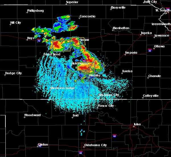 The severe thunderstorm warning for northeastern sedgwick and southeastern harvey counties will expire at 600 pm cdt, the storm which prompted the warning has moved out of the area. therefore the warning will be allowed to expire. however heavy rain and gusty winds are still possible with this thunderstorm. The severe thunderstorm warning for northeastern sedgwick and southeastern harvey counties will expire at 600 pm cdt, the storm which prompted the warning has moved out of the area. therefore the warning will be allowed to expire. however heavy rain and gusty winds are still possible with this thunderstorm.
|
| 6/15/2016 5:48 PM CDT |
 At 548 pm cdt, a severe thunderstorm was located near sedgwick, moving northeast at 20 mph (radar indicated). Hazards include 60 mph wind gusts and quarter size hail. Hail damage to vehicles is expected. expect wind damage to roofs, siding, and trees. Locations impacted include, park city, valley center and sedgwick. At 548 pm cdt, a severe thunderstorm was located near sedgwick, moving northeast at 20 mph (radar indicated). Hazards include 60 mph wind gusts and quarter size hail. Hail damage to vehicles is expected. expect wind damage to roofs, siding, and trees. Locations impacted include, park city, valley center and sedgwick.
|
| 6/15/2016 5:20 PM CDT |
 At 520 pm cdt, a severe thunderstorm was located over maize, moving northeast at 30 mph (radar indicated). Hazards include golf ball size hail and 60 mph wind gusts. People and animals outdoors will be injured. expect hail damage to roofs, siding, windows, and vehicles. Expect wind damage to roofs, siding, and trees. At 520 pm cdt, a severe thunderstorm was located over maize, moving northeast at 30 mph (radar indicated). Hazards include golf ball size hail and 60 mph wind gusts. People and animals outdoors will be injured. expect hail damage to roofs, siding, windows, and vehicles. Expect wind damage to roofs, siding, and trees.
|
| 6/15/2016 5:19 PM CDT |
 At 519 pm cdt, a severe thunderstorm was located over valley center, moving northeast at 10 mph (radar indicated). Hazards include 60 mph wind gusts and half dollar size hail. Hail damage to vehicles is expected. expect wind damage to roofs, siding, and trees. Locations impacted include, wichita, park city, valley center, bel aire, maize and kechi. At 519 pm cdt, a severe thunderstorm was located over valley center, moving northeast at 10 mph (radar indicated). Hazards include 60 mph wind gusts and half dollar size hail. Hail damage to vehicles is expected. expect wind damage to roofs, siding, and trees. Locations impacted include, wichita, park city, valley center, bel aire, maize and kechi.
|
| 6/15/2016 5:01 PM CDT |
 At 501 pm cdt, a severe thunderstorm was located over kechi, or near bel aire, moving northeast at 30 mph (radar indicated). Hazards include 60 mph wind gusts and penny size hail. Expect damage to roofs. siding. and trees. Locations impacted include, wichita, park city, valley center, bel aire, maize, kechi, northeast wichita and jabara airport. At 501 pm cdt, a severe thunderstorm was located over kechi, or near bel aire, moving northeast at 30 mph (radar indicated). Hazards include 60 mph wind gusts and penny size hail. Expect damage to roofs. siding. and trees. Locations impacted include, wichita, park city, valley center, bel aire, maize, kechi, northeast wichita and jabara airport.
|
| 6/15/2016 4:59 PM CDT |
 At 459 pm cdt, a severe thunderstorm was located near rose hill, moving northeast at 20 mph (radar indicated). Hazards include 60 mph wind gusts and quarter size hail. Hail damage to vehicles is expected. expect wind damage to roofs, siding, and trees. Locations impacted include, wichita, derby, andover, augusta, rose hill, benton, mcconnell air force base, santa fe lake, augusta municipal airport and oaklawn. At 459 pm cdt, a severe thunderstorm was located near rose hill, moving northeast at 20 mph (radar indicated). Hazards include 60 mph wind gusts and quarter size hail. Hail damage to vehicles is expected. expect wind damage to roofs, siding, and trees. Locations impacted include, wichita, derby, andover, augusta, rose hill, benton, mcconnell air force base, santa fe lake, augusta municipal airport and oaklawn.
|
| 6/15/2016 4:59 PM CDT |
 At 459 pm cdt, a severe thunderstorm was located over valley center, moving northeast at 15 mph (radar indicated). Hazards include 70 mph wind gusts and penny size hail. Expect considerable tree damage. Damage is likely to mobile homes, roofs, and outbuildings. At 459 pm cdt, a severe thunderstorm was located over valley center, moving northeast at 15 mph (radar indicated). Hazards include 70 mph wind gusts and penny size hail. Expect considerable tree damage. Damage is likely to mobile homes, roofs, and outbuildings.
|
| 6/15/2016 4:53 PM CDT | Quarter sized hail reported 0.3 miles SSW of Wichita, KS, viewer report to kwch of nickel to quarter sized hail in riverside. |
| 6/15/2016 4:51 PM CDT |
 At 451 pm cdt, a severe thunderstorm was located over derby, moving northeast at 15 mph (radar indicated). Hazards include 60 mph wind gusts and quarter size hail. Hail damage to vehicles is expected. Expect wind damage to roofs, siding, and trees. At 451 pm cdt, a severe thunderstorm was located over derby, moving northeast at 15 mph (radar indicated). Hazards include 60 mph wind gusts and quarter size hail. Hail damage to vehicles is expected. Expect wind damage to roofs, siding, and trees.
|
| 6/15/2016 4:45 PM CDT |
 At 445 pm cdt, a severe thunderstorm was located over wichita, moving northeast at 35 mph (radar indicated). Hazards include 60 mph wind gusts and quarter size hail. Hail damage to vehicles is expected. expect wind damage to roofs, siding, and trees. Locations impacted include, wichita, haysville, park city, valley center, bel aire, maize, downtown wichita, kechi, eastborough, south wichita, northeast wichita, east wichita, wichita mid continent airport, mcconnell air force base, jabara airport and oaklawn. At 445 pm cdt, a severe thunderstorm was located over wichita, moving northeast at 35 mph (radar indicated). Hazards include 60 mph wind gusts and quarter size hail. Hail damage to vehicles is expected. expect wind damage to roofs, siding, and trees. Locations impacted include, wichita, haysville, park city, valley center, bel aire, maize, downtown wichita, kechi, eastborough, south wichita, northeast wichita, east wichita, wichita mid continent airport, mcconnell air force base, jabara airport and oaklawn.
|
| 6/15/2016 4:42 PM CDT | Quarter sized hail reported 0.3 miles SSW of Wichita, KS, public report via twitter of dime to quarter sized hail at lincoln and broadway. |
| 6/15/2016 4:33 PM CDT |
 At 433 pm cdt, a severe thunderstorm was located over wichita mid continent airport, or near haysville, moving northeast at 30 mph (radar indicated). Hazards include 60 mph wind gusts and nickel size hail. Expect damage to roofs. siding. And trees. At 433 pm cdt, a severe thunderstorm was located over wichita mid continent airport, or near haysville, moving northeast at 30 mph (radar indicated). Hazards include 60 mph wind gusts and nickel size hail. Expect damage to roofs. siding. And trees.
|
| 5/29/2016 1:43 PM CDT |
 At 142 pm cdt, a severe thunderstorm was located over benton, moving east at 20 mph (radar indicated). Hazards include 60 mph wind gusts and quarter size hail. Hail damage to vehicles is expected. expect wind damage to roofs, siding, and trees. Locations impacted include, wichita, andover, bel aire, northeast wichita and jabara airport. At 142 pm cdt, a severe thunderstorm was located over benton, moving east at 20 mph (radar indicated). Hazards include 60 mph wind gusts and quarter size hail. Hail damage to vehicles is expected. expect wind damage to roofs, siding, and trees. Locations impacted include, wichita, andover, bel aire, northeast wichita and jabara airport.
|
| 5/29/2016 1:28 PM CDT | Quarter sized hail reported 7.2 miles SW of Wichita, KS |
| 5/29/2016 1:25 PM CDT |
 At 123 pm cdt, a severe thunderstorm was located over kechi, or over bel aire, moving northeast at 20 mph (radar indicated). Hazards include quarter size hail. Damage to vehicles is expected. Locations impacted include, wichita, andover, park city, valley center, bel aire, kechi, eastborough, northeast wichita, east wichita and jabara airport. At 123 pm cdt, a severe thunderstorm was located over kechi, or over bel aire, moving northeast at 20 mph (radar indicated). Hazards include quarter size hail. Damage to vehicles is expected. Locations impacted include, wichita, andover, park city, valley center, bel aire, kechi, eastborough, northeast wichita, east wichita and jabara airport.
|
| 5/29/2016 1:19 PM CDT | Quarter sized hail reported 8 miles S of Wichita, KS, majority of hailstones pea to nickel with a few quarters mixed in. |
| 5/29/2016 1:11 PM CDT |
 At 111 pm cdt, a severe thunderstorm was located over wichita, moving east at 20 mph (radar indicated). Hazards include half dollar size hail. damage to vehicles is expected At 111 pm cdt, a severe thunderstorm was located over wichita, moving east at 20 mph (radar indicated). Hazards include half dollar size hail. damage to vehicles is expected
|
| 5/27/2016 4:23 PM CDT |
 At 422 pm cdt, a severe thunderstorm was located near udall, moving north at 25 mph (radar indicated). Hazards include quarter size hail. Damage to vehicles is expected. Locations impacted include, andover, mulvane, rose hill, douglass, udall, rock and augusta municipal airport. At 422 pm cdt, a severe thunderstorm was located near udall, moving north at 25 mph (radar indicated). Hazards include quarter size hail. Damage to vehicles is expected. Locations impacted include, andover, mulvane, rose hill, douglass, udall, rock and augusta municipal airport.
|
| 5/27/2016 4:09 PM CDT |
 At 409 pm cdt, a severe thunderstorm was located over belle plaine, moving north at 25 mph (radar indicated). Hazards include quarter size hail. damage to vehicles is expected At 409 pm cdt, a severe thunderstorm was located over belle plaine, moving north at 25 mph (radar indicated). Hazards include quarter size hail. damage to vehicles is expected
|
| 5/27/2016 3:53 PM CDT |
 At 353 pm cdt, a severe thunderstorm was located near norwich, or 8 miles south of cheney, moving north at 15 mph (radar indicated). Hazards include golf ball size hail and 60 mph wind gusts. People and animals outdoors will be injured. expect hail damage to roofs, siding, windows, and vehicles. Expect wind damage to roofs, siding, and trees. At 353 pm cdt, a severe thunderstorm was located near norwich, or 8 miles south of cheney, moving north at 15 mph (radar indicated). Hazards include golf ball size hail and 60 mph wind gusts. People and animals outdoors will be injured. expect hail damage to roofs, siding, windows, and vehicles. Expect wind damage to roofs, siding, and trees.
|
| 5/27/2016 3:35 PM CDT |
 At 334 pm cdt, a severe thunderstorm was located over andale, or near mount hope, moving northeast at 15 mph (radar indicated). Hazards include ping pong ball size hail and 60 mph wind gusts. People and animals outdoors will be injured. expect hail damage to roofs, siding, windows, and vehicles. expect wind damage to roofs, siding, and trees. this severe storm will be near, bentley around 400 pm cdt. Sedgwick around 415 pm cdt. At 334 pm cdt, a severe thunderstorm was located over andale, or near mount hope, moving northeast at 15 mph (radar indicated). Hazards include ping pong ball size hail and 60 mph wind gusts. People and animals outdoors will be injured. expect hail damage to roofs, siding, windows, and vehicles. expect wind damage to roofs, siding, and trees. this severe storm will be near, bentley around 400 pm cdt. Sedgwick around 415 pm cdt.
|
| 5/27/2016 3:29 PM CDT |
 At 329 pm cdt, a severe thunderstorm was located over andale, or near mount hope, moving northeast at 15 mph (radar indicated). Hazards include 60 mph wind gusts and quarter size hail. Hail damage to vehicles is expected. expect wind damage to roofs, siding, and trees. this severe storm will be near, colwich around 335 pm cdt. mount hope around 345 pm cdt. bentley around 400 pm cdt. Sedgwick around 415 pm cdt. At 329 pm cdt, a severe thunderstorm was located over andale, or near mount hope, moving northeast at 15 mph (radar indicated). Hazards include 60 mph wind gusts and quarter size hail. Hail damage to vehicles is expected. expect wind damage to roofs, siding, and trees. this severe storm will be near, colwich around 335 pm cdt. mount hope around 345 pm cdt. bentley around 400 pm cdt. Sedgwick around 415 pm cdt.
|
| 5/27/2016 3:15 PM CDT |
 At 314 pm cdt, a severe thunderstorm was located over goddard, moving north at 25 mph (radar indicated). Hazards include ping pong ball size hail and 60 mph wind gusts. People and animals outdoors will be injured. expect hail damage to roofs, siding, windows, and vehicles. Expect wind damage to roofs, siding, and trees. At 314 pm cdt, a severe thunderstorm was located over goddard, moving north at 25 mph (radar indicated). Hazards include ping pong ball size hail and 60 mph wind gusts. People and animals outdoors will be injured. expect hail damage to roofs, siding, windows, and vehicles. Expect wind damage to roofs, siding, and trees.
|
| 5/26/2016 11:30 PM CDT |
 At 1130 pm cdt, severe thunderstorms were located along a line extending from near andale to near clearwater, moving east at 30 mph (radar indicated). Hazards include 60 mph wind gusts. Expect damage to roofs. siding. and trees. Locations impacted include, wichita, haysville, valley center, goddard, maize, clearwater, colwich, garden plain, viola, eisenhower national airport, west wichita and lake afton. At 1130 pm cdt, severe thunderstorms were located along a line extending from near andale to near clearwater, moving east at 30 mph (radar indicated). Hazards include 60 mph wind gusts. Expect damage to roofs. siding. and trees. Locations impacted include, wichita, haysville, valley center, goddard, maize, clearwater, colwich, garden plain, viola, eisenhower national airport, west wichita and lake afton.
|
| 5/26/2016 11:14 PM CDT |
 At 1114 pm cdt, severe thunderstorms were located along a line extending from near garden plain to viola, moving east at 30 mph (radar indicated). Hazards include 60 mph wind gusts. Expect damage to roofs. siding. And trees. At 1114 pm cdt, severe thunderstorms were located along a line extending from near garden plain to viola, moving east at 30 mph (radar indicated). Hazards include 60 mph wind gusts. Expect damage to roofs. siding. And trees.
|
| 5/26/2016 4:55 PM CDT |
 At 455 pm cdt, a severe thunderstorm was located near sedgwick, moving north at 45 mph (trained weather spotters). Hazards include 60 mph wind gusts and quarter size hail. Hail damage to vehicles is expected. expect wind damage to roofs, siding, and trees. locations impacted include, newton, park city, valley center, hesston, hillsboro, marion, north newton, sedgwick, peabody, whitewater, kechi, goessel, walton, elbing, lehigh and newton airport. A tornado watch remains in effect until 1000 pm cdt for south central kansas. At 455 pm cdt, a severe thunderstorm was located near sedgwick, moving north at 45 mph (trained weather spotters). Hazards include 60 mph wind gusts and quarter size hail. Hail damage to vehicles is expected. expect wind damage to roofs, siding, and trees. locations impacted include, newton, park city, valley center, hesston, hillsboro, marion, north newton, sedgwick, peabody, whitewater, kechi, goessel, walton, elbing, lehigh and newton airport. A tornado watch remains in effect until 1000 pm cdt for south central kansas.
|
| 5/26/2016 2:18 PM CDT |
 At 218 pm cdt, severe thunderstorms were located along a line extending from near benton to towanda to 5 miles south of augusta, moving northeast at 30 mph (radar indicated). Hazards include 60 mph wind gusts and quarter size hail. Hail damage to vehicles is expected. expect wind damage to roofs, siding, and trees. locations impacted include, el dorado, andover, augusta, bel aire, towanda, benton, whitewater, leon, kechi, potwin, northeast wichita, jabara airport, santa fe lake, el dorado airport and augusta municipal airport. A tornado watch remains in effect until 1000 pm cdt for south central kansas. At 218 pm cdt, severe thunderstorms were located along a line extending from near benton to towanda to 5 miles south of augusta, moving northeast at 30 mph (radar indicated). Hazards include 60 mph wind gusts and quarter size hail. Hail damage to vehicles is expected. expect wind damage to roofs, siding, and trees. locations impacted include, el dorado, andover, augusta, bel aire, towanda, benton, whitewater, leon, kechi, potwin, northeast wichita, jabara airport, santa fe lake, el dorado airport and augusta municipal airport. A tornado watch remains in effect until 1000 pm cdt for south central kansas.
|
| 5/26/2016 2:02 PM CDT |
 At 201 pm cdt, severe thunderstorms were located along a line extending from near potwin to towanda to near andover, moving northeast at 30 mph (radar indicated). Hazards include 60 mph wind gusts and quarter size hail. Hail damage to vehicles is expected. expect wind damage to roofs, siding, and trees. locations impacted include, el dorado, andover, augusta, bel aire, towanda, benton, whitewater, leon, kechi, potwin, northeast wichita, jabara airport, santa fe lake, el dorado airport and augusta municipal airport. A tornado watch remains in effect until 1000 pm cdt for south central kansas. At 201 pm cdt, severe thunderstorms were located along a line extending from near potwin to towanda to near andover, moving northeast at 30 mph (radar indicated). Hazards include 60 mph wind gusts and quarter size hail. Hail damage to vehicles is expected. expect wind damage to roofs, siding, and trees. locations impacted include, el dorado, andover, augusta, bel aire, towanda, benton, whitewater, leon, kechi, potwin, northeast wichita, jabara airport, santa fe lake, el dorado airport and augusta municipal airport. A tornado watch remains in effect until 1000 pm cdt for south central kansas.
|
| 5/26/2016 1:57 PM CDT | The severe thunderstorm warning for southwestern butler and southeastern sedgwick counties will expire at 200 pm cdt, the severe thunderstorm which prompted the warning has weakened. therefore the warning will be allowed to expire. a tornado watch remains in effect until 1000 pm cdt for south central kansas. |
| 5/26/2016 1:50 PM CDT |
 At 150 pm cdt, a severe thunderstorm was located over benton, moving northeast at 35 mph (radar indicated). Hazards include golf ball size hail and 60 mph wind gusts. People and animals outdoors will be injured. expect hail damage to roofs, siding, windows, and vehicles. expect wind damage to roofs, siding, and trees. locations impacted include, el dorado, andover, augusta, bel aire, towanda, benton, whitewater, leon, kechi, potwin, northeast wichita, jabara airport, santa fe lake, el dorado airport and augusta municipal airport. A tornado watch remains in effect until 1000 pm cdt for south central kansas. At 150 pm cdt, a severe thunderstorm was located over benton, moving northeast at 35 mph (radar indicated). Hazards include golf ball size hail and 60 mph wind gusts. People and animals outdoors will be injured. expect hail damage to roofs, siding, windows, and vehicles. expect wind damage to roofs, siding, and trees. locations impacted include, el dorado, andover, augusta, bel aire, towanda, benton, whitewater, leon, kechi, potwin, northeast wichita, jabara airport, santa fe lake, el dorado airport and augusta municipal airport. A tornado watch remains in effect until 1000 pm cdt for south central kansas.
|
| 5/26/2016 1:38 PM CDT |
 At 137 pm cdt, a severe thunderstorm was located over andover, moving northeast at 45 mph (radar indicated). Hazards include 60 mph wind gusts and quarter size hail. Hail damage to vehicles is expected. Expect wind damage to roofs, siding, and trees. At 137 pm cdt, a severe thunderstorm was located over andover, moving northeast at 45 mph (radar indicated). Hazards include 60 mph wind gusts and quarter size hail. Hail damage to vehicles is expected. Expect wind damage to roofs, siding, and trees.
|
| 5/26/2016 1:23 PM CDT |
 At 122 pm cdt, a severe thunderstorm was located over mcconnell air force base, or near derby, moving northeast at 45 mph (radar indicated). Hazards include 60 mph wind gusts and quarter size hail. Hail damage to vehicles is expected. expect wind damage to roofs, siding, and trees. Locations impacted include, wichita, derby, andover, haysville, park city, bel aire, mulvane, rose hill, douglass, downtown wichita, kechi, eastborough, south wichita, northeast wichita, east wichita, mcconnell air force base, jabara airport, oaklawn and augusta municipal airport. At 122 pm cdt, a severe thunderstorm was located over mcconnell air force base, or near derby, moving northeast at 45 mph (radar indicated). Hazards include 60 mph wind gusts and quarter size hail. Hail damage to vehicles is expected. expect wind damage to roofs, siding, and trees. Locations impacted include, wichita, derby, andover, haysville, park city, bel aire, mulvane, rose hill, douglass, downtown wichita, kechi, eastborough, south wichita, northeast wichita, east wichita, mcconnell air force base, jabara airport, oaklawn and augusta municipal airport.
|
| 5/26/2016 1:11 PM CDT |
 At 110 pm cdt, a severe thunderstorm was located near mulvane, moving northeast at 45 mph (radar indicated). Hazards include 60 mph wind gusts and quarter size hail. Hail damage to vehicles is expected. Expect wind damage to roofs, siding, and trees. At 110 pm cdt, a severe thunderstorm was located near mulvane, moving northeast at 45 mph (radar indicated). Hazards include 60 mph wind gusts and quarter size hail. Hail damage to vehicles is expected. Expect wind damage to roofs, siding, and trees.
|
| 5/24/2016 10:21 PM CDT | The national weather service in wichita has issued a * severe thunderstorm warning for. sedgwick county in south central kansas. northeastern kingman county in south central kansas. southeastern reno county in south central kansas. Until 1115 pm cdt. |
| 5/13/2016 5:28 PM CDT | Quarter sized hail reported 5.7 miles NNW of Wichita, KS, public report via twitter of dime to quarter sized hail at 55th and hydraulic. time is estimated from radar. |
| 5/13/2016 5:25 PM CDT |
 At 525 pm cdt, a severe thunderstorm was located over east wichita, or near andover, moving southeast at 35 mph (radar indicated). Hazards include 60 mph wind gusts and quarter size hail. Hail damage to vehicles is expected. expect wind damage to roofs, siding, and trees. Locations impacted include, wichita, andover, park city, valley center, bel aire, rose hill, maize, downtown wichita, kechi, eastborough, northeast wichita, east wichita, mcconnell air force base and jabara airport. At 525 pm cdt, a severe thunderstorm was located over east wichita, or near andover, moving southeast at 35 mph (radar indicated). Hazards include 60 mph wind gusts and quarter size hail. Hail damage to vehicles is expected. expect wind damage to roofs, siding, and trees. Locations impacted include, wichita, andover, park city, valley center, bel aire, rose hill, maize, downtown wichita, kechi, eastborough, northeast wichita, east wichita, mcconnell air force base and jabara airport.
|
| 5/13/2016 5:15 PM CDT | Quarter sized hail reported 7.4 miles SW of Wichita, KS, public report via twitter of nickel to quarter sized hail at highway 254 and webb road. time is estimated from radar. |
| 5/13/2016 5:09 PM CDT |
 At 509 pm cdt, a severe thunderstorm was located over bel aire, moving southeast at 30 mph (radar indicated). Hazards include 60 mph wind gusts and quarter size hail. Hail damage to vehicles is expected. Expect wind damage to roofs, siding, and trees. At 509 pm cdt, a severe thunderstorm was located over bel aire, moving southeast at 30 mph (radar indicated). Hazards include 60 mph wind gusts and quarter size hail. Hail damage to vehicles is expected. Expect wind damage to roofs, siding, and trees.
|
| 5/9/2016 6:09 PM CDT |
 At 608 pm cdt, severe thunderstorms were located along a line extending from towanda to near augusta to near douglass, moving east at 45 mph (radar indicated). Hazards include 60 mph wind gusts and nickel size hail. Expect damage to roofs. siding. and trees. Locations impacted include, el dorado, andover, augusta, rose hill, douglass, towanda, benton, leon, santa fe lake, augusta municipal airport and el dorado airport. At 608 pm cdt, severe thunderstorms were located along a line extending from towanda to near augusta to near douglass, moving east at 45 mph (radar indicated). Hazards include 60 mph wind gusts and nickel size hail. Expect damage to roofs. siding. and trees. Locations impacted include, el dorado, andover, augusta, rose hill, douglass, towanda, benton, leon, santa fe lake, augusta municipal airport and el dorado airport.
|
| 5/9/2016 6:02 PM CDT |
 At 602 pm cdt, a severe thunderstorm was located near benton, moving east at 70 mph (radar indicated). Hazards include 60 mph wind gusts and quarter size hail. Hail damage to vehicles is expected. Expect wind damage to roofs, siding, and trees. At 602 pm cdt, a severe thunderstorm was located near benton, moving east at 70 mph (radar indicated). Hazards include 60 mph wind gusts and quarter size hail. Hail damage to vehicles is expected. Expect wind damage to roofs, siding, and trees.
|
| 5/9/2016 5:58 PM CDT | Quarter sized hail reported 0.8 miles WNW of Wichita, KS, some pea to dime hail also. at harry and rock road. via twitter. |
| 5/9/2016 5:50 PM CDT |
 At 549 pm cdt, severe thunderstorms were located along a line extending from bel aire to near mcconnell air force base to mulvane, moving east at 40 mph (radar indicated). Hazards include 70 mph wind gusts and nickel size hail. Expect considerable tree damage. damage is likely to mobile homes, roofs, and outbuildings. Locations impacted include, wichita, derby, el dorado, andover, haysville, augusta, park city, bel aire, mulvane, rose hill, maize, douglass, towanda, benton, leon, downtown wichita, eastborough, eisenhower national airport, east wichita and south wichita. At 549 pm cdt, severe thunderstorms were located along a line extending from bel aire to near mcconnell air force base to mulvane, moving east at 40 mph (radar indicated). Hazards include 70 mph wind gusts and nickel size hail. Expect considerable tree damage. damage is likely to mobile homes, roofs, and outbuildings. Locations impacted include, wichita, derby, el dorado, andover, haysville, augusta, park city, bel aire, mulvane, rose hill, maize, douglass, towanda, benton, leon, downtown wichita, eastborough, eisenhower national airport, east wichita and south wichita.
|
| 5/9/2016 5:48 PM CDT | Quarter sized hail reported 6.4 miles E of Wichita, KS, central and ridge |
| 5/9/2016 5:47 PM CDT | Quarter sized hail reported 1 miles ESE of Wichita, KS, at macarthur and west. via kfdi radio. |
| 5/9/2016 5:44 PM CDT | 6-7 inch tree knocked down at lewis and laura. delayed report. via twitte in sedgwick county KS, 0.3 miles SSW of Wichita, KS |
| 5/9/2016 5:41 PM CDT |
 At 541 pm cdt, a severe thunderstorm was located over haysville, moving east at 50 mph (radar indicated). Hazards include 70 mph wind gusts and quarter size hail. Hail damage to vehicles is expected. expect considerable tree damage. Wind damage is also likely to mobile homes, roofs, and outbuildings. At 541 pm cdt, a severe thunderstorm was located over haysville, moving east at 50 mph (radar indicated). Hazards include 70 mph wind gusts and quarter size hail. Hail damage to vehicles is expected. expect considerable tree damage. Wind damage is also likely to mobile homes, roofs, and outbuildings.
|
| 5/9/2016 5:23 PM CDT |
 At 522 pm cdt, severe thunderstorms were located along a line extending from near garden plain to near viola, moving northeast at 30 mph (radar indicated). Hazards include 60 mph wind gusts and nickel size hail. Expect damage to roofs. siding. and trees. Locations impacted include, wichita, haysville, goddard, clearwater, cheney, garden plain, viola, eisenhower national airport, west wichita, cheney lake and lake afton. At 522 pm cdt, severe thunderstorms were located along a line extending from near garden plain to near viola, moving northeast at 30 mph (radar indicated). Hazards include 60 mph wind gusts and nickel size hail. Expect damage to roofs. siding. and trees. Locations impacted include, wichita, haysville, goddard, clearwater, cheney, garden plain, viola, eisenhower national airport, west wichita, cheney lake and lake afton.
|
| 5/9/2016 5:10 PM CDT |
 At 509 pm cdt, a severe thunderstorm was located near norwich, or 7 miles northwest of conway springs, moving northeast at 40 mph (radar indicated). Hazards include 70 mph wind gusts and half dollar size hail. Hail damage to vehicles is expected. expect considerable tree damage. Wind damage is also likely to mobile homes, roofs, and outbuildings. At 509 pm cdt, a severe thunderstorm was located near norwich, or 7 miles northwest of conway springs, moving northeast at 40 mph (radar indicated). Hazards include 70 mph wind gusts and half dollar size hail. Hail damage to vehicles is expected. expect considerable tree damage. Wind damage is also likely to mobile homes, roofs, and outbuildings.
|
| 5/8/2016 5:32 PM CDT |
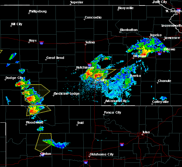 At 532 pm cdt, a severe thunderstorm was located 6 miles north of kechi, or 7 miles northeast of valley center, moving northeast at 30 mph (radar indicated). Hazards include golf ball size hail and 60 mph wind gusts. People and animals outdoors will be injured. expect hail damage to roofs, siding, windows, and vehicles. expect wind damage to roofs, siding, and trees. locations impacted include, wichita, newton, park city, valley center, bel aire, whitewater, kechi, potwin, elbing, northeast wichita, jabara airport and newton airport. A tornado watch remains in effect until 1000 pm cdt for south central kansas. At 532 pm cdt, a severe thunderstorm was located 6 miles north of kechi, or 7 miles northeast of valley center, moving northeast at 30 mph (radar indicated). Hazards include golf ball size hail and 60 mph wind gusts. People and animals outdoors will be injured. expect hail damage to roofs, siding, windows, and vehicles. expect wind damage to roofs, siding, and trees. locations impacted include, wichita, newton, park city, valley center, bel aire, whitewater, kechi, potwin, elbing, northeast wichita, jabara airport and newton airport. A tornado watch remains in effect until 1000 pm cdt for south central kansas.
|
| 5/8/2016 5:23 PM CDT |
 At 523 pm cdt, a severe thunderstorm was located near valley center, moving northeast at 35 mph (radar indicated). Hazards include quarter size hail. damage to vehicles is expected At 523 pm cdt, a severe thunderstorm was located near valley center, moving northeast at 35 mph (radar indicated). Hazards include quarter size hail. damage to vehicles is expected
|
| 4/29/2016 2:58 PM CDT |
 At 258 pm cdt, severe thunderstorms were located along a line extending from 5 miles northeast of valley center to near andover, moving northeast at 60 mph (trained weather spotters). Hazards include 70 mph wind gusts and penny size hail. Expect considerable tree damage. damage is likely to mobile homes, roofs, and outbuildings. Locations impacted include, wichita, andover, park city, valley center, bel aire, towanda, benton, whitewater, kechi, eastborough, potwin, elbing, northeast wichita, east wichita, mcconnell air force base, jabara airport, santa fe lake, oaklawn and augusta municipal airport. At 258 pm cdt, severe thunderstorms were located along a line extending from 5 miles northeast of valley center to near andover, moving northeast at 60 mph (trained weather spotters). Hazards include 70 mph wind gusts and penny size hail. Expect considerable tree damage. damage is likely to mobile homes, roofs, and outbuildings. Locations impacted include, wichita, andover, park city, valley center, bel aire, towanda, benton, whitewater, kechi, eastborough, potwin, elbing, northeast wichita, east wichita, mcconnell air force base, jabara airport, santa fe lake, oaklawn and augusta municipal airport.
|
| 4/29/2016 2:49 PM CDT | Storm damage reported in sedgwick county KS, 8 miles S of Wichita, KS |
| 4/29/2016 2:45 PM CDT |
 At 244 pm cdt, severe thunderstorms were located along a line extending from valley center to near eastborough, moving northeast at 55 mph (trained weather spotters). Hazards include 70 mph wind gusts and penny size hail. Expect considerable tree damage. damage is likely to mobile homes, roofs, and outbuildings. Locations impacted include, wichita, andover, park city, valley center, bel aire, maize, towanda, benton, whitewater, downtown wichita, kechi, eastborough, potwin, elbing, south wichita, northeast wichita, east wichita, mcconnell air force base, jabara airport and oaklawn. At 244 pm cdt, severe thunderstorms were located along a line extending from valley center to near eastborough, moving northeast at 55 mph (trained weather spotters). Hazards include 70 mph wind gusts and penny size hail. Expect considerable tree damage. damage is likely to mobile homes, roofs, and outbuildings. Locations impacted include, wichita, andover, park city, valley center, bel aire, maize, towanda, benton, whitewater, downtown wichita, kechi, eastborough, potwin, elbing, south wichita, northeast wichita, east wichita, mcconnell air force base, jabara airport and oaklawn.
|
| 4/29/2016 2:44 PM CDT | Storm damage reported in sedgwick county KS, 2.1 miles E of Wichita, KS |
| 4/29/2016 2:31 PM CDT | Storm damage reported in sedgwick county KS, 7.5 miles E of Wichita, KS |
| 4/29/2016 2:31 PM CDT |
 At 231 pm cdt, severe thunderstorms were located along a line extending from colwich to 5 miles south of eisenhower national airport, moving northeast at 50 mph (radar indicated). Hazards include 60 mph wind gusts and penny size hail. Expect damage to roofs. siding. And trees. At 231 pm cdt, severe thunderstorms were located along a line extending from colwich to 5 miles south of eisenhower national airport, moving northeast at 50 mph (radar indicated). Hazards include 60 mph wind gusts and penny size hail. Expect damage to roofs. siding. And trees.
|
| 4/26/2016 7:42 PM CDT | The severe thunderstorm warning for southwestern butler and southeastern sedgwick counties will expire at 745 pm cdt. the storm which prompted the warning has moved out of the area. therefore the warning will be allowed to expire. however small hail is still possible with this thunderstorm. A tornado watch remains in effect until 900 pm cdt for south central. |
| 4/26/2016 7:42 PM CDT | The severe thunderstorm warning for central sedgwick county will expire at 745 pm cdt. the storm which prompted the warning has weakened below severe limits. and no longer pose an immediate threat to life or property. therefore the warning will be allowed to expire. However small hail is still possible with this thunderstorm. |
| 4/26/2016 7:39 PM CDT |
 At 739 pm cdt, a severe thunderstorm was located over derby, moving north at 30 mph (radar indicated). Hazards include 60 mph wind gusts and quarter size hail. Hail damage to vehicles is expected. expect wind damage to roofs, siding, and trees. locations impacted include, wichita, derby, andover, rose hill, towanda, benton, mcconnell air force base, santa fe lake and augusta municipal airport. A tornado watch remains in effect until 900 pm cdt for south central kansas. At 739 pm cdt, a severe thunderstorm was located over derby, moving north at 30 mph (radar indicated). Hazards include 60 mph wind gusts and quarter size hail. Hail damage to vehicles is expected. expect wind damage to roofs, siding, and trees. locations impacted include, wichita, derby, andover, rose hill, towanda, benton, mcconnell air force base, santa fe lake and augusta municipal airport. A tornado watch remains in effect until 900 pm cdt for south central kansas.
|
| 4/26/2016 7:20 PM CDT |
 At 719 pm cdt, a severe thunderstorm was located near belle plaine, moving north at 30 mph (radar indicated). Hazards include 60 mph wind gusts and half dollar size hail. Hail damage to vehicles is expected. expect wind damage to roofs, siding, and trees. locations impacted include, wichita, derby, andover, mulvane, rose hill, belle plaine, towanda, benton, udall, mcconnell air force base, santa fe lake and augusta municipal airport. A tornado watch remains in effect until 900 pm cdt for south central kansas. At 719 pm cdt, a severe thunderstorm was located near belle plaine, moving north at 30 mph (radar indicated). Hazards include 60 mph wind gusts and half dollar size hail. Hail damage to vehicles is expected. expect wind damage to roofs, siding, and trees. locations impacted include, wichita, derby, andover, mulvane, rose hill, belle plaine, towanda, benton, udall, mcconnell air force base, santa fe lake and augusta municipal airport. A tornado watch remains in effect until 900 pm cdt for south central kansas.
|
| 4/26/2016 7:13 PM CDT | Quarter sized hail reported 4.5 miles W of Wichita, KS, near central and greenwich. courtesy of ksn. |
| 4/26/2016 7:11 PM CDT |
 At 711 pm cdt, a severe thunderstorm was located near belle plaine, moving north at 30 mph (radar indicated). Hazards include 60 mph wind gusts and half dollar size hail. Hail damage to vehicles is expected. expect wind damage to roofs, siding, and trees. locations impacted include, wichita, derby, andover, wellington, mulvane, rose hill, belle plaine, towanda, conway springs, oxford, benton, udall, geuda springs, mcconnell air force base, mayfield, milan, riverdale, wellington airport, santa fe lake and perth. A tornado watch remains in effect until 900 pm cdt for south central kansas. At 711 pm cdt, a severe thunderstorm was located near belle plaine, moving north at 30 mph (radar indicated). Hazards include 60 mph wind gusts and half dollar size hail. Hail damage to vehicles is expected. expect wind damage to roofs, siding, and trees. locations impacted include, wichita, derby, andover, wellington, mulvane, rose hill, belle plaine, towanda, conway springs, oxford, benton, udall, geuda springs, mcconnell air force base, mayfield, milan, riverdale, wellington airport, santa fe lake and perth. A tornado watch remains in effect until 900 pm cdt for south central kansas.
|
| 4/26/2016 7:06 PM CDT | Half Dollar sized hail reported 6.2 miles NNW of Wichita, KS, near hydraulic and lincoln. |
| 4/26/2016 6:59 PM CDT | Quarter sized hail reported 6.4 miles WSW of Wichita, KS, reported at oxford cir and rock rd. |
| 4/26/2016 6:56 PM CDT | Quarter sized hail reported 5.6 miles ENE of Wichita, KS, official observation at the airport. |
| 4/26/2016 6:56 PM CDT | Hen Egg sized hail reported 0.3 miles SSW of Wichita, KS |
| 4/26/2016 6:55 PM CDT |
 At 655 pm cdt, a severe thunderstorm was located over wellington, moving north at 30 mph (radar indicated). Hazards include ping pong ball size hail and 60 mph wind gusts. People and animals outdoors will be injured. expect hail damage to roofs, siding, windows, and vehicles. Expect wind damage to roofs, siding, and trees. At 655 pm cdt, a severe thunderstorm was located over wellington, moving north at 30 mph (radar indicated). Hazards include ping pong ball size hail and 60 mph wind gusts. People and animals outdoors will be injured. expect hail damage to roofs, siding, windows, and vehicles. Expect wind damage to roofs, siding, and trees.
|
| 4/26/2016 6:54 PM CDT | Golf Ball sized hail reported 6 miles NW of Wichita, KS, official mcconnell observation. |
| 4/26/2016 6:53 PM CDT |
 At 653 pm cdt, a severe thunderstorm was located over eisenhower national airport, or near downtown wichita, moving northeast at 30 mph (trained weather spotters). Hazards include golf ball size hail and 60 mph wind gusts. People and animals outdoors will be injured. expect hail damage to roofs, siding, windows, and vehicles. expect wind damage to roofs, siding, and trees. locations impacted include, wichita, haysville, park city, valley center, bel aire, goddard, maize, clearwater, colwich, downtown wichita, kechi, eastborough, viola, south wichita, northeast wichita, eisenhower national airport, west wichita, east wichita, mcconnell air force base and jabara airport. A tornado watch remains in effect until 900 pm cdt for south central kansas. At 653 pm cdt, a severe thunderstorm was located over eisenhower national airport, or near downtown wichita, moving northeast at 30 mph (trained weather spotters). Hazards include golf ball size hail and 60 mph wind gusts. People and animals outdoors will be injured. expect hail damage to roofs, siding, windows, and vehicles. expect wind damage to roofs, siding, and trees. locations impacted include, wichita, haysville, park city, valley center, bel aire, goddard, maize, clearwater, colwich, downtown wichita, kechi, eastborough, viola, south wichita, northeast wichita, eisenhower national airport, west wichita, east wichita, mcconnell air force base and jabara airport. A tornado watch remains in effect until 900 pm cdt for south central kansas.
|
| 4/26/2016 6:52 PM CDT | Ping Pong Ball sized hail reported 6.2 miles NNW of Wichita, KS, near hydraulic and macarthur. |
| 4/26/2016 6:52 PM CDT | Golf Ball sized hail reported 6.2 miles NNW of Wichita, KS, near south meridian and interstate 235. |
| 4/26/2016 6:51 PM CDT | Half Dollar sized hail reported 6.2 miles NNW of Wichita, KS, near 71st and broadway. courtesy kwch storm chaser. |
| 4/26/2016 6:45 PM CDT |
 At 645 pm cdt, a severe thunderstorm was located near clearwater, moving north at 25 mph (radar indicated). Hazards include ping pong ball size hail and 60 mph wind gusts. People and animals outdoors will be injured. expect hail damage to roofs, siding, windows, and vehicles. expect wind damage to roofs, siding, and trees. locations impacted include, wichita, haysville, park city, valley center, bel aire, goddard, maize, clearwater, colwich, downtown wichita, kechi, eastborough, viola, south wichita, northeast wichita, eisenhower national airport, west wichita, east wichita, mcconnell air force base and jabara airport. A tornado watch remains in effect until 900 pm cdt for south central kansas. At 645 pm cdt, a severe thunderstorm was located near clearwater, moving north at 25 mph (radar indicated). Hazards include ping pong ball size hail and 60 mph wind gusts. People and animals outdoors will be injured. expect hail damage to roofs, siding, windows, and vehicles. expect wind damage to roofs, siding, and trees. locations impacted include, wichita, haysville, park city, valley center, bel aire, goddard, maize, clearwater, colwich, downtown wichita, kechi, eastborough, viola, south wichita, northeast wichita, eisenhower national airport, west wichita, east wichita, mcconnell air force base and jabara airport. A tornado watch remains in effect until 900 pm cdt for south central kansas.
|
| 4/26/2016 6:39 PM CDT |
 At 638 pm cdt, a severe thunderstorm was located over clearwater, moving north at 25 mph (radar indicated). Hazards include ping pong ball size hail and 60 mph wind gusts. People and animals outdoors will be injured. expect hail damage to roofs, siding, windows, and vehicles. Expect wind damage to roofs, siding, and trees. At 638 pm cdt, a severe thunderstorm was located over clearwater, moving north at 25 mph (radar indicated). Hazards include ping pong ball size hail and 60 mph wind gusts. People and animals outdoors will be injured. expect hail damage to roofs, siding, windows, and vehicles. Expect wind damage to roofs, siding, and trees.
|
| 4/26/2016 6:29 PM CDT |
 At 628 pm cdt, a severe thunderstorm was located near clearwater, moving northeast at 40 mph (radar indicated). Hazards include golf ball size hail and 60 mph wind gusts. People and animals outdoors will be injured. expect hail damage to roofs, siding, windows, and vehicles. expect wind damage to roofs, siding, and trees. locations impacted include, wichita, haysville, park city, valley center, bel aire, goddard, maize, clearwater, sedgwick, colwich, conway springs, downtown wichita, kechi, andale, eastborough, bentley, viola, eisenhower national airport, east wichita and south wichita. A tornado watch remains in effect until 900 pm cdt for south central kansas. At 628 pm cdt, a severe thunderstorm was located near clearwater, moving northeast at 40 mph (radar indicated). Hazards include golf ball size hail and 60 mph wind gusts. People and animals outdoors will be injured. expect hail damage to roofs, siding, windows, and vehicles. expect wind damage to roofs, siding, and trees. locations impacted include, wichita, haysville, park city, valley center, bel aire, goddard, maize, clearwater, sedgwick, colwich, conway springs, downtown wichita, kechi, andale, eastborough, bentley, viola, eisenhower national airport, east wichita and south wichita. A tornado watch remains in effect until 900 pm cdt for south central kansas.
|
| 4/26/2016 6:22 PM CDT |
 At 621 pm cdt, a severe thunderstorm was located over valley center, moving northeast at 35 mph. another severe thunderstorm was located just east of conway springs (radar indicated). Hazards include 60 mph wind gusts and quarter size hail. Hail damage to vehicles is expected. expect wind damage to roofs, siding, and trees. locations impacted include, wichita, haysville, park city, valley center, bel aire, goddard, maize, clearwater, sedgwick, colwich, conway springs, downtown wichita, kechi, andale, eastborough, bentley, viola, eisenhower national airport, east wichita and south wichita. A tornado watch remains in effect until 900 pm cdt for south central kansas. At 621 pm cdt, a severe thunderstorm was located over valley center, moving northeast at 35 mph. another severe thunderstorm was located just east of conway springs (radar indicated). Hazards include 60 mph wind gusts and quarter size hail. Hail damage to vehicles is expected. expect wind damage to roofs, siding, and trees. locations impacted include, wichita, haysville, park city, valley center, bel aire, goddard, maize, clearwater, sedgwick, colwich, conway springs, downtown wichita, kechi, andale, eastborough, bentley, viola, eisenhower national airport, east wichita and south wichita. A tornado watch remains in effect until 900 pm cdt for south central kansas.
|
| 4/26/2016 6:13 PM CDT | Ping Pong Ball sized hail reported 7.2 miles SW of Wichita, KS, report via soical media. |
| 4/26/2016 6:04 PM CDT |
 At 603 pm cdt, a severe thunderstorm was located over west wichita, or near maize, moving north at 35 mph (radar indicated). Hazards include 60 mph wind gusts and half dollar size hail. Hail damage to vehicles is expected. expect wind damage to roofs, siding, and trees. locations impacted include, wichita, haysville, park city, valley center, bel aire, goddard, maize, clearwater, sedgwick, colwich, conway springs, downtown wichita, kechi, andale, eastborough, bentley, viola, eisenhower national airport, east wichita and south wichita. A tornado watch remains in effect until 900 pm cdt for south central kansas. At 603 pm cdt, a severe thunderstorm was located over west wichita, or near maize, moving north at 35 mph (radar indicated). Hazards include 60 mph wind gusts and half dollar size hail. Hail damage to vehicles is expected. expect wind damage to roofs, siding, and trees. locations impacted include, wichita, haysville, park city, valley center, bel aire, goddard, maize, clearwater, sedgwick, colwich, conway springs, downtown wichita, kechi, andale, eastborough, bentley, viola, eisenhower national airport, east wichita and south wichita. A tornado watch remains in effect until 900 pm cdt for south central kansas.
|
| 4/26/2016 6:01 PM CDT |
 At 601 pm cdt, a severe thunderstorm was located near whitewater, moving north at 30 mph (radar indicated). Hazards include 60 mph wind gusts and quarter size hail. Hail damage to vehicles is expected. expect wind damage to roofs, siding, and trees. locations impacted include, newton, hesston, north newton, peabody, whitewater, walton, elbing and newton airport. A tornado watch remains in effect until 900 pm cdt for south central kansas. At 601 pm cdt, a severe thunderstorm was located near whitewater, moving north at 30 mph (radar indicated). Hazards include 60 mph wind gusts and quarter size hail. Hail damage to vehicles is expected. expect wind damage to roofs, siding, and trees. locations impacted include, newton, hesston, north newton, peabody, whitewater, walton, elbing and newton airport. A tornado watch remains in effect until 900 pm cdt for south central kansas.
|
| 4/26/2016 5:58 PM CDT | Quarter sized hail reported 6.4 miles E of Wichita, KS, near central and ridge. |
| 4/26/2016 5:56 PM CDT |
 At 555 pm cdt, a severe thunderstorm was located near kechi, or 6 miles northeast of park city, moving north at 30 mph (radar indicated). Hazards include ping pong ball size hail and 60 mph wind gusts. People and animals outdoors will be injured. expect hail damage to roofs, siding, windows, and vehicles. expect wind damage to roofs, siding, and trees. locations impacted include, newton, park city, valley center, hesston, north newton, peabody, whitewater, kechi, walton, elbing and newton airport. A tornado watch remains in effect until 900 pm cdt for south central kansas. At 555 pm cdt, a severe thunderstorm was located near kechi, or 6 miles northeast of park city, moving north at 30 mph (radar indicated). Hazards include ping pong ball size hail and 60 mph wind gusts. People and animals outdoors will be injured. expect hail damage to roofs, siding, windows, and vehicles. expect wind damage to roofs, siding, and trees. locations impacted include, newton, park city, valley center, hesston, north newton, peabody, whitewater, kechi, walton, elbing and newton airport. A tornado watch remains in effect until 900 pm cdt for south central kansas.
|
| 4/26/2016 5:52 PM CDT |
 At 552 pm cdt, a severe thunderstorm was located near goddard, moving north at 35 mph (radar indicated). Hazards include 60 mph wind gusts and half dollar size hail. Hail damage to vehicles is expected. Expect wind damage to roofs, siding, and trees. At 552 pm cdt, a severe thunderstorm was located near goddard, moving north at 35 mph (radar indicated). Hazards include 60 mph wind gusts and half dollar size hail. Hail damage to vehicles is expected. Expect wind damage to roofs, siding, and trees.
|
| 4/26/2016 5:48 PM CDT | Quarter sized hail reported 6.5 miles SW of Wichita, KS |
| 4/26/2016 5:47 PM CDT | Ping Pong Ball sized hail reported 6.4 miles WSW of Wichita, KS, reported at oxford cir and rock rd. |
| 4/26/2016 5:46 PM CDT |
 At 545 pm cdt, a severe thunderstorm was located over kechi, or over bel aire, moving north at 30 mph (radar indicated). Hazards include golf ball size hail and 60 mph wind gusts. People and animals outdoors will be injured. expect hail damage to roofs, siding, windows, and vehicles. expect wind damage to roofs, siding, and trees. locations impacted include, wichita, newton, andover, park city, valley center, bel aire, hesston, north newton, sedgwick, peabody, benton, whitewater, kechi, eastborough, potwin, walton, elbing, northeast wichita, east wichita and jabara airport. A tornado watch remains in effect until 900 pm cdt for south central kansas. At 545 pm cdt, a severe thunderstorm was located over kechi, or over bel aire, moving north at 30 mph (radar indicated). Hazards include golf ball size hail and 60 mph wind gusts. People and animals outdoors will be injured. expect hail damage to roofs, siding, windows, and vehicles. expect wind damage to roofs, siding, and trees. locations impacted include, wichita, newton, andover, park city, valley center, bel aire, hesston, north newton, sedgwick, peabody, benton, whitewater, kechi, eastborough, potwin, walton, elbing, northeast wichita, east wichita and jabara airport. A tornado watch remains in effect until 900 pm cdt for south central kansas.
|
| 4/26/2016 5:45 PM CDT | Ping Pong Ball sized hail reported 6.5 miles SW of Wichita, KS, delayed report. received via twitter. |
| 4/26/2016 5:45 PM CDT | Ping Pong Ball sized hail reported 7.2 miles SW of Wichita, KS, report via soical media. corrected for time. |
| 4/26/2016 5:39 PM CDT | Ping Pong Ball sized hail reported 2.1 miles E of Wichita, KS |
| 4/26/2016 5:39 PM CDT |
 At 538 pm cdt, a severe thunderstorm was located over bel aire, moving north at 30 mph (radar indicated). Hazards include ping pong ball size hail and 60 mph wind gusts. People and animals outdoors will be injured. expect hail damage to roofs, siding, windows, and vehicles. Expect wind damage to roofs, siding, and trees. At 538 pm cdt, a severe thunderstorm was located over bel aire, moving north at 30 mph (radar indicated). Hazards include ping pong ball size hail and 60 mph wind gusts. People and animals outdoors will be injured. expect hail damage to roofs, siding, windows, and vehicles. Expect wind damage to roofs, siding, and trees.
|
| 4/26/2016 5:35 PM CDT | Hen Egg sized hail reported 2.4 miles W of Wichita, KS, reported at douglas and hillside. |
| 4/26/2016 5:34 PM CDT |
 At 533 pm cdt, a severe thunderstorm was located over wichita, moving north at 30 mph (trained weather spotters). Hazards include two inch hail and 60 mph wind gusts. People and animals outdoors will be injured. expect hail damage to roofs, siding, windows, and vehicles. expect wind damage to roofs, siding, and trees. locations impacted include, wichita, derby, andover, haysville, park city, valley center, bel aire, maize, downtown wichita, kechi, eastborough, south wichita, northeast wichita, eisenhower national airport, west wichita, east wichita, mcconnell air force base, jabara airport and oaklawn. A tornado watch remains in effect until 900 pm cdt for south central kansas. At 533 pm cdt, a severe thunderstorm was located over wichita, moving north at 30 mph (trained weather spotters). Hazards include two inch hail and 60 mph wind gusts. People and animals outdoors will be injured. expect hail damage to roofs, siding, windows, and vehicles. expect wind damage to roofs, siding, and trees. locations impacted include, wichita, derby, andover, haysville, park city, valley center, bel aire, maize, downtown wichita, kechi, eastborough, south wichita, northeast wichita, eisenhower national airport, west wichita, east wichita, mcconnell air force base, jabara airport and oaklawn. A tornado watch remains in effect until 900 pm cdt for south central kansas.
|
| 4/26/2016 5:33 PM CDT | Half Dollar sized hail reported 2.4 miles W of Wichita, KS, reported at hillside and douglas. |
| 4/26/2016 5:32 PM CDT | Golf Ball sized hail reported 6.2 miles NNW of Wichita, KS, pawnee and interstate 135. |
| 4/26/2016 5:32 PM CDT | Quarter sized hail reported 8.1 miles WSW of Wichita, KS, measured by employee at kfdi. |
| 4/26/2016 5:29 PM CDT | Ping Pong Ball sized hail reported 4.5 miles W of Wichita, KS, reported in college hill. |
| 4/26/2016 5:29 PM CDT |
 At 529 pm cdt, a severe thunderstorm was located over downtown wichita, moving north at 30 mph (trained weather spotters). Hazards include golf ball size hail and 60 mph wind gusts. People and animals outdoors will be injured. expect hail damage to roofs, siding, windows, and vehicles. expect wind damage to roofs, siding, and trees. locations impacted include, wichita, derby, andover, haysville, park city, valley center, bel aire, maize, downtown wichita, kechi, eastborough, south wichita, northeast wichita, eisenhower national airport, west wichita, east wichita, mcconnell air force base, jabara airport and oaklawn. A tornado watch remains in effect until 900 pm cdt for south central kansas. At 529 pm cdt, a severe thunderstorm was located over downtown wichita, moving north at 30 mph (trained weather spotters). Hazards include golf ball size hail and 60 mph wind gusts. People and animals outdoors will be injured. expect hail damage to roofs, siding, windows, and vehicles. expect wind damage to roofs, siding, and trees. locations impacted include, wichita, derby, andover, haysville, park city, valley center, bel aire, maize, downtown wichita, kechi, eastborough, south wichita, northeast wichita, eisenhower national airport, west wichita, east wichita, mcconnell air force base, jabara airport and oaklawn. A tornado watch remains in effect until 900 pm cdt for south central kansas.
|
| 4/26/2016 5:22 PM CDT | Golf Ball sized hail reported 6.2 miles NNW of Wichita, KS, near 55th and broadway. reported via twitter. |
| 4/26/2016 5:15 PM CDT | Quarter sized hail reported 5.3 miles N of Wichita, KS, hail reported at west 47th and south boradway in wichita. |
| 4/26/2016 5:15 PM CDT |
 At 515 pm cdt, a severe thunderstorm was located over haysville, moving north at 20 mph (radar indicated). Hazards include golf ball size hail and 60 mph wind gusts. People and animals outdoors will be injured. expect hail damage to roofs, siding, windows, and vehicles. expect wind damage to roofs, siding, and trees. locations impacted include, wichita, derby, andover, haysville, park city, valley center, bel aire, mulvane, maize, clearwater, downtown wichita, kechi, eastborough, south wichita, northeast wichita, eisenhower national airport, west wichita, east wichita, mcconnell air force base and jabara airport. A tornado watch remains in effect until 900 pm cdt for south central kansas. At 515 pm cdt, a severe thunderstorm was located over haysville, moving north at 20 mph (radar indicated). Hazards include golf ball size hail and 60 mph wind gusts. People and animals outdoors will be injured. expect hail damage to roofs, siding, windows, and vehicles. expect wind damage to roofs, siding, and trees. locations impacted include, wichita, derby, andover, haysville, park city, valley center, bel aire, mulvane, maize, clearwater, downtown wichita, kechi, eastborough, south wichita, northeast wichita, eisenhower national airport, west wichita, east wichita, mcconnell air force base and jabara airport. A tornado watch remains in effect until 900 pm cdt for south central kansas.
|
| 4/26/2016 5:07 PM CDT |
 At 506 pm cdt, a severe thunderstorm was located over haysville, moving north at 25 mph (radar indicated). Hazards include golf ball size hail and 60 mph wind gusts. People and animals outdoors will be injured. expect hail damage to roofs, siding, windows, and vehicles. expect wind damage to roofs, siding, and trees. locations impacted include, wichita, derby, andover, haysville, park city, valley center, bel aire, mulvane, maize, clearwater, belle plaine, downtown wichita, kechi, eastborough, south wichita, northeast wichita, eisenhower national airport, west wichita, east wichita and mcconnell air force base. A tornado watch remains in effect until 900 pm cdt for south central kansas. At 506 pm cdt, a severe thunderstorm was located over haysville, moving north at 25 mph (radar indicated). Hazards include golf ball size hail and 60 mph wind gusts. People and animals outdoors will be injured. expect hail damage to roofs, siding, windows, and vehicles. expect wind damage to roofs, siding, and trees. locations impacted include, wichita, derby, andover, haysville, park city, valley center, bel aire, mulvane, maize, clearwater, belle plaine, downtown wichita, kechi, eastborough, south wichita, northeast wichita, eisenhower national airport, west wichita, east wichita and mcconnell air force base. A tornado watch remains in effect until 900 pm cdt for south central kansas.
|
| 4/26/2016 5:06 PM CDT | Golf Ball sized hail reported 6.9 miles NNE of Wichita, KS, reported near 55th street and ridge road. |
| 4/26/2016 4:58 PM CDT |
 At 458 pm cdt, a severe thunderstorm was located over haysville, moving north at 30 mph (radar indicated). Hazards include 60 mph wind gusts and half dollar size hail. Hail damage to vehicles is expected. expect wind damage to roofs, siding, and trees. locations impacted include, wichita, derby, andover, haysville, park city, valley center, bel aire, mulvane, maize, clearwater, belle plaine, downtown wichita, kechi, eastborough, south wichita, northeast wichita, eisenhower national airport, west wichita, east wichita and mcconnell air force base. A tornado watch remains in effect until 900 pm cdt for south central kansas. At 458 pm cdt, a severe thunderstorm was located over haysville, moving north at 30 mph (radar indicated). Hazards include 60 mph wind gusts and half dollar size hail. Hail damage to vehicles is expected. expect wind damage to roofs, siding, and trees. locations impacted include, wichita, derby, andover, haysville, park city, valley center, bel aire, mulvane, maize, clearwater, belle plaine, downtown wichita, kechi, eastborough, south wichita, northeast wichita, eisenhower national airport, west wichita, east wichita and mcconnell air force base. A tornado watch remains in effect until 900 pm cdt for south central kansas.
|
| 4/26/2016 4:53 PM CDT |
 At 453 pm cdt, a severe thunderstorm was located near haysville, moving north at 20 mph (radar indicated). Hazards include 60 mph wind gusts and quarter size hail. Hail damage to vehicles is expected. expect wind damage to roofs, siding, and trees. locations impacted include, wichita, derby, andover, haysville, park city, valley center, bel aire, mulvane, maize, clearwater, belle plaine, downtown wichita, kechi, eastborough, south wichita, northeast wichita, eisenhower national airport, west wichita, east wichita and mcconnell air force base. A tornado watch remains in effect until 900 pm cdt for south central kansas. At 453 pm cdt, a severe thunderstorm was located near haysville, moving north at 20 mph (radar indicated). Hazards include 60 mph wind gusts and quarter size hail. Hail damage to vehicles is expected. expect wind damage to roofs, siding, and trees. locations impacted include, wichita, derby, andover, haysville, park city, valley center, bel aire, mulvane, maize, clearwater, belle plaine, downtown wichita, kechi, eastborough, south wichita, northeast wichita, eisenhower national airport, west wichita, east wichita and mcconnell air force base. A tornado watch remains in effect until 900 pm cdt for south central kansas.
|
| 4/26/2016 4:38 PM CDT |
 At 438 pm cdt, a severe thunderstorm was located near clearwater, moving north at 30 mph (radar indicated). Hazards include 60 mph wind gusts and quarter size hail. Hail damage to vehicles is expected. Expect wind damage to roofs, siding, and trees. At 438 pm cdt, a severe thunderstorm was located near clearwater, moving north at 30 mph (radar indicated). Hazards include 60 mph wind gusts and quarter size hail. Hail damage to vehicles is expected. Expect wind damage to roofs, siding, and trees.
|
| 4/26/2016 4:33 PM CDT |
 At 433 pm cdt, a severe thunderstorm was located near haysville, moving north at 55 mph (radar indicated). Hazards include ping pong ball size hail and 60 mph wind gusts. People and animals outdoors will be injured. expect hail damage to roofs, siding, windows, and vehicles. expect wind damage to roofs, siding, and trees. locations impacted include, wichita, derby, newton, haysville, park city, valley center, bel aire, mulvane, goddard, hesston, maize, clearwater, halstead, north newton, sedgwick, colwich, whitewater, downtown wichita, kechi and eastborough. A tornado watch remains in effect until 900 pm cdt for south central kansas. At 433 pm cdt, a severe thunderstorm was located near haysville, moving north at 55 mph (radar indicated). Hazards include ping pong ball size hail and 60 mph wind gusts. People and animals outdoors will be injured. expect hail damage to roofs, siding, windows, and vehicles. expect wind damage to roofs, siding, and trees. locations impacted include, wichita, derby, newton, haysville, park city, valley center, bel aire, mulvane, goddard, hesston, maize, clearwater, halstead, north newton, sedgwick, colwich, whitewater, downtown wichita, kechi and eastborough. A tornado watch remains in effect until 900 pm cdt for south central kansas.
|
| 4/26/2016 4:28 PM CDT |
 At 428 pm cdt, a severe thunderstorm was located near newton, moving north at 55 mph (radar indicated). Hazards include golf ball size hail and 60 mph wind gusts. People and animals outdoors will be injured. expect hail damage to roofs, siding, windows, and vehicles. expect wind damage to roofs, siding, and trees. locations impacted include, wichita, derby, newton, haysville, park city, valley center, bel aire, mulvane, goddard, hesston, maize, clearwater, halstead, north newton, sedgwick, colwich, whitewater, downtown wichita, kechi and eastborough. A tornado watch remains in effect until 900 pm cdt for south central kansas. At 428 pm cdt, a severe thunderstorm was located near newton, moving north at 55 mph (radar indicated). Hazards include golf ball size hail and 60 mph wind gusts. People and animals outdoors will be injured. expect hail damage to roofs, siding, windows, and vehicles. expect wind damage to roofs, siding, and trees. locations impacted include, wichita, derby, newton, haysville, park city, valley center, bel aire, mulvane, goddard, hesston, maize, clearwater, halstead, north newton, sedgwick, colwich, whitewater, downtown wichita, kechi and eastborough. A tornado watch remains in effect until 900 pm cdt for south central kansas.
|
| 4/26/2016 4:12 PM CDT |
 At 411 pm cdt, a severe thunderstorm was located over maize, moving north at 25 mph (radar indicated). Hazards include golf ball size hail and 60 mph wind gusts. People and animals outdoors will be injured. expect hail damage to roofs, siding, windows, and vehicles. expect wind damage to roofs, siding, and trees. locations impacted include, wichita, derby, newton, haysville, park city, valley center, bel aire, mulvane, goddard, hesston, maize, clearwater, halstead, north newton, sedgwick, colwich, whitewater, downtown wichita, kechi and eastborough. A tornado watch remains in effect until 900 pm cdt for south central kansas. At 411 pm cdt, a severe thunderstorm was located over maize, moving north at 25 mph (radar indicated). Hazards include golf ball size hail and 60 mph wind gusts. People and animals outdoors will be injured. expect hail damage to roofs, siding, windows, and vehicles. expect wind damage to roofs, siding, and trees. locations impacted include, wichita, derby, newton, haysville, park city, valley center, bel aire, mulvane, goddard, hesston, maize, clearwater, halstead, north newton, sedgwick, colwich, whitewater, downtown wichita, kechi and eastborough. A tornado watch remains in effect until 900 pm cdt for south central kansas.
|
| 4/26/2016 4:09 PM CDT | Golf Ball sized hail reported 7.9 miles ESE of Wichita, KS, measured by off duty nws employee near 21st and 119th. |
| 4/26/2016 4:08 PM CDT | Golf Ball sized hail reported 6.4 miles E of Wichita, KS, report via picture on facebook. |
| 4/26/2016 4:06 PM CDT |
 At 405 pm cdt, a severe thunderstorm was located over west wichita, or near maize, moving north at 25 mph (radar indicated). Hazards include 60 mph wind gusts and half dollar size hail. Hail damage to vehicles is expected. Expect wind damage to roofs, siding, and trees. At 405 pm cdt, a severe thunderstorm was located over west wichita, or near maize, moving north at 25 mph (radar indicated). Hazards include 60 mph wind gusts and half dollar size hail. Hail damage to vehicles is expected. Expect wind damage to roofs, siding, and trees.
|
| 4/26/2016 4:04 PM CDT |
 At 404 pm cdt, a severe thunderstorm was located over west wichita, or near maize, moving northeast at 30 mph (radar indicated). Hazards include 60 mph wind gusts and half dollar size hail. Hail damage to vehicles is expected. expect wind damage to roofs, siding, and trees. locations impacted include, wichita, haysville, park city, valley center, bel aire, goddard, maize, colwich, garden plain, downtown wichita, kechi, andale, eastborough, south wichita, eisenhower national airport, west wichita and lake afton. A tornado watch remains in effect until 900 pm cdt for south central kansas. At 404 pm cdt, a severe thunderstorm was located over west wichita, or near maize, moving northeast at 30 mph (radar indicated). Hazards include 60 mph wind gusts and half dollar size hail. Hail damage to vehicles is expected. expect wind damage to roofs, siding, and trees. locations impacted include, wichita, haysville, park city, valley center, bel aire, goddard, maize, colwich, garden plain, downtown wichita, kechi, andale, eastborough, south wichita, eisenhower national airport, west wichita and lake afton. A tornado watch remains in effect until 900 pm cdt for south central kansas.
|
| 4/26/2016 4:00 PM CDT | Half Dollar sized hail reported 6.4 miles E of Wichita, KS, quarter to half dollars near 135th and kellogg. |
| 4/26/2016 3:56 PM CDT |
 At 356 pm cdt, a severe thunderstorm was located over eisenhower national airport, or near goddard, moving northeast at 30 mph (radar indicated). Hazards include 60 mph wind gusts and quarter size hail. Hail damage to vehicles is expected. expect wind damage to roofs, siding, and trees. locations impacted include, wichita, haysville, park city, valley center, bel aire, goddard, maize, colwich, garden plain, downtown wichita, kechi, andale, eastborough, south wichita, eisenhower national airport, west wichita and lake afton. A tornado watch remains in effect until 900 pm cdt for south central kansas. At 356 pm cdt, a severe thunderstorm was located over eisenhower national airport, or near goddard, moving northeast at 30 mph (radar indicated). Hazards include 60 mph wind gusts and quarter size hail. Hail damage to vehicles is expected. expect wind damage to roofs, siding, and trees. locations impacted include, wichita, haysville, park city, valley center, bel aire, goddard, maize, colwich, garden plain, downtown wichita, kechi, andale, eastborough, south wichita, eisenhower national airport, west wichita and lake afton. A tornado watch remains in effect until 900 pm cdt for south central kansas.
|
| 4/26/2016 3:43 PM CDT |
 At 343 pm cdt, a severe thunderstorm was located near clearwater, moving northeast at 30 mph (radar indicated). Hazards include 60 mph wind gusts and quarter size hail. Hail damage to vehicles is expected. expect wind damage to roofs, siding, and trees. locations impacted include, wichita, haysville, park city, valley center, bel aire, goddard, maize, clearwater, colwich, garden plain, downtown wichita, kechi, andale, eastborough, viola, eisenhower national airport, west wichita, south wichita and lake afton. A tornado watch remains in effect until 900 pm cdt for south central kansas. At 343 pm cdt, a severe thunderstorm was located near clearwater, moving northeast at 30 mph (radar indicated). Hazards include 60 mph wind gusts and quarter size hail. Hail damage to vehicles is expected. expect wind damage to roofs, siding, and trees. locations impacted include, wichita, haysville, park city, valley center, bel aire, goddard, maize, clearwater, colwich, garden plain, downtown wichita, kechi, andale, eastborough, viola, eisenhower national airport, west wichita, south wichita and lake afton. A tornado watch remains in effect until 900 pm cdt for south central kansas.
|
| 4/26/2016 3:33 PM CDT |
 At 333 pm cdt, a severe thunderstorm was located near viola, or near clearwater, moving northeast at 30 mph (radar indicated). Hazards include 60 mph wind gusts and quarter size hail. Hail damage to vehicles is expected. expect wind damage to roofs, siding, and trees. locations impacted include, wichita, haysville, park city, valley center, bel aire, goddard, maize, clearwater, colwich, garden plain, downtown wichita, kechi, andale, eastborough, viola, eisenhower national airport, west wichita, south wichita and lake afton. A tornado watch remains in effect until 900 pm cdt for south central kansas. At 333 pm cdt, a severe thunderstorm was located near viola, or near clearwater, moving northeast at 30 mph (radar indicated). Hazards include 60 mph wind gusts and quarter size hail. Hail damage to vehicles is expected. expect wind damage to roofs, siding, and trees. locations impacted include, wichita, haysville, park city, valley center, bel aire, goddard, maize, clearwater, colwich, garden plain, downtown wichita, kechi, andale, eastborough, viola, eisenhower national airport, west wichita, south wichita and lake afton. A tornado watch remains in effect until 900 pm cdt for south central kansas.
|
| 4/26/2016 3:21 PM CDT |
 At 321 pm cdt, a severe thunderstorm was located over conway springs, moving northeast at 30 mph (radar indicated). Hazards include 60 mph wind gusts and quarter size hail. Hail damage to vehicles is expected. Expect wind damage to roofs, siding, and trees. At 321 pm cdt, a severe thunderstorm was located over conway springs, moving northeast at 30 mph (radar indicated). Hazards include 60 mph wind gusts and quarter size hail. Hail damage to vehicles is expected. Expect wind damage to roofs, siding, and trees.
|
| 4/10/2016 10:18 PM CDT |
 At 1017 pm cdt, a severe thunderstorm was located over mulvane, moving east at 30 mph (radar indicated). Hazards include 60 mph wind gusts and half dollar size hail. Hail damage to vehicles is expected. Expect wind damage to roofs, siding, and trees. At 1017 pm cdt, a severe thunderstorm was located over mulvane, moving east at 30 mph (radar indicated). Hazards include 60 mph wind gusts and half dollar size hail. Hail damage to vehicles is expected. Expect wind damage to roofs, siding, and trees.
|
| 9/10/2015 10:23 PM CDT |
 The severe thunderstorm warning for western sedgwick and east central kingman counties will expire at 1030 pm cdt, the storm which prompted the warning has weakened below severe limits, and no longer pose an immediate threat to life or property. therefore the warning will be allowed to expire. however gusty winds are still possible with this thunderstorm. a severe thunderstorm watch remains in effect until 200 am cdt for south central kansas. The severe thunderstorm warning for western sedgwick and east central kingman counties will expire at 1030 pm cdt, the storm which prompted the warning has weakened below severe limits, and no longer pose an immediate threat to life or property. therefore the warning will be allowed to expire. however gusty winds are still possible with this thunderstorm. a severe thunderstorm watch remains in effect until 200 am cdt for south central kansas.
|
| 9/10/2015 10:03 PM CDT |
 At 1002 pm cdt, a severe thunderstorm was located near garden plain, moving southeast at 35 mph (radar indicated). Hazards include 60 mph wind gusts and half dollar size hail. Hail damage to vehicles is expected. expect wind damage to roofs, siding and trees. Locations impacted include, wichita, park city, goddard, maize, cheney, colwich, garden plain, mount hope, andale, viola, west wichita, wichita mid continent airport, murdock and lake afton. At 1002 pm cdt, a severe thunderstorm was located near garden plain, moving southeast at 35 mph (radar indicated). Hazards include 60 mph wind gusts and half dollar size hail. Hail damage to vehicles is expected. expect wind damage to roofs, siding and trees. Locations impacted include, wichita, park city, goddard, maize, cheney, colwich, garden plain, mount hope, andale, viola, west wichita, wichita mid continent airport, murdock and lake afton.
|
| 9/10/2015 9:40 PM CDT |
 At 940 pm cdt, a severe thunderstorm was located 8 miles south of haven, moving southeast at 40 mph (radar indicated). Hazards include 60 mph wind gusts and quarter size hail. Hail damage to vehicles is expected. Expect wind damage to roofs, siding and trees. At 940 pm cdt, a severe thunderstorm was located 8 miles south of haven, moving southeast at 40 mph (radar indicated). Hazards include 60 mph wind gusts and quarter size hail. Hail damage to vehicles is expected. Expect wind damage to roofs, siding and trees.
|
| 8/23/2015 1:16 AM CDT |
 At 115 am cdt, a severe thunderstorm was located near wichita, moving southeast at 30 mph (radar indicated). Hazards include 60 mph wind gusts and quarter size hail. Hail damage to vehicles is expected. expect wind damage to roofs, siding and trees. Locations impacted include, wichita, park city, valley center, bel aire, goddard, maize, clearwater, sedgwick, colwich, downtown wichita, kechi, andale, bentley, northeast wichita, west wichita, wichita mid continent airport and jabara airport. At 115 am cdt, a severe thunderstorm was located near wichita, moving southeast at 30 mph (radar indicated). Hazards include 60 mph wind gusts and quarter size hail. Hail damage to vehicles is expected. expect wind damage to roofs, siding and trees. Locations impacted include, wichita, park city, valley center, bel aire, goddard, maize, clearwater, sedgwick, colwich, downtown wichita, kechi, andale, bentley, northeast wichita, west wichita, wichita mid continent airport and jabara airport.
|
| 8/23/2015 12:54 AM CDT |
 At 1253 am cdt, a severe thunderstorm was located over colwich, moving southeast at 40 mph (radar indicated). Hazards include 60 mph wind gusts and quarter size hail. Hail damage to vehicles is expected. Expect wind damage to roofs, siding and trees. At 1253 am cdt, a severe thunderstorm was located over colwich, moving southeast at 40 mph (radar indicated). Hazards include 60 mph wind gusts and quarter size hail. Hail damage to vehicles is expected. Expect wind damage to roofs, siding and trees.
|
| 8/5/2015 5:24 AM CDT |
 The severe thunderstorm warning for northwestern butler, harvey, northeastern sedgwick and southwestern marion counties will expire at 530 am cdt, the storms which prompted the warning have weakened below severe limits, and no longer pose an immediate threat to life or property. therefore the warning will be allowed to expire. however gusty winds to 50 mph and heavy rain are still likely with these thunderstorms. a severe thunderstorm watch remains in effect until 1100 am cdt for southeastern kansas. The severe thunderstorm warning for northwestern butler, harvey, northeastern sedgwick and southwestern marion counties will expire at 530 am cdt, the storms which prompted the warning have weakened below severe limits, and no longer pose an immediate threat to life or property. therefore the warning will be allowed to expire. however gusty winds to 50 mph and heavy rain are still likely with these thunderstorms. a severe thunderstorm watch remains in effect until 1100 am cdt for southeastern kansas.
|
| 8/5/2015 5:08 AM CDT |
 At 507 am cdt, severe thunderstorms were located along a line extending from near peabody to 5 miles southwest of whitewater to near bentley, moving southeast at 40 mph (radar indicated). Hazards include 60 mph wind gusts and penny size hail. Expect damage to roofs. siding and trees. Locations impacted include, wichita, newton, park city, valley center, bel aire, hesston, maize, hillsboro, halstead, north newton, sedgwick, colwich, peabody, burrton, benton, whitewater, kechi, bentley, potwin and walton. At 507 am cdt, severe thunderstorms were located along a line extending from near peabody to 5 miles southwest of whitewater to near bentley, moving southeast at 40 mph (radar indicated). Hazards include 60 mph wind gusts and penny size hail. Expect damage to roofs. siding and trees. Locations impacted include, wichita, newton, park city, valley center, bel aire, hesston, maize, hillsboro, halstead, north newton, sedgwick, colwich, peabody, burrton, benton, whitewater, kechi, bentley, potwin and walton.
|
| 8/5/2015 4:51 AM CDT |
 At 451 am cdt, severe thunderstorms were located along a line extending from near hillsboro to newton to near burrton, moving southeast at 40 mph (radar indicated). Hazards include 60 mph wind gusts and penny size hail. Expect damage to roofs. Siding and trees. At 451 am cdt, severe thunderstorms were located along a line extending from near hillsboro to newton to near burrton, moving southeast at 40 mph (radar indicated). Hazards include 60 mph wind gusts and penny size hail. Expect damage to roofs. Siding and trees.
|
| 7/10/2015 2:42 PM CDT | The severe thunderstorm warning for southeastern sedgwick and northeastern sumner counties will expire at 245 pm cdt, the storms which prompted the warning have weakened below severe limits, and no longer pose an immediate threat to life or property. therefore the warning will be allowed to expire. however gusty winds and torrentional rainfall are still likely with these thunderstorms. |
| 7/10/2015 2:32 PM CDT |
 At 232 pm cdt, severe thunderstorms were located along a line extending from 5 miles southwest of wichita eisenhower national airport to near wellington, moving northeast at 40 mph (radar indicated). Hazards include 60 mph wind gusts. Expect damage to roofs. siding and trees. Locations impacted include, wichita, derby, haysville, wellington, mulvane, clearwater, belle plaine, mcconnell air force base, south wichita, wichita eisenhower national airport, riverdale, oaklawn and wellington airport. At 232 pm cdt, severe thunderstorms were located along a line extending from 5 miles southwest of wichita eisenhower national airport to near wellington, moving northeast at 40 mph (radar indicated). Hazards include 60 mph wind gusts. Expect damage to roofs. siding and trees. Locations impacted include, wichita, derby, haysville, wellington, mulvane, clearwater, belle plaine, mcconnell air force base, south wichita, wichita eisenhower national airport, riverdale, oaklawn and wellington airport.
|
| 7/10/2015 2:18 PM CDT |
 At 217 pm cdt, severe thunderstorms were located along a line extending from viola to near wellington, moving north at 55 mph (radar indicated). Hazards include 60 mph wind gusts. Expect damage to roofs. Siding and trees. At 217 pm cdt, severe thunderstorms were located along a line extending from viola to near wellington, moving north at 55 mph (radar indicated). Hazards include 60 mph wind gusts. Expect damage to roofs. Siding and trees.
|
| 6/11/2015 10:28 PM CDT |
 At 1027 pm cdt, a severe thunderstorm was located near viola, or 6 miles northwest of clearwater, moving east at 25 mph (radar indicated). Hazards include 60 mph wind gusts. Expect damage to roofs. siding and trees. Locations impacted include, wichita, haysville, goddard, clearwater, cheney, conway springs, garden plain, viola, west wichita, wichita eisenhower national airport, lake afton, riverdale and wellington airport. At 1027 pm cdt, a severe thunderstorm was located near viola, or 6 miles northwest of clearwater, moving east at 25 mph (radar indicated). Hazards include 60 mph wind gusts. Expect damage to roofs. siding and trees. Locations impacted include, wichita, haysville, goddard, clearwater, cheney, conway springs, garden plain, viola, west wichita, wichita eisenhower national airport, lake afton, riverdale and wellington airport.
|
| 6/11/2015 10:08 PM CDT |
 At 1007 pm cdt, a severe thunderstorm was located 6 miles south of cheney, moving east at 25 mph (radar indicated). Hazards include 60 mph wind gusts. Expect damage to roofs. Siding and trees. At 1007 pm cdt, a severe thunderstorm was located 6 miles south of cheney, moving east at 25 mph (radar indicated). Hazards include 60 mph wind gusts. Expect damage to roofs. Siding and trees.
|
| 5/26/2015 7:18 PM CDT | Quarter sized hail reported 4.5 miles W of Wichita, KS, quarter size hail reported at east kellogg and woodlawn. |
| 5/26/2015 7:10 PM CDT | At 709 pm cdt, a severe thunderstorm was located over mcconnell air force base, or near derby, moving east at 25 mph (radar indicated). Hazards include 60 mph wind gusts and quarter size hail. Hail damage to vehicles is expected. expect wind damage to roofs, siding and trees. Locations impacted include, wichita, derby, rose hill, eastborough, mcconnell air force base, south wichita, east wichita and oaklawn. |
| 5/26/2015 7:06 PM CDT | Quarter sized hail reported 4.7 miles NNW of Wichita, KS, emergency management relayed quarter size hail at hydraulic and mcarthur. |
| 5/26/2015 7:04 PM CDT | At 704 pm cdt, a severe thunderstorm was located over haysville, moving east at 15 mph (radar indicated). Hazards include 60 mph wind gusts and quarter size hail. Hail damage to vehicles is expected. expect wind damage to roofs, siding and trees. Locations impacted include, wichita, derby, haysville, mulvane, eastborough, mcconnell air force base, south wichita, east wichita and oaklawn. |
| 5/26/2015 7:00 PM CDT | Quarter sized hail reported 3.9 miles N of Wichita, KS, report via twitter. |
| 5/26/2015 6:52 PM CDT | At 651 pm cdt, a severe thunderstorm was located near haysville, moving east at 15 mph (radar indicated). Hazards include 60 mph wind gusts and quarter size hail. Hail damage to vehicles is expected. expect wind damage to roofs, siding and trees. Locations impacted include, wichita, derby, haysville, mulvane, clearwater, eastborough, mcconnell air force base, south wichita, east wichita and oaklawn. |
| 5/26/2015 6:40 PM CDT | At 640 pm cdt, a severe thunderstorm was located near clearwater, moving east at 15 mph (radar indicated). Hazards include 60 mph wind gusts and quarter size hail. Hail damage to vehicles is expected. Expect wind damage to roofs, siding and trees. |
| 5/26/2015 6:06 PM CDT | At 606 pm cdt, a severe thunderstorm was located near mcconnell air force base, or near derby, moving northeast at 20 mph (radar indicated). Hazards include 60 mph wind gusts and quarter size hail. Hail damage to vehicles is expected. Expect wind damage to roofs, siding and trees. |
| 5/25/2015 3:44 PM CDT | At 344 pm cdt, a severe thunderstorm was located over andale, or near colwich, moving northeast at 35 mph (radar indicated). Hazards include 60 mph wind gusts and quarter size hail. Hail damage to vehicles is expected. Expect wind damage to roofs, siding and trees. |
| 5/25/2015 3:22 PM CDT | At 322 pm cdt, a severe thunderstorm was located over goddard, moving northeast at 35 mph (radar indicated). Hazards include 60 mph wind gusts and quarter size hail. Hail damage to vehicles is expected. Expect wind damage to roofs, siding and trees. |
| 5/16/2015 4:06 PM CDT | The severe thunderstorm warning for eastern sedgwick and northeastern sumner counties will expire at 415 pm cdt, the storms which prompted the warning have moved out of the area. therefore the warning will be allowed to expire. however gusty winds and heavy rain are still possible with these thunderstorms. |
| 5/16/2015 4:01 PM CDT | At 400 pm cdt, severe thunderstorms were located along a line extending from near downtown wichita to mulvane to 5 miles west of oxford, moving northeast at 45 mph (radar indicated). Hazards include 60 mph wind gusts and nickel size hail. Expect damage to roofs. siding and trees. locations impacted include, wichita, derby, andover, haysville, wellington, park city, bel aire, mulvane, goddard, rose hill, clearwater, belle plaine, oxford, downtown wichita, kechi, eastborough, south wichita, wichita eisenhower national airport, northeast wichita and east wichita. 0. 88in. |
| 5/16/2015 3:53 PM CDT | At 352 pm cdt, severe thunderstorms were located along a line extending from near wichita eisenhower national airport to near belle plaine to wellington, moving northeast at 50 mph (radar indicated). Hazards include 60 mph wind gusts and nickel size hail. Expect damage to roofs. Siding and trees. |
| 5/6/2015 5:42 PM CDT | At 542 pm cdt, a confirmed tornado was located near goddard, moving north at 30 mph (weather spotters confirmed tornado). Hazards include damaging tornado and quarter size hail. Flying debris will be dangerous to those caught without shelter. mobile homes will be damaged or destroyed. damage to roofs, windows and vehicles will occur. tree damage is likely. this tornado will be near, goddard and garden plain around 550 pm cdt. colwich around 605 pm cdt. maize and andale around 610 pm cdt. mount hope and bentley around 615 pm cdt. other locations impacted by this tornadic thunderstorm include lake afton. Observed. |
| 5/6/2015 5:36 PM CDT | At 535 pm cdt, a severe thunderstorm capable of producing a tornado was located near viola, or 7 miles west of clearwater, moving north to northeast at 25 mph (radar indicated rotation). Hazards include tornado and quarter size hail. Flying debris will be dangerous to those caught without shelter. mobile homes will be damaged or destroyed. damage to roofs, windows and vehicles will occur. tree damage is likely. this dangerous storm will be near, goddard and garden plain around 555 pm cdt. west wichita around 605 pm cdt. maize, colwich, andale and bentley around 615 pm cdt. other locations impacted by this tornadic thunderstorm include lake afton. Radar indicated. |
| 5/6/2015 5:30 PM CDT | At 530 pm cdt, a severe thunderstorm capable of producing a tornado was located near viola, or 7 miles west of clearwater, moving northeast at 40 mph (radar indicated rotation). Hazards include tornado and half dollar size hail. Flying debris will be dangerous to those caught without shelter. mobile homes will be damaged or destroyed. damage to roofs, windows and vehicles will occur. tree damage is likely. this dangerous storm will be near, garden plain around 540 pm cdt. goddard around 545 pm cdt. west wichita and wichita eisenhower national airport around 550 pm cdt. colwich and andale around 555 pm cdt. maize around 600 pm cdt. bentley around 605 pm cdt. valley center around 610 pm cdt. other locations impacted by this tornadic thunderstorm include lake afton. this includes interstate 135 between mile markers 11 and 19. Radar indicated. |
| 5/6/2015 5:14 PM CDT | At 513 pm cdt, a severe thunderstorm was located over viola, or near conway springs, moving northeast at 35 mph (radar indicated). Hazards include ping pong ball size hail and 60 mph wind gusts. People and animals outdoors will be injured. expect hail damage to roofs, siding, windows and vehicles. expect wind damage to roofs, siding and trees. locations impacted include, wichita, haysville, goddard, clearwater, cheney, conway springs, garden plain, downtown wichita, argonia, viola, west wichita, wichita eisenhower national airport, milan, lake afton and cheney lake. a tornado watch remains in effect until 900 pm cdt for south central kansas. Possible. |
| 5/6/2015 5:03 PM CDT | At 502 pm cdt, a severe thunderstorm was located over viola, or near conway springs, moving northeast at 50 mph (radar indicated). Hazards include 60 mph wind gusts and half dollar size hail. Hail damage to vehicles is expected. expect wind damage to roofs, siding and trees. locations impacted include, wichita, haysville, goddard, clearwater, cheney, conway springs, garden plain, downtown wichita, argonia, viola, west wichita, wichita eisenhower national airport, milan, lake afton and cheney lake. a tornado watch remains in effect until 900 pm cdt for south central kansas. Possible. |
| 5/6/2015 4:50 PM CDT | At 450 pm cdt, a severe thunderstorm was located near argonia, or 7 miles southwest of conway springs, moving northeast at 50 mph (radar indicated). Hazards include 60 mph wind gusts and quarter size hail. Hail damage to vehicles is expected. Expect wind damage to roofs, siding and trees. |
| 4/18/2015 7:25 PM CDT | The severe thunderstorm warning for north central sedgwick county will expire at 730 pm cdt, the storm which prompted the warning has weakened below severe limits, and no longer pose an immediate threat to life or property. therefore the warning will be allowed to expire. however small. |
| 4/18/2015 7:17 PM CDT | At 717 pm cdt, a severe thunderstorm was located near sedgwick, moving north at 10 mph (radar indicated). Hazards include quarter size hail. Damage to vehicles is expected. locations impacted include, wichita, park city, valley center, maize, sedgwick, colwich and bentley. 1. 00in. |
| 4/18/2015 7:06 PM CDT | At 706 pm cdt, a severe thunderstorm was located near valley center, moving north at 5 mph (radar indicated). Hazards include quarter size hail. damage to vehicles is expected |
| 4/8/2015 9:00 PM CDT | A tornado warning remains in effect until 930 pm cdt for southeastern harvey and northeastern sedgwick counties. at 900 pm cdt. a severe thunderstorm capable of producing a tornado was located near maize. moving northeast at 30 mph. hazard. tornado and quarter size hail. source. Radar indicated rotation. |
| 4/8/2015 8:53 PM CDT | The national weather service in wichita has issued a * tornado warning for. southeastern harvey county in south central kansas. northeastern sedgwick county in south central kansas. until 930 pm cdt * at 853 pm cdt. A severe thunderstorm capable of producing a. |
| 4/3/2015 12:36 AM CDT | The severe thunderstorm warning for harvey. sedgwick and southeastern mcpherson counties will expire at 1245 am cdt. the line of storms which prompted the warning have moved out of the area. Therefore the warning will be allowed to expire. |
| 4/2/2015 11:26 PM CST | Quarter sized hail reported 7.8 miles W of Wichita, KS |
| 4/2/2015 11:24 PM CST | 60 mph winds along with nickel size hai in sedgwick county KS, 6.4 miles E of Wichita, KS |
| 4/2/2015 11:17 PM CST | Estimated 75 mph wind gust at central and zoo boulevar in sedgwick county KS, 6.4 miles E of Wichita, KS |
| 4/2/2015 11:16 PM CST | Trained spotter estimates 55 to 65 mph winds at 17th and tyle in sedgwick county KS, 6.4 miles E of Wichita, KS |
| 4/2/2015 11:16 PM CST | Storm damage reported in sedgwick county KS, 5.6 miles ENE of Wichita, KS |
| 4/3/2015 12:16 AM CDT | A severe thunderstorm warning remains in effect until 1245 am cdt for harvey. sedgwick and southeastern mcpherson counties. at 1215 am cdt. severe thunderstorms were located along a line extending from near moundridge to near wichita eisenhower national airport to near clearwater. moving east at 70 mph. hazard. Ping pong size hail and 70 mph wind gusts. |
| 4/2/2015 11:15 PM CST | Power outage reported near 21st and interstate 135 from severe wind gust in sedgwick county KS, 8.1 miles WSW of Wichita, KS |
| 4/2/2015 11:12 PM CST | 60 mph winds and dime size hai in sedgwick county KS, 7.9 miles ESE of Wichita, KS |
| 4/3/2015 12:06 AM CDT | A severe thunderstorm warning remains in effect until 1245 am cdt for northeastern reno. harvey. sedgwick and southern mcpherson counties. at 1205 am cdt. severe thunderstorms were located along a line extending from near inman to near goddard to viola. Moving east at 70 mph. |
| 4/2/2015 11:57 PM CDT | A severe thunderstorm warning remains in effect until 1245 am cdt for eastern reno. harvey. sedgwick. southern mcpherson and east central kingman counties. at 1156 pm cdt. severe thunderstorms were located along a line extending from near burrton to near andale to near norwich. Moving east at 70 mph. |
| 4/2/2015 11:42 PM CDT | The national weather service in wichita has issued a * severe thunderstorm warning for. eastern reno county in south central kansas. harvey county in south central kansas. sedgwick county in south central kansas. Southern mcpherson county in central kansas. |
| 3/25/2015 4:55 PM CST | Quarter sized hail reported 7.2 miles SW of Wichita, KS |
| 3/25/2015 5:52 PM CDT | A severe thunderstorm warning remains in effect until 615 pm cdt for west central butler. southeastern harvey and northeastern sedgwick counties. at 551 pm cdt. severe thunderstorms were located along a line extending from near valley center to near mcconnell air force base. Moving east at 45 mph. |
| 3/25/2015 5:42 PM CDT | The national weather service in wichita has issued a * severe thunderstorm warning for. west central butler county in south central kansas. southeastern harvey county in south central kansas. eastern sedgwick county in south central kansas. Until 615 pm cdt. |
| 3/25/2015 4:41 PM CST | Quarter sized hail reported 5.8 miles ESE of Wichita, KS, nickel to quarter size hail at 21st and tyler |
| 10/2/2014 8:32 AM CDT | Quarter sized hail reported 7.3 miles W of Wichita, KS, quarter size hail reported near kellogg and greenwich |
| 10/2/2014 8:30 AM CDT | Half Dollar sized hail reported 5.9 miles WNW of Wichita, KS, delayed report of half dollar size hail reported near harry and rock |
| 8/7/2014 12:30 AM CDT | Tree fell on a house near hillside and pawnee. time is estimate in sedgwick county KS, 3.9 miles NW of Wichita, KS |
| 8/7/2014 12:05 AM CDT | Estimated 65-70 mph near douglas and olive in sedgwick county KS, 4.5 miles W of Wichita, KS |
| 8/6/2014 12:05 PM CDT | Estimated 65-70 mph near douglas and olive in sedgwick county KS, 4.5 miles W of Wichita, KS |
| 6/5/2014 6:05 AM CDT | Ping Pong Ball sized hail reported 6.4 miles E of Wichita, KS, trained spotter reports ping pong ball sized hail at central and ridge. |
| 6/5/2014 6:01 AM CDT | Quarter sized hail reported 6.4 miles E of Wichita, KS, nws employee reports quarter sized hail covering the ground. |
| 6/5/2014 6:01 AM CDT | Ping Pong Ball sized hail reported 6.4 miles E of Wichita, KS |
| 6/5/2014 5:59 AM CDT | Quarter sized hail reported 6.4 miles E of Wichita, KS, nws employee reports quarter sized hail near north maize and west 21st street north. |
| 5/10/2014 7:53 PM CDT | Quarter sized hail reported 0.3 miles SSW of Wichita, KS, trained spotter reports quarter sized hail near greenwich and kellogg. |
| 5/10/2014 7:43 PM CDT | Quarter sized hail reported 4.8 miles NW of Wichita, KS, mcconnell air force base reports mainly pea to marble sized hail with a few pieces of quarter sized hail. |
| 4/13/2014 1:50 PM CDT | Half Dollar sized hail reported 8.1 miles WSW of Wichita, KS, delayed report. quarter to half dollar size hail. relayed via twitter. |
| 4/13/2014 1:24 PM CDT | Quarter sized hail reported 6.4 miles E of Wichita, KS, penny to quarter size hail |
| 4/13/2014 1:23 PM CDT | Quarter sized hail reported 6.4 miles E of Wichita, KS, several reports of dime to quarter size hail across west wichita. |
| 4/13/2014 1:20 PM CDT | Quarter sized hail reported 6.4 miles E of Wichita, KS, several reports of dime to quarter size hail across west wichita. |
| 4/13/2014 1:20 PM CDT | Half Dollar sized hail reported 7.9 miles ESE of Wichita, KS, measured near 119th and 21st. |
| 4/13/2014 1:20 PM CDT | Half Dollar sized hail reported 6.4 miles E of Wichita, KS |
| 4/13/2014 1:10 PM CDT | Quarter sized hail reported 9.3 miles E of Wichita, KS, most of the hail pea size with some quarter size hail |
| 10/30/2013 2:26 PM CDT | Half Dollar sized hail reported 6.4 miles E of Wichita, KS, near 21st and maize quarter to half dollar size hail covering the ground. |
| 10/30/2013 2:26 PM CDT | Half Dollar sized hail reported 7.9 miles ESE of Wichita, KS, near 21st and maize quarter to half dollar size hail covering the ground. off duty nws employee. |
| 10/4/2013 6:13 PM CDT | Delayed report. bradford pear tree snapped by 60-70 mph winds. at nativity pines. via kfdi news reporte in butler county KS, 14 miles SW of Wichita, KS |
| 10/4/2013 5:45 PM CDT | Storm chaser estimated 50 to 60 mph winds at 119th and kellog in sedgwick county KS, 6.4 miles E of Wichita, KS |
| 7/23/2013 9:14 PM CDT | Spotter reported limbs downed in sedgwick county KS, 2.6 miles WNW of Wichita, KS |
| 6/27/2013 8:50 PM CDT | Off duty nws employee reported widespread major tree damage across west wichita...including some trees on home in sedgwick county KS, 6.4 miles E of Wichita, KS |
| 6/27/2013 7:10 PM CDT | Off duty nws employee reported widespread major tree damage across west wichita...including some trees on home in sedgwick county KS, 6.4 miles E of Wichita, KS |
| 6/27/2013 7:02 PM CDT | Fireworks tent blown over at 167th and us54 in west wichit in sedgwick county KS, 6.4 miles E of Wichita, KS |
| 6/27/2013 7:02 PM CDT | Trained spotter reports scattered elm trees down of 2 to 3 feet in diameter from 120th to 127th east on dougla in sedgwick county KS, 7.8 miles W of Wichita, KS |
| 6/27/2013 7:00 PM CDT | Storm damage reported in sedgwick county KS, 5.6 miles ENE of Wichita, KS |
| 6/27/2013 7:00 PM CDT | Several baggage cars flipped over. smaller federal express cargo plane sustained wing damage and was turned 180 degrees. 3 overhead garage doors were blown i in sedgwick county KS, 5.6 miles ENE of Wichita, KS |
| 6/27/2013 6:54 PM CDT | Storm damage reported in sedgwick county KS, 8.1 miles WSW of Wichita, KS |
| 6/27/2013 6:54 PM CDT | Trained spotter estimates winds of 75 to 80 mp in sedgwick county KS, 0.3 miles SSW of Wichita, KS |
| 6/27/2013 6:54 PM CDT | Trained spotter reports an 8 to 12 inch diameter tree was uprooted with an estimated 75 to 80 mph gus in sedgwick county KS, 6.4 miles E of Wichita, KS |
| 6/27/2013 6:54 PM CDT | 5 inch diameter trees limbs dow in sedgwick county KS, 1.8 miles N of Wichita, KS |
| 6/27/2013 6:50 PM CDT | 70mph wind gusts reported near maize and 21s in sedgwick county KS, 6.4 miles E of Wichita, KS |
| 6/27/2013 6:37 PM CDT | Measured 71mph wind gust at 21st and tyle in sedgwick county KS, 6.4 miles E of Wichita, KS |
| 6/17/2013 1:27 AM CDT | Winds measured by kake storm tracker near kellogg and zelta street in sedgwick county KS, 7.8 miles W of Wichita, KS |
| 6/17/2013 1:25 AM CDT | Off duty nws emp in sedgwick county KS, 6.9 miles ESE of Wichita, KS |
| 5/19/2013 4:18 PM CDT | Baseball sized hail reported 10.8 miles WSW of Wichita, KS, spotter was 1 mile west of the butler and sedgewick county line on 45th street north. |
| 5/19/2013 4:08 PM CDT | Golf Ball sized hail reported 6.5 miles SW of Wichita, KS |
| 5/19/2013 3:57 PM CDT | Quarter sized hail reported 8.1 miles WSW of Wichita, KS, quarter size hail at the kwch office |
| 5/19/2013 3:46 PM CDT | Golf Ball sized hail reported 5.6 miles ENE of Wichita, KS, golf ball size hail at the nws office |
| 5/19/2013 3:40 PM CDT | Several trees uprooted near hoover and macarther area in sedgwick county KS, 5.8 miles NE of Wichita, KS |
| 5/8/2013 7:55 PM CDT | Golf Ball sized hail reported 8.9 miles ESE of Wichita, KS, half dollar to golf ball sized hail reported via espotter report. |
| 5/8/2013 7:51 PM CDT | Golf Ball sized hail reported 6.4 miles E of Wichita, KS, public reported ping pong to golf ball sized hail at 135th and 13th in west wichita. time is estimated according to radar. |
| 5/8/2013 7:50 PM CDT | Ping Pong Ball sized hail reported 6.4 miles E of Wichita, KS, ping pong ball hail reported by a spotter at 167th and maple. |
| 5/8/2013 7:49 PM CDT | Golf Ball sized hail reported 7.1 miles ESE of Wichita, KS |
| 5/8/2013 7:48 PM CDT | Golf Ball sized hail reported 7 miles E of Wichita, KS, ping-pong to golfball-sized hail reported at maple/maize intersection. |
| 4/22/2013 7:06 PM CDT | Quarter sized hail reported 6.5 miles SE of Wichita, KS, pea to quarter sized hail falling |
| 9/25/2012 10:11 PM CDT | Golf Ball sized hail reported 2.3 miles ESE of Wichita, KS |
| 9/25/2012 10:04 PM CDT | Quarter sized hail reported 8.3 miles ENE of Wichita, KS |
| 9/7/2012 3:00 PM CDT | Tennis Ball sized hail reported 4.7 miles WNW of Wichita, KS, reported at rock and harry. |
| 9/7/2012 3:00 PM CDT | Quarter sized hail reported 5.6 miles W of Wichita, KS, at pawnee and webb road. |
| 9/7/2012 2:58 PM CDT | Quarter sized hail reported 4.5 miles W of Wichita, KS, 4 miles north of mcconnell air force base quarter size hail. |
| 9/7/2012 2:57 PM CDT | Golf Ball sized hail reported 6.4 miles WNW of Wichita, KS, lots of quarter size |
| 9/7/2012 2:50 PM CDT | Quarter sized hail reported 1.8 miles N of Wichita, KS, large amount of pea to penny size hail. but also a few quarter size at pawnee and seneca. |
| 5/30/2012 8:39 PM CDT | Fire department reports 1.5 miles of power poles snapped off along 55th street south between maize and tyle in sedgwick county KS, 8.8 miles NE of Wichita, KS |
| 5/30/2012 8:12 PM CDT | Storm damage reported in sedgwick county KS, 8.1 miles WSW of Wichita, KS |
| 5/30/2012 8:08 PM CDT | Near 45th and k1 in sedgwick county KS, 6.6 miles NNW of Wichita, KS |
| 5/30/2012 8:03 PM CDT | Off duty national weather service employee reported winds of 60 to 70 mp in sedgwick county KS, 7.4 miles ESE of Wichita, KS |
| 5/30/2012 7:58 PM CDT | Storm damage reported in sedgwick county KS, 8.8 miles E of Wichita, KS |
| 5/30/2012 7:56 PM CDT | Storm damage reported in sedgwick county KS, 6.7 miles SSE of Wichita, KS |
| 5/30/2012 7:50 PM CDT | Off duty nws employee reporte in sedgwick county KS, 7.9 miles ESE of Wichita, KS |
| 5/30/2012 6:17 PM CDT | Golf Ball sized hail reported 6.6 miles WNW of Wichita, KS |
| 5/30/2012 6:16 PM CDT | Slide was blown off wooden playset and trampoline was wrapped around the neighbors fence. tree damage also reported in the area in sedgwick county KS, 8.7 miles WSW of Wichita, KS |
| 5/30/2012 6:10 PM CDT | Half Dollar sized hail reported 5.1 miles W of Wichita, KS, near central and rock road. |
| 5/30/2012 6:07 PM CDT | Half Dollar sized hail reported 6.7 miles W of Wichita, KS, quarter to half dollar sized hail. minor damage to cars. |
| 5/30/2012 6:01 PM CDT | Half Dollar sized hail reported 2.4 miles W of Wichita, KS, spotter reported near hillside and east kellogg. |
| 5/30/2012 6:00 PM CDT | Hen Egg sized hail reported 2.4 miles W of Wichita, KS, near douglas and hillside spotter reported 1 1/2 to 2 inches. |
| 5/30/2012 5:53 PM CDT | Half Dollar sized hail reported 2.4 miles W of Wichita, KS, douglas and hillside |
| 5/30/2012 5:50 PM CDT | Quarter sized hail reported 2.6 miles WNW of Wichita, KS, spotter was near lincoln and hillside |
| 5/30/2012 5:50 PM CDT | Quarter sized hail reported 7.8 miles W of Wichita, KS, at greenwich and kellogg. |
| 5/30/2012 5:36 PM CDT | Golf Ball sized hail reported 4.5 miles W of Wichita, KS, off duty nws employee. hillside and douglas. |
| 5/30/2012 5:36 PM CDT | Ping Pong Ball sized hail reported 2.6 miles SSE of Wichita, KS |
| 5/30/2012 5:35 PM CDT | Golf Ball sized hail reported 6.4 miles WNW of Wichita, KS, spotter reported minor damage to vehicles and small plants. the hail lasted for about 2 minutes. |
| 5/30/2012 5:35 PM CDT | Quarter sized hail reported 0.3 miles SSW of Wichita, KS, 1 inch hail at the eoc downtown |
| 5/30/2012 5:33 PM CDT | Half Dollar sized hail reported 5.3 miles E of Wichita, KS, at 13th and west. |
| 5/30/2012 5:30 PM CDT | Quarter sized hail reported 6.9 miles ESE of Wichita, KS, off duty nws employee. near 21st and maize. |
| 5/30/2012 5:28 PM CDT | Ping Pong Ball sized hail reported 3.6 miles ESE of Wichita, KS, near 235 and zoo blvd |
| 5/30/2012 5:23 PM CDT | Quarter sized hail reported 7.6 miles ESE of Wichita, KS |
| 5/30/2012 5:22 PM CDT | Quarter sized hail reported 0.3 miles SSW of Wichita, KS, 800 main street downtown. |
| 5/30/2012 5:21 PM CDT | Hen Egg sized hail reported 5.3 miles E of Wichita, KS, at maple and west street. |
| 5/30/2012 5:19 PM CDT | Golf Ball sized hail reported 7.1 miles E of Wichita, KS, central and tyler roads. |
| 5/30/2012 5:19 PM CDT | Golf Ball sized hail reported 2.6 miles E of Wichita, KS |
| 5/30/2012 5:19 PM CDT | Hen Egg sized hail reported 2.1 miles E of Wichita, KS, spotter reported 1 west of cow town |
| 5/30/2012 5:11 PM CDT | Golf Ball sized hail reported 7.7 miles ESE of Wichita, KS, mostly penny to nickle with some golf ball size |
| 5/30/2012 5:10 PM CDT | Quarter sized hail reported 7.5 miles E of Wichita, KS, 119th and maple st |
| 5/30/2012 5:09 PM CDT | Quarter sized hail reported 8.6 miles E of Wichita, KS |
| 5/30/2012 5:07 PM CDT | Half Dollar sized hail reported 8.6 miles E of Wichita, KS, at 135th and central. |
| 5/30/2012 6:16 AM CDT | Slide was blown off wooden playset and trampoline was wrapped around the neighbors fence. tree damage also reported in the area in sedgwick county KS, 8.7 miles WSW of Wichita, KS |
| 5/29/2012 11:16 PM CDT | Quarter sized hail reported 8 miles S of Wichita, KS |
| 5/29/2012 11:01 PM CDT | Quarter sized hail reported 6.5 miles S of Wichita, KS |
| 4/14/2012 10:29 PM CDT | Storm damage reported in sedgwick county KS, 5.6 miles ENE of Wichita, KS |
| 4/14/2012 9:55 PM CDT | Storm damage reported in sedgwick county KS, 8.1 miles WSW of Wichita, KS |
| 3/29/2012 10:01 PM CDT | Storm damage reported in sedgwick county KS, 8.1 miles WSW of Wichita, KS |
| 3/29/2012 9:00 PM CDT | Tennis Ball sized hail reported 4.5 miles SSE of Wichita, KS, hail ranging from one inch to tennis ball near 34th and amidon |
| 3/29/2012 8:49 PM CDT | Half Dollar sized hail reported 6.6 miles S of Wichita, KS, spotter reports that hail was covering the road. |
| 3/29/2012 8:46 PM CDT | Golf Ball sized hail reported 4.4 miles S of Wichita, KS, half dollar to golf ball sized hail reported at 37th and broadway in wichita |
| 3/29/2012 8:45 PM CDT | Quarter sized hail reported 2.4 miles S of Wichita, KS |
| 3/29/2012 8:35 PM CDT | Golf Ball sized hail reported 6.1 miles SE of Wichita, KS, hail covering the ground at 29th n and ridge ranging in size from marbles to golf balls |
| 3/29/2012 8:25 PM CDT | Quarter sized hail reported 7.6 miles ESE of Wichita, KS, 12 minutes of hail ranging from dime size to a few jagged pieces to 1 inch |
| 3/29/2012 8:22 PM CDT | Quarter sized hail reported 6.1 miles SE of Wichita, KS, reported at 29th n and ridge road |
| 3/29/2012 8:14 PM CDT | Quarter sized hail reported 6.9 miles ESE of Wichita, KS |
| 3/29/2012 8:14 PM CDT | Quarter sized hail reported 6.5 miles SE of Wichita, KS |
| 3/29/2012 8:14 PM CDT | Quarter sized hail reported 6.7 miles SSE of Wichita, KS, hail ranging in size from 3/8 to 1 inch |
| 3/29/2012 8:14 PM CDT | Half Dollar sized hail reported 8 miles S of Wichita, KS |
| 3/29/2012 8:08 PM CDT | Quarter sized hail reported 8 miles S of Wichita, KS |
| 3/29/2012 8:08 PM CDT | Quarter sized hail reported 7.5 miles SE of Wichita, KS |
| 1/1/0001 12:00 AM | Storm damage reported in sedgwick county KS, 8.1 miles WSW of Wichita, KS |
| 1/1/0001 12:00 AM | Quarter sized hail reported 0.8 miles WNW of Wichita, KS |
| 1/1/0001 12:00 AM | Storm damage reported in sedgwick county KS, 8.1 miles WSW of Wichita, KS |
| 1/1/0001 12:00 AM | Storm damage reported in sedgwick county KS, 8.1 miles WSW of Wichita, KS |
| 1/1/0001 12:00 AM | Winds estimated 60 mph. small limbs down. off duty nws employee. delayed repor in sedgwick county KS, 7.1 miles ESE of Wichita, KS |
| 1/1/0001 12:00 AM | Limbs downed at hydraulic/mccarther intersection. railroad crossing gates blown from crossing at k-15 and mccarthe in sedgwick county KS, 6.2 miles NNW of Wichita, KS |
| 1/1/0001 12:00 AM | Power outages at north of pawnee between hydraulic and washington street in sedgwick county KS, 0.3 miles SSW of Wichita, KS |
| 1/1/0001 12:00 AM | Power outages along tyler road from kellogg through maple to central avenu in sedgwick county KS, 6.4 miles E of Wichita, KS |
| 1/1/0001 12:00 AM | Tree downed at maple and woodchuc in sedgwick county KS, 6.4 miles E of Wichita, KS |
| 1/1/0001 12:00 AM | Jabarra airpor in sedgwick county KS, 8.1 miles WSW of Wichita, KS |
| 1/1/0001 12:00 AM | Trained spotter reported 8 to 10 inch diameter tree limbs downed in his yard and estimated 70 to 80 mph wind gust in sedgwick county KS, 2.9 miles NW of Wichita, KS |
| 1/1/0001 12:00 AM | Jabarra airpor in sedgwick county KS, 8.1 miles WSW of Wichita, KS |
| 1/1/0001 12:00 AM | 8 to 9 inch diameter tree limbs were downed. siding was ripped off of an apartment building. damage occurred at pawnee and broadwa in sedgwick county KS, 3.1 miles N of Wichita, KS |
| 1/1/0001 12:00 AM | Construction fence was damaged at central and west street. roof damage reported at the plaza west shopping center at central and wes in sedgwick county KS, 3.2 miles E of Wichita, KS |
| 1/1/0001 12:00 AM | Reported by off duty nws employee at central and 119th stree in sedgwick county KS, 6.4 miles E of Wichita, KS |
| 1/1/0001 12:00 AM | Reported by off duty national weather service employee at 21st and maiz in sedgwick county KS, 6.4 miles E of Wichita, KS |
| 1/1/0001 12:00 AM | Occurred at i-135 south hydraulic interchang in sedgwick county KS, 6.2 miles NNW of Wichita, KS |
| 1/1/0001 12:00 AM | Ranged from 60-70 mph at central and ridg in sedgwick county KS, 6.4 miles E of Wichita, KS |
| 1/1/0001 12:00 AM | A large diameter mature tree was snapped at 47th and hydraulic. powerlines were downe in sedgwick county KS, 3.8 miles N of Wichita, KS |
| 1/1/0001 12:00 AM | Consistently between 60 and 70 mp in sedgwick county KS, 6.4 miles E of Wichita, KS |
| 1/1/0001 12:00 AM | Ranged from 60-70 mp in sedgwick county KS, 6.4 miles E of Wichita, KS |
| 1/1/0001 12:00 AM | Numerous tree branches downed. a 10 inch diameter tree was snapped at the base. the wet microburst lasted from 945 pm to 1005 pm. the damage occurred at pawnee and sene in sedgwick county KS, 2.7 miles NE of Wichita, KS |
| 1/1/0001 12:00 AM | Power outages at north of pawnee between hydraulic and washington street in sedgwick county KS, 0.3 miles SSW of Wichita, KS |
| 1/1/0001 12:00 AM | Power outages along tyler road from kellogg through maple to central avenu in sedgwick county KS, 6.4 miles E of Wichita, KS |
| 1/1/0001 12:00 AM | Near watson par in sedgwick county KS, 2.5 miles N of Wichita, KS |
| 1/1/0001 12:00 AM | Winds estimated by off duty nws employe in sedgwick county KS, 7.9 miles ESE of Wichita, KS |
| 1/1/0001 12:00 AM | Off duty nws employee reported wind gust up to 60 mp in sedgwick county KS, 7.4 miles ENE of Wichita, KS |
| 1/1/0001 12:00 AM | Estimated 58mph wind in sedgwick county KS, 3.8 miles NW of Wichita, KS |
| 1/1/0001 12:00 AM | Storm damage reported in sedgwick county KS, 7.5 miles E of Wichita, KS |
| 1/1/0001 12:00 AM | Off duty nws employee reports 50 to 60 mph wind in sedgwick county KS, 7.9 miles ESE of Wichita, KS |
| 1/1/0001 12:00 AM | Kwch storm chaser estimates 50 to 60 mph winds at 135th and centra in sedgwick county KS, 6.4 miles E of Wichita, KS |
| 1/1/0001 12:00 AM | Off duty nws employee reports isolated bursts of 60 mph wind in sedgwick county KS, 6.4 miles E of Wichita, KS |
| 1/1/0001 12:00 AM | Storm damage reported in sedgwick county KS, 8.1 miles WSW of Wichita, KS |
| 1/1/0001 12:00 AM | 5 power poles down at macarthur and ridge road in sedgwick county KS, 5.4 miles ENE of Wichita, KS |
| 1/1/0001 12:00 AM | Half Dollar sized hail reported 5.3 miles E of Wichita, KS, at friends university. |
| 1/1/0001 12:00 AM | Ping Pong Ball sized hail reported 4.9 miles NE of Wichita, KS |
| 1/1/0001 12:00 AM | Quarter sized hail reported 0.3 miles SSW of Wichita, KS, 3/4 to 1 inch hail falling. |
| 1/1/0001 12:00 AM | Golf Ball sized hail reported 6.4 miles E of Wichita, KS, k-42 and west street. |
| 1/1/0001 12:00 AM | Storm damage reported in sedgwick county KS, 5.6 miles ENE of Wichita, KS |
| 1/1/0001 12:00 AM | Also golf ball hail at hoover and macarthur roa in sedgwick county KS, 4.9 miles NE of Wichita, KS |
| 1/1/0001 12:00 AM | Golf Ball sized hail reported 4.9 miles NE of Wichita, KS, also 60 mph winds. at hoover and macarthur road. |
| 1/1/0001 12:00 AM | At k-42 and tyler roa in sedgwick county KS, 5.9 miles ENE of Wichita, KS |
| 1/1/0001 12:00 AM | 5 power poles down at macarthur and ridge road in sedgwick county KS, 5.4 miles ENE of Wichita, KS |
| 1/1/0001 12:00 AM | Golf Ball sized hail reported 8.6 miles ESE of Wichita, KS, at 29th and maize road. |
| 1/1/0001 12:00 AM | Quarter sized hail reported 7.7 miles ENE of Wichita, KS |
| 1/1/0001 12:00 AM | Storm damage reported in sedgwick county KS, 5.6 miles ENE of Wichita, KS |
| 1/1/0001 12:00 AM | Quarter sized hail reported 5.6 miles ENE of Wichita, KS, quarter to half dollar at the nws office. |
| 1/1/0001 12:00 AM | Half Dollar sized hail reported 5.8 miles ESE of Wichita, KS |
| 1/1/0001 12:00 AM | Quarter sized hail reported 6.9 miles ESE of Wichita, KS, half to 1 inch hail. |
| 1/1/0001 12:00 AM | Storm damage reported in sedgwick county KS, 5.3 miles SSE of Wichita, KS |
| 1/1/0001 12:00 AM | Reports of an entire yard of shredded leaves and tree limbs at 135th street west and mapl in sedgwick county KS, 6.4 miles E of Wichita, KS |
| 1/1/0001 12:00 AM | Quarter sized hail reported 10 miles W of Wichita, KS |
| 1/1/0001 12:00 AM | Storm damage reported in sedgwick county KS, 5.6 miles ENE of Wichita, KS |
| 1/1/0001 12:00 AM | A trained spotter reported tree damage with one tree up to the size of 9 inches knocked over at herman hill park near pawnee and broadwa in sedgwick county KS, 6.2 miles NNW of Wichita, KS |
| 1/1/0001 12:00 AM | Trained spotter reports a sheet metal roof blown off of a mobile home trailer as well as one of the side walls being blown ou in sedgwick county KS, 6.2 miles NNW of Wichita, KS |
| 1/1/0001 12:00 AM | Storm damage reported in sedgwick county KS, 7.5 miles E of Wichita, KS |
| 1/1/0001 12:00 AM | Damage to backyard. fence is blown down. 3-4 inch trees snape in sedgwick county KS, 10 miles W of Wichita, KS |
| 1/1/0001 12:00 AM | Golf Ball sized hail reported 4.4 miles ESE of Wichita, KS |
| 1/1/0001 12:00 AM | Quarter sized hail reported 5.6 miles ENE of Wichita, KS, quarter size hail fell at the national weather service office. |
| 1/1/0001 12:00 AM | Storm damage reported in sedgwick county KS, 8.1 miles WSW of Wichita, KS |
| 1/1/0001 12:00 AM | Quarter sized hail reported 7.7 miles ENE of Wichita, KS |
| 1/1/0001 12:00 AM | Golf Ball sized hail reported 7.5 miles E of Wichita, KS, off duty nws employee reports golf ball size hail. |
| 1/1/0001 12:00 AM | Quarter sized hail reported 5.6 miles ENE of Wichita, KS, quarter sized hail fell at the national weather service office. |
| 6/9/2011 7:50 PM CDT | Ping Pong Ball sized hail reported 6.4 miles E of Wichita, KS, also reported 50 mph winds. occurring at central and 119th. |
| 1/1/0001 12:00 AM | Quarter sized hail reported 6.9 miles SSE of Wichita, KS, interstate 235 and meridian |
| 1/1/0001 12:00 AM | Storm damage reported in sedgwick county KS, 6.9 miles SSE of Wichita, KS |
| 1/1/0001 12:00 AM | Off duty national weather service employee reported estimated winds of at least 70 mp in sedgwick county KS, 6.7 miles SSE of Wichita, KS |
| 1/1/0001 12:00 AM | Reports of an entire yard of shredded leaves and tree limbs at 135th street west and mapl in sedgwick county KS, 6.4 miles E of Wichita, KS |
| 1/1/0001 12:00 AM | Storm damage reported in sedgwick county KS, 6.7 miles SSE of Wichita, KS |
| 1/1/0001 12:00 AM | Emergency manager reports power lines down at 143rd street and us 5 in sedgwick county KS, 5.6 miles W of Wichita, KS |
| 1/1/0001 12:00 AM | Quarter sized hail reported 4.9 miles WNW of Wichita, KS, hail occured at harry and webb. |
| 1/1/0001 12:00 AM | Storm damage reported in sedgwick county KS, 5.6 miles ENE of Wichita, KS |
| 1/1/0001 12:00 AM | Quarter sized hail reported 7.9 miles ESE of Wichita, KS |
| 1/1/0001 12:00 AM | Quarter sized hail reported 7.4 miles ESE of Wichita, KS, off duty nws employee reported. |
| 1/1/0001 12:00 AM | Quarter sized hail reported 6.4 miles E of Wichita, KS, kwch storm spotter reports quarter sized hail at 119th and kellogg. |
Hail Maps for Wichita, KS


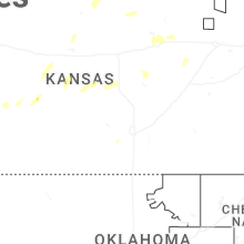


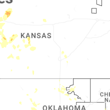

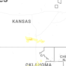


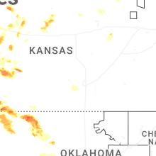


Connect with Interactive Hail Maps