

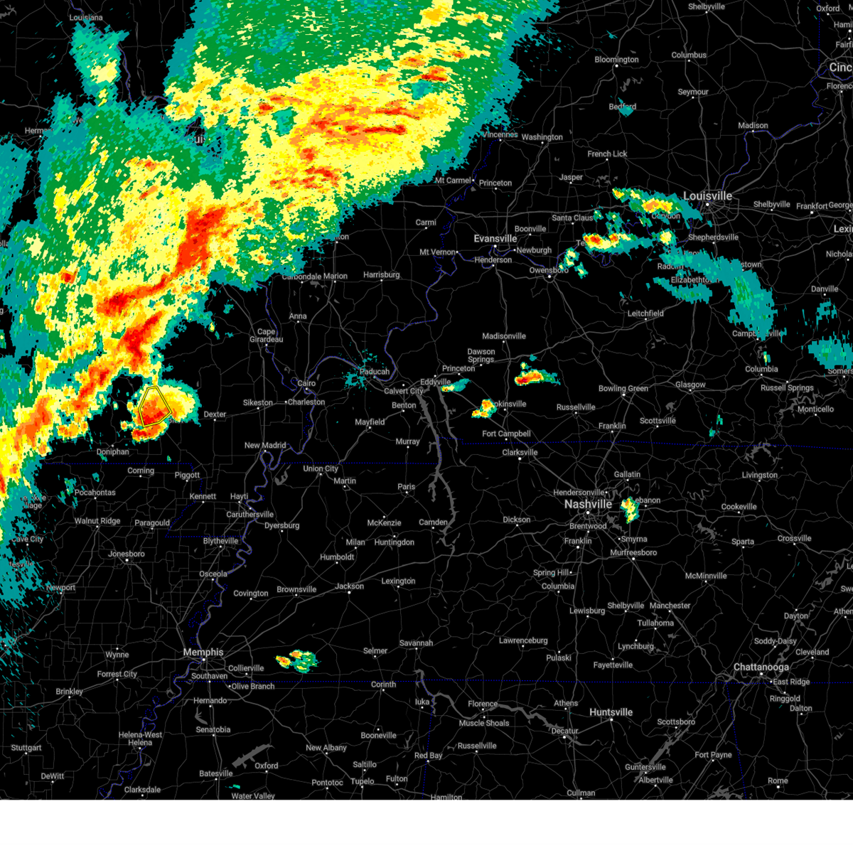
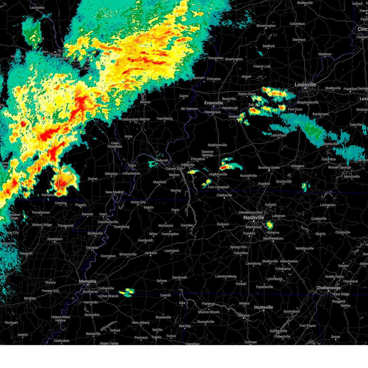
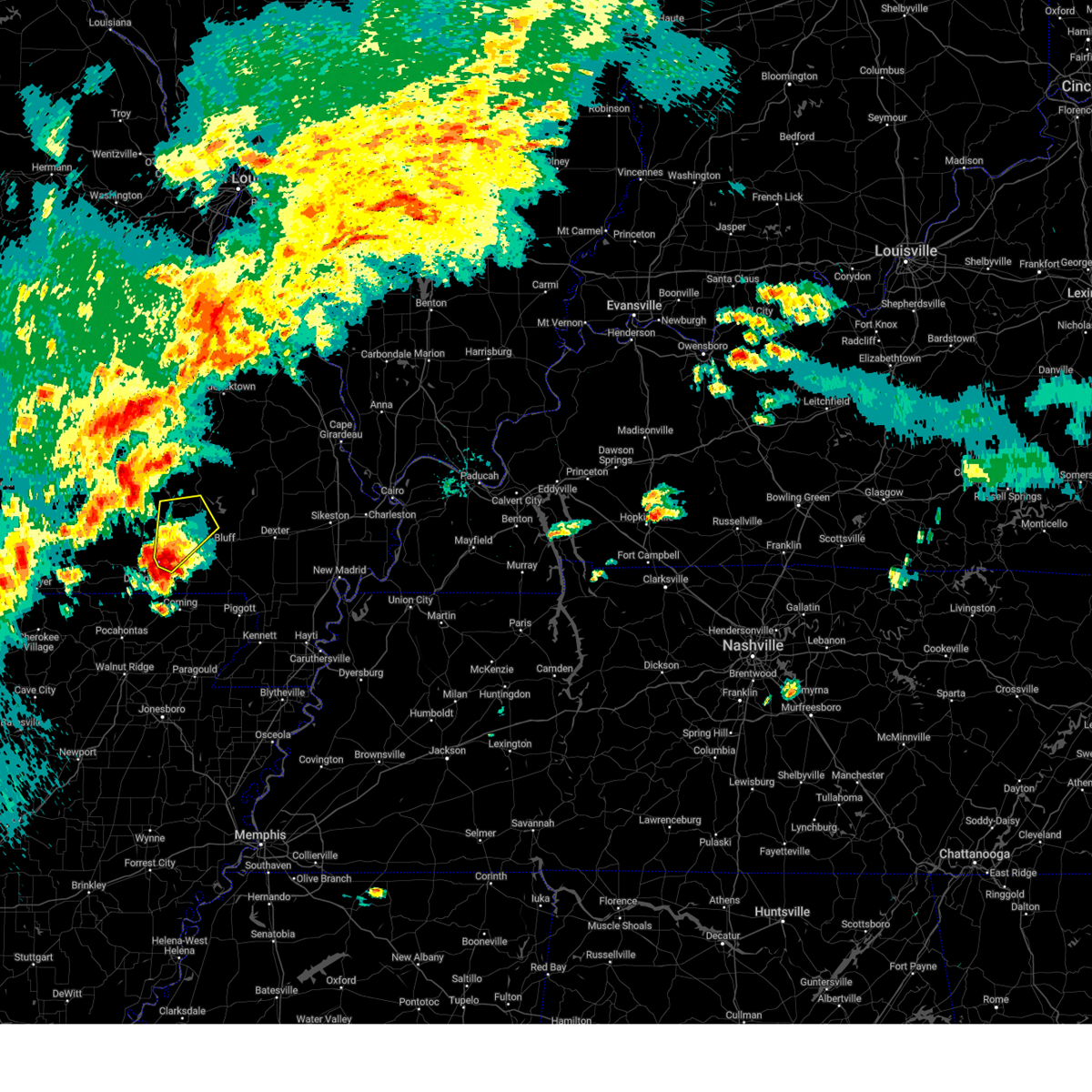
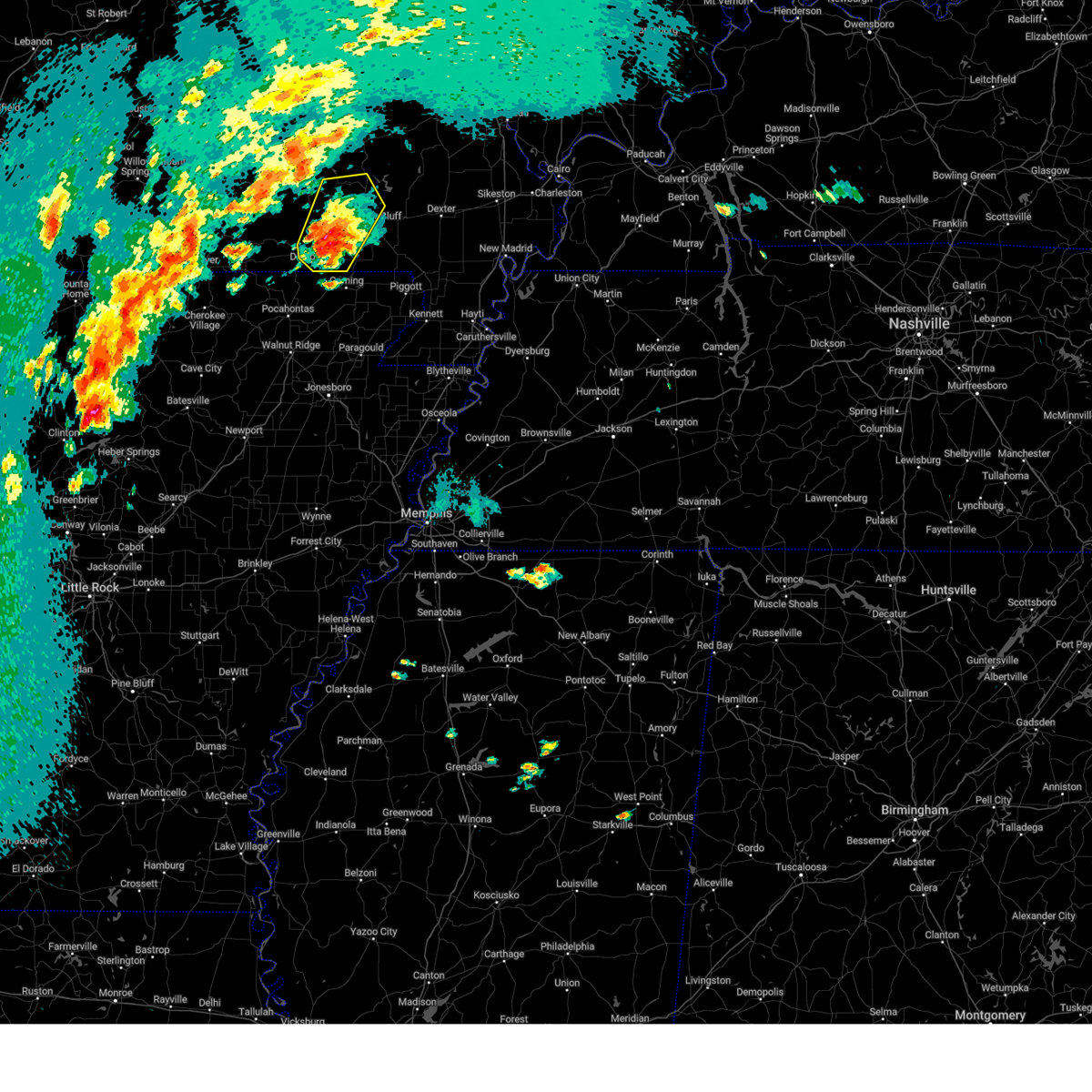
Hail Map for Williamsville, MO
The Williamsville, MO area has had 6 reports of on-the-ground hail by trained spotters, and has been under severe weather warnings 23 times during the past 12 months. Doppler radar has detected hail at or near Williamsville, MO on 75 occasions, including 7 occasions during the past year.
| Name: | Williamsville, MO |
| Where Located: | 59.8 miles WSW of Cape Girardeau, MO |
| Map: | Google Map for Williamsville, MO |
| Population: | 342 |
| Housing Units: | 188 |
| More Info: | Search Google for Williamsville, MO |
1
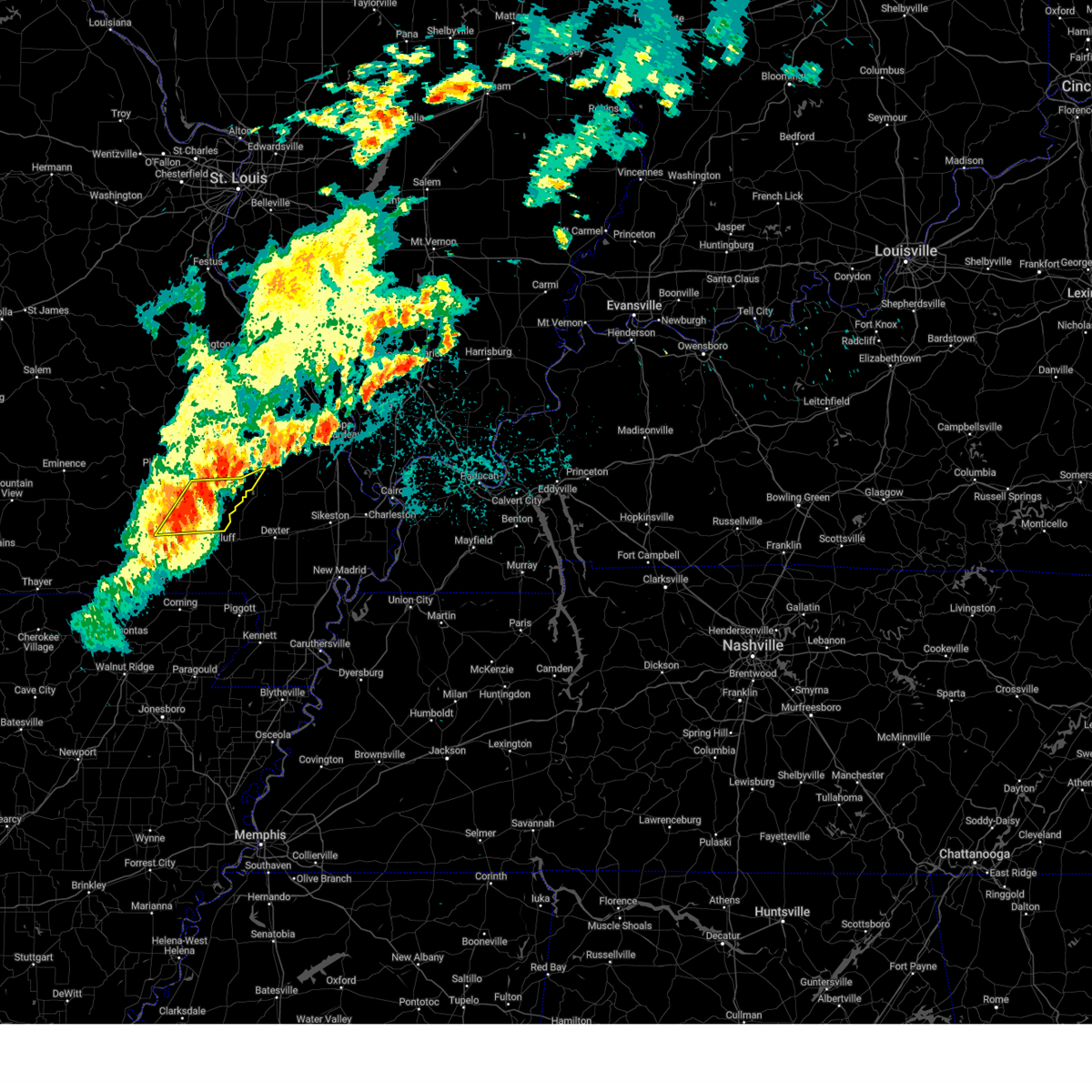
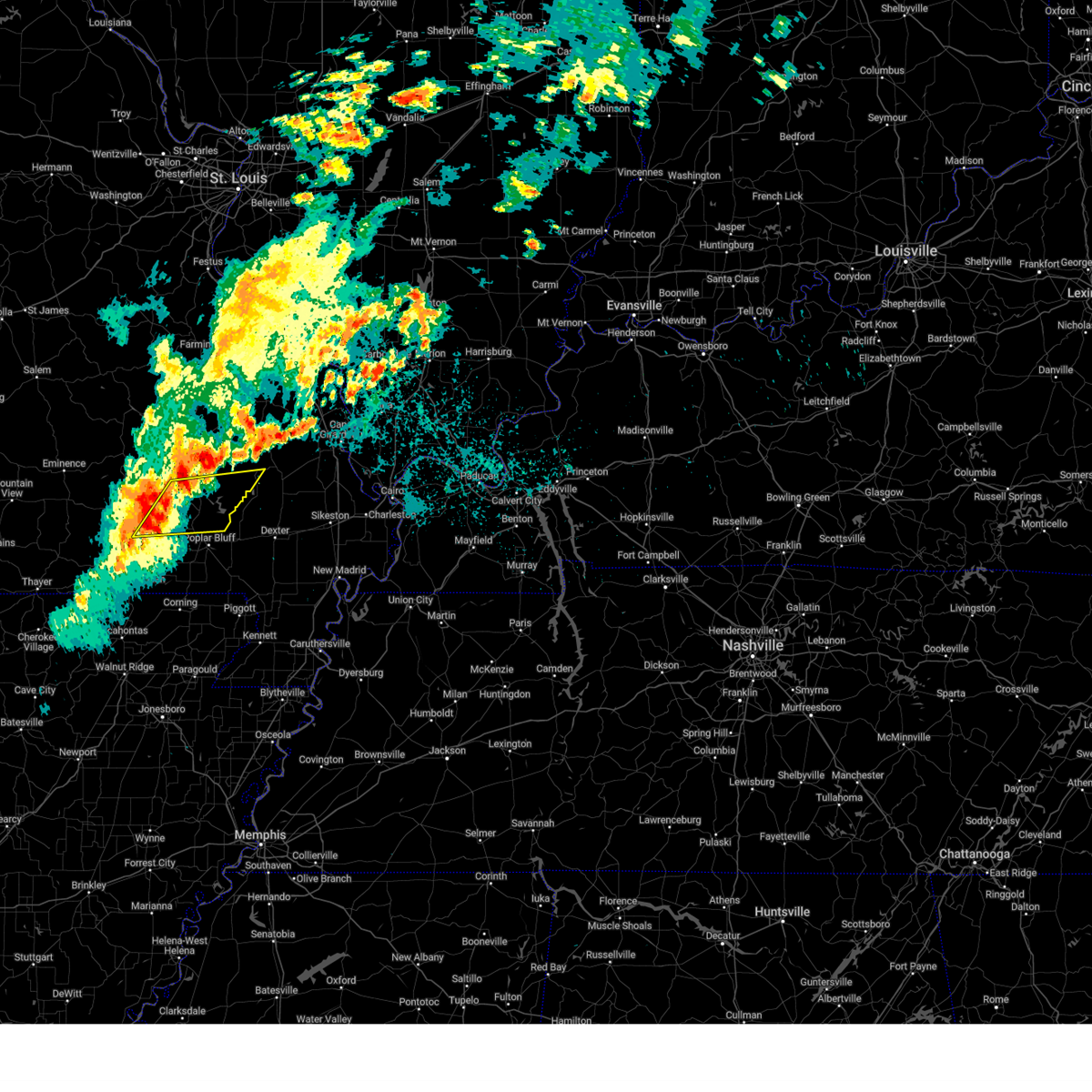
The Top Recent Hail Date for Williamsville, MO is Wednesday, April 2, 2025 (8th out of 75)

Hail and Wind Damage Spotted near Williamsville, MO
| Date / Time | Report Details |
|---|---|
| 6/9/2025 12:39 AM CDT |
 the severe thunderstorm warning has been cancelled and is no longer in effect the severe thunderstorm warning has been cancelled and is no longer in effect
|
| 6/9/2025 12:39 AM CDT |
 At 1238 am cdt, severe thunderstorms were located along a line extending from near greenville to near milltown, moving east at 40 mph (radar indicated). Hazards include 70 mph wind gusts and quarter size hail. Hail damage to vehicles is expected. expect considerable tree damage. wind damage is also likely to mobile homes, roofs, and outbuildings. Locations impacted include, lake wappapello state park, williamsville, hendrickson, wappapello, shook, brush arbor, zalma, and rombauer. At 1238 am cdt, severe thunderstorms were located along a line extending from near greenville to near milltown, moving east at 40 mph (radar indicated). Hazards include 70 mph wind gusts and quarter size hail. Hail damage to vehicles is expected. expect considerable tree damage. wind damage is also likely to mobile homes, roofs, and outbuildings. Locations impacted include, lake wappapello state park, williamsville, hendrickson, wappapello, shook, brush arbor, zalma, and rombauer.
|
| 6/9/2025 12:21 AM CDT |
 Svrpah the national weather service in paducah has issued a * severe thunderstorm warning for, southwestern bollinger county in southeastern missouri, southeastern carter county in southeastern missouri, north central ripley county in southeastern missouri, southern wayne county in southeastern missouri, northwestern butler county in southeastern missouri, * until 100 am cdt. * at 1221 am cdt, severe thunderstorms were located along a line extending from near greenville to near budapest, moving east at 40 mph (radar indicated). Hazards include 70 mph wind gusts and quarter size hail. Hail damage to vehicles is expected. expect considerable tree damage. Wind damage is also likely to mobile homes, roofs, and outbuildings. Svrpah the national weather service in paducah has issued a * severe thunderstorm warning for, southwestern bollinger county in southeastern missouri, southeastern carter county in southeastern missouri, north central ripley county in southeastern missouri, southern wayne county in southeastern missouri, northwestern butler county in southeastern missouri, * until 100 am cdt. * at 1221 am cdt, severe thunderstorms were located along a line extending from near greenville to near budapest, moving east at 40 mph (radar indicated). Hazards include 70 mph wind gusts and quarter size hail. Hail damage to vehicles is expected. expect considerable tree damage. Wind damage is also likely to mobile homes, roofs, and outbuildings.
|
| 5/20/2025 2:05 PM CDT | Svrpah the national weather service in paducah has issued a * severe thunderstorm warning for, southeastern carter county in southeastern missouri, northeastern ripley county in southeastern missouri, south central wayne county in southeastern missouri, northwestern butler county in southeastern missouri, * until 245 pm cdt. * at 205 pm cdt, a severe thunderstorm was located near budapest, or 14 miles northeast of doniphan, moving east at 30 mph (radar indicated). Hazards include 60 mph wind gusts and quarter size hail. Hail damage to vehicles is expected. Expect wind damage to roofs, siding, and trees. |
| 5/16/2025 5:20 PM CDT |
 At 520 pm cdt, severe thunderstorms were located along a line extending from near lodi to near hunter, moving east at 45 mph (radar indicated). Hazards include 60 mph wind gusts and quarter size hail. Hail damage to vehicles is expected. expect wind damage to roofs, siding, and trees. locations impacted include, piedmont, greenville, sam a. Baker state park, williamsville, lodi, cascade, and mill spring. At 520 pm cdt, severe thunderstorms were located along a line extending from near lodi to near hunter, moving east at 45 mph (radar indicated). Hazards include 60 mph wind gusts and quarter size hail. Hail damage to vehicles is expected. expect wind damage to roofs, siding, and trees. locations impacted include, piedmont, greenville, sam a. Baker state park, williamsville, lodi, cascade, and mill spring.
|
| 5/16/2025 5:09 PM CDT | Svrpah the national weather service in paducah has issued a * severe thunderstorm warning for, west central bollinger county in southeastern missouri, northeastern carter county in southeastern missouri, wayne county in southeastern missouri, * until 600 pm cdt. * at 509 pm cdt, severe thunderstorms were located along a line extending from near sam a. baker state park to near van buren, moving east at 45 mph (radar indicated). Hazards include 60 mph wind gusts and quarter size hail. Hail damage to vehicles is expected. Expect wind damage to roofs, siding, and trees. |
| 5/16/2025 3:10 PM CDT | Tree tops broken off large tree in wayne county MO, 0.3 miles NE of Williamsville, MO |
| 5/16/2025 3:10 PM CDT | the tornado warning has been cancelled and is no longer in effect |
| 5/16/2025 3:10 PM CDT | At 310 pm cdt, a severe thunderstorm capable of producing a tornado was located near greenville, moving east at 50 mph (radar indicated rotation). Hazards include tornado and softball size hail. Flying debris will be dangerous to those caught without shelter. mobile homes will be damaged or destroyed. damage to roofs, windows, and vehicles will occur. tree damage is likely. this dangerous storm will be near, shook around 315 pm cdt. Puxico around 325 pm cdt. |
| 5/16/2025 2:41 PM CDT |
 Torpah the national weather service in paducah has issued a * tornado warning for, southwestern bollinger county in southeastern missouri, northeastern carter county in southeastern missouri, wayne county in southeastern missouri, northwestern stoddard county in southeastern missouri, * until 345 pm cdt. * at 241 pm cdt, a severe thunderstorm capable of producing a tornado was located near garwood, or 10 miles east of van buren, moving east at 50 mph (radar indicated rotation). Hazards include tornado and softball size hail. Flying debris will be dangerous to those caught without shelter. mobile homes will be damaged or destroyed. damage to roofs, windows, and vehicles will occur. tree damage is likely. this dangerous storm will be near, piedmont and ellsinore around 245 pm cdt. williamsville around 255 pm cdt. greenville around 300 pm cdt. shook around 305 pm cdt. puxico around 325 pm cdt. Other locations impacted by this tornadic thunderstorm include mill spring. Torpah the national weather service in paducah has issued a * tornado warning for, southwestern bollinger county in southeastern missouri, northeastern carter county in southeastern missouri, wayne county in southeastern missouri, northwestern stoddard county in southeastern missouri, * until 345 pm cdt. * at 241 pm cdt, a severe thunderstorm capable of producing a tornado was located near garwood, or 10 miles east of van buren, moving east at 50 mph (radar indicated rotation). Hazards include tornado and softball size hail. Flying debris will be dangerous to those caught without shelter. mobile homes will be damaged or destroyed. damage to roofs, windows, and vehicles will occur. tree damage is likely. this dangerous storm will be near, piedmont and ellsinore around 245 pm cdt. williamsville around 255 pm cdt. greenville around 300 pm cdt. shook around 305 pm cdt. puxico around 325 pm cdt. Other locations impacted by this tornadic thunderstorm include mill spring.
|
| 4/4/2025 6:31 PM CDT |
 At 631 pm cdt, a severe thunderstorm was located over hendrickson, or 7 miles southwest of lake wappapello state park, moving northeast at 40 mph (radar indicated). Hazards include 60 mph wind gusts and quarter size hail. Hail damage to vehicles is expected. expect wind damage to roofs, siding, and trees. Locations impacted include, hendrickson, williamsville, and poplar bluff. At 631 pm cdt, a severe thunderstorm was located over hendrickson, or 7 miles southwest of lake wappapello state park, moving northeast at 40 mph (radar indicated). Hazards include 60 mph wind gusts and quarter size hail. Hail damage to vehicles is expected. expect wind damage to roofs, siding, and trees. Locations impacted include, hendrickson, williamsville, and poplar bluff.
|
| 4/4/2025 6:18 PM CDT |
 At 618 pm cdt, a severe thunderstorm was located near milltown, or 7 miles west of poplar bluff, moving northeast at 35 mph (radar indicated). Hazards include 60 mph wind gusts and quarter size hail. Hail damage to vehicles is expected. expect wind damage to roofs, siding, and trees. Locations impacted include, hendrickson, williamsville, milltown, and poplar bluff. At 618 pm cdt, a severe thunderstorm was located near milltown, or 7 miles west of poplar bluff, moving northeast at 35 mph (radar indicated). Hazards include 60 mph wind gusts and quarter size hail. Hail damage to vehicles is expected. expect wind damage to roofs, siding, and trees. Locations impacted include, hendrickson, williamsville, milltown, and poplar bluff.
|
| 4/4/2025 6:18 PM CDT |
 the severe thunderstorm warning has been cancelled and is no longer in effect the severe thunderstorm warning has been cancelled and is no longer in effect
|
| 4/4/2025 6:07 PM CDT |
 At 607 pm cdt, a severe thunderstorm was located over milltown, or 10 miles west of poplar bluff, moving northeast at 40 mph (radar indicated). Hazards include 60 mph wind gusts and quarter size hail. Hail damage to vehicles is expected. expect wind damage to roofs, siding, and trees. Locations impacted include, budapest, hendrickson, williamsville, milltown, fairdealing, brush arbor, and poplar bluff. At 607 pm cdt, a severe thunderstorm was located over milltown, or 10 miles west of poplar bluff, moving northeast at 40 mph (radar indicated). Hazards include 60 mph wind gusts and quarter size hail. Hail damage to vehicles is expected. expect wind damage to roofs, siding, and trees. Locations impacted include, budapest, hendrickson, williamsville, milltown, fairdealing, brush arbor, and poplar bluff.
|
| 4/4/2025 5:55 PM CDT |
 Svrpah the national weather service in paducah has issued a * severe thunderstorm warning for, southeastern carter county in southeastern missouri, eastern ripley county in southeastern missouri, southwestern wayne county in southeastern missouri, western butler county in southeastern missouri, * until 645 pm cdt. * at 555 pm cdt, a severe thunderstorm was located near budapest, or near doniphan, moving northeast at 40 mph (radar indicated). Hazards include ping pong ball size hail and 60 mph wind gusts. People and animals outdoors will be injured. expect hail damage to roofs, siding, windows, and vehicles. Expect wind damage to roofs, siding, and trees. Svrpah the national weather service in paducah has issued a * severe thunderstorm warning for, southeastern carter county in southeastern missouri, eastern ripley county in southeastern missouri, southwestern wayne county in southeastern missouri, western butler county in southeastern missouri, * until 645 pm cdt. * at 555 pm cdt, a severe thunderstorm was located near budapest, or near doniphan, moving northeast at 40 mph (radar indicated). Hazards include ping pong ball size hail and 60 mph wind gusts. People and animals outdoors will be injured. expect hail damage to roofs, siding, windows, and vehicles. Expect wind damage to roofs, siding, and trees.
|
| 4/2/2025 5:51 PM CDT | At 551 pm cdt, a severe thunderstorm was located near brush arbor, or 12 miles northwest of poplar bluff, moving east at 45 mph (radar indicated). Hazards include 60 mph wind gusts and quarter size hail. Hail damage to vehicles is expected. expect wind damage to roofs, siding, and trees. Locations impacted include, williamsville, milltown, brush arbor, and poplar bluff. |
| 4/2/2025 5:51 PM CDT | the severe thunderstorm warning has been cancelled and is no longer in effect |
| 4/2/2025 5:50 PM CDT | the tornado warning has been cancelled and is no longer in effect |
| 4/2/2025 5:50 PM CDT | At 550 pm cdt, a severe thunderstorm capable of producing a tornado was located near williamsville, or 9 miles southwest of greenville, moving northeast at 55 mph (radar indicated rotation). Hazards include tornado and quarter size hail. Flying debris will be dangerous to those caught without shelter. mobile homes will be damaged or destroyed. damage to roofs, windows, and vehicles will occur. tree damage is likely. this dangerous storm will be near, greenville around 555 pm cdt. cascade around 610 pm cdt. Other locations impacted by this tornadic thunderstorm include mill spring. |
| 4/2/2025 5:41 PM CDT | Torpah the national weather service in paducah has issued a * tornado warning for, northeastern carter county in southeastern missouri, wayne county in southeastern missouri, northwestern butler county in southeastern missouri, * until 630 pm cdt. * at 540 pm cdt, a severe thunderstorm capable of producing a tornado was located over ellsinore, or 14 miles south of piedmont, moving northeast at 55 mph (radar indicated rotation). Hazards include tornado and quarter size hail. Flying debris will be dangerous to those caught without shelter. mobile homes will be damaged or destroyed. damage to roofs, windows, and vehicles will occur. tree damage is likely. this dangerous storm will be near, brush arbor and williamsville around 545 pm cdt. greenville around 555 pm cdt. lodi around 605 pm cdt. cascade around 610 pm cdt. Other locations impacted by this tornadic thunderstorm include mill spring. |
| 4/2/2025 5:09 PM CDT |
 Svrpah the national weather service in paducah has issued a * severe thunderstorm warning for, southeastern carter county in southeastern missouri, northern ripley county in southeastern missouri, southwestern wayne county in southeastern missouri, northwestern butler county in southeastern missouri, * until 600 pm cdt. * at 508 pm cdt, a severe thunderstorm was located 7 miles northwest of gatewood, or 20 miles northeast of thayer, moving northeast at 65 mph (radar indicated). Hazards include 60 mph wind gusts and quarter size hail. Hail damage to vehicles is expected. Expect wind damage to roofs, siding, and trees. Svrpah the national weather service in paducah has issued a * severe thunderstorm warning for, southeastern carter county in southeastern missouri, northern ripley county in southeastern missouri, southwestern wayne county in southeastern missouri, northwestern butler county in southeastern missouri, * until 600 pm cdt. * at 508 pm cdt, a severe thunderstorm was located 7 miles northwest of gatewood, or 20 miles northeast of thayer, moving northeast at 65 mph (radar indicated). Hazards include 60 mph wind gusts and quarter size hail. Hail damage to vehicles is expected. Expect wind damage to roofs, siding, and trees.
|
| 3/30/2025 4:30 PM CDT |
 At 429 pm cdt, a severe thunderstorm was located near williamsville, or 7 miles southwest of greenville, moving northeast at 35 mph. at 4:25 pm cdt, emergency management reported golf ball size hail near williamsville (emergency management). Hazards include two inch hail and 60 mph wind gusts. People and animals outdoors will be injured. expect hail damage to roofs, siding, windows, and vehicles. expect wind damage to roofs, siding, and trees. Locations impacted include, williamsville, shook, greenville, and cascade. At 429 pm cdt, a severe thunderstorm was located near williamsville, or 7 miles southwest of greenville, moving northeast at 35 mph. at 4:25 pm cdt, emergency management reported golf ball size hail near williamsville (emergency management). Hazards include two inch hail and 60 mph wind gusts. People and animals outdoors will be injured. expect hail damage to roofs, siding, windows, and vehicles. expect wind damage to roofs, siding, and trees. Locations impacted include, williamsville, shook, greenville, and cascade.
|
| 3/30/2025 4:28 PM CDT | Golf Ball sized hail reported 0.5 miles SSE of Williamsville, MO |
| 3/30/2025 4:23 PM CDT | Svrpah the national weather service in paducah has issued a * severe thunderstorm warning for, southwestern bollinger county in southeastern missouri, central wayne county in southeastern missouri, * until 515 pm cdt. * at 423 pm cdt, a severe thunderstorm was located near williamsville, or 8 miles southwest of greenville, moving northeast at 40 mph (radar indicated). Hazards include ping pong ball size hail and 60 mph wind gusts. People and animals outdoors will be injured. expect hail damage to roofs, siding, windows, and vehicles. Expect wind damage to roofs, siding, and trees. |
| 3/14/2025 10:12 PM CDT |
 Torpah the national weather service in paducah has issued a * tornado warning for, carter county in southeastern missouri, northwestern ripley county in southeastern missouri, western wayne county in southeastern missouri, * until 1100 pm cdt. * at 1012 pm cdt, a severe thunderstorm capable of producing a tornado was located near handy, or 14 miles southwest of van buren, moving northeast at 80 mph (radar indicated rotation). Hazards include tornado and hail up to two inches in diameter. Flying debris will be dangerous to those caught without shelter. mobile homes will be damaged or destroyed. damage to roofs, windows, and vehicles will occur. tree damage is likely. this dangerous storm will be near, hunter and van buren around 1020 pm cdt. ellsinore around 1025 pm cdt. piedmont around 1030 pm cdt. Other locations impacted by this tornadic thunderstorm include mill spring. Torpah the national weather service in paducah has issued a * tornado warning for, carter county in southeastern missouri, northwestern ripley county in southeastern missouri, western wayne county in southeastern missouri, * until 1100 pm cdt. * at 1012 pm cdt, a severe thunderstorm capable of producing a tornado was located near handy, or 14 miles southwest of van buren, moving northeast at 80 mph (radar indicated rotation). Hazards include tornado and hail up to two inches in diameter. Flying debris will be dangerous to those caught without shelter. mobile homes will be damaged or destroyed. damage to roofs, windows, and vehicles will occur. tree damage is likely. this dangerous storm will be near, hunter and van buren around 1020 pm cdt. ellsinore around 1025 pm cdt. piedmont around 1030 pm cdt. Other locations impacted by this tornadic thunderstorm include mill spring.
|
| 7/5/2024 1:51 AM CDT |
 Svrpah the national weather service in paducah has issued a * severe thunderstorm warning for, eastern ripley county in southeastern missouri, southeastern wayne county in southeastern missouri, butler county in southeastern missouri, * until 230 am cdt. * at 151 am cdt, severe thunderstorms were located along a line extending from near greenville to near fairdealing, moving east at 55 mph (radar indicated). Hazards include 60 mph wind gusts. expect damage to roofs, siding, and trees Svrpah the national weather service in paducah has issued a * severe thunderstorm warning for, eastern ripley county in southeastern missouri, southeastern wayne county in southeastern missouri, butler county in southeastern missouri, * until 230 am cdt. * at 151 am cdt, severe thunderstorms were located along a line extending from near greenville to near fairdealing, moving east at 55 mph (radar indicated). Hazards include 60 mph wind gusts. expect damage to roofs, siding, and trees
|
| 6/8/2024 11:22 PM CDT |
 At 1121 pm cdt, severe thunderstorms were located along a line extending from near greenville to near hendrickson to near williamsville, moving southeast at 30 mph (radar indicated). Hazards include 60 mph wind gusts and quarter size hail. Hail damage to vehicles is expected. expect wind damage to roofs, siding, and trees. Locations impacted include, greenville, lake wappapello state park, williamsville, wappapello, shook, lodi, cascade, and mill spring. At 1121 pm cdt, severe thunderstorms were located along a line extending from near greenville to near hendrickson to near williamsville, moving southeast at 30 mph (radar indicated). Hazards include 60 mph wind gusts and quarter size hail. Hail damage to vehicles is expected. expect wind damage to roofs, siding, and trees. Locations impacted include, greenville, lake wappapello state park, williamsville, wappapello, shook, lodi, cascade, and mill spring.
|
| 6/8/2024 11:06 PM CDT |
 Svrpah the national weather service in paducah has issued a * severe thunderstorm warning for, wayne county in southeastern missouri, * until 1130 pm cdt. * at 1106 pm cdt, severe thunderstorms were located along a line extending from near sam a. baker state park to 6 miles southwest of greenville to near williamsville, moving southeast at 30 mph (radar indicated). Hazards include 60 mph wind gusts and quarter size hail. Hail damage to vehicles is expected. Expect wind damage to roofs, siding, and trees. Svrpah the national weather service in paducah has issued a * severe thunderstorm warning for, wayne county in southeastern missouri, * until 1130 pm cdt. * at 1106 pm cdt, severe thunderstorms were located along a line extending from near sam a. baker state park to 6 miles southwest of greenville to near williamsville, moving southeast at 30 mph (radar indicated). Hazards include 60 mph wind gusts and quarter size hail. Hail damage to vehicles is expected. Expect wind damage to roofs, siding, and trees.
|
| 5/26/2024 7:53 PM CDT |
 The tornado threat has diminished and the tornado warning has been cancelled. however, large hail and damaging winds remain likely and a severe thunderstorm warning remains in effect for the area. a tornado watch remains in effect until 1100 pm cdt for southeastern missouri. The tornado threat has diminished and the tornado warning has been cancelled. however, large hail and damaging winds remain likely and a severe thunderstorm warning remains in effect for the area. a tornado watch remains in effect until 1100 pm cdt for southeastern missouri.
|
| 5/26/2024 7:48 PM CDT |
 Svrpah the national weather service in paducah has issued a * severe thunderstorm warning for, southern bollinger county in southeastern missouri, southeastern carter county in southeastern missouri, northeastern ripley county in southeastern missouri, wayne county in southeastern missouri, butler county in southeastern missouri, southwestern cape girardeau county in southeastern missouri, northwestern stoddard county in southeastern missouri, * until 845 pm cdt. * at 748 pm cdt, severe thunderstorms were located along a line extending from cascade to 6 miles northwest of budapest, moving southeast at 25 mph (radar indicated). Hazards include 70 mph wind gusts and quarter size hail. Hail damage to vehicles is expected. expect considerable tree damage. Wind damage is also likely to mobile homes, roofs, and outbuildings. Svrpah the national weather service in paducah has issued a * severe thunderstorm warning for, southern bollinger county in southeastern missouri, southeastern carter county in southeastern missouri, northeastern ripley county in southeastern missouri, wayne county in southeastern missouri, butler county in southeastern missouri, southwestern cape girardeau county in southeastern missouri, northwestern stoddard county in southeastern missouri, * until 845 pm cdt. * at 748 pm cdt, severe thunderstorms were located along a line extending from cascade to 6 miles northwest of budapest, moving southeast at 25 mph (radar indicated). Hazards include 70 mph wind gusts and quarter size hail. Hail damage to vehicles is expected. expect considerable tree damage. Wind damage is also likely to mobile homes, roofs, and outbuildings.
|
| 5/26/2024 7:26 PM CDT |
 Torpah the national weather service in paducah has issued a * tornado warning for, eastern carter county in southeastern missouri, southwestern wayne county in southeastern missouri, northwestern butler county in southeastern missouri, * until 800 pm cdt. * at 726 pm cdt, a severe thunderstorm capable of producing a tornado was located over hunter, or 11 miles southeast of van buren, moving east at 40 mph (radar indicated rotation). Hazards include tornado and quarter size hail. Flying debris will be dangerous to those caught without shelter. mobile homes will be damaged or destroyed. damage to roofs, windows, and vehicles will occur. tree damage is likely. this dangerous storm will be near, ellsinore and brush arbor around 730 pm cdt. williamsville around 740 pm cdt. Hendrickson around 745 pm cdt. Torpah the national weather service in paducah has issued a * tornado warning for, eastern carter county in southeastern missouri, southwestern wayne county in southeastern missouri, northwestern butler county in southeastern missouri, * until 800 pm cdt. * at 726 pm cdt, a severe thunderstorm capable of producing a tornado was located over hunter, or 11 miles southeast of van buren, moving east at 40 mph (radar indicated rotation). Hazards include tornado and quarter size hail. Flying debris will be dangerous to those caught without shelter. mobile homes will be damaged or destroyed. damage to roofs, windows, and vehicles will occur. tree damage is likely. this dangerous storm will be near, ellsinore and brush arbor around 730 pm cdt. williamsville around 740 pm cdt. Hendrickson around 745 pm cdt.
|
| 5/26/2024 6:22 AM CDT |
 Svrpah the national weather service in paducah has issued a * severe thunderstorm warning for, bollinger county in southeastern missouri, southeastern carter county in southeastern missouri, northeastern ripley county in southeastern missouri, wayne county in southeastern missouri, northern butler county in southeastern missouri, northwestern stoddard county in southeastern missouri, * until 700 am cdt. * at 622 am cdt, severe thunderstorms were located along a line extending from sam a. baker state park to near williamsville to near budapest, moving east at 50 mph (radar indicated). Hazards include 60 mph wind gusts. expect damage to roofs, siding, and trees Svrpah the national weather service in paducah has issued a * severe thunderstorm warning for, bollinger county in southeastern missouri, southeastern carter county in southeastern missouri, northeastern ripley county in southeastern missouri, wayne county in southeastern missouri, northern butler county in southeastern missouri, northwestern stoddard county in southeastern missouri, * until 700 am cdt. * at 622 am cdt, severe thunderstorms were located along a line extending from sam a. baker state park to near williamsville to near budapest, moving east at 50 mph (radar indicated). Hazards include 60 mph wind gusts. expect damage to roofs, siding, and trees
|
| 8/3/2023 1:19 AM CDT |
 At 118 am cdt, severe thunderstorms were located along a line extending from cascade to near williamsville to van buren, moving southeast at 35 mph (radar indicated). Hazards include 60 mph wind gusts and penny size hail. Expect damage to roofs, siding, and trees. locations impacted include, piedmont, greenville, lake wappapello state park, sam a. baker state park, williamsville, shook, lodi, cascade, grassy, mill spring and zalma. hail threat, radar indicated max hail size, 0. 75 in wind threat, radar indicated max wind gust, 60 mph. At 118 am cdt, severe thunderstorms were located along a line extending from cascade to near williamsville to van buren, moving southeast at 35 mph (radar indicated). Hazards include 60 mph wind gusts and penny size hail. Expect damage to roofs, siding, and trees. locations impacted include, piedmont, greenville, lake wappapello state park, sam a. baker state park, williamsville, shook, lodi, cascade, grassy, mill spring and zalma. hail threat, radar indicated max hail size, 0. 75 in wind threat, radar indicated max wind gust, 60 mph.
|
| 8/3/2023 12:58 AM CDT |
 At 1258 am cdt, severe thunderstorms were located along a line extending from saco to near piedmont to 9 miles northeast of winona, moving southeast at 35 mph (radar indicated). Hazards include 60 mph wind gusts and penny size hail. expect damage to roofs, siding, and trees At 1258 am cdt, severe thunderstorms were located along a line extending from saco to near piedmont to 9 miles northeast of winona, moving southeast at 35 mph (radar indicated). Hazards include 60 mph wind gusts and penny size hail. expect damage to roofs, siding, and trees
|
| 7/18/2023 11:39 AM CDT |
 At 1139 am cdt, severe thunderstorms were located along a line extending from near perryville to near grassy to near greenville, moving east at 55 mph (radar indicated). Hazards include 60 mph wind gusts and nickel size hail. Expect damage to roofs, siding, and trees. locations impacted include, perryville, piedmont, marble hill, sam a. baker state park, bollinger mill state historic site, greenville, lake wappapello state park, williamsville, wappapello, millersville, lodi, alliance, cascade, patton, leopold, burfordville, shook, daisy, grassy and oak ridge. this includes interstate 55 between mile markers 114 and 139. hail threat, radar indicated max hail size, 0. 88 in wind threat, radar indicated max wind gust, 60 mph. At 1139 am cdt, severe thunderstorms were located along a line extending from near perryville to near grassy to near greenville, moving east at 55 mph (radar indicated). Hazards include 60 mph wind gusts and nickel size hail. Expect damage to roofs, siding, and trees. locations impacted include, perryville, piedmont, marble hill, sam a. baker state park, bollinger mill state historic site, greenville, lake wappapello state park, williamsville, wappapello, millersville, lodi, alliance, cascade, patton, leopold, burfordville, shook, daisy, grassy and oak ridge. this includes interstate 55 between mile markers 114 and 139. hail threat, radar indicated max hail size, 0. 88 in wind threat, radar indicated max wind gust, 60 mph.
|
| 7/18/2023 11:17 AM CDT |
 At 1116 am cdt, severe thunderstorms were located along a line extending from near coffman to 6 miles northeast of saco to near piedmont, moving southeast at 60 mph (radar indicated). Hazards include 60 mph wind gusts and nickel size hail. expect damage to roofs, siding, and trees At 1116 am cdt, severe thunderstorms were located along a line extending from near coffman to 6 miles northeast of saco to near piedmont, moving southeast at 60 mph (radar indicated). Hazards include 60 mph wind gusts and nickel size hail. expect damage to roofs, siding, and trees
|
| 7/17/2023 6:03 PM CDT |
 At 602 pm cdt, a severe thunderstorm was located near lake wappapello state park, moving east at 25 mph (radar indicated). Hazards include 60 mph wind gusts and quarter size hail. Hail damage to vehicles is expected. expect wind damage to roofs, siding, and trees. locations impacted include, lake wappapello state park, williamsville, hendrickson and wappapello. hail threat, radar indicated max hail size, 1. 00 in wind threat, radar indicated max wind gust, 60 mph. At 602 pm cdt, a severe thunderstorm was located near lake wappapello state park, moving east at 25 mph (radar indicated). Hazards include 60 mph wind gusts and quarter size hail. Hail damage to vehicles is expected. expect wind damage to roofs, siding, and trees. locations impacted include, lake wappapello state park, williamsville, hendrickson and wappapello. hail threat, radar indicated max hail size, 1. 00 in wind threat, radar indicated max wind gust, 60 mph.
|
| 7/17/2023 5:57 PM CDT | Quarter sized hail reported 3.8 miles WNW of Williamsville, MO |
| 7/17/2023 5:41 PM CDT |
 At 541 pm cdt, a severe thunderstorm was located near williamsville, or 10 miles southwest of greenville, moving east at 25 mph (radar indicated). Hazards include 60 mph wind gusts and quarter size hail. Hail damage to vehicles is expected. Expect wind damage to roofs, siding, and trees. At 541 pm cdt, a severe thunderstorm was located near williamsville, or 10 miles southwest of greenville, moving east at 25 mph (radar indicated). Hazards include 60 mph wind gusts and quarter size hail. Hail damage to vehicles is expected. Expect wind damage to roofs, siding, and trees.
|
| 7/17/2023 11:16 AM CDT |
 At 1115 am cdt, a severe thunderstorm was located near piedmont, moving southeast at 40 mph (radar indicated). Hazards include 60 mph wind gusts and quarter size hail. Hail damage to vehicles is expected. expect wind damage to roofs, siding, and trees. locations impacted include, williamsville, hendrickson, brush arbor and mill spring. hail threat, radar indicated max hail size, 1. 00 in wind threat, radar indicated max wind gust, 60 mph. At 1115 am cdt, a severe thunderstorm was located near piedmont, moving southeast at 40 mph (radar indicated). Hazards include 60 mph wind gusts and quarter size hail. Hail damage to vehicles is expected. expect wind damage to roofs, siding, and trees. locations impacted include, williamsville, hendrickson, brush arbor and mill spring. hail threat, radar indicated max hail size, 1. 00 in wind threat, radar indicated max wind gust, 60 mph.
|
| 7/17/2023 11:00 AM CDT |
 At 1100 am cdt, a severe thunderstorm was located near piedmont, moving southeast at 30 mph (radar indicated). Hazards include golf ball size hail and 60 mph wind gusts. People and animals outdoors will be injured. expect hail damage to roofs, siding, windows, and vehicles. Expect wind damage to roofs, siding, and trees. At 1100 am cdt, a severe thunderstorm was located near piedmont, moving southeast at 30 mph (radar indicated). Hazards include golf ball size hail and 60 mph wind gusts. People and animals outdoors will be injured. expect hail damage to roofs, siding, windows, and vehicles. Expect wind damage to roofs, siding, and trees.
|
| 5/15/2023 5:06 PM CDT | Quarter sized hail reported 0.3 miles NE of Williamsville, MO, quarter sized hail in and around williamsville... just south of greenville. |
| 5/15/2023 4:58 PM CDT |
 At 457 pm cdt, a severe thunderstorm was located near greenville, moving east at 15 mph (radar indicated). Hazards include golf ball size hail and 70 mph wind gusts. People and animals outdoors will be injured. expect hail damage to roofs, siding, windows, and vehicles. expect considerable tree damage. wind damage is also likely to mobile homes, roofs, and outbuildings. Locations impacted include, greenville and points south along highway 67. At 457 pm cdt, a severe thunderstorm was located near greenville, moving east at 15 mph (radar indicated). Hazards include golf ball size hail and 70 mph wind gusts. People and animals outdoors will be injured. expect hail damage to roofs, siding, windows, and vehicles. expect considerable tree damage. wind damage is also likely to mobile homes, roofs, and outbuildings. Locations impacted include, greenville and points south along highway 67.
|
| 5/15/2023 4:40 PM CDT |
 At 439 pm cdt, two severe thunderstorms were located near greenville, moving east at 10 mph. one storm was just west of greenville, and the other storm was near lake wappappello (radar indicated). Hazards include 70 mph wind gusts and half dollar size hail. Hail damage to vehicles is expected. expect considerable tree damage. Wind damage is also likely to mobile homes, roofs, and outbuildings. At 439 pm cdt, two severe thunderstorms were located near greenville, moving east at 10 mph. one storm was just west of greenville, and the other storm was near lake wappappello (radar indicated). Hazards include 70 mph wind gusts and half dollar size hail. Hail damage to vehicles is expected. expect considerable tree damage. Wind damage is also likely to mobile homes, roofs, and outbuildings.
|
| 5/8/2023 8:57 PM CDT |
 At 856 pm cdt, severe thunderstorms were located along a line extending from near annapolis to near piedmont to near garwood, moving southeast at 45 mph (radar indicated). Hazards include 60 mph wind gusts and half dollar size hail. Hail damage to vehicles is expected. Expect wind damage to roofs, siding, and trees. At 856 pm cdt, severe thunderstorms were located along a line extending from near annapolis to near piedmont to near garwood, moving southeast at 45 mph (radar indicated). Hazards include 60 mph wind gusts and half dollar size hail. Hail damage to vehicles is expected. Expect wind damage to roofs, siding, and trees.
|
| 4/5/2023 2:51 AM CDT |
 At 250 am cdt, a severe thunderstorm capable of producing a tornado was located near mill spring, or 10 miles south of piedmont, moving northeast at 40 mph (radar indicated rotation). Hazards include tornado and two inch hail. Flying debris will be dangerous to those caught without shelter. mobile homes will be damaged or destroyed. damage to roofs, windows, and vehicles will occur. tree damage is likely. this dangerous storm will be near, williamsville around 255 am cdt. Other locations in the path of this tornadic thunderstorm include greenville. At 250 am cdt, a severe thunderstorm capable of producing a tornado was located near mill spring, or 10 miles south of piedmont, moving northeast at 40 mph (radar indicated rotation). Hazards include tornado and two inch hail. Flying debris will be dangerous to those caught without shelter. mobile homes will be damaged or destroyed. damage to roofs, windows, and vehicles will occur. tree damage is likely. this dangerous storm will be near, williamsville around 255 am cdt. Other locations in the path of this tornadic thunderstorm include greenville.
|
| 4/5/2023 2:39 AM CDT |
 At 239 am cdt, a severe thunderstorm capable of producing a tornado was locatedjust west of elsinore, or 12 miles east of van buren, moving northeast at 45 mph. this storm is showing very strong rotation and may be producing a significant tornado (radar indicated rotation). Hazards include tornado and baseball size hail. Flying debris will be dangerous to those caught without shelter. mobile homes will be damaged or destroyed. damage to roofs, windows, and vehicles will occur. tree damage is likely. this dangerous storm will be near, brush arbor around 245 am cdt. Other locations in the path of this tornadic thunderstorm include williamsville and greenville. At 239 am cdt, a severe thunderstorm capable of producing a tornado was locatedjust west of elsinore, or 12 miles east of van buren, moving northeast at 45 mph. this storm is showing very strong rotation and may be producing a significant tornado (radar indicated rotation). Hazards include tornado and baseball size hail. Flying debris will be dangerous to those caught without shelter. mobile homes will be damaged or destroyed. damage to roofs, windows, and vehicles will occur. tree damage is likely. this dangerous storm will be near, brush arbor around 245 am cdt. Other locations in the path of this tornadic thunderstorm include williamsville and greenville.
|
| 4/5/2023 2:30 AM CDT |
 At 229 am cdt, a severe thunderstorm capable of producing a tornado was located near hunter, or 11 miles southeast of van buren, moving northeast at 45 mph. this storm is showing strong rotation and may produce a significant tornado (radar indicated rotation). Hazards include tornado. Flying debris will be dangerous to those caught without shelter. mobile homes will be damaged or destroyed. damage to roofs, windows, and vehicles will occur. tree damage is likely. this dangerous storm will be near, ellsinore around 240 am cdt. williamsville by 250 am cdt. Other locations in the path of this tornadic thunderstorm include brush arbor, williamsville, hendrickson, greenville and shook. At 229 am cdt, a severe thunderstorm capable of producing a tornado was located near hunter, or 11 miles southeast of van buren, moving northeast at 45 mph. this storm is showing strong rotation and may produce a significant tornado (radar indicated rotation). Hazards include tornado. Flying debris will be dangerous to those caught without shelter. mobile homes will be damaged or destroyed. damage to roofs, windows, and vehicles will occur. tree damage is likely. this dangerous storm will be near, ellsinore around 240 am cdt. williamsville by 250 am cdt. Other locations in the path of this tornadic thunderstorm include brush arbor, williamsville, hendrickson, greenville and shook.
|
| 4/5/2023 1:56 AM CDT |
 At 156 am cdt, severe thunderstorms were located along a line extending from near ellsinore to near alton, moving northeast at 50 mph (radar indicated). Hazards include 60 mph wind gusts and quarter size hail. Hail damage to vehicles is expected. Expect wind damage to roofs, siding, and trees. At 156 am cdt, severe thunderstorms were located along a line extending from near ellsinore to near alton, moving northeast at 50 mph (radar indicated). Hazards include 60 mph wind gusts and quarter size hail. Hail damage to vehicles is expected. Expect wind damage to roofs, siding, and trees.
|
| 2/22/2023 1:17 PM CST |
 At 116 pm cst, severe thunderstorms were located along a line extending from near ellsinore to near doniphan, moving northeast at 45 mph. there were already reports of power outages in ellsinore (radar indicated). Hazards include 60 mph wind gusts. Expect damage to roofs, siding, and trees. these severe storms will be near, piedmont around 125 pm cst. other locations in the path of these severe thunderstorms include williamsville, budapest, fairdealing, milltown, poplar bluff and hendrickson. hail threat, radar indicated max hail size, <. 75 in wind threat, radar indicated max wind gust, 60 mph. At 116 pm cst, severe thunderstorms were located along a line extending from near ellsinore to near doniphan, moving northeast at 45 mph. there were already reports of power outages in ellsinore (radar indicated). Hazards include 60 mph wind gusts. Expect damage to roofs, siding, and trees. these severe storms will be near, piedmont around 125 pm cst. other locations in the path of these severe thunderstorms include williamsville, budapest, fairdealing, milltown, poplar bluff and hendrickson. hail threat, radar indicated max hail size, <. 75 in wind threat, radar indicated max wind gust, 60 mph.
|
| 2/22/2023 1:09 PM CST |
 At 109 pm cst, severe thunderstorms were located along a line extending from near hunter to 6 miles northeast of gatewood, moving east at 25 mph (radar indicated). Hazards include 60 mph wind gusts. Expect damage to roofs, siding, and trees. severe thunderstorms will be near, hunter around 115 pm cst. ellsinore around 120 pm cst. other locations in the path of these severe thunderstorms include doniphan, brush arbor, williamsville, oxly, naylor, fairdealing, hendrickson and harviell. hail threat, radar indicated max hail size, <. 75 in wind threat, radar indicated max wind gust, 60 mph. At 109 pm cst, severe thunderstorms were located along a line extending from near hunter to 6 miles northeast of gatewood, moving east at 25 mph (radar indicated). Hazards include 60 mph wind gusts. Expect damage to roofs, siding, and trees. severe thunderstorms will be near, hunter around 115 pm cst. ellsinore around 120 pm cst. other locations in the path of these severe thunderstorms include doniphan, brush arbor, williamsville, oxly, naylor, fairdealing, hendrickson and harviell. hail threat, radar indicated max hail size, <. 75 in wind threat, radar indicated max wind gust, 60 mph.
|
| 9/24/2022 6:50 PM CDT |
 The severe thunderstorm warning for south central wayne and north central butler counties will expire at 700 pm cdt, the storm which prompted the warning has weakened below severe limits, and no longer poses an immediate threat to life or property. therefore, the warning will be allowed to expire. however small hail and gusty winds are still possible with this thunderstorm. The severe thunderstorm warning for south central wayne and north central butler counties will expire at 700 pm cdt, the storm which prompted the warning has weakened below severe limits, and no longer poses an immediate threat to life or property. therefore, the warning will be allowed to expire. however small hail and gusty winds are still possible with this thunderstorm.
|
| 9/24/2022 6:34 PM CDT |
 At 634 pm cdt, a severe thunderstorm was located over hendrickson, or 8 miles west of lake wappapello state park, moving east at 30 mph (radar indicated). Hazards include 60 mph wind gusts and half dollar size hail. Hail damage to vehicles is expected. expect wind damage to roofs, siding, and trees. locations impacted include, lake wappapello state park. hail threat, radar indicated max hail size, 1. 25 in wind threat, radar indicated max wind gust, 60 mph. At 634 pm cdt, a severe thunderstorm was located over hendrickson, or 8 miles west of lake wappapello state park, moving east at 30 mph (radar indicated). Hazards include 60 mph wind gusts and half dollar size hail. Hail damage to vehicles is expected. expect wind damage to roofs, siding, and trees. locations impacted include, lake wappapello state park. hail threat, radar indicated max hail size, 1. 25 in wind threat, radar indicated max wind gust, 60 mph.
|
| 9/24/2022 6:22 PM CDT |
 At 622 pm cdt, a severe thunderstorm was located near williamsville, or 14 miles west of lake wappapello state park, moving east at 30 mph (radar indicated). Hazards include 60 mph wind gusts and half dollar size hail. Hail damage to vehicles is expected. expect wind damage to roofs, siding, and trees. this severe thunderstorm will be near, hendrickson around 635 pm cdt. other locations in the path of this severe thunderstorm include lake wappapello state park. hail threat, radar indicated max hail size, 1. 25 in wind threat, radar indicated max wind gust, 60 mph. At 622 pm cdt, a severe thunderstorm was located near williamsville, or 14 miles west of lake wappapello state park, moving east at 30 mph (radar indicated). Hazards include 60 mph wind gusts and half dollar size hail. Hail damage to vehicles is expected. expect wind damage to roofs, siding, and trees. this severe thunderstorm will be near, hendrickson around 635 pm cdt. other locations in the path of this severe thunderstorm include lake wappapello state park. hail threat, radar indicated max hail size, 1. 25 in wind threat, radar indicated max wind gust, 60 mph.
|
| 9/24/2022 6:07 PM CDT |
 At 607 pm cdt, a severe thunderstorm was located over brush arbor, or 15 miles south of piedmont, moving east at 40 mph (radar indicated). Hazards include 60 mph wind gusts and quarter size hail. Hail damage to vehicles is expected. expect wind damage to roofs, siding, and trees. locations impacted include, ellsinore, williamsville and brush arbor. hail threat, radar indicated max hail size, 1. 00 in wind threat, radar indicated max wind gust, 60 mph. At 607 pm cdt, a severe thunderstorm was located over brush arbor, or 15 miles south of piedmont, moving east at 40 mph (radar indicated). Hazards include 60 mph wind gusts and quarter size hail. Hail damage to vehicles is expected. expect wind damage to roofs, siding, and trees. locations impacted include, ellsinore, williamsville and brush arbor. hail threat, radar indicated max hail size, 1. 00 in wind threat, radar indicated max wind gust, 60 mph.
|
| 9/24/2022 6:03 PM CDT |
 At 602 pm cdt, a severe thunderstorm was located over brush arbor, or 15 miles south of piedmont, moving east at 45 mph (radar indicated). Hazards include 60 mph wind gusts and quarter size hail. Hail damage to vehicles is expected. expect wind damage to roofs, siding, and trees. locations impacted include, williamsville. hail threat, radar indicated max hail size, 1. 00 in wind threat, radar indicated max wind gust, 60 mph. At 602 pm cdt, a severe thunderstorm was located over brush arbor, or 15 miles south of piedmont, moving east at 45 mph (radar indicated). Hazards include 60 mph wind gusts and quarter size hail. Hail damage to vehicles is expected. expect wind damage to roofs, siding, and trees. locations impacted include, williamsville. hail threat, radar indicated max hail size, 1. 00 in wind threat, radar indicated max wind gust, 60 mph.
|
| 9/24/2022 5:50 PM CDT |
 At 550 pm cdt, a severe thunderstorm was located near hunter, or 9 miles southeast of van buren, moving east at 40 mph (radar indicated). Hazards include 60 mph wind gusts and quarter size hail. Hail damage to vehicles is expected. expect wind damage to roofs, siding, and trees. this severe thunderstorm will be near, ellsinore around 600 pm cdt. brush arbor around 605 pm cdt. other locations in the path of this severe thunderstorm include williamsville. hail threat, radar indicated max hail size, 1. 00 in wind threat, radar indicated max wind gust, 60 mph. At 550 pm cdt, a severe thunderstorm was located near hunter, or 9 miles southeast of van buren, moving east at 40 mph (radar indicated). Hazards include 60 mph wind gusts and quarter size hail. Hail damage to vehicles is expected. expect wind damage to roofs, siding, and trees. this severe thunderstorm will be near, ellsinore around 600 pm cdt. brush arbor around 605 pm cdt. other locations in the path of this severe thunderstorm include williamsville. hail threat, radar indicated max hail size, 1. 00 in wind threat, radar indicated max wind gust, 60 mph.
|
| 7/27/2022 6:39 PM CDT |
 At 639 pm cdt, a severe thunderstorm was located near williamsville, or 8 miles southeast of piedmont, moving east at 25 mph (radar indicated). Hazards include 60 mph wind gusts and penny size hail. Expect damage to roofs, siding, and trees. locations impacted include, williamsville and greenville. hail threat, radar indicated max hail size, 0. 75 in wind threat, radar indicated max wind gust, 60 mph. At 639 pm cdt, a severe thunderstorm was located near williamsville, or 8 miles southeast of piedmont, moving east at 25 mph (radar indicated). Hazards include 60 mph wind gusts and penny size hail. Expect damage to roofs, siding, and trees. locations impacted include, williamsville and greenville. hail threat, radar indicated max hail size, 0. 75 in wind threat, radar indicated max wind gust, 60 mph.
|
| 7/27/2022 6:21 PM CDT |
 At 621 pm cdt, a severe thunderstorm was located 7 miles south of piedmont, moving east at 25 mph (radar indicated). Hazards include 60 mph wind gusts and quarter size hail. Hail damage to vehicles is expected. expect wind damage to roofs, siding, and trees. this severe thunderstorm will be near, piedmont around 625 pm cdt. other locations in the path of this severe thunderstorm include williamsville and greenville. hail threat, radar indicated max hail size, 1. 00 in wind threat, radar indicated max wind gust, 60 mph. At 621 pm cdt, a severe thunderstorm was located 7 miles south of piedmont, moving east at 25 mph (radar indicated). Hazards include 60 mph wind gusts and quarter size hail. Hail damage to vehicles is expected. expect wind damage to roofs, siding, and trees. this severe thunderstorm will be near, piedmont around 625 pm cdt. other locations in the path of this severe thunderstorm include williamsville and greenville. hail threat, radar indicated max hail size, 1. 00 in wind threat, radar indicated max wind gust, 60 mph.
|
| 7/17/2022 8:05 PM CDT |
 At 803 pm cdt, severe thunderstorms were located along a line extending from 6 miles north of hendrickson to near poplar bluff to near success, moving east at 40 mph (radar indicated. these storms have had a history of producing wind damage in carter county and winds of nearly 55 mph along the leading edge of the storms). Hazards include 60 mph wind gusts and penny size hail. Expect damage to roofs, siding, and trees. locations impacted include, lake wappapello state park, neelyville, fisk and wappapello. hail threat, radar indicated max hail size, 0. 75 in wind threat, radar indicated max wind gust, 60 mph. At 803 pm cdt, severe thunderstorms were located along a line extending from 6 miles north of hendrickson to near poplar bluff to near success, moving east at 40 mph (radar indicated. these storms have had a history of producing wind damage in carter county and winds of nearly 55 mph along the leading edge of the storms). Hazards include 60 mph wind gusts and penny size hail. Expect damage to roofs, siding, and trees. locations impacted include, lake wappapello state park, neelyville, fisk and wappapello. hail threat, radar indicated max hail size, 0. 75 in wind threat, radar indicated max wind gust, 60 mph.
|
| 7/17/2022 7:33 PM CDT |
 At 732 pm cdt, severe thunderstorms were located along a line extending from 6 miles northeast of ellsinore to near milltown to 8 miles northwest of doniphan, moving east at 40 mph (radar indicated). Hazards include 60 mph wind gusts and penny size hail. Expect damage to roofs, siding, and trees. severe thunderstorms will be near, williamsville and milltown around 740 pm cdt. poplar bluff around 745 pm cdt. hendrickson, harviell and budapest around 750 pm cdt. other locations in the path of these severe thunderstorms include oxly, lake wappapello state park, naylor, fairdealing, wappapello, neelyville, qulin and fisk. hail threat, radar indicated max hail size, 0. 75 in wind threat, radar indicated max wind gust, 60 mph. At 732 pm cdt, severe thunderstorms were located along a line extending from 6 miles northeast of ellsinore to near milltown to 8 miles northwest of doniphan, moving east at 40 mph (radar indicated). Hazards include 60 mph wind gusts and penny size hail. Expect damage to roofs, siding, and trees. severe thunderstorms will be near, williamsville and milltown around 740 pm cdt. poplar bluff around 745 pm cdt. hendrickson, harviell and budapest around 750 pm cdt. other locations in the path of these severe thunderstorms include oxly, lake wappapello state park, naylor, fairdealing, wappapello, neelyville, qulin and fisk. hail threat, radar indicated max hail size, 0. 75 in wind threat, radar indicated max wind gust, 60 mph.
|
| 6/26/2022 9:46 AM CDT |
 At 945 am cdt, a severe thunderstorm was located over williamsville, or 9 miles southwest of greenville, moving east at 40 mph (radar indicated). Hazards include 60 mph wind gusts and quarter size hail. Hail damage to vehicles is expected. expect wind damage to roofs, siding, and trees. this severe thunderstorm will be near, lake wappapello state park and shook around 1005 am cdt. hail threat, radar indicated max hail size, 1. 00 in wind threat, radar indicated max wind gust, 60 mph. At 945 am cdt, a severe thunderstorm was located over williamsville, or 9 miles southwest of greenville, moving east at 40 mph (radar indicated). Hazards include 60 mph wind gusts and quarter size hail. Hail damage to vehicles is expected. expect wind damage to roofs, siding, and trees. this severe thunderstorm will be near, lake wappapello state park and shook around 1005 am cdt. hail threat, radar indicated max hail size, 1. 00 in wind threat, radar indicated max wind gust, 60 mph.
|
| 6/26/2022 9:30 AM CDT | 5 to 10 trees down across roads in western wayne county from piedmont to williamsville area in wayne county MO, 0.3 miles NE of Williamsville, MO |
| 4/30/2022 8:11 PM CDT |
 At 810 pm cdt, a severe thunderstorm was located near williamsville, or 13 miles west of lake wappapello state park, moving east at 25 mph (radar indicated). Hazards include 60 mph wind gusts and quarter size hail. Hail damage to vehicles is expected. expect wind damage to roofs, siding, and trees. this severe thunderstorm will be near, williamsville around 815 pm cdt. hendrickson around 825 pm cdt. other locations in the path of this severe thunderstorm include lake wappapello state park, wappapello and shook. hail threat, radar indicated max hail size, 1. 00 in wind threat, radar indicated max wind gust, 60 mph. At 810 pm cdt, a severe thunderstorm was located near williamsville, or 13 miles west of lake wappapello state park, moving east at 25 mph (radar indicated). Hazards include 60 mph wind gusts and quarter size hail. Hail damage to vehicles is expected. expect wind damage to roofs, siding, and trees. this severe thunderstorm will be near, williamsville around 815 pm cdt. hendrickson around 825 pm cdt. other locations in the path of this severe thunderstorm include lake wappapello state park, wappapello and shook. hail threat, radar indicated max hail size, 1. 00 in wind threat, radar indicated max wind gust, 60 mph.
|
| 2/22/2022 3:45 AM CST |
 At 345 am cst, a severe thunderstorm was located near brush arbor, or 12 miles northwest of poplar bluff, moving northeast at 70 mph (radar indicated). Hazards include 60 mph wind gusts and nickel size hail. Expect damage to roofs, siding, and trees. This severe storm will be near, hendrickson around 350 am cst. At 345 am cst, a severe thunderstorm was located near brush arbor, or 12 miles northwest of poplar bluff, moving northeast at 70 mph (radar indicated). Hazards include 60 mph wind gusts and nickel size hail. Expect damage to roofs, siding, and trees. This severe storm will be near, hendrickson around 350 am cst.
|
| 2/22/2022 3:31 AM CST |
 At 331 am cst, a severe thunderstorm was located 9 miles south of hunter, or 9 miles north of doniphan, moving northeast at 70 mph (radar indicated). Hazards include 60 mph wind gusts and nickel size hail. Expect damage to roofs, siding, and trees. this severe thunderstorm will be near, hunter around 335 am cst. ellsinore and budapest around 340 am cst. brush arbor and milltown around 345 am cst. Williamsville and hendrickson around 350 am cst. At 331 am cst, a severe thunderstorm was located 9 miles south of hunter, or 9 miles north of doniphan, moving northeast at 70 mph (radar indicated). Hazards include 60 mph wind gusts and nickel size hail. Expect damage to roofs, siding, and trees. this severe thunderstorm will be near, hunter around 335 am cst. ellsinore and budapest around 340 am cst. brush arbor and milltown around 345 am cst. Williamsville and hendrickson around 350 am cst.
|
| 12/5/2021 9:57 PM CST |
 At 956 pm cst, severe thunderstorms were located along a line extending from near buckhorn to near garwood, moving east at 40 mph (radar indicated). Hazards include 60 mph wind gusts and penny size hail. Expect damage to roofs, siding, and trees. severe thunderstorms will be near, cascade around 1005 pm cst. other locations in the path of these severe thunderstorms include greenville and shook. hail threat, radar indicated max hail size, 0. 75 in wind threat, radar indicated max wind gust, 60 mph. At 956 pm cst, severe thunderstorms were located along a line extending from near buckhorn to near garwood, moving east at 40 mph (radar indicated). Hazards include 60 mph wind gusts and penny size hail. Expect damage to roofs, siding, and trees. severe thunderstorms will be near, cascade around 1005 pm cst. other locations in the path of these severe thunderstorms include greenville and shook. hail threat, radar indicated max hail size, 0. 75 in wind threat, radar indicated max wind gust, 60 mph.
|
| 8/8/2021 5:00 PM CDT |
 At 500 pm cdt, severe thunderstorms were located along a line extending from near saco to 6 miles northwest of williamsville, moving east at 30 mph (radar indicated). Hazards include 60 mph wind gusts and penny size hail. Expect damage to roofs, siding, and trees. locations impacted include, lodi, greenville, cascade and shook. hail threat, radar indicated max hail size, 0. 75 in wind threat, radar indicated max wind gust, 60 mph. At 500 pm cdt, severe thunderstorms were located along a line extending from near saco to 6 miles northwest of williamsville, moving east at 30 mph (radar indicated). Hazards include 60 mph wind gusts and penny size hail. Expect damage to roofs, siding, and trees. locations impacted include, lodi, greenville, cascade and shook. hail threat, radar indicated max hail size, 0. 75 in wind threat, radar indicated max wind gust, 60 mph.
|
| 8/8/2021 4:39 PM CDT |
 At 439 pm cdt, severe thunderstorms were located along a line extending from near sam a. baker state park to near ellsinore, moving east at 30 mph (radar indicated). Hazards include 60 mph wind gusts and penny size hail. Expect damage to roofs, siding, and trees. severe thunderstorms will be near, sam a. baker state park around 445 pm cdt. lodi around 455 pm cdt. other locations in the path of these severe thunderstorms include williamsville, greenville, cascade and shook. hail threat, radar indicated max hail size, 0. 75 in wind threat, radar indicated max wind gust, 60 mph. At 439 pm cdt, severe thunderstorms were located along a line extending from near sam a. baker state park to near ellsinore, moving east at 30 mph (radar indicated). Hazards include 60 mph wind gusts and penny size hail. Expect damage to roofs, siding, and trees. severe thunderstorms will be near, sam a. baker state park around 445 pm cdt. lodi around 455 pm cdt. other locations in the path of these severe thunderstorms include williamsville, greenville, cascade and shook. hail threat, radar indicated max hail size, 0. 75 in wind threat, radar indicated max wind gust, 60 mph.
|
| 7/31/2021 1:05 PM CDT |
 At 104 pm cdt, a severe thunderstorm was located near greenville, moving south at 25 mph (radar indicated). Hazards include 60 mph wind gusts and quarter size hail. spotters reported 40 mph winds in the area. Hail damage to vehicles is expected. Expect wind damage to roofs, siding, and trees. At 104 pm cdt, a severe thunderstorm was located near greenville, moving south at 25 mph (radar indicated). Hazards include 60 mph wind gusts and quarter size hail. spotters reported 40 mph winds in the area. Hail damage to vehicles is expected. Expect wind damage to roofs, siding, and trees.
|
| 7/10/2021 6:59 PM CDT |
 At 659 pm cdt, a severe thunderstorm was located near greenville, moving east at 50 mph (radar indicated). Hazards include 60 mph wind gusts and nickel size hail. Expect damage to roofs, siding, and trees. locations impacted include, piedmont, greenville, lake wappapello state park, sam a. Baker state park, williamsville, hendrickson, wappapello, shook, lodi and rombauer. At 659 pm cdt, a severe thunderstorm was located near greenville, moving east at 50 mph (radar indicated). Hazards include 60 mph wind gusts and nickel size hail. Expect damage to roofs, siding, and trees. locations impacted include, piedmont, greenville, lake wappapello state park, sam a. Baker state park, williamsville, hendrickson, wappapello, shook, lodi and rombauer.
|
| 7/10/2021 6:45 PM CDT |
 At 644 pm cdt, a severe thunderstorm was located near williamsville, or 9 miles south of piedmont, moving east at 35 mph (radar indicated). Hazards include 60 mph wind gusts and nickel size hail. Expect damage to roofs, siding, and trees. Locations impacted include, williamsville, greenville, lake wappapello state park, shook and wappapello. At 644 pm cdt, a severe thunderstorm was located near williamsville, or 9 miles south of piedmont, moving east at 35 mph (radar indicated). Hazards include 60 mph wind gusts and nickel size hail. Expect damage to roofs, siding, and trees. Locations impacted include, williamsville, greenville, lake wappapello state park, shook and wappapello.
|
| 7/10/2021 6:23 PM CDT |
 At 623 pm cdt, a severe thunderstorm was located over ellsinore, or 13 miles east of van buren, moving east at 50 mph (radar indicated). Hazards include 60 mph wind gusts and nickel size hail. Expect damage to roofs, siding, and trees. this severe thunderstorm will be near, brush arbor around 630 pm cdt. williamsville around 640 pm cdt. Other locations in the path of this severe thunderstorm include hendrickson, greenville, lake wappapello state park, shook and wappapello. At 623 pm cdt, a severe thunderstorm was located over ellsinore, or 13 miles east of van buren, moving east at 50 mph (radar indicated). Hazards include 60 mph wind gusts and nickel size hail. Expect damage to roofs, siding, and trees. this severe thunderstorm will be near, brush arbor around 630 pm cdt. williamsville around 640 pm cdt. Other locations in the path of this severe thunderstorm include hendrickson, greenville, lake wappapello state park, shook and wappapello.
|
| 5/6/2021 1:05 PM CDT |
 At 103 pm cdt, a severe thunderstorm was located a couple miles east of piedmont, moving east at 35 mph. another severe storm was along the border of eastern carter and ripley county, moving toward poplar bluff (radar indicated). Hazards include 60 mph wind gusts and quarter size hail. Hail damage to vehicles is expected. expect wind damage to roofs, siding, and trees. Locations impacted include, poplar bluff, piedmont, greenville, lake wappapello state park, ellsinore, wappapello, and rombauer. At 103 pm cdt, a severe thunderstorm was located a couple miles east of piedmont, moving east at 35 mph. another severe storm was along the border of eastern carter and ripley county, moving toward poplar bluff (radar indicated). Hazards include 60 mph wind gusts and quarter size hail. Hail damage to vehicles is expected. expect wind damage to roofs, siding, and trees. Locations impacted include, poplar bluff, piedmont, greenville, lake wappapello state park, ellsinore, wappapello, and rombauer.
|
| 5/6/2021 12:53 PM CDT |
 At 1252 pm cdt, a severe thunderstorm was located over piedmont, moving east at 35 mph. another severe storm was near ellsinore (radar indicated). Hazards include 60 mph wind gusts and quarter size hail. Hail damage to vehicles is expected. Expect wind damage to roofs, siding, and trees. At 1252 pm cdt, a severe thunderstorm was located over piedmont, moving east at 35 mph. another severe storm was near ellsinore (radar indicated). Hazards include 60 mph wind gusts and quarter size hail. Hail damage to vehicles is expected. Expect wind damage to roofs, siding, and trees.
|
| 5/4/2021 2:41 AM CDT |
 At 224 am cdt, severe thunderstorms were located along a line extending from 7 miles north of fremont to budapest to near chalk bluff natural area, moving northeast at 40 mph (radar indicated). Hazards include 60 mph wind gusts and quarter size hail. Hail damage to vehicles is expected. expect wind damage to roofs, siding, and trees. Locations impacted include, poplar bluff, doniphan, piedmont, van buren, lake wappapello state park, naylor, neelyville, qulin, ellsinore, williamsville, fisk, hendrickson, hunter, brush arbor, harviell, budapest, milltown, oxly, fairdealing and fremont. At 224 am cdt, severe thunderstorms were located along a line extending from 7 miles north of fremont to budapest to near chalk bluff natural area, moving northeast at 40 mph (radar indicated). Hazards include 60 mph wind gusts and quarter size hail. Hail damage to vehicles is expected. expect wind damage to roofs, siding, and trees. Locations impacted include, poplar bluff, doniphan, piedmont, van buren, lake wappapello state park, naylor, neelyville, qulin, ellsinore, williamsville, fisk, hendrickson, hunter, brush arbor, harviell, budapest, milltown, oxly, fairdealing and fremont.
|
| 5/4/2021 2:24 AM CDT |
 At 224 am cdt, severe thunderstorms were located along a line extending from 7 miles north of fremont to budapest to near chalk bluff natural area, moving northeast at 40 mph (radar indicated). Hazards include 60 mph wind gusts and quarter size hail. Hail damage to vehicles is expected. expect wind damage to roofs, siding, and trees. Locations impacted include, poplar bluff, doniphan, piedmont, van buren, lake wappapello state park, naylor, neelyville, qulin, ellsinore, williamsville, fisk, hendrickson, hunter, brush arbor, harviell, budapest, milltown, oxly, fairdealing and fremont. At 224 am cdt, severe thunderstorms were located along a line extending from 7 miles north of fremont to budapest to near chalk bluff natural area, moving northeast at 40 mph (radar indicated). Hazards include 60 mph wind gusts and quarter size hail. Hail damage to vehicles is expected. expect wind damage to roofs, siding, and trees. Locations impacted include, poplar bluff, doniphan, piedmont, van buren, lake wappapello state park, naylor, neelyville, qulin, ellsinore, williamsville, fisk, hendrickson, hunter, brush arbor, harviell, budapest, milltown, oxly, fairdealing and fremont.
|
| 5/4/2021 1:43 AM CDT |
 At 142 am cdt, severe thunderstorms were located along a line extending from 10 miles north of alton to near dalton to near delaplaine, moving northeast at 45 mph (radar indicated). Hazards include 60 mph wind gusts and quarter size hail. Hail damage to vehicles is expected. Expect wind damage to roofs, siding, and trees. At 142 am cdt, severe thunderstorms were located along a line extending from 10 miles north of alton to near dalton to near delaplaine, moving northeast at 45 mph (radar indicated). Hazards include 60 mph wind gusts and quarter size hail. Hail damage to vehicles is expected. Expect wind damage to roofs, siding, and trees.
|
| 4/28/2021 1:45 PM CDT |
 At 145 pm cdt, severe thunderstorms were located along a line extending from near piedmont to williamsville, moving east at 45 mph (radar indicated). Hazards include 60 mph wind gusts and penny size hail. Expect damage to roofs, siding, and trees. Locations impacted include, piedmont, greenville, lake wappapello state park, williamsville, wappapello, shook and mill spring. At 145 pm cdt, severe thunderstorms were located along a line extending from near piedmont to williamsville, moving east at 45 mph (radar indicated). Hazards include 60 mph wind gusts and penny size hail. Expect damage to roofs, siding, and trees. Locations impacted include, piedmont, greenville, lake wappapello state park, williamsville, wappapello, shook and mill spring.
|
| 4/28/2021 1:32 PM CDT |
 At 132 pm cdt, severe thunderstorms were located along a line extending from near piedmont to near ellsinore, moving east at 45 mph (radar indicated). Hazards include 60 mph wind gusts and penny size hail. expect damage to roofs, siding, and trees At 132 pm cdt, severe thunderstorms were located along a line extending from near piedmont to near ellsinore, moving east at 45 mph (radar indicated). Hazards include 60 mph wind gusts and penny size hail. expect damage to roofs, siding, and trees
|
| 4/9/2021 5:08 PM CDT |
 At 507 pm cdt, severe thunderstorms were located along a line extending from near garwood to near hunter, moving east at 25 mph. this severe thunderstorm warning is being replaced by a severe thunderstorm warning that cover the same area until 6 pm (trained weather spotters). Hazards include 60 mph wind gusts and quarter size hail. Hail damage to vehicles is expected. expect wind damage to roofs, siding, and trees. Locations impacted include, ellsinore, williamsville, hunter, brush arbor, grandin and mill spring. At 507 pm cdt, severe thunderstorms were located along a line extending from near garwood to near hunter, moving east at 25 mph. this severe thunderstorm warning is being replaced by a severe thunderstorm warning that cover the same area until 6 pm (trained weather spotters). Hazards include 60 mph wind gusts and quarter size hail. Hail damage to vehicles is expected. expect wind damage to roofs, siding, and trees. Locations impacted include, ellsinore, williamsville, hunter, brush arbor, grandin and mill spring.
|
| 4/9/2021 5:03 PM CDT |
 At 503 pm cdt, severe thunderstorms were located along a line extending from near garwood to near doniphan, moving northeast at 25 mph (radar indicated). Hazards include 60 mph wind gusts and quarter size hail. Hail damage to vehicles is expected. Expect wind damage to roofs, siding, and trees. At 503 pm cdt, severe thunderstorms were located along a line extending from near garwood to near doniphan, moving northeast at 25 mph (radar indicated). Hazards include 60 mph wind gusts and quarter size hail. Hail damage to vehicles is expected. Expect wind damage to roofs, siding, and trees.
|
| 4/9/2021 4:40 PM CDT |
 At 438 pm cdt, severe thunderstorms were located along a line extending from 7 miles northwest of williamsville to near hunter, moving east at 20 mph. at 437 pm, a spotter reported quarter size hail covering the ground in ellsinore (trained weather spotters). Hazards include 60 mph wind gusts and quarter size hail. Hail damage to vehicles is expected. expect wind damage to roofs, siding, and trees. Locations impacted include, greenville, ellsinore, williamsville, hunter, brush arbor, grandin and mill spring. At 438 pm cdt, severe thunderstorms were located along a line extending from 7 miles northwest of williamsville to near hunter, moving east at 20 mph. at 437 pm, a spotter reported quarter size hail covering the ground in ellsinore (trained weather spotters). Hazards include 60 mph wind gusts and quarter size hail. Hail damage to vehicles is expected. expect wind damage to roofs, siding, and trees. Locations impacted include, greenville, ellsinore, williamsville, hunter, brush arbor, grandin and mill spring.
|
| 4/9/2021 4:27 PM CDT |
 At 426 pm cdt, severe thunderstorms were located along a line extending from 7 miles south of piedmont to near hunter, moving east at 20 mph (radar indicated). Hazards include 60 mph wind gusts and quarter size hail. Hail damage to vehicles is expected. Expect wind damage to roofs, siding, and trees. At 426 pm cdt, severe thunderstorms were located along a line extending from 7 miles south of piedmont to near hunter, moving east at 20 mph (radar indicated). Hazards include 60 mph wind gusts and quarter size hail. Hail damage to vehicles is expected. Expect wind damage to roofs, siding, and trees.
|
| 5/4/2020 4:33 PM CDT |
 At 433 pm cdt, severe thunderstorms were located along a line extending from near brush arbor to near doniphan, moving east at 55 mph (radar indicated). Hazards include 60 mph wind gusts and penny size hail. expect damage to roofs, siding, and trees At 433 pm cdt, severe thunderstorms were located along a line extending from near brush arbor to near doniphan, moving east at 55 mph (radar indicated). Hazards include 60 mph wind gusts and penny size hail. expect damage to roofs, siding, and trees
|
| 5/3/2020 1:18 PM CDT | Tree down on a camper on highway 172 east of us 67. time estimate in wayne county MO, 6.8 miles WNW of Williamsville, MO |
| 5/3/2020 1:16 PM CDT |
 At 115 pm cdt, severe thunderstorms were located along a line extending from near williamsville to near hendrickson to near harviell to near neelyville, moving east at 55 mph (trained weather spotters. many trees down now across carter and western butler county. if in poplar bluff, take cover). Hazards include 70 mph wind gusts and quarter size hail. Hail damage to vehicles is expected. expect considerable tree damage. wind damage is also likely to mobile homes, roofs, and outbuildings. Locations impacted include, poplar bluff, greenville, lake wappapello state park, puxico, neelyville, qulin, williamsville, fisk, dudley, hendrickson, wappapello, brush arbor, harviell, milltown, shook, mill spring and rombauer. At 115 pm cdt, severe thunderstorms were located along a line extending from near williamsville to near hendrickson to near harviell to near neelyville, moving east at 55 mph (trained weather spotters. many trees down now across carter and western butler county. if in poplar bluff, take cover). Hazards include 70 mph wind gusts and quarter size hail. Hail damage to vehicles is expected. expect considerable tree damage. wind damage is also likely to mobile homes, roofs, and outbuildings. Locations impacted include, poplar bluff, greenville, lake wappapello state park, puxico, neelyville, qulin, williamsville, fisk, dudley, hendrickson, wappapello, brush arbor, harviell, milltown, shook, mill spring and rombauer.
|
| 5/3/2020 1:15 PM CDT | Report from mping: trees uprooted or snapped; roof blown of in wayne county MO, 5.8 miles WNW of Williamsville, MO |
| 5/3/2020 1:09 PM CDT |
 At 109 pm cdt, severe thunderstorms were located along a line extending from 6 miles northwest of williamsville to near hendrickson to near harviell to near success, moving east at 55 mph (radar indicated. power outages have been reported from high winds across carter county, missouri). Hazards include 60 mph wind gusts and quarter size hail. Hail damage to vehicles is expected. expect wind damage to roofs, siding, and trees. Locations impacted include, poplar bluff, greenville, lake wappapello state park, puxico, neelyville, qulin, williamsville, fisk, dudley, hendrickson, wappapello, brush arbor, harviell, milltown, shook, mill spring and rombauer. At 109 pm cdt, severe thunderstorms were located along a line extending from 6 miles northwest of williamsville to near hendrickson to near harviell to near success, moving east at 55 mph (radar indicated. power outages have been reported from high winds across carter county, missouri). Hazards include 60 mph wind gusts and quarter size hail. Hail damage to vehicles is expected. expect wind damage to roofs, siding, and trees. Locations impacted include, poplar bluff, greenville, lake wappapello state park, puxico, neelyville, qulin, williamsville, fisk, dudley, hendrickson, wappapello, brush arbor, harviell, milltown, shook, mill spring and rombauer.
|
| 5/3/2020 12:48 PM CDT |
 At 1248 pm cdt, severe thunderstorms were located along a line extending from garwood to near hunter to 9 miles northwest of doniphan to 6 miles northwest of maynard, moving east at 50 mph (radar indicated). Hazards include 60 mph wind gusts and quarter size hail. Hail damage to vehicles is expected. Expect wind damage to roofs, siding, and trees. At 1248 pm cdt, severe thunderstorms were located along a line extending from garwood to near hunter to 9 miles northwest of doniphan to 6 miles northwest of maynard, moving east at 50 mph (radar indicated). Hazards include 60 mph wind gusts and quarter size hail. Hail damage to vehicles is expected. Expect wind damage to roofs, siding, and trees.
|
| 4/28/2020 10:21 PM CDT |
 At 1021 pm cdt, severe thunderstorms were located along a line extending from cascade to 6 miles northeast of greenville to near williamsville, moving southeast at 50 mph (radar indicated). Hazards include 60 mph wind gusts. Expect damage to roofs, siding, and trees. Locations impacted include, greenville, williamsville, lodi and cascade. At 1021 pm cdt, severe thunderstorms were located along a line extending from cascade to 6 miles northeast of greenville to near williamsville, moving southeast at 50 mph (radar indicated). Hazards include 60 mph wind gusts. Expect damage to roofs, siding, and trees. Locations impacted include, greenville, williamsville, lodi and cascade.
|
| 4/28/2020 9:51 PM CDT |
 At 951 pm cdt, severe thunderstorms were located along a line extending from near glover to near annapolis to garwood, moving east at 55 mph (radar indicated). Hazards include 60 mph wind gusts. expect damage to roofs, siding, and trees At 951 pm cdt, severe thunderstorms were located along a line extending from near glover to near annapolis to garwood, moving east at 55 mph (radar indicated). Hazards include 60 mph wind gusts. expect damage to roofs, siding, and trees
|
| 3/12/2020 5:19 PM CDT |
 At 518 pm cdt, a severe thunderstorm capable of producing a tornado was located near brush arbor, or 13 miles northwest of poplar bluff, moving east at 50 mph (radar indicated rotation). Hazards include tornado and hail up to two inches in diameter. this storm has a history of large hail. a wall cloud has been observed with this storm as well. Flying debris will be dangerous to those caught without shelter. mobile homes will be damaged or destroyed. damage to roofs, windows, and vehicles will occur. Tree damage is likely. At 518 pm cdt, a severe thunderstorm capable of producing a tornado was located near brush arbor, or 13 miles northwest of poplar bluff, moving east at 50 mph (radar indicated rotation). Hazards include tornado and hail up to two inches in diameter. this storm has a history of large hail. a wall cloud has been observed with this storm as well. Flying debris will be dangerous to those caught without shelter. mobile homes will be damaged or destroyed. damage to roofs, windows, and vehicles will occur. Tree damage is likely.
|
| 3/12/2020 5:15 PM CDT |
 At 514 pm cdt, a severe thunderstorm capable of producing a tornado was located over brush arbor, or 14 miles northwest of poplar bluff, moving east at 50 mph (radar indicated rotation. at wall cloud was seen near ellsinore. golf ball size hail was observed in the ellsinore area as well). Hazards include tornado and two inch hail. Flying debris will be dangerous to those caught without shelter. mobile homes will be damaged or destroyed. damage to roofs, windows, and vehicles will occur. tree damage is likely. Locations impacted include, ellsinore, williamsville and brush arbor. At 514 pm cdt, a severe thunderstorm capable of producing a tornado was located over brush arbor, or 14 miles northwest of poplar bluff, moving east at 50 mph (radar indicated rotation. at wall cloud was seen near ellsinore. golf ball size hail was observed in the ellsinore area as well). Hazards include tornado and two inch hail. Flying debris will be dangerous to those caught without shelter. mobile homes will be damaged or destroyed. damage to roofs, windows, and vehicles will occur. tree damage is likely. Locations impacted include, ellsinore, williamsville and brush arbor.
|
| 3/12/2020 5:08 PM CDT |
 At 508 pm cdt, a severe thunderstorm capable of producing a tornado was located over ellsinore, or 15 miles south of piedmont, moving east at 45 mph (radar indicated rotation. at 505 pm, law enforcement reported rotation near ellsinore). Hazards include tornado and two inch hail. Flying debris will be dangerous to those caught without shelter. mobile homes will be damaged or destroyed. damage to roofs, windows, and vehicles will occur. tree damage is likely. Locations impacted include, ellsinore, williamsville, hunter and brush arbor. At 508 pm cdt, a severe thunderstorm capable of producing a tornado was located over ellsinore, or 15 miles south of piedmont, moving east at 45 mph (radar indicated rotation. at 505 pm, law enforcement reported rotation near ellsinore). Hazards include tornado and two inch hail. Flying debris will be dangerous to those caught without shelter. mobile homes will be damaged or destroyed. damage to roofs, windows, and vehicles will occur. tree damage is likely. Locations impacted include, ellsinore, williamsville, hunter and brush arbor.
|
| 3/12/2020 4:59 PM CDT |
 At 459 pm cdt, a severe thunderstorm capable of producing a tornado was located just west of ellsinore, or 11 miles east of van buren, moving east at 55 mph (radar indicated rotation). Hazards include tornado and ping pong ball size hail. Flying debris will be dangerous to those caught without shelter. mobile homes will be damaged or destroyed. damage to roofs, windows, and vehicles will occur. tree damage is likely. this dangerous storm will be near, brush arbor around 510 pm cdt. Williamsville around 515 pm cdt. At 459 pm cdt, a severe thunderstorm capable of producing a tornado was located just west of ellsinore, or 11 miles east of van buren, moving east at 55 mph (radar indicated rotation). Hazards include tornado and ping pong ball size hail. Flying debris will be dangerous to those caught without shelter. mobile homes will be damaged or destroyed. damage to roofs, windows, and vehicles will occur. tree damage is likely. this dangerous storm will be near, brush arbor around 510 pm cdt. Williamsville around 515 pm cdt.
|
| 3/12/2020 4:50 PM CDT |
 At 450 pm cdt, a severe thunderstorm capable of producing a tornado was located near van buren, moving east at 55 mph (radar indicated rotation). Hazards include tornado and ping pong ball size hail. Flying debris will be dangerous to those caught without shelter. mobile homes will be damaged or destroyed. damage to roofs, windows, and vehicles will occur. tree damage is likely. this dangerous storm will be near, hunter around 500 pm cdt. ellsinore around 505 pm cdt. brush arbor around 510 pm cdt. Williamsville around 515 pm cdt. At 450 pm cdt, a severe thunderstorm capable of producing a tornado was located near van buren, moving east at 55 mph (radar indicated rotation). Hazards include tornado and ping pong ball size hail. Flying debris will be dangerous to those caught without shelter. mobile homes will be damaged or destroyed. damage to roofs, windows, and vehicles will occur. tree damage is likely. this dangerous storm will be near, hunter around 500 pm cdt. ellsinore around 505 pm cdt. brush arbor around 510 pm cdt. Williamsville around 515 pm cdt.
|
| 3/12/2020 4:39 PM CDT |
 At 439 pm cdt, a severe thunderstorm was located near van buren, moving east at 55 mph (radar indicated). Hazards include 60 mph wind gusts and half dollar size hail. Hail damage to vehicles is expected. Expect wind damage to roofs, siding, and trees. At 439 pm cdt, a severe thunderstorm was located near van buren, moving east at 55 mph (radar indicated). Hazards include 60 mph wind gusts and half dollar size hail. Hail damage to vehicles is expected. Expect wind damage to roofs, siding, and trees.
|
| 3/2/2020 7:11 PM CST |
 At 708 pm cst, a severe thunderstorm capable of producing a tornado was located near piedmont, moving east at 30 mph (radar indicated rotation. the public reported a possible tornado between piedmont and mill spring at 705 pm. another strong circulation was 9 miles south of greenville. this storm was also producing ping pong size hail). Hazards include tornado and half dollar size hail. Flying debris will be dangerous to those caught without shelter. mobile homes will be damaged or destroyed. damage to roofs, windows, and vehicles will occur. tree damage is likely. Locations impacted include, piedmont, greenville, lake wappapello state park, williamsville, wappapello, shook and mill spring. At 708 pm cst, a severe thunderstorm capable of producing a tornado was located near piedmont, moving east at 30 mph (radar indicated rotation. the public reported a possible tornado between piedmont and mill spring at 705 pm. another strong circulation was 9 miles south of greenville. this storm was also producing ping pong size hail). Hazards include tornado and half dollar size hail. Flying debris will be dangerous to those caught without shelter. mobile homes will be damaged or destroyed. damage to roofs, windows, and vehicles will occur. tree damage is likely. Locations impacted include, piedmont, greenville, lake wappapello state park, williamsville, wappapello, shook and mill spring.
|
| 3/2/2020 6:53 PM CST |
 At 652 pm cst, a severe thunderstorm capable of producing a tornado was located near piedmont, moving east at 35 mph (radar indicated rotation. another area of strong rotation was just east of williamsville). Hazards include tornado and half dollar size hail. Flying debris will be dangerous to those caught without shelter. mobile homes will be damaged or destroyed. damage to roofs, windows, and vehicles will occur. Tree damage is likely. At 652 pm cst, a severe thunderstorm capable of producing a tornado was located near piedmont, moving east at 35 mph (radar indicated rotation. another area of strong rotation was just east of williamsville). Hazards include tornado and half dollar size hail. Flying debris will be dangerous to those caught without shelter. mobile homes will be damaged or destroyed. damage to roofs, windows, and vehicles will occur. Tree damage is likely.
|
| 3/2/2020 6:46 PM CST |
 At 645 pm cst, a severe thunderstorm capable of producing a tornado was located near williamsville, or 14 miles south of piedmont, moving east at 20 mph (radar indicated rotation). Hazards include tornado and quarter size hail. Flying debris will be dangerous to those caught without shelter. mobile homes will be damaged or destroyed. damage to roofs, windows, and vehicles will occur. tree damage is likely. This dangerous storm will be near, williamsville around 655 pm cst. At 645 pm cst, a severe thunderstorm capable of producing a tornado was located near williamsville, or 14 miles south of piedmont, moving east at 20 mph (radar indicated rotation). Hazards include tornado and quarter size hail. Flying debris will be dangerous to those caught without shelter. mobile homes will be damaged or destroyed. damage to roofs, windows, and vehicles will occur. tree damage is likely. This dangerous storm will be near, williamsville around 655 pm cst.
|
| 3/2/2020 6:36 PM CST |
 At 635 pm cst, a severe thunderstorm was located near brush arbor, or 13 miles south of piedmont, moving east at 20 mph (trained weather spotters. a tornado warning is in effect for part of the area as well). Hazards include quarter size hail. Damage to vehicles is expected. Locations impacted include, greenville, williamsville, brush arbor and mill spring. At 635 pm cst, a severe thunderstorm was located near brush arbor, or 13 miles south of piedmont, moving east at 20 mph (trained weather spotters. a tornado warning is in effect for part of the area as well). Hazards include quarter size hail. Damage to vehicles is expected. Locations impacted include, greenville, williamsville, brush arbor and mill spring.
|
| 3/2/2020 6:34 PM CST |
 At 633 pm cst, a severe thunderstorm capable of producing a tornado was located near brush arbor, or 14 miles south of piedmont, moving east at 20 mph (radar indicated rotation). Hazards include tornado and quarter size hail. Flying debris will be dangerous to those caught without shelter. mobile homes will be damaged or destroyed. damage to roofs, windows, and vehicles will occur. tree damage is likely. This dangerous storm will be near, williamsville around 655 pm cst. At 633 pm cst, a severe thunderstorm capable of producing a tornado was located near brush arbor, or 14 miles south of piedmont, moving east at 20 mph (radar indicated rotation). Hazards include tornado and quarter size hail. Flying debris will be dangerous to those caught without shelter. mobile homes will be damaged or destroyed. damage to roofs, windows, and vehicles will occur. tree damage is likely. This dangerous storm will be near, williamsville around 655 pm cst.
|
| 3/2/2020 6:25 PM CST |
 At 624 pm cst, a severe thunderstorm capable of producing a tornado was located over ellsinore, or 14 miles south of piedmont, moving east at 20 mph (radar indicated rotation. a possible tornado was reported at highway 21 south and highway 60 at 620 pm). Hazards include tornado and quarter size hail. Flying debris will be dangerous to those caught without shelter. mobile homes will be damaged or destroyed. damage to roofs, windows, and vehicles will occur. tree damage is likely. this dangerous storm will be near, brush arbor around 640 pm cst. Williamsville around 700 pm cst. At 624 pm cst, a severe thunderstorm capable of producing a tornado was located over ellsinore, or 14 miles south of piedmont, moving east at 20 mph (radar indicated rotation. a possible tornado was reported at highway 21 south and highway 60 at 620 pm). Hazards include tornado and quarter size hail. Flying debris will be dangerous to those caught without shelter. mobile homes will be damaged or destroyed. damage to roofs, windows, and vehicles will occur. tree damage is likely. this dangerous storm will be near, brush arbor around 640 pm cst. Williamsville around 700 pm cst.
|
| 3/2/2020 6:14 PM CST |
 At 614 pm cst, a severe thunderstorm capable of producing a tornado was located over ellsinore, or 13 miles southeast of van buren, moving east at 20 mph (radar indicated rotation). Hazards include tornado and quarter size hail. Flying debris will be dangerous to those caught without shelter. mobile homes will be damaged or destroyed. damage to roofs, windows, and vehicles will occur. tree damage is likely. this dangerous storm will be near, ellsinore around 620 pm cst. brush arbor around 640 pm cst. Williamsville around 700 pm cst. At 614 pm cst, a severe thunderstorm capable of producing a tornado was located over ellsinore, or 13 miles southeast of van buren, moving east at 20 mph (radar indicated rotation). Hazards include tornado and quarter size hail. Flying debris will be dangerous to those caught without shelter. mobile homes will be damaged or destroyed. damage to roofs, windows, and vehicles will occur. tree damage is likely. this dangerous storm will be near, ellsinore around 620 pm cst. brush arbor around 640 pm cst. Williamsville around 700 pm cst.
|
| 3/2/2020 6:05 PM CST |
 At 605 pm cst, a severe thunderstorm was located over hunter, or 11 miles southeast of van buren, moving east at 20 mph (radar indicated). Hazards include quarter size hail. damage to vehicles is expected At 605 pm cst, a severe thunderstorm was located over hunter, or 11 miles southeast of van buren, moving east at 20 mph (radar indicated). Hazards include quarter size hail. damage to vehicles is expected
|
| 10/21/2019 3:37 AM CDT |
 At 336 am cdt, severe thunderstorms were located along a line extending from near williamsville to near doniphan, moving northeast at 70 mph (law enforcement. at 334 am, 60 mph winds were reported in doniphan). Hazards include 60 mph wind gusts. expect damage to roofs, siding, and trees At 336 am cdt, severe thunderstorms were located along a line extending from near williamsville to near doniphan, moving northeast at 70 mph (law enforcement. at 334 am, 60 mph winds were reported in doniphan). Hazards include 60 mph wind gusts. expect damage to roofs, siding, and trees
|
| 6/26/2019 2:33 PM CDT |
 At 231 pm cdt, severe thunderstorms were located along a line extending from greenville to brush arbor to near budapest to 7 miles southeast of handy to near gatewood, moving east at 10 mph. the strongest storm was located near bennett missouri (radar indicated). Hazards include 60 mph wind gusts and quarter size hail. Hail damage to vehicles is expected. expect wind damage to roofs, siding, and trees. Locations impacted include, doniphan, piedmont, greenville, ellsinore, williamsville, hunter, brush arbor, handy, budapest, gatewood, grandin, mill spring and briar. At 231 pm cdt, severe thunderstorms were located along a line extending from greenville to brush arbor to near budapest to 7 miles southeast of handy to near gatewood, moving east at 10 mph. the strongest storm was located near bennett missouri (radar indicated). Hazards include 60 mph wind gusts and quarter size hail. Hail damage to vehicles is expected. expect wind damage to roofs, siding, and trees. Locations impacted include, doniphan, piedmont, greenville, ellsinore, williamsville, hunter, brush arbor, handy, budapest, gatewood, grandin, mill spring and briar.
|
| 6/26/2019 2:14 PM CDT |
 At 214 pm cdt, severe thunderstorms were located along a line extending from near sam a. baker state park to near ellsinore to near gatewood, moving east at 15 mph (radar indicated). Hazards include 60 mph wind gusts and quarter size hail. Hail damage to vehicles is expected. Expect wind damage to roofs, siding, and trees. At 214 pm cdt, severe thunderstorms were located along a line extending from near sam a. baker state park to near ellsinore to near gatewood, moving east at 15 mph (radar indicated). Hazards include 60 mph wind gusts and quarter size hail. Hail damage to vehicles is expected. Expect wind damage to roofs, siding, and trees.
|
| 6/23/2019 2:19 PM CDT |
 At 218 pm cdt, a severe thunderstorm was located over milltown, or 10 miles west of poplar bluff, moving east at 35 mph (radar indicated. emergency management reported tree damage from these storms in carter county). Hazards include 60 mph wind gusts and penny size hail. Expect damage to roofs, siding, and trees. locations impacted include, poplar bluff, piedmont, greenville, sam a. Baker state park, lake wappapello state park, qulin, williamsville, fisk, hendrickson, wappapello, brush arbor, lodi, harviell, milltown, shook, cascade, mill spring and rombauer. At 218 pm cdt, a severe thunderstorm was located over milltown, or 10 miles west of poplar bluff, moving east at 35 mph (radar indicated. emergency management reported tree damage from these storms in carter county). Hazards include 60 mph wind gusts and penny size hail. Expect damage to roofs, siding, and trees. locations impacted include, poplar bluff, piedmont, greenville, sam a. Baker state park, lake wappapello state park, qulin, williamsville, fisk, hendrickson, wappapello, brush arbor, lodi, harviell, milltown, shook, cascade, mill spring and rombauer.
|
| 6/23/2019 2:12 PM CDT |
 At 212 pm cdt, a severe thunderstorm was located near budapest, or 14 miles west of poplar bluff, moving east at 35 mph (radar indicated). Hazards include 60 mph wind gusts and penny size hail. Expect damage to roofs, siding, and trees. locations impacted include, poplar bluff, piedmont, greenville, sam a. Baker state park, lake wappapello state park, qulin, ellsinore, williamsville, fisk, hendrickson, wappapello, brush arbor, lodi, harviell, budapest, milltown, oxly, fairdealing, shook and cascade. At 212 pm cdt, a severe thunderstorm was located near budapest, or 14 miles west of poplar bluff, moving east at 35 mph (radar indicated). Hazards include 60 mph wind gusts and penny size hail. Expect damage to roofs, siding, and trees. locations impacted include, poplar bluff, piedmont, greenville, sam a. Baker state park, lake wappapello state park, qulin, ellsinore, williamsville, fisk, hendrickson, wappapello, brush arbor, lodi, harviell, budapest, milltown, oxly, fairdealing, shook and cascade.
|
| 6/23/2019 1:57 PM CDT |
 At 156 pm cdt, a severe thunderstorm was located near hunter, or 12 miles north of doniphan, moving east at 35 mph (radar indicated). Hazards include 60 mph wind gusts. expect damage to roofs, siding, and trees At 156 pm cdt, a severe thunderstorm was located near hunter, or 12 miles north of doniphan, moving east at 35 mph (radar indicated). Hazards include 60 mph wind gusts. expect damage to roofs, siding, and trees
|
| 6/21/2019 4:27 PM CDT |
 At 427 pm cdt, severe thunderstorms were located along a line extending from near murphysboro to near chaffee to near dudley to near williamsville to milltown, moving southeast at 50 mph (radar indicated). Hazards include 60 mph wind gusts and quarter size hail. Hail damage to vehicles is expected. Expect wind damage to roofs, siding, and trees. At 427 pm cdt, severe thunderstorms were located along a line extending from near murphysboro to near chaffee to near dudley to near williamsville to milltown, moving southeast at 50 mph (radar indicated). Hazards include 60 mph wind gusts and quarter size hail. Hail damage to vehicles is expected. Expect wind damage to roofs, siding, and trees.
|
| 5/21/2019 2:20 PM CDT |
 At 720 pm cdt, a severe thunderstorm was located near shook, or near lake wappapello state park, moving northeast at 60 mph (radar indicated). Hazards include 60 mph wind gusts and quarter size hail. Hail damage to vehicles is expected. expect wind damage to roofs, siding, and trees. Locations impacted include, lake wappapello state park, williamsville, hendrickson, wappapello and shook. At 720 pm cdt, a severe thunderstorm was located near shook, or near lake wappapello state park, moving northeast at 60 mph (radar indicated). Hazards include 60 mph wind gusts and quarter size hail. Hail damage to vehicles is expected. expect wind damage to roofs, siding, and trees. Locations impacted include, lake wappapello state park, williamsville, hendrickson, wappapello and shook.
|
| 5/21/2019 2:04 PM CDT |
 At 704 pm cdt, a severe thunderstorm was located near milltown, or 10 miles northwest of poplar bluff, moving northeast at 60 mph (radar indicated). Hazards include 60 mph wind gusts and quarter size hail. Hail damage to vehicles is expected. Expect wind damage to roofs, siding, and trees. At 704 pm cdt, a severe thunderstorm was located near milltown, or 10 miles northwest of poplar bluff, moving northeast at 60 mph (radar indicated). Hazards include 60 mph wind gusts and quarter size hail. Hail damage to vehicles is expected. Expect wind damage to roofs, siding, and trees.
|
| 8/20/2018 4:07 PM CDT |
 The severe thunderstorm warning for southeastern carter, northeastern ripley, wayne and northwestern butler counties will expire at 415 pm cdt, the storms which prompted the warning have weakened below severe limits, and have mostly exited the warned area. therefore, the warning will be allowed to expire. a severe thunderstorm watch remains in effect until 800 pm cdt for southeastern missouri. The severe thunderstorm warning for southeastern carter, northeastern ripley, wayne and northwestern butler counties will expire at 415 pm cdt, the storms which prompted the warning have weakened below severe limits, and have mostly exited the warned area. therefore, the warning will be allowed to expire. a severe thunderstorm watch remains in effect until 800 pm cdt for southeastern missouri.
|
| 8/20/2018 3:46 PM CDT |
 At 345 pm cdt, severe thunderstorms were located along a line extending from near sam a. baker state park to near williamsville to fairdealing, moving east at 40 mph (radar indicated. some weak rotation was detected on radar just southwest of greenville, missouri). Hazards include 60 mph wind gusts and quarter size hail. Hail damage to vehicles is expected. expect wind damage to roofs, siding, and trees. locations impacted include, poplar bluff, piedmont, greenville, sam a. Baker state park, williamsville, budapest, hendrickson, milltown, fairdealing, brush arbor, lodi and mill spring. At 345 pm cdt, severe thunderstorms were located along a line extending from near sam a. baker state park to near williamsville to fairdealing, moving east at 40 mph (radar indicated. some weak rotation was detected on radar just southwest of greenville, missouri). Hazards include 60 mph wind gusts and quarter size hail. Hail damage to vehicles is expected. expect wind damage to roofs, siding, and trees. locations impacted include, poplar bluff, piedmont, greenville, sam a. Baker state park, williamsville, budapest, hendrickson, milltown, fairdealing, brush arbor, lodi and mill spring.
|
| 8/20/2018 3:23 PM CDT |
 At 323 pm cdt, severe thunderstorms were located along a line extending from near piedmont to ellsinore to near doniphan, moving northeast at 40 mph (radar indicated). Hazards include 60 mph wind gusts and quarter size hail. Hail damage to vehicles is expected. Expect wind damage to roofs, siding, and trees. At 323 pm cdt, severe thunderstorms were located along a line extending from near piedmont to ellsinore to near doniphan, moving northeast at 40 mph (radar indicated). Hazards include 60 mph wind gusts and quarter size hail. Hail damage to vehicles is expected. Expect wind damage to roofs, siding, and trees.
|
| 6/26/2018 6:15 PM CDT |
 At 614 pm cdt, a severe thunderstorm was located over ellsinore, or 13 miles south of piedmont, moving east at 30 mph (radar indicated). Hazards include 60 mph wind gusts and quarter size hail. Hail damage to vehicles is expected. Expect wind damage to roofs, siding, and trees. At 614 pm cdt, a severe thunderstorm was located over ellsinore, or 13 miles south of piedmont, moving east at 30 mph (radar indicated). Hazards include 60 mph wind gusts and quarter size hail. Hail damage to vehicles is expected. Expect wind damage to roofs, siding, and trees.
|
| 6/26/2018 6:09 PM CDT |
 At 609 pm cdt, a severe thunderstorm was located over greenville, moving east at 30 mph (radar indicated). Hazards include 60 mph wind gusts and nickel size hail. Expect damage to roofs, siding, and trees. Locations impacted include, piedmont, greenville, lodi and mill spring. At 609 pm cdt, a severe thunderstorm was located over greenville, moving east at 30 mph (radar indicated). Hazards include 60 mph wind gusts and nickel size hail. Expect damage to roofs, siding, and trees. Locations impacted include, piedmont, greenville, lodi and mill spring.
|
| 6/26/2018 5:44 PM CDT |
 At 543 pm cdt, a severe thunderstorm was located near piedmont, moving east at 25 mph (radar indicated). Hazards include 60 mph wind gusts and half dollar size hail. Hail damage to vehicles is expected. Expect wind damage to roofs, siding, and trees. At 543 pm cdt, a severe thunderstorm was located near piedmont, moving east at 25 mph (radar indicated). Hazards include 60 mph wind gusts and half dollar size hail. Hail damage to vehicles is expected. Expect wind damage to roofs, siding, and trees.
|
| 5/31/2018 9:29 PM CDT |
 At 929 pm cdt, a severe thunderstorm was located over williamsville, or 10 miles south of greenville in wayne county, moving east at 35 mph (radar indicated). Hazards include 60 mph wind gusts and quarter size hail. Hail damage to vehicles is expected. expect wind damage to roofs, siding, and trees. Locations impacted include, williamsville and hendrickson. At 929 pm cdt, a severe thunderstorm was located over williamsville, or 10 miles south of greenville in wayne county, moving east at 35 mph (radar indicated). Hazards include 60 mph wind gusts and quarter size hail. Hail damage to vehicles is expected. expect wind damage to roofs, siding, and trees. Locations impacted include, williamsville and hendrickson.
|
| 5/31/2018 9:17 PM CDT |
 At 917 pm cdt, a severe thunderstorm was located near williamsville, or 10 miles south of piedmont, moving east at 35 mph (radar indicated). Hazards include 60 mph wind gusts and quarter size hail. Hail damage to vehicles is expected. Expect wind damage to roofs, siding, and trees. At 917 pm cdt, a severe thunderstorm was located near williamsville, or 10 miles south of piedmont, moving east at 35 mph (radar indicated). Hazards include 60 mph wind gusts and quarter size hail. Hail damage to vehicles is expected. Expect wind damage to roofs, siding, and trees.
|
| 3/16/2018 10:26 PM CDT |
 The severe thunderstorm warning for southern wayne and northern butler counties will expire at 1030 pm cdt, the storm which prompted the warning has weakened below severe limits, and no longer poses an immediate threat to life or property. therefore the warning will be allowed to expire. The severe thunderstorm warning for southern wayne and northern butler counties will expire at 1030 pm cdt, the storm which prompted the warning has weakened below severe limits, and no longer poses an immediate threat to life or property. therefore the warning will be allowed to expire.
|
| 3/16/2018 10:08 PM CDT |
 At 1007 pm cdt, a severe thunderstorm was located near ellsinore, or 13 miles south of piedmont, moving east at 50 mph (radar indicated). Hazards include quarter size hail. damage to vehicles is expected At 1007 pm cdt, a severe thunderstorm was located near ellsinore, or 13 miles south of piedmont, moving east at 50 mph (radar indicated). Hazards include quarter size hail. damage to vehicles is expected
|
| 5/27/2017 8:18 PM CDT |
 At 818 pm cdt, a severe thunderstorm was located over brush arbor, or 13 miles northwest of poplar bluff, moving east at 30 mph (radar indicated). Hazards include two inch hail and 70 mph wind gusts. People and animals outdoors will be injured. expect hail damage to roofs, siding, windows, and vehicles. expect considerable tree damage. wind damage is also likely to mobile homes, roofs, and outbuildings. locations impacted include, williamsville and brush arbor. A tornado watch remains in effect until 200 am cdt for southeastern missouri. At 818 pm cdt, a severe thunderstorm was located over brush arbor, or 13 miles northwest of poplar bluff, moving east at 30 mph (radar indicated). Hazards include two inch hail and 70 mph wind gusts. People and animals outdoors will be injured. expect hail damage to roofs, siding, windows, and vehicles. expect considerable tree damage. wind damage is also likely to mobile homes, roofs, and outbuildings. locations impacted include, williamsville and brush arbor. A tornado watch remains in effect until 200 am cdt for southeastern missouri.
|
| 5/27/2017 8:13 PM CDT |
 At 813 pm cdt, a severe thunderstorm was located over brush arbor, or 15 miles northwest of poplar bluff, moving east at 30 mph (radar indicated). Hazards include two inch hail and 70 mph wind gusts. People and animals outdoors will be injured. expect hail damage to roofs, siding, windows, and vehicles. expect considerable tree damage. wind damage is also likely to mobile homes, roofs, and outbuildings. locations impacted include, ellsinore, williamsville and brush arbor. A tornado watch remains in effect until 200 am cdt for southeastern missouri. At 813 pm cdt, a severe thunderstorm was located over brush arbor, or 15 miles northwest of poplar bluff, moving east at 30 mph (radar indicated). Hazards include two inch hail and 70 mph wind gusts. People and animals outdoors will be injured. expect hail damage to roofs, siding, windows, and vehicles. expect considerable tree damage. wind damage is also likely to mobile homes, roofs, and outbuildings. locations impacted include, ellsinore, williamsville and brush arbor. A tornado watch remains in effect until 200 am cdt for southeastern missouri.
|
| 5/27/2017 7:57 PM CDT |
 At 757 pm cdt, a severe thunderstorm was located near hunter, or 15 miles southeast of van buren, moving east at 30 mph (radar indicated). Hazards include two inch hail and 70 mph wind gusts. People and animals outdoors will be injured. expect hail damage to roofs, siding, windows, and vehicles. expect considerable tree damage. Wind damage is also likely to mobile homes, roofs, and outbuildings. At 757 pm cdt, a severe thunderstorm was located near hunter, or 15 miles southeast of van buren, moving east at 30 mph (radar indicated). Hazards include two inch hail and 70 mph wind gusts. People and animals outdoors will be injured. expect hail damage to roofs, siding, windows, and vehicles. expect considerable tree damage. Wind damage is also likely to mobile homes, roofs, and outbuildings.
|
| 4/26/2017 12:49 PM CDT |
 At 1249 pm cdt, a severe thunderstorm was located near ellsinore, or 10 miles south of piedmont, moving northeast at 55 mph (radar indicated). Hazards include 60 mph wind gusts and quarter size hail. Hail damage to vehicles is expected. Expect wind damage to roofs, siding, and trees. At 1249 pm cdt, a severe thunderstorm was located near ellsinore, or 10 miles south of piedmont, moving northeast at 55 mph (radar indicated). Hazards include 60 mph wind gusts and quarter size hail. Hail damage to vehicles is expected. Expect wind damage to roofs, siding, and trees.
|
| 3/9/2017 6:52 PM CST |
 At 651 pm cst, severe thunderstorms were located along a line extending from near shook to near hendrickson to near harviell to near naylor, moving east at 35 mph (radar indicated). Hazards include 60 mph wind gusts and quarter size hail. Hail damage to vehicles is expected. expect wind damage to roofs, siding, and trees. Locations impacted include, poplar bluff, doniphan, wappapello lake area, naylor, ellsinore, williamsville, hendrickson, hunter, brush arbor, budapest, harviell, milltown, oxly, shook, fairdealing, grandin and mill spring. At 651 pm cst, severe thunderstorms were located along a line extending from near shook to near hendrickson to near harviell to near naylor, moving east at 35 mph (radar indicated). Hazards include 60 mph wind gusts and quarter size hail. Hail damage to vehicles is expected. expect wind damage to roofs, siding, and trees. Locations impacted include, poplar bluff, doniphan, wappapello lake area, naylor, ellsinore, williamsville, hendrickson, hunter, brush arbor, budapest, harviell, milltown, oxly, shook, fairdealing, grandin and mill spring.
|
| 3/9/2017 6:26 PM CST |
 At 625 pm cst, a severe thunderstorm capable of producing a tornado was located over brush arbor, or 14 miles northwest of poplar bluff, moving east at 35 mph. this warning has been extended in time (radar indicated rotation). Hazards include tornado and hail up to two inches in diameter. Flying debris will be dangerous to those caught without shelter. mobile homes will be damaged or destroyed. damage to roofs, windows, and vehicles will occur. tree damage is likely. this dangerous storm will be near, williamsville around 630 pm cst. hendrickson around 640 pm cst. wappapello around 655 pm cst. Other locations impacted by this tornadic thunderstorm include rombauer. At 625 pm cst, a severe thunderstorm capable of producing a tornado was located over brush arbor, or 14 miles northwest of poplar bluff, moving east at 35 mph. this warning has been extended in time (radar indicated rotation). Hazards include tornado and hail up to two inches in diameter. Flying debris will be dangerous to those caught without shelter. mobile homes will be damaged or destroyed. damage to roofs, windows, and vehicles will occur. tree damage is likely. this dangerous storm will be near, williamsville around 630 pm cst. hendrickson around 640 pm cst. wappapello around 655 pm cst. Other locations impacted by this tornadic thunderstorm include rombauer.
|
| 3/9/2017 6:11 PM CST |
 At 611 pm cst, severe thunderstorms were located along a line extending from near piedmont to near hunter to 6 miles west of budapest to 7 miles northwest of doniphan, moving east at 35 mph (radar indicated). Hazards include 60 mph wind gusts and quarter size hail. Hail damage to vehicles is expected. Expect wind damage to roofs, siding, and trees. At 611 pm cst, severe thunderstorms were located along a line extending from near piedmont to near hunter to 6 miles west of budapest to 7 miles northwest of doniphan, moving east at 35 mph (radar indicated). Hazards include 60 mph wind gusts and quarter size hail. Hail damage to vehicles is expected. Expect wind damage to roofs, siding, and trees.
|
| 3/9/2017 6:07 PM CST |
 At 606 pm cst, severe thunderstorms were located along a line extending from 6 miles south of piedmont to 7 miles southeast of van buren to near hunter to near budapest to 6 miles southeast of handy, moving southeast at 30 mph (radar indicated). Hazards include 60 mph wind gusts and half dollar size hail. Hail damage to vehicles is expected. expect wind damage to roofs, siding, and trees. Locations impacted include, doniphan, van buren, naylor, ellsinore, williamsville, hunter, handy, budapest, oxly, fairdealing, grandin, mill spring and freemont. At 606 pm cst, severe thunderstorms were located along a line extending from 6 miles south of piedmont to 7 miles southeast of van buren to near hunter to near budapest to 6 miles southeast of handy, moving southeast at 30 mph (radar indicated). Hazards include 60 mph wind gusts and half dollar size hail. Hail damage to vehicles is expected. expect wind damage to roofs, siding, and trees. Locations impacted include, doniphan, van buren, naylor, ellsinore, williamsville, hunter, handy, budapest, oxly, fairdealing, grandin, mill spring and freemont.
|
| 3/9/2017 6:04 PM CST |
 At 603 pm cst, a severe thunderstorm capable of producing a tornado was located over brush arbor, or 17 miles south of piedmont, moving east at 45 mph (public reported funnel cloud near hunter at 557 pm cst). Hazards include tornado and golf ball size hail. Flying debris will be dangerous to those caught without shelter. mobile homes will be damaged or destroyed. damage to roofs, windows, and vehicles will occur. tree damage is likely. this dangerous storm will be near, williamsville around 615 pm cst. hendrickson around 620 pm cst. wappapello lake area and wappapello around 630 pm cst. Other locations impacted by this tornadic thunderstorm include rombauer. At 603 pm cst, a severe thunderstorm capable of producing a tornado was located over brush arbor, or 17 miles south of piedmont, moving east at 45 mph (public reported funnel cloud near hunter at 557 pm cst). Hazards include tornado and golf ball size hail. Flying debris will be dangerous to those caught without shelter. mobile homes will be damaged or destroyed. damage to roofs, windows, and vehicles will occur. tree damage is likely. this dangerous storm will be near, williamsville around 615 pm cst. hendrickson around 620 pm cst. wappapello lake area and wappapello around 630 pm cst. Other locations impacted by this tornadic thunderstorm include rombauer.
|
| 3/9/2017 5:32 PM CST |
 At 531 pm cst, severe thunderstorms were located along a line extending from 6 miles northeast of ellington to 7 miles northwest of van buren to near hunter to handy, moving east at 50 mph. at 530 pm cst, dime size hail was reported 5 miles west of van buren missouri (radar indicated). Hazards include 70 mph wind gusts and ping pong ball size hail. People and animals outdoors will be injured. expect hail damage to roofs, siding, windows, and vehicles. expect considerable tree damage. wind damage is also likely to mobile homes, roofs, and outbuildings. Locations impacted include, doniphan, piedmont, van buren, greenville, sam a baker state park, naylor, ellsinore, williamsville, hunter, lodi, handy, budapest, oxly, fairdealing, fremont, grandin, mill spring and freemont. At 531 pm cst, severe thunderstorms were located along a line extending from 6 miles northeast of ellington to 7 miles northwest of van buren to near hunter to handy, moving east at 50 mph. at 530 pm cst, dime size hail was reported 5 miles west of van buren missouri (radar indicated). Hazards include 70 mph wind gusts and ping pong ball size hail. People and animals outdoors will be injured. expect hail damage to roofs, siding, windows, and vehicles. expect considerable tree damage. wind damage is also likely to mobile homes, roofs, and outbuildings. Locations impacted include, doniphan, piedmont, van buren, greenville, sam a baker state park, naylor, ellsinore, williamsville, hunter, lodi, handy, budapest, oxly, fairdealing, fremont, grandin, mill spring and freemont.
|
| 3/9/2017 5:08 PM CST |
 At 507 pm cst, severe thunderstorms were located along a line extending from near reynolds to near eminence to near winona to 8 miles southwest of fremont to 9 miles west of handy, moving east at 50 mph (radar indicated). Hazards include 70 mph wind gusts and ping pong ball size hail. People and animals outdoors will be injured. expect hail damage to roofs, siding, windows, and vehicles. expect considerable tree damage. Wind damage is also likely to mobile homes, roofs, and outbuildings. At 507 pm cst, severe thunderstorms were located along a line extending from near reynolds to near eminence to near winona to 8 miles southwest of fremont to 9 miles west of handy, moving east at 50 mph (radar indicated). Hazards include 70 mph wind gusts and ping pong ball size hail. People and animals outdoors will be injured. expect hail damage to roofs, siding, windows, and vehicles. expect considerable tree damage. Wind damage is also likely to mobile homes, roofs, and outbuildings.
|
| 2/7/2017 3:06 AM CST |
 At 305 am cst, a severe thunderstorm was located over brush arbor, or 15 miles northwest of poplar bluff, moving northeast at 50 mph (radar indicated). Hazards include 60 mph wind gusts and quarter size hail. Hail damage to vehicles is expected. expect wind damage to roofs, siding, and trees. Locations impacted include, ellsinore, williamsville, hendrickson and brush arbor. At 305 am cst, a severe thunderstorm was located over brush arbor, or 15 miles northwest of poplar bluff, moving northeast at 50 mph (radar indicated). Hazards include 60 mph wind gusts and quarter size hail. Hail damage to vehicles is expected. expect wind damage to roofs, siding, and trees. Locations impacted include, ellsinore, williamsville, hendrickson and brush arbor.
|
| 2/7/2017 2:54 AM CST |
 At 254 am cst, a severe thunderstorm was located near hunter, or 12 miles north of doniphan, moving northeast at 50 mph (radar indicated). Hazards include 60 mph wind gusts and quarter size hail. Hail damage to vehicles is expected. Expect wind damage to roofs, siding, and trees. At 254 am cst, a severe thunderstorm was located near hunter, or 12 miles north of doniphan, moving northeast at 50 mph (radar indicated). Hazards include 60 mph wind gusts and quarter size hail. Hail damage to vehicles is expected. Expect wind damage to roofs, siding, and trees.
|
| 7/8/2016 4:57 PM CDT |
 At 457 pm cdt, a severe thunderstorm was located over brush arbor, or 16 miles northwest of poplar bluff, moving east at 50 mph (radar indicated). Hazards include 60 mph wind gusts. Expect damage to roofs. siding. And trees. At 457 pm cdt, a severe thunderstorm was located over brush arbor, or 16 miles northwest of poplar bluff, moving east at 50 mph (radar indicated). Hazards include 60 mph wind gusts. Expect damage to roofs. siding. And trees.
|
| 7/6/2016 11:57 AM CDT |
 At 1157 am cdt, severe thunderstorms were located along a line extending from near williamsville to near success, moving east at 45 mph (law enforcement). Hazards include 60 mph wind gusts and penny size hail. Expect damage to roofs. siding. And trees. At 1157 am cdt, severe thunderstorms were located along a line extending from near williamsville to near success, moving east at 45 mph (law enforcement). Hazards include 60 mph wind gusts and penny size hail. Expect damage to roofs. siding. And trees.
|
| 7/6/2016 11:51 AM CDT |
 At 1151 am cdt, severe thunderstorms were located along a line extending from 7 miles west of budapest to near maynard, moving east at 35 mph (radar indicated). Hazards include 60 mph wind gusts and penny size hail. Expect damage to roofs. siding. and trees. Locations impacted include, doniphan, naylor, ellsinore, williamsville, fairdealing, hunter, brush arbor, oxly, budapest, gatewood, milltown, grandin and briar. At 1151 am cdt, severe thunderstorms were located along a line extending from 7 miles west of budapest to near maynard, moving east at 35 mph (radar indicated). Hazards include 60 mph wind gusts and penny size hail. Expect damage to roofs. siding. and trees. Locations impacted include, doniphan, naylor, ellsinore, williamsville, fairdealing, hunter, brush arbor, oxly, budapest, gatewood, milltown, grandin and briar.
|
| 7/6/2016 11:37 AM CDT |
 At 1137 am cdt, severe thunderstorms were located along a line extending from 6 miles north of sam a baker state park to near piedmont to near budapest, moving east at 35 mph (radar indicated). Hazards include 60 mph wind gusts and quarter size hail. Hail damage to vehicles is expected. Expect wind damage to roofs, siding, and trees. At 1137 am cdt, severe thunderstorms were located along a line extending from 6 miles north of sam a baker state park to near piedmont to near budapest, moving east at 35 mph (radar indicated). Hazards include 60 mph wind gusts and quarter size hail. Hail damage to vehicles is expected. Expect wind damage to roofs, siding, and trees.
|
| 7/6/2016 11:21 AM CDT |
 At 1120 am cdt, severe thunderstorms were located along a line extending from near hunter to near dalton, moving east at 35 mph (radar indicated). Hazards include 60 mph wind gusts and penny size hail. Expect damage to roofs. siding. And trees. At 1120 am cdt, severe thunderstorms were located along a line extending from near hunter to near dalton, moving east at 35 mph (radar indicated). Hazards include 60 mph wind gusts and penny size hail. Expect damage to roofs. siding. And trees.
|
| 5/9/2016 9:06 PM CDT |
 At 905 pm cdt, a severe thunderstorm was located near williamsville, or 9 miles southwest of greenville, moving northeast at 50 mph (radar indicated. this storm produced 60 mph wind gusts in ellsinore). Hazards include 60 mph wind gusts and penny size hail. Expect damage to roofs. siding. and trees. Locations impacted include, piedmont, greenville, sam a baker state park, wappapello lake area, williamsville, wappapello, shook, cascade, lodi and mill spring. At 905 pm cdt, a severe thunderstorm was located near williamsville, or 9 miles southwest of greenville, moving northeast at 50 mph (radar indicated. this storm produced 60 mph wind gusts in ellsinore). Hazards include 60 mph wind gusts and penny size hail. Expect damage to roofs. siding. and trees. Locations impacted include, piedmont, greenville, sam a baker state park, wappapello lake area, williamsville, wappapello, shook, cascade, lodi and mill spring.
|
| 5/9/2016 8:55 PM CDT |
 At 854 pm cdt, a severe thunderstorm was located over ellsinore, or 12 miles south of piedmont, moving northeast at 50 mph (trained weather spotters). Hazards include 60 mph wind gusts and penny size hail. Expect damage to roofs. siding. And trees. At 854 pm cdt, a severe thunderstorm was located over ellsinore, or 12 miles south of piedmont, moving northeast at 50 mph (trained weather spotters). Hazards include 60 mph wind gusts and penny size hail. Expect damage to roofs. siding. And trees.
|
| 12/23/2015 10:15 AM CST | At 1014 am cst, severe thunderstorms were located along a line extending from lodi to near greenville to near naylor, moving northeast at 80 mph. spotters reported 60 mph winds in naylor and trees were down near greenville (trained weather spotters). Hazards include 60 mph wind gusts and penny size hail. Expect damage to roofs. siding and trees. locations impacted include, poplar bluff, greenville, wappapello lake area, sam a baker state park, naylor, neelyville, qulin, williamsville, fisk, fairdealing, harviell, wappapello, hendrickson, lodi, milltown, shook, cascade and rombauer. A tornado watch remains in effect until 500 pm cst for southeastern missouri. |
| 12/23/2015 9:53 AM CST | At 953 am cst, a severe thunderstorm capable of producing a tornado was located near ellsinore, or 8 miles southwest of piedmont, moving northeast at 75 mph (radar indicated rotation). Hazards include tornado. Flying debris will be dangerous to those caught without shelter. mobile homes will be damaged or destroyed. damage to roofs, windows and vehicles will occur. tree damage is likely. this dangerous storm will be near, greenville, sam a baker state park and lodi around 1010 am cst. cascade around 1020 am cst. Other locations impacted by this tornadic thunderstorm include mill spring. |
| 12/23/2015 9:51 AM CST | At 951 am cst, severe thunderstorms were located along a line extending from near garwood to near hunter to 6 miles northwest of maynard, moving northeast at 70 mph (radar indicated). Hazards include 60 mph wind gusts and penny size hail. Expect damage to roofs. Siding and trees. |
| 7/8/2015 6:50 PM CDT |
 At 649 pm cdt, a severe thunderstorm was located near piedmont, moving northeast at 55 mph (radar indicated). Hazards include 60 mph wind gusts and quarter size hail. Hail damage to vehicles is expected. Expect wind damage to roofs, siding and trees. At 649 pm cdt, a severe thunderstorm was located near piedmont, moving northeast at 55 mph (radar indicated). Hazards include 60 mph wind gusts and quarter size hail. Hail damage to vehicles is expected. Expect wind damage to roofs, siding and trees.
|
| 4/3/2015 5:58 AM CDT | The national weather service in paducah has issued a * severe thunderstorm warning for. southeastern wayne county in southeastern missouri. northwestern butler county in southeastern missouri. until 630 am cdt * at 557 am cdt. A severe thunderstorm was located over. |
| 3/25/2015 8:31 PM CDT | A severe thunderstorm warning remains in effect until 900 pm cdt for wayne and northwestern butler counties. at 831 pm cdt. a severe thunderstorm was located near dixon springs. or 7 miles east of vienna. and is nearly stationary. hazard. quarter size hail and 60 mph wind gusts. source. Radar indicated. |
| 3/25/2015 8:09 PM CDT | The national weather service in paducah has issued a * severe thunderstorm warning for. wayne county in southeastern missouri. eastern carter county in southeastern missouri. northwestern butler county in southeastern missouri. Until 900 pm cdt. |
| 8/16/2012 5:04 PM CDT | Half Dollar sized hail reported 6.6 miles NW of Williamsville, MO, half dollar hail in hendrickson. |
| 6/11/2012 1:25 PM CDT | Quarter sized hail reported 6.6 miles NW of Williamsville, MO |
| 1/1/0001 12:00 AM | Quarter sized hail reported 6.6 miles NW of Williamsville, MO |
Hail Maps for Williamsville, MO
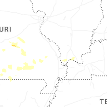
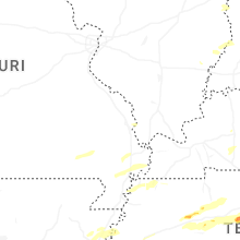


Connect with Interactive Hail Maps