

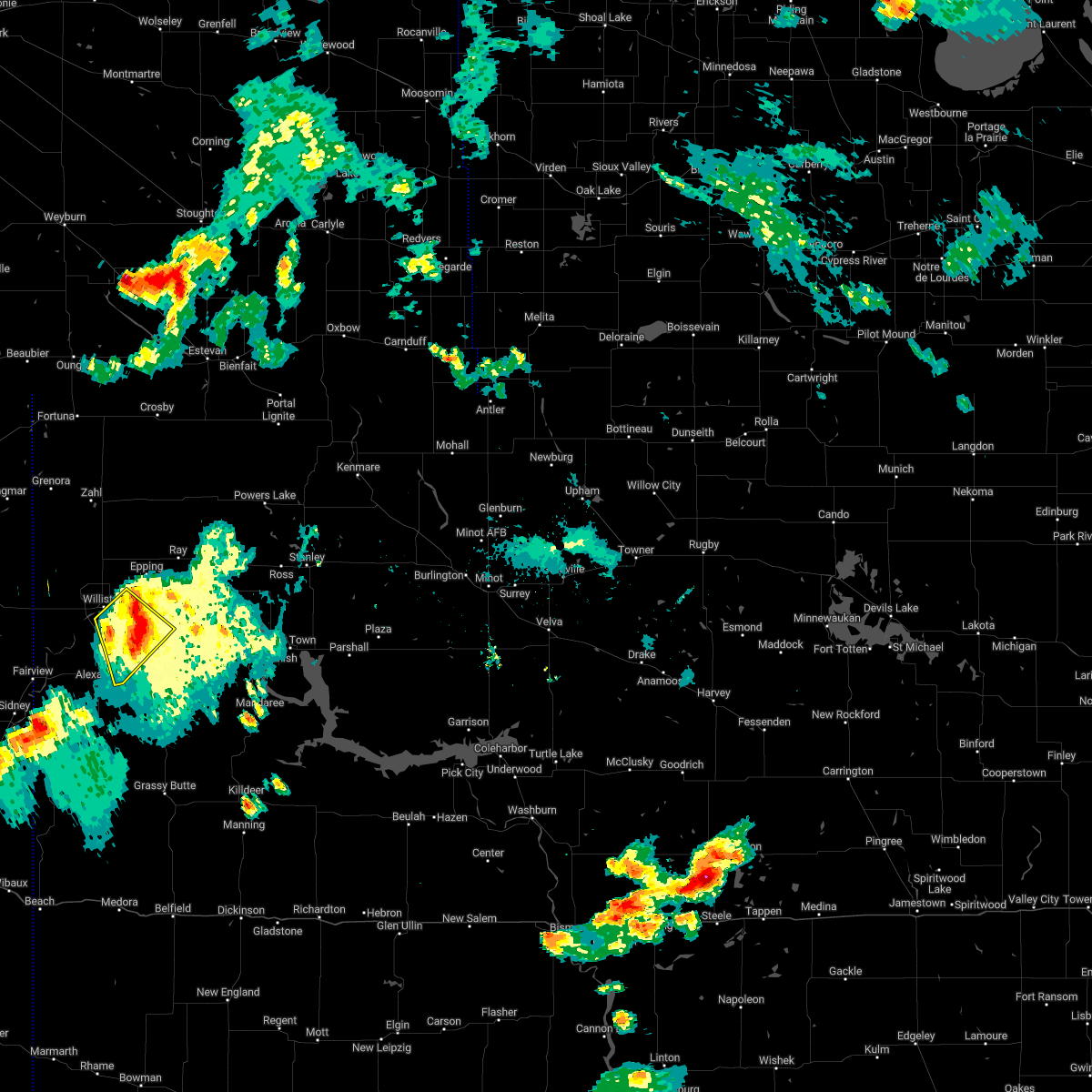
Hail Map for Williston, ND
The Williston, ND area has had 45 reports of on-the-ground hail by trained spotters, and has been under severe weather warnings 4 times during the past 12 months. Doppler radar has detected hail at or near Williston, ND on 46 occasions, including 1 occasion during the past year.
| Name: | Williston, ND |
| Where Located: | 1.1 miles N of Williston, ND |
| Map: | Google Map for Williston, ND |
| Population: | 14716 |
| Housing Units: | 6542 |
| More Info: | Search Google for Williston, ND |
0
The Top Recent Hail Date for Williston, ND is Sunday, July 14, 2024 (45th out of 46)

Hail and Wind Damage Spotted near Williston, ND
| Date / Time | Report Details |
|---|---|
| 6/18/2025 6:20 PM CDT | The storm which prompted the warning has weakened below severe limits, and has exited the warned area. therefore, the warning will be allowed to expire. |
| 6/18/2025 6:00 PM CDT | Quarter sized hail reported 1.2 miles WSW of Williston, ND, public photo of quarter siize hail stones from northeast williston... relayed via broadcast media. |
| 6/18/2025 5:59 PM CDT |
 At 559 pm cdt, a severe thunderstorm was located near epping, or 13 miles northeast of williston, moving southeast at 35 mph (radar indicated). Hazards include 60 mph wind gusts and quarter size hail. Hail damage to vehicles is expected. expect wind damage to roofs, siding, and trees. Locations impacted include, williston, ray, epping, wheelock, and spring brook. At 559 pm cdt, a severe thunderstorm was located near epping, or 13 miles northeast of williston, moving southeast at 35 mph (radar indicated). Hazards include 60 mph wind gusts and quarter size hail. Hail damage to vehicles is expected. expect wind damage to roofs, siding, and trees. Locations impacted include, williston, ray, epping, wheelock, and spring brook.
|
| 6/18/2025 5:46 PM CDT |
 At 545 pm cdt, a severe thunderstorm was located 12 miles east of bonetrail, or 15 miles north of williston, moving southeast at 35 mph (radar indicated). Hazards include 60 mph wind gusts and quarter size hail. Hail damage to vehicles is expected. expect wind damage to roofs, siding, and trees. Locations impacted include, williston, ray, epping, bonetrail, wheelock, zahl, spring brook, and blacktail lake. At 545 pm cdt, a severe thunderstorm was located 12 miles east of bonetrail, or 15 miles north of williston, moving southeast at 35 mph (radar indicated). Hazards include 60 mph wind gusts and quarter size hail. Hail damage to vehicles is expected. expect wind damage to roofs, siding, and trees. Locations impacted include, williston, ray, epping, bonetrail, wheelock, zahl, spring brook, and blacktail lake.
|
| 6/18/2025 5:28 PM CDT |
 Svrbis the national weather service in bismarck has issued a * severe thunderstorm warning for, central williams county in northwestern north dakota, * until 630 pm cdt. * at 527 pm cdt, a severe thunderstorm was located 5 miles northeast of bonetrail, or 23 miles north of williston, moving southeast at 35 mph (radar indicated). Hazards include golf ball size hail and 60 mph wind gusts. People and animals outdoors will be injured. expect hail damage to roofs, siding, windows, and vehicles. Expect wind damage to roofs, siding, and trees. Svrbis the national weather service in bismarck has issued a * severe thunderstorm warning for, central williams county in northwestern north dakota, * until 630 pm cdt. * at 527 pm cdt, a severe thunderstorm was located 5 miles northeast of bonetrail, or 23 miles north of williston, moving southeast at 35 mph (radar indicated). Hazards include golf ball size hail and 60 mph wind gusts. People and animals outdoors will be injured. expect hail damage to roofs, siding, windows, and vehicles. Expect wind damage to roofs, siding, and trees.
|
| 6/15/2025 11:49 PM CDT | Williston airport aso in williams county ND, 8.9 miles SE of Williston, ND |
| 9/20/2024 10:34 PM CDT | Asos station kxwa williston airpor in williams county ND, 9.4 miles SE of Williston, ND |
| 6/15/2024 10:34 PM CDT |
 At 1034 pm cdt, severe thunderstorms were located along a line extending from 8 miles east of writing rock state historical site to 8 miles north of ray to 10 miles north of watford city, moving east at 45 mph (radar indicated). Hazards include 70 mph wind gusts and quarter size hail. Hail damage to vehicles is expected. expect considerable tree damage. wind damage is also likely to mobile homes, roofs, and outbuildings. Locations impacted include, williston, crosby, tioga, ray, powers lake, grenora, lignite, columbus, noonan, wildrose, epping, ross, battleview, alamo, lostwood, fortuna, writing rock state historical site, bonetrail, four bears village, and hanks city. At 1034 pm cdt, severe thunderstorms were located along a line extending from 8 miles east of writing rock state historical site to 8 miles north of ray to 10 miles north of watford city, moving east at 45 mph (radar indicated). Hazards include 70 mph wind gusts and quarter size hail. Hail damage to vehicles is expected. expect considerable tree damage. wind damage is also likely to mobile homes, roofs, and outbuildings. Locations impacted include, williston, crosby, tioga, ray, powers lake, grenora, lignite, columbus, noonan, wildrose, epping, ross, battleview, alamo, lostwood, fortuna, writing rock state historical site, bonetrail, four bears village, and hanks city.
|
| 6/15/2024 10:25 PM CDT |
 At 1024 pm cdt, severe thunderstorms were located along a line extending from 6 miles south of alamo to epping to 9 miles north of arnegard, moving northeast at 55 mph. these are destructive storms for spring brook and epping (radar indicated). Hazards include 80 mph wind gusts and quarter size hail. Flying debris will be dangerous to those caught without shelter. mobile homes will be heavily damaged. expect considerable damage to roofs, windows, and vehicles. extensive tree damage and power outages are likely. These severe thunderstorms will remain over mainly rural areas of northwestern mckenzie and western williams counties, including the following locations, blacktail lake, trenton, and spring brook. At 1024 pm cdt, severe thunderstorms were located along a line extending from 6 miles south of alamo to epping to 9 miles north of arnegard, moving northeast at 55 mph. these are destructive storms for spring brook and epping (radar indicated). Hazards include 80 mph wind gusts and quarter size hail. Flying debris will be dangerous to those caught without shelter. mobile homes will be heavily damaged. expect considerable damage to roofs, windows, and vehicles. extensive tree damage and power outages are likely. These severe thunderstorms will remain over mainly rural areas of northwestern mckenzie and western williams counties, including the following locations, blacktail lake, trenton, and spring brook.
|
| 6/15/2024 10:17 PM CDT |
 Svrbis the national weather service in bismarck has issued a * severe thunderstorm warning for, burke county in northwestern north dakota, northern mckenzie county in northwestern north dakota, williams county in northwestern north dakota, northwestern mountrail county in northwestern north dakota, divide county in northwestern north dakota, * until 1115 pm cdt. * at 1017 pm cdt, severe thunderstorms were located along a line extending from 7 miles southeast of writing rock state historical site to 9 miles south of alamo to 7 miles north of alexander, moving northeast at 55 mph (radar indicated). Hazards include 70 mph wind gusts and quarter size hail. Hail damage to vehicles is expected. expect considerable tree damage. Wind damage is also likely to mobile homes, roofs, and outbuildings. Svrbis the national weather service in bismarck has issued a * severe thunderstorm warning for, burke county in northwestern north dakota, northern mckenzie county in northwestern north dakota, williams county in northwestern north dakota, northwestern mountrail county in northwestern north dakota, divide county in northwestern north dakota, * until 1115 pm cdt. * at 1017 pm cdt, severe thunderstorms were located along a line extending from 7 miles southeast of writing rock state historical site to 9 miles south of alamo to 7 miles north of alexander, moving northeast at 55 mph (radar indicated). Hazards include 70 mph wind gusts and quarter size hail. Hail damage to vehicles is expected. expect considerable tree damage. Wind damage is also likely to mobile homes, roofs, and outbuildings.
|
| 6/15/2024 10:12 PM CDT |
 At 1010 pm cdt, severe thunderstorms were located along a line extending from 6 miles northeast of bonetrail to 4 miles northeast of williston to 11 miles north of alexander, moving northeast at 55 mph. these are destructive storms for northwestern mckenzie and western williams counties, including the city of williston (radar indicated). Hazards include 80 mph wind gusts and quarter size hail. Flying debris will be dangerous to those caught without shelter. mobile homes will be heavily damaged. expect considerable damage to roofs, windows, and vehicles. extensive tree damage and power outages are likely. these severe storms will be near, williston around 1015 pm cdt. epping around 1020 pm cdt. Other locations impacted by these severe thunderstorms include cartwright, fort buford state historical site, trenton, spring brook, and blacktail lake. At 1010 pm cdt, severe thunderstorms were located along a line extending from 6 miles northeast of bonetrail to 4 miles northeast of williston to 11 miles north of alexander, moving northeast at 55 mph. these are destructive storms for northwestern mckenzie and western williams counties, including the city of williston (radar indicated). Hazards include 80 mph wind gusts and quarter size hail. Flying debris will be dangerous to those caught without shelter. mobile homes will be heavily damaged. expect considerable damage to roofs, windows, and vehicles. extensive tree damage and power outages are likely. these severe storms will be near, williston around 1015 pm cdt. epping around 1020 pm cdt. Other locations impacted by these severe thunderstorms include cartwright, fort buford state historical site, trenton, spring brook, and blacktail lake.
|
| 6/15/2024 9:58 PM CDT |
 At 957 pm cdt, severe thunderstorms were located along a line extending from near bonetrail to 8 miles west of williston to 6 miles southeast of fort union trading post, moving east at 50 mph. these are destructive storms for northwestern mckenzie and western williams counties, including the city of williston (radar indicated). Hazards include 80 mph wind gusts and quarter size hail. Flying debris will be dangerous to those caught without shelter. mobile homes will be heavily damaged. expect considerable damage to roofs, windows, and vehicles. extensive tree damage and power outages are likely. these severe storms will be near, williston and bonetrail around 1005 pm cdt. epping around 1020 pm cdt. Other locations impacted by these severe thunderstorms include cartwright, fort buford state historical site, trenton, spring brook, and blacktail lake. At 957 pm cdt, severe thunderstorms were located along a line extending from near bonetrail to 8 miles west of williston to 6 miles southeast of fort union trading post, moving east at 50 mph. these are destructive storms for northwestern mckenzie and western williams counties, including the city of williston (radar indicated). Hazards include 80 mph wind gusts and quarter size hail. Flying debris will be dangerous to those caught without shelter. mobile homes will be heavily damaged. expect considerable damage to roofs, windows, and vehicles. extensive tree damage and power outages are likely. these severe storms will be near, williston and bonetrail around 1005 pm cdt. epping around 1020 pm cdt. Other locations impacted by these severe thunderstorms include cartwright, fort buford state historical site, trenton, spring brook, and blacktail lake.
|
| 6/15/2024 9:54 PM CDT |
 At 954 pm cdt, severe thunderstorms were located along a line extending from near plentywood to 13 miles northeast of bainville to 5 miles northwest of skaar, moving east at 45 mph (radar indicated). Hazards include 70 mph wind gusts and quarter size hail. Hail damage to vehicles is expected. expect considerable tree damage. wind damage is also likely to mobile homes, roofs, and outbuildings. Locations impacted include, williston, fairview, grenora, alexander, westby, arnegard, epping, writing rock state historical site, bonetrail, skaar, hanks city, alkabo, fort union trading post, east fairview, trenton, cartwright, charbonneau, blacktail lake, zahl, and sather dam. At 954 pm cdt, severe thunderstorms were located along a line extending from near plentywood to 13 miles northeast of bainville to 5 miles northwest of skaar, moving east at 45 mph (radar indicated). Hazards include 70 mph wind gusts and quarter size hail. Hail damage to vehicles is expected. expect considerable tree damage. wind damage is also likely to mobile homes, roofs, and outbuildings. Locations impacted include, williston, fairview, grenora, alexander, westby, arnegard, epping, writing rock state historical site, bonetrail, skaar, hanks city, alkabo, fort union trading post, east fairview, trenton, cartwright, charbonneau, blacktail lake, zahl, and sather dam.
|
| 6/15/2024 9:43 PM CDT |
 Svrbis the national weather service in bismarck has issued a * severe thunderstorm warning for, northwestern mckenzie county in northwestern north dakota, western williams county in northwestern north dakota, * until 1045 pm cdt. * at 941 pm cdt, severe thunderstorms were located along a line extending from 14 miles east of froid to 5 miles east of bainville to 8 miles west of fairview, moving east at 55 mph. these are destructive storms for northwestern mckenzie and western williams counties, including the city of williston (radar indicated). Hazards include 80 mph wind gusts and quarter size hail. Flying debris will be dangerous to those caught without shelter. mobile homes will be heavily damaged. expect considerable damage to roofs, windows, and vehicles. extensive tree damage and power outages are likely. severe thunderstorms will be near, fort union trading post around 945 pm cdt. bonetrail around 955 pm cdt. williston around 1000 pm cdt. epping around 1020 pm cdt. Other locations impacted by these severe thunderstorms include cartwright, fort buford state historical site, trenton, spring brook, and blacktail lake. Svrbis the national weather service in bismarck has issued a * severe thunderstorm warning for, northwestern mckenzie county in northwestern north dakota, western williams county in northwestern north dakota, * until 1045 pm cdt. * at 941 pm cdt, severe thunderstorms were located along a line extending from 14 miles east of froid to 5 miles east of bainville to 8 miles west of fairview, moving east at 55 mph. these are destructive storms for northwestern mckenzie and western williams counties, including the city of williston (radar indicated). Hazards include 80 mph wind gusts and quarter size hail. Flying debris will be dangerous to those caught without shelter. mobile homes will be heavily damaged. expect considerable damage to roofs, windows, and vehicles. extensive tree damage and power outages are likely. severe thunderstorms will be near, fort union trading post around 945 pm cdt. bonetrail around 955 pm cdt. williston around 1000 pm cdt. epping around 1020 pm cdt. Other locations impacted by these severe thunderstorms include cartwright, fort buford state historical site, trenton, spring brook, and blacktail lake.
|
| 6/15/2024 9:33 PM CDT |
 Svrbis the national weather service in bismarck has issued a * severe thunderstorm warning for, western mckenzie county in northwestern north dakota, williams county in northwestern north dakota, western divide county in northwestern north dakota, * until 1030 pm cdt. * at 933 pm cdt, severe thunderstorms were located along a line extending from 5 miles southwest of archer to 7 miles northwest of bainville to 7 miles southwest of savage, moving east at 40 mph (radar indicated). Hazards include 70 mph wind gusts and quarter size hail. Hail damage to vehicles is expected. expect considerable tree damage. Wind damage is also likely to mobile homes, roofs, and outbuildings. Svrbis the national weather service in bismarck has issued a * severe thunderstorm warning for, western mckenzie county in northwestern north dakota, williams county in northwestern north dakota, western divide county in northwestern north dakota, * until 1030 pm cdt. * at 933 pm cdt, severe thunderstorms were located along a line extending from 5 miles southwest of archer to 7 miles northwest of bainville to 7 miles southwest of savage, moving east at 40 mph (radar indicated). Hazards include 70 mph wind gusts and quarter size hail. Hail damage to vehicles is expected. expect considerable tree damage. Wind damage is also likely to mobile homes, roofs, and outbuildings.
|
| 5/17/2024 3:22 PM CDT |
 Svrbis the national weather service in bismarck has issued a * severe thunderstorm warning for, northwestern mckenzie county in northwestern north dakota, southwestern williams county in northwestern north dakota, * until 415 pm cdt. * at 322 pm cdt, a severe thunderstorm was located over east fairview, or 14 miles northeast of sidney, moving east at 45 mph (radar indicated). Hazards include 60 mph wind gusts and half dollar size hail. Hail damage to vehicles is expected. Expect wind damage to roofs, siding, and trees. Svrbis the national weather service in bismarck has issued a * severe thunderstorm warning for, northwestern mckenzie county in northwestern north dakota, southwestern williams county in northwestern north dakota, * until 415 pm cdt. * at 322 pm cdt, a severe thunderstorm was located over east fairview, or 14 miles northeast of sidney, moving east at 45 mph (radar indicated). Hazards include 60 mph wind gusts and half dollar size hail. Hail damage to vehicles is expected. Expect wind damage to roofs, siding, and trees.
|
| 8/30/2023 10:45 PM CDT | Ndawn station 5 sw willisto in mckenzie county ND, 5.6 miles NE of Williston, ND |
| 8/30/2023 10:23 PM CDT |
 At 1023 pm cdt, severe thunderstorms were located along a line extending from 14 miles west of bonetrail to 6 miles southeast of fort union trading post to 16 miles south of alexander, moving northeast at 45 mph (radar indicated). Hazards include 60 mph wind gusts and quarter size hail. Hail damage to vehicles is expected. expect wind damage to roofs, siding, and trees. these severe storms will be near, alexander around 1030 pm cdt. grenora and bonetrail around 1040 pm cdt. williston around 1045 pm cdt. hanks city around 1050 pm cdt. writing rock state historical site around 1055 pm cdt. other locations impacted by these severe thunderstorms include zahl, cartwright, sather dam, fort buford state historical site, charbonneau, appam, rawson, hanks, trenton and spring brook. hail threat, radar indicated max hail size, 1. 00 in wind threat, observed max wind gust, 60 mph. At 1023 pm cdt, severe thunderstorms were located along a line extending from 14 miles west of bonetrail to 6 miles southeast of fort union trading post to 16 miles south of alexander, moving northeast at 45 mph (radar indicated). Hazards include 60 mph wind gusts and quarter size hail. Hail damage to vehicles is expected. expect wind damage to roofs, siding, and trees. these severe storms will be near, alexander around 1030 pm cdt. grenora and bonetrail around 1040 pm cdt. williston around 1045 pm cdt. hanks city around 1050 pm cdt. writing rock state historical site around 1055 pm cdt. other locations impacted by these severe thunderstorms include zahl, cartwright, sather dam, fort buford state historical site, charbonneau, appam, rawson, hanks, trenton and spring brook. hail threat, radar indicated max hail size, 1. 00 in wind threat, observed max wind gust, 60 mph.
|
| 8/30/2023 10:07 PM CDT |
 At 1007 pm cdt, severe thunderstorms were located along a line extending from 9 miles north of bainville to east fairview to 12 miles northeast of skaar, moving northeast at 45 mph (radar indicated). Hazards include 60 mph wind gusts and quarter size hail. Hail damage to vehicles is expected. expect wind damage to roofs, siding, and trees. severe thunderstorms will be near, alexander around 1030 pm cdt. williston, grenora and bonetrail around 1040 pm cdt. hanks city around 1050 pm cdt. other locations impacted by these severe thunderstorms include zahl, cartwright, sather dam, fort buford state historical site, charbonneau, appam, rawson, hanks, trenton and spring brook. hail threat, radar indicated max hail size, 1. 00 in wind threat, radar indicated max wind gust, 60 mph. At 1007 pm cdt, severe thunderstorms were located along a line extending from 9 miles north of bainville to east fairview to 12 miles northeast of skaar, moving northeast at 45 mph (radar indicated). Hazards include 60 mph wind gusts and quarter size hail. Hail damage to vehicles is expected. expect wind damage to roofs, siding, and trees. severe thunderstorms will be near, alexander around 1030 pm cdt. williston, grenora and bonetrail around 1040 pm cdt. hanks city around 1050 pm cdt. other locations impacted by these severe thunderstorms include zahl, cartwright, sather dam, fort buford state historical site, charbonneau, appam, rawson, hanks, trenton and spring brook. hail threat, radar indicated max hail size, 1. 00 in wind threat, radar indicated max wind gust, 60 mph.
|
| 8/1/2023 5:47 PM CDT | Quarter sized hail reported 5.7 miles NE of Williston, ND |
| 8/1/2023 5:44 PM CDT |
 At 543 pm cdt, a severe thunderstorm was located near williston, moving east at 25 mph (trained weather spotters). Hazards include golf ball size hail and 60 mph wind gusts. People and animals outdoors will be injured. expect hail damage to roofs, siding, windows, and vehicles. expect wind damage to roofs, siding, and trees. This severe thunderstorm will remain over mainly rural areas of north central mckenzie and southwestern williams counties. At 543 pm cdt, a severe thunderstorm was located near williston, moving east at 25 mph (trained weather spotters). Hazards include golf ball size hail and 60 mph wind gusts. People and animals outdoors will be injured. expect hail damage to roofs, siding, windows, and vehicles. expect wind damage to roofs, siding, and trees. This severe thunderstorm will remain over mainly rural areas of north central mckenzie and southwestern williams counties.
|
| 8/1/2023 5:41 PM CDT | Wind gusts to 60 mp in williams county ND, 4.7 miles ENE of Williston, ND |
| 8/1/2023 5:33 PM CDT |
 At 533 pm cdt, a severe thunderstorm was located 7 miles southwest of williston, moving east at 25 mph (radar indicated). Hazards include ping pong ball size hail and 60 mph wind gusts. People and animals outdoors will be injured. expect hail damage to roofs, siding, windows, and vehicles. expect wind damage to roofs, siding, and trees. this severe thunderstorm will be near, williston around 540 pm cdt. other locations impacted by this severe thunderstorm include trenton and spring brook. hail threat, radar indicated max hail size, 1. 50 in wind threat, radar indicated max wind gust, 60 mph. At 533 pm cdt, a severe thunderstorm was located 7 miles southwest of williston, moving east at 25 mph (radar indicated). Hazards include ping pong ball size hail and 60 mph wind gusts. People and animals outdoors will be injured. expect hail damage to roofs, siding, windows, and vehicles. expect wind damage to roofs, siding, and trees. this severe thunderstorm will be near, williston around 540 pm cdt. other locations impacted by this severe thunderstorm include trenton and spring brook. hail threat, radar indicated max hail size, 1. 50 in wind threat, radar indicated max wind gust, 60 mph.
|
| 8/17/2022 8:32 PM CDT |
 At 832 pm cdt, a severe thunderstorm was located 13 miles southeast of williston, moving southeast at 25 mph (radar indicated). Hazards include 60 mph wind gusts and nickel size hail. Expect damage to roofs, siding, and trees. locations impacted include, williston. hail threat, radar indicated max hail size, 0. 88 in wind threat, radar indicated max wind gust, 60 mph. At 832 pm cdt, a severe thunderstorm was located 13 miles southeast of williston, moving southeast at 25 mph (radar indicated). Hazards include 60 mph wind gusts and nickel size hail. Expect damage to roofs, siding, and trees. locations impacted include, williston. hail threat, radar indicated max hail size, 0. 88 in wind threat, radar indicated max wind gust, 60 mph.
|
| 8/17/2022 8:19 PM CDT |
 At 818 pm cdt/718 pm mdt/, a severe thunderstorm was located 5 miles south of williston, moving southeast at 30 mph (radar indicated). Hazards include 60 mph wind gusts and quarter size hail. Hail damage to vehicles is expected. expect wind damage to roofs, siding, and trees. this severe thunderstorm will remain over mainly rural areas of northwestern mckenzie and southwestern williams counties, including the following locations, charbonneau and trenton. hail threat, radar indicated max hail size, 1. 00 in wind threat, radar indicated max wind gust, 60 mph. At 818 pm cdt/718 pm mdt/, a severe thunderstorm was located 5 miles south of williston, moving southeast at 30 mph (radar indicated). Hazards include 60 mph wind gusts and quarter size hail. Hail damage to vehicles is expected. expect wind damage to roofs, siding, and trees. this severe thunderstorm will remain over mainly rural areas of northwestern mckenzie and southwestern williams counties, including the following locations, charbonneau and trenton. hail threat, radar indicated max hail size, 1. 00 in wind threat, radar indicated max wind gust, 60 mph.
|
| 8/17/2022 7:57 PM CDT |
 At 757 pm cdt/657 pm mdt/, a severe thunderstorm was located 7 miles west of williston, moving southeast at 25 mph (radar indicated). Hazards include 60 mph wind gusts and quarter size hail. Hail damage to vehicles is expected. expect wind damage to roofs, siding, and trees. this severe thunderstorm will be near, williston around 805 pm cdt. other locations impacted by this severe thunderstorm include charbonneau and trenton. hail threat, radar indicated max hail size, 1. 00 in wind threat, radar indicated max wind gust, 60 mph. At 757 pm cdt/657 pm mdt/, a severe thunderstorm was located 7 miles west of williston, moving southeast at 25 mph (radar indicated). Hazards include 60 mph wind gusts and quarter size hail. Hail damage to vehicles is expected. expect wind damage to roofs, siding, and trees. this severe thunderstorm will be near, williston around 805 pm cdt. other locations impacted by this severe thunderstorm include charbonneau and trenton. hail threat, radar indicated max hail size, 1. 00 in wind threat, radar indicated max wind gust, 60 mph.
|
| 8/17/2022 7:44 PM CDT |
 At 744 pm cdt/644 pm mdt/, a severe thunderstorm was located 11 miles northwest of williston, moving southeast at 30 mph (radar indicated). Hazards include 60 mph wind gusts and quarter size hail. Hail damage to vehicles is expected. expect wind damage to roofs, siding, and trees. locations impacted include, williston, bonetrail, fort union trading post, trenton, fort buford state historical site and blacktail lake. hail threat, radar indicated max hail size, 1. 00 in wind threat, radar indicated max wind gust, 60 mph. At 744 pm cdt/644 pm mdt/, a severe thunderstorm was located 11 miles northwest of williston, moving southeast at 30 mph (radar indicated). Hazards include 60 mph wind gusts and quarter size hail. Hail damage to vehicles is expected. expect wind damage to roofs, siding, and trees. locations impacted include, williston, bonetrail, fort union trading post, trenton, fort buford state historical site and blacktail lake. hail threat, radar indicated max hail size, 1. 00 in wind threat, radar indicated max wind gust, 60 mph.
|
| 8/17/2022 7:36 PM CDT |
 At 735 pm cdt/635 pm mdt/, a severe thunderstorm was located 13 miles southwest of bonetrail, or 17 miles west of williston, moving southeast at 30 mph (radar indicated). Hazards include 60 mph wind gusts and quarter size hail. Hail damage to vehicles is expected. expect wind damage to roofs, siding, and trees. locations impacted include, williston, bonetrail, fort union trading post, trenton, fort buford state historical site and blacktail lake. hail threat, radar indicated max hail size, 1. 00 in wind threat, radar indicated max wind gust, 60 mph. At 735 pm cdt/635 pm mdt/, a severe thunderstorm was located 13 miles southwest of bonetrail, or 17 miles west of williston, moving southeast at 30 mph (radar indicated). Hazards include 60 mph wind gusts and quarter size hail. Hail damage to vehicles is expected. expect wind damage to roofs, siding, and trees. locations impacted include, williston, bonetrail, fort union trading post, trenton, fort buford state historical site and blacktail lake. hail threat, radar indicated max hail size, 1. 00 in wind threat, radar indicated max wind gust, 60 mph.
|
| 8/17/2022 7:15 PM CDT |
 At 714 pm cdt/614 pm mdt/, a severe thunderstorm was located 11 miles west of bonetrail, or 26 miles northwest of williston, moving southeast at 30 mph (radar indicated). Hazards include 60 mph wind gusts and quarter size hail. Hail damage to vehicles is expected. expect wind damage to roofs, siding, and trees. this severe thunderstorm will remain over mainly rural areas of northwestern mckenzie and western williams counties, including the following locations, blacktail lake, fort buford state historical site and trenton. hail threat, radar indicated max hail size, 1. 00 in wind threat, radar indicated max wind gust, 60 mph. At 714 pm cdt/614 pm mdt/, a severe thunderstorm was located 11 miles west of bonetrail, or 26 miles northwest of williston, moving southeast at 30 mph (radar indicated). Hazards include 60 mph wind gusts and quarter size hail. Hail damage to vehicles is expected. expect wind damage to roofs, siding, and trees. this severe thunderstorm will remain over mainly rural areas of northwestern mckenzie and western williams counties, including the following locations, blacktail lake, fort buford state historical site and trenton. hail threat, radar indicated max hail size, 1. 00 in wind threat, radar indicated max wind gust, 60 mph.
|
| 7/30/2022 8:10 PM CDT |
 At 808 pm cdt, severe thunderstorms were located along a line extending from 9 miles west of battleview to near ray to 13 miles southeast of williston, moving east at 45 mph (radar indicated). Hazards include 60 mph wind gusts. Expect damage to roofs, siding, and trees. these severe storms will be near, tioga around 820 pm cdt. ross around 845 pm cdt. other locations impacted by these severe thunderstorms include white tail bay recreation area, white earth, keene, lewis and clark state park, white earth bay recreation area, and tobacco garden bay recreation area. hail threat, radar indicated max hail size, <. 75 in wind threat, observed max wind gust, 60 mph. At 808 pm cdt, severe thunderstorms were located along a line extending from 9 miles west of battleview to near ray to 13 miles southeast of williston, moving east at 45 mph (radar indicated). Hazards include 60 mph wind gusts. Expect damage to roofs, siding, and trees. these severe storms will be near, tioga around 820 pm cdt. ross around 845 pm cdt. other locations impacted by these severe thunderstorms include white tail bay recreation area, white earth, keene, lewis and clark state park, white earth bay recreation area, and tobacco garden bay recreation area. hail threat, radar indicated max hail size, <. 75 in wind threat, observed max wind gust, 60 mph.
|
| 7/30/2022 7:53 PM CDT |
 At 752 pm cdt/652 pm mdt/, severe thunderstorms were located along a line extending from near wildrose to near epping to 11 miles east of fort union trading post, moving east at 45 mph (radar indicated). Hazards include 60 mph wind gusts. Expect damage to roofs, siding, and trees. severe thunderstorms will be near, epping around 755 pm cdt. ray around 800 pm cdt. tioga around 820 pm cdt. ross around 840 pm cdt. other locations impacted by these severe thunderstorms include white earth, lewis and clark state park, appam, white earth bay recreation area, charlson, spring brook, white tail bay recreation area, keene, fort buford state historical site and wheelock. hail threat, radar indicated max hail size, <. 75 in wind threat, observed max wind gust, 60 mph. At 752 pm cdt/652 pm mdt/, severe thunderstorms were located along a line extending from near wildrose to near epping to 11 miles east of fort union trading post, moving east at 45 mph (radar indicated). Hazards include 60 mph wind gusts. Expect damage to roofs, siding, and trees. severe thunderstorms will be near, epping around 755 pm cdt. ray around 800 pm cdt. tioga around 820 pm cdt. ross around 840 pm cdt. other locations impacted by these severe thunderstorms include white earth, lewis and clark state park, appam, white earth bay recreation area, charlson, spring brook, white tail bay recreation area, keene, fort buford state historical site and wheelock. hail threat, radar indicated max hail size, <. 75 in wind threat, observed max wind gust, 60 mph.
|
| 7/30/2022 7:34 PM CDT | Asos station kxwa williston airpor in williams county ND, 8.9 miles SE of Williston, ND |
| 7/18/2022 11:40 PM CDT | Baseball sized hail reported 0.9 miles NNE of Williston, ND, numerous reports of large... damaging hail from the city of williston. public submitted photos show hail ranging generally from golf ball to tennis ball size... with a |
| 7/18/2022 11:38 PM CDT |
 At 1138 pm cdt, severe thunderstorms were located along a line extending from 4 miles northeast of fortuna to 6 miles northwest of alamo to williston, moving northeast at 55 mph (public. at 1135 pm cdt, ping pong ball size was reported in williston). Hazards include 70 mph wind gusts and ping pong ball size hail. People and animals outdoors will be injured. expect hail damage to roofs, siding, windows, and vehicles. expect considerable tree damage. wind damage is also likely to mobile homes, roofs, and outbuildings. these severe storms will be near, alamo around 1145 pm cdt. epping around 1155 pm cdt. ray around 1205 am cdt. other locations impacted by these severe thunderstorms include zahl, appam, wheelock, hanks, ambrose, trenton, spring brook, corinth and blacktail lake. thunderstorm damage threat, considerable hail threat, radar indicated max hail size, 1. 50 in wind threat, radar indicated max wind gust, 70 mph. At 1138 pm cdt, severe thunderstorms were located along a line extending from 4 miles northeast of fortuna to 6 miles northwest of alamo to williston, moving northeast at 55 mph (public. at 1135 pm cdt, ping pong ball size was reported in williston). Hazards include 70 mph wind gusts and ping pong ball size hail. People and animals outdoors will be injured. expect hail damage to roofs, siding, windows, and vehicles. expect considerable tree damage. wind damage is also likely to mobile homes, roofs, and outbuildings. these severe storms will be near, alamo around 1145 pm cdt. epping around 1155 pm cdt. ray around 1205 am cdt. other locations impacted by these severe thunderstorms include zahl, appam, wheelock, hanks, ambrose, trenton, spring brook, corinth and blacktail lake. thunderstorm damage threat, considerable hail threat, radar indicated max hail size, 1. 50 in wind threat, radar indicated max wind gust, 70 mph.
|
| 7/18/2022 11:35 PM CDT | Quarter sized hail reported 3.1 miles E of Williston, ND, report from mping: quarter (1.00 in.). |
| 7/18/2022 11:35 PM CDT | Ping Pong Ball sized hail reported 0.9 miles NNE of Williston, ND, ping pong ball sized hail falling at time of report. |
| 7/18/2022 11:18 PM CDT |
 At 1118 pm cdt, severe thunderstorms were located along a line extending from near alkabo to 6 miles north of bonetrail to 10 miles northeast of fort union trading post, moving northeast at 55 mph (radar indicated). Hazards include 70 mph wind gusts and half dollar size hail. Hail damage to vehicles is expected. expect considerable tree damage. wind damage is also likely to mobile homes, roofs, and outbuildings. these severe storms will be near, alkabo and writing rock state historical site around 1125 pm cdt. fortuna around 1130 pm cdt. alamo around 1140 pm cdt. epping around 1145 pm cdt. ray around 1200 am cdt. other locations impacted by these severe thunderstorms include zahl, appam, wheelock, hanks, ambrose, trenton, spring brook, corinth and blacktail lake. thunderstorm damage threat, considerable hail threat, radar indicated max hail size, 1. 25 in wind threat, radar indicated max wind gust, 70 mph. At 1118 pm cdt, severe thunderstorms were located along a line extending from near alkabo to 6 miles north of bonetrail to 10 miles northeast of fort union trading post, moving northeast at 55 mph (radar indicated). Hazards include 70 mph wind gusts and half dollar size hail. Hail damage to vehicles is expected. expect considerable tree damage. wind damage is also likely to mobile homes, roofs, and outbuildings. these severe storms will be near, alkabo and writing rock state historical site around 1125 pm cdt. fortuna around 1130 pm cdt. alamo around 1140 pm cdt. epping around 1145 pm cdt. ray around 1200 am cdt. other locations impacted by these severe thunderstorms include zahl, appam, wheelock, hanks, ambrose, trenton, spring brook, corinth and blacktail lake. thunderstorm damage threat, considerable hail threat, radar indicated max hail size, 1. 25 in wind threat, radar indicated max wind gust, 70 mph.
|
| 7/18/2022 11:02 PM CDT |
 At 1101 pm cdt, severe thunderstorms were located along a line extending from 9 miles southwest of westby to 9 miles west of bonetrail to near fort union trading post, moving northeast at 55 mph (radar indicated). Hazards include 60 mph wind gusts and quarter size hail. Hail damage to vehicles is expected. expect wind damage to roofs, siding, and trees. severe thunderstorms will be near, bonetrail around 1110 pm cdt. westby around 1010 pm mdt. alkabo and writing rock state historical site around 1115 pm cdt. williston and fortuna around 1125 pm cdt. alamo around 1135 pm cdt. epping around 1140 pm cdt. ray around 1150 pm cdt. other locations impacted by these severe thunderstorms include zahl, appam, wheelock, hanks, ambrose, trenton, spring brook, corinth and blacktail lake. hail threat, radar indicated max hail size, 1. 00 in wind threat, radar indicated max wind gust, 60 mph. At 1101 pm cdt, severe thunderstorms were located along a line extending from 9 miles southwest of westby to 9 miles west of bonetrail to near fort union trading post, moving northeast at 55 mph (radar indicated). Hazards include 60 mph wind gusts and quarter size hail. Hail damage to vehicles is expected. expect wind damage to roofs, siding, and trees. severe thunderstorms will be near, bonetrail around 1110 pm cdt. westby around 1010 pm mdt. alkabo and writing rock state historical site around 1115 pm cdt. williston and fortuna around 1125 pm cdt. alamo around 1135 pm cdt. epping around 1140 pm cdt. ray around 1150 pm cdt. other locations impacted by these severe thunderstorms include zahl, appam, wheelock, hanks, ambrose, trenton, spring brook, corinth and blacktail lake. hail threat, radar indicated max hail size, 1. 00 in wind threat, radar indicated max wind gust, 60 mph.
|
| 7/10/2022 1:41 AM CDT |
 The severe thunderstorm warning for western williams and divide counties will expire at 145 am cdt, the storms which prompted the warning have weakened below severe limits. therefore, the warning will be allowed to expire. however, gusty winds and heavy rain are still possible with these thunderstorms. a severe thunderstorm watch remains in effect until 500 am cdt for northwestern north dakota. The severe thunderstorm warning for western williams and divide counties will expire at 145 am cdt, the storms which prompted the warning have weakened below severe limits. therefore, the warning will be allowed to expire. however, gusty winds and heavy rain are still possible with these thunderstorms. a severe thunderstorm watch remains in effect until 500 am cdt for northwestern north dakota.
|
| 7/10/2022 1:28 AM CDT | At 127 am cdt, severe thunderstorms were located along a line extending from 9 miles east of fortuna to 10 miles east of grenora to 13 miles east of bainville, moving east at 45 mph (radar indicated). Hazards include 60 mph wind gusts and penny size hail. Expect damage to roofs, siding, and trees. these severe storms will be near, williston and alamo around 145 am cdt. other locations impacted by these severe thunderstorms include zahl, fort buford state historical site, appam, hanks, ambrose, trenton, and blacktail lake. hail threat, radar indicated max hail size, 0. 75 in wind threat, radar indicated max wind gust, 60 mph. |
| 7/10/2022 1:11 AM CDT |
 At 110 am cdt, severe thunderstorms were located along a line extending from 4 miles northwest of fortuna to near grenora to near bainville, moving east at 45 mph (radar indicated). Hazards include 70 mph wind gusts and nickel size hail. Expect considerable tree damage. damage is likely to mobile homes, roofs, and outbuildings. these severe storms will be near, grenora, fortuna and alkabo around 115 am cdt. williston and alamo around 145 am cdt. other locations impacted by these severe thunderstorms include zahl, fort buford state historical site, appam, hanks, ambrose, trenton, and blacktail lake. thunderstorm damage threat, considerable hail threat, radar indicated max hail size, 0. 88 in wind threat, radar indicated max wind gust, 70 mph. At 110 am cdt, severe thunderstorms were located along a line extending from 4 miles northwest of fortuna to near grenora to near bainville, moving east at 45 mph (radar indicated). Hazards include 70 mph wind gusts and nickel size hail. Expect considerable tree damage. damage is likely to mobile homes, roofs, and outbuildings. these severe storms will be near, grenora, fortuna and alkabo around 115 am cdt. williston and alamo around 145 am cdt. other locations impacted by these severe thunderstorms include zahl, fort buford state historical site, appam, hanks, ambrose, trenton, and blacktail lake. thunderstorm damage threat, considerable hail threat, radar indicated max hail size, 0. 88 in wind threat, radar indicated max wind gust, 70 mph.
|
| 7/10/2022 12:51 AM CDT |
 At 1250 am cdt, severe thunderstorms were located along a line extending from 5 miles northwest of westby to 13 miles northeast of medicine lake to culbertson, moving east at 45 mph (radar indicated). Hazards include 70 mph wind gusts and nickel size hail. Expect considerable tree damage. damage is likely to mobile homes, roofs, and outbuildings. severe thunderstorms will be near, westby around 1155 pm mdt. alkabo around 105 am cdt. grenora around 110 am cdt. fortuna around 115 am cdt. alamo around 140 am cdt. williston around 145 am cdt. other locations impacted by these severe thunderstorms include zahl, fort buford state historical site, appam, hanks, ambrose, trenton, and blacktail lake. thunderstorm damage threat, considerable hail threat, radar indicated max hail size, 0. 88 in wind threat, radar indicated max wind gust, 70 mph. At 1250 am cdt, severe thunderstorms were located along a line extending from 5 miles northwest of westby to 13 miles northeast of medicine lake to culbertson, moving east at 45 mph (radar indicated). Hazards include 70 mph wind gusts and nickel size hail. Expect considerable tree damage. damage is likely to mobile homes, roofs, and outbuildings. severe thunderstorms will be near, westby around 1155 pm mdt. alkabo around 105 am cdt. grenora around 110 am cdt. fortuna around 115 am cdt. alamo around 140 am cdt. williston around 145 am cdt. other locations impacted by these severe thunderstorms include zahl, fort buford state historical site, appam, hanks, ambrose, trenton, and blacktail lake. thunderstorm damage threat, considerable hail threat, radar indicated max hail size, 0. 88 in wind threat, radar indicated max wind gust, 70 mph.
|
| 7/9/2022 3:07 AM CDT |
 At 306 am cdt/206 am mdt/, severe thunderstorms were located along a line extending from columbus to 5 miles east of tioga to 11 miles northeast of watford city, moving east at 45 mph (radar indicated). Hazards include 60 mph wind gusts. Expect damage to roofs, siding, and trees. these severe storms will be near, portal around 315 am cdt. lignite around 320 am cdt. ross around 325 am cdt. flaxton and lostwood around 330 am cdt. stanley around 335 am cdt. bowbells and palermo around 340 am cdt. blaisdell around 350 am cdt. other locations impacted by these severe thunderstorms include hamlet, white earth, cartwright, charbonneau, white earth bay recreation area, larson, niobe, white tail bay recreation area, wheelock and coteau. hail threat, radar indicated max hail size, <. 75 in wind threat, radar indicated max wind gust, 60 mph. At 306 am cdt/206 am mdt/, severe thunderstorms were located along a line extending from columbus to 5 miles east of tioga to 11 miles northeast of watford city, moving east at 45 mph (radar indicated). Hazards include 60 mph wind gusts. Expect damage to roofs, siding, and trees. these severe storms will be near, portal around 315 am cdt. lignite around 320 am cdt. ross around 325 am cdt. flaxton and lostwood around 330 am cdt. stanley around 335 am cdt. bowbells and palermo around 340 am cdt. blaisdell around 350 am cdt. other locations impacted by these severe thunderstorms include hamlet, white earth, cartwright, charbonneau, white earth bay recreation area, larson, niobe, white tail bay recreation area, wheelock and coteau. hail threat, radar indicated max hail size, <. 75 in wind threat, radar indicated max wind gust, 60 mph.
|
| 7/9/2022 2:44 AM CDT |
 At 243 am cdt/143 am mdt/, severe thunderstorms were located along a line extending from 6 miles east of crosby to 7 miles north of ray to near arnegard, moving east at 55 mph (radar indicated. at 220 am cdt a 61 mph wind gust was reported at charbonneau). Hazards include 60 mph wind gusts. Expect damage to roofs, siding, and trees. severe thunderstorms will be near, noonan around 250 am cdt. tioga around 255 am cdt. columbus around 300 am cdt. other locations in the path of these severe thunderstorms include lignite, portal, ross, stanley, flaxton, lostwood, bowbells, palermo and blaisdell. hail threat, radar indicated max hail size, <. 75 in wind threat, observed max wind gust, 60 mph. At 243 am cdt/143 am mdt/, severe thunderstorms were located along a line extending from 6 miles east of crosby to 7 miles north of ray to near arnegard, moving east at 55 mph (radar indicated. at 220 am cdt a 61 mph wind gust was reported at charbonneau). Hazards include 60 mph wind gusts. Expect damage to roofs, siding, and trees. severe thunderstorms will be near, noonan around 250 am cdt. tioga around 255 am cdt. columbus around 300 am cdt. other locations in the path of these severe thunderstorms include lignite, portal, ross, stanley, flaxton, lostwood, bowbells, palermo and blaisdell. hail threat, radar indicated max hail size, <. 75 in wind threat, observed max wind gust, 60 mph.
|
| 7/9/2022 2:21 AM CDT |
 At 221 am cdt/121 am mdt/, severe thunderstorms were located along a line extending from 10 miles east of fortuna to 4 miles south of alamo to 10 miles south of sidney, moving east at 50 mph (radar indicated). Hazards include 60 mph wind gusts and penny size hail. Expect damage to roofs, siding, and trees. these severe storms will be near, alamo around 225 am cdt. crosby around 235 am cdt. tioga and noonan around 250 am cdt. other locations impacted by these severe thunderstorms include hamlet, zahl, cartwright, sather dam, lewis and clark state park, charbonneau, appam, ambrose, spring brook and white tail bay recreation area. hail threat, radar indicated max hail size, 0. 75 in wind threat, radar indicated max wind gust, 60 mph. At 221 am cdt/121 am mdt/, severe thunderstorms were located along a line extending from 10 miles east of fortuna to 4 miles south of alamo to 10 miles south of sidney, moving east at 50 mph (radar indicated). Hazards include 60 mph wind gusts and penny size hail. Expect damage to roofs, siding, and trees. these severe storms will be near, alamo around 225 am cdt. crosby around 235 am cdt. tioga and noonan around 250 am cdt. other locations impacted by these severe thunderstorms include hamlet, zahl, cartwright, sather dam, lewis and clark state park, charbonneau, appam, ambrose, spring brook and white tail bay recreation area. hail threat, radar indicated max hail size, 0. 75 in wind threat, radar indicated max wind gust, 60 mph.
|
| 7/9/2022 2:07 AM CDT |
 At 206 am cdt/106 am mdt/, severe thunderstorms were located along a line extending from near alkabo to 8 miles southeast of grenora to 10 miles north of savage, moving east at 50 mph (radar indicated). Hazards include 60 mph wind gusts and penny size hail. Expect damage to roofs, siding, and trees. these severe storms will be near, alkabo around 210 am cdt. fortuna around 215 am cdt. alamo around 225 am cdt. crosby and wildrose around 240 am cdt. noonan around 255 am cdt. arnegard around 300 am cdt. watford city around 310 am cdt. other locations impacted by these severe thunderstorms include hamlet, zahl, cartwright, sather dam, lewis and clark state park, charbonneau, appam, ambrose, spring brook and white tail bay recreation area. hail threat, radar indicated max hail size, 0. 75 in wind threat, radar indicated max wind gust, 60 mph. At 206 am cdt/106 am mdt/, severe thunderstorms were located along a line extending from near alkabo to 8 miles southeast of grenora to 10 miles north of savage, moving east at 50 mph (radar indicated). Hazards include 60 mph wind gusts and penny size hail. Expect damage to roofs, siding, and trees. these severe storms will be near, alkabo around 210 am cdt. fortuna around 215 am cdt. alamo around 225 am cdt. crosby and wildrose around 240 am cdt. noonan around 255 am cdt. arnegard around 300 am cdt. watford city around 310 am cdt. other locations impacted by these severe thunderstorms include hamlet, zahl, cartwright, sather dam, lewis and clark state park, charbonneau, appam, ambrose, spring brook and white tail bay recreation area. hail threat, radar indicated max hail size, 0. 75 in wind threat, radar indicated max wind gust, 60 mph.
|
| 7/9/2022 1:35 AM CDT |
 At 134 am cdt/1234 am mdt/, severe thunderstorms were located along a line extending from 9 miles southeast of port of raymond to 5 miles southeast of froid to 9 miles southwest of lambert, moving east at 55 mph (radar indicated). Hazards include 60 mph wind gusts and penny size hail. Expect damage to roofs, siding, and trees. severe thunderstorms will be near, westby around 1250 am mdt. alkabo around 200 am cdt. fortuna and bonetrail around 205 am cdt. epping around 225 am cdt. crosby around 230 am cdt. ray around 235 am cdt. noonan around 240 am cdt. tioga around 245 am cdt. other locations impacted by these severe thunderstorms include hamlet, zahl, cartwright, sather dam, lewis and clark state park, charbonneau, appam, ambrose, spring brook and white tail bay recreation area. hail threat, radar indicated max hail size, 0. 75 in wind threat, radar indicated max wind gust, 60 mph. At 134 am cdt/1234 am mdt/, severe thunderstorms were located along a line extending from 9 miles southeast of port of raymond to 5 miles southeast of froid to 9 miles southwest of lambert, moving east at 55 mph (radar indicated). Hazards include 60 mph wind gusts and penny size hail. Expect damage to roofs, siding, and trees. severe thunderstorms will be near, westby around 1250 am mdt. alkabo around 200 am cdt. fortuna and bonetrail around 205 am cdt. epping around 225 am cdt. crosby around 230 am cdt. ray around 235 am cdt. noonan around 240 am cdt. tioga around 245 am cdt. other locations impacted by these severe thunderstorms include hamlet, zahl, cartwright, sather dam, lewis and clark state park, charbonneau, appam, ambrose, spring brook and white tail bay recreation area. hail threat, radar indicated max hail size, 0. 75 in wind threat, radar indicated max wind gust, 60 mph.
|
| 7/5/2022 10:18 PM CDT |
 At 1018 pm cdt, a severe thunderstorm was located 9 miles south of bonetrail, or 11 miles northwest of williston, moving southeast at 40 mph (radar indicated). Hazards include 60 mph wind gusts and quarter size hail. Hail damage to vehicles is expected. expect wind damage to roofs, siding, and trees. locations impacted include, northern williston, epping, bonetrail, spring brook and blacktail lake. hail threat, radar indicated max hail size, 1. 00 in wind threat, radar indicated max wind gust, 60 mph. At 1018 pm cdt, a severe thunderstorm was located 9 miles south of bonetrail, or 11 miles northwest of williston, moving southeast at 40 mph (radar indicated). Hazards include 60 mph wind gusts and quarter size hail. Hail damage to vehicles is expected. expect wind damage to roofs, siding, and trees. locations impacted include, northern williston, epping, bonetrail, spring brook and blacktail lake. hail threat, radar indicated max hail size, 1. 00 in wind threat, radar indicated max wind gust, 60 mph.
|
| 7/5/2022 10:07 PM CDT |
 At 1007 pm cdt, a severe thunderstorm was located 6 miles southwest of bonetrail, or 18 miles northwest of williston, moving southeast at 35 mph (radar indicated). Hazards include 60 mph wind gusts and half dollar size hail. Hail damage to vehicles is expected. expect wind damage to roofs, siding, and trees. locations impacted include, williston, epping, bonetrail, spring brook and blacktail lake. hail threat, radar indicated max hail size, 1. 25 in wind threat, radar indicated max wind gust, 60 mph. At 1007 pm cdt, a severe thunderstorm was located 6 miles southwest of bonetrail, or 18 miles northwest of williston, moving southeast at 35 mph (radar indicated). Hazards include 60 mph wind gusts and half dollar size hail. Hail damage to vehicles is expected. expect wind damage to roofs, siding, and trees. locations impacted include, williston, epping, bonetrail, spring brook and blacktail lake. hail threat, radar indicated max hail size, 1. 25 in wind threat, radar indicated max wind gust, 60 mph.
|
| 7/5/2022 9:35 PM CDT |
 At 935 pm cdt, a severe thunderstorm was located 12 miles east of medicine lake, or 24 miles northeast of culbertson, moving southeast at 40 mph (radar indicated). Hazards include ping pong ball size hail and 60 mph wind gusts. People and animals outdoors will be injured. expect hail damage to roofs, siding, windows, and vehicles. Expect wind damage to roofs, siding, and trees. At 935 pm cdt, a severe thunderstorm was located 12 miles east of medicine lake, or 24 miles northeast of culbertson, moving southeast at 40 mph (radar indicated). Hazards include ping pong ball size hail and 60 mph wind gusts. People and animals outdoors will be injured. expect hail damage to roofs, siding, windows, and vehicles. Expect wind damage to roofs, siding, and trees.
|
| 7/8/2021 6:07 PM CDT |
 At 606 pm cdt, a severe thunderstorm was located near williston, moving southeast at 40 mph (radar indicated. at 559 pm cdt, a 61 mph wind gust was reported 5 miles southwest of williston). Hazards include 60 mph wind gusts and quarter size hail. Hail damage to vehicles is expected. expect wind damage to roofs, siding, and trees. This severe thunderstorm will remain over mainly rural areas of northwestern mckenzie and southwestern williams counties, including the following locations, lewis and clark state park, trenton and spring brook. At 606 pm cdt, a severe thunderstorm was located near williston, moving southeast at 40 mph (radar indicated. at 559 pm cdt, a 61 mph wind gust was reported 5 miles southwest of williston). Hazards include 60 mph wind gusts and quarter size hail. Hail damage to vehicles is expected. expect wind damage to roofs, siding, and trees. This severe thunderstorm will remain over mainly rural areas of northwestern mckenzie and southwestern williams counties, including the following locations, lewis and clark state park, trenton and spring brook.
|
| 7/8/2021 5:59 PM CDT | Asos station kxwa williston airpor in williams county ND, 8.9 miles SE of Williston, ND |
| 7/8/2021 5:59 PM CDT | Ndawn station 5sw williston. gust at 10 meter in williams county ND, 5.8 miles ENE of Williston, ND |
| 7/8/2021 5:53 PM CDT |
 At 552 pm cdt, a severe thunderstorm was located 7 miles northwest of williston, moving east at 30 mph (radar indicated). Hazards include 60 mph wind gusts and quarter size hail. Hail damage to vehicles is expected. expect wind damage to roofs, siding, and trees. This severe thunderstorm will be near, williston around 600 pm cdt. At 552 pm cdt, a severe thunderstorm was located 7 miles northwest of williston, moving east at 30 mph (radar indicated). Hazards include 60 mph wind gusts and quarter size hail. Hail damage to vehicles is expected. expect wind damage to roofs, siding, and trees. This severe thunderstorm will be near, williston around 600 pm cdt.
|
| 6/10/2021 11:34 PM CDT | Asos station kxwa williston airpor in williams county ND, 8.9 miles SE of Williston, ND |
| 6/10/2021 11:27 PM CDT | Ping Pong Ball sized hail reported 0.9 miles NNE of Williston, ND, ongoing. |
| 6/10/2021 11:27 PM CDT |
 At 1126 pm cdt, severe thunderstorms were located along a line extending from 11 miles southeast of fortuna to 7 miles southeast of alamo to 7 miles east of watford city, moving northeast at 45 mph. these are very dangerous storms (radar indicated). Hazards include 80 mph wind gusts and ping pong ball size hail. Flying debris will be dangerous to those caught without shelter. mobile homes will be heavily damaged. expect considerable damage to roofs, windows, and vehicles. extensive tree damage and power outages are likely. Locations impacted include, williston, watford city, tioga, ray, grenora, wildrose, epping, alamo, fortuna, writing rock state historical site, bonetrail, wheelock, hamlet, keene, ambrose, white tail bay recreation area, corinth, blacktail lake, zahl and lewis and clark state park. At 1126 pm cdt, severe thunderstorms were located along a line extending from 11 miles southeast of fortuna to 7 miles southeast of alamo to 7 miles east of watford city, moving northeast at 45 mph. these are very dangerous storms (radar indicated). Hazards include 80 mph wind gusts and ping pong ball size hail. Flying debris will be dangerous to those caught without shelter. mobile homes will be heavily damaged. expect considerable damage to roofs, windows, and vehicles. extensive tree damage and power outages are likely. Locations impacted include, williston, watford city, tioga, ray, grenora, wildrose, epping, alamo, fortuna, writing rock state historical site, bonetrail, wheelock, hamlet, keene, ambrose, white tail bay recreation area, corinth, blacktail lake, zahl and lewis and clark state park.
|
| 6/10/2021 11:14 PM CDT |
 At 1113 pm cdt, severe thunderstorms were located along a line extending from 6 miles northeast of grenora to 9 miles northwest of epping to 6 miles northwest of theodore roosevelt national park north unit, moving northeast at 45 mph (radar indicated). Hazards include 70 mph wind gusts and ping pong ball size hail. People and animals outdoors will be injured. expect hail damage to roofs, siding, windows, and vehicles. expect considerable tree damage. Wind damage is also likely to mobile homes, roofs, and outbuildings. At 1113 pm cdt, severe thunderstorms were located along a line extending from 6 miles northeast of grenora to 9 miles northwest of epping to 6 miles northwest of theodore roosevelt national park north unit, moving northeast at 45 mph (radar indicated). Hazards include 70 mph wind gusts and ping pong ball size hail. People and animals outdoors will be injured. expect hail damage to roofs, siding, windows, and vehicles. expect considerable tree damage. Wind damage is also likely to mobile homes, roofs, and outbuildings.
|
| 6/10/2021 11:09 PM CDT | Ping Pong Ball sized hail reported 0.9 miles NNE of Williston, ND, ongoing. |
| 6/10/2021 10:56 PM CDT | Asos station kxwa williston airpor in williams county ND, 8.9 miles SE of Williston, ND |
| 6/10/2021 10:46 PM CDT |
 At 1046 pm cdt/946 pm mdt/, a severe thunderstorm was located 10 miles west of williston, moving northeast at 35 mph (radar indicated). Hazards include 70 mph wind gusts and ping pong ball size hail. People and animals outdoors will be injured. expect hail damage to roofs, siding, windows, and vehicles. expect considerable tree damage. wind damage is also likely to mobile homes, roofs, and outbuildings. this severe storm will be near, williston around 1055 pm cdt. Other locations impacted by this severe thunderstorm include cartwright, fort buford state historical site and trenton. At 1046 pm cdt/946 pm mdt/, a severe thunderstorm was located 10 miles west of williston, moving northeast at 35 mph (radar indicated). Hazards include 70 mph wind gusts and ping pong ball size hail. People and animals outdoors will be injured. expect hail damage to roofs, siding, windows, and vehicles. expect considerable tree damage. wind damage is also likely to mobile homes, roofs, and outbuildings. this severe storm will be near, williston around 1055 pm cdt. Other locations impacted by this severe thunderstorm include cartwright, fort buford state historical site and trenton.
|
| 6/10/2021 10:27 PM CDT |
 At 1027 pm cdt/927 pm mdt/, a severe thunderstorm was located near fort union trading post, or 18 miles southwest of williston, moving northeast at 35 mph. this is a very dangerous storm (radar indicated). Hazards include 80 mph wind gusts and golf ball size hail. Flying debris will be dangerous to those caught without shelter. mobile homes will be heavily damaged. expect considerable damage to roofs, windows, and vehicles. extensive tree damage and power outages are likely. this severe storm will be near, williston around 1055 pm cdt. Other locations impacted by this severe thunderstorm include cartwright, fort buford state historical site and trenton. At 1027 pm cdt/927 pm mdt/, a severe thunderstorm was located near fort union trading post, or 18 miles southwest of williston, moving northeast at 35 mph. this is a very dangerous storm (radar indicated). Hazards include 80 mph wind gusts and golf ball size hail. Flying debris will be dangerous to those caught without shelter. mobile homes will be heavily damaged. expect considerable damage to roofs, windows, and vehicles. extensive tree damage and power outages are likely. this severe storm will be near, williston around 1055 pm cdt. Other locations impacted by this severe thunderstorm include cartwright, fort buford state historical site and trenton.
|
| 6/10/2021 10:23 PM CDT |
 At 1022 pm cdt/922 pm mdt/, a severe thunderstorm was located over fort union trading post, or 20 miles north of sidney, moving northeast at 35 mph (radar indicated). Hazards include 70 mph wind gusts and ping pong ball size hail. People and animals outdoors will be injured. expect hail damage to roofs, siding, windows, and vehicles. expect considerable tree damage. Wind damage is also likely to mobile homes, roofs, and outbuildings. At 1022 pm cdt/922 pm mdt/, a severe thunderstorm was located over fort union trading post, or 20 miles north of sidney, moving northeast at 35 mph (radar indicated). Hazards include 70 mph wind gusts and ping pong ball size hail. People and animals outdoors will be injured. expect hail damage to roofs, siding, windows, and vehicles. expect considerable tree damage. Wind damage is also likely to mobile homes, roofs, and outbuildings.
|
| 6/10/2021 10:02 PM CDT |
 At 1002 pm cdt, a severe thunderstorm was located 7 miles west of epping, or 11 miles northeast of williston, moving north at 30 mph (radar indicated). Hazards include golf ball size hail and 70 mph wind gusts. People and animals outdoors will be injured. expect hail damage to roofs, siding, windows, and vehicles. expect considerable tree damage. wind damage is also likely to mobile homes, roofs, and outbuildings. Locations impacted include, williston, tioga, ray, epping, alamo, bonetrail, trenton, wheelock, zahl, lewis and clark state park, appam, spring brook, hanks and blacktail lake. At 1002 pm cdt, a severe thunderstorm was located 7 miles west of epping, or 11 miles northeast of williston, moving north at 30 mph (radar indicated). Hazards include golf ball size hail and 70 mph wind gusts. People and animals outdoors will be injured. expect hail damage to roofs, siding, windows, and vehicles. expect considerable tree damage. wind damage is also likely to mobile homes, roofs, and outbuildings. Locations impacted include, williston, tioga, ray, epping, alamo, bonetrail, trenton, wheelock, zahl, lewis and clark state park, appam, spring brook, hanks and blacktail lake.
|
| 6/10/2021 9:50 PM CDT | Hen Egg sized hail reported 0.9 miles NNE of Williston, ND, relayed via social media. |
| 6/10/2021 9:49 PM CDT |
 At 948 pm cdt, a severe thunderstorm capable of producing a tornado was located 8 miles south of williston, moving northeast at 30 mph (radar indicated rotation). Hazards include tornado and baseball size hail. Flying debris will be dangerous to those caught without shelter. mobile homes will be damaged or destroyed. damage to roofs, windows, and vehicles will occur. tree damage is likely. this dangerous storm will be near, the far east side of williston around 1005 pm cdt. Other locations in the path of this tornadic thunderstorm include epping. At 948 pm cdt, a severe thunderstorm capable of producing a tornado was located 8 miles south of williston, moving northeast at 30 mph (radar indicated rotation). Hazards include tornado and baseball size hail. Flying debris will be dangerous to those caught without shelter. mobile homes will be damaged or destroyed. damage to roofs, windows, and vehicles will occur. tree damage is likely. this dangerous storm will be near, the far east side of williston around 1005 pm cdt. Other locations in the path of this tornadic thunderstorm include epping.
|
| 6/10/2021 9:45 PM CDT |
 At 945 pm cdt/845 pm mdt/, a severe thunderstorm was located near williston, moving north at 20 mph. this is a very dangerous storm (radar indicated). Hazards include baseball size hail and 70 mph wind gusts. People and animals outdoors will be severely injured. expect shattered windows, extensive damage to roofs, siding, and vehicles. this severe storm will be near, epping around 1015 pm cdt. Other locations impacted by this severe thunderstorm include zahl, sather dam, cartwright, lewis and clark state park, charbonneau, appam, spring brook, fort union, fort buford state historical site and wheelock. At 945 pm cdt/845 pm mdt/, a severe thunderstorm was located near williston, moving north at 20 mph. this is a very dangerous storm (radar indicated). Hazards include baseball size hail and 70 mph wind gusts. People and animals outdoors will be severely injured. expect shattered windows, extensive damage to roofs, siding, and vehicles. this severe storm will be near, epping around 1015 pm cdt. Other locations impacted by this severe thunderstorm include zahl, sather dam, cartwright, lewis and clark state park, charbonneau, appam, spring brook, fort union, fort buford state historical site and wheelock.
|
| 6/10/2021 9:42 PM CDT | Hen Egg sized hail reported 8 miles NNE of Williston, ND, ibhs hail study measurement. time estimated from radar. |
| 6/10/2021 9:40 PM CDT |
 At 939 pm cdt/839 pm mdt/, a severe thunderstorm was located near williston, moving north at 30 mph (emergency management). Hazards include two inch hail and 70 mph wind gusts. People and animals outdoors will be injured. expect hail damage to roofs, siding, windows, and vehicles. expect considerable tree damage. wind damage is also likely to mobile homes, roofs, and outbuildings. Locations impacted include, epping and alamo. At 939 pm cdt/839 pm mdt/, a severe thunderstorm was located near williston, moving north at 30 mph (emergency management). Hazards include two inch hail and 70 mph wind gusts. People and animals outdoors will be injured. expect hail damage to roofs, siding, windows, and vehicles. expect considerable tree damage. wind damage is also likely to mobile homes, roofs, and outbuildings. Locations impacted include, epping and alamo.
|
| 6/10/2021 9:36 PM CDT | Ping Pong Ball sized hail reported 0.3 miles ENE of Williston, ND |
| 6/10/2021 9:36 PM CDT |
 At 935 pm cdt/835 pm mdt/, a severe thunderstorm was located 8 miles northeast of williston, moving north at 30 mph (emergency management). Hazards include golf ball size hail and 70 mph wind gusts. People and animals outdoors will be injured. expect hail damage to roofs, siding, windows, and vehicles. expect considerable tree damage. wind damage is also likely to mobile homes, roofs, and outbuildings. this severe storm will be near, epping around 945 pm cdt. Other locations in the path of this severe thunderstorm include alamo. At 935 pm cdt/835 pm mdt/, a severe thunderstorm was located 8 miles northeast of williston, moving north at 30 mph (emergency management). Hazards include golf ball size hail and 70 mph wind gusts. People and animals outdoors will be injured. expect hail damage to roofs, siding, windows, and vehicles. expect considerable tree damage. wind damage is also likely to mobile homes, roofs, and outbuildings. this severe storm will be near, epping around 945 pm cdt. Other locations in the path of this severe thunderstorm include alamo.
|
| 6/10/2021 9:28 PM CDT |
 At 927 pm cdt/827 pm mdt/, a severe thunderstorm was located near williston, moving north at 30 mph. additional severe storms stretch to the south-southwest through trenton and cartwright, also moving north at 30 mph (radar indicated). Hazards include ping pong ball size hail and 60 mph wind gusts. People and animals outdoors will be injured. expect hail damage to roofs, siding, windows, and vehicles. expect wind damage to roofs, siding, and trees. this severe thunderstorm will be near, epping around 945 pm cdt. Other locations in the path of this severe thunderstorm include alamo. At 927 pm cdt/827 pm mdt/, a severe thunderstorm was located near williston, moving north at 30 mph. additional severe storms stretch to the south-southwest through trenton and cartwright, also moving north at 30 mph (radar indicated). Hazards include ping pong ball size hail and 60 mph wind gusts. People and animals outdoors will be injured. expect hail damage to roofs, siding, windows, and vehicles. expect wind damage to roofs, siding, and trees. this severe thunderstorm will be near, epping around 945 pm cdt. Other locations in the path of this severe thunderstorm include alamo.
|
| 6/10/2021 9:11 PM CDT |
 At 910 pm cdt/810 pm mdt/, a severe thunderstorm was located over williston, moving north at 20 mph. additional storms stretch off to the south-southwest over the trenton and cartwright areas (radar indicated). Hazards include ping pong ball size hail and 60 mph wind gusts. People and animals outdoors will be injured. expect hail damage to roofs, siding, windows, and vehicles. expect wind damage to roofs, siding, and trees. Locations impacted include, williston, fairview, alexander, east fairview, trenton, sather dam, cartwright, fort buford state historical site and charbonneau. At 910 pm cdt/810 pm mdt/, a severe thunderstorm was located over williston, moving north at 20 mph. additional storms stretch off to the south-southwest over the trenton and cartwright areas (radar indicated). Hazards include ping pong ball size hail and 60 mph wind gusts. People and animals outdoors will be injured. expect hail damage to roofs, siding, windows, and vehicles. expect wind damage to roofs, siding, and trees. Locations impacted include, williston, fairview, alexander, east fairview, trenton, sather dam, cartwright, fort buford state historical site and charbonneau.
|
| 6/10/2021 9:10 PM CDT | Golf Ball sized hail reported 4 miles S of Williston, ND, 10 minute duration. |
| 6/10/2021 8:50 PM CDT |
 At 850 pm cdt/750 pm mdt/, a severe thunderstorm was located 6 miles southwest of williston, moving north at 20 mph (radar indicated). Hazards include ping pong ball size hail and 60 mph wind gusts. People and animals outdoors will be injured. expect hail damage to roofs, siding, windows, and vehicles. expect wind damage to roofs, siding, and trees. Locations impacted include, williston, fairview, alexander, east fairview, trenton, sather dam, cartwright, fort buford state historical site and charbonneau. At 850 pm cdt/750 pm mdt/, a severe thunderstorm was located 6 miles southwest of williston, moving north at 20 mph (radar indicated). Hazards include ping pong ball size hail and 60 mph wind gusts. People and animals outdoors will be injured. expect hail damage to roofs, siding, windows, and vehicles. expect wind damage to roofs, siding, and trees. Locations impacted include, williston, fairview, alexander, east fairview, trenton, sather dam, cartwright, fort buford state historical site and charbonneau.
|
| 6/10/2021 8:45 PM CDT |
 At 845 pm cdt/745 pm mdt/, a severe thunderstorm was located 8 miles southwest of williston, moving north at 20 mph (radar indicated). Hazards include ping pong ball size hail and 60 mph wind gusts. People and animals outdoors will be injured. expect hail damage to roofs, siding, windows, and vehicles. Expect wind damage to roofs, siding, and trees. At 845 pm cdt/745 pm mdt/, a severe thunderstorm was located 8 miles southwest of williston, moving north at 20 mph (radar indicated). Hazards include ping pong ball size hail and 60 mph wind gusts. People and animals outdoors will be injured. expect hail damage to roofs, siding, windows, and vehicles. Expect wind damage to roofs, siding, and trees.
|
| 6/10/2021 7:54 PM CDT |
 At 754 pm cdt, a severe thunderstorm was located 11 miles southeast of williston, moving northeast at 25 mph (radar indicated). Hazards include 60 mph wind gusts and quarter size hail. Hail damage to vehicles is expected. expect wind damage to roofs, siding, and trees. Locations impacted include, williston. At 754 pm cdt, a severe thunderstorm was located 11 miles southeast of williston, moving northeast at 25 mph (radar indicated). Hazards include 60 mph wind gusts and quarter size hail. Hail damage to vehicles is expected. expect wind damage to roofs, siding, and trees. Locations impacted include, williston.
|
| 6/10/2021 7:34 PM CDT | Mesonet station kxwa williston basin international a in williams county ND, 8.9 miles SE of Williston, ND |
| 6/10/2021 7:31 PM CDT |
 At 731 pm cdt, a severe thunderstorm was located near alexander, or 17 miles northwest of watford city, moving northeast at 15 mph (radar indicated). Hazards include 70 mph wind gusts and half dollar size hail. Hail damage to vehicles is expected. expect considerable tree damage. wind damage is also likely to mobile homes, roofs, and outbuildings. This severe thunderstorm will remain over mainly rural areas of northwestern mckenzie and south central williams counties, including the following locations, rawson. At 731 pm cdt, a severe thunderstorm was located near alexander, or 17 miles northwest of watford city, moving northeast at 15 mph (radar indicated). Hazards include 70 mph wind gusts and half dollar size hail. Hail damage to vehicles is expected. expect considerable tree damage. wind damage is also likely to mobile homes, roofs, and outbuildings. This severe thunderstorm will remain over mainly rural areas of northwestern mckenzie and south central williams counties, including the following locations, rawson.
|
| 6/10/2021 7:10 PM CDT |
 At 710 pm cdt/610 pm mdt/, a severe thunderstorm was located over alexander, or 18 miles west of watford city, moving northeast at 25 mph (radar indicated). Hazards include 70 mph wind gusts and half dollar size hail. Hail damage to vehicles is expected. expect considerable tree damage. wind damage is also likely to mobile homes, roofs, and outbuildings. This severe thunderstorm will be near, alexander around 715 pm cdt. At 710 pm cdt/610 pm mdt/, a severe thunderstorm was located over alexander, or 18 miles west of watford city, moving northeast at 25 mph (radar indicated). Hazards include 70 mph wind gusts and half dollar size hail. Hail damage to vehicles is expected. expect considerable tree damage. wind damage is also likely to mobile homes, roofs, and outbuildings. This severe thunderstorm will be near, alexander around 715 pm cdt.
|
| 6/10/2021 5:00 PM MDT |
 At 559 pm cdt/459 pm mdt/, a line of severe thunderstorms were located 10 miles north of skaar, or 14 miles southeast of sidney, moving east northeast at 20 mph (radar indicated). Hazards include 70 mph wind gusts and half dollar size hail. Hail damage to vehicles is expected. expect considerable tree damage. wind damage is also likely to mobile homes, roofs, and outbuildings. Locations impacted include, williston, fairview, alexander, fort union trading post, east fairview, skaar, trenton, sather dam, cartwright, fort buford state historical site, charbonneau and fort union. At 559 pm cdt/459 pm mdt/, a line of severe thunderstorms were located 10 miles north of skaar, or 14 miles southeast of sidney, moving east northeast at 20 mph (radar indicated). Hazards include 70 mph wind gusts and half dollar size hail. Hail damage to vehicles is expected. expect considerable tree damage. wind damage is also likely to mobile homes, roofs, and outbuildings. Locations impacted include, williston, fairview, alexander, fort union trading post, east fairview, skaar, trenton, sather dam, cartwright, fort buford state historical site, charbonneau and fort union.
|
| 6/10/2021 4:45 PM MDT |
 At 543 pm cdt/443 pm mdt/, a line of severe thunderstorms were located around sidney, moving east northeast at 15 mph (radar indicated). Hazards include 70 mph wind gusts and half dollar size hail. Hail damage to vehicles is expected. expect considerable tree damage. wind damage is also likely to mobile homes, roofs, and outbuildings. This severe thunderstorm will remain over mainly rural areas of western mckenzie and southwestern williams counties, including the following locations, sather dam, cartwright, fort buford state historical site, trenton, fort union and charbonneau. At 543 pm cdt/443 pm mdt/, a line of severe thunderstorms were located around sidney, moving east northeast at 15 mph (radar indicated). Hazards include 70 mph wind gusts and half dollar size hail. Hail damage to vehicles is expected. expect considerable tree damage. wind damage is also likely to mobile homes, roofs, and outbuildings. This severe thunderstorm will remain over mainly rural areas of western mckenzie and southwestern williams counties, including the following locations, sather dam, cartwright, fort buford state historical site, trenton, fort union and charbonneau.
|
| 6/9/2021 12:09 AM CDT |
 The severe thunderstorm warning for mckenzie and southwestern williams counties will expire at 1215 am cdt/1115 pm mdt/, the storms which prompted the warning have weakened below severe limits. therefore, the warning will be allowed to expire. however gusty winds are still possible with these thunderstorms. a severe thunderstorm watch remains in effect until 100 am cdt/midnight mdt/ for southwestern and northwestern north dakota. The severe thunderstorm warning for mckenzie and southwestern williams counties will expire at 1215 am cdt/1115 pm mdt/, the storms which prompted the warning have weakened below severe limits. therefore, the warning will be allowed to expire. however gusty winds are still possible with these thunderstorms. a severe thunderstorm watch remains in effect until 100 am cdt/midnight mdt/ for southwestern and northwestern north dakota.
|
| 6/8/2021 11:50 PM CDT |
 At 1150 pm cdt/1050 pm mdt/, severe thunderstorms were located along a line extending from 4 miles northeast of williston to 13 miles northeast of trotters, moving east at 40 mph. these are very dangerous storms (radar indicated). Hazards include 80 mph wind gusts. Flying debris will be dangerous to those caught without shelter. mobile homes will be heavily damaged. expect considerable damage to roofs, windows, and vehicles. extensive tree damage and power outages are likely. Locations impacted include, williston, watford city, alexander, arnegard, east fairview, grassy butte, theodore roosevelt national park north unit, fort union trading post, trenton, sather dam, cartwright, lewis and clark state park, charbonneau, white tail bay recreation area, fort buford state historical site and rawson. At 1150 pm cdt/1050 pm mdt/, severe thunderstorms were located along a line extending from 4 miles northeast of williston to 13 miles northeast of trotters, moving east at 40 mph. these are very dangerous storms (radar indicated). Hazards include 80 mph wind gusts. Flying debris will be dangerous to those caught without shelter. mobile homes will be heavily damaged. expect considerable damage to roofs, windows, and vehicles. extensive tree damage and power outages are likely. Locations impacted include, williston, watford city, alexander, arnegard, east fairview, grassy butte, theodore roosevelt national park north unit, fort union trading post, trenton, sather dam, cartwright, lewis and clark state park, charbonneau, white tail bay recreation area, fort buford state historical site and rawson.
|
| 6/8/2021 11:48 PM CDT | Tree down from severe wind... estimated gust 60mph. on nd side of border with montana on highway in williams county ND, 19.3 miles E of Williston, ND |
| 6/8/2021 11:44 PM CDT | Storm damage reported in williams county ND, 18.9 miles E of Williston, ND |
| 6/8/2021 11:26 PM CDT |
 At 1125 pm cdt/1025 pm mdt/, severe thunderstorms were located along a line extending from 12 miles northeast of fort union trading post to skaar, moving east at 45 mph. these are very dangerous storms (radar indicated). Hazards include 80 mph wind gusts. Flying debris will be dangerous to those caught without shelter. mobile homes will be heavily damaged. expect considerable damage to roofs, windows, and vehicles. extensive tree damage and power outages are likely. Locations impacted include, williston, watford city, alexander, arnegard, east fairview, grassy butte, theodore roosevelt national park north unit, fort union trading post, trenton, sather dam, cartwright, lewis and clark state park, charbonneau, white tail bay recreation area, fort buford state historical site and rawson. At 1125 pm cdt/1025 pm mdt/, severe thunderstorms were located along a line extending from 12 miles northeast of fort union trading post to skaar, moving east at 45 mph. these are very dangerous storms (radar indicated). Hazards include 80 mph wind gusts. Flying debris will be dangerous to those caught without shelter. mobile homes will be heavily damaged. expect considerable damage to roofs, windows, and vehicles. extensive tree damage and power outages are likely. Locations impacted include, williston, watford city, alexander, arnegard, east fairview, grassy butte, theodore roosevelt national park north unit, fort union trading post, trenton, sather dam, cartwright, lewis and clark state park, charbonneau, white tail bay recreation area, fort buford state historical site and rawson.
|
| 6/8/2021 11:14 PM CDT |
 At 1113 pm cdt/1013 pm mdt/, severe thunderstorms were located along a line extending from bainville to 9 miles south of savage, moving east at 40 mph (radar indicated). Hazards include 60 mph wind gusts. expect damage to roofs, siding, and trees At 1113 pm cdt/1013 pm mdt/, severe thunderstorms were located along a line extending from bainville to 9 miles south of savage, moving east at 40 mph (radar indicated). Hazards include 60 mph wind gusts. expect damage to roofs, siding, and trees
|
| 7/7/2020 10:02 PM CDT |
 At 943 pm cdt, severe thunderstorms were located along a line extending from near crosby south to near arnegard, moving east at 55 mph (radar indicated). Hazards include 70 mph wind gusts and penny size hail. Expect considerable tree damage. Damage is likely to mobile homes, roofs, and outbuildings. At 943 pm cdt, severe thunderstorms were located along a line extending from near crosby south to near arnegard, moving east at 55 mph (radar indicated). Hazards include 70 mph wind gusts and penny size hail. Expect considerable tree damage. Damage is likely to mobile homes, roofs, and outbuildings.
|
| 7/7/2020 9:44 PM CDT |
 At 943 pm cdt, severe thunderstorms were located along a line extending from near crosby south to near arnegard, moving east at 55 mph (radar indicated). Hazards include 70 mph wind gusts and penny size hail. Expect considerable tree damage. Damage is likely to mobile homes, roofs, and outbuildings. At 943 pm cdt, severe thunderstorms were located along a line extending from near crosby south to near arnegard, moving east at 55 mph (radar indicated). Hazards include 70 mph wind gusts and penny size hail. Expect considerable tree damage. Damage is likely to mobile homes, roofs, and outbuildings.
|
| 7/7/2020 9:17 PM CDT |
 At 915 pm cdt/815 pm mdt/, severe thunderstorms were located along a line extending from 10 miles northwest of fortuna, to 3 miles west of williston, 14 miles southwest of alexander, moving east at 60 mph (radar indicated). Hazards include 70 mph wind gusts and penny size hail. Expect considerable tree damage. damage is likely to mobile homes, roofs, and outbuildings. Locations impacted include, williston, watford city, crosby, tioga, ray, grenora, alexander, westby, noonan, arnegard, wildrose, epping, alamo, fortuna, writing rock state historical site, bonetrail, alkabo, fort union trading post, east fairview and trenton. At 915 pm cdt/815 pm mdt/, severe thunderstorms were located along a line extending from 10 miles northwest of fortuna, to 3 miles west of williston, 14 miles southwest of alexander, moving east at 60 mph (radar indicated). Hazards include 70 mph wind gusts and penny size hail. Expect considerable tree damage. damage is likely to mobile homes, roofs, and outbuildings. Locations impacted include, williston, watford city, crosby, tioga, ray, grenora, alexander, westby, noonan, arnegard, wildrose, epping, alamo, fortuna, writing rock state historical site, bonetrail, alkabo, fort union trading post, east fairview and trenton.
|
| 7/7/2020 9:11 PM CDT | Williston airport aso in williams county ND, 8.6 miles SE of Williston, ND |
| 7/7/2020 8:43 PM CDT |
 At 842 pm cdt/742 pm mdt/, severe thunderstorms were located across northeastern montana, 15 miles west of the north dakota border. movement of these storms was to the east at 60 mph (radar indicated). Hazards include 70 mph wind gusts and nickel size hail. Expect considerable tree damage. Damage is likely to mobile homes, roofs, and outbuildings. At 842 pm cdt/742 pm mdt/, severe thunderstorms were located across northeastern montana, 15 miles west of the north dakota border. movement of these storms was to the east at 60 mph (radar indicated). Hazards include 70 mph wind gusts and nickel size hail. Expect considerable tree damage. Damage is likely to mobile homes, roofs, and outbuildings.
|
| 7/5/2020 5:52 PM CDT |
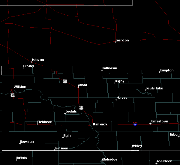 At 552 pm cdt, a severe thunderstorm was located 10 miles northeast of fort union trading post, or 12 miles west of williston, moving east at 30 mph (radar indicated). Hazards include quarter size hail. Damage to vehicles is expected. Locations impacted include, williston, trenton and fort union. At 552 pm cdt, a severe thunderstorm was located 10 miles northeast of fort union trading post, or 12 miles west of williston, moving east at 30 mph (radar indicated). Hazards include quarter size hail. Damage to vehicles is expected. Locations impacted include, williston, trenton and fort union.
|
| 7/5/2020 5:31 PM CDT |
 At 530 pm cdt, a severe thunderstorm was located near bainville, or 17 miles east of culbertson, moving east at 30 mph (radar indicated). Hazards include half dollar size hail. damage to vehicles is expected At 530 pm cdt, a severe thunderstorm was located near bainville, or 17 miles east of culbertson, moving east at 30 mph (radar indicated). Hazards include half dollar size hail. damage to vehicles is expected
|
| 7/5/2020 12:50 AM CDT |
 At 1248 am cdt, severe thunderstorms were located along a line extending from near grenora to 8 miles east of bonetrail to williston, moving northeast at 35 mph (at 1235 am cdt 70 mph wind gusts were reported at the williston basin airport). Hazards include 70 mph wind gusts and nickel size hail. Expect considerable tree damage. damage is likely to mobile homes, roofs, and outbuildings. these severe storms will be near, epping and alamo around 115 am cdt. ray and wildrose around 135 am cdt. Other locations impacted by these severe thunderstorms include zahl, appam, wheelock, hanks, spring brook, corinth and blacktail lake. At 1248 am cdt, severe thunderstorms were located along a line extending from near grenora to 8 miles east of bonetrail to williston, moving northeast at 35 mph (at 1235 am cdt 70 mph wind gusts were reported at the williston basin airport). Hazards include 70 mph wind gusts and nickel size hail. Expect considerable tree damage. damage is likely to mobile homes, roofs, and outbuildings. these severe storms will be near, epping and alamo around 115 am cdt. ray and wildrose around 135 am cdt. Other locations impacted by these severe thunderstorms include zahl, appam, wheelock, hanks, spring brook, corinth and blacktail lake.
|
| 7/5/2020 12:39 AM CDT |
 At 1238 am cdt, severe thunderstorms were located along a line extending from 5 miles south of grenora to 5 miles southeast of bonetrail to 5 miles southwest of williston, moving northeast at 35 mph (radar indicated). Hazards include 60 mph wind gusts and nickel size hail. Expect damage to roofs, siding, and trees. severe thunderstorms will be near, alamo around 110 am cdt. epping around 115 am cdt. ray around 130 am cdt. wildrose around 135 am cdt. Other locations impacted by these severe thunderstorms include zahl, appam, wheelock, hanks, spring brook, corinth and blacktail lake. At 1238 am cdt, severe thunderstorms were located along a line extending from 5 miles south of grenora to 5 miles southeast of bonetrail to 5 miles southwest of williston, moving northeast at 35 mph (radar indicated). Hazards include 60 mph wind gusts and nickel size hail. Expect damage to roofs, siding, and trees. severe thunderstorms will be near, alamo around 110 am cdt. epping around 115 am cdt. ray around 130 am cdt. wildrose around 135 am cdt. Other locations impacted by these severe thunderstorms include zahl, appam, wheelock, hanks, spring brook, corinth and blacktail lake.
|
| 7/5/2020 12:34 AM CDT | Asos station kxwa williston airpor in williams county ND, 8.9 miles SE of Williston, ND |
| 7/3/2020 11:00 PM CDT |
 At 1100 pm cdt/1000 pm mdt/, a severe thunderstorm was located 11 miles northeast of fort union trading post, or 13 miles west of williston, moving east at 30 mph (radar indicated). Hazards include 70 mph wind gusts and nickel size hail. Expect considerable tree damage. damage is likely to mobile homes, roofs, and outbuildings. this severe thunderstorm will be near, williston around 1125 pm cdt. Other locations impacted by this severe thunderstorm include fort buford state historical site, trenton, spring brook and blacktail lake. At 1100 pm cdt/1000 pm mdt/, a severe thunderstorm was located 11 miles northeast of fort union trading post, or 13 miles west of williston, moving east at 30 mph (radar indicated). Hazards include 70 mph wind gusts and nickel size hail. Expect considerable tree damage. damage is likely to mobile homes, roofs, and outbuildings. this severe thunderstorm will be near, williston around 1125 pm cdt. Other locations impacted by this severe thunderstorm include fort buford state historical site, trenton, spring brook and blacktail lake.
|
| 9/17/2019 10:01 PM CDT |
 At 944 pm cdt, severe thunderstorms were located along a line extending from 18 miles south of ray to 4 miles southwest of epping to 5 miles northwest of williston, moving north at 40 mph (radar indicated). Hazards include ping pong ball size hail and 60 mph wind gusts. People and animals outdoors will be injured. expect hail damage to roofs, siding, windows, and vehicles. expect wind damage to roofs, siding, and trees. severe thunderstorms will be near, epping around 950 pm cdt. ray around 1000 pm cdt. tioga around 1015 pm cdt. wildrose and alamo around 1025 pm cdt. Other locations impacted by these severe thunderstorms include hamlet, zahl, lewis and clark state park, appam, spring brook, white tail bay recreation area, wheelock, hanks, mcgregor and tobacco garden bay recreation area. At 944 pm cdt, severe thunderstorms were located along a line extending from 18 miles south of ray to 4 miles southwest of epping to 5 miles northwest of williston, moving north at 40 mph (radar indicated). Hazards include ping pong ball size hail and 60 mph wind gusts. People and animals outdoors will be injured. expect hail damage to roofs, siding, windows, and vehicles. expect wind damage to roofs, siding, and trees. severe thunderstorms will be near, epping around 950 pm cdt. ray around 1000 pm cdt. tioga around 1015 pm cdt. wildrose and alamo around 1025 pm cdt. Other locations impacted by these severe thunderstorms include hamlet, zahl, lewis and clark state park, appam, spring brook, white tail bay recreation area, wheelock, hanks, mcgregor and tobacco garden bay recreation area.
|
| 9/17/2019 9:44 PM CDT |
 At 944 pm cdt, severe thunderstorms were located along a line extending from 18 miles south of ray to 4 miles southwest of epping to 5 miles northwest of williston, moving north at 40 mph (radar indicated). Hazards include ping pong ball size hail and 60 mph wind gusts. People and animals outdoors will be injured. expect hail damage to roofs, siding, windows, and vehicles. expect wind damage to roofs, siding, and trees. severe thunderstorms will be near, epping around 950 pm cdt. ray around 1000 pm cdt. tioga around 1015 pm cdt. wildrose and alamo around 1025 pm cdt. Other locations impacted by these severe thunderstorms include hamlet, zahl, lewis and clark state park, appam, spring brook, white tail bay recreation area, wheelock, hanks, mcgregor and tobacco garden bay recreation area. At 944 pm cdt, severe thunderstorms were located along a line extending from 18 miles south of ray to 4 miles southwest of epping to 5 miles northwest of williston, moving north at 40 mph (radar indicated). Hazards include ping pong ball size hail and 60 mph wind gusts. People and animals outdoors will be injured. expect hail damage to roofs, siding, windows, and vehicles. expect wind damage to roofs, siding, and trees. severe thunderstorms will be near, epping around 950 pm cdt. ray around 1000 pm cdt. tioga around 1015 pm cdt. wildrose and alamo around 1025 pm cdt. Other locations impacted by these severe thunderstorms include hamlet, zahl, lewis and clark state park, appam, spring brook, white tail bay recreation area, wheelock, hanks, mcgregor and tobacco garden bay recreation area.
|
| 9/17/2019 9:33 PM CDT |
 At 933 pm cdt, a severe thunderstorm was located near williston, moving north at 30 mph (radar indicated). Hazards include ping pong ball size hail and 60 mph wind gusts. People and animals outdoors will be injured. expect hail damage to roofs, siding, windows, and vehicles. expect wind damage to roofs, siding, and trees. this severe storm will be near, williston around 940 pm cdt. Other locations impacted by this severe thunderstorm include spring brook. At 933 pm cdt, a severe thunderstorm was located near williston, moving north at 30 mph (radar indicated). Hazards include ping pong ball size hail and 60 mph wind gusts. People and animals outdoors will be injured. expect hail damage to roofs, siding, windows, and vehicles. expect wind damage to roofs, siding, and trees. this severe storm will be near, williston around 940 pm cdt. Other locations impacted by this severe thunderstorm include spring brook.
|
| 9/17/2019 9:19 PM CDT |
 At 918 pm cdt/818 pm mdt/, a severe thunderstorm was located 9 miles north of alexander, or 12 miles south of williston, moving north at 35 mph (radar indicated). Hazards include ping pong ball size hail and 60 mph wind gusts. People and animals outdoors will be injured. expect hail damage to roofs, siding, windows, and vehicles. expect wind damage to roofs, siding, and trees. this severe storm will be near, williston around 940 pm cdt. Other locations impacted by this severe thunderstorm include cartwright, trenton, spring brook, charbonneau and rawson. At 918 pm cdt/818 pm mdt/, a severe thunderstorm was located 9 miles north of alexander, or 12 miles south of williston, moving north at 35 mph (radar indicated). Hazards include ping pong ball size hail and 60 mph wind gusts. People and animals outdoors will be injured. expect hail damage to roofs, siding, windows, and vehicles. expect wind damage to roofs, siding, and trees. this severe storm will be near, williston around 940 pm cdt. Other locations impacted by this severe thunderstorm include cartwright, trenton, spring brook, charbonneau and rawson.
|
| 9/17/2019 9:06 PM CDT |
 A severe thunderstorm warning remains in effect until 945 pm cdt/845 pm mdt/ for northwestern mckenzie and southwestern williams counties. at 905 pm cdt/805 pm mdt/, a severe thunderstorm was located near alexander, or 18 miles south of williston, moving north at 30 mph. hazard. Ping pong ball size hail and 60 mph wind gusts. A severe thunderstorm warning remains in effect until 945 pm cdt/845 pm mdt/ for northwestern mckenzie and southwestern williams counties. at 905 pm cdt/805 pm mdt/, a severe thunderstorm was located near alexander, or 18 miles south of williston, moving north at 30 mph. hazard. Ping pong ball size hail and 60 mph wind gusts.
|
| 9/17/2019 8:48 PM CDT |
 The national weather service in bismarck has issued a * severe thunderstorm warning for. northwestern mckenzie county in northwestern north dakota. southwestern williams county in northwestern north dakota. until 945 pm cdt/845 pm mdt/. At 847 pm cdt/747 pm mdt/, a severe thunderstorm was located 11. The national weather service in bismarck has issued a * severe thunderstorm warning for. northwestern mckenzie county in northwestern north dakota. southwestern williams county in northwestern north dakota. until 945 pm cdt/845 pm mdt/. At 847 pm cdt/747 pm mdt/, a severe thunderstorm was located 11.
|
| 9/2/2019 11:55 AM CDT |
 At 1155 am cdt, a severe thunderstorm was located near williston, moving east at 25 mph (radar indicated). Hazards include quarter size hail. Damage to vehicles is expected. Locations impacted include, far north side of williston, ray, epping, wheelock, white tail bay recreation area and spring brook. At 1155 am cdt, a severe thunderstorm was located near williston, moving east at 25 mph (radar indicated). Hazards include quarter size hail. Damage to vehicles is expected. Locations impacted include, far north side of williston, ray, epping, wheelock, white tail bay recreation area and spring brook.
|
| 9/2/2019 11:54 AM CDT |
 At 1154 am cdt/1054 am mdt/, a severe thunderstorm was located 13 miles north of arnegard, or 14 miles north of watford city, moving east at 35 mph (radar indicated). Hazards include golf ball size hail and 60 mph wind gusts. People and animals outdoors will be injured. expect hail damage to roofs, siding, windows, and vehicles. expect wind damage to roofs, siding, and trees. Locations impacted include, alexander, arnegard, east fairview, fort union trading post, trenton, keene, cartwright, lewis and clark state park, charbonneau, white tail bay recreation area, fort buford state historical site, rawson and tobacco garden bay recreation area. At 1154 am cdt/1054 am mdt/, a severe thunderstorm was located 13 miles north of arnegard, or 14 miles north of watford city, moving east at 35 mph (radar indicated). Hazards include golf ball size hail and 60 mph wind gusts. People and animals outdoors will be injured. expect hail damage to roofs, siding, windows, and vehicles. expect wind damage to roofs, siding, and trees. Locations impacted include, alexander, arnegard, east fairview, fort union trading post, trenton, keene, cartwright, lewis and clark state park, charbonneau, white tail bay recreation area, fort buford state historical site, rawson and tobacco garden bay recreation area.
|
| 9/2/2019 11:42 AM CDT | Quarter sized hail reported 8.1 miles S of Williston, ND, not much wind. |
| 9/2/2019 11:31 AM CDT |
 At 1130 am cdt, a severe thunderstorm was located 10 miles north of williston, moving east at 35 mph (radar indicated). Hazards include ping pong ball size hail. People and animals outdoors will be injured. Expect damage to roofs, siding, windows, and vehicles. At 1130 am cdt, a severe thunderstorm was located 10 miles north of williston, moving east at 35 mph (radar indicated). Hazards include ping pong ball size hail. People and animals outdoors will be injured. Expect damage to roofs, siding, windows, and vehicles.
|
| 9/2/2019 11:27 AM CDT |
 The national weather service in bismarck has issued a * severe thunderstorm warning for. northwestern mckenzie county in northwestern north dakota. southern williams county in northwestern north dakota. until 1215 pm cdt/1115 am mdt/. At 1127 am cdt/1027 am mdt/, a severe thunderstorm was located 8. The national weather service in bismarck has issued a * severe thunderstorm warning for. northwestern mckenzie county in northwestern north dakota. southern williams county in northwestern north dakota. until 1215 pm cdt/1115 am mdt/. At 1127 am cdt/1027 am mdt/, a severe thunderstorm was located 8.
|
| 9/2/2019 11:00 AM CDT | Golf Ball sized hail reported 21.7 miles SE of Williston, ND, 0.60 inches of rain fell with the storm. |
| 7/21/2018 6:48 PM CDT |
 At 647 pm cdt/547 pm mdt/, a severe thunderstorm was located near arnegard, or 11 miles west of watford city, moving southeast at 35 mph. this is a very dangerous storm (emergency management). Hazards include 80 mph wind gusts and two inch hail. Flying debris will be dangerous to those caught without shelter. mobile homes will be heavily damaged. expect considerable damage to roofs, windows, and vehicles. extensive tree damage and power outages are likely. this severe storm will be near, arnegard around 655 pm cdt. watford city around 700 pm cdt. Other locations impacted by this severe thunderstorm include white tail bay recreation area, sather dam, cartwright, lewis and clark state park, fort buford state historical site, charbonneau, rawson, tobacco garden bay recreation area and trenton. At 647 pm cdt/547 pm mdt/, a severe thunderstorm was located near arnegard, or 11 miles west of watford city, moving southeast at 35 mph. this is a very dangerous storm (emergency management). Hazards include 80 mph wind gusts and two inch hail. Flying debris will be dangerous to those caught without shelter. mobile homes will be heavily damaged. expect considerable damage to roofs, windows, and vehicles. extensive tree damage and power outages are likely. this severe storm will be near, arnegard around 655 pm cdt. watford city around 700 pm cdt. Other locations impacted by this severe thunderstorm include white tail bay recreation area, sather dam, cartwright, lewis and clark state park, fort buford state historical site, charbonneau, rawson, tobacco garden bay recreation area and trenton.
|
| 7/21/2018 6:21 PM CDT | Golf Ball sized hail reported 10 miles NE of Williston, ND |
| 7/21/2018 6:18 PM CDT |
 At 618 pm cdt/518 pm mdt/, a severe thunderstorm was located 11 miles southwest of williston, moving southeast at 25 mph. this is a very dangerous storm (emergency management reported strong winds, large hail and power outages around trenton). Hazards include 80 mph wind gusts and tennis ball size hail. Flying debris will be dangerous to those caught without shelter. mobile homes will be heavily damaged. expect considerable damage to roofs, windows, and vehicles. extensive tree damage and power outages are likely. this severe storm will be near, alexander around 645 pm cdt. arnegard around 700 pm cdt. Other locations impacted by this severe thunderstorm include white tail bay recreation area, sather dam, cartwright, lewis and clark state park, fort buford state historical site, charbonneau, rawson, tobacco garden bay recreation area and trenton. At 618 pm cdt/518 pm mdt/, a severe thunderstorm was located 11 miles southwest of williston, moving southeast at 25 mph. this is a very dangerous storm (emergency management reported strong winds, large hail and power outages around trenton). Hazards include 80 mph wind gusts and tennis ball size hail. Flying debris will be dangerous to those caught without shelter. mobile homes will be heavily damaged. expect considerable damage to roofs, windows, and vehicles. extensive tree damage and power outages are likely. this severe storm will be near, alexander around 645 pm cdt. arnegard around 700 pm cdt. Other locations impacted by this severe thunderstorm include white tail bay recreation area, sather dam, cartwright, lewis and clark state park, fort buford state historical site, charbonneau, rawson, tobacco garden bay recreation area and trenton.
|
| 7/21/2018 5:56 PM CDT |
 At 555 pm cdt/455 pm mdt/, a severe thunderstorm was located 7 miles northeast of fort union trading post, or 15 miles west of williston, moving southeast at 25 mph. this is a very dangerous storm (trained spotters have reported extensive damage in eastern montana with this storm). Hazards include 80 mph wind gusts and tennis ball size hail. Flying debris will be dangerous to those caught without shelter. mobile homes will be heavily damaged. expect considerable damage to roofs, windows, and vehicles. extensive tree damage and power outages are likely. this severe thunderstorm will be near, arnegard around 700 pm cdt. Other locations impacted by this severe thunderstorm include white tail bay recreation area, sather dam, cartwright, lewis and clark state park, fort buford state historical site, charbonneau, rawson, tobacco garden bay recreation area, trenton and spring brook. At 555 pm cdt/455 pm mdt/, a severe thunderstorm was located 7 miles northeast of fort union trading post, or 15 miles west of williston, moving southeast at 25 mph. this is a very dangerous storm (trained spotters have reported extensive damage in eastern montana with this storm). Hazards include 80 mph wind gusts and tennis ball size hail. Flying debris will be dangerous to those caught without shelter. mobile homes will be heavily damaged. expect considerable damage to roofs, windows, and vehicles. extensive tree damage and power outages are likely. this severe thunderstorm will be near, arnegard around 700 pm cdt. Other locations impacted by this severe thunderstorm include white tail bay recreation area, sather dam, cartwright, lewis and clark state park, fort buford state historical site, charbonneau, rawson, tobacco garden bay recreation area, trenton and spring brook.
|
| 7/21/2018 5:54 PM CDT | Quarter sized hail reported 17.1 miles E of Williston, ND, delayed report. |
| 7/21/2018 5:31 PM CDT |
 At 530 pm cdt/430 pm mdt/, a severe thunderstorm was located near bainville, or 16 miles east of culbertson, moving southeast at 25 mph. this is a very dangerous storm (trained weather spotters reported extensive damage from very large hail and high winds in eastern montana with this storm). Hazards include 80 mph wind gusts and tennis ball size hail. Flying debris will be dangerous to those caught without shelter. mobile homes will be heavily damaged. expect considerable damage to roofs, windows, and vehicles. extensive tree damage and power outages are likely. this severe storm will be near, fort union trading post around 555 pm cdt. Other locations impacted by this severe thunderstorm include cartwright, fort buford state historical site, trenton, spring brook, charbonneau and rawson. At 530 pm cdt/430 pm mdt/, a severe thunderstorm was located near bainville, or 16 miles east of culbertson, moving southeast at 25 mph. this is a very dangerous storm (trained weather spotters reported extensive damage from very large hail and high winds in eastern montana with this storm). Hazards include 80 mph wind gusts and tennis ball size hail. Flying debris will be dangerous to those caught without shelter. mobile homes will be heavily damaged. expect considerable damage to roofs, windows, and vehicles. extensive tree damage and power outages are likely. this severe storm will be near, fort union trading post around 555 pm cdt. Other locations impacted by this severe thunderstorm include cartwright, fort buford state historical site, trenton, spring brook, charbonneau and rawson.
|
| 7/21/2018 4:55 PM CDT |
 At 455 pm cdt/355 pm mdt/, a severe thunderstorm was located 5 miles southeast of froid, or 12 miles northeast of culbertson, moving east at 35 mph. this is a very dangerous storm (radar indicated). Hazards include 80 mph wind gusts and tennis ball size hail. Flying debris will be dangerous to those caught without shelter. mobile homes will be heavily damaged. expect considerable damage to roofs, windows, and vehicles. extensive tree damage and power outages are likely. this severe thunderstorm will be near, williston around 555 pm cdt. Other locations impacted by this severe thunderstorm include cartwright, fort buford state historical site, charbonneau, wheelock, rawson, trenton, spring brook and blacktail lake. At 455 pm cdt/355 pm mdt/, a severe thunderstorm was located 5 miles southeast of froid, or 12 miles northeast of culbertson, moving east at 35 mph. this is a very dangerous storm (radar indicated). Hazards include 80 mph wind gusts and tennis ball size hail. Flying debris will be dangerous to those caught without shelter. mobile homes will be heavily damaged. expect considerable damage to roofs, windows, and vehicles. extensive tree damage and power outages are likely. this severe thunderstorm will be near, williston around 555 pm cdt. Other locations impacted by this severe thunderstorm include cartwright, fort buford state historical site, charbonneau, wheelock, rawson, trenton, spring brook and blacktail lake.
|
| 7/21/2018 3:37 PM CDT |
 At 337 pm cdt, a severe thunderstorm was located near bonetrail, or 17 miles northwest of williston, moving east at 40 mph (radar indicated). Hazards include quarter size hail. Damage to vehicles is expected. this severe thunderstorm will be near, epping around 410 pm cdt. ray around 420 pm cdt. Other locations impacted by this severe thunderstorm include white tail bay recreation area, spring brook, blacktail lake, wheelock and lewis and clark state park. At 337 pm cdt, a severe thunderstorm was located near bonetrail, or 17 miles northwest of williston, moving east at 40 mph (radar indicated). Hazards include quarter size hail. Damage to vehicles is expected. this severe thunderstorm will be near, epping around 410 pm cdt. ray around 420 pm cdt. Other locations impacted by this severe thunderstorm include white tail bay recreation area, spring brook, blacktail lake, wheelock and lewis and clark state park.
|
| 7/10/2018 10:09 PM CDT |
 At 1008 pm cdt, severe thunderstorms were located along a line extending from 18 miles northeast of crosby to near noonan to epping, moving east at 65 mph. these are very dangerous storms (radar indicated). Hazards include 80 mph wind gusts and nickel size hail. Flying debris will be dangerous to those caught without shelter. mobile homes will be heavily damaged. expect considerable damage to roofs, windows, and vehicles. Extensive tree damage and power outages are likely. At 1008 pm cdt, severe thunderstorms were located along a line extending from 18 miles northeast of crosby to near noonan to epping, moving east at 65 mph. these are very dangerous storms (radar indicated). Hazards include 80 mph wind gusts and nickel size hail. Flying debris will be dangerous to those caught without shelter. mobile homes will be heavily damaged. expect considerable damage to roofs, windows, and vehicles. Extensive tree damage and power outages are likely.
|
| 7/10/2018 12:15 AM CDT |
 At 1214 am cdt/1114 pm mdt/, severe thunderstorms were located along a line extending from 6 miles north of watford city to near alexander, moving southeast at 30 mph (radar indicated). Hazards include golf ball size hail and 70 mph wind gusts. People and animals outdoors will be injured. expect hail damage to roofs, siding, windows, and vehicles. expect considerable tree damage. wind damage is also likely to mobile homes, roofs, and outbuildings. these severe storms will be near, watford city around 1220 am cdt. arnegard around 1235 am cdt. Other locations impacted by these severe thunderstorms include cartwright, lewis and clark state park, charbonneau, charlson, spring brook, white tail bay recreation area, keene, fort buford state historical site, wheelock and rawson. At 1214 am cdt/1114 pm mdt/, severe thunderstorms were located along a line extending from 6 miles north of watford city to near alexander, moving southeast at 30 mph (radar indicated). Hazards include golf ball size hail and 70 mph wind gusts. People and animals outdoors will be injured. expect hail damage to roofs, siding, windows, and vehicles. expect considerable tree damage. wind damage is also likely to mobile homes, roofs, and outbuildings. these severe storms will be near, watford city around 1220 am cdt. arnegard around 1235 am cdt. Other locations impacted by these severe thunderstorms include cartwright, lewis and clark state park, charbonneau, charlson, spring brook, white tail bay recreation area, keene, fort buford state historical site, wheelock and rawson.
|
| 7/9/2018 11:55 PM CDT |
 At 1155 pm cdt/1055 pm mdt/, a severe thunderstorm was located 10 miles north of arnegard, or 12 miles northwest of watford city, moving southeast at 25 mph (radar indicated). Hazards include two inch hail and 70 mph wind gusts. People and animals outdoors will be injured. expect hail damage to roofs, siding, windows, and vehicles. expect considerable tree damage. wind damage is also likely to mobile homes, roofs, and outbuildings. this severe storm will be near, watford city around 1225 am cdt. Other locations impacted by this severe thunderstorm include cartwright, lewis and clark state park, charbonneau, charlson, spring brook, white tail bay recreation area, keene, fort buford state historical site, wheelock and rawson. At 1155 pm cdt/1055 pm mdt/, a severe thunderstorm was located 10 miles north of arnegard, or 12 miles northwest of watford city, moving southeast at 25 mph (radar indicated). Hazards include two inch hail and 70 mph wind gusts. People and animals outdoors will be injured. expect hail damage to roofs, siding, windows, and vehicles. expect considerable tree damage. wind damage is also likely to mobile homes, roofs, and outbuildings. this severe storm will be near, watford city around 1225 am cdt. Other locations impacted by this severe thunderstorm include cartwright, lewis and clark state park, charbonneau, charlson, spring brook, white tail bay recreation area, keene, fort buford state historical site, wheelock and rawson.
|
| 7/9/2018 11:48 PM CDT | Half Dollar sized hail reported 1.1 miles W of Williston, ND |
| 7/9/2018 11:42 PM CDT |
 At 1141 pm cdt/1041 pm mdt/, a severe thunderstorm was located 11 miles southeast of williston, moving southeast at 25 mph (public). Hazards include tennis ball size hail and 70 mph wind gusts. People and animals outdoors will be injured. expect hail damage to roofs, siding, windows, and vehicles. expect considerable tree damage. wind damage is also likely to mobile homes, roofs, and outbuildings. this severe thunderstorm will be near, watford city around 1225 am cdt. Other locations impacted by this severe thunderstorm include cartwright, lewis and clark state park, charbonneau, charlson, spring brook, white tail bay recreation area, keene, fort buford state historical site, wheelock and rawson. At 1141 pm cdt/1041 pm mdt/, a severe thunderstorm was located 11 miles southeast of williston, moving southeast at 25 mph (public). Hazards include tennis ball size hail and 70 mph wind gusts. People and animals outdoors will be injured. expect hail damage to roofs, siding, windows, and vehicles. expect considerable tree damage. wind damage is also likely to mobile homes, roofs, and outbuildings. this severe thunderstorm will be near, watford city around 1225 am cdt. Other locations impacted by this severe thunderstorm include cartwright, lewis and clark state park, charbonneau, charlson, spring brook, white tail bay recreation area, keene, fort buford state historical site, wheelock and rawson.
|
| 7/9/2018 11:31 PM CDT | Asos station isn... sloulin field-intl ap in williams county ND, 1.4 miles SSE of Williston, ND |
| 7/9/2018 11:30 PM CDT | Golf Ball sized hail reported 7.2 miles E of Williston, ND |
| 7/9/2018 11:30 PM CDT |
 At 1118 pm cdt/1018 pm mdt/, a severe thunderstorm was located near williston, moving southeast at 30 mph (public. tennis ball size hail was reported 25 miles south of grenora). Hazards include tennis ball size hail and 70 mph wind gusts. People and animals outdoors will be injured. expect hail damage to roofs, siding, windows, and vehicles. expect considerable tree damage. wind damage is also likely to mobile homes, roofs, and outbuildings. This severe thunderstorm will remain over mainly rural areas of northern mckenzie and williams counties, including the following locations, hamlet, zahl, lewis and clark state park, appam, charlson, spring brook, white tail bay recreation area, keene, fort buford state historical site and wheelock. At 1118 pm cdt/1018 pm mdt/, a severe thunderstorm was located near williston, moving southeast at 30 mph (public. tennis ball size hail was reported 25 miles south of grenora). Hazards include tennis ball size hail and 70 mph wind gusts. People and animals outdoors will be injured. expect hail damage to roofs, siding, windows, and vehicles. expect considerable tree damage. wind damage is also likely to mobile homes, roofs, and outbuildings. This severe thunderstorm will remain over mainly rural areas of northern mckenzie and williams counties, including the following locations, hamlet, zahl, lewis and clark state park, appam, charlson, spring brook, white tail bay recreation area, keene, fort buford state historical site and wheelock.
|
| 7/9/2018 11:26 PM CDT | Golf Ball sized hail reported 0.2 miles NW of Williston, ND, relayed through broadcast media. |
| 7/9/2018 11:19 PM CDT |
 At 1118 pm cdt/1018 pm mdt/, a severe thunderstorm was located near williston, moving southeast at 30 mph (public. tennis ball size hail was reported 25 miles south of grenora). Hazards include tennis ball size hail and 70 mph wind gusts. People and animals outdoors will be injured. expect hail damage to roofs, siding, windows, and vehicles. expect considerable tree damage. wind damage is also likely to mobile homes, roofs, and outbuildings. This severe thunderstorm will remain over mainly rural areas of northern mckenzie and williams counties, including the following locations, hamlet, zahl, lewis and clark state park, appam, charlson, spring brook, white tail bay recreation area, keene, fort buford state historical site and wheelock. At 1118 pm cdt/1018 pm mdt/, a severe thunderstorm was located near williston, moving southeast at 30 mph (public. tennis ball size hail was reported 25 miles south of grenora). Hazards include tennis ball size hail and 70 mph wind gusts. People and animals outdoors will be injured. expect hail damage to roofs, siding, windows, and vehicles. expect considerable tree damage. wind damage is also likely to mobile homes, roofs, and outbuildings. This severe thunderstorm will remain over mainly rural areas of northern mckenzie and williams counties, including the following locations, hamlet, zahl, lewis and clark state park, appam, charlson, spring brook, white tail bay recreation area, keene, fort buford state historical site and wheelock.
|
| 7/9/2018 11:00 PM CDT |
 At 1059 pm cdt/959 pm mdt/, severe thunderstorms were located along a line extending from 9 miles east of bonetrail to 9 miles north of williston to 11 miles northeast of fort union trading post, moving southeast at 25 mph. these are very dangerous storms (radar indicated). Hazards include baseball size hail and 70 mph wind gusts. People and animals outdoors will be severely injured. expect shattered windows, extensive damage to roofs, siding, and vehicles. these severe storms will be near, williston around 1115 pm cdt. epping around 1140 pm cdt. ray around 1145 pm cdt. Other locations impacted by these severe thunderstorms include hamlet, zahl, lewis and clark state park, appam, charlson, spring brook, white tail bay recreation area, keene, fort buford state historical site and wheelock. At 1059 pm cdt/959 pm mdt/, severe thunderstorms were located along a line extending from 9 miles east of bonetrail to 9 miles north of williston to 11 miles northeast of fort union trading post, moving southeast at 25 mph. these are very dangerous storms (radar indicated). Hazards include baseball size hail and 70 mph wind gusts. People and animals outdoors will be severely injured. expect shattered windows, extensive damage to roofs, siding, and vehicles. these severe storms will be near, williston around 1115 pm cdt. epping around 1140 pm cdt. ray around 1145 pm cdt. Other locations impacted by these severe thunderstorms include hamlet, zahl, lewis and clark state park, appam, charlson, spring brook, white tail bay recreation area, keene, fort buford state historical site and wheelock.
|
| 7/9/2018 10:50 PM CDT | Tennis Ball sized hail reported 16.1 miles ESE of Williston, ND, relayed through broadcast media. |
| 7/9/2018 10:48 PM CDT |
 At 1048 pm cdt/948 pm mdt/, severe thunderstorms were located along a line extending from wildrose to 9 miles northwest of epping to 13 miles south of bonetrail, moving east at 40 mph. these are very dangerous storms (radar indicated). Hazards include baseball size hail and 70 mph wind gusts. People and animals outdoors will be severely injured. expect shattered windows, extensive damage to roofs, siding, and vehicles. these severe storms will be near, wildrose around 1055 pm cdt. epping around 1100 pm cdt. williston around 1105 pm cdt. ray around 1110 pm cdt. tioga around 1130 pm cdt. Other locations impacted by these severe thunderstorms include hamlet, zahl, lewis and clark state park, appam, charlson, spring brook, white tail bay recreation area, keene, fort buford state historical site and wheelock. At 1048 pm cdt/948 pm mdt/, severe thunderstorms were located along a line extending from wildrose to 9 miles northwest of epping to 13 miles south of bonetrail, moving east at 40 mph. these are very dangerous storms (radar indicated). Hazards include baseball size hail and 70 mph wind gusts. People and animals outdoors will be severely injured. expect shattered windows, extensive damage to roofs, siding, and vehicles. these severe storms will be near, wildrose around 1055 pm cdt. epping around 1100 pm cdt. williston around 1105 pm cdt. ray around 1110 pm cdt. tioga around 1130 pm cdt. Other locations impacted by these severe thunderstorms include hamlet, zahl, lewis and clark state park, appam, charlson, spring brook, white tail bay recreation area, keene, fort buford state historical site and wheelock.
|
| 7/9/2018 10:41 PM CDT |
 At 1041 pm cdt/941 pm mdt/, severe thunderstorms were located along a line extending from 4 miles southwest of wildrose to 11 miles southeast of bonetrail to 11 miles northeast of bainville, moving east at 40 mph (radar indicated). Hazards include 70 mph wind gusts and half dollar size hail. Hail damage to vehicles is expected. expect considerable tree damage. wind damage is also likely to mobile homes, roofs, and outbuildings. severe thunderstorms will be near, wildrose around 1045 pm cdt. epping around 1100 pm cdt. williston around 1105 pm cdt. ray around 1110 pm cdt. tioga around 1125 pm cdt. Other locations impacted by these severe thunderstorms include hamlet, zahl, lewis and clark state park, appam, charlson, spring brook, white tail bay recreation area, keene, fort buford state historical site and wheelock. At 1041 pm cdt/941 pm mdt/, severe thunderstorms were located along a line extending from 4 miles southwest of wildrose to 11 miles southeast of bonetrail to 11 miles northeast of bainville, moving east at 40 mph (radar indicated). Hazards include 70 mph wind gusts and half dollar size hail. Hail damage to vehicles is expected. expect considerable tree damage. wind damage is also likely to mobile homes, roofs, and outbuildings. severe thunderstorms will be near, wildrose around 1045 pm cdt. epping around 1100 pm cdt. williston around 1105 pm cdt. ray around 1110 pm cdt. tioga around 1125 pm cdt. Other locations impacted by these severe thunderstorms include hamlet, zahl, lewis and clark state park, appam, charlson, spring brook, white tail bay recreation area, keene, fort buford state historical site and wheelock.
|
| 7/9/2018 10:40 PM CDT | Golf Ball sized hail reported 21.7 miles SE of Williston, ND, hail lasted for 20 minutes (1030-1050 pm). broken window on the north side of house. |
| 7/9/2018 10:25 PM CDT | Quarter sized hail reported 3.8 miles SSW of Williston, ND, lasted just a few minutes. hail was heavier just north of spotter. |
| 7/9/2018 10:25 PM CDT |
 At 1024 pm cdt, a severe thunderstorm was located near williston, moving east at 15 mph (radar indicated). Hazards include two inch hail and 70 mph wind gusts. People and animals outdoors will be injured. expect hail damage to roofs, siding, windows, and vehicles. expect considerable tree damage. wind damage is also likely to mobile homes, roofs, and outbuildings. this severe storm will be near, epping around 1045 pm cdt. the most intense portion of this storm will stay just north of the city of williston. Other locations impacted by this severe thunderstorm include white tail bay recreation area, lewis and clark state park, wheelock, tobacco garden bay recreation area, trenton, spring brook and blacktail lake. At 1024 pm cdt, a severe thunderstorm was located near williston, moving east at 15 mph (radar indicated). Hazards include two inch hail and 70 mph wind gusts. People and animals outdoors will be injured. expect hail damage to roofs, siding, windows, and vehicles. expect considerable tree damage. wind damage is also likely to mobile homes, roofs, and outbuildings. this severe storm will be near, epping around 1045 pm cdt. the most intense portion of this storm will stay just north of the city of williston. Other locations impacted by this severe thunderstorm include white tail bay recreation area, lewis and clark state park, wheelock, tobacco garden bay recreation area, trenton, spring brook and blacktail lake.
|
| 7/9/2018 10:00 PM CDT |
 At 959 pm cdt, a severe thunderstorm was located 6 miles northwest of williston, moving southeast at 25 mph. this is a very dangerous storm (radar indicated). Hazards include 80 mph wind gusts and baseball size hail. Flying debris will be dangerous to those caught without shelter. mobile homes will be heavily damaged. expect considerable damage to roofs, windows, and vehicles. extensive tree damage and power outages are likely. this severe storm will be near, williston around 1010 pm cdt. Other locations impacted by this severe thunderstorm include white tail bay recreation area, lewis and clark state park, charbonneau, wheelock, rawson, tobacco garden bay recreation area, trenton, spring brook and blacktail lake. At 959 pm cdt, a severe thunderstorm was located 6 miles northwest of williston, moving southeast at 25 mph. this is a very dangerous storm (radar indicated). Hazards include 80 mph wind gusts and baseball size hail. Flying debris will be dangerous to those caught without shelter. mobile homes will be heavily damaged. expect considerable damage to roofs, windows, and vehicles. extensive tree damage and power outages are likely. this severe storm will be near, williston around 1010 pm cdt. Other locations impacted by this severe thunderstorm include white tail bay recreation area, lewis and clark state park, charbonneau, wheelock, rawson, tobacco garden bay recreation area, trenton, spring brook and blacktail lake.
|
| 7/9/2018 9:42 PM CDT |
 At 941 pm cdt, a severe thunderstorm was located 7 miles south of bonetrail, or 14 miles northwest of williston, moving southeast at 30 mph. this is a very dangerous storm (radar indicated). Hazards include 80 mph wind gusts and baseball size hail. Flying debris will be dangerous to those caught without shelter. mobile homes will be heavily damaged. expect considerable damage to roofs, windows, and vehicles. extensive tree damage and power outages are likely. this severe thunderstorm will be near, williston around 1000 pm cdt. Other locations impacted by this severe thunderstorm include white tail bay recreation area, lewis and clark state park, charbonneau, wheelock, rawson, tobacco garden bay recreation area, trenton, spring brook and blacktail lake. At 941 pm cdt, a severe thunderstorm was located 7 miles south of bonetrail, or 14 miles northwest of williston, moving southeast at 30 mph. this is a very dangerous storm (radar indicated). Hazards include 80 mph wind gusts and baseball size hail. Flying debris will be dangerous to those caught without shelter. mobile homes will be heavily damaged. expect considerable damage to roofs, windows, and vehicles. extensive tree damage and power outages are likely. this severe thunderstorm will be near, williston around 1000 pm cdt. Other locations impacted by this severe thunderstorm include white tail bay recreation area, lewis and clark state park, charbonneau, wheelock, rawson, tobacco garden bay recreation area, trenton, spring brook and blacktail lake.
|
| 7/9/2018 9:22 PM CDT |
 At 922 pm cdt, a severe thunderstorm was located near bonetrail, or 24 miles northwest of williston, moving southeast at 45 mph. this is a very dangerous storm (radar indicated). Hazards include 80 mph wind gusts and two inch hail. Flying debris will be dangerous to those caught without shelter. mobile homes will be heavily damaged. expect considerable damage to roofs, windows, and vehicles. extensive tree damage and power outages are likely. Locations impacted include, williston, grenora, alamo, bonetrail, trenton, zahl, fort buford state historical site, appam, hanks, corinth and blacktail lake. At 922 pm cdt, a severe thunderstorm was located near bonetrail, or 24 miles northwest of williston, moving southeast at 45 mph. this is a very dangerous storm (radar indicated). Hazards include 80 mph wind gusts and two inch hail. Flying debris will be dangerous to those caught without shelter. mobile homes will be heavily damaged. expect considerable damage to roofs, windows, and vehicles. extensive tree damage and power outages are likely. Locations impacted include, williston, grenora, alamo, bonetrail, trenton, zahl, fort buford state historical site, appam, hanks, corinth and blacktail lake.
|
| 7/9/2018 9:00 PM CDT |
 At 900 pm cdt, a severe thunderstorm was located 13 miles west of grenora, or 21 miles southeast of plentywood, moving southeast at 25 mph (radar indicated). Hazards include two inch hail and 70 mph wind gusts. People and animals outdoors will be injured. expect hail damage to roofs, siding, windows, and vehicles. expect considerable tree damage. wind damage is also likely to mobile homes, roofs, and outbuildings. Locations impacted include, williston, grenora, alamo, bonetrail, fort union trading post, trenton, zahl, fort buford state historical site, appam, hanks, corinth and blacktail lake. At 900 pm cdt, a severe thunderstorm was located 13 miles west of grenora, or 21 miles southeast of plentywood, moving southeast at 25 mph (radar indicated). Hazards include two inch hail and 70 mph wind gusts. People and animals outdoors will be injured. expect hail damage to roofs, siding, windows, and vehicles. expect considerable tree damage. wind damage is also likely to mobile homes, roofs, and outbuildings. Locations impacted include, williston, grenora, alamo, bonetrail, fort union trading post, trenton, zahl, fort buford state historical site, appam, hanks, corinth and blacktail lake.
|
| 7/9/2018 8:38 PM CDT |
 At 838 pm cdt, a severe thunderstorm was located 12 miles northeast of medicine lake, or 14 miles southeast of plentywood, moving southeast at 35 mph (radar indicated). Hazards include two inch hail and 70 mph wind gusts. People and animals outdoors will be injured. expect hail damage to roofs, siding, windows, and vehicles. expect considerable tree damage. wind damage is also likely to mobile homes, roofs, and outbuildings. This severe thunderstorm will remain over mainly rural areas of western williams and southwestern divide counties, including the following locations, zahl, fort buford state historical site, appam, hanks, trenton, corinth and blacktail lake. At 838 pm cdt, a severe thunderstorm was located 12 miles northeast of medicine lake, or 14 miles southeast of plentywood, moving southeast at 35 mph (radar indicated). Hazards include two inch hail and 70 mph wind gusts. People and animals outdoors will be injured. expect hail damage to roofs, siding, windows, and vehicles. expect considerable tree damage. wind damage is also likely to mobile homes, roofs, and outbuildings. This severe thunderstorm will remain over mainly rural areas of western williams and southwestern divide counties, including the following locations, zahl, fort buford state historical site, appam, hanks, trenton, corinth and blacktail lake.
|
| 6/28/2018 9:38 PM CDT | 68 mph wind gust recorded at sloulin field international airpor in williams county ND, 1.4 miles SSE of Williston, ND |
| 6/28/2018 9:29 PM CDT | Pea size hai in williams county ND, 8.2 miles E of Williston, ND |
| 6/28/2018 9:27 PM CDT |
 At 926 pm cdt/826 pm mdt/, severe thunderstorms were located along a line extending from 6 miles east of bonetrail to 18 miles northeast of trotters, moving east at 60 mph (emergency management reported 65 mph winds 8 miles west of williston). Hazards include 70 mph wind gusts and quarter size hail. Hail damage to vehicles is expected. expect considerable tree damage. wind damage is also likely to mobile homes, roofs, and outbuildings. these severe storms will be near, theodore roosevelt national park north unit around 945 pm cdt. other locations impacted by these severe thunderstorms include zahl, sather dam, cartwright, lewis and clark state park, charbonneau, appam, charlson, spring brook, white tail bay recreation area and keene. A tornado watch remains in effect until 1100 pm cdt/1000 pm mdt/ for southwestern and northwestern north dakota. At 926 pm cdt/826 pm mdt/, severe thunderstorms were located along a line extending from 6 miles east of bonetrail to 18 miles northeast of trotters, moving east at 60 mph (emergency management reported 65 mph winds 8 miles west of williston). Hazards include 70 mph wind gusts and quarter size hail. Hail damage to vehicles is expected. expect considerable tree damage. wind damage is also likely to mobile homes, roofs, and outbuildings. these severe storms will be near, theodore roosevelt national park north unit around 945 pm cdt. other locations impacted by these severe thunderstorms include zahl, sather dam, cartwright, lewis and clark state park, charbonneau, appam, charlson, spring brook, white tail bay recreation area and keene. A tornado watch remains in effect until 1100 pm cdt/1000 pm mdt/ for southwestern and northwestern north dakota.
|
| 6/28/2018 9:25 PM CDT | Torrential rai in williams county ND, 8.2 miles E of Williston, ND |
| 6/28/2018 9:15 PM CDT |
 At 915 pm cdt/815 pm mdt/, severe thunderstorms were located along a line extending from bonetrail to 13 miles northeast of skaar, moving east at 60 mph (radar indicated). Hazards include 70 mph wind gusts and quarter size hail. Hail damage to vehicles is expected. expect considerable tree damage. wind damage is also likely to mobile homes, roofs, and outbuildings. these severe storms will be near, bonetrail around 920 pm cdt. alamo around 935 pm cdt. theodore roosevelt national park north unit around 945 pm cdt. other locations impacted by these severe thunderstorms include zahl, sather dam, cartwright, lewis and clark state park, charbonneau, appam, charlson, spring brook, white tail bay recreation area and keene. A tornado watch remains in effect until 1100 pm cdt/1000 pm mdt/ for southwestern and northwestern north dakota. At 915 pm cdt/815 pm mdt/, severe thunderstorms were located along a line extending from bonetrail to 13 miles northeast of skaar, moving east at 60 mph (radar indicated). Hazards include 70 mph wind gusts and quarter size hail. Hail damage to vehicles is expected. expect considerable tree damage. wind damage is also likely to mobile homes, roofs, and outbuildings. these severe storms will be near, bonetrail around 920 pm cdt. alamo around 935 pm cdt. theodore roosevelt national park north unit around 945 pm cdt. other locations impacted by these severe thunderstorms include zahl, sather dam, cartwright, lewis and clark state park, charbonneau, appam, charlson, spring brook, white tail bay recreation area and keene. A tornado watch remains in effect until 1100 pm cdt/1000 pm mdt/ for southwestern and northwestern north dakota.
|
| 6/28/2018 8:47 PM CDT |
 At 847 pm cdt/747 pm mdt/, severe thunderstorms were located along a line extending from near froid to 4 miles west of savage, moving east at 60 mph (radar indicated). Hazards include 70 mph wind gusts and quarter size hail. Hail damage to vehicles is expected. expect considerable tree damage. wind damage is also likely to mobile homes, roofs, and outbuildings. severe thunderstorms will be near, bonetrail around 915 pm cdt. alamo around 935 pm cdt. theodore roosevelt national park north unit around 940 pm cdt. other locations impacted by these severe thunderstorms include zahl, sather dam, cartwright, lewis and clark state park, charbonneau, appam, charlson, spring brook, white tail bay recreation area and keene. A tornado watch remains in effect until 1100 pm cdt/1000 pm mdt/ for southwestern and northwestern north dakota. At 847 pm cdt/747 pm mdt/, severe thunderstorms were located along a line extending from near froid to 4 miles west of savage, moving east at 60 mph (radar indicated). Hazards include 70 mph wind gusts and quarter size hail. Hail damage to vehicles is expected. expect considerable tree damage. wind damage is also likely to mobile homes, roofs, and outbuildings. severe thunderstorms will be near, bonetrail around 915 pm cdt. alamo around 935 pm cdt. theodore roosevelt national park north unit around 940 pm cdt. other locations impacted by these severe thunderstorms include zahl, sather dam, cartwright, lewis and clark state park, charbonneau, appam, charlson, spring brook, white tail bay recreation area and keene. A tornado watch remains in effect until 1100 pm cdt/1000 pm mdt/ for southwestern and northwestern north dakota.
|
| 6/1/2018 5:29 PM CDT |
 At 529 pm cdt, a severe thunderstorm was located 11 miles east of bainville, or 17 miles west of williston, moving northeast at 35 mph (radar indicated). Hazards include 60 mph wind gusts and quarter size hail. Hail damage to vehicles is expected. expect wind damage to roofs, siding, and trees. this severe thunderstorm will be near, bonetrail around 555 pm cdt. alamo around 630 pm cdt. other locations impacted by this severe thunderstorm include hanks, zahl, blacktail lake and appam. A tornado watch remains in effect until 1100 pm cdt for northwestern north dakota. At 529 pm cdt, a severe thunderstorm was located 11 miles east of bainville, or 17 miles west of williston, moving northeast at 35 mph (radar indicated). Hazards include 60 mph wind gusts and quarter size hail. Hail damage to vehicles is expected. expect wind damage to roofs, siding, and trees. this severe thunderstorm will be near, bonetrail around 555 pm cdt. alamo around 630 pm cdt. other locations impacted by this severe thunderstorm include hanks, zahl, blacktail lake and appam. A tornado watch remains in effect until 1100 pm cdt for northwestern north dakota.
|
| 7/11/2017 3:11 PM CDT | Also reported pea size hai in williams county ND, 0.3 miles ENE of Williston, ND |
| 7/11/2017 2:59 PM CDT | Also reported pea size hail. corrected for tim in williams county ND, 0.3 miles ENE of Williston, ND |
| 7/11/2017 2:59 PM CDT |
 The national weather service in bismarck has issued a * severe thunderstorm warning for. northeastern mckenzie county in northwestern north dakota. southeastern williams county in northwestern north dakota. Until 400 pm cdt * at 258 pm cdt, a severe thunderstorm was located over williston,. The national weather service in bismarck has issued a * severe thunderstorm warning for. northeastern mckenzie county in northwestern north dakota. southeastern williams county in northwestern north dakota. Until 400 pm cdt * at 258 pm cdt, a severe thunderstorm was located over williston,.
|
| 9/2/2016 10:27 PM CDT |
 At 1027 pm cdt/927 pm mdt/, severe thunderstorms were located along a line extending from 8 miles north of fort union trading post to 16 miles north of medora, moving northeast at 50 mph (radar indicated). Hazards include 60 mph wind gusts. Expect damage to roofs. siding. and trees. these severe storms will be near, williston around 1045 pm cdt. Other locations impacted by these severe thunderstorms include fort buford state historical site, rawson, trenton, sather dam, fairfield, charbonneau and cartwright. At 1027 pm cdt/927 pm mdt/, severe thunderstorms were located along a line extending from 8 miles north of fort union trading post to 16 miles north of medora, moving northeast at 50 mph (radar indicated). Hazards include 60 mph wind gusts. Expect damage to roofs. siding. and trees. these severe storms will be near, williston around 1045 pm cdt. Other locations impacted by these severe thunderstorms include fort buford state historical site, rawson, trenton, sather dam, fairfield, charbonneau and cartwright.
|
| 9/2/2016 9:52 PM CDT |
 At 951 pm cdt/851 pm mdt/, severe thunderstorms were located along a line extending from 12 miles south of culbertson to wibaux, moving northeast at 50 mph (trained weather spotters). Hazards include 60 mph wind gusts. Expect damage to roofs. siding. and trees. severe thunderstorms will be near, fort union trading post around 920 pm mdt. williston around 1045 pm cdt. Other locations impacted by these severe thunderstorms include fort buford state historical site, rawson, trenton, sather dam, fairfield, charbonneau and cartwright. At 951 pm cdt/851 pm mdt/, severe thunderstorms were located along a line extending from 12 miles south of culbertson to wibaux, moving northeast at 50 mph (trained weather spotters). Hazards include 60 mph wind gusts. Expect damage to roofs. siding. and trees. severe thunderstorms will be near, fort union trading post around 920 pm mdt. williston around 1045 pm cdt. Other locations impacted by these severe thunderstorms include fort buford state historical site, rawson, trenton, sather dam, fairfield, charbonneau and cartwright.
|
| 7/22/2016 10:21 PM CDT |
 At 1020 pm cdt, a severe thunderstorm was located 9 miles north of williston, moving northeast at 45 mph (radar indicated). Hazards include 60 mph wind gusts and quarter size hail. Hail damage to vehicles is expected. expect wind damage to roofs, siding, and trees. Locations impacted include, williston and spring brook. At 1020 pm cdt, a severe thunderstorm was located 9 miles north of williston, moving northeast at 45 mph (radar indicated). Hazards include 60 mph wind gusts and quarter size hail. Hail damage to vehicles is expected. expect wind damage to roofs, siding, and trees. Locations impacted include, williston and spring brook.
|
| 7/22/2016 10:13 PM CDT | Quarter sized hail reported 2.6 miles S of Williston, ND, mostly dime and nickel size but a few quarters. |
| 7/22/2016 9:59 PM CDT |
 At 957 pm cdt, a severe thunderstorm was located 8 miles southwest of williston, moving northeast at 40 mph (trained weather spotters. at 952 pm cdt quarter size hail was falling 3 miles south southwest of trenton). Hazards include 60 mph wind gusts and quarter size hail. Hail damage to vehicles is expected. expect wind damage to roofs, siding, and trees. Locations impacted include, williston, bonetrail, fort union trading post, trenton, spring brook, blacktail lake, fort buford state historical site and fort union. At 957 pm cdt, a severe thunderstorm was located 8 miles southwest of williston, moving northeast at 40 mph (trained weather spotters. at 952 pm cdt quarter size hail was falling 3 miles south southwest of trenton). Hazards include 60 mph wind gusts and quarter size hail. Hail damage to vehicles is expected. expect wind damage to roofs, siding, and trees. Locations impacted include, williston, bonetrail, fort union trading post, trenton, spring brook, blacktail lake, fort buford state historical site and fort union.
|
| 7/22/2016 9:52 PM CDT | Quarter sized hail reported 14.3 miles NE of Williston, ND, mostly dime size hail with a couple of quarters... pea size hail still ongoing. |
| 7/22/2016 9:37 PM CDT |
 At 936 pm cdt/836 pm mdt/, a severe thunderstorm was located 6 miles southeast of fort union trading post, or 17 miles northeast of sidney, moving north at 40 mph (radar indicated). Hazards include 60 mph wind gusts and quarter size hail. Hail damage to vehicles is expected. Expect wind damage to roofs, siding, and trees. At 936 pm cdt/836 pm mdt/, a severe thunderstorm was located 6 miles southeast of fort union trading post, or 17 miles northeast of sidney, moving north at 40 mph (radar indicated). Hazards include 60 mph wind gusts and quarter size hail. Hail damage to vehicles is expected. Expect wind damage to roofs, siding, and trees.
|
| 6/24/2016 10:20 PM CDT | Quarter sized hail reported 20.4 miles SSE of Williston, ND |
| 6/24/2016 10:20 PM CDT | High winds have continued through the time of the call 105 in williams county ND, 20.4 miles SSE of Williston, ND |
| 6/24/2016 10:16 PM CDT |
 At 1015 pm cdt/915 pm mdt/, severe thunderstorms were located along a line extending from 10 miles southwest of westby to near theodore roosevelt national park north unit, moving east at 60 mph. these are very dangerous storms (public. at 1005 pm cdt...wind gusts of 60 mph were estimated in williston, breaking tree branches). Hazards include 80 mph wind gusts and quarter size hail. Flying debris will be dangerous to those caught without shelter. mobile homes will be heavily damaged. expect considerable damage to roofs, windows, and vehicles. extensive tree damage and power outages are likely. these severe storms will be near, watford city, epping and theodore roosevelt national park north unit around 1020 pm cdt. ray around 1025 pm cdt. tioga, writing rock state historical site and alkabo around 1030 pm cdt. Other locations impacted by these severe thunderstorms include keene, rawson, twin buttes, fort buford state historical site, wheelock, trenton, oakdale, appam, white earth bay recreation area and hamlet. At 1015 pm cdt/915 pm mdt/, severe thunderstorms were located along a line extending from 10 miles southwest of westby to near theodore roosevelt national park north unit, moving east at 60 mph. these are very dangerous storms (public. at 1005 pm cdt...wind gusts of 60 mph were estimated in williston, breaking tree branches). Hazards include 80 mph wind gusts and quarter size hail. Flying debris will be dangerous to those caught without shelter. mobile homes will be heavily damaged. expect considerable damage to roofs, windows, and vehicles. extensive tree damage and power outages are likely. these severe storms will be near, watford city, epping and theodore roosevelt national park north unit around 1020 pm cdt. ray around 1025 pm cdt. tioga, writing rock state historical site and alkabo around 1030 pm cdt. Other locations impacted by these severe thunderstorms include keene, rawson, twin buttes, fort buford state historical site, wheelock, trenton, oakdale, appam, white earth bay recreation area and hamlet.
|
| 6/24/2016 10:05 PM CDT | Some branches were broken and torrential rain reported in williams county ND, 0.9 miles NNE of Williston, ND |
| 6/24/2016 10:03 PM CDT |
 At 1001 pm cdt/901 pm mdt/, severe thunderstorms were located along a line extending from 43 miles north of fortuna to near theodore roosevelt national park north unit, moving northeast at 60 mph. these are very dangerous storms (radar indicated). Hazards include 80 mph wind gusts and quarter size hail. Flying debris will be dangerous to those caught without shelter. mobile homes will be heavily damaged. expect considerable damage to roofs, windows, and vehicles. extensive tree damage and power outages are likely. these severe storms will be near, tioga around 1015 pm cdt mandaree around 1030 pm cdt. Other locations impacted by these severe thunderstorms include keene, rawson, sather dam, twin buttes, fort buford state historical site, wheelock, trenton, oakdale, appam and white earth bay recreation area. At 1001 pm cdt/901 pm mdt/, severe thunderstorms were located along a line extending from 43 miles north of fortuna to near theodore roosevelt national park north unit, moving northeast at 60 mph. these are very dangerous storms (radar indicated). Hazards include 80 mph wind gusts and quarter size hail. Flying debris will be dangerous to those caught without shelter. mobile homes will be heavily damaged. expect considerable damage to roofs, windows, and vehicles. extensive tree damage and power outages are likely. these severe storms will be near, tioga around 1015 pm cdt mandaree around 1030 pm cdt. Other locations impacted by these severe thunderstorms include keene, rawson, sather dam, twin buttes, fort buford state historical site, wheelock, trenton, oakdale, appam and white earth bay recreation area.
|
| 6/24/2016 9:34 PM CDT |
 At 932 pm cdt/832 pm mdt/, severe thunderstorms were located along a line extending from 25 miles north of port of raymond to 7 miles northeast of trotters, moving northeast at 60 mph. these are very dangerous storms (radar indicated). Hazards include 80 mph wind gusts and quarter size hail. Flying debris will be dangerous to those caught without shelter. mobile homes will be heavily damaged. expect considerable damage to roofs, windows, and vehicles. extensive tree damage and power outages are likely. severe thunderstorms will be near, theodore roosevelt national park north unit around 1005 pm cdt. williston and watford city around 1000 pm cdt mandaree around 1030 pm cdt. Other locations impacted by these severe thunderstorms include keene, rawson, sather dam, twin buttes, fort buford state historical site, wheelock, trenton, oakdale, appam and white earth bay recreation area. At 932 pm cdt/832 pm mdt/, severe thunderstorms were located along a line extending from 25 miles north of port of raymond to 7 miles northeast of trotters, moving northeast at 60 mph. these are very dangerous storms (radar indicated). Hazards include 80 mph wind gusts and quarter size hail. Flying debris will be dangerous to those caught without shelter. mobile homes will be heavily damaged. expect considerable damage to roofs, windows, and vehicles. extensive tree damage and power outages are likely. severe thunderstorms will be near, theodore roosevelt national park north unit around 1005 pm cdt. williston and watford city around 1000 pm cdt mandaree around 1030 pm cdt. Other locations impacted by these severe thunderstorms include keene, rawson, sather dam, twin buttes, fort buford state historical site, wheelock, trenton, oakdale, appam and white earth bay recreation area.
|
| 6/21/2016 9:28 PM CDT |
 At 928 pm cdt/828 pm mdt/, a severe thunderstorm was located 8 miles east of east fairview, or 17 miles northeast of sidney, moving east at 40 mph (radar indicated). Hazards include tennis ball size hail and 70 mph wind gusts. People and animals outdoors will be injured. expect hail damage to roofs, siding, windows, and vehicles. expect considerable tree damage. wind damage is also likely to mobile homes, roofs, and outbuildings. this severe storm will be near, alexander around 945 pm cdt. arnegard around 1000 pm cdt. Other locations impacted by this severe thunderstorm include fort buford state historical site, charbonneau, rawson, trenton and cartwright. At 928 pm cdt/828 pm mdt/, a severe thunderstorm was located 8 miles east of east fairview, or 17 miles northeast of sidney, moving east at 40 mph (radar indicated). Hazards include tennis ball size hail and 70 mph wind gusts. People and animals outdoors will be injured. expect hail damage to roofs, siding, windows, and vehicles. expect considerable tree damage. wind damage is also likely to mobile homes, roofs, and outbuildings. this severe storm will be near, alexander around 945 pm cdt. arnegard around 1000 pm cdt. Other locations impacted by this severe thunderstorm include fort buford state historical site, charbonneau, rawson, trenton and cartwright.
|
| 6/21/2016 9:05 PM CDT |
 At 905 pm cdt/805 pm mdt/, a severe thunderstorm was located 7 miles southwest of fort union trading post, or 16 miles north of sidney, moving east at 40 mph (radar indicated). Hazards include tennis ball size hail and 70 mph wind gusts. People and animals outdoors will be injured. expect hail damage to roofs, siding, windows, and vehicles. expect considerable tree damage. wind damage is also likely to mobile homes, roofs, and outbuildings. this severe thunderstorm will be near, fairview, fort union trading post and east fairview around 815 pm mdt. alexander around 945 pm cdt. arnegard around 1000 pm cdt. Other locations impacted by this severe thunderstorm include fort buford state historical site, charbonneau, rawson, trenton and cartwright. At 905 pm cdt/805 pm mdt/, a severe thunderstorm was located 7 miles southwest of fort union trading post, or 16 miles north of sidney, moving east at 40 mph (radar indicated). Hazards include tennis ball size hail and 70 mph wind gusts. People and animals outdoors will be injured. expect hail damage to roofs, siding, windows, and vehicles. expect considerable tree damage. wind damage is also likely to mobile homes, roofs, and outbuildings. this severe thunderstorm will be near, fairview, fort union trading post and east fairview around 815 pm mdt. alexander around 945 pm cdt. arnegard around 1000 pm cdt. Other locations impacted by this severe thunderstorm include fort buford state historical site, charbonneau, rawson, trenton and cartwright.
|
| 6/19/2016 12:16 AM CDT |
 At 1215 am cdt/1115 pm mdt/, severe thunderstorms were located along a line extending from 4 miles northwest of alamo to near alexander, moving east at 55 mph (radar indicated). Hazards include golf ball size hail and 70 mph wind gusts. People and animals outdoors will be injured. expect hail damage to roofs, siding, windows, and vehicles. expect considerable tree damage. wind damage is also likely to mobile homes, roofs, and outbuildings. these severe storms will be near, williston and arnegard around 1220 am cdt. watford city and wildrose around 1230 am cdt. Other locations impacted by these severe thunderstorms include spring brook, blacktail lake, keene, rawson, white tail bay recreation area, charlson, sather dam, hanks, lewis and clark state park and zahl. At 1215 am cdt/1115 pm mdt/, severe thunderstorms were located along a line extending from 4 miles northwest of alamo to near alexander, moving east at 55 mph (radar indicated). Hazards include golf ball size hail and 70 mph wind gusts. People and animals outdoors will be injured. expect hail damage to roofs, siding, windows, and vehicles. expect considerable tree damage. wind damage is also likely to mobile homes, roofs, and outbuildings. these severe storms will be near, williston and arnegard around 1220 am cdt. watford city and wildrose around 1230 am cdt. Other locations impacted by these severe thunderstorms include spring brook, blacktail lake, keene, rawson, white tail bay recreation area, charlson, sather dam, hanks, lewis and clark state park and zahl.
|
| 6/18/2016 11:56 PM CDT |
 At 1156 pm cdt/1056 pm mdt/, severe thunderstorms were located along a line extending from 4 miles southwest of writing rock state historical site to 10 miles east of sidney, moving east at 55 mph (radar indicated). Hazards include golf ball size hail and 70 mph wind gusts. People and animals outdoors will be injured. expect hail damage to roofs, siding, windows, and vehicles. expect considerable tree damage. wind damage is also likely to mobile homes, roofs, and outbuildings. these severe storms will be near, writing rock state historical site around 1200 am cdt. williston and alexander around 1215 am cdt. arnegard around 1220 am cdt. watford city and crosby around 1230 am cdt. Other locations impacted by these severe thunderstorms include spring brook, blacktail lake, keene, rawson, white tail bay recreation area, charlson, sather dam, hanks, lewis and clark state park and ambrose. At 1156 pm cdt/1056 pm mdt/, severe thunderstorms were located along a line extending from 4 miles southwest of writing rock state historical site to 10 miles east of sidney, moving east at 55 mph (radar indicated). Hazards include golf ball size hail and 70 mph wind gusts. People and animals outdoors will be injured. expect hail damage to roofs, siding, windows, and vehicles. expect considerable tree damage. wind damage is also likely to mobile homes, roofs, and outbuildings. these severe storms will be near, writing rock state historical site around 1200 am cdt. williston and alexander around 1215 am cdt. arnegard around 1220 am cdt. watford city and crosby around 1230 am cdt. Other locations impacted by these severe thunderstorms include spring brook, blacktail lake, keene, rawson, white tail bay recreation area, charlson, sather dam, hanks, lewis and clark state park and ambrose.
|
| 6/18/2016 11:28 PM CDT |
 At 1128 pm cdt/1028 pm mdt/, severe thunderstorms were located along a line extending from 12 miles west of westby to 6 miles northwest of sidney, moving east at 55 mph (radar indicated). Hazards include golf ball size hail and 70 mph wind gusts. People and animals outdoors will be injured. expect hail damage to roofs, siding, windows, and vehicles. expect considerable tree damage. wind damage is also likely to mobile homes, roofs, and outbuildings. severe thunderstorms will be near, westby and east fairview around 1140 pm cdt. alkabo and writing rock state historical site around 1150 pm cdt. fortuna around 1155 pm cdt. williston and alexander around 1200 am cdt. arnegard around 1210 am cdt. watford city and crosby around 1220 am cdt. noonan around 1230 am cdt. Other locations impacted by these severe thunderstorms include spring brook, blacktail lake, keene, rawson, white tail bay recreation area, charlson, sather dam, hanks, lewis and clark state park and ambrose. At 1128 pm cdt/1028 pm mdt/, severe thunderstorms were located along a line extending from 12 miles west of westby to 6 miles northwest of sidney, moving east at 55 mph (radar indicated). Hazards include golf ball size hail and 70 mph wind gusts. People and animals outdoors will be injured. expect hail damage to roofs, siding, windows, and vehicles. expect considerable tree damage. wind damage is also likely to mobile homes, roofs, and outbuildings. severe thunderstorms will be near, westby and east fairview around 1140 pm cdt. alkabo and writing rock state historical site around 1150 pm cdt. fortuna around 1155 pm cdt. williston and alexander around 1200 am cdt. arnegard around 1210 am cdt. watford city and crosby around 1220 am cdt. noonan around 1230 am cdt. Other locations impacted by these severe thunderstorms include spring brook, blacktail lake, keene, rawson, white tail bay recreation area, charlson, sather dam, hanks, lewis and clark state park and ambrose.
|
| 6/9/2016 4:16 PM CDT |
 At 416 pm cdt, a severe thunderstorm was located over epping, or 14 miles northeast of williston, moving east at 35 mph (radar indicated). Hazards include 60 mph wind gusts and quarter size hail. Hail damage to vehicles is expected. expect wind damage to roofs, siding, and trees. this severe storm will be near, ray around 430 pm cdt. Other locations impacted by this severe thunderstorm include wheelock, spring brook and white tail bay recreation area. At 416 pm cdt, a severe thunderstorm was located over epping, or 14 miles northeast of williston, moving east at 35 mph (radar indicated). Hazards include 60 mph wind gusts and quarter size hail. Hail damage to vehicles is expected. expect wind damage to roofs, siding, and trees. this severe storm will be near, ray around 430 pm cdt. Other locations impacted by this severe thunderstorm include wheelock, spring brook and white tail bay recreation area.
|
| 6/9/2016 4:10 PM CDT | Quarter sized hail reported 2.6 miles S of Williston, ND, 40 mph winds |
| 6/9/2016 3:55 PM CDT |
 At 355 pm cdt, a severe thunderstorm was located 5 miles north of williston, moving east at 40 mph (radar indicated). Hazards include 60 mph wind gusts and quarter size hail. Hail damage to vehicles is expected. expect wind damage to roofs, siding, and trees. this severe thunderstorm will be near, epping around 410 pm cdt. ray around 425 pm cdt. Other locations impacted by this severe thunderstorm include spring brook, lewis and clark state park, wheelock and white tail bay recreation area. At 355 pm cdt, a severe thunderstorm was located 5 miles north of williston, moving east at 40 mph (radar indicated). Hazards include 60 mph wind gusts and quarter size hail. Hail damage to vehicles is expected. expect wind damage to roofs, siding, and trees. this severe thunderstorm will be near, epping around 410 pm cdt. ray around 425 pm cdt. Other locations impacted by this severe thunderstorm include spring brook, lewis and clark state park, wheelock and white tail bay recreation area.
|
| 7/27/2015 9:30 PM CDT | Shingles blown off roof and barn doors blown out in williams county ND, 11.3 miles SE of Williston, ND |
| 7/15/2015 6:50 PM CDT |
 At 648 pm cdt /548 pm mdt/, a severe thunderstorm was located 9 miles northeast of fort union, or 13 miles west of williston, moving north at 25 mph (radar indicated). Hazards include ping pong ball size hail and 60 mph wind gusts. People and animals outdoors will be injured. expect hail damage to roofs, siding, windows and vehicles. expect wind damage to roofs, siding and trees. this severe thunderstorm will remain over mainly rural areas of southwestern williams and northwestern mckenzie counties, including the following locations, fort buford state historical site, rawson, trenton, sather dam, lewis and clark state park, charbonneau and cartwright. another severe thunderstorm was located between cartwright and sather dam in northwestern mckenzie county. This storm was also capable of producing large hail up to the size of ping pong balls. At 648 pm cdt /548 pm mdt/, a severe thunderstorm was located 9 miles northeast of fort union, or 13 miles west of williston, moving north at 25 mph (radar indicated). Hazards include ping pong ball size hail and 60 mph wind gusts. People and animals outdoors will be injured. expect hail damage to roofs, siding, windows and vehicles. expect wind damage to roofs, siding and trees. this severe thunderstorm will remain over mainly rural areas of southwestern williams and northwestern mckenzie counties, including the following locations, fort buford state historical site, rawson, trenton, sather dam, lewis and clark state park, charbonneau and cartwright. another severe thunderstorm was located between cartwright and sather dam in northwestern mckenzie county. This storm was also capable of producing large hail up to the size of ping pong balls.
|
| 7/15/2015 6:40 PM CDT | Quarter sized hail reported 14.6 miles NE of Williston, ND, very heavy rain accompanied the large hail. wind gusts were around 30 mph at time of report. |
| 7/15/2015 6:34 PM CDT |
 At 633 pm cdt /533 pm mdt/, a severe thunderstorm was located 9 miles northwest of alexander, or 17 miles southwest of williston, moving north at 25 mph (radar indicated). Hazards include ping pong ball size hail and 60 mph wind gusts. People and animals outdoors will be injured. expect hail damage to roofs, siding, windows and vehicles. expect wind damage to roofs, siding and trees. this severe storm will be near, williston around 715 pm cdt. Other locations impacted by this severe thunderstorm include fort buford state historical site, rawson, trenton, sather dam, lewis and clark state park, charbonneau and cartwright. At 633 pm cdt /533 pm mdt/, a severe thunderstorm was located 9 miles northwest of alexander, or 17 miles southwest of williston, moving north at 25 mph (radar indicated). Hazards include ping pong ball size hail and 60 mph wind gusts. People and animals outdoors will be injured. expect hail damage to roofs, siding, windows and vehicles. expect wind damage to roofs, siding and trees. this severe storm will be near, williston around 715 pm cdt. Other locations impacted by this severe thunderstorm include fort buford state historical site, rawson, trenton, sather dam, lewis and clark state park, charbonneau and cartwright.
|
| 7/15/2015 6:10 PM CDT |
 At 610 pm cdt /510 pm mdt/, a severe thunderstorm was located 7 miles northwest of alexander, or 16 miles south of williston, moving north at 25 mph (radar indicated). Hazards include 60 mph wind gusts and half dollar size hail. Hail damage to vehicles is expected. expect wind damage to roofs, siding and trees. this severe thunderstorm will be near, williston around 655 pm cdt. Other locations impacted by this severe thunderstorm include fort buford state historical site, rawson, trenton, sather dam, lewis and clark state park, charbonneau and cartwright. At 610 pm cdt /510 pm mdt/, a severe thunderstorm was located 7 miles northwest of alexander, or 16 miles south of williston, moving north at 25 mph (radar indicated). Hazards include 60 mph wind gusts and half dollar size hail. Hail damage to vehicles is expected. expect wind damage to roofs, siding and trees. this severe thunderstorm will be near, williston around 655 pm cdt. Other locations impacted by this severe thunderstorm include fort buford state historical site, rawson, trenton, sather dam, lewis and clark state park, charbonneau and cartwright.
|
| 7/4/2015 4:25 PM CDT |
 At 423 pm cdt, a severe thunderstorm was located 8 miles north of williston, moving east at 30 mph (radar indicated). Hazards include 60 mph wind gusts and quarter size hail. Hail damage to vehicles is expected. expect wind damage to roofs, siding and trees. this severe storm will be near, williston around 430 pm cdt. epping around 440 pm cdt. Other locations impacted by this severe thunderstorm include spring brook and wheelock. At 423 pm cdt, a severe thunderstorm was located 8 miles north of williston, moving east at 30 mph (radar indicated). Hazards include 60 mph wind gusts and quarter size hail. Hail damage to vehicles is expected. expect wind damage to roofs, siding and trees. this severe storm will be near, williston around 430 pm cdt. epping around 440 pm cdt. Other locations impacted by this severe thunderstorm include spring brook and wheelock.
|
| 7/4/2015 4:08 PM CDT |
 At 407 pm cdt, a severe thunderstorm was located 8 miles southeast of bonetrail, or 12 miles northwest of williston, moving southeast at 30 mph (radar indicated). Hazards include 60 mph wind gusts and quarter size hail. Hail damage to vehicles is expected. expect wind damage to roofs, siding and trees. this severe storm will be near, williston around 425 pm cdt. epping around 440 pm cdt. Other locations impacted by this severe thunderstorm include wheelock, spring brook and blacktail lake. At 407 pm cdt, a severe thunderstorm was located 8 miles southeast of bonetrail, or 12 miles northwest of williston, moving southeast at 30 mph (radar indicated). Hazards include 60 mph wind gusts and quarter size hail. Hail damage to vehicles is expected. expect wind damage to roofs, siding and trees. this severe storm will be near, williston around 425 pm cdt. epping around 440 pm cdt. Other locations impacted by this severe thunderstorm include wheelock, spring brook and blacktail lake.
|
| 7/4/2015 3:54 PM CDT |
 At 353 pm cdt, a severe thunderstorm was located near bonetrail, or 18 miles northwest of williston, moving east at 30 mph (radar indicated). Hazards include 60 mph wind gusts and quarter size hail. Hail damage to vehicles is expected. expect wind damage to roofs, siding and trees. this severe thunderstorm will be near, epping around 440 pm cdt. Other locations impacted by this severe thunderstorm include wheelock, blacktail lake and spring brook. At 353 pm cdt, a severe thunderstorm was located near bonetrail, or 18 miles northwest of williston, moving east at 30 mph (radar indicated). Hazards include 60 mph wind gusts and quarter size hail. Hail damage to vehicles is expected. expect wind damage to roofs, siding and trees. this severe thunderstorm will be near, epping around 440 pm cdt. Other locations impacted by this severe thunderstorm include wheelock, blacktail lake and spring brook.
|
| 9/3/2014 8:33 PM CDT | Quarter sized hail reported 0.9 miles NNE of Williston, ND, hail ongoing at the time of the report |
| 9/3/2014 8:30 PM CDT | Quarter sized hail reported 0.9 miles NNE of Williston, ND, hail lasted about 10 minutes. damage to fence. small branches broken. power out in east williston. |
| 9/3/2014 8:30 PM CDT | Half Dollar sized hail reported 0.9 miles NNE of Williston, ND, estimated wind gusts to 60 mph. broken glass and windows downtown. power out. |
| 9/3/2014 8:30 PM CDT | Quarter sized hail reported 9.9 miles SE of Williston, ND, hail ongoing at the time of call |
| 8/31/2014 5:30 PM CDT | Halfway between trenton and williston. reported pea sized hail and 60 mph wind gus in williams county ND, 6.5 miles ENE of Williston, ND |
| 5/31/2014 9:35 PM CDT | Quarter sized hail reported 21.9 miles SE of Williston, ND, hail lasted from 930 pm to 935 pm |
| 5/26/2014 5:54 PM CDT | Quarter sized hail reported 19.6 miles NE of Williston, ND, report was from around buford. person drove toward trenton and it was hailing along the route. largest stones one inch diameter. most hail was three-quarters inch in di |
| 5/26/2014 5:52 PM CDT | Ping Pong Ball sized hail reported 11.9 miles ENE of Williston, ND, there is a photo of this stone on nws bismarck facebook page. hail was softer and trained spotter said he was unsure of damage to vehicles but did not see any broken wi |
| 5/26/2014 5:43 PM CDT | Quarter sized hail reported 13.8 miles NE of Williston, ND, hail began 543 pm and continued at time of this report issuance. very heavy rain. not much wind. |
| 5/26/2014 5:30 PM CDT | Quarter sized hail reported 17.3 miles ENE of Williston, ND, quarter hail and extensive damage reported along the montana...north dakota border. |
| 5/26/2014 5:30 PM CDT | Tennis Ball sized hail reported 17.7 miles NE of Williston, ND |
| 8/29/2013 1:03 AM CDT | Very heavy rain in williams county ND, 0.9 miles NNE of Williston, ND |
| 7/13/2013 5:50 PM CDT | Storm damage reported in williams county ND, 5.3 miles SSE of Williston, ND |
| 7/13/2013 5:00 PM CDT | Quarter sized hail reported 18.3 miles E of Williston, ND, no damage. |
| 6/14/2013 3:38 PM CDT | Thunderstorm peak windgust. strong winds lasted for 10 minute in williams county ND, 0.9 miles NNE of Williston, ND |
| 6/14/2013 1:20 PM CDT | Thunderstorm peak windgust in williams county ND, 0.9 miles NNE of Williston, ND |
| 7/21/2012 8:00 PM CDT | Golf Ball sized hail reported 8.5 miles SSE of Williston, ND, report received from social media. |
| 7/21/2012 7:42 PM CDT | Hen Egg sized hail reported 9.9 miles SE of Williston, ND, report relayed by media. |
| 7/21/2012 7:30 PM CDT | Baseball sized hail reported 12.5 miles E of Williston, ND |
| 6/30/2012 2:01 AM CDT | Ping Pong Ball sized hail reported 0.9 miles NNE of Williston, ND, lasted 5 minutes |
| 6/30/2012 1:57 AM CDT | Quarter sized hail reported 0.9 miles NNE of Williston, ND |
| 6/30/2012 1:35 AM CDT | Golf Ball sized hail reported 1.4 miles NW of Williston, ND |
| 6/26/2012 10:06 PM CDT | Storm damage reported in williams county ND, 1.4 miles SSE of Williston, ND |
| 6/18/2012 7:03 PM CDT | Relayed by media. 1.25 of rainfal in williams county ND, 0.9 miles NNE of Williston, ND |
| 6/18/2012 7:03 PM CDT | Storm damage reported in williams county ND, 1.4 miles SSE of Williston, ND |
| 6/18/2012 6:54 PM CDT | Quarter sized hail reported 2.6 miles S of Williston, ND, ground covered with hail. hailed for past 5 minutes and still hailing. |
| 6/18/2012 6:54 PM CDT | Spotter estimated 60 mph wind in williams county ND, 0.9 miles NNE of Williston, ND |
| 1/1/0001 12:00 AM | Report relayed by wso willisto in williams county ND, 0.9 miles NNE of Williston, ND |
| 1/1/0001 12:00 AM | 1 to 2 inch diameter tree branches broken off. wooden fences blown dow in williams county ND, 0.9 miles NNE of Williston, ND |
| 1/1/0001 12:00 AM | New hangar door ripped and destroyed at the williston airpor in williams county ND, 0.9 miles NNE of Williston, ND |
| 1/1/0001 12:00 AM | Also pea sized hail in williams county ND, 4.4 miles SSW of Williston, ND |
| 1/1/0001 12:00 AM | Quarter sized hail reported 0.9 miles NNE of Williston, ND, located at the airport. |
Hail Maps for Williston, ND


Connect with Interactive Hail Maps