

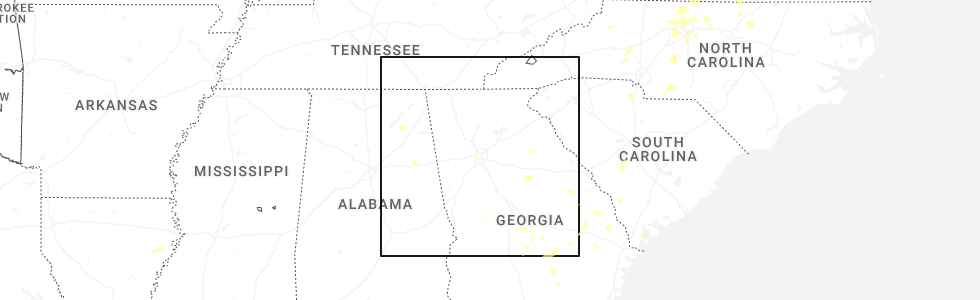
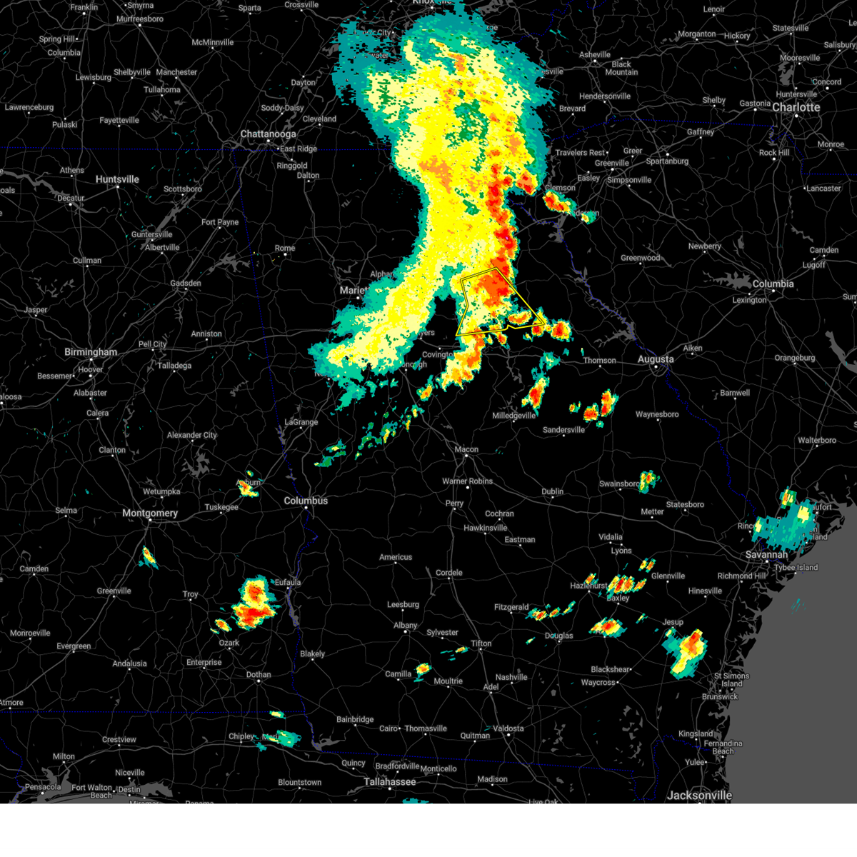
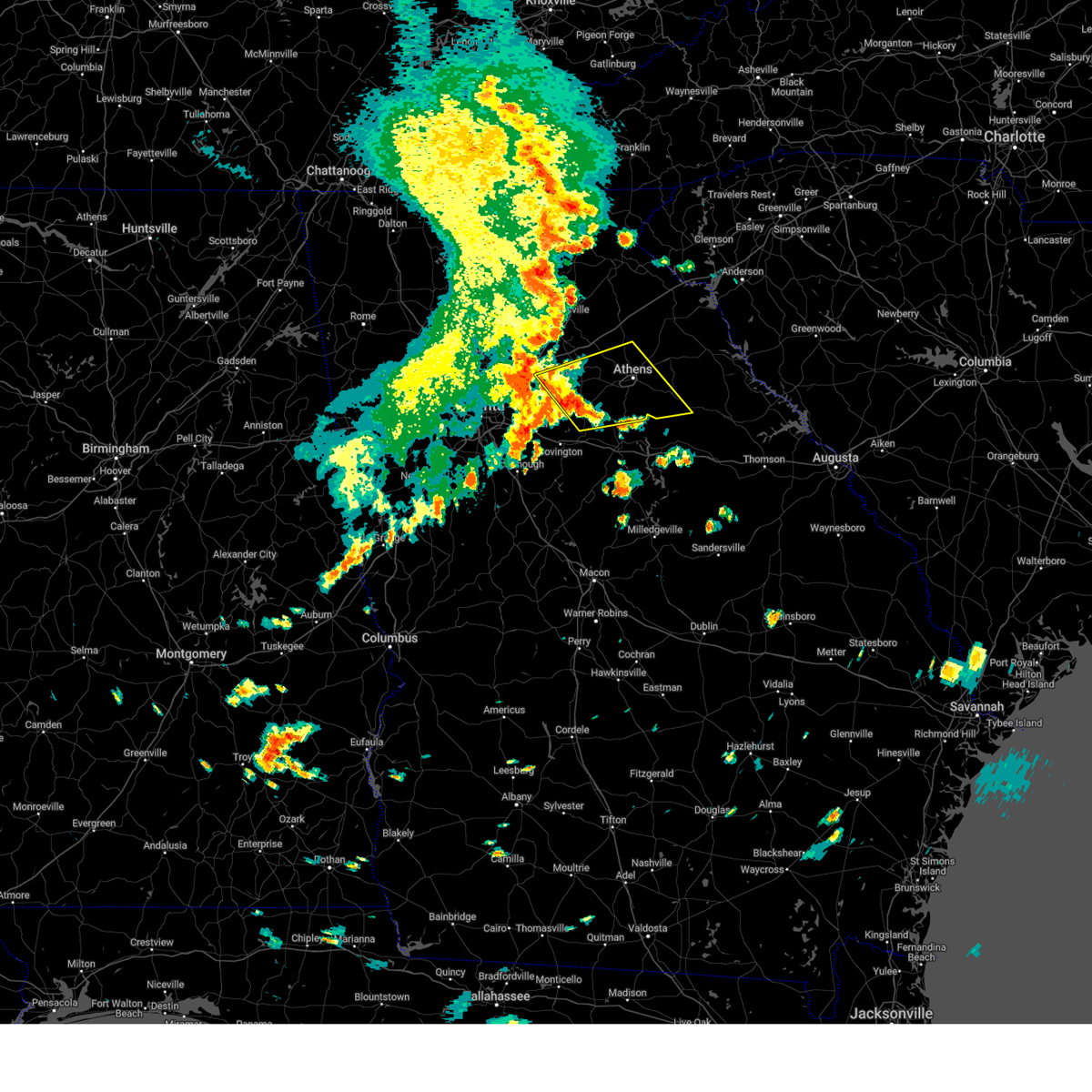
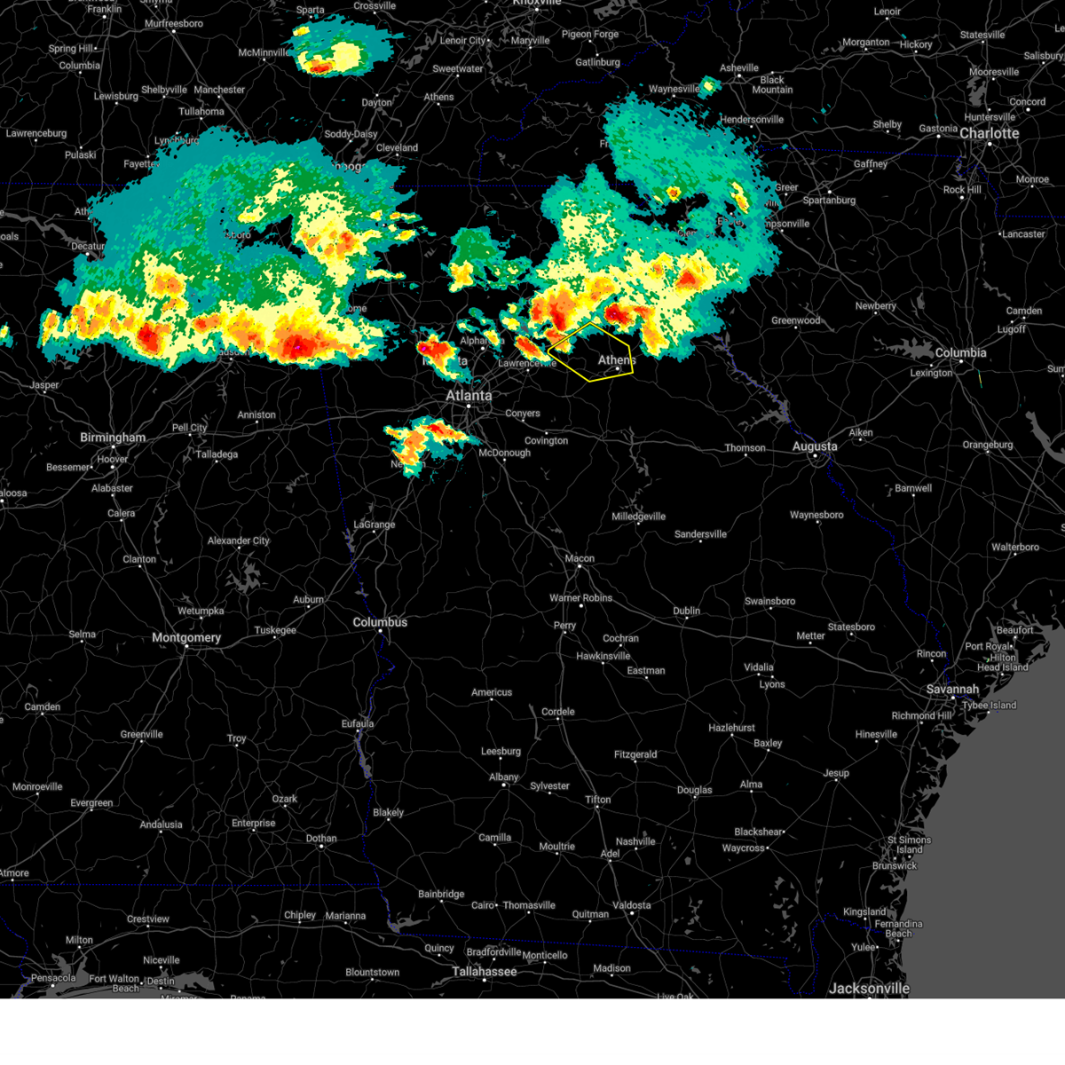
Hail Map for Winterville, GA
The Winterville, GA area has had 3 reports of on-the-ground hail by trained spotters, and has been under severe weather warnings 26 times during the past 12 months. Doppler radar has detected hail at or near Winterville, GA on 36 occasions, including 3 occasions during the past year.
| Name: | Winterville, GA |
| Where Located: | 65.6 miles ENE of Atlanta, GA |
| Map: | Google Map for Winterville, GA |
| Population: | 1122 |
| Housing Units: | 529 |
| More Info: | Search Google for Winterville, GA |
0
The Top Recent Hail Date for Winterville, GA is Wednesday, July 9, 2025 (20th out of 36)
Hail and Wind Damage Spotted near Winterville, GA
| Date / Time | Report Details |
|---|---|
| 6/17/2025 7:44 PM EDT |
 The storms which prompted the warning have moved out of the area. therefore, the warning will be allowed to expire. The storms which prompted the warning have moved out of the area. therefore, the warning will be allowed to expire.
|
| 6/17/2025 7:35 PM EDT |
 At 735 pm edt, severe thunderstorms were located along a line extending from near nicholson to near whitehall to near farmington, moving northeast at 40 mph (radar indicated). Hazards include 60 mph wind gusts. Expect damage to roofs, siding, and trees. Locations impacted include, jefferson, commerce, homer, danielsville, maysville, arcade, nicholson, winterville, colbert, arnoldsville, ila, hull, athens-clarke county, pocataligo, peach state speedway, diamond hill, smithonia, sandy creek recreation area, dunlap, and apple valley. At 735 pm edt, severe thunderstorms were located along a line extending from near nicholson to near whitehall to near farmington, moving northeast at 40 mph (radar indicated). Hazards include 60 mph wind gusts. Expect damage to roofs, siding, and trees. Locations impacted include, jefferson, commerce, homer, danielsville, maysville, arcade, nicholson, winterville, colbert, arnoldsville, ila, hull, athens-clarke county, pocataligo, peach state speedway, diamond hill, smithonia, sandy creek recreation area, dunlap, and apple valley.
|
| 6/17/2025 7:35 PM EDT |
 the severe thunderstorm warning has been cancelled and is no longer in effect the severe thunderstorm warning has been cancelled and is no longer in effect
|
| 6/17/2025 7:17 PM EDT |
 the severe thunderstorm warning has been cancelled and is no longer in effect the severe thunderstorm warning has been cancelled and is no longer in effect
|
| 6/17/2025 7:17 PM EDT |
 At 717 pm edt, severe thunderstorms were located along a line extending from arcade to north high shoals to near hard labor creek state park, moving northeast at 40 mph (radar indicated). Hazards include 60 mph wind gusts. Expect damage to roofs, siding, and trees. Locations impacted include, jefferson, commerce, watkinsville, homer, danielsville, athens, statham, maysville, arcade, nicholson, winterville, bogart, crawford, colbert, arnoldsville, ila, hull, whitehall, athens-clarke county, and westgate park. At 717 pm edt, severe thunderstorms were located along a line extending from arcade to north high shoals to near hard labor creek state park, moving northeast at 40 mph (radar indicated). Hazards include 60 mph wind gusts. Expect damage to roofs, siding, and trees. Locations impacted include, jefferson, commerce, watkinsville, homer, danielsville, athens, statham, maysville, arcade, nicholson, winterville, bogart, crawford, colbert, arnoldsville, ila, hull, whitehall, athens-clarke county, and westgate park.
|
| 6/17/2025 6:55 PM EDT |
 Svrffc the national weather service in peachtree city has issued a * severe thunderstorm warning for, oconee county in northeastern georgia, southern barrow county in north central georgia, northwestern morgan county in north central georgia, southeastern banks county in northeastern georgia, clarke county in northeastern georgia, walton county in north central georgia, jackson county in northeastern georgia, northwestern oglethorpe county in northeastern georgia, western madison county in northeastern georgia, * until 745 pm edt. * at 655 pm edt, severe thunderstorms were located along a line extending from near carl to pannell to near brick store, moving northeast at 40 mph (radar indicated). Hazards include 60 mph wind gusts. expect damage to roofs, siding, and trees Svrffc the national weather service in peachtree city has issued a * severe thunderstorm warning for, oconee county in northeastern georgia, southern barrow county in north central georgia, northwestern morgan county in north central georgia, southeastern banks county in northeastern georgia, clarke county in northeastern georgia, walton county in north central georgia, jackson county in northeastern georgia, northwestern oglethorpe county in northeastern georgia, western madison county in northeastern georgia, * until 745 pm edt. * at 655 pm edt, severe thunderstorms were located along a line extending from near carl to pannell to near brick store, moving northeast at 40 mph (radar indicated). Hazards include 60 mph wind gusts. expect damage to roofs, siding, and trees
|
| 6/14/2025 5:28 PM EDT |
 Svrffc the national weather service in peachtree city has issued a * severe thunderstorm warning for, oconee county in northeastern georgia, north central morgan county in north central georgia, southeastern clarke county in northeastern georgia, northwestern greene county in east central georgia, western oglethorpe county in northeastern georgia, * until 615 pm edt. * at 528 pm edt, severe thunderstorms were located along a line extending from state botanical garden of ga to apalachee, moving east at 20 mph (radar indicated). Hazards include 60 mph wind gusts and dime size hail. expect damage to roofs, siding, and trees Svrffc the national weather service in peachtree city has issued a * severe thunderstorm warning for, oconee county in northeastern georgia, north central morgan county in north central georgia, southeastern clarke county in northeastern georgia, northwestern greene county in east central georgia, western oglethorpe county in northeastern georgia, * until 615 pm edt. * at 528 pm edt, severe thunderstorms were located along a line extending from state botanical garden of ga to apalachee, moving east at 20 mph (radar indicated). Hazards include 60 mph wind gusts and dime size hail. expect damage to roofs, siding, and trees
|
| 6/7/2025 7:26 PM EDT |
 The storms which prompted the warning have weakened below severe limits, and have exited the warned area. therefore, the warning will be allowed to expire. however, gusty winds are still possible with these thunderstorms. a severe thunderstorm watch remains in effect until 1100 pm edt for northeastern and east central georgia. remember, a severe thunderstorm warning still remains in effect for eastern ogelthorpe and northern wilkes counties. The storms which prompted the warning have weakened below severe limits, and have exited the warned area. therefore, the warning will be allowed to expire. however, gusty winds are still possible with these thunderstorms. a severe thunderstorm watch remains in effect until 1100 pm edt for northeastern and east central georgia. remember, a severe thunderstorm warning still remains in effect for eastern ogelthorpe and northern wilkes counties.
|
| 6/7/2025 7:17 PM EDT |
 the severe thunderstorm warning has been cancelled and is no longer in effect the severe thunderstorm warning has been cancelled and is no longer in effect
|
| 6/7/2025 7:17 PM EDT |
 At 717 pm edt, severe thunderstorms were located along a line extending from near hartwell to near ruckersville to 6 miles east of lexington, moving east at 50 mph (radar indicated). Hazards include 60 mph wind gusts. Expect damage to roofs, siding, and trees. Locations impacted include, danielsville, lexington, comer, crawford, colbert, tignall, arnoldsville, ila, carlton, maxeys, athens-clarke county, stephens, delhi, smithonia, hutchings, danburg, vesta, point peter, mallorysville, and jacksons crossroads. At 717 pm edt, severe thunderstorms were located along a line extending from near hartwell to near ruckersville to 6 miles east of lexington, moving east at 50 mph (radar indicated). Hazards include 60 mph wind gusts. Expect damage to roofs, siding, and trees. Locations impacted include, danielsville, lexington, comer, crawford, colbert, tignall, arnoldsville, ila, carlton, maxeys, athens-clarke county, stephens, delhi, smithonia, hutchings, danburg, vesta, point peter, mallorysville, and jacksons crossroads.
|
| 6/7/2025 6:57 PM EDT |
 The storms which prompted the warning have moved out of the area. therefore, the warning will be allowed to expire. a severe thunderstorm watch remains in effect until 900 pm edt for north central, northeastern and east central georgia. remember, a severe thunderstorm warning still remains in effect for clarke, ogelthorpe, madison, oconee, and jackson counties. The storms which prompted the warning have moved out of the area. therefore, the warning will be allowed to expire. a severe thunderstorm watch remains in effect until 900 pm edt for north central, northeastern and east central georgia. remember, a severe thunderstorm warning still remains in effect for clarke, ogelthorpe, madison, oconee, and jackson counties.
|
| 6/7/2025 6:48 PM EDT |
 At 648 pm edt, severe thunderstorms were located along a line extending from beechwood hills to philomath, moving east at 60 mph (radar indicated). Hazards include 60 mph wind gusts. Expect damage to roofs, siding, and trees. Locations impacted include, jefferson, watkinsville, lexington, athens, statham, arcade, nicholson, winterville, bogart, crawford, north high shoals, bostwick, arnoldsville, good hope, bishop, maxeys, hull, whitehall, athens-clarke county, and stephens. At 648 pm edt, severe thunderstorms were located along a line extending from beechwood hills to philomath, moving east at 60 mph (radar indicated). Hazards include 60 mph wind gusts. Expect damage to roofs, siding, and trees. Locations impacted include, jefferson, watkinsville, lexington, athens, statham, arcade, nicholson, winterville, bogart, crawford, north high shoals, bostwick, arnoldsville, good hope, bishop, maxeys, hull, whitehall, athens-clarke county, and stephens.
|
| 6/7/2025 6:48 PM EDT |
 the severe thunderstorm warning has been cancelled and is no longer in effect the severe thunderstorm warning has been cancelled and is no longer in effect
|
| 6/7/2025 6:45 PM EDT |
 Svrffc the national weather service in peachtree city has issued a * severe thunderstorm warning for, eastern oconee county in northeastern georgia, north central morgan county in north central georgia, southeastern banks county in northeastern georgia, eastern clarke county in northeastern georgia, northeastern jackson county in northeastern georgia, northwestern wilkes county in east central georgia, oglethorpe county in northeastern georgia, madison county in northeastern georgia, * until 730 pm edt. * at 644 pm edt, severe thunderstorms were located along a line extending from near banks crossing to diamond hill to farmington, moving east at 50 mph (radar indicated). Hazards include 60 mph wind gusts. expect damage to roofs, siding, and trees Svrffc the national weather service in peachtree city has issued a * severe thunderstorm warning for, eastern oconee county in northeastern georgia, north central morgan county in north central georgia, southeastern banks county in northeastern georgia, eastern clarke county in northeastern georgia, northeastern jackson county in northeastern georgia, northwestern wilkes county in east central georgia, oglethorpe county in northeastern georgia, madison county in northeastern georgia, * until 730 pm edt. * at 644 pm edt, severe thunderstorms were located along a line extending from near banks crossing to diamond hill to farmington, moving east at 50 mph (radar indicated). Hazards include 60 mph wind gusts. expect damage to roofs, siding, and trees
|
| 6/7/2025 6:12 PM EDT |
 Svrffc the national weather service in peachtree city has issued a * severe thunderstorm warning for, oconee county in northeastern georgia, barrow county in north central georgia, northwestern morgan county in north central georgia, east central gwinnett county in north central georgia, clarke county in northeastern georgia, walton county in north central georgia, southern jackson county in northeastern georgia, western oglethorpe county in northeastern georgia, southwestern madison county in northeastern georgia, * until 700 pm edt. * at 612 pm edt, severe thunderstorms were located along a line extending from lawrenceville to near ebenezer, moving east at 60 mph (radar indicated). Hazards include 60 mph wind gusts. expect damage to roofs, siding, and trees Svrffc the national weather service in peachtree city has issued a * severe thunderstorm warning for, oconee county in northeastern georgia, barrow county in north central georgia, northwestern morgan county in north central georgia, east central gwinnett county in north central georgia, clarke county in northeastern georgia, walton county in north central georgia, southern jackson county in northeastern georgia, western oglethorpe county in northeastern georgia, southwestern madison county in northeastern georgia, * until 700 pm edt. * at 612 pm edt, severe thunderstorms were located along a line extending from lawrenceville to near ebenezer, moving east at 60 mph (radar indicated). Hazards include 60 mph wind gusts. expect damage to roofs, siding, and trees
|
| 5/2/2025 3:52 PM EDT | At 352 pm edt, a severe thunderstorm was located over danielsville, moving east at 20 mph (radar indicated). Hazards include 60 mph wind gusts and quarter size hail. Hail damage to vehicles is expected. expect wind damage to roofs, siding, and trees. Locations impacted include, danielsville, winterville, colbert, hull, athens-clarke county, diamond hill, neese, and barretts mill. |
| 5/2/2025 3:52 PM EDT | the severe thunderstorm warning has been cancelled and is no longer in effect |
| 5/2/2025 3:13 PM EDT | Svrffc the national weather service in peachtree city has issued a * severe thunderstorm warning for, northern clarke county in northeastern georgia, southeastern jackson county in northeastern georgia, southwestern madison county in northeastern georgia, * until 400 pm edt. * at 312 pm edt, a severe thunderstorm was located over westgate park, or near athens, moving east at 20 mph (radar indicated). Hazards include 60 mph wind gusts and quarter size hail. Hail damage to vehicles is expected. Expect wind damage to roofs, siding, and trees. |
| 4/10/2025 8:58 PM EDT |
 the severe thunderstorm warning has been cancelled and is no longer in effect the severe thunderstorm warning has been cancelled and is no longer in effect
|
| 4/10/2025 8:45 PM EDT |
 The storm which prompted the warning has weakened below severe limits, and no longer poses an immediate threat to life or property. therefore, the warning has been allowed to expire. a severe thunderstorm watch remains in effect until midnight edt for north central and northeastern georgia. The storm which prompted the warning has weakened below severe limits, and no longer poses an immediate threat to life or property. therefore, the warning has been allowed to expire. a severe thunderstorm watch remains in effect until midnight edt for north central and northeastern georgia.
|
| 4/10/2025 8:29 PM EDT |
 Svrffc the national weather service in peachtree city has issued a * severe thunderstorm warning for, northwestern oglethorpe county in northeastern georgia, southeastern madison county in northeastern georgia, * until 915 pm edt. * at 829 pm edt, a severe thunderstorm was located near danielsville, moving southeast at 25 mph (radar indicated). Hazards include 60 mph wind gusts and quarter size hail. Hail damage to vehicles is expected. Expect wind damage to roofs, siding, and trees. Svrffc the national weather service in peachtree city has issued a * severe thunderstorm warning for, northwestern oglethorpe county in northeastern georgia, southeastern madison county in northeastern georgia, * until 915 pm edt. * at 829 pm edt, a severe thunderstorm was located near danielsville, moving southeast at 25 mph (radar indicated). Hazards include 60 mph wind gusts and quarter size hail. Hail damage to vehicles is expected. Expect wind damage to roofs, siding, and trees.
|
| 4/10/2025 8:06 PM EDT |
 Svrffc the national weather service in peachtree city has issued a * severe thunderstorm warning for, northwestern oconee county in northeastern georgia, barrow county in north central georgia, clarke county in northeastern georgia, jackson county in northeastern georgia, southwestern madison county in northeastern georgia, * until 845 pm edt. * at 806 pm edt, a severe thunderstorm was located over jefferson, moving southeast at 35 mph (radar indicated). Hazards include 60 mph wind gusts and quarter size hail. Hail damage to vehicles is expected. Expect wind damage to roofs, siding, and trees. Svrffc the national weather service in peachtree city has issued a * severe thunderstorm warning for, northwestern oconee county in northeastern georgia, barrow county in north central georgia, clarke county in northeastern georgia, jackson county in northeastern georgia, southwestern madison county in northeastern georgia, * until 845 pm edt. * at 806 pm edt, a severe thunderstorm was located over jefferson, moving southeast at 35 mph (radar indicated). Hazards include 60 mph wind gusts and quarter size hail. Hail damage to vehicles is expected. Expect wind damage to roofs, siding, and trees.
|
| 4/7/2025 8:52 AM EDT |
 The storms which prompted the warning have moved out of the area. therefore, the warning will be allowed to expire. however, gusty winds are still possible with these thunderstorms. The storms which prompted the warning have moved out of the area. therefore, the warning will be allowed to expire. however, gusty winds are still possible with these thunderstorms.
|
| 4/7/2025 8:42 AM EDT |
 At 842 am edt, severe thunderstorms were located along a line extending from diamond hill to arnoldsville to near maxeys, moving northeast at 75 mph (radar indicated). Hazards include 60 mph wind gusts. Expect damage to roofs, siding, and trees. Locations impacted include, bishop, madison, arnoldsville, north high shoals, beechwood hills, wrayswood, eastville, hutchings, barnett shoals, greshamville, lexington, maxeys, penfield, watkinsville, apalachee, whitehall, stephens, woodville, bostwick, and buckhead. At 842 am edt, severe thunderstorms were located along a line extending from diamond hill to arnoldsville to near maxeys, moving northeast at 75 mph (radar indicated). Hazards include 60 mph wind gusts. Expect damage to roofs, siding, and trees. Locations impacted include, bishop, madison, arnoldsville, north high shoals, beechwood hills, wrayswood, eastville, hutchings, barnett shoals, greshamville, lexington, maxeys, penfield, watkinsville, apalachee, whitehall, stephens, woodville, bostwick, and buckhead.
|
| 4/7/2025 8:20 AM EDT |
 Svrffc the national weather service in peachtree city has issued a * severe thunderstorm warning for, oconee county in northeastern georgia, morgan county in north central georgia, southern clarke county in northeastern georgia, eastern walton county in north central georgia, northern greene county in east central georgia, western oglethorpe county in northeastern georgia, * until 900 am edt. * at 820 am edt, severe thunderstorms were located along a line extending from near campton to ebenezer to near rutledge, moving northeast at 75 mph (radar indicated). Hazards include 60 mph wind gusts. expect damage to roofs, siding, and trees Svrffc the national weather service in peachtree city has issued a * severe thunderstorm warning for, oconee county in northeastern georgia, morgan county in north central georgia, southern clarke county in northeastern georgia, eastern walton county in north central georgia, northern greene county in east central georgia, western oglethorpe county in northeastern georgia, * until 900 am edt. * at 820 am edt, severe thunderstorms were located along a line extending from near campton to ebenezer to near rutledge, moving northeast at 75 mph (radar indicated). Hazards include 60 mph wind gusts. expect damage to roofs, siding, and trees
|
| 3/31/2025 2:25 PM EDT | Trees downed across roadway at intersection of forest rd and lanier c in clarke county GA, 4.3 miles NE of Winterville, GA |
| 2/16/2025 5:16 AM EST | Svrffc the national weather service in peachtree city has issued a * severe thunderstorm warning for, north central hancock county in east central georgia, clarke county in northeastern georgia, taliaferro county in east central georgia, southeastern jackson county in northeastern georgia, western wilkes county in east central georgia, madison county in northeastern georgia, southeastern newton county in north central georgia, oconee county in northeastern georgia, morgan county in north central georgia, northern putnam county in central georgia, southeastern banks county in northeastern georgia, eastern walton county in north central georgia, greene county in east central georgia, oglethorpe county in northeastern georgia, northern jasper county in central georgia, * until 600 am est. * at 516 am est, severe thunderstorms were located along a line extending from near westgate park to turtle cove, moving east at 60 mph (radar indicated). Hazards include 60 mph wind gusts. expect damage to roofs, siding, and trees |
| 5/9/2024 5:10 AM EDT |
 Svrffc the national weather service in peachtree city has issued a * severe thunderstorm warning for, eastern clarke county in northeastern georgia, northwestern wilkes county in east central georgia, oglethorpe county in northeastern georgia, * until 600 am edt. * at 510 am edt, a severe thunderstorm was located over arnoldsville, or 7 miles east of athens, moving east at 40 mph (radar indicated). Hazards include 60 mph wind gusts and quarter size hail. Hail damage to vehicles is expected. Expect wind damage to roofs, siding, and trees. Svrffc the national weather service in peachtree city has issued a * severe thunderstorm warning for, eastern clarke county in northeastern georgia, northwestern wilkes county in east central georgia, oglethorpe county in northeastern georgia, * until 600 am edt. * at 510 am edt, a severe thunderstorm was located over arnoldsville, or 7 miles east of athens, moving east at 40 mph (radar indicated). Hazards include 60 mph wind gusts and quarter size hail. Hail damage to vehicles is expected. Expect wind damage to roofs, siding, and trees.
|
| 5/9/2024 3:44 AM EDT |
 At 343 am edt, a severe thunderstorm was located over winterville, or near athens, moving southeast at 45 mph (radar indicated). Hazards include 60 mph wind gusts and quarter size hail. Hail damage to vehicles is expected. expect wind damage to roofs, siding, and trees. Locations impacted include, danielsville, athens, comer, winterville, crawford, colbert, arnoldsville, hull, athens-clarke county, whitehall, westgate park, james holland youth sports cmpx, diamond hill, smithonia, beechwood hills, sandy creek recreation area, oconee heights, barretts mill, dunlap, and neese. At 343 am edt, a severe thunderstorm was located over winterville, or near athens, moving southeast at 45 mph (radar indicated). Hazards include 60 mph wind gusts and quarter size hail. Hail damage to vehicles is expected. expect wind damage to roofs, siding, and trees. Locations impacted include, danielsville, athens, comer, winterville, crawford, colbert, arnoldsville, hull, athens-clarke county, whitehall, westgate park, james holland youth sports cmpx, diamond hill, smithonia, beechwood hills, sandy creek recreation area, oconee heights, barretts mill, dunlap, and neese.
|
| 5/9/2024 3:44 AM EDT |
 the severe thunderstorm warning has been cancelled and is no longer in effect the severe thunderstorm warning has been cancelled and is no longer in effect
|
| 5/9/2024 3:18 AM EDT |
 Svrffc the national weather service in peachtree city has issued a * severe thunderstorm warning for, northeastern oconee county in northeastern georgia, east central barrow county in north central georgia, clarke county in northeastern georgia, jackson county in northeastern georgia, northwestern oglethorpe county in northeastern georgia, southwestern madison county in northeastern georgia, * until 400 am edt. * at 318 am edt, a severe thunderstorm was located over jefferson, moving southeast at 45 mph (radar indicated). Hazards include 60 mph wind gusts and quarter size hail. Hail damage to vehicles is expected. Expect wind damage to roofs, siding, and trees. Svrffc the national weather service in peachtree city has issued a * severe thunderstorm warning for, northeastern oconee county in northeastern georgia, east central barrow county in north central georgia, clarke county in northeastern georgia, jackson county in northeastern georgia, northwestern oglethorpe county in northeastern georgia, southwestern madison county in northeastern georgia, * until 400 am edt. * at 318 am edt, a severe thunderstorm was located over jefferson, moving southeast at 45 mph (radar indicated). Hazards include 60 mph wind gusts and quarter size hail. Hail damage to vehicles is expected. Expect wind damage to roofs, siding, and trees.
|
| 5/6/2024 3:45 PM EDT |
 At 345 pm edt, a severe thunderstorm was located over neese, or near danielsville, moving east at 15 mph (radar indicated). Hazards include 60 mph wind gusts and quarter size hail. Hail damage to vehicles is expected. expect wind damage to roofs, siding, and trees. Locations impacted include, danielsville, comer, winterville, colbert, ila, carlton, hull, athens-clarke county, pocataligo, diamond hill, smithonia, paoli, neese, and watson mill bridge state park. At 345 pm edt, a severe thunderstorm was located over neese, or near danielsville, moving east at 15 mph (radar indicated). Hazards include 60 mph wind gusts and quarter size hail. Hail damage to vehicles is expected. expect wind damage to roofs, siding, and trees. Locations impacted include, danielsville, comer, winterville, colbert, ila, carlton, hull, athens-clarke county, pocataligo, diamond hill, smithonia, paoli, neese, and watson mill bridge state park.
|
| 5/6/2024 3:45 PM EDT |
 the severe thunderstorm warning has been cancelled and is no longer in effect the severe thunderstorm warning has been cancelled and is no longer in effect
|
| 5/6/2024 3:22 PM EDT |
 Svrffc the national weather service in peachtree city has issued a * severe thunderstorm warning for, northeastern clarke county in northeastern georgia, southeastern jackson county in northeastern georgia, northwestern oglethorpe county in northeastern georgia, madison county in northeastern georgia, * until 400 pm edt. * at 322 pm edt, a severe thunderstorm was located over sandy creek recreation area, or 7 miles north of athens, moving east at 15 mph (radar indicated). Hazards include 60 mph wind gusts and quarter size hail. Hail damage to vehicles is expected. Expect wind damage to roofs, siding, and trees. Svrffc the national weather service in peachtree city has issued a * severe thunderstorm warning for, northeastern clarke county in northeastern georgia, southeastern jackson county in northeastern georgia, northwestern oglethorpe county in northeastern georgia, madison county in northeastern georgia, * until 400 pm edt. * at 322 pm edt, a severe thunderstorm was located over sandy creek recreation area, or 7 miles north of athens, moving east at 15 mph (radar indicated). Hazards include 60 mph wind gusts and quarter size hail. Hail damage to vehicles is expected. Expect wind damage to roofs, siding, and trees.
|
| 4/3/2024 12:52 AM EDT |
 The storm which prompted the warning has moved out of the area. therefore, the warning will be allowed to expire. however, heavy rain is still possible with this thunderstorm. a tornado watch remains in effect until 300 am edt for north central, northeastern and east central georgia. The storm which prompted the warning has moved out of the area. therefore, the warning will be allowed to expire. however, heavy rain is still possible with this thunderstorm. a tornado watch remains in effect until 300 am edt for north central, northeastern and east central georgia.
|
| 4/3/2024 12:43 AM EDT |
 the severe thunderstorm warning has been cancelled and is no longer in effect the severe thunderstorm warning has been cancelled and is no longer in effect
|
| 4/3/2024 12:43 AM EDT |
 At 1242 am edt, a severe thunderstorm was located near smithonia, or near lexington, moving east at 60 mph (radar indicated). Hazards include 60 mph wind gusts and penny size hail. Expect damage to roofs, siding, and trees. Locations impacted include, watkinsville, athens, nicholson, winterville, bogart, north high shoals, bishop, athens-clarke county, whitehall, westgate park, james holland youth sports cmpx, bear creek reservoir, beechwood hills, sandy creek recreation area, oconee heights, eastville, barnett shoals, barretts mill, state botanical garden of ga, and farmington. At 1242 am edt, a severe thunderstorm was located near smithonia, or near lexington, moving east at 60 mph (radar indicated). Hazards include 60 mph wind gusts and penny size hail. Expect damage to roofs, siding, and trees. Locations impacted include, watkinsville, athens, nicholson, winterville, bogart, north high shoals, bishop, athens-clarke county, whitehall, westgate park, james holland youth sports cmpx, bear creek reservoir, beechwood hills, sandy creek recreation area, oconee heights, eastville, barnett shoals, barretts mill, state botanical garden of ga, and farmington.
|
| 4/3/2024 12:41 AM EDT |
 Svrffc the national weather service in peachtree city has issued a * severe thunderstorm warning for, northeastern clarke county in northeastern georgia, oglethorpe county in northeastern georgia, madison county in northeastern georgia, * until 130 am edt. * at 1241 am edt, a severe thunderstorm was located over state botanical garden of ga, or over watkinsville, moving northeast at 40 mph (radar indicated). Hazards include 60 mph wind gusts. expect damage to roofs, siding, and trees Svrffc the national weather service in peachtree city has issued a * severe thunderstorm warning for, northeastern clarke county in northeastern georgia, oglethorpe county in northeastern georgia, madison county in northeastern georgia, * until 130 am edt. * at 1241 am edt, a severe thunderstorm was located over state botanical garden of ga, or over watkinsville, moving northeast at 40 mph (radar indicated). Hazards include 60 mph wind gusts. expect damage to roofs, siding, and trees
|
| 4/3/2024 12:21 AM EDT |
 Svrffc the national weather service in peachtree city has issued a * severe thunderstorm warning for, oconee county in northeastern georgia, southeastern barrow county in north central georgia, northwestern morgan county in north central georgia, clarke county in northeastern georgia, eastern walton county in north central georgia, southeastern jackson county in northeastern georgia, west central oglethorpe county in northeastern georgia, * until 100 am edt. * at 1221 am edt, a severe thunderstorm was located over north high shoals, or near watkinsville, moving east at 60 mph (radar indicated). Hazards include 60 mph wind gusts and penny size hail. expect damage to roofs, siding, and trees Svrffc the national weather service in peachtree city has issued a * severe thunderstorm warning for, oconee county in northeastern georgia, southeastern barrow county in north central georgia, northwestern morgan county in north central georgia, clarke county in northeastern georgia, eastern walton county in north central georgia, southeastern jackson county in northeastern georgia, west central oglethorpe county in northeastern georgia, * until 100 am edt. * at 1221 am edt, a severe thunderstorm was located over north high shoals, or near watkinsville, moving east at 60 mph (radar indicated). Hazards include 60 mph wind gusts and penny size hail. expect damage to roofs, siding, and trees
|
| 2/28/2024 4:22 PM EST |
 At 422 pm est, severe thunderstorms were located along a line extending from winterville to farmington to near ebenezer, moving east at 45 mph (radar indicated). Hazards include 60 mph wind gusts. Expect damage to roofs, siding, and trees. Locations impacted include, watkinsville, athens, social circle, winterville, rutledge, north high shoals, bostwick, arnoldsville, bishop, athens-clarke county, whitehall, ebenezer, hard labor creek state park, barnett shoals, herndonville, dunlap, state botanical garden of ga, farmington, and apalachee. At 422 pm est, severe thunderstorms were located along a line extending from winterville to farmington to near ebenezer, moving east at 45 mph (radar indicated). Hazards include 60 mph wind gusts. Expect damage to roofs, siding, and trees. Locations impacted include, watkinsville, athens, social circle, winterville, rutledge, north high shoals, bostwick, arnoldsville, bishop, athens-clarke county, whitehall, ebenezer, hard labor creek state park, barnett shoals, herndonville, dunlap, state botanical garden of ga, farmington, and apalachee.
|
| 2/28/2024 3:56 PM EST |
 At 356 pm est, severe thunderstorms were located along a line extending from near statham to near campton to walnut grove, moving east at 40 mph (radar indicated). Hazards include 60 mph wind gusts. Expect damage to roofs, siding, and trees. Locations impacted include, monroe, watkinsville, athens, social circle, statham, walnut grove, winterville, bogart, rutledge, north high shoals, bethlehem, bostwick, arnoldsville, between, good hope, bishop, jersey, whitehall, athens-clarke county, and westgate park. At 356 pm est, severe thunderstorms were located along a line extending from near statham to near campton to walnut grove, moving east at 40 mph (radar indicated). Hazards include 60 mph wind gusts. Expect damage to roofs, siding, and trees. Locations impacted include, monroe, watkinsville, athens, social circle, statham, walnut grove, winterville, bogart, rutledge, north high shoals, bethlehem, bostwick, arnoldsville, between, good hope, bishop, jersey, whitehall, athens-clarke county, and westgate park.
|
| 2/28/2024 3:41 PM EST |
 Svrffc the national weather service in peachtree city has issued a * severe thunderstorm warning for, northeastern rockdale county in north central georgia, oconee county in northeastern georgia, barrow county in north central georgia, northwestern morgan county in north central georgia, southeastern gwinnett county in north central georgia, clarke county in northeastern georgia, walton county in north central georgia, southern jackson county in northeastern georgia, northwestern oglethorpe county in northeastern georgia, northeastern newton county in north central georgia, * until 430 pm est. * at 340 pm est, severe thunderstorms were located along a line extending from county line to near loganville to near rosebud, moving east at 45 mph (radar indicated). Hazards include 70 mph wind gusts. Expect considerable tree damage. Damage is likely to mobile homes, roofs, and outbuildings. Svrffc the national weather service in peachtree city has issued a * severe thunderstorm warning for, northeastern rockdale county in north central georgia, oconee county in northeastern georgia, barrow county in north central georgia, northwestern morgan county in north central georgia, southeastern gwinnett county in north central georgia, clarke county in northeastern georgia, walton county in north central georgia, southern jackson county in northeastern georgia, northwestern oglethorpe county in northeastern georgia, northeastern newton county in north central georgia, * until 430 pm est. * at 340 pm est, severe thunderstorms were located along a line extending from county line to near loganville to near rosebud, moving east at 45 mph (radar indicated). Hazards include 70 mph wind gusts. Expect considerable tree damage. Damage is likely to mobile homes, roofs, and outbuildings.
|
| 8/27/2023 5:50 PM EDT |
 At 550 pm edt, a severe thunderstorm was located over athens-clarke county, or over athens, moving east at 10 mph (radar indicated). Hazards include 60 mph wind gusts. expect damage to roofs, siding, and trees At 550 pm edt, a severe thunderstorm was located over athens-clarke county, or over athens, moving east at 10 mph (radar indicated). Hazards include 60 mph wind gusts. expect damage to roofs, siding, and trees
|
| 8/15/2023 2:05 PM EDT |
 At 205 pm edt, a severe thunderstorm was located over hutchings, or near lexington, moving east at 20 mph (radar indicated). Hazards include 60 mph wind gusts and quarter size hail. Hail damage to vehicles is expected. Expect wind damage to roofs, siding, and trees. At 205 pm edt, a severe thunderstorm was located over hutchings, or near lexington, moving east at 20 mph (radar indicated). Hazards include 60 mph wind gusts and quarter size hail. Hail damage to vehicles is expected. Expect wind damage to roofs, siding, and trees.
|
| 8/7/2023 6:42 PM EDT | Emergency manager reported a tree down near the intersection of hooper st and e campus rd... which fell on two vehicle in clarke county GA, 5.2 miles ENE of Winterville, GA |
| 8/7/2023 6:29 PM EDT |
 At 629 pm edt, severe thunderstorms were located along a line extending from bear creek reservoir to near bostwick to near farrar, moving east at 45 mph (radar indicated). Hazards include 60 mph wind gusts and quarter size hail. Hail damage to vehicles is expected. Expect wind damage to roofs, siding, and trees. At 629 pm edt, severe thunderstorms were located along a line extending from bear creek reservoir to near bostwick to near farrar, moving east at 45 mph (radar indicated). Hazards include 60 mph wind gusts and quarter size hail. Hail damage to vehicles is expected. Expect wind damage to roofs, siding, and trees.
|
| 8/7/2023 6:27 PM EDT |
 The severe thunderstorm warning for oconee, southeastern clarke, northern wilkes and oglethorpe counties will expire at 630 pm edt, the storms which prompted the warning have weakened below severe limits, and have exited the warned area. therefore, the warning will be allowed to expire. a severe thunderstorm watch remains in effect until 800 pm edt for north central and northeastern georgia. a severe thunderstorm watch also remains in effect until midnight edt for northeastern and east central georgia. The severe thunderstorm warning for oconee, southeastern clarke, northern wilkes and oglethorpe counties will expire at 630 pm edt, the storms which prompted the warning have weakened below severe limits, and have exited the warned area. therefore, the warning will be allowed to expire. a severe thunderstorm watch remains in effect until 800 pm edt for north central and northeastern georgia. a severe thunderstorm watch also remains in effect until midnight edt for northeastern and east central georgia.
|
| 8/7/2023 5:46 PM EDT |
 At 546 pm edt, severe thunderstorms were located along a line extending from point peter to near dunlap to north high shoals, moving east at 60 mph (radar indicated). Hazards include 60 mph wind gusts and quarter size hail. Hail damage to vehicles is expected. Expect wind damage to roofs, siding, and trees. At 546 pm edt, severe thunderstorms were located along a line extending from point peter to near dunlap to north high shoals, moving east at 60 mph (radar indicated). Hazards include 60 mph wind gusts and quarter size hail. Hail damage to vehicles is expected. Expect wind damage to roofs, siding, and trees.
|
| 8/7/2023 5:04 PM EDT |
 At 504 pm edt, severe thunderstorms were located along a line extending from near county line to windsor, moving east at 35 mph (radar indicated). Hazards include 60 mph wind gusts and quarter size hail. Hail damage to vehicles is expected. Expect wind damage to roofs, siding, and trees. At 504 pm edt, severe thunderstorms were located along a line extending from near county line to windsor, moving east at 35 mph (radar indicated). Hazards include 60 mph wind gusts and quarter size hail. Hail damage to vehicles is expected. Expect wind damage to roofs, siding, and trees.
|
| 7/20/2023 7:53 PM EDT | Multiple trees down along highway 78 from near arnoldsville to the clarke county lin in oglethorpe county GA, 5.2 miles NNW of Winterville, GA |
| 7/20/2023 6:54 PM EDT | Asos station kahn athen in clarke county GA, 3 miles ENE of Winterville, GA |
| 7/20/2023 6:50 PM EDT | Mesonet station 0761w 0.6 se athens (weatherstem in clarke county GA, 5.2 miles ENE of Winterville, GA |
| 7/20/2023 6:13 PM EDT |
 At 612 pm edt, severe thunderstorms were located along a line extending from near clermont to suwanee, moving southeast at 50 mph (radar indicated). Hazards include 70 mph wind gusts and penny size hail. Expect considerable tree damage. Damage is likely to mobile homes, roofs, and outbuildings. At 612 pm edt, severe thunderstorms were located along a line extending from near clermont to suwanee, moving southeast at 50 mph (radar indicated). Hazards include 70 mph wind gusts and penny size hail. Expect considerable tree damage. Damage is likely to mobile homes, roofs, and outbuildings.
|
| 7/1/2023 8:24 PM EDT |
 At 824 pm edt, severe thunderstorms were located along a line extending from near banks crossing to near neese to oconee heights, moving east at 5 mph (radar indicated). Hazards include 60 mph wind gusts and penny size hail. Expect damage to roofs, siding, and trees. locations impacted include, danielsville, athens, winterville, colbert, ila, hull, athens-clarke county, whitehall, westgate park, james holland youth sports cmpx, pocataligo, diamond hill, beechwood hills, sandy creek recreation area, oconee heights, barretts mill, state botanical garden of ga and neese. hail threat, radar indicated max hail size, 0. 75 in wind threat, radar indicated max wind gust, 60 mph. At 824 pm edt, severe thunderstorms were located along a line extending from near banks crossing to near neese to oconee heights, moving east at 5 mph (radar indicated). Hazards include 60 mph wind gusts and penny size hail. Expect damage to roofs, siding, and trees. locations impacted include, danielsville, athens, winterville, colbert, ila, hull, athens-clarke county, whitehall, westgate park, james holland youth sports cmpx, pocataligo, diamond hill, beechwood hills, sandy creek recreation area, oconee heights, barretts mill, state botanical garden of ga and neese. hail threat, radar indicated max hail size, 0. 75 in wind threat, radar indicated max wind gust, 60 mph.
|
| 7/1/2023 8:10 PM EDT |
 At 810 pm edt, severe thunderstorms were located along a line extending from near banks crossing to near nicholson to westgate park, moving east at 10 mph (radar indicated). Hazards include 60 mph wind gusts and penny size hail. Expect damage to roofs, siding, and trees. locations impacted include, danielsville, athens, nicholson, winterville, colbert, ila, hull, athens-clarke county, whitehall, westgate park, james holland youth sports cmpx, pocataligo, diamond hill, beechwood hills, sandy creek recreation area, oconee heights, barretts mill, state botanical garden of ga and neese. hail threat, radar indicated max hail size, 0. 75 in wind threat, radar indicated max wind gust, 60 mph. At 810 pm edt, severe thunderstorms were located along a line extending from near banks crossing to near nicholson to westgate park, moving east at 10 mph (radar indicated). Hazards include 60 mph wind gusts and penny size hail. Expect damage to roofs, siding, and trees. locations impacted include, danielsville, athens, nicholson, winterville, colbert, ila, hull, athens-clarke county, whitehall, westgate park, james holland youth sports cmpx, pocataligo, diamond hill, beechwood hills, sandy creek recreation area, oconee heights, barretts mill, state botanical garden of ga and neese. hail threat, radar indicated max hail size, 0. 75 in wind threat, radar indicated max wind gust, 60 mph.
|
| 7/1/2023 8:03 PM EDT |
 At 803 pm edt, a severe thunderstorm was located over smithonia, or 8 miles south of danielsville, moving east at 10 mph (radar indicated). Hazards include 60 mph wind gusts and penny size hail. expect damage to roofs, siding, and trees At 803 pm edt, a severe thunderstorm was located over smithonia, or 8 miles south of danielsville, moving east at 10 mph (radar indicated). Hazards include 60 mph wind gusts and penny size hail. expect damage to roofs, siding, and trees
|
| 7/1/2023 8:02 PM EDT | Tree down at winterville rd and sartain d in clarke county GA, 2.3 miles ENE of Winterville, GA |
| 7/1/2023 8:00 PM EDT | Numerous reports of trees and powerlines down on roads and houses in the winterville are in clarke county GA, 0.3 miles SSW of Winterville, GA |
| 7/1/2023 7:42 PM EDT |
 At 742 pm edt, severe thunderstorms were located along a line extending from banks crossing to near nicholson to bear creek reservoir, moving east at 5 mph (radar indicated). Hazards include 60 mph wind gusts and penny size hail. expect damage to roofs, siding, and trees At 742 pm edt, severe thunderstorms were located along a line extending from banks crossing to near nicholson to bear creek reservoir, moving east at 5 mph (radar indicated). Hazards include 60 mph wind gusts and penny size hail. expect damage to roofs, siding, and trees
|
| 6/25/2023 6:07 PM EDT |
 At 607 pm edt, severe thunderstorms were located along a line extending from near danielsville to auburn, moving southeast at 25 mph (radar indicated). Hazards include 60 mph wind gusts. expect damage to roofs, siding, and trees At 607 pm edt, severe thunderstorms were located along a line extending from near danielsville to auburn, moving southeast at 25 mph (radar indicated). Hazards include 60 mph wind gusts. expect damage to roofs, siding, and trees
|
| 1/12/2023 4:46 PM EST |
 At 446 pm est, severe thunderstorms were located along a line extending from near gratis to monroe to near oxford, moving east at 40 mph (radar indicated). Hazards include 60 mph wind gusts. expect damage to roofs, siding, and trees At 446 pm est, severe thunderstorms were located along a line extending from near gratis to monroe to near oxford, moving east at 40 mph (radar indicated). Hazards include 60 mph wind gusts. expect damage to roofs, siding, and trees
|
| 7/30/2022 5:49 PM EDT |
 At 549 pm edt, a severe thunderstorm was located near smithonia, or 8 miles north of lexington, moving east at 20 mph (radar indicated). Hazards include 60 mph wind gusts and quarter size hail. Hail damage to vehicles is expected. expect wind damage to roofs, siding, and trees. locations impacted include, comer, winterville, crawford, colbert, arnoldsville, carlton, hull, athens-clarke county, diamond hill, smithonia, paoli, dunlap, watson mill bridge state park, vesta and point peter. hail threat, radar indicated max hail size, 1. 00 in wind threat, radar indicated max wind gust, 60 mph. At 549 pm edt, a severe thunderstorm was located near smithonia, or 8 miles north of lexington, moving east at 20 mph (radar indicated). Hazards include 60 mph wind gusts and quarter size hail. Hail damage to vehicles is expected. expect wind damage to roofs, siding, and trees. locations impacted include, comer, winterville, crawford, colbert, arnoldsville, carlton, hull, athens-clarke county, diamond hill, smithonia, paoli, dunlap, watson mill bridge state park, vesta and point peter. hail threat, radar indicated max hail size, 1. 00 in wind threat, radar indicated max wind gust, 60 mph.
|
| 7/30/2022 5:20 PM EDT |
 At 519 pm edt, a severe thunderstorm was located over winterville, or near athens, moving east at 20 mph (radar indicated). Hazards include 60 mph wind gusts and quarter size hail. Hail damage to vehicles is expected. Expect wind damage to roofs, siding, and trees. At 519 pm edt, a severe thunderstorm was located over winterville, or near athens, moving east at 20 mph (radar indicated). Hazards include 60 mph wind gusts and quarter size hail. Hail damage to vehicles is expected. Expect wind damage to roofs, siding, and trees.
|
| 7/8/2022 10:30 PM EDT | Tree reported down on prince ave between n milledge ave to n chase s in clarke county GA, 6.3 miles E of Winterville, GA |
| 7/3/2022 6:03 PM EDT | Tree down on beaverdam road at beaver trail in oglethorpe county GA, 1.3 miles NNW of Winterville, GA |
| 5/3/2021 1:38 PM EDT |
 At 138 pm edt, a severe thunderstorm was located over smithonia, or 9 miles north of lexington, moving east at 35 mph (radar indicated). Hazards include 60 mph wind gusts and quarter size hail. Hail damage to vehicles is expected. expect wind damage to roofs, siding, and trees. Locations impacted include, athens, winterville, colbert, hull, athens-clarke county, james holland youth sports cmpx, diamond hill, dunlap, smithonia, sandy creek recreation area and barretts mill. At 138 pm edt, a severe thunderstorm was located over smithonia, or 9 miles north of lexington, moving east at 35 mph (radar indicated). Hazards include 60 mph wind gusts and quarter size hail. Hail damage to vehicles is expected. expect wind damage to roofs, siding, and trees. Locations impacted include, athens, winterville, colbert, hull, athens-clarke county, james holland youth sports cmpx, diamond hill, dunlap, smithonia, sandy creek recreation area and barretts mill.
|
| 5/3/2021 1:30 PM EDT | Damage to a home... along with numerous trees reported down on west beaverdam rd... with the road currently close in oglethorpe county GA, 1.7 miles NW of Winterville, GA |
| 5/3/2021 1:30 PM EDT | Multiple trees reported down on lakeview d in clarke county GA, 0.8 miles NW of Winterville, GA |
| 5/3/2021 1:17 PM EDT |
 At 116 pm edt, a severe thunderstorm was located over athens, moving east at 35 mph (radar indicated). Hazards include 60 mph wind gusts and quarter size hail. Hail damage to vehicles is expected. Expect wind damage to roofs, siding, and trees. At 116 pm edt, a severe thunderstorm was located over athens, moving east at 35 mph (radar indicated). Hazards include 60 mph wind gusts and quarter size hail. Hail damage to vehicles is expected. Expect wind damage to roofs, siding, and trees.
|
| 5/3/2021 12:42 PM EDT |
 At 1242 pm edt, a severe thunderstorm capable of producing a tornado was located over sandy creek recreation area, or near athens, moving east at 35 mph (radar indicated rotation). Hazards include tornado and quarter size hail. Flying debris will be dangerous to those caught without shelter. mobile homes will be damaged or destroyed. damage to roofs, windows, and vehicles will occur. Tree damage is likely. At 1242 pm edt, a severe thunderstorm capable of producing a tornado was located over sandy creek recreation area, or near athens, moving east at 35 mph (radar indicated rotation). Hazards include tornado and quarter size hail. Flying debris will be dangerous to those caught without shelter. mobile homes will be damaged or destroyed. damage to roofs, windows, and vehicles will occur. Tree damage is likely.
|
| 5/3/2021 12:36 PM EDT |
 At 1235 pm edt, a severe thunderstorm was located near nicholson, or near jefferson, moving east at 35 mph (radar indicated). Hazards include 60 mph wind gusts. expect damage to roofs, siding, and trees At 1235 pm edt, a severe thunderstorm was located near nicholson, or near jefferson, moving east at 35 mph (radar indicated). Hazards include 60 mph wind gusts. expect damage to roofs, siding, and trees
|
| 4/24/2021 10:11 PM EDT |
 The severe thunderstorm warning for oconee, morgan, putnam, southeastern clarke, greene, oglethorpe and northern jasper counties will expire at 1015 pm edt, the storms which prompted the warning have weakened below severe limits, and no longer pose an immediate threat to life or property. therefore, the warning will be allowed to expire. The severe thunderstorm warning for oconee, morgan, putnam, southeastern clarke, greene, oglethorpe and northern jasper counties will expire at 1015 pm edt, the storms which prompted the warning have weakened below severe limits, and no longer pose an immediate threat to life or property. therefore, the warning will be allowed to expire.
|
| 4/24/2021 9:36 PM EDT |
 At 936 pm edt, severe thunderstorms were located along a line extending from near eastville to 6 miles southwest of madison to near flovilla, moving east at 45 mph (radar indicated). Hazards include 60 mph wind gusts and penny size hail. expect damage to roofs, siding, and trees At 936 pm edt, severe thunderstorms were located along a line extending from near eastville to 6 miles southwest of madison to near flovilla, moving east at 45 mph (radar indicated). Hazards include 60 mph wind gusts and penny size hail. expect damage to roofs, siding, and trees
|
| 6/27/2020 5:25 PM EDT |
 At 525 pm edt, severe thunderstorms were located along a line extending from near carnesville to oconee heights to near herndonville, moving east at 45 mph (radar indicated). Hazards include 60 mph wind gusts. expect damage to roofs, siding, and trees At 525 pm edt, severe thunderstorms were located along a line extending from near carnesville to oconee heights to near herndonville, moving east at 45 mph (radar indicated). Hazards include 60 mph wind gusts. expect damage to roofs, siding, and trees
|
| 2/6/2020 9:55 AM EST |
 At 955 am est, a severe thunderstorm capable of producing a tornado was located between winterville and athens, moving northeast at 55 mph (radar indicated rotation). Hazards include tornado. Flying debris will be dangerous to those caught without shelter. mobile homes will be damaged or destroyed. damage to roofs, windows, and vehicles will occur. tree damage is likely. Locations impacted include, comer, winterville, colbert, carlton, hull, athens-clarke county, dunlap, smithonia, paoli and watson mill bridge state park. At 955 am est, a severe thunderstorm capable of producing a tornado was located between winterville and athens, moving northeast at 55 mph (radar indicated rotation). Hazards include tornado. Flying debris will be dangerous to those caught without shelter. mobile homes will be damaged or destroyed. damage to roofs, windows, and vehicles will occur. tree damage is likely. Locations impacted include, comer, winterville, colbert, carlton, hull, athens-clarke county, dunlap, smithonia, paoli and watson mill bridge state park.
|
| 2/6/2020 9:44 AM EST |
 At 944 am est, a severe thunderstorm capable of producing a tornado was located just west of watkinsville, moving northeast at 55 mph (radar indicated rotation). Hazards include tornado. Flying debris will be dangerous to those caught without shelter. mobile homes will be damaged or destroyed. damage to roofs, windows, and vehicles will occur. Tree damage is likely. At 944 am est, a severe thunderstorm capable of producing a tornado was located just west of watkinsville, moving northeast at 55 mph (radar indicated rotation). Hazards include tornado. Flying debris will be dangerous to those caught without shelter. mobile homes will be damaged or destroyed. damage to roofs, windows, and vehicles will occur. Tree damage is likely.
|
| 9/13/2019 9:15 PM EDT |
 At 914 pm edt, severe thunderstorms were located along a line extending from arnoldsville to gratis, moving southwest at 15 mph (radar indicated). Hazards include 60 mph wind gusts. expect damage to roofs, siding, and trees At 914 pm edt, severe thunderstorms were located along a line extending from arnoldsville to gratis, moving southwest at 15 mph (radar indicated). Hazards include 60 mph wind gusts. expect damage to roofs, siding, and trees
|
| 8/23/2019 6:43 PM EDT | Tree down at the intersection of barber street and north chase stree in clarke county GA, 6.3 miles E of Winterville, GA |
| 8/23/2019 6:43 PM EDT | Trees reported on powerlines at us 78 and timber creek drive and along the 1000 block of beaverdam rd just to the nort in clarke county GA, 2.7 miles NNE of Winterville, GA |
| 8/23/2019 6:36 PM EDT |
 At 636 pm edt, severe thunderstorms were located along a line extending from near arcade to athens-clarke county to watkinsville, moving east at 20 mph (radar indicated). Hazards include 60 mph wind gusts and quarter size hail. Hail damage to vehicles is expected. Expect wind damage to roofs, siding, and trees. At 636 pm edt, severe thunderstorms were located along a line extending from near arcade to athens-clarke county to watkinsville, moving east at 20 mph (radar indicated). Hazards include 60 mph wind gusts and quarter size hail. Hail damage to vehicles is expected. Expect wind damage to roofs, siding, and trees.
|
| 8/19/2019 6:35 PM EDT |
 At 635 pm edt, a severe thunderstorm was located over athens-clarke county, or over athens, and is nearly stationary (radar indicated). Hazards include 60 mph wind gusts and half dollar size hail. Hail damage to vehicles is expected. Expect wind damage to roofs, siding, and trees. At 635 pm edt, a severe thunderstorm was located over athens-clarke county, or over athens, and is nearly stationary (radar indicated). Hazards include 60 mph wind gusts and half dollar size hail. Hail damage to vehicles is expected. Expect wind damage to roofs, siding, and trees.
|
| 8/5/2019 6:22 PM EDT |
 At 622 pm edt, a severe thunderstorm was located over whitehall, or near athens, and is nearly stationary (radar indicated). Hazards include 60 mph wind gusts and nickel size hail. expect damage to roofs, siding, and trees At 622 pm edt, a severe thunderstorm was located over whitehall, or near athens, and is nearly stationary (radar indicated). Hazards include 60 mph wind gusts and nickel size hail. expect damage to roofs, siding, and trees
|
| 7/17/2019 5:28 PM EDT |
 At 525 pm edt, the leading edge of line of severe thunderstorms were located from near ila to colbert to near smithonia, moving east at 40 mph (radar indicated). Hazards include 60 mph wind gusts. expect damage to roofs, siding, and trees At 525 pm edt, the leading edge of line of severe thunderstorms were located from near ila to colbert to near smithonia, moving east at 40 mph (radar indicated). Hazards include 60 mph wind gusts. expect damage to roofs, siding, and trees
|
| 7/17/2019 5:11 PM EDT |
 At 511 pm edt, the leading edge of a line of severe thunderstorms was located from nicholson to barretts mill to whitehall, moving east at 45 mph (radar indicated). Hazards include 60 mph wind gusts. Expect damage to roofs, siding, and trees. Locations impacted include, danielsville, athens, arcade, nicholson, comer, winterville, colbert, arnoldsville, ila, carlton, hull, whitehall, athens-clarke county, westgate park, diamond hill, smithonia, beechwood hills, oconee heights, barretts mill and james holland youth sports cmpx. At 511 pm edt, the leading edge of a line of severe thunderstorms was located from nicholson to barretts mill to whitehall, moving east at 45 mph (radar indicated). Hazards include 60 mph wind gusts. Expect damage to roofs, siding, and trees. Locations impacted include, danielsville, athens, arcade, nicholson, comer, winterville, colbert, arnoldsville, ila, carlton, hull, whitehall, athens-clarke county, westgate park, diamond hill, smithonia, beechwood hills, oconee heights, barretts mill and james holland youth sports cmpx.
|
| 7/17/2019 4:59 PM EDT |
 At 458 pm edt, severe thunderstorms were located along a line extending from near arcade to near bogart to north high shoals, moving east at 40 mph (radar indicated). Hazards include 60 mph wind gusts. Expect damage to roofs, siding, and trees. Locations impacted include, watkinsville, danielsville, athens, statham, arcade, nicholson, comer, winterville, bogart, crawford, north high shoals, colbert, arnoldsville, ila, carlton, hull, whitehall, athens-clarke county, westgate park and diamond hill. At 458 pm edt, severe thunderstorms were located along a line extending from near arcade to near bogart to north high shoals, moving east at 40 mph (radar indicated). Hazards include 60 mph wind gusts. Expect damage to roofs, siding, and trees. Locations impacted include, watkinsville, danielsville, athens, statham, arcade, nicholson, comer, winterville, bogart, crawford, north high shoals, colbert, arnoldsville, ila, carlton, hull, whitehall, athens-clarke county, westgate park and diamond hill.
|
| 7/17/2019 4:44 PM EDT |
 At 443 pm edt, severe thunderstorms were located along a line extending from near winder to near bogart to good hope, moving east at 45 mph (radar indicated). Hazards include 60 mph wind gusts. expect damage to roofs, siding, and trees At 443 pm edt, severe thunderstorms were located along a line extending from near winder to near bogart to good hope, moving east at 45 mph (radar indicated). Hazards include 60 mph wind gusts. expect damage to roofs, siding, and trees
|
| 6/20/2019 2:42 PM EDT | 1-2 trees down near us78 and yancy r in oglethorpe county GA, 5.5 miles NNW of Winterville, GA |
| 6/20/2019 2:25 PM EDT | 1-2 trees down near us78 and yancy r in oglethorpe county GA, 5.5 miles NNW of Winterville, GA |
| 5/11/2019 5:34 PM EDT |
 At 533 pm edt, a severe thunderstorm was located over watkinsville, moving east at 40 mph (radar indicated). Hazards include 60 mph wind gusts and quarter size hail. Hail damage to vehicles is expected. Expect wind damage to roofs, siding, and trees. At 533 pm edt, a severe thunderstorm was located over watkinsville, moving east at 40 mph (radar indicated). Hazards include 60 mph wind gusts and quarter size hail. Hail damage to vehicles is expected. Expect wind damage to roofs, siding, and trees.
|
| 2/12/2019 2:45 PM EST | Several trees down at the 1300 block of dawson rd in wintervill in oglethorpe county GA, 3.1 miles NW of Winterville, GA |
| 9/27/2018 5:50 PM EDT |
 At 549 pm edt, severe thunderstorms were located along a line extending from nicholson to near smithonia to near woodville, moving northeast at 60 mph (trained weather spotters reported numerous trees down in multiple locations). Hazards include 70 mph wind gusts. Expect considerable tree damage. damage is likely to mobile homes, roofs, and outbuildings. Locations impacted include, danielsville, lexington, athens, arcade, nicholson, comer, winterville, crawford, colbert, arnoldsville, ila, carlton, maxeys, hull, whitehall, athens-clarke county, stephens, westgate park, diamond hill and smithonia. At 549 pm edt, severe thunderstorms were located along a line extending from nicholson to near smithonia to near woodville, moving northeast at 60 mph (trained weather spotters reported numerous trees down in multiple locations). Hazards include 70 mph wind gusts. Expect considerable tree damage. damage is likely to mobile homes, roofs, and outbuildings. Locations impacted include, danielsville, lexington, athens, arcade, nicholson, comer, winterville, crawford, colbert, arnoldsville, ila, carlton, maxeys, hull, whitehall, athens-clarke county, stephens, westgate park, diamond hill and smithonia.
|
| 9/27/2018 5:46 PM EDT |
 At 545 pm edt, severe thunderstorms were located along a line extending from near nicholson to near arnoldsville to woodville, moving northeast at 90 mph (trained weather spotters reported numerous trees down in multiple locations). Hazards include 70 mph wind gusts. Expect considerable tree damage. Damage is likely to mobile homes, roofs, and outbuildings. At 545 pm edt, severe thunderstorms were located along a line extending from near nicholson to near arnoldsville to woodville, moving northeast at 90 mph (trained weather spotters reported numerous trees down in multiple locations). Hazards include 70 mph wind gusts. Expect considerable tree damage. Damage is likely to mobile homes, roofs, and outbuildings.
|
| 9/27/2018 5:37 PM EDT |
 At 536 pm edt, severe thunderstorms were located along a line extending from near arcade to whitehall to penfield, moving northeast at 55 mph (trained weather spotters have reported numerous trees down in multiple locations). Hazards include 70 mph wind gusts. Expect considerable tree damage. damage is likely to mobile homes, roofs, and outbuildings. Locations impacted include, winder, jefferson, greensboro, watkinsville, lexington, athens, statham, arcade, nicholson, union point, winterville, bogart, crawford, north high shoals, bethlehem, colbert, arnoldsville, woodville, maxeys and bishop. At 536 pm edt, severe thunderstorms were located along a line extending from near arcade to whitehall to penfield, moving northeast at 55 mph (trained weather spotters have reported numerous trees down in multiple locations). Hazards include 70 mph wind gusts. Expect considerable tree damage. damage is likely to mobile homes, roofs, and outbuildings. Locations impacted include, winder, jefferson, greensboro, watkinsville, lexington, athens, statham, arcade, nicholson, union point, winterville, bogart, crawford, north high shoals, bethlehem, colbert, arnoldsville, woodville, maxeys and bishop.
|
| 9/27/2018 5:26 PM EDT |
 A severe thunderstorm warning remains in effect until 545 pm edt for oconee. southeastern barrow. morgan. clarke. northeastern walton. northern greene. southeastern jackson. oglethorpe and southwestern madison counties. At 524 pm edt, severe thunderstorms were located along a line extending from gratis to apalachee to near godfrey, moving northeast. A severe thunderstorm warning remains in effect until 545 pm edt for oconee. southeastern barrow. morgan. clarke. northeastern walton. northern greene. southeastern jackson. oglethorpe and southwestern madison counties. At 524 pm edt, severe thunderstorms were located along a line extending from gratis to apalachee to near godfrey, moving northeast.
|
| 9/27/2018 5:08 PM EDT |
 At 506 pm edt, severe thunderstorms were located along a line extending from near between to hard labor creek state park to shady dale, moving northeast at 35 mph (radar indicated. multiple trees have been reported down with this storm). Hazards include 60 mph wind gusts and quarter size hail. Hail damage to vehicles is expected. Expect wind damage to roofs, siding, and trees. At 506 pm edt, severe thunderstorms were located along a line extending from near between to hard labor creek state park to shady dale, moving northeast at 35 mph (radar indicated. multiple trees have been reported down with this storm). Hazards include 60 mph wind gusts and quarter size hail. Hail damage to vehicles is expected. Expect wind damage to roofs, siding, and trees.
|
| 8/1/2018 9:16 PM EDT |
 At 915 pm edt, a severe thunderstorm capable of producing a tornado was located over barretts mill, or near athens, and another storm capable of producing a tornado near sanford moving northeast at 25 mph (radar indicated rotation). Hazards include tornado and quarter size hail. Flying debris will be dangerous to those caught without shelter. mobile homes will be damaged or destroyed. damage to roofs, windows, and vehicles will occur. Tree damage is likely. At 915 pm edt, a severe thunderstorm capable of producing a tornado was located over barretts mill, or near athens, and another storm capable of producing a tornado near sanford moving northeast at 25 mph (radar indicated rotation). Hazards include tornado and quarter size hail. Flying debris will be dangerous to those caught without shelter. mobile homes will be damaged or destroyed. damage to roofs, windows, and vehicles will occur. Tree damage is likely.
|
| 8/1/2018 8:29 PM EDT |
 At 829 pm edt, a severe thunderstorm capable of producing a tornado was located over bogart, or near watkinsville, moving northeast at 20 mph (radar indicated rotation). Hazards include tornado. Flying debris will be dangerous to those caught without shelter. mobile homes will be damaged or destroyed. damage to roofs, windows, and vehicles will occur. Tree damage is likely. At 829 pm edt, a severe thunderstorm capable of producing a tornado was located over bogart, or near watkinsville, moving northeast at 20 mph (radar indicated rotation). Hazards include tornado. Flying debris will be dangerous to those caught without shelter. mobile homes will be damaged or destroyed. damage to roofs, windows, and vehicles will occur. Tree damage is likely.
|
| 8/1/2018 8:20 PM EDT |
 At 819 pm edt, a severe thunderstorm was located over eastville, or 7 miles west of watkinsville, moving northeast at 20 mph (radar indicated). Hazards include 60 mph wind gusts. expect damage to roofs, siding, and trees At 819 pm edt, a severe thunderstorm was located over eastville, or 7 miles west of watkinsville, moving northeast at 20 mph (radar indicated). Hazards include 60 mph wind gusts. expect damage to roofs, siding, and trees
|
| 7/22/2018 8:17 PM EDT |
 At 817 pm edt, a severe thunderstorm was located over arnoldsville, or 7 miles west of lexington, moving southeast at 20 mph (radar indicated). Hazards include 60 mph wind gusts and quarter size hail. Hail damage to vehicles is expected. expect wind damage to roofs, siding, and trees. Locations impacted include, watkinsville, lexington, athens, winterville, crawford, colbert, arnoldsville, maxeys, hull, athens-clarke county, whitehall, stephens, smithonia, hutchings, barnett shoals, dunlap, state botanical garden of ga, watson mill bridge state park and point peter. At 817 pm edt, a severe thunderstorm was located over arnoldsville, or 7 miles west of lexington, moving southeast at 20 mph (radar indicated). Hazards include 60 mph wind gusts and quarter size hail. Hail damage to vehicles is expected. expect wind damage to roofs, siding, and trees. Locations impacted include, watkinsville, lexington, athens, winterville, crawford, colbert, arnoldsville, maxeys, hull, athens-clarke county, whitehall, stephens, smithonia, hutchings, barnett shoals, dunlap, state botanical garden of ga, watson mill bridge state park and point peter.
|
| 7/22/2018 7:49 PM EDT |
 At 749 pm edt, a severe thunderstorm was located over athens-clarke county, or over athens, moving southeast at 20 mph (radar indicated). Hazards include 60 mph wind gusts and quarter size hail. Hail damage to vehicles is expected. Expect wind damage to roofs, siding, and trees. At 749 pm edt, a severe thunderstorm was located over athens-clarke county, or over athens, moving southeast at 20 mph (radar indicated). Hazards include 60 mph wind gusts and quarter size hail. Hail damage to vehicles is expected. Expect wind damage to roofs, siding, and trees.
|
| 7/21/2018 9:05 PM EDT | Multiple trees and powerlines downed on the east side of town. trees reported on 2 to 3 homes. no inuries or entrapments reporte in clarke county GA, 4.5 miles E of Winterville, GA |
| 7/21/2018 9:00 PM EDT | Piece of sheet metal flew into the ecology building at the university of georgia. several trees were reported down in the are in clarke county GA, 5.4 miles ENE of Winterville, GA |
| 7/21/2018 8:55 PM EDT |
 At 854 pm edt, a severe thunderstorm was located over beechwood hills, or near athens, moving east at 30 mph (radar indicated). Hazards include ping pong ball size hail and 60 mph wind gusts. People and animals outdoors will be injured. expect hail damage to roofs, siding, windows, and vehicles. expect wind damage to roofs, siding, and trees. Locations impacted include, athens, winterville, bogart, colbert, arnoldsville, hull, athens-clarke county, whitehall, westgate park, james holland youth sports cmpx, bear creek reservoir, diamond hill, beechwood hills, sandy creek recreation area, oconee heights, barretts mill, dunlap and state botanical garden of ga. At 854 pm edt, a severe thunderstorm was located over beechwood hills, or near athens, moving east at 30 mph (radar indicated). Hazards include ping pong ball size hail and 60 mph wind gusts. People and animals outdoors will be injured. expect hail damage to roofs, siding, windows, and vehicles. expect wind damage to roofs, siding, and trees. Locations impacted include, athens, winterville, bogart, colbert, arnoldsville, hull, athens-clarke county, whitehall, westgate park, james holland youth sports cmpx, bear creek reservoir, diamond hill, beechwood hills, sandy creek recreation area, oconee heights, barretts mill, dunlap and state botanical garden of ga.
|
| 7/21/2018 8:50 PM EDT | Golf Ball sized hail reported 5.7 miles E of Winterville, GA, golf ball hail report on social media. |
| 7/21/2018 8:42 PM EDT |
 At 842 pm edt, a severe thunderstorm was located over bogart, or 9 miles west of athens, moving east at 45 mph (radar indicated). Hazards include ping pong ball size hail and 60 mph wind gusts. People and animals outdoors will be injured. expect hail damage to roofs, siding, windows, and vehicles. Expect wind damage to roofs, siding, and trees. At 842 pm edt, a severe thunderstorm was located over bogart, or 9 miles west of athens, moving east at 45 mph (radar indicated). Hazards include ping pong ball size hail and 60 mph wind gusts. People and animals outdoors will be injured. expect hail damage to roofs, siding, windows, and vehicles. Expect wind damage to roofs, siding, and trees.
|
| 6/21/2018 2:51 PM EDT |
 The severe thunderstorm warning for northern oglethorpe and southeastern madison counties will expire at 300 pm edt, the storm which prompted the warning has weakened below severe limits, and no longer poses an immediate threat to life or property. therefore, the warning will be allowed to expire. The severe thunderstorm warning for northern oglethorpe and southeastern madison counties will expire at 300 pm edt, the storm which prompted the warning has weakened below severe limits, and no longer poses an immediate threat to life or property. therefore, the warning will be allowed to expire.
|
| 6/21/2018 2:31 PM EDT |
 At 231 pm edt, a severe thunderstorm was located over smithonia, or 8 miles south of danielsville, moving east at 25 mph (radar indicated). Hazards include 60 mph wind gusts and quarter size hail. Hail damage to vehicles is expected. Expect wind damage to roofs, siding, and trees. At 231 pm edt, a severe thunderstorm was located over smithonia, or 8 miles south of danielsville, moving east at 25 mph (radar indicated). Hazards include 60 mph wind gusts and quarter size hail. Hail damage to vehicles is expected. Expect wind damage to roofs, siding, and trees.
|
| 7/1/2017 7:05 PM EDT | Report of a tree down at wolfskin rd and double bridges rd in oglethorpe county GA, 8.1 miles N of Winterville, GA |
| 7/1/2017 6:50 PM EDT | Report of a tree down near 100 w beaverdam rd in oglethorpe county GA, 1.3 miles NNW of Winterville, GA |
| 7/1/2017 6:40 PM EDT | Widespread tree damage and power outages from a microburst in athens including damage to multiple trees along lumkin st in clarke county GA, 5.7 miles E of Winterville, GA |
| 7/1/2017 6:40 PM EDT |
 At 640 pm edt, a severe thunderstorm was located over athens, moving east at 20 mph (radar indicated). Hazards include 60 mph wind gusts and quarter size hail. Hail damage to vehicles is expected. Expect wind damage to roofs, siding, and trees. At 640 pm edt, a severe thunderstorm was located over athens, moving east at 20 mph (radar indicated). Hazards include 60 mph wind gusts and quarter size hail. Hail damage to vehicles is expected. Expect wind damage to roofs, siding, and trees.
|
| 6/22/2017 9:05 PM EDT | A small tree was reportedly blown down on wolfskin rd near double bridges rd in oglethorpe county GA, 8.1 miles N of Winterville, GA |
| 6/22/2017 8:47 PM EDT |
 At 846 pm edt, severe thunderstorms were located along a line extending from near pannell to near farmington to buckhead, moving northeast at 30 mph (radar indicated). Hazards include 60 mph wind gusts. expect damage to roofs, siding, and trees At 846 pm edt, severe thunderstorms were located along a line extending from near pannell to near farmington to buckhead, moving northeast at 30 mph (radar indicated). Hazards include 60 mph wind gusts. expect damage to roofs, siding, and trees
|
| 4/5/2017 12:53 PM EDT |
 At 1252 pm edt, a severe thunderstorm was located over winterville, or near athens, moving northeast at 60 mph (radar indicated). Hazards include 60 mph wind gusts and quarter size hail. Hail damage to vehicles is expected. Expect wind damage to roofs, siding, and trees. At 1252 pm edt, a severe thunderstorm was located over winterville, or near athens, moving northeast at 60 mph (radar indicated). Hazards include 60 mph wind gusts and quarter size hail. Hail damage to vehicles is expected. Expect wind damage to roofs, siding, and trees.
|
| 4/5/2017 12:07 PM EDT |
 At 1207 pm edt, severe thunderstorms were located along a line extending from near dacula to gum creek, moving northeast at 65 mph (radar indicated). Hazards include 60 mph wind gusts and half dollar size hail. Hail damage to vehicles is expected. Expect wind damage to roofs, siding, and trees. At 1207 pm edt, severe thunderstorms were located along a line extending from near dacula to gum creek, moving northeast at 65 mph (radar indicated). Hazards include 60 mph wind gusts and half dollar size hail. Hail damage to vehicles is expected. Expect wind damage to roofs, siding, and trees.
|
| 4/3/2017 2:07 PM EDT |
 At 207 pm edt, severe thunderstorms were located along a line extending from near dunlap to near wrayswood to eatonton, moving east at 40 mph (radar indicated). Hazards include 60 mph wind gusts and penny size hail. expect damage to roofs, siding, and trees At 207 pm edt, severe thunderstorms were located along a line extending from near dunlap to near wrayswood to eatonton, moving east at 40 mph (radar indicated). Hazards include 60 mph wind gusts and penny size hail. expect damage to roofs, siding, and trees
|
| 3/21/2017 9:22 PM EDT |
 At 921 pm edt, severe thunderstorms were located extending from near bowman to arnoldsville to good hope, moving southeast at 60 mph (radar indicated, plus numerous reports of downed trees and powerlines across north georgia). Hazards include 60 mph wind gusts and penny size hail. expect damage to roofs, siding, and trees At 921 pm edt, severe thunderstorms were located extending from near bowman to arnoldsville to good hope, moving southeast at 60 mph (radar indicated, plus numerous reports of downed trees and powerlines across north georgia). Hazards include 60 mph wind gusts and penny size hail. expect damage to roofs, siding, and trees
|
| 3/21/2017 8:05 PM EDT |
 At 804 pm edt, a severe thunderstorm was located over hull, or near athens, moving east at 30 mph (radar indicated). Hazards include golf ball size hail and 60 mph wind gusts. People and animals outdoors will be injured. expect hail damage to roofs, siding, windows, and vehicles. expect wind damage to roofs, siding, and trees. Locations impacted include, watkinsville, lexington, athens, winterville, crawford, arnoldsville, maxeys, athens-clarke county, whitehall, stephens, james holland youth sports cmpx, smithonia, beechwood hills, sandy creek recreation area, oconee heights, hutchings, barnett shoals, barretts mill, dunlap and state botanical garden of ga. At 804 pm edt, a severe thunderstorm was located over hull, or near athens, moving east at 30 mph (radar indicated). Hazards include golf ball size hail and 60 mph wind gusts. People and animals outdoors will be injured. expect hail damage to roofs, siding, windows, and vehicles. expect wind damage to roofs, siding, and trees. Locations impacted include, watkinsville, lexington, athens, winterville, crawford, arnoldsville, maxeys, athens-clarke county, whitehall, stephens, james holland youth sports cmpx, smithonia, beechwood hills, sandy creek recreation area, oconee heights, hutchings, barnett shoals, barretts mill, dunlap and state botanical garden of ga.
|
| 3/21/2017 7:51 PM EDT |
 At 751 pm edt, a severe thunderstorm was located over james holland youth sports cmpx, or near athens, moving east at 30 mph (radar indicated). Hazards include golf ball size hail and 60 mph wind gusts. People and animals outdoors will be injured. expect hail damage to roofs, siding, windows, and vehicles. expect wind damage to roofs, siding, and trees. Locations impacted include, watkinsville, lexington, athens, comer, winterville, bogart, crawford, colbert, arnoldsville, carlton, maxeys, hull, whitehall, athens-clarke county, stephens, westgate park, diamond hill, smithonia, beechwood hills and oconee heights. At 751 pm edt, a severe thunderstorm was located over james holland youth sports cmpx, or near athens, moving east at 30 mph (radar indicated). Hazards include golf ball size hail and 60 mph wind gusts. People and animals outdoors will be injured. expect hail damage to roofs, siding, windows, and vehicles. expect wind damage to roofs, siding, and trees. Locations impacted include, watkinsville, lexington, athens, comer, winterville, bogart, crawford, colbert, arnoldsville, carlton, maxeys, hull, whitehall, athens-clarke county, stephens, westgate park, diamond hill, smithonia, beechwood hills and oconee heights.
|
| 3/21/2017 7:45 PM EDT |
 At 745 pm edt, a severe thunderstorm was located over westgate park, or near athens, moving east at 30 mph (radar indicated). Hazards include 60 mph wind gusts and quarter size hail. Hail damage to vehicles is expected. Expect wind damage to roofs, siding, and trees. At 745 pm edt, a severe thunderstorm was located over westgate park, or near athens, moving east at 30 mph (radar indicated). Hazards include 60 mph wind gusts and quarter size hail. Hail damage to vehicles is expected. Expect wind damage to roofs, siding, and trees.
|
| 3/21/2017 7:21 PM EDT |
 At 720 pm edt, a severe thunderstorm was located over winterville, or near athens, moving northeast at 15 mph (radar indicated). Hazards include half dollar size hail and 60 mph wind gusts. damage to vehicles is expected At 720 pm edt, a severe thunderstorm was located over winterville, or near athens, moving northeast at 15 mph (radar indicated). Hazards include half dollar size hail and 60 mph wind gusts. damage to vehicles is expected
|
| 3/21/2017 7:17 PM EDT | Quarter sized hail reported 0.3 miles SSW of Winterville, GA, public relayed quarter sized hail report via twitter in winterville |
| 7/6/2016 2:04 PM EDT |
 At 203 pm edt, severe thunderstorms were located along a line extending from near colbert to near crawford, moving east at 35 mph (radar indicated). Hazards include 60 mph wind gusts. Expect damage to roofs. siding. and trees. other locations in the warning include but are not limited to lexington, comer, winterville, crawford, colbert, arnoldsville. Carlton, maxeys, stephens, smithonia, vesta, point peter, watson mill bridge state park, dunlap, philomath and hutchings. At 203 pm edt, severe thunderstorms were located along a line extending from near colbert to near crawford, moving east at 35 mph (radar indicated). Hazards include 60 mph wind gusts. Expect damage to roofs. siding. and trees. other locations in the warning include but are not limited to lexington, comer, winterville, crawford, colbert, arnoldsville. Carlton, maxeys, stephens, smithonia, vesta, point peter, watson mill bridge state park, dunlap, philomath and hutchings.
|
| 7/6/2016 1:57 PM EDT | Several reports of electrical lines down across count in clarke county GA, 4.1 miles NNW of Winterville, GA |
| 7/6/2016 1:50 PM EDT |
 At 149 pm edt, severe thunderstorms were located along a line extending from near hull to near winterville to near watkinsville, moving east at 40 mph (radar indicated). Hazards include 60 mph wind gusts. Expect damage to roofs. siding. and trees. Other locations in the warning include but are not limited to lexington, athens, comer, winterville, crawford, colbert, arnoldsville, carlton, maxeys, hull, whitehall, athens-clarke county, stephens, smithonia, vesta, point peter, barnett shoals, watson mill bridge state park, sandy creek recreation area and barretts mill. At 149 pm edt, severe thunderstorms were located along a line extending from near hull to near winterville to near watkinsville, moving east at 40 mph (radar indicated). Hazards include 60 mph wind gusts. Expect damage to roofs. siding. and trees. Other locations in the warning include but are not limited to lexington, athens, comer, winterville, crawford, colbert, arnoldsville, carlton, maxeys, hull, whitehall, athens-clarke county, stephens, smithonia, vesta, point peter, barnett shoals, watson mill bridge state park, sandy creek recreation area and barretts mill.
|
| 8/6/2015 4:23 PM EDT |
 The severe thunderstorm warning for madison, northeastern clarke and northwestern oglethorpe counties will expire at 430 pm edt, the storms which prompted the warning have moved out of the area. therefore the warning will be allowed to expire. a severe thunderstorm watch remains in effect until 1000 pm edt for northeastern georgia. The severe thunderstorm warning for madison, northeastern clarke and northwestern oglethorpe counties will expire at 430 pm edt, the storms which prompted the warning have moved out of the area. therefore the warning will be allowed to expire. a severe thunderstorm watch remains in effect until 1000 pm edt for northeastern georgia.
|
| 8/6/2015 4:05 PM EDT |
 At 404 pm edt, severe thunderstorms were located extending from franklin springs to comer to 6 miles north of crawford, moving southeast at 35 mph (radar indicated). Hazards include 60 mph wind gusts. Expect damage to roofs. siding and trees. Other locations in the warning include but are not limited to danielsville, comer, winterville, crawford, colbert, arnoldsville, ila, carlton, hull, athens-clarke county (balance), smithonia, neese, diamond hill, point peter, watson mill bridge state park, paoli, dunlap, pocataligo and vanna. At 404 pm edt, severe thunderstorms were located extending from franklin springs to comer to 6 miles north of crawford, moving southeast at 35 mph (radar indicated). Hazards include 60 mph wind gusts. Expect damage to roofs. siding and trees. Other locations in the warning include but are not limited to danielsville, comer, winterville, crawford, colbert, arnoldsville, ila, carlton, hull, athens-clarke county (balance), smithonia, neese, diamond hill, point peter, watson mill bridge state park, paoli, dunlap, pocataligo and vanna.
|
| 8/6/2015 3:38 PM EDT |
 At 338 pm edt, severe thunderstorms were located extending from commerce to near nicholson to near north high shoals, moving east at 50 mph (radar indicated). Hazards include 60 mph wind gusts. Expect damage to roofs. siding and trees. Other locations in the warning include but are not limited to commerce, watkinsville, danielsville, athens, arcade, nicholson, comer, winterville, bogart, crawford, north high shoals, colbert, arnoldsville, ila, carlton, hull, athens-clarke county (balance), whitehall, smithonia and beechwood hills. At 338 pm edt, severe thunderstorms were located extending from commerce to near nicholson to near north high shoals, moving east at 50 mph (radar indicated). Hazards include 60 mph wind gusts. Expect damage to roofs. siding and trees. Other locations in the warning include but are not limited to commerce, watkinsville, danielsville, athens, arcade, nicholson, comer, winterville, bogart, crawford, north high shoals, colbert, arnoldsville, ila, carlton, hull, athens-clarke county (balance), whitehall, smithonia and beechwood hills.
|
| 7/14/2015 8:23 PM EDT |
 At 823 pm edt, severe thunderstorms were located extending from near winterville to arcade, moving south at 35 mph (radar indicated). Hazards include 60 mph wind gusts. Expect damage to roofs. siding and trees. Other locations in the warning include but are not limited to watkinsville, athens, arcade, winterville, bogart, north high shoals, arnoldsville, bishop, hull, athens-clarke county (balance), whitehall, stephens, barnett shoals, beechwood hills, bear creek reservoir, westgate park, sandy creek recreation area, state botanical garden of ga, james holland youth sports cmpx and barretts mill. At 823 pm edt, severe thunderstorms were located extending from near winterville to arcade, moving south at 35 mph (radar indicated). Hazards include 60 mph wind gusts. Expect damage to roofs. siding and trees. Other locations in the warning include but are not limited to watkinsville, athens, arcade, winterville, bogart, north high shoals, arnoldsville, bishop, hull, athens-clarke county (balance), whitehall, stephens, barnett shoals, beechwood hills, bear creek reservoir, westgate park, sandy creek recreation area, state botanical garden of ga, james holland youth sports cmpx and barretts mill.
|
| 7/14/2015 8:00 PM EDT |
 At 759 pm edt, severe thunderstorms were located extending from near bowman to near danielsville to near commerce, moving southeast at 50 mph (radar indicated). Hazards include 60 mph wind gusts. Expect damage to roofs. siding and trees. Other locations in the warning include but are not limited to washington, danielsville, lexington, comer, winterville, crawford, colbert, tignall, arnoldsville, carlton, rayle, hull, smithonia, jacksons crossroads, watson mill bridge state park, metasville, floral hill, mallorysville, norman and dunlap. At 759 pm edt, severe thunderstorms were located extending from near bowman to near danielsville to near commerce, moving southeast at 50 mph (radar indicated). Hazards include 60 mph wind gusts. Expect damage to roofs. siding and trees. Other locations in the warning include but are not limited to washington, danielsville, lexington, comer, winterville, crawford, colbert, tignall, arnoldsville, carlton, rayle, hull, smithonia, jacksons crossroads, watson mill bridge state park, metasville, floral hill, mallorysville, norman and dunlap.
|
| 7/2/2015 4:05 PM EDT |
 At 405 pm edt, a severe thunderstorm was located over winterville, or 7 miles east of athens, moving east at 25 mph (radar indicated). Hazards include 60 mph wind gusts and nickel size hail. Expect damage to roofs. siding and trees. Other locations in the warning include but are not limited to lexington, comer, winterville, crawford, colbert, arnoldsville, carlton, hull, athens-clarke county (balance), smithonia, vesta, diamond hill, point peter, watson mill bridge state park and dunlap. At 405 pm edt, a severe thunderstorm was located over winterville, or 7 miles east of athens, moving east at 25 mph (radar indicated). Hazards include 60 mph wind gusts and nickel size hail. Expect damage to roofs. siding and trees. Other locations in the warning include but are not limited to lexington, comer, winterville, crawford, colbert, arnoldsville, carlton, hull, athens-clarke county (balance), smithonia, vesta, diamond hill, point peter, watson mill bridge state park and dunlap.
|
| 5/26/2015 6:38 PM EDT | The severe thunderstorm warning for madison, southeastern banks, clarke, oglethorpe and eastern jackson counties will expire at 645 pm edt, the storms which prompted the warning will soon move out of the area. therefore the warning will be allowed to expire. however heavy rain is still possible with these thunderstorms and isolated flooding is still a threat. |
| 5/26/2015 6:27 PM EDT | At 625 pm edt, severe thunderstorms were located along a line extending from near ila to near comer to near lexington, moving northeast at 50 mph (radar indicated). Hazards include 60 mph wind gusts and quarter size hail. Hail damage to vehicles is expected. expect wind damage to roofs, siding and trees. Other locations in the warning include but are not limited to jefferson, commerce, danielsville, lexington, athens, arcade, nicholson, comer, winterville, crawford, colbert, arnoldsville, ila, carlton, hull, athens-clarke county (balance), whitehall, stephens, smithonia and beechwood hills. |
| 5/26/2015 6:05 PM EDT | Several trees and power lines were blown down. hardest hit area was in the lexington rd and oconee street are in clarke county GA, 4.7 miles ENE of Winterville, GA |
| 5/26/2015 6:00 PM EDT | At 600 pm edt, severe thunderstorms were located along a line extending from near arcade to athens-clarke county (balance) to 8 miles north of buckhead, moving northeast at 50 mph (law enforcement). Hazards include 60 mph wind gusts. Expect damage to roofs. siding and trees. Other locations in the warning include but are not limited to jefferson, commerce, madison, watkinsville, danielsville, lexington, athens, statham, arcade, nicholson, comer, winterville, bogart, crawford, north high shoals, colbert, arnoldsville, ila, woodville and carlton. |
| 5/26/2015 5:51 PM EDT | At 551 pm edt, severe thunderstorms were located along a line extending from near statham to near north high shoals to near bostwick, moving east at 40 mph (law enforcement). Hazards include 70 mph wind gusts. Expect considerable tree damage. damage is likely to mobile homes, roofs and outbuildings. Other locations in the warning include but are not limited to winder, monroe, madison, watkinsville, athens, statham, winterville, bogart, crawford, rutledge, north high shoals, bethlehem, bostwick, arnoldsville, good hope, bishop, maxeys, buckhead, athens-clarke county (balance) and whitehall. |
| 5/26/2015 5:38 PM EDT | At 536 pm edt, severe thunderstorms were located along a line extending from near winder to near north high shoals to near bostwick, moving northeast at 60 mph (law enforcement). Hazards include 70 mph wind gusts. Expect considerable tree damage. damage is likely to mobile homes, roofs and outbuildings. Other locations in the warning include but are not limited to winder, monroe, madison, watkinsville, athens, loganville, social circle, statham, walnut grove, winterville, bogart, crawford, rutledge, newborn, north high shoals, bethlehem, bostwick, arnoldsville, between and good hope. |
| 5/26/2015 5:15 PM EDT | At 515 pm edt, severe thunderstorms were located along a line extending from near loganville to near jersey to near mansfield, moving northeast at 60 mph (radar indicated). Hazards include 60 mph wind gusts. Expect damage to roofs. siding and trees. Other locations in the warning include but are not limited to conyers, winder, monroe, madison, watkinsville, athens, loganville, social circle, statham, walnut grove, winterville, bogart, crawford, rutledge, newborn, north high shoals, bethlehem, bostwick, arnoldsville and between. |
| 4/20/2015 6:18 PM EDT | At 618 pm edt, a severe thunderstorm was located over whitehall, or over athens, moving east at 45 mph (radar indicated). Hazards include 60 mph wind gusts and quarter size hail. Hail damage to vehicles is expected. expect wind damage to roofs, siding and trees. other locations in the warning include but are not limited to watkinsville, lexington, athens, winterville, crawford, colbert, arnoldsville, hull, athens-clarke county (balance), whitehall, smithonia, beechwood hills, sandy creek recreation area, state botanical garden of ga, james holland youth sports cmpx, barretts mill, dunlap and oconee heights. a tornado watch remains in effect until 800 pm edt for northeastern georgia. Possible. |
| 4/20/2015 5:58 PM EDT | At 558 pm edt, a severe thunderstorm was located near bogart, or 8 miles west of watkinsville, moving east at 35 mph (radar indicated). Hazards include 60 mph wind gusts and quarter size hail. Hail damage to vehicles is expected. expect wind damage to roofs, siding and trees. other locations in the warning include but are not limited to watkinsville, lexington, athens, winterville, bogart, crawford, colbert, arnoldsville, hull, athens-clarke county (balance), whitehall, smithonia, beechwood hills, westgate park, sandy creek recreation area, state botanical garden of ga, james holland youth sports cmpx, barretts mill, dunlap and eastville. a tornado watch remains in effect until 800 pm edt for northeastern georgia. 1. 00in. |
| 4/20/2015 5:00 PM EDT | 1 tree down on beaver run just off of red fox run in athen in clarke county GA, 5.7 miles E of Winterville, GA |
| 10/9/2014 7:35 PM EDT | Quarter sized hail reported 5.7 miles E of Winterville, GA, recieved a call from the public reporting quarter size hail on peeks point in athens. |
| 5/30/2014 6:00 PM EDT | Several trees brought down power lines on the west and north side of the county. widespread power outage in clarke county GA, 6.9 miles E of Winterville, GA |
| 7/10/2013 6:00 PM EDT | Law enforecement reported several trees down across the athens are in clarke county GA, 5.7 miles E of Winterville, GA |
| 7/9/2013 11:05 PM EDT | Athens-clarke police relayed a report of a tree down on a house along with several powerpoles as wel in clarke county GA, 5.7 miles E of Winterville, GA |
| 7/9/2013 10:45 PM EDT | County em reported 10 trees blown down east of athens between 1045 pm and 1130 pm from a thunderstorm that moved across athen in clarke county GA, 1.7 miles ENE of Winterville, GA |
| 6/13/2013 7:50 PM EDT | Clarke county 911 reports over 30 trees are down county wide. in clarke county GA, 5.7 miles E of Winterville, GA |
| 1/1/0001 12:00 AM | Athens-clarke county 911 reports 2 downed tree in clarke county GA, 5.7 miles E of Winterville, GA |
| 1/1/0001 12:00 AM | 4 trees and numerous power lines down in athens. the city of athens is without powe in clarke county GA, 5.7 miles E of Winterville, GA |
| 1/1/0001 12:00 AM | Two trees dow in clarke county GA, 0.3 miles SSW of Winterville, GA |
| 1/1/0001 12:00 AM | One tree dow in clarke county GA, 5.7 miles E of Winterville, GA |
Hail Maps for Winterville, GA


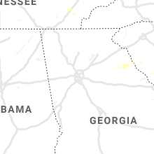
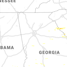


Connect with Interactive Hail Maps