

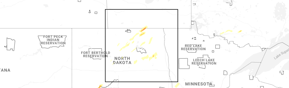
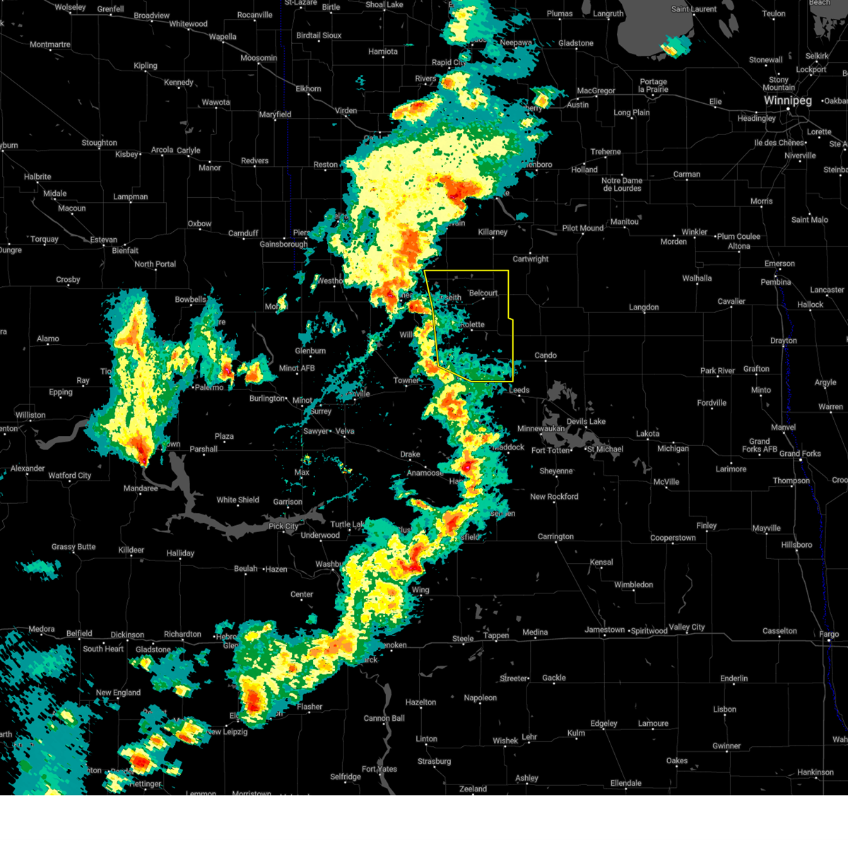
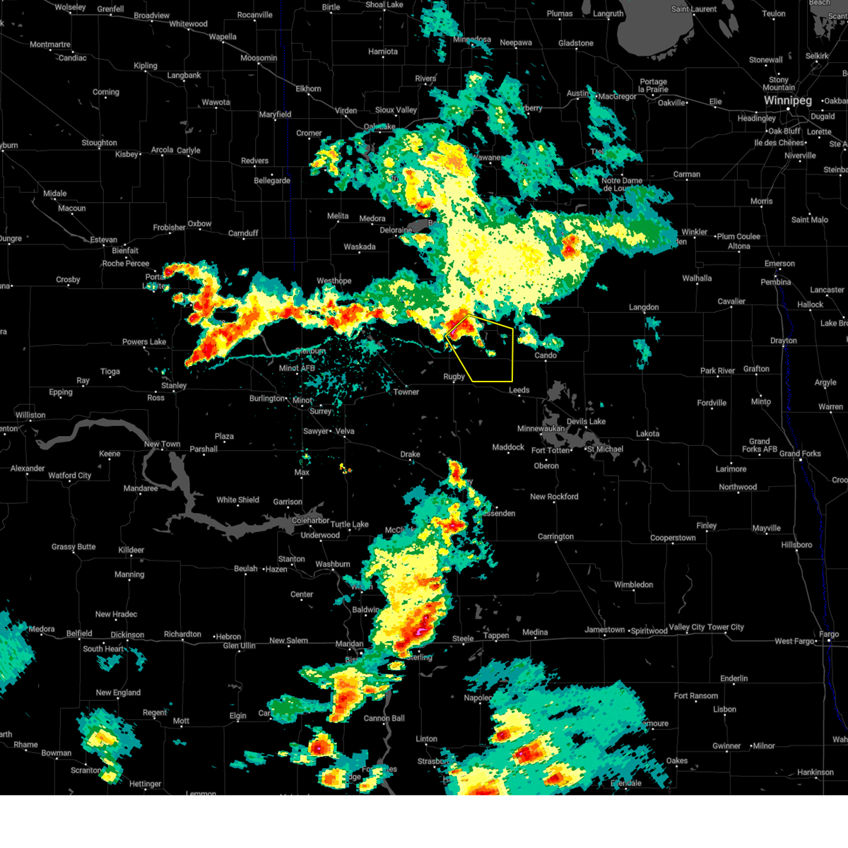
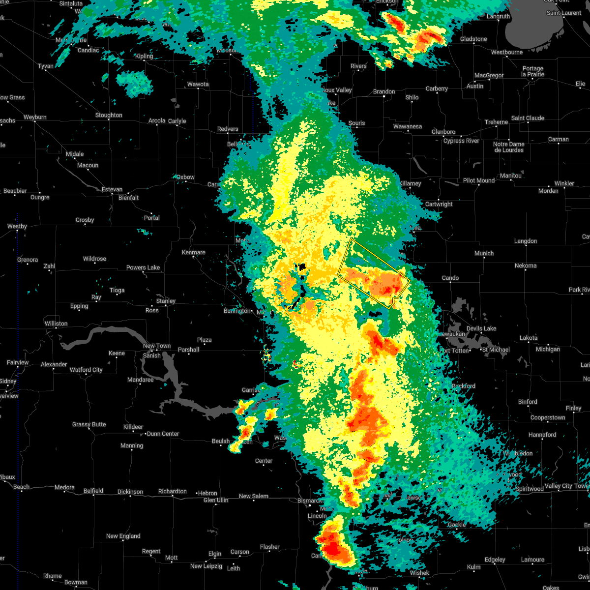
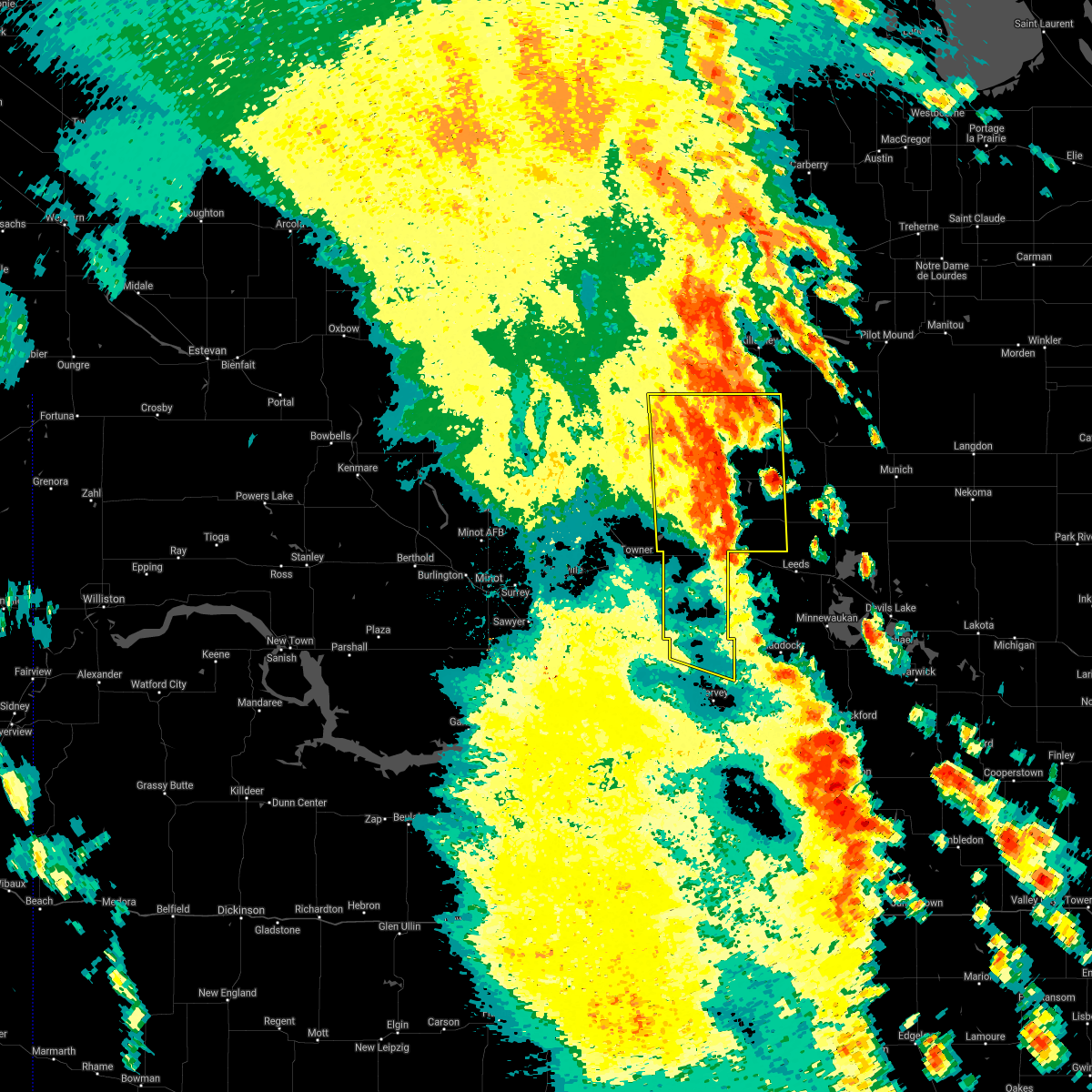
Hail Map for Wolford, ND
The Wolford, ND area has had 1 report of on-the-ground hail by trained spotters, and has been under severe weather warnings 9 times during the past 12 months. Doppler radar has detected hail at or near Wolford, ND on 35 occasions, including 2 occasions during the past year.
| Name: | Wolford, ND |
| Where Located: | 47.3 miles NW of Devils Lake, ND |
| Map: | Google Map for Wolford, ND |
| Population: | 36 |
| Housing Units: | 27 |
| More Info: | Search Google for Wolford, ND |
0
The Top Recent Hail Date for Wolford, ND is Sunday, June 22, 2025 (35th out of 35)
Hail and Wind Damage Spotted near Wolford, ND
| Date / Time | Report Details |
|---|---|
| 6/27/2025 8:47 PM CDT |
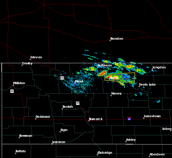
 the severe thunderstorm warning has been cancelled and is no longer in effect the severe thunderstorm warning has been cancelled and is no longer in effect
|
| 6/27/2025 8:25 PM CDT |
 the severe thunderstorm warning has been cancelled and is no longer in effect the severe thunderstorm warning has been cancelled and is no longer in effect
|
| 6/27/2025 8:25 PM CDT |
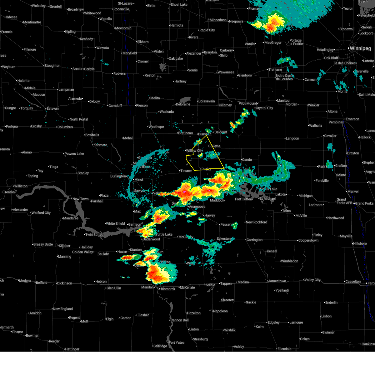
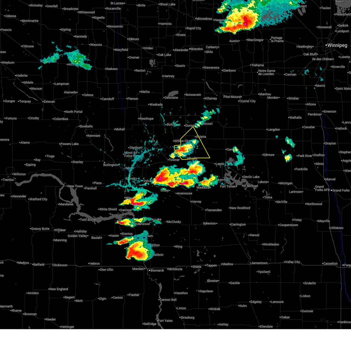
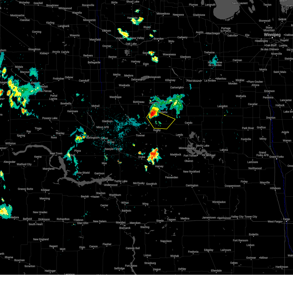
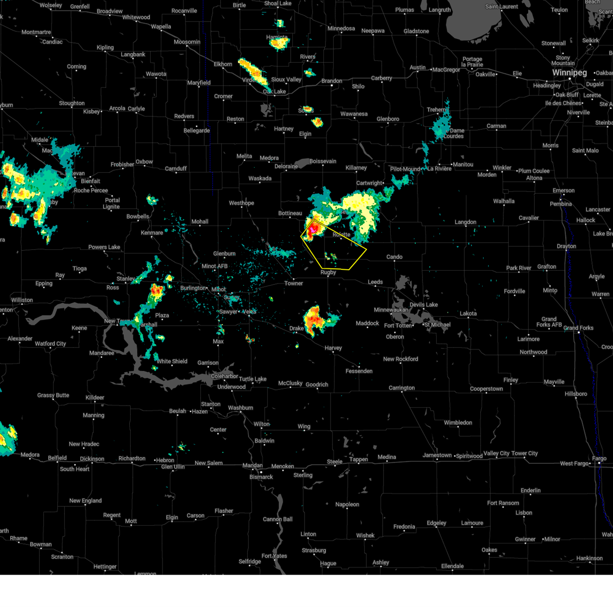
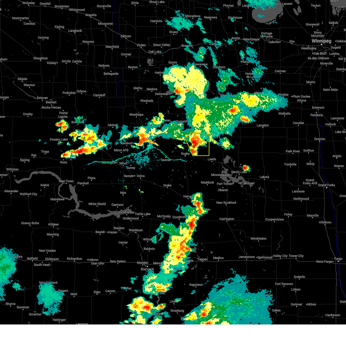
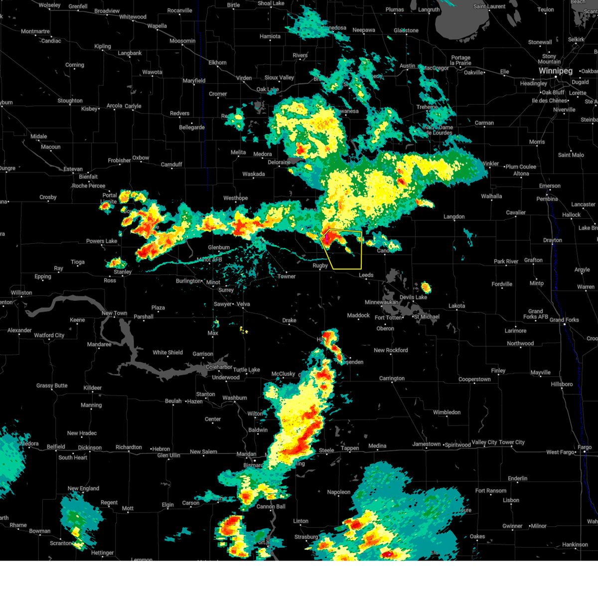
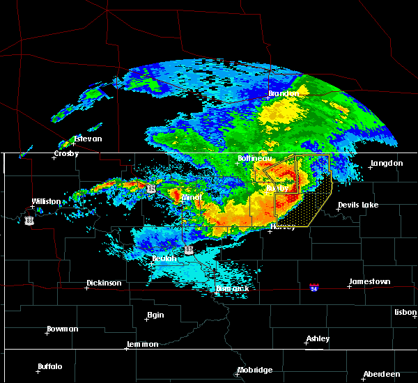
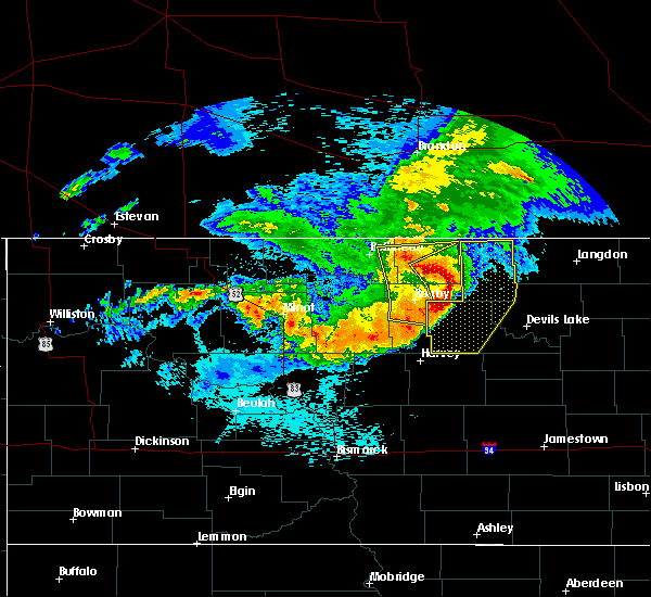
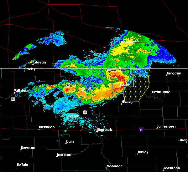
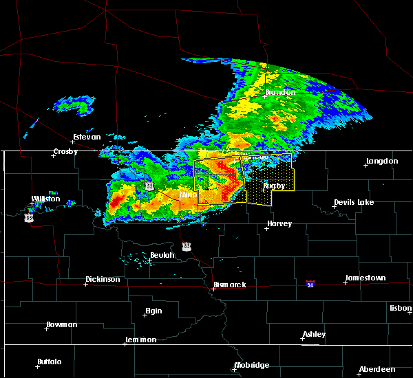
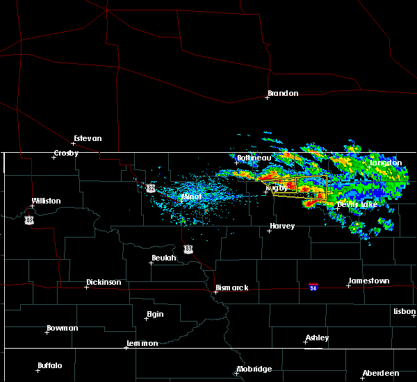
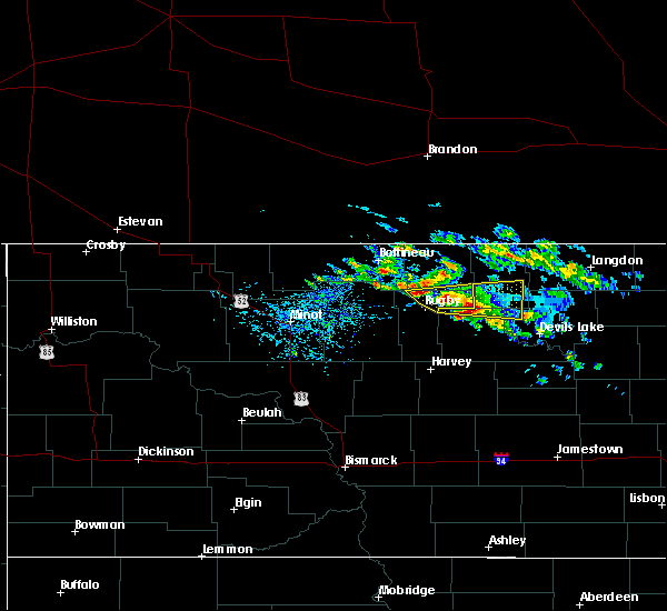
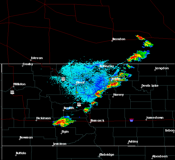
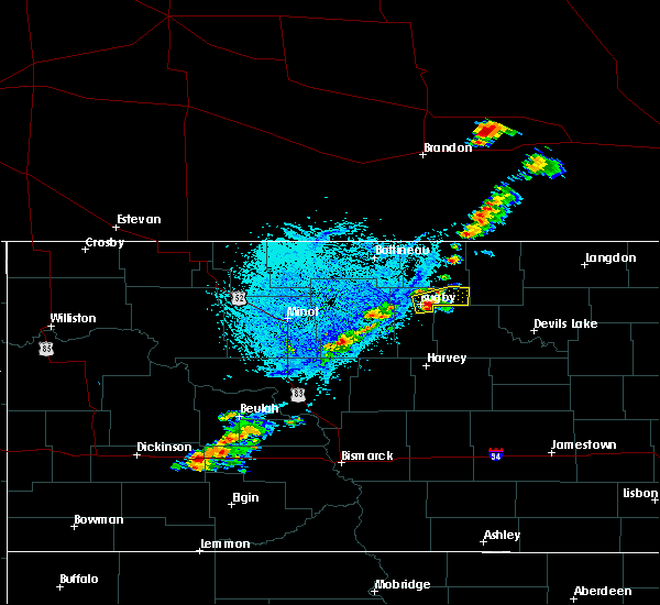
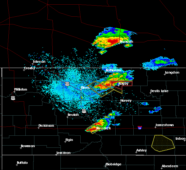
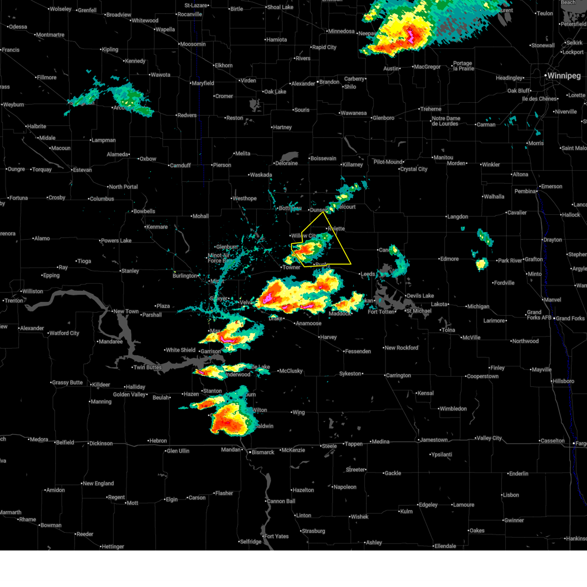 At 824 pm cdt, a severe thunderstorm was located 5 miles east of barton, or 9 miles north of rugby, moving east at 30 mph (radar indicated). Hazards include 60 mph wind gusts and quarter size hail. Hail damage to vehicles is expected. expect wind damage to roofs, siding, and trees. Locations impacted include, rugby, rolette, wolford, barton, barton city, nanson, and thorne. At 824 pm cdt, a severe thunderstorm was located 5 miles east of barton, or 9 miles north of rugby, moving east at 30 mph (radar indicated). Hazards include 60 mph wind gusts and quarter size hail. Hail damage to vehicles is expected. expect wind damage to roofs, siding, and trees. Locations impacted include, rugby, rolette, wolford, barton, barton city, nanson, and thorne.
|
| 6/27/2025 8:11 PM CDT |
 Svrbis the national weather service in bismarck has issued a * severe thunderstorm warning for, southeastern bottineau county in north central north dakota, northern pierce county in north central north dakota, northeastern mchenry county in north central north dakota, southwestern rolette county in north central north dakota, * until 900 pm cdt. * at 809 pm cdt, a severe thunderstorm was located near barton city, or 12 miles northwest of rugby, moving east at 30 mph (radar indicated). Hazards include 60 mph wind gusts and quarter size hail. Hail damage to vehicles is expected. Expect wind damage to roofs, siding, and trees. Svrbis the national weather service in bismarck has issued a * severe thunderstorm warning for, southeastern bottineau county in north central north dakota, northern pierce county in north central north dakota, northeastern mchenry county in north central north dakota, southwestern rolette county in north central north dakota, * until 900 pm cdt. * at 809 pm cdt, a severe thunderstorm was located near barton city, or 12 miles northwest of rugby, moving east at 30 mph (radar indicated). Hazards include 60 mph wind gusts and quarter size hail. Hail damage to vehicles is expected. Expect wind damage to roofs, siding, and trees.
|
| 7/12/2024 9:29 PM CDT |
 The storms which prompted the warning have weakened below severe limits. the warning will be allowed to expire. a severe thunderstorm watch remains in effect until midnight cdt for south central and north central north dakota. The storms which prompted the warning have weakened below severe limits. the warning will be allowed to expire. a severe thunderstorm watch remains in effect until midnight cdt for south central and north central north dakota.
|
| 7/12/2024 9:19 PM CDT |
 the severe thunderstorm warning has been cancelled and is no longer in effect the severe thunderstorm warning has been cancelled and is no longer in effect
|
| 7/12/2024 9:19 PM CDT |
 At 918 pm cdt, severe thunderstorms were located along a line extending from 8 miles southeast of wolford to 9 miles east of harvey to 4 miles south of goodrich, moving east at 40 mph (radar indicated). Hazards include 60 mph wind gusts and quarter size hail. Hail damage to vehicles is expected. expect wind damage to roofs, siding, and trees. Locations impacted include, rugby, harvey, mcclusky, goodrich, mercer, martin, balta, wolford, heimdal, denhoff, sheyenne lake, silva, selz, wellsburg, and hoffer lake. At 918 pm cdt, severe thunderstorms were located along a line extending from 8 miles southeast of wolford to 9 miles east of harvey to 4 miles south of goodrich, moving east at 40 mph (radar indicated). Hazards include 60 mph wind gusts and quarter size hail. Hail damage to vehicles is expected. expect wind damage to roofs, siding, and trees. Locations impacted include, rugby, harvey, mcclusky, goodrich, mercer, martin, balta, wolford, heimdal, denhoff, sheyenne lake, silva, selz, wellsburg, and hoffer lake.
|
| 7/12/2024 8:58 PM CDT |
 At 852 pm cdt, severe thunderstorms were located along a line extending from 8 miles southwest of wolford to 4 miles northwest of harvey to near mcclusky, moving east at 40 mph (radar indicated). Hazards include 60 mph wind gusts and quarter size hail. Hail damage to vehicles is expected. expect wind damage to roofs, siding, and trees. locations impacted include, rugby, harvey, mcclusky, drake, anamoose, goodrich, mercer, martin, balta, wolford, berwick, denhoff, balfour, kief, krueger lake, wellsburg, and george lake. the most likely threat area for quarter size hail is near mercer, mclean county, and the rugby area of pierce county. The most likely threat area for 60 mph wind is southern pierce county and northern sheridan county. At 852 pm cdt, severe thunderstorms were located along a line extending from 8 miles southwest of wolford to 4 miles northwest of harvey to near mcclusky, moving east at 40 mph (radar indicated). Hazards include 60 mph wind gusts and quarter size hail. Hail damage to vehicles is expected. expect wind damage to roofs, siding, and trees. locations impacted include, rugby, harvey, mcclusky, drake, anamoose, goodrich, mercer, martin, balta, wolford, berwick, denhoff, balfour, kief, krueger lake, wellsburg, and george lake. the most likely threat area for quarter size hail is near mercer, mclean county, and the rugby area of pierce county. The most likely threat area for 60 mph wind is southern pierce county and northern sheridan county.
|
| 7/12/2024 8:30 PM CDT |
 Svrbis the national weather service in bismarck has issued a * severe thunderstorm warning for, northwestern wells county in south central north dakota, sheridan county in south central north dakota, pierce county in north central north dakota, northeastern mclean county in south central north dakota, eastern mchenry county in north central north dakota, * until 930 pm cdt. * at 830 pm cdt, severe thunderstorms were located along a line extending from near barton to near anamoose to near mercer, moving east at 40 mph (radar indicated). Hazards include 60 mph wind gusts and quarter size hail. Hail damage to vehicles is expected. Expect wind damage to roofs, siding, and trees. Svrbis the national weather service in bismarck has issued a * severe thunderstorm warning for, northwestern wells county in south central north dakota, sheridan county in south central north dakota, pierce county in north central north dakota, northeastern mclean county in south central north dakota, eastern mchenry county in north central north dakota, * until 930 pm cdt. * at 830 pm cdt, severe thunderstorms were located along a line extending from near barton to near anamoose to near mercer, moving east at 40 mph (radar indicated). Hazards include 60 mph wind gusts and quarter size hail. Hail damage to vehicles is expected. Expect wind damage to roofs, siding, and trees.
|
| 6/16/2024 1:32 AM CDT |
 The storms which prompted the warning have moved out of the area. therefore, the warning has been allowed to expire. however, gusty winds are still possible across parts of the area. The storms which prompted the warning have moved out of the area. therefore, the warning has been allowed to expire. however, gusty winds are still possible across parts of the area.
|
| 6/16/2024 1:13 AM CDT |
 At 112 am cdt, severe thunderstorms were located along a line extending from 14 miles north of international peace garden to 6 miles southwest of rolette to 8 miles north of drake, moving east at 65 mph (radar indicated). Hazards include 60 mph wind gusts. Expect damage to roofs, siding, and trees. locations impacted include, rugby, bottineau, rolla, dunseith, rolette, towner, westhope, st. John, willow city, upham, newburg, maxbass, denbigh, karlsruhe, balta, souris, wolford, antler, belcourt, and barton city. At 112 am cdt, severe thunderstorms were located along a line extending from 14 miles north of international peace garden to 6 miles southwest of rolette to 8 miles north of drake, moving east at 65 mph (radar indicated). Hazards include 60 mph wind gusts. Expect damage to roofs, siding, and trees. locations impacted include, rugby, bottineau, rolla, dunseith, rolette, towner, westhope, st. John, willow city, upham, newburg, maxbass, denbigh, karlsruhe, balta, souris, wolford, antler, belcourt, and barton city.
|
| 6/16/2024 12:59 AM CDT |
 At 1258 am cdt, severe thunderstorms were located along a line extending from 20 miles northwest of international peace garden to near willow city to 5 miles south of karlsruhe, moving east at 65 mph (radar indicated). Hazards include 60 mph wind gusts. Expect damage to roofs, siding, and trees. locations impacted include, rugby, bottineau, rolla, dunseith, rolette, towner, westhope, st. John, granville, willow city, upham, newburg, maxbass, denbigh, karlsruhe, balta, souris, wolford, antler, and belcourt. At 1258 am cdt, severe thunderstorms were located along a line extending from 20 miles northwest of international peace garden to near willow city to 5 miles south of karlsruhe, moving east at 65 mph (radar indicated). Hazards include 60 mph wind gusts. Expect damage to roofs, siding, and trees. locations impacted include, rugby, bottineau, rolla, dunseith, rolette, towner, westhope, st. John, granville, willow city, upham, newburg, maxbass, denbigh, karlsruhe, balta, souris, wolford, antler, and belcourt.
|
| 6/16/2024 12:59 AM CDT |
 the severe thunderstorm warning has been cancelled and is no longer in effect the severe thunderstorm warning has been cancelled and is no longer in effect
|
| 6/16/2024 12:36 AM CDT |
 Svrbis the national weather service in bismarck has issued a * severe thunderstorm warning for, southeastern ward county in north central north dakota, bottineau county in north central north dakota, southeastern renville county in north central north dakota, pierce county in north central north dakota, mchenry county in north central north dakota, rolette county in north central north dakota, * until 130 am cdt. * at 1236 am cdt, severe thunderstorms were located along a line extending from 14 miles north of souris to near upham to near velva, moving east at 60 mph (radar indicated). Hazards include 70 mph wind gusts. Expect considerable tree damage. Damage is likely to mobile homes, roofs, and outbuildings. Svrbis the national weather service in bismarck has issued a * severe thunderstorm warning for, southeastern ward county in north central north dakota, bottineau county in north central north dakota, southeastern renville county in north central north dakota, pierce county in north central north dakota, mchenry county in north central north dakota, rolette county in north central north dakota, * until 130 am cdt. * at 1236 am cdt, severe thunderstorms were located along a line extending from 14 miles north of souris to near upham to near velva, moving east at 60 mph (radar indicated). Hazards include 70 mph wind gusts. Expect considerable tree damage. Damage is likely to mobile homes, roofs, and outbuildings.
|
| 5/17/2024 5:06 PM CDT |
 At 505 pm cdt, severe thunderstorms were located along a line extending from 6 miles north of dunseith to 6 miles southwest of belcourt to 9 miles southeast of wolford, moving east at 55 mph (radar indicated). Hazards include 60 mph wind gusts. Expect damage to roofs, siding, and trees. locations impacted include, rolla, dunseith, rolette, st. john, wolford, international peace garden, belcourt, shell valley, mylo, overly, turtle mountain, butte st. Paul state recreation area, agate, thorne, and nanson. At 505 pm cdt, severe thunderstorms were located along a line extending from 6 miles north of dunseith to 6 miles southwest of belcourt to 9 miles southeast of wolford, moving east at 55 mph (radar indicated). Hazards include 60 mph wind gusts. Expect damage to roofs, siding, and trees. locations impacted include, rolla, dunseith, rolette, st. john, wolford, international peace garden, belcourt, shell valley, mylo, overly, turtle mountain, butte st. Paul state recreation area, agate, thorne, and nanson.
|
| 5/17/2024 5:06 PM CDT |
 the severe thunderstorm warning has been cancelled and is no longer in effect the severe thunderstorm warning has been cancelled and is no longer in effect
|
| 5/17/2024 4:47 PM CDT |
 Svrbis the national weather service in bismarck has issued a * severe thunderstorm warning for, eastern bottineau county in north central north dakota, pierce county in north central north dakota, northeastern mchenry county in north central north dakota, rolette county in north central north dakota, * until 530 pm cdt. * at 446 pm cdt, severe thunderstorms were located along a line extending from bottineau to 8 miles south of dunseith to 5 miles south of rugby, moving east at 65 mph (radar indicated). Hazards include 60 mph wind gusts. expect damage to roofs, siding, and trees Svrbis the national weather service in bismarck has issued a * severe thunderstorm warning for, eastern bottineau county in north central north dakota, pierce county in north central north dakota, northeastern mchenry county in north central north dakota, rolette county in north central north dakota, * until 530 pm cdt. * at 446 pm cdt, severe thunderstorms were located along a line extending from bottineau to 8 miles south of dunseith to 5 miles south of rugby, moving east at 65 mph (radar indicated). Hazards include 60 mph wind gusts. expect damage to roofs, siding, and trees
|
| 8/24/2023 5:06 PM CDT |
 At 506 pm cdt, a severe thunderstorm was located 7 miles southeast of towner, or 12 miles west of rugby, moving east at 40 mph (radar indicated). Hazards include 60 mph wind gusts and quarter size hail. Hail damage to vehicles is expected. expect wind damage to roofs, siding, and trees. this severe storm will be near, rugby around 515 pm cdt. balta around 520 pm cdt. other locations impacted by this severe thunderstorm include orrin, silva, berwick and george lake. hail threat, radar indicated max hail size, 1. 00 in wind threat, radar indicated max wind gust, 60 mph. At 506 pm cdt, a severe thunderstorm was located 7 miles southeast of towner, or 12 miles west of rugby, moving east at 40 mph (radar indicated). Hazards include 60 mph wind gusts and quarter size hail. Hail damage to vehicles is expected. expect wind damage to roofs, siding, and trees. this severe storm will be near, rugby around 515 pm cdt. balta around 520 pm cdt. other locations impacted by this severe thunderstorm include orrin, silva, berwick and george lake. hail threat, radar indicated max hail size, 1. 00 in wind threat, radar indicated max wind gust, 60 mph.
|
| 8/24/2023 4:52 PM CDT |
 At 451 pm cdt, a severe thunderstorm was located near towner, or 22 miles west of rugby, moving east at 40 mph (radar indicated). Hazards include ping pong ball size hail and 60 mph wind gusts. People and animals outdoors will be injured. expect hail damage to roofs, siding, windows, and vehicles. expect wind damage to roofs, siding, and trees. this severe thunderstorm will be near, towner around 455 pm cdt. rugby around 515 pm cdt. balta around 520 pm cdt. other locations impacted by this severe thunderstorm include orrin, silva, berwick and george lake. hail threat, radar indicated max hail size, 1. 50 in wind threat, radar indicated max wind gust, 60 mph. At 451 pm cdt, a severe thunderstorm was located near towner, or 22 miles west of rugby, moving east at 40 mph (radar indicated). Hazards include ping pong ball size hail and 60 mph wind gusts. People and animals outdoors will be injured. expect hail damage to roofs, siding, windows, and vehicles. expect wind damage to roofs, siding, and trees. this severe thunderstorm will be near, towner around 455 pm cdt. rugby around 515 pm cdt. balta around 520 pm cdt. other locations impacted by this severe thunderstorm include orrin, silva, berwick and george lake. hail threat, radar indicated max hail size, 1. 50 in wind threat, radar indicated max wind gust, 60 mph.
|
| 7/1/2023 11:55 PM CDT |
 The severe thunderstorm warning for north central pierce and south central rolette counties will expire at midnight cdt, the storm which prompted the warning has weakened below severe limits, and has exited the warned area. therefore, the warning will be allowed to expire. The severe thunderstorm warning for north central pierce and south central rolette counties will expire at midnight cdt, the storm which prompted the warning has weakened below severe limits, and has exited the warned area. therefore, the warning will be allowed to expire.
|
| 7/1/2023 11:37 PM CDT |
 At 1137 pm cdt, a severe thunderstorm was located 10 miles north of rugby, moving southeast at 25 mph (radar indicated). Hazards include 60 mph wind gusts and quarter size hail. Hail damage to vehicles is expected. expect wind damage to roofs, siding, and trees. this severe storm will be near, wolford around 1200 am cdt. other locations impacted by this severe thunderstorm include nanson. hail threat, radar indicated max hail size, 1. 00 in wind threat, radar indicated max wind gust, 60 mph. At 1137 pm cdt, a severe thunderstorm was located 10 miles north of rugby, moving southeast at 25 mph (radar indicated). Hazards include 60 mph wind gusts and quarter size hail. Hail damage to vehicles is expected. expect wind damage to roofs, siding, and trees. this severe storm will be near, wolford around 1200 am cdt. other locations impacted by this severe thunderstorm include nanson. hail threat, radar indicated max hail size, 1. 00 in wind threat, radar indicated max wind gust, 60 mph.
|
| 7/1/2023 11:25 PM CDT |
 At 1124 pm cdt, a severe thunderstorm was located 8 miles east of barton, or 12 miles north of rugby, moving southeast at 25 mph (radar indicated). Hazards include 60 mph wind gusts and quarter size hail. Hail damage to vehicles is expected. expect wind damage to roofs, siding, and trees. this severe storm will be near, wolford around 1155 pm cdt. other locations impacted by this severe thunderstorm include nanson. hail threat, radar indicated max hail size, 1. 00 in wind threat, radar indicated max wind gust, 60 mph. At 1124 pm cdt, a severe thunderstorm was located 8 miles east of barton, or 12 miles north of rugby, moving southeast at 25 mph (radar indicated). Hazards include 60 mph wind gusts and quarter size hail. Hail damage to vehicles is expected. expect wind damage to roofs, siding, and trees. this severe storm will be near, wolford around 1155 pm cdt. other locations impacted by this severe thunderstorm include nanson. hail threat, radar indicated max hail size, 1. 00 in wind threat, radar indicated max wind gust, 60 mph.
|
| 7/1/2023 11:13 PM CDT |
 At 1112 pm cdt, a severe thunderstorm was located 9 miles northeast of barton, or 18 miles north of rugby, moving southeast at 25 mph (radar indicated). Hazards include 60 mph wind gusts and quarter size hail. Hail damage to vehicles is expected. expect wind damage to roofs, siding, and trees. this severe storm will be near, wolford around 1200 am cdt. other locations impacted by this severe thunderstorm include overly and nanson. hail threat, radar indicated max hail size, 1. 00 in wind threat, radar indicated max wind gust, 60 mph. At 1112 pm cdt, a severe thunderstorm was located 9 miles northeast of barton, or 18 miles north of rugby, moving southeast at 25 mph (radar indicated). Hazards include 60 mph wind gusts and quarter size hail. Hail damage to vehicles is expected. expect wind damage to roofs, siding, and trees. this severe storm will be near, wolford around 1200 am cdt. other locations impacted by this severe thunderstorm include overly and nanson. hail threat, radar indicated max hail size, 1. 00 in wind threat, radar indicated max wind gust, 60 mph.
|
| 7/1/2023 10:57 PM CDT |
 At 1057 pm cdt, a severe thunderstorm was located 9 miles southwest of dunseith, or 16 miles southeast of bottineau, moving southeast at 25 mph (radar indicated). Hazards include 60 mph wind gusts and quarter size hail. Hail damage to vehicles is expected. expect wind damage to roofs, siding, and trees. this severe thunderstorm will be near, wolford around 1200 am cdt. other locations impacted by this severe thunderstorm include overly and nanson. hail threat, radar indicated max hail size, 1. 00 in wind threat, radar indicated max wind gust, 60 mph. At 1057 pm cdt, a severe thunderstorm was located 9 miles southwest of dunseith, or 16 miles southeast of bottineau, moving southeast at 25 mph (radar indicated). Hazards include 60 mph wind gusts and quarter size hail. Hail damage to vehicles is expected. expect wind damage to roofs, siding, and trees. this severe thunderstorm will be near, wolford around 1200 am cdt. other locations impacted by this severe thunderstorm include overly and nanson. hail threat, radar indicated max hail size, 1. 00 in wind threat, radar indicated max wind gust, 60 mph.
|
| 6/8/2023 6:57 PM CDT |
 The severe thunderstorm warning for northeastern pierce and southeastern rolette counties will expire at 700 pm cdt, the storm which prompted the warning has weakened below severe limits. therefore, the warning will be allowed to expire. however, small hail and gusty winds are still possible with this thunderstorm. The severe thunderstorm warning for northeastern pierce and southeastern rolette counties will expire at 700 pm cdt, the storm which prompted the warning has weakened below severe limits. therefore, the warning will be allowed to expire. however, small hail and gusty winds are still possible with this thunderstorm.
|
| 6/8/2023 6:38 PM CDT |
 At 638 pm cdt, a severe thunderstorm was located 6 miles south of rolette, or 16 miles northeast of rugby, moving southeast at 25 mph (radar indicated). Hazards include 60 mph wind gusts and half dollar size hail. Hail damage to vehicles is expected. expect wind damage to roofs, siding, and trees. this severe storm will be near, wolford around 655 pm cdt. other locations impacted by this severe thunderstorm include agate, nanson and mylo. hail threat, radar indicated max hail size, 1. 25 in wind threat, radar indicated max wind gust, 60 mph. At 638 pm cdt, a severe thunderstorm was located 6 miles south of rolette, or 16 miles northeast of rugby, moving southeast at 25 mph (radar indicated). Hazards include 60 mph wind gusts and half dollar size hail. Hail damage to vehicles is expected. expect wind damage to roofs, siding, and trees. this severe storm will be near, wolford around 655 pm cdt. other locations impacted by this severe thunderstorm include agate, nanson and mylo. hail threat, radar indicated max hail size, 1. 25 in wind threat, radar indicated max wind gust, 60 mph.
|
| 6/8/2023 6:21 PM CDT |
 At 621 pm cdt, a severe thunderstorm was located near rolette, or 18 miles north of rugby, moving southeast at 25 mph (radar indicated). Hazards include 60 mph wind gusts and half dollar size hail. Hail damage to vehicles is expected. expect wind damage to roofs, siding, and trees. this severe thunderstorm will be near, wolford around 650 pm cdt. other locations impacted by this severe thunderstorm include agate, nanson and mylo. hail threat, radar indicated max hail size, 1. 25 in wind threat, radar indicated max wind gust, 60 mph. At 621 pm cdt, a severe thunderstorm was located near rolette, or 18 miles north of rugby, moving southeast at 25 mph (radar indicated). Hazards include 60 mph wind gusts and half dollar size hail. Hail damage to vehicles is expected. expect wind damage to roofs, siding, and trees. this severe thunderstorm will be near, wolford around 650 pm cdt. other locations impacted by this severe thunderstorm include agate, nanson and mylo. hail threat, radar indicated max hail size, 1. 25 in wind threat, radar indicated max wind gust, 60 mph.
|
| 7/22/2022 10:33 PM CDT |
 At 1031 pm cdt, severe thunderstorms were located along a line extending from 4 miles southeast of rolla to 7 miles southwest of balta to near drake, moving southeast at 35 mph (trained weather spotters have reported wind gusts up to 68 mph and hail up to ping pong size ). Hazards include golf ball size hail and 70 mph wind gusts. People and animals outdoors will be injured. expect hail damage to roofs, siding, windows, and vehicles. expect considerable tree damage. wind damage is also likely to mobile homes, roofs, and outbuildings. locations impacted include, rugby, rolla, dunseith, rolette, towner, st. john, anamoose, willow city, balta, wolford, barton, international peace garden, belcourt, shell valley, berwick, mylo, overly, silva, selz and thorne. thunderstorm damage threat, considerable hail threat, radar indicated max hail size, 1. 75 in wind threat, radar indicated max wind gust, 70 mph. At 1031 pm cdt, severe thunderstorms were located along a line extending from 4 miles southeast of rolla to 7 miles southwest of balta to near drake, moving southeast at 35 mph (trained weather spotters have reported wind gusts up to 68 mph and hail up to ping pong size ). Hazards include golf ball size hail and 70 mph wind gusts. People and animals outdoors will be injured. expect hail damage to roofs, siding, windows, and vehicles. expect considerable tree damage. wind damage is also likely to mobile homes, roofs, and outbuildings. locations impacted include, rugby, rolla, dunseith, rolette, towner, st. john, anamoose, willow city, balta, wolford, barton, international peace garden, belcourt, shell valley, berwick, mylo, overly, silva, selz and thorne. thunderstorm damage threat, considerable hail threat, radar indicated max hail size, 1. 75 in wind threat, radar indicated max wind gust, 70 mph.
|
| 7/22/2022 10:15 PM CDT | From ndawn sit in pierce county ND, 3.9 miles W of Wolford, ND |
| 7/22/2022 10:09 PM CDT |
 At 1009 pm cdt, severe thunderstorms were located along a line extending from near belcourt to 11 miles south of towner to 5 miles southeast of karlsruhe, moving southeast at 35 mph (radar indicated). Hazards include golf ball size hail and 70 mph wind gusts. People and animals outdoors will be injured. expect hail damage to roofs, siding, windows, and vehicles. expect considerable tree damage. wind damage is also likely to mobile homes, roofs, and outbuildings. locations impacted include, st. john, belcourt, rolla, balta and anamoose. thunderstorm damage threat, considerable hail threat, radar indicated max hail size, 1. 75 in wind threat, radar indicated max wind gust, 70 mph. At 1009 pm cdt, severe thunderstorms were located along a line extending from near belcourt to 11 miles south of towner to 5 miles southeast of karlsruhe, moving southeast at 35 mph (radar indicated). Hazards include golf ball size hail and 70 mph wind gusts. People and animals outdoors will be injured. expect hail damage to roofs, siding, windows, and vehicles. expect considerable tree damage. wind damage is also likely to mobile homes, roofs, and outbuildings. locations impacted include, st. john, belcourt, rolla, balta and anamoose. thunderstorm damage threat, considerable hail threat, radar indicated max hail size, 1. 75 in wind threat, radar indicated max wind gust, 70 mph.
|
| 7/22/2022 9:42 PM CDT |
 At 942 pm cdt, severe thunderstorms were located along a line extending from near international peace garden to 5 miles southwest of denbigh to 6 miles northeast of velva, moving southeast at 35 mph (radar indicated). Hazards include golf ball size hail and 70 mph wind gusts. People and animals outdoors will be injured. expect hail damage to roofs, siding, windows, and vehicles. expect considerable tree damage. wind damage is also likely to mobile homes, roofs, and outbuildings. severe thunderstorms will be near, international peace garden around 950 pm cdt. other locations in the path of these severe thunderstorms include st. john, belcourt, rolla, drake, anamoose and balta. thunderstorm damage threat, considerable hail threat, radar indicated max hail size, 1. 75 in wind threat, radar indicated max wind gust, 70 mph. At 942 pm cdt, severe thunderstorms were located along a line extending from near international peace garden to 5 miles southwest of denbigh to 6 miles northeast of velva, moving southeast at 35 mph (radar indicated). Hazards include golf ball size hail and 70 mph wind gusts. People and animals outdoors will be injured. expect hail damage to roofs, siding, windows, and vehicles. expect considerable tree damage. wind damage is also likely to mobile homes, roofs, and outbuildings. severe thunderstorms will be near, international peace garden around 950 pm cdt. other locations in the path of these severe thunderstorms include st. john, belcourt, rolla, drake, anamoose and balta. thunderstorm damage threat, considerable hail threat, radar indicated max hail size, 1. 75 in wind threat, radar indicated max wind gust, 70 mph.
|
| 7/10/2022 5:32 AM CDT |
 At 532 am cdt, a severe thunderstorm was located 7 miles north of barton, or 17 miles north of rugby, moving northeast at 40 mph (radar indicated). Hazards include 60 mph wind gusts and penny size hail. Expect damage to roofs, siding, and trees. this severe thunderstorm will remain over mainly rural areas of southeastern bottineau, northwestern pierce, northeastern mchenry and southwestern rolette counties, including the following locations, overly and omemee. hail threat, radar indicated max hail size, 0. 75 in wind threat, radar indicated max wind gust, 60 mph. At 532 am cdt, a severe thunderstorm was located 7 miles north of barton, or 17 miles north of rugby, moving northeast at 40 mph (radar indicated). Hazards include 60 mph wind gusts and penny size hail. Expect damage to roofs, siding, and trees. this severe thunderstorm will remain over mainly rural areas of southeastern bottineau, northwestern pierce, northeastern mchenry and southwestern rolette counties, including the following locations, overly and omemee. hail threat, radar indicated max hail size, 0. 75 in wind threat, radar indicated max wind gust, 60 mph.
|
| 7/10/2022 5:01 AM CDT |
 At 501 am cdt, a severe thunderstorm was located near towner, or 19 miles west of rugby, moving northeast at 40 mph (radar indicated). Hazards include 70 mph wind gusts and quarter size hail. Hail damage to vehicles is expected. expect considerable tree damage. wind damage is also likely to mobile homes, roofs, and outbuildings. this severe thunderstorm will be near, barton around 520 am cdt. other locations in the path of this severe thunderstorm include willow city. thunderstorm damage threat, considerable hail threat, radar indicated max hail size, 1. 00 in wind threat, radar indicated max wind gust, 70 mph. At 501 am cdt, a severe thunderstorm was located near towner, or 19 miles west of rugby, moving northeast at 40 mph (radar indicated). Hazards include 70 mph wind gusts and quarter size hail. Hail damage to vehicles is expected. expect considerable tree damage. wind damage is also likely to mobile homes, roofs, and outbuildings. this severe thunderstorm will be near, barton around 520 am cdt. other locations in the path of this severe thunderstorm include willow city. thunderstorm damage threat, considerable hail threat, radar indicated max hail size, 1. 00 in wind threat, radar indicated max wind gust, 70 mph.
|
| 6/11/2021 3:26 AM CDT |
 The severe thunderstorm warning for eastern bottineau, pierce and rolette counties will expire at 330 am cdt, the storms which prompted the warning have weakened below severe limits, and no longer pose an immediate threat to life or property. therefore, the warning will be allowed to expire. however gusty winds are still possible with these thunderstorms. The severe thunderstorm warning for eastern bottineau, pierce and rolette counties will expire at 330 am cdt, the storms which prompted the warning have weakened below severe limits, and no longer pose an immediate threat to life or property. therefore, the warning will be allowed to expire. however gusty winds are still possible with these thunderstorms.
|
| 6/11/2021 3:14 AM CDT |
 At 313 am cdt, severe thunderstorms were located along a line extending from 15 miles north of international peace garden to 7 miles southeast of bottineau to near barton to 7 miles west of esmond, moving east at 60 mph (radar indicated). Hazards include 60 mph wind gusts and penny size hail. Expect damage to roofs, siding, and trees. locations impacted include, rugby, rolla, dunseith, rolette, st. John, willow city, balta, wolford, lake metigoshe state park, barton, international peace garden, belcourt, shell valley, mylo, overly, silva, thorne, nanson and orrin. At 313 am cdt, severe thunderstorms were located along a line extending from 15 miles north of international peace garden to 7 miles southeast of bottineau to near barton to 7 miles west of esmond, moving east at 60 mph (radar indicated). Hazards include 60 mph wind gusts and penny size hail. Expect damage to roofs, siding, and trees. locations impacted include, rugby, rolla, dunseith, rolette, st. John, willow city, balta, wolford, lake metigoshe state park, barton, international peace garden, belcourt, shell valley, mylo, overly, silva, thorne, nanson and orrin.
|
| 6/11/2021 3:04 AM CDT |
 At 304 am cdt, severe thunderstorms were located along a line extending from 15 miles north of lake metigoshe state park to 6 miles south of bottineau to 7 miles southwest of barton to 11 miles northeast of anamoose, moving east at 60 mph (radar indicated). Hazards include 60 mph wind gusts and penny size hail. Expect damage to roofs, siding, and trees. locations impacted include, rugby, bottineau, rolla, dunseith, rolette, towner, westhope, st. John, willow city, upham, newburg, denbigh, karlsruhe, balta, souris, wolford, belcourt, lake metigoshe state park, barton and international peace garden. At 304 am cdt, severe thunderstorms were located along a line extending from 15 miles north of lake metigoshe state park to 6 miles south of bottineau to 7 miles southwest of barton to 11 miles northeast of anamoose, moving east at 60 mph (radar indicated). Hazards include 60 mph wind gusts and penny size hail. Expect damage to roofs, siding, and trees. locations impacted include, rugby, bottineau, rolla, dunseith, rolette, towner, westhope, st. John, willow city, upham, newburg, denbigh, karlsruhe, balta, souris, wolford, belcourt, lake metigoshe state park, barton and international peace garden.
|
| 6/11/2021 2:51 AM CDT |
 At 251 am cdt, severe thunderstorms were located along a line extending from 14 miles northwest of lake metigoshe state park to 8 miles north of upham to 6 miles northwest of towner to 5 miles northeast of drake, moving east at 60 mph (radar indicated). Hazards include 60 mph wind gusts and penny size hail. Expect damage to roofs, siding, and trees. locations impacted include, anamoose, bottineau, barton, rugby, dunseith, wolford, belcourt and st. John. At 251 am cdt, severe thunderstorms were located along a line extending from 14 miles northwest of lake metigoshe state park to 8 miles north of upham to 6 miles northwest of towner to 5 miles northeast of drake, moving east at 60 mph (radar indicated). Hazards include 60 mph wind gusts and penny size hail. Expect damage to roofs, siding, and trees. locations impacted include, anamoose, bottineau, barton, rugby, dunseith, wolford, belcourt and st. John.
|
| 6/11/2021 2:26 AM CDT |
 At 226 am cdt, severe thunderstorms were located along a line extending from 14 miles north of westhope to 5 miles south of maxbass to 6 miles northwest of granville to 5 miles north of butte, moving east at 60 mph (radar indicated). Hazards include 60 mph wind gusts and quarter size hail. Hail damage to vehicles is expected. expect wind damage to roofs, siding, and trees. severe thunderstorms will be near, drake and denbigh around 240 am cdt. Other locations in the path of these severe thunderstorms include towner, anamoose, bottineau, barton, rugby, dunseith, wolford and belcourt. At 226 am cdt, severe thunderstorms were located along a line extending from 14 miles north of westhope to 5 miles south of maxbass to 6 miles northwest of granville to 5 miles north of butte, moving east at 60 mph (radar indicated). Hazards include 60 mph wind gusts and quarter size hail. Hail damage to vehicles is expected. expect wind damage to roofs, siding, and trees. severe thunderstorms will be near, drake and denbigh around 240 am cdt. Other locations in the path of these severe thunderstorms include towner, anamoose, bottineau, barton, rugby, dunseith, wolford and belcourt.
|
| 6/6/2021 2:20 AM CDT |
 At 219 am cdt, severe thunderstorms were located along a line extending from 7 miles southwest of bisbee to 9 miles northwest of minnewaukan to 6 miles northwest of cathay, moving east at 50 mph (surface observations). Hazards include 60 mph wind gusts. Expect damage to roofs, siding, and trees. Locations impacted include, fessenden, wolford, heimdal, bremen, manfred, hamberg, and wellsburg. At 219 am cdt, severe thunderstorms were located along a line extending from 7 miles southwest of bisbee to 9 miles northwest of minnewaukan to 6 miles northwest of cathay, moving east at 50 mph (surface observations). Hazards include 60 mph wind gusts. Expect damage to roofs, siding, and trees. Locations impacted include, fessenden, wolford, heimdal, bremen, manfred, hamberg, and wellsburg.
|
| 6/6/2021 2:08 AM CDT |
 At 207 am cdt, severe thunderstorms were located along a line extending from 8 miles southwest of bisbee to 8 miles northwest of minnewaukan to 4 miles northwest of cathay, moving east at 50 mph (surface observations). Hazards include 60 mph wind gusts and penny size hail. Expect damage to roofs, siding, and trees. Locations impacted include, rugby, harvey, fessenden, balta, wolford, barton, heimdal, bremen, manfred, hamberg, silva, selz, wellsburg, and orrin. At 207 am cdt, severe thunderstorms were located along a line extending from 8 miles southwest of bisbee to 8 miles northwest of minnewaukan to 4 miles northwest of cathay, moving east at 50 mph (surface observations). Hazards include 60 mph wind gusts and penny size hail. Expect damage to roofs, siding, and trees. Locations impacted include, rugby, harvey, fessenden, balta, wolford, barton, heimdal, bremen, manfred, hamberg, silva, selz, wellsburg, and orrin.
|
| 6/6/2021 1:52 AM CDT |
 At 152 am cdt, severe thunderstorms were located along a line extending from 5 miles northwest of wolford to 10 miles south of esmond to 9 miles south of hurdsfield, moving east at 60 mph (surface observations). Hazards include 60 mph wind gusts and quarter size hail. Hail damage to vehicles is expected. Expect wind damage to roofs, siding, and trees. At 152 am cdt, severe thunderstorms were located along a line extending from 5 miles northwest of wolford to 10 miles south of esmond to 9 miles south of hurdsfield, moving east at 60 mph (surface observations). Hazards include 60 mph wind gusts and quarter size hail. Hail damage to vehicles is expected. Expect wind damage to roofs, siding, and trees.
|
| 7/17/2020 2:39 PM CDT |
 At 238 pm cdt, severe thunderstorms were located along a line extending from near wolford to 13 miles northwest of leeds to 9 miles northeast of balta, moving east at 45 mph. these are very dangerous storms (radar indicated). Hazards include 80 mph wind gusts and half dollar size hail. Flying debris will be dangerous to those caught without shelter. mobile homes will be heavily damaged. expect considerable damage to roofs, windows, and vehicles. extensive tree damage and power outages are likely. These severe thunderstorms will remain over mainly rural areas of southeastern bottineau, pierce, northeastern mchenry and southern rolette counties, including the following locations, agate, nanson, silva, berwick and mylo. At 238 pm cdt, severe thunderstorms were located along a line extending from near wolford to 13 miles northwest of leeds to 9 miles northeast of balta, moving east at 45 mph. these are very dangerous storms (radar indicated). Hazards include 80 mph wind gusts and half dollar size hail. Flying debris will be dangerous to those caught without shelter. mobile homes will be heavily damaged. expect considerable damage to roofs, windows, and vehicles. extensive tree damage and power outages are likely. These severe thunderstorms will remain over mainly rural areas of southeastern bottineau, pierce, northeastern mchenry and southern rolette counties, including the following locations, agate, nanson, silva, berwick and mylo.
|
| 7/17/2020 2:20 PM CDT |
 At 220 pm cdt, severe thunderstorms were located along a line extending from near barton to rugby to 6 miles west of balta, moving east at 50 mph. these are very dangerous storms (radar indicated). Hazards include 80 mph wind gusts and nickel size hail. Flying debris will be dangerous to those caught without shelter. mobile homes will be heavily damaged. expect considerable damage to roofs, windows, and vehicles. extensive tree damage and power outages are likely. these severe storms will be near, rugby around 225 pm cdt. wolford around 245 pm cdt. Other locations impacted by these severe thunderstorms include agate, nanson, silva, berwick and mylo. At 220 pm cdt, severe thunderstorms were located along a line extending from near barton to rugby to 6 miles west of balta, moving east at 50 mph. these are very dangerous storms (radar indicated). Hazards include 80 mph wind gusts and nickel size hail. Flying debris will be dangerous to those caught without shelter. mobile homes will be heavily damaged. expect considerable damage to roofs, windows, and vehicles. extensive tree damage and power outages are likely. these severe storms will be near, rugby around 225 pm cdt. wolford around 245 pm cdt. Other locations impacted by these severe thunderstorms include agate, nanson, silva, berwick and mylo.
|
| 7/17/2020 2:03 PM CDT |
 At 203 pm cdt, severe thunderstorms were located along a line extending from 8 miles southwest of willow city to 7 miles east of towner to 12 miles northeast of karlsruhe, moving east at 50 mph. these are very dangerous storms (radar indicated). Hazards include 80 mph wind gusts. Flying debris will be dangerous to those caught without shelter. mobile homes will be heavily damaged. expect considerable damage to roofs, windows, and vehicles. extensive tree damage and power outages are likely. severe thunderstorms will be near, rugby and barton around 220 pm cdt. balta around 225 pm cdt. wolford around 245 pm cdt. Other locations impacted by these severe thunderstorms include agate, nanson, silva, berwick and mylo. At 203 pm cdt, severe thunderstorms were located along a line extending from 8 miles southwest of willow city to 7 miles east of towner to 12 miles northeast of karlsruhe, moving east at 50 mph. these are very dangerous storms (radar indicated). Hazards include 80 mph wind gusts. Flying debris will be dangerous to those caught without shelter. mobile homes will be heavily damaged. expect considerable damage to roofs, windows, and vehicles. extensive tree damage and power outages are likely. severe thunderstorms will be near, rugby and barton around 220 pm cdt. balta around 225 pm cdt. wolford around 245 pm cdt. Other locations impacted by these severe thunderstorms include agate, nanson, silva, berwick and mylo.
|
| 7/13/2020 12:32 PM CDT |
 At 1232 pm cdt, a severe thunderstorm was located near wolford, or 20 miles northeast of rugby, moving northeast at 35 mph (radar indicated). Hazards include 60 mph wind gusts and half dollar size hail. Hail damage to vehicles is expected. expect wind damage to roofs, siding, and trees. Locations impacted include, rugby, wolford, mylo, agate and nanson. At 1232 pm cdt, a severe thunderstorm was located near wolford, or 20 miles northeast of rugby, moving northeast at 35 mph (radar indicated). Hazards include 60 mph wind gusts and half dollar size hail. Hail damage to vehicles is expected. expect wind damage to roofs, siding, and trees. Locations impacted include, rugby, wolford, mylo, agate and nanson.
|
| 7/13/2020 12:20 PM CDT |
 At 1220 pm cdt, a severe thunderstorm was located near wolford, or 13 miles northeast of rugby, moving northeast at 20 mph (radar indicated). Hazards include golf ball size hail and 60 mph wind gusts. People and animals outdoors will be injured. expect hail damage to roofs, siding, windows, and vehicles. expect wind damage to roofs, siding, and trees. Locations impacted include, rugby, rolette, wolford, mylo, agate and nanson. At 1220 pm cdt, a severe thunderstorm was located near wolford, or 13 miles northeast of rugby, moving northeast at 20 mph (radar indicated). Hazards include golf ball size hail and 60 mph wind gusts. People and animals outdoors will be injured. expect hail damage to roofs, siding, windows, and vehicles. expect wind damage to roofs, siding, and trees. Locations impacted include, rugby, rolette, wolford, mylo, agate and nanson.
|
| 7/13/2020 12:04 PM CDT |
 At 1203 pm cdt, a severe thunderstorm was located over rugby, moving northeast at 25 mph (radar indicated). Hazards include 60 mph wind gusts and half dollar size hail. Hail damage to vehicles is expected. expect wind damage to roofs, siding, and trees. this severe storm will be near, wolford around 1245 pm cdt. Other locations impacted by this severe thunderstorm include agate, nanson and mylo. At 1203 pm cdt, a severe thunderstorm was located over rugby, moving northeast at 25 mph (radar indicated). Hazards include 60 mph wind gusts and half dollar size hail. Hail damage to vehicles is expected. expect wind damage to roofs, siding, and trees. this severe storm will be near, wolford around 1245 pm cdt. Other locations impacted by this severe thunderstorm include agate, nanson and mylo.
|
| 7/13/2020 11:48 AM CDT |
 At 1148 am cdt, a severe thunderstorm was located near rugby, moving northeast at 35 mph (radar indicated). Hazards include 60 mph wind gusts and half dollar size hail. Hail damage to vehicles is expected. expect wind damage to roofs, siding, and trees. this severe thunderstorm will be near, rugby around 1200 pm cdt. wolford around 1225 pm cdt. Other locations impacted by this severe thunderstorm include agate, nanson and mylo. At 1148 am cdt, a severe thunderstorm was located near rugby, moving northeast at 35 mph (radar indicated). Hazards include 60 mph wind gusts and half dollar size hail. Hail damage to vehicles is expected. expect wind damage to roofs, siding, and trees. this severe thunderstorm will be near, rugby around 1200 pm cdt. wolford around 1225 pm cdt. Other locations impacted by this severe thunderstorm include agate, nanson and mylo.
|
| 7/13/2020 11:43 AM CDT |
 At 1142 am cdt, a severe thunderstorm was located 14 miles west of bisbee, or 38 miles southeast of bottineau, moving northeast at 40 mph (radar indicated). Hazards include 60 mph wind gusts and quarter size hail. Hail damage to vehicles is expected. expect wind damage to roofs, siding, and trees. Locations impacted include, wolford, mylo and agate. At 1142 am cdt, a severe thunderstorm was located 14 miles west of bisbee, or 38 miles southeast of bottineau, moving northeast at 40 mph (radar indicated). Hazards include 60 mph wind gusts and quarter size hail. Hail damage to vehicles is expected. expect wind damage to roofs, siding, and trees. Locations impacted include, wolford, mylo and agate.
|
| 7/13/2020 11:23 AM CDT |
 At 1123 am cdt, a severe thunderstorm was located 14 miles east of barton city, or 37 miles southeast of bottineau, moving northeast at 40 mph (radar indicated). Hazards include 60 mph wind gusts and quarter size hail. Hail damage to vehicles is expected. Expect wind damage to roofs, siding, and trees. At 1123 am cdt, a severe thunderstorm was located 14 miles east of barton city, or 37 miles southeast of bottineau, moving northeast at 40 mph (radar indicated). Hazards include 60 mph wind gusts and quarter size hail. Hail damage to vehicles is expected. Expect wind damage to roofs, siding, and trees.
|
| 7/8/2020 1:00 AM CDT |
 At 1259 am cdt, severe thunderstorms were located along a line extending from 18 miles northeast of international peace garden to near balta, moving northeast at 70 mph (radar indicated). Hazards include 70 mph wind gusts. Expect considerable tree damage. damage is likely to mobile homes, roofs, and outbuildings. locations impacted include, rugby, rolla, dunseith, rolette, towner, st. john, willow city, balta, wolford, lake metigoshe state park, barton, international peace garden, belcourt, shell valley, berwick, mylo, overly, silva, selz and thorne. these storms have a history of producing severe wind gusts of 60 to 70 mph. Seek shelter now inside a sturdy structure and stay away from windows. At 1259 am cdt, severe thunderstorms were located along a line extending from 18 miles northeast of international peace garden to near balta, moving northeast at 70 mph (radar indicated). Hazards include 70 mph wind gusts. Expect considerable tree damage. damage is likely to mobile homes, roofs, and outbuildings. locations impacted include, rugby, rolla, dunseith, rolette, towner, st. john, willow city, balta, wolford, lake metigoshe state park, barton, international peace garden, belcourt, shell valley, berwick, mylo, overly, silva, selz and thorne. these storms have a history of producing severe wind gusts of 60 to 70 mph. Seek shelter now inside a sturdy structure and stay away from windows.
|
| 7/8/2020 12:33 AM CDT |
 At 1233 am cdt, severe thunderstorms were located along a line extending from lake metigoshe state park to near drake, moving northeast at 60 mph (radar indicated). Hazards include 70 mph wind gusts. Expect considerable tree damage. damage is likely to mobile homes, roofs, and outbuildings. locations impacted include, rugby, bottineau, rolla, velva, dunseith, rolette, towner, st. john, drake, granville, anamoose, willow city, upham, denbigh, karlsruhe, balta, souris, wolford, belcourt and lake metigoshe state park. these storms have a history of producing severe wind gusts of 60 to 70 mph. Seek shelter now inside a sturdy structure and stay away from windows. At 1233 am cdt, severe thunderstorms were located along a line extending from lake metigoshe state park to near drake, moving northeast at 60 mph (radar indicated). Hazards include 70 mph wind gusts. Expect considerable tree damage. damage is likely to mobile homes, roofs, and outbuildings. locations impacted include, rugby, bottineau, rolla, velva, dunseith, rolette, towner, st. john, drake, granville, anamoose, willow city, upham, denbigh, karlsruhe, balta, souris, wolford, belcourt and lake metigoshe state park. these storms have a history of producing severe wind gusts of 60 to 70 mph. Seek shelter now inside a sturdy structure and stay away from windows.
|
| 7/8/2020 12:14 AM CDT |
 At 1214 am cdt, severe thunderstorms were located along a line extending from 11 miles north of souris to 5 miles southwest of karlsruhe, moving northeast at 70 mph (radar indicated). Hazards include 70 mph wind gusts. Expect considerable tree damage. Damage is likely to mobile homes, roofs, and outbuildings. At 1214 am cdt, severe thunderstorms were located along a line extending from 11 miles north of souris to 5 miles southwest of karlsruhe, moving northeast at 70 mph (radar indicated). Hazards include 70 mph wind gusts. Expect considerable tree damage. Damage is likely to mobile homes, roofs, and outbuildings.
|
| 6/29/2019 7:55 AM CDT |
 At 755 am cdt, severe thunderstorms were located along a line extending from 5 miles south of belcourt to 6 miles west of bisbee to 8 miles southeast of wolford, moving northeast at 30 mph (radar indicated). Hazards include 60 mph wind gusts and quarter size hail. Hail damage to vehicles is expected. expect wind damage to roofs, siding, and trees. these severe storms will be near, rolla around 810 am cdt. Other locations impacted by these severe thunderstorms include agate, nanson, mylo and shell valley. At 755 am cdt, severe thunderstorms were located along a line extending from 5 miles south of belcourt to 6 miles west of bisbee to 8 miles southeast of wolford, moving northeast at 30 mph (radar indicated). Hazards include 60 mph wind gusts and quarter size hail. Hail damage to vehicles is expected. expect wind damage to roofs, siding, and trees. these severe storms will be near, rolla around 810 am cdt. Other locations impacted by these severe thunderstorms include agate, nanson, mylo and shell valley.
|
| 6/29/2019 7:43 AM CDT |
 The national weather service in bismarck has issued a * severe thunderstorm warning for. northeastern pierce county in north central north dakota. eastern rolette county in north central north dakota. until 815 am cdt. At 743 am cdt, severe thunderstorms were located along a line. The national weather service in bismarck has issued a * severe thunderstorm warning for. northeastern pierce county in north central north dakota. eastern rolette county in north central north dakota. until 815 am cdt. At 743 am cdt, severe thunderstorms were located along a line.
|
| 6/29/2019 7:31 AM CDT |
 At 730 am cdt, severe thunderstorms were located along a line extending from 5 miles southwest of belcourt to near wolford to near balta, moving east at 40 mph (radar indicated). Hazards include 70 mph wind gusts and quarter size hail. Hail damage to vehicles is expected. expect considerable tree damage. wind damage is also likely to mobile homes, roofs, and outbuildings. these severe storms will be near, wolford around 735 am cdt. rolla around 745 am cdt. Other locations impacted by these severe thunderstorms include nanson, silva, shell valley, agate, thorne, mylo and overly. At 730 am cdt, severe thunderstorms were located along a line extending from 5 miles southwest of belcourt to near wolford to near balta, moving east at 40 mph (radar indicated). Hazards include 70 mph wind gusts and quarter size hail. Hail damage to vehicles is expected. expect considerable tree damage. wind damage is also likely to mobile homes, roofs, and outbuildings. these severe storms will be near, wolford around 735 am cdt. rolla around 745 am cdt. Other locations impacted by these severe thunderstorms include nanson, silva, shell valley, agate, thorne, mylo and overly.
|
| 6/29/2019 7:10 AM CDT |
 At 710 am cdt, severe thunderstorms were located along a line extending from near dunseith to 7 miles east of barton to 10 miles west of balta, moving east at 45 mph (radar indicated). Hazards include 70 mph wind gusts and quarter size hail. Hail damage to vehicles is expected. expect considerable tree damage. wind damage is also likely to mobile homes, roofs, and outbuildings. these severe storms will be near, rugby and dunseith around 715 am cdt. wolford around 730 am cdt. belcourt around 735 am cdt. rolla around 740 am cdt. Other locations impacted by these severe thunderstorms include nanson, silva, shell valley, agate, thorne, mylo and overly. At 710 am cdt, severe thunderstorms were located along a line extending from near dunseith to 7 miles east of barton to 10 miles west of balta, moving east at 45 mph (radar indicated). Hazards include 70 mph wind gusts and quarter size hail. Hail damage to vehicles is expected. expect considerable tree damage. wind damage is also likely to mobile homes, roofs, and outbuildings. these severe storms will be near, rugby and dunseith around 715 am cdt. wolford around 730 am cdt. belcourt around 735 am cdt. rolla around 740 am cdt. Other locations impacted by these severe thunderstorms include nanson, silva, shell valley, agate, thorne, mylo and overly.
|
| 6/29/2019 6:50 AM CDT |
 At 648 am cdt, severe thunderstorms were located along a line extending from near bottineau to 7 miles north of towner to 5 miles north of karlsruhe, moving east at 50 mph (radar indicated). Hazards include 70 mph wind gusts and quarter size hail. Hail damage to vehicles is expected. expect considerable tree damage. wind damage is also likely to mobile homes, roofs, and outbuildings. severe thunderstorms will be near, barton around 700 am cdt. rugby and dunseith around 710 am cdt. rolette and balta around 720 am cdt. wolford and belcourt around 725 am cdt. rolla around 735 am cdt. Other locations impacted by these severe thunderstorms include nanson, silva, shell valley, agate, thorne, mylo and overly. At 648 am cdt, severe thunderstorms were located along a line extending from near bottineau to 7 miles north of towner to 5 miles north of karlsruhe, moving east at 50 mph (radar indicated). Hazards include 70 mph wind gusts and quarter size hail. Hail damage to vehicles is expected. expect considerable tree damage. wind damage is also likely to mobile homes, roofs, and outbuildings. severe thunderstorms will be near, barton around 700 am cdt. rugby and dunseith around 710 am cdt. rolette and balta around 720 am cdt. wolford and belcourt around 725 am cdt. rolla around 735 am cdt. Other locations impacted by these severe thunderstorms include nanson, silva, shell valley, agate, thorne, mylo and overly.
|
| 9/6/2018 3:54 PM CDT |
 The severe thunderstorm warning for northeastern pierce and southeastern rolette counties will expire at 400 pm cdt, the storm which prompted the warning has weakened below severe limits, and no longer poses an immediate threat to life or property. therefore, the warning will be allowed to expire. however small hail is still possible with this thunderstorm. The severe thunderstorm warning for northeastern pierce and southeastern rolette counties will expire at 400 pm cdt, the storm which prompted the warning has weakened below severe limits, and no longer poses an immediate threat to life or property. therefore, the warning will be allowed to expire. however small hail is still possible with this thunderstorm.
|
| 9/6/2018 3:50 PM CDT | Quarter sized hail reported 0.2 miles SW of Wolford, ND, mostly pea-sized but a few quarter size hail stones. heavy rain total was 0.66 inches in just a few minutes. |
| 9/6/2018 3:39 PM CDT |
 At 339 pm cdt, a severe thunderstorm was located near wolford, or 13 miles northeast of rugby, moving east at 35 mph (radar indicated). Hazards include quarter size hail. Damage to vehicles is expected. this severe storm will be near, wolford around 345 pm cdt. Other locations impacted by this severe thunderstorm include nanson. At 339 pm cdt, a severe thunderstorm was located near wolford, or 13 miles northeast of rugby, moving east at 35 mph (radar indicated). Hazards include quarter size hail. Damage to vehicles is expected. this severe storm will be near, wolford around 345 pm cdt. Other locations impacted by this severe thunderstorm include nanson.
|
| 9/6/2018 3:24 PM CDT |
 At 324 pm cdt, a severe thunderstorm was located 10 miles east of barton, or 10 miles north of rugby, moving east at 30 mph (radar indicated). Hazards include quarter size hail. Damage to vehicles is expected. this severe storm will be near, wolford around 350 pm cdt. Other locations impacted by this severe thunderstorm include nanson. At 324 pm cdt, a severe thunderstorm was located 10 miles east of barton, or 10 miles north of rugby, moving east at 30 mph (radar indicated). Hazards include quarter size hail. Damage to vehicles is expected. this severe storm will be near, wolford around 350 pm cdt. Other locations impacted by this severe thunderstorm include nanson.
|
| 9/6/2018 3:17 PM CDT |
 At 317 pm cdt, a severe thunderstorm was located near wolford, or 11 miles northeast of rugby, moving east at 30 mph (radar indicated). Hazards include quarter size hail. Damage to vehicles is expected. this severe storm will be near, wolford around 325 pm cdt. Other locations impacted by this severe thunderstorm include nanson. At 317 pm cdt, a severe thunderstorm was located near wolford, or 11 miles northeast of rugby, moving east at 30 mph (radar indicated). Hazards include quarter size hail. Damage to vehicles is expected. this severe storm will be near, wolford around 325 pm cdt. Other locations impacted by this severe thunderstorm include nanson.
|
| 9/6/2018 2:55 PM CDT |
 At 254 pm cdt, a severe thunderstorm was located 5 miles north of rugby, moving east at 30 mph (radar indicated). Hazards include quarter size hail. Damage to vehicles is expected. this severe thunderstorm will be near, wolford around 325 pm cdt. Other locations impacted by this severe thunderstorm include nanson. At 254 pm cdt, a severe thunderstorm was located 5 miles north of rugby, moving east at 30 mph (radar indicated). Hazards include quarter size hail. Damage to vehicles is expected. this severe thunderstorm will be near, wolford around 325 pm cdt. Other locations impacted by this severe thunderstorm include nanson.
|
| 7/14/2018 6:18 PM CDT |
 At 618 pm cdt, a severe thunderstorm was located 7 miles east of rugby, moving east at 35 mph (radar indicated). Hazards include quarter size hail. Damage to vehicles is expected. This severe storm will be near, wolford around 630 pm cdt. At 618 pm cdt, a severe thunderstorm was located 7 miles east of rugby, moving east at 35 mph (radar indicated). Hazards include quarter size hail. Damage to vehicles is expected. This severe storm will be near, wolford around 630 pm cdt.
|
| 7/14/2018 5:47 PM CDT |
 At 547 pm cdt, a severe thunderstorm was located near rugby, moving east at 30 mph (trained weather spotters). Hazards include quarter size hail. Damage to vehicles is expected. This severe thunderstorm will be near, wolford around 610 pm cdt. At 547 pm cdt, a severe thunderstorm was located near rugby, moving east at 30 mph (trained weather spotters). Hazards include quarter size hail. Damage to vehicles is expected. This severe thunderstorm will be near, wolford around 610 pm cdt.
|
| 6/29/2018 2:13 AM CDT |
 At 213 am cdt, a severe thunderstorm was located 5 miles southeast of rolette, or 17 miles south of rolla, moving northeast at 35 mph (radar indicated). Hazards include 60 mph wind gusts. Expect damage to roofs, siding, and trees. This severe thunderstorm will remain over mainly rural areas of northeastern pierce and southeastern rolette counties, including the following locations, agate, thorne, nanson and mylo. At 213 am cdt, a severe thunderstorm was located 5 miles southeast of rolette, or 17 miles south of rolla, moving northeast at 35 mph (radar indicated). Hazards include 60 mph wind gusts. Expect damage to roofs, siding, and trees. This severe thunderstorm will remain over mainly rural areas of northeastern pierce and southeastern rolette counties, including the following locations, agate, thorne, nanson and mylo.
|
| 6/29/2018 1:56 AM CDT |
 At 156 am cdt, severe thunderstorms were located along a line extending from rolette to 7 miles east of rugby to 8 miles north of harvey, moving east at 30 mph (radar indicated). Hazards include 60 mph wind gusts. Expect damage to roofs, siding, and trees. these severe storms will be near, rolette around 200 am cdt. wolford around 215 am cdt. Other locations impacted by these severe thunderstorms include nanson, silva, selz, agate, orrin, thorne, mylo and overly. At 156 am cdt, severe thunderstorms were located along a line extending from rolette to 7 miles east of rugby to 8 miles north of harvey, moving east at 30 mph (radar indicated). Hazards include 60 mph wind gusts. Expect damage to roofs, siding, and trees. these severe storms will be near, rolette around 200 am cdt. wolford around 215 am cdt. Other locations impacted by these severe thunderstorms include nanson, silva, selz, agate, orrin, thorne, mylo and overly.
|
| 6/29/2018 1:11 AM CDT |
 At 111 am cdt, severe thunderstorms were located along a line extending from 7 miles south of dunseith to 5 miles southwest of drake, moving east at 30 mph (radar indicated). Hazards include 60 mph wind gusts. Expect damage to roofs, siding, and trees. severe thunderstorms will be near, rolette around 130 am cdt. anamoose around 135 am cdt. Other locations impacted by these severe thunderstorms include balfour, nanson, silva, selz, agate, orrin, thorne, berwick, mylo and george lake. At 111 am cdt, severe thunderstorms were located along a line extending from 7 miles south of dunseith to 5 miles southwest of drake, moving east at 30 mph (radar indicated). Hazards include 60 mph wind gusts. Expect damage to roofs, siding, and trees. severe thunderstorms will be near, rolette around 130 am cdt. anamoose around 135 am cdt. Other locations impacted by these severe thunderstorms include balfour, nanson, silva, selz, agate, orrin, thorne, berwick, mylo and george lake.
|
| 6/29/2018 12:59 AM CDT |
 At 1259 am cdt, severe thunderstorms were located along a line extending from near international peace garden to 7 miles south of barton to near drake, moving east at 30 mph (radar indicated). Hazards include 60 mph wind gusts and penny size hail. Expect damage to roofs, siding, and trees. these severe storms will be near, international peace garden around 105 am cdt. rugby around 115 am cdt. Other locations impacted by these severe thunderstorms include silva, bergen, shell valley, norwich, bantry, selz, voltaire, thorne, landa and mylo. At 1259 am cdt, severe thunderstorms were located along a line extending from near international peace garden to 7 miles south of barton to near drake, moving east at 30 mph (radar indicated). Hazards include 60 mph wind gusts and penny size hail. Expect damage to roofs, siding, and trees. these severe storms will be near, international peace garden around 105 am cdt. rugby around 115 am cdt. Other locations impacted by these severe thunderstorms include silva, bergen, shell valley, norwich, bantry, selz, voltaire, thorne, landa and mylo.
|
| 6/29/2018 12:40 AM CDT |
 At 1240 am cdt, severe thunderstorms were located along a line extending from lake metigoshe state park to 5 miles north of towner to 6 miles northeast of butte, moving east at 35 mph (radar indicated). Hazards include 70 mph wind gusts and nickel size hail. Expect considerable tree damage. damage is likely to mobile homes, roofs, and outbuildings. these severe storms will be near, lake metigoshe state park around 1245 am cdt. international peace garden and barton around 100 am cdt. anamoose around 110 am cdt. rugby around 115 am cdt. Other locations impacted by these severe thunderstorms include silva, bergen, shell valley, norwich, bantry, selz, voltaire, thorne, landa and mylo. At 1240 am cdt, severe thunderstorms were located along a line extending from lake metigoshe state park to 5 miles north of towner to 6 miles northeast of butte, moving east at 35 mph (radar indicated). Hazards include 70 mph wind gusts and nickel size hail. Expect considerable tree damage. damage is likely to mobile homes, roofs, and outbuildings. these severe storms will be near, lake metigoshe state park around 1245 am cdt. international peace garden and barton around 100 am cdt. anamoose around 110 am cdt. rugby around 115 am cdt. Other locations impacted by these severe thunderstorms include silva, bergen, shell valley, norwich, bantry, selz, voltaire, thorne, landa and mylo.
|
| 6/29/2018 12:10 AM CDT |
 At 1209 am cdt, severe thunderstorms were located along a line extending from near souris to 10 miles south of upham to 9 miles west of butte, moving east at 45 mph (radar indicated). Hazards include 60 mph wind gusts and penny size hail. Expect damage to roofs, siding, and trees. severe thunderstorms will be near, lake metigoshe state park around 1230 am cdt. towner around 1235 am cdt. drake around 1240 am cdt. international peace garden and barton around 1250 am cdt. rugby around 100 am cdt. st. john around 110 am cdt. Other locations impacted by these severe thunderstorms include silva, bergen, shell valley, norwich, bantry, selz, voltaire, thorne, landa and mylo. At 1209 am cdt, severe thunderstorms were located along a line extending from near souris to 10 miles south of upham to 9 miles west of butte, moving east at 45 mph (radar indicated). Hazards include 60 mph wind gusts and penny size hail. Expect damage to roofs, siding, and trees. severe thunderstorms will be near, lake metigoshe state park around 1230 am cdt. towner around 1235 am cdt. drake around 1240 am cdt. international peace garden and barton around 1250 am cdt. rugby around 100 am cdt. st. john around 110 am cdt. Other locations impacted by these severe thunderstorms include silva, bergen, shell valley, norwich, bantry, selz, voltaire, thorne, landa and mylo.
|
| 6/14/2018 9:44 PM CDT |
 At 943 pm cdt, a severe thunderstorm was located 5 miles northeast of wolford, or 19 miles south of rolla, moving east at 15 mph (radar indicated). Hazards include 60 mph wind gusts and quarter size hail. Hail damage to vehicles is expected. expect wind damage to roofs, siding, and trees. this severe thunderstorm will remain over mainly rural areas of northeastern pierce and southeastern rolette counties, including the following locations, agate, nanson and mylo. A tornado watch remains in effect until 1100 pm cdt for north central north dakota. At 943 pm cdt, a severe thunderstorm was located 5 miles northeast of wolford, or 19 miles south of rolla, moving east at 15 mph (radar indicated). Hazards include 60 mph wind gusts and quarter size hail. Hail damage to vehicles is expected. expect wind damage to roofs, siding, and trees. this severe thunderstorm will remain over mainly rural areas of northeastern pierce and southeastern rolette counties, including the following locations, agate, nanson and mylo. A tornado watch remains in effect until 1100 pm cdt for north central north dakota.
|
| 6/14/2018 9:27 PM CDT |
 At 926 pm cdt, a severe thunderstorm was located 5 miles north of wolford, or 19 miles south of rolla, moving east at 30 mph (radar indicated). Hazards include 60 mph wind gusts and quarter size hail. Hail damage to vehicles is expected. expect wind damage to roofs, siding, and trees. this severe thunderstorm will remain over mainly rural areas of northeastern pierce and southern rolette counties, including the following locations, agate, nanson, and mylo. A tornado watch remains in effect until 1100 pm cdt for north central north dakota. At 926 pm cdt, a severe thunderstorm was located 5 miles north of wolford, or 19 miles south of rolla, moving east at 30 mph (radar indicated). Hazards include 60 mph wind gusts and quarter size hail. Hail damage to vehicles is expected. expect wind damage to roofs, siding, and trees. this severe thunderstorm will remain over mainly rural areas of northeastern pierce and southern rolette counties, including the following locations, agate, nanson, and mylo. A tornado watch remains in effect until 1100 pm cdt for north central north dakota.
|
| 6/14/2018 9:07 PM CDT |
 At 907 pm cdt, a severe thunderstorm was located 6 miles south of rolette, or 15 miles northeast of rugby, moving east at 35 mph (radar indicated). Hazards include 60 mph wind gusts and quarter size hail. Hail damage to vehicles is expected. expect wind damage to roofs, siding, and trees. this severe storm will be near, wolford around 920 pm cdt. other locations impacted by this severe thunderstorm include agate, thorne, nanson, mylo, overly and shell valley. A tornado watch remains in effect until 1100 pm cdt for north central north dakota. At 907 pm cdt, a severe thunderstorm was located 6 miles south of rolette, or 15 miles northeast of rugby, moving east at 35 mph (radar indicated). Hazards include 60 mph wind gusts and quarter size hail. Hail damage to vehicles is expected. expect wind damage to roofs, siding, and trees. this severe storm will be near, wolford around 920 pm cdt. other locations impacted by this severe thunderstorm include agate, thorne, nanson, mylo, overly and shell valley. A tornado watch remains in effect until 1100 pm cdt for north central north dakota.
|
| 6/14/2018 8:43 PM CDT |
 At 843 pm cdt, a severe thunderstorm was located 6 miles east of willow city, or 19 miles north of rugby, moving east at 35 mph (radar indicated). Hazards include ping pong ball size hail and 60 mph wind gusts. People and animals outdoors will be injured. expect hail damage to roofs, siding, windows, and vehicles. expect wind damage to roofs, siding, and trees. this severe thunderstorm will be near, rolette around 905 pm cdt. wolford around 920 pm cdt. other locations impacted by this severe thunderstorm include agate, thorne, nanson, mylo, overly and shell valley. A tornado watch remains in effect until 1100 pm cdt for north central north dakota. At 843 pm cdt, a severe thunderstorm was located 6 miles east of willow city, or 19 miles north of rugby, moving east at 35 mph (radar indicated). Hazards include ping pong ball size hail and 60 mph wind gusts. People and animals outdoors will be injured. expect hail damage to roofs, siding, windows, and vehicles. expect wind damage to roofs, siding, and trees. this severe thunderstorm will be near, rolette around 905 pm cdt. wolford around 920 pm cdt. other locations impacted by this severe thunderstorm include agate, thorne, nanson, mylo, overly and shell valley. A tornado watch remains in effect until 1100 pm cdt for north central north dakota.
|
| 6/14/2018 4:21 PM CDT |
 At 421 pm cdt, a severe thunderstorm was located 6 miles north of wolford, or 19 miles south of rolla, moving east at 30 mph (radar indicated. golf ball size hail was reported 9 miles south of rolette at 410 pm cdt). Hazards include tennis ball size hail and 60 mph wind gusts. People and animals outdoors will be injured. expect hail damage to roofs, siding, windows, and vehicles. expect wind damage to roofs, siding, and trees. locations impacted include, rolette, wolford, mylo, agate and nanson. A tornado watch remains in effect until 1100 pm cdt for north central north dakota. At 421 pm cdt, a severe thunderstorm was located 6 miles north of wolford, or 19 miles south of rolla, moving east at 30 mph (radar indicated. golf ball size hail was reported 9 miles south of rolette at 410 pm cdt). Hazards include tennis ball size hail and 60 mph wind gusts. People and animals outdoors will be injured. expect hail damage to roofs, siding, windows, and vehicles. expect wind damage to roofs, siding, and trees. locations impacted include, rolette, wolford, mylo, agate and nanson. A tornado watch remains in effect until 1100 pm cdt for north central north dakota.
|
| 6/14/2018 4:12 PM CDT |
 At 412 pm cdt, a severe thunderstorm was located near wolford, or 17 miles northeast of rugby, moving east at 30 mph (public. golf ball size hail was reported 9 miles south of rolette at 410 pm cdt). Hazards include golf ball size hail and 60 mph wind gusts. People and animals outdoors will be injured. expect hail damage to roofs, siding, windows, and vehicles. expect wind damage to roofs, siding, and trees. locations impacted include, rolette, wolford, mylo, agate and nanson. A tornado watch remains in effect until 1100 pm cdt for north central north dakota. At 412 pm cdt, a severe thunderstorm was located near wolford, or 17 miles northeast of rugby, moving east at 30 mph (public. golf ball size hail was reported 9 miles south of rolette at 410 pm cdt). Hazards include golf ball size hail and 60 mph wind gusts. People and animals outdoors will be injured. expect hail damage to roofs, siding, windows, and vehicles. expect wind damage to roofs, siding, and trees. locations impacted include, rolette, wolford, mylo, agate and nanson. A tornado watch remains in effect until 1100 pm cdt for north central north dakota.
|
| 6/14/2018 3:59 PM CDT |
 The national weather service in bismarck has issued a * severe thunderstorm warning for. northern pierce county in north central north dakota. southern rolette county in north central north dakota. until 500 pm cdt. At 358 pm cdt, a severe thunderstorm was located 5 miles northwest. The national weather service in bismarck has issued a * severe thunderstorm warning for. northern pierce county in north central north dakota. southern rolette county in north central north dakota. until 500 pm cdt. At 358 pm cdt, a severe thunderstorm was located 5 miles northwest.
|
| 7/21/2017 10:16 PM CDT |
 At 1016 pm cdt, a severe thunderstorm capable of producing a tornado was located 6 miles southeast of barton, or 6 miles northwest of rugby, moving east at 25 mph (radar indicated rotation). Hazards include tornado and half dollar size hail. Flying debris will be dangerous to those caught without shelter. mobile homes will be damaged or destroyed. damage to roofs, windows, and vehicles will occur. tree damage is likely. This dangerous storm will be near, rugby around 1030 pm cdt. At 1016 pm cdt, a severe thunderstorm capable of producing a tornado was located 6 miles southeast of barton, or 6 miles northwest of rugby, moving east at 25 mph (radar indicated rotation). Hazards include tornado and half dollar size hail. Flying debris will be dangerous to those caught without shelter. mobile homes will be damaged or destroyed. damage to roofs, windows, and vehicles will occur. tree damage is likely. This dangerous storm will be near, rugby around 1030 pm cdt.
|
| 7/21/2017 10:12 PM CDT |
 At 1012 pm cdt, a severe thunderstorm was located over barton, or 12 miles northwest of rugby, moving east at 40 mph (radar indicated). Hazards include 60 mph wind gusts and half dollar size hail. Hail damage to vehicles is expected. expect wind damage to roofs, siding, and trees. this severe thunderstorm will be near, rugby around 1030 pm cdt. wolford around 1045 pm cdt. Other locations impacted by this severe thunderstorm include silva and berwick. At 1012 pm cdt, a severe thunderstorm was located over barton, or 12 miles northwest of rugby, moving east at 40 mph (radar indicated). Hazards include 60 mph wind gusts and half dollar size hail. Hail damage to vehicles is expected. expect wind damage to roofs, siding, and trees. this severe thunderstorm will be near, rugby around 1030 pm cdt. wolford around 1045 pm cdt. Other locations impacted by this severe thunderstorm include silva and berwick.
|
| 6/9/2017 7:15 PM CDT |
 At 714 pm cdt, a severe thunderstorm was located 6 miles east of wolford, or 22 miles south of rolla, moving east at 55 mph. this is a very dangerous storm (radar indicated). Hazards include 90 mph wind gusts and quarter size hail. You are in a life-threatening situation. flying debris may be deadly to those caught without shelter. mobile homes will be heavily damaged or destroyed. homes and businesses will have substantial roof and window damage. expect extensive tree damage and power outages. This severe thunderstorm will remain over mainly rural areas of northeastern pierce and southeastern rolette counties, including the following locations: agate, nanson and mylo. At 714 pm cdt, a severe thunderstorm was located 6 miles east of wolford, or 22 miles south of rolla, moving east at 55 mph. this is a very dangerous storm (radar indicated). Hazards include 90 mph wind gusts and quarter size hail. You are in a life-threatening situation. flying debris may be deadly to those caught without shelter. mobile homes will be heavily damaged or destroyed. homes and businesses will have substantial roof and window damage. expect extensive tree damage and power outages. This severe thunderstorm will remain over mainly rural areas of northeastern pierce and southeastern rolette counties, including the following locations: agate, nanson and mylo.
|
| 6/9/2017 6:57 PM CDT |
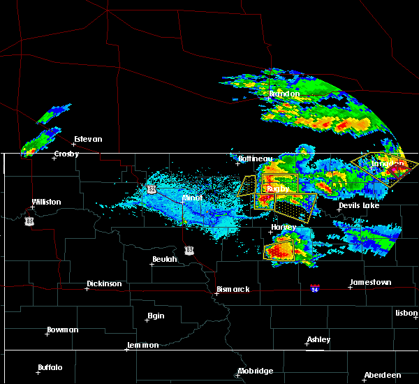 At 657 pm cdt, a severe thunderstorm was located 6 miles west of wolford, or 13 miles northeast of rugby, moving east at 50 mph. this is a very dangerous storm (radar indicated). Hazards include 90 mph wind gusts and quarter size hail. You are in a life-threatening situation. flying debris may be deadly to those caught without shelter. mobile homes will be heavily damaged or destroyed. homes and businesses will have substantial roof and window damage. expect extensive tree damage and power outages. this severe storm will be near, wolford around 705 pm cdt. Other locations impacted by this severe thunderstorm include agate, nanson and mylo. At 657 pm cdt, a severe thunderstorm was located 6 miles west of wolford, or 13 miles northeast of rugby, moving east at 50 mph. this is a very dangerous storm (radar indicated). Hazards include 90 mph wind gusts and quarter size hail. You are in a life-threatening situation. flying debris may be deadly to those caught without shelter. mobile homes will be heavily damaged or destroyed. homes and businesses will have substantial roof and window damage. expect extensive tree damage and power outages. this severe storm will be near, wolford around 705 pm cdt. Other locations impacted by this severe thunderstorm include agate, nanson and mylo.
|
| 6/9/2017 6:40 PM CDT |
 At 640 pm cdt, a severe thunderstorm was located near barton, or 12 miles north of rugby, moving east at 55 mph. this is a very dangerous storm (radar indicated). Hazards include 90 mph wind gusts and quarter size hail. You are in a life-threatening situation. flying debris may be deadly to those caught without shelter. mobile homes will be heavily damaged or destroyed. homes and businesses will have substantial roof and window damage. expect extensive tree damage and power outages. this severe thunderstorm will be near, wolford around 700 pm cdt. Other locations impacted by this severe thunderstorm include agate, nanson and mylo. At 640 pm cdt, a severe thunderstorm was located near barton, or 12 miles north of rugby, moving east at 55 mph. this is a very dangerous storm (radar indicated). Hazards include 90 mph wind gusts and quarter size hail. You are in a life-threatening situation. flying debris may be deadly to those caught without shelter. mobile homes will be heavily damaged or destroyed. homes and businesses will have substantial roof and window damage. expect extensive tree damage and power outages. this severe thunderstorm will be near, wolford around 700 pm cdt. Other locations impacted by this severe thunderstorm include agate, nanson and mylo.
|
| 8/3/2016 6:12 PM CDT |
 At 612 pm cdt, a severe thunderstorm was located 9 miles east of rolette, or 13 miles south of rolla, moving east at 15 mph (radar indicated). Hazards include golf ball size hail and 60 mph wind gusts. People and animals outdoors will be injured. expect hail damage to roofs, siding, windows, and vehicles. expect wind damage to roofs, siding, and trees. locations impacted include, rolla, wolford, belcourt, mylo, agate and nanson. A tornado watch remains in effect until 1100 pm cdt for north central north dakota. At 612 pm cdt, a severe thunderstorm was located 9 miles east of rolette, or 13 miles south of rolla, moving east at 15 mph (radar indicated). Hazards include golf ball size hail and 60 mph wind gusts. People and animals outdoors will be injured. expect hail damage to roofs, siding, windows, and vehicles. expect wind damage to roofs, siding, and trees. locations impacted include, rolla, wolford, belcourt, mylo, agate and nanson. A tornado watch remains in effect until 1100 pm cdt for north central north dakota.
|
| 8/3/2016 5:58 PM CDT |
 At 558 pm cdt, a severe thunderstorm was located 7 miles east of rolette, or 13 miles south of rolla, moving east at 15 mph. this is a very dangerous storm (radar indicated). Hazards include softball size hail and 70 mph wind gusts. People and animals outdoors will be severely injured. expect shattered windows, extensive damage to roofs, siding, and vehicles. this severe thunderstorm will remain over mainly rural areas of eastern rolette and northeastern pierce counties, including the following locations: shell valley, agate, nanson and mylo. A tornado watch remains in effect until 1100 pm cdt for north central north dakota. At 558 pm cdt, a severe thunderstorm was located 7 miles east of rolette, or 13 miles south of rolla, moving east at 15 mph. this is a very dangerous storm (radar indicated). Hazards include softball size hail and 70 mph wind gusts. People and animals outdoors will be severely injured. expect shattered windows, extensive damage to roofs, siding, and vehicles. this severe thunderstorm will remain over mainly rural areas of eastern rolette and northeastern pierce counties, including the following locations: shell valley, agate, nanson and mylo. A tornado watch remains in effect until 1100 pm cdt for north central north dakota.
|
| 8/3/2016 5:30 PM CDT |
 At 530 pm cdt, severe thunderstorms were located along a line extending from 7 miles northwest of st. john to rolette to 7 miles southwest of bisbee, moving northeast at 15 mph (radar indicated). Hazards include tennis ball size hail and 60 mph wind gusts. People and animals outdoors will be injured. expect hail damage to roofs, siding, windows, and vehicles. expect wind damage to roofs, siding, and trees. these severe storms will be near, st. john around 540 pm cdt. other locations impacted by these severe thunderstorms include shell valley, agate, nanson, mylo and thorne. A tornado watch remains in effect until 1100 pm cdt for north central north dakota. At 530 pm cdt, severe thunderstorms were located along a line extending from 7 miles northwest of st. john to rolette to 7 miles southwest of bisbee, moving northeast at 15 mph (radar indicated). Hazards include tennis ball size hail and 60 mph wind gusts. People and animals outdoors will be injured. expect hail damage to roofs, siding, windows, and vehicles. expect wind damage to roofs, siding, and trees. these severe storms will be near, st. john around 540 pm cdt. other locations impacted by these severe thunderstorms include shell valley, agate, nanson, mylo and thorne. A tornado watch remains in effect until 1100 pm cdt for north central north dakota.
|
| 8/3/2016 5:18 PM CDT |
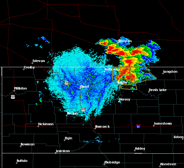 At 517 pm cdt, severe thunderstorms were located along a line extending from 6 miles east of international peace garden to 5 miles southwest of rolette to 4 miles southeast of wolford, moving east at 20 mph (radar indicated). Hazards include tennis ball size hail and 60 mph wind gusts. People and animals outdoors will be injured. expect hail damage to roofs, siding, windows, and vehicles. expect wind damage to roofs, siding, and trees. these severe storms will be near, wolford around 525 pm cdt. st. john around 600 pm cdt. other locations impacted by these severe thunderstorms include shell valley, agate, nanson, mylo and thorne. A tornado watch remains in effect until 1100 pm cdt for north central north dakota. At 517 pm cdt, severe thunderstorms were located along a line extending from 6 miles east of international peace garden to 5 miles southwest of rolette to 4 miles southeast of wolford, moving east at 20 mph (radar indicated). Hazards include tennis ball size hail and 60 mph wind gusts. People and animals outdoors will be injured. expect hail damage to roofs, siding, windows, and vehicles. expect wind damage to roofs, siding, and trees. these severe storms will be near, wolford around 525 pm cdt. st. john around 600 pm cdt. other locations impacted by these severe thunderstorms include shell valley, agate, nanson, mylo and thorne. A tornado watch remains in effect until 1100 pm cdt for north central north dakota.
|
| 8/3/2016 5:08 PM CDT |
 At 508 pm cdt, severe thunderstorms were located along a line extending from 5 miles northeast of international peace garden to 8 miles southwest of rolette to 4 miles southwest of wolford, moving east at 10 mph (radar indicated). Hazards include tennis ball size hail and 60 mph wind gusts. People and animals outdoors will be injured. expect hail damage to roofs, siding, windows, and vehicles. expect wind damage to roofs, siding, and trees. these severe storms will be near, wolford around 530 pm cdt. rolette around 545 pm cdt. other locations impacted by these severe thunderstorms include shell valley, agate, nanson, mylo, thorne and overly. A tornado watch remains in effect until 1100 pm cdt for north central north dakota. At 508 pm cdt, severe thunderstorms were located along a line extending from 5 miles northeast of international peace garden to 8 miles southwest of rolette to 4 miles southwest of wolford, moving east at 10 mph (radar indicated). Hazards include tennis ball size hail and 60 mph wind gusts. People and animals outdoors will be injured. expect hail damage to roofs, siding, windows, and vehicles. expect wind damage to roofs, siding, and trees. these severe storms will be near, wolford around 530 pm cdt. rolette around 545 pm cdt. other locations impacted by these severe thunderstorms include shell valley, agate, nanson, mylo, thorne and overly. A tornado watch remains in effect until 1100 pm cdt for north central north dakota.
|
| 8/3/2016 5:00 PM CDT |
 At 457 pm cdt, severe thunderstorms were located along a line extending from 4 miles northeast of international peace garden to 8 miles northeast of barton to 6 miles southwest of wolford, moving east at 20 mph (radar indicated). Hazards include golf ball size hail and 60 mph wind gusts. People and animals outdoors will be injured. expect hail damage to roofs, siding, windows, and vehicles. expect wind damage to roofs, siding, and trees. severe thunderstorms will be near, wolford around 530 pm cdt. rolette around 545 pm cdt. other locations impacted by these severe thunderstorms include shell valley, agate, nanson, mylo, thorne and overly. A tornado watch remains in effect until 1100 pm cdt for north central north dakota. At 457 pm cdt, severe thunderstorms were located along a line extending from 4 miles northeast of international peace garden to 8 miles northeast of barton to 6 miles southwest of wolford, moving east at 20 mph (radar indicated). Hazards include golf ball size hail and 60 mph wind gusts. People and animals outdoors will be injured. expect hail damage to roofs, siding, windows, and vehicles. expect wind damage to roofs, siding, and trees. severe thunderstorms will be near, wolford around 530 pm cdt. rolette around 545 pm cdt. other locations impacted by these severe thunderstorms include shell valley, agate, nanson, mylo, thorne and overly. A tornado watch remains in effect until 1100 pm cdt for north central north dakota.
|
| 8/3/2016 4:36 PM CDT |
 At 435 pm cdt, a severe thunderstorm was located 6 miles northeast of rugby, moving northeast at 30 mph. this is a very dangerous storm (radar indicated). Hazards include baseball size hail and 60 mph wind gusts. People and animals outdoors will be severely injured. expect shattered windows, extensive damage to roofs, siding, and vehicles. this severe storm will be near, wolford around 455 pm cdt. other locations impacted by this severe thunderstorm include nanson. A tornado watch remains in effect until 1100 pm cdt for north central north dakota. At 435 pm cdt, a severe thunderstorm was located 6 miles northeast of rugby, moving northeast at 30 mph. this is a very dangerous storm (radar indicated). Hazards include baseball size hail and 60 mph wind gusts. People and animals outdoors will be severely injured. expect shattered windows, extensive damage to roofs, siding, and vehicles. this severe storm will be near, wolford around 455 pm cdt. other locations impacted by this severe thunderstorm include nanson. A tornado watch remains in effect until 1100 pm cdt for north central north dakota.
|
| 8/3/2016 4:25 PM CDT |
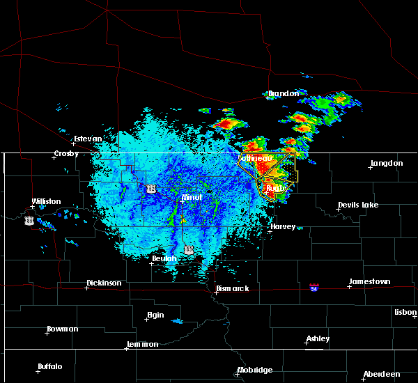 At 424 pm cdt, a severe thunderstorm was located over rugby, moving northeast at 30 mph (trained weather spotters reported tennis ball size hail in rugby). Hazards include tennis ball size hail and 60 mph wind gusts. People and animals outdoors will be injured. expect hail damage to roofs, siding, windows, and vehicles. expect wind damage to roofs, siding, and trees. this severe storm will be near, wolford around 450 pm cdt. other locations impacted by this severe thunderstorm include nanson. A tornado watch remains in effect until 1100 pm cdt for north central north dakota. At 424 pm cdt, a severe thunderstorm was located over rugby, moving northeast at 30 mph (trained weather spotters reported tennis ball size hail in rugby). Hazards include tennis ball size hail and 60 mph wind gusts. People and animals outdoors will be injured. expect hail damage to roofs, siding, windows, and vehicles. expect wind damage to roofs, siding, and trees. this severe storm will be near, wolford around 450 pm cdt. other locations impacted by this severe thunderstorm include nanson. A tornado watch remains in effect until 1100 pm cdt for north central north dakota.
|
| 8/3/2016 4:20 PM CDT |
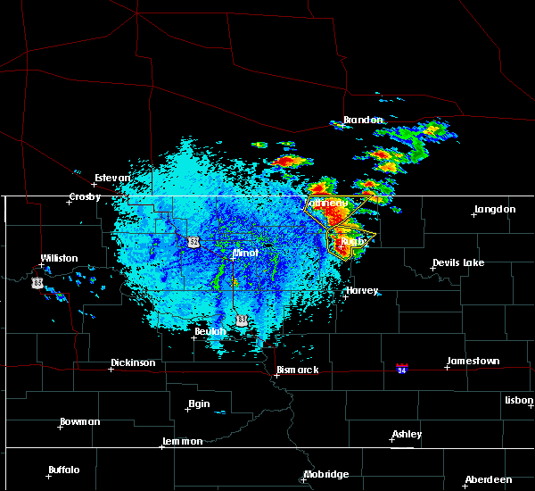 At 419 pm cdt, a severe thunderstorm was located over rugby, moving northeast at 30 mph (radar indicated). Hazards include tennis ball size hail and 60 mph wind gusts. People and animals outdoors will be injured. expect hail damage to roofs, siding, windows, and vehicles. expect wind damage to roofs, siding, and trees. this severe storm will be near, wolford around 450 pm cdt. other locations impacted by this severe thunderstorm include nanson. A tornado watch remains in effect until 1100 pm cdt for north central north dakota. At 419 pm cdt, a severe thunderstorm was located over rugby, moving northeast at 30 mph (radar indicated). Hazards include tennis ball size hail and 60 mph wind gusts. People and animals outdoors will be injured. expect hail damage to roofs, siding, windows, and vehicles. expect wind damage to roofs, siding, and trees. this severe storm will be near, wolford around 450 pm cdt. other locations impacted by this severe thunderstorm include nanson. A tornado watch remains in effect until 1100 pm cdt for north central north dakota.
|
| 8/3/2016 4:12 PM CDT |
 At 411 pm cdt, a severe thunderstorm was located 5 miles southwest of rugby, moving northeast at 30 mph (trained weather spotters). Hazards include tennis ball size hail and 60 mph wind gusts. People and animals outdoors will be injured. expect hail damage to roofs, siding, windows, and vehicles. expect wind damage to roofs, siding, and trees. this severe storm will be near, rugby around 425 pm cdt. other locations impacted by this severe thunderstorm include nanson. A tornado watch remains in effect until 1100 pm cdt for north central north dakota. At 411 pm cdt, a severe thunderstorm was located 5 miles southwest of rugby, moving northeast at 30 mph (trained weather spotters). Hazards include tennis ball size hail and 60 mph wind gusts. People and animals outdoors will be injured. expect hail damage to roofs, siding, windows, and vehicles. expect wind damage to roofs, siding, and trees. this severe storm will be near, rugby around 425 pm cdt. other locations impacted by this severe thunderstorm include nanson. A tornado watch remains in effect until 1100 pm cdt for north central north dakota.
|
| 8/3/2016 4:05 PM CDT |
 At 404 pm cdt, a severe thunderstorm was located 8 miles northwest of balta, or 9 miles southwest of rugby, moving northeast at 30 mph (trained weather spotters report half dollar size hail southwest of rugby). Hazards include 60 mph wind gusts and half dollar size hail. Hail damage to vehicles is expected. expect wind damage to roofs, siding, and trees. this severe storm will be near, rugby around 425 pm cdt. other locations impacted by this severe thunderstorm include nanson. A tornado watch remains in effect until 1100 pm cdt for north central north dakota. At 404 pm cdt, a severe thunderstorm was located 8 miles northwest of balta, or 9 miles southwest of rugby, moving northeast at 30 mph (trained weather spotters report half dollar size hail southwest of rugby). Hazards include 60 mph wind gusts and half dollar size hail. Hail damage to vehicles is expected. expect wind damage to roofs, siding, and trees. this severe storm will be near, rugby around 425 pm cdt. other locations impacted by this severe thunderstorm include nanson. A tornado watch remains in effect until 1100 pm cdt for north central north dakota.
|
| 8/3/2016 3:58 PM CDT |
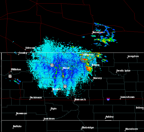 At 358 pm cdt, a severe thunderstorm was located 7 miles northwest of balta, or 12 miles southwest of rugby, moving northeast at 30 mph (radar indicated). Hazards include 60 mph wind gusts and half dollar size hail. Hail damage to vehicles is expected. expect wind damage to roofs, siding, and trees. this severe thunderstorm will be near, rugby around 425 pm cdt. other locations impacted by this severe thunderstorm include nanson. A tornado watch remains in effect until 1100 pm cdt for north central north dakota. At 358 pm cdt, a severe thunderstorm was located 7 miles northwest of balta, or 12 miles southwest of rugby, moving northeast at 30 mph (radar indicated). Hazards include 60 mph wind gusts and half dollar size hail. Hail damage to vehicles is expected. expect wind damage to roofs, siding, and trees. this severe thunderstorm will be near, rugby around 425 pm cdt. other locations impacted by this severe thunderstorm include nanson. A tornado watch remains in effect until 1100 pm cdt for north central north dakota.
|
| 7/4/2016 3:25 PM CDT |
 At 324 pm cdt, a severe thunderstorm was located over rugby, moving east at 30 mph (trained weather spotter reported quarter size hail for approximately three minutes, from 310 pm cdt to 315 pm cdt). Hazards include 60 mph wind gusts and half dollar size hail. Hail damage to vehicles is expected. expect wind damage to roofs, siding, and trees. This severe thunderstorm will remain over mainly rural areas of northern pierce county. At 324 pm cdt, a severe thunderstorm was located over rugby, moving east at 30 mph (trained weather spotter reported quarter size hail for approximately three minutes, from 310 pm cdt to 315 pm cdt). Hazards include 60 mph wind gusts and half dollar size hail. Hail damage to vehicles is expected. expect wind damage to roofs, siding, and trees. This severe thunderstorm will remain over mainly rural areas of northern pierce county.
|
| 7/4/2016 3:08 PM CDT |
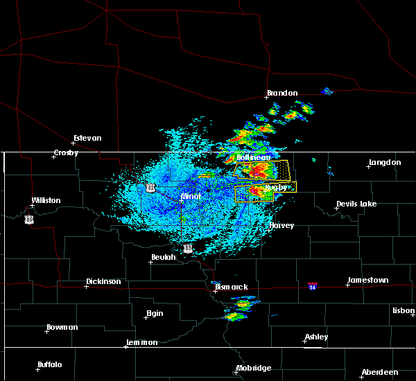 At 307 pm cdt, a severe thunderstorm was located 5 miles west of rugby, moving east at 30 mph (radar indicated). Hazards include golf ball size hail and 60 mph wind gusts. People and animals outdoors will be injured. expect hail damage to roofs, siding, windows, and vehicles. expect wind damage to roofs, siding, and trees. this severe storm will be near, rugby around 320 pm cdt. Wolford around 345 pm cdt. At 307 pm cdt, a severe thunderstorm was located 5 miles west of rugby, moving east at 30 mph (radar indicated). Hazards include golf ball size hail and 60 mph wind gusts. People and animals outdoors will be injured. expect hail damage to roofs, siding, windows, and vehicles. expect wind damage to roofs, siding, and trees. this severe storm will be near, rugby around 320 pm cdt. Wolford around 345 pm cdt.
|
| 7/4/2016 2:53 PM CDT |
 At 253 pm cdt, a severe thunderstorm was located 6 miles east of towner, or 12 miles west of rugby, moving east at 30 mph (radar indicated). Hazards include 60 mph wind gusts and quarter size hail. Hail damage to vehicles is expected. expect wind damage to roofs, siding, and trees. this severe thunderstorm will be near, rugby around 320 pm cdt. Other locations impacted by this severe thunderstorm include berwick. At 253 pm cdt, a severe thunderstorm was located 6 miles east of towner, or 12 miles west of rugby, moving east at 30 mph (radar indicated). Hazards include 60 mph wind gusts and quarter size hail. Hail damage to vehicles is expected. expect wind damage to roofs, siding, and trees. this severe thunderstorm will be near, rugby around 320 pm cdt. Other locations impacted by this severe thunderstorm include berwick.
|
| 6/10/2016 12:31 AM CDT |
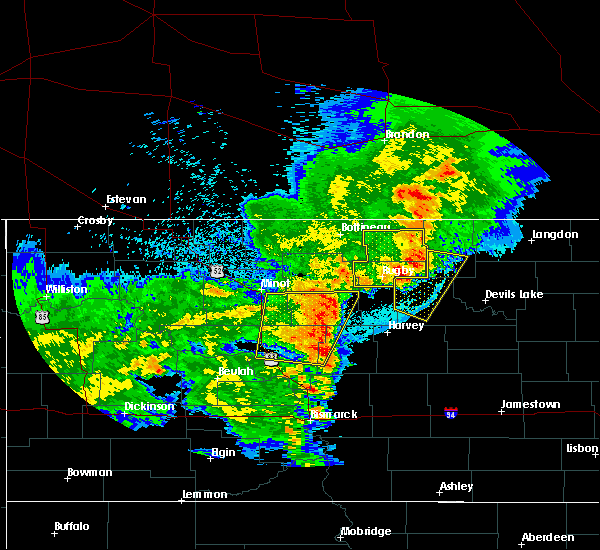 At 1230 am cdt, a severe thunderstorm was located 6 miles southwest of bisbee, or 20 miles south of rolla, moving east at 40 mph (public). Hazards include 70 mph wind gusts. Expect considerable tree damage. damage is likely to mobile homes, roofs, and outbuildings. Locations impacted include, rugby, rolla, dunseith, rolette, wolford, belcourt, barton, shell valley, berwick, mylo, overly, agate, thorne and nanson. At 1230 am cdt, a severe thunderstorm was located 6 miles southwest of bisbee, or 20 miles south of rolla, moving east at 40 mph (public). Hazards include 70 mph wind gusts. Expect considerable tree damage. damage is likely to mobile homes, roofs, and outbuildings. Locations impacted include, rugby, rolla, dunseith, rolette, wolford, belcourt, barton, shell valley, berwick, mylo, overly, agate, thorne and nanson.
|
| 6/10/2016 12:03 AM CDT |
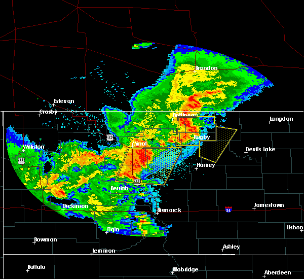 At 1201 am cdt, a severe thunderstorm was located 5 miles south of rolette, or 15 miles northeast of rugby, moving east at 50 mph (media at 1155 pm cdt reported 71 mph winds in rugby). Hazards include 70 mph wind gusts and penny size hail. Expect considerable tree damage. damage is likely to mobile homes, roofs, and outbuildings. Locations impacted include, rugby, rolla, dunseith, rolette, willow city, wolford, belcourt, barton, shell valley, berwick, mylo, overly, agate, thorne and nanson. At 1201 am cdt, a severe thunderstorm was located 5 miles south of rolette, or 15 miles northeast of rugby, moving east at 50 mph (media at 1155 pm cdt reported 71 mph winds in rugby). Hazards include 70 mph wind gusts and penny size hail. Expect considerable tree damage. damage is likely to mobile homes, roofs, and outbuildings. Locations impacted include, rugby, rolla, dunseith, rolette, willow city, wolford, belcourt, barton, shell valley, berwick, mylo, overly, agate, thorne and nanson.
|
| 6/9/2016 11:40 PM CDT |
 At 1139 pm cdt, a severe thunderstorm was located over willow city, or 18 miles southeast of bottineau, moving east at 50 mph (radar indicated). Hazards include 70 mph wind gusts and penny size hail. Expect considerable tree damage. Damage is likely to mobile homes, roofs, and outbuildings. At 1139 pm cdt, a severe thunderstorm was located over willow city, or 18 miles southeast of bottineau, moving east at 50 mph (radar indicated). Hazards include 70 mph wind gusts and penny size hail. Expect considerable tree damage. Damage is likely to mobile homes, roofs, and outbuildings.
|
| 7/23/2015 7:06 PM CDT |
 At 706 pm cdt, severe thunderstorms were located along a line extending from 13 miles north of rocklake to 9 miles south of wolford, moving east at 35 mph (radar indicated). Hazards include 60 mph wind gusts and quarter size hail. Hail damage to vehicles is expected. expect wind damage to roofs, siding and trees. These severe thunderstorms will remain over mainly rural areas of eastern rolette and northeastern pierce counties, including the following locations, shell valley, agate, nanson and mylo. At 706 pm cdt, severe thunderstorms were located along a line extending from 13 miles north of rocklake to 9 miles south of wolford, moving east at 35 mph (radar indicated). Hazards include 60 mph wind gusts and quarter size hail. Hail damage to vehicles is expected. expect wind damage to roofs, siding and trees. These severe thunderstorms will remain over mainly rural areas of eastern rolette and northeastern pierce counties, including the following locations, shell valley, agate, nanson and mylo.
|
| 7/12/2015 8:09 PM CDT |
 At 809 pm cdt, severe thunderstorms were located along a line extending from 5 miles northwest of wolford to 7 miles northeast of martin, moving east at 35 mph (radar indicated). Hazards include 60 mph wind gusts and quarter size hail. Hail damage to vehicles is expected. expect wind damage to roofs, siding and trees. these severe storms will be near, wolford around 815 pm cdt. Other locations impacted by these severe thunderstorms include selz and silva. At 809 pm cdt, severe thunderstorms were located along a line extending from 5 miles northwest of wolford to 7 miles northeast of martin, moving east at 35 mph (radar indicated). Hazards include 60 mph wind gusts and quarter size hail. Hail damage to vehicles is expected. expect wind damage to roofs, siding and trees. these severe storms will be near, wolford around 815 pm cdt. Other locations impacted by these severe thunderstorms include selz and silva.
|
| 7/12/2015 7:53 PM CDT |
 At 752 pm cdt, severe thunderstorms were located along a line extending from 8 miles east of barton to anamoose, moving east at 35 mph (radar indicated). Hazards include 60 mph wind gusts and quarter size hail. Hail damage to vehicles is expected. expect wind damage to roofs, siding and trees. these severe storms will be near, wolford around 815 pm cdt. Other locations impacted by these severe thunderstorms include orrin, silva and selz. At 752 pm cdt, severe thunderstorms were located along a line extending from 8 miles east of barton to anamoose, moving east at 35 mph (radar indicated). Hazards include 60 mph wind gusts and quarter size hail. Hail damage to vehicles is expected. expect wind damage to roofs, siding and trees. these severe storms will be near, wolford around 815 pm cdt. Other locations impacted by these severe thunderstorms include orrin, silva and selz.
|
| 7/12/2015 7:36 PM CDT |
 At 736 pm cdt, severe thunderstorms were located along a line extending from barton to near drake, moving east at 35 mph (radar indicated). Hazards include 60 mph wind gusts and quarter size hail. Hail damage to vehicles is expected. expect wind damage to roofs, siding and trees. severe thunderstorms will be near, barton around 740 pm cdt. wolford around 810 pm cdt. Other locations impacted by these severe thunderstorms include orrin, berwick, kief, george lake, silva, selz and balfour. At 736 pm cdt, severe thunderstorms were located along a line extending from barton to near drake, moving east at 35 mph (radar indicated). Hazards include 60 mph wind gusts and quarter size hail. Hail damage to vehicles is expected. expect wind damage to roofs, siding and trees. severe thunderstorms will be near, barton around 740 pm cdt. wolford around 810 pm cdt. Other locations impacted by these severe thunderstorms include orrin, berwick, kief, george lake, silva, selz and balfour.
|
| 8/17/2014 5:46 PM CDT | Strong winds and crop damage reported near wolfor in pierce county ND, 4.8 miles W of Wolford, ND |
Hail Maps for Wolford, ND


Connect with Interactive Hail Maps