

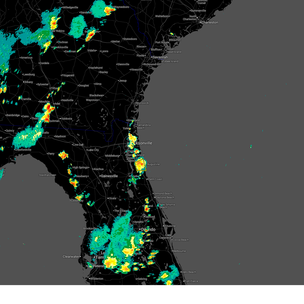
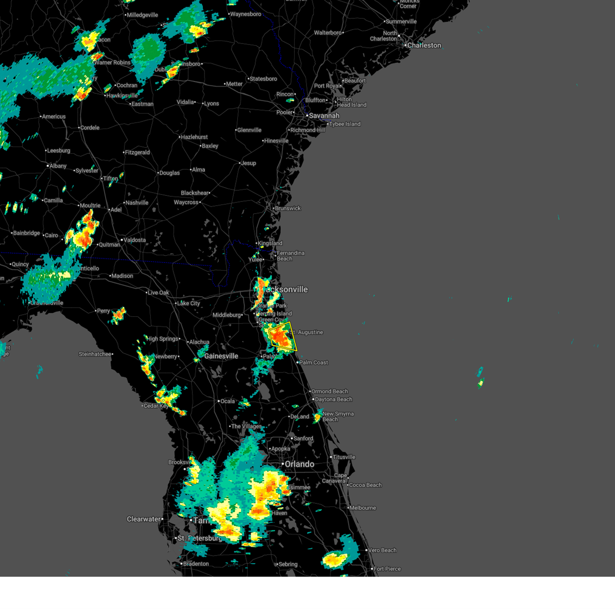
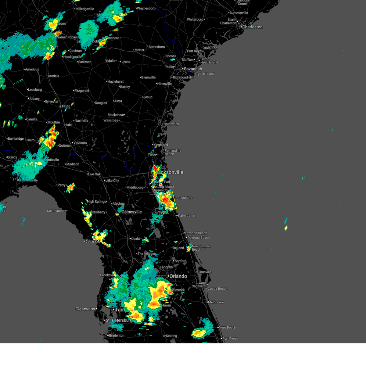
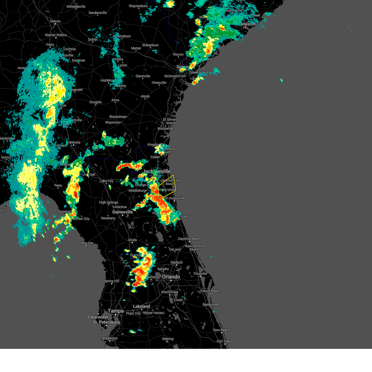
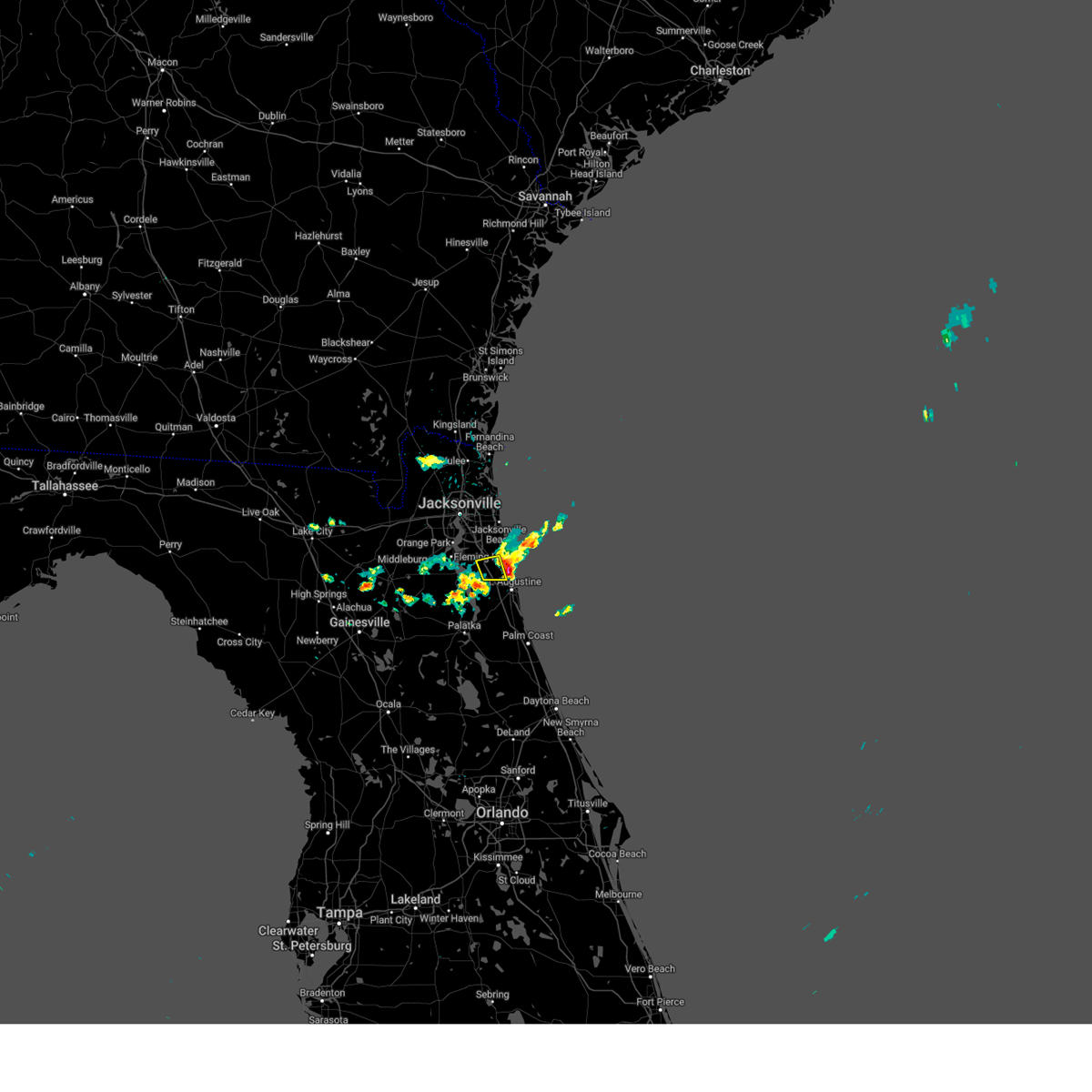
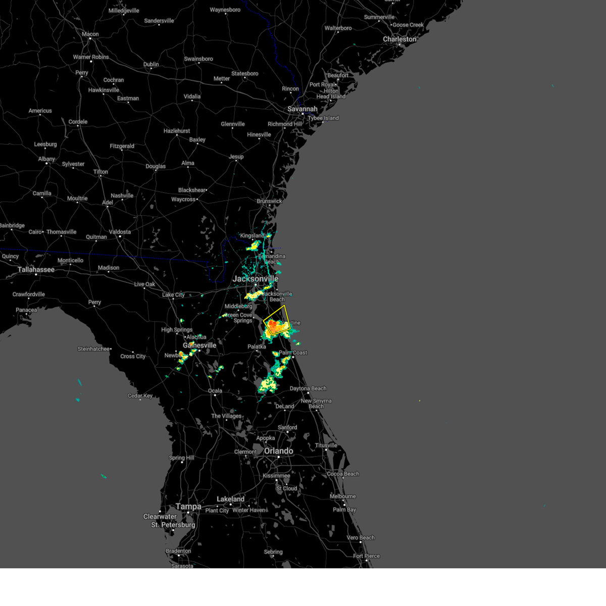
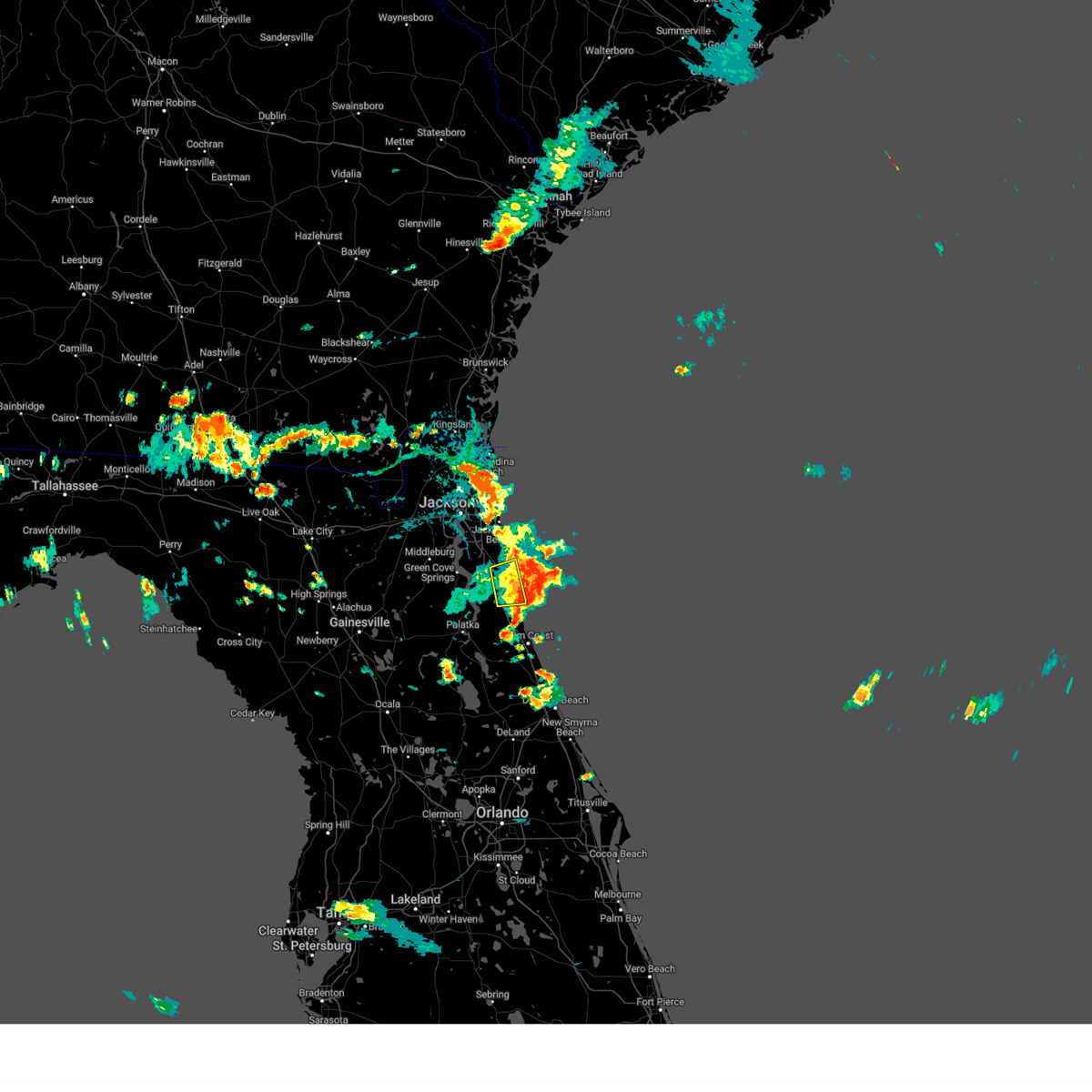
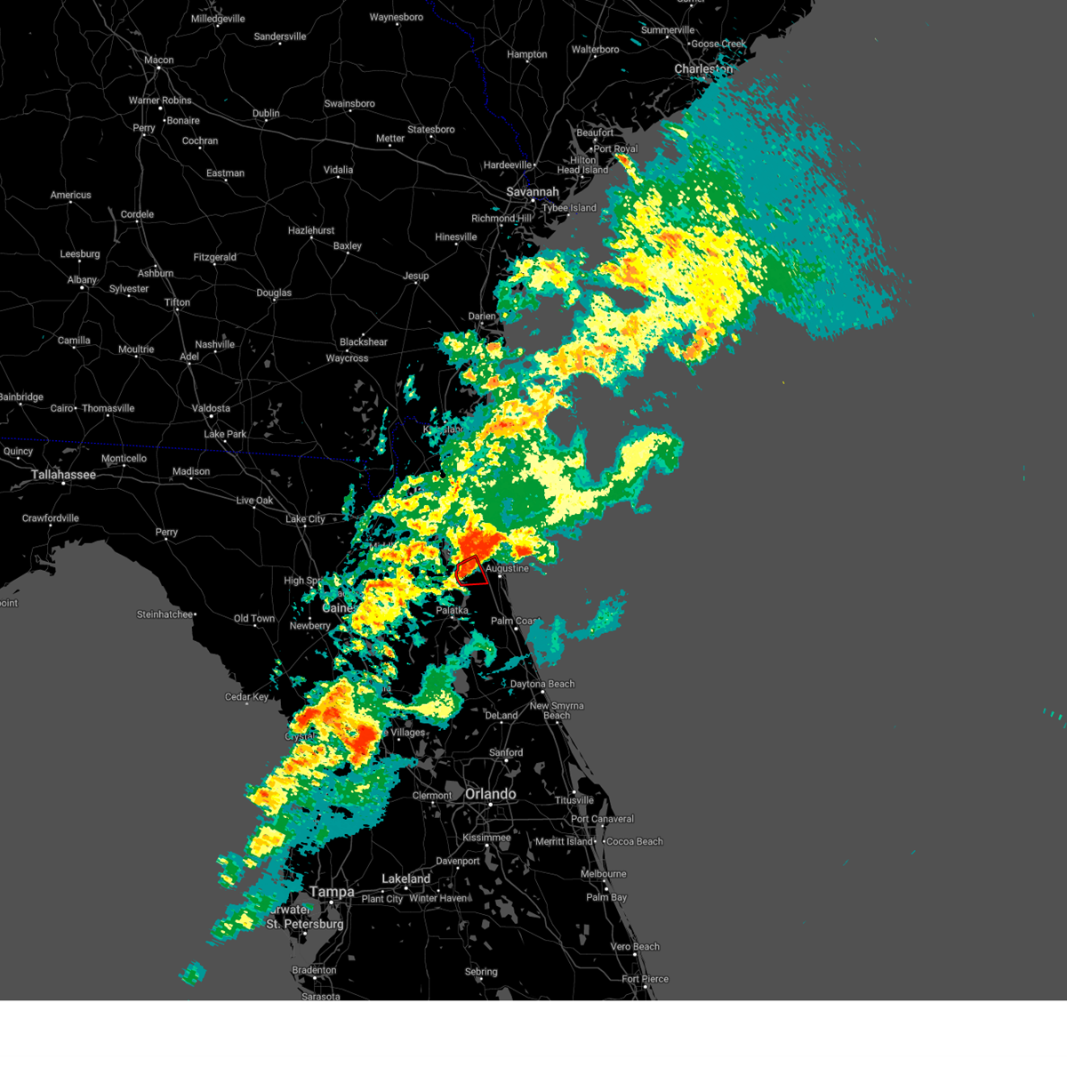
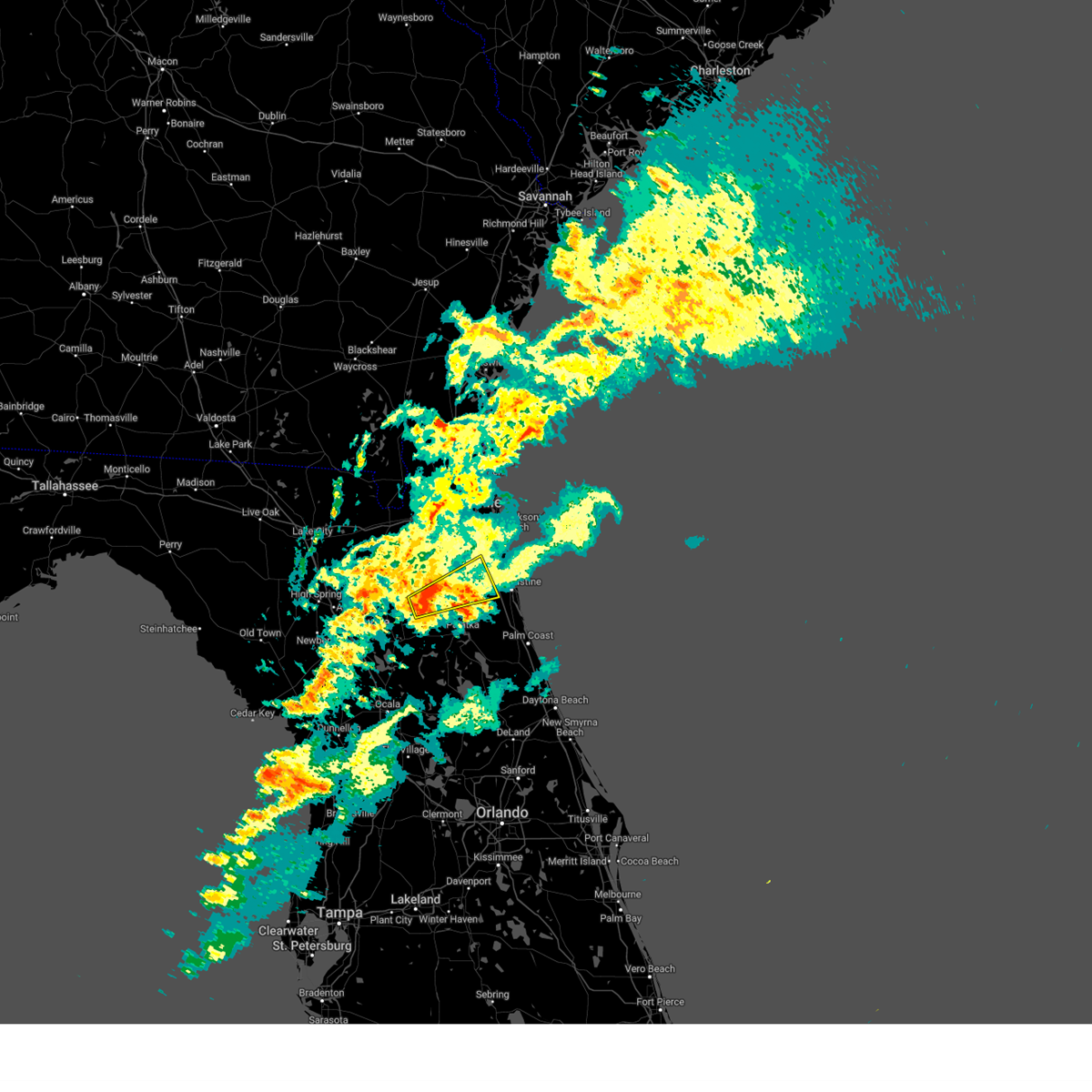
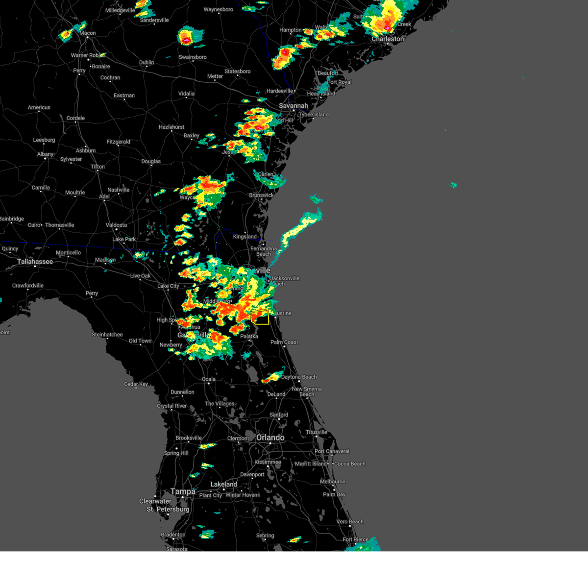
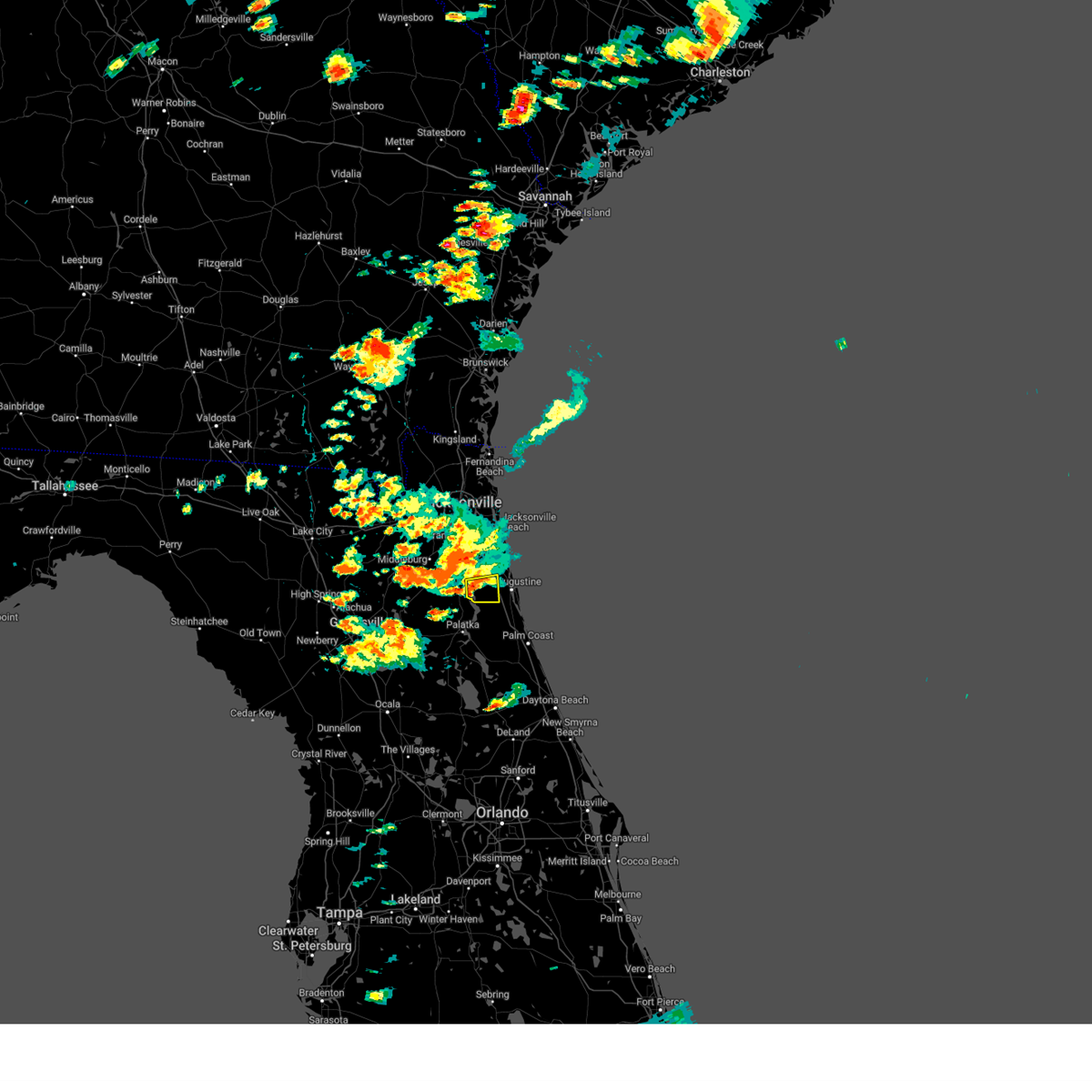
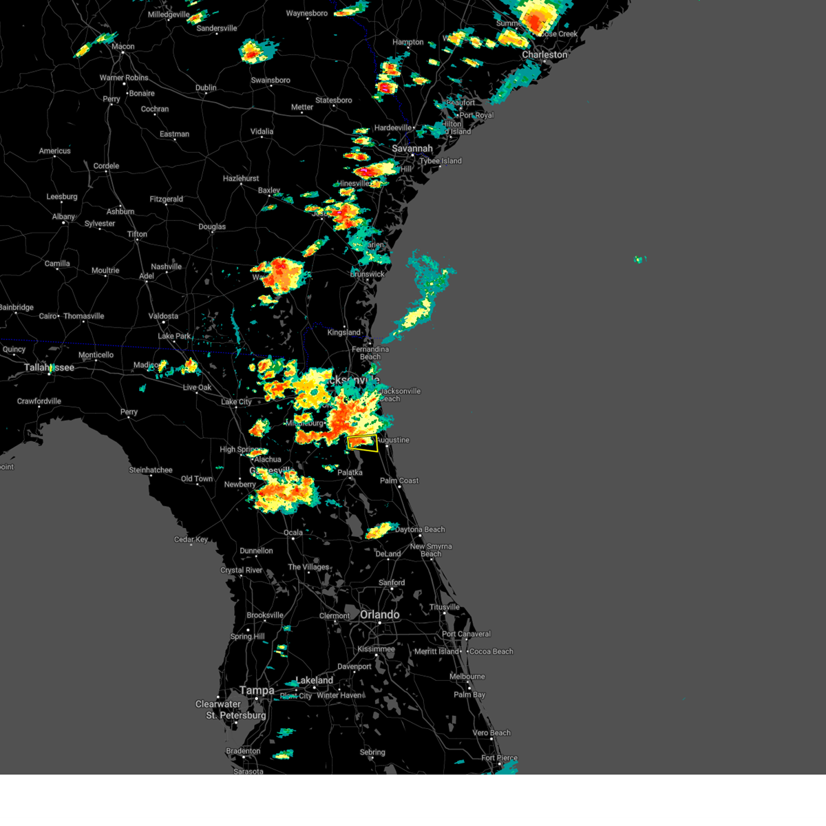
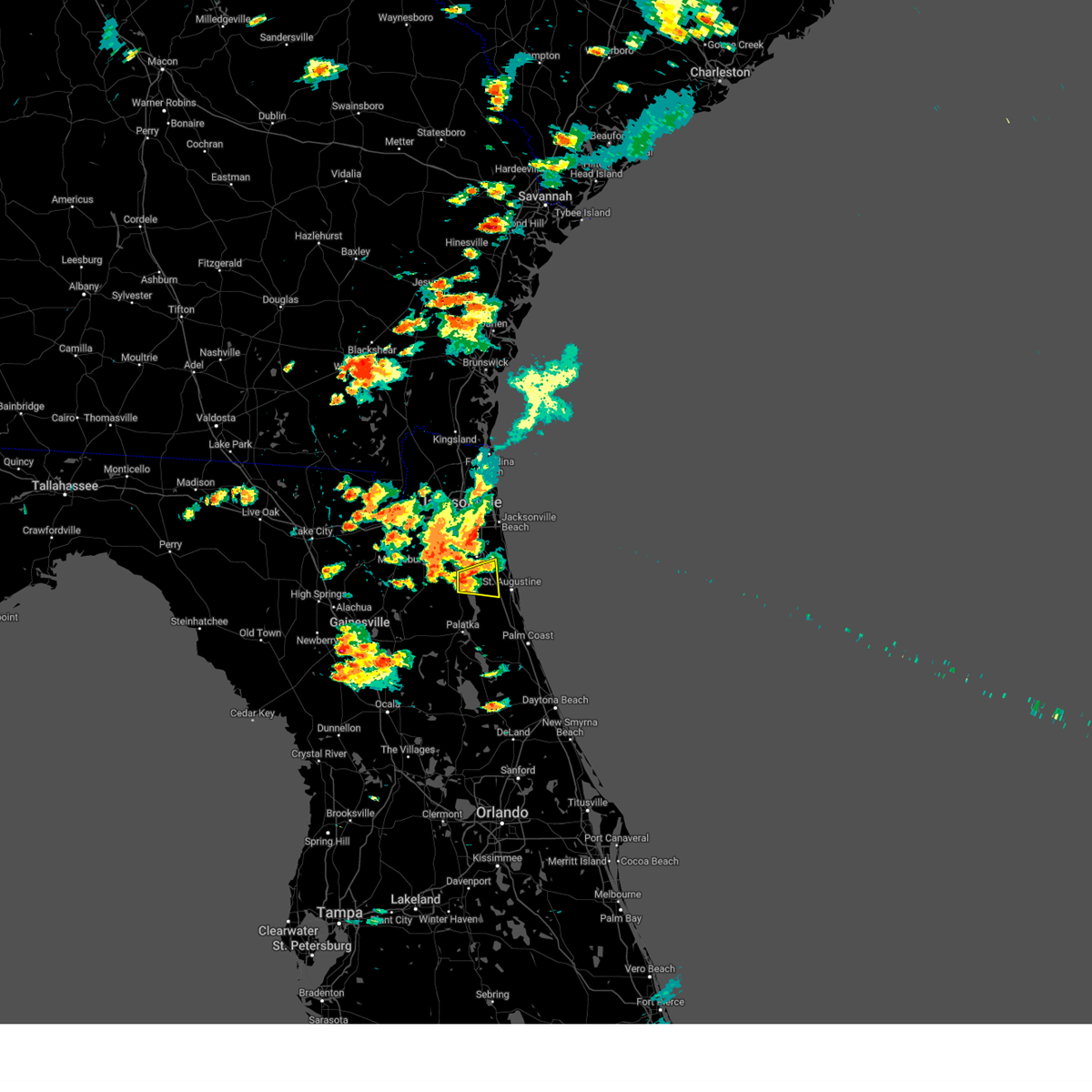
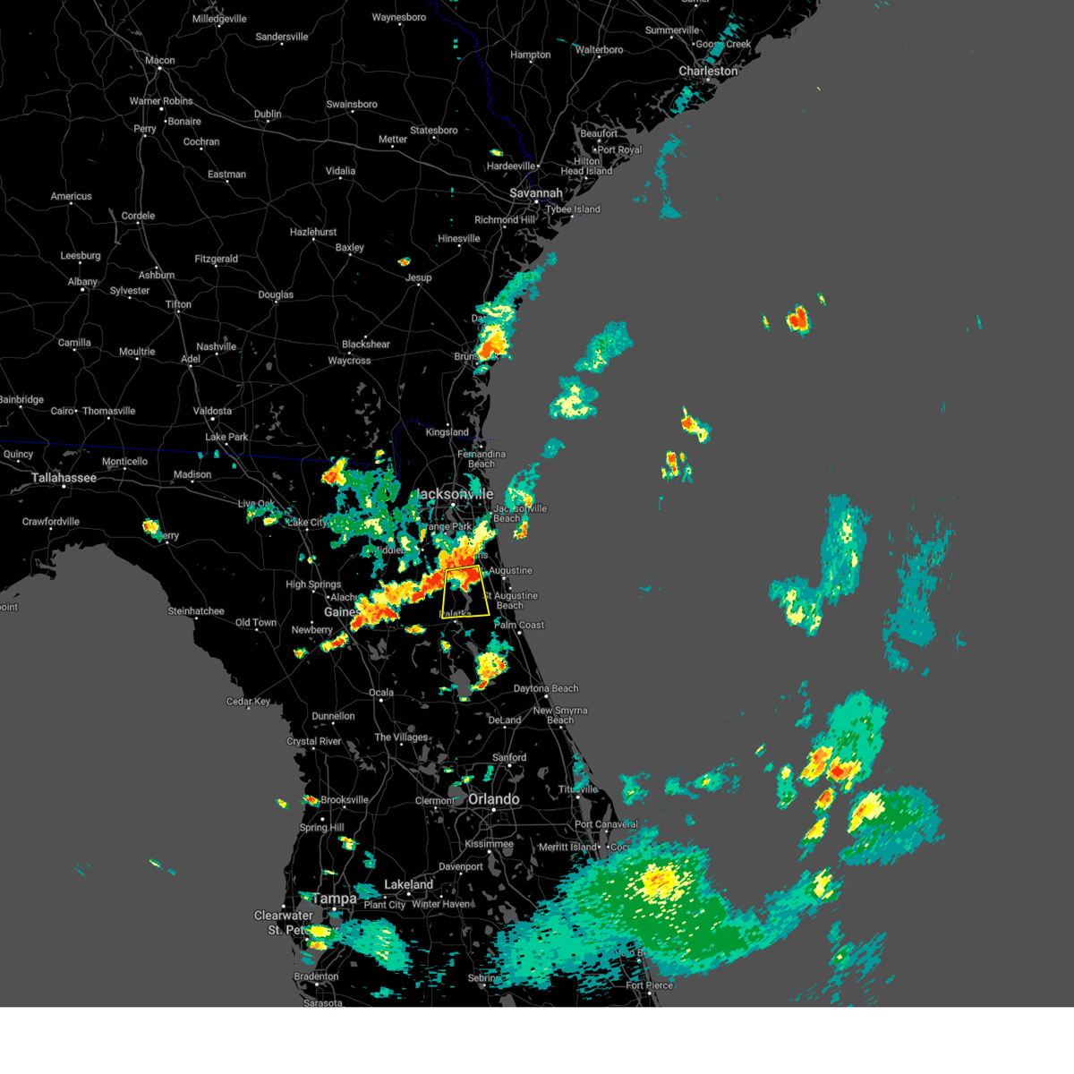
Hail Map for World Golf Village, FL
The World Golf Village, FL area has had 10 reports of on-the-ground hail by trained spotters, and has been under severe weather warnings 23 times during the past 12 months. Doppler radar has detected hail at or near World Golf Village, FL on 90 occasions, including 9 occasions during the past year.
| Name: | World Golf Village, FL |
| Where Located: | 27.3 miles SSE of Jacksonville, FL |
| Map: | Google Map for World Golf Village, FL |
| Population: | 12310 |
| Housing Units: | 5098 |
| More Info: | Search Google for World Golf Village, FL |
1
The Top Recent Hail Date for World Golf Village, FL is Monday, July 15, 2024 (25th out of 90)

Hail and Wind Damage Spotted near World Golf Village, FL
| Date / Time | Report Details |
|---|---|
| 6/19/2025 4:22 PM EDT |
 The storm which prompted the warning has weakened below severe limits, and no longer poses an immediate threat to life or property. therefore, the warning will be allowed to expire. however, gusty winds and heavy rain are still possible with this thunderstorm. The storm which prompted the warning has weakened below severe limits, and no longer poses an immediate threat to life or property. therefore, the warning will be allowed to expire. however, gusty winds and heavy rain are still possible with this thunderstorm.
|
| 6/19/2025 4:12 PM EDT | At 412 pm edt, a severe thunderstorm was located near saint augustine south, or near saint augustine, moving east at 5 mph (radar indicated). Hazards include 60 mph wind gusts and penny size hail. Expect damage to roofs, siding, and trees. Locations impacted include, saint augustine, saint augustine beach, saint augustine shores, butler beach, vilano beach, saint augustine south, anastasia, and elkton. |
| 6/19/2025 3:56 PM EDT |
 At 356 pm edt, a severe thunderstorm was located 8 miles west of saint augustine south, or 8 miles west of saint augustine, moving east at 10 mph (radar indicated). Hazards include 60 mph wind gusts and penny size hail. Expect damage to roofs, siding, and trees. Locations impacted include, saint augustine, saint augustine beach, crescent beach, saint augustine shores, butler beach, vilano beach, saint augustine south, anastasia, bakersville, and dupont center. At 356 pm edt, a severe thunderstorm was located 8 miles west of saint augustine south, or 8 miles west of saint augustine, moving east at 10 mph (radar indicated). Hazards include 60 mph wind gusts and penny size hail. Expect damage to roofs, siding, and trees. Locations impacted include, saint augustine, saint augustine beach, crescent beach, saint augustine shores, butler beach, vilano beach, saint augustine south, anastasia, bakersville, and dupont center.
|
| 6/19/2025 3:56 PM EDT |
 the severe thunderstorm warning has been cancelled and is no longer in effect the severe thunderstorm warning has been cancelled and is no longer in effect
|
| 6/19/2025 3:44 PM EDT |
 Svrjax the national weather service in jacksonville has issued a * severe thunderstorm warning for, southern st. johns county in northeastern florida, northeastern putnam county in northeastern florida, * until 430 pm edt. * at 344 pm edt, a severe thunderstorm was located near federal point, or 7 miles north of hastings, moving east at 5 mph (radar indicated). Hazards include 60 mph wind gusts and penny size hail. expect damage to roofs, siding, and trees Svrjax the national weather service in jacksonville has issued a * severe thunderstorm warning for, southern st. johns county in northeastern florida, northeastern putnam county in northeastern florida, * until 430 pm edt. * at 344 pm edt, a severe thunderstorm was located near federal point, or 7 miles north of hastings, moving east at 5 mph (radar indicated). Hazards include 60 mph wind gusts and penny size hail. expect damage to roofs, siding, and trees
|
| 6/10/2025 5:10 PM EDT | Quarter sized hail reported 7.4 miles N of World Golf Village, FL, hail measuring up to one inch in diameter observed. |
| 6/10/2025 5:10 PM EDT | Delayed report. wind damage to barns... roof... and powerlines down. time estimated from radar. report found on social medi in st. johns county FL, 6.7 miles N of World Golf Village, FL |
| 6/10/2025 5:05 PM EDT | Svrjax the national weather service in jacksonville has issued a * severe thunderstorm warning for, south central st. johns county in northeastern florida, * until 545 pm edt. * at 504 pm edt, a severe thunderstorm was located 7 miles southeast of picolata, or 10 miles north of hastings, moving east at 10 mph (radar indicated). Hazards include 60 mph wind gusts and penny size hail. expect damage to roofs, siding, and trees |
| 6/3/2025 2:50 PM EDT | A tree fell onto the interstate 95 northbound blocking the middle and right lanes near at mile marker 320 which is south of international golf parkway and north of stat in st. johns county FL, 3.4 miles WSW of World Golf Village, FL |
| 5/29/2025 4:50 PM EDT |
 Svrjax the national weather service in jacksonville has issued a * severe thunderstorm warning for, northwestern st. johns county in northeastern florida, northeastern clay county in northeastern florida, southeastern duval county in northeastern florida, * until 515 pm edt. * at 450 pm edt, a severe thunderstorm was located near world golf village, or near fruit cove, moving northeast at 45 mph (radar indicated). Hazards include 60 mph wind gusts and quarter size hail. Hail damage to vehicles is expected. Expect wind damage to roofs, siding, and trees. Svrjax the national weather service in jacksonville has issued a * severe thunderstorm warning for, northwestern st. johns county in northeastern florida, northeastern clay county in northeastern florida, southeastern duval county in northeastern florida, * until 515 pm edt. * at 450 pm edt, a severe thunderstorm was located near world golf village, or near fruit cove, moving northeast at 45 mph (radar indicated). Hazards include 60 mph wind gusts and quarter size hail. Hail damage to vehicles is expected. Expect wind damage to roofs, siding, and trees.
|
| 5/4/2025 3:41 PM EDT |
 The storm which prompted the warning has moved out of the area. therefore, the warning will be allowed to expire. however, heavy rain is still possible with this thunderstorm. The storm which prompted the warning has moved out of the area. therefore, the warning will be allowed to expire. however, heavy rain is still possible with this thunderstorm.
|
| 5/4/2025 3:33 PM EDT |
 At 333 pm edt, a severe thunderstorm was located near world golf village, or 9 miles northwest of saint augustine, moving east at 25 mph (radar indicated). Hazards include 60 mph wind gusts and quarter size hail. Hail damage to vehicles is expected. expect wind damage to roofs, siding, and trees. Locations impacted include, world golf village. At 333 pm edt, a severe thunderstorm was located near world golf village, or 9 miles northwest of saint augustine, moving east at 25 mph (radar indicated). Hazards include 60 mph wind gusts and quarter size hail. Hail damage to vehicles is expected. expect wind damage to roofs, siding, and trees. Locations impacted include, world golf village.
|
| 5/4/2025 3:22 PM EDT |
 At 322 pm edt, a severe thunderstorm was located over world golf village, or 10 miles southeast of fruit cove, moving east at 25 mph (radar indicated). Hazards include 60 mph wind gusts and quarter size hail. Hail damage to vehicles is expected. expect wind damage to roofs, siding, and trees. Locations impacted include, world golf village. At 322 pm edt, a severe thunderstorm was located over world golf village, or 10 miles southeast of fruit cove, moving east at 25 mph (radar indicated). Hazards include 60 mph wind gusts and quarter size hail. Hail damage to vehicles is expected. expect wind damage to roofs, siding, and trees. Locations impacted include, world golf village.
|
| 5/4/2025 3:10 PM EDT |
 Svrjax the national weather service in jacksonville has issued a * severe thunderstorm warning for, central st. johns county in northeastern florida, * until 345 pm edt. * at 310 pm edt, a severe thunderstorm was located near fruit cove, moving east at 25 mph (radar indicated). Hazards include 60 mph wind gusts and quarter size hail. Hail damage to vehicles is expected. Expect wind damage to roofs, siding, and trees. Svrjax the national weather service in jacksonville has issued a * severe thunderstorm warning for, central st. johns county in northeastern florida, * until 345 pm edt. * at 310 pm edt, a severe thunderstorm was located near fruit cove, moving east at 25 mph (radar indicated). Hazards include 60 mph wind gusts and quarter size hail. Hail damage to vehicles is expected. Expect wind damage to roofs, siding, and trees.
|
| 9/30/2024 4:04 PM EDT |
 Svrjax the national weather service in jacksonville has issued a * severe thunderstorm warning for, central st. johns county in northeastern florida, * until 430 pm edt. * at 403 pm edt, a severe thunderstorm was located near world golf village, or 8 miles west of saint augustine, moving northeast at 25 mph (radar indicated). Hazards include 60 mph wind gusts. expect damage to roofs, siding, and trees Svrjax the national weather service in jacksonville has issued a * severe thunderstorm warning for, central st. johns county in northeastern florida, * until 430 pm edt. * at 403 pm edt, a severe thunderstorm was located near world golf village, or 8 miles west of saint augustine, moving northeast at 25 mph (radar indicated). Hazards include 60 mph wind gusts. expect damage to roofs, siding, and trees
|
| 9/26/2024 6:01 PM EDT |
 the tornado warning has been cancelled and is no longer in effect the tornado warning has been cancelled and is no longer in effect
|
| 9/26/2024 5:55 PM EDT |
 Torjax the national weather service in jacksonville has issued a * tornado warning for, northwestern st. johns county in northeastern florida, * until 615 pm edt. * at 555 pm edt, a severe thunderstorm capable of producing a tornado was located near picolata, or 11 miles southeast of green cove springs, moving north at 35 mph (radar indicated rotation). Hazards include tornado. Flying debris will be dangerous to those caught without shelter. mobile homes will be damaged or destroyed. damage to roofs, windows, and vehicles will occur. tree damage is likely. this dangerous storm will be near, world golf village around 600 pm edt. fruit cove around 610 pm edt. Other locations impacted by this tornadic thunderstorm include bakersville. Torjax the national weather service in jacksonville has issued a * tornado warning for, northwestern st. johns county in northeastern florida, * until 615 pm edt. * at 555 pm edt, a severe thunderstorm capable of producing a tornado was located near picolata, or 11 miles southeast of green cove springs, moving north at 35 mph (radar indicated rotation). Hazards include tornado. Flying debris will be dangerous to those caught without shelter. mobile homes will be damaged or destroyed. damage to roofs, windows, and vehicles will occur. tree damage is likely. this dangerous storm will be near, world golf village around 600 pm edt. fruit cove around 610 pm edt. Other locations impacted by this tornadic thunderstorm include bakersville.
|
| 9/26/2024 5:50 PM EDT |
 At 550 pm edt, a severe thunderstorm capable of producing a tornado was located near picolata, or 10 miles west of saint augustine, moving north at 50 mph (radar indicated rotation). Hazards include tornado. Flying debris will be dangerous to those caught without shelter. mobile homes will be damaged or destroyed. damage to roofs, windows, and vehicles will occur. tree damage is likely. this dangerous storm will be near, world golf village around 555 pm edt. Other locations impacted by this tornadic thunderstorm include bakersville. At 550 pm edt, a severe thunderstorm capable of producing a tornado was located near picolata, or 10 miles west of saint augustine, moving north at 50 mph (radar indicated rotation). Hazards include tornado. Flying debris will be dangerous to those caught without shelter. mobile homes will be damaged or destroyed. damage to roofs, windows, and vehicles will occur. tree damage is likely. this dangerous storm will be near, world golf village around 555 pm edt. Other locations impacted by this tornadic thunderstorm include bakersville.
|
| 9/26/2024 5:43 PM EDT |
 Torjax the national weather service in jacksonville has issued a * tornado warning for, central st. johns county in northeastern florida, * until 600 pm edt. * at 543 pm edt, a severe thunderstorm capable of producing a tornado was located near federal point, or 7 miles north of hastings, moving north at 50 mph (radar indicated rotation). Hazards include tornado. Flying debris will be dangerous to those caught without shelter. mobile homes will be damaged or destroyed. damage to roofs, windows, and vehicles will occur. tree damage is likely. this dangerous storm will be near, world golf village around 555 pm edt. Other locations impacted by this tornadic thunderstorm include elkton and bakersville. Torjax the national weather service in jacksonville has issued a * tornado warning for, central st. johns county in northeastern florida, * until 600 pm edt. * at 543 pm edt, a severe thunderstorm capable of producing a tornado was located near federal point, or 7 miles north of hastings, moving north at 50 mph (radar indicated rotation). Hazards include tornado. Flying debris will be dangerous to those caught without shelter. mobile homes will be damaged or destroyed. damage to roofs, windows, and vehicles will occur. tree damage is likely. this dangerous storm will be near, world golf village around 555 pm edt. Other locations impacted by this tornadic thunderstorm include elkton and bakersville.
|
| 9/18/2024 4:40 PM EDT |
 The storm which prompted the warning has moved out of the area. therefore, the warning will be allowed to expire. however, gusty winds are still possible with this thunderstorm. to report severe weather, contact your nearest law enforcement agency. they will relay your report to the national weather service jacksonville. The storm which prompted the warning has moved out of the area. therefore, the warning will be allowed to expire. however, gusty winds are still possible with this thunderstorm. to report severe weather, contact your nearest law enforcement agency. they will relay your report to the national weather service jacksonville.
|
| 9/18/2024 4:11 PM EDT |
 Svrjax the national weather service in jacksonville has issued a * severe thunderstorm warning for, east central st. johns county in northeastern florida, * until 445 pm edt. * at 411 pm edt, a severe thunderstorm was located just west of vilano beach, or near saint augustine, moving east at 25 mph (radar indicated). Hazards include 60 mph wind gusts. expect damage to roofs, siding, and trees Svrjax the national weather service in jacksonville has issued a * severe thunderstorm warning for, east central st. johns county in northeastern florida, * until 445 pm edt. * at 411 pm edt, a severe thunderstorm was located just west of vilano beach, or near saint augustine, moving east at 25 mph (radar indicated). Hazards include 60 mph wind gusts. expect damage to roofs, siding, and trees
|
| 8/5/2024 5:28 PM EDT |
 Torjax the national weather service in jacksonville has issued a * tornado warning for, north central st. johns county in northeastern florida, southeastern duval county in northeastern florida, * until 600 pm edt. * at 528 pm edt, a severe thunderstorm capable of producing a tornado was located over world golf village, or 10 miles southeast of fruit cove, moving northeast at 30 mph (radar indicated rotation). Hazards include tornado. Flying debris will be dangerous to those caught without shelter. mobile homes will be damaged or destroyed. damage to roofs, windows, and vehicles will occur. tree damage is likely. this dangerous storm will be near, jacksonville, durbin, nocatee, and palm valley around 535 pm edt. sawgrass around 540 pm edt. Ponte vedra beach around 555 pm edt. Torjax the national weather service in jacksonville has issued a * tornado warning for, north central st. johns county in northeastern florida, southeastern duval county in northeastern florida, * until 600 pm edt. * at 528 pm edt, a severe thunderstorm capable of producing a tornado was located over world golf village, or 10 miles southeast of fruit cove, moving northeast at 30 mph (radar indicated rotation). Hazards include tornado. Flying debris will be dangerous to those caught without shelter. mobile homes will be damaged or destroyed. damage to roofs, windows, and vehicles will occur. tree damage is likely. this dangerous storm will be near, jacksonville, durbin, nocatee, and palm valley around 535 pm edt. sawgrass around 540 pm edt. Ponte vedra beach around 555 pm edt.
|
| 7/19/2024 6:35 PM EDT |
 The storm which prompted the warning has moved out of the area. therefore, the warning will be allowed to expire. however, gusty winds and heavy rain are still possible with this thunderstorm. The storm which prompted the warning has moved out of the area. therefore, the warning will be allowed to expire. however, gusty winds and heavy rain are still possible with this thunderstorm.
|
| 7/19/2024 6:16 PM EDT |
 Svrjax the national weather service in jacksonville has issued a * severe thunderstorm warning for, west central st. johns county in northeastern florida, northeastern clay county in northeastern florida, * until 645 pm edt. * at 616 pm edt, a severe thunderstorm was located near green cove springs, moving northeast at 10 mph (radar indicated). Hazards include 60 mph wind gusts. expect damage to roofs, siding, and trees Svrjax the national weather service in jacksonville has issued a * severe thunderstorm warning for, west central st. johns county in northeastern florida, northeastern clay county in northeastern florida, * until 645 pm edt. * at 616 pm edt, a severe thunderstorm was located near green cove springs, moving northeast at 10 mph (radar indicated). Hazards include 60 mph wind gusts. expect damage to roofs, siding, and trees
|
| 7/15/2024 4:40 PM EDT | The storm which prompted the warning has weakened below severe limits, and has exited the warned area. therefore, the warning will be allowed to expire. to report severe weather, contact your nearest law enforcement agency. they will relay your report to the national weather service jacksonville. |
| 7/15/2024 4:20 PM EDT |
 Svrjax the national weather service in jacksonville has issued a * severe thunderstorm warning for, central st. johns county in northeastern florida, * until 445 pm edt. * at 420 pm edt, a severe thunderstorm was located near world golf village, or 11 miles east of green cove springs, moving north at 10 mph (radar indicated). Hazards include 60 mph wind gusts and penny size hail. expect damage to roofs, siding, and trees Svrjax the national weather service in jacksonville has issued a * severe thunderstorm warning for, central st. johns county in northeastern florida, * until 445 pm edt. * at 420 pm edt, a severe thunderstorm was located near world golf village, or 11 miles east of green cove springs, moving north at 10 mph (radar indicated). Hazards include 60 mph wind gusts and penny size hail. expect damage to roofs, siding, and trees
|
| 6/28/2024 5:41 PM EDT |
 the severe thunderstorm warning has been cancelled and is no longer in effect the severe thunderstorm warning has been cancelled and is no longer in effect
|
| 6/28/2024 5:34 PM EDT |
 At 534 pm edt, a severe thunderstorm was located over bellair-meadowbrook terrace, or over orange park, moving east at 25 mph (radar indicated). Hazards include 60 mph wind gusts. Expect damage to roofs, siding, and trees. Locations impacted include, jacksonville, orange park, green cove springs, middleburg, mandarin, fruit cove, arlington, fleming island, baymeadows, and ortega. At 534 pm edt, a severe thunderstorm was located over bellair-meadowbrook terrace, or over orange park, moving east at 25 mph (radar indicated). Hazards include 60 mph wind gusts. Expect damage to roofs, siding, and trees. Locations impacted include, jacksonville, orange park, green cove springs, middleburg, mandarin, fruit cove, arlington, fleming island, baymeadows, and ortega.
|
| 6/28/2024 5:17 PM EDT |
 Svrjax the national weather service in jacksonville has issued a * severe thunderstorm warning for, northwestern st. johns county in northeastern florida, northern clay county in northeastern florida, southwestern duval county in northeastern florida, * until 600 pm edt. * at 516 pm edt, a severe thunderstorm was located over oakleaf plantation, or near middleburg, moving east at 25 mph (radar indicated). Hazards include 60 mph wind gusts. expect damage to roofs, siding, and trees Svrjax the national weather service in jacksonville has issued a * severe thunderstorm warning for, northwestern st. johns county in northeastern florida, northern clay county in northeastern florida, southwestern duval county in northeastern florida, * until 600 pm edt. * at 516 pm edt, a severe thunderstorm was located over oakleaf plantation, or near middleburg, moving east at 25 mph (radar indicated). Hazards include 60 mph wind gusts. expect damage to roofs, siding, and trees
|
| 6/25/2024 10:24 PM EDT |
 The storms which prompted the warning have weakened below severe limits, and no longer pose an immediate threat to life or property. therefore, the warning will be allowed to expire. however, heavy rain is still possible with these thunderstorms. The storms which prompted the warning have weakened below severe limits, and no longer pose an immediate threat to life or property. therefore, the warning will be allowed to expire. however, heavy rain is still possible with these thunderstorms.
|
| 6/25/2024 10:08 PM EDT |
 At 1007 pm edt, severe thunderstorms were located along a line extending from near durbin to near switzerland, moving east at 15 mph (radar indicated). Hazards include 60 mph wind gusts and penny size hail. Expect damage to roofs, siding, and trees. Locations impacted include, green cove springs, mandarin, fruit cove, world golf village, fleming island, picolata, switzerland, and bakersville. At 1007 pm edt, severe thunderstorms were located along a line extending from near durbin to near switzerland, moving east at 15 mph (radar indicated). Hazards include 60 mph wind gusts and penny size hail. Expect damage to roofs, siding, and trees. Locations impacted include, green cove springs, mandarin, fruit cove, world golf village, fleming island, picolata, switzerland, and bakersville.
|
| 6/25/2024 9:54 PM EDT |
 Svrjax the national weather service in jacksonville has issued a * severe thunderstorm warning for, central st. johns county in northeastern florida, northeastern clay county in northeastern florida, southeastern duval county in northeastern florida, * until 1030 pm edt. * at 953 pm edt, severe thunderstorms were located along a line extending from near fruit cove to switzerland, moving southeast at 15 mph (radar indicated). Hazards include 60 mph wind gusts and penny size hail. expect damage to roofs, siding, and trees Svrjax the national weather service in jacksonville has issued a * severe thunderstorm warning for, central st. johns county in northeastern florida, northeastern clay county in northeastern florida, southeastern duval county in northeastern florida, * until 1030 pm edt. * at 953 pm edt, severe thunderstorms were located along a line extending from near fruit cove to switzerland, moving southeast at 15 mph (radar indicated). Hazards include 60 mph wind gusts and penny size hail. expect damage to roofs, siding, and trees
|
| 5/25/2024 8:44 PM EDT |
 At 844 pm edt, a severe thunderstorm was located 8 miles west of saint augustine south, or 8 miles west of saint augustine, moving southeast at 20 mph (radar indicated). Hazards include 60 mph wind gusts. Expect damage to roofs, siding, and trees. Locations impacted include, hastings, crescent beach, saint augustine shores, butler beach, saint augustine south, spuds, bakersville, dupont center, and elkton. At 844 pm edt, a severe thunderstorm was located 8 miles west of saint augustine south, or 8 miles west of saint augustine, moving southeast at 20 mph (radar indicated). Hazards include 60 mph wind gusts. Expect damage to roofs, siding, and trees. Locations impacted include, hastings, crescent beach, saint augustine shores, butler beach, saint augustine south, spuds, bakersville, dupont center, and elkton.
|
| 5/25/2024 8:35 PM EDT |
 Svrjax the national weather service in jacksonville has issued a * severe thunderstorm warning for, southeastern st. johns county in northeastern florida, * until 900 pm edt. * at 835 pm edt, a severe thunderstorm was located near world golf village, or 9 miles west of saint augustine, moving southeast at 20 mph (radar indicated). Hazards include 60 mph wind gusts. expect damage to roofs, siding, and trees Svrjax the national weather service in jacksonville has issued a * severe thunderstorm warning for, southeastern st. johns county in northeastern florida, * until 900 pm edt. * at 835 pm edt, a severe thunderstorm was located near world golf village, or 9 miles west of saint augustine, moving southeast at 20 mph (radar indicated). Hazards include 60 mph wind gusts. expect damage to roofs, siding, and trees
|
| 5/10/2024 10:00 AM EDT |
 the severe thunderstorm warning has been cancelled and is no longer in effect the severe thunderstorm warning has been cancelled and is no longer in effect
|
| 5/10/2024 9:59 AM EDT |
 The storms which prompted the warning have moved out of the area. therefore, the warning will be allowed to expire. however, heavy rain is still possible with these thunderstorms. a severe thunderstorm watch remains in effect until noon edt for northern and northeastern florida, and southeastern georgia. The storms which prompted the warning have moved out of the area. therefore, the warning will be allowed to expire. however, heavy rain is still possible with these thunderstorms. a severe thunderstorm watch remains in effect until noon edt for northern and northeastern florida, and southeastern georgia.
|
| 5/10/2024 9:45 AM EDT |
 Svrjax the national weather service in jacksonville has issued a * severe thunderstorm warning for, northwestern flagler county in northeastern florida, northeastern nassau county in northeastern florida, st. johns county in northeastern florida, putnam county in northeastern florida, northeastern clay county in northeastern florida, duval county in northeastern florida, southeastern camden county in southeastern georgia, * until 1015 am edt. * at 945 am edt, severe thunderstorms were located along a line extending from near st. marys to near bostwick to near lake delancy, moving east at 55 mph (radar indicated). Hazards include 60 mph wind gusts and penny size hail. expect damage to roofs, siding, and trees Svrjax the national weather service in jacksonville has issued a * severe thunderstorm warning for, northwestern flagler county in northeastern florida, northeastern nassau county in northeastern florida, st. johns county in northeastern florida, putnam county in northeastern florida, northeastern clay county in northeastern florida, duval county in northeastern florida, southeastern camden county in southeastern georgia, * until 1015 am edt. * at 945 am edt, severe thunderstorms were located along a line extending from near st. marys to near bostwick to near lake delancy, moving east at 55 mph (radar indicated). Hazards include 60 mph wind gusts and penny size hail. expect damage to roofs, siding, and trees
|
| 5/10/2024 9:25 AM EDT |
 Svrjax the national weather service in jacksonville has issued a * severe thunderstorm warning for, nassau county in northeastern florida, southeastern alachua county in northern florida, st. johns county in northeastern florida, central marion county in northern florida, putnam county in northeastern florida, clay county in northeastern florida, duval county in northeastern florida, camden county in southeastern georgia, northeastern charlton county in southeastern georgia, * until 1000 am edt. * at 925 am edt, severe thunderstorms were located along a line extending from near kings ferry to near florahome to near williston municipal airport, moving east at 60 mph (radar indicated). Hazards include 60 mph wind gusts and penny size hail. expect damage to roofs, siding, and trees Svrjax the national weather service in jacksonville has issued a * severe thunderstorm warning for, nassau county in northeastern florida, southeastern alachua county in northern florida, st. johns county in northeastern florida, central marion county in northern florida, putnam county in northeastern florida, clay county in northeastern florida, duval county in northeastern florida, camden county in southeastern georgia, northeastern charlton county in southeastern georgia, * until 1000 am edt. * at 925 am edt, severe thunderstorms were located along a line extending from near kings ferry to near florahome to near williston municipal airport, moving east at 60 mph (radar indicated). Hazards include 60 mph wind gusts and penny size hail. expect damage to roofs, siding, and trees
|
| 5/10/2024 9:20 AM EDT |
 At 920 am edt, severe thunderstorms were located along a line extending from 10 miles east of woodbine to baymeadows to near bardin to 8 miles southwest of cross creek, moving east at 90 mph (radar indicated). Hazards include 60 mph wind gusts and penny size hail. Expect damage to roofs, siding, and trees. locations impacted include, jacksonville, st. Marys, kingsland, fernandina beach, palatka, orange park, green cove springs, rainbow lakes estates, woodbine, and interlachen. At 920 am edt, severe thunderstorms were located along a line extending from 10 miles east of woodbine to baymeadows to near bardin to 8 miles southwest of cross creek, moving east at 90 mph (radar indicated). Hazards include 60 mph wind gusts and penny size hail. Expect damage to roofs, siding, and trees. locations impacted include, jacksonville, st. Marys, kingsland, fernandina beach, palatka, orange park, green cove springs, rainbow lakes estates, woodbine, and interlachen.
|
| 5/10/2024 9:00 AM EDT |
 Svrjax the national weather service in jacksonville has issued a * severe thunderstorm warning for, nassau county in northeastern florida, southeastern bradford county in northern florida, southeastern alachua county in northern florida, northwestern st. johns county in northeastern florida, northwestern marion county in northern florida, northwestern putnam county in northeastern florida, clay county in northeastern florida, duval county in northeastern florida, camden county in southeastern georgia, * until 930 am edt. * at 900 am edt, severe thunderstorms were located along a line extending from near hickox to near bryceville to near keystone heights to near archer, moving east at 70 mph (radar indicated). Hazards include 70 mph wind gusts and quarter size hail. Hail damage to vehicles is expected. expect considerable tree damage. Wind damage is also likely to mobile homes, roofs, and outbuildings. Svrjax the national weather service in jacksonville has issued a * severe thunderstorm warning for, nassau county in northeastern florida, southeastern bradford county in northern florida, southeastern alachua county in northern florida, northwestern st. johns county in northeastern florida, northwestern marion county in northern florida, northwestern putnam county in northeastern florida, clay county in northeastern florida, duval county in northeastern florida, camden county in southeastern georgia, * until 930 am edt. * at 900 am edt, severe thunderstorms were located along a line extending from near hickox to near bryceville to near keystone heights to near archer, moving east at 70 mph (radar indicated). Hazards include 70 mph wind gusts and quarter size hail. Hail damage to vehicles is expected. expect considerable tree damage. Wind damage is also likely to mobile homes, roofs, and outbuildings.
|
| 4/11/2024 12:01 PM EDT |
 The storm which prompted the warning has moved out of the area. therefore, the warning has been allowed to expire. however, gusty winds are still possible with this thunderstorm. a tornado watch remains in effect until 300 pm edt for northeastern florida. The storm which prompted the warning has moved out of the area. therefore, the warning has been allowed to expire. however, gusty winds are still possible with this thunderstorm. a tornado watch remains in effect until 300 pm edt for northeastern florida.
|
| 4/11/2024 11:54 AM EDT |
 At 1154 am edt, a confirmed large and extremely dangerous tornado was located near south ponte vedra, or 8 miles northwest of saint augustine, moving east at 45 mph. this is a particularly dangerous situation. take cover now! (law enforcement confirmed tornado). Hazards include damaging tornado. You are in a life-threatening situation. flying debris may be deadly to those caught without shelter. mobile homes will be destroyed. considerable damage to homes, businesses, and vehicles is likely and complete destruction is possible. the tornado will be near, south ponte vedra and vilano beach around 1200 pm edt. Other locations impacted by this tornadic thunderstorm include anastasia and south ponte vedra beach. At 1154 am edt, a confirmed large and extremely dangerous tornado was located near south ponte vedra, or 8 miles northwest of saint augustine, moving east at 45 mph. this is a particularly dangerous situation. take cover now! (law enforcement confirmed tornado). Hazards include damaging tornado. You are in a life-threatening situation. flying debris may be deadly to those caught without shelter. mobile homes will be destroyed. considerable damage to homes, businesses, and vehicles is likely and complete destruction is possible. the tornado will be near, south ponte vedra and vilano beach around 1200 pm edt. Other locations impacted by this tornadic thunderstorm include anastasia and south ponte vedra beach.
|
| 4/11/2024 11:50 AM EDT |
 At 1150 am edt, a confirmed large and extremely dangerous tornado was located near world golf village, or 9 miles northwest of saint augustine, moving northeast at 40 mph. this is a particularly dangerous situation. take cover now! (law enforcement confirmed tornado). Hazards include damaging tornado. You are in a life-threatening situation. flying debris may be deadly to those caught without shelter. mobile homes will be destroyed. considerable damage to homes, businesses, and vehicles is likely and complete destruction is possible. the tornado will be near, south ponte vedra and vilano beach around 1155 am edt. guana river state park around 1200 pm edt. Other locations impacted by this tornadic thunderstorm include anastasia, bakersville, and south ponte vedra beach. At 1150 am edt, a confirmed large and extremely dangerous tornado was located near world golf village, or 9 miles northwest of saint augustine, moving northeast at 40 mph. this is a particularly dangerous situation. take cover now! (law enforcement confirmed tornado). Hazards include damaging tornado. You are in a life-threatening situation. flying debris may be deadly to those caught without shelter. mobile homes will be destroyed. considerable damage to homes, businesses, and vehicles is likely and complete destruction is possible. the tornado will be near, south ponte vedra and vilano beach around 1155 am edt. guana river state park around 1200 pm edt. Other locations impacted by this tornadic thunderstorm include anastasia, bakersville, and south ponte vedra beach.
|
| 4/11/2024 11:48 AM EDT |
 At 1148 am edt, a confirmed large and extremely dangerous tornado was located over world golf village, or 10 miles northwest of saint augustine, moving northeast at 30 mph. this is a particularly dangerous situation. take cover now! (public confirmed tornado). Hazards include damaging tornado. You are in a life-threatening situation. flying debris may be deadly to those caught without shelter. mobile homes will be destroyed. considerable damage to homes, businesses, and vehicles is likely and complete destruction is possible. the tornado will be near, south ponte vedra and vilano beach around 1200 pm edt. guana river state park around 1205 pm edt. Other locations impacted by this tornadic thunderstorm include anastasia, bakersville, and south ponte vedra beach. At 1148 am edt, a confirmed large and extremely dangerous tornado was located over world golf village, or 10 miles northwest of saint augustine, moving northeast at 30 mph. this is a particularly dangerous situation. take cover now! (public confirmed tornado). Hazards include damaging tornado. You are in a life-threatening situation. flying debris may be deadly to those caught without shelter. mobile homes will be destroyed. considerable damage to homes, businesses, and vehicles is likely and complete destruction is possible. the tornado will be near, south ponte vedra and vilano beach around 1200 pm edt. guana river state park around 1205 pm edt. Other locations impacted by this tornadic thunderstorm include anastasia, bakersville, and south ponte vedra beach.
|
| 4/11/2024 11:46 AM EDT |
 At 1146 am edt, a confirmed tornado was located over world golf village, or 10 miles northwest of saint augustine, moving east at 40 mph (radar confirmed tornado). Hazards include damaging tornado. Flying debris will be dangerous to those caught without shelter. mobile homes will be damaged or destroyed. damage to roofs, windows, and vehicles will occur. tree damage is likely. this tornado will be near, south ponte vedra and vilano beach around 1155 am edt. Other locations impacted by this tornadic thunderstorm include anastasia, bakersville, and south ponte vedra beach. At 1146 am edt, a confirmed tornado was located over world golf village, or 10 miles northwest of saint augustine, moving east at 40 mph (radar confirmed tornado). Hazards include damaging tornado. Flying debris will be dangerous to those caught without shelter. mobile homes will be damaged or destroyed. damage to roofs, windows, and vehicles will occur. tree damage is likely. this tornado will be near, south ponte vedra and vilano beach around 1155 am edt. Other locations impacted by this tornadic thunderstorm include anastasia, bakersville, and south ponte vedra beach.
|
| 4/11/2024 11:45 AM EDT |
 At 1145 am edt, a confirmed tornado was located near world golf village, or 11 miles east of green cove springs, moving northeast at 35 mph (radar confirmed tornado). Hazards include damaging tornado. Flying debris will be dangerous to those caught without shelter. mobile homes will be damaged or destroyed. damage to roofs, windows, and vehicles will occur. tree damage is likely. this tornado will be near, world golf village around 1150 am edt. Other locations impacted by this tornadic thunderstorm include anastasia, bakersville, and south ponte vedra beach. At 1145 am edt, a confirmed tornado was located near world golf village, or 11 miles east of green cove springs, moving northeast at 35 mph (radar confirmed tornado). Hazards include damaging tornado. Flying debris will be dangerous to those caught without shelter. mobile homes will be damaged or destroyed. damage to roofs, windows, and vehicles will occur. tree damage is likely. this tornado will be near, world golf village around 1150 am edt. Other locations impacted by this tornadic thunderstorm include anastasia, bakersville, and south ponte vedra beach.
|
| 4/11/2024 11:41 AM EDT |
 Torjax the national weather service in jacksonville has issued a * tornado warning for, central st. johns county in northeastern florida, * until noon edt. * at 1141 am edt, a severe thunderstorm capable of producing a tornado was located near world golf village, or 11 miles east of green cove springs, moving northeast at 45 mph (radar indicated rotation). Hazards include tornado. Flying debris will be dangerous to those caught without shelter. mobile homes will be damaged or destroyed. damage to roofs, windows, and vehicles will occur. tree damage is likely. this dangerous storm will be near, world golf village around 1145 am edt. south ponte vedra and vilano beach around 1155 am edt. Other locations impacted by this tornadic thunderstorm include anastasia, bakersville, and south ponte vedra beach. Torjax the national weather service in jacksonville has issued a * tornado warning for, central st. johns county in northeastern florida, * until noon edt. * at 1141 am edt, a severe thunderstorm capable of producing a tornado was located near world golf village, or 11 miles east of green cove springs, moving northeast at 45 mph (radar indicated rotation). Hazards include tornado. Flying debris will be dangerous to those caught without shelter. mobile homes will be damaged or destroyed. damage to roofs, windows, and vehicles will occur. tree damage is likely. this dangerous storm will be near, world golf village around 1145 am edt. south ponte vedra and vilano beach around 1155 am edt. Other locations impacted by this tornadic thunderstorm include anastasia, bakersville, and south ponte vedra beach.
|
| 4/11/2024 11:38 AM EDT |
 At 1138 am edt, a severe thunderstorm capable of producing a tornado was located near picolata, or 11 miles southeast of green cove springs, moving northeast at 45 mph (radar indicated rotation). Hazards include tornado. Flying debris will be dangerous to those caught without shelter. mobile homes will be damaged or destroyed. damage to roofs, windows, and vehicles will occur. tree damage is likely. this dangerous storm will be near, world golf village around 1145 am edt. Other locations impacted by this tornadic thunderstorm include bakersville. At 1138 am edt, a severe thunderstorm capable of producing a tornado was located near picolata, or 11 miles southeast of green cove springs, moving northeast at 45 mph (radar indicated rotation). Hazards include tornado. Flying debris will be dangerous to those caught without shelter. mobile homes will be damaged or destroyed. damage to roofs, windows, and vehicles will occur. tree damage is likely. this dangerous storm will be near, world golf village around 1145 am edt. Other locations impacted by this tornadic thunderstorm include bakersville.
|
| 4/11/2024 11:36 AM EDT |
 At 1135 am edt, a severe thunderstorm was located over picolata, or 9 miles southeast of green cove springs, moving east at 45 mph (radar indicated). Hazards include 70 mph wind gusts. Expect considerable tree damage. damage is likely to mobile homes, roofs, and outbuildings. Locations impacted include, saint augustine, world golf village, saint augustine beach, nocatee, durbin, vilano beach, picolata, south ponte vedra, saint augustine shores, and saint augustine south. At 1135 am edt, a severe thunderstorm was located over picolata, or 9 miles southeast of green cove springs, moving east at 45 mph (radar indicated). Hazards include 70 mph wind gusts. Expect considerable tree damage. damage is likely to mobile homes, roofs, and outbuildings. Locations impacted include, saint augustine, world golf village, saint augustine beach, nocatee, durbin, vilano beach, picolata, south ponte vedra, saint augustine shores, and saint augustine south.
|
| 4/11/2024 11:36 AM EDT |
 the severe thunderstorm warning has been cancelled and is no longer in effect the severe thunderstorm warning has been cancelled and is no longer in effect
|
| 4/11/2024 11:33 AM EDT |
 At 1133 am edt, a severe thunderstorm capable of producing a tornado was located over picolata, or 9 miles southeast of green cove springs, moving northeast at 50 mph (radar indicated rotation). Hazards include tornado. Flying debris will be dangerous to those caught without shelter. mobile homes will be damaged or destroyed. damage to roofs, windows, and vehicles will occur. tree damage is likely. this dangerous storm will be near, world golf village around 1140 am edt. Other locations impacted by this tornadic thunderstorm include bakersville. At 1133 am edt, a severe thunderstorm capable of producing a tornado was located over picolata, or 9 miles southeast of green cove springs, moving northeast at 50 mph (radar indicated rotation). Hazards include tornado. Flying debris will be dangerous to those caught without shelter. mobile homes will be damaged or destroyed. damage to roofs, windows, and vehicles will occur. tree damage is likely. this dangerous storm will be near, world golf village around 1140 am edt. Other locations impacted by this tornadic thunderstorm include bakersville.
|
| 4/11/2024 11:33 AM EDT |
 the tornado warning has been cancelled and is no longer in effect the tornado warning has been cancelled and is no longer in effect
|
| 4/11/2024 11:31 AM EDT |
 At 1131 am edt, a severe thunderstorm capable of producing a tornado was located over picolata, or 8 miles southeast of green cove springs, moving northeast at 50 mph (radar indicated rotation). Hazards include tornado. Flying debris will be dangerous to those caught without shelter. mobile homes will be damaged or destroyed. damage to roofs, windows, and vehicles will occur. tree damage is likely. this dangerous storm will be near, world golf village around 1140 am edt. Other locations impacted by this tornadic thunderstorm include bakersville. At 1131 am edt, a severe thunderstorm capable of producing a tornado was located over picolata, or 8 miles southeast of green cove springs, moving northeast at 50 mph (radar indicated rotation). Hazards include tornado. Flying debris will be dangerous to those caught without shelter. mobile homes will be damaged or destroyed. damage to roofs, windows, and vehicles will occur. tree damage is likely. this dangerous storm will be near, world golf village around 1140 am edt. Other locations impacted by this tornadic thunderstorm include bakersville.
|
| 4/11/2024 11:29 AM EDT |
 Torjax the national weather service in jacksonville has issued a * tornado warning for, west central st. johns county in northeastern florida, east central clay county in northeastern florida, * until 1145 am edt. * at 1129 am edt, a severe thunderstorm capable of producing a tornado was located near picolata, or 8 miles south of green cove springs, moving northeast at 50 mph (radar indicated rotation). Hazards include tornado. Flying debris will be dangerous to those caught without shelter. mobile homes will be damaged or destroyed. damage to roofs, windows, and vehicles will occur. tree damage is likely. this dangerous storm will be near, picolata around 1135 am edt. world golf village around 1140 am edt. Other locations impacted by this tornadic thunderstorm include bakersville. Torjax the national weather service in jacksonville has issued a * tornado warning for, west central st. johns county in northeastern florida, east central clay county in northeastern florida, * until 1145 am edt. * at 1129 am edt, a severe thunderstorm capable of producing a tornado was located near picolata, or 8 miles south of green cove springs, moving northeast at 50 mph (radar indicated rotation). Hazards include tornado. Flying debris will be dangerous to those caught without shelter. mobile homes will be damaged or destroyed. damage to roofs, windows, and vehicles will occur. tree damage is likely. this dangerous storm will be near, picolata around 1135 am edt. world golf village around 1140 am edt. Other locations impacted by this tornadic thunderstorm include bakersville.
|
| 4/11/2024 11:27 AM EDT |
 Svrjax the national weather service in jacksonville has issued a * severe thunderstorm warning for, central st. johns county in northeastern florida, east central clay county in northeastern florida, * until 1145 am edt. * at 1127 am edt, a severe thunderstorm was located near picolata, or near green cove springs, moving northeast at 50 mph (radar indicated). Hazards include 70 mph wind gusts. Expect considerable tree damage. Damage is likely to mobile homes, roofs, and outbuildings. Svrjax the national weather service in jacksonville has issued a * severe thunderstorm warning for, central st. johns county in northeastern florida, east central clay county in northeastern florida, * until 1145 am edt. * at 1127 am edt, a severe thunderstorm was located near picolata, or near green cove springs, moving northeast at 50 mph (radar indicated). Hazards include 70 mph wind gusts. Expect considerable tree damage. Damage is likely to mobile homes, roofs, and outbuildings.
|
| 4/11/2024 11:20 AM EDT |
 At 1120 am edt, a severe thunderstorm was located near green cove springs, moving northeast at 55 mph (radar indicated). Hazards include 70 mph wind gusts. Expect considerable tree damage. damage is likely to mobile homes, roofs, and outbuildings. Locations impacted include, green cove springs, world golf village, picolata, and bakersville. At 1120 am edt, a severe thunderstorm was located near green cove springs, moving northeast at 55 mph (radar indicated). Hazards include 70 mph wind gusts. Expect considerable tree damage. damage is likely to mobile homes, roofs, and outbuildings. Locations impacted include, green cove springs, world golf village, picolata, and bakersville.
|
| 4/11/2024 11:18 AM EDT |
 At 1117 am edt, a severe thunderstorm was located 7 miles northeast of george's lake, or 9 miles southwest of green cove springs, moving northeast at 50 mph (radar indicated). Hazards include 70 mph wind gusts. Expect considerable tree damage. damage is likely to mobile homes, roofs, and outbuildings. Locations impacted include, green cove springs, world golf village, picolata, george's lake, and bakersville. At 1117 am edt, a severe thunderstorm was located 7 miles northeast of george's lake, or 9 miles southwest of green cove springs, moving northeast at 50 mph (radar indicated). Hazards include 70 mph wind gusts. Expect considerable tree damage. damage is likely to mobile homes, roofs, and outbuildings. Locations impacted include, green cove springs, world golf village, picolata, george's lake, and bakersville.
|
| 4/11/2024 11:16 AM EDT |
 At 1115 am edt, a severe thunderstorm was located near george's lake, or 10 miles southwest of green cove springs, moving northeast at 50 mph (radar indicated). Hazards include 70 mph wind gusts. Expect considerable tree damage. damage is likely to mobile homes, roofs, and outbuildings. Locations impacted include, green cove springs, world golf village, picolata, george's lake, and bakersville. At 1115 am edt, a severe thunderstorm was located near george's lake, or 10 miles southwest of green cove springs, moving northeast at 50 mph (radar indicated). Hazards include 70 mph wind gusts. Expect considerable tree damage. damage is likely to mobile homes, roofs, and outbuildings. Locations impacted include, green cove springs, world golf village, picolata, george's lake, and bakersville.
|
| 4/11/2024 11:09 AM EDT |
 At 1109 am edt, a severe thunderstorm was located near george's lake, or 13 miles southwest of green cove springs, moving northeast at 55 mph (radar indicated). Hazards include 70 mph wind gusts. Expect considerable tree damage. damage is likely to mobile homes, roofs, and outbuildings. Locations impacted include, green cove springs, world golf village, picolata, george's lake, and bakersville. At 1109 am edt, a severe thunderstorm was located near george's lake, or 13 miles southwest of green cove springs, moving northeast at 55 mph (radar indicated). Hazards include 70 mph wind gusts. Expect considerable tree damage. damage is likely to mobile homes, roofs, and outbuildings. Locations impacted include, green cove springs, world golf village, picolata, george's lake, and bakersville.
|
| 4/11/2024 11:05 AM EDT |
 Svrjax the national weather service in jacksonville has issued a * severe thunderstorm warning for, west central st. johns county in northeastern florida, northwestern putnam county in northeastern florida, southern clay county in northeastern florida, * until 1130 am edt. * at 1105 am edt, a severe thunderstorm was located over george's lake, or 9 miles east of keystone heights, moving northeast at 55 mph (radar indicated). Hazards include 70 mph wind gusts. Expect considerable tree damage. Damage is likely to mobile homes, roofs, and outbuildings. Svrjax the national weather service in jacksonville has issued a * severe thunderstorm warning for, west central st. johns county in northeastern florida, northwestern putnam county in northeastern florida, southern clay county in northeastern florida, * until 1130 am edt. * at 1105 am edt, a severe thunderstorm was located over george's lake, or 9 miles east of keystone heights, moving northeast at 55 mph (radar indicated). Hazards include 70 mph wind gusts. Expect considerable tree damage. Damage is likely to mobile homes, roofs, and outbuildings.
|
| 4/3/2024 12:29 PM EDT |
 The storm which prompted the warning has moved out of the area. therefore, the warning will be allowed to expire. however, gusty winds and heavy rain are still possible with this thunderstorm. a tornado watch remains in effect until 500 pm edt for northeastern florida. The storm which prompted the warning has moved out of the area. therefore, the warning will be allowed to expire. however, gusty winds and heavy rain are still possible with this thunderstorm. a tornado watch remains in effect until 500 pm edt for northeastern florida.
|
| 4/3/2024 12:08 PM EDT |
 Svrjax the national weather service in jacksonville has issued a * severe thunderstorm warning for, central st. johns county in northeastern florida, * until 1230 pm edt. * at 1208 pm edt, a severe thunderstorm was located over durbin, or 10 miles east of fruit cove, moving east at 35 mph (radar indicated). Hazards include 60 mph wind gusts. expect damage to roofs, siding, and trees Svrjax the national weather service in jacksonville has issued a * severe thunderstorm warning for, central st. johns county in northeastern florida, * until 1230 pm edt. * at 1208 pm edt, a severe thunderstorm was located over durbin, or 10 miles east of fruit cove, moving east at 35 mph (radar indicated). Hazards include 60 mph wind gusts. expect damage to roofs, siding, and trees
|
| 4/3/2024 11:44 AM EDT |
 The storms which prompted the warning have weakened below severe limits, and no longer pose an immediate threat to life or property. therefore, the warning will be allowed to expire. however, gusty winds and heavy rain are still possible with these thunderstorms. a tornado watch remains in effect until 500 pm edt for northern and northeastern florida. The storms which prompted the warning have weakened below severe limits, and no longer pose an immediate threat to life or property. therefore, the warning will be allowed to expire. however, gusty winds and heavy rain are still possible with these thunderstorms. a tornado watch remains in effect until 500 pm edt for northern and northeastern florida.
|
| 4/3/2024 11:21 AM EDT |
 the severe thunderstorm warning has been cancelled and is no longer in effect the severe thunderstorm warning has been cancelled and is no longer in effect
|
| 4/3/2024 11:21 AM EDT |
 At 1120 am edt, severe thunderstorms were located along a line extending from near normandy to near starke, moving east at 40 mph (radar indicated). Hazards include 60 mph wind gusts. Expect damage to roofs, siding, and trees. Locations impacted include, orange park, green cove springs, starke, keystone heights, unf, mandarin, fruit cove, middleburg, ponte vedra beach, and jacksonville beach. At 1120 am edt, severe thunderstorms were located along a line extending from near normandy to near starke, moving east at 40 mph (radar indicated). Hazards include 60 mph wind gusts. Expect damage to roofs, siding, and trees. Locations impacted include, orange park, green cove springs, starke, keystone heights, unf, mandarin, fruit cove, middleburg, ponte vedra beach, and jacksonville beach.
|
| 4/3/2024 11:04 AM EDT |
 Svrjax the national weather service in jacksonville has issued a * severe thunderstorm warning for, bradford county in northern florida, northeastern alachua county in northern florida, northwestern st. johns county in northeastern florida, southeastern baker county in northeastern florida, north central putnam county in northeastern florida, northeastern union county in northern florida, clay county in northeastern florida, southern duval county in northeastern florida, * until 1145 am edt. * at 1103 am edt, severe thunderstorms were located along a line extending from near maxville to sampson, moving east at 40 mph (radar indicated). Hazards include 60 mph wind gusts. expect damage to roofs, siding, and trees Svrjax the national weather service in jacksonville has issued a * severe thunderstorm warning for, bradford county in northern florida, northeastern alachua county in northern florida, northwestern st. johns county in northeastern florida, southeastern baker county in northeastern florida, north central putnam county in northeastern florida, northeastern union county in northern florida, clay county in northeastern florida, southern duval county in northeastern florida, * until 1145 am edt. * at 1103 am edt, severe thunderstorms were located along a line extending from near maxville to sampson, moving east at 40 mph (radar indicated). Hazards include 60 mph wind gusts. expect damage to roofs, siding, and trees
|
| 3/9/2024 2:30 PM EST |
 At 230 pm est, a severe thunderstorm was located over world golf village, or 9 miles northwest of saint augustine, moving east at 35 mph (radar indicated). Hazards include 60 mph wind gusts and quarter size hail. Hail damage to vehicles is expected. expect wind damage to roofs, siding, and trees. Locations impacted include, world golf village, south ponte vedra, guana river state park, vilano beach, and south ponte vedra beach. At 230 pm est, a severe thunderstorm was located over world golf village, or 9 miles northwest of saint augustine, moving east at 35 mph (radar indicated). Hazards include 60 mph wind gusts and quarter size hail. Hail damage to vehicles is expected. expect wind damage to roofs, siding, and trees. Locations impacted include, world golf village, south ponte vedra, guana river state park, vilano beach, and south ponte vedra beach.
|
| 3/9/2024 2:27 PM EST |
 Svrjax the national weather service in jacksonville has issued a * severe thunderstorm warning for, central st. johns county in northeastern florida, * until 245 pm est. * at 227 pm est, a severe thunderstorm was located over world golf village, or 10 miles northwest of saint augustine, moving east at 35 mph (radar indicated). Hazards include 60 mph wind gusts and quarter size hail. Hail damage to vehicles is expected. Expect wind damage to roofs, siding, and trees. Svrjax the national weather service in jacksonville has issued a * severe thunderstorm warning for, central st. johns county in northeastern florida, * until 245 pm est. * at 227 pm est, a severe thunderstorm was located over world golf village, or 10 miles northwest of saint augustine, moving east at 35 mph (radar indicated). Hazards include 60 mph wind gusts and quarter size hail. Hail damage to vehicles is expected. Expect wind damage to roofs, siding, and trees.
|
| 3/9/2024 1:08 PM EST |
 At 107 pm est, a severe thunderstorm was located over south ponte vedra, or 9 miles north of saint augustine, moving northeast at 30 mph (radar indicated). Hazards include 60 mph wind gusts and quarter size hail. Hail damage to vehicles is expected. expect wind damage to roofs, siding, and trees. Locations impacted include, south ponte vedra, guana river state park, and south ponte vedra beach. At 107 pm est, a severe thunderstorm was located over south ponte vedra, or 9 miles north of saint augustine, moving northeast at 30 mph (radar indicated). Hazards include 60 mph wind gusts and quarter size hail. Hail damage to vehicles is expected. expect wind damage to roofs, siding, and trees. Locations impacted include, south ponte vedra, guana river state park, and south ponte vedra beach.
|
| 3/9/2024 1:01 PM EST |
 Svrjax the national weather service in jacksonville has issued a * severe thunderstorm warning for, northeastern st. johns county in northeastern florida, * until 130 pm est. * at 100 pm est, a severe thunderstorm was located over sawgrass, or near ponte vedra beach, moving northeast at 25 mph (radar indicated). Hazards include 60 mph wind gusts and quarter size hail. Hail damage to vehicles is expected. Expect wind damage to roofs, siding, and trees. Svrjax the national weather service in jacksonville has issued a * severe thunderstorm warning for, northeastern st. johns county in northeastern florida, * until 130 pm est. * at 100 pm est, a severe thunderstorm was located over sawgrass, or near ponte vedra beach, moving northeast at 25 mph (radar indicated). Hazards include 60 mph wind gusts and quarter size hail. Hail damage to vehicles is expected. Expect wind damage to roofs, siding, and trees.
|
| 1/9/2024 4:50 PM EST |
 The severe thunderstorm warning for central st. johns and north central putnam counties will expire at 500 pm est, the storms which prompted the warning have moved out of the area. therefore, the warning will be allowed to expire. a tornado watch remains in effect until 600 pm est for northeastern florida. The severe thunderstorm warning for central st. johns and north central putnam counties will expire at 500 pm est, the storms which prompted the warning have moved out of the area. therefore, the warning will be allowed to expire. a tornado watch remains in effect until 600 pm est for northeastern florida.
|
| 1/9/2024 4:15 PM EST |
 The national weather service in jacksonville has issued a * severe thunderstorm warning for. central st. johns county in northeastern florida. north central putnam county in northeastern florida. until 500 pm est. At 414 pm est, severe thunderstorms were located along a line. The national weather service in jacksonville has issued a * severe thunderstorm warning for. central st. johns county in northeastern florida. north central putnam county in northeastern florida. until 500 pm est. At 414 pm est, severe thunderstorms were located along a line.
|
| 1/9/2024 4:09 PM EST |
 At 407 pm est, severe thunderstorms were located along a line extending from 9 miles northeast of fernandina beach to near bostwick, moving east at 45 mph (radar indicated). Hazards include 60 mph wind gusts. Expect damage to roofs, siding, and trees. Locations impacted include, saint augustine, fernandina beach, hastings, unf, ponte vedra beach, jacksonville beach, atlantic beach, neptune beach, world golf village, and nocatee. At 407 pm est, severe thunderstorms were located along a line extending from 9 miles northeast of fernandina beach to near bostwick, moving east at 45 mph (radar indicated). Hazards include 60 mph wind gusts. Expect damage to roofs, siding, and trees. Locations impacted include, saint augustine, fernandina beach, hastings, unf, ponte vedra beach, jacksonville beach, atlantic beach, neptune beach, world golf village, and nocatee.
|
| 1/9/2024 3:48 PM EST |
 The national weather service in jacksonville has issued a * severe thunderstorm warning for. northeastern nassau county in northeastern florida. st. johns county in northeastern florida. northern putnam county in northeastern florida. Clay county in northeastern florida. The national weather service in jacksonville has issued a * severe thunderstorm warning for. northeastern nassau county in northeastern florida. st. johns county in northeastern florida. northern putnam county in northeastern florida. Clay county in northeastern florida.
|
| 1/9/2024 3:48 PM EST |
 At 348 pm est, severe thunderstorms were located along a line extending from st. marys to near george`s lake, moving east at 45 mph (radar indicated). Hazards include 60 mph wind gusts. expect damage to roofs, siding, and trees At 348 pm est, severe thunderstorms were located along a line extending from st. marys to near george`s lake, moving east at 45 mph (radar indicated). Hazards include 60 mph wind gusts. expect damage to roofs, siding, and trees
|
| 9/26/2023 5:20 PM EDT |
 The severe thunderstorm warning for central st. johns county will expire at 530 pm edt, the storm which prompted the warning has weakened below severe limits, and no longer poses an immediate threat to life or property. therefore, the warning will be allowed to expire. however, gusty winds and heavy rain are still possible with this thunderstorm. The severe thunderstorm warning for central st. johns county will expire at 530 pm edt, the storm which prompted the warning has weakened below severe limits, and no longer poses an immediate threat to life or property. therefore, the warning will be allowed to expire. however, gusty winds and heavy rain are still possible with this thunderstorm.
|
| 9/26/2023 5:00 PM EDT |
 At 500 pm edt, a severe thunderstorm was located near world golf village, or 7 miles northwest of saint augustine, moving northeast at 5 mph (radar indicated). Hazards include 60 mph wind gusts. Expect damage to roofs, siding, and trees. this severe thunderstorm will remain over mainly rural areas of central st. Johns county. At 500 pm edt, a severe thunderstorm was located near world golf village, or 7 miles northwest of saint augustine, moving northeast at 5 mph (radar indicated). Hazards include 60 mph wind gusts. Expect damage to roofs, siding, and trees. this severe thunderstorm will remain over mainly rural areas of central st. Johns county.
|
| 9/11/2023 5:57 PM EDT |
 The severe thunderstorm warning for central st. johns and southeastern clay counties will expire at 600 pm edt, another severe thunderstorm warning has been issued for this storm. remember, a severe thunderstorm warning still remains in effect for st. johns. The severe thunderstorm warning for central st. johns and southeastern clay counties will expire at 600 pm edt, another severe thunderstorm warning has been issued for this storm. remember, a severe thunderstorm warning still remains in effect for st. johns.
|
| 9/11/2023 5:56 PM EDT |
 At 556 pm edt, a severe thunderstorm was located near picolata, or 10 miles north of hastings, moving east at 10 mph (radar indicated). Hazards include 60 mph wind gusts and quarter size hail. Hail damage to vehicles is expected. Expect wind damage to roofs, siding, and trees. At 556 pm edt, a severe thunderstorm was located near picolata, or 10 miles north of hastings, moving east at 10 mph (radar indicated). Hazards include 60 mph wind gusts and quarter size hail. Hail damage to vehicles is expected. Expect wind damage to roofs, siding, and trees.
|
| 9/11/2023 5:47 PM EDT | Trees snapped and fell on 13a north of molasses junction. time estimated by rada in st. johns county FL, 6.1 miles N of World Golf Village, FL |
| 9/11/2023 5:33 PM EDT |
 At 532 pm edt, a severe thunderstorm was located over picolata, or 9 miles southeast of green cove springs, moving east at 5 mph (radar indicated). Hazards include 60 mph wind gusts and a tornado will be possible. Expect damage to roofs, siding, and trees. Locations impacted include, picolata and bakersville. At 532 pm edt, a severe thunderstorm was located over picolata, or 9 miles southeast of green cove springs, moving east at 5 mph (radar indicated). Hazards include 60 mph wind gusts and a tornado will be possible. Expect damage to roofs, siding, and trees. Locations impacted include, picolata and bakersville.
|
| 9/11/2023 5:27 PM EDT |
 The severe thunderstorm warning for central st. johns and east central clay counties will expire at 530 pm edt, the severe thunderstorm warning has been reissued. remember, a severe thunderstorm warning still remains in effect for clay and st. johns counties. The severe thunderstorm warning for central st. johns and east central clay counties will expire at 530 pm edt, the severe thunderstorm warning has been reissued. remember, a severe thunderstorm warning still remains in effect for clay and st. johns counties.
|
| 9/11/2023 5:26 PM EDT |
 At 526 pm edt, a severe thunderstorm was located over picolata, or 8 miles southeast of green cove springs, moving east at 5 mph (radar indicated). Hazards include 60 mph wind gusts. expect damage to roofs, siding, and trees At 526 pm edt, a severe thunderstorm was located over picolata, or 8 miles southeast of green cove springs, moving east at 5 mph (radar indicated). Hazards include 60 mph wind gusts. expect damage to roofs, siding, and trees
|
| 9/11/2023 5:15 PM EDT |
 At 515 pm edt, a severe thunderstorm was located near picolata, or 7 miles east of green cove springs, moving east at 10 mph (radar indicated). Hazards include 60 mph wind gusts and penny size hail. Expect damage to roofs, siding, and trees. locations impacted include, picolata and bakersville. hail threat, radar indicated max hail size, 0. 75 in wind threat, radar indicated max wind gust, 60 mph. At 515 pm edt, a severe thunderstorm was located near picolata, or 7 miles east of green cove springs, moving east at 10 mph (radar indicated). Hazards include 60 mph wind gusts and penny size hail. Expect damage to roofs, siding, and trees. locations impacted include, picolata and bakersville. hail threat, radar indicated max hail size, 0. 75 in wind threat, radar indicated max wind gust, 60 mph.
|
| 9/11/2023 4:56 PM EDT |
 The severe thunderstorm warning for west central st. johns and east central clay counties will expire at 500 pm edt, the severe thunderstorm which prompted the warning will expire. a new severe thunderstorm warning has been issued for this storm to report severe weather, contact your nearest law enforcement agency. they will relay your report to the national weather service jacksonville. remember, a severe thunderstorm warning still remains in effect for clay and st. johns counties. The severe thunderstorm warning for west central st. johns and east central clay counties will expire at 500 pm edt, the severe thunderstorm which prompted the warning will expire. a new severe thunderstorm warning has been issued for this storm to report severe weather, contact your nearest law enforcement agency. they will relay your report to the national weather service jacksonville. remember, a severe thunderstorm warning still remains in effect for clay and st. johns counties.
|
| 9/11/2023 4:55 PM EDT |
 At 454 pm edt, a severe thunderstorm was located near picolata, or near green cove springs, moving east at 10 mph (radar indicated). Hazards include 60 mph wind gusts and nickel size hail. expect damage to roofs, siding, and trees At 454 pm edt, a severe thunderstorm was located near picolata, or near green cove springs, moving east at 10 mph (radar indicated). Hazards include 60 mph wind gusts and nickel size hail. expect damage to roofs, siding, and trees
|
| 9/11/2023 4:25 PM EDT |
 At 425 pm edt, a severe thunderstorm was located over green cove springs, moving east at 10 mph (radar indicated). Hazards include 60 mph wind gusts and penny size hail. expect damage to roofs, siding, and trees At 425 pm edt, a severe thunderstorm was located over green cove springs, moving east at 10 mph (radar indicated). Hazards include 60 mph wind gusts and penny size hail. expect damage to roofs, siding, and trees
|
| 8/11/2023 8:32 PM EDT |
 At 832 pm edt, a severe thunderstorm was located near world golf village, or 8 miles west of saint augustine, moving east at 15 mph (radar indicated). Hazards include 60 mph wind gusts. Expect damage to roofs, siding, and trees. locations impacted include, saint augustine, saint augustine beach, saint augustine shores, butler beach, vilano beach, saint augustine south, and anastasia. hail threat, radar indicated max hail size, <. 75 in wind threat, radar indicated max wind gust, 60 mph. At 832 pm edt, a severe thunderstorm was located near world golf village, or 8 miles west of saint augustine, moving east at 15 mph (radar indicated). Hazards include 60 mph wind gusts. Expect damage to roofs, siding, and trees. locations impacted include, saint augustine, saint augustine beach, saint augustine shores, butler beach, vilano beach, saint augustine south, and anastasia. hail threat, radar indicated max hail size, <. 75 in wind threat, radar indicated max wind gust, 60 mph.
|
| 8/11/2023 8:23 PM EDT |
 At 822 pm edt, a severe thunderstorm was located near picolata, or 11 miles west of saint augustine, moving east at 10 mph (radar indicated). Hazards include 60 mph wind gusts. expect damage to roofs, siding, and trees At 822 pm edt, a severe thunderstorm was located near picolata, or 11 miles west of saint augustine, moving east at 10 mph (radar indicated). Hazards include 60 mph wind gusts. expect damage to roofs, siding, and trees
|
| 7/30/2023 7:14 PM EDT |
 At 714 pm edt, severe thunderstorms were located along a line extending from saint augustine to near lake geneva, moving southeast at 25 mph (radar indicated). Hazards include 60 mph wind gusts and penny size hail. expect damage to roofs, siding, and trees At 714 pm edt, severe thunderstorms were located along a line extending from saint augustine to near lake geneva, moving southeast at 25 mph (radar indicated). Hazards include 60 mph wind gusts and penny size hail. expect damage to roofs, siding, and trees
|
| 7/30/2023 6:31 PM EDT |
 At 631 pm edt, severe thunderstorms were located along a line extending from near sawgrass to near mandarin, moving south at 20 mph (radar indicated). Hazards include 70 mph wind gusts and penny size hail. Expect considerable tree damage. Damage is likely to mobile homes, roofs, and outbuildings. At 631 pm edt, severe thunderstorms were located along a line extending from near sawgrass to near mandarin, moving south at 20 mph (radar indicated). Hazards include 70 mph wind gusts and penny size hail. Expect considerable tree damage. Damage is likely to mobile homes, roofs, and outbuildings.
|
| 7/22/2023 4:21 PM EDT |
 At 421 pm edt, a severe thunderstorm was located over south ponte vedra, or 9 miles north of saint augustine, moving northeast at 20 mph (radar indicated). Hazards include 60 mph wind gusts and penny size hail. Expect damage to roofs, siding, and trees. locations impacted include, saint augustine, world golf village, palm valley, sawgrass, south ponte vedra, nocatee, durbin, vilano beach, guana river state park and anastasia. hail threat, radar indicated max hail size, 0. 75 in wind threat, radar indicated max wind gust, 60 mph. At 421 pm edt, a severe thunderstorm was located over south ponte vedra, or 9 miles north of saint augustine, moving northeast at 20 mph (radar indicated). Hazards include 60 mph wind gusts and penny size hail. Expect damage to roofs, siding, and trees. locations impacted include, saint augustine, world golf village, palm valley, sawgrass, south ponte vedra, nocatee, durbin, vilano beach, guana river state park and anastasia. hail threat, radar indicated max hail size, 0. 75 in wind threat, radar indicated max wind gust, 60 mph.
|
| 7/22/2023 4:06 PM EDT |
 At 406 pm edt, a severe thunderstorm was located over world golf village, or 10 miles northwest of saint augustine, moving northeast at 20 mph (radar indicated). Hazards include 60 mph wind gusts and penny size hail. expect damage to roofs, siding, and trees At 406 pm edt, a severe thunderstorm was located over world golf village, or 10 miles northwest of saint augustine, moving northeast at 20 mph (radar indicated). Hazards include 60 mph wind gusts and penny size hail. expect damage to roofs, siding, and trees
|
| 7/17/2023 6:38 PM EDT |
 At 638 pm edt, a severe thunderstorm was located over picolata, or 8 miles southeast of green cove springs, moving south at 20 mph (radar indicated). Hazards include 60 mph wind gusts and penny size hail. expect damage to roofs, siding, and trees At 638 pm edt, a severe thunderstorm was located over picolata, or 8 miles southeast of green cove springs, moving south at 20 mph (radar indicated). Hazards include 60 mph wind gusts and penny size hail. expect damage to roofs, siding, and trees
|
| 7/17/2023 6:19 PM EDT |
 At 619 pm edt, a severe thunderstorm was located near world golf village, or 8 miles southeast of fruit cove, moving southeast at 25 mph (radar indicated). Hazards include 60 mph wind gusts and penny size hail. Expect damage to roofs, siding, and trees. locations impacted include, fruit cove, world golf village, picolata, switzerland and bakersville. hail threat, radar indicated max hail size, 0. 75 in wind threat, radar indicated max wind gust, 60 mph. At 619 pm edt, a severe thunderstorm was located near world golf village, or 8 miles southeast of fruit cove, moving southeast at 25 mph (radar indicated). Hazards include 60 mph wind gusts and penny size hail. Expect damage to roofs, siding, and trees. locations impacted include, fruit cove, world golf village, picolata, switzerland and bakersville. hail threat, radar indicated max hail size, 0. 75 in wind threat, radar indicated max wind gust, 60 mph.
|
| 7/17/2023 6:10 PM EDT |
 At 609 pm edt, a severe thunderstorm was located near fruit cove, moving southeast at 25 mph (radar indicated). Hazards include 60 mph wind gusts. expect damage to roofs, siding, and trees At 609 pm edt, a severe thunderstorm was located near fruit cove, moving southeast at 25 mph (radar indicated). Hazards include 60 mph wind gusts. expect damage to roofs, siding, and trees
|
| 7/9/2023 1:13 PM EDT |
 At 112 pm edt, severe thunderstorms were located along a line extending from near nocatee to near pomona park, moving east at 35 mph (radar indicated). Hazards include 60 mph wind gusts. expect damage to roofs, siding, and trees At 112 pm edt, severe thunderstorms were located along a line extending from near nocatee to near pomona park, moving east at 35 mph (radar indicated). Hazards include 60 mph wind gusts. expect damage to roofs, siding, and trees
|
| 7/4/2023 4:50 PM EDT | Tree fell on a power line off county road 210. time estimated by rada in st. johns county FL, 7 miles S of World Golf Village, FL |
| 6/27/2023 8:28 PM EDT |
 The severe thunderstorm warning for central st. johns and southeastern duval counties will expire at 830 pm edt, the storm which prompted the warning has weakened below severe limits, and has exited the warned area. therefore, the warning will be allowed to expire. however small hail, gusty winds and heavy rain are still possible with this thunderstorm. The severe thunderstorm warning for central st. johns and southeastern duval counties will expire at 830 pm edt, the storm which prompted the warning has weakened below severe limits, and has exited the warned area. therefore, the warning will be allowed to expire. however small hail, gusty winds and heavy rain are still possible with this thunderstorm.
|
| 6/27/2023 8:16 PM EDT |
 At 816 pm edt, a severe thunderstorm was located over south ponte vedra, or 10 miles north of saint augustine, moving east at 40 mph (radar indicated). Hazards include 60 mph wind gusts and nickel size hail. Expect damage to roofs, siding, and trees. locations impacted include, saint augustine, fruit cove, world golf village, saint augustine beach, sawgrass, nocatee, durbin, vilano beach, picolata and palm valley. hail threat, radar indicated max hail size, 0. 88 in wind threat, radar indicated max wind gust, 60 mph. At 816 pm edt, a severe thunderstorm was located over south ponte vedra, or 10 miles north of saint augustine, moving east at 40 mph (radar indicated). Hazards include 60 mph wind gusts and nickel size hail. Expect damage to roofs, siding, and trees. locations impacted include, saint augustine, fruit cove, world golf village, saint augustine beach, sawgrass, nocatee, durbin, vilano beach, picolata and palm valley. hail threat, radar indicated max hail size, 0. 88 in wind threat, radar indicated max wind gust, 60 mph.
|
| 6/27/2023 8:08 PM EDT |
 At 808 pm edt, a severe thunderstorm was located near durbin, or 11 miles east of fruit cove, moving east at 40 mph (radar indicated). Hazards include 60 mph wind gusts and nickel size hail. Expect damage to roofs, siding, and trees. locations impacted include, saint augustine, mandarin, fruit cove, ponte vedra beach, jacksonville beach, neptune beach, world golf village, saint augustine beach, sawgrass and nocatee. hail threat, radar indicated max hail size, 0. 88 in wind threat, radar indicated max wind gust, 60 mph. At 808 pm edt, a severe thunderstorm was located near durbin, or 11 miles east of fruit cove, moving east at 40 mph (radar indicated). Hazards include 60 mph wind gusts and nickel size hail. Expect damage to roofs, siding, and trees. locations impacted include, saint augustine, mandarin, fruit cove, ponte vedra beach, jacksonville beach, neptune beach, world golf village, saint augustine beach, sawgrass and nocatee. hail threat, radar indicated max hail size, 0. 88 in wind threat, radar indicated max wind gust, 60 mph.
|
| 6/27/2023 7:56 PM EDT |
 At 756 pm edt, a severe thunderstorm was located near fruit cove, moving east at 35 mph (radar indicated). Hazards include 70 mph wind gusts and quarter size hail. Hail damage to vehicles is expected. expect considerable tree damage. wind damage is also likely to mobile homes, roofs, and outbuildings. locations impacted include, saint augustine, orange park, green cove springs, unf, mandarin, fruit cove, ponte vedra beach, jacksonville beach, atlantic beach and neptune beach. thunderstorm damage threat, considerable hail threat, radar indicated max hail size, 1. 00 in wind threat, radar indicated max wind gust, 70 mph. At 756 pm edt, a severe thunderstorm was located near fruit cove, moving east at 35 mph (radar indicated). Hazards include 70 mph wind gusts and quarter size hail. Hail damage to vehicles is expected. expect considerable tree damage. wind damage is also likely to mobile homes, roofs, and outbuildings. locations impacted include, saint augustine, orange park, green cove springs, unf, mandarin, fruit cove, ponte vedra beach, jacksonville beach, atlantic beach and neptune beach. thunderstorm damage threat, considerable hail threat, radar indicated max hail size, 1. 00 in wind threat, radar indicated max wind gust, 70 mph.
|
| 6/27/2023 7:44 PM EDT |
 At 744 pm edt, a severe thunderstorm was located over fleming island, or near orange park, moving east at 30 mph (radar indicated). Hazards include 70 mph wind gusts and half dollar size hail. Hail damage to vehicles is expected. expect considerable tree damage. wind damage is also likely to mobile homes, roofs, and outbuildings. locations impacted include, saint augustine, orange park, green cove springs, unf, mandarin, fruit cove, middleburg, ponte vedra beach, jacksonville beach and atlantic beach. thunderstorm damage threat, considerable hail threat, radar indicated max hail size, 1. 25 in wind threat, radar indicated max wind gust, 70 mph. At 744 pm edt, a severe thunderstorm was located over fleming island, or near orange park, moving east at 30 mph (radar indicated). Hazards include 70 mph wind gusts and half dollar size hail. Hail damage to vehicles is expected. expect considerable tree damage. wind damage is also likely to mobile homes, roofs, and outbuildings. locations impacted include, saint augustine, orange park, green cove springs, unf, mandarin, fruit cove, middleburg, ponte vedra beach, jacksonville beach and atlantic beach. thunderstorm damage threat, considerable hail threat, radar indicated max hail size, 1. 25 in wind threat, radar indicated max wind gust, 70 mph.
|
| 6/27/2023 7:27 PM EDT |
 At 726 pm edt, a severe thunderstorm was located near doctors inlet, or near middleburg, moving east at 40 mph (radar indicated). Hazards include 70 mph wind gusts and half dollar size hail. Hail damage to vehicles is expected. expect considerable tree damage. Wind damage is also likely to mobile homes, roofs, and outbuildings. At 726 pm edt, a severe thunderstorm was located near doctors inlet, or near middleburg, moving east at 40 mph (radar indicated). Hazards include 70 mph wind gusts and half dollar size hail. Hail damage to vehicles is expected. expect considerable tree damage. Wind damage is also likely to mobile homes, roofs, and outbuildings.
|
| 6/20/2023 5:23 PM EDT |
 The severe thunderstorm warning for central st. johns county will expire at 530 pm edt, the storm which prompted the warning has weakened below severe limits, and no longer poses an immediate threat to life or property. therefore, the warning will be allowed to expire. however gusty winds and heavy rain are still possible with this thunderstorm. The severe thunderstorm warning for central st. johns county will expire at 530 pm edt, the storm which prompted the warning has weakened below severe limits, and no longer poses an immediate threat to life or property. therefore, the warning will be allowed to expire. however gusty winds and heavy rain are still possible with this thunderstorm.
|
| 6/20/2023 5:10 PM EDT |
 At 510 pm edt, a severe thunderstorm was located near world golf village, or 8 miles northwest of saint augustine, moving east at 20 mph (radar indicated). Hazards include 60 mph wind gusts and penny size hail. Expect damage to roofs, siding, and trees. locations impacted include, world golf village, vilano beach, south ponte vedra, guana river state park and south ponte vedra beach. hail threat, radar indicated max hail size, 0. 75 in wind threat, radar indicated max wind gust, 60 mph. At 510 pm edt, a severe thunderstorm was located near world golf village, or 8 miles northwest of saint augustine, moving east at 20 mph (radar indicated). Hazards include 60 mph wind gusts and penny size hail. Expect damage to roofs, siding, and trees. locations impacted include, world golf village, vilano beach, south ponte vedra, guana river state park and south ponte vedra beach. hail threat, radar indicated max hail size, 0. 75 in wind threat, radar indicated max wind gust, 60 mph.
|
| 6/20/2023 5:00 PM EDT |
 At 500 pm edt, a severe thunderstorm was located near world golf village, or 11 miles west of saint augustine, moving east at 20 mph (radar indicated). Hazards include 60 mph wind gusts. expect damage to roofs, siding, and trees At 500 pm edt, a severe thunderstorm was located near world golf village, or 11 miles west of saint augustine, moving east at 20 mph (radar indicated). Hazards include 60 mph wind gusts. expect damage to roofs, siding, and trees
|
| 6/19/2023 6:46 PM EDT |
 At 645 pm edt, a severe thunderstorm was located 7 miles southeast of picolata, or 10 miles west of saint augustine, moving east at 25 mph (radar indicated). Hazards include 60 mph wind gusts and nickel size hail. expect damage to roofs, siding, and trees At 645 pm edt, a severe thunderstorm was located 7 miles southeast of picolata, or 10 miles west of saint augustine, moving east at 25 mph (radar indicated). Hazards include 60 mph wind gusts and nickel size hail. expect damage to roofs, siding, and trees
|
| 6/14/2023 10:39 PM EDT |
 The severe thunderstorm warning for st. johns county will expire at 1045 pm edt, the storms which prompted the warning have weakened below severe limits, and no longer pose an immediate threat to life or property. therefore, the warning will be allowed to expire. however gusty winds are still possible with these thunderstorms. a severe thunderstorm watch remains in effect until 100 am edt for northeastern florida. The severe thunderstorm warning for st. johns county will expire at 1045 pm edt, the storms which prompted the warning have weakened below severe limits, and no longer pose an immediate threat to life or property. therefore, the warning will be allowed to expire. however gusty winds are still possible with these thunderstorms. a severe thunderstorm watch remains in effect until 100 am edt for northeastern florida.
|
| 6/14/2023 10:22 PM EDT |
 At 1022 pm edt, severe thunderstorms were located along a line extending from 12 miles east of sawgrass to near guana river state park to picolata, moving southeast at 45 mph (radar indicated). Hazards include 60 mph wind gusts. expect damage to roofs, siding, and trees At 1022 pm edt, severe thunderstorms were located along a line extending from 12 miles east of sawgrass to near guana river state park to picolata, moving southeast at 45 mph (radar indicated). Hazards include 60 mph wind gusts. expect damage to roofs, siding, and trees
|
| 6/13/2023 7:23 PM EDT |
 At 723 pm edt, a severe thunderstorm was located near south ponte vedra, or 8 miles northwest of saint augustine, moving east at 20 mph (radar indicated). Hazards include 60 mph wind gusts and nickel size hail. expect damage to roofs, siding, and trees At 723 pm edt, a severe thunderstorm was located near south ponte vedra, or 8 miles northwest of saint augustine, moving east at 20 mph (radar indicated). Hazards include 60 mph wind gusts and nickel size hail. expect damage to roofs, siding, and trees
|
| 6/13/2023 7:19 PM EDT |
 At 718 pm edt, severe thunderstorms were located along a line extending from near guana river state park to near fruit cove, moving northeast at 15 mph (radar indicated). Hazards include 60 mph wind gusts and penny size hail. Expect damage to roofs, siding, and trees. locations impacted include, world golf village, south ponte vedra, nocatee, durbin, guana river state park, vilano beach and south ponte vedra beach. hail threat, radar indicated max hail size, 0. 75 in wind threat, radar indicated max wind gust, 60 mph. At 718 pm edt, severe thunderstorms were located along a line extending from near guana river state park to near fruit cove, moving northeast at 15 mph (radar indicated). Hazards include 60 mph wind gusts and penny size hail. Expect damage to roofs, siding, and trees. locations impacted include, world golf village, south ponte vedra, nocatee, durbin, guana river state park, vilano beach and south ponte vedra beach. hail threat, radar indicated max hail size, 0. 75 in wind threat, radar indicated max wind gust, 60 mph.
|
| 6/13/2023 7:10 PM EDT | Tree down on bass haven lane near county rd 13. time estimated by rada in st. johns county FL, 4.9 miles ENE of World Golf Village, FL |
| 6/13/2023 7:00 PM EDT |
 At 700 pm edt, severe thunderstorms were located along a line extending from guana river state park to switzerland, moving northeast at 15 mph (radar indicated). Hazards include 60 mph wind gusts and penny size hail. expect damage to roofs, siding, and trees At 700 pm edt, severe thunderstorms were located along a line extending from guana river state park to switzerland, moving northeast at 15 mph (radar indicated). Hazards include 60 mph wind gusts and penny size hail. expect damage to roofs, siding, and trees
|
| 4/13/2023 7:07 PM EDT |
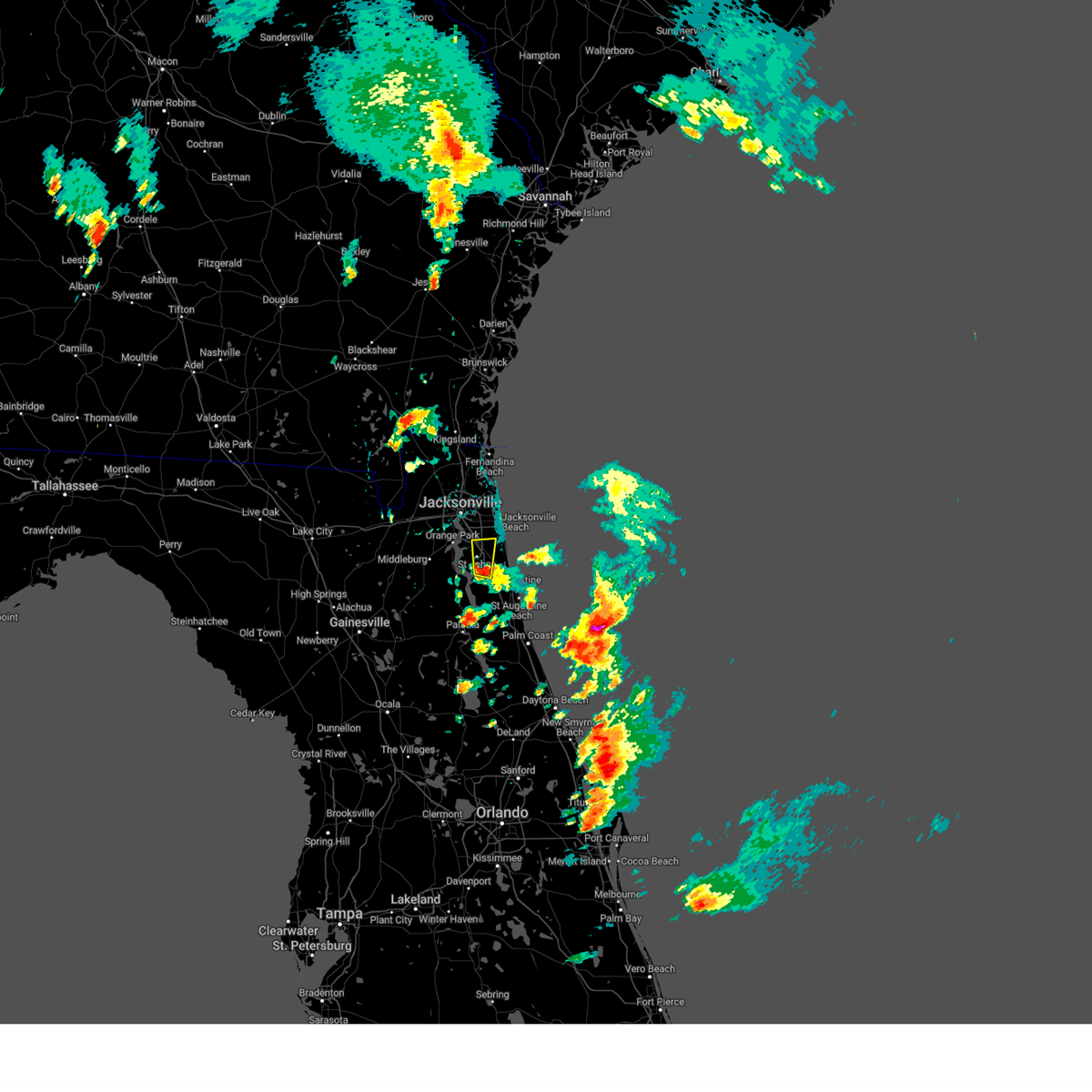 At 706 pm edt, a severe thunderstorm was located over world golf village, or 9 miles southeast of fruit cove, moving north at 25 mph (radar indicated). Hazards include 60 mph wind gusts and quarter size hail. Hail damage to vehicles is expected. Expect wind damage to roofs, siding, and trees. At 706 pm edt, a severe thunderstorm was located over world golf village, or 9 miles southeast of fruit cove, moving north at 25 mph (radar indicated). Hazards include 60 mph wind gusts and quarter size hail. Hail damage to vehicles is expected. Expect wind damage to roofs, siding, and trees.
|
| 4/13/2023 3:56 PM EDT |
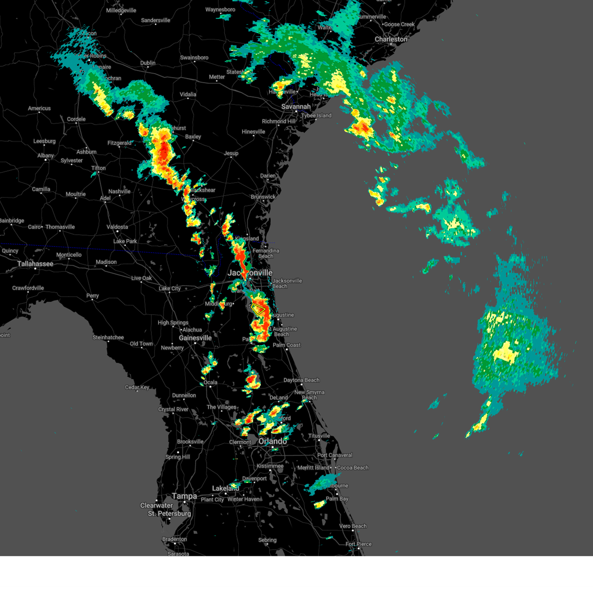 The severe thunderstorm warning for west central st. johns county will expire at 400 pm edt, the storm which prompted the warning has moved out of the area. therefore, the warning will be allowed to expire. however gusty winds are still possible with this thunderstorm. a severe thunderstorm watch remains in effect until 1000 pm edt for northeastern florida. to report severe weather, contact your nearest law enforcement agency. they will relay your report to the national weather service jacksonville. The severe thunderstorm warning for west central st. johns county will expire at 400 pm edt, the storm which prompted the warning has moved out of the area. therefore, the warning will be allowed to expire. however gusty winds are still possible with this thunderstorm. a severe thunderstorm watch remains in effect until 1000 pm edt for northeastern florida. to report severe weather, contact your nearest law enforcement agency. they will relay your report to the national weather service jacksonville.
|
| 4/13/2023 3:46 PM EDT |
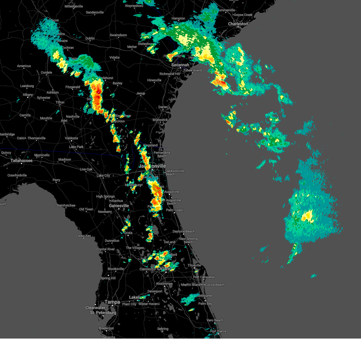 At 346 pm edt, a severe thunderstorm was located near switzerland, or near fruit cove, moving northeast at 20 mph (radar indicated). Hazards include 60 mph wind gusts and nickel size hail. Expect damage to roofs, siding, and trees. this severe thunderstorm will remain over mainly rural areas of west central st. johns county. hail threat, radar indicated max hail size, 0. 88 in wind threat, radar indicated max wind gust, 60 mph. At 346 pm edt, a severe thunderstorm was located near switzerland, or near fruit cove, moving northeast at 20 mph (radar indicated). Hazards include 60 mph wind gusts and nickel size hail. Expect damage to roofs, siding, and trees. this severe thunderstorm will remain over mainly rural areas of west central st. johns county. hail threat, radar indicated max hail size, 0. 88 in wind threat, radar indicated max wind gust, 60 mph.
|
| 4/13/2023 3:31 PM EDT |
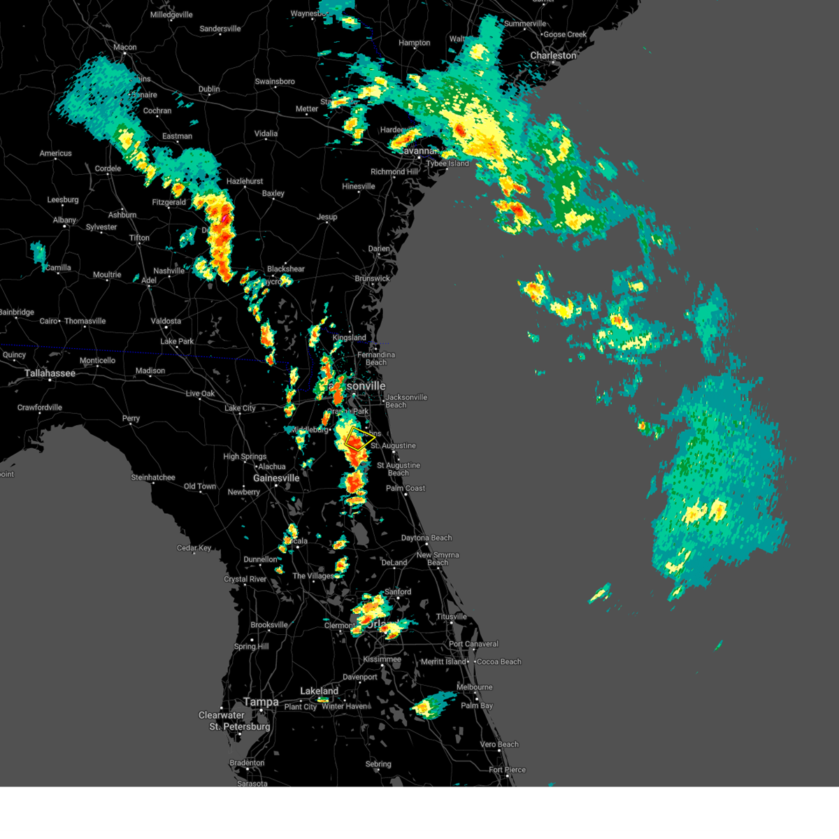 At 330 pm edt, a severe thunderstorm was located over green cove springs, moving northeast at 20 mph (radar indicated). Hazards include 60 mph wind gusts and quarter size hail. Hail damage to vehicles is expected. expect wind damage to roofs, siding, and trees. locations impacted include, green cove springs and switzerland. hail threat, radar indicated max hail size, 1. 00 in wind threat, radar indicated max wind gust, 60 mph. At 330 pm edt, a severe thunderstorm was located over green cove springs, moving northeast at 20 mph (radar indicated). Hazards include 60 mph wind gusts and quarter size hail. Hail damage to vehicles is expected. expect wind damage to roofs, siding, and trees. locations impacted include, green cove springs and switzerland. hail threat, radar indicated max hail size, 1. 00 in wind threat, radar indicated max wind gust, 60 mph.
|
| 4/13/2023 3:17 PM EDT |
 At 317 pm edt, a severe thunderstorm was located near green cove springs, moving northeast at 20 mph (radar indicated). Hazards include 60 mph wind gusts and quarter size hail. Hail damage to vehicles is expected. Expect wind damage to roofs, siding, and trees. At 317 pm edt, a severe thunderstorm was located near green cove springs, moving northeast at 20 mph (radar indicated). Hazards include 60 mph wind gusts and quarter size hail. Hail damage to vehicles is expected. Expect wind damage to roofs, siding, and trees.
|
| 1/4/2023 4:14 PM EST |
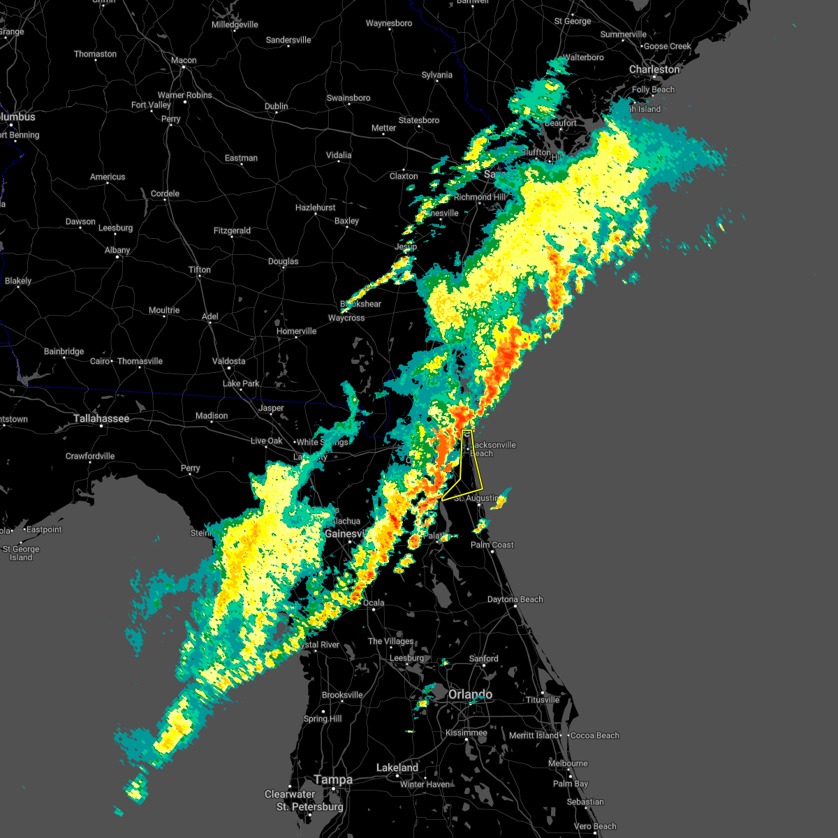 At 414 pm est, severe thunderstorms were located along a line extending from near mayport to bayard to near bardin, moving northeast at 55 mph (radar indicated). Hazards include 60 mph wind gusts and penny size hail. expect damage to roofs, siding, and trees At 414 pm est, severe thunderstorms were located along a line extending from near mayport to bayard to near bardin, moving northeast at 55 mph (radar indicated). Hazards include 60 mph wind gusts and penny size hail. expect damage to roofs, siding, and trees
|
| 11/10/2022 8:23 AM EST |
 At 823 am est, a severe thunderstorm capable of producing a tornado was located over saint augustine, moving west at 55 mph (radar indicated rotation). Hazards include tornado. Flying debris will be dangerous to those caught without shelter. mobile homes will be damaged or destroyed. damage to roofs, windows, and vehicles will occur. tree damage is likely. this tornadic thunderstorm will remain over mainly rural areas of central st. Johns county, including the following locations, anastasia. At 823 am est, a severe thunderstorm capable of producing a tornado was located over saint augustine, moving west at 55 mph (radar indicated rotation). Hazards include tornado. Flying debris will be dangerous to those caught without shelter. mobile homes will be damaged or destroyed. damage to roofs, windows, and vehicles will occur. tree damage is likely. this tornadic thunderstorm will remain over mainly rural areas of central st. Johns county, including the following locations, anastasia.
|
| 8/17/2022 6:54 PM EDT |
 At 653 pm edt, severe thunderstorms were located along a line extending from south ponte vedra to near vilano beach to near picolata, moving southeast at 15 mph (radar indicated). Hazards include 60 mph wind gusts and penny size hail. Expect damage to roofs, siding, and trees. locations impacted include, world golf village, vilano beach, south ponte vedra, picolata and bakersville. hail threat, radar indicated max hail size, 0. 75 in wind threat, radar indicated max wind gust, 60 mph. At 653 pm edt, severe thunderstorms were located along a line extending from south ponte vedra to near vilano beach to near picolata, moving southeast at 15 mph (radar indicated). Hazards include 60 mph wind gusts and penny size hail. Expect damage to roofs, siding, and trees. locations impacted include, world golf village, vilano beach, south ponte vedra, picolata and bakersville. hail threat, radar indicated max hail size, 0. 75 in wind threat, radar indicated max wind gust, 60 mph.
|
| 8/17/2022 6:47 PM EDT |
 At 646 pm edt, severe thunderstorms were located along a line extending from south ponte vedra to 8 miles south of world golf village to near bostwick, moving east at 15 mph (radar indicated). Hazards include 60 mph wind gusts and penny size hail. expect damage to roofs, siding, and trees At 646 pm edt, severe thunderstorms were located along a line extending from south ponte vedra to 8 miles south of world golf village to near bostwick, moving east at 15 mph (radar indicated). Hazards include 60 mph wind gusts and penny size hail. expect damage to roofs, siding, and trees
|
| 8/17/2022 6:23 PM EDT |
 At 622 pm edt, severe thunderstorms were located along a line extending from nocatee to world golf village to near green cove springs, moving southeast at 15 mph (radar indicated). Hazards include 60 mph wind gusts and penny size hail. expect damage to roofs, siding, and trees At 622 pm edt, severe thunderstorms were located along a line extending from nocatee to world golf village to near green cove springs, moving southeast at 15 mph (radar indicated). Hazards include 60 mph wind gusts and penny size hail. expect damage to roofs, siding, and trees
|
| 8/17/2022 6:08 PM EDT |
 At 608 pm edt, severe thunderstorms were located along a line extending from near bayard to near fruit cove, moving east at 15 mph (radar indicated). Hazards include 60 mph wind gusts and quarter size hail. Hail damage to vehicles is expected. expect wind damage to roofs, siding, and trees. locations impacted include, fruit cove, world golf village, south ponte vedra, nocatee, bayard, durbin, switzerland, guana river state park, sawgrass and palm valley. hail threat, radar indicated max hail size, 1. 00 in wind threat, radar indicated max wind gust, 60 mph. At 608 pm edt, severe thunderstorms were located along a line extending from near bayard to near fruit cove, moving east at 15 mph (radar indicated). Hazards include 60 mph wind gusts and quarter size hail. Hail damage to vehicles is expected. expect wind damage to roofs, siding, and trees. locations impacted include, fruit cove, world golf village, south ponte vedra, nocatee, bayard, durbin, switzerland, guana river state park, sawgrass and palm valley. hail threat, radar indicated max hail size, 1. 00 in wind threat, radar indicated max wind gust, 60 mph.
|
| 8/17/2022 6:00 PM EDT |
 At 600 pm edt, severe thunderstorms were located along a line extending from near baymeadows to switzerland, moving east at 10 mph (radar indicated). Hazards include 60 mph wind gusts and quarter size hail. Hail damage to vehicles is expected. Expect wind damage to roofs, siding, and trees. At 600 pm edt, severe thunderstorms were located along a line extending from near baymeadows to switzerland, moving east at 10 mph (radar indicated). Hazards include 60 mph wind gusts and quarter size hail. Hail damage to vehicles is expected. Expect wind damage to roofs, siding, and trees.
|
| 7/11/2022 4:40 PM EDT |
 At 439 pm edt, a severe thunderstorm was located over world golf village, or 9 miles northwest of saint augustine, moving north at 15 mph (radar indicated). Hazards include 60 mph wind gusts. Expect damage to roofs, siding, and trees. locations impacted include, world golf village. hail threat, radar indicated max hail size, <. 75 in wind threat, radar indicated max wind gust, 60 mph. At 439 pm edt, a severe thunderstorm was located over world golf village, or 9 miles northwest of saint augustine, moving north at 15 mph (radar indicated). Hazards include 60 mph wind gusts. Expect damage to roofs, siding, and trees. locations impacted include, world golf village. hail threat, radar indicated max hail size, <. 75 in wind threat, radar indicated max wind gust, 60 mph.
|
| 7/11/2022 4:30 PM EDT |
 At 430 pm edt, a severe thunderstorm was located near world golf village, or 7 miles northwest of saint augustine, moving north at 15 mph (radar indicated). Hazards include 60 mph wind gusts. expect damage to roofs, siding, and trees At 430 pm edt, a severe thunderstorm was located near world golf village, or 7 miles northwest of saint augustine, moving north at 15 mph (radar indicated). Hazards include 60 mph wind gusts. expect damage to roofs, siding, and trees
|
| 6/10/2022 4:40 PM EDT | St. johns fire dept reporting a tree down on cr 208 / cr 13... relayed by medi in st. johns county FL, 3.3 miles N of World Golf Village, FL |
| 5/15/2022 2:47 PM EDT |
 At 247 pm edt, a severe thunderstorm was located near fruit cove, moving south at 10 mph (radar indicated). Hazards include 60 mph wind gusts and quarter size hail. Hail damage to vehicles is expected. Expect wind damage to roofs, siding, and trees. At 247 pm edt, a severe thunderstorm was located near fruit cove, moving south at 10 mph (radar indicated). Hazards include 60 mph wind gusts and quarter size hail. Hail damage to vehicles is expected. Expect wind damage to roofs, siding, and trees.
|
| 5/6/2022 10:47 PM EDT |
 At 1046 pm edt, severe thunderstorms were located along a line extending from durbin to 6 miles east of picolata to near bostwick, moving east at 40 mph (radar indicated). Hazards include 60 mph wind gusts and penny size hail. Expect damage to roofs, siding, and trees. Locations impacted include, palatka, green cove springs, east palatka, fruit cove, world golf village, fleming island, george`s lake, nocatee, durbin and picolata. At 1046 pm edt, severe thunderstorms were located along a line extending from durbin to 6 miles east of picolata to near bostwick, moving east at 40 mph (radar indicated). Hazards include 60 mph wind gusts and penny size hail. Expect damage to roofs, siding, and trees. Locations impacted include, palatka, green cove springs, east palatka, fruit cove, world golf village, fleming island, george`s lake, nocatee, durbin and picolata.
|
| 5/6/2022 10:30 PM EDT |
 At 1029 pm edt, severe thunderstorms were located along a line extending from near durbin to near picolata to near bardin, moving east at 50 mph (radar indicated). Hazards include 60 mph wind gusts and penny size hail. expect damage to roofs, siding, and trees At 1029 pm edt, severe thunderstorms were located along a line extending from near durbin to near picolata to near bardin, moving east at 50 mph (radar indicated). Hazards include 60 mph wind gusts and penny size hail. expect damage to roofs, siding, and trees
|
| 5/6/2022 10:23 PM EDT |
 At 1022 pm edt, severe thunderstorms were located along a line extending from fleming island to 7 miles southwest of green cove springs to near george`s lake, moving east at 25 mph (radar indicated). Hazards include 60 mph wind gusts and penny size hail. Expect damage to roofs, siding, and trees. Locations impacted include, palatka, green cove springs, east palatka, fruit cove, world golf village, fleming island, george`s lake, nocatee, durbin and picolata. At 1022 pm edt, severe thunderstorms were located along a line extending from fleming island to 7 miles southwest of green cove springs to near george`s lake, moving east at 25 mph (radar indicated). Hazards include 60 mph wind gusts and penny size hail. Expect damage to roofs, siding, and trees. Locations impacted include, palatka, green cove springs, east palatka, fruit cove, world golf village, fleming island, george`s lake, nocatee, durbin and picolata.
|
| 5/6/2022 10:08 PM EDT |
 At 1008 pm edt, severe thunderstorms were located along a line extending from near doctors inlet to 7 miles north of george`s lake to near keystone heights, moving east at 25 mph (radar indicated). Hazards include 60 mph wind gusts and penny size hail. expect damage to roofs, siding, and trees At 1008 pm edt, severe thunderstorms were located along a line extending from near doctors inlet to 7 miles north of george`s lake to near keystone heights, moving east at 25 mph (radar indicated). Hazards include 60 mph wind gusts and penny size hail. expect damage to roofs, siding, and trees
|
| 4/17/2022 4:00 PM EDT |
 At 400 pm edt, a severe thunderstorm was located near picolata, or 8 miles north of hastings, moving southeast at 5 mph (radar indicated). Hazards include two inch hail and 60 mph wind gusts. People and animals outdoors will be injured. expect hail damage to roofs, siding, windows, and vehicles. expect wind damage to roofs, siding, and trees. locations impacted include, hastings, bostwick, federal point, picolata, spuds, bakersville and elkton. thunderstorm damage threat, considerable hail threat, radar indicated max hail size, 2. 00 in wind threat, radar indicated max wind gust, 60 mph. At 400 pm edt, a severe thunderstorm was located near picolata, or 8 miles north of hastings, moving southeast at 5 mph (radar indicated). Hazards include two inch hail and 60 mph wind gusts. People and animals outdoors will be injured. expect hail damage to roofs, siding, windows, and vehicles. expect wind damage to roofs, siding, and trees. locations impacted include, hastings, bostwick, federal point, picolata, spuds, bakersville and elkton. thunderstorm damage threat, considerable hail threat, radar indicated max hail size, 2. 00 in wind threat, radar indicated max wind gust, 60 mph.
|
| 4/17/2022 3:46 PM EDT |
 At 345 pm edt, a severe thunderstorm was located near picolata, or 10 miles north of hastings, moving southeast at 5 mph (radar indicated). Hazards include two inch hail and 60 mph wind gusts. People and animals outdoors will be injured. expect hail damage to roofs, siding, windows, and vehicles. Expect wind damage to roofs, siding, and trees. At 345 pm edt, a severe thunderstorm was located near picolata, or 10 miles north of hastings, moving southeast at 5 mph (radar indicated). Hazards include two inch hail and 60 mph wind gusts. People and animals outdoors will be injured. expect hail damage to roofs, siding, windows, and vehicles. Expect wind damage to roofs, siding, and trees.
|
| 4/17/2022 3:38 PM EDT |
 At 338 pm edt, a severe thunderstorm was located near picolata, or 10 miles north of hastings, moving south at 20 mph (radar indicated). Hazards include ping pong ball size hail and 60 mph wind gusts. People and animals outdoors will be injured. expect hail damage to roofs, siding, windows, and vehicles. expect wind damage to roofs, siding, and trees. Locations impacted include, saint augustine, green cove springs, world golf village, saint augustine beach, south ponte vedra, saint augustine shores, vilano beach, saint augustine south, picolata and butler beach. At 338 pm edt, a severe thunderstorm was located near picolata, or 10 miles north of hastings, moving south at 20 mph (radar indicated). Hazards include ping pong ball size hail and 60 mph wind gusts. People and animals outdoors will be injured. expect hail damage to roofs, siding, windows, and vehicles. expect wind damage to roofs, siding, and trees. Locations impacted include, saint augustine, green cove springs, world golf village, saint augustine beach, south ponte vedra, saint augustine shores, vilano beach, saint augustine south, picolata and butler beach.
|
| 4/17/2022 3:32 PM EDT |
 At 332 pm edt, a severe thunderstorm was located over picolata, or 7 miles southeast of green cove springs, moving south at 15 mph (radar indicated). Hazards include tennis ball size hail and 70 mph wind gusts. People and animals outdoors will be injured. expect hail damage to roofs, siding, windows, and vehicles. expect considerable tree damage. wind damage is also likely to mobile homes, roofs, and outbuildings. Locations impacted include, saint augustine, green cove springs, world golf village, saint augustine beach, south ponte vedra, saint augustine shores, vilano beach, saint augustine south, picolata and butler beach. At 332 pm edt, a severe thunderstorm was located over picolata, or 7 miles southeast of green cove springs, moving south at 15 mph (radar indicated). Hazards include tennis ball size hail and 70 mph wind gusts. People and animals outdoors will be injured. expect hail damage to roofs, siding, windows, and vehicles. expect considerable tree damage. wind damage is also likely to mobile homes, roofs, and outbuildings. Locations impacted include, saint augustine, green cove springs, world golf village, saint augustine beach, south ponte vedra, saint augustine shores, vilano beach, saint augustine south, picolata and butler beach.
|
| 4/17/2022 3:27 PM EDT |
 At 326 pm edt, a severe thunderstorm was located over picolata, or near green cove springs, moving south at 15 mph (radar indicated). Hazards include tennis ball size hail and 70 mph wind gusts. People and animals outdoors will be injured. expect hail damage to roofs, siding, windows, and vehicles. expect considerable tree damage. wind damage is also likely to mobile homes, roofs, and outbuildings. Locations impacted include, saint augustine, green cove springs, world golf village, saint augustine beach, vilano beach, picolata, south ponte vedra, saint augustine shores, saint augustine south and guana river state park. At 326 pm edt, a severe thunderstorm was located over picolata, or near green cove springs, moving south at 15 mph (radar indicated). Hazards include tennis ball size hail and 70 mph wind gusts. People and animals outdoors will be injured. expect hail damage to roofs, siding, windows, and vehicles. expect considerable tree damage. wind damage is also likely to mobile homes, roofs, and outbuildings. Locations impacted include, saint augustine, green cove springs, world golf village, saint augustine beach, vilano beach, picolata, south ponte vedra, saint augustine shores, saint augustine south and guana river state park.
|
| 4/17/2022 3:16 PM EDT |
 At 315 pm edt, a severe thunderstorm was located near green cove springs, moving south at 10 mph (radar indicated). Hazards include tennis ball size hail and 70 mph wind gusts. People and animals outdoors will be injured. expect hail damage to roofs, siding, windows, and vehicles. expect considerable tree damage. Wind damage is also likely to mobile homes, roofs, and outbuildings. At 315 pm edt, a severe thunderstorm was located near green cove springs, moving south at 10 mph (radar indicated). Hazards include tennis ball size hail and 70 mph wind gusts. People and animals outdoors will be injured. expect hail damage to roofs, siding, windows, and vehicles. expect considerable tree damage. Wind damage is also likely to mobile homes, roofs, and outbuildings.
|
| 4/17/2022 3:09 PM EDT |
 At 308 pm edt, severe thunderstorms were located along a line extending from guana river state park to near switzerland, moving south at 10 mph (radar indicated). Hazards include golf ball size hail and 70 mph wind gusts. People and animals outdoors will be injured. expect hail damage to roofs, siding, windows, and vehicles. expect considerable tree damage. wind damage is also likely to mobile homes, roofs, and outbuildings. locations impacted include, saint augustine, green cove springs, world golf village, saint augustine beach, south ponte vedra, vilano beach, picolata, guana river state park, saint augustine south and anastasia. thunderstorm damage threat, considerable hail threat, observed max hail size, 1. 75 in wind threat, radar indicated max wind gust, 70 mph. At 308 pm edt, severe thunderstorms were located along a line extending from guana river state park to near switzerland, moving south at 10 mph (radar indicated). Hazards include golf ball size hail and 70 mph wind gusts. People and animals outdoors will be injured. expect hail damage to roofs, siding, windows, and vehicles. expect considerable tree damage. wind damage is also likely to mobile homes, roofs, and outbuildings. locations impacted include, saint augustine, green cove springs, world golf village, saint augustine beach, south ponte vedra, vilano beach, picolata, guana river state park, saint augustine south and anastasia. thunderstorm damage threat, considerable hail threat, observed max hail size, 1. 75 in wind threat, radar indicated max wind gust, 70 mph.
|
| 4/17/2022 3:05 PM EDT |
 At 305 pm edt, severe thunderstorms were located along a line extending from guana river state park to near green cove springs, moving south at 10 mph (radar indicated). Hazards include golf ball size hail and 70 mph wind gusts. People and animals outdoors will be injured. expect hail damage to roofs, siding, windows, and vehicles. expect considerable tree damage. wind damage is also likely to mobile homes, roofs, and outbuildings. locations impacted include, saint augustine, green cove springs, fruit cove, world golf village, saint augustine beach, vilano beach, picolata, switzerland, south ponte vedra and guana river state park. thunderstorm damage threat, considerable hail threat, observed max hail size, 1. 75 in wind threat, radar indicated max wind gust, 70 mph. At 305 pm edt, severe thunderstorms were located along a line extending from guana river state park to near green cove springs, moving south at 10 mph (radar indicated). Hazards include golf ball size hail and 70 mph wind gusts. People and animals outdoors will be injured. expect hail damage to roofs, siding, windows, and vehicles. expect considerable tree damage. wind damage is also likely to mobile homes, roofs, and outbuildings. locations impacted include, saint augustine, green cove springs, fruit cove, world golf village, saint augustine beach, vilano beach, picolata, switzerland, south ponte vedra and guana river state park. thunderstorm damage threat, considerable hail threat, observed max hail size, 1. 75 in wind threat, radar indicated max wind gust, 70 mph.
|
| 4/17/2022 2:57 PM EDT |
 At 256 pm edt, severe thunderstorms were located along a line extending from guana river state park to near switzerland, moving south at 10 mph (radar indicated). Hazards include golf ball size hail and 70 mph wind gusts. People and animals outdoors will be injured. expect hail damage to roofs, siding, windows, and vehicles. expect considerable tree damage. wind damage is also likely to mobile homes, roofs, and outbuildings. locations impacted include, saint augustine, green cove springs, fruit cove, world golf village, saint augustine beach, fleming island, nocatee, durbin, vilano beach and picolata. thunderstorm damage threat, considerable hail threat, observed max hail size, 1. 75 in wind threat, radar indicated max wind gust, 70 mph. At 256 pm edt, severe thunderstorms were located along a line extending from guana river state park to near switzerland, moving south at 10 mph (radar indicated). Hazards include golf ball size hail and 70 mph wind gusts. People and animals outdoors will be injured. expect hail damage to roofs, siding, windows, and vehicles. expect considerable tree damage. wind damage is also likely to mobile homes, roofs, and outbuildings. locations impacted include, saint augustine, green cove springs, fruit cove, world golf village, saint augustine beach, fleming island, nocatee, durbin, vilano beach and picolata. thunderstorm damage threat, considerable hail threat, observed max hail size, 1. 75 in wind threat, radar indicated max wind gust, 70 mph.
|
| 4/17/2022 2:53 PM EDT |
 At 252 pm edt, severe thunderstorms were located along a line extending from guana river state park to near green cove springs, moving south at 10 mph (radar indicated). Hazards include golf ball size hail and 70 mph wind gusts. People and animals outdoors will be injured. expect hail damage to roofs, siding, windows, and vehicles. expect considerable tree damage. wind damage is also likely to mobile homes, roofs, and outbuildings. locations impacted include, saint augustine, green cove springs, fruit cove, world golf village, saint augustine beach, fleming island, nocatee, durbin, vilano beach and picolata. thunderstorm damage threat, considerable hail threat, observed max hail size, 1. 75 in wind threat, radar indicated max wind gust, 70 mph. At 252 pm edt, severe thunderstorms were located along a line extending from guana river state park to near green cove springs, moving south at 10 mph (radar indicated). Hazards include golf ball size hail and 70 mph wind gusts. People and animals outdoors will be injured. expect hail damage to roofs, siding, windows, and vehicles. expect considerable tree damage. wind damage is also likely to mobile homes, roofs, and outbuildings. locations impacted include, saint augustine, green cove springs, fruit cove, world golf village, saint augustine beach, fleming island, nocatee, durbin, vilano beach and picolata. thunderstorm damage threat, considerable hail threat, observed max hail size, 1. 75 in wind threat, radar indicated max wind gust, 70 mph.
|
| 4/17/2022 2:43 PM EDT |
 At 242 pm edt, severe thunderstorms were located along a line extending from near guana river state park to switzerland, moving south at 10 mph (radar indicated). Hazards include golf ball size hail and 70 mph wind gusts. People and animals outdoors will be injured. expect hail damage to roofs, siding, windows, and vehicles. expect considerable tree damage. Wind damage is also likely to mobile homes, roofs, and outbuildings. At 242 pm edt, severe thunderstorms were located along a line extending from near guana river state park to switzerland, moving south at 10 mph (radar indicated). Hazards include golf ball size hail and 70 mph wind gusts. People and animals outdoors will be injured. expect hail damage to roofs, siding, windows, and vehicles. expect considerable tree damage. Wind damage is also likely to mobile homes, roofs, and outbuildings.
|
| 4/7/2022 7:12 AM EDT |
 At 712 am edt, a large and extremely dangerous tornado was located near world golf village, or 8 miles west of saint augustine, moving east at 30 mph. this is a particularly dangerous situation. take cover now! (radar indicated rotation). Hazards include damaging tornado. You are in a life-threatening situation. flying debris may be deadly to those caught without shelter. mobile homes will be destroyed. considerable damage to homes, businesses, and vehicles is likely and complete destruction is possible. the tornado will be near, saint augustine south around 725 am edt. saint augustine, saint augustine beach, vilano beach and south ponte vedra around 730 am edt. Other locations impacted by this tornadic thunderstorm include anastasia and bakersville. At 712 am edt, a large and extremely dangerous tornado was located near world golf village, or 8 miles west of saint augustine, moving east at 30 mph. this is a particularly dangerous situation. take cover now! (radar indicated rotation). Hazards include damaging tornado. You are in a life-threatening situation. flying debris may be deadly to those caught without shelter. mobile homes will be destroyed. considerable damage to homes, businesses, and vehicles is likely and complete destruction is possible. the tornado will be near, saint augustine south around 725 am edt. saint augustine, saint augustine beach, vilano beach and south ponte vedra around 730 am edt. Other locations impacted by this tornadic thunderstorm include anastasia and bakersville.
|
| 4/7/2022 7:08 AM EDT |
 At 708 am edt, a severe thunderstorm capable of producing a tornado was located near picolata, or 11 miles west of saint augustine, moving east at 25 mph (radar indicated rotation). Hazards include tornado and quarter size hail. Flying debris will be dangerous to those caught without shelter. mobile homes will be damaged or destroyed. damage to roofs, windows, and vehicles will occur. tree damage is likely. this dangerous storm will be near, saint augustine, saint augustine beach, vilano beach, saint augustine south and south ponte vedra around 730 am edt. Other locations impacted by this tornadic thunderstorm include anastasia and bakersville. At 708 am edt, a severe thunderstorm capable of producing a tornado was located near picolata, or 11 miles west of saint augustine, moving east at 25 mph (radar indicated rotation). Hazards include tornado and quarter size hail. Flying debris will be dangerous to those caught without shelter. mobile homes will be damaged or destroyed. damage to roofs, windows, and vehicles will occur. tree damage is likely. this dangerous storm will be near, saint augustine, saint augustine beach, vilano beach, saint augustine south and south ponte vedra around 730 am edt. Other locations impacted by this tornadic thunderstorm include anastasia and bakersville.
|
| 4/7/2022 7:04 AM EDT |
 At 704 am edt, a severe thunderstorm was located near picolata, or 11 miles southeast of green cove springs, moving east at 25 mph (radar indicated). Hazards include 60 mph wind gusts. expect damage to roofs, siding, and trees At 704 am edt, a severe thunderstorm was located near picolata, or 11 miles southeast of green cove springs, moving east at 25 mph (radar indicated). Hazards include 60 mph wind gusts. expect damage to roofs, siding, and trees
|
| 10/28/2021 1:20 PM EDT |
 The severe thunderstorm warning for northern flagler, st. johns and northeastern putnam counties will expire at 130 pm edt, the storms which prompted the warning have weakened below severe limits, and no longer pose an immediate threat to life or property. therefore, the warning will be allowed to expire. however gusty winds and heavy rain are still possible with these thunderstorms. a tornado watch remains in effect until 500 pm edt for northeastern florida. The severe thunderstorm warning for northern flagler, st. johns and northeastern putnam counties will expire at 130 pm edt, the storms which prompted the warning have weakened below severe limits, and no longer pose an immediate threat to life or property. therefore, the warning will be allowed to expire. however gusty winds and heavy rain are still possible with these thunderstorms. a tornado watch remains in effect until 500 pm edt for northeastern florida.
|
| 10/28/2021 12:58 PM EDT |
 At 1258 pm edt, severe thunderstorms were located along a line extending from near world golf village to palatka, moving northeast at 45 mph (radar indicated). Hazards include 60 mph wind gusts. Expect damage to roofs, siding, and trees. Locations impacted include, saint augustine, palatka, hastings, east palatka, world golf village, saint augustine beach, marineland, vilano beach, federal point and south ponte vedra. At 1258 pm edt, severe thunderstorms were located along a line extending from near world golf village to palatka, moving northeast at 45 mph (radar indicated). Hazards include 60 mph wind gusts. Expect damage to roofs, siding, and trees. Locations impacted include, saint augustine, palatka, hastings, east palatka, world golf village, saint augustine beach, marineland, vilano beach, federal point and south ponte vedra.
|
| 10/28/2021 12:33 PM EDT |
 At 1233 pm edt, severe thunderstorms were located along a line extending from 6 miles northeast of george`s lake to near orange springs, moving east at 35 mph (radar indicated). Hazards include 60 mph wind gusts. expect damage to roofs, siding, and trees At 1233 pm edt, severe thunderstorms were located along a line extending from 6 miles northeast of george`s lake to near orange springs, moving east at 35 mph (radar indicated). Hazards include 60 mph wind gusts. expect damage to roofs, siding, and trees
|
| 9/7/2021 3:43 PM EDT |
 At 343 pm edt, a severe thunderstorm was located near saint augustine, moving northeast at 10 mph (radar indicated). Hazards include 60 mph wind gusts and penny size hail. Expect damage to roofs, siding, and trees. locations impacted include, saint augustine, saint augustine beach, south ponte vedra, vilano beach, saint augustine south, guana river state park and anastasia. hail threat, radar indicated max hail size, 0. 75 in wind threat, radar indicated max wind gust, 60 mph. At 343 pm edt, a severe thunderstorm was located near saint augustine, moving northeast at 10 mph (radar indicated). Hazards include 60 mph wind gusts and penny size hail. Expect damage to roofs, siding, and trees. locations impacted include, saint augustine, saint augustine beach, south ponte vedra, vilano beach, saint augustine south, guana river state park and anastasia. hail threat, radar indicated max hail size, 0. 75 in wind threat, radar indicated max wind gust, 60 mph.
|
| 9/7/2021 3:29 PM EDT |
 At 329 pm edt, a severe thunderstorm was located 7 miles west of saint augustine, moving northeast at 10 mph (radar indicated). Hazards include 60 mph wind gusts and penny size hail. expect damage to roofs, siding, and trees At 329 pm edt, a severe thunderstorm was located 7 miles west of saint augustine, moving northeast at 10 mph (radar indicated). Hazards include 60 mph wind gusts and penny size hail. expect damage to roofs, siding, and trees
|
| 8/20/2021 10:56 PM EDT |
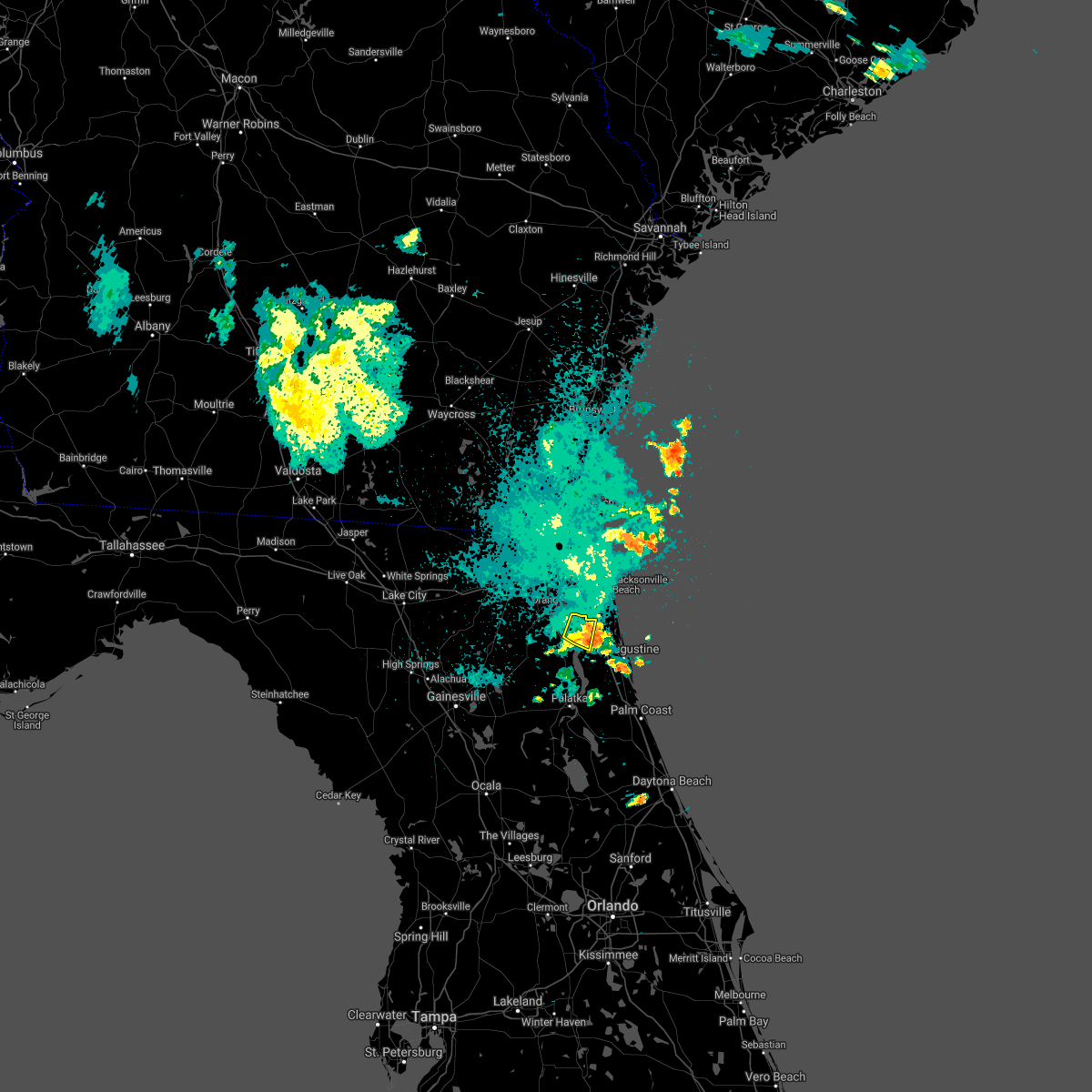 The severe thunderstorm warning for northwestern st. johns county will expire at 1100 pm edt, the storm which prompted the warning has weakened below severe limits, and no longer poses an immediate threat to life or property. therefore, the warning will be allowed to expire. however gusty winds are still possible with this thunderstorm. The severe thunderstorm warning for northwestern st. johns county will expire at 1100 pm edt, the storm which prompted the warning has weakened below severe limits, and no longer poses an immediate threat to life or property. therefore, the warning will be allowed to expire. however gusty winds are still possible with this thunderstorm.
|
| 8/20/2021 10:42 PM EDT |
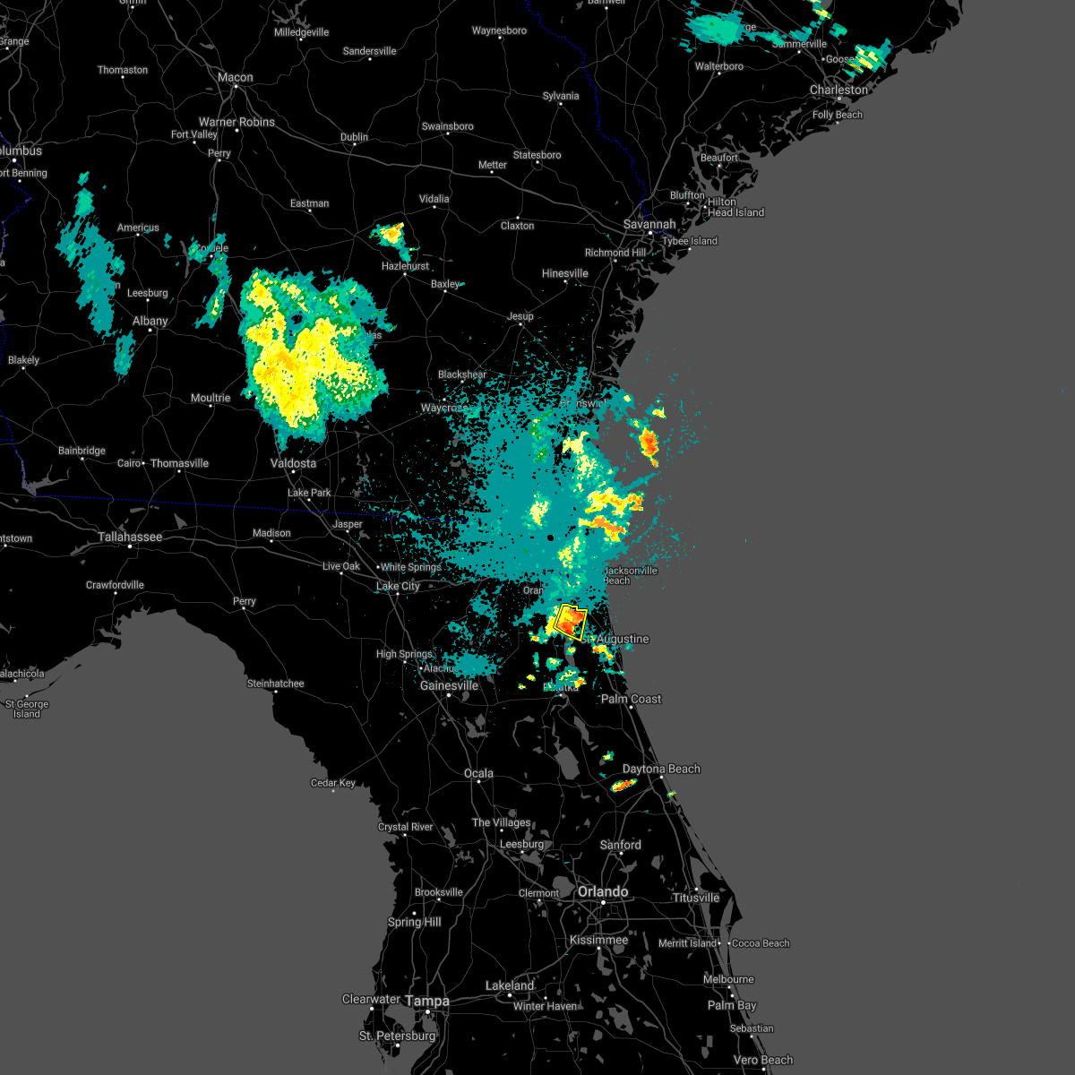 At 1041 pm edt, a severe thunderstorm was located near fruit cove, moving east at 15 mph (radar indicated). Hazards include 60 mph wind gusts and penny size hail. Expect damage to roofs, siding, and trees. locations impacted include, fruit cove and switzerland. hail threat, radar indicated max hail size, 0. 75 in wind threat, radar indicated max wind gust, 60 mph. At 1041 pm edt, a severe thunderstorm was located near fruit cove, moving east at 15 mph (radar indicated). Hazards include 60 mph wind gusts and penny size hail. Expect damage to roofs, siding, and trees. locations impacted include, fruit cove and switzerland. hail threat, radar indicated max hail size, 0. 75 in wind threat, radar indicated max wind gust, 60 mph.
|
| 8/20/2021 10:25 PM EDT |
 At 1025 pm edt, a severe thunderstorm was located over switzerland, or over fruit cove, moving east at 15 mph (radar indicated). Hazards include 60 mph wind gusts and penny size hail. expect damage to roofs, siding, and trees At 1025 pm edt, a severe thunderstorm was located over switzerland, or over fruit cove, moving east at 15 mph (radar indicated). Hazards include 60 mph wind gusts and penny size hail. expect damage to roofs, siding, and trees
|
| 7/22/2021 9:13 PM EDT |
 The severe thunderstorm warning for central st. johns and southeastern duval counties will expire at 915 pm edt, the storm which prompted the warning has weakened below severe limits, and no longer poses an immediate threat to life or property. therefore, the warning will be allowed to expire. however gusty winds are still possible with this thunderstorm. The severe thunderstorm warning for central st. johns and southeastern duval counties will expire at 915 pm edt, the storm which prompted the warning has weakened below severe limits, and no longer poses an immediate threat to life or property. therefore, the warning will be allowed to expire. however gusty winds are still possible with this thunderstorm.
|
| 7/22/2021 8:58 PM EDT |
 At 858 pm edt, a severe thunderstorm was located near guana river state park, or 12 miles south of ponte vedra beach, moving east at 25 mph (radar indicated). Hazards include 60 mph wind gusts. Expect damage to roofs, siding, and trees. Locations impacted include, saint augustine, world golf village, saint augustine beach, sawgrass, nocatee, durbin, vilano beach, palm valley, south ponte vedra and saint augustine shores. At 858 pm edt, a severe thunderstorm was located near guana river state park, or 12 miles south of ponte vedra beach, moving east at 25 mph (radar indicated). Hazards include 60 mph wind gusts. Expect damage to roofs, siding, and trees. Locations impacted include, saint augustine, world golf village, saint augustine beach, sawgrass, nocatee, durbin, vilano beach, palm valley, south ponte vedra and saint augustine shores.
|
| 7/22/2021 8:45 PM EDT |
 At 845 pm edt, a severe thunderstorm was located over durbin, or 8 miles east of fruit cove, moving east at 25 mph (radar indicated). Hazards include 60 mph wind gusts. expect damage to roofs, siding, and trees At 845 pm edt, a severe thunderstorm was located over durbin, or 8 miles east of fruit cove, moving east at 25 mph (radar indicated). Hazards include 60 mph wind gusts. expect damage to roofs, siding, and trees
|
| 6/16/2021 5:42 PM EDT |
 At 542 pm edt, a severe thunderstorm was located 7 miles south of world golf village, or 8 miles west of saint augustine, moving southeast at 10 mph (radar indicated). Hazards include 60 mph wind gusts and penny size hail. expect damage to roofs, siding, and trees At 542 pm edt, a severe thunderstorm was located 7 miles south of world golf village, or 8 miles west of saint augustine, moving southeast at 10 mph (radar indicated). Hazards include 60 mph wind gusts and penny size hail. expect damage to roofs, siding, and trees
|
| 6/16/2021 5:19 PM EDT |
 At 519 pm edt, a severe thunderstorm was located over world golf village, or 9 miles northwest of saint augustine, moving east at 10 mph (radar indicated). Hazards include 60 mph wind gusts and penny size hail. Expect damage to roofs, siding, and trees. Locations impacted include, world golf village, vilano beach, south ponte vedra and guana river state park. At 519 pm edt, a severe thunderstorm was located over world golf village, or 9 miles northwest of saint augustine, moving east at 10 mph (radar indicated). Hazards include 60 mph wind gusts and penny size hail. Expect damage to roofs, siding, and trees. Locations impacted include, world golf village, vilano beach, south ponte vedra and guana river state park.
|
| 6/16/2021 5:03 PM EDT |
 At 503 pm edt, a severe thunderstorm was located over world golf village, or 11 miles northwest of saint augustine, moving east at 10 mph (radar indicated). Hazards include 60 mph wind gusts and quarter size hail. Hail damage to vehicles is expected. Expect wind damage to roofs, siding, and trees. At 503 pm edt, a severe thunderstorm was located over world golf village, or 11 miles northwest of saint augustine, moving east at 10 mph (radar indicated). Hazards include 60 mph wind gusts and quarter size hail. Hail damage to vehicles is expected. Expect wind damage to roofs, siding, and trees.
|
| 6/15/2021 5:07 PM EDT |
 At 506 pm edt, a severe thunderstorm was located near green cove springs, moving northeast at 15 mph (radar indicated). Hazards include 60 mph wind gusts and quarter size hail. Hail damage to vehicles is expected. Expect wind damage to roofs, siding, and trees. At 506 pm edt, a severe thunderstorm was located near green cove springs, moving northeast at 15 mph (radar indicated). Hazards include 60 mph wind gusts and quarter size hail. Hail damage to vehicles is expected. Expect wind damage to roofs, siding, and trees.
|
| 5/11/2021 5:30 PM EDT |
 At 530 pm edt, a severe thunderstorm was located over fruit cove, moving east at 20 mph (radar indicated). Hazards include 60 mph wind gusts. expect damage to roofs, siding, and trees At 530 pm edt, a severe thunderstorm was located over fruit cove, moving east at 20 mph (radar indicated). Hazards include 60 mph wind gusts. expect damage to roofs, siding, and trees
|
| 2/15/2021 4:57 PM EST |
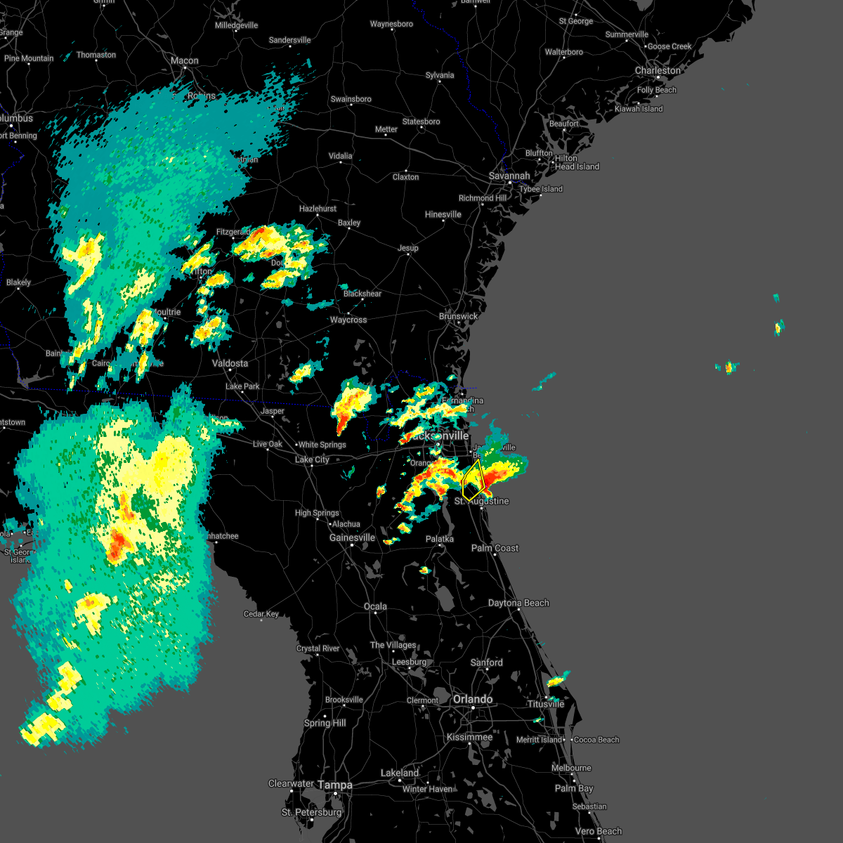 The severe thunderstorm warning for north central st. johns county will expire at 500 pm est, the storm which prompted the warning has moved out of the area. therefore, the warning will be allowed to expire. however small hail, gusty winds and heavy rain are still possible with this thunderstorm. a tornado watch remains in effect until 1000 pm est for northeastern florida. The severe thunderstorm warning for north central st. johns county will expire at 500 pm est, the storm which prompted the warning has moved out of the area. therefore, the warning will be allowed to expire. however small hail, gusty winds and heavy rain are still possible with this thunderstorm. a tornado watch remains in effect until 1000 pm est for northeastern florida.
|
| 2/15/2021 4:56 PM EST |
 The tornado warning for northeastern st. johns county will expire at 500 pm est, the storm which prompted the warning has moved out of the area. therefore, the warning will be allowed to expire. however small hail, gusty winds and heavy rain are still possible with this thunderstorm. a tornado watch remains in effect until 1000 pm est for northeastern florida. The tornado warning for northeastern st. johns county will expire at 500 pm est, the storm which prompted the warning has moved out of the area. therefore, the warning will be allowed to expire. however small hail, gusty winds and heavy rain are still possible with this thunderstorm. a tornado watch remains in effect until 1000 pm est for northeastern florida.
|
| 2/15/2021 4:46 PM EST |
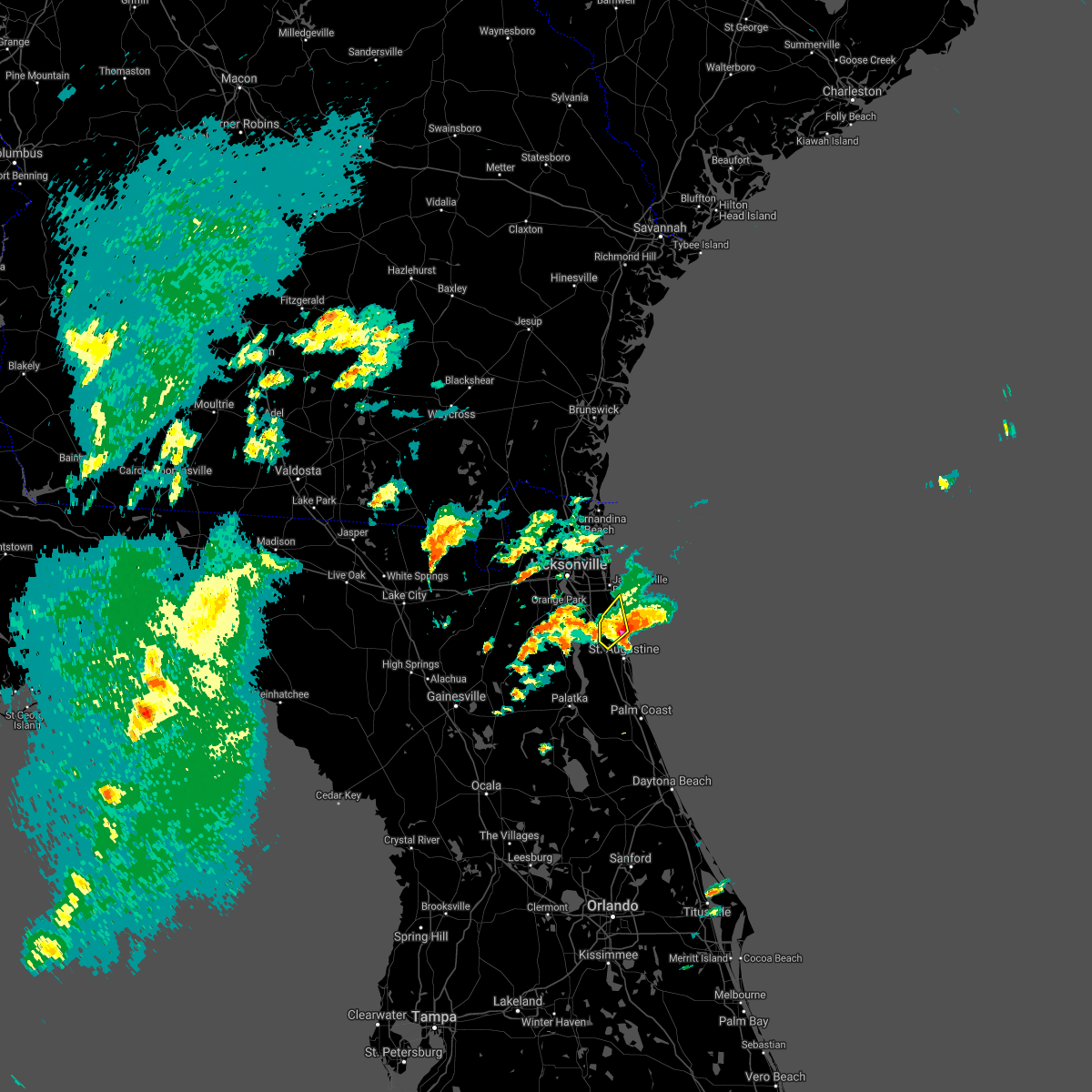 At 445 pm est, a severe thunderstorm was located over guana river state park, or 12 miles south of ponte vedra beach, moving northeast at 15 mph (radar indicated). Hazards include golf ball size hail and 60 mph wind gusts. People and animals outdoors will be injured. expect hail damage to roofs, siding, windows, and vehicles. expect wind damage to roofs, siding, and trees. Locations impacted include, sawgrass, nocatee, south ponte vedra and guana river state park. At 445 pm est, a severe thunderstorm was located over guana river state park, or 12 miles south of ponte vedra beach, moving northeast at 15 mph (radar indicated). Hazards include golf ball size hail and 60 mph wind gusts. People and animals outdoors will be injured. expect hail damage to roofs, siding, windows, and vehicles. expect wind damage to roofs, siding, and trees. Locations impacted include, sawgrass, nocatee, south ponte vedra and guana river state park.
|
| 2/15/2021 4:43 PM EST |
 At 443 pm est, a severe thunderstorm capable of producing a tornado was located over south ponte vedra, or near saint augustine, moving northeast at 25 mph (radar indicated rotation). Hazards include tornado and golf ball size hail. Flying debris will be dangerous to those caught without shelter. mobile homes will be damaged or destroyed. damage to roofs, windows, and vehicles will occur. tree damage is likely. this dangerous storm will be near, guana river state park around 450 pm est. Other locations impacted by this tornadic thunderstorm include anastasia. At 443 pm est, a severe thunderstorm capable of producing a tornado was located over south ponte vedra, or near saint augustine, moving northeast at 25 mph (radar indicated rotation). Hazards include tornado and golf ball size hail. Flying debris will be dangerous to those caught without shelter. mobile homes will be damaged or destroyed. damage to roofs, windows, and vehicles will occur. tree damage is likely. this dangerous storm will be near, guana river state park around 450 pm est. Other locations impacted by this tornadic thunderstorm include anastasia.
|
| 2/15/2021 4:37 PM EST |
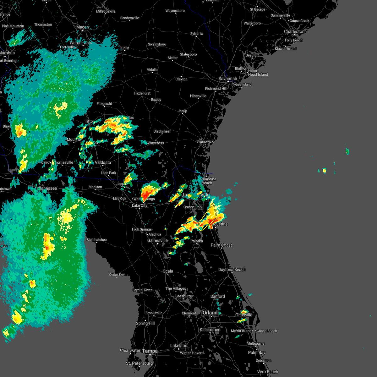 At 437 pm est, a severe thunderstorm was located over world golf village, or 11 miles southeast of fruit cove, moving northeast at 15 mph (radar indicated). Hazards include golf ball size hail and 60 mph wind gusts. People and animals outdoors will be injured. expect hail damage to roofs, siding, windows, and vehicles. expect wind damage to roofs, siding, and trees. Locations impacted include, world golf village, palm valley, sawgrass, nocatee, south ponte vedra, durbin, picolata, guana river state park and bakersville. At 437 pm est, a severe thunderstorm was located over world golf village, or 11 miles southeast of fruit cove, moving northeast at 15 mph (radar indicated). Hazards include golf ball size hail and 60 mph wind gusts. People and animals outdoors will be injured. expect hail damage to roofs, siding, windows, and vehicles. expect wind damage to roofs, siding, and trees. Locations impacted include, world golf village, palm valley, sawgrass, nocatee, south ponte vedra, durbin, picolata, guana river state park and bakersville.
|
| 2/15/2021 4:30 PM EST | Quarter sized hail reported 4.3 miles WNW of World Golf Village, FL, quarter and dime sized hail reported near wynwood ranch. |
| 2/15/2021 4:21 PM EST |
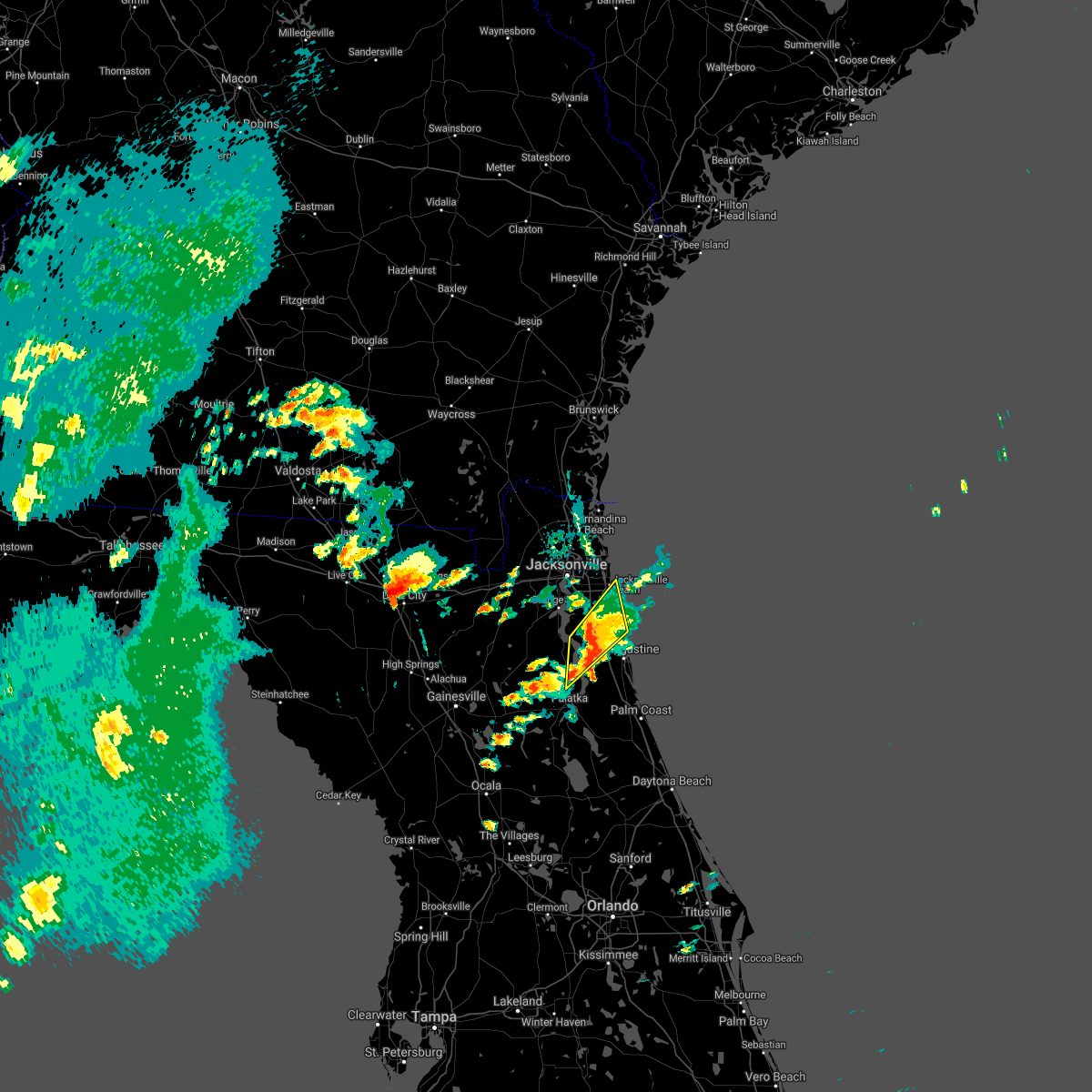 At 421 pm est, a severe thunderstorm was located over world golf village, or 9 miles southeast of fruit cove, moving northeast at 15 mph (radar indicated). Hazards include 60 mph wind gusts and quarter size hail. Hail damage to vehicles is expected. Expect wind damage to roofs, siding, and trees. At 421 pm est, a severe thunderstorm was located over world golf village, or 9 miles southeast of fruit cove, moving northeast at 15 mph (radar indicated). Hazards include 60 mph wind gusts and quarter size hail. Hail damage to vehicles is expected. Expect wind damage to roofs, siding, and trees.
|
| 2/15/2021 3:41 PM EST |
 At 341 pm est, a severe thunderstorm was located over hollister, or 7 miles east of interlachen, moving northeast at 15 mph (radar indicated). Hazards include 60 mph wind gusts and quarter size hail. Hail damage to vehicles is expected. Expect wind damage to roofs, siding, and trees. At 341 pm est, a severe thunderstorm was located over hollister, or 7 miles east of interlachen, moving northeast at 15 mph (radar indicated). Hazards include 60 mph wind gusts and quarter size hail. Hail damage to vehicles is expected. Expect wind damage to roofs, siding, and trees.
|
| 2/14/2021 2:54 PM EST |
 At 253 pm est, a severe thunderstorm capable of producing a tornado was located over south ponte vedra, or 9 miles north of saint augustine, moving northeast at 35 mph. this storm will move offshore. a second storm with rotation was located southeast of bakersville, heading toward vilano beach. this storm could produce a tornado at any time. a spotter reported a possible funnel cloud with this second storm (radar indicated rotation). Hazards include tornado. Flying debris will be dangerous to those caught without shelter. mobile homes will be damaged or destroyed. damage to roofs, windows, and vehicles will occur. tree damage is likely. this tornadic thunderstorm will remain over mainly rural areas of central st. Johns county, including the following locations, bakersville. At 253 pm est, a severe thunderstorm capable of producing a tornado was located over south ponte vedra, or 9 miles north of saint augustine, moving northeast at 35 mph. this storm will move offshore. a second storm with rotation was located southeast of bakersville, heading toward vilano beach. this storm could produce a tornado at any time. a spotter reported a possible funnel cloud with this second storm (radar indicated rotation). Hazards include tornado. Flying debris will be dangerous to those caught without shelter. mobile homes will be damaged or destroyed. damage to roofs, windows, and vehicles will occur. tree damage is likely. this tornadic thunderstorm will remain over mainly rural areas of central st. Johns county, including the following locations, bakersville.
|
| 2/14/2021 2:40 PM EST |
 At 239 pm est, a severe thunderstorm capable of producing a tornado was located near world golf village, or near saint augustine, moving northeast at 35 mph (radar indicated rotation). Hazards include tornado. Flying debris will be dangerous to those caught without shelter. mobile homes will be damaged or destroyed. damage to roofs, windows, and vehicles will occur. tree damage is likely. this dangerous storm will be near, saint augustine around 245 pm est. vilano beach around 250 pm est. south ponte vedra around 255 pm est. Other locations impacted by this tornadic thunderstorm include bakersville. At 239 pm est, a severe thunderstorm capable of producing a tornado was located near world golf village, or near saint augustine, moving northeast at 35 mph (radar indicated rotation). Hazards include tornado. Flying debris will be dangerous to those caught without shelter. mobile homes will be damaged or destroyed. damage to roofs, windows, and vehicles will occur. tree damage is likely. this dangerous storm will be near, saint augustine around 245 pm est. vilano beach around 250 pm est. south ponte vedra around 255 pm est. Other locations impacted by this tornadic thunderstorm include bakersville.
|
| 2/14/2021 2:30 PM EST | Tree limbs down across county road 13a and county road 214 near the molasses junction. radar estimated tim in st. johns county FL, 7.5 miles N of World Golf Village, FL |
| 2/14/2021 2:29 PM EST |
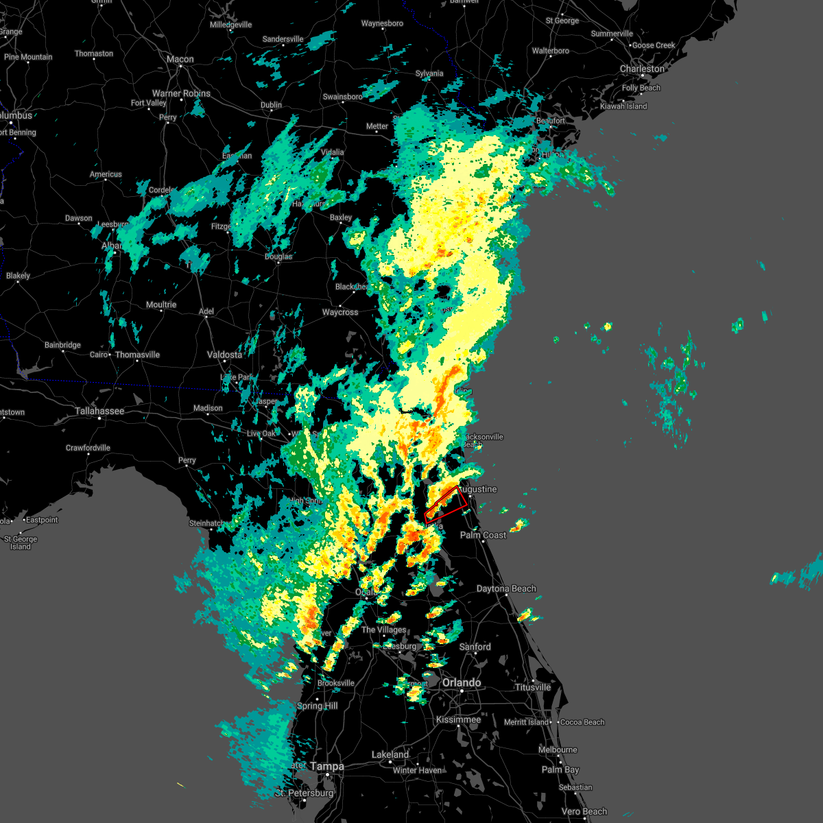 At 228 pm est, a severe thunderstorm capable of producing a tornado was located near picolata, or 11 miles north of hastings, moving northeast at 35 mph. this storm is headed for i-95 at the st. augustine outlets. another storm with rotation has formed southeast of bostwick in northeast putnam county, this storm could produce a tornado at any time (radar indicated rotation). Hazards include tornado. Flying debris will be dangerous to those caught without shelter. mobile homes will be damaged or destroyed. damage to roofs, windows, and vehicles will occur. tree damage is likely. Locations impacted include, bostwick and bakersville. At 228 pm est, a severe thunderstorm capable of producing a tornado was located near picolata, or 11 miles north of hastings, moving northeast at 35 mph. this storm is headed for i-95 at the st. augustine outlets. another storm with rotation has formed southeast of bostwick in northeast putnam county, this storm could produce a tornado at any time (radar indicated rotation). Hazards include tornado. Flying debris will be dangerous to those caught without shelter. mobile homes will be damaged or destroyed. damage to roofs, windows, and vehicles will occur. tree damage is likely. Locations impacted include, bostwick and bakersville.
|
| 2/14/2021 2:13 PM EST |
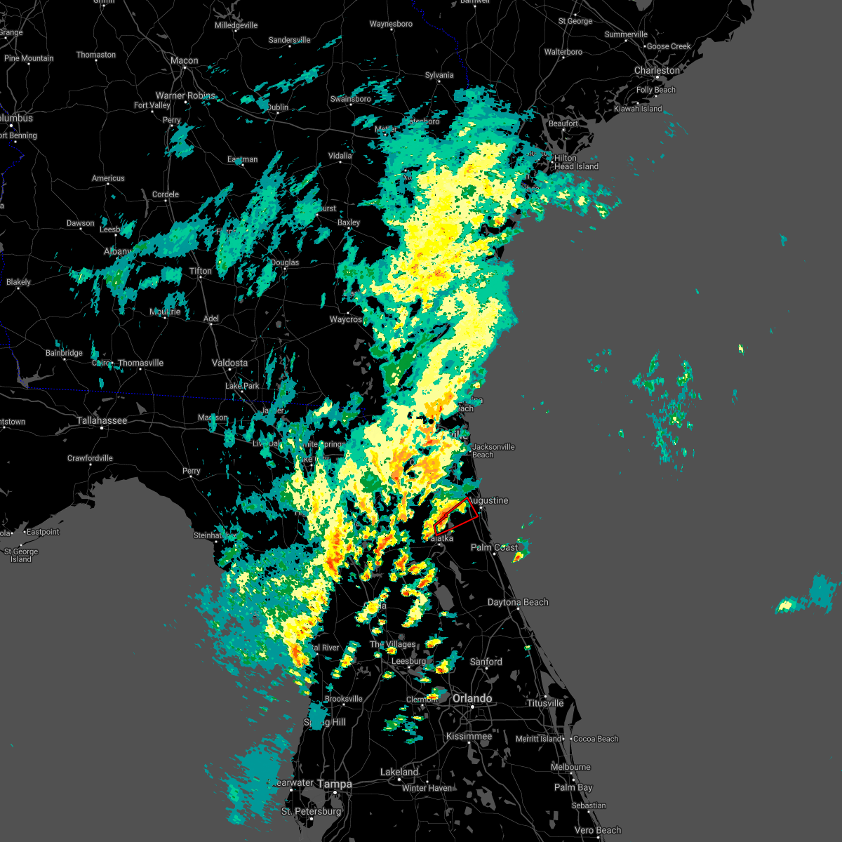 At 213 pm est, a severe thunderstorm capable of producing a tornado was located over bostwick, or 7 miles northwest of hastings, moving northeast at 35 mph (radar indicated rotation). Hazards include tornado. Flying debris will be dangerous to those caught without shelter. mobile homes will be damaged or destroyed. damage to roofs, windows, and vehicles will occur. tree damage is likely. this tornadic thunderstorm will remain over mainly rural areas of southwestern st. Johns and northeastern putnam counties, including the following locations, bakersville. At 213 pm est, a severe thunderstorm capable of producing a tornado was located over bostwick, or 7 miles northwest of hastings, moving northeast at 35 mph (radar indicated rotation). Hazards include tornado. Flying debris will be dangerous to those caught without shelter. mobile homes will be damaged or destroyed. damage to roofs, windows, and vehicles will occur. tree damage is likely. this tornadic thunderstorm will remain over mainly rural areas of southwestern st. Johns and northeastern putnam counties, including the following locations, bakersville.
|
| 2/9/2021 11:08 AM EST |
 At 1108 am est, a severe thunderstorm was located over middleburg, moving east at 45 mph (radar indicated). Hazards include quarter size hail. Damage to vehicles is expected. Locations impacted include, orange park, green cove springs, middleburg, mandarin, fruit cove, fleming island, baymeadows, oakleaf plantation, bellair-meadowbrook terrace and switzerland. At 1108 am est, a severe thunderstorm was located over middleburg, moving east at 45 mph (radar indicated). Hazards include quarter size hail. Damage to vehicles is expected. Locations impacted include, orange park, green cove springs, middleburg, mandarin, fruit cove, fleming island, baymeadows, oakleaf plantation, bellair-meadowbrook terrace and switzerland.
|
| 2/9/2021 10:58 AM EST |
 At 1058 am est, a severe thunderstorm was located near middleburg, moving east at 40 mph (radar indicated). Hazards include quarter size hail. damage to vehicles is expected At 1058 am est, a severe thunderstorm was located near middleburg, moving east at 40 mph (radar indicated). Hazards include quarter size hail. damage to vehicles is expected
|
| 12/24/2020 7:22 PM EST |
 The severe thunderstorm warning for northeastern nassau, st. johns, north central putnam, northeastern clay, duval, eastern camden and southeastern glynn counties will expire at 730 pm est, the storms which prompted the warning have weakened below severe limits, and have exited the warned area. therefore, the warning will be allowed to expire. however gusty winds and heavy rain are still possible with these thunderstorms. remember, a severe thunderstorm warning still remains in effect for portions of st johns county until 730 pm. The severe thunderstorm warning for northeastern nassau, st. johns, north central putnam, northeastern clay, duval, eastern camden and southeastern glynn counties will expire at 730 pm est, the storms which prompted the warning have weakened below severe limits, and have exited the warned area. therefore, the warning will be allowed to expire. however gusty winds and heavy rain are still possible with these thunderstorms. remember, a severe thunderstorm warning still remains in effect for portions of st johns county until 730 pm.
|
| 12/24/2020 6:56 PM EST |
 At 654 pm est, severe thunderstorms were located along a line extending from near brunswick to jacksonville and green cove springs, moving east at 60 mph (radar indicated). Hazards include 60 mph wind gusts. Expect damage to roofs, siding, and trees. locations impacted include, jacksonville, st. marys, kingsland, brunswick, saint augustine, st. Simons island, fernandina beach, orange park, green cove springs and jacksonville international arpt. At 654 pm est, severe thunderstorms were located along a line extending from near brunswick to jacksonville and green cove springs, moving east at 60 mph (radar indicated). Hazards include 60 mph wind gusts. Expect damage to roofs, siding, and trees. locations impacted include, jacksonville, st. marys, kingsland, brunswick, saint augustine, st. Simons island, fernandina beach, orange park, green cove springs and jacksonville international arpt.
|
| 12/24/2020 6:28 PM EST |
 At 627 pm est, severe thunderstorms were located along a line extending from 10 miles west of woodbine to near orange heights, moving northeast at 55 mph (radar indicated). Hazards include 60 mph wind gusts. expect damage to roofs, siding, and trees At 627 pm est, severe thunderstorms were located along a line extending from 10 miles west of woodbine to near orange heights, moving northeast at 55 mph (radar indicated). Hazards include 60 mph wind gusts. expect damage to roofs, siding, and trees
|
| 8/14/2020 4:42 PM EDT |
 The severe thunderstorm warning for central st. johns county will expire at 445 pm edt, the storm which prompted the warning has moved out of the area. therefore, the warning will be allowed to expire. however gusty winds are still possible with this thunderstorm. The severe thunderstorm warning for central st. johns county will expire at 445 pm edt, the storm which prompted the warning has moved out of the area. therefore, the warning will be allowed to expire. however gusty winds are still possible with this thunderstorm.
|
| 8/14/2020 4:21 PM EDT |
 At 421 pm edt, a severe thunderstorm was located near vilano beach, or near saint augustine, moving northeast at 20 mph (radar indicated). Hazards include 60 mph wind gusts and penny size hail. Expect damage to roofs, siding, and trees. Locations impacted include, saint augustine, world golf village, vilano beach, south ponte vedra, guana river state park and anastasia. At 421 pm edt, a severe thunderstorm was located near vilano beach, or near saint augustine, moving northeast at 20 mph (radar indicated). Hazards include 60 mph wind gusts and penny size hail. Expect damage to roofs, siding, and trees. Locations impacted include, saint augustine, world golf village, vilano beach, south ponte vedra, guana river state park and anastasia.
|
| 8/14/2020 4:08 PM EDT |
 At 407 pm edt, a severe thunderstorm was located near world golf village, or 7 miles west of saint augustine, moving east at 30 mph (radar indicated). Hazards include 60 mph wind gusts and quarter size hail. Hail damage to vehicles is expected. Expect wind damage to roofs, siding, and trees. At 407 pm edt, a severe thunderstorm was located near world golf village, or 7 miles west of saint augustine, moving east at 30 mph (radar indicated). Hazards include 60 mph wind gusts and quarter size hail. Hail damage to vehicles is expected. Expect wind damage to roofs, siding, and trees.
|
| 8/9/2020 4:24 PM EDT |
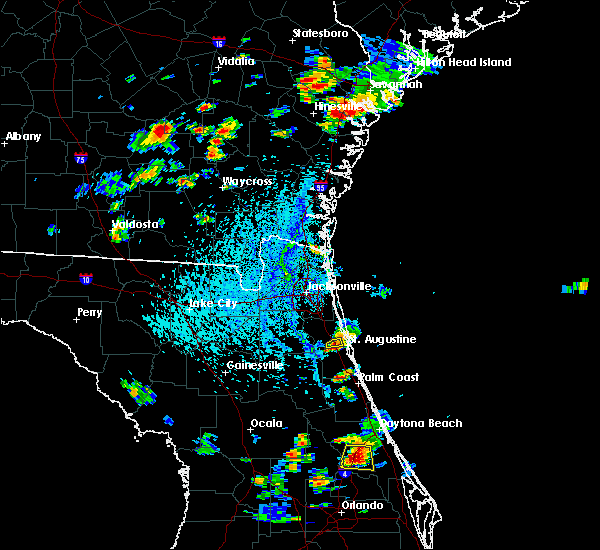 The severe thunderstorm warning for central st. johns county will expire at 430 pm edt, the storm which prompted the warning has moved out of the area. therefore, the warning will be allowed to expire. however gusty winds and heavy rain are still possible with this thunderstorm. The severe thunderstorm warning for central st. johns county will expire at 430 pm edt, the storm which prompted the warning has moved out of the area. therefore, the warning will be allowed to expire. however gusty winds and heavy rain are still possible with this thunderstorm.
|
| 8/9/2020 4:17 PM EDT |
 At 409 pm edt, a severe thunderstorm was located near world golf village, or 7 miles west of saint augustine, moving south at 15 mph (radar indicated). Hazards include 60 mph wind gusts and nickel size hail. Expect damage to roofs, siding, and trees. Locations impacted include, saint augustine and bakersville. At 409 pm edt, a severe thunderstorm was located near world golf village, or 7 miles west of saint augustine, moving south at 15 mph (radar indicated). Hazards include 60 mph wind gusts and nickel size hail. Expect damage to roofs, siding, and trees. Locations impacted include, saint augustine and bakersville.
|
| 8/9/2020 4:09 PM EDT |
 At 409 pm edt, a severe thunderstorm was located near world golf village, or 7 miles west of saint augustine, moving south at 15 mph (radar indicated). Hazards include 60 mph wind gusts and nickel size hail. Expect damage to roofs, siding, and trees. Locations impacted include, saint augustine and bakersville. At 409 pm edt, a severe thunderstorm was located near world golf village, or 7 miles west of saint augustine, moving south at 15 mph (radar indicated). Hazards include 60 mph wind gusts and nickel size hail. Expect damage to roofs, siding, and trees. Locations impacted include, saint augustine and bakersville.
|
| 8/9/2020 3:59 PM EDT |
 At 359 pm edt, a severe thunderstorm was located near world golf village, or 8 miles northwest of saint augustine, moving south at 15 mph (radar indicated). Hazards include 60 mph wind gusts and quarter size hail. Hail damage to vehicles is expected. expect wind damage to roofs, siding, and trees. Locations impacted include, saint augustine, vilano beach and bakersville. At 359 pm edt, a severe thunderstorm was located near world golf village, or 8 miles northwest of saint augustine, moving south at 15 mph (radar indicated). Hazards include 60 mph wind gusts and quarter size hail. Hail damage to vehicles is expected. expect wind damage to roofs, siding, and trees. Locations impacted include, saint augustine, vilano beach and bakersville.
|
| 8/9/2020 3:49 PM EDT |
 At 349 pm edt, a severe thunderstorm was located over world golf village, or 11 miles northwest of saint augustine, moving south at 15 mph (radar indicated). Hazards include 60 mph wind gusts and quarter size hail. Hail damage to vehicles is expected. expect wind damage to roofs, siding, and trees. Locations impacted include, saint augustine, world golf village, vilano beach, south ponte vedra and bakersville. At 349 pm edt, a severe thunderstorm was located over world golf village, or 11 miles northwest of saint augustine, moving south at 15 mph (radar indicated). Hazards include 60 mph wind gusts and quarter size hail. Hail damage to vehicles is expected. expect wind damage to roofs, siding, and trees. Locations impacted include, saint augustine, world golf village, vilano beach, south ponte vedra and bakersville.
|
| 8/9/2020 3:37 PM EDT |
 At 337 pm edt, a severe thunderstorm was located near durbin, or 10 miles east of fruit cove, moving south at 15 mph (radar indicated). Hazards include 60 mph wind gusts and quarter size hail. Hail damage to vehicles is expected. Expect wind damage to roofs, siding, and trees. At 337 pm edt, a severe thunderstorm was located near durbin, or 10 miles east of fruit cove, moving south at 15 mph (radar indicated). Hazards include 60 mph wind gusts and quarter size hail. Hail damage to vehicles is expected. Expect wind damage to roofs, siding, and trees.
|
| 6/30/2020 4:20 PM EDT |
 The severe thunderstorm warning for west central st. johns, north central putnam and east central clay counties will expire at 430 pm edt, the storm which prompted the warning has weakened below severe limits, and no longer poses an immediate threat to life or property. therefore, the warning will be allowed to expire. however small hail, gusty winds and heavy rain are still possible with this thunderstorm. The severe thunderstorm warning for west central st. johns, north central putnam and east central clay counties will expire at 430 pm edt, the storm which prompted the warning has weakened below severe limits, and no longer poses an immediate threat to life or property. therefore, the warning will be allowed to expire. however small hail, gusty winds and heavy rain are still possible with this thunderstorm.
|
| 6/30/2020 4:17 PM EDT |
 At 417 pm edt, a severe thunderstorm was located near green cove springs, moving southeast at 20 mph (radar indicated). Hazards include 60 mph wind gusts and quarter size hail. Hail damage to vehicles is expected. expect wind damage to roofs, siding, and trees. Locations impacted include, green cove springs, bostwick, bardin, picolata and bakersville. At 417 pm edt, a severe thunderstorm was located near green cove springs, moving southeast at 20 mph (radar indicated). Hazards include 60 mph wind gusts and quarter size hail. Hail damage to vehicles is expected. expect wind damage to roofs, siding, and trees. Locations impacted include, green cove springs, bostwick, bardin, picolata and bakersville.
|
| 6/30/2020 4:14 PM EDT |
 At 414 pm edt, a severe thunderstorm was located over sawgrass, or near ponte vedra beach, moving south at 15 mph (radar indicated). Hazards include 60 mph wind gusts and quarter size hail. Hail damage to vehicles is expected. expect wind damage to roofs, siding, and trees. Locations impacted include, saint augustine, ponte vedra beach, world golf village, sawgrass, nocatee, durbin, vilano beach, palm valley, south ponte vedra and bayard. At 414 pm edt, a severe thunderstorm was located over sawgrass, or near ponte vedra beach, moving south at 15 mph (radar indicated). Hazards include 60 mph wind gusts and quarter size hail. Hail damage to vehicles is expected. expect wind damage to roofs, siding, and trees. Locations impacted include, saint augustine, ponte vedra beach, world golf village, sawgrass, nocatee, durbin, vilano beach, palm valley, south ponte vedra and bayard.
|
| 6/30/2020 4:06 PM EDT |
 The severe thunderstorm warning for northwestern st. johns, northeastern clay and southeastern duval counties will expire at 415 pm edt, the storm which prompted the warning has weakened below severe limits, and has exited the warned area. therefore, the warning will be allowed to expire. however small hail, gusty winds and heavy rain are still possible with this thunderstorm. remember, a severe thunderstorm warning still remains in effect for portions of duval and st johns counties until 445 pm edt. The severe thunderstorm warning for northwestern st. johns, northeastern clay and southeastern duval counties will expire at 415 pm edt, the storm which prompted the warning has weakened below severe limits, and has exited the warned area. therefore, the warning will be allowed to expire. however small hail, gusty winds and heavy rain are still possible with this thunderstorm. remember, a severe thunderstorm warning still remains in effect for portions of duval and st johns counties until 445 pm edt.
|
| 6/30/2020 3:59 PM EDT |
 At 358 pm edt, a severe thunderstorm was located over palm valley, or near ponte vedra beach, moving south at 30 mph (radar indicated). Hazards include 70 mph wind gusts and ping pong ball size hail. People and animals outdoors will be injured. expect hail damage to roofs, siding, windows, and vehicles. expect considerable tree damage. wind damage is also likely to mobile homes, roofs, and outbuildings. Locations impacted include, saint augustine, unf, ponte vedra beach, neptune beach, world golf village, sawgrass, nocatee, durbin, vilano beach and san pablo. At 358 pm edt, a severe thunderstorm was located over palm valley, or near ponte vedra beach, moving south at 30 mph (radar indicated). Hazards include 70 mph wind gusts and ping pong ball size hail. People and animals outdoors will be injured. expect hail damage to roofs, siding, windows, and vehicles. expect considerable tree damage. wind damage is also likely to mobile homes, roofs, and outbuildings. Locations impacted include, saint augustine, unf, ponte vedra beach, neptune beach, world golf village, sawgrass, nocatee, durbin, vilano beach and san pablo.
|
| 6/30/2020 3:52 PM EDT |
 At 352 pm edt, a severe thunderstorm was located over neptune beach, or near ponte vedra beach, moving south at 15 mph (radar indicated). Hazards include 60 mph wind gusts and quarter size hail. Hail damage to vehicles is expected. Expect wind damage to roofs, siding, and trees. At 352 pm edt, a severe thunderstorm was located over neptune beach, or near ponte vedra beach, moving south at 15 mph (radar indicated). Hazards include 60 mph wind gusts and quarter size hail. Hail damage to vehicles is expected. Expect wind damage to roofs, siding, and trees.
|
| 6/30/2020 3:44 PM EDT |
 At 344 pm edt, a severe thunderstorm was located near middleburg, moving southeast at 20 mph (radar indicated). Hazards include 60 mph wind gusts and quarter size hail. Hail damage to vehicles is expected. Expect wind damage to roofs, siding, and trees. At 344 pm edt, a severe thunderstorm was located near middleburg, moving southeast at 20 mph (radar indicated). Hazards include 60 mph wind gusts and quarter size hail. Hail damage to vehicles is expected. Expect wind damage to roofs, siding, and trees.
|
| 6/30/2020 3:31 PM EDT |
 At 331 pm edt, a severe thunderstorm was located over bellair-meadowbrook terrace, or over orange park, moving southeast at 15 mph (radar indicated). Hazards include 60 mph wind gusts and quarter size hail. Hail damage to vehicles is expected. Expect wind damage to roofs, siding, and trees. At 331 pm edt, a severe thunderstorm was located over bellair-meadowbrook terrace, or over orange park, moving southeast at 15 mph (radar indicated). Hazards include 60 mph wind gusts and quarter size hail. Hail damage to vehicles is expected. Expect wind damage to roofs, siding, and trees.
|
| 6/27/2020 4:44 PM EDT |
 At 444 pm edt, a severe thunderstorm was located near world golf village, or 11 miles west of saint augustine, moving east at 20 mph (radar indicated). Hazards include 60 mph wind gusts and half dollar size hail. Hail damage to vehicles is expected. expect wind damage to roofs, siding, and trees. Locations impacted include, saint augustine, world golf village, saint augustine beach, nocatee, durbin, vilano beach, south ponte vedra, saint augustine shores, butler beach and saint augustine south. At 444 pm edt, a severe thunderstorm was located near world golf village, or 11 miles west of saint augustine, moving east at 20 mph (radar indicated). Hazards include 60 mph wind gusts and half dollar size hail. Hail damage to vehicles is expected. expect wind damage to roofs, siding, and trees. Locations impacted include, saint augustine, world golf village, saint augustine beach, nocatee, durbin, vilano beach, south ponte vedra, saint augustine shores, butler beach and saint augustine south.
|
| 6/27/2020 4:27 PM EDT | Downed power lines near the corner of silo rd and pacetti rd. time of event estimated via rada in st. johns county FL, 0.6 miles NNW of World Golf Village, FL |
| 6/27/2020 4:23 PM EDT |
 At 423 pm edt, a severe thunderstorm was located over picolata, or 8 miles southeast of green cove springs, moving east at 20 mph (radar indicated). Hazards include 60 mph wind gusts and half dollar size hail. Hail damage to vehicles is expected. Expect wind damage to roofs, siding, and trees. At 423 pm edt, a severe thunderstorm was located over picolata, or 8 miles southeast of green cove springs, moving east at 20 mph (radar indicated). Hazards include 60 mph wind gusts and half dollar size hail. Hail damage to vehicles is expected. Expect wind damage to roofs, siding, and trees.
|
| 6/25/2020 8:21 PM EDT |
 The severe thunderstorm warning for east central st. johns county will expire at 830 pm edt, the storm which prompted the warning has weakened below severe limits, and no longer poses an immediate threat to life or property. therefore, the warning will be allowed to expire. The severe thunderstorm warning for east central st. johns county will expire at 830 pm edt, the storm which prompted the warning has weakened below severe limits, and no longer poses an immediate threat to life or property. therefore, the warning will be allowed to expire.
|
| 6/25/2020 7:51 PM EDT |
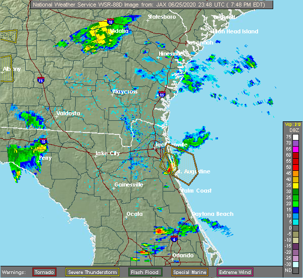 At 751 pm edt, a severe thunderstorm was located near vilano beach, or near saint augustine, moving southeast at 25 mph (radar indicated). Hazards include 60 mph wind gusts and quarter size hail. Hail damage to vehicles is expected. Expect wind damage to roofs, siding, and trees. At 751 pm edt, a severe thunderstorm was located near vilano beach, or near saint augustine, moving southeast at 25 mph (radar indicated). Hazards include 60 mph wind gusts and quarter size hail. Hail damage to vehicles is expected. Expect wind damage to roofs, siding, and trees.
|
| 6/25/2020 7:35 PM EDT |
 At 735 pm edt, a severe thunderstorm was located over guana river state park, or 10 miles south of ponte vedra beach, moving east at 25 mph (radar indicated). Hazards include 70 mph wind gusts and quarter size hail. Hail damage to vehicles is expected. expect considerable tree damage. wind damage is also likely to mobile homes, roofs, and outbuildings. Locations impacted include, ponte vedra beach, world golf village, palm valley, sawgrass, nocatee, south ponte vedra, bayard, durbin and guana river state park. At 735 pm edt, a severe thunderstorm was located over guana river state park, or 10 miles south of ponte vedra beach, moving east at 25 mph (radar indicated). Hazards include 70 mph wind gusts and quarter size hail. Hail damage to vehicles is expected. expect considerable tree damage. wind damage is also likely to mobile homes, roofs, and outbuildings. Locations impacted include, ponte vedra beach, world golf village, palm valley, sawgrass, nocatee, south ponte vedra, bayard, durbin and guana river state park.
|
| 6/25/2020 7:30 PM EDT | Public report of wind gusts to 50 to 60 mp in st. johns county FL, 7 miles S of World Golf Village, FL |
| 6/25/2020 7:12 PM EDT |
 At 711 pm edt, a severe thunderstorm was located over bayard, or near fruit cove, moving east at 25 mph (radar indicated). Hazards include 70 mph wind gusts. Expect considerable tree damage. Damage is likely to mobile homes, roofs, and outbuildings. At 711 pm edt, a severe thunderstorm was located over bayard, or near fruit cove, moving east at 25 mph (radar indicated). Hazards include 70 mph wind gusts. Expect considerable tree damage. Damage is likely to mobile homes, roofs, and outbuildings.
|
| 6/20/2020 6:11 PM EDT |
 At 610 pm edt, a severe thunderstorm was located over world golf village, or 11 miles southeast of fruit cove, moving south at 20 mph (radar indicated). Hazards include 60 mph wind gusts and quarter size hail. Hail damage to vehicles is expected. Expect wind damage to roofs, siding, and trees. At 610 pm edt, a severe thunderstorm was located over world golf village, or 11 miles southeast of fruit cove, moving south at 20 mph (radar indicated). Hazards include 60 mph wind gusts and quarter size hail. Hail damage to vehicles is expected. Expect wind damage to roofs, siding, and trees.
|
| 6/20/2020 5:58 PM EDT |
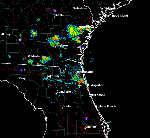 At 558 pm edt, a severe thunderstorm was located near world golf village, or 7 miles southeast of fruit cove, moving south at 15 mph (radar indicated). Hazards include 60 mph wind gusts and quarter size hail. Hail damage to vehicles is expected. expect wind damage to roofs, siding, and trees. Locations impacted include, world golf village. At 558 pm edt, a severe thunderstorm was located near world golf village, or 7 miles southeast of fruit cove, moving south at 15 mph (radar indicated). Hazards include 60 mph wind gusts and quarter size hail. Hail damage to vehicles is expected. expect wind damage to roofs, siding, and trees. Locations impacted include, world golf village.
|
| 6/20/2020 5:53 PM EDT |
 At 553 pm edt, a severe thunderstorm was located near durbin, or near fruit cove, moving south at 10 mph (radar indicated). Hazards include 60 mph wind gusts and quarter size hail. Hail damage to vehicles is expected. expect wind damage to roofs, siding, and trees. Locations impacted include, world golf village and durbin. At 553 pm edt, a severe thunderstorm was located near durbin, or near fruit cove, moving south at 10 mph (radar indicated). Hazards include 60 mph wind gusts and quarter size hail. Hail damage to vehicles is expected. expect wind damage to roofs, siding, and trees. Locations impacted include, world golf village and durbin.
|
| 6/20/2020 5:48 PM EDT |
 At 548 pm edt, a severe thunderstorm was located near durbin, or near fruit cove, moving south at 10 mph (radar indicated). Hazards include 60 mph wind gusts and quarter size hail. Hail damage to vehicles is expected. Expect wind damage to roofs, siding, and trees. At 548 pm edt, a severe thunderstorm was located near durbin, or near fruit cove, moving south at 10 mph (radar indicated). Hazards include 60 mph wind gusts and quarter size hail. Hail damage to vehicles is expected. Expect wind damage to roofs, siding, and trees.
|
| 6/6/2020 9:42 PM EDT |
 The severe thunderstorm warning for central st. johns county will expire at 945 pm edt, the storm which prompted the warning has weakened below severe limits, and has exited the warned area. therefore, the warning will be allowed to expire. however gusty winds are still possible with this thunderstorm. The severe thunderstorm warning for central st. johns county will expire at 945 pm edt, the storm which prompted the warning has weakened below severe limits, and has exited the warned area. therefore, the warning will be allowed to expire. however gusty winds are still possible with this thunderstorm.
|
| 6/6/2020 9:23 PM EDT |
 At 923 pm edt, a severe thunderstorm was located near saint augustine, moving north at 30 mph (radar indicated). Hazards include 60 mph wind gusts. Expect damage to roofs, siding, and trees. Locations impacted include, saint augustine, world golf village, saint augustine beach, south ponte vedra, saint augustine shores, butler beach, vilano beach, saint augustine south, anastasia and bakersville. At 923 pm edt, a severe thunderstorm was located near saint augustine, moving north at 30 mph (radar indicated). Hazards include 60 mph wind gusts. Expect damage to roofs, siding, and trees. Locations impacted include, saint augustine, world golf village, saint augustine beach, south ponte vedra, saint augustine shores, butler beach, vilano beach, saint augustine south, anastasia and bakersville.
|
| 6/6/2020 9:04 PM EDT |
 At 904 pm edt, a severe thunderstorm was located near crescent beach, or 11 miles south of saint augustine, moving northwest at 35 mph (radar indicated). Hazards include 60 mph wind gusts. expect damage to roofs, siding, and trees At 904 pm edt, a severe thunderstorm was located near crescent beach, or 11 miles south of saint augustine, moving northwest at 35 mph (radar indicated). Hazards include 60 mph wind gusts. expect damage to roofs, siding, and trees
|
| 5/28/2020 3:44 PM EDT |
 At 344 pm edt, severe thunderstorms were located along a line extending from near vilano beach to marineland, moving northeast at 30 mph (radar indicated). Hazards include 60 mph wind gusts and penny size hail. Expect damage to roofs, siding, and trees. Locations impacted include, saint augustine, saint augustine beach, marineland, south ponte vedra, crescent beach, saint augustine shores, butler beach, vilano beach, saint augustine south and guana river state park. At 344 pm edt, severe thunderstorms were located along a line extending from near vilano beach to marineland, moving northeast at 30 mph (radar indicated). Hazards include 60 mph wind gusts and penny size hail. Expect damage to roofs, siding, and trees. Locations impacted include, saint augustine, saint augustine beach, marineland, south ponte vedra, crescent beach, saint augustine shores, butler beach, vilano beach, saint augustine south and guana river state park.
|
| 5/28/2020 3:29 PM EDT |
 At 329 pm edt, severe thunderstorms were located along a line extending from near picolata to 8 miles west of marineland, moving northeast at 20 mph (radar indicated). Hazards include 60 mph wind gusts and penny size hail. Expect damage to roofs, siding, and trees. Locations impacted include, saint augustine, world golf village, saint augustine beach, marineland, vilano beach, south ponte vedra, crescent beach, saint augustine shores, butler beach and saint augustine south. At 329 pm edt, severe thunderstorms were located along a line extending from near picolata to 8 miles west of marineland, moving northeast at 20 mph (radar indicated). Hazards include 60 mph wind gusts and penny size hail. Expect damage to roofs, siding, and trees. Locations impacted include, saint augustine, world golf village, saint augustine beach, marineland, vilano beach, south ponte vedra, crescent beach, saint augustine shores, butler beach and saint augustine south.
|
| 5/28/2020 3:14 PM EDT |
 At 314 pm edt, severe thunderstorms were located along a line extending from near picolata to 8 miles west of marineland, moving northeast at 25 mph (radar indicated). Hazards include 60 mph wind gusts and penny size hail. expect damage to roofs, siding, and trees At 314 pm edt, severe thunderstorms were located along a line extending from near picolata to 8 miles west of marineland, moving northeast at 25 mph (radar indicated). Hazards include 60 mph wind gusts and penny size hail. expect damage to roofs, siding, and trees
|
| 4/15/2020 1:39 PM EDT |
 The severe thunderstorm warning for northern flagler, st. johns and putnam counties will expire at 145 pm edt, the storm which prompted the warning has weakened below severe limits, and has exited the warned area. therefore, the warning will be allowed to expire. however gusty winds and heavy rain are still possible with this thunderstorm. The severe thunderstorm warning for northern flagler, st. johns and putnam counties will expire at 145 pm edt, the storm which prompted the warning has weakened below severe limits, and has exited the warned area. therefore, the warning will be allowed to expire. however gusty winds and heavy rain are still possible with this thunderstorm.
|
| 4/15/2020 1:14 PM EDT |
 At 114 pm edt, a severe thunderstorm was located over florahome, or near interlachen, moving east at 35 mph (radar indicated). Hazards include 60 mph wind gusts. Expect damage to roofs, siding, and trees. Locations impacted include, palm coast, saint augustine, palatka, interlachen, hastings, melrose, east palatka, world golf village, saint augustine beach and marineland. At 114 pm edt, a severe thunderstorm was located over florahome, or near interlachen, moving east at 35 mph (radar indicated). Hazards include 60 mph wind gusts. Expect damage to roofs, siding, and trees. Locations impacted include, palm coast, saint augustine, palatka, interlachen, hastings, melrose, east palatka, world golf village, saint augustine beach and marineland.
|
| 4/15/2020 1:02 PM EDT |
 At 101 pm edt, a severe thunderstorm was located over melrose landing, or near melrose, moving east at 35 mph (radar indicated). Hazards include 60 mph wind gusts. Expect damage to roofs, siding, and trees. Locations impacted include, palm coast, saint augustine, palatka, interlachen, keystone heights, hastings, melrose, east palatka, world golf village and saint augustine beach. At 101 pm edt, a severe thunderstorm was located over melrose landing, or near melrose, moving east at 35 mph (radar indicated). Hazards include 60 mph wind gusts. Expect damage to roofs, siding, and trees. Locations impacted include, palm coast, saint augustine, palatka, interlachen, keystone heights, hastings, melrose, east palatka, world golf village and saint augustine beach.
|
| 4/15/2020 12:45 PM EDT |
 At 1244 pm edt, a severe thunderstorm was located near orange heights, or 7 miles southwest of melrose, moving east at 35 mph (radar indicated). Hazards include 60 mph wind gusts. expect damage to roofs, siding, and trees At 1244 pm edt, a severe thunderstorm was located near orange heights, or 7 miles southwest of melrose, moving east at 35 mph (radar indicated). Hazards include 60 mph wind gusts. expect damage to roofs, siding, and trees
|
| 4/14/2020 9:40 AM EDT |
 The severe thunderstorm warning for central st. johns county will expire at 945 am edt, the storm which prompted the warning has weakened below severe limits, and no longer poses an immediate threat to life or property. therefore, the warning will be allowed to expire. however small hail and heavy rain are still possible with this thunderstorm. The severe thunderstorm warning for central st. johns county will expire at 945 am edt, the storm which prompted the warning has weakened below severe limits, and no longer poses an immediate threat to life or property. therefore, the warning will be allowed to expire. however small hail and heavy rain are still possible with this thunderstorm.
|
| 4/14/2020 9:31 AM EDT |
 At 931 am edt, a severe thunderstorm was located near saint augustine, moving east at 35 mph (radar indicated). Hazards include 60 mph wind gusts and quarter size hail. Hail damage to vehicles is expected. expect wind damage to roofs, siding, and trees. Locations impacted include, saint augustine, world golf village, saint augustine beach, south ponte vedra, vilano beach, saint augustine south, picolata, guana river state park, anastasia and bakersville. At 931 am edt, a severe thunderstorm was located near saint augustine, moving east at 35 mph (radar indicated). Hazards include 60 mph wind gusts and quarter size hail. Hail damage to vehicles is expected. expect wind damage to roofs, siding, and trees. Locations impacted include, saint augustine, world golf village, saint augustine beach, south ponte vedra, vilano beach, saint augustine south, picolata, guana river state park, anastasia and bakersville.
|
| 4/14/2020 9:16 AM EDT |
 At 916 am edt, a severe thunderstorm was located near picolata, or 9 miles north of hastings, moving east at 35 mph (radar indicated). Hazards include 60 mph wind gusts and quarter size hail. Hail damage to vehicles is expected. expect wind damage to roofs, siding, and trees. Locations impacted include, saint augustine, world golf village, saint augustine beach, bostwick, south ponte vedra, vilano beach, saint augustine south, picolata, guana river state park and anastasia. At 916 am edt, a severe thunderstorm was located near picolata, or 9 miles north of hastings, moving east at 35 mph (radar indicated). Hazards include 60 mph wind gusts and quarter size hail. Hail damage to vehicles is expected. expect wind damage to roofs, siding, and trees. Locations impacted include, saint augustine, world golf village, saint augustine beach, bostwick, south ponte vedra, vilano beach, saint augustine south, picolata, guana river state park and anastasia.
|
| 4/14/2020 9:02 AM EDT |
 At 902 am edt, a severe thunderstorm was located over bostwick, or 10 miles north of palatka, moving east at 35 mph (radar indicated). Hazards include 60 mph wind gusts and quarter size hail. Hail damage to vehicles is expected. Expect wind damage to roofs, siding, and trees. At 902 am edt, a severe thunderstorm was located over bostwick, or 10 miles north of palatka, moving east at 35 mph (radar indicated). Hazards include 60 mph wind gusts and quarter size hail. Hail damage to vehicles is expected. Expect wind damage to roofs, siding, and trees.
|
| 4/13/2020 5:14 PM EDT |
 At 513 pm edt, a severe thunderstorm was located near saint augustine south, or near saint augustine, moving east at 40 mph (radar indicated). Hazards include 60 mph wind gusts and quarter size hail. Hail damage to vehicles is expected. expect wind damage to roofs, siding, and trees. Locations impacted include, saint augustine, saint augustine beach, saint augustine shores, butler beach, vilano beach, saint augustine south and anastasia. At 513 pm edt, a severe thunderstorm was located near saint augustine south, or near saint augustine, moving east at 40 mph (radar indicated). Hazards include 60 mph wind gusts and quarter size hail. Hail damage to vehicles is expected. expect wind damage to roofs, siding, and trees. Locations impacted include, saint augustine, saint augustine beach, saint augustine shores, butler beach, vilano beach, saint augustine south and anastasia.
|
| 4/13/2020 5:05 PM EDT |
 At 505 pm edt, a severe thunderstorm was located near picolata, or 10 miles southeast of green cove springs, moving east at 40 mph (radar indicated). Hazards include 60 mph wind gusts and penny size hail. Expect damage to roofs, siding, and trees. Locations impacted include, saint augustine, world golf village, saint augustine beach, saint augustine shores, butler beach, vilano beach, saint augustine south, picolata, anastasia and bakersville. At 505 pm edt, a severe thunderstorm was located near picolata, or 10 miles southeast of green cove springs, moving east at 40 mph (radar indicated). Hazards include 60 mph wind gusts and penny size hail. Expect damage to roofs, siding, and trees. Locations impacted include, saint augustine, world golf village, saint augustine beach, saint augustine shores, butler beach, vilano beach, saint augustine south, picolata, anastasia and bakersville.
|
| 4/13/2020 4:48 PM EDT |
 At 448 pm edt, a severe thunderstorm was located near george`s lake, or 11 miles southwest of green cove springs, moving east at 40 mph (radar indicated). Hazards include 60 mph wind gusts and quarter size hail. Hail damage to vehicles is expected. Expect wind damage to roofs, siding, and trees. At 448 pm edt, a severe thunderstorm was located near george`s lake, or 11 miles southwest of green cove springs, moving east at 40 mph (radar indicated). Hazards include 60 mph wind gusts and quarter size hail. Hail damage to vehicles is expected. Expect wind damage to roofs, siding, and trees.
|
| 3/31/2020 6:57 PM EDT |
 At 657 pm edt, a severe thunderstorm was located over lakeside, or near orange park, moving east at 45 mph (radar indicated). Hazards include 60 mph wind gusts. Expect damage to roofs, siding, and trees. Locations impacted include, orange park, green cove springs, mandarin, fruit cove, world golf village, fleming island, durbin, bellair-meadowbrook terrace, switzerland and doctors inlet. At 657 pm edt, a severe thunderstorm was located over lakeside, or near orange park, moving east at 45 mph (radar indicated). Hazards include 60 mph wind gusts. Expect damage to roofs, siding, and trees. Locations impacted include, orange park, green cove springs, mandarin, fruit cove, world golf village, fleming island, durbin, bellair-meadowbrook terrace, switzerland and doctors inlet.
|
| 3/31/2020 6:49 PM EDT |
 At 648 pm edt, a severe thunderstorm was located near oakleaf plantation, or near middleburg, moving east at 40 mph (radar indicated). Hazards include 70 mph wind gusts. Expect considerable tree damage. damage is likely to mobile homes, roofs, and outbuildings. Locations impacted include, orange park, green cove springs, middleburg, mandarin, fruit cove, world golf village, fleming island, baymeadows, durbin and oakleaf plantation. At 648 pm edt, a severe thunderstorm was located near oakleaf plantation, or near middleburg, moving east at 40 mph (radar indicated). Hazards include 70 mph wind gusts. Expect considerable tree damage. damage is likely to mobile homes, roofs, and outbuildings. Locations impacted include, orange park, green cove springs, middleburg, mandarin, fruit cove, world golf village, fleming island, baymeadows, durbin and oakleaf plantation.
|
| 3/31/2020 6:39 PM EDT |
 At 639 pm edt, a severe thunderstorm was located near maxville, or 8 miles northwest of middleburg, moving east at 50 mph. this is a very dangerous storm (radar indicated). Hazards include 90 mph wind gusts. You are in a life-threatening situation. flying debris may be deadly to those caught without shelter. mobile homes will be heavily damaged or destroyed. homes and businesses will have substantial roof and window damage. expect extensive tree damage and power outages. Locations impacted include, orange park, green cove springs, middleburg, mandarin, fruit cove, world golf village, maxville, fleming island, baymeadows and durbin. At 639 pm edt, a severe thunderstorm was located near maxville, or 8 miles northwest of middleburg, moving east at 50 mph. this is a very dangerous storm (radar indicated). Hazards include 90 mph wind gusts. You are in a life-threatening situation. flying debris may be deadly to those caught without shelter. mobile homes will be heavily damaged or destroyed. homes and businesses will have substantial roof and window damage. expect extensive tree damage and power outages. Locations impacted include, orange park, green cove springs, middleburg, mandarin, fruit cove, world golf village, maxville, fleming island, baymeadows and durbin.
|
| 3/31/2020 6:31 PM EDT |
 At 630 pm edt, a severe thunderstorm was located 8 miles southwest of maxville, or 8 miles northeast of raiford, moving east at 35 mph (radar indicated). Hazards include 70 mph wind gusts. Expect considerable tree damage. damage is likely to mobile homes, roofs, and outbuildings. Locations impacted include, jacksonville, orange park, green cove springs, starke, unf, mandarin, fruit cove, arlington, middleburg and world golf village. At 630 pm edt, a severe thunderstorm was located 8 miles southwest of maxville, or 8 miles northeast of raiford, moving east at 35 mph (radar indicated). Hazards include 70 mph wind gusts. Expect considerable tree damage. damage is likely to mobile homes, roofs, and outbuildings. Locations impacted include, jacksonville, orange park, green cove springs, starke, unf, mandarin, fruit cove, arlington, middleburg and world golf village.
|
| 3/31/2020 6:28 PM EDT |
 At 628 pm edt, a severe thunderstorm was located 7 miles southwest of maxville, or 8 miles northeast of raiford, moving east at 50 mph (radar indicated). Hazards include 60 mph wind gusts. expect damage to roofs, siding, and trees At 628 pm edt, a severe thunderstorm was located 7 miles southwest of maxville, or 8 miles northeast of raiford, moving east at 50 mph (radar indicated). Hazards include 60 mph wind gusts. expect damage to roofs, siding, and trees
|
| 2/6/2020 11:09 PM EST |
 At 1108 pm est, severe thunderstorms were located along a line extending from near sawgrass to guana river state park to near orange mills, moving east at 45 mph (radar indicated). Hazards include 60 mph wind gusts. Expect damage to roofs, siding, and trees. Locations impacted include, saint augustine, hastings, east palatka, world golf village, saint augustine beach, sawgrass, nocatee, vilano beach, palm valley and federal point. At 1108 pm est, severe thunderstorms were located along a line extending from near sawgrass to guana river state park to near orange mills, moving east at 45 mph (radar indicated). Hazards include 60 mph wind gusts. Expect damage to roofs, siding, and trees. Locations impacted include, saint augustine, hastings, east palatka, world golf village, saint augustine beach, sawgrass, nocatee, vilano beach, palm valley and federal point.
|
| 2/6/2020 10:53 PM EST |
 At 1051 pm est, severe thunderstorms were located along a line extending from near neptune beach to near durbin to near hollister, moving east at 45 mph (radar indicated). Hazards include 60 to 70 mph wind gusts. Expect considerable tree damage. damage is likely to mobile homes, roofs, and outbuildings. Locations impacted include, saint augustine, palatka, green cove springs, hastings, east palatka, unf, fruit cove, ponte vedra beach, neptune beach and world golf village. At 1051 pm est, severe thunderstorms were located along a line extending from near neptune beach to near durbin to near hollister, moving east at 45 mph (radar indicated). Hazards include 60 to 70 mph wind gusts. Expect considerable tree damage. damage is likely to mobile homes, roofs, and outbuildings. Locations impacted include, saint augustine, palatka, green cove springs, hastings, east palatka, unf, fruit cove, ponte vedra beach, neptune beach and world golf village.
|
| 2/6/2020 10:42 PM EST |
 At 1042 pm est, severe thunderstorms were located along a line extending from 6 miles north of little talbot island to fruit cove to near hollister, moving east at 40 mph (radar indicated). Hazards include 70 mph wind gusts. Expect considerable tree damage. Damage is likely to mobile homes, roofs, and outbuildings. At 1042 pm est, severe thunderstorms were located along a line extending from 6 miles north of little talbot island to fruit cove to near hollister, moving east at 40 mph (radar indicated). Hazards include 70 mph wind gusts. Expect considerable tree damage. Damage is likely to mobile homes, roofs, and outbuildings.
|
| 2/6/2020 10:34 PM EST |
 At 1032 pm est, severe thunderstorms were located along a line extending from near fernandina beach to interlachen, moving east at 65 mph (radar indicated. at 1023 pm, nas jax airport measured a gust to 76 mph). Hazards include up to 70 to 75 mph wind gusts. Expect considerable tree damage. damage is likely to mobile homes, roofs, and outbuildings. Locations impacted include, jacksonville, saint augustine, fernandina beach, palatka, orange park, green cove springs, interlachen, hastings, east palatka and jacksonville international arpt. At 1032 pm est, severe thunderstorms were located along a line extending from near fernandina beach to interlachen, moving east at 65 mph (radar indicated. at 1023 pm, nas jax airport measured a gust to 76 mph). Hazards include up to 70 to 75 mph wind gusts. Expect considerable tree damage. damage is likely to mobile homes, roofs, and outbuildings. Locations impacted include, jacksonville, saint augustine, fernandina beach, palatka, orange park, green cove springs, interlachen, hastings, east palatka and jacksonville international arpt.
|
| 2/6/2020 10:22 PM EST |
 At 1021 pm est, severe thunderstorms were located along a line extending from near yulee to near hawthorne, moving east at 45 mph (radar indicated. at 1012 pm, jacksonville international airport reported a gust to 58 mph). Hazards include 70 mph wind gusts. Expect considerable tree damage. damage is likely to mobile homes, roofs, and outbuildings. Locations impacted include, jacksonville, saint augustine, fernandina beach, palatka, orange park, green cove springs, starke, interlachen, keystone heights and callahan. At 1021 pm est, severe thunderstorms were located along a line extending from near yulee to near hawthorne, moving east at 45 mph (radar indicated. at 1012 pm, jacksonville international airport reported a gust to 58 mph). Hazards include 70 mph wind gusts. Expect considerable tree damage. damage is likely to mobile homes, roofs, and outbuildings. Locations impacted include, jacksonville, saint augustine, fernandina beach, palatka, orange park, green cove springs, starke, interlachen, keystone heights and callahan.
|
| 2/6/2020 9:56 PM EST |
 At 955 pm est, severe thunderstorms were located along a line extending from near callahan to rochelle, moving east at 50 mph (radar indicated). Hazards include 70 mph wind gusts. Expect considerable tree damage. Damage is likely to mobile homes, roofs, and outbuildings. At 955 pm est, severe thunderstorms were located along a line extending from near callahan to rochelle, moving east at 50 mph (radar indicated). Hazards include 70 mph wind gusts. Expect considerable tree damage. Damage is likely to mobile homes, roofs, and outbuildings.
|
| 12/14/2019 4:40 AM EST |
 At 440 am est, a severe thunderstorm capable of producing a tornado was located over bardin, or near palatka, moving east at 50 mph (radar indicated rotation). Hazards include tornado. Flying debris will be dangerous to those caught without shelter. mobile homes will be damaged or destroyed. damage to roofs, windows, and vehicles will occur. tree damage is likely. this dangerous storm will be near, orange mills around 445 am est. hastings and federal point around 450 am est. saint augustine, butler beach, saint augustine south, saint augustine shores and crescent beach around 510 am est. saint augustine beach around 515 am est. Other locations impacted by this tornadic thunderstorm include spuds, anastasia, dupont center, elkton and bakersville. At 440 am est, a severe thunderstorm capable of producing a tornado was located over bardin, or near palatka, moving east at 50 mph (radar indicated rotation). Hazards include tornado. Flying debris will be dangerous to those caught without shelter. mobile homes will be damaged or destroyed. damage to roofs, windows, and vehicles will occur. tree damage is likely. this dangerous storm will be near, orange mills around 445 am est. hastings and federal point around 450 am est. saint augustine, butler beach, saint augustine south, saint augustine shores and crescent beach around 510 am est. saint augustine beach around 515 am est. Other locations impacted by this tornadic thunderstorm include spuds, anastasia, dupont center, elkton and bakersville.
|
| 9/4/2019 11:09 AM EDT |
 At 1109 am edt, a severe thunderstorm capable of producing a tornado was located near saint augustine shores, or 7 miles northeast of hastings, moving south at 65 mph (radar indicated rotation). Hazards include tornado. Flying debris will be dangerous to those caught without shelter. mobile homes will be damaged or destroyed. damage to roofs, windows, and vehicles will occur. tree damage is likely. Locations impacted include, saint augustine shores and saint augustine south. At 1109 am edt, a severe thunderstorm capable of producing a tornado was located near saint augustine shores, or 7 miles northeast of hastings, moving south at 65 mph (radar indicated rotation). Hazards include tornado. Flying debris will be dangerous to those caught without shelter. mobile homes will be damaged or destroyed. damage to roofs, windows, and vehicles will occur. tree damage is likely. Locations impacted include, saint augustine shores and saint augustine south.
|
| 9/4/2019 10:56 AM EDT |
 The national weather service in jacksonville has issued a * tornado warning for. central st. johns county in northeastern florida. until 1130 am edt. At 1056 am edt, a severe thunderstorm capable of producing a tornado was located near south ponte vedra, or 8 miles northwest of. The national weather service in jacksonville has issued a * tornado warning for. central st. johns county in northeastern florida. until 1130 am edt. At 1056 am edt, a severe thunderstorm capable of producing a tornado was located near south ponte vedra, or 8 miles northwest of.
|
| 7/17/2019 3:00 PM EDT | Lightning struck a palm tree at whisper ridge dr off of sr 16. tree is not on fire. time of event estimated with rada in st. johns county FL, 4.9 miles WNW of World Golf Village, FL |
| 7/11/2019 5:38 PM EDT |
 At 456 pm edt, a severe thunderstorm was located 7 miles west of marineland, or 9 miles northwest of palm coast, moving north at 20 mph (radar indicated). Hazards include 60 mph wind gusts and penny size hail. expect damage to roofs, siding, and trees At 456 pm edt, a severe thunderstorm was located 7 miles west of marineland, or 9 miles northwest of palm coast, moving north at 20 mph (radar indicated). Hazards include 60 mph wind gusts and penny size hail. expect damage to roofs, siding, and trees
|
| 7/11/2019 5:37 PM EDT |
 The national weather service in jacksonville has issued a * severe thunderstorm warning for. northwestern st. johns county in northeastern florida. northeastern clay county in northeastern florida. southwestern duval county in northeastern florida. Until 615 pm edt. The national weather service in jacksonville has issued a * severe thunderstorm warning for. northwestern st. johns county in northeastern florida. northeastern clay county in northeastern florida. southwestern duval county in northeastern florida. Until 615 pm edt.
|
| 7/11/2019 5:31 PM EDT | 911 call center relayed a report of a tree down at 3460 joe ashton roa in st. johns county FL, 2 miles NE of World Golf Village, FL |
| 7/11/2019 5:29 PM EDT |
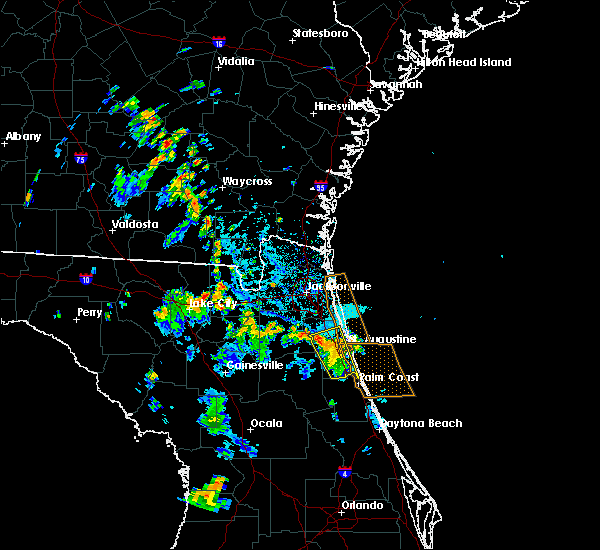 A severe thunderstorm warning remains in effect until 545 pm edt for central st. johns county. at 529 pm edt, a severe thunderstorm was located near picolata, or 9 miles east of green cove springs, moving northwest at 25 mph. hazard. 60 mph wind gusts and penny size hail. source. Radar indicated. A severe thunderstorm warning remains in effect until 545 pm edt for central st. johns county. at 529 pm edt, a severe thunderstorm was located near picolata, or 9 miles east of green cove springs, moving northwest at 25 mph. hazard. 60 mph wind gusts and penny size hail. source. Radar indicated.
|
| 7/11/2019 5:23 PM EDT | 911 call center reported a tree down on a powerline at 2225 pacetti road in st augustin in st. johns county FL, 3.4 miles NNW of World Golf Village, FL |
| 7/11/2019 5:21 PM EDT |
 A severe thunderstorm warning remains in effect until 545 pm edt for central st. johns county. at 521 pm edt, a severe thunderstorm was located near saint augustine shores, or 7 miles northeast of hastings, moving north at 20 mph. hazard. 60 mph wind gusts and penny size hail. source. Radar indicated. A severe thunderstorm warning remains in effect until 545 pm edt for central st. johns county. at 521 pm edt, a severe thunderstorm was located near saint augustine shores, or 7 miles northeast of hastings, moving north at 20 mph. hazard. 60 mph wind gusts and penny size hail. source. Radar indicated.
|
| 7/11/2019 5:08 PM EDT |
 A severe thunderstorm warning remains in effect until 545 pm edt for st. johns county. at 508 pm edt, a severe thunderstorm was located 7 miles southwest of saint augustine shores, or 8 miles east of hastings, moving north at 20 mph. hazard. 60 mph wind gusts and penny size hail. A severe thunderstorm warning remains in effect until 545 pm edt for st. johns county. at 508 pm edt, a severe thunderstorm was located 7 miles southwest of saint augustine shores, or 8 miles east of hastings, moving north at 20 mph. hazard. 60 mph wind gusts and penny size hail.
|
| 7/11/2019 4:56 PM EDT |
 The national weather service in jacksonville has issued a * severe thunderstorm warning for. st. johns county in northeastern florida. until 545 pm edt. At 456 pm edt, a severe thunderstorm was located 7 miles west of marineland, or 9 miles northwest of palm coast, moving north at 20. The national weather service in jacksonville has issued a * severe thunderstorm warning for. st. johns county in northeastern florida. until 545 pm edt. At 456 pm edt, a severe thunderstorm was located 7 miles west of marineland, or 9 miles northwest of palm coast, moving north at 20.
|
| 7/4/2019 3:10 PM EDT |
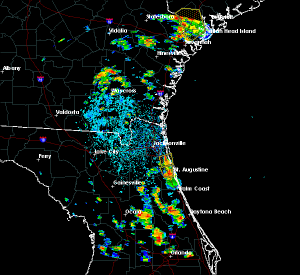 The severe thunderstorm warning for north central st. johns and southeastern duval counties will expire at 315 pm edt, the storm which prompted the warning has weakened below severe limits, and no longer poses an immediate threat to life or property. therefore, the warning will be allowed to expire. however gusty winds and heavy rain are still possible with this thunderstorm. to report severe weather, contact your nearest law enforcement agency. they will relay your report to the national weather service jacksonville. remember, a severe thunderstorm warning still remains in effect for central st. johns county until 330 pm edt,. The severe thunderstorm warning for north central st. johns and southeastern duval counties will expire at 315 pm edt, the storm which prompted the warning has weakened below severe limits, and no longer poses an immediate threat to life or property. therefore, the warning will be allowed to expire. however gusty winds and heavy rain are still possible with this thunderstorm. to report severe weather, contact your nearest law enforcement agency. they will relay your report to the national weather service jacksonville. remember, a severe thunderstorm warning still remains in effect for central st. johns county until 330 pm edt,.
|
| 7/4/2019 2:53 PM EDT |
 At 253 pm edt, a severe thunderstorm was located near saint augustine, moving north at 15 mph (radar indicated). Hazards include 60 mph wind gusts and penny size hail. expect damage to roofs, siding, and trees At 253 pm edt, a severe thunderstorm was located near saint augustine, moving north at 15 mph (radar indicated). Hazards include 60 mph wind gusts and penny size hail. expect damage to roofs, siding, and trees
|
| 7/4/2019 2:48 PM EDT |
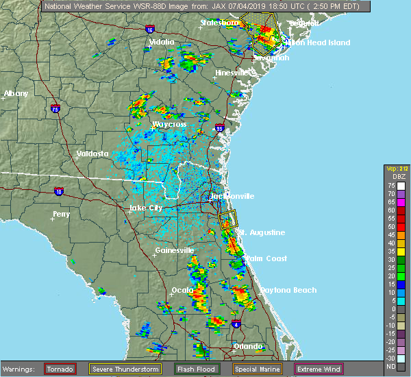 At 247 pm edt, a severe thunderstorm was located over nocatee, or 9 miles south of ponte vedra beach, moving north at 10 mph (radar indicated). Hazards include 60 mph wind gusts and penny size hail. expect damage to roofs, siding, and trees At 247 pm edt, a severe thunderstorm was located over nocatee, or 9 miles south of ponte vedra beach, moving north at 10 mph (radar indicated). Hazards include 60 mph wind gusts and penny size hail. expect damage to roofs, siding, and trees
|
| 6/30/2019 6:58 PM EDT |
 At 658 pm edt, a severe thunderstorm was located over world golf village, or 10 miles northwest of saint augustine, moving southeast at 15 mph (radar indicated). Hazards include 60 mph wind gusts. Expect damage to roofs, siding, and trees. Locations impacted include, saint augustine, world golf village, saint augustine beach, south ponte vedra, saint augustine shores, butler beach, vilano beach, saint augustine south, anastasia and bakersville. At 658 pm edt, a severe thunderstorm was located over world golf village, or 10 miles northwest of saint augustine, moving southeast at 15 mph (radar indicated). Hazards include 60 mph wind gusts. Expect damage to roofs, siding, and trees. Locations impacted include, saint augustine, world golf village, saint augustine beach, south ponte vedra, saint augustine shores, butler beach, vilano beach, saint augustine south, anastasia and bakersville.
|
| 6/30/2019 6:43 PM EDT |
 The national weather service in jacksonville has issued a * severe thunderstorm warning for. central st. johns county in northeastern florida. until 730 pm edt. At 643 pm edt, a severe thunderstorm was located over world golf village, or 10 miles southeast of fruit cove, moving southeast at. The national weather service in jacksonville has issued a * severe thunderstorm warning for. central st. johns county in northeastern florida. until 730 pm edt. At 643 pm edt, a severe thunderstorm was located over world golf village, or 10 miles southeast of fruit cove, moving southeast at.
|
| 6/23/2019 9:14 PM EDT |
 At 914 pm edt, a severe thunderstorm was located over world golf village, or 10 miles northwest of saint augustine, moving southeast at 20 mph (radar indicated). Hazards include 60 mph wind gusts and penny size hail. expect damage to roofs, siding, and trees At 914 pm edt, a severe thunderstorm was located over world golf village, or 10 miles northwest of saint augustine, moving southeast at 20 mph (radar indicated). Hazards include 60 mph wind gusts and penny size hail. expect damage to roofs, siding, and trees
|
| 6/23/2019 9:00 PM EDT |
 At 900 pm edt, a severe thunderstorm was located near south ponte vedra, or 9 miles northwest of saint augustine, moving southeast at 30 mph (radar indicated). Hazards include 60 mph wind gusts and penny size hail. Expect damage to roofs, siding, and trees. Locations impacted include, world golf village, durbin, south ponte vedra, guana river state park and nocatee. At 900 pm edt, a severe thunderstorm was located near south ponte vedra, or 9 miles northwest of saint augustine, moving southeast at 30 mph (radar indicated). Hazards include 60 mph wind gusts and penny size hail. Expect damage to roofs, siding, and trees. Locations impacted include, world golf village, durbin, south ponte vedra, guana river state park and nocatee.
|
| 6/23/2019 8:47 PM EDT |
 At 847 pm edt, a severe thunderstorm was located over fruit cove, moving southeast at 20 mph (radar indicated). Hazards include 60 mph wind gusts and penny size hail. expect damage to roofs, siding, and trees At 847 pm edt, a severe thunderstorm was located over fruit cove, moving southeast at 20 mph (radar indicated). Hazards include 60 mph wind gusts and penny size hail. expect damage to roofs, siding, and trees
|
| 6/22/2019 7:37 PM EDT |
 The severe thunderstorm warning for central st. johns and east central clay counties will expire at 745 pm edt, the storm which prompted the warning has weakened below severe limits, and no longer poses an immediate threat to life or property. therefore, the warning will be allowed to expire. however gusty winds are still possible with this thunderstorm. The severe thunderstorm warning for central st. johns and east central clay counties will expire at 745 pm edt, the storm which prompted the warning has weakened below severe limits, and no longer poses an immediate threat to life or property. therefore, the warning will be allowed to expire. however gusty winds are still possible with this thunderstorm.
|
| 6/22/2019 7:01 PM EDT |
 At 700 pm edt, a severe thunderstorm was located over picolata, or near green cove springs, moving southeast at 20 mph (radar indicated). Hazards include 60 mph wind gusts and quarter size hail. Hail damage to vehicles is expected. Expect wind damage to roofs, siding, and trees. At 700 pm edt, a severe thunderstorm was located over picolata, or near green cove springs, moving southeast at 20 mph (radar indicated). Hazards include 60 mph wind gusts and quarter size hail. Hail damage to vehicles is expected. Expect wind damage to roofs, siding, and trees.
|
| 5/5/2019 1:05 PM EDT |
 The severe thunderstorm warning for central flagler and southeastern st. johns counties will expire at 115 pm edt, the storms which prompted the warning have moved out of the area. therefore, the warning will be allowed to expire. however gusty winds and heavy rain are still possible with these thunderstorms. to report severe weather, contact your nearest law enforcement agency. they will relay your report to the national weather service jacksonville. The severe thunderstorm warning for central flagler and southeastern st. johns counties will expire at 115 pm edt, the storms which prompted the warning have moved out of the area. therefore, the warning will be allowed to expire. however gusty winds and heavy rain are still possible with these thunderstorms. to report severe weather, contact your nearest law enforcement agency. they will relay your report to the national weather service jacksonville.
|
| 5/5/2019 12:53 PM EDT |
 At 1252 pm edt, severe thunderstorms were located along a line extending from 6 miles west of saint augustine to saint augustine shores to near bunnell, moving northeast at 60 mph. weak rotation was evident east of bakersville (radar indicated). Hazards include 60 mph wind gusts. Expect damage to roofs, siding, and trees. Locations impacted include, palm coast, saint augustine, flagler beach, bunnell, world golf village, saint augustine beach, marineland, vilano beach, south ponte vedra and crescent beach. At 1252 pm edt, severe thunderstorms were located along a line extending from 6 miles west of saint augustine to saint augustine shores to near bunnell, moving northeast at 60 mph. weak rotation was evident east of bakersville (radar indicated). Hazards include 60 mph wind gusts. Expect damage to roofs, siding, and trees. Locations impacted include, palm coast, saint augustine, flagler beach, bunnell, world golf village, saint augustine beach, marineland, vilano beach, south ponte vedra and crescent beach.
|
| 5/5/2019 12:44 PM EDT |
 At 1244 pm edt, severe thunderstorms were located along a line extending from 7 miles east of picolata to near saint augustine shores to near bunnell, moving northeast at 50 mph (radar indicated). Hazards include 60 mph wind gusts. Expect damage to roofs, siding, and trees. Locations impacted include, palm coast, saint augustine, flagler beach, bunnell, world golf village, saint augustine beach, marineland, vilano beach, picolata and south ponte vedra. At 1244 pm edt, severe thunderstorms were located along a line extending from 7 miles east of picolata to near saint augustine shores to near bunnell, moving northeast at 50 mph (radar indicated). Hazards include 60 mph wind gusts. Expect damage to roofs, siding, and trees. Locations impacted include, palm coast, saint augustine, flagler beach, bunnell, world golf village, saint augustine beach, marineland, vilano beach, picolata and south ponte vedra.
|
| 5/5/2019 12:25 PM EDT |
 At 1224 pm edt, severe thunderstorms were located along a line extending from near bostwick to near orange mills to near crescent city, moving northeast at 45 mph (radar indicated). Hazards include 60 mph wind gusts. expect damage to roofs, siding, and trees At 1224 pm edt, severe thunderstorms were located along a line extending from near bostwick to near orange mills to near crescent city, moving northeast at 45 mph (radar indicated). Hazards include 60 mph wind gusts. expect damage to roofs, siding, and trees
|
| 4/19/2019 1:25 PM EDT |
 At 125 pm edt, severe thunderstorms were located along a line extending from sawgrass to near lake weir, moving east at 40 mph (radar indicated). Hazards include 60 mph wind gusts. expect damage to roofs, siding, and trees At 125 pm edt, severe thunderstorms were located along a line extending from sawgrass to near lake weir, moving east at 40 mph (radar indicated). Hazards include 60 mph wind gusts. expect damage to roofs, siding, and trees
|
| 4/19/2019 12:45 PM EDT |
 At 1244 pm edt, severe thunderstorms were located along a line extending from near green cove springs to 10 miles northeast of inverness highlands north, moving east at 50 mph (radar indicated). Hazards include 60 mph wind gusts. expect damage to roofs, siding, and trees At 1244 pm edt, severe thunderstorms were located along a line extending from near green cove springs to 10 miles northeast of inverness highlands north, moving east at 50 mph (radar indicated). Hazards include 60 mph wind gusts. expect damage to roofs, siding, and trees
|
| 11/15/2018 12:43 AM EST |
 At 1243 am est, a severe thunderstorm capable of producing a tornado was located near world golf village, or 8 miles northwest of saint augustine, moving northeast at 25 mph (radar indicated rotation). Hazards include tornado. Flying debris will be dangerous to those caught without shelter. mobile homes will be damaged or destroyed. damage to roofs, windows, and vehicles will occur. tree damage is likely. this dangerous storm will be near, vilano beach around 1250 am est. south ponte vedra around 100 am est. Guana river state park around 105 am est. At 1243 am est, a severe thunderstorm capable of producing a tornado was located near world golf village, or 8 miles northwest of saint augustine, moving northeast at 25 mph (radar indicated rotation). Hazards include tornado. Flying debris will be dangerous to those caught without shelter. mobile homes will be damaged or destroyed. damage to roofs, windows, and vehicles will occur. tree damage is likely. this dangerous storm will be near, vilano beach around 1250 am est. south ponte vedra around 100 am est. Guana river state park around 105 am est.
|
| 11/15/2018 12:38 AM EST |
 At 1238 am est, a severe thunderstorm was located near world golf village, or 8 miles northwest of saint augustine, moving northeast at 25 mph (radar indicated). Hazards include 60 mph wind gusts. expect damage to roofs, siding, and trees At 1238 am est, a severe thunderstorm was located near world golf village, or 8 miles northwest of saint augustine, moving northeast at 25 mph (radar indicated). Hazards include 60 mph wind gusts. expect damage to roofs, siding, and trees
|
| 10/10/2018 4:05 PM EDT |
 At 404 pm edt, severe thunderstorms were located along a line extending from picolata to near saint augustine to near marineland, moving north at 40 mph (radar indicated). Hazards include 60 mph wind gusts. expect damage to roofs, siding, and trees At 404 pm edt, severe thunderstorms were located along a line extending from picolata to near saint augustine to near marineland, moving north at 40 mph (radar indicated). Hazards include 60 mph wind gusts. expect damage to roofs, siding, and trees
|
| 10/9/2018 9:49 AM EDT |
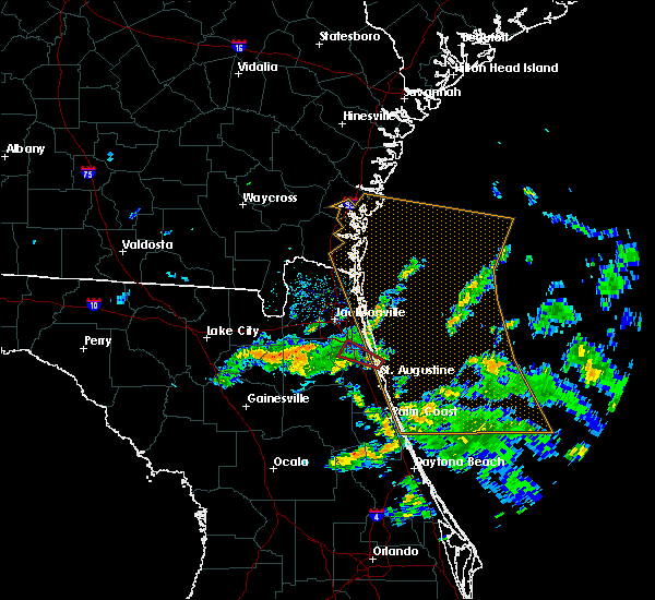 At 949 am edt, a severe thunderstorm capable of producing a tornado was located over south ponte vedra, or 7 miles north of saint augustine, moving west at 30 mph (radar indicated rotation). Hazards include tornado. Flying debris will be dangerous to those caught without shelter. mobile homes will be damaged or destroyed. damage to roofs, windows, and vehicles will occur. tree damage is likely. this dangerous storm will be near, nocatee around 1005 am edt. durbin around 1010 am edt. Fruit cove and bayard around 1015 am edt. At 949 am edt, a severe thunderstorm capable of producing a tornado was located over south ponte vedra, or 7 miles north of saint augustine, moving west at 30 mph (radar indicated rotation). Hazards include tornado. Flying debris will be dangerous to those caught without shelter. mobile homes will be damaged or destroyed. damage to roofs, windows, and vehicles will occur. tree damage is likely. this dangerous storm will be near, nocatee around 1005 am edt. durbin around 1010 am edt. Fruit cove and bayard around 1015 am edt.
|
| 9/16/2018 4:28 PM EDT |
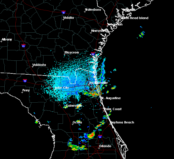 At 427 pm edt, a severe thunderstorm was located over durbin, or 8 miles east of fruit cove, moving northeast at 10 mph (radar indicated). Hazards include 60 mph wind gusts. expect damage to roofs, siding, and trees At 427 pm edt, a severe thunderstorm was located over durbin, or 8 miles east of fruit cove, moving northeast at 10 mph (radar indicated). Hazards include 60 mph wind gusts. expect damage to roofs, siding, and trees
|
| 8/9/2018 3:19 PM EDT |
 A severe thunderstorm warning remains in effect until 345 pm edt for central st. johns county. at 319 pm edt, a severe thunderstorm was located near world golf village, or 7 miles southeast of fruit cove, moving east at 15 mph. hazard. 60 mph wind gusts. source. Radar indicated. A severe thunderstorm warning remains in effect until 345 pm edt for central st. johns county. at 319 pm edt, a severe thunderstorm was located near world golf village, or 7 miles southeast of fruit cove, moving east at 15 mph. hazard. 60 mph wind gusts. source. Radar indicated.
|
| 8/9/2018 3:07 PM EDT |
 At 307 pm edt, a severe thunderstorm was located near switzerland, or near fruit cove, moving east at 25 mph (radar indicated). Hazards include 60 mph wind gusts. expect damage to roofs, siding, and trees At 307 pm edt, a severe thunderstorm was located near switzerland, or near fruit cove, moving east at 25 mph (radar indicated). Hazards include 60 mph wind gusts. expect damage to roofs, siding, and trees
|
| 7/27/2018 7:38 PM EDT |
 The severe thunderstorm warning for west central st. johns and east central clay counties will expire at 745 pm edt, the storm which prompted the warning has weakened below severe limits, and no longer poses an immediate threat to life or property. therefore, the warning will be allowed to expire. however gusty winds and heavy rain are still possible with this thunderstorm. The severe thunderstorm warning for west central st. johns and east central clay counties will expire at 745 pm edt, the storm which prompted the warning has weakened below severe limits, and no longer poses an immediate threat to life or property. therefore, the warning will be allowed to expire. however gusty winds and heavy rain are still possible with this thunderstorm.
|
| 7/27/2018 7:19 PM EDT |
 At 718 pm edt, a severe thunderstorm was located over picolata, or 7 miles southeast of green cove springs, moving southeast at 20 mph (radar indicated). Hazards include 60 mph wind gusts and penny size hail. Expect damage to roofs, siding, and trees. Locations impacted include, green cove springs, world golf village, picolata, switzerland and bakersville. At 718 pm edt, a severe thunderstorm was located over picolata, or 7 miles southeast of green cove springs, moving southeast at 20 mph (radar indicated). Hazards include 60 mph wind gusts and penny size hail. Expect damage to roofs, siding, and trees. Locations impacted include, green cove springs, world golf village, picolata, switzerland and bakersville.
|
| 7/27/2018 7:01 PM EDT |
 The national weather service in jacksonville has issued a * severe thunderstorm warning for. west central st. johns county in northeastern florida. northeastern clay county in northeastern florida. until 745 pm edt. At 701 pm edt, a severe thunderstorm was located near picolata, or. The national weather service in jacksonville has issued a * severe thunderstorm warning for. west central st. johns county in northeastern florida. northeastern clay county in northeastern florida. until 745 pm edt. At 701 pm edt, a severe thunderstorm was located near picolata, or.
|
| 7/21/2018 3:06 PM EDT |
 The severe thunderstorm warning for st. johns, northern putnam and southern clay counties will expire at 315 pm edt, the storms which prompted the warning have weakened below severe limits, and no longer pose an immediate threat to life or property. therefore, the warning will be allowed to expire. however gusty winds are still possible with these thunderstorms. to report severe weather, contact your nearest law enforcement agency. they will relay your report to the national weather service jacksonville. The severe thunderstorm warning for st. johns, northern putnam and southern clay counties will expire at 315 pm edt, the storms which prompted the warning have weakened below severe limits, and no longer pose an immediate threat to life or property. therefore, the warning will be allowed to expire. however gusty winds are still possible with these thunderstorms. to report severe weather, contact your nearest law enforcement agency. they will relay your report to the national weather service jacksonville.
|
| 7/21/2018 3:01 PM EDT |
 At 301 pm edt, severe thunderstorms were located along a line extending from south ponte vedra to near lake geneva, moving south at 40 mph (radar indicated). Hazards include 60 mph wind gusts. Expect damage to roofs, siding, and trees. Locations impacted include, saint augustine, palatka, interlachen, keystone heights, hastings, melrose, east palatka, world golf village, saint augustine beach and vilano beach. At 301 pm edt, severe thunderstorms were located along a line extending from south ponte vedra to near lake geneva, moving south at 40 mph (radar indicated). Hazards include 60 mph wind gusts. Expect damage to roofs, siding, and trees. Locations impacted include, saint augustine, palatka, interlachen, keystone heights, hastings, melrose, east palatka, world golf village, saint augustine beach and vilano beach.
|
| 7/21/2018 2:47 PM EDT |
 At 247 pm edt, severe thunderstorms were located along a line extending from near sawgrass to near camp blanding, moving south at 30 mph (radar indicated). Hazards include 60 mph wind gusts. Expect damage to roofs, siding, and trees. Locations impacted include, saint augustine, palatka, green cove springs, interlachen, keystone heights, hastings, melrose, east palatka, fruit cove and world golf village. At 247 pm edt, severe thunderstorms were located along a line extending from near sawgrass to near camp blanding, moving south at 30 mph (radar indicated). Hazards include 60 mph wind gusts. Expect damage to roofs, siding, and trees. Locations impacted include, saint augustine, palatka, green cove springs, interlachen, keystone heights, hastings, melrose, east palatka, fruit cove and world golf village.
|
| 7/21/2018 2:27 PM EDT |
 At 226 pm edt, severe thunderstorms were located along a line extending from neptune beach to near maxville, moving south at 30 mph (radar indicated). Hazards include 60 mph wind gusts. expect damage to roofs, siding, and trees At 226 pm edt, severe thunderstorms were located along a line extending from neptune beach to near maxville, moving south at 30 mph (radar indicated). Hazards include 60 mph wind gusts. expect damage to roofs, siding, and trees
|
| 6/28/2018 3:23 PM EDT |
 At 323 pm edt, a severe thunderstorm was located near vilano beach, or near saint augustine, moving southeast at 20 mph (radar indicated). Hazards include 60 mph wind gusts and penny size hail. Expect damage to roofs, siding, and trees. Locations impacted include, vilano beach, south ponte vedra and guana river state park. At 323 pm edt, a severe thunderstorm was located near vilano beach, or near saint augustine, moving southeast at 20 mph (radar indicated). Hazards include 60 mph wind gusts and penny size hail. Expect damage to roofs, siding, and trees. Locations impacted include, vilano beach, south ponte vedra and guana river state park.
|
| 6/28/2018 3:07 PM EDT |
 At 306 pm edt, a severe thunderstorm was located over guana river state park, or 10 miles south of ponte vedra beach, moving southeast at 20 mph (radar indicated). Hazards include 60 mph wind gusts and penny size hail. Expect damage to roofs, siding, and trees. Locations impacted include, palm valley, sawgrass, nocatee, south ponte vedra, durbin, vilano beach and guana river state park. At 306 pm edt, a severe thunderstorm was located over guana river state park, or 10 miles south of ponte vedra beach, moving southeast at 20 mph (radar indicated). Hazards include 60 mph wind gusts and penny size hail. Expect damage to roofs, siding, and trees. Locations impacted include, palm valley, sawgrass, nocatee, south ponte vedra, durbin, vilano beach and guana river state park.
|
| 6/28/2018 2:56 PM EDT |
 At 255 pm edt, a severe thunderstorm was located over nocatee, or 10 miles south of ponte vedra beach, moving southeast at 25 mph (radar indicated). Hazards include 60 mph wind gusts and nickel size hail. expect damage to roofs, siding, and trees At 255 pm edt, a severe thunderstorm was located over nocatee, or 10 miles south of ponte vedra beach, moving southeast at 25 mph (radar indicated). Hazards include 60 mph wind gusts and nickel size hail. expect damage to roofs, siding, and trees
|
| 6/21/2018 3:54 PM EDT |
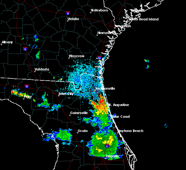 At 354 pm edt, a severe thunderstorm was located over durbin, or 9 miles east of fruit cove, moving south at 5 mph (radar indicated). Hazards include 60 mph wind gusts and penny size hail. Expect damage to roofs, siding, and trees. Locations impacted include, world golf village, nocatee and durbin. At 354 pm edt, a severe thunderstorm was located over durbin, or 9 miles east of fruit cove, moving south at 5 mph (radar indicated). Hazards include 60 mph wind gusts and penny size hail. Expect damage to roofs, siding, and trees. Locations impacted include, world golf village, nocatee and durbin.
|
| 6/21/2018 3:43 PM EDT |
 The national weather service in jacksonville has issued a * severe thunderstorm warning for. north central st. johns county in northeastern florida. southern duval county in northeastern florida. until 430 pm edt. At 343 pm edt, a severe thunderstorm was located over durbin, or 8. The national weather service in jacksonville has issued a * severe thunderstorm warning for. north central st. johns county in northeastern florida. southern duval county in northeastern florida. until 430 pm edt. At 343 pm edt, a severe thunderstorm was located over durbin, or 8.
|
| 6/4/2018 5:25 PM EDT |
 The severe thunderstorm warning for east central st. johns county will expire at 530 pm edt, the storm which prompted the warning has weakened below severe limits, and has exited the warned area. therefore, the warning will be allowed to expire. however heavy rain is still possible with this thunderstorm. to report severe weather, contact your nearest law enforcement agency. they will relay your report to the national weather service jacksonville. The severe thunderstorm warning for east central st. johns county will expire at 530 pm edt, the storm which prompted the warning has weakened below severe limits, and has exited the warned area. therefore, the warning will be allowed to expire. however heavy rain is still possible with this thunderstorm. to report severe weather, contact your nearest law enforcement agency. they will relay your report to the national weather service jacksonville.
|
| 6/4/2018 5:15 PM EDT |
 At 514 pm edt, a severe thunderstorm was located over saint augustine, moving southeast at 25 mph (radar indicated). Hazards include 60 mph wind gusts and quarter size hail. Hail damage to vehicles is expected. Expect wind damage to roofs, siding, and trees. At 514 pm edt, a severe thunderstorm was located over saint augustine, moving southeast at 25 mph (radar indicated). Hazards include 60 mph wind gusts and quarter size hail. Hail damage to vehicles is expected. Expect wind damage to roofs, siding, and trees.
|
| 6/4/2018 5:09 PM EDT |
 At 508 pm edt, a severe thunderstorm was located near vilano beach, or near saint augustine, moving east at 25 mph (radar indicated). Hazards include 60 mph wind gusts and quarter size hail. Hail damage to vehicles is expected. expect wind damage to roofs, siding, and trees. Locations impacted include, saint augustine, saint augustine beach, vilano beach, saint augustine south, saint augustine shores, butler beach and anastasia. At 508 pm edt, a severe thunderstorm was located near vilano beach, or near saint augustine, moving east at 25 mph (radar indicated). Hazards include 60 mph wind gusts and quarter size hail. Hail damage to vehicles is expected. expect wind damage to roofs, siding, and trees. Locations impacted include, saint augustine, saint augustine beach, vilano beach, saint augustine south, saint augustine shores, butler beach and anastasia.
|
| 6/4/2018 4:58 PM EDT |
 The national weather service in jacksonville has issued a * severe thunderstorm warning for. central st. johns county in northeastern florida. until 515 pm edt. At 458 pm edt, a severe thunderstorm was located near world golf village, or 8 miles northwest of saint augustine, moving east at 25. The national weather service in jacksonville has issued a * severe thunderstorm warning for. central st. johns county in northeastern florida. until 515 pm edt. At 458 pm edt, a severe thunderstorm was located near world golf village, or 8 miles northwest of saint augustine, moving east at 25.
|
| 6/3/2018 8:01 PM EDT |
 At 800 pm edt, a severe thunderstorm was located over green cove springs, moving east at 15 mph (radar indicated). Hazards include 60 mph wind gusts and quarter size hail. Hail damage to vehicles is expected. expect wind damage to roofs, siding, and trees. Locations impacted include, green cove springs, fruit cove, fleming island, picolata, switzerland, penney farms and bakersville. At 800 pm edt, a severe thunderstorm was located over green cove springs, moving east at 15 mph (radar indicated). Hazards include 60 mph wind gusts and quarter size hail. Hail damage to vehicles is expected. expect wind damage to roofs, siding, and trees. Locations impacted include, green cove springs, fruit cove, fleming island, picolata, switzerland, penney farms and bakersville.
|
| 6/3/2018 7:49 PM EDT |
 At 748 pm edt, a severe thunderstorm was located near green cove springs, moving east at 15 mph (radar indicated). Hazards include 60 mph wind gusts and quarter size hail. Hail damage to vehicles is expected. Expect wind damage to roofs, siding, and trees. At 748 pm edt, a severe thunderstorm was located near green cove springs, moving east at 15 mph (radar indicated). Hazards include 60 mph wind gusts and quarter size hail. Hail damage to vehicles is expected. Expect wind damage to roofs, siding, and trees.
|
| 6/2/2018 7:07 PM EDT |
 At 706 pm edt, a severe thunderstorm was located near vilano beach, or near saint augustine, moving east at 25 mph (radar indicated). Hazards include 60 mph wind gusts. Expect damage to roofs, siding, and trees. Locations impacted include, saint augustine, world golf village, saint augustine beach, south ponte vedra, vilano beach, saint augustine south, anastasia and bakersville. At 706 pm edt, a severe thunderstorm was located near vilano beach, or near saint augustine, moving east at 25 mph (radar indicated). Hazards include 60 mph wind gusts. Expect damage to roofs, siding, and trees. Locations impacted include, saint augustine, world golf village, saint augustine beach, south ponte vedra, vilano beach, saint augustine south, anastasia and bakersville.
|
| 6/2/2018 6:36 PM EDT |
 The national weather service in jacksonville has issued a * severe thunderstorm warning for. central st. johns county in northeastern florida. east central clay county in northeastern florida. until 715 pm edt. At 636 pm edt, a severe thunderstorm was located near world golf. The national weather service in jacksonville has issued a * severe thunderstorm warning for. central st. johns county in northeastern florida. east central clay county in northeastern florida. until 715 pm edt. At 636 pm edt, a severe thunderstorm was located near world golf.
|
| 5/16/2018 4:45 PM EDT | Tree fell across international golf parkway about 1 mile west of u.s 1. time estimated from rada in st. johns county FL, 6.4 miles WSW of World Golf Village, FL |
| 4/15/2018 3:35 PM EDT |
 At 334 pm edt, severe thunderstorms were located along a line extending from near fernandina beach to near world golf village to near pierson, moving northeast at 40 mph (radar indicated). Hazards include 60 mph wind gusts. Expect damage to roofs, siding, and trees. locations impacted include, palm coast, saint augustine, fernandina beach, flagler beach, bunnell, hastings, unf, fruit cove, arlington and andalusia. A tornado watch remains in effect until 600 pm edt for northeastern florida. At 334 pm edt, severe thunderstorms were located along a line extending from near fernandina beach to near world golf village to near pierson, moving northeast at 40 mph (radar indicated). Hazards include 60 mph wind gusts. Expect damage to roofs, siding, and trees. locations impacted include, palm coast, saint augustine, fernandina beach, flagler beach, bunnell, hastings, unf, fruit cove, arlington and andalusia. A tornado watch remains in effect until 600 pm edt for northeastern florida.
|
| 4/15/2018 3:22 PM EDT |
 At 321 pm edt, severe thunderstorms were located along a line extending from near baymeadows to near crescent city, moving northeast at 40 mph (radar indicated). Hazards include 60 mph wind gusts. expect damage to roofs, siding, and trees At 321 pm edt, severe thunderstorms were located along a line extending from near baymeadows to near crescent city, moving northeast at 40 mph (radar indicated). Hazards include 60 mph wind gusts. expect damage to roofs, siding, and trees
|
| 4/15/2018 3:04 PM EDT |
 At 303 pm edt, severe thunderstorms were located along a line extending from 6 miles south of kings ferry to jacksonville international arpt to 6 miles southwest of green cove springs, moving northeast at 40 mph (radar indicated). Hazards include 70 mph wind gusts. Expect considerable tree damage. damage is likely to mobile homes, roofs, and outbuildings. locations impacted include, jacksonville, orange park, green cove springs, callahan, jacksonville international arpt, mandarin, fruit cove, arlington, middleburg and yulee. A tornado watch remains in effect until 600 pm edt for northeastern florida, and southeastern georgia. At 303 pm edt, severe thunderstorms were located along a line extending from 6 miles south of kings ferry to jacksonville international arpt to 6 miles southwest of green cove springs, moving northeast at 40 mph (radar indicated). Hazards include 70 mph wind gusts. Expect considerable tree damage. damage is likely to mobile homes, roofs, and outbuildings. locations impacted include, jacksonville, orange park, green cove springs, callahan, jacksonville international arpt, mandarin, fruit cove, arlington, middleburg and yulee. A tornado watch remains in effect until 600 pm edt for northeastern florida, and southeastern georgia.
|
| 4/15/2018 2:45 PM EDT |
 At 245 pm edt, severe thunderstorms were located along a line extending from bryceville to cecil field to near interlachen, moving northeast at 50 mph (radar indicated). Hazards include 70 mph wind gusts. Expect considerable tree damage. Damage is likely to mobile homes, roofs, and outbuildings. At 245 pm edt, severe thunderstorms were located along a line extending from bryceville to cecil field to near interlachen, moving northeast at 50 mph (radar indicated). Hazards include 70 mph wind gusts. Expect considerable tree damage. Damage is likely to mobile homes, roofs, and outbuildings.
|
| 4/10/2018 8:21 AM EDT | Half Dollar sized hail reported 1 miles WNW of World Golf Village, FL, hail reported in murabella subdivision. |
| 4/10/2018 8:21 AM EDT |
 At 821 am edt, a severe thunderstorm was located near world golf village, or 9 miles northwest of saint augustine, moving northeast at 40 mph (radar indicated). Hazards include golf ball size hail. People and animals outdoors will be injured. expect hail damage to roofs, siding, windows, and vehicles. expect wind damage to roofs, siding, and trees. Locations impacted include, saint augustine, world golf village, vilano beach, south ponte vedra, guana river state park and bakersville. At 821 am edt, a severe thunderstorm was located near world golf village, or 9 miles northwest of saint augustine, moving northeast at 40 mph (radar indicated). Hazards include golf ball size hail. People and animals outdoors will be injured. expect hail damage to roofs, siding, windows, and vehicles. expect wind damage to roofs, siding, and trees. Locations impacted include, saint augustine, world golf village, vilano beach, south ponte vedra, guana river state park and bakersville.
|
| 4/10/2018 8:16 AM EDT | Golf Ball sized hail reported 0.6 miles NNW of World Golf Village, FL, numerous reports of ping pong to golf ball size hail in the world golf village in murabella... pacetti bay middle school and sumara lakes. |
| 4/10/2018 8:15 AM EDT | Tea Cup sized hail reported 1.8 miles SSW of World Golf Village, FL, 3 inch hail occurred in the trunberry neighborhood near edge of the woods road. |
| 4/10/2018 8:15 AM EDT | Tea Cup sized hail reported 0.9 miles W of World Golf Village, FL, 1.5 miles south of pacetti road and sr-16 |
| 4/10/2018 8:14 AM EDT |
 At 813 am edt, a severe thunderstorm was located near world golf village, or 11 miles west of saint augustine, moving northeast at 40 mph (radar indicated). Hazards include 60 mph wind gusts and quarter size hail. Hail damage to vehicles is expected. expect wind damage to roofs, siding, and trees. Locations impacted include, saint augustine, world golf village, vilano beach, south ponte vedra, guana river state park and bakersville. At 813 am edt, a severe thunderstorm was located near world golf village, or 11 miles west of saint augustine, moving northeast at 40 mph (radar indicated). Hazards include 60 mph wind gusts and quarter size hail. Hail damage to vehicles is expected. expect wind damage to roofs, siding, and trees. Locations impacted include, saint augustine, world golf village, vilano beach, south ponte vedra, guana river state park and bakersville.
|
| 3/20/2018 1:52 PM EDT |
 The severe thunderstorm warning for northwestern st. johns, northeastern clay and southeastern duval counties will expire at 200 pm edt, the storm which prompted the warning has weakened below severe limits, and has exited the warned area. therefore, the warning will be allowed to expire. however small hail, gusty winds and heavy rain are still possible with this thunderstorm. a tornado watch remains in effect until 700 pm edt for northeastern florida. The severe thunderstorm warning for northwestern st. johns, northeastern clay and southeastern duval counties will expire at 200 pm edt, the storm which prompted the warning has weakened below severe limits, and has exited the warned area. therefore, the warning will be allowed to expire. however small hail, gusty winds and heavy rain are still possible with this thunderstorm. a tornado watch remains in effect until 700 pm edt for northeastern florida.
|
| 3/20/2018 1:42 PM EDT |
 At 142 pm edt, a severe thunderstorm was located over fleming island, or near orange park, moving northeast at 50 mph (radar indicated). Hazards include 60 mph wind gusts and quarter size hail. Hail damage to vehicles is expected. expect wind damage to roofs, siding, and trees. locations impacted include, orange park, green cove springs, unf, mandarin, fruit cove, ponte vedra beach, neptune beach, sawgrass, fleming island and baymeadows. A tornado watch remains in effect until 700 pm edt for northeastern florida. At 142 pm edt, a severe thunderstorm was located over fleming island, or near orange park, moving northeast at 50 mph (radar indicated). Hazards include 60 mph wind gusts and quarter size hail. Hail damage to vehicles is expected. expect wind damage to roofs, siding, and trees. locations impacted include, orange park, green cove springs, unf, mandarin, fruit cove, ponte vedra beach, neptune beach, sawgrass, fleming island and baymeadows. A tornado watch remains in effect until 700 pm edt for northeastern florida.
|
| 3/20/2018 1:32 PM EDT |
 At 131 pm edt, a severe thunderstorm was located over middleburg, moving northeast at 50 mph (radar indicated). Hazards include 60 mph wind gusts and penny size hail. Expect damage to roofs, siding, and trees. locations impacted include, jacksonville, orange park, green cove springs, unf, mandarin, fruit cove, arlington, middleburg, ponte vedra beach and neptune beach. A tornado watch remains in effect until 700 pm edt for northeastern florida. At 131 pm edt, a severe thunderstorm was located over middleburg, moving northeast at 50 mph (radar indicated). Hazards include 60 mph wind gusts and penny size hail. Expect damage to roofs, siding, and trees. locations impacted include, jacksonville, orange park, green cove springs, unf, mandarin, fruit cove, arlington, middleburg, ponte vedra beach and neptune beach. A tornado watch remains in effect until 700 pm edt for northeastern florida.
|
| 3/20/2018 1:20 PM EDT |
 At 120 pm edt, a severe thunderstorm was located over kingsley, or near starke, moving northeast at 50 mph (radar indicated). Hazards include 60 mph wind gusts and penny size hail. expect damage to roofs, siding, and trees At 120 pm edt, a severe thunderstorm was located over kingsley, or near starke, moving northeast at 50 mph (radar indicated). Hazards include 60 mph wind gusts and penny size hail. expect damage to roofs, siding, and trees
|
| 9/10/2017 8:07 PM EDT |
 The tornado warning for central st. johns county will expire at 815 pm edt, the storm which prompted the warning has weakened below severe limits, and no longer appears capable of producing a tornado. therefore the warning will be allowed to expire. a tornado watch remains in effect until midnight edt for northeastern florida. The tornado warning for central st. johns county will expire at 815 pm edt, the storm which prompted the warning has weakened below severe limits, and no longer appears capable of producing a tornado. therefore the warning will be allowed to expire. a tornado watch remains in effect until midnight edt for northeastern florida.
|
| 9/10/2017 8:02 PM EDT |
 At 802 pm edt, a severe thunderstorm capable of producing a tornado was located near world golf village, or 7 miles northwest of saint augustine, moving west at 40 mph (radar indicated rotation). Hazards include tornado. Flying debris will be dangerous to those caught without shelter. mobile homes will be damaged or destroyed. damage to roofs, windows, and vehicles will occur. tree damage is likely. This dangerous storm will be near, world golf village around 805 pm edt. At 802 pm edt, a severe thunderstorm capable of producing a tornado was located near world golf village, or 7 miles northwest of saint augustine, moving west at 40 mph (radar indicated rotation). Hazards include tornado. Flying debris will be dangerous to those caught without shelter. mobile homes will be damaged or destroyed. damage to roofs, windows, and vehicles will occur. tree damage is likely. This dangerous storm will be near, world golf village around 805 pm edt.
|
| 9/10/2017 7:53 PM EDT |
 At 752 pm edt, a severe thunderstorm capable of producing a tornado was located over vilano beach, or near saint augustine, moving west at 45 mph (radar indicated rotation). Hazards include tornado. Flying debris will be dangerous to those caught without shelter. mobile homes will be damaged or destroyed. damage to roofs, windows, and vehicles will occur. tree damage is likely. This dangerous storm will be near, world golf village around 805 pm edt. At 752 pm edt, a severe thunderstorm capable of producing a tornado was located over vilano beach, or near saint augustine, moving west at 45 mph (radar indicated rotation). Hazards include tornado. Flying debris will be dangerous to those caught without shelter. mobile homes will be damaged or destroyed. damage to roofs, windows, and vehicles will occur. tree damage is likely. This dangerous storm will be near, world golf village around 805 pm edt.
|
| 9/10/2017 7:42 PM EDT |
 At 741 pm edt, a severe thunderstorm capable of producing a tornado was located near vilano beach, or 8 miles northeast of saint augustine, moving west at 40 mph (radar indicated rotation). Hazards include tornado. Flying debris will be dangerous to those caught without shelter. mobile homes will be damaged or destroyed. damage to roofs, windows, and vehicles will occur. tree damage is likely. this dangerous storm will be near, vilano beach around 750 pm edt. saint augustine and south ponte vedra around 755 pm edt. World golf village around 805 pm edt. At 741 pm edt, a severe thunderstorm capable of producing a tornado was located near vilano beach, or 8 miles northeast of saint augustine, moving west at 40 mph (radar indicated rotation). Hazards include tornado. Flying debris will be dangerous to those caught without shelter. mobile homes will be damaged or destroyed. damage to roofs, windows, and vehicles will occur. tree damage is likely. this dangerous storm will be near, vilano beach around 750 pm edt. saint augustine and south ponte vedra around 755 pm edt. World golf village around 805 pm edt.
|
| 9/10/2017 4:39 PM EDT |
 At 439 pm edt, a severe thunderstorm capable of producing a tornado was located near saint augustine beach, or 8 miles east of saint augustine, moving west at 35 mph (radar indicated rotation). Hazards include tornado. Flying debris will be dangerous to those caught without shelter. mobile homes will be damaged or destroyed. damage to roofs, windows, and vehicles will occur. tree damage is likely. this dangerous storm will be near, saint augustine beach, butler beach and crescent beach around 450 pm edt. saint augustine, saint augustine south and saint augustine shores around 455 pm edt. Other locations impacted by this tornadic thunderstorm include spuds, anastasia, dupont center, elkton and bakersville. At 439 pm edt, a severe thunderstorm capable of producing a tornado was located near saint augustine beach, or 8 miles east of saint augustine, moving west at 35 mph (radar indicated rotation). Hazards include tornado. Flying debris will be dangerous to those caught without shelter. mobile homes will be damaged or destroyed. damage to roofs, windows, and vehicles will occur. tree damage is likely. this dangerous storm will be near, saint augustine beach, butler beach and crescent beach around 450 pm edt. saint augustine, saint augustine south and saint augustine shores around 455 pm edt. Other locations impacted by this tornadic thunderstorm include spuds, anastasia, dupont center, elkton and bakersville.
|
| 8/31/2017 7:01 PM EDT |
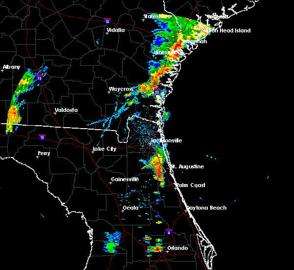 At 700 pm edt, a severe thunderstorm was located near picolata, or 10 miles southeast of green cove springs, moving southeast at 10 mph (radar indicated). Hazards include 60 mph wind gusts. possible tornado. Expect damage to roofs, siding, and trees. Locations impacted include, bakersville. At 700 pm edt, a severe thunderstorm was located near picolata, or 10 miles southeast of green cove springs, moving southeast at 10 mph (radar indicated). Hazards include 60 mph wind gusts. possible tornado. Expect damage to roofs, siding, and trees. Locations impacted include, bakersville.
|
| 8/31/2017 6:43 PM EDT |
 At 643 pm edt, a severe thunderstorm was located near picolata, or 10 miles southeast of green cove springs, moving northeast at 20 mph (radar indicated). Hazards include 60 mph wind gusts. expect damage to roofs, siding, and trees At 643 pm edt, a severe thunderstorm was located near picolata, or 10 miles southeast of green cove springs, moving northeast at 20 mph (radar indicated). Hazards include 60 mph wind gusts. expect damage to roofs, siding, and trees
|
| 7/29/2017 3:53 PM EDT |
 At 353 pm edt, a severe thunderstorm was located over world golf village, or 10 miles southeast of fruit cove, moving east at 35 mph (radar indicated). Hazards include 60 mph wind gusts. Expect damage to roofs, siding, and trees. Locations impacted include, saint augustine, world golf village, saint augustine beach, nocatee, durbin, vilano beach, palm valley, south ponte vedra, guana river state park and sawgrass. At 353 pm edt, a severe thunderstorm was located over world golf village, or 10 miles southeast of fruit cove, moving east at 35 mph (radar indicated). Hazards include 60 mph wind gusts. Expect damage to roofs, siding, and trees. Locations impacted include, saint augustine, world golf village, saint augustine beach, nocatee, durbin, vilano beach, palm valley, south ponte vedra, guana river state park and sawgrass.
|
| 7/29/2017 3:37 PM EDT |
 At 337 pm edt, a severe thunderstorm was located over green cove springs, moving east at 35 mph (radar indicated). Hazards include 60 mph wind gusts. Expect damage to roofs, siding, and trees. Locations impacted include, saint augustine, green cove springs, fruit cove, world golf village, saint augustine beach, sawgrass, nocatee, durbin, vilano beach and switzerland. At 337 pm edt, a severe thunderstorm was located over green cove springs, moving east at 35 mph (radar indicated). Hazards include 60 mph wind gusts. Expect damage to roofs, siding, and trees. Locations impacted include, saint augustine, green cove springs, fruit cove, world golf village, saint augustine beach, sawgrass, nocatee, durbin, vilano beach and switzerland.
|
| 7/29/2017 3:27 PM EDT |
 At 327 pm edt, a severe thunderstorm was located near green cove springs, moving east at 30 mph (radar indicated). Hazards include 60 mph wind gusts. expect damage to roofs, siding, and trees At 327 pm edt, a severe thunderstorm was located near green cove springs, moving east at 30 mph (radar indicated). Hazards include 60 mph wind gusts. expect damage to roofs, siding, and trees
|
| 7/22/2017 3:40 PM EDT | Tree reported down near colee cove roa in st. johns county FL, 4 miles E of World Golf Village, FL |
| 7/22/2017 3:31 PM EDT |
 At 330 pm edt, a severe thunderstorm was located over green cove springs, moving northeast at 35 mph (radar indicated). Hazards include 60 mph wind gusts. Expect damage to roofs, siding, and trees. Locations impacted include, green cove springs, fruit cove, switzerland, picolata, fleming island and penney farms. At 330 pm edt, a severe thunderstorm was located over green cove springs, moving northeast at 35 mph (radar indicated). Hazards include 60 mph wind gusts. Expect damage to roofs, siding, and trees. Locations impacted include, green cove springs, fruit cove, switzerland, picolata, fleming island and penney farms.
|
| 7/22/2017 3:09 PM EDT |
 At 309 pm edt, a severe thunderstorm was located near george`s lake, or 11 miles northeast of keystone heights, moving northeast at 35 mph (radar indicated). Hazards include 60 mph wind gusts. expect damage to roofs, siding, and trees At 309 pm edt, a severe thunderstorm was located near george`s lake, or 11 miles northeast of keystone heights, moving northeast at 35 mph (radar indicated). Hazards include 60 mph wind gusts. expect damage to roofs, siding, and trees
|
| 7/22/2017 3:00 PM EDT |
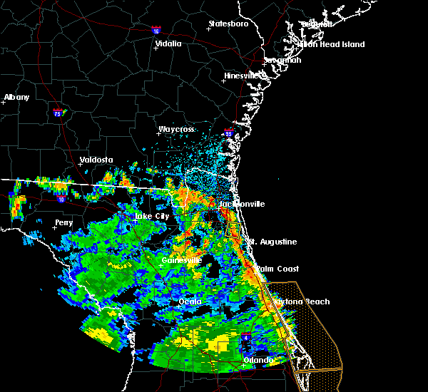 At 300 pm edt, a severe thunderstorm was located over durbin, or 8 miles east of fruit cove, moving north at 5 mph (radar indicated). Hazards include 60 mph wind gusts. Expect damage to roofs, siding, and trees. Locations impacted include, nocatee, durbin and bayard. At 300 pm edt, a severe thunderstorm was located over durbin, or 8 miles east of fruit cove, moving north at 5 mph (radar indicated). Hazards include 60 mph wind gusts. Expect damage to roofs, siding, and trees. Locations impacted include, nocatee, durbin and bayard.
|
| 7/22/2017 2:46 PM EDT |
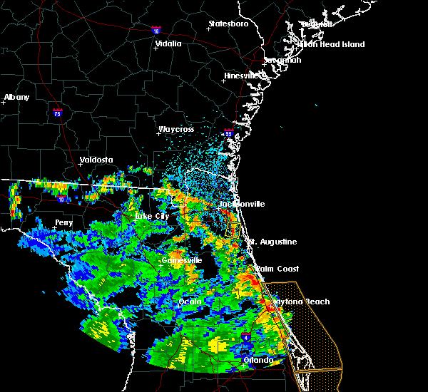 At 245 pm edt, a severe thunderstorm was located over durbin, or 8 miles east of fruit cove, and is nearly stationary or drifting north (radar indicated). Hazards include 60 mph wind gusts and penny size hail. expect damage to roofs, siding, and trees At 245 pm edt, a severe thunderstorm was located over durbin, or 8 miles east of fruit cove, and is nearly stationary or drifting north (radar indicated). Hazards include 60 mph wind gusts and penny size hail. expect damage to roofs, siding, and trees
|
| 7/17/2017 2:50 PM EDT |
 At 250 pm edt, a severe thunderstorm was located near world golf village, or 8 miles west of saint augustine, moving southeast at 15 mph (radar indicated). Hazards include 60 mph wind gusts and penny size hail. Expect damage to roofs, siding, and trees. Locations impacted include, world golf village and bakersville. At 250 pm edt, a severe thunderstorm was located near world golf village, or 8 miles west of saint augustine, moving southeast at 15 mph (radar indicated). Hazards include 60 mph wind gusts and penny size hail. Expect damage to roofs, siding, and trees. Locations impacted include, world golf village and bakersville.
|
| 7/17/2017 2:28 PM EDT |
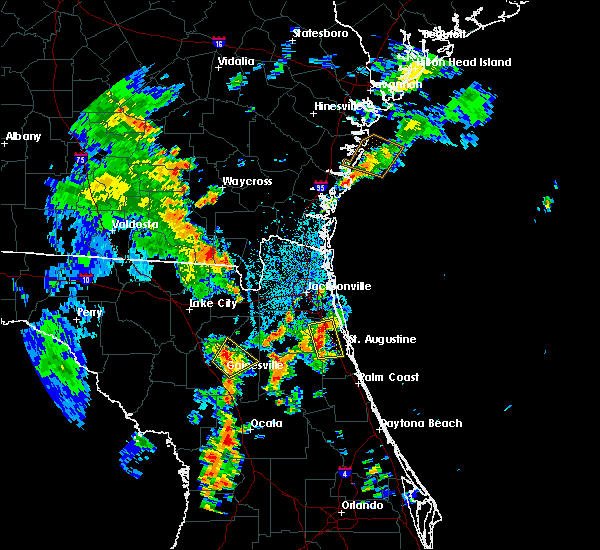 At 228 pm edt, a severe thunderstorm was located over world golf village, or 11 miles southeast of fruit cove, moving south at 10 mph (radar indicated). Hazards include 60 mph wind gusts and penny size hail. expect damage to roofs, siding, and trees At 228 pm edt, a severe thunderstorm was located over world golf village, or 11 miles southeast of fruit cove, moving south at 10 mph (radar indicated). Hazards include 60 mph wind gusts and penny size hail. expect damage to roofs, siding, and trees
|
| 7/16/2017 3:00 PM EDT |
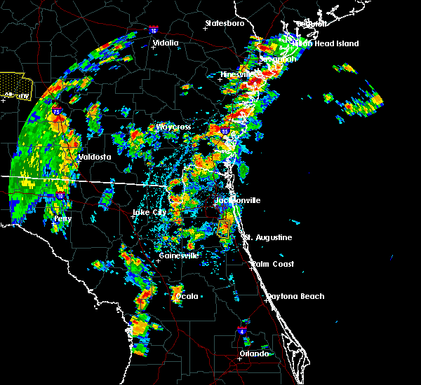 At 300 pm edt, a severe thunderstorm was located near durbin, or near fruit cove, moving south at 10 mph (radar indicated). Hazards include 60 mph wind gusts and penny size hail. Expect damage to roofs, siding, and trees. this severe thunderstorm will remain over mainly rural areas of northwestern st. Johns and southern duval counties. At 300 pm edt, a severe thunderstorm was located near durbin, or near fruit cove, moving south at 10 mph (radar indicated). Hazards include 60 mph wind gusts and penny size hail. Expect damage to roofs, siding, and trees. this severe thunderstorm will remain over mainly rural areas of northwestern st. Johns and southern duval counties.
|
| 7/16/2017 2:41 PM EDT |
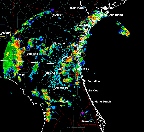 The national weather service in jacksonville has issued a * severe thunderstorm warning for. northwestern st. johns county in northeastern florida. southeastern duval county in northeastern florida. Until 330 pm edt * at 241 pm edt, a severe thunderstorm was located over bayard, or. The national weather service in jacksonville has issued a * severe thunderstorm warning for. northwestern st. johns county in northeastern florida. southeastern duval county in northeastern florida. Until 330 pm edt * at 241 pm edt, a severe thunderstorm was located over bayard, or.
|
| 7/3/2017 6:38 PM EDT |
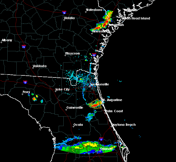 At 638 pm edt, a severe thunderstorm was located near federal point, or near hastings, moving east at 5 mph (radar indicated). Hazards include 60 mph wind gusts and quarter size hail. Hail damage to vehicles is expected. expect wind damage to roofs, siding, and trees. Locations impacted include, hastings, bostwick, federal point, spuds, elkton and bakersville. At 638 pm edt, a severe thunderstorm was located near federal point, or near hastings, moving east at 5 mph (radar indicated). Hazards include 60 mph wind gusts and quarter size hail. Hail damage to vehicles is expected. expect wind damage to roofs, siding, and trees. Locations impacted include, hastings, bostwick, federal point, spuds, elkton and bakersville.
|
| 7/3/2017 6:31 PM EDT |
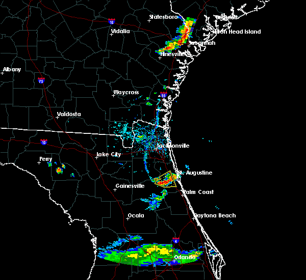 At 630 pm edt, a severe thunderstorm was located near federal point, or near hastings, moving east at 5 mph (radar indicated). Hazards include 60 mph wind gusts. expect damage to roofs, siding, and trees At 630 pm edt, a severe thunderstorm was located near federal point, or near hastings, moving east at 5 mph (radar indicated). Hazards include 60 mph wind gusts. expect damage to roofs, siding, and trees
|
| 6/30/2017 6:53 PM EDT |
 At 653 pm edt, a severe thunderstorm was located near bostwick, or 10 miles south of green cove springs, moving southeast at 10 mph (radar indicated). Hazards include 60 mph wind gusts and penny size hail. Expect damage to roofs, siding, and trees. Locations impacted include, hastings, bostwick, federal point, picolata and bakersville. At 653 pm edt, a severe thunderstorm was located near bostwick, or 10 miles south of green cove springs, moving southeast at 10 mph (radar indicated). Hazards include 60 mph wind gusts and penny size hail. Expect damage to roofs, siding, and trees. Locations impacted include, hastings, bostwick, federal point, picolata and bakersville.
|
| 6/30/2017 6:42 PM EDT |
 At 642 pm edt, a severe thunderstorm was located near picolata, or 7 miles south of green cove springs, moving southeast at 10 mph (radar indicated). Hazards include 60 mph wind gusts and penny size hail. expect damage to roofs, siding, and trees At 642 pm edt, a severe thunderstorm was located near picolata, or 7 miles south of green cove springs, moving southeast at 10 mph (radar indicated). Hazards include 60 mph wind gusts and penny size hail. expect damage to roofs, siding, and trees
|
| 6/26/2017 6:07 PM EDT |
 At 606 pm edt, severe thunderstorms were located along a line extending from near guana river state park to near george`s lake, moving south at 10 mph (radar indicated). Hazards include 60 mph wind gusts and penny size hail. Expect damage to roofs, siding, and trees. Locations impacted include, saint augustine, palatka, interlachen, hastings, east palatka, world golf village, saint augustine beach, marineland, vilano beach and florahome. At 606 pm edt, severe thunderstorms were located along a line extending from near guana river state park to near george`s lake, moving south at 10 mph (radar indicated). Hazards include 60 mph wind gusts and penny size hail. Expect damage to roofs, siding, and trees. Locations impacted include, saint augustine, palatka, interlachen, hastings, east palatka, world golf village, saint augustine beach, marineland, vilano beach and florahome.
|
| 6/26/2017 5:31 PM EDT |
 At 530 pm edt, severe thunderstorms were located along a line extending from near palm valley to near george`s lake, moving south at 20 mph (radar indicated). Hazards include 60 mph wind gusts and penny size hail. expect damage to roofs, siding, and trees At 530 pm edt, severe thunderstorms were located along a line extending from near palm valley to near george`s lake, moving south at 20 mph (radar indicated). Hazards include 60 mph wind gusts and penny size hail. expect damage to roofs, siding, and trees
|
| 6/26/2017 5:10 PM EDT |
 At 509 pm edt, severe thunderstorms were located along a line extending from near fruit cove to doctors inlet, moving south at 25 mph (radar indicated). Hazards include 60 mph wind gusts and penny size hail. Expect damage to roofs, siding, and trees. Locations impacted include, orange park, green cove springs, unf, mandarin, fruit cove, world golf village, fleming island, baymeadows, durbin and oakleaf plantation. At 509 pm edt, severe thunderstorms were located along a line extending from near fruit cove to doctors inlet, moving south at 25 mph (radar indicated). Hazards include 60 mph wind gusts and penny size hail. Expect damage to roofs, siding, and trees. Locations impacted include, orange park, green cove springs, unf, mandarin, fruit cove, world golf village, fleming island, baymeadows, durbin and oakleaf plantation.
|
| 6/26/2017 4:54 PM EDT |
 At 454 pm edt, severe thunderstorms were located along a line extending from near baymeadows to bellair-meadowbrook terrace, moving south at 25 mph (radar indicated). Hazards include 60 mph wind gusts and penny size hail. expect damage to roofs, siding, and trees At 454 pm edt, severe thunderstorms were located along a line extending from near baymeadows to bellair-meadowbrook terrace, moving south at 25 mph (radar indicated). Hazards include 60 mph wind gusts and penny size hail. expect damage to roofs, siding, and trees
|
| 6/14/2017 4:26 PM EDT |
 The severe thunderstorm warning for east central st. johns county will expire at 430 pm edt, the storm which prompted the warning has weakened below severe limits, and no longer poses an immediate threat to life or property. therefore the warning will be allowed to expire. The severe thunderstorm warning for east central st. johns county will expire at 430 pm edt, the storm which prompted the warning has weakened below severe limits, and no longer poses an immediate threat to life or property. therefore the warning will be allowed to expire.
|
| 6/14/2017 4:06 PM EDT |
 At 405 pm edt, a severe thunderstorm was located near world golf village, or 9 miles northwest of saint augustine, moving southeast at 20 mph (radar indicated). Hazards include 60 mph wind gusts and nickel size hail. Expect damage to roofs, siding, and trees. Locations impacted include, saint augustine, world golf village, saint augustine beach, south ponte vedra, saint augustine shores, butler beach, vilano beach, saint augustine south, crescent beach and anastasia. At 405 pm edt, a severe thunderstorm was located near world golf village, or 9 miles northwest of saint augustine, moving southeast at 20 mph (radar indicated). Hazards include 60 mph wind gusts and nickel size hail. Expect damage to roofs, siding, and trees. Locations impacted include, saint augustine, world golf village, saint augustine beach, south ponte vedra, saint augustine shores, butler beach, vilano beach, saint augustine south, crescent beach and anastasia.
|
| 6/14/2017 3:55 PM EDT |
 At 355 pm edt, a severe thunderstorm was located over world golf village, or 11 miles southeast of fruit cove, moving southeast at 20 mph (radar indicated). Hazards include 60 mph wind gusts and nickel size hail. expect damage to roofs, siding, and trees At 355 pm edt, a severe thunderstorm was located over world golf village, or 11 miles southeast of fruit cove, moving southeast at 20 mph (radar indicated). Hazards include 60 mph wind gusts and nickel size hail. expect damage to roofs, siding, and trees
|
| 6/1/2017 4:19 PM EDT |
 At 419 pm edt, a severe thunderstorm was located near vilano beach, or near saint augustine, moving southeast at 20 mph (radar indicated). Hazards include 60 mph wind gusts and penny size hail. expect damage to roofs, siding, and trees At 419 pm edt, a severe thunderstorm was located near vilano beach, or near saint augustine, moving southeast at 20 mph (radar indicated). Hazards include 60 mph wind gusts and penny size hail. expect damage to roofs, siding, and trees
|
| 5/31/2017 6:58 PM EDT |
 The severe thunderstorm warning for northeastern st. johns and southeastern duval counties will expire at 700 pm edt, the storms which prompted the warning have weakened below severe limits, and no longer pose an immediate threat to life or property. therefore the warning will be allowed to expire. however small hail and gusty winds are still possible with these thunderstorms. The severe thunderstorm warning for northeastern st. johns and southeastern duval counties will expire at 700 pm edt, the storms which prompted the warning have weakened below severe limits, and no longer pose an immediate threat to life or property. therefore the warning will be allowed to expire. however small hail and gusty winds are still possible with these thunderstorms.
|
| 5/31/2017 6:08 PM EDT |
 At 608 pm edt, severe thunderstorms were located along a line extending from bayard to near sawgrass, moving southeast at 20 mph (radar indicated). Hazards include 70 mph wind gusts and ping pong ball size hail. People and animals outdoors will be injured. expect hail damage to roofs, siding, windows, and vehicles. expect considerable tree damage. Wind damage is also likely to mobile homes, roofs, and outbuildings. At 608 pm edt, severe thunderstorms were located along a line extending from bayard to near sawgrass, moving southeast at 20 mph (radar indicated). Hazards include 70 mph wind gusts and ping pong ball size hail. People and animals outdoors will be injured. expect hail damage to roofs, siding, windows, and vehicles. expect considerable tree damage. Wind damage is also likely to mobile homes, roofs, and outbuildings.
|
| 5/30/2017 5:46 PM EDT |
 At 546 pm edt, severe thunderstorms were located along a line extending from near doctors inlet to near picolata, moving north at 10 mph (radar indicated). Hazards include 60 mph wind gusts and quarter size hail. Hail damage to vehicles is expected. Expect wind damage to roofs, siding, and trees. At 546 pm edt, severe thunderstorms were located along a line extending from near doctors inlet to near picolata, moving north at 10 mph (radar indicated). Hazards include 60 mph wind gusts and quarter size hail. Hail damage to vehicles is expected. Expect wind damage to roofs, siding, and trees.
|
| 5/30/2017 5:06 PM EDT |
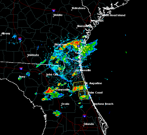 At 506 pm edt, severe thunderstorms were located along a line extending from near bostwick to 6 miles northeast of federal point, moving north at 10 mph (radar indicated). Hazards include 60 mph wind gusts and quarter size hail. Hail damage to vehicles is expected. Expect wind damage to roofs, siding, and trees. At 506 pm edt, severe thunderstorms were located along a line extending from near bostwick to 6 miles northeast of federal point, moving north at 10 mph (radar indicated). Hazards include 60 mph wind gusts and quarter size hail. Hail damage to vehicles is expected. Expect wind damage to roofs, siding, and trees.
|
| 5/24/2017 9:47 AM EDT |
 At 946 am edt, a severe thunderstorm capable of producing a tornado was located over federal point, or near hastings, moving northeast at 35 mph. the rotation has weakened slightly, but could quickly reintensify. a tornado could form at any time (radar indicated rotation). Hazards include tornado. Flying debris will be dangerous to those caught without shelter. mobile homes will be damaged or destroyed. damage to roofs, windows, and vehicles will occur. tree damage is likely. this dangerous storm will be near, saint augustine shores around 1010 am edt. Other locations impacted by this tornadic thunderstorm include elkton and bakersville. At 946 am edt, a severe thunderstorm capable of producing a tornado was located over federal point, or near hastings, moving northeast at 35 mph. the rotation has weakened slightly, but could quickly reintensify. a tornado could form at any time (radar indicated rotation). Hazards include tornado. Flying debris will be dangerous to those caught without shelter. mobile homes will be damaged or destroyed. damage to roofs, windows, and vehicles will occur. tree damage is likely. this dangerous storm will be near, saint augustine shores around 1010 am edt. Other locations impacted by this tornadic thunderstorm include elkton and bakersville.
|
| 5/24/2017 4:44 AM EDT |
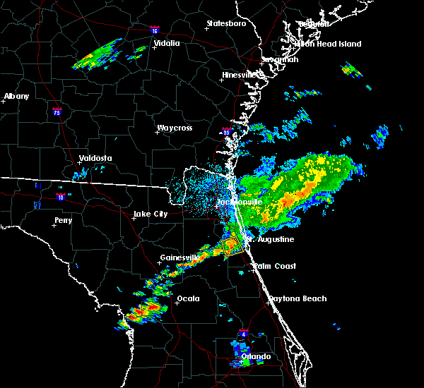 At 443 am edt, a severe thunderstorm was located 7 miles southeast of picolata, or 10 miles north of hastings, moving east at 45 mph (radar indicated). Hazards include 60 mph wind gusts. Expect damage to roofs, siding, and trees. Locations impacted include, elkton and bakersville. At 443 am edt, a severe thunderstorm was located 7 miles southeast of picolata, or 10 miles north of hastings, moving east at 45 mph (radar indicated). Hazards include 60 mph wind gusts. Expect damage to roofs, siding, and trees. Locations impacted include, elkton and bakersville.
|
| 5/24/2017 4:25 AM EDT |
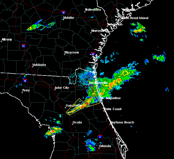 At 425 am edt, a severe thunderstorm was located over bostwick, or 10 miles north of palatka, moving northeast at 35 mph (radar indicated). Hazards include 60 mph wind gusts. expect damage to roofs, siding, and trees At 425 am edt, a severe thunderstorm was located over bostwick, or 10 miles north of palatka, moving northeast at 35 mph (radar indicated). Hazards include 60 mph wind gusts. expect damage to roofs, siding, and trees
|
| 5/22/2017 5:05 PM EDT |
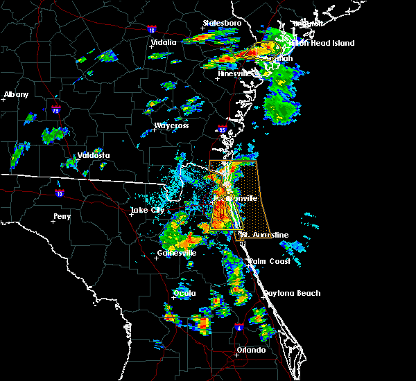 At 505 pm edt, severe thunderstorms were located along a line extending from near fort caroline to near ponte vedra beach to near world golf village, moving northeast at 25 mph (radar indicated). Hazards include 60 mph wind gusts and penny size hail. Expect damage to roofs, siding, and trees. Locations impacted include, unf, mandarin, fruit cove, arlington, ponte vedra beach, neptune beach, sawgrass, baymeadows, nocatee and durbin. At 505 pm edt, severe thunderstorms were located along a line extending from near fort caroline to near ponte vedra beach to near world golf village, moving northeast at 25 mph (radar indicated). Hazards include 60 mph wind gusts and penny size hail. Expect damage to roofs, siding, and trees. Locations impacted include, unf, mandarin, fruit cove, arlington, ponte vedra beach, neptune beach, sawgrass, baymeadows, nocatee and durbin.
|
| 5/22/2017 4:43 PM EDT |
 At 443 pm edt, severe thunderstorms were located along a line extending from near oceanway to bayard to near picolata, moving east at 15 mph (radar indicated). Hazards include 60 mph wind gusts and penny size hail. Expect damage to roofs, siding, and trees. Locations impacted include, jacksonville, orange park, green cove springs, unf, mandarin, fruit cove, arlington, ponte vedra beach, neptune beach and world golf village. At 443 pm edt, severe thunderstorms were located along a line extending from near oceanway to bayard to near picolata, moving east at 15 mph (radar indicated). Hazards include 60 mph wind gusts and penny size hail. Expect damage to roofs, siding, and trees. Locations impacted include, jacksonville, orange park, green cove springs, unf, mandarin, fruit cove, arlington, ponte vedra beach, neptune beach and world golf village.
|
| 5/22/2017 4:30 PM EDT |
 At 429 pm edt, severe thunderstorms were located along a line extending from arlington to green cove springs, moving northeast at 40 mph (radar indicated). Hazards include 60 mph wind gusts and penny size hail. expect damage to roofs, siding, and trees At 429 pm edt, severe thunderstorms were located along a line extending from arlington to green cove springs, moving northeast at 40 mph (radar indicated). Hazards include 60 mph wind gusts and penny size hail. expect damage to roofs, siding, and trees
|
| 5/4/2017 5:51 PM EDT |
 At 551 pm edt, a severe thunderstorm was located over sawgrass, or near ponte vedra beach, moving northeast at 20 mph (radar indicated). Hazards include 60 mph wind gusts and penny size hail. Expect damage to roofs, siding, and trees. This severe storm will be near, ponte vedra beach around 600 pm edt. At 551 pm edt, a severe thunderstorm was located over sawgrass, or near ponte vedra beach, moving northeast at 20 mph (radar indicated). Hazards include 60 mph wind gusts and penny size hail. Expect damage to roofs, siding, and trees. This severe storm will be near, ponte vedra beach around 600 pm edt.
|
| 5/4/2017 5:20 PM EDT |
 At 520 pm edt, a severe thunderstorm was located near world golf village, or 8 miles southeast of fruit cove, moving northeast at 30 mph (radar indicated). Hazards include 60 mph wind gusts and quarter size hail. Hail damage to vehicles is expected. Expect wind damage to roofs, siding, and trees. At 520 pm edt, a severe thunderstorm was located near world golf village, or 8 miles southeast of fruit cove, moving northeast at 30 mph (radar indicated). Hazards include 60 mph wind gusts and quarter size hail. Hail damage to vehicles is expected. Expect wind damage to roofs, siding, and trees.
|
| 4/3/2017 7:01 PM EDT |
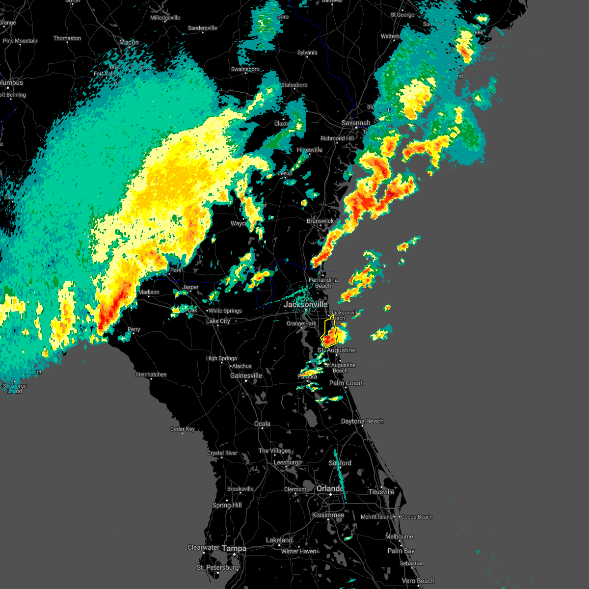 At 701 pm edt, a severe thunderstorm was located over guana river state park, or 12 miles south of ponte vedra beach, moving northeast at 25 mph (radar indicated). Hazards include 60 mph wind gusts and nickel size hail. Expect damage to roofs, siding, and trees. Locations impacted include, ponte vedra beach, palm valley, sawgrass, nocatee, south ponte vedra, durbin and guana river state park. At 701 pm edt, a severe thunderstorm was located over guana river state park, or 12 miles south of ponte vedra beach, moving northeast at 25 mph (radar indicated). Hazards include 60 mph wind gusts and nickel size hail. Expect damage to roofs, siding, and trees. Locations impacted include, ponte vedra beach, palm valley, sawgrass, nocatee, south ponte vedra, durbin and guana river state park.
|
| 4/3/2017 6:56 PM EDT |
 At 656 pm edt, a severe thunderstorm was located over palm valley, or near ponte vedra beach, moving northeast at 30 mph (radar indicated). Hazards include 60 mph wind gusts and nickel size hail. Expect damage to roofs, siding, and trees. Locations impacted include, ponte vedra beach, palm valley, sawgrass, nocatee, south ponte vedra, durbin and guana river state park. At 656 pm edt, a severe thunderstorm was located over palm valley, or near ponte vedra beach, moving northeast at 30 mph (radar indicated). Hazards include 60 mph wind gusts and nickel size hail. Expect damage to roofs, siding, and trees. Locations impacted include, ponte vedra beach, palm valley, sawgrass, nocatee, south ponte vedra, durbin and guana river state park.
|
| 4/3/2017 6:46 PM EDT |
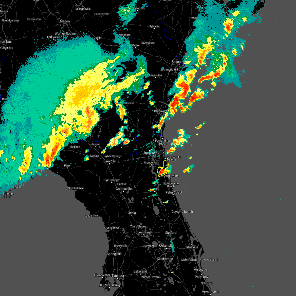 At 646 pm edt, a severe thunderstorm was located over durbin, or 9 miles east of fruit cove, moving northeast at 30 mph (radar indicated). Hazards include 60 mph wind gusts and nickel size hail. expect damage to roofs, siding, and trees At 646 pm edt, a severe thunderstorm was located over durbin, or 9 miles east of fruit cove, moving northeast at 30 mph (radar indicated). Hazards include 60 mph wind gusts and nickel size hail. expect damage to roofs, siding, and trees
|
| 4/3/2017 6:20 PM EDT |
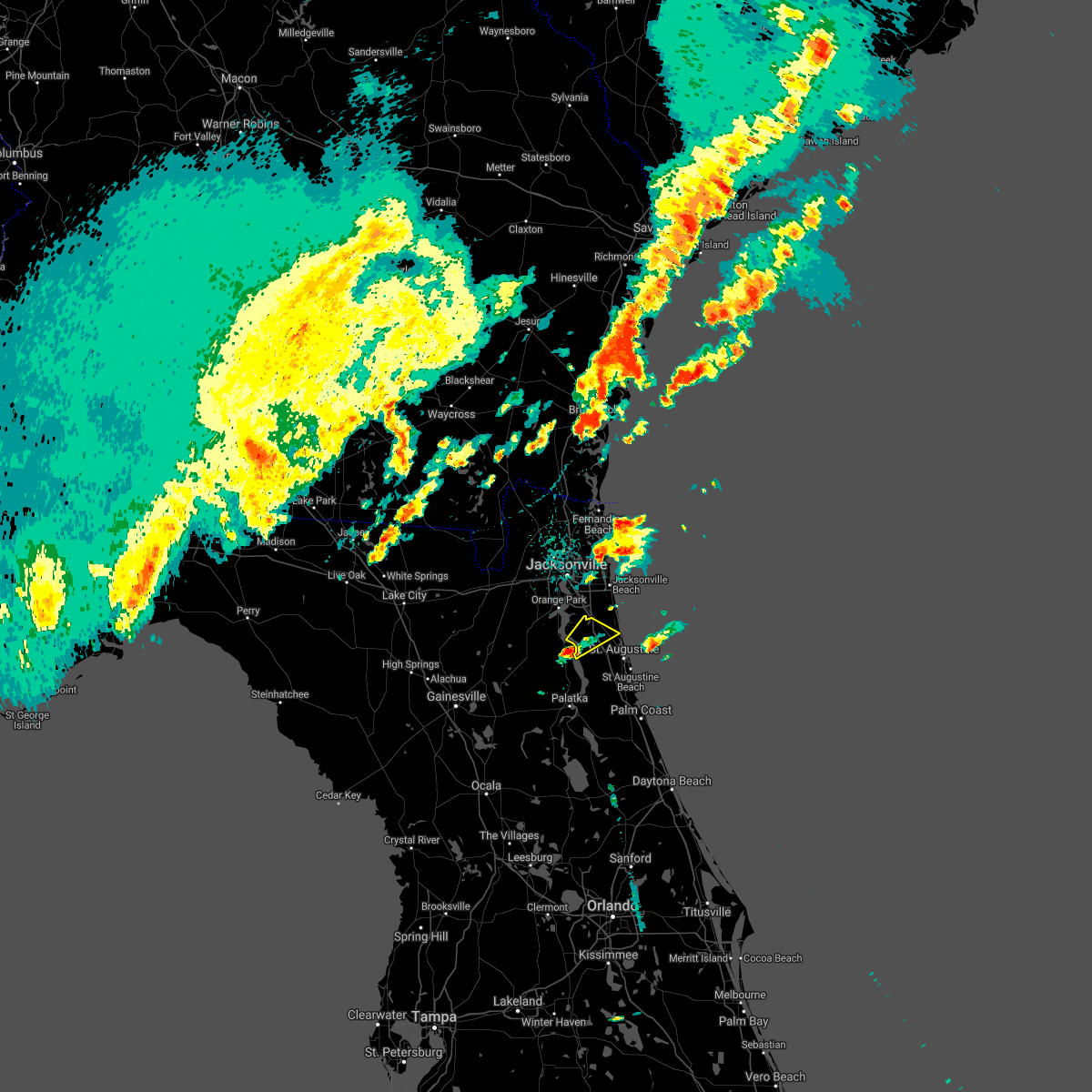 At 620 pm edt, a severe thunderstorm was located over picolata, or near green cove springs, moving northeast at 30 mph (radar indicated). Hazards include 60 mph wind gusts and quarter size hail. Hail damage to vehicles is expected. Expect wind damage to roofs, siding, and trees. At 620 pm edt, a severe thunderstorm was located over picolata, or near green cove springs, moving northeast at 30 mph (radar indicated). Hazards include 60 mph wind gusts and quarter size hail. Hail damage to vehicles is expected. Expect wind damage to roofs, siding, and trees.
|
| 2/7/2017 10:50 PM EST | St. johns county fire/rescue reports roof damage to two residences in the heritage park subdivision. time of damage based on radar dat in st. johns county FL, 1.5 miles E of World Golf Village, FL |
| 1/22/2017 7:33 PM EST |
 At 732 pm est, a severe thunderstorm capable of producing a tornado was located over south ponte vedra, or 9 miles northwest of saint augustine, moving northeast at 60 mph (radar indicated rotation). Hazards include tornado and quarter size hail. Flying debris will be dangerous to those caught without shelter. mobile homes will be damaged or destroyed. damage to roofs, windows, and vehicles will occur. tree damage is likely. this tornadic thunderstorm will remain over mainly rural areas of central st. Johns county. At 732 pm est, a severe thunderstorm capable of producing a tornado was located over south ponte vedra, or 9 miles northwest of saint augustine, moving northeast at 60 mph (radar indicated rotation). Hazards include tornado and quarter size hail. Flying debris will be dangerous to those caught without shelter. mobile homes will be damaged or destroyed. damage to roofs, windows, and vehicles will occur. tree damage is likely. this tornadic thunderstorm will remain over mainly rural areas of central st. Johns county.
|
| 1/22/2017 7:30 PM EST |
 At 728 pm est, severe thunderstorms were located along a line extending from 10 miles northeast of kings bay base to 6 miles northeast of federal point, moving east at 145 mph (radar indicated). Hazards include 60 mph wind gusts and quarter size hail. Hail damage to vehicles is expected. expect wind damage to roofs, siding, and trees. locations impacted include, saint augustine, fernandina beach, palatka, hastings, ponte vedra beach, unf, fruit cove, east palatka, neptune beach and world golf village. a tornado watch remains in effect until 800 pm est for northeastern florida, and southeastern georgia. Time, mot, loc 0028z 249deg 125kt 3090 8138 2980 8146. At 728 pm est, severe thunderstorms were located along a line extending from 10 miles northeast of kings bay base to 6 miles northeast of federal point, moving east at 145 mph (radar indicated). Hazards include 60 mph wind gusts and quarter size hail. Hail damage to vehicles is expected. expect wind damage to roofs, siding, and trees. locations impacted include, saint augustine, fernandina beach, palatka, hastings, ponte vedra beach, unf, fruit cove, east palatka, neptune beach and world golf village. a tornado watch remains in effect until 800 pm est for northeastern florida, and southeastern georgia. Time, mot, loc 0028z 249deg 125kt 3090 8138 2980 8146.
|
| 1/22/2017 7:27 PM EST |
 At 727 pm est, a severe thunderstorm capable of producing a tornado was located over world golf village, or 10 miles northwest of saint augustine, moving northeast at 60 mph (radar indicated rotation). Hazards include tornado and quarter size hail. Flying debris will be dangerous to those caught without shelter. mobile homes will be damaged or destroyed. damage to roofs, windows, and vehicles will occur. tree damage is likely. this dangerous storm will be near, saint augustine, south ponte vedra, guana river state park and vilano beach around 735 pm est. Other locations impacted by this tornadic thunderstorm include bakersville. At 727 pm est, a severe thunderstorm capable of producing a tornado was located over world golf village, or 10 miles northwest of saint augustine, moving northeast at 60 mph (radar indicated rotation). Hazards include tornado and quarter size hail. Flying debris will be dangerous to those caught without shelter. mobile homes will be damaged or destroyed. damage to roofs, windows, and vehicles will occur. tree damage is likely. this dangerous storm will be near, saint augustine, south ponte vedra, guana river state park and vilano beach around 735 pm est. Other locations impacted by this tornadic thunderstorm include bakersville.
|
| 1/22/2017 7:23 PM EST |
 At 722 pm est, a severe thunderstorm capable of producing a tornado was located over world golf village, or 10 miles southeast of fruit cove, moving northeast at 75 mph (radar indicated rotation). Hazards include tornado and quarter size hail. Flying debris will be dangerous to those caught without shelter. mobile homes will be damaged or destroyed. damage to roofs, windows, and vehicles will occur. tree damage is likely. Locations impacted include, world golf village, south ponte vedra, vilano beach, nocatee, picolata, durbin, guana river state park and bakersville. At 722 pm est, a severe thunderstorm capable of producing a tornado was located over world golf village, or 10 miles southeast of fruit cove, moving northeast at 75 mph (radar indicated rotation). Hazards include tornado and quarter size hail. Flying debris will be dangerous to those caught without shelter. mobile homes will be damaged or destroyed. damage to roofs, windows, and vehicles will occur. tree damage is likely. Locations impacted include, world golf village, south ponte vedra, vilano beach, nocatee, picolata, durbin, guana river state park and bakersville.
|
| 1/22/2017 7:19 PM EST |
 At 718 pm est, a severe thunderstorm capable of producing a tornado was located near picolata, or 8 miles east of green cove springs, moving northeast at 75 mph (radar indicated rotation). Hazards include tornado and quarter size hail. Flying debris will be dangerous to those caught without shelter. mobile homes will be damaged or destroyed. damage to roofs, windows, and vehicles will occur. tree damage is likely. Locations impacted include, world golf village, south ponte vedra, vilano beach, nocatee, picolata, durbin, guana river state park and bakersville. At 718 pm est, a severe thunderstorm capable of producing a tornado was located near picolata, or 8 miles east of green cove springs, moving northeast at 75 mph (radar indicated rotation). Hazards include tornado and quarter size hail. Flying debris will be dangerous to those caught without shelter. mobile homes will be damaged or destroyed. damage to roofs, windows, and vehicles will occur. tree damage is likely. Locations impacted include, world golf village, south ponte vedra, vilano beach, nocatee, picolata, durbin, guana river state park and bakersville.
|
| 1/22/2017 7:15 PM EST |
 At 714 pm est, severe thunderstorms were located along a line extending from 6 miles northeast of kings bay base to near bostwick, moving northeast at 95 mph (radar indicated). Hazards include 60 mph wind gusts and quarter size hail. Hail damage to vehicles is expected. Expect wind damage to roofs, siding, and trees. At 714 pm est, severe thunderstorms were located along a line extending from 6 miles northeast of kings bay base to near bostwick, moving northeast at 95 mph (radar indicated). Hazards include 60 mph wind gusts and quarter size hail. Hail damage to vehicles is expected. Expect wind damage to roofs, siding, and trees.
|
| 1/22/2017 7:07 PM EST |
 At 706 pm est, a severe thunderstorm capable of producing a tornado was located near george`s lake, or 12 miles southwest of green cove springs, moving northeast at 75 mph (radar indicated rotation). Hazards include tornado and quarter size hail. Flying debris will be dangerous to those caught without shelter. mobile homes will be damaged or destroyed. damage to roofs, windows, and vehicles will occur. Tree damage is likely. At 706 pm est, a severe thunderstorm capable of producing a tornado was located near george`s lake, or 12 miles southwest of green cove springs, moving northeast at 75 mph (radar indicated rotation). Hazards include tornado and quarter size hail. Flying debris will be dangerous to those caught without shelter. mobile homes will be damaged or destroyed. damage to roofs, windows, and vehicles will occur. Tree damage is likely.
|
| 1/22/2017 7:01 PM EST |
 At 701 pm est, severe thunderstorms were located along a line extending from near kings bay base to near bostwick, moving northeast at 70 mph (radar indicated). Hazards include 60 mph wind gusts and quarter size hail. Hail damage to vehicles is expected. expect wind damage to roofs, siding, and trees. locations impacted include, jacksonville, saint augustine, fernandina beach, palatka, orange park, green cove springs, interlachen, callahan, hastings and jacksonville international arpt. A tornado watch remains in effect until 800 pm est for northern and northeastern florida. At 701 pm est, severe thunderstorms were located along a line extending from near kings bay base to near bostwick, moving northeast at 70 mph (radar indicated). Hazards include 60 mph wind gusts and quarter size hail. Hail damage to vehicles is expected. expect wind damage to roofs, siding, and trees. locations impacted include, jacksonville, saint augustine, fernandina beach, palatka, orange park, green cove springs, interlachen, callahan, hastings and jacksonville international arpt. A tornado watch remains in effect until 800 pm est for northern and northeastern florida.
|
| 1/22/2017 6:55 PM EST |
 At 654 pm est, severe thunderstorms were located along a line extending from st. marys to near bardin, moving northeast at 70 mph (radar indicated). Hazards include 60 mph wind gusts and quarter size hail. Hail damage to vehicles is expected. expect wind damage to roofs, siding, and trees. locations impacted include, jacksonville, saint augustine, fernandina beach, palatka, orange park, green cove springs, interlachen, keystone heights, callahan and hastings. A tornado watch remains in effect until 800 pm est for northeastern and northern florida, and southeastern georgia. At 654 pm est, severe thunderstorms were located along a line extending from st. marys to near bardin, moving northeast at 70 mph (radar indicated). Hazards include 60 mph wind gusts and quarter size hail. Hail damage to vehicles is expected. expect wind damage to roofs, siding, and trees. locations impacted include, jacksonville, saint augustine, fernandina beach, palatka, orange park, green cove springs, interlachen, keystone heights, callahan and hastings. A tornado watch remains in effect until 800 pm est for northeastern and northern florida, and southeastern georgia.
|
| 1/22/2017 6:46 PM EST |
 At 646 pm est, severe thunderstorms were located along a line extending from near yulee to interlachen, moving northeast at 70 mph (radar indicated). Hazards include 60 mph wind gusts and quarter size hail. Hail damage to vehicles is expected. expect wind damage to roofs, siding, and trees. locations impacted include, jacksonville, saint augustine, fernandina beach, palatka, orange park, green cove springs, starke, interlachen, keystone heights and callahan. A tornado watch remains in effect until 800 pm est for northeastern and northern florida, and southeastern georgia. At 646 pm est, severe thunderstorms were located along a line extending from near yulee to interlachen, moving northeast at 70 mph (radar indicated). Hazards include 60 mph wind gusts and quarter size hail. Hail damage to vehicles is expected. expect wind damage to roofs, siding, and trees. locations impacted include, jacksonville, saint augustine, fernandina beach, palatka, orange park, green cove springs, starke, interlachen, keystone heights and callahan. A tornado watch remains in effect until 800 pm est for northeastern and northern florida, and southeastern georgia.
|
| 1/22/2017 6:32 PM EST |
 At 631 pm est, severe thunderstorms were located along a line extending from 6 miles west of ratliff to cross creek, moving northeast at 70 mph (radar indicated). Hazards include 60 mph wind gusts and quarter size hail. Hail damage to vehicles is expected. expect wind damage to roofs, siding, and trees. locations impacted include, jacksonville, gainesville, saint augustine, fernandina beach, palatka, orange park, green cove springs, starke, lake butler and interlachen. A tornado watch remains in effect until 800 pm est for northeastern and northern florida, and southeastern georgia. At 631 pm est, severe thunderstorms were located along a line extending from 6 miles west of ratliff to cross creek, moving northeast at 70 mph (radar indicated). Hazards include 60 mph wind gusts and quarter size hail. Hail damage to vehicles is expected. expect wind damage to roofs, siding, and trees. locations impacted include, jacksonville, gainesville, saint augustine, fernandina beach, palatka, orange park, green cove springs, starke, lake butler and interlachen. A tornado watch remains in effect until 800 pm est for northeastern and northern florida, and southeastern georgia.
|
| 1/22/2017 6:17 PM EST |
 At 617 pm est, severe thunderstorms were located along a line extending from 8 miles north of macclenny to near williston, moving northeast at 70 mph (radar indicated). Hazards include 60 mph wind gusts and quarter size hail. Hail damage to vehicles is expected. expect wind damage to roofs, siding, and trees. locations impacted include, jacksonville, gainesville, saint augustine, fernandina beach, palatka, orange park, green cove springs, starke, lake butler and interlachen. A tornado watch remains in effect until 800 pm est for northeastern and northern florida, and southeastern georgia. At 617 pm est, severe thunderstorms were located along a line extending from 8 miles north of macclenny to near williston, moving northeast at 70 mph (radar indicated). Hazards include 60 mph wind gusts and quarter size hail. Hail damage to vehicles is expected. expect wind damage to roofs, siding, and trees. locations impacted include, jacksonville, gainesville, saint augustine, fernandina beach, palatka, orange park, green cove springs, starke, lake butler and interlachen. A tornado watch remains in effect until 800 pm est for northeastern and northern florida, and southeastern georgia.
|
| 1/22/2017 6:06 PM EST |
 At 605 pm est, severe thunderstorms were located along a line extending from near sanderson to near williston highlands, moving northeast at 70 mph (radar indicated). Hazards include 60 mph wind gusts and quarter size hail. Hail damage to vehicles is expected. Expect wind damage to roofs, siding, and trees. At 605 pm est, severe thunderstorms were located along a line extending from near sanderson to near williston highlands, moving northeast at 70 mph (radar indicated). Hazards include 60 mph wind gusts and quarter size hail. Hail damage to vehicles is expected. Expect wind damage to roofs, siding, and trees.
|
| 7/15/2016 4:52 PM EDT |
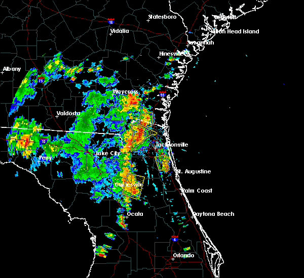 The severe thunderstorm warning for northwestern st. johns and southeastern duval counties will expire at 500 pm edt, the storm which prompted the warning has weakened below severe limits, and no longer pose an immediate threat to life or property. therefore, the warning will be allowed to expire. The severe thunderstorm warning for northwestern st. johns and southeastern duval counties will expire at 500 pm edt, the storm which prompted the warning has weakened below severe limits, and no longer pose an immediate threat to life or property. therefore, the warning will be allowed to expire.
|
| 7/15/2016 4:37 PM EDT |
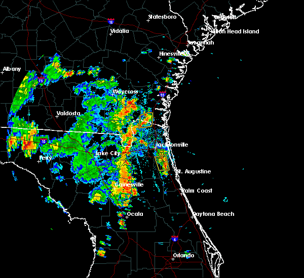 At 437 pm edt, a severe thunderstorm was located over durbin, or 8 miles east of fruit cove, moving north at 10 mph (radar indicated). Hazards include 60 mph wind gusts and penny size hail. Expect damage to roofs. siding. and trees. Locations impacted include, jacksonville, mandarin, fruit cove, world golf village, bayard and durbin. At 437 pm edt, a severe thunderstorm was located over durbin, or 8 miles east of fruit cove, moving north at 10 mph (radar indicated). Hazards include 60 mph wind gusts and penny size hail. Expect damage to roofs. siding. and trees. Locations impacted include, jacksonville, mandarin, fruit cove, world golf village, bayard and durbin.
|
| 7/15/2016 4:11 PM EDT |
 At 411 pm edt, a severe thunderstorm was located near durbin, or near fruit cove, moving northwest at 5 mph (radar indicated). Hazards include 60 mph wind gusts and penny size hail. Expect damage to roofs. siding. And trees. At 411 pm edt, a severe thunderstorm was located near durbin, or near fruit cove, moving northwest at 5 mph (radar indicated). Hazards include 60 mph wind gusts and penny size hail. Expect damage to roofs. siding. And trees.
|
| 5/19/2016 7:50 PM EDT | 911 call center reported multiple trees down near county road 214 and county road 13 sout in st. johns county FL, 8.6 miles NNE of World Golf Village, FL |
| 5/19/2016 6:49 PM EDT | The national weather service in jacksonville has issued a * severe thunderstorm warning for. central st. johns county in northeastern florida. central clay county in northeastern florida. until 730 pm edt * at 649 pm edt. A severe thunderstorm was located near green cove. |
| 5/13/2016 4:15 PM EDT | Trained spotter near the world golf village reported 6 to 8 inch tree limbs downed and a portion of a wooden fence damaged by estimated wind gusts of 50-60 mp in st. johns county FL, 6.4 miles S of World Golf Village, FL |
| 8/7/2015 3:10 PM EDT |
 At 310 pm edt, doppler radar indicated a line of severe thunderstorms capable of producing damaging winds in excess of 60 mph. these storms were located along a line extending from 6 miles northeast of guana river state park to near saint augustine to bardin, moving east at 35 mph. locations impacted include, saint augustine, palatka, hastings, east palatka, world golf village, bostwick, nocatee, durbin, saint augustine south, federal point, san mateo, butler beach, south ponte vedra, orange mills, guana river state park, saint augustine shores, picolata, crescent beach, dupont center and spuds. At 310 pm edt, doppler radar indicated a line of severe thunderstorms capable of producing damaging winds in excess of 60 mph. these storms were located along a line extending from 6 miles northeast of guana river state park to near saint augustine to bardin, moving east at 35 mph. locations impacted include, saint augustine, palatka, hastings, east palatka, world golf village, bostwick, nocatee, durbin, saint augustine south, federal point, san mateo, butler beach, south ponte vedra, orange mills, guana river state park, saint augustine shores, picolata, crescent beach, dupont center and spuds.
|
| 8/7/2015 3:00 PM EDT | A large tree was toppled by strong thunderstorm winds near the intersection of county roads 13 and 208. time of damage based on radar dat in st. johns county FL, 6.1 miles ENE of World Golf Village, FL |
| 8/7/2015 2:56 PM EDT |
 At 256 pm edt, doppler radar indicated a line of severe thunderstorms capable of producing damaging winds in excess of 60 mph. these storms were located along a line extending from 6 miles southeast of sawgrass to near picolata to near interlachen, and moving southeast at 35 mph. At 256 pm edt, doppler radar indicated a line of severe thunderstorms capable of producing damaging winds in excess of 60 mph. these storms were located along a line extending from 6 miles southeast of sawgrass to near picolata to near interlachen, and moving southeast at 35 mph.
|
| 7/22/2015 5:00 PM EDT |
 At 458 pm edt, doppler radar indicated a line of severe thunderstorms capable of producing damaging winds in excess of 60 mph. these storms were located along a line extending from near guana river state park to 6 miles southeast of middleburg, moving southeast at 30 mph. penny size hail may also accompany the damaging winds. locations impacted include, saint augustine, green cove springs, fruit cove, middleburg, world golf village, saint augustine beach, saint augustine shores, nocatee, durbin, saint augustine south, switzerland, bardin, fleming island, guana river state park, bostwick, federal point, south ponte vedra, butler beach, palm valley and sawgrass. At 458 pm edt, doppler radar indicated a line of severe thunderstorms capable of producing damaging winds in excess of 60 mph. these storms were located along a line extending from near guana river state park to 6 miles southeast of middleburg, moving southeast at 30 mph. penny size hail may also accompany the damaging winds. locations impacted include, saint augustine, green cove springs, fruit cove, middleburg, world golf village, saint augustine beach, saint augustine shores, nocatee, durbin, saint augustine south, switzerland, bardin, fleming island, guana river state park, bostwick, federal point, south ponte vedra, butler beach, palm valley and sawgrass.
|
| 7/22/2015 4:43 PM EDT |
 At 443 pm edt, doppler radar indicated a line of severe thunderstorms capable of producing damaging winds in excess of 60 mph. these storms were located along a line extending from palm valley to near middleburg, and moving southeast at 30 mph. penny size hail may also accompany the damaging winds. At 443 pm edt, doppler radar indicated a line of severe thunderstorms capable of producing damaging winds in excess of 60 mph. these storms were located along a line extending from palm valley to near middleburg, and moving southeast at 30 mph. penny size hail may also accompany the damaging winds.
|
| 7/12/2015 6:11 PM EDT |
 At 610 pm edt, doppler radar indicated a severe thunderstorm capable of producing damaging winds in excess of 60 mph. this storm was located over world golf village, or 11 miles east of green cove springs, moving south at 15 mph. penny size hail may also accompany the damaging winds. locations impacted include, world golf village, picolata and bakersville. At 610 pm edt, doppler radar indicated a severe thunderstorm capable of producing damaging winds in excess of 60 mph. this storm was located over world golf village, or 11 miles east of green cove springs, moving south at 15 mph. penny size hail may also accompany the damaging winds. locations impacted include, world golf village, picolata and bakersville.
|
| 7/12/2015 6:10 PM EDT | St. johns county 911/dispatch reports a tree downed by strong wind gusts along state road 16 near the intersection of county road 16-a. time of damage based on radar da in st. johns county FL, 1.6 miles SSE of World Golf Village, FL |
| 7/12/2015 6:00 PM EDT |
 At 600 pm edt, doppler radar indicated a severe thunderstorm capable of producing damaging winds in excess of 60 mph. this storm was located over world golf village, or 9 miles southeast of fruit cove, and moving south at 15 mph. penny size hail may also accompany the damaging winds. At 600 pm edt, doppler radar indicated a severe thunderstorm capable of producing damaging winds in excess of 60 mph. this storm was located over world golf village, or 9 miles southeast of fruit cove, and moving south at 15 mph. penny size hail may also accompany the damaging winds.
|
| 6/28/2015 1:53 PM EDT |
 At 153 pm edt, doppler radar indicated a line of severe thunderstorms capable of producing damaging winds in excess of 60 mph. these storms were located along a line extending from near jacksonville international arpt to near arlington to green cove springs, moving east at 30 mph. locations impacted include, jacksonville, saint augustine, fernandina beach, orange park, green cove springs, jacksonville international arpt, ponte vedra beach, unf, fruit cove, mandarin, arlington, yulee, neptune beach, world golf village, ortega, craig field, riverside, san marco, nocatee and durbin. At 153 pm edt, doppler radar indicated a line of severe thunderstorms capable of producing damaging winds in excess of 60 mph. these storms were located along a line extending from near jacksonville international arpt to near arlington to green cove springs, moving east at 30 mph. locations impacted include, jacksonville, saint augustine, fernandina beach, orange park, green cove springs, jacksonville international arpt, ponte vedra beach, unf, fruit cove, mandarin, arlington, yulee, neptune beach, world golf village, ortega, craig field, riverside, san marco, nocatee and durbin.
|
| 6/28/2015 1:43 PM EDT |
 At 142 pm edt, doppler radar indicated a line of severe thunderstorms capable of producing damaging winds in excess of 60 mph. these storms were located along a line extending from near jacksonville international arpt to near san marco to green cove springs, moving east at 35 mph. locations impacted include, jacksonville, st. marys, saint augustine, fernandina beach, orange park, green cove springs, jacksonville international arpt, ponte vedra beach, unf, fruit cove, mandarin, arlington, yulee, neptune beach, world golf village, ortega, craig field, riverside, san marco and nocatee. At 142 pm edt, doppler radar indicated a line of severe thunderstorms capable of producing damaging winds in excess of 60 mph. these storms were located along a line extending from near jacksonville international arpt to near san marco to green cove springs, moving east at 35 mph. locations impacted include, jacksonville, st. marys, saint augustine, fernandina beach, orange park, green cove springs, jacksonville international arpt, ponte vedra beach, unf, fruit cove, mandarin, arlington, yulee, neptune beach, world golf village, ortega, craig field, riverside, san marco and nocatee.
|
| 6/28/2015 1:37 PM EDT |
 At 137 pm edt, doppler radar indicated a line of severe thunderstorms capable of producing damaging winds in excess of 60 mph. these storms were located along a line extending from callahan to normandy to 7 miles west of green cove springs, moving northeast at 40 mph. locations impacted include, jacksonville, st. marys, saint augustine, fernandina beach, orange park, green cove springs, callahan, jacksonville international arpt, unf, middleburg, ponte vedra beach, fruit cove, mandarin, arlington, yulee, neptune beach, world golf village, ortega, craig field and riverside. At 137 pm edt, doppler radar indicated a line of severe thunderstorms capable of producing damaging winds in excess of 60 mph. these storms were located along a line extending from callahan to normandy to 7 miles west of green cove springs, moving northeast at 40 mph. locations impacted include, jacksonville, st. marys, saint augustine, fernandina beach, orange park, green cove springs, callahan, jacksonville international arpt, unf, middleburg, ponte vedra beach, fruit cove, mandarin, arlington, yulee, neptune beach, world golf village, ortega, craig field and riverside.
|
| 6/28/2015 1:23 PM EDT |
 At 122 pm edt, doppler radar indicated a line of severe thunderstorms capable of producing damaging winds in excess of 60 mph. these storms were located along a line extending from near st. george to near maxville to near kingsley, moving northeast at 40 mph. locations impacted include, jacksonville, st. marys, saint augustine, fernandina beach, orange park, green cove springs, hilliard, callahan, jacksonville international arpt, unf, middleburg, ponte vedra beach, fruit cove, mandarin, arlington, yulee, neptune beach, world golf village, ortega and craig field. At 122 pm edt, doppler radar indicated a line of severe thunderstorms capable of producing damaging winds in excess of 60 mph. these storms were located along a line extending from near st. george to near maxville to near kingsley, moving northeast at 40 mph. locations impacted include, jacksonville, st. marys, saint augustine, fernandina beach, orange park, green cove springs, hilliard, callahan, jacksonville international arpt, unf, middleburg, ponte vedra beach, fruit cove, mandarin, arlington, yulee, neptune beach, world golf village, ortega and craig field.
|
| 6/28/2015 1:12 PM EDT |
 At 112 pm edt, doppler radar indicated a line of severe thunderstorms capable of producing damaging winds in excess of 60 mph. these storms were located along a line extending from near st. george to near maxville to near kingsley, moving east at 30 mph. locations impacted include, jacksonville, st. marys, saint augustine, fernandina beach, orange park, green cove springs, starke, hilliard, callahan, jacksonville international arpt, unf, middleburg, ponte vedra beach, fruit cove, mandarin, arlington, yulee, neptune beach, world golf village and macclenny. At 112 pm edt, doppler radar indicated a line of severe thunderstorms capable of producing damaging winds in excess of 60 mph. these storms were located along a line extending from near st. george to near maxville to near kingsley, moving east at 30 mph. locations impacted include, jacksonville, st. marys, saint augustine, fernandina beach, orange park, green cove springs, starke, hilliard, callahan, jacksonville international arpt, unf, middleburg, ponte vedra beach, fruit cove, mandarin, arlington, yulee, neptune beach, world golf village and macclenny.
|
| 6/28/2015 12:59 PM EDT |
 At 1258 pm edt, doppler radar indicated a line of severe thunderstorms capable of producing damaging winds in excess of 60 mph. these storms were located along a line extending from 6 miles west of st. george to near maxville to 6 miles south of kingsley, and moving northeast at 40 mph. At 1258 pm edt, doppler radar indicated a line of severe thunderstorms capable of producing damaging winds in excess of 60 mph. these storms were located along a line extending from 6 miles west of st. george to near maxville to 6 miles south of kingsley, and moving northeast at 40 mph.
|
| 6/24/2015 6:58 PM EDT | The severe thunderstorm warning for western flagler and south central st. johns counties will expire at 700 pm edt, the storms which prompted the warning have weakened below severe limits, and no longer poses an immediate threat to life or property. therefore the warning will be allowed to expire. however small. |
| 6/24/2015 6:52 PM EDT |
 A severe thunderstorm warning remains in effect until 700 pm edt for western flagler and south central st. johns counties. at 652 pm edt. doppler radar indicated a line of severe thunderstorms capable of producing quarter size hail and damaging winds in excess of 60 mph. these storms were located along a line extending from near bayard to near pierson. Moving east at 15 mph. A severe thunderstorm warning remains in effect until 700 pm edt for western flagler and south central st. johns counties. at 652 pm edt. doppler radar indicated a line of severe thunderstorms capable of producing quarter size hail and damaging winds in excess of 60 mph. these storms were located along a line extending from near bayard to near pierson. Moving east at 15 mph.
|
| 6/24/2015 6:46 PM EDT |
 At 646 pm edt, doppler radar indicated a line of severe thunderstorms capable of producing quarter size hail and damaging winds in excess of 60 mph. these storms were located along a line extending from near bayard to near pierson, moving east at 15 mph. locations impacted include, hastings, andalusia, world golf village, durbin, elkton, bakersville and spuds. At 646 pm edt, doppler radar indicated a line of severe thunderstorms capable of producing quarter size hail and damaging winds in excess of 60 mph. these storms were located along a line extending from near bayard to near pierson, moving east at 15 mph. locations impacted include, hastings, andalusia, world golf village, durbin, elkton, bakersville and spuds.
|
| 6/24/2015 6:42 PM EDT |
 At 641 pm edt, doppler radar indicated a line of severe thunderstorms capable of producing quarter size hail and damaging winds in excess of 60 mph. these storms were located along a line extending from near bayard to near pierson. these storms were nearly stationary. locations impacted include, green cove springs, crescent city, hastings, andalusia, fruit cove, world golf village, durbin, switzerland, federal point, picolata, orange mills, spuds, elkton and bakersville. At 641 pm edt, doppler radar indicated a line of severe thunderstorms capable of producing quarter size hail and damaging winds in excess of 60 mph. these storms were located along a line extending from near bayard to near pierson. these storms were nearly stationary. locations impacted include, green cove springs, crescent city, hastings, andalusia, fruit cove, world golf village, durbin, switzerland, federal point, picolata, orange mills, spuds, elkton and bakersville.
|
| 6/24/2015 6:29 PM EDT |
 At 629 pm edt, doppler radar indicated a line of severe thunderstorms capable of producing quarter size hail and damaging winds in excess of 60 mph. these storms were located along a line extending from near bayard to near pierson, and moving east at 15 mph. At 629 pm edt, doppler radar indicated a line of severe thunderstorms capable of producing quarter size hail and damaging winds in excess of 60 mph. these storms were located along a line extending from near bayard to near pierson, and moving east at 15 mph.
|
| 6/23/2015 5:22 PM EDT |
 The severe thunderstorm warning for st. johns county will expire at 530 pm edt, the storms which prompted the warning have weakened below severe limits, and no longer poses an immediate threat to life or property. therefore the warning will be allowed to expire. however gusty winds are still possible with these thunderstorms. The severe thunderstorm warning for st. johns county will expire at 530 pm edt, the storms which prompted the warning have weakened below severe limits, and no longer poses an immediate threat to life or property. therefore the warning will be allowed to expire. however gusty winds are still possible with these thunderstorms.
|
| 6/23/2015 5:04 PM EDT |
 At 504 pm edt, doppler radar indicated a line of severe thunderstorms capable of producing damaging winds in excess of 60 mph. these storms were located along a line extending from near doctors inlet to hastings. these storms were nearly stationary. nickel size hail may also accompany the damaging winds. locations impacted include, saint augustine, green cove springs, hastings, fruit cove, world golf village, saint augustine shores, switzerland, picolata, saint augustine south, butler beach, dupont center, spuds, elkton and bakersville. At 504 pm edt, doppler radar indicated a line of severe thunderstorms capable of producing damaging winds in excess of 60 mph. these storms were located along a line extending from near doctors inlet to hastings. these storms were nearly stationary. nickel size hail may also accompany the damaging winds. locations impacted include, saint augustine, green cove springs, hastings, fruit cove, world golf village, saint augustine shores, switzerland, picolata, saint augustine south, butler beach, dupont center, spuds, elkton and bakersville.
|
| 6/23/2015 4:38 PM EDT |
 At 437 pm edt, doppler radar indicated a line of severe thunderstorms capable of producing quarter size hail and damaging winds in excess of 60 mph. these storms were located along a line extending from near doctors inlet to hastings, and moving east at 10 mph. At 437 pm edt, doppler radar indicated a line of severe thunderstorms capable of producing quarter size hail and damaging winds in excess of 60 mph. these storms were located along a line extending from near doctors inlet to hastings, and moving east at 10 mph.
|
| 6/22/2015 10:52 PM EDT |
 The severe thunderstorm warning for central st. johns county will expire at 1100 pm edt, the storm which prompted the warning has weakened below severe limits, and no longer poses an immediate threat to life or property. therefore the warning will be allowed to expire. however heavy rain is still expected with this thunderstorm. The severe thunderstorm warning for central st. johns county will expire at 1100 pm edt, the storm which prompted the warning has weakened below severe limits, and no longer poses an immediate threat to life or property. therefore the warning will be allowed to expire. however heavy rain is still expected with this thunderstorm.
|
| 6/22/2015 10:25 PM EDT |
 At 1024 pm edt, doppler radar indicated a severe thunderstorm capable of producing damaging winds in excess of 60 mph. this storm was located near south ponte vedra, or 8 miles northwest of saint augustine, and moving northeast at 10 mph. penny size hail may also accompany the damaging winds. At 1024 pm edt, doppler radar indicated a severe thunderstorm capable of producing damaging winds in excess of 60 mph. this storm was located near south ponte vedra, or 8 miles northwest of saint augustine, and moving northeast at 10 mph. penny size hail may also accompany the damaging winds.
|
| 6/10/2015 2:46 PM EDT |
 At 245 pm edt, doppler radar indicated a line of severe thunderstorms capable of producing quarter size hail and damaging winds in excess of 60 mph. the strongest of the winds and hail will impact the greater st. augustine area. these storms were located along a line extending from bayard to 7 miles southeast of crescent city. these storms were nearly stationary. locations impacted include, palm coast, saint augustine, flagler beach, bunnell, crescent city, hastings, andalusia, world golf village, saint augustine beach, marineland, vilano beach, saint augustine shores, saint augustine south, federal point, south ponte vedra, butler beach, crescent beach, beverly beach, dupont center and anastasia. At 245 pm edt, doppler radar indicated a line of severe thunderstorms capable of producing quarter size hail and damaging winds in excess of 60 mph. the strongest of the winds and hail will impact the greater st. augustine area. these storms were located along a line extending from bayard to 7 miles southeast of crescent city. these storms were nearly stationary. locations impacted include, palm coast, saint augustine, flagler beach, bunnell, crescent city, hastings, andalusia, world golf village, saint augustine beach, marineland, vilano beach, saint augustine shores, saint augustine south, federal point, south ponte vedra, butler beach, crescent beach, beverly beach, dupont center and anastasia.
|
| 6/10/2015 2:28 PM EDT |
 At 228 pm edt, doppler radar indicated a line of severe thunderstorms capable of producing quarter size hail and damaging winds in excess of 60 mph. these storms were located along a line extending from bayard to 7 miles southeast of crescent city, and moving east at 25 mph. At 228 pm edt, doppler radar indicated a line of severe thunderstorms capable of producing quarter size hail and damaging winds in excess of 60 mph. these storms were located along a line extending from bayard to 7 miles southeast of crescent city, and moving east at 25 mph.
|
| 5/20/2015 5:52 PM EDT | At 550 pm edt, doppler radar indicated a line of severe thunderstorms capable of producing quarter size hail and damaging winds in excess of 60 mph. these storms were located along a line extending from near palm valley to crescent beach, moving northeast at 15 mph. locations impacted include, saint augustine, saint augustine beach, saint augustine shores, nocatee, durbin, saint augustine south, south ponte vedra, butler beach, palm valley, sawgrass, guana river state park, vilano beach, crescent beach, dupont center and anastasia. |
| 5/20/2015 5:29 PM EDT | At 528 pm edt, doppler radar indicated a line of severe thunderstorms capable of producing quarter size hail and damaging winds in excess of 60 mph. these storms were located along a line extending from near mandarin to near palm coast, and moving east at 30 mph. |
| 5/20/2015 5:17 PM EDT | At 516 pm edt, doppler radar indicated a line of severe thunderstorms capable of producing quarter size hail and damaging winds in excess of 60 mph. these storms were located along a line extending from near world golf village to 8 miles west of ormond beach, moving east at 35 mph. locations impacted include, palm coast, saint augustine, green cove springs, flagler beach, bunnell, hastings, fruit cove, world golf village, marineland, saint augustine shores, nocatee, durbin, saint augustine south, switzerland, orange mills, guana river state park, bayard, federal point, south ponte vedra and butler beach. |
| 5/20/2015 5:11 PM EDT | Powerline down along cr 1 in st. johns county FL, 4.9 miles ENE of World Golf Village, FL |
| 5/20/2015 5:05 PM EDT | At 504 pm edt, doppler radar indicated a line of severe thunderstorms capable of producing quarter size hail and damaging winds in excess of 60 mph. these storms were located along a line extending from near switzerland to 9 miles northeast of barberville, and moving east at 35 mph. |
| 4/19/2015 4:34 PM EDT | At 434 pm edt, doppler radar indicated a line of severe thunderstorms capable of producing quarter size hail and damaging winds in excess of 60 mph. these storms were located along a line extending from orange park to world golf village, moving northeast at 35 mph. locations impacted include, jacksonville, saint augustine, orange park, ponte vedra beach, unf, fruit cove, mandarin, arlington, neptune beach, world golf village, ortega, craig field, riverside, san marco, nocatee, durbin, nas jax, guana river state park, bayard and baymeadows. a tornado watch remains in effect until 800 pm edt for northeastern florida. |
| 4/19/2015 4:15 PM EDT | At 415 pm edt, doppler radar indicated a line of severe thunderstorms capable of producing quarter size hail and damaging winds in excess of 60 mph. these storms were located along a line extending from near doctors inlet to picolata, moving northeast at 40 mph. locations impacted include, jacksonville, saint augustine, orange park, green cove springs, ponte vedra beach, unf, fruit cove, mandarin, arlington, middleburg, neptune beach, world golf village, ortega, craig field, riverside, san marco, oakleaf plantation, nocatee, durbin and switzerland. a tornado watch remains in effect until 800 pm edt for northeastern florida. |
| 4/19/2015 4:07 PM EDT | At 407 pm edt, doppler radar indicated a line of severe thunderstorms capable of producing quarter size hail and damaging winds in excess of 60 mph. these storms were located along a line extending from near middleburg to near picolata, and moving northeast at 35 mph. |
| 3/19/2015 4:37 PM EDT | The national weather service in jacksonville has issued a * severe thunderstorm warning for. northeastern putnam county in northeastern florida. east central clay county in northeastern florida. southwestern st. johns county in northeastern florida. Until 500 pm edt. |
| 2/21/2014 1:20 PM EST | A storm spotter reported winds of around 55 mph up to 60 mph along i-95 west to northwest of the st augustine are in st. johns county FL, 6.6 miles WNW of World Golf Village, FL |
| 2/21/2014 1:20 PM EST | Quarter sized hail reported 6.2 miles WNW of World Golf Village, FL, emergency management reported dime to quarter size hail on florida 16 near interstate 95. hail lasted for approximately 10 minutes...ending at 130 pm. |
| 5/4/2013 8:50 PM EDT | St johns county emergency management reported downed trees and powerlines along state route 16. time estimated from rada in st. johns county FL, 5.7 miles WNW of World Golf Village, FL |
| 5/4/2013 8:25 PM EDT | Public reported tree down on powerline at state route 16 and state route 16a. time estimated from rada in st. johns county FL, 0.9 miles SSE of World Golf Village, FL |
| 3/23/2013 3:02 PM EDT | Quarter sized hail reported 6.2 miles WNW of World Golf Village, FL, a local meterologist reported quarter sized hail off exit 318 heading towards the beach. |
| 8/28/2012 4:15 PM EDT | 911 call center reported power lines down on church road northwest of st augustin in st. johns county FL, 2.6 miles N of World Golf Village, FL |
| 6/10/2012 3:35 PM EDT | Central dispatch relayed a report of a tree down on state road 13 nort in st. johns county FL, 5 miles ESE of World Golf Village, FL |
| 3/31/2012 5:45 PM EDT | A spotter reported a gust to 60 mph on a personal weather statio in st. johns county FL, 7 miles S of World Golf Village, FL |
| 1/1/0001 12:00 AM | 911 call center relayed a public report of wind damage that included several trees down near county road 210 just west of interstate 95. hail of unknown size was also r in st. johns county FL, 7 miles S of World Golf Village, FL |
| 1/1/0001 12:00 AM | A spotter reported thunderstorm wind gusts of 60 mph with dime size hail which lasted 10 minutes near bakersvill in st. johns county FL, 3.4 miles NNW of World Golf Village, FL |
| 1/1/0001 12:00 AM | Ping Pong Ball sized hail reported 2.1 miles W of World Golf Village, FL, hail just shy of golf ball size was reported at palms plus. no damage was reported. |
| 1/1/0001 12:00 AM | Quarter sized hail reported 3.9 miles SW of World Golf Village, FL, hail up to quarter size reported around the world golf village. |
Hail Maps for World Golf Village, FL
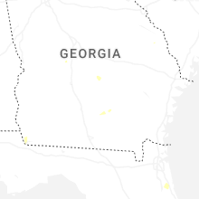
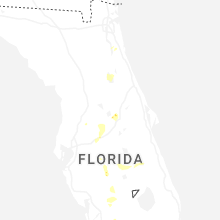
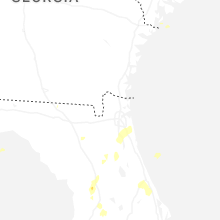
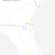
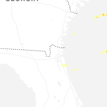


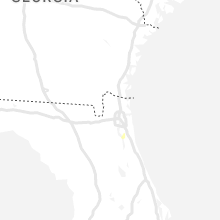


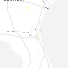


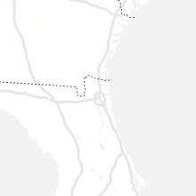


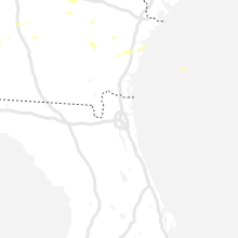


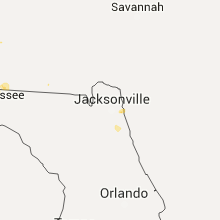


Connect with Interactive Hail Maps