

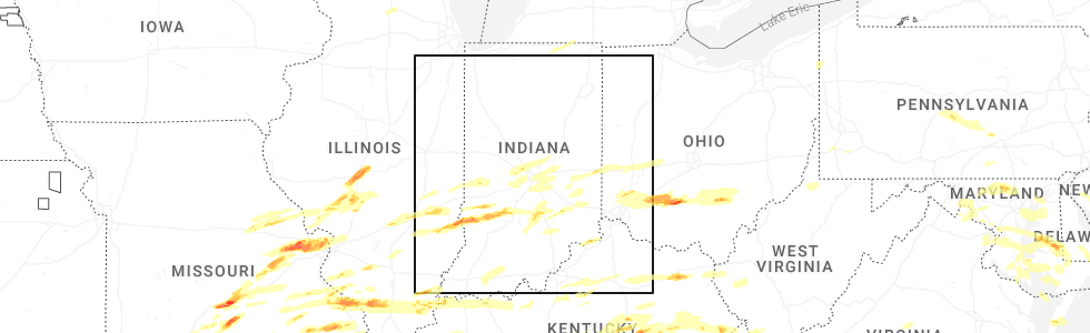
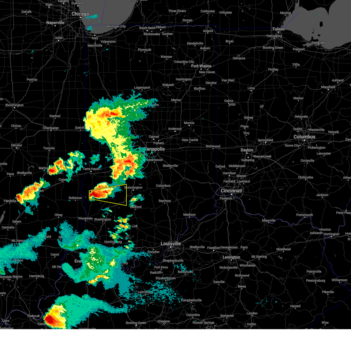
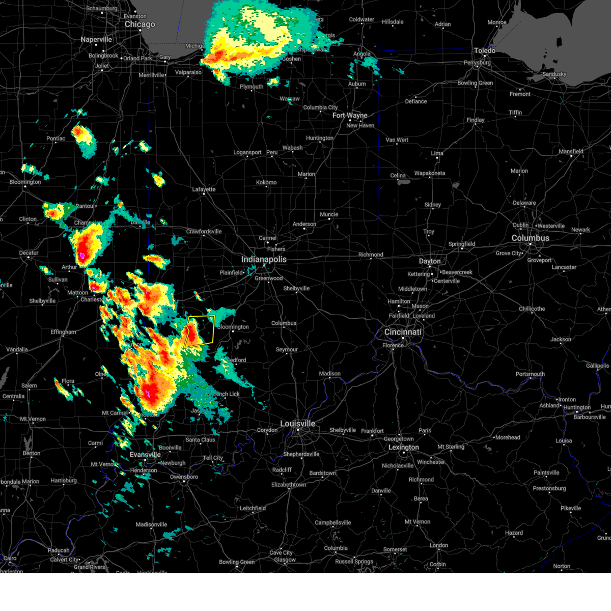
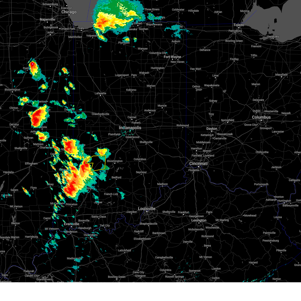
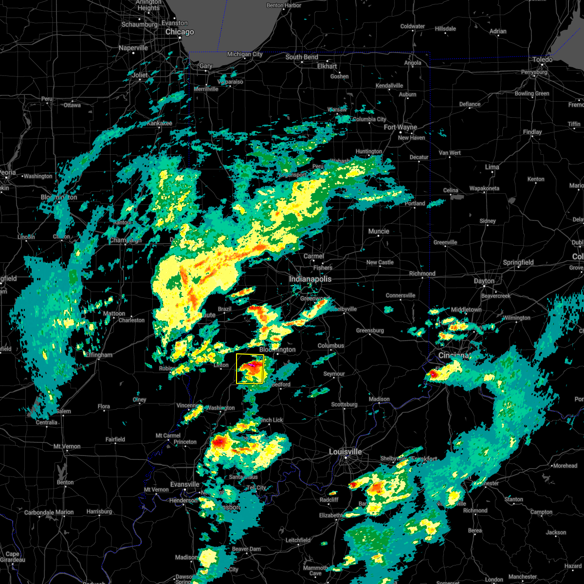
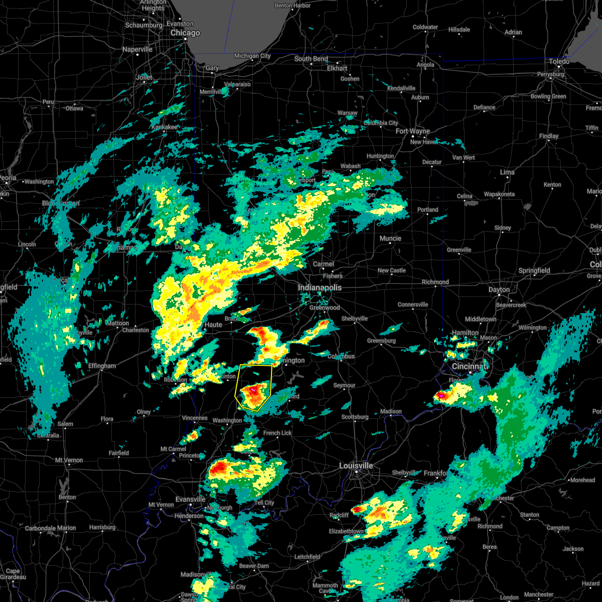
Hail Map for Worthington, IN
The Worthington, IN area has had 0 reports of on-the-ground hail by trained spotters, and has been under severe weather warnings 17 times during the past 12 months. Doppler radar has detected hail at or near Worthington, IN on 53 occasions, including 6 occasions during the past year.
| Name: | Worthington, IN |
| Where Located: | 63 miles SW of Indianapolis, IN |
| Map: | Google Map for Worthington, IN |
| Population: | 1463 |
| Housing Units: | 716 |
| More Info: | Search Google for Worthington, IN |
3
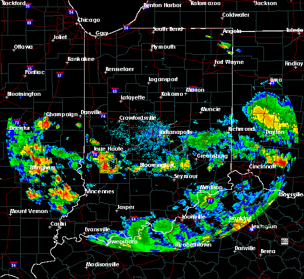
The Top Recent Hail Date for Worthington, IN is Friday, May 16, 2025 (2nd out of 53)
Hail and Wind Damage Spotted near Worthington, IN
| Date / Time | Report Details |
|---|---|
| 6/18/2025 3:59 PM EDT |
 Svrind the national weather service in indianapolis has issued a * severe thunderstorm warning for, monroe county in south central indiana, western brown county in south central indiana, southern owen county in west central indiana, martin county in southwestern indiana, lawrence county in south central indiana, greene county in southwestern indiana, daviess county in southwestern indiana, * until 445 pm edt. * at 359 pm edt, severe thunderstorms were located along a line extending from 8 miles west of spencer to 10 miles northwest of jasper, moving east at 40 mph (radar indicated). Hazards include 70 mph wind gusts and nickel size hail. Expect considerable tree damage. Damage is likely to mobile homes, roofs, and outbuildings. Svrind the national weather service in indianapolis has issued a * severe thunderstorm warning for, monroe county in south central indiana, western brown county in south central indiana, southern owen county in west central indiana, martin county in southwestern indiana, lawrence county in south central indiana, greene county in southwestern indiana, daviess county in southwestern indiana, * until 445 pm edt. * at 359 pm edt, severe thunderstorms were located along a line extending from 8 miles west of spencer to 10 miles northwest of jasper, moving east at 40 mph (radar indicated). Hazards include 70 mph wind gusts and nickel size hail. Expect considerable tree damage. Damage is likely to mobile homes, roofs, and outbuildings.
|
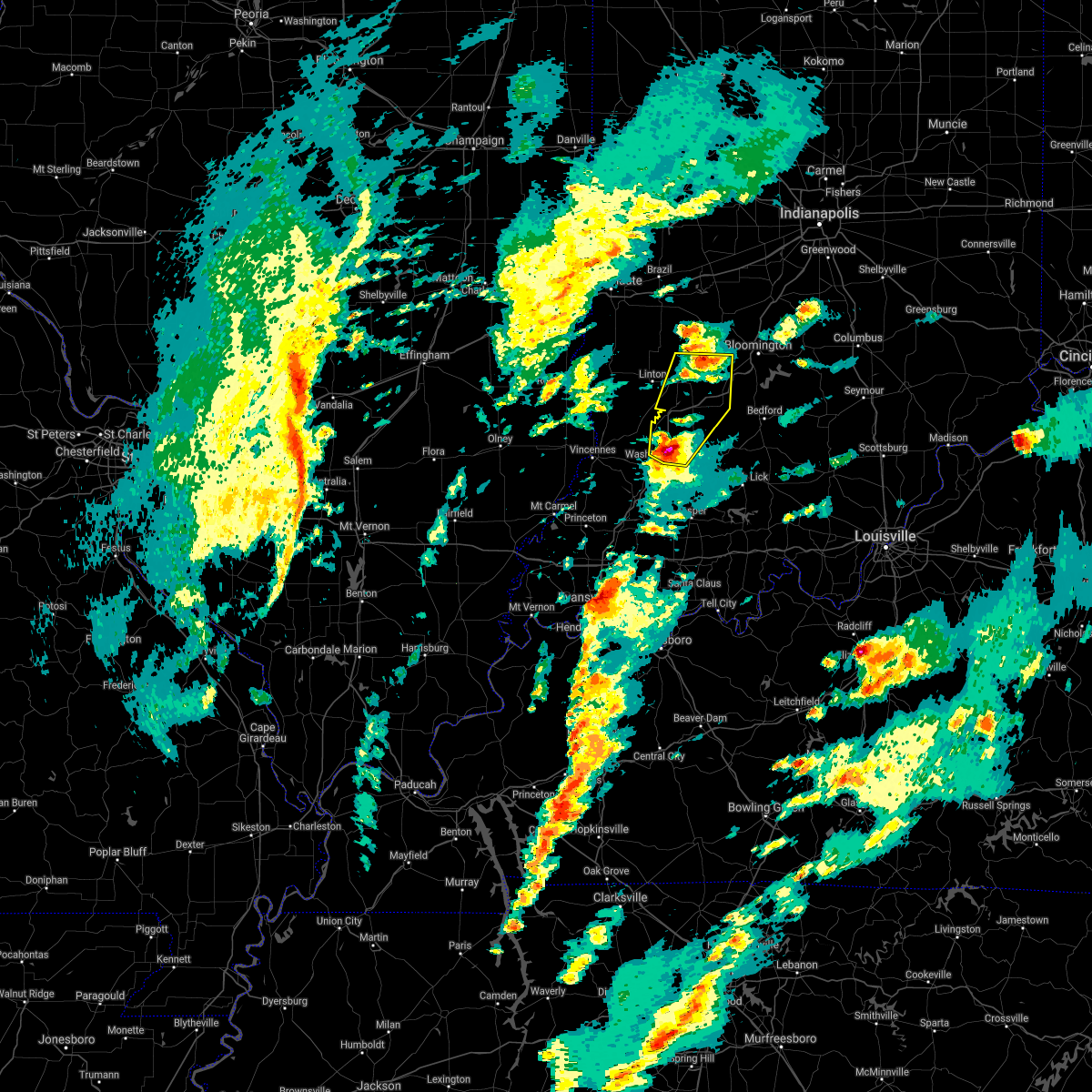
| 6/18/2025 3:57 PM EDT | At 357 pm edt, severe thunderstorms were located along a line extending from 10 miles southwest of spencer to 7 miles east of washington, moving east at 45 mph (radar indicated). Hazards include 70 mph wind gusts and quarter size hail. Hail damage to vehicles is expected. expect considerable tree damage. wind damage is also likely to mobile homes, roofs, and outbuildings. Locations impacted include, vincennes, washington, linton, bloomfield, bicknell, jasonville, worthington, odon, dugger, lyons, elnora, monroe city, wheatland, plainville, sandborn, montgomery, edwardsport, switz city, decker, and newberry. |
| 6/18/2025 3:57 PM EDT | the severe thunderstorm warning has been cancelled and is no longer in effect |
| 6/18/2025 3:26 PM EDT |
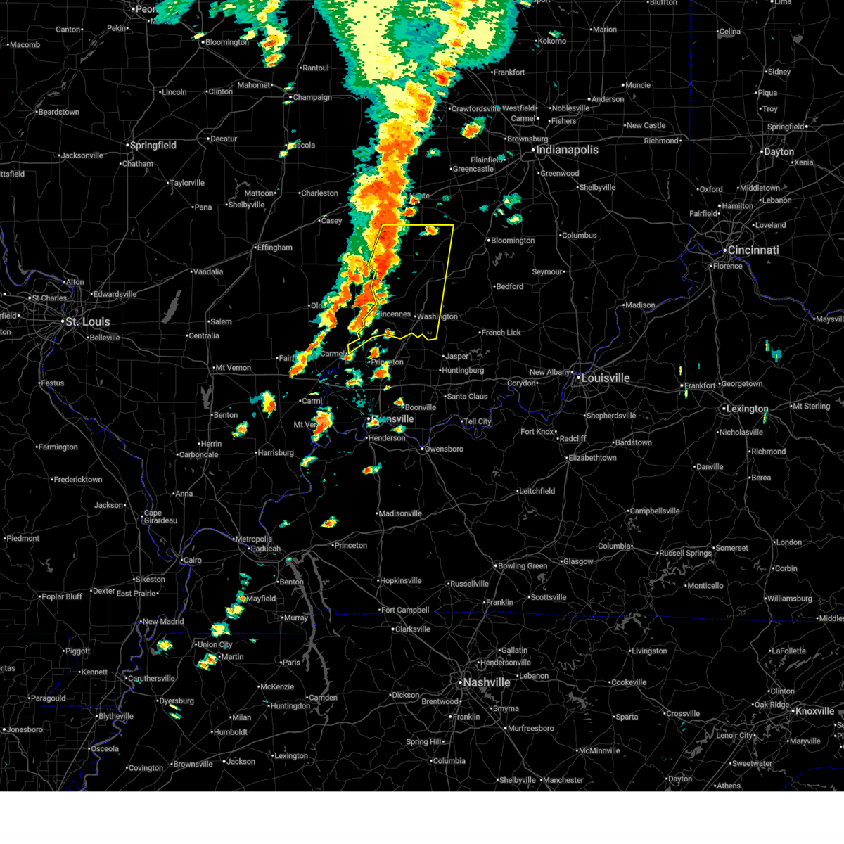 Svrind the national weather service in indianapolis has issued a * severe thunderstorm warning for, south central vigo county in west central indiana, sullivan county in southwestern indiana, knox county in southwestern indiana, southwestern clay county in west central indiana, southwestern owen county in west central indiana, greene county in southwestern indiana, daviess county in southwestern indiana, * until 415 pm edt. * at 325 pm edt, severe thunderstorms were located along a line extending from 12 miles north of sullivan to 7 miles northeast of vincennes, moving east at 30 mph (radar indicated). Hazards include 70 mph wind gusts and quarter size hail. Hail damage to vehicles is expected. expect considerable tree damage. Wind damage is also likely to mobile homes, roofs, and outbuildings. Svrind the national weather service in indianapolis has issued a * severe thunderstorm warning for, south central vigo county in west central indiana, sullivan county in southwestern indiana, knox county in southwestern indiana, southwestern clay county in west central indiana, southwestern owen county in west central indiana, greene county in southwestern indiana, daviess county in southwestern indiana, * until 415 pm edt. * at 325 pm edt, severe thunderstorms were located along a line extending from 12 miles north of sullivan to 7 miles northeast of vincennes, moving east at 30 mph (radar indicated). Hazards include 70 mph wind gusts and quarter size hail. Hail damage to vehicles is expected. expect considerable tree damage. Wind damage is also likely to mobile homes, roofs, and outbuildings.
|
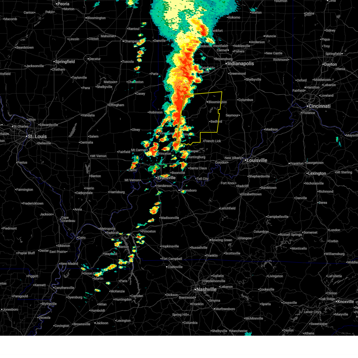
| 5/16/2025 6:56 PM EDT | At 655 pm edt, a confirmed large and extremely dangerous tornado was located near linton, or 31 miles southeast of terre haute, moving east at 40 mph. this is a particularly dangerous situation. take cover now! (weather spotters confirmed tornado). Hazards include damaging tornado. You are in a life-threatening situation. flying debris may be deadly to those caught without shelter. mobile homes will be destroyed. considerable damage to homes, businesses, and vehicles is likely and complete destruction is possible. Locations impacted include, linton, bloomfield, jasonville, worthington, lyons, switz city, solsberry, vicksburg, and freedom. |
| 5/16/2025 6:51 PM EDT |
 Torind the national weather service in indianapolis has issued a * tornado warning for, southern owen county in west central indiana, greene county in southwestern indiana, * until 730 pm edt. * at 650 pm edt, a confirmed tornado was located over linton, or 31 miles southeast of terre haute, moving east at 45 mph (weather spotters confirmed tornado). Hazards include damaging tornado and softball size hail. Flying debris will be dangerous to those caught without shelter. mobile homes will be damaged or destroyed. damage to roofs, windows, and vehicles will occur. Tree damage is likely. Torind the national weather service in indianapolis has issued a * tornado warning for, southern owen county in west central indiana, greene county in southwestern indiana, * until 730 pm edt. * at 650 pm edt, a confirmed tornado was located over linton, or 31 miles southeast of terre haute, moving east at 45 mph (weather spotters confirmed tornado). Hazards include damaging tornado and softball size hail. Flying debris will be dangerous to those caught without shelter. mobile homes will be damaged or destroyed. damage to roofs, windows, and vehicles will occur. Tree damage is likely.
|
| 5/16/2025 6:35 PM EDT |
 Svrind the national weather service in indianapolis has issued a * severe thunderstorm warning for, east central sullivan county in southwestern indiana, southwestern clay county in west central indiana, southern owen county in west central indiana, greene county in southwestern indiana, * until 715 pm edt. * at 635 pm edt, a severe thunderstorm was located near sullivan, or 23 miles east of robinson, moving east at 40 mph. this is a destructive storm for sullivan, vicksburg, worthington, and bloomfield (radar indicated). Hazards include softball size hail and 70 mph wind gusts. People and animals outdoors will be severely injured. Expect shattered windows, extensive damage to roofs, siding, and vehicles. Svrind the national weather service in indianapolis has issued a * severe thunderstorm warning for, east central sullivan county in southwestern indiana, southwestern clay county in west central indiana, southern owen county in west central indiana, greene county in southwestern indiana, * until 715 pm edt. * at 635 pm edt, a severe thunderstorm was located near sullivan, or 23 miles east of robinson, moving east at 40 mph. this is a destructive storm for sullivan, vicksburg, worthington, and bloomfield (radar indicated). Hazards include softball size hail and 70 mph wind gusts. People and animals outdoors will be severely injured. Expect shattered windows, extensive damage to roofs, siding, and vehicles.
|
| 4/2/2025 9:27 PM EDT | Svrind the national weather service in indianapolis has issued a * severe thunderstorm warning for, northern monroe county in south central indiana, southwestern morgan county in central indiana, western brown county in south central indiana, southeastern owen county in west central indiana, northeastern greene county in southwestern indiana, * until 1000 pm edt. * at 927 pm edt, a severe thunderstorm was located 8 miles northeast of bloomfield, or 18 miles west of bloomington, moving northeast at 60 mph (radar indicated). Hazards include 60 mph wind gusts and quarter size hail. Hail damage to vehicles is expected. Expect wind damage to roofs, siding, and trees. |
| 4/2/2025 8:54 PM EDT | At 854 pm edt, a severe thunderstorm was located 8 miles east of greencastle, or 27 miles southeast of crawfordsville, moving northeast at 75 mph (radar indicated). Hazards include 70 mph wind gusts and quarter size hail. Hail damage to vehicles is expected. expect considerable tree damage. wind damage is also likely to mobile homes, roofs, and outbuildings. locations impacted include, newberry, pittsboro, bicknell, smithville, plainfield, fillmore, crane, carlisle, freedom, farmersburg, reelsville, vincennes university, dugger, elnora, pimento, pleasantville, brazil, worthington, martinsville, and eminence. this includes the following highways, interstate 65 between mile markers 131 and 132. interstate 70 between mile markers 13 and 67. Interstate 74 between mile markers 59 and 68. |
| 4/2/2025 8:43 PM EDT | Svrind the national weather service in indianapolis has issued a * severe thunderstorm warning for, southeastern vigo county in west central indiana, monroe county in south central indiana, morgan county in central indiana, northern knox county in southwestern indiana, owen county in west central indiana, northern martin county in southwestern indiana, south central boone county in central indiana, northwestern lawrence county in south central indiana, southern putnam county in west central indiana, northern daviess county in southwestern indiana, sullivan county in southwestern indiana, hendricks county in central indiana, clay county in west central indiana, greene county in southwestern indiana, * until 930 pm edt. * at 843 pm edt, severe thunderstorms were located along a line extending from 8 miles east of brazil to 14 miles north of linton to 7 miles southeast of russellville, moving east at 70 mph (radar indicated). Hazards include 70 mph wind gusts and half dollar size hail. Hail damage to vehicles is expected. expect considerable tree damage. Wind damage is also likely to mobile homes, roofs, and outbuildings. |
| 3/30/2025 6:11 PM EDT | At 611 pm edt, a severe thunderstorm was located 11 miles west of spencer, or 24 miles southeast of terre haute, moving northeast at 50 mph (radar indicated). Hazards include 70 mph wind gusts and quarter size hail. Hail damage to vehicles is expected. expect considerable tree damage. wind damage is also likely to mobile homes, roofs, and outbuildings. Locations impacted include, patricksburg, gosport, coal city, bowling green, quincy, mccormicks creek state park, worthington, stinesville, spencer, devore, freedom, and ellettsville. |
| 3/30/2025 6:11 PM EDT | the severe thunderstorm warning has been cancelled and is no longer in effect |
| 3/30/2025 6:00 PM EDT | At 559 pm edt, a severe thunderstorm was located 13 miles north of linton, or 19 miles southeast of terre haute, moving east at 45 mph (radar indicated). Hazards include 60 mph wind gusts and quarter size hail. Hail damage to vehicles is expected. expect wind damage to roofs, siding, and trees. Locations impacted include, hymera, quincy, clay city, freedom, farmersburg, saline city, dugger, pimento, worthington, vicksburg, devore, ellettsville, jasonville, gosport, coal city, bowling green, mccormicks creek state park, shelburn, spencer, and patricksburg. |
| 3/30/2025 5:46 PM EDT |
 Svrind the national weather service in indianapolis has issued a * severe thunderstorm warning for, southeastern vigo county in west central indiana, northwestern monroe county in south central indiana, southwestern morgan county in central indiana, northeastern sullivan county in southwestern indiana, southern clay county in west central indiana, owen county in west central indiana, northern greene county in southwestern indiana, southern putnam county in west central indiana, * until 630 pm edt. * at 545 pm edt, severe thunderstorms were located along a line extending from near terre haute to near sullivan, moving northeast at 50 mph (radar indicated). Hazards include 60 mph wind gusts and quarter size hail. Hail damage to vehicles is expected. Expect wind damage to roofs, siding, and trees. Svrind the national weather service in indianapolis has issued a * severe thunderstorm warning for, southeastern vigo county in west central indiana, northwestern monroe county in south central indiana, southwestern morgan county in central indiana, northeastern sullivan county in southwestern indiana, southern clay county in west central indiana, owen county in west central indiana, northern greene county in southwestern indiana, southern putnam county in west central indiana, * until 630 pm edt. * at 545 pm edt, severe thunderstorms were located along a line extending from near terre haute to near sullivan, moving northeast at 50 mph (radar indicated). Hazards include 60 mph wind gusts and quarter size hail. Hail damage to vehicles is expected. Expect wind damage to roofs, siding, and trees.
|
| 3/15/2025 4:00 AM EDT | At 400 am edt, severe thunderstorms were located along a line extending from 13 miles southeast of brazil to 11 miles southwest of spencer to near linton, moving northeast at 75 mph (radar indicated). Hazards include 60 mph wind gusts. Expect damage to roofs, siding, and trees. Locations impacted include, patricksburg, lyons, coal city, bloomfield, solsberry, mccormicks creek state park, worthington, clay city, spencer, freedom, switz city, and linton. |
| 3/15/2025 4:00 AM EDT | the severe thunderstorm warning has been cancelled and is no longer in effect |
| 3/15/2025 3:38 AM EDT |
 Svrind the national weather service in indianapolis has issued a * severe thunderstorm warning for, eastern sullivan county in southwestern indiana, northeastern knox county in southwestern indiana, southern clay county in west central indiana, owen county in west central indiana, greene county in southwestern indiana, northwestern daviess county in southwestern indiana, * until 430 am edt. * at 337 am edt, severe thunderstorms were located along a line extending from 10 miles northeast of sullivan to 7 miles southwest of linton to 8 miles southeast of russellville, moving northeast at 75 mph (radar indicated). Hazards include 70 mph wind gusts. Expect considerable tree damage. Damage is likely to mobile homes, roofs, and outbuildings. Svrind the national weather service in indianapolis has issued a * severe thunderstorm warning for, eastern sullivan county in southwestern indiana, northeastern knox county in southwestern indiana, southern clay county in west central indiana, owen county in west central indiana, greene county in southwestern indiana, northwestern daviess county in southwestern indiana, * until 430 am edt. * at 337 am edt, severe thunderstorms were located along a line extending from 10 miles northeast of sullivan to 7 miles southwest of linton to 8 miles southeast of russellville, moving northeast at 75 mph (radar indicated). Hazards include 70 mph wind gusts. Expect considerable tree damage. Damage is likely to mobile homes, roofs, and outbuildings.
|
| 6/25/2024 3:47 PM EDT |
 At 346 pm edt, a severe thunderstorm was located near bloomington, moving east at 40 mph (radar indicated). Hazards include 60 mph wind gusts and quarter size hail. Hail damage to vehicles is expected. expect wind damage to roofs, siding, and trees. Locations impacted include, bloomington, spencer, ellettsville, worthington, indiana university, solsberry, mccormicks creek state park, freedom, and whitehall. At 346 pm edt, a severe thunderstorm was located near bloomington, moving east at 40 mph (radar indicated). Hazards include 60 mph wind gusts and quarter size hail. Hail damage to vehicles is expected. expect wind damage to roofs, siding, and trees. Locations impacted include, bloomington, spencer, ellettsville, worthington, indiana university, solsberry, mccormicks creek state park, freedom, and whitehall.
|
| 6/25/2024 3:47 PM EDT |
 the severe thunderstorm warning has been cancelled and is no longer in effect the severe thunderstorm warning has been cancelled and is no longer in effect
|
| 6/25/2024 3:22 PM EDT |
 Svrind the national weather service in indianapolis has issued a * severe thunderstorm warning for, northwestern monroe county in south central indiana, southeastern clay county in west central indiana, owen county in west central indiana, northwestern lawrence county in south central indiana, northeastern greene county in southwestern indiana, * until 400 pm edt. * at 322 pm edt, a severe thunderstorm was located 8 miles west of spencer, or 23 miles west of bloomington, moving east at 40 mph (radar indicated). Hazards include 60 mph wind gusts and quarter size hail. Hail damage to vehicles is expected. Expect wind damage to roofs, siding, and trees. Svrind the national weather service in indianapolis has issued a * severe thunderstorm warning for, northwestern monroe county in south central indiana, southeastern clay county in west central indiana, owen county in west central indiana, northwestern lawrence county in south central indiana, northeastern greene county in southwestern indiana, * until 400 pm edt. * at 322 pm edt, a severe thunderstorm was located 8 miles west of spencer, or 23 miles west of bloomington, moving east at 40 mph (radar indicated). Hazards include 60 mph wind gusts and quarter size hail. Hail damage to vehicles is expected. Expect wind damage to roofs, siding, and trees.
|
| 5/26/2024 10:44 PM EDT |
 the severe thunderstorm warning has been cancelled and is no longer in effect the severe thunderstorm warning has been cancelled and is no longer in effect
|
| 5/26/2024 10:44 PM EDT |
 At 1043 pm edt, severe thunderstorms were located along a line extending from 10 miles south of spencer to 16 miles east of bloomfield to near bedford to near paoli, moving east at 60 mph (radar indicated). Hazards include 60 mph wind gusts and penny size hail. Expect damage to roofs, siding, and trees. Locations impacted include, bloomington, bedford, bloomfield, ellettsville, mitchell, worthington, oolitic, smithville, tunnelton, bartlettsville, williams, avoca, monroe reservoir, woodville hills, charles deam wilderness, whitehall, heltonville, indiana university, indian springs, and huron. At 1043 pm edt, severe thunderstorms were located along a line extending from 10 miles south of spencer to 16 miles east of bloomfield to near bedford to near paoli, moving east at 60 mph (radar indicated). Hazards include 60 mph wind gusts and penny size hail. Expect damage to roofs, siding, and trees. Locations impacted include, bloomington, bedford, bloomfield, ellettsville, mitchell, worthington, oolitic, smithville, tunnelton, bartlettsville, williams, avoca, monroe reservoir, woodville hills, charles deam wilderness, whitehall, heltonville, indiana university, indian springs, and huron.
|
| 5/26/2024 10:32 PM EDT |
 the severe thunderstorm warning has been cancelled and is no longer in effect the severe thunderstorm warning has been cancelled and is no longer in effect
|
| 5/26/2024 10:32 PM EDT |
 At 1031 pm edt, severe thunderstorms were located along a line extending from near bloomfield to 18 miles southeast of linton to 6 miles north of shoals to 14 miles west of paoli, moving east at 70 mph (radar indicated). Hazards include 70 mph wind gusts and penny size hail. Expect considerable tree damage. damage is likely to mobile homes, roofs, and outbuildings. Locations impacted include, bloomington, bedford, linton, bloomfield, shoals, ellettsville, mitchell, loogootee, worthington, odon, oolitic, lyons, elnora, switz city, newberry, crane, smithville, west boggs lake, tunnelton, and bartlettsville. At 1031 pm edt, severe thunderstorms were located along a line extending from near bloomfield to 18 miles southeast of linton to 6 miles north of shoals to 14 miles west of paoli, moving east at 70 mph (radar indicated). Hazards include 70 mph wind gusts and penny size hail. Expect considerable tree damage. damage is likely to mobile homes, roofs, and outbuildings. Locations impacted include, bloomington, bedford, linton, bloomfield, shoals, ellettsville, mitchell, loogootee, worthington, odon, oolitic, lyons, elnora, switz city, newberry, crane, smithville, west boggs lake, tunnelton, and bartlettsville.
|
| 5/26/2024 10:23 PM EDT |
 At 1022 pm edt, severe thunderstorms were located along a line extending from 9 miles north of sullivan to near linton to 7 miles southeast of washington to 8 miles northeast of winslow, moving east at 60 mph (radar indicated). Hazards include 70 mph wind gusts and penny size hail. Expect considerable tree damage. damage is likely to mobile homes, roofs, and outbuildings. Locations impacted include, bloomington, bedford, washington, linton, sullivan, bloomfield, spencer, shoals, ellettsville, mitchell, bicknell, loogootee, jasonville, worthington, odon, shelburn, oolitic, farmersburg, dugger, and clay city. At 1022 pm edt, severe thunderstorms were located along a line extending from 9 miles north of sullivan to near linton to 7 miles southeast of washington to 8 miles northeast of winslow, moving east at 60 mph (radar indicated). Hazards include 70 mph wind gusts and penny size hail. Expect considerable tree damage. damage is likely to mobile homes, roofs, and outbuildings. Locations impacted include, bloomington, bedford, washington, linton, sullivan, bloomfield, spencer, shoals, ellettsville, mitchell, bicknell, loogootee, jasonville, worthington, odon, shelburn, oolitic, farmersburg, dugger, and clay city.
|
| 5/26/2024 10:12 PM EDT |
 Svrind the national weather service in indianapolis has issued a * severe thunderstorm warning for, southeastern vigo county in west central indiana, monroe county in south central indiana, southwestern morgan county in central indiana, sullivan county in southwestern indiana, southwestern brown county in south central indiana, eastern knox county in southwestern indiana, southern clay county in west central indiana, owen county in west central indiana, martin county in southwestern indiana, lawrence county in south central indiana, greene county in southwestern indiana, daviess county in southwestern indiana, * until 1100 pm edt. * at 1012 pm edt, severe thunderstorms were located along a line extending from 8 miles northwest of sullivan to near linton to near washington to near winslow, moving east at 60 mph (radar indicated). Hazards include 70 mph wind gusts and penny size hail. Expect considerable tree damage. Damage is likely to mobile homes, roofs, and outbuildings. Svrind the national weather service in indianapolis has issued a * severe thunderstorm warning for, southeastern vigo county in west central indiana, monroe county in south central indiana, southwestern morgan county in central indiana, sullivan county in southwestern indiana, southwestern brown county in south central indiana, eastern knox county in southwestern indiana, southern clay county in west central indiana, owen county in west central indiana, martin county in southwestern indiana, lawrence county in south central indiana, greene county in southwestern indiana, daviess county in southwestern indiana, * until 1100 pm edt. * at 1012 pm edt, severe thunderstorms were located along a line extending from 8 miles northwest of sullivan to near linton to near washington to near winslow, moving east at 60 mph (radar indicated). Hazards include 70 mph wind gusts and penny size hail. Expect considerable tree damage. Damage is likely to mobile homes, roofs, and outbuildings.
|
| 5/7/2024 10:35 PM EDT |
 Svrind the national weather service in indianapolis has issued a * severe thunderstorm warning for, central monroe county in south central indiana, southern owen county in west central indiana, northeastern greene county in southwestern indiana, * until 1115 pm edt. * at 1034 pm edt, a severe thunderstorm was located 9 miles southwest of spencer, or 19 miles west of bloomington, moving east at 40 mph (radar indicated). Hazards include 60 mph wind gusts and quarter size hail. Hail damage to vehicles is expected. Expect wind damage to roofs, siding, and trees. Svrind the national weather service in indianapolis has issued a * severe thunderstorm warning for, central monroe county in south central indiana, southern owen county in west central indiana, northeastern greene county in southwestern indiana, * until 1115 pm edt. * at 1034 pm edt, a severe thunderstorm was located 9 miles southwest of spencer, or 19 miles west of bloomington, moving east at 40 mph (radar indicated). Hazards include 60 mph wind gusts and quarter size hail. Hail damage to vehicles is expected. Expect wind damage to roofs, siding, and trees.
|
| 4/18/2024 10:26 PM EDT |
 At 1024 pm edt, severe thunderstorms were located along a line extending from linton to 10 miles north of washington to 8 miles north of petersburg, moving east at 50 mph (emergency management reported trees and power lines down in knox county). Hazards include 60 mph wind gusts. Expect damage to roofs, siding, and trees. Locations impacted include, washington, linton, bloomfield, shoals, bicknell, loogootee, worthington, odon, dugger, lyons, elnora, monroe city, wheatland, plainville, sandborn, montgomery, edwardsport, switz city, newberry, and crane. At 1024 pm edt, severe thunderstorms were located along a line extending from linton to 10 miles north of washington to 8 miles north of petersburg, moving east at 50 mph (emergency management reported trees and power lines down in knox county). Hazards include 60 mph wind gusts. Expect damage to roofs, siding, and trees. Locations impacted include, washington, linton, bloomfield, shoals, bicknell, loogootee, worthington, odon, dugger, lyons, elnora, monroe city, wheatland, plainville, sandborn, montgomery, edwardsport, switz city, newberry, and crane.
|
| 4/18/2024 10:14 PM EDT |
 Svrind the national weather service in indianapolis has issued a * severe thunderstorm warning for, southeastern sullivan county in southwestern indiana, knox county in southwestern indiana, martin county in southwestern indiana, greene county in southwestern indiana, daviess county in southwestern indiana, * until 1115 pm edt. * at 1013 pm edt, severe thunderstorms were located along a line extending from sullivan to 8 miles northeast of vincennes to princeton, moving east at 50 mph (radar indicated. wind damge has been reported in knox county). Hazards include 60 mph wind gusts. expect damage to roofs, siding, and trees Svrind the national weather service in indianapolis has issued a * severe thunderstorm warning for, southeastern sullivan county in southwestern indiana, knox county in southwestern indiana, martin county in southwestern indiana, greene county in southwestern indiana, daviess county in southwestern indiana, * until 1115 pm edt. * at 1013 pm edt, severe thunderstorms were located along a line extending from sullivan to 8 miles northeast of vincennes to princeton, moving east at 50 mph (radar indicated. wind damge has been reported in knox county). Hazards include 60 mph wind gusts. expect damage to roofs, siding, and trees
|
| 3/14/2024 9:53 PM EDT |
 the severe thunderstorm warning has been cancelled and is no longer in effect the severe thunderstorm warning has been cancelled and is no longer in effect
|
| 3/14/2024 9:53 PM EDT |
 At 952 pm edt, severe thunderstorms were located along a line extending from 6 miles west of spencer to near bloomfield to 8 miles south of linton, moving east at 40 mph (radar indicated). Hazards include 60 mph wind gusts and nickel size hail. Expect damage to roofs, siding, and trees. Locations impacted include, linton, bloomfield, spencer, worthington, lyons, elnora, oaktown, sandborn, switz city, newberry, crane, mccormicks creek state park, freelandville, freedom, solsberry, and pleasantville. At 952 pm edt, severe thunderstorms were located along a line extending from 6 miles west of spencer to near bloomfield to 8 miles south of linton, moving east at 40 mph (radar indicated). Hazards include 60 mph wind gusts and nickel size hail. Expect damage to roofs, siding, and trees. Locations impacted include, linton, bloomfield, spencer, worthington, lyons, elnora, oaktown, sandborn, switz city, newberry, crane, mccormicks creek state park, freelandville, freedom, solsberry, and pleasantville.
|
| 3/14/2024 9:19 PM EDT |
 Svrind the national weather service in indianapolis has issued a * severe thunderstorm warning for, eastern sullivan county in southwestern indiana, northeastern knox county in southwestern indiana, southwestern clay county in west central indiana, southern owen county in west central indiana, greene county in southwestern indiana, northeastern daviess county in southwestern indiana, * until 1015 pm edt. * at 918 pm edt, severe thunderstorms were located along a line extending from 14 miles northwest of linton to 8 miles southeast of sullivan to near lawrenceville vincennes airport, moving east at 40 mph (radar indicated). Hazards include 60 mph wind gusts and nickel size hail. expect damage to roofs, siding, and trees Svrind the national weather service in indianapolis has issued a * severe thunderstorm warning for, eastern sullivan county in southwestern indiana, northeastern knox county in southwestern indiana, southwestern clay county in west central indiana, southern owen county in west central indiana, greene county in southwestern indiana, northeastern daviess county in southwestern indiana, * until 1015 pm edt. * at 918 pm edt, severe thunderstorms were located along a line extending from 14 miles northwest of linton to 8 miles southeast of sullivan to near lawrenceville vincennes airport, moving east at 40 mph (radar indicated). Hazards include 60 mph wind gusts and nickel size hail. expect damage to roofs, siding, and trees
|
| 2/28/2024 2:58 AM EST |
 Svrind the national weather service in indianapolis has issued a * severe thunderstorm warning for, west central shelby county in central indiana, monroe county in south central indiana, southern morgan county in central indiana, southern johnson county in central indiana, northwestern brown county in south central indiana, northeastern knox county in southwestern indiana, southeastern owen county in west central indiana, north central martin county in southwestern indiana, northwestern lawrence county in south central indiana, greene county in southwestern indiana, northern daviess county in southwestern indiana, * until 345 am est. * at 257 am est, severe thunderstorms were located along a line extending from 12 miles northwest of bloomington to near spencer to 7 miles southwest of bloomfield, moving east at 55 mph (radar indicated). Hazards include 70 mph wind gusts and quarter size hail. Hail damage to vehicles is expected. expect considerable tree damage. wind damage is also likely to mobile homes, roofs, and outbuildings. severe thunderstorms will be near, bloomfield, ellettsville, stinesville, and solsberry around 305 am est. bloomington, martinsville, and mahalasville around 310 am est. morgantown, indiana university, and whitehall around 315 am est. this includes the following highways, interstate 65 between mile markers 86 and 92. Interstate 74 between mile markers 112 and 113. Svrind the national weather service in indianapolis has issued a * severe thunderstorm warning for, west central shelby county in central indiana, monroe county in south central indiana, southern morgan county in central indiana, southern johnson county in central indiana, northwestern brown county in south central indiana, northeastern knox county in southwestern indiana, southeastern owen county in west central indiana, north central martin county in southwestern indiana, northwestern lawrence county in south central indiana, greene county in southwestern indiana, northern daviess county in southwestern indiana, * until 345 am est. * at 257 am est, severe thunderstorms were located along a line extending from 12 miles northwest of bloomington to near spencer to 7 miles southwest of bloomfield, moving east at 55 mph (radar indicated). Hazards include 70 mph wind gusts and quarter size hail. Hail damage to vehicles is expected. expect considerable tree damage. wind damage is also likely to mobile homes, roofs, and outbuildings. severe thunderstorms will be near, bloomfield, ellettsville, stinesville, and solsberry around 305 am est. bloomington, martinsville, and mahalasville around 310 am est. morgantown, indiana university, and whitehall around 315 am est. this includes the following highways, interstate 65 between mile markers 86 and 92. Interstate 74 between mile markers 112 and 113.
|
| 2/28/2024 2:46 AM EST |
 At 246 am est, a severe thunderstorm was located near spencer, or 17 miles northwest of bloomington, moving northeast at 75 mph (radar indicated). Hazards include 60 mph wind gusts and quarter size hail. Hail damage to vehicles is expected. expect wind damage to roofs, siding, and trees. This severe storm will be near, gosport and paragon around 250 am est. At 246 am est, a severe thunderstorm was located near spencer, or 17 miles northwest of bloomington, moving northeast at 75 mph (radar indicated). Hazards include 60 mph wind gusts and quarter size hail. Hail damage to vehicles is expected. expect wind damage to roofs, siding, and trees. This severe storm will be near, gosport and paragon around 250 am est.
|
| 2/28/2024 2:32 AM EST |
 Svrind the national weather service in indianapolis has issued a * severe thunderstorm warning for, northwestern monroe county in south central indiana, southwestern morgan county in central indiana, southeastern clay county in west central indiana, owen county in west central indiana, northern greene county in southwestern indiana, * until 300 am est. * at 232 am est, a severe thunderstorm was located 14 miles north of linton, or 23 miles southeast of terre haute, moving northeast at 75 mph (radar indicated). Hazards include 60 mph wind gusts and quarter size hail. Hail damage to vehicles is expected. expect wind damage to roofs, siding, and trees. this severe thunderstorm will be near, patricksburg and coal city around 235 am est. spencer around 240 am est. gosport and mccormicks creek state park around 245 am est. Paragon around 250 am est. Svrind the national weather service in indianapolis has issued a * severe thunderstorm warning for, northwestern monroe county in south central indiana, southwestern morgan county in central indiana, southeastern clay county in west central indiana, owen county in west central indiana, northern greene county in southwestern indiana, * until 300 am est. * at 232 am est, a severe thunderstorm was located 14 miles north of linton, or 23 miles southeast of terre haute, moving northeast at 75 mph (radar indicated). Hazards include 60 mph wind gusts and quarter size hail. Hail damage to vehicles is expected. expect wind damage to roofs, siding, and trees. this severe thunderstorm will be near, patricksburg and coal city around 235 am est. spencer around 240 am est. gosport and mccormicks creek state park around 245 am est. Paragon around 250 am est.
|
| 6/29/2023 3:06 PM EDT |
 At 305 pm edt, severe thunderstorms were located along a line extending from 7 miles south of terre haute to hardinville, moving east at 85 mph (radar indicated). Hazards include 70 mph wind gusts and quarter size hail. Hail damage to vehicles is expected. expect considerable tree damage. wind damage is also likely to mobile homes, roofs, and outbuildings. severe thunderstorms will be near, clay city around 315 pm edt. oaktown and coal city around 320 pm edt. bruceville, freedom and freelandville around 325 pm edt. other locations in the path of these severe thunderstorms include bicknell, wheatland, edwardsport, washington, ellettsville, plainville, solsberry, bloomington, montgomery, cannelburg, whitehall, indiana university, shoals, loogootee, alfordsville, west boggs lake, smithville, lacy and fairfax state recreation area. thunderstorm damage threat, considerable hail threat, radar indicated max hail size, 1. 00 in wind threat, radar indicated max wind gust, 70 mph. At 305 pm edt, severe thunderstorms were located along a line extending from 7 miles south of terre haute to hardinville, moving east at 85 mph (radar indicated). Hazards include 70 mph wind gusts and quarter size hail. Hail damage to vehicles is expected. expect considerable tree damage. wind damage is also likely to mobile homes, roofs, and outbuildings. severe thunderstorms will be near, clay city around 315 pm edt. oaktown and coal city around 320 pm edt. bruceville, freedom and freelandville around 325 pm edt. other locations in the path of these severe thunderstorms include bicknell, wheatland, edwardsport, washington, ellettsville, plainville, solsberry, bloomington, montgomery, cannelburg, whitehall, indiana university, shoals, loogootee, alfordsville, west boggs lake, smithville, lacy and fairfax state recreation area. thunderstorm damage threat, considerable hail threat, radar indicated max hail size, 1. 00 in wind threat, radar indicated max wind gust, 70 mph.
|
| 6/29/2023 7:56 AM EDT |
 The severe thunderstorm warning for south central clay, southwestern owen and northeastern greene counties will expire at 800 am edt, the storm which prompted the warning has weakened below severe limits, and no longer poses an immediate threat to life or property. therefore, the warning will be allowed to expire. however small hail and heavy rain are still possible with this thunderstorm. The severe thunderstorm warning for south central clay, southwestern owen and northeastern greene counties will expire at 800 am edt, the storm which prompted the warning has weakened below severe limits, and no longer poses an immediate threat to life or property. therefore, the warning will be allowed to expire. however small hail and heavy rain are still possible with this thunderstorm.
|
| 6/29/2023 7:49 AM EDT |
 At 749 am edt, a severe thunderstorm was located 7 miles north of bloomfield, or 22 miles west of bloomington, moving east at 40 mph (radar indicated). Hazards include 60 mph wind gusts and quarter size hail. Hail damage to vehicles is expected. expect wind damage to roofs, siding, and trees. locations impacted include, freedom. hail threat, radar indicated max hail size, 1. 00 in wind threat, radar indicated max wind gust, 60 mph. At 749 am edt, a severe thunderstorm was located 7 miles north of bloomfield, or 22 miles west of bloomington, moving east at 40 mph (radar indicated). Hazards include 60 mph wind gusts and quarter size hail. Hail damage to vehicles is expected. expect wind damage to roofs, siding, and trees. locations impacted include, freedom. hail threat, radar indicated max hail size, 1. 00 in wind threat, radar indicated max wind gust, 60 mph.
|
| 6/29/2023 7:34 AM EDT |
 At 734 am edt, a severe thunderstorm was located near linton, or 26 miles southeast of terre haute, moving east at 40 mph (radar indicated). Hazards include 60 mph wind gusts and quarter size hail. Hail damage to vehicles is expected. expect wind damage to roofs, siding, and trees. this severe thunderstorm will be near, coal city around 740 am edt. worthington around 745 am edt. bloomfield around 750 am edt. other locations in the path of this severe thunderstorm include freedom. hail threat, radar indicated max hail size, 1. 00 in wind threat, radar indicated max wind gust, 60 mph. At 734 am edt, a severe thunderstorm was located near linton, or 26 miles southeast of terre haute, moving east at 40 mph (radar indicated). Hazards include 60 mph wind gusts and quarter size hail. Hail damage to vehicles is expected. expect wind damage to roofs, siding, and trees. this severe thunderstorm will be near, coal city around 740 am edt. worthington around 745 am edt. bloomfield around 750 am edt. other locations in the path of this severe thunderstorm include freedom. hail threat, radar indicated max hail size, 1. 00 in wind threat, radar indicated max wind gust, 60 mph.
|
| 5/7/2023 7:05 PM EDT |
 The severe thunderstorm warning for southeastern sullivan, southwestern clay, southwestern owen and western greene counties will expire at 715 pm edt, the storm which prompted the warning has weakened below severe limits, and no longer poses an immediate threat to life or property. therefore, the warning will be allowed to expire. however small hail is still possible with this thunderstorm. The severe thunderstorm warning for southeastern sullivan, southwestern clay, southwestern owen and western greene counties will expire at 715 pm edt, the storm which prompted the warning has weakened below severe limits, and no longer poses an immediate threat to life or property. therefore, the warning will be allowed to expire. however small hail is still possible with this thunderstorm.
|
| 5/7/2023 6:39 PM EDT |
 At 639 pm edt, a severe thunderstorm was located near sullivan, or 22 miles east of robinson, moving east at 40 mph (radar indicated). Hazards include quarter size hail. Damage to vehicles is expected. this severe thunderstorm will be near, dugger around 645 pm edt. linton, jasonville, vicksburg and coalmont around 650 pm edt. other locations in the path of this severe thunderstorm include lyons, switz city and worthington. hail threat, radar indicated max hail size, 1. 00 in wind threat, radar indicated max wind gust, <50 mph. At 639 pm edt, a severe thunderstorm was located near sullivan, or 22 miles east of robinson, moving east at 40 mph (radar indicated). Hazards include quarter size hail. Damage to vehicles is expected. this severe thunderstorm will be near, dugger around 645 pm edt. linton, jasonville, vicksburg and coalmont around 650 pm edt. other locations in the path of this severe thunderstorm include lyons, switz city and worthington. hail threat, radar indicated max hail size, 1. 00 in wind threat, radar indicated max wind gust, <50 mph.
|
| 5/21/2022 2:45 PM EDT | Grain bin on top of house. report via twitter. time estimated from rada in owen county IN, 7.1 miles SSW of Worthington, IN |
| 8/12/2021 6:30 PM EDT |
 At 629 pm edt, severe thunderstorms were located along a line extending from 12 miles southeast of terre haute to 6 miles northeast of lancaster, moving southeast at 25 mph (radar indicated). Hazards include 60 mph wind gusts and quarter size hail. Hail damage to vehicles is expected. Expect wind damage to roofs, siding, and trees. At 629 pm edt, severe thunderstorms were located along a line extending from 12 miles southeast of terre haute to 6 miles northeast of lancaster, moving southeast at 25 mph (radar indicated). Hazards include 60 mph wind gusts and quarter size hail. Hail damage to vehicles is expected. Expect wind damage to roofs, siding, and trees.
|
| 6/19/2021 6:43 AM EDT |
 The severe thunderstorm warning for monroe, owen, northern martin, greene and northwestern lawrence counties will expire at 645 am edt, the storm which prompted the warning has weakened below severe limits, and no longer poses an immediate threat to life or property. therefore, the warning will be allowed to expire. however small hail, gusty winds and heavy rain are still possible with this thunderstorm. The severe thunderstorm warning for monroe, owen, northern martin, greene and northwestern lawrence counties will expire at 645 am edt, the storm which prompted the warning has weakened below severe limits, and no longer poses an immediate threat to life or property. therefore, the warning will be allowed to expire. however small hail, gusty winds and heavy rain are still possible with this thunderstorm.
|
| 6/19/2021 6:23 AM EDT |
 At 622 am edt, a severe thunderstorm was located near spencer, or 18 miles west of bloomington, moving southeast at 45 mph (radar indicated). Hazards include 60 mph wind gusts and quarter size hail. Hail damage to vehicles is expected. expect wind damage to roofs, siding, and trees. Locations impacted include, solsberry, bloomington, whitehall, harrodsburg, smithville and monroe reservoir. At 622 am edt, a severe thunderstorm was located near spencer, or 18 miles west of bloomington, moving southeast at 45 mph (radar indicated). Hazards include 60 mph wind gusts and quarter size hail. Hail damage to vehicles is expected. expect wind damage to roofs, siding, and trees. Locations impacted include, solsberry, bloomington, whitehall, harrodsburg, smithville and monroe reservoir.
|
| 6/19/2021 6:07 AM EDT |
 At 607 am edt, a severe thunderstorm was located 14 miles south of brazil, or 20 miles southeast of terre haute, moving southeast at 45 mph (radar indicated). Hazards include 60 mph wind gusts and quarter size hail. Hail damage to vehicles is expected. expect wind damage to roofs, siding, and trees. this severe thunderstorm will be near, patricksburg and coal city around 610 am edt. freedom and mccormicks creek state park around 625 am edt. Other locations in the path of this severe thunderstorm include solsberry, bloomington, harrodsburg and smithville. At 607 am edt, a severe thunderstorm was located 14 miles south of brazil, or 20 miles southeast of terre haute, moving southeast at 45 mph (radar indicated). Hazards include 60 mph wind gusts and quarter size hail. Hail damage to vehicles is expected. expect wind damage to roofs, siding, and trees. this severe thunderstorm will be near, patricksburg and coal city around 610 am edt. freedom and mccormicks creek state park around 625 am edt. Other locations in the path of this severe thunderstorm include solsberry, bloomington, harrodsburg and smithville.
|
| 3/25/2021 8:39 PM EDT |
 At 838 pm edt, a severe thunderstorm was located near bloomfield, or 19 miles southwest of bloomington, moving northeast at 75 mph (radar indicated). Hazards include quarter size hail. Damage to vehicles is expected. Locations impacted include, bloomfield, worthington, owensburg and solsberry. At 838 pm edt, a severe thunderstorm was located near bloomfield, or 19 miles southwest of bloomington, moving northeast at 75 mph (radar indicated). Hazards include quarter size hail. Damage to vehicles is expected. Locations impacted include, bloomfield, worthington, owensburg and solsberry.
|
| 3/25/2021 8:33 PM EDT |
 At 833 pm edt, a severe thunderstorm was located near bloomfield, or 22 miles west of bedford, moving northeast at 80 mph (radar indicated). Hazards include quarter size hail. Damage to vehicles is expected. Locations impacted include, bloomfield, worthington, odon, switz city, newberry, crane, solsberry, owensburg and burns city. At 833 pm edt, a severe thunderstorm was located near bloomfield, or 22 miles west of bedford, moving northeast at 80 mph (radar indicated). Hazards include quarter size hail. Damage to vehicles is expected. Locations impacted include, bloomfield, worthington, odon, switz city, newberry, crane, solsberry, owensburg and burns city.
|
| 3/25/2021 8:25 PM EDT |
 At 824 pm edt, a severe thunderstorm was located 11 miles northeast of washington, or 24 miles northeast of petersburg, moving northeast at 80 mph (radar indicated). Hazards include quarter size hail. Damage to vehicles is expected. Locations impacted include, bloomfield, loogootee, worthington, odon, lyons, elnora, plainville, montgomery, switz city, newberry, crane, cannelburg, west boggs lake, burns city, solsberry and owensburg. At 824 pm edt, a severe thunderstorm was located 11 miles northeast of washington, or 24 miles northeast of petersburg, moving northeast at 80 mph (radar indicated). Hazards include quarter size hail. Damage to vehicles is expected. Locations impacted include, bloomfield, loogootee, worthington, odon, lyons, elnora, plainville, montgomery, switz city, newberry, crane, cannelburg, west boggs lake, burns city, solsberry and owensburg.
|
| 3/25/2021 8:15 PM EDT |
 At 815 pm edt, a severe thunderstorm was located over washington, or 13 miles northeast of petersburg, moving northeast at 75 mph (radar indicated). Hazards include quarter size hail. damage to vehicles is expected At 815 pm edt, a severe thunderstorm was located over washington, or 13 miles northeast of petersburg, moving northeast at 75 mph (radar indicated). Hazards include quarter size hail. damage to vehicles is expected
|
| 8/10/2020 7:34 PM EDT |
 At 733 pm edt, a severe thunderstorm was located 8 miles east of spencer, or 11 miles northwest of bloomington, moving east at 45 mph (radar indicated). Hazards include 60 mph wind gusts. expect damage to roofs, siding, and trees At 733 pm edt, a severe thunderstorm was located 8 miles east of spencer, or 11 miles northwest of bloomington, moving east at 45 mph (radar indicated). Hazards include 60 mph wind gusts. expect damage to roofs, siding, and trees
|
| 7/12/2020 12:53 AM EDT |
 At 1252 am edt, severe thunderstorms were located along a line extending from near danville to near spencer to 7 miles north of bloomfield to 7 miles northeast of russellville, moving southeast at 45 mph (radar indicated). Hazards include 60 mph wind gusts and quarter size hail. Hail damage to vehicles is expected. Expect wind damage to roofs, siding, and trees. At 1252 am edt, severe thunderstorms were located along a line extending from near danville to near spencer to 7 miles north of bloomfield to 7 miles northeast of russellville, moving southeast at 45 mph (radar indicated). Hazards include 60 mph wind gusts and quarter size hail. Hail damage to vehicles is expected. Expect wind damage to roofs, siding, and trees.
|
| 7/12/2020 12:44 AM EDT |
 At 1243 am edt, severe thunderstorms were located along a line extending from 12 miles east of greencastle to 8 miles west of spencer to near chauncey, moving southeast at 60 mph (radar indicated). Hazards include 60 mph wind gusts and quarter size hail. Hail damage to vehicles is expected. expect wind damage to roofs, siding, and trees. locations impacted include, greencastle, mooresville, linton, sullivan, spencer, ellettsville, jasonville, cloverdale, brooklyn, worthington, shelburn, farmersburg, monrovia, clayton, dugger, clay city, gosport, hymera, fairbanks and carlisle. This includes interstate 70 between mile markers 27 and 65. At 1243 am edt, severe thunderstorms were located along a line extending from 12 miles east of greencastle to 8 miles west of spencer to near chauncey, moving southeast at 60 mph (radar indicated). Hazards include 60 mph wind gusts and quarter size hail. Hail damage to vehicles is expected. expect wind damage to roofs, siding, and trees. locations impacted include, greencastle, mooresville, linton, sullivan, spencer, ellettsville, jasonville, cloverdale, brooklyn, worthington, shelburn, farmersburg, monrovia, clayton, dugger, clay city, gosport, hymera, fairbanks and carlisle. This includes interstate 70 between mile markers 27 and 65.
|
| 7/12/2020 12:29 AM EDT |
 At 1228 am edt, severe thunderstorms were located along a line extending from near greencastle to 10 miles south of brazil to near newton, moving southeast at 60 mph. quarter size hail was reported in carlisle in vigo county at 1222 am (radar indicated). Hazards include 60 mph wind gusts and quarter size hail. Hail damage to vehicles is expected. Expect wind damage to roofs, siding, and trees. At 1228 am edt, severe thunderstorms were located along a line extending from near greencastle to 10 miles south of brazil to near newton, moving southeast at 60 mph. quarter size hail was reported in carlisle in vigo county at 1222 am (radar indicated). Hazards include 60 mph wind gusts and quarter size hail. Hail damage to vehicles is expected. Expect wind damage to roofs, siding, and trees.
|
| 7/11/2020 8:30 PM EDT |
 At 830 pm edt, a severe thunderstorm was located near bloomfield, or 26 miles west of bloomington, moving southeast at 30 mph (radar indicated). Hazards include 60 mph wind gusts and penny size hail. Expect damage to roofs, siding, and trees. Locations impacted include, linton, bloomfield, jasonville, worthington, dugger, hymera, lyons, switz city, newberry, coalmont, pleasantville and vicksburg. At 830 pm edt, a severe thunderstorm was located near bloomfield, or 26 miles west of bloomington, moving southeast at 30 mph (radar indicated). Hazards include 60 mph wind gusts and penny size hail. Expect damage to roofs, siding, and trees. Locations impacted include, linton, bloomfield, jasonville, worthington, dugger, hymera, lyons, switz city, newberry, coalmont, pleasantville and vicksburg.
|
| 7/11/2020 8:09 PM EDT |
 The national weather service in indianapolis has issued a * severe thunderstorm warning for. eastern sullivan county in southwestern indiana. southwestern clay county in west central indiana. southwestern owen county in west central indiana. Greene county in southwestern indiana. The national weather service in indianapolis has issued a * severe thunderstorm warning for. eastern sullivan county in southwestern indiana. southwestern clay county in west central indiana. southwestern owen county in west central indiana. Greene county in southwestern indiana.
|
| 5/3/2020 1:53 AM EDT |
 The severe thunderstorm warning for east central sullivan, southwestern clay, southwestern owen and western greene counties will expire at 200 am edt, the storm which prompted the warning has weakened below severe limits, and no longer poses an immediate threat to life or property. therefore, the warning will be allowed to expire. The severe thunderstorm warning for east central sullivan, southwestern clay, southwestern owen and western greene counties will expire at 200 am edt, the storm which prompted the warning has weakened below severe limits, and no longer poses an immediate threat to life or property. therefore, the warning will be allowed to expire.
|
| 5/3/2020 1:41 AM EDT |
 At 141 am edt, a severe thunderstorm was located near linton, or 28 miles southeast of terre haute, moving east at 45 mph (public). Hazards include quarter size hail. Damage to vehicles is expected. Locations impacted include, linton, bloomfield, jasonville, worthington, dugger, lyons, switz city, coal city, vicksburg and freedom. At 141 am edt, a severe thunderstorm was located near linton, or 28 miles southeast of terre haute, moving east at 45 mph (public). Hazards include quarter size hail. Damage to vehicles is expected. Locations impacted include, linton, bloomfield, jasonville, worthington, dugger, lyons, switz city, coal city, vicksburg and freedom.
|
| 5/3/2020 1:29 AM EDT |
 At 129 am edt, a severe thunderstorm was located near sullivan, or 23 miles south of terre haute, moving east at 45 mph (radar indicated). Hazards include quarter size hail. damage to vehicles is expected At 129 am edt, a severe thunderstorm was located near sullivan, or 23 miles south of terre haute, moving east at 45 mph (radar indicated). Hazards include quarter size hail. damage to vehicles is expected
|
| 4/8/2020 8:24 PM EDT |
 At 824 pm edt, a severe thunderstorm was located near sullivan, or 19 miles northeast of robinson, moving southeast at 55 mph (radar indicated). Hazards include 60 mph wind gusts and quarter size hail. Hail damage to vehicles is expected. Expect wind damage to roofs, siding, and trees. At 824 pm edt, a severe thunderstorm was located near sullivan, or 19 miles northeast of robinson, moving southeast at 55 mph (radar indicated). Hazards include 60 mph wind gusts and quarter size hail. Hail damage to vehicles is expected. Expect wind damage to roofs, siding, and trees.
|
| 8/20/2019 2:30 PM EDT |
 At 229 pm edt, a severe thunderstorm was located 9 miles southwest of linton, or 22 miles northeast of vincennes, moving east at 45 mph (radar indicated). Hazards include 60 mph wind gusts and penny size hail. expect damage to roofs, siding, and trees At 229 pm edt, a severe thunderstorm was located 9 miles southwest of linton, or 22 miles northeast of vincennes, moving east at 45 mph (radar indicated). Hazards include 60 mph wind gusts and penny size hail. expect damage to roofs, siding, and trees
|
| 8/20/2019 2:16 PM EDT | Multiple 5 to 7 inch tree limbs downe in greene county IN, 0.5 miles WSW of Worthington, IN |
| 8/20/2019 2:04 PM EDT |
 A severe thunderstorm warning remains in effect until 230 pm edt for western monroe. southern clay. owen and northern greene counties. at 202 pm edt, a severe thunderstorm was located 12 miles north of bloomfield, or 25 miles west of bloomington, moving east at 25 mph. hazard. 60 mph wind gusts and half dollar size hail. A severe thunderstorm warning remains in effect until 230 pm edt for western monroe. southern clay. owen and northern greene counties. at 202 pm edt, a severe thunderstorm was located 12 miles north of bloomfield, or 25 miles west of bloomington, moving east at 25 mph. hazard. 60 mph wind gusts and half dollar size hail.
|
| 8/20/2019 1:47 PM EDT |
 At 146 pm edt, a severe thunderstorm was located 13 miles north of bloomfield, or 25 miles west of bloomington, moving east at 30 mph (radar indicated). Hazards include 60 mph wind gusts and quarter size hail. Hail damage to vehicles is expected. Expect wind damage to roofs, siding, and trees. At 146 pm edt, a severe thunderstorm was located 13 miles north of bloomfield, or 25 miles west of bloomington, moving east at 30 mph (radar indicated). Hazards include 60 mph wind gusts and quarter size hail. Hail damage to vehicles is expected. Expect wind damage to roofs, siding, and trees.
|
| 7/3/2019 5:18 PM EDT | Large tree down across roa in greene county IN, 1 miles SE of Worthington, IN |
| 7/3/2019 5:10 PM EDT |
 At 457 pm edt, a severe thunderstorm was located 12 miles north of linton, or 21 miles southeast of terre haute, moving east at 10 mph (radar indicated). Hazards include 60 mph wind gusts and quarter size hail. Hail damage to vehicles is expected. Expect wind damage to roofs, siding, and trees. At 457 pm edt, a severe thunderstorm was located 12 miles north of linton, or 21 miles southeast of terre haute, moving east at 10 mph (radar indicated). Hazards include 60 mph wind gusts and quarter size hail. Hail damage to vehicles is expected. Expect wind damage to roofs, siding, and trees.
|
| 7/3/2019 4:57 PM EDT |
 At 457 pm edt, a severe thunderstorm was located 12 miles north of linton, or 21 miles southeast of terre haute, moving east at 10 mph (radar indicated). Hazards include 60 mph wind gusts and quarter size hail. Hail damage to vehicles is expected. Expect wind damage to roofs, siding, and trees. At 457 pm edt, a severe thunderstorm was located 12 miles north of linton, or 21 miles southeast of terre haute, moving east at 10 mph (radar indicated). Hazards include 60 mph wind gusts and quarter size hail. Hail damage to vehicles is expected. Expect wind damage to roofs, siding, and trees.
|
| 6/30/2019 6:56 PM EDT |
 The severe thunderstorm warning for northwestern monroe, western morgan, southern clay, owen, northern greene and southeastern putnam counties will expire at 700 pm edt, the storm which prompted the warning has moved out of the area. therefore, the warning will be allowed to expire. a severe thunderstorm watch remains in effect until 1000 pm edt for central, south central, southwestern and west central indiana. The severe thunderstorm warning for northwestern monroe, western morgan, southern clay, owen, northern greene and southeastern putnam counties will expire at 700 pm edt, the storm which prompted the warning has moved out of the area. therefore, the warning will be allowed to expire. a severe thunderstorm watch remains in effect until 1000 pm edt for central, south central, southwestern and west central indiana.
|
| 6/30/2019 6:47 PM EDT |
 At 646 pm edt, a severe thunderstorm was located 9 miles southwest of bloomington, moving southeast at 40 mph (radar indicated). Hazards include 60 mph wind gusts. Expect damage to roofs, siding, and trees. locations impacted include, spencer, ellettsville, jasonville, cloverdale, worthington, clay city, gosport, paragon, stinesville, coal city, quincy, bowling green, mccormicks creek state park, freedom, belle union, patricksburg, coalmont, saline city, solsberry and little point. This includes interstate 70 between mile markers 40 and 54. At 646 pm edt, a severe thunderstorm was located 9 miles southwest of bloomington, moving southeast at 40 mph (radar indicated). Hazards include 60 mph wind gusts. Expect damage to roofs, siding, and trees. locations impacted include, spencer, ellettsville, jasonville, cloverdale, worthington, clay city, gosport, paragon, stinesville, coal city, quincy, bowling green, mccormicks creek state park, freedom, belle union, patricksburg, coalmont, saline city, solsberry and little point. This includes interstate 70 between mile markers 40 and 54.
|
| 6/30/2019 6:38 PM EDT |
 At 637 pm edt, a severe thunderstorm was located 10 miles north of spencer, or 21 miles northwest of bloomington, moving southeast at 35 mph (radar indicated). Hazards include 60 mph wind gusts. Expect damage to roofs, siding, and trees. locations impacted include, greencastle, brazil, spencer, ellettsville, jasonville, cloverdale, worthington, knightsville, clay city, gosport, bainbridge, paragon, harmony, staunton, fillmore, carbon, center point, stinesville, quincy and freedom. This includes interstate 70 between mile markers 17 and 54. At 637 pm edt, a severe thunderstorm was located 10 miles north of spencer, or 21 miles northwest of bloomington, moving southeast at 35 mph (radar indicated). Hazards include 60 mph wind gusts. Expect damage to roofs, siding, and trees. locations impacted include, greencastle, brazil, spencer, ellettsville, jasonville, cloverdale, worthington, knightsville, clay city, gosport, bainbridge, paragon, harmony, staunton, fillmore, carbon, center point, stinesville, quincy and freedom. This includes interstate 70 between mile markers 17 and 54.
|
| 6/30/2019 6:14 PM EDT |
 At 614 pm edt, a severe thunderstorm was located near greencastle, or 28 miles east of terre haute, moving southeast at 30 mph (radar indicated). Hazards include 60 mph wind gusts. expect damage to roofs, siding, and trees At 614 pm edt, a severe thunderstorm was located near greencastle, or 28 miles east of terre haute, moving southeast at 30 mph (radar indicated). Hazards include 60 mph wind gusts. expect damage to roofs, siding, and trees
|
| 6/23/2019 2:32 PM EDT |
 At 231 pm edt, severe thunderstorms were located along a line extending from 13 miles south of brazil to bloomfield, moving northeast at 40 mph (radar indicated). Hazards include 60 mph wind gusts and penny size hail. Expect damage to roofs, siding, and trees. locations impacted include, bloomington, greencastle, bloomfield, spencer, ellettsville, cloverdale, worthington, knightsville, clay city, gosport, harmony, center point, stinesville, quincy, freedom, reelsville, saline city, cagles mill lake, devore and whitehall. This includes interstate 70 between mile markers 21 and 44. At 231 pm edt, severe thunderstorms were located along a line extending from 13 miles south of brazil to bloomfield, moving northeast at 40 mph (radar indicated). Hazards include 60 mph wind gusts and penny size hail. Expect damage to roofs, siding, and trees. locations impacted include, bloomington, greencastle, bloomfield, spencer, ellettsville, cloverdale, worthington, knightsville, clay city, gosport, harmony, center point, stinesville, quincy, freedom, reelsville, saline city, cagles mill lake, devore and whitehall. This includes interstate 70 between mile markers 21 and 44.
|
| 6/23/2019 2:12 PM EDT |
 At 210 pm edt, severe thunderstorms were located along a line extending from 9 miles north of sullivan to 9 miles south of linton, moving northeast at 40 mph (radar indicated). Hazards include 60 mph wind gusts and penny size hail. expect damage to roofs, siding, and trees At 210 pm edt, severe thunderstorms were located along a line extending from 9 miles north of sullivan to 9 miles south of linton, moving northeast at 40 mph (radar indicated). Hazards include 60 mph wind gusts and penny size hail. expect damage to roofs, siding, and trees
|
| 6/23/2019 2:08 PM EDT |
 At 146 pm edt, severe thunderstorms were located along a line extending from 6 miles southeast of palestine to near washington to 7 miles northeast of lynnville, moving northeast at 45 mph (radar indicated). Hazards include 60 mph wind gusts. expect damage to roofs, siding, and trees At 146 pm edt, severe thunderstorms were located along a line extending from 6 miles southeast of palestine to near washington to 7 miles northeast of lynnville, moving northeast at 45 mph (radar indicated). Hazards include 60 mph wind gusts. expect damage to roofs, siding, and trees
|
| 6/23/2019 1:46 PM EDT |
 At 146 pm edt, severe thunderstorms were located along a line extending from 6 miles southeast of palestine to near washington to 7 miles northeast of lynnville, moving northeast at 45 mph (radar indicated). Hazards include 60 mph wind gusts. expect damage to roofs, siding, and trees At 146 pm edt, severe thunderstorms were located along a line extending from 6 miles southeast of palestine to near washington to 7 miles northeast of lynnville, moving northeast at 45 mph (radar indicated). Hazards include 60 mph wind gusts. expect damage to roofs, siding, and trees
|
| 6/16/2019 5:08 PM EDT |
 At 455 pm edt, a severe thunderstorm was located near linton, or 29 miles southeast of terre haute, moving east at 25 mph (radar indicated). Hazards include 60 mph wind gusts and quarter size hail. Hail damage to vehicles is expected. Expect wind damage to roofs, siding, and trees. At 455 pm edt, a severe thunderstorm was located near linton, or 29 miles southeast of terre haute, moving east at 25 mph (radar indicated). Hazards include 60 mph wind gusts and quarter size hail. Hail damage to vehicles is expected. Expect wind damage to roofs, siding, and trees.
|
| 6/16/2019 4:55 PM EDT |
 At 455 pm edt, a severe thunderstorm was located near linton, or 29 miles southeast of terre haute, moving east at 25 mph (radar indicated). Hazards include 60 mph wind gusts and quarter size hail. Hail damage to vehicles is expected. Expect wind damage to roofs, siding, and trees. At 455 pm edt, a severe thunderstorm was located near linton, or 29 miles southeast of terre haute, moving east at 25 mph (radar indicated). Hazards include 60 mph wind gusts and quarter size hail. Hail damage to vehicles is expected. Expect wind damage to roofs, siding, and trees.
|
| 6/16/2019 4:40 AM EDT |
 The severe thunderstorm warning for monroe, western morgan, southwestern hendricks, owen, northeastern greene and southern putnam counties will expire at 445 am edt, the storm which prompted the warning has weakened below severe limits, and no longer poses an immediate threat to life or property. therefore, the warning will be allowed to expire. The severe thunderstorm warning for monroe, western morgan, southwestern hendricks, owen, northeastern greene and southern putnam counties will expire at 445 am edt, the storm which prompted the warning has weakened below severe limits, and no longer poses an immediate threat to life or property. therefore, the warning will be allowed to expire.
|
| 6/16/2019 4:36 AM EDT |
 At 435 am edt, a severe thunderstorm was located 10 miles east of greencastle, or 29 miles southwest of indianapolis, moving east at 55 mph (radar indicated). Hazards include 60 mph wind gusts. Expect damage to roofs, siding, and trees. locations impacted include, bloomington, martinsville, greencastle, bloomfield, spencer, ellettsville, cloverdale, worthington, monrovia, clayton, gosport, paragon, fillmore, coatesville, amo, stilesville, stinesville, quincy, smithville and freedom. This includes interstate 70 between mile markers 32 and 62. At 435 am edt, a severe thunderstorm was located 10 miles east of greencastle, or 29 miles southwest of indianapolis, moving east at 55 mph (radar indicated). Hazards include 60 mph wind gusts. Expect damage to roofs, siding, and trees. locations impacted include, bloomington, martinsville, greencastle, bloomfield, spencer, ellettsville, cloverdale, worthington, monrovia, clayton, gosport, paragon, fillmore, coatesville, amo, stilesville, stinesville, quincy, smithville and freedom. This includes interstate 70 between mile markers 32 and 62.
|
| 6/16/2019 4:23 AM EDT |
 At 422 am edt, a severe thunderstorm was located 12 miles south of greencastle, or 26 miles northwest of bloomington, moving east at 45 mph (radar indicated). Hazards include 60 mph wind gusts. Expect damage to roofs, siding, and trees. locations impacted include, bloomington, plainfield, brownsburg, martinsville, greencastle, danville, bloomfield, spencer, avon, ellettsville, pittsboro, cloverdale, worthington, monrovia, clayton, roachdale, gosport, bainbridge, paragon and fillmore. this includes the following highways, interstate 70 between mile markers 30 and 62. Interstate 74 between mile markers 57 and 64. At 422 am edt, a severe thunderstorm was located 12 miles south of greencastle, or 26 miles northwest of bloomington, moving east at 45 mph (radar indicated). Hazards include 60 mph wind gusts. Expect damage to roofs, siding, and trees. locations impacted include, bloomington, plainfield, brownsburg, martinsville, greencastle, danville, bloomfield, spencer, avon, ellettsville, pittsboro, cloverdale, worthington, monrovia, clayton, roachdale, gosport, bainbridge, paragon and fillmore. this includes the following highways, interstate 70 between mile markers 30 and 62. Interstate 74 between mile markers 57 and 64.
|
| 6/16/2019 4:02 AM EDT |
 At 401 am edt, a severe thunderstorm was located near brazil, or 11 miles east of terre haute, moving east at 55 mph (radar indicated). Hazards include 60 mph wind gusts. expect damage to roofs, siding, and trees At 401 am edt, a severe thunderstorm was located near brazil, or 11 miles east of terre haute, moving east at 55 mph (radar indicated). Hazards include 60 mph wind gusts. expect damage to roofs, siding, and trees
|
| 6/15/2019 8:24 PM EDT |
 At 824 pm edt, a severe thunderstorm was located near bloomfield, or 24 miles west of bloomington, moving east at 30 mph (radar indicated). Hazards include 60 mph wind gusts and penny size hail. Expect damage to roofs, siding, and trees. Locations impacted include, bloomfield, worthington and switz city. At 824 pm edt, a severe thunderstorm was located near bloomfield, or 24 miles west of bloomington, moving east at 30 mph (radar indicated). Hazards include 60 mph wind gusts and penny size hail. Expect damage to roofs, siding, and trees. Locations impacted include, bloomfield, worthington and switz city.
|
| 6/15/2019 8:09 PM EDT |
 At 809 pm edt, a severe thunderstorm was located near linton, or 27 miles southeast of terre haute, moving east at 30 mph (radar indicated). Hazards include 60 mph wind gusts and penny size hail. Expect damage to roofs, siding, and trees. Locations impacted include, linton, bloomfield, jasonville, worthington, lyons, switz city and vicksburg. At 809 pm edt, a severe thunderstorm was located near linton, or 27 miles southeast of terre haute, moving east at 30 mph (radar indicated). Hazards include 60 mph wind gusts and penny size hail. Expect damage to roofs, siding, and trees. Locations impacted include, linton, bloomfield, jasonville, worthington, lyons, switz city and vicksburg.
|
| 6/15/2019 7:55 PM EDT |
 At 755 pm edt, a severe thunderstorm was located near sullivan, or 25 miles east of robinson, moving east at 30 mph (radar indicated). Hazards include 60 mph wind gusts and penny size hail. expect damage to roofs, siding, and trees At 755 pm edt, a severe thunderstorm was located near sullivan, or 25 miles east of robinson, moving east at 30 mph (radar indicated). Hazards include 60 mph wind gusts and penny size hail. expect damage to roofs, siding, and trees
|
| 6/15/2019 6:43 PM EDT |
 At 642 pm edt, a severe thunderstorm was located near bloomfield, or 19 miles west of bloomington, moving east at 45 mph (radar indicated). Hazards include ping pong ball size hail and 60 mph wind gusts. People and animals outdoors will be injured. expect hail damage to roofs, siding, windows, and vehicles. expect wind damage to roofs, siding, and trees. Locations impacted include, bloomington, bloomfield, ellettsville, worthington, indiana university, smithville, harrodsburg, freedom, solsberry, monroe reservoir, fairfax state recreation area, charles deam wilderness, unionville, whitehall and woodville hills. At 642 pm edt, a severe thunderstorm was located near bloomfield, or 19 miles west of bloomington, moving east at 45 mph (radar indicated). Hazards include ping pong ball size hail and 60 mph wind gusts. People and animals outdoors will be injured. expect hail damage to roofs, siding, windows, and vehicles. expect wind damage to roofs, siding, and trees. Locations impacted include, bloomington, bloomfield, ellettsville, worthington, indiana university, smithville, harrodsburg, freedom, solsberry, monroe reservoir, fairfax state recreation area, charles deam wilderness, unionville, whitehall and woodville hills.
|
| 6/15/2019 6:27 PM EDT |
 The tornado warning for northwestern greene county will expire at 630 pm edt, the tornado threat has diminished and the tornado warning has been cancelled. however, large hail and damaging winds remain likely and a severe thunderstorm warning remains in effect for the area. a tornado watch remains in effect until 1000 pm edt for southwestern and west central indiana. The tornado warning for northwestern greene county will expire at 630 pm edt, the tornado threat has diminished and the tornado warning has been cancelled. however, large hail and damaging winds remain likely and a severe thunderstorm warning remains in effect for the area. a tornado watch remains in effect until 1000 pm edt for southwestern and west central indiana.
|
| 6/15/2019 6:26 PM EDT |
 At 625 pm edt, a severe thunderstorm was located over linton, or 32 miles southeast of terre haute, moving east at 45 mph. this storm is showing weak rotation and has a history of having stronger rotation (radar indicated). Hazards include 70 mph wind gusts and ping pong ball size hail. People and animals outdoors will be injured. expect hail damage to roofs, siding, windows, and vehicles. expect considerable tree damage. Wind damage is also likely to mobile homes, roofs, and outbuildings. At 625 pm edt, a severe thunderstorm was located over linton, or 32 miles southeast of terre haute, moving east at 45 mph. this storm is showing weak rotation and has a history of having stronger rotation (radar indicated). Hazards include 70 mph wind gusts and ping pong ball size hail. People and animals outdoors will be injured. expect hail damage to roofs, siding, windows, and vehicles. expect considerable tree damage. Wind damage is also likely to mobile homes, roofs, and outbuildings.
|
| 6/15/2019 6:21 PM EDT |
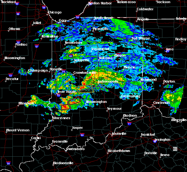 At 620 pm edt, a severe thunderstorm capable of producing a tornado was located near linton, or 29 miles southeast of terre haute, moving east at 50 mph (radar indicated rotation). Hazards include tornado and quarter size hail. Flying debris will be dangerous to those caught without shelter. mobile homes will be damaged or destroyed. damage to roofs, windows, and vehicles will occur. tree damage is likely. This tornadic thunderstorm will remain over mainly rural areas of northwestern greene county. At 620 pm edt, a severe thunderstorm capable of producing a tornado was located near linton, or 29 miles southeast of terre haute, moving east at 50 mph (radar indicated rotation). Hazards include tornado and quarter size hail. Flying debris will be dangerous to those caught without shelter. mobile homes will be damaged or destroyed. damage to roofs, windows, and vehicles will occur. tree damage is likely. This tornadic thunderstorm will remain over mainly rural areas of northwestern greene county.
|
| 6/15/2019 6:11 PM EDT |
 At 611 pm edt, a severe thunderstorm capable of producing a tornado was located near linton, or 24 miles east of robinson, moving east at 50 mph (radar indicated rotation). Hazards include tornado and quarter size hail. Flying debris will be dangerous to those caught without shelter. mobile homes will be damaged or destroyed. damage to roofs, windows, and vehicles will occur. tree damage is likely. this dangerous storm will be near, vicksburg around 615 pm edt. linton and jasonville around 620 pm edt. Switz city around 625 pm edt. At 611 pm edt, a severe thunderstorm capable of producing a tornado was located near linton, or 24 miles east of robinson, moving east at 50 mph (radar indicated rotation). Hazards include tornado and quarter size hail. Flying debris will be dangerous to those caught without shelter. mobile homes will be damaged or destroyed. damage to roofs, windows, and vehicles will occur. tree damage is likely. this dangerous storm will be near, vicksburg around 615 pm edt. linton and jasonville around 620 pm edt. Switz city around 625 pm edt.
|
| 6/15/2019 5:55 PM EDT |
 At 555 pm edt, a severe thunderstorm capable of producing a tornado was located near palestine, or 11 miles east of robinson, moving east at 50 mph (radar indicated rotation). Hazards include tornado and quarter size hail. Flying debris will be dangerous to those caught without shelter. mobile homes will be damaged or destroyed. damage to roofs, windows, and vehicles will occur. tree damage is likely. this dangerous storm will be near, sullivan and paxton around 605 pm edt. dugger around 610 pm edt. jasonville and vicksburg around 615 pm edt. linton around 620 pm edt. Switz city around 625 pm edt. At 555 pm edt, a severe thunderstorm capable of producing a tornado was located near palestine, or 11 miles east of robinson, moving east at 50 mph (radar indicated rotation). Hazards include tornado and quarter size hail. Flying debris will be dangerous to those caught without shelter. mobile homes will be damaged or destroyed. damage to roofs, windows, and vehicles will occur. tree damage is likely. this dangerous storm will be near, sullivan and paxton around 605 pm edt. dugger around 610 pm edt. jasonville and vicksburg around 615 pm edt. linton around 620 pm edt. Switz city around 625 pm edt.
|
| 6/15/2019 5:36 PM EDT |
 At 536 pm edt, a severe thunderstorm was located near sullivan, or 20 miles east of robinson, moving northeast at 40 mph (radar indicated). Hazards include 70 mph wind gusts and penny size hail. Expect considerable tree damage. Damage is likely to mobile homes, roofs, and outbuildings. At 536 pm edt, a severe thunderstorm was located near sullivan, or 20 miles east of robinson, moving northeast at 40 mph (radar indicated). Hazards include 70 mph wind gusts and penny size hail. Expect considerable tree damage. Damage is likely to mobile homes, roofs, and outbuildings.
|
| 6/9/2018 3:54 PM EDT |
 The severe thunderstorm warning for northeastern sullivan, southwestern clay and northwestern greene counties will expire at 400 pm edt, the storm which prompted the warning has weakened below severe limits, and no longer poses an immediate threat to life or property. therefore, the warning will be allowed to expire. The severe thunderstorm warning for northeastern sullivan, southwestern clay and northwestern greene counties will expire at 400 pm edt, the storm which prompted the warning has weakened below severe limits, and no longer poses an immediate threat to life or property. therefore, the warning will be allowed to expire.
|
| 6/9/2018 3:35 PM EDT |
 At 335 pm edt, a severe thunderstorm was located 9 miles north of linton, or 24 miles southeast of terre haute, moving northeast at 20 mph (radar indicated). Hazards include 60 mph wind gusts. Expect damage to roofs, siding, and trees. Locations impacted include, jasonville, worthington, clay city, hymera, coalmont and vicksburg. At 335 pm edt, a severe thunderstorm was located 9 miles north of linton, or 24 miles southeast of terre haute, moving northeast at 20 mph (radar indicated). Hazards include 60 mph wind gusts. Expect damage to roofs, siding, and trees. Locations impacted include, jasonville, worthington, clay city, hymera, coalmont and vicksburg.
|
| 5/31/2018 1:37 PM EDT |
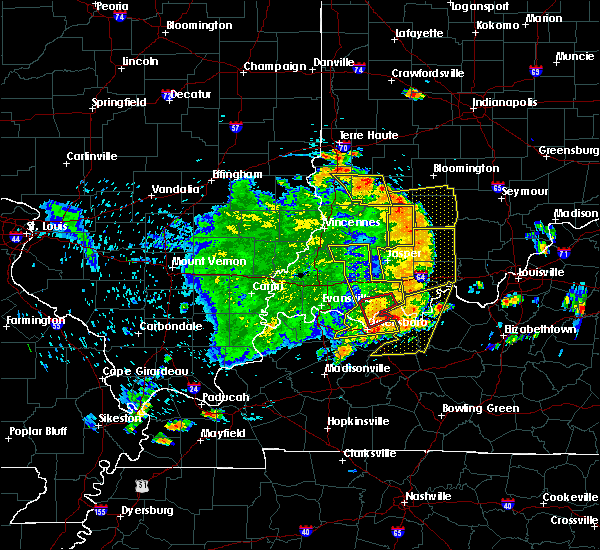 At 136 pm edt, a severe thunderstorm was located near linton, or 31 miles west of bloomington, moving northeast at 25 mph (trained weather spotters). Hazards include 60 mph wind gusts. Expect damage to roofs, siding, and trees. spotters reported trees down in sullivan and 60 mph winds near linton. Locations impacted include, linton, bloomfield, jasonville, worthington, shelburn, dugger, lyons, switz city, newberry, pleasantville and vicksburg. At 136 pm edt, a severe thunderstorm was located near linton, or 31 miles west of bloomington, moving northeast at 25 mph (trained weather spotters). Hazards include 60 mph wind gusts. Expect damage to roofs, siding, and trees. spotters reported trees down in sullivan and 60 mph winds near linton. Locations impacted include, linton, bloomfield, jasonville, worthington, shelburn, dugger, lyons, switz city, newberry, pleasantville and vicksburg.
|
| 5/31/2018 1:18 PM EDT |
 At 117 pm edt, a severe thunderstorm was located 7 miles southwest of linton, or 24 miles northeast of vincennes, moving east at 40 mph (radar indicated). Hazards include 60 mph wind gusts. expect damage to roofs, siding, and trees At 117 pm edt, a severe thunderstorm was located 7 miles southwest of linton, or 24 miles northeast of vincennes, moving east at 40 mph (radar indicated). Hazards include 60 mph wind gusts. expect damage to roofs, siding, and trees
|
| 4/3/2018 2:10 PM EDT |
 At 209 pm edt, a severe thunderstorm was located near bloomfield, or 21 miles southwest of bloomington, moving northeast at 65 mph (radar indicated). Hazards include 60 mph wind gusts and quarter size hail. Hail damage to vehicles is expected. Expect wind damage to roofs, siding, and trees. At 209 pm edt, a severe thunderstorm was located near bloomfield, or 21 miles southwest of bloomington, moving northeast at 65 mph (radar indicated). Hazards include 60 mph wind gusts and quarter size hail. Hail damage to vehicles is expected. Expect wind damage to roofs, siding, and trees.
|
| 5/10/2017 11:16 PM EDT |
 At 1115 pm edt, severe thunderstorms were located along a line extending from near danville to martinsville to 11 miles southwest of bloomington, moving east at 55 mph (radar indicated). Hazards include 70 mph wind gusts. Expect considerable tree damage. damage is likely to mobile homes, roofs, and outbuildings. locations impacted include, bloomington, plainfield, martinsville, mooresville, danville, spencer, avon, ellettsville, brooklyn, worthington, monrovia, clayton, gosport, paragon, coatesville, amo, stilesville, stinesville, bethany and freedom. This includes interstate 70 between mile markers 49 and 68. At 1115 pm edt, severe thunderstorms were located along a line extending from near danville to martinsville to 11 miles southwest of bloomington, moving east at 55 mph (radar indicated). Hazards include 70 mph wind gusts. Expect considerable tree damage. damage is likely to mobile homes, roofs, and outbuildings. locations impacted include, bloomington, plainfield, martinsville, mooresville, danville, spencer, avon, ellettsville, brooklyn, worthington, monrovia, clayton, gosport, paragon, coatesville, amo, stilesville, stinesville, bethany and freedom. This includes interstate 70 between mile markers 49 and 68.
|
| 5/10/2017 11:09 PM EDT |
 At 1108 pm edt, severe thunderstorms were located along a line extending from 6 miles southwest of danville to 7 miles west of martinsville to 8 miles northeast of bloomfield, moving east at 60 mph (radar indicated). Hazards include 70 mph wind gusts. Expect considerable tree damage. damage is likely to mobile homes, roofs, and outbuildings. locations impacted include, bloomington, plainfield, martinsville, greencastle, mooresville, danville, spencer, avon, ellettsville, jasonville, cloverdale, brooklyn, worthington, monrovia, clayton, clay city, gosport, bainbridge, paragon and fillmore. This includes interstate 70 between mile markers 36 and 68. At 1108 pm edt, severe thunderstorms were located along a line extending from 6 miles southwest of danville to 7 miles west of martinsville to 8 miles northeast of bloomfield, moving east at 60 mph (radar indicated). Hazards include 70 mph wind gusts. Expect considerable tree damage. damage is likely to mobile homes, roofs, and outbuildings. locations impacted include, bloomington, plainfield, martinsville, greencastle, mooresville, danville, spencer, avon, ellettsville, jasonville, cloverdale, brooklyn, worthington, monrovia, clayton, clay city, gosport, bainbridge, paragon and fillmore. This includes interstate 70 between mile markers 36 and 68.
|
| 5/10/2017 10:59 PM EDT |
 At 1058 pm edt, severe thunderstorms were located along a line extending from 16 miles south of crawfordsville to 10 miles southeast of greencastle to 10 miles northwest of bloomfield, moving east at 55 mph (radar indicated). Hazards include 60 mph wind gusts. Expect damage to roofs, siding, and trees. locations impacted include, bloomington, plainfield, martinsville, greencastle, mooresville, danville, spencer, avon, ellettsville, jasonville, cloverdale, brooklyn, worthington, monrovia, clayton, clay city, gosport, bainbridge, paragon and fillmore. This includes interstate 70 between mile markers 25 and 68. At 1058 pm edt, severe thunderstorms were located along a line extending from 16 miles south of crawfordsville to 10 miles southeast of greencastle to 10 miles northwest of bloomfield, moving east at 55 mph (radar indicated). Hazards include 60 mph wind gusts. Expect damage to roofs, siding, and trees. locations impacted include, bloomington, plainfield, martinsville, greencastle, mooresville, danville, spencer, avon, ellettsville, jasonville, cloverdale, brooklyn, worthington, monrovia, clayton, clay city, gosport, bainbridge, paragon and fillmore. This includes interstate 70 between mile markers 25 and 68.
|
| 5/10/2017 10:46 PM EDT |
 At 1045 pm edt, severe thunderstorms were located along a line extending from 10 miles northeast of rockville to 9 miles southwest of greencastle to 15 miles north of linton, moving east at 55 mph (radar indicated). Hazards include 60 mph wind gusts. expect damage to roofs, siding, and trees At 1045 pm edt, severe thunderstorms were located along a line extending from 10 miles northeast of rockville to 9 miles southwest of greencastle to 15 miles north of linton, moving east at 55 mph (radar indicated). Hazards include 60 mph wind gusts. expect damage to roofs, siding, and trees
|
| 4/29/2017 9:44 PM EDT |
 At 943 pm edt, a severe thunderstorm was located 11 miles south of greencastle, or 25 miles northwest of bloomington, moving northeast at 60 mph (radar indicated). Hazards include 60 mph wind gusts and quarter size hail. Hail damage to vehicles is expected. Expect wind damage to roofs, siding, and trees. At 943 pm edt, a severe thunderstorm was located 11 miles south of greencastle, or 25 miles northwest of bloomington, moving northeast at 60 mph (radar indicated). Hazards include 60 mph wind gusts and quarter size hail. Hail damage to vehicles is expected. Expect wind damage to roofs, siding, and trees.
|
| 11/18/2016 5:28 PM EST |
 At 527 pm est, severe thunderstorms were located along a line extending from 14 miles southeast of crawfordsville to 7 miles southwest of bloomfield, moving east at 50 mph (radar indicated). Hazards include 70 mph wind gusts. Expect considerable tree damage. damage is likely to mobile homes, roofs, and outbuildings. locations impacted include, greencastle, brazil, linton, bloomfield, spencer, jasonville, cloverdale, worthington, ladoga, roachdale, dugger, knightsville, clay city, bainbridge, lyons, harmony, new market, fillmore, carbon and russellville. This includes interstate 70 between mile markers 21 and 47. At 527 pm est, severe thunderstorms were located along a line extending from 14 miles southeast of crawfordsville to 7 miles southwest of bloomfield, moving east at 50 mph (radar indicated). Hazards include 70 mph wind gusts. Expect considerable tree damage. damage is likely to mobile homes, roofs, and outbuildings. locations impacted include, greencastle, brazil, linton, bloomfield, spencer, jasonville, cloverdale, worthington, ladoga, roachdale, dugger, knightsville, clay city, bainbridge, lyons, harmony, new market, fillmore, carbon and russellville. This includes interstate 70 between mile markers 21 and 47.
|
| 11/18/2016 5:09 PM EST |
 At 508 pm est, severe thunderstorms were located along a line extending from 11 miles northeast of rockville to 8 miles southwest of linton, moving east at 35 mph (radar indicated). Hazards include 70 mph wind gusts. Expect considerable tree damage. damage is likely to mobile homes, roofs, and outbuildings. locations impacted include, terre haute, greencastle, brazil, linton, sullivan, rockville, bloomfield, spencer, jasonville, cloverdale, worthington, shelburn, farmersburg, seelyville, ladoga, roachdale, dugger, knightsville, clay city and hymera. This includes interstate 70 between mile markers 10 and 47. At 508 pm est, severe thunderstorms were located along a line extending from 11 miles northeast of rockville to 8 miles southwest of linton, moving east at 35 mph (radar indicated). Hazards include 70 mph wind gusts. Expect considerable tree damage. damage is likely to mobile homes, roofs, and outbuildings. locations impacted include, terre haute, greencastle, brazil, linton, sullivan, rockville, bloomfield, spencer, jasonville, cloverdale, worthington, shelburn, farmersburg, seelyville, ladoga, roachdale, dugger, knightsville, clay city and hymera. This includes interstate 70 between mile markers 10 and 47.
|
| 11/18/2016 4:48 PM EST |
 At 447 pm est, severe thunderstorms were located along a line extending from 6 miles east of newport to 6 miles southeast of palestine, moving east at 30 mph (radar indicated). Hazards include 70 mph wind gusts. Expect considerable tree damage. Damage is likely to mobile homes, roofs, and outbuildings. At 447 pm est, severe thunderstorms were located along a line extending from 6 miles east of newport to 6 miles southeast of palestine, moving east at 30 mph (radar indicated). Hazards include 70 mph wind gusts. Expect considerable tree damage. Damage is likely to mobile homes, roofs, and outbuildings.
|
| 10/19/2016 4:36 PM EDT |
 At 436 pm edt, a severe thunderstorm was located near linton, or 30 miles northeast of vincennes, moving east at 35 mph (trained weather spotters). Hazards include quarter size hail. damage to vehicles is expected At 436 pm edt, a severe thunderstorm was located near linton, or 30 miles northeast of vincennes, moving east at 35 mph (trained weather spotters). Hazards include quarter size hail. damage to vehicles is expected
|
| 10/19/2016 4:25 PM EDT |
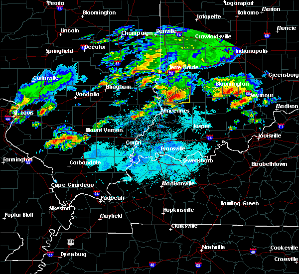 At 424 pm edt, a severe thunderstorm was located 10 miles southwest of linton, or 21 miles northeast of vincennes, moving east at 35 mph (radar indicated). Hazards include quarter size hail. Damage to vehicles is expected. Locations impacted include, linton, worthington, lyons, carlisle, oaktown, sandborn, switz city, newberry, vicksburg, pleasantville and freelandville. At 424 pm edt, a severe thunderstorm was located 10 miles southwest of linton, or 21 miles northeast of vincennes, moving east at 35 mph (radar indicated). Hazards include quarter size hail. Damage to vehicles is expected. Locations impacted include, linton, worthington, lyons, carlisle, oaktown, sandborn, switz city, newberry, vicksburg, pleasantville and freelandville.
|
| 10/19/2016 4:04 PM EDT |
 At 404 pm edt, a severe thunderstorm was located 7 miles southeast of palestine, or 13 miles east of robinson, moving east at 40 mph (radar indicated). Hazards include quarter size hail. damage to vehicles is expected At 404 pm edt, a severe thunderstorm was located 7 miles southeast of palestine, or 13 miles east of robinson, moving east at 40 mph (radar indicated). Hazards include quarter size hail. damage to vehicles is expected
|
| 8/24/2016 4:53 PM EDT |
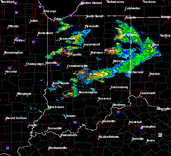 At 453 pm edt, a severe thunderstorm capable of producing a tornado was located 7 miles south of spencer, or 15 miles west of bloomington, moving east at 25 mph (weather spotters reported a funnel cloud). Hazards include tornado. Flying debris will be dangerous to those caught without shelter. mobile homes will be damaged or destroyed. damage to roofs, windows, and vehicles will occur. tree damage is likely. This dangerous storm will be near, spencer and mccormicks creek state park around 505 pm edt. At 453 pm edt, a severe thunderstorm capable of producing a tornado was located 7 miles south of spencer, or 15 miles west of bloomington, moving east at 25 mph (weather spotters reported a funnel cloud). Hazards include tornado. Flying debris will be dangerous to those caught without shelter. mobile homes will be damaged or destroyed. damage to roofs, windows, and vehicles will occur. tree damage is likely. This dangerous storm will be near, spencer and mccormicks creek state park around 505 pm edt.
|
| 8/24/2016 4:41 PM EDT |
 At 440 pm edt, a severe thunderstorm capable of producing a tornado was located 10 miles southwest of spencer, or 20 miles west of bloomington, moving east at 25 mph. a police officer reported a descending funnel cloud looking northeast from worthington at 439 pm (weather spotters reported funnel cloud). Hazards include tornado. Flying debris will be dangerous to those caught without shelter. mobile homes will be damaged or destroyed. damage to roofs, windows, and vehicles will occur. tree damage is likely. this dangerous storm will be near, freedom around 445 pm edt. Spencer and mccormicks creek state park around 505 pm edt. At 440 pm edt, a severe thunderstorm capable of producing a tornado was located 10 miles southwest of spencer, or 20 miles west of bloomington, moving east at 25 mph. a police officer reported a descending funnel cloud looking northeast from worthington at 439 pm (weather spotters reported funnel cloud). Hazards include tornado. Flying debris will be dangerous to those caught without shelter. mobile homes will be damaged or destroyed. damage to roofs, windows, and vehicles will occur. tree damage is likely. this dangerous storm will be near, freedom around 445 pm edt. Spencer and mccormicks creek state park around 505 pm edt.
|
| 7/13/2016 7:46 PM EDT |
 At 746 pm edt, a severe thunderstorm was located near spencer, or 21 miles northwest of bloomington, moving east at 50 mph (radar indicated). Hazards include 60 mph wind gusts. Expect damage to roofs. siding. and trees. locations impacted include, washington, greencastle, linton, bloomfield, spencer, shoals, loogootee, cloverdale, worthington, odon, roachdale, bainbridge, lyons, elnora, fillmore, plainville, waveland, russellville, montgomery and switz city. This includes interstate 70 between mile markers 26 and 47. At 746 pm edt, a severe thunderstorm was located near spencer, or 21 miles northwest of bloomington, moving east at 50 mph (radar indicated). Hazards include 60 mph wind gusts. Expect damage to roofs. siding. and trees. locations impacted include, washington, greencastle, linton, bloomfield, spencer, shoals, loogootee, cloverdale, worthington, odon, roachdale, bainbridge, lyons, elnora, fillmore, plainville, waveland, russellville, montgomery and switz city. This includes interstate 70 between mile markers 26 and 47.
|
| 7/13/2016 7:27 PM EDT |
 At 726 pm edt, a severe thunderstorm was located 12 miles north of linton, or 20 miles southeast of terre haute, moving east at 50 mph (radar indicated). Hazards include 60 mph wind gusts. Expect damage to roofs. siding. And trees. At 726 pm edt, a severe thunderstorm was located 12 miles north of linton, or 20 miles southeast of terre haute, moving east at 50 mph (radar indicated). Hazards include 60 mph wind gusts. Expect damage to roofs. siding. And trees.
|
| 6/15/2016 5:56 PM EDT | The severe thunderstorm warning for putnam, western greene, southeastern vigo, owen, western morgan, clay and sullivan counties will expire at 600 pm edt, the storms which prompted the warning have weakened below severe limits, and no longer pose an immediate threat to life or property. therefore the warning will be allowed to expire. however gusty winds and heavy rain are still possible with these thunderstorms. a severe thunderstorm watch remains in effect until 1100 pm edt for south central, west central, central and southwestern indiana. |
| 6/15/2016 5:46 PM EDT |
 At 546 pm edt, severe thunderstorms were located along a line extending from near danville to 7 miles south of sullivan, moving east at 45 mph (radar indicated). Hazards include 60 mph wind gusts. Expect damage to roofs. siding. and trees. locations impacted include, greencastle, brazil, linton, sullivan, bloomfield, spencer, jasonville, cloverdale, worthington, shelburn, farmersburg, dugger, knightsville, clay city, gosport, hymera, lyons, paragon, harmony and fillmore. This includes interstate 70 between mile markers 20 and 56. At 546 pm edt, severe thunderstorms were located along a line extending from near danville to 7 miles south of sullivan, moving east at 45 mph (radar indicated). Hazards include 60 mph wind gusts. Expect damage to roofs. siding. and trees. locations impacted include, greencastle, brazil, linton, sullivan, bloomfield, spencer, jasonville, cloverdale, worthington, shelburn, farmersburg, dugger, knightsville, clay city, gosport, hymera, lyons, paragon, harmony and fillmore. This includes interstate 70 between mile markers 20 and 56.
|
| 6/15/2016 5:30 PM EDT |
 At 529 pm edt, severe thunderstorms were located along a line extending from 9 miles north of greencastle to palestine, moving east at 45 mph (radar indicated). Hazards include 60 mph wind gusts. Expect damage to roofs. siding. And trees. At 529 pm edt, severe thunderstorms were located along a line extending from 9 miles north of greencastle to palestine, moving east at 45 mph (radar indicated). Hazards include 60 mph wind gusts. Expect damage to roofs. siding. And trees.
|
| 6/15/2016 4:02 PM EDT |
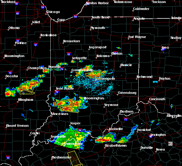 At 402 pm edt, a severe thunderstorm was located over linton, or 30 miles southeast of terre haute, moving east at 25 mph (radar indicated). Hazards include 60 mph wind gusts and penny size hail. Expect damage to roofs. siding. and trees. Locations impacted include, linton, bloomfield, jasonville, worthington, dugger, lyons, switz city, vicksburg and freedom. At 402 pm edt, a severe thunderstorm was located over linton, or 30 miles southeast of terre haute, moving east at 25 mph (radar indicated). Hazards include 60 mph wind gusts and penny size hail. Expect damage to roofs. siding. and trees. Locations impacted include, linton, bloomfield, jasonville, worthington, dugger, lyons, switz city, vicksburg and freedom.
|
| 6/15/2016 3:44 PM EDT |
 At 344 pm edt, a severe thunderstorm was located near sullivan, or 23 miles east of robinson, moving east at 25 mph (radar indicated). Hazards include 60 mph wind gusts and nickel size hail. Expect damage to roofs. siding. And trees. At 344 pm edt, a severe thunderstorm was located near sullivan, or 23 miles east of robinson, moving east at 25 mph (radar indicated). Hazards include 60 mph wind gusts and nickel size hail. Expect damage to roofs. siding. And trees.
|
| 5/11/2016 7:29 PM EDT |
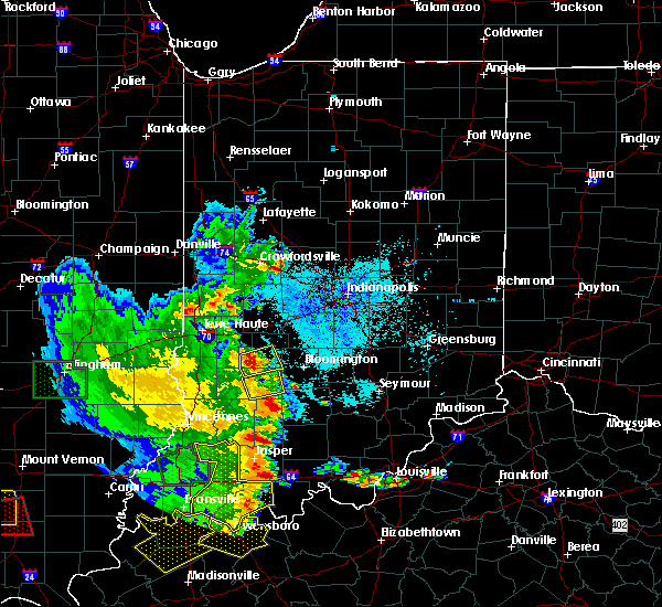 At 729 pm edt, a severe thunderstorm was located 11 miles southwest of spencer, or 23 miles west of bloomington, moving east at 15 mph (radar indicated). Hazards include 60 mph wind gusts and quarter size hail. Hail damage to vehicles is expected. Expect wind damage to roofs, siding, and trees. At 729 pm edt, a severe thunderstorm was located 11 miles southwest of spencer, or 23 miles west of bloomington, moving east at 15 mph (radar indicated). Hazards include 60 mph wind gusts and quarter size hail. Hail damage to vehicles is expected. Expect wind damage to roofs, siding, and trees.
|
| 5/11/2016 7:14 PM EDT |
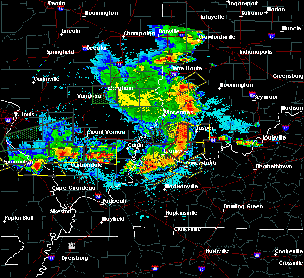 At 713 pm edt, a severe thunderstorm was located near linton, or 29 miles northeast of vincennes, moving northeast at 30 mph (radar indicated). Hazards include 60 mph wind gusts and quarter size hail. Hail damage to vehicles is expected. expect wind damage to roofs, siding, and trees. Locations impacted include, linton, bloomfield, worthington, lyons and switz city. At 713 pm edt, a severe thunderstorm was located near linton, or 29 miles northeast of vincennes, moving northeast at 30 mph (radar indicated). Hazards include 60 mph wind gusts and quarter size hail. Hail damage to vehicles is expected. expect wind damage to roofs, siding, and trees. Locations impacted include, linton, bloomfield, worthington, lyons and switz city.
|
| 5/11/2016 6:52 PM EDT |
 At 652 pm edt, a severe thunderstorm was located 12 miles southwest of linton, or 19 miles northeast of vincennes, moving northeast at 30 mph (radar indicated). Hazards include 60 mph wind gusts and quarter size hail. Hail damage to vehicles is expected. Expect wind damage to roofs, siding, and trees. At 652 pm edt, a severe thunderstorm was located 12 miles southwest of linton, or 19 miles northeast of vincennes, moving northeast at 30 mph (radar indicated). Hazards include 60 mph wind gusts and quarter size hail. Hail damage to vehicles is expected. Expect wind damage to roofs, siding, and trees.
|
| 4/26/2016 7:25 PM EDT |
 At 724 pm edt, a confirmed tornado was located near bloomfield, or 24 miles west of bloomington, moving east at 25 mph. at 722 pm edt, the public reported a tornado on the ground 1 mile soutwest of worthington (public confirmed tornado). Hazards include damaging tornado. Flying debris will be dangerous to those caught without shelter. mobile homes will be damaged or destroyed. damage to roofs, windows, and vehicles will occur. tree damage is likely. the tornado will be near, freedom around 745 pm edt. solsberry around 750 pm edt. Mccormicks creek state park around 800 pm edt. At 724 pm edt, a confirmed tornado was located near bloomfield, or 24 miles west of bloomington, moving east at 25 mph. at 722 pm edt, the public reported a tornado on the ground 1 mile soutwest of worthington (public confirmed tornado). Hazards include damaging tornado. Flying debris will be dangerous to those caught without shelter. mobile homes will be damaged or destroyed. damage to roofs, windows, and vehicles will occur. tree damage is likely. the tornado will be near, freedom around 745 pm edt. solsberry around 750 pm edt. Mccormicks creek state park around 800 pm edt.
|
| 3/27/2016 5:52 PM EDT |
 The severe thunderstorm warning for greene county will expire at 600 pm edt, the storm which prompted the warning has weakened below severe limits and exited the warned area. therefore the warning will be allowed to expire. however small hail is still possible with this thunderstorm. a severe thunderstorm watch remains in effect until 1100 pm edt for southwestern indiana. The severe thunderstorm warning for greene county will expire at 600 pm edt, the storm which prompted the warning has weakened below severe limits and exited the warned area. therefore the warning will be allowed to expire. however small hail is still possible with this thunderstorm. a severe thunderstorm watch remains in effect until 1100 pm edt for southwestern indiana.
|
| 3/27/2016 5:37 PM EDT |
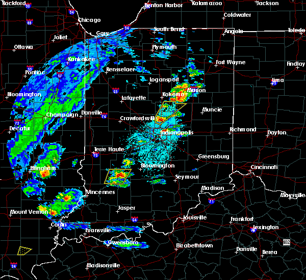 At 537 pm edt, a severe thunderstorm was located near bloomfield, or 20 miles west of bloomington, moving northeast at 45 mph (radar indicated). Hazards include quarter size hail. Damage to vehicles is expected. Locations impacted include, bloomfield, worthington, lyons, switz city, newberry and solsberry. At 537 pm edt, a severe thunderstorm was located near bloomfield, or 20 miles west of bloomington, moving northeast at 45 mph (radar indicated). Hazards include quarter size hail. Damage to vehicles is expected. Locations impacted include, bloomfield, worthington, lyons, switz city, newberry and solsberry.
|
| 3/27/2016 5:25 PM EDT |
 At 524 pm edt, a severe thunderstorm was located near bloomfield, or 28 miles west of bedford, moving northeast at 45 mph (radar indicated). Hazards include quarter size hail. damage to vehicles is expected At 524 pm edt, a severe thunderstorm was located near bloomfield, or 28 miles west of bedford, moving northeast at 45 mph (radar indicated). Hazards include quarter size hail. damage to vehicles is expected
|
| 12/23/2015 2:43 PM EST | At 242 pm est, severe thunderstorms were located along a line extending from 15 miles west of spencer to 6 miles southwest of bloomfield to 7 miles south of washington, moving northeast at 70 mph (radar indicated). Hazards include 60 mph wind gusts. Expect damage to roofs. siding and trees. locations impacted include, washington, linton, bloomfield, spencer, shoals, loogootee, jasonville, worthington, odon, clay city, lyons, elnora, plainville, sandborn, montgomery, switz city, newberry, crane, cannelburg and alfordsville. A tornado watch remains in effect until 900 pm est for southwestern indiana. |
| 12/23/2015 2:27 PM EST | At 226 pm est, severe thunderstorms were located along a line extending from 8 miles northeast of sullivan to 12 miles north of washington to near oakland city, moving northeast at 65 mph (radar indicated). Hazards include 60 mph wind gusts. Expect damage to roofs. Siding and trees. |
| 4/2/2015 7:55 PM EDT | The national weather service in indianapolis has issued a * severe thunderstorm warning for. eastern greene county in southwest indiana. northern lawrence county in south central indiana. monroe county in south central indiana. Southern owen county in west central indiana. |
| 4/2/2015 7:50 PM EDT | A severe thunderstorm warning remains in effect for south central clay and greene counties until 800 pm edt. at 748 pm edt. a severe thunderstorm was located near bloomfield. and moving northeast at 45 mph. hazard. 60 mph wind gusts and quarter size hail. source. Radar indicated. |
| 4/2/2015 7:44 PM EDT | A severe thunderstorm warning remains in effect for south central clay. northeastern daviess. greene. northern martin and east central sullivan counties until 800 pm edt. at 742 pm edt. a severe thunderstorm was located near linton. and moving northeast at 45 mph. hazard. 60 mph wind gusts and quarter size hail. |
| 4/2/2015 7:33 PM EDT | A severe thunderstorm warning remains in effect for south central clay. northern daviess. greene. northeastern knox. northern martin and southeastern sullivan counties until 800 pm edt. at 731 pm edt. a severe thunderstorm was located 5 miles southwest of linton. and moving northeast at 45 mph. hazard. 60 mph wind gusts and quarter size hail. |
| 4/2/2015 7:25 PM EDT | A severe thunderstorm warning remains in effect for south central clay. northern daviess. greene. northeastern knox. northern martin and southeastern sullivan counties until 800 pm edt. at 723 pm edt. a severe thunderstorm was located 12 miles southwest of linton. and moving east at 45 mph. hazard. 60 mph wind gusts and quarter size hail. |
| 4/2/2015 7:12 PM EDT | The national weather service in indianapolis has issued a * severe thunderstorm warning for. south central clay county in west central indiana. northern daviess county in southwest indiana. greene county in southwest indiana. Northeastern knox county in southwest indiana. |
| 8/16/2012 6:00 PM EDT | Three foot diameter tree downe in greene county IN, 0.2 miles SSE of Worthington, IN |
| 7/31/2012 4:40 PM EDT | Trees downed on gloryville road 1 mile sw of freedom. trees also downed on parrish road and harrington road near freedom. time estimated from radar. late repor in owen county IN, 7.8 miles SW of Worthington, IN |
Hail Maps for Worthington, IN
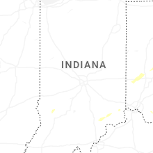

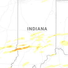
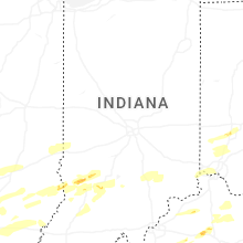
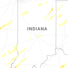


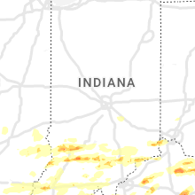


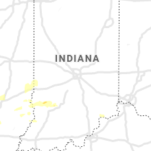


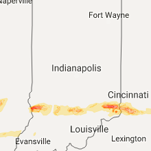


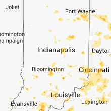

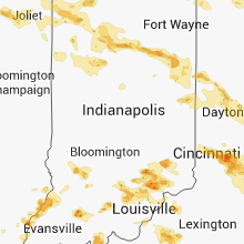


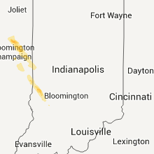

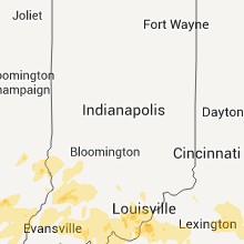
Connect with Interactive Hail Maps