

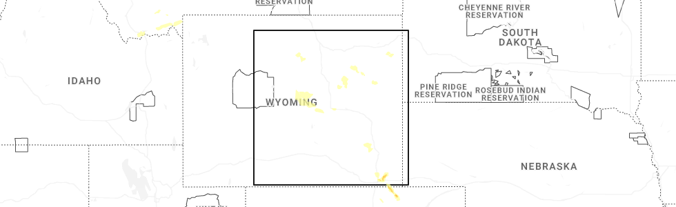
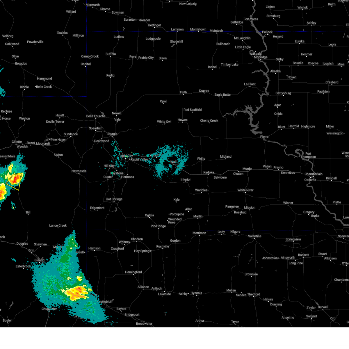
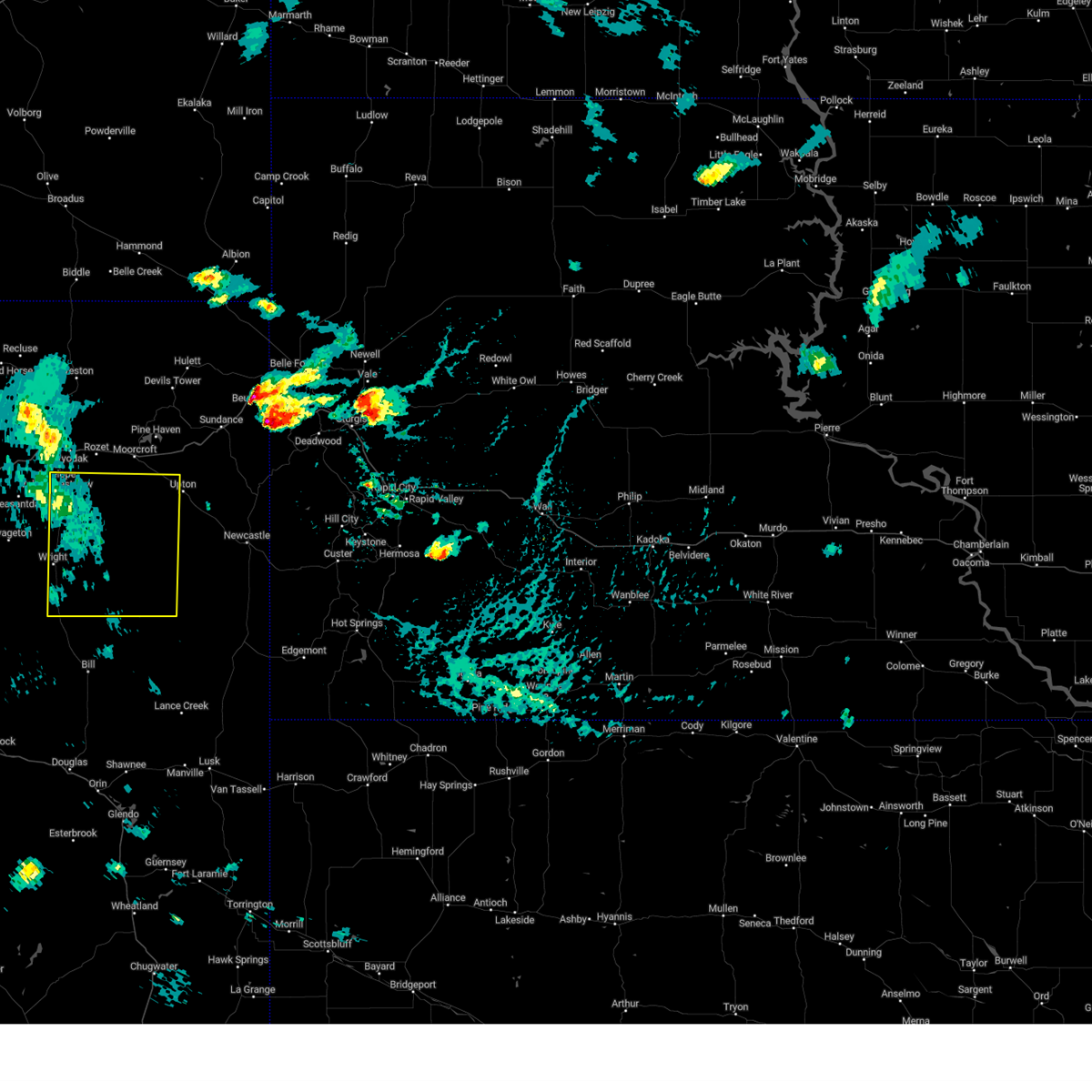
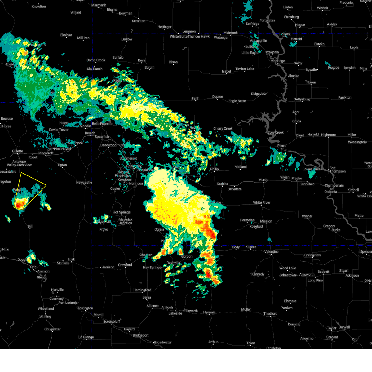
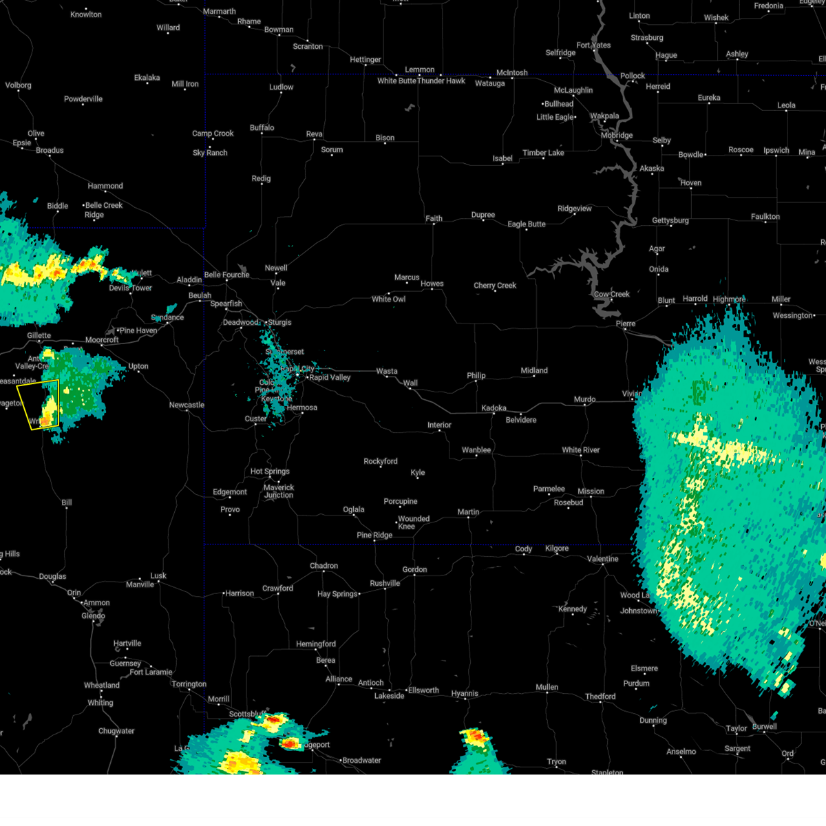
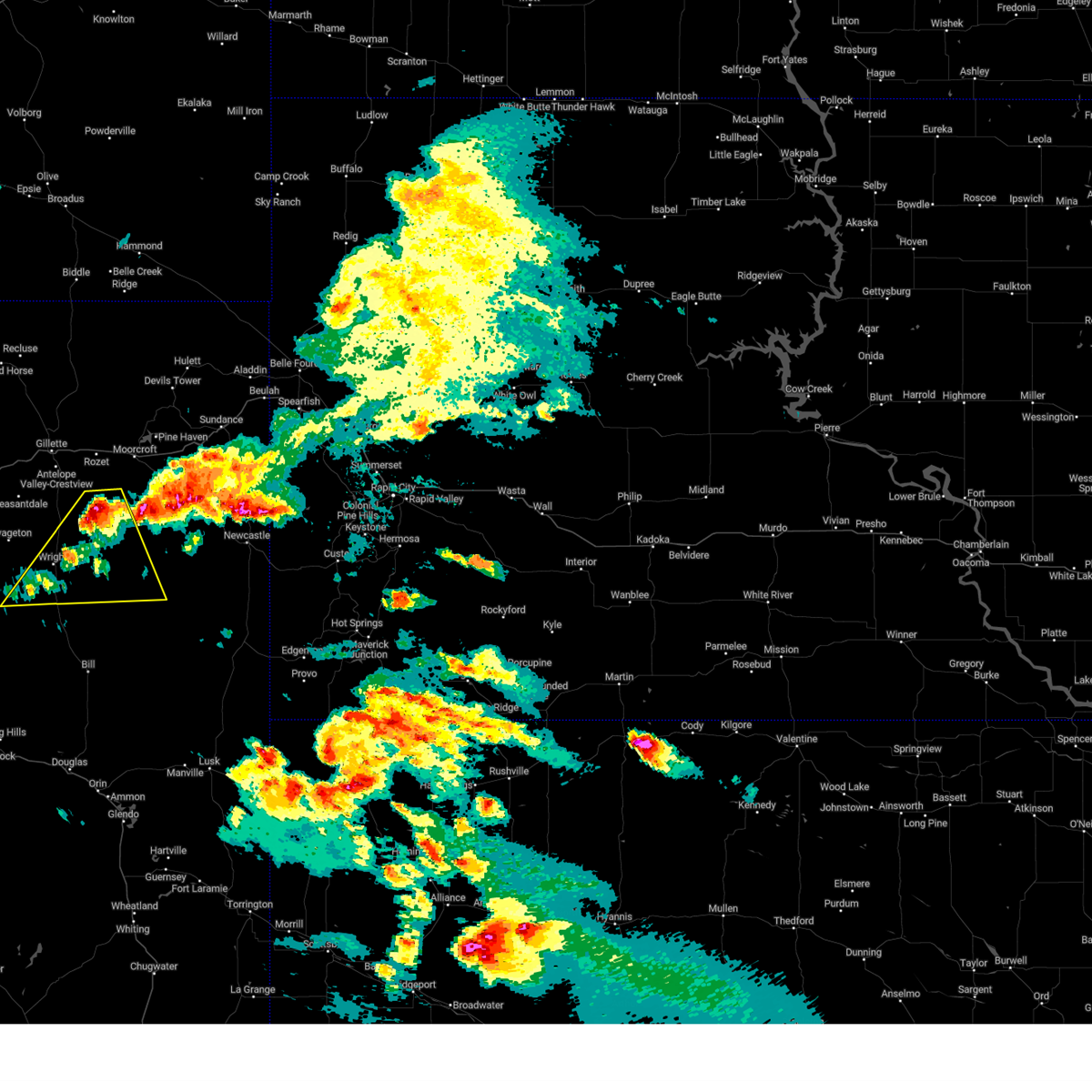
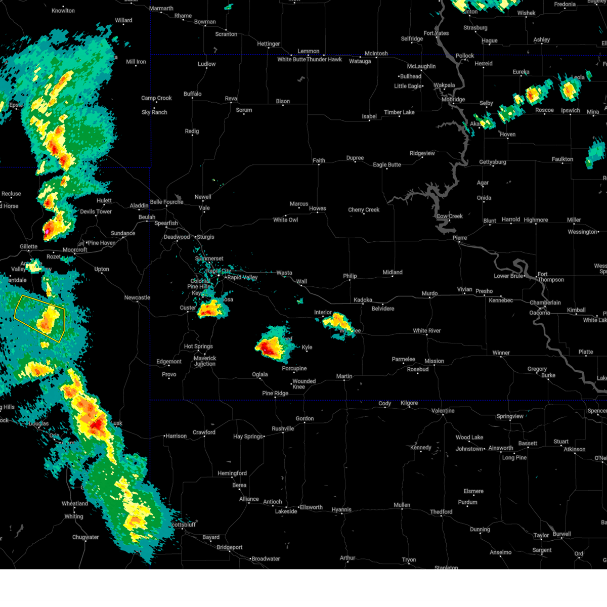
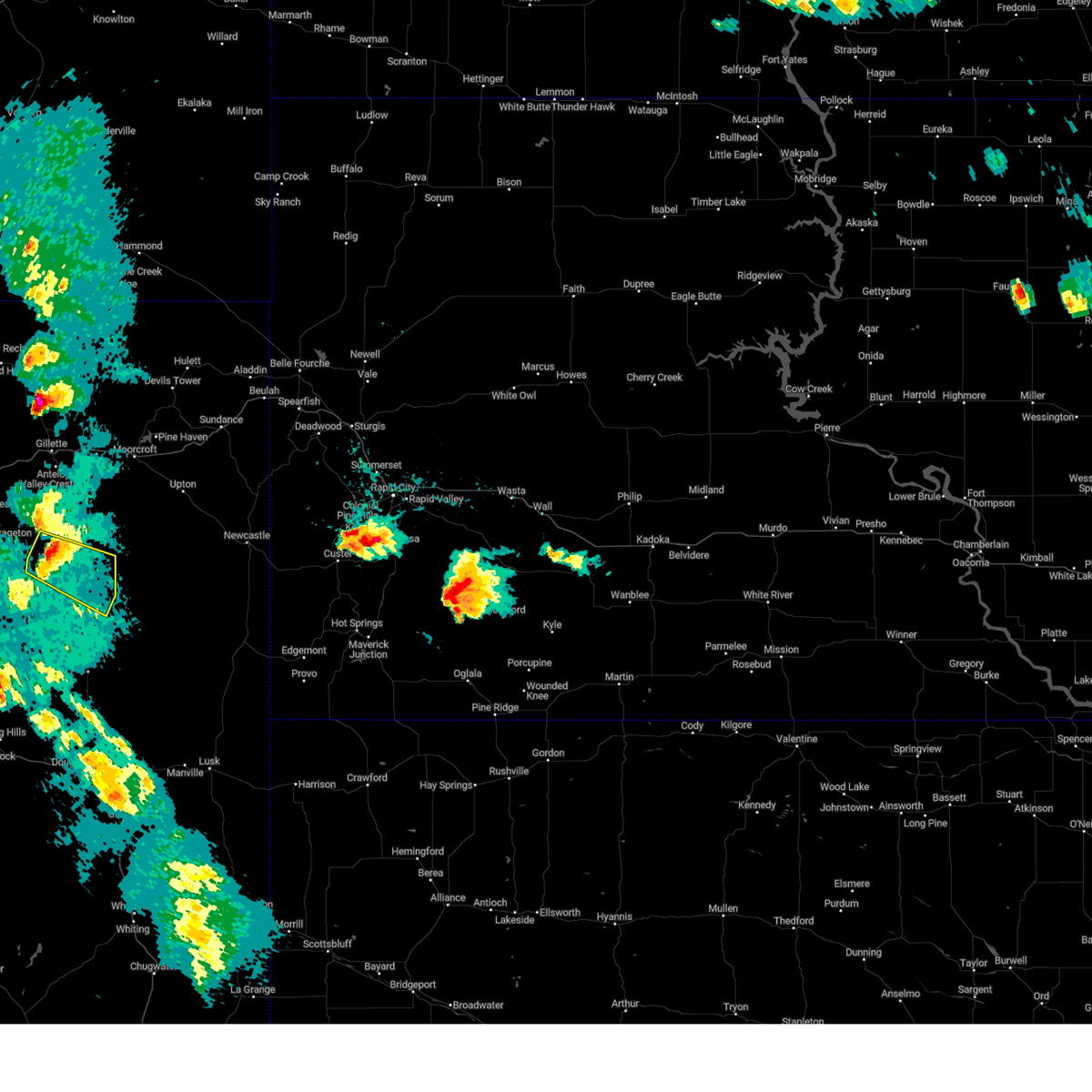
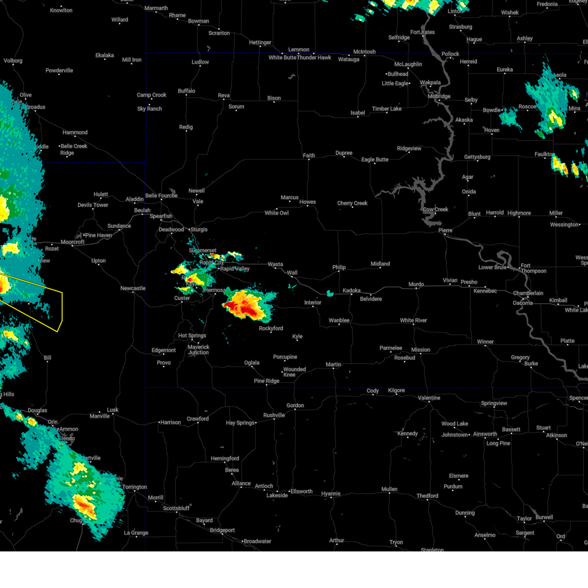
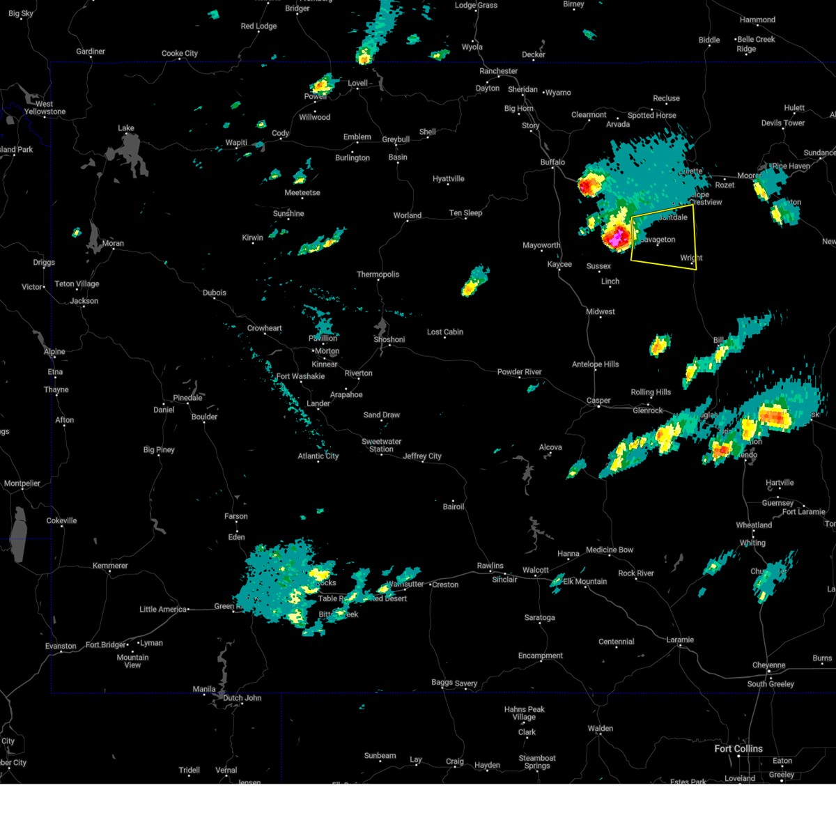
Hail Map for Wright, WY
The Wright, WY area has had 16 reports of on-the-ground hail by trained spotters, and has been under severe weather warnings 8 times during the past 12 months. Doppler radar has detected hail at or near Wright, WY on 37 occasions, including 4 occasions during the past year.
| Name: | Wright, WY |
| Where Located: | 37.3 miles S of Gillette, WY |
| Map: | Google Map for Wright, WY |
| Population: | 1807 |
| Housing Units: | 813 |
| More Info: | Search Google for Wright, WY |
1
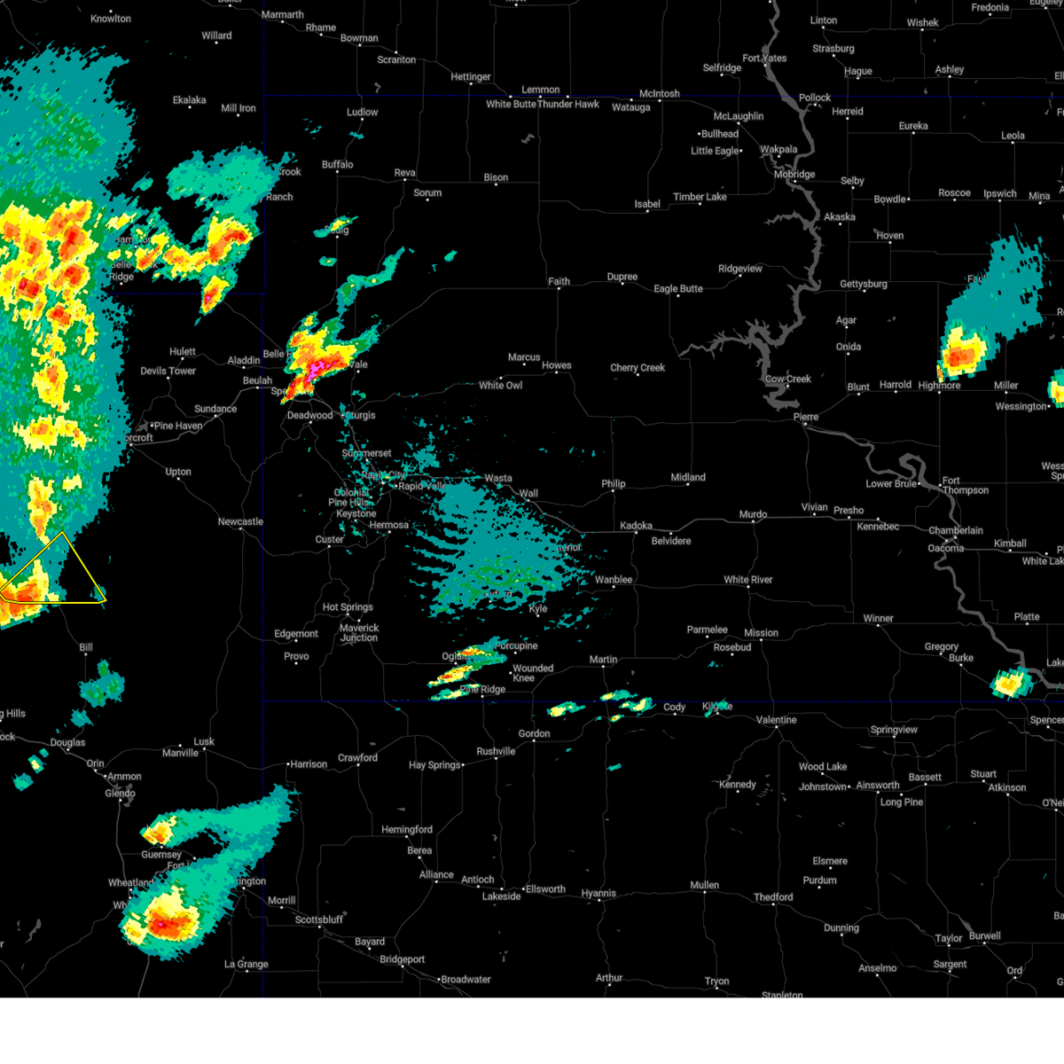
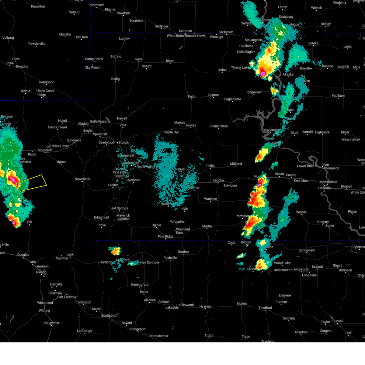
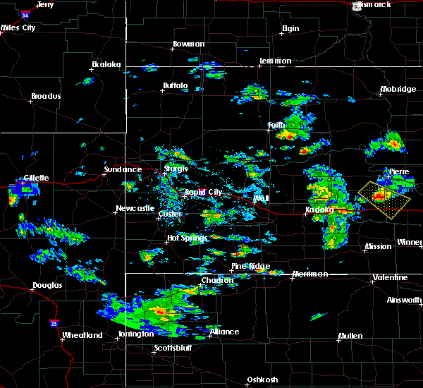
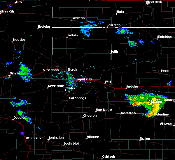
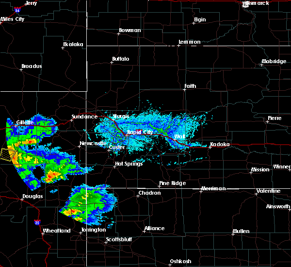
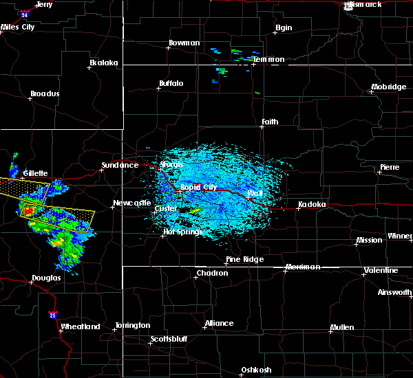
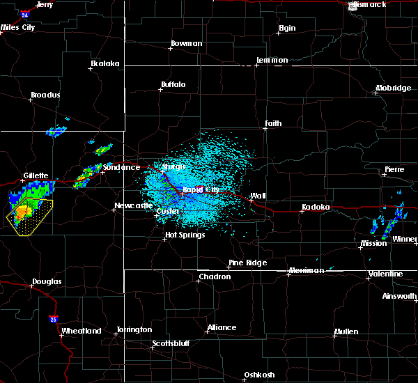
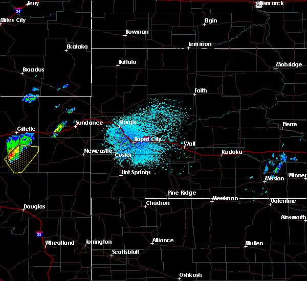
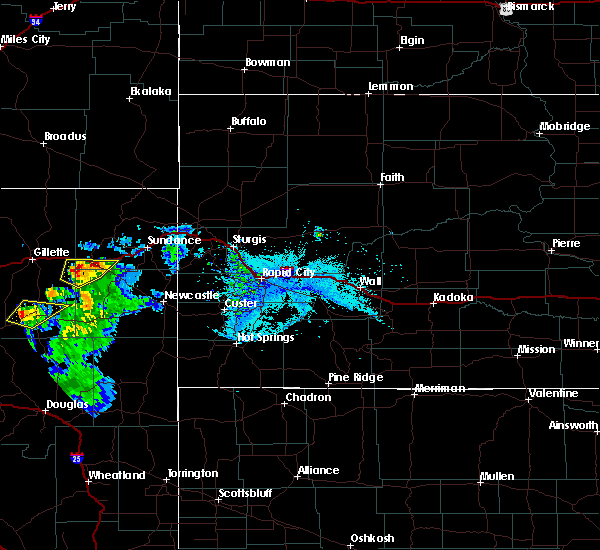
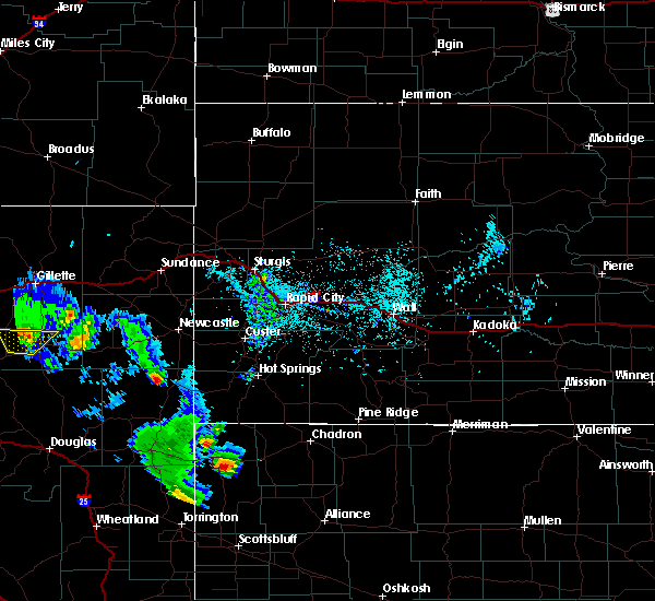
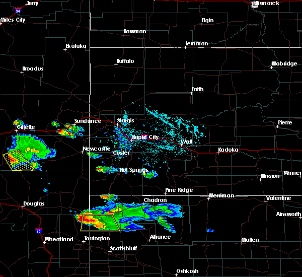
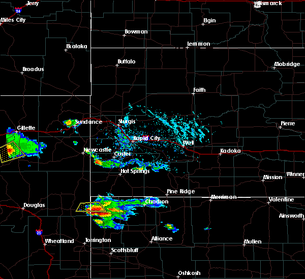
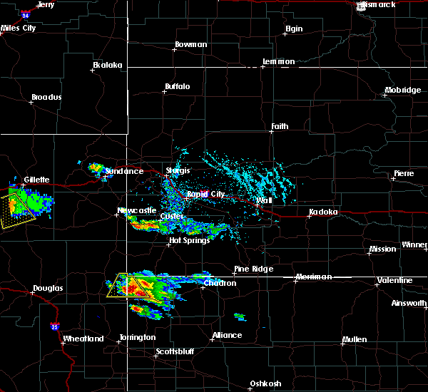
The Top Recent Hail Date for Wright, WY is Sunday, June 1, 2025 (4th out of 37)
Hail and Wind Damage Spotted near Wright, WY
| Date / Time | Report Details |
|---|---|
| 6/17/2025 3:05 PM MDT |
 At 304 pm mdt, a severe thunderstorm was located 8 miles north of black thunder mine, or 9 miles north of wright, moving southeast at 25 mph (radar indicated). Hazards include quarter size hail. Damage to vehicles is expected. Locations impacted include, wright, hilight gas plant, and reno junction. At 304 pm mdt, a severe thunderstorm was located 8 miles north of black thunder mine, or 9 miles north of wright, moving southeast at 25 mph (radar indicated). Hazards include quarter size hail. Damage to vehicles is expected. Locations impacted include, wright, hilight gas plant, and reno junction.
|
| 6/17/2025 2:46 PM MDT |
 Svrunr the national weather service in rapid city has issued a * severe thunderstorm warning for, southern campbell county in northeastern wyoming, * until 345 pm mdt. * at 246 pm mdt, a severe thunderstorm was located 8 miles northeast of savageton, or 15 miles northwest of wright, moving southeast at 25 mph (radar indicated). Hazards include quarter size hail. damage to vehicles is expected Svrunr the national weather service in rapid city has issued a * severe thunderstorm warning for, southern campbell county in northeastern wyoming, * until 345 pm mdt. * at 246 pm mdt, a severe thunderstorm was located 8 miles northeast of savageton, or 15 miles northwest of wright, moving southeast at 25 mph (radar indicated). Hazards include quarter size hail. damage to vehicles is expected
|
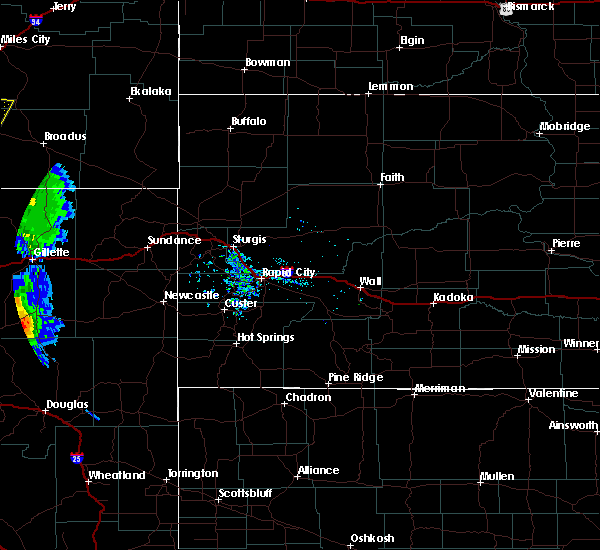
| 6/1/2025 7:51 PM MDT |
 The storm which prompted the warning has weakened below severe limits, and no longer poses an immediate threat to life or property. therefore, the warning will be allowed to expire. however, small hail and gusty winds are still possible with this thunderstorm. The storm which prompted the warning has weakened below severe limits, and no longer poses an immediate threat to life or property. therefore, the warning will be allowed to expire. however, small hail and gusty winds are still possible with this thunderstorm.
|
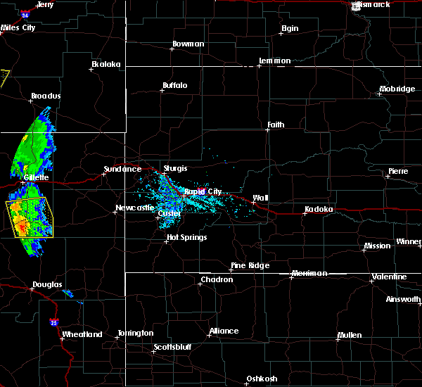
| 6/1/2025 7:35 PM MDT | Half Dollar sized hail reported 0.4 miles WNW of Wright, WY |
| 6/1/2025 7:28 PM MDT |
 At 728 pm mdt, a severe thunderstorm was located over wright, moving east at 10 mph (radar indicated). Hazards include 60 mph wind gusts and half dollar size hail. Hail damage to vehicles is expected. expect wind damage to roofs, siding, and trees. Locations impacted include, wright and reno junction. At 728 pm mdt, a severe thunderstorm was located over wright, moving east at 10 mph (radar indicated). Hazards include 60 mph wind gusts and half dollar size hail. Hail damage to vehicles is expected. expect wind damage to roofs, siding, and trees. Locations impacted include, wright and reno junction.
|
| 6/1/2025 7:21 PM MDT |
 At 721 pm mdt, a severe thunderstorm was located 3 miles west of wright, moving southeast at 10 mph (radar indicated). Hazards include 60 mph wind gusts and quarter size hail. Hail damage to vehicles is expected. expect wind damage to roofs, siding, and trees. Locations impacted include, wright and reno junction. At 721 pm mdt, a severe thunderstorm was located 3 miles west of wright, moving southeast at 10 mph (radar indicated). Hazards include 60 mph wind gusts and quarter size hail. Hail damage to vehicles is expected. expect wind damage to roofs, siding, and trees. Locations impacted include, wright and reno junction.
|
| 6/1/2025 7:11 PM MDT |
 At 711 pm mdt, a severe thunderstorm was located 4 miles northwest of wright, moving east at 15 mph (radar indicated). Hazards include golf ball size hail and 60 mph wind gusts. People and animals outdoors will be injured. expect hail damage to roofs, siding, windows, and vehicles. expect wind damage to roofs, siding, and trees. Locations impacted include, wright and reno junction. At 711 pm mdt, a severe thunderstorm was located 4 miles northwest of wright, moving east at 15 mph (radar indicated). Hazards include golf ball size hail and 60 mph wind gusts. People and animals outdoors will be injured. expect hail damage to roofs, siding, windows, and vehicles. expect wind damage to roofs, siding, and trees. Locations impacted include, wright and reno junction.
|
| 6/1/2025 7:03 PM MDT |
 Svrunr the national weather service in rapid city has issued a * severe thunderstorm warning for, south central campbell county in northeastern wyoming, * until 800 pm mdt. * at 703 pm mdt, a severe thunderstorm was located 8 miles southeast of savageton, or 8 miles west of wright, moving east at 10 mph (radar indicated). Hazards include 60 mph wind gusts and half dollar size hail. Hail damage to vehicles is expected. Expect wind damage to roofs, siding, and trees. Svrunr the national weather service in rapid city has issued a * severe thunderstorm warning for, south central campbell county in northeastern wyoming, * until 800 pm mdt. * at 703 pm mdt, a severe thunderstorm was located 8 miles southeast of savageton, or 8 miles west of wright, moving east at 10 mph (radar indicated). Hazards include 60 mph wind gusts and half dollar size hail. Hail damage to vehicles is expected. Expect wind damage to roofs, siding, and trees.
|
| 7/28/2024 4:39 PM MDT |
 Svrunr the national weather service in rapid city has issued a * severe thunderstorm warning for, southeastern campbell county in northeastern wyoming, western weston county in northeastern wyoming, * until 615 pm mdt. * at 439 pm mdt, severe thunderstorms were located along a line extending from 4 miles northwest of caballo mine to 6 miles northwest of narm mine, moving east at 25 mph (radar indicated). Hazards include 70 mph wind gusts. Expect considerable tree damage. Damage is likely to mobile homes, roofs, and outbuildings. Svrunr the national weather service in rapid city has issued a * severe thunderstorm warning for, southeastern campbell county in northeastern wyoming, western weston county in northeastern wyoming, * until 615 pm mdt. * at 439 pm mdt, severe thunderstorms were located along a line extending from 4 miles northwest of caballo mine to 6 miles northwest of narm mine, moving east at 25 mph (radar indicated). Hazards include 70 mph wind gusts. Expect considerable tree damage. Damage is likely to mobile homes, roofs, and outbuildings.
|
| 6/27/2024 6:08 PM MDT |
 The storms which prompted the warning have moved out of the area. therefore, the warning will be allowed to expire. however, gusty winds are still possible with these thunderstorms. a severe thunderstorm watch remains in effect until 900 pm mdt for northeastern wyoming. remember, a severe thunderstorm warning still remains in effect for northeastern crook county until 700 pm mdt. The storms which prompted the warning have moved out of the area. therefore, the warning will be allowed to expire. however, gusty winds are still possible with these thunderstorms. a severe thunderstorm watch remains in effect until 900 pm mdt for northeastern wyoming. remember, a severe thunderstorm warning still remains in effect for northeastern crook county until 700 pm mdt.
|
| 6/27/2024 5:49 PM MDT |
 At 548 pm mdt, severe thunderstorms were located along a line extending from 10 miles east of ridgeway to 6 miles east of pumpkin buttes, moving east at 40 mph (radar indicated). Hazards include 60 mph wind gusts. Expect damage to roofs, siding, and trees. locations impacted include, gillette, wright, moorcroft, hulett, eagle butte mine, cordero rojo mine, dry fork mine, hilight gas plant, coal creek mine, caballo mine, reno junction, belle ayr mine, wyodak mine, rawhide mine, oshoto, lightning flat, rozet, rockypoint, carlile, and new haven. This includes interstate 90 in wyoming between mile markers 118 and 156. At 548 pm mdt, severe thunderstorms were located along a line extending from 10 miles east of ridgeway to 6 miles east of pumpkin buttes, moving east at 40 mph (radar indicated). Hazards include 60 mph wind gusts. Expect damage to roofs, siding, and trees. locations impacted include, gillette, wright, moorcroft, hulett, eagle butte mine, cordero rojo mine, dry fork mine, hilight gas plant, coal creek mine, caballo mine, reno junction, belle ayr mine, wyodak mine, rawhide mine, oshoto, lightning flat, rozet, rockypoint, carlile, and new haven. This includes interstate 90 in wyoming between mile markers 118 and 156.
|
| 6/27/2024 5:29 PM MDT |
 At 529 pm mdt, severe thunderstorms were located along a line extending from 2 miles northwest of ridgeway to 6 miles northwest of pumpkin buttes, moving east at 40 mph (radar indicated). Hazards include 60 mph wind gusts. Expect damage to roofs, siding, and trees. locations impacted include, gillette, wright, moorcroft, hulett, rawhide mine, eagle butte mine, cordero rojo mine, dry fork mine, hilight gas plant, coal creek mine, caballo mine, reno junction, belle ayr mine, wyodak mine, buckskin mine, echeta, oshoto, weston, lightning flat, and rozet. This includes interstate 90 in wyoming between mile markers 96 and 156. At 529 pm mdt, severe thunderstorms were located along a line extending from 2 miles northwest of ridgeway to 6 miles northwest of pumpkin buttes, moving east at 40 mph (radar indicated). Hazards include 60 mph wind gusts. Expect damage to roofs, siding, and trees. locations impacted include, gillette, wright, moorcroft, hulett, rawhide mine, eagle butte mine, cordero rojo mine, dry fork mine, hilight gas plant, coal creek mine, caballo mine, reno junction, belle ayr mine, wyodak mine, buckskin mine, echeta, oshoto, weston, lightning flat, and rozet. This includes interstate 90 in wyoming between mile markers 96 and 156.
|
| 6/27/2024 5:10 PM MDT |
 Svrunr the national weather service in rapid city has issued a * severe thunderstorm warning for, campbell county in northeastern wyoming, northwestern weston county in northeastern wyoming, western crook county in northeastern wyoming, * until 615 pm mdt. * at 509 pm mdt, severe thunderstorms were located along a line extending from 14 miles northwest of ridgeway to near fort reno historical site, moving east at 40 mph (radar indicated). Hazards include 60 mph wind gusts. Expect damage to roofs, siding, and trees. severe thunderstorms will be near, gillette, rawhide mine, eagle butte mine, dry fork mine, buckskin mine, weston, lightning flat, rockypoint, and gillette airport around 515 pm mdt. wyodak mine, savageton, camplex event facility, and pumpkin buttes around 520 pm mdt. other locations in the path of these severe thunderstorms include new haven, caballo mine, belle ayr mine, rozet, oshoto, cordero rojo mine, wright, reno junction, coal creek mine, moorcroft, hulett, carlile, devils tower national monument and keyhole reservoir. This includes interstate 90 in wyoming between mile markers 96 and 156. Svrunr the national weather service in rapid city has issued a * severe thunderstorm warning for, campbell county in northeastern wyoming, northwestern weston county in northeastern wyoming, western crook county in northeastern wyoming, * until 615 pm mdt. * at 509 pm mdt, severe thunderstorms were located along a line extending from 14 miles northwest of ridgeway to near fort reno historical site, moving east at 40 mph (radar indicated). Hazards include 60 mph wind gusts. Expect damage to roofs, siding, and trees. severe thunderstorms will be near, gillette, rawhide mine, eagle butte mine, dry fork mine, buckskin mine, weston, lightning flat, rockypoint, and gillette airport around 515 pm mdt. wyodak mine, savageton, camplex event facility, and pumpkin buttes around 520 pm mdt. other locations in the path of these severe thunderstorms include new haven, caballo mine, belle ayr mine, rozet, oshoto, cordero rojo mine, wright, reno junction, coal creek mine, moorcroft, hulett, carlile, devils tower national monument and keyhole reservoir. This includes interstate 90 in wyoming between mile markers 96 and 156.
|
| 9/22/2023 12:11 PM MDT |
 At 1210 pm mdt, a severe thunderstorm was located 8 miles west of narm mine north, or 10 miles south of wright, moving northeast at 25 mph (radar indicated). Hazards include 60 mph wind gusts and quarter size hail. Hail damage to vehicles is expected. expect wind damage to roofs, siding, and trees. this severe thunderstorm will be near, wright, black thunder mine, and narm mine north around 1215 pm mdt. Coal creek mine around 1235 pm mdt. At 1210 pm mdt, a severe thunderstorm was located 8 miles west of narm mine north, or 10 miles south of wright, moving northeast at 25 mph (radar indicated). Hazards include 60 mph wind gusts and quarter size hail. Hail damage to vehicles is expected. expect wind damage to roofs, siding, and trees. this severe thunderstorm will be near, wright, black thunder mine, and narm mine north around 1215 pm mdt. Coal creek mine around 1235 pm mdt.
|
| 9/21/2023 7:45 PM MDT |
 At 745 pm mdt, a severe thunderstorm was located over black thunder mine, or near wright, moving north at 20 mph (trained weather spotters). Hazards include quarter size hail. Damage to vehicles is expected. this severe thunderstorm will be near, hilight gas plant around 750 pm mdt. hail threat, observed max hail size, 1. 00 in wind threat, radar indicated max wind gust, <50 mph. At 745 pm mdt, a severe thunderstorm was located over black thunder mine, or near wright, moving north at 20 mph (trained weather spotters). Hazards include quarter size hail. Damage to vehicles is expected. this severe thunderstorm will be near, hilight gas plant around 750 pm mdt. hail threat, observed max hail size, 1. 00 in wind threat, radar indicated max wind gust, <50 mph.
|
| 9/21/2023 7:40 PM MDT | Quarter sized hail reported 0.4 miles WNW of Wright, WY |
| 8/22/2023 6:30 PM MDT | Storm damage reported in campbell county WY, 0.2 miles NNE of Wright, WY |
| 7/30/2023 7:34 PM MDT |
 At 734 pm mdt, severe thunderstorms were located along a line extending from 19 miles south of rozet to 7 miles east of pine tree junction, moving east at 25 mph (radar indicated). Hazards include 60 mph wind gusts and half dollar size hail. Hail damage to vehicles is expected. Expect wind damage to roofs, siding, and trees. At 734 pm mdt, severe thunderstorms were located along a line extending from 19 miles south of rozet to 7 miles east of pine tree junction, moving east at 25 mph (radar indicated). Hazards include 60 mph wind gusts and half dollar size hail. Hail damage to vehicles is expected. Expect wind damage to roofs, siding, and trees.
|
| 7/3/2023 8:11 PM MDT |
 The severe thunderstorm warning for southeastern campbell county will expire at 815 pm mdt, the storm which prompted the warning has weakened below severe limits, and no longer poses an immediate threat to life or property. therefore, the warning will be allowed to expire. however small hail, gusty winds and heavy rain are still possible with this thunderstorm. a severe thunderstorm watch remains in effect until midnight mdt for northeastern wyoming. remember, a severe thunderstorm warning still remains in effect for east central campbell county until 845 pm mdt. The severe thunderstorm warning for southeastern campbell county will expire at 815 pm mdt, the storm which prompted the warning has weakened below severe limits, and no longer poses an immediate threat to life or property. therefore, the warning will be allowed to expire. however small hail, gusty winds and heavy rain are still possible with this thunderstorm. a severe thunderstorm watch remains in effect until midnight mdt for northeastern wyoming. remember, a severe thunderstorm warning still remains in effect for east central campbell county until 845 pm mdt.
|
| 7/3/2023 7:45 PM MDT | Golf Ball sized hail reported 0.4 miles WNW of Wright, WY |
| 7/3/2023 7:43 PM MDT |
 At 743 pm mdt, a severe thunderstorm was located 4 miles northeast of wright, moving east at 35 mph (radar indicated). Hazards include 60 mph wind gusts and half dollar size hail. Hail damage to vehicles is expected. expect wind damage to roofs, siding, and trees. locations impacted include, wright. hail threat, radar indicated max hail size, 1. 25 in wind threat, radar indicated max wind gust, 60 mph. At 743 pm mdt, a severe thunderstorm was located 4 miles northeast of wright, moving east at 35 mph (radar indicated). Hazards include 60 mph wind gusts and half dollar size hail. Hail damage to vehicles is expected. expect wind damage to roofs, siding, and trees. locations impacted include, wright. hail threat, radar indicated max hail size, 1. 25 in wind threat, radar indicated max wind gust, 60 mph.
|
| 7/3/2023 7:10 PM MDT |
 At 709 pm mdt, a severe thunderstorm was located over savageton, or 16 miles northwest of wright, moving east at 35 mph (radar indicated). Hazards include 60 mph wind gusts and half dollar size hail. Hail damage to vehicles is expected. Expect wind damage to roofs, siding, and trees. At 709 pm mdt, a severe thunderstorm was located over savageton, or 16 miles northwest of wright, moving east at 35 mph (radar indicated). Hazards include 60 mph wind gusts and half dollar size hail. Hail damage to vehicles is expected. Expect wind damage to roofs, siding, and trees.
|
| 6/29/2023 1:35 PM MDT | Quarter sized hail reported 11.3 miles WNW of Wright, WY |
| 6/28/2023 2:43 PM MDT |
 At 243 pm mdt, a severe thunderstorm was located 10 miles northeast of fort reno historical site, or 30 miles west of wright, moving east at 25 mph (radar indicated). Hazards include golf ball size hail and 60 mph wind gusts. People and animals outdoors will be injured. expect hail damage to roofs, siding, windows, and vehicles. Expect wind damage to roofs, siding, and trees. At 243 pm mdt, a severe thunderstorm was located 10 miles northeast of fort reno historical site, or 30 miles west of wright, moving east at 25 mph (radar indicated). Hazards include golf ball size hail and 60 mph wind gusts. People and animals outdoors will be injured. expect hail damage to roofs, siding, windows, and vehicles. Expect wind damage to roofs, siding, and trees.
|
| 6/23/2023 4:56 PM MDT |
 At 456 pm mdt, a severe thunderstorm was located 9 miles southeast of pine tree junction, or 19 miles southwest of wright, moving northeast at 25 mph (radar indicated). Hazards include 60 mph wind gusts and half dollar size hail. Hail damage to vehicles is expected. expect wind damage to roofs, siding, and trees. This severe thunderstorm will remain over mainly rural areas of south central campbell county. At 456 pm mdt, a severe thunderstorm was located 9 miles southeast of pine tree junction, or 19 miles southwest of wright, moving northeast at 25 mph (radar indicated). Hazards include 60 mph wind gusts and half dollar size hail. Hail damage to vehicles is expected. expect wind damage to roofs, siding, and trees. This severe thunderstorm will remain over mainly rural areas of south central campbell county.
|
| 6/20/2023 8:01 PM MDT |
 At 801 pm mdt, a severe thunderstorm was located 5 miles northeast of wright, moving east at 30 mph (radar indicated). Hazards include ping pong ball size hail and 60 mph wind gusts. People and animals outdoors will be injured. expect hail damage to roofs, siding, windows, and vehicles. expect wind damage to roofs, siding, and trees. this severe thunderstorm will remain over mainly rural areas of southeastern campbell and west central weston counties. hail threat, radar indicated max hail size, 1. 50 in wind threat, radar indicated max wind gust, 60 mph. At 801 pm mdt, a severe thunderstorm was located 5 miles northeast of wright, moving east at 30 mph (radar indicated). Hazards include ping pong ball size hail and 60 mph wind gusts. People and animals outdoors will be injured. expect hail damage to roofs, siding, windows, and vehicles. expect wind damage to roofs, siding, and trees. this severe thunderstorm will remain over mainly rural areas of southeastern campbell and west central weston counties. hail threat, radar indicated max hail size, 1. 50 in wind threat, radar indicated max wind gust, 60 mph.
|
| 8/25/2022 5:49 PM MDT | At 548 pm mdt, a severe thunderstorm was located 6 miles northeast of wright, moving east at 15 mph (radar indicated). Hazards include 60 mph wind gusts and quarter size hail. Hail damage to vehicles is expected. expect wind damage to roofs, siding, and trees. locations impacted include, wright. hail threat, radar indicated max hail size, 1. 00 in wind threat, radar indicated max wind gust, 60 mph. |
| 8/25/2022 5:31 PM MDT | At 531 pm mdt, a severe thunderstorm was located 5 miles north of wright, moving east at 20 mph (radar indicated). Hazards include ping pong ball size hail and 60 mph wind gusts. People and animals outdoors will be injured. expect hail damage to roofs, siding, windows, and vehicles. expect wind damage to roofs, siding, and trees. this severe thunderstorm will remain over mainly rural areas of southeastern campbell county. hail threat, radar indicated max hail size, 1. 50 in wind threat, radar indicated max wind gust, 60 mph. |
| 7/19/2020 5:16 PM MDT |
 At 516 pm mdt, a severe thunderstorm was located 4 miles north of reno junction, or 6 miles north of wright, moving southeast at 25 mph (radar indicated). Hazards include ping pong ball size hail and 60 mph wind gusts. People and animals outdoors will be injured. expect hail damage to roofs, siding, windows, and vehicles. expect wind damage to roofs, siding, and trees. Locations impacted include, reno junction. At 516 pm mdt, a severe thunderstorm was located 4 miles north of reno junction, or 6 miles north of wright, moving southeast at 25 mph (radar indicated). Hazards include ping pong ball size hail and 60 mph wind gusts. People and animals outdoors will be injured. expect hail damage to roofs, siding, windows, and vehicles. expect wind damage to roofs, siding, and trees. Locations impacted include, reno junction.
|
| 7/19/2020 4:48 PM MDT |
 At 448 pm mdt, a severe thunderstorm was located 9 miles northeast of savageton, or 12 miles northwest of wright, moving southeast at 25 mph (radar indicated). Hazards include golf ball size hail and 60 mph wind gusts. People and animals outdoors will be injured. expect hail damage to roofs, siding, windows, and vehicles. Expect wind damage to roofs, siding, and trees. At 448 pm mdt, a severe thunderstorm was located 9 miles northeast of savageton, or 12 miles northwest of wright, moving southeast at 25 mph (radar indicated). Hazards include golf ball size hail and 60 mph wind gusts. People and animals outdoors will be injured. expect hail damage to roofs, siding, windows, and vehicles. Expect wind damage to roofs, siding, and trees.
|
| 6/28/2020 3:00 PM MDT |
 At 259 pm mdt, a severe thunderstorm was located 9 miles south of wright, moving northeast at 35 mph (radar indicated). Hazards include 60 mph wind gusts. Expect damage to roofs, siding, and trees. This severe thunderstorm will remain over mainly rural areas of southeastern campbell county, south of wright. At 259 pm mdt, a severe thunderstorm was located 9 miles south of wright, moving northeast at 35 mph (radar indicated). Hazards include 60 mph wind gusts. Expect damage to roofs, siding, and trees. This severe thunderstorm will remain over mainly rural areas of southeastern campbell county, south of wright.
|
| 6/28/2020 2:35 PM MDT |
 At 235 pm mdt, severe thunderstorms were located along a line extending from 7 miles west of savageton to 5 miles north of pine tree junction to 17 miles southeast of pumpkin buttes, moving northeast at 35 mph (radar indicated). Hazards include 60 mph wind gusts and penny size hail. Expect damage to roofs, siding, and trees. these severe storms will be near, savageton around 245 pm mdt. Wright and reno junction around 305 pm mdt. At 235 pm mdt, severe thunderstorms were located along a line extending from 7 miles west of savageton to 5 miles north of pine tree junction to 17 miles southeast of pumpkin buttes, moving northeast at 35 mph (radar indicated). Hazards include 60 mph wind gusts and penny size hail. Expect damage to roofs, siding, and trees. these severe storms will be near, savageton around 245 pm mdt. Wright and reno junction around 305 pm mdt.
|
| 6/28/2020 2:16 PM MDT |
 At 216 pm mdt, severe thunderstorms were located along a line extending from 7 miles west of pumpkin buttes to 4 miles southwest of pine tree junction, moving northeast at 35 mph (radar indicated). Hazards include 60 mph wind gusts and quarter size hail. Hail damage to vehicles is expected. expect wind damage to roofs, siding, and trees. severe thunderstorms will be near, pine tree junction and pumpkin buttes around 225 pm mdt. savageton around 245 pm mdt. wright around 250 pm mdt. Reno junction around 255 pm mdt. At 216 pm mdt, severe thunderstorms were located along a line extending from 7 miles west of pumpkin buttes to 4 miles southwest of pine tree junction, moving northeast at 35 mph (radar indicated). Hazards include 60 mph wind gusts and quarter size hail. Hail damage to vehicles is expected. expect wind damage to roofs, siding, and trees. severe thunderstorms will be near, pine tree junction and pumpkin buttes around 225 pm mdt. savageton around 245 pm mdt. wright around 250 pm mdt. Reno junction around 255 pm mdt.
|
| 6/25/2020 1:03 PM MDT | Quarter sized hail reported 3.8 miles ESE of Wright, WY |
| 6/21/2020 4:15 PM MDT |
 At 414 pm mdt, a severe thunderstorm was located 12 miles north of reno junction, or 13 miles north of wright, moving southeast at 30 mph (radar indicated). Hazards include 60 mph wind gusts and quarter size hail. Hail damage to vehicles is expected. expect wind damage to roofs, siding, and trees. Locations impacted include, reno junction. At 414 pm mdt, a severe thunderstorm was located 12 miles north of reno junction, or 13 miles north of wright, moving southeast at 30 mph (radar indicated). Hazards include 60 mph wind gusts and quarter size hail. Hail damage to vehicles is expected. expect wind damage to roofs, siding, and trees. Locations impacted include, reno junction.
|
| 6/21/2020 4:04 PM MDT |
 At 403 pm mdt, a severe thunderstorm was located 12 miles northeast of savageton, or 17 miles north of wright, moving southeast at 30 mph (radar indicated). Hazards include 60 mph wind gusts and quarter size hail. Hail damage to vehicles is expected. expect wind damage to roofs, siding, and trees. This severe thunderstorm will remain over mainly rural areas of southeastern campbell county east of savageton. At 403 pm mdt, a severe thunderstorm was located 12 miles northeast of savageton, or 17 miles north of wright, moving southeast at 30 mph (radar indicated). Hazards include 60 mph wind gusts and quarter size hail. Hail damage to vehicles is expected. expect wind damage to roofs, siding, and trees. This severe thunderstorm will remain over mainly rural areas of southeastern campbell county east of savageton.
|
| 6/6/2020 5:22 PM MDT |
 The severe thunderstorm warning for campbell, western weston and southwestern crook counties will expire at 530 pm mdt, the storms which prompted the warning have moved out of the area. therefore, the warning will be allowed to expire. however gusty winds are still possible with these thunderstorms. a severe thunderstorm watch remains in effect until 800 pm mdt for northeastern wyoming. remember, a severe thunderstorm warning still remains in effect for crook, weston, and far northern campbell counties in wyoming until 615 pm mdt. The severe thunderstorm warning for campbell, western weston and southwestern crook counties will expire at 530 pm mdt, the storms which prompted the warning have moved out of the area. therefore, the warning will be allowed to expire. however gusty winds are still possible with these thunderstorms. a severe thunderstorm watch remains in effect until 800 pm mdt for northeastern wyoming. remember, a severe thunderstorm warning still remains in effect for crook, weston, and far northern campbell counties in wyoming until 615 pm mdt.
|
| 6/6/2020 4:43 PM MDT |
 At 441 pm mdt, severe thunderstorms were located along a line extending from 14 miles south of buffalo to 10 miles west of savageton to 8 miles south of wright to near bill, moving northeast at 65 mph (radar indicated. at 432 pm mdt, a wind gust of 69 mph was measured at pine tree junction, 17 miles west southwest of wright, wy). Hazards include 70 mph wind gusts. Expect considerable tree damage. damage is likely to mobile homes, roofs, and outbuildings. these severe storms will be near, wright around 445 pm mdt. reno junction around 450 pm mdt. rochelle around 510 pm mdt. gillette, gillette airport and camplex event facility around 515 pm mdt. This includes interstate 90 in wyoming between mile markers 96 and 149. At 441 pm mdt, severe thunderstorms were located along a line extending from 14 miles south of buffalo to 10 miles west of savageton to 8 miles south of wright to near bill, moving northeast at 65 mph (radar indicated. at 432 pm mdt, a wind gust of 69 mph was measured at pine tree junction, 17 miles west southwest of wright, wy). Hazards include 70 mph wind gusts. Expect considerable tree damage. damage is likely to mobile homes, roofs, and outbuildings. these severe storms will be near, wright around 445 pm mdt. reno junction around 450 pm mdt. rochelle around 510 pm mdt. gillette, gillette airport and camplex event facility around 515 pm mdt. This includes interstate 90 in wyoming between mile markers 96 and 149.
|
| 6/6/2020 4:29 PM MDT |
 At 429 pm mdt, severe thunderstorms were located along a line extending from 18 miles northeast of mayoworth to 5 miles southeast of fort reno historical site to 11 miles southeast of pine tree junction to 15 miles southwest of bill, moving north at 70 mph (radar indicated). Hazards include 70 mph wind gusts. Expect considerable tree damage. damage is likely to mobile homes, roofs, and outbuildings. severe thunderstorms will be near, wright and reno junction around 445 pm mdt. echeta around 510 pm mdt. rozet around 520 pm mdt. spotted horse around 525 pm mdt. recluse around 530 pm mdt. This includes interstate 90 in wyoming between mile markers 96 and 149. At 429 pm mdt, severe thunderstorms were located along a line extending from 18 miles northeast of mayoworth to 5 miles southeast of fort reno historical site to 11 miles southeast of pine tree junction to 15 miles southwest of bill, moving north at 70 mph (radar indicated). Hazards include 70 mph wind gusts. Expect considerable tree damage. damage is likely to mobile homes, roofs, and outbuildings. severe thunderstorms will be near, wright and reno junction around 445 pm mdt. echeta around 510 pm mdt. rozet around 520 pm mdt. spotted horse around 525 pm mdt. recluse around 530 pm mdt. This includes interstate 90 in wyoming between mile markers 96 and 149.
|
| 8/30/2019 4:58 PM MDT |
 The severe thunderstorm warning for southern campbell county will expire at 500 pm mdt, the storms which prompted the warning have weakened below severe limits, and no longer pose an immediate threat to life or property. therefore, the warning will be allowed to expire. however gusty winds are still possible with these thunderstorms. The severe thunderstorm warning for southern campbell county will expire at 500 pm mdt, the storms which prompted the warning have weakened below severe limits, and no longer pose an immediate threat to life or property. therefore, the warning will be allowed to expire. however gusty winds are still possible with these thunderstorms.
|
| 8/30/2019 4:36 PM MDT |
 At 435 pm mdt, severe thunderstorms were located along a line extending from 6 miles northeast of savageton to 6 miles southwest of wright to 14 miles southeast of pine tree junction, moving east at 30 mph (radar indicated). Hazards include 60 mph wind gusts. Expect damage to roofs, siding, and trees. Locations impacted include, wright, pine tree junction, savageton and reno junction. At 435 pm mdt, severe thunderstorms were located along a line extending from 6 miles northeast of savageton to 6 miles southwest of wright to 14 miles southeast of pine tree junction, moving east at 30 mph (radar indicated). Hazards include 60 mph wind gusts. Expect damage to roofs, siding, and trees. Locations impacted include, wright, pine tree junction, savageton and reno junction.
|
| 8/30/2019 4:02 PM MDT |
 At 402 pm mdt, severe thunderstorms were located along a line extending from 13 miles northwest of savageton to 2 miles south of pumpkin buttes to 2 miles northwest of homa hills, moving east at 45 mph (radar indicated). Hazards include 70 mph wind gusts. Expect considerable tree damage. Damage is likely to mobile homes, roofs, and outbuildings. At 402 pm mdt, severe thunderstorms were located along a line extending from 13 miles northwest of savageton to 2 miles south of pumpkin buttes to 2 miles northwest of homa hills, moving east at 45 mph (radar indicated). Hazards include 70 mph wind gusts. Expect considerable tree damage. Damage is likely to mobile homes, roofs, and outbuildings.
|
| 8/22/2019 8:53 PM MDT |
 The severe thunderstorm warning for southeastern campbell county will expire at 900 pm mdt, the storm which prompted the warning has weakened below severe limits, and no longer poses an immediate threat to life or property. therefore, the warning will be allowed to expire. however gusty winds are still possible with this thunderstorm. The severe thunderstorm warning for southeastern campbell county will expire at 900 pm mdt, the storm which prompted the warning has weakened below severe limits, and no longer poses an immediate threat to life or property. therefore, the warning will be allowed to expire. however gusty winds are still possible with this thunderstorm.
|
| 8/22/2019 8:31 PM MDT |
 A severe thunderstorm warning remains in effect until 900 pm mdt for southeastern campbell county. at 831 pm mdt, a severe thunderstorm was located 10 miles east of reno junction, or 11 miles east of wright, moving east at 25 mph. hazard. 60 mph wind gusts and penny size hail. source. Radar indicated. A severe thunderstorm warning remains in effect until 900 pm mdt for southeastern campbell county. at 831 pm mdt, a severe thunderstorm was located 10 miles east of reno junction, or 11 miles east of wright, moving east at 25 mph. hazard. 60 mph wind gusts and penny size hail. source. Radar indicated.
|
| 8/22/2019 8:19 PM MDT |
 At 759 pm mdt, severe thunderstorms were located along a line extending from 8 miles northeast of savageton to 16 miles south of wright, moving east at 20 mph (radar indicated). Hazards include 60 mph wind gusts and quarter size hail. Hail damage to vehicles is expected. Expect wind damage to roofs, siding, and trees. At 759 pm mdt, severe thunderstorms were located along a line extending from 8 miles northeast of savageton to 16 miles south of wright, moving east at 20 mph (radar indicated). Hazards include 60 mph wind gusts and quarter size hail. Hail damage to vehicles is expected. Expect wind damage to roofs, siding, and trees.
|
| 8/22/2019 8:00 PM MDT |
 The national weather service in rapid city has issued a * severe thunderstorm warning for. southeastern campbell county in northeastern wyoming. until 900 pm mdt. At 759 pm mdt, severe thunderstorms were located along a line extending from 8 miles northeast of savageton to 16 miles south of. The national weather service in rapid city has issued a * severe thunderstorm warning for. southeastern campbell county in northeastern wyoming. until 900 pm mdt. At 759 pm mdt, severe thunderstorms were located along a line extending from 8 miles northeast of savageton to 16 miles south of.
|
| 8/11/2019 1:56 PM MDT |
 At 156 pm mdt, a severe thunderstorm was located 7 miles southeast of pine tree junction, or 16 miles southwest of wright, moving east at 30 mph (radar indicated). Hazards include 60 mph wind gusts and quarter size hail. Hail damage to vehicles is expected. expect wind damage to roofs, siding, and trees. Locations impacted include, wright and pine tree junction. At 156 pm mdt, a severe thunderstorm was located 7 miles southeast of pine tree junction, or 16 miles southwest of wright, moving east at 30 mph (radar indicated). Hazards include 60 mph wind gusts and quarter size hail. Hail damage to vehicles is expected. expect wind damage to roofs, siding, and trees. Locations impacted include, wright and pine tree junction.
|
| 8/11/2019 1:44 PM MDT |
 At 143 pm mdt, a severe thunderstorm was located 4 miles southwest of pine tree junction, or 20 miles southwest of wright, moving northeast at 25 mph (radar indicated). Hazards include 60 mph wind gusts and half dollar size hail. Hail damage to vehicles is expected. Expect wind damage to roofs, siding, and trees. At 143 pm mdt, a severe thunderstorm was located 4 miles southwest of pine tree junction, or 20 miles southwest of wright, moving northeast at 25 mph (radar indicated). Hazards include 60 mph wind gusts and half dollar size hail. Hail damage to vehicles is expected. Expect wind damage to roofs, siding, and trees.
|
| 7/15/2019 5:40 PM MDT |
 The severe thunderstorm warning for south central campbell county will expire at 545 pm mdt, the storm which prompted the warning has weakened below severe limits, and no longer poses an immediate threat to life or property. therefore, the warning will be allowed to expire. however small hail, gusty winds and heavy rain are still possible with this thunderstorm. a severe thunderstorm watch remains in effect until 1000 pm mdt for northeastern wyoming. The severe thunderstorm warning for south central campbell county will expire at 545 pm mdt, the storm which prompted the warning has weakened below severe limits, and no longer poses an immediate threat to life or property. therefore, the warning will be allowed to expire. however small hail, gusty winds and heavy rain are still possible with this thunderstorm. a severe thunderstorm watch remains in effect until 1000 pm mdt for northeastern wyoming.
|
| 7/15/2019 5:34 PM MDT |
 At 534 pm mdt, a severe thunderstorm was located 7 miles west of wright, moving east at 30 mph (radar indicated). Hazards include 60 mph wind gusts and quarter size hail. Hail damage to vehicles is expected. expect wind damage to roofs, siding, and trees. Locations impacted include, pine tree junction. At 534 pm mdt, a severe thunderstorm was located 7 miles west of wright, moving east at 30 mph (radar indicated). Hazards include 60 mph wind gusts and quarter size hail. Hail damage to vehicles is expected. expect wind damage to roofs, siding, and trees. Locations impacted include, pine tree junction.
|
| 7/15/2019 5:19 PM MDT |
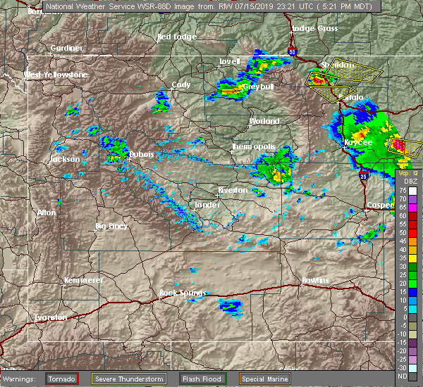 At 519 pm mdt, a severe thunderstorm was located near pumpkin buttes, or 16 miles west of wright, moving southeast at 15 mph (radar indicated). Hazards include golf ball size hail and 70 mph wind gusts. People and animals outdoors will be injured. expect hail damage to roofs, siding, windows, and vehicles. expect considerable tree damage. wind damage is also likely to mobile homes, roofs, and outbuildings. Locations impacted include, pine tree junction and pumpkin buttes. At 519 pm mdt, a severe thunderstorm was located near pumpkin buttes, or 16 miles west of wright, moving southeast at 15 mph (radar indicated). Hazards include golf ball size hail and 70 mph wind gusts. People and animals outdoors will be injured. expect hail damage to roofs, siding, windows, and vehicles. expect considerable tree damage. wind damage is also likely to mobile homes, roofs, and outbuildings. Locations impacted include, pine tree junction and pumpkin buttes.
|
| 7/12/2019 6:31 PM MDT |
 At 630 pm mdt, a severe thunderstorm was located 7 miles south of wright, moving southeast at 20 mph (radar indicated). Hazards include 60 mph wind gusts and quarter size hail. Hail damage to vehicles is expected. expect wind damage to roofs, siding, and trees. Locations impacted include, wright, pine tree junction, reno junction and pumpkin buttes. At 630 pm mdt, a severe thunderstorm was located 7 miles south of wright, moving southeast at 20 mph (radar indicated). Hazards include 60 mph wind gusts and quarter size hail. Hail damage to vehicles is expected. expect wind damage to roofs, siding, and trees. Locations impacted include, wright, pine tree junction, reno junction and pumpkin buttes.
|
| 7/12/2019 6:16 PM MDT |
 At 614 pm mdt, a severe thunderstorm was located 5 miles southwest of wright, moving southeast at 20 mph (radar indicated. this storm has a history of producing winds in excess of 60 mph and hail to at least dime size). Hazards include 60 mph wind gusts and penny size hail. Expect damage to roofs, siding, and trees. Locations impacted include, wright, pine tree junction, reno junction and pumpkin buttes. At 614 pm mdt, a severe thunderstorm was located 5 miles southwest of wright, moving southeast at 20 mph (radar indicated. this storm has a history of producing winds in excess of 60 mph and hail to at least dime size). Hazards include 60 mph wind gusts and penny size hail. Expect damage to roofs, siding, and trees. Locations impacted include, wright, pine tree junction, reno junction and pumpkin buttes.
|
| 7/12/2019 5:59 PM MDT |
 At 558 pm mdt, a severe thunderstorm was located 8 miles southeast of savageton, or 8 miles west of wright, moving southeast at 20 mph (radar indicated). Hazards include 60 mph wind gusts and penny size hail. Expect damage to roofs, siding, and trees. Locations impacted include, wright, pine tree junction, savageton, reno junction and pumpkin buttes. At 558 pm mdt, a severe thunderstorm was located 8 miles southeast of savageton, or 8 miles west of wright, moving southeast at 20 mph (radar indicated). Hazards include 60 mph wind gusts and penny size hail. Expect damage to roofs, siding, and trees. Locations impacted include, wright, pine tree junction, savageton, reno junction and pumpkin buttes.
|
| 7/12/2019 5:38 PM MDT |
 At 538 pm mdt, a severe thunderstorm was located near savageton, or 17 miles west of wright, moving southeast at 20 mph (radar indicated). Hazards include 60 mph wind gusts and nickel size hail. expect damage to roofs, siding, and trees At 538 pm mdt, a severe thunderstorm was located near savageton, or 17 miles west of wright, moving southeast at 20 mph (radar indicated). Hazards include 60 mph wind gusts and nickel size hail. expect damage to roofs, siding, and trees
|
| 7/9/2019 1:24 PM MDT | Storm damage reported in campbell county WY, 0.2 miles NNE of Wright, WY |
| 7/9/2019 1:24 PM MDT | Quarter sized hail reported 0.2 miles NNE of Wright, WY, mostly nickel size with quarters mixed in. |
| 7/9/2019 1:23 PM MDT |
 At 123 pm mdt, a severe thunderstorm was located 4 miles northeast of reno junction, or 6 miles northeast of wright, moving east at 45 mph (radar indicated). Hazards include ping pong ball size hail and 60 mph wind gusts. People and animals outdoors will be injured. expect hail damage to roofs, siding, windows, and vehicles. Expect wind damage to roofs, siding, and trees. At 123 pm mdt, a severe thunderstorm was located 4 miles northeast of reno junction, or 6 miles northeast of wright, moving east at 45 mph (radar indicated). Hazards include ping pong ball size hail and 60 mph wind gusts. People and animals outdoors will be injured. expect hail damage to roofs, siding, windows, and vehicles. Expect wind damage to roofs, siding, and trees.
|
| 7/7/2019 6:49 PM MDT |
 At 649 pm mdt, a severe thunderstorm was located 4 miles northeast of reno junction, or 5 miles northeast of wright, moving north at 10 mph (radar indicated). Hazards include 60 mph wind gusts and half dollar size hail. Hail damage to vehicles is expected. expect wind damage to roofs, siding, and trees. Locations impacted include, wright and reno junction. At 649 pm mdt, a severe thunderstorm was located 4 miles northeast of reno junction, or 5 miles northeast of wright, moving north at 10 mph (radar indicated). Hazards include 60 mph wind gusts and half dollar size hail. Hail damage to vehicles is expected. expect wind damage to roofs, siding, and trees. Locations impacted include, wright and reno junction.
|
| 7/7/2019 6:31 PM MDT |
 At 631 pm mdt, a severe thunderstorm was located 3 miles southwest of wright, moving northeast at 15 mph (radar indicated). Hazards include ping pong ball size hail and 60 mph wind gusts. People and animals outdoors will be injured. expect hail damage to roofs, siding, windows, and vehicles. expect wind damage to roofs, siding, and trees. Locations impacted include, wright and reno junction. At 631 pm mdt, a severe thunderstorm was located 3 miles southwest of wright, moving northeast at 15 mph (radar indicated). Hazards include ping pong ball size hail and 60 mph wind gusts. People and animals outdoors will be injured. expect hail damage to roofs, siding, windows, and vehicles. expect wind damage to roofs, siding, and trees. Locations impacted include, wright and reno junction.
|
| 7/7/2019 6:21 PM MDT |
 At 621 pm mdt, a severe thunderstorm was located 5 miles southwest of wright, moving northeast at 20 mph (radar indicated). Hazards include 60 mph wind gusts and half dollar size hail. Hail damage to vehicles is expected. Expect wind damage to roofs, siding, and trees. At 621 pm mdt, a severe thunderstorm was located 5 miles southwest of wright, moving northeast at 20 mph (radar indicated). Hazards include 60 mph wind gusts and half dollar size hail. Hail damage to vehicles is expected. Expect wind damage to roofs, siding, and trees.
|
| 7/3/2019 8:59 PM MDT |
 At 858 pm mdt, a severe thunderstorm was located 4 miles southeast of wright, moving east at 45 mph (radar indicated). Hazards include two inch hail. People and animals outdoors will be injured. Expect damage to roofs, siding, windows, and vehicles. At 858 pm mdt, a severe thunderstorm was located 4 miles southeast of wright, moving east at 45 mph (radar indicated). Hazards include two inch hail. People and animals outdoors will be injured. Expect damage to roofs, siding, windows, and vehicles.
|
| 7/3/2019 8:36 PM MDT |
 At 835 pm mdt, a severe thunderstorm was located 8 miles west of wright, moving east at 45 mph (radar indicated. at 820 pm, two inch hail was reported 10 miles wnw of pine tree junction). Hazards include two inch hail and 60 mph wind gusts. People and animals outdoors will be injured. expect hail damage to roofs, siding, windows, and vehicles. expect wind damage to roofs, siding, and trees. Locations impacted include, wright, pine tree junction, reno junction and pumpkin buttes. At 835 pm mdt, a severe thunderstorm was located 8 miles west of wright, moving east at 45 mph (radar indicated. at 820 pm, two inch hail was reported 10 miles wnw of pine tree junction). Hazards include two inch hail and 60 mph wind gusts. People and animals outdoors will be injured. expect hail damage to roofs, siding, windows, and vehicles. expect wind damage to roofs, siding, and trees. Locations impacted include, wright, pine tree junction, reno junction and pumpkin buttes.
|
| 7/3/2019 8:12 PM MDT |
 At 812 pm mdt, a severe thunderstorm was located 5 miles west of pumpkin buttes, or 24 miles west of wright, moving east at 45 mph (radar indicated). Hazards include golf ball size hail and 60 mph wind gusts. People and animals outdoors will be injured. expect hail damage to roofs, siding, windows, and vehicles. Expect wind damage to roofs, siding, and trees. At 812 pm mdt, a severe thunderstorm was located 5 miles west of pumpkin buttes, or 24 miles west of wright, moving east at 45 mph (radar indicated). Hazards include golf ball size hail and 60 mph wind gusts. People and animals outdoors will be injured. expect hail damage to roofs, siding, windows, and vehicles. Expect wind damage to roofs, siding, and trees.
|
| 7/2/2019 4:11 PM MDT |
 At 411 pm mdt, a severe thunderstorm was located 7 miles southeast of reno junction, or 7 miles southeast of wright, moving northeast at 25 mph (radar indicated). Hazards include 60 mph wind gusts and quarter size hail. Hail damage to vehicles is expected. expect wind damage to roofs, siding, and trees. Locations impacted include, wright and reno junction. At 411 pm mdt, a severe thunderstorm was located 7 miles southeast of reno junction, or 7 miles southeast of wright, moving northeast at 25 mph (radar indicated). Hazards include 60 mph wind gusts and quarter size hail. Hail damage to vehicles is expected. expect wind damage to roofs, siding, and trees. Locations impacted include, wright and reno junction.
|
| 7/2/2019 3:57 PM MDT |
 At 357 pm mdt, a severe thunderstorm was located 7 miles southeast of wright, moving northeast at 35 mph (radar indicated). Hazards include 60 mph wind gusts and quarter size hail. Hail damage to vehicles is expected. Expect wind damage to roofs, siding, and trees. At 357 pm mdt, a severe thunderstorm was located 7 miles southeast of wright, moving northeast at 35 mph (radar indicated). Hazards include 60 mph wind gusts and quarter size hail. Hail damage to vehicles is expected. Expect wind damage to roofs, siding, and trees.
|
| 7/1/2019 2:41 PM MDT |
 The severe thunderstorm warning for southeastern campbell county will expire at 245 pm mdt, the storms which prompted the warning have weakened below severe limits, and no longer pose an immediate threat to life or property. therefore, the warning will be allowed to expire. however small hail and gusty winds are still possible with these thunderstorms. The severe thunderstorm warning for southeastern campbell county will expire at 245 pm mdt, the storms which prompted the warning have weakened below severe limits, and no longer pose an immediate threat to life or property. therefore, the warning will be allowed to expire. however small hail and gusty winds are still possible with these thunderstorms.
|
| 7/1/2019 2:23 PM MDT |
 At 223 pm mdt, severe thunderstorms were located along a line extending from 18 miles south of rozet to 8 miles south of wright, moving east at 20 mph (radar indicated). Hazards include 60 mph wind gusts and quarter size hail. Hail damage to vehicles is expected. expect wind damage to roofs, siding, and trees. Locations impacted include, wright and reno junction. At 223 pm mdt, severe thunderstorms were located along a line extending from 18 miles south of rozet to 8 miles south of wright, moving east at 20 mph (radar indicated). Hazards include 60 mph wind gusts and quarter size hail. Hail damage to vehicles is expected. expect wind damage to roofs, siding, and trees. Locations impacted include, wright and reno junction.
|
| 7/1/2019 2:07 PM MDT |
 At 207 pm mdt, severe thunderstorms were located along a line extending from 16 miles south of camplex event facility to 7 miles northeast of pine tree junction, moving east at 20 mph (radar indicated). Hazards include 60 mph wind gusts and quarter size hail. Hail damage to vehicles is expected. Expect wind damage to roofs, siding, and trees. At 207 pm mdt, severe thunderstorms were located along a line extending from 16 miles south of camplex event facility to 7 miles northeast of pine tree junction, moving east at 20 mph (radar indicated). Hazards include 60 mph wind gusts and quarter size hail. Hail damage to vehicles is expected. Expect wind damage to roofs, siding, and trees.
|
| 7/28/2018 10:46 PM MDT |
 At 1044 pm mdt, severe thunderstorms were located along a line extending from 9 miles southwest of moorcroft to 18 miles northeast of wright to 3 miles northwest of reno junction, moving southeast at 45 mph (radar indicated). Hazards include 60 mph wind gusts. Expect damage to roofs, siding, and trees. Locations impacted include, reno junction. At 1044 pm mdt, severe thunderstorms were located along a line extending from 9 miles southwest of moorcroft to 18 miles northeast of wright to 3 miles northwest of reno junction, moving southeast at 45 mph (radar indicated). Hazards include 60 mph wind gusts. Expect damage to roofs, siding, and trees. Locations impacted include, reno junction.
|
| 7/28/2018 10:32 PM MDT |
 At 1032 pm mdt, severe thunderstorms were located along a line extending from 3 miles southeast of rozet to 16 miles northeast of reno junction to 8 miles east of savageton, moving southeast at 45 mph (radar indicated). Hazards include 70 mph wind gusts. Expect considerable tree damage. damage is likely to mobile homes, roofs, and outbuildings. locations impacted include, upton, rozet and reno junction. This includes interstate 90 in wyoming between mile markers 140 and 147. At 1032 pm mdt, severe thunderstorms were located along a line extending from 3 miles southeast of rozet to 16 miles northeast of reno junction to 8 miles east of savageton, moving southeast at 45 mph (radar indicated). Hazards include 70 mph wind gusts. Expect considerable tree damage. damage is likely to mobile homes, roofs, and outbuildings. locations impacted include, upton, rozet and reno junction. This includes interstate 90 in wyoming between mile markers 140 and 147.
|
| 7/28/2018 10:19 PM MDT |
 At 1005 pm mdt, severe thunderstorms were located along a line extending from 10 miles south of weston to 2 miles south of gillette to 14 miles north of savageton, moving southeast at 50 mph (radar indicated). Hazards include 60 mph wind gusts. expect damage to roofs, siding, and trees At 1005 pm mdt, severe thunderstorms were located along a line extending from 10 miles south of weston to 2 miles south of gillette to 14 miles north of savageton, moving southeast at 50 mph (radar indicated). Hazards include 60 mph wind gusts. expect damage to roofs, siding, and trees
|
| 7/28/2018 10:05 PM MDT |
 At 1005 pm mdt, severe thunderstorms were located along a line extending from 10 miles south of weston to 2 miles south of gillette to 14 miles north of savageton, moving southeast at 50 mph (radar indicated). Hazards include 60 mph wind gusts. expect damage to roofs, siding, and trees At 1005 pm mdt, severe thunderstorms were located along a line extending from 10 miles south of weston to 2 miles south of gillette to 14 miles north of savageton, moving southeast at 50 mph (radar indicated). Hazards include 60 mph wind gusts. expect damage to roofs, siding, and trees
|
| 7/28/2018 4:49 PM MDT |
 At 449 pm mdt, severe thunderstorms were located along a line extending from 6 miles north of reno junction to 10 miles west of pumpkin buttes, moving southeast at 30 mph (radar indicated). Hazards include 60 mph wind gusts and quarter size hail. Hail damage to vehicles is expected. Expect wind damage to roofs, siding, and trees. At 449 pm mdt, severe thunderstorms were located along a line extending from 6 miles north of reno junction to 10 miles west of pumpkin buttes, moving southeast at 30 mph (radar indicated). Hazards include 60 mph wind gusts and quarter size hail. Hail damage to vehicles is expected. Expect wind damage to roofs, siding, and trees.
|
| 7/27/2018 8:27 PM MDT |
 At 826 pm mdt, severe thunderstorms were located along a line extending from 8 miles southwest of spotted horse to 14 miles southwest of gillette to 13 miles west of savageton, moving southeast at 40 mph (radar indicated). Hazards include 60 mph wind gusts and nickel size hail. Expect damage to roofs, siding, and trees. locations impacted include, gillette, wright, reno junction, echeta, rozet, savageton, camplex event facility and gillette airport. This includes interstate 90 in wyoming between mile markers 97 and 147. At 826 pm mdt, severe thunderstorms were located along a line extending from 8 miles southwest of spotted horse to 14 miles southwest of gillette to 13 miles west of savageton, moving southeast at 40 mph (radar indicated). Hazards include 60 mph wind gusts and nickel size hail. Expect damage to roofs, siding, and trees. locations impacted include, gillette, wright, reno junction, echeta, rozet, savageton, camplex event facility and gillette airport. This includes interstate 90 in wyoming between mile markers 97 and 147.
|
| 7/27/2018 8:06 PM MDT |
 At 806 pm mdt, severe thunderstorms were located along a line extending from 12 miles west of spotted horse to 12 miles south of echeta to 23 miles west of savageton, moving east at 50 mph (radar indicated). Hazards include 60 mph wind gusts and nickel size hail. expect damage to roofs, siding, and trees At 806 pm mdt, severe thunderstorms were located along a line extending from 12 miles west of spotted horse to 12 miles south of echeta to 23 miles west of savageton, moving east at 50 mph (radar indicated). Hazards include 60 mph wind gusts and nickel size hail. expect damage to roofs, siding, and trees
|
| 7/26/2018 6:58 PM MDT |
 The national weather service in rapid city has issued a * severe thunderstorm warning for. southwestern campbell county in northeastern wyoming. Until 800 pm mdt * at 657 pm mdt, a severe thunderstorm was located 6 miles north of savageton, or 21 miles northwest of wright, moving southeast at 30. The national weather service in rapid city has issued a * severe thunderstorm warning for. southwestern campbell county in northeastern wyoming. Until 800 pm mdt * at 657 pm mdt, a severe thunderstorm was located 6 miles north of savageton, or 21 miles northwest of wright, moving southeast at 30.
|
| 7/24/2018 3:50 PM MDT |
 At 350 pm mdt, a severe thunderstorm was located over reno junction, or near wright, moving east at 25 mph (radar indicated). Hazards include ping pong ball size hail and 60 mph wind gusts. People and animals outdoors will be injured. expect hail damage to roofs, siding, windows, and vehicles. expect wind damage to roofs, siding, and trees. Locations impacted include, wright and reno junction. At 350 pm mdt, a severe thunderstorm was located over reno junction, or near wright, moving east at 25 mph (radar indicated). Hazards include ping pong ball size hail and 60 mph wind gusts. People and animals outdoors will be injured. expect hail damage to roofs, siding, windows, and vehicles. expect wind damage to roofs, siding, and trees. Locations impacted include, wright and reno junction.
|
| 7/24/2018 3:37 PM MDT |
 At 337 pm mdt, a severe thunderstorm was located 4 miles northwest of wright, moving east at 15 mph (radar indicated). Hazards include golf ball size hail and 60 mph wind gusts. People and animals outdoors will be injured. expect hail damage to roofs, siding, windows, and vehicles. expect wind damage to roofs, siding, and trees. Locations impacted include, wright and reno junction. At 337 pm mdt, a severe thunderstorm was located 4 miles northwest of wright, moving east at 15 mph (radar indicated). Hazards include golf ball size hail and 60 mph wind gusts. People and animals outdoors will be injured. expect hail damage to roofs, siding, windows, and vehicles. expect wind damage to roofs, siding, and trees. Locations impacted include, wright and reno junction.
|
| 7/24/2018 3:24 PM MDT |
 At 324 pm mdt, a severe thunderstorm was located 6 miles northwest of wright, moving southeast at 25 mph (radar indicated). Hazards include 60 mph wind gusts and quarter size hail. Hail damage to vehicles is expected. Expect wind damage to roofs, siding, and trees. At 324 pm mdt, a severe thunderstorm was located 6 miles northwest of wright, moving southeast at 25 mph (radar indicated). Hazards include 60 mph wind gusts and quarter size hail. Hail damage to vehicles is expected. Expect wind damage to roofs, siding, and trees.
|
| 7/23/2018 5:51 PM MDT |
 The severe thunderstorm warning for southwestern campbell county will expire at 600 pm mdt, the storm which prompted the warning has weakened below severe limits, and no longer poses an immediate threat to life or property. therefore, the warning will be allowed to expire. however small hail and gusty winds are still possible with this thunderstorm. The severe thunderstorm warning for southwestern campbell county will expire at 600 pm mdt, the storm which prompted the warning has weakened below severe limits, and no longer poses an immediate threat to life or property. therefore, the warning will be allowed to expire. however small hail and gusty winds are still possible with this thunderstorm.
|
| 7/23/2018 5:35 PM MDT |
 At 535 pm mdt, a severe thunderstorm was located 5 miles northeast of savageton, or 14 miles northwest of wright, moving southeast at 15 mph (radar indicated). Hazards include 60 mph wind gusts and quarter size hail. Hail damage to vehicles is expected. expect wind damage to roofs, siding, and trees. Locations impacted include, savageton. At 535 pm mdt, a severe thunderstorm was located 5 miles northeast of savageton, or 14 miles northwest of wright, moving southeast at 15 mph (radar indicated). Hazards include 60 mph wind gusts and quarter size hail. Hail damage to vehicles is expected. expect wind damage to roofs, siding, and trees. Locations impacted include, savageton.
|
| 7/23/2018 5:05 PM MDT |
 At 505 pm mdt, a severe thunderstorm was located 9 miles north of savageton, or 22 miles northwest of wright, moving southeast at 20 mph (radar indicated). Hazards include 60 mph wind gusts and half dollar size hail. Hail damage to vehicles is expected. Expect wind damage to roofs, siding, and trees. At 505 pm mdt, a severe thunderstorm was located 9 miles north of savageton, or 22 miles northwest of wright, moving southeast at 20 mph (radar indicated). Hazards include 60 mph wind gusts and half dollar size hail. Hail damage to vehicles is expected. Expect wind damage to roofs, siding, and trees.
|
| 7/9/2018 6:22 PM MDT |
 The severe thunderstorm warning for southeastern campbell county will expire at 630 pm mdt, the storm which prompted the warning has weakened below severe limits, and no longer poses an immediate threat to life or property. therefore, the warning will be allowed to expire. however gusty winds and heavy rain are still possible with this thunderstorm. The severe thunderstorm warning for southeastern campbell county will expire at 630 pm mdt, the storm which prompted the warning has weakened below severe limits, and no longer poses an immediate threat to life or property. therefore, the warning will be allowed to expire. however gusty winds and heavy rain are still possible with this thunderstorm.
|
| 7/9/2018 6:12 PM MDT |
 At 612 pm mdt, a severe thunderstorm was located 3 miles southwest of wright, moving north at 10 mph (radar indicated). Hazards include 60 mph wind gusts and quarter size hail. Hail damage to vehicles is expected. expect wind damage to roofs, siding, and trees. Locations impacted include, wright and reno junction. At 612 pm mdt, a severe thunderstorm was located 3 miles southwest of wright, moving north at 10 mph (radar indicated). Hazards include 60 mph wind gusts and quarter size hail. Hail damage to vehicles is expected. expect wind damage to roofs, siding, and trees. Locations impacted include, wright and reno junction.
|
| 7/9/2018 5:51 PM MDT |
 At 551 pm mdt, a severe thunderstorm was located 6 miles southwest of wright, moving northeast at 15 mph (radar indicated). Hazards include 60 mph wind gusts and quarter size hail. Hail damage to vehicles is expected. Expect wind damage to roofs, siding, and trees. At 551 pm mdt, a severe thunderstorm was located 6 miles southwest of wright, moving northeast at 15 mph (radar indicated). Hazards include 60 mph wind gusts and quarter size hail. Hail damage to vehicles is expected. Expect wind damage to roofs, siding, and trees.
|
| 6/21/2018 7:26 PM MDT |
 The severe thunderstorm warning for southwestern campbell county will expire at 730 pm mdt, the storms which prompted the warning have weakened below severe limits, and no longer pose an immediate threat to life or property. therefore, the warning will be allowed to expire. however gusty winds and heavy rain are still possible with these thunderstorms. The severe thunderstorm warning for southwestern campbell county will expire at 730 pm mdt, the storms which prompted the warning have weakened below severe limits, and no longer pose an immediate threat to life or property. therefore, the warning will be allowed to expire. however gusty winds and heavy rain are still possible with these thunderstorms.
|
| 6/21/2018 7:12 PM MDT |
 At 712 pm mdt, severe thunderstorms were located along a line extending from 4 miles northeast of echeta to 13 miles southwest of gillette to 5 miles southeast of pine tree junction, moving east at 30 mph (radar indicated). Hazards include 60 mph wind gusts. Expect damage to roofs, siding, and trees. locations impacted include, gillette, wright, pine tree junction, reno junction, echeta, savageton, camplex event facility, gillette airport and pumpkin buttes. This includes interstate 90 in wyoming between mile markers 105 and 129. At 712 pm mdt, severe thunderstorms were located along a line extending from 4 miles northeast of echeta to 13 miles southwest of gillette to 5 miles southeast of pine tree junction, moving east at 30 mph (radar indicated). Hazards include 60 mph wind gusts. Expect damage to roofs, siding, and trees. locations impacted include, gillette, wright, pine tree junction, reno junction, echeta, savageton, camplex event facility, gillette airport and pumpkin buttes. This includes interstate 90 in wyoming between mile markers 105 and 129.
|
| 6/21/2018 6:55 PM MDT |
 At 655 pm mdt, severe thunderstorms were located along a line extending from 8 miles northwest of echeta to 17 miles north of savageton to 7 miles west of pine tree junction, moving east at 30 mph (radar indicated). Hazards include 60 mph wind gusts. Expect damage to roofs, siding, and trees. locations impacted include, gillette, wright, pine tree junction, reno junction, echeta, savageton, camplex event facility, gillette airport and pumpkin buttes. This includes interstate 90 in wyoming between mile markers 96 and 129. At 655 pm mdt, severe thunderstorms were located along a line extending from 8 miles northwest of echeta to 17 miles north of savageton to 7 miles west of pine tree junction, moving east at 30 mph (radar indicated). Hazards include 60 mph wind gusts. Expect damage to roofs, siding, and trees. locations impacted include, gillette, wright, pine tree junction, reno junction, echeta, savageton, camplex event facility, gillette airport and pumpkin buttes. This includes interstate 90 in wyoming between mile markers 96 and 129.
|
| 6/21/2018 6:35 PM MDT |
 At 635 pm mdt, severe thunderstorms were located along a line extending from 13 miles west of echeta to 19 miles northwest of savageton to 12 miles southwest of pumpkin buttes, moving east at 30 mph (radar indicated). Hazards include 60 mph wind gusts. expect damage to roofs, siding, and trees At 635 pm mdt, severe thunderstorms were located along a line extending from 13 miles west of echeta to 19 miles northwest of savageton to 12 miles southwest of pumpkin buttes, moving east at 30 mph (radar indicated). Hazards include 60 mph wind gusts. expect damage to roofs, siding, and trees
|
| 5/23/2018 3:38 PM MDT |
 The severe thunderstorm warning for southwestern campbell county will expire at 345 pm mdt, the storm which prompted the warning has weakened below severe limits, and have exited the warned area. therefore the warning will be allowed to expire. however gusty winds are still possible with this thunderstorm. a severe thunderstorm watch remains in effect until 900 pm mdt for northeastern wyoming. The severe thunderstorm warning for southwestern campbell county will expire at 345 pm mdt, the storm which prompted the warning has weakened below severe limits, and have exited the warned area. therefore the warning will be allowed to expire. however gusty winds are still possible with this thunderstorm. a severe thunderstorm watch remains in effect until 900 pm mdt for northeastern wyoming.
|
| 5/23/2018 3:28 PM MDT |
 At 313 pm mdt, a severe thunderstorm was located near pine tree junction, or 11 miles southwest of wright, moving north at 30 mph (radar indicated). Hazards include 60 mph wind gusts and quarter size hail. Hail damage to vehicles is expected. expect wind damage to roofs, siding, and trees. Locations impacted include, wright, pine tree junction, reno junction and pumpkin buttes. At 313 pm mdt, a severe thunderstorm was located near pine tree junction, or 11 miles southwest of wright, moving north at 30 mph (radar indicated). Hazards include 60 mph wind gusts and quarter size hail. Hail damage to vehicles is expected. expect wind damage to roofs, siding, and trees. Locations impacted include, wright, pine tree junction, reno junction and pumpkin buttes.
|
| 5/23/2018 3:13 PM MDT |
 At 313 pm mdt, a severe thunderstorm was located near pine tree junction, or 11 miles southwest of wright, moving north at 30 mph (radar indicated). Hazards include 60 mph wind gusts and quarter size hail. Hail damage to vehicles is expected. expect wind damage to roofs, siding, and trees. Locations impacted include, wright, pine tree junction, reno junction and pumpkin buttes. At 313 pm mdt, a severe thunderstorm was located near pine tree junction, or 11 miles southwest of wright, moving north at 30 mph (radar indicated). Hazards include 60 mph wind gusts and quarter size hail. Hail damage to vehicles is expected. expect wind damage to roofs, siding, and trees. Locations impacted include, wright, pine tree junction, reno junction and pumpkin buttes.
|
| 5/23/2018 2:50 PM MDT |
 At 248 pm mdt, a severe thunderstorm was located 9 miles southeast of pine tree junction, or 20 miles southwest of wright, moving north at 25 mph (radar indicated). Hazards include 60 mph wind gusts and half dollar size hail. Hail damage to vehicles is expected. Expect wind damage to roofs, siding, and trees. At 248 pm mdt, a severe thunderstorm was located 9 miles southeast of pine tree junction, or 20 miles southwest of wright, moving north at 25 mph (radar indicated). Hazards include 60 mph wind gusts and half dollar size hail. Hail damage to vehicles is expected. Expect wind damage to roofs, siding, and trees.
|
| 7/20/2017 7:54 PM MDT |
 At 754 pm mdt, a severe thunderstorm was located over reno junction, or near wright, moving northeast at 30 mph (radar indicated). Hazards include 60 mph wind gusts and quarter size hail. Hail damage to vehicles is expected. Expect wind damage to roofs, siding, and trees. At 754 pm mdt, a severe thunderstorm was located over reno junction, or near wright, moving northeast at 30 mph (radar indicated). Hazards include 60 mph wind gusts and quarter size hail. Hail damage to vehicles is expected. Expect wind damage to roofs, siding, and trees.
|
| 6/12/2017 5:10 PM MDT |
 At 510 pm mdt, a severe thunderstorm was located near pine tree junction, or 13 miles west of wright, moving north at 25 mph (radar indicated). Hazards include ping pong ball size hail and 60 mph wind gusts. People and animals outdoors will be injured. expect hail damage to roofs, siding, windows, and vehicles. expect wind damage to roofs, siding, and trees. Locations impacted include, wright, pine tree junction, savageton and pumpkin buttes. At 510 pm mdt, a severe thunderstorm was located near pine tree junction, or 13 miles west of wright, moving north at 25 mph (radar indicated). Hazards include ping pong ball size hail and 60 mph wind gusts. People and animals outdoors will be injured. expect hail damage to roofs, siding, windows, and vehicles. expect wind damage to roofs, siding, and trees. Locations impacted include, wright, pine tree junction, savageton and pumpkin buttes.
|
| 6/12/2017 4:51 PM MDT |
 At 451 pm mdt, a severe thunderstorm was located over pine tree junction, or 16 miles southwest of wright, moving north at 25 mph (radar indicated). Hazards include ping pong ball size hail and 60 mph wind gusts. People and animals outdoors will be injured. expect hail damage to roofs, siding, windows, and vehicles. Expect wind damage to roofs, siding, and trees. At 451 pm mdt, a severe thunderstorm was located over pine tree junction, or 16 miles southwest of wright, moving north at 25 mph (radar indicated). Hazards include ping pong ball size hail and 60 mph wind gusts. People and animals outdoors will be injured. expect hail damage to roofs, siding, windows, and vehicles. Expect wind damage to roofs, siding, and trees.
|
| 6/7/2017 7:00 PM MDT | Quarter sized hail reported 7.9 miles ENE of Wright, WY |
| 6/7/2017 7:00 PM MDT | Quarter sized hail reported 7.5 miles NE of Wright, WY, time estimated by radar |
| 6/7/2017 6:52 PM MDT |
 At 651 pm mdt, a severe thunderstorm was located near wright, moving south at 20 mph (radar indicated). Hazards include ping pong ball size hail and 60 mph wind gusts. People and animals outdoors will be injured. expect hail damage to roofs, siding, windows, and vehicles. expect wind damage to roofs, siding, and trees. Locations impacted include, wright and reno junction. At 651 pm mdt, a severe thunderstorm was located near wright, moving south at 20 mph (radar indicated). Hazards include ping pong ball size hail and 60 mph wind gusts. People and animals outdoors will be injured. expect hail damage to roofs, siding, windows, and vehicles. expect wind damage to roofs, siding, and trees. Locations impacted include, wright and reno junction.
|
| 6/7/2017 6:19 PM MDT |
 At 619 pm mdt, a severe thunderstorm was located near savageton, or 10 miles northwest of wright, moving southeast at 20 mph (radar indicated). Hazards include ping pong ball size hail and 60 mph wind gusts. People and animals outdoors will be injured. expect hail damage to roofs, siding, windows, and vehicles. Expect wind damage to roofs, siding, and trees. At 619 pm mdt, a severe thunderstorm was located near savageton, or 10 miles northwest of wright, moving southeast at 20 mph (radar indicated). Hazards include ping pong ball size hail and 60 mph wind gusts. People and animals outdoors will be injured. expect hail damage to roofs, siding, windows, and vehicles. Expect wind damage to roofs, siding, and trees.
|
| 6/7/2017 6:12 PM MDT |
 At 612 pm mdt, a severe thunderstorm was located near savageton, or 12 miles northwest of wright, moving southeast at 25 mph (radar indicated). Hazards include half dollar size hail. Damage to vehicles is expected. Locations impacted include, savageton. At 612 pm mdt, a severe thunderstorm was located near savageton, or 12 miles northwest of wright, moving southeast at 25 mph (radar indicated). Hazards include half dollar size hail. Damage to vehicles is expected. Locations impacted include, savageton.
|
| 6/7/2017 5:50 PM MDT |
 At 550 pm mdt, a severe thunderstorm was located 9 miles north of savageton, or 20 miles northwest of wright, moving southeast at 15 mph (radar indicated). Hazards include quarter size hail. Damage to vehicles is expected. Locations impacted include, savageton. At 550 pm mdt, a severe thunderstorm was located 9 miles north of savageton, or 20 miles northwest of wright, moving southeast at 15 mph (radar indicated). Hazards include quarter size hail. Damage to vehicles is expected. Locations impacted include, savageton.
|
| 6/7/2017 5:24 PM MDT |
 At 523 pm mdt, a severe thunderstorm was located 11 miles north of savageton, or 22 miles southwest of gillette, moving south at 25 mph (radar indicated). Hazards include quarter size hail. damage to vehicles is expected At 523 pm mdt, a severe thunderstorm was located 11 miles north of savageton, or 22 miles southwest of gillette, moving south at 25 mph (radar indicated). Hazards include quarter size hail. damage to vehicles is expected
|
| 8/10/2016 7:10 PM MDT |
 At 709 pm mdt, a severe thunderstorm was located 12 miles northwest of rochelle, or 16 miles east of wright, moving east at 30 mph (radar indicated). Hazards include 60 mph wind gusts and half dollar size hail. Hail damage to vehicles is expected. expect wind damage to roofs, siding, and trees. Locations impacted include, wright and reno junction. At 709 pm mdt, a severe thunderstorm was located 12 miles northwest of rochelle, or 16 miles east of wright, moving east at 30 mph (radar indicated). Hazards include 60 mph wind gusts and half dollar size hail. Hail damage to vehicles is expected. expect wind damage to roofs, siding, and trees. Locations impacted include, wright and reno junction.
|
| 8/10/2016 7:05 PM MDT | Ping Pong Ball sized hail reported 9.9 miles WNW of Wright, WY |
| 8/10/2016 6:55 PM MDT |
 At 655 pm mdt, a severe thunderstorm was located 10 miles east of reno junction, or 11 miles east of wright, moving northeast at 35 mph (radar indicated). Hazards include 60 mph wind gusts and quarter size hail. Hail damage to vehicles is expected. Expect wind damage to roofs, siding, and trees. At 655 pm mdt, a severe thunderstorm was located 10 miles east of reno junction, or 11 miles east of wright, moving northeast at 35 mph (radar indicated). Hazards include 60 mph wind gusts and quarter size hail. Hail damage to vehicles is expected. Expect wind damage to roofs, siding, and trees.
|
| 6/28/2016 7:35 PM MDT |
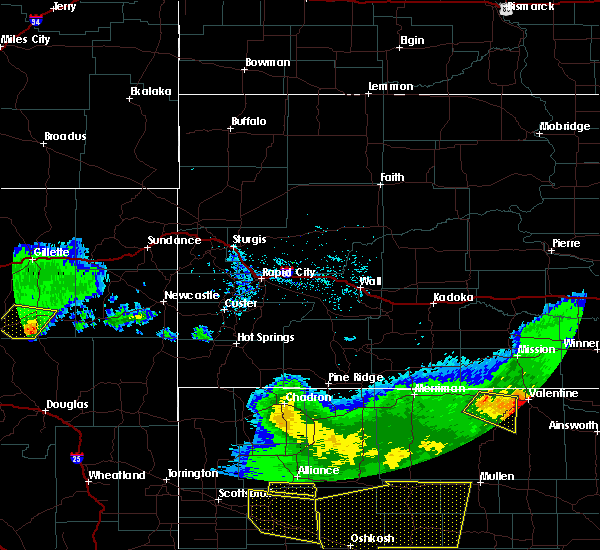 The severe thunderstorm warning for south central campbell county will expire at 745 pm mdt, the storm which prompted the warning has weakened below severe limits, and no longer pose an immediate threat to life or property. therefore the warning will be allowed to expire. however small hail and gusty winds are still possible with this thunderstorm. a severe thunderstorm watch remains in effect until 900 pm mdt for northeastern wyoming. The severe thunderstorm warning for south central campbell county will expire at 745 pm mdt, the storm which prompted the warning has weakened below severe limits, and no longer pose an immediate threat to life or property. therefore the warning will be allowed to expire. however small hail and gusty winds are still possible with this thunderstorm. a severe thunderstorm watch remains in effect until 900 pm mdt for northeastern wyoming.
|
| 6/28/2016 7:20 PM MDT |
 At 720 pm mdt, a severe thunderstorm was located near pine tree junction, or 10 miles southwest of wright, moving southeast at 45 mph (radar indicated). Hazards include 60 mph wind gusts and quarter size hail. Hail damage to vehicles is expected. expect wind damage to roofs, siding, and trees. Locations impacted include, wright, reno junction and pine tree junction. At 720 pm mdt, a severe thunderstorm was located near pine tree junction, or 10 miles southwest of wright, moving southeast at 45 mph (radar indicated). Hazards include 60 mph wind gusts and quarter size hail. Hail damage to vehicles is expected. expect wind damage to roofs, siding, and trees. Locations impacted include, wright, reno junction and pine tree junction.
|
| 6/28/2016 7:04 PM MDT |
 At 703 pm mdt, a severe thunderstorm was located near pumpkin buttes, or 17 miles west of wright, moving southeast at 40 mph (radar indicated). Hazards include 60 mph wind gusts and half dollar size hail. Hail damage to vehicles is expected. expect wind damage to roofs, siding, and trees. Locations impacted include, wright, pine tree junction, reno junction, savageton and pumpkin buttes. At 703 pm mdt, a severe thunderstorm was located near pumpkin buttes, or 17 miles west of wright, moving southeast at 40 mph (radar indicated). Hazards include 60 mph wind gusts and half dollar size hail. Hail damage to vehicles is expected. expect wind damage to roofs, siding, and trees. Locations impacted include, wright, pine tree junction, reno junction, savageton and pumpkin buttes.
|
| 6/28/2016 6:46 PM MDT |
 At 646 pm mdt, a severe thunderstorm was located 11 miles east of fort reno historical site, or 27 miles west of wright, moving southeast at 35 mph (radar indicated). Hazards include 60 mph wind gusts and half dollar size hail. Hail damage to vehicles is expected. Expect wind damage to roofs, siding, and trees. At 646 pm mdt, a severe thunderstorm was located 11 miles east of fort reno historical site, or 27 miles west of wright, moving southeast at 35 mph (radar indicated). Hazards include 60 mph wind gusts and half dollar size hail. Hail damage to vehicles is expected. Expect wind damage to roofs, siding, and trees.
|
| 5/21/2016 7:58 PM MDT | Wind knocked over propane tank in yard in campbell county WY, 0.2 miles NNE of Wright, WY |
| 5/21/2016 7:19 PM MDT | A severe thunderstorm warning remains in effect until 800 pm mdt for southwestern campbell county. at 718 pm mdt. severe thunderstorms were located along a line extending from 9 miles north of savageton to 7 miles northeast of pine tree junction to 25 miles south of pumpkin buttes. Moving northeast at 35 mph. |
| 8/17/2015 7:38 PM MDT |
 At 738 pm mdt, severe thunderstorms were located along a line extending from 18 miles south of rozet to 8 miles south of wright, moving east at 40 mph (radar indicated). Hazards include 60 mph wind gusts and nickel size hail. Expect damage to roofs. siding and trees. Locations impacted include, wright, reno junction and pine tree junction. At 738 pm mdt, severe thunderstorms were located along a line extending from 18 miles south of rozet to 8 miles south of wright, moving east at 40 mph (radar indicated). Hazards include 60 mph wind gusts and nickel size hail. Expect damage to roofs. siding and trees. Locations impacted include, wright, reno junction and pine tree junction.
|
| 8/17/2015 7:00 PM MDT |
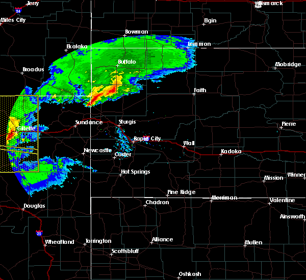 At 700 pm mdt, severe thunderstorms were located along a line extending from 11 miles north of savageton to 6 miles southwest of pumpkin buttes, moving east at 30 mph (radar indicated). Hazards include 60 mph wind gusts and nickel size hail. Expect damage to roofs. Siding and trees. At 700 pm mdt, severe thunderstorms were located along a line extending from 11 miles north of savageton to 6 miles southwest of pumpkin buttes, moving east at 30 mph (radar indicated). Hazards include 60 mph wind gusts and nickel size hail. Expect damage to roofs. Siding and trees.
|
| 6/25/2015 1:26 AM MDT |
 At 125 am mdt, severe thunderstorms were located along a line extending from 8 miles southeast of reno junction to 7 miles northwest of linch, moving southeast at 25 mph (radar indicated). Hazards include tennis ball size hail. People and animals outdoors will be injured. Expect damage to roofs, siding, windows and vehicles. At 125 am mdt, severe thunderstorms were located along a line extending from 8 miles southeast of reno junction to 7 miles northwest of linch, moving southeast at 25 mph (radar indicated). Hazards include tennis ball size hail. People and animals outdoors will be injured. Expect damage to roofs, siding, windows and vehicles.
|
| 6/25/2015 12:53 AM MDT |
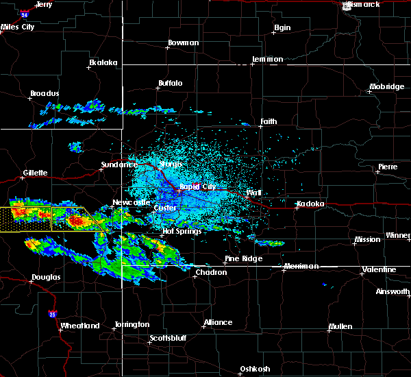 At 1252 am mdt, severe thunderstorms were located along a line extending from 13 miles east of reno junction to near pumpkin buttes, moving southeast at 10 mph (radar indicated). Hazards include two inch hail and 60 mph wind gusts. People and animals outdoors will be injured. expect hail damage to roofs, siding, windows and vehicles. expect wind damage to roofs, siding and trees. Locations impacted include, wright, pine tree junction, reno junction and pumpkin buttes. At 1252 am mdt, severe thunderstorms were located along a line extending from 13 miles east of reno junction to near pumpkin buttes, moving southeast at 10 mph (radar indicated). Hazards include two inch hail and 60 mph wind gusts. People and animals outdoors will be injured. expect hail damage to roofs, siding, windows and vehicles. expect wind damage to roofs, siding and trees. Locations impacted include, wright, pine tree junction, reno junction and pumpkin buttes.
|
| 6/25/2015 12:32 AM MDT |
 At 1232 am mdt, severe thunderstorms were located along a line extending from 14 miles east of reno junction to near pumpkin buttes, moving southeast at 20 mph (radar indicated). Hazards include golf ball size hail. People and animals outdoors will be injured. Expect damage to roofs, siding, windows and vehicles. At 1232 am mdt, severe thunderstorms were located along a line extending from 14 miles east of reno junction to near pumpkin buttes, moving southeast at 20 mph (radar indicated). Hazards include golf ball size hail. People and animals outdoors will be injured. Expect damage to roofs, siding, windows and vehicles.
|
| 6/21/2015 1:20 AM MDT |
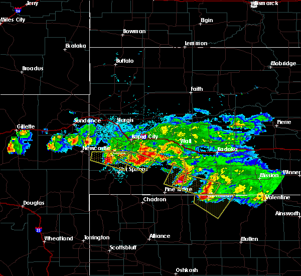 At 119 am mdt, a severe thunderstorm was located near reno junction, or near wright, moving southeast at 35 mph (radar indicated). Hazards include 60 mph wind gusts and half dollar size hail. Hail damage to vehicles is expected. Expect wind damage to roofs, siding and trees. At 119 am mdt, a severe thunderstorm was located near reno junction, or near wright, moving southeast at 35 mph (radar indicated). Hazards include 60 mph wind gusts and half dollar size hail. Hail damage to vehicles is expected. Expect wind damage to roofs, siding and trees.
|
| 6/17/2015 10:23 PM MDT | Quarter sized hail reported 12.9 miles W of Wright, WY |
| 6/14/2015 1:30 AM MDT |
 At 130 am mdt, a severe thunderstorm was located near reno junction, or near wright, moving east at 25 mph (radar indicated). Hazards include half dollar size hail. Damage to vehicles is expected. Locations impacted include, wright and reno junction. At 130 am mdt, a severe thunderstorm was located near reno junction, or near wright, moving east at 25 mph (radar indicated). Hazards include half dollar size hail. Damage to vehicles is expected. Locations impacted include, wright and reno junction.
|
| 6/14/2015 1:16 AM MDT |
 At 116 am mdt, a severe thunderstorm was located near reno junction, or near wright, moving northeast at 45 mph (radar indicated). Hazards include half dollar size hail. damage to vehicles is expected At 116 am mdt, a severe thunderstorm was located near reno junction, or near wright, moving northeast at 45 mph (radar indicated). Hazards include half dollar size hail. damage to vehicles is expected
|
| 6/14/2015 12:43 AM MDT | Half Dollar sized hail reported 17.4 miles SW of Wright, WY |
| 6/10/2015 3:19 PM MDT |
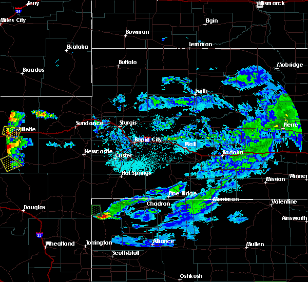 At 318 pm mdt, a severe thunderstorm was located near savageton, or 10 miles west of wright, moving southeast at 20 mph (radar indicated). Hazards include quarter size hail. Damage to vehicles is expected. This severe thunderstorm will remain over mainly rural areas of south central campbell county, west of wright. At 318 pm mdt, a severe thunderstorm was located near savageton, or 10 miles west of wright, moving southeast at 20 mph (radar indicated). Hazards include quarter size hail. Damage to vehicles is expected. This severe thunderstorm will remain over mainly rural areas of south central campbell county, west of wright.
|
| 6/4/2015 1:12 AM MDT | The severe thunderstorm warning for southeastern campbell and southwestern weston counties will expire at 115 am mdt, the storms which prompted the warning have weakened below severe limits, and no longer pose an immediate threat to life or property. therefore the warning will be allowed to expire. however gusty winds and heavy rain are still possible with these thunderstorms. |
| 6/4/2015 12:13 AM MDT | At 1212 am mdt, severe thunderstorms were located along a line extending from 10 miles northeast of reno junction to 14 miles west of dull center, moving east at 30 mph (radar indicated). Hazards include 60 mph wind gusts. Expect damage to roofs. Siding and trees. |
| 6/3/2015 11:55 PM MDT | Storm damage reported in campbell county WY, 17.3 miles ENE of Wright, WY |
| 6/25/2014 12:45 AM MDT | Quarter sized hail reported 9.9 miles WNW of Wright, WY, quarter size hail on the north side of black thunder mine. |
| 6/13/2014 4:26 PM MDT | Storm damage reported in campbell county WY, 17.3 miles ENE of Wright, WY |
| 8/1/2013 8:36 PM MDT | Ping Pong Ball sized hail reported 0.2 miles NNE of Wright, WY, east edge of wright |
| 8/1/2013 8:33 PM MDT | Storm damage reported in campbell county WY, 0.2 miles NNE of Wright, WY |
| 8/1/2013 8:32 PM MDT | Along highway 59 just north of wright in campbell county WY, 5.5 miles SSW of Wright, WY |
| 8/1/2013 8:32 PM MDT | Golf Ball sized hail reported 0.2 miles NNE of Wright, WY, west edge of wright |
| 8/1/2013 8:29 PM MDT | Golf Ball sized hail reported 0.2 miles NNE of Wright, WY, 60-65 mph winds at 2033 mdt |
| 7/8/2013 8:00 PM MDT | Storm damage reported in campbell county WY, 17.4 miles SW of Wright, WY |
| 6/18/2013 6:03 PM MDT | Quarter sized hail reported 0.2 miles NNE of Wright, WY |
| 7/24/2012 8:55 PM MDT | Storm damage reported in campbell county WY, 12.5 miles S of Wright, WY |
| 6/25/2012 3:35 PM MDT | Storm damage reported in campbell county WY, 15.3 miles NNE of Wright, WY |
| 1/1/0001 12:00 AM | Storm damage reported in campbell county WY, 14.8 miles NW of Wright, WY |
| 1/1/0001 12:00 AM | 6-7 inch diameter cottonwood branches broken off in campbell county WY, 14.8 miles NW of Wright, WY |
| 1/1/0001 12:00 AM | Storm damage reported in campbell county WY, 12.5 miles SSW of Wright, WY |
| 1/1/0001 12:00 AM | Storm damage reported in campbell county WY, 0.2 miles NNE of Wright, WY |
| 1/1/0001 12:00 AM | Storm damage reported in campbell county WY, 17.4 miles SW of Wright, WY |
| 1/1/0001 12:00 AM | Storm damage reported in campbell county WY, 17.9 miles SE of Wright, WY |
Hail Maps for Wright, WY


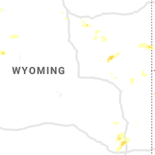


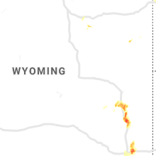


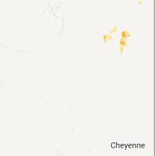
Connect with Interactive Hail Maps