

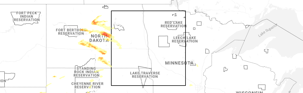
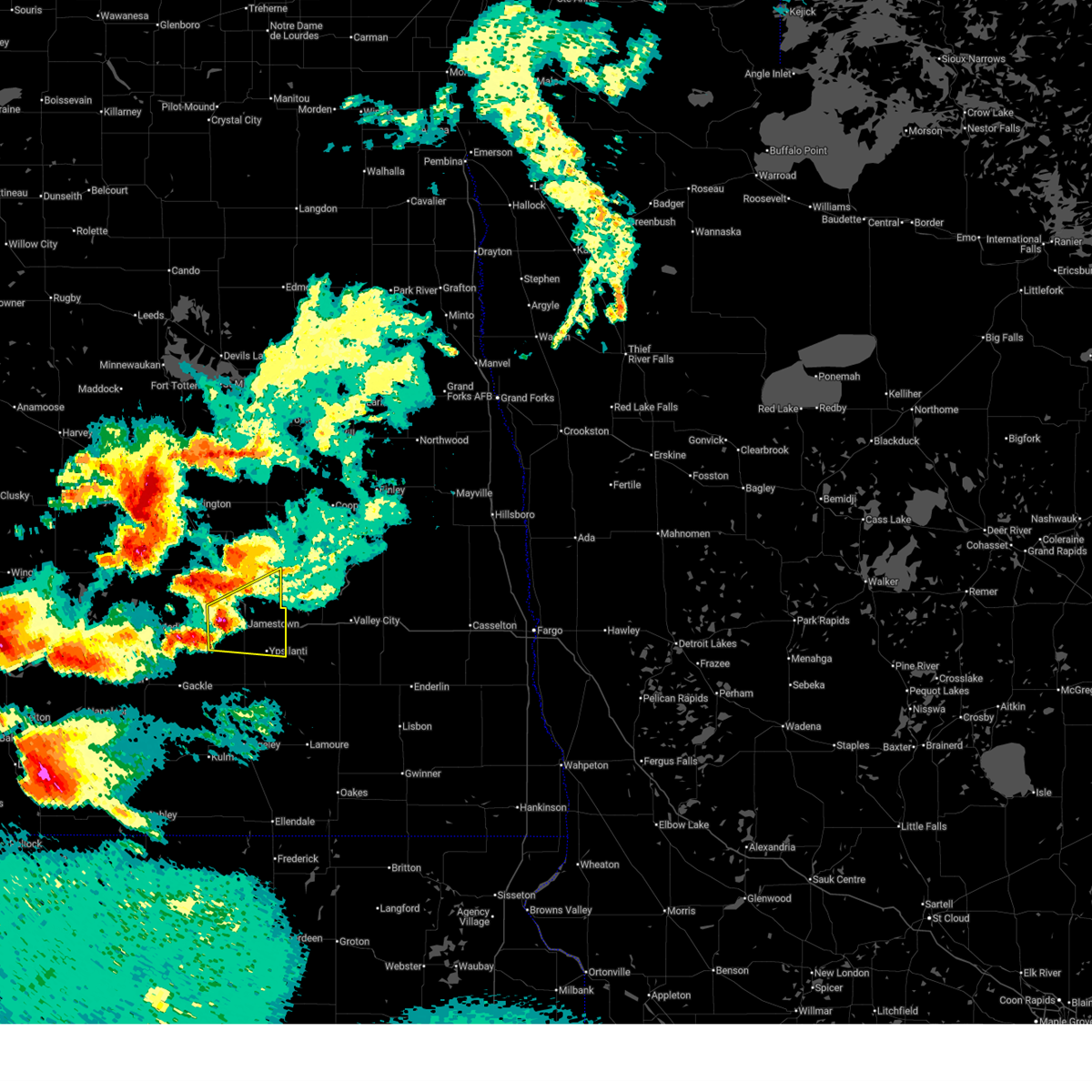
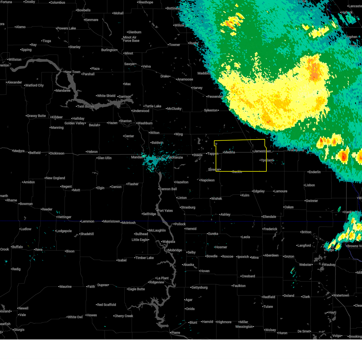
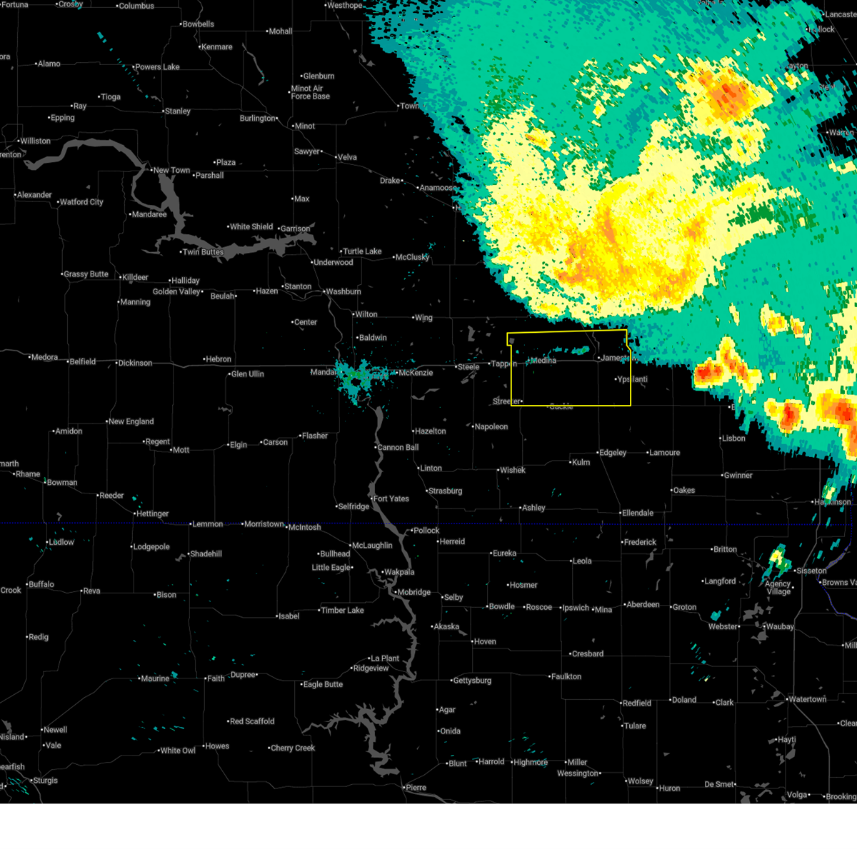
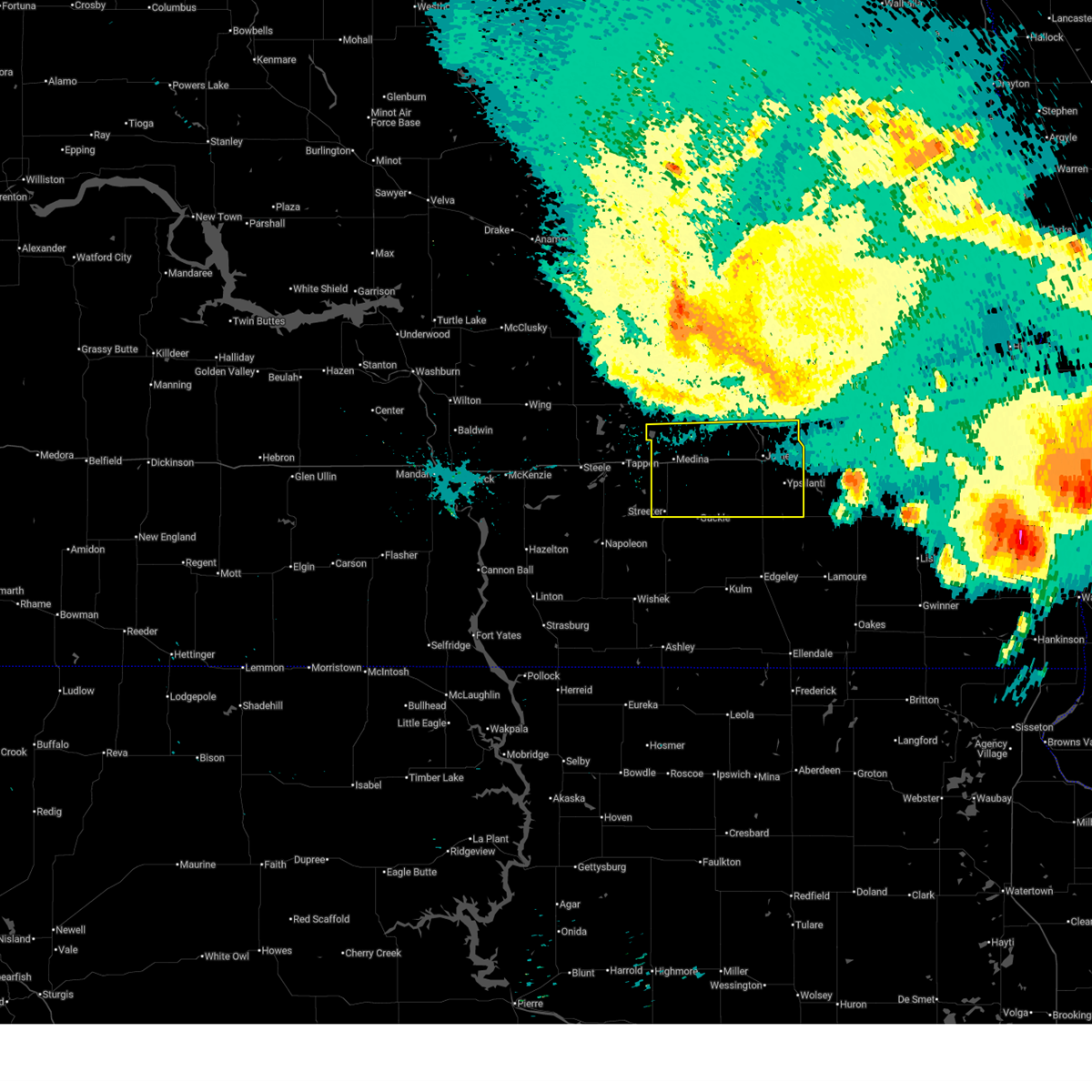
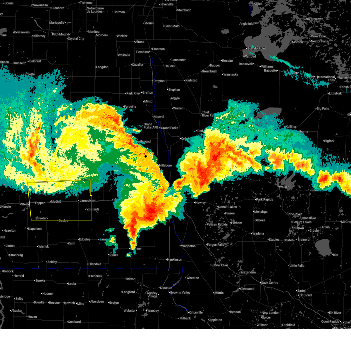
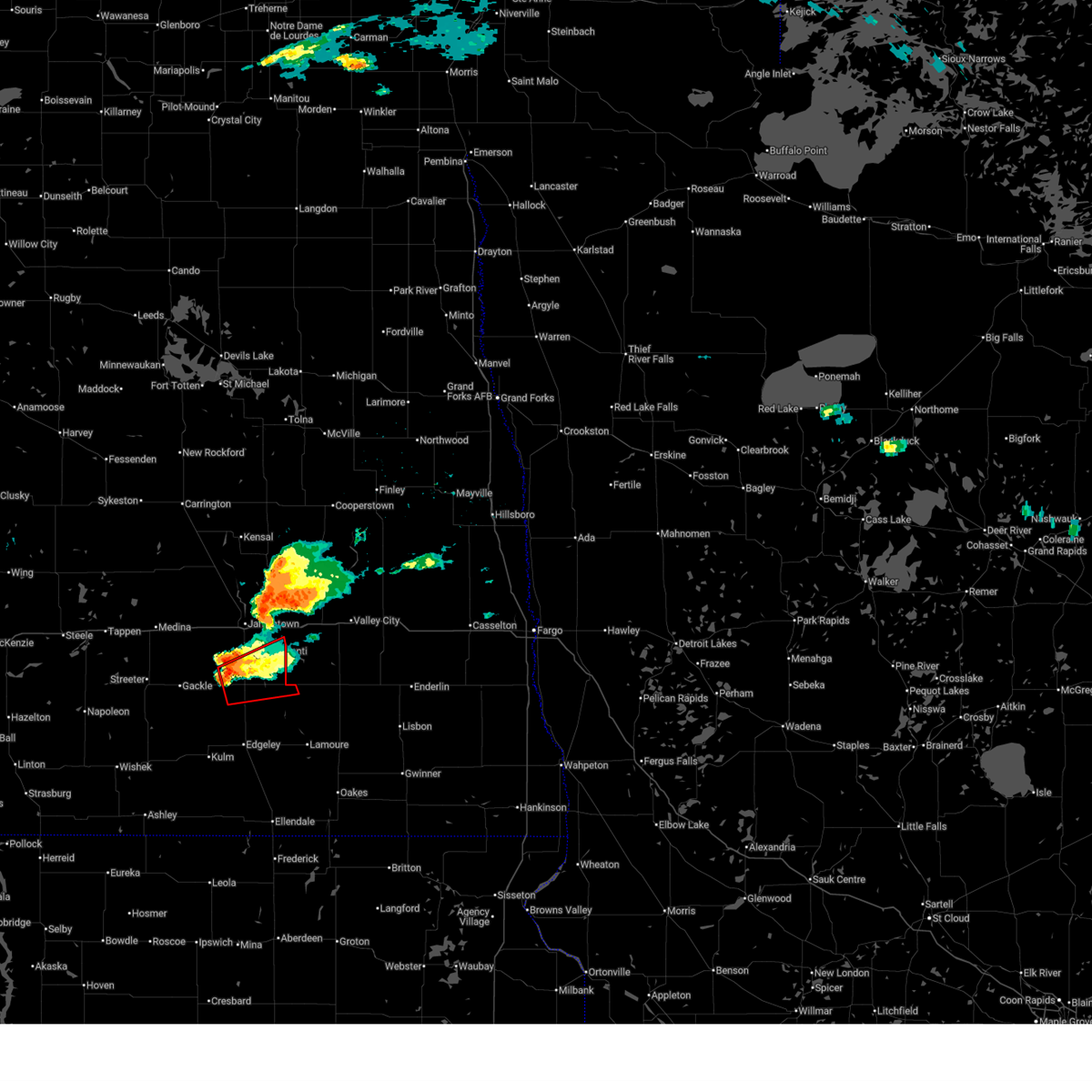
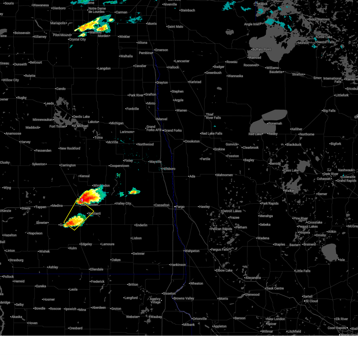
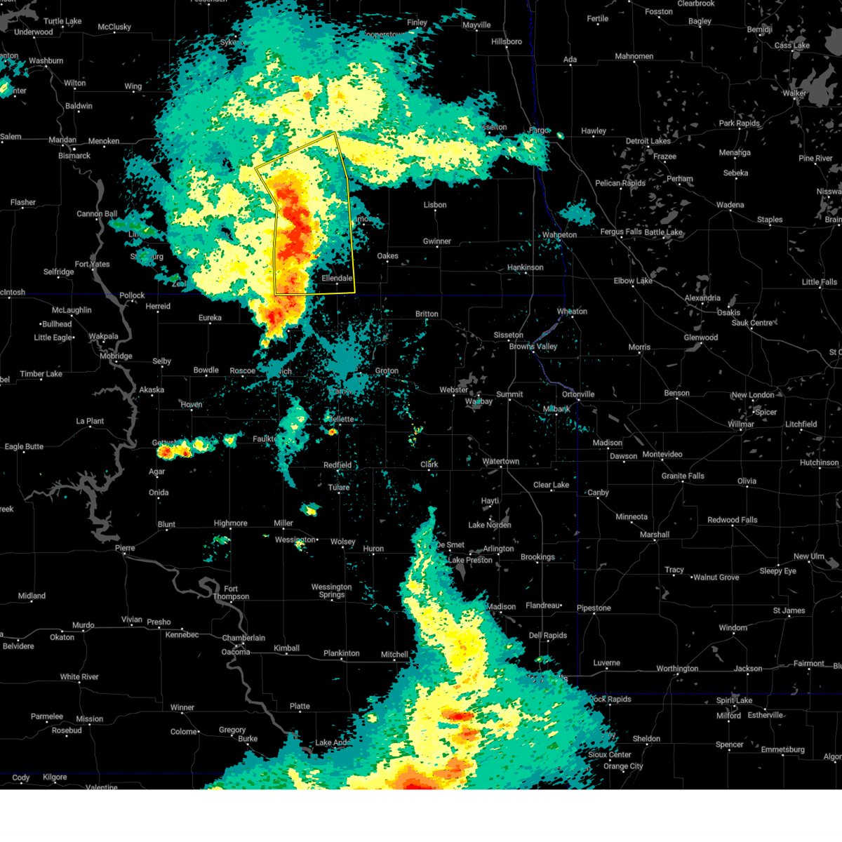
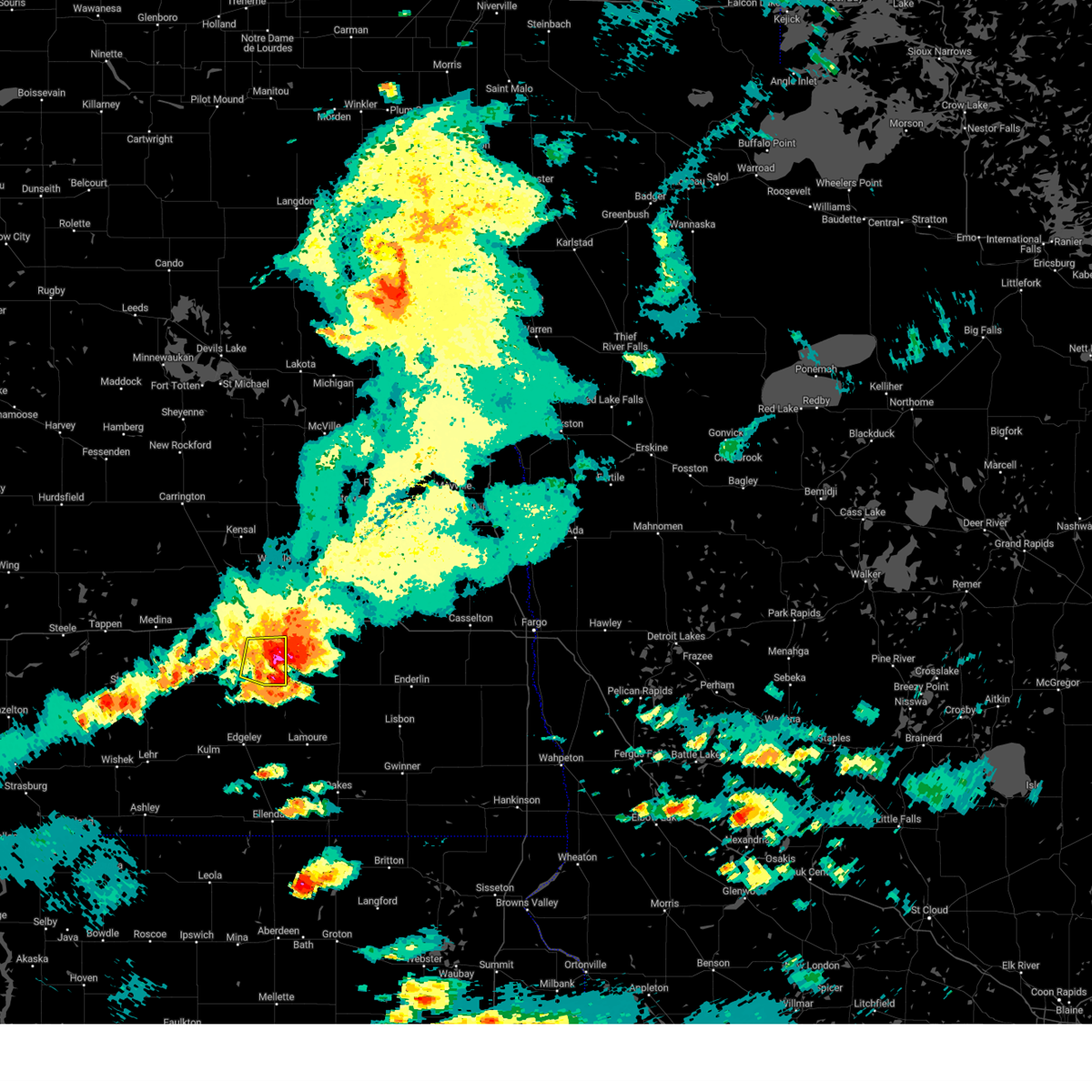
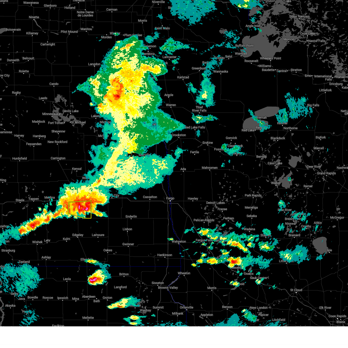
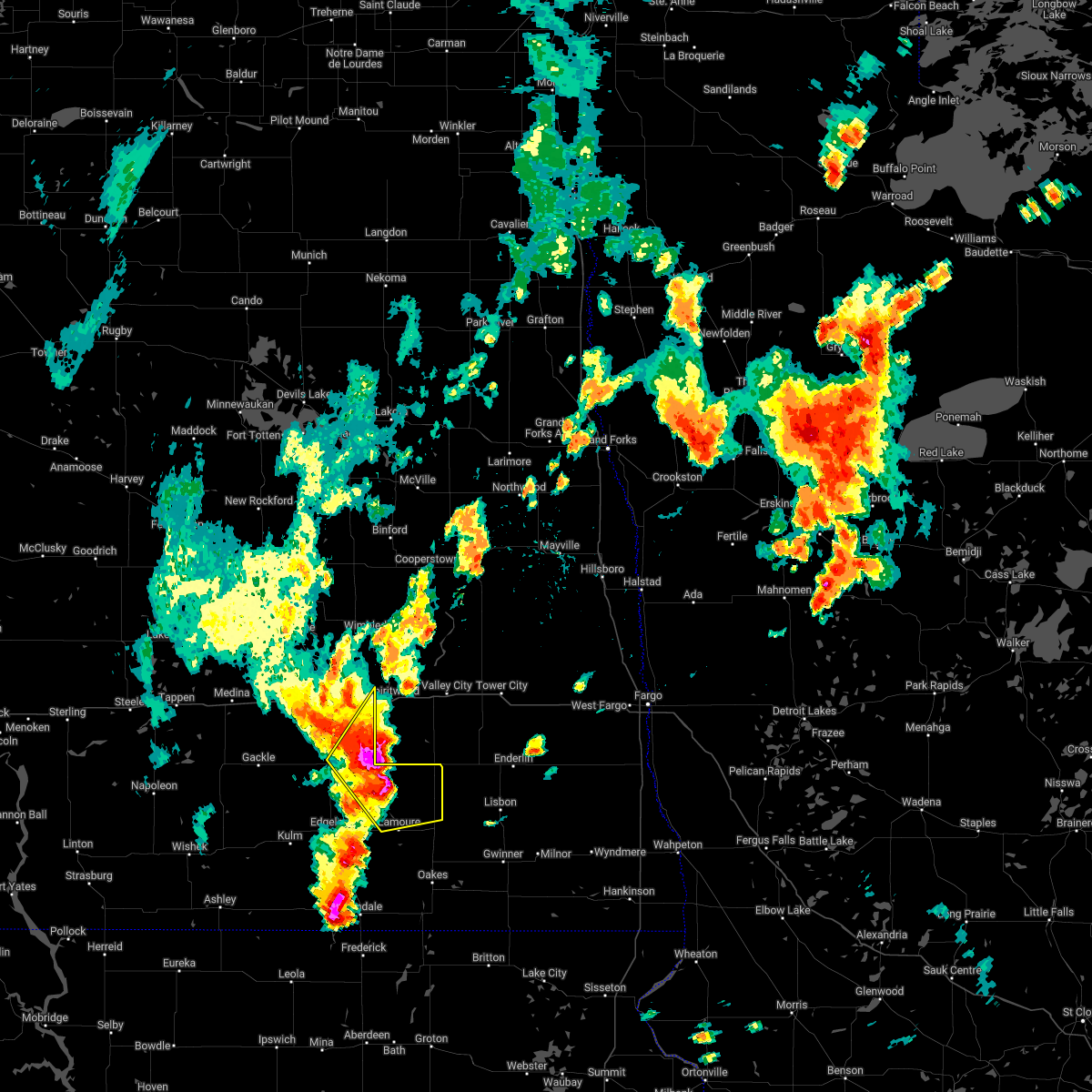
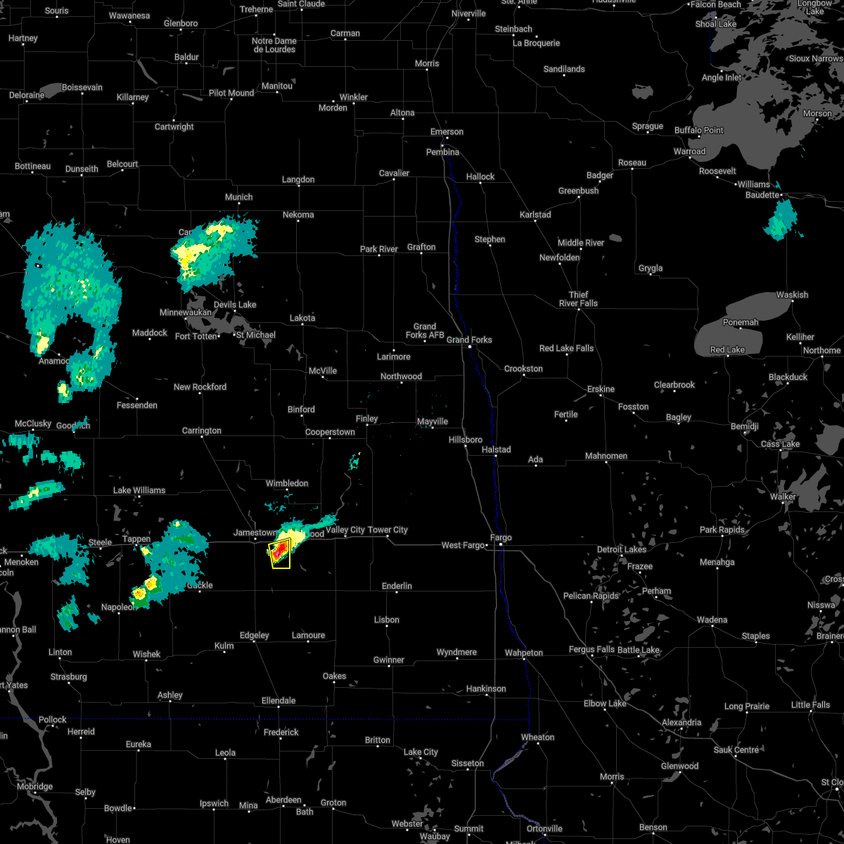
Hail Map for Ypsilanti, ND
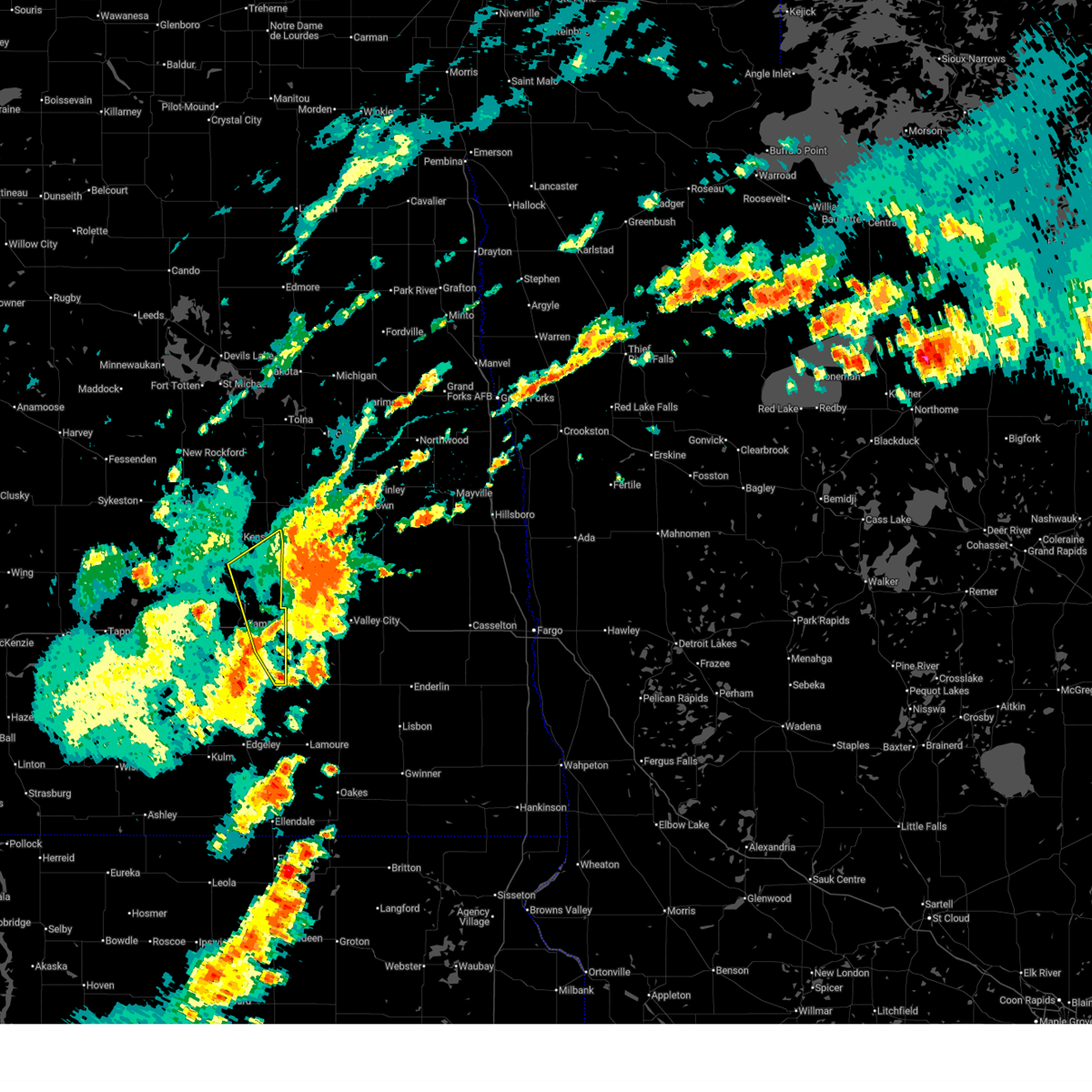
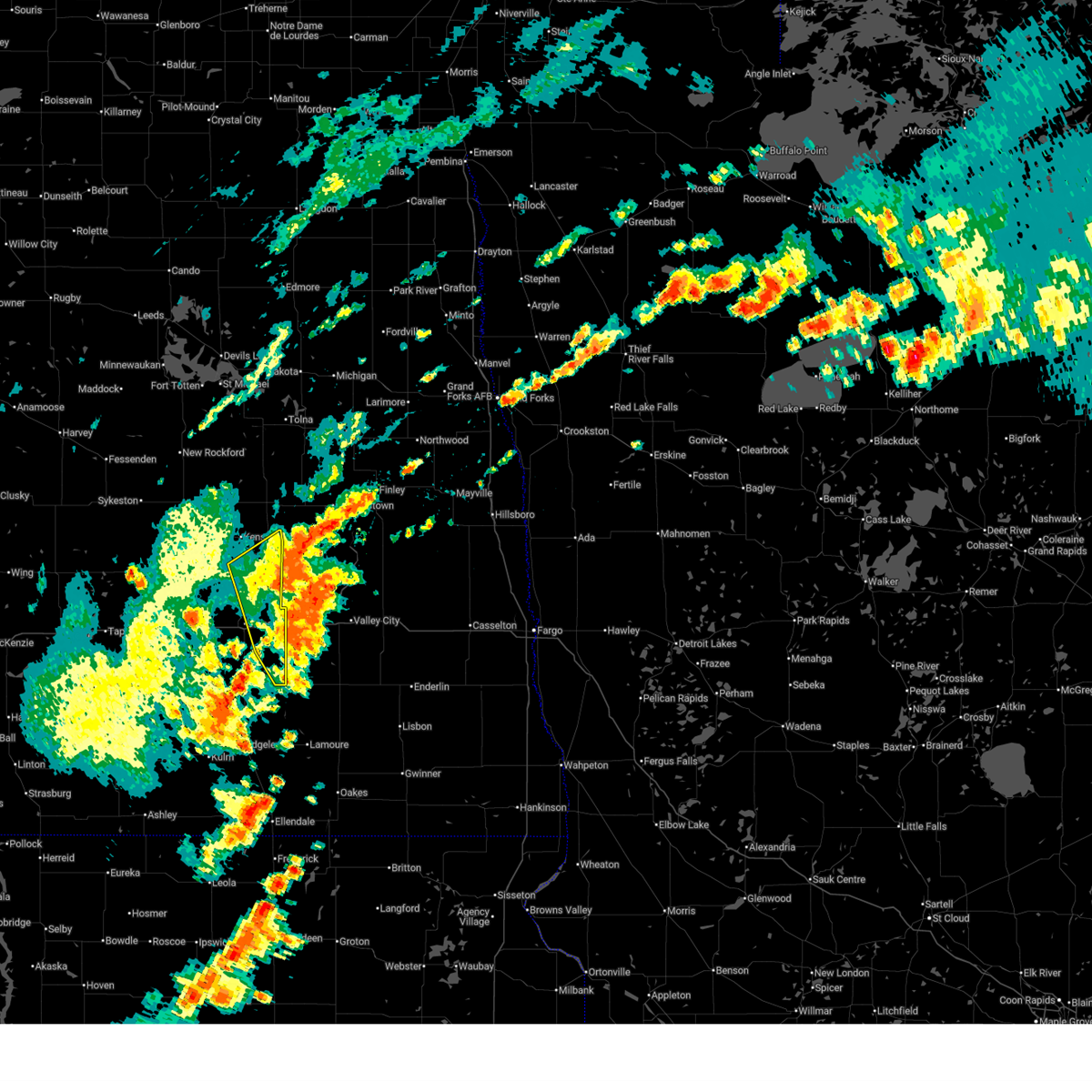
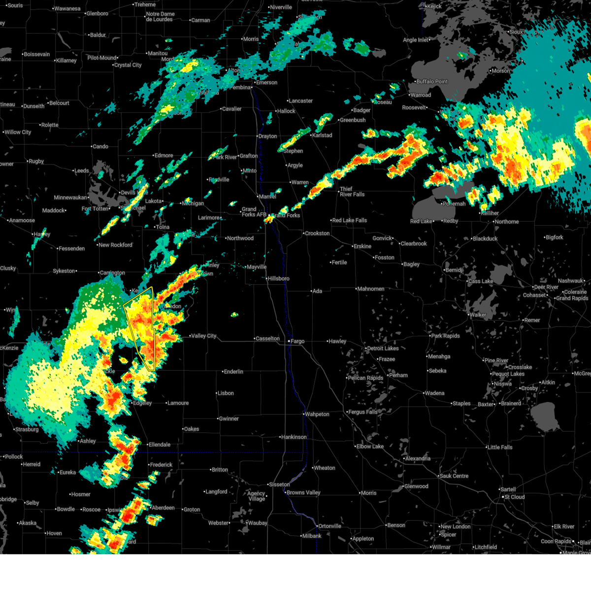
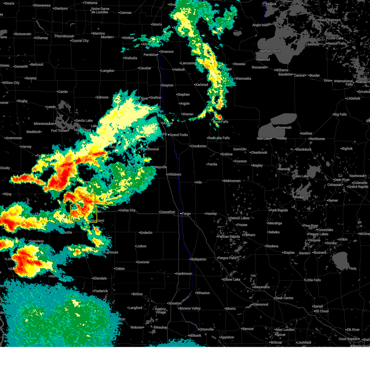
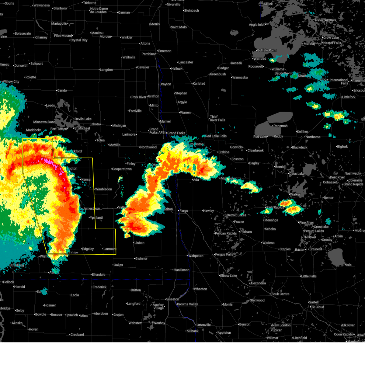
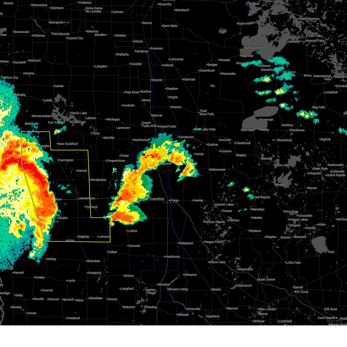
The Ypsilanti, ND area has had 3 reports of on-the-ground hail by trained spotters, and has been under severe weather warnings 31 times during the past 12 months. Doppler radar has detected hail at or near Ypsilanti, ND on 48 occasions, including 2 occasions during the past year.
| Name: | Ypsilanti, ND |
| Where Located: | 84.7 miles W of Fargo, ND |
| Map: | Google Map for Ypsilanti, ND |
| Population: | 104 |
| Housing Units: | 52 |
| More Info: | Search Google for Ypsilanti, ND |
0
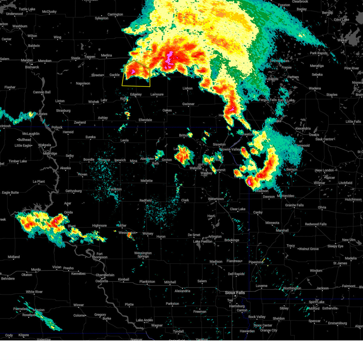
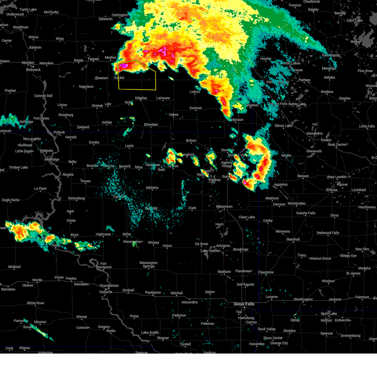
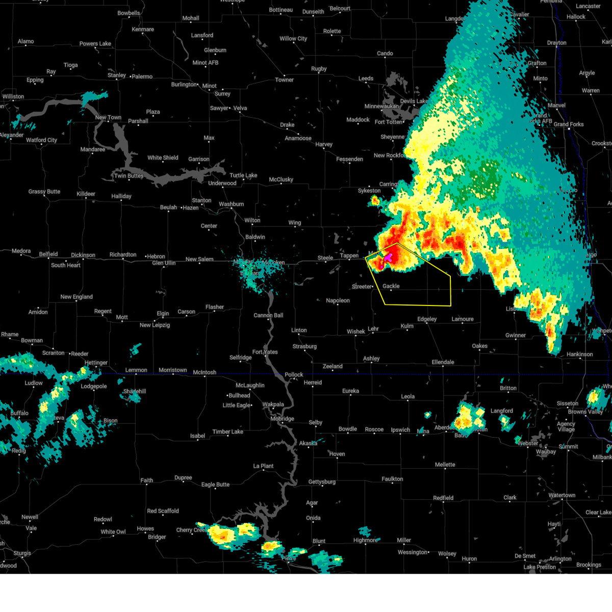
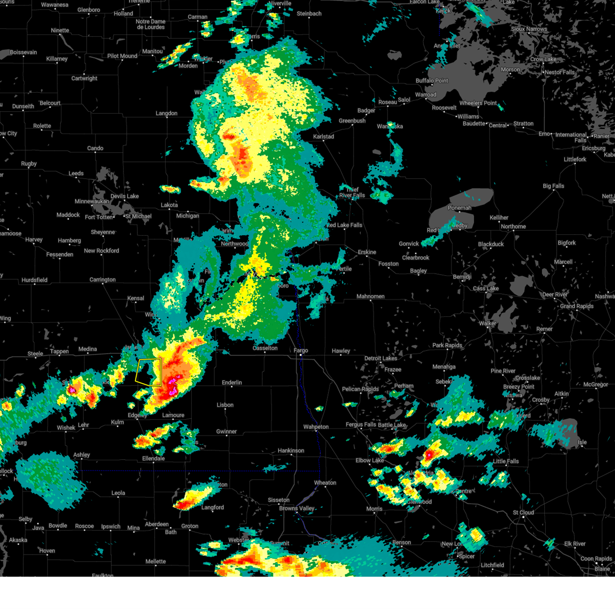
The Top Recent Hail Date for Ypsilanti, ND is Friday, June 27, 2025 (46th out of 48)
Hail and Wind Damage Spotted near Ypsilanti, ND
| Date / Time | Report Details |
|---|---|
| 7/9/2025 10:22 PM CDT |
 The storm which prompted the warning has weakened below severe limits, and has exited the warned area. therefore, the warning will be allowed to expire. a severe thunderstorm watch remains in effect until 100 am cdt for southeastern north dakota. The storm which prompted the warning has weakened below severe limits, and has exited the warned area. therefore, the warning will be allowed to expire. a severe thunderstorm watch remains in effect until 100 am cdt for southeastern north dakota.
|
| 7/9/2025 9:49 PM CDT |
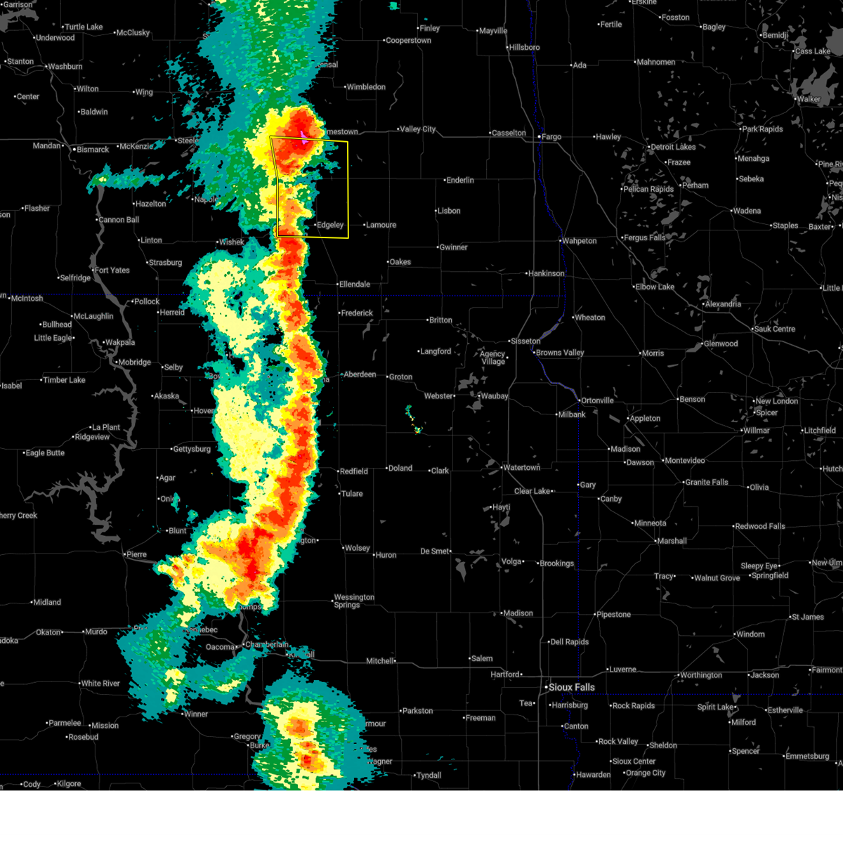
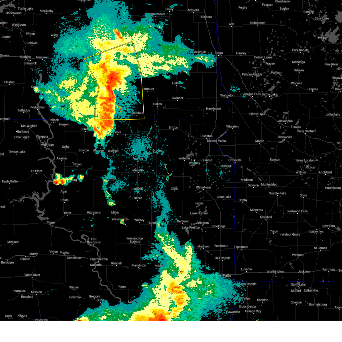
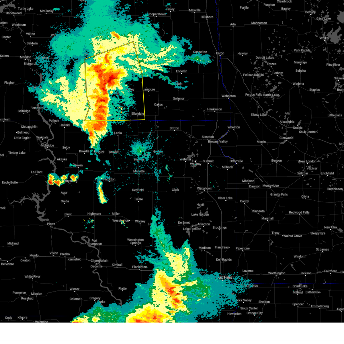
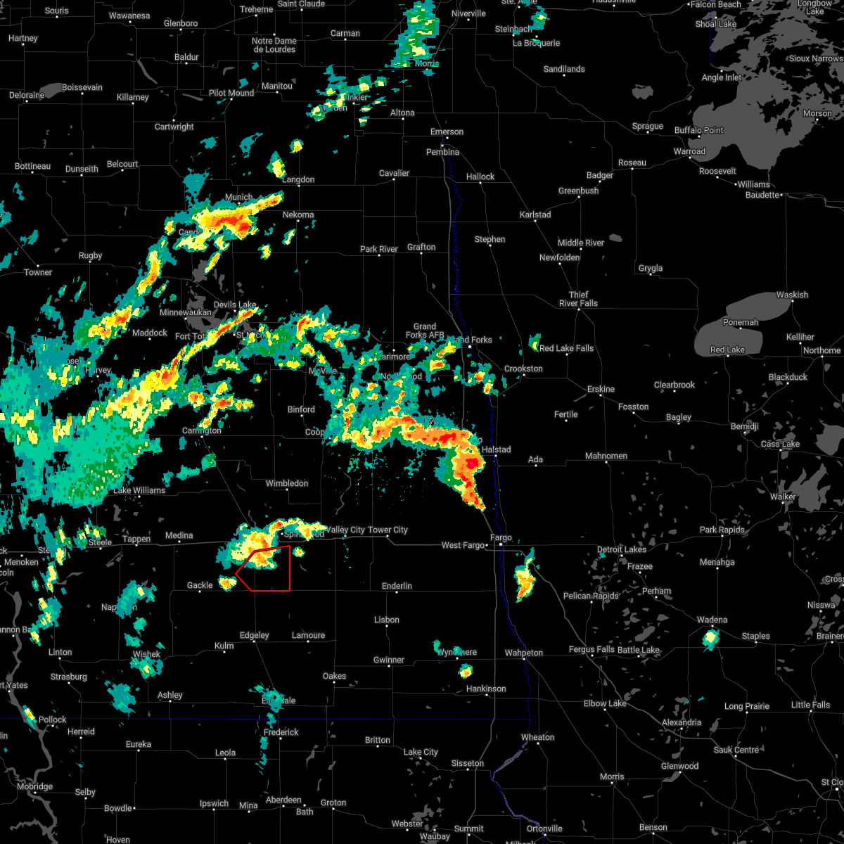
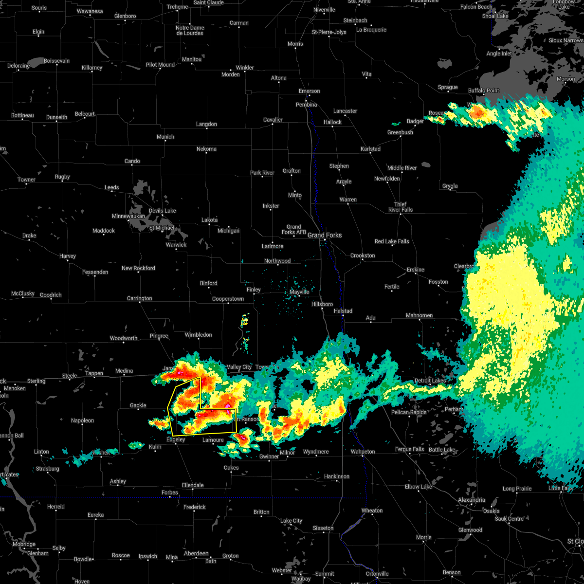
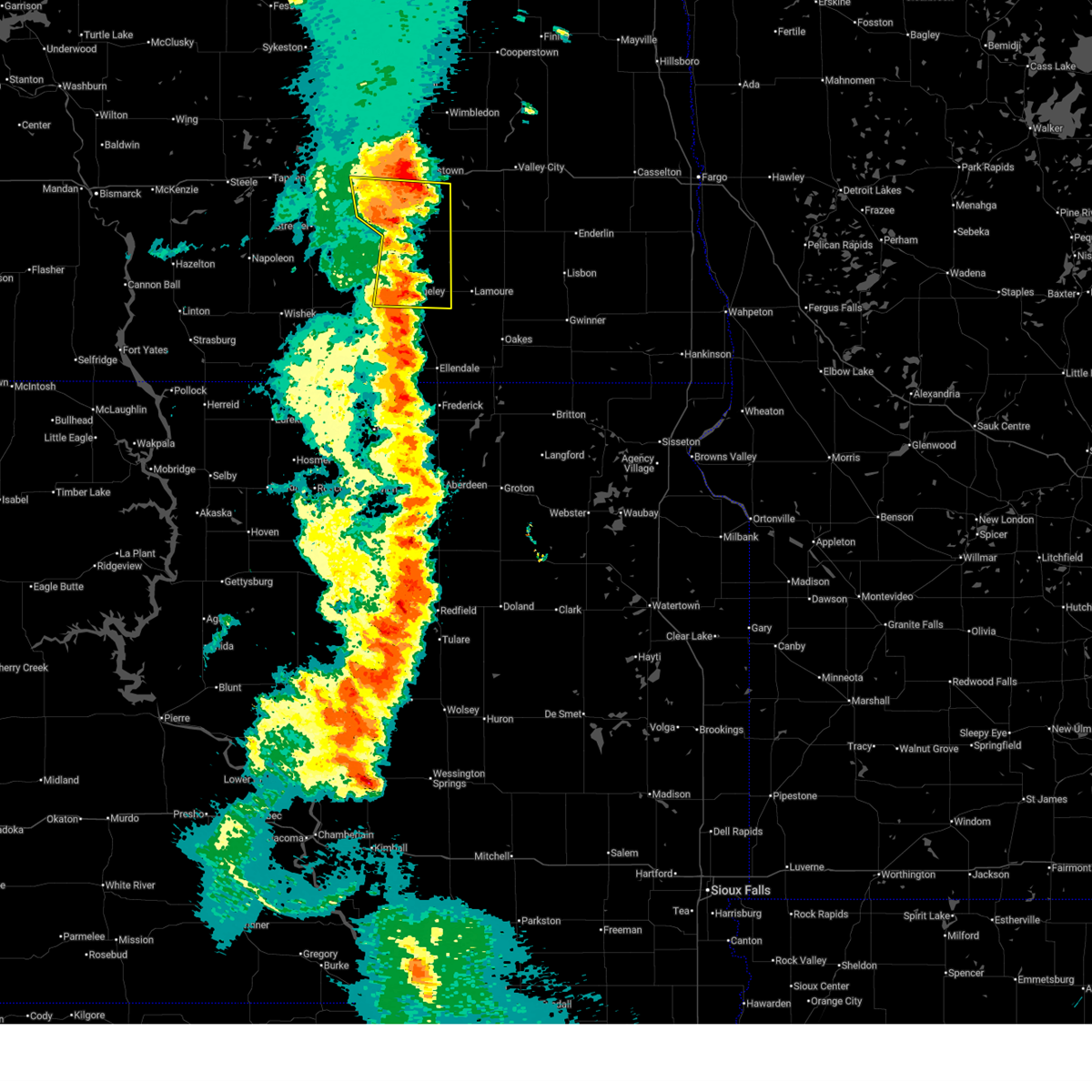 At 949 pm cdt, severe thunderstorms were located along a line extending from 8 miles west of ypsilanti to 4 miles southeast of edgeley, moving east at 40 mph (radar indicated). Hazards include 60 mph wind gusts and quarter size hail. Hail damage to vehicles is expected. expect wind damage to roofs, siding, and trees. Locations impacted include, edgeley, kulm, ypsilanti, adrian, montpelier, jud, dickey, sydney, berlin, nortonville, and millarton. At 949 pm cdt, severe thunderstorms were located along a line extending from 8 miles west of ypsilanti to 4 miles southeast of edgeley, moving east at 40 mph (radar indicated). Hazards include 60 mph wind gusts and quarter size hail. Hail damage to vehicles is expected. expect wind damage to roofs, siding, and trees. Locations impacted include, edgeley, kulm, ypsilanti, adrian, montpelier, jud, dickey, sydney, berlin, nortonville, and millarton.
|
| 7/9/2025 9:47 PM CDT |
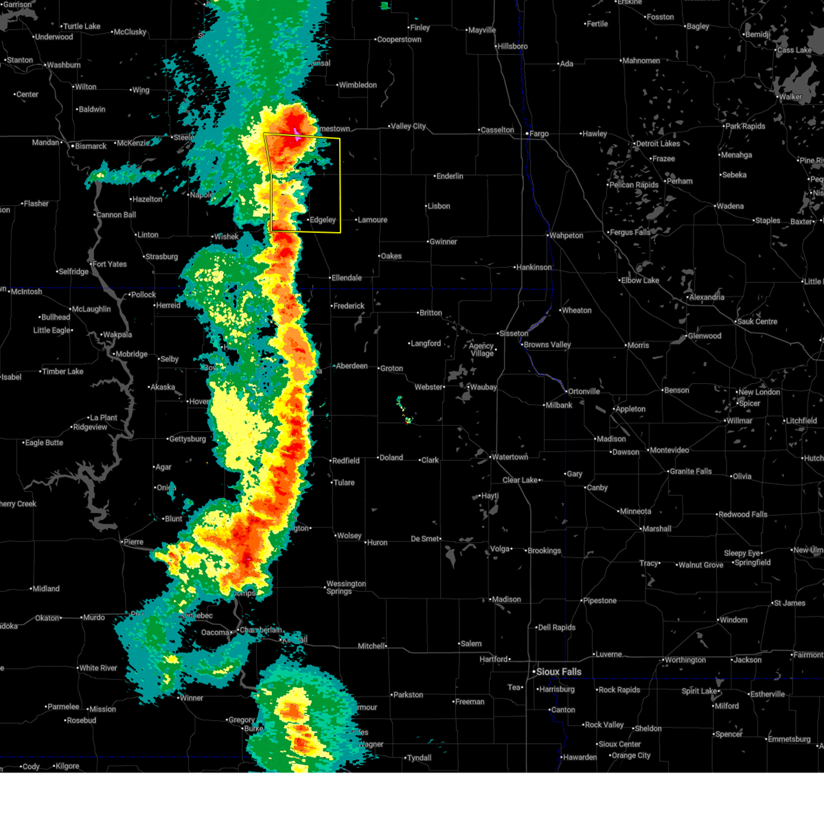
 At 947 pm cdt, a severe thunderstorm was located over jamestown, moving east at 20 mph (radar indicated). Hazards include 60 mph wind gusts and quarter size hail. Hail damage to vehicles is expected. expect wind damage to roofs, siding, and trees. Locations impacted include, jamestown, ypsilanti, spiritwood, and eldridge. At 947 pm cdt, a severe thunderstorm was located over jamestown, moving east at 20 mph (radar indicated). Hazards include 60 mph wind gusts and quarter size hail. Hail damage to vehicles is expected. expect wind damage to roofs, siding, and trees. Locations impacted include, jamestown, ypsilanti, spiritwood, and eldridge.
|
| 7/9/2025 9:36 PM CDT |
 the severe thunderstorm warning has been cancelled and is no longer in effect the severe thunderstorm warning has been cancelled and is no longer in effect
|
| 7/9/2025 9:36 PM CDT |
 At 936 pm cdt, severe thunderstorms were located along a line extending from 13 miles southeast of cleveland to 6 miles east of kulm, moving east at 40 mph (radar indicated). Hazards include 60 mph wind gusts and quarter size hail. Hail damage to vehicles is expected. expect wind damage to roofs, siding, and trees. Locations impacted include, edgeley, kulm, ypsilanti, adrian, montpelier, jud, dickey, sydney, berlin, nortonville, alfred, and millarton. At 936 pm cdt, severe thunderstorms were located along a line extending from 13 miles southeast of cleveland to 6 miles east of kulm, moving east at 40 mph (radar indicated). Hazards include 60 mph wind gusts and quarter size hail. Hail damage to vehicles is expected. expect wind damage to roofs, siding, and trees. Locations impacted include, edgeley, kulm, ypsilanti, adrian, montpelier, jud, dickey, sydney, berlin, nortonville, alfred, and millarton.
|
| 7/9/2025 9:32 PM CDT |
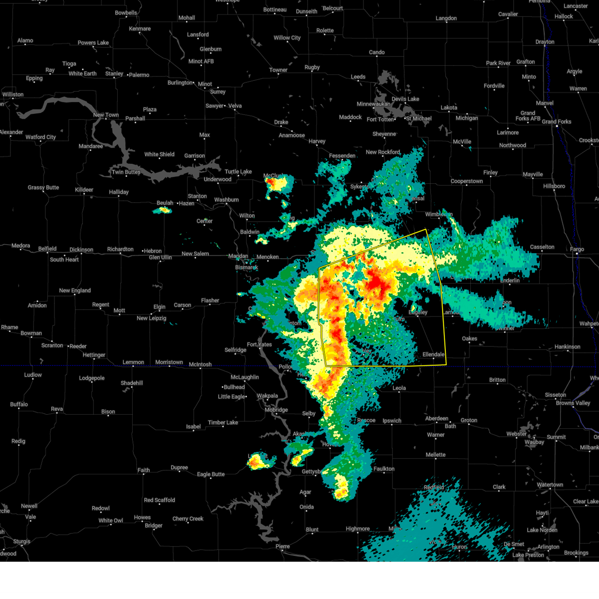
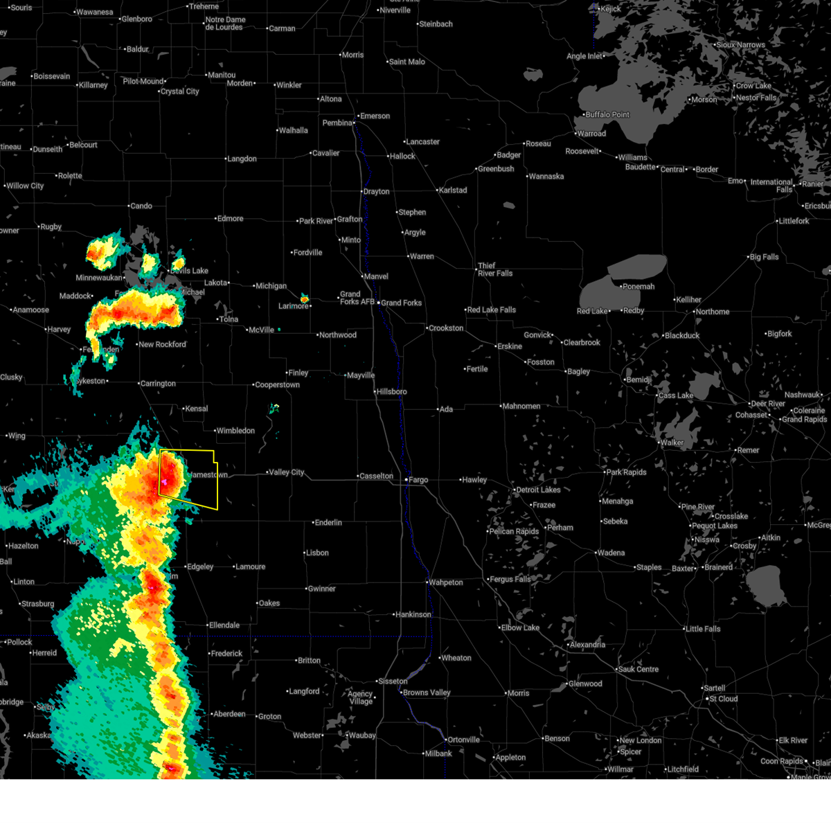 Svrbis the national weather service in bismarck has issued a * severe thunderstorm warning for, southeastern stutsman county in southeastern north dakota, * until 1030 pm cdt. * at 931 pm cdt, a severe thunderstorm was located 5 miles west of jamestown, moving east at 30 mph (radar indicated). Hazards include 60 mph wind gusts and quarter size hail. Hail damage to vehicles is expected. Expect wind damage to roofs, siding, and trees. Svrbis the national weather service in bismarck has issued a * severe thunderstorm warning for, southeastern stutsman county in southeastern north dakota, * until 1030 pm cdt. * at 931 pm cdt, a severe thunderstorm was located 5 miles west of jamestown, moving east at 30 mph (radar indicated). Hazards include 60 mph wind gusts and quarter size hail. Hail damage to vehicles is expected. Expect wind damage to roofs, siding, and trees.
|
| 7/9/2025 9:12 PM CDT |
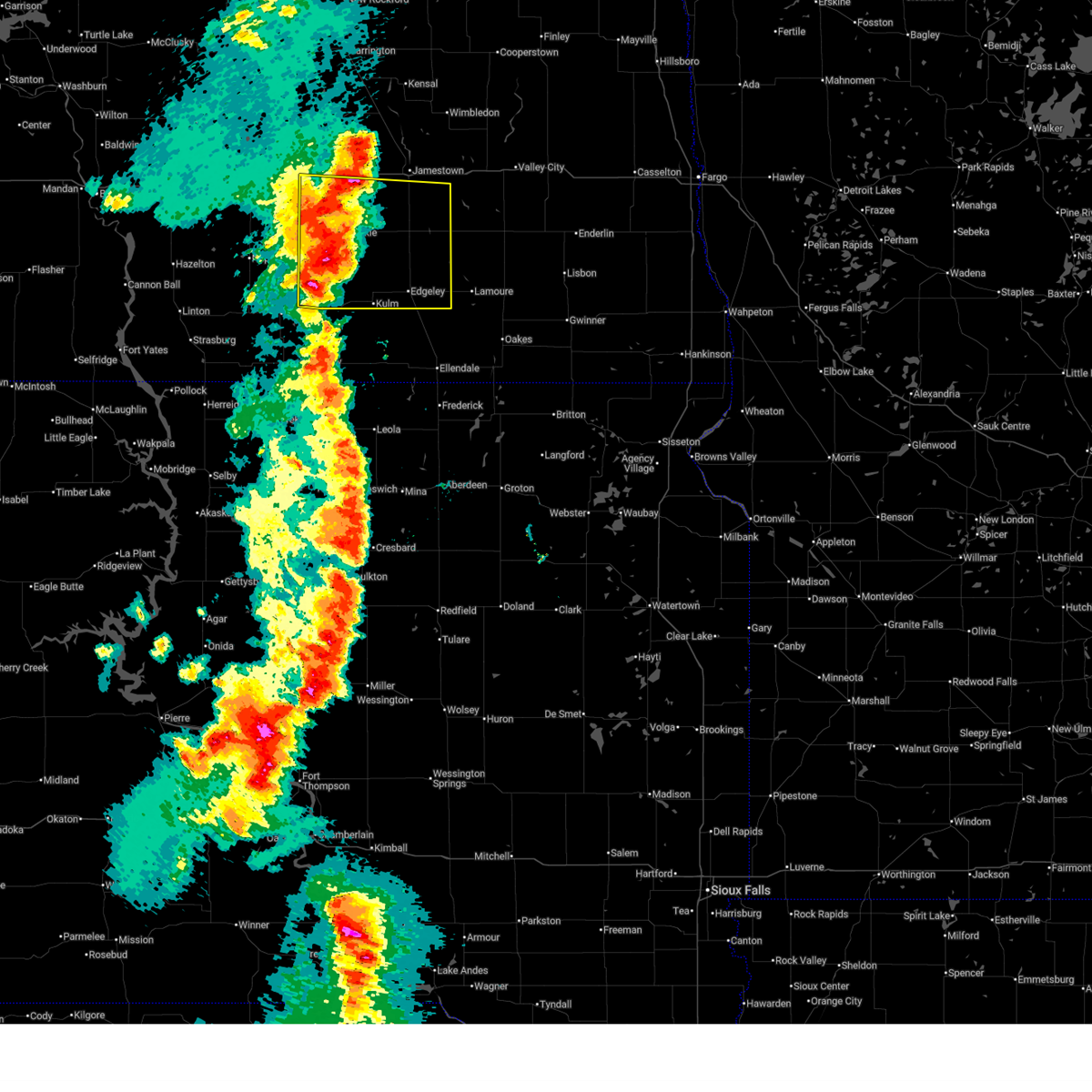 Svrbis the national weather service in bismarck has issued a * severe thunderstorm warning for, lamoure county in southeastern north dakota, eastern logan county in southeastern north dakota, southern stutsman county in southeastern north dakota, * until 1000 pm cdt. * at 911 pm cdt, a severe thunderstorm was located 6 miles west of jud, or 32 miles southwest of jamestown, moving east at 45 mph (radar indicated). Hazards include 70 mph wind gusts and nickel size hail. Expect considerable tree damage. Damage is likely to mobile homes, roofs, and outbuildings. Svrbis the national weather service in bismarck has issued a * severe thunderstorm warning for, lamoure county in southeastern north dakota, eastern logan county in southeastern north dakota, southern stutsman county in southeastern north dakota, * until 1000 pm cdt. * at 911 pm cdt, a severe thunderstorm was located 6 miles west of jud, or 32 miles southwest of jamestown, moving east at 45 mph (radar indicated). Hazards include 70 mph wind gusts and nickel size hail. Expect considerable tree damage. Damage is likely to mobile homes, roofs, and outbuildings.
|
| 7/4/2025 3:42 PM CDT |
 The storms which prompted the warning have moved out of the area. therefore, the warning will be allowed to expire. however, gusty winds and heavy rain are still possible with these thunderstorms. a severe thunderstorm watch remains in effect until 900 pm cdt for southeastern north dakota. The storms which prompted the warning have moved out of the area. therefore, the warning will be allowed to expire. however, gusty winds and heavy rain are still possible with these thunderstorms. a severe thunderstorm watch remains in effect until 900 pm cdt for southeastern north dakota.
|
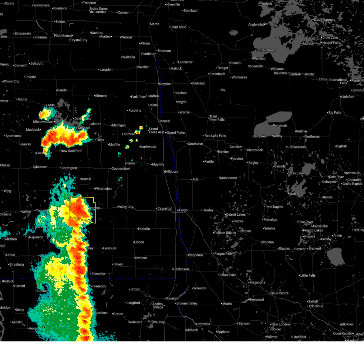
| 7/4/2025 3:27 PM CDT |
 At 327 pm cdt, severe thunderstorms were located along a line extending from 4 miles east of courtenay to 6 miles southwest of sanborn to 6 miles east of montpelier, moving northeast at 30 mph (radar indicated). Hazards include 60 mph wind gusts and nickel size hail. Expect damage to roofs, siding, and trees. Locations impacted include, jamestown, wimbledon, ypsilanti, spiritwood lake, spiritwood, and courtenay. At 327 pm cdt, severe thunderstorms were located along a line extending from 4 miles east of courtenay to 6 miles southwest of sanborn to 6 miles east of montpelier, moving northeast at 30 mph (radar indicated). Hazards include 60 mph wind gusts and nickel size hail. Expect damage to roofs, siding, and trees. Locations impacted include, jamestown, wimbledon, ypsilanti, spiritwood lake, spiritwood, and courtenay.
|
| 7/4/2025 3:16 PM CDT |
 Svrbis the national weather service in bismarck has issued a * severe thunderstorm warning for, eastern stutsman county in southeastern north dakota, * until 345 pm cdt. * at 316 pm cdt, severe thunderstorms were located along a line extending from near courtenay to 7 miles southeast of spiritwood to near adrian, moving northeast at 30 mph (radar indicated). Hazards include 60 mph wind gusts and quarter size hail. Hail damage to vehicles is expected. Expect wind damage to roofs, siding, and trees. Svrbis the national weather service in bismarck has issued a * severe thunderstorm warning for, eastern stutsman county in southeastern north dakota, * until 345 pm cdt. * at 316 pm cdt, severe thunderstorms were located along a line extending from near courtenay to 7 miles southeast of spiritwood to near adrian, moving northeast at 30 mph (radar indicated). Hazards include 60 mph wind gusts and quarter size hail. Hail damage to vehicles is expected. Expect wind damage to roofs, siding, and trees.
|
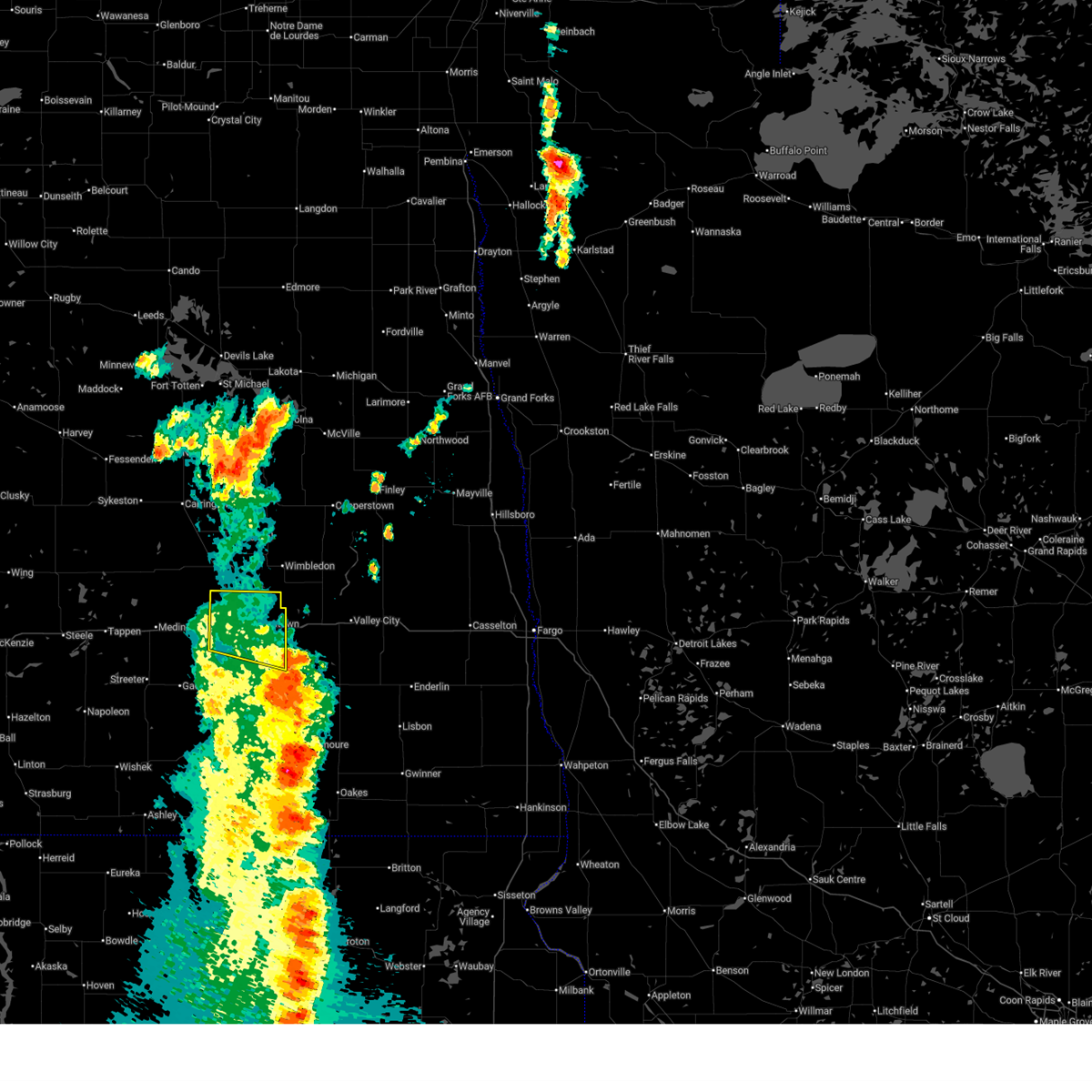
| 7/4/2025 3:06 PM CDT | Ndawn 10 meter peak wind repor in stutsman county ND, 2.1 miles W of Ypsilanti, ND |
| 6/27/2025 11:31 PM CDT |
 At 1131 pm cdt, a severe thunderstorm was located over jamestown, moving east at 25 mph (radar indicated). Hazards include ping pong ball size hail and 60 mph wind gusts. People and animals outdoors will be injured. expect hail damage to roofs, siding, windows, and vehicles. expect wind damage to roofs, siding, and trees. Locations impacted include, jamestown, ypsilanti, spiritwood lake, spiritwood, and eldridge. At 1131 pm cdt, a severe thunderstorm was located over jamestown, moving east at 25 mph (radar indicated). Hazards include ping pong ball size hail and 60 mph wind gusts. People and animals outdoors will be injured. expect hail damage to roofs, siding, windows, and vehicles. expect wind damage to roofs, siding, and trees. Locations impacted include, jamestown, ypsilanti, spiritwood lake, spiritwood, and eldridge.
|
| 6/27/2025 11:10 PM CDT |
 Svrbis the national weather service in bismarck has issued a * severe thunderstorm warning for, southeastern stutsman county in southeastern north dakota, * until 1215 am cdt. * at 1110 pm cdt, a severe thunderstorm was located 6 miles west of jamestown, moving east at 30 mph (radar indicated). Hazards include ping pong ball size hail and 60 mph wind gusts. People and animals outdoors will be injured. expect hail damage to roofs, siding, windows, and vehicles. Expect wind damage to roofs, siding, and trees. Svrbis the national weather service in bismarck has issued a * severe thunderstorm warning for, southeastern stutsman county in southeastern north dakota, * until 1215 am cdt. * at 1110 pm cdt, a severe thunderstorm was located 6 miles west of jamestown, moving east at 30 mph (radar indicated). Hazards include ping pong ball size hail and 60 mph wind gusts. People and animals outdoors will be injured. expect hail damage to roofs, siding, windows, and vehicles. Expect wind damage to roofs, siding, and trees.
|
| 6/21/2025 1:09 AM CDT |
 The storm which prompted the warning has moved out of the area. therefore, the warning will be allowed to expire. however, gusty winds up to 55 mph are still possible. a tornado watch remains in effect until 300 am cdt for south central and southeastern north dakota. The storm which prompted the warning has moved out of the area. therefore, the warning will be allowed to expire. however, gusty winds up to 55 mph are still possible. a tornado watch remains in effect until 300 am cdt for south central and southeastern north dakota.
|
| 6/21/2025 12:41 AM CDT |
 At 1240 am cdt, severe thunderstorm induced wind gusts are occurring in stutsman county (radar indicated). Hazards include 70 mph wind gusts. Expect considerable tree damage. damage is likely to mobile homes, roofs, and outbuildings. Locations impacted include, jamestown, gackle, medina, streeter, ypsilanti, buchanan, spiritwood lake, montpelier, cleveland, spiritwood, eldridge, sydney, windsor, chase lake, and millarton. At 1240 am cdt, severe thunderstorm induced wind gusts are occurring in stutsman county (radar indicated). Hazards include 70 mph wind gusts. Expect considerable tree damage. damage is likely to mobile homes, roofs, and outbuildings. Locations impacted include, jamestown, gackle, medina, streeter, ypsilanti, buchanan, spiritwood lake, montpelier, cleveland, spiritwood, eldridge, sydney, windsor, chase lake, and millarton.
|
| 6/21/2025 12:25 AM CDT |
 Svrbis the national weather service in bismarck has issued a * severe thunderstorm warning for, stutsman county in southeastern north dakota, * until 115 am cdt. * at 1224 am cdt, severe thunderstorm induced wind gusts are occurring in stutsman county (radar indicated). Hazards include 60 mph wind gusts. expect damage to roofs, siding, and trees Svrbis the national weather service in bismarck has issued a * severe thunderstorm warning for, stutsman county in southeastern north dakota, * until 115 am cdt. * at 1224 am cdt, severe thunderstorm induced wind gusts are occurring in stutsman county (radar indicated). Hazards include 60 mph wind gusts. expect damage to roofs, siding, and trees
|
| 6/21/2025 12:16 AM CDT |
 At 1215 am cdt, severe thunderstorms were located along a line extending from 4 miles south of dazey to 7 miles northwest of oakes, moving east at 55 mph (radar indicated). Hazards include 70 mph wind gusts. Expect considerable tree damage. damage is likely to mobile homes, roofs, and outbuildings. Locations impacted include, jamestown, gackle, medina, tappen, streeter, ypsilanti, buchanan, spiritwood lake, montpelier, cleveland, spiritwood, pettibone, pingree, woodworth, eldridge, sydney, windsor, crystal springs, lake williams, and chase lake. At 1215 am cdt, severe thunderstorms were located along a line extending from 4 miles south of dazey to 7 miles northwest of oakes, moving east at 55 mph (radar indicated). Hazards include 70 mph wind gusts. Expect considerable tree damage. damage is likely to mobile homes, roofs, and outbuildings. Locations impacted include, jamestown, gackle, medina, tappen, streeter, ypsilanti, buchanan, spiritwood lake, montpelier, cleveland, spiritwood, pettibone, pingree, woodworth, eldridge, sydney, windsor, crystal springs, lake williams, and chase lake.
|
| 6/20/2025 11:54 PM CDT |
 At 1153 pm cdt, severe thunderstorms were located along a line extending from near spiritwood lake to 7 miles east of merricourt city, moving east at 55 mph (radar indicated). Hazards include 70 mph wind gusts. Expect considerable tree damage. damage is likely to mobile homes, roofs, and outbuildings. Locations impacted include, jamestown, gackle, medina, tappen, streeter, ypsilanti, buchanan, spiritwood lake, montpelier, cleveland, spiritwood, pettibone, pingree, woodworth, eldridge, sydney, windsor, crystal springs, lake williams, and chase lake. At 1153 pm cdt, severe thunderstorms were located along a line extending from near spiritwood lake to 7 miles east of merricourt city, moving east at 55 mph (radar indicated). Hazards include 70 mph wind gusts. Expect considerable tree damage. damage is likely to mobile homes, roofs, and outbuildings. Locations impacted include, jamestown, gackle, medina, tappen, streeter, ypsilanti, buchanan, spiritwood lake, montpelier, cleveland, spiritwood, pettibone, pingree, woodworth, eldridge, sydney, windsor, crystal springs, lake williams, and chase lake.
|
| 6/20/2025 11:49 PM CDT |
 At 1149 pm cdt, severe thunderstorms were located along a line extending from 4 miles northwest of spiritwood lake to 5 miles east of merricourt city, moving east at 55 mph (radar indicated). Hazards include 70 mph wind gusts. Expect considerable tree damage. damage is likely to mobile homes, roofs, and outbuildings. Locations impacted include, jamestown, gackle, medina, tappen, streeter, ypsilanti, buchanan, spiritwood lake, montpelier, cleveland, spiritwood, pettibone, pingree, woodworth, eldridge, sydney, windsor, crystal springs, lake williams, and chase lake. At 1149 pm cdt, severe thunderstorms were located along a line extending from 4 miles northwest of spiritwood lake to 5 miles east of merricourt city, moving east at 55 mph (radar indicated). Hazards include 70 mph wind gusts. Expect considerable tree damage. damage is likely to mobile homes, roofs, and outbuildings. Locations impacted include, jamestown, gackle, medina, tappen, streeter, ypsilanti, buchanan, spiritwood lake, montpelier, cleveland, spiritwood, pettibone, pingree, woodworth, eldridge, sydney, windsor, crystal springs, lake williams, and chase lake.
|
| 6/20/2025 11:36 PM CDT |
 Svrbis the national weather service in bismarck has issued a * severe thunderstorm warning for, southeastern kidder county in south central north dakota, stutsman county in southeastern north dakota, * until 1230 am cdt. * at 1135 pm cdt, severe thunderstorms were located along a line extending from near pingree to 5 miles west of merricourt city, moving east at 55 mph (radar indicated). Hazards include 70 mph wind gusts. Expect considerable tree damage. Damage is likely to mobile homes, roofs, and outbuildings. Svrbis the national weather service in bismarck has issued a * severe thunderstorm warning for, southeastern kidder county in south central north dakota, stutsman county in southeastern north dakota, * until 1230 am cdt. * at 1135 pm cdt, severe thunderstorms were located along a line extending from near pingree to 5 miles west of merricourt city, moving east at 55 mph (radar indicated). Hazards include 70 mph wind gusts. Expect considerable tree damage. Damage is likely to mobile homes, roofs, and outbuildings.
|
| 6/20/2025 10:55 PM CDT |
 At 1055 pm cdt, severe thunderstorms were located along a line extending from 9 miles west of carrington to 5 miles southwest of pingree to 7 miles northeast of gackle, moving northeast at 40 mph. these are destructive storms! (radar indicated). Hazards include 100 mph wind gusts and quarter size hail. You are in a life-threatening situation. flying debris may be deadly to those caught without shelter. mobile homes will be destroyed. expect considerable damage to homes and businesses. expect extensive tree damage and power outages. Locations impacted include, jamestown, carrington, lamoure, edgeley, fessenden, kulm, gackle, medina, streeter, kensal, marion, ypsilanti, la moure, adrian, glenfield, buchanan, spiritwood lake, montpelier, verona, and cleveland. At 1055 pm cdt, severe thunderstorms were located along a line extending from 9 miles west of carrington to 5 miles southwest of pingree to 7 miles northeast of gackle, moving northeast at 40 mph. these are destructive storms! (radar indicated). Hazards include 100 mph wind gusts and quarter size hail. You are in a life-threatening situation. flying debris may be deadly to those caught without shelter. mobile homes will be destroyed. expect considerable damage to homes and businesses. expect extensive tree damage and power outages. Locations impacted include, jamestown, carrington, lamoure, edgeley, fessenden, kulm, gackle, medina, streeter, kensal, marion, ypsilanti, la moure, adrian, glenfield, buchanan, spiritwood lake, montpelier, verona, and cleveland.
|
| 6/20/2025 10:43 PM CDT |
 At 1042 pm cdt, severe thunderstorms were located along a line extending from 11 miles south of cathay to 8 miles southeast of woodworth to near gackle, moving northeast at 40 mph. these are destructive storms (radar indicated). Hazards include 100 mph wind gusts and quarter size hail. You are in a life-threatening situation. flying debris may be deadly to those caught without shelter. mobile homes will be destroyed. expect considerable damage to homes and businesses. expect extensive tree damage and power outages. Locations impacted include, jamestown, carrington, lamoure, edgeley, fessenden, kulm, gackle, medina, tappen, streeter, kensal, marion, ypsilanti, la moure, adrian, glenfield, buchanan, spiritwood lake, montpelier, and verona. At 1042 pm cdt, severe thunderstorms were located along a line extending from 11 miles south of cathay to 8 miles southeast of woodworth to near gackle, moving northeast at 40 mph. these are destructive storms (radar indicated). Hazards include 100 mph wind gusts and quarter size hail. You are in a life-threatening situation. flying debris may be deadly to those caught without shelter. mobile homes will be destroyed. expect considerable damage to homes and businesses. expect extensive tree damage and power outages. Locations impacted include, jamestown, carrington, lamoure, edgeley, fessenden, kulm, gackle, medina, tappen, streeter, kensal, marion, ypsilanti, la moure, adrian, glenfield, buchanan, spiritwood lake, montpelier, and verona.
|
| 6/20/2025 10:21 PM CDT |
 Svrbis the national weather service in bismarck has issued a * severe thunderstorm warning for, lamoure county in southeastern north dakota, wells county in south central north dakota, eastern kidder county in south central north dakota, eastern logan county in southeastern north dakota, foster county in southeastern north dakota, stutsman county in southeastern north dakota, * until 1115 pm cdt. * at 1021 pm cdt, severe thunderstorms were located along a line extending from 13 miles north of robinson to 8 miles south of woodworth to 4 miles south of streeter, moving northeast at 40 mph. these are destructive storms! (radar indicated). Hazards include 90 mph wind gusts and quarter size hail. You are in a life-threatening situation. flying debris may be deadly to those caught without shelter. mobile homes will be heavily damaged or destroyed. homes and businesses will have substantial roof and window damage. Expect extensive tree damage and power outages. Svrbis the national weather service in bismarck has issued a * severe thunderstorm warning for, lamoure county in southeastern north dakota, wells county in south central north dakota, eastern kidder county in south central north dakota, eastern logan county in southeastern north dakota, foster county in southeastern north dakota, stutsman county in southeastern north dakota, * until 1115 pm cdt. * at 1021 pm cdt, severe thunderstorms were located along a line extending from 13 miles north of robinson to 8 miles south of woodworth to 4 miles south of streeter, moving northeast at 40 mph. these are destructive storms! (radar indicated). Hazards include 90 mph wind gusts and quarter size hail. You are in a life-threatening situation. flying debris may be deadly to those caught without shelter. mobile homes will be heavily damaged or destroyed. homes and businesses will have substantial roof and window damage. Expect extensive tree damage and power outages.
|
| 6/20/2025 9:09 PM CDT |
 At 909 pm cdt, a severe thunderstorm capable of producing a tornado was located over montpelier, or 16 miles south of jamestown, moving east at 20 mph (radar indicated rotation). Hazards include tornado and tennis ball size hail. Flying debris will be dangerous to those caught without shelter. mobile homes will be damaged or destroyed. damage to roofs, windows, and vehicles will occur. tree damage is likely. This tornadic thunderstorm will remain over mainly rural areas of north central lamoure and southeastern stutsman counties. At 909 pm cdt, a severe thunderstorm capable of producing a tornado was located over montpelier, or 16 miles south of jamestown, moving east at 20 mph (radar indicated rotation). Hazards include tornado and tennis ball size hail. Flying debris will be dangerous to those caught without shelter. mobile homes will be damaged or destroyed. damage to roofs, windows, and vehicles will occur. tree damage is likely. This tornadic thunderstorm will remain over mainly rural areas of north central lamoure and southeastern stutsman counties.
|
| 6/20/2025 9:05 PM CDT |
 the severe thunderstorm warning has been cancelled and is no longer in effect the severe thunderstorm warning has been cancelled and is no longer in effect
|
| 6/20/2025 8:40 PM CDT |
 Torbis the national weather service in bismarck has issued a * tornado warning for, northwestern lamoure county in southeastern north dakota, southeastern stutsman county in southeastern north dakota, * until 915 pm cdt. * at 840 pm cdt, a severe thunderstorm capable of producing a tornado was located 8 miles west of montpelier, or 18 miles south of jamestown, moving east at 20 mph (radar indicated rotation). Hazards include tornado and baseball size hail. Flying debris will be dangerous to those caught without shelter. mobile homes will be damaged or destroyed. damage to roofs, windows, and vehicles will occur. tree damage is likely. this dangerous storm will be near, montpelier around 850 pm cdt. Other locations impacted by this tornadic thunderstorm include nortonville, sydney, and millarton. Torbis the national weather service in bismarck has issued a * tornado warning for, northwestern lamoure county in southeastern north dakota, southeastern stutsman county in southeastern north dakota, * until 915 pm cdt. * at 840 pm cdt, a severe thunderstorm capable of producing a tornado was located 8 miles west of montpelier, or 18 miles south of jamestown, moving east at 20 mph (radar indicated rotation). Hazards include tornado and baseball size hail. Flying debris will be dangerous to those caught without shelter. mobile homes will be damaged or destroyed. damage to roofs, windows, and vehicles will occur. tree damage is likely. this dangerous storm will be near, montpelier around 850 pm cdt. Other locations impacted by this tornadic thunderstorm include nortonville, sydney, and millarton.
|
| 6/20/2025 8:25 PM CDT |
 Svrbis the national weather service in bismarck has issued a * severe thunderstorm warning for, northwestern lamoure county in southeastern north dakota, southeastern stutsman county in southeastern north dakota, * until 930 pm cdt. * at 825 pm cdt, a severe thunderstorm was located 9 miles north of jud, or 18 miles southwest of jamestown, moving northeast at 15 mph (radar indicated). Hazards include golf ball size hail. People and animals outdoors will be injured. Expect damage to roofs, siding, windows, and vehicles. Svrbis the national weather service in bismarck has issued a * severe thunderstorm warning for, northwestern lamoure county in southeastern north dakota, southeastern stutsman county in southeastern north dakota, * until 930 pm cdt. * at 825 pm cdt, a severe thunderstorm was located 9 miles north of jud, or 18 miles southwest of jamestown, moving northeast at 15 mph (radar indicated). Hazards include golf ball size hail. People and animals outdoors will be injured. Expect damage to roofs, siding, windows, and vehicles.
|
| 7/29/2024 10:18 PM CDT |
 At 1018 pm cdt, severe thunderstorms were located along a line extending from 8 miles west of jamestown to 6 miles southwest of adrian to 7 miles west of ellendale, moving east at 55 mph (radar indicated). Hazards include 60 mph wind gusts. Expect damage to roofs, siding, and trees. these severe storms will be near, ellendale, ypsilanti, adrian, montpelier, fullerton, and dickey around 1025 pm cdt. Other locations impacted by these severe thunderstorms include nortonville, monango, berlin, alfred, merricourt, sydney, and millarton. At 1018 pm cdt, severe thunderstorms were located along a line extending from 8 miles west of jamestown to 6 miles southwest of adrian to 7 miles west of ellendale, moving east at 55 mph (radar indicated). Hazards include 60 mph wind gusts. Expect damage to roofs, siding, and trees. these severe storms will be near, ellendale, ypsilanti, adrian, montpelier, fullerton, and dickey around 1025 pm cdt. Other locations impacted by these severe thunderstorms include nortonville, monango, berlin, alfred, merricourt, sydney, and millarton.
|
| 7/29/2024 10:18 PM CDT |
 the severe thunderstorm warning has been cancelled and is no longer in effect the severe thunderstorm warning has been cancelled and is no longer in effect
|
| 7/29/2024 10:01 PM CDT |
 At 959 pm cdt, severe thunderstorms were located along a line extending from 4 miles southwest of cleveland to near jud to 6 miles northwest of spring creek colony, moving east at 55 mph (public. at 955 pm at 66 mph gust was reported 7 miles northwest of wirch). Hazards include 60 mph wind gusts. Expect damage to roofs, siding, and trees. these severe storms will be near, edgeley, jud, forbes, and merricourt city around 1005 pm cdt. jamestown, ellendale, adrian, montpelier, and dickey around 1020 pm cdt. ypsilanti and fullerton around 1025 pm cdt. Other locations impacted by these severe thunderstorms include eldridge, nortonville, monango, fredonia, berlin, windsor, alfred, streeter memorial, merricourt, and sydney. At 959 pm cdt, severe thunderstorms were located along a line extending from 4 miles southwest of cleveland to near jud to 6 miles northwest of spring creek colony, moving east at 55 mph (public. at 955 pm at 66 mph gust was reported 7 miles northwest of wirch). Hazards include 60 mph wind gusts. Expect damage to roofs, siding, and trees. these severe storms will be near, edgeley, jud, forbes, and merricourt city around 1005 pm cdt. jamestown, ellendale, adrian, montpelier, and dickey around 1020 pm cdt. ypsilanti and fullerton around 1025 pm cdt. Other locations impacted by these severe thunderstorms include eldridge, nortonville, monango, fredonia, berlin, windsor, alfred, streeter memorial, merricourt, and sydney.
|
| 7/29/2024 9:47 PM CDT |
 At 946 pm cdt, severe thunderstorms were located along a line extending from 7 miles southwest of medina to 12 miles south of gackle to 5 miles north of long lake, moving east at 50 mph (radar indicated). Hazards include 60 mph wind gusts. Expect damage to roofs, siding, and trees. these severe storms will be near, gackle around 950 pm cdt. kulm and jud around 955 pm cdt. cleveland around 1000 pm cdt. edgeley, forbes, and merricourt city around 1005 pm cdt. jamestown, ellendale, adrian, montpelier, and dickey around 1020 pm cdt. ypsilanti and fullerton around 1025 pm cdt. Other locations impacted by these severe thunderstorms include eldridge, monango, fredonia, berlin, windsor, merricourt, millarton, nortonville, green lake, and danzig. At 946 pm cdt, severe thunderstorms were located along a line extending from 7 miles southwest of medina to 12 miles south of gackle to 5 miles north of long lake, moving east at 50 mph (radar indicated). Hazards include 60 mph wind gusts. Expect damage to roofs, siding, and trees. these severe storms will be near, gackle around 950 pm cdt. kulm and jud around 955 pm cdt. cleveland around 1000 pm cdt. edgeley, forbes, and merricourt city around 1005 pm cdt. jamestown, ellendale, adrian, montpelier, and dickey around 1020 pm cdt. ypsilanti and fullerton around 1025 pm cdt. Other locations impacted by these severe thunderstorms include eldridge, monango, fredonia, berlin, windsor, merricourt, millarton, nortonville, green lake, and danzig.
|
| 7/29/2024 9:23 PM CDT |
 Svrbis the national weather service in bismarck has issued a * severe thunderstorm warning for, lamoure county in southeastern north dakota, dickey county in southeastern north dakota, southeastern kidder county in south central north dakota, logan county in southeastern north dakota, mcintosh county in southeastern north dakota, southern stutsman county in southeastern north dakota, * until 1030 pm cdt. * at 922 pm cdt, severe thunderstorms were located along a line extending from 4 miles southeast of lake isabel to 13 miles southwest of streeter to 7 miles southeast of venturia, moving east at 50 mph (public. at 858 pm a 59 mph wind gust was reported in napoleon). Hazards include 60 mph wind gusts. expect damage to roofs, siding, and trees Svrbis the national weather service in bismarck has issued a * severe thunderstorm warning for, lamoure county in southeastern north dakota, dickey county in southeastern north dakota, southeastern kidder county in south central north dakota, logan county in southeastern north dakota, mcintosh county in southeastern north dakota, southern stutsman county in southeastern north dakota, * until 1030 pm cdt. * at 922 pm cdt, severe thunderstorms were located along a line extending from 4 miles southeast of lake isabel to 13 miles southwest of streeter to 7 miles southeast of venturia, moving east at 50 mph (public. at 858 pm a 59 mph wind gust was reported in napoleon). Hazards include 60 mph wind gusts. expect damage to roofs, siding, and trees
|
| 7/15/2024 3:31 AM CDT |
 the severe thunderstorm warning has been cancelled and is no longer in effect the severe thunderstorm warning has been cancelled and is no longer in effect
|
| 7/15/2024 3:11 AM CDT |
 At 310 am cdt, a severe thunderstorm was located 8 miles west of montpelier, or 15 miles south of jamestown, moving southeast at 50 mph (radar indicated). Hazards include 60 mph wind gusts and quarter size hail. Hail damage to vehicles is expected. expect wind damage to roofs, siding, and trees. Locations impacted include, ypsilanti, adrian, montpelier, jud, dickey, sydney, nortonville, and millarton. At 310 am cdt, a severe thunderstorm was located 8 miles west of montpelier, or 15 miles south of jamestown, moving southeast at 50 mph (radar indicated). Hazards include 60 mph wind gusts and quarter size hail. Hail damage to vehicles is expected. expect wind damage to roofs, siding, and trees. Locations impacted include, ypsilanti, adrian, montpelier, jud, dickey, sydney, nortonville, and millarton.
|
| 7/15/2024 3:11 AM CDT |
 the severe thunderstorm warning has been cancelled and is no longer in effect the severe thunderstorm warning has been cancelled and is no longer in effect
|
| 7/15/2024 3:00 AM CDT |
 At 259 am cdt, a severe thunderstorm was located 11 miles northeast of gackle, or 17 miles southwest of jamestown, moving southeast at 50 mph (radar indicated). Hazards include golf ball size hail and 60 mph wind gusts. People and animals outdoors will be injured. expect hail damage to roofs, siding, windows, and vehicles. expect wind damage to roofs, siding, and trees. Locations impacted include, gackle, ypsilanti, adrian, montpelier, jud, dickey, sydney, nortonville, alfred, and millarton. At 259 am cdt, a severe thunderstorm was located 11 miles northeast of gackle, or 17 miles southwest of jamestown, moving southeast at 50 mph (radar indicated). Hazards include golf ball size hail and 60 mph wind gusts. People and animals outdoors will be injured. expect hail damage to roofs, siding, windows, and vehicles. expect wind damage to roofs, siding, and trees. Locations impacted include, gackle, ypsilanti, adrian, montpelier, jud, dickey, sydney, nortonville, alfred, and millarton.
|
| 7/15/2024 2:46 AM CDT |
 Svrbis the national weather service in bismarck has issued a * severe thunderstorm warning for, northwestern lamoure county in southeastern north dakota, northeastern logan county in southeastern north dakota, southern stutsman county in southeastern north dakota, * until 345 am cdt. * at 246 am cdt, a severe thunderstorm was located 5 miles south of cleveland, or 22 miles west of jamestown, moving southeast at 50 mph (radar indicated). Hazards include tennis ball size hail and 60 mph wind gusts. People and animals outdoors will be injured. expect hail damage to roofs, siding, windows, and vehicles. Expect wind damage to roofs, siding, and trees. Svrbis the national weather service in bismarck has issued a * severe thunderstorm warning for, northwestern lamoure county in southeastern north dakota, northeastern logan county in southeastern north dakota, southern stutsman county in southeastern north dakota, * until 345 am cdt. * at 246 am cdt, a severe thunderstorm was located 5 miles south of cleveland, or 22 miles west of jamestown, moving southeast at 50 mph (radar indicated). Hazards include tennis ball size hail and 60 mph wind gusts. People and animals outdoors will be injured. expect hail damage to roofs, siding, windows, and vehicles. Expect wind damage to roofs, siding, and trees.
|
| 6/18/2024 1:56 AM CDT |
 The storms which prompted the warning have moved out of the area. therefore, the warning will be allowed to expire. however, gusty winds are still possible with these thunderstorms. a severe thunderstorm watch remains in effect until 600 am cdt for southeastern north dakota. The storms which prompted the warning have moved out of the area. therefore, the warning will be allowed to expire. however, gusty winds are still possible with these thunderstorms. a severe thunderstorm watch remains in effect until 600 am cdt for southeastern north dakota.
|
| 6/18/2024 1:46 AM CDT |
 At 146 am cdt, severe thunderstorms were located along a line extending from 9 miles north of valley city to 7 miles south of sanborn to 4 miles northeast of adrian, moving east at 30 mph (radar indicated). Hazards include 60 mph wind gusts and penny size hail. Expect damage to roofs, siding, and trees. Locations impacted include, jamestown, gackle, ypsilanti, spiritwood lake, buchanan, montpelier, spiritwood, eldridge, sydney, and millarton. At 146 am cdt, severe thunderstorms were located along a line extending from 9 miles north of valley city to 7 miles south of sanborn to 4 miles northeast of adrian, moving east at 30 mph (radar indicated). Hazards include 60 mph wind gusts and penny size hail. Expect damage to roofs, siding, and trees. Locations impacted include, jamestown, gackle, ypsilanti, spiritwood lake, buchanan, montpelier, spiritwood, eldridge, sydney, and millarton.
|
| 6/18/2024 1:30 AM CDT |
 At 130 am cdt, severe thunderstorms were located along a line extending from 8 miles north of sanborn to 8 miles southeast of spiritwood to 6 miles southwest of montpelier, moving east at 25 mph (radar indicated). Hazards include 60 mph wind gusts and nickel size hail. Expect damage to roofs, siding, and trees. Locations impacted include, jamestown, gackle, streeter, ypsilanti, buchanan, spiritwood lake, montpelier, cleveland, spiritwood, pingree, eldridge, sydney, windsor, and millarton. At 130 am cdt, severe thunderstorms were located along a line extending from 8 miles north of sanborn to 8 miles southeast of spiritwood to 6 miles southwest of montpelier, moving east at 25 mph (radar indicated). Hazards include 60 mph wind gusts and nickel size hail. Expect damage to roofs, siding, and trees. Locations impacted include, jamestown, gackle, streeter, ypsilanti, buchanan, spiritwood lake, montpelier, cleveland, spiritwood, pingree, eldridge, sydney, windsor, and millarton.
|
| 6/18/2024 1:19 AM CDT |
 Svrbis the national weather service in bismarck has issued a * severe thunderstorm warning for, stutsman county in southeastern north dakota, * until 200 am cdt. * at 119 am cdt, severe thunderstorms were located along a line extending from 9 miles southeast of wimbledon to 5 miles northeast of ypsilanti to 9 miles southwest of montpelier, moving east at 25 mph (radar indicated). Hazards include 60 mph wind gusts and nickel size hail. expect damage to roofs, siding, and trees Svrbis the national weather service in bismarck has issued a * severe thunderstorm warning for, stutsman county in southeastern north dakota, * until 200 am cdt. * at 119 am cdt, severe thunderstorms were located along a line extending from 9 miles southeast of wimbledon to 5 miles northeast of ypsilanti to 9 miles southwest of montpelier, moving east at 25 mph (radar indicated). Hazards include 60 mph wind gusts and nickel size hail. expect damage to roofs, siding, and trees
|
| 6/2/2024 7:17 PM CDT |
 The storm which prompted the warning has moved out of the area. therefore, the warning has been allowed to expire. a severe thunderstorm watch remains in effect until 1000 pm cdt for southeastern north dakota. The storm which prompted the warning has moved out of the area. therefore, the warning has been allowed to expire. a severe thunderstorm watch remains in effect until 1000 pm cdt for southeastern north dakota.
|
| 6/2/2024 6:59 PM CDT |
 At 659 pm cdt, a severe thunderstorm was located 9 miles northwest of litchville, or 19 miles southwest of valley city, moving east at 35 mph (radar indicated). Hazards include 60 mph wind gusts and half dollar size hail. Hail damage to vehicles is expected. expect wind damage to roofs, siding, and trees. Locations impacted include, ypsilanti and montpelier. At 659 pm cdt, a severe thunderstorm was located 9 miles northwest of litchville, or 19 miles southwest of valley city, moving east at 35 mph (radar indicated). Hazards include 60 mph wind gusts and half dollar size hail. Hail damage to vehicles is expected. expect wind damage to roofs, siding, and trees. Locations impacted include, ypsilanti and montpelier.
|
| 6/2/2024 6:41 PM CDT |
 At 641 pm cdt, a severe thunderstorm was located near ypsilanti, or 9 miles south of jamestown, moving east at 25 mph (radar indicated). Hazards include 70 mph wind gusts and half dollar size hail. Hail damage to vehicles is expected. expect considerable tree damage. wind damage is also likely to mobile homes, roofs, and outbuildings. Locations impacted include, ypsilanti, montpelier, and sydney. At 641 pm cdt, a severe thunderstorm was located near ypsilanti, or 9 miles south of jamestown, moving east at 25 mph (radar indicated). Hazards include 70 mph wind gusts and half dollar size hail. Hail damage to vehicles is expected. expect considerable tree damage. wind damage is also likely to mobile homes, roofs, and outbuildings. Locations impacted include, ypsilanti, montpelier, and sydney.
|
| 6/2/2024 6:25 PM CDT |
 Svrbis the national weather service in bismarck has issued a * severe thunderstorm warning for, southeastern stutsman county in southeastern north dakota, * until 715 pm cdt. * at 625 pm cdt, a severe thunderstorm was located 11 miles southwest of jamestown, moving east at 25 mph (radar indicated). Hazards include 70 mph wind gusts and ping pong ball size hail. People and animals outdoors will be injured. expect hail damage to roofs, siding, windows, and vehicles. expect considerable tree damage. Wind damage is also likely to mobile homes, roofs, and outbuildings. Svrbis the national weather service in bismarck has issued a * severe thunderstorm warning for, southeastern stutsman county in southeastern north dakota, * until 715 pm cdt. * at 625 pm cdt, a severe thunderstorm was located 11 miles southwest of jamestown, moving east at 25 mph (radar indicated). Hazards include 70 mph wind gusts and ping pong ball size hail. People and animals outdoors will be injured. expect hail damage to roofs, siding, windows, and vehicles. expect considerable tree damage. Wind damage is also likely to mobile homes, roofs, and outbuildings.
|
| 6/2/2024 6:16 PM CDT |
 Svrbis the national weather service in bismarck has issued a * severe thunderstorm warning for, east central stutsman county in southeastern north dakota, * until 715 pm cdt. * at 616 pm cdt, a severe thunderstorm was located near spiritwood, or 10 miles east of jamestown, moving east at 25 mph (trained weather spotters). Hazards include 70 mph wind gusts and half dollar size hail. Hail damage to vehicles is expected. expect considerable tree damage. Wind damage is also likely to mobile homes, roofs, and outbuildings. Svrbis the national weather service in bismarck has issued a * severe thunderstorm warning for, east central stutsman county in southeastern north dakota, * until 715 pm cdt. * at 616 pm cdt, a severe thunderstorm was located near spiritwood, or 10 miles east of jamestown, moving east at 25 mph (trained weather spotters). Hazards include 70 mph wind gusts and half dollar size hail. Hail damage to vehicles is expected. expect considerable tree damage. Wind damage is also likely to mobile homes, roofs, and outbuildings.
|
| 6/2/2024 6:00 PM CDT |
 At 600 pm cdt, a severe thunderstorm was located near jamestown, moving east at 25 mph (trained weather spotters). Hazards include 60 mph wind gusts and half dollar size hail. Hail damage to vehicles is expected. expect wind damage to roofs, siding, and trees. Locations impacted include, jamestown, ypsilanti, and spiritwood. At 600 pm cdt, a severe thunderstorm was located near jamestown, moving east at 25 mph (trained weather spotters). Hazards include 60 mph wind gusts and half dollar size hail. Hail damage to vehicles is expected. expect wind damage to roofs, siding, and trees. Locations impacted include, jamestown, ypsilanti, and spiritwood.
|
| 6/2/2024 5:51 PM CDT |
 Svrbis the national weather service in bismarck has issued a * severe thunderstorm warning for, east central stutsman county in southeastern north dakota, * until 630 pm cdt. * at 551 pm cdt, a severe thunderstorm was located over jamestown, moving east at 25 mph (radar indicated). Hazards include 60 mph wind gusts and quarter size hail. Hail damage to vehicles is expected. Expect wind damage to roofs, siding, and trees. Svrbis the national weather service in bismarck has issued a * severe thunderstorm warning for, east central stutsman county in southeastern north dakota, * until 630 pm cdt. * at 551 pm cdt, a severe thunderstorm was located over jamestown, moving east at 25 mph (radar indicated). Hazards include 60 mph wind gusts and quarter size hail. Hail damage to vehicles is expected. Expect wind damage to roofs, siding, and trees.
|
| 7/21/2022 7:55 PM CDT |
 At 755 pm cdt, a severe thunderstorm was located near ypsilanti, or 15 miles southeast of jamestown, moving southeast at 45 mph (trained weather spotters). Hazards include quarter size hail. Damage to vehicles is expected. this severe thunderstorm will remain over mainly rural areas of southeastern stutsman county, including the following locations, sydney. hail threat, radar indicated max hail size, 1. 00 in wind threat, radar indicated max wind gust, <50 mph. At 755 pm cdt, a severe thunderstorm was located near ypsilanti, or 15 miles southeast of jamestown, moving southeast at 45 mph (trained weather spotters). Hazards include quarter size hail. Damage to vehicles is expected. this severe thunderstorm will remain over mainly rural areas of southeastern stutsman county, including the following locations, sydney. hail threat, radar indicated max hail size, 1. 00 in wind threat, radar indicated max wind gust, <50 mph.
|
| 7/21/2022 7:31 PM CDT |
 At 731 pm cdt, a severe thunderstorm was located 7 miles west of jamestown, moving southeast at 40 mph (radar indicated). Hazards include 60 mph wind gusts and quarter size hail. Hail damage to vehicles is expected. expect wind damage to roofs, siding, and trees. this severe thunderstorm will be near, jamestown around 740 pm cdt. other locations in the path of this severe thunderstorm include ypsilanti and montpelier. hail threat, radar indicated max hail size, 1. 00 in wind threat, radar indicated max wind gust, 60 mph. At 731 pm cdt, a severe thunderstorm was located 7 miles west of jamestown, moving southeast at 40 mph (radar indicated). Hazards include 60 mph wind gusts and quarter size hail. Hail damage to vehicles is expected. expect wind damage to roofs, siding, and trees. this severe thunderstorm will be near, jamestown around 740 pm cdt. other locations in the path of this severe thunderstorm include ypsilanti and montpelier. hail threat, radar indicated max hail size, 1. 00 in wind threat, radar indicated max wind gust, 60 mph.
|
| 7/10/2022 7:20 AM CDT |
 The severe thunderstorm warning for southeastern stutsman county will expire at 730 am cdt, the storm which prompted the warning has moved out of the area. therefore, the warning will be allowed to expire. however gusty winds are still possible with this thunderstorm. The severe thunderstorm warning for southeastern stutsman county will expire at 730 am cdt, the storm which prompted the warning has moved out of the area. therefore, the warning will be allowed to expire. however gusty winds are still possible with this thunderstorm.
|
| 7/10/2022 6:50 AM CDT |
 At 650 am cdt, a severe thunderstorm was located 5 miles northwest of spiritwood, or 7 miles northeast of jamestown, moving east at 55 mph (radar indicated). Hazards include 60 mph wind gusts and quarter size hail. Hail damage to vehicles is expected. expect wind damage to roofs, siding, and trees. this severe thunderstorm will remain over mainly rural areas of southeastern stutsman county, including the following locations, eldridge and sydney. hail threat, radar indicated max hail size, 1. 00 in wind threat, observed max wind gust, 60 mph. At 650 am cdt, a severe thunderstorm was located 5 miles northwest of spiritwood, or 7 miles northeast of jamestown, moving east at 55 mph (radar indicated). Hazards include 60 mph wind gusts and quarter size hail. Hail damage to vehicles is expected. expect wind damage to roofs, siding, and trees. this severe thunderstorm will remain over mainly rural areas of southeastern stutsman county, including the following locations, eldridge and sydney. hail threat, radar indicated max hail size, 1. 00 in wind threat, observed max wind gust, 60 mph.
|
| 6/20/2022 4:59 PM CDT |
 At 458 pm cdt, a severe thunderstorm was located over marion, or 24 miles southwest of valley city, moving northeast at 40 mph (radar indicated). Hazards include ping pong ball size hail and 60 mph wind gusts. People and animals outdoors will be injured. expect hail damage to roofs, siding, windows, and vehicles. expect wind damage to roofs, siding, and trees. this severe thunderstorm will remain over mainly rural areas of eastern lamoure and southeastern stutsman counties, including the following locations, grand rapids. hail threat, radar indicated max hail size, 1. 50 in wind threat, radar indicated max wind gust, 60 mph. At 458 pm cdt, a severe thunderstorm was located over marion, or 24 miles southwest of valley city, moving northeast at 40 mph (radar indicated). Hazards include ping pong ball size hail and 60 mph wind gusts. People and animals outdoors will be injured. expect hail damage to roofs, siding, windows, and vehicles. expect wind damage to roofs, siding, and trees. this severe thunderstorm will remain over mainly rural areas of eastern lamoure and southeastern stutsman counties, including the following locations, grand rapids. hail threat, radar indicated max hail size, 1. 50 in wind threat, radar indicated max wind gust, 60 mph.
|
| 6/20/2022 12:27 AM CDT |
 The severe thunderstorm warning for southeastern stutsman county will expire at 1230 am cdt, the storms which prompted the warning have weakened below severe limits, and no longer pose an immediate threat to life or property. therefore, the warning will be allowed to expire. a severe thunderstorm watch remains in effect until 200 am cdt for southeastern north dakota. The severe thunderstorm warning for southeastern stutsman county will expire at 1230 am cdt, the storms which prompted the warning have weakened below severe limits, and no longer pose an immediate threat to life or property. therefore, the warning will be allowed to expire. a severe thunderstorm watch remains in effect until 200 am cdt for southeastern north dakota.
|
| 6/20/2022 12:05 AM CDT |
 At 1205 am cdt, severe thunderstorms were located along a line extending from 10 miles southwest of jamestown to 4 miles south of spiritwood, moving northeast at 50 mph (radar indicated). Hazards include 60 mph wind gusts and penny size hail. Expect damage to roofs, siding, and trees. locations impacted include, jamestown, ypsilanti, spiritwood lake, buchanan, cleveland, spiritwood, eldridge and windsor. hail threat, radar indicated max hail size, 0. 75 in wind threat, radar indicated max wind gust, 60 mph. At 1205 am cdt, severe thunderstorms were located along a line extending from 10 miles southwest of jamestown to 4 miles south of spiritwood, moving northeast at 50 mph (radar indicated). Hazards include 60 mph wind gusts and penny size hail. Expect damage to roofs, siding, and trees. locations impacted include, jamestown, ypsilanti, spiritwood lake, buchanan, cleveland, spiritwood, eldridge and windsor. hail threat, radar indicated max hail size, 0. 75 in wind threat, radar indicated max wind gust, 60 mph.
|
| 6/19/2022 11:46 PM CDT |
 At 1146 pm cdt, severe thunderstorms were located along a line extending from 8 miles north of gackle to 7 miles west of montpelier, moving northeast at 50 mph (radar indicated). Hazards include 60 mph wind gusts and penny size hail. Expect damage to roofs, siding, and trees. locations impacted include, montpelier, ypsilanti, spiritwood and buchanan. hail threat, radar indicated max hail size, 0. 75 in wind threat, radar indicated max wind gust, 60 mph. At 1146 pm cdt, severe thunderstorms were located along a line extending from 8 miles north of gackle to 7 miles west of montpelier, moving northeast at 50 mph (radar indicated). Hazards include 60 mph wind gusts and penny size hail. Expect damage to roofs, siding, and trees. locations impacted include, montpelier, ypsilanti, spiritwood and buchanan. hail threat, radar indicated max hail size, 0. 75 in wind threat, radar indicated max wind gust, 60 mph.
|
| 6/19/2022 11:27 PM CDT |
 At 1126 pm cdt, severe thunderstorms were located along a line extending from 11 miles east of napoleon to 7 miles west of jud, moving northeast at 50 mph (radar indicated). Hazards include 60 mph wind gusts and quarter size hail. Hail damage to vehicles is expected. expect wind damage to roofs, siding, and trees. severe thunderstorms will be near, jud around 1130 pm cdt. gackle around 1135 pm cdt. streeter around 1145 pm cdt. other locations in the path of these severe thunderstorms include medina, jamestown, cleveland and spiritwood lake. hail threat, radar indicated max hail size, 1. 00 in wind threat, radar indicated max wind gust, 60 mph. At 1126 pm cdt, severe thunderstorms were located along a line extending from 11 miles east of napoleon to 7 miles west of jud, moving northeast at 50 mph (radar indicated). Hazards include 60 mph wind gusts and quarter size hail. Hail damage to vehicles is expected. expect wind damage to roofs, siding, and trees. severe thunderstorms will be near, jud around 1130 pm cdt. gackle around 1135 pm cdt. streeter around 1145 pm cdt. other locations in the path of these severe thunderstorms include medina, jamestown, cleveland and spiritwood lake. hail threat, radar indicated max hail size, 1. 00 in wind threat, radar indicated max wind gust, 60 mph.
|
| 5/8/2022 8:17 PM CDT |
 At 816 pm cdt, a severe thunderstorm was located 6 miles northeast of ypsilanti, or 13 miles east of jamestown, moving east at 10 mph (broadcast media. at 810 pm cdt broadcast media relayed a report of quarter sized hail 7 miles southeast of jamestown). Hazards include 60 mph wind gusts and quarter size hail. Hail damage to vehicles is expected. expect wind damage to roofs, siding, and trees. this severe thunderstorm will remain over mainly rural areas of east central stutsman county. hail threat, observed max hail size, 1. 00 in wind threat, radar indicated max wind gust, 60 mph. At 816 pm cdt, a severe thunderstorm was located 6 miles northeast of ypsilanti, or 13 miles east of jamestown, moving east at 10 mph (broadcast media. at 810 pm cdt broadcast media relayed a report of quarter sized hail 7 miles southeast of jamestown). Hazards include 60 mph wind gusts and quarter size hail. Hail damage to vehicles is expected. expect wind damage to roofs, siding, and trees. this severe thunderstorm will remain over mainly rural areas of east central stutsman county. hail threat, observed max hail size, 1. 00 in wind threat, radar indicated max wind gust, 60 mph.
|
| 5/8/2022 8:00 PM CDT |
 At 759 pm cdt, a severe thunderstorm was located near ypsilanti, or 11 miles southeast of jamestown, moving east at 20 mph (radar indicated). Hazards include 60 mph wind gusts and quarter size hail. Hail damage to vehicles is expected. expect wind damage to roofs, siding, and trees. this severe thunderstorm will remain over mainly rural areas of east central stutsman county. hail threat, radar indicated max hail size, 1. 00 in wind threat, radar indicated max wind gust, 60 mph. At 759 pm cdt, a severe thunderstorm was located near ypsilanti, or 11 miles southeast of jamestown, moving east at 20 mph (radar indicated). Hazards include 60 mph wind gusts and quarter size hail. Hail damage to vehicles is expected. expect wind damage to roofs, siding, and trees. this severe thunderstorm will remain over mainly rural areas of east central stutsman county. hail threat, radar indicated max hail size, 1. 00 in wind threat, radar indicated max wind gust, 60 mph.
|
| 5/8/2022 7:42 PM CDT |
 At 741 pm cdt, a severe thunderstorm was located near ypsilanti, or 6 miles southeast of jamestown, moving east at 20 mph (radar indicated). Hazards include 60 mph wind gusts and quarter size hail. Hail damage to vehicles is expected. expect wind damage to roofs, siding, and trees. this severe thunderstorm will be near, ypsilanti around 750 pm cdt. other locations in the path of this severe thunderstorm include spiritwood. hail threat, radar indicated max hail size, 1. 00 in wind threat, radar indicated max wind gust, 60 mph. At 741 pm cdt, a severe thunderstorm was located near ypsilanti, or 6 miles southeast of jamestown, moving east at 20 mph (radar indicated). Hazards include 60 mph wind gusts and quarter size hail. Hail damage to vehicles is expected. expect wind damage to roofs, siding, and trees. this severe thunderstorm will be near, ypsilanti around 750 pm cdt. other locations in the path of this severe thunderstorm include spiritwood. hail threat, radar indicated max hail size, 1. 00 in wind threat, radar indicated max wind gust, 60 mph.
|
| 5/8/2022 7:26 PM CDT |
 At 724 pm cdt, a severe thunderstorm was located 5 miles south of jamestown, moving east at 30 mph (trained weather spotters. at 720 pm cdt a trained spotter reported quarter size hail near eldridge on interstate 94). Hazards include 60 mph wind gusts and quarter size hail. Hail damage to vehicles is expected. expect wind damage to roofs, siding, and trees. locations impacted include, ypsilanti and spiritwood. hail threat, observed max hail size, 1. 00 in wind threat, radar indicated max wind gust, 60 mph. At 724 pm cdt, a severe thunderstorm was located 5 miles south of jamestown, moving east at 30 mph (trained weather spotters. at 720 pm cdt a trained spotter reported quarter size hail near eldridge on interstate 94). Hazards include 60 mph wind gusts and quarter size hail. Hail damage to vehicles is expected. expect wind damage to roofs, siding, and trees. locations impacted include, ypsilanti and spiritwood. hail threat, observed max hail size, 1. 00 in wind threat, radar indicated max wind gust, 60 mph.
|
| 5/8/2022 7:05 PM CDT |
 At 705 pm cdt, a severe thunderstorm was located 9 miles southwest of jamestown, moving east at 30 mph (radar indicated). Hazards include 60 mph wind gusts and quarter size hail. Hail damage to vehicles is expected. expect wind damage to roofs, siding, and trees. this severe thunderstorm will be near, jamestown around 720 pm cdt. other locations in the path of this severe thunderstorm include ypsilanti. hail threat, radar indicated max hail size, 1. 00 in wind threat, radar indicated max wind gust, 60 mph. At 705 pm cdt, a severe thunderstorm was located 9 miles southwest of jamestown, moving east at 30 mph (radar indicated). Hazards include 60 mph wind gusts and quarter size hail. Hail damage to vehicles is expected. expect wind damage to roofs, siding, and trees. this severe thunderstorm will be near, jamestown around 720 pm cdt. other locations in the path of this severe thunderstorm include ypsilanti. hail threat, radar indicated max hail size, 1. 00 in wind threat, radar indicated max wind gust, 60 mph.
|
| 4/23/2022 3:51 PM CDT |
 The tornado warning for southeastern stutsman county will expire at 400 pm cdt, the storm which prompted the warning has weakened below severe limits, and has exited the warned area. therefore, the warning will be allowed to expire. a tornado watch remains in effect until 700 pm cdt for southeastern north dakota. The tornado warning for southeastern stutsman county will expire at 400 pm cdt, the storm which prompted the warning has weakened below severe limits, and has exited the warned area. therefore, the warning will be allowed to expire. a tornado watch remains in effect until 700 pm cdt for southeastern north dakota.
|
| 4/23/2022 3:41 PM CDT |
 At 340 pm cdt, a severe thunderstorm capable of producing a tornado was located over montpelier, or 15 miles south of jamestown, moving northwest at 50 mph (radar indicated rotation). Hazards include tornado and quarter size hail. Flying debris will be dangerous to those caught without shelter. mobile homes will be damaged or destroyed. damage to roofs, windows, and vehicles will occur. tree damage is likely. This tornadic thunderstorm will remain over mainly rural areas of southeastern stutsman county, including the following locations, sydney and millarton. At 340 pm cdt, a severe thunderstorm capable of producing a tornado was located over montpelier, or 15 miles south of jamestown, moving northwest at 50 mph (radar indicated rotation). Hazards include tornado and quarter size hail. Flying debris will be dangerous to those caught without shelter. mobile homes will be damaged or destroyed. damage to roofs, windows, and vehicles will occur. tree damage is likely. This tornadic thunderstorm will remain over mainly rural areas of southeastern stutsman county, including the following locations, sydney and millarton.
|
| 4/23/2022 3:26 PM CDT |
 At 326 pm cdt, a severe thunderstorm capable of producing a tornado was located near marion, or 22 miles northeast of edgeley, moving northwest at 50 mph (radar indicated rotation). Hazards include tornado. Flying debris will be dangerous to those caught without shelter. mobile homes will be damaged or destroyed. damage to roofs, windows, and vehicles will occur. tree damage is likely. this dangerous storm will be near, adrian around 335 pm cdt. montpelier around 340 pm cdt. Ypsilanti around 345 pm cdt. At 326 pm cdt, a severe thunderstorm capable of producing a tornado was located near marion, or 22 miles northeast of edgeley, moving northwest at 50 mph (radar indicated rotation). Hazards include tornado. Flying debris will be dangerous to those caught without shelter. mobile homes will be damaged or destroyed. damage to roofs, windows, and vehicles will occur. tree damage is likely. this dangerous storm will be near, adrian around 335 pm cdt. montpelier around 340 pm cdt. Ypsilanti around 345 pm cdt.
|
| 6/11/2021 4:26 AM CDT |
 The severe thunderstorm warning for lamoure, dickey, foster and stutsman counties will expire at 430 am cdt, the storms which prompted the warning have weakened below severe limits, and have exited the warned area. therefore, the warning will be allowed to expire. however gusty winds are still possible behind these thunderstorms. a severe thunderstorm watch remains in effect until 700 am cdt for southeastern north dakota. The severe thunderstorm warning for lamoure, dickey, foster and stutsman counties will expire at 430 am cdt, the storms which prompted the warning have weakened below severe limits, and have exited the warned area. therefore, the warning will be allowed to expire. however gusty winds are still possible behind these thunderstorms. a severe thunderstorm watch remains in effect until 700 am cdt for southeastern north dakota.
|
| 6/11/2021 4:01 AM CDT |
 At 401 am cdt, severe thunderstorms were located along a line extending from 7 miles northwest of grace city to 7 miles southeast of new rockford to jud to near forbes to 8 miles northeast of frederick, moving east at 30 mph (radar indicated). Hazards include 60 mph wind gusts and penny size hail. Expect damage to roofs, siding, and trees. Locations impacted include, grace city, ludden, ellendale, adrian, montpelier, marion, mchenry and dickey. At 401 am cdt, severe thunderstorms were located along a line extending from 7 miles northwest of grace city to 7 miles southeast of new rockford to jud to near forbes to 8 miles northeast of frederick, moving east at 30 mph (radar indicated). Hazards include 60 mph wind gusts and penny size hail. Expect damage to roofs, siding, and trees. Locations impacted include, grace city, ludden, ellendale, adrian, montpelier, marion, mchenry and dickey.
|
| 6/11/2021 3:43 AM CDT |
 At 343 am cdt, severe thunderstorms were located along a line extending from 5 miles southeast of new rockford to 8 miles east of cathay to 7 miles south of gackle to 5 miles west of spring creek colony to near frederick, moving east at 30 mph (radar indicated). Hazards include 60 mph wind gusts and penny size hail. Expect damage to roofs, siding, and trees. severe thunderstorms will be near, carrington around 350 am cdt. jud around 400 am cdt. Other locations in the path of these severe thunderstorms include forbes, grace city, mchenry, ludden, ellendale, adrian and montpelier. At 343 am cdt, severe thunderstorms were located along a line extending from 5 miles southeast of new rockford to 8 miles east of cathay to 7 miles south of gackle to 5 miles west of spring creek colony to near frederick, moving east at 30 mph (radar indicated). Hazards include 60 mph wind gusts and penny size hail. Expect damage to roofs, siding, and trees. severe thunderstorms will be near, carrington around 350 am cdt. jud around 400 am cdt. Other locations in the path of these severe thunderstorms include forbes, grace city, mchenry, ludden, ellendale, adrian and montpelier.
|
| 6/8/2021 6:51 AM CDT |
 The severe thunderstorm warning for northwestern lamoure and southeastern stutsman counties will expire at 700 am cdt, the storm which prompted the warning has weakened below severe limits, and no longer poses an immediate threat. therefore, the warning will be allowed to expire. however, heavy rain is still possible this morning with additional thunderstorms. The severe thunderstorm warning for northwestern lamoure and southeastern stutsman counties will expire at 700 am cdt, the storm which prompted the warning has weakened below severe limits, and no longer poses an immediate threat. therefore, the warning will be allowed to expire. however, heavy rain is still possible this morning with additional thunderstorms.
|
| 6/8/2021 6:06 AM CDT |
 At 606 am cdt, a severe thunderstorm was located near ypsilanti, or 9 miles south of jamestown, moving east at 15 mph (radar indicated). Hazards include ping pong ball size hail and 60 mph wind gusts. People and animals outdoors will be injured. expect hail damage to roofs, siding, windows, and vehicles. expect wind damage to roofs, siding, and trees. this severe storm will be near, montpelier around 615 am cdt. Ypsilanti around 620 am cdt. At 606 am cdt, a severe thunderstorm was located near ypsilanti, or 9 miles south of jamestown, moving east at 15 mph (radar indicated). Hazards include ping pong ball size hail and 60 mph wind gusts. People and animals outdoors will be injured. expect hail damage to roofs, siding, windows, and vehicles. expect wind damage to roofs, siding, and trees. this severe storm will be near, montpelier around 615 am cdt. Ypsilanti around 620 am cdt.
|
| 6/8/2021 6:00 AM CDT |
 At 600 am cdt, a severe thunderstorm was located 5 miles west of ypsilanti, or 9 miles south of jamestown, moving east at 15 mph (radar indicated). Hazards include ping pong ball size hail and 60 mph wind gusts. People and animals outdoors will be injured. expect hail damage to roofs, siding, windows, and vehicles. expect wind damage to roofs, siding, and trees. this severe thunderstorm will be near, montpelier around 615 am cdt. Ypsilanti around 620 am cdt. At 600 am cdt, a severe thunderstorm was located 5 miles west of ypsilanti, or 9 miles south of jamestown, moving east at 15 mph (radar indicated). Hazards include ping pong ball size hail and 60 mph wind gusts. People and animals outdoors will be injured. expect hail damage to roofs, siding, windows, and vehicles. expect wind damage to roofs, siding, and trees. this severe thunderstorm will be near, montpelier around 615 am cdt. Ypsilanti around 620 am cdt.
|
| 6/8/2021 5:53 AM CDT |
 At 553 am cdt, a severe thunderstorm was located near ypsilanti, or 9 miles southeast of jamestown, moving east at 15 mph (radar indicated). Hazards include ping pong ball size hail and 60 mph wind gusts. People and animals outdoors will be injured. expect hail damage to roofs, siding, windows, and vehicles. expect wind damage to roofs, siding, and trees. Locations impacted include, jamestown, ypsilanti, montpelier, spiritwood, eldridge, sydney and millarton. At 553 am cdt, a severe thunderstorm was located near ypsilanti, or 9 miles southeast of jamestown, moving east at 15 mph (radar indicated). Hazards include ping pong ball size hail and 60 mph wind gusts. People and animals outdoors will be injured. expect hail damage to roofs, siding, windows, and vehicles. expect wind damage to roofs, siding, and trees. Locations impacted include, jamestown, ypsilanti, montpelier, spiritwood, eldridge, sydney and millarton.
|
| 6/8/2021 5:17 AM CDT |
 At 516 am cdt, a severe thunderstorm was located 6 miles south of jamestown, moving east at 15 mph (radar indicated). Hazards include two inch hail and 60 mph wind gusts. People and animals outdoors will be injured. expect hail damage to roofs, siding, windows, and vehicles. expect wind damage to roofs, siding, and trees. Locations impacted include, jamestown, ypsilanti and spiritwood. At 516 am cdt, a severe thunderstorm was located 6 miles south of jamestown, moving east at 15 mph (radar indicated). Hazards include two inch hail and 60 mph wind gusts. People and animals outdoors will be injured. expect hail damage to roofs, siding, windows, and vehicles. expect wind damage to roofs, siding, and trees. Locations impacted include, jamestown, ypsilanti and spiritwood.
|
| 6/8/2021 4:57 AM CDT |
 At 456 am cdt, a severe thunderstorm was located near jamestown, moving east at 15 mph (radar indicated). Hazards include ping pong ball size hail and 60 mph wind gusts. People and animals outdoors will be injured. expect hail damage to roofs, siding, windows, and vehicles. expect wind damage to roofs, siding, and trees. this severe thunderstorm will be near, ypsilanti around 515 am cdt. Other locations in the path of this severe thunderstorm include spiritwood. At 456 am cdt, a severe thunderstorm was located near jamestown, moving east at 15 mph (radar indicated). Hazards include ping pong ball size hail and 60 mph wind gusts. People and animals outdoors will be injured. expect hail damage to roofs, siding, windows, and vehicles. expect wind damage to roofs, siding, and trees. this severe thunderstorm will be near, ypsilanti around 515 am cdt. Other locations in the path of this severe thunderstorm include spiritwood.
|
| 6/8/2021 4:28 AM CDT |
 At 428 am cdt, a severe thunderstorm was located 6 miles west of ypsilanti, or 8 miles south of jamestown, moving northeast at 10 mph (radar indicated). Hazards include ping pong ball size hail and 60 mph wind gusts. People and animals outdoors will be injured. expect hail damage to roofs, siding, windows, and vehicles. expect wind damage to roofs, siding, and trees. Locations impacted include, ypsilanti, montpelier, sydney and millarton. At 428 am cdt, a severe thunderstorm was located 6 miles west of ypsilanti, or 8 miles south of jamestown, moving northeast at 10 mph (radar indicated). Hazards include ping pong ball size hail and 60 mph wind gusts. People and animals outdoors will be injured. expect hail damage to roofs, siding, windows, and vehicles. expect wind damage to roofs, siding, and trees. Locations impacted include, ypsilanti, montpelier, sydney and millarton.
|
| 6/8/2021 4:00 AM CDT |
 At 359 am cdt, a severe thunderstorm was located 9 miles west of montpelier, or 11 miles south of jamestown, moving northeast at 10 mph (radar indicated). Hazards include ping pong ball size hail. People and animals outdoors will be injured. Expect damage to roofs, siding, windows, and vehicles. At 359 am cdt, a severe thunderstorm was located 9 miles west of montpelier, or 11 miles south of jamestown, moving northeast at 10 mph (radar indicated). Hazards include ping pong ball size hail. People and animals outdoors will be injured. Expect damage to roofs, siding, windows, and vehicles.
|
| 6/8/2021 3:20 AM CDT |
 At 319 am cdt, a severe thunderstorm was located 6 miles northwest of enderlin, or 21 miles southeast of valley city, moving east at 40 mph (radar indicated). Hazards include two inch hail and 60 mph wind gusts. People and animals outdoors will be injured. expect hail damage to roofs, siding, windows, and vehicles. expect wind damage to roofs, siding, and trees. Locations impacted include, marion, ypsilanti, adrian, montpelier, dickey, nortonville and millarton. At 319 am cdt, a severe thunderstorm was located 6 miles northwest of enderlin, or 21 miles southeast of valley city, moving east at 40 mph (radar indicated). Hazards include two inch hail and 60 mph wind gusts. People and animals outdoors will be injured. expect hail damage to roofs, siding, windows, and vehicles. expect wind damage to roofs, siding, and trees. Locations impacted include, marion, ypsilanti, adrian, montpelier, dickey, nortonville and millarton.
|
| 6/8/2021 3:01 AM CDT |
 At 301 am cdt, a severe thunderstorm was located 10 miles east of litchville, or 19 miles south of valley city, moving east at 40 mph (radar indicated). Hazards include ping pong ball size hail and 60 mph wind gusts. People and animals outdoors will be injured. expect hail damage to roofs, siding, windows, and vehicles. expect wind damage to roofs, siding, and trees. Locations impacted include, marion, ypsilanti, adrian, montpelier, dickey, grand rapids, nortonville and millarton. At 301 am cdt, a severe thunderstorm was located 10 miles east of litchville, or 19 miles south of valley city, moving east at 40 mph (radar indicated). Hazards include ping pong ball size hail and 60 mph wind gusts. People and animals outdoors will be injured. expect hail damage to roofs, siding, windows, and vehicles. expect wind damage to roofs, siding, and trees. Locations impacted include, marion, ypsilanti, adrian, montpelier, dickey, grand rapids, nortonville and millarton.
|
| 6/8/2021 2:44 AM CDT |
 At 244 am cdt, a severe thunderstorm was located near litchville, or 24 miles southwest of valley city, moving east at 40 mph (radar indicated). Hazards include ping pong ball size hail and 60 mph wind gusts. People and animals outdoors will be injured. expect hail damage to roofs, siding, windows, and vehicles. expect wind damage to roofs, siding, and trees. This severe thunderstorm will remain over mainly rural areas of eastern lamoure and southeastern stutsman counties, including the following locations, nortonville, grand rapids and millarton. At 244 am cdt, a severe thunderstorm was located near litchville, or 24 miles southwest of valley city, moving east at 40 mph (radar indicated). Hazards include ping pong ball size hail and 60 mph wind gusts. People and animals outdoors will be injured. expect hail damage to roofs, siding, windows, and vehicles. expect wind damage to roofs, siding, and trees. This severe thunderstorm will remain over mainly rural areas of eastern lamoure and southeastern stutsman counties, including the following locations, nortonville, grand rapids and millarton.
|
| 6/7/2021 9:15 PM CDT |
 At 915 pm cdt, a severe thunderstorm was located near montpelier, or 17 miles south of jamestown, moving east at 25 mph (radar indicated). Hazards include two inch hail and 70 mph wind gusts. People and animals outdoors will be injured. expect hail damage to roofs, siding, windows, and vehicles. expect considerable tree damage. wind damage is also likely to mobile homes, roofs, and outbuildings. Locations impacted include, gackle, ypsilanti, adrian, montpelier, jud, dickey, sydney, nortonville, alfred and millarton. At 915 pm cdt, a severe thunderstorm was located near montpelier, or 17 miles south of jamestown, moving east at 25 mph (radar indicated). Hazards include two inch hail and 70 mph wind gusts. People and animals outdoors will be injured. expect hail damage to roofs, siding, windows, and vehicles. expect considerable tree damage. wind damage is also likely to mobile homes, roofs, and outbuildings. Locations impacted include, gackle, ypsilanti, adrian, montpelier, jud, dickey, sydney, nortonville, alfred and millarton.
|
| 6/7/2021 9:07 PM CDT |
 At 906 pm cdt, a confirmed tornado was located near montpelier, or 18 miles south of jamestown, moving east at 35 mph (weather spotters confirmed tornado). Hazards include damaging tornado and two inch hail. Flying debris will be dangerous to those caught without shelter. mobile homes will be damaged or destroyed. damage to roofs, windows, and vehicles will occur. tree damage is likely. this tornado will be near, montpelier around 910 pm cdt. adrian around 915 pm cdt. Other locations impacted by this tornadic thunderstorm include sydney and millarton. At 906 pm cdt, a confirmed tornado was located near montpelier, or 18 miles south of jamestown, moving east at 35 mph (weather spotters confirmed tornado). Hazards include damaging tornado and two inch hail. Flying debris will be dangerous to those caught without shelter. mobile homes will be damaged or destroyed. damage to roofs, windows, and vehicles will occur. tree damage is likely. this tornado will be near, montpelier around 910 pm cdt. adrian around 915 pm cdt. Other locations impacted by this tornadic thunderstorm include sydney and millarton.
|
| 6/7/2021 8:58 PM CDT |
 At 857 pm cdt, a confirmed tornado was located 7 miles west of montpelier, or 17 miles south of jamestown, moving east at 25 mph (weather spotters confirmed tornado at 855 pm near millarton). Hazards include damaging tornado and two inch hail. Flying debris will be dangerous to those caught without shelter. mobile homes will be damaged or destroyed. damage to roofs, windows, and vehicles will occur. tree damage is likely. this tornado will be near, ypsilanti, adrian and montpelier around 915 pm cdt. Other locations impacted by this tornadic thunderstorm include sydney and millarton. At 857 pm cdt, a confirmed tornado was located 7 miles west of montpelier, or 17 miles south of jamestown, moving east at 25 mph (weather spotters confirmed tornado at 855 pm near millarton). Hazards include damaging tornado and two inch hail. Flying debris will be dangerous to those caught without shelter. mobile homes will be damaged or destroyed. damage to roofs, windows, and vehicles will occur. tree damage is likely. this tornado will be near, ypsilanti, adrian and montpelier around 915 pm cdt. Other locations impacted by this tornadic thunderstorm include sydney and millarton.
|
| 6/7/2021 8:50 PM CDT |
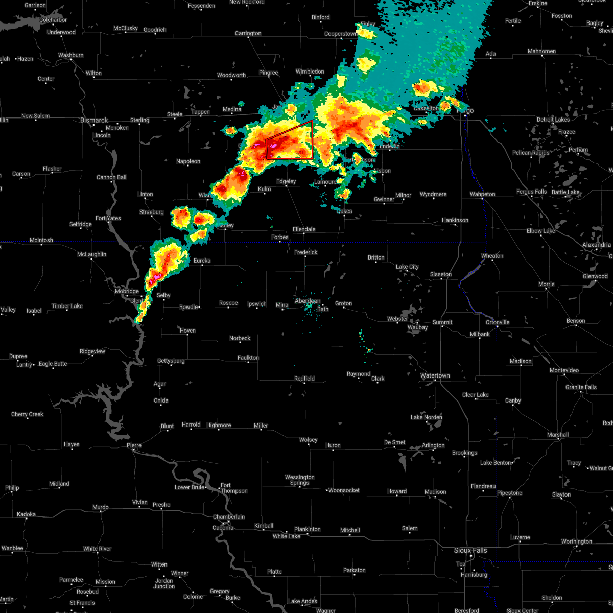 At 850 pm cdt, a severe thunderstorm capable of producing a tornado was located 6 miles northeast of jud, or 18 miles north of edgeley, moving east at 25 mph (radar indicated rotation). Hazards include tornado and hail up to two inches in diameter. Flying debris will be dangerous to those caught without shelter. mobile homes will be damaged or destroyed. damage to roofs, windows, and vehicles will occur. tree damage is likely. this dangerous storm will be near, adrian and montpelier around 915 pm cdt. Other locations impacted by this tornadic thunderstorm include sydney and millarton. At 850 pm cdt, a severe thunderstorm capable of producing a tornado was located 6 miles northeast of jud, or 18 miles north of edgeley, moving east at 25 mph (radar indicated rotation). Hazards include tornado and hail up to two inches in diameter. Flying debris will be dangerous to those caught without shelter. mobile homes will be damaged or destroyed. damage to roofs, windows, and vehicles will occur. tree damage is likely. this dangerous storm will be near, adrian and montpelier around 915 pm cdt. Other locations impacted by this tornadic thunderstorm include sydney and millarton.
|
| 6/7/2021 8:44 PM CDT |
 At 843 pm cdt, a severe thunderstorm was located 8 miles north of jud, or 20 miles southwest of jamestown, moving east at 25 mph (radar indicated). Hazards include two inch hail and 70 mph wind gusts. People and animals outdoors will be injured. expect hail damage to roofs, siding, windows, and vehicles. expect considerable tree damage. wind damage is also likely to mobile homes, roofs, and outbuildings. this severe thunderstorm will be near, adrian and montpelier around 925 pm cdt. ypsilanti around 930 pm cdt. Other locations impacted by this severe thunderstorm include nortonville, alfred, sydney and millarton. At 843 pm cdt, a severe thunderstorm was located 8 miles north of jud, or 20 miles southwest of jamestown, moving east at 25 mph (radar indicated). Hazards include two inch hail and 70 mph wind gusts. People and animals outdoors will be injured. expect hail damage to roofs, siding, windows, and vehicles. expect considerable tree damage. wind damage is also likely to mobile homes, roofs, and outbuildings. this severe thunderstorm will be near, adrian and montpelier around 925 pm cdt. ypsilanti around 930 pm cdt. Other locations impacted by this severe thunderstorm include nortonville, alfred, sydney and millarton.
|
| 6/7/2021 8:31 PM CDT |
 At 830 pm cdt, severe thunderstorms were located along a line extending from 5 miles southeast of wimbledon to near ypsilanti to 5 miles west of jud, moving northeast at 25 mph (radar indicated). Hazards include golf ball size hail and 70 mph wind gusts. People and animals outdoors will be injured. expect hail damage to roofs, siding, windows, and vehicles. expect considerable tree damage. wind damage is also likely to mobile homes, roofs, and outbuildings. Locations impacted include, jamestown, edgeley, lamoure, kulm, wimbledon, kensal, marion, ypsilanti, adrian, buchanan, spiritwood lake, montpelier, cleveland, spiritwood, jud, pingree, courtenay, dickey, eldridge and grand rapids. At 830 pm cdt, severe thunderstorms were located along a line extending from 5 miles southeast of wimbledon to near ypsilanti to 5 miles west of jud, moving northeast at 25 mph (radar indicated). Hazards include golf ball size hail and 70 mph wind gusts. People and animals outdoors will be injured. expect hail damage to roofs, siding, windows, and vehicles. expect considerable tree damage. wind damage is also likely to mobile homes, roofs, and outbuildings. Locations impacted include, jamestown, edgeley, lamoure, kulm, wimbledon, kensal, marion, ypsilanti, adrian, buchanan, spiritwood lake, montpelier, cleveland, spiritwood, jud, pingree, courtenay, dickey, eldridge and grand rapids.
|
| 6/7/2021 8:27 PM CDT |
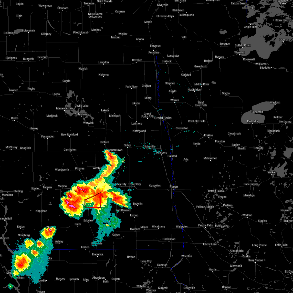 The tornado warning for north central lamoure and southeastern stutsman counties will expire at 830 pm cdt, the tornado threat has diminished and the tornado warning will be allowed to expire. however, large hail and damaging winds remain likely and a severe thunderstorm warning remains in effect for the area. a severe thunderstorm watch remains in effect until midnight cdt for southeastern north dakota. The tornado warning for north central lamoure and southeastern stutsman counties will expire at 830 pm cdt, the tornado threat has diminished and the tornado warning will be allowed to expire. however, large hail and damaging winds remain likely and a severe thunderstorm warning remains in effect for the area. a severe thunderstorm watch remains in effect until midnight cdt for southeastern north dakota.
|
| 6/7/2021 8:08 PM CDT |
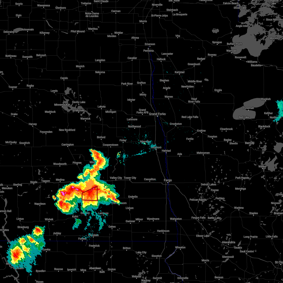 At 808 pm cdt, a severe thunderstorm capable of producing a tornado was located near montpelier, or 14 miles south of jamestown, moving northeast at 25 mph (radar indicated rotation). Hazards include tornado and golf ball size hail. Flying debris will be dangerous to those caught without shelter. mobile homes will be damaged or destroyed. damage to roofs, windows, and vehicles will occur. tree damage is likely. Locations impacted include, adrian, montpelier and millarton. At 808 pm cdt, a severe thunderstorm capable of producing a tornado was located near montpelier, or 14 miles south of jamestown, moving northeast at 25 mph (radar indicated rotation). Hazards include tornado and golf ball size hail. Flying debris will be dangerous to those caught without shelter. mobile homes will be damaged or destroyed. damage to roofs, windows, and vehicles will occur. tree damage is likely. Locations impacted include, adrian, montpelier and millarton.
|
| 6/7/2021 8:07 PM CDT |
 At 805 pm cdt, severe thunderstorms were located along a line extending from 5 miles northeast of courtenay to 5 miles south of spiritwood to near dickey, moving east at 30 mph (radar indicated). Hazards include golf ball size hail and 70 mph wind gusts. People and animals outdoors will be injured. expect hail damage to roofs, siding, windows, and vehicles. expect considerable tree damage. wind damage is also likely to mobile homes, roofs, and outbuildings. locations impacted include, marion. Remember, a tornado warning is also in effect for north central lamoure and southeastern stutsman counties until 830 pm cdt. At 805 pm cdt, severe thunderstorms were located along a line extending from 5 miles northeast of courtenay to 5 miles south of spiritwood to near dickey, moving east at 30 mph (radar indicated). Hazards include golf ball size hail and 70 mph wind gusts. People and animals outdoors will be injured. expect hail damage to roofs, siding, windows, and vehicles. expect considerable tree damage. wind damage is also likely to mobile homes, roofs, and outbuildings. locations impacted include, marion. Remember, a tornado warning is also in effect for north central lamoure and southeastern stutsman counties until 830 pm cdt.
|
| 6/7/2021 7:58 PM CDT |
 At 758 pm cdt, a severe thunderstorm capable of producing a tornado was located 7 miles southwest of montpelier, or 17 miles south of jamestown, moving northeast at 20 mph (radar indicated rotation). Hazards include tornado and hail up to two inches in diameter. Flying debris will be dangerous to those caught without shelter. mobile homes will be damaged or destroyed. damage to roofs, windows, and vehicles will occur. tree damage is likely. this dangerous storm will be near, adrian around 820 pm cdt. montpelier around 825 pm cdt. Other locations impacted by this tornadic thunderstorm include millarton. At 758 pm cdt, a severe thunderstorm capable of producing a tornado was located 7 miles southwest of montpelier, or 17 miles south of jamestown, moving northeast at 20 mph (radar indicated rotation). Hazards include tornado and hail up to two inches in diameter. Flying debris will be dangerous to those caught without shelter. mobile homes will be damaged or destroyed. damage to roofs, windows, and vehicles will occur. tree damage is likely. this dangerous storm will be near, adrian around 820 pm cdt. montpelier around 825 pm cdt. Other locations impacted by this tornadic thunderstorm include millarton.
|
| 6/7/2021 7:38 PM CDT |
 At 737 pm cdt, severe thunderstorms were located along a line extending from 5 miles south of kensal to near jamestown to 5 miles west of edgeley, moving east at 25 mph (radar indicated). Hazards include golf ball size hail and 70 mph wind gusts. People and animals outdoors will be injured. expect hail damage to roofs, siding, windows, and vehicles. expect considerable tree damage. wind damage is also likely to mobile homes, roofs, and outbuildings. severe thunderstorms will be near, jamestown and kensal around 745 pm cdt. Other locations in the path of these severe thunderstorms include courtenay, wimbledon, spiritwood and lamoure. At 737 pm cdt, severe thunderstorms were located along a line extending from 5 miles south of kensal to near jamestown to 5 miles west of edgeley, moving east at 25 mph (radar indicated). Hazards include golf ball size hail and 70 mph wind gusts. People and animals outdoors will be injured. expect hail damage to roofs, siding, windows, and vehicles. expect considerable tree damage. wind damage is also likely to mobile homes, roofs, and outbuildings. severe thunderstorms will be near, jamestown and kensal around 745 pm cdt. Other locations in the path of these severe thunderstorms include courtenay, wimbledon, spiritwood and lamoure.
|
| 6/7/2021 7:22 PM CDT |
 At 720 pm cdt, severe thunderstorms were located along a line extending from 7 miles southwest of pingree to 5 miles west of jamestown to 8 miles west of montpelier, moving northeast at 25 mph (trained weather spotters. at 655 pm 65 mph wind gusts were reported on interstate 94 between medina and cleveland). Hazards include golf ball size hail and 70 mph wind gusts. People and animals outdoors will be injured. expect hail damage to roofs, siding, windows, and vehicles. expect considerable tree damage. wind damage is also likely to mobile homes, roofs, and outbuildings. these severe storms will be near, jamestown around 725 pm cdt. buchanan around 735 pm cdt. ypsilanti around 740 pm cdt. Other locations impacted by these severe thunderstorms include eldridge, sydney, windsor, spiritwood, and millarton. At 720 pm cdt, severe thunderstorms were located along a line extending from 7 miles southwest of pingree to 5 miles west of jamestown to 8 miles west of montpelier, moving northeast at 25 mph (trained weather spotters. at 655 pm 65 mph wind gusts were reported on interstate 94 between medina and cleveland). Hazards include golf ball size hail and 70 mph wind gusts. People and animals outdoors will be injured. expect hail damage to roofs, siding, windows, and vehicles. expect considerable tree damage. wind damage is also likely to mobile homes, roofs, and outbuildings. these severe storms will be near, jamestown around 725 pm cdt. buchanan around 735 pm cdt. ypsilanti around 740 pm cdt. Other locations impacted by these severe thunderstorms include eldridge, sydney, windsor, spiritwood, and millarton.
|
| 6/7/2021 7:12 PM CDT |
 At 712 pm cdt, severe thunderstorms were located along a line extending from 9 miles southwest of pingree to 6 miles west of jamestown to 10 miles west of montpelier, moving northeast at 25 mph (radar indicated). Hazards include golf ball size hail and 60 mph wind gusts. People and animals outdoors will be injured. expect hail damage to roofs, siding, windows, and vehicles. expect wind damage to roofs, siding, and trees. these severe storms will be near, jamestown around 725 pm cdt. buchanan around 730 pm cdt. ypsilanti around 740 pm cdt. Other locations impacted by these severe thunderstorms include eldridge, sydney, windsor, spiritwood, and millarton. At 712 pm cdt, severe thunderstorms were located along a line extending from 9 miles southwest of pingree to 6 miles west of jamestown to 10 miles west of montpelier, moving northeast at 25 mph (radar indicated). Hazards include golf ball size hail and 60 mph wind gusts. People and animals outdoors will be injured. expect hail damage to roofs, siding, windows, and vehicles. expect wind damage to roofs, siding, and trees. these severe storms will be near, jamestown around 725 pm cdt. buchanan around 730 pm cdt. ypsilanti around 740 pm cdt. Other locations impacted by these severe thunderstorms include eldridge, sydney, windsor, spiritwood, and millarton.
|
| 6/7/2021 6:54 PM CDT |
 At 654 pm cdt, severe thunderstorms were located along a line extending from near medina to 6 miles east of cleveland to 9 miles west of montpelier, moving northeast at 35 mph (radar indicated). Hazards include 60 mph wind gusts and half dollar size hail. Hail damage to vehicles is expected. expect wind damage to roofs, siding, and trees. these severe storms will be near, ypsilanti around 715 pm cdt. jamestown and buchanan around 720 pm cdt. spiritwood around 730 pm cdt. Other locations impacted by these severe thunderstorms include eldridge, sydney, windsor and millarton. At 654 pm cdt, severe thunderstorms were located along a line extending from near medina to 6 miles east of cleveland to 9 miles west of montpelier, moving northeast at 35 mph (radar indicated). Hazards include 60 mph wind gusts and half dollar size hail. Hail damage to vehicles is expected. expect wind damage to roofs, siding, and trees. these severe storms will be near, ypsilanti around 715 pm cdt. jamestown and buchanan around 720 pm cdt. spiritwood around 730 pm cdt. Other locations impacted by these severe thunderstorms include eldridge, sydney, windsor and millarton.
|
| 6/7/2021 6:39 PM CDT |
 At 638 pm cdt, severe thunderstorms were located along a line extending from 7 miles southwest of medina to 4 miles north of jud, moving northeast at 25 mph (radar indicated). Hazards include 60 mph wind gusts and half dollar size hail. Hail damage to vehicles is expected. expect wind damage to roofs, siding, and trees. severe thunderstorms will be near, medina around 655 pm cdt. ypsilanti and woodworth around 725 pm cdt. jamestown around 735 pm cdt. spiritwood around 745 pm cdt. Other locations impacted by these severe thunderstorms include eldridge, sydney, windsor and millarton. At 638 pm cdt, severe thunderstorms were located along a line extending from 7 miles southwest of medina to 4 miles north of jud, moving northeast at 25 mph (radar indicated). Hazards include 60 mph wind gusts and half dollar size hail. Hail damage to vehicles is expected. expect wind damage to roofs, siding, and trees. severe thunderstorms will be near, medina around 655 pm cdt. ypsilanti and woodworth around 725 pm cdt. jamestown around 735 pm cdt. spiritwood around 745 pm cdt. Other locations impacted by these severe thunderstorms include eldridge, sydney, windsor and millarton.
|
| 8/24/2020 2:01 AM CDT |
 At 200 am cdt, a severe thunderstorm was located 5 miles northwest of ypsilanti, or 6 miles southeast of jamestown, moving east at 25 mph (radar indicated). Hazards include quarter size hail. Damage to vehicles is expected. This severe storm will be near, ypsilanti around 210 am cdt. At 200 am cdt, a severe thunderstorm was located 5 miles northwest of ypsilanti, or 6 miles southeast of jamestown, moving east at 25 mph (radar indicated). Hazards include quarter size hail. Damage to vehicles is expected. This severe storm will be near, ypsilanti around 210 am cdt.
|
| 8/24/2020 1:46 AM CDT |
 At 146 am cdt, a severe thunderstorm was located 6 miles southwest of jamestown, moving east at 25 mph (radar indicated). Hazards include half dollar size hail. Damage to vehicles is expected. this severe thunderstorm will be near, jamestown around 155 am cdt. Ypsilanti around 210 am cdt. At 146 am cdt, a severe thunderstorm was located 6 miles southwest of jamestown, moving east at 25 mph (radar indicated). Hazards include half dollar size hail. Damage to vehicles is expected. this severe thunderstorm will be near, jamestown around 155 am cdt. Ypsilanti around 210 am cdt.
|
| 8/14/2020 7:12 AM CDT |
 The severe thunderstorm warning for northwestern lamoure and southeastern stutsman counties will expire at 715 am cdt, the storms which prompted the warning have weakened below severe limits. therefore, the warning will be allowed to expire. a severe thunderstorm watch remains in effect until 800 am cdt for southeastern north dakota. to report severe weather, contact your nearest law enforcement agency. they will relay your report to the national weather service bismarck. The severe thunderstorm warning for northwestern lamoure and southeastern stutsman counties will expire at 715 am cdt, the storms which prompted the warning have weakened below severe limits. therefore, the warning will be allowed to expire. a severe thunderstorm watch remains in effect until 800 am cdt for southeastern north dakota. to report severe weather, contact your nearest law enforcement agency. they will relay your report to the national weather service bismarck.
|
| 8/14/2020 6:44 AM CDT |
 At 642 am cdt, severe thunderstorms were located along a line extending from 4 miles east of jamestown to 4 miles north of jud, moving east at 25 mph (radar indicated). Hazards include golf ball size hail and 60 mph wind gusts. People and animals outdoors will be injured. expect hail damage to roofs, siding, windows, and vehicles. expect wind damage to roofs, siding, and trees. these severe storms will be near, jamestown around 650 am cdt. spiritwood around 700 am cdt. adrian and montpelier around 720 am cdt. dickey around 730 am cdt. Other locations impacted by these severe thunderstorms include eldridge, nortonville, alfred, sydney, and millarton. At 642 am cdt, severe thunderstorms were located along a line extending from 4 miles east of jamestown to 4 miles north of jud, moving east at 25 mph (radar indicated). Hazards include golf ball size hail and 60 mph wind gusts. People and animals outdoors will be injured. expect hail damage to roofs, siding, windows, and vehicles. expect wind damage to roofs, siding, and trees. these severe storms will be near, jamestown around 650 am cdt. spiritwood around 700 am cdt. adrian and montpelier around 720 am cdt. dickey around 730 am cdt. Other locations impacted by these severe thunderstorms include eldridge, nortonville, alfred, sydney, and millarton.
|
| 8/14/2020 6:30 AM CDT |
 At 630 am cdt, severe thunderstorms were located along a line extending from near jamestown to 6 miles east of gackle, moving northeast at 30 mph (radar indicated). Hazards include golf ball size hail and 70 mph wind gusts. People and animals outdoors will be injured. expect hail damage to roofs, siding, windows, and vehicles. expect considerable tree damage. wind damage is also likely to mobile homes, roofs, and outbuildings. these severe storms will be near, jamestown around 635 am cdt. spiritwood around 650 am cdt. montpelier around 710 am cdt. ypsilanti around 720 am cdt. Other locations impacted by these severe thunderstorms include eldridge, nortonville, alfred, sydney, windsor, and millarton. At 630 am cdt, severe thunderstorms were located along a line extending from near jamestown to 6 miles east of gackle, moving northeast at 30 mph (radar indicated). Hazards include golf ball size hail and 70 mph wind gusts. People and animals outdoors will be injured. expect hail damage to roofs, siding, windows, and vehicles. expect considerable tree damage. wind damage is also likely to mobile homes, roofs, and outbuildings. these severe storms will be near, jamestown around 635 am cdt. spiritwood around 650 am cdt. montpelier around 710 am cdt. ypsilanti around 720 am cdt. Other locations impacted by these severe thunderstorms include eldridge, nortonville, alfred, sydney, windsor, and millarton.
|
| 8/14/2020 6:18 AM CDT |
 At 617 am cdt, a severe thunderstorm was located 5 miles east of gackle, or 22 miles northwest of edgeley, moving east at 30 mph (radar indicated). Hazards include golf ball size hail and 70 mph wind gusts. People and animals outdoors will be injured. expect hail damage to roofs, siding, windows, and vehicles. expect considerable tree damage. wind damage is also likely to mobile homes, roofs, and outbuildings. this severe thunderstorm will be near, jud around 630 am cdt. adrian and montpelier around 700 am cdt. ypsilanti around 705 am cdt. Other locations impacted by this severe thunderstorm include eldridge, jamestown, nortonville, alfred, sydney, windsor and millarton. At 617 am cdt, a severe thunderstorm was located 5 miles east of gackle, or 22 miles northwest of edgeley, moving east at 30 mph (radar indicated). Hazards include golf ball size hail and 70 mph wind gusts. People and animals outdoors will be injured. expect hail damage to roofs, siding, windows, and vehicles. expect considerable tree damage. wind damage is also likely to mobile homes, roofs, and outbuildings. this severe thunderstorm will be near, jud around 630 am cdt. adrian and montpelier around 700 am cdt. ypsilanti around 705 am cdt. Other locations impacted by this severe thunderstorm include eldridge, jamestown, nortonville, alfred, sydney, windsor and millarton.
|
| 7/17/2020 9:41 PM CDT |
 The severe thunderstorm warning for northwestern lamoure, southeastern kidder, northeastern logan and southern stutsman counties will expire at 945 pm cdt, the storms which prompted the warning have moved out of the area. therefore, the warning will be allowed to expire. however gusty winds and heavy rain are still possible with these thunderstorms. a severe thunderstorm watch remains in effect until 1000 pm cdt for south central north dakota. a severe thunderstorm watch also remains in effect until 100 am cdt for southeastern north dakota. The severe thunderstorm warning for northwestern lamoure, southeastern kidder, northeastern logan and southern stutsman counties will expire at 945 pm cdt, the storms which prompted the warning have moved out of the area. therefore, the warning will be allowed to expire. however gusty winds and heavy rain are still possible with these thunderstorms. a severe thunderstorm watch remains in effect until 1000 pm cdt for south central north dakota. a severe thunderstorm watch also remains in effect until 100 am cdt for southeastern north dakota.
|
| 7/17/2020 9:27 PM CDT |
 At 926 pm cdt, severe thunderstorms were located along a line extending from 5 miles northwest of litchville to 10 miles southwest of streeter, moving southeast at 20 mph (radar indicated). Hazards include 60 mph wind gusts and quarter size hail. Hail damage to vehicles is expected. expect wind damage to roofs, siding, and trees. these severe storms will be near, marion around 930 pm cdt. Other locations impacted by these severe thunderstorms include nortonville, alfred, sydney and millarton. At 926 pm cdt, severe thunderstorms were located along a line extending from 5 miles northwest of litchville to 10 miles southwest of streeter, moving southeast at 20 mph (radar indicated). Hazards include 60 mph wind gusts and quarter size hail. Hail damage to vehicles is expected. expect wind damage to roofs, siding, and trees. these severe storms will be near, marion around 930 pm cdt. Other locations impacted by these severe thunderstorms include nortonville, alfred, sydney and millarton.
|
| 7/17/2020 9:04 PM CDT |
 At 904 pm cdt, severe thunderstorms were located along a line extending from 9 miles east of ypsilanti to 10 miles east of napoleon, moving south at 30 mph (radar indicated). Hazards include 60 mph wind gusts and quarter size hail. Hail damage to vehicles is expected. expect wind damage to roofs, siding, and trees. these severe storms will be near, marion around 920 pm cdt. Other locations impacted by these severe thunderstorms include eldridge, nortonville, chase lake, windsor, alfred, crystal springs, sydney and millarton. At 904 pm cdt, severe thunderstorms were located along a line extending from 9 miles east of ypsilanti to 10 miles east of napoleon, moving south at 30 mph (radar indicated). Hazards include 60 mph wind gusts and quarter size hail. Hail damage to vehicles is expected. expect wind damage to roofs, siding, and trees. these severe storms will be near, marion around 920 pm cdt. Other locations impacted by these severe thunderstorms include eldridge, nortonville, chase lake, windsor, alfred, crystal springs, sydney and millarton.
|
| 7/17/2020 8:38 PM CDT |
 At 837 pm cdt, severe thunderstorms were located along a line extending from near spiritwood to 6 miles south of tappen, moving southeast at 20 mph (radar indicated). Hazards include 60 mph wind gusts and quarter size hail. Hail damage to vehicles is expected. expect wind damage to roofs, siding, and trees. severe thunderstorms will be near, spiritwood around 845 pm cdt. streeter around 920 pm cdt. gackle around 945 pm cdt. Other locations impacted by these severe thunderstorms include eldridge, nortonville, chase lake, windsor, alfred, crystal springs, sydney, edmunds, millarton and horsehead lake. At 837 pm cdt, severe thunderstorms were located along a line extending from near spiritwood to 6 miles south of tappen, moving southeast at 20 mph (radar indicated). Hazards include 60 mph wind gusts and quarter size hail. Hail damage to vehicles is expected. expect wind damage to roofs, siding, and trees. severe thunderstorms will be near, spiritwood around 845 pm cdt. streeter around 920 pm cdt. gackle around 945 pm cdt. Other locations impacted by these severe thunderstorms include eldridge, nortonville, chase lake, windsor, alfred, crystal springs, sydney, edmunds, millarton and horsehead lake.
|
| 7/8/2020 1:34 AM CDT |
 At 134 am cdt, severe thunderstorms were located along a line extending from near oberon to near mchenry to 4 miles northwest of jamestown to 6 miles northeast of gackle, moving northeast at 60 mph. these are very dangerous storms (radar indicated). Hazards include 80 mph wind gusts. Flying debris will be dangerous to those caught without shelter. mobile homes will be heavily damaged. expect considerable damage to roofs, windows, and vehicles. extensive tree damage and power outages are likely. these severe storms will be near, mchenry around 140 am cdt. ypsilanti around 155 am cdt. spiritwood around 205 am cdt. Other locations impacted by these severe thunderstorms include eldridge, juanita, melville, windsor, barlow, sydney, edmunds and millarton. At 134 am cdt, severe thunderstorms were located along a line extending from near oberon to near mchenry to 4 miles northwest of jamestown to 6 miles northeast of gackle, moving northeast at 60 mph. these are very dangerous storms (radar indicated). Hazards include 80 mph wind gusts. Flying debris will be dangerous to those caught without shelter. mobile homes will be heavily damaged. expect considerable damage to roofs, windows, and vehicles. extensive tree damage and power outages are likely. these severe storms will be near, mchenry around 140 am cdt. ypsilanti around 155 am cdt. spiritwood around 205 am cdt. Other locations impacted by these severe thunderstorms include eldridge, juanita, melville, windsor, barlow, sydney, edmunds and millarton.
|
| 7/8/2020 1:20 AM CDT |
 At 119 am cdt, severe thunderstorms were located along a line extending from 10 miles southwest of oberon to 5 miles southeast of grace city to 8 miles east of cleveland to 4 miles northwest of gackle, moving east at 55 mph. these are very dangerous storms (radar indicated). Hazards include 80 mph wind gusts. Flying debris will be dangerous to those caught without shelter. mobile homes will be heavily damaged. expect considerable damage to roofs, windows, and vehicles. extensive tree damage and power outages are likely. these severe storms will be near, glenfield and mchenry around 125 am cdt. jamestown around 130 am cdt. spiritwood lake and spiritwood around 140 am cdt. ypsilanti and montpelier around 150 am cdt. Other locations impacted by these severe thunderstorms include eldridge, juanita, bremen, chase lake, melville, windsor, hamberg, barlow, sydney and edmunds. At 119 am cdt, severe thunderstorms were located along a line extending from 10 miles southwest of oberon to 5 miles southeast of grace city to 8 miles east of cleveland to 4 miles northwest of gackle, moving east at 55 mph. these are very dangerous storms (radar indicated). Hazards include 80 mph wind gusts. Flying debris will be dangerous to those caught without shelter. mobile homes will be heavily damaged. expect considerable damage to roofs, windows, and vehicles. extensive tree damage and power outages are likely. these severe storms will be near, glenfield and mchenry around 125 am cdt. jamestown around 130 am cdt. spiritwood lake and spiritwood around 140 am cdt. ypsilanti and montpelier around 150 am cdt. Other locations impacted by these severe thunderstorms include eldridge, juanita, bremen, chase lake, melville, windsor, hamberg, barlow, sydney and edmunds.
|
| 7/8/2020 1:02 AM CDT |
 At 1242 am cdt, severe thunderstorms were located along a line extending from 10 miles northeast of harvey to 7 miles southwest of cathay to 6 miles northeast of pettibone to 8 miles north of napoleon, moving northeast at 60 mph. these are very dangerous storms (radar indicated). Hazards include 80 mph wind gusts. Flying debris will be dangerous to those caught without shelter. mobile homes will be heavily damaged. expect considerable damage to roofs, windows, and vehicles. extensive tree damage and power outages are likely. severe thunderstorms will be near, woodworth and cathay around 1250 am cdt. streeter and bordulac around 105 am cdt. medina around 110 am cdt. kensal around 115 am cdt. cleveland around 120 am cdt. glenfield around 125 am cdt. mchenry around 130 am cdt. jamestown around 140 am cdt. Other locations impacted by these severe thunderstorms include eldridge, juanita, manfred, chase lake, windsor, bowdon, wellsburg, barlow, sykeston and millarton. At 1242 am cdt, severe thunderstorms were located along a line extending from 10 miles northeast of harvey to 7 miles southwest of cathay to 6 miles northeast of pettibone to 8 miles north of napoleon, moving northeast at 60 mph. these are very dangerous storms (radar indicated). Hazards include 80 mph wind gusts. Flying debris will be dangerous to those caught without shelter. mobile homes will be heavily damaged. expect considerable damage to roofs, windows, and vehicles. extensive tree damage and power outages are likely. severe thunderstorms will be near, woodworth and cathay around 1250 am cdt. streeter and bordulac around 105 am cdt. medina around 110 am cdt. kensal around 115 am cdt. cleveland around 120 am cdt. glenfield around 125 am cdt. mchenry around 130 am cdt. jamestown around 140 am cdt. Other locations impacted by these severe thunderstorms include eldridge, juanita, manfred, chase lake, windsor, bowdon, wellsburg, barlow, sykeston and millarton.
|
| 7/8/2020 12:43 AM CDT |
 At 1242 am cdt, severe thunderstorms were located along a line extending from 10 miles northeast of harvey to 7 miles southwest of cathay to 6 miles northeast of pettibone to 8 miles north of napoleon, moving northeast at 60 mph. these are very dangerous storms (radar indicated). Hazards include 80 mph wind gusts. Flying debris will be dangerous to those caught without shelter. mobile homes will be heavily damaged. expect considerable damage to roofs, windows, and vehicles. extensive tree damage and power outages are likely. severe thunderstorms will be near, woodworth and cathay around 1250 am cdt. streeter and bordulac around 105 am cdt. medina around 110 am cdt. kensal around 115 am cdt. cleveland around 120 am cdt. glenfield around 125 am cdt. mchenry around 130 am cdt. jamestown around 140 am cdt. Other locations impacted by these severe thunderstorms include eldridge, juanita, manfred, chase lake, windsor, bowdon, wellsburg, barlow, sykeston and millarton. At 1242 am cdt, severe thunderstorms were located along a line extending from 10 miles northeast of harvey to 7 miles southwest of cathay to 6 miles northeast of pettibone to 8 miles north of napoleon, moving northeast at 60 mph. these are very dangerous storms (radar indicated). Hazards include 80 mph wind gusts. Flying debris will be dangerous to those caught without shelter. mobile homes will be heavily damaged. expect considerable damage to roofs, windows, and vehicles. extensive tree damage and power outages are likely. severe thunderstorms will be near, woodworth and cathay around 1250 am cdt. streeter and bordulac around 105 am cdt. medina around 110 am cdt. kensal around 115 am cdt. cleveland around 120 am cdt. glenfield around 125 am cdt. mchenry around 130 am cdt. jamestown around 140 am cdt. Other locations impacted by these severe thunderstorms include eldridge, juanita, manfred, chase lake, windsor, bowdon, wellsburg, barlow, sykeston and millarton.
|
| 7/4/2020 6:15 PM CDT |
 At 615 pm cdt, a severe thunderstorm was located over jamestown, moving northeast at 35 mph (radar indicated). Hazards include 60 mph wind gusts and quarter size hail. Hail damage to vehicles is expected. expect wind damage to roofs, siding, and trees. this severe storm will be near, spiritwood around 635 pm cdt. Other locations impacted by this severe thunderstorm include eldridge. At 615 pm cdt, a severe thunderstorm was located over jamestown, moving northeast at 35 mph (radar indicated). Hazards include 60 mph wind gusts and quarter size hail. Hail damage to vehicles is expected. expect wind damage to roofs, siding, and trees. this severe storm will be near, spiritwood around 635 pm cdt. Other locations impacted by this severe thunderstorm include eldridge.
|
| 7/4/2020 6:02 PM CDT |
 At 601 pm cdt, a severe thunderstorm was located 11 miles southwest of jamestown, moving east at 20 mph (radar indicated). Hazards include 60 mph wind gusts and half dollar size hail. Hail damage to vehicles is expected. expect wind damage to roofs, siding, and trees. this severe thunderstorm will be near, jamestown around 635 pm cdt. ypsilanti around 640 pm cdt. spiritwood around 700 pm cdt. Other locations impacted by this severe thunderstorm include eldridge and sydney. At 601 pm cdt, a severe thunderstorm was located 11 miles southwest of jamestown, moving east at 20 mph (radar indicated). Hazards include 60 mph wind gusts and half dollar size hail. Hail damage to vehicles is expected. expect wind damage to roofs, siding, and trees. this severe thunderstorm will be near, jamestown around 635 pm cdt. ypsilanti around 640 pm cdt. spiritwood around 700 pm cdt. Other locations impacted by this severe thunderstorm include eldridge and sydney.
|
| 9/2/2019 5:15 PM CDT |
 A severe thunderstorm warning remains in effect until 530 pm cdt for lamoure. eastern logan and southeastern stutsman counties. at 514 pm cdt, severe thunderstorms were located along a line extending from 8 miles northwest of litchville to 11 miles northeast of lehr, moving southeast at 50 mph. These are very dangerous storms. A severe thunderstorm warning remains in effect until 530 pm cdt for lamoure. eastern logan and southeastern stutsman counties. at 514 pm cdt, severe thunderstorms were located along a line extending from 8 miles northwest of litchville to 11 miles northeast of lehr, moving southeast at 50 mph. These are very dangerous storms.
|
| 9/2/2019 5:04 PM CDT |
 At 501 pm cdt, severe thunderstorms were located along a line extending from spiritwood to 5 miles southwest of streeter, moving southeast at 40 mph. these are very dangerous storms (trained weather spotters). Hazards include 80 mph wind gusts and ping pong ball size hail. Flying debris will be dangerous to those caught without shelter. mobile homes will be heavily damaged. expect considerable damage to roofs, windows, and vehicles. extensive tree damage and power outages are likely. Locations impacted include, jamestown, edgeley, lamoure, kulm, gackle, streeter, marion, ypsilanti, adrian, spiritwood lake, montpelier, verona, cleveland, spiritwood, jud, dickey, eldridge, grand rapids, sydney and windsor. At 501 pm cdt, severe thunderstorms were located along a line extending from spiritwood to 5 miles southwest of streeter, moving southeast at 40 mph. these are very dangerous storms (trained weather spotters). Hazards include 80 mph wind gusts and ping pong ball size hail. Flying debris will be dangerous to those caught without shelter. mobile homes will be heavily damaged. expect considerable damage to roofs, windows, and vehicles. extensive tree damage and power outages are likely. Locations impacted include, jamestown, edgeley, lamoure, kulm, gackle, streeter, marion, ypsilanti, adrian, spiritwood lake, montpelier, verona, cleveland, spiritwood, jud, dickey, eldridge, grand rapids, sydney and windsor.
|
| 9/2/2019 4:51 PM CDT |
 At 449 pm cdt, severe thunderstorms were located along a line extending from near jamestown to 5 miles west of streeter, moving east at 50 mph. these are very dangerous storms (trained weather spotters). Hazards include 80 mph wind gusts and ping pong ball size hail. Flying debris will be dangerous to those caught without shelter. mobile homes will be heavily damaged. expect considerable damage to roofs, windows, and vehicles. Extensive tree damage and power outages are likely. At 449 pm cdt, severe thunderstorms were located along a line extending from near jamestown to 5 miles west of streeter, moving east at 50 mph. these are very dangerous storms (trained weather spotters). Hazards include 80 mph wind gusts and ping pong ball size hail. Flying debris will be dangerous to those caught without shelter. mobile homes will be heavily damaged. expect considerable damage to roofs, windows, and vehicles. Extensive tree damage and power outages are likely.
|
| 9/2/2019 4:44 PM CDT |
 At 443 pm cdt, severe thunderstorms were located along a line extending from 5 miles south of glenfield to near buchanan to near medina, moving southeast at 55 mph. these are very dangerous storms (trained weather spotters). Hazards include 80 mph wind gusts and quarter size hail. Flying debris will be dangerous to those caught without shelter. mobile homes will be heavily damaged. expect considerable damage to roofs, windows, and vehicles. extensive tree damage and power outages are likely. Locations impacted include, jamestown, steele, medina, gackle, tappen, streeter, kensal, ypsilanti, glenfield, buchanan, spiritwood lake, montpelier, cleveland, spiritwood, grace city, dawson, pingree, mchenry, courtenay and lake isabel. At 443 pm cdt, severe thunderstorms were located along a line extending from 5 miles south of glenfield to near buchanan to near medina, moving southeast at 55 mph. these are very dangerous storms (trained weather spotters). Hazards include 80 mph wind gusts and quarter size hail. Flying debris will be dangerous to those caught without shelter. mobile homes will be heavily damaged. expect considerable damage to roofs, windows, and vehicles. extensive tree damage and power outages are likely. Locations impacted include, jamestown, steele, medina, gackle, tappen, streeter, kensal, ypsilanti, glenfield, buchanan, spiritwood lake, montpelier, cleveland, spiritwood, grace city, dawson, pingree, mchenry, courtenay and lake isabel.
|
| 9/2/2019 4:39 PM CDT |
 At 438 pm cdt, severe thunderstorms were located along a line extending from 5 miles south of glenfield to near buchanan to near medina, moving southeast at 55 mph (trained weather spotters). Hazards include 70 mph wind gusts and quarter size hail. Hail damage to vehicles is expected. expect considerable tree damage. wind damage is also likely to mobile homes, roofs, and outbuildings. Locations impacted include, jamestown, steele, medina, gackle, tappen, streeter, kensal, ypsilanti, glenfield, buchanan, spiritwood lake, montpelier, cleveland, spiritwood, grace city, dawson, pingree, mchenry, courtenay and lake isabel. At 438 pm cdt, severe thunderstorms were located along a line extending from 5 miles south of glenfield to near buchanan to near medina, moving southeast at 55 mph (trained weather spotters). Hazards include 70 mph wind gusts and quarter size hail. Hail damage to vehicles is expected. expect considerable tree damage. wind damage is also likely to mobile homes, roofs, and outbuildings. Locations impacted include, jamestown, steele, medina, gackle, tappen, streeter, kensal, ypsilanti, glenfield, buchanan, spiritwood lake, montpelier, cleveland, spiritwood, grace city, dawson, pingree, mchenry, courtenay and lake isabel.
|
| 9/2/2019 4:29 PM CDT |
 At 428 pm cdt, severe thunderstorms were located along a line extending from 6 miles southwest of glenfield to near buchanan to near medina, moving east at 50 mph (trained weather spotters). Hazards include 60 mph wind gusts and quarter size hail. Hail damage to vehicles is expected. expect wind damage to roofs, siding, and trees. Locations impacted include, jamestown, steele, medina, gackle, tappen, streeter, kensal, ypsilanti, glenfield, buchanan, spiritwood lake, montpelier, cleveland, spiritwood, grace city, dawson, pingree, mchenry, courtenay and lake isabel. At 428 pm cdt, severe thunderstorms were located along a line extending from 6 miles southwest of glenfield to near buchanan to near medina, moving east at 50 mph (trained weather spotters). Hazards include 60 mph wind gusts and quarter size hail. Hail damage to vehicles is expected. expect wind damage to roofs, siding, and trees. Locations impacted include, jamestown, steele, medina, gackle, tappen, streeter, kensal, ypsilanti, glenfield, buchanan, spiritwood lake, montpelier, cleveland, spiritwood, grace city, dawson, pingree, mchenry, courtenay and lake isabel.
|
| 9/2/2019 4:14 PM CDT |
 At 413 pm cdt, severe thunderstorms were located along a line extending from 6 miles southwest of grace city to 4 miles southeast of woodworth to near dawson, moving southeast at 50 mph (radar indicated). Hazards include 60 mph wind gusts and quarter size hail. Hail damage to vehicles is expected. expect wind damage to roofs, siding, and trees. Locations impacted include, jamestown, carrington, steele, medina, gackle, tappen, streeter, kensal, ypsilanti, glenfield, buchanan, spiritwood lake, montpelier, cleveland, bordulac, spiritwood, pettibone, grace city, dawson and pingree. At 413 pm cdt, severe thunderstorms were located along a line extending from 6 miles southwest of grace city to 4 miles southeast of woodworth to near dawson, moving southeast at 50 mph (radar indicated). Hazards include 60 mph wind gusts and quarter size hail. Hail damage to vehicles is expected. expect wind damage to roofs, siding, and trees. Locations impacted include, jamestown, carrington, steele, medina, gackle, tappen, streeter, kensal, ypsilanti, glenfield, buchanan, spiritwood lake, montpelier, cleveland, bordulac, spiritwood, pettibone, grace city, dawson and pingree.
|
| 9/2/2019 3:59 PM CDT |
 The national weather service in bismarck has issued a * severe thunderstorm warning for. kidder county in south central north dakota. foster county in southeastern north dakota. stutsman county in southeastern north dakota. Until 500 pm cdt. The national weather service in bismarck has issued a * severe thunderstorm warning for. kidder county in south central north dakota. foster county in southeastern north dakota. stutsman county in southeastern north dakota. Until 500 pm cdt.
|
| 8/6/2019 6:06 PM CDT |
 At 605 pm cdt, a severe thunderstorm was located 5 miles west of jamestown, moving east at 40 mph (trained weather spotters). Hazards include 60 mph wind gusts. Expect damage to roofs, siding, and trees. this severe storm will be near, jamestown around 615 pm cdt. ypsilanti around 625 pm cdt. spiritwood around 630 pm cdt. Other locations impacted by this severe thunderstorm include eldridge, sydney and windsor. At 605 pm cdt, a severe thunderstorm was located 5 miles west of jamestown, moving east at 40 mph (trained weather spotters). Hazards include 60 mph wind gusts. Expect damage to roofs, siding, and trees. this severe storm will be near, jamestown around 615 pm cdt. ypsilanti around 625 pm cdt. spiritwood around 630 pm cdt. Other locations impacted by this severe thunderstorm include eldridge, sydney and windsor.
|
| 8/6/2019 5:59 PM CDT |
 At 558 pm cdt, a severe thunderstorm was located 9 miles west of jamestown, moving east at 40 mph (radar indicated). Hazards include 60 mph wind gusts and penny size hail. Expect damage to roofs, siding, and trees. this severe storm will be near, jamestown around 615 pm cdt. ypsilanti around 625 pm cdt. spiritwood around 630 pm cdt. Other locations impacted by this severe thunderstorm include eldridge, sydney and windsor. At 558 pm cdt, a severe thunderstorm was located 9 miles west of jamestown, moving east at 40 mph (radar indicated). Hazards include 60 mph wind gusts and penny size hail. Expect damage to roofs, siding, and trees. this severe storm will be near, jamestown around 615 pm cdt. ypsilanti around 625 pm cdt. spiritwood around 630 pm cdt. Other locations impacted by this severe thunderstorm include eldridge, sydney and windsor.
|
| 8/6/2019 5:34 PM CDT |
 At 534 pm cdt, a severe thunderstorm was located near medina, moving east at 40 mph (radar indicated). Hazards include 60 mph wind gusts and penny size hail. Expect damage to roofs, siding, and trees. this severe thunderstorm will be near, cleveland around 540 pm cdt. buchanan around 605 pm cdt. jamestown around 610 pm cdt. spiritwood lake and spiritwood around 625 pm cdt. Other locations impacted by this severe thunderstorm include eldridge, sydney and windsor. At 534 pm cdt, a severe thunderstorm was located near medina, moving east at 40 mph (radar indicated). Hazards include 60 mph wind gusts and penny size hail. Expect damage to roofs, siding, and trees. this severe thunderstorm will be near, cleveland around 540 pm cdt. buchanan around 605 pm cdt. jamestown around 610 pm cdt. spiritwood lake and spiritwood around 625 pm cdt. Other locations impacted by this severe thunderstorm include eldridge, sydney and windsor.
|
| 7/12/2019 1:44 AM CDT |
 At 144 am cdt, a severe thunderstorm was located over ypsilanti, or 10 miles southeast of jamestown, moving east at 35 mph (radar indicated). Hazards include quarter size hail. Damage to vehicles is expected. Locations impacted include, ypsilanti. At 144 am cdt, a severe thunderstorm was located over ypsilanti, or 10 miles southeast of jamestown, moving east at 35 mph (radar indicated). Hazards include quarter size hail. Damage to vehicles is expected. Locations impacted include, ypsilanti.
|
| 7/12/2019 1:39 AM CDT |
 At 139 am cdt, a severe thunderstorm was located over spiritwood, or 12 miles east of jamestown, moving east at 40 mph (radar indicated). Hazards include quarter size hail. Damage to vehicles is expected. This severe thunderstorm will remain over mainly rural areas of southeastern stutsman county. At 139 am cdt, a severe thunderstorm was located over spiritwood, or 12 miles east of jamestown, moving east at 40 mph (radar indicated). Hazards include quarter size hail. Damage to vehicles is expected. This severe thunderstorm will remain over mainly rural areas of southeastern stutsman county.
|
| 7/12/2019 1:24 AM CDT |
 The national weather service in bismarck has issued a * severe thunderstorm warning for. southeastern stutsman county in southeastern north dakota. until 200 am cdt. At 124 am cdt, a severe thunderstorm was located near jamestown, moving east at 40 mph. The national weather service in bismarck has issued a * severe thunderstorm warning for. southeastern stutsman county in southeastern north dakota. until 200 am cdt. At 124 am cdt, a severe thunderstorm was located near jamestown, moving east at 40 mph.
|
| 7/3/2019 7:01 PM CDT |
 At 701 pm cdt, a severe thunderstorm was located near jamestown, moving east at 30 mph (radar indicated). Hazards include 60 mph wind gusts. Expect damage to roofs, siding, and trees. This severe storm will be near, spiritwood around 715 pm cdt. At 701 pm cdt, a severe thunderstorm was located near jamestown, moving east at 30 mph (radar indicated). Hazards include 60 mph wind gusts. Expect damage to roofs, siding, and trees. This severe storm will be near, spiritwood around 715 pm cdt.
|
| 7/3/2019 6:43 PM CDT |
 At 643 pm cdt, a severe thunderstorm was located near jamestown, moving east at 30 mph (radar indicated). Hazards include 60 mph wind gusts and quarter size hail. Hail damage to vehicles is expected. expect wind damage to roofs, siding, and trees. this severe thunderstorm will be near, jamestown around 655 pm cdt. spiritwood around 715 pm cdt. Other locations impacted by this severe thunderstorm include eldridge. At 643 pm cdt, a severe thunderstorm was located near jamestown, moving east at 30 mph (radar indicated). Hazards include 60 mph wind gusts and quarter size hail. Hail damage to vehicles is expected. expect wind damage to roofs, siding, and trees. this severe thunderstorm will be near, jamestown around 655 pm cdt. spiritwood around 715 pm cdt. Other locations impacted by this severe thunderstorm include eldridge.
|
| 7/2/2019 8:13 PM CDT |
 At 813 pm cdt, a severe thunderstorm was located over jamestown, moving northeast at 25 mph (radar indicated). Hazards include quarter size hail. Damage to vehicles is expected. this severe storm will be near, spiritwood around 835 pm cdt. Other locations impacted by this severe thunderstorm include eldridge. At 813 pm cdt, a severe thunderstorm was located over jamestown, moving northeast at 25 mph (radar indicated). Hazards include quarter size hail. Damage to vehicles is expected. this severe storm will be near, spiritwood around 835 pm cdt. Other locations impacted by this severe thunderstorm include eldridge.
|
| 7/2/2019 7:59 PM CDT |
 At 758 pm cdt, a severe thunderstorm was located 7 miles southwest of jamestown, moving northeast at 30 mph (radar indicated). Hazards include golf ball size hail. People and animals outdoors will be injured. expect damage to roofs, siding, windows, and vehicles. this severe thunderstorm will be near, jamestown around 815 pm cdt. spiritwood around 835 pm cdt. spiritwood lake around 840 pm cdt. Other locations impacted by this severe thunderstorm include eldridge. At 758 pm cdt, a severe thunderstorm was located 7 miles southwest of jamestown, moving northeast at 30 mph (radar indicated). Hazards include golf ball size hail. People and animals outdoors will be injured. expect damage to roofs, siding, windows, and vehicles. this severe thunderstorm will be near, jamestown around 815 pm cdt. spiritwood around 835 pm cdt. spiritwood lake around 840 pm cdt. Other locations impacted by this severe thunderstorm include eldridge.
|
| 9/14/2018 7:16 PM CDT |
 At 715 pm cdt, a severe thunderstorm was located 5 miles southeast of cleveland, or 12 miles east of medina, moving east at 40 mph (radar indicated). Hazards include ping pong ball size hail and 60 mph wind gusts. People and animals outdoors will be injured. expect hail damage to roofs, siding, windows, and vehicles. expect wind damage to roofs, siding, and trees. this severe thunderstorm will be near, jamestown around 740 pm cdt. spiritwood around 755 pm cdt. Other locations impacted by this severe thunderstorm include eldridge and windsor. At 715 pm cdt, a severe thunderstorm was located 5 miles southeast of cleveland, or 12 miles east of medina, moving east at 40 mph (radar indicated). Hazards include ping pong ball size hail and 60 mph wind gusts. People and animals outdoors will be injured. expect hail damage to roofs, siding, windows, and vehicles. expect wind damage to roofs, siding, and trees. this severe thunderstorm will be near, jamestown around 740 pm cdt. spiritwood around 755 pm cdt. Other locations impacted by this severe thunderstorm include eldridge and windsor.
|
| 8/26/2018 10:00 PM CDT |
 At 1000 pm cdt, a severe thunderstorm was located 5 miles southwest of montpelier, or 18 miles south of jamestown, moving east at 35 mph (radar indicated). Hazards include 60 mph wind gusts and quarter size hail. Hail damage to vehicles is expected. expect wind damage to roofs, siding, and trees. locations impacted include, marion, ypsilanti, adrian, montpelier, sydney, nortonville and millarton. A tornado watch remains in effect until 200 am cdt for southeastern north dakota. At 1000 pm cdt, a severe thunderstorm was located 5 miles southwest of montpelier, or 18 miles south of jamestown, moving east at 35 mph (radar indicated). Hazards include 60 mph wind gusts and quarter size hail. Hail damage to vehicles is expected. expect wind damage to roofs, siding, and trees. locations impacted include, marion, ypsilanti, adrian, montpelier, sydney, nortonville and millarton. A tornado watch remains in effect until 200 am cdt for southeastern north dakota.
|
| 8/26/2018 9:44 PM CDT |
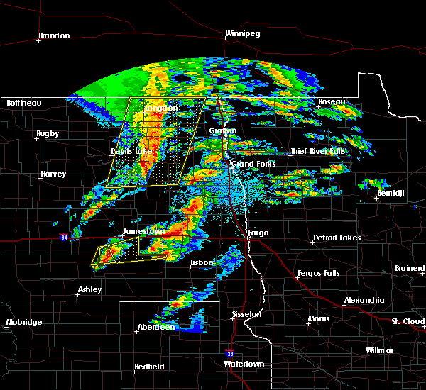 At 944 pm cdt, a severe thunderstorm was located 9 miles north of jud, or 18 miles south of jamestown, moving east at 40 mph (radar indicated). Hazards include 60 mph wind gusts and quarter size hail. Hail damage to vehicles is expected. Expect wind damage to roofs, siding, and trees. At 944 pm cdt, a severe thunderstorm was located 9 miles north of jud, or 18 miles south of jamestown, moving east at 40 mph (radar indicated). Hazards include 60 mph wind gusts and quarter size hail. Hail damage to vehicles is expected. Expect wind damage to roofs, siding, and trees.
|
| 8/25/2018 9:53 PM CDT |
 At 952 pm cdt, a severe thunderstorm was located over ypsilanti, or 9 miles southeast of jamestown, moving east at 30 mph (radar indicated). Hazards include 60 mph wind gusts and quarter size hail. Hail damage to vehicles is expected. expect wind damage to roofs, siding, and trees. This severe thunderstorm will remain over mainly rural areas of southeastern stutsman county. At 952 pm cdt, a severe thunderstorm was located over ypsilanti, or 9 miles southeast of jamestown, moving east at 30 mph (radar indicated). Hazards include 60 mph wind gusts and quarter size hail. Hail damage to vehicles is expected. expect wind damage to roofs, siding, and trees. This severe thunderstorm will remain over mainly rural areas of southeastern stutsman county.
|
| 8/25/2018 9:36 PM CDT |
 At 935 pm cdt, a severe thunderstorm was located 8 miles southwest of jamestown, moving east at 25 mph (radar indicated). Hazards include 60 mph wind gusts and quarter size hail. Hail damage to vehicles is expected. expect wind damage to roofs, siding, and trees. this severe thunderstorm will be near, ypsilanti and montpelier around 1000 pm cdt. Other locations impacted by this severe thunderstorm include sydney. At 935 pm cdt, a severe thunderstorm was located 8 miles southwest of jamestown, moving east at 25 mph (radar indicated). Hazards include 60 mph wind gusts and quarter size hail. Hail damage to vehicles is expected. expect wind damage to roofs, siding, and trees. this severe thunderstorm will be near, ypsilanti and montpelier around 1000 pm cdt. Other locations impacted by this severe thunderstorm include sydney.
|
| 7/25/2018 2:22 AM CDT |
 The severe thunderstorm warning for southeastern stutsman county will expire at 230 am cdt, the storm which prompted the warning has weakened below severe limits, and no longer poses an immediate threat to life or property. therefore, the warning will be allowed to expire. however small hail is still possible with this thunderstorm. The severe thunderstorm warning for southeastern stutsman county will expire at 230 am cdt, the storm which prompted the warning has weakened below severe limits, and no longer poses an immediate threat to life or property. therefore, the warning will be allowed to expire. however small hail is still possible with this thunderstorm.
|
| 7/25/2018 2:17 AM CDT |
 At 217 am cdt, a severe thunderstorm was located over jamestown, moving east at 40 mph (radar indicated). Hazards include quarter size hail. Damage to vehicles is expected. Locations impacted include, jamestown, ypsilanti, spiritwood and eldridge. At 217 am cdt, a severe thunderstorm was located over jamestown, moving east at 40 mph (radar indicated). Hazards include quarter size hail. Damage to vehicles is expected. Locations impacted include, jamestown, ypsilanti, spiritwood and eldridge.
|
| 7/25/2018 1:58 AM CDT |
 At 158 am cdt, a severe thunderstorm was located 9 miles east of cleveland, or 10 miles west of jamestown, moving east at 55 mph (radar indicated). Hazards include half dollar size hail. Damage to vehicles is expected. this severe thunderstorm will be near, jamestown around 210 am cdt. ypsilanti around 215 am cdt. spiritwood around 220 am cdt. Other locations impacted by this severe thunderstorm include eldridge, sydney and windsor. At 158 am cdt, a severe thunderstorm was located 9 miles east of cleveland, or 10 miles west of jamestown, moving east at 55 mph (radar indicated). Hazards include half dollar size hail. Damage to vehicles is expected. this severe thunderstorm will be near, jamestown around 210 am cdt. ypsilanti around 215 am cdt. spiritwood around 220 am cdt. Other locations impacted by this severe thunderstorm include eldridge, sydney and windsor.
|
| 7/3/2018 6:39 AM CDT |
 At 638 am cdt, severe thunderstorms were located along a line extending from 5 miles northwest of spiritwood lake to 4 miles west of dickey to 7 miles west of spring creek colony, moving east at 60 mph (radar indicated). Hazards include 70 mph wind gusts and quarter size hail. Hail damage to vehicles is expected. expect considerable tree damage. wind damage is also likely to mobile homes, roofs, and outbuildings. Locations impacted include, jamestown, oakes, ellendale, ashley, edgeley, medina, lamoure, kulm, gackle, marion, ypsilanti, adrian, buchanan, spiritwood lake, montpelier, verona, cleveland, lehr, spiritwood and jud. At 638 am cdt, severe thunderstorms were located along a line extending from 5 miles northwest of spiritwood lake to 4 miles west of dickey to 7 miles west of spring creek colony, moving east at 60 mph (radar indicated). Hazards include 70 mph wind gusts and quarter size hail. Hail damage to vehicles is expected. expect considerable tree damage. wind damage is also likely to mobile homes, roofs, and outbuildings. Locations impacted include, jamestown, oakes, ellendale, ashley, edgeley, medina, lamoure, kulm, gackle, marion, ypsilanti, adrian, buchanan, spiritwood lake, montpelier, verona, cleveland, lehr, spiritwood and jud.
|
| 7/3/2018 6:13 AM CDT |
 At 612 am cdt, severe thunderstorms were located along a line extending from 6 miles east of woodworth to 7 miles west of jud to near venturia, moving east at 60 mph (radar indicated). Hazards include 70 mph wind gusts and quarter size hail. Hail damage to vehicles is expected. expect considerable tree damage. Wind damage is also likely to mobile homes, roofs, and outbuildings. At 612 am cdt, severe thunderstorms were located along a line extending from 6 miles east of woodworth to 7 miles west of jud to near venturia, moving east at 60 mph (radar indicated). Hazards include 70 mph wind gusts and quarter size hail. Hail damage to vehicles is expected. expect considerable tree damage. Wind damage is also likely to mobile homes, roofs, and outbuildings.
|
| 6/29/2018 2:57 AM CDT |
 The tornado warning for northwestern lamoure. northeastern logan and southern stutsman counties will expire at 300 am cdt. the tornado threat has diminished and the tornado warning has been cancelled. However, damaging winds remain likely and a severe thunderstorm warning remains in effect for the area. The tornado warning for northwestern lamoure. northeastern logan and southern stutsman counties will expire at 300 am cdt. the tornado threat has diminished and the tornado warning has been cancelled. However, damaging winds remain likely and a severe thunderstorm warning remains in effect for the area.
|
| 6/29/2018 2:57 AM CDT |
 At 257 am cdt, severe thunderstorms were located along a line extending from 4 miles west of mchenry to 6 miles west of spiritwood lake to 6 miles southwest of montpelier, moving east at 55 mph (radar indicated). Hazards include 70 mph wind gusts and nickel size hail. Expect considerable tree damage. damage is likely to mobile homes, roofs, and outbuildings. These severe thunderstorms will remain over mainly rural areas of eastern foster and eastern stutsman counties, including the following locations, eldridge, juanita, sydney and millarton. At 257 am cdt, severe thunderstorms were located along a line extending from 4 miles west of mchenry to 6 miles west of spiritwood lake to 6 miles southwest of montpelier, moving east at 55 mph (radar indicated). Hazards include 70 mph wind gusts and nickel size hail. Expect considerable tree damage. damage is likely to mobile homes, roofs, and outbuildings. These severe thunderstorms will remain over mainly rural areas of eastern foster and eastern stutsman counties, including the following locations, eldridge, juanita, sydney and millarton.
|
| 6/29/2018 2:43 AM CDT |
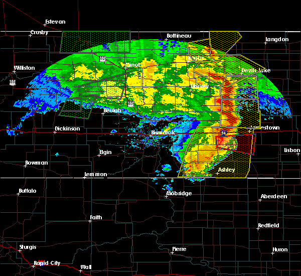 At 243 am cdt, a severe thunderstorm capable of producing a tornado was located over gackle, or 18 miles southeast of medina, moving east at 45 mph (radar indicated rotation). Hazards include tornado. Flying debris will be dangerous to those caught without shelter. mobile homes will be damaged or destroyed. damage to roofs, windows, and vehicles will occur. tree damage is likely. this dangerous storm will be near, jud around 300 am cdt. Other locations impacted by this tornadic thunderstorm include nortonville, alfred, sydney and millarton. At 243 am cdt, a severe thunderstorm capable of producing a tornado was located over gackle, or 18 miles southeast of medina, moving east at 45 mph (radar indicated rotation). Hazards include tornado. Flying debris will be dangerous to those caught without shelter. mobile homes will be damaged or destroyed. damage to roofs, windows, and vehicles will occur. tree damage is likely. this dangerous storm will be near, jud around 300 am cdt. Other locations impacted by this tornadic thunderstorm include nortonville, alfred, sydney and millarton.
|
| 6/29/2018 2:29 AM CDT |
 At 229 am cdt, a severe thunderstorm capable of producing a tornado was located over streeter, or 14 miles south of medina, moving east at 50 mph (radar indicated rotation). Hazards include tornado. Flying debris will be dangerous to those caught without shelter. mobile homes will be damaged or destroyed. damage to roofs, windows, and vehicles will occur. tree damage is likely. this dangerous storm will be near, gackle around 240 am cdt. jud around 255 am cdt. Other locations impacted by this tornadic thunderstorm include nortonville, alfred, sydney and millarton. At 229 am cdt, a severe thunderstorm capable of producing a tornado was located over streeter, or 14 miles south of medina, moving east at 50 mph (radar indicated rotation). Hazards include tornado. Flying debris will be dangerous to those caught without shelter. mobile homes will be damaged or destroyed. damage to roofs, windows, and vehicles will occur. tree damage is likely. this dangerous storm will be near, gackle around 240 am cdt. jud around 255 am cdt. Other locations impacted by this tornadic thunderstorm include nortonville, alfred, sydney and millarton.
|
| 6/5/2018 11:12 PM CDT |
 At 1112 pm cdt, severe thunderstorms were located along a line extending from near wimbledon to 4 miles north of jamestown to 8 miles southwest of montpelier, moving east at 55 mph (trained weather spotters). Hazards include 70 mph wind gusts and half dollar size hail. Hail damage to vehicles is expected. expect considerable tree damage. wind damage is also likely to mobile homes, roofs, and outbuildings. these severe storms will be near, spiritwood around 1125 pm cdt. Other locations impacted by these severe thunderstorms include eldridge, sydney, edmunds and millarton. At 1112 pm cdt, severe thunderstorms were located along a line extending from near wimbledon to 4 miles north of jamestown to 8 miles southwest of montpelier, moving east at 55 mph (trained weather spotters). Hazards include 70 mph wind gusts and half dollar size hail. Hail damage to vehicles is expected. expect considerable tree damage. wind damage is also likely to mobile homes, roofs, and outbuildings. these severe storms will be near, spiritwood around 1125 pm cdt. Other locations impacted by these severe thunderstorms include eldridge, sydney, edmunds and millarton.
|
| 6/5/2018 11:06 PM CDT |
 At 1106 pm cdt, severe thunderstorms were located along a line extending from courtenay to 4 miles northwest of jamestown to 8 miles north of jud, moving east at 55 mph (radar indicated). Hazards include 60 mph wind gusts and half dollar size hail. Hail damage to vehicles is expected. expect wind damage to roofs, siding, and trees. these severe storms will be near, courtenay around 1110 pm cdt. montpelier and spiritwood around 1120 pm cdt. Other locations impacted by these severe thunderstorms include eldridge, sydney, windsor, edmunds and millarton. At 1106 pm cdt, severe thunderstorms were located along a line extending from courtenay to 4 miles northwest of jamestown to 8 miles north of jud, moving east at 55 mph (radar indicated). Hazards include 60 mph wind gusts and half dollar size hail. Hail damage to vehicles is expected. expect wind damage to roofs, siding, and trees. these severe storms will be near, courtenay around 1110 pm cdt. montpelier and spiritwood around 1120 pm cdt. Other locations impacted by these severe thunderstorms include eldridge, sydney, windsor, edmunds and millarton.
|
| 6/5/2018 10:53 PM CDT |
 At 1053 pm cdt, severe thunderstorms were located along a line extending from near kensal to 7 miles southwest of buchanan to 7 miles east of gackle, moving east at 60 mph (radar indicated). Hazards include 60 mph wind gusts and quarter size hail. Hail damage to vehicles is expected. expect wind damage to roofs, siding, and trees. severe thunderstorms will be near, kensal around 1100 pm cdt. jamestown and courtenay around 1105 pm cdt. spiritwood lake and montpelier around 1110 pm cdt. spiritwood around 1115 pm cdt. Other locations impacted by these severe thunderstorms include eldridge, sydney, windsor, edmunds and millarton. At 1053 pm cdt, severe thunderstorms were located along a line extending from near kensal to 7 miles southwest of buchanan to 7 miles east of gackle, moving east at 60 mph (radar indicated). Hazards include 60 mph wind gusts and quarter size hail. Hail damage to vehicles is expected. expect wind damage to roofs, siding, and trees. severe thunderstorms will be near, kensal around 1100 pm cdt. jamestown and courtenay around 1105 pm cdt. spiritwood lake and montpelier around 1110 pm cdt. spiritwood around 1115 pm cdt. Other locations impacted by these severe thunderstorms include eldridge, sydney, windsor, edmunds and millarton.
|
| 6/9/2017 9:41 PM CDT |
 At 940 pm cdt, a severe thunderstorm was located near ypsilanti, or 15 miles southeast of jamestown, moving east at 20 mph (trained weather spotters. at 930 pm cdt, golf ball size hail was reported 4 miles southeast of ypsilanti). Hazards include golf ball size hail and 60 mph wind gusts. People and animals outdoors will be injured. expect hail damage to roofs, siding, windows, and vehicles. expect wind damage to roofs, siding, and trees. This severe thunderstorm will remain over mainly rural areas of southeastern stutsman county. At 940 pm cdt, a severe thunderstorm was located near ypsilanti, or 15 miles southeast of jamestown, moving east at 20 mph (trained weather spotters. at 930 pm cdt, golf ball size hail was reported 4 miles southeast of ypsilanti). Hazards include golf ball size hail and 60 mph wind gusts. People and animals outdoors will be injured. expect hail damage to roofs, siding, windows, and vehicles. expect wind damage to roofs, siding, and trees. This severe thunderstorm will remain over mainly rural areas of southeastern stutsman county.
|
| 6/9/2017 9:34 PM CDT |
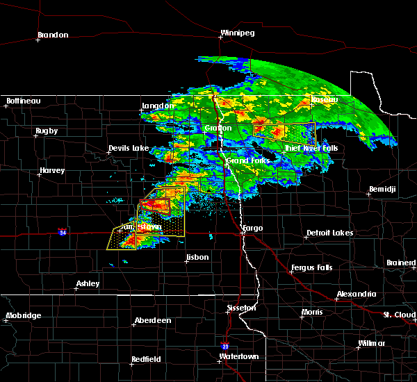 At 934 pm cdt, a severe thunderstorm was located near ypsilanti, or 15 miles southeast of jamestown, moving east at 25 mph (radar indicated). Hazards include 60 mph wind gusts and half dollar size hail. Hail damage to vehicles is expected. expect wind damage to roofs, siding, and trees. This severe thunderstorm will remain over mainly rural areas of southeastern stutsman county. At 934 pm cdt, a severe thunderstorm was located near ypsilanti, or 15 miles southeast of jamestown, moving east at 25 mph (radar indicated). Hazards include 60 mph wind gusts and half dollar size hail. Hail damage to vehicles is expected. expect wind damage to roofs, siding, and trees. This severe thunderstorm will remain over mainly rural areas of southeastern stutsman county.
|
| 6/9/2017 9:30 PM CDT | Golf Ball sized hail reported 3.4 miles NW of Ypsilanti, ND, golfball sized hail the largest... lots of quarter sized hail. very little rain... perhaps a hundredth of an inch. |
| 6/9/2017 9:24 PM CDT | Tennis Ball sized hail reported 0.6 miles SSE of Ypsilanti, ND, report from social media. |
| 6/9/2017 9:13 PM CDT |
 At 913 pm cdt, a severe thunderstorm was located near ypsilanti, or 7 miles south of jamestown, moving east at 30 mph (radar indicated). Hazards include 60 mph wind gusts and half dollar size hail. Hail damage to vehicles is expected. expect wind damage to roofs, siding, and trees. this severe thunderstorm will be near, ypsilanti around 920 pm cdt. spiritwood around 930 pm cdt. Other locations impacted by this severe thunderstorm include sydney and millarton. At 913 pm cdt, a severe thunderstorm was located near ypsilanti, or 7 miles south of jamestown, moving east at 30 mph (radar indicated). Hazards include 60 mph wind gusts and half dollar size hail. Hail damage to vehicles is expected. expect wind damage to roofs, siding, and trees. this severe thunderstorm will be near, ypsilanti around 920 pm cdt. spiritwood around 930 pm cdt. Other locations impacted by this severe thunderstorm include sydney and millarton.
|
| 6/9/2017 8:44 PM CDT |
 At 843 pm cdt, a severe thunderstorm was located 10 miles southwest of jamestown, moving northeast at 45 mph. this is a second severe thunderstorm that will move through jamestown by 900 pm cdt (radar indicated). Hazards include 60 mph wind gusts and quarter size hail. Hail damage to vehicles is expected. expect wind damage to roofs, siding, and trees. this severe storm will be near, jamestown around 900 pm cdt. spiritwood around 910 pm cdt. Other locations impacted by this severe thunderstorm include eldridge, sydney and millarton. At 843 pm cdt, a severe thunderstorm was located 10 miles southwest of jamestown, moving northeast at 45 mph. this is a second severe thunderstorm that will move through jamestown by 900 pm cdt (radar indicated). Hazards include 60 mph wind gusts and quarter size hail. Hail damage to vehicles is expected. expect wind damage to roofs, siding, and trees. this severe storm will be near, jamestown around 900 pm cdt. spiritwood around 910 pm cdt. Other locations impacted by this severe thunderstorm include eldridge, sydney and millarton.
|
| 6/9/2017 8:20 PM CDT |
 At 820 pm cdt, a severe thunderstorm was located 12 miles southeast of cleveland, or 13 miles southwest of jamestown, moving northeast at 40 mph (radar indicated). Hazards include 60 mph wind gusts and quarter size hail. Hail damage to vehicles is expected. expect wind damage to roofs, siding, and trees. this severe thunderstorm will be near, jamestown and ypsilanti around 840 pm cdt. spiritwood around 855 pm cdt. Other locations impacted by this severe thunderstorm include eldridge, sydney and millarton. At 820 pm cdt, a severe thunderstorm was located 12 miles southeast of cleveland, or 13 miles southwest of jamestown, moving northeast at 40 mph (radar indicated). Hazards include 60 mph wind gusts and quarter size hail. Hail damage to vehicles is expected. expect wind damage to roofs, siding, and trees. this severe thunderstorm will be near, jamestown and ypsilanti around 840 pm cdt. spiritwood around 855 pm cdt. Other locations impacted by this severe thunderstorm include eldridge, sydney and millarton.
|
| 8/18/2016 7:12 AM CDT |
 At 711 am cdt, severe thunderstorms were located along a line extending from 8 miles northeast of spiritwood to 7 miles northeast of jud, moving southeast at 45 mph (public. 75 mph wind gusts were reported in jamestown around 700 am cdt). Hazards include 70 mph wind gusts and quarter size hail. Hail damage to vehicles is expected. expect considerable tree damage. wind damage is also likely to mobile homes, roofs, and outbuildings. Locations impacted include, jamestown, lamoure, wimbledon, marion, ypsilanti, adrian, spiritwood lake, montpelier, verona, spiritwood, dickey, grand rapids, sydney, millarton and nortonville. At 711 am cdt, severe thunderstorms were located along a line extending from 8 miles northeast of spiritwood to 7 miles northeast of jud, moving southeast at 45 mph (public. 75 mph wind gusts were reported in jamestown around 700 am cdt). Hazards include 70 mph wind gusts and quarter size hail. Hail damage to vehicles is expected. expect considerable tree damage. wind damage is also likely to mobile homes, roofs, and outbuildings. Locations impacted include, jamestown, lamoure, wimbledon, marion, ypsilanti, adrian, spiritwood lake, montpelier, verona, spiritwood, dickey, grand rapids, sydney, millarton and nortonville.
|
| 8/18/2016 7:00 AM CDT |
 At 659 am cdt, severe thunderstorms were located along a line extending from near wimbledon to 7 miles north of jud, moving southeast at 40 mph (radar indicated). Hazards include 70 mph wind gusts and quarter size hail. Hail damage to vehicles is expected. expect considerable tree damage. Wind damage is also likely to mobile homes, roofs, and outbuildings. At 659 am cdt, severe thunderstorms were located along a line extending from near wimbledon to 7 miles north of jud, moving southeast at 40 mph (radar indicated). Hazards include 70 mph wind gusts and quarter size hail. Hail damage to vehicles is expected. expect considerable tree damage. Wind damage is also likely to mobile homes, roofs, and outbuildings.
|
| 8/1/2016 6:45 PM CDT |
 At 645 pm cdt, a severe thunderstorm was located 7 miles east of ypsilanti, or 17 miles southeast of jamestown, moving southeast at 30 mph (radar indicated). Hazards include 60 mph wind gusts and quarter size hail. Hail damage to vehicles is expected. expect wind damage to roofs, siding, and trees. This severe storm will be near, marion around 700 pm cdt. At 645 pm cdt, a severe thunderstorm was located 7 miles east of ypsilanti, or 17 miles southeast of jamestown, moving southeast at 30 mph (radar indicated). Hazards include 60 mph wind gusts and quarter size hail. Hail damage to vehicles is expected. expect wind damage to roofs, siding, and trees. This severe storm will be near, marion around 700 pm cdt.
|
| 8/1/2016 6:26 PM CDT |
 At 625 pm cdt, a severe thunderstorm was located near ypsilanti, or 7 miles southeast of jamestown, moving southeast at 35 mph (radar indicated). Hazards include ping pong ball size hail and 60 mph wind gusts. People and animals outdoors will be injured. expect hail damage to roofs, siding, windows, and vehicles. expect wind damage to roofs, siding, and trees. this severe thunderstorm will be near, ypsilanti around 630 pm cdt. Marion around 700 pm cdt. At 625 pm cdt, a severe thunderstorm was located near ypsilanti, or 7 miles southeast of jamestown, moving southeast at 35 mph (radar indicated). Hazards include ping pong ball size hail and 60 mph wind gusts. People and animals outdoors will be injured. expect hail damage to roofs, siding, windows, and vehicles. expect wind damage to roofs, siding, and trees. this severe thunderstorm will be near, ypsilanti around 630 pm cdt. Marion around 700 pm cdt.
|
| 7/10/2016 11:39 PM CDT |
 At 1139 pm cdt, severe thunderstorms were located along a line extending from mchenry to dickey to near spring creek colony, moving east at 45 mph (trained weather spotters). Hazards include 60 mph wind gusts and quarter size hail. Hail damage to vehicles is expected. expect wind damage to roofs, siding, and trees. Locations impacted include, jamestown, carrington, oakes, ellendale, edgeley, lamoure, kulm, gackle, and spiritwood. At 1139 pm cdt, severe thunderstorms were located along a line extending from mchenry to dickey to near spring creek colony, moving east at 45 mph (trained weather spotters). Hazards include 60 mph wind gusts and quarter size hail. Hail damage to vehicles is expected. expect wind damage to roofs, siding, and trees. Locations impacted include, jamestown, carrington, oakes, ellendale, edgeley, lamoure, kulm, gackle, and spiritwood.
|
| 7/10/2016 11:30 PM CDT | Time estimated by rada in stutsman county ND, 0.5 miles SSW of Ypsilanti, ND |
| 7/10/2016 11:26 PM CDT |
 At 1124 pm cdt, severe thunderstorms were located along a line extending from 4 miles north of grace city to 7 miles west of adrian to 7 miles east of long lake, moving east at 45 mph (trained weather spotters). Hazards include 60 mph wind gusts and quarter size hail. Hail damage to vehicles is expected. expect wind damage to roofs, siding, and trees. Locations impacted include, jamestown, carrington, ellendale, ashley, wishek, lamoure, gackle, and streeter. At 1124 pm cdt, severe thunderstorms were located along a line extending from 4 miles north of grace city to 7 miles west of adrian to 7 miles east of long lake, moving east at 45 mph (trained weather spotters). Hazards include 60 mph wind gusts and quarter size hail. Hail damage to vehicles is expected. expect wind damage to roofs, siding, and trees. Locations impacted include, jamestown, carrington, ellendale, ashley, wishek, lamoure, gackle, and streeter.
|
| 7/10/2016 10:59 PM CDT |
 At 1058 pm cdt, severe thunderstorms were located along a line extending from new rockford to 4 miles east of gackle to 8 miles south of ashley, moving east at 45 mph (radar indicated). Hazards include 60 mph wind gusts and quarter size hail. Hail damage to vehicles is expected. Expect wind damage to roofs, siding, and trees. At 1058 pm cdt, severe thunderstorms were located along a line extending from new rockford to 4 miles east of gackle to 8 miles south of ashley, moving east at 45 mph (radar indicated). Hazards include 60 mph wind gusts and quarter size hail. Hail damage to vehicles is expected. Expect wind damage to roofs, siding, and trees.
|
| 7/9/2016 11:27 PM CDT |
 At 1127 pm cdt, severe thunderstorms were located along a line extending from near ypsilanti to 12 miles west of montpelier, moving south at 25 mph (public). Hazards include golf ball size hail and 60 mph wind gusts. People and animals outdoors will be injured. expect hail damage to roofs, siding, windows, and vehicles. expect wind damage to roofs, siding, and trees. Locations impacted include, jamestown, ypsilanti, montpelier, eldridge, sydney, windsor and millarton. At 1127 pm cdt, severe thunderstorms were located along a line extending from near ypsilanti to 12 miles west of montpelier, moving south at 25 mph (public). Hazards include golf ball size hail and 60 mph wind gusts. People and animals outdoors will be injured. expect hail damage to roofs, siding, windows, and vehicles. expect wind damage to roofs, siding, and trees. Locations impacted include, jamestown, ypsilanti, montpelier, eldridge, sydney, windsor and millarton.
|
| 7/9/2016 11:06 PM CDT |
 At 1106 pm cdt, severe thunderstorms were located along a line extending from 4 miles southwest of spiritwood to 8 miles east of cleveland, moving southeast at 25 mph (radar indicated). Hazards include 60 mph wind gusts and half dollar size hail. Hail damage to vehicles is expected. expect wind damage to roofs, siding, and trees. Locations impacted include, jamestown, ypsilanti, buchanan, spiritwood lake, montpelier, eldridge, sydney, windsor and millarton. At 1106 pm cdt, severe thunderstorms were located along a line extending from 4 miles southwest of spiritwood to 8 miles east of cleveland, moving southeast at 25 mph (radar indicated). Hazards include 60 mph wind gusts and half dollar size hail. Hail damage to vehicles is expected. expect wind damage to roofs, siding, and trees. Locations impacted include, jamestown, ypsilanti, buchanan, spiritwood lake, montpelier, eldridge, sydney, windsor and millarton.
|
| 7/9/2016 10:45 PM CDT |
 At 1045 pm cdt, severe thunderstorms were located along a line extending from 6 miles north of jamestown to 4 miles northwest of cleveland, moving south at 25 mph (radar indicated). Hazards include 60 mph wind gusts and quarter size hail. Hail damage to vehicles is expected. Expect wind damage to roofs, siding, and trees. At 1045 pm cdt, severe thunderstorms were located along a line extending from 6 miles north of jamestown to 4 miles northwest of cleveland, moving south at 25 mph (radar indicated). Hazards include 60 mph wind gusts and quarter size hail. Hail damage to vehicles is expected. Expect wind damage to roofs, siding, and trees.
|
| 5/22/2016 8:48 PM CDT | The national weather service in bismarck has issued a * severe thunderstorm warning for. eastern stutsman county in southeastern north dakota. until 945 pm cdt * at 848 pm cdt. a severe thunderstorm was located over jamestown. Moving north at 30 mph. |
| 7/23/2015 10:44 PM CDT |
 At 1044 pm cdt, severe thunderstorms were located along a line extending from near spiritwood lake to 8 miles northeast of jud, moving east at 35 mph (radar indicated). Hazards include ping pong ball size hail and 60 mph wind gusts. People and animals outdoors will be injured. expect hail damage to roofs, siding, windows and vehicles. expect wind damage to roofs, siding and trees. Locations impacted include, jamestown, ypsilanti, adrian, spiritwood lake, buchanan, montpelier, spiritwood, dickey, eldridge, sydney, alfred, millarton and nortonville. At 1044 pm cdt, severe thunderstorms were located along a line extending from near spiritwood lake to 8 miles northeast of jud, moving east at 35 mph (radar indicated). Hazards include ping pong ball size hail and 60 mph wind gusts. People and animals outdoors will be injured. expect hail damage to roofs, siding, windows and vehicles. expect wind damage to roofs, siding and trees. Locations impacted include, jamestown, ypsilanti, adrian, spiritwood lake, buchanan, montpelier, spiritwood, dickey, eldridge, sydney, alfred, millarton and nortonville.
|
| 7/23/2015 10:16 PM CDT |
 At 1016 pm cdt, severe thunderstorms were located along a line extending from 6 miles southwest of pingree to near gackle, moving east at 30 mph (radar indicated). Hazards include ping pong ball size hail and 60 mph wind gusts. People and animals outdoors will be injured. expect hail damage to roofs, siding, windows and vehicles. Expect wind damage to roofs, siding and trees. At 1016 pm cdt, severe thunderstorms were located along a line extending from 6 miles southwest of pingree to near gackle, moving east at 30 mph (radar indicated). Hazards include ping pong ball size hail and 60 mph wind gusts. People and animals outdoors will be injured. expect hail damage to roofs, siding, windows and vehicles. Expect wind damage to roofs, siding and trees.
|
| 8/25/2012 6:22 AM CDT | Quarter sized hail reported 0.4 miles NE of Ypsilanti, ND, hail lasted 5 minutes. largest hailstone 1 inch. |
| 5/22/2012 9:00 PM CDT | Estimated 60 mph winds and reported no damag in stutsman county ND, 7 miles E of Ypsilanti, ND |
Hail Maps for Ypsilanti, ND
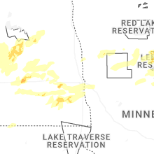


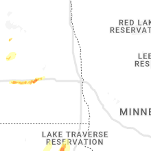


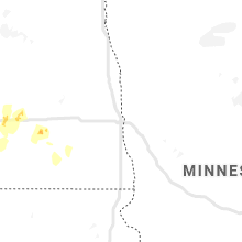


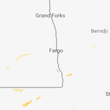


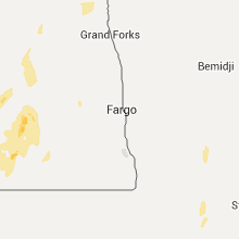


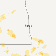

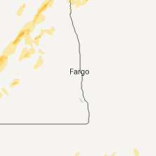
Connect with Interactive Hail Maps