

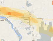
Hail Map Denver, Colorado June 6, 2012
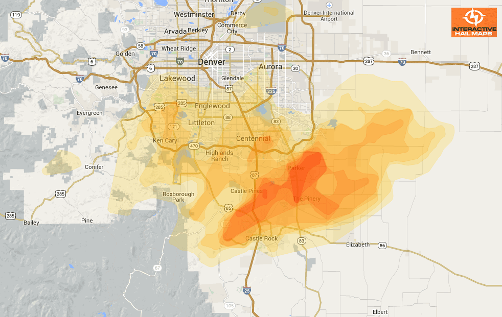
Here is a hail map for the storm that hit southern Denver on June 6, 2012. Most of the large hail was south and southeast of the city. Use Interactive Hail Maps to find the hail others have overlooked with street level accuracy.
Cities Most Affected by Hail Storms of 6/6/2012
| Hail Size | Demographics of Zip Codes Affected | ||||||
|---|---|---|---|---|---|---|---|
| City | Count | Average | Largest | Pop Density | House Value | Income | Age |
| Colorado Springs, CO | 4 | 1.75 | 1.75 | 2024 | $147k | $42.6k | 37.2 |
| Cheyenne, WY | 1 | 2.00 | 2.00 | 26 | $135k | $54.6k | 42.7 |
| Frisco, TX | 1 | 2.00 | 2.00 | 1046 | $183k | $69.6k | 34.1 |
| Englewood, CO | 1 | 2.00 | 2.00 | 2777 | $317k | $89.3k | 39.6 |
| Littleton, CO | 1 | 1.75 | 1.75 | 3840 | $233k | $86.3k | 36.9 |
| Longville, MN | 1 | 1.75 | 1.75 | 18 | $128k | $31.9k | 58.3 |
| Parker, CO | 1 | 1.75 | 1.75 | 1019 | $234k | $86.4k | 35.0 |
| Aurora, CO | 1 | 1.75 | 1.75 | 997 | $406k | $114.5k | 36.8 |
Connect with Interactive Hail Maps