

Hail Map for Sunday, August 17, 2014

Number of Impacted Households on 8/17/2014
0
Impacted by 1" or Larger Hail
0
Impacted by 1.75" or Larger Hail
0
Impacted by 2.5" or Larger Hail
Square Miles of Populated Area Impacted on 8/17/2014
0
Impacted by 1" or Larger Hail
0
Impacted by 1.75" or Larger Hail
0
Impacted by 2.5" or Larger Hail


Cities Most Affected by Hail Storms of 8/17/2014
| Hail Size | Demographics of Zip Codes Affected | ||||||
|---|---|---|---|---|---|---|---|
| City | Count | Average | Largest | Pop Density | House Value | Income | Age |
| Rushville, NE | 3 | 2.08 | 2.75 | 1 | $43k | $28.7k | 42.9 |
| Oglala, SD | 2 | 3.00 | 4.25 | 0 | $13k | $17.4k | 22.1 |
| Hermosa, SD | 2 | 2.25 | 2.75 | 3 | $127k | $35.4k | 44.4 |
| Agra, KS | 1 | 4.25 | 4.25 | 3 | $23k | $27.9k | 48.6 |
| Buffalo, SD | 1 | 3.00 | 3.00 | 0 | $50k | $25.3k | 43.2 |
| Merriman, NE | 1 | 2.75 | 2.75 | 0 | $30k | $26.6k | 47.3 |
| Valentine, NE | 1 | 2.00 | 2.00 | 3 | $68k | $29.9k | 44.3 |
| Thedford, NE | 1 | 1.75 | 1.75 | 0 | $39k | $31.7k | 46.4 |
| Reva, SD | 1 | 1.75 | 1.75 | 0 | $10k | $31.3k | 47.1 |
| Gordon, NE | 1 | 1.75 | 1.75 | 2 | $46k | $28.0k | 45.1 |
Hail and Wind Damage Spotted on 8/17/2014
Filter by Report Type:Hail ReportsWind Reports
States Impacted
Arkansas, North Dakota, Nebraska, Georgia, Mississippi, Louisiana, South Dakota, Tennessee, Wyoming, Texas, Arizona, Kansas, OregonArkansas
| Local Time | Report Details |
|---|---|
| 1:27 PM CDT | Several trees and large limbs were blown down. a power pole was snappe in pulaski county AR, 10.1 miles NNE of Little Rock, AR |
| 1:34 PM CDT | Storm damage reported in pulaski county AR, 13.8 miles NNE of Little Rock, AR |
| 1:45 PM CDT | Two tree limbs down...both over 20 inches of diamete in pulaski county AR, 10 miles NNW of Little Rock, AR |
| 2:10 PM CDT | Outdoor recreation equipment was damaged by strong wind in lonoke county AR, 20 miles NE of Little Rock, AR |
| 3:05 PM CDT | Trees and power lines down in des ar in prairie county AR, 46.3 miles ENE of Little Rock, AR |
| 3:16 PM CDT | Reports of damage to a carpor in arkansas county AR, 62.1 miles ESE of Little Rock, AR |
| 6:16 PM CDT | A 60 mph gust was reported at the asos in blythevill in mississippi county AR, 54.3 miles N of Memphis, TN |
North Dakota
| Local Time | Report Details |
|---|---|
| 1:34 PM MDT | Bowman rwis recorded severe thunderstorm wind gust in bowman county ND, 119.4 miles E of Miles City, MT |
| 3:00 PM CDT | Quarter sized hail reported near Glenburn, ND, 19.2 miles N of Minot, ND, winds estimated at 50 mph with heavy rain causing brief high water on streets in town. |
| 2:27 PM MDT | Quarter sized hail reported near Scranton, ND, 121.4 miles WSW of Bismarck, ND, lots of pea to dime size hail. largest stone was the size of a quarter. facebook report. |
| 3:55 PM CDT | Crop damage reporte in mchenry county ND, 17.4 miles NE of Minot, ND |
| 5:46 PM CDT | Strong winds and crop damage reported near wolfor in pierce county ND, 43.5 miles NW of Devils Lake, ND |
| 7:20 PM CDT | Half Dollar sized hail reported near Maddock, ND, 38.3 miles WSW of Devils Lake, ND |
Nebraska
| Local Time | Report Details |
|---|---|
| 1:39 PM MDT | Quarter sized hail reported near Merriman, NE, 58.7 miles W of Valentine, NE |
| 1:59 PM MDT | Baseball sized hail reported near Merriman, NE, 54.3 miles W of Valentine, NE, broken windows reported. |
| 3:01 PM CDT | Hen Egg sized hail reported near Valentine, NE, 22 miles SW of Valentine, NE, hail was reported at merritt reservoir |
| 2:22 PM MDT | Ping Pong Ball sized hail reported near Cody, NE, 47.7 miles W of Valentine, NE |
| 2:58 PM MDT | Half Dollar sized hail reported near Cody, NE, 39.9 miles WSW of Valentine, NE |
| 4:00 PM CDT | Nickel hail and thunderstorm wind gusts to 60 mp in cherry county NE, 33.6 miles S of Valentine, NE |
| 3:00 PM MDT | Quarter sized hail reported near Valentine, NE, 28.2 miles SW of Valentine, NE |
| 4:10 PM CDT | Golf Ball sized hail reported near Thedford, NE, 35.6 miles S of Valentine, NE, hail up to golf ball size along with winds estimated at 55 to 60 mph. |
| 3:13 PM MDT | Quarter sized hail reported near Nenzel, NE, 39.6 miles WSW of Valentine, NE |
| 4:20 PM CDT | Quarter sized hail reported near Thedford, NE, 34.3 miles S of Valentine, NE |
| 4:25 PM CDT | Public report of very strong winds which uprooted a 12 inch diameter tree and tore off portion of a shed roo in cherry county NE, 45.1 miles S of Valentine, NE |
| 5:15 PM CDT | Public estimated at least 60 mph with numerous tree branches down. neighbor had a large tree knocked dow in thomas county NE, 57.6 miles SSE of Valentine, NE |
| 5:30 PM CDT | Coop observer reported 8 inch tree branches down and estimated winds to be around 60 mph...also had pea to nickel size hai in brown county NE, 53.2 miles SSE of Valentine, NE |
| 5:50 PM CDT | Public estimated 60 mph winds and penny size hail along with torrential rainfall with visibilities near zer in blaine county NE, 72.1 miles WSW of Oneill, NE |
| 6:00 PM CDT | Some tree damage and lost power. also pea to dime size hai in loup county NE, 68.9 miles SW of Oneill, NE |
| 6:01 PM CDT | Winds knocked down power poles and trees. golf ball size hail also knocked out car window in blaine county NE, 69.2 miles SW of Oneill, NE |
| 6:45 PM CDT | Winds estimated at least 60 mph with numerous branches down...also had pea to dime size hai in loup county NE, 60.5 miles SW of Oneill, NE |
| 5:50 PM MDT | Baseball sized hail reported near Rushville, NE, 82 miles SSE of Rapid City, SD, large baseball size hail and strong winds occurred in whiteclay. four injuries occurred as a result of the storm. one individual was transported by ambulance to a local |
| 6:52 PM CDT | Storm damage reported in garfield county NE, 52.9 miles SSW of Oneill, NE |
| 5:55 PM MDT | Golf Ball sized hail reported near Rushville, NE, 82 miles SSE of Rapid City, SD, public report of golf ball size hail. |
| 6:00 PM MDT | Golf Ball sized hail reported near Rushville, NE, 85.8 miles SSE of Rapid City, SD, public report of golf ball size hail. |
| 7:00 PM CDT | Thunderstorm wind gusts estimated at 70 mph. very low visibility in heavy rai in garfield county NE, 52.9 miles SSW of Oneill, NE |
| 7:02 PM CDT | Quarter sized hail reported near Burwell, NE, 52.9 miles SSW of Oneill, NE, along with hail... estimated 70mph winds which knocked down numerous trees and snapped a power pole |
| 7:23 PM CDT | Spotter est 70 mph wind gusts... also 6 to 8 inch diameter branches falling from tree in sherman county NE, 43.4 miles WNW of Grand Island, NE |
| 6:25 PM MDT | Golf Ball sized hail reported near Gordon, NE, 93.4 miles W of Valentine, NE, public report of hail up to golf ball size. |
| 7:41 PM CDT | Spotter used a hand held anemometer in dawson county NE, 59.5 miles ESE of North Platte, NE |
| 8:00 PM CDT | Spotter est 50 to 60 mph wind gusts in dawson county NE, 62.2 miles ESE of North Platte, NE |
| 8:22 PM CDT | Storm damage reported in hall county NE, 15.8 miles WSW of Grand Island, NE |
| 8:26 PM CDT | Storm damage reported in adams county NE, 19.1 miles SSW of Grand Island, NE |
| 8:29 PM CDT | Outflow winds 8 miles ahead of a squall line of severe tstm in kearney county NE, 36.7 miles SW of Grand Island, NE |
| 8:34 PM CDT | Blowing dust dropping vis down to near zero with 60 mph wind gust in furnas county NE, 72.8 miles SE of North Platte, NE |
| 8:34 PM CDT | Est 60 mph wind along 281 branches blow down across 281 in hall county NE, 14.2 miles S of Grand Island, NE |
| 8:39 PM CDT | Storm damage reported in adams county NE, 22.9 miles SSW of Grand Island, NE |
| 8:40 PM CDT | Storm damage reported in adams county NE, 22.9 miles SSW of Grand Island, NE |
| 8:42 PM CDT | Adams jr/sr high school. exact time unknown. used asos for estimat in adams county NE, 25.3 miles SSW of Grand Island, NE |
| 8:52 PM CDT | 62 mph wind measured at nws hasting in adams county NE, 19.1 miles S of Grand Island, NE |
| 8:53 PM CDT | Est 60 to 65 mph wind gust in adams county NE, 33.4 miles S of Grand Island, NE |
| 8:59 PM CDT | Exact time not avbl from site which only provides peak for the preceding hr. radar used to est tim in clay county NE, 26.2 miles SSE of Grand Island, NE |
| 9:00 PM CDT | Winds gusts estimated at 70-80 mph in town for past 10-20 minutes. power has been los in adams county NE, 23.2 miles S of Grand Island, NE |
| 9:06 PM CDT | Storm damage reported in adams county NE, 22.9 miles SSW of Grand Island, NE |
| 9:45 PM CDT | Winds increased around 945 and were sustained at an estimated 60-70 mph for 30 minute in nuckolls county NE, 64 miles SSE of Grand Island, NE |
Georgia
| Local Time | Report Details |
|---|---|
| 4:10 PM EDT | 4 large trees down across count in dade county GA, 16.7 miles SW of Chattanooga, TN |
| 5:21 PM EDT | Newton county 911 relayed a report of a power pole down due to the thunderstorm in newton county GA, 32.1 miles ESE of Atlanta, GA |
Mississippi
| Local Time | Report Details |
|---|---|
| 3:35 PM CDT | Tree down across liberty rd in adams county MS, 86.7 miles SW of Jackson, MS |
Louisiana
| Local Time | Report Details |
|---|---|
| 3:45 PM CDT | Power lines down on hwy 15 in grant county LA, 91.7 miles SE of Shreveport, LA |
| 4:05 PM CDT | Tree blown on power line causing a fire at the intersection of hwy 1240 and french cemetery r in grant county LA, 82.3 miles SE of Shreveport, LA |
South Dakota
| Local Time | Report Details |
|---|---|
| 3:05 PM MDT | Tea Cup sized hail reported near Buffalo, SD, 90.4 miles N of Rapid City, SD |
| 3:13 PM MDT | Golf Ball sized hail reported near Reva, SD, 91.2 miles N of Rapid City, SD |
| 3:15 PM MDT | Quarter sized hail reported near Newell, SD, 85.2 miles N of Rapid City, SD |
| 3:35 PM MDT | Baseball sized hail reported near Hermosa, SD, 16.8 miles S of Rapid City, SD |
| 3:43 PM MDT | Golf Ball sized hail reported near Hermosa, SD, 16.8 miles S of Rapid City, SD |
| 3:48 PM MDT | Quarter sized hail reported near Prairie City, SD, 101.7 miles N of Rapid City, SD |
| 4:24 PM MDT | Quarter sized hail reported near Fairburn, SD, 30.8 miles SSE of Rapid City, SD |
| 4:26 PM MDT | Quarter sized hail reported near Scenic, SD, 39.3 miles ESE of Rapid City, SD |
| 5:24 PM MDT | Grapefruit sized hail reported near Oglala, SD, 67.7 miles SSE of Rapid City, SD, baseball to softball sized hail |
| 5:25 PM MDT | Golf Ball sized hail reported near Oglala, SD, 67.1 miles SSE of Rapid City, SD |
| 5:30 PM MDT | Storm damage reported in meade county SD, 66.7 miles NNE of Rapid City, SD |
| 5:55 PM MDT | Quarter sized hail reported near Mud Butte, SD, 65.9 miles NE of Rapid City, SD |
| 5:55 PM MDT | Storm damage reported in meade county SD, 65.9 miles NE of Rapid City, SD |
| 6:06 PM MDT | Storm damage reported in corson county SD, 83.1 miles S of Bismarck, ND |
| 6:29 PM MDT | Quarter sized hail reported near Wounded Knee, SD, 79.5 miles SSE of Rapid City, SD |
Tennessee
| Local Time | Report Details |
|---|---|
| 4:40 PM CDT | Quarter sized hail reported near Cedar Grove, TN, 17.5 miles S of Mc Kenzie, TN, quarter size hail fell for approximately 15 minutes. |
| 4:58 PM CDT | Quarter sized hail reported near Cedar Grove, TN, 22 miles SSW of Mc Kenzie, TN, quarter size hail. |
Wyoming
| Local Time | Report Details |
|---|---|
| 4:06 PM MDT | Measured at douglas airpor in converse county WY, 47.8 miles E of Casper, WY |
Texas
| Local Time | Report Details |
|---|---|
| 5:30 PM CDT | 59 mph wind gust measured by west texas mesonet station at gail 2ese between 530pm and 535pm cd in borden county TX, 62.7 miles SSE of Lubbock, TX |
Arizona
| Local Time | Report Details |
|---|---|
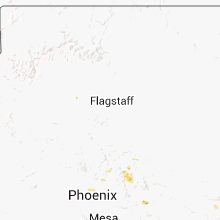
| 4:21 PM MST | Storm damage reported in gila county AZ, 69.2 miles SW of Show Low, AZ |
| 4:36 PM MST | Portion of a roof blown off onto a nearby car in gila county AZ, 73.2 miles E of Phoenix, AZ |
Kansas
| Local Time | Report Details |
|---|---|
| 7:36 PM CDT | Storm damage reported in phillips county KS, 55.9 miles NNW of Hays, KS |
| 8:06 PM CDT | Time was adjusted back as awos time was fast by 3 min. peak wind 67 mph at 807 p in phillips county KS, 60 miles N of Hays, KS |
| 8:24 PM CDT | Storm damage reported in phillips county KS, 61 miles N of Hays, KS |
| 8:24 PM CDT | Grapefruit sized hail reported near Agra, KS, 61.7 miles N of Hays, KS, golfball to softball sized hail fell |
| 9:15 PM CDT | Storm damage reported in russell county KS, 29.2 miles ENE of Hays, KS |
| 9:30 PM CDT | Winds from a large outflow boundary associated with a svr sqln over s-cntrl ne in phillips county KS, 60 miles N of Hays, KS |
| 9:52 PM CDT | Sheets of rain. some pea size hai in jewell county KS, 78.6 miles S of Grand Island, NE |
| 10:00 PM CDT | Tree down across the road in courtlan in republic county KS, 82.2 miles WNW of Manhattan, KS |
| 10:04 PM CDT | Two inch limbs down and trees bending over with estimated wind of 60-70 mph in republic county KS, 81.7 miles SSE of Grand Island, NE |
| 10:05 PM CDT | Power lines and trees down which are blocking emergency services from entering the tow in republic county KS, 77.6 miles WNW of Manhattan, KS |
| 10:17 PM CDT | Trees blowing and bending significantly. estimated wind gusts of 60 mp in republic county KS, 81.8 miles WNW of Manhattan, KS |
| 10:19 PM CDT | 3 inch limbs down and winds estimated at least 60 mph although could be highe in cloud county KS, 70.5 miles WNW of Manhattan, KS |
| 10:29 PM CDT | Storm damage reported in cloud county KS, 64.7 miles WNW of Manhattan, KS |
| 10:33 PM CDT | Estimated wind gusts 50-60 mph with large trees bending over and power ou in ottawa county KS, 61.8 miles W of Manhattan, KS |
| 10:35 PM CDT | Measured wind gust of 64 mph on wind senso in ottawa county KS, 60.5 miles W of Manhattan, KS |
| 10:37 PM CDT | Ping Pong Ball sized hail reported near Bennington, KS, 56.2 miles W of Manhattan, KS |
| 10:39 PM CDT | Storm damage reported in saline county KS, 64.1 miles WSW of Manhattan, KS |
| 10:40 PM CDT | Along the gust front in ottawa county KS, 54.9 miles W of Manhattan, KS |
| 10:40 PM CDT | Law enforcement office had reports of power lines down and medium sized trees uprooted. estimated winds of 55-70 mp in republic county KS, 72.2 miles NW of Manhattan, KS |
| 10:49 PM CDT | Storm damage reported in saline county KS, 64.1 miles WSW of Manhattan, KS |
| 11:07 PM CDT | Measured wind on asos of 66 mp in dickinson county KS, 39.2 miles WSW of Manhattan, KS |
Oregon
| Local Time | Report Details |
|---|---|
| 7:36 PM PDT | Quarter sized hail reported near Bend, OR, 41.6 miles SW of Bend, OR, a member of the public reported heavy rain pooling in the parking lot and ponding on flat surfaces. they also reported 7/8 to 1 inch hail previous to the heavy rain. th |
Connect with Interactive Hail Maps