

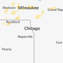
Hail Map for Sunday, August 26, 2018

Number of Impacted Households on 8/26/2018
0
Impacted by 1" or Larger Hail
0
Impacted by 1.75" or Larger Hail
0
Impacted by 2.5" or Larger Hail
Square Miles of Populated Area Impacted on 8/26/2018
0
Impacted by 1" or Larger Hail
0
Impacted by 1.75" or Larger Hail
0
Impacted by 2.5" or Larger Hail


Cities Most Affected by Hail Storms of 8/26/2018
| Hail Size | Demographics of Zip Codes Affected | ||||||
|---|---|---|---|---|---|---|---|
| City | Count | Average | Largest | Pop Density | House Value | Income | Age |
| Blunt, SD | 3 | 2.58 | 4.00 | 1 | $37k | $32.5k | 46.0 |
| Mcgregor, MN | 1 | 1.75 | 1.75 | 8 | $98k | $28.5k | 52.0 |
| Pierre, SD | 1 | 1.75 | 1.75 | 27 | $96k | $43.5k | 39.7 |
Hail and Wind Damage Spotted on 8/26/2018
Filter by Report Type:Hail ReportsWind Reports
States Impacted
Wisconsin, South Dakota, Minnesota, Ohio, Michigan, North Dakota, Iowa, Illinois, NebraskaWisconsin
| Local Time | Report Details |
|---|---|
| 7:16 AM CDT | Ping Pong Ball sized hail reported near New Richmond, WI, 41.1 miles ENE of Minneapolis, MN |
| 2:25 PM CDT | Several trees down along entire block of houses near lake hallie. time estimated from rada in chippewa county WI, 76.1 miles N of La Crosse, WI |
| 3:45 PM CDT | Six reports of trees down on road in sauk county WI, 35.8 miles NW of Madison, WI |
| 4:06 PM CDT | Tree down on power lin in columbia county WI, 39.4 miles N of Madison, WI |
| 4:15 PM CDT | Trees down and power line down due to falling tree in portage. time estimated from rada in columbia county WI, 33.2 miles N of Madison, WI |
| 4:18 PM CDT | Trees down and power line down due to lightning strike in lodi. time estimated from rada in columbia county WI, 18.5 miles NNW of Madison, WI |
| 4:50 PM CDT | Storm damage reported in waupaca county WI, 53 miles WSW of Green Bay, WI |
| 5:18 PM CDT | Large branches reported on highway 187. delayed report. time estimated by rada in outagamie county WI, 28.7 miles WSW of Green Bay, WI |
| 5:30 PM CDT | 9 inch diameter tree branch dow in dodge county WI, 44.5 miles ENE of Madison, WI |
| 6:06 PM CDT | Multiple 4 to 6 inch diameter tree branches down at kerry ingredients on highway 60. similar size branches down 4 blocks to the east. parking sign with concrete base kn in washington county WI, 63.5 miles ENE of Madison, WI |
| 9:18 PM CDT | Numerous trees down in jefferson. time estimated from rada in jefferson county WI, 29.5 miles E of Madison, WI |
| 9:36 PM CDT | Two power lines and several trees down on west side of lac la belle. time estimated from rada in waukesha county WI, 43.1 miles E of Madison, WI |
| 10:45 PM CDT | Trees down on dousman road in town of summit. time estimated from rada in waukesha county WI, 45.9 miles E of Madison, WI |
| 10:45 PM CDT | Numerous trees down covering the road on valley road on south side of oconomowoc. time estimated from rada in waukesha county WI, 44.9 miles E of Madison, WI |
South Dakota
| Local Time | Report Details |
|---|---|
| 8:32 AM CDT | Half Dollar sized hail reported near Westport, SD, 14.8 miles NNW of Aberdeen, SD |
| 7:42 PM CDT | Quarter sized hail reported near Pierre, SD, 10.9 miles NNW of Pierre, SD |
| 7:50 PM CDT | Golf Ball sized hail reported near Pierre, SD, 9.1 miles N of Pierre, SD, ping pong to golf ball sized hail. report relayed via social media. |
| 8:02 PM CDT | Hen Egg sized hail reported near Blunt, SD, 15.8 miles NE of Pierre, SD |
| 8:02 PM CDT | Ping Pong Ball sized hail reported near Onida, SD, 23.4 miles NE of Pierre, SD |
| 8:05 PM CDT | Golf Ball sized hail reported near Blunt, SD, 16.8 miles ENE of Pierre, SD, lots of nickel to golf ball sized hail. |
| 8:16 PM CDT | Grapefruit sized hail reported near Blunt, SD, 20.6 miles ENE of Pierre, SD, some siding and window trim broken. also some car damage. |
| 8:19 PM CDT | Quarter sized hail reported near Blunt, SD, 19.2 miles ENE of Pierre, SD |
| 8:20 PM CDT | Quarter sized hail reported near Leola, SD, 28.4 miles NW of Aberdeen, SD, relayed through state radio from emergency mgmt. time estimated. |
| 8:36 PM CDT | Storm damage reported in hyde county SD, 38.5 miles ENE of Pierre, SD |
| 10:20 PM CDT | Quarter sized hail reported near Wessington, SD, 71.7 miles S of Aberdeen, SD |
| 12:18 AM CDT | Ping Pong Ball sized hail reported near Estelline, SD, 63.6 miles WSW of Montevideo, MN |
Minnesota
| Local Time | Report Details |
|---|---|
| 4:47 PM CDT | Golf Ball sized hail reported near Mcgregor, MN, 58.3 miles WSW of Duluth, MN, largest hail stones were golf ball sized. time estimated by radar. |
| 5:05 PM CDT | Half Dollar sized hail reported near Mcgregor, MN, 52.6 miles W of Duluth, MN, largest hail stones were half dollar sized. time estimated from radar. |
| 6:16 PM CDT | Quarter sized hail reported near Ogema, MN, 47.1 miles ENE of Fargo, ND, dime to quarter sized hail and very heavy rain |
| 10:37 PM CDT | Rwis in kittson county MN, 66.7 miles W of Roseau, MN |
| 10:38 PM CDT | Ndawn in kittson county MN, 60.3 miles W of Roseau, MN |
| 10:43 PM CDT | Ndawn in kittson county MN, 59.8 miles WSW of Roseau, MN |
| 10:43 PM CDT | 2-3 inch tree branches broken off in polk county MN, 68 miles SW of Roseau, MN |
| 10:54 PM CDT | Storm damage reported in kittson county MN, 53.9 miles W of Roseau, MN |
| 10:55 PM CDT | Rwis in kittson county MN, 55.1 miles WSW of Roseau, MN |
| 11:40 PM CDT | Reports of grain bins down and building damage. relayed from broadcast media from their social media sit in polk county MN, 52.2 miles W of Bemidji, MN |
| 11:51 PM CDT | Wind sensor stopped reporting at 1151pm so actual wind speeds could have been higher in polk county MN, 41.4 miles W of Bemidji, MN |
| 12:04 AM CDT | Pine trees down. relayed from broadcast media from their social media sit in clearwater county MN, 29.8 miles WNW of Bemidji, MN |
| 12:55 AM CDT | Quarter sized hail reported near Farmington, MN, 22.5 miles SSE of Minneapolis, MN |
| 1:35 AM CDT | Multiple large trees uproote in koochiching county MN, 1.7 miles SSW of International Falls, MN |
Ohio
| Local Time | Report Details |
|---|---|
| 6:10 PM EDT | 3 to 4 small trees down. siding damage to small business. pea size hail and heavy rai in pickaway county OH, 31.2 miles S of Columbus, OH |
| 6:15 PM EDT | Multiple trees down over road. tree fell on hous in pickaway county OH, 27.2 miles S of Columbus, OH |
| 6:15 PM EDT | Multiple trees down over road. tree fell on hous in pickaway county OH, 27.2 miles S of Columbus, OH |
| 6:17 PM EDT | 3 to 4 trees down. pea size hail and heavy rai in pickaway county OH, 31.2 miles S of Columbus, OH |
| 6:20 PM EDT | Tree down on road. time estimated from radar dat in pickaway county OH, 35.3 miles SSE of Columbus, OH |
| 7:15 PM EDT | 3 trees down. time estimated from radar dat in franklin county OH, 10.8 miles E of Columbus, OH |
Michigan
| Local Time | Report Details |
|---|---|
| 9:14 PM EDT | Pockets of power outages reported in whitehall and montague. the time was estimated from rada in muskegon county MI, 46 miles NW of Grand Rapids, MI |
| 9:18 PM EDT | Tree reported down on us-31 near walsh roa in muskegon county MI, 46.5 miles NW of Grand Rapids, MI |
| 9:19 PM EDT | Tree reported down on us-31 near colby roa in muskegon county MI, 44.9 miles NW of Grand Rapids, MI |
| 9:35 PM EDT | Trees down in the area. power outages affecting several thousand customers scattered across the count in muskegon county MI, 29.6 miles NW of Grand Rapids, MI |
| 9:44 PM EDT | Mesonet station mkgm4... muskegon gler in muskegon county MI, 38.4 miles WNW of Grand Rapids, MI |
| 9:45 PM EDT | A few trees and powerlines down in the muskegon area. scattered power outage in muskegon county MI, 34.6 miles WNW of Grand Rapids, MI |
| 9:46 PM EDT | Weatherflow mesonet station xmsk... muskegon north breakwater ligh in lmz847 county MI, 38.9 miles WNW of Grand Rapids, MI |
| 9:53 PM EDT | Around a dozen calls of trees and wires down across the northern part of the county. including 3 trees down near fruitport rd and hickory st. scattered power outages ac in ottawa county MI, 27.1 miles WNW of Grand Rapids, MI |
| 10:13 PM EDT | Weatherflow mesonet station xghl... grand haven breakwate in lmz846 county MI, 30.5 miles WNW of Grand Rapids, MI |
North Dakota
| Local Time | Report Details |
|---|---|
| 8:45 PM CDT | Quarter sized hail reported near Napoleon, ND, 52.1 miles ESE of Bismarck, ND, the duration of the hail event was 5 minutes. |
| 9:10 PM CDT | Raws site reported 65 mph wind gust. time estimated by rada in ramsey county ND, 30.5 miles NNE of Devils Lake, ND |
| 9:16 PM CDT | Quarter sized hail reported near Marion, ND, 76.4 miles W of Fargo, ND |
| 9:20 PM CDT | Nd dot station reported 62 mph wind gust. time estimated by rada in ramsey county ND, 7.6 miles SE of Devils Lake, ND |
| 9:38 PM CDT | Quarter sized hail reported near Jud, ND, 82.6 miles NNW of Aberdeen, SD, trained storm spotter in alfred reported pea size hail with some quarter size hail mixed in from 9:36 pm to 9:38 pm cdt. |
| 10:10 PM CDT | Asos reported 58 mph wind gust. time estimated by rada in pembina county ND, 74.1 miles NE of Devils Lake, ND |
| 10:25 PM CDT | Davis in pembina county ND, 77.9 miles NE of Devils Lake, ND |
Iowa
| Local Time | Report Details |
|---|---|
| 9:55 PM CDT | Public shared picture on social media of a split tree... no estimated size... but appeared healthy and around 2 foot in diameter. time estimated from rada in humboldt county IA, 49.2 miles E of Storm Lake, IA |
| 10:05 PM CDT | Numerous trees down in and around sheffield. hwy 65 was blocked by downed power lines as wel in franklin county IA, 18.4 miles S of Mason City, IA |
Illinois
| Local Time | Report Details |
|---|---|
| 11:38 PM CDT | Tree and a large branch downed near the same area. time estimated per rada in winnebago county IL, 50.8 miles S of Madison, WI |
Nebraska
| Local Time | Report Details |
|---|---|
| 11:25 PM MDT | Outbuilding blown down. winds estimated at 70+ mph. intersection of roads 344 and 703. se of benkelman and s of ma in dundy county NE, 47.4 miles NNW of Colby, KS |
Connect with Interactive Hail Maps