

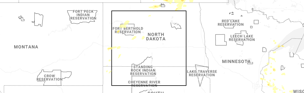
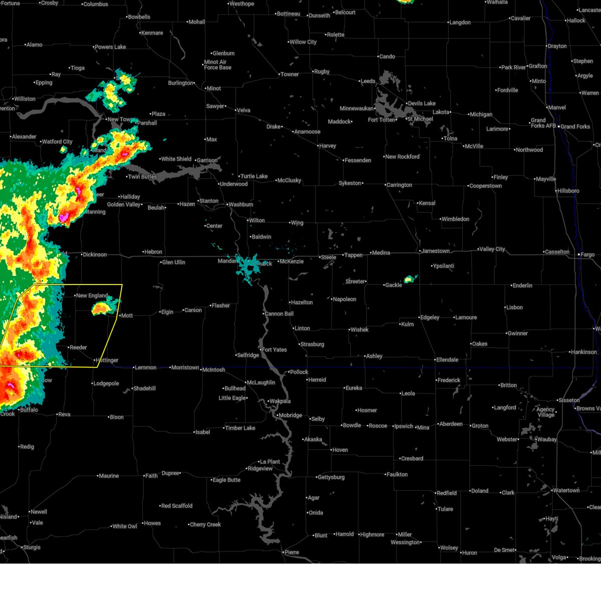
Hail Map for New England, ND
The New England, ND area has had 22 reports of on-the-ground hail by trained spotters, and has been under severe weather warnings 8 times during the past 12 months. Doppler radar has detected hail at or near New England, ND on 35 occasions, including 2 occasions during the past year.
| Name: | New England, ND |
| Where Located: | 100.9 miles WSW of Bismarck, ND |
| Map: | Google Map for New England, ND |
| Population: | 600 |
| Housing Units: | 319 |
| More Info: | Search Google for New England, ND |
0
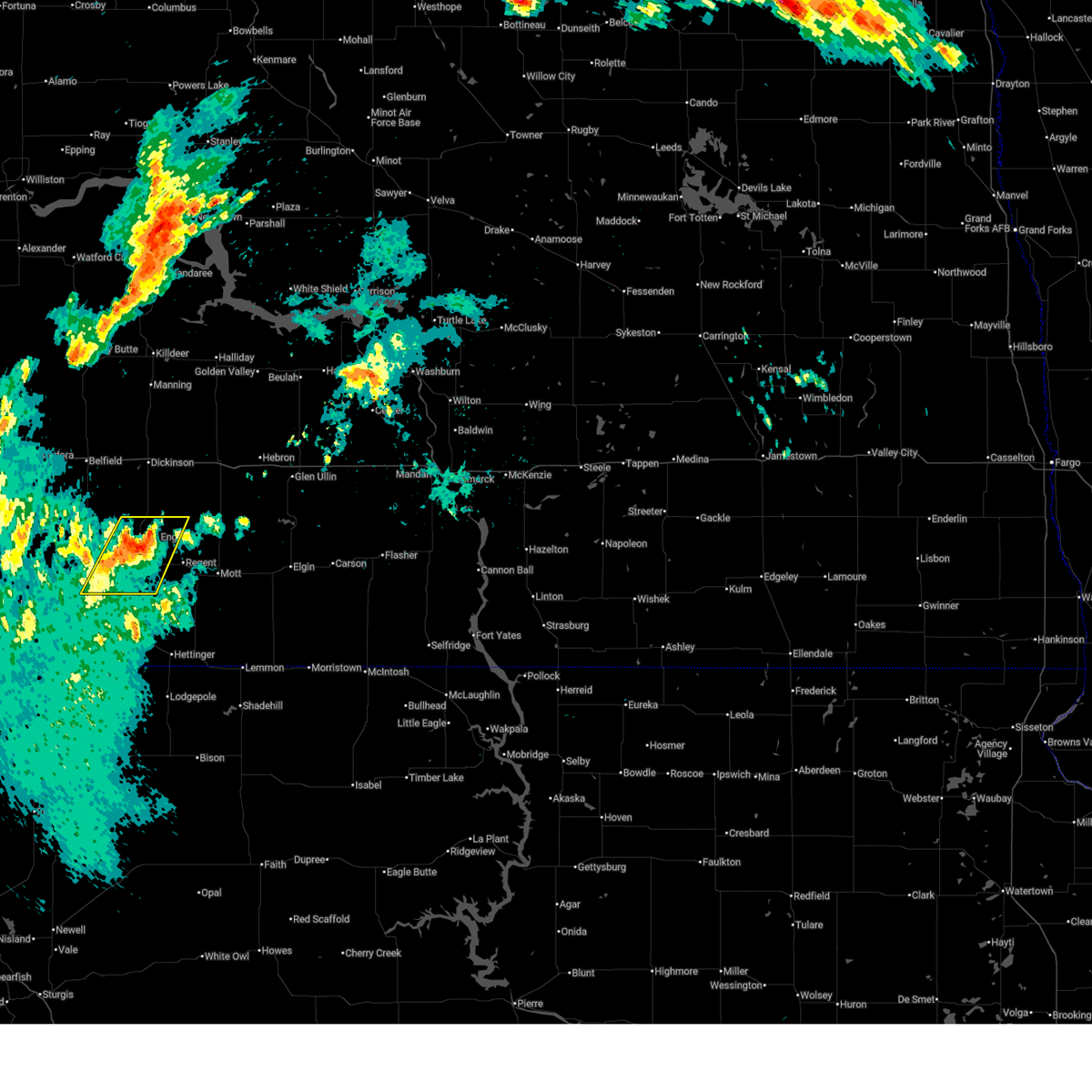
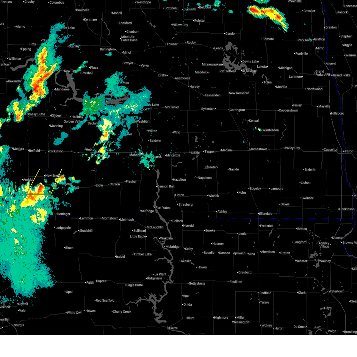
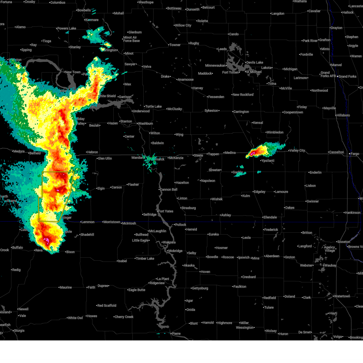
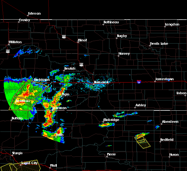
The Top Recent Hail Date for New England, ND is Thursday, July 3, 2025 (17th out of 35)
Hail and Wind Damage Spotted near New England, ND
| Date / Time | Report Details |
|---|---|
| 7/3/2025 11:11 PM MDT |
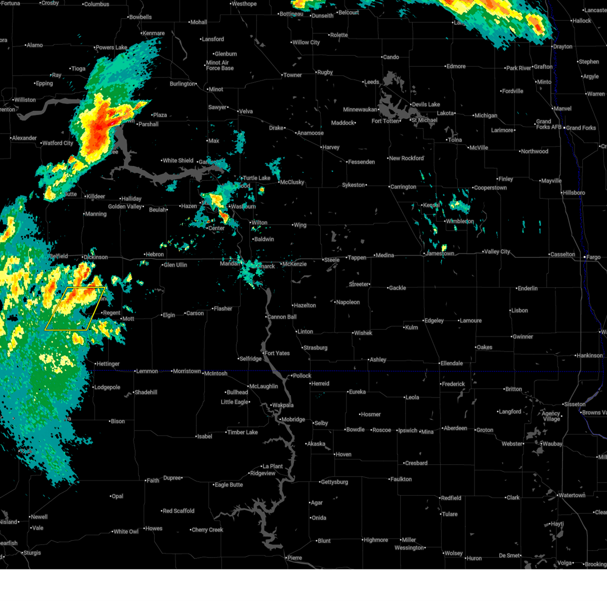 the severe thunderstorm warning has been cancelled and is no longer in effect the severe thunderstorm warning has been cancelled and is no longer in effect
|
| 7/3/2025 11:01 PM MDT |
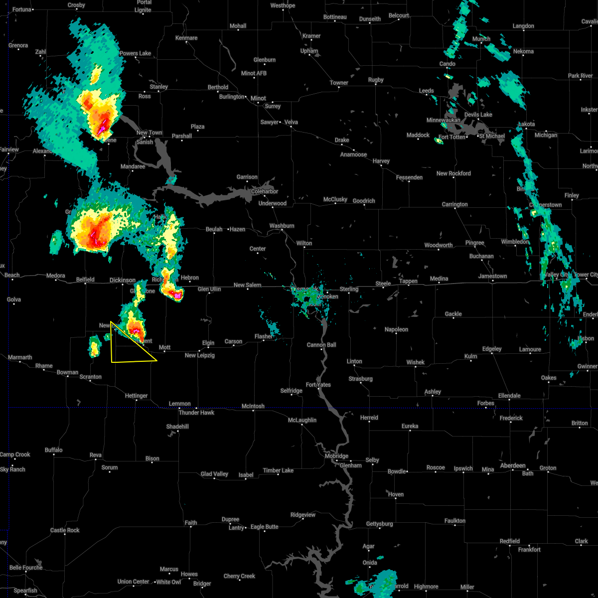
 At 1100 pm mdt, a severe thunderstorm was located 8 miles northeast of new england, or 18 miles south of dickinson, moving northeast at 40 mph (radar indicated). Hazards include 60 mph wind gusts and quarter size hail. Hail damage to vehicles is expected. expect wind damage to roofs, siding, and trees. Locations impacted include, new england and havelock. At 1100 pm mdt, a severe thunderstorm was located 8 miles northeast of new england, or 18 miles south of dickinson, moving northeast at 40 mph (radar indicated). Hazards include 60 mph wind gusts and quarter size hail. Hail damage to vehicles is expected. expect wind damage to roofs, siding, and trees. Locations impacted include, new england and havelock.
|
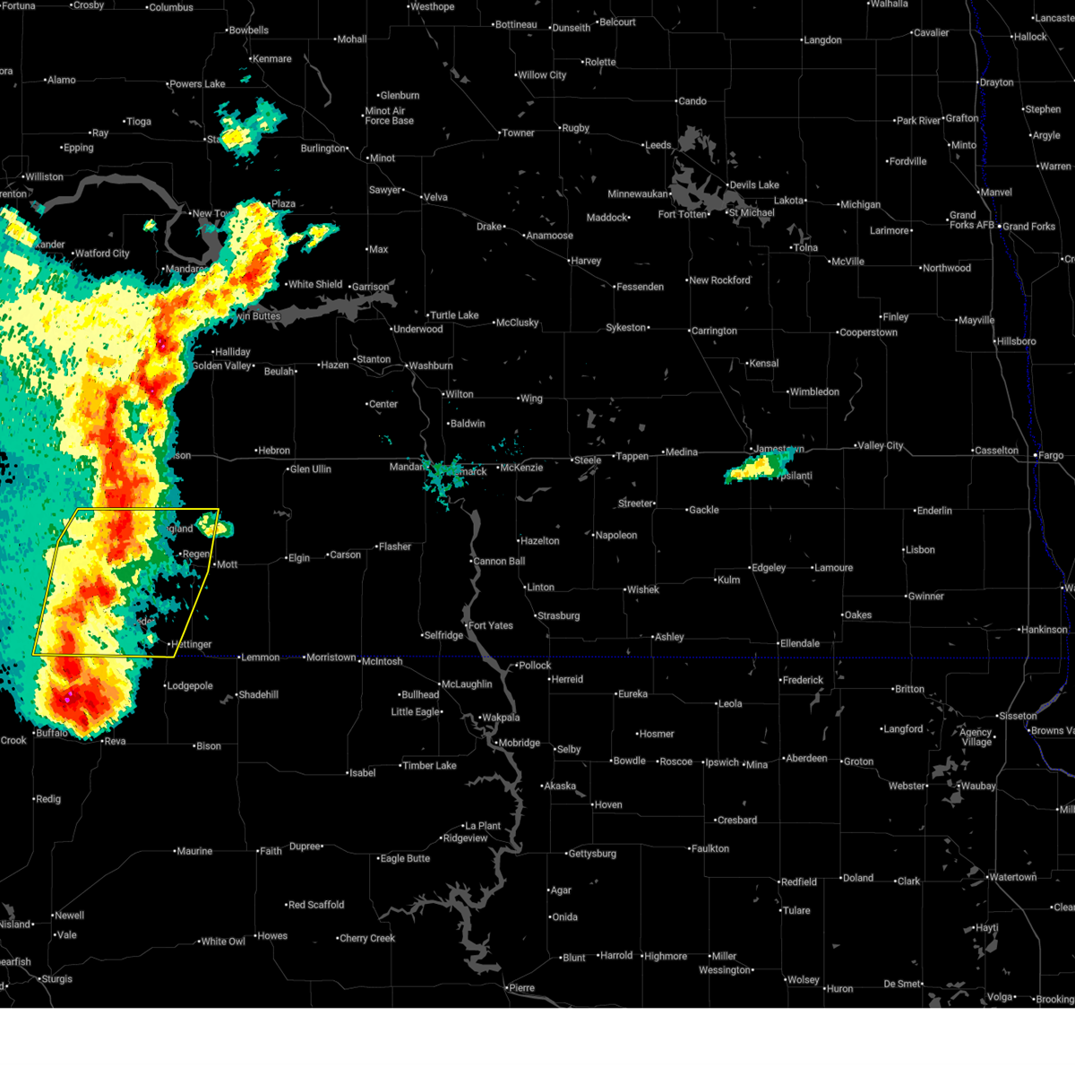
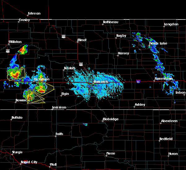
| 7/3/2025 10:37 PM MDT |
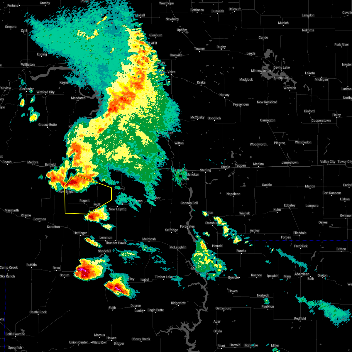
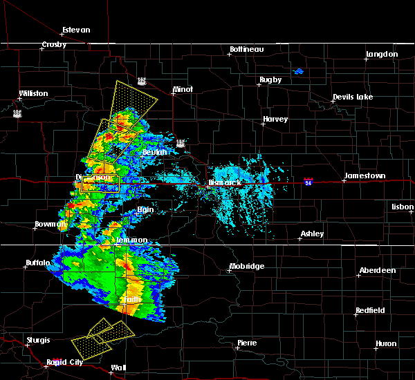
 Svrbis the national weather service in bismarck has issued a * severe thunderstorm warning for, western hettinger county in southwestern north dakota, eastern slope county in southwestern north dakota, * until 1130 pm mdt. * at 1036 pm mdt, a severe thunderstorm was located 8 miles south of new england, or 27 miles northeast of bowman, moving northeast at 20 mph (radar indicated). Hazards include 60 mph wind gusts and half dollar size hail. Hail damage to vehicles is expected. Expect wind damage to roofs, siding, and trees. Svrbis the national weather service in bismarck has issued a * severe thunderstorm warning for, western hettinger county in southwestern north dakota, eastern slope county in southwestern north dakota, * until 1130 pm mdt. * at 1036 pm mdt, a severe thunderstorm was located 8 miles south of new england, or 27 miles northeast of bowman, moving northeast at 20 mph (radar indicated). Hazards include 60 mph wind gusts and half dollar size hail. Hail damage to vehicles is expected. Expect wind damage to roofs, siding, and trees.
|
| 6/20/2025 6:57 PM MDT |
 the severe thunderstorm warning has been cancelled and is no longer in effect the severe thunderstorm warning has been cancelled and is no longer in effect
|
| 6/20/2025 6:57 PM MDT |
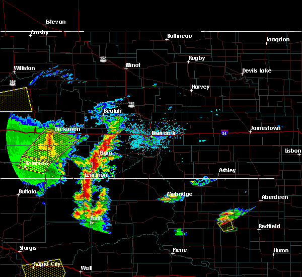
 At 657 pm mdt, severe thunderstorms were located along a line extending from 12 miles south of gladstone to 7 miles southwest of regent to 8 miles south of reeder, moving east at 50 mph (radar indicated). Hazards include 70 mph wind gusts and quarter size hail. Hail damage to vehicles is expected. expect considerable tree damage. wind damage is also likely to mobile homes, roofs, and outbuildings. Locations impacted include, hettinger, new england, reeder, regent, bucyrus, and havelock. At 657 pm mdt, severe thunderstorms were located along a line extending from 12 miles south of gladstone to 7 miles southwest of regent to 8 miles south of reeder, moving east at 50 mph (radar indicated). Hazards include 70 mph wind gusts and quarter size hail. Hail damage to vehicles is expected. expect considerable tree damage. wind damage is also likely to mobile homes, roofs, and outbuildings. Locations impacted include, hettinger, new england, reeder, regent, bucyrus, and havelock.
|
| 6/20/2025 6:30 PM MDT | Storm damage reported in slope county ND, 9.1 miles NNE of New England, ND |
| 6/20/2025 6:29 PM MDT |
 At 628 pm mdt, severe thunderstorms were located along a line extending from 9 miles northwest of new england to 10 miles north of scranton to 8 miles north of ludlow, moving east at 50 mph (radar indicated. at 0615 pm mdt, 58 mph was reported at bowman). Hazards include 70 mph wind gusts and quarter size hail. Hail damage to vehicles is expected. expect considerable tree damage. wind damage is also likely to mobile homes, roofs, and outbuildings. Locations impacted include, bowman, hettinger, new england, scranton, reeder, regent, amidon, bucyrus, havelock, gascoyne, bowman haley dam, and buffalo springs. At 628 pm mdt, severe thunderstorms were located along a line extending from 9 miles northwest of new england to 10 miles north of scranton to 8 miles north of ludlow, moving east at 50 mph (radar indicated. at 0615 pm mdt, 58 mph was reported at bowman). Hazards include 70 mph wind gusts and quarter size hail. Hail damage to vehicles is expected. expect considerable tree damage. wind damage is also likely to mobile homes, roofs, and outbuildings. Locations impacted include, bowman, hettinger, new england, scranton, reeder, regent, amidon, bucyrus, havelock, gascoyne, bowman haley dam, and buffalo springs.
|
| 6/20/2025 6:09 PM MDT |
 Svrbis the national weather service in bismarck has issued a * severe thunderstorm warning for, bowman county in southwestern north dakota, hettinger county in southwestern north dakota, slope county in southwestern north dakota, western adams county in southwestern north dakota, * until 715 pm mdt. * at 608 pm mdt, severe thunderstorms were located along a line extending from 10 miles north of amidon to 6 miles north of bowman to near table mountain, moving east at 50 mph (radar indicated). Hazards include 70 mph wind gusts and quarter size hail. Hail damage to vehicles is expected. expect considerable tree damage. Wind damage is also likely to mobile homes, roofs, and outbuildings. Svrbis the national weather service in bismarck has issued a * severe thunderstorm warning for, bowman county in southwestern north dakota, hettinger county in southwestern north dakota, slope county in southwestern north dakota, western adams county in southwestern north dakota, * until 715 pm mdt. * at 608 pm mdt, severe thunderstorms were located along a line extending from 10 miles north of amidon to 6 miles north of bowman to near table mountain, moving east at 50 mph (radar indicated). Hazards include 70 mph wind gusts and quarter size hail. Hail damage to vehicles is expected. expect considerable tree damage. Wind damage is also likely to mobile homes, roofs, and outbuildings.
|
| 7/12/2024 5:49 PM MDT |
 Svrbis the national weather service in bismarck has issued a * severe thunderstorm warning for, northwestern hettinger county in southwestern north dakota, northeastern slope county in southwestern north dakota, southwestern stark county in southwestern north dakota, * until 645 pm mdt. * at 549 pm mdt, a severe thunderstorm was located 5 miles south of belfield, or 19 miles west of dickinson, moving southeast at 20 mph (radar indicated). Hazards include ping pong ball size hail and 60 mph wind gusts. People and animals outdoors will be injured. expect hail damage to roofs, siding, windows, and vehicles. Expect wind damage to roofs, siding, and trees. Svrbis the national weather service in bismarck has issued a * severe thunderstorm warning for, northwestern hettinger county in southwestern north dakota, northeastern slope county in southwestern north dakota, southwestern stark county in southwestern north dakota, * until 645 pm mdt. * at 549 pm mdt, a severe thunderstorm was located 5 miles south of belfield, or 19 miles west of dickinson, moving southeast at 20 mph (radar indicated). Hazards include ping pong ball size hail and 60 mph wind gusts. People and animals outdoors will be injured. expect hail damage to roofs, siding, windows, and vehicles. Expect wind damage to roofs, siding, and trees.
|
| 6/27/2024 6:34 PM MDT |
 At 634 pm mdt, severe thunderstorms were located along a line extending from 8 miles northwest of new england to 15 miles southwest of regent to 10 miles south of reeder, moving east at 55 mph (radar indicated). Hazards include golf ball size hail and 70 mph wind gusts. People and animals outdoors will be injured. expect hail damage to roofs, siding, windows, and vehicles. expect considerable tree damage. wind damage is also likely to mobile homes, roofs, and outbuildings. Locations impacted include, hettinger, mott, new england, scranton, reeder, regent, haynes, burt, bucyrus, havelock, gascoyne, bowman haley dam, buffalo springs, and bentley. At 634 pm mdt, severe thunderstorms were located along a line extending from 8 miles northwest of new england to 15 miles southwest of regent to 10 miles south of reeder, moving east at 55 mph (radar indicated). Hazards include golf ball size hail and 70 mph wind gusts. People and animals outdoors will be injured. expect hail damage to roofs, siding, windows, and vehicles. expect considerable tree damage. wind damage is also likely to mobile homes, roofs, and outbuildings. Locations impacted include, hettinger, mott, new england, scranton, reeder, regent, haynes, burt, bucyrus, havelock, gascoyne, bowman haley dam, buffalo springs, and bentley.
|
| 6/27/2024 6:32 PM MDT | 10 meter measured wind gust at ndawn station new england 5 in slope county ND, 5 miles E of New England, ND |
| 6/27/2024 6:17 PM MDT |
 Svrbis the national weather service in bismarck has issued a * severe thunderstorm warning for, eastern bowman county in southwestern north dakota, hettinger county in southwestern north dakota, eastern slope county in southwestern north dakota, adams county in southwestern north dakota, * until 730 pm mdt. * at 616 pm mdt, severe thunderstorms were located along a line extending from 11 miles north of amidon to 8 miles north of scranton to 10 miles northeast of ludlow, moving east at 55 mph (radar indicated). Hazards include 70 mph wind gusts and half dollar size hail. Hail damage to vehicles is expected. expect considerable tree damage. Wind damage is also likely to mobile homes, roofs, and outbuildings. Svrbis the national weather service in bismarck has issued a * severe thunderstorm warning for, eastern bowman county in southwestern north dakota, hettinger county in southwestern north dakota, eastern slope county in southwestern north dakota, adams county in southwestern north dakota, * until 730 pm mdt. * at 616 pm mdt, severe thunderstorms were located along a line extending from 11 miles north of amidon to 8 miles north of scranton to 10 miles northeast of ludlow, moving east at 55 mph (radar indicated). Hazards include 70 mph wind gusts and half dollar size hail. Hail damage to vehicles is expected. expect considerable tree damage. Wind damage is also likely to mobile homes, roofs, and outbuildings.
|
| 6/15/2024 6:15 PM MDT | Quarter sized hail reported 7 miles SSE of New England, ND, hail lasted from 7:15 to 7:20 pm. |
| 7/25/2022 8:24 PM MDT |
 At 923 pm cdt/823 pm mdt/, severe thunderstorms were located along a line extending from 4 miles west of halliday to 4 miles northeast of richardton to near new england, moving east at 50 mph (radar indicated). Hazards include 60 mph wind gusts. Expect damage to roofs, siding, and trees. severe thunderstorms will be near, hebron around 935 pm cdt. dodge around 835 pm mdt. other locations in the path of these severe thunderstorms include golden valley, glen ullin, zap, beulah, hazen, new salem, stanton, elgin and new leipzig. hail threat, radar indicated max hail size, <. 75 in wind threat, radar indicated max wind gust, 60 mph. At 923 pm cdt/823 pm mdt/, severe thunderstorms were located along a line extending from 4 miles west of halliday to 4 miles northeast of richardton to near new england, moving east at 50 mph (radar indicated). Hazards include 60 mph wind gusts. Expect damage to roofs, siding, and trees. severe thunderstorms will be near, hebron around 935 pm cdt. dodge around 835 pm mdt. other locations in the path of these severe thunderstorms include golden valley, glen ullin, zap, beulah, hazen, new salem, stanton, elgin and new leipzig. hail threat, radar indicated max hail size, <. 75 in wind threat, radar indicated max wind gust, 60 mph.
|
| 7/10/2022 2:15 AM MDT |
 At 314 am cdt/214 am mdt/, severe thunderstorms were located along a line extending from near little missouri state park to 7 miles southwest of halliday to 7 miles northwest of gladstone to 8 miles east of new england, moving east at 55 mph (radar indicated). Hazards include 70 mph wind gusts and quarter size hail. Hail damage to vehicles is expected. expect considerable tree damage. wind damage is also likely to mobile homes, roofs, and outbuildings. locations impacted include, dickinson, killdeer, new england, richardton, south heart, gladstone, halliday, taylor, dunn center, dodge, manning, marshall, little missouri state park, lefor, and schefield. thunderstorm damage threat, considerable hail threat, radar indicated max hail size, 1. 00 in wind threat, observed max wind gust, 70 mph. At 314 am cdt/214 am mdt/, severe thunderstorms were located along a line extending from near little missouri state park to 7 miles southwest of halliday to 7 miles northwest of gladstone to 8 miles east of new england, moving east at 55 mph (radar indicated). Hazards include 70 mph wind gusts and quarter size hail. Hail damage to vehicles is expected. expect considerable tree damage. wind damage is also likely to mobile homes, roofs, and outbuildings. locations impacted include, dickinson, killdeer, new england, richardton, south heart, gladstone, halliday, taylor, dunn center, dodge, manning, marshall, little missouri state park, lefor, and schefield. thunderstorm damage threat, considerable hail threat, radar indicated max hail size, 1. 00 in wind threat, observed max wind gust, 70 mph.
|
| 7/10/2022 2:02 AM MDT |
 At 300 am cdt/200 am mdt/, severe thunderstorms were located along a line extending from 7 miles east of grassy butte to 4 miles northeast of manning to 6 miles northwest of dickinson to 4 miles west of new england, moving east at 50 mph (radar indicated). Hazards include 70 mph wind gusts and half dollar size hail. Hail damage to vehicles is expected. expect considerable tree damage. wind damage is also likely to mobile homes, roofs, and outbuildings. these severe storms will be near, manning around 205 am mdt. dunn center around 210 am mdt. killdeer around 220 am mdt. halliday and taylor around 225 am mdt. dodge around 230 am mdt. marshall around 240 am mdt. other locations impacted by these severe thunderstorms include hirschville, schefield, oakdale, fairfield, havelock, lefor, new hradec and dickinson regional airport. thunderstorm damage threat, considerable hail threat, radar indicated max hail size, 1. 25 in wind threat, observed max wind gust, 70 mph. At 300 am cdt/200 am mdt/, severe thunderstorms were located along a line extending from 7 miles east of grassy butte to 4 miles northeast of manning to 6 miles northwest of dickinson to 4 miles west of new england, moving east at 50 mph (radar indicated). Hazards include 70 mph wind gusts and half dollar size hail. Hail damage to vehicles is expected. expect considerable tree damage. wind damage is also likely to mobile homes, roofs, and outbuildings. these severe storms will be near, manning around 205 am mdt. dunn center around 210 am mdt. killdeer around 220 am mdt. halliday and taylor around 225 am mdt. dodge around 230 am mdt. marshall around 240 am mdt. other locations impacted by these severe thunderstorms include hirschville, schefield, oakdale, fairfield, havelock, lefor, new hradec and dickinson regional airport. thunderstorm damage threat, considerable hail threat, radar indicated max hail size, 1. 25 in wind threat, observed max wind gust, 70 mph.
|
| 7/10/2022 1:42 AM MDT |
 At 242 am cdt/142 am mdt/, severe thunderstorms were located along a line extending from 9 miles southwest of grassy butte to 6 miles southeast of south fairfield to near amidon, moving east at 55 mph (radar indicated). Hazards include 70 mph wind gusts and half dollar size hail. Hail damage to vehicles is expected. expect considerable tree damage. wind damage is also likely to mobile homes, roofs, and outbuildings. severe thunderstorms will be near, new england around 205 am mdt. killdeer around 220 am mdt. dunn center and marshall around 225 am mdt. halliday around 240 am mdt. dodge around 245 am mdt. other locations impacted by these severe thunderstorms include fryburg, hirschville, schefield, oakdale, fairfield, havelock, lefor, new hradec, and dickinson. thunderstorm damage threat, considerable hail threat, radar indicated max hail size, 1. 25 in wind threat, observed max wind gust, 70 mph. At 242 am cdt/142 am mdt/, severe thunderstorms were located along a line extending from 9 miles southwest of grassy butte to 6 miles southeast of south fairfield to near amidon, moving east at 55 mph (radar indicated). Hazards include 70 mph wind gusts and half dollar size hail. Hail damage to vehicles is expected. expect considerable tree damage. wind damage is also likely to mobile homes, roofs, and outbuildings. severe thunderstorms will be near, new england around 205 am mdt. killdeer around 220 am mdt. dunn center and marshall around 225 am mdt. halliday around 240 am mdt. dodge around 245 am mdt. other locations impacted by these severe thunderstorms include fryburg, hirschville, schefield, oakdale, fairfield, havelock, lefor, new hradec, and dickinson. thunderstorm damage threat, considerable hail threat, radar indicated max hail size, 1. 25 in wind threat, observed max wind gust, 70 mph.
|
| 7/3/2022 11:32 PM MDT | Relayed via social medi in slope county ND, 4.9 miles NE of New England, ND |
| 7/3/2022 11:22 PM MDT |
 At 1121 pm mdt, severe thunderstorms were located along a line extending from 8 miles south of dickinson to 12 miles northeast of reeder to 10 miles north of ralph, moving east at 40 mph (radar indicated). Hazards include 70 mph wind gusts and penny size hail. Expect considerable tree damage. damage is likely to mobile homes, roofs, and outbuildings. locations impacted include, hettinger, mott, new england, scranton, reeder, regent, bucyrus, havelock, gascoyne, bowman haley dam, buffalo springs, lefor and schefield. thunderstorm damage threat, considerable hail threat, radar indicated max hail size, 0. 75 in wind threat, radar indicated max wind gust, 70 mph. At 1121 pm mdt, severe thunderstorms were located along a line extending from 8 miles south of dickinson to 12 miles northeast of reeder to 10 miles north of ralph, moving east at 40 mph (radar indicated). Hazards include 70 mph wind gusts and penny size hail. Expect considerable tree damage. damage is likely to mobile homes, roofs, and outbuildings. locations impacted include, hettinger, mott, new england, scranton, reeder, regent, bucyrus, havelock, gascoyne, bowman haley dam, buffalo springs, lefor and schefield. thunderstorm damage threat, considerable hail threat, radar indicated max hail size, 0. 75 in wind threat, radar indicated max wind gust, 70 mph.
|
| 7/3/2022 10:59 PM MDT |
 At 1058 pm mdt, severe thunderstorms were located along a line extending from 9 miles south of south heart to 8 miles northeast of scranton to 5 miles northeast of ludlow, moving east at 40 mph (radar indicated). Hazards include 70 mph wind gusts and nickel size hail. Expect considerable tree damage. damage is likely to mobile homes, roofs, and outbuildings. locations impacted include, hettinger and mott. thunderstorm damage threat, considerable hail threat, radar indicated max hail size, 0. 88 in wind threat, radar indicated max wind gust, 70 mph. At 1058 pm mdt, severe thunderstorms were located along a line extending from 9 miles south of south heart to 8 miles northeast of scranton to 5 miles northeast of ludlow, moving east at 40 mph (radar indicated). Hazards include 70 mph wind gusts and nickel size hail. Expect considerable tree damage. damage is likely to mobile homes, roofs, and outbuildings. locations impacted include, hettinger and mott. thunderstorm damage threat, considerable hail threat, radar indicated max hail size, 0. 88 in wind threat, radar indicated max wind gust, 70 mph.
|
| 7/3/2022 10:41 PM MDT |
 At 1038 pm mdt, severe thunderstorms were located along a line extending from 11 miles southwest of south heart to 6 miles northeast of bowman to table mountain, moving east at 40 mph (radar indicated). Hazards include 70 mph wind gusts and nickel size hail. Expect considerable tree damage. damage is likely to mobile homes, roofs, and outbuildings. severe thunderstorms will be near, scranton around 1050 pm mdt. other locations in the path of these severe thunderstorms include mott. thunderstorm damage threat, considerable hail threat, radar indicated max hail size, 0. 88 in wind threat, radar indicated max wind gust, 70 mph. At 1038 pm mdt, severe thunderstorms were located along a line extending from 11 miles southwest of south heart to 6 miles northeast of bowman to table mountain, moving east at 40 mph (radar indicated). Hazards include 70 mph wind gusts and nickel size hail. Expect considerable tree damage. damage is likely to mobile homes, roofs, and outbuildings. severe thunderstorms will be near, scranton around 1050 pm mdt. other locations in the path of these severe thunderstorms include mott. thunderstorm damage threat, considerable hail threat, radar indicated max hail size, 0. 88 in wind threat, radar indicated max wind gust, 70 mph.
|
| 7/22/2021 5:12 PM MDT |
 The severe thunderstorm warning for northeastern bowman, western hettinger, eastern slope and western adams counties will expire at 515 pm mdt, the storms which prompted the warning have moved out of the area. therefore, the warning will be allowed to expire. however gusty winds are still possible with these thunderstorms. The severe thunderstorm warning for northeastern bowman, western hettinger, eastern slope and western adams counties will expire at 515 pm mdt, the storms which prompted the warning have moved out of the area. therefore, the warning will be allowed to expire. however gusty winds are still possible with these thunderstorms.
|
| 7/22/2021 5:03 PM MDT |
 At 502 pm mdt, severe thunderstorms were located along a line extending from near new england to 5 miles north of ralph, moving southeast at 20 mph (at 453 pm mdt the hettinger airport recorded 60 mph wind gusts). Hazards include 60 mph wind gusts and penny size hail. Expect damage to roofs, siding, and trees. Locations impacted include, hettinger, amidon, new england, scranton, reeder, regent, bucyrus, havelock, gascoyne and buffalo springs. At 502 pm mdt, severe thunderstorms were located along a line extending from near new england to 5 miles north of ralph, moving southeast at 20 mph (at 453 pm mdt the hettinger airport recorded 60 mph wind gusts). Hazards include 60 mph wind gusts and penny size hail. Expect damage to roofs, siding, and trees. Locations impacted include, hettinger, amidon, new england, scranton, reeder, regent, bucyrus, havelock, gascoyne and buffalo springs.
|
| 7/22/2021 4:47 PM MDT |
 At 446 pm mdt, severe thunderstorms were located along a line extending from new england to 9 miles northwest of ralph, moving southeast at 20 mph (radar indicated). Hazards include 60 mph wind gusts and penny size hail. Expect damage to roofs, siding, and trees. Locations impacted include, bowman, hettinger, amidon, new england, scranton, reeder, regent, bucyrus, havelock, gascoyne, bowman haley dam and buffalo springs. At 446 pm mdt, severe thunderstorms were located along a line extending from new england to 9 miles northwest of ralph, moving southeast at 20 mph (radar indicated). Hazards include 60 mph wind gusts and penny size hail. Expect damage to roofs, siding, and trees. Locations impacted include, bowman, hettinger, amidon, new england, scranton, reeder, regent, bucyrus, havelock, gascoyne, bowman haley dam and buffalo springs.
|
| 7/22/2021 4:34 PM MDT |
 At 434 pm mdt, severe thunderstorms were located along a line extending from near new england to 9 miles northeast of ludlow, moving southeast at 20 mph (radar indicated). Hazards include 60 mph wind gusts and penny size hail. Expect damage to roofs, siding, and trees. Locations impacted include, bowman, hettinger, amidon, new england, scranton, rhame, reeder, regent, mud buttes, griffin, bucyrus, havelock, gascoyne, bowman haley dam and buffalo springs. At 434 pm mdt, severe thunderstorms were located along a line extending from near new england to 9 miles northeast of ludlow, moving southeast at 20 mph (radar indicated). Hazards include 60 mph wind gusts and penny size hail. Expect damage to roofs, siding, and trees. Locations impacted include, bowman, hettinger, amidon, new england, scranton, rhame, reeder, regent, mud buttes, griffin, bucyrus, havelock, gascoyne, bowman haley dam and buffalo springs.
|
| 7/22/2021 4:12 PM MDT |
 At 411 pm mdt, severe thunderstorms were located along a line extending from 11 miles northwest of new england to 10 miles north of ludlow, moving southeast at 20 mph (radar indicated). Hazards include 70 mph wind gusts and penny size hail. Expect considerable tree damage. Damage is likely to mobile homes, roofs, and outbuildings. At 411 pm mdt, severe thunderstorms were located along a line extending from 11 miles northwest of new england to 10 miles north of ludlow, moving southeast at 20 mph (radar indicated). Hazards include 70 mph wind gusts and penny size hail. Expect considerable tree damage. Damage is likely to mobile homes, roofs, and outbuildings.
|
| 7/8/2021 8:20 PM MDT |
 At 819 pm mdt, a severe thunderstorm was located 6 miles north of regent, or 12 miles northwest of mott, moving southeast at 40 mph (radar indicated). Hazards include ping pong ball size hail and 60 mph wind gusts. People and animals outdoors will be injured. expect hail damage to roofs, siding, windows, and vehicles. expect wind damage to roofs, siding, and trees. this severe storm will be near, mott around 840 pm mdt. Other locations impacted by this severe thunderstorm include havelock. At 819 pm mdt, a severe thunderstorm was located 6 miles north of regent, or 12 miles northwest of mott, moving southeast at 40 mph (radar indicated). Hazards include ping pong ball size hail and 60 mph wind gusts. People and animals outdoors will be injured. expect hail damage to roofs, siding, windows, and vehicles. expect wind damage to roofs, siding, and trees. this severe storm will be near, mott around 840 pm mdt. Other locations impacted by this severe thunderstorm include havelock.
|
| 7/8/2021 8:01 PM MDT |
 At 801 pm mdt, a severe thunderstorm was located 10 miles northeast of new england, or 16 miles south of dickinson, moving southeast at 40 mph (radar indicated). Hazards include 60 mph wind gusts and quarter size hail. Hail damage to vehicles is expected. Expect wind damage to roofs, siding, and trees. At 801 pm mdt, a severe thunderstorm was located 10 miles northeast of new england, or 16 miles south of dickinson, moving southeast at 40 mph (radar indicated). Hazards include 60 mph wind gusts and quarter size hail. Hail damage to vehicles is expected. Expect wind damage to roofs, siding, and trees.
|
| 8/14/2020 12:29 AM MDT |
 At 1228 am mdt, severe thunderstorms were located along a line extending from 13 miles south of gladstone to regent to 4 miles north of hettinger, moving east at 45 mph. these are very dangerous storms (radar indicated). Hazards include 80 mph wind gusts and golf ball size hail. Flying debris will be dangerous to those caught without shelter. mobile homes will be heavily damaged. expect considerable damage to roofs, windows, and vehicles. extensive tree damage and power outages are likely. these severe storms will be near, mott around 1245 am mdt. Other locations impacted by these severe thunderstorms include bucyrus, schefield, havelock and lefor. At 1228 am mdt, severe thunderstorms were located along a line extending from 13 miles south of gladstone to regent to 4 miles north of hettinger, moving east at 45 mph. these are very dangerous storms (radar indicated). Hazards include 80 mph wind gusts and golf ball size hail. Flying debris will be dangerous to those caught without shelter. mobile homes will be heavily damaged. expect considerable damage to roofs, windows, and vehicles. extensive tree damage and power outages are likely. these severe storms will be near, mott around 1245 am mdt. Other locations impacted by these severe thunderstorms include bucyrus, schefield, havelock and lefor.
|
| 8/14/2020 12:17 AM MDT | Also quarter size hai in hettinger county ND, 9.6 miles N of New England, ND |
| 8/13/2020 11:59 PM MDT |
 At 1143 pm mdt, severe thunderstorms were located along a line extending from 7 miles north of amidon to 12 miles northeast of bowman to 11 miles northeast of ludlow, moving east at 45 mph (radar indicated). Hazards include 70 mph wind gusts and half dollar size hail. Hail damage to vehicles is expected. expect considerable tree damage. wind damage is also likely to mobile homes, roofs, and outbuildings. severe thunderstorms will be near, reeder around 1210 am mdt. hettinger around 1225 am mdt. regent around 1230 am mdt. mott around 1245 am mdt. Other locations impacted by these severe thunderstorms include bowman haley dam, bucyrus, schefield, griffin, buffalo springs, havelock, lefor and gascoyne. At 1143 pm mdt, severe thunderstorms were located along a line extending from 7 miles north of amidon to 12 miles northeast of bowman to 11 miles northeast of ludlow, moving east at 45 mph (radar indicated). Hazards include 70 mph wind gusts and half dollar size hail. Hail damage to vehicles is expected. expect considerable tree damage. wind damage is also likely to mobile homes, roofs, and outbuildings. severe thunderstorms will be near, reeder around 1210 am mdt. hettinger around 1225 am mdt. regent around 1230 am mdt. mott around 1245 am mdt. Other locations impacted by these severe thunderstorms include bowman haley dam, bucyrus, schefield, griffin, buffalo springs, havelock, lefor and gascoyne.
|
| 8/13/2020 11:43 PM MDT |
 At 1143 pm mdt, severe thunderstorms were located along a line extending from 7 miles north of amidon to 12 miles northeast of bowman to 11 miles northeast of ludlow, moving east at 45 mph (radar indicated). Hazards include 70 mph wind gusts and half dollar size hail. Hail damage to vehicles is expected. expect considerable tree damage. wind damage is also likely to mobile homes, roofs, and outbuildings. severe thunderstorms will be near, reeder around 1210 am mdt. hettinger around 1225 am mdt. regent around 1230 am mdt. mott around 1245 am mdt. Other locations impacted by these severe thunderstorms include bowman haley dam, bucyrus, schefield, griffin, buffalo springs, havelock, lefor and gascoyne. At 1143 pm mdt, severe thunderstorms were located along a line extending from 7 miles north of amidon to 12 miles northeast of bowman to 11 miles northeast of ludlow, moving east at 45 mph (radar indicated). Hazards include 70 mph wind gusts and half dollar size hail. Hail damage to vehicles is expected. expect considerable tree damage. wind damage is also likely to mobile homes, roofs, and outbuildings. severe thunderstorms will be near, reeder around 1210 am mdt. hettinger around 1225 am mdt. regent around 1230 am mdt. mott around 1245 am mdt. Other locations impacted by these severe thunderstorms include bowman haley dam, bucyrus, schefield, griffin, buffalo springs, havelock, lefor and gascoyne.
|
| 7/7/2020 9:19 PM MDT |
 At 918 pm mdt, severe thunderstorms were located along a line extending from 10 miles east of south fairfield to near taylor to 11 miles southeast of gladstone to 12 miles northeast of reeder, moving northeast at 50 mph. these are very dangerous storms (radar indicated). Hazards include 80 mph wind gusts and half dollar size hail. Flying debris will be dangerous to those caught without shelter. mobile homes will be heavily damaged. expect considerable damage to roofs, windows, and vehicles. extensive tree damage and power outages are likely. these severe storms will be near, richardton and taylor around 925 pm mdt. regent around 935 pm mdt. Other locations impacted by these severe thunderstorms include bowman haley dam, fryburg, hirschville, schefield, griffin, buffalo springs, havelock, lefor, new hradec and gascoyne. At 918 pm mdt, severe thunderstorms were located along a line extending from 10 miles east of south fairfield to near taylor to 11 miles southeast of gladstone to 12 miles northeast of reeder, moving northeast at 50 mph. these are very dangerous storms (radar indicated). Hazards include 80 mph wind gusts and half dollar size hail. Flying debris will be dangerous to those caught without shelter. mobile homes will be heavily damaged. expect considerable damage to roofs, windows, and vehicles. extensive tree damage and power outages are likely. these severe storms will be near, richardton and taylor around 925 pm mdt. regent around 935 pm mdt. Other locations impacted by these severe thunderstorms include bowman haley dam, fryburg, hirschville, schefield, griffin, buffalo springs, havelock, lefor, new hradec and gascoyne.
|
| 7/7/2020 8:49 PM MDT |
 At 849 pm mdt, severe thunderstorms were located along a line extending from 5 miles east of medora to 7 miles southwest of dickinson to new england to 5 miles southwest of scranton, moving northeast at 55 mph. these are very dangerous storms (radar indicated). Hazards include 80 mph wind gusts and half dollar size hail. Flying debris will be dangerous to those caught without shelter. mobile homes will be heavily damaged. expect considerable damage to roofs, windows, and vehicles. extensive tree damage and power outages are likely. these severe storms will be near, new england around 855 pm mdt. dickinson around 900 pm mdt. gladstone around 905 pm mdt. taylor around 915 pm mdt. richardton around 925 pm mdt. regent around 930 pm mdt. Other locations impacted by these severe thunderstorms include sunset butte, bowman haley dam, fryburg, hirschville, buffalo springs, three v crossing, lefor, new hradec, alpha and schefield. At 849 pm mdt, severe thunderstorms were located along a line extending from 5 miles east of medora to 7 miles southwest of dickinson to new england to 5 miles southwest of scranton, moving northeast at 55 mph. these are very dangerous storms (radar indicated). Hazards include 80 mph wind gusts and half dollar size hail. Flying debris will be dangerous to those caught without shelter. mobile homes will be heavily damaged. expect considerable damage to roofs, windows, and vehicles. extensive tree damage and power outages are likely. these severe storms will be near, new england around 855 pm mdt. dickinson around 900 pm mdt. gladstone around 905 pm mdt. taylor around 915 pm mdt. richardton around 925 pm mdt. regent around 930 pm mdt. Other locations impacted by these severe thunderstorms include sunset butte, bowman haley dam, fryburg, hirschville, buffalo springs, three v crossing, lefor, new hradec, alpha and schefield.
|
| 7/7/2020 8:29 PM MDT |
 At 828 pm mdt, severe thunderstorms were located along a line extending from 11 miles southeast of sentinel butte to 10 miles northeast of amidon to 11 miles northeast of table mountain, moving northeast at 50 mph (emergency management). Hazards include 70 mph wind gusts and half dollar size hail. Hail damage to vehicles is expected. expect considerable tree damage. wind damage is also likely to mobile homes, roofs, and outbuildings. severe thunderstorms will be near, bowman around 840 pm mdt. medora around 845 pm mdt. scranton around 855 pm mdt. belfield around 900 pm mdt. dickinson around 900 pm mdt. gladstone around 910 pm mdt. taylor around 920 pm mdt. richardton around 925 pm mdt. regent around 930 pm mdt. Other locations impacted by these severe thunderstorms include sunset butte, bowman haley dam, fryburg, hirschville, buffalo springs, three v crossing, lefor, new hradec, alpha and schefield. At 828 pm mdt, severe thunderstorms were located along a line extending from 11 miles southeast of sentinel butte to 10 miles northeast of amidon to 11 miles northeast of table mountain, moving northeast at 50 mph (emergency management). Hazards include 70 mph wind gusts and half dollar size hail. Hail damage to vehicles is expected. expect considerable tree damage. wind damage is also likely to mobile homes, roofs, and outbuildings. severe thunderstorms will be near, bowman around 840 pm mdt. medora around 845 pm mdt. scranton around 855 pm mdt. belfield around 900 pm mdt. dickinson around 900 pm mdt. gladstone around 910 pm mdt. taylor around 920 pm mdt. richardton around 925 pm mdt. regent around 930 pm mdt. Other locations impacted by these severe thunderstorms include sunset butte, bowman haley dam, fryburg, hirschville, buffalo springs, three v crossing, lefor, new hradec, alpha and schefield.
|
| 7/5/2020 2:33 PM MDT | Quarter sized hail reported 8.3 miles SSW of New England, ND, drifts of quarter size hail. hail combined with 60 mph or greater wind gusts to break some windows on the house... and break skylights on out buildings. one coral wall |
| 7/5/2020 2:29 PM MDT |
 At 229 pm mdt, a severe thunderstorm was located 7 miles north of new england, or 17 miles south of dickinson, moving east at 25 mph (radar indicated). Hazards include golf ball size hail and 60 mph wind gusts. People and animals outdoors will be injured. expect hail damage to roofs, siding, windows, and vehicles. expect wind damage to roofs, siding, and trees. This severe thunderstorm will remain over mainly rural areas of northwestern hettinger and southwestern stark counties, including the following locations, schefield, lefor and dickinson regional airport. At 229 pm mdt, a severe thunderstorm was located 7 miles north of new england, or 17 miles south of dickinson, moving east at 25 mph (radar indicated). Hazards include golf ball size hail and 60 mph wind gusts. People and animals outdoors will be injured. expect hail damage to roofs, siding, windows, and vehicles. expect wind damage to roofs, siding, and trees. This severe thunderstorm will remain over mainly rural areas of northwestern hettinger and southwestern stark counties, including the following locations, schefield, lefor and dickinson regional airport.
|
| 7/5/2020 2:24 PM MDT |
 At 224 pm mdt, a severe thunderstorm was located 7 miles northwest of new england, or 18 miles south of dickinson, moving east at 25 mph (radar indicated). Hazards include 60 mph wind gusts and half dollar size hail. Hail damage to vehicles is expected. expect wind damage to roofs, siding, and trees. this severe thunderstorm will be near, new england around 230 pm mdt. Other locations impacted by this severe thunderstorm include schefield, lefor and dickinson regional airport. At 224 pm mdt, a severe thunderstorm was located 7 miles northwest of new england, or 18 miles south of dickinson, moving east at 25 mph (radar indicated). Hazards include 60 mph wind gusts and half dollar size hail. Hail damage to vehicles is expected. expect wind damage to roofs, siding, and trees. this severe thunderstorm will be near, new england around 230 pm mdt. Other locations impacted by this severe thunderstorm include schefield, lefor and dickinson regional airport.
|
| 7/2/2020 5:56 PM MDT |
 The severe thunderstorm warning for northern hettinger and southeastern stark counties will expire at 600 pm mdt, the storms which prompted the warning have weakened below severe limits. therefore, the warning will be allowed to expire. a severe thunderstorm watch remains in effect until 900 pm mdt for southwestern north dakota. to report severe weather, contact your nearest law enforcement agency. they will relay your report to the national weather service bismarck. The severe thunderstorm warning for northern hettinger and southeastern stark counties will expire at 600 pm mdt, the storms which prompted the warning have weakened below severe limits. therefore, the warning will be allowed to expire. a severe thunderstorm watch remains in effect until 900 pm mdt for southwestern north dakota. to report severe weather, contact your nearest law enforcement agency. they will relay your report to the national weather service bismarck.
|
| 7/2/2020 5:45 PM MDT |
 At 545 pm mdt, a severe thunderstorm was located 7 miles northwest of new england, or 16 miles northeast of amidon, moving north at 15 mph (radar indicated). Hazards include ping pong ball size hail and 60 mph wind gusts. People and animals outdoors will be injured. expect hail damage to roofs, siding, windows, and vehicles. expect wind damage to roofs, siding, and trees. Locations impacted include, new england and schefield. At 545 pm mdt, a severe thunderstorm was located 7 miles northwest of new england, or 16 miles northeast of amidon, moving north at 15 mph (radar indicated). Hazards include ping pong ball size hail and 60 mph wind gusts. People and animals outdoors will be injured. expect hail damage to roofs, siding, windows, and vehicles. expect wind damage to roofs, siding, and trees. Locations impacted include, new england and schefield.
|
| 7/2/2020 5:31 PM MDT |
 At 530 pm mdt, severe thunderstorms were located along a line extending from 10 miles north of new england to 8 miles southeast of gladstone, moving northeast at 20 mph (radar indicated). Hazards include golf ball size hail and 60 mph wind gusts. People and animals outdoors will be injured. expect hail damage to roofs, siding, windows, and vehicles. expect wind damage to roofs, siding, and trees. Locations impacted include, new england, havelock and lefor. At 530 pm mdt, severe thunderstorms were located along a line extending from 10 miles north of new england to 8 miles southeast of gladstone, moving northeast at 20 mph (radar indicated). Hazards include golf ball size hail and 60 mph wind gusts. People and animals outdoors will be injured. expect hail damage to roofs, siding, windows, and vehicles. expect wind damage to roofs, siding, and trees. Locations impacted include, new england, havelock and lefor.
|
| 7/2/2020 5:23 PM MDT |
 At 523 pm mdt, a severe thunderstorm was located 5 miles northwest of new england, or 18 miles east of amidon, moving north at 15 mph (radar indicated). Hazards include golf ball size hail and 60 mph wind gusts. People and animals outdoors will be injured. expect hail damage to roofs, siding, windows, and vehicles. expect wind damage to roofs, siding, and trees. This severe thunderstorm will remain over mainly rural areas of northwestern hettinger, northeastern slope and southwestern stark counties, including the following locations, schefield. At 523 pm mdt, a severe thunderstorm was located 5 miles northwest of new england, or 18 miles east of amidon, moving north at 15 mph (radar indicated). Hazards include golf ball size hail and 60 mph wind gusts. People and animals outdoors will be injured. expect hail damage to roofs, siding, windows, and vehicles. expect wind damage to roofs, siding, and trees. This severe thunderstorm will remain over mainly rural areas of northwestern hettinger, northeastern slope and southwestern stark counties, including the following locations, schefield.
|
| 7/2/2020 5:00 PM MDT | Golf Ball sized hail reported 0.2 miles E of New England, ND, mostly a lot of pea size hail... ground completely covered as it hailed for quite some time... but there were some stones as big as golf balls. hail had just stopped at |
| 7/2/2020 4:56 PM MDT |
 At 456 pm mdt, a severe thunderstorm was located over new england, or 23 miles east of amidon, moving north at 15 mph (radar indicated). Hazards include golf ball size hail and 60 mph wind gusts. People and animals outdoors will be injured. expect hail damage to roofs, siding, windows, and vehicles. expect wind damage to roofs, siding, and trees. This severe thunderstorm will remain over mainly rural areas of northwestern hettinger and southeastern stark counties, including the following locations, havelock and lefor. At 456 pm mdt, a severe thunderstorm was located over new england, or 23 miles east of amidon, moving north at 15 mph (radar indicated). Hazards include golf ball size hail and 60 mph wind gusts. People and animals outdoors will be injured. expect hail damage to roofs, siding, windows, and vehicles. expect wind damage to roofs, siding, and trees. This severe thunderstorm will remain over mainly rural areas of northwestern hettinger and southeastern stark counties, including the following locations, havelock and lefor.
|
| 7/2/2020 4:50 PM MDT | Golf Ball sized hail reported 0.7 miles W of New England, ND, intermittent hail continued until around 601 pm. largest stones were golf ball sized. |
| 6/29/2020 7:40 PM MDT |
 The severe thunderstorm warning for northwestern hettinger and southwestern stark counties will expire at 745 pm mdt, the storm which prompted the warning has weakened below severe limits, and no longer poses an immediate threat to life or property. therefore, the warning will be allowed to expire. however gusty winds and heavy rain are still possible with this thunderstorm. a tornado watch remains in effect until midnight mdt for southwestern north dakota. The severe thunderstorm warning for northwestern hettinger and southwestern stark counties will expire at 745 pm mdt, the storm which prompted the warning has weakened below severe limits, and no longer poses an immediate threat to life or property. therefore, the warning will be allowed to expire. however gusty winds and heavy rain are still possible with this thunderstorm. a tornado watch remains in effect until midnight mdt for southwestern north dakota.
|
| 6/29/2020 7:17 PM MDT | Quarter sized hail reported 0.3 miles W of New England, ND, pea to quarter sized hail. |
| 6/29/2020 7:15 PM MDT |
 At 714 pm mdt, a severe thunderstorm was located over new england, or 23 miles south of dickinson, moving north at 35 mph (radar indicated). Hazards include 60 mph wind gusts and half dollar size hail. Hail damage to vehicles is expected. expect wind damage to roofs, siding, and trees. This severe thunderstorm will remain over mainly rural areas of northwestern hettinger and southwestern stark counties, including the following locations, havelock and schefield. At 714 pm mdt, a severe thunderstorm was located over new england, or 23 miles south of dickinson, moving north at 35 mph (radar indicated). Hazards include 60 mph wind gusts and half dollar size hail. Hail damage to vehicles is expected. expect wind damage to roofs, siding, and trees. This severe thunderstorm will remain over mainly rural areas of northwestern hettinger and southwestern stark counties, including the following locations, havelock and schefield.
|
| 6/14/2020 6:27 PM MDT |
 The severe thunderstorm warning for southwestern hettinger county will expire at 630 pm mdt, the storm which prompted the warning has moved out of the area. therefore, the warning will be allowed to expire. a severe thunderstorm watch remains in effect until 1000 pm mdt for southwestern north dakota. The severe thunderstorm warning for southwestern hettinger county will expire at 630 pm mdt, the storm which prompted the warning has moved out of the area. therefore, the warning will be allowed to expire. a severe thunderstorm watch remains in effect until 1000 pm mdt for southwestern north dakota.
|
| 6/14/2020 6:12 PM MDT |
 At 612 pm mdt, a severe thunderstorm was located 11 miles south of new england, or 22 miles west of mott, moving northeast at 30 mph (radar indicated). Hazards include 60 mph wind gusts and quarter size hail. Hail damage to vehicles is expected. expect wind damage to roofs, siding, and trees. Locations impacted include, new england and havelock. At 612 pm mdt, a severe thunderstorm was located 11 miles south of new england, or 22 miles west of mott, moving northeast at 30 mph (radar indicated). Hazards include 60 mph wind gusts and quarter size hail. Hail damage to vehicles is expected. expect wind damage to roofs, siding, and trees. Locations impacted include, new england and havelock.
|
| 6/14/2020 5:53 PM MDT |
 At 553 pm mdt, a severe thunderstorm was located 14 miles north of reeder, or 23 miles southeast of amidon, moving northeast at 35 mph (radar indicated). Hazards include two inch hail and 60 mph wind gusts. People and animals outdoors will be injured. expect hail damage to roofs, siding, windows, and vehicles. expect wind damage to roofs, siding, and trees. Locations impacted include, new england and havelock. At 553 pm mdt, a severe thunderstorm was located 14 miles north of reeder, or 23 miles southeast of amidon, moving northeast at 35 mph (radar indicated). Hazards include two inch hail and 60 mph wind gusts. People and animals outdoors will be injured. expect hail damage to roofs, siding, windows, and vehicles. expect wind damage to roofs, siding, and trees. Locations impacted include, new england and havelock.
|
| 6/14/2020 5:40 PM MDT |
 At 539 pm mdt, a severe thunderstorm was located 8 miles northeast of scranton, or 18 miles east of bowman, moving northeast at 35 mph (radar indicated). Hazards include 60 mph wind gusts and half dollar size hail. Hail damage to vehicles is expected. expect wind damage to roofs, siding, and trees. This severe thunderstorm will remain over mainly rural areas of northeastern bowman, southwestern hettinger, southeastern slope and northwestern adams counties, including the following locations, havelock and gascoyne. At 539 pm mdt, a severe thunderstorm was located 8 miles northeast of scranton, or 18 miles east of bowman, moving northeast at 35 mph (radar indicated). Hazards include 60 mph wind gusts and half dollar size hail. Hail damage to vehicles is expected. expect wind damage to roofs, siding, and trees. This severe thunderstorm will remain over mainly rural areas of northeastern bowman, southwestern hettinger, southeastern slope and northwestern adams counties, including the following locations, havelock and gascoyne.
|
| 6/6/2020 9:08 PM MDT |
 At 906 pm mdt, severe thunderstorms were located along a line extending from near new england to 10 miles north of thunder hawk, moving northeast at 50 mph (radar indicated). Hazards include 70 mph wind gusts and penny size hail. Expect considerable tree damage. damage is likely to mobile homes, roofs, and outbuildings. these storms have a history of producing 61 mph wind gusts and brief but very heavy rain. These severe thunderstorms will remain over mainly rural areas of hettinger, northeastern slope, southern stark and eastern adams counties, including the following locations, schefield, burt, havelock, bentley, lefor and dickinson regional airport. At 906 pm mdt, severe thunderstorms were located along a line extending from near new england to 10 miles north of thunder hawk, moving northeast at 50 mph (radar indicated). Hazards include 70 mph wind gusts and penny size hail. Expect considerable tree damage. damage is likely to mobile homes, roofs, and outbuildings. these storms have a history of producing 61 mph wind gusts and brief but very heavy rain. These severe thunderstorms will remain over mainly rural areas of hettinger, northeastern slope, southern stark and eastern adams counties, including the following locations, schefield, burt, havelock, bentley, lefor and dickinson regional airport.
|
| 6/6/2020 8:47 PM MDT |
 At 847 pm mdt, severe thunderstorms were located along a line extending from 9 miles southwest of new england to thunder hawk, moving northeast at 20 mph (radar indicated). Hazards include 70 mph wind gusts and penny size hail. Expect considerable tree damage. damage is likely to mobile homes, roofs, and outbuildings. severe thunderstorms will be near, new england around 915 pm mdt. Other locations impacted by these severe thunderstorms include schefield, burt, havelock, bentley, lefor and dickinson regional airport. At 847 pm mdt, severe thunderstorms were located along a line extending from 9 miles southwest of new england to thunder hawk, moving northeast at 20 mph (radar indicated). Hazards include 70 mph wind gusts and penny size hail. Expect considerable tree damage. damage is likely to mobile homes, roofs, and outbuildings. severe thunderstorms will be near, new england around 915 pm mdt. Other locations impacted by these severe thunderstorms include schefield, burt, havelock, bentley, lefor and dickinson regional airport.
|
| 6/6/2020 8:36 PM MDT |
 At 834 pm mdt, severe thunderstorms were located along a line extending from 16 miles west of amidon to 12 miles northeast of reeder, moving northeast at 55 mph (trained weather spotters). Hazards include 70 mph wind gusts and penny size hail. Expect considerable tree damage. damage is likely to mobile homes, roofs, and outbuildings. these severe storms will be near, regent around 855 pm mdt. hettinger reported a wind gust of 61 mph when the storms moved through there. Other locations impacted by these severe thunderstorms include bucyrus, griffin, burt, buffalo springs, havelock, pretty butte, bentley and gascoyne. At 834 pm mdt, severe thunderstorms were located along a line extending from 16 miles west of amidon to 12 miles northeast of reeder, moving northeast at 55 mph (trained weather spotters). Hazards include 70 mph wind gusts and penny size hail. Expect considerable tree damage. damage is likely to mobile homes, roofs, and outbuildings. these severe storms will be near, regent around 855 pm mdt. hettinger reported a wind gust of 61 mph when the storms moved through there. Other locations impacted by these severe thunderstorms include bucyrus, griffin, burt, buffalo springs, havelock, pretty butte, bentley and gascoyne.
|
| 6/6/2020 8:04 PM MDT |
 At 804 pm mdt, severe thunderstorms were located along a line extending from 5 miles southeast of marmarth to 9 miles northeast of ralph, moving north at 45 mph (radar indicated). Hazards include 70 mph wind gusts. Expect considerable tree damage. damage is likely to mobile homes, roofs, and outbuildings. these severe storms will be near, marmarth around 810 pm mdt. reeder around 825 pm mdt. new england around 910 pm mdt. Other locations impacted by these severe thunderstorms include sunset butte, bowman haley dam, bucyrus, griffin, burt, buffalo springs, three v crossing, havelock, pretty butte and bentley. At 804 pm mdt, severe thunderstorms were located along a line extending from 5 miles southeast of marmarth to 9 miles northeast of ralph, moving north at 45 mph (radar indicated). Hazards include 70 mph wind gusts. Expect considerable tree damage. damage is likely to mobile homes, roofs, and outbuildings. these severe storms will be near, marmarth around 810 pm mdt. reeder around 825 pm mdt. new england around 910 pm mdt. Other locations impacted by these severe thunderstorms include sunset butte, bowman haley dam, bucyrus, griffin, burt, buffalo springs, three v crossing, havelock, pretty butte and bentley.
|
| 6/6/2020 7:40 PM MDT |
 At 739 pm mdt, severe thunderstorms were located along a line extending from 6 miles northwest of ladner to 4 miles west of prairie city, moving northeast at 55 mph (radar indicated). Hazards include 70 mph wind gusts. Expect considerable tree damage. damage is likely to mobile homes, roofs, and outbuildings. severe thunderstorms will be near, mud buttes around 750 pm mdt. rhame around 805 pm mdt. hettinger and haynes around 820 pm mdt. amidon around 830 pm mdt. mott around 845 pm mdt. Other locations impacted by these severe thunderstorms include sunset butte, bowman haley dam, bucyrus, griffin, burt, buffalo springs, three v crossing, havelock, pretty butte and bentley. At 739 pm mdt, severe thunderstorms were located along a line extending from 6 miles northwest of ladner to 4 miles west of prairie city, moving northeast at 55 mph (radar indicated). Hazards include 70 mph wind gusts. Expect considerable tree damage. damage is likely to mobile homes, roofs, and outbuildings. severe thunderstorms will be near, mud buttes around 750 pm mdt. rhame around 805 pm mdt. hettinger and haynes around 820 pm mdt. amidon around 830 pm mdt. mott around 845 pm mdt. Other locations impacted by these severe thunderstorms include sunset butte, bowman haley dam, bucyrus, griffin, burt, buffalo springs, three v crossing, havelock, pretty butte and bentley.
|
| 7/16/2019 7:42 PM MDT |
 At 742 pm mdt, a severe thunderstorm was located 8 miles north of regent, or 17 miles northwest of mott, moving east at 30 mph (radar indicated). Hazards include golf ball size hail and 60 mph wind gusts. People and animals outdoors will be injured. expect hail damage to roofs, siding, windows, and vehicles. expect wind damage to roofs, siding, and trees. this severe storm will be near, regent around 750 pm mdt. Other locations impacted by this severe thunderstorm include havelock and lefor. At 742 pm mdt, a severe thunderstorm was located 8 miles north of regent, or 17 miles northwest of mott, moving east at 30 mph (radar indicated). Hazards include golf ball size hail and 60 mph wind gusts. People and animals outdoors will be injured. expect hail damage to roofs, siding, windows, and vehicles. expect wind damage to roofs, siding, and trees. this severe storm will be near, regent around 750 pm mdt. Other locations impacted by this severe thunderstorm include havelock and lefor.
|
| 7/16/2019 7:22 PM MDT |
 At 713 pm mdt, a severe thunderstorm was located 5 miles north of new england, or 18 miles south of dickinson, moving east at 30 mph (radar indicated). Hazards include 60 mph wind gusts and quarter size hail. Hail damage to vehicles is expected. expect wind damage to roofs, siding, and trees. this severe thunderstorm will be near, regent around 750 pm mdt. Other locations impacted by this severe thunderstorm include havelock, schefield and lefor. At 713 pm mdt, a severe thunderstorm was located 5 miles north of new england, or 18 miles south of dickinson, moving east at 30 mph (radar indicated). Hazards include 60 mph wind gusts and quarter size hail. Hail damage to vehicles is expected. expect wind damage to roofs, siding, and trees. this severe thunderstorm will be near, regent around 750 pm mdt. Other locations impacted by this severe thunderstorm include havelock, schefield and lefor.
|
| 7/16/2019 7:14 PM MDT |
 At 713 pm mdt, a severe thunderstorm was located 5 miles north of new england, or 18 miles south of dickinson, moving east at 30 mph (radar indicated). Hazards include 60 mph wind gusts and quarter size hail. Hail damage to vehicles is expected. expect wind damage to roofs, siding, and trees. this severe thunderstorm will be near, regent around 750 pm mdt. Other locations impacted by this severe thunderstorm include havelock, schefield and lefor. At 713 pm mdt, a severe thunderstorm was located 5 miles north of new england, or 18 miles south of dickinson, moving east at 30 mph (radar indicated). Hazards include 60 mph wind gusts and quarter size hail. Hail damage to vehicles is expected. expect wind damage to roofs, siding, and trees. this severe thunderstorm will be near, regent around 750 pm mdt. Other locations impacted by this severe thunderstorm include havelock, schefield and lefor.
|
| 7/15/2019 12:19 AM MDT |
 At 117 am cdt/1217 am mdt/, severe thunderstorms were located along a line extending from 8 miles southeast of mandaree to 9 miles south of regent, moving east at 55 mph. these are very dangerous storms (radar indicated. also, a 77 mph wind gust was measured at the dickinson airport). Hazards include 80 mph wind gusts. Flying debris will be dangerous to those caught without shelter. mobile homes will be heavily damaged. expect considerable damage to roofs, windows, and vehicles. extensive tree damage and power outages are likely. Locations impacted include, dickinson, killdeer, mott, amidon, belfield, new england, richardton, south heart, gladstone, halliday, regent, taylor, dunn center, dodge, manning, marshall, grassy butte, south fairfield, little missouri state park and mckenzie bay recreation area. At 117 am cdt/1217 am mdt/, severe thunderstorms were located along a line extending from 8 miles southeast of mandaree to 9 miles south of regent, moving east at 55 mph. these are very dangerous storms (radar indicated. also, a 77 mph wind gust was measured at the dickinson airport). Hazards include 80 mph wind gusts. Flying debris will be dangerous to those caught without shelter. mobile homes will be heavily damaged. expect considerable damage to roofs, windows, and vehicles. extensive tree damage and power outages are likely. Locations impacted include, dickinson, killdeer, mott, amidon, belfield, new england, richardton, south heart, gladstone, halliday, regent, taylor, dunn center, dodge, manning, marshall, grassy butte, south fairfield, little missouri state park and mckenzie bay recreation area.
|
| 7/15/2019 12:12 AM MDT |
 At 111 am cdt/1211 am mdt/, severe thunderstorms were located along a line extending from 7 miles northwest of little missouri state park to 12 miles north of reeder, moving east at 50 mph (radar indicated). Hazards include 70 mph wind gusts. Expect considerable tree damage. damage is likely to mobile homes, roofs, and outbuildings. severe thunderstorms will be near, little missouri state park around 1220 am mdt. mckenzie bay recreation area around 1240 am mdt. mott around 1250 am mdt. Other locations impacted by these severe thunderstorms include fryburg, twin buttes, hirschville, schefield, burt, oakdale, fairfield, havelock, bentley and lefor. At 111 am cdt/1211 am mdt/, severe thunderstorms were located along a line extending from 7 miles northwest of little missouri state park to 12 miles north of reeder, moving east at 50 mph (radar indicated). Hazards include 70 mph wind gusts. Expect considerable tree damage. damage is likely to mobile homes, roofs, and outbuildings. severe thunderstorms will be near, little missouri state park around 1220 am mdt. mckenzie bay recreation area around 1240 am mdt. mott around 1250 am mdt. Other locations impacted by these severe thunderstorms include fryburg, twin buttes, hirschville, schefield, burt, oakdale, fairfield, havelock, bentley and lefor.
|
| 7/2/2019 3:20 PM MDT |
 At 320 pm mdt, a severe thunderstorm was located 5 miles south of new england, or 23 miles east of amidon, moving east at 20 mph (radar indicated). Hazards include ping pong ball size hail and 60 mph wind gusts. People and animals outdoors will be injured. expect hail damage to roofs, siding, windows, and vehicles. expect wind damage to roofs, siding, and trees. this severe storm will be near, regent around 400 pm mdt. Other locations impacted by this severe thunderstorm include havelock. At 320 pm mdt, a severe thunderstorm was located 5 miles south of new england, or 23 miles east of amidon, moving east at 20 mph (radar indicated). Hazards include ping pong ball size hail and 60 mph wind gusts. People and animals outdoors will be injured. expect hail damage to roofs, siding, windows, and vehicles. expect wind damage to roofs, siding, and trees. this severe storm will be near, regent around 400 pm mdt. Other locations impacted by this severe thunderstorm include havelock.
|
| 7/2/2019 3:02 PM MDT |
 At 302 pm mdt, a severe thunderstorm was located 5 miles southwest of new england, or 18 miles east of amidon, moving east at 15 mph (radar indicated). Hazards include ping pong ball size hail and 60 mph wind gusts. People and animals outdoors will be injured. expect hail damage to roofs, siding, windows, and vehicles. Expect wind damage to roofs, siding, and trees. At 302 pm mdt, a severe thunderstorm was located 5 miles southwest of new england, or 18 miles east of amidon, moving east at 15 mph (radar indicated). Hazards include ping pong ball size hail and 60 mph wind gusts. People and animals outdoors will be injured. expect hail damage to roofs, siding, windows, and vehicles. Expect wind damage to roofs, siding, and trees.
|
| 7/3/2018 10:03 PM MDT |
 At 1002 pm mdt, a severe thunderstorm was located 5 miles southwest of gladstone, or 10 miles southeast of dickinson, moving northeast at 35 mph (trained weather spotters. a 64 mph wind gust was reported at the dickinson airport at 946 pm mdt). Hazards include 60 mph wind gusts. Expect damage to roofs, siding, and trees. Locations impacted include, dickinson, new england, havelock, schefield, lefor and dickinson regional airport. At 1002 pm mdt, a severe thunderstorm was located 5 miles southwest of gladstone, or 10 miles southeast of dickinson, moving northeast at 35 mph (trained weather spotters. a 64 mph wind gust was reported at the dickinson airport at 946 pm mdt). Hazards include 60 mph wind gusts. Expect damage to roofs, siding, and trees. Locations impacted include, dickinson, new england, havelock, schefield, lefor and dickinson regional airport.
|
| 7/3/2018 9:49 PM MDT |
 At 948 pm mdt, a severe thunderstorm was located 12 miles northeast of new england, or 13 miles south of dickinson, moving northeast at 35 mph (radar indicated). Hazards include 60 mph wind gusts and penny size hail. Expect damage to roofs, siding, and trees. Locations impacted include, dickinson, new england, south heart, havelock, schefield, lefor and dickinson regional airport. At 948 pm mdt, a severe thunderstorm was located 12 miles northeast of new england, or 13 miles south of dickinson, moving northeast at 35 mph (radar indicated). Hazards include 60 mph wind gusts and penny size hail. Expect damage to roofs, siding, and trees. Locations impacted include, dickinson, new england, south heart, havelock, schefield, lefor and dickinson regional airport.
|
| 7/3/2018 9:39 PM MDT |
 At 939 pm mdt, a severe thunderstorm was located 6 miles northeast of new england, or 18 miles south of dickinson, moving northeast at 35 mph (radar indicated). Hazards include 60 mph wind gusts and quarter size hail. Hail damage to vehicles is expected. expect wind damage to roofs, siding, and trees. This severe thunderstorm will remain over mainly rural areas of northwestern hettinger, eastern slope and southwestern stark counties, including the following locations, schefield, havelock, lefor and dickinson regional airport. At 939 pm mdt, a severe thunderstorm was located 6 miles northeast of new england, or 18 miles south of dickinson, moving northeast at 35 mph (radar indicated). Hazards include 60 mph wind gusts and quarter size hail. Hail damage to vehicles is expected. expect wind damage to roofs, siding, and trees. This severe thunderstorm will remain over mainly rural areas of northwestern hettinger, eastern slope and southwestern stark counties, including the following locations, schefield, havelock, lefor and dickinson regional airport.
|
| 7/3/2018 9:21 PM MDT |
 At 921 pm mdt, a severe thunderstorm was located 5 miles southwest of new england, or 17 miles east of amidon, moving northeast at 35 mph (radar indicated). Hazards include 60 mph wind gusts and quarter size hail. Hail damage to vehicles is expected. expect wind damage to roofs, siding, and trees. this severe thunderstorm will be near, new england around 930 pm mdt. Other locations impacted by this severe thunderstorm include schefield, havelock, lefor and dickinson regional airport. At 921 pm mdt, a severe thunderstorm was located 5 miles southwest of new england, or 17 miles east of amidon, moving northeast at 35 mph (radar indicated). Hazards include 60 mph wind gusts and quarter size hail. Hail damage to vehicles is expected. expect wind damage to roofs, siding, and trees. this severe thunderstorm will be near, new england around 930 pm mdt. Other locations impacted by this severe thunderstorm include schefield, havelock, lefor and dickinson regional airport.
|
| 7/3/2018 2:15 AM MDT |
 At 314 am cdt/214 am mdt/, severe thunderstorms were located along a line extending from 6 miles northeast of richardton to 8 miles northwest of mott to 4 miles south of haynes, moving east at 45 mph (radar indicated). Hazards include 60 mph wind gusts and quarter size hail. Hail damage to vehicles is expected. Expect wind damage to roofs, siding, and trees. At 314 am cdt/214 am mdt/, severe thunderstorms were located along a line extending from 6 miles northeast of richardton to 8 miles northwest of mott to 4 miles south of haynes, moving east at 45 mph (radar indicated). Hazards include 60 mph wind gusts and quarter size hail. Hail damage to vehicles is expected. Expect wind damage to roofs, siding, and trees.
|
| 7/3/2018 1:38 AM MDT |
 At 137 am mdt, severe thunderstorms were located along a line extending from 6 miles northwest of dickinson to 11 miles south of south heart to 9 miles east of amidon to 7 miles southwest of scranton, moving northeast at 45 mph (radar indicated). Hazards include 60 mph wind gusts and quarter size hail. Hail damage to vehicles is expected. expect wind damage to roofs, siding, and trees. Locations impacted include, dickinson, bowman, amidon, belfield, new england, scranton, gladstone, reeder, taylor, bucyrus, havelock, gascoyne, bowman haley dam, fryburg, lefor and dickinson regional airport. At 137 am mdt, severe thunderstorms were located along a line extending from 6 miles northwest of dickinson to 11 miles south of south heart to 9 miles east of amidon to 7 miles southwest of scranton, moving northeast at 45 mph (radar indicated). Hazards include 60 mph wind gusts and quarter size hail. Hail damage to vehicles is expected. expect wind damage to roofs, siding, and trees. Locations impacted include, dickinson, bowman, amidon, belfield, new england, scranton, gladstone, reeder, taylor, bucyrus, havelock, gascoyne, bowman haley dam, fryburg, lefor and dickinson regional airport.
|
| 7/3/2018 1:18 AM MDT |
 At 117 am mdt, severe thunderstorms were located along a line extending from near belfield to 15 miles west of new england to 9 miles southwest of amidon to 7 miles north of north cave hills, moving northeast at 45 mph (radar indicated). Hazards include 70 mph wind gusts and half dollar size hail. Hail damage to vehicles is expected. expect considerable tree damage. Wind damage is also likely to mobile homes, roofs, and outbuildings. At 117 am mdt, severe thunderstorms were located along a line extending from near belfield to 15 miles west of new england to 9 miles southwest of amidon to 7 miles north of north cave hills, moving northeast at 45 mph (radar indicated). Hazards include 70 mph wind gusts and half dollar size hail. Hail damage to vehicles is expected. expect considerable tree damage. Wind damage is also likely to mobile homes, roofs, and outbuildings.
|
| 7/2/2018 7:16 PM MDT | Quarter sized hail reported 7.8 miles SW of New England, ND, hail lasted for about 15 minutes. largest hail was around quarter size... possibly half dollar. time estimated on radar. many trees and crops stripped and destroyed. |
| 7/2/2018 6:16 PM MDT | Quarter sized hail reported 7.8 miles SW of New England, ND, corrects previous hail report from 6 se schefield. hail lasted for about 15 minutes. largest hail was around quarter size... possibly half dollar. time estimated on rad |
| 7/2/2018 6:10 PM MDT | Quarter sized hail reported 7.7 miles SW of New England, ND, corrects previous hail report from 7 se schefield. lots of hail ranging from nickels to quarters. |
| 7/2/2018 6:06 PM MDT | Quarter sized hail reported 7.7 miles SW of New England, ND, lots of hail ranging from nickels to quarters. |
| 6/28/2018 11:05 PM MDT |
 At 1105 pm mdt, severe thunderstorms were located along a line extending from 9 miles northeast of new england to 7 miles west of regent to 10 miles south of scranton, moving east at 55 mph (radar indicated). Hazards include 70 mph wind gusts and quarter size hail. Hail damage to vehicles is expected. expect considerable tree damage. wind damage is also likely to mobile homes, roofs, and outbuildings. these severe storms will be near, reeder around 1115 pm mdt. Other locations impacted by these severe thunderstorms include bowman haley dam, bucyrus, buffalo springs, havelock and gascoyne. At 1105 pm mdt, severe thunderstorms were located along a line extending from 9 miles northeast of new england to 7 miles west of regent to 10 miles south of scranton, moving east at 55 mph (radar indicated). Hazards include 70 mph wind gusts and quarter size hail. Hail damage to vehicles is expected. expect considerable tree damage. wind damage is also likely to mobile homes, roofs, and outbuildings. these severe storms will be near, reeder around 1115 pm mdt. Other locations impacted by these severe thunderstorms include bowman haley dam, bucyrus, buffalo springs, havelock and gascoyne.
|
| 6/28/2018 10:26 PM MDT |
 At 1025 pm mdt, severe thunderstorms were located along a line extending from 11 miles northeast of marmarth to near rhame to near mud buttes, moving northeast at 60 mph (radar indicated). Hazards include 70 mph wind gusts and quarter size hail. Hail damage to vehicles is expected. expect considerable tree damage. wind damage is also likely to mobile homes, roofs, and outbuildings. severe thunderstorms will be near, bowman and amidon around 1045 pm mdt. scranton around 1055 pm mdt. new england around 1115 pm mdt. Other locations impacted by these severe thunderstorms include sunset butte, bowman haley dam, bucyrus, griffin, buffalo springs, havelock and gascoyne. At 1025 pm mdt, severe thunderstorms were located along a line extending from 11 miles northeast of marmarth to near rhame to near mud buttes, moving northeast at 60 mph (radar indicated). Hazards include 70 mph wind gusts and quarter size hail. Hail damage to vehicles is expected. expect considerable tree damage. wind damage is also likely to mobile homes, roofs, and outbuildings. severe thunderstorms will be near, bowman and amidon around 1045 pm mdt. scranton around 1055 pm mdt. new england around 1115 pm mdt. Other locations impacted by these severe thunderstorms include sunset butte, bowman haley dam, bucyrus, griffin, buffalo springs, havelock and gascoyne.
|
| 6/26/2018 6:54 PM MDT |
 At 652 pm mdt, severe thunderstorms were located along a line extending from 10 miles north of new england to 10 miles north of reeder to 8 miles south of bowman, moving east at 30 mph (radar indicated). Hazards include 60 mph wind gusts and half dollar size hail. Hail damage to vehicles is expected. expect wind damage to roofs, siding, and trees. these severe storms will be near, new england around 705 pm mdt. Other locations impacted by these severe thunderstorms include bowman haley dam, bucyrus, schefield, griffin, buffalo springs, havelock, lefor and gascoyne. At 652 pm mdt, severe thunderstorms were located along a line extending from 10 miles north of new england to 10 miles north of reeder to 8 miles south of bowman, moving east at 30 mph (radar indicated). Hazards include 60 mph wind gusts and half dollar size hail. Hail damage to vehicles is expected. expect wind damage to roofs, siding, and trees. these severe storms will be near, new england around 705 pm mdt. Other locations impacted by these severe thunderstorms include bowman haley dam, bucyrus, schefield, griffin, buffalo springs, havelock, lefor and gascoyne.
|
| 6/26/2018 6:26 PM MDT |
 At 624 pm mdt, severe thunderstorms were located along a line extending from 13 miles northwest of new england to 12 miles north of scranton to 7 miles south of rhame, moving east at 30 mph (radar indicated). Hazards include 60 mph wind gusts and half dollar size hail. Hail damage to vehicles is expected. expect wind damage to roofs, siding, and trees. severe thunderstorms will be near, bowman around 640 pm mdt. new england around 650 pm mdt. regent around 725 pm mdt. Other locations impacted by these severe thunderstorms include bowman haley dam, bucyrus, schefield, griffin, buffalo springs, havelock, lefor and gascoyne. At 624 pm mdt, severe thunderstorms were located along a line extending from 13 miles northwest of new england to 12 miles north of scranton to 7 miles south of rhame, moving east at 30 mph (radar indicated). Hazards include 60 mph wind gusts and half dollar size hail. Hail damage to vehicles is expected. expect wind damage to roofs, siding, and trees. severe thunderstorms will be near, bowman around 640 pm mdt. new england around 650 pm mdt. regent around 725 pm mdt. Other locations impacted by these severe thunderstorms include bowman haley dam, bucyrus, schefield, griffin, buffalo springs, havelock, lefor and gascoyne.
|
| 5/31/2018 5:04 PM MDT |
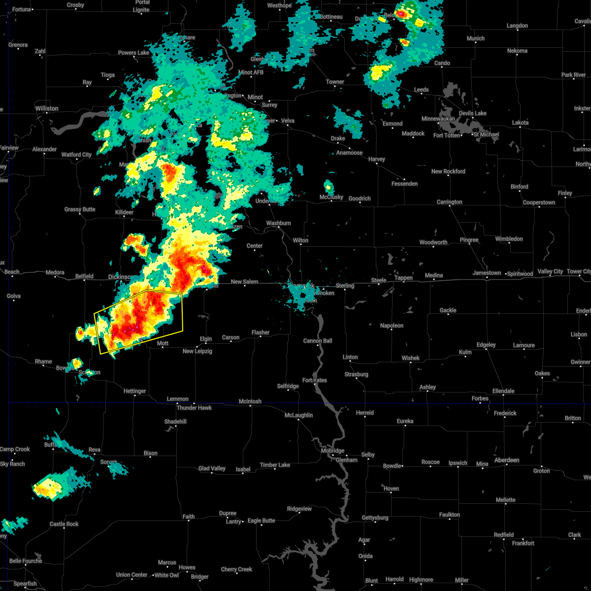 At 502 pm mdt, a severe thunderstorm was located 14 miles north of regent, or 19 miles northwest of mott, moving northeast at 25 mph. additional severe storms were located over northern hettinger and southeast stark counties (radar indicated). Hazards include 60 mph wind gusts and quarter size hail. Hail damage to vehicles is expected. expect wind damage to roofs, siding, and trees. Locations impacted include, new england, regent, havelock, schefield and lefor. At 502 pm mdt, a severe thunderstorm was located 14 miles north of regent, or 19 miles northwest of mott, moving northeast at 25 mph. additional severe storms were located over northern hettinger and southeast stark counties (radar indicated). Hazards include 60 mph wind gusts and quarter size hail. Hail damage to vehicles is expected. expect wind damage to roofs, siding, and trees. Locations impacted include, new england, regent, havelock, schefield and lefor.
|
| 5/31/2018 4:41 PM MDT |
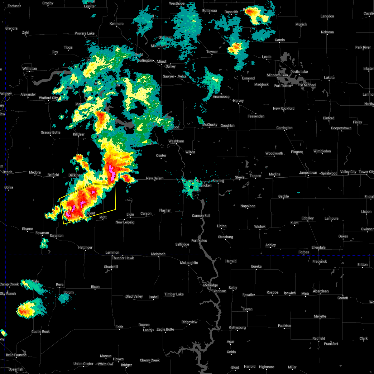 At 441 pm mdt, a severe thunderstorm was located 7 miles east of new england, or 21 miles south of dickinson, moving east at 25 mph (radar indicated). Hazards include 60 mph wind gusts and quarter size hail. Hail damage to vehicles is expected. expect wind damage to roofs, siding, and trees. This severe thunderstorm will remain over mainly rural areas of northern hettinger, northeastern slope and southeastern stark counties, including the following locations, havelock, schefield and lefor. At 441 pm mdt, a severe thunderstorm was located 7 miles east of new england, or 21 miles south of dickinson, moving east at 25 mph (radar indicated). Hazards include 60 mph wind gusts and quarter size hail. Hail damage to vehicles is expected. expect wind damage to roofs, siding, and trees. This severe thunderstorm will remain over mainly rural areas of northern hettinger, northeastern slope and southeastern stark counties, including the following locations, havelock, schefield and lefor.
|
| 5/31/2018 4:22 PM MDT |
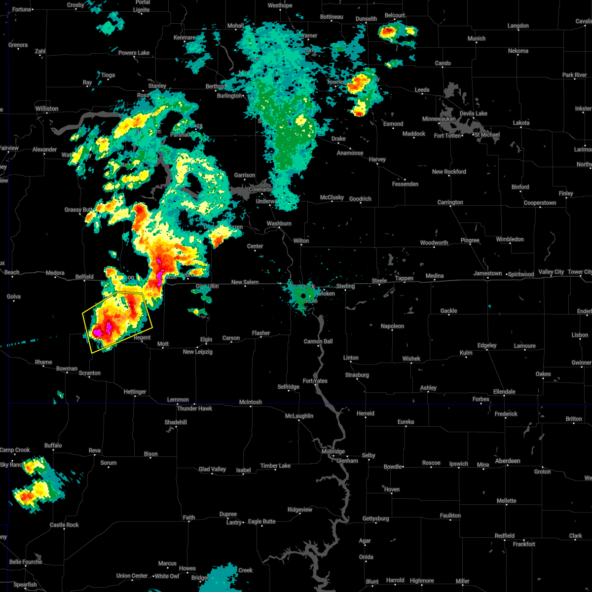 At 421 pm mdt, a severe thunderstorm was located over new england, or 19 miles east of amidon, moving northeast at 20 mph (radar indicated). Hazards include two inch hail and 70 mph wind gusts. People and animals outdoors will be injured. expect hail damage to roofs, siding, windows, and vehicles. expect considerable tree damage. wind damage is also likely to mobile homes, roofs, and outbuildings. this severe storm will be near, new england around 430 pm mdt. Other locations impacted by this severe thunderstorm include havelock, schefield and lefor. At 421 pm mdt, a severe thunderstorm was located over new england, or 19 miles east of amidon, moving northeast at 20 mph (radar indicated). Hazards include two inch hail and 70 mph wind gusts. People and animals outdoors will be injured. expect hail damage to roofs, siding, windows, and vehicles. expect considerable tree damage. wind damage is also likely to mobile homes, roofs, and outbuildings. this severe storm will be near, new england around 430 pm mdt. Other locations impacted by this severe thunderstorm include havelock, schefield and lefor.
|
| 5/31/2018 4:20 PM MDT | Quarter sized hail reported 0.2 miles E of New England, ND, a lot of quarter sized hail lasted 20 minutes. |
| 5/31/2018 4:00 PM MDT |
 At 400 pm mdt, a severe thunderstorm was located 9 miles west of new england, or 12 miles east of amidon, moving northeast at 20 mph (radar indicated). Hazards include golf ball size hail and 70 mph wind gusts. People and animals outdoors will be injured. expect hail damage to roofs, siding, windows, and vehicles. expect considerable tree damage. wind damage is also likely to mobile homes, roofs, and outbuildings. this severe storm will be near, new england around 430 pm mdt. Other locations impacted by this severe thunderstorm include schefield, havelock, lefor and dickinson regional airport. At 400 pm mdt, a severe thunderstorm was located 9 miles west of new england, or 12 miles east of amidon, moving northeast at 20 mph (radar indicated). Hazards include golf ball size hail and 70 mph wind gusts. People and animals outdoors will be injured. expect hail damage to roofs, siding, windows, and vehicles. expect considerable tree damage. wind damage is also likely to mobile homes, roofs, and outbuildings. this severe storm will be near, new england around 430 pm mdt. Other locations impacted by this severe thunderstorm include schefield, havelock, lefor and dickinson regional airport.
|
| 5/31/2018 3:46 PM MDT |
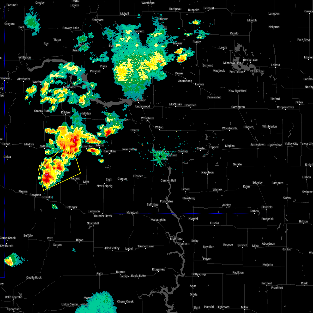 At 346 pm mdt, a severe thunderstorm was located 10 miles west of new england, or 11 miles east of amidon, moving northeast at 35 mph (radar indicated). Hazards include golf ball size hail and 60 mph wind gusts. People and animals outdoors will be injured. expect hail damage to roofs, siding, windows, and vehicles. expect wind damage to roofs, siding, and trees. this severe storm will be near, new england around 400 pm mdt. Other locations impacted by this severe thunderstorm include schefield, havelock, lefor and dickinson regional airport. At 346 pm mdt, a severe thunderstorm was located 10 miles west of new england, or 11 miles east of amidon, moving northeast at 35 mph (radar indicated). Hazards include golf ball size hail and 60 mph wind gusts. People and animals outdoors will be injured. expect hail damage to roofs, siding, windows, and vehicles. expect wind damage to roofs, siding, and trees. this severe storm will be near, new england around 400 pm mdt. Other locations impacted by this severe thunderstorm include schefield, havelock, lefor and dickinson regional airport.
|
| 5/31/2018 3:40 PM MDT |
 At 340 pm mdt, a severe thunderstorm was located 8 miles east of amidon, moving northeast at 35 mph (radar indicated). Hazards include 60 mph wind gusts and half dollar size hail. Hail damage to vehicles is expected. expect wind damage to roofs, siding, and trees. this severe thunderstorm will be near, new england around 400 pm mdt. Other locations impacted by this severe thunderstorm include schefield, havelock, lefor and dickinson regional airport. At 340 pm mdt, a severe thunderstorm was located 8 miles east of amidon, moving northeast at 35 mph (radar indicated). Hazards include 60 mph wind gusts and half dollar size hail. Hail damage to vehicles is expected. expect wind damage to roofs, siding, and trees. this severe thunderstorm will be near, new england around 400 pm mdt. Other locations impacted by this severe thunderstorm include schefield, havelock, lefor and dickinson regional airport.
|
| 5/28/2018 3:50 PM MDT |
 At 349 pm mdt, a severe thunderstorm was located 8 miles north of new england, or 15 miles south of dickinson, moving north at 20 mph (trained weather spotters). Hazards include quarter size hail. Damage to vehicles is expected. Locations impacted include, new england and schefield. At 349 pm mdt, a severe thunderstorm was located 8 miles north of new england, or 15 miles south of dickinson, moving north at 20 mph (trained weather spotters). Hazards include quarter size hail. Damage to vehicles is expected. Locations impacted include, new england and schefield.
|
| 5/28/2018 3:33 PM MDT | Quarter sized hail reported 0.2 miles E of New England, ND, most hail was pea to dime. largest stone was the size of a quarter. heavy rain measured at one inch in 20 minutes. |
| 5/28/2018 3:29 PM MDT |
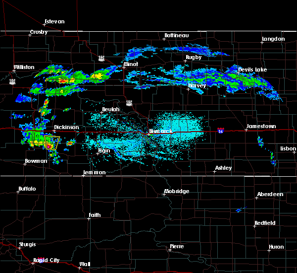 The national weather service in bismarck has issued a * severe thunderstorm warning for. northwestern hettinger county in southwestern north dakota. south central stark county in southwestern north dakota. until 400 pm mdt. At 328 pm mdt, a severe thunderstorm was located over new england,. The national weather service in bismarck has issued a * severe thunderstorm warning for. northwestern hettinger county in southwestern north dakota. south central stark county in southwestern north dakota. until 400 pm mdt. At 328 pm mdt, a severe thunderstorm was located over new england,.
|
| 8/12/2017 5:01 PM MDT |
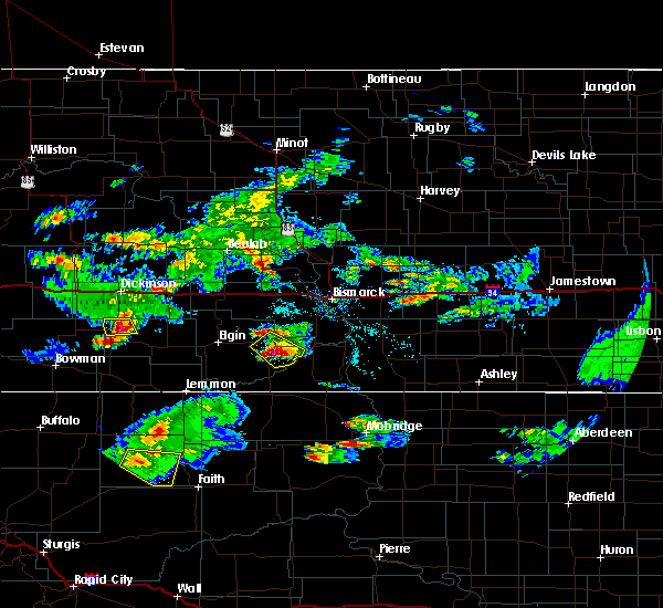 At 500 pm mdt, a severe thunderstorm was located 5 miles northeast of new england, or 21 miles south of dickinson, moving southeast at 20 mph (radar indicated). Hazards include ping pong ball size hail and 60 mph wind gusts. People and animals outdoors will be injured. expect hail damage to roofs, siding, windows, and vehicles. expect wind damage to roofs, siding, and trees. Locations impacted include, new england. At 500 pm mdt, a severe thunderstorm was located 5 miles northeast of new england, or 21 miles south of dickinson, moving southeast at 20 mph (radar indicated). Hazards include ping pong ball size hail and 60 mph wind gusts. People and animals outdoors will be injured. expect hail damage to roofs, siding, windows, and vehicles. expect wind damage to roofs, siding, and trees. Locations impacted include, new england.
|
| 8/12/2017 4:31 PM MDT |
 At 431 pm mdt, a severe thunderstorm was located 9 miles north of new england, or 15 miles southwest of dickinson, moving southeast at 20 mph (radar indicated). Hazards include ping pong ball size hail and 60 mph wind gusts. People and animals outdoors will be injured. expect hail damage to roofs, siding, windows, and vehicles. expect wind damage to roofs, siding, and trees. Locations impacted include, new england and schefield. At 431 pm mdt, a severe thunderstorm was located 9 miles north of new england, or 15 miles southwest of dickinson, moving southeast at 20 mph (radar indicated). Hazards include ping pong ball size hail and 60 mph wind gusts. People and animals outdoors will be injured. expect hail damage to roofs, siding, windows, and vehicles. expect wind damage to roofs, siding, and trees. Locations impacted include, new england and schefield.
|
| 8/12/2017 4:14 PM MDT |
 At 414 pm mdt, a severe thunderstorm was located 11 miles south of south heart, or 14 miles southwest of dickinson, moving southeast at 20 mph (radar indicated). Hazards include ping pong ball size hail and 60 mph wind gusts. People and animals outdoors will be injured. expect hail damage to roofs, siding, windows, and vehicles. expect wind damage to roofs, siding, and trees. this severe thunderstorm will be near, new england around 445 pm mdt. Other locations impacted by this severe thunderstorm include schefield. At 414 pm mdt, a severe thunderstorm was located 11 miles south of south heart, or 14 miles southwest of dickinson, moving southeast at 20 mph (radar indicated). Hazards include ping pong ball size hail and 60 mph wind gusts. People and animals outdoors will be injured. expect hail damage to roofs, siding, windows, and vehicles. expect wind damage to roofs, siding, and trees. this severe thunderstorm will be near, new england around 445 pm mdt. Other locations impacted by this severe thunderstorm include schefield.
|
| 7/20/2017 4:58 PM MDT |
 At 456 pm mdt, severe thunderstorms were located along a line extending from 5 miles northeast of new england to 5 miles north of table mountain, moving east at 35 mph (trained weather spotters report 60 mph winds 5 miles west of rhame). Hazards include 60 mph wind gusts and quarter size hail. Hail damage to vehicles is expected. expect wind damage to roofs, siding, and trees. these severe storms will be near, new england around 500 pm mdt. Other locations impacted by these severe thunderstorms include sunset butte, bowman haley dam, bucyrus, griffin, buffalo springs, havelock and gascoyne. At 456 pm mdt, severe thunderstorms were located along a line extending from 5 miles northeast of new england to 5 miles north of table mountain, moving east at 35 mph (trained weather spotters report 60 mph winds 5 miles west of rhame). Hazards include 60 mph wind gusts and quarter size hail. Hail damage to vehicles is expected. expect wind damage to roofs, siding, and trees. these severe storms will be near, new england around 500 pm mdt. Other locations impacted by these severe thunderstorms include sunset butte, bowman haley dam, bucyrus, griffin, buffalo springs, havelock and gascoyne.
|
| 7/20/2017 4:33 PM MDT |
 At 432 pm mdt, severe thunderstorms were located along a line extending from 7 miles northwest of new england to near mud buttes, moving east at 40 mph (radar indicated). Hazards include 60 mph wind gusts and quarter size hail. Hail damage to vehicles is expected. expect wind damage to roofs, siding, and trees. severe thunderstorms will be near, new england around 440 pm mdt. reeder around 530 pm mdt. Other locations impacted by these severe thunderstorms include sunset butte, bowman haley dam, bucyrus, griffin, buffalo springs, havelock, pretty butte and gascoyne. At 432 pm mdt, severe thunderstorms were located along a line extending from 7 miles northwest of new england to near mud buttes, moving east at 40 mph (radar indicated). Hazards include 60 mph wind gusts and quarter size hail. Hail damage to vehicles is expected. expect wind damage to roofs, siding, and trees. severe thunderstorms will be near, new england around 440 pm mdt. reeder around 530 pm mdt. Other locations impacted by these severe thunderstorms include sunset butte, bowman haley dam, bucyrus, griffin, buffalo springs, havelock, pretty butte and gascoyne.
|
| 7/19/2017 5:42 AM MDT |
 At 542 am mdt, severe thunderstorms were located along a line extending from 6 miles northwest of new england to scranton, moving east at 45 mph (radar indicated). Hazards include 60 mph wind gusts and quarter size hail. Hail damage to vehicles is expected. expect wind damage to roofs, siding, and trees. these severe storms will be near, new england around 550 am mdt. reeder around 555 am mdt. regent around 615 am mdt. Other locations impacted by these severe thunderstorms include bucyrus, buffalo springs, havelock and gascoyne. At 542 am mdt, severe thunderstorms were located along a line extending from 6 miles northwest of new england to scranton, moving east at 45 mph (radar indicated). Hazards include 60 mph wind gusts and quarter size hail. Hail damage to vehicles is expected. expect wind damage to roofs, siding, and trees. these severe storms will be near, new england around 550 am mdt. reeder around 555 am mdt. regent around 615 am mdt. Other locations impacted by these severe thunderstorms include bucyrus, buffalo springs, havelock and gascoyne.
|
| 7/19/2017 5:22 AM MDT |
 At 522 am mdt, severe thunderstorms were located along a line extending from 8 miles north of amidon to bowman, moving east at 45 mph (radar indicated). Hazards include 70 mph wind gusts and ping pong ball size hail. People and animals outdoors will be injured. expect hail damage to roofs, siding, windows, and vehicles. expect considerable tree damage. wind damage is also likely to mobile homes, roofs, and outbuildings. severe thunderstorms will be near, scranton around 540 am mdt. new england around 550 am mdt. reeder around 555 am mdt. regent around 615 am mdt. Other locations impacted by these severe thunderstorms include bucyrus, griffin, buffalo springs, havelock and gascoyne. At 522 am mdt, severe thunderstorms were located along a line extending from 8 miles north of amidon to bowman, moving east at 45 mph (radar indicated). Hazards include 70 mph wind gusts and ping pong ball size hail. People and animals outdoors will be injured. expect hail damage to roofs, siding, windows, and vehicles. expect considerable tree damage. wind damage is also likely to mobile homes, roofs, and outbuildings. severe thunderstorms will be near, scranton around 540 am mdt. new england around 550 am mdt. reeder around 555 am mdt. regent around 615 am mdt. Other locations impacted by these severe thunderstorms include bucyrus, griffin, buffalo springs, havelock and gascoyne.
|
| 7/10/2017 6:52 PM MDT |
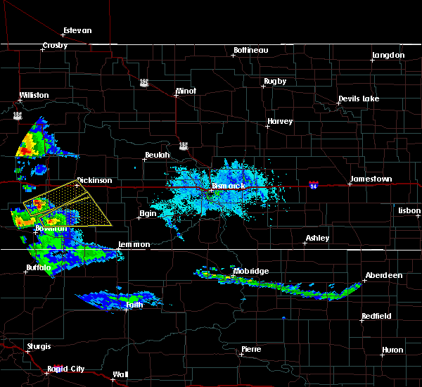 At 651 pm mdt, a severe thunderstorm was located 11 miles southeast of amidon, moving northeast at 30 mph (radar indicated). Hazards include golf ball size hail and 60 mph wind gusts. People and animals outdoors will be injured. expect hail damage to roofs, siding, windows, and vehicles. expect wind damage to roofs, siding, and trees. Locations impacted include, mott, new england, regent, havelock and lefor. At 651 pm mdt, a severe thunderstorm was located 11 miles southeast of amidon, moving northeast at 30 mph (radar indicated). Hazards include golf ball size hail and 60 mph wind gusts. People and animals outdoors will be injured. expect hail damage to roofs, siding, windows, and vehicles. expect wind damage to roofs, siding, and trees. Locations impacted include, mott, new england, regent, havelock and lefor.
|
| 7/10/2017 6:41 PM MDT |
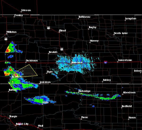 At 641 pm mdt, a severe thunderstorm was located 15 miles northeast of bowman, moving northeast at 40 mph (radar indicated). Hazards include tennis ball size hail and 60 mph wind gusts. People and animals outdoors will be injured. expect hail damage to roofs, siding, windows, and vehicles. expect wind damage to roofs, siding, and trees. Locations impacted include, mott, new england, regent, havelock and lefor. At 641 pm mdt, a severe thunderstorm was located 15 miles northeast of bowman, moving northeast at 40 mph (radar indicated). Hazards include tennis ball size hail and 60 mph wind gusts. People and animals outdoors will be injured. expect hail damage to roofs, siding, windows, and vehicles. expect wind damage to roofs, siding, and trees. Locations impacted include, mott, new england, regent, havelock and lefor.
|
| 7/10/2017 6:31 PM MDT |
 At 631 pm mdt, a severe thunderstorm was located 12 miles northeast of bowman, moving east at 45 mph (radar indicated). Hazards include ping pong ball size hail and 60 mph wind gusts. People and animals outdoors will be injured. expect hail damage to roofs, siding, windows, and vehicles. expect wind damage to roofs, siding, and trees. Locations impacted include, mott, new england, regent, havelock and lefor. At 631 pm mdt, a severe thunderstorm was located 12 miles northeast of bowman, moving east at 45 mph (radar indicated). Hazards include ping pong ball size hail and 60 mph wind gusts. People and animals outdoors will be injured. expect hail damage to roofs, siding, windows, and vehicles. expect wind damage to roofs, siding, and trees. Locations impacted include, mott, new england, regent, havelock and lefor.
|
| 7/10/2017 6:26 PM MDT |
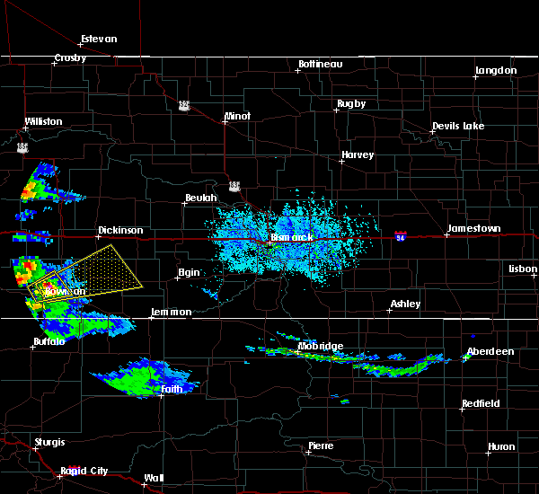 At 626 pm mdt, a severe thunderstorm was located 9 miles north of bowman, moving east at 45 mph (radar indicated). Hazards include 60 mph wind gusts and quarter size hail. Hail damage to vehicles is expected. Expect wind damage to roofs, siding, and trees. At 626 pm mdt, a severe thunderstorm was located 9 miles north of bowman, moving east at 45 mph (radar indicated). Hazards include 60 mph wind gusts and quarter size hail. Hail damage to vehicles is expected. Expect wind damage to roofs, siding, and trees.
|
| 7/10/2016 5:57 PM MDT |
 At 656 pm cdt/556 pm mdt/, severe thunderstorms were located along a line extending from 7 miles south of dunn center to 13 miles south of hebron to 11 miles south of mott, moving east at 70 mph (radar indicated). Hazards include 70 mph wind gusts and half dollar size hail. Hail damage to vehicles is expected. expect considerable tree damage. wind damage is also likely to mobile homes, roofs, and outbuildings. Locations impacted include, dickinson, beulah, hettinger, glen ullin, mott, elgin, new salem, hebron, new england, richardton, carson, gladstone, zap, new leipzig, regent, taylor, almont, marshall, haynes and heart butte dam. At 656 pm cdt/556 pm mdt/, severe thunderstorms were located along a line extending from 7 miles south of dunn center to 13 miles south of hebron to 11 miles south of mott, moving east at 70 mph (radar indicated). Hazards include 70 mph wind gusts and half dollar size hail. Hail damage to vehicles is expected. expect considerable tree damage. wind damage is also likely to mobile homes, roofs, and outbuildings. Locations impacted include, dickinson, beulah, hettinger, glen ullin, mott, elgin, new salem, hebron, new england, richardton, carson, gladstone, zap, new leipzig, regent, taylor, almont, marshall, haynes and heart butte dam.
|
| 7/10/2016 5:36 PM MDT |
 At 635 pm cdt/535 pm mdt/, severe thunderstorms were located along a line extending from 5 miles east of south fairfield to 13 miles north of regent to 6 miles east of reeder, moving east at 70 mph (radar indicated). Hazards include two inch hail and 70 mph wind gusts. People and animals outdoors will be injured. expect hail damage to roofs, siding, windows, and vehicles. expect considerable tree damage. Wind damage is also likely to mobile homes, roofs, and outbuildings. At 635 pm cdt/535 pm mdt/, severe thunderstorms were located along a line extending from 5 miles east of south fairfield to 13 miles north of regent to 6 miles east of reeder, moving east at 70 mph (radar indicated). Hazards include two inch hail and 70 mph wind gusts. People and animals outdoors will be injured. expect hail damage to roofs, siding, windows, and vehicles. expect considerable tree damage. Wind damage is also likely to mobile homes, roofs, and outbuildings.
|
| 7/10/2016 5:21 PM MDT |
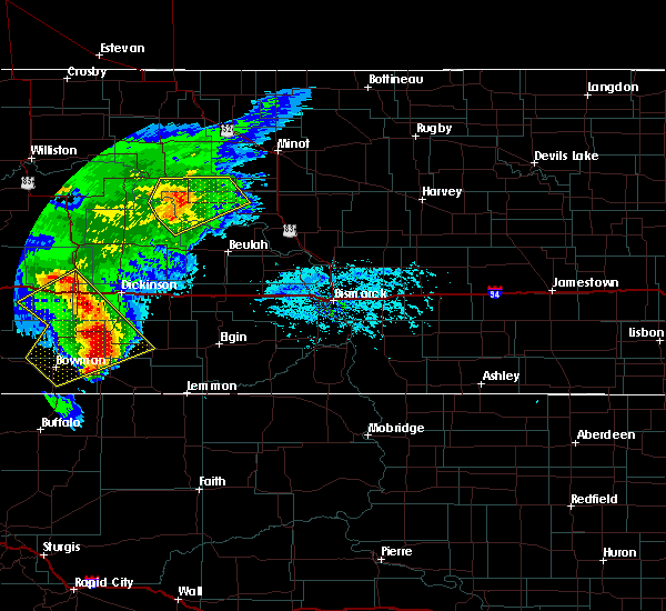 At 515 pm mdt, severe thunderstorms were located along a line extending from 7 miles north of medora to 6 miles south of south heart to 7 miles northwest of scranton, moving northeast at 30 mph. these are very dangerous storms with damaging wind as high as 75 mph and baseball size hail. there was a lot of lightning and heavy rain. the rain will cause minor flooding of streets, culverts, ditches, and creeks. if you are in the path of the storms, get to safe shelter now (public). Hazards include baseball size hail and 70 mph wind gusts. People and animals outdoors will be severely injured. expect shattered windows, extensive damage to roofs, siding, and vehicles. Cities in the path of the storms are scranton, new england, regent and south heart. At 515 pm mdt, severe thunderstorms were located along a line extending from 7 miles north of medora to 6 miles south of south heart to 7 miles northwest of scranton, moving northeast at 30 mph. these are very dangerous storms with damaging wind as high as 75 mph and baseball size hail. there was a lot of lightning and heavy rain. the rain will cause minor flooding of streets, culverts, ditches, and creeks. if you are in the path of the storms, get to safe shelter now (public). Hazards include baseball size hail and 70 mph wind gusts. People and animals outdoors will be severely injured. expect shattered windows, extensive damage to roofs, siding, and vehicles. Cities in the path of the storms are scranton, new england, regent and south heart.
|
| 7/10/2016 5:08 PM MDT | Quarter sized hail reported 10.4 miles NE of New England, ND, via social media. |
| 7/10/2016 4:54 PM MDT |
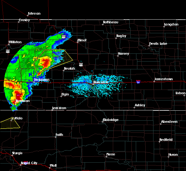 At 449 pm mdt, severe thunderstorms were located along a line extending from 7 miles southwest of medora to 13 miles northeast of amidon to 5 miles south of bowman, moving northeast at 30 mph (radar indicated). Hazards include golf ball size hail and 70 mph wind gusts. People and animals outdoors will be injured. expect hail damage to roofs, siding, windows, and vehicles. expect considerable tree damage. wind damage is also likely to mobile homes, roofs, and outbuildings. medora, belfield, amidon, new england, south heart and scranton are in the path of this line of storms. Interstate 94 from medora to belfield, and highway 85 in that area, will also be impacted. At 449 pm mdt, severe thunderstorms were located along a line extending from 7 miles southwest of medora to 13 miles northeast of amidon to 5 miles south of bowman, moving northeast at 30 mph (radar indicated). Hazards include golf ball size hail and 70 mph wind gusts. People and animals outdoors will be injured. expect hail damage to roofs, siding, windows, and vehicles. expect considerable tree damage. wind damage is also likely to mobile homes, roofs, and outbuildings. medora, belfield, amidon, new england, south heart and scranton are in the path of this line of storms. Interstate 94 from medora to belfield, and highway 85 in that area, will also be impacted.
|
| 6/21/2016 7:41 PM MDT |
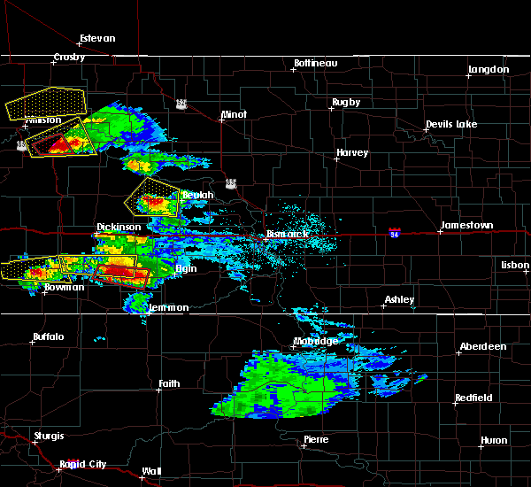 At 740 pm mdt, a severe thunderstorm was over regent, moving east at 40 mph. this is a very dangerous storm (trained weather spotters). Hazards include baseball size hail and 60 mph wind gusts. People and animals outdoors will be severely injured. expect shattered windows, extensive damage to roofs, siding, and vehicles. Locations impacted include, mott, new england, regent and havelock. At 740 pm mdt, a severe thunderstorm was over regent, moving east at 40 mph. this is a very dangerous storm (trained weather spotters). Hazards include baseball size hail and 60 mph wind gusts. People and animals outdoors will be severely injured. expect shattered windows, extensive damage to roofs, siding, and vehicles. Locations impacted include, mott, new england, regent and havelock.
|
| 6/21/2016 7:40 PM MDT | Hen Egg sized hail reported 12.8 miles NW of New England, ND, still ongoing |
| 6/21/2016 7:19 PM MDT |
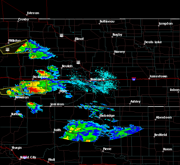 At 718 pm mdt, a severe thunderstorm was located over new england, or 20 miles east of amidon, moving east at 25 mph (trained weather spotters). Hazards include tennis ball size hail and 60 mph wind gusts. People and animals outdoors will be injured. expect hail damage to roofs, siding, windows, and vehicles. expect wind damage to roofs, siding, and trees. locations impacted include, mott, new england, regent, havelock, schefield and lefor. this storm was rotating and although there was no tornado it is possible that one could form. Stay alert. At 718 pm mdt, a severe thunderstorm was located over new england, or 20 miles east of amidon, moving east at 25 mph (trained weather spotters). Hazards include tennis ball size hail and 60 mph wind gusts. People and animals outdoors will be injured. expect hail damage to roofs, siding, windows, and vehicles. expect wind damage to roofs, siding, and trees. locations impacted include, mott, new england, regent, havelock, schefield and lefor. this storm was rotating and although there was no tornado it is possible that one could form. Stay alert.
|
| 6/21/2016 7:18 PM MDT | Baseball sized hail reported 0.2 miles E of New England, ND, a few baseball size hail pieces |
| 6/21/2016 7:15 PM MDT | Tennis Ball sized hail reported 2.1 miles E of New England, ND, hail continues at the time of this lsr issuance. |
| 6/21/2016 7:10 PM MDT |
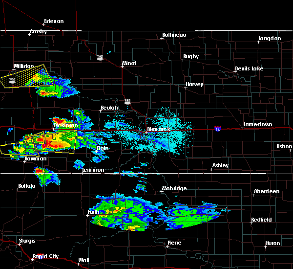 At 709 pm mdt, a severe thunderstorm was located near new england, or 19 miles south of dickinson, moving east at 35 mph (radar indicated). Hazards include golf ball size hail and 60 mph wind gusts. People and animals outdoors will be injured. expect hail damage to roofs, siding, windows, and vehicles. expect wind damage to roofs, siding, and trees. this severe thunderstorm will remain over mainly rural areas of northwestern hettinger, northeastern slope and southern stark counties, including the following locations: havelock, schefield and lefor. this is a very dangerous storm with golf ball size hail expected. no tornado was occurring with this storm at this time but the storm was rotating and it is possible that a tornado could form. Stay alert. At 709 pm mdt, a severe thunderstorm was located near new england, or 19 miles south of dickinson, moving east at 35 mph (radar indicated). Hazards include golf ball size hail and 60 mph wind gusts. People and animals outdoors will be injured. expect hail damage to roofs, siding, windows, and vehicles. expect wind damage to roofs, siding, and trees. this severe thunderstorm will remain over mainly rural areas of northwestern hettinger, northeastern slope and southern stark counties, including the following locations: havelock, schefield and lefor. this is a very dangerous storm with golf ball size hail expected. no tornado was occurring with this storm at this time but the storm was rotating and it is possible that a tornado could form. Stay alert.
|
| 6/17/2016 1:25 AM MDT | At 123 am mdt, severe thunderstorms were located along a line extending from 4 miles north of dickinson to 7 miles north of regent, moving east at 45 mph. at 120 am mdt, 64 mph winds were reported at the dickinson airport (radar indicated). Hazards include 70 mph wind gusts and quarter size hail. Hail damage to vehicles is expected. expect considerable tree damage. wind damage is also likely to mobile homes, roofs, and outbuildings. these severe storms will be near, gladstone around 135 am mdt. Other locations impacted by these severe thunderstorms include schefield, dickinson regional airport, lefor and new hradec. |
| 6/17/2016 1:07 AM MDT |
 At 107 am mdt, severe thunderstorms were located along a line extending from south heart to new england, moving east at 50 mph (radar indicated). Hazards include 70 mph wind gusts and quarter size hail. Hail damage to vehicles is expected. expect considerable tree damage. wind damage is also likely to mobile homes, roofs, and outbuildings. these severe storms will be near, dickinson around 120 am mdt. gladstone around 130 am mdt. Other locations impacted by these severe thunderstorms include schefield, dickinson regional airport, lefor and new hradec. At 107 am mdt, severe thunderstorms were located along a line extending from south heart to new england, moving east at 50 mph (radar indicated). Hazards include 70 mph wind gusts and quarter size hail. Hail damage to vehicles is expected. expect considerable tree damage. wind damage is also likely to mobile homes, roofs, and outbuildings. these severe storms will be near, dickinson around 120 am mdt. gladstone around 130 am mdt. Other locations impacted by these severe thunderstorms include schefield, dickinson regional airport, lefor and new hradec.
|
| 6/17/2016 12:43 AM MDT |
 At 1242 am mdt, severe thunderstorms were located along a line extending from 9 miles southeast of medora to 6 miles northwest of amidon, moving east at 45 mph (radar indicated). Hazards include 70 mph wind gusts and ping pong ball size hail. People and animals outdoors will be injured. expect hail damage to roofs, siding, windows, and vehicles. expect considerable tree damage. wind damage is also likely to mobile homes, roofs, and outbuildings. severe thunderstorms will be near, belfield around 100 am mdt. south heart around 110 am mdt. new england around 115 am mdt. dickinson around 125 am mdt. gladstone around 140 am mdt. Other locations impacted by these severe thunderstorms include schefield, dickinson regional airport, fryburg, lefor and new hradec. At 1242 am mdt, severe thunderstorms were located along a line extending from 9 miles southeast of medora to 6 miles northwest of amidon, moving east at 45 mph (radar indicated). Hazards include 70 mph wind gusts and ping pong ball size hail. People and animals outdoors will be injured. expect hail damage to roofs, siding, windows, and vehicles. expect considerable tree damage. wind damage is also likely to mobile homes, roofs, and outbuildings. severe thunderstorms will be near, belfield around 100 am mdt. south heart around 110 am mdt. new england around 115 am mdt. dickinson around 125 am mdt. gladstone around 140 am mdt. Other locations impacted by these severe thunderstorms include schefield, dickinson regional airport, fryburg, lefor and new hradec.
|
| 6/9/2016 6:16 PM MDT | Quarter sized hail reported 11 miles SSW of New England, ND |
| 7/26/2015 3:35 PM MDT | Quarter sized hail reported 13.9 miles ENE of New England, ND, winds to 45 mph accompanied the large hail. |
| 7/11/2012 6:35 PM MDT | Quarter sized hail reported 0.2 miles E of New England, ND, hail lasted 10 minutes until 745 pm cdt. |
| 8/31/2011 9:20 PM MDT | Quarter sized hail reported 0.2 miles E of New England, ND, hail lasted until 925 pm cdt. also had 40 mph winds. |
| 1/1/0001 12:00 AM | Quarter sized hail reported 0.2 miles E of New England, ND, dime to quarter size hail |
| 1/1/0001 12:00 AM | Storm damage reported in hettinger county ND, 0.2 miles E of New England, ND |
| 1/1/0001 12:00 AM | Golf Ball sized hail reported 5.4 miles ENE of New England, ND, majority of hail was nickels...but hail was up to the size of a golf balls. hail lasted about 5 minutes. |
| 1/1/0001 12:00 AM | Storm damage reported in hettinger county ND, 0.2 miles E of New England, ND |
| 1/1/0001 12:00 AM | Quarter sized hail reported 0.2 miles E of New England, ND, still getting pea size hail. |
Hail Maps for New England, ND


Connect with Interactive Hail Maps