

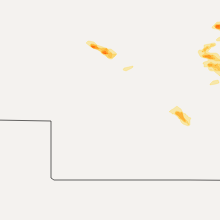
Hail Map for Sunday, August 9, 2015

Number of Impacted Households on 8/9/2015
0
Impacted by 1" or Larger Hail
0
Impacted by 1.75" or Larger Hail
0
Impacted by 2.5" or Larger Hail
Square Miles of Populated Area Impacted on 8/9/2015
0
Impacted by 1" or Larger Hail
0
Impacted by 1.75" or Larger Hail
0
Impacted by 2.5" or Larger Hail


Cities Most Affected by Hail Storms of 8/9/2015
| Hail Size | Demographics of Zip Codes Affected | ||||||
|---|---|---|---|---|---|---|---|
| City | Count | Average | Largest | Pop Density | House Value | Income | Age |
| Orient, SD | 1 | 2.00 | 2.00 | 1 | $14k | $26.4k | 44.9 |
| Correctionville, IA | 1 | 1.75 | 1.75 | 9 | $54k | $32.2k | 45.3 |
| Spencer, SD | 1 | 1.75 | 1.75 | 3 | $33k | $34.7k | 44.0 |
| Wessington Springs, SD | 1 | 1.75 | 1.75 | 2 | $43k | $30.0k | 50.1 |
Hail and Wind Damage Spotted on 8/9/2015
Filter by Report Type:Hail ReportsWind Reports
States Impacted
South Dakota, Kansas, Nebraska, New Mexico, Texas, Missouri, Alabama, Iowa, Minnesota, IllinoisSouth Dakota
| Local Time | Report Details |
|---|---|
| 7:40 AM CDT | Quarter sized hail reported near South Shore, SD, 64.3 miles WNW of Montevideo, MN, radar estimated time |
| 7:40 AM CDT | Radar estimated time in grant county SD, 64.3 miles WNW of Montevideo, MN |
| 1:30 PM CDT | Quarter sized hail reported near Java, SD, 67.9 miles W of Aberdeen, SD, hail lasted 15 to 20 minutes and shredded some screens on doors. |
| 2:35 PM CDT | Quarter sized hail reported near Gann Valley, SD, 61.9 miles ESE of Pierre, SD |
| 2:40 PM CDT | Storm damage reported in edmunds county SD, 45.2 miles W of Aberdeen, SD |
| 2:41 PM CDT | Quarter sized hail reported near Gann Valley, SD, 61.9 miles ESE of Pierre, SD |
| 3:28 PM CDT | Quarter sized hail reported near Orient, SD, 52.7 miles SW of Aberdeen, SD |
| 3:28 PM CDT | Storm damage reported in hand county SD, 52.7 miles SW of Aberdeen, SD |
| 3:30 PM CDT | Ping Pong Ball sized hail reported near Wessington Springs, SD, 82.9 miles ESE of Pierre, SD |
| 3:32 PM CDT | Golf Ball sized hail reported near Wessington Springs, SD, 83.8 miles ESE of Pierre, SD |
| 3:39 PM CDT | Half Dollar sized hail reported near Orient, SD, 49.1 miles SW of Aberdeen, SD, quarter to a little larger hail. |
| 3:40 PM CDT | Hen Egg sized hail reported near Orient, SD, 52.9 miles SSW of Aberdeen, SD, windshield on car busted out on highway 45. |
| 3:45 PM CDT | Three to four inch diameter trees and limbs down in jerauld county SD, 92.9 miles ESE of Pierre, SD |
| 3:49 PM CDT | Half Dollar sized hail reported near Orient, SD, 48 miles SSW of Aberdeen, SD |
| 3:49 PM CDT | Storm damage reported in hand county SD, 48 miles SSW of Aberdeen, SD |
| 3:50 PM CDT | Quarter sized hail reported near Wessington Springs, SD, 86.7 miles ESE of Pierre, SD |
| 3:52 PM CDT | Quarter sized hail reported near Wessington Springs, SD, 92.9 miles ESE of Pierre, SD |
| 4:04 PM CDT | Quarter sized hail reported near Rockham, SD, 47.3 miles SSW of Aberdeen, SD |
| 4:04 PM CDT | Storm damage reported in hand county SD, 47.3 miles SSW of Aberdeen, SD |
| 4:10 PM CDT | Storm damage reported in spink county SD, 47.2 miles SSW of Aberdeen, SD |
| 4:13 PM CDT | Ping Pong Ball sized hail reported near Letcher, SD, 86 miles WNW of Sioux Falls, SD, smooth quarter to jagged ping pong |
| 4:15 PM CDT | Storm damage reported in spink county SD, 50.1 miles SSW of Aberdeen, SD |
| 4:19 PM CDT | Storm damage reported in spink county SD, 53.2 miles S of Aberdeen, SD |
| 4:30 PM CDT | Via twitter. tree down in redfield. time estimated in spink county SD, 40.7 miles S of Aberdeen, SD |
| 4:55 PM CDT | Storm damage reported in davison county SD, 67.4 miles WNW of Sioux Falls, SD |
| 5:00 PM CDT | Medium size limbs downed. estimate 60 mp in spink county SD, 58.7 miles SSE of Aberdeen, SD |
| 5:19 PM CDT | Tree branches down in beadle county SD, 63.6 miles SSE of Aberdeen, SD |
| 5:30 PM CDT | Quarter sized hail reported near Woonsocket, SD, 91.4 miles WNW of Sioux Falls, SD, time estimated from radar |
| 5:30 PM CDT | Half Dollar sized hail reported near Alexandria, SD, 55.1 miles WNW of Sioux Falls, SD |
| 5:39 PM CDT | Ping Pong Ball sized hail reported near Woonsocket, SD, 84.6 miles WNW of Sioux Falls, SD, social media report...time estimated from radar |
| 5:42 PM CDT | Time estimated from radar in sanborn county SD, 83.1 miles WNW of Sioux Falls, SD |
| 5:53 PM CDT | Golf Ball sized hail reported near Spencer, SD, 43.9 miles WNW of Sioux Falls, SD, 45 mph wind gust |
| 5:55 PM CDT | 2.5 inch diameter branches down in kingsbury county SD, 70.9 miles NW of Sioux Falls, SD |
| 6:00 PM CDT | Quarter sized hail reported near Ethan, SD, 60.2 miles W of Sioux Falls, SD, social media report |
| 6:40 PM CDT | Storm damage reported in hutchinson county SD, 47.6 miles WSW of Sioux Falls, SD |
| 7:00 PM CDT | Trees down in lake county SD, 27.6 miles NNW of Sioux Falls, SD |
| 7:00 PM CDT | Damage in the crops in turner county SD, 39.7 miles SW of Sioux Falls, SD |
| 7:00 PM CDT | Quarter sized hail reported near Menno, SD, 42.9 miles SW of Sioux Falls, SD |
| 7:00 PM CDT | Large trees uprooted...time estimated from radar in yankton county SD, 39.3 miles SW of Sioux Falls, SD |
| 7:12 PM CDT | Numerous branches down...social media report in clay county SD, 38.7 miles SW of Sioux Falls, SD |
| 7:17 PM CDT | Large branches blown down. report via social medi in moody county SD, 25.6 miles N of Sioux Falls, SD |
| 7:28 PM CDT | Numerous branches down...social media report in clay county SD, 38.7 miles SW of Sioux Falls, SD |
| 7:54 PM CDT | Trees snapped in union county SD, 37.7 miles S of Sioux Falls, SD |
| 9:04 PM CDT | Dime size hail in clay county SD, 55.7 miles SSW of Sioux Falls, SD |
Kansas
| Local Time | Report Details |
|---|---|
| 9:10 AM CDT | Delayed report of multiple large tree limbs down around conway springs. time radar estimate in sumner county KS, 26.4 miles SW of Wichita, KS |
Nebraska
| Local Time | Report Details |
|---|---|
| 2:49 PM CDT | Quarter sized hail reported near Page, NE, 11.7 miles E of Oneill, NE |
| 5:10 PM CDT | Quarter sized hail reported near Oakdale, NE, 43.9 miles SE of Oneill, NE, mostly pea to marble sized hail...biggest was quarter size. |
| 5:18 PM CDT | Quarter sized hail reported near Bartlett, NE, 31.7 miles S of Oneill, NE |
| 6:35 PM CDT | Quarter sized hail reported near Orchard, NE, 22.4 miles ESE of Oneill, NE, up to quarter size |
| 7:02 PM CDT | Storm damage reported in wheeler county NE, 40.2 miles S of Oneill, NE |
| 9:08 PM CDT | Storm damage reported in dixon county NE, 61 miles S of Sioux Falls, SD |
| 9:47 PM CDT | Quarter sized hail reported near South Sioux City, NE, 63 miles WSW of Storm Lake, IA, report from social media |
New Mexico
| Local Time | Report Details |
|---|---|
| 3:07 PM MDT | Krow aso in chaves county NM, 5.3 miles SSE of Roswell, NM |
| 8:30 PM MDT | Storm damage reported in union county NM, 93 miles NNE of Tucumcari, NM |
| 8:52 PM MDT | Kcao aso in union county NM, 94.3 miles NNE of Tucumcari, NM |
Texas
| Local Time | Report Details |
|---|---|
| 4:56 PM CDT | Kvii schoolnet site at sunnyside in castro county TX, 58.4 miles NNW of Lubbock, TX |
| 5:13 PM CDT | Quarter sized hail reported near Dimmitt, TX, 58.4 miles NNW of Lubbock, TX, community of sunnyside. |
Missouri
| Local Time | Report Details |
|---|---|
| 5:10 PM CDT | Numerous tree branches and limbs blown down near eldon. picture sent via facebook. wind gusts estimated around 60 mp in miller county MO, 43.6 miles SSW of Columbia, MO |
| 5:45 PM CDT | Power lines down in osage county MO, 42.1 miles SE of Columbia, MO |
| 5:47 PM CDT | Severe thunderstorm wind gusts downed a tre in miller county MO, 47.9 miles S of Columbia, MO |
| 5:55 PM CDT | Trees down over road near intersection of highways 42 and in maries county MO, 46.7 miles NW of Salem, MO |
| 6:00 PM CDT | Public reported trees and power lines down north of vienna...relayed by media. time estimated by rada in maries county MO, 48.6 miles NNW of Salem, MO |
| 6:15 PM CDT | Trees blown down in gasconade county MO, 49.2 miles N of Salem, MO |
| 6:34 PM CDT | Near the intersection of highway 50 and strangehoner rd. winds estimated at 50 to 60 mp in franklin county MO, 56.5 miles NNE of Salem, MO |
| 6:38 PM CDT | Tree down blocking road at highway f and ee in crawford county MO, 36.3 miles N of Salem, MO |
| 6:40 PM CDT | Large tree down blocking route c in franklin county MO, 56.2 miles W of Saint Louis, MO |
| 6:42 PM CDT | Between bourbon and sullivan on landers rd...several trees down...largest 6 inch tree blown ove in crawford county MO, 38.7 miles NNE of Salem, MO |
| 6:46 PM CDT | Trees down on highway ww in franklin county MO, 44.9 miles NNE of Salem, MO |
| 6:47 PM CDT | Storm damage reported in franklin county MO, 45.6 miles WSW of Saint Louis, MO |
| 6:50 PM CDT | Large tree limbs down in crawford county MO, 38.7 miles NNE of Salem, MO |
| 6:50 PM CDT | Several trees down within the city limits in crawford county MO, 30.1 miles NNE of Salem, MO |
| 7:00 PM CDT | Road sign blown over along i-44 and tree down and highway 30 and route pp in franklin county MO, 46.4 miles WSW of Saint Louis, MO |
| 7:12 PM CDT | Power lines down and also tree down on kingston road in washington county MO, 46.6 miles SW of Saint Louis, MO |
| 7:23 PM CDT | Trees down in jefferson county MO, 33.2 miles SW of Saint Louis, MO |
| 7:25 PM CDT | Trees down in jefferson county MO, 30.2 miles SW of Saint Louis, MO |
| 7:25 PM CDT | Trees down in jefferson county MO, 38.9 miles SSW of Saint Louis, MO |
| 7:25 PM CDT | Trees down in jefferson county MO, 34 miles SW of Saint Louis, MO |
| 7:27 PM CDT | Large tree limb blocking clement street and third street in jefferson county MO, 38.9 miles SSW of Saint Louis, MO |
| 7:35 PM CDT | Trees down in jefferson county MO, 30.4 miles SSW of Saint Louis, MO |
| 7:55 PM CDT | Power lines down on copenhagen road and route hh in st. francois county MO, 58.3 miles NW of Cape Girardeau, MO |
| 5:20 AM CDT | Power out multiple locations and trees down in town. time estimated by rada in henry county MO, 66.6 miles SE of Kansas City, MO |
| 5:20 AM CDT | Tree down across hwy 18. time and location estimated by rada in henry county MO, 65.9 miles SE of Kansas City, MO |
| 5:32 AM CDT | Storm damage reported in henry county MO, 66.6 miles SE of Kansas City, MO |
Alabama
| Local Time | Report Details |
|---|---|
| 6:10 PM CDT | Trees and powerlines down in spanish fort estates neighborhoo in baldwin county AL, 8 miles E of Mobile, AL |
Iowa
| Local Time | Report Details |
|---|---|
| 6:22 PM CDT | Storm damage reported in dickinson county IA, 55.5 miles NNE of Storm Lake, IA |
| 6:32 PM CDT | Winds estimated over 60 mph with pea size hail. no damage note in emmet county IA, 53.1 miles NNE of Storm Lake, IA |
| 7:26 PM CDT | A 30 inch diameter tree split about 5 feet above the ground. numerous other large branches downed. pea size hail also note in kossuth county IA, 51.6 miles W of Mason City, IA |
| 8:08 PM CDT | Quarter sized hail reported near Chatsworth, IA, 45.3 miles SSE of Sioux Falls, SD, time estimated from radar |
| 9:14 PM CDT | Ping Pong Ball sized hail reported near Rolfe, IA, 32.7 miles ENE of Storm Lake, IA, quarter to ping pong size hail. strong winds also downed tree branches... but could not see the size of the branches due to the darkness. |
| 9:20 PM CDT | Winds estimated at 55 to 60 mph. ripped a farm windmill out of the groun in pocahontas county IA, 36 miles ENE of Storm Lake, IA |
| 9:47 PM CDT | Golf Ball sized hail reported near Correctionville, IA, 31.7 miles WSW of Storm Lake, IA, ping pong and golf ball sized hail |
| 9:49 PM CDT | Ping Pong Ball sized hail reported near Correctionville, IA, 32.2 miles WSW of Storm Lake, IA |
| 10:04 PM CDT | Quarter sized hail reported near Bronson, IA, 55 miles WSW of Storm Lake, IA |
| 10:23 PM CDT | Quarter sized hail reported near Hornick, IA, 51.3 miles WSW of Storm Lake, IA |
| 11:05 PM CDT | Reports of trees and power lines down in town. damage to a church also reported. time estimated from rada in hardin county IA, 51.3 miles N of Des Moines, IA |
| 12:17 AM CDT | Report of trees down in town. time estimated from radar in guthrie county IA, 40.9 miles W of Des Moines, IA |
Minnesota
| Local Time | Report Details |
|---|---|
| 7:33 PM CDT | Several large tree branches blown down. winds estimated 60 mph. from social medi in pipestone county MN, 26.8 miles NE of Sioux Falls, SD |
| 7:40 PM CDT | Large branches blown down. report from social medi in pipestone county MN, 33.5 miles NE of Sioux Falls, SD |
Illinois
| Local Time | Report Details |
|---|---|
| 7:45 PM CDT | Several trees down in monroe county IL, 23.4 miles SSW of Saint Louis, MO |
| 8:00 PM CDT | 12-14 inch diameter tree blown down southeast of columbia il in monroe county IL, 15.9 miles S of Saint Louis, MO |
| 8:39 PM CDT | Trees down on route 3 in randolph county IL, 49 miles SSE of Saint Louis, MO |
| 9:30 PM CDT | East side of town...power lines down...large pole barn destroyed in washington county IL, 51.8 miles ESE of Saint Louis, MO |
Connect with Interactive Hail Maps