

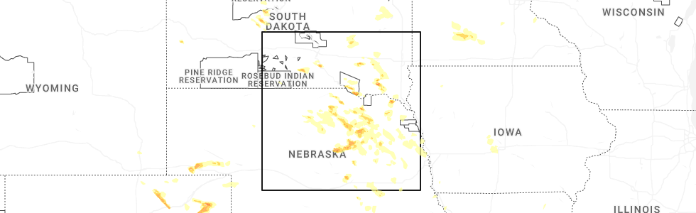
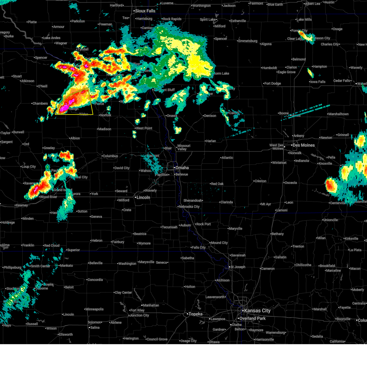
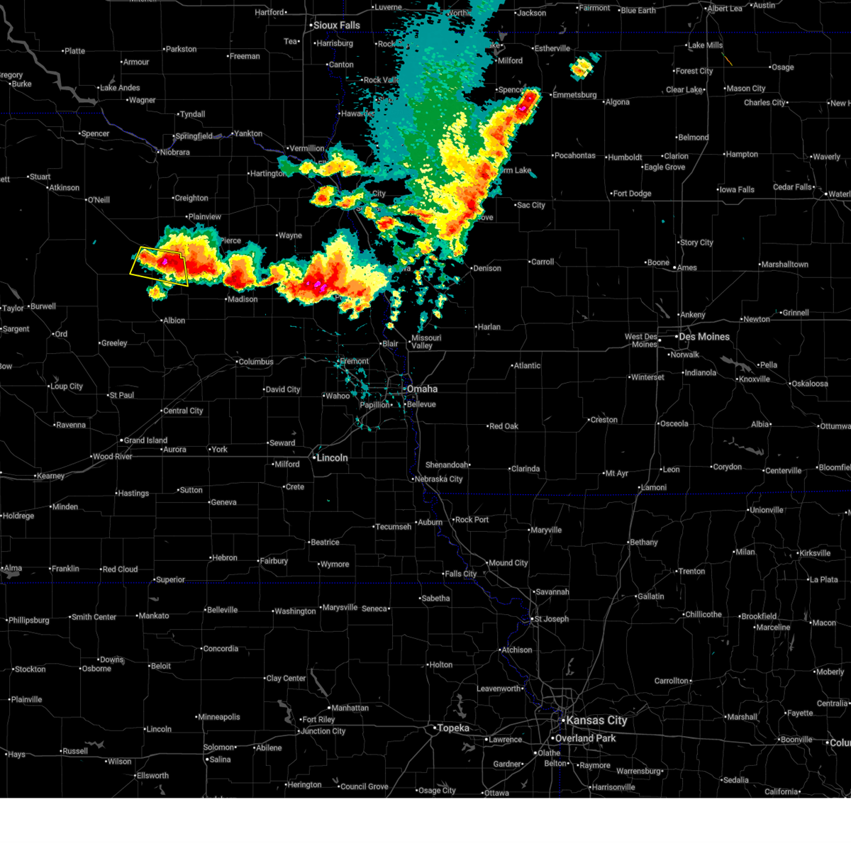
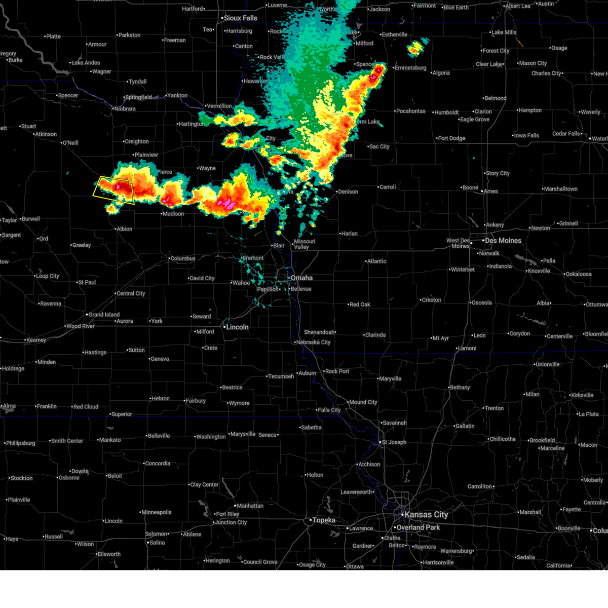
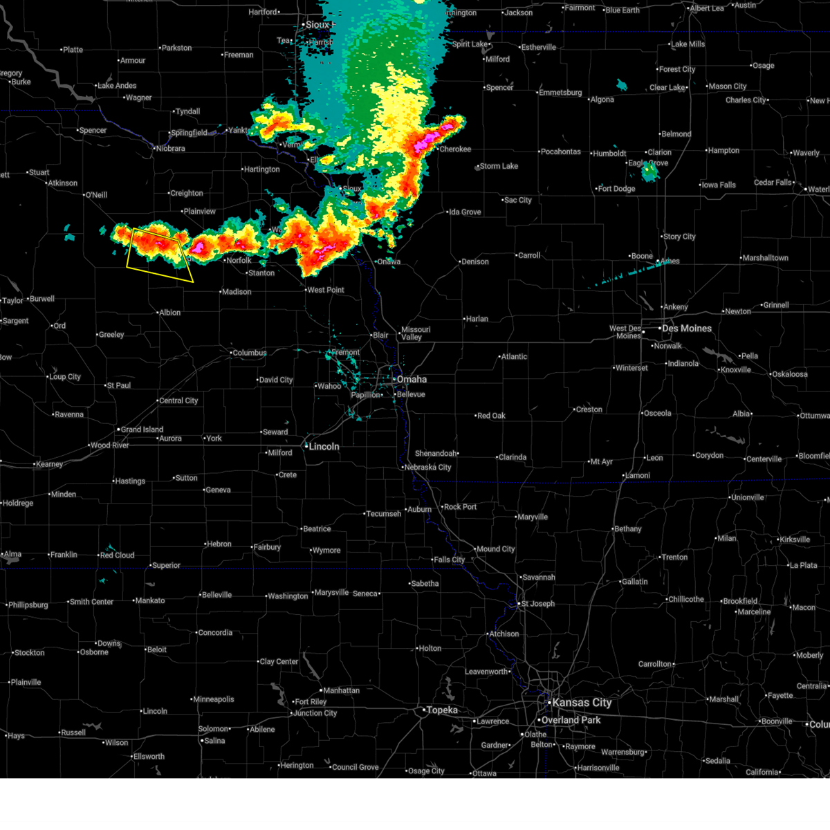
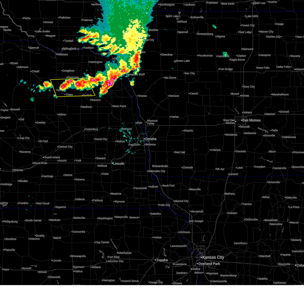
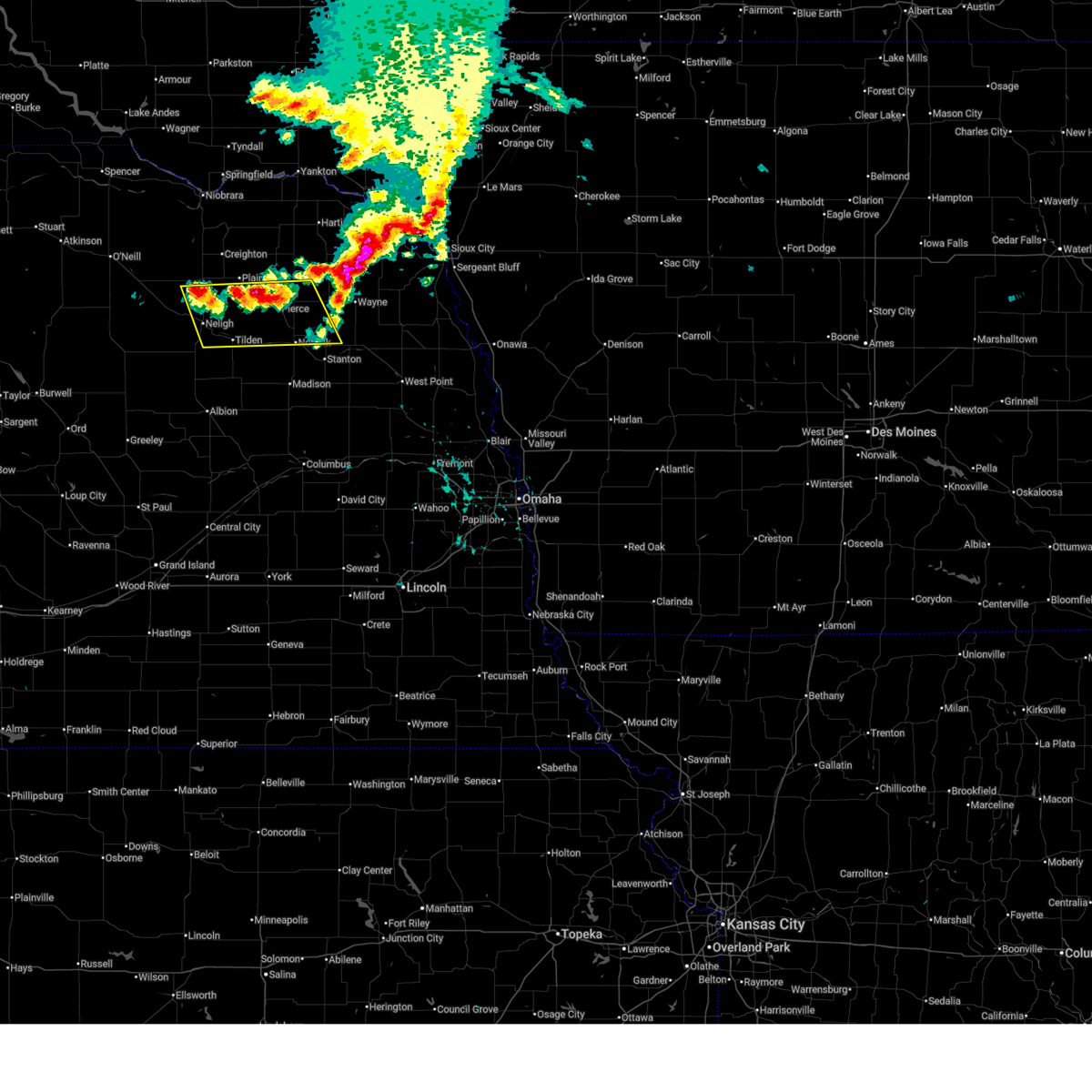
Hail Map for Oakdale, NE
The Oakdale, NE area has had 9 reports of on-the-ground hail by trained spotters, and has been under severe weather warnings 24 times during the past 12 months. Doppler radar has detected hail at or near Oakdale, NE on 91 occasions, including 8 occasions during the past year.
| Name: | Oakdale, NE |
| Where Located: | 44.1 miles SE of Oneill, NE |
| Map: | Google Map for Oakdale, NE |
| Population: | 322 |
| Housing Units: | 160 |
| More Info: | Search Google for Oakdale, NE |
1
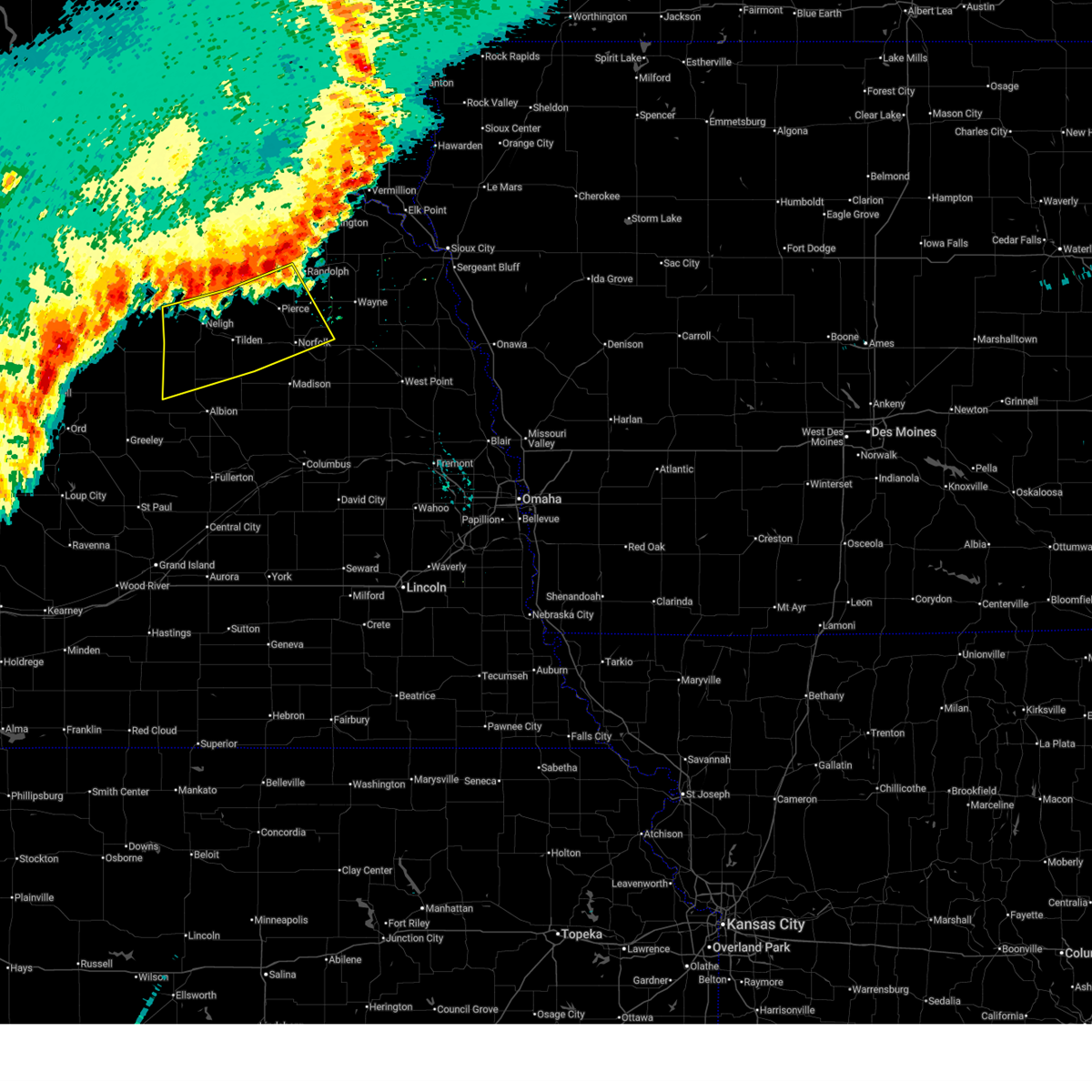
The Top Recent Hail Date for Oakdale, NE is Monday, July 7, 2025 (11th out of 91)
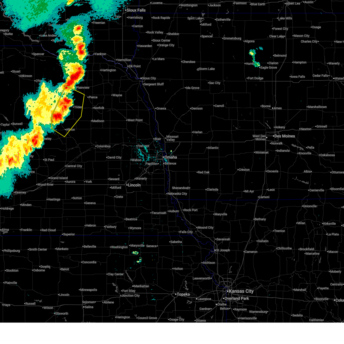
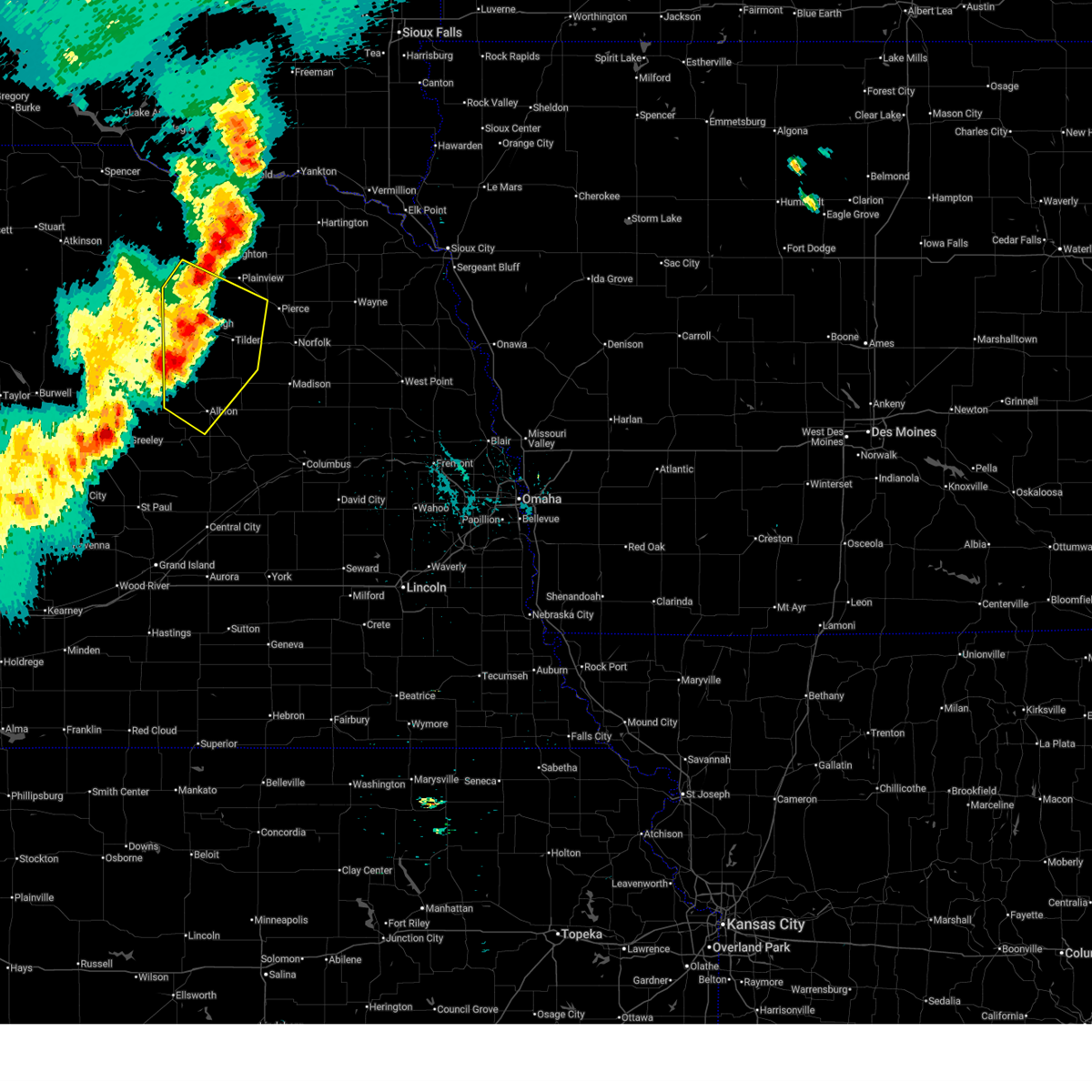
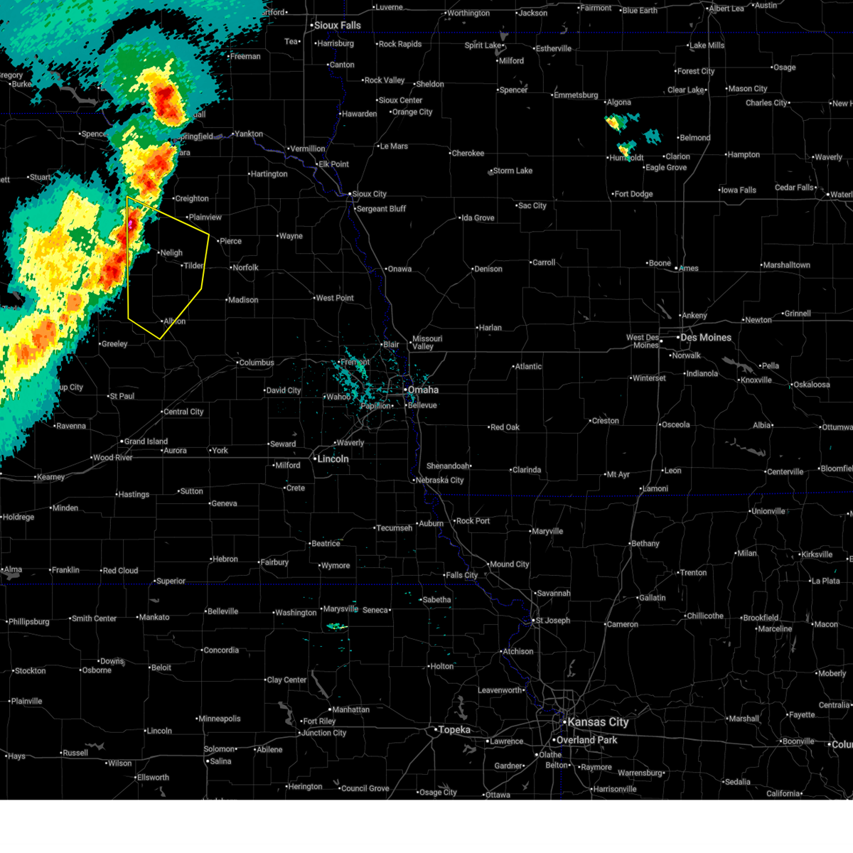
Hail and Wind Damage Spotted near Oakdale, NE
| Date / Time | Report Details |
|---|---|
| 7/15/2025 8:31 PM CDT |
 Svroax the national weather service in omaha has issued a * severe thunderstorm warning for, northern madison county in northeastern nebraska, southwestern wayne county in northeastern nebraska, pierce county in northeastern nebraska, antelope county in northeastern nebraska, northern boone county in northeastern nebraska, northwestern stanton county in northeastern nebraska, * until 915 pm cdt. * at 831 pm cdt, severe thunderstorms were located along a line extending from 4 miles east of osmond to 9 miles southwest of plainview to 4 miles southwest of clearwater, moving south at 20 mph (radar indicated). Hazards include 60 mph wind gusts and penny size hail. Expect damage to roofs, siding, and trees. severe thunderstorms will be near, neligh around 835 pm cdt. pierce and oakdale around 845 pm cdt. Other locations in the path of these severe thunderstorms include tilden and elgin. Svroax the national weather service in omaha has issued a * severe thunderstorm warning for, northern madison county in northeastern nebraska, southwestern wayne county in northeastern nebraska, pierce county in northeastern nebraska, antelope county in northeastern nebraska, northern boone county in northeastern nebraska, northwestern stanton county in northeastern nebraska, * until 915 pm cdt. * at 831 pm cdt, severe thunderstorms were located along a line extending from 4 miles east of osmond to 9 miles southwest of plainview to 4 miles southwest of clearwater, moving south at 20 mph (radar indicated). Hazards include 60 mph wind gusts and penny size hail. Expect damage to roofs, siding, and trees. severe thunderstorms will be near, neligh around 835 pm cdt. pierce and oakdale around 845 pm cdt. Other locations in the path of these severe thunderstorms include tilden and elgin.
|
| 7/10/2025 8:14 PM CDT |
 Svroax the national weather service in omaha has issued a * severe thunderstorm warning for, northwestern madison county in northeastern nebraska, southwestern pierce county in northeastern nebraska, southeastern antelope county in northeastern nebraska, * until 845 pm cdt. * at 814 pm cdt, a severe thunderstorm was located over tilden, or 11 miles southeast of neligh, moving east at 30 mph (radar indicated). Hazards include 60 mph wind gusts and quarter size hail. Hail damage to vehicles is expected. expect wind damage to roofs, siding, and trees. This severe thunderstorm will be near, tilden and meadow grove around 820 pm cdt. Svroax the national weather service in omaha has issued a * severe thunderstorm warning for, northwestern madison county in northeastern nebraska, southwestern pierce county in northeastern nebraska, southeastern antelope county in northeastern nebraska, * until 845 pm cdt. * at 814 pm cdt, a severe thunderstorm was located over tilden, or 11 miles southeast of neligh, moving east at 30 mph (radar indicated). Hazards include 60 mph wind gusts and quarter size hail. Hail damage to vehicles is expected. expect wind damage to roofs, siding, and trees. This severe thunderstorm will be near, tilden and meadow grove around 820 pm cdt.
|
| 7/10/2025 7:47 PM CDT |
 Svroax the national weather service in omaha has issued a * severe thunderstorm warning for, southeastern antelope county in northeastern nebraska, northeastern boone county in northeastern nebraska, * until 815 pm cdt. * at 747 pm cdt, a severe thunderstorm was located near elgin, or 9 miles southwest of neligh, moving east at 30 mph (radar indicated). Hazards include 60 mph wind gusts and quarter size hail. Hail damage to vehicles is expected. expect wind damage to roofs, siding, and trees. this severe thunderstorm will be near, elgin around 750 pm cdt. Oakdale around 755 pm cdt. Svroax the national weather service in omaha has issued a * severe thunderstorm warning for, southeastern antelope county in northeastern nebraska, northeastern boone county in northeastern nebraska, * until 815 pm cdt. * at 747 pm cdt, a severe thunderstorm was located near elgin, or 9 miles southwest of neligh, moving east at 30 mph (radar indicated). Hazards include 60 mph wind gusts and quarter size hail. Hail damage to vehicles is expected. expect wind damage to roofs, siding, and trees. this severe thunderstorm will be near, elgin around 750 pm cdt. Oakdale around 755 pm cdt.
|
| 7/10/2025 5:54 PM CDT | Svroax the national weather service in omaha has issued a * severe thunderstorm warning for, northwestern madison county in northeastern nebraska, southern pierce county in northeastern nebraska, southeastern antelope county in northeastern nebraska, * until 700 pm cdt. * at 554 pm cdt, severe thunderstorms were located along a line extending from 10 miles northeast of neligh to 3 miles northeast of oakdale, moving east at 20 mph (radar indicated). Hazards include golf ball size hail. People and animals outdoors will be injured. expect damage to roofs, siding, windows, and vehicles. severe thunderstorms will be near, tilden around 605 pm cdt. Other locations in the path of these severe thunderstorms include pierce. |
| 7/10/2025 5:43 PM CDT | At 543 pm cdt, a severe thunderstorm was located 4 miles northeast of neligh, moving east at 20 mph (at 540 pm, trained spotter reported golf ball sized hail 4 miles northeast of neleigh). Hazards include two inch hail and 60 mph wind gusts. People and animals outdoors will be injured. expect hail damage to roofs, siding, windows, and vehicles. expect wind damage to roofs, siding, and trees. This severe thunderstorm will remain over mainly rural areas of northwestern madison, southwestern pierce and east central antelope counties, including the following locations, foster. |
| 7/10/2025 5:33 PM CDT |
 At 532 pm cdt, a severe thunderstorm was located 3 miles north of neligh, moving east at 15 mph (radar indicated). Hazards include two inch hail and 60 mph wind gusts. People and animals outdoors will be injured. expect hail damage to roofs, siding, windows, and vehicles. expect wind damage to roofs, siding, and trees. This severe thunderstorm will remain over mainly rural areas of northwestern madison, western pierce and central antelope counties, including the following locations, foster and brunswick. At 532 pm cdt, a severe thunderstorm was located 3 miles north of neligh, moving east at 15 mph (radar indicated). Hazards include two inch hail and 60 mph wind gusts. People and animals outdoors will be injured. expect hail damage to roofs, siding, windows, and vehicles. expect wind damage to roofs, siding, and trees. This severe thunderstorm will remain over mainly rural areas of northwestern madison, western pierce and central antelope counties, including the following locations, foster and brunswick.
|
| 7/10/2025 5:19 PM CDT | At 519 pm cdt, a severe thunderstorm was located 4 miles northwest of neligh, moving east at 15 mph (radar indicated). Hazards include two inch hail and 60 mph wind gusts. People and animals outdoors will be injured. expect hail damage to roofs, siding, windows, and vehicles. expect wind damage to roofs, siding, and trees. Locations impacted include, neligh. |
| 7/10/2025 5:00 PM CDT | Svroax the national weather service in omaha has issued a * severe thunderstorm warning for, northwestern madison county in northeastern nebraska, western pierce county in northeastern nebraska, central antelope county in northeastern nebraska, * until 600 pm cdt. * at 459 pm cdt, a severe thunderstorm was located over clearwater, or 7 miles west of neligh, moving east at 25 mph (radar indicated). Hazards include two inch hail and 60 mph wind gusts. People and animals outdoors will be injured. expect hail damage to roofs, siding, windows, and vehicles. expect wind damage to roofs, siding, and trees. This severe thunderstorm will be near, neligh around 510 pm cdt. |
| 7/9/2025 11:20 PM CDT |
 At 1119 pm cdt, severe thunderstorms were located along a line extending from 10 miles southwest of plainview to 3 miles east of elgin to 5 miles northeast of spalding, moving southeast at 30 mph (radar indicated). Hazards include 60 mph wind gusts and quarter size hail. Hail damage to vehicles is expected. expect wind damage to roofs, siding, and trees. Locations impacted include, albion, neligh, tilden, elgin, petersburg, oakdale, meadow grove, brunswick, and loretto. At 1119 pm cdt, severe thunderstorms were located along a line extending from 10 miles southwest of plainview to 3 miles east of elgin to 5 miles northeast of spalding, moving southeast at 30 mph (radar indicated). Hazards include 60 mph wind gusts and quarter size hail. Hail damage to vehicles is expected. expect wind damage to roofs, siding, and trees. Locations impacted include, albion, neligh, tilden, elgin, petersburg, oakdale, meadow grove, brunswick, and loretto.
|
| 7/9/2025 11:10 PM CDT |
 the severe thunderstorm warning has been cancelled and is no longer in effect the severe thunderstorm warning has been cancelled and is no longer in effect
|
| 7/9/2025 11:10 PM CDT |
 At 1109 pm cdt, severe thunderstorms were located along a line extending from 10 miles east of orchard to 2 miles north of elgin to 4 miles north of spalding, moving southeast at 30 mph (radar indicated). Hazards include 60 mph wind gusts and quarter size hail. Hail damage to vehicles is expected. expect wind damage to roofs, siding, and trees. Locations impacted include, neligh, elgin, petersburg, oakdale and tilden. At 1109 pm cdt, severe thunderstorms were located along a line extending from 10 miles east of orchard to 2 miles north of elgin to 4 miles north of spalding, moving southeast at 30 mph (radar indicated). Hazards include 60 mph wind gusts and quarter size hail. Hail damage to vehicles is expected. expect wind damage to roofs, siding, and trees. Locations impacted include, neligh, elgin, petersburg, oakdale and tilden.
|
| 7/9/2025 10:49 PM CDT |
 Svroax the national weather service in omaha has issued a * severe thunderstorm warning for, northwestern madison county in northeastern nebraska, southwestern pierce county in northeastern nebraska, antelope county in northeastern nebraska, southwestern knox county in northeastern nebraska, boone county in northeastern nebraska, * until 1130 pm cdt. * at 1049 pm cdt, severe thunderstorms were located along a line extending from 4 miles northeast of orchard to 6 miles south of clearwater to 5 miles southeast of bartlett, moving southeast at 25 mph (radar indicated). Hazards include 60 mph wind gusts and quarter size hail. Hail damage to vehicles is expected. expect wind damage to roofs, siding, and trees. severe thunderstorms will be near, neligh and elgin around 1100 pm cdt. Other locations in the path of these severe thunderstorms include petersburg and oakdale. Svroax the national weather service in omaha has issued a * severe thunderstorm warning for, northwestern madison county in northeastern nebraska, southwestern pierce county in northeastern nebraska, antelope county in northeastern nebraska, southwestern knox county in northeastern nebraska, boone county in northeastern nebraska, * until 1130 pm cdt. * at 1049 pm cdt, severe thunderstorms were located along a line extending from 4 miles northeast of orchard to 6 miles south of clearwater to 5 miles southeast of bartlett, moving southeast at 25 mph (radar indicated). Hazards include 60 mph wind gusts and quarter size hail. Hail damage to vehicles is expected. expect wind damage to roofs, siding, and trees. severe thunderstorms will be near, neligh and elgin around 1100 pm cdt. Other locations in the path of these severe thunderstorms include petersburg and oakdale.
|
| 7/7/2025 8:23 PM CDT |
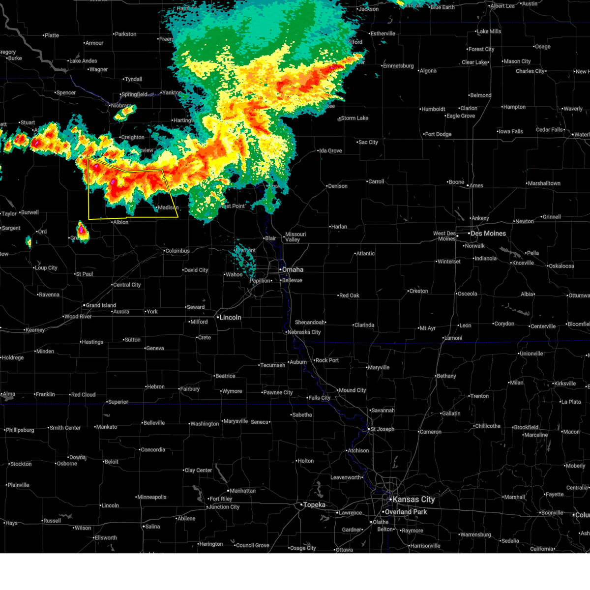 Svroax the national weather service in omaha has issued a * severe thunderstorm warning for, madison county in northeastern nebraska, southern pierce county in northeastern nebraska, southern antelope county in northeastern nebraska, northern boone county in northeastern nebraska, western stanton county in northeastern nebraska, * until 915 pm cdt. * at 823 pm cdt, severe thunderstorms were located along a line extending from 2 miles south of hadar to 2 miles southwest of oakdale, moving southeast at 30 mph (radar indicated). Hazards include 60 mph wind gusts and quarter size hail. Hail damage to vehicles is expected. expect wind damage to roofs, siding, and trees. severe thunderstorms will be near, norfolk, battle creek, tilden, and meadow grove around 830 pm cdt. other locations in the path of these severe thunderstorms include madison. People attending madison county fairgrounds should seek safe shelter immediately!. Svroax the national weather service in omaha has issued a * severe thunderstorm warning for, madison county in northeastern nebraska, southern pierce county in northeastern nebraska, southern antelope county in northeastern nebraska, northern boone county in northeastern nebraska, western stanton county in northeastern nebraska, * until 915 pm cdt. * at 823 pm cdt, severe thunderstorms were located along a line extending from 2 miles south of hadar to 2 miles southwest of oakdale, moving southeast at 30 mph (radar indicated). Hazards include 60 mph wind gusts and quarter size hail. Hail damage to vehicles is expected. expect wind damage to roofs, siding, and trees. severe thunderstorms will be near, norfolk, battle creek, tilden, and meadow grove around 830 pm cdt. other locations in the path of these severe thunderstorms include madison. People attending madison county fairgrounds should seek safe shelter immediately!.
|
| 7/7/2025 7:30 PM CDT |
 Svroax the national weather service in omaha has issued a * severe thunderstorm warning for, southern antelope county in northeastern nebraska, northeastern boone county in northeastern nebraska, * until 815 pm cdt. * at 730 pm cdt, a severe thunderstorm was located near elgin, or 10 miles southwest of neligh, moving east at 20 mph (radar indicated). Hazards include 60 mph wind gusts and quarter size hail. Hail damage to vehicles is expected. expect wind damage to roofs, siding, and trees. this severe thunderstorm will be near, elgin around 735 pm cdt. Oakdale around 750 pm cdt. Svroax the national weather service in omaha has issued a * severe thunderstorm warning for, southern antelope county in northeastern nebraska, northeastern boone county in northeastern nebraska, * until 815 pm cdt. * at 730 pm cdt, a severe thunderstorm was located near elgin, or 10 miles southwest of neligh, moving east at 20 mph (radar indicated). Hazards include 60 mph wind gusts and quarter size hail. Hail damage to vehicles is expected. expect wind damage to roofs, siding, and trees. this severe thunderstorm will be near, elgin around 735 pm cdt. Oakdale around 750 pm cdt.
|
| 7/7/2025 7:11 PM CDT | Svroax the national weather service in omaha has issued a * severe thunderstorm warning for, west central pierce county in northeastern nebraska, northeastern antelope county in northeastern nebraska, * until 800 pm cdt. * at 711 pm cdt, a severe thunderstorm was located 6 miles west of plainview, or 15 miles north of neligh, moving southeast at 15 mph (radar indicated). Hazards include 60 mph wind gusts and quarter size hail. Hail damage to vehicles is expected. expect wind damage to roofs, siding, and trees. This severe thunderstorm will remain over mainly rural areas of west central pierce and northeastern antelope counties, including the following locations, royal, brunswick, and foster. |
| 6/16/2025 6:35 PM CDT |
 At 635 pm cdt, a severe thunderstorm was located 3 miles south of tilden, or 12 miles southeast of neligh, moving southeast at 25 mph (radar indicated). Hazards include 60 mph wind gusts and quarter size hail. Hail damage to vehicles is expected. expect wind damage to roofs, siding, and trees. This severe thunderstorm will remain over mainly rural areas of northwestern madison, southeastern antelope and northeastern boone counties. At 635 pm cdt, a severe thunderstorm was located 3 miles south of tilden, or 12 miles southeast of neligh, moving southeast at 25 mph (radar indicated). Hazards include 60 mph wind gusts and quarter size hail. Hail damage to vehicles is expected. expect wind damage to roofs, siding, and trees. This severe thunderstorm will remain over mainly rural areas of northwestern madison, southeastern antelope and northeastern boone counties.
|
| 6/16/2025 6:25 PM CDT |
 Svroax the national weather service in omaha has issued a * severe thunderstorm warning for, northwestern madison county in northeastern nebraska, southeastern antelope county in northeastern nebraska, northeastern boone county in northeastern nebraska, * until 715 pm cdt. * at 624 pm cdt, a severe thunderstorm was located 3 miles southeast of oakdale, or 8 miles southeast of neligh, moving southeast at 25 mph (radar indicated. at 620 pm cdt, golf ball size hail was reported in oakdale). Hazards include golf ball size hail and 60 mph wind gusts. People and animals outdoors will be injured. expect hail damage to roofs, siding, windows, and vehicles. expect wind damage to roofs, siding, and trees. This severe thunderstorm will be near, tilden around 630 pm cdt. Svroax the national weather service in omaha has issued a * severe thunderstorm warning for, northwestern madison county in northeastern nebraska, southeastern antelope county in northeastern nebraska, northeastern boone county in northeastern nebraska, * until 715 pm cdt. * at 624 pm cdt, a severe thunderstorm was located 3 miles southeast of oakdale, or 8 miles southeast of neligh, moving southeast at 25 mph (radar indicated. at 620 pm cdt, golf ball size hail was reported in oakdale). Hazards include golf ball size hail and 60 mph wind gusts. People and animals outdoors will be injured. expect hail damage to roofs, siding, windows, and vehicles. expect wind damage to roofs, siding, and trees. This severe thunderstorm will be near, tilden around 630 pm cdt.
|
| 6/16/2025 6:20 PM CDT |
 the severe thunderstorm warning has been cancelled and is no longer in effect the severe thunderstorm warning has been cancelled and is no longer in effect
|
| 6/16/2025 6:20 PM CDT |
 At 619 pm cdt, a severe thunderstorm was located over oakdale, or 5 miles south of neligh, moving southeast at 15 mph (radar indicated). Hazards include 60 mph wind gusts and quarter size hail. Hail damage to vehicles is expected. expect wind damage to roofs, siding, and trees. Locations impacted include, neligh, tilden, elgin, and oakdale. At 619 pm cdt, a severe thunderstorm was located over oakdale, or 5 miles south of neligh, moving southeast at 15 mph (radar indicated). Hazards include 60 mph wind gusts and quarter size hail. Hail damage to vehicles is expected. expect wind damage to roofs, siding, and trees. Locations impacted include, neligh, tilden, elgin, and oakdale.
|
| 6/16/2025 5:53 PM CDT | At 553 pm cdt, a severe thunderstorm was located 3 miles northeast of oakdale, or 5 miles east of neligh, moving southeast at 25 mph (radar indicated). Hazards include 60 mph wind gusts and quarter size hail. Hail damage to vehicles is expected. expect wind damage to roofs, siding, and trees. Locations impacted include, tilden. |
| 6/16/2025 5:39 PM CDT |
 Svroax the national weather service in omaha has issued a * severe thunderstorm warning for, northwestern madison county in northeastern nebraska, southwestern pierce county in northeastern nebraska, southern antelope county in northeastern nebraska, * until 630 pm cdt. * at 539 pm cdt, a severe thunderstorm was located over neligh, moving southeast at 25 mph (radar indicated). Hazards include 60 mph wind gusts and quarter size hail. Hail damage to vehicles is expected. expect wind damage to roofs, siding, and trees. this severe thunderstorm will be near, oakdale around 545 pm cdt. Other locations in the path of this severe thunderstorm include tilden. Svroax the national weather service in omaha has issued a * severe thunderstorm warning for, northwestern madison county in northeastern nebraska, southwestern pierce county in northeastern nebraska, southern antelope county in northeastern nebraska, * until 630 pm cdt. * at 539 pm cdt, a severe thunderstorm was located over neligh, moving southeast at 25 mph (radar indicated). Hazards include 60 mph wind gusts and quarter size hail. Hail damage to vehicles is expected. expect wind damage to roofs, siding, and trees. this severe thunderstorm will be near, oakdale around 545 pm cdt. Other locations in the path of this severe thunderstorm include tilden.
|
| 6/16/2025 5:08 PM CDT |
 At 508 pm cdt, severe thunderstorms were located along a line extending from 9 miles northeast of neligh to 4 miles northeast of pierce, moving southeast at 25 mph (radar indicated). Hazards include 60 mph wind gusts and quarter size hail. Hail damage to vehicles is expected. expect wind damage to roofs, siding, and trees. Locations impacted include, pierce, hadar, hoskins and norfolk. At 508 pm cdt, severe thunderstorms were located along a line extending from 9 miles northeast of neligh to 4 miles northeast of pierce, moving southeast at 25 mph (radar indicated). Hazards include 60 mph wind gusts and quarter size hail. Hail damage to vehicles is expected. expect wind damage to roofs, siding, and trees. Locations impacted include, pierce, hadar, hoskins and norfolk.
|
| 6/16/2025 4:50 PM CDT | At 449 pm cdt, severe thunderstorms were located along a line extending from 10 miles north of neligh to 7 miles south of randolph, moving east at 30 mph (radar indicated). Hazards include 60 mph wind gusts and quarter size hail. Hail damage to vehicles is expected. expect wind damage to roofs, siding, and trees. these severe storms will be near, pierce around 455 pm cdt. Other locations in the path of these severe thunderstorms include hoskins and hadar. |
| 6/16/2025 4:39 PM CDT |
 Svroax the national weather service in omaha has issued a * severe thunderstorm warning for, northern madison county in northeastern nebraska, western wayne county in northeastern nebraska, pierce county in northeastern nebraska, eastern antelope county in northeastern nebraska, northwestern stanton county in northeastern nebraska, * until 530 pm cdt. * at 439 pm cdt, severe thunderstorms were located along a line extending from 7 miles southeast of orchard to 4 miles north of pierce, moving southeast at 25 mph (radar indicated). Hazards include 60 mph wind gusts and quarter size hail. Hail damage to vehicles is expected. expect wind damage to roofs, siding, and trees. severe thunderstorms will be near, pierce around 445 pm cdt. Other locations in the path of these severe thunderstorms include hadar and hoskins. Svroax the national weather service in omaha has issued a * severe thunderstorm warning for, northern madison county in northeastern nebraska, western wayne county in northeastern nebraska, pierce county in northeastern nebraska, eastern antelope county in northeastern nebraska, northwestern stanton county in northeastern nebraska, * until 530 pm cdt. * at 439 pm cdt, severe thunderstorms were located along a line extending from 7 miles southeast of orchard to 4 miles north of pierce, moving southeast at 25 mph (radar indicated). Hazards include 60 mph wind gusts and quarter size hail. Hail damage to vehicles is expected. expect wind damage to roofs, siding, and trees. severe thunderstorms will be near, pierce around 445 pm cdt. Other locations in the path of these severe thunderstorms include hadar and hoskins.
|
| 7/7/2024 3:54 PM CDT |
 At 354 pm cdt, a severe thunderstorm was located near neligh, moving east at 20 mph (radar indicated). Hazards include 60 mph wind gusts and quarter size hail. Hail damage to vehicles is expected. expect wind damage to roofs, siding, and trees. Locations impacted include, neligh, tilden, oakdale, and meadow grove. At 354 pm cdt, a severe thunderstorm was located near neligh, moving east at 20 mph (radar indicated). Hazards include 60 mph wind gusts and quarter size hail. Hail damage to vehicles is expected. expect wind damage to roofs, siding, and trees. Locations impacted include, neligh, tilden, oakdale, and meadow grove.
|
| 7/7/2024 3:48 PM CDT |
 Svroax the national weather service in omaha has issued a * severe thunderstorm warning for, northwestern madison county in northeastern nebraska, southwestern pierce county in northeastern nebraska, east central antelope county in northeastern nebraska, * until 430 pm cdt. * at 347 pm cdt, a severe thunderstorm was located over neligh, moving east at 20 mph (radar indicated). Hazards include 60 mph wind gusts and quarter size hail. Hail damage to vehicles is expected. Expect wind damage to roofs, siding, and trees. Svroax the national weather service in omaha has issued a * severe thunderstorm warning for, northwestern madison county in northeastern nebraska, southwestern pierce county in northeastern nebraska, east central antelope county in northeastern nebraska, * until 430 pm cdt. * at 347 pm cdt, a severe thunderstorm was located over neligh, moving east at 20 mph (radar indicated). Hazards include 60 mph wind gusts and quarter size hail. Hail damage to vehicles is expected. Expect wind damage to roofs, siding, and trees.
|
| 5/24/2024 12:41 AM CDT |
 At 1241 am cdt, severe thunderstorms were located along a line extending from near wynot to near belden to near hadar, moving east at 30 mph (radar indicated). Hazards include 60 mph wind gusts and quarter size hail. Hail damage to vehicles is expected. expect wind damage to roofs, siding, and trees. Locations impacted include, hartington, pierce, laurel, tilden, randolph, osmond, wausa, coleridge, oakdale, hadar, fordyce, belden, pleasant valley, magnet, foster, mclean, sholes, camp assurance, willow creek state recreation area, and the highway 81 and 20 junction. At 1241 am cdt, severe thunderstorms were located along a line extending from near wynot to near belden to near hadar, moving east at 30 mph (radar indicated). Hazards include 60 mph wind gusts and quarter size hail. Hail damage to vehicles is expected. expect wind damage to roofs, siding, and trees. Locations impacted include, hartington, pierce, laurel, tilden, randolph, osmond, wausa, coleridge, oakdale, hadar, fordyce, belden, pleasant valley, magnet, foster, mclean, sholes, camp assurance, willow creek state recreation area, and the highway 81 and 20 junction.
|
| 5/24/2024 12:23 AM CDT |
 Svroax the national weather service in omaha has issued a * severe thunderstorm warning for, northwestern madison county in northeastern nebraska, northwestern wayne county in northeastern nebraska, pierce county in northeastern nebraska, southeastern antelope county in northeastern nebraska, southeastern knox county in northeastern nebraska, southern cedar county in northeastern nebraska, * until 115 am cdt. * at 1223 am cdt, a severe thunderstorm was located 5 miles north of pierce, or 17 miles north of norfolk, moving northeast at 40 mph (radar indicated). Hazards include 60 mph wind gusts and quarter size hail. Hail damage to vehicles is expected. Expect wind damage to roofs, siding, and trees. Svroax the national weather service in omaha has issued a * severe thunderstorm warning for, northwestern madison county in northeastern nebraska, northwestern wayne county in northeastern nebraska, pierce county in northeastern nebraska, southeastern antelope county in northeastern nebraska, southeastern knox county in northeastern nebraska, southern cedar county in northeastern nebraska, * until 115 am cdt. * at 1223 am cdt, a severe thunderstorm was located 5 miles north of pierce, or 17 miles north of norfolk, moving northeast at 40 mph (radar indicated). Hazards include 60 mph wind gusts and quarter size hail. Hail damage to vehicles is expected. Expect wind damage to roofs, siding, and trees.
|
| 5/21/2024 5:13 AM CDT |
 The storms which prompted the warning have weakened below severe limits, and no longer pose an immediate threat to life or property. therefore, the warning will be allowed to expire. however, gusty winds are still possible with these thunderstorms. a severe thunderstorm watch remains in effect until 700 am cdt for northeastern nebraska. The storms which prompted the warning have weakened below severe limits, and no longer pose an immediate threat to life or property. therefore, the warning will be allowed to expire. however, gusty winds are still possible with these thunderstorms. a severe thunderstorm watch remains in effect until 700 am cdt for northeastern nebraska.
|
| 5/21/2024 5:05 AM CDT |
 At 505 am cdt, severe thunderstorms were located along a line extending from 3 miles southeast of oakdale to 6 miles south of meadow grove to 6 miles north of lindsay, moving northeast at 40 mph (radar indicated). Hazards include 60 mph wind gusts. Expect damage to roofs, siding, and trees. Locations impacted include, madison, battle creek, tilden, oakdale, and meadow grove. At 505 am cdt, severe thunderstorms were located along a line extending from 3 miles southeast of oakdale to 6 miles south of meadow grove to 6 miles north of lindsay, moving northeast at 40 mph (radar indicated). Hazards include 60 mph wind gusts. Expect damage to roofs, siding, and trees. Locations impacted include, madison, battle creek, tilden, oakdale, and meadow grove.
|
| 5/21/2024 5:05 AM CDT |
 the severe thunderstorm warning has been cancelled and is no longer in effect the severe thunderstorm warning has been cancelled and is no longer in effect
|
| 5/21/2024 4:47 AM CDT |
 Svroax the national weather service in omaha has issued a * severe thunderstorm warning for, madison county in northeastern nebraska, northwestern platte county in northeastern nebraska, southwestern pierce county in northeastern nebraska, southeastern antelope county in northeastern nebraska, northeastern boone county in northeastern nebraska, * until 515 am cdt. * at 447 am cdt, severe thunderstorms were located along a line extending from 4 miles south of elgin to 7 miles east of petersburg to 4 miles southwest of newman grove, moving northeast at 40 mph (radar indicated). Hazards include 60 mph wind gusts and penny size hail. expect damage to roofs, siding, and trees Svroax the national weather service in omaha has issued a * severe thunderstorm warning for, madison county in northeastern nebraska, northwestern platte county in northeastern nebraska, southwestern pierce county in northeastern nebraska, southeastern antelope county in northeastern nebraska, northeastern boone county in northeastern nebraska, * until 515 am cdt. * at 447 am cdt, severe thunderstorms were located along a line extending from 4 miles south of elgin to 7 miles east of petersburg to 4 miles southwest of newman grove, moving northeast at 40 mph (radar indicated). Hazards include 60 mph wind gusts and penny size hail. expect damage to roofs, siding, and trees
|
| 4/26/2024 3:56 PM CDT |
 the severe thunderstorm warning has been cancelled and is no longer in effect the severe thunderstorm warning has been cancelled and is no longer in effect
|
| 4/26/2024 3:20 PM CDT |
 Svroax the national weather service in omaha has issued a * severe thunderstorm warning for, northwestern madison county in northeastern nebraska, southwestern pierce county in northeastern nebraska, antelope county in northeastern nebraska, central boone county in northeastern nebraska, * until 415 pm cdt. * at 320 pm cdt, severe thunderstorms were located along a line extending from clearwater to 4 miles southwest of albion, moving northeast at 25 mph (radar indicated). Hazards include 70 mph wind gusts and quarter size hail. Hail damage to vehicles is expected. expect considerable tree damage. Wind damage is also likely to mobile homes, roofs, and outbuildings. Svroax the national weather service in omaha has issued a * severe thunderstorm warning for, northwestern madison county in northeastern nebraska, southwestern pierce county in northeastern nebraska, antelope county in northeastern nebraska, central boone county in northeastern nebraska, * until 415 pm cdt. * at 320 pm cdt, severe thunderstorms were located along a line extending from clearwater to 4 miles southwest of albion, moving northeast at 25 mph (radar indicated). Hazards include 70 mph wind gusts and quarter size hail. Hail damage to vehicles is expected. expect considerable tree damage. Wind damage is also likely to mobile homes, roofs, and outbuildings.
|
| 4/16/2024 4:41 AM CDT |
 the severe thunderstorm warning has been cancelled and is no longer in effect the severe thunderstorm warning has been cancelled and is no longer in effect
|
| 4/16/2024 4:41 AM CDT |
 At 441 am cdt, severe thunderstorms were located along a line extending from near tilden to 6 miles west of clearwater, moving north at 50 mph (radar indicated). Hazards include 60 mph wind gusts and nickel size hail. Expect damage to roofs, siding, and trees. Locations impacted include, neligh, tilden, elgin, clearwater, orchard, oakdale, brunswick, royal, ashfall fossil beds state historical park, and grove lake recreation area. At 441 am cdt, severe thunderstorms were located along a line extending from near tilden to 6 miles west of clearwater, moving north at 50 mph (radar indicated). Hazards include 60 mph wind gusts and nickel size hail. Expect damage to roofs, siding, and trees. Locations impacted include, neligh, tilden, elgin, clearwater, orchard, oakdale, brunswick, royal, ashfall fossil beds state historical park, and grove lake recreation area.
|
| 4/16/2024 4:33 AM CDT |
 At 432 am cdt, severe thunderstorms were located along a line extending from 7 miles east of petersburg to 12 miles northeast of bartlett, moving north at 55 mph (radar indicated). Hazards include 60 mph wind gusts and quarter size hail. Hail damage to vehicles is expected. expect wind damage to roofs, siding, and trees. Locations impacted include, neligh, tilden, elgin, clearwater, orchard, petersburg, oakdale, brunswick, royal, ashfall fossil beds state historical park, and grove lake recreation area. At 432 am cdt, severe thunderstorms were located along a line extending from 7 miles east of petersburg to 12 miles northeast of bartlett, moving north at 55 mph (radar indicated). Hazards include 60 mph wind gusts and quarter size hail. Hail damage to vehicles is expected. expect wind damage to roofs, siding, and trees. Locations impacted include, neligh, tilden, elgin, clearwater, orchard, petersburg, oakdale, brunswick, royal, ashfall fossil beds state historical park, and grove lake recreation area.
|
| 4/16/2024 4:17 AM CDT |
 Svroax the national weather service in omaha has issued a * severe thunderstorm warning for, northwestern madison county in northeastern nebraska, southwestern pierce county in northeastern nebraska, antelope county in northeastern nebraska, southwestern knox county in northeastern nebraska, boone county in northeastern nebraska, * until 500 am cdt. * at 416 am cdt, severe thunderstorms were located along a line extending from 4 miles south of albion to 6 miles southeast of bartlett, moving north at 55 mph (radar indicated). Hazards include 60 mph wind gusts and quarter size hail. Hail damage to vehicles is expected. Expect wind damage to roofs, siding, and trees. Svroax the national weather service in omaha has issued a * severe thunderstorm warning for, northwestern madison county in northeastern nebraska, southwestern pierce county in northeastern nebraska, antelope county in northeastern nebraska, southwestern knox county in northeastern nebraska, boone county in northeastern nebraska, * until 500 am cdt. * at 416 am cdt, severe thunderstorms were located along a line extending from 4 miles south of albion to 6 miles southeast of bartlett, moving north at 55 mph (radar indicated). Hazards include 60 mph wind gusts and quarter size hail. Hail damage to vehicles is expected. Expect wind damage to roofs, siding, and trees.
|
| 7/12/2023 4:59 AM CDT |
 At 459 am cdt, severe thunderstorms were located along a line extending from 5 miles northwest of martinsburg to 5 miles northwest of pilger to 3 miles north of primrose, moving southeast at 70 mph (radar indicated). Hazards include 70 mph wind gusts and quarter size hail. Hail damage to vehicles is expected. expect considerable tree damage. wind damage is also likely to mobile homes, roofs, and outbuildings. these severe thunderstorms will remain over mainly rural areas of madison, wayne, southern pierce, southern antelope, eastern cedar, northern boone and northwestern stanton counties, including the following locations, loretto, willow creek state recreation area, obert, the highway 84 and 15 junction, brooky bottom, camp assurance and sholes. thunderstorm damage threat, considerable hail threat, radar indicated max hail size, 1. 00 in wind threat, observed max wind gust, 70 mph. At 459 am cdt, severe thunderstorms were located along a line extending from 5 miles northwest of martinsburg to 5 miles northwest of pilger to 3 miles north of primrose, moving southeast at 70 mph (radar indicated). Hazards include 70 mph wind gusts and quarter size hail. Hail damage to vehicles is expected. expect considerable tree damage. wind damage is also likely to mobile homes, roofs, and outbuildings. these severe thunderstorms will remain over mainly rural areas of madison, wayne, southern pierce, southern antelope, eastern cedar, northern boone and northwestern stanton counties, including the following locations, loretto, willow creek state recreation area, obert, the highway 84 and 15 junction, brooky bottom, camp assurance and sholes. thunderstorm damage threat, considerable hail threat, radar indicated max hail size, 1. 00 in wind threat, observed max wind gust, 70 mph.
|
| 7/12/2023 4:41 AM CDT |
 At 441 am cdt, severe thunderstorms were located along a line extending from 5 miles south of wynot to 7 miles southeast of bartlett, moving southeast at 55 mph (radar indicated). Hazards include 70 mph wind gusts and quarter size hail. Hail damage to vehicles is expected. expect considerable tree damage. wind damage is also likely to mobile homes, roofs, and outbuildings. these severe thunderstorms will remain over mainly rural areas of madison, wayne, pierce, antelope, cedar, northern boone and northwestern stanton counties, including the following locations, loretto, mclean, brunswick, the highway 84 and 15 junction, magnet, pleasant valley, brooky bottom, bow valley, menominee and camp assurance. thunderstorm damage threat, considerable hail threat, radar indicated max hail size, 1. 00 in wind threat, radar indicated max wind gust, 70 mph. At 441 am cdt, severe thunderstorms were located along a line extending from 5 miles south of wynot to 7 miles southeast of bartlett, moving southeast at 55 mph (radar indicated). Hazards include 70 mph wind gusts and quarter size hail. Hail damage to vehicles is expected. expect considerable tree damage. wind damage is also likely to mobile homes, roofs, and outbuildings. these severe thunderstorms will remain over mainly rural areas of madison, wayne, pierce, antelope, cedar, northern boone and northwestern stanton counties, including the following locations, loretto, mclean, brunswick, the highway 84 and 15 junction, magnet, pleasant valley, brooky bottom, bow valley, menominee and camp assurance. thunderstorm damage threat, considerable hail threat, radar indicated max hail size, 1. 00 in wind threat, radar indicated max wind gust, 70 mph.
|
| 7/12/2023 4:20 AM CDT |
 At 420 am cdt, severe thunderstorms were located along a line extending from 5 miles northeast of crofton to 11 miles northwest of ericson, moving southeast at 55 mph (radar indicated). Hazards include 70 mph wind gusts and quarter size hail. Hail damage to vehicles is expected. expect considerable tree damage. wind damage is also likely to mobile homes, roofs, and outbuildings. severe thunderstorms will be near, yankton and crofton around 425 am cdt. fordyce and st. helena around 430 am cdt. hartington and wynot around 435 am cdt. thunderstorm damage threat, considerable hail threat, radar indicated max hail size, 1. 00 in wind threat, radar indicated max wind gust, 70 mph. At 420 am cdt, severe thunderstorms were located along a line extending from 5 miles northeast of crofton to 11 miles northwest of ericson, moving southeast at 55 mph (radar indicated). Hazards include 70 mph wind gusts and quarter size hail. Hail damage to vehicles is expected. expect considerable tree damage. wind damage is also likely to mobile homes, roofs, and outbuildings. severe thunderstorms will be near, yankton and crofton around 425 am cdt. fordyce and st. helena around 430 am cdt. hartington and wynot around 435 am cdt. thunderstorm damage threat, considerable hail threat, radar indicated max hail size, 1. 00 in wind threat, radar indicated max wind gust, 70 mph.
|
| 7/10/2023 5:58 PM CDT |
 At 558 pm cdt, a severe thunderstorm was located 3 miles north of elgin, or 7 miles south of neligh, moving southeast at 40 mph (radar indicated). Hazards include 60 mph wind gusts and quarter size hail. Hail damage to vehicles is expected. expect wind damage to roofs, siding, and trees. this severe thunderstorm will be near, petersburg around 610 pm cdt. hail threat, radar indicated max hail size, 1. 00 in wind threat, radar indicated max wind gust, 60 mph. At 558 pm cdt, a severe thunderstorm was located 3 miles north of elgin, or 7 miles south of neligh, moving southeast at 40 mph (radar indicated). Hazards include 60 mph wind gusts and quarter size hail. Hail damage to vehicles is expected. expect wind damage to roofs, siding, and trees. this severe thunderstorm will be near, petersburg around 610 pm cdt. hail threat, radar indicated max hail size, 1. 00 in wind threat, radar indicated max wind gust, 60 mph.
|
| 6/24/2023 3:05 AM CDT |
 At 305 am cdt, severe thunderstorms were located along a line extending from 9 miles southwest of creighton to 2 miles southeast of elgin to 4 miles northeast of cedar rapids, moving east at 60 mph (trained weather spotters). Hazards include 70 mph wind gusts and quarter size hail. Hail damage to vehicles is expected. expect considerable tree damage. wind damage is also likely to mobile homes, roofs, and outbuildings. locations impacted include, oakdale, plainview, tilden, st. edward, meadow grove, osmond, lindsay, battle creek, norfolk, humphrey, hadar and creston. thunderstorm damage threat, considerable hail threat, radar indicated max hail size, 1. 00 in wind threat, radar indicated max wind gust, 70 mph. At 305 am cdt, severe thunderstorms were located along a line extending from 9 miles southwest of creighton to 2 miles southeast of elgin to 4 miles northeast of cedar rapids, moving east at 60 mph (trained weather spotters). Hazards include 70 mph wind gusts and quarter size hail. Hail damage to vehicles is expected. expect considerable tree damage. wind damage is also likely to mobile homes, roofs, and outbuildings. locations impacted include, oakdale, plainview, tilden, st. edward, meadow grove, osmond, lindsay, battle creek, norfolk, humphrey, hadar and creston. thunderstorm damage threat, considerable hail threat, radar indicated max hail size, 1. 00 in wind threat, radar indicated max wind gust, 70 mph.
|
| 6/24/2023 2:45 AM CDT |
 At 245 am cdt, severe thunderstorms were located along a line extending from 4 miles south of page to 10 miles northeast of bartlett to 6 miles south of spalding, moving east at 55 mph (trained weather spotters). Hazards include 70 mph wind gusts and quarter size hail. Hail damage to vehicles is expected. expect considerable tree damage. wind damage is also likely to mobile homes, roofs, and outbuildings. severe thunderstorms will be near, cedar rapids, orchard and primrose around 255 am cdt. elgin and petersburg around 300 am cdt. albion around 305 am cdt. other locations in the path of these severe thunderstorms include oakdale, tilden, st. edward, plainview, meadow grove, lindsay, battle creek, osmond and humphrey. thunderstorm damage threat, considerable hail threat, radar indicated max hail size, 1. 00 in wind threat, radar indicated max wind gust, 70 mph. At 245 am cdt, severe thunderstorms were located along a line extending from 4 miles south of page to 10 miles northeast of bartlett to 6 miles south of spalding, moving east at 55 mph (trained weather spotters). Hazards include 70 mph wind gusts and quarter size hail. Hail damage to vehicles is expected. expect considerable tree damage. wind damage is also likely to mobile homes, roofs, and outbuildings. severe thunderstorms will be near, cedar rapids, orchard and primrose around 255 am cdt. elgin and petersburg around 300 am cdt. albion around 305 am cdt. other locations in the path of these severe thunderstorms include oakdale, tilden, st. edward, plainview, meadow grove, lindsay, battle creek, osmond and humphrey. thunderstorm damage threat, considerable hail threat, radar indicated max hail size, 1. 00 in wind threat, radar indicated max wind gust, 70 mph.
|
| 6/10/2023 6:58 PM CDT |
 At 658 pm cdt, a severe thunderstorm was located 3 miles west of tilden, or 8 miles southeast of neligh, moving southeast at 15 mph (radar indicated). Hazards include 60 mph wind gusts and quarter size hail. Hail damage to vehicles is expected. expect wind damage to roofs, siding, and trees. this severe thunderstorm will be near, tilden around 710 pm cdt. other locations in the path of this severe thunderstorm include meadow grove. hail threat, radar indicated max hail size, 1. 00 in wind threat, radar indicated max wind gust, 60 mph. At 658 pm cdt, a severe thunderstorm was located 3 miles west of tilden, or 8 miles southeast of neligh, moving southeast at 15 mph (radar indicated). Hazards include 60 mph wind gusts and quarter size hail. Hail damage to vehicles is expected. expect wind damage to roofs, siding, and trees. this severe thunderstorm will be near, tilden around 710 pm cdt. other locations in the path of this severe thunderstorm include meadow grove. hail threat, radar indicated max hail size, 1. 00 in wind threat, radar indicated max wind gust, 60 mph.
|
| 6/10/2023 6:54 PM CDT |
 At 654 pm cdt, a severe thunderstorm was located 3 miles east of oakdale, or 8 miles southeast of neligh, moving southeast at 15 mph (radar indicated). Hazards include 60 mph wind gusts and quarter size hail. Hail damage to vehicles is expected. expect wind damage to roofs, siding, and trees. locations impacted include, tilden and oakdale. hail threat, radar indicated max hail size, 1. 00 in wind threat, radar indicated max wind gust, 60 mph. At 654 pm cdt, a severe thunderstorm was located 3 miles east of oakdale, or 8 miles southeast of neligh, moving southeast at 15 mph (radar indicated). Hazards include 60 mph wind gusts and quarter size hail. Hail damage to vehicles is expected. expect wind damage to roofs, siding, and trees. locations impacted include, tilden and oakdale. hail threat, radar indicated max hail size, 1. 00 in wind threat, radar indicated max wind gust, 60 mph.
|
| 6/10/2023 6:38 PM CDT |
 At 637 pm cdt, a severe thunderstorm was located over oakdale, or 4 miles southeast of neligh, moving southeast at 15 mph (radar indicated). Hazards include 60 mph wind gusts and quarter size hail. Hail damage to vehicles is expected. expect wind damage to roofs, siding, and trees. locations impacted include, tilden. hail threat, radar indicated max hail size, 1. 00 in wind threat, radar indicated max wind gust, 60 mph. At 637 pm cdt, a severe thunderstorm was located over oakdale, or 4 miles southeast of neligh, moving southeast at 15 mph (radar indicated). Hazards include 60 mph wind gusts and quarter size hail. Hail damage to vehicles is expected. expect wind damage to roofs, siding, and trees. locations impacted include, tilden. hail threat, radar indicated max hail size, 1. 00 in wind threat, radar indicated max wind gust, 60 mph.
|
| 6/10/2023 6:32 PM CDT |
 At 632 pm cdt, a severe thunderstorm was located over neligh, moving southeast at 15 mph (radar indicated). Hazards include 60 mph wind gusts and quarter size hail. Hail damage to vehicles is expected. expect wind damage to roofs, siding, and trees. this severe thunderstorm will be near, oakdale around 650 pm cdt. other locations in the path of this severe thunderstorm include tilden. hail threat, radar indicated max hail size, 1. 00 in wind threat, radar indicated max wind gust, 60 mph. At 632 pm cdt, a severe thunderstorm was located over neligh, moving southeast at 15 mph (radar indicated). Hazards include 60 mph wind gusts and quarter size hail. Hail damage to vehicles is expected. expect wind damage to roofs, siding, and trees. this severe thunderstorm will be near, oakdale around 650 pm cdt. other locations in the path of this severe thunderstorm include tilden. hail threat, radar indicated max hail size, 1. 00 in wind threat, radar indicated max wind gust, 60 mph.
|
| 5/12/2023 4:37 PM CDT |
 The tornado warning for southeastern antelope and northeastern boone counties will expire at 445 pm cdt, the storm which prompted the warning has weakened below severe limits, and no longer appears capable of producing a tornado. therefore, the warning will be allowed to expire. a tornado watch remains in effect until 900 pm cdt for northeastern nebraska. The tornado warning for southeastern antelope and northeastern boone counties will expire at 445 pm cdt, the storm which prompted the warning has weakened below severe limits, and no longer appears capable of producing a tornado. therefore, the warning will be allowed to expire. a tornado watch remains in effect until 900 pm cdt for northeastern nebraska.
|
| 5/12/2023 4:22 PM CDT |
 At 422 pm cdt, a confirmed tornado was located 8 miles southwest of tilden, or 15 miles southeast of neligh, moving north at 25 mph (weather spotters confirmed tornado). Hazards include damaging tornado. Flying debris will be dangerous to those caught without shelter. mobile homes will be damaged or destroyed. damage to roofs, windows, and vehicles will occur. tree damage is likely. Locations impacted include, oakdale. At 422 pm cdt, a confirmed tornado was located 8 miles southwest of tilden, or 15 miles southeast of neligh, moving north at 25 mph (weather spotters confirmed tornado). Hazards include damaging tornado. Flying debris will be dangerous to those caught without shelter. mobile homes will be damaged or destroyed. damage to roofs, windows, and vehicles will occur. tree damage is likely. Locations impacted include, oakdale.
|
| 5/12/2023 4:15 PM CDT |
 At 414 pm cdt, a severe thunderstorm capable of producing a tornado was located 9 miles east of petersburg, or 14 miles north of albion, moving north at 30 mph (radar indicated rotation). Hazards include tornado. Flying debris will be dangerous to those caught without shelter. mobile homes will be damaged or destroyed. damage to roofs, windows, and vehicles will occur. tree damage is likely. Locations impacted include, oakdale. At 414 pm cdt, a severe thunderstorm capable of producing a tornado was located 9 miles east of petersburg, or 14 miles north of albion, moving north at 30 mph (radar indicated rotation). Hazards include tornado. Flying debris will be dangerous to those caught without shelter. mobile homes will be damaged or destroyed. damage to roofs, windows, and vehicles will occur. tree damage is likely. Locations impacted include, oakdale.
|
| 5/12/2023 3:58 PM CDT |
 At 358 pm cdt, a severe thunderstorm capable of producing a tornado was located 5 miles northwest of newman grove, or 10 miles northeast of albion, moving north at 30 mph (radar indicated rotation). Hazards include tornado and quarter size hail. Flying debris will be dangerous to those caught without shelter. mobile homes will be damaged or destroyed. damage to roofs, windows, and vehicles will occur. Tree damage is likely. At 358 pm cdt, a severe thunderstorm capable of producing a tornado was located 5 miles northwest of newman grove, or 10 miles northeast of albion, moving north at 30 mph (radar indicated rotation). Hazards include tornado and quarter size hail. Flying debris will be dangerous to those caught without shelter. mobile homes will be damaged or destroyed. damage to roofs, windows, and vehicles will occur. Tree damage is likely.
|
| 5/7/2023 4:29 AM CDT |
 At 429 am cdt, a severe thunderstorm was located 4 miles southwest of tilden, or 13 miles southeast of neligh, moving east at 35 mph (radar indicated). Hazards include 60 mph wind gusts and quarter size hail. Hail damage to vehicles is expected. expect wind damage to roofs, siding, and trees. this severe thunderstorm will be near, meadow grove around 440 am cdt. other locations in the path of this severe thunderstorm include battle creek. hail threat, radar indicated max hail size, 1. 00 in wind threat, radar indicated max wind gust, 60 mph. At 429 am cdt, a severe thunderstorm was located 4 miles southwest of tilden, or 13 miles southeast of neligh, moving east at 35 mph (radar indicated). Hazards include 60 mph wind gusts and quarter size hail. Hail damage to vehicles is expected. expect wind damage to roofs, siding, and trees. this severe thunderstorm will be near, meadow grove around 440 am cdt. other locations in the path of this severe thunderstorm include battle creek. hail threat, radar indicated max hail size, 1. 00 in wind threat, radar indicated max wind gust, 60 mph.
|
| 5/7/2023 4:13 AM CDT |
 At 412 am cdt, a severe thunderstorm was located over elgin, or 9 miles south of neligh, moving east at 45 mph (radar indicated). Hazards include golf ball size hail and 60 mph wind gusts. People and animals outdoors will be injured. expect hail damage to roofs, siding, windows, and vehicles. expect wind damage to roofs, siding, and trees. this severe storm will be near, oakdale around 420 am cdt. other locations in the path of this severe thunderstorm include tilden. thunderstorm damage threat, considerable hail threat, radar indicated max hail size, 1. 75 in wind threat, radar indicated max wind gust, 60 mph. At 412 am cdt, a severe thunderstorm was located over elgin, or 9 miles south of neligh, moving east at 45 mph (radar indicated). Hazards include golf ball size hail and 60 mph wind gusts. People and animals outdoors will be injured. expect hail damage to roofs, siding, windows, and vehicles. expect wind damage to roofs, siding, and trees. this severe storm will be near, oakdale around 420 am cdt. other locations in the path of this severe thunderstorm include tilden. thunderstorm damage threat, considerable hail threat, radar indicated max hail size, 1. 75 in wind threat, radar indicated max wind gust, 60 mph.
|
| 5/7/2023 4:02 AM CDT |
 At 401 am cdt, a severe thunderstorm was located 5 miles west of elgin, or 12 miles southwest of neligh, moving east at 45 mph (radar indicated). Hazards include golf ball size hail and 60 mph wind gusts. People and animals outdoors will be injured. expect hail damage to roofs, siding, windows, and vehicles. expect wind damage to roofs, siding, and trees. this severe storm will be near, elgin around 410 am cdt. other locations in the path of this severe thunderstorm include neligh, oakdale and tilden. thunderstorm damage threat, considerable hail threat, radar indicated max hail size, 1. 75 in wind threat, radar indicated max wind gust, 60 mph. At 401 am cdt, a severe thunderstorm was located 5 miles west of elgin, or 12 miles southwest of neligh, moving east at 45 mph (radar indicated). Hazards include golf ball size hail and 60 mph wind gusts. People and animals outdoors will be injured. expect hail damage to roofs, siding, windows, and vehicles. expect wind damage to roofs, siding, and trees. this severe storm will be near, elgin around 410 am cdt. other locations in the path of this severe thunderstorm include neligh, oakdale and tilden. thunderstorm damage threat, considerable hail threat, radar indicated max hail size, 1. 75 in wind threat, radar indicated max wind gust, 60 mph.
|
| 5/7/2023 3:51 AM CDT |
 At 351 am cdt, a severe thunderstorm was located 12 miles west of elgin, or 18 miles southwest of neligh, moving northeast at 45 mph (radar indicated). Hazards include 60 mph wind gusts and quarter size hail. Hail damage to vehicles is expected. expect wind damage to roofs, siding, and trees. this severe thunderstorm will be near, elgin around 405 am cdt. other locations in the path of this severe thunderstorm include neligh, oakdale and tilden. hail threat, radar indicated max hail size, 1. 00 in wind threat, radar indicated max wind gust, 60 mph. At 351 am cdt, a severe thunderstorm was located 12 miles west of elgin, or 18 miles southwest of neligh, moving northeast at 45 mph (radar indicated). Hazards include 60 mph wind gusts and quarter size hail. Hail damage to vehicles is expected. expect wind damage to roofs, siding, and trees. this severe thunderstorm will be near, elgin around 405 am cdt. other locations in the path of this severe thunderstorm include neligh, oakdale and tilden. hail threat, radar indicated max hail size, 1. 00 in wind threat, radar indicated max wind gust, 60 mph.
|
| 7/16/2022 3:10 PM CDT |
 The severe thunderstorm warning for southern antelope county will expire at 315 pm cdt, the storm which prompted the warning has weakened below severe limits, and no longer poses an immediate threat to life or property. therefore, the warning will be allowed to expire. however small hail and gusty winds are still possible with this thunderstorm. The severe thunderstorm warning for southern antelope county will expire at 315 pm cdt, the storm which prompted the warning has weakened below severe limits, and no longer poses an immediate threat to life or property. therefore, the warning will be allowed to expire. however small hail and gusty winds are still possible with this thunderstorm.
|
| 7/16/2022 3:04 PM CDT |
 At 304 pm cdt, a severe thunderstorm was located over clearwater, or 7 miles west of neligh, moving southeast at 20 mph (radar indicated). Hazards include 60 mph wind gusts. Expect damage to roofs, siding, and trees. locations impacted include, neligh, clearwater and oakdale. hail threat, radar indicated max hail size, <. 75 in wind threat, radar indicated max wind gust, 60 mph. At 304 pm cdt, a severe thunderstorm was located over clearwater, or 7 miles west of neligh, moving southeast at 20 mph (radar indicated). Hazards include 60 mph wind gusts. Expect damage to roofs, siding, and trees. locations impacted include, neligh, clearwater and oakdale. hail threat, radar indicated max hail size, <. 75 in wind threat, radar indicated max wind gust, 60 mph.
|
| 7/16/2022 3:00 PM CDT |
 At 300 pm cdt, a severe thunderstorm was located over clearwater, or 7 miles west of neligh, moving southeast at 25 mph (radar indicated). Hazards include 60 mph wind gusts. Expect damage to roofs, siding, and trees. locations impacted include, neligh, clearwater and oakdale. hail threat, radar indicated max hail size, <. 75 in wind threat, radar indicated max wind gust, 60 mph. At 300 pm cdt, a severe thunderstorm was located over clearwater, or 7 miles west of neligh, moving southeast at 25 mph (radar indicated). Hazards include 60 mph wind gusts. Expect damage to roofs, siding, and trees. locations impacted include, neligh, clearwater and oakdale. hail threat, radar indicated max hail size, <. 75 in wind threat, radar indicated max wind gust, 60 mph.
|
| 7/16/2022 2:56 PM CDT |
 At 256 pm cdt, a severe thunderstorm was located over clearwater, or 8 miles west of neligh, moving southeast at 20 mph (radar indicated). Hazards include 60 mph wind gusts and quarter size hail. Hail damage to vehicles is expected. expect wind damage to roofs, siding, and trees. locations impacted include, neligh and oakdale. hail threat, radar indicated max hail size, 1. 00 in wind threat, radar indicated max wind gust, 60 mph. At 256 pm cdt, a severe thunderstorm was located over clearwater, or 8 miles west of neligh, moving southeast at 20 mph (radar indicated). Hazards include 60 mph wind gusts and quarter size hail. Hail damage to vehicles is expected. expect wind damage to roofs, siding, and trees. locations impacted include, neligh and oakdale. hail threat, radar indicated max hail size, 1. 00 in wind threat, radar indicated max wind gust, 60 mph.
|
| 7/16/2022 2:46 PM CDT |
 At 245 pm cdt, a severe thunderstorm was located near clearwater, or 11 miles northwest of neligh, moving southeast at 25 mph (radar indicated). Hazards include 60 mph wind gusts and quarter size hail. Hail damage to vehicles is expected. expect wind damage to roofs, siding, and trees. locations impacted include, clearwater, neligh and oakdale. hail threat, radar indicated max hail size, 1. 00 in wind threat, radar indicated max wind gust, 60 mph. At 245 pm cdt, a severe thunderstorm was located near clearwater, or 11 miles northwest of neligh, moving southeast at 25 mph (radar indicated). Hazards include 60 mph wind gusts and quarter size hail. Hail damage to vehicles is expected. expect wind damage to roofs, siding, and trees. locations impacted include, clearwater, neligh and oakdale. hail threat, radar indicated max hail size, 1. 00 in wind threat, radar indicated max wind gust, 60 mph.
|
| 7/16/2022 2:29 PM CDT |
 At 228 pm cdt, a severe thunderstorm was located over ewing, or 17 miles northwest of neligh, moving southeast at 30 mph (radar indicated). Hazards include 60 mph wind gusts and quarter size hail. Hail damage to vehicles is expected. expect wind damage to roofs, siding, and trees. this severe thunderstorm will be near, clearwater around 245 pm cdt. other locations in the path of this severe thunderstorm include neligh and oakdale. hail threat, radar indicated max hail size, 1. 00 in wind threat, radar indicated max wind gust, 60 mph. At 228 pm cdt, a severe thunderstorm was located over ewing, or 17 miles northwest of neligh, moving southeast at 30 mph (radar indicated). Hazards include 60 mph wind gusts and quarter size hail. Hail damage to vehicles is expected. expect wind damage to roofs, siding, and trees. this severe thunderstorm will be near, clearwater around 245 pm cdt. other locations in the path of this severe thunderstorm include neligh and oakdale. hail threat, radar indicated max hail size, 1. 00 in wind threat, radar indicated max wind gust, 60 mph.
|
| 7/11/2022 12:54 AM CDT |
 At 1253 am cdt, severe thunderstorms were located along a line extending from 3 miles east of elgin to 3 miles west of st. edward, moving northeast at 55 mph (automated weather observing system). Hazards include 60 mph wind gusts. Expect damage to roofs, siding, and trees. these severe storms will be near, oakdale around 100 am cdt. tilden around 105 am cdt. other locations in the path of these severe thunderstorms include newman grove and lindsay. hail threat, radar indicated max hail size, <. 75 in wind threat, observed max wind gust, 60 mph. At 1253 am cdt, severe thunderstorms were located along a line extending from 3 miles east of elgin to 3 miles west of st. edward, moving northeast at 55 mph (automated weather observing system). Hazards include 60 mph wind gusts. Expect damage to roofs, siding, and trees. these severe storms will be near, oakdale around 100 am cdt. tilden around 105 am cdt. other locations in the path of these severe thunderstorms include newman grove and lindsay. hail threat, radar indicated max hail size, <. 75 in wind threat, observed max wind gust, 60 mph.
|
| 7/11/2022 12:46 AM CDT |
 At 1245 am cdt, severe thunderstorms were located along a line extending from 5 miles southwest of elgin to 4 miles southeast of cedar rapids, moving northeast at 55 mph (radar indicated). Hazards include 60 mph wind gusts. Expect damage to roofs, siding, and trees. these severe storms will be near, petersburg around 1250 am cdt. other locations in the path of these severe thunderstorms include st. edward, elgin, oakdale, tilden, newman grove and lindsay. hail threat, radar indicated max hail size, <. 75 in wind threat, radar indicated max wind gust, 60 mph. At 1245 am cdt, severe thunderstorms were located along a line extending from 5 miles southwest of elgin to 4 miles southeast of cedar rapids, moving northeast at 55 mph (radar indicated). Hazards include 60 mph wind gusts. Expect damage to roofs, siding, and trees. these severe storms will be near, petersburg around 1250 am cdt. other locations in the path of these severe thunderstorms include st. edward, elgin, oakdale, tilden, newman grove and lindsay. hail threat, radar indicated max hail size, <. 75 in wind threat, radar indicated max wind gust, 60 mph.
|
| 7/11/2022 12:32 AM CDT |
 At 1232 am cdt, severe thunderstorms were located along a line extending from 8 miles southeast of bartlett to 5 miles northeast of wolbach, moving northeast at 45 mph (radar indicated). Hazards include 60 mph wind gusts. Expect damage to roofs, siding, and trees. severe thunderstorms will be near, cedar rapids around 1245 am cdt. petersburg around 1250 am cdt. other locations in the path of these severe thunderstorms include elgin, st. edward, oakdale, tilden, newman grove and lindsay. hail threat, radar indicated max hail size, <. 75 in wind threat, radar indicated max wind gust, 60 mph. At 1232 am cdt, severe thunderstorms were located along a line extending from 8 miles southeast of bartlett to 5 miles northeast of wolbach, moving northeast at 45 mph (radar indicated). Hazards include 60 mph wind gusts. Expect damage to roofs, siding, and trees. severe thunderstorms will be near, cedar rapids around 1245 am cdt. petersburg around 1250 am cdt. other locations in the path of these severe thunderstorms include elgin, st. edward, oakdale, tilden, newman grove and lindsay. hail threat, radar indicated max hail size, <. 75 in wind threat, radar indicated max wind gust, 60 mph.
|
| 7/5/2022 4:21 PM CDT |
 At 420 pm cdt, severe thunderstorms were located along a line extending from near newcastle to 7 miles west of elgin, moving southeast at 35 mph (radar indicated). Hazards include 60 mph wind gusts and penny size hail. Expect damage to roofs, siding, and trees. locations impacted include, neligh, hartington, pierce, plainview, creighton, laurel, tilden, randolph, osmond, elgin, wausa, coleridge, clearwater, oakdale, wynot, belden, pleasant valley, brunswick, royal and magnet. hail threat, radar indicated max hail size, 0. 75 in wind threat, radar indicated max wind gust, 60 mph. At 420 pm cdt, severe thunderstorms were located along a line extending from near newcastle to 7 miles west of elgin, moving southeast at 35 mph (radar indicated). Hazards include 60 mph wind gusts and penny size hail. Expect damage to roofs, siding, and trees. locations impacted include, neligh, hartington, pierce, plainview, creighton, laurel, tilden, randolph, osmond, elgin, wausa, coleridge, clearwater, oakdale, wynot, belden, pleasant valley, brunswick, royal and magnet. hail threat, radar indicated max hail size, 0. 75 in wind threat, radar indicated max wind gust, 60 mph.
|
| 7/5/2022 4:10 PM CDT |
 At 410 pm cdt, severe thunderstorms were located along a line extending from 3 miles southeast of vermillion to 7 miles southwest of clearwater, moving southeast at 35 mph (radar indicated). Hazards include 60 mph wind gusts and quarter size hail. Hail damage to vehicles is expected. expect wind damage to roofs, siding, and trees. locations impacted include, elgin. hail threat, radar indicated max hail size, 1. 00 in wind threat, radar indicated max wind gust, 60 mph. At 410 pm cdt, severe thunderstorms were located along a line extending from 3 miles southeast of vermillion to 7 miles southwest of clearwater, moving southeast at 35 mph (radar indicated). Hazards include 60 mph wind gusts and quarter size hail. Hail damage to vehicles is expected. expect wind damage to roofs, siding, and trees. locations impacted include, elgin. hail threat, radar indicated max hail size, 1. 00 in wind threat, radar indicated max wind gust, 60 mph.
|
| 7/5/2022 4:00 PM CDT |
 At 359 pm cdt, severe thunderstorms were located along a line extending from 2 miles north of vermillion to 6 miles west of clearwater, moving southeast at 35 mph (radar indicated). Hazards include 60 mph wind gusts and quarter size hail. Hail damage to vehicles is expected. expect wind damage to roofs, siding, and trees. severe thunderstorms will be near, clearwater around 405 pm cdt. other locations in the path of these severe thunderstorms include elgin. hail threat, radar indicated max hail size, 1. 00 in wind threat, radar indicated max wind gust, 60 mph. At 359 pm cdt, severe thunderstorms were located along a line extending from 2 miles north of vermillion to 6 miles west of clearwater, moving southeast at 35 mph (radar indicated). Hazards include 60 mph wind gusts and quarter size hail. Hail damage to vehicles is expected. expect wind damage to roofs, siding, and trees. severe thunderstorms will be near, clearwater around 405 pm cdt. other locations in the path of these severe thunderstorms include elgin. hail threat, radar indicated max hail size, 1. 00 in wind threat, radar indicated max wind gust, 60 mph.
|
| 5/30/2022 12:16 PM CDT |
 At 1216 pm cdt, a severe thunderstorm was located 5 miles northeast of petersburg, or 14 miles north of albion, moving north at 60 mph (radar indicated). Hazards include 60 mph wind gusts and quarter size hail. Hail damage to vehicles is expected. Expect wind damage to roofs, siding, and trees. At 1216 pm cdt, a severe thunderstorm was located 5 miles northeast of petersburg, or 14 miles north of albion, moving north at 60 mph (radar indicated). Hazards include 60 mph wind gusts and quarter size hail. Hail damage to vehicles is expected. Expect wind damage to roofs, siding, and trees.
|
| 5/29/2022 11:33 PM CDT |
 At 1132 pm cdt, a severe thunderstorm was located 3 miles northwest of neligh, moving north at 45 mph (radar indicated). Hazards include 60 mph wind gusts and quarter size hail. Hail damage to vehicles is expected. Expect wind damage to roofs, siding, and trees. At 1132 pm cdt, a severe thunderstorm was located 3 miles northwest of neligh, moving north at 45 mph (radar indicated). Hazards include 60 mph wind gusts and quarter size hail. Hail damage to vehicles is expected. Expect wind damage to roofs, siding, and trees.
|
| 5/17/2022 8:53 AM CDT |
 The severe thunderstorm warning for northwestern madison, southwestern pierce and southern antelope counties will expire at 900 am cdt, the storm which prompted the warning has weakened below severe limits, and no longer poses an immediate threat to life or property. therefore, the warning will be allowed to expire. however heavy rain is still possible with this thunderstorm. to report severe weather, contact your nearest law enforcement agency. they will relay your report to the national weather service omaha. The severe thunderstorm warning for northwestern madison, southwestern pierce and southern antelope counties will expire at 900 am cdt, the storm which prompted the warning has weakened below severe limits, and no longer poses an immediate threat to life or property. therefore, the warning will be allowed to expire. however heavy rain is still possible with this thunderstorm. to report severe weather, contact your nearest law enforcement agency. they will relay your report to the national weather service omaha.
|
| 5/17/2022 8:40 AM CDT |
 At 840 am cdt, a severe thunderstorm was located 6 miles north of tilden, or 11 miles east of neligh, moving southeast at 25 mph (radar indicated). Hazards include 60 mph wind gusts and quarter size hail. Hail damage to vehicles is expected. expect wind damage to roofs, siding, and trees. locations impacted include, meadow grove. hail threat, radar indicated max hail size, 1. 00 in wind threat, radar indicated max wind gust, 60 mph. At 840 am cdt, a severe thunderstorm was located 6 miles north of tilden, or 11 miles east of neligh, moving southeast at 25 mph (radar indicated). Hazards include 60 mph wind gusts and quarter size hail. Hail damage to vehicles is expected. expect wind damage to roofs, siding, and trees. locations impacted include, meadow grove. hail threat, radar indicated max hail size, 1. 00 in wind threat, radar indicated max wind gust, 60 mph.
|
| 5/17/2022 8:11 AM CDT |
 At 811 am cdt, a severe thunderstorm was located 5 miles north of neligh, moving southeast at 25 mph (radar indicated). Hazards include 60 mph wind gusts and quarter size hail. Hail damage to vehicles is expected. expect wind damage to roofs, siding, and trees. this severe thunderstorm will be near, oakdale around 825 am cdt. other locations in the path of this severe thunderstorm include tilden and meadow grove. hail threat, radar indicated max hail size, 1. 00 in wind threat, radar indicated max wind gust, 60 mph. At 811 am cdt, a severe thunderstorm was located 5 miles north of neligh, moving southeast at 25 mph (radar indicated). Hazards include 60 mph wind gusts and quarter size hail. Hail damage to vehicles is expected. expect wind damage to roofs, siding, and trees. this severe thunderstorm will be near, oakdale around 825 am cdt. other locations in the path of this severe thunderstorm include tilden and meadow grove. hail threat, radar indicated max hail size, 1. 00 in wind threat, radar indicated max wind gust, 60 mph.
|
| 5/17/2022 7:59 AM CDT |
 At 758 am cdt, a severe thunderstorm was located 10 miles north of neligh, moving southeast at 25 mph (radar indicated). Hazards include 60 mph wind gusts and up to quarter size hail. Hail damage to vehicles is expected. expect wind damage to roofs, siding, and trees. locations impacted include, neligh, oakdale and brunswick. hail threat, radar indicated max hail size, 1. 00 in wind threat, radar indicated max wind gust, 60 mph. At 758 am cdt, a severe thunderstorm was located 10 miles north of neligh, moving southeast at 25 mph (radar indicated). Hazards include 60 mph wind gusts and up to quarter size hail. Hail damage to vehicles is expected. expect wind damage to roofs, siding, and trees. locations impacted include, neligh, oakdale and brunswick. hail threat, radar indicated max hail size, 1. 00 in wind threat, radar indicated max wind gust, 60 mph.
|
| 5/17/2022 7:50 AM CDT |
 At 749 am cdt, a severe thunderstorm was located 9 miles east of orchard, or 11 miles north of neligh, moving southeast at 25 mph (radar indicated). Hazards include 60 mph wind gusts and half dollar size hail. Hail damage to vehicles is expected. expect wind damage to roofs, siding, and trees. locations impacted include, neligh, oakdale, brunswick, royal, grove lake recreation area and ashfall fossil beds state historical park. hail threat, radar indicated max hail size, 1. 25 in wind threat, radar indicated max wind gust, 60 mph. At 749 am cdt, a severe thunderstorm was located 9 miles east of orchard, or 11 miles north of neligh, moving southeast at 25 mph (radar indicated). Hazards include 60 mph wind gusts and half dollar size hail. Hail damage to vehicles is expected. expect wind damage to roofs, siding, and trees. locations impacted include, neligh, oakdale, brunswick, royal, grove lake recreation area and ashfall fossil beds state historical park. hail threat, radar indicated max hail size, 1. 25 in wind threat, radar indicated max wind gust, 60 mph.
|
| 5/17/2022 7:40 AM CDT |
 At 740 am cdt, a severe thunderstorm was located 5 miles east of orchard, or 14 miles northwest of neligh, moving southeast at 25 mph (radar indicated). Hazards include 60 mph wind gusts and quarter size hail. Hail damage to vehicles is expected. expect wind damage to roofs, siding, and trees. this severe thunderstorm will remain over mainly rural areas of northern antelope county, including the following locations, royal, brunswick, grove lake recreation area and ashfall fossil beds state historical park. hail threat, radar indicated max hail size, 1. 00 in wind threat, radar indicated max wind gust, 60 mph. At 740 am cdt, a severe thunderstorm was located 5 miles east of orchard, or 14 miles northwest of neligh, moving southeast at 25 mph (radar indicated). Hazards include 60 mph wind gusts and quarter size hail. Hail damage to vehicles is expected. expect wind damage to roofs, siding, and trees. this severe thunderstorm will remain over mainly rural areas of northern antelope county, including the following locations, royal, brunswick, grove lake recreation area and ashfall fossil beds state historical park. hail threat, radar indicated max hail size, 1. 00 in wind threat, radar indicated max wind gust, 60 mph.
|
| 5/12/2022 3:44 PM CDT |
 At 343 pm cdt, severe thunderstorms were located along a line extending from 13 miles west of verdigre to 4 miles north of tilden, moving northeast at 75 mph. these are destructive storms for the northern half of antelope county (radar indicated). Hazards include 90 mph wind gusts and quarter size hail. You are in a life-threatening situation. flying debris may be deadly to those caught without shelter. mobile homes will be heavily damaged or destroyed. homes and businesses will have substantial roof and window damage. expect extensive tree damage and power outages. locations impacted include, neligh, plainview, creighton, clearwater, orchard, oakdale, winnetoon, brunswick, royal, bazile mills, ashfall fossil beds state historical park, the highway 14 and 59 junction and grove lake recreation area. thunderstorm damage threat, destructive hail threat, radar indicated max hail size, 1. 00 in wind threat, radar indicated max wind gust, 90 mph. At 343 pm cdt, severe thunderstorms were located along a line extending from 13 miles west of verdigre to 4 miles north of tilden, moving northeast at 75 mph. these are destructive storms for the northern half of antelope county (radar indicated). Hazards include 90 mph wind gusts and quarter size hail. You are in a life-threatening situation. flying debris may be deadly to those caught without shelter. mobile homes will be heavily damaged or destroyed. homes and businesses will have substantial roof and window damage. expect extensive tree damage and power outages. locations impacted include, neligh, plainview, creighton, clearwater, orchard, oakdale, winnetoon, brunswick, royal, bazile mills, ashfall fossil beds state historical park, the highway 14 and 59 junction and grove lake recreation area. thunderstorm damage threat, destructive hail threat, radar indicated max hail size, 1. 00 in wind threat, radar indicated max wind gust, 90 mph.
|
| 5/12/2022 3:38 PM CDT | Fertilizer plant destroye in antelope county NE, 0.2 miles SSE of Oakdale, NE |
| 5/12/2022 3:30 PM CDT |
 At 329 pm cdt, severe thunderstorms were located along a line extending from 2 miles south of page to 5 miles east of petersburg, moving north at 65 mph (radar indicated). Hazards include 70 mph wind gusts and quarter size hail. Hail damage to vehicles is expected. expect considerable tree damage. wind damage is also likely to mobile homes, roofs, and outbuildings. locations impacted include, plainview and creighton. thunderstorm damage threat, considerable hail threat, radar indicated max hail size, 1. 00 in wind threat, radar indicated max wind gust, 70 mph. At 329 pm cdt, severe thunderstorms were located along a line extending from 2 miles south of page to 5 miles east of petersburg, moving north at 65 mph (radar indicated). Hazards include 70 mph wind gusts and quarter size hail. Hail damage to vehicles is expected. expect considerable tree damage. wind damage is also likely to mobile homes, roofs, and outbuildings. locations impacted include, plainview and creighton. thunderstorm damage threat, considerable hail threat, radar indicated max hail size, 1. 00 in wind threat, radar indicated max wind gust, 70 mph.
|
| 5/12/2022 3:19 PM CDT |
 At 319 pm cdt, a severe thunderstorm was located 11 miles southwest of clearwater, or 15 miles southwest of neligh, moving northeast at 65 mph (radar indicated). Hazards include 70 mph wind gusts and quarter size hail. Hail damage to vehicles is expected. expect considerable tree damage. wind damage is also likely to mobile homes, roofs, and outbuildings. this severe thunderstorm will be near, clearwater around 330 pm cdt. orchard around 335 pm cdt. other locations in the path of this severe thunderstorm include creighton and winnetoon. thunderstorm damage threat, considerable hail threat, radar indicated max hail size, 1. 00 in wind threat, radar indicated max wind gust, 70 mph. At 319 pm cdt, a severe thunderstorm was located 11 miles southwest of clearwater, or 15 miles southwest of neligh, moving northeast at 65 mph (radar indicated). Hazards include 70 mph wind gusts and quarter size hail. Hail damage to vehicles is expected. expect considerable tree damage. wind damage is also likely to mobile homes, roofs, and outbuildings. this severe thunderstorm will be near, clearwater around 330 pm cdt. orchard around 335 pm cdt. other locations in the path of this severe thunderstorm include creighton and winnetoon. thunderstorm damage threat, considerable hail threat, radar indicated max hail size, 1. 00 in wind threat, radar indicated max wind gust, 70 mph.
|
| 8/28/2021 8:43 PM CDT |
 The severe thunderstorm warning for southwestern pierce, southeastern antelope and northern boone counties will expire at 845 pm cdt, the storm which prompted the warning was moving out of the area. therefore, the warning will be allowed to expire. however gusty winds are still possible with this thunderstorm. a severe thunderstorm watch remains in effect until 900 pm cdt for northeastern nebraska. The severe thunderstorm warning for southwestern pierce, southeastern antelope and northern boone counties will expire at 845 pm cdt, the storm which prompted the warning was moving out of the area. therefore, the warning will be allowed to expire. however gusty winds are still possible with this thunderstorm. a severe thunderstorm watch remains in effect until 900 pm cdt for northeastern nebraska.
|
| 8/28/2021 8:26 PM CDT |
 At 826 pm cdt, a severe thunderstorm was located 7 miles northeast of petersburg, or 28 miles west of norfolk, moving east at 30 mph (radar indicated). Hazards include 60 mph wind gusts and nickel size hail. Expect damage to roofs, siding, and trees. locations impacted include, albion, neligh, plainview, elgin, petersburg, oakdale, tilden and loretto. hail threat, radar indicated max hail size, 0. 88 in wind threat, radar indicated max wind gust, 60 mph. At 826 pm cdt, a severe thunderstorm was located 7 miles northeast of petersburg, or 28 miles west of norfolk, moving east at 30 mph (radar indicated). Hazards include 60 mph wind gusts and nickel size hail. Expect damage to roofs, siding, and trees. locations impacted include, albion, neligh, plainview, elgin, petersburg, oakdale, tilden and loretto. hail threat, radar indicated max hail size, 0. 88 in wind threat, radar indicated max wind gust, 60 mph.
|
| 8/28/2021 8:13 PM CDT |
 At 813 pm cdt, a severe thunderstorm was located near petersburg, or 34 miles west of norfolk, moving east at 30 mph (radar indicated). Hazards include 60 mph wind gusts and quarter size hail. Hail damage to vehicles is expected. expect wind damage to roofs, siding, and trees. locations impacted include, albion, neligh, plainview, elgin, clearwater, petersburg, oakdale, tilden, brunswick, royal and loretto. hail threat, radar indicated max hail size, 1. 00 in wind threat, radar indicated max wind gust, 60 mph. At 813 pm cdt, a severe thunderstorm was located near petersburg, or 34 miles west of norfolk, moving east at 30 mph (radar indicated). Hazards include 60 mph wind gusts and quarter size hail. Hail damage to vehicles is expected. expect wind damage to roofs, siding, and trees. locations impacted include, albion, neligh, plainview, elgin, clearwater, petersburg, oakdale, tilden, brunswick, royal and loretto. hail threat, radar indicated max hail size, 1. 00 in wind threat, radar indicated max wind gust, 60 mph.
|
| 8/28/2021 8:08 PM CDT |
 At 807 pm cdt, a severe thunderstorm was located 7 miles west of elgin, or 38 miles southeast of o`neill, moving east at 30 mph (radar indicated). Hazards include 60 mph wind gusts and quarter size hail. Hail damage to vehicles is expected. expect wind damage to roofs, siding, and trees. locations impacted include, albion, neligh, plainview, elgin, clearwater, orchard, petersburg, oakdale, tilden, brunswick, royal, loretto and ashfall fossil beds state historical park. hail threat, radar indicated max hail size, 1. 00 in wind threat, radar indicated max wind gust, 60 mph. At 807 pm cdt, a severe thunderstorm was located 7 miles west of elgin, or 38 miles southeast of o`neill, moving east at 30 mph (radar indicated). Hazards include 60 mph wind gusts and quarter size hail. Hail damage to vehicles is expected. expect wind damage to roofs, siding, and trees. locations impacted include, albion, neligh, plainview, elgin, clearwater, orchard, petersburg, oakdale, tilden, brunswick, royal, loretto and ashfall fossil beds state historical park. hail threat, radar indicated max hail size, 1. 00 in wind threat, radar indicated max wind gust, 60 mph.
|
| 8/28/2021 7:57 PM CDT |
 At 757 pm cdt, a severe thunderstorm was located 12 miles west of elgin, or 35 miles southeast of o`neill, moving east at 25 mph (radar indicated). Hazards include 60 mph wind gusts and quarter size hail. Hail damage to vehicles is expected. expect wind damage to roofs, siding, and trees. locations impacted include, elgin and oakdale. hail threat, radar indicated max hail size, 1. 00 in wind threat, radar indicated max wind gust, 60 mph. At 757 pm cdt, a severe thunderstorm was located 12 miles west of elgin, or 35 miles southeast of o`neill, moving east at 25 mph (radar indicated). Hazards include 60 mph wind gusts and quarter size hail. Hail damage to vehicles is expected. expect wind damage to roofs, siding, and trees. locations impacted include, elgin and oakdale. hail threat, radar indicated max hail size, 1. 00 in wind threat, radar indicated max wind gust, 60 mph.
|
| 8/28/2021 7:42 PM CDT |
 At 742 pm cdt, severe thunderstorms were located along a line extending from 6 miles north of orchard to 4 miles south of ericson, moving east at 25 mph (radar indicated). Hazards include 60 mph wind gusts and quarter size hail. Hail damage to vehicles is expected. expect wind damage to roofs, siding, and trees. severe thunderstorms will be near, orchard around 745 pm cdt. other locations in the path of these severe thunderstorms include creighton, plainview and albion. hail threat, radar indicated max hail size, 1. 00 in wind threat, radar indicated max wind gust, 60 mph. At 742 pm cdt, severe thunderstorms were located along a line extending from 6 miles north of orchard to 4 miles south of ericson, moving east at 25 mph (radar indicated). Hazards include 60 mph wind gusts and quarter size hail. Hail damage to vehicles is expected. expect wind damage to roofs, siding, and trees. severe thunderstorms will be near, orchard around 745 pm cdt. other locations in the path of these severe thunderstorms include creighton, plainview and albion. hail threat, radar indicated max hail size, 1. 00 in wind threat, radar indicated max wind gust, 60 mph.
|
| 7/9/2021 10:37 PM CDT |
 At 1037 pm cdt, a severe thunderstorm was located 6 miles southwest of pierce, or 14 miles northwest of norfolk, moving east at 50 mph (radar indicated). Hazards include 60 mph wind gusts and quarter size hail. Hail damage to vehicles is expected. expect wind damage to roofs, siding, and trees. Locations impacted include, norfolk, wayne, pierce, neligh, plainview, battle creek, creighton, randolph, osmond, wausa, coleridge, winside, oakdale, meadow grove, hadar, hoskins, carroll, laurel, tilden and brunswick. At 1037 pm cdt, a severe thunderstorm was located 6 miles southwest of pierce, or 14 miles northwest of norfolk, moving east at 50 mph (radar indicated). Hazards include 60 mph wind gusts and quarter size hail. Hail damage to vehicles is expected. expect wind damage to roofs, siding, and trees. Locations impacted include, norfolk, wayne, pierce, neligh, plainview, battle creek, creighton, randolph, osmond, wausa, coleridge, winside, oakdale, meadow grove, hadar, hoskins, carroll, laurel, tilden and brunswick.
|
| 7/9/2021 10:26 PM CDT |
 At 1026 pm cdt, a severe thunderstorm was located 8 miles south of plainview, or 23 miles northwest of norfolk, moving southeast at 50 mph (radar indicated). Hazards include 60 mph wind gusts and quarter size hail. Hail damage to vehicles is expected. expect wind damage to roofs, siding, and trees. Locations impacted include, pierce, hadar, norfolk and hoskins. At 1026 pm cdt, a severe thunderstorm was located 8 miles south of plainview, or 23 miles northwest of norfolk, moving southeast at 50 mph (radar indicated). Hazards include 60 mph wind gusts and quarter size hail. Hail damage to vehicles is expected. expect wind damage to roofs, siding, and trees. Locations impacted include, pierce, hadar, norfolk and hoskins.
|
| 7/9/2021 10:12 PM CDT |
 At 1011 pm cdt, severe thunderstorms were located along a line extending from randolph to 4 miles northeast of neligh, moving southeast at 65 mph (radar indicated). Hazards include 60 mph wind gusts and quarter size hail. Hail damage to vehicles is expected. expect wind damage to roofs, siding, and trees. severe thunderstorms will be near, randolph around 1015 pm cdt. meadow grove and carroll around 1025 pm cdt. wayne and battle creek around 1030 pm cdt. Other locations in the path of these severe thunderstorms include hadar and norfolk. At 1011 pm cdt, severe thunderstorms were located along a line extending from randolph to 4 miles northeast of neligh, moving southeast at 65 mph (radar indicated). Hazards include 60 mph wind gusts and quarter size hail. Hail damage to vehicles is expected. expect wind damage to roofs, siding, and trees. severe thunderstorms will be near, randolph around 1015 pm cdt. meadow grove and carroll around 1025 pm cdt. wayne and battle creek around 1030 pm cdt. Other locations in the path of these severe thunderstorms include hadar and norfolk.
|
| 6/24/2021 12:36 AM CDT |
 At 1235 am cdt, a severe thunderstorm was located 7 miles southwest of beemer, or 27 miles southeast of norfolk, moving southeast at 45 mph (law enforcement reported large trees down in neligh, ne). Hazards include 60 mph wind gusts and penny size hail. Expect damage to roofs, siding, and trees. This severe thunderstorm will remain over mainly rural areas of madison, southwestern wayne, pierce, antelope and northwestern stanton counties, including the following locations, royal, willow creek state recreation area, brunswick, foster and tilden. At 1235 am cdt, a severe thunderstorm was located 7 miles southwest of beemer, or 27 miles southeast of norfolk, moving southeast at 45 mph (law enforcement reported large trees down in neligh, ne). Hazards include 60 mph wind gusts and penny size hail. Expect damage to roofs, siding, and trees. This severe thunderstorm will remain over mainly rural areas of madison, southwestern wayne, pierce, antelope and northwestern stanton counties, including the following locations, royal, willow creek state recreation area, brunswick, foster and tilden.
|
| 6/24/2021 12:12 AM CDT |
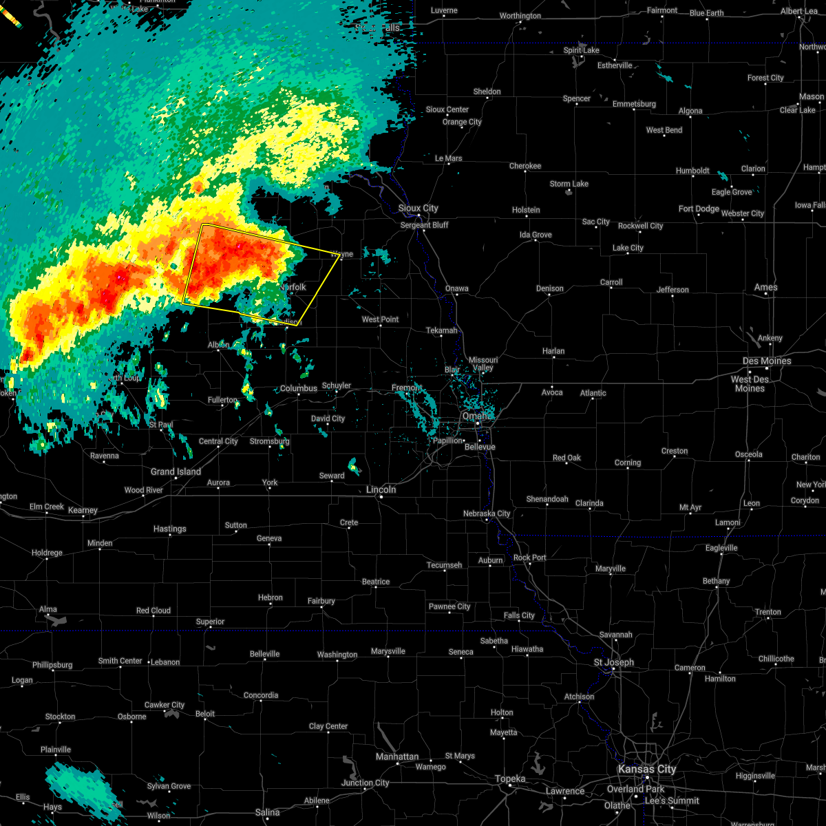 At 1212 am cdt, a severe thunderstorm was located 9 miles northeast of neligh, or 30 miles northwest of norfolk, moving southeast at 25 mph (radar indicated). Hazards include 60 mph wind gusts and quarter size hail. Hail damage to vehicles is expected. expect wind damage to roofs, siding, and trees. this severe thunderstorm will be near, pierce around 1240 am cdt. battle creek around 1245 am cdt. norfolk and hadar around 1250 am cdt. hoskins around 1255 am cdt. Other locations impacted by this severe thunderstorm include royal, willow creek state recreation area, brunswick, foster and tilden. At 1212 am cdt, a severe thunderstorm was located 9 miles northeast of neligh, or 30 miles northwest of norfolk, moving southeast at 25 mph (radar indicated). Hazards include 60 mph wind gusts and quarter size hail. Hail damage to vehicles is expected. expect wind damage to roofs, siding, and trees. this severe thunderstorm will be near, pierce around 1240 am cdt. battle creek around 1245 am cdt. norfolk and hadar around 1250 am cdt. hoskins around 1255 am cdt. Other locations impacted by this severe thunderstorm include royal, willow creek state recreation area, brunswick, foster and tilden.
|
| 6/24/2021 12:09 AM CDT |
 At 1209 am cdt, a severe thunderstorm was located 10 miles north of neligh, or 33 miles northwest of norfolk, moving southeast at 25 mph (radar indicated). Hazards include 60 mph wind gusts and quarter size hail. Hail damage to vehicles is expected. expect wind damage to roofs, siding, and trees. This severe thunderstorm will remain over mainly rural areas of northwestern madison, western pierce, antelope and southwestern knox counties, including the following locations, the highway 14 and 59 junction, royal, brunswick, foster, ashfall fossil beds state historical park and tilden. At 1209 am cdt, a severe thunderstorm was located 10 miles north of neligh, or 33 miles northwest of norfolk, moving southeast at 25 mph (radar indicated). Hazards include 60 mph wind gusts and quarter size hail. Hail damage to vehicles is expected. expect wind damage to roofs, siding, and trees. This severe thunderstorm will remain over mainly rural areas of northwestern madison, western pierce, antelope and southwestern knox counties, including the following locations, the highway 14 and 59 junction, royal, brunswick, foster, ashfall fossil beds state historical park and tilden.
|
| 6/23/2021 11:54 PM CDT |
 At 1154 pm cdt, a severe thunderstorm was located 5 miles east of orchard, or 27 miles east of o`neill, moving southeast at 25 mph (radar indicated). Hazards include 60 mph wind gusts and quarter size hail. Hail damage to vehicles is expected. expect wind damage to roofs, siding, and trees. This severe thunderstorm will remain over mainly rural areas of northwestern madison, western pierce, antelope and southwestern knox counties, including the following locations, the highway 14 and 59 junction, royal, brunswick, foster, ashfall fossil beds state historical park and tilden. At 1154 pm cdt, a severe thunderstorm was located 5 miles east of orchard, or 27 miles east of o`neill, moving southeast at 25 mph (radar indicated). Hazards include 60 mph wind gusts and quarter size hail. Hail damage to vehicles is expected. expect wind damage to roofs, siding, and trees. This severe thunderstorm will remain over mainly rural areas of northwestern madison, western pierce, antelope and southwestern knox counties, including the following locations, the highway 14 and 59 junction, royal, brunswick, foster, ashfall fossil beds state historical park and tilden.
|
| 6/23/2021 11:40 PM CDT |
 At 1139 pm cdt, a severe thunderstorm was located over orchard, or 23 miles east of o`neill, moving east at 20 mph (radar indicated). Hazards include 60 mph wind gusts and quarter size hail. Hail damage to vehicles is expected. expect wind damage to roofs, siding, and trees. this severe storm will be near, plainview around 1210 am cdt. Other locations impacted by this severe thunderstorm include the highway 14 and 59 junction, royal, brunswick, foster, ashfall fossil beds state historical park and tilden. At 1139 pm cdt, a severe thunderstorm was located over orchard, or 23 miles east of o`neill, moving east at 20 mph (radar indicated). Hazards include 60 mph wind gusts and quarter size hail. Hail damage to vehicles is expected. expect wind damage to roofs, siding, and trees. this severe storm will be near, plainview around 1210 am cdt. Other locations impacted by this severe thunderstorm include the highway 14 and 59 junction, royal, brunswick, foster, ashfall fossil beds state historical park and tilden.
|
| 6/23/2021 11:27 PM CDT |
 At 1126 pm cdt, a severe thunderstorm was located near page, or 15 miles east of o`neill, moving southeast at 25 mph (radar indicated). Hazards include 60 mph wind gusts and half dollar size hail. Hail damage to vehicles is expected. expect wind damage to roofs, siding, and trees. this severe thunderstorm will be near, orchard around 1135 pm cdt. neligh around 1155 pm cdt. meadow grove around 1215 am cdt. Other locations impacted by this severe thunderstorm include the highway 14 and 59 junction, royal, brunswick, foster, ashfall fossil beds state historical park and tilden. At 1126 pm cdt, a severe thunderstorm was located near page, or 15 miles east of o`neill, moving southeast at 25 mph (radar indicated). Hazards include 60 mph wind gusts and half dollar size hail. Hail damage to vehicles is expected. expect wind damage to roofs, siding, and trees. this severe thunderstorm will be near, orchard around 1135 pm cdt. neligh around 1155 pm cdt. meadow grove around 1215 am cdt. Other locations impacted by this severe thunderstorm include the highway 14 and 59 junction, royal, brunswick, foster, ashfall fossil beds state historical park and tilden.
|
| 6/22/2021 6:30 PM CDT |
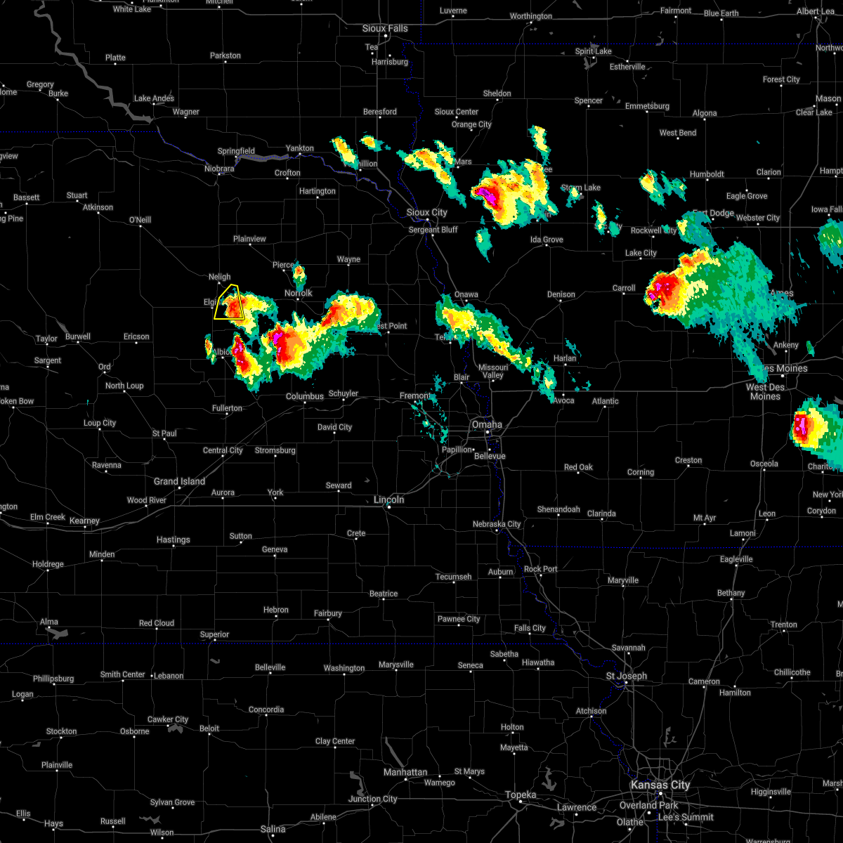 At 630 pm cdt, a severe thunderstorm was located 5 miles southeast of oakdale, or 26 miles west of norfolk, moving southeast at 20 mph (radar indicated). Hazards include 60 mph wind gusts and half dollar size hail. Hail damage to vehicles is expected. expect wind damage to roofs, siding, and trees. Locations impacted include, oakdale. At 630 pm cdt, a severe thunderstorm was located 5 miles southeast of oakdale, or 26 miles west of norfolk, moving southeast at 20 mph (radar indicated). Hazards include 60 mph wind gusts and half dollar size hail. Hail damage to vehicles is expected. expect wind damage to roofs, siding, and trees. Locations impacted include, oakdale.
|
| 6/22/2021 6:18 PM CDT |
 At 618 pm cdt, a severe thunderstorm was located over oakdale, or 30 miles west of norfolk, moving southeast at 20 mph (radar indicated). Hazards include 60 mph wind gusts and quarter size hail. Hail damage to vehicles is expected. expect wind damage to roofs, siding, and trees. Locations impacted include, elgin. At 618 pm cdt, a severe thunderstorm was located over oakdale, or 30 miles west of norfolk, moving southeast at 20 mph (radar indicated). Hazards include 60 mph wind gusts and quarter size hail. Hail damage to vehicles is expected. expect wind damage to roofs, siding, and trees. Locations impacted include, elgin.
|
| 6/22/2021 6:09 PM CDT |
 At 609 pm cdt, a severe thunderstorm was located over neligh, or 31 miles west of norfolk, moving southeast at 20 mph (radar indicated). Hazards include 60 mph wind gusts and half dollar size hail. Hail damage to vehicles is expected. expect wind damage to roofs, siding, and trees. this severe thunderstorm will be near, oakdale around 620 pm cdt. Other locations in the path of this severe thunderstorm include elgin. At 609 pm cdt, a severe thunderstorm was located over neligh, or 31 miles west of norfolk, moving southeast at 20 mph (radar indicated). Hazards include 60 mph wind gusts and half dollar size hail. Hail damage to vehicles is expected. expect wind damage to roofs, siding, and trees. this severe thunderstorm will be near, oakdale around 620 pm cdt. Other locations in the path of this severe thunderstorm include elgin.
|
| 7/8/2020 9:52 PM CDT |
 At 952 pm cdt, severe thunderstorms were located along a line extending from near creighton to neligh, moving east at 25 mph (radar indicated). Hazards include 60 mph wind gusts and penny size hail. Expect damage to roofs, siding, and trees. Locations impacted include, neligh, creighton, clearwater, orchard, oakdale, brunswick, winnetoon, royal, bazile mills, ashfall fossil beds state historical park and the highway 14 and 59 junction. At 952 pm cdt, severe thunderstorms were located along a line extending from near creighton to neligh, moving east at 25 mph (radar indicated). Hazards include 60 mph wind gusts and penny size hail. Expect damage to roofs, siding, and trees. Locations impacted include, neligh, creighton, clearwater, orchard, oakdale, brunswick, winnetoon, royal, bazile mills, ashfall fossil beds state historical park and the highway 14 and 59 junction.
|
| 7/8/2020 9:44 PM CDT |
 At 943 pm cdt, severe thunderstorms were located along a line extending from 5 miles northwest of creighton to near neligh, moving east at 25 mph. the strongest part of this line of storms was near creighton (radar indicated). Hazards include 60 mph wind gusts and penny size hail. Expect damage to roofs, siding, and trees. Locations impacted include, neligh, creighton, clearwater, orchard, oakdale, brunswick, winnetoon, royal, bazile mills, ashfall fossil beds state historical park and the highway 14 and 59 junction. At 943 pm cdt, severe thunderstorms were located along a line extending from 5 miles northwest of creighton to near neligh, moving east at 25 mph. the strongest part of this line of storms was near creighton (radar indicated). Hazards include 60 mph wind gusts and penny size hail. Expect damage to roofs, siding, and trees. Locations impacted include, neligh, creighton, clearwater, orchard, oakdale, brunswick, winnetoon, royal, bazile mills, ashfall fossil beds state historical park and the highway 14 and 59 junction.
|
| 7/8/2020 9:37 PM CDT |
 At 937 pm cdt, severe thunderstorms were located along a line extending from near verdigre to 4 miles west of neligh, moving east at 40 mph (radar indicated). Hazards include 60 mph wind gusts and penny size hail. Expect damage to roofs, siding, and trees. Locations impacted include, neligh, creighton, clearwater, orchard, oakdale, brunswick, winnetoon, royal, bazile mills, ashfall fossil beds state historical park and the highway 14 and 59 junction. At 937 pm cdt, severe thunderstorms were located along a line extending from near verdigre to 4 miles west of neligh, moving east at 40 mph (radar indicated). Hazards include 60 mph wind gusts and penny size hail. Expect damage to roofs, siding, and trees. Locations impacted include, neligh, creighton, clearwater, orchard, oakdale, brunswick, winnetoon, royal, bazile mills, ashfall fossil beds state historical park and the highway 14 and 59 junction.
|
| 7/8/2020 9:27 PM CDT |
 At 927 pm cdt, severe thunderstorms were located along a line extending from 5 miles southwest of verdigre to 7 miles southwest of clearwater, moving east at 45 mph (radar indicated). Hazards include 60 mph wind gusts and penny size hail. Expect damage to roofs, siding, and trees. Locations impacted include, neligh, creighton, clearwater, orchard, oakdale, brunswick, winnetoon, royal, bazile mills, ashfall fossil beds state historical park and the highway 14 and 59 junction. At 927 pm cdt, severe thunderstorms were located along a line extending from 5 miles southwest of verdigre to 7 miles southwest of clearwater, moving east at 45 mph (radar indicated). Hazards include 60 mph wind gusts and penny size hail. Expect damage to roofs, siding, and trees. Locations impacted include, neligh, creighton, clearwater, orchard, oakdale, brunswick, winnetoon, royal, bazile mills, ashfall fossil beds state historical park and the highway 14 and 59 junction.
|
| 7/8/2020 9:17 PM CDT |
 At 916 pm cdt, a severe thunderstorm was located over page, or 14 miles southeast of o`neill, moving east at 40 mph (radar indicated). Hazards include 60 mph wind gusts and penny size hail. expect damage to roofs, siding, and trees At 916 pm cdt, a severe thunderstorm was located over page, or 14 miles southeast of o`neill, moving east at 40 mph (radar indicated). Hazards include 60 mph wind gusts and penny size hail. expect damage to roofs, siding, and trees
|
| 7/6/2020 8:12 PM CDT |
 At 812 pm cdt, severe thunderstorms were located along a line extending from 7 miles south of meadow grove to 6 miles west of elgin, moving south at 20 mph (radar indicated). Hazards include 60 mph wind gusts and quarter size hail. Hail damage to vehicles is expected. Expect wind damage to roofs, siding, and trees. At 812 pm cdt, severe thunderstorms were located along a line extending from 7 miles south of meadow grove to 6 miles west of elgin, moving south at 20 mph (radar indicated). Hazards include 60 mph wind gusts and quarter size hail. Hail damage to vehicles is expected. Expect wind damage to roofs, siding, and trees.
|
| 7/6/2020 8:01 PM CDT |
 At 800 pm cdt, severe thunderstorms were located along a line extending from 4 miles northeast of battle creek to 5 miles southwest of meadow grove to 9 miles southwest of clearwater, moving south at 20 mph (radar indicated). Hazards include 60 mph wind gusts and quarter size hail. Hail damage to vehicles is expected. expect wind damage to roofs, siding, and trees. Locations impacted include, neligh, battle creek, elgin, oakdale, meadow grove and tilden. At 800 pm cdt, severe thunderstorms were located along a line extending from 4 miles northeast of battle creek to 5 miles southwest of meadow grove to 9 miles southwest of clearwater, moving south at 20 mph (radar indicated). Hazards include 60 mph wind gusts and quarter size hail. Hail damage to vehicles is expected. expect wind damage to roofs, siding, and trees. Locations impacted include, neligh, battle creek, elgin, oakdale, meadow grove and tilden.
|
| 7/6/2020 7:57 PM CDT | Lawn furniture blown around. small branches broke in antelope county NE, 0.2 miles SSE of Oakdale, NE |
| 7/6/2020 7:56 PM CDT |
 At 756 pm cdt, severe thunderstorms were located along a line extending from 4 miles southwest of hadar to 4 miles southwest of meadow grove to 7 miles southwest of clearwater, moving south at 20 mph (radar indicated). Hazards include 60 mph wind gusts and quarter size hail. Hail damage to vehicles is expected. expect wind damage to roofs, siding, and trees. Locations impacted include, norfolk, neligh, battle creek, elgin, clearwater, oakdale, meadow grove and tilden. At 756 pm cdt, severe thunderstorms were located along a line extending from 4 miles southwest of hadar to 4 miles southwest of meadow grove to 7 miles southwest of clearwater, moving south at 20 mph (radar indicated). Hazards include 60 mph wind gusts and quarter size hail. Hail damage to vehicles is expected. expect wind damage to roofs, siding, and trees. Locations impacted include, norfolk, neligh, battle creek, elgin, clearwater, oakdale, meadow grove and tilden.
|
| 7/6/2020 7:47 PM CDT |
 At 746 pm cdt, severe thunderstorms were located along a line extending from near hadar to near meadow grove to 5 miles southwest of clearwater, moving south at 20 mph (radar indicated). Hazards include 60 mph wind gusts and quarter size hail. Hail damage to vehicles is expected. expect wind damage to roofs, siding, and trees. Locations impacted include, norfolk, neligh, battle creek, elgin, clearwater, oakdale, meadow grove, hadar, tilden and willow creek state recreation area. At 746 pm cdt, severe thunderstorms were located along a line extending from near hadar to near meadow grove to 5 miles southwest of clearwater, moving south at 20 mph (radar indicated). Hazards include 60 mph wind gusts and quarter size hail. Hail damage to vehicles is expected. expect wind damage to roofs, siding, and trees. Locations impacted include, norfolk, neligh, battle creek, elgin, clearwater, oakdale, meadow grove, hadar, tilden and willow creek state recreation area.
|
| 7/6/2020 7:20 PM CDT |
 At 719 pm cdt, a severe thunderstorm was located 10 miles north of meadow grove, or 21 miles northwest of norfolk, moving southeast at 20 mph (radar indicated). Hazards include 60 mph wind gusts and quarter size hail. Hail damage to vehicles is expected. Expect wind damage to roofs, siding, and trees. At 719 pm cdt, a severe thunderstorm was located 10 miles north of meadow grove, or 21 miles northwest of norfolk, moving southeast at 20 mph (radar indicated). Hazards include 60 mph wind gusts and quarter size hail. Hail damage to vehicles is expected. Expect wind damage to roofs, siding, and trees.
|
| 5/24/2020 2:41 AM CDT |
 The severe thunderstorm warning for western madison, northwestern platte, southern antelope and boone counties will expire at 245 am cdt, the storms which prompted the warning have weakened below severe limits, and no longer pose an immediate threat to life or property. therefore, the warning will be allowed to expire. however gusty winds are still possible with these thunderstorms. a severe thunderstorm watch remains in effect until 600 am cdt for northeastern nebraska. to report severe weather, contact your nearest law enforcement agency. they will relay your report to the national weather service omaha. The severe thunderstorm warning for western madison, northwestern platte, southern antelope and boone counties will expire at 245 am cdt, the storms which prompted the warning have weakened below severe limits, and no longer pose an immediate threat to life or property. therefore, the warning will be allowed to expire. however gusty winds are still possible with these thunderstorms. a severe thunderstorm watch remains in effect until 600 am cdt for northeastern nebraska. to report severe weather, contact your nearest law enforcement agency. they will relay your report to the national weather service omaha.
|
| 5/24/2020 2:36 AM CDT |
 At 236 am cdt, severe thunderstorms were located along a line extending from 4 miles southwest of oakdale to 7 miles northeast of albion to belgrade, moving east at 50 mph (radar indicated). Hazards include 60 mph wind gusts and penny size hail. Expect damage to roofs, siding, and trees. locations impacted include, albion, newman grove, st. Edward, elgin, cedar rapids, petersburg, oakdale, tilden, primrose, loretto and the highway 14 and 56 junction. At 236 am cdt, severe thunderstorms were located along a line extending from 4 miles southwest of oakdale to 7 miles northeast of albion to belgrade, moving east at 50 mph (radar indicated). Hazards include 60 mph wind gusts and penny size hail. Expect damage to roofs, siding, and trees. locations impacted include, albion, newman grove, st. Edward, elgin, cedar rapids, petersburg, oakdale, tilden, primrose, loretto and the highway 14 and 56 junction.
|
| 5/24/2020 2:18 AM CDT |
 At 217 am cdt, severe thunderstorms were located along a line extending from 6 miles west of elgin to 8 miles northeast of wolbach, moving east at 35 mph (radar indicated. this storm has a history of producing 80 mph wind gusts in wheeler county). Hazards include 70 mph wind gusts and penny size hail. Expect considerable tree damage. damage is likely to mobile homes, roofs, and outbuildings. locations impacted include, albion, newman grove, st. Edward, elgin, cedar rapids, petersburg, oakdale, tilden, primrose, loretto and the highway 14 and 56 junction. At 217 am cdt, severe thunderstorms were located along a line extending from 6 miles west of elgin to 8 miles northeast of wolbach, moving east at 35 mph (radar indicated. this storm has a history of producing 80 mph wind gusts in wheeler county). Hazards include 70 mph wind gusts and penny size hail. Expect considerable tree damage. damage is likely to mobile homes, roofs, and outbuildings. locations impacted include, albion, newman grove, st. Edward, elgin, cedar rapids, petersburg, oakdale, tilden, primrose, loretto and the highway 14 and 56 junction.
|
| 5/24/2020 1:56 AM CDT |
 At 154 am cdt, severe thunderstorms were located along a line extending from 9 miles northeast of bartlett to 6 miles south of greeley, moving east at 35 mph (radar indicated. this storm has a history of producing winds gusts over 50 mph). Hazards include 60 mph wind gusts and penny size hail. expect damage to roofs, siding, and trees At 154 am cdt, severe thunderstorms were located along a line extending from 9 miles northeast of bartlett to 6 miles south of greeley, moving east at 35 mph (radar indicated. this storm has a history of producing winds gusts over 50 mph). Hazards include 60 mph wind gusts and penny size hail. expect damage to roofs, siding, and trees
|
| 9/30/2019 11:47 PM CDT |
 At 1147 pm cdt, a severe thunderstorm was located 5 miles south of oakdale, or 27 miles west of norfolk, moving northeast at 50 mph (radar indicated). Hazards include 60 mph wind gusts and quarter size hail. Hail damage to vehicles is expected. expect wind damage to roofs, siding, and trees. Locations impacted include, neligh and oakdale. At 1147 pm cdt, a severe thunderstorm was located 5 miles south of oakdale, or 27 miles west of norfolk, moving northeast at 50 mph (radar indicated). Hazards include 60 mph wind gusts and quarter size hail. Hail damage to vehicles is expected. expect wind damage to roofs, siding, and trees. Locations impacted include, neligh and oakdale.
|
| 9/30/2019 11:37 PM CDT |
 At 1137 pm cdt, a severe thunderstorm was located over elgin, or 34 miles west of norfolk, moving northeast at 50 mph (radar indicated). Hazards include 60 mph wind gusts and quarter size hail. Hail damage to vehicles is expected. expect wind damage to roofs, siding, and trees. Locations impacted include, neligh, elgin, petersburg and oakdale. At 1137 pm cdt, a severe thunderstorm was located over elgin, or 34 miles west of norfolk, moving northeast at 50 mph (radar indicated). Hazards include 60 mph wind gusts and quarter size hail. Hail damage to vehicles is expected. expect wind damage to roofs, siding, and trees. Locations impacted include, neligh, elgin, petersburg and oakdale.
|
| 9/30/2019 11:29 PM CDT |
 At 1129 pm cdt, a severe thunderstorm was located 6 miles southwest of elgin, or 40 miles west of norfolk, moving northeast at 55 mph (radar indicated). Hazards include 60 mph wind gusts and quarter size hail. Hail damage to vehicles is expected. Expect wind damage to roofs, siding, and trees. At 1129 pm cdt, a severe thunderstorm was located 6 miles southwest of elgin, or 40 miles west of norfolk, moving northeast at 55 mph (radar indicated). Hazards include 60 mph wind gusts and quarter size hail. Hail damage to vehicles is expected. Expect wind damage to roofs, siding, and trees.
|
| 9/2/2019 6:47 AM CDT |
 At 647 am cdt, a severe thunderstorm was located 6 miles southwest of neligh, or 35 miles west of norfolk, moving east at 25 mph (radar indicated). Hazards include 60 mph wind gusts and quarter size hail. Hail damage to vehicles is expected. expect wind damage to roofs, siding, and trees. Locations impacted include, neligh, elgin and oakdale. At 647 am cdt, a severe thunderstorm was located 6 miles southwest of neligh, or 35 miles west of norfolk, moving east at 25 mph (radar indicated). Hazards include 60 mph wind gusts and quarter size hail. Hail damage to vehicles is expected. expect wind damage to roofs, siding, and trees. Locations impacted include, neligh, elgin and oakdale.
|
| 9/2/2019 6:39 AM CDT |
 At 633 am cdt, a severe thunderstorm was located 7 miles southwest of clearwater, or 32 miles southeast of o`neill, moving southeast at 25 mph (radar indicated). Hazards include 60 mph wind gusts and quarter size hail. Hail damage to vehicles is expected. expect wind damage to roofs, siding, and trees. Locations impacted include, neligh, elgin, clearwater and oakdale. At 633 am cdt, a severe thunderstorm was located 7 miles southwest of clearwater, or 32 miles southeast of o`neill, moving southeast at 25 mph (radar indicated). Hazards include 60 mph wind gusts and quarter size hail. Hail damage to vehicles is expected. expect wind damage to roofs, siding, and trees. Locations impacted include, neligh, elgin, clearwater and oakdale.
|
| 9/2/2019 6:33 AM CDT |
 At 633 am cdt, a severe thunderstorm was located 7 miles southwest of clearwater, or 32 miles southeast of o`neill, moving southeast at 25 mph (radar indicated). Hazards include 60 mph wind gusts and quarter size hail. Hail damage to vehicles is expected. expect wind damage to roofs, siding, and trees. Locations impacted include, neligh, elgin, clearwater and oakdale. At 633 am cdt, a severe thunderstorm was located 7 miles southwest of clearwater, or 32 miles southeast of o`neill, moving southeast at 25 mph (radar indicated). Hazards include 60 mph wind gusts and quarter size hail. Hail damage to vehicles is expected. expect wind damage to roofs, siding, and trees. Locations impacted include, neligh, elgin, clearwater and oakdale.
|
| 9/2/2019 6:27 AM CDT |
 At 627 am cdt, a severe thunderstorm was located 7 miles southwest of clearwater, or 30 miles southeast of o`neill, moving southeast at 25 mph (radar indicated). Hazards include 60 mph wind gusts and quarter size hail. Hail damage to vehicles is expected. Expect wind damage to roofs, siding, and trees. At 627 am cdt, a severe thunderstorm was located 7 miles southwest of clearwater, or 30 miles southeast of o`neill, moving southeast at 25 mph (radar indicated). Hazards include 60 mph wind gusts and quarter size hail. Hail damage to vehicles is expected. Expect wind damage to roofs, siding, and trees.
|
| 7/16/2019 3:10 AM CDT |
 The severe thunderstorm warning for southeastern antelope county will expire at 315 am cdt, the storm which prompted the warning has weakened below severe limits, and no longer poses an immediate threat to life or property. therefore, the warning will be allowed to expire. however small hail, gusty winds and heavy rain are still possible with this thunderstorm. The severe thunderstorm warning for southeastern antelope county will expire at 315 am cdt, the storm which prompted the warning has weakened below severe limits, and no longer poses an immediate threat to life or property. therefore, the warning will be allowed to expire. however small hail, gusty winds and heavy rain are still possible with this thunderstorm.
|
| 7/16/2019 3:04 AM CDT |
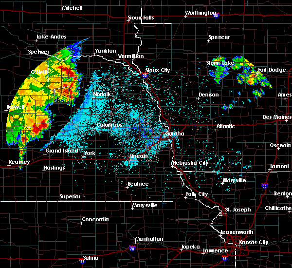 At 303 am cdt, a severe thunderstorm was located over oakdale, or 27 miles west of norfolk, moving east at 35 mph (radar indicated). Hazards include 60 mph wind gusts and penny size hail. Expect damage to roofs, siding, and trees. Locations impacted include, oakdale. At 303 am cdt, a severe thunderstorm was located over oakdale, or 27 miles west of norfolk, moving east at 35 mph (radar indicated). Hazards include 60 mph wind gusts and penny size hail. Expect damage to roofs, siding, and trees. Locations impacted include, oakdale.
|
| 7/16/2019 2:50 AM CDT |
 At 250 am cdt, a severe thunderstorm was located near neligh, or 31 miles west of norfolk, moving east at 35 mph (radar indicated). Hazards include 60 mph wind gusts and quarter size hail. Hail damage to vehicles is expected. expect wind damage to roofs, siding, and trees. Locations impacted include, neligh, elgin and oakdale. At 250 am cdt, a severe thunderstorm was located near neligh, or 31 miles west of norfolk, moving east at 35 mph (radar indicated). Hazards include 60 mph wind gusts and quarter size hail. Hail damage to vehicles is expected. expect wind damage to roofs, siding, and trees. Locations impacted include, neligh, elgin and oakdale.
|
| 7/16/2019 2:36 AM CDT |
 At 236 am cdt, a severe thunderstorm was located near clearwater, or 33 miles southeast of o`neill, moving east at 20 mph (radar indicated). Hazards include 60 mph wind gusts and quarter size hail. Hail damage to vehicles is expected. Expect wind damage to roofs, siding, and trees. At 236 am cdt, a severe thunderstorm was located near clearwater, or 33 miles southeast of o`neill, moving east at 20 mph (radar indicated). Hazards include 60 mph wind gusts and quarter size hail. Hail damage to vehicles is expected. Expect wind damage to roofs, siding, and trees.
|
| 7/5/2019 4:03 AM CDT |
 At 403 am cdt, severe thunderstorms were located along a line extending from 8 miles northeast of amelia to 12 miles north of bartlett to 7 miles southeast of ericson, moving east at 35 mph (radar indicated). Hazards include 60 mph wind gusts. expect damage to roofs, siding, and trees At 403 am cdt, severe thunderstorms were located along a line extending from 8 miles northeast of amelia to 12 miles north of bartlett to 7 miles southeast of ericson, moving east at 35 mph (radar indicated). Hazards include 60 mph wind gusts. expect damage to roofs, siding, and trees
|
| 9/19/2018 8:47 PM CDT |
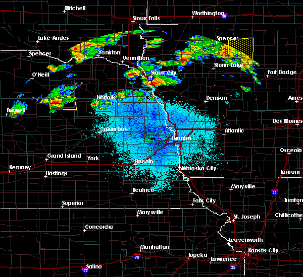 At 846 pm cdt, a severe thunderstorm was located 6 miles west of elgin, or 39 miles southeast of o`neill, moving east at 20 mph (radar indicated). Hazards include 60 mph wind gusts and quarter size hail. Hail damage to vehicles is expected. expect wind damage to roofs, siding, and trees. Locations impacted include, elgin, oakdale and tilden. At 846 pm cdt, a severe thunderstorm was located 6 miles west of elgin, or 39 miles southeast of o`neill, moving east at 20 mph (radar indicated). Hazards include 60 mph wind gusts and quarter size hail. Hail damage to vehicles is expected. expect wind damage to roofs, siding, and trees. Locations impacted include, elgin, oakdale and tilden.
|
| 9/19/2018 8:41 PM CDT |
 At 840 pm cdt, a severe thunderstorm was located 6 miles west of elgin, or 39 miles southeast of o`neill, moving east at 30 mph (radar indicated). Hazards include 60 mph wind gusts and quarter size hail. Hail damage to vehicles is expected. Expect wind damage to roofs, siding, and trees. At 840 pm cdt, a severe thunderstorm was located 6 miles west of elgin, or 39 miles southeast of o`neill, moving east at 30 mph (radar indicated). Hazards include 60 mph wind gusts and quarter size hail. Hail damage to vehicles is expected. Expect wind damage to roofs, siding, and trees.
|
| 7/18/2018 11:43 PM CDT |
 At 1143 pm cdt, severe thunderstorms were located along a line extending from near neligh to near elgin to 12 miles east of bartlett, moving southeast at 50 mph (radar indicated). Hazards include 70 mph wind gusts and quarter size hail. this storm has a history of wind damage. Hail damage to vehicles is expected. expect considerable tree damage. Wind damage is also likely to mobile homes, roofs, and outbuildings. At 1143 pm cdt, severe thunderstorms were located along a line extending from near neligh to near elgin to 12 miles east of bartlett, moving southeast at 50 mph (radar indicated). Hazards include 70 mph wind gusts and quarter size hail. this storm has a history of wind damage. Hail damage to vehicles is expected. expect considerable tree damage. Wind damage is also likely to mobile homes, roofs, and outbuildings.
|
| 7/18/2018 11:29 PM CDT |
 At 1128 pm cdt, severe thunderstorms were located along a line extending from 14 miles south of ewing to 7 miles west of neligh to 3 miles northeast of clearwater, moving southeast at 50 mph (radar indicated). Hazards include 70 mph wind gusts and quarter size hail. the strongest core of winds looks to be focused along a line from just south of clearwater to elgin. this storm has a history of wind damage in o`neill. Hail damage to vehicles is expected. expect considerable tree damage. wind damage is also likely to mobile homes, roofs, and outbuildings. Locations impacted include, neligh, elgin, clearwater, orchard, oakdale, tilden and royal. At 1128 pm cdt, severe thunderstorms were located along a line extending from 14 miles south of ewing to 7 miles west of neligh to 3 miles northeast of clearwater, moving southeast at 50 mph (radar indicated). Hazards include 70 mph wind gusts and quarter size hail. the strongest core of winds looks to be focused along a line from just south of clearwater to elgin. this storm has a history of wind damage in o`neill. Hail damage to vehicles is expected. expect considerable tree damage. wind damage is also likely to mobile homes, roofs, and outbuildings. Locations impacted include, neligh, elgin, clearwater, orchard, oakdale, tilden and royal.
|
| 7/18/2018 11:09 PM CDT |
 At 1107 pm cdt, severe thunderstorms were located along a line extending from 5 miles east of chambers to 5 miles west of ewing to 4 miles south of page, moving southeast at 50 mph (radar indicated). Hazards include 70 mph wind gusts and quarter size hail. this line of storms has a history of wind damage in o`neill. Hail damage to vehicles is expected. expect considerable tree damage. Wind damage is also likely to mobile homes, roofs, and outbuildings. At 1107 pm cdt, severe thunderstorms were located along a line extending from 5 miles east of chambers to 5 miles west of ewing to 4 miles south of page, moving southeast at 50 mph (radar indicated). Hazards include 70 mph wind gusts and quarter size hail. this line of storms has a history of wind damage in o`neill. Hail damage to vehicles is expected. expect considerable tree damage. Wind damage is also likely to mobile homes, roofs, and outbuildings.
|
| 7/18/2018 10:54 PM CDT |
 At 1053 pm cdt, a severe thunderstorm was located 8 miles north of neligh, or 32 miles northwest of norfolk, moving southeast at 20 mph (radar indicated). Hazards include 60 mph wind gusts and quarter size hail. Hail damage to vehicles is expected. expect wind damage to roofs, siding, and trees. Locations impacted include, neligh, oakdale, tilden and brunswick. At 1053 pm cdt, a severe thunderstorm was located 8 miles north of neligh, or 32 miles northwest of norfolk, moving southeast at 20 mph (radar indicated). Hazards include 60 mph wind gusts and quarter size hail. Hail damage to vehicles is expected. expect wind damage to roofs, siding, and trees. Locations impacted include, neligh, oakdale, tilden and brunswick.
|
| 7/18/2018 10:39 PM CDT |
 At 1037 pm cdt, a severe thunderstorm was located 8 miles north of neligh, or 33 miles northwest of norfolk, moving southeast at 30 mph (radar indicated). Hazards include 60 mph wind gusts and quarter size hail. Hail damage to vehicles is expected. Expect wind damage to roofs, siding, and trees. At 1037 pm cdt, a severe thunderstorm was located 8 miles north of neligh, or 33 miles northwest of norfolk, moving southeast at 30 mph (radar indicated). Hazards include 60 mph wind gusts and quarter size hail. Hail damage to vehicles is expected. Expect wind damage to roofs, siding, and trees.
|
| 6/28/2018 7:54 AM CDT |
 The severe thunderstorm warning for southeastern antelope and northeastern boone counties will expire at 800 am cdt, the storms which prompted the warning have moved out of the area. therefore, the warning will be allowed to expire. however small hail, gusty winds and heavy rain are still possible with these thunderstorms. to report severe weather, contact your nearest law enforcement agency. they will relay your report to the national weather service omaha. The severe thunderstorm warning for southeastern antelope and northeastern boone counties will expire at 800 am cdt, the storms which prompted the warning have moved out of the area. therefore, the warning will be allowed to expire. however small hail, gusty winds and heavy rain are still possible with these thunderstorms. to report severe weather, contact your nearest law enforcement agency. they will relay your report to the national weather service omaha.
|
| 6/28/2018 7:47 AM CDT |
 At 747 am cdt, severe thunderstorms were located along a line extending from 7 miles northeast of oakdale to 4 miles west of newman grove, moving east at 35 mph (radar indicated). Hazards include 60 mph wind gusts and quarter size hail. Hail damage to vehicles is expected. expect wind damage to roofs, siding, and trees. Locations impacted include, albion, neligh, elgin, petersburg, oakdale and loretto. At 747 am cdt, severe thunderstorms were located along a line extending from 7 miles northeast of oakdale to 4 miles west of newman grove, moving east at 35 mph (radar indicated). Hazards include 60 mph wind gusts and quarter size hail. Hail damage to vehicles is expected. expect wind damage to roofs, siding, and trees. Locations impacted include, albion, neligh, elgin, petersburg, oakdale and loretto.
|
| 6/28/2018 7:42 AM CDT |
 At 742 am cdt, severe thunderstorms were located along a line extending from 7 miles northwest of meadow grove to 5 miles west of newman grove, moving east at 40 mph. these are very dangerous storms (radar indicated). Hazards include 80 mph wind gusts and half dollar size hail. Flying debris will be dangerous to those caught without shelter. mobile homes will be heavily damaged. expect considerable damage to roofs, windows, and vehicles. extensive tree damage and power outages are likely. locations impacted include, albion, neligh, st. Edward, elgin, clearwater, petersburg, oakdale and loretto. At 742 am cdt, severe thunderstorms were located along a line extending from 7 miles northwest of meadow grove to 5 miles west of newman grove, moving east at 40 mph. these are very dangerous storms (radar indicated). Hazards include 80 mph wind gusts and half dollar size hail. Flying debris will be dangerous to those caught without shelter. mobile homes will be heavily damaged. expect considerable damage to roofs, windows, and vehicles. extensive tree damage and power outages are likely. locations impacted include, albion, neligh, st. Edward, elgin, clearwater, petersburg, oakdale and loretto.
|
| 6/28/2018 7:36 AM CDT |
 At 735 am cdt, severe thunderstorms were located along a line extending from 5 miles northeast of oakdale to 5 miles northeast of albion, moving east at 40 mph. wind damage was reported in petersburg. these are very dangerous storms (radar indicated). Hazards include 80 mph wind gusts and half dollar size hail. Flying debris will be dangerous to those caught without shelter. mobile homes will be heavily damaged. expect considerable damage to roofs, windows, and vehicles. extensive tree damage and power outages are likely. locations impacted include, albion, neligh, st. Edward, elgin, clearwater, orchard, petersburg, oakdale, brunswick, royal, primrose, loretto and the highway 14 and 56 junction. At 735 am cdt, severe thunderstorms were located along a line extending from 5 miles northeast of oakdale to 5 miles northeast of albion, moving east at 40 mph. wind damage was reported in petersburg. these are very dangerous storms (radar indicated). Hazards include 80 mph wind gusts and half dollar size hail. Flying debris will be dangerous to those caught without shelter. mobile homes will be heavily damaged. expect considerable damage to roofs, windows, and vehicles. extensive tree damage and power outages are likely. locations impacted include, albion, neligh, st. Edward, elgin, clearwater, orchard, petersburg, oakdale, brunswick, royal, primrose, loretto and the highway 14 and 56 junction.
|
| 6/28/2018 7:33 AM CDT |
 At 735 am cdt, severe thunderstorms were located along a line extending from 5 miles northeast of oakdale to 5 miles northeast of albion, moving east at 40 mph. wind damage was reported in petersburg. these are very dangerous storms (radar indicated). Hazards include 80 mph wind gusts and half dollar size hail. Flying debris will be dangerous to those caught without shelter. mobile homes will be heavily damaged. expect considerable damage to roofs, windows, and vehicles. extensive tree damage and power outages are likely. locations impacted include, albion, neligh, st. Edward, elgin, clearwater, orchard, petersburg, oakdale, brunswick, royal, primrose, loretto and the highway 14 and 56 junction. At 735 am cdt, severe thunderstorms were located along a line extending from 5 miles northeast of oakdale to 5 miles northeast of albion, moving east at 40 mph. wind damage was reported in petersburg. these are very dangerous storms (radar indicated). Hazards include 80 mph wind gusts and half dollar size hail. Flying debris will be dangerous to those caught without shelter. mobile homes will be heavily damaged. expect considerable damage to roofs, windows, and vehicles. extensive tree damage and power outages are likely. locations impacted include, albion, neligh, st. Edward, elgin, clearwater, orchard, petersburg, oakdale, brunswick, royal, primrose, loretto and the highway 14 and 56 junction.
|
| 6/28/2018 7:22 AM CDT |
 At 720 am cdt, severe thunderstorms were located along a line extending from near neligh to 7 miles southwest of petersburg, moving east at 45 mph. these are very dangerous storms (radar indicated). Hazards include 80 mph wind gusts and two inch hail. Flying debris will be dangerous to those caught without shelter. mobile homes will be heavily damaged. expect considerable damage to roofs, windows, and vehicles. extensive tree damage and power outages are likely. locations impacted include, albion, neligh, st. Edward, elgin, clearwater, orchard, petersburg, oakdale, brunswick, royal, primrose, loretto and the highway 14 and 56 junction. At 720 am cdt, severe thunderstorms were located along a line extending from near neligh to 7 miles southwest of petersburg, moving east at 45 mph. these are very dangerous storms (radar indicated). Hazards include 80 mph wind gusts and two inch hail. Flying debris will be dangerous to those caught without shelter. mobile homes will be heavily damaged. expect considerable damage to roofs, windows, and vehicles. extensive tree damage and power outages are likely. locations impacted include, albion, neligh, st. Edward, elgin, clearwater, orchard, petersburg, oakdale, brunswick, royal, primrose, loretto and the highway 14 and 56 junction.
|
| 6/28/2018 7:16 AM CDT |
 At 716 am cdt, severe thunderstorms were located along a line extending from near clearwater to 6 miles northeast of spalding, moving east at 40 mph (radar indicated). Hazards include two inch hail and 70 mph wind gusts. People and animals outdoors will be injured. expect hail damage to roofs, siding, windows, and vehicles. expect considerable tree damage. wind damage is also likely to mobile homes, roofs, and outbuildings. locations impacted include, albion, neligh, st. Edward, elgin, clearwater, orchard, petersburg, oakdale, brunswick, royal, primrose, loretto and the highway 14 and 56 junction. At 716 am cdt, severe thunderstorms were located along a line extending from near clearwater to 6 miles northeast of spalding, moving east at 40 mph (radar indicated). Hazards include two inch hail and 70 mph wind gusts. People and animals outdoors will be injured. expect hail damage to roofs, siding, windows, and vehicles. expect considerable tree damage. wind damage is also likely to mobile homes, roofs, and outbuildings. locations impacted include, albion, neligh, st. Edward, elgin, clearwater, orchard, petersburg, oakdale, brunswick, royal, primrose, loretto and the highway 14 and 56 junction.
|
| 6/28/2018 7:11 AM CDT |
 At 710 am cdt, severe thunderstorms were located along a line extending from 5 miles northwest of clearwater to 5 miles north of spalding, moving east at 40 mph (radar indicated). Hazards include 70 mph wind gusts and quarter size hail. Hail damage to vehicles is expected. expect considerable tree damage. wind damage is also likely to mobile homes, roofs, and outbuildings. locations impacted include, albion, neligh, st. Edward, elgin, clearwater, orchard, petersburg, oakdale, brunswick, royal, primrose, loretto and the highway 14 and 56 junction. At 710 am cdt, severe thunderstorms were located along a line extending from 5 miles northwest of clearwater to 5 miles north of spalding, moving east at 40 mph (radar indicated). Hazards include 70 mph wind gusts and quarter size hail. Hail damage to vehicles is expected. expect considerable tree damage. wind damage is also likely to mobile homes, roofs, and outbuildings. locations impacted include, albion, neligh, st. Edward, elgin, clearwater, orchard, petersburg, oakdale, brunswick, royal, primrose, loretto and the highway 14 and 56 junction.
|
| 6/28/2018 7:00 AM CDT |
 At 700 am cdt, severe thunderstorms were located along a line extending from 5 miles southwest of ewing to 8 miles east of ericson, moving east at 35 mph (radar indicated). Hazards include 70 mph wind gusts and quarter size hail. Hail damage to vehicles is expected. expect considerable tree damage. Wind damage is also likely to mobile homes, roofs, and outbuildings. At 700 am cdt, severe thunderstorms were located along a line extending from 5 miles southwest of ewing to 8 miles east of ericson, moving east at 35 mph (radar indicated). Hazards include 70 mph wind gusts and quarter size hail. Hail damage to vehicles is expected. expect considerable tree damage. Wind damage is also likely to mobile homes, roofs, and outbuildings.
|
| 6/9/2018 1:19 AM CDT |
 At 1255 am cdt, severe thunderstorms were located along a line extending from 6 miles northwest of elgin to 8 miles west of petersburg to spalding to near north loup, moving southeast at 45 mph (radar indicated). Hazards include 60 mph wind gusts. expect damage to roofs, siding, and trees At 1255 am cdt, severe thunderstorms were located along a line extending from 6 miles northwest of elgin to 8 miles west of petersburg to spalding to near north loup, moving southeast at 45 mph (radar indicated). Hazards include 60 mph wind gusts. expect damage to roofs, siding, and trees
|
| 6/9/2018 12:55 AM CDT |
 At 1255 am cdt, severe thunderstorms were located along a line extending from 6 miles northwest of elgin to 8 miles west of petersburg to spalding to near north loup, moving southeast at 45 mph (radar indicated). Hazards include 60 mph wind gusts. expect damage to roofs, siding, and trees At 1255 am cdt, severe thunderstorms were located along a line extending from 6 miles northwest of elgin to 8 miles west of petersburg to spalding to near north loup, moving southeast at 45 mph (radar indicated). Hazards include 60 mph wind gusts. expect damage to roofs, siding, and trees
|
| 6/1/2018 9:41 PM CDT |
 At 940 pm cdt, a severe thunderstorm was located 11 miles northeast of oakdale, or 22 miles northwest of norfolk, moving northeast at 45 mph (trained weather spotters. 60 mph winds were reported 2 miles north of meadow grove). Hazards include 70 mph wind gusts and ping pong ball size hail. People and animals outdoors will be injured. expect hail damage to roofs, siding, windows, and vehicles. expect considerable tree damage. wind damage is also likely to mobile homes, roofs, and outbuildings. locations impacted include, pierce, neligh, plainview, osmond, oakdale, tilden, foster, mclean and willow creek state recreation area. this includes the following highways, highway 275 in nebraska between mile markers 34 and 57. highway 81 in nebraska between mile markers 169 and 177. highway 20 in nebraska between mile markers 349 and 373. A tornado watch remains in effect until 1100 pm cdt for northeastern nebraska. At 940 pm cdt, a severe thunderstorm was located 11 miles northeast of oakdale, or 22 miles northwest of norfolk, moving northeast at 45 mph (trained weather spotters. 60 mph winds were reported 2 miles north of meadow grove). Hazards include 70 mph wind gusts and ping pong ball size hail. People and animals outdoors will be injured. expect hail damage to roofs, siding, windows, and vehicles. expect considerable tree damage. wind damage is also likely to mobile homes, roofs, and outbuildings. locations impacted include, pierce, neligh, plainview, osmond, oakdale, tilden, foster, mclean and willow creek state recreation area. this includes the following highways, highway 275 in nebraska between mile markers 34 and 57. highway 81 in nebraska between mile markers 169 and 177. highway 20 in nebraska between mile markers 349 and 373. A tornado watch remains in effect until 1100 pm cdt for northeastern nebraska.
|
| 6/1/2018 9:36 PM CDT |
 At 935 pm cdt, a severe thunderstorm was located 6 miles east of neligh, or 26 miles west of norfolk, moving northeast at 40 mph (spotter reported). Hazards include 70 mph wind gusts and ping pong ball size hail. strong winds have knocked down power lines and power is out in neligh. People and animals outdoors will be injured. expect hail damage to roofs, siding, windows, and vehicles. expect considerable tree damage. wind damage is also likely to mobile homes, roofs, and outbuildings. locations impacted include, pierce, neligh, plainview, osmond, oakdale, tilden, foster, mclean and willow creek state recreation area. this includes the following highways, highway 275 in nebraska between mile markers 34 and 57. highway 81 in nebraska between mile markers 169 and 177. highway 20 in nebraska between mile markers 349 and 373. A tornado watch remains in effect until 1100 pm cdt for northeastern nebraska. At 935 pm cdt, a severe thunderstorm was located 6 miles east of neligh, or 26 miles west of norfolk, moving northeast at 40 mph (spotter reported). Hazards include 70 mph wind gusts and ping pong ball size hail. strong winds have knocked down power lines and power is out in neligh. People and animals outdoors will be injured. expect hail damage to roofs, siding, windows, and vehicles. expect considerable tree damage. wind damage is also likely to mobile homes, roofs, and outbuildings. locations impacted include, pierce, neligh, plainview, osmond, oakdale, tilden, foster, mclean and willow creek state recreation area. this includes the following highways, highway 275 in nebraska between mile markers 34 and 57. highway 81 in nebraska between mile markers 169 and 177. highway 20 in nebraska between mile markers 349 and 373. A tornado watch remains in effect until 1100 pm cdt for northeastern nebraska.
|
| 6/1/2018 9:29 PM CDT |
 At 929 pm cdt, a severe thunderstorm was located near neligh, or 28 miles west of norfolk, moving northeast at 45 mph (radar indicated). Hazards include ping pong ball size hail and 60 mph wind gusts. People and animals outdoors will be injured. expect hail damage to roofs, siding, windows, and vehicles. Expect wind damage to roofs, siding, and trees. At 929 pm cdt, a severe thunderstorm was located near neligh, or 28 miles west of norfolk, moving northeast at 45 mph (radar indicated). Hazards include ping pong ball size hail and 60 mph wind gusts. People and animals outdoors will be injured. expect hail damage to roofs, siding, windows, and vehicles. Expect wind damage to roofs, siding, and trees.
|
| 6/1/2018 8:59 PM CDT |
 The national weather service in omaha has issued a * severe thunderstorm warning for. northwestern pierce county in northeastern nebraska. antelope county in northeastern nebraska. southern knox county in northeastern nebraska. Until 930 pm cdt. The national weather service in omaha has issued a * severe thunderstorm warning for. northwestern pierce county in northeastern nebraska. antelope county in northeastern nebraska. southern knox county in northeastern nebraska. Until 930 pm cdt.
|
| 6/29/2017 10:57 AM CDT |
 At 357 pm cdt, a severe thunderstorm was located 4 miles north of neligh, or 32 miles west of norfolk, moving east at 35 mph (radar indicated). Hazards include 60 mph wind gusts and quarter size hail. Hail damage to vehicles is expected. expect wind damage to roofs, siding, and trees. locations impacted include, neligh, plainview, oakdale, brunswick and royal. this includes the following highways, highway 275 in nebraska between mile markers 39 and 50. Highway 20 in nebraska between mile markers 338 and 357. At 357 pm cdt, a severe thunderstorm was located 4 miles north of neligh, or 32 miles west of norfolk, moving east at 35 mph (radar indicated). Hazards include 60 mph wind gusts and quarter size hail. Hail damage to vehicles is expected. expect wind damage to roofs, siding, and trees. locations impacted include, neligh, plainview, oakdale, brunswick and royal. this includes the following highways, highway 275 in nebraska between mile markers 39 and 50. Highway 20 in nebraska between mile markers 338 and 357.
|
| 6/29/2017 10:33 AM CDT |
 At 332 pm cdt, a severe thunderstorm was located 5 miles west of clearwater, or 27 miles southeast of o`neill, moving east at 35 mph (radar indicated). Hazards include 60 mph wind gusts and quarter size hail. Hail damage to vehicles is expected. Expect wind damage to roofs, siding, and trees. At 332 pm cdt, a severe thunderstorm was located 5 miles west of clearwater, or 27 miles southeast of o`neill, moving east at 35 mph (radar indicated). Hazards include 60 mph wind gusts and quarter size hail. Hail damage to vehicles is expected. Expect wind damage to roofs, siding, and trees.
|
| 6/27/2017 6:21 PM CDT |
 At 1120 pm cdt, severe thunderstorms were located along a line extending from 6 miles northeast of clearwater to 3 miles northwest of belgrade, moving east at 45 mph (radar indicated). Hazards include 60 mph wind gusts and quarter size hail. Hail damage to vehicles is expected. expect wind damage to roofs, siding, and trees. locations impacted include, albion, neligh, st. edward, elgin, clearwater, cedar rapids, orchard, petersburg, oakdale, tilden, brunswick, royal, primrose, loretto and the highway 14 and 56 junction. this includes the following highways, highway 275 in nebraska between mile markers 25 and 53. Highway 20 in nebraska between mile markers 329 and 352. At 1120 pm cdt, severe thunderstorms were located along a line extending from 6 miles northeast of clearwater to 3 miles northwest of belgrade, moving east at 45 mph (radar indicated). Hazards include 60 mph wind gusts and quarter size hail. Hail damage to vehicles is expected. expect wind damage to roofs, siding, and trees. locations impacted include, albion, neligh, st. edward, elgin, clearwater, cedar rapids, orchard, petersburg, oakdale, tilden, brunswick, royal, primrose, loretto and the highway 14 and 56 junction. this includes the following highways, highway 275 in nebraska between mile markers 25 and 53. Highway 20 in nebraska between mile markers 329 and 352.
|
| 6/27/2017 6:06 PM CDT |
 At 1106 pm cdt, severe thunderstorms were located along a line extending from near ewing to 7 miles northeast of wolbach, moving east at 45 mph (radar indicated). Hazards include 60 mph wind gusts and quarter size hail. Hail damage to vehicles is expected. Expect wind damage to roofs, siding, and trees. At 1106 pm cdt, severe thunderstorms were located along a line extending from near ewing to 7 miles northeast of wolbach, moving east at 45 mph (radar indicated). Hazards include 60 mph wind gusts and quarter size hail. Hail damage to vehicles is expected. Expect wind damage to roofs, siding, and trees.
|
| 6/16/2017 5:32 PM CDT |
 At 532 pm cdt, a severe thunderstorm was located 8 miles south of oakdale, or 26 miles west of norfolk, moving east at 35 mph (radar indicated). Hazards include 60 mph wind gusts and quarter size hail. Hail damage to vehicles is expected. Expect wind damage to roofs, siding, and trees. At 532 pm cdt, a severe thunderstorm was located 8 miles south of oakdale, or 26 miles west of norfolk, moving east at 35 mph (radar indicated). Hazards include 60 mph wind gusts and quarter size hail. Hail damage to vehicles is expected. Expect wind damage to roofs, siding, and trees.
|
| 8/11/2016 4:36 PM CDT |
 At 435 pm cdt, severe thunderstorms were located along a line extending from 3 miles southeast of osmond to near elgin, moving northeast at 20 mph (radar indicated). Hazards include 60 mph wind gusts and quarter size hail. Hail damage to vehicles is expected. expect wind damage to roofs, siding, and trees. locations impacted include, norfolk, pierce, battle creek, osmond, elgin, oakdale, meadow grove, hadar, tilden, foster, mclean, willow creek state recreation area and the highway 81 and 20 junction. this includes the following highways, highway 275 in nebraska between mile markers 45 and 70. highway 81 in nebraska between milemarkers 160 and 182. Highway 20 in nebraska between mile markers 360 and 377. At 435 pm cdt, severe thunderstorms were located along a line extending from 3 miles southeast of osmond to near elgin, moving northeast at 20 mph (radar indicated). Hazards include 60 mph wind gusts and quarter size hail. Hail damage to vehicles is expected. expect wind damage to roofs, siding, and trees. locations impacted include, norfolk, pierce, battle creek, osmond, elgin, oakdale, meadow grove, hadar, tilden, foster, mclean, willow creek state recreation area and the highway 81 and 20 junction. this includes the following highways, highway 275 in nebraska between mile markers 45 and 70. highway 81 in nebraska between milemarkers 160 and 182. Highway 20 in nebraska between mile markers 360 and 377.
|
| 8/11/2016 4:27 PM CDT |
 At 426 pm cdt, severe thunderstorms were located along a line extending from 5 miles south of osmond to near elgin, moving northeast at 20 mph (radar indicated). Hazards include 60 mph wind gusts and quarter size hail. Hail damage to vehicles is expected. Expect wind damage to roofs, siding, and trees. At 426 pm cdt, severe thunderstorms were located along a line extending from 5 miles south of osmond to near elgin, moving northeast at 20 mph (radar indicated). Hazards include 60 mph wind gusts and quarter size hail. Hail damage to vehicles is expected. Expect wind damage to roofs, siding, and trees.
|
| 7/6/2016 11:10 PM CDT |
 The severe thunderstorm warning for southwestern pierce, northwestern madison and antelope counties will expire at 1115 pm cdt, the storms which prompted the warning have weakened below severe limits, and no longer pose an immediate threat to life or property. therefore, the warning will be allowed to expire. however small hail and gusty winds are still possible with these thunderstorms. there is another severe thunderstorm warning in effect for parts of antelope county until 1130 pm. a severe thunderstorm watch remains in effect until 200 am cdt for northeastern nebraska. The severe thunderstorm warning for southwestern pierce, northwestern madison and antelope counties will expire at 1115 pm cdt, the storms which prompted the warning have weakened below severe limits, and no longer pose an immediate threat to life or property. therefore, the warning will be allowed to expire. however small hail and gusty winds are still possible with these thunderstorms. there is another severe thunderstorm warning in effect for parts of antelope county until 1130 pm. a severe thunderstorm watch remains in effect until 200 am cdt for northeastern nebraska.
|
| 7/6/2016 11:02 PM CDT |
 At 1101 pm cdt, a severe thunderstorm was located 7 miles west of petersburg, or 39 miles northeast of ord, moving east at 45 mph. the strongest part of the storm was crossing the western boone county line at 1100 pm cdt (radar indicated). Hazards include 70 mph wind gusts. Expect considerable tree damage. damage is likely to mobile homes, roofs and outbuildings. Locations impacted include, albion, neligh, elgin, petersburg, oakdale and loretto. At 1101 pm cdt, a severe thunderstorm was located 7 miles west of petersburg, or 39 miles northeast of ord, moving east at 45 mph. the strongest part of the storm was crossing the western boone county line at 1100 pm cdt (radar indicated). Hazards include 70 mph wind gusts. Expect considerable tree damage. damage is likely to mobile homes, roofs and outbuildings. Locations impacted include, albion, neligh, elgin, petersburg, oakdale and loretto.
|
| 7/6/2016 10:59 PM CDT |
 At 1059 pm cdt, severe thunderstorms were located along a line extending from 7 miles southeast of plainview to 7 miles south of clearwater, moving east at 35 mph (radar indicated). Hazards include 60 mph wind gusts and nickel size hail. Expect damage to roofs. siding and trees. Locations impacted include, neligh, elgin, clearwater, oakdale, meadow grove, tilden and willow creek state recreation area. At 1059 pm cdt, severe thunderstorms were located along a line extending from 7 miles southeast of plainview to 7 miles south of clearwater, moving east at 35 mph (radar indicated). Hazards include 60 mph wind gusts and nickel size hail. Expect damage to roofs. siding and trees. Locations impacted include, neligh, elgin, clearwater, oakdale, meadow grove, tilden and willow creek state recreation area.
|
| 7/6/2016 10:53 PM CDT |
 At 1052 pm cdt, a severe thunderstorm was located 11 miles east of bartlett, or 35 miles northeast of ord, moving east at 55 mph (radar indicated). Hazards include 70 mph wind gusts. Expect considerable tree damage. Damage is likely to mobile homes, roofs and outbuildings. At 1052 pm cdt, a severe thunderstorm was located 11 miles east of bartlett, or 35 miles northeast of ord, moving east at 55 mph (radar indicated). Hazards include 70 mph wind gusts. Expect considerable tree damage. Damage is likely to mobile homes, roofs and outbuildings.
|
| 7/6/2016 10:42 PM CDT |
 At 1042 pm cdt, severe thunderstorms were located along a line extending from 4 miles south of plainview to 7 miles southwest of clearwater, moving east at 30 mph (radar indicated). Hazards include 60 mph wind gusts and nickel size hail. Expect damage to roofs. siding and trees. Locations impacted include, neligh, elgin, clearwater, oakdale, meadow grove, tilden and willow creek state recreation area. At 1042 pm cdt, severe thunderstorms were located along a line extending from 4 miles south of plainview to 7 miles southwest of clearwater, moving east at 30 mph (radar indicated). Hazards include 60 mph wind gusts and nickel size hail. Expect damage to roofs. siding and trees. Locations impacted include, neligh, elgin, clearwater, oakdale, meadow grove, tilden and willow creek state recreation area.
|
| 7/6/2016 10:34 PM CDT |
 At 1034 pm cdt, severe thunderstorms were located along a line extending from 4 miles south of plainview to 7 miles southwest of clearwater, moving east at 20 mph (radar indicated). Hazards include 60 mph wind gusts and nickel size hail. Expect damage to roofs. siding and trees. Locations impacted include, neligh, elgin, clearwater, oakdale, meadow grove, tilden and willow creek state recreation area. At 1034 pm cdt, severe thunderstorms were located along a line extending from 4 miles south of plainview to 7 miles southwest of clearwater, moving east at 20 mph (radar indicated). Hazards include 60 mph wind gusts and nickel size hail. Expect damage to roofs. siding and trees. Locations impacted include, neligh, elgin, clearwater, oakdale, meadow grove, tilden and willow creek state recreation area.
|
| 7/6/2016 10:12 PM CDT |
 At 1012 pm cdt, severe thunderstorms were located along a line extending from 6 miles southwest of plainview to 10 miles southwest of clearwater, moving east at 45 mph (radar indicated). Hazards include 70 mph wind gusts and quarter size hail. Hail damage to vehicles is expected. expect considerable tree damage. Wind damage is also likely to mobile homes, roofs and outbuildings. At 1012 pm cdt, severe thunderstorms were located along a line extending from 6 miles southwest of plainview to 10 miles southwest of clearwater, moving east at 45 mph (radar indicated). Hazards include 70 mph wind gusts and quarter size hail. Hail damage to vehicles is expected. expect considerable tree damage. Wind damage is also likely to mobile homes, roofs and outbuildings.
|
| 7/6/2016 10:01 PM CDT |
 At 1000 pm cdt, severe thunderstorms were located along a line extending from 4 miles north of plainview to 5 miles southwest of clearwater, moving east at 40 mph (radar indicated). Hazards include 70 mph wind gusts and nickel size hail. Expect considerable tree damage. damage is likely to mobile homes, roofs and outbuildings. Locations impacted include, neligh, creighton, clearwater, orchard, oakdale, brunswick, royal and ashfall fossil beds state historical park. At 1000 pm cdt, severe thunderstorms were located along a line extending from 4 miles north of plainview to 5 miles southwest of clearwater, moving east at 40 mph (radar indicated). Hazards include 70 mph wind gusts and nickel size hail. Expect considerable tree damage. damage is likely to mobile homes, roofs and outbuildings. Locations impacted include, neligh, creighton, clearwater, orchard, oakdale, brunswick, royal and ashfall fossil beds state historical park.
|
| 7/6/2016 9:53 PM CDT |
 At 952 pm cdt, severe thunderstorms were located along a line extending from near creighton to 7 miles south of ewing, moving east at 35 mph. the main area of hail was still farther to the west in southeast holt county (radar indicated). Hazards include 70 mph wind gusts and nickel size hail. Expect considerable tree damage. damage is likely to mobile homes, roofs and outbuildings. Locations impacted include, neligh, creighton, clearwater, orchard, oakdale, brunswick, royal and ashfall fossil beds state historical park. At 952 pm cdt, severe thunderstorms were located along a line extending from near creighton to 7 miles south of ewing, moving east at 35 mph. the main area of hail was still farther to the west in southeast holt county (radar indicated). Hazards include 70 mph wind gusts and nickel size hail. Expect considerable tree damage. damage is likely to mobile homes, roofs and outbuildings. Locations impacted include, neligh, creighton, clearwater, orchard, oakdale, brunswick, royal and ashfall fossil beds state historical park.
|
| 7/6/2016 9:49 PM CDT |
 At 948 pm cdt, severe thunderstorms were located along a line extending from near creighton to 7 miles southwest of ewing, moving east at 35 mph (radar indicated). Hazards include 60 mph wind gusts and nickel size hail. Expect damage to roofs. siding and trees. Locations impacted include, neligh, creighton, clearwater, orchard, oakdale, brunswick, royal and ashfall fossil beds state historical park. At 948 pm cdt, severe thunderstorms were located along a line extending from near creighton to 7 miles southwest of ewing, moving east at 35 mph (radar indicated). Hazards include 60 mph wind gusts and nickel size hail. Expect damage to roofs. siding and trees. Locations impacted include, neligh, creighton, clearwater, orchard, oakdale, brunswick, royal and ashfall fossil beds state historical park.
|
| 7/6/2016 9:41 PM CDT |
 At 940 pm cdt, severe thunderstorms were located along a line extending from 6 miles west of creighton to 10 miles southwest of ewing, moving east at 40 mph (radar indicated). Hazards include 70 mph wind gusts and quarter size hail. Hail damage to vehicles is expected. expect considerable tree damage. wind damage is also likely to mobile homes, roofs and outbuildings. Locations impacted include, neligh, creighton, clearwater, orchard, oakdale, brunswick, royal and ashfall fossil beds state historical park. At 940 pm cdt, severe thunderstorms were located along a line extending from 6 miles west of creighton to 10 miles southwest of ewing, moving east at 40 mph (radar indicated). Hazards include 70 mph wind gusts and quarter size hail. Hail damage to vehicles is expected. expect considerable tree damage. wind damage is also likely to mobile homes, roofs and outbuildings. Locations impacted include, neligh, creighton, clearwater, orchard, oakdale, brunswick, royal and ashfall fossil beds state historical park.
|
| 7/6/2016 9:31 PM CDT |
 At 931 pm cdt, severe thunderstorms were located along a line extending from 8 miles southwest of verdigre to 9 miles east of chambers, moving east at 45 mph (radar indicated). Hazards include 70 mph wind gusts and quarter size hail. Hail damage to vehicles is expected. expect considerable tree damage. wind damage is also likely to mobile homes, roofs and outbuildings. Locations impacted include, neligh, creighton, clearwater, orchard, oakdale, brunswick, royal and ashfall fossil beds state historical park. At 931 pm cdt, severe thunderstorms were located along a line extending from 8 miles southwest of verdigre to 9 miles east of chambers, moving east at 45 mph (radar indicated). Hazards include 70 mph wind gusts and quarter size hail. Hail damage to vehicles is expected. expect considerable tree damage. wind damage is also likely to mobile homes, roofs and outbuildings. Locations impacted include, neligh, creighton, clearwater, orchard, oakdale, brunswick, royal and ashfall fossil beds state historical park.
|
| 7/6/2016 9:24 PM CDT |
 At 923 pm cdt, severe thunderstorms were located along a line extending from 11 miles northeast of page to 3 miles northeast of chambers, moving east at 35 mph (radar indicated). Hazards include 70 mph wind gusts and quarter size hail. Hail damage to vehicles is expected. expect considerable tree damage. Wind damage is also likely to mobile homes, roofs and outbuildings. At 923 pm cdt, severe thunderstorms were located along a line extending from 11 miles northeast of page to 3 miles northeast of chambers, moving east at 35 mph (radar indicated). Hazards include 70 mph wind gusts and quarter size hail. Hail damage to vehicles is expected. expect considerable tree damage. Wind damage is also likely to mobile homes, roofs and outbuildings.
|
| 6/18/2016 12:01 AM CDT |
 At 1201 am cdt, severe thunderstorms were located along a line extending from 9 miles west of petersburg to 3 miles south of nickerson, moving south at 15 mph (radar indicated). Hazards include 60 mph wind gusts. Expect damage to roofs. Siding and trees. At 1201 am cdt, severe thunderstorms were located along a line extending from 9 miles west of petersburg to 3 miles south of nickerson, moving south at 15 mph (radar indicated). Hazards include 60 mph wind gusts. Expect damage to roofs. Siding and trees.
|
| 6/17/2016 11:53 PM CDT |
 At 1152 pm cdt, severe thunderstorms were located along a line extending from 10 miles east of cumminsville to 4 miles northeast of madison, moving south at 20 mph (spotter reported. at 1150 pm large trees were reported down in meadow grove). Hazards include 60 mph wind gusts. Expect damage to roofs. siding and trees. locations impacted include, norfolk, madison, pierce, neligh, plainview, battle creek, newman grove, elgin, clearwater, orchard, petersburg, oakdale, meadow grove, hadar, tilden, brunswick, royal, foster, willow creek state recreation area and loretto. this includes the following highways, highway 275 in nebraska between mile markers 25 and 74. highway 81 in nebraska between milemarkers 136 and 177. Highway 20 in nebraska between mile markers 329 and 357. At 1152 pm cdt, severe thunderstorms were located along a line extending from 10 miles east of cumminsville to 4 miles northeast of madison, moving south at 20 mph (spotter reported. at 1150 pm large trees were reported down in meadow grove). Hazards include 60 mph wind gusts. Expect damage to roofs. siding and trees. locations impacted include, norfolk, madison, pierce, neligh, plainview, battle creek, newman grove, elgin, clearwater, orchard, petersburg, oakdale, meadow grove, hadar, tilden, brunswick, royal, foster, willow creek state recreation area and loretto. this includes the following highways, highway 275 in nebraska between mile markers 25 and 74. highway 81 in nebraska between milemarkers 136 and 177. Highway 20 in nebraska between mile markers 329 and 357.
|
| 6/17/2016 11:53 PM CDT |
 A severe thunderstorm warning remains in effect until midnight cdt for antelope. northern boone. madison. north central platte and pierce counties. at 1152 pm cdt. severe thunderstorms were located along a line extending from 10 miles east of cumminsville to 4 miles northeast of madison. Moving south at 20 mph. A severe thunderstorm warning remains in effect until midnight cdt for antelope. northern boone. madison. north central platte and pierce counties. at 1152 pm cdt. severe thunderstorms were located along a line extending from 10 miles east of cumminsville to 4 miles northeast of madison. Moving south at 20 mph.
|
| 6/17/2016 11:31 PM CDT |
 The national weather service in omaha has issued a * severe thunderstorm warning for. antelope county in northeastern nebraska. northern boone county in northeastern nebraska. madison county in northeastern nebraska. North central platte county in northeastern nebraska. The national weather service in omaha has issued a * severe thunderstorm warning for. antelope county in northeastern nebraska. northern boone county in northeastern nebraska. madison county in northeastern nebraska. North central platte county in northeastern nebraska.
|
| 6/17/2016 11:31 PM CDT |
 At 1131 pm cdt, severe thunderstorms were located along a line extending from 5 miles south of knievels corner to 5 miles southeast of norfolk, moving south at 20 mph (radar indicated). Hazards include 60 mph wind gusts. Expect damage to roofs. Siding and trees. At 1131 pm cdt, severe thunderstorms were located along a line extending from 5 miles south of knievels corner to 5 miles southeast of norfolk, moving south at 20 mph (radar indicated). Hazards include 60 mph wind gusts. Expect damage to roofs. Siding and trees.
|
| 6/17/2016 10:51 PM CDT |
 At 1050 pm cdt, severe thunderstorms were located along a line extending from 6 miles east of hoskins to 5 miles northwest of orchard, moving south at 35 mph (radar indicated). Hazards include 60 mph wind gusts. Expect damage to roofs. Siding and trees. At 1050 pm cdt, severe thunderstorms were located along a line extending from 6 miles east of hoskins to 5 miles northwest of orchard, moving south at 35 mph (radar indicated). Hazards include 60 mph wind gusts. Expect damage to roofs. Siding and trees.
|
| 5/30/2016 12:25 AM CDT |
 The severe thunderstorm warning for southern antelope county will expire at 1230 am cdt, the storm which prompted the warning has weakened below severe limits, and no longer poses an immediate threat to life or property. therefore the warning will be allowed to expire. The severe thunderstorm warning for southern antelope county will expire at 1230 am cdt, the storm which prompted the warning has weakened below severe limits, and no longer poses an immediate threat to life or property. therefore the warning will be allowed to expire.
|
| 5/30/2016 12:08 AM CDT |
 At 1208 am cdt, a severe thunderstorm was located near neligh, or 33 miles west of norfolk, moving east at 25 mph (radar indicated). Hazards include 60 mph wind gusts and quarter size hail. Hail damage to vehicles is expected. expect wind damage to roofs, siding and trees. locations impacted include, neligh, elgin, clearwater and oakdale. This includes highway 275 in nebraska between mile markers 31 and 53. At 1208 am cdt, a severe thunderstorm was located near neligh, or 33 miles west of norfolk, moving east at 25 mph (radar indicated). Hazards include 60 mph wind gusts and quarter size hail. Hail damage to vehicles is expected. expect wind damage to roofs, siding and trees. locations impacted include, neligh, elgin, clearwater and oakdale. This includes highway 275 in nebraska between mile markers 31 and 53.
|
| 5/29/2016 11:50 PM CDT |
 At 1150 pm cdt, a severe thunderstorm was located 7 miles northwest of elgin, or 36 miles southeast of oneill, moving northeast at 25 mph (radar indicated). Hazards include 60 mph wind gusts and quarter size hail. Hail damage to vehicles is expected. Expect wind damage to roofs, siding and trees. At 1150 pm cdt, a severe thunderstorm was located 7 miles northwest of elgin, or 36 miles southeast of oneill, moving northeast at 25 mph (radar indicated). Hazards include 60 mph wind gusts and quarter size hail. Hail damage to vehicles is expected. Expect wind damage to roofs, siding and trees.
|
| 9/14/2015 9:06 AM CDT |
 At 906 am cdt, a severe thunderstorm was located 4 miles north of elgin, or 34 miles west of norfolk, moving northeast at 20 mph (radar indicated). Hazards include quarter size hail. Damage to vehicles is expected. locations impacted include, neligh, elgin and oakdale. This includes highway 275 in nebraska between mile markers 39 and 53. At 906 am cdt, a severe thunderstorm was located 4 miles north of elgin, or 34 miles west of norfolk, moving northeast at 20 mph (radar indicated). Hazards include quarter size hail. Damage to vehicles is expected. locations impacted include, neligh, elgin and oakdale. This includes highway 275 in nebraska between mile markers 39 and 53.
|
| 9/14/2015 9:00 AM CDT |
 At 900 am cdt, a severe thunderstorm was located near elgin, or 33 miles west of norfolk, moving east at 20 mph (radar indicated). Hazards include quarter size hail. Damage to vehicles is expected. locations impacted include, neligh, elgin, oakdale and tilden. This includes highway 275 in nebraska between mile markers 39 and 53. At 900 am cdt, a severe thunderstorm was located near elgin, or 33 miles west of norfolk, moving east at 20 mph (radar indicated). Hazards include quarter size hail. Damage to vehicles is expected. locations impacted include, neligh, elgin, oakdale and tilden. This includes highway 275 in nebraska between mile markers 39 and 53.
|
| 9/14/2015 8:52 AM CDT |
 At 852 am cdt, a severe thunderstorm was located near elgin, or 35 miles west of norfolk, moving east at 25 mph (radar indicated). Hazards include quarter size hail. damage to vehicles is expected At 852 am cdt, a severe thunderstorm was located near elgin, or 35 miles west of norfolk, moving east at 25 mph (radar indicated). Hazards include quarter size hail. damage to vehicles is expected
|
| 8/9/2015 5:21 PM CDT |
 At 521 pm cdt, a severe thunderstorm was located near meadow grove, or 20 miles west of norfolk, moving east at 35 mph (radar indicated). Hazards include 60 mph wind gusts and quarter size hail. Hail damage to vehicles is expected. expect wind damage to roofs, siding and trees. locations impacted include, battle creek, elgin, oakdale, meadow grove and tilden. This includes highway 275 in nebraska between mile markers 45 and 67. At 521 pm cdt, a severe thunderstorm was located near meadow grove, or 20 miles west of norfolk, moving east at 35 mph (radar indicated). Hazards include 60 mph wind gusts and quarter size hail. Hail damage to vehicles is expected. expect wind damage to roofs, siding and trees. locations impacted include, battle creek, elgin, oakdale, meadow grove and tilden. This includes highway 275 in nebraska between mile markers 45 and 67.
|
| 8/9/2015 5:10 PM CDT | Quarter sized hail reported 0.2 miles SSE of Oakdale, NE, mostly pea to marble sized hail...biggest was quarter size. |
| 8/9/2015 5:04 PM CDT |
 At 504 pm cdt, a severe thunderstorm was located over oakdale, or 29 miles west of norfolk, moving east at 35 mph (radar indicated). Hazards include 60 mph wind gusts and quarter size hail. Hail damage to vehicles is expected. Expect wind damage to roofs, siding and trees. At 504 pm cdt, a severe thunderstorm was located over oakdale, or 29 miles west of norfolk, moving east at 35 mph (radar indicated). Hazards include 60 mph wind gusts and quarter size hail. Hail damage to vehicles is expected. Expect wind damage to roofs, siding and trees.
|
| 7/17/2015 6:24 PM CDT |
 At 622 pm cdt, a severe thunderstorm was located over neligh, or 29 miles west of norfolk, moving northeast at 20 mph (radar indicated. at 615 pm 1 inch hail was reported at neliegh). Hazards include 60 mph wind gusts and quarter size hail. Hail damage to vehicles is expected. expect wind damage to roofs, siding and trees. locations impacted include, neligh and oakdale. This includes highway 275 in nebraska between mile markers 39 and 48. At 622 pm cdt, a severe thunderstorm was located over neligh, or 29 miles west of norfolk, moving northeast at 20 mph (radar indicated. at 615 pm 1 inch hail was reported at neliegh). Hazards include 60 mph wind gusts and quarter size hail. Hail damage to vehicles is expected. expect wind damage to roofs, siding and trees. locations impacted include, neligh and oakdale. This includes highway 275 in nebraska between mile markers 39 and 48.
|
| 7/17/2015 6:12 PM CDT |
 At 612 pm cdt, a severe thunderstorm was located over neligh, or 32 miles west of norfolk, moving northeast at 20 mph (radar indicated). Hazards include 60 mph wind gusts and quarter size hail. Hail damage to vehicles is expected. Expect wind damage to roofs, siding and trees. At 612 pm cdt, a severe thunderstorm was located over neligh, or 32 miles west of norfolk, moving northeast at 20 mph (radar indicated). Hazards include 60 mph wind gusts and quarter size hail. Hail damage to vehicles is expected. Expect wind damage to roofs, siding and trees.
|
| 7/17/2015 6:00 PM CDT | Quarter sized hail reported 2.1 miles SW of Oakdale, NE |
| 7/17/2015 5:52 PM CDT |
 At 552 pm cdt, a severe thunderstorm was located near oakdale, or 23 miles west of norfolk, moving northeast at 20 mph (radar indicated). Hazards include 60 mph wind gusts and quarter size hail. Hail damage to vehicles is expected. Expect wind damage to roofs, siding and trees. At 552 pm cdt, a severe thunderstorm was located near oakdale, or 23 miles west of norfolk, moving northeast at 20 mph (radar indicated). Hazards include 60 mph wind gusts and quarter size hail. Hail damage to vehicles is expected. Expect wind damage to roofs, siding and trees.
|
| 7/11/2015 2:52 AM CDT |
 The severe thunderstorm warning for southeastern antelope, northeastern boone and madison counties will expire at 300 am cdt, the storm which prompted the warning has weakened below severe limits, and no longer poses an immediate threat to life or property. therefore the warning will be allowed to expire. however small. The severe thunderstorm warning for southeastern antelope, northeastern boone and madison counties will expire at 300 am cdt, the storm which prompted the warning has weakened below severe limits, and no longer poses an immediate threat to life or property. therefore the warning will be allowed to expire. however small.
|
| 7/11/2015 2:41 AM CDT |
 At 240 am cdt, a severe thunderstorm was located 7 miles northwest of newman grove, or 25 miles southwest of norfolk, moving east at 30 mph (radar indicated). Hazards include quarter size hail. Damage to vehicles is expected. locations impacted include, norfolk, madison, battle creek, newman grove, elgin, petersburg, oakdale, meadow grove, tilden and loretto. this includes the following highways, highway 275 in nebraska between mile markers 48 and 74. Highway 81 in nebraska between milemarkers 137 and 160. At 240 am cdt, a severe thunderstorm was located 7 miles northwest of newman grove, or 25 miles southwest of norfolk, moving east at 30 mph (radar indicated). Hazards include quarter size hail. Damage to vehicles is expected. locations impacted include, norfolk, madison, battle creek, newman grove, elgin, petersburg, oakdale, meadow grove, tilden and loretto. this includes the following highways, highway 275 in nebraska between mile markers 48 and 74. Highway 81 in nebraska between milemarkers 137 and 160.
|
| 7/11/2015 2:31 AM CDT |
 At 230 am cdt, a severe thunderstorm was located 9 miles northwest of newman grove, or 27 miles southwest of norfolk, moving east at 30 mph (radar indicated). Hazards include 60 mph wind gusts and quarter size hail. Hail damage to vehicles is expected. expect wind damage to roofs, siding and trees. locations impacted include, norfolk, madison, battle creek, newman grove, elgin, petersburg, oakdale, meadow grove, tilden and loretto. this includes the following highways, highway 275 in nebraska between mile markers 48 and 74. Highway 81 in nebraska between milemarkers 137 and 160. At 230 am cdt, a severe thunderstorm was located 9 miles northwest of newman grove, or 27 miles southwest of norfolk, moving east at 30 mph (radar indicated). Hazards include 60 mph wind gusts and quarter size hail. Hail damage to vehicles is expected. expect wind damage to roofs, siding and trees. locations impacted include, norfolk, madison, battle creek, newman grove, elgin, petersburg, oakdale, meadow grove, tilden and loretto. this includes the following highways, highway 275 in nebraska between mile markers 48 and 74. Highway 81 in nebraska between milemarkers 137 and 160.
|
| 7/11/2015 2:14 AM CDT |
 At 213 am cdt, a severe thunderstorm was located 7 miles northeast of petersburg, or 28 miles west of norfolk, moving east at 50 mph (radar indicated). Hazards include 60 mph wind gusts and quarter size hail. Hail damage to vehicles is expected. Expect wind damage to roofs, siding and trees. At 213 am cdt, a severe thunderstorm was located 7 miles northeast of petersburg, or 28 miles west of norfolk, moving east at 50 mph (radar indicated). Hazards include 60 mph wind gusts and quarter size hail. Hail damage to vehicles is expected. Expect wind damage to roofs, siding and trees.
|
| 6/10/2015 7:39 PM CDT |
 The severe thunderstorm warning for antelope county will expire at 745 pm cdt, the storm which prompted the warning has weakened below severe limits, and no longer poses an immediate threat to life or property. therefore the warning will be allowed to expire. however gusty winds are still possible with this thunderstorm. The severe thunderstorm warning for antelope county will expire at 745 pm cdt, the storm which prompted the warning has weakened below severe limits, and no longer poses an immediate threat to life or property. therefore the warning will be allowed to expire. however gusty winds are still possible with this thunderstorm.
|
| 6/10/2015 7:33 PM CDT |
 At 733 pm cdt, a severe thunderstorm was located near oakdale, or 25 miles west of norfolk, moving northeast at 35 mph (radar indicated). Hazards include 60 mph wind gusts and penny size hail. Expect damage to roofs. siding and trees. locations impacted include, neligh, elgin, clearwater, orchard, oakdale, brunswick and royal. this includes the following highways, highway 275 in nebraska between mile markers 31 and 53. Highway 20 in nebraska between mile markers 332 and 352. At 733 pm cdt, a severe thunderstorm was located near oakdale, or 25 miles west of norfolk, moving northeast at 35 mph (radar indicated). Hazards include 60 mph wind gusts and penny size hail. Expect damage to roofs. siding and trees. locations impacted include, neligh, elgin, clearwater, orchard, oakdale, brunswick and royal. this includes the following highways, highway 275 in nebraska between mile markers 31 and 53. Highway 20 in nebraska between mile markers 332 and 352.
|
| 6/10/2015 7:24 PM CDT |
 A severe thunderstorm warning remains in effect until 745 pm cdt for antelope and northern boone counties. at 723 pm cdt. severe thunderstorms were located along a line extending from 9 miles east of orchard to near petersburg. moving northeast at 40 mph. hazard. 60 mph wind gusts and penny size hail. A severe thunderstorm warning remains in effect until 745 pm cdt for antelope and northern boone counties. at 723 pm cdt. severe thunderstorms were located along a line extending from 9 miles east of orchard to near petersburg. moving northeast at 40 mph. hazard. 60 mph wind gusts and penny size hail.
|
| 6/10/2015 7:12 PM CDT |
 At 712 pm cdt, severe thunderstorms were located along a line extending from near orchard to petersburg, moving northeast at 50 mph (radar indicated). Hazards include 60 mph wind gusts and penny size hail. Expect damage to roofs. siding and trees. locations impacted include, neligh, elgin, clearwater, orchard, petersburg, oakdale, tilden, brunswick and royal. this includes the following highways, highway 275 in nebraska between mile markers 25 and 53. Highway 20 in nebraska between mile markers 329 and 352. At 712 pm cdt, severe thunderstorms were located along a line extending from near orchard to petersburg, moving northeast at 50 mph (radar indicated). Hazards include 60 mph wind gusts and penny size hail. Expect damage to roofs. siding and trees. locations impacted include, neligh, elgin, clearwater, orchard, petersburg, oakdale, tilden, brunswick and royal. this includes the following highways, highway 275 in nebraska between mile markers 25 and 53. Highway 20 in nebraska between mile markers 329 and 352.
|
| 6/10/2015 7:02 PM CDT |
 At 701 pm cdt, a severe thunderstorm was located 8 miles south of knievels corner, or 36 miles southeast of oneill, moving northeast at 45 mph. this storm produced wind damage in wheeler county (radar indicated). Hazards include 60 mph wind gusts and penny size hail. Expect damage to roofs. Siding and trees. At 701 pm cdt, a severe thunderstorm was located 8 miles south of knievels corner, or 36 miles southeast of oneill, moving northeast at 45 mph. this storm produced wind damage in wheeler county (radar indicated). Hazards include 60 mph wind gusts and penny size hail. Expect damage to roofs. Siding and trees.
|
| 10/2/2013 4:35 PM CDT | Ping Pong Ball sized hail reported 0.2 miles SSE of Oakdale, NE, 1.05 inches of rain in 20 minutes. hail covering the ground. |
| 10/2/2013 4:30 PM CDT | Quarter sized hail reported 0.2 miles SSE of Oakdale, NE, started out as dime size.is 1 inch now and is still getting bigger. hail is covering the ground. |
| 10/2/2013 4:25 PM CDT | Quarter sized hail reported 0.5 miles N of Oakdale, NE |
| 5/27/2012 5:25 PM CDT | Tennis Ball sized hail reported 0.2 miles SSE of Oakdale, NE, mostly gol |
| 1/1/0001 12:00 AM | Quarter sized hail reported 0.2 miles SSE of Oakdale, NE, lasted 15 minutes. |
| 1/1/0001 12:00 AM | Quarter sized hail reported 0.2 miles SSE of Oakdale, NE |
| 1/1/0001 12:00 AM | Half Dollar sized hail reported 0.2 miles SSE of Oakdale, NE |
| 1/1/0001 12:00 AM | Storm damage reported in antelope county NE, 0.2 miles SSE of Oakdale, NE |
Hail Maps for Oakdale, NE
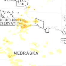
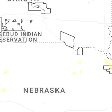
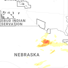

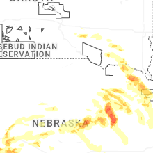


Connect with Interactive Hail Maps