

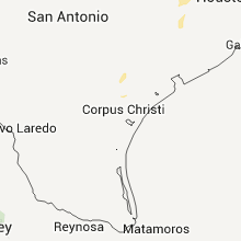
Hail Map for Friday, February 17, 2012

Number of Impacted Households on 2/17/2012
0
Impacted by 1" or Larger Hail
0
Impacted by 1.75" or Larger Hail
0
Impacted by 2.5" or Larger Hail
Square Miles of Populated Area Impacted on 2/17/2012
0
Impacted by 1" or Larger Hail
0
Impacted by 1.75" or Larger Hail
0
Impacted by 2.5" or Larger Hail

Cities Most Affected by Hail Storms of 2/17/2012
| Hail Size | Demographics of Zip Codes Affected | ||||||
|---|---|---|---|---|---|---|---|
| City | Count | Average | Largest | Pop Density | House Value | Income | Age |
Hail and Wind Damage Spotted on 2/17/2012
Filter by Report Type:Hail ReportsWind Reports
States Impacted
TexasTexas
| Local Time | Report Details |
|---|---|
| 10:05 AM UTC | Tree down blocking country in washington county TX, 62.2 miles WNW of Houston, TX |
| 10:08 AM UTC | Tree down blocking road in bellville near highway 3 in austin county TX, 55 miles WNW of Houston, TX |
| 10:50 AM UTC | Tree down on birch stree in austin county TX, 42.5 miles WSW of Houston, TX |
| 11:13 AM UTC | Trees down on the roa in montgomery county TX, 45.9 miles N of Houston, TX |
| 11:15 AM UTC | Trees dow in montgomery county TX, 28.5 miles NNW of Houston, TX |
| 11:27 AM UTC | Trees down on powerlines near county road 242 and wild forest driv in montgomery county TX, 31.8 miles NNE of Houston, TX |
| 11:30 AM UTC | Trees down on duke road near fm 209 in montgomery county TX, 34.3 miles NNE of Houston, TX |
Connect with Interactive Hail Maps