

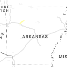
Hail Map for Thursday, February 17, 2022

Number of Impacted Households on 2/17/2022
0
Impacted by 1" or Larger Hail
0
Impacted by 1.75" or Larger Hail
0
Impacted by 2.5" or Larger Hail
Square Miles of Populated Area Impacted on 2/17/2022
0
Impacted by 1" or Larger Hail
0
Impacted by 1.75" or Larger Hail
0
Impacted by 2.5" or Larger Hail

Cities Most Affected by Hail Storms of 2/17/2022
| Hail Size | Demographics of Zip Codes Affected | ||||||
|---|---|---|---|---|---|---|---|
| City | Count | Average | Largest | Pop Density | House Value | Income | Age |
Hail and Wind Damage Spotted on 2/17/2022
Filter by Report Type:Hail ReportsWind Reports
States Impacted
Oklahoma, Louisiana, Mississippi, Tennessee, Alabama, Kentucky, Georgia, Wyoming, South Carolina, Delaware, Pennsylvania, New Jersey, New YorkOklahoma
| Local Time | Report Details |
|---|---|
| 6:32 AM CST | Strong thunderstorm wind destroyed three outbuildings... damaged the roofs of two homes... and blew down a few tree in sequoyah county OK, 21.9 miles W of Fort Smith, AR |
Louisiana
| Local Time | Report Details |
|---|---|
| 11:45 AM CST | Roof partially removed from old tin buildin in madison county LA, 49.8 miles ESE of Bastrop, LA |
Mississippi
| Local Time | Report Details |
|---|---|
| 12:53 PM CST | A couple trees dow in holmes county MS, 52.7 miles N of Jackson, MS |
| 12:56 PM CST | A couple trees down off hwy 12 in holmes county MS, 57.6 miles N of Jackson, MS |
| 1:10 PM CST | Tree dow in hinds county MS, 15.2 miles WNW of Jackson, MS |
| 1:26 PM CST | A couple trees down along hwy 1 in holmes county MS, 53.2 miles N of Jackson, MS |
| 1:26 PM CST | Large limbs down on i-55... estimated winds around 50 mph in desoto county MS, 11.8 miles S of Memphis, TN |
| 1:46 PM CST | A couple trees down around canto in madison county MS, 23.2 miles NNE of Jackson, MS |
| 1:52 PM CST | A few trees down off loring r in madison county MS, 37 miles NNE of Jackson, MS |
| 1:56 PM CST | Power lines down on acy minter r in madison county MS, 28.9 miles NNE of Jackson, MS |
| 2:30 PM CST | Tree dow in choctaw county MS, 28.8 miles WSW of Starkville, MS |
| 2:40 PM CST | Tree down along hwy 1 in winston county MS, 31.7 miles SW of Starkville, MS |
| 4:45 PM CST | A power line was blown down on highway 51 between gluckstadt and madison and blocked the roa in madison county MS, 14 miles NNE of Jackson, MS |
| 7:30 PM CST | Couple of trees down on roads and dime size hail. time estimated based on rada in clarke county MS, 84.6 miles W of Camden, AL |
Tennessee
| Local Time | Report Details |
|---|---|
| 1:15 PM CST | Many tree limbs down one inch and large in shelby county TN, 10.6 miles SSE of Memphis, TN |
| 1:32 PM CST | A couple of trees down on highway 54 north near brownsvill in haywood county TN, 54.4 miles NE of Memphis, TN |
| 1:49 PM CST | Power lines down on highway 193 in rossvill in fayette county TN, 29.8 miles ESE of Memphis, TN |
| 2:11 PM CST | Large tree down across highway 57 blocking both lanes of traffi in fayette county TN, 46.9 miles E of Memphis, TN |
| 2:12 PM CST | Power lines down and power outages as the line moved through bolivar in hardeman county TN, 59.8 miles E of Memphis, TN |
| 3:15 PM CST | 1 tree down on hwy 2 in mcnairy county TN, 47.6 miles WNW of Florence, AL |
| 5:05 PM CST | Awos station ksyi shelbyville bomar fiel in bedford county TN, 46 miles SSE of Nashville, TN |
| 8:57 PM EST | Tys asos reports gust of 58 mp in blount county TN, 10.9 miles SSW of Knoxville, TN |
Alabama
| Local Time | Report Details |
|---|---|
| 3:34 PM CST | Barn roof damaged. possible tornad in lamar county AL, 57.9 miles ENE of Starkville, MS |
| 4:00 PM CST | Pine tree uprooted and fell on a corner of a hom in greene county AL, 67.8 miles SE of Starkville, MS |
| 4:53 PM CST | 18 wheeler blown over on interstate 22. possible tornad in jefferson county AL, 13.6 miles NW of Birmingham, AL |
| 4:54 PM CST | Trees snapped along al hwy 5. possible tornad in jefferson county AL, 13.3 miles NW of Birmingham, AL |
| 4:55 PM CST | Multiple trees and power lines down. possible tornad in jefferson county AL, 13 miles NW of Birmingham, AL |
| 5:11 PM CST | Quarter sized hail reported near Tuscaloosa, AL, 48.6 miles WSW of Birmingham, AL, report from mping: quarter (1.00 in.). |
| 5:45 PM CST | Tree on a hom in jefferson county AL, 11.9 miles WSW of Birmingham, AL |
| 6:00 PM CST | Power outage was reported in the skyline area. a power pole was broken in this are in jackson county AL, 48 miles WSW of Chattanooga, TN |
| 6:03 PM CST | Tree on house. possible tornad in shelby county AL, 10.8 miles SSE of Birmingham, AL |
| 6:05 PM CST | Power outage reported in the skyline are in jackson county AL, 49.1 miles WSW of Chattanooga, TN |
| 6:13 PM CST | Tree dow in blount county AL, 43.4 miles NNE of Birmingham, AL |
| 6:19 PM CST | Hwy 25 blocked by trees down. possible tornad in jefferson county AL, 15.1 miles E of Birmingham, AL |
| 6:20 PM CST | Tree dow in blount county AL, 30.8 miles NNE of Birmingham, AL |
| 7:01 PM CST | Tree on hous in shelby county AL, 13.1 miles S of Birmingham, AL |
Kentucky
| Local Time | Report Details |
|---|---|
| 4:34 PM CST | Trees down on brownsville roa in edmonson county KY, 65 miles SSW of Louisville, KY |
| 6:05 PM EST | Tree down on north stree in marion county KY, 38.5 miles SE of Louisville, KY |
| 5:12 PM CST | Trees down on gamaliel road between gamaliel and tompkinsvill in monroe county KY, 67.9 miles ENE of Nashville, TN |
| 6:31 PM EST | Tree down near the intersection of parksville cross pike and webster roa in boyle county KY, 49.3 miles W of Irvine, KY |
| 7:14 PM EST | Reported damage to a building near 3rd street and chesnut in richmond. sporadic tree damage in county as wel in madison county KY, 17.8 miles WNW of Irvine, KY |
| 7:24 PM EST | Tree down on hardwicks creek r in powell county KY, 9.5 miles NNE of Irvine, KY |
| 7:24 PM EST | Report of a car port that had been blown over into the road on richmond road near the intersection with pea ridge roa in estill county KY, 3.6 miles W of Irvine, KY |
| 7:30 PM EST | Tree down on natural bridge r in powell county KY, 16.8 miles ENE of Irvine, KY |
| 7:30 PM EST | Tree down on cane creek r in powell county KY, 13.6 miles NE of Irvine, KY |
| 7:38 PM EST | Report of a tree down on mountain crest circle... near the intersection with grindstone roa in estill county KY, 1.4 miles N of Irvine, KY |
Georgia
| Local Time | Report Details |
|---|---|
| 8:53 PM EST | Asos station krmg rom in floyd county GA, 48.7 miles S of Chattanooga, TN |
| 8:58 PM EST | 5-7 trees down in the hwy-136 connector from willow ln to bunch c in pickens county GA, 52.8 miles N of Atlanta, GA |
Wyoming
| Local Time | Report Details |
|---|---|
| 7:56 PM MST | Mesonet station wy24 6.9 e arlington (wydot in carbon county WY, 30.8 miles WNW of Laramie, WY |
South Carolina
| Local Time | Report Details |
|---|---|
| 1:55 AM EST | 911 communications center reported powerlines down on lakewood ln in anderson county SC, 23.5 miles SSW of Greenville, SC |
Delaware
| Local Time | Report Details |
|---|---|
| 5:45 AM EST | Several trees down around newark. time estimated from rada in new castle county DE, 52.8 miles ENE of Baltimore, MD |
Pennsylvania
| Local Time | Report Details |
|---|---|
| 6:05 AM EST | Tree reported down over us 1 in haverford twp. time estimated from radar. report via social medi in delaware county PA, 84.6 miles NE of Baltimore, MD |
New Jersey
| Local Time | Report Details |
|---|---|
| 6:23 AM EST | Asos station kewr newark airport. 57 kt gus in union county NJ, 9.5 miles W of Brooklyn, NY |
New York
| Local Time | Report Details |
|---|---|
| 6:40 AM EST | Mesonet station bkln brooklyn college. 50 kt gus in kings county NY, 4.8 miles SSE of Brooklyn, NY |
Connect with Interactive Hail Maps