

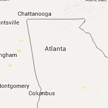
Hail Map for Wednesday, July 1, 2015

Number of Impacted Households on 7/1/2015
0
Impacted by 1" or Larger Hail
0
Impacted by 1.75" or Larger Hail
0
Impacted by 2.5" or Larger Hail
Square Miles of Populated Area Impacted on 7/1/2015
0
Impacted by 1" or Larger Hail
0
Impacted by 1.75" or Larger Hail
0
Impacted by 2.5" or Larger Hail


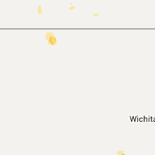


Cities Most Affected by Hail Storms of 7/1/2015
| Hail Size | Demographics of Zip Codes Affected | ||||||
|---|---|---|---|---|---|---|---|
| City | Count | Average | Largest | Pop Density | House Value | Income | Age |
| Williams, AZ | 1 | 1.75 | 1.75 | 4 | $101k | $33.8k | 44.5 |
| Manville, WY | 1 | 1.75 | 1.75 | 0 | $48k | $20.9k | 55.1 |
| Glenrock, WY | 1 | 1.75 | 1.75 | 1 | $80k | $39.5k | 41.1 |
Hail and Wind Damage Spotted on 7/1/2015
Filter by Report Type:Hail ReportsWind Reports
States Impacted
California, Massachusetts, Tennessee, New York, Florida, Alabama, Kentucky, Montana, Vermont, Arizona, New Hampshire, Mississippi, Georgia, North Carolina, Missouri, Wyoming, Nevada, North Dakota, Nebraska, South Carolina, Kansas, South DakotaCalifornia
| Local Time | Report Details |
|---|---|
| 5:26 AM PDT | Laurel mountain raws; also 58 mph report at 4:26 am pd in kern county CA, 74.8 miles E of Bakersfield, CA |
| 5:26 AM PDT | Indian wells canyon in kern county CA, 67.2 miles ENE of Bakersfield, CA |
| 5:27 AM PDT | Bird springs pass raws in kern county CA, 51 miles ENE of Bakersfield, CA |
Massachusetts
| Local Time | Report Details |
|---|---|
| 8:38 AM EDT | Storm damage reported in barnstable county MA, 47.2 miles ESE of Providence, RI |
| 9:00 AM EDT | Large limbs down on quaker meeting house road... rte 6a and rte 130 in barnstable county MA, 47.8 miles E of Providence, RI |
| 5:50 PM EDT | Tree down on house and tree down on wires along pierson road in franklin county MA, 76.2 miles E of Schenectady, NY |
Tennessee
| Local Time | Report Details |
|---|---|
| 10:25 AM CDT | Multiple trees down and roof blown off house near reynoldsburg and french roads. time is radar estimate in henry county TN, 22.2 miles ENE of Mc Kenzie, TN |
| 10:40 AM CDT | Multiple trees down and roof blown off house near reynoldsburg and french roads. time is radar estimate in henry county TN, 22.2 miles ENE of Mc Kenzie, TN |
| 11:08 AM CDT | Several trees down and power outages in waverly... including a tree on a house on duffle stree in humphreys county TN, 40.9 miles E of Mc Kenzie, TN |
| 11:20 AM CDT | Several trees down and power outages in mcewen in humphreys county TN, 48.4 miles W of Nashville, TN |
| 11:30 AM CDT | Delayed report. barn roof blown off on manley loo in dickson county TN, 41.7 miles W of Nashville, TN |
| 11:40 AM CDT | Trees down along eno road and hwy 48 south in dickson county TN, 35.8 miles W of Nashville, TN |
| 11:42 AM CDT | Trees down along eno road and hwy 48 south in dickson county TN, 35.8 miles W of Nashville, TN |
| 11:42 AM CDT | Trees down near mile 171 on i-40 south of dickson in dickson county TN, 35 miles WSW of Nashville, TN |
| 11:43 AM CDT | Delayed report. trees blown down on highway 48n between dickson and charlott in dickson county TN, 32.6 miles W of Nashville, TN |
| 12:12 PM CDT | Large tree down on clarksville pike in davidson county TN, 7.6 miles NW of Nashville, TN |
| 12:28 PM CDT | Trees down blocking the road near the intersection of beechcroft rd and dr robertson r in maury county TN, 30.5 miles SSW of Nashville, TN |
| 1:30 PM CDT | Two trees down. one tree was on collier ave and the other tree was 1 mile south of the shelbyville municipal airpor in bedford county TN, 49.6 miles SSE of Nashville, TN |
| 2:42 PM EDT | Several trees down in mcminn county TN, 45.8 miles NE of Chattanooga, TN |
| 1:45 PM CDT | Large branch snapped and estimated wind gust of 50 mph in coffee county TN, 56.1 miles WNW of Chattanooga, TN |
| 2:13 PM CDT | Trees reported down by law enforcemen in lincoln county TN, 53.6 miles ENE of Florence, AL |
| 2:17 PM CDT | Trees down on highway 110 - ardmore highwa in lincoln county TN, 56.3 miles ENE of Florence, AL |
| 10:45 PM CDT | Trees and powerlines down around the city...time estimated based on radar and report in obion county TN, 35.6 miles NW of Mc Kenzie, TN |
| 3:55 AM CDT | Wkrn-tv reported several trees blown down across ashland city. a tree fell on top of a car at 119 w mcquarry st. other trees were blown down on fairgrounds road and bel in cheatham county TN, 17.5 miles WNW of Nashville, TN |
New York
| Local Time | Report Details |
|---|---|
| 2:26 PM EDT | Trees and wires donw near intersection of west state st. and hall av in fulton county NY, 26.1 miles WNW of Schenectady, NY |
| 4:17 PM EDT | Route 67 closed at cottrell road due to downed wires. time estimated by rada in rensselaer county NY, 34.7 miles ENE of Schenectady, NY |
| 4:20 PM EDT | Tress and wires down at the intersection of rt. 67 and north hoosick stree in rensselaer county NY, 31.6 miles ENE of Schenectady, NY |
Florida
| Local Time | Report Details |
|---|---|
| 2:40 PM EDT | Wind gusts from a thunderstorm uprooted a few small trees and broke off tree branches about 3 to 4 inches in diamete in palm beach county FL, 37.5 miles S of Port Saint Lucie, FL |
| 4:30 PM EDT | A tree was blown down along county road 315c. the time of the event was based on radar imager in clay county FL, 37.4 miles SSW of Jacksonville, FL |
| 5:49 PM EDT | Ping Pong Ball sized hail reported near Lehigh Acres, FL, 31.3 miles N of Naples, FL, broadcast media report of ping pong ball size hail. |
| 6:40 PM EDT | Large business sign destroyed by wind at market 27 in avon par in highlands county FL, 62.5 miles S of Orlando, FL |
| 6:40 PM EDT | Quarter sized hail reported near Avon Park, FL, 62.5 miles S of Orlando, FL, quarter size hail reported at market 27 in avon park. |
Alabama
| Local Time | Report Details |
|---|---|
| 2:00 PM CDT | Trees down blocking antioch r in etowah county AL, 68.9 miles NE of Birmingham, AL |
| 2:15 PM CDT | Trees down on leeth gap rd in etowah county AL, 60.3 miles NE of Birmingham, AL |
| 2:24 PM CDT | A few trees down across the county on coutny hwy 1...county hwy 15...370 poplar tr. spotter estimated winds gust to 40mph in blount county AL, 29 miles NNE of Birmingham, AL |
| 2:45 PM CDT | Tree down on i59 near mm198 in etowah county AL, 65.5 miles NE of Birmingham, AL |
| 2:54 PM CDT | Tree down on deams ferry rd in blount county AL, 22.3 miles N of Birmingham, AL |
| 3:48 PM CDT | Tree down on hwy 431 at wellington rd in calhoun county AL, 57.2 miles ENE of Birmingham, AL |
Kentucky
| Local Time | Report Details |
|---|---|
| 4:01 PM EDT | Barn and trees blown down near the intersection of ky-196 and ky-166 in pulaski county KY, 63.2 miles SW of Irvine, KY |
Montana
| Local Time | Report Details |
|---|---|
| 2:15 PM MDT | Power pole knocked down during a thunderstorm. time of event radar estimated. location of event estimate in chouteau county MT, 37.3 miles NE of Great Falls, MT |
| 2:19 PM MDT | Power pole knocked down during a thunderstorm. time of event radar estimated. location of event estimate in chouteau county MT, 37.3 miles NE of Great Falls, MT |
| 2:40 PM MDT | Quarter sized hail reported near Fort Benton, MT, 37.5 miles NE of Great Falls, MT, quarter size hail reported in the fort benton area by the chouteau county sheriff office. |
| 2:40 PM MDT | Second-hand report of grain silo blown down near mile marker 13 on hwy 223. time and location of event estimated in chouteau county MT, 42.5 miles NE of Great Falls, MT |
| 3:05 PM MDT | Nickel size hail and a good size tree uprooted. time of event radar estimate in chouteau county MT, 50.2 miles ENE of Great Falls, MT |
| 4:57 PM MDT | Storm damage reported in yellowstone county MT, 37.7 miles NE of Billings, MT |
| 5:00 PM MDT | Quarter sized hail reported near Worden, MT, 37.7 miles NE of Billings, MT, ground is covered with hail. |
| 6:25 PM MDT | Less than 200 yards visibilit in rosebud county MT, 46 miles SW of Miles City, MT |
| 6:35 PM MDT | Observer reported gusty winds at least 60 mph in big horn county MT, 76.7 miles ESE of Billings, MT |
| 6:59 PM MDT | Storm damage reported in big horn county MT, 75.1 miles SW of Miles City, MT |
| 6:59 PM MDT | Quarter sized hail reported near Lame Deer, MT, 75.1 miles SW of Miles City, MT |
| 7:50 PM MDT | Storm damage reported in fallon county MT, 64.8 miles E of Miles City, MT |
Vermont
| Local Time | Report Details |
|---|---|
| 4:27 PM EDT | Large tree down at intersection of south stream road and coleville road. time estimated by rada in bennington county VT, 39.3 miles E of Schenectady, NY |
Arizona
| Local Time | Report Details |
|---|---|
| 2:00 PM MST | Quarter sized hail reported near Flagstaff, AZ, 13.3 miles N of Flagstaff, AZ, 1 inch diamter hail near az snowbowl |
| 2:27 PM MST | Golf Ball sized hail reported near Williams, AZ, 17.4 miles WNW of Flagstaff, AZ, measured golf ball sized hail. stones were fairly flat. |
| 2:30 PM MST | Ping Pong Ball sized hail reported near Williams, AZ, 19.4 miles WNW of Flagstaff, AZ, hail broke a skylight and dented vehicles. |
| 2:40 PM MST | Quarter sized hail reported near Flagstaff, AZ, 6.7 miles NW of Flagstaff, AZ |
| 3:54 PM MDT | Ping Pong Ball sized hail reported near Saint Michaels, AZ, 96.3 miles SW of Farmington, NM, public posted picture on facebook |
| 3:00 PM MST | Quarter sized hail reported near Bellemont, AZ, 9.8 miles WNW of Flagstaff, AZ, a lot of pea to dime sized hail with a few pieces to quarter size. |
New Hampshire
| Local Time | Report Details |
|---|---|
| 5:08 PM EDT | About a dozen trees fell in a residents back yard on mt delight road in rockingham county NH, 59.9 miles SW of Portland, ME |
| 6:40 PM EDT | Large branches and wires down on intersection of merrimack road and poneamah road in hillsborough county NH, 70.9 miles N of Providence, RI |
| 6:55 PM EDT | *** 1 inj *** boy hit by fallen tree...wires also down on whitney road in hillsborough county NH, 65.3 miles N of Providence, RI |
| 7:21 PM EDT | *** 1 inj *** boy hit by fallen tree...wires also down on whitney road in hillsborough county NH, 65.3 miles N of Providence, RI |
Mississippi
| Local Time | Report Details |
|---|---|
| 4:10 PM CDT | Large tree downed along old foxworth rd in marion county MS, 75.6 miles SSE of Jackson, MS |
Georgia
| Local Time | Report Details |
|---|---|
| 6:22 PM EDT | The broadcast media relayed a report of a tree down on power lines on west johnston street in forsyth. power was out across the city of forsyt in monroe county GA, 56 miles SSE of Atlanta, GA |
| 8:50 PM EDT | 911 call center has received a report of 1 tree down on eastman road as well as several calls regarding a few downed powerlines. employee from pilot travel center near in laurens county GA, 68.3 miles N of Douglas, GA |
| 9:58 PM EDT | Tree down on hwy 80 near intersection with reddick rd in bulloch county GA, 60.4 miles WNW of Savannah, GA |
| 10:15 PM EDT | Tree down across road at 700 block of w jones ave in bulloch county GA, 48.3 miles WNW of Savannah, GA |
| 10:16 PM EDT | Large tree down at 700 block pine straw ct in bulloch county GA, 48.4 miles NW of Savannah, GA |
| 10:16 PM EDT | Tree down on wood valley circle road in bulloch county GA, 45.6 miles WNW of Savannah, GA |
| 10:33 PM EDT | Tree down on stillson-leefield rd near the intersection of spring creek rd. time estimated from radar in bulloch county GA, 40.5 miles NW of Savannah, GA |
| 10:59 PM EDT | Tree down on wood valley circle road in bulloch county GA, 45.6 miles WNW of Savannah, GA |
| 11:51 PM EDT | Tree down on stillson-leefield rd near the intersection of spring creek rd. time estimated from radar in bulloch county GA, 40.5 miles NW of Savannah, GA |
North Carolina
| Local Time | Report Details |
|---|---|
| 7:55 PM EDT | Several trees down at meadowbrook rd and brookwood dr... time estimated by radar in randolph county NC, 65.2 miles W of Raleigh, NC |
| 7:55 PM EDT | Tree down in the road at w presnell st and white oak st... time estimated by radar in randolph county NC, 65.8 miles W of Raleigh, NC |
| 8:23 PM EDT | One tree down at exit 149 of route 29 that intersects with route 87 in rockingham county NC, 66.5 miles WNW of Raleigh, NC |
| 8:23 PM EDT | One tree down on lawndale drive in rockingham county NC, 67.2 miles SSE of Roanoke, VA |
Missouri
| Local Time | Report Details |
|---|---|
| 7:28 PM CDT | Several large tree limbs down across a neighborhood in st. an in st. louis county MO, 12.5 miles NW of Saint Louis, MO |
| 7:45 PM CDT | Numerous small branches downe in st. louis county MO, 10.2 miles WNW of Saint Louis, MO |
| 7:48 PM CDT | Tree down ontu two homes. time estimated from rada in st. louis city county MO, 2.3 miles WNW of Saint Louis, MO |
| 7:48 PM CDT | Tree down near intersection of lindell and unio in st. louis city county MO, 2.3 miles WNW of Saint Louis, MO |
| 8:05 PM CDT | 2 to 3 inch tree limbs reported down near the 24000 block of hwy 58... possibly due to tornado in cass county MO, 26.1 miles SE of Kansas City, MO |
| 8:24 PM CDT | Quarter sized hail reported near Sedalia, MO, 56.9 miles WSW of Columbia, MO, deputy reported near the intersection of 32nd street and prairie road |
| 8:38 PM CDT | Deputy reports several utility poles down on hwy b between sacajawea and ragar rds. time estimate by rada in pettis county MO, 54.4 miles WSW of Columbia, MO |
| 9:03 PM CDT | Trees down on power line in moniteau county MO, 35.2 miles SSW of Columbia, MO |
| 9:10 PM CDT | 6 inch tree limbs down in yard and neighbor in pettis county MO, 62.4 miles WSW of Columbia, MO |
| 9:15 PM CDT | Power lines down in cole camp. also tree down... unknown size in benton county MO, 57.8 miles SW of Columbia, MO |
| 9:15 PM CDT | Large tree branches down in ionia in benton county MO, 61.7 miles WSW of Columbia, MO |
| 9:26 PM CDT | Storm damage reported in cass county MO, 32.2 miles SSE of Kansas City, MO |
| 9:30 PM CDT | Quarter sized hail reported near Lincoln, MO, 66.4 miles SW of Columbia, MO, quarter size hail in lincoln |
| 9:35 PM CDT | Trees down blocking highway 135 south of stove in morgan county MO, 50.5 miles SW of Columbia, MO |
| 9:35 PM CDT | 12 inch tree down on highway 52 in morgan county MO, 50 miles SW of Columbia, MO |
| 9:41 PM CDT | Skylights broken at walmart just south of columbia with water flooding stor in boone county MO, 2 miles SE of Columbia, MO |
| 9:42 PM CDT | Storm damage reported in jefferson county MO, 35.8 miles SSW of Saint Louis, MO |
| 9:53 PM CDT | 3-4 6 inch branches down in yard from trained spotte in cass county MO, 44.8 miles SSE of Kansas City, MO |
| 10:00 PM CDT | Multiple large trees down in warsaw in benton county MO, 71.3 miles N of Springfield, MO |
| 10:00 PM CDT | Report of a path of multiple trees uprooted and blown down. also damage to mobile home in benton county MO, 71.4 miles N of Springfield, MO |
| 10:05 PM CDT | Trained storm chaser measured a 59 mph at the bagnell da in miller county MO, 51.9 miles SSW of Columbia, MO |
| 10:15 PM CDT | Two large trees dow in bates county MO, 50.1 miles SSE of Kansas City, MO |
| 10:20 PM CDT | Tree down on carol road in camden county MO, 55.2 miles SSW of Columbia, MO |
| 10:25 PM CDT | Reports of numerous trees and large limbs blown down on fairview and sequoia road in iberi in miller county MO, 51.8 miles NW of Salem, MO |
| 10:45 PM CDT | Path of tree damage... multiple trees stripped along e highway and county road 506 in maries county MO, 38.8 miles NW of Salem, MO |
| 10:45 PM CDT | Numerous trees reported blown down around dixo in pulaski county MO, 38.9 miles NW of Salem, MO |
| 11:54 PM CDT | Large limbs down into powerlines at rafe road in lebano in laclede county MO, 47.6 miles NE of Springfield, MO |
| 12:01 AM CDT | Tree branches down. power out in laclede county MO, 36.7 miles NE of Springfield, MO |
| 12:40 AM CDT | A large tree fell into a house near quail road and highway bb. tree fell through the living room trapping a person in the hom in vernon county MO, 61.1 miles E of Chanute, KS |
Wyoming
| Local Time | Report Details |
|---|---|
| 7:30 PM MDT | Quarter sized hail reported near Evansville, WY, 12.6 miles E of Casper, WY |
| 7:48 PM MDT | Golf Ball sized hail reported near Glenrock, WY, 19.3 miles E of Casper, WY, golf ball size hail at mile marker 167 along interstate 25. |
| 7:57 PM MDT | Quarter sized hail reported near Glenrock, WY, 23.8 miles E of Casper, WY |
| 8:00 PM MDT | Quarter size hai in converse county WY, 23.8 miles E of Casper, WY |
| 8:10 PM MDT | Quarter sized hail reported near Recluse, WY, 49.2 miles NNW of Gillette, WY |
| 8:10 PM MDT | Storm damage reported in campbell county WY, 49.2 miles NNW of Gillette, WY |
| 8:50 PM MDT | Storm damage reported in campbell county WY, 25.2 miles NNE of Gillette, WY |
| 10:00 PM MDT | Golf Ball sized hail reported near Manville, WY, 83.7 miles NW of Scottsbluff, NE, relayed by law enforcement. time estimated based on radar. |
| 10:20 PM MDT | Storm damage reported in weston county WY, 47.5 miles WSW of Rapid City, SD |
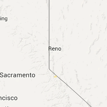
Nevada
| Local Time | Report Details |
|---|---|
| 7:50 PM PDT | Tikaboo peak measured a 62 mph thunderstorm wind gus in lincoln county NV, 81.5 miles N of Las Vegas, NV |
North Dakota
| Local Time | Report Details |
|---|---|
| 8:55 PM MDT | Straight line winds. also 0.75 inches of rainfall with the thunderstor in golden valley county ND, 68.8 miles S of Williston, ND |
| 9:06 PM MDT | Estimated 60 mph wind gust in golden valley county ND, 85.4 miles S of Williston, ND |
Nebraska
| Local Time | Report Details |
|---|---|
| 10:00 PM CDT | Quarter sized hail reported near Mason City, NE, 59.4 miles WNW of Grand Island, NE |
South Carolina
| Local Time | Report Details |
|---|---|
| 11:34 PM EDT | Jasper county 911 center reported a tree down at old fordsville rd and captain bill r in jasper county SC, 28.4 miles NNE of Savannah, GA |
| 11:34 PM EDT | Sc highway patrol reported a tree down at logan st and azalea av in jasper county SC, 27.6 miles NNE of Savannah, GA |
| 11:34 PM EDT | Sc highway patrol reported a tree down at i-95 near us-1 in jasper county SC, 30.4 miles NNE of Savannah, GA |
Kansas
| Local Time | Report Details |
|---|---|
| 11:10 PM CDT | Storm damage reported in linn county KS, 52.1 miles S of Kansas City, MO |
| 11:40 PM CDT | 4 power poles down on 152 hwy. numerous traffic signs and stops blown dow in linn county KS, 52.8 miles S of Kansas City, MO |
South Dakota
| Local Time | Report Details |
|---|---|
| 10:55 PM MDT | Storm damage reported in fall river county SD, 59.3 miles SW of Rapid City, SD |
| 11:10 PM MDT | Storm damage reported in fall river county SD, 66.9 miles SW of Rapid City, SD |
| 11:24 PM MDT | Storm damage reported in shannon county SD, 63.4 miles S of Rapid City, SD |
Connect with Interactive Hail Maps