

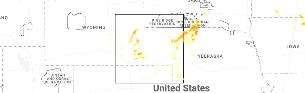
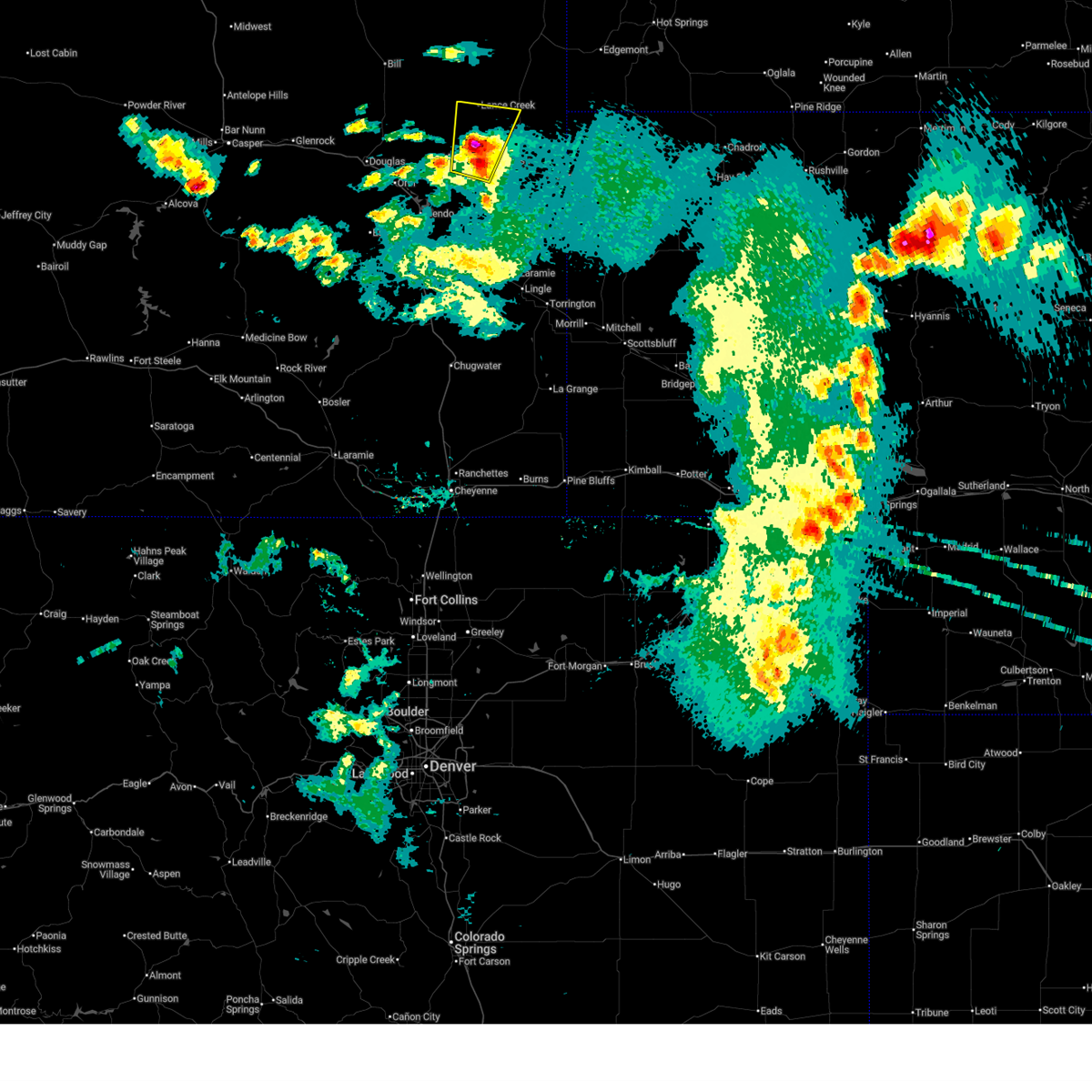
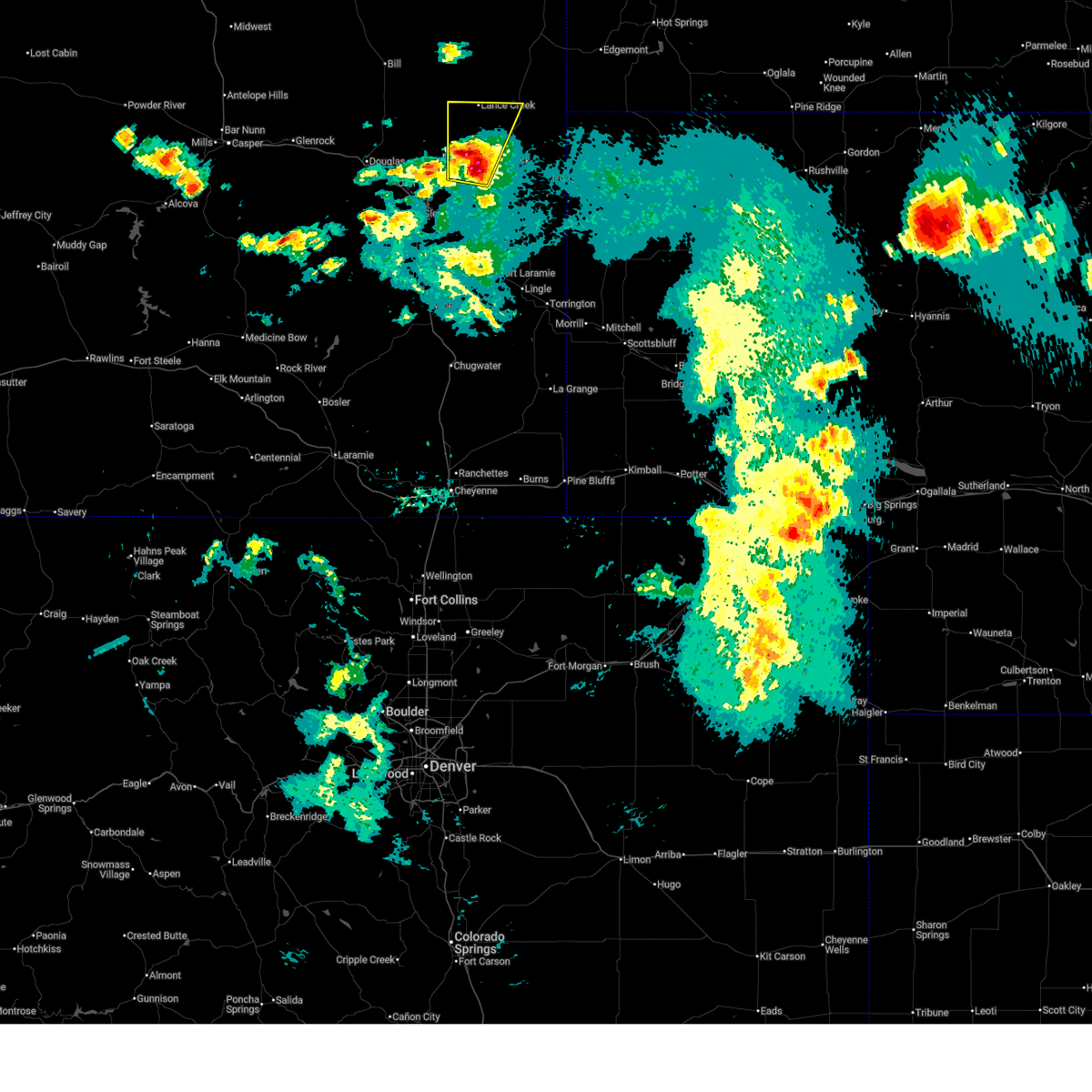
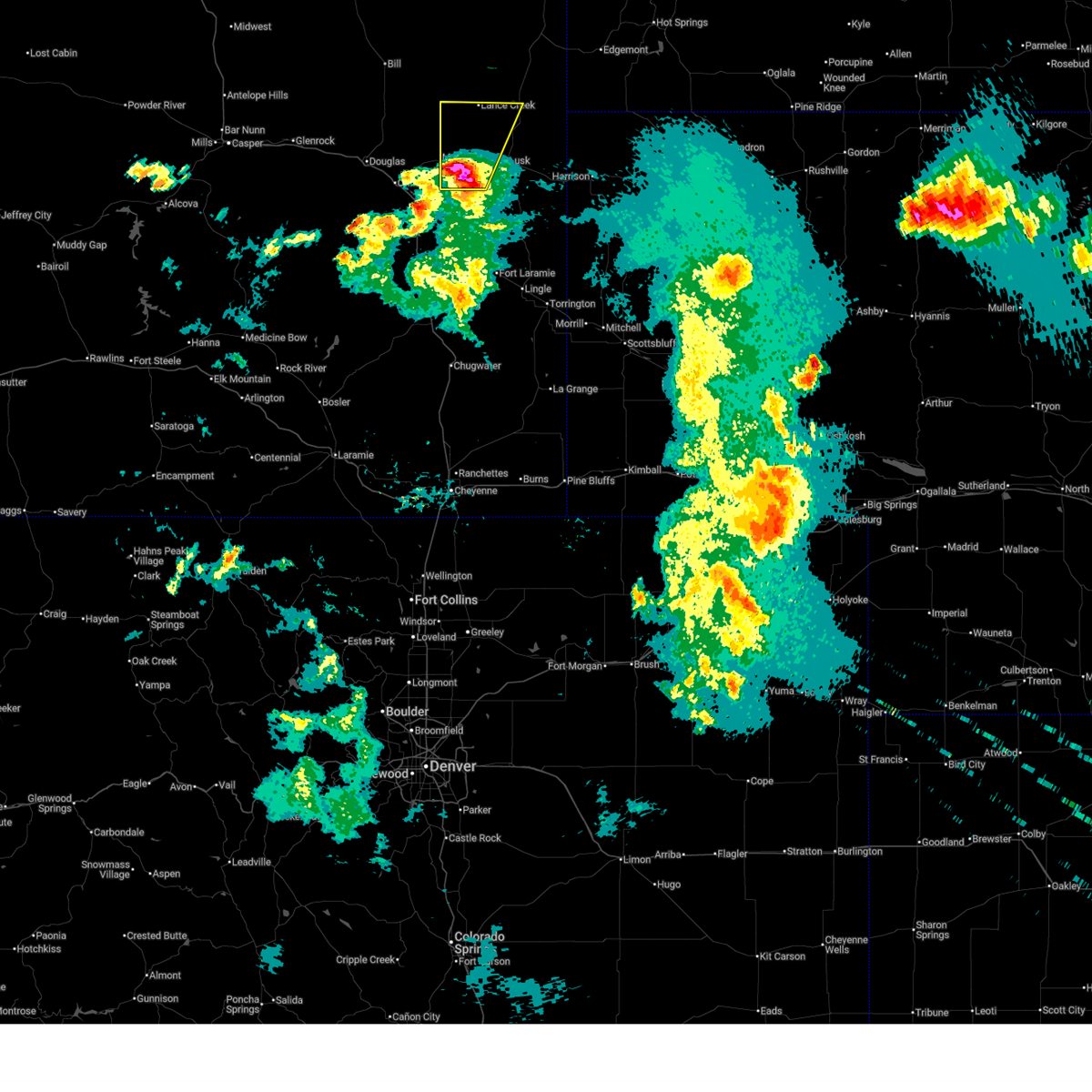
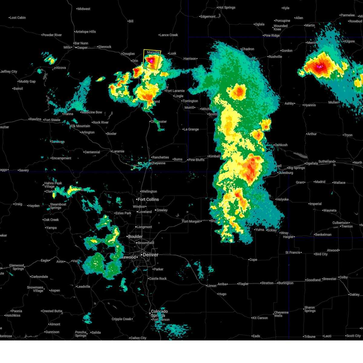
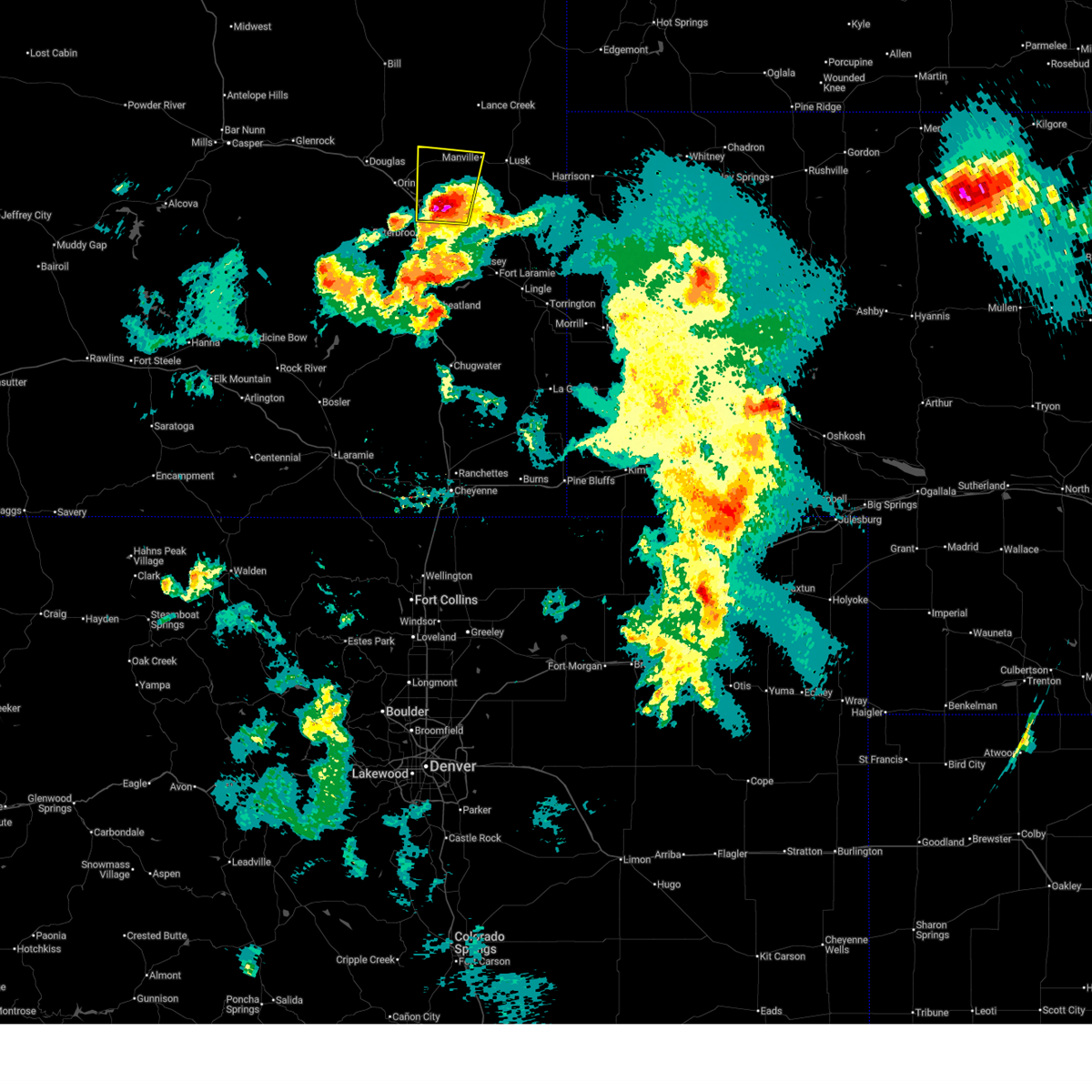
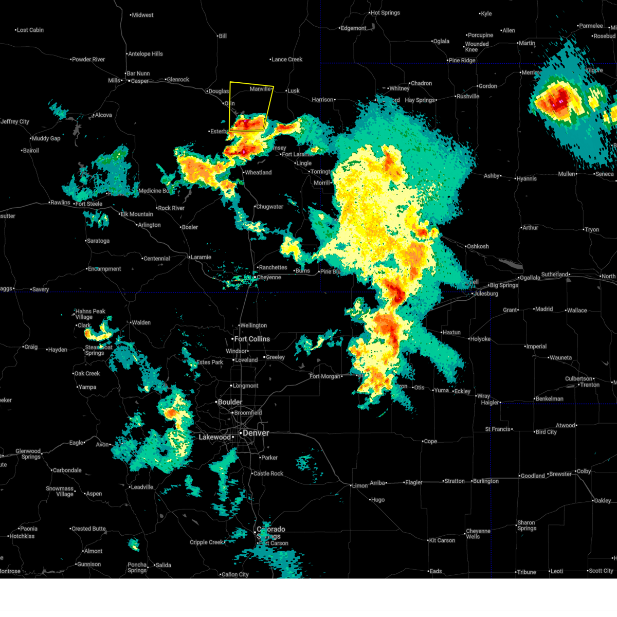
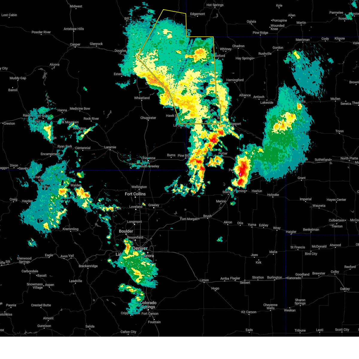
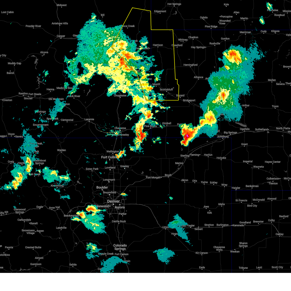
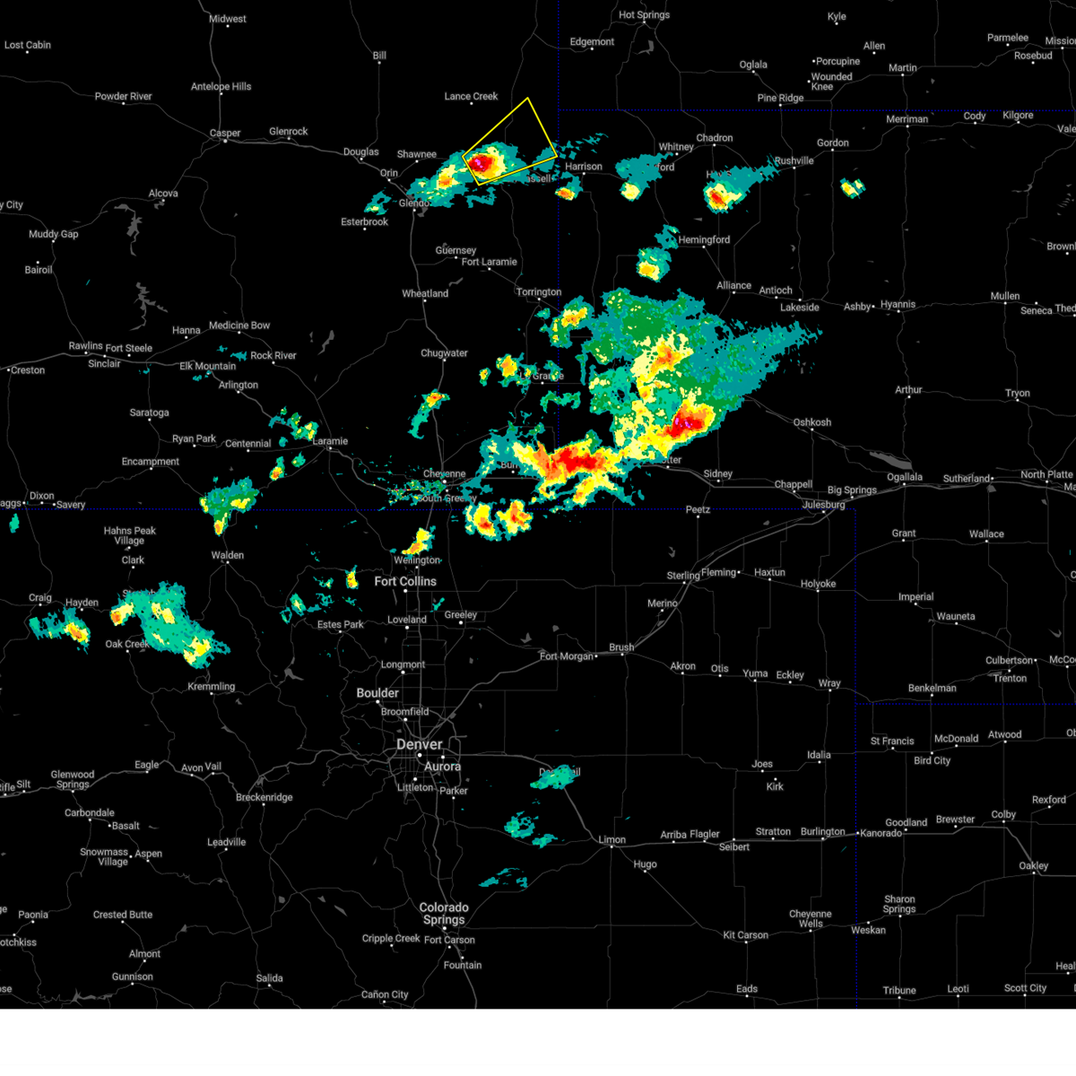
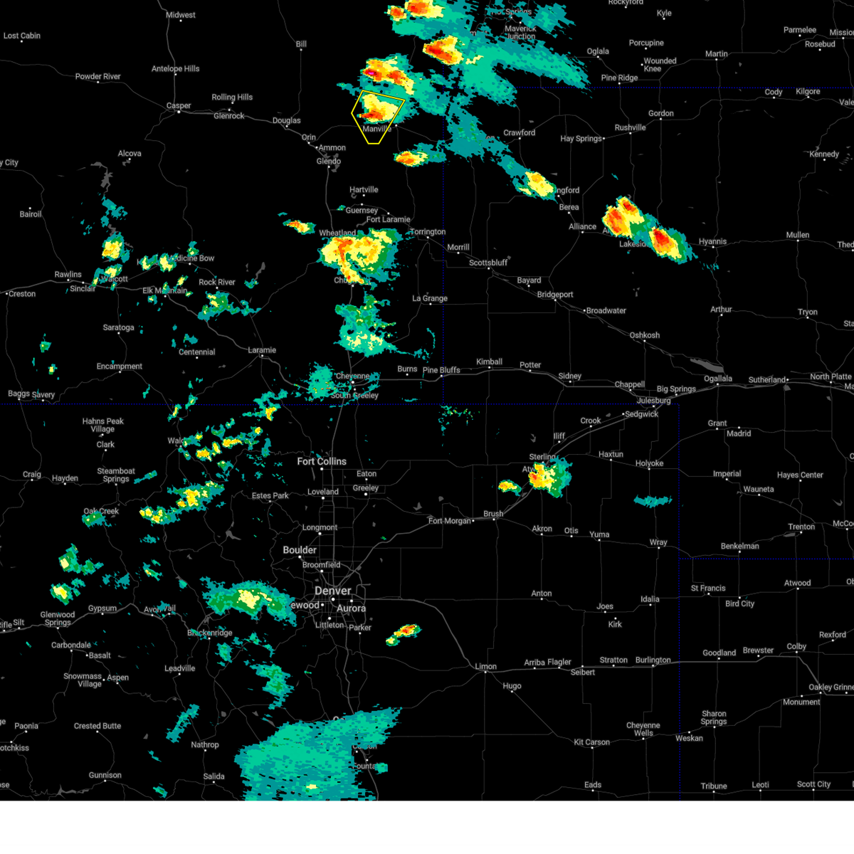
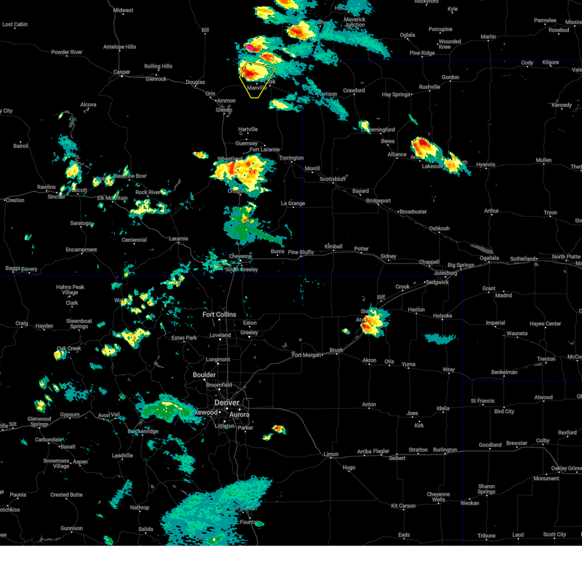
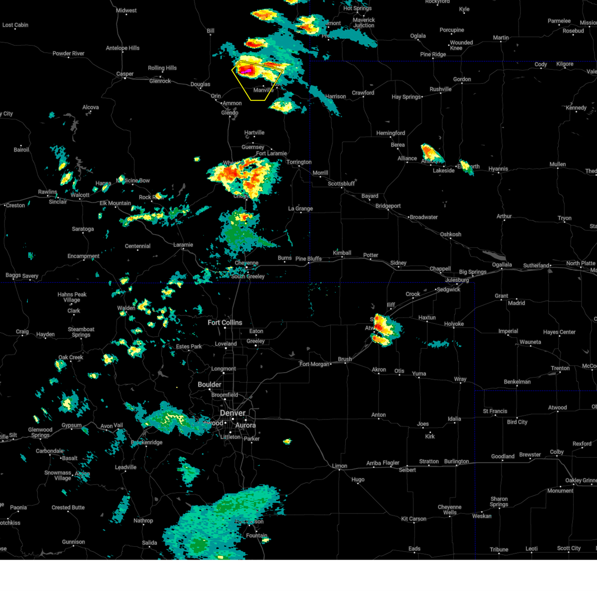
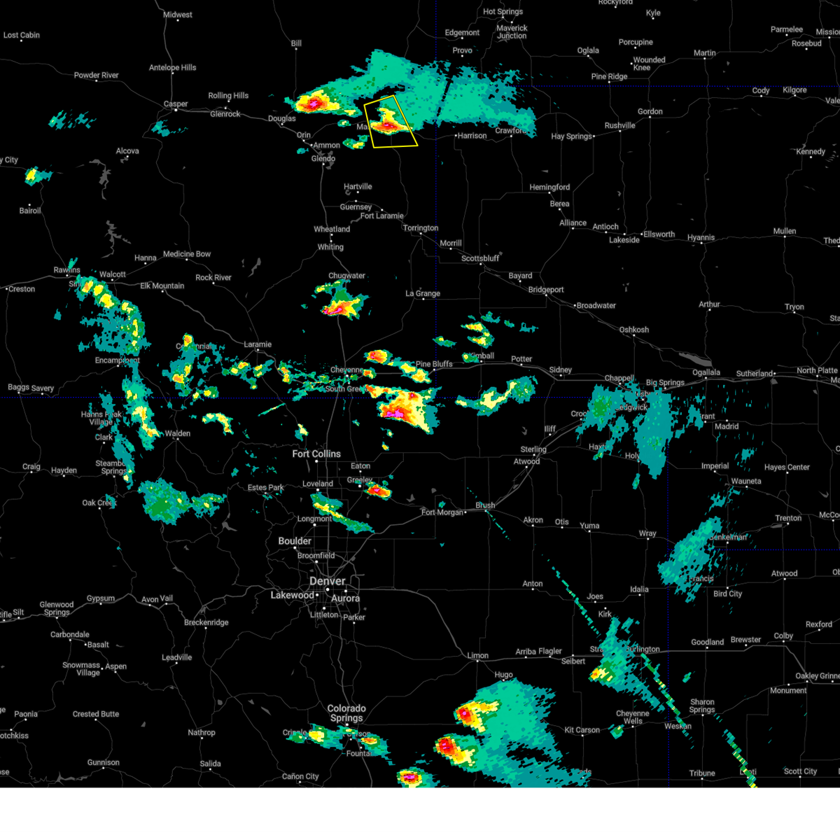
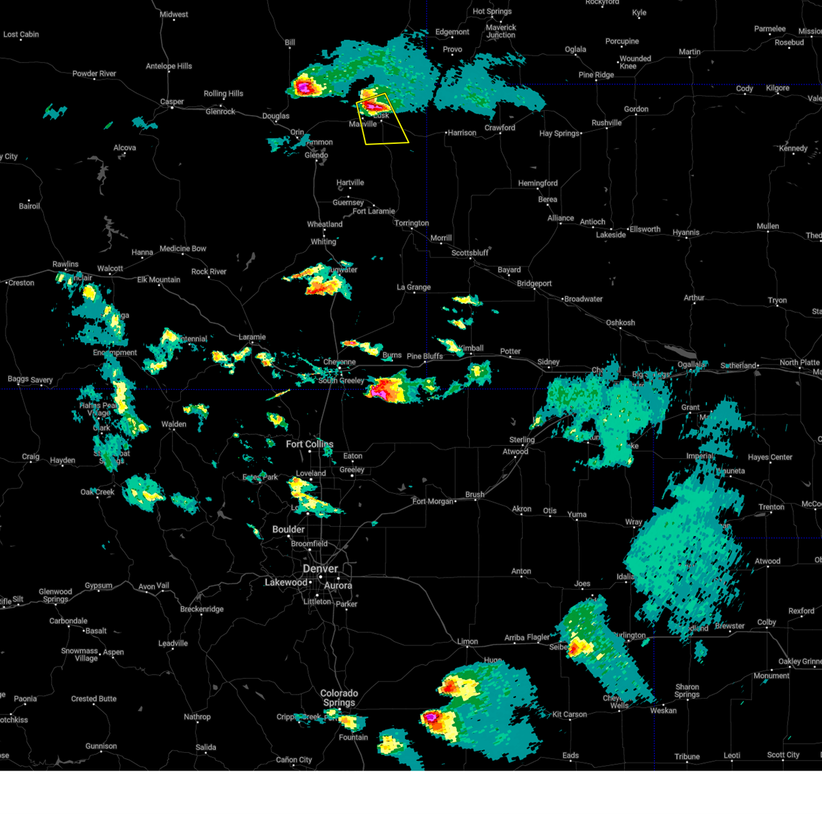
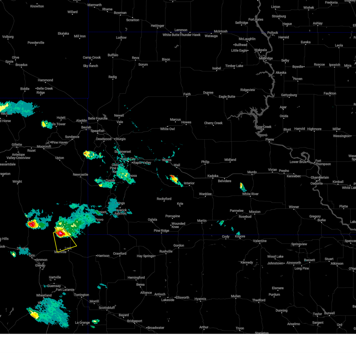
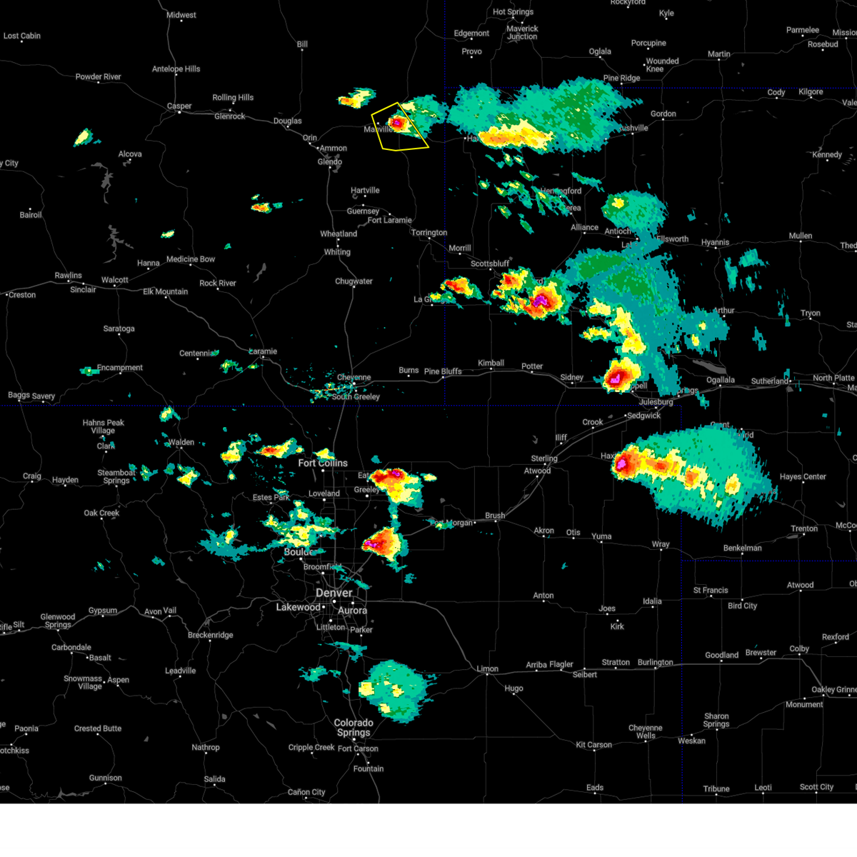
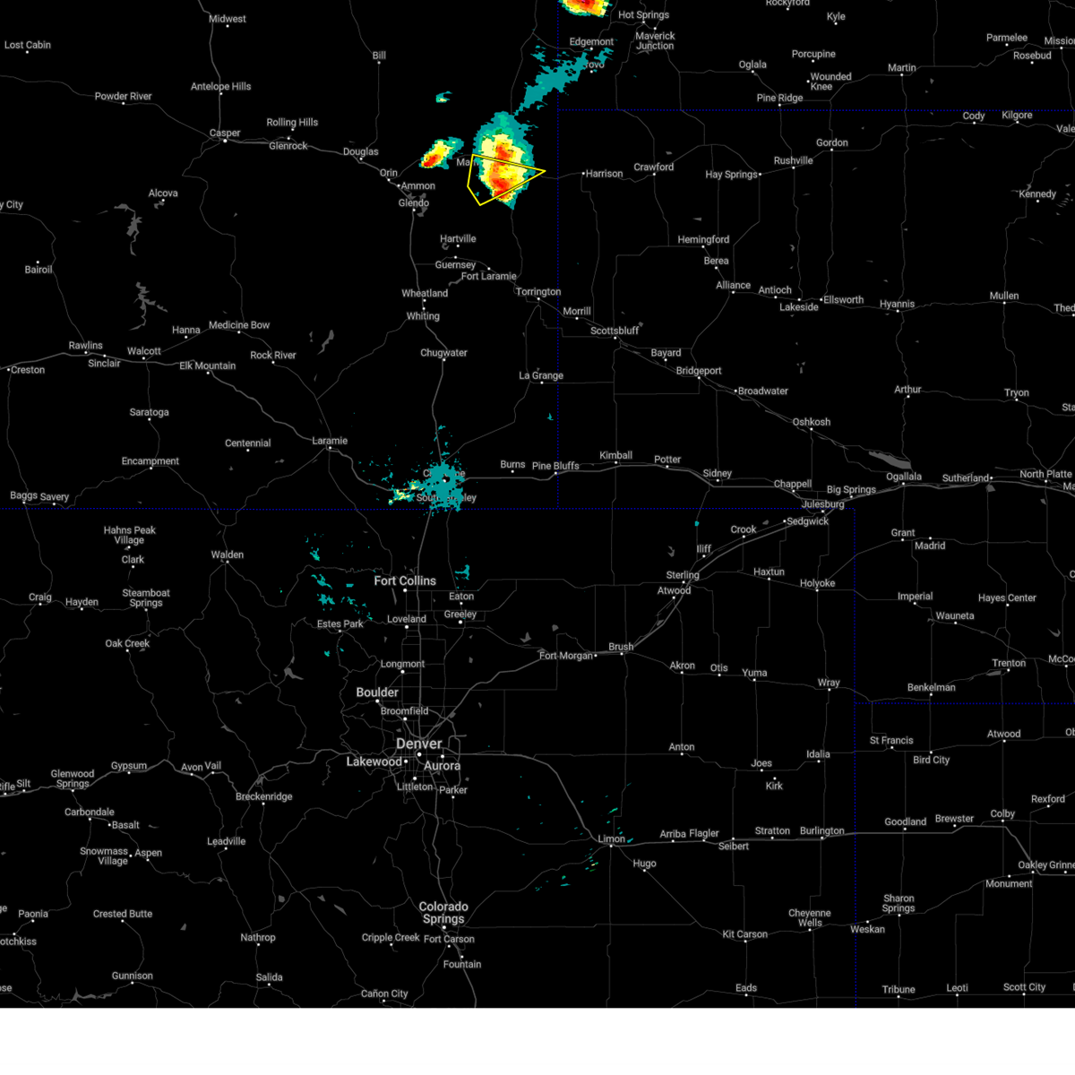
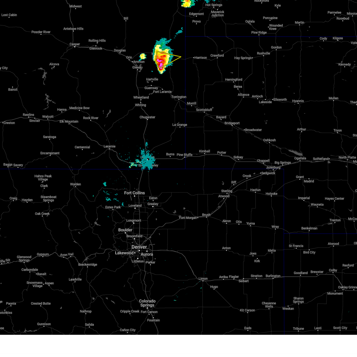
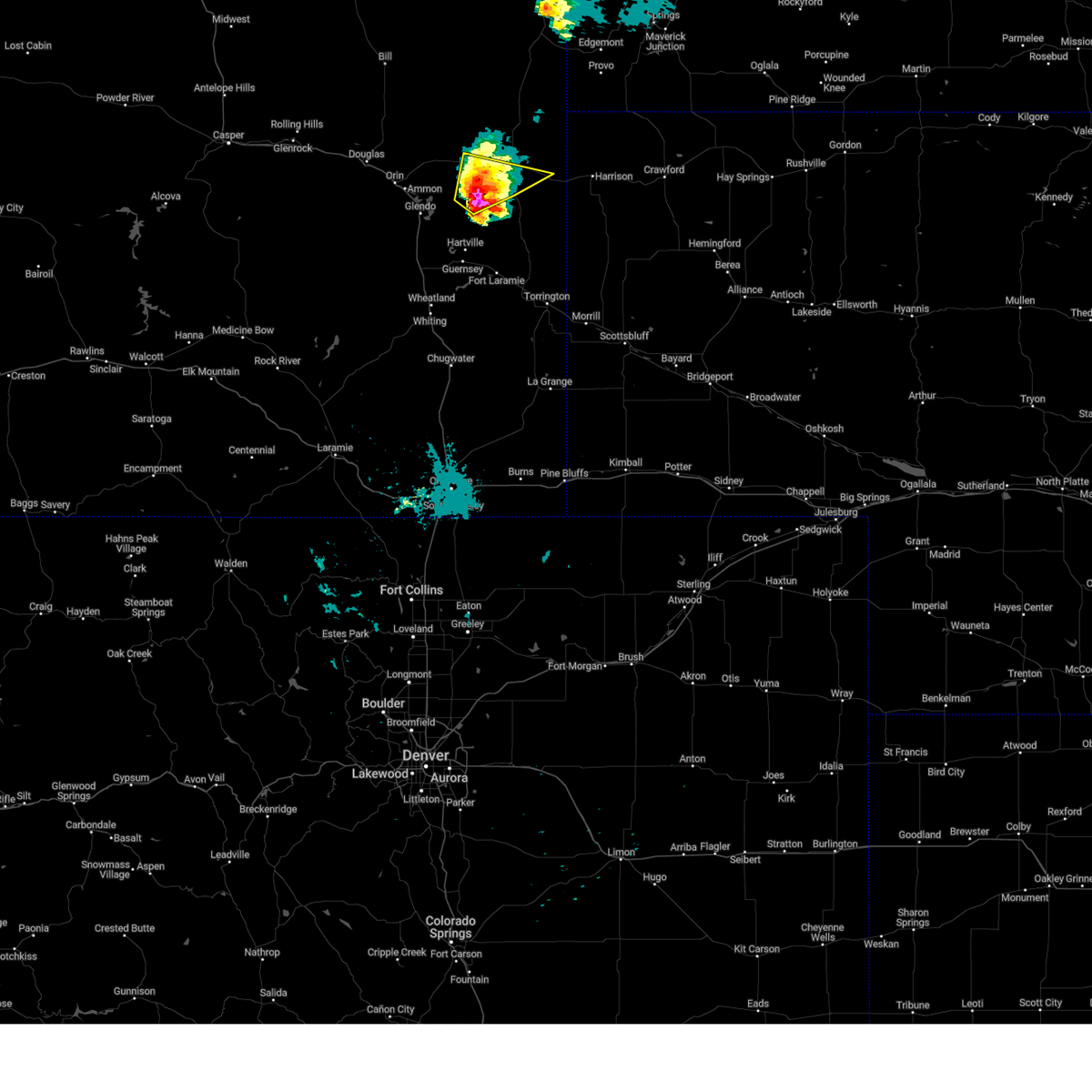
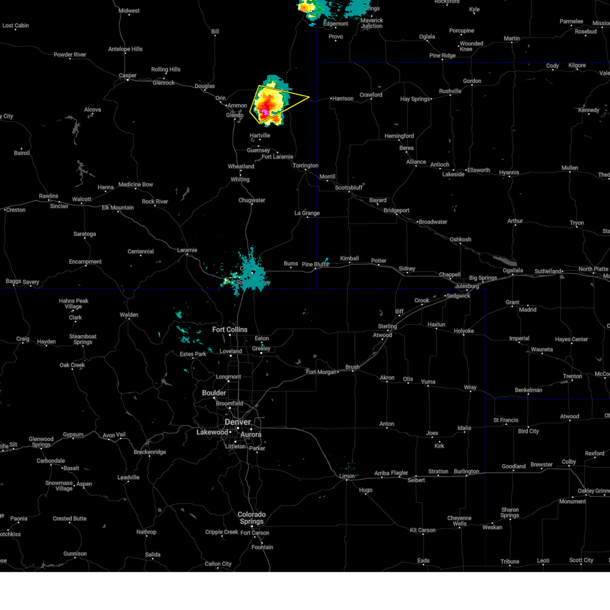
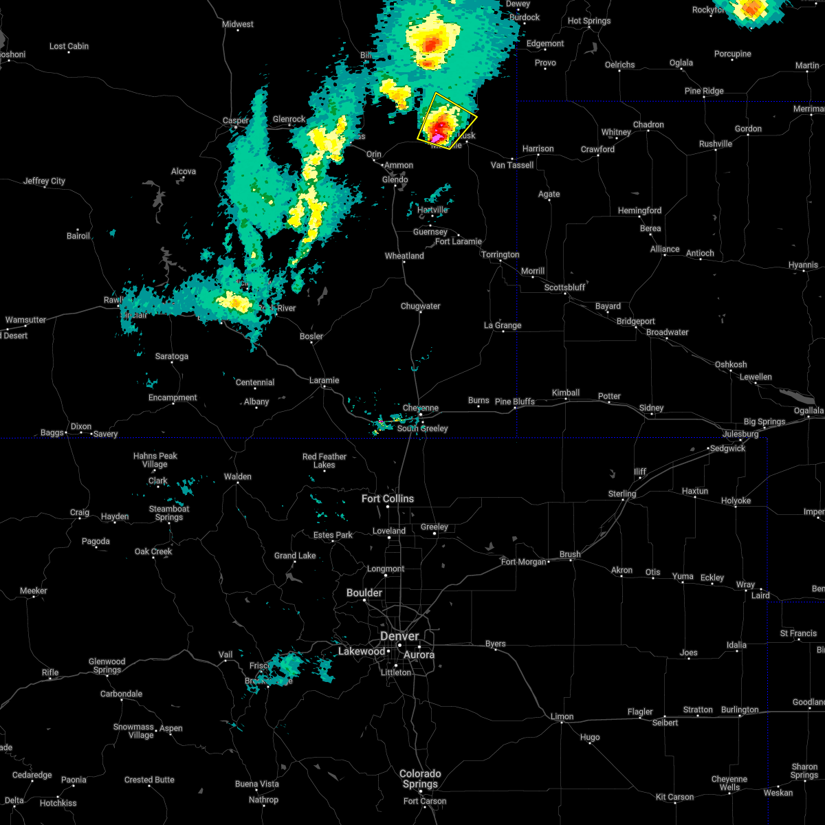
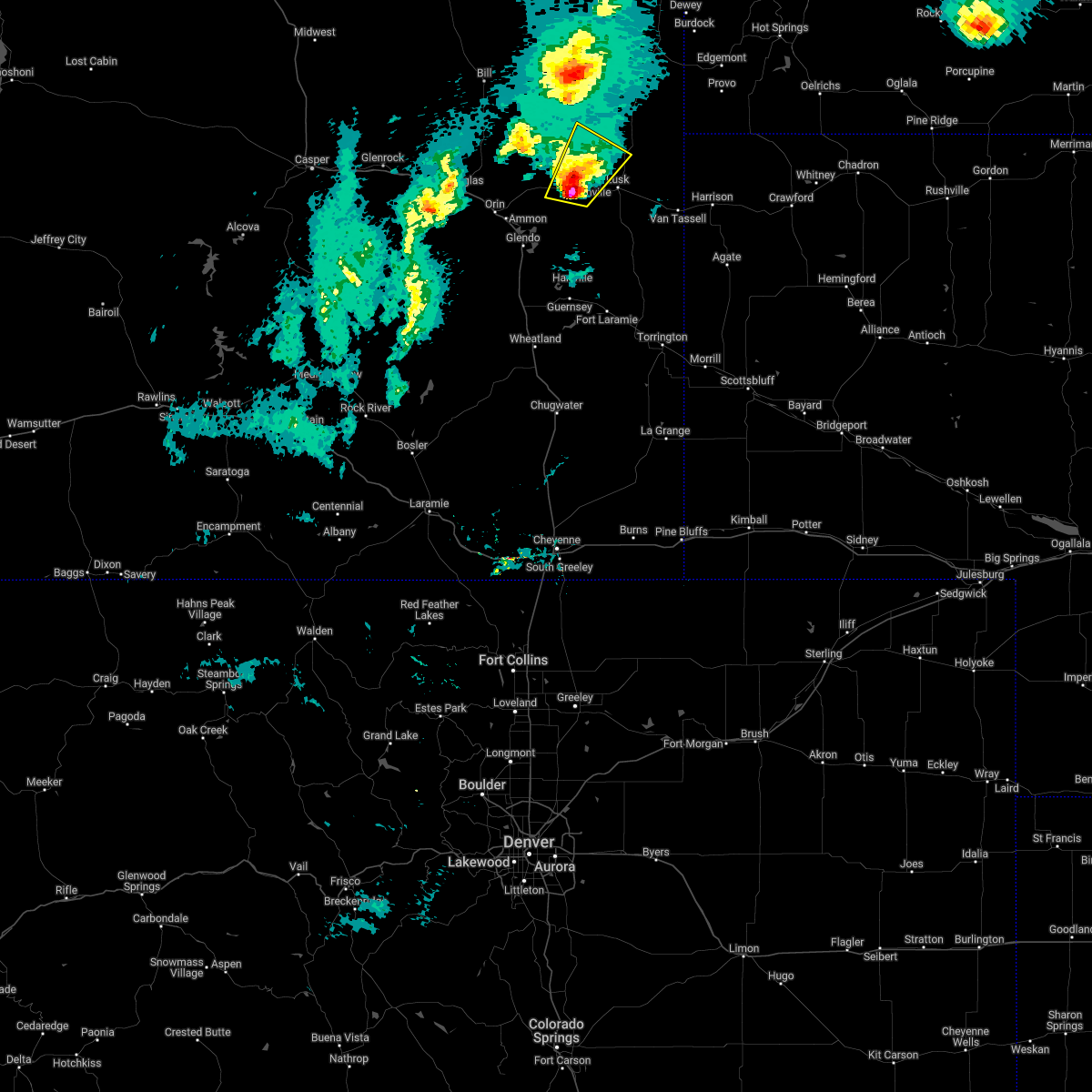
Hail Map for Manville, WY
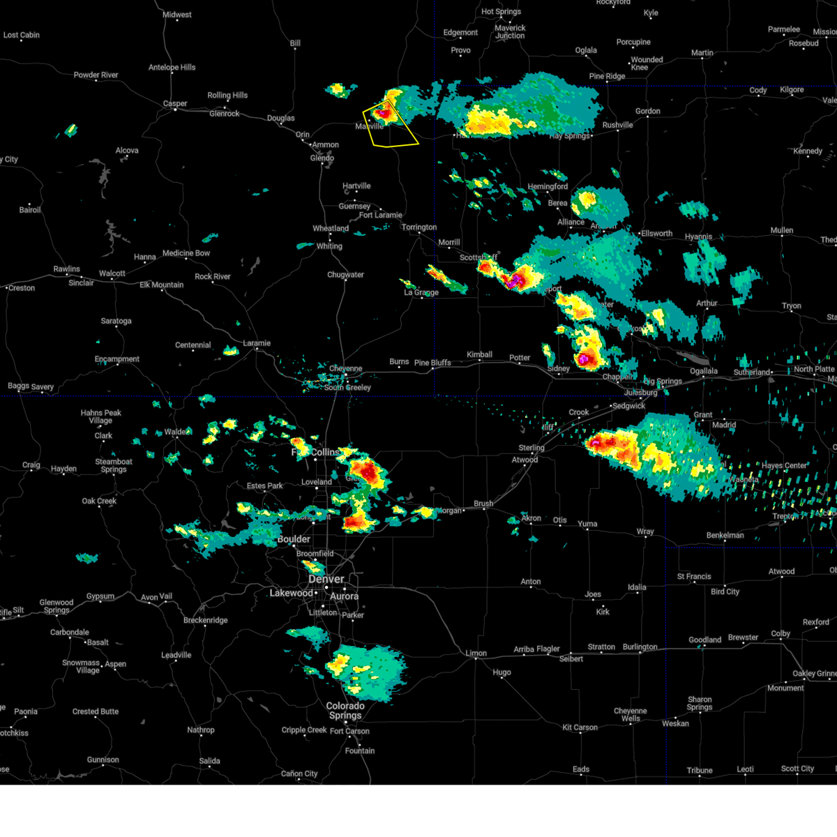
The Manville, WY area has had 25 reports of on-the-ground hail by trained spotters, and has been under severe weather warnings 17 times during the past 12 months. Doppler radar has detected hail at or near Manville, WY on 47 occasions, including 3 occasions during the past year.
| Name: | Manville, WY |
| Where Located: | 80 miles NW of Scottsbluff, NE |
| Map: | Google Map for Manville, WY |
| Population: | 95 |
| Housing Units: | 55 |
| More Info: | Search Google for Manville, WY |
1
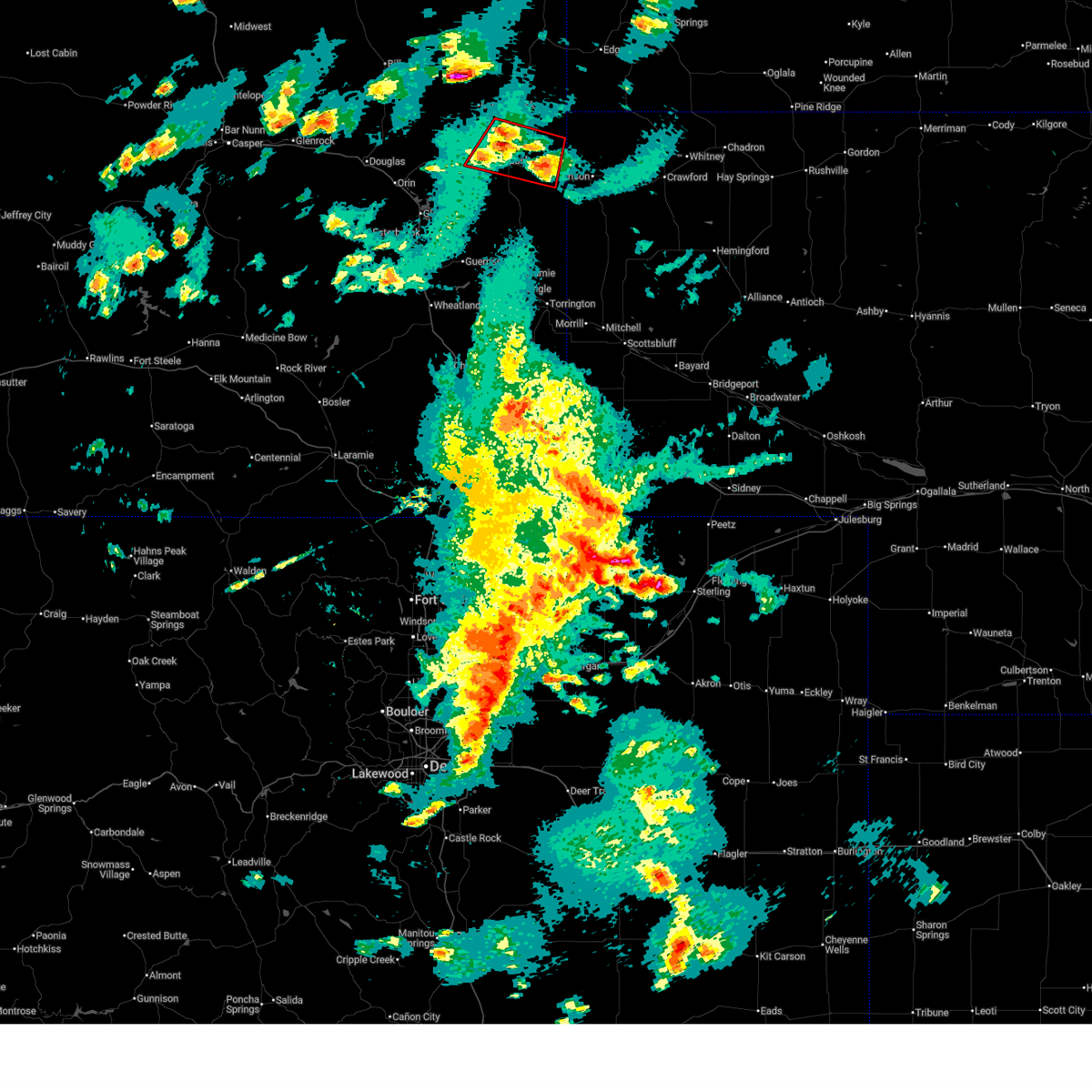
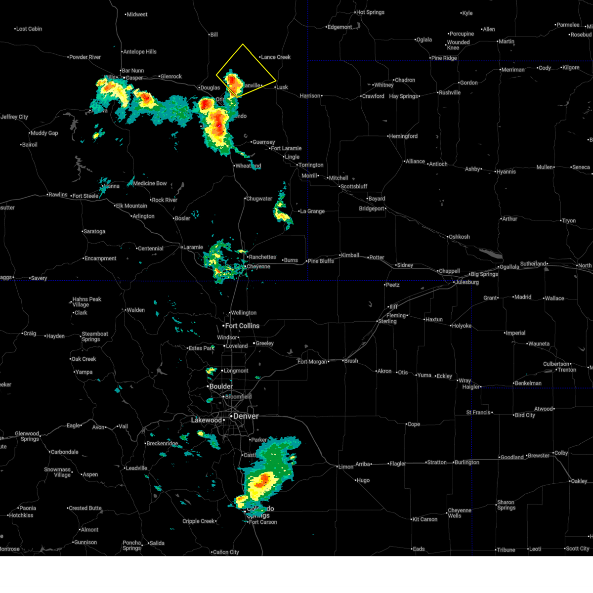
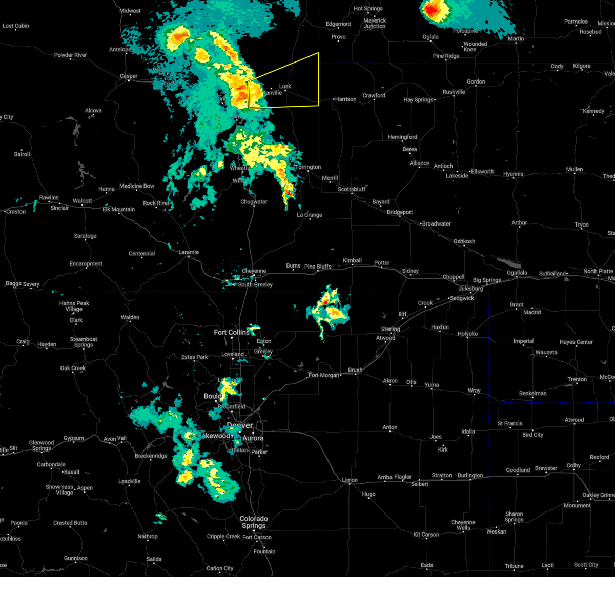
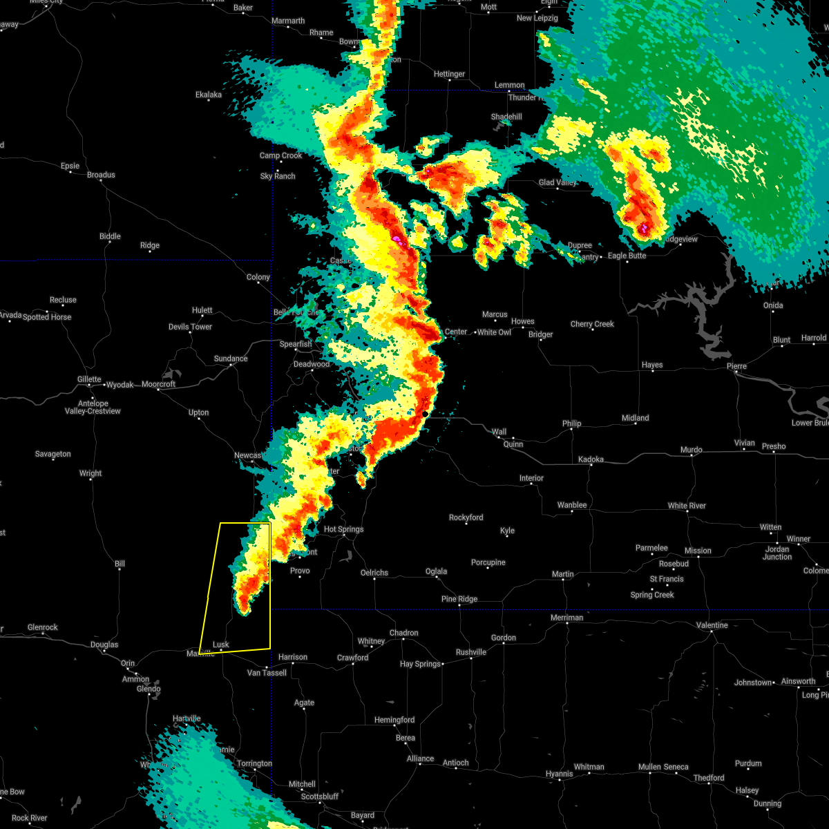
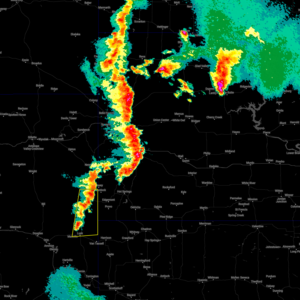
The Top Recent Hail Date for Manville, WY is Thursday, June 12, 2025 (4th out of 47)
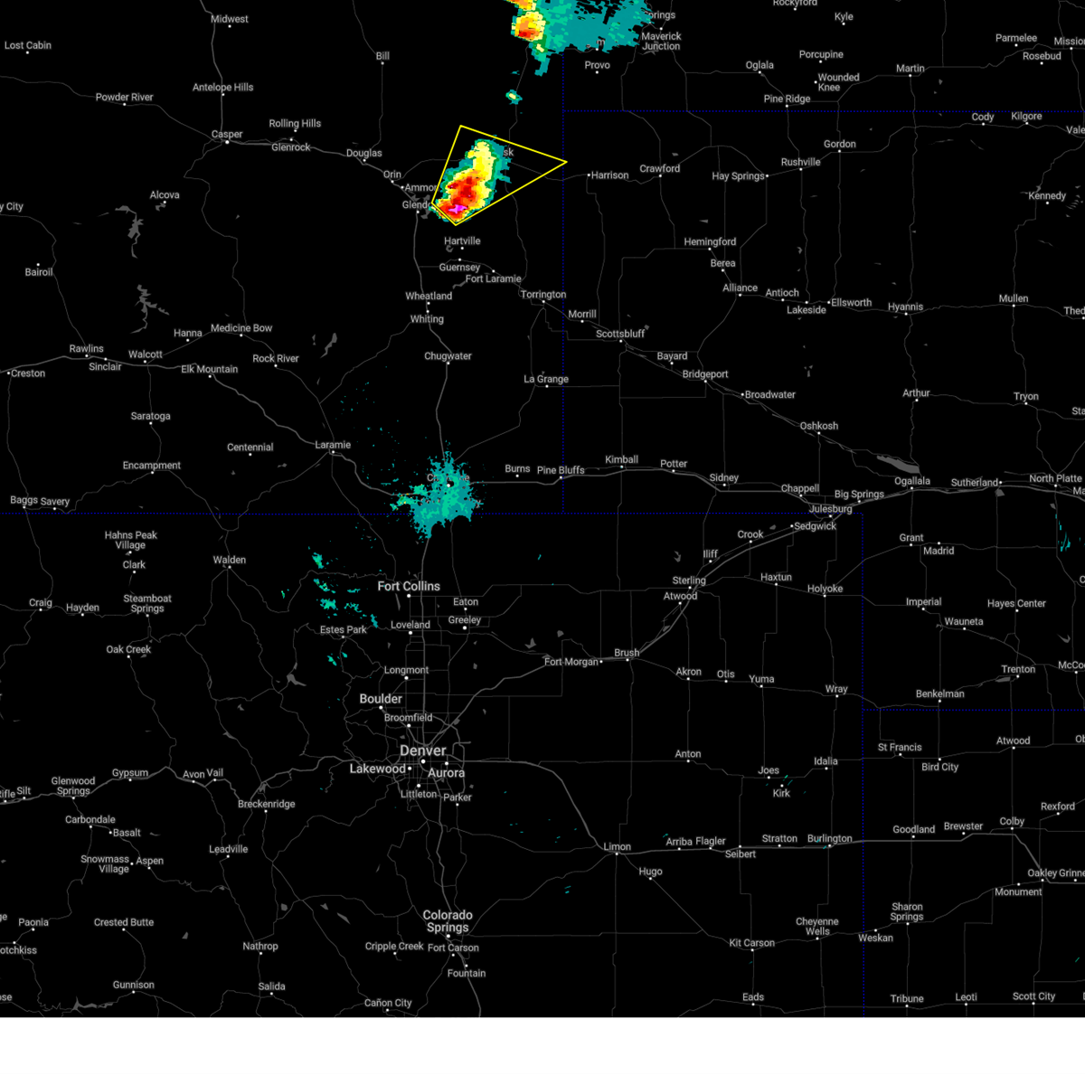
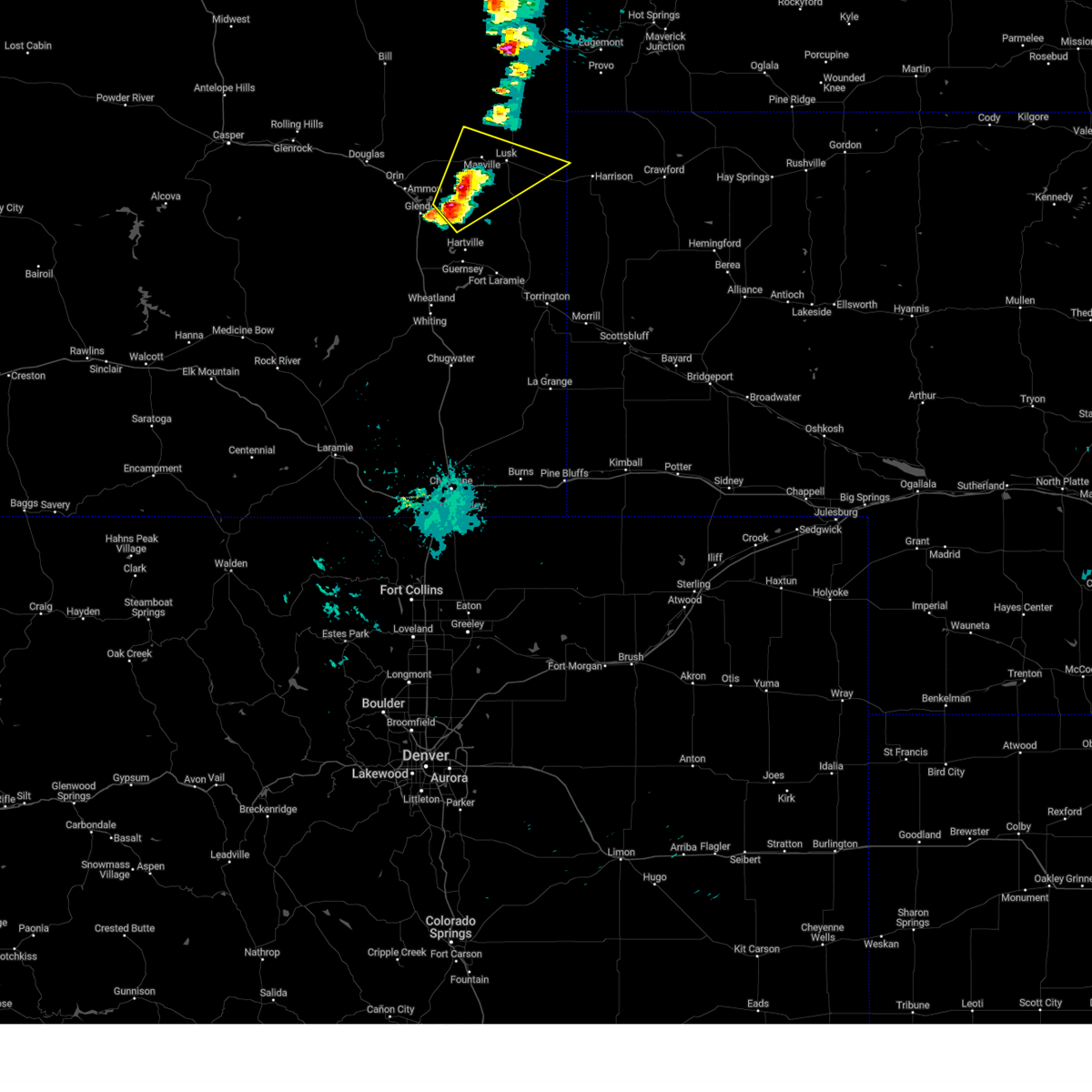
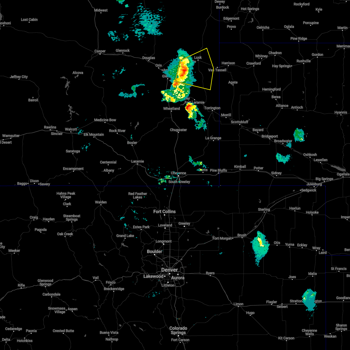
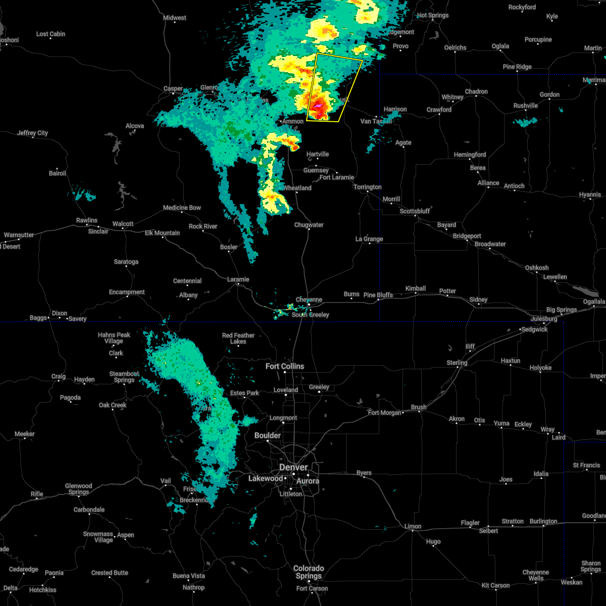
Hail and Wind Damage Spotted near Manville, WY
| Date / Time | Report Details |
|---|---|
| 6/17/2025 2:42 PM MDT |
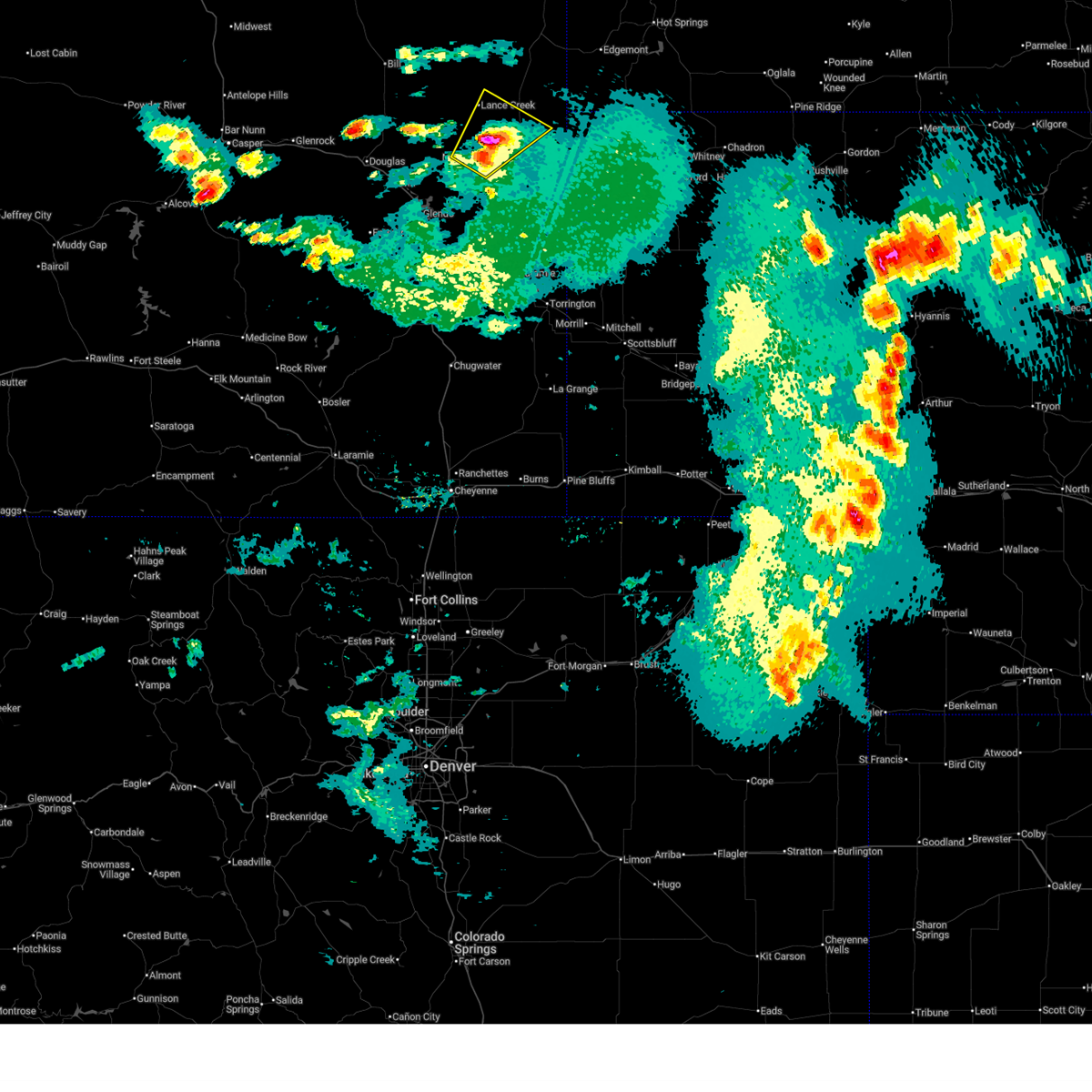
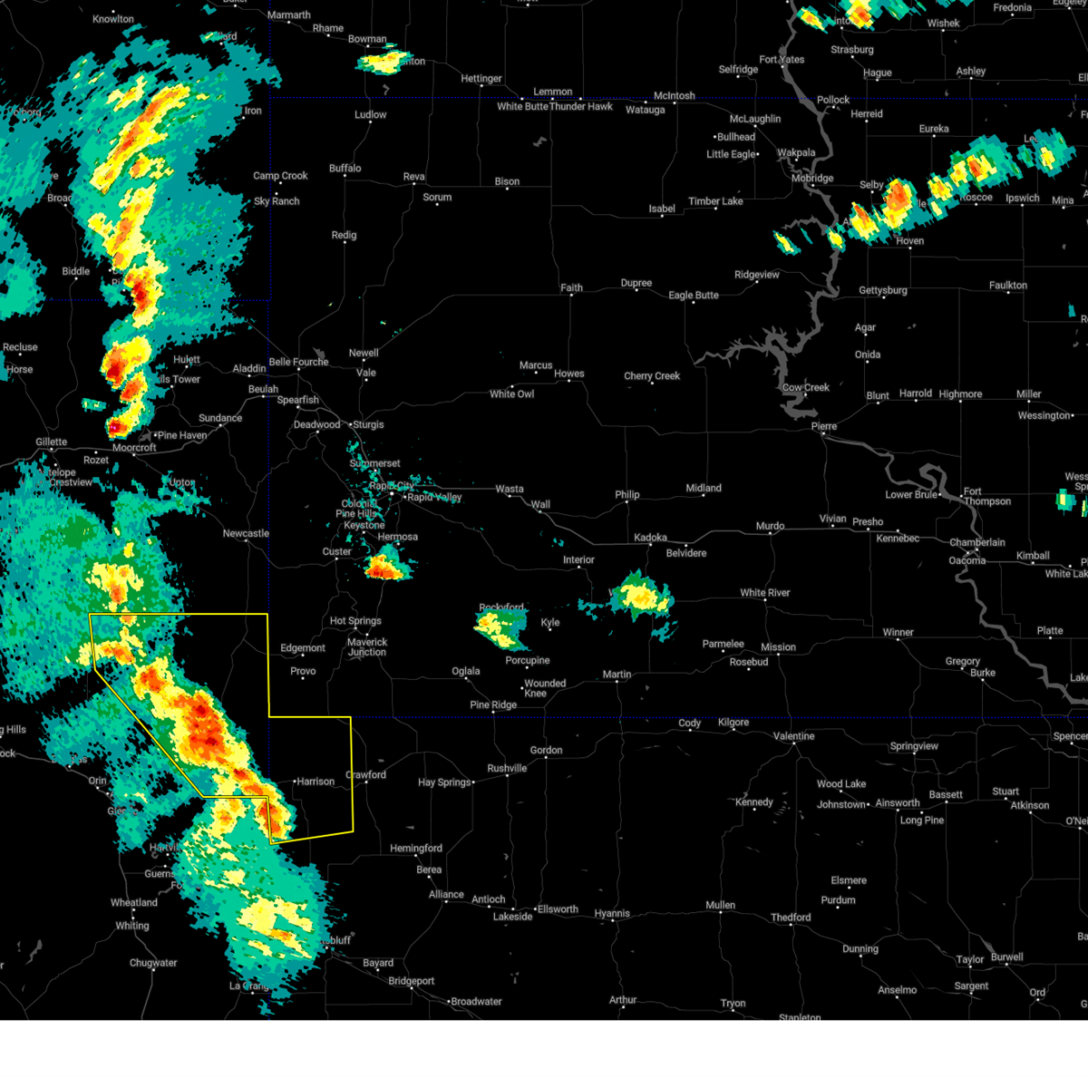
 Torcys the national weather service in cheyenne has issued a * tornado warning for, southeastern niobrara county in east central wyoming, * until 315 pm mdt. * at 242 pm mdt, severe thunderstorms capable of producing a tornado were located along a line extending from 9 miles north of lusk to manville, moving east at 10 mph (weather spotters reported funnel cloud). Hazards include tornado. Expect damage to mobile homes, roofs, and vehicles. these dangerous storms will be near, manville around 245 pm mdt. lusk around 255 pm mdt. Other locations impacted by these tornadic storms include niobrara county fairgrounds. Torcys the national weather service in cheyenne has issued a * tornado warning for, southeastern niobrara county in east central wyoming, * until 315 pm mdt. * at 242 pm mdt, severe thunderstorms capable of producing a tornado were located along a line extending from 9 miles north of lusk to manville, moving east at 10 mph (weather spotters reported funnel cloud). Hazards include tornado. Expect damage to mobile homes, roofs, and vehicles. these dangerous storms will be near, manville around 245 pm mdt. lusk around 255 pm mdt. Other locations impacted by these tornadic storms include niobrara county fairgrounds.
|
| 6/13/2025 4:27 PM MDT |
 the severe thunderstorm warning has been cancelled and is no longer in effect the severe thunderstorm warning has been cancelled and is no longer in effect
|
| 6/13/2025 4:05 PM MDT | The storm which prompted the warning has weakened below severe limits, and no longer poses an immediate threat to life or property. therefore, the warning will be allowed to expire. a severe thunderstorm watch remains in effect until 1000 pm mdt for east central wyoming. |
| 6/13/2025 3:59 PM MDT |
 Svrcys the national weather service in cheyenne has issued a * severe thunderstorm warning for, southwestern niobrara county in east central wyoming, northwestern goshen county in southeastern wyoming, northeastern platte county in southeastern wyoming, southeastern converse county in east central wyoming, * until 500 pm mdt. * at 359 pm mdt, a severe thunderstorm was located near sandy beach campground, or 23 miles southwest of lusk, moving northeast at 35 mph (radar indicated). Hazards include 60 mph wind gusts and quarter size hail. Hail damage to vehicles is expected. Expect wind damage to roofs, siding, and trees. Svrcys the national weather service in cheyenne has issued a * severe thunderstorm warning for, southwestern niobrara county in east central wyoming, northwestern goshen county in southeastern wyoming, northeastern platte county in southeastern wyoming, southeastern converse county in east central wyoming, * until 500 pm mdt. * at 359 pm mdt, a severe thunderstorm was located near sandy beach campground, or 23 miles southwest of lusk, moving northeast at 35 mph (radar indicated). Hazards include 60 mph wind gusts and quarter size hail. Hail damage to vehicles is expected. Expect wind damage to roofs, siding, and trees.
|
| 6/13/2025 3:28 PM MDT |
 Svrcys the national weather service in cheyenne has issued a * severe thunderstorm warning for, southwestern niobrara county in east central wyoming, east central converse county in east central wyoming, * until 415 pm mdt. * at 328 pm mdt, a severe thunderstorm was located 10 miles south of manning ranch, or 23 miles east of douglas, moving northeast at 25 mph (radar indicated). Hazards include 60 mph wind gusts and half dollar size hail. Hail damage to vehicles is expected. Expect wind damage to roofs, siding, and trees. Svrcys the national weather service in cheyenne has issued a * severe thunderstorm warning for, southwestern niobrara county in east central wyoming, east central converse county in east central wyoming, * until 415 pm mdt. * at 328 pm mdt, a severe thunderstorm was located 10 miles south of manning ranch, or 23 miles east of douglas, moving northeast at 25 mph (radar indicated). Hazards include 60 mph wind gusts and half dollar size hail. Hail damage to vehicles is expected. Expect wind damage to roofs, siding, and trees.
|
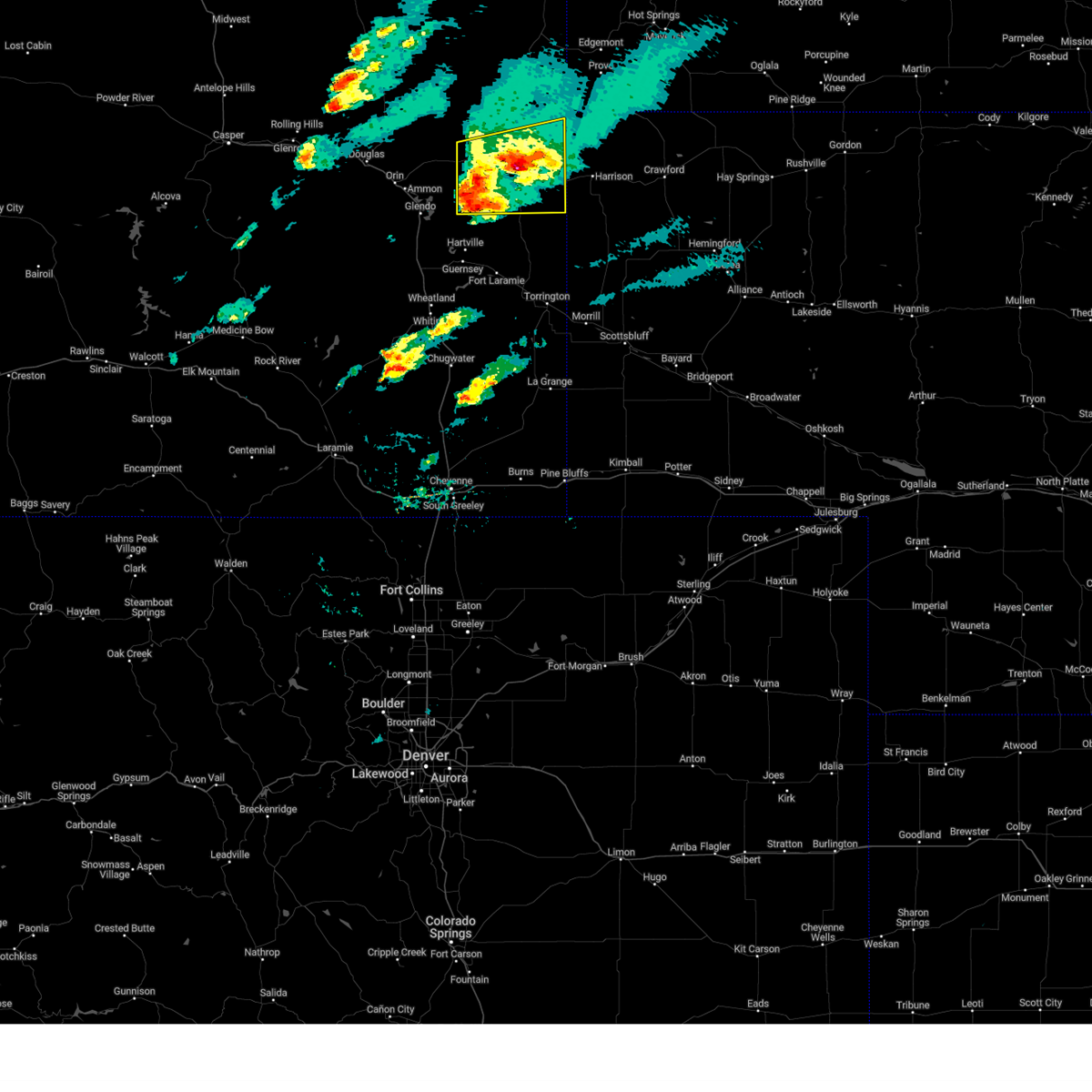
| 6/12/2025 7:57 PM MDT |
 Svrcys the national weather service in cheyenne has issued a * severe thunderstorm warning for, southern niobrara county in east central wyoming, * until 845 pm mdt. * at 757 pm mdt, a severe thunderstorm was located near manville, or 8 miles northwest of lusk, moving east at 20 mph (radar indicated). Hazards include golf ball size hail and 60 mph wind gusts. People and animals outdoors will be injured. expect hail damage to roofs, siding, windows, and vehicles. Expect wind damage to roofs, siding, and trees. Svrcys the national weather service in cheyenne has issued a * severe thunderstorm warning for, southern niobrara county in east central wyoming, * until 845 pm mdt. * at 757 pm mdt, a severe thunderstorm was located near manville, or 8 miles northwest of lusk, moving east at 20 mph (radar indicated). Hazards include golf ball size hail and 60 mph wind gusts. People and animals outdoors will be injured. expect hail damage to roofs, siding, windows, and vehicles. Expect wind damage to roofs, siding, and trees.
|
| 6/12/2025 7:51 PM MDT |
 At 751 pm mdt, a severe thunderstorm was located 9 miles north of manville, or 12 miles northwest of lusk, moving northeast at 35 mph (radar indicated). Hazards include golf ball size hail and 60 mph wind gusts. People and animals outdoors will be injured. expect hail damage to roofs, siding, windows, and vehicles. expect wind damage to roofs, siding, and trees. Locations impacted include, manville and lance creek. At 751 pm mdt, a severe thunderstorm was located 9 miles north of manville, or 12 miles northwest of lusk, moving northeast at 35 mph (radar indicated). Hazards include golf ball size hail and 60 mph wind gusts. People and animals outdoors will be injured. expect hail damage to roofs, siding, windows, and vehicles. expect wind damage to roofs, siding, and trees. Locations impacted include, manville and lance creek.
|
| 6/12/2025 7:46 PM MDT |
 At 746 pm mdt, a severe thunderstorm was located near manville, or 10 miles northwest of lusk, moving northeast at 25 mph (radar indicated). Hazards include ping pong ball size hail and 60 mph wind gusts. People and animals outdoors will be injured. expect hail damage to roofs, siding, windows, and vehicles. expect wind damage to roofs, siding, and trees. Locations impacted include, manville, keeline, and lance creek. At 746 pm mdt, a severe thunderstorm was located near manville, or 10 miles northwest of lusk, moving northeast at 25 mph (radar indicated). Hazards include ping pong ball size hail and 60 mph wind gusts. People and animals outdoors will be injured. expect hail damage to roofs, siding, windows, and vehicles. expect wind damage to roofs, siding, and trees. Locations impacted include, manville, keeline, and lance creek.
|
| 6/12/2025 7:38 PM MDT |
 At 737 pm mdt, a severe thunderstorm was located near manville, or 10 miles northwest of lusk, moving northeast at 25 mph (radar indicated). Hazards include 60 mph wind gusts and quarter size hail. Hail damage to vehicles is expected. expect wind damage to roofs, siding, and trees. Locations impacted include, manville, keeline, and lance creek. At 737 pm mdt, a severe thunderstorm was located near manville, or 10 miles northwest of lusk, moving northeast at 25 mph (radar indicated). Hazards include 60 mph wind gusts and quarter size hail. Hail damage to vehicles is expected. expect wind damage to roofs, siding, and trees. Locations impacted include, manville, keeline, and lance creek.
|
| 6/12/2025 7:25 PM MDT |
 At 724 pm mdt, a severe thunderstorm was located near manville, or 11 miles west of lusk, moving northeast at 25 mph (radar indicated). Hazards include ping pong ball size hail and 60 mph wind gusts. People and animals outdoors will be injured. expect hail damage to roofs, siding, windows, and vehicles. expect wind damage to roofs, siding, and trees. Locations impacted include, manville, lance creek, and keeline. At 724 pm mdt, a severe thunderstorm was located near manville, or 11 miles west of lusk, moving northeast at 25 mph (radar indicated). Hazards include ping pong ball size hail and 60 mph wind gusts. People and animals outdoors will be injured. expect hail damage to roofs, siding, windows, and vehicles. expect wind damage to roofs, siding, and trees. Locations impacted include, manville, lance creek, and keeline.
|
| 6/12/2025 7:08 PM MDT |
 Svrcys the national weather service in cheyenne has issued a * severe thunderstorm warning for, southwestern niobrara county in east central wyoming, * until 800 pm mdt. * at 707 pm mdt, a severe thunderstorm was located over keeline, or 14 miles west of lusk, moving northeast at 35 mph (radar indicated). Hazards include two inch hail and 60 mph wind gusts. People and animals outdoors will be injured. expect hail damage to roofs, siding, windows, and vehicles. Expect wind damage to roofs, siding, and trees. Svrcys the national weather service in cheyenne has issued a * severe thunderstorm warning for, southwestern niobrara county in east central wyoming, * until 800 pm mdt. * at 707 pm mdt, a severe thunderstorm was located over keeline, or 14 miles west of lusk, moving northeast at 35 mph (radar indicated). Hazards include two inch hail and 60 mph wind gusts. People and animals outdoors will be injured. expect hail damage to roofs, siding, windows, and vehicles. Expect wind damage to roofs, siding, and trees.
|
| 6/12/2025 7:01 PM MDT |
 At 701 pm mdt, a severe thunderstorm was located near keeline, or 17 miles west of lusk, moving north at 35 mph (radar indicated). Hazards include golf ball size hail and 60 mph wind gusts. People and animals outdoors will be injured. expect hail damage to roofs, siding, windows, and vehicles. expect wind damage to roofs, siding, and trees. Locations impacted include, manville, keeline, glendo state park, and lost springs. At 701 pm mdt, a severe thunderstorm was located near keeline, or 17 miles west of lusk, moving north at 35 mph (radar indicated). Hazards include golf ball size hail and 60 mph wind gusts. People and animals outdoors will be injured. expect hail damage to roofs, siding, windows, and vehicles. expect wind damage to roofs, siding, and trees. Locations impacted include, manville, keeline, glendo state park, and lost springs.
|
| 6/12/2025 7:01 PM MDT |
 the severe thunderstorm warning has been cancelled and is no longer in effect the severe thunderstorm warning has been cancelled and is no longer in effect
|
| 6/12/2025 6:41 PM MDT |
 At 641 pm mdt, a severe thunderstorm was located near sandy beach campground, or 25 miles southwest of lusk, moving northeast at 20 mph (radar indicated). Hazards include ping pong ball size hail and 60 mph wind gusts. People and animals outdoors will be injured. expect hail damage to roofs, siding, windows, and vehicles. expect wind damage to roofs, siding, and trees. Locations impacted include, glendo, manville, keeline, glendo state park, sandy beach campground, reno cove campground, bennett hill campground, two moon campground, lost springs, and shawnee. At 641 pm mdt, a severe thunderstorm was located near sandy beach campground, or 25 miles southwest of lusk, moving northeast at 20 mph (radar indicated). Hazards include ping pong ball size hail and 60 mph wind gusts. People and animals outdoors will be injured. expect hail damage to roofs, siding, windows, and vehicles. expect wind damage to roofs, siding, and trees. Locations impacted include, glendo, manville, keeline, glendo state park, sandy beach campground, reno cove campground, bennett hill campground, two moon campground, lost springs, and shawnee.
|
| 6/12/2025 6:31 PM MDT |
 Svrcys the national weather service in cheyenne has issued a * severe thunderstorm warning for, southwestern niobrara county in east central wyoming, northeastern platte county in southeastern wyoming, east central converse county in east central wyoming, * until 715 pm mdt. * at 631 pm mdt, a severe thunderstorm was located over sandy beach campground, or 28 miles southeast of douglas, moving north at 30 mph (radar indicated). Hazards include 60 mph wind gusts and half dollar size hail. Hail damage to vehicles is expected. Expect wind damage to roofs, siding, and trees. Svrcys the national weather service in cheyenne has issued a * severe thunderstorm warning for, southwestern niobrara county in east central wyoming, northeastern platte county in southeastern wyoming, east central converse county in east central wyoming, * until 715 pm mdt. * at 631 pm mdt, a severe thunderstorm was located over sandy beach campground, or 28 miles southeast of douglas, moving north at 30 mph (radar indicated). Hazards include 60 mph wind gusts and half dollar size hail. Hail damage to vehicles is expected. Expect wind damage to roofs, siding, and trees.
|
| 7/27/2024 6:45 PM MDT |
 The storms which prompted the warning have weakened below severe limits, and no longer pose an immediate threat to life or property. therefore, the warning has been allowed to expire. however, gusty winds and heavy rain are still possible with these thunderstorms. The storms which prompted the warning have weakened below severe limits, and no longer pose an immediate threat to life or property. therefore, the warning has been allowed to expire. however, gusty winds and heavy rain are still possible with these thunderstorms.
|
| 7/27/2024 5:58 PM MDT |
 Svrcys the national weather service in cheyenne has issued a * severe thunderstorm warning for, scotts bluff county in the panhandle of nebraska, sioux county in the panhandle of nebraska, niobrara county in east central wyoming, northeastern goshen county in southeastern wyoming, northeastern platte county in southeastern wyoming, east central converse county in east central wyoming, * until 645 pm mdt. * at 558 pm mdt, severe thunderstorms were located along a line extending from near keeline to near prairie center to stegall, moving northeast at 65 mph (public). Hazards include 60 mph wind gusts. expect damage to roofs, siding, and trees Svrcys the national weather service in cheyenne has issued a * severe thunderstorm warning for, scotts bluff county in the panhandle of nebraska, sioux county in the panhandle of nebraska, niobrara county in east central wyoming, northeastern goshen county in southeastern wyoming, northeastern platte county in southeastern wyoming, east central converse county in east central wyoming, * until 645 pm mdt. * at 558 pm mdt, severe thunderstorms were located along a line extending from near keeline to near prairie center to stegall, moving northeast at 65 mph (public). Hazards include 60 mph wind gusts. expect damage to roofs, siding, and trees
|
| 6/2/2024 2:29 PM MDT |
 Svrcys the national weather service in cheyenne has issued a * severe thunderstorm warning for, southeastern niobrara county in east central wyoming, * until 315 pm mdt. * at 228 pm mdt, a severe thunderstorm was located near manville, or near lusk, moving northeast at 30 mph (radar indicated). Hazards include ping pong ball size hail and 60 mph wind gusts. People and animals outdoors will be injured. expect hail damage to roofs, siding, windows, and vehicles. Expect wind damage to roofs, siding, and trees. Svrcys the national weather service in cheyenne has issued a * severe thunderstorm warning for, southeastern niobrara county in east central wyoming, * until 315 pm mdt. * at 228 pm mdt, a severe thunderstorm was located near manville, or near lusk, moving northeast at 30 mph (radar indicated). Hazards include ping pong ball size hail and 60 mph wind gusts. People and animals outdoors will be injured. expect hail damage to roofs, siding, windows, and vehicles. Expect wind damage to roofs, siding, and trees.
|
| 7/30/2023 5:44 PM MDT |
 The severe thunderstorm warning for southwestern niobrara county will expire at 545 pm mdt, the storm which prompted the warning has weakened below severe limits, and no longer poses an immediate threat to life or property. therefore, the warning will be allowed to expire. however small hail and gusty winds are still possible with this thunderstorm. a severe thunderstorm watch remains in effect until midnight mdt for east central wyoming. to report severe weather, contact your nearest law enforcement agency. they will relay your report to the national weather service cheyenne. The severe thunderstorm warning for southwestern niobrara county will expire at 545 pm mdt, the storm which prompted the warning has weakened below severe limits, and no longer poses an immediate threat to life or property. therefore, the warning will be allowed to expire. however small hail and gusty winds are still possible with this thunderstorm. a severe thunderstorm watch remains in effect until midnight mdt for east central wyoming. to report severe weather, contact your nearest law enforcement agency. they will relay your report to the national weather service cheyenne.
|
| 7/30/2023 5:32 PM MDT |
 At 531 pm mdt, a severe thunderstorm was located near manville, or 12 miles northwest of lusk, moving southeast at 30 mph (radar indicated). Hazards include two inch hail and 60 mph wind gusts. People and animals outdoors will be injured. expect hail damage to roofs, siding, windows, and vehicles. expect wind damage to roofs, siding, and trees. locations impacted include, manville and keeline. thunderstorm damage threat, considerable hail threat, radar indicated max hail size, 2. 00 in wind threat, radar indicated max wind gust, 60 mph. At 531 pm mdt, a severe thunderstorm was located near manville, or 12 miles northwest of lusk, moving southeast at 30 mph (radar indicated). Hazards include two inch hail and 60 mph wind gusts. People and animals outdoors will be injured. expect hail damage to roofs, siding, windows, and vehicles. expect wind damage to roofs, siding, and trees. locations impacted include, manville and keeline. thunderstorm damage threat, considerable hail threat, radar indicated max hail size, 2. 00 in wind threat, radar indicated max wind gust, 60 mph.
|
| 7/30/2023 5:15 PM MDT |
 At 515 pm mdt, a severe thunderstorm was located 9 miles southeast of manning ranch, or 19 miles northwest of lusk, moving southeast at 25 mph (radar indicated). Hazards include two inch hail and 60 mph wind gusts. People and animals outdoors will be injured. expect hail damage to roofs, siding, windows, and vehicles. expect wind damage to roofs, siding, and trees. locations impacted include, manville, keeline and manning ranch. thunderstorm damage threat, considerable hail threat, radar indicated max hail size, 2. 00 in wind threat, radar indicated max wind gust, 60 mph. At 515 pm mdt, a severe thunderstorm was located 9 miles southeast of manning ranch, or 19 miles northwest of lusk, moving southeast at 25 mph (radar indicated). Hazards include two inch hail and 60 mph wind gusts. People and animals outdoors will be injured. expect hail damage to roofs, siding, windows, and vehicles. expect wind damage to roofs, siding, and trees. locations impacted include, manville, keeline and manning ranch. thunderstorm damage threat, considerable hail threat, radar indicated max hail size, 2. 00 in wind threat, radar indicated max wind gust, 60 mph.
|
| 7/30/2023 4:59 PM MDT |
 At 459 pm mdt, a severe thunderstorm was located near manning ranch, or 24 miles northwest of lusk, moving southeast at 35 mph (radar indicated). Hazards include 60 mph wind gusts and quarter size hail. Hail damage to vehicles is expected. Expect wind damage to roofs, siding, and trees. At 459 pm mdt, a severe thunderstorm was located near manning ranch, or 24 miles northwest of lusk, moving southeast at 35 mph (radar indicated). Hazards include 60 mph wind gusts and quarter size hail. Hail damage to vehicles is expected. Expect wind damage to roofs, siding, and trees.
|
| 7/8/2023 6:54 PM MDT |
 The severe thunderstorm warning for south central niobrara county will expire at 700 pm mdt, the storm which prompted the warning has weakened below severe limits, and no longer poses an immediate threat to life or property. therefore, the warning will be allowed to expire. however small hail and heavy rain which may lead to flash flooding are still possible with this thunderstorm. a severe thunderstorm watch remains in effect until 900 pm mdt for east central wyoming. The severe thunderstorm warning for south central niobrara county will expire at 700 pm mdt, the storm which prompted the warning has weakened below severe limits, and no longer poses an immediate threat to life or property. therefore, the warning will be allowed to expire. however small hail and heavy rain which may lead to flash flooding are still possible with this thunderstorm. a severe thunderstorm watch remains in effect until 900 pm mdt for east central wyoming.
|
| 7/8/2023 6:35 PM MDT |
 At 635 pm mdt, a severe thunderstorm was located near manville, or near lusk, moving south at 35 mph (radar indicated). Hazards include 70 mph wind gusts and quarter size hail. Hail damage to vehicles is expected. expect considerable tree damage. Wind damage is also likely to mobile homes, roofs, and outbuildings. At 635 pm mdt, a severe thunderstorm was located near manville, or near lusk, moving south at 35 mph (radar indicated). Hazards include 70 mph wind gusts and quarter size hail. Hail damage to vehicles is expected. expect considerable tree damage. Wind damage is also likely to mobile homes, roofs, and outbuildings.
|
| 7/8/2023 6:07 PM MDT |
 At 607 pm mdt, a severe thunderstorm was located near lance creek, or 17 miles northwest of lusk, moving south at 35 mph (radar indicated). Hazards include 60 mph wind gusts and quarter size hail. Hail damage to vehicles is expected. Expect wind damage to roofs, siding, and trees. At 607 pm mdt, a severe thunderstorm was located near lance creek, or 17 miles northwest of lusk, moving south at 35 mph (radar indicated). Hazards include 60 mph wind gusts and quarter size hail. Hail damage to vehicles is expected. Expect wind damage to roofs, siding, and trees.
|
| 7/8/2023 2:31 PM MDT |
 At 231 pm mdt, a severe thunderstorm was located over lusk, moving southeast at 15 mph (radar indicated). Hazards include golf ball size hail and 60 mph wind gusts. People and animals outdoors will be injured. expect hail damage to roofs, siding, windows, and vehicles. expect wind damage to roofs, siding, and trees. this severe thunderstorm will remain over mainly rural areas of south central niobrara county. thunderstorm damage threat, considerable hail threat, radar indicated max hail size, 1. 75 in wind threat, radar indicated max wind gust, 60 mph. At 231 pm mdt, a severe thunderstorm was located over lusk, moving southeast at 15 mph (radar indicated). Hazards include golf ball size hail and 60 mph wind gusts. People and animals outdoors will be injured. expect hail damage to roofs, siding, windows, and vehicles. expect wind damage to roofs, siding, and trees. this severe thunderstorm will remain over mainly rural areas of south central niobrara county. thunderstorm damage threat, considerable hail threat, radar indicated max hail size, 1. 75 in wind threat, radar indicated max wind gust, 60 mph.
|
| 7/8/2023 2:07 PM MDT |
 At 207 pm mdt, a severe thunderstorm was located near lusk, moving southeast at 15 mph (radar indicated). Hazards include ping pong ball size hail and 60 mph wind gusts. People and animals outdoors will be injured. expect hail damage to roofs, siding, windows, and vehicles. expect wind damage to roofs, siding, and trees. this severe thunderstorm will be near, lusk around 220 pm mdt. hail threat, radar indicated max hail size, 1. 50 in wind threat, radar indicated max wind gust, 60 mph. At 207 pm mdt, a severe thunderstorm was located near lusk, moving southeast at 15 mph (radar indicated). Hazards include ping pong ball size hail and 60 mph wind gusts. People and animals outdoors will be injured. expect hail damage to roofs, siding, windows, and vehicles. expect wind damage to roofs, siding, and trees. this severe thunderstorm will be near, lusk around 220 pm mdt. hail threat, radar indicated max hail size, 1. 50 in wind threat, radar indicated max wind gust, 60 mph.
|
| 7/6/2023 10:54 PM MDT |
 At 1054 pm mdt, severe thunderstorms were located along a line extending from keeline to 10 miles southwest of manville to 12 miles west of rawhide buttes to 6 miles southeast of two moon campground, moving east at 45 mph (radar indicated). Hazards include 60 mph wind gusts and quarter size hail. Hail damage to vehicles is expected. expect wind damage to roofs, siding, and trees. locations impacted include, lusk, manville, keeline, rawhide buttes, glendo reservoir, two moon campground and hartville. hail threat, radar indicated max hail size, 1. 00 in wind threat, radar indicated max wind gust, 60 mph. At 1054 pm mdt, severe thunderstorms were located along a line extending from keeline to 10 miles southwest of manville to 12 miles west of rawhide buttes to 6 miles southeast of two moon campground, moving east at 45 mph (radar indicated). Hazards include 60 mph wind gusts and quarter size hail. Hail damage to vehicles is expected. expect wind damage to roofs, siding, and trees. locations impacted include, lusk, manville, keeline, rawhide buttes, glendo reservoir, two moon campground and hartville. hail threat, radar indicated max hail size, 1. 00 in wind threat, radar indicated max wind gust, 60 mph.
|
| 7/6/2023 10:42 PM MDT |
 At 1042 pm mdt, severe thunderstorms were located along a line extending from 15 miles south of manning ranch to 9 miles southwest of keeline to near two moon campground to sibley peak, moving east at 40 mph (radar indicated). Hazards include 60 mph wind gusts and quarter size hail. Hail damage to vehicles is expected. Expect wind damage to roofs, siding, and trees. At 1042 pm mdt, severe thunderstorms were located along a line extending from 15 miles south of manning ranch to 9 miles southwest of keeline to near two moon campground to sibley peak, moving east at 40 mph (radar indicated). Hazards include 60 mph wind gusts and quarter size hail. Hail damage to vehicles is expected. Expect wind damage to roofs, siding, and trees.
|
| 7/6/2023 9:35 PM MDT | Half Dollar sized hail reported 9.1 miles ENE of Manville, WY, 75 mph winds and half dollar size hail. |
| 7/6/2023 9:20 PM MDT | Storm damage reported in niobrara county WY, 8.7 miles ENE of Manville, WY |
| 7/3/2023 8:32 PM MDT |
 At 831 pm mdt, severe thunderstorms were located along a line extending from near dull center to 13 miles south of redbird to 12 miles northwest of agate bed national monument, moving northeast at 50 mph. these are destructive storms for northern and eastern niobrara county in wyoming and northern sioux county in nebraska with confirmed reports of significant tree damage in the city of lusk due to winds in excess of 80 mph (emergency management). Hazards include 80 mph wind gusts. Flying debris will be dangerous to those caught without shelter. mobile homes will be heavily damaged. expect considerable damage to roofs, windows, and vehicles. Extensive tree damage and power outages are likely. At 831 pm mdt, severe thunderstorms were located along a line extending from near dull center to 13 miles south of redbird to 12 miles northwest of agate bed national monument, moving northeast at 50 mph. these are destructive storms for northern and eastern niobrara county in wyoming and northern sioux county in nebraska with confirmed reports of significant tree damage in the city of lusk due to winds in excess of 80 mph (emergency management). Hazards include 80 mph wind gusts. Flying debris will be dangerous to those caught without shelter. mobile homes will be heavily damaged. expect considerable damage to roofs, windows, and vehicles. Extensive tree damage and power outages are likely.
|
| 7/3/2023 8:10 PM MDT |
 The severe thunderstorm warning for southern niobrara, goshen, northeastern platte and east central converse counties will expire at 815 pm mdt, the storms which prompted the warning have weakened below severe limits, and no longer pose an immediate threat to life or property. therefore, the warning will be allowed to expire. however gusty winds to 55 mph are still possible with these thunderstorms. a severe thunderstorm watch remains in effect until 1100 pm mdt for east central wyoming. to report severe weather, contact your nearest law enforcement agency. they will relay your report to the national weather service cheyenne. remember, a severe thunderstorm warning still remains in effect for niobrara and eastern converse counties. The severe thunderstorm warning for southern niobrara, goshen, northeastern platte and east central converse counties will expire at 815 pm mdt, the storms which prompted the warning have weakened below severe limits, and no longer pose an immediate threat to life or property. therefore, the warning will be allowed to expire. however gusty winds to 55 mph are still possible with these thunderstorms. a severe thunderstorm watch remains in effect until 1100 pm mdt for east central wyoming. to report severe weather, contact your nearest law enforcement agency. they will relay your report to the national weather service cheyenne. remember, a severe thunderstorm warning still remains in effect for niobrara and eastern converse counties.
|
| 7/3/2023 8:04 PM MDT |
 At 803 pm mdt, severe thunderstorms were located along a line extending from manning ranch to near manville to 7 miles west of rawhide buttes, moving east at 25 mph (radar indicated). Hazards include 70 mph wind gusts and nickel size hail. Expect considerable tree damage. Damage is likely to mobile homes, roofs, and outbuildings. At 803 pm mdt, severe thunderstorms were located along a line extending from manning ranch to near manville to 7 miles west of rawhide buttes, moving east at 25 mph (radar indicated). Hazards include 70 mph wind gusts and nickel size hail. Expect considerable tree damage. Damage is likely to mobile homes, roofs, and outbuildings.
|
| 7/3/2023 7:49 PM MDT |
 At 749 pm mdt, severe thunderstorms were located along a line extending from 9 miles west of keeline to 8 miles west of rawhide buttes to near fort laramie to 6 miles west of hawk springs, moving northeast at 30 mph (radar indicated). Hazards include 60 mph wind gusts and quarter size hail. Hail damage to vehicles is expected. expect wind damage to roofs, siding, and trees. locations impacted include, torrington, lusk, guernsey, lingle, fort laramie, glendo, yoder, manville, huntley, prairie center, keeline, jay em, fort laramie national historic site, guernsey campground, rawhide buttes, veteran, hawk springs, hartville, van tassell and lost springs. this includes interstate 25 in wyoming between mile markers 112 and 132. hail threat, radar indicated max hail size, 1. 00 in wind threat, radar indicated max wind gust, 60 mph. At 749 pm mdt, severe thunderstorms were located along a line extending from 9 miles west of keeline to 8 miles west of rawhide buttes to near fort laramie to 6 miles west of hawk springs, moving northeast at 30 mph (radar indicated). Hazards include 60 mph wind gusts and quarter size hail. Hail damage to vehicles is expected. expect wind damage to roofs, siding, and trees. locations impacted include, torrington, lusk, guernsey, lingle, fort laramie, glendo, yoder, manville, huntley, prairie center, keeline, jay em, fort laramie national historic site, guernsey campground, rawhide buttes, veteran, hawk springs, hartville, van tassell and lost springs. this includes interstate 25 in wyoming between mile markers 112 and 132. hail threat, radar indicated max hail size, 1. 00 in wind threat, radar indicated max wind gust, 60 mph.
|
| 7/3/2023 7:15 PM MDT |
 At 715 pm mdt, severe thunderstorms were located along a line extending from 11 miles northwest of glendo to near two moon campground to near grayrocks reservoir to 9 miles east of slater, moving northeast at 30 mph (trained weather spotters. these storms have a history of producing 60 to 70 mph wind gusts). Hazards include 70 mph wind gusts and quarter size hail. Hail damage to vehicles is expected. expect considerable tree damage. Wind damage is also likely to mobile homes, roofs, and outbuildings. At 715 pm mdt, severe thunderstorms were located along a line extending from 11 miles northwest of glendo to near two moon campground to near grayrocks reservoir to 9 miles east of slater, moving northeast at 30 mph (trained weather spotters. these storms have a history of producing 60 to 70 mph wind gusts). Hazards include 70 mph wind gusts and quarter size hail. Hail damage to vehicles is expected. expect considerable tree damage. Wind damage is also likely to mobile homes, roofs, and outbuildings.
|
| 6/28/2023 3:49 PM MDT |
 At 348 pm mdt, a severe thunderstorm was located 7 miles east of lusk, moving east at 35 mph (radar indicated). Hazards include 60 mph wind gusts and quarter size hail. Hail damage to vehicles is expected. expect wind damage to roofs, siding, and trees. this severe thunderstorm will remain over mainly rural areas of southern niobrara, northern goshen and northeastern platte counties, including the following locations, van tassell. hail threat, radar indicated max hail size, 1. 00 in wind threat, radar indicated max wind gust, 60 mph. At 348 pm mdt, a severe thunderstorm was located 7 miles east of lusk, moving east at 35 mph (radar indicated). Hazards include 60 mph wind gusts and quarter size hail. Hail damage to vehicles is expected. expect wind damage to roofs, siding, and trees. this severe thunderstorm will remain over mainly rural areas of southern niobrara, northern goshen and northeastern platte counties, including the following locations, van tassell. hail threat, radar indicated max hail size, 1. 00 in wind threat, radar indicated max wind gust, 60 mph.
|
| 6/28/2023 3:31 PM MDT |
 At 330 pm mdt, a severe thunderstorm was located 9 miles northeast of two moon campground, or 22 miles southwest of lusk, moving east at 30 mph (radar indicated). Hazards include 60 mph wind gusts and quarter size hail. Hail damage to vehicles is expected. expect wind damage to roofs, siding, and trees. this severe storm will be near, rawhide buttes around 400 pm mdt. prairie center around 430 pm mdt. other locations impacted by this severe thunderstorm include lost springs and van tassell. this includes interstate 25 in wyoming between mile markers 111 and 116. hail threat, radar indicated max hail size, 1. 00 in wind threat, radar indicated max wind gust, 60 mph. At 330 pm mdt, a severe thunderstorm was located 9 miles northeast of two moon campground, or 22 miles southwest of lusk, moving east at 30 mph (radar indicated). Hazards include 60 mph wind gusts and quarter size hail. Hail damage to vehicles is expected. expect wind damage to roofs, siding, and trees. this severe storm will be near, rawhide buttes around 400 pm mdt. prairie center around 430 pm mdt. other locations impacted by this severe thunderstorm include lost springs and van tassell. this includes interstate 25 in wyoming between mile markers 111 and 116. hail threat, radar indicated max hail size, 1. 00 in wind threat, radar indicated max wind gust, 60 mph.
|
| 6/28/2023 3:13 PM MDT |
 At 313 pm mdt, a severe thunderstorm was located over lusk, moving east at 25 mph (radar indicated). Hazards include 60 mph wind gusts and quarter size hail. Hail damage to vehicles is expected. expect wind damage to roofs, siding, and trees. this severe thunderstorm will remain over mainly rural areas of southern niobrara, northern goshen, northeastern platte and east central converse counties, including the following locations, lost springs and van tassell. this includes interstate 25 in wyoming between mile markers 111 and 116. hail threat, radar indicated max hail size, 1. 00 in wind threat, radar indicated max wind gust, 60 mph. At 313 pm mdt, a severe thunderstorm was located over lusk, moving east at 25 mph (radar indicated). Hazards include 60 mph wind gusts and quarter size hail. Hail damage to vehicles is expected. expect wind damage to roofs, siding, and trees. this severe thunderstorm will remain over mainly rural areas of southern niobrara, northern goshen, northeastern platte and east central converse counties, including the following locations, lost springs and van tassell. this includes interstate 25 in wyoming between mile markers 111 and 116. hail threat, radar indicated max hail size, 1. 00 in wind threat, radar indicated max wind gust, 60 mph.
|
| 6/28/2023 2:55 PM MDT |
 At 255 pm mdt, a severe thunderstorm was located over manville, or 10 miles west of lusk, moving east at 25 mph (radar indicated). Hazards include ping pong ball size hail and 60 mph wind gusts. People and animals outdoors will be injured. expect hail damage to roofs, siding, windows, and vehicles. expect wind damage to roofs, siding, and trees. this severe storm will be near, lusk around 320 pm mdt. other locations impacted by this severe thunderstorm include lost springs. hail threat, radar indicated max hail size, 1. 50 in wind threat, radar indicated max wind gust, 60 mph. At 255 pm mdt, a severe thunderstorm was located over manville, or 10 miles west of lusk, moving east at 25 mph (radar indicated). Hazards include ping pong ball size hail and 60 mph wind gusts. People and animals outdoors will be injured. expect hail damage to roofs, siding, windows, and vehicles. expect wind damage to roofs, siding, and trees. this severe storm will be near, lusk around 320 pm mdt. other locations impacted by this severe thunderstorm include lost springs. hail threat, radar indicated max hail size, 1. 50 in wind threat, radar indicated max wind gust, 60 mph.
|
| 6/28/2023 2:34 PM MDT |
 At 233 pm mdt, a severe thunderstorm was located near keeline, or 18 miles west of lusk, moving east at 25 mph (radar indicated). Hazards include two inch hail and 60 mph wind gusts. People and animals outdoors will be injured. expect hail damage to roofs, siding, windows, and vehicles. expect wind damage to roofs, siding, and trees. this severe storm will be near, keeline around 240 pm mdt. manville around 255 pm mdt. lusk around 315 pm mdt. other locations impacted by this severe thunderstorm include lost springs. thunderstorm damage threat, considerable hail threat, radar indicated max hail size, 2. 00 in wind threat, radar indicated max wind gust, 60 mph. At 233 pm mdt, a severe thunderstorm was located near keeline, or 18 miles west of lusk, moving east at 25 mph (radar indicated). Hazards include two inch hail and 60 mph wind gusts. People and animals outdoors will be injured. expect hail damage to roofs, siding, windows, and vehicles. expect wind damage to roofs, siding, and trees. this severe storm will be near, keeline around 240 pm mdt. manville around 255 pm mdt. lusk around 315 pm mdt. other locations impacted by this severe thunderstorm include lost springs. thunderstorm damage threat, considerable hail threat, radar indicated max hail size, 2. 00 in wind threat, radar indicated max wind gust, 60 mph.
|
| 6/28/2023 2:22 PM MDT |
 At 221 pm mdt, a severe thunderstorm was located 9 miles west of keeline, or 23 miles east of douglas, moving east at 25 mph (radar indicated). Hazards include 60 mph wind gusts and quarter size hail. Hail damage to vehicles is expected. expect wind damage to roofs, siding, and trees. this severe thunderstorm will be near, keeline around 240 pm mdt. manville around 255 pm mdt. lusk around 315 pm mdt. other locations impacted by this severe thunderstorm include lost springs. this includes interstate 25 in wyoming near mile marker 125. hail threat, radar indicated max hail size, 1. 00 in wind threat, radar indicated max wind gust, 60 mph. At 221 pm mdt, a severe thunderstorm was located 9 miles west of keeline, or 23 miles east of douglas, moving east at 25 mph (radar indicated). Hazards include 60 mph wind gusts and quarter size hail. Hail damage to vehicles is expected. expect wind damage to roofs, siding, and trees. this severe thunderstorm will be near, keeline around 240 pm mdt. manville around 255 pm mdt. lusk around 315 pm mdt. other locations impacted by this severe thunderstorm include lost springs. this includes interstate 25 in wyoming near mile marker 125. hail threat, radar indicated max hail size, 1. 00 in wind threat, radar indicated max wind gust, 60 mph.
|
| 6/21/2023 12:27 AM MDT |
 The severe thunderstorm warning for south central niobrara and northwestern goshen counties will expire at 1230 am mdt, the storm which prompted the warning has weakened below severe limits, and no longer poses an immediate threat to life or property. therefore, the warning will be allowed to expire. however small hail and heavy rain are still possible with this thunderstorm. The severe thunderstorm warning for south central niobrara and northwestern goshen counties will expire at 1230 am mdt, the storm which prompted the warning has weakened below severe limits, and no longer poses an immediate threat to life or property. therefore, the warning will be allowed to expire. however small hail and heavy rain are still possible with this thunderstorm.
|
| 6/21/2023 12:09 AM MDT |
 At 1208 am mdt, a severe thunderstorm was located near rawhide buttes, or 8 miles southwest of lusk, moving northeast at 20 mph (radar indicated). Hazards include golf ball size hail and 60 mph wind gusts. People and animals outdoors will be injured. expect hail damage to roofs, siding, windows, and vehicles. expect wind damage to roofs, siding, and trees. locations impacted include, lusk, manville and rawhide buttes. thunderstorm damage threat, considerable hail threat, radar indicated max hail size, 1. 75 in wind threat, radar indicated max wind gust, 60 mph. At 1208 am mdt, a severe thunderstorm was located near rawhide buttes, or 8 miles southwest of lusk, moving northeast at 20 mph (radar indicated). Hazards include golf ball size hail and 60 mph wind gusts. People and animals outdoors will be injured. expect hail damage to roofs, siding, windows, and vehicles. expect wind damage to roofs, siding, and trees. locations impacted include, lusk, manville and rawhide buttes. thunderstorm damage threat, considerable hail threat, radar indicated max hail size, 1. 75 in wind threat, radar indicated max wind gust, 60 mph.
|
| 6/20/2023 11:52 PM MDT |
 At 1152 pm mdt, a severe thunderstorm was located near rawhide buttes, or 13 miles southwest of lusk, moving northeast at 20 mph (radar indicated). Hazards include golf ball size hail and 60 mph wind gusts. People and animals outdoors will be injured. expect hail damage to roofs, siding, windows, and vehicles. Expect wind damage to roofs, siding, and trees. At 1152 pm mdt, a severe thunderstorm was located near rawhide buttes, or 13 miles southwest of lusk, moving northeast at 20 mph (radar indicated). Hazards include golf ball size hail and 60 mph wind gusts. People and animals outdoors will be injured. expect hail damage to roofs, siding, windows, and vehicles. Expect wind damage to roofs, siding, and trees.
|
| 6/20/2023 11:48 PM MDT |
 At 1147 pm mdt, a severe thunderstorm was located 7 miles west of rawhide buttes, or 15 miles southwest of lusk, moving northeast at 20 mph (radar indicated). Hazards include golf ball size hail and 60 mph wind gusts. People and animals outdoors will be injured. expect hail damage to roofs, siding, windows, and vehicles. expect wind damage to roofs, siding, and trees. locations impacted include, lusk, manville, keeline and rawhide buttes. thunderstorm damage threat, considerable hail threat, radar indicated max hail size, 1. 75 in wind threat, radar indicated max wind gust, 60 mph. At 1147 pm mdt, a severe thunderstorm was located 7 miles west of rawhide buttes, or 15 miles southwest of lusk, moving northeast at 20 mph (radar indicated). Hazards include golf ball size hail and 60 mph wind gusts. People and animals outdoors will be injured. expect hail damage to roofs, siding, windows, and vehicles. expect wind damage to roofs, siding, and trees. locations impacted include, lusk, manville, keeline and rawhide buttes. thunderstorm damage threat, considerable hail threat, radar indicated max hail size, 1. 75 in wind threat, radar indicated max wind gust, 60 mph.
|
| 6/20/2023 11:29 PM MDT |
 At 1128 pm mdt, a severe thunderstorm was located 7 miles northwest of rawhide buttes, or 11 miles southwest of lusk, moving northeast at 30 mph (radar indicated). Hazards include ping pong ball size hail and 60 mph wind gusts. People and animals outdoors will be injured. expect hail damage to roofs, siding, windows, and vehicles. expect wind damage to roofs, siding, and trees. locations impacted include, lusk, manville, keeline and rawhide buttes. hail threat, radar indicated max hail size, 1. 50 in wind threat, radar indicated max wind gust, 60 mph. At 1128 pm mdt, a severe thunderstorm was located 7 miles northwest of rawhide buttes, or 11 miles southwest of lusk, moving northeast at 30 mph (radar indicated). Hazards include ping pong ball size hail and 60 mph wind gusts. People and animals outdoors will be injured. expect hail damage to roofs, siding, windows, and vehicles. expect wind damage to roofs, siding, and trees. locations impacted include, lusk, manville, keeline and rawhide buttes. hail threat, radar indicated max hail size, 1. 50 in wind threat, radar indicated max wind gust, 60 mph.
|
| 6/20/2023 11:13 PM MDT |
 At 1113 pm mdt, a severe thunderstorm was located 12 miles west of rawhide buttes, or 20 miles southwest of lusk, moving northeast at 30 mph (radar indicated). Hazards include ping pong ball size hail and 60 mph wind gusts. People and animals outdoors will be injured. expect hail damage to roofs, siding, windows, and vehicles. Expect wind damage to roofs, siding, and trees. At 1113 pm mdt, a severe thunderstorm was located 12 miles west of rawhide buttes, or 20 miles southwest of lusk, moving northeast at 30 mph (radar indicated). Hazards include ping pong ball size hail and 60 mph wind gusts. People and animals outdoors will be injured. expect hail damage to roofs, siding, windows, and vehicles. Expect wind damage to roofs, siding, and trees.
|
| 5/26/2023 6:09 PM MDT |
 The severe thunderstorm warning for southwestern niobrara and east central converse counties will expire at 615 pm mdt, the storm which prompted the warning has weakened below severe limits, and no longer poses an immediate threat to life or property. therefore, the warning will be allowed to expire. however small hail, gusty winds and heavy rain are still possible with this thunderstorm. a severe thunderstorm watch remains in effect until 900 pm mdt for east central wyoming. to report severe weather, contact your nearest law enforcement agency. they will relay your report to the national weather service cheyenne. The severe thunderstorm warning for southwestern niobrara and east central converse counties will expire at 615 pm mdt, the storm which prompted the warning has weakened below severe limits, and no longer poses an immediate threat to life or property. therefore, the warning will be allowed to expire. however small hail, gusty winds and heavy rain are still possible with this thunderstorm. a severe thunderstorm watch remains in effect until 900 pm mdt for east central wyoming. to report severe weather, contact your nearest law enforcement agency. they will relay your report to the national weather service cheyenne.
|
| 5/26/2023 6:00 PM MDT |
 At 600 pm mdt, a severe thunderstorm was located 14 miles east of douglas, moving northwest at 35 mph (radar indicated). Hazards include 60 mph wind gusts and quarter size hail. Hail damage to vehicles is expected. expect wind damage to roofs, siding, and trees. locations impacted include, manville, keeline and lost springs. hail threat, radar indicated max hail size, 1. 00 in wind threat, radar indicated max wind gust, 60 mph. At 600 pm mdt, a severe thunderstorm was located 14 miles east of douglas, moving northwest at 35 mph (radar indicated). Hazards include 60 mph wind gusts and quarter size hail. Hail damage to vehicles is expected. expect wind damage to roofs, siding, and trees. locations impacted include, manville, keeline and lost springs. hail threat, radar indicated max hail size, 1. 00 in wind threat, radar indicated max wind gust, 60 mph.
|
| 5/26/2023 5:51 PM MDT |
 At 551 pm mdt, a severe thunderstorm was located 10 miles north of glendo, or 18 miles east of douglas, moving northwest at 35 mph (radar indicated). Hazards include 60 mph wind gusts and quarter size hail. Hail damage to vehicles is expected. expect wind damage to roofs, siding, and trees. locations impacted include, manville, keeline and lost springs. this includes interstate 25 in wyoming between mile markers 113 and 117. hail threat, radar indicated max hail size, 1. 00 in wind threat, radar indicated max wind gust, 60 mph. At 551 pm mdt, a severe thunderstorm was located 10 miles north of glendo, or 18 miles east of douglas, moving northwest at 35 mph (radar indicated). Hazards include 60 mph wind gusts and quarter size hail. Hail damage to vehicles is expected. expect wind damage to roofs, siding, and trees. locations impacted include, manville, keeline and lost springs. this includes interstate 25 in wyoming between mile markers 113 and 117. hail threat, radar indicated max hail size, 1. 00 in wind threat, radar indicated max wind gust, 60 mph.
|
| 5/26/2023 5:27 PM MDT |
 At 527 pm mdt, a severe thunderstorm was located over two moon campground, or 28 miles north of wheatland, moving northwest at 35 mph (radar indicated). Hazards include 60 mph wind gusts and quarter size hail. Hail damage to vehicles is expected. Expect wind damage to roofs, siding, and trees. At 527 pm mdt, a severe thunderstorm was located over two moon campground, or 28 miles north of wheatland, moving northwest at 35 mph (radar indicated). Hazards include 60 mph wind gusts and quarter size hail. Hail damage to vehicles is expected. Expect wind damage to roofs, siding, and trees.
|
| 8/25/2022 7:11 PM MDT | At 710 pm mdt, a severe thunderstorm was located 9 miles southeast of manning ranch, or 18 miles northwest of lusk, moving east at 20 mph (radar indicated). Hazards include ping pong ball size hail. People and animals outdoors will be injured. expect damage to roofs, siding, windows, and vehicles. locations impacted include, manville and lance creek. hail threat, radar indicated max hail size, 1. 50 in wind threat, radar indicated max wind gust, <50 mph. |
| 8/25/2022 6:54 PM MDT | At 654 pm mdt, a severe thunderstorm was located near manning ranch, or 23 miles northwest of lusk, moving east at 25 mph (radar indicated). Hazards include two inch hail. People and animals outdoors will be injured. Expect damage to roofs, siding, windows, and vehicles. |
| 7/5/2022 3:21 PM MDT |
 At 321 pm mdt, a severe thunderstorm was located near keeline, or 18 miles southwest of lusk, moving east at 20 mph (radar indicated). Hazards include golf ball size hail and 60 mph wind gusts. People and animals outdoors will be injured. expect hail damage to roofs, siding, windows, and vehicles. expect wind damage to roofs, siding, and trees. Locations impacted include, lusk, manville, keeline and rawhide buttes. At 321 pm mdt, a severe thunderstorm was located near keeline, or 18 miles southwest of lusk, moving east at 20 mph (radar indicated). Hazards include golf ball size hail and 60 mph wind gusts. People and animals outdoors will be injured. expect hail damage to roofs, siding, windows, and vehicles. expect wind damage to roofs, siding, and trees. Locations impacted include, lusk, manville, keeline and rawhide buttes.
|
| 7/5/2022 3:08 PM MDT |
 At 308 pm mdt, a severe thunderstorm was located 8 miles southwest of keeline, or 22 miles west of lusk, moving east at 20 mph (radar indicated). Hazards include two inch hail and 60 mph wind gusts. People and animals outdoors will be injured. expect hail damage to roofs, siding, windows, and vehicles. Expect wind damage to roofs, siding, and trees. At 308 pm mdt, a severe thunderstorm was located 8 miles southwest of keeline, or 22 miles west of lusk, moving east at 20 mph (radar indicated). Hazards include two inch hail and 60 mph wind gusts. People and animals outdoors will be injured. expect hail damage to roofs, siding, windows, and vehicles. Expect wind damage to roofs, siding, and trees.
|
| 6/13/2022 6:00 PM MDT | Tennis Ball sized hail reported 0.2 miles ESE of Manville, WY, mostly quarter size hailstones... with a few hailstones from 2 to 2.5 inches in diameter. |
| 6/13/2022 5:57 PM MDT | Golf Ball sized hail reported 6.4 miles ENE of Manville, WY |
| 6/4/2022 8:33 PM MDT |
 At 833 pm mdt, severe thunderstorms were located along a line extending from near manville to 10 miles southwest of rawhide buttes, moving east at 25 mph (radar indicated). Hazards include 60 mph wind gusts and quarter size hail. Hail damage to vehicles is expected. expect wind damage to roofs, siding, and trees. locations impacted include, lusk, manville, prairie center, keeline, rawhide buttes and jay em. hail threat, radar indicated max hail size, 1. 00 in wind threat, radar indicated max wind gust, 60 mph. At 833 pm mdt, severe thunderstorms were located along a line extending from near manville to 10 miles southwest of rawhide buttes, moving east at 25 mph (radar indicated). Hazards include 60 mph wind gusts and quarter size hail. Hail damage to vehicles is expected. expect wind damage to roofs, siding, and trees. locations impacted include, lusk, manville, prairie center, keeline, rawhide buttes and jay em. hail threat, radar indicated max hail size, 1. 00 in wind threat, radar indicated max wind gust, 60 mph.
|
| 6/4/2022 8:16 PM MDT |
 At 816 pm mdt, severe thunderstorms were located along a line extending from near keeline to 12 miles southwest of manville to 7 miles east of two moon campground, moving east at 30 mph (radar indicated). Hazards include 60 mph wind gusts and quarter size hail. Hail damage to vehicles is expected. Expect wind damage to roofs, siding, and trees. At 816 pm mdt, severe thunderstorms were located along a line extending from near keeline to 12 miles southwest of manville to 7 miles east of two moon campground, moving east at 30 mph (radar indicated). Hazards include 60 mph wind gusts and quarter size hail. Hail damage to vehicles is expected. Expect wind damage to roofs, siding, and trees.
|
| 6/4/2022 8:05 PM MDT |
 At 805 pm mdt, severe thunderstorms were located along a line extending from 6 miles west of keeline to 7 miles west of guernsey campground, moving east at 20 mph (radar indicated). Hazards include 60 mph wind gusts and quarter size hail. Hail damage to vehicles is expected. expect wind damage to roofs, siding, and trees. locations impacted include, guernsey, glendo, manville, keeline, sibley peak, guernsey campground, glendo reservoir, two moon campground and hartville. this includes interstate 25 in wyoming between mile markers 98 and 110. hail threat, radar indicated max hail size, 1. 00 in wind threat, radar indicated max wind gust, 60 mph. At 805 pm mdt, severe thunderstorms were located along a line extending from 6 miles west of keeline to 7 miles west of guernsey campground, moving east at 20 mph (radar indicated). Hazards include 60 mph wind gusts and quarter size hail. Hail damage to vehicles is expected. expect wind damage to roofs, siding, and trees. locations impacted include, guernsey, glendo, manville, keeline, sibley peak, guernsey campground, glendo reservoir, two moon campground and hartville. this includes interstate 25 in wyoming between mile markers 98 and 110. hail threat, radar indicated max hail size, 1. 00 in wind threat, radar indicated max wind gust, 60 mph.
|
| 6/4/2022 7:44 PM MDT |
 At 743 pm mdt, severe thunderstorms were located along a line extending from 6 miles north of glendo to near sibley peak, moving east at 20 mph (radar indicated). Hazards include 60 mph wind gusts and quarter size hail. Hail damage to vehicles is expected. Expect wind damage to roofs, siding, and trees. At 743 pm mdt, severe thunderstorms were located along a line extending from 6 miles north of glendo to near sibley peak, moving east at 20 mph (radar indicated). Hazards include 60 mph wind gusts and quarter size hail. Hail damage to vehicles is expected. Expect wind damage to roofs, siding, and trees.
|
| 4/22/2022 6:47 PM MDT |
 At 646 pm mdt, a severe thunderstorm was located near manville, or 8 miles southwest of lusk, moving north at 40 mph (radar indicated). Hazards include 60 mph wind gusts and quarter size hail. Hail damage to vehicles is expected. Expect wind damage to roofs, siding, and trees. At 646 pm mdt, a severe thunderstorm was located near manville, or 8 miles southwest of lusk, moving north at 40 mph (radar indicated). Hazards include 60 mph wind gusts and quarter size hail. Hail damage to vehicles is expected. Expect wind damage to roofs, siding, and trees.
|
| 4/22/2022 5:05 PM MDT | Quarter sized hail reported 3.1 miles SSE of Manville, WY, quarter sized hail reported north of manville. |
| 4/22/2022 5:02 PM MDT |
 At 501 pm mdt, a severe thunderstorm was located near manville, or 10 miles northwest of lusk, moving northeast at 35 mph (public. around 455 pm mdt quarter sized hail was reported on highway 20 near manville). Hazards include 60 mph wind gusts and quarter size hail. Hail damage to vehicles is expected. expect wind damage to roofs, siding, and trees. locations impacted include, manville and lance creek. hail threat, radar indicated max hail size, 1. 00 in wind threat, radar indicated max wind gust, 60 mph. At 501 pm mdt, a severe thunderstorm was located near manville, or 10 miles northwest of lusk, moving northeast at 35 mph (public. around 455 pm mdt quarter sized hail was reported on highway 20 near manville). Hazards include 60 mph wind gusts and quarter size hail. Hail damage to vehicles is expected. expect wind damage to roofs, siding, and trees. locations impacted include, manville and lance creek. hail threat, radar indicated max hail size, 1. 00 in wind threat, radar indicated max wind gust, 60 mph.
|
| 4/22/2022 4:55 PM MDT | Quarter sized hail reported 4.2 miles E of Manville, WY, quarter sized hail reported west of manville along highway 20. |
| 4/22/2022 4:48 PM MDT |
 At 448 pm mdt, a severe thunderstorm was located over keeline, or 12 miles west of lusk, moving northeast at 25 mph (radar indicated). Hazards include 60 mph wind gusts and quarter size hail. Hail damage to vehicles is expected. Expect wind damage to roofs, siding, and trees. At 448 pm mdt, a severe thunderstorm was located over keeline, or 12 miles west of lusk, moving northeast at 25 mph (radar indicated). Hazards include 60 mph wind gusts and quarter size hail. Hail damage to vehicles is expected. Expect wind damage to roofs, siding, and trees.
|
| 8/6/2021 4:21 PM MDT |
 The severe thunderstorm warning for western niobrara, northwestern goshen, northeastern platte and northeastern converse counties will expire at 430 pm mdt, the storms which prompted the warning have moved out of the area. therefore, the warning will be allowed to expire. a severe thunderstorm watch remains in effect until 800 pm mdt for east central wyoming. The severe thunderstorm warning for western niobrara, northwestern goshen, northeastern platte and northeastern converse counties will expire at 430 pm mdt, the storms which prompted the warning have moved out of the area. therefore, the warning will be allowed to expire. a severe thunderstorm watch remains in effect until 800 pm mdt for east central wyoming.
|
| 8/6/2021 3:50 PM MDT |
 At 349 pm mdt, severe thunderstorms were located along a line extending from 12 miles north of bill to near two moon campground, moving northeast at 45 mph (radar indicated). Hazards include 70 mph wind gusts and penny size hail. Expect considerable tree damage. damage is likely to mobile homes, roofs, and outbuildings. these severe storms will be near, dull center around 405 pm mdt. rawhide buttes around 415 pm mdt. other locations impacted by these severe thunderstorms include lost springs. this includes interstate 25 in wyoming between mile markers 104 and 121. thunderstorm damage threat, considerable hail threat, radar indicated max hail size, 0. 75 in wind threat, radar indicated max wind gust, 70 mph. At 349 pm mdt, severe thunderstorms were located along a line extending from 12 miles north of bill to near two moon campground, moving northeast at 45 mph (radar indicated). Hazards include 70 mph wind gusts and penny size hail. Expect considerable tree damage. damage is likely to mobile homes, roofs, and outbuildings. these severe storms will be near, dull center around 405 pm mdt. rawhide buttes around 415 pm mdt. other locations impacted by these severe thunderstorms include lost springs. this includes interstate 25 in wyoming between mile markers 104 and 121. thunderstorm damage threat, considerable hail threat, radar indicated max hail size, 0. 75 in wind threat, radar indicated max wind gust, 70 mph.
|
| 8/6/2021 3:29 PM MDT |
 At 328 pm mdt, severe thunderstorms were located along a line extending from 12 miles west of bill to 6 miles east of esterbrook campground, moving northeast at 45 mph (radar indicated). Hazards include 70 mph wind gusts and penny size hail. Expect considerable tree damage. damage is likely to mobile homes, roofs, and outbuildings. severe thunderstorms will be near, glendo reservoir and two moon campground around 345 pm mdt. dull center around 405 pm mdt. keeline around 410 pm mdt. manville around 420 pm mdt. other locations impacted by these severe thunderstorms include lost springs. this includes interstate 25 in wyoming between mile markers 104 and 143. thunderstorm damage threat, considerable hail threat, radar indicated max hail size, 0. 75 in wind threat, radar indicated max wind gust, 70 mph. At 328 pm mdt, severe thunderstorms were located along a line extending from 12 miles west of bill to 6 miles east of esterbrook campground, moving northeast at 45 mph (radar indicated). Hazards include 70 mph wind gusts and penny size hail. Expect considerable tree damage. damage is likely to mobile homes, roofs, and outbuildings. severe thunderstorms will be near, glendo reservoir and two moon campground around 345 pm mdt. dull center around 405 pm mdt. keeline around 410 pm mdt. manville around 420 pm mdt. other locations impacted by these severe thunderstorms include lost springs. this includes interstate 25 in wyoming between mile markers 104 and 143. thunderstorm damage threat, considerable hail threat, radar indicated max hail size, 0. 75 in wind threat, radar indicated max wind gust, 70 mph.
|
| 6/8/2021 9:28 PM MDT |
 The severe thunderstorm warning for eastern niobrara county will expire at 930 pm mdt, the storms which prompted the warning have weakened below severe limits, and no longer pose an immediate threat to life or property. therefore, the warning will be allowed to expire. however small hail, gusty winds and heavy rain are still possible with these thunderstorms. The severe thunderstorm warning for eastern niobrara county will expire at 930 pm mdt, the storms which prompted the warning have weakened below severe limits, and no longer pose an immediate threat to life or property. therefore, the warning will be allowed to expire. however small hail, gusty winds and heavy rain are still possible with these thunderstorms.
|
| 6/8/2021 8:53 PM MDT |
 At 852 pm mdt, severe thunderstorms were located along a line extending from 6 miles east of morrisey to 6 miles northeast of manville, moving east at 25 mph (radar indicated. at 835 pm mdt, quarter size hail was reported 1 mile northeast of lance creek). Hazards include 60 mph wind gusts and quarter size hail. Hail damage to vehicles is expected. expect wind damage to roofs, siding, and trees. These severe thunderstorms will remain over mainly rural areas of eastern niobrara county. At 852 pm mdt, severe thunderstorms were located along a line extending from 6 miles east of morrisey to 6 miles northeast of manville, moving east at 25 mph (radar indicated. at 835 pm mdt, quarter size hail was reported 1 mile northeast of lance creek). Hazards include 60 mph wind gusts and quarter size hail. Hail damage to vehicles is expected. expect wind damage to roofs, siding, and trees. These severe thunderstorms will remain over mainly rural areas of eastern niobrara county.
|
| 6/8/2021 8:35 PM MDT |
 At 835 pm mdt, severe thunderstorms were located along a line extending from morrisey to near manville, moving east at 20 mph (radar indicated). Hazards include 60 mph wind gusts and quarter size hail. Hail damage to vehicles is expected. expect wind damage to roofs, siding, and trees. Severe thunderstorms will be near, lusk around 900 pm mdt. At 835 pm mdt, severe thunderstorms were located along a line extending from morrisey to near manville, moving east at 20 mph (radar indicated). Hazards include 60 mph wind gusts and quarter size hail. Hail damage to vehicles is expected. expect wind damage to roofs, siding, and trees. Severe thunderstorms will be near, lusk around 900 pm mdt.
|
| 5/23/2021 1:59 PM MDT |
 The national weather service in cheyenne has issued a * severe thunderstorm warning for. southwestern niobrara county in east central wyoming. northwestern goshen county in southeastern wyoming. northeastern platte county in southeastern wyoming. Until 245 pm mdt. The national weather service in cheyenne has issued a * severe thunderstorm warning for. southwestern niobrara county in east central wyoming. northwestern goshen county in southeastern wyoming. northeastern platte county in southeastern wyoming. Until 245 pm mdt.
|
| 7/19/2020 8:30 PM MDT |
 At 829 pm mdt, a severe thunderstorm capable of producing a tornado was located over lusk, moving southeast at 30 mph (radar indicated rotation). Hazards include tornado and softball size hail. Flying debris will be dangerous to those caught without shelter. mobile homes will be damaged or destroyed. damage to roofs, windows, and vehicles will occur. tree damage is likely. This dangerous storm will be near, rawhide buttes around 855 pm mdt. At 829 pm mdt, a severe thunderstorm capable of producing a tornado was located over lusk, moving southeast at 30 mph (radar indicated rotation). Hazards include tornado and softball size hail. Flying debris will be dangerous to those caught without shelter. mobile homes will be damaged or destroyed. damage to roofs, windows, and vehicles will occur. tree damage is likely. This dangerous storm will be near, rawhide buttes around 855 pm mdt.
|
| 7/19/2020 8:19 PM MDT |
 At 819 pm mdt, a severe thunderstorm capable of producing a tornado was located near lusk, moving southeast at 25 mph (radar indicated rotation). Hazards include tornado and softball size hail. Flying debris will be dangerous to those caught without shelter. mobile homes will be damaged or destroyed. damage to roofs, windows, and vehicles will occur. tree damage is likely. This dangerous storm will be near, lusk around 825 pm mdt. At 819 pm mdt, a severe thunderstorm capable of producing a tornado was located near lusk, moving southeast at 25 mph (radar indicated rotation). Hazards include tornado and softball size hail. Flying debris will be dangerous to those caught without shelter. mobile homes will be damaged or destroyed. damage to roofs, windows, and vehicles will occur. tree damage is likely. This dangerous storm will be near, lusk around 825 pm mdt.
|
| 7/19/2020 8:07 PM MDT |
 At 806 pm mdt, a severe thunderstorm capable of producing a tornado was located near manville, or 8 miles northwest of lusk, moving south at 35 mph (radar indicated rotation). Hazards include tornado and tennis ball size hail. Flying debris will be dangerous to those caught without shelter. mobile homes will be damaged or destroyed. damage to roofs, windows, and vehicles will occur. tree damage is likely. this dangerous storm will be near, manville around 810 pm mdt. Lusk around 820 pm mdt. At 806 pm mdt, a severe thunderstorm capable of producing a tornado was located near manville, or 8 miles northwest of lusk, moving south at 35 mph (radar indicated rotation). Hazards include tornado and tennis ball size hail. Flying debris will be dangerous to those caught without shelter. mobile homes will be damaged or destroyed. damage to roofs, windows, and vehicles will occur. tree damage is likely. this dangerous storm will be near, manville around 810 pm mdt. Lusk around 820 pm mdt.
|
| 7/19/2020 7:57 PM MDT |
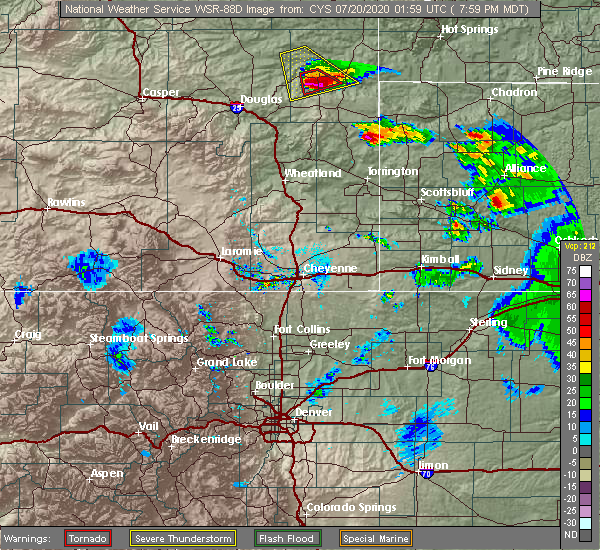 At 757 pm mdt, a severe thunderstorm capable of producing a tornado was located near lance creek, or 15 miles northwest of lusk, moving south at 30 mph (radar indicated rotation). Hazards include tornado and tennis ball size hail. Flying debris will be dangerous to those caught without shelter. mobile homes will be damaged or destroyed. damage to roofs, windows, and vehicles will occur. tree damage is likely. this dangerous storm will be near, manville around 820 pm mdt. Lusk around 825 pm mdt. At 757 pm mdt, a severe thunderstorm capable of producing a tornado was located near lance creek, or 15 miles northwest of lusk, moving south at 30 mph (radar indicated rotation). Hazards include tornado and tennis ball size hail. Flying debris will be dangerous to those caught without shelter. mobile homes will be damaged or destroyed. damage to roofs, windows, and vehicles will occur. tree damage is likely. this dangerous storm will be near, manville around 820 pm mdt. Lusk around 825 pm mdt.
|
| 6/6/2020 5:06 PM MDT |
 At 505 pm mdt, severe thunderstorms were located along a line extending from 14 miles southeast of dull center to 8 miles northeast of fort laramie, moving northeast at 70 mph (radar indicated). Hazards include 70 mph wind gusts. Expect considerable tree damage. damage is likely to mobile homes, roofs, and outbuildings. locations impacted include, lusk, guernsey, lingle, fort laramie, glendo, manville, sibley peak, dull center, two moon campground, keeline, jay em, fort laramie national historic site, bill, grayrocks reservoir, guernsey campground, rawhide buttes, glendo reservoir, lance creek, manning ranch and chugcreek. This includes interstate 25 in wyoming between mile markers 103 and 124. At 505 pm mdt, severe thunderstorms were located along a line extending from 14 miles southeast of dull center to 8 miles northeast of fort laramie, moving northeast at 70 mph (radar indicated). Hazards include 70 mph wind gusts. Expect considerable tree damage. damage is likely to mobile homes, roofs, and outbuildings. locations impacted include, lusk, guernsey, lingle, fort laramie, glendo, manville, sibley peak, dull center, two moon campground, keeline, jay em, fort laramie national historic site, bill, grayrocks reservoir, guernsey campground, rawhide buttes, glendo reservoir, lance creek, manning ranch and chugcreek. This includes interstate 25 in wyoming between mile markers 103 and 124.
|
| 6/6/2020 4:57 PM MDT |
 At 456 pm mdt, severe thunderstorms were located along a line extending from 13 miles north of manning ranch to near fort laramie national historic site, moving northeast at 60 mph. these are very dangerous storms (radar indicated). Hazards include 80 mph wind gusts. Flying debris will be dangerous to those caught without shelter. mobile homes will be heavily damaged. expect considerable damage to roofs, windows, and vehicles. extensive tree damage and power outages are likely. locations impacted include, lusk, guernsey, lingle, fort laramie, glendo, manville, sibley peak, dull center, two moon campground, keeline, jay em, fort laramie national historic site, bill, grayrocks reservoir, guernsey campground, rawhide buttes, glendo reservoir, lance creek, manning ranch and chugcreek. This includes interstate 25 in wyoming between mile markers 103 and 124. At 456 pm mdt, severe thunderstorms were located along a line extending from 13 miles north of manning ranch to near fort laramie national historic site, moving northeast at 60 mph. these are very dangerous storms (radar indicated). Hazards include 80 mph wind gusts. Flying debris will be dangerous to those caught without shelter. mobile homes will be heavily damaged. expect considerable damage to roofs, windows, and vehicles. extensive tree damage and power outages are likely. locations impacted include, lusk, guernsey, lingle, fort laramie, glendo, manville, sibley peak, dull center, two moon campground, keeline, jay em, fort laramie national historic site, bill, grayrocks reservoir, guernsey campground, rawhide buttes, glendo reservoir, lance creek, manning ranch and chugcreek. This includes interstate 25 in wyoming between mile markers 103 and 124.
|
| 6/6/2020 4:39 PM MDT |
 At 439 pm mdt, severe thunderstorms were located along a line extending from 16 miles north of douglas to lakeview north, moving northeast at 60 mph. these are very dangerous storms (radar indicated). Hazards include 80 mph wind gusts. Flying debris will be dangerous to those caught without shelter. mobile homes will be heavily damaged. expect considerable damage to roofs, windows, and vehicles. Extensive tree damage and power outages are likely. At 439 pm mdt, severe thunderstorms were located along a line extending from 16 miles north of douglas to lakeview north, moving northeast at 60 mph. these are very dangerous storms (radar indicated). Hazards include 80 mph wind gusts. Flying debris will be dangerous to those caught without shelter. mobile homes will be heavily damaged. expect considerable damage to roofs, windows, and vehicles. Extensive tree damage and power outages are likely.
|
| 9/20/2019 4:20 PM MDT |
 At 420 pm mdt, a severe thunderstorm was located near manville, or 12 miles west of lusk, moving north at 25 mph (radar indicated). Hazards include 60 mph wind gusts and half dollar size hail. Hail damage to vehicles is expected. Expect wind damage to roofs, siding, and trees. At 420 pm mdt, a severe thunderstorm was located near manville, or 12 miles west of lusk, moving north at 25 mph (radar indicated). Hazards include 60 mph wind gusts and half dollar size hail. Hail damage to vehicles is expected. Expect wind damage to roofs, siding, and trees.
|
| 8/15/2019 11:01 PM MDT |
 At 1100 pm mdt, a severe thunderstorm was located over rawhide buttes, or 13 miles south of lusk, moving southeast at 40 mph (radar indicated). Hazards include ping pong ball size hail and 60 mph wind gusts. People and animals outdoors will be injured. expect hail damage to roofs, siding, windows, and vehicles. expect wind damage to roofs, siding, and trees. Locations impacted include, lusk, manville and keeline. At 1100 pm mdt, a severe thunderstorm was located over rawhide buttes, or 13 miles south of lusk, moving southeast at 40 mph (radar indicated). Hazards include ping pong ball size hail and 60 mph wind gusts. People and animals outdoors will be injured. expect hail damage to roofs, siding, windows, and vehicles. expect wind damage to roofs, siding, and trees. Locations impacted include, lusk, manville and keeline.
|
| 8/15/2019 10:46 PM MDT |
 At 1035 pm mdt, trained spotters reported quarter size hail near lost springs. a severe thunderstorm was located 9 miles south of keeline, or 15 miles southwest of lusk, moving southeast at 40 mph (trained weather spotters). Hazards include ping pong ball size hail and 60 mph wind gusts. People and animals outdoors will be injured. expect hail damage to roofs, siding, windows, and vehicles. expect wind damage to roofs, siding, and trees. Locations impacted include, lusk, manville, keeline and lost springs. At 1035 pm mdt, trained spotters reported quarter size hail near lost springs. a severe thunderstorm was located 9 miles south of keeline, or 15 miles southwest of lusk, moving southeast at 40 mph (trained weather spotters). Hazards include ping pong ball size hail and 60 mph wind gusts. People and animals outdoors will be injured. expect hail damage to roofs, siding, windows, and vehicles. expect wind damage to roofs, siding, and trees. Locations impacted include, lusk, manville, keeline and lost springs.
|
| 8/15/2019 10:24 PM MDT |
 At 1023 pm mdt, a severe thunderstorm was located 10 miles west of keeline, or 22 miles east of douglas, moving southeast at 40 mph (radar indicated). Hazards include ping pong ball size hail and 60 mph wind gusts. People and animals outdoors will be injured. expect hail damage to roofs, siding, windows, and vehicles. Expect wind damage to roofs, siding, and trees. At 1023 pm mdt, a severe thunderstorm was located 10 miles west of keeline, or 22 miles east of douglas, moving southeast at 40 mph (radar indicated). Hazards include ping pong ball size hail and 60 mph wind gusts. People and animals outdoors will be injured. expect hail damage to roofs, siding, windows, and vehicles. Expect wind damage to roofs, siding, and trees.
|
| 8/15/2019 1:46 PM MDT |
 At 130 pm mdt, a severe thunderstorm was located 8 miles north of keeline, or 17 miles northwest of lusk, moving southeast at 35 mph (radar indicated). Hazards include 60 mph wind gusts and half dollar size hail. Hail damage to vehicles is expected. Expect wind damage to roofs, siding, and trees. At 130 pm mdt, a severe thunderstorm was located 8 miles north of keeline, or 17 miles northwest of lusk, moving southeast at 35 mph (radar indicated). Hazards include 60 mph wind gusts and half dollar size hail. Hail damage to vehicles is expected. Expect wind damage to roofs, siding, and trees.
|
| 8/15/2019 1:31 PM MDT |
 At 130 pm mdt, a severe thunderstorm was located 8 miles north of keeline, or 17 miles northwest of lusk, moving southeast at 35 mph (radar indicated). Hazards include 60 mph wind gusts and half dollar size hail. Hail damage to vehicles is expected. Expect wind damage to roofs, siding, and trees. At 130 pm mdt, a severe thunderstorm was located 8 miles north of keeline, or 17 miles northwest of lusk, moving southeast at 35 mph (radar indicated). Hazards include 60 mph wind gusts and half dollar size hail. Hail damage to vehicles is expected. Expect wind damage to roofs, siding, and trees.
|
| 8/5/2019 8:41 PM MDT |
 At 840 pm mdt, a severe thunderstorm was located over keeline, or 16 miles west of lusk, moving southeast at 35 mph (radar indicated). Hazards include 60 mph wind gusts and quarter size hail. Hail damage to vehicles is expected. expect wind damage to roofs, siding, and trees. this severe thunderstorm will be near, manville around 850 pm mdt. rawhide buttes around 915 pm mdt. Other locations impacted by this severe thunderstorm include lost springs. At 840 pm mdt, a severe thunderstorm was located over keeline, or 16 miles west of lusk, moving southeast at 35 mph (radar indicated). Hazards include 60 mph wind gusts and quarter size hail. Hail damage to vehicles is expected. expect wind damage to roofs, siding, and trees. this severe thunderstorm will be near, manville around 850 pm mdt. rawhide buttes around 915 pm mdt. Other locations impacted by this severe thunderstorm include lost springs.
|
| 8/3/2019 4:39 PM MDT |
 The severe thunderstorm warning for southwestern niobrara county will expire at 445 pm mdt, the storm which prompted the warning has weakened below severe limits, and no longer poses an immediate threat to life or property. therefore, the warning will be allowed to expire. however small hail is still possible with this thunderstorm. The severe thunderstorm warning for southwestern niobrara county will expire at 445 pm mdt, the storm which prompted the warning has weakened below severe limits, and no longer poses an immediate threat to life or property. therefore, the warning will be allowed to expire. however small hail is still possible with this thunderstorm.
|
| 8/3/2019 4:20 PM MDT |
 At 419 pm mdt, a severe thunderstorm was located over keeline, or 13 miles west of lusk, moving southeast at 15 mph. at 4:15 pm members of the public reported quarter sized hail west of manville. hail damage to roofs and vehicles is expected. move to an interior room away from windows (public). Hazards include 60 mph wind gusts and quarter size hail. Hail damage to vehicles is expected. expect wind damage to roofs, siding, and trees. Locations impacted include, manville and keeline. At 419 pm mdt, a severe thunderstorm was located over keeline, or 13 miles west of lusk, moving southeast at 15 mph. at 4:15 pm members of the public reported quarter sized hail west of manville. hail damage to roofs and vehicles is expected. move to an interior room away from windows (public). Hazards include 60 mph wind gusts and quarter size hail. Hail damage to vehicles is expected. expect wind damage to roofs, siding, and trees. Locations impacted include, manville and keeline.
|
| 8/3/2019 4:11 PM MDT |
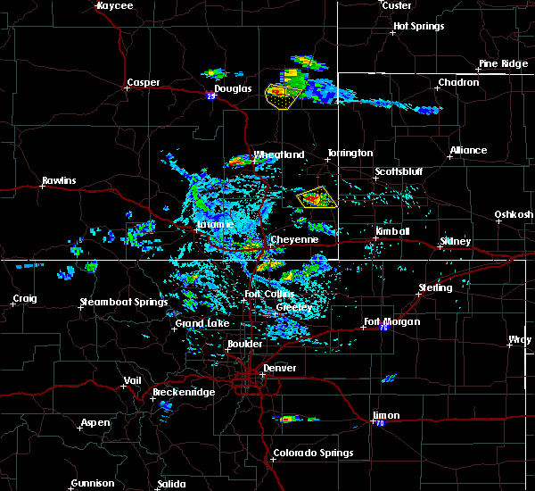 At 410 pm mdt, a severe thunderstorm was located over keeline, or 15 miles west of lusk, moving southeast at 15 mph (radar indicated). Hazards include 60 mph wind gusts and quarter size hail. Hail damage to vehicles is expected. expect wind damage to roofs, siding, and trees. Locations impacted include, manville and keeline. At 410 pm mdt, a severe thunderstorm was located over keeline, or 15 miles west of lusk, moving southeast at 15 mph (radar indicated). Hazards include 60 mph wind gusts and quarter size hail. Hail damage to vehicles is expected. expect wind damage to roofs, siding, and trees. Locations impacted include, manville and keeline.
|
| 8/3/2019 4:02 PM MDT | Quarter sized hail reported 8.8 miles E of Manville, WY, hail lasted for a few minutes with gusty winds. some hail stones were slight larger than quarters. |
| 8/3/2019 3:55 PM MDT |
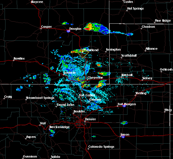 At 355 pm mdt, a severe thunderstorm was located near keeline, or 18 miles west of lusk, moving southeast at 10 mph (radar indicated). Hazards include 60 mph wind gusts and quarter size hail. Hail damage to vehicles is expected. Expect wind damage to roofs, siding, and trees. At 355 pm mdt, a severe thunderstorm was located near keeline, or 18 miles west of lusk, moving southeast at 10 mph (radar indicated). Hazards include 60 mph wind gusts and quarter size hail. Hail damage to vehicles is expected. Expect wind damage to roofs, siding, and trees.
|
| 7/4/2019 8:58 PM MDT |
 At 857 pm mdt, a severe thunderstorm was located 8 miles southwest of keeline, or 22 miles west of lusk, moving northeast at 25 mph (radar indicated). Hazards include ping pong ball size hail. People and animals outdoors will be injured. expect damage to roofs, siding, windows, and vehicles. Locations impacted include, manville and keeline. At 857 pm mdt, a severe thunderstorm was located 8 miles southwest of keeline, or 22 miles west of lusk, moving northeast at 25 mph (radar indicated). Hazards include ping pong ball size hail. People and animals outdoors will be injured. expect damage to roofs, siding, windows, and vehicles. Locations impacted include, manville and keeline.
|
| 7/4/2019 8:33 PM MDT |
 At 833 pm mdt, a severe thunderstorm was located near glendo, or 21 miles southeast of douglas, moving northeast at 25 mph (radar indicated). Hazards include half dollar size hail. damage to vehicles is expected At 833 pm mdt, a severe thunderstorm was located near glendo, or 21 miles southeast of douglas, moving northeast at 25 mph (radar indicated). Hazards include half dollar size hail. damage to vehicles is expected
|
| 7/1/2019 5:18 PM MDT | Half Dollar sized hail reported 0.2 miles ESE of Manville, WY |
| 7/1/2019 5:17 PM MDT | Golf Ball sized hail reported 2.8 miles S of Manville, WY, golf ball hail and multiple small tree branches down. |
| 7/1/2019 5:15 PM MDT |
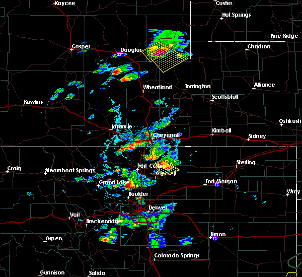 At 514 pm mdt, a severe thunderstorm was located near manville, or 11 miles west of lusk, moving southeast at 25 mph (radar indicated). Hazards include two inch hail and 60 mph wind gusts. People and animals outdoors will be injured. expect hail damage to roofs, siding, windows, and vehicles. Expect wind damage to roofs, siding, and trees. At 514 pm mdt, a severe thunderstorm was located near manville, or 11 miles west of lusk, moving southeast at 25 mph (radar indicated). Hazards include two inch hail and 60 mph wind gusts. People and animals outdoors will be injured. expect hail damage to roofs, siding, windows, and vehicles. Expect wind damage to roofs, siding, and trees.
|
| 7/1/2019 5:10 PM MDT |
 At 508 pm mdt, a severe thunderstorm was located near keeline, or 13 miles west of lusk, moving southeast at 25 mph. at 458 pm mdt, trained weather spotters reported quarter size hail 4 miles north- northwest of keeline (trained weather spotters). Hazards include two inch hail and 60 mph wind gusts. People and animals outdoors will be injured. expect hail damage to roofs, siding, windows, and vehicles. expect wind damage to roofs, siding, and trees. Locations impacted include, manville, keeline and lost springs. At 508 pm mdt, a severe thunderstorm was located near keeline, or 13 miles west of lusk, moving southeast at 25 mph. at 458 pm mdt, trained weather spotters reported quarter size hail 4 miles north- northwest of keeline (trained weather spotters). Hazards include two inch hail and 60 mph wind gusts. People and animals outdoors will be injured. expect hail damage to roofs, siding, windows, and vehicles. expect wind damage to roofs, siding, and trees. Locations impacted include, manville, keeline and lost springs.
|
| 7/1/2019 4:58 PM MDT | Ping Pong Ball sized hail reported 8.9 miles E of Manville, WY, corrects previous hail report from 4 nnw keeline. very jagged hail. broken windows and torn siding on residence. |
| 7/1/2019 4:58 PM MDT | Quarter sized hail reported 8.9 miles E of Manville, WY, very jagged hail. |
| 7/1/2019 4:57 PM MDT |
 At 457 pm mdt, a severe thunderstorm was located near keeline, or 17 miles west of lusk, moving southeast at 25 mph (radar indicated). Hazards include two inch hail and 60 mph wind gusts. People and animals outdoors will be injured. expect hail damage to roofs, siding, windows, and vehicles. expect wind damage to roofs, siding, and trees. Locations impacted include, manville, keeline and lost springs. At 457 pm mdt, a severe thunderstorm was located near keeline, or 17 miles west of lusk, moving southeast at 25 mph (radar indicated). Hazards include two inch hail and 60 mph wind gusts. People and animals outdoors will be injured. expect hail damage to roofs, siding, windows, and vehicles. expect wind damage to roofs, siding, and trees. Locations impacted include, manville, keeline and lost springs.
|
| 7/1/2019 4:54 PM MDT | Quarter sized hail reported 9.3 miles SE of Manville, WY |
| 7/1/2019 4:44 PM MDT |
 At 444 pm mdt, a severe thunderstorm was located near manning ranch, or 25 miles northwest of lusk, moving southeast at 20 mph (radar indicated). Hazards include two inch hail and 60 mph wind gusts. People and animals outdoors will be injured. expect hail damage to roofs, siding, windows, and vehicles. Expect wind damage to roofs, siding, and trees. At 444 pm mdt, a severe thunderstorm was located near manning ranch, or 25 miles northwest of lusk, moving southeast at 20 mph (radar indicated). Hazards include two inch hail and 60 mph wind gusts. People and animals outdoors will be injured. expect hail damage to roofs, siding, windows, and vehicles. Expect wind damage to roofs, siding, and trees.
|
| 6/30/2019 7:56 PM MDT |
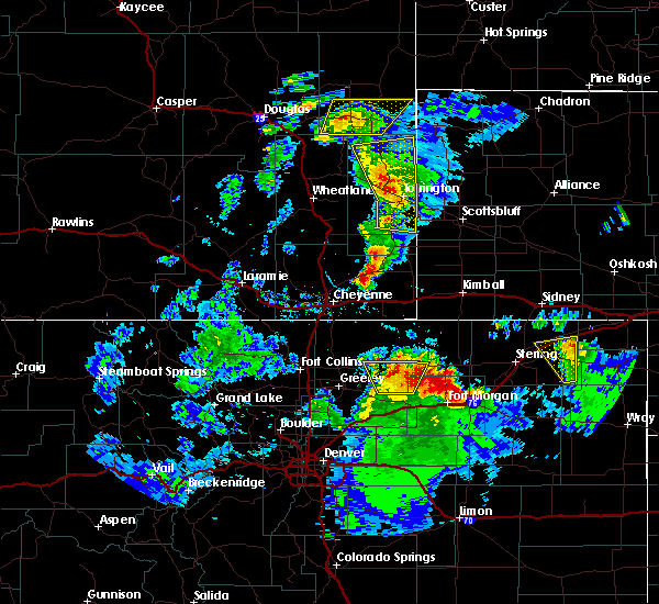 The severe thunderstorm warning for southern niobrara county will expire at 800 pm mdt, the storm which prompted the warning has weakened below severe limits, and no longer poses an immediate threat to life or property. therefore, the warning will be allowed to expire. however gusty winds are still possible with this thunderstorm. The severe thunderstorm warning for southern niobrara county will expire at 800 pm mdt, the storm which prompted the warning has weakened below severe limits, and no longer poses an immediate threat to life or property. therefore, the warning will be allowed to expire. however gusty winds are still possible with this thunderstorm.
|
| 6/30/2019 7:43 PM MDT |
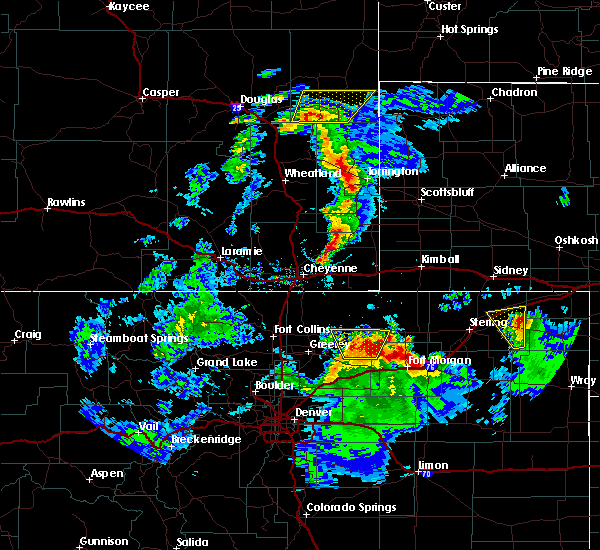 At 743 pm mdt, a severe thunderstorm was located near manville, or near lusk, moving northeast at 40 mph (radar indicated). Hazards include 60 mph wind gusts and nickel size hail. Expect damage to roofs, siding, and trees. Locations impacted include, lusk, manville and keeline. At 743 pm mdt, a severe thunderstorm was located near manville, or near lusk, moving northeast at 40 mph (radar indicated). Hazards include 60 mph wind gusts and nickel size hail. Expect damage to roofs, siding, and trees. Locations impacted include, lusk, manville and keeline.
|
| 6/30/2019 7:26 PM MDT |
 At 725 pm mdt, a severe thunderstorm was located 10 miles west of rawhide buttes, or 18 miles southwest of lusk, moving northeast at 40 mph (radar indicated). Hazards include 60 mph wind gusts and nickel size hail. expect damage to roofs, siding, and trees At 725 pm mdt, a severe thunderstorm was located 10 miles west of rawhide buttes, or 18 miles southwest of lusk, moving northeast at 40 mph (radar indicated). Hazards include 60 mph wind gusts and nickel size hail. expect damage to roofs, siding, and trees
|
| 6/25/2019 5:47 PM MDT | Half Dollar sized hail reported 0.4 miles WSW of Manville, WY, penny to half dollar size hail fell just south of manville. |
| 6/25/2019 5:44 PM MDT | Quarter sized hail reported 0.2 miles ESE of Manville, WY |
| 6/25/2019 5:41 PM MDT |
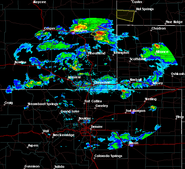 At 540 pm mdt, a severe thunderstorm was located near keeline, or 11 miles west of lusk, moving northeast at 30 mph (radar indicated). Hazards include golf ball size hail and 60 mph wind gusts. People and animals outdoors will be injured. expect hail damage to roofs, siding, windows, and vehicles. expect wind damage to roofs, siding, and trees. Locations impacted include, lusk, manville and keeline. At 540 pm mdt, a severe thunderstorm was located near keeline, or 11 miles west of lusk, moving northeast at 30 mph (radar indicated). Hazards include golf ball size hail and 60 mph wind gusts. People and animals outdoors will be injured. expect hail damage to roofs, siding, windows, and vehicles. expect wind damage to roofs, siding, and trees. Locations impacted include, lusk, manville and keeline.
|
| 6/25/2019 5:35 PM MDT |
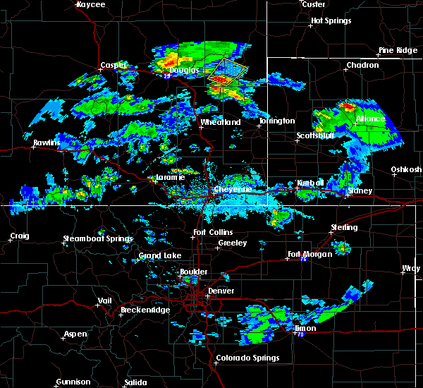 At 534 pm mdt, a severe thunderstorm was located over keeline, or 14 miles west of lusk, moving northeast at 30 mph (radar indicated). Hazards include 60 mph wind gusts and quarter size hail. Hail damage to vehicles is expected. Expect wind damage to roofs, siding, and trees. At 534 pm mdt, a severe thunderstorm was located over keeline, or 14 miles west of lusk, moving northeast at 30 mph (radar indicated). Hazards include 60 mph wind gusts and quarter size hail. Hail damage to vehicles is expected. Expect wind damage to roofs, siding, and trees.
|
| 6/20/2019 5:57 PM MDT |
 The severe thunderstorm warning for southwestern niobrara, northwestern goshen, northeastern platte and east central converse counties will expire at 600 pm mdt, the storm which prompted the warning has weakened below severe limits, and has exited the warned area. therefore, the warning will be allowed to expire. however small hail and gusty winds are still possible with this thunderstorm. a tornado watch remains in effect until 1000 pm mdt for southeastern and east central wyoming. to report severe weather, contact your nearest law enforcement agency. they will relay your report to the national weather service cheyenne. The severe thunderstorm warning for southwestern niobrara, northwestern goshen, northeastern platte and east central converse counties will expire at 600 pm mdt, the storm which prompted the warning has weakened below severe limits, and has exited the warned area. therefore, the warning will be allowed to expire. however small hail and gusty winds are still possible with this thunderstorm. a tornado watch remains in effect until 1000 pm mdt for southeastern and east central wyoming. to report severe weather, contact your nearest law enforcement agency. they will relay your report to the national weather service cheyenne.
|
| 6/20/2019 5:36 PM MDT |
 At 536 pm mdt, a severe thunderstorm was located 9 miles south of keeline, or 19 miles southwest of lusk, moving northeast at 40 mph (radar indicated). Hazards include 60 mph wind gusts and quarter size hail. Hail damage to vehicles is expected. expect wind damage to roofs, siding, and trees. Locations impacted include, manville, keeline, rawhide buttes and lost springs. At 536 pm mdt, a severe thunderstorm was located 9 miles south of keeline, or 19 miles southwest of lusk, moving northeast at 40 mph (radar indicated). Hazards include 60 mph wind gusts and quarter size hail. Hail damage to vehicles is expected. expect wind damage to roofs, siding, and trees. Locations impacted include, manville, keeline, rawhide buttes and lost springs.
|
| 6/20/2019 5:13 PM MDT |
 At 513 pm mdt, a severe thunderstorm was located over glendo, or 26 miles southeast of douglas, moving northeast at 30 mph (radar indicated). Hazards include 60 mph wind gusts and quarter size hail. Hail damage to vehicles is expected. Expect wind damage to roofs, siding, and trees. At 513 pm mdt, a severe thunderstorm was located over glendo, or 26 miles southeast of douglas, moving northeast at 30 mph (radar indicated). Hazards include 60 mph wind gusts and quarter size hail. Hail damage to vehicles is expected. Expect wind damage to roofs, siding, and trees.
|
| 4/26/2019 5:31 PM MDT |
 At 529 pm mdt, a severe thunderstorm was located 13 miles east of lusk, moving east at 50 mph (radar indicated). Hazards include 70 mph wind gusts and up to quarter size hail. Hail damage to vehicles is possible. expect considerable tree damage. wind damage is also likely to mobile homes, roofs, and outbuildings. Locations impacted include, lusk, manville and van tassell. At 529 pm mdt, a severe thunderstorm was located 13 miles east of lusk, moving east at 50 mph (radar indicated). Hazards include 70 mph wind gusts and up to quarter size hail. Hail damage to vehicles is possible. expect considerable tree damage. wind damage is also likely to mobile homes, roofs, and outbuildings. Locations impacted include, lusk, manville and van tassell.
|
| 4/26/2019 5:09 PM MDT |
 At 507 pm mdt, a severe thunderstorm was located 7 miles south of manville, or 9 miles southwest of lusk, moving east at 50 mph (radar indicated). Hazards include 70 mph wind gusts and up to quarter size hail. Hail damage to vehicles is possible. expect considerable tree damage. Wind damage is also likely to mobile homes, roofs, and outbuildings. At 507 pm mdt, a severe thunderstorm was located 7 miles south of manville, or 9 miles southwest of lusk, moving east at 50 mph (radar indicated). Hazards include 70 mph wind gusts and up to quarter size hail. Hail damage to vehicles is possible. expect considerable tree damage. Wind damage is also likely to mobile homes, roofs, and outbuildings.
|
| 7/29/2018 3:52 PM MDT |
 The severe thunderstorm warning for southern niobrara county will expire at 400 pm mdt, the storm which prompted the warning has moved out of the area. therefore, the warning will be allowed to expire. a severe thunderstorm warning remains in effect for south eastern niobrara and northern goshen counties until 4:15 pm mdt. a tornado watch remains in effect until 900 pm mdt for east central wyoming. The severe thunderstorm warning for southern niobrara county will expire at 400 pm mdt, the storm which prompted the warning has moved out of the area. therefore, the warning will be allowed to expire. a severe thunderstorm warning remains in effect for south eastern niobrara and northern goshen counties until 4:15 pm mdt. a tornado watch remains in effect until 900 pm mdt for east central wyoming.
|
| 7/29/2018 3:31 PM MDT |
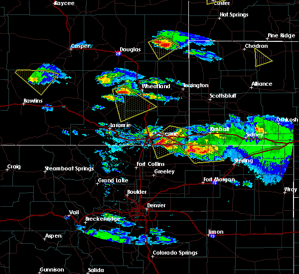 At 331 pm mdt, a severe thunderstorm was located 7 miles southeast of lance creek, or 12 miles northwest of lusk, moving southeast at 35 mph (radar indicated). Hazards include 60 mph wind gusts and quarter size hail. Hail damage to vehicles is expected. expect wind damage to roofs, siding, and trees. locations impacted include, lusk, manville and lance creek. A tornado watch remains in effect until 900 pm mdt for east central wyoming. At 331 pm mdt, a severe thunderstorm was located 7 miles southeast of lance creek, or 12 miles northwest of lusk, moving southeast at 35 mph (radar indicated). Hazards include 60 mph wind gusts and quarter size hail. Hail damage to vehicles is expected. expect wind damage to roofs, siding, and trees. locations impacted include, lusk, manville and lance creek. A tornado watch remains in effect until 900 pm mdt for east central wyoming.
|
| 7/29/2018 3:19 PM MDT |
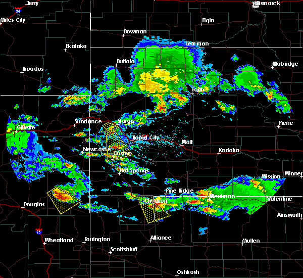 At 319 pm mdt, a severe thunderstorm was located near lance creek, or 26 miles northwest of lusk, moving southeast at 25 mph (radar indicated). Hazards include 60 mph wind gusts and quarter size hail. Hail damage to vehicles is expected. Expect wind damage to roofs, siding, and trees. At 319 pm mdt, a severe thunderstorm was located near lance creek, or 26 miles northwest of lusk, moving southeast at 25 mph (radar indicated). Hazards include 60 mph wind gusts and quarter size hail. Hail damage to vehicles is expected. Expect wind damage to roofs, siding, and trees.
|
| 7/17/2018 9:48 PM MDT |
 At 948 pm mdt, a severe thunderstorm was located near rawhide buttes, or 11 miles southwest of lusk, moving east at 40 mph (radar indicated). Hazards include 60 mph wind gusts and nickel size hail. Expect damage to roofs, siding, and trees. Locations impacted include, lusk, manville and rawhide buttes. At 948 pm mdt, a severe thunderstorm was located near rawhide buttes, or 11 miles southwest of lusk, moving east at 40 mph (radar indicated). Hazards include 60 mph wind gusts and nickel size hail. Expect damage to roofs, siding, and trees. Locations impacted include, lusk, manville and rawhide buttes.
|
| 7/17/2018 9:15 PM MDT |
 At 915 pm mdt, a severe thunderstorm was located 10 miles north of glendo, or 21 miles east of douglas, moving east at 40 mph (radar indicated). Hazards include 60 mph wind gusts and nickel size hail. expect damage to roofs, siding, and trees At 915 pm mdt, a severe thunderstorm was located 10 miles north of glendo, or 21 miles east of douglas, moving east at 40 mph (radar indicated). Hazards include 60 mph wind gusts and nickel size hail. expect damage to roofs, siding, and trees
|
| 7/3/2018 6:00 PM MDT | Half Dollar sized hail reported 0.2 miles ESE of Manville, WY, facebook post from the public showed varying hail sizes that fell in manville. most looked to be around quarter size with a few larger sizes noted. |
| 7/3/2018 4:57 PM MDT |
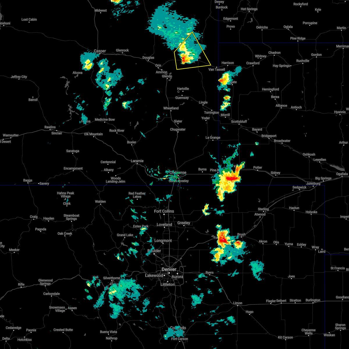 The severe thunderstorm warning for southwestern niobrara county will expire at 500 pm mdt, the storm which prompted the warning has weakened below severe limits, and no longer poses an immediate threat to life or property. therefore, the warning will be allowed to expire. however gusty winds up to 50 mph are still possible with this thunderstorm. a severe thunderstorm watch remains in effect until midnight mdt for east central wyoming. The severe thunderstorm warning for southwestern niobrara county will expire at 500 pm mdt, the storm which prompted the warning has weakened below severe limits, and no longer poses an immediate threat to life or property. therefore, the warning will be allowed to expire. however gusty winds up to 50 mph are still possible with this thunderstorm. a severe thunderstorm watch remains in effect until midnight mdt for east central wyoming.
|
| 7/3/2018 4:46 PM MDT |
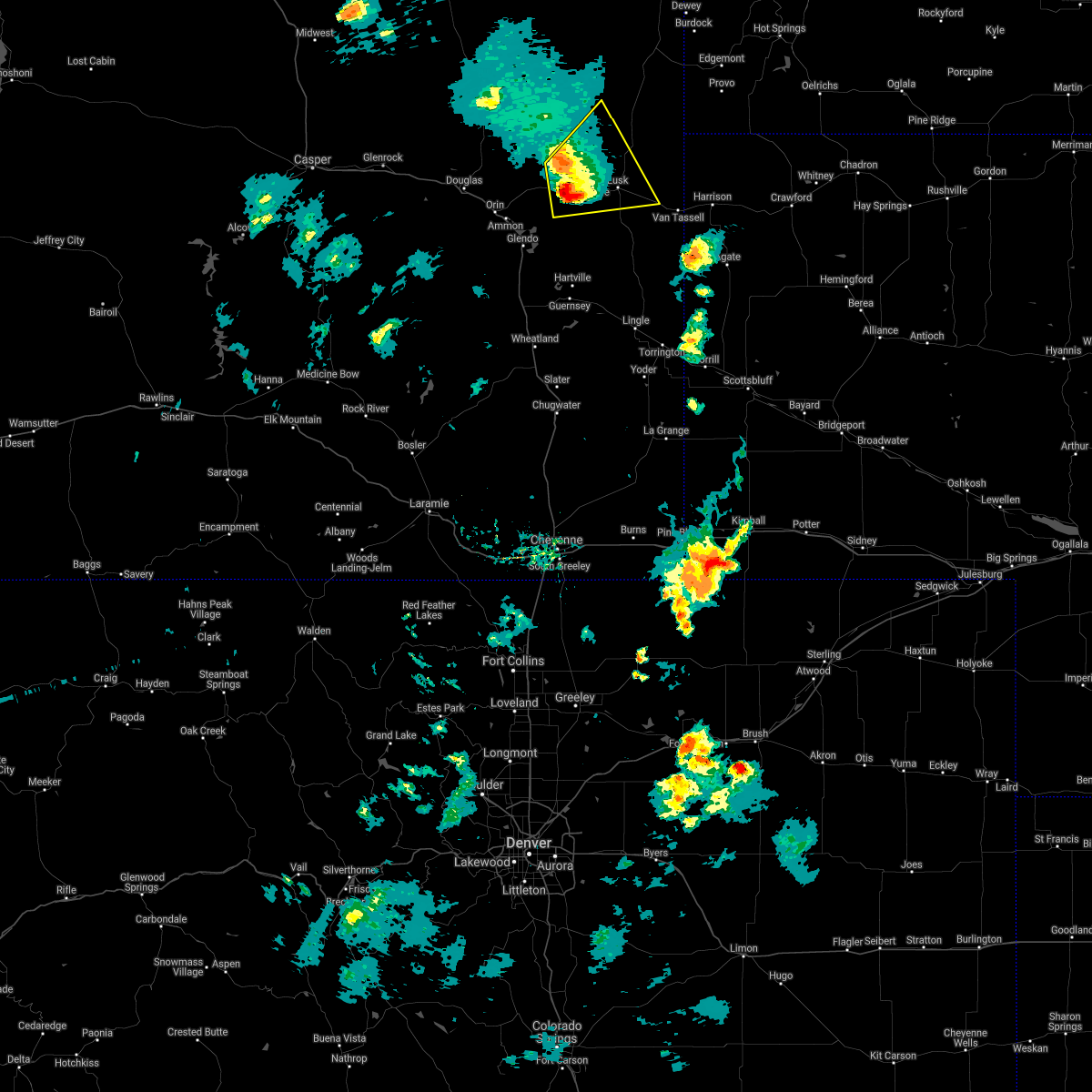 At 445 pm mdt, a severe thunderstorm was located over keeline, or 13 miles west of lusk, moving northeast at 25 mph (radar indicated). Hazards include ping pong ball size hail and 60 mph wind gusts. People and animals outdoors will be injured. expect hail damage to roofs, siding, windows, and vehicles. expect wind damage to roofs, siding, and trees. Locations impacted include, lusk, manville, keeline and lance creek. At 445 pm mdt, a severe thunderstorm was located over keeline, or 13 miles west of lusk, moving northeast at 25 mph (radar indicated). Hazards include ping pong ball size hail and 60 mph wind gusts. People and animals outdoors will be injured. expect hail damage to roofs, siding, windows, and vehicles. expect wind damage to roofs, siding, and trees. Locations impacted include, lusk, manville, keeline and lance creek.
|
| 7/3/2018 4:39 PM MDT | Quarter sized hail reported 9 miles ENE of Manville, WY, quarter size hail reported by niobrara county law enforcement a few miles west of keeline. |
| 7/3/2018 4:22 PM MDT |
 At 422 pm mdt, a severe thunderstorm was located near keeline, or 20 miles west of lusk, moving northeast at 40 mph (radar indicated). Hazards include ping pong ball size hail and 60 mph wind gusts. People and animals outdoors will be injured. expect hail damage to roofs, siding, windows, and vehicles. Expect wind damage to roofs, siding, and trees. At 422 pm mdt, a severe thunderstorm was located near keeline, or 20 miles west of lusk, moving northeast at 40 mph (radar indicated). Hazards include ping pong ball size hail and 60 mph wind gusts. People and animals outdoors will be injured. expect hail damage to roofs, siding, windows, and vehicles. Expect wind damage to roofs, siding, and trees.
|
| 9/23/2016 4:24 PM MDT |
 At 424 pm mdt, severe thunderstorms were located along a line extending from near lance creek to 8 miles north of lusk to 6 miles northeast of rawhide buttes, moving northeast at 60 mph (radar indicated). Hazards include 60 mph wind gusts and quarter size hail. Hail damage to vehicles is expected. expect wind damage to roofs, siding, and trees. Locations impacted include, lusk, manville, redbird, lance creek and van tassell. At 424 pm mdt, severe thunderstorms were located along a line extending from near lance creek to 8 miles north of lusk to 6 miles northeast of rawhide buttes, moving northeast at 60 mph (radar indicated). Hazards include 60 mph wind gusts and quarter size hail. Hail damage to vehicles is expected. expect wind damage to roofs, siding, and trees. Locations impacted include, lusk, manville, redbird, lance creek and van tassell.
|
| 9/23/2016 4:08 PM MDT |
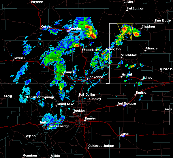 At 408 pm mdt, severe thunderstorms were located along a line extending from 8 miles southwest of lance creek to near manville to 6 miles south of rawhide buttes, moving northeast at 60 mph (radar indicated). Hazards include 60 mph wind gusts and quarter size hail. Hail damage to vehicles is expected. Expect wind damage to roofs, siding, and trees. At 408 pm mdt, severe thunderstorms were located along a line extending from 8 miles southwest of lance creek to near manville to 6 miles south of rawhide buttes, moving northeast at 60 mph (radar indicated). Hazards include 60 mph wind gusts and quarter size hail. Hail damage to vehicles is expected. Expect wind damage to roofs, siding, and trees.
|
| 7/28/2016 8:38 AM MDT |
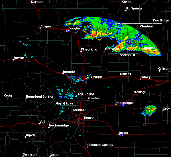 The severe thunderstorm warning for north central goshen and southern niobrara counties will expire at 845 am mdt, the storm which prompted the warning has weakened below severe limits, and no longer pose an immediate threat to life or property. therefore the warning will be allowed to expire. however small hail and heavy rain are still possible with this thunderstorm. The severe thunderstorm warning for north central goshen and southern niobrara counties will expire at 845 am mdt, the storm which prompted the warning has weakened below severe limits, and no longer pose an immediate threat to life or property. therefore the warning will be allowed to expire. however small hail and heavy rain are still possible with this thunderstorm.
|
| 7/28/2016 8:10 AM MDT |
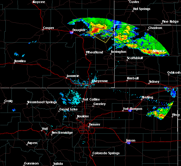 At 810 am mdt, a severe thunderstorm was located near manville, or 11 miles west of lusk, moving southeast at 35 mph (radar indicated). Hazards include 60 mph wind gusts and quarter size hail. Hail damage to vehicles is expected. expect wind damage to roofs, siding, and trees. this severe thunderstorm will be near, manville around 815 am mdt. Lusk around 825 am mdt. At 810 am mdt, a severe thunderstorm was located near manville, or 11 miles west of lusk, moving southeast at 35 mph (radar indicated). Hazards include 60 mph wind gusts and quarter size hail. Hail damage to vehicles is expected. expect wind damage to roofs, siding, and trees. this severe thunderstorm will be near, manville around 815 am mdt. Lusk around 825 am mdt.
|
| 7/27/2016 8:10 PM MDT | Tennis Ball sized hail reported 0.2 miles ESE of Manville, WY |
| 7/27/2016 8:10 PM MDT | Ping Pong Ball sized hail reported 0.2 miles ESE of Manville, WY |
| 7/27/2016 8:10 PM MDT |
 At 810 pm mdt, a severe thunderstorm capable of producing a tornado was located 7 miles northwest of rawhide buttes, or 9 miles southwest of lusk, moving southeast at 40 mph (radar indicated rotation). Hazards include tornado and tennis ball size hail. 80 mph winds are also possible. Flying debris will be dangerous to those caught without shelter. mobile homes will be damaged or destroyed. damage to roofs, windows, and vehicles will occur. tree damage is likely. this dangerous storm will be near, rawhide buttes around 820 pm mdt. Jay em around 835 pm mdt. At 810 pm mdt, a severe thunderstorm capable of producing a tornado was located 7 miles northwest of rawhide buttes, or 9 miles southwest of lusk, moving southeast at 40 mph (radar indicated rotation). Hazards include tornado and tennis ball size hail. 80 mph winds are also possible. Flying debris will be dangerous to those caught without shelter. mobile homes will be damaged or destroyed. damage to roofs, windows, and vehicles will occur. tree damage is likely. this dangerous storm will be near, rawhide buttes around 820 pm mdt. Jay em around 835 pm mdt.
|
| 7/27/2016 8:03 PM MDT |
 At 802 pm mdt, a severe thunderstorm capable of producing a tornado was located over manville, or 8 miles west of lusk, moving southeast at 30 mph (radar indicated rotation). Hazards include tornado and baseball size hail. 80 mph winds are also possible. Flying debris will be dangerous to those caught without shelter. mobile homes will be damaged or destroyed. damage to roofs, windows, and vehicles will occur. tree damage is likely. This dangerous storm will be near, lusk around 810 pm mdt. At 802 pm mdt, a severe thunderstorm capable of producing a tornado was located over manville, or 8 miles west of lusk, moving southeast at 30 mph (radar indicated rotation). Hazards include tornado and baseball size hail. 80 mph winds are also possible. Flying debris will be dangerous to those caught without shelter. mobile homes will be damaged or destroyed. damage to roofs, windows, and vehicles will occur. tree damage is likely. This dangerous storm will be near, lusk around 810 pm mdt.
|
| 7/27/2016 7:54 PM MDT |
 At 753 pm mdt, a severe thunderstorm capable of producing a tornado was located over manville, or 10 miles west of lusk, moving south at 35 mph (radar indicated rotation). Hazards include tornado and golf ball size hail. 70-80 mph wind also possible. Flying debris will be dangerous to those caught without shelter. mobile homes will be damaged or destroyed. damage to roofs, windows, and vehicles will occur. tree damage is likely. This tornadic thunderstorm will remain over mainly rural areas of southwestern niobrara county. At 753 pm mdt, a severe thunderstorm capable of producing a tornado was located over manville, or 10 miles west of lusk, moving south at 35 mph (radar indicated rotation). Hazards include tornado and golf ball size hail. 70-80 mph wind also possible. Flying debris will be dangerous to those caught without shelter. mobile homes will be damaged or destroyed. damage to roofs, windows, and vehicles will occur. tree damage is likely. This tornadic thunderstorm will remain over mainly rural areas of southwestern niobrara county.
|
| 7/27/2016 7:37 PM MDT |
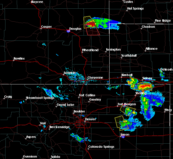 At 736 pm mdt, a severe thunderstorm capable of producing a tornado was located 7 miles southwest of lance creek, or 17 miles northwest of lusk, moving south at 35 mph (radar indicated rotation). Hazards include tornado and golf ball size hail. 70-80 mph winds also possible. Flying debris will be dangerous to those caught without shelter. mobile homes will be damaged or destroyed. damage to roofs, windows, and vehicles will occur. tree damage is likely. This dangerous storm will be near, manville and keeline around 755 pm mdt. At 736 pm mdt, a severe thunderstorm capable of producing a tornado was located 7 miles southwest of lance creek, or 17 miles northwest of lusk, moving south at 35 mph (radar indicated rotation). Hazards include tornado and golf ball size hail. 70-80 mph winds also possible. Flying debris will be dangerous to those caught without shelter. mobile homes will be damaged or destroyed. damage to roofs, windows, and vehicles will occur. tree damage is likely. This dangerous storm will be near, manville and keeline around 755 pm mdt.
|
| 7/6/2016 3:47 PM MDT |
 At 346 pm mdt, severe thunderstorms were located along a line extending from 8 miles north of mule creek junction to near redbird to near manville, moving east at 40 mph (radar indicated). Hazards include 60 mph wind gusts and quarter size hail. Hail damage to vehicles is expected. expect wind damage to roofs, siding, and trees. severe thunderstorms will be near, redbird around 350 pm mdt. Other locations impacted by these severe thunderstorms include van tassell. At 346 pm mdt, severe thunderstorms were located along a line extending from 8 miles north of mule creek junction to near redbird to near manville, moving east at 40 mph (radar indicated). Hazards include 60 mph wind gusts and quarter size hail. Hail damage to vehicles is expected. expect wind damage to roofs, siding, and trees. severe thunderstorms will be near, redbird around 350 pm mdt. Other locations impacted by these severe thunderstorms include van tassell.
|
| 7/1/2016 6:31 PM MDT |
 At 631 pm mdt, a severe thunderstorm was located 9 miles west of keeline, or 23 miles west of lusk, moving southeast at 20 mph (radar indicated). Hazards include 60 mph wind gusts and quarter size hail. Hail damage to vehicles is expected. expect wind damage to roofs, siding, and trees. Locations impacted include, manville, keeline and lost springs. At 631 pm mdt, a severe thunderstorm was located 9 miles west of keeline, or 23 miles west of lusk, moving southeast at 20 mph (radar indicated). Hazards include 60 mph wind gusts and quarter size hail. Hail damage to vehicles is expected. expect wind damage to roofs, siding, and trees. Locations impacted include, manville, keeline and lost springs.
|
| 7/1/2016 6:18 PM MDT |
 At 616 pm mdt, a severe thunderstorm was located 7 miles south of manning ranch, or 23 miles northeast of douglas, moving southeast at 15 mph. a second severe thunderstorm was located about 4 miles north of keeline, moving northeast at 15 mph (radar indicated). Hazards include 60 mph wind gusts and quarter size hail. Hail damage to vehicles is expected. expect wind damage to roofs, siding, and trees. Locations impacted include, manville, manning ranch, keeline and lost springs. At 616 pm mdt, a severe thunderstorm was located 7 miles south of manning ranch, or 23 miles northeast of douglas, moving southeast at 15 mph. a second severe thunderstorm was located about 4 miles north of keeline, moving northeast at 15 mph (radar indicated). Hazards include 60 mph wind gusts and quarter size hail. Hail damage to vehicles is expected. expect wind damage to roofs, siding, and trees. Locations impacted include, manville, manning ranch, keeline and lost springs.
|
| 7/1/2016 6:00 PM MDT |
 At 559 pm mdt, a severe thunderstorm was located near manning ranch, or 24 miles northeast of douglas, moving southeast at 20 mph (radar indicated). Hazards include 60 mph wind gusts and quarter size hail. Hail damage to vehicles is expected. Expect wind damage to roofs, siding, and trees. At 559 pm mdt, a severe thunderstorm was located near manning ranch, or 24 miles northeast of douglas, moving southeast at 20 mph (radar indicated). Hazards include 60 mph wind gusts and quarter size hail. Hail damage to vehicles is expected. Expect wind damage to roofs, siding, and trees.
|
| 6/12/2016 5:08 PM MDT |
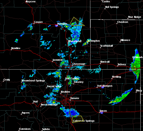 At 508 pm mdt, a severe thunderstorm was located near keeline, or 16 miles west of lusk, moving northeast at 20 mph (radar indicated). Hazards include 60 mph wind gusts and quarter size hail. Hail damage to vehicles is expected. expect wind damage to roofs, siding, and trees. Locations impacted include, lusk, manville, lance creek and keeline. At 508 pm mdt, a severe thunderstorm was located near keeline, or 16 miles west of lusk, moving northeast at 20 mph (radar indicated). Hazards include 60 mph wind gusts and quarter size hail. Hail damage to vehicles is expected. expect wind damage to roofs, siding, and trees. Locations impacted include, lusk, manville, lance creek and keeline.
|
| 6/12/2016 4:53 PM MDT |
 At 453 pm mdt, a severe thunderstorm was located near keeline, or 18 miles west of lusk, moving northeast at 25 mph (radar indicated). Hazards include 60 mph wind gusts and quarter size hail. Hail damage to vehicles is expected. Expect wind damage to roofs, siding, and trees. At 453 pm mdt, a severe thunderstorm was located near keeline, or 18 miles west of lusk, moving northeast at 25 mph (radar indicated). Hazards include 60 mph wind gusts and quarter size hail. Hail damage to vehicles is expected. Expect wind damage to roofs, siding, and trees.
|
| 7/17/2015 3:20 PM MDT |
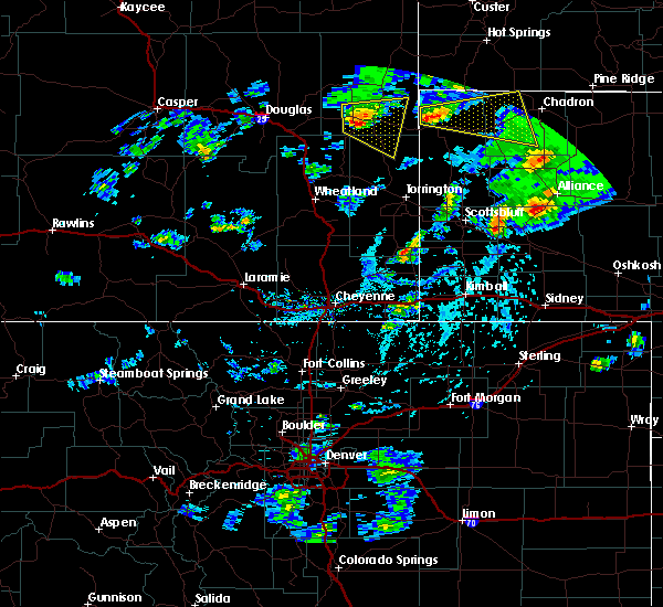 At 320 pm mdt, a severe thunderstorm was located near manville, or near lusk, moving east at 30 mph (radar indicated). Hazards include quarter size hail and 60 mph wind gusts. Hail damage to vehicles is expected. expect wind damage to roofs, siding and trees. Locations impacted include, lusk, manville, jay em and rawhide buttes. At 320 pm mdt, a severe thunderstorm was located near manville, or near lusk, moving east at 30 mph (radar indicated). Hazards include quarter size hail and 60 mph wind gusts. Hail damage to vehicles is expected. expect wind damage to roofs, siding and trees. Locations impacted include, lusk, manville, jay em and rawhide buttes.
|
| 7/17/2015 2:59 PM MDT |
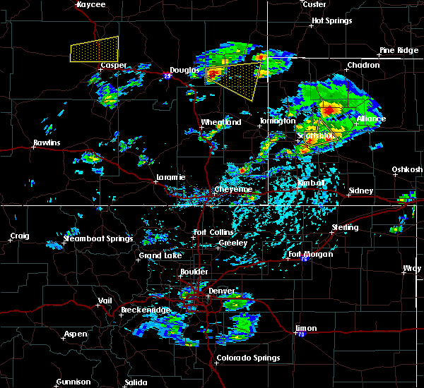 At 256 pm mdt, a severe thunderstorm was located near keeline, or 18 miles west of lusk, moving east at 30 mph (radar indicated). Hazards include quarter size hail and 60 mph wind gusts. Hail damage to vehicles is expected. Expect wind damage to roofs, siding and trees. At 256 pm mdt, a severe thunderstorm was located near keeline, or 18 miles west of lusk, moving east at 30 mph (radar indicated). Hazards include quarter size hail and 60 mph wind gusts. Hail damage to vehicles is expected. Expect wind damage to roofs, siding and trees.
|
| 7/1/2015 10:10 PM MDT |
 At 1010 pm mdt, a severe thunderstorm was located 10 miles north of lusk, moving east at 35 mph (radar indicated). Hazards include golf ball size hail and 70 mph wind gusts. People and animals outdoors will be injured. expect hail damage to roofs, siding, windows and vehicles. expect considerable tree damage. wind damage is also likely to mobile homes, roofs and outbuildings. Locations impacted include, lusk and manville. At 1010 pm mdt, a severe thunderstorm was located 10 miles north of lusk, moving east at 35 mph (radar indicated). Hazards include golf ball size hail and 70 mph wind gusts. People and animals outdoors will be injured. expect hail damage to roofs, siding, windows and vehicles. expect considerable tree damage. wind damage is also likely to mobile homes, roofs and outbuildings. Locations impacted include, lusk and manville.
|
| 7/1/2015 10:01 PM MDT |
 At 1000 pm mdt, a severe thunderstorm was located 9 miles north of lusk, moving east at 35 mph (radar indicated). Hazards include ping pong ball size hail and 70 mph wind gusts. People and animals outdoors will be injured. expect hail damage to roofs, siding, windows and vehicles. expect considerable tree damage. wind damage is also likely to mobile homes, roofs and outbuildings. Locations impacted include, lusk, manville and lance creek. At 1000 pm mdt, a severe thunderstorm was located 9 miles north of lusk, moving east at 35 mph (radar indicated). Hazards include ping pong ball size hail and 70 mph wind gusts. People and animals outdoors will be injured. expect hail damage to roofs, siding, windows and vehicles. expect considerable tree damage. wind damage is also likely to mobile homes, roofs and outbuildings. Locations impacted include, lusk, manville and lance creek.
|
| 7/1/2015 10:00 PM MDT | Golf Ball sized hail reported 5.8 miles SSW of Manville, WY, relayed by law enforcement. time estimated based on radar. |
| 7/1/2015 9:43 PM MDT |
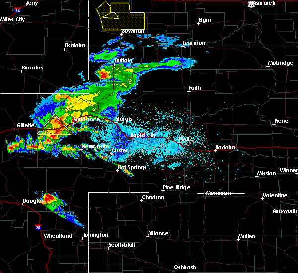 At 943 pm mdt, a severe thunderstorm was located 9 miles northwest of manville, or 16 miles northwest of lusk, moving east at 35 mph (radar indicated). Hazards include quarter size hail and 60 mph wind gusts. Hail damage to vehicles is expected. Expect wind damage to roofs, siding and trees. At 943 pm mdt, a severe thunderstorm was located 9 miles northwest of manville, or 16 miles northwest of lusk, moving east at 35 mph (radar indicated). Hazards include quarter size hail and 60 mph wind gusts. Hail damage to vehicles is expected. Expect wind damage to roofs, siding and trees.
|
| 6/25/2015 9:58 AM MDT |
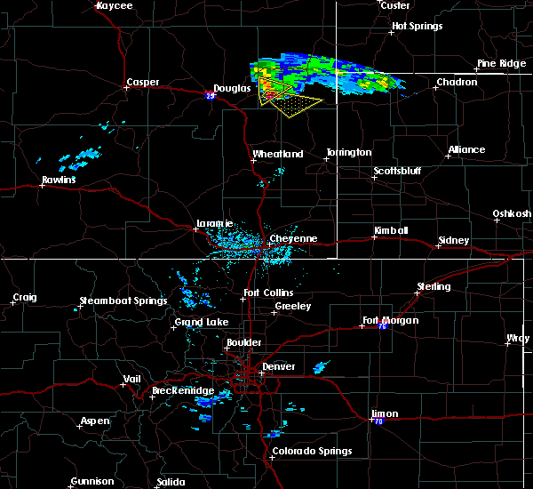 At 957 am mdt, a severe thunderstorm was located over keeline, or 15 miles west of lusk, moving southeast at 30 mph (radar indicated). Hazards include quarter size hail and 60 mph wind gusts. Hail damage to vehicles is expected. Expect wind damage to roofs, siding and trees. At 957 am mdt, a severe thunderstorm was located over keeline, or 15 miles west of lusk, moving southeast at 30 mph (radar indicated). Hazards include quarter size hail and 60 mph wind gusts. Hail damage to vehicles is expected. Expect wind damage to roofs, siding and trees.
|
| 6/3/2015 11:31 PM MDT | At 1131 pm mdt, severe thunderstorms were located along a line extending from 12 miles east of lance creek to near manville, moving northeast at 15 mph (radar indicated). Hazards include half dollar size hail. Damage to vehicles is expected. Locations impacted include, lusk and manville. |
| 6/3/2015 10:59 PM MDT | At 1058 pm mdt, severe thunderstorms were located along a line extending from 12 miles east of lance creek to near manville to near keeline to 13 miles northeast of glendo, moving northeast at 10 mph (radar indicated. these storms have a history of producing very large and destructive hail). Hazards include golf ball size hail. People and animals outdoors will be injured. Expect damage to roofs, siding, windows and vehicles. |
| 6/3/2015 10:50 PM MDT | At 1049 pm mdt, severe thunderstorms were located along a line extending from 11 miles southwest of keeline to manville to 11 miles north of lusk, moving northeast at 10 mph (radar indicated. this storm has a history of producing golf ball sized hail). Hazards include golf ball size hail. People and animals outdoors will be injured. expect damage to roofs, siding, windows and vehicles. Locations impacted include, lusk, manville, keeline, lance creek and lost springs. |
| 6/3/2015 10:36 PM MDT | At 1035 pm mdt, severe thunderstorms were located along a line extending from near glendo to manville to 10 miles east of lance creek, moving northeast at 15 mph (public. golf ball sized hail has been reported near manville with this storm). Hazards include two inch hail. People and animals outdoors will be injured. expect damage to roofs, siding, windows and vehicles. locations impacted include, lusk, manville, keeline, lance creek and lost springs. This includes interstate 25 in wyoming between mile markers 113 and 118. |
| 6/3/2015 10:30 PM MDT | Ping Pong Ball sized hail reported 0.2 miles ESE of Manville, WY |
| 6/3/2015 10:30 PM MDT | Golf Ball sized hail reported 0.2 miles ESE of Manville, WY, ping pong ball to golf ball size hail. |
| 6/3/2015 10:16 PM MDT | At 1015 pm mdt, a cluster of severe thunderstorms extended from near glendo to lance creek. the strongest storm was located over manville, or 8 miles west of lusk. the storms were moving to the northeast at 10 mph (radar indicated). Hazards include golf ball size hail and 60 mph wind gusts. People and animals outdoors will be injured. expect hail damage to roofs, siding, windows and vehicles. Expect wind damage to roofs, siding and trees. |
| 6/3/2015 9:58 PM MDT | At 958 pm mdt, a severe thunderstorm was located over manville, or 9 miles west of lusk, moving north at 20 mph (radar indicated). Hazards include tennis ball size hail and 60 mph wind gusts. People and animals outdoors will be injured. expect hail damage to roofs, siding, windows and vehicles. expect wind damage to roofs, siding and trees. Locations impacted include, lusk, manville, manning ranch, keeline, lance creek and lost springs. |
| 6/3/2015 9:34 PM MDT | At 933 pm mdt, a severe thunderstorm was located near keeline, or 13 miles southwest of lusk, moving northeast at 20 mph (radar indicated. this storm has a history of producing hail in excess of two inches in diameter). Hazards include tennis ball size hail and 60 mph wind gusts. People and animals outdoors will be injured. expect hail damage to roofs, siding, windows and vehicles. Expect wind damage to roofs, siding and trees. |
| 7/31/2013 6:50 PM MDT | Half Dollar sized hail reported 0.2 miles ESE of Manville, WY |
| 6/21/2013 4:01 PM MDT | Quarter sized hail reported 6.3 miles S of Manville, WY |
| 6/21/2013 3:30 PM MDT | Quarter sized hail reported 1.5 miles NNE of Manville, WY, lasted 15 minutes |
| 1/1/0001 12:00 AM | Golf Ball sized hail reported 13.9 miles NNE of Manville, WY, mainly pea to dime sized hail. a few larger stones between quarter and golf ball size. accompanied by very heavy rain and strong winds. |
| 1/1/0001 12:00 AM | Quarter sized hail reported 0.2 miles ESE of Manville, WY |
Hail Maps for Manville, WY
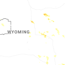
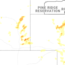


Connect with Interactive Hail Maps