

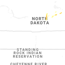
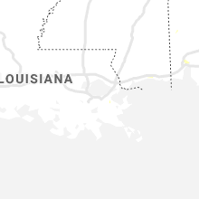
Hail Map for Wednesday, July 1, 2020

Number of Impacted Households on 7/1/2020
0
Impacted by 1" or Larger Hail
0
Impacted by 1.75" or Larger Hail
0
Impacted by 2.5" or Larger Hail
Square Miles of Populated Area Impacted on 7/1/2020
0
Impacted by 1" or Larger Hail
0
Impacted by 1.75" or Larger Hail
0
Impacted by 2.5" or Larger Hail


Cities Most Affected by Hail Storms of 7/1/2020
| Hail Size | Demographics of Zip Codes Affected | ||||||
|---|---|---|---|---|---|---|---|
| City | Count | Average | Largest | Pop Density | House Value | Income | Age |
| Woodbine, NJ | 1 | 1.75 | 1.75 | 57 | $122k | $50.8k | 41.1 |
| Satanta, KS | 1 | 1.75 | 1.75 | 2 | $62k | $37.0k | 35.3 |
| Leoti, KS | 1 | 1.75 | 1.75 | 2 | $56k | $33.3k | 39.7 |
| Riva, MD | 1 | 1.75 | 1.75 | 2521 | $216k | $86.6k | 43.6 |
| Christoval, TX | 1 | 1.75 | 1.75 | 2 | $64k | $38.6k | 45.5 |
| Ulysses, KS | 1 | 1.75 | 1.75 | 11 | $79k | $39.7k | 32.8 |
Hail and Wind Damage Spotted on 7/1/2020
Filter by Report Type:Hail ReportsWind Reports
States Impacted
Missouri, Georgia, Maryland, Arkansas, Florida, Virginia, Connecticut, Illinois, New Jersey, Tennessee, Montana, New York, Texas, Alabama, Mississippi, Delaware, KansasMissouri
| Local Time | Report Details |
|---|---|
| 8:30 AM CDT | Tree down on power lines. nearby weather station in camdenton recorded wind gust of 43 mp in camden county MO, 62.7 miles NNE of Springfield, MO |
| 8:57 AM CDT | Tree down on highway 133. nearby weather stations recorded wind gusts of 35 to 45 mph. time estimated based on rada in pulaski county MO, 49 miles WNW of Salem, MO |
| 11:24 AM CDT | Tree down over county road 178. time estimated by rada in ozark county MO, 63.5 miles ESE of Springfield, MO |
| 12:00 PM CDT | Electric coop reported power lines/limbs down in the tecumseh area. time estimated via rada in ozark county MO, 70.4 miles SE of Springfield, MO |
Georgia
| Local Time | Report Details |
|---|---|
| 1:05 PM EDT | Tree downed onto a home on the 1100 block of sherbrooke driv in bibb county GA, 74.6 miles SSE of Atlanta, GA |
| 1:49 PM EDT | Trees and power lines reported down at various locations across the count in terrell county GA, 83.5 miles SE of Auburn, AL |
| 1:49 PM EDT | Report of trees and powerlines down on wadsworth driv in terrell county GA, 82 miles N of Tallahassee, FL |
| 2:11 PM EDT | One tree down in blakel in early county GA, 75.4 miles NNW of Tallahassee, FL |
| 2:40 PM EDT | Highway sign knocked down by wind at the intersection of hwy 319 and hwy 1 in johnson county GA, 67.3 miles SW of Augusta, GA |
| 2:42 PM EDT | Tree down on a power lin in decatur county GA, 45.8 miles NW of Tallahassee, FL |
| 2:47 PM EDT | Damage to the coca cola plant on highway 27 north about 3 miles north of west bainbridg in decatur county GA, 42.3 miles NNW of Tallahassee, FL |
| 3:40 PM EDT | Report of trees down near old monticello rd and pinetree blv in thomas county GA, 32.8 miles NE of Tallahassee, FL |
| 4:08 PM EDT | Report of a tree down on morven r in lowndes county GA, 50.8 miles SW of Douglas, GA |
| 4:16 PM EDT | Report of a tree down near loyda r in lowndes county GA, 61 miles SSW of Douglas, GA |
| 4:18 PM EDT | Report of tree down near wood valley driv in lowndes county GA, 53.1 miles SSW of Douglas, GA |
| 4:18 PM EDT | Report of a tree down near hamilton stree in lowndes county GA, 52.5 miles SSW of Douglas, GA |
| 4:25 PM EDT | Report of a tree on powerlines near bemiss and new bethel r in lowndes county GA, 40.5 miles SSW of Douglas, GA |
Maryland
| Local Time | Report Details |
|---|---|
| 1:20 PM EDT | Large branch (6 inch diameter) down on the 41000 block of burnt mill driv in st. marys county MD, 66.3 miles S of Baltimore, MD |
| 3:00 PM EDT | Numerous tree branches (6"+ diameter) across the road near the intersection of governor stone parkway and east west blvd in anne arundel county MD, 12.5 miles S of Baltimore, MD |
| 3:50 PM EDT | Quarter sized hail reported near Severna Park, MD, 15.4 miles S of Baltimore, MD, quarter sized hail in the vicinity of severna park |
| 3:51 PM EDT | Quarter sized hail reported near Arnold, MD, 19.6 miles SSE of Baltimore, MD, quarter sized hail near the intersection of governor richie hwy and chautaugua road |
| 4:02 PM EDT | Half Dollar sized hail reported near Annapolis, MD, 20.4 miles S of Baltimore, MD |
| 4:05 PM EDT | Quarter sized hail reported near Annapolis, MD, 21.3 miles SSE of Baltimore, MD, quarter sized hail near the 500 block of samuel chase way just off route 50. |
| 4:09 PM EDT | Ping Pong Ball sized hail reported near Annapolis, MD, 21.8 miles S of Baltimore, MD, ping pong sized hail near the intersection of forest drive and solomons island road |
| 4:11 PM EDT | Quarter sized hail reported near Edgewater, MD, 22.4 miles S of Baltimore, MD, reported near the cross section of admiral cochrane drive and solomon's island road. |
| 4:13 PM EDT | Golf Ball sized hail reported near Riva, MD, 23.5 miles S of Baltimore, MD, golf ball sized hail observed near riva road and forest road. |
Arkansas
| Local Time | Report Details |
|---|---|
| 12:29 PM CDT | Some trees were blown dow in fulton county AR, 88.8 miles S of Salem, MO |
| 1:21 PM CDT | Near the corner of hwy 167 and fairground rd... south of the town of ash flat... ar. strong winds moving empty 55 gallon drums and tires across the roa in sharp county AR, 100.5 miles S of Salem, MO |
| 1:30 PM CDT | Three chicken houses sustained roof damage three miles south of cave cit in independence county AR, 89.3 miles NNE of Little Rock, AR |
| 1:39 PM CDT | Several trees were blown dow in sharp county AR, 92.4 miles NNE of Little Rock, AR |
| 2:25 PM CDT | Small limbs were blown down. winds at nearby observations were 45 to 55 mph around that tim in jackson county AR, 76.5 miles NW of Memphis, TN |
| 3:00 PM CDT | Large tree down on home with people trapped inside. located on 2300 block of anne street in craighead county AR, 58.7 miles NW of Memphis, TN |
| 3:00 PM CDT | Large tree down on home with people trapped inside. located on 2300 block of anne street in craighead county AR, 58.7 miles NW of Memphis, TN |
| 3:25 PM CDT | Minor siding damage and several tree limbs down on owens s in poinsett county AR, 33.6 miles NW of Memphis, TN |
Florida
| Local Time | Report Details |
|---|---|
| 1:56 PM EDT | A tree was blown down into power lines along 1250 belle terre parkwa in flagler county FL, 63 miles SSE of Jacksonville, FL |
| 6:14 PM CDT | Several trees reported down and some minor roof damage near the intersection of highway 90 and summertime dr. time estimated by rada in okaloosa county FL, 32.8 miles NW of Miramar Beach, FL |
Virginia
| Local Time | Report Details |
|---|---|
| 2:00 PM EDT | Quarter sized hail reported near Accomac, VA, 51.7 miles SW of Ocean City, MD |
| 2:20 PM EDT | Trees down and high wind in mathews county VA, 52.8 miles NNW of Virginia Beach, VA |
| 3:42 PM EDT | Numerous trees down near the 3900 block of free union road in albemarle county VA, 66.3 miles NW of Richmond, VA |
| 3:54 PM EDT | Kiptopeke... v in northampton county VA, 28.9 miles N of Virginia Beach, VA |
| 4:12 PM EDT | Numerous trees down near the intersection of carters mountain road and scottsville road in albemarle county VA, 56.2 miles WNW of Richmond, VA |
| 4:20 PM EDT | Tree down in the road on beach rd. time estimated by rada in chesterfield county VA, 10.8 miles SSE of Richmond, VA |
| 4:20 PM EDT | Tree down in the vicinity of halls run road. time estimated by radar. report via virginia 51 in chesterfield county VA, 11.2 miles SE of Richmond, VA |
| 4:45 PM EDT | Trees and power lines down near garysville. time estimated by rada in prince george county VA, 30.9 miles ESE of Richmond, VA |
| 5:13 PM EDT | 50 kt wind gust reported at middle ground lighthous in anz638 county VA, 22.7 miles NW of Virginia Beach, VA |
| 8:13 PM EDT | Radar estimated time. trees down at the intersection of oxford furnace rd. and village hw in campbell county VA, 51.3 miles E of Roanoke, VA |
| 8:13 PM EDT | Radar estimated time. trees down in the vicinity of clydesdale drive and camp hydaway r in city of lynchburg county VA, 39.5 miles E of Roanoke, VA |
| 8:17 PM EDT | Radar estimated time. tree reported down around 8:42pm along the 4000 block of morningside driv in amherst county VA, 44.3 miles ENE of Roanoke, VA |
| 8:24 PM EDT | Radar estimated time. trees reported down at 3411 sunnymeade rd. rustburg... v in campbell county VA, 46.7 miles E of Roanoke, VA |
| 8:26 PM EDT | Radar estimated time. trees reproted down at the intersection of campbell hwy and poor house rd. rustburg... v in campbell county VA, 46.4 miles E of Roanoke, VA |
| 8:26 PM EDT | Radar estimated time. tree reported down at 880 surburban rd. rustburg... v in campbell county VA, 46.5 miles E of Roanoke, VA |
| 9:00 PM EDT | Multiple trees down in the vicinity of sunnymeade road off english tavern roa in campbell county VA, 43.1 miles E of Roanoke, VA |
Connecticut
| Local Time | Report Details |
|---|---|
| 2:56 PM EDT | Quarter sized hail reported near Salem, CT, 51.1 miles WSW of Providence, RI, quarter size hail reported by salem valley farms. |
| 3:20 PM EDT | Tree and wires down on hillcrest avenue near avery hill road in new london county CT, 40.2 miles SW of Providence, RI |
Illinois
| Local Time | Report Details |
|---|---|
| 2:00 PM CDT | Parking overhang blown off at hurricane/hafer r in williamson county IL, 41.6 miles NE of Cape Girardeau, MO |
New Jersey
| Local Time | Report Details |
|---|---|
| 3:40 PM EDT | Quarter sized hail reported near Woodbine, NJ, 66 miles NNE of Ocean City, MD, time estimated by radar. |
| 3:40 PM EDT | Golf Ball sized hail reported near Woodbine, NJ, 66 miles NNE of Ocean City, MD, golf ball sized hail reported in petersburg. pictures received via social media. |
| 3:45 PM EDT | Tree down on the garden state parkway. time estimated from rada in cape may county NJ, 64.8 miles NNE of Ocean City, MD |
| 4:10 PM EDT | Quarter sized hail reported near Ocean City, NJ, 69 miles NNE of Ocean City, MD, multiple reports of quarter size hail in ocean city. time estimated from radar. |
Tennessee
| Local Time | Report Details |
|---|---|
| 3:15 PM CDT | Large tree and power lines down blocking road on south lucy road in millingto in shelby county TN, 15.3 miles NE of Memphis, TN |
| 4:15 PM CDT | Large tree and power lines down blocking road on south lucy road southwest of millingto in shelby county TN, 12.4 miles NNE of Memphis, TN |
| 4:25 PM CDT | Trees down and power lines down on pleasant ridge west of big creek churc in shelby county TN, 15.3 miles NE of Memphis, TN |
Montana
| Local Time | Report Details |
|---|---|
| 3:00 PM MDT | Mesonet station ycams 5.7 w big sky (avalanche). elevation is near 8800 fee in madison county MT, 36.2 miles SSW of Bozeman, MT |
| 5:00 PM MDT | Storm damage reported in stillwater county MT, 42.5 miles WSW of Billings, MT |
| 5:15 PM MDT | Storm damage reported in stillwater county MT, 30.9 miles WSW of Billings, MT |
| 5:22 PM MDT | Storm damage reported in stillwater county MT, 56.2 miles WSW of Billings, MT |
| 6:00 PM MDT | Mesonet station ylwm8 yellow mule raws. elevation is 9200 feet. time of event is estimate in gallatin county MT, 38.6 miles SSW of Bozeman, MT |
New York
| Local Time | Report Details |
|---|---|
| 5:34 PM EDT | Quarter sized hail reported near Upton, NY, 59 miles ENE of Brooklyn, NY, numerous hail stones reported at quarter size |
| 5:37 PM EDT | Tree down blocking both lanes of kirkland ave near rte. in oneida county NY, 38.9 miles E of Syracuse, NY |
| 5:44 PM EDT | Corrects previous tstm wnd dmg report from 2 w clinton. tree down blocking the road near griffin rd and college hill r in oneida county NY, 37.3 miles E of Syracuse, NY |
| 5:45 PM EDT | Tree down blocking the road near griffin rd and college hill r in oneida county NY, 37.3 miles E of Syracuse, NY |
| 7:10 PM EDT | Trees down lake view dr and spruce lake rd in herkimer county NY, 51.8 miles WNW of Schenectady, NY |
Texas
| Local Time | Report Details |
|---|---|
| 5:08 PM CDT | Quarter sized hail reported near Quanah, TX, 34.4 miles SE of Childress, TX, at copper breaks state park. relayed by kolj radio |
| 5:10 PM CDT | Quarter sized hail reported near Ballinger, TX, 49.2 miles SSW of Abilene, TX, report from mping: quarter (1.00 in.). |
| 5:11 PM CDT | Ping Pong Ball sized hail reported near Ballinger, TX, 50.4 miles SSW of Abilene, TX |
| 6:00 PM CDT | Golf Ball sized hail reported near Christoval, TX, 101.6 miles SSW of Abilene, TX |
| 6:13 PM CDT | 60 mph wind gust measured at the san angelo airport at 6:03pm. gusts persisted for 10-15 minute in tom green county TX, 87.3 miles SSW of Abilene, TX |
Alabama
| Local Time | Report Details |
|---|---|
| 5:26 PM CDT | Tree on home on glen chambers rd via emergency manager. also reports of a couple trees down along the road and pictures of a chicken coop roof partially blown off. pict in covington county AL, 47.5 miles N of Miramar Beach, FL |
Mississippi
| Local Time | Report Details |
|---|---|
| 6:10 PM CDT | Numerous large branches down across tow in calhoun county MS, 39.5 miles NW of Starkville, MS |
| 6:15 PM CDT | Power lines down on county roads 548 and 500 south of kossut in alcorn county MS, 55 miles W of Florence, AL |
| 6:15 PM CDT | Large tree down on county road 544 and another tree down on county road 51 in alcorn county MS, 50.9 miles W of Florence, AL |
| 6:30 PM CDT | Tree down on graham r in kemper county MS, 52.3 miles SSE of Starkville, MS |
| 7:15 PM CDT | Tree down on keytown r in kemper county MS, 53.6 miles S of Starkville, MS |
| 7:25 PM CDT | Large limb down on plum rd reported by broadcast medi in oktibbeha county MS, 1.6 miles WSW of Starkville, MS |
| 7:45 PM CDT | Two trees down in leake count in leake county MS, 56.1 miles SW of Starkville, MS |
| 7:50 PM CDT | Tree down on highway 39 in neshoba county MS, 43.2 miles SSW of Starkville, MS |
| 7:52 PM CDT | Tree down on marty steward rd near the arlington communit in neshoba county MS, 46.8 miles SSW of Starkville, MS |
| 7:55 PM CDT | Tree down on ben lucket r in madison county MS, 35.4 miles NNE of Jackson, MS |
| 8:35 PM CDT | Tree down near oakdale and wagone in scott county MS, 31.9 miles E of Jackson, MS |
| 8:35 PM CDT | Trees down in lak in scott county MS, 49.9 miles E of Jackson, MS |
Delaware
| Local Time | Report Details |
|---|---|
| 7:18 PM EDT | Drone footage and pictures showing a few snapped trees and large limbs down near us-13 and paradise alley road south of felton. a trampoline and playground set were als in kent county DE, 51.1 miles NNW of Ocean City, MD |
Kansas
| Local Time | Report Details |
|---|---|
| 6:27 PM CDT | Ping Pong Ball sized hail reported near Lakin, KS, 23 miles WNW of Garden City, KS |
| 6:47 PM CDT | Golf Ball sized hail reported near Leoti, KS, 40.1 miles NW of Garden City, KS, sheriff dispatch relayed report of golf ball sized hail. |
| 7:05 PM CDT | Quarter sized hail reported near Leoti, KS, 44.6 miles NW of Garden City, KS, sheriff reported hail up to quarter-sized. |
| 7:12 PM CDT | Half Dollar sized hail reported near Leoti, KS, 44.1 miles NW of Garden City, KS, picture of hail from facebook. |
| 7:13 PM CDT | Golf Ball sized hail reported near Satanta, KS, 37.1 miles S of Garden City, KS, reported via social media. |
| 7:28 PM CDT | Golf Ball sized hail reported near Ulysses, KS, 41.8 miles SSW of Garden City, KS |
| 7:41 PM CDT | Quarter sized hail reported near Kendall, KS, 35.4 miles W of Garden City, KS |
| 8:24 PM CDT | Ping Pong Ball sized hail reported near Lakin, KS, 35.5 miles WSW of Garden City, KS |
Connect with Interactive Hail Maps