

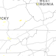
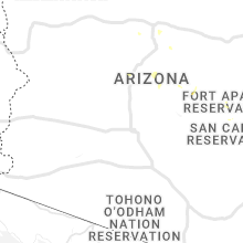
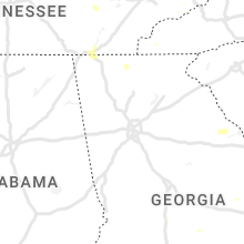
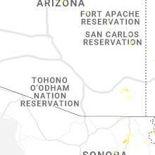
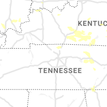
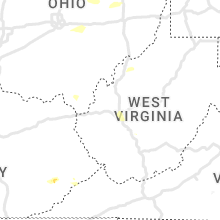
Hail Map for Wednesday, July 20, 2022

Number of Impacted Households on 7/20/2022
0
Impacted by 1" or Larger Hail
0
Impacted by 1.75" or Larger Hail
0
Impacted by 2.5" or Larger Hail
Square Miles of Populated Area Impacted on 7/20/2022
0
Impacted by 1" or Larger Hail
0
Impacted by 1.75" or Larger Hail
0
Impacted by 2.5" or Larger Hail


Cities Most Affected by Hail Storms of 7/20/2022
| Hail Size | Demographics of Zip Codes Affected | ||||||
|---|---|---|---|---|---|---|---|
| City | Count | Average | Largest | Pop Density | House Value | Income | Age |
Hail and Wind Damage Spotted on 7/20/2022
Filter by Report Type:Hail ReportsWind Reports
States Impacted
Arkansas, Michigan, South Carolina, Florida, Ohio, Georgia, Colorado, North Carolina, Texas, Arizona, North Dakota, South Dakota, Oklahoma, Illinois, New Mexico, Kentucky, New York, Tennessee, Minnesota, West VirginiaArkansas
| Local Time | Report Details |
|---|---|
| 8:25 AM CDT | Pictures relayed via twitter. several tree limbs down and snapped. time estimated from rada in washington county AR, 43.4 miles N of Fort Smith, AR |
Michigan
| Local Time | Report Details |
|---|---|
| 1:37 PM EDT | Dispatch reported 20 to 30 trees downed across bay city. time estimated from rada in bay county MI, 41.3 miles NNW of Flint, MI |
| 2:00 PM EDT | Fire department reported several trees and wires down in and around clio and vienna townhip. amateur radio reported similar damage in the are in genesee county MI, 12 miles NNW of Flint, MI |
| 2:20 PM EDT | Tuscola county central dispatch reports 6-7 trees down across southern tuscola county in tuscola county MI, 46.6 miles NNE of Flint, MI |
| 2:43 PM EDT | Dipatch reported wires down southwest of lapeer. single wire down also reported down in elba along with a power outage reproted in the city of lapee in lapeer county MI, 15.1 miles E of Flint, MI |
| 3:05 PM EDT | Power outages reported from down trees and power lines. time estimated on rada in lapeer county MI, 25.4 miles E of Flint, MI |
| 3:08 PM EDT | Detroit metropolitan wayne county airport wind gust in wayne county MI, 56.9 miles SSE of Flint, MI |
| 3:32 PM EDT | Quarter sized hail reported near Carsonville, MI, 63.3 miles ENE of Flint, MI, a post on social media showed hail the size of quarters. time estimated based on radar. |
South Carolina
| Local Time | Report Details |
|---|---|
| 1:52 PM EDT | The hampton county 911 call center reported a tree down on cemetery road and jackson avenu in hampton county SC, 53.7 miles N of Savannah, GA |
| 1:54 PM EDT | Schp reported a tree down near the intersection of kerrison street and marion street. time determined from radar dat in hampton county SC, 53 miles N of Savannah, GA |
| 1:54 PM EDT | A large oak tree was uprooted near the 500 block of jackson avenue eas in hampton county SC, 53.7 miles N of Savannah, GA |
| 2:00 PM EDT | Schp reported a tree down near the intersection of wild turkey trail and bubbas drive. time determined from radar dat in hampton county SC, 50.1 miles N of Savannah, GA |
Florida
| Local Time | Report Details |
|---|---|
| 2:12 PM EDT | Strong thunderstorm winds knocked multiple trees down in a few backyards on morning light r in duval county FL, 9.3 miles NNE of Jacksonville, FL |
| 2:45 PM EDT | Marion county fr advises of storm damage to one home near ocklawaha. caller states that the roof over the back porch sustained damage due to thunderstorm wind in marion county FL, 47.2 miles NW of Orlando, FL |
| 3:35 PM EDT | Power lines down as a result of a tree fallin in flagler county FL, 61.3 miles SSE of Jacksonville, FL |
| 4:27 PM CDT | Holmes county sheriff office reported downed trees on hathaway mill rd & tobe retherford r in holmes county FL, 44.4 miles NE of Miramar Beach, FL |
| 4:27 PM CDT | Holmes county sheriff office reported powerlines down near 2030 hwy-17 in holmes county FL, 44.1 miles NE of Miramar Beach, FL |
Ohio
| Local Time | Report Details |
|---|---|
| 4:10 PM EDT | 50 knot peak wind. mesonet station twco1 8 ene orego in lez142 county OH, 82.4 miles W of Cleveland, OH |
| 6:52 PM EDT | 2 foot diameter tree down and blocking tiffen ave in willard. time estimated via rada in huron county OH, 62.1 miles WSW of Cleveland, OH |
| 8:57 PM EDT | Large tree down on sr 514 south of cr in holmes county OH, 61.1 miles SSW of Cleveland, OH |
| 8:57 PM EDT | Centerville/county line rd closed due to downed trees and wires between route 226 and route 83. time estimated via rada in wayne county OH, 59.8 miles SSW of Cleveland, OH |
| 8:57 PM EDT | Tree downed on road just south of shreve in northern holmes county. time estimated via rada in holmes county OH, 60.4 miles SSW of Cleveland, OH |
| 8:58 PM EDT | Video from storm chaser on twitter shows multiple trees that were snapped or had large limbs snapped off part way up along sr 83 east of shreve. time estimated via rada in wayne county OH, 58.5 miles SSW of Cleveland, OH |
| 10:47 PM EDT | Tree down on hudson ave between oak st and st clair st in licking county OH, 32.3 miles ENE of Columbus, OH |
| 11:05 PM EDT | Several power poles snapped near the 11000 block of lancaster-newark road ne. several large tree branches also downed in the area. time estimated by rada in fairfield county OH, 24.1 miles ESE of Columbus, OH |
| 11:20 PM EDT | Large tree down near sr60 and shannon roa in muskingum county OH, 50.2 miles E of Columbus, OH |
| 11:33 PM EDT | Reports of multiple trees down. time est from rada in fairfield county OH, 28.9 miles SE of Columbus, OH |
Georgia
| Local Time | Report Details |
|---|---|
| 4:21 PM EDT | A tree was reported down on marion sheffield rd near the intersection of sweet home church r in dodge county GA, 41.6 miles NNW of Douglas, GA |
Colorado
| Local Time | Report Details |
|---|---|
| 2:46 PM MDT | Mesonet station fw6605 founati in el paso county CO, 21.6 miles NNW of Pueblo, CO |
North Carolina
| Local Time | Report Details |
|---|---|
| 5:18 PM EDT | A couple of trees down between forest city and bosti in rutherford county NC, 55.1 miles NE of Greenville, SC |
| 6:00 PM EDT | Powerlines down on whitaker r in gaston county NC, 22 miles WNW of Charlotte, NC |
| 7:48 PM EDT | Multiple trees down across oakboro... n in stanly county NC, 29.3 miles E of Charlotte, NC |
| 7:56 PM EDT | Tree down on power line causing power outage near/along old aquadale r in stanly county NC, 34.4 miles E of Charlotte, NC |
| 8:43 PM EDT | Tree down near putnam-glendon r in moore county NC, 52.3 miles WSW of Raleigh, NC |
| 8:43 PM EDT | Tree down near putnam-glendon rd and glendon church r in moore county NC, 48.6 miles WSW of Raleigh, NC |
Texas
| Local Time | Report Details |
|---|---|
| 5:08 PM CDT | 5 miles northeast of forestburg on the montague/cooke county line. 1.02 measured rain so far and wind gusts est 50-60 mph approximately 10 minutes ago. small limbs down in cooke county TX, 64 miles ESE of Wichita Falls, TX |
| 5:25 PM CDT | Social media report of large limbs and a few trees down just north of muenste in cooke county TX, 66.6 miles ESE of Wichita Falls, TX |
| 5:36 PM CDT | Report of a house damaged by high winds on cr 1770 in the northwest portion of the county; getting reports of multiple trees down. cr 1591... cr 1770... cr178 in wise county TX, 53.4 miles SE of Wichita Falls, TX |
| 5:43 PM CDT | Media partner relayed public report: cattle trainer blown over and large tree snapped in lindsay. time estimated by rada in cooke county TX, 64.3 miles NNW of Dallas, TX |
| 6:00 PM CDT | Corrects previous tstm wnd dmg report from runaway bay. 200 blk runaway bay dr has a house with major structure damage; other reports of tree damage. happened approxima in wise county TX, 62 miles SE of Wichita Falls, TX |
| 6:12 PM CDT | 200 blk runaway bay dr has a house with major structure damage; other reports of tree damag in wise county TX, 62 miles SE of Wichita Falls, TX |
| 6:12 PM CDT | Reports of structural damage due to winds at a taco bell in gainesvill in cooke county TX, 61.5 miles NNW of Dallas, TX |
| 6:26 PM CDT | Reports of damage: barn blown down... debris... and tree dow in jack county TX, 65.1 miles SSE of Wichita Falls, TX |
Arizona
| Local Time | Report Details |
|---|---|
| 4:15 PM MST | From nws weather and hazards viewer observations: wind gust of 58 mph @4:15 pm ms in yavapai county AZ, 61.6 miles N of Phoenix, AZ |
North Dakota
| Local Time | Report Details |
|---|---|
| 6:34 PM CDT | Quarter sized hail reported near Gwinner, ND, 63.7 miles NE of Aberdeen, SD, time estimated by radar. |
South Dakota
| Local Time | Report Details |
|---|---|
| 7:50 PM CDT | Storm damage reported in roberts county SD, 71.1 miles ENE of Aberdeen, SD |
| 7:50 PM CDT | Plus pea to a few quarter size hai in marshall county SD, 51.6 miles ENE of Aberdeen, SD |
| 7:52 PM CDT | Storm damage reported in roberts county SD, 73.6 miles ENE of Aberdeen, SD |
| 7:56 PM CDT | Several trees down as well as power line in roberts county SD, 71.1 miles ENE of Aberdeen, SD |
| 8:24 PM CDT | Storm damage reported in roberts county SD, 70.8 miles E of Aberdeen, SD |
| 8:41 PM CDT | Quarter sized hail reported near Wilmot, SD, 62.1 miles WNW of Montevideo, MN |
Oklahoma
| Local Time | Report Details |
|---|---|
| 8:40 PM CDT | Very high dewpoint/temperature spread at the surface as the line of storms moved i in cimarron county OK, 108.8 miles NNW of Amarillo, TX |
Illinois
| Local Time | Report Details |
|---|---|
| 8:46 PM CDT | Large tree and several branches down. tree nearly fell on car. reports relayed through kfvs tv and wsil tv. time estimated from rada in alexander county IL, 16.3 miles E of Cape Girardeau, MO |
New Mexico
| Local Time | Report Details |
|---|---|
| 8:01 PM MDT | Estimated wind gust. no damage reporte in curry county NM, 61.4 miles SSE of Tucumcari, NM |
| 8:17 PM MDT | Asos station kgup gallup airpor in mckinley county NM, 89.7 miles SSW of Farmington, NM |
| 9:55 PM MDT | Storm damage reported in catron county NM, 62.6 miles E of Show Low, AZ |
Kentucky
| Local Time | Report Details |
|---|---|
| 10:28 PM EDT | Trees down along highway 49 near liberty roa in marion county KY, 45.9 miles SE of Louisville, KY |
| 11:04 PM CDT | 6 trees down along south highway 127 near wolf creek da in russell county KY, 83.1 miles SSE of Louisville, KY |
| 12:40 AM EDT | Large limbs blown down on highway 30. time estimated from rada in breathitt county KY, 37 miles ESE of Irvine, KY |
| 12:34 AM CDT | Power line fell onto house and resulted in a fir in hart county KY, 50.4 miles S of Louisville, KY |
| 1:51 AM CDT | Trees down within the city limits of burkesvill in cumberland county KY, 84.8 miles SSE of Louisville, KY |
| 1:57 AM CDT | Trees down along summershade road (4700 block in metcalfe county KY, 76.4 miles S of Louisville, KY |
| 2:19 AM CDT | Trees down along scottsville road near the county borde in barren county KY, 61.4 miles NE of Nashville, TN |
New York
| Local Time | Report Details |
|---|---|
| 10:50 PM EDT | Storm damage reported in loz042 county NY, 32.4 miles NNE of Buffalo, NY |
| 11:00 PM EDT | Tree down blocking roa in niagara county NY, 31.2 miles N of Buffalo, NY |
| 11:12 PM EDT | Tree dow in niagara county NY, 28.5 miles NNE of Buffalo, NY |
| 11:34 PM EDT | Fallen tree wrapped in power lines. tree is blocking roa in erie county NY, 13.7 miles E of Buffalo, NY |
| 11:39 PM EDT | Tree down blocking roa in orleans county NY, 43.8 miles NE of Buffalo, NY |
Tennessee
| Local Time | Report Details |
|---|---|
| 2:00 AM EDT | Trees down along highway 3 in claiborne county TN, 45.8 miles NE of Knoxville, TN |
Minnesota
| Local Time | Report Details |
|---|---|
| 1:35 AM CDT | Renville mesonet station measured 60mph gust. spotter described as brief microburst with heavy rai in renville county MN, 27.3 miles ESE of Montevideo, MN |
West Virginia
| Local Time | Report Details |
|---|---|
| 3:00 AM EDT | Metro911 reports one tree down on kanawha turnpike near chestnut street. time estimated by rada in kanawha county WV, 4.9 miles W of Charleston, WV |
Connect with Interactive Hail Maps