

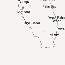
Hail Map for Saturday, July 23, 2011

Number of Impacted Households on 7/23/2011
0
Impacted by 1" or Larger Hail
0
Impacted by 1.75" or Larger Hail
0
Impacted by 2.5" or Larger Hail
Square Miles of Populated Area Impacted on 7/23/2011
0
Impacted by 1" or Larger Hail
0
Impacted by 1.75" or Larger Hail
0
Impacted by 2.5" or Larger Hail


Cities Most Affected by Hail Storms of 7/23/2011
| Hail Size | Demographics of Zip Codes Affected | ||||||
|---|---|---|---|---|---|---|---|
| City | Count | Average | Largest | Pop Density | House Value | Income | Age |
| Brogue, PA | 1 | 1.75 | 1.75 | 85 | $104k | $52.5k | 42.7 |
Hail and Wind Damage Spotted on 7/23/2011
Filter by Report Type:Hail ReportsWind Reports
States Impacted
Iowa, Minnesota, Massachusetts, Wisconsin, Virginia, North Carolina, Maine, Indiana, Michigan, Ohio, South Carolina, Kansas, Arkansas, Missouri, Nebraska, Pennsylvania, Louisiana, Maryland, Oklahoma, IllinoisIowa
| Local Time | Report Details |
|---|---|
| 12:00 PM UTC | Tree down on house...other large limbs down...most likely microburst...time estimated from radar in adams county IA, 56.3 miles SW of Des Moines, IA |
| 11:15 PM UTC | Small limbs down. measured 3.00 inches of rain within an hour perio in lucas county IA, 45.5 miles SSE of Des Moines, IA |
| 11:25 PM UTC | Estimated peak gust at 60 mph...corn bent over from wind. radar estimated tim in lucas county IA, 47.3 miles SSE of Des Moines, IA |
| 11:30 PM UTC | Near hyvee on agency street in des moines county IA, 41.4 miles NE of Kahoka, MO |
| 11:38 PM UTC | Estimated gust of 55 to 60 mph. occurred in west burlington in des moines county IA, 41.4 miles NE of Kahoka, MO |
| 11:49 PM UTC | Storm damage reported in wayne county IA, 56.7 miles SSE of Des Moines, IA |
| 11:49 PM UTC | Trees down near the town of confidence in wayne county IA, 56.4 miles SSE of Des Moines, IA |
| 12:07 AM UTC | Power lines down with one power pole snapped just north of tow in wayne county IA, 62.8 miles SSE of Des Moines, IA |
| 12:13 AM UTC | Large tree limbs down in the town of seymour in wayne county IA, 67.9 miles SSE of Des Moines, IA |
| 12:40 AM UTC | Portion of tin roof blew off building adjacent to gas station in town...time estimated from radar in appanoose county IA, 64.8 miles WNW of Kahoka, MO |
| 12:40 AM UTC | Portion of tin roof blew off building adjacent to konvenience korner gas station...time estimated from radar in appanoose county IA, 64.8 miles WNW of Kahoka, MO |
| 8:30 AM UTC | 10 to 12 inch diameter limbs down. relayed by medi in benton county IA, 17.1 miles WSW of Cedar Rapids, IA |
| 9:28 AM UTC | Dvn asos peak wind of 66mph in scott county IA, 60.1 miles ESE of Cedar Rapids, IA |
| 9:30 AM UTC | 4-5 inch tree limb and numerous smaller tree limbs down around 8th st. delayed report in scott county IA, 61.5 miles ESE of Cedar Rapids, IA |
Minnesota
| Local Time | Report Details |
|---|---|
| 1:30 PM UTC | Five inch diameter tree limbs dow in sibley county MN, 42 miles WSW of Minneapolis, MN |
| 9:00 AM CDT | Quarter sized hail reported near Belle Plaine, MN, 39 miles SW of Minneapolis, MN, pea to dime size hail with some quarter size. two inch branches also down. |
| 9:00 AM CDT | Quarter sized hail reported near New Prague, MN, 33.7 miles SSW of Minneapolis, MN, pea to dime size hail with some quarter size. two inch branches also down. |
| 2:40 PM UTC | 12 to 18 diameter branches dow in rice county MN, 36.8 miles S of Minneapolis, MN |
| 2:41 PM UTC | Trees dow in rice county MN, 36.8 miles S of Minneapolis, MN |
| 3:13 PM UTC | Small and larges trees down all over tow in goodhue county MN, 55.9 miles SSE of Minneapolis, MN |
| 3:15 PM UTC | Large tree down across stree in goodhue county MN, 45.9 miles SE of Minneapolis, MN |
| 3:35 PM UTC | Power lines down in wabasha county MN, 60.6 miles SE of Minneapolis, MN |
| 4:10 PM UTC | Power lines and trees down in winona county MN, 41.8 miles WNW of La Crosse, WI |
| 4:30 PM UTC | Storm damage reported in winona county MN, 38.7 miles WNW of La Crosse, WI |
| 4:52 PM UTC | Several trees down on township rd 8 in winona county MN, 16.9 miles WNW of La Crosse, WI |
| 5:15 PM UTC | Large tree down on a house along town hall road in houston county MN, 3.6 miles WNW of La Crosse, WI |
| 7:45 PM UTC | Quarter sized hail reported near Richmond, MN, 67.5 miles ENE of Montevideo, MN |
| 7:51 PM UTC | Half Dollar sized hail reported near Cold Spring, MN, 65.9 miles WNW of Minneapolis, MN |
Massachusetts
| Local Time | Report Details |
|---|---|
| 2:30 PM UTC | Trees and wires down in south brockton in plymouth county MA, 26.5 miles NE of Providence, RI |
| 2:30 PM UTC | Trees and wires down on warren ave in front of boys and girls club in south brockton in plymouth county MA, 26.5 miles NE of Providence, RI |
| 2:35 PM UTC | Measured at high school in plymouth county MA, 26.5 miles NE of Providence, RI |
| 2:42 PM UTC | Trees down on route 14 at brockton whitman line in plymouth county MA, 26.5 miles NE of Providence, RI |
| 2:50 PM UTC | Trees and wires down on french avenue in plymouth county MA, 26.5 miles NE of Providence, RI |
| 2:55 PM UTC | Live wires down in standing water on perkins ave in plymouth county MA, 26.5 miles NE of Providence, RI |
| 2:55 PM UTC | Live wires down on ash street in sw brockton in plymouth county MA, 26.5 miles NE of Providence, RI |
| 3:00 PM UTC | Tree down on crescent street in plymouth county MA, 25.2 miles ENE of Providence, RI |
| 3:15 PM UTC | Multiple trees down on standish road and chestnut street and tree down on a house in plymouth county MA, 41 miles ENE of Providence, RI |
| 3:20 PM UTC | Large tree down near burger king restaurant in plymouth county MA, 38.2 miles ENE of Providence, RI |
| 5:10 PM UTC | Tree down blocking road in dukes county MA, 47.7 miles ESE of Providence, RI |
| 5:50 PM UTC | Shingles blown off house on barrett farm road in nantucket county MA, 78 miles ESE of Providence, RI |
| 6:12 PM UTC | Deck damag to vessel manatee south of bass river in ack sound near yarmouth dennis line in barnstable county MA, 63.9 miles E of Providence, RI |
Wisconsin
| Local Time | Report Details |
|---|---|
| 3:45 PM UTC | Roof with shingles and tar paper blown off neighbors hous in eau claire county WI, 69.8 miles N of La Crosse, WI |
| 2:30 AM UTC | Quarter sized hail reported near Beaver Dam, WI, 38.4 miles NE of Madison, WI |
| 3:50 AM UTC | Tree downed between river falls and prescott. time and location estimate in pierce county WI, 31.4 miles ESE of Minneapolis, MN |
| 3:57 AM UTC | Scattered trees downed in the area. estimated time and locatio in chippewa county WI, 94.2 miles E of Minneapolis, MN |
| 4:41 AM UTC | Scattered trees downed. estimated tim in chippewa county WI, 78.7 miles N of La Crosse, WI |
| 4:45 AM UTC | Trees downed in dunn township. location and time estimate in dunn county WI, 67.6 miles E of Minneapolis, MN |
| 4:47 AM UTC | Quarter sized hail reported near Phillips, WI, 54.5 miles W of Rhinelander, WI, in the township of lugerville. relayed by wsaw. time approximated from a combination of radar and report. |
| 4:51 AM UTC | Roof damage occurred to an older business. an 18 inch diameter tree was downed in fandry park on the west side of town. estimated tim in chippewa county WI, 80.7 miles N of La Crosse, WI |
| 5:53 AM UTC | Tree across highway 95 just east of alma cente in jackson county WI, 46.9 miles NNE of La Crosse, WI |
| 5:58 AM UTC | Trees and power lines down in the merrillan are in jackson county WI, 48.5 miles NNE of La Crosse, WI |
| 6:01 AM UTC | Several trees down in campground. a few trees fell on tents. no injuries reporte in clark county WI, 50.2 miles NNE of La Crosse, WI |
| 6:01 AM UTC | Tree across the road near the intersection of county road j and bush roa in clark county WI, 50.8 miles NNE of La Crosse, WI |
| 6:25 AM UTC | 8 to 10 inch diameter tree down in the pine view campgroun in monroe county WI, 28.3 miles ENE of La Crosse, WI |
| 6:34 AM UTC | Tree down on power lin in monroe county WI, 39.5 miles ENE of La Crosse, WI |
| 6:34 AM UTC | Tree down on power line in the 700 block of west counci in monroe county WI, 39.5 miles ENE of La Crosse, WI |
Virginia
| Local Time | Report Details |
|---|---|
| 4:08 PM UTC | Tree down in pulaski county VA, 43.2 miles WSW of Roanoke, VA |
| 4:13 PM UTC | Trees down on delton road and boyd roa in pulaski county VA, 49.6 miles WSW of Roanoke, VA |
| 6:50 PM UTC | Tree down on pinecrest drive in city of danville county VA, 51.5 miles SSE of Roanoke, VA |
| 6:58 PM UTC | 2 inch limbs blown down with strong wind gust in albemarle county VA, 54.7 miles WNW of Richmond, VA |
| 7:00 PM UTC | Many 2 foot diameter trees uprooted. large branches snapped off a mature tree and blown a few hundred feet awa in albemarle county VA, 55.6 miles WNW of Richmond, VA |
| 7:05 PM UTC | Tremendous wind snapped and dragged several medium-sized trees. hail also accompanied the storm...but the size was unobserve in culpeper county VA, 68 miles NNW of Richmond, VA |
| 7:10 PM UTC | Several trees down in the pleasant gap drive and franklin turnpike are in pittsylvania county VA, 48.2 miles SE of Roanoke, VA |
| 7:15 PM UTC | Tree down on holland roa in city of danville county VA, 56.6 miles SSE of Roanoke, VA |
| 7:20 PM UTC | Tree down on us highway 2 in pittsylvania county VA, 51.2 miles SE of Roanoke, VA |
| 7:30 PM UTC | Storm damage reported in city of virginia b county VA, 12.4 miles NNE of Virginia Beach, VA |
| 7:30 PM UTC | Trees blocking zachary taylor hwy in culpeper county VA, 64.9 miles NNW of Richmond, VA |
| 7:58 PM UTC | 2 to 3 inch branches were blown down with thunderstorm wind gust in albemarle county VA, 54.7 miles WNW of Richmond, VA |
| 8:38 PM UTC | Trees down on road in cumberland county VA, 28.6 miles W of Richmond, VA |
| 8:40 PM UTC | Tree down on lynch roa in campbell county VA, 36.7 miles ESE of Roanoke, VA |
| 8:41 PM UTC | Power lines down in cumberland county VA, 29.6 miles W of Richmond, VA |
| 8:42 PM UTC | Tree down acrs road in amelia county VA, 29.5 miles WSW of Richmond, VA |
| 8:44 PM UTC | Tree down in amelia county VA, 24.5 miles W of Richmond, VA |
| 8:45 PM UTC | Tree down in cumberland county VA, 27.5 miles W of Richmond, VA |
| 9:05 PM UTC | Tree down on five forks road in amelia county VA, 21.3 miles WSW of Richmond, VA |
| 9:15 PM UTC | Several trees and tree limbs were blown down on peaks roa in bedford county VA, 22.8 miles ENE of Roanoke, VA |
| 9:20 PM UTC | Tree down on kelso mill rd near the intersection with route 4 in bedford county VA, 22.7 miles ENE of Roanoke, VA |
| 9:55 PM UTC | Tree down blocking intersection of studley rd and shady grove rd in hanover county VA, 18 miles NE of Richmond, VA |
| 9:58 PM UTC | Tree down in hanover county VA, 21.8 miles NE of Richmond, VA |
| 10:00 PM UTC | Tree down at the 6000 block of stage roa in appomattox county VA, 53.3 miles E of Roanoke, VA |
| 10:02 PM UTC | 8 inch tree limb downed on valley ridge r in alleghany county VA, 35.1 miles N of Roanoke, VA |
| 10:10 PM UTC | 60 foot pine tree down and 2.5 inches of rai in campbell county VA, 53.2 miles E of Roanoke, VA |
| 10:35 PM UTC | Three 4 inch diameter limbs blown down. one was down on a power lin in campbell county VA, 51 miles E of Roanoke, VA |
North Carolina
| Local Time | Report Details |
|---|---|
| 5:46 PM UTC | Large tree down on power lines. downed lines started a grass fire as wel in surry county NC, 68.1 miles SSW of Roanoke, VA |
| 6:33 PM UTC | Tree down on valley drive in rockingham county NC, 54.9 miles S of Roanoke, VA |
| 6:38 PM UTC | Tree down on highway 87 between eden and wentwort in rockingham county NC, 57.4 miles S of Roanoke, VA |
| 6:40 PM UTC | Home destroyed by a tree... family displaced in johnston county NC, 23.3 miles SSE of Raleigh, NC |
| 6:43 PM UTC | Numerous trees and power-lines down along highway 210 near black creek roa in johnston county NC, 23.6 miles SSE of Raleigh, NC |
| 6:50 PM UTC | Trees and power-lines were blown down near buffalo road. trees also reported down on noble stree in johnston county NC, 25.2 miles SE of Raleigh, NC |
| 7:05 PM UTC | Tree down on henderson roa in caswell county NC, 63.5 miles SSE of Roanoke, VA |
| 7:10 PM UTC | Tree down on church street extensio in rockingham county NC, 69.6 miles S of Roanoke, VA |
| 7:10 PM UTC | Tree down on old 2 in caswell county NC, 60.4 miles SSE of Roanoke, VA |
| 7:12 PM UTC | Maintenance yards reported multiple trees down in the brogden area of johnston county in johnston county NC, 33.4 miles SE of Raleigh, NC |
| 7:37 PM UTC | Sampson co 911 received report of one tree down across rd at 1650 goldsboro hwy in newton grove in sampson county NC, 40.3 miles SSE of Raleigh, NC |
| 7:51 PM UTC | Trees down near the intersection of comfort road and richland road. relayed from 911 cente in jones county NC, 58.5 miles NNE of Wilmington, NC |
| 7:51 PM UTC | Camper trailer jackknifed from wind gust near intersection of hwy 58 and curtis road. relayed from 911 cente in jones county NC, 64.8 miles NNE of Wilmington, NC |
| 8:05 PM UTC | Several trees power lines down in wilson county NC, 40.8 miles E of Raleigh, NC |
| 8:12 PM UTC | Storage building and a porch lifted and thrown across street on bridgersville road near elm city in wilson county NC, 46.2 miles E of Raleigh, NC |
| 8:19 PM UTC | Tree branch down on a car near albert j ellis airport. time estimated from rada in onslow county NC, 45.5 miles NNE of Wilmington, NC |
| 8:29 PM UTC | Trained skywarn spotter measured 65 mph wind gust in wilson county in wilson county NC, 50.2 miles E of Raleigh, NC |
| 8:45 PM UTC | Edgecombe co 911 received report of tree down on rd on nc 42 near wilson and edgecombe co line in wilson county NC, 51.3 miles E of Raleigh, NC |
| 9:01 PM UTC | One tree down near 4601 mitchell mill road in wake county NC, 10.8 miles NE of Raleigh, NC |
| 9:05 PM UTC | One tree fell on a power line near the 6400 block of highway 39 south in franklin county NC, 23.9 miles ENE of Raleigh, NC |
| 9:40 PM UTC | One tree down near 8th and williams street in roanoke rapids in halifax county NC, 72 miles NE of Raleigh, NC |
| 10:30 PM UTC | Trained spotter reported winds around 60 mph with numerous large limbs down in wake county NC, 15.8 miles SSW of Raleigh, NC |
| 10:56 PM UTC | Multiple trees down near cornwallis road and highway 42 in johnston county NC, 13.7 miles SSE of Raleigh, NC |
| 11:18 PM UTC | Large limb down...also dime size hail in gates county NC, 49.8 miles WSW of Virginia Beach, VA |
| 11:20 PM UTC | Numerous trees down along rte 158 in gates county NC, 45.7 miles WSW of Virginia Beach, VA |
Maine
| Local Time | Report Details |
|---|---|
| 7:20 PM UTC | Wind estimated at 60 mph in aroostook county ME, 37.5 miles NNW of Caribou, ME |
| 7:25 PM UTC | Wind estimated at 60 mph by coop observer in aroostook county ME, 51 miles WNW of Caribou, ME |
| 8:14 PM UTC | 2 trees down in aroostook county ME, 7.6 miles NW of Caribou, ME |
| 8:15 PM UTC | Fence down in aroostook county ME, 0.1 miles NE of Caribou, ME |
| 8:15 PM UTC | Tree down in cemetery on s mai in aroostook county ME, 0.1 miles NE of Caribou, ME |
| 8:15 PM UTC | Several large limbs down on blake st...power outage...shutter blown off house in aroostook county ME, 12.4 miles S of Caribou, ME |
| 8:15 PM UTC | Tree down in aroostook county ME, 12.4 miles S of Caribou, ME |
| 8:19 PM UTC | Gutters torn off house...street signs knocked ove in aroostook county ME, 38.9 miles NW of Caribou, ME |
| 8:28 PM UTC | Trees down...dock with boats over turned in aroostook county ME, 29.8 miles NNW of Caribou, ME |
| 8:28 PM UTC | Tree down in aroostook county ME, 8.5 miles SW of Caribou, ME |
| 8:28 PM UTC | Tree down in penobscot county ME, 22.8 miles W of Bangor, ME |
| 8:30 PM UTC | Power pole snapped off...power lines down...tree down on washburn r in aroostook county ME, 0.1 miles NE of Caribou, ME |
| 8:30 PM UTC | Barn collapse in aroostook county ME, 11 miles WSW of Caribou, ME |
| 8:37 PM UTC | Tree down in aroostook county ME, 12.4 miles S of Caribou, ME |
| 8:40 PM UTC | Trees down in aroostook county ME, 24.7 miles SW of Caribou, ME |
| 8:40 PM UTC | Large tree down on sincock st...tree down on wright st blocking roa in aroostook county ME, 0.1 miles NE of Caribou, ME |
| 8:40 PM UTC | Barn blown down brewer r in aroostook county ME, 12.4 miles S of Caribou, ME |
| 8:40 PM UTC | Several large limbs down on blake st...power outage...shutter blown off house in aroostook county ME, 12.4 miles S of Caribou, ME |
| 8:40 PM UTC | Trees down on power line on harvest lane in aroostook county ME, 12.4 miles S of Caribou, ME |
| 8:40 PM UTC | Trees down egypt rd in aroostook county ME, 20.4 miles SSE of Caribou, ME |
| 8:40 PM UTC | Trees down on tompkins rd...miller rd in aroostook county ME, 20.4 miles SSE of Caribou, ME |
| 8:45 PM UTC | Tree down in aroostook county ME, 30.1 miles WNW of Caribou, ME |
| 2:56 AM UTC | Power pole snapped off...power lines down...tree down on washburn r in aroostook county ME, 0.1 miles NE of Caribou, ME |
Indiana
| Local Time | Report Details |
|---|---|
| 8:05 PM UTC | A few trees down in vicinity of sr 13 and e 500 s in kosciusko county IN, 32.9 miles W of Fort Wayne, IN |
| 8:14 PM UTC | Large tree across road at 214 w main st in whitley county IN, 28.6 miles WNW of Fort Wayne, IN |
| 8:14 PM UTC | Tree fell onto roof and caused damage. minor structure damage to house at another location in whitley county IN, 28.6 miles WNW of Fort Wayne, IN |
| 8:14 PM UTC | Roof torn off barn in whitley county IN, 27.6 miles WNW of Fort Wayne, IN |
| 8:32 PM UTC | A dozen trees uprooted and a dozen more snapped in area of cr 550e and cr 500n in whitley county IN, 18.9 miles NW of Fort Wayne, IN |
| 2:00 AM UTC | Tree down in kentland. time estimate in newton county IN, 77.5 miles S of Chicago, IL |
| 2:02 AM UTC | 2 inch branches dow in newton county IN, 77.5 miles S of Chicago, IL |
Michigan
| Local Time | Report Details |
|---|---|
| 8:28 PM UTC | Two trees down in cass county MI, 67.5 miles NNW of Fort Wayne, IN |
| 8:52 PM UTC | Tree limbs and power lines down at centreville-constantine road and burgner road in st. joseph county MI, 61.5 miles NNW of Fort Wayne, IN |
Ohio
| Local Time | Report Details |
|---|---|
| 8:35 PM UTC | Ottawa county fairgrounds...tents blown in ottawa county OH, 75.7 miles W of Cleveland, OH |
| 9:45 PM UTC | Several trees down inside and outside the villag in hancock county OH, 68.4 miles E of Fort Wayne, IN |
| 10:05 PM UTC | A few large limbs dow in lorain county OH, 25.8 miles W of Cleveland, OH |
| 10:16 PM UTC | A few limbs dow in seneca county OH, 83.5 miles N of Columbus, OH |
| 11:10 PM UTC | Trees dow in lucas county OH, 81.4 miles ENE of Fort Wayne, IN |
| 11:22 PM UTC | A few trees down in cuyahoga county OH, 4 miles ESE of Cleveland, OH |
| 11:40 PM UTC | A few trees dow in geauga county OH, 28.1 miles E of Cleveland, OH |
| 12:00 AM UTC | One tree and large limb dow in ottawa county OH, 64.8 miles W of Cleveland, OH |
| 12:10 AM UTC | Numerous trees in trumbull county OH, 56.7 miles E of Cleveland, OH |
| 7:16 AM UTC | Several trees were downed near the intersection of frank road and hardy parkway. trees were also reported down on limetree drive near hardy parkwa in franklin county OH, 4.1 miles SSW of Columbus, OH |
South Carolina
| Local Time | Report Details |
|---|---|
| 8:38 PM UTC | Tree down on long avenu in horry county SC, 67.9 miles WSW of Wilmington, NC |
Kansas
| Local Time | Report Details |
|---|---|
| 8:38 PM UTC | Sheds were blown across highway 40 in ford county KS, 54.1 miles ESE of Garden City, KS |
| 9:55 PM UTC | At ne 90th street and 120th ave a power pole was reported being snapped along with damage to an outbuildin in pratt county KS, 67.7 miles W of Wichita, KS |
| 10:45 PM UTC | Numberous powerpoles were sn in seward county KS, 64.2 miles S of Garden City, KS |
| 10:55 PM UTC | Storm damage reported in haskell county KS, 37.9 miles S of Garden City, KS |
| 10:55 PM UTC | 1.5 inch tree limb was blown dow in barber county KS, 69.2 miles NE of Woodward, OK |
| 11:10 PM UTC | Resident is currently without electricit in barber county KS, 68.1 miles NE of Woodward, OK |
| 11:35 PM UTC | Metal building lost about half its roof and had south side pushed in. exact location was 4 miles south and 2.5 miles west of norwich 1 mile north of the harper/kingman in kingman county KS, 36.2 miles SW of Wichita, KS |
| 11:55 PM UTC | Storm damage reported in rush county KS, 23.2 miles S of Hays, KS |
| 11:58 PM UTC | Storm damage reported in kingman county KS, 43 miles W of Wichita, KS |
| 12:03 AM UTC | Kingman awos reported 68 mph wind gusts for a total of 9 minute in kingman county KS, 43 miles W of Wichita, KS |
| 12:11 AM UTC | Small tree limbs down as well as a stop ahead sig in reno county KS, 34.4 miles WNW of Wichita, KS |
Arkansas
| Local Time | Report Details |
|---|---|
| 9:35 PM UTC | Tree down south of ward city limit in lonoke county AR, 24.4 miles NE of Little Rock, AR |
| 11:07 PM UTC | Ambulance service reported several trees were down along hwy 5 east of owensvill in saline county AR, 30.1 miles WSW of Little Rock, AR |
Missouri
| Local Time | Report Details |
|---|---|
| 9:48 PM UTC | Severe thunderstorm downburst wind gusts knocked down approximately 10 power poles north of springfield near the intersection of highway ww and farm road 15 in greene county MO, 9.1 miles N of Springfield, MO |
| 10:09 PM UTC | Severe thunderstorm wind gusts downed several limbs at a residence in rural northern greene count in polk county MO, 14.6 miles N of Springfield, MO |
| 12:45 AM UTC | Patio furniture blown off a deck. thunderstorm wind gusts were estimated up to 60 mp in putnam county MO, 68 miles W of Kahoka, MO |
| 1:30 AM UTC | Roof and 2 walls of a barn taken down by outflow winds. time estimate in adair county MO, 49 miles WSW of Kahoka, MO |
Nebraska
| Local Time | Report Details |
|---|---|
| 9:55 PM UTC | Quarter sized hail reported near Syracuse, NE, 43.3 miles SSW of Omaha, NE, along with 40-50 mph winds and torrential rain. |
| 10:35 PM UTC | Storm damage reported in otoe county NE, 40.3 miles S of Omaha, NE |
| 10:45 PM UTC | Tree damage with winds in excess of 60 mp in cass county NE, 17.5 miles S of Omaha, NE |
Pennsylvania
| Local Time | Report Details |
|---|---|
| 10:10 PM UTC | Trees and wires down in york county PA, 42.8 miles NNW of Baltimore, MD |
| 10:40 PM UTC | Barn roof blown off. parked tractor trailer blown ove in york county PA, 40.2 miles NNE of Baltimore, MD |
| 10:40 PM UTC | Trees and utility poles down in york county PA, 40.2 miles NNE of Baltimore, MD |
| 6:40 PM EDT | Golf Ball sized hail reported near Chanceford, PA, 40.2 miles NNE of Baltimore, MD, hail caused damage to a home. |
| 12:00 AM UTC | In addition trees and power lines down in chester county PA, 70.9 miles NE of Baltimore, MD |
Louisiana
| Local Time | Report Details |
|---|---|
| 10:29 PM UTC | Tree reported blown dow in rapides county LA, 80.5 miles NNW of Lafayette, LA |
Maryland
| Local Time | Report Details |
|---|---|
| 11:10 PM UTC | Trees snapped and uprooted along king charles terrace in prince georges county MD, 45.7 miles SSW of Baltimore, MD |
Oklahoma
| Local Time | Report Details |
|---|---|
| 12:00 AM UTC | The beaver county emergency managers office reported that there was downburst wind damage in turpin. there was damage to garages that were built on to trailer homes and in beaver county OK, 75.8 miles S of Garden City, KS |
Illinois
| Local Time | Report Details |
|---|---|
| 10:04 AM UTC | Tree branches down partially blocking road. delayed repor in whiteside county IL, 77.2 miles ESE of Cedar Rapids, IA |
| 10:04 AM UTC | Tree branches down partially blocking road. delayed report in whiteside county IL, 77.2 miles ESE of Cedar Rapids, IA |
| 10:04 AM UTC | Tree branches down partially blocking road. delayed repor in whiteside county IL, 77.2 miles ESE of Cedar Rapids, IA |
| 11:50 AM UTC | Numerous trees reported down in the town of mendota. delayed repor in la salle county IL, 64 miles NNE of Peoria, IL |
Connect with Interactive Hail Maps