

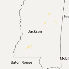
Hail Map for Saturday, June 11, 2016

Number of Impacted Households on 6/11/2016
0
Impacted by 1" or Larger Hail
0
Impacted by 1.75" or Larger Hail
0
Impacted by 2.5" or Larger Hail
Square Miles of Populated Area Impacted on 6/11/2016
0
Impacted by 1" or Larger Hail
0
Impacted by 1.75" or Larger Hail
0
Impacted by 2.5" or Larger Hail


Cities Most Affected by Hail Storms of 6/11/2016
| Hail Size | Demographics of Zip Codes Affected | ||||||
|---|---|---|---|---|---|---|---|
| City | Count | Average | Largest | Pop Density | House Value | Income | Age |
| Miles City, MT | 5 | 1.90 | 2.00 | 3 | $63k | $29.9k | 41.9 |
| Terry, MT | 1 | 1.75 | 1.75 | 0 | $36k | $26.3k | 55.3 |
| Kinsey, MT | 1 | 1.75 | 1.75 | 2 | $79k | $45.3k | 45.7 |
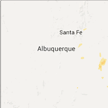
| Lovington, NM | 1 | 1.75 | 1.75 | 18 | $49k | $28.5k | 31.1 |
| Reva, SD | 1 | 1.75 | 1.75 | 0 | $10k | $31.3k | 47.1 |
Hail and Wind Damage Spotted on 6/11/2016
Filter by Report Type:Hail ReportsWind Reports
States Impacted
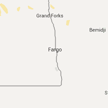
North Dakota, New York, Montana, Utah, Arizona, Iowa, Alabama, Wyoming, Pennsylvania, Kansas, Texas, South Dakota, New MexicoNorth Dakota
| Local Time | Report Details |
|---|---|
| 7:30 AM CDT | Mobile home rolled onto side and damage to other mobile homes. radar estimated tim in mclean county ND, 47.1 miles SSW of Minot, ND |
| 7:35 AM CDT | Ndawn station. gust continued through 740 am cd in mclean county ND, 34.1 miles SSW of Minot, ND |
| 7:49 AM CDT | Storm damage reported in mclean county ND, 41 miles S of Minot, ND |
New York
| Local Time | Report Details |
|---|---|
| 9:00 AM EDT | Jefferson co sheriff received several reports of trees and powerlines down in and around adams center in jefferson county NY, 56.4 miles N of Syracuse, NY |
Montana
| Local Time | Report Details |
|---|---|
| 9:45 AM MDT | Quarter sized hail reported near Richland, MT, 56.3 miles NNE of Glasgow, MT |
| 4:34 PM MDT | 3 to 4 inch diameter tree branches broken off. hail up to the size of marbles. winds estimated around 60 mp in powder river county MT, 52.1 miles SSE of Miles City, MT |
| 5:22 PM MDT | Storm chaser reported estimated wind speeds of 70 to 80 mp in custer county MT, 14.1 miles SSE of Miles City, MT |
| 5:25 PM MDT | Quarter sized hail reported near Miles City, MT, 13.3 miles SSE of Miles City, MT, storm chaser reports hail up to the size of quarters or greater. |
| 5:35 PM MDT | Quarter sized hail reported near Frazer, MT, 33.4 miles E of Glasgow, MT, trees shredded. |
| 5:50 PM MDT | Golf Ball sized hail reported near Miles City, MT, 5.3 miles NE of Miles City, MT, hail lasted for 10 to 15 minutes. windows broken out. |
| 5:53 PM MDT | Golf Ball sized hail reported near Miles City, MT, 3.7 miles ENE of Miles City, MT, storm chaser 1 west of murn. |
| 5:55 PM MDT | Hen Egg sized hail reported near Miles City, MT, 3.2 miles ENE of Miles City, MT, storm chaser 2 nw of murn |
| 5:57 PM MDT | Hen Egg sized hail reported near Miles City, MT, 6 miles NE of Miles City, MT, storm chaser 1 south of tusler. |
| 6:00 PM MDT | Hen Egg sized hail reported near Miles City, MT, 4.5 miles NE of Miles City, MT, golf-ball to two-inch size hail. tree limbs with diameters of 3 to 4 inches downed. |
| 6:00 PM MDT | Golf-ball to two-inch size hail. tree limbs with diameters of 3 to 4 inches downe in custer county MT, 4.5 miles NE of Miles City, MT |
| 6:10 PM MDT | Golf Ball sized hail reported near Kinsey, MT, 19 miles NE of Miles City, MT, brief period of golf ball size hail... then quarter size hail. also winds gusting an estimated 50 mph. |
| 6:10 PM MDT | Golf Ball sized hail reported near Terry, MT, 22.5 miles NE of Miles City, MT, storm chaser reported golf ball size hail and 50 mph winds. |
| 6:44 PM MDT | Trained spotter estimates winds of 65 mph or greater. snowmobile trailer flipped over. pea size hai in powder river county MT, 51.4 miles NNW of Gillette, WY |
| 6:56 PM MDT | Kbhk asos reported a wind gust at 656 pm mdt before going inoperabl in fallon county MT, 76.1 miles E of Miles City, MT |
| 7:10 PM MDT | Quarter sized hail reported near Angela, MT, 36.3 miles NNW of Miles City, MT |
| 7:56 PM MDT | Quarter sized hail reported near Forsyth, MT, 36.6 miles SW of Miles City, MT, nickel to quarter-size hail. |
Utah
| Local Time | Report Details |
|---|---|
| 11:55 AM MDT | Ng7m syracuse sensor- ar62 in davis county UT, 24.1 miles NNW of Salt Lake City, UT |
| 12:30 PM MDT | The department of public safety dispatch reports that a couple of trees were knocked over by strong thunderstorm winds in richfield. time is approximat in sevier county UT, 9.7 miles N of Monroe, UT |
| 12:50 PM MDT | I-70 at salina sensor- utsl in sevier county UT, 19.2 miles NNE of Monroe, UT |
| 3:45 PM MDT | Damage survey along samak park loop indicated straight line winds snapped 10 aspen trees... uprooted a cottonwood tree... lifted and displaced a garage approximately 20 in summit county UT, 34.9 miles ESE of Salt Lake City, UT |
Arizona
| Local Time | Report Details |
|---|---|
| 1:15 PM MST | Measured wind gust at casa grande airport in pinal county AZ, 38.9 miles SSE of Phoenix, AZ |
| 5:20 PM MST | Quarter sized hail reported near Yarnell, AZ, 65.8 miles NW of Phoenix, AZ, quarter sized hail in yarnell. brief heavy rain. |
Iowa
| Local Time | Report Details |
|---|---|
| 4:40 PM CDT | Large oak tree topped with section greater than one foot in diameter down. three other oak trees with large limbs down. estimated winds in excess of 60 mp in humboldt county IA, 50.2 miles ENE of Storm Lake, IA |
Alabama
| Local Time | Report Details |
|---|---|
| 4:47 PM CDT | Power lines and at least one tree dow in henry county AL, 82.2 miles S of Auburn, AL |
| 5:30 PM CDT | Tree reported down across flemming road in pinso in jefferson county AL, 8 miles NNE of Birmingham, AL |
| 6:10 PM CDT | Several trees down along beacon point and near hwy 69 on lake tuscaloosa. reported via social medi in tuscaloosa county AL, 45.2 miles WSW of Birmingham, AL |
| 6:40 PM CDT | Trees down just off hwy 69 near tubbs hill rd. winds estimated around 40-50 mph from radar. time estimate in walker county AL, 36 miles WNW of Birmingham, AL |
| 6:50 PM CDT | Small outdoor carport-type shed blown down at canterbury auto sales. also damage to the roof of at least one other building in downtown fayette. winds estimated at 40-5 in fayette county AL, 58.9 miles ENE of Starkville, MS |
Wyoming
| Local Time | Report Details |
|---|---|
| 4:20 PM MDT | Storm damage reported in campbell county WY, 25.2 miles S of Gillette, WY |
| 5:49 PM MDT | Lasted 10 minutes in campbell county WY, 50.4 miles NNE of Gillette, WY |
| 6:23 PM MDT | Storm damage reported in campbell county WY, 50.1 miles NNE of Gillette, WY |
| 6:23 PM MDT | Storm damage reported in campbell county WY, 50.4 miles NNE of Gillette, WY |
| 6:25 PM MDT | Window broken out... sno mobile trailer flipped in campbell county WY, 49.1 miles N of Gillette, WY |
Pennsylvania
| Local Time | Report Details |
|---|---|
| 6:36 PM EDT | 2 trees down in east franklin townshi in armstrong county PA, 38.9 miles NE of Pittsburgh, PA |
| 6:45 PM EDT | 2 trees down in boggs townshi in armstrong county PA, 43.6 miles NE of Pittsburgh, PA |
Kansas
| Local Time | Report Details |
|---|---|
| 6:10 PM CDT | Branches around 1 inch in diameter on groun in rawlins county KS, 32.2 miles NNW of Colby, KS |
Texas
| Local Time | Report Details |
|---|---|
| 6:10 PM CDT | Measured by the texas tech university west texas mesonet in cochran county TX, 51.8 miles W of Lubbock, TX |
| 7:41 PM CDT | Storm damage reported in lamb county TX, 35.4 miles NW of Lubbock, TX |
| 7:45 PM CDT | Measured by the texas tech university west texas mesonet in yoakum county TX, 75.2 miles WSW of Lubbock, TX |
| 8:01 PM CDT | Four power poles down between littlefield and bainer on us highway 84 in lamb county TX, 31.9 miles NW of Lubbock, TX |
| 9:34 PM CDT | Quarter sized hail reported near Seminole, TX, 64.1 miles NNW of Odessa, TX |
| 10:15 PM CDT | Storm damage reported in gaines county TX, 63.3 miles NNW of Odessa, TX |
South Dakota
| Local Time | Report Details |
|---|---|
| 5:10 PM MDT | Storm damage reported in harding county SD, 124 miles ESE of Miles City, MT |
| 5:25 PM MDT | Golf Ball sized hail reported near Reva, SD, 91.2 miles N of Rapid City, SD |
| 6:00 PM MDT | Storm damage reported in harding county SD, 96.7 miles N of Rapid City, SD |
| 6:15 PM MDT | Storm damage reported in perkins county SD, 110.4 miles SW of Bismarck, ND |
| 6:20 PM MDT | 60-70 mph gusts in harding county SD, 102.3 miles N of Rapid City, SD |
| 7:10 PM MDT | Storm damage reported in harding county SD, 124 miles ESE of Miles City, MT |
New Mexico
| Local Time | Report Details |
|---|---|
| 5:52 PM MDT | Golf Ball sized hail reported near Lovington, NM, 82.5 miles ESE of Roswell, NM, hail was falling along hwy 18 near mile marker 65 between lovington and hobbs. |
Connect with Interactive Hail Maps