

Hail Map for Wednesday, June 13, 2018

Number of Impacted Households on 6/13/2018
0
Impacted by 1" or Larger Hail
0
Impacted by 1.75" or Larger Hail
0
Impacted by 2.5" or Larger Hail
Square Miles of Populated Area Impacted on 6/13/2018
0
Impacted by 1" or Larger Hail
0
Impacted by 1.75" or Larger Hail
0
Impacted by 2.5" or Larger Hail


Cities Most Affected by Hail Storms of 6/13/2018
| Hail Size | Demographics of Zip Codes Affected | ||||||
|---|---|---|---|---|---|---|---|
| City | Count | Average | Largest | Pop Density | House Value | Income | Age |
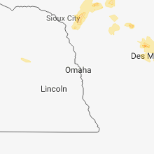
| Moorland, IA | 1 | 2.00 | 2.00 | 10 | $58k | $41.6k | 47.4 |
| Kilgore, NE | 1 | 2.00 | 2.00 | 0 | $30k | $28.9k | 44.8 |
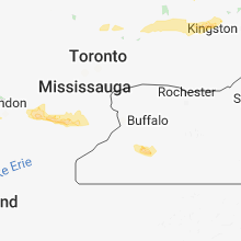
| Rushford, NY | 1 | 1.75 | 1.75 | 24 | $49k | $27.4k | 47.9 |
| Nenzel, NE | 1 | 1.75 | 1.75 | 0 | $28k | $46.3k | 38.0 |
Hail and Wind Damage Spotted on 6/13/2018
Filter by Report Type:Hail ReportsWind Reports
States Impacted
Kansas, South Dakota, Nebraska, Indiana, Arkansas, Texas, Virginia, Mississippi, New York, Colorado, Pennsylvania, New Mexico, Georgia, Ohio, Oklahoma, Louisiana, Vermont, New Jersey, IowaKansas
| Local Time | Report Details |
|---|---|
| 10:12 AM CDT | Quarter sized hail reported near Plainville, KS, 26.2 miles NNW of Hays, KS, a few stones as large as quarters. did not last long. |
South Dakota
| Local Time | Report Details |
|---|---|
| 9:31 AM MDT | Quarter sized hail reported near Martin, SD, 59.6 miles WNW of Valentine, NE, pea to quarter size hail. |
| 12:12 PM CDT | High wind knocked power ou in mellette county SD, 56.7 miles SW of Pierre, SD |
| 12:30 PM CDT | High wind knocked power ou in mellette county SD, 56.7 miles SW of Pierre, SD |
| 1:05 PM CDT | Quarter sized hail reported near Murdo, SD, 40 miles SSW of Pierre, SD, photo sent via email. |
| 1:20 PM CDT | Quarter sized hail reported near Colome, SD, 50.2 miles ENE of Valentine, NE |
| 1:50 PM CDT | Quarter sized hail reported near Dallas, SD, 56.8 miles ENE of Valentine, NE |
| 1:57 PM CDT | Quarter sized hail reported near Dallas, SD, 60.3 miles ENE of Valentine, NE |
| 2:12 PM CDT | Quarter sized hail reported near Winner, SD, 51.1 miles NE of Valentine, NE |
| 2:40 PM CDT | Quarter sized hail reported near Gregory, SD, 61.6 miles ENE of Valentine, NE, corrects previous hail report from 1 s gregory. |
Nebraska
| Local Time | Report Details |
|---|---|
| 9:54 AM MDT | Golf Ball sized hail reported near Nenzel, NE, 27.6 miles WNW of Valentine, NE |
| 10:00 AM MDT | Hen Egg sized hail reported near Kilgore, NE, 23.7 miles WNW of Valentine, NE |
| 10:25 AM MDT | Quarter sized hail reported near Cody, NE, 35.8 miles W of Valentine, NE |
| 11:44 AM CDT | Heavy rain in todd county SD, 14.9 miles N of Valentine, NE |
Indiana
| Local Time | Report Details |
|---|---|
| 3:26 PM EDT | Several trees and power lines down as well as barn damage east of county road 150 east on county road 900 north. appears to be straight line wind damage. relayed from l in rush county IN, 39.4 miles E of Indianapolis, IN |
| 3:40 PM EDT | Tree fell onto car in kroger parking lot. no injurie in hancock county IN, 20.4 miles E of Indianapolis, IN |
| 7:10 PM EDT | A few trees and power lines down in by the fairgrounds. time roughly estimated from radar. relayed by wdrb 41 louisvill in jackson county IN, 61.5 miles S of Indianapolis, IN |
| 8:00 PM EDT | Report of trees down with several snapped. time approximated based on radar... as a couple of waves went through... one at 757 pm and a second by 8:14 p in washington county IN, 54.4 miles NNW of Louisville, KY |
| 8:40 PM EDT | State trooper reported trees down in the milltown are in crawford county IN, 38.7 miles NW of Louisville, KY |
Arkansas
| Local Time | Report Details |
|---|---|
| 2:35 PM CDT | Scattered power outages were reported in little rock due to thunderstorm wind damag in pulaski county AR, 4.7 miles WSW of Little Rock, AR |
| 2:52 PM CDT | Trees blown down on multiple homes near the 2000 block of congo ferndale roa in saline county AR, 17.6 miles W of Little Rock, AR |
| 3:16 PM CDT | Trees were blown down on grand avenue just outside the haskell city limit in saline county AR, 25.7 miles SW of Little Rock, AR |
| 3:20 PM CDT | A tree was blown down on us 6 in hot spring county AR, 32.7 miles SW of Little Rock, AR |
| 3:35 PM CDT | Trees were blown dow in montgomery county AR, 46 miles NNE of Nashville, AR |
| 3:44 PM CDT | Trees were blown dow in grant county AR, 27 miles SSW of Little Rock, AR |
| 3:58 PM CDT | Trees were blown dow in grant county AR, 31.2 miles SSW of Little Rock, AR |
| 4:24 PM CDT | Power outages were reported in western grant county from thunderstorm wind damag in grant county AR, 42.3 miles SSW of Little Rock, AR |
| 4:37 PM CDT | Large limbs were blown dow in dallas county AR, 47.9 miles SSW of Little Rock, AR |
| 5:05 PM CDT | Trees were blown dow in clark county AR, 53.2 miles ENE of Nashville, AR |
| 5:10 PM CDT | Half Dollar sized hail reported near Dover, AR, 65.2 miles NW of Little Rock, AR |
| 5:15 PM CDT | Trees and power lines were blown dow in pope county AR, 60.8 miles NW of Little Rock, AR |
| 5:19 PM CDT | Trees were blown dow in lincoln county AR, 61 miles SSE of Little Rock, AR |
| 5:25 PM CDT | Trees were blown down on highway 11 west of cornervill in lincoln county AR, 65.5 miles SSE of Little Rock, AR |
| 5:28 PM CDT | Trees were blown dow in clark county AR, 42.5 miles E of Nashville, AR |
| 5:28 PM CDT | Trees were blown dow in clark county AR, 43.6 miles E of Nashville, AR |
| 5:35 PM CDT | A large tree was blown over onto west mt. zion roa in drew county AR, 69.1 miles N of Bastrop, LA |
| 6:00 PM CDT | A tree was blown down across rose hill cutoff roa in drew county AR, 59.8 miles N of Bastrop, LA |
| 6:20 PM CDT | Trees and power lines were down on wilson road. dime sized hail also occurred. report relayed via social medi in ashley county AR, 39.5 miles N of Bastrop, LA |
Texas
| Local Time | Report Details |
|---|---|
| 2:47 PM CDT | Large tree limbs downed by strong winds in the wildwood subdivisio in bexar county TX, 11 miles NW of San Antonio, TX |
Virginia
| Local Time | Report Details |
|---|---|
| 4:18 PM EDT | Tree down on 23000 block of virgil goode hwy in franklin county VA, 12.5 miles S of Roanoke, VA |
| 6:59 PM EDT | One tree down on kings store roa in floyd county VA, 22 miles SW of Roanoke, VA |
Mississippi
| Local Time | Report Details |
|---|---|
| 3:20 PM CDT | Two trees blown down in enterprise. one on highway 513 on the south side of town and another on a car on old mill creek road. time estimated by rada in clarke county MS, 80.1 miles E of Jackson, MS |
| 4:30 PM CDT | Large limbs blown down at a residence in town. severe wind speed estimated. time estimated by rada in washington county MS, 67 miles ENE of Bastrop, LA |
New York
| Local Time | Report Details |
|---|---|
| 4:38 PM EDT | Tree on car near prospect and virginia ave in buffalo. time estimated from rada in erie county NY, 0.3 miles NNW of Buffalo, NY |
| 5:51 PM EDT | Tree down on route 353 between 42nd street and broadway in cattaraugus county NY, 37 miles S of Buffalo, NY |
| 5:55 PM EDT | Trees down in cattaraugus county NY, 36.2 miles SSE of Buffalo, NY |
| 5:58 PM EDT | Numerous trees down in cattaraugus county NY, 34 miles SE of Buffalo, NY |
| 6:02 PM EDT | Trees down in cattaraugus county NY, 37.5 miles SSE of Buffalo, NY |
| 6:02 PM EDT | Ping Pong Ball sized hail reported near Machias, NY, 37.5 miles SSE of Buffalo, NY, time estimated from radar |
| 6:03 PM EDT | Trees down in cattaraugus county NY, 57.9 miles SSE of Buffalo, NY |
| 6:06 PM EDT | Trees down in cattaraugus county NY, 41.1 miles SE of Buffalo, NY |
| 6:07 PM EDT | Half Dollar sized hail reported near Farmersville Station, NY, 41.1 miles SE of Buffalo, NY, time estimated from radar |
| 6:10 PM EDT | Trees down in cattaraugus county NY, 61.4 miles SSE of Buffalo, NY |
| 6:13 PM EDT | Trees down on route 23 in rushford in allegany county NY, 46.9 miles SE of Buffalo, NY |
| 6:15 PM EDT | Golf Ball sized hail reported near Rushford, NY, 46.9 miles SE of Buffalo, NY, time estimated from radar |
| 6:28 PM EDT | Numerous trees and power lines down along california hallow road in town of boliva. time estiamted from rada in allegany county NY, 70.1 miles SE of Buffalo, NY |
| 6:34 PM EDT | Trees and wires down in jefferson county NY, 43.2 miles SW of Ogdensburg, NY |
| 6:37 PM EDT | Large tree and wires down in jefferson county NY, 46.5 miles SW of Ogdensburg, NY |
| 6:37 PM EDT | Tree down on wood rd in jefferson county NY, 47.1 miles SW of Ogdensburg, NY |
| 6:38 PM EDT | Trees and wires down in jefferson county NY, 47.8 miles SW of Ogdensburg, NY |
| 6:59 PM EDT | Trees and wires down in jefferson county NY, 34.6 miles S of Ogdensburg, NY |
| 7:15 PM EDT | Several trees down at intersection of main st and wilder dr in lewis county NY, 37.8 miles SSE of Ogdensburg, NY |
| 7:15 PM EDT | Several trees down in the town of diana in lewis county NY, 38.5 miles SSE of Ogdensburg, NY |
| 7:15 PM EDT | Roof blown off building on hands flat rd in lewis county NY, 37.7 miles SSE of Ogdensburg, NY |
| 7:20 PM EDT | Downed trees and wires. a few electric poles sheared off into a field. radar estimated tim in tompkins county NY, 37.2 miles SSW of Syracuse, NY |
| 7:22 PM EDT | Trees down near lawrenceville in tioga county PA, 86.2 miles WNW of Scranton, PA |
| 7:30 PM EDT | Downed trees and powerlines. confirmed via pictures from broadcast media. radar estimated tim in schuyler county NY, 52.8 miles SW of Syracuse, NY |
| 7:46 PM EDT | Trees and wires dow in lewis county NY, 56.3 miles S of Ogdensburg, NY |
| 7:53 PM EDT | Mping report 3-inch tree limbs... power poles broken in tompkins county NY, 34 miles SSW of Syracuse, NY |
| 8:18 PM EDT | Multiple reports of trees down. one down along river r in lewis county NY, 57.7 miles NE of Syracuse, NY |
| 8:34 PM EDT | Trees and wires down county rd 3a in chenango county NY, 53.3 miles SSE of Syracuse, NY |
| 8:35 PM EDT | Tree... wires down in tioga county NY, 57.3 miles S of Syracuse, NY |
| 8:40 PM EDT | Tree down rt 96 in tioga county NY, 57.4 miles S of Syracuse, NY |
| 8:50 PM EDT | Wires down rt 12 in chenango county NY, 52.6 miles SSE of Syracuse, NY |
| 8:52 PM EDT | Trees and wires down at tall pines campground in chenango county NY, 61.4 miles SE of Syracuse, NY |
| 9:00 PM EDT | Tree down rt 357 and lawton hill rd in delaware county NY, 69 miles NNE of Scranton, PA |
| 9:48 PM EDT | Tree down on route 9n in warren county NY, 52.1 miles SSW of Burlington, VT |
| 10:06 PM EDT | Tree down on wire in warren county NY, 54.1 miles SSW of Burlington, VT |
Colorado
| Local Time | Report Details |
|---|---|
| 2:40 PM MDT | Quarter sized hail reported near Rye, CO, 26.5 miles SSW of Pueblo, CO |
Pennsylvania
| Local Time | Report Details |
|---|---|
| 6:15 PM EDT | Tree down at tarrtown road... blocking the roadway in armstrong county PA, 36.5 miles NE of Pittsburgh, PA |
| 6:15 PM EDT | Trees down... wires down in armstrong county PA, 36.9 miles NE of Pittsburgh, PA |
| 6:20 PM EDT | Tree on power lines... active arching along indian hills road in armstrong county PA, 37 miles NE of Pittsburgh, PA |
| 6:20 PM EDT | Multiple trees down in armstrong county PA, 36.4 miles NE of Pittsburgh, PA |
| 6:30 PM EDT | Tree down blocking roadway along sr 2007/frog pond road in armstrong county PA, 38.9 miles NE of Pittsburgh, PA |
| 7:15 PM EDT | 461 state route 1034 boggs twp; tree down blocking roadwa in armstrong county PA, 41.4 miles NE of Pittsburgh, PA |
| 7:15 PM EDT | Tree down at tarrtown road... blocking the roadway in armstrong county PA, 36.5 miles NE of Pittsburgh, PA |
| 7:20 PM EDT | Tree on power lines... active arching along indian hills road in armstrong county PA, 37 miles NE of Pittsburgh, PA |
| 7:46 PM EDT | Trees down on route 6... blocking one lane of traffic in tioga county PA, 75.6 miles WNW of Scranton, PA |
| 8:02 PM EDT | One tree down near greenwich road in cambria county PA, 50.3 miles W of State College, PA |
| 8:02 PM EDT | Trees and wires down near parkhurst street in tioga county PA, 74 miles NE of State College, PA |
| 8:05 PM EDT | Trees and wires down near morris run road in tioga county PA, 72.4 miles WNW of Scranton, PA |
| 8:25 PM EDT | Trees and wires down in cambria county PA, 44.3 miles WSW of State College, PA |
| 8:28 PM EDT | Multiple trees down... roof damage rt 514 franklin twp in bradford county PA, 53.6 miles WNW of Scranton, PA |
| 8:45 PM EDT | House destroyed... trees... wires down near bailey corners rd franklin twp in bradford county PA, 54.1 miles WNW of Scranton, PA |
| 8:47 PM EDT | One dozen large trees down along route 22 near the route 53 exit in cambria county PA, 45.5 miles WSW of State College, PA |
| 10:08 PM EDT | Building collapse - panera bread and barnes & noble in luzerne county PA, 15.9 miles SW of Scranton, PA |
| 10:15 PM EDT | *** 3 inj *** cars flipped over in panera bread parking lot. six people trapped in the buildin in luzerne county PA, 15.9 miles SW of Scranton, PA |
| 10:27 PM EDT | Downed tree in wires at intersection of locust ridge road and spur road. time estimated by rada in monroe county PA, 18.4 miles SSE of Scranton, PA |
New Mexico
| Local Time | Report Details |
|---|---|
| 4:37 PM MDT | Quarter sized hail reported near Guadalupita, NM, 26.4 miles SE of Taos, NM |
| 4:50 PM MDT | Spotter on twitter reports 60 mph wind gust with 55 mph sustained. near zero visiblity due to blowing dus in luna county NM, 49.3 miles SE of Silver City, NM |
Georgia
| Local Time | Report Details |
|---|---|
| 6:48 PM EDT | A tree was reported down near the intersection of highway 19 and south poplar springs roa in laurens county GA, 61.6 miles N of Douglas, GA |
| 6:56 PM EDT | A tree was reported down along scotland roa in laurens county GA, 63.9 miles N of Douglas, GA |
| 7:06 PM EDT | A tree was reported down on robinson church roa in laurens county GA, 64.4 miles N of Douglas, GA |
Ohio
| Local Time | Report Details |
|---|---|
| 7:00 PM EDT | Tree down along south route 9 in harrison county OH, 49.9 miles WSW of Pittsburgh, PA |
| 9:22 PM EDT | Multiple trees down in wheelersburg and minford. time estimated from radar dat in scioto county OH, 73 miles WNW of Charleston, WV |
Oklahoma
| Local Time | Report Details |
|---|---|
| 6:25 PM CDT | Altus sit in jackson county OK, 51.6 miles ENE of Childress, TX |
| 6:30 PM CDT | Altus sit in jackson county OK, 51.6 miles ENE of Childress, TX |
| 10:08 PM CDT | 4 to 5 powerpoles dow in jackson county OK, 52.1 miles ENE of Childress, TX |
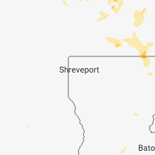
Louisiana
| Local Time | Report Details |
|---|---|
| 7:25 PM CDT | Power pole and transformer blown down on a house in the jones communit in morehouse county LA, 20.7 miles NE of Bastrop, LA |
| 7:30 PM CDT | Large tree across highway 58 in west carroll county LA, 23.7 miles ENE of Bastrop, LA |
Vermont
| Local Time | Report Details |
|---|---|
| 10:00 PM EDT | Tree down on powerlin in rutland county VT, 52.5 miles S of Burlington, VT |
New Jersey
| Local Time | Report Details |
|---|---|
| 11:31 PM EDT | Large branches blocking lane on i-80 in warren county NJ, 44 miles SE of Scranton, PA |
| 11:42 PM EDT | Tree down on catswamp rd in warren county NJ, 47.1 miles WNW of Brooklyn, NY |
| 11:46 PM EDT | Large tree branch down at intersection of asbury road and ketchum road. time estimated from rada in warren county NJ, 47.6 miles WNW of Brooklyn, NY |
Iowa
| Local Time | Report Details |
|---|---|
| 2:58 AM CDT | Hen Egg sized hail reported near Moorland, IA, 48.2 miles ESE of Storm Lake, IA |
| 3:36 AM CDT | Quarter sized hail reported near Ames, IA, 31.3 miles N of Des Moines, IA |
Connect with Interactive Hail Maps