

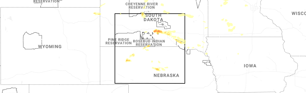
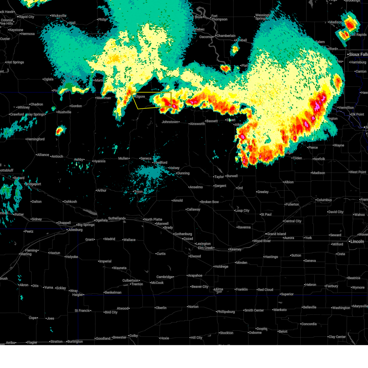
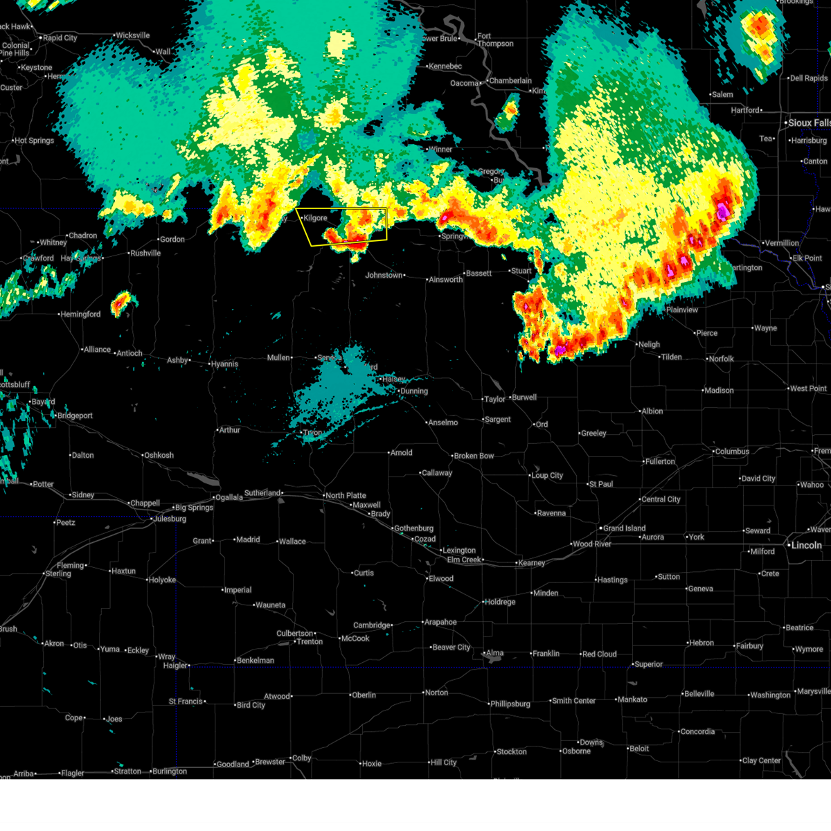
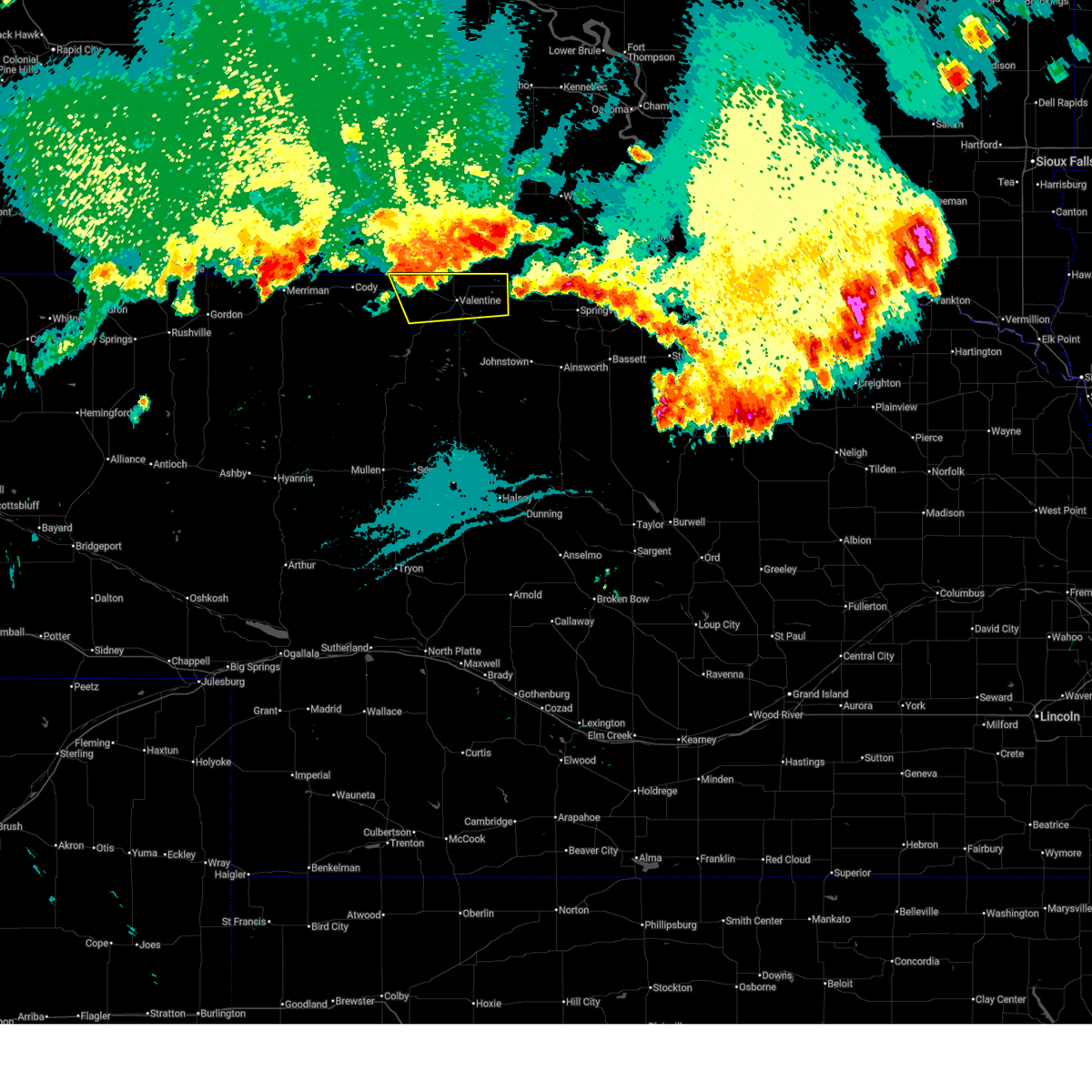
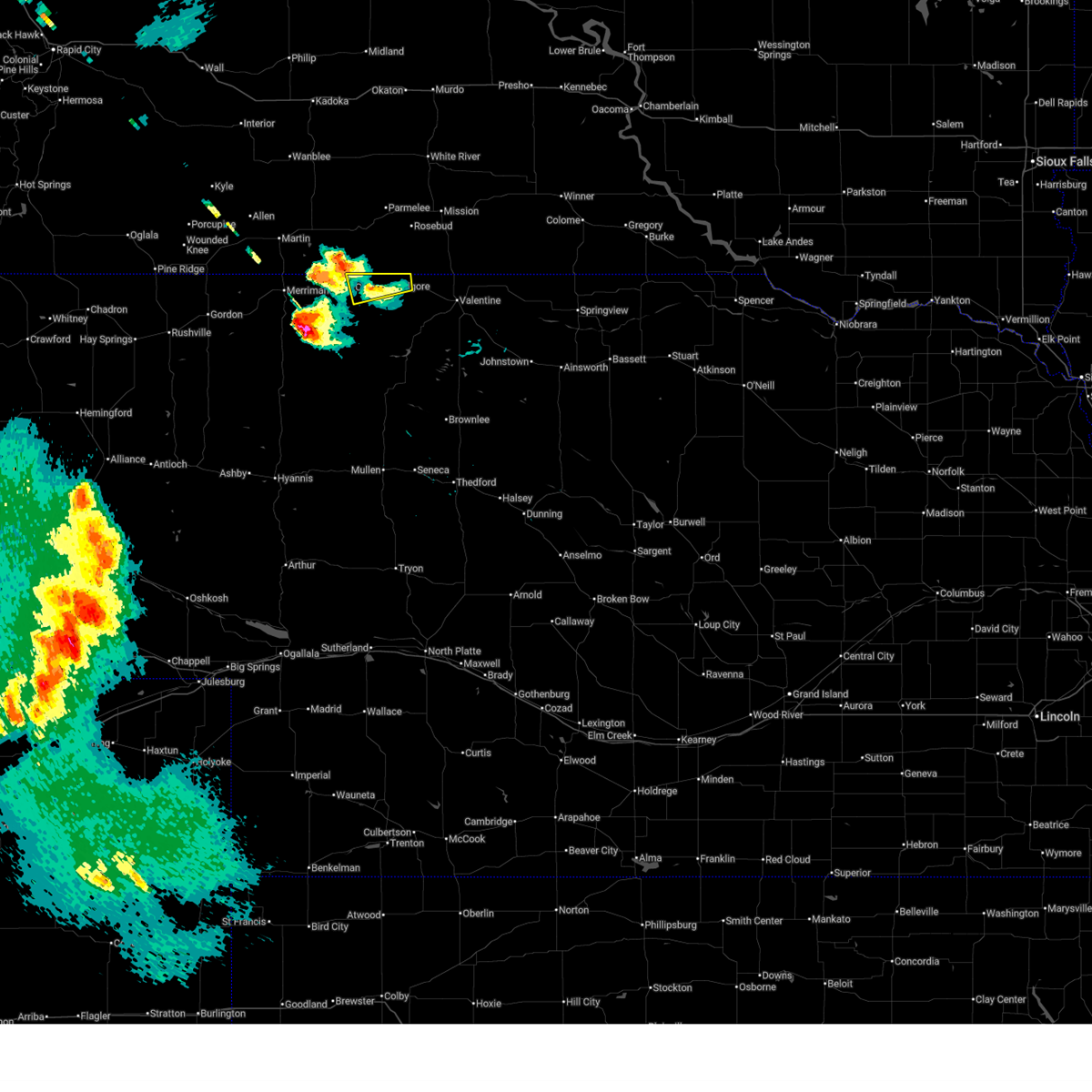
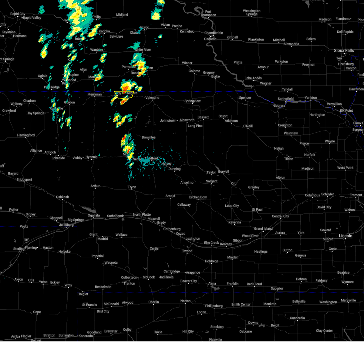
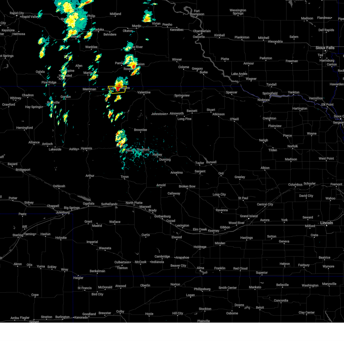
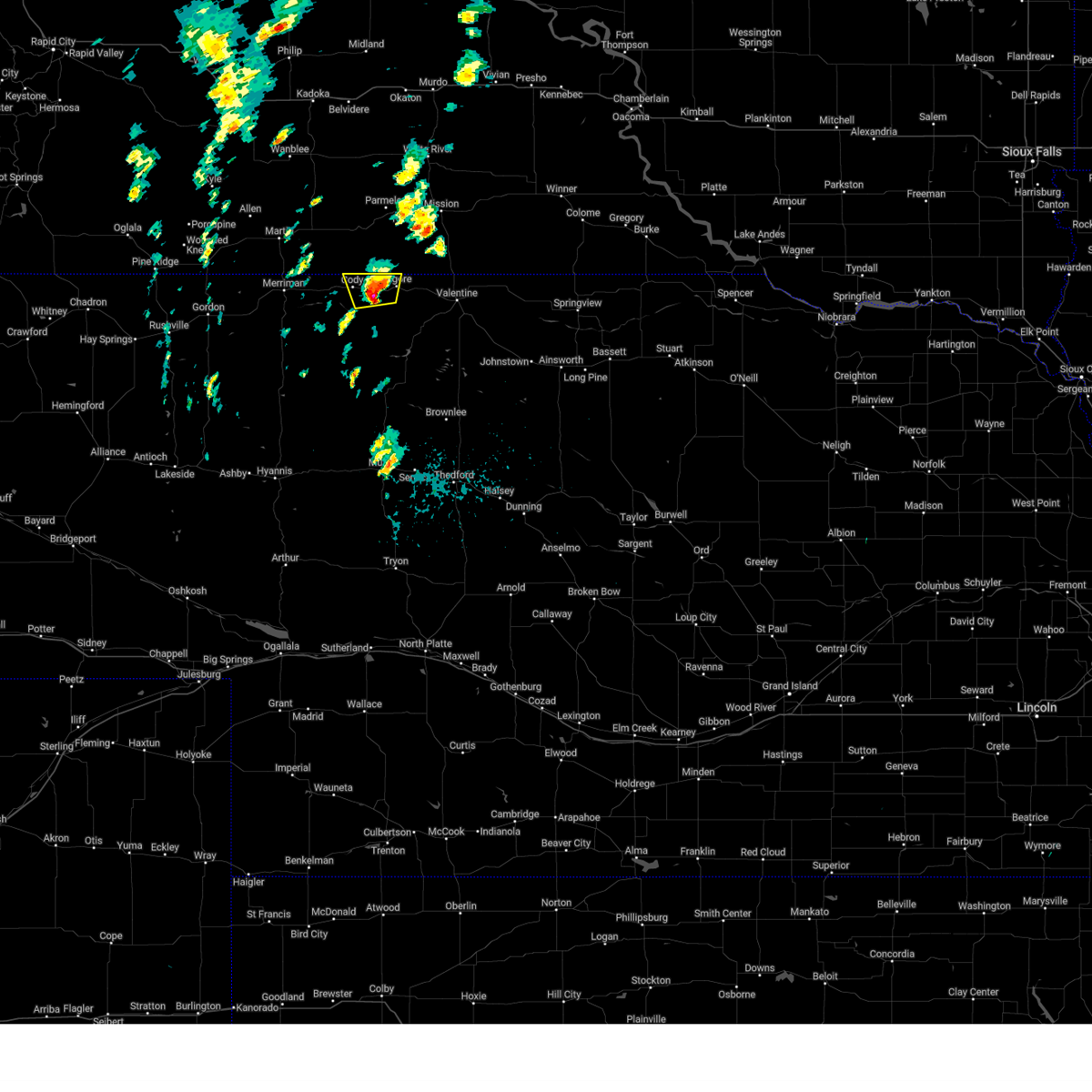
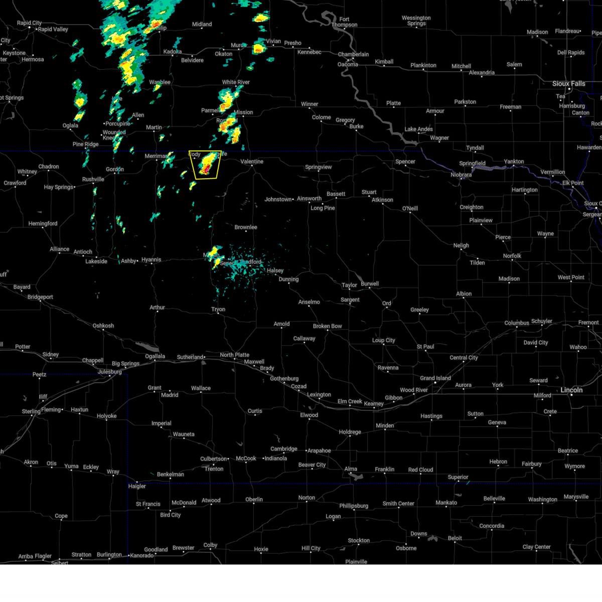
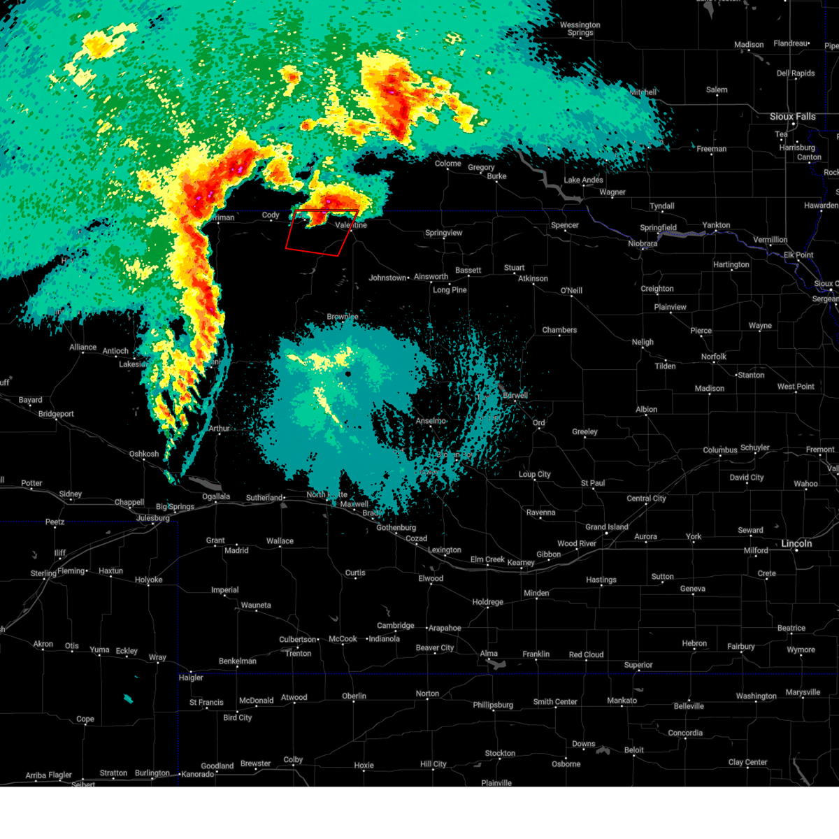
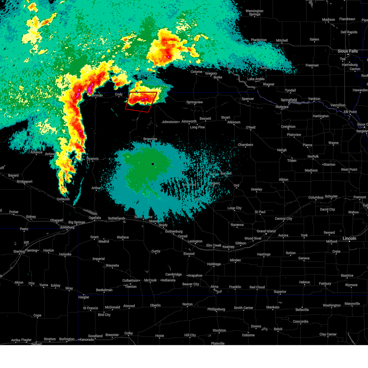
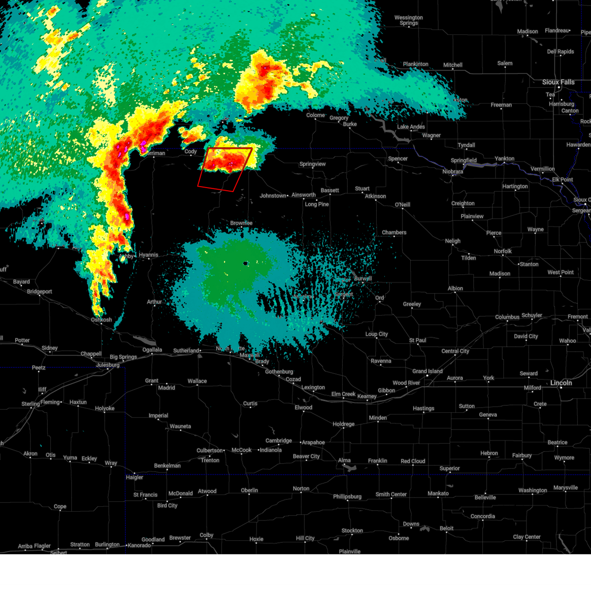
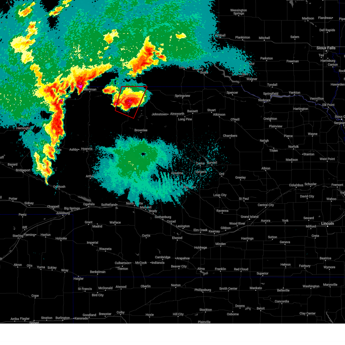
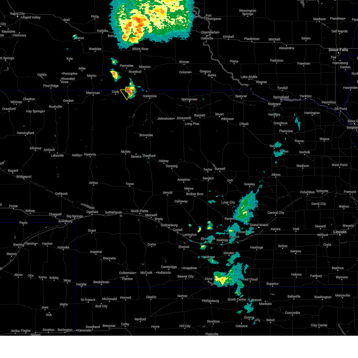
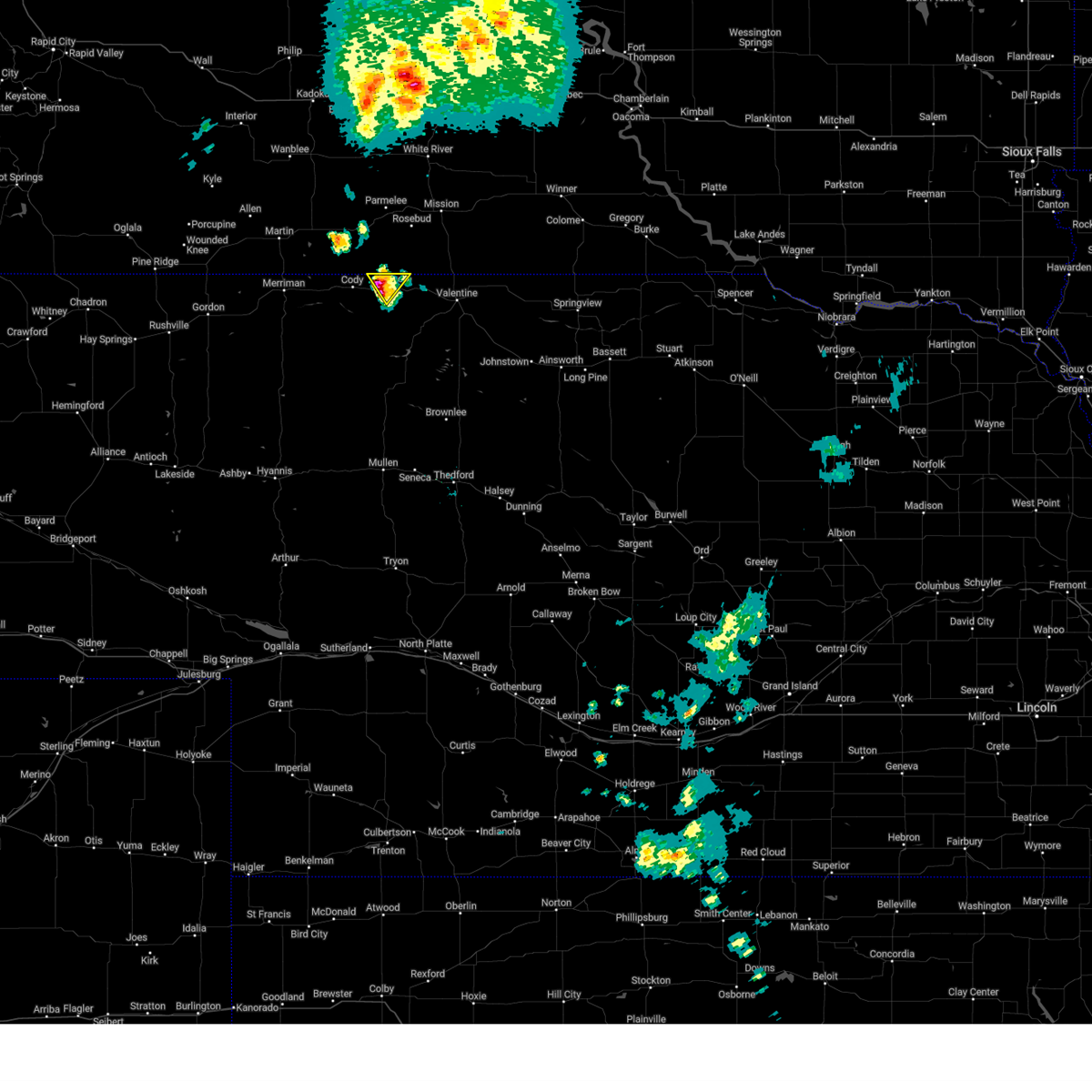
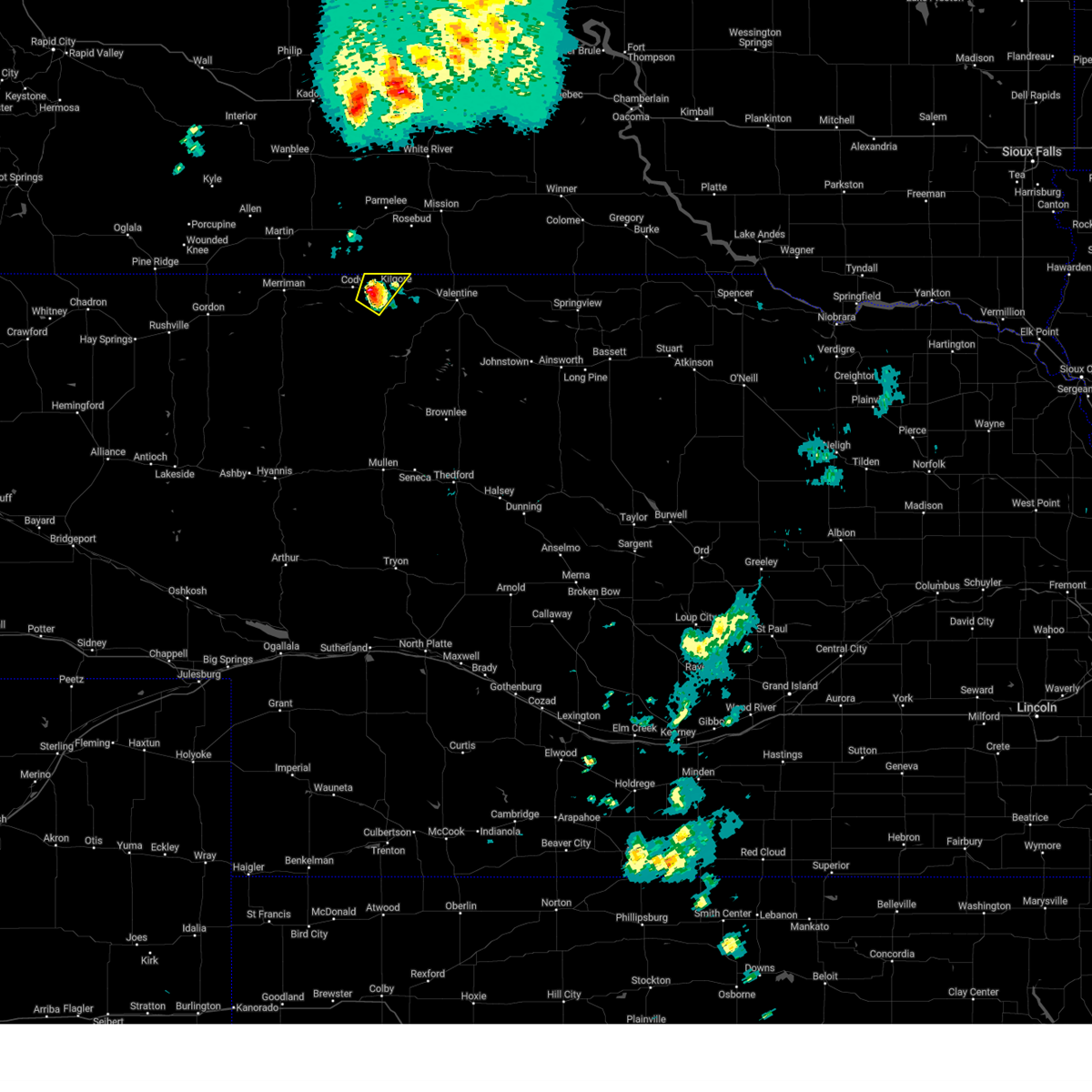
Hail Map for Kilgore, NE
The Kilgore, NE area has had 20 reports of on-the-ground hail by trained spotters, and has been under severe weather warnings 22 times during the past 12 months. Doppler radar has detected hail at or near Kilgore, NE on 99 occasions, including 8 occasions during the past year.
| Name: | Kilgore, NE |
| Where Located: | 21 miles WNW of Valentine, NE |
| Map: | Google Map for Kilgore, NE |
| Population: | 77 |
| Housing Units: | 45 |
| More Info: | Search Google for Kilgore, NE |
2
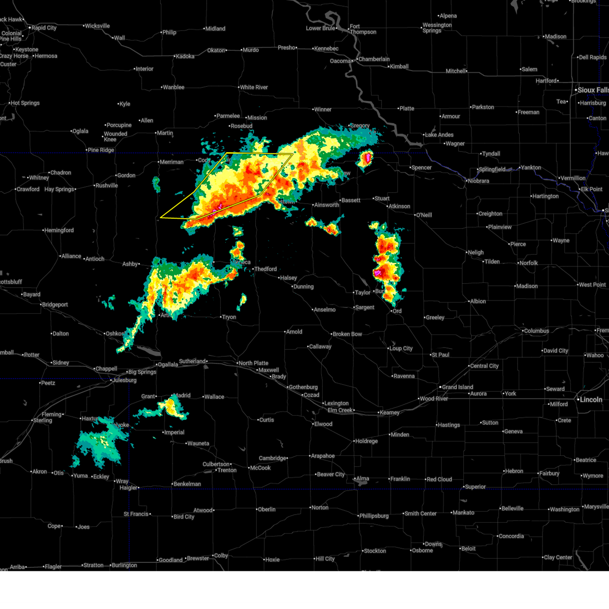
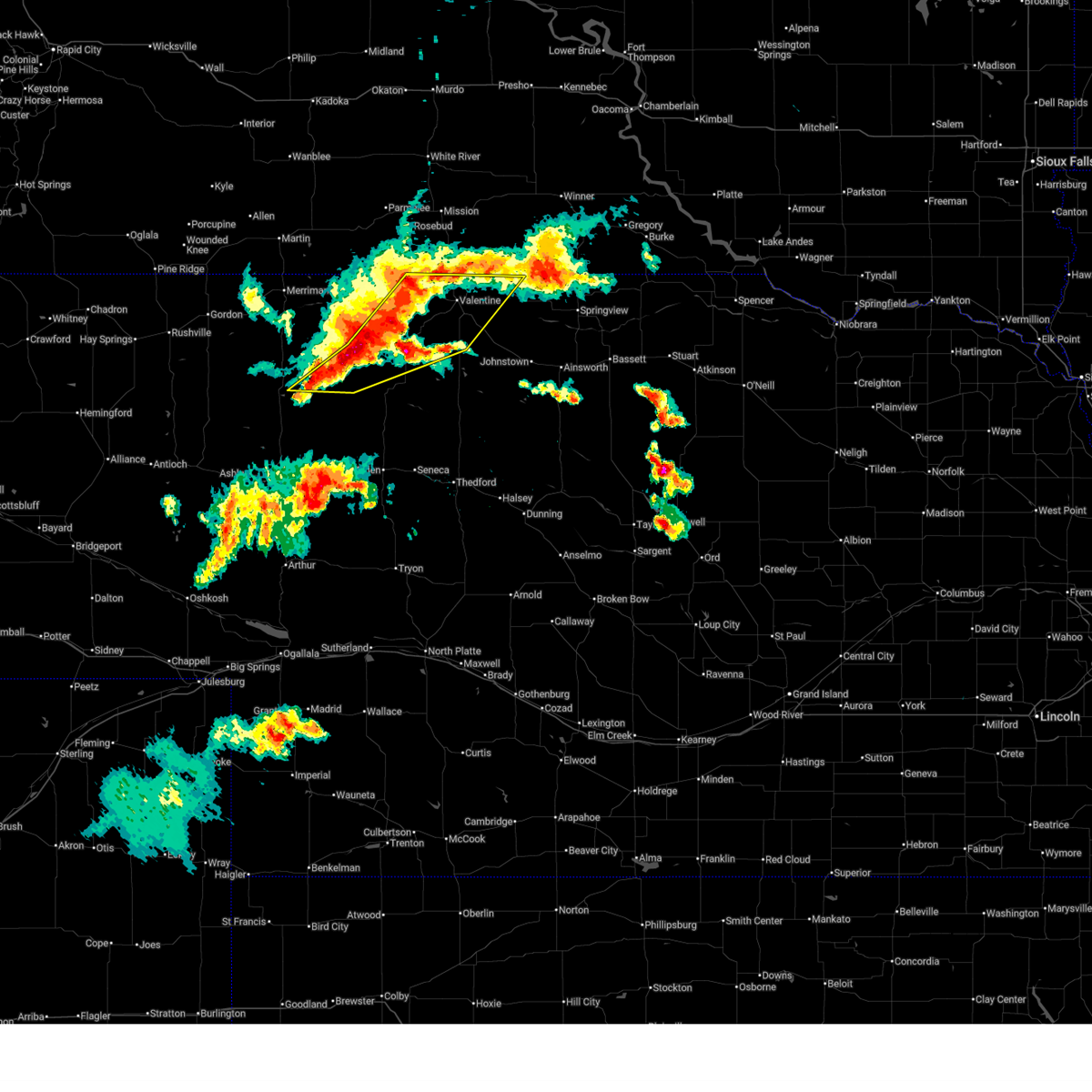
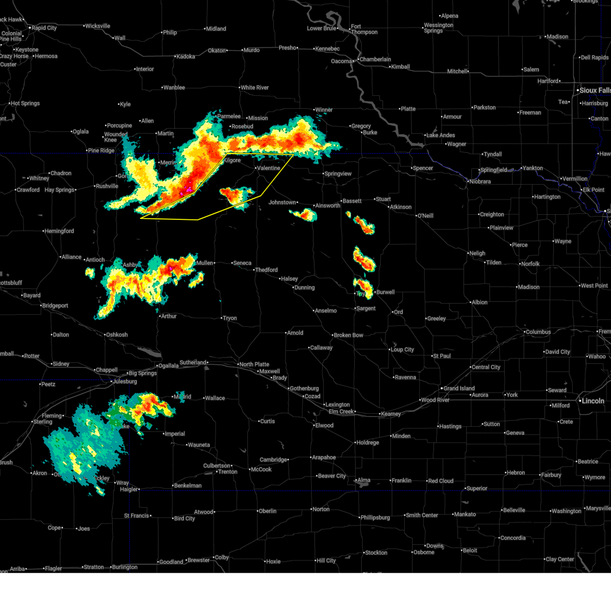
The Top Recent Hail Date for Kilgore, NE is Friday, June 27, 2025 (7th out of 99)
Hail and Wind Damage Spotted near Kilgore, NE
| Date / Time | Report Details |
|---|---|
| 7/1/2025 9:51 PM MDT |
 The storms which prompted the warning have weakened below severe limits, and have exited the warned area. therefore, the warning will be allowed to expire. however, gusty winds up to 50 mph are still possible with these thunderstorms. a severe thunderstorm watch remains in effect until midnight cdt for north central nebraska. to report severe weather, contact your nearest law enforcement agency. they will relay your report to the national weather service north platte. The storms which prompted the warning have weakened below severe limits, and have exited the warned area. therefore, the warning will be allowed to expire. however, gusty winds up to 50 mph are still possible with these thunderstorms. a severe thunderstorm watch remains in effect until midnight cdt for north central nebraska. to report severe weather, contact your nearest law enforcement agency. they will relay your report to the national weather service north platte.
|
| 7/1/2025 9:20 PM MDT |
 At 1019 pm cdt, severe thunderstorms were located along a line extending from near sicangu village to 8 miles west of merritt reservoir to 18 miles south of medicine lake, moving east at 35 mph (radar indicated). Hazards include 60 mph wind gusts and half dollar size hail. Hail damage to vehicles is expected. expect wind damage to roofs, siding, and trees. locations impacted include, valentine, kilgore, merritt reservoir, crookston, steer creek campground, anderson bridge state wildlife management area, round lake, smith falls state park, schlagel creek state wildlife management area, highway 97 crossing the niobrara river, sparks, and big alkali lake state wildlife management area. this includes the following highways, highway 20 between mile markers 175 and 211. highway 97 between mile markers 107 and 141. highway 83 between mile markers 194 and 222. Highway 12 between mile markers 1 and 22. At 1019 pm cdt, severe thunderstorms were located along a line extending from near sicangu village to 8 miles west of merritt reservoir to 18 miles south of medicine lake, moving east at 35 mph (radar indicated). Hazards include 60 mph wind gusts and half dollar size hail. Hail damage to vehicles is expected. expect wind damage to roofs, siding, and trees. locations impacted include, valentine, kilgore, merritt reservoir, crookston, steer creek campground, anderson bridge state wildlife management area, round lake, smith falls state park, schlagel creek state wildlife management area, highway 97 crossing the niobrara river, sparks, and big alkali lake state wildlife management area. this includes the following highways, highway 20 between mile markers 175 and 211. highway 97 between mile markers 107 and 141. highway 83 between mile markers 194 and 222. Highway 12 between mile markers 1 and 22.
|
| 7/1/2025 9:04 PM MDT |
 Svrlbf the national weather service in north platte has issued a * severe thunderstorm warning for, central cherry county in north central nebraska, west central keya paha county in north central nebraska, * until 1100 pm cdt. * at 1004 pm cdt, severe thunderstorms were located along a line extending from 6 miles east of kilgore to 13 miles southeast of medicine lake to 30 miles north of whitman, moving east at 35 mph (radar indicated). Hazards include ping pong ball size hail and 60 mph wind gusts. People and animals outdoors will be injured. expect hail damage to roofs, siding, windows, and vehicles. Expect wind damage to roofs, siding, and trees. Svrlbf the national weather service in north platte has issued a * severe thunderstorm warning for, central cherry county in north central nebraska, west central keya paha county in north central nebraska, * until 1100 pm cdt. * at 1004 pm cdt, severe thunderstorms were located along a line extending from 6 miles east of kilgore to 13 miles southeast of medicine lake to 30 miles north of whitman, moving east at 35 mph (radar indicated). Hazards include ping pong ball size hail and 60 mph wind gusts. People and animals outdoors will be injured. expect hail damage to roofs, siding, windows, and vehicles. Expect wind damage to roofs, siding, and trees.
|
| 6/29/2025 2:16 AM CDT |
 The storms which prompted the warning have weakened below severe limits, and no longer pose an immediate threat to life or property. therefore, the warning has been allowed to expire. however, gusty winds are still possible with these thunderstorms. The storms which prompted the warning have weakened below severe limits, and no longer pose an immediate threat to life or property. therefore, the warning has been allowed to expire. however, gusty winds are still possible with these thunderstorms.
|
| 6/29/2025 1:55 AM CDT |
 At 155 am cdt, severe thunderstorms were located along a line extending from 8 miles southeast of littleburg to 7 miles southeast of valentine, moving east at 45 mph (radar indicated). Hazards include 60 mph wind gusts. Expect damage to roofs, siding, and trees. locations impacted include, valentine, kilgore, crookston, highway 97 crossing the niobrara river, sparks, and smith falls state park. this includes the following highways, highway 20 between mile markers 175 and 205. highway 97 between mile markers 129 and 141. highway 83 between mile markers 205 and 222. Highway 12 between mile markers 1 and 20. At 155 am cdt, severe thunderstorms were located along a line extending from 8 miles southeast of littleburg to 7 miles southeast of valentine, moving east at 45 mph (radar indicated). Hazards include 60 mph wind gusts. Expect damage to roofs, siding, and trees. locations impacted include, valentine, kilgore, crookston, highway 97 crossing the niobrara river, sparks, and smith falls state park. this includes the following highways, highway 20 between mile markers 175 and 205. highway 97 between mile markers 129 and 141. highway 83 between mile markers 205 and 222. Highway 12 between mile markers 1 and 20.
|
| 6/29/2025 1:32 AM CDT |
 Svrlbf the national weather service in north platte has issued a * severe thunderstorm warning for, northeastern cherry county in north central nebraska, * until 215 am cdt. * at 132 am cdt, severe thunderstorms were located along a line extending from 6 miles southeast of littleburg to 7 miles southeast of kilgore, moving east at 45 mph (radar indicated). Hazards include 60 mph wind gusts. expect damage to roofs, siding, and trees Svrlbf the national weather service in north platte has issued a * severe thunderstorm warning for, northeastern cherry county in north central nebraska, * until 215 am cdt. * at 132 am cdt, severe thunderstorms were located along a line extending from 6 miles southeast of littleburg to 7 miles southeast of kilgore, moving east at 45 mph (radar indicated). Hazards include 60 mph wind gusts. expect damage to roofs, siding, and trees
|
| 6/15/2025 6:48 PM MDT |
 the severe thunderstorm warning has been cancelled and is no longer in effect the severe thunderstorm warning has been cancelled and is no longer in effect
|
| 6/15/2025 6:24 PM MDT | Svrlbf the national weather service in north platte has issued a * severe thunderstorm warning for, north central cherry county in north central nebraska, * until 815 pm cdt. * at 724 pm cdt, a severe thunderstorm was located over cody, or 31 miles southeast of martin, moving east at 15 mph (radar indicated). Hazards include 60 mph wind gusts and quarter size hail. Hail damage to vehicles is expected. Expect wind damage to roofs, siding, and trees. |
| 5/14/2025 2:45 PM MDT |
 the severe thunderstorm warning has been cancelled and is no longer in effect the severe thunderstorm warning has been cancelled and is no longer in effect
|
| 5/14/2025 2:35 PM MDT |
 At 335 pm cdt, a severe thunderstorm was located over nenzel, or 28 miles west of valentine, moving north at 20 mph (emergency management). Hazards include golf ball size hail and 60 mph wind gusts. People and animals outdoors will be injured. expect hail damage to roofs, siding, windows, and vehicles. expect wind damage to roofs, siding, and trees. locations impacted include, cody, kilgore, nenzel, and cody lake. This includes highway 20 between mile markers 159 and 175. At 335 pm cdt, a severe thunderstorm was located over nenzel, or 28 miles west of valentine, moving north at 20 mph (emergency management). Hazards include golf ball size hail and 60 mph wind gusts. People and animals outdoors will be injured. expect hail damage to roofs, siding, windows, and vehicles. expect wind damage to roofs, siding, and trees. locations impacted include, cody, kilgore, nenzel, and cody lake. This includes highway 20 between mile markers 159 and 175.
|
| 5/14/2025 2:24 PM MDT |
 At 323 pm cdt, a severe thunderstorm was located over nenzel, or 27 miles west of valentine, moving north at 20 mph (radar indicated). Hazards include ping pong ball size hail and 60 mph wind gusts. People and animals outdoors will be injured. expect hail damage to roofs, siding, windows, and vehicles. expect wind damage to roofs, siding, and trees. locations impacted include, cody, kilgore, nenzel, and cody lake. This includes highway 20 between mile markers 158 and 175. At 323 pm cdt, a severe thunderstorm was located over nenzel, or 27 miles west of valentine, moving north at 20 mph (radar indicated). Hazards include ping pong ball size hail and 60 mph wind gusts. People and animals outdoors will be injured. expect hail damage to roofs, siding, windows, and vehicles. expect wind damage to roofs, siding, and trees. locations impacted include, cody, kilgore, nenzel, and cody lake. This includes highway 20 between mile markers 158 and 175.
|
| 5/14/2025 2:08 PM MDT |
 Svrlbf the national weather service in north platte has issued a * severe thunderstorm warning for, north central cherry county in north central nebraska, * until 400 pm cdt. * at 308 pm cdt, a severe thunderstorm was located 7 miles south of nenzel, or 27 miles west of valentine, moving north at 20 mph (radar indicated). Hazards include 60 mph wind gusts and quarter size hail. Hail damage to vehicles is expected. Expect wind damage to roofs, siding, and trees. Svrlbf the national weather service in north platte has issued a * severe thunderstorm warning for, north central cherry county in north central nebraska, * until 400 pm cdt. * at 308 pm cdt, a severe thunderstorm was located 7 miles south of nenzel, or 27 miles west of valentine, moving north at 20 mph (radar indicated). Hazards include 60 mph wind gusts and quarter size hail. Hail damage to vehicles is expected. Expect wind damage to roofs, siding, and trees.
|
| 4/27/2025 11:45 PM CDT |
 The storm which prompted the warning has moved out of the area. therefore, the warning has been allowed to expire. however, small hail and gusty winds are still possible with this thunderstorm. a tornado watch remains in effect until midnight cdt for north central nebraska. to report severe weather, contact your nearest law enforcement agency. they will relay your report to the national weather service north platte. The storm which prompted the warning has moved out of the area. therefore, the warning has been allowed to expire. however, small hail and gusty winds are still possible with this thunderstorm. a tornado watch remains in effect until midnight cdt for north central nebraska. to report severe weather, contact your nearest law enforcement agency. they will relay your report to the national weather service north platte.
|
| 4/27/2025 11:27 PM CDT |
 At 1126 pm cdt, a severe thunderstorm capable of producing a tornado was located 8 miles west of valentine, moving northeast at 20 mph (radar indicated rotation). Hazards include tornado and half dollar size hail. Flying debris will be dangerous to those caught without shelter. mobile homes will be damaged or destroyed. damage to roofs, windows, and vehicles will occur. tree damage is likely. locations impacted include, kilgore, crookston, highway 97 crossing the niobrara river, and anderson bridge state wildlife management area. this includes the following highways, highway 20 between mile markers 170 and 195. highway 97 between mile markers 124 and 137. Highway 83 between mile markers 215 and 222. At 1126 pm cdt, a severe thunderstorm capable of producing a tornado was located 8 miles west of valentine, moving northeast at 20 mph (radar indicated rotation). Hazards include tornado and half dollar size hail. Flying debris will be dangerous to those caught without shelter. mobile homes will be damaged or destroyed. damage to roofs, windows, and vehicles will occur. tree damage is likely. locations impacted include, kilgore, crookston, highway 97 crossing the niobrara river, and anderson bridge state wildlife management area. this includes the following highways, highway 20 between mile markers 170 and 195. highway 97 between mile markers 124 and 137. Highway 83 between mile markers 215 and 222.
|
| 4/27/2025 11:16 PM CDT |
 At 1115 pm cdt, a severe thunderstorm capable of producing a tornado was located 11 miles northeast of merritt reservoir, or 11 miles southwest of valentine, moving northeast at 25 mph (radar indicated rotation). Hazards include tornado and two inch hail. Flying debris will be dangerous to those caught without shelter. mobile homes will be damaged or destroyed. damage to roofs, windows, and vehicles will occur. tree damage is likely. locations impacted include, kilgore, merritt reservoir, crookston, highway 97 crossing the niobrara river, and anderson bridge state wildlife management area. this includes the following highways, highway 20 between mile markers 170 and 195. highway 97 between mile markers 115 and 137. Highway 83 between mile markers 215 and 222. At 1115 pm cdt, a severe thunderstorm capable of producing a tornado was located 11 miles northeast of merritt reservoir, or 11 miles southwest of valentine, moving northeast at 25 mph (radar indicated rotation). Hazards include tornado and two inch hail. Flying debris will be dangerous to those caught without shelter. mobile homes will be damaged or destroyed. damage to roofs, windows, and vehicles will occur. tree damage is likely. locations impacted include, kilgore, merritt reservoir, crookston, highway 97 crossing the niobrara river, and anderson bridge state wildlife management area. this includes the following highways, highway 20 between mile markers 170 and 195. highway 97 between mile markers 115 and 137. Highway 83 between mile markers 215 and 222.
|
| 4/27/2025 10:57 PM CDT |
 Torlbf the national weather service in north platte has issued a * tornado warning for, north central cherry county in north central nebraska, * until 1145 pm cdt. * at 1056 pm cdt, a confirmed tornado was located near merritt reservoir, or 21 miles southwest of valentine, moving northeast at 20 mph (weather spotters confirmed tornado). Hazards include damaging tornado and hail up to two inches in diameter. Flying debris will be dangerous to those caught without shelter. mobile homes will be damaged or destroyed. damage to roofs, windows, and vehicles will occur. tree damage is likely. this tornadic thunderstorm will remain over mainly rural areas of north central cherry county, including the following locations, highway 97 crossing the niobrara river, crookston, and anderson bridge state wildlife management area. this includes the following highways, highway 20 between mile markers 170 and 195. highway 97 between mile markers 109 and 137. Highway 83 between mile markers 215 and 222. Torlbf the national weather service in north platte has issued a * tornado warning for, north central cherry county in north central nebraska, * until 1145 pm cdt. * at 1056 pm cdt, a confirmed tornado was located near merritt reservoir, or 21 miles southwest of valentine, moving northeast at 20 mph (weather spotters confirmed tornado). Hazards include damaging tornado and hail up to two inches in diameter. Flying debris will be dangerous to those caught without shelter. mobile homes will be damaged or destroyed. damage to roofs, windows, and vehicles will occur. tree damage is likely. this tornadic thunderstorm will remain over mainly rural areas of north central cherry county, including the following locations, highway 97 crossing the niobrara river, crookston, and anderson bridge state wildlife management area. this includes the following highways, highway 20 between mile markers 170 and 195. highway 97 between mile markers 109 and 137. Highway 83 between mile markers 215 and 222.
|
| 9/14/2024 3:14 PM MDT |
 The storm which prompted the warning has moved out of the area. therefore, the warning will be allowed to expire. however, small hail is still possible with this thunderstorm. The storm which prompted the warning has moved out of the area. therefore, the warning will be allowed to expire. however, small hail is still possible with this thunderstorm.
|
| 9/14/2024 3:01 PM MDT |
 At 401 pm cdt, a severe thunderstorm was located near nenzel, or 27 miles west of valentine, moving northeast at 25 mph (radar indicated). Hazards include half dollar size hail. Damage to vehicles is expected. locations impacted include, kilgore. This includes highway 20 between mile markers 168 and 176. At 401 pm cdt, a severe thunderstorm was located near nenzel, or 27 miles west of valentine, moving northeast at 25 mph (radar indicated). Hazards include half dollar size hail. Damage to vehicles is expected. locations impacted include, kilgore. This includes highway 20 between mile markers 168 and 176.
|
| 9/14/2024 2:49 PM MDT |
 Svrlbf the national weather service in north platte has issued a * severe thunderstorm warning for, north central cherry county in north central nebraska, * until 415 pm cdt. * at 349 pm cdt, a severe thunderstorm was located over nenzel, or 29 miles west of valentine, moving northeast at 25 mph (radar indicated). Hazards include half dollar size hail. damage to vehicles is expected Svrlbf the national weather service in north platte has issued a * severe thunderstorm warning for, north central cherry county in north central nebraska, * until 415 pm cdt. * at 349 pm cdt, a severe thunderstorm was located over nenzel, or 29 miles west of valentine, moving northeast at 25 mph (radar indicated). Hazards include half dollar size hail. damage to vehicles is expected
|
| 7/30/2024 5:33 PM CDT | Half Dollar sized hail reported 11.7 miles SW of Kilgore, NE |
| 7/30/2024 3:50 PM MDT | the severe thunderstorm warning has been cancelled and is no longer in effect |
| 7/30/2024 3:37 PM MDT | At 436 pm cdt, a severe thunderstorm was located near nenzel, or 27 miles west of valentine, moving east at 15 mph (radar indicated). Hazards include 60 mph wind gusts and quarter size hail. Hail damage to vehicles is expected. expect wind damage to roofs, siding, and trees. locations impacted include, kilgore and nenzel. This includes highway 20 between mile markers 167 and 169, and between mile markers 173 and 176. |
| 7/30/2024 3:23 PM MDT | Svrlbf the national weather service in north platte has issued a * severe thunderstorm warning for, north central cherry county in north central nebraska, * until 515 pm cdt. * at 423 pm cdt, a severe thunderstorm was located near nenzel, or 31 miles west of valentine, moving east at 15 mph (radar indicated). Hazards include 60 mph wind gusts and quarter size hail. Hail damage to vehicles is expected. Expect wind damage to roofs, siding, and trees. |
| 7/3/2024 3:48 PM MDT |
 the severe thunderstorm warning has been cancelled and is no longer in effect the severe thunderstorm warning has been cancelled and is no longer in effect
|
| 7/3/2024 3:28 PM MDT | At 428 pm cdt, a severe thunderstorm was located over cody, or 30 miles southeast of martin, moving east at 35 mph (radar indicated). Hazards include golf ball size hail and 60 mph wind gusts. People and animals outdoors will be injured. expect hail damage to roofs, siding, windows, and vehicles. expect wind damage to roofs, siding, and trees. locations impacted include, cody, kilgore, nenzel, and cody lake. This includes highway 20 between mile markers 154 and 178. |
| 7/3/2024 3:09 PM MDT |
 Svrlbf the national weather service in north platte has issued a * severe thunderstorm warning for, north central cherry county in north central nebraska, * until 500 pm cdt. * at 409 pm cdt, a severe thunderstorm was located 7 miles west of cody, or 23 miles southeast of martin, moving east at 25 mph (radar indicated). Hazards include golf ball size hail and 60 mph wind gusts. People and animals outdoors will be injured. expect hail damage to roofs, siding, windows, and vehicles. Expect wind damage to roofs, siding, and trees. Svrlbf the national weather service in north platte has issued a * severe thunderstorm warning for, north central cherry county in north central nebraska, * until 500 pm cdt. * at 409 pm cdt, a severe thunderstorm was located 7 miles west of cody, or 23 miles southeast of martin, moving east at 25 mph (radar indicated). Hazards include golf ball size hail and 60 mph wind gusts. People and animals outdoors will be injured. expect hail damage to roofs, siding, windows, and vehicles. Expect wind damage to roofs, siding, and trees.
|
| 6/25/2024 8:36 PM CDT |
 Svrlbf the national weather service in north platte has issued a * severe thunderstorm warning for, northeastern cherry county in north central nebraska, * until 915 pm cdt. * at 835 pm cdt, a severe thunderstorm was located near kilgore, or 23 miles west of valentine, moving southeast at 35 mph (radar indicated). Hazards include 60 mph wind gusts and half dollar size hail. Hail damage to vehicles is expected. Expect wind damage to roofs, siding, and trees. Svrlbf the national weather service in north platte has issued a * severe thunderstorm warning for, northeastern cherry county in north central nebraska, * until 915 pm cdt. * at 835 pm cdt, a severe thunderstorm was located near kilgore, or 23 miles west of valentine, moving southeast at 35 mph (radar indicated). Hazards include 60 mph wind gusts and half dollar size hail. Hail damage to vehicles is expected. Expect wind damage to roofs, siding, and trees.
|
| 6/25/2024 7:17 PM MDT |
 Svrlbf the national weather service in north platte has issued a * severe thunderstorm warning for, north central cherry county in north central nebraska, * until 900 pm cdt. * at 817 pm cdt, severe thunderstorms were located along a line extending from near nenzel to 11 miles south of cody to near medicine lake, moving southeast at 30 mph (radar indicated). Hazards include 60 mph wind gusts and half dollar size hail. Hail damage to vehicles is expected. Expect wind damage to roofs, siding, and trees. Svrlbf the national weather service in north platte has issued a * severe thunderstorm warning for, north central cherry county in north central nebraska, * until 900 pm cdt. * at 817 pm cdt, severe thunderstorms were located along a line extending from near nenzel to 11 miles south of cody to near medicine lake, moving southeast at 30 mph (radar indicated). Hazards include 60 mph wind gusts and half dollar size hail. Hail damage to vehicles is expected. Expect wind damage to roofs, siding, and trees.
|
| 6/25/2024 7:02 PM MDT |
 At 800 pm cdt, a severe thunderstorm was located 6 miles south of eli, or 29 miles southeast of martin, moving southeast at 40 mph. this is a destructive storm for areas near and south of cody (public report). Hazards include baseball size hail and 60 mph wind gusts. People and animals outdoors will be severely injured. expect shattered windows, extensive damage to roofs, siding, and vehicles. locations impacted include, cody, merriman, kilgore, nenzel, medicine lake, merritt reservoir, eli, steer creek campground, schoolhouse lake, cody lake, anderson bridge state wildlife management area, highway 61 crossing the niobrara river, and indian hill. this includes the following highways, highway 20 between mile markers 132 and 177. highway 61 between mile markers 216 and 231. Highway 97 between mile markers 116 and 129. At 800 pm cdt, a severe thunderstorm was located 6 miles south of eli, or 29 miles southeast of martin, moving southeast at 40 mph. this is a destructive storm for areas near and south of cody (public report). Hazards include baseball size hail and 60 mph wind gusts. People and animals outdoors will be severely injured. expect shattered windows, extensive damage to roofs, siding, and vehicles. locations impacted include, cody, merriman, kilgore, nenzel, medicine lake, merritt reservoir, eli, steer creek campground, schoolhouse lake, cody lake, anderson bridge state wildlife management area, highway 61 crossing the niobrara river, and indian hill. this includes the following highways, highway 20 between mile markers 132 and 177. highway 61 between mile markers 216 and 231. Highway 97 between mile markers 116 and 129.
|
| 6/25/2024 6:42 PM MDT |
 At 741 pm cdt, a severe thunderstorm was located 9 miles southeast of lacreek wildlife refuge, or 18 miles southeast of martin, moving southeast at 45 mph (radar indicated). Hazards include golf ball size hail and 70 mph wind gusts. People and animals outdoors will be injured. expect hail damage to roofs, siding, windows, and vehicles. expect considerable tree damage. wind damage is also likely to mobile homes, roofs, and outbuildings. locations impacted include, cody, merriman, kilgore, nenzel, medicine lake, merritt reservoir, eli, steer creek campground, schoolhouse lake, cody lake, anderson bridge state wildlife management area, highway 61 crossing the niobrara river, and indian hill. this includes the following highways, highway 20 between mile markers 132 and 177. highway 61 between mile markers 216 and 231. Highway 97 between mile markers 116 and 129. At 741 pm cdt, a severe thunderstorm was located 9 miles southeast of lacreek wildlife refuge, or 18 miles southeast of martin, moving southeast at 45 mph (radar indicated). Hazards include golf ball size hail and 70 mph wind gusts. People and animals outdoors will be injured. expect hail damage to roofs, siding, windows, and vehicles. expect considerable tree damage. wind damage is also likely to mobile homes, roofs, and outbuildings. locations impacted include, cody, merriman, kilgore, nenzel, medicine lake, merritt reservoir, eli, steer creek campground, schoolhouse lake, cody lake, anderson bridge state wildlife management area, highway 61 crossing the niobrara river, and indian hill. this includes the following highways, highway 20 between mile markers 132 and 177. highway 61 between mile markers 216 and 231. Highway 97 between mile markers 116 and 129.
|
| 6/25/2024 6:21 PM MDT |
 Svrlbf the national weather service in north platte has issued a * severe thunderstorm warning for, northern cherry county in north central nebraska, * until 815 pm cdt. * at 721 pm cdt, a severe thunderstorm was located over sunrise housing, or over martin, moving southeast at 40 mph (radar indicated). Hazards include golf ball size hail and 70 mph wind gusts. People and animals outdoors will be injured. expect hail damage to roofs, siding, windows, and vehicles. expect considerable tree damage. Wind damage is also likely to mobile homes, roofs, and outbuildings. Svrlbf the national weather service in north platte has issued a * severe thunderstorm warning for, northern cherry county in north central nebraska, * until 815 pm cdt. * at 721 pm cdt, a severe thunderstorm was located over sunrise housing, or over martin, moving southeast at 40 mph (radar indicated). Hazards include golf ball size hail and 70 mph wind gusts. People and animals outdoors will be injured. expect hail damage to roofs, siding, windows, and vehicles. expect considerable tree damage. Wind damage is also likely to mobile homes, roofs, and outbuildings.
|
| 5/14/2024 4:54 PM MDT |
 The storm which prompted the warning has weakened below severe limits, and has exited the warned area. therefore, the warning will be allowed to expire. The storm which prompted the warning has weakened below severe limits, and has exited the warned area. therefore, the warning will be allowed to expire.
|
| 5/14/2024 4:47 PM MDT |
 At 547 pm cdt, a severe thunderstorm was located over kilgore, or 22 miles west of valentine, moving east at 40 mph (radar indicated). Hazards include 60 mph wind gusts and quarter size hail. Hail damage to vehicles is expected. expect wind damage to roofs, siding, and trees. locations impacted include, kilgore and nenzel. This includes highway 20 between mile markers 164 and 184. At 547 pm cdt, a severe thunderstorm was located over kilgore, or 22 miles west of valentine, moving east at 40 mph (radar indicated). Hazards include 60 mph wind gusts and quarter size hail. Hail damage to vehicles is expected. expect wind damage to roofs, siding, and trees. locations impacted include, kilgore and nenzel. This includes highway 20 between mile markers 164 and 184.
|
| 5/14/2024 4:38 PM MDT |
 At 538 pm cdt, a severe thunderstorm was located near nenzel, or 26 miles west of valentine, moving east at 40 mph (radar indicated). Hazards include 60 mph wind gusts and quarter size hail. Hail damage to vehicles is expected. expect wind damage to roofs, siding, and trees. locations impacted include, cody, kilgore, and nenzel. This includes highway 20 between mile markers 160 and 184. At 538 pm cdt, a severe thunderstorm was located near nenzel, or 26 miles west of valentine, moving east at 40 mph (radar indicated). Hazards include 60 mph wind gusts and quarter size hail. Hail damage to vehicles is expected. expect wind damage to roofs, siding, and trees. locations impacted include, cody, kilgore, and nenzel. This includes highway 20 between mile markers 160 and 184.
|
| 5/14/2024 4:28 PM MDT |
 At 528 pm cdt, a severe thunderstorm was located near cody, or 33 miles southeast of martin, moving east at 45 mph (radar indicated). Hazards include 60 mph wind gusts and quarter size hail. Hail damage to vehicles is expected. expect wind damage to roofs, siding, and trees. locations impacted include, cody, kilgore, nenzel, and anderson bridge state wildlife management area. This includes highway 20 between mile markers 152 and 184. At 528 pm cdt, a severe thunderstorm was located near cody, or 33 miles southeast of martin, moving east at 45 mph (radar indicated). Hazards include 60 mph wind gusts and quarter size hail. Hail damage to vehicles is expected. expect wind damage to roofs, siding, and trees. locations impacted include, cody, kilgore, nenzel, and anderson bridge state wildlife management area. This includes highway 20 between mile markers 152 and 184.
|
| 5/14/2024 4:16 PM MDT |
 Svrlbf the national weather service in north platte has issued a * severe thunderstorm warning for, north central cherry county in north central nebraska, * until 600 pm cdt. * at 516 pm cdt, a severe thunderstorm was located 7 miles southwest of cody, or 26 miles southeast of martin, moving east at 40 mph (radar indicated). Hazards include 60 mph wind gusts and half dollar size hail. Hail damage to vehicles is expected. Expect wind damage to roofs, siding, and trees. Svrlbf the national weather service in north platte has issued a * severe thunderstorm warning for, north central cherry county in north central nebraska, * until 600 pm cdt. * at 516 pm cdt, a severe thunderstorm was located 7 miles southwest of cody, or 26 miles southeast of martin, moving east at 40 mph (radar indicated). Hazards include 60 mph wind gusts and half dollar size hail. Hail damage to vehicles is expected. Expect wind damage to roofs, siding, and trees.
|
| 4/15/2024 6:46 PM CDT |
 The storm which prompted the warning has moved out of the area. therefore, the warning has been allowed to expire. however, moderate rainfall and lightning are still possible with additional thunderstorms in the area. a severe thunderstorm watch remains in effect until midnight cdt for north central nebraska. The storm which prompted the warning has moved out of the area. therefore, the warning has been allowed to expire. however, moderate rainfall and lightning are still possible with additional thunderstorms in the area. a severe thunderstorm watch remains in effect until midnight cdt for north central nebraska.
|
| 4/15/2024 6:36 PM CDT | Strong wind for about 10 minutes and heavy rain in todd county SD, 9.7 miles SE of Kilgore, NE |
| 4/15/2024 5:23 PM MDT | Quarter sized hail reported 1.2 miles SW of Kilgore, NE, time estimated from radar. |
| 4/15/2024 6:23 PM CDT |
 At 623 pm cdt, a severe thunderstorm was located over kilgore, or 18 miles west of valentine, moving north at 45 mph (public). Hazards include golf ball size hail and 60 mph wind gusts. People and animals outdoors will be injured. expect hail damage to roofs, siding, windows, and vehicles. expect wind damage to roofs, siding, and trees. locations impacted include, kilgore, nenzel, merritt reservoir, crookston, and anderson bridge state wildlife management area. this includes the following highways, highway 20 between mile markers 165 and 187. Highway 97 between mile markers 113 and 132. At 623 pm cdt, a severe thunderstorm was located over kilgore, or 18 miles west of valentine, moving north at 45 mph (public). Hazards include golf ball size hail and 60 mph wind gusts. People and animals outdoors will be injured. expect hail damage to roofs, siding, windows, and vehicles. expect wind damage to roofs, siding, and trees. locations impacted include, kilgore, nenzel, merritt reservoir, crookston, and anderson bridge state wildlife management area. this includes the following highways, highway 20 between mile markers 165 and 187. Highway 97 between mile markers 113 and 132.
|
| 4/15/2024 5:20 PM MDT | Golf Ball sized hail reported 4 miles N of Kilgore, NE, via social media. |
| 4/15/2024 6:07 PM CDT |
 Svrlbf the national weather service in north platte has issued a * severe thunderstorm warning for, north central cherry county in north central nebraska, * until 645 pm cdt. * at 606 pm cdt, a severe thunderstorm was located 7 miles northeast of merritt reservoir, or 15 miles southwest of valentine, moving north at 45 mph (radar indicated). Hazards include 60 mph wind gusts and half dollar size hail. Hail damage to vehicles is expected. Expect wind damage to roofs, siding, and trees. Svrlbf the national weather service in north platte has issued a * severe thunderstorm warning for, north central cherry county in north central nebraska, * until 645 pm cdt. * at 606 pm cdt, a severe thunderstorm was located 7 miles northeast of merritt reservoir, or 15 miles southwest of valentine, moving north at 45 mph (radar indicated). Hazards include 60 mph wind gusts and half dollar size hail. Hail damage to vehicles is expected. Expect wind damage to roofs, siding, and trees.
|
| 9/21/2023 1:57 PM CDT |
 At 157 pm cdt, severe thunderstorms were located along a line extending from near valentine to near merritt reservoir, moving north at 30 mph (radar indicated). Hazards include 60 mph wind gusts and quarter size hail. Hail damage to vehicles is expected. expect wind damage to roofs, siding, and trees. locations impacted include, valentine, kilgore, merritt reservoir, crookston, highway 97 crossing the niobrara river, and anderson bridge state wildlife management area. this includes the following highways, highway 20 between mile markers 174 and 201. highway 97 between mile markers 115 and 141. highway 83 between mile markers 206 and 222. highway 12 between mile markers 1 and 2. hail threat, radar indicated max hail size, 1. 00 in wind threat, radar indicated max wind gust, 60 mph. At 157 pm cdt, severe thunderstorms were located along a line extending from near valentine to near merritt reservoir, moving north at 30 mph (radar indicated). Hazards include 60 mph wind gusts and quarter size hail. Hail damage to vehicles is expected. expect wind damage to roofs, siding, and trees. locations impacted include, valentine, kilgore, merritt reservoir, crookston, highway 97 crossing the niobrara river, and anderson bridge state wildlife management area. this includes the following highways, highway 20 between mile markers 174 and 201. highway 97 between mile markers 115 and 141. highway 83 between mile markers 206 and 222. highway 12 between mile markers 1 and 2. hail threat, radar indicated max hail size, 1. 00 in wind threat, radar indicated max wind gust, 60 mph.
|
| 9/21/2023 1:39 PM CDT |
 At 138 pm cdt, severe thunderstorms were located along a line extending from near valentine to near merritt reservoir, moving north at 15 mph (radar indicated). Hazards include 60 mph wind gusts and quarter size hail. Hail damage to vehicles is expected. Expect wind damage to roofs, siding, and trees. At 138 pm cdt, severe thunderstorms were located along a line extending from near valentine to near merritt reservoir, moving north at 15 mph (radar indicated). Hazards include 60 mph wind gusts and quarter size hail. Hail damage to vehicles is expected. Expect wind damage to roofs, siding, and trees.
|
| 8/13/2023 12:06 AM MDT |
 The severe thunderstorm warning for north central cherry county will expire at 115 am cdt, the storm which prompted the warning has weakened below severe limits, and no longer poses an immediate threat to life or property. therefore, the warning will be allowed to expire. however gusty winds are still possible with this thunderstorm. to report severe weather, contact your nearest law enforcement agency. they will relay your report to the national weather service north platte. The severe thunderstorm warning for north central cherry county will expire at 115 am cdt, the storm which prompted the warning has weakened below severe limits, and no longer poses an immediate threat to life or property. therefore, the warning will be allowed to expire. however gusty winds are still possible with this thunderstorm. to report severe weather, contact your nearest law enforcement agency. they will relay your report to the national weather service north platte.
|
| 8/12/2023 11:52 PM MDT |
 At 1252 am cdt, a severe thunderstorm was located near nenzel, or 24 miles west of valentine, moving east at 45 mph (public). Hazards include 60 mph wind gusts and nickel size hail. Expect damage to roofs, siding, and trees. locations impacted include, cody, kilgore, nenzel, crookston and anderson bridge state wildlife management area. this includes the following highways, highway 20 between mile markers 160 and 185. highway 97 near mile marker 122. hail threat, radar indicated max hail size, 0. 88 in wind threat, radar indicated max wind gust, 60 mph. At 1252 am cdt, a severe thunderstorm was located near nenzel, or 24 miles west of valentine, moving east at 45 mph (public). Hazards include 60 mph wind gusts and nickel size hail. Expect damage to roofs, siding, and trees. locations impacted include, cody, kilgore, nenzel, crookston and anderson bridge state wildlife management area. this includes the following highways, highway 20 between mile markers 160 and 185. highway 97 near mile marker 122. hail threat, radar indicated max hail size, 0. 88 in wind threat, radar indicated max wind gust, 60 mph.
|
| 8/12/2023 11:46 PM MDT |
 At 1246 am cdt, a severe thunderstorm was located over nenzel, or 30 miles west of valentine, moving east-southeast at 35 mph (public). Hazards include 60 mph wind gusts and quarter size hail. Hail damage to vehicles is expected. expect wind damage to roofs, siding, and trees. locations impacted include, cody, kilgore, nenzel, crookston and anderson bridge state wildlife management area. this includes the following highways, highway 20 between mile markers 152 and 185. highway 97 near mile marker 122. hail threat, radar indicated max hail size, 1. 00 in wind threat, radar indicated max wind gust, 60 mph. At 1246 am cdt, a severe thunderstorm was located over nenzel, or 30 miles west of valentine, moving east-southeast at 35 mph (public). Hazards include 60 mph wind gusts and quarter size hail. Hail damage to vehicles is expected. expect wind damage to roofs, siding, and trees. locations impacted include, cody, kilgore, nenzel, crookston and anderson bridge state wildlife management area. this includes the following highways, highway 20 between mile markers 152 and 185. highway 97 near mile marker 122. hail threat, radar indicated max hail size, 1. 00 in wind threat, radar indicated max wind gust, 60 mph.
|
| 8/12/2023 11:34 PM MDT |
 At 1234 am cdt, a severe thunderstorm was located over cody, or 28 miles southeast of martin, moving east-southeast at 35 mph (public). Hazards include 60 mph wind gusts and quarter size hail. Hail damage to vehicles is expected. expect wind damage to roofs, siding, and trees. locations impacted include, cody, kilgore, nenzel, crookston, eli and anderson bridge state wildlife management area. this includes the following highways, highway 20 between mile markers 140 and 185. highway 97 near mile marker 122. hail threat, radar indicated max hail size, 1. 00 in wind threat, radar indicated max wind gust, 60 mph. At 1234 am cdt, a severe thunderstorm was located over cody, or 28 miles southeast of martin, moving east-southeast at 35 mph (public). Hazards include 60 mph wind gusts and quarter size hail. Hail damage to vehicles is expected. expect wind damage to roofs, siding, and trees. locations impacted include, cody, kilgore, nenzel, crookston, eli and anderson bridge state wildlife management area. this includes the following highways, highway 20 between mile markers 140 and 185. highway 97 near mile marker 122. hail threat, radar indicated max hail size, 1. 00 in wind threat, radar indicated max wind gust, 60 mph.
|
| 8/12/2023 11:12 PM MDT |
 At 1212 am cdt, a severe thunderstorm was located 8 miles southeast of lacreek wildlife refuge, or 16 miles southeast of martin, moving east-southeast at 40 mph (radar indicated). Hazards include 60 mph wind gusts and half dollar size hail. Hail damage to vehicles is expected. Expect wind damage to roofs, siding, and trees. At 1212 am cdt, a severe thunderstorm was located 8 miles southeast of lacreek wildlife refuge, or 16 miles southeast of martin, moving east-southeast at 40 mph (radar indicated). Hazards include 60 mph wind gusts and half dollar size hail. Hail damage to vehicles is expected. Expect wind damage to roofs, siding, and trees.
|
| 6/27/2023 10:22 PM CDT |
 At 1021 pm cdt, severe thunderstorms were located along a line extending from near millboro to 6 miles west of norden to near valentine, moving southeast at 60 mph (radar indicated). Hazards include 60 mph wind gusts. Expect damage to roofs, siding, and trees. locations impacted include, valentine, kilgore, norden, crookston, smith falls state park, north river trail and sparks. this includes the following highways, highway 183 between mile markers 128 and 225. highway 20 between mile markers 176 and 207. highway 97 between mile markers 138 and 141. highway 83 between mile markers 207 and 222. highway 12 between mile markers 1 and 39, between mile markers 41 and 44, and between mile markers 57 and 58. hail threat, radar indicated max hail size, <. 75 in wind threat, radar indicated max wind gust, 60 mph. At 1021 pm cdt, severe thunderstorms were located along a line extending from near millboro to 6 miles west of norden to near valentine, moving southeast at 60 mph (radar indicated). Hazards include 60 mph wind gusts. Expect damage to roofs, siding, and trees. locations impacted include, valentine, kilgore, norden, crookston, smith falls state park, north river trail and sparks. this includes the following highways, highway 183 between mile markers 128 and 225. highway 20 between mile markers 176 and 207. highway 97 between mile markers 138 and 141. highway 83 between mile markers 207 and 222. highway 12 between mile markers 1 and 39, between mile markers 41 and 44, and between mile markers 57 and 58. hail threat, radar indicated max hail size, <. 75 in wind threat, radar indicated max wind gust, 60 mph.
|
| 6/27/2023 9:54 PM CDT |
 At 953 pm cdt, severe thunderstorms were located along a line extending from 8 miles southeast of hidden timber to 8 miles east of kilgore, moving east-southeast at 40 mph (radar indicated). Hazards include 60 mph wind gusts and quarter size hail. Hail damage to vehicles is expected. Expect wind damage to roofs, siding, and trees. At 953 pm cdt, severe thunderstorms were located along a line extending from 8 miles southeast of hidden timber to 8 miles east of kilgore, moving east-southeast at 40 mph (radar indicated). Hazards include 60 mph wind gusts and quarter size hail. Hail damage to vehicles is expected. Expect wind damage to roofs, siding, and trees.
|
| 6/23/2023 10:52 PM MDT |
 The severe thunderstorm warning for central cherry county will expire at midnight cdt, the storms which prompted the warning remain severe so a new warning has been issued. a tornado watch remains in effect until 100 am cdt for north central nebraska. The severe thunderstorm warning for central cherry county will expire at midnight cdt, the storms which prompted the warning remain severe so a new warning has been issued. a tornado watch remains in effect until 100 am cdt for north central nebraska.
|
| 6/23/2023 10:14 PM MDT |
 At 1114 pm cdt, severe thunderstorms were located along a line extending from 10 miles west of valentine to 17 miles southwest of medicine lake, moving northeast at 35 mph (radar indicated). Hazards include 60 mph wind gusts and half dollar size hail. Hail damage to vehicles is expected. Expect wind damage to roofs, siding, and trees. At 1114 pm cdt, severe thunderstorms were located along a line extending from 10 miles west of valentine to 17 miles southwest of medicine lake, moving northeast at 35 mph (radar indicated). Hazards include 60 mph wind gusts and half dollar size hail. Hail damage to vehicles is expected. Expect wind damage to roofs, siding, and trees.
|
| 6/20/2023 7:23 PM MDT |
 At 823 pm cdt, a severe thunderstorm was located over kilgore, or 23 miles west of valentine, moving north at 25 mph (radar indicated). Hazards include 60 mph wind gusts and quarter size hail. Hail damage to vehicles is expected. expect wind damage to roofs, siding, and trees. locations impacted include, kilgore. this includes highway 20 between mile markers 169 and 178. hail threat, radar indicated max hail size, 1. 00 in wind threat, radar indicated max wind gust, 60 mph. At 823 pm cdt, a severe thunderstorm was located over kilgore, or 23 miles west of valentine, moving north at 25 mph (radar indicated). Hazards include 60 mph wind gusts and quarter size hail. Hail damage to vehicles is expected. expect wind damage to roofs, siding, and trees. locations impacted include, kilgore. this includes highway 20 between mile markers 169 and 178. hail threat, radar indicated max hail size, 1. 00 in wind threat, radar indicated max wind gust, 60 mph.
|
| 6/20/2023 7:08 PM MDT |
 At 807 pm cdt, a severe thunderstorm was located 7 miles south of kilgore, or 22 miles west of valentine, moving north at 30 mph (radar indicated). Hazards include 60 mph wind gusts and quarter size hail. Hail damage to vehicles is expected. Expect wind damage to roofs, siding, and trees. At 807 pm cdt, a severe thunderstorm was located 7 miles south of kilgore, or 22 miles west of valentine, moving north at 30 mph (radar indicated). Hazards include 60 mph wind gusts and quarter size hail. Hail damage to vehicles is expected. Expect wind damage to roofs, siding, and trees.
|
| 6/15/2023 6:03 PM CDT | Quarter sized hail reported 11.7 miles SW of Kilgore, NE, mostly smaller hail. |
| 5/30/2023 9:08 PM MDT |
 The severe thunderstorm warning for central cherry county will expire at 1015 pm cdt, the storms which prompted the warning have weakened below severe limits, and no longer pose an immediate threat to life or property. therefore, the warning will be allowed to expire. however hail and gusty winds are still possible with these thunderstorms. a severe thunderstorm watch remains in effect until midnight cdt for north central nebraska. The severe thunderstorm warning for central cherry county will expire at 1015 pm cdt, the storms which prompted the warning have weakened below severe limits, and no longer pose an immediate threat to life or property. therefore, the warning will be allowed to expire. however hail and gusty winds are still possible with these thunderstorms. a severe thunderstorm watch remains in effect until midnight cdt for north central nebraska.
|
| 5/30/2023 8:53 PM MDT |
 At 952 pm cdt, severe thunderstorms were located along a line extending from 7 miles east of kilgore to 16 miles north of mullen, moving east at 30 mph (radar indicated). Hazards include 60 mph wind gusts and penny size hail. Expect damage to roofs, siding, and trees. locations impacted include, valentine, cody, kilgore, nenzel, medicine lake, merritt reservoir, crookston, speckel meir lake, eli, cody lake, marsh flat, indian hill, sevenmile hill, steer creek campground and schoolhouse lake. this includes the following highways, highway 20 between mile markers 138 and 197. highway 61 between mile markers 175 and 219. highway 97 between mile markers 75 and 141. highway 83 between mile markers 213 and 222. hail threat, radar indicated max hail size, 0. 75 in wind threat, radar indicated max wind gust, 60 mph. At 952 pm cdt, severe thunderstorms were located along a line extending from 7 miles east of kilgore to 16 miles north of mullen, moving east at 30 mph (radar indicated). Hazards include 60 mph wind gusts and penny size hail. Expect damage to roofs, siding, and trees. locations impacted include, valentine, cody, kilgore, nenzel, medicine lake, merritt reservoir, crookston, speckel meir lake, eli, cody lake, marsh flat, indian hill, sevenmile hill, steer creek campground and schoolhouse lake. this includes the following highways, highway 20 between mile markers 138 and 197. highway 61 between mile markers 175 and 219. highway 97 between mile markers 75 and 141. highway 83 between mile markers 213 and 222. hail threat, radar indicated max hail size, 0. 75 in wind threat, radar indicated max wind gust, 60 mph.
|
| 5/30/2023 8:13 PM MDT |
 At 913 pm cdt, severe thunderstorms were located along a line extending from near nenzel to 19 miles northeast of whitman, moving east at 30 mph (radar indicated). Hazards include 60 mph wind gusts and penny size hail. expect damage to roofs, siding, and trees At 913 pm cdt, severe thunderstorms were located along a line extending from near nenzel to 19 miles northeast of whitman, moving east at 30 mph (radar indicated). Hazards include 60 mph wind gusts and penny size hail. expect damage to roofs, siding, and trees
|
| 5/28/2023 7:25 PM MDT |
 At 825 pm cdt, a severe thunderstorm was located near nenzel, or 27 miles west of valentine, moving east at 15 mph (radar indicated). Hazards include 60 mph wind gusts and quarter size hail. Hail damage to vehicles is expected. expect wind damage to roofs, siding, and trees. locations impacted include, kilgore, nenzel and anderson bridge state wildlife management area. this includes highway 20 between mile markers 164 and 178. hail threat, radar indicated max hail size, 1. 00 in wind threat, radar indicated max wind gust, 60 mph. At 825 pm cdt, a severe thunderstorm was located near nenzel, or 27 miles west of valentine, moving east at 15 mph (radar indicated). Hazards include 60 mph wind gusts and quarter size hail. Hail damage to vehicles is expected. expect wind damage to roofs, siding, and trees. locations impacted include, kilgore, nenzel and anderson bridge state wildlife management area. this includes highway 20 between mile markers 164 and 178. hail threat, radar indicated max hail size, 1. 00 in wind threat, radar indicated max wind gust, 60 mph.
|
| 5/28/2023 6:58 PM MDT |
 At 758 pm cdt, a severe thunderstorm was located near cody, or 32 miles southeast of martin, moving east at 15 mph (radar indicated). Hazards include 60 mph wind gusts and half dollar size hail. Hail damage to vehicles is expected. Expect wind damage to roofs, siding, and trees. At 758 pm cdt, a severe thunderstorm was located near cody, or 32 miles southeast of martin, moving east at 15 mph (radar indicated). Hazards include 60 mph wind gusts and half dollar size hail. Hail damage to vehicles is expected. Expect wind damage to roofs, siding, and trees.
|
| 9/16/2022 5:15 PM MDT |
 At 614 pm cdt, severe thunderstorms were located along a line extending from near kilgore to near nenzel to 12 miles south of cody, moving east at 45 mph (radar indicated). Hazards include 60 mph wind gusts and nickel size hail. Expect damage to roofs, siding, and trees. locations impacted include, kilgore, nenzel and anderson bridge state wildlife management area. this includes highway 20 between mile markers 161 and 180. hail threat, radar indicated max hail size, 0. 88 in wind threat, radar indicated max wind gust, 60 mph. At 614 pm cdt, severe thunderstorms were located along a line extending from near kilgore to near nenzel to 12 miles south of cody, moving east at 45 mph (radar indicated). Hazards include 60 mph wind gusts and nickel size hail. Expect damage to roofs, siding, and trees. locations impacted include, kilgore, nenzel and anderson bridge state wildlife management area. this includes highway 20 between mile markers 161 and 180. hail threat, radar indicated max hail size, 0. 88 in wind threat, radar indicated max wind gust, 60 mph.
|
| 9/16/2022 4:58 PM MDT |
 At 558 pm cdt, a severe thunderstorm was located near cody, or 30 miles southeast of martin, moving east at 30 mph (radar indicated). Hazards include 60 mph wind gusts and quarter size hail. Hail damage to vehicles is expected. Expect wind damage to roofs, siding, and trees. At 558 pm cdt, a severe thunderstorm was located near cody, or 30 miles southeast of martin, moving east at 30 mph (radar indicated). Hazards include 60 mph wind gusts and quarter size hail. Hail damage to vehicles is expected. Expect wind damage to roofs, siding, and trees.
|
| 8/4/2022 7:24 PM MDT |
 At 824 pm cdt/724 pm mdt/, a severe thunderstorm was located near nenzel, or 26 miles west of valentine, moving southeast at 15 mph (radar indicated). Hazards include 60 mph wind gusts and half dollar size hail. Hail damage to vehicles is expected. expect wind damage to roofs, siding, and trees. locations impacted include, cody, kilgore, nenzel and anderson bridge state wildlife management area. this includes highway 20 between mile markers 160 and 184. hail threat, radar indicated max hail size, 1. 25 in wind threat, radar indicated max wind gust, 60 mph. At 824 pm cdt/724 pm mdt/, a severe thunderstorm was located near nenzel, or 26 miles west of valentine, moving southeast at 15 mph (radar indicated). Hazards include 60 mph wind gusts and half dollar size hail. Hail damage to vehicles is expected. expect wind damage to roofs, siding, and trees. locations impacted include, cody, kilgore, nenzel and anderson bridge state wildlife management area. this includes highway 20 between mile markers 160 and 184. hail threat, radar indicated max hail size, 1. 25 in wind threat, radar indicated max wind gust, 60 mph.
|
| 8/4/2022 6:55 PM MDT |
 At 755 pm cdt/655 pm mdt/, a severe thunderstorm was located over nenzel, or 30 miles west of valentine, moving east at 10 mph (radar indicated). Hazards include tennis ball size hail and 60 mph wind gusts. People and animals outdoors will be injured. expect hail damage to roofs, siding, windows, and vehicles. Expect wind damage to roofs, siding, and trees. At 755 pm cdt/655 pm mdt/, a severe thunderstorm was located over nenzel, or 30 miles west of valentine, moving east at 10 mph (radar indicated). Hazards include tennis ball size hail and 60 mph wind gusts. People and animals outdoors will be injured. expect hail damage to roofs, siding, windows, and vehicles. Expect wind damage to roofs, siding, and trees.
|
| 8/4/2022 7:45 PM CDT | Storm damage reported in todd county SD, 8.9 miles SW of Kilgore, NE |
| 8/4/2022 6:39 PM MDT |
 At 738 pm cdt/638 pm mdt/, a severe thunderstorm was located near cody, or 29 miles southeast of martin, moving east at 10 mph (radar indicated). Hazards include 60 mph wind gusts and half dollar size hail. Hail damage to vehicles is expected. expect wind damage to roofs, siding, and trees. locations impacted include, cody, kilgore, nenzel and cody lake. this includes highway 20 between mile markers 158 and 185. hail threat, radar indicated max hail size, 1. 25 in wind threat, radar indicated max wind gust, 60 mph. At 738 pm cdt/638 pm mdt/, a severe thunderstorm was located near cody, or 29 miles southeast of martin, moving east at 10 mph (radar indicated). Hazards include 60 mph wind gusts and half dollar size hail. Hail damage to vehicles is expected. expect wind damage to roofs, siding, and trees. locations impacted include, cody, kilgore, nenzel and cody lake. this includes highway 20 between mile markers 158 and 185. hail threat, radar indicated max hail size, 1. 25 in wind threat, radar indicated max wind gust, 60 mph.
|
| 8/4/2022 6:18 PM MDT |
 At 718 pm cdt/618 pm mdt/, a severe thunderstorm was located near cody, or 27 miles southeast of martin, moving east at 25 mph (radar indicated). Hazards include 60 mph wind gusts and half dollar size hail. Hail damage to vehicles is expected. Expect wind damage to roofs, siding, and trees. At 718 pm cdt/618 pm mdt/, a severe thunderstorm was located near cody, or 27 miles southeast of martin, moving east at 25 mph (radar indicated). Hazards include 60 mph wind gusts and half dollar size hail. Hail damage to vehicles is expected. Expect wind damage to roofs, siding, and trees.
|
| 7/5/2022 12:53 PM MDT |
 At 152 pm cdt/1252 pm mdt/, severe thunderstorms were located along a line extending from 13 miles southwest of norden to near merritt reservoir to 7 miles west of medicine lake, moving south at 40 mph (measured at valentine airport). Hazards include 60 mph wind gusts. Expect damage to roofs, siding, and trees. locations impacted include, valentine, cody, kilgore, nenzel, medicine lake, merritt reservoir, valentine national wildlife refuge, crookston, wood lake, speckel meir lake, eli, cody lake, anderson bridge state wildlife management area, smith falls state park, highway 97 crossing the niobrara river, indian hill, sevenmile hill, highway 97 crossing the north loup river, steer creek campground and schoolhouse lake. this includes the following highways, highway 20 between mile markers 142 and 222. highway 97 between mile markers 87 and 141. highway 83 between mile markers 179 and 222. highway 12 between mile markers 1 and 21. hail threat, radar indicated max hail size, <. 75 in wind threat, observed max wind gust, 60 mph. At 152 pm cdt/1252 pm mdt/, severe thunderstorms were located along a line extending from 13 miles southwest of norden to near merritt reservoir to 7 miles west of medicine lake, moving south at 40 mph (measured at valentine airport). Hazards include 60 mph wind gusts. Expect damage to roofs, siding, and trees. locations impacted include, valentine, cody, kilgore, nenzel, medicine lake, merritt reservoir, valentine national wildlife refuge, crookston, wood lake, speckel meir lake, eli, cody lake, anderson bridge state wildlife management area, smith falls state park, highway 97 crossing the niobrara river, indian hill, sevenmile hill, highway 97 crossing the north loup river, steer creek campground and schoolhouse lake. this includes the following highways, highway 20 between mile markers 142 and 222. highway 97 between mile markers 87 and 141. highway 83 between mile markers 179 and 222. highway 12 between mile markers 1 and 21. hail threat, radar indicated max hail size, <. 75 in wind threat, observed max wind gust, 60 mph.
|
| 7/5/2022 12:23 PM MDT |
 At 122 pm cdt/1222 pm mdt/, severe thunderstorms were located along a line extending from 6 miles west of keyapaha to 8 miles south of lakeview to 11 miles west of cody, moving south at 50 mph (trained weather spotters). Hazards include 60 mph wind gusts. expect damage to roofs, siding, and trees At 122 pm cdt/1222 pm mdt/, severe thunderstorms were located along a line extending from 6 miles west of keyapaha to 8 miles south of lakeview to 11 miles west of cody, moving south at 50 mph (trained weather spotters). Hazards include 60 mph wind gusts. expect damage to roofs, siding, and trees
|
| 7/4/2022 9:50 PM MDT |
 At 1049 pm cdt/949 pm mdt/, a severe thunderstorm was located 10 miles west of merritt reservoir, or 28 miles southwest of valentine, moving northeast at 35 mph (radar indicated). Hazards include 60 mph wind gusts and quarter size hail. Hail damage to vehicles is expected. Expect wind damage to roofs, siding, and trees. At 1049 pm cdt/949 pm mdt/, a severe thunderstorm was located 10 miles west of merritt reservoir, or 28 miles southwest of valentine, moving northeast at 35 mph (radar indicated). Hazards include 60 mph wind gusts and quarter size hail. Hail damage to vehicles is expected. Expect wind damage to roofs, siding, and trees.
|
| 7/1/2022 10:25 PM CDT |
 The severe thunderstorm warning for northeastern cherry county will expire at 1030 pm cdt/930 pm mdt/, the storm which prompted the warning has weakened below severe limits, and no longer poses an immediate threat to life or property. therefore, the warning will be allowed to expire. however gusty winds are still possible with this thunderstorm. a severe thunderstorm watch remains in effect until 1100 pm cdt/1000 pm mdt/ for north central nebraska. The severe thunderstorm warning for northeastern cherry county will expire at 1030 pm cdt/930 pm mdt/, the storm which prompted the warning has weakened below severe limits, and no longer poses an immediate threat to life or property. therefore, the warning will be allowed to expire. however gusty winds are still possible with this thunderstorm. a severe thunderstorm watch remains in effect until 1100 pm cdt/1000 pm mdt/ for north central nebraska.
|
| 7/1/2022 10:08 PM CDT |
 At 1008 pm cdt/908 pm mdt/, a severe thunderstorm was located near merritt reservoir, or 25 miles southwest of valentine, moving east at 35 mph (radar indicated). Hazards include 60 mph wind gusts. Expect damage to roofs, siding, and trees. locations impacted include, valentine, kilgore, merritt reservoir, crookston, steer creek campground, anderson bridge state wildlife management area, smith falls state park, schlagel creek state wildlife management area, highway 97 crossing the niobrara river, big alkali lake state wildlife management area and sparks. this includes the following highways, highway 20 between mile markers 172 and 217. highway 97 between mile markers 115 and 141. highway 83 between mile markers 189 and 222. highway 12 between mile markers 1 and 17. hail threat, radar indicated max hail size, <. 75 in wind threat, radar indicated max wind gust, 60 mph. At 1008 pm cdt/908 pm mdt/, a severe thunderstorm was located near merritt reservoir, or 25 miles southwest of valentine, moving east at 35 mph (radar indicated). Hazards include 60 mph wind gusts. Expect damage to roofs, siding, and trees. locations impacted include, valentine, kilgore, merritt reservoir, crookston, steer creek campground, anderson bridge state wildlife management area, smith falls state park, schlagel creek state wildlife management area, highway 97 crossing the niobrara river, big alkali lake state wildlife management area and sparks. this includes the following highways, highway 20 between mile markers 172 and 217. highway 97 between mile markers 115 and 141. highway 83 between mile markers 189 and 222. highway 12 between mile markers 1 and 17. hail threat, radar indicated max hail size, <. 75 in wind threat, radar indicated max wind gust, 60 mph.
|
| 7/1/2022 9:30 PM CDT |
 At 930 pm cdt/830 pm mdt/, a severe thunderstorm was located near cody, or 32 miles southeast of martin, moving east at 35 mph (radar indicated). Hazards include 60 mph wind gusts and penny size hail. expect damage to roofs, siding, and trees At 930 pm cdt/830 pm mdt/, a severe thunderstorm was located near cody, or 32 miles southeast of martin, moving east at 35 mph (radar indicated). Hazards include 60 mph wind gusts and penny size hail. expect damage to roofs, siding, and trees
|
| 7/1/2022 8:12 PM MDT |
 At 912 pm cdt/812 pm mdt/, severe thunderstorms were located along a line extending from 6 miles northwest of cody to 22 miles north of ashby to near alliance airport, moving southeast at 30 mph (radar indicated). Hazards include 60 mph wind gusts and penny size hail. Expect damage to roofs, siding, and trees. locations impacted include, ellsworth, cody, merriman, kilgore, nenzel, medicine lake, antioch, eli, big hill, dipping vat meadow, billys lake, intersection of highway 61 and survey valley road, miles lake, wickson lake, diamond lake, herman lake, indian hill, krause lake, watson lake and highway 61 crossing the snake river. this includes the following highways, highway 20 between mile markers 121 and 183. highway 250 between mile markers 1 and 23. highway 2 between mile markers 96 and 125. highway 61 between mile markers 175 and 231. hail threat, radar indicated max hail size, 0. 75 in wind threat, radar indicated max wind gust, 60 mph. At 912 pm cdt/812 pm mdt/, severe thunderstorms were located along a line extending from 6 miles northwest of cody to 22 miles north of ashby to near alliance airport, moving southeast at 30 mph (radar indicated). Hazards include 60 mph wind gusts and penny size hail. Expect damage to roofs, siding, and trees. locations impacted include, ellsworth, cody, merriman, kilgore, nenzel, medicine lake, antioch, eli, big hill, dipping vat meadow, billys lake, intersection of highway 61 and survey valley road, miles lake, wickson lake, diamond lake, herman lake, indian hill, krause lake, watson lake and highway 61 crossing the snake river. this includes the following highways, highway 20 between mile markers 121 and 183. highway 250 between mile markers 1 and 23. highway 2 between mile markers 96 and 125. highway 61 between mile markers 175 and 231. hail threat, radar indicated max hail size, 0. 75 in wind threat, radar indicated max wind gust, 60 mph.
|
| 7/1/2022 7:52 PM MDT |
 At 851 pm cdt/751 pm mdt/, severe thunderstorms were located along a line extending from near vetal to 19 miles southeast of gordon to alliance, moving southeast at 30 mph (radar indicated). Hazards include 60 mph wind gusts and penny size hail. expect damage to roofs, siding, and trees At 851 pm cdt/751 pm mdt/, severe thunderstorms were located along a line extending from near vetal to 19 miles southeast of gordon to alliance, moving southeast at 30 mph (radar indicated). Hazards include 60 mph wind gusts and penny size hail. expect damage to roofs, siding, and trees
|
| 6/12/2022 9:09 PM MDT |
 The severe thunderstorm warning for central cherry county will expire at 1015 pm cdt/915 pm mdt/, the storms which prompted the warning have weakened below severe limits, and no longer pose an immediate threat to life or property. therefore, the warning will be allowed to expire. a severe thunderstorm watch remains in effect until midnight cdt/1100 pm mdt/ for north central nebraska. The severe thunderstorm warning for central cherry county will expire at 1015 pm cdt/915 pm mdt/, the storms which prompted the warning have weakened below severe limits, and no longer pose an immediate threat to life or property. therefore, the warning will be allowed to expire. a severe thunderstorm watch remains in effect until midnight cdt/1100 pm mdt/ for north central nebraska.
|
| 6/12/2022 8:58 PM MDT |
 At 958 pm cdt/858 pm mdt/, severe thunderstorms were located along a line extending from 6 miles northeast of cody to 21 miles northwest of mullen, moving northeast at 45 mph (radar indicated). Hazards include 60 mph wind gusts. Expect damage to roofs, siding, and trees. locations impacted include, cody, kilgore, nenzel, highway 97 crossing the north loup river, cody lake, marsh flat, speckel meir lake, steer creek campground, anderson bridge state wildlife management area, schoolhouse lake, highway 97 crossing big creek and sevenmile hill. this includes the following highways, highway 20 between mile markers 152 and 178. highway 97 between mile markers 84 and 101. hail threat, radar indicated max hail size, <. 75 in wind threat, radar indicated max wind gust, 60 mph. At 958 pm cdt/858 pm mdt/, severe thunderstorms were located along a line extending from 6 miles northeast of cody to 21 miles northwest of mullen, moving northeast at 45 mph (radar indicated). Hazards include 60 mph wind gusts. Expect damage to roofs, siding, and trees. locations impacted include, cody, kilgore, nenzel, highway 97 crossing the north loup river, cody lake, marsh flat, speckel meir lake, steer creek campground, anderson bridge state wildlife management area, schoolhouse lake, highway 97 crossing big creek and sevenmile hill. this includes the following highways, highway 20 between mile markers 152 and 178. highway 97 between mile markers 84 and 101. hail threat, radar indicated max hail size, <. 75 in wind threat, radar indicated max wind gust, 60 mph.
|
| 6/12/2022 8:40 PM MDT |
 At 940 pm cdt/840 pm mdt/, severe thunderstorms were located along a line extending from 7 miles west of cody to 15 miles north of whitman, moving northeast at 45 mph (radar indicated). Hazards include 60 mph wind gusts and penny size hail. Expect damage to roofs, siding, and trees. locations impacted include, cody, kilgore, nenzel, medicine lake, highway 97 crossing the north loup river, speckel meir lake, eli, steer creek campground, schoolhouse lake, cody lake, marsh flat, anderson bridge state wildlife management area, round lake, hire, indian hill, whitman road crossing the north branch of the middle loup river, highway 97 crossing big creek and sevenmile hill. this includes the following highways, highway 20 between mile markers 141 and 178. highway 97 between mile markers 82 and 101. hail threat, radar indicated max hail size, 0. 75 in wind threat, radar indicated max wind gust, 60 mph. At 940 pm cdt/840 pm mdt/, severe thunderstorms were located along a line extending from 7 miles west of cody to 15 miles north of whitman, moving northeast at 45 mph (radar indicated). Hazards include 60 mph wind gusts and penny size hail. Expect damage to roofs, siding, and trees. locations impacted include, cody, kilgore, nenzel, medicine lake, highway 97 crossing the north loup river, speckel meir lake, eli, steer creek campground, schoolhouse lake, cody lake, marsh flat, anderson bridge state wildlife management area, round lake, hire, indian hill, whitman road crossing the north branch of the middle loup river, highway 97 crossing big creek and sevenmile hill. this includes the following highways, highway 20 between mile markers 141 and 178. highway 97 between mile markers 82 and 101. hail threat, radar indicated max hail size, 0. 75 in wind threat, radar indicated max wind gust, 60 mph.
|
| 6/12/2022 8:10 PM MDT |
 At 909 pm cdt/809 pm mdt/, severe thunderstorms were located along a line extending from 9 miles southwest of merriman to 8 miles northeast of ashby, moving northeast at 40 mph (radar indicated). Hazards include 60 mph wind gusts and quarter size hail. Hail damage to vehicles is expected. Expect wind damage to roofs, siding, and trees. At 909 pm cdt/809 pm mdt/, severe thunderstorms were located along a line extending from 9 miles southwest of merriman to 8 miles northeast of ashby, moving northeast at 40 mph (radar indicated). Hazards include 60 mph wind gusts and quarter size hail. Hail damage to vehicles is expected. Expect wind damage to roofs, siding, and trees.
|
| 5/28/2022 7:18 PM MDT |
 At 818 pm cdt/718 pm mdt/, a severe thunderstorm was located near cody, or 33 miles southeast of martin, moving northeast at 25 mph (radar indicated). Hazards include 60 mph wind gusts and nickel size hail. Expect damage to roofs, siding, and trees. locations impacted include, cody, kilgore, nenzel, medicine lake, cody lake, eli, steer creek campground and schoolhouse lake. this includes highway 20 between mile markers 146 and 178. hail threat, radar indicated max hail size, 0. 88 in wind threat, radar indicated max wind gust, 60 mph. At 818 pm cdt/718 pm mdt/, a severe thunderstorm was located near cody, or 33 miles southeast of martin, moving northeast at 25 mph (radar indicated). Hazards include 60 mph wind gusts and nickel size hail. Expect damage to roofs, siding, and trees. locations impacted include, cody, kilgore, nenzel, medicine lake, cody lake, eli, steer creek campground and schoolhouse lake. this includes highway 20 between mile markers 146 and 178. hail threat, radar indicated max hail size, 0. 88 in wind threat, radar indicated max wind gust, 60 mph.
|
| 5/28/2022 6:53 PM MDT |
 At 752 pm cdt/652 pm mdt/, a severe thunderstorm was located over medicine lake, or 32 miles southeast of martin, moving northeast at 25 mph (radar indicated). Hazards include ping pong ball size hail and 60 mph wind gusts. People and animals outdoors will be injured. expect hail damage to roofs, siding, windows, and vehicles. Expect wind damage to roofs, siding, and trees. At 752 pm cdt/652 pm mdt/, a severe thunderstorm was located over medicine lake, or 32 miles southeast of martin, moving northeast at 25 mph (radar indicated). Hazards include ping pong ball size hail and 60 mph wind gusts. People and animals outdoors will be injured. expect hail damage to roofs, siding, windows, and vehicles. Expect wind damage to roofs, siding, and trees.
|
| 5/9/2022 1:58 AM CDT |
 At 157 am cdt/1257 am mdt/, severe thunderstorms were located along a line extending from near nenzel to 10 miles southwest of merritt reservoir, moving east at 50 mph (radar indicated). Hazards include 60 mph wind gusts and quarter size hail. Hail damage to vehicles is expected. Expect wind damage to roofs, siding, and trees. At 157 am cdt/1257 am mdt/, severe thunderstorms were located along a line extending from near nenzel to 10 miles southwest of merritt reservoir, moving east at 50 mph (radar indicated). Hazards include 60 mph wind gusts and quarter size hail. Hail damage to vehicles is expected. Expect wind damage to roofs, siding, and trees.
|
| 5/7/2022 5:38 PM CDT |
 At 537 pm cdt/437 pm mdt/, severe thunderstorms were located along a line extending from near kilgore to 14 miles southeast of medicine lake, moving east at 30 mph (radar indicated). Hazards include 60 mph wind gusts and half dollar size hail. Hail damage to vehicles is expected. Expect wind damage to roofs, siding, and trees. At 537 pm cdt/437 pm mdt/, severe thunderstorms were located along a line extending from near kilgore to 14 miles southeast of medicine lake, moving east at 30 mph (radar indicated). Hazards include 60 mph wind gusts and half dollar size hail. Hail damage to vehicles is expected. Expect wind damage to roofs, siding, and trees.
|
| 4/23/2022 12:54 AM CDT |
 At 1253 am cdt/1153 pm mdt/, severe thunderstorms were located along a line extending from near nenzel to 16 miles south of mullen, moving east at 30 mph (radar indicated). Hazards include 70 mph wind gusts. Expect considerable tree damage. Damage is likely to mobile homes, roofs, and outbuildings. At 1253 am cdt/1153 pm mdt/, severe thunderstorms were located along a line extending from near nenzel to 16 miles south of mullen, moving east at 30 mph (radar indicated). Hazards include 70 mph wind gusts. Expect considerable tree damage. Damage is likely to mobile homes, roofs, and outbuildings.
|
| 8/28/2021 2:09 AM MDT |
 At 308 am cdt/208 am mdt/, a severe thunderstorm was located 8 miles northwest of merritt reservoir, or 24 miles southwest of valentine, moving northeast at 45 mph (radar indicated). Hazards include 60 mph wind gusts. Expect damage to roofs, siding, and trees. locations impacted include, kilgore, nenzel, merritt reservoir, crookston, steer creek campground, anderson bridge state wildlife management area, schlagel creek state wildlife management area, highway 97 crossing the niobrara river and schoolhouse lake. this includes the following highways, highway 20 between mile markers 163 and 190. highway 97 between mile markers 108 and 138. highway 83 between mile markers 199 and 204. hail threat, radar indicated max hail size, <. 75 in wind threat, radar indicated max wind gust, 60 mph. At 308 am cdt/208 am mdt/, a severe thunderstorm was located 8 miles northwest of merritt reservoir, or 24 miles southwest of valentine, moving northeast at 45 mph (radar indicated). Hazards include 60 mph wind gusts. Expect damage to roofs, siding, and trees. locations impacted include, kilgore, nenzel, merritt reservoir, crookston, steer creek campground, anderson bridge state wildlife management area, schlagel creek state wildlife management area, highway 97 crossing the niobrara river and schoolhouse lake. this includes the following highways, highway 20 between mile markers 163 and 190. highway 97 between mile markers 108 and 138. highway 83 between mile markers 199 and 204. hail threat, radar indicated max hail size, <. 75 in wind threat, radar indicated max wind gust, 60 mph.
|
| 8/28/2021 1:45 AM MDT |
 At 245 am cdt/145 am mdt/, a severe thunderstorm was located 13 miles southeast of medicine lake, or 37 miles north of mullen, moving northeast at 50 mph (radar indicated). Hazards include 60 mph wind gusts. expect damage to roofs, siding, and trees At 245 am cdt/145 am mdt/, a severe thunderstorm was located 13 miles southeast of medicine lake, or 37 miles north of mullen, moving northeast at 50 mph (radar indicated). Hazards include 60 mph wind gusts. expect damage to roofs, siding, and trees
|
| 7/3/2021 7:42 PM MDT |
 At 742 pm mdt, a severe thunderstorm was located 7 miles west of cody, or 22 miles southeast of martin, moving southeast at 35 mph (radar indicated). Hazards include 60 mph wind gusts and quarter size hail. Hail damage to vehicles is expected. expect wind damage to roofs, siding, and trees. locations impacted include, cody, kilgore, nenzel, eli, anderson bridge state wildlife management area and cody lake. This includes highway 20 between mile markers 141 and 177. At 742 pm mdt, a severe thunderstorm was located 7 miles west of cody, or 22 miles southeast of martin, moving southeast at 35 mph (radar indicated). Hazards include 60 mph wind gusts and quarter size hail. Hail damage to vehicles is expected. expect wind damage to roofs, siding, and trees. locations impacted include, cody, kilgore, nenzel, eli, anderson bridge state wildlife management area and cody lake. This includes highway 20 between mile markers 141 and 177.
|
| 7/3/2021 7:08 PM MDT |
 At 708 pm mdt, a severe thunderstorm was located 10 miles east of merriman, or 22 miles southeast of martin, moving east at 30 mph (radar indicated). Hazards include golf ball size hail and 60 mph wind gusts. People and animals outdoors will be injured. expect hail damage to roofs, siding, windows, and vehicles. Expect wind damage to roofs, siding, and trees. At 708 pm mdt, a severe thunderstorm was located 10 miles east of merriman, or 22 miles southeast of martin, moving east at 30 mph (radar indicated). Hazards include golf ball size hail and 60 mph wind gusts. People and animals outdoors will be injured. expect hail damage to roofs, siding, windows, and vehicles. Expect wind damage to roofs, siding, and trees.
|
| 6/13/2021 9:33 PM CDT | Golf Ball sized hail reported 5.7 miles SE of Kilgore, NE |
| 5/23/2021 7:32 PM MDT |
 At 832 pm cdt/732 pm mdt/, severe thunderstorms were located along a line extending from 7 miles northwest of cody to 11 miles southwest of merritt reservoir, moving east at 45 mph (radar indicated). Hazards include 60 mph wind gusts and penny size hail. Expect damage to roofs, siding, and trees. locations impacted include, cody, merriman, kilgore, nenzel, medicine lake, merritt reservoir, crookston, eli, steer creek campground, schoolhouse lake, cody lake, anderson bridge state wildlife management area and indian hill. this includes the following highways, highway 20 between mile markers 133 and 185. highway 61 between mile markers 219 and 231. Highway 97 between mile markers 108 and 129. At 832 pm cdt/732 pm mdt/, severe thunderstorms were located along a line extending from 7 miles northwest of cody to 11 miles southwest of merritt reservoir, moving east at 45 mph (radar indicated). Hazards include 60 mph wind gusts and penny size hail. Expect damage to roofs, siding, and trees. locations impacted include, cody, merriman, kilgore, nenzel, medicine lake, merritt reservoir, crookston, eli, steer creek campground, schoolhouse lake, cody lake, anderson bridge state wildlife management area and indian hill. this includes the following highways, highway 20 between mile markers 133 and 185. highway 61 between mile markers 219 and 231. Highway 97 between mile markers 108 and 129.
|
| 5/23/2021 6:59 PM MDT |
 At 757 pm cdt/657 pm mdt/, severe thunderstorms were located along a line extending from 9 miles southwest of merriman to 18 miles north of whitman, moving northeast at 45 mph (radar indicated). Hazards include 60 mph wind gusts and half dollar size hail. Hail damage to vehicles is expected. Expect wind damage to roofs, siding, and trees. At 757 pm cdt/657 pm mdt/, severe thunderstorms were located along a line extending from 9 miles southwest of merriman to 18 miles north of whitman, moving northeast at 45 mph (radar indicated). Hazards include 60 mph wind gusts and half dollar size hail. Hail damage to vehicles is expected. Expect wind damage to roofs, siding, and trees.
|
| 8/26/2020 8:52 PM MDT |
 The severe thunderstorm warning for north central cherry county will expire at 1000 pm cdt/900 pm mdt/, the storm which prompted the warning has moved out of the area. therefore, the warning will be allowed to expire. The severe thunderstorm warning for north central cherry county will expire at 1000 pm cdt/900 pm mdt/, the storm which prompted the warning has moved out of the area. therefore, the warning will be allowed to expire.
|
| 8/26/2020 8:12 PM MDT |
 At 912 pm cdt/812 pm mdt/, a severe thunderstorm was located over nenzel, or 25 miles west of valentine, moving southeast at 45 mph (radar indicated). Hazards include golf ball size hail and 60 mph wind gusts. People and animals outdoors will be injured. expect hail damage to roofs, siding, windows, and vehicles. expect wind damage to roofs, siding, and trees. locations impacted include, cody, kilgore, nenzel, crookston and anderson bridge state wildlife management area. This includes highway 20 between mile markers 161 and 185. At 912 pm cdt/812 pm mdt/, a severe thunderstorm was located over nenzel, or 25 miles west of valentine, moving southeast at 45 mph (radar indicated). Hazards include golf ball size hail and 60 mph wind gusts. People and animals outdoors will be injured. expect hail damage to roofs, siding, windows, and vehicles. expect wind damage to roofs, siding, and trees. locations impacted include, cody, kilgore, nenzel, crookston and anderson bridge state wildlife management area. This includes highway 20 between mile markers 161 and 185.
|
| 8/26/2020 7:56 PM MDT |
 At 856 pm cdt/756 pm mdt/, a severe thunderstorm was located 8 miles northeast of cody, or 30 miles east of martin, moving southeast at 30 mph (radar indicated). Hazards include ping pong ball size hail and 60 mph wind gusts. People and animals outdoors will be injured. expect hail damage to roofs, siding, windows, and vehicles. Expect wind damage to roofs, siding, and trees. At 856 pm cdt/756 pm mdt/, a severe thunderstorm was located 8 miles northeast of cody, or 30 miles east of martin, moving southeast at 30 mph (radar indicated). Hazards include ping pong ball size hail and 60 mph wind gusts. People and animals outdoors will be injured. expect hail damage to roofs, siding, windows, and vehicles. Expect wind damage to roofs, siding, and trees.
|
| 8/8/2020 8:31 PM MDT |
 At 931 pm cdt/831 pm mdt/, severe thunderstorms were located along a line extending from near nenzel to near merritt reservoir to 21 miles west of valentine national wildlife refuge to near whitman, moving east at 45 mph (radar indicated). Hazards include 60 mph wind gusts and penny size hail. Expect damage to roofs, siding, and trees. locations impacted include, mullen, hyannis, cody, kilgore, nenzel, medicine lake, whitman, merritt reservoir, ashby, valentine national wildlife refuge, crookston, speckel meir lake, duluth, marsh flat, anderson bridge state wildlife management area, highway 97 crossing the niobrara river, indian hill, whitman road crossing the north branch of the middle loup river, sevenmile hill and highway 97 crossing the north loup river. this includes the following highways, highway 20 between mile markers 152 and 194. highway 2 between mile markers 133 and 145, and between mile markers 150 and 187. highway 61 between mile markers 159 and 176. Highway 97 between mile markers 65 and 138. At 931 pm cdt/831 pm mdt/, severe thunderstorms were located along a line extending from near nenzel to near merritt reservoir to 21 miles west of valentine national wildlife refuge to near whitman, moving east at 45 mph (radar indicated). Hazards include 60 mph wind gusts and penny size hail. Expect damage to roofs, siding, and trees. locations impacted include, mullen, hyannis, cody, kilgore, nenzel, medicine lake, whitman, merritt reservoir, ashby, valentine national wildlife refuge, crookston, speckel meir lake, duluth, marsh flat, anderson bridge state wildlife management area, highway 97 crossing the niobrara river, indian hill, whitman road crossing the north branch of the middle loup river, sevenmile hill and highway 97 crossing the north loup river. this includes the following highways, highway 20 between mile markers 152 and 194. highway 2 between mile markers 133 and 145, and between mile markers 150 and 187. highway 61 between mile markers 159 and 176. Highway 97 between mile markers 65 and 138.
|
| 8/8/2020 7:59 PM MDT |
 The national weather service in north platte has issued a * severe thunderstorm warning for. central cherry county in north central nebraska. northern grant county in west central nebraska. northwestern hooker county in west central nebraska. Until 1000 pm cdt/900 pm mdt/. The national weather service in north platte has issued a * severe thunderstorm warning for. central cherry county in north central nebraska. northern grant county in west central nebraska. northwestern hooker county in west central nebraska. Until 1000 pm cdt/900 pm mdt/.
|
| 7/10/2020 8:31 PM MDT |
 At 931 pm cdt/831 pm mdt/, severe thunderstorms were located along a line extending from 11 miles north of merritt reservoir to 17 miles southeast of medicine lake, moving southeast at 40 mph. these are very dangerous storms (radar indicated). Hazards include 80 mph wind gusts and half dollar size hail. Flying debris will be dangerous to those caught without shelter. mobile homes will be heavily damaged. expect considerable damage to roofs, windows, and vehicles. extensive tree damage and power outages are likely. locations impacted include, kilgore, medicine lake, valentine national wildlife refuge, merritt reservoir, crookston, highway 97 crossing the north loup river, speckel meir lake, highway 61 crossing the snake river, steer creek campground, morgan lake, schoolhouse lake, intersection of highway 61 and survey valley road, anderson bridge state wildlife management area, round lake, schlagel creek state wildlife management area, highway 97 crossing the niobrara river, indian hill, highway 97 crossing big creek, big alkali lake state wildlife management area and highway 83 crossing goose creek. this includes the following highways, highway 20 between mile markers 172 and 191. highway 61 between mile markers 180 and 203. highway 97 between mile markers 87 and 136. Highway 83 between mile markers 175 and 193. At 931 pm cdt/831 pm mdt/, severe thunderstorms were located along a line extending from 11 miles north of merritt reservoir to 17 miles southeast of medicine lake, moving southeast at 40 mph. these are very dangerous storms (radar indicated). Hazards include 80 mph wind gusts and half dollar size hail. Flying debris will be dangerous to those caught without shelter. mobile homes will be heavily damaged. expect considerable damage to roofs, windows, and vehicles. extensive tree damage and power outages are likely. locations impacted include, kilgore, medicine lake, valentine national wildlife refuge, merritt reservoir, crookston, highway 97 crossing the north loup river, speckel meir lake, highway 61 crossing the snake river, steer creek campground, morgan lake, schoolhouse lake, intersection of highway 61 and survey valley road, anderson bridge state wildlife management area, round lake, schlagel creek state wildlife management area, highway 97 crossing the niobrara river, indian hill, highway 97 crossing big creek, big alkali lake state wildlife management area and highway 83 crossing goose creek. this includes the following highways, highway 20 between mile markers 172 and 191. highway 61 between mile markers 180 and 203. highway 97 between mile markers 87 and 136. Highway 83 between mile markers 175 and 193.
|
| 7/10/2020 8:19 PM MDT |
 At 918 pm cdt/818 pm mdt/, severe thunderstorms were located along a line extending from near kilgore to 10 miles southeast of medicine lake, moving southeast at 35 mph. these are very dangerous storms (radar indicated). Hazards include 80 mph wind gusts and ping pong ball size hail. Flying debris will be dangerous to those caught without shelter. mobile homes will be heavily damaged. expect considerable damage to roofs, windows, and vehicles. extensive tree damage and power outages are likely. locations impacted include, cody, kilgore, nenzel, medicine lake, merritt reservoir, crookston, speckel meir lake, steer creek campground, morgan lake, schoolhouse lake, anderson bridge, round lake, schlagel creek and indian hill. this includes the following highways, highway 20 between mile markers 160 and 191. highway 61 between mile markers 180 and 211. highway 97 between mile markers 87 and 136. Highway 83 between mile markers 175 and 193. At 918 pm cdt/818 pm mdt/, severe thunderstorms were located along a line extending from near kilgore to 10 miles southeast of medicine lake, moving southeast at 35 mph. these are very dangerous storms (radar indicated). Hazards include 80 mph wind gusts and ping pong ball size hail. Flying debris will be dangerous to those caught without shelter. mobile homes will be heavily damaged. expect considerable damage to roofs, windows, and vehicles. extensive tree damage and power outages are likely. locations impacted include, cody, kilgore, nenzel, medicine lake, merritt reservoir, crookston, speckel meir lake, steer creek campground, morgan lake, schoolhouse lake, anderson bridge, round lake, schlagel creek and indian hill. this includes the following highways, highway 20 between mile markers 160 and 191. highway 61 between mile markers 180 and 211. highway 97 between mile markers 87 and 136. Highway 83 between mile markers 175 and 193.
|
| 7/10/2020 8:05 PM MDT |
 At 903 pm cdt/803 pm mdt/, severe thunderstorms were located along a line extending from near cody to 7 miles southwest of medicine lake, moving southeast at 35 mph. these are very dangerous storms (radar indicated). Hazards include 80 mph wind gusts and golf ball size hail. Flying debris will be dangerous to those caught without shelter. mobile homes will be heavily damaged. expect considerable damage to roofs, windows, and vehicles. extensive tree damage and power outages are likely. locations impacted include, cody, kilgore, nenzel, medicine lake, merritt reservoir, crookston, speckel meir lake, eli, anderson bridge, indian hill, steer creek campground, morgan lake, schoolhouse lake and round lake. this includes the following highways, highway 20 between mile markers 142 and 191. highway 61 between mile markers 180 and 222. highway 97 between mile markers 87 and 136. Highway 83 between mile markers 175 and 193. At 903 pm cdt/803 pm mdt/, severe thunderstorms were located along a line extending from near cody to 7 miles southwest of medicine lake, moving southeast at 35 mph. these are very dangerous storms (radar indicated). Hazards include 80 mph wind gusts and golf ball size hail. Flying debris will be dangerous to those caught without shelter. mobile homes will be heavily damaged. expect considerable damage to roofs, windows, and vehicles. extensive tree damage and power outages are likely. locations impacted include, cody, kilgore, nenzel, medicine lake, merritt reservoir, crookston, speckel meir lake, eli, anderson bridge, indian hill, steer creek campground, morgan lake, schoolhouse lake and round lake. this includes the following highways, highway 20 between mile markers 142 and 191. highway 61 between mile markers 180 and 222. highway 97 between mile markers 87 and 136. Highway 83 between mile markers 175 and 193.
|
| 7/10/2020 7:46 PM MDT |
 At 844 pm cdt/744 pm mdt/, a severe thunderstorm was located 11 miles east of merriman, or 21 miles southeast of martin, moving southeast at 40 mph. this is a very dangerous storm (radar indicated. at 739 pm mdt, tennis ball size hail was reported 3 miles west of eli). Hazards include 80 mph wind gusts and baseball size hail. Flying debris will be dangerous to those caught without shelter. mobile homes will be heavily damaged. expect considerable damage to roofs, windows, and vehicles. Extensive tree damage and power outages are likely. At 844 pm cdt/744 pm mdt/, a severe thunderstorm was located 11 miles east of merriman, or 21 miles southeast of martin, moving southeast at 40 mph. this is a very dangerous storm (radar indicated. at 739 pm mdt, tennis ball size hail was reported 3 miles west of eli). Hazards include 80 mph wind gusts and baseball size hail. Flying debris will be dangerous to those caught without shelter. mobile homes will be heavily damaged. expect considerable damage to roofs, windows, and vehicles. Extensive tree damage and power outages are likely.
|
| 7/10/2020 7:25 PM MDT |
 At 725 pm mdt, a severe thunderstorm was located near lacreek wildlife refuge, or 11 miles southeast of martin, moving southeast at 35 mph. this is a very dangerous storm (radar indicated). Hazards include 80 mph wind gusts and tennis ball size hail. Flying debris will be dangerous to those caught without shelter. mobile homes will be heavily damaged. expect considerable damage to roofs, windows, and vehicles. extensive tree damage and power outages are likely. locations impacted include, gordon, cody, merriman, kilgore, nenzel, medicine lake, eli, irwin, rock hill, bayonne, hoover lake, cody lake, highway 61 crossing the niobrara river and intersection of highway 61 and shadbolt road. this includes the following highways, highway 20 between mile markers 104 and 174. Highway 61 between mile markers 205 and 231. At 725 pm mdt, a severe thunderstorm was located near lacreek wildlife refuge, or 11 miles southeast of martin, moving southeast at 35 mph. this is a very dangerous storm (radar indicated). Hazards include 80 mph wind gusts and tennis ball size hail. Flying debris will be dangerous to those caught without shelter. mobile homes will be heavily damaged. expect considerable damage to roofs, windows, and vehicles. extensive tree damage and power outages are likely. locations impacted include, gordon, cody, merriman, kilgore, nenzel, medicine lake, eli, irwin, rock hill, bayonne, hoover lake, cody lake, highway 61 crossing the niobrara river and intersection of highway 61 and shadbolt road. this includes the following highways, highway 20 between mile markers 104 and 174. Highway 61 between mile markers 205 and 231.
|
| 7/10/2020 6:56 PM MDT |
 At 656 pm mdt, a severe thunderstorm was located near swett, or 11 miles west of martin, moving southeast at 40 mph (radar indicated). Hazards include tennis ball size hail and 70 mph wind gusts. People and animals outdoors will be injured. expect hail damage to roofs, siding, windows, and vehicles. expect considerable tree damage. Wind damage is also likely to mobile homes, roofs, and outbuildings. At 656 pm mdt, a severe thunderstorm was located near swett, or 11 miles west of martin, moving southeast at 40 mph (radar indicated). Hazards include tennis ball size hail and 70 mph wind gusts. People and animals outdoors will be injured. expect hail damage to roofs, siding, windows, and vehicles. expect considerable tree damage. Wind damage is also likely to mobile homes, roofs, and outbuildings.
|
| 7/6/2020 6:05 PM MDT |
 At 701 pm cdt/601 pm mdt/, severe thunderstorms were located along a line extending from 11 miles southeast of kilgore to 10 miles east of medicine lake, moving southeast at 15 mph (public. at 7 pm cdt ping pong ball size hail was reported south of cody). Hazards include golf ball size hail and 60 mph wind gusts. People and animals outdoors will be injured. expect hail damage to roofs, siding, windows, and vehicles. expect wind damage to roofs, siding, and trees. locations impacted include, valentine, cody, kilgore, nenzel, merritt reservoir, crookston, eli, steer creek campground, schoolhouse lake, cody lake, anderson bridge and schlagel creek. this includes the following highways, highway 20 between mile markers 149 and 196, between mile markers 199 and 204, and between mile markers 206 and 219. highway 97 between mile markers 106 and 141. Highway 83 between mile markers 192 and 207. At 701 pm cdt/601 pm mdt/, severe thunderstorms were located along a line extending from 11 miles southeast of kilgore to 10 miles east of medicine lake, moving southeast at 15 mph (public. at 7 pm cdt ping pong ball size hail was reported south of cody). Hazards include golf ball size hail and 60 mph wind gusts. People and animals outdoors will be injured. expect hail damage to roofs, siding, windows, and vehicles. expect wind damage to roofs, siding, and trees. locations impacted include, valentine, cody, kilgore, nenzel, merritt reservoir, crookston, eli, steer creek campground, schoolhouse lake, cody lake, anderson bridge and schlagel creek. this includes the following highways, highway 20 between mile markers 149 and 196, between mile markers 199 and 204, and between mile markers 206 and 219. highway 97 between mile markers 106 and 141. Highway 83 between mile markers 192 and 207.
|
| 7/6/2020 5:47 PM MDT |
 At 646 pm cdt/546 pm mdt/, severe thunderstorms were located along a line extending from 6 miles southeast of kilgore to 8 miles northeast of medicine lake, moving southeast at 25 mph (radar indicated). Hazards include golf ball size hail and 60 mph wind gusts. People and animals outdoors will be injured. expect hail damage to roofs, siding, windows, and vehicles. Expect wind damage to roofs, siding, and trees. At 646 pm cdt/546 pm mdt/, severe thunderstorms were located along a line extending from 6 miles southeast of kilgore to 8 miles northeast of medicine lake, moving southeast at 25 mph (radar indicated). Hazards include golf ball size hail and 60 mph wind gusts. People and animals outdoors will be injured. expect hail damage to roofs, siding, windows, and vehicles. Expect wind damage to roofs, siding, and trees.
|
| 7/2/2020 7:33 PM MDT |
 At 832 pm cdt/732 pm mdt/, a severe thunderstorm was located near nenzel, or 27 miles west of valentine, moving southeast at 30 mph (radar indicated). Hazards include two inch hail and 60 mph wind gusts. People and animals outdoors will be injured. expect hail damage to roofs, siding, windows, and vehicles. expect wind damage to roofs, siding, and trees. locations impacted include, cody, kilgore, nenzel, cody lake and anderson bridge state wildlife management area. This includes highway 20 between mile markers 158 and 184. At 832 pm cdt/732 pm mdt/, a severe thunderstorm was located near nenzel, or 27 miles west of valentine, moving southeast at 30 mph (radar indicated). Hazards include two inch hail and 60 mph wind gusts. People and animals outdoors will be injured. expect hail damage to roofs, siding, windows, and vehicles. expect wind damage to roofs, siding, and trees. locations impacted include, cody, kilgore, nenzel, cody lake and anderson bridge state wildlife management area. This includes highway 20 between mile markers 158 and 184.
|
| 7/2/2020 7:17 PM MDT |
 At 817 pm cdt/717 pm mdt/, a severe thunderstorm was located over nenzel, or 28 miles west of valentine, moving northeast at 15 mph (radar indicated). Hazards include ping pong ball size hail and 60 mph wind gusts. People and animals outdoors will be injured. expect hail damage to roofs, siding, windows, and vehicles. Expect wind damage to roofs, siding, and trees. At 817 pm cdt/717 pm mdt/, a severe thunderstorm was located over nenzel, or 28 miles west of valentine, moving northeast at 15 mph (radar indicated). Hazards include ping pong ball size hail and 60 mph wind gusts. People and animals outdoors will be injured. expect hail damage to roofs, siding, windows, and vehicles. Expect wind damage to roofs, siding, and trees.
|
| 6/17/2020 8:20 PM CDT |
 At 819 pm cdt/719 pm mdt/, a severe thunderstorm was located 9 miles northwest of merritt reservoir, or 21 miles west of valentine, moving northeast at 25 mph. a second severe storm was located over merritt reservoir also moving northeast at 25 mph (radar indicated). Hazards include ping pong ball size hail. People and animals outdoors will be injured. expect damage to roofs, siding, windows, and vehicles. locations impacted include, valentine, kilgore, merritt reservoir, crookston, steer creek campground, anderson bridge state wildlife management area and highway 97 crossing the niobrara river. this includes the following highways, highway 20 between mile markers 173 and 199. highway 97 between mile markers 112 and 141. highway 83 between mile markers 213 and 222. Highway 12 between mile markers 1 and 12. At 819 pm cdt/719 pm mdt/, a severe thunderstorm was located 9 miles northwest of merritt reservoir, or 21 miles west of valentine, moving northeast at 25 mph. a second severe storm was located over merritt reservoir also moving northeast at 25 mph (radar indicated). Hazards include ping pong ball size hail. People and animals outdoors will be injured. expect damage to roofs, siding, windows, and vehicles. locations impacted include, valentine, kilgore, merritt reservoir, crookston, steer creek campground, anderson bridge state wildlife management area and highway 97 crossing the niobrara river. this includes the following highways, highway 20 between mile markers 173 and 199. highway 97 between mile markers 112 and 141. highway 83 between mile markers 213 and 222. Highway 12 between mile markers 1 and 12.
|
| 6/17/2020 8:07 PM CDT |
 At 807 pm cdt/707 pm mdt/, a severe thunderstorm was located 10 miles northwest of merritt reservoir, or 27 miles west of valentine, moving northeast at 25 mph (radar indicated). Hazards include quarter size hail. damage to vehicles is expected At 807 pm cdt/707 pm mdt/, a severe thunderstorm was located 10 miles northwest of merritt reservoir, or 27 miles west of valentine, moving northeast at 25 mph (radar indicated). Hazards include quarter size hail. damage to vehicles is expected
|
| 6/17/2020 6:46 PM MDT |
 At 746 pm cdt/646 pm mdt/, a severe thunderstorm was located near kilgore, or 14 miles west of valentine, moving northeast at 20 mph (radar indicated). Hazards include golf ball size hail. People and animals outdoors will be injured. expect damage to roofs, siding, windows, and vehicles. locations impacted include, kilgore and anderson bridge state wildlife management area. This includes highway 20 between mile markers 169 and 183. At 746 pm cdt/646 pm mdt/, a severe thunderstorm was located near kilgore, or 14 miles west of valentine, moving northeast at 20 mph (radar indicated). Hazards include golf ball size hail. People and animals outdoors will be injured. expect damage to roofs, siding, windows, and vehicles. locations impacted include, kilgore and anderson bridge state wildlife management area. This includes highway 20 between mile markers 169 and 183.
|
| 6/17/2020 6:24 PM MDT |
 At 723 pm cdt/623 pm mdt/, a severe thunderstorm was located 8 miles south of kilgore, or 22 miles west of valentine, moving northeast at 20 mph (radar indicated). Hazards include golf ball size hail. People and animals outdoors will be injured. expect damage to roofs, siding, windows, and vehicles. locations impacted include, kilgore and anderson bridge state wildlife management area. This includes highway 20 between mile markers 169 and 183. At 723 pm cdt/623 pm mdt/, a severe thunderstorm was located 8 miles south of kilgore, or 22 miles west of valentine, moving northeast at 20 mph (radar indicated). Hazards include golf ball size hail. People and animals outdoors will be injured. expect damage to roofs, siding, windows, and vehicles. locations impacted include, kilgore and anderson bridge state wildlife management area. This includes highway 20 between mile markers 169 and 183.
|
| 6/17/2020 7:21 PM CDT |
 At 721 pm cdt/621 pm mdt/, a severe thunderstorm was located 8 miles northeast of kilgore, or 15 miles northwest of valentine, moving northeast at 15 mph (radar indicated). Hazards include two inch hail and 60 mph wind gusts. People and animals outdoors will be injured. expect hail damage to roofs, siding, windows, and vehicles. expect wind damage to roofs, siding, and trees. locations impacted include, kilgore and crookston. This includes highway 20 between mile markers 170 and 186. At 721 pm cdt/621 pm mdt/, a severe thunderstorm was located 8 miles northeast of kilgore, or 15 miles northwest of valentine, moving northeast at 15 mph (radar indicated). Hazards include two inch hail and 60 mph wind gusts. People and animals outdoors will be injured. expect hail damage to roofs, siding, windows, and vehicles. expect wind damage to roofs, siding, and trees. locations impacted include, kilgore and crookston. This includes highway 20 between mile markers 170 and 186.
|
| 6/17/2020 6:15 PM MDT |
 At 715 pm cdt/615 pm mdt/, a severe thunderstorm was located 9 miles south of nenzel, or 25 miles west of valentine, moving northeast at 25 mph (radar indicated). Hazards include two inch hail. People and animals outdoors will be injured. Expect damage to roofs, siding, windows, and vehicles. At 715 pm cdt/615 pm mdt/, a severe thunderstorm was located 9 miles south of nenzel, or 25 miles west of valentine, moving northeast at 25 mph (radar indicated). Hazards include two inch hail. People and animals outdoors will be injured. Expect damage to roofs, siding, windows, and vehicles.
|
| 6/17/2020 7:10 PM CDT | Quarter sized hail reported 11.7 miles SW of Kilgore, NE, hail size varied from dime to quarter; lasted 15 minutes. |
| 6/17/2020 7:10 PM CDT |
 At 700 pm cdt/600 pm mdt/, a severe thunderstorm was located over kilgore, or 19 miles west of valentine, moving northeast at 20 mph (radar indicated). Hazards include half dollar size hail. damage to vehicles is expected At 700 pm cdt/600 pm mdt/, a severe thunderstorm was located over kilgore, or 19 miles west of valentine, moving northeast at 20 mph (radar indicated). Hazards include half dollar size hail. damage to vehicles is expected
|
| 6/17/2020 6:08 PM MDT | Quarter sized hail reported 0.3 miles SE of Kilgore, NE |
| 6/17/2020 7:00 PM CDT |
 At 700 pm cdt/600 pm mdt/, a severe thunderstorm was located over kilgore, or 19 miles west of valentine, moving northeast at 20 mph (radar indicated). Hazards include half dollar size hail. damage to vehicles is expected At 700 pm cdt/600 pm mdt/, a severe thunderstorm was located over kilgore, or 19 miles west of valentine, moving northeast at 20 mph (radar indicated). Hazards include half dollar size hail. damage to vehicles is expected
|
| 6/4/2020 10:12 PM MDT |
 The severe thunderstorm warning for north central cherry county will expire at 1115 pm cdt/1015 pm mdt/, the storm which prompted the warning has weakened below severe limits, and no longer poses an immediate threat to life or property. therefore, the warning will be allowed to expire. a severe thunderstorm watch remains in effect until 200 am cdt/100 am mdt/ for north central nebraska. The severe thunderstorm warning for north central cherry county will expire at 1115 pm cdt/1015 pm mdt/, the storm which prompted the warning has weakened below severe limits, and no longer poses an immediate threat to life or property. therefore, the warning will be allowed to expire. a severe thunderstorm watch remains in effect until 200 am cdt/100 am mdt/ for north central nebraska.
|
| 6/4/2020 9:55 PM MDT |
 At 1055 pm cdt/955 pm mdt/, a severe thunderstorm was located over cody, or 28 miles southeast of martin, moving southeast at 30 mph (radar indicated). Hazards include two inch hail and 60 mph wind gusts. People and animals outdoors will be injured. expect hail damage to roofs, siding, windows, and vehicles. expect wind damage to roofs, siding, and trees. locations impacted include, cody, kilgore and nenzel. This includes highway 20 between mile markers 151 and 178. At 1055 pm cdt/955 pm mdt/, a severe thunderstorm was located over cody, or 28 miles southeast of martin, moving southeast at 30 mph (radar indicated). Hazards include two inch hail and 60 mph wind gusts. People and animals outdoors will be injured. expect hail damage to roofs, siding, windows, and vehicles. expect wind damage to roofs, siding, and trees. locations impacted include, cody, kilgore and nenzel. This includes highway 20 between mile markers 151 and 178.
|
| 6/4/2020 9:28 PM MDT |
 At 1028 pm cdt/928 pm mdt/, a severe thunderstorm was located near tuthill, or 15 miles east of martin, moving southeast at 30 mph (radar indicated). Hazards include two inch hail and 60 mph wind gusts. People and animals outdoors will be injured. expect hail damage to roofs, siding, windows, and vehicles. Expect wind damage to roofs, siding, and trees. At 1028 pm cdt/928 pm mdt/, a severe thunderstorm was located near tuthill, or 15 miles east of martin, moving southeast at 30 mph (radar indicated). Hazards include two inch hail and 60 mph wind gusts. People and animals outdoors will be injured. expect hail damage to roofs, siding, windows, and vehicles. Expect wind damage to roofs, siding, and trees.
|
| 5/3/2020 4:32 PM MDT |
 At 432 pm mdt, a severe thunderstorm was located near cody, or 30 miles southeast of martin, moving east at 15 mph (radar indicated). Hazards include 60 mph wind gusts and half dollar size hail. Hail damage to vehicles is expected. expect wind damage to roofs, siding, and trees. this severe storm will be near, nenzel around 505 pm mdt. This includes highway 20 between mile markers 154 and 175. At 432 pm mdt, a severe thunderstorm was located near cody, or 30 miles southeast of martin, moving east at 15 mph (radar indicated). Hazards include 60 mph wind gusts and half dollar size hail. Hail damage to vehicles is expected. expect wind damage to roofs, siding, and trees. this severe storm will be near, nenzel around 505 pm mdt. This includes highway 20 between mile markers 154 and 175.
|
| 5/3/2020 4:16 PM MDT |
 At 516 pm cdt/416 pm mdt/, a severe thunderstorm was located near cody, or 27 miles southeast of martin, moving east at 15 mph (radar indicated). Hazards include 60 mph wind gusts and quarter size hail. Hail damage to vehicles is expected. expect wind damage to roofs, siding, and trees. this severe thunderstorm will be near, cody around 425 pm mdt. nenzel around 455 pm mdt. kilgore around 500 pm mdt. other locations impacted by this severe thunderstorm include cody lake. This includes highway 20 between mile markers 150 and 176. At 516 pm cdt/416 pm mdt/, a severe thunderstorm was located near cody, or 27 miles southeast of martin, moving east at 15 mph (radar indicated). Hazards include 60 mph wind gusts and quarter size hail. Hail damage to vehicles is expected. expect wind damage to roofs, siding, and trees. this severe thunderstorm will be near, cody around 425 pm mdt. nenzel around 455 pm mdt. kilgore around 500 pm mdt. other locations impacted by this severe thunderstorm include cody lake. This includes highway 20 between mile markers 150 and 176.
|
| 9/10/2019 4:42 PM MDT | Quarter sized hail reported 0.3 miles SE of Kilgore, NE |
| 9/10/2019 4:31 PM MDT |
 At 531 pm cdt/431 pm mdt/, a severe thunderstorm was located near nenzel, or 26 miles west of valentine, moving northeast at 25 mph (radar indicated). Hazards include ping pong ball size hail and 60 mph wind gusts. People and animals outdoors will be injured. expect hail damage to roofs, siding, windows, and vehicles. Expect wind damage to roofs, siding, and trees. At 531 pm cdt/431 pm mdt/, a severe thunderstorm was located near nenzel, or 26 miles west of valentine, moving northeast at 25 mph (radar indicated). Hazards include ping pong ball size hail and 60 mph wind gusts. People and animals outdoors will be injured. expect hail damage to roofs, siding, windows, and vehicles. Expect wind damage to roofs, siding, and trees.
|
| 8/4/2019 6:42 PM CDT |
 At 628 pm cdt/528 pm mdt/, severe thunderstorms were located along a line extending from near valentine to 14 miles north of valentine national wildlife refuge to 6 miles east of merritt reservoir, moving east at 45 mph (public). Hazards include 60 mph wind gusts and penny size hail. Expect damage to roofs, siding, and trees. locations impacted include, valentine, kilgore, nenzel, merritt reservoir, crookston, wood lake, anderson bridge state wildlife management area, smith falls state park, schlagel creek state wildlife management area, highway 97 crossing the niobrara river, sparks and big alkali lake state wildlife management area. this includes the following highways, highway 20 between mile markers 166 and 222. highway 97 between mile markers 115 and 141. highway 83 between mile markers 189 and 221. Highway 12 between mile markers 1 and 20. At 628 pm cdt/528 pm mdt/, severe thunderstorms were located along a line extending from near valentine to 14 miles north of valentine national wildlife refuge to 6 miles east of merritt reservoir, moving east at 45 mph (public). Hazards include 60 mph wind gusts and penny size hail. Expect damage to roofs, siding, and trees. locations impacted include, valentine, kilgore, nenzel, merritt reservoir, crookston, wood lake, anderson bridge state wildlife management area, smith falls state park, schlagel creek state wildlife management area, highway 97 crossing the niobrara river, sparks and big alkali lake state wildlife management area. this includes the following highways, highway 20 between mile markers 166 and 222. highway 97 between mile markers 115 and 141. highway 83 between mile markers 189 and 221. Highway 12 between mile markers 1 and 20.
|
| 8/4/2019 6:29 PM CDT |
 At 628 pm cdt/528 pm mdt/, severe thunderstorms were located along a line extending from near valentine to 14 miles north of valentine national wildlife refuge to 6 miles east of merritt reservoir, moving east at 45 mph (public). Hazards include 60 mph wind gusts and penny size hail. Expect damage to roofs, siding, and trees. locations impacted include, valentine, kilgore, nenzel, merritt reservoir, crookston, wood lake, anderson bridge state wildlife management area, smith falls state park, schlagel creek state wildlife management area, highway 97 crossing the niobrara river, sparks and big alkali lake state wildlife management area. this includes the following highways, highway 20 between mile markers 166 and 222. highway 97 between mile markers 115 and 141. highway 83 between mile markers 189 and 221. Highway 12 between mile markers 1 and 20. At 628 pm cdt/528 pm mdt/, severe thunderstorms were located along a line extending from near valentine to 14 miles north of valentine national wildlife refuge to 6 miles east of merritt reservoir, moving east at 45 mph (public). Hazards include 60 mph wind gusts and penny size hail. Expect damage to roofs, siding, and trees. locations impacted include, valentine, kilgore, nenzel, merritt reservoir, crookston, wood lake, anderson bridge state wildlife management area, smith falls state park, schlagel creek state wildlife management area, highway 97 crossing the niobrara river, sparks and big alkali lake state wildlife management area. this includes the following highways, highway 20 between mile markers 166 and 222. highway 97 between mile markers 115 and 141. highway 83 between mile markers 189 and 221. Highway 12 between mile markers 1 and 20.
|
| 8/4/2019 6:06 PM CDT |
 At 606 pm cdt/506 pm mdt/, severe thunderstorms were located along a line extending from near kilgore to near merritt reservoir, moving east at 60 mph (radar indicated). Hazards include 60 mph wind gusts and penny size hail. expect damage to roofs, siding, and trees At 606 pm cdt/506 pm mdt/, severe thunderstorms were located along a line extending from near kilgore to near merritt reservoir, moving east at 60 mph (radar indicated). Hazards include 60 mph wind gusts and penny size hail. expect damage to roofs, siding, and trees
|
| 7/9/2019 6:20 PM CDT | Quarter sized hail reported 8.4 miles SSW of Kilgore, NE, dime to quarter sized hail |
| 7/3/2019 7:52 PM MDT |
 At 851 pm cdt/751 pm mdt/, a severe thunderstorm was located near kilgore, or 21 miles west of valentine, moving east at 10 mph (radar indicated). Hazards include 60 mph wind gusts and quarter size hail. Hail damage to vehicles is expected. expect wind damage to roofs, siding, and trees. locations impacted include, kilgore and nenzel. This includes highway 20 between mile markers 163 and 182. At 851 pm cdt/751 pm mdt/, a severe thunderstorm was located near kilgore, or 21 miles west of valentine, moving east at 10 mph (radar indicated). Hazards include 60 mph wind gusts and quarter size hail. Hail damage to vehicles is expected. expect wind damage to roofs, siding, and trees. locations impacted include, kilgore and nenzel. This includes highway 20 between mile markers 163 and 182.
|
| 7/3/2019 7:29 PM MDT |
 The national weather service in north platte has issued a * severe thunderstorm warning for. north central cherry county in north central nebraska. until 915 pm cdt/815 pm mdt/. At 829 pm cdt/729 pm mdt/, a severe thunderstorm was located over nenzel, or 28 miles west of valentine, moving east at 10 mph. The national weather service in north platte has issued a * severe thunderstorm warning for. north central cherry county in north central nebraska. until 915 pm cdt/815 pm mdt/. At 829 pm cdt/729 pm mdt/, a severe thunderstorm was located over nenzel, or 28 miles west of valentine, moving east at 10 mph.
|
| 6/20/2019 11:04 PM MDT |
 At 1204 am cdt/1104 pm mdt/, a severe thunderstorm was located 8 miles northwest of merritt reservoir, or 21 miles west of valentine, moving east at 40 mph (radar indicated). Hazards include 60 mph wind gusts and half dollar size hail. Hail damage to vehicles is expected. expect wind damage to roofs, siding, and trees. locations impacted include, cody, kilgore, nenzel, steer creek campground and anderson bridge state wildlife management area. this includes the following highways, highway 20 between mile markers 149 and 180. Highway 97 between mile markers 121 and 125. At 1204 am cdt/1104 pm mdt/, a severe thunderstorm was located 8 miles northwest of merritt reservoir, or 21 miles west of valentine, moving east at 40 mph (radar indicated). Hazards include 60 mph wind gusts and half dollar size hail. Hail damage to vehicles is expected. expect wind damage to roofs, siding, and trees. locations impacted include, cody, kilgore, nenzel, steer creek campground and anderson bridge state wildlife management area. this includes the following highways, highway 20 between mile markers 149 and 180. Highway 97 between mile markers 121 and 125.
|
| 6/20/2019 10:33 PM MDT |
 At 1133 pm cdt/1033 pm mdt/, a severe thunderstorm was located 8 miles northeast of medicine lake, or 34 miles southeast of martin, moving east at 30 mph (radar indicated). Hazards include 60 mph wind gusts and half dollar size hail. Hail damage to vehicles is expected. Expect wind damage to roofs, siding, and trees. At 1133 pm cdt/1033 pm mdt/, a severe thunderstorm was located 8 miles northeast of medicine lake, or 34 miles southeast of martin, moving east at 30 mph (radar indicated). Hazards include 60 mph wind gusts and half dollar size hail. Hail damage to vehicles is expected. Expect wind damage to roofs, siding, and trees.
|
| 6/2/2019 7:35 PM MDT |
 At 835 pm cdt/735 pm mdt/, severe thunderstorms were located along a line extending from near kilgore to near nenzel, moving southeast at 15 mph (radar indicated). Hazards include 60 mph wind gusts and quarter size hail. Hail damage to vehicles is expected. expect wind damage to roofs, siding, and trees. these severe storms will be near, kilgore around 740 pm mdt. other locations impacted by these severe thunderstorms include highway 97 crossing the niobrara river, cody lake, crookston and anderson bridge state wildlife management area. this includes the following highways, highway 20 between mile markers 159 and 200. highway 97 between mile markers 116 and 141. highway 83 between mile markers 213 and 218. Highway 12 between mile markers 1 and 4. At 835 pm cdt/735 pm mdt/, severe thunderstorms were located along a line extending from near kilgore to near nenzel, moving southeast at 15 mph (radar indicated). Hazards include 60 mph wind gusts and quarter size hail. Hail damage to vehicles is expected. expect wind damage to roofs, siding, and trees. these severe storms will be near, kilgore around 740 pm mdt. other locations impacted by these severe thunderstorms include highway 97 crossing the niobrara river, cody lake, crookston and anderson bridge state wildlife management area. this includes the following highways, highway 20 between mile markers 159 and 200. highway 97 between mile markers 116 and 141. highway 83 between mile markers 213 and 218. Highway 12 between mile markers 1 and 4.
|
| 6/2/2019 7:08 PM MDT |
 At 807 pm cdt/707 pm mdt/, a severe thunderstorm was located near nenzel, or 28 miles west of valentine, moving southeast at 35 mph (radar indicated). Hazards include 60 mph wind gusts and quarter size hail. Hail damage to vehicles is expected. expect wind damage to roofs, siding, and trees. this severe thunderstorm will be near, kilgore around 720 pm mdt. other locations impacted by this severe thunderstorm include highway 97 crossing the niobrara river, cody lake, crookston and anderson bridge state wildlife management area. this includes the following highways, highway 20 between mile markers 159 and 200. highway 97 between mile markers 116 and 141. highway 83 between mile markers 213 and 218. Highway 12 between mile markers 1 and 4. At 807 pm cdt/707 pm mdt/, a severe thunderstorm was located near nenzel, or 28 miles west of valentine, moving southeast at 35 mph (radar indicated). Hazards include 60 mph wind gusts and quarter size hail. Hail damage to vehicles is expected. expect wind damage to roofs, siding, and trees. this severe thunderstorm will be near, kilgore around 720 pm mdt. other locations impacted by this severe thunderstorm include highway 97 crossing the niobrara river, cody lake, crookston and anderson bridge state wildlife management area. this includes the following highways, highway 20 between mile markers 159 and 200. highway 97 between mile markers 116 and 141. highway 83 between mile markers 213 and 218. Highway 12 between mile markers 1 and 4.
|
| 7/27/2018 5:42 PM CDT |
 At 541 pm cdt/441 pm mdt/, a severe thunderstorm was located 10 miles west of valentine, moving south at 30 mph (radar indicated). Hazards include 60 mph wind gusts and half dollar size hail. Hail damage to vehicles is expected. expect wind damage to roofs, siding, and trees. locations impacted include, valentine, kilgore, crookston and highway 97 crossing the niobrara river. this includes the following highways, highway 20 between mile markers 176 and 201. highway 97 between mile markers 121 and 141. highway 83 between mile markers 213 and 221. Highway 12 between mile markers 1 and 3. At 541 pm cdt/441 pm mdt/, a severe thunderstorm was located 10 miles west of valentine, moving south at 30 mph (radar indicated). Hazards include 60 mph wind gusts and half dollar size hail. Hail damage to vehicles is expected. expect wind damage to roofs, siding, and trees. locations impacted include, valentine, kilgore, crookston and highway 97 crossing the niobrara river. this includes the following highways, highway 20 between mile markers 176 and 201. highway 97 between mile markers 121 and 141. highway 83 between mile markers 213 and 221. Highway 12 between mile markers 1 and 3.
|
| 7/27/2018 5:17 PM CDT |
 At 516 pm cdt/416 pm mdt/, a severe thunderstorm was located 7 miles south of lakeview, or 14 miles northwest of valentine, moving southeast at 30 mph (radar indicated). Hazards include 70 mph wind gusts and half dollar size hail. Hail damage to vehicles is expected. expect considerable tree damage. Wind damage is also likely to mobile homes, roofs, and outbuildings. At 516 pm cdt/416 pm mdt/, a severe thunderstorm was located 7 miles south of lakeview, or 14 miles northwest of valentine, moving southeast at 30 mph (radar indicated). Hazards include 70 mph wind gusts and half dollar size hail. Hail damage to vehicles is expected. expect considerable tree damage. Wind damage is also likely to mobile homes, roofs, and outbuildings.
|
| 6/13/2018 10:28 AM MDT |
 At 1027 am mdt, a severe thunderstorm was located over cody, or 31 miles southeast of martin, moving northeast at 25 mph (trained weather spotters). Hazards include quarter size hail. Damage to vehicles is expected. locations impacted include, cody, kilgore, nenzel and cody lake. This includes highway 20 between mile markers 156 and 175. At 1027 am mdt, a severe thunderstorm was located over cody, or 31 miles southeast of martin, moving northeast at 25 mph (trained weather spotters). Hazards include quarter size hail. Damage to vehicles is expected. locations impacted include, cody, kilgore, nenzel and cody lake. This includes highway 20 between mile markers 156 and 175.
|
| 6/13/2018 10:13 AM MDT |
 At 1013 am mdt, a severe thunderstorm was located near cody, or 27 miles southeast of martin, moving northeast at 20 mph (radar indicated). Hazards include 60 mph wind gusts and half dollar size hail. Hail damage to vehicles is expected. Expect wind damage to roofs, siding, and trees. At 1013 am mdt, a severe thunderstorm was located near cody, or 27 miles southeast of martin, moving northeast at 20 mph (radar indicated). Hazards include 60 mph wind gusts and half dollar size hail. Hail damage to vehicles is expected. Expect wind damage to roofs, siding, and trees.
|
| 6/13/2018 10:11 AM MDT |
 The severe thunderstorm warning for north central cherry county will expire at 1115 am cdt/1015 am mdt/, the storm which prompted the warning has moved out of the area. therefore, the warning will be allowed to expire. other strong thunderstorms are on going south of eli and near cody. to report severe weather, contact your nearest law enforcement agency. they will relay your report to the national weather service north platte. The severe thunderstorm warning for north central cherry county will expire at 1115 am cdt/1015 am mdt/, the storm which prompted the warning has moved out of the area. therefore, the warning will be allowed to expire. other strong thunderstorms are on going south of eli and near cody. to report severe weather, contact your nearest law enforcement agency. they will relay your report to the national weather service north platte.
|
| 6/13/2018 10:00 AM MDT | Hen Egg sized hail reported 3.2 miles SE of Kilgore, NE |
| 6/13/2018 9:48 AM MDT |
 At 1035 am cdt/935 am mdt/, a severe thunderstorm was located near nenzel, or 31 miles west of valentine, moving northeast at 20 mph (radar indicated). Hazards include 60 mph wind gusts and quarter size hail. Hail damage to vehicles is expected. Expect wind damage to roofs, siding, and trees. At 1035 am cdt/935 am mdt/, a severe thunderstorm was located near nenzel, or 31 miles west of valentine, moving northeast at 20 mph (radar indicated). Hazards include 60 mph wind gusts and quarter size hail. Hail damage to vehicles is expected. Expect wind damage to roofs, siding, and trees.
|
| 6/13/2018 9:36 AM MDT |
 At 1035 am cdt/935 am mdt/, a severe thunderstorm was located near nenzel, or 31 miles west of valentine, moving northeast at 20 mph (radar indicated). Hazards include 60 mph wind gusts and quarter size hail. Hail damage to vehicles is expected. Expect wind damage to roofs, siding, and trees. At 1035 am cdt/935 am mdt/, a severe thunderstorm was located near nenzel, or 31 miles west of valentine, moving northeast at 20 mph (radar indicated). Hazards include 60 mph wind gusts and quarter size hail. Hail damage to vehicles is expected. Expect wind damage to roofs, siding, and trees.
|
| 6/8/2018 9:50 PM CDT |
 At 950 pm cdt/850 pm mdt/, severe thunderstorms were located along a line extending from 9 miles southwest of valentine to 13 miles west of merritt reservoir, moving southeast at 20 mph (radar indicated). Hazards include 60 mph wind gusts and penny size hail. Expect damage to roofs, siding, and trees. locations impacted include, valentine, kilgore, merritt reservoir, crookston, steer creek campground, anderson bridge state wildlife management area, smith falls state park, schlagel creek state wildlife management area, highway 97 crossing the niobrara river, schoolhouse lake, sparks and big alkali lake state wildlife management area. this includes the following highways, highway 20 between mile markers 169 and 214. highway 97 between mile markers 111 and 141. highway 83 between mile markers 196 and 221. Highway 12 between mile markers 1 and 24. At 950 pm cdt/850 pm mdt/, severe thunderstorms were located along a line extending from 9 miles southwest of valentine to 13 miles west of merritt reservoir, moving southeast at 20 mph (radar indicated). Hazards include 60 mph wind gusts and penny size hail. Expect damage to roofs, siding, and trees. locations impacted include, valentine, kilgore, merritt reservoir, crookston, steer creek campground, anderson bridge state wildlife management area, smith falls state park, schlagel creek state wildlife management area, highway 97 crossing the niobrara river, schoolhouse lake, sparks and big alkali lake state wildlife management area. this includes the following highways, highway 20 between mile markers 169 and 214. highway 97 between mile markers 111 and 141. highway 83 between mile markers 196 and 221. Highway 12 between mile markers 1 and 24.
|
| 6/8/2018 8:30 PM MDT | Storm damage reported in cherry county NE, 8.8 miles N of Kilgore, NE |
| 6/8/2018 9:30 PM CDT |
 At 929 pm cdt/829 pm mdt/, severe thunderstorms were located along a line extending from 9 miles southeast of littleburg to 11 miles east of medicine lake, moving south at 20 mph (radar indicated). Hazards include 60 mph wind gusts and quarter size hail. Hail damage to vehicles is expected. Expect wind damage to roofs, siding, and trees. At 929 pm cdt/829 pm mdt/, severe thunderstorms were located along a line extending from 9 miles southeast of littleburg to 11 miles east of medicine lake, moving south at 20 mph (radar indicated). Hazards include 60 mph wind gusts and quarter size hail. Hail damage to vehicles is expected. Expect wind damage to roofs, siding, and trees.
|
| 6/8/2018 8:18 PM MDT |
 At 918 pm cdt/818 pm mdt/, severe thunderstorms were located along a line extending from 8 miles northwest of valentine to 10 miles south of nenzel, moving southeast at 15 mph (radar indicated). Hazards include 60 mph wind gusts and quarter size hail. Hail damage to vehicles is expected. expect wind damage to roofs, siding, and trees. locations impacted include, cody, kilgore, nenzel, crookston and anderson bridge state wildlife management area. This includes highway 20 between mile markers 151 and 191. At 918 pm cdt/818 pm mdt/, severe thunderstorms were located along a line extending from 8 miles northwest of valentine to 10 miles south of nenzel, moving southeast at 15 mph (radar indicated). Hazards include 60 mph wind gusts and quarter size hail. Hail damage to vehicles is expected. expect wind damage to roofs, siding, and trees. locations impacted include, cody, kilgore, nenzel, crookston and anderson bridge state wildlife management area. This includes highway 20 between mile markers 151 and 191.
|
| 6/8/2018 8:05 PM MDT |
 At 904 pm cdt/804 pm mdt/, a severe thunderstorm was located over nenzel, or 29 miles west of valentine, moving southeast at 15 mph (radar indicated). Hazards include ping pong ball size hail and 60 mph wind gusts. People and animals outdoors will be injured. expect hail damage to roofs, siding, windows, and vehicles. expect wind damage to roofs, siding, and trees. locations impacted include, cody, kilgore, nenzel, crookston and anderson bridge state wildlife management area. This includes highway 20 between mile markers 151 and 191. At 904 pm cdt/804 pm mdt/, a severe thunderstorm was located over nenzel, or 29 miles west of valentine, moving southeast at 15 mph (radar indicated). Hazards include ping pong ball size hail and 60 mph wind gusts. People and animals outdoors will be injured. expect hail damage to roofs, siding, windows, and vehicles. expect wind damage to roofs, siding, and trees. locations impacted include, cody, kilgore, nenzel, crookston and anderson bridge state wildlife management area. This includes highway 20 between mile markers 151 and 191.
|
| 6/8/2018 7:42 PM MDT |
 At 842 pm cdt/742 pm mdt/, a severe thunderstorm was located over cody, or 31 miles southeast of martin, moving southeast at 15 mph (public). Hazards include golf ball size hail. People and animals outdoors will be injured. expect damage to roofs, siding, windows, and vehicles. locations impacted include, cody, kilgore, nenzel, crookston and anderson bridge state wildlife management area. This includes highway 20 between mile markers 151 and 191. At 842 pm cdt/742 pm mdt/, a severe thunderstorm was located over cody, or 31 miles southeast of martin, moving southeast at 15 mph (public). Hazards include golf ball size hail. People and animals outdoors will be injured. expect damage to roofs, siding, windows, and vehicles. locations impacted include, cody, kilgore, nenzel, crookston and anderson bridge state wildlife management area. This includes highway 20 between mile markers 151 and 191.
|
| 6/8/2018 7:28 PM MDT |
 At 828 pm cdt/728 pm mdt/, a severe thunderstorm was located over cody, or 29 miles southeast of martin, moving southeast at 15 mph (radar indicated). Hazards include two inch hail and 60 mph wind gusts. People and animals outdoors will be injured. expect hail damage to roofs, siding, windows, and vehicles. Expect wind damage to roofs, siding, and trees. At 828 pm cdt/728 pm mdt/, a severe thunderstorm was located over cody, or 29 miles southeast of martin, moving southeast at 15 mph (radar indicated). Hazards include two inch hail and 60 mph wind gusts. People and animals outdoors will be injured. expect hail damage to roofs, siding, windows, and vehicles. Expect wind damage to roofs, siding, and trees.
|
| 10/3/2016 6:10 PM MDT |
 At 709 pm cdt/609 pm mdt/, severe thunderstorms were located along a line extending from near nenzel to 22 miles southwest of merritt reservoir to 10 miles east of arthur, moving east at 30 mph (radar indicated). Hazards include 70 mph wind gusts and quarter size hail. Hail damage to vehicles is expected. expect considerable tree damage. wind damage is also likely to mobile homes, roofs, and outbuildings. Locations impacted include, mullen, arthur, tryon, cody, kilgore, seneca, nenzel, ringgold, valentine national wildlife refuge, whitman, merritt reservoir, medicine lake, crookston, hire, carr lake, bucktail, sand beach lake, giant hill, anderson bridge state wildlife management area and marsh flat. At 709 pm cdt/609 pm mdt/, severe thunderstorms were located along a line extending from near nenzel to 22 miles southwest of merritt reservoir to 10 miles east of arthur, moving east at 30 mph (radar indicated). Hazards include 70 mph wind gusts and quarter size hail. Hail damage to vehicles is expected. expect considerable tree damage. wind damage is also likely to mobile homes, roofs, and outbuildings. Locations impacted include, mullen, arthur, tryon, cody, kilgore, seneca, nenzel, ringgold, valentine national wildlife refuge, whitman, merritt reservoir, medicine lake, crookston, hire, carr lake, bucktail, sand beach lake, giant hill, anderson bridge state wildlife management area and marsh flat.
|
| 10/3/2016 5:56 PM MDT |
 At 655 pm cdt/555 pm mdt/, severe thunderstorms were located along a line extending from near cody to 25 miles southwest of merritt reservoir to 6 miles east of arthur, moving east at 30 mph (radar indicated). Hazards include 70 mph wind gusts and quarter size hail. Hail damage to vehicles is expected. expect considerable tree damage. wind damage is also likely to mobile homes, roofs, and outbuildings. Locations impacted include, mullen, arthur, tryon, cody, kilgore, seneca, nenzel, ringgold, valentine national wildlife refuge, whitman, merritt reservoir, medicine lake, crookston, hire, carr lake, bucktail, sand beach lake, giant hill, anderson bridge state wildlife management area and duluth. At 655 pm cdt/555 pm mdt/, severe thunderstorms were located along a line extending from near cody to 25 miles southwest of merritt reservoir to 6 miles east of arthur, moving east at 30 mph (radar indicated). Hazards include 70 mph wind gusts and quarter size hail. Hail damage to vehicles is expected. expect considerable tree damage. wind damage is also likely to mobile homes, roofs, and outbuildings. Locations impacted include, mullen, arthur, tryon, cody, kilgore, seneca, nenzel, ringgold, valentine national wildlife refuge, whitman, merritt reservoir, medicine lake, crookston, hire, carr lake, bucktail, sand beach lake, giant hill, anderson bridge state wildlife management area and duluth.
|
| 10/3/2016 5:25 PM MDT |
 At 624 pm cdt/524 pm mdt/, severe thunderstorms were located along a line extending from 10 miles southeast of lacreek wildlife refuge to 22 miles south of medicine lake to near arthur, moving east at 35 mph (radar indicated). Hazards include 70 mph wind gusts and quarter size hail. Hail damage to vehicles is expected. expect considerable tree damage. Wind damage is also likely to mobile homes, roofs, and outbuildings. At 624 pm cdt/524 pm mdt/, severe thunderstorms were located along a line extending from 10 miles southeast of lacreek wildlife refuge to 22 miles south of medicine lake to near arthur, moving east at 35 mph (radar indicated). Hazards include 70 mph wind gusts and quarter size hail. Hail damage to vehicles is expected. expect considerable tree damage. Wind damage is also likely to mobile homes, roofs, and outbuildings.
|
| 7/31/2016 12:09 AM MDT |
 At 108 am cdt/1208 am mdt/, severe thunderstorms were located along a line extending from near valentine to 6 miles southeast of merritt reservoir to 25 miles north of mullen, moving southeast at 45 mph (radar indicated). Hazards include 70 mph wind gusts. Expect considerable tree damage. damage is likely to mobile homes, roofs, and outbuildings. locations impacted include, valentine, cody, kilgore, nenzel, merritt reservoir, medicine lake, crookston, indian hill, steer creek campground, schoolhouse lake, schlagel creek state wildlife management area, anderson bridge state wildlife management area, highway 97 crossing the north loup river, highway 97 crossing the niobrara river and cody lake. this includes the following highways, highway 20 between mile markers 155 and 204. highway 97 between mile markers 91 and 141. Highway 83 between mile markers 202 and 222. At 108 am cdt/1208 am mdt/, severe thunderstorms were located along a line extending from near valentine to 6 miles southeast of merritt reservoir to 25 miles north of mullen, moving southeast at 45 mph (radar indicated). Hazards include 70 mph wind gusts. Expect considerable tree damage. damage is likely to mobile homes, roofs, and outbuildings. locations impacted include, valentine, cody, kilgore, nenzel, merritt reservoir, medicine lake, crookston, indian hill, steer creek campground, schoolhouse lake, schlagel creek state wildlife management area, anderson bridge state wildlife management area, highway 97 crossing the north loup river, highway 97 crossing the niobrara river and cody lake. this includes the following highways, highway 20 between mile markers 155 and 204. highway 97 between mile markers 91 and 141. Highway 83 between mile markers 202 and 222.
|
| 7/30/2016 11:39 PM MDT |
 At 1238 am cdt/1138 pm mdt/, severe thunderstorms were located along a line extending from near kilgore to 12 miles south of nenzel to 11 miles south of medicine lake, moving east at 40 mph (radar indicated). Hazards include 70 mph wind gusts. Expect considerable tree damage. Damage is likely to mobile homes, roofs, and outbuildings. At 1238 am cdt/1138 pm mdt/, severe thunderstorms were located along a line extending from near kilgore to 12 miles south of nenzel to 11 miles south of medicine lake, moving east at 40 mph (radar indicated). Hazards include 70 mph wind gusts. Expect considerable tree damage. Damage is likely to mobile homes, roofs, and outbuildings.
|
| 7/26/2016 8:58 PM CDT |
 At 857 pm cdt/757 pm mdt/, a severe thunderstorm was located over valentine, moving southeast at 20 mph (radar indicated). Hazards include 70 mph wind gusts and quarter size hail. Hail damage to vehicles is expected. expect considerable tree damage. wind damage is also likely to mobile homes, roofs, and outbuildings. locations impacted include, valentine, kilgore, nenzel, crookston, sparks, highway 97 crossing the niobrara river, anderson bridge state wildlife management area and smith falls state park. this includes the following highways, highway 20 between mile markers 166 and 210. highway 97 between mile markers 128 and 141. Highway 83 between mile markers 203 and 222. At 857 pm cdt/757 pm mdt/, a severe thunderstorm was located over valentine, moving southeast at 20 mph (radar indicated). Hazards include 70 mph wind gusts and quarter size hail. Hail damage to vehicles is expected. expect considerable tree damage. wind damage is also likely to mobile homes, roofs, and outbuildings. locations impacted include, valentine, kilgore, nenzel, crookston, sparks, highway 97 crossing the niobrara river, anderson bridge state wildlife management area and smith falls state park. this includes the following highways, highway 20 between mile markers 166 and 210. highway 97 between mile markers 128 and 141. Highway 83 between mile markers 203 and 222.
|
| 7/26/2016 8:49 PM CDT |
 At 846 pm cdt/746 pm mdt/, a severe thunderstorm was located near valentine, moving south at 20 mph (radar indicated. at 838 pm 60 mph wind gusts were reported 9 miles north northeast of valentine). Hazards include 60 mph wind gusts and quarter size hail. Hail damage to vehicles is expected. Expect wind damage to roofs, siding, and trees. At 846 pm cdt/746 pm mdt/, a severe thunderstorm was located near valentine, moving south at 20 mph (radar indicated. at 838 pm 60 mph wind gusts were reported 9 miles north northeast of valentine). Hazards include 60 mph wind gusts and quarter size hail. Hail damage to vehicles is expected. Expect wind damage to roofs, siding, and trees.
|
| 6/29/2016 9:18 PM CDT |
 At 916 pm cdt/816 pm mdt/, severe thunderstorms were located along a line extending from 6 miles northeast of norden to 15 miles northeast of valentine national wildlife refuge to 10 miles southeast of medicine lake, moving southeast at 50 mph (radar indicated. at 856 pm...a 64 mph wind gust was reported at miller field in valentine. these winds have lasted 20 minutes or longer). Hazards include 70 mph wind gusts. Expect considerable tree damage. damage is likely to mobile homes, roofs, and outbuildings. locations impacted include, valentine, ainsworth, bassett, springview, long pine, cody, merriman, newport, kilgore, johnstown, nenzel, valentine national wildlife refuge, merritt reservoir, medicine lake, norden, brownlee, crookston, wood lake, burton and bobcat state wildlife management area. this includes the following highways, highway 183 between mile markers 178 and 225. highway 20 between mile markers 123 and 271. highway 61 between mile markers 180 and 231. highway 97 between mile markers 82 and 141. Highway 83 between mile markers 165 and 222. At 916 pm cdt/816 pm mdt/, severe thunderstorms were located along a line extending from 6 miles northeast of norden to 15 miles northeast of valentine national wildlife refuge to 10 miles southeast of medicine lake, moving southeast at 50 mph (radar indicated. at 856 pm...a 64 mph wind gust was reported at miller field in valentine. these winds have lasted 20 minutes or longer). Hazards include 70 mph wind gusts. Expect considerable tree damage. damage is likely to mobile homes, roofs, and outbuildings. locations impacted include, valentine, ainsworth, bassett, springview, long pine, cody, merriman, newport, kilgore, johnstown, nenzel, valentine national wildlife refuge, merritt reservoir, medicine lake, norden, brownlee, crookston, wood lake, burton and bobcat state wildlife management area. this includes the following highways, highway 183 between mile markers 178 and 225. highway 20 between mile markers 123 and 271. highway 61 between mile markers 180 and 231. highway 97 between mile markers 82 and 141. Highway 83 between mile markers 165 and 222.
|
| 6/29/2016 9:02 PM CDT |
 At 859 pm cdt/759 pm mdt/, severe thunderstorms were located along a line extending from 8 miles northeast of millboro to 6 miles north of merritt reservoir to 7 miles south of merriman, moving south at 45 mph (radar indicated. at 856 pm...a 64 mph wind gust was reported at miller field in valentine. these winds have lasted 5 minutes or longer). Hazards include 70 mph wind gusts. Expect considerable tree damage. damage is likely to mobile homes, roofs, and outbuildings. locations impacted include, valentine, ainsworth, bassett, springview, long pine, cody, merriman, newport, kilgore, johnstown, nenzel, valentine national wildlife refuge, merritt reservoir, medicine lake, norden, brownlee, crookston, wood lake, burton and bobcat state wildlife management area. this includes the following highways, highway 183 between mile markers 178 and 225. highway 20 between mile markers 123 and 271. highway 61 between mile markers 180 and 231. highway 97 between mile markers 82 and 141. Highway 83 between mile markers 165 and 222. At 859 pm cdt/759 pm mdt/, severe thunderstorms were located along a line extending from 8 miles northeast of millboro to 6 miles north of merritt reservoir to 7 miles south of merriman, moving south at 45 mph (radar indicated. at 856 pm...a 64 mph wind gust was reported at miller field in valentine. these winds have lasted 5 minutes or longer). Hazards include 70 mph wind gusts. Expect considerable tree damage. damage is likely to mobile homes, roofs, and outbuildings. locations impacted include, valentine, ainsworth, bassett, springview, long pine, cody, merriman, newport, kilgore, johnstown, nenzel, valentine national wildlife refuge, merritt reservoir, medicine lake, norden, brownlee, crookston, wood lake, burton and bobcat state wildlife management area. this includes the following highways, highway 183 between mile markers 178 and 225. highway 20 between mile markers 123 and 271. highway 61 between mile markers 180 and 231. highway 97 between mile markers 82 and 141. Highway 83 between mile markers 165 and 222.
|
| 6/29/2016 8:44 PM CDT |
 At 844 pm cdt/744 pm mdt/, severe thunderstorms were located along a line extending from near winner to near kilgore to near merriman, moving south at 40 mph (radar indicated). Hazards include 70 mph wind gusts. Expect considerable tree damage. Damage is likely to mobile homes, roofs, and outbuildings. At 844 pm cdt/744 pm mdt/, severe thunderstorms were located along a line extending from near winner to near kilgore to near merriman, moving south at 40 mph (radar indicated). Hazards include 70 mph wind gusts. Expect considerable tree damage. Damage is likely to mobile homes, roofs, and outbuildings.
|
| 6/29/2016 7:37 PM MDT |
 At 837 pm cdt/737 pm mdt/, severe thunderstorms were located along a line extending from near clearfield to kilgore to 12 miles southeast of batesland, moving south at 35 mph (radar indicated). Hazards include 70 mph wind gusts. Expect considerable tree damage. damage is likely to mobile homes, roofs, and outbuildings. locations impacted include, valentine, ainsworth, gordon, rushville, cody, merriman, kilgore, johnstown, nenzel, merritt reservoir, medicine lake, norden, valentine national wildlife refuge, crookston, wood lake, clinton, shell lake state wildlife management area, lone butte, steer creek campground and bobcat state wildlife management area. this includes the following highways, highway 183 between mile markers 194 and 203. highway 20 between mile markers 88 and 249. highway 250 between mile markers 30 and 48. highway 61 between mile markers 193 and 231. highway 97 between mile markers 100 and 141. Highway 83 between mile markers 184 and 222. At 837 pm cdt/737 pm mdt/, severe thunderstorms were located along a line extending from near clearfield to kilgore to 12 miles southeast of batesland, moving south at 35 mph (radar indicated). Hazards include 70 mph wind gusts. Expect considerable tree damage. damage is likely to mobile homes, roofs, and outbuildings. locations impacted include, valentine, ainsworth, gordon, rushville, cody, merriman, kilgore, johnstown, nenzel, merritt reservoir, medicine lake, norden, valentine national wildlife refuge, crookston, wood lake, clinton, shell lake state wildlife management area, lone butte, steer creek campground and bobcat state wildlife management area. this includes the following highways, highway 183 between mile markers 194 and 203. highway 20 between mile markers 88 and 249. highway 250 between mile markers 30 and 48. highway 61 between mile markers 193 and 231. highway 97 between mile markers 100 and 141. Highway 83 between mile markers 184 and 222.
|
| 6/29/2016 7:00 PM MDT |
 At 759 pm cdt/659 pm mdt/, severe thunderstorms were located along a line extending from near okreek to near harrington to near wounded knee, moving south at 50 mph (radar indicated). Hazards include 70 mph wind gusts. Expect considerable tree damage. Damage is likely to mobile homes, roofs, and outbuildings. At 759 pm cdt/659 pm mdt/, severe thunderstorms were located along a line extending from near okreek to near harrington to near wounded knee, moving south at 50 mph (radar indicated). Hazards include 70 mph wind gusts. Expect considerable tree damage. Damage is likely to mobile homes, roofs, and outbuildings.
|
| 6/28/2016 7:28 PM MDT |
 At 827 pm cdt/727 pm mdt/, a severe thunderstorm was located near kilgore, or 23 miles west of valentine, moving southeast at 30 mph (radar indicated). Hazards include 60 mph wind gusts and penny size hail. Expect damage to roofs. siding. And trees. At 827 pm cdt/727 pm mdt/, a severe thunderstorm was located near kilgore, or 23 miles west of valentine, moving southeast at 30 mph (radar indicated). Hazards include 60 mph wind gusts and penny size hail. Expect damage to roofs. siding. And trees.
|
| 5/30/2016 4:20 PM CDT |
 At 419 pm cdt/319 pm mdt/, a severe thunderstorm was located 11 miles south of nenzel, or 28 miles west of valentine, moving northeast at 25 mph (radar indicated). Hazards include ping pong ball size hail and 60 mph wind gusts. People and animals outdoors will be injured. expect hail damage to roofs, siding, windows, and vehicles. expect wind damage to roofs, siding, and trees. locations impacted include, kilgore, nenzel, crookston, anderson bridge state wildlife management area, schlagel creek state wildlife management area and highway 97 crossing the niobrara river. this includes the following highways, highway 20 between mile markers 165 and 193. highway 97 between mile markers 121 and 138. Highway 83 between mile markers 200 and 204. At 419 pm cdt/319 pm mdt/, a severe thunderstorm was located 11 miles south of nenzel, or 28 miles west of valentine, moving northeast at 25 mph (radar indicated). Hazards include ping pong ball size hail and 60 mph wind gusts. People and animals outdoors will be injured. expect hail damage to roofs, siding, windows, and vehicles. expect wind damage to roofs, siding, and trees. locations impacted include, kilgore, nenzel, crookston, anderson bridge state wildlife management area, schlagel creek state wildlife management area and highway 97 crossing the niobrara river. this includes the following highways, highway 20 between mile markers 165 and 193. highway 97 between mile markers 121 and 138. Highway 83 between mile markers 200 and 204.
|
| 5/30/2016 4:04 PM CDT |
 At 403 pm cdt/303 pm mdt/, a severe thunderstorm was located near nenzel, or 25 miles west of valentine, moving northeast at 25 mph (radar indicated). Hazards include 60 mph wind gusts and quarter size hail. Hail damage to vehicles is expected. Expect wind damage to roofs, siding, and trees. At 403 pm cdt/303 pm mdt/, a severe thunderstorm was located near nenzel, or 25 miles west of valentine, moving northeast at 25 mph (radar indicated). Hazards include 60 mph wind gusts and quarter size hail. Hail damage to vehicles is expected. Expect wind damage to roofs, siding, and trees.
|
| 5/22/2016 4:05 PM CDT | The national weather service in north platte has issued a * tornado warning for. north central cherry county in north central nebraska. until 445 pm cdt/345 pm mdt/ * at 405 pm cdt/305 pm mdt/. a severe thunderstorm capable of producing a tornado was located 8 miles south of kilgore. Or 18. |
| 5/22/2016 3:00 PM MDT |
 At 431 pm cdt/331 pm mdt/, a severe thunderstorm was located 8 miles south of nenzel, or 30 miles west of valentine, moving northeast at 60 mph (radar indicated). Hazards include two inch hail and 60 mph wind gusts. People and animals outdoors will be injured. expect hail damage to roofs, siding, windows, and vehicles. expect wind damage to roofs, siding, and trees. locations impacted include, cody, kilgore, nenzel, crookston, steer creek campground, schoolhouse lake, cody lake and anderson bridge state wildlife management area. this includes the following highways, highway 20 between mile markers 158 and 188. highway 83 near mile marker 222. A tornado watch remains in effect until 1000 pm cdt/900 pm mdt/ for north central nebraska. At 431 pm cdt/331 pm mdt/, a severe thunderstorm was located 8 miles south of nenzel, or 30 miles west of valentine, moving northeast at 60 mph (radar indicated). Hazards include two inch hail and 60 mph wind gusts. People and animals outdoors will be injured. expect hail damage to roofs, siding, windows, and vehicles. expect wind damage to roofs, siding, and trees. locations impacted include, cody, kilgore, nenzel, crookston, steer creek campground, schoolhouse lake, cody lake and anderson bridge state wildlife management area. this includes the following highways, highway 20 between mile markers 158 and 188. highway 83 near mile marker 222. A tornado watch remains in effect until 1000 pm cdt/900 pm mdt/ for north central nebraska.
|
| 5/22/2016 2:50 PM MDT | A severe thunderstorm warning remains in effect until 400 pm cdt/300 pm mdt/ for north central cherry county. at 350 pm cdt/250 pm mdt/. severe thunderstorms were located along a line extending from near kilgore to 14 miles southeast of medicine lake. moving north at 20 mph. hazard. Ping pong ball size hail and 60 mph wind gusts. |
| 6/21/2015 3:49 AM MDT |
 At 347 am mdt, severe thunderstorms were located along a line extending from 9 miles southwest of eli to 22 miles southeast of gordon, and moving southeast at 30 mph (radar indicated). Hazards include quarter size hail. Damage to vehicles is expected. locations impacted include, nenzel, cody lake, cody, highway 61 crossing the snake river, medicine lake, indian hill, schoolhouse lake and round lake. this includes highway 20 between mile markers 144 and 174. This includes highway 61 between mile markers 185 and 217. At 347 am mdt, severe thunderstorms were located along a line extending from 9 miles southwest of eli to 22 miles southeast of gordon, and moving southeast at 30 mph (radar indicated). Hazards include quarter size hail. Damage to vehicles is expected. locations impacted include, nenzel, cody lake, cody, highway 61 crossing the snake river, medicine lake, indian hill, schoolhouse lake and round lake. this includes highway 20 between mile markers 144 and 174. This includes highway 61 between mile markers 185 and 217.
|
| 6/21/2015 3:30 AM MDT |
 At 328 am mdt, severe thunderstorms were located along a line extending from merriman to 13 miles southeast of gordon, and moving southeast at 30 mph (radar indicated). Hazards include quarter size hail. damage to vehicles is expected At 328 am mdt, severe thunderstorms were located along a line extending from merriman to 13 miles southeast of gordon, and moving southeast at 30 mph (radar indicated). Hazards include quarter size hail. damage to vehicles is expected
|
| 6/21/2015 1:45 AM MDT |
 At 142 am mdt, a severe thunderstorm was located 13 miles southeast of eli, and moving east at 40 mph (radar indicated). Hazards include quarter size hail. damage to vehicles is expected At 142 am mdt, a severe thunderstorm was located 13 miles southeast of eli, and moving east at 40 mph (radar indicated). Hazards include quarter size hail. damage to vehicles is expected
|
| 6/18/2015 2:09 AM MDT |
 At 306 am cdt/206 am mdt/, severe thunderstorms were located along a line extending from valentine to 16 miles southwest of merritt reservoir dam to 6 miles northeast of ashby, and moving southeast at 45 mph (radar indicated). Hazards include 60 mph wind gusts and quarter size hail. Hail damage to vehicles is expected. expect wind damage to roofs, siding and trees. locations impacted include, valentine, smith falls state park, sparks, valentine national wildlife refuge, brownlee, sevenmile hill, whitman road crossing the north branch of the middle loup river, highway 97 crossing big creek, schlagel creek state wildlife management area, hire, marsh flat, big alkali lake state wildlife management area and highway 83 crossing goose creek. this includes highway 83 between mile markers 176 and 222. this includes highway 20 between mile markers 175 and 213. this includes highway 61 between mile markers 167 and 192. This includes highway 97 between mile markers 75 and 141. At 306 am cdt/206 am mdt/, severe thunderstorms were located along a line extending from valentine to 16 miles southwest of merritt reservoir dam to 6 miles northeast of ashby, and moving southeast at 45 mph (radar indicated). Hazards include 60 mph wind gusts and quarter size hail. Hail damage to vehicles is expected. expect wind damage to roofs, siding and trees. locations impacted include, valentine, smith falls state park, sparks, valentine national wildlife refuge, brownlee, sevenmile hill, whitman road crossing the north branch of the middle loup river, highway 97 crossing big creek, schlagel creek state wildlife management area, hire, marsh flat, big alkali lake state wildlife management area and highway 83 crossing goose creek. this includes highway 83 between mile markers 176 and 222. this includes highway 20 between mile markers 175 and 213. this includes highway 61 between mile markers 167 and 192. This includes highway 97 between mile markers 75 and 141.
|
| 6/18/2015 1:43 AM MDT |
 At 139 am mdt, severe thunderstorms were located along a line extending from kilgore to 23 miles south of eli to 29 miles southeast of gordon, and moving southeast at 40 mph (radar indicated). Hazards include 60 mph wind gusts and quarter size hail. Hail damage to vehicles is expected. Expect wind damage to roofs, siding and trees. At 139 am mdt, severe thunderstorms were located along a line extending from kilgore to 23 miles south of eli to 29 miles southeast of gordon, and moving southeast at 40 mph (radar indicated). Hazards include 60 mph wind gusts and quarter size hail. Hail damage to vehicles is expected. Expect wind damage to roofs, siding and trees.
|
| 6/18/2015 1:36 AM MDT |
 At 133 am mdt, severe thunderstorms were located along a line extending from nenzel to 26 miles north of ashby, and moving southeast at 40 mph (radar indicated). Hazards include 60 mph wind gusts and quarter size hail. Hail damage to vehicles is expected. expect wind damage to roofs, siding and trees. locations impacted include, kilgore, crookston, indian hill, schoolhouse lake, steer creek campground, intersection of highway 61 and survey valley road, anderson bridge state wildlife management area, round lake, dipping vat meadow, mother lake, speckel meir lake, whitman road crossing the north branch of the middle loup river and sevenmile hill. this includes highway 20 between mile markers 148 and 187. This includes highway 61 between mile markers 170 and 218. At 133 am mdt, severe thunderstorms were located along a line extending from nenzel to 26 miles north of ashby, and moving southeast at 40 mph (radar indicated). Hazards include 60 mph wind gusts and quarter size hail. Hail damage to vehicles is expected. expect wind damage to roofs, siding and trees. locations impacted include, kilgore, crookston, indian hill, schoolhouse lake, steer creek campground, intersection of highway 61 and survey valley road, anderson bridge state wildlife management area, round lake, dipping vat meadow, mother lake, speckel meir lake, whitman road crossing the north branch of the middle loup river and sevenmile hill. this includes highway 20 between mile markers 148 and 187. This includes highway 61 between mile markers 170 and 218.
|
| 6/18/2015 1:19 AM MDT |
 At 116 am mdt, severe thunderstorms were located along a line extending from 14 miles northeast of eli to 18 miles south of merriman, and moving southeast at 60 mph (radar indicated). Hazards include 60 mph wind gusts and quarter size hail. Hail damage to vehicles is expected. expect wind damage to roofs, siding and trees. locations impacted include, nenzel, kilgore, crookston, highway 61 crossing the snake river, cody lake, cody, medicine lake, dipping vat meadow, indian hill, intersection of highway 61 and survey valley road, round lake, mother lake, schoolhouse lake, steer creek campground, speckel meir lake, anderson bridge state wildlife management area, sevenmile hill and whitman road crossing the north branch of the middle loup river. this includes highway 20 between mile markers 114 and 187. This includes highway 61 between mile markers 170 and 227. At 116 am mdt, severe thunderstorms were located along a line extending from 14 miles northeast of eli to 18 miles south of merriman, and moving southeast at 60 mph (radar indicated). Hazards include 60 mph wind gusts and quarter size hail. Hail damage to vehicles is expected. expect wind damage to roofs, siding and trees. locations impacted include, nenzel, kilgore, crookston, highway 61 crossing the snake river, cody lake, cody, medicine lake, dipping vat meadow, indian hill, intersection of highway 61 and survey valley road, round lake, mother lake, schoolhouse lake, steer creek campground, speckel meir lake, anderson bridge state wildlife management area, sevenmile hill and whitman road crossing the north branch of the middle loup river. this includes highway 20 between mile markers 114 and 187. This includes highway 61 between mile markers 170 and 227.
|
| 6/18/2015 12:59 AM MDT |
 At 1257 am mdt, severe thunderstorms were located along a line extending from 25 miles north of eli to 14 miles east of gordon, and moving southeast at 60 mph (radar indicated). Hazards include 60 mph wind gusts and quarter size hail. Hail damage to vehicles is expected. Expect wind damage to roofs, siding and trees. At 1257 am mdt, severe thunderstorms were located along a line extending from 25 miles north of eli to 14 miles east of gordon, and moving southeast at 60 mph (radar indicated). Hazards include 60 mph wind gusts and quarter size hail. Hail damage to vehicles is expected. Expect wind damage to roofs, siding and trees.
|
| 7/10/2014 9:54 PM CDT | Reported flag ripped and hanging plants blown across the yar in cherry county NE, 4.9 miles SW of Kilgore, NE |
| 7/10/2014 9:54 PM CDT | Golf Ball sized hail reported 4.9 miles SW of Kilgore, NE |
| 6/3/2014 10:55 AM CDT | Quarter sized hail reported 7.6 miles SSW of Kilgore, NE |
| 7/20/2013 5:30 PM MDT | Quarter sized hail reported 4 miles N of Kilgore, NE, several tree branches were also broken due to estimated 60 mph winds. |
| 5/21/2012 6:20 PM MDT | Quarter sized hail reported 4.8 miles SE of Kilgore, NE, mostly dime to nickel in size...a few stones to the size of quarters. |
| 8/21/2011 4:55 AM CDT | Golf Ball sized hail reported 6.1 miles SW of Kilgore, NE |
| 1/1/0001 12:00 AM | Golf Ball sized hail reported 1.8 miles W of Kilgore, NE |
| 1/1/0001 12:00 AM | Public reported that a tree went through a house 5 miles south of kilgore. also reported powerlines and other trees dow in cherry county NE, 4.7 miles N of Kilgore, NE |
| 1/1/0001 12:00 AM | Baseball sized hail reported 4 miles SE of Kilgore, NE, public reported golf ball and baseball sized hail 4 miles northwest of kilgore. |
| 1/1/0001 12:00 AM | Baseball sized hail reported 2.9 miles NE of Kilgore, NE, law enforcement reported golf ball and baseball sized hail 3 miles southwest of kilgore...about 2 miles south of highway 20. |
| 1/1/0001 12:00 AM | Grain bins...outbuildings...windmills and pivots damaged in cherry county NE, 5.9 miles NW of Kilgore, NE |
| 1/1/0001 12:00 AM | Baseball sized hail reported 1.2 miles E of Kilgore, NE, also estimated winds blew at least 60mph as the storm passed |
| 1/1/0001 12:00 AM | Baseball sized hail reported 3.2 miles SE of Kilgore, NE, windshields and windows were broke from large hail |
Hail Maps for Kilgore, NE
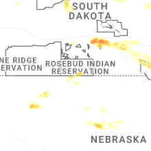
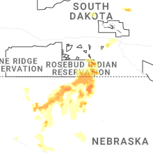
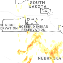
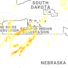


Connect with Interactive Hail Maps