

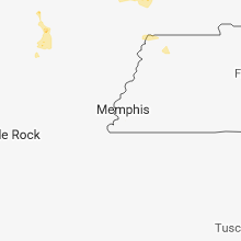
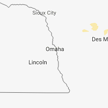
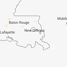
Hail Map for Thursday, June 14, 2018

Number of Impacted Households on 6/14/2018
0
Impacted by 1" or Larger Hail
0
Impacted by 1.75" or Larger Hail
0
Impacted by 2.5" or Larger Hail
Square Miles of Populated Area Impacted on 6/14/2018
0
Impacted by 1" or Larger Hail
0
Impacted by 1.75" or Larger Hail
0
Impacted by 2.5" or Larger Hail


Cities Most Affected by Hail Storms of 6/14/2018
| Hail Size | Demographics of Zip Codes Affected | ||||||
|---|---|---|---|---|---|---|---|
| City | Count | Average | Largest | Pop Density | House Value | Income | Age |
| Douglas, ND | 2 | 2.25 | 2.75 | 1 | $34k | $31.7k | 48.0 |
| Egeland, ND | 2 | 1.75 | 1.75 | 1 | $12k | $31.5k | 50.7 |
| Springfield, MO | 2 | 1.75 | 1.75 | 2310 | $96k | $35.9k | 36.1 |
| Kramer, ND | 1 | 2.50 | 2.50 | 1 | $19k | $27.1k | 52.3 |
| Souris, ND | 1 | 2.50 | 2.50 | 1 | $14k | $24.4k | 48.9 |
| Mylo, ND | 1 | 2.00 | 2.00 | 1 | $10k | $24.4k | 46.7 |
| Wales, ND | 1 | 2.00 | 2.00 | 1 | $10k | $27.8k | 51.3 |
| Cando, ND | 1 | 1.75 | 1.75 | 3 | $53k | $33.6k | 50.1 |
| Minot, ND | 1 | 1.75 | 1.75 | 144 | $86k | $32.4k | 37.7 |
| Rugby, ND | 1 | 1.75 | 1.75 | 6 | $66k | $27.2k | 47.0 |
| Plaza, ND | 1 | 1.75 | 1.75 | 1 | $24k | $26.4k | 48.4 |
| Mammoth Spring, AR | 1 | 1.75 | 1.75 | 17 | $49k | $22.2k | 47.4 |
Hail and Wind Damage Spotted on 6/14/2018
Filter by Report Type:Hail ReportsWind Reports
States Impacted
Minnesota, Montana, South Dakota, Iowa, North Dakota, Illinois, South Carolina, North Carolina, Missouri, Georgia, Arkansas, New Mexico, Nebraska, Kansas, Oklahoma, Colorado, WisconsinMinnesota
| Local Time | Report Details |
|---|---|
| 7:44 AM CDT | Half Dollar sized hail reported near Avoca, MN, 63.7 miles ENE of Sioux Falls, SD, dime to half dollar size hail nearly covered the ground. |
Montana
| Local Time | Report Details |
|---|---|
| 8:15 AM MDT | Quarter sized hail reported near Frazer, MT, 28.7 miles ENE of Glasgow, MT |
| 8:18 AM MDT | Quarter sized hail reported near Wolf Point, MT, 47.2 miles ENE of Glasgow, MT, time estimated by radar. |
| 9:50 AM MDT | Quarter sized hail reported near Dagmar, MT, 34.2 miles NW of Williston, ND, hail ranging from dimes to quarters. |
| 9:53 AM MDT | Quarter sized hail reported near Dagmar, MT, 36.3 miles NW of Williston, ND, quarters and dimes mixed. hailed for approx 5 minutes. |
South Dakota
| Local Time | Report Details |
|---|---|
| 8:15 AM MDT | Storm damage reported in haakon county SD, 65.9 miles WSW of Pierre, SD |
| 4:15 PM MDT | Storm damage reported in butte county SD, 54.6 miles NW of Rapid City, SD |
| 5:15 PM MDT | Quarter sized hail reported near Prairie City, SD, 109.8 miles N of Rapid City, SD |
| 5:50 PM MDT | Storm damage reported in perkins county SD, 106.3 miles NNE of Rapid City, SD |
| 5:53 PM MDT | Storm damage reported in ziebach county SD, 71.6 miles ENE of Rapid City, SD |
| 8:06 PM MDT | Grand river raws statio in corson county SD, 83.1 miles S of Bismarck, ND |
Iowa
| Local Time | Report Details |
|---|---|
| 9:45 AM CDT | Quarter sized hail reported near Scranton, IA, 55 miles SE of Storm Lake, IA, report via social media. |
| 10:35 AM CDT | Ping Pong Ball sized hail reported near Albia, IA, 57 miles SE of Des Moines, IA |
| 11:30 AM CDT | Asos station otm... ottumwa regional airpor in wapello county IA, 61.1 miles NW of Kahoka, MO |
| 11:30 AM CDT | Large tree down over power lines - reported via social medi in wapello county IA, 57.1 miles NW of Kahoka, MO |
| 11:33 AM CDT | A few large trees down on the north side of ottumw in wapello county IA, 55.8 miles NW of Kahoka, MO |
| 12:40 PM CDT | Half Dollar sized hail reported near Keosauqua, IA, 22.2 miles NNW of Kahoka, MO |
| 1:00 PM CDT | 6 inch diameter tree branches dow in lee county IA, 14.3 miles E of Kahoka, MO |
| 1:03 PM CDT | Tree fell on powerlines causing a power outage in downtown. about 1400 customers without powe in lee county IA, 25.1 miles NE of Kahoka, MO |
| 1:06 PM CDT | Tree fell on powerlines with about 100 customers out of powe in lee county IA, 17.4 miles E of Kahoka, MO |
| 1:06 PM CDT | A couple trees and powerlines down across burlingto in des moines county IA, 41.8 miles NE of Kahoka, MO |
North Dakota
| Local Time | Report Details |
|---|---|
| 11:05 AM CDT | Quarter sized hail reported near Grenora, ND, 30.5 miles NW of Williston, ND |
| 12:02 PM CDT | Quarter sized hail reported near Ray, ND, 30.5 miles NE of Williston, ND |
| 4:10 PM CDT | Golf Ball sized hail reported near Rugby, ND, 53.7 miles WNW of Devils Lake, ND, golf ball size hail. public report relayed by local radio station. |
| 4:18 PM CDT | Quarter sized hail reported near Mylo, ND, 50.7 miles NW of Devils Lake, ND, hail lasted 15 to 20 minutes. 1.78 inches of rain within 1 hour. arb observer. |
| 4:36 PM CDT | Hen Egg sized hail reported near Mylo, ND, 47.7 miles NW of Devils Lake, ND |
| 4:55 PM CDT | Half Dollar sized hail reported near Bisbee, ND, 43.1 miles NNW of Devils Lake, ND, half dollar and quarter sized hail fell from 455 pm to 510 pm |
| 5:10 PM CDT | Half Dollar sized hail reported near Bisbee, ND, 43.1 miles NNW of Devils Lake, ND, public reported several half dollar hail stones along with multiple quarter sized hail stones. hail lasted for 10 to 15 minutes. |
| 5:15 PM CDT | Baseball sized hail reported near , , 76.7 miles NE of Williston, ND, lasted about 3 minutes. window damage in town. the duration of the hail event was 3 minutes. |
| 5:30 PM CDT | Golf Ball sized hail reported near Egeland, ND, 41 miles NNW of Devils Lake, ND, public reported pea to golf ball sized hail. time estimated by radar. |
| 5:45 PM CDT | Golf Ball sized hail reported near Egeland, ND, 40.1 miles NNW of Devils Lake, ND, public reported golf ball hail. pea to marble sized hail lasted around 25 minutes prior to the golf ball hail. |
| 5:50 PM CDT | Half Dollar sized hail reported near Kenmare, ND, 61.9 miles NW of Minot, ND, half dollar size hail. mping report. |
| 6:30 PM CDT | Hen Egg sized hail reported near Wales, ND, 45.5 miles N of Devils Lake, ND, social media post related through local media shows large 2 inch hail stones next to ruler. |
| 6:30 PM CDT | Ping Pong Ball sized hail reported near Langdon, ND, 47.7 miles NNE of Devils Lake, ND, hailstones ranged from 1 inch to 1.5 inches. time approximate. |
| 6:15 PM MDT | Quarter sized hail reported near Reeder, ND, 114.2 miles WSW of Bismarck, ND, hail lasted a few minutes. winds with storm 35 mph or less. |
| 6:35 PM MDT | Quarter sized hail reported near Hettinger, ND, 106 miles WSW of Bismarck, ND, lasted about 5 minutes. |
| 7:36 PM CDT | Quarter sized hail reported near Berthold, ND, 36.3 miles W of Minot, ND, hail was starting to cover the ground. |
| 7:40 PM CDT | Quarter sized hail reported near Westhope, ND, 42.3 miles NNE of Minot, ND, time estimated from radar. |
| 7:42 PM CDT | Golf Ball sized hail reported near Plaza, ND, 36.2 miles W of Minot, ND |
| 7:50 PM CDT | Tennis Ball sized hail reported near Kramer, ND, 41.3 miles NE of Minot, ND, hail was actually measured at 2.25 inches with a caliper. twitter post. |
| 7:56 PM CDT | Tennis Ball sized hail reported near Souris, ND, 45.1 miles NE of Minot, ND |
| 8:25 PM CDT | Quarter sized hail reported near Willow City, ND, 54.8 miles NE of Minot, ND, quarter size hail. |
| 8:25 PM CDT | Quarter sized hail reported near Kramer, ND, 48.6 miles NE of Minot, ND, time estimated from radar data. |
| 7:29 PM MDT | Quarter sized hail reported near Halliday, ND, 78.2 miles SW of Minot, ND, hail ongoing at time this report was sent. |
| 9:10 PM CDT | Golf Ball sized hail reported near Douglas, ND, 19 miles SW of Minot, ND, golf ball size hail. public report relayed by local broadcast media. |
| 8:23 PM MDT | Also had quarter size diameter hail and about an inch of rain. the rain fell in less than a half hour. hail and wind lasted about 5 minute in mercer county ND, 61.4 miles SSW of Minot, ND |
| 9:31 PM CDT | Ndawn site 5n linto in emmons county ND, 41.4 miles SE of Bismarck, ND |
| 9:35 PM CDT | Golf Ball sized hail reported near Minot, ND, 10.1 miles S of Minot, ND, golf ball size hail. location estimated. |
| 9:35 PM CDT | Steel grain bins blown down along west side of lake. time estimated based on rada in towner county ND, 50.5 miles NNW of Devils Lake, ND |
| 9:36 PM CDT | Baseball sized hail reported near Douglas, ND, 24.2 miles SSW of Minot, ND, tennis ball to baseball size hail. |
| 9:37 PM CDT | Report of trees blown down around town. time estimated based on rada in towner county ND, 50.2 miles NNW of Devils Lake, ND |
| 9:50 PM CDT | Quarter sized hail reported near Mandaree, ND, 52.4 miles ESE of Williston, ND, facebook post. |
| 10:23 PM CDT | Golf Ball sized hail reported near Cando, ND, 34.8 miles NW of Devils Lake, ND, a few ping pong ball to golf ball sized hail in very heavy rain. time estimated based on radar. |
| 10:34 PM CDT | Quarter sized hail reported near Munich, ND, 38.6 miles N of Devils Lake, ND |
| 10:44 PM CDT | Quarter sized hail reported near Starkweather, ND, 32.4 miles N of Devils Lake, ND, heavy rain and a few large hail. several larger tree branches broken down as well. |
| 10:44 PM CDT | Quarter sized hail reported near Starkweather, ND, 31 miles N of Devils Lake, ND, heavy rain and a few large hail. several larger tree branches broken down as well. |
| 2:00 AM CDT | Ping Pong Ball sized hail reported near Horace, ND, 9.8 miles SW of Fargo, ND, via wday twitter |
| 2:00 AM CDT | Quarter sized hail reported near Horace, ND, 9.8 miles SW of Fargo, ND, via local media facebook page |
| 2:07 AM CDT | Quarter sized hail reported near Fargo, ND, 2 miles SSW of Fargo, ND, mostly pea to dime sized with quarters mixed in and the hail occured for 10 minutes |
| 2:10 AM CDT | Quarter sized hail reported near Fargo, ND, 3.9 miles SW of Fargo, ND |
Illinois
| Local Time | Report Details |
|---|---|
| 1:10 PM CDT | Large tree down across state highway 9 in pike county IL, 54.7 miles SSE of Kahoka, MO |
| 1:22 PM CDT | Powerlines down in elvasto in hancock county IL, 25.9 miles E of Kahoka, MO |
| 1:32 PM CDT | Powerlines down in burnsid in hancock county IL, 33.2 miles E of Kahoka, MO |
| 1:44 PM CDT | Quarter sized hail reported near Loraine, IL, 31.9 miles SE of Kahoka, MO |
| 1:55 PM CDT | 3 trees reported down by the public between 5th and 8th stree in adams county IL, 37.5 miles SSE of Kahoka, MO |
| 2:00 PM CDT | Corrects previous tstm wnd dmg report from quincy. large tree down on or near a house at the corner of south 24th street and payson road. time is estimate in adams county IL, 38.1 miles SSE of Kahoka, MO |
South Carolina
| Local Time | Report Details |
|---|---|
| 2:12 PM EDT | Calhoun county 911 dispatch reports a tree down on old swamp road near highway 176. time estimated based on rada in calhoun county SC, 63.7 miles ENE of Augusta, GA |
| 4:15 PM EDT | County reports a tree and power line down on highway 178 at cove creek roa in pickens county SC, 11.9 miles NW of Greenville, SC |
| 4:34 PM EDT | Schp reported a tree down at augusta highway and round o road. time determined from radar dat in colleton county SC, 35.2 miles WSW of Charleston, SC |
| 4:40 PM EDT | Tree knocked down in market common in myrtle beach in horry county SC, 69.1 miles SW of Wilmington, NC |
| 5:20 PM EDT | Cedar tree down and a few limbs off a large oak on wexford ct off of hwy 544 in horry county SC, 67.6 miles ENE of Charleston, SC |
| 5:20 PM EDT | Schp reported a tree dow in colleton county SC, 38.8 miles SW of Charleston, SC |
| 5:37 PM EDT | Quarter sized hail reported near Myrtle Beach, SC, 65.4 miles ENE of Charleston, SC, quarter-sized hail reported at surfside beach at huckabee fields |
| 5:40 PM EDT | Wind damage to roof and side of home in socastee... sc in horry county SC, 67.3 miles ENE of Charleston, SC |
| 5:50 PM EDT | Wind blew awning off california dreaming restaurant at surfside beach in horry county SC, 67.4 miles ENE of Charleston, SC |
| 6:45 PM EDT | Cedar tree down and a few limbs off a large oak on wexford ct off of hwy 544 in horry county SC, 67.6 miles ENE of Charleston, SC |
| 8:14 PM EDT | Shaw air force base measured a peak wind gusts of 70 mph at 8:14p in sumter county SC, 60.1 miles NNW of Charleston, SC |
| 8:18 PM EDT | Shaw air force base measured a 62 mph wind gus in sumter county SC, 60.1 miles NNW of Charleston, SC |
| 8:23 PM EDT | Shaw air force base measured a 58 mph wind gust from the east 5 minutes later than previous repor in sumter county SC, 60.1 miles NNW of Charleston, SC |
| 8:26 PM EDT | Sc highway patrol reported trees on roadway at dodgen hill rd at peach orchard rd. time estimated by rada in sumter county SC, 63.2 miles NNW of Charleston, SC |
| 8:27 PM EDT | Sc highway patrol reported trees in the roadway on camden hwy at west brewington r in sumter county SC, 59.9 miles NNW of Charleston, SC |
| 8:31 PM EDT | Sc highway patrol reported trees on the roadway on loring mill rd at wise dr. time estimated by rada in sumter county SC, 56.4 miles NNW of Charleston, SC |
| 9:16 PM EDT | Richland county 911 dispatch reported a tree down blocking highway 601 near bluff road. time estimated based on rada in richland county SC, 55.2 miles NW of Charleston, SC |
North Carolina
| Local Time | Report Details |
|---|---|
| 2:31 PM EDT | Quarter sized hail reported near Sneads Ferry, NC, 37 miles NE of Wilmington, NC, quarter sized hail at everett yopp drive. |
| 9:44 PM EDT | Fire dept/rescue dispatched to several reports of trees down on robinson rd...crusoe rd...and waddell rd... west of mooresville. time estimated from rada in iredell county NC, 27 miles N of Charlotte, NC |
| 12:05 AM EDT | Tree down along south ingleside farm rd in lincoln county NC, 19.2 miles NW of Charlotte, NC |
Missouri
| Local Time | Report Details |
|---|---|
| 1:59 PM CDT | Estimated 70mph winds with debris and trees down in the are in marion county MO, 44.1 miles SSE of Kahoka, MO |
| 2:15 PM CDT | Tree fell down over road near eunic in texas county MO, 30.1 miles SSW of Salem, MO |
| 2:16 PM CDT | Quarter sized hail reported near Stoutsville, MO, 43 miles NE of Columbia, MO |
| 2:42 PM CDT | Quarter sized hail reported near Perry, MO, 48.6 miles NE of Columbia, MO |
| 2:42 PM CDT | Quarter sized hail reported near Paris, MO, 41.2 miles NNE of Columbia, MO |
| 2:45 PM CDT | Quarter sized hail reported near Rolla, MO, 22.5 miles NNW of Salem, MO, quarter size hail on state highway bb east of rolla per facebook post. |
| 2:48 PM CDT | Quarter sized hail reported near Perry, MO, 48.6 miles NE of Columbia, MO, report via mping. |
| 2:52 PM CDT | Quarter sized hail reported near Raymondville, MO, 26.1 miles SW of Salem, MO, time estimated via radar. |
| 2:56 PM CDT | At least 3 trees with major branches out of them... a tent gazebo destroyed and some siding off a house. also had hail to the size of quarters. facebook repor in dent county MO, 11.8 miles WNW of Salem, MO |
| 3:25 PM CDT | Tree limbs down per facebook in white churc in howell county MO, 56 miles SSW of Salem, MO |
| 3:26 PM CDT | Quarter sized hail reported near Laddonia, MO, 42.6 miles ENE of Columbia, MO, via nws chat. |
| 3:30 PM CDT | Power lines down / poles down in area of 13500 cr 3200 east of rolla. time estimated via rada in phelps county MO, 21.7 miles NNW of Salem, MO |
| 3:33 PM CDT | Corrects previous tstm wnd dmg report from 4 wnw mountain view. tree limbs down per facebook post northwest of mountain vie in howell county MO, 45.3 miles SSW of Salem, MO |
| 3:50 PM CDT | Tree limbs down per facebook post northwest of mountain vie in howell county MO, 45.3 miles SSW of Salem, MO |
| 4:00 PM CDT | Semi truck blown over on i-70 near danville. time is approximat in montgomery county MO, 43.4 miles E of Columbia, MO |
| 4:22 PM CDT | 4-6 inch tree limbs dow in lincoln county MO, 49.1 miles WNW of Saint Louis, MO |
| 4:22 PM CDT | Quarter sized hail reported near Troy, MO, 49.1 miles WNW of Saint Louis, MO |
| 4:29 PM CDT | Half Dollar sized hail reported near Thayer, MO, 71.6 miles S of Salem, MO, facebook picture. time estimated via radar and post. |
| 4:35 PM CDT | Half Dollar sized hail reported near Troy, MO, 48.3 miles WNW of Saint Louis, MO, half dollar sized hail on the south side of troy. |
| 4:43 PM CDT | Quarter sized hail reported near Wright City, MO, 46.5 miles WNW of Saint Louis, MO, pea to quarter sized hail in wright city. |
| 4:48 PM CDT | 8 inch diameter tree limbs down in tow in oregon county MO, 77 miles S of Salem, MO |
| 5:15 PM CDT | Trees down damaging a fenc in st. charles county MO, 19.7 miles NW of Saint Louis, MO |
| 5:25 PM CDT | Corrects previous tstm wnd dmg report from villa ridge. 9-13 inch diameter tree down across highway o in villa ridg in franklin county MO, 38.4 miles WSW of Saint Louis, MO |
| 5:40 PM CDT | Tree damage in robertsvill in franklin county MO, 36.8 miles WSW of Saint Louis, MO |
| 5:40 PM CDT | Trees dow in franklin county MO, 31 miles WSW of Saint Louis, MO |
| 5:40 PM CDT | 9-13 inch diameter tree down across highway o in villa ridg in franklin county MO, 38.4 miles WSW of Saint Louis, MO |
| 5:45 PM CDT | Quarter sized hail reported near Lynchburg, MO, 42.6 miles WSW of Salem, MO |
| 5:45 PM CDT | Large limbs down near the intersection of highways ff and in jefferson county MO, 29.4 miles WSW of Saint Louis, MO |
| 6:05 PM CDT | Trees dow in franklin county MO, 40.6 miles WSW of Saint Louis, MO |
| 6:06 PM CDT | 6-inch tree across lynch road blocking traffic between highway ff and byrnesville road south of eureka. gusts to 40 mph and dime-sized hail also observe in jefferson county MO, 29.6 miles WSW of Saint Louis, MO |
| 6:07 PM CDT | Quarter sized hail reported near Jefferson City, MO, 27 miles SSE of Columbia, MO |
| 6:21 PM CDT | Large tree... partially rotten at base... snapped off and fell onto a mobile home causing considerable damage. no one was home at the tim in jefferson county MO, 24.2 miles SW of Saint Louis, MO |
| 6:25 PM CDT | Trees dow in jefferson county MO, 34 miles SW of Saint Louis, MO |
| 6:40 PM CDT | Large tree limb down on powerline in jefferson county MO, 29.7 miles SSW of Saint Louis, MO |
| 6:45 PM CDT | Tree limbs down and lawn furniture tosse in jefferson county MO, 43.5 miles SSW of Saint Louis, MO |
| 6:50 PM CDT | 10 inch maple tree blown dow in st. francois county MO, 54 miles ENE of Salem, MO |
| 6:50 PM CDT | Tv viewer called in a 60 mph wind estimat in jefferson county MO, 33.7 miles SW of Saint Louis, MO |
| 6:53 PM CDT | Tv viewer called in to report downed trees in the lonedell are in franklin county MO, 40.6 miles WSW of Saint Louis, MO |
| 8:00 PM CDT | Quarter sized hail reported near Galena, MO, 35.6 miles SSW of Springfield, MO, hail up to quarter size per facebook picture. |
| 8:25 PM CDT | Mping report of tree limbs down north of branso in taney county MO, 34 miles S of Springfield, MO |
| 8:33 PM CDT | Quarter sized hail reported near Springfield, MO, 3.4 miles S of Springfield, MO, mping report. |
| 8:49 PM CDT | Half Dollar sized hail reported near Springfield, MO, 5.7 miles SW of Springfield, MO, small limbs down as well along with half dollar hail. |
| 8:52 PM CDT | Golf Ball sized hail reported near Springfield, MO, 2.2 miles SSW of Springfield, MO |
| 8:54 PM CDT | Quarter sized hail reported near Springfield, MO, 1.7 miles WSW of Springfield, MO, mping report. |
| 8:57 PM CDT | Quarter sized hail reported near Springfield, MO, 2.8 miles SSE of Springfield, MO, quarter size hail near national and seminole. delayed report. via facebook. |
| 9:02 PM CDT | Quarter sized hail reported near Springfield, MO, 2.9 miles SSE of Springfield, MO, quarter size hail 1300 block of e. sunset st. springfield... mo. delayed report. via facebook. |
| 9:04 PM CDT | Golf Ball sized hail reported near Springfield, MO, 3 miles SE of Springfield, MO, golf ball hail ongoing 5 minutes at broadcast station. |
| 9:30 PM CDT | Trees and power lines down along with minor building damag in cape girardeau county MO, 12.9 miles WSW of Cape Girardeau, MO |
| 9:40 PM CDT | Reports of multiple trees and power lines down within scott count in scott county MO, 18.5 miles SSW of Cape Girardeau, MO |
Georgia
| Local Time | Report Details |
|---|---|
| 4:24 PM EDT | Trees and powerlines down at the intersection of standard lane and old tusculum road... and at the 200 block of church roa in effingham county GA, 19.6 miles NW of Savannah, GA |
| 5:07 PM EDT | Tree down along hope church road near springhill road. time estimated from rada in wheeler county GA, 39.6 miles N of Douglas, GA |
| 5:30 PM EDT | Trees down on hwy 56. trees and powerlines downed on drake road in emanuel county GA, 51.2 miles SSW of Augusta, GA |
| 5:30 PM EDT | Trees down on stevens cemetary and stevens crossing rd in emanuel county GA, 51.4 miles SSW of Augusta, GA |
Arkansas
| Local Time | Report Details |
|---|---|
| 5:06 PM CDT | Golf Ball sized hail reported near Mammoth Spring, AR, 88.2 miles S of Salem, MO, golfball-sized hail fell for 10-15 minutes. |
| 5:55 PM CDT | Quarter sized hail reported near Horseshoe Bend, AR, 98.4 miles S of Salem, MO |
New Mexico
| Local Time | Report Details |
|---|---|
| 5:31 PM MDT | Kskx awo in taos county NM, 6.3 miles WNW of Taos, NM |
Nebraska
| Local Time | Report Details |
|---|---|
| 7:10 PM MDT | Storm damage reported in garden county NE, 75.3 miles ESE of Scottsbluff, NE |
| 7:51 PM MDT | Storm damage reported in chase county NE, 62.6 miles SW of North Platte, NE |
| 7:55 PM MDT | Storm damage reported in chase county NE, 62.6 miles SW of North Platte, NE |
Kansas
| Local Time | Report Details |
|---|---|
| 7:28 PM MDT | Wind from an outflow boundary of a approaching tstm. blowing dust reducing vis to 3 to 4 mile in sherman county KS, 39.5 miles W of Colby, KS |
Oklahoma
| Local Time | Report Details |
|---|---|
| 9:14 PM CDT | Storm damage reported in cimarron county OK, 108.8 miles NNW of Amarillo, TX |
Colorado
| Local Time | Report Details |
|---|---|
| 10:36 PM MDT | Measured gust to 50 mph. numerous moderate sized tree limbs down. some power lines reported down and one power transformer reported blow in moffat county CO, 0.7 miles WSW of Craig, CO |
Wisconsin
| Local Time | Report Details |
|---|---|
| 4:25 AM CDT | Quarter sized hail reported near Sheldon, WI, 70.1 miles WSW of Rhinelander, WI |
| 4:30 AM CDT | Quarter sized hail reported near Ashland, WI, 59.8 miles ESE of Duluth, MN, report relayed via twitter. |
Connect with Interactive Hail Maps