

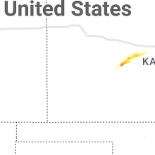
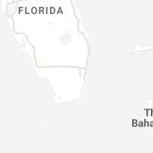
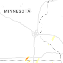
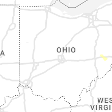
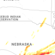
Hail Map for Tuesday, June 14, 2022

Number of Impacted Households on 6/14/2022
0
Impacted by 1" or Larger Hail
0
Impacted by 1.75" or Larger Hail
0
Impacted by 2.5" or Larger Hail
Square Miles of Populated Area Impacted on 6/14/2022
0
Impacted by 1" or Larger Hail
0
Impacted by 1.75" or Larger Hail
0
Impacted by 2.5" or Larger Hail


Cities Most Affected by Hail Storms of 6/14/2022
| Hail Size | Demographics of Zip Codes Affected | ||||||
|---|---|---|---|---|---|---|---|
| City | Count | Average | Largest | Pop Density | House Value | Income | Age |
| York, NE | 4 | 2.19 | 2.50 | 51 | $79k | $36.8k | 39.9 |
| Seward, NE | 4 | 2.00 | 2.25 | 50 | $96k | $44.3k | 35.5 |
| Malcolm, NE | 2 | 2.50 | 3.00 | 31 | $103k | $52.0k | 42.2 |
| Trumbull, NE | 2 | 2.25 | 2.50 | 9 | $72k | $41.6k | 40.0 |
| Hastings, NE | 2 | 1.88 | 2.00 | 184 | $78k | $36.9k | 37.0 |
| Henderson, NE | 2 | 1.88 | 2.00 | 7 | $75k | $39.0k | 50.3 |
| Bazine, KS | 2 | 1.75 | 1.75 | 2 | $33k | $31.1k | 42.1 |
| Loup City, NE | 1 | 2.00 | 2.00 | 6 | $41k | $26.5k | 49.3 |
| Kenesaw, NE | 1 | 1.75 | 1.75 | 6 | $69k | $38.9k | 40.7 |
| David City, NE | 1 | 1.75 | 1.75 | 25 | $67k | $36.1k | 42.0 |
| Kearney, NE | 1 | 1.75 | 1.75 | 182 | $89k | $35.1k | 33.5 |
| Utica, NE | 1 | 1.75 | 1.75 | 11 | $77k | $41.7k | 41.9 |
| Juniata, NE | 1 | 1.75 | 1.75 | 17 | $92k | $38.4k | 40.0 |
| Waco, NE | 1 | 1.75 | 1.75 | 8 | $56k | $37.7k | 49.4 |
| Raymond, NE | 1 | 1.75 | 1.75 | 24 | $115k | $58.3k | 43.1 |
Hail and Wind Damage Spotted on 6/14/2022
Filter by Report Type:Hail ReportsWind Reports
States Impacted
North Carolina, North Dakota, Minnesota, South Carolina, Ohio, Virginia, West Virginia, Maryland, Delaware, Georgia, Alabama, Florida, Kansas, Texas, Nebraska, Iowa, South Dakota, WisconsinNorth Carolina
| Local Time | Report Details |
|---|---|
| 8:13 AM EDT | Trees and power lines down on forsythe st near virginia r in mcdowell county NC, 62.7 miles SSE of Bristol, TN |
North Dakota
| Local Time | Report Details |
|---|---|
| 7:15 AM CDT | Tree uprooted. pic via social medi in griggs county ND, 44 miles SE of Devils Lake, ND |
| 8:09 AM CDT | Numerous trees damaged and uprooted in mcville as a result of thunderstorm wind gust in nelson county ND, 39.3 miles SE of Devils Lake, ND |
| 9:22 AM CDT | Semi trailer truck flipped on highway 2 due to strong thunderstorm wind in nelson county ND, 37.9 miles E of Devils Lake, ND |
Minnesota
| Local Time | Report Details |
|---|---|
| 7:48 AM CDT | Public reports 63 mph wind gust on their personal weather station. time estimated via rada in polk county MN, 67 miles SW of Roseau, MN |
| 5:17 PM CDT | Several trees blown across highway 72 near mile marker 42 and shoreline drive north of waskish. trees large enough to block the highway. mndot called out to clear trees in beltrami county MN, 53.8 miles NNE of Bemidji, MN |
South Carolina
| Local Time | Report Details |
|---|---|
| 9:24 AM EDT | Numerous trees down around city of chester. tree fell on high tension power lines near chester sr high school and caused widespread outage in chester county SC, 41.2 miles SSW of Charlotte, NC |
| 9:43 AM EDT | Lancaster dispatch reports trees down on beacon r in lancaster county SC, 38.6 miles SSE of Charlotte, NC |
| 9:48 AM EDT | Lancaster 911 dispatch reported trees down on langley rd and heyward hough r in lancaster county SC, 34.9 miles SSE of Charlotte, NC |
| 11:15 AM EDT | Aiken county dispatch reported a tree down on rocky grove road near rocky grove church. time estimated by rada in aiken county SC, 40.3 miles E of Augusta, GA |
| 11:22 AM EDT | Orangeburg county emergency management reported a tree down at sycamore drive and hwy 3 in orangeburg county SC, 39.6 miles E of Augusta, GA |
| 11:25 AM EDT | Orangeburg county emergency manager reported a tree down at sc hwy 3 and hwy in orangeburg county SC, 41.3 miles E of Augusta, GA |
| 11:30 AM EDT | Public report of multiple trees down and minor structure damage at three runs plantation. time estimated by rada in aiken county SC, 19.6 miles E of Augusta, GA |
| 11:35 AM EDT | Aiken county dispatch reported downed tree at moseley road and telfair drive. time estimated by rada in aiken county SC, 30.5 miles E of Augusta, GA |
| 11:59 AM EDT | Sc department of transportation reported a tree down along sc route 125 near the barnwell county border. time of event was estimated from radar dat in allendale county SC, 33.7 miles SE of Augusta, GA |
| 12:00 PM EDT | Sc highway patrol reported trees down at sc 70 and woodland road (sc road 5-420). time estimated by rada in bamberg county SC, 49.8 miles E of Augusta, GA |
| 12:15 PM EDT | Sc department of transportation reported a tree down near the intersection of u.s. highway 301 and googe rd in allendale. time of event was estimated from radar dat in allendale county SC, 50.3 miles SE of Augusta, GA |
| 12:21 PM EDT | Barnwell county dispatch reports powerlines and trees down across the county causing widespread power outage in barnwell county SC, 38.7 miles ESE of Augusta, GA |
| 12:22 PM EDT | Sc department of transportation reported a tree down near the intersection of charleston ave and 4th st in fairfax. time of event was estimated from radar dat in allendale county SC, 56.1 miles SE of Augusta, GA |
| 12:23 PM EDT | Sc department of transportation reported a tree down along terry rd. time of event was estimated from radar dat in allendale county SC, 51.3 miles SE of Augusta, GA |
| 12:40 PM EDT | Sc department of transportation reported a tree down along river rd northwest of estill. time of event was estimated from radar dat in allendale county SC, 51.3 miles NNW of Savannah, GA |
Ohio
| Local Time | Report Details |
|---|---|
| 9:57 AM EDT | Shingle damage and five big healthy trees down. reporter not sure on what time it occurred last nigh in putnam county OH, 54.9 miles E of Fort Wayne, IN |
| 5:45 PM EDT | Measured gust from hamilton mesonet site ew6002. corrected from iris entr in butler county OH, 20.9 miles N of Cincinnati, OH |
| 10:27 PM EDT | Tree blocking wahl road in whites landin in sandusky county OH, 62.5 miles W of Cleveland, OH |
| 10:30 PM EDT | Tree down over road in vicker in sandusky county OH, 65.4 miles W of Cleveland, OH |
| 10:50 PM EDT | Large tree snapped midway u in erie county OH, 45.7 miles W of Cleveland, OH |
Virginia
| Local Time | Report Details |
|---|---|
| 10:11 AM EDT | Tree down on oriana r in york county VA, 35.1 miles NW of Virginia Beach, VA |
| 12:00 PM EDT | Tree limbs blew down onto the driveway of a residence near musto in highland county VA, 43 miles SSE of Elkins, WV |
| 1:05 PM EDT | Tree down on hurricane reef drive. time estimated by rada in bedford county VA, 30.3 miles ENE of Roanoke, VA |
| 1:09 PM EDT | Tree down near intersection of centerville rd and benchmark lane. time estimated from rada in bedford county VA, 26.8 miles ENE of Roanoke, VA |
| 1:14 PM EDT | Tree down on pinecrest ave. time estimated from rada in bedford county VA, 24.1 miles E of Roanoke, VA |
| 1:28 PM EDT | Trees down on lynch mill rd. time estimated from radar. report by kd country radi in campbell county VA, 37.7 miles ESE of Roanoke, VA |
| 1:28 PM EDT | Corrects previous tstm wnd dmg report from 1 wnw altavista. multiple trees down on lynch rd. time estimated from radar. report by kd country radi in campbell county VA, 36.7 miles ESE of Roanoke, VA |
| 1:28 PM EDT | Corrects previous tstm wnd dmg report from 1 wnw altavista. multiple trees down on lynch rd. time estimated from radar. report by kd country radi in campbell county VA, 36.7 miles ESE of Roanoke, VA |
| 1:31 PM EDT | One tree was blown down on clover road near hurt. time estimated by rada in pittsylvania county VA, 40.1 miles ESE of Roanoke, VA |
| 1:45 PM EDT | 60 year old tractor shed blown down by thunderstorm winds in gretna va. report from wdbj in pittsylvania county VA, 38.5 miles SE of Roanoke, VA |
| 2:05 PM EDT | Tree down. time estimated from rada in halifax county VA, 65.6 miles ESE of Roanoke, VA |
| 2:07 PM EDT | One tree was blown down on river road. time estimated by rada in halifax county VA, 64 miles SE of Roanoke, VA |
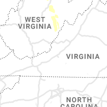
West Virginia
| Local Time | Report Details |
|---|---|
| 10:18 AM EDT | Corrects previous non-tstm wnd dmg report from 2 wnw salem. a few trees were blown down along the northwestern turnpik in doddridge county WV, 48.2 miles WNW of Elkins, WV |
| 10:20 AM EDT | Multiple trees were blown down around bridgeport along johnson avenue... anmoore road... and west main stree in harrison county WV, 33.4 miles NW of Elkins, WV |
| 10:22 AM EDT | Multiple trees were blown down around clarksburg. a few streets along which trees fell were sand hill road... wilsonburg road... south chestnut street... and upper lamb in harrison county WV, 35.8 miles NW of Elkins, WV |
| 10:45 AM EDT | A few trees were blown down along teter roa in upshur county WV, 20.4 miles WNW of Elkins, WV |
| 11:03 AM EDT | Several trees down along alexander roa in upshur county WV, 24.2 miles WSW of Elkins, WV |
| 11:30 AM EDT | Multiple trees were blown down along hackers creek roa in lewis county WV, 30 miles WNW of Elkins, WV |
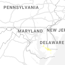
Maryland
| Local Time | Report Details |
|---|---|
| 10:20 AM EDT | Trees down causing delays on williamsburg r in dorchester county MD, 46.4 miles WNW of Ocean City, MD |
| 10:42 AM EDT | Quarter sized hail reported near Hebron, MD, 33.4 miles W of Ocean City, MD |
| 11:06 AM EDT | Power lines down along weldon and division s in wicomico county MD, 28.1 miles W of Ocean City, MD |
| 11:10 AM EDT | Trees down across salisbur in wicomico county MD, 27.5 miles W of Ocean City, MD |
| 11:15 AM EDT | Trees down in parsonsbur in wicomico county MD, 21.3 miles W of Ocean City, MD |
| 11:40 AM EDT | Powerlines down in ocean pines. time estimate in worcester county MD, 6.7 miles WNW of Ocean City, MD |
| 11:55 AM EDT | Powerlines down. time estimate in worcester county MD, 20.1 miles SW of Ocean City, MD |
Delaware
| Local Time | Report Details |
|---|---|
| 10:55 AM EDT | Report of wires down in bridgeville. time estimated via rada in sussex county DE, 38.5 miles NW of Ocean City, MD |
Georgia
| Local Time | Report Details |
|---|---|
| 11:59 AM EDT | Quarter sized hail reported near Cleveland, GA, 67.9 miles WSW of Greenville, SC, estimated 1 inch hail around cleveland. |
| 12:25 PM EDT | Burke county dispatch reported a tree down in girard. time estimated by rada in burke county GA, 33.9 miles SSE of Augusta, GA |
| 12:33 PM EDT | Thunderstorm winds blew down a tree along buttermilk rd near the screven county line. time of event was estimated from radar dat in jenkins county GA, 45.7 miles SSE of Augusta, GA |
| 1:00 PM EDT | Burke county dispatch reported a tree down and power outages in midville. time estimated by rada in burke county GA, 47.9 miles SSW of Augusta, GA |
| 1:06 PM EDT | Bulloch county 911 center reported a tree down on west waters lane blocking the roadwa in bulloch county GA, 45.4 miles NW of Savannah, GA |
| 1:07 PM EDT | Multiple trees were blown down near the intersection of highway 57 and piney grove rd. time of event was estimated from radar dat in candler county GA, 64.2 miles WNW of Savannah, GA |
| 1:18 PM EDT | Bulloch county 911 call center reported a tree down on power lines along ramble roa in bulloch county GA, 46.7 miles WNW of Savannah, GA |
| 1:25 PM EDT | Bulloch county 911 call center reported a tree down on power lines which caught on fire near the intersection of west hwy 80 and troy polk roa in bulloch county GA, 56.2 miles WNW of Savannah, GA |
| 1:34 PM EDT | Bulloch county 911 call center reported 2 trees down blocking the roadway west of statesboro... on westside road as well as on pulaski hw in bulloch county GA, 49.7 miles WNW of Savannah, GA |
| 1:34 PM EDT | Bulloch county 911 call center reported a tree down... blocking the roadway between country club road and west jones av in bulloch county GA, 48.3 miles WNW of Savannah, GA |
| 1:40 PM EDT | Multiple trees down in johnson county GA, 62.6 miles SW of Augusta, GA |
| 1:45 PM EDT | Metal roof blown off building in johnson county GA, 66.8 miles SW of Augusta, GA |
| 1:57 PM EDT | Effingham county 911 center reported a tree down near the intersection of u.s. highway 80 and pine st. time of event was estimated from radar dat in chatham county GA, 12.7 miles WNW of Savannah, GA |
| 2:06 PM EDT | Cema reports a tree down on powerlines at the 600 block of windsor roa in chatham county GA, 8.4 miles SSW of Savannah, GA |
| 2:06 PM EDT | Cema reports a tree down on powerlines at the 600 block of windsor roa in chatham county GA, 8.7 miles SSW of Savannah, GA |
| 2:10 PM EDT | Cema reports powerlines down at the intersection of skidaway road and 43rd stree in chatham county GA, 1.6 miles SSE of Savannah, GA |
| 2:30 PM EDT | Trees down blocking elko r in houston county GA, 76 miles NW of Douglas, GA |
| 2:35 PM EDT | Cema reports powerlines down at the intersection of waters avenue and east waldburg stree in chatham county GA, 3.3 miles SSE of Savannah, GA |
| 2:35 PM EDT | Long county emergency manager reported a tree down on a home on whit frasier rd. time of event was estimated from radar dat in long county GA, 38.5 miles WSW of Savannah, GA |
| 2:35 PM EDT | Long county emergency manager reported a tree down on a home on whit frasier rd. time of event was estimated from radar dat in liberty county GA, 38.1 miles WSW of Savannah, GA |
| 2:35 PM EDT | Long county emergency manager reported a tree down on a home on whit frasier rd. time of event was estimated from radar dat in liberty county GA, 38.1 miles WSW of Savannah, GA |
| 2:42 PM EDT | Trees down across ellis road in houston county GA, 75.6 miles NW of Douglas, GA |
| 2:50 PM EDT | Trees down near the intersection of pike and klondike rd in houston county GA, 74.1 miles NW of Douglas, GA |
| 2:50 PM EDT | Cema reports a tree down along the 0 block of richmond driv in chatham county GA, 7.8 miles SSE of Savannah, GA |
| 2:55 PM EDT | Large tree down and blocking the road leading into the skidaway island institute of oceanograph in chatham county GA, 9.1 miles SSE of Savannah, GA |
| 3:15 PM EDT | Report of tree down in mobile home park in tift county georgi in tift county GA, 39.6 miles W of Douglas, GA |
| 3:15 PM EDT | Tree down on wyclif roberts roa in berrien county GA, 19.8 miles WSW of Douglas, GA |
| 3:20 PM EDT | Berrien county dispatch reported a down tree on sr-135 (front of 5531 in berrien county GA, 22.8 miles SW of Douglas, GA |
| 3:40 PM EDT | Worth county law enforcement reported a down tree on sing r in worth county GA, 61.4 miles W of Douglas, GA |
| 3:45 PM EDT | Worth county dispatch reported a down tree on nutt r in worth county GA, 61.5 miles W of Douglas, GA |
| 3:45 PM EDT | Worth county dispatch reported a down tree on york r in worth county GA, 61.5 miles W of Douglas, GA |
| 3:45 PM EDT | Several large limbs blown into the roadway. upper portion of one tree snapped and also in roadway. time estimated by rada in colquitt county GA, 59.1 miles WSW of Douglas, GA |
| 4:15 PM EDT | Tree fell on hous in colquitt county GA, 57.3 miles WSW of Douglas, GA |
| 4:33 PM EDT | Tree down across dixie highwa in mitchell county GA, 47.1 miles NNE of Tallahassee, FL |
| 4:40 PM EDT | Law enforcement reported tree limbs fell on powerlines within city limits of quitman. location estimate in brooks county GA, 49.2 miles ENE of Tallahassee, FL |
| 4:40 PM EDT | Numerous trees and power lines down across the count in lowndes county GA, 51.9 miles SSW of Douglas, GA |
| 4:45 PM EDT | Law enforcement reported broken tree limbs hanging over the road... roughly 6 miles south of quitman. location estimate in brooks county GA, 46.5 miles ENE of Tallahassee, FL |
| 4:48 PM EDT | Tree blown down across highway 112. estimated tim in mitchell county GA, 48.3 miles N of Tallahassee, FL |
| 4:50 PM EDT | Tree down on southbound side of highway 45 in baker county georgi in baker county GA, 62.1 miles N of Tallahassee, FL |
| 5:00 PM EDT | Tree down on highway 37 in newton georgi in baker county GA, 62.5 miles N of Tallahassee, FL |
| 5:00 PM EDT | Multiple trees down across baker and miller countie in baker county GA, 70.6 miles NNW of Tallahassee, FL |
| 5:15 PM EDT | Corrects previous tstm wnd dmg report from 2 s bainbridge. multiple trees and power poles down across the count in decatur county GA, 34.9 miles NNW of Tallahassee, FL |
| 5:30 PM EDT | Tree down on north main street in blakely georgi in early county GA, 76 miles NNW of Tallahassee, FL |
| 5:45 PM EDT | Tree down across bean avenue in early county georgi in early county GA, 60.8 miles NNW of Tallahassee, FL |
| 5:45 PM EDT | Downed tree on east 5th street in donaldsonville georgi in seminole county GA, 54.2 miles NW of Tallahassee, FL |
| 5:46 PM EDT | Multiple trees and power poles down across the count in decatur county GA, 34.9 miles NNW of Tallahassee, FL |
| 5:48 PM EDT | Report of a tree down on paradise drive in seminole county georgi in seminole county GA, 44.7 miles NW of Tallahassee, FL |
| 6:50 PM EDT | Quarter sized hail reported near Cartersville, GA, 36.2 miles NW of Atlanta, GA, ranged from pea to quarter... lasting approximately 15 minutes. |
Alabama
| Local Time | Report Details |
|---|---|
| 3:46 PM CDT | Tree down at driftwood and andrews mill r in elmore county AL, 26.9 miles WNW of Auburn, AL |
| 3:50 PM CDT | Power lines down on red hill roa in elmore county AL, 27.3 miles W of Auburn, AL |
| 3:53 PM CDT | Tree down at weldon road and cherokee trai in elmore county AL, 27.3 miles W of Auburn, AL |
| 3:54 PM CDT | Tree down near the intersection of ridgeway dr and pine d in elmore county AL, 29.2 miles WNW of Auburn, AL |
| 4:01 PM CDT | Tree down on central avenu in elmore county AL, 32.7 miles W of Auburn, AL |
| 4:14 PM CDT | Report of a tree down near the intersection of 49s and prospect r in tallapoosa county AL, 18.9 miles W of Auburn, AL |
| 4:30 PM CDT | Tree down with powerlines in i in elmore county AL, 41.6 miles W of Auburn, AL |
| 4:30 PM CDT | Tree in roadway on the 170 spur near us 23 in elmore county AL, 41.5 miles W of Auburn, AL |
| 4:30 PM CDT | Tree down along county road 63 in henry county alabam in henry county AL, 72.8 miles SSE of Auburn, AL |
| 4:55 PM CDT | Tree down in the town of skipperville in dale county alabam in dale county AL, 71.5 miles S of Auburn, AL |
| 5:25 PM CDT | Tree over rial road track in the town of hodgesville in houston county alabam in houston county AL, 76.4 miles NE of Miramar Beach, FL |
| 5:36 PM CDT | Five trees were blown down in coffee county... mainly in the northeast part of the county in the 100-200 bloc in coffee county AL, 72.6 miles SSW of Auburn, AL |
| 5:45 PM CDT | Tree down across county road 60 in geneva county alabam in geneva county AL, 70.2 miles NE of Miramar Beach, FL |
| 6:25 PM CDT | Tree down across goat hill road in geneva county alabam in geneva county AL, 49.5 miles NNE of Miramar Beach, FL |
Florida
| Local Time | Report Details |
|---|---|
| 5:12 PM EDT | A few trees down in the mandarin are in duval county FL, 12.5 miles S of Jacksonville, FL |
| 5:30 PM EDT | Tree down near crooked road near monticell in jefferson county FL, 24.3 miles ENE of Tallahassee, FL |
| 5:30 PM EDT | Tree down along brock road near ashville hw in jefferson county FL, 32.7 miles ENE of Tallahassee, FL |
| 5:31 PM EDT | Tree down on interstate 10 westbound at mile marker 25 in madison county FL, 47.2 miles E of Tallahassee, FL |
| 5:35 PM EDT | Tree down along thompson valley road and curtis mil in jefferson county FL, 25.8 miles E of Tallahassee, FL |
| 5:40 PM EDT | Tree down at the railroad crossing at curtis mil in jefferson county FL, 25.3 miles E of Tallahassee, FL |
| 5:41 PM EDT | Couple larger tree limbs down along timberlane road. report via social medi in leon county FL, 4.2 miles N of Tallahassee, FL |
| 5:43 PM EDT | Tree down along highway 19 near aucilla roa in jefferson county FL, 24.3 miles E of Tallahassee, FL |
| 5:45 PM EDT | Tree down on us-90 at cr-142 blocking the roadwa in leon county FL, 16.5 miles ENE of Tallahassee, FL |
| 5:45 PM EDT | Picture of tree down via social media near capital circle ne and hermitage blv in leon county FL, 4.2 miles NE of Tallahassee, FL |
| 5:50 PM EDT | Tree down in roadway at intersection of meridian road and bannerman roa in leon county FL, 10.3 miles N of Tallahassee, FL |
| 5:52 PM EDT | Tree down on shady rest road in the 5300 block. road blocke in gadsden county FL, 11.3 miles NW of Tallahassee, FL |
| 5:52 PM EDT | Tree down in roadway at intersection of old bainbridge road and capital circle n in leon county FL, 7.8 miles NW of Tallahassee, FL |
| 5:52 PM EDT | Several trees down along us-90 near mckeown roa in gadsden county FL, 34.2 miles WNW of Tallahassee, FL |
| 5:54 PM EDT | Trees down on interstate 10 blocking both eastbound lanes near mile marker 16 in gadsden county FL, 35.6 miles WNW of Tallahassee, FL |
| 6:00 PM EDT | Tree down on a house on morgan roa in leon county FL, 3.5 miles S of Tallahassee, FL |
| 6:00 PM EDT | Tree down on house on mclaughlin dr. no injurie in leon county FL, 7.9 miles NE of Tallahassee, FL |
| 6:05 PM EDT | A user via twitter posted a picture of a tree limb on powerlines on laura st. user also reported that the power was out at their location. time and location estimate in leon county FL, 2.8 miles SSE of Tallahassee, FL |
| 5:20 PM CDT | Florida highway patrol reports tree down near union mill road and carter roa in jackson county FL, 62 miles WNW of Tallahassee, FL |
| 5:20 PM CDT | Tree down across highway 71 in jackson county florid in jackson county FL, 53.5 miles WNW of Tallahassee, FL |
| 6:25 PM EDT | Tree down on house on ada ct. no injurie in leon county FL, 3.5 miles S of Tallahassee, FL |
| 5:30 PM CDT | Trees and power lines down across the count in jackson county FL, 65.4 miles ENE of Miramar Beach, FL |
| 5:40 PM CDT | Tree down across county road 275 in calhoun county florid in calhoun county FL, 49.8 miles W of Tallahassee, FL |
| 6:30 PM CDT | Tree down on power lines along circle n lan in holmes county FL, 44.5 miles NE of Miramar Beach, FL |
Kansas
| Local Time | Report Details |
|---|---|
| 6:46 PM CDT | Quarter sized hail reported near Mc Cracken, KS, 23.9 miles SSW of Hays, KS, quarter size hail reported with gusty winds. |
| 7:08 PM CDT | Golf Ball sized hail reported near Bazine, KS, 38.4 miles SW of Hays, KS, golf ball size hail reported. |
| 7:28 PM CDT | Golf Ball sized hail reported near Bazine, KS, 35.3 miles SSW of Hays, KS, golf ball size hail reported. |
Texas
| Local Time | Report Details |
|---|---|
| 7:04 PM CDT | Asos station kink win in winkler county TX, 48.8 miles W of Odessa, TX |
| 7:14 PM CDT | Asos station kink win in winkler county TX, 48.8 miles W of Odessa, TX |
| 7:23 PM CDT | Corrects previous tstm wnd dmg report from 4 ene wink. time of damage is estimated from radar. damage was on highway 18 five miles south of kermit. powerlines dow in winkler county TX, 42.3 miles W of Odessa, TX |
| 7:32 PM CDT | Power lines and power poles down along highway 302 east of kermit. some power lines also down in the city of kermit. time estimated from rada in winkler county TX, 38.6 miles W of Odessa, TX |
| 8:24 PM CDT | Storm damage reported in brewster county TX, 56.2 miles SSE of Alpine, TX |
Nebraska
| Local Time | Report Details |
|---|---|
| 8:49 PM CDT | Hen Egg sized hail reported near Trumbull, NE, 17.3 miles SSE of Grand Island, NE |
| 9:40 PM CDT | Golf Ball sized hail reported near York, NE, 39.4 miles E of Grand Island, NE, hail ranging in size from quarters to golf balls has been reported in york. |
| 9:45 PM CDT | Tennis Ball sized hail reported near York, NE, 39.4 miles E of Grand Island, NE, received photo via facebook of hail with a ruler. |
| 9:49 PM CDT | Quarter sized hail reported near York, NE, 40.5 miles E of Grand Island, NE, quarter size hail and 60 mph winds reported. |
| 9:50 PM CDT | Hen Egg sized hail reported near York, NE, 40 miles E of Grand Island, NE, hail reported on the york college campus. damage to trees and canopies. |
| 9:54 PM CDT | Half Dollar sized hail reported near Waco, NE, 46.1 miles E of Grand Island, NE, quarter to half dollar size hail reported in waco. |
| 9:54 PM CDT | Golf Ball sized hail reported near Waco, NE, 46.1 miles E of Grand Island, NE, report via facebook of hail just under 2 inches diameter. |
| 9:55 PM CDT | Report via facebook of damage to a large outbuilding. time est from rada in york county NE, 51.1 miles E of Grand Island, NE |
| 10:08 PM CDT | Golf Ball sized hail reported near Utica, NE, 51.8 miles E of Grand Island, NE, home with several windows broken. |
| 10:14 PM CDT | Ping Pong Ball sized hail reported near Utica, NE, 52.4 miles E of Grand Island, NE, ping pong ball sized hail. |
| 10:17 PM CDT | Quarter sized hail reported near Nelson, NE, 52 miles SSE of Grand Island, NE, via facebook. |
| 10:18 PM CDT | Quarter sized hail reported near Utica, NE, 52.4 miles E of Grand Island, NE, quarter sized hail. |
| 10:28 PM CDT | Half Dollar sized hail reported near Seward, NE, 64.5 miles WSW of Omaha, NE |
| 10:29 PM CDT | Quarter sized hail reported near Seward, NE, 64.5 miles WSW of Omaha, NE, report from mping: quarter (1.00 in.). |
| 10:29 PM CDT | Hen Egg sized hail reported near Seward, NE, 64.5 miles WSW of Omaha, NE, report from mping: hen egg (2.00 in.). |
| 10:30 PM CDT | Golf Ball sized hail reported near Seward, NE, 64.9 miles E of Grand Island, NE |
| 10:30 PM CDT | Half Dollar sized hail reported near Seward, NE, 63.2 miles WSW of Omaha, NE |
| 10:30 PM CDT | Quarter sized hail reported near Odessa, NE, 50.7 miles WSW of Grand Island, NE, report via facebook. |
| 10:30 PM CDT | Hen Egg sized hail reported near Seward, NE, 64.9 miles E of Grand Island, NE, hail as big as 2.25 inches. |
| 10:30 PM CDT | Personal weather statio in seward county NE, 65.6 miles WSW of Omaha, NE |
| 10:30 PM CDT | Hen Egg sized hail reported near Seward, NE, 64.9 miles E of Grand Island, NE, 2.00-2.25 inch hail at seward super carwash. |
| 10:35 PM CDT | Ping Pong Ball sized hail reported near Seward, NE, 61 miles WSW of Omaha, NE, broken skylight and windows. |
| 10:35 PM CDT | Quarter sized hail reported near Odessa, NE, 50.7 miles WSW of Grand Island, NE, corrects time of previous hail report from odessa. report via facebook. |
| 10:41 PM CDT | Quarter sized hail reported near Kearney, NE, 44.5 miles WSW of Grand Island, NE, report received via facebook. |
| 10:42 PM CDT | Ping Pong Ball sized hail reported near Riverdale, NE, 44.1 miles WSW of Grand Island, NE |
| 10:46 PM CDT | Quarter sized hail reported near Kearney, NE, 45.3 miles WSW of Grand Island, NE, photo received via facebook. |
| 10:48 PM CDT | Hen Egg sized hail reported near Malcolm, NE, 54.3 miles WSW of Omaha, NE |
| 10:49 PM CDT | Quarter sized hail reported near Kearney, NE, 39.9 miles WSW of Grand Island, NE |
| 10:49 PM CDT | Golf Ball sized hail reported near Kearney, NE, 39.1 miles W of Grand Island, NE, report received via facebook. |
| 10:51 PM CDT | Quarter sized hail reported near Kearney, NE, 38.9 miles W of Grand Island, NE |
| 10:55 PM CDT | Storm damage reported in lancaster county NE, 51.3 miles WSW of Omaha, NE |
| 10:57 PM CDT | Ping Pong Ball sized hail reported near Malcolm, NE, 53.3 miles WSW of Omaha, NE, hail covered the ground. |
| 10:57 PM CDT | Tea Cup sized hail reported near Malcolm, NE, 53.3 miles WSW of Omaha, NE, corrects previous hail report from 2 n malcolm. ping pong ball size hail covered the ground. a few stones as big as 3.5 inches. substantial damage to trees... crops... |
| 10:58 PM CDT | Quarter sized hail reported near Lincoln, NE, 48.4 miles SW of Omaha, NE, report from mping: quarter (1.00 in.). |
| 11:00 PM CDT | Golf Ball sized hail reported near Raymond, NE, 48.2 miles WSW of Omaha, NE |
| 11:00 PM CDT | Quarter sized hail reported near Heartwell, NE, 34 miles SW of Grand Island, NE, report via facebook. |
| 11:01 PM CDT | Storm damage reported in kearney county NE, 37.3 miles SW of Grand Island, NE |
| 11:08 PM CDT | Golf Ball sized hail reported near Kenesaw, NE, 28.8 miles SW of Grand Island, NE, via facebook. |
| 11:10 PM CDT | Quarter sized hail reported near Davey, NE, 42.4 miles WSW of Omaha, NE |
| 11:10 PM CDT | Quarter sized hail reported near Kenesaw, NE, 26.9 miles SW of Grand Island, NE, report via facebook. |
| 11:10 PM CDT | Ping Pong Ball sized hail reported near Elwood, NE, 65 miles SE of North Platte, NE, report received via facebook. time est from radar. |
| 11:12 PM CDT | Tree blown down into a fence. winds estimated at 70 mp in lancaster county NE, 38.7 miles SW of Omaha, NE |
| 11:18 PM CDT | Golf Ball sized hail reported near Juniata, NE, 19.7 miles SSW of Grand Island, NE, report and photo via facebook from 5 n juniata. time est from radar. |
| 11:21 PM CDT | Quarter sized hail reported near Waverly, NE, 38.7 miles SW of Omaha, NE |
| 11:21 PM CDT | Storm damage reported in lancaster county NE, 38.7 miles SW of Omaha, NE |
| 11:25 PM CDT | Hen Egg sized hail reported near Loup City, NE, 41 miles NW of Grand Island, NE, hail at least 2 inches indiameter. |
| 11:27 PM CDT | Half Dollar sized hail reported near Kearney, NE, 41.8 miles WSW of Grand Island, NE, report via twitter. |
| 11:28 PM CDT | Golf Ball sized hail reported near Hastings, NE, 19.1 miles S of Grand Island, NE |
| 11:30 PM CDT | Ping Pong Ball sized hail reported near Doniphan, NE, 15.6 miles S of Grand Island, NE, report and photo via facebook. |
| 11:30 PM CDT | Multiple trees and power lines dow in cass county NE, 28.9 miles SW of Omaha, NE |
| 11:31 PM CDT | Half Dollar sized hail reported near Hastings, NE, 25.3 miles S of Grand Island, NE |
| 11:32 PM CDT | Ping Pong Ball sized hail reported near Hastings, NE, 23.2 miles S of Grand Island, NE |
| 11:32 PM CDT | Ping Pong Ball sized hail reported near Bertrand, NE, 72.6 miles SE of North Platte, NE, report received via facebook. |
| 11:34 PM CDT | Quarter sized hail reported near Kearney, NE, 43 miles WSW of Grand Island, NE |
| 11:35 PM CDT | *** 1 inj *** corrects previous tstm wnd dmg report from 2 ene greenwood. campers flipped over at campground. 1 possible injury from someone trapped in a popup campe in cass county NE, 31.3 miles SW of Omaha, NE |
| 11:35 PM CDT | Hen Egg sized hail reported near Hastings, NE, 19.1 miles S of Grand Island, NE, 2.25 inches. |
| 11:38 PM CDT | Substantial damage at the pine grove campgroun in cass county NE, 31.3 miles SW of Omaha, NE |
| 11:39 PM CDT | Tennis Ball sized hail reported near Trumbull, NE, 17.3 miles SSE of Grand Island, NE, report and photo via facebook. |
| 11:40 PM CDT | Storm damage reported in clay county NE, 22.2 miles SSE of Grand Island, NE |
| 11:41 PM CDT | Storm damage reported in adams county NE, 23.8 miles S of Grand Island, NE |
| 11:41 PM CDT | Ping Pong Ball sized hail reported near Kearney, NE, 41.8 miles WSW of Grand Island, NE, mostly dimes. short lived ping pong balls. |
| 11:45 PM CDT | Very large trees dow in cass county NE, 33.3 miles SW of Omaha, NE |
| 11:48 PM CDT | Quarter sized hail reported near Omaha, NE, 13.2 miles WSW of Omaha, NE, report from mping: quarter (1.00 in.). |
| 11:50 PM CDT | Storm damage reported in kearney county NE, 34.8 miles SW of Grand Island, NE |
| 11:53 PM CDT | Quarter sized hail reported near Eustis, NE, 56.8 miles SE of North Platte, NE, quarter size hail reported south of eustis. |
| 11:54 PM CDT | Report from mping: 1-inch tree limbs broken; shingles blown of in douglas county NE, 4.7 miles WSW of Omaha, NE |
| 11:55 PM CDT | Report from mping: 1-inch tree limbs broken; shingles blown of in cass county NE, 23 miles S of Omaha, NE |
| 11:55 PM CDT | Report from mping: 3-inch tree limbs broken; power poles broke in cass county NE, 15.8 miles SSW of Omaha, NE |
| 11:55 PM CDT | Quarter sized hail reported near Omaha, NE, 13.2 miles WSW of Omaha, NE |
| 11:57 PM CDT | Storm damage reported in sarpy county NE, 11.1 miles S of Omaha, NE |
| 12:02 AM CDT | Power pole damage approximately one-half mile north of saronville. time est from rada in clay county NE, 29.7 miles SE of Grand Island, NE |
| 12:06 AM CDT | Emergency management reports overturned shed and large tree snapped on road y... two miles south of the county line. time est from rada in clay county NE, 31.6 miles SE of Grand Island, NE |
| 12:07 AM CDT | Emergency management reports a pivot flipped onto road x approx 1.5 south of hamilton cty line. time est from rada in clay county NE, 30.3 miles SE of Grand Island, NE |
| 12:11 AM CDT | Storm damage reported in adams county NE, 22.9 miles SSW of Grand Island, NE |
| 12:11 AM CDT | Emergency management reports power poles and lines downed near 14th and baltimore. time based off peak wind gust at hsi aso in adams county NE, 22.6 miles S of Grand Island, NE |
| 12:14 AM CDT | Quarter sized hail reported near Hastings, NE, 19.1 miles S of Grand Island, NE |
| 12:15 AM CDT | With dime size hai in adams county NE, 25.3 miles S of Grand Island, NE |
| 12:16 AM CDT | Golf Ball sized hail reported near Henderson, NE, 35.4 miles ESE of Grand Island, NE, report via facebook. time est from radar. |
| 12:16 AM CDT | Tree damage and flipped pivots reported in lushton area. time est from rada in york county NE, 35.4 miles ESE of Grand Island, NE |
| 12:22 AM CDT | Ping Pong Ball sized hail reported near Henderson, NE, 29.5 miles ESE of Grand Island, NE, report via twitter. |
| 12:23 AM CDT | Storm damage reported in york county NE, 36.4 miles ESE of Grand Island, NE |
| 12:25 AM CDT | Report received via facebook of roof damage on the west side of town. time est from rada in york county NE, 40.8 miles ESE of Grand Island, NE |
| 12:30 AM CDT | Quarter sized hail reported near Gibbon, NE, 29.3 miles WSW of Grand Island, NE, report received via facebook. time estimated from radar. |
| 12:35 AM CDT | Quarter sized hail reported near York, NE, 39.4 miles E of Grand Island, NE, report relayed via ntv studio. |
| 12:36 AM CDT | Storm damage reported in clay county NE, 34.9 miles SSE of Grand Island, NE |
| 12:40 AM CDT | Ping Pong Ball sized hail reported near York, NE, 39.3 miles E of Grand Island, NE, reported near the york i-80 interchange. |
| 12:41 AM CDT | Tennis Ball sized hail reported near York, NE, 40 miles E of Grand Island, NE |
| 12:42 AM CDT | Hen Egg sized hail reported near Henderson, NE, 28.2 miles ESE of Grand Island, NE |
| 12:50 AM CDT | Quarter sized hail reported near Utica, NE, 51.8 miles E of Grand Island, NE |
| 12:55 AM CDT | Power lines blown down. power ou in seward county NE, 58.2 miles E of Grand Island, NE |
| 12:55 AM CDT | Half Dollar sized hail reported near Creighton, NE, 37.8 miles E of Oneill, NE |
| 12:55 AM CDT | Storm damage reported in adams county NE, 22.9 miles SSW of Grand Island, NE |
| 12:58 AM CDT | Storm damage reported in adams county NE, 25.3 miles S of Grand Island, NE |
| 12:58 AM CDT | Storm damage reported in adams county NE, 21.9 miles S of Grand Island, NE |
| 1:11 AM CDT | Storm damage reported in adams county NE, 23.8 miles S of Grand Island, NE |
| 1:20 AM CDT | Quarter sized hail reported near Dwight, NE, 57.7 miles WSW of Omaha, NE |
| 3:25 AM CDT | Golf Ball sized hail reported near David City, NE, 61.9 miles W of Omaha, NE |
Iowa
| Local Time | Report Details |
|---|---|
| 9:20 PM CDT | Half Dollar sized hail reported near Henderson, IA, 27.9 miles ESE of Omaha, NE, relayed via broadcast media. picture of hail larger than a quarter. time estimated from radar. |
| 11:08 PM CDT | Quarter sized hail reported near Aplington, IA, 38.5 miles SSE of Mason City, IA |
| 11:23 PM CDT | Quarter sized hail reported near Ames, IA, 36 miles N of Des Moines, IA, report via social media. i-35 rest area south bound. time estimated by radar. |
| 12:10 AM CDT | Storm damage reported in mills county IA, 15.5 miles ESE of Omaha, NE |
| 12:12 AM CDT | Power lines down. power out in glenwoo in mills county IA, 17.9 miles SE of Omaha, NE |
| 12:16 AM CDT | Storm damage reported in pottawattamie county IA, 9.4 miles E of Omaha, NE |
| 12:18 AM CDT | Storm damage reported in mills county IA, 18.8 miles ESE of Omaha, NE |
| 12:20 AM CDT | Storm damage reported in pottawattamie county IA, 17.3 miles E of Omaha, NE |
| 12:20 AM CDT | Report from mping: 1-inch tree limbs broken; shingles blown of in pottawattamie county IA, 8.1 miles ESE of Omaha, NE |
| 12:25 AM CDT | 6 inch tree limb blown down... blocking roa in pottawattamie county IA, 23.3 miles E of Omaha, NE |
| 12:25 AM CDT | 8 to 10 large trees snapped. significant damage to a home and outbuilding. time estimated based on rada in pottawattamie county IA, 19.4 miles ESE of Omaha, NE |
| 12:27 AM CDT | Substantial damage to a farmstead. grain bins destroyed. other buildings blown off foundatio in pottawattamie county IA, 23.7 miles E of Omaha, NE |
| 12:30 AM CDT | 1 inch trees snappe in pottawattamie county IA, 27.2 miles E of Omaha, NE |
| 12:35 AM CDT | Large trees down in the wheeler grove townshi in pottawattamie county IA, 30.5 miles E of Omaha, NE |
| 12:35 AM CDT | Quarter sized hail reported near Macedonia, IA, 27 miles E of Omaha, NE, from facebook. |
| 12:40 AM CDT | Power lines down. power out in town. structural damage to one business. debris in street in pottawattamie county IA, 27.2 miles E of Omaha, NE |
| 12:40 AM CDT | Storm damage reported in montgomery county IA, 35.8 miles ESE of Omaha, NE |
| 12:46 AM CDT | Storm damage reported in montgomery county IA, 41.4 miles E of Omaha, NE |
| 12:54 AM CDT | Report of large tree on vehicle. time estimate via rada in cass county IA, 41.7 miles E of Omaha, NE |
| 2:19 AM CDT | Multiple trees down... roof damage with strong winds. time estimated via rada in hardin county IA, 53 miles NNE of Des Moines, IA |
| 2:28 AM CDT | Trees dow in hardin county IA, 54 miles S of Mason City, IA |
| 2:40 AM CDT | Measured at the marshalltown airpor in marshall county IA, 50.8 miles NE of Des Moines, IA |
| 3:00 AM CDT | Quarter sized hail reported near Dike, IA, 55.6 miles SSE of Mason City, IA, strong winds also reported. relayed by kwwl tv. |
South Dakota
| Local Time | Report Details |
|---|---|
| 1:19 AM CDT | Quarter sized hail reported near Yankton, SD, 60.3 miles SW of Sioux Falls, SD, report from mping: quarter (1.00 in.). |
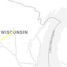
Wisconsin
| Local Time | Report Details |
|---|---|
| 4:13 AM CDT | Storm damage reported in marathon county WI, 48 miles SSW of Rhinelander, WI |
| 4:15 AM CDT | Large tree limb knocked down and power outage. limb landed on backside of hous in marathon county WI, 46 miles SSW of Rhinelander, WI |
| 4:15 AM CDT | Reports of multiple trees down in rib mountain and wausa in marathon county WI, 52 miles SSW of Rhinelander, WI |
| 4:47 AM CDT | Trees down on bass lake road. other reports of trees down in langlade count in langlade county WI, 25.1 miles SSE of Rhinelander, WI |
Connect with Interactive Hail Maps