

Hail Map for Friday, June 17, 2022

Number of Impacted Households on 6/17/2022
0
Impacted by 1" or Larger Hail
0
Impacted by 1.75" or Larger Hail
0
Impacted by 2.5" or Larger Hail
Square Miles of Populated Area Impacted on 6/17/2022
0
Impacted by 1" or Larger Hail
0
Impacted by 1.75" or Larger Hail
0
Impacted by 2.5" or Larger Hail


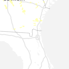
Cities Most Affected by Hail Storms of 6/17/2022
| Hail Size | Demographics of Zip Codes Affected | ||||||
|---|---|---|---|---|---|---|---|
| City | Count | Average | Largest | Pop Density | House Value | Income | Age |
| Mount Juliet, TN | 4 | 2.38 | 3.00 | 447 | $146k | $58.8k | 39.1 |
| Varnville, SC | 1 | 1.75 | 1.75 | 22 | $72k | $32.2k | 36.8 |
| Cut Bank, MT | 1 | 1.75 | 1.75 | 3 | $61k | $33.0k | 39.5 |
| Taylors, SC | 1 | 1.75 | 1.75 | 878 | $106k | $43.0k | 37.8 |
| Louisa, KY | 1 | 1.75 | 1.75 | 58 | $58k | $22.5k | 39.8 |
Hail and Wind Damage Spotted on 6/17/2022
Filter by Report Type:Hail ReportsWind Reports
States Impacted
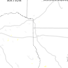
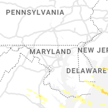
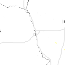
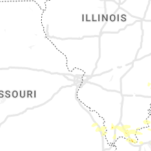
Utah, Illinois, Indiana, Kentucky, Tennessee, New Hampshire, West Virginia, Ohio, Mississippi, Maine, Alabama, Connecticut, Virginia, Rhode Island, North Carolina, Georgia, South Carolina, Colorado, New Jersey, Delaware, Maryland, New Mexico, Wyoming, Montana, South DakotaUtah
| Local Time | Report Details |
|---|---|
| 6:00 AM MDT | Paradise in cache county UT, 54.6 miles N of Salt Lake City, UT |
| 7:00 AM MDT | Logan peak in cache county UT, 66.2 miles N of Salt Lake City, UT |
| 7:15 AM MDT | Snowbasin - mount ogden in weber county UT, 30.4 miles N of Salt Lake City, UT |
| 9:30 AM MDT | Fremont junction sensor in sevier county UT, 44.5 miles ENE of Monroe, UT |
| 10:30 AM MDT | Fremont junction fre in sevier county UT, 44.5 miles ENE of Monroe, UT |
Illinois
| Local Time | Report Details |
|---|---|
| 7:00 AM CDT | Trees down on power lines. large limbs down. pool blown apart and lawn mower flipped over by win in franklin county IL, 60.5 miles NE of Cape Girardeau, MO |
| 7:00 AM CDT | Lots of tree damage. tree fell on hom in edwards county IL, 38.8 miles NW of Evansville, IN |
| 7:00 AM CDT | From facebook. power lines and large branches down. time estimated from rada in richland county IL, 49.9 miles S of Mattoon, IL |
| 7:10 AM CDT | 5 trees dow in saline county IL, 56.8 miles WSW of Evansville, IN |
| 7:10 AM CDT | Tree and shed damage. window air unit blown ou in hamilton county IL, 50.1 miles W of Evansville, IN |
| 7:12 AM CDT | Quarter sized hail reported near Anna, IL, 19.5 miles NE of Cape Girardeau, MO |
| 7:13 AM CDT | A few trees dow in lawrence county IL, 51.7 miles NNW of Evansville, IN |
| 7:15 AM CDT | Several power lines and at least one tree on a house. numerous limbs down. downed power line blocking il rt 1 and 1 in wabash county IL, 32.4 miles NNW of Evansville, IN |
| 7:15 AM CDT | Hollow oak tree blew down on power lines causing power outag in lawrence county IL, 51.1 miles NNW of Evansville, IN |
| 7:16 AM CDT | Awos station kcul carmi i in white county IL, 31.1 miles WNW of Evansville, IN |
| 7:18 AM CDT | 1 inch tree limbs broken... shingles blown off hom in wayne county IL, 62.3 miles NW of Evansville, IN |
| 7:20 AM CDT | Few trees covering roadways as well as numerous branches and debri in white county IL, 34 miles WNW of Evansville, IN |
| 7:22 AM CDT | Mainly small branches blown down near walmart in lawrenceville on haven roa in lawrence county IL, 52.4 miles N of Evansville, IN |
| 7:35 AM CDT | Numerous trees are dow in johnson county IL, 36.7 miles ENE of Cape Girardeau, MO |
| 7:43 AM CDT | Public report via mping - 1 inch tree limbs broken... shingles blown of in johnson county IL, 35.9 miles ENE of Cape Girardeau, MO |
| 7:50 AM CDT | Tree limbs and power lines down. time estimate in jackson county IL, 22.7 miles N of Cape Girardeau, MO |
| 7:55 AM CDT | Tree down across road on us 45 at mt mission r in massac county IL, 44.9 miles E of Cape Girardeau, MO |
| 8:05 AM CDT | Public report via mping - 3 inch tree limbs broke in union county IL, 20 miles ENE of Cape Girardeau, MO |
| 8:18 AM CDT | Quarter sized hail reported near Brookport, IL, 51.8 miles ESE of Cape Girardeau, MO, dime to quarter size hail at brockport bridge. |
Indiana
| Local Time | Report Details |
|---|---|
| 7:25 AM CDT | Tree down on a hom in gibson county IN, 26.4 miles N of Evansville, IN |
| 8:34 AM EDT | Em reports large... healthy tree blocking road at intersection of 550 and camp arthur r in knox county IN, 56.5 miles N of Evansville, IN |
| 8:36 AM EDT | Decker fire dept. member reports trees breaking and estimates 60mph wind in knox county IN, 37.5 miles N of Evansville, IN |
| 7:40 AM CDT | Several large trees and power lines are dow in vanderburgh county IN, 1.4 miles ESE of Evansville, IN |
| 7:42 AM CDT | Storm damage reported in vanderburgh county IN, 3.5 miles E of Evansville, IN |
| 7:43 AM CDT | Public report via mping - 1 inch tree limbs broken... shingles blown of in gibson county IN, 26.4 miles N of Evansville, IN |
| 7:44 AM CDT | Public report via mping - 1 inch tree limbs broken... shingles blown of in vanderburgh county IN, 7.2 miles N of Evansville, IN |
| 7:54 AM CDT | Asos station kevv evansville i in vanderburgh county IN, 5.6 miles NNE of Evansville, IN |
| 7:55 AM CDT | Public report via mping - 1 inch tree limbs broken... shingles blown of in vanderburgh county IN, 3.7 miles NE of Evansville, IN |
| 9:00 AM EDT | Multiple trees down and/or snapped in residential are in daviess county IN, 51.5 miles NNE of Evansville, IN |
| 9:00 AM EDT | Large power lines down. time estimate in knox county IN, 66.8 miles NNE of Evansville, IN |
| 9:08 AM EDT | Trees reported down on s 800 w by dispatc in greene county IN, 71.2 miles NNE of Evansville, IN |
| 9:08 AM EDT | Trees reported down on w 625 s by dispatc in greene county IN, 70.4 miles NNE of Evansville, IN |
| 9:09 AM EDT | Trees down blocking roadwa in dubois county IN, 41.8 miles NE of Evansville, IN |
| 9:10 AM EDT | Social media report of trees down in se daviess count in daviess county IN, 49.3 miles NE of Evansville, IN |
| 9:14 AM EDT | Several trees downed along lake greenwoo in martin county IN, 70.7 miles SSW of Indianapolis, IN |
| 9:15 AM EDT | Tree dow in dubois county IN, 36.5 miles ENE of Evansville, IN |
| 9:17 AM EDT | Power line blown over on us 23 in dubois county IN, 33.3 miles NE of Evansville, IN |
| 9:24 AM EDT | Tree in roadway approx 3 miles east of sr16 in dubois county IN, 47.6 miles ENE of Evansville, IN |
| 9:26 AM EDT | Tree dow in dubois county IN, 40.5 miles NE of Evansville, IN |
| 9:29 AM EDT | Roof damage at hoosier hills credit unio in dubois county IN, 45.7 miles NE of Evansville, IN |
| 9:36 AM EDT | Tree dow in dubois county IN, 50.9 miles ENE of Evansville, IN |
| 8:44 AM CDT | Public report - 3 inch tree limbs broke in warrick county IN, 21.1 miles NE of Evansville, IN |
| 10:00 AM EDT | Trees reported down across orange count in orange county IN, 61.7 miles NW of Louisville, KY |
| 10:00 AM EDT | Trees reported down across the western portion of washington count in washington county IN, 47.7 miles NNW of Louisville, KY |
| 10:08 AM EDT | Trees down on us-15 in floyd county IN, 32.6 miles NNW of Louisville, KY |
| 10:13 AM EDT | Tree damag in crawford county IN, 47.2 miles WNW of Louisville, KY |
| 10:20 AM EDT | Nws employee reported several large limbs down and aluminum siding peeled down the side of a feed mill. winds estimated at 60 to 65 mph. time estimated from radar based in clark county IN, 38.2 miles N of Louisville, KY |
| 10:32 AM EDT | Social media picture of a large tree spit... and another tree downed at a residence along highway 62 nort in jefferson county IN, 44.8 miles NNE of Louisville, KY |
| 11:25 AM EDT | One tree down on aberdeen road. another tree down on willow creek road. time estimated from rada in ohio county IN, 32.3 miles WSW of Cincinnati, OH |
| 11:25 AM EDT | Trees and power lines dow in jefferson county IN, 52.9 miles WSW of Cincinnati, OH |
Kentucky
| Local Time | Report Details |
|---|---|
| 7:46 AM CDT | Public report via mping - 1 inch tree limbs broken... shingles blown of in union county KY, 26.3 miles SW of Evansville, IN |
| 7:47 AM CDT | Public reported m59 mph wind gust - personal weather statio in mclean county KY, 38.8 miles SE of Evansville, IN |
| 8:05 AM CDT | Lots of large limbs down and power lines down throughout tow in webster county KY, 41.2 miles SSW of Evansville, IN |
| 8:10 AM CDT | Estimated 55 to 60 mph wind in mccracken county KY, 53.2 miles ESE of Cape Girardeau, MO |
| 8:12 AM CDT | Was still gusting 55 to 60 mph at time of repor in mccracken county KY, 53.2 miles ESE of Cape Girardeau, MO |
| 8:21 AM CDT | Public report via mping - 1 inch limbs broke in mccracken county KY, 51.5 miles ESE of Cape Girardeau, MO |
| 8:30 AM CDT | Trees down on jack thomason rd just northwest of eddyvill in lyon county KY, 68.5 miles SSW of Evansville, IN |
| 8:30 AM CDT | A metal roof of a softball shed was removed... and sheet metal was thrown downwind. time estimated from radar. public report relayed by broadcast medi in hancock county KY, 42.6 miles E of Evansville, IN |
| 8:39 AM CDT | Half Dollar sized hail reported near Dawson Springs, KY, 55.4 miles S of Evansville, IN, public report via mping. |
| 8:47 AM CDT | Public mping report- trees uprooted or snappe in crittenden county KY, 41.3 miles SW of Evansville, IN |
| 8:55 AM CDT | Awos station kcey murray k in calloway county KY, 38 miles NNE of Mc Kenzie, TN |
| 9:00 AM CDT | Several trees down east of murra in calloway county KY, 37.5 miles NNE of Mc Kenzie, TN |
| 9:00 AM CDT | Public report via mping - 1 inch tree limbs broken... shingles blown of in christian county KY, 62 miles NW of Nashville, TN |
| 9:00 AM CDT | Tree down across ky-7 in logan county KY, 53.9 miles N of Nashville, TN |
| 10:26 AM EDT | Trees down across roadwa in scott county KY, 56.1 miles SSW of Cincinnati, OH |
| 9:30 AM CDT | Trees reported dow in logan county KY, 57.5 miles N of Nashville, TN |
| 9:30 AM CDT | Trees reported dow in logan county KY, 48.8 miles N of Nashville, TN |
| 9:30 AM CDT | Trees reported dow in breckinridge county KY, 44.3 miles WSW of Louisville, KY |
| 9:50 AM CDT | Trees reported dow in logan county KY, 48.6 miles N of Nashville, TN |
| 10:04 AM CDT | Powerlines down 800 block of black jack r in simpson county KY, 41.3 miles NNE of Nashville, TN |
| 10:09 AM CDT | Trees and power lines reported down across simpson count in simpson county KY, 40.5 miles NNE of Nashville, TN |
| 10:16 AM CDT | Tree and power lines on propane tan in hart county KY, 55 miles S of Louisville, KY |
| 11:20 AM EDT | Damage to barn roo in franklin county KY, 53.9 miles ENE of Louisville, KY |
| 11:20 AM EDT | Tree down on golf cours in scott county KY, 49.1 miles NW of Irvine, KY |
| 11:25 AM EDT | Tree dow in scott county KY, 46.5 miles NW of Irvine, KY |
| 11:27 AM EDT | Large tree limbs dow in franklin county KY, 51.1 miles ENE of Louisville, KY |
| 11:30 AM EDT | Trees down on us-6 in anderson county KY, 44.7 miles E of Louisville, KY |
| 11:35 AM EDT | Trees down on east side of franklin count in franklin county KY, 51.7 miles ENE of Louisville, KY |
| 11:35 AM EDT | Trees dow in anderson county KY, 47.3 miles E of Louisville, KY |
| 10:35 AM CDT | Tree down on mobile hom in green county KY, 46.4 miles S of Louisville, KY |
| 11:37 AM EDT | Corrects previous tstm wnd dmg report from 3 nnw stamping ground. trees down across roadwa in scott county KY, 56.1 miles SSW of Cincinnati, OH |
| 11:40 AM EDT | Trees down on grassy springs rd. between us-60 and ky-165 in woodford county KY, 50.7 miles ENE of Louisville, KY |
| 11:40 AM EDT | Trees down on hippe-agee r in woodford county KY, 48 miles E of Louisville, KY |
| 11:40 AM EDT | Trees... power lines... and telephones reported dow in anderson county KY, 45.3 miles E of Louisville, KY |
| 11:40 AM EDT | Corrects previous tstm wnd dmg report from 2 wnw georgetown. tree down on golf cours in scott county KY, 49.1 miles NW of Irvine, KY |
| 11:44 AM EDT | Numerous trees were blown down in and around frenchburg and through out the county. a few power outages were ongoing at 830 pm ed in menifee county KY, 26 miles NE of Irvine, KY |
| 10:50 AM CDT | Trees dow in adair county KY, 61.4 miles SE of Louisville, KY |
| 10:55 AM CDT | Trees dow in adair county KY, 64.7 miles SSE of Louisville, KY |
| 10:57 AM CDT | Trees down on gentry mill r in adair county KY, 69.3 miles SSE of Louisville, KY |
| 11:57 AM EDT | Numerous trees were blown down in and around wellington and throughout the county. a few power outages were ongoing at 830 pm ed in menifee county KY, 30.1 miles ENE of Irvine, KY |
| 11:58 AM EDT | Tree down on roadwa in fayette county KY, 39.8 miles NW of Irvine, KY |
| 12:05 PM EDT | Roof damage to the smiser building in cynthiana. multiple trees reported down in harrison county as well with a few causing road closures. time estimated from rada in harrison county KY, 50.6 miles NNW of Irvine, KY |
| 11:14 AM CDT | Tree dow in russell county KY, 77.7 miles SW of Irvine, KY |
| 12:15 PM EDT | Several trees down in various parts of the county... including the city of pari in bourbon county KY, 38.3 miles NNW of Irvine, KY |
| 12:17 PM EDT | Roughly 20 trees reported down due to wind around the county. 3 transformer fires and numerous power outages were also reported. time estimated from rada in clark county KY, 26.5 miles NNW of Irvine, KY |
| 12:20 PM EDT | Trees down over roadways across various parts of the count in nicholas county KY, 42.2 miles N of Irvine, KY |
| 12:23 PM EDT | Wayne county dispatch reported a large tree blown down onto utility lines along old susie r in wayne county KY, 80.9 miles NW of Knoxville, TN |
| 12:24 PM EDT | Pulaski county dispatch reported trees blown down along bourbon r in pulaski county KY, 58.4 miles SW of Irvine, KY |
| 12:25 PM EDT | Wayne county 911 call center reported large tree blown down onto ky-858 in the 1000 bloc in wayne county KY, 79.8 miles NW of Knoxville, TN |
| 12:26 PM EDT | Corrects previous tstm wnd dmg report from 1 sw grange city. dispatch reported a tree down on mcroberts rd. near grange city... kentucky. time established from dispatch in fleming county KY, 40.8 miles NNE of Irvine, KY |
| 12:26 PM EDT | Corrects previous tstm wnd dmg report from 1 sw plummers landing. dispatch reported a tree down on watson rd. near plummers landing... kentucky. time established from d in fleming county KY, 46.7 miles NNE of Irvine, KY |
| 12:27 PM EDT | Trees and power lines down on powersville-harrison county road. time estimated from rada in bracken county KY, 38.9 miles SSE of Cincinnati, OH |
| 12:30 PM EDT | Large tree limbs down at spring meadows drive and town branch roa in montgomery county KY, 23 miles NNE of Irvine, KY |
| 12:30 PM EDT | Tree down across the kroger bypas in montgomery county KY, 24.8 miles N of Irvine, KY |
| 12:30 PM EDT | Dispatch reported a tree down on tar ridge rd. near rogers... kentucky. time established from rada in wolfe county KY, 19.5 miles E of Irvine, KY |
| 12:31 PM EDT | Wayne county 911 call center reported a large tree blown down across ky-167 in the 700 bloc in wayne county KY, 77.9 miles SW of Irvine, KY |
| 12:31 PM EDT | Wayne county 911 reported 2 large trees blown down on ky-1275 n in the 600 block. time estimated from rada in wayne county KY, 74.5 miles SW of Irvine, KY |
| 12:31 PM EDT | Tree reported down on beech fork road near clay city... ky. time estimated from rada in powell county KY, 11.6 miles NNE of Irvine, KY |
| 12:33 PM EDT | Pulaski county dispatch reported trees blown down along hickory nut r in pulaski county KY, 58.8 miles SW of Irvine, KY |
| 12:35 PM EDT | Pulaski county 911 reported trees blown down along hall ridge r in pulaski county KY, 55.6 miles SW of Irvine, KY |
| 12:35 PM EDT | Pulaski county dispatch reported trees blown down along slate branch roa in pulaski county KY, 61.1 miles SW of Irvine, KY |
| 12:35 PM EDT | Hay barn blown over... no injurie in bath county KY, 31.1 miles N of Irvine, KY |
| 12:41 PM EDT | A tree was reported to have blown down on a garage. the event time is radar estimate in wolfe county KY, 23.4 miles E of Irvine, KY |
| 12:41 PM EDT | Powell county 911 call center reported a roof was blown off of an apartment complex in stanton... kentucky. time from when call came into dispatc in powell county KY, 12.1 miles NNE of Irvine, KY |
| 12:41 PM EDT | A tree reported down near 9000 winchester rd. in clay city... kentucky. time estimated from rada in powell county KY, 14.5 miles N of Irvine, KY |
| 12:41 PM EDT | Tree reported down near 500 hatchers creek rd in stanton... ky. time estimated by rada in powell county KY, 13.8 miles NNE of Irvine, KY |
| 12:42 PM EDT | Pulaski county dispatch reported trees blown down onto the ky-192 approximately 18 miles east of somerse in pulaski county KY, 50.2 miles SSW of Irvine, KY |
| 12:44 PM EDT | Numerous trees reported down by dispatch near and around campton. time estimated by rada in wolfe county KY, 23.4 miles E of Irvine, KY |
| 12:44 PM EDT | Corrects time from previous tstm wnd dmg report from frenchburg. numerous trees were blown down in and around frenchburg and through out the county. a few power outages in menifee county KY, 26 miles NE of Irvine, KY |
| 12:44 PM EDT | A tree was blown down onto a mobile home. the event time is radar estimate in bath county KY, 34.9 miles NNE of Irvine, KY |
| 12:46 PM EDT | A tree was reported to have been blown down onto adams road. the event time is radar estimate in laurel county KY, 41.3 miles SSW of Irvine, KY |
| 12:47 PM EDT | A tree was blown down onto old flemingsburg road. the event time is radar estimate in rowan county KY, 43.8 miles NE of Irvine, KY |
| 12:48 PM EDT | A tree was blown down onto holly fork road in rowan county. this report is via social media with a pictur in rowan county KY, 52.4 miles NE of Irvine, KY |
| 12:48 PM EDT | Powerlines were downed due to a snapped powerpole. this report was via social media with a pictur in rowan county KY, 44.8 miles NE of Irvine, KY |
| 12:49 PM EDT | A tree was reported to have been blown down onto london dock road. the event time is radar estimate in laurel county KY, 53.6 miles SSW of Irvine, KY |
| 12:50 PM EDT | Route 324 closed due to tree damag in mason county KY, 55.5 miles N of Irvine, KY |
| 12:51 PM EDT | A large tree limb was down on a residenc in rowan county KY, 53.6 miles NE of Irvine, KY |
| 12:54 PM EDT | Elliott county dispatch reported trees blown down along devils fork r in elliott county KY, 47.6 miles ENE of Irvine, KY |
| 12:56 PM EDT | Trees were blown down in ezel including onto 2 mobile home in morgan county KY, 31.6 miles ENE of Irvine, KY |
| 12:57 PM EDT | Corrects time of previous tstm wnd dmg report from wellington. numerous trees were blown down in and around wellington and throughout the county. a few power outages we in menifee county KY, 30.1 miles ENE of Irvine, KY |
| 12:57 PM EDT | Elliott county dispatch reported trees blown down onto power lines along ky-173 leading to a temporary road closur in elliott county KY, 49.3 miles ENE of Irvine, KY |
| 12:58 PM EDT | Route 8 near maysville closed due to tree damag in mason county KY, 45.9 miles SE of Cincinnati, OH |
| 12:58 PM EDT | Mccreary county 911 reported many trees down county wide including the community of pine kno in mccreary county KY, 56.3 miles NNW of Knoxville, TN |
| 1:00 PM EDT | A tree was reported blown down onto ky 312 in southern laurel county. the event time is radar estimate in laurel county KY, 50 miles SSW of Irvine, KY |
| 1:01 PM EDT | Elliott county dispatch reported trees blown down along ky-32 in elliott county KY, 53.8 miles NE of Irvine, KY |
| 1:01 PM EDT | Golf Ball sized hail reported near Louisa, KY, 57.3 miles WSW of Charleston, WV, golf ball size hail in fallsburg. |
| 1:04 PM EDT | Elliott county dispatch reported trees blown down along ky-32 in elliott county KY, 54.7 miles ENE of Irvine, KY |
| 1:04 PM EDT | Elliott county dispatch reported trees blown down along ky-71 in elliott county KY, 51.8 miles ENE of Irvine, KY |
| 1:04 PM EDT | Elliott county dispatch reported trees blown down along ky-50 in elliott county KY, 58 miles NE of Irvine, KY |
| 1:04 PM EDT | A tree was reported to have been blown down onto curry roa in laurel county KY, 42.3 miles S of Irvine, KY |
| 1:04 PM EDT | Elliott county dispatch reported trees blown down along ky-64 in elliott county KY, 59.5 miles NE of Irvine, KY |
| 1:05 PM EDT | A tree was reported to have been blown down onto north stewart road. the event time is radar estimate in laurel county KY, 50.1 miles S of Irvine, KY |
| 1:06 PM EDT | A tree was reported to have been blown down on horse creek road in southern laurel county. the event time is radar estimate in laurel county KY, 49.2 miles S of Irvine, KY |
| 1:07 PM EDT | A tree was down on the mountain parkway near adele. the event time is radar estimate in morgan county KY, 35.6 miles E of Irvine, KY |
| 1:08 PM EDT | Elliott county dispatch reported trees blown down along ky-48 in elliott county KY, 61.4 miles ENE of Irvine, KY |
| 1:09 PM EDT | Large tree down at corner of ribolt-epworth road and happy hollow road. time estimated from radar dat in lewis county KY, 63.6 miles NNE of Irvine, KY |
| 1:09 PM EDT | Trees were blown down in the horse creek community. the event time is radar estimate in clay county KY, 41.5 miles S of Irvine, KY |
| 1:11 PM EDT | Trees were reported down in the grape creek area of magoffin county. the event time is radar estimate in magoffin county KY, 44.5 miles E of Irvine, KY |
| 1:12 PM EDT | Trees were reported down in and in the vicinity of west liberty and elsewhere throughout morgan count in morgan county KY, 41.9 miles ENE of Irvine, KY |
| 1:12 PM EDT | Tree down on highway 30 near the magoffin and breathitt county line. time estimated from rada in magoffin county KY, 45.3 miles E of Irvine, KY |
| 1:13 PM EDT | Trees were reported to have been blown down. the event time is radar estimate in magoffin county KY, 45.8 miles E of Irvine, KY |
| 1:14 PM EDT | Large limbs were blown down along ky 172 in eastern morgan count in morgan county KY, 54.1 miles ENE of Irvine, KY |
| 1:14 PM EDT | Knox county dispatch reported trees blown down onto power lines along siler hill r in knox county KY, 53.3 miles S of Irvine, KY |
| 1:16 PM EDT | Large limb down on highway 30 near roussea in breathitt county KY, 42.1 miles E of Irvine, KY |
| 1:16 PM EDT | Trees were reported to have been blown down in salyersville. the event time is radar estimate in magoffin county KY, 49.7 miles E of Irvine, KY |
| 1:18 PM EDT | Tree down on highway 30 west of rousseau. time estimated from rada in breathitt county KY, 39.7 miles ESE of Irvine, KY |
| 1:18 PM EDT | Tree down across highway 30 east of jackson. time estimated from rada in breathitt county KY, 36.3 miles ESE of Irvine, KY |
| 1:20 PM EDT | Trees and limbs were blown down. the event time is radar estimate in clay county KY, 44.9 miles SSE of Irvine, KY |
| 1:20 PM EDT | Several trees and powerlines down across the count in carter county KY, 66.7 miles W of Charleston, WV |
| 1:21 PM EDT | Trees were reported to have been blown down in the falcon communit in magoffin county KY, 53.7 miles E of Irvine, KY |
| 1:21 PM EDT | Trees were reported to have been blown down near ky 7. the event time is radar estimate in magoffin county KY, 52.3 miles E of Irvine, KY |
| 1:22 PM EDT | A tree was down on powerlines and caught on fire in the redbush and elna vicinity. the local vfd responded. the event time is estimated from rada in johnson county KY, 58.5 miles ENE of Irvine, KY |
| 1:24 PM EDT | Trees and limbs were reported to have been blown down. the event time is radar estimate in johnson county KY, 61.4 miles ENE of Irvine, KY |
| 1:28 PM EDT | Powerlines were blown dow in floyd county KY, 57.8 miles E of Irvine, KY |
| 1:30 PM EDT | Trees and limbs were blown down. the event time is radar estimate in clay county KY, 43.4 miles SSE of Irvine, KY |
| 1:30 PM EDT | A tree was reported to have been blown down. this report is via social media with a picture. the event time is radar estimate in johnson county KY, 64.3 miles E of Irvine, KY |
| 1:30 PM EDT | Trees were reported down in the wittensville and nippa communities. the event time is radar estimate in johnson county KY, 65.8 miles E of Irvine, KY |
| 1:30 PM EDT | Tree and limbs were reported to have been blown down. the event time is radar estimate in johnson county KY, 64.6 miles E of Irvine, KY |
| 1:31 PM EDT | Numerous trees and limbs down in the middle creek fire district in the vicinity of dotson an in floyd county KY, 61.2 miles E of Irvine, KY |
| 1:32 PM EDT | Knox county dispatch reported trees blown down onto power lines in the flat lick are in knox county KY, 59.9 miles N of Knoxville, TN |
| 1:32 PM EDT | Knox county dispatch reported trees blown down onto power lines in the alex creek are in knox county KY, 57.9 miles SSE of Irvine, KY |
| 1:32 PM EDT | Trees and powerlines were reported to have been blown down in and near thelma the event time is radar estimate in johnson county KY, 66.5 miles E of Irvine, KY |
| 1:32 PM EDT | Trees and powerlines were reported to have been blown down in and near tutor key. the event time is radar estimate in johnson county KY, 67.3 miles E of Irvine, KY |
| 1:33 PM EDT | A tree was blown down onto a home and large tree limbs were blown down. this report was via social media with a pictur in johnson county KY, 65.7 miles E of Irvine, KY |
| 1:33 PM EDT | Numerous trees down along abbott creek road... or kentucky highway 1427. time estimated from rada in floyd county KY, 62.2 miles E of Irvine, KY |
| 1:34 PM EDT | Large limb down on woodland hills road. time estimated from rada in floyd county KY, 62.8 miles E of Irvine, KY |
| 1:34 PM EDT | Several trees and limbs were reported to have been blow down along ky 850 and ky 404 in the david vicinity and elsewhere in the david fire department distric in floyd county KY, 61.5 miles E of Irvine, KY |
| 1:34 PM EDT | Several trees and limbs were reported to have been blown down in the auxier are in floyd county KY, 66.6 miles E of Irvine, KY |
| 1:34 PM EDT | Numerous trees and powerlines down across the count in lawrence county KY, 63 miles WSW of Charleston, WV |
| 1:36 PM EDT | Bell county dispatch reported 3 instances of trees blown onto power lines in the city of pinevill in bell county KY, 56.6 miles NNE of Knoxville, TN |
| 1:37 PM EDT | Corrects previous tstm wnd dmg report from 1 wsw prestonsburg. large tree uprooted and blown over near the corner of scott lane and dingus street. numerous other trees in floyd county KY, 65.5 miles E of Irvine, KY |
| 1:37 PM EDT | A tree was blown down at the intersection of highways 66 and 2011 in beverly. power outages across the count in bell county KY, 58.5 miles SSE of Irvine, KY |
| 1:38 PM EDT | A tree was reported to have been blown down along straight fork. the even time is radar estimate in magoffin county KY, 58.6 miles ESE of Irvine, KY |
| 1:39 PM EDT | Numerous trees and power lines were blown down in tomahaw in martin county KY, 61.5 miles WSW of Charleston, WV |
| 1:40 PM EDT | Numerous trees and power lines were blown down across all of martin county. as of 630 pm edt... power was still out across most of the county. the city of inez was part in martin county KY, 59.2 miles SW of Charleston, WV |
| 1:40 PM EDT | Bell county dispatch reported trees blown in kettle islan in bell county KY, 59.9 miles NNE of Knoxville, TN |
| 1:41 PM EDT | Bell county dispatch reported trees blown down onto old bell high r in bell county KY, 55 miles NNE of Knoxville, TN |
| 1:41 PM EDT | Trees and limbs were reported to have been blown down via social media in the downtown area of inez. the even time is radar estimate in martin county KY, 59.2 miles SW of Charleston, WV |
| 1:44 PM EDT | Trees and a power line were blown down in helto in leslie county KY, 60.1 miles SSE of Irvine, KY |
| 1:48 PM EDT | Numerous trees and power lines were blown down along riverfront rd in lovel in martin county KY, 56.9 miles SW of Charleston, WV |
| 1:48 PM EDT | Numerous trees and power lines were blown down along hode rd in warfiel in martin county KY, 55.2 miles SW of Charleston, WV |
| 1:50 PM EDT | 3 trees were reported to have been blown down in the lower johns creek area of pike county. the location and time of the event is estimated from rada in pike county KY, 70.3 miles SW of Charleston, WV |
| 1:50 PM EDT | Numerous trees and power lines were blown down along peter cave rd and pigeon roost rd in pilgri in martin county KY, 57 miles SW of Charleston, WV |
| 1:52 PM EDT | A tree was blown down onto ky highway 8 in knott county KY, 59.2 miles ESE of Irvine, KY |
| 1:54 PM EDT | A tree was blown down onto ky 1087. the event time is radar estimate in knott county KY, 62 miles ESE of Irvine, KY |
| 1:55 PM EDT | Operators received report of lots of wind damage included damage to signs... shingles removed... and tree limbs down... with debris in the road in downtown harlan in th in harlan county KY, 63.5 miles WNW of Bristol, TN |
| 1:55 PM EDT | Tree down in south shore. photo included with report on social medi in greenup county KY, 76 miles WNW of Charleston, WV |
| 1:56 PM EDT | Trees and limbs were reported to have been blown down onto ky 468 in the hatfield community. the event time is radar estimate in pike county KY, 57.7 miles SW of Charleston, WV |
| 1:56 PM EDT | Multiple large limbs down (6-8 in) on newsome branch. time estimated from rada in floyd county KY, 65 miles NNW of Bristol, TN |
| 1:57 PM EDT | Dispatch reported a tree down on mcroberts rd. near grange city... kentucky. time established from dispatch cal in fleming county KY, 40.8 miles NNE of Irvine, KY |
| 1:57 PM EDT | Dispatch reported a tree down on watson rd. near plummers landing... kentucky. time established from dispatch cal in fleming county KY, 46.7 miles NNE of Irvine, KY |
| 1:58 PM EDT | Trees were blown down and roofing material blew off a structure in the brookside communit in harlan county KY, 60 miles WNW of Bristol, TN |
| 2:00 PM EDT | Trees were reported down near the holly hills shopping cente in knott county KY, 62.6 miles ESE of Irvine, KY |
| 2:02 PM EDT | Trees were reported to have been blown down in the sidney area. the event time is radar estimate in pike county KY, 63.9 miles SW of Charleston, WV |
| 2:02 PM EDT | Trees and limbs were reported down in the vicinity of evart in harlan county KY, 56.9 miles WNW of Bristol, TN |
| 2:03 PM EDT | Straight line winds leveled an outbuilding to the south of us 119 at a double kwik gas station and a large portion of a billboard on north side of us 119 across from th in pike county KY, 58.8 miles SW of Charleston, WV |
| 2:06 PM EDT | Straight line winds blew the metal roof of an auto sale business in belfry. the event time is radar estimate in pike county KY, 61 miles SW of Charleston, WV |
| 2:06 PM EDT | Numerous trees and limbs were down between on ky 1460 between the pikeville city limits and the chloe community at the intersection at ky 1460 and us 460. the time of t in pike county KY, 60.9 miles NNW of Bristol, TN |
| 2:07 PM EDT | A tree was reported to have been blown down onto ky 58 in knott county KY, 60.2 miles NW of Bristol, TN |
| 2:08 PM EDT | Trees were blown in and near hardy along ky 319. the time of the event is radar estimate in pike county KY, 60.1 miles SSW of Charleston, WV |
| 2:08 PM EDT | Trees and limbs were reported to have been blown down in the burnwell community. the time of the event is radar estimate in pike county KY, 58.9 miles SSW of Charleston, WV |
| 2:10 PM EDT | Several trees and limbs were reported down in the eastern sections of harlan county in the cumberland vicinit in harlan county KY, 50.3 miles WNW of Bristol, TN |
| 2:10 PM EDT | Trees were reported to have been blown down on ky 122 between mm 5 and 6. the event time is radar estimate in pike county KY, 56.8 miles NNW of Bristol, TN |
| 2:10 PM EDT | A tree was down on ky 7 near dean in letcher county KY, 54.6 miles NNW of Bristol, TN |
| 2:12 PM EDT | Trees were reported to have been blown down along greasy creek road/ky 322 in pike county KY, 57.4 miles NNW of Bristol, TN |
| 2:15 PM EDT | Trees were reported to have blown down along us 460 between mm 9 and 10. the event time is radar estimate in pike county KY, 54.8 miles NNW of Bristol, TN |
| 2:19 PM EDT | Trees and limbs were reported to have been blown down along us 460. the event time is radar estimate in pike county KY, 52.2 miles N of Bristol, TN |
| 2:22 PM EDT | A tree was blown down in the fleming neon are in letcher county KY, 49.3 miles NNW of Bristol, TN |
Tennessee
| Local Time | Report Details |
|---|---|
| 9:24 AM CDT | 54 knots / 63 mph wind gust measured at clarksville outlaw field aso in montgomery county TN, 47.4 miles NW of Nashville, TN |
| 9:30 AM CDT | Tspotter twitter reports of several trees down and numerous power outages in clarksvill in montgomery county TN, 41.8 miles NW of Nashville, TN |
| 9:45 AM CDT | Storm chaser reported 60 mph winds and trees down in springfiel in robertson county TN, 23.6 miles NNW of Nashville, TN |
| 9:50 AM CDT | Numerous trees and power lines down across the county with widespread power outages... mostly in the northwest part of the count in dickson county TN, 32 miles W of Nashville, TN |
| 9:51 AM CDT | Report from mping: 1-inch tree limbs broken; shingles blown of in montgomery county TN, 35.5 miles NW of Nashville, TN |
| 9:53 AM CDT | Tree down on clarksville pike at new hope r in cheatham county TN, 15.1 miles NW of Nashville, TN |
| 9:57 AM CDT | 50 ft tree snapped in joelto in davidson county TN, 11.7 miles NNW of Nashville, TN |
| 9:58 AM CDT | Tree dow in robertson county TN, 17.4 miles N of Nashville, TN |
| 10:01 AM CDT | Corrects previous tstm wnd dmg report from 2 wsw inglewood. twitter photo showed tree... power line and power pole down blocking queen av in davidson county TN, 3.1 miles NNE of Nashville, TN |
| 10:03 AM CDT | Tree dow in sumner county TN, 32.5 miles NNE of Nashville, TN |
| 10:08 AM CDT | *** 1 inj *** women pinned underneath fallen tree in the 600 block of lucas road. unknown injurie in dickson county TN, 40.2 miles WSW of Nashville, TN |
| 10:09 AM CDT | Tree down in donelson between two rivers pkwy and lebanon pik in davidson county TN, 5.6 miles E of Nashville, TN |
| 10:10 AM CDT | Quarter sized hail reported near Nashville, TN, 4 miles NE of Nashville, TN, tspotter photo of quarter size hail in inglewood. |
| 10:13 AM CDT | Report from mping: 1-inch tree limbs broken; shingles blown of in davidson county TN, 11.4 miles NNE of Nashville, TN |
| 10:15 AM CDT | Trees down blocking roadways and power outages in the fairview... leipers fork and grassland area in williamson county TN, 23.1 miles SW of Nashville, TN |
| 10:17 AM CDT | Tree split on 21st avenue between linden ave and sunset p in davidson county TN, 2.9 miles SSW of Nashville, TN |
| 10:18 AM CDT | Trees down in parking lot of summit hospita in davidson county TN, 9.5 miles E of Nashville, TN |
| 10:20 AM CDT | Numerous tree branches and some trees down in the belle meade and oak hill area in davidson county TN, 6.1 miles S of Nashville, TN |
| 10:23 AM CDT | Tspotter report and photo of a large tree snapped in crieve hal in davidson county TN, 6.8 miles S of Nashville, TN |
| 10:25 AM CDT | Several trees down in brentwoo in williamson county TN, 11.6 miles S of Nashville, TN |
| 10:26 AM CDT | Report from mping: 1-inch tree limbs broken; shingles blown of in davidson county TN, 9.6 miles S of Nashville, TN |
| 10:28 AM CDT | Report from mping: trees uprooted or snappe in wilson county TN, 16.7 miles ENE of Nashville, TN |
| 10:30 AM CDT | Roof damage to home and tree limbs down on gilbert driv in williamson county TN, 20.8 miles S of Nashville, TN |
| 10:30 AM CDT | Report from mping: 3-inch tree limbs broken; power poles broke in williamson county TN, 10.9 miles S of Nashville, TN |
| 10:37 AM CDT | Ping Pong Ball sized hail reported near Mount Juliet, TN, 18.1 miles E of Nashville, TN, report from mping: ping pong ball (1.50 in.). |
| 10:37 AM CDT | Tree down blocking nolensville road at williamson roa in williamson county TN, 17 miles SSE of Nashville, TN |
| 10:38 AM CDT | Golf Ball sized hail reported near Mount Juliet, TN, 17.6 miles E of Nashville, TN, multiple reports of quarter to golf ball size hail in mount juliet and near pine creek golf course. |
| 10:40 AM CDT | Tspotter report and photo showed 3 power poles down at forest lane and hampton driv in rutherford county TN, 16.4 miles SE of Nashville, TN |
| 10:41 AM CDT | Report from mping: 1-inch tree limbs broken; shingles blown of in williamson county TN, 18.5 miles S of Nashville, TN |
| 10:42 AM CDT | Tea Cup sized hail reported near Mount Juliet, TN, 20.3 miles E of Nashville, TN, corrects previous hail report from 5 se belinda city. ping pong to tea cup size hail in gladeville. average hail stone size was lime to tennis ball. |
| 10:42 AM CDT | Hen Egg sized hail reported near Mount Juliet, TN, 20.3 miles E of Nashville, TN, ping pong to lime size hail in gladeville. |
| 10:44 AM CDT | Power line dow in maury county TN, 30.5 miles SSW of Nashville, TN |
| 10:44 AM CDT | Tree in road on main street near maury hil in maury county TN, 30 miles SSW of Nashville, TN |
| 10:53 AM CDT | 45 knots / 52 mph wind gust measured at smyrna airport awo in rutherford county TN, 18.1 miles SE of Nashville, TN |
| 10:53 AM CDT | 3 large trees dow in rutherford county TN, 28.5 miles SE of Nashville, TN |
| 10:57 AM CDT | Baseball sized hail reported near Mount Juliet, TN, 20.4 miles E of Nashville, TN, report from mping: baseball (2.75 in.). |
| 10:59 AM CDT | 53 knots / 61 mph wind gust measured at murfreesboro airport awo in rutherford county TN, 29.9 miles SE of Nashville, TN |
| 11:00 AM CDT | Tree fell onto and damaged a house on new salem hw in rutherford county TN, 30.6 miles SE of Nashville, TN |
| 11:00 AM CDT | Report from mping: 1-inch tree limbs broken; shingles blown of in rutherford county TN, 29.8 miles SE of Nashville, TN |
| 11:01 AM CDT | Report from mping: 1-inch tree limbs broken; shingles blown of in rutherford county TN, 28.8 miles SE of Nashville, TN |
| 11:17 AM CDT | Trees down and power outages across the count in cannon county TN, 46.4 miles ESE of Nashville, TN |
| 11:45 AM CDT | Corrects previous tstm wnd dmg report from 5 nw jamestown. tree snapped on buzzard roost r in fentress county TN, 70.6 miles WNW of Knoxville, TN |
| 11:57 AM CDT | Report from mping: 1-inch tree limbs broken; shingles blown of in coffee county TN, 56.1 miles NW of Chattanooga, TN |
| 12:13 PM CDT | Quarter sized hail reported near Savannah, TN, 38.1 miles WNW of Florence, AL |
| 2:00 PM EDT | Several trees dow in hawkins county TN, 47.5 miles WSW of Bristol, TN |
| 2:10 PM EDT | Trees down in jefferson city time estimated by rada in jefferson county TN, 26 miles ENE of Knoxville, TN |
| 1:14 PM CDT | Trees down across bugtussel road just south of the southern end of e clark and bugtussel roa in lincoln county TN, 57.5 miles ENE of Florence, AL |
| 2:20 PM EDT | Multiple trees and power lines down county wide. time estimated from rada in rhea county TN, 40.8 miles NNE of Chattanooga, TN |
| 2:29 PM EDT | Several trees down... wind damage to a shed on propert in unicoi county TN, 28.5 miles S of Bristol, TN |
| 2:30 PM EDT | Several trees dow in jefferson county TN, 28.3 miles ENE of Knoxville, TN |
| 2:57 PM EDT | Quarter sized hail reported near Niota, TN, 46.2 miles SW of Knoxville, TN, social media photo of a 1 inch hailstone with the time being estimated from radar. |
| 3:05 PM EDT | Report of multiple trees down in the area with time estimated from rada in blount county TN, 29 miles S of Knoxville, TN |
| 3:05 PM EDT | Several trees dow in cocke county TN, 44.4 miles E of Knoxville, TN |
| 3:30 PM EDT | Several trees dow in johnson county TN, 22.1 miles ESE of Bristol, TN |
| 3:30 PM EDT | Several trees down. time estimated by rada in sullivan county TN, 2.3 miles SSE of Bristol, TN |
| 4:09 PM EDT | Multiple trees dow in johnson county TN, 19.7 miles SE of Bristol, TN |
| 4:15 PM EDT | Multiple trees dow in johnson county TN, 22.9 miles ESE of Bristol, TN |
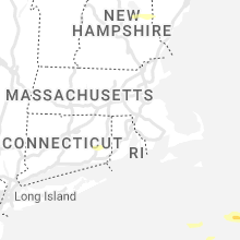
New Hampshire
| Local Time | Report Details |
|---|---|
| 12:40 PM EDT | Quarter sized hail reported near Alton, NH, 50.6 miles WSW of Portland, ME, north of alton on nh highway 28. fell for 4-5 minutes. |
| 12:55 PM EDT | Half Dollar sized hail reported near Union, NH, 40.3 miles WSW of Portland, ME, hail between 1 and 1.25 inches began at 12:55. several trees down along hwy 153 (wakefield rd) near union pond. tree diameter est 8-10 inches. |
| 1:04 PM EDT | Several trees down on governors roa in strafford county NH, 40.6 miles WSW of Portland, ME |
| 1:04 PM EDT | Numerous trees down on nh hwy 75 east farmington near the turnpike interchange. biggest trees were ~12 inches in diameter. time estimated by rada in strafford county NH, 41.4 miles WSW of Portland, ME |
West Virginia
| Local Time | Report Details |
|---|---|
| 1:00 PM EDT | Heavily damaged roof of a home at 1856 fort gay road and across the street at new beginnings churc in wayne county WV, 48.6 miles WSW of Charleston, WV |
| 1:11 PM EDT | Multiple trees and powerlines down in wayne. time estimated by rada in wayne county WV, 44.5 miles WSW of Charleston, WV |
| 1:11 PM EDT | Multiple trees and powerlines down in geno in wayne county WV, 47.4 miles WSW of Charleston, WV |
| 1:12 PM EDT | Multiple trees and powerlines down in dunlo in wayne county WV, 47.8 miles WSW of Charleston, WV |
| 1:45 PM EDT | Very large limbs dow in roane county WV, 34.5 miles NNE of Charleston, WV |
| 1:54 PM EDT | Trees blown down onto the roof of a home in the spring valley community. pictures provided via social medi in wayne county WV, 47.9 miles W of Charleston, WV |
| 2:04 PM EDT | A tree was blown down and through a mobile home in the aflex community. the event time is radar estimate in pike county KY, 58.1 miles SW of Charleston, WV |
| 2:10 PM EDT | Corrects previous tstm wnd dmg report from buffalo. multiple trees down near buffal in putnam county WV, 25.7 miles NW of Charleston, WV |
| 2:15 PM EDT | A tree fell onto a powerline in mcconnell. time estimated with rada in logan county WV, 40.8 miles SSW of Charleston, WV |
| 2:15 PM EDT | Numerous trees down along hanging rock highway near mcconnell. time estimated with rada in logan county WV, 40.2 miles SSW of Charleston, WV |
| 2:18 PM EDT | Significant wind damage reported across the town of man. roof damage noted near the clothing furniture gallery building. a small shed was blown over onto a car. numerou in logan county WV, 43.9 miles SSW of Charleston, WV |
| 2:18 PM EDT | One tree down onto a powerline in rosedal in gilmer county WV, 48.9 miles NE of Charleston, WV |
| 2:20 PM EDT | The roof of a home in the community of mallory was blown off and nearby trees were uprooted. time estimated with rada in logan county WV, 44.2 miles SSW of Charleston, WV |
| 2:25 PM EDT | Multiple trees down along upper falcon drive in sissonvill in kanawha county WV, 4.5 miles NNW of Charleston, WV |
| 2:25 PM EDT | Multiple trees down near poc in putnam county WV, 12.4 miles NW of Charleston, WV |
| 2:28 PM EDT | Tree down at strawberry rd and fairview driv in kanawha county WV, 12.2 miles W of Charleston, WV |
| 2:30 PM EDT | Corrects previous tstm wnd dmg report from teays valley. multiple trees down near teays valle in putnam county WV, 17.2 miles WNW of Charleston, WV |
| 2:30 PM EDT | Tree down at spencer rd and doctors creek roa in kanawha county WV, 18.7 miles NE of Charleston, WV |
| 2:32 PM EDT | Tree down near kanawha ter and maccorkle ave s in kanawha county WV, 7.9 miles WNW of Charleston, WV |
| 2:36 PM EDT | Large tree limbs downed along bibb avenue in beckley. time estimated with rada in raleigh county WV, 47.8 miles SSE of Charleston, WV |
| 2:36 PM EDT | Multiple trees and powerlines down everywher in mcdowell county WV, 62.1 miles S of Charleston, WV |
| 2:37 PM EDT | Tree down at green valley dr and hillcrest l in kanawha county WV, 8.7 miles W of Charleston, WV |
| 2:42 PM EDT | Tree down at allens fork rd and angels trumpet r in kanawha county WV, 14.5 miles N of Charleston, WV |
| 2:45 PM EDT | Numerous trees down in and around the town of pinch. time estimated with rada in kanawha county WV, 9.6 miles ENE of Charleston, WV |
| 2:45 PM EDT | Multiple trees and powerlines down across the tow in mcdowell county WV, 57.2 miles NNE of Bristol, TN |
| 2:51 PM EDT | Tree down on greenbrier st near millkie in kanawha county WV, 5.9 miles NE of Charleston, WV |
| 2:51 PM EDT | Tree down at indian creek rd and seneca hills d in kanawha county WV, 8.3 miles ENE of Charleston, WV |
| 2:55 PM EDT | Tree down on the 2400 block of washington street in kanawha county WV, 3 miles NW of Charleston, WV |
| 2:59 PM EDT | Tree down at beechwood run and maccorkle ave s in kanawha county WV, 17.1 miles SE of Charleston, WV |
| 3:05 PM EDT | Tree down at edens fork rd and laura beth l in kanawha county WV, 4.4 miles NNE of Charleston, WV |
| 3:05 PM EDT | Trees down across route 39 between canvas and nettie. photo included with social media repor in nicholas county WV, 50.4 miles E of Charleston, WV |
| 3:08 PM EDT | Tree down in the 2400 block of 7th avenu in kanawha county WV, 3 miles NW of Charleston, WV |
| 3:08 PM EDT | Tree down near big chimney exit northbound and i79 nort in kanawha county WV, 6.8 miles NE of Charleston, WV |
| 3:10 PM EDT | Multiple trees down near buffal in putnam county WV, 25.7 miles NW of Charleston, WV |
| 3:19 PM EDT | Power lines down across wb i-64 at mm 143. time estimated from rada in summers county WV, 58.6 miles SE of Charleston, WV |
| 3:21 PM EDT | Multiple trees down in alderso in greenbrier county WV, 49.8 miles NW of Roanoke, VA |
| 3:30 PM EDT | Multiple trees down in lewisbur in greenbrier county WV, 45.6 miles NW of Roanoke, VA |
| 3:30 PM EDT | Multiple trees down near teays valle in putnam county WV, 17.2 miles WNW of Charleston, WV |
| 3:34 PM EDT | Downed tree in yard. report and photo from wvns t in greenbrier county WV, 45.9 miles NW of Roanoke, VA |
| 3:39 PM EDT | Several trees and powerlines down across the tow in pocahontas county WV, 57.6 miles SSW of Elkins, WV |
| 4:00 PM EDT | Large limb broken off sycamore tre in summers county WV, 51.7 miles NW of Roanoke, VA |
| 4:00 PM EDT | Multiple trees down on griffith creek road and w clayton roa in summers county WV, 53.3 miles NW of Roanoke, VA |
| 4:06 PM EDT | A large... unhealthy-looking tree fell in a backyard in spanishburg... wv in mercer county. report from wvv in mercer county WV, 66.1 miles W of Roanoke, VA |
Ohio
| Local Time | Report Details |
|---|---|
| 1:25 PM EDT | Tree down on a home on washington avenue. time estimated from rada in adams county OH, 56.1 miles ESE of Cincinnati, OH |
| 1:55 PM EDT | Trees reported down in the friendship area. time estimated by rada in scioto county OH, 81.2 miles ESE of Cincinnati, OH |
| 2:03 PM EDT | Multiple trees and powerlines down in coal grov in lawrence county OH, 55.3 miles W of Charleston, WV |
| 2:03 PM EDT | Powerlines dow in lawrence county OH, 58 miles WNW of Charleston, WV |
| 2:05 PM EDT | Multiple trees down in perrytownshi in lawrence county OH, 52.8 miles WNW of Charleston, WV |
| 2:10 PM EDT | Multiple trees down in elizabethtowshi in lawrence county OH, 59.7 miles WNW of Charleston, WV |
| 9:15 PM EDT | Tree down in windsortownshi in lawrence county OH, 43.5 miles WNW of Charleston, WV |
Mississippi
| Local Time | Report Details |
|---|---|
| 12:30 PM CDT | Large tree down in yar in alcorn county MS, 46.5 miles WNW of Florence, AL |
| 2:00 PM CDT | Quarter sized hail reported near Fulton, MS, 52.8 miles SW of Florence, AL, quarter-sized hail on clay-tilden road in the clay community. |
| 2:08 PM CDT | Quarter sized hail reported near Gattman, MS, 44.1 miles NE of Starkville, MS, dime to quarter size hail. |
| 2:11 PM CDT | Quarter sized hail reported near Greenwood Springs, MS, 44.5 miles NE of Starkville, MS |
| 2:11 PM CDT | Quarter sized hail reported near Greenwood Springs, MS, 41.6 miles NE of Starkville, MS, dime to quarter size hail reported in greenwood springs. |
| 3:12 PM CDT | Power lines downed on litton r in bolivar county MS, 86.1 miles NE of Bastrop, LA |
| 3:50 PM CDT | Tree downed along ms hwy 1 near benoi in bolivar county MS, 80.6 miles NE of Bastrop, LA |
Maine
| Local Time | Report Details |
|---|---|
| 1:50 PM EDT | Wires dow in lincoln county ME, 48.3 miles ENE of Portland, ME |
| 2:10 PM EDT | Delayed report...wires down across roadway. time estimated with rada in knox county ME, 58 miles SSW of Bangor, ME |
| 4:50 PM EDT | Quarter sized hail reported near Easton, ME, 15.9 miles SSE of Caribou, ME |
Alabama
| Local Time | Report Details |
|---|---|
| 1:28 PM CDT | Quarter sized hail reported near Leighton, AL, 13.6 miles SE of Florence, AL, at least quarter size hail reported along hwy 157 south of leighton. |
| 2:09 PM CDT | Numerous trees were blown down around shottsvill in marion county AL, 44.6 miles SW of Florence, AL |
| 2:17 PM CDT | Quarter sized hail reported near Vina, AL, 44.6 miles SW of Florence, AL, hail fell for several minutes and may have been larger. |
| 2:20 PM CDT | Trees down on a vehicle on hwy 1 in marion county AL, 43.8 miles SSW of Florence, AL |
| 2:20 PM CDT | A few trees down along hwy 11 in red ba in franklin county AL, 35.9 miles SW of Florence, AL |
| 2:32 PM CDT | Several trees were blown down around hamilto in marion county AL, 48.3 miles SSW of Florence, AL |
| 2:42 PM CDT | Trees were blown down around hacklebur in marion county AL, 38.7 miles SSW of Florence, AL |
| 3:07 PM CDT | A few trees were blown down around gui in marion county AL, 60.1 miles SSW of Florence, AL |
| 3:32 PM CDT | Trees down near the intersection of hwy 431 and hwy 20 in calhoun county AL, 56.2 miles ENE of Birmingham, AL |
| 3:55 PM CDT | Trees and power lines were blown down on oakman parrish road. the downed power lines created a structure fire. no injuries were reporte in walker county AL, 34 miles WNW of Birmingham, AL |
| 3:55 PM CDT | A few trees were blown down around oakma in walker county AL, 35.8 miles WNW of Birmingham, AL |
| 4:07 PM CDT | Trees were blown down around hacklebur in marion county AL, 38.7 miles SSW of Florence, AL |
| 4:09 PM CDT | Large tree blown down near the high schoo in walker county AL, 29.8 miles WNW of Birmingham, AL |
| 4:12 PM CDT | Numerous trees were blown down in the southern part of walker count in walker county AL, 27.6 miles WNW of Birmingham, AL |
| 4:14 PM CDT | Trees were blown down between parrish and copeland ferr in walker county AL, 26.8 miles WNW of Birmingham, AL |
| 4:33 PM CDT | Multiple trees and power lines were blown down in and around west blocto in bibb county AL, 32.5 miles SSW of Birmingham, AL |
| 4:38 PM CDT | Huge tree was blown down and blocking the roadway near the bessemer recreation cente in jefferson county AL, 12.4 miles SW of Birmingham, AL |
| 4:43 PM CDT | Multiple trees were blown down on warrior river roa in jefferson county AL, 13.6 miles WSW of Birmingham, AL |
| 4:46 PM CDT | Several trees were blown down... several power poles snapped... and power lines down near east crest road and highschool roa in jefferson county AL, 11.1 miles WSW of Birmingham, AL |
| 4:51 PM CDT | Several trees were blown down throughout helena including silver lakes... highway 52... highway 95... and highway 1 in shelby county AL, 16 miles S of Birmingham, AL |
| 4:53 PM CDT | Skylights blown out of warehouse along i-45 in jefferson county AL, 13.9 miles SSW of Birmingham, AL |
| 4:56 PM CDT | Large trees were blown down in the green valley area of hoove in jefferson county AL, 8.3 miles S of Birmingham, AL |
| 4:56 PM CDT | A few large trees were snapped off near morgan roa in jefferson county AL, 14.7 miles SSW of Birmingham, AL |
| 5:17 PM CDT | Multiple trees were blown down around pondvill in bibb county AL, 50.1 miles SSW of Birmingham, AL |
| 6:28 PM CDT | Several trees and power lines were blown down. at least 8 roadways are completely blocked between marbury and white cit in autauga county AL, 57.7 miles W of Auburn, AL |
| 6:31 PM CDT | Multiple trees were blown down around deatsvill in elmore county AL, 53.6 miles W of Auburn, AL |
| 6:33 PM CDT | Emergency manager reports couple trees down along highway 84 near will road leading to lane blockag in clarke county AL, 33 miles SW of Camden, AL |
| 6:45 PM CDT | A few trees were blown down in and around alexander cit in tallapoosa county AL, 36.1 miles NW of Auburn, AL |
Connecticut
| Local Time | Report Details |
|---|---|
| 2:30 PM EDT | Tree on to house on 170 block of kemp road; tree and wires down at three locations on kemp road; tree and wires down on cemetery road... and brooklyn turnpike. relayed in windham county CT, 35.6 miles WSW of Providence, RI |
| 3:26 PM EDT | Quarter sized hail reported near Norwich, CT, 40.6 miles WSW of Providence, RI, spotter reported quarter size hail on dudley street. |
Virginia
| Local Time | Report Details |
|---|---|
| 2:45 PM EDT | Trees and power lines down county wide. time estimated from rada in wise county VA, 33.3 miles NW of Bristol, TN |
| 2:50 PM EDT | Multiple trees and powerlines down across the tow in dickenson county VA, 42.8 miles N of Bristol, TN |
| 3:35 PM EDT | Scattered trees and powerlines down throughout the northwest part of the county from saltville to rich valley and from saltville to chilhowi in smyth county VA, 36.5 miles ENE of Bristol, TN |
| 3:40 PM EDT | Storm damage reported in giles county VA, 33.5 miles W of Roanoke, VA |
| 3:45 PM EDT | 1/2 of bradley pear tree in the street at the intersection of west main and berkeley street. no vehicles involve in city of radford county VA, 36.6 miles WSW of Roanoke, VA |
| 3:50 PM EDT | Storm damage reported in montgomery county VA, 26.1 miles W of Roanoke, VA |
| 3:50 PM EDT | Tree down blocking happy hollow road. power outages in woodbine/wyatt farms area also from downed trees/powerlines. wind gust of 39 mph recorded at the vt airport (bcb) in montgomery county VA, 24.8 miles W of Roanoke, VA |
| 3:56 PM EDT | Report from mping: 1-inch tree limbs broken; shingles blown of in montgomery county VA, 24.9 miles WSW of Roanoke, VA |
| 3:58 PM EDT | Report from mping: 3-inch tree limbs broken; power poles broke in montgomery county VA, 24.9 miles WSW of Roanoke, VA |
| 3:58 PM EDT | Several large limbs and trees snapped at 3:58 p. in montgomery county VA, 35.9 miles WSW of Roanoke, VA |
| 3:58 PM EDT | Uprooted tree in montgomery county VA, 26.5 miles W of Roanoke, VA |
| 3:58 PM EDT | Trees broke in montgomery county VA, 25.9 miles W of Roanoke, VA |
| 3:58 PM EDT | Large tree branch broke in montgomery county VA, 26.4 miles W of Roanoke, VA |
| 4:00 PM EDT | Scattered trees and powerlines down across the south and east part of the count in smyth county VA, 48.4 miles ENE of Bristol, TN |
| 4:00 PM EDT | Scattered trees and powerlines down countywide. crux of damage occurred between 3:40-4:15 p in wythe county VA, 66.7 miles WSW of Roanoke, VA |
| 4:05 PM EDT | Tree down on rocky road in bent mountai in roanoke county VA, 14.7 miles SW of Roanoke, VA |
| 4:06 PM EDT | Multiple trees down on betty drive in christiansbur in montgomery county VA, 27.7 miles WSW of Roanoke, VA |
| 4:07 PM EDT | Multiple trees down along dobbins hollow roa in montgomery county VA, 28.9 miles SW of Roanoke, VA |
| 4:10 PM EDT | Roofing on a deck was damaged in christiansbur in montgomery county VA, 28.2 miles WSW of Roanoke, VA |
| 4:12 PM EDT | Power poles blown down on south franklin st in christiansbur in montgomery county VA, 27.4 miles WSW of Roanoke, VA |
| 4:15 PM EDT | Multiple trees down on beagle club roa in bedford county VA, 5.5 miles E of Roanoke, VA |
| 4:15 PM EDT | Large maple tree down... split at ground in woodlawn v in carroll county VA, 62.9 miles WSW of Roanoke, VA |
| 4:15 PM EDT | Storm damage reported in carroll county VA, 60.1 miles SW of Roanoke, VA |
| 4:15 PM EDT | Tree down and intermittent power outages on placid lan in giles county VA, 30.9 miles W of Roanoke, VA |
| 4:15 PM EDT | Storm damage reported in carroll county VA, 59.7 miles SW of Roanoke, VA |
| 4:20 PM EDT | Large limbs down near gala in carroll county VA, 65.6 miles SW of Roanoke, VA |
| 4:26 PM EDT | Tree down in the 16000 block of naked creek r in rockingham county VA, 72.6 miles ESE of Elkins, WV |
| 4:27 PM EDT | A tree blew down near the 210 block of back r in page county VA, 73.6 miles ESE of Elkins, WV |
| 4:27 PM EDT | A tree blew down near the 130 block of fleeburg loo in page county VA, 73.9 miles ESE of Elkins, WV |
| 4:30 PM EDT | Trees down in the town of ferru in franklin county VA, 24.5 miles S of Roanoke, VA |
| 4:30 PM EDT | Tree down at the intersection of spotswood trail and nicholson r in rockingham county VA, 74.2 miles ESE of Elkins, WV |
| 4:30 PM EDT | *** 1 inj *** one person was taken to a hospital after being hit by a blown down tree in the 100 block of lakewood cour in franklin county VA, 15.1 miles SSE of Roanoke, VA |
| 4:30 PM EDT | Numerous trees and powerlines down countywide in rockbridge count in rockbridge county VA, 46.3 miles NE of Roanoke, VA |
| 4:36 PM EDT | Large trees down along route 221 in willis v in floyd county VA, 41.2 miles SW of Roanoke, VA |
| 4:40 PM EDT | A tree blew down near sunnyview dr and us hwy 34 in page county VA, 78 miles E of Elkins, WV |
| 4:43 PM EDT | Tree down on blackberry road... completely blocking roadwa in henry county VA, 36.9 miles S of Roanoke, VA |
| 4:45 PM EDT | Tree down on powerline on rockford roa in henry county VA, 37.4 miles S of Roanoke, VA |
| 4:45 PM EDT | One tree down... blocking roadway on memorial blv in henry county VA, 39.5 miles S of Roanoke, VA |
| 4:47 PM EDT | Large limbs down. 6 inches in diameter. trampoline blew away and damage in franklin county VA, 31.4 miles SSE of Roanoke, VA |
| 4:50 PM EDT | A few trees down along marquee rd. between monrovia rd. and double w farm r in orange county VA, 49.6 miles NNW of Richmond, VA |
| 4:50 PM EDT | Multiple large trees down on baileys sawmill roa in amherst county VA, 53.1 miles ENE of Roanoke, VA |
| 4:53 PM EDT | Tree fell on power line and is hanging over a drivewa in henry county VA, 36.8 miles S of Roanoke, VA |
| 4:53 PM EDT | Tree down across road near intersection of kings mountain rd and daniels creek r in henry county VA, 37.4 miles S of Roanoke, VA |
| 4:53 PM EDT | A tree blew down near n blue ridge turnpike and hebron c in madison county VA, 70.2 miles NNW of Richmond, VA |
| 4:54 PM EDT | Large trees down on sedgewick drive. one tree significantly damaged a hous in city of lynchburg county VA, 42 miles ENE of Roanoke, VA |
| 4:55 PM EDT | Power lines blew down near the 210 block of oak park r in madison county VA, 68.7 miles NNW of Richmond, VA |
| 4:56 PM EDT | Tree in middle of road. near intersection of island ct and club house r in henry county VA, 36.8 miles S of Roanoke, VA |
| 4:58 PM EDT | Tree down in the 400 block of woodward r in rappahannock county VA, 84.3 miles NNW of Richmond, VA |
| 5:00 PM EDT | Top of pine tree snapped off in city of lynchbur in amherst county VA, 45.6 miles ENE of Roanoke, VA |
| 5:00 PM EDT | Tree down in the 1300 block of beech grove r in nelson county VA, 69.1 miles NE of Roanoke, VA |
| 5:00 PM EDT | Large tree branch dow in city of lynchburg county VA, 44.9 miles ENE of Roanoke, VA |
| 5:00 PM EDT | 35 to 40 trees down around city of amherst reported by emergency manage in amherst county VA, 53.4 miles ENE of Roanoke, VA |
| 5:01 PM EDT | Multiple reports of trees down between arringotn and colleen... v in nelson county VA, 62.4 miles ENE of Roanoke, VA |
| 5:02 PM EDT | Tree down at the intersection of tye river rd. and boxwood farm r in nelson county VA, 60.6 miles ENE of Roanoke, VA |
| 5:04 PM EDT | Report from mping: 1-inch tree limbs broken; shingles blown of in city of lynchburg county VA, 42.7 miles ENE of Roanoke, VA |
| 5:05 PM EDT | Multiple trees down around the city of lynchbur in city of lynchburg county VA, 44 miles ENE of Roanoke, VA |
| 5:05 PM EDT | Tree down at the intersection of creekview ln. thomas nelson hw in nelson county VA, 68.8 miles ENE of Roanoke, VA |
| 5:05 PM EDT | Tree down in the 2200 block of piedmont r in nelson county VA, 61.3 miles ENE of Roanoke, VA |
| 5:05 PM EDT | Power line down on the concord turnpik in city of lynchburg county VA, 46 miles ENE of Roanoke, VA |
| 5:05 PM EDT | Tree down in road... blocking one lane. near intersection of robertsons ridge rd and sandy river r in henry county VA, 43.7 miles SSE of Roanoke, VA |
| 5:08 PM EDT | Telephone pole down on stage roa in campbell county VA, 49.2 miles E of Roanoke, VA |
| 5:11 PM EDT | Tree down... blocking the road on stage r in campbell county VA, 50.3 miles E of Roanoke, VA |
| 5:13 PM EDT | A couple of trees down in the area of rockfish... v in nelson county VA, 63.6 miles WNW of Richmond, VA |
| 5:14 PM EDT | Tree down at the intersection of boggs dr. and stage coach r in spotsylvania county VA, 40.3 miles N of Richmond, VA |
| 5:15 PM EDT | Tree down blocking spring grove roa in appomattox county VA, 57.2 miles E of Roanoke, VA |
| 5:15 PM EDT | Trees downed at intersection of lew jones road and manson church road. time radar estimate in dinwiddie county VA, 33.8 miles S of Richmond, VA |
| 5:15 PM EDT | Tree down on spring grove roa in appomattox county VA, 57.4 miles E of Roanoke, VA |
| 5:16 PM EDT | Tree down on buck creek roa in appomattox county VA, 58.5 miles E of Roanoke, VA |
| 5:17 PM EDT | Power lines and trees down in road on bear creek r in campbell county VA, 48.5 miles E of Roanoke, VA |
| 5:17 PM EDT | Power line down on pettigrew drive near concord v in campbell county VA, 50.4 miles E of Roanoke, VA |
| 5:17 PM EDT | Power lines down near the farmers bank of appomattox on village hw in campbell county VA, 53.2 miles E of Roanoke, VA |
| 5:17 PM EDT | Power lines down on stage rd in concord v in campbell county VA, 50.9 miles E of Roanoke, VA |
| 5:18 PM EDT | Tree down on stubbs bridge rd. near the lake anna bridg in spotsylvania county VA, 43.7 miles N of Richmond, VA |
| 5:20 PM EDT | One tree down on a powerline on moorefield bridge r in pittsylvania county VA, 51.5 miles SSE of Roanoke, VA |
| 5:26 PM EDT | Tree down on a house on old richmond roa in pittsylvania county VA, 54.4 miles SE of Roanoke, VA |
| 5:26 PM EDT | Tree down on power line on brook s in campbell county VA, 57.3 miles ESE of Roanoke, VA |
| 5:33 PM EDT | Tree down on prince edward highway in prospec in prince edward county VA, 54 miles WSW of Richmond, VA |
| 5:39 PM EDT | Tree down on brickett road in farmvill in prince edward county VA, 46.3 miles WSW of Richmond, VA |
| 5:39 PM EDT | Tree down on five forks road in pampli in prince edward county VA, 51.7 miles WSW of Richmond, VA |
| 5:44 PM EDT | Reports of multiple large trees uprooted in the ladysmith area near route 1. also damage to outbuilding from fallen tree in caroline county VA, 35.8 miles NNE of Richmond, VA |
| 5:45 PM EDT | Tree down on ligontown road in cumberlan in cumberland county VA, 34.7 miles WSW of Richmond, VA |
| 5:52 PM EDT | Tree down at new bethel road and dempsey road in meherrin. time estimated from rada in prince edward county VA, 50.8 miles WSW of Richmond, VA |
| 5:55 PM EDT | Tree down on gully tavern road in ric in prince edward county VA, 37.1 miles WSW of Richmond, VA |
| 5:55 PM EDT | Several trees down across the count in halifax county VA, 64.9 miles NNW of Raleigh, NC |
| 5:56 PM EDT | A couple of trees down in the area of massies mill... v in nelson county VA, 62.4 miles NE of Roanoke, VA |
| 6:10 PM EDT | Large tree uprooted on tomlinson road in victoria. time estimated from rada in lunenburg county VA, 46.6 miles SW of Richmond, VA |
| 6:15 PM EDT | Trees downed along us-460 east of burkesville... with numerous power outages in the area. time radar estimate in nottoway county VA, 37.6 miles SW of Richmond, VA |
| 6:15 PM EDT | Corrects previous tstm wnd dmg report from 1 ese nutbush. trained spotter reports numerous large trees downed... including a couple onto outbuildings near battes roads in lunenburg county VA, 45.9 miles SW of Richmond, VA |
| 6:15 PM EDT | Corrects previous tstm wnd dmg report from 1 ese nutbush. trained spotter reports numerous large trees downed... including a couple onto outbuildings near battes roads in lunenburg county VA, 45.9 miles SW of Richmond, VA |
| 6:20 PM EDT | Shingles blown off roof of house in central garag in king william county VA, 33.3 miles ENE of Richmond, VA |
| 6:23 PM EDT | Ping Pong Ball sized hail reported near Drewryville, VA, 58.4 miles SSE of Richmond, VA, ping pong ball size hail reported along us-58 12 miles east of emporia. |
| 6:25 PM EDT | Multiple trees uprooted along route 30 in king william. one tree fell through roof of hous in king william county VA, 37 miles ENE of Richmond, VA |
| 6:40 PM EDT | Trees downed along i-85 near mm 21. time radar estimate in brunswick county VA, 50.1 miles SSW of Richmond, VA |
| 7:47 PM EDT | Quarter sized hail reported near Bloxom, VA, 45.4 miles SW of Ocean City, MD |
| 7:51 PM EDT | Trees down on powerline in northampton county VA, 47.3 miles N of Virginia Beach, VA |
| 7:55 PM EDT | Large tree limb downed on to road along us-13 near exmore. time radar estimate in northampton county VA, 55.7 miles NNE of Virginia Beach, VA |
| 7:55 PM EDT | Trees down on powerline in accomack county VA, 45 miles SW of Ocean City, MD |
| 8:01 PM EDT | Large tree down blocking road at 18274 metompkin rd. time estimated by rada in accomack county VA, 46.6 miles SW of Ocean City, MD |
Rhode Island
| Local Time | Report Details |
|---|---|
| 3:09 PM EDT | Two trees down on robin hollow road in west greenwich. relayed by amateur radi in kent county RI, 19 miles SW of Providence, RI |
North Carolina
| Local Time | Report Details |
|---|---|
| 3:30 PM EDT | Two trees dow in graham county NC, 44.3 miles S of Knoxville, TN |
| 3:37 PM EDT | Two trees dow in graham county NC, 45.6 miles S of Knoxville, TN |
| 4:00 PM EDT | County dispatch reports trees down across cherokee count in cherokee county NC, 52.7 miles S of Knoxville, TN |
| 4:00 PM EDT | A few trees down in the are in buncombe county NC, 57.4 miles N of Greenville, SC |
| 4:05 PM EDT | Trees down in the are in buncombe county NC, 49.1 miles N of Greenville, SC |
| 4:05 PM EDT | Trees down in the nantahala national fores in macon county NC, 56.9 miles SSE of Knoxville, TN |
| 4:09 PM EDT | Trees down around the are in avery county NC, 35.6 miles SSE of Bristol, TN |
| 4:19 PM EDT | Multiple trees down in watauga count in watauga county NC, 39.6 miles SE of Bristol, TN |
| 4:23 PM EDT | Quarter sized hail reported near Moravian Falls, NC, 63.5 miles NNW of Charlotte, NC |
| 4:30 PM EDT | Multiple trees down and power poles broken in sugar grov in watauga county NC, 34.4 miles SE of Bristol, TN |
| 4:31 PM EDT | Quarter sized hail reported near Statesville, NC, 53.3 miles N of Charlotte, NC |
| 4:38 PM EDT | Trees and power lines dow in iredell county NC, 51.8 miles N of Charlotte, NC |
| 4:38 PM EDT | Power lines down along friendship roa in iredell county NC, 50.3 miles N of Charlotte, NC |
| 4:38 PM EDT | Several large trees down in the maple chase country club neighborhood. time estimated by rada in forsyth county NC, 74.2 miles NNE of Charlotte, NC |
| 4:42 PM EDT | Quarter sized hail reported near Winston Salem, NC, 73 miles NNE of Charlotte, NC, estimated 1 inch hail off of oak summit road in winston salem. time estimated by radar. |
| 4:43 PM EDT | Corrects previous tstm wnd dmg report from 3 wsw turnersburg. trees down across i-77 south near mile marker 61 and mile marker 59 in northern iredell count in iredell county NC, 46.7 miles N of Charlotte, NC |
| 4:43 PM EDT | Corrects previous tstm wnd dmg report from 3 wsw turnersburg. trees down across i-77 south near mile marker 61 and mile marker 59 in northern iredell count in iredell county NC, 46.7 miles N of Charlotte, NC |
| 4:53 PM EDT | Multiple trees down in mt air in surry county NC, 65.1 miles SW of Roanoke, VA |
| 4:54 PM EDT | Several trees dow in wilkes county NC, 54.8 miles ESE of Bristol, TN |
| 4:58 PM EDT | Report from mping: trees uprooted or snapped; roof blown off. time estimated from rada in rockingham county NC, 67.2 miles SSE of Roanoke, VA |
| 4:58 PM EDT | 911 call center reports power poles down near arcadia. time estimated by rada in davidson county NC, 58.6 miles NNE of Charlotte, NC |
| 5:00 PM EDT | Multiple trees down around pilot mountai in surry county NC, 68 miles SSW of Roanoke, VA |
| 5:00 PM EDT | Trees down near johnson st and skeet club r in guilford county NC, 72.8 miles NE of Charlotte, NC |
| 5:00 PM EDT | Report from mping: 3-inch tree limbs broken; power poles broke in yadkin county NC, 67.4 miles N of Charlotte, NC |
| 5:10 PM EDT | Trees dow in gaston county NC, 26.9 miles W of Charlotte, NC |
| 5:10 PM EDT | Tree dow in cleveland county NC, 27.3 miles W of Charlotte, NC |
| 5:10 PM EDT | About 15 trees down and numerous power lines down across northern iredell count in iredell county NC, 51 miles N of Charlotte, NC |
| 5:12 PM EDT | One tree down on flinchum farm roa in stokes county NC, 67.8 miles S of Roanoke, VA |
| 5:13 PM EDT | Tree on a residence off of pagetown roa in alamance county NC, 53.6 miles WNW of Raleigh, NC |
| 5:15 PM EDT | Quarter sized hail reported near Gastonia, NC, 22.4 miles W of Charlotte, NC |
| 5:15 PM EDT | Large tree limbs dow in cleveland county NC, 32.4 miles W of Charlotte, NC |
| 5:17 PM EDT | Large tree dow in gaston county NC, 24.1 miles W of Charlotte, NC |
| 5:20 PM EDT | Power lines down along chapel grove road and camp rotary road in gastoni in gaston county NC, 22.8 miles W of Charlotte, NC |
| 5:25 PM EDT | Quarter sized hail reported near Gastonia, NC, 19.9 miles W of Charlotte, NC |
| 5:30 PM EDT | Multiple trees reported down and in roadways county wide... most reports from about 5:30pm to 7:00p in caswell county NC, 51.4 miles NW of Raleigh, NC |
| 5:30 PM EDT | Tree down on roa in wilkes county NC, 54.8 miles ESE of Bristol, TN |
| 5:31 PM EDT | Tree down along mill creek road. time estimated by rada in orange county NC, 40.1 miles NW of Raleigh, NC |
| 5:34 PM EDT | Emergency manager reports numerous trees across the northwestern... north-central... and eastern sections of the count in alamance county NC, 45.4 miles WNW of Raleigh, NC |
| 5:36 PM EDT | Tree down on apartment building off of first street in meban in alamance county NC, 42.1 miles WNW of Raleigh, NC |
| 5:38 PM EDT | Heavy damage to the roof of a house along e center street. time estimated by rada in orange county NC, 40.5 miles WNW of Raleigh, NC |
| 5:40 PM EDT | Multiple trees down along i-85/40 near exit 15 in orange county NC, 38.2 miles WNW of Raleigh, NC |
| 5:40 PM EDT | Multiple trees down in the granite quarry and rockwell are in rowan county NC, 34.1 miles NE of Charlotte, NC |
| 5:40 PM EDT | Several trees down near the spencer are in rowan county NC, 39.8 miles NNE of Charlotte, NC |
| 5:41 PM EDT | Tree down on a residence along alpha drive in mebane. time estimated by rada in orange county NC, 38.6 miles WNW of Raleigh, NC |
| 5:42 PM EDT | Tree fell on a residenc in rowan county NC, 40.1 miles NNE of Charlotte, NC |
| 5:45 PM EDT | Tree fell on power lin in rowan county NC, 33 miles NE of Charlotte, NC |
| 5:45 PM EDT | Tree fell on a residenc in rowan county NC, 37.6 miles NE of Charlotte, NC |
| 5:45 PM EDT | A tree fell on a residenc in rowan county NC, 38.4 miles NE of Charlotte, NC |
| 5:50 PM EDT | Tree fell on a residenc in rowan county NC, 34.8 miles NE of Charlotte, NC |
| 6:06 PM EDT | Tree down on a garage on pervis road in durham. time estimated by rada in durham county NC, 19 miles NW of Raleigh, NC |
| 6:10 PM EDT | Ktqv measured 55 kts at 6:10 p in durham county NC, 22.8 miles NW of Raleigh, NC |
| 6:14 PM EDT | Tree down blocking the left lane near mile marker 196 on i-85. time estimated by rada in granville county NC, 29.3 miles N of Raleigh, NC |
| 6:18 PM EDT | Many trees down across the southern portions of granville county... including butner and creedmoor. time is approximat in granville county NC, 23.2 miles N of Raleigh, NC |
| 6:24 PM EDT | Numerous trees and power lines down throughout moore count in moore county NC, 53.5 miles SW of Raleigh, NC |
| 6:25 PM EDT | Tree down across the street near kingswood drive. time estimated by rada in wake county NC, 7.8 miles W of Raleigh, NC |
| 6:28 PM EDT | *** 1 inj *** corrects previous tstm wnd dmg report from 3 sse cary. tree fell on a car with occupant inside. no update on condition. time estimated by rada in wake county NC, 8.3 miles WSW of Raleigh, NC |
| 6:31 PM EDT | Tree down on a car along wild wood forest drive. time estimated by rada in wake county NC, 8.9 miles NE of Raleigh, NC |
| 6:31 PM EDT | *** 1 fatal *** a tree fell on and killed a person who was outsid in franklin county NC, 19.2 miles NNE of Raleigh, NC |
| 6:31 PM EDT | Storm damage occurred to a mobile home near franklinton. time estimated by rada in franklin county NC, 24 miles NNE of Raleigh, NC |
| 6:33 PM EDT | Very large tree down across blaney bluffs lane near lake wheele in wake county NC, 7.3 miles SW of Raleigh, NC |
| 6:39 PM EDT | Extensive trees down and power outages being reported mainly across southern wake county. some of hardest hit locations include fuquay-varina... garner... and apex area in wake county NC, 8.2 miles SSW of Raleigh, NC |
| 6:41 PM EDT | Tree down on retirement community building in garner. time estimated by rada in wake county NC, 7.4 miles S of Raleigh, NC |
| 6:43 PM EDT | Large tree and power lines down along garner road. time estimated by rada in wake county NC, 5.4 miles SSE of Raleigh, NC |
| 6:43 PM EDT | Two mobile homes damaged near louisburg. time estimated by rada in franklin county NC, 29 miles NE of Raleigh, NC |
| 6:53 PM EDT | Two trees down near the intersection of doc rd and long leaf dr. time estimated by rada in harnett county NC, 38.2 miles SSW of Raleigh, NC |
| 6:57 PM EDT | Tree down on residence along cherry street. time estimated by rada in anson county NC, 47.9 miles ESE of Charlotte, NC |
| 7:00 PM EDT | Tree down in ellerbe along nc-73 hw in richmond county NC, 61.7 miles E of Charlotte, NC |
| 7:04 PM EDT | Powerline down across the roadway near rockingham. time estimated by rada in richmond county NC, 64.1 miles ESE of Charlotte, NC |
| 7:04 PM EDT | Tree down across the outside lane of i-95 south. time estimated by rada in johnston county NC, 26.1 miles SE of Raleigh, NC |
| 7:10 PM EDT | Several trees and power lines dow in halifax county NC, 61.4 miles ENE of Raleigh, NC |
| 7:15 PM EDT | Power lines down at the intersection of elk and cameron roa in cumberland county NC, 58.4 miles SSW of Raleigh, NC |
| 7:15 PM EDT | 131 separate calls were received about trees down across the count in wilson county NC, 40.8 miles E of Raleigh, NC |
| 7:20 PM EDT | Tree blocking roadwa in wayne county NC, 40.2 miles ESE of Raleigh, NC |
| 7:23 PM EDT | Power lines down at the intersection of camden and george owe in cumberland county NC, 57.5 miles SSW of Raleigh, NC |
| 7:23 PM EDT | Power lines down at the intersection of camden and crystal springs r in cumberland county NC, 56.7 miles SSW of Raleigh, NC |
| 7:25 PM EDT | Tree down blocking davis mill r in wayne county NC, 43 miles ESE of Raleigh, NC |
| 7:26 PM EDT | Corrects time of previous tstm wnd dmg report from 1 e tarboro. numerous trees and power lines down throughout edgecombe count in edgecombe county NC, 62.5 miles E of Raleigh, NC |
| 7:29 PM EDT | Tree on power lines at intersection of hooks river rd and us117 bypas in wayne county NC, 45 miles SE of Raleigh, NC |
| 7:30 PM EDT | Several trees and power lines dow in halifax county NC, 72.5 miles ENE of Raleigh, NC |
| 7:40 PM EDT | Trees downed along sandy cross road and up river road. time radar estimated. report from social medi in perquimans county NC, 39.5 miles SW of Virginia Beach, VA |
| 7:45 PM EDT | Reports of multiple trees down and shingles in road. time estimated by rada in greene county NC, 52.9 miles ESE of Raleigh, NC |
| 7:50 PM EDT | Trained spotter reports large tree limbs down in association with gust fron in pitt county NC, 58.1 miles E of Raleigh, NC |
| 7:54 PM EDT | Radio reports multiple trees down in bull head. time estimated by rada in greene county NC, 51.1 miles ESE of Raleigh, NC |
| 7:55 PM EDT | Reports of trees down... time estimated by rada in greene county NC, 58.7 miles ESE of Raleigh, NC |
| 7:55 PM EDT | Trees downed along church street and highway 308. time radar estimate in bertie county NC, 76.1 miles WSW of Virginia Beach, VA |
| 7:56 PM EDT | Radio reports tree down... possibly blocking road on 264w near mile marker 5 in greene county NC, 53.7 miles ESE of Raleigh, NC |
| 8:00 PM EDT | Tree down on i-95 at mile marker 33 near st pauls/us-301. 1 of 2 lanes closed. time estimated via rada in robeson county NC, 68.6 miles SSW of Raleigh, NC |
| 8:03 PM EDT | Tree down on lisbon bridge r in sampson county NC, 46.4 miles NNW of Wilmington, NC |
| 8:12 PM EDT | Multiple trees down across roads in the the city of greenville including arlington blv in pitt county NC, 71.7 miles E of Raleigh, NC |
| 8:12 PM EDT | Around 1000 customers without power across the county. 911 center reported limbs and branches down across the county due to strong wind in martin county NC, 82.8 miles E of Raleigh, NC |
| 8:33 PM EDT | Numerous trees and power lines down throughout edgecombe count in edgecombe county NC, 62.5 miles E of Raleigh, NC |
| 8:37 PM EDT | Trees down across the road. time estimated by rada in duplin county NC, 48.3 miles NNE of Wilmington, NC |
| 8:45 PM EDT | Trees down and across the road on nc highway 32 south... just south of the split with highway 32 and highway 4 in washington county NC, 76.4 miles SSW of Virginia Beach, VA |
| 8:48 PM EDT | Trees down across the road near vanceboro. time estimated by rada in craven county NC, 88.2 miles NE of Wilmington, NC |
| 8:48 PM EDT | Trees down across the road. time estimated by rada in duplin county NC, 37.1 miles N of Wilmington, NC |
| 8:54 PM EDT | 911 call center reports tree down in roadway on oak grove rd in pollocksvill in jones county NC, 67.3 miles NE of Wilmington, NC |
| 9:04 PM EDT | Trees down across the road on northwest bridge road... off richlands highway. time estimated by radar. duke energy estimated just under 1000 homes without power in onsl in onslow county NC, 48.9 miles NNE of Wilmington, NC |
| 9:04 PM EDT | Multiple trees down on roads in the city of new bern and in fairfield harbor. estimated just over 2600 people without power across craven county according to tideland e in craven county NC, 79.4 miles NE of Wilmington, NC |
| 10:05 PM EDT | Nws employee measured 60 mph gust 5 miles north of beaufort along highway 10 in carteret county NC, 82.2 miles ENE of Wilmington, NC |
| 10:19 PM EDT | Trees down on powerlines in the city of beaufort. time estimated by rada in carteret county NC, 80.7 miles ENE of Wilmington, NC |
Georgia
| Local Time | Report Details |
|---|---|
| 3:45 PM EDT | A tree was downed on highway 282 near gunstock creek roa in gilmer county GA, 48.5 miles ESE of Chattanooga, TN |
| 3:45 PM EDT | A tree was downed on highway 282 near pleasant gap roa in gilmer county GA, 49 miles ESE of Chattanooga, TN |
| 4:14 PM EDT | A tree was downed on highway 53 at garrison roa in pickens county GA, 50.1 miles N of Atlanta, GA |
| 4:25 PM EDT | A tree was downed on camp road at donna lynn stree in pickens county GA, 48.4 miles N of Atlanta, GA |
| 4:35 PM EDT | A tree was downed on castleberry bridge road near robins wa in lumpkin county GA, 52.8 miles NNE of Atlanta, GA |
| 5:02 PM EDT | A tree and power lines were downed across bells ferry road between victoria road and port victoria wa in cherokee county GA, 30 miles NNW of Atlanta, GA |
| 5:17 PM EDT | A tree was downed onto a home near the intersection of post oak tritt road and johnson ferry roa in cobb county GA, 18.9 miles N of Atlanta, GA |
| 5:29 PM EDT | Quarter sized hail reported near Cumming, GA, 31.2 miles NNE of Atlanta, GA, quarter sized hail was reported at the mr. clean car wash on highway 20. |
| 5:32 PM EDT | Powerlines and tree fell onto vehicle on atlanta st. in roswell. no injurie in fulton county GA, 18.2 miles N of Atlanta, GA |
| 5:40 PM EDT | A tree was downed onto a structure on chappell circle n in gwinnett county GA, 15.2 miles NNE of Atlanta, GA |
| 5:40 PM EDT | A tree was downed onto a structure on suwanee mill driv in gwinnett county GA, 30.9 miles NE of Atlanta, GA |
| 5:45 PM EDT | A tree was downed onto a home on westberry lane n in gwinnett county GA, 16.7 miles NE of Atlanta, GA |
| 5:45 PM EDT | A tree was downed onto a home on danbury drive n in gwinnett county GA, 14.8 miles NE of Atlanta, GA |
| 5:50 PM EDT | Trees and powerlines downed on roadway in the winding woods neighborhood off of lavista rd in tucke in dekalb county GA, 11.2 miles NE of Atlanta, GA |
| 5:55 PM EDT | Quarter sized hail reported near Lawrenceville, GA, 27.3 miles ENE of Atlanta, GA, quarter size hail reported in lawrenceville. |
| 6:15 PM EDT | A tree fell across both lanes of fair street... onto power lines... and onto a hous in walton county GA, 30.3 miles E of Atlanta, GA |
| 6:20 PM EDT | Several trees were downed across horseshoe roa in walton county GA, 32.1 miles E of Atlanta, GA |
| 6:20 PM EDT | Numerous trees were downed... some onto power lines and blocking roads... including on atkinson road... natalie court... plantation place... brookview road... and highw in walton county GA, 31.3 miles E of Atlanta, GA |
| 6:20 PM EDT | Numerous trees were downed... some onto power lines and blocking roads... including on atkinson road... natalie court... plantation place... brookview road... and highw in walton county GA, 31.3 miles E of Atlanta, GA |
| 7:05 PM EDT | A tree was downed on aqua roa in morgan county GA, 53.7 miles ESE of Atlanta, GA |
| 7:09 PM EDT | A tree was downed on little river roa in morgan county GA, 53.7 miles ESE of Atlanta, GA |
| 7:10 PM EDT | Multiple trees were downed along seven islands roa in morgan county GA, 55.1 miles ESE of Atlanta, GA |
| 7:20 PM EDT | Burke county dispatch reported trees down in east waynesboro along cates-mead road. time estimated by rada in burke county GA, 24.8 miles S of Augusta, GA |
| 7:31 PM EDT | A tree was downed onto highway 96 at waterford driv in houston county GA, 82.6 miles NNW of Douglas, GA |
| 7:36 PM EDT | Burke county dispatch reported numerous trees down in girard. time estimated by rada in burke county GA, 33.9 miles SSE of Augusta, GA |
| 7:36 PM EDT | Burke county dispatch reported numerous trees down in sardis. time estimated by rada in burke county GA, 37.2 miles SSE of Augusta, GA |
| 7:39 PM EDT | A tree was downed onto power lines on lake joy roa in houston county GA, 83.7 miles NW of Douglas, GA |
| 7:43 PM EDT | Tree reported down on captains c in hancock county GA, 75.6 miles ESE of Atlanta, GA |
| 7:45 PM EDT | A tree was downed on rock springs at hall roa in laurens county GA, 61 miles N of Douglas, GA |
| 7:46 PM EDT | Tree reported down on the 200 block of river ridge trai in hancock county GA, 75.3 miles ESE of Atlanta, GA |
| 7:49 PM EDT | Tree reported down on ogletree r in hancock county GA, 73.8 miles WSW of Augusta, GA |
| 7:56 PM EDT | Screven county 911 reported a tree down on hiltonia creek r in screven county GA, 45.5 miles SSE of Augusta, GA |
| 7:56 PM EDT | A few trees reported down near the intersection of sparta hwy and lover's lan in baldwin county GA, 73.1 miles WSW of Augusta, GA |
| 7:56 PM EDT | A few trees reported down near the intersection of sparta hwy and lover's lan in baldwin county GA, 73.1 miles WSW of Augusta, GA |
| 8:02 PM EDT | Public relayed pictures of trees down on captola road off of highway 301. time estimated from radar. damage likely associated with thunderstorm outflo in screven county GA, 52.6 miles NW of Savannah, GA |
| 8:05 PM EDT | Tree reported down on hwy 49 near fox hill r in baldwin county GA, 79.8 miles SE of Atlanta, GA |
| 8:13 PM EDT | Tree reported down on pleasant grove rd near intersection with linton r in washington county GA, 62 miles WSW of Augusta, GA |
| 8:21 PM EDT | Tree reported down on pleasant grove rd near intersection with linton r in washington county GA, 62 miles WSW of Augusta, GA |
| 8:24 PM EDT | A couple of trees and powerlines down on pleasant grove rd near intersection with deepstep r in washington county GA, 62.7 miles WSW of Augusta, GA |
| 8:25 PM EDT | Power poles were snapped along highway 4 in crisp county GA, 65.4 miles WNW of Douglas, GA |
| 8:29 PM EDT | Several large trees were downed... shingles were removed from roofs... and trampolines were blown around in the meadow park area just north of cordel in crisp county GA, 64.6 miles WNW of Douglas, GA |
| 8:30 PM EDT | Several trees and power lines were downed in the drayton road are in crisp county GA, 67.2 miles WNW of Douglas, GA |
| 8:32 PM EDT | Quarter sized hail reported near Metter, GA, 65.9 miles WNW of Savannah, GA, quarter size hail reported along i-16. it cracked the windshield. |
| 8:45 PM EDT | Tree down on brooklet leefield r in bulloch county GA, 39.9 miles WNW of Savannah, GA |
| 8:45 PM EDT | Tree down on canoochee r in candler county GA, 63.5 miles WNW of Savannah, GA |
| 8:50 PM EDT | Spotter reports 5 trees blown down at 1041 bryant still roa in bulloch county GA, 35.8 miles NW of Savannah, GA |
| 8:51 PM EDT | Downed trees on canoochee rd in cobbtow in candler county GA, 60.6 miles WNW of Savannah, GA |
| 9:11 PM EDT | Tree down on i-16 eb near mm 12 in bulloch county GA, 38.9 miles WNW of Savannah, GA |
| 9:11 PM EDT | Tree down on bacontown rd and another tree on clayton rd in pembrok in bryan county GA, 31.3 miles W of Savannah, GA |
| 9:11 PM EDT | Tree down on bacontown rd and another tree on clayton rd in pembrok in bryan county GA, 31.3 miles W of Savannah, GA |
| 9:14 PM EDT | 2 trees down on lynntown r in tattnall county GA, 61.7 miles NE of Douglas, GA |
| 9:17 PM EDT | Tree down on ga 23 south of collin in tattnall county GA, 60.6 miles W of Savannah, GA |
| 10:05 PM EDT | Multiple trees down and hail reported in hazelhurst and surrounding areas. timing of event estimated by rada in jeff davis county GA, 28.5 miles NNE of Douglas, GA |
| 10:07 PM EDT | Tree down on morgans bridge rd at ga-20 in bryan county GA, 17.6 miles W of Savannah, GA |
| 10:34 PM EDT | County dispatch receiving numerous calls about trees blown down... especially near surrenc in appling county GA, 38.5 miles ENE of Douglas, GA |
| 10:36 PM EDT | Tree down near the intersection of ga-203 and odum screven r in wayne county GA, 49.1 miles E of Douglas, GA |
| 11:05 PM EDT | Pierce county 911 was getting numerous calls of widespread wind damage and some structure damage due to thunderstorm winds. power outages were also reported. the locati in pierce county GA, 41.6 miles E of Douglas, GA |
| 11:15 PM EDT | Reports of multiple trees down throughout brantley county. approximate timing obtained by rada in brantley county GA, 55.3 miles ESE of Douglas, GA |
| 11:50 PM EDT | Georgia dot reported tree debris blown down and blocking all lanes of state road 110 at godley avenue. the time of the event was based on radar dat in camden county GA, 42.9 miles N of Jacksonville, FL |
South Carolina
| Local Time | Report Details |
|---|---|
| 3:45 PM EDT | A few trees down across the are in oconee county SC, 22.6 miles WSW of Greenville, SC |
| 4:25 PM EDT | Golf Ball sized hail reported near Taylors, SC, 21 miles NE of Greenville, SC |
| 4:48 PM EDT | Large tree down in the parking lot of the food lio in greenville county SC, 20.2 miles ENE of Greenville, SC |
| 4:51 PM EDT | Trees down on roads in the are in oconee county SC, 35.2 miles W of Greenville, SC |
| 5:00 PM EDT | Trees dow in union county SC, 53.1 miles ESE of Greenville, SC |
| 5:00 PM EDT | Trees dow in union county SC, 52.3 miles E of Greenville, SC |
| 5:10 PM EDT | Quarter sized hail reported near Greer, SC, 19.7 miles ENE of Greenville, SC |
| 5:20 PM EDT | Trees dow in union county SC, 49.2 miles ESE of Greenville, SC |
| 5:37 PM EDT | Large tree limbs snapped. large tree fell in a backyar in york county SC, 22.2 miles WSW of Charlotte, NC |
| 5:38 PM EDT | Quarter sized hail reported near Blair, SC, 61 miles SSW of Charlotte, NC, quarter-size hail reported... along with tree limbs down on the property. |
| 5:45 PM EDT | Corrects previous lightning report from 5 nw sadlers creek state park. dock damage at lake hartwel in anderson county SC, 28.4 miles SW of Greenville, SC |
| 5:50 PM EDT | Trees dow in union county SC, 56 miles SW of Charlotte, NC |
| 5:57 PM EDT | Quarter sized hail reported near Rock Hill, SC, 21.2 miles SSW of Charlotte, NC |
| 6:14 PM EDT | Schp reported trees down on church street and nelums stree in newberry county SC, 64.2 miles NE of Augusta, GA |
| 6:23 PM EDT | Trained spotter estimates 60-70mph wind in lancaster county SC, 35.7 miles SSE of Charlotte, NC |
| 6:27 PM EDT | Schp reports trees blocking roads. piney woods and suber road in richland county SC, 63 miles NE of Augusta, GA |
| 6:30 PM EDT | Schp reported trees down at overhill road and sigma cour in richland county SC, 71.9 miles ENE of Augusta, GA |
| 6:30 PM EDT | Sc highway patrol reported trees down at massey road and north corner road. time estimated by rada in lancaster county SC, 28.5 miles S of Charlotte, NC |
| 6:30 PM EDT | Social media photo of a large tree down at a residence on highway 522 in buford. time estimated by rada in lancaster county SC, 34.6 miles SSE of Charlotte, NC |
| 6:31 PM EDT | Social media photo of a large tree branch down on the usc lancaster campus at the intersection of hubbard dr. and brook dr. damaging adjacent metal fencing. time estima in lancaster county SC, 33.4 miles S of Charlotte, NC |
| 6:31 PM EDT | Schp reports trees down at i-20 and monticello roa in richland county SC, 66.6 miles NE of Augusta, GA |
| 6:32 PM EDT | Social media photo of a tree down near 407 pine st. blocking the road. time estimated by rada in lancaster county SC, 34.7 miles S of Charlotte, NC |
| 6:35 PM EDT | Corrects previous tstm wnd dmg report from 4 se jenkinsville. trees reported down on sc215 at wallaceville road. time estmd by rada in fairfield county SC, 66.8 miles NE of Augusta, GA |
| 6:35 PM EDT | Corrects previous tstm wnd dmg report from 4 se jenkinsville. trees reported down on sc215 at wallaceville road. time estmd by rada in fairfield county SC, 66.8 miles NE of Augusta, GA |
| 6:35 PM EDT | Schp reported power lines in roadway on lindler field road and wheeland roa in newberry county SC, 57.6 miles NNE of Augusta, GA |
| 6:35 PM EDT | Schp reported tree in roadway on sc-9 at deerwood roa in lancaster county SC, 35.2 miles SSE of Charlotte, NC |
| 6:41 PM EDT | Schp reported tree down on i-77 mm1 in richland county SC, 76.8 miles ENE of Augusta, GA |
| 6:44 PM EDT | Schp reported trees blocking roadway on broad street at the sumter highwa in kershaw county SC, 68.3 miles S of Charlotte, NC |
| 6:48 PM EDT | Tree reported down at tabernacle and wisdom road in lancaster county SC, 34.4 miles SSE of Charlotte, NC |
| 6:54 PM EDT | Schp reported tree in roadway on dusty road at electric ave. time estmd by rada in newberry county SC, 61.4 miles NNE of Augusta, GA |
| 6:55 PM EDT | Sc highway patrol reported trees down at meeting house road and clarkson road. time estimated by rada in richland county SC, 66.2 miles NW of Charleston, SC |
| 6:55 PM EDT | Schp reported trees down on burnt gin road at sc 26 in sumter county SC, 54.9 miles NNW of Charleston, SC |
| 6:56 PM EDT | Trees reported down on mcrays mill rd at pitts r in sumter county SC, 53.6 miles NNW of Charleston, SC |
| 6:59 PM EDT | Corrects previous tstm wnd dmg report from 12 se jackson. savannah river site emergency ops. center employee reported a couple trees down on state highway 125 blocking in barnwell county SC, 26.6 miles SE of Augusta, GA |
| 6:59 PM EDT | Schp reported tree in roadway on fish road at sc-26 in sumter county SC, 63.2 miles NNW of Charleston, SC |
| 6:59 PM EDT | Tree reported down on scales road and kings hwy. time estmd by rada in sumter county SC, 62.6 miles NNW of Charleston, SC |
| 7:00 PM EDT | Schp reported trees down at fischer and landing roads. time estmd by rada in aiken county SC, 15.6 miles SE of Augusta, GA |
| 7:01 PM EDT | Schp reported trees down on garbers ferry road at vaboklen roa in richland county SC, 63.1 miles NW of Charleston, SC |
| 7:04 PM EDT | Skywarn spotter relayed a report from beech island fire dept. of a tree down across powerlines at the intersection of old jackson hwy. and silver bluff rd. time estimat in aiken county SC, 11.3 miles SE of Augusta, GA |
| 7:04 PM EDT | Tree reported down on peach orchard road and seymour drive. time estmd by rada in sumter county SC, 62.5 miles NNW of Charleston, SC |
| 7:05 PM EDT | Social media report of a power outage and shingles blown off a home on eddins rd. near the intersection of zoar r in chesterfield county SC, 56.2 miles SE of Charlotte, NC |
| 7:05 PM EDT | Schp reported trees down at mccords ferry road and screaming eagle roa in richland county SC, 71.5 miles NNW of Charleston, SC |
| 7:08 PM EDT | Schp reported numerous trees down throughout richland county. piney grove... fernandina... beltline... kilbourne... holt and howe roads/street in lexington county SC, 63 miles NE of Augusta, GA |
| 7:08 PM EDT | Skywarn spotter relayed a report from beech island fire dept. of a tree down across powerlines at the intersection of old jackson hwy. and kathwood rd. time estimated b in aiken county SC, 12.6 miles SE of Augusta, GA |
| 7:10 PM EDT | Trees reported down on sc378 and foxville r in sumter county SC, 60.2 miles NNW of Charleston, SC |
| 7:30 PM EDT | Schp reported tree in roadway garners ferry road at sc 26 in richland county SC, 63.1 miles NW of Charleston, SC |
| 7:36 PM EDT | Schp reported trees down on hwy 32 in bamberg county SC, 48.7 miles E of Augusta, GA |
| 7:50 PM EDT | Allendale co 911 reported a tree down near the intersection of bethel church rd and jennys r in allendale county SC, 56.7 miles SE of Augusta, GA |
| 7:50 PM EDT | Orangeburg dispatch reported trees down at whisper wood road and 33. time estimated by rada in orangeburg county SC, 48.3 miles WNW of Charleston, SC |
| 7:50 PM EDT | Orangeburg county dispatch reported trees down at till road and 33. time estimated by rada in orangeburg county SC, 50 miles WNW of Charleston, SC |
| 8:00 PM EDT | Tree reported down on meeting house road at clarkson rd. time estmd by rada in richland county SC, 66.2 miles NW of Charleston, SC |
| 8:02 PM EDT | Tree down on joe miley rd at pond town r in hampton county SC, 60 miles N of Savannah, GA |
| 8:04 PM EDT | Tree down in roadway at lide springs rd and isgett rd in darlington county SC, 80.3 miles N of Charleston, SC |
| 8:05 PM EDT | Orangeburg county dispatch reported trees down at camden road in holly hill. time estimated by rada in orangeburg county SC, 25.3 miles WNW of Charleston, SC |
| 8:05 PM EDT | Barnwell county dispatch reported multiple trees down around blackville. time estimated by rada in barnwell county SC, 42.1 miles E of Augusta, GA |
| 8:08 PM EDT | Hampton 911 reports tree down on sandy run rd near bamberg hw in hampton county SC, 57.8 miles N of Savannah, GA |
| 8:11 PM EDT | Hampton 911 reports trees down on charleston hw in hampton county SC, 54.4 miles N of Savannah, GA |
| 8:16 PM EDT | Tree down in roadway at leavensworth rd and yvette lane in darlington county SC, 79.1 miles SE of Charlotte, NC |
| 8:18 PM EDT | Tree down in roadway on old georgetown rd in darlington county in darlington county SC, 79.1 miles NNE of Charleston, SC |
| 8:20 PM EDT | Multiple trees down on hwy 278 near varnvill in hampton county SC, 53 miles N of Savannah, GA |
| 8:23 PM EDT | Tree reported down along beulah road at lodge highway. time estimated from rada in colleton county SC, 47.5 miles W of Charleston, SC |
| 8:23 PM EDT | Tree down on strickland farm r in colleton county SC, 48.2 miles W of Charleston, SC |
| 8:25 PM EDT | Tree down on hwy 278 near hampton jasper county lin in hampton county SC, 45.5 miles N of Savannah, GA |
| 8:25 PM EDT | Golf Ball sized hail reported near Varnville, SC, 51.7 miles N of Savannah, GA, golf ball size hail near intersection of hwy 278 and hwy 68. |
| 8:26 PM EDT | Tree down on mill pond rd at lowcountry hw in colleton county SC, 47.3 miles WSW of Charleston, SC |
| 8:26 PM EDT | Tree down at pocotaligo rd and us-27 in hampton county SC, 49.6 miles N of Savannah, GA |
| 8:26 PM EDT | Tree reported down in the 2200 block of lumber road. time estimated from rada in colleton county SC, 50.9 miles WSW of Charleston, SC |
| 8:26 PM EDT | Tree down near the intersecton of strickland farm road and jewel avenue. time estimated based on rada in colleton county SC, 48.8 miles W of Charleston, SC |
| 8:35 PM EDT | Tree down on lowndes lake r in hampton county SC, 47 miles N of Savannah, GA |
| 8:35 PM EDT | Tree down at ram horn rd and yemassee hw in hampton county SC, 49.3 miles N of Savannah, GA |
| 8:35 PM EDT | Tree down and blocking the road near maple ridge road and weans road. time estimated based on rada in colleton county SC, 39.3 miles WSW of Charleston, SC |
| 8:37 PM EDT | Trees reported down on woods bay road. time estimated by rada in sumter county SC, 52.6 miles N of Charleston, SC |
| 8:38 PM EDT | Tree down in the 1800 block of jefferies highway. time estimated based on rada in colleton county SC, 42.1 miles WSW of Charleston, SC |
| 8:38 PM EDT | Tree down along the 200 block of robertson blvd. time estimated based on rada in colleton county SC, 43.2 miles WSW of Charleston, SC |
| 8:38 PM EDT | Tree down along the 1400 block of hiers corner road. time estimated based on rada in colleton county SC, 44 miles WSW of Charleston, SC |
| 8:41 PM EDT | Tree down along the 100 block of wintergreen road. tree blocked the road. time estimated based on rada in colleton county SC, 41.8 miles WSW of Charleston, SC |
| 8:41 PM EDT | Tree down and blocking the highway near the intersection of jefferies road and beach road. powerlines down as well. time estimated based on rada in colleton county SC, 44.6 miles WSW of Charleston, SC |
| 8:42 PM EDT | Tree down along the 900 block of strickland street. time estimated based on rada in colleton county SC, 42.3 miles WSW of Charleston, SC |
| 8:42 PM EDT | Tree down near the intersection of hendersonville highway and mable t. willis blvd and near the intersection of hendersonville highway and sniders highway. time estimat in colleton county SC, 45 miles WSW of Charleston, SC |
| 8:42 PM EDT | Tree down along the 2400 block of cottageville highway. time estimated based on rada in colleton county SC, 39.6 miles WSW of Charleston, SC |
| 8:42 PM EDT | Tree down along the 900 block of live oak street. time estimated based on rada in colleton county SC, 41.2 miles WSW of Charleston, SC |
| 8:42 PM EDT | Tree reported down in the 1100 block of south jefferies blvd. time estimated from rada in colleton county SC, 44.1 miles WSW of Charleston, SC |
| 8:43 PM EDT | Tree down near the intsection of keegan drive and cromwell lane. time estimated based on rada in colleton county SC, 38.8 miles WSW of Charleston, SC |
| 8:44 PM EDT | Tree down near the intersection of brittlebank road and charleston highway. roadway was damaged. powerlines also down. time estimated based on rada in colleton county SC, 42.9 miles WSW of Charleston, SC |
| 8:45 PM EDT | Tree down along the 3900 block of charleston highway. time estimated based on rada in colleton county SC, 41.5 miles WSW of Charleston, SC |
| 8:45 PM EDT | Tree down along the 3900 block of charleston highway. time estimated based on rada in colleton county SC, 41.5 miles WSW of Charleston, SC |
| 8:45 PM EDT | Tree down near the intersection of hampton street and brittlebank road. time estimated based on rada in colleton county SC, 41.1 miles WSW of Charleston, SC |
| 8:45 PM EDT | Tree down in the 3700 block of charleston highway. time estimated from rada in colleton county SC, 41.3 miles WSW of Charleston, SC |
| 8:45 PM EDT | Tree reported down in the 900 block of live oak street. time estimated from rada in colleton county SC, 41.2 miles WSW of Charleston, SC |
| 8:45 PM EDT | Tree down and blocking the road along the 1800 block of the green pond highway. time estimated based on rada in colleton county SC, 43.8 miles WSW of Charleston, SC |
| 8:45 PM EDT | Tree down in roadway at us-501 and sawyer rd in marion county SC, 76.6 miles NNE of Charleston, SC |
| 8:46 PM EDT | Tree blown down and blocking the road near the intersection of charleston highway and whpporwill lane. time estimated based on rada in colleton county SC, 41.7 miles WSW of Charleston, SC |
| 8:47 PM EDT | Tree down and powerlines down along cooks hill road. time estimated based on rada in colleton county SC, 43 miles SW of Charleston, SC |
| 8:47 PM EDT | Tree down and blocking the road near the intersection of cooks hill road and poor farm road. time estimated based on rada in colleton county SC, 43.5 miles WSW of Charleston, SC |
| 8:48 PM EDT | Tree reported down on green pond highway at windwood road. powerlines also reported down. time estimated from rada in colleton county SC, 43.4 miles WSW of Charleston, SC |
| 8:48 PM EDT | Tree down along the 2400 block of saint peters road. time estimated based on rada in colleton county SC, 40.8 miles SW of Charleston, SC |
| 8:48 PM EDT | Tree reported down and blocking roadway in the 500 block of cooks hill road. time estimated from rada in colleton county SC, 44 miles WSW of Charleston, SC |
| 8:48 PM EDT | Tree reported down in the 3900 block of charleston highway. tree was blocking the roadway. time estimated from rada in colleton county SC, 41.7 miles WSW of Charleston, SC |
| 8:48 PM EDT | Tree in roadway at wintergreen road and jefferies hiway. both lanes of the hiway are blocked and there was a collisio in colleton county SC, 47.6 miles WSW of Charleston, SC |
| 8:51 PM EDT | Tree down at the intersection of harlequin lane and round o road. time estimated based on rada in colleton county SC, 35.3 miles WSW of Charleston, SC |
| 8:54 PM EDT | Tree reported down on ivenia brown road at manatee lane. damage likely associated with thunderstorm outflow. time estimated from rada in colleton county SC, 47.4 miles SW of Charleston, SC |
| 8:54 PM EDT | Tree down along the 600 block of wood road. tree was likely blown down by strong thunderstorm outlow winds ahead of the maine line of thunderstorms. time estimated base in colleton county SC, 46.4 miles SW of Charleston, SC |
| 8:54 PM EDT | Tree down near the intersection of ivenia brown road and manatee lane. tree was likely blown down by strong thunderstorm outflow winds ahead of the main line of thunder in colleton county SC, 47.3 miles SW of Charleston, SC |
| 8:57 PM EDT | Tree reported down and blocking the roadway in the 2400 block of featherbed road. power lines also reported down. time estimated from rada in colleton county SC, 39.7 miles SW of Charleston, SC |
| 8:58 PM EDT | Tree down on cainhoy r in berkeley county SC, 13.3 miles SE of Charleston, SC |
| 9:00 PM EDT | Tree down in roadway on sc41 in gresham in marion county SC, 65.3 miles NE of Charleston, SC |
| 9:05 PM EDT | Tree down in roadway at enoch rd and corban pl. time estimated via rada in horry county SC, 71.3 miles NE of Charleston, SC |
| 9:10 PM EDT | Tree down in roadway privettes rd near us-701. time estimated via rada in horry county SC, 63.7 miles WSW of Wilmington, NC |
| 9:14 PM EDT | Tree down at summers dr and clubhouse r in dorchester county SC, 27.1 miles SW of Charleston, SC |
| 9:16 PM EDT | Beaufort mcas asos gusted to 53 knot in beaufort county SC, 36.3 miles NE of Savannah, GA |
| 9:25 PM EDT | Tree down on fence in backyard in conway in horry county SC, 69.5 miles WSW of Wilmington, NC |
| 9:25 PM EDT | Tree down on hilton dr at barton s in charleston county SC, 28.6 miles SSW of Charleston, SC |
| 9:26 PM EDT | Tree down on an unoccupied vehicle off hyde park r in charleston county SC, 38.2 miles SSW of Charleston, SC |
| 9:29 PM EDT | Large tree limb down on shanklin r in beaufort county SC, 32.9 miles NE of Savannah, GA |
| 9:30 PM EDT | Storm damage reported in amz256 county SC, 61 miles ENE of Charleston, SC |
| 9:33 PM EDT | Tree down on wappoo r in charleston county SC, 28 miles S of Charleston, SC |
| 9:35 PM EDT | Tree down on new riverside r in beaufort county SC, 11.9 miles NE of Savannah, GA |
| 9:46 PM EDT | Tree down on fording island rd in rose hil in beaufort county SC, 18.5 miles NE of Savannah, GA |
Colorado
| Local Time | Report Details |
|---|---|
| 1:49 PM MDT | Mesonet station crwc2 the crown... basalt 3ws in pitkin county CO, 81.4 miles ENE of Grand Junction, CO |
New Jersey
| Local Time | Report Details |
|---|---|
| 3:54 PM EDT | Corrects previous tstm wnd dmg report from avalon. police department reported wires down. another municipality gave more information. numerous wires down reported from in cape may county NJ, 56.3 miles NNE of Ocean City, MD |
Delaware
| Local Time | Report Details |
|---|---|
| 5:52 PM EDT | Power lines down on horseshoe roa in sussex county DE, 39.3 miles NW of Ocean City, MD |
Maryland
| Local Time | Report Details |
|---|---|
| 5:55 PM EDT | Storm damage reported in anz537 county MD, 67.8 miles NE of Richmond, VA |
| 6:38 PM EDT | Half Dollar sized hail reported near Berlin, MD, 6.1 miles NW of Ocean City, MD, half dollar sized hail reported in ocean pines. time estimated from radar. |
| 6:40 PM EDT | Shingles blown off roo in worcester county MD, 6.1 miles NW of Ocean City, MD |
| 6:48 PM EDT | Roof damage from thunderstorm winds at home along exeter road in ocean cit in worcester county MD, 2.6 miles NW of Ocean City, MD |
| 6:49 PM EDT | Report of storm debris across whaleyville road resulting in road closur in worcester county MD, 11.1 miles NW of Ocean City, MD |
New Mexico
| Local Time | Report Details |
|---|---|
| 4:09 PM MDT | Asos station kfmn farmington airpor in san juan county NM, 2 miles NW of Farmington, NM |
Wyoming
| Local Time | Report Details |
|---|---|
| 4:42 PM MDT | Ping Pong Ball sized hail reported near Banner, WY, 55.1 miles WNW of Gillette, WY, ping pong ball size hail and brief heavy rain. small tree limbs down. |
Montana
| Local Time | Report Details |
|---|---|
| 7:05 PM MDT | Ping Pong Ball sized hail reported near Browning, MT, 73 miles E of Whitefish, MT, social media report of ping pong sized hail. report relayed via facebook. location estimated. |
| 7:21 PM MDT | Golf Ball sized hail reported near Cut Bank, MT, 87.4 miles E of Whitefish, MT, social media report of golf ball sized hail. time estimated via radar. |
| 7:34 PM MDT | Quarter sized hail reported near Cut Bank, MT, 94.8 miles ENE of Whitefish, MT, public report of quarter sized hail. time estimated via radar. |
South Dakota
| Local Time | Report Details |
|---|---|
| 9:11 PM MDT | Storm damage reported in lawrence county SD, 39.2 miles NW of Rapid City, SD |
| 9:15 PM MDT | Storm damage reported in lawrence county SD, 39.6 miles NW of Rapid City, SD |
| 10:39 PM MDT | Heat burst from decaying showers. temperture rose from 73f to 82f and dewpoint dropped from 63f to 50f in harding county SD, 91 miles N of Rapid City, SD |
Connect with Interactive Hail Maps