

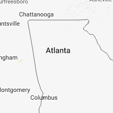
Hail Map for Thursday, June 21, 2018

Number of Impacted Households on 6/21/2018
0
Impacted by 1" or Larger Hail
0
Impacted by 1.75" or Larger Hail
0
Impacted by 2.5" or Larger Hail
Square Miles of Populated Area Impacted on 6/21/2018
0
Impacted by 1" or Larger Hail
0
Impacted by 1.75" or Larger Hail
0
Impacted by 2.5" or Larger Hail


Cities Most Affected by Hail Storms of 6/21/2018
| Hail Size | Demographics of Zip Codes Affected | ||||||
|---|---|---|---|---|---|---|---|
| City | Count | Average | Largest | Pop Density | House Value | Income | Age |
| Weiner, AR | 1 | 1.75 | 1.75 | 5 | $55k | $29.0k | 43.0 |
Hail and Wind Damage Spotted on 6/21/2018
Filter by Report Type:Hail ReportsWind Reports
States Impacted
Florida, Arkansas, Montana, Tennessee, Idaho, Georgia, Kentucky, New Mexico, Mississippi, Wyoming, Alabama, North CarolinaFlorida
| Local Time | Report Details |
|---|---|
| 2:21 PM EDT | Aprs site measured wind gust of 50kt/58mph from nw. 10 minutes later... measured gust of 53kt/61mph in amz552 county FL, 54.8 miles NNW of Port Saint Lucie, FL |
Arkansas
| Local Time | Report Details |
|---|---|
| 2:00 PM CDT | Quarter sized hail reported near Cash, AR, 66.4 miles NW of Memphis, TN, quarter sized hail was reported between cash and pitts off of highway 18. |
| 2:15 PM CDT | Ping Pong Ball sized hail reported near Fisher, AR, 57.2 miles WNW of Memphis, TN, ping pong sized hail reported by law enforcement in waldenburg arkansas. |
| 2:20 PM CDT | Golf Ball sized hail reported near Weiner, AR, 59.5 miles NW of Memphis, TN, golf ball sized hail was spotted 3 miles north of weiner in poinsett. |
Montana
| Local Time | Report Details |
|---|---|
| 2:09 PM MDT | Storm damage reported in madison county MT, 47 miles SW of Bozeman, MT |
| 2:34 PM MDT | Storm damage reported in madison county MT, 40.8 miles WSW of Bozeman, MT |
| 2:43 PM MDT | Burnt creek raw in madison county MT, 67.6 miles SW of Bozeman, MT |
| 2:44 PM MDT | Elevation 8622 f in madison county MT, 36.2 miles SSW of Bozeman, MT |
| 3:22 PM MDT | Cattle driv in jefferson county MT, 65.5 miles NW of Bozeman, MT |
| 4:20 PM MDT | White sulphur springs airport awos report from a collapsing thunderstor in meagher county MT, 57 miles N of Bozeman, MT |
| 4:52 PM MDT | Quarter sized hail reported near Lewistown, MT, 94.4 miles NNW of Billings, MT, corrects previous hail report from 6 ese lewistown. quite a bit of pea to quarter sized hail. winds 40 to 50 mph. |
| 5:01 PM MDT | Quarter sized hail reported near Lewistown, MT, 89.3 miles NNW of Billings, MT, facebook post of a video of a lot of hail... up to a quarter in size... falling 10 miles southeast of lewistown. |
| 5:10 PM MDT | Half Dollar sized hail reported near Lewistown, MT, 91.8 miles NNW of Billings, MT, half dollar-sized hail. multiple reports of broken windows on north sides of buildings. delayed report...time estimated from radar. |
| 5:10 PM MDT | Roof ripped off barn. winds estimated at 80 mph or higher. delayed report...time estimated from rada in fergus county MT, 91.8 miles NNW of Billings, MT |
| 5:38 PM MDT | Quarter sized hail reported near Roundup, MT, 39.8 miles N of Billings, MT |
| 6:05 PM MDT | Quarter sized hail reported near Acton, MT, 11.1 miles NW of Billings, MT, along hwy 3 north of billings |
Tennessee
| Local Time | Report Details |
|---|---|
| 4:27 PM CDT | Trees down at herring hill road and saint paul roa in shelby county TN, 15.5 miles NNE of Memphis, TN |
| 4:33 PM CDT | Trees down at intersection of shelby road and shakerag road. time of event is radar estimate in shelby county TN, 13.9 miles NNE of Memphis, TN |
| 4:43 PM CDT | Trees down at the intersection of mudville and edmond orgill road in shelby county TN, 19.8 miles NE of Memphis, TN |
| 4:43 PM CDT | Trees down at the intersection of pleasant ridge and osborn road in shelby county TN, 22.5 miles ENE of Memphis, TN |
| 4:45 PM CDT | Roof ripped off a hote in lauderdale county TN, 50.7 miles NE of Memphis, TN |
| 5:23 PM CDT | Powerlines and trees down near bells and cypress community. also... a shed was destroye in crockett county TN, 42.8 miles SW of Mc Kenzie, TN |
| 5:47 PM CDT | Large trees down blocking roadway on christmasville road just north of key senter roa in madison county TN, 31.1 miles SSW of Mc Kenzie, TN |
| 5:53 PM CDT | Tree on car on highway 70 east at highway 41 in madison county TN, 35.1 miles SSW of Mc Kenzie, TN |
| 6:37 PM CDT | Multiple trees down in the town of chewalla. time is radar estimate in mcnairy county TN, 57.2 miles WNW of Florence, AL |
| 6:45 PM CDT | Multiple trees down in the town of chewalla. time is radar estimate in mcnairy county TN, 57.2 miles WNW of Florence, AL |
| 6:48 PM CDT | Tree down across georgia ave and 7th street. time is radar estimate in decatur county TN, 40.1 miles SE of Mc Kenzie, TN |
| 7:01 PM CDT | 1 tree down west of linde in perry county TN, 48.9 miles SE of Mc Kenzie, TN |
| 7:15 PM CDT | Large tree down on 1400 old town loop in hardin county TN, 40.3 miles NW of Florence, AL |
Idaho
| Local Time | Report Details |
|---|---|
| 3:44 PM MDT | Reports of tree down on powerlines and powerlines down near the aspen ridge subdivision due to high winds... resulting in a power outage. information from fall river ru in fremont county ID, 78.1 miles S of Bozeman, MT |
Georgia
| Local Time | Report Details |
|---|---|
| 6:00 PM EDT | Multiple trees were reported down on grey rock roa in muscogee county GA, 36.4 miles E of Auburn, AL |
Kentucky
| Local Time | Report Details |
|---|---|
| 5:10 PM CDT | Tree snapped. reported with photo. wind speed unknow in marshall county KY, 50.2 miles N of Mc Kenzie, TN |
| 5:15 PM CDT | Late report...widespread tree damage along sun bryant lane. portable building moved off of foundation. time estimate in marshall county KY, 57.6 miles N of Mc Kenzie, TN |
| 5:15 PM CDT | Late report...multiple trees down in kentucky dam village state park. time estimate in marshall county KY, 59.2 miles N of Mc Kenzie, TN |
| 5:33 PM CDT | Reported power outages across the county. this is from the storms that passed through shortly after 5 p in marshall county KY, 50.2 miles N of Mc Kenzie, TN |
| 6:07 PM CDT | Wind gust estimated. billboard blown ove in trigg county KY, 65.1 miles NE of Mc Kenzie, TN |
| 6:27 PM CDT | Wind gust estimate in christian county KY, 61.5 miles NW of Nashville, TN |
New Mexico
| Local Time | Report Details |
|---|---|
| 5:30 PM MDT | Ping Pong Ball sized hail reported near Tinnie, NM, 39.8 miles W of Roswell, NM |
Mississippi
| Local Time | Report Details |
|---|---|
| 6:53 PM CDT | Numerous trees down around the city of corint in alcorn county MS, 48.9 miles WNW of Florence, AL |
| 6:56 PM CDT | Several large trees uprooted in the kendrick communit in alcorn county MS, 42.1 miles WNW of Florence, AL |
| 8:43 PM CDT | Powerlines down and a tree on a house on south jackson street in downtown riple in tippah county MS, 69.3 miles ESE of Memphis, TN |
| 10:40 PM CDT | Large tree down on main street in lee county MS, 54.9 miles N of Starkville, MS |
| 11:35 PM CDT | A tree has fallen on a home and powerlines dow in lee county MS, 50.2 miles N of Starkville, MS |
| 11:35 PM CDT | A tree has fallen on a home and powerlines dow in lee county MS, 51.9 miles N of Starkville, MS |
Wyoming
| Local Time | Report Details |
|---|---|
| 6:00 PM MDT | Quarter sized hail reported near Cheyenne, WY, 41.6 miles E of Laramie, WY, wind gusts to 50 mph. |
| 6:05 PM MDT | Storm damage reported in johnson county WY, 60.3 miles W of Gillette, WY |
| 6:05 PM MDT | Quarter sized hail reported near Cheyenne, WY, 41.7 miles E of Laramie, WY, nickel to quarter sized hail. report received via facebook. |
| 6:34 PM MDT | Storm damage reported in johnson county WY, 52.9 miles N of Casper, WY |
Alabama
| Local Time | Report Details |
|---|---|
| 7:03 PM CDT | A tree was reported down on ne 17th avenu in colbert county AL, 2.1 miles S of Florence, AL |
| 8:36 PM CDT | A tree was blown down on cr 13 in lauderdale county AL, 14.9 miles NNE of Florence, AL |
| 8:36 PM CDT | A tree was reported down on cr in lauderdale county AL, 14.3 miles NE of Florence, AL |
| 8:40 PM CDT | A tree was reported blown down in the cherokee communit in colbert county AL, 17 miles W of Florence, AL |
North Carolina
| Local Time | Report Details |
|---|---|
| 9:44 PM EDT | One tree down near intersection of simpson road and ellisboro road. time based on rada in rockingham county NC, 66.4 miles S of Roanoke, VA |
| 11:29 PM EDT | Thunderstorm winds downed a tree along rolling hills road... temporarily closing i in person county NC, 47.4 miles NNW of Raleigh, NC |
Connect with Interactive Hail Maps