

Hail Map for Monday, June 22, 2015

Number of Impacted Households on 6/22/2015
0
Impacted by 1" or Larger Hail
0
Impacted by 1.75" or Larger Hail
0
Impacted by 2.5" or Larger Hail
Square Miles of Populated Area Impacted on 6/22/2015
0
Impacted by 1" or Larger Hail
0
Impacted by 1.75" or Larger Hail
0
Impacted by 2.5" or Larger Hail


Cities Most Affected by Hail Storms of 6/22/2015
| Hail Size | Demographics of Zip Codes Affected | ||||||
|---|---|---|---|---|---|---|---|
| City | Count | Average | Largest | Pop Density | House Value | Income | Age |
| Cedar Rapids, IA | 5 | 1.80 | 2.00 | 1159 | $142k | $59.1k | 37.1 |
| Mechanicsville, IA | 3 | 2.75 | 2.75 | 15 | $79k | $38.4k | 42.2 |
| Marion, IA | 3 | 2.08 | 2.50 | 524 | $107k | $49.8k | 36.7 |
| Palo, IA | 2 | 1.75 | 1.75 | 45 | $111k | $53.0k | 37.6 |
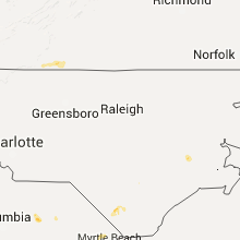
| Monetta, SC | 1 | 1.75 | 1.75 | 49 | $55k | $32.1k | 37.3 |
Hail and Wind Damage Spotted on 6/22/2015
Filter by Report Type:Hail ReportsWind Reports
States Impacted
Iowa, Wisconsin, Minnesota, Illinois, Michigan, Tennessee, South Carolina, Florida, North Carolina, Ohio, Georgia, Virginia, Alabama, New Mexico, Missouri, Arizona, Indiana, New York, PennsylvaniaIowa
| Local Time | Report Details |
|---|---|
| 7:00 AM CDT | Trees and tree branches down in wesley and st. benedic in kossuth county IA, 40.1 miles W of Mason City, IA |
| 7:01 AM CDT | Trees snapped in town via social media photo. time estimated from rada in hancock county IA, 33.4 miles WSW of Mason City, IA |
| 7:07 AM CDT | Numerous large trees down...including one to two foot diameter tree on a house in wright county IA, 49.6 miles SW of Mason City, IA |
| 7:07 AM CDT | Numerous six to eight inch tree limbs down...time radar estimated in wright county IA, 46.5 miles SW of Mason City, IA |
| 7:15 AM CDT | Via social media...pictures sent of multiple trees down across town...time radar estimted in cerro gordo county IA, 8.2 miles NNE of Mason City, IA |
| 7:17 AM CDT | Power lines and tree limbs down throughout the town. time estimated by radar. report via wo in wright county IA, 39.3 miles SW of Mason City, IA |
| 7:19 AM CDT | Prefabricated house moved off foundation...significant hog facility damage at same location...time radar estimated in wright county IA, 39.2 miles SW of Mason City, IA |
| 7:19 AM CDT | Numerous trees uprooted throughout town. bins blown down. winds estimated to be in excess of 60 mph. time estimated from radar. other tree damage throughout the count in cerro gordo county IA, 8.2 miles NNE of Mason City, IA |
| 7:20 AM CDT | Significant damage to chicken facilities...just north of intersection of 250th and quincy avenue...time radar estimated in wright county IA, 38.1 miles SW of Mason City, IA |
| 7:20 AM CDT | Storm damage reported in cerro gordo county IA, 7 miles W of Mason City, IA |
| 7:21 AM CDT | Highway 69 closed from 250th to 260th avenue because of downed powerlines and powerpoles...time radar estimated in wright county IA, 38.6 miles SW of Mason City, IA |
| 7:23 AM CDT | 6 to 8 inch diameter tree limbs down in wright county IA, 48.4 miles SW of Mason City, IA |
| 7:28 AM CDT | Power lines down along highway 65 between hampton and sheffield. 12 inch diameter limbs also down in hampton. time estimated from rada in franklin county IA, 24.6 miles S of Mason City, IA |
| 7:30 AM CDT | Powerlines down in the city in franklin county IA, 27.4 miles S of Mason City, IA |
| 7:35 AM CDT | Spotter reports large tree down across driveway in hardin county IA, 43.4 miles S of Mason City, IA |
| 7:38 AM CDT | Three foot in diameter trees down in town. power lines down throughout tow in butler county IA, 29.8 miles SSE of Mason City, IA |
| 7:40 AM CDT | Large trees down in iowa falls. public post to who tv facebook page. time estimated from rada in hardin county IA, 43.4 miles S of Mason City, IA |
| 7:41 AM CDT | Trees across road...130th and hickory tree road in butler county IA, 29.9 miles SSE of Mason City, IA |
| 7:42 AM CDT | Fire department rescue squad reported a wind gust of 65 miles per hour...trees and power line down in town in floyd county IA, 21.1 miles SE of Mason City, IA |
| 7:46 AM CDT | Intermittent trees down from allison south through aplington in butler county IA, 34.1 miles SE of Mason City, IA |
| 7:48 AM CDT | Grain elevator damage...extent unknown...time radar estimated in butler county IA, 31.4 miles SE of Mason City, IA |
| 7:50 AM CDT | Large branches down and corn flattened in floyd county IA, 30.4 miles ESE of Mason City, IA |
| 7:55 AM CDT | Powerlines and trees blown down throughout town in butler county IA, 43.6 miles SE of Mason City, IA |
| 8:00 AM CDT | Tree uprooted and on house in town. many large limbs down throughout the county. time estimated from rada in bremer county IA, 51.4 miles SE of Mason City, IA |
| 8:00 AM CDT | Numerous trees down in the cit in chickasaw county IA, 36.1 miles ESE of Mason City, IA |
| 8:01 AM CDT | Via social media...picture of tree on home...time radar estimated in black hawk county IA, 51.4 miles SE of Mason City, IA |
| 8:06 AM CDT | Black hawk county emergency manager reports numerous trees and powerlines down in cedar falls...waterloo...and evansdale...time radar estimated in black hawk county IA, 49.6 miles NW of Cedar Rapids, IA |
| 8:09 AM CDT | Storm damage reported in black hawk county IA, 54.9 miles NW of Cedar Rapids, IA |
| 8:14 AM CDT | Trees down in the waukon area. location in the waukon area based on rada in allamakee county IA, 42.4 miles SSW of La Crosse, WI |
| 8:14 AM CDT | Via social media...several large trees down...time radar estimated in black hawk county IA, 48 miles NNW of Cedar Rapids, IA |
| 8:15 AM CDT | Stronger than 80 mph. extremely strong winds. branches down and pieces of neighbors houses and roofing lying in our front yard. torrential rain fallin in buchanan county IA, 36.2 miles NNW of Cedar Rapids, IA |
| 8:15 AM CDT | Tree down across amish blv in buchanan county IA, 47 miles NNW of Cedar Rapids, IA |
| 8:19 AM CDT | Multiple trees down around oelwein according to oelwein city police. also some minor street floodin in fayette county IA, 50.1 miles NNW of Cedar Rapids, IA |
| 8:20 AM CDT | Substantial damage to home with residents trapped insid in fayette county IA, 55.8 miles N of Cedar Rapids, IA |
| 8:20 AM CDT | Trees down in postville. time estimate in allamakee county IA, 53 miles SSW of La Crosse, WI |
| 8:23 AM CDT | Trees down and knocked out power in postville in allamakee county IA, 53 miles SSW of La Crosse, WI |
| 8:23 AM CDT | Trees down in fayette county IA, 50.1 miles NNW of Cedar Rapids, IA |
| 8:23 AM CDT | Trees down in the waukon area. location in the waukon area based on rada in allamakee county IA, 42.4 miles SSW of La Crosse, WI |
| 8:23 AM CDT | 50 to 60 mph wind gusts with small limbs down. some hail occurred with the storm but the size is unknow in buchanan county IA, 40.3 miles NNW of Cedar Rapids, IA |
| 8:23 AM CDT | Storm damage reported in buchanan county IA, 47.1 miles NNW of Cedar Rapids, IA |
| 8:28 AM CDT | Sustained winds of 60 mph with gusts to 70 mp in buchanan county IA, 35.8 miles NNW of Cedar Rapids, IA |
| 8:30 AM CDT | One foot diameter tree snapped about 2 feet above ground leve in buchanan county IA, 35.7 miles NNW of Cedar Rapids, IA |
| 8:31 AM CDT | Corrected event type. high school on west side of independence measured sustained wind speeds of 93.9 mp in buchanan county IA, 35.8 miles NNW of Cedar Rapids, IA |
| 8:35 AM CDT | 30 foot long tree limb took down a power line. time estimated. late repor in buchanan county IA, 40.3 miles NNW of Cedar Rapids, IA |
| 8:40 AM CDT | Delaware county em reported extensive damage 1 to 2 miles north of manchester. damage included agriculture buildings flattened and trees snapped off. time of occurrence in delaware county IA, 37.8 miles NNE of Cedar Rapids, IA |
| 8:50 AM CDT | Substantial damage to home with residents trapped insid in fayette county IA, 55.8 miles N of Cedar Rapids, IA |
| 8:52 AM CDT | West of garber between millville and guttenberg. amish grocery store destroyed...numerous trees down between millville and guttenberg on highway 52. sections of highway in clayton county IA, 63.4 miles NNE of Cedar Rapids, IA |
| 8:52 AM CDT | Lots of damage to buildings...barns... and trees. highway 52 closed for a tim in clayton county IA, 61.6 miles NNE of Cedar Rapids, IA |
| 8:55 AM CDT | Storm damage reported in dubuque county IA, 44.9 miles NE of Cedar Rapids, IA |
| 9:00 AM CDT | Roof blown off school buildin in dubuque county IA, 55.2 miles NE of Cedar Rapids, IA |
| 9:00 AM CDT | Large tree limbs and branches larger than 2 inches in diameter downed by strong wind in linn county IA, 15.5 miles N of Cedar Rapids, IA |
| 9:03 AM CDT | Numerous trees and power lines downed across delaware county in delaware county IA, 37.1 miles NNE of Cedar Rapids, IA |
| 9:07 AM CDT | Limbs and small trees down in clayton county IA, 49.1 miles N of Cedar Rapids, IA |
| 9:08 AM CDT | Estimated 60 to 80 mph gust near intersection of asburry and lewi in dubuque county IA, 58.4 miles NE of Cedar Rapids, IA |
| 9:08 AM CDT | Semi blown ove in dubuque county IA, 53.4 miles NE of Cedar Rapids, IA |
| 9:15 AM CDT | Power outage in and around fairbank. corrected cit in buchanan county IA, 49.7 miles NNW of Cedar Rapids, IA |
| 9:15 AM CDT | Power outage in and around fairban in buchanan county IA, 35.7 miles NNW of Cedar Rapids, IA |
| 9:15 AM CDT | Storm damage reported in dubuque county IA, 57 miles ENE of Cedar Rapids, IA |
| 9:22 AM CDT | Tree branches down and wind damag in buchanan county IA, 35.7 miles NNW of Cedar Rapids, IA |
| 12:26 PM CDT | Golf Ball sized hail reported near Palo, IA, 10.1 miles NNW of Cedar Rapids, IA, at the duane arnold energy center. |
| 12:30 PM CDT | Golf Ball sized hail reported near Palo, IA, 8 miles NW of Cedar Rapids, IA, hail started as quarter size then increased to golf ball size along with heavy rain. event lasted 8 minutes. |
| 12:32 PM CDT | Golf Ball sized hail reported near Cedar Rapids, IA, 7.7 miles NNW of Cedar Rapids, IA, hail size is golfball and smaller |
| 12:34 PM CDT | Quarter sized hail reported near Palo, IA, 8.7 miles NW of Cedar Rapids, IA |
| 12:35 PM CDT | Quarter sized hail reported near Hiawatha, IA, 5.1 miles N of Cedar Rapids, IA |
| 12:35 PM CDT | Hen Egg sized hail reported near Cedar Rapids, IA, 5.8 miles N of Cedar Rapids, IA |
| 12:37 PM CDT | Quarter sized hail reported near Cedar Rapids, IA, 5.1 miles SE of Cedar Rapids, IA |
| 12:38 PM CDT | Golf Ball sized hail reported near Cedar Rapids, IA, 5.6 miles NNE of Cedar Rapids, IA |
| 12:38 PM CDT | Golf Ball sized hail reported near Cedar Rapids, IA, 5.4 miles NNE of Cedar Rapids, IA |
| 12:40 PM CDT | Ping Pong Ball sized hail reported near Cedar Rapids, IA, 0.5 miles SSE of Cedar Rapids, IA, several hail stones with largest measuring 1.5in. diameter. spotter near lindale mall at time of report. |
| 12:40 PM CDT | Golf Ball sized hail reported near Cedar Rapids, IA, 0.5 miles SSE of Cedar Rapids, IA, northeast side of cedar rapids |
| 12:43 PM CDT | Golf Ball sized hail reported near Marion, IA, 7 miles NE of Cedar Rapids, IA |
| 12:44 PM CDT | Hen Egg sized hail reported near Marion, IA, 5.7 miles NE of Cedar Rapids, IA |
| 12:46 PM CDT | Ping Pong Ball sized hail reported near Marion, IA, 5.7 miles NE of Cedar Rapids, IA, hail has stopped |
| 12:50 PM CDT | Tennis Ball sized hail reported near Marion, IA, 5.5 miles NE of Cedar Rapids, IA |
| 12:50 PM CDT | Baseball sized hail reported near Mechanicsville, IA, 22.2 miles E of Cedar Rapids, IA |
| 12:56 PM CDT | Quarter sized hail reported near Martelle, IA, 16.6 miles ENE of Cedar Rapids, IA |
| 12:56 PM CDT | Ping Pong Ball sized hail reported near Martelle, IA, 14.2 miles E of Cedar Rapids, IA |
| 1:20 PM CDT | Baseball sized hail reported near Mechanicsville, IA, 22.2 miles E of Cedar Rapids, IA, windshield broken |
| 1:25 PM CDT | Baseball sized hail reported near Mechanicsville, IA, 21.9 miles E of Cedar Rapids, IA |
| 2:45 PM CDT | Quarter sized hail reported near Cedar Rapids, IA, 1.2 miles SSW of Cedar Rapids, IA |
| 5:30 PM CDT | Large tree snapped and fell on pickup. time estimated by radar. report via social media in monroe county IA, 48.1 miles SE of Des Moines, IA |
| 5:53 PM CDT | Multiple reports of damage to local grocery store. time estimated by radar. via social medi in monroe county IA, 57.5 miles SE of Des Moines, IA |
| 5:53 PM CDT | Large tree snapped in half. time estimated by radar. reported via social medi in monroe county IA, 57 miles SE of Des Moines, IA |
| 5:53 PM CDT | Roof damage and trees down at indian hills inn...power out via social media...time radar estimated in monroe county IA, 58 miles SE of Des Moines, IA |
| 5:56 PM CDT | Large tree limbs down and a large tin roof near a camping area on the south side of albia. unknown if it was due to a tornado. time estimated by rada in monroe county IA, 57.5 miles SE of Des Moines, IA |
| 6:35 PM CDT | 12-15 inch diameter tree uproote in appanoose county IA, 58.4 miles WNW of Kahoka, MO |
| 6:50 PM CDT | 18 inch diameter trees snapped. wind gust lasted from 650pm - 720p in davis county IA, 46.3 miles WNW of Kahoka, MO |
| 7:18 PM CDT | Storm damage reported in davis county IA, 42 miles WNW of Kahoka, MO |
| 7:23 PM CDT | Telephone pole down in davis county IA, 42 miles WNW of Kahoka, MO |
Wisconsin
| Local Time | Report Details |
|---|---|
| 7:19 AM CDT | Ping Pong Ball sized hail reported near Prairie Du Chien, WI, 53.9 miles S of La Crosse, WI, at police officers homes. |
| 7:23 AM CDT | Quarter sized hail reported near Prairie Du Chien, WI, 52.3 miles S of La Crosse, WI, multiple reports of quarter size hail on the north side of prairie du chien. |
| 7:43 AM CDT | Quarter sized hail reported near Wauzeka, WI, 51.5 miles SSE of La Crosse, WI |
| 7:46 AM CDT | Half Dollar sized hail reported near Woodman, WI, 54.6 miles SSE of La Crosse, WI, image sent via social media |
| 8:35 AM CDT | Home had part of its roof blown off...many trees and power lines down in the city in lafayette county WI, 53.1 miles WSW of Madison, WI |
| 8:38 AM CDT | Multiple power poles snapped on highway 27 just east of prairie du chien in crawford county WI, 53.9 miles S of La Crosse, WI |
| 9:00 AM CDT | Numerious trees down in southeast dane and north rock county including newville township and evansvill in rock county WI, 22.7 miles SE of Madison, WI |
| 9:01 AM CDT | Trees and power lines down in grant county WI, 62.1 miles NE of Cedar Rapids, IA |
| 9:05 AM CDT | Barn blown down in grant county WI, 62.1 miles NE of Cedar Rapids, IA |
| 9:05 AM CDT | Numerous power lines dow in grant county WI, 63.9 miles WSW of Madison, WI |
| 9:11 AM CDT | Storm damage reported in grant county WI, 65.4 miles SW of Madison, WI |
| 9:12 AM CDT | Trees blown down in grant county WI, 63.3 miles W of Madison, WI |
| 9:12 AM CDT | Power lines down in grant county WI, 63.9 miles WSW of Madison, WI |
| 9:20 AM CDT | Several trees down estimated 70 mph wind in grant county WI, 60 miles WSW of Madison, WI |
| 9:20 AM CDT | Reports of possible barn damage and trees downed in five points are in richland county WI, 53.4 miles SE of La Crosse, WI |
| 9:25 AM CDT | Tree limbs down in grant county WI, 65.4 miles SW of Madison, WI |
| 9:40 AM CDT | Numerous 10 to 30 inch diameter trees snapped near the town of waldwic in lafayette county WI, 48.6 miles WSW of Madison, WI |
| 9:40 AM CDT | Town of hollandale is shut down due to damage from numerous trees down. structural damage to homes was also reporte in iowa county WI, 30.6 miles WSW of Madison, WI |
| 9:45 AM CDT | Pole and shed blown down near jonesdale. relayed via twitte in iowa county WI, 32.3 miles WSW of Madison, WI |
| 9:49 AM CDT | Sheriff office reports numerous trees and power lines down through out the entire county in lafayette county WI, 46.1 miles SW of Madison, WI |
| 10:06 AM CDT | Trees and power lines down across northern green county in green county WI, 21.9 miles SW of Madison, WI |
| 10:18 AM CDT | Several large tree branches down on blizzard road. a large limb fell on the back of a car... damaging it. time estimated from rada in dane county WI, 8.4 miles SSW of Madison, WI |
| 10:24 AM CDT | Trees and power lines down at various locations in the city in dane county WI, 13.5 miles SE of Madison, WI |
| 10:36 AM CDT | Wind damage at n926 co. rd. d in whitewater. 12-14 inch diameter healthy tree knocked over. large healthy tree limbs down. nearest intersection is co. rd. d and hwy 5 in walworth county WI, 36.8 miles ESE of Madison, WI |
| 10:42 AM CDT | Numerious trees and power lines down through out the city in jefferson county WI, 29.4 miles ESE of Madison, WI |
| 10:45 AM CDT | Large tree limb down at the corner of 5th and dodge st. relayed via faceboo in jefferson county WI, 34.7 miles ENE of Madison, WI |
| 11:04 AM CDT | Two foot diameter tree snapped. time estimated by radar. relayed via faceboo in waukesha county WI, 58.2 miles E of Madison, WI |
| 11:04 AM CDT | Large tree snapped on muskego dam road in extreme southeast waukesha county. time estimated from radar. relayed via twitte in waukesha county WI, 66 miles ESE of Madison, WI |
| 11:15 AM CDT | Two large tree branches down at 42nd and beethoven. time estimated from radar. relayed via twitte in milwaukee county WI, 71.7 miles E of Madison, WI |
| 11:19 AM CDT | 12-14 inch diameter tree across road at 92nd and wilu in milwaukee county WI, 70.2 miles E of Madison, WI |
| 11:20 AM CDT | Tree was uprooted and many small branches were down. a few large branches 3 to 4 inches in diameter were also dow in milwaukee county WI, 69.8 miles E of Madison, WI |
| 1:11 PM CDT | Tree limb down on power lines at the 700 block of jones street in jefferson county WI, 34.7 miles ENE of Madison, WI |
Minnesota
| Local Time | Report Details |
|---|---|
| 7:25 AM CDT | Storm damage reported in watonwan county MN, 86 miles SE of Montevideo, MN |
| 8:30 AM CDT | Large grain silo ripped off foundation and crushed. appeared to be empty and was reported via twitte in martin county MN, 67.4 miles NNE of Storm Lake, IA |
| 10:04 AM CDT | Large tree felled. damage to small shed. reported via twitte in martin county MN, 73.2 miles NNE of Storm Lake, IA |
Illinois
| Local Time | Report Details |
|---|---|
| 9:38 AM CDT | Menominee fire house blown over by strong winds in jo daviess county IL, 67.4 miles ENE of Cedar Rapids, IA |
| 11:30 AM CDT | Quarter sized hail reported near Sublette, IL, 67.5 miles NNE of Peoria, IL, at intersection of lamoille rd and sublette rd |
| 6:45 PM CDT | Blew doors open... down branches. time estimated in whiteside county IL, 85.5 miles NNW of Peoria, IL |
| 6:52 PM CDT | Also nickel size hail in whiteside county IL, 82.7 miles SSW of Madison, WI |
| 6:57 PM CDT | Lots of tree damage reported from morrison to sterling in northern whiteside county...time estimated from rada in whiteside county IL, 76.5 miles N of Peoria, IL |
| 7:16 PM CDT | Near rt 40 and rt 30 intersectio in whiteside county IL, 74.6 miles N of Peoria, IL |
| 7:30 PM CDT | Roof blown off a buildin in lee county IL, 70.9 miles N of Peoria, IL |
| 8:04 PM CDT | Barn blown dow in lee county IL, 68 miles NNE of Peoria, IL |
| 8:07 PM CDT | Woodhaven lakes. multiple people trapped in trailers. possible tornad in lee county IL, 68 miles NNE of Peoria, IL |
| 8:19 PM CDT | Zero visibility with 60 mph gust at rte 251 on the lee-lasalle county line in lee county IL, 68.9 miles NNE of Peoria, IL |
| 8:32 PM CDT | 60 to 70 mph wind in hancock county IL, 18.1 miles ESE of Kahoka, MO |
| 8:35 PM CDT | Damage to medical building at memorial dr... rte251/52 in la salle county IL, 64 miles NNE of Peoria, IL |
| 8:36 PM CDT | Storm damage reported in adams county IL, 33.6 miles SE of Kahoka, MO |
| 8:38 PM CDT | Tree blown onto a house in adams county IL, 32.6 miles SE of Kahoka, MO |
| 8:40 PM CDT | Woodhaven lakes. multiple people trapped in trailers. possible tornad in lee county IL, 68 miles NNE of Peoria, IL |
| 9:48 PM CDT | Building collapsed. emergency manager and fire department are helping people that are trappe in grundy county IL, 59.3 miles SW of Chicago, IL |
| 10:00 PM CDT | Multiple buildings damaged including residential home in grundy county IL, 53 miles SW of Chicago, IL |
| 10:15 PM CDT | I-55 and reed rd. high tension power lines down across interstate. all lanes blocke in will county IL, 52.2 miles SW of Chicago, IL |
| 10:30 PM CDT | Large trees down at meadows rd. and harvard in kankakee county IL, 51.6 miles SSW of Chicago, IL |
Michigan
| Local Time | Report Details |
|---|---|
| 12:40 PM EDT | Power lines reported down in lee with a gust that moved through earlier this afternoon. time estimated by rada in allegan county MI, 41.5 miles SSW of Grand Rapids, MI |
| 12:51 PM EDT | Dispatch stated that power lines were reported down in allegan township. time of occurrence estimated by rada in allegan county MI, 31.5 miles SSW of Grand Rapids, MI |
| 1:07 PM EDT | Small section of siding tore off crossroads apartment complex. a few tree branches blown down in the area. picture originated on social media and shared by local broadc in kent county MI, 6 miles S of Grand Rapids, MI |
| 1:10 PM EDT | One tree down in wyomin in kent county MI, 5.5 miles SSW of Grand Rapids, MI |
| 1:11 PM EDT | Large tree branch down on 36th street near us-13 in kent county MI, 4.6 miles S of Grand Rapids, MI |
| 2:53 PM EDT | Building collapsed on e grand river road in portlan in ionia county MI, 40.3 miles E of Grand Rapids, MI |
| 6:56 PM UTC | Large tree down on e 7th stree in clare county MI, 74.7 miles NE of Grand Rapids, MI |
| 3:10 PM EDT | Central dispatch informed us that a tree had fallen and blocked gale road near the intersection of gale road and kinneville road. the tree had been removed by a local f in ingham county MI, 58.8 miles SW of Flint, MI |
| 3:24 PM EDT | Central dispatch has received reports of several trees down... mainly around the albion area. time estimated by rada in calhoun county MI, 68.2 miles SE of Grand Rapids, MI |
| 3:26 PM EDT | Several trees and power lines reported down. time estimated by rada in jackson county MI, 75.2 miles SW of Flint, MI |
| 3:39 PM EDT | Several trees and power lines reported down from spring arbor to sandstone. radar indicated high wind gusts may have affected communities near and south of jackson from in jackson county MI, 71 miles SW of Flint, MI |
| 3:50 PM EDT | About 8 total trees uprooted measuring 6-8 ft diameter. time estimated from radar in washtenaw county MI, 52.1 miles SSW of Flint, MI |
| 3:55 PM EDT | 2 foot diameter tree down across the road at madden and colby r in washtenaw county MI, 46.7 miles SSW of Flint, MI |
| 6:53 PM CDT | Numerous trees blocking sportsman rd and others north of iron mountain. unknown at this time whether straight line winds or tornadic winds. corrected time is estimated in dickinson county MI, 52.1 miles SW of Marquette, MI |
| 7:09 PM CDT | Numerous trees blocking sportsman rd and others north of iron mountain. unknown at this time whether strait-line wind or tornadic wind in dickinson county MI, 52.1 miles SW of Marquette, MI |
| 9:58 PM EDT | Numerous trees reported downed in saginaw county MI, 16.7 miles N of Flint, MI |
| 10:03 PM EDT | House destroyed on bray road in tuscola county MI, 17.3 miles N of Flint, MI |
| 10:30 PM EDT | Spotter estimated 60-70 mph winds in the area. spotter stated that the wind greatly increased from a varying direction before dying dow in kalamazoo county MI, 40.5 miles S of Grand Rapids, MI |
| 11:07 PM EDT | Trees and power lines reported down near the intersection of l drive north and 11 mile in calhoun county MI, 53.3 miles SE of Grand Rapids, MI |
| 11:31 PM EDT | Spotter estimated 50-60 mph wind. small limbs were down in the area. spotter also noted he was approaching 2.50 inches of rainfall for the evenin in eaton county MI, 49.2 miles SE of Grand Rapids, MI |
| 11:57 PM EDT | Barn damage in riley township in st. clair county MI, 45 miles E of Flint, MI |
| 12:43 AM EDT | 16 inch diameter trees downed in washtenaw county MI, 41.5 miles S of Flint, MI |
| 12:53 AM EDT | 1 foot diameter tree downed at north territorial and madden roads in washtenaw county MI, 45.4 miles SSW of Flint, MI |
| 5:41 AM UTC | 10 inch tree uproote in washtenaw county MI, 58.8 miles S of Flint, MI |
| 1:41 AM EDT | Multiple trees downed in washtenaw county MI, 56 miles S of Flint, MI |
| 1:47 AM EDT | Several uprooted trees and large limbs dow in washtenaw county MI, 49.2 miles S of Flint, MI |
| 2:15 AM EDT | Large limbs down on ca in wayne county MI, 52 miles SSE of Flint, MI |
| 2:25 AM EDT | Trees and power lines downe in lenawee county MI, 73.2 miles S of Flint, MI |
| 2:33 AM EDT | Trees downed at west carleton and sand creek in lenawee county MI, 75.3 miles NE of Fort Wayne, IN |
Tennessee
| Local Time | Report Details |
|---|---|
| 1:30 PM CDT | Trees blown down and carport at feed mill flipped over into road in humphreys county TN, 40.9 miles E of Mc Kenzie, TN |
| 2:35 PM EDT | Few trees and power lines dow in claiborne county TN, 45.5 miles NNE of Knoxville, TN |
South Carolina
| Local Time | Report Details |
|---|---|
| 3:05 PM EDT | Quarter sized hail reported near Conway, SC, 69.8 miles NE of Charleston, SC, quarter size hail reported off of hwy 378. |
| 3:15 PM EDT | Quarter sized hail reported near Conway, SC, 69.8 miles NE of Charleston, SC, quarter size hail reported off of hwy 378. |
| 4:22 PM EDT | Tree down at santee river rd and von hollen rd. time estimated by rada in berkeley county SC, 15.6 miles ENE of Charleston, SC |
| 4:23 PM EDT | Golf Ball sized hail reported near Monetta, SC, 31.2 miles NE of Augusta, GA, skywarn spotter reported 1.5 to 1.75 inch hail on uncle duck road |
| 4:25 PM EDT | Sc highway patrol reported trees down on us301 at us 21 in downtown orangebur in orangeburg county SC, 53 miles WNW of Charleston, SC |
| 4:44 PM EDT | Lexington county dot reported trees down along juniper spring road near two notch road. public also reported large limbs down in gilbert via social medi in lexington county SC, 45.8 miles NE of Augusta, GA |
| 4:51 PM EDT | Trees down on hwy 601s. time estimated by rada in hampton county SC, 39.6 miles N of Savannah, GA |
| 4:51 PM EDT | Skywarn spotter reported trees down in north. wind gust measured at 55 mp in orangeburg county SC, 51.9 miles E of Augusta, GA |
| 4:51 PM EDT | Skywarn spotter reported trees down in north. wind gust measured at 55 mp in orangeburg county SC, 51.4 miles E of Augusta, GA |
| 4:59 PM EDT | Sc highway patrol reported trees down bull swamp road and ireland drive northeast of the town of nort in orangeburg county SC, 55.5 miles E of Augusta, GA |
| 5:00 PM EDT | Sheriff report several trees down at blackville road and meadowfield road in lexington county SC, 54.3 miles ENE of Augusta, GA |
| 5:03 PM EDT | Tree down near the intersection of i-26 and sc 45 in dorchester county SC, 25.4 miles W of Charleston, SC |
| 5:11 PM EDT | Tree down at the intersection of short cut road and st. paul roa in dorchester county SC, 26.5 miles W of Charleston, SC |
| 5:21 PM EDT | Trees down near north little river rd in oconee county SC, 25 miles WNW of Greenville, SC |
| 5:36 PM EDT | Relaying a report from the fire department of a very large tree down. also reports hail the size of marble in dorchester county SC, 16.3 miles SW of Charleston, SC |
| 5:43 PM EDT | Quarter sized hail reported near Summerville, SC, 19 miles SSW of Charleston, SC |
| 5:45 PM EDT | Quarter sized hail reported near Summerville, SC, 16.3 miles SW of Charleston, SC, quarter sized hail. |
| 5:45 PM EDT | Trees down on old trolley road near savannah road. also a large branch down on a power line in dorchester county SC, 17.5 miles SSW of Charleston, SC |
| 5:50 PM EDT | Several large tree limbs blown down near cummings chape in dorchester county SC, 21.4 miles WSW of Charleston, SC |
| 6:10 PM EDT | Public report of trees down on property. wind estimated at 60 mph. 0.80 inches of rai in orangeburg county SC, 45 miles W of Charleston, SC |
| 6:15 PM EDT | Quarter sized hail reported near Dalzell, SC, 67.2 miles NNW of Charleston, SC, public reported quarter sized hail with estimated winds from 60 to 70 mph on highway 441. |
| 6:15 PM EDT | Public reported winds estimated from 60 to 70 mph. the strong winds blew lawn furniture and other backyard objects into the woods behind the hous in lee county SC, 66.6 miles NNW of Charleston, SC |
| 6:17 PM EDT | Public reported shingles blown off of a roof and two porches with the roofs blown off along jamestown road. based on the damage the estimated wind speed ranged from 70 in lee county SC, 71.7 miles NNW of Charleston, SC |
| 6:39 PM EDT | Savannah river site us department of energy measured 58 mph wind in barnwell county SC, 30 miles SE of Augusta, GA |
| 7:25 PM EDT | Highway patrol reported tree down at the intersection of green pond highway and wisteria roa in colleton county SC, 47.3 miles SW of Charleston, SC |
| 7:46 PM EDT | Warning point reported tree down at the 2900 block of combahee roa in colleton county SC, 47.9 miles NNE of Savannah, GA |
| 8:28 PM EDT | Tree down at broad river blvd and ice house rd. time estimated by rada in beaufort county SC, 32.9 miles NE of Savannah, GA |
Florida
| Local Time | Report Details |
|---|---|
| 2:30 PM CDT | Picture submitted of trees down and damage to the porch of a house. likely a microburs in washington county FL, 40.3 miles E of Miramar Beach, FL |
| 4:25 PM EDT | Tree down on a power line in wakulla county FL, 10.5 miles SSW of Tallahassee, FL |
| 4:29 PM EDT | Power line down in wakulla county FL, 11.8 miles S of Tallahassee, FL |
| 5:05 PM EDT | Trees were blown down along highway 13 in gilchrist county FL, 76.6 miles WSW of Jacksonville, FL |
| 5:05 PM EDT | Trees were blown down along highway 13 in lafayette county FL, 81.3 miles WSW of Jacksonville, FL |
| 5:15 PM EDT | A tree was blown down along county road 252 near 51st stree in suwannee county FL, 72.4 miles W of Jacksonville, FL |
| 5:42 PM EDT | Several trees down in madison county FL, 53.8 miles E of Tallahassee, FL |
| 6:00 PM EDT | Several trees were blown down along highway 41 within the genoa ciity limit in hamilton county FL, 70.9 miles W of Jacksonville, FL |
| 8:15 PM EDT | Power lines were blown down on the westsid in duval county FL, 9.3 miles W of Jacksonville, FL |
| 8:15 PM EDT | Winds blew down power lines along lenox avenue near cox roa in duval county FL, 8.3 miles WSW of Jacksonville, FL |
| 8:15 PM EDT | Tree fell on a house on perryman lan in duval county FL, 8.2 miles W of Jacksonville, FL |
| 8:25 PM EDT | Trees and powerlines reported down on shannon av in duval county FL, 5.4 miles WNW of Jacksonville, FL |
| 8:25 PM EDT | A tree was blown dow in duval county FL, 5.1 miles NNW of Jacksonville, FL |
| 8:30 PM EDT | A tree was blown down onto a car at 3rd avenue and belvedere street trapping one person inside the vehicle. time of damage based on radar imager in duval county FL, 5.8 miles NNW of Jacksonville, FL |
| 8:30 PM EDT | Powers lines down at trout river blvd and lem turner rd in duval county FL, 6.6 miles NNW of Jacksonville, FL |
| 8:53 PM EDT | Storm damage reported in duval county FL, 10.7 miles NNW of Jacksonville, FL |
| 8:55 PM EDT | A tree was blown down onto a car at 3rd avenue and belvedere street trapping one person inside the vehicl in duval county FL, 5.8 miles NNW of Jacksonville, FL |
| 9:00 PM EDT | Power lines were blown down. the lines caused a storage shed fir in duval county FL, 10.3 miles NNE of Jacksonville, FL |
North Carolina
| Local Time | Report Details |
|---|---|
| 4:10 PM EDT | Tree down on pisgah hwy. time estimated from radar in buncombe county NC, 45.5 miles N of Greenville, SC |
| 4:40 PM EDT | Tree down on cane creek rd in fletcher. time estimated from radar in henderson county NC, 41.7 miles N of Greenville, SC |
| 4:45 PM EDT | Tree down on finger bridge rd in the blackburn community in catawba county NC, 41.4 miles NW of Charlotte, NC |
| 4:45 PM EDT | Tree down on 7th ave se in catawba county NC, 43.8 miles NW of Charlotte, NC |
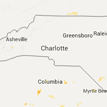
| 4:55 PM EDT | Quarter sized hail reported near Whiteville, NC, 43.9 miles W of Wilmington, NC, quarter size hail was reported. |
| 4:55 PM EDT | Tree down on young rd near cooksville in catawba county NC, 45 miles NW of Charlotte, NC |
| 5:00 PM EDT | Tree down on jacobs fork river rd near vale in catawba county NC, 45.5 miles NW of Charlotte, NC |
| 5:15 PM EDT | Tree down on riverview rd in lincoln county NC, 27.8 miles WNW of Charlotte, NC |
| 5:20 PM EDT | Tree down at long shoals rd and lynch rd in lincoln county NC, 26.7 miles WNW of Charlotte, NC |
| 5:20 PM EDT | Tree down at little mountain rd and hemphill rd in gaston county NC, 20 miles W of Charlotte, NC |
| 6:32 PM EDT | Trees and power lines down 2 miles south of uncc in mecklenburg county NC, 7.7 miles ENE of Charlotte, NC |
| 6:41 PM EDT | Tree down south of the speedway in cabarrus county NC, 10.7 miles NE of Charlotte, NC |
| 6:41 PM EDT | Pine tree down in harrisurg in cabarrus county NC, 11.6 miles NE of Charlotte, NC |
| 6:45 PM EDT | Dime-sized hail and limbs blown down near downtown concord in cabarrus county NC, 19 miles NE of Charlotte, NC |
| 6:50 PM EDT | Tree down at virginia st and corbin st in cabarrus county NC, 19 miles NE of Charlotte, NC |
Ohio
| Local Time | Report Details |
|---|---|
| 4:30 PM EDT | Quarter sized hail reported near Pemberville, OH, 88.4 miles ENE of Fort Wayne, IN |
| 5:05 PM EDT | Quarter sized hail reported near Huron, OH, 48.3 miles W of Cleveland, OH |
| 5:58 PM EDT | Geauga county dispatch reported several trees down in the county. trees were down on route 6 and chardon-windsor roa in geauga county OH, 25.5 miles ENE of Cleveland, OH |
| 4:00 AM EDT | Numerous trees and power lines dow in lake county OH, 37.9 miles ENE of Cleveland, OH |
Georgia
| Local Time | Report Details |
|---|---|
| 4:38 PM EDT | Emergency manager has received reports of several trees down near the intersection of grande creek road and highway 297. public has also reported several pecan trees da in emanuel county GA, 71.6 miles SSW of Augusta, GA |
| 4:45 PM EDT | Trees down near rabun gap in rabun county GA, 46 miles WNW of Greenville, SC |
| 5:10 PM EDT | 6 trees down at pryor rd and oliver kildare rd. time estimated by rada in effingham county GA, 38.6 miles NW of Savannah, GA |
| 5:10 PM EDT | Tree down at 5047 clyo kildare rd. time estimated by rada in effingham county GA, 36.8 miles NNW of Savannah, GA |
| 5:10 PM EDT | Tree down at 7602 hwy 17 north. time estimated by rada in effingham county GA, 37.5 miles NW of Savannah, GA |
| 5:15 PM EDT | Received report from nws charleston stating that member of public reported multiple trees down at exit 78 near the intersection of interstate 16w and highway 22 in treutlen county GA, 67.6 miles NNE of Douglas, GA |
| 5:15 PM EDT | 911 call center is receiving reports of multiple trees down on interstate 16 very near downtown gillis spring in treutlen county GA, 69.1 miles NNE of Douglas, GA |
| 5:20 PM EDT | 911 call center received reports of several trees down...about 2-3 total...just north of highway 280 and also near the intersection of highway 280 and highway 19 in dow in wheeler county GA, 47.6 miles NNE of Douglas, GA |
| 5:20 PM EDT | Trees were blown down near rocky ford. time of event was estimated from radar dat in jenkins county GA, 57.4 miles S of Augusta, GA |
| 5:30 PM EDT | Richmond county em reported trees down on railroad ave in downtown hephziba in richmond county GA, 13.1 miles SSW of Augusta, GA |
| 6:15 PM EDT | A large tree was blown down and blocking i-95 southboun in glynn county GA, 54.5 miles N of Jacksonville, FL |
| 6:18 PM EDT | Trees were blown down along altamaha school roa in appling county GA, 38.3 miles NE of Douglas, GA |
| 6:18 PM EDT | Trees were blown down along asbury church roa in appling county GA, 40.5 miles NE of Douglas, GA |
| 6:30 PM EDT | A tree was blown down along howell roa in echols county GA, 48 miles SSW of Douglas, GA |
| 6:48 PM EDT | Quarter sized hail reported near Rincon, GA, 11.1 miles NNW of Savannah, GA, storm spotter from florida traveling southbound on i-95 reports quarter sized hail and estimates 40 to 50 mph winds. |
| 7:00 PM EDT | 20 to 30 trees down around ashburn with numerous power outages in turner county GA, 49.2 miles WNW of Douglas, GA |
| 7:02 PM EDT | Storm damage reported in chatham county GA, 7.3 miles WNW of Savannah, GA |
| 7:10 PM EDT | Trees were blown down in midway at the intersection of coastal highway and east oglethorpe highway. time of event was estimated from radar dat in liberty county GA, 27.8 miles SW of Savannah, GA |
| 7:15 PM EDT | Storm damage reported in chatham county GA, 7.3 miles WNW of Savannah, GA |
| 7:23 PM EDT | Tree down across roadway at 102 arnold drive near allenhurst. time estimated based on rada in liberty county GA, 38.2 miles SW of Savannah, GA |
| 7:25 PM EDT | Power lines down at the 100 block of beasley road in garden cit in chatham county GA, 6.4 miles W of Savannah, GA |
| 7:26 PM EDT | Large pine tree blown down on road at 1843 paul davis roa in long county GA, 41.2 miles SW of Savannah, GA |
| 7:26 PM EDT | Large pine tree blown down on road at 1843 pearl davis roa in long county GA, 41.2 miles SW of Savannah, GA |
Virginia
| Local Time | Report Details |
|---|---|
| 5:05 PM EDT | Quarter sized hail reported near Bassett, VA, 41.4 miles S of Roanoke, VA, mostly pea size hail with some dime to quarter size mixed in. |
| 5:31 PM EDT | Weatherbug site at the virginia museum of natural history in city of martinsvil county VA, 41 miles S of Roanoke, VA |
| 5:35 PM EDT | Multiple trees down and power outages across martinsville... especially the northern side of the cit in city of martinsvil county VA, 41 miles S of Roanoke, VA |
| 5:55 PM EDT | Tree down near broomfield lane and rt 795 in albemarle county VA, 53.1 miles WNW of Richmond, VA |
Alabama
| Local Time | Report Details |
|---|---|
| 6:15 PM CDT | Power lines reported down in the vicinity of elba and main stree in mobile county AL, 5.5 miles NW of Mobile, AL |
| 6:15 PM CDT | Tree fell on power lines causing power outages near the vicinity of cottage hill and knollwood roa in mobile county AL, 7.7 miles WSW of Mobile, AL |
New Mexico
| Local Time | Report Details |
|---|---|
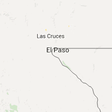
| 6:10 PM MDT | Krtn aso in colfax county NM, 63.6 miles ENE of Taos, NM |
| 6:24 PM MDT | Four 35 ft power poles and one 60 ft transmission tower blown down from wet microburst along state road 50 in colfax county NM, 56.2 miles E of Taos, NM |
Missouri
| Local Time | Report Details |
|---|---|
| 7:18 PM CDT | Tree and power pole down in town. power out in town. time estimated from rada in schuyler county MO, 34.6 miles W of Kahoka, MO |
| 7:22 PM CDT | Storm damage reported in scotland county MO, 33.3 miles W of Kahoka, MO |
| 7:53 PM CDT | Large tree dow in clark county MO, 12.7 miles SW of Kahoka, MO |
| 7:58 PM CDT | Numerous large trees down around tow in scotland county MO, 23.9 miles W of Kahoka, MO |
| 8:00 PM CDT | Estimated 60 mph wind in schuyler county MO, 44.9 miles W of Kahoka, MO |
| 8:13 PM CDT | Roof partially blown off metal barn. debris laying in highwa in lewis county MO, 18 miles S of Kahoka, MO |
| 8:34 PM CDT | Iron patio furniture blown across pati in adair county MO, 42.3 miles WSW of Kahoka, MO |
| 8:47 PM CDT | Storm damage reported in adair county MO, 48.2 miles WSW of Kahoka, MO |
| 8:52 PM CDT | Power went out at location of repor in adair county MO, 48.2 miles WSW of Kahoka, MO |
| 8:54 PM CDT | Trees and powerlines down around the city in adair county MO, 48.2 miles WSW of Kahoka, MO |
| 9:05 PM CDT | Trees snapped and power lines down in town. downed power lines causing fire in adair county MO, 48.2 miles WSW of Kahoka, MO |
| 9:15 PM CDT | Storm damage reported in macon county MO, 48.9 miles WSW of Kahoka, MO |
| 10:05 PM CDT | Estimate 50 to 60 mph winds. hard to drive due to win in macon county MO, 62.5 miles NNW of Columbia, MO |
Arizona
| Local Time | Report Details |
|---|---|
| 6:58 PM MST | Storm damage reported in cochise county AZ, 7.8 miles NNW of Douglas, AZ |
Indiana
| Local Time | Report Details |
|---|---|
| 10:58 PM CDT | Quarter sized hail reported near Morocco, IN, 65 miles S of Chicago, IL, near 400 south and 500 west. |
| 3:20 AM EDT | Several reports of trees down mainly between county road 700w 500n and 200w 300n. few roads were closed due to trees laying across the roa in cass county IN, 72.7 miles WSW of Fort Wayne, IN |
New York
| Local Time | Report Details |
|---|---|
| 4:20 AM EDT | Tree limb took out window on home in erie county NY, 15.4 miles ESE of Buffalo, NY |
| 4:35 AM EDT | Large tree limbs down across pike rd in genesee county NY, 34.5 miles E of Buffalo, NY |
| 8:35 AM UTC | Trees and powerlines down in genesee county NY, 38 miles E of Buffalo, NY |
| 8:43 AM UTC | Trees and powerlines down in genesee county NY, 45.5 miles E of Buffalo, NY |
| 8:45 AM UTC | Trees and powerlines down in genesee county NY, 42.6 miles E of Buffalo, NY |
| 4:52 AM EDT | Trees and powerlines down in livingston county NY, 52.1 miles E of Buffalo, NY |
| 4:56 AM EDT | Trees and powerlines down in livingston county NY, 57.3 miles E of Buffalo, NY |
| 5:02 AM EDT | Trees and powerlines down in livingston county NY, 64.4 miles E of Buffalo, NY |
| 5:02 AM EDT | Large tree down on a house in chautauqua county NY, 52.9 miles SW of Buffalo, NY |
| 5:03 AM EDT | Trees and large branches down in monroe county NY, 62.8 miles E of Buffalo, NY |
| 9:03 AM UTC | News 8 twitter report of tree limb on home and roadway in honeoye falls. time estimated from rada in monroe county NY, 65.5 miles E of Buffalo, NY |
| 5:08 AM EDT | Trees and large branches down in monroe county NY, 68.6 miles W of Syracuse, NY |
| 5:08 AM EDT | Tree limbs and powerlines down in ontario county NY, 68 miles E of Buffalo, NY |
| 5:12 AM EDT | Tree limbs and powerlines down in ontario county NY, 64.1 miles W of Syracuse, NY |
| 5:13 AM EDT | Twitter pic from news 10 of tree down on suv on dorbeth road in rochester in monroe county NY, 67.1 miles ENE of Buffalo, NY |
| 5:15 AM EDT | Tree limbs and powerlines down in chautauqua county NY, 38 miles SSW of Buffalo, NY |
| 5:19 AM EDT | Tree limbs and powerlines down in ontario county NY, 58.5 miles W of Syracuse, NY |
| 5:19 AM EDT | Tree limbs and powerlines down in ontario county NY, 59.5 miles W of Syracuse, NY |
| 5:19 AM EDT | Tree limbs and powerlines down in chautauqua county NY, 28.1 miles SSW of Buffalo, NY |
| 5:20 AM EDT | Tree limbs and powerlines down in ontario county NY, 55.1 miles W of Syracuse, NY |
| 9:30 AM UTC | Trees and wires down in cattaraugus county NY, 32.5 miles S of Buffalo, NY |
| 9:30 AM UTC | Tree limbs and powerlines down in ontario county NY, 46.7 miles W of Syracuse, NY |
| 10:04 AM UTC | Trees and wires down in cattaraugus county NY, 58.4 miles SSE of Buffalo, NY |
| 10:04 AM UTC | Trees and wires down in cattaraugus county NY, 60.1 miles SSE of Buffalo, NY |
| 10:12 AM UTC | Trees and wires down in cattaraugus county NY, 48 miles SE of Buffalo, NY |
| 10:12 AM UTC | Trees and wires down in cattaraugus county NY, 32.4 miles SE of Buffalo, NY |
| 10:17 AM UTC | Trees and wires down in cattaraugus county NY, 39.5 miles SE of Buffalo, NY |
Pennsylvania
| Local Time | Report Details |
|---|---|
| 10:00 AM UTC | Tree blocking roadway in mckean county PA, 65 miles S of Buffalo, NY |
| 10:08 AM UTC | Multiple trees down at multiple locations along route in mckean county PA, 71 miles NNW of State College, PA |
| 10:20 AM UTC | Trees across roadway in elk county PA, 72.3 miles NW of State College, PA |
Connect with Interactive Hail Maps