

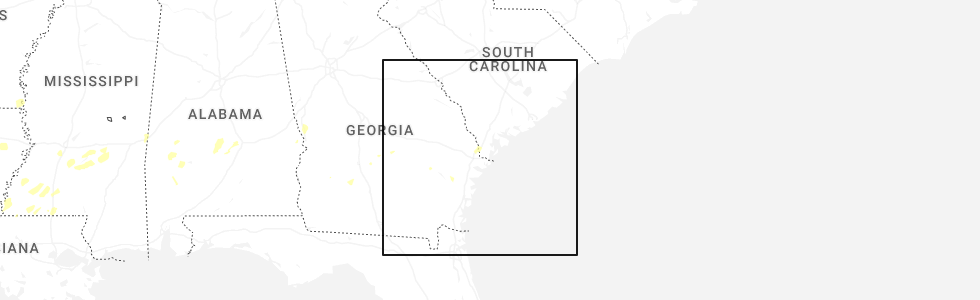
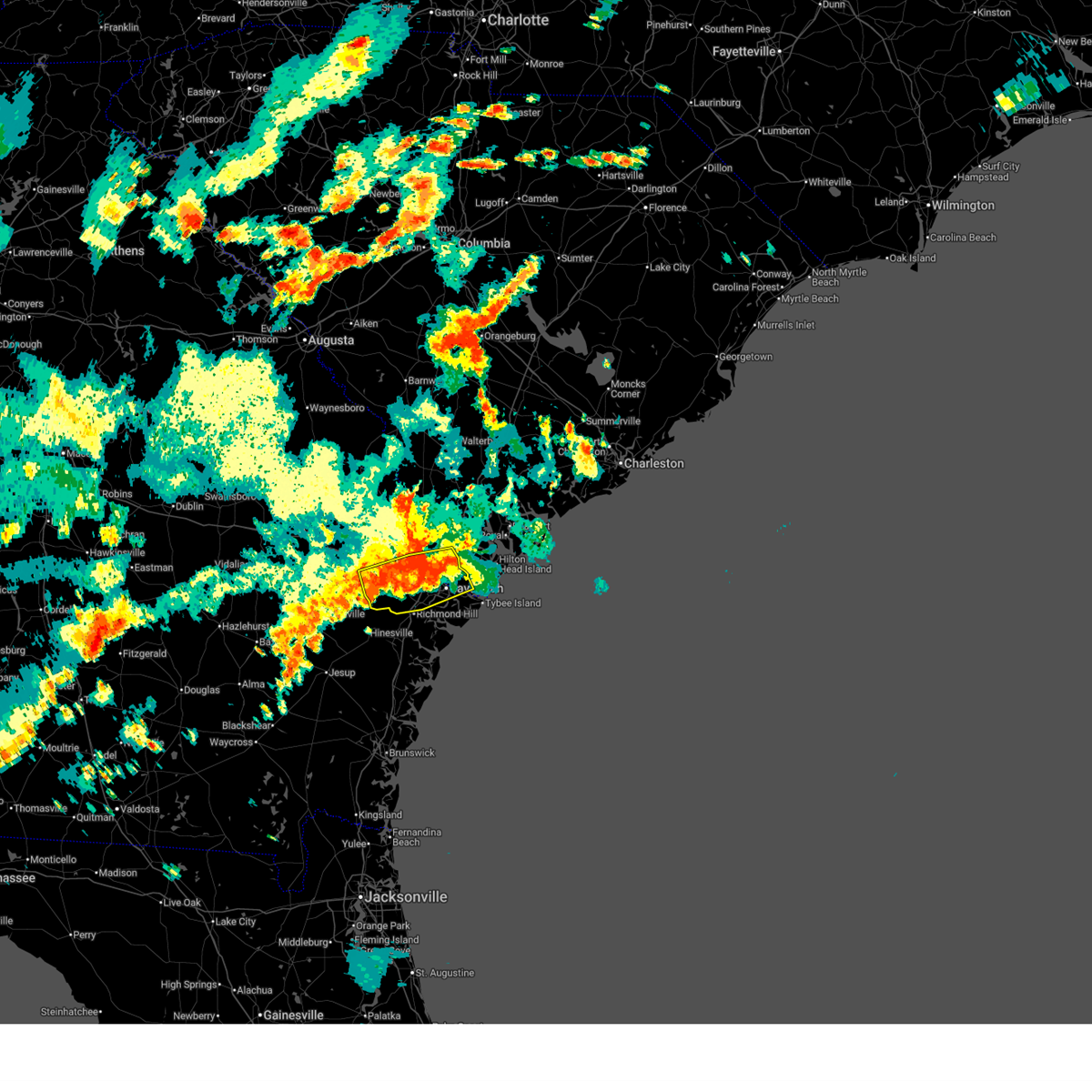
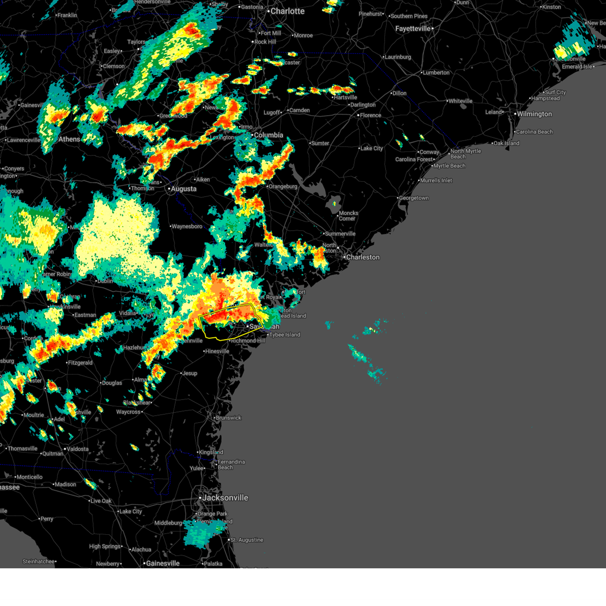
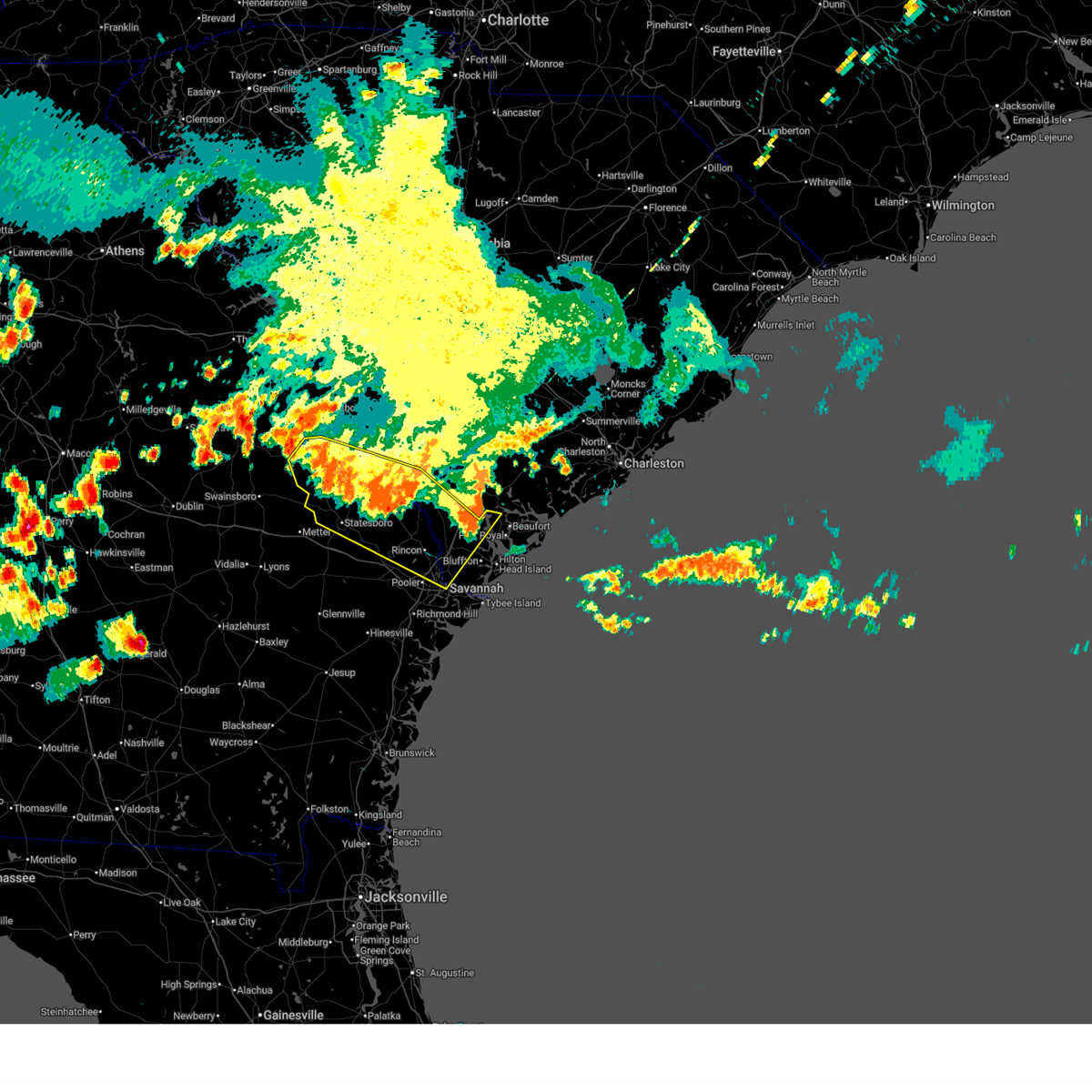
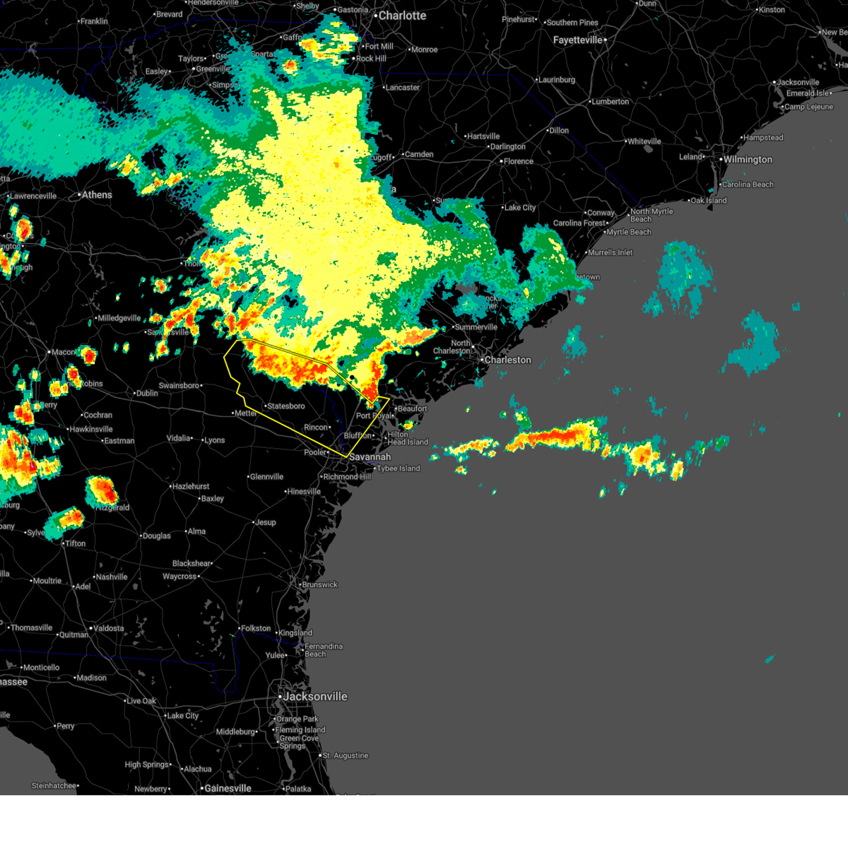
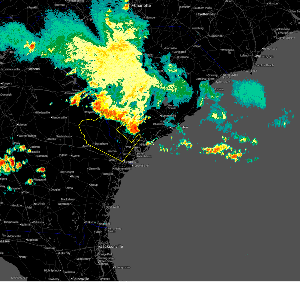
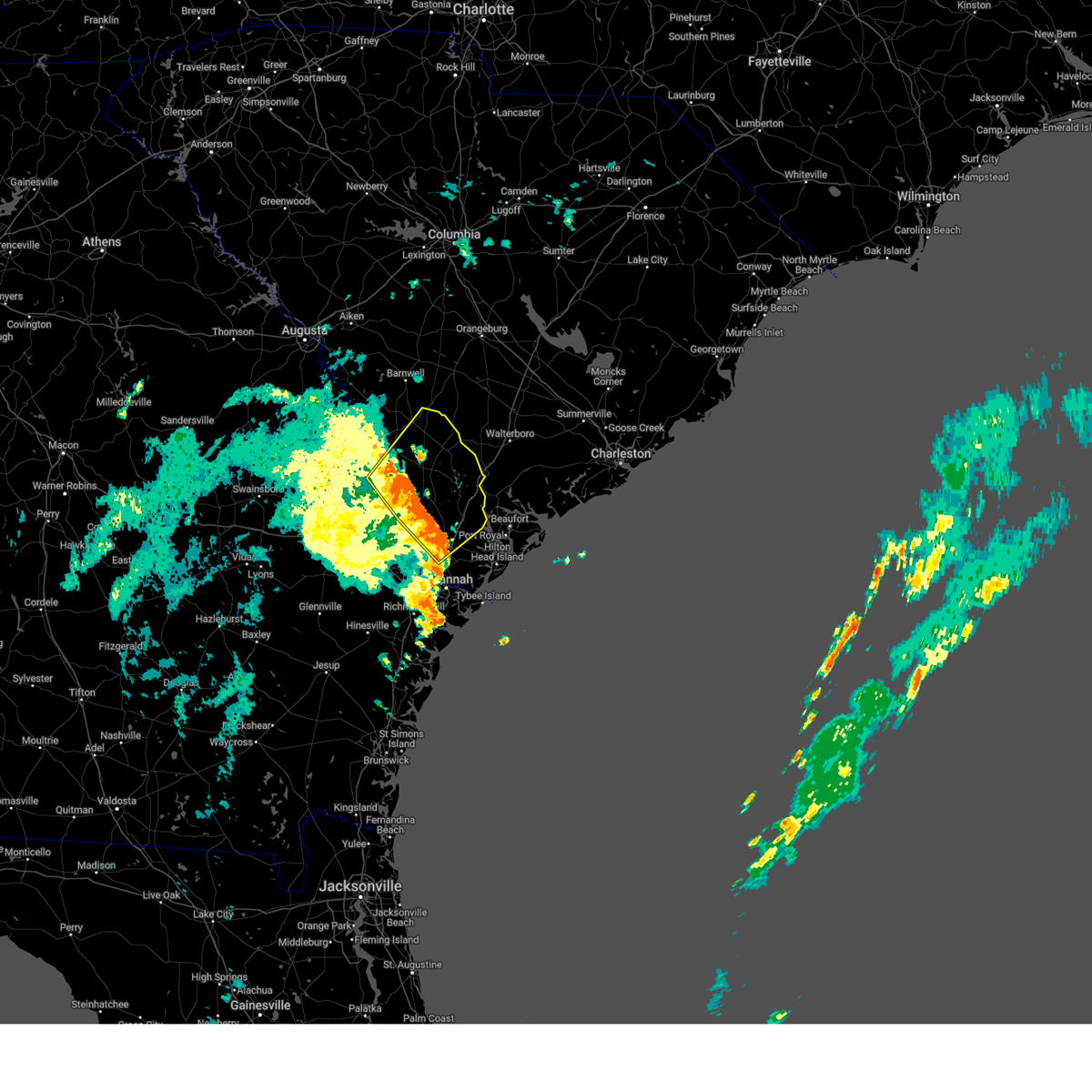
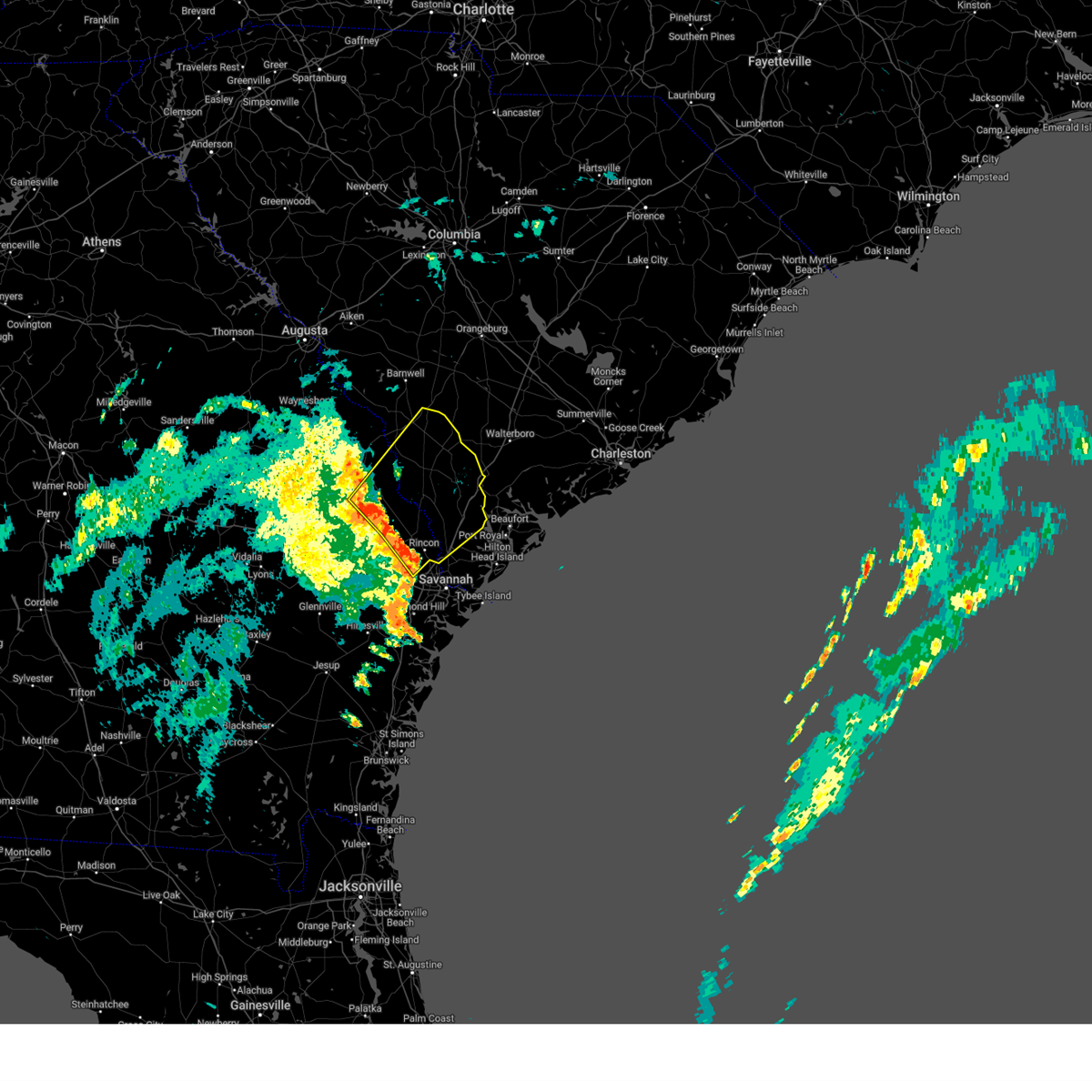
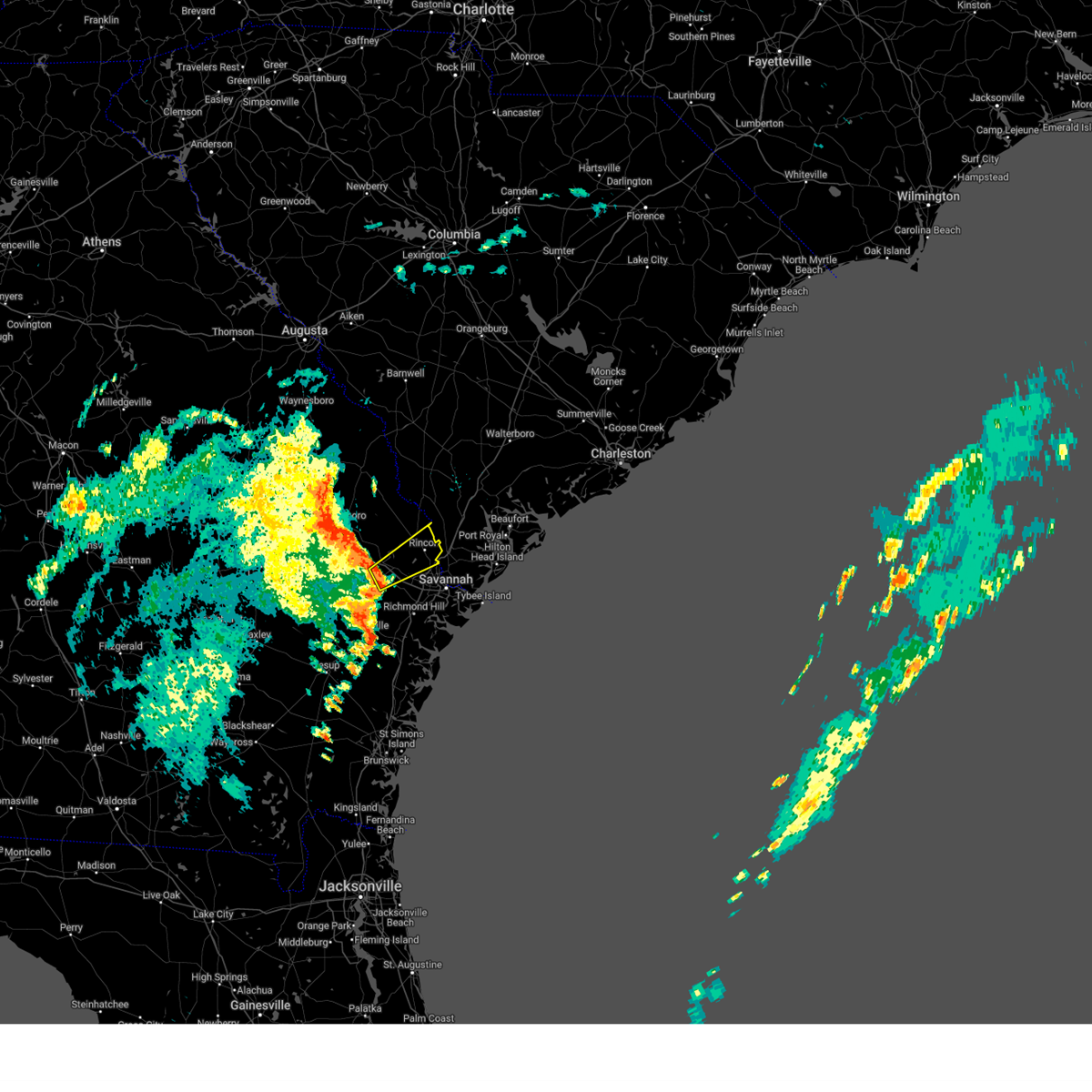
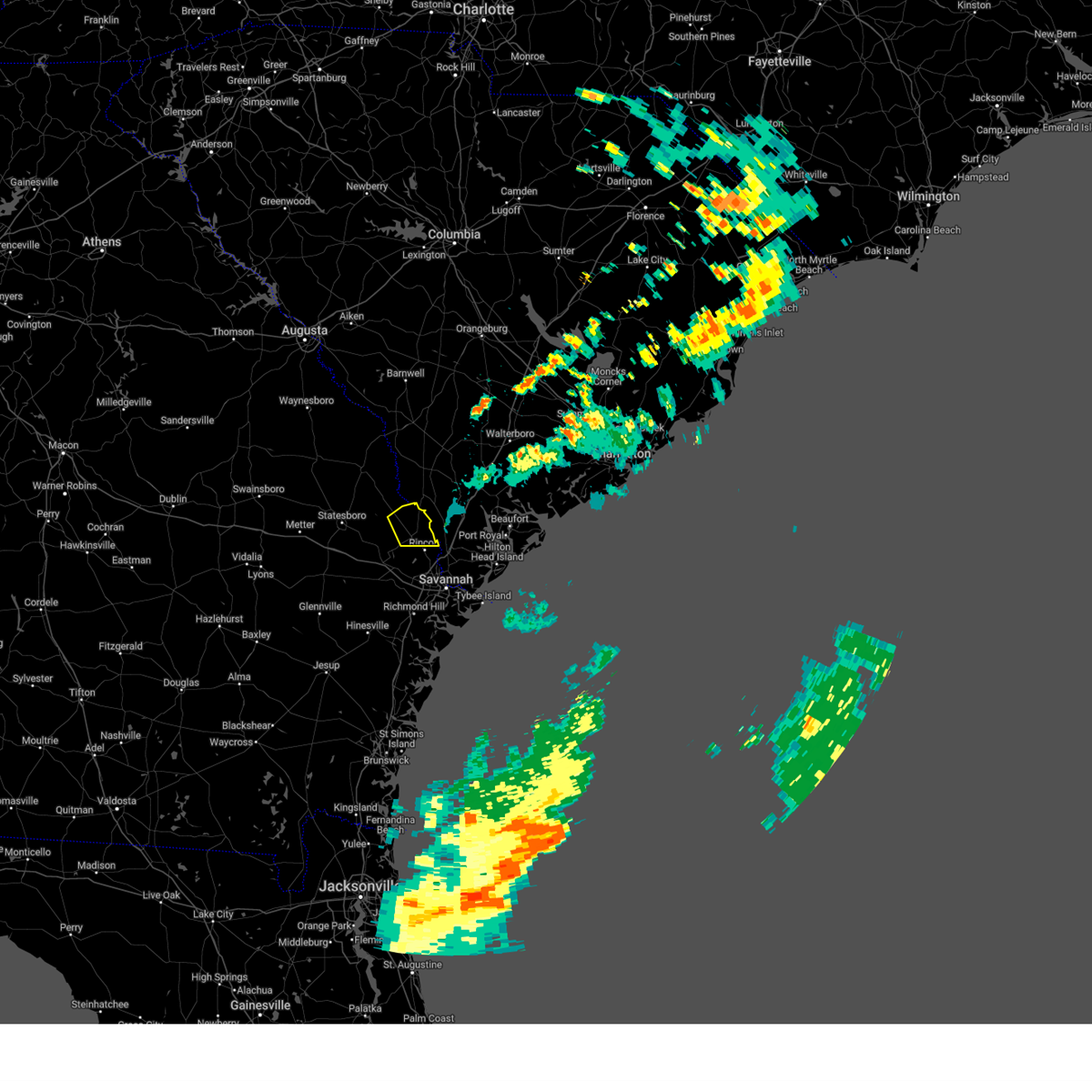
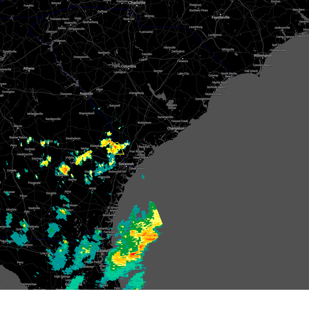
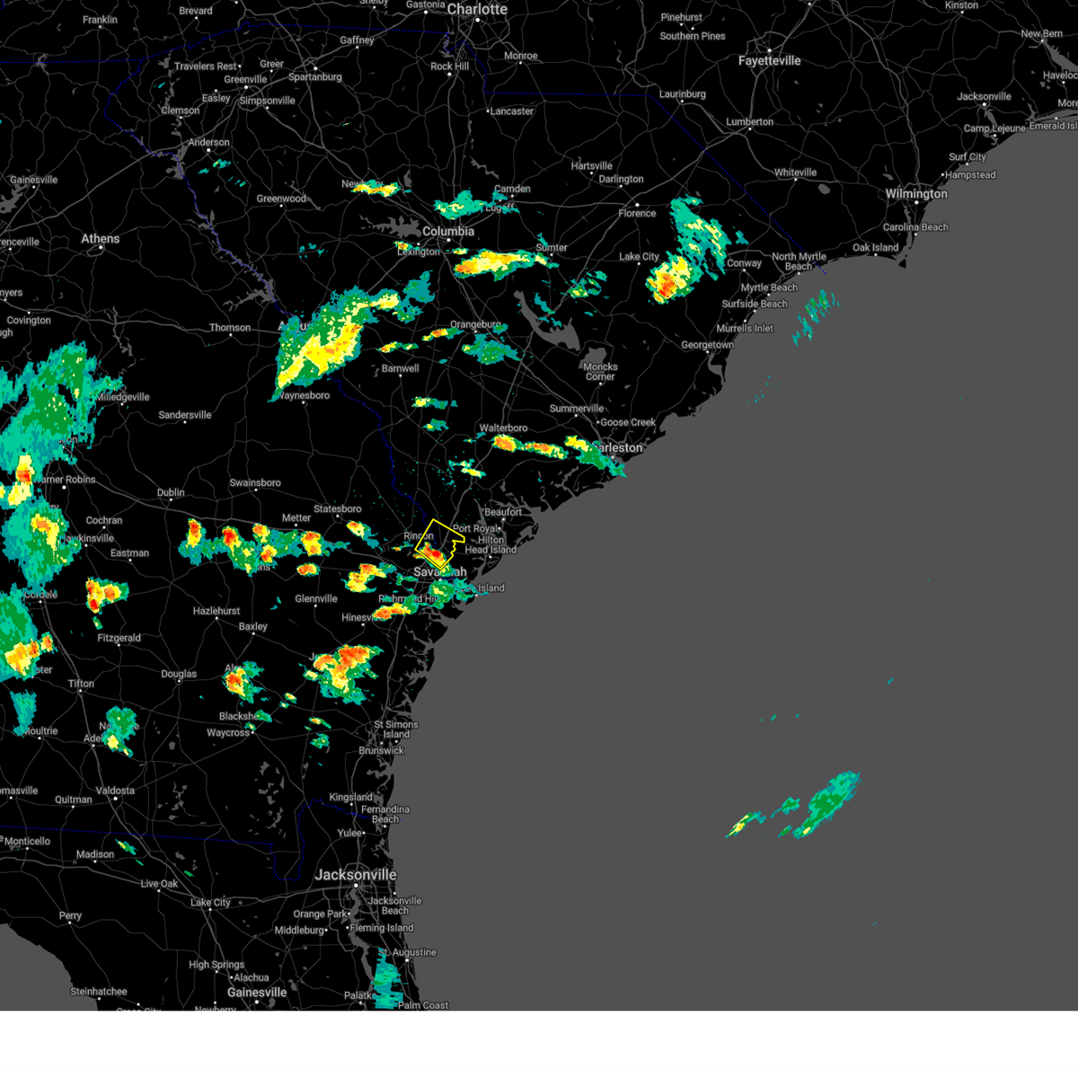
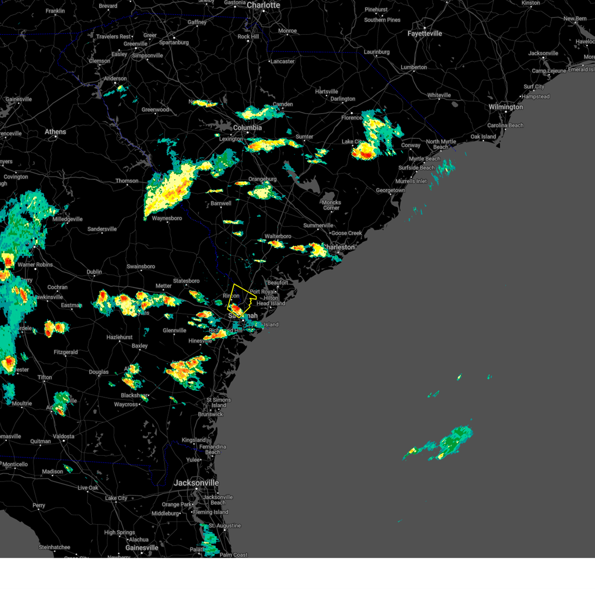
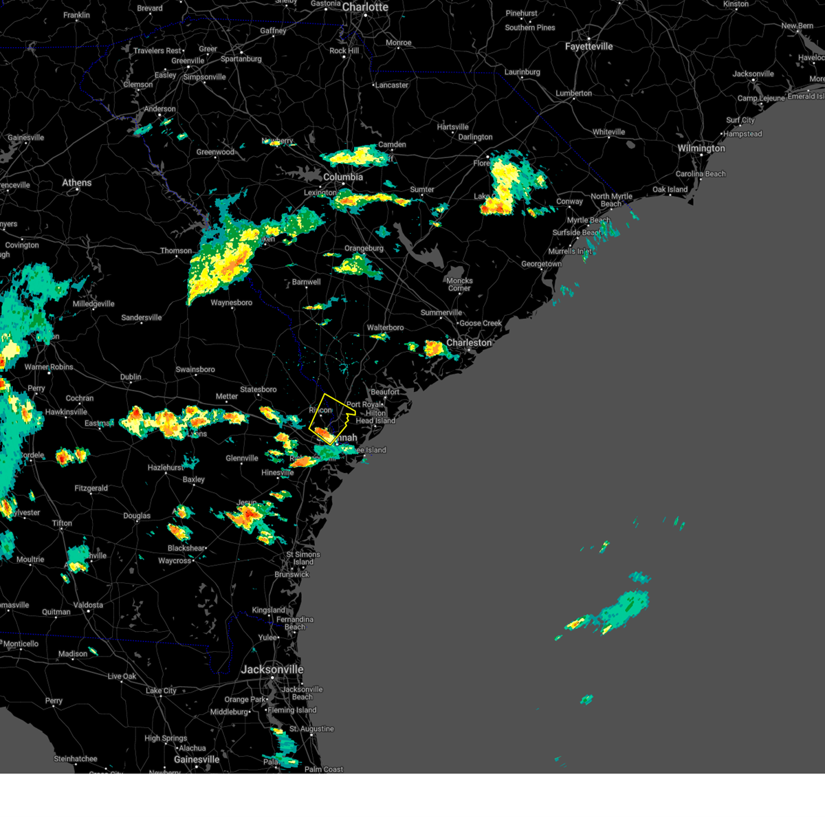
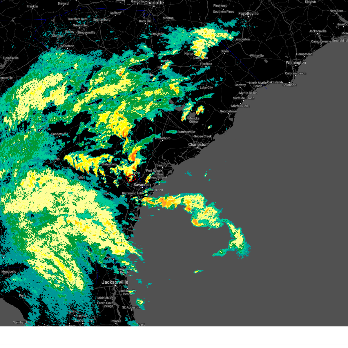
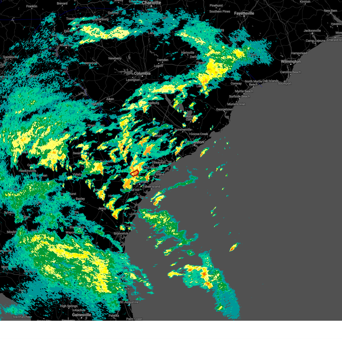
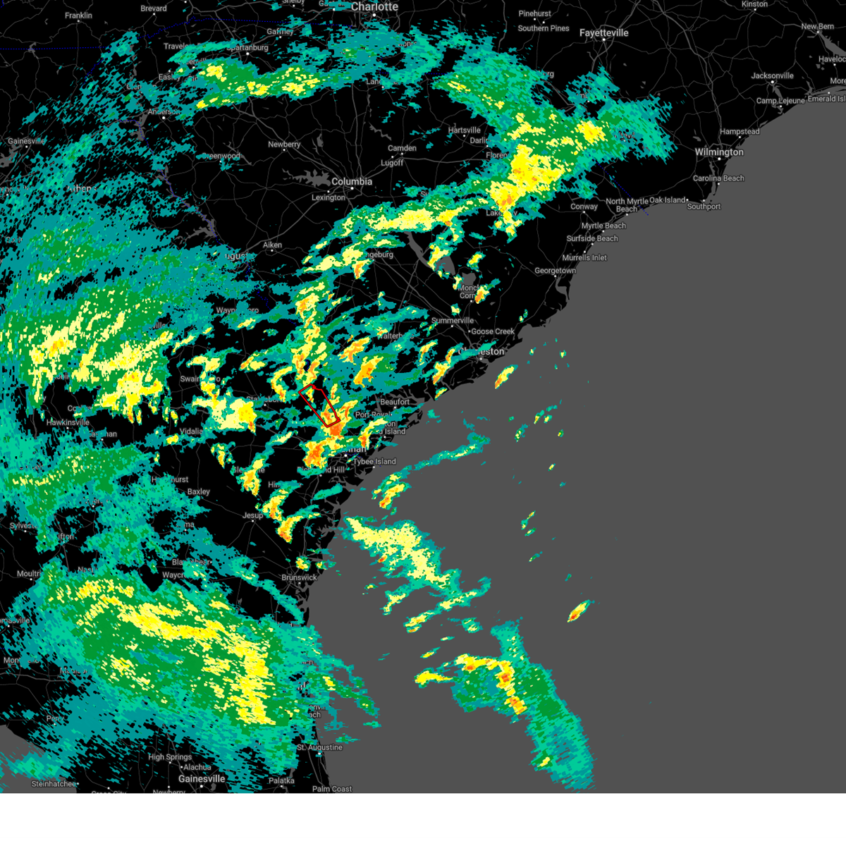
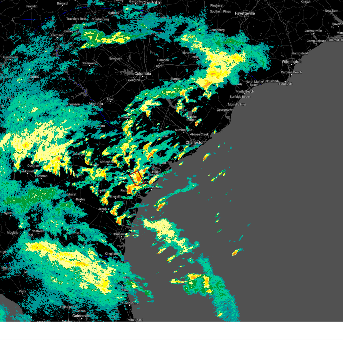
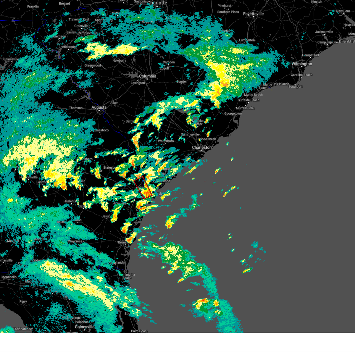
Hail Map for Rincon, GA
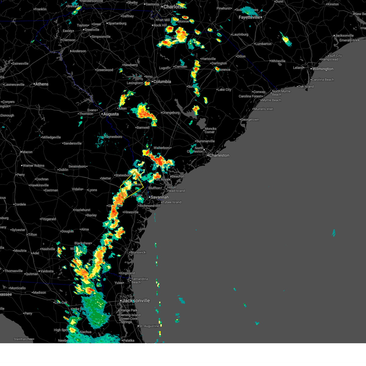
The Rincon, GA area has had 17 reports of on-the-ground hail by trained spotters, and has been under severe weather warnings 42 times during the past 12 months. Doppler radar has detected hail at or near Rincon, GA on 79 occasions, including 2 occasions during the past year.
| Name: | Rincon, GA |
| Where Located: | 16.6 miles NNW of Savannah, GA |
| Map: | Google Map for Rincon, GA |
| Population: | 8836 |
| Housing Units: | 3630 |
| More Info: | Search Google for Rincon, GA |
0
The Top Recent Hail Date for Rincon, GA is Monday, May 26, 2025 (79th out of 79)
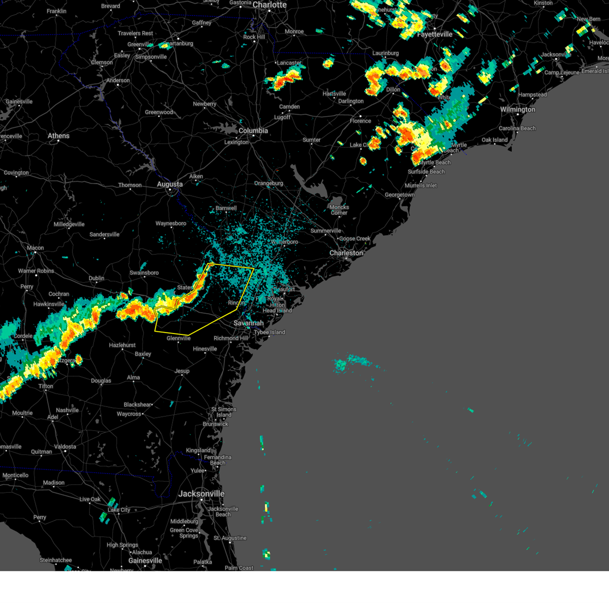
Hail and Wind Damage Spotted near Rincon, GA
| Date / Time | Report Details |
|---|---|
| 7/14/2025 5:27 PM EDT |
 the severe thunderstorm warning has been cancelled and is no longer in effect the severe thunderstorm warning has been cancelled and is no longer in effect
|
| 7/14/2025 4:52 PM EDT |
 At 452 pm edt, a severe thunderstorm was located near blitchton, moving south at 20 mph (radar indicated). Hazards include 60 mph wind gusts and quarter size hail. Hail damage to vehicles is expected. expect wind damage to roofs, siding, and trees. locations impacted include, springfield, pembroke, lanier, rincon, guyton, marlow, pineora, blitchton, eden and stilson. This includes i-16 between mile markers 131 and 147. At 452 pm edt, a severe thunderstorm was located near blitchton, moving south at 20 mph (radar indicated). Hazards include 60 mph wind gusts and quarter size hail. Hail damage to vehicles is expected. expect wind damage to roofs, siding, and trees. locations impacted include, springfield, pembroke, lanier, rincon, guyton, marlow, pineora, blitchton, eden and stilson. This includes i-16 between mile markers 131 and 147.
|
| 7/14/2025 4:39 PM EDT |
 Svrchs the national weather service in charleston has issued a * severe thunderstorm warning for portions of, bryan county in southeastern georgia, bulloch county in southeastern georgia, effingham county in southeastern georgia, * until 545 pm edt. * at 439 pm edt, a severe thunderstorm was located near stilson, moving south at 20 mph (radar indicated). Hazards include 60 mph wind gusts and small hail. expect damage to roofs, siding, and trees Svrchs the national weather service in charleston has issued a * severe thunderstorm warning for portions of, bryan county in southeastern georgia, bulloch county in southeastern georgia, effingham county in southeastern georgia, * until 545 pm edt. * at 439 pm edt, a severe thunderstorm was located near stilson, moving south at 20 mph (radar indicated). Hazards include 60 mph wind gusts and small hail. expect damage to roofs, siding, and trees
|
| 7/10/2025 5:31 PM EDT |
 At 531 pm edt, severe thunderstorms were located along a line from near lanier to near bellinger hill area, moving southeast at 15 mph (radar indicated). Hazards include 60 mph wind gusts and small hail. Expect damage to roofs, siding, and trees. locations impacted include, pooler, bluffton, richmond hill, pembroke, i-16/i-95 interchange, godley station, savannah international airport, hunter army airfield, downtown savannah and windsor forest. this includes the following highways, i-16 between mile markers 139 and 168. i-95 in georgia between mile markers 90 and 112. i-95 in south carolina between mile markers 2 and 8. I-516 between mile markers 3 and 9. At 531 pm edt, severe thunderstorms were located along a line from near lanier to near bellinger hill area, moving southeast at 15 mph (radar indicated). Hazards include 60 mph wind gusts and small hail. Expect damage to roofs, siding, and trees. locations impacted include, pooler, bluffton, richmond hill, pembroke, i-16/i-95 interchange, godley station, savannah international airport, hunter army airfield, downtown savannah and windsor forest. this includes the following highways, i-16 between mile markers 139 and 168. i-95 in georgia between mile markers 90 and 112. i-95 in south carolina between mile markers 2 and 8. I-516 between mile markers 3 and 9.
|
| 7/10/2025 5:16 PM EDT |
 Svrchs the national weather service in charleston has issued a * severe thunderstorm warning for portions of, bryan county in southeastern georgia, chatham county in southeastern georgia, effingham county in southeastern georgia, jasper county in southeastern south carolina, * until 615 pm edt. * at 516 pm edt, severe thunderstorms were located along a line from over pembroke to over bellinger hill area, moving south at 10 mph (radar indicated). Hazards include 60 mph wind gusts and small hail. expect damage to roofs, siding, and trees Svrchs the national weather service in charleston has issued a * severe thunderstorm warning for portions of, bryan county in southeastern georgia, chatham county in southeastern georgia, effingham county in southeastern georgia, jasper county in southeastern south carolina, * until 615 pm edt. * at 516 pm edt, severe thunderstorms were located along a line from over pembroke to over bellinger hill area, moving south at 10 mph (radar indicated). Hazards include 60 mph wind gusts and small hail. expect damage to roofs, siding, and trees
|
| 6/25/2025 11:40 PM EDT |
 The severe thunderstorm warning that was previously in effect has been reissued for screven, jenkins, effingham, and bulloch counties and is in effect until 1230 am edt. please refer to that bulletin for the latest severe weather information. a severe thunderstorm watch remains in effect until 400 am edt for portions of southeast georgia and southeast south carolina. The severe thunderstorm warning that was previously in effect has been reissued for screven, jenkins, effingham, and bulloch counties and is in effect until 1230 am edt. please refer to that bulletin for the latest severe weather information. a severe thunderstorm watch remains in effect until 400 am edt for portions of southeast georgia and southeast south carolina.
|
| 6/25/2025 11:22 PM EDT |
 At 1122 pm edt, severe thunderstorms were located along a line from over old house to over millen, moving southwest at 30 mph (law enforcement reported. at 1020 pm, law enforcement officials reported trees down near sylvania as well as other portions of screven county). Hazards include 60 mph wind gusts and small hail. Expect damage to roofs, siding, and trees. locations impacted include, beaufort, sylvania, ridgeland, millen, springfield, statesboro, bluffton, godley station, savannah international airport and pooler. this includes the following highways, i-95 in georgia between mile markers 106 and 112. I-95 in south carolina between mile markers 2 and 25. At 1122 pm edt, severe thunderstorms were located along a line from over old house to over millen, moving southwest at 30 mph (law enforcement reported. at 1020 pm, law enforcement officials reported trees down near sylvania as well as other portions of screven county). Hazards include 60 mph wind gusts and small hail. Expect damage to roofs, siding, and trees. locations impacted include, beaufort, sylvania, ridgeland, millen, springfield, statesboro, bluffton, godley station, savannah international airport and pooler. this includes the following highways, i-95 in georgia between mile markers 106 and 112. I-95 in south carolina between mile markers 2 and 25.
|
| 6/25/2025 10:49 PM EDT |
 Svrchs the national weather service in charleston has issued a * severe thunderstorm warning for portions of, bulloch county in southeastern georgia, chatham county in southeastern georgia, effingham county in southeastern georgia, jenkins county in southeastern georgia, screven county in southeastern georgia, allendale county in southeastern south carolina, beaufort county in southeastern south carolina, hampton county in southeastern south carolina, jasper county in southeastern south carolina, * until 1145 pm edt. * at 1049 pm edt, severe thunderstorms were located along a line from near sheldon to 12 miles northeast of perkins, moving southwest at 30 mph (radar indicated). Hazards include 60 mph wind gusts and small hail. expect damage to roofs, siding, and trees Svrchs the national weather service in charleston has issued a * severe thunderstorm warning for portions of, bulloch county in southeastern georgia, chatham county in southeastern georgia, effingham county in southeastern georgia, jenkins county in southeastern georgia, screven county in southeastern georgia, allendale county in southeastern south carolina, beaufort county in southeastern south carolina, hampton county in southeastern south carolina, jasper county in southeastern south carolina, * until 1145 pm edt. * at 1049 pm edt, severe thunderstorms were located along a line from near sheldon to 12 miles northeast of perkins, moving southwest at 30 mph (radar indicated). Hazards include 60 mph wind gusts and small hail. expect damage to roofs, siding, and trees
|
| 6/10/2025 9:08 AM EDT |
 At 908 am edt, severe thunderstorms were located along a line from 6 miles west of estill to near switzerland, moving northeast at 55 mph (radar indicated). Hazards include 60 mph wind gusts and small hail. Expect damage to roofs, siding, and trees. locations impacted include, ridgeland, allendale, springfield, hampton, yemassee, lake warren state park, rincon, hardeeville, varnville and estill. This includes i-95 in south carolina between mile markers 2 and 41. At 908 am edt, severe thunderstorms were located along a line from 6 miles west of estill to near switzerland, moving northeast at 55 mph (radar indicated). Hazards include 60 mph wind gusts and small hail. Expect damage to roofs, siding, and trees. locations impacted include, ridgeland, allendale, springfield, hampton, yemassee, lake warren state park, rincon, hardeeville, varnville and estill. This includes i-95 in south carolina between mile markers 2 and 41.
|
| 6/10/2025 9:08 AM EDT |
 the severe thunderstorm warning has been cancelled and is no longer in effect the severe thunderstorm warning has been cancelled and is no longer in effect
|
| 6/10/2025 9:06 AM EDT |
 The severe thunderstorm warning that was previously in effect has been reissued for effingham county and is in effect until 930 am edt. please refer to that bulletin for the latest severe weather information. The severe thunderstorm warning that was previously in effect has been reissued for effingham county and is in effect until 930 am edt. please refer to that bulletin for the latest severe weather information.
|
| 6/10/2025 8:51 AM EDT |
 At 851 am edt, a severe thunderstorm was located near rincon, moving northeast at 30 mph (radar indicated). Hazards include 60 mph wind gusts. Expect damage to roofs, siding, and trees. locations impacted include, springfield, godley station, rincon, port wentworth, bloomingdale, guyton, stillwell, pineora, marlow and ebenezer. This includes i-95 in georgia between mile markers 111 and 112. At 851 am edt, a severe thunderstorm was located near rincon, moving northeast at 30 mph (radar indicated). Hazards include 60 mph wind gusts. Expect damage to roofs, siding, and trees. locations impacted include, springfield, godley station, rincon, port wentworth, bloomingdale, guyton, stillwell, pineora, marlow and ebenezer. This includes i-95 in georgia between mile markers 111 and 112.
|
| 6/10/2025 8:51 AM EDT |
 the severe thunderstorm warning has been cancelled and is no longer in effect the severe thunderstorm warning has been cancelled and is no longer in effect
|
| 6/10/2025 8:49 AM EDT |
 Svrchs the national weather service in charleston has issued a * severe thunderstorm warning for portions of, bulloch county in southeastern georgia, effingham county in southeastern georgia, screven county in southeastern georgia, allendale county in southeastern south carolina, hampton county in southeastern south carolina, jasper county in southeastern south carolina, * until 930 am edt. * at 849 am edt, severe thunderstorms were located along a line from over newington to over rincon, moving northeast at 55 mph (radar indicated). Hazards include 60 mph wind gusts. expect damage to roofs, siding, and trees Svrchs the national weather service in charleston has issued a * severe thunderstorm warning for portions of, bulloch county in southeastern georgia, effingham county in southeastern georgia, screven county in southeastern georgia, allendale county in southeastern south carolina, hampton county in southeastern south carolina, jasper county in southeastern south carolina, * until 930 am edt. * at 849 am edt, severe thunderstorms were located along a line from over newington to over rincon, moving northeast at 55 mph (radar indicated). Hazards include 60 mph wind gusts. expect damage to roofs, siding, and trees
|
| 6/10/2025 8:30 AM EDT |
 Svrchs the national weather service in charleston has issued a * severe thunderstorm warning for portions of, bryan county in southeastern georgia, bulloch county in southeastern georgia, chatham county in southeastern georgia, effingham county in southeastern georgia, * until 915 am edt. * at 830 am edt, a severe thunderstorm was located over blitchton, moving northeast at 30 mph (radar indicated). Hazards include 60 mph wind gusts. expect damage to roofs, siding, and trees Svrchs the national weather service in charleston has issued a * severe thunderstorm warning for portions of, bryan county in southeastern georgia, bulloch county in southeastern georgia, chatham county in southeastern georgia, effingham county in southeastern georgia, * until 915 am edt. * at 830 am edt, a severe thunderstorm was located over blitchton, moving northeast at 30 mph (radar indicated). Hazards include 60 mph wind gusts. expect damage to roofs, siding, and trees
|
| 6/5/2025 5:52 PM EDT |
 The storm which prompted the warning has weakened below severe limits, and no longer poses an immediate threat to life or property. therefore, the warning will be allowed to expire. The storm which prompted the warning has weakened below severe limits, and no longer poses an immediate threat to life or property. therefore, the warning will be allowed to expire.
|
| 6/5/2025 5:45 PM EDT |
 At 545 pm edt, a severe thunderstorm was located near springfield, moving east at 15 mph (radar indicated). Hazards include 60 mph wind gusts. Expect damage to roofs, siding, and trees. Locations impacted include, springfield, guyton, clyo, stillwell, shawnee, ebenezer, berryville, tuckasee king, tusculum and oaky. At 545 pm edt, a severe thunderstorm was located near springfield, moving east at 15 mph (radar indicated). Hazards include 60 mph wind gusts. Expect damage to roofs, siding, and trees. Locations impacted include, springfield, guyton, clyo, stillwell, shawnee, ebenezer, berryville, tuckasee king, tusculum and oaky.
|
| 6/5/2025 5:45 PM EDT |
 the severe thunderstorm warning has been cancelled and is no longer in effect the severe thunderstorm warning has been cancelled and is no longer in effect
|
| 6/5/2025 5:15 PM EDT | Svrchs the national weather service in charleston has issued a * severe thunderstorm warning for portions of, bulloch county in southeastern georgia, effingham county in southeastern georgia, * until 600 pm edt. * at 515 pm edt, a severe thunderstorm was located 5 miles south of egypt, moving east at 15 mph (radar indicated). Hazards include 60 mph wind gusts. expect damage to roofs, siding, and trees |
| 5/26/2025 5:45 PM EDT | Ping Pong Ball sized hail reported 3.9 miles NNW of Rincon, GA, public reported ping pong ball size hail near highway 21 at old augusta road. |
| 5/26/2025 5:44 PM EDT |
 At 544 pm edt, severe thunderstorms were located along a line from near rincon to 5 miles south of hardeeville, moving northeast at 15 mph (emergency management reported. at 541 pm, emergency management officials reported a tree on a home and power lines down near port wentworth, georgia). Hazards include 60 mph wind gusts and half dollar size hail. Hail damage to vehicles is expected. expect wind damage to roofs, siding, and trees. locations impacted include, port wentworth, o'leary, limehouse, rincon, hardeeville, bluffton, purysburgh, morgan, coastal carolina hospital and deerfield. this includes the following highways, i-95 in georgia between mile markers 111 and 112. I-95 in south carolina between mile markers 2 and 13. At 544 pm edt, severe thunderstorms were located along a line from near rincon to 5 miles south of hardeeville, moving northeast at 15 mph (emergency management reported. at 541 pm, emergency management officials reported a tree on a home and power lines down near port wentworth, georgia). Hazards include 60 mph wind gusts and half dollar size hail. Hail damage to vehicles is expected. expect wind damage to roofs, siding, and trees. locations impacted include, port wentworth, o'leary, limehouse, rincon, hardeeville, bluffton, purysburgh, morgan, coastal carolina hospital and deerfield. this includes the following highways, i-95 in georgia between mile markers 111 and 112. I-95 in south carolina between mile markers 2 and 13.
|
| 5/26/2025 5:33 PM EDT |
 At 533 pm edt, a severe thunderstorm was located over port wentworth, moving northeast at 15 mph (radar indicated). Hazards include 60 mph wind gusts and half dollar size hail. Hail damage to vehicles is expected. expect wind damage to roofs, siding, and trees. locations impacted include, savannah international airport, garden city, godley station, port wentworth, monteith, rincon, bluffton, purysburgh, hardeeville and ebenezer. this includes the following highways, i-95 in georgia between mile markers 107 and 112. I-95 in south carolina between mile markers 2 and 14. At 533 pm edt, a severe thunderstorm was located over port wentworth, moving northeast at 15 mph (radar indicated). Hazards include 60 mph wind gusts and half dollar size hail. Hail damage to vehicles is expected. expect wind damage to roofs, siding, and trees. locations impacted include, savannah international airport, garden city, godley station, port wentworth, monteith, rincon, bluffton, purysburgh, hardeeville and ebenezer. this includes the following highways, i-95 in georgia between mile markers 107 and 112. I-95 in south carolina between mile markers 2 and 14.
|
| 5/26/2025 5:21 PM EDT |
 Svrchs the national weather service in charleston has issued a * severe thunderstorm warning for portions of, chatham county in southeastern georgia, effingham county in southeastern georgia, jasper county in southeastern south carolina, * until 615 pm edt. * at 521 pm edt, a severe thunderstorm was located over monteith, moving northeast at 15 mph (radar indicated). Hazards include 60 mph wind gusts and half dollar size hail. Hail damage to vehicles is expected. Expect wind damage to roofs, siding, and trees. Svrchs the national weather service in charleston has issued a * severe thunderstorm warning for portions of, chatham county in southeastern georgia, effingham county in southeastern georgia, jasper county in southeastern south carolina, * until 615 pm edt. * at 521 pm edt, a severe thunderstorm was located over monteith, moving northeast at 15 mph (radar indicated). Hazards include 60 mph wind gusts and half dollar size hail. Hail damage to vehicles is expected. Expect wind damage to roofs, siding, and trees.
|
| 2/16/2025 9:16 AM EST |
 The storms which prompted the warning have weakened below severe limits. therefore, the warning has been allowed to expire. however, gusty winds are still possible with these thunderstorms and a special weather statement has been issued. a severe thunderstorm watch remains in effect until 100 pm est for portions of southeast georgia and southeast south carolina. The storms which prompted the warning have weakened below severe limits. therefore, the warning has been allowed to expire. however, gusty winds are still possible with these thunderstorms and a special weather statement has been issued. a severe thunderstorm watch remains in effect until 100 pm est for portions of southeast georgia and southeast south carolina.
|
| 2/16/2025 8:54 AM EST |
 the severe thunderstorm warning has been cancelled and is no longer in effect the severe thunderstorm warning has been cancelled and is no longer in effect
|
| 2/16/2025 8:54 AM EST |
 At 854 am est, severe thunderstorms were located along a line from near hampton to 6 miles west of donald, moving southeast at 35 mph (radar indicated). Hazards include 60 mph wind gusts. Expect damage to roofs, siding, and trees. locations impacted include, hinesville, glennville, springfield, hampton, claxton, pembroke, ludowici, yemassee, fort stewart and lake warren state park. this includes the following highways, i-16 between mile markers 122 and 150. I-95 in south carolina between mile markers 37 and 41. At 854 am est, severe thunderstorms were located along a line from near hampton to 6 miles west of donald, moving southeast at 35 mph (radar indicated). Hazards include 60 mph wind gusts. Expect damage to roofs, siding, and trees. locations impacted include, hinesville, glennville, springfield, hampton, claxton, pembroke, ludowici, yemassee, fort stewart and lake warren state park. this includes the following highways, i-16 between mile markers 122 and 150. I-95 in south carolina between mile markers 37 and 41.
|
| 2/16/2025 8:14 AM EST |
 Svrchs the national weather service in charleston has issued a * severe thunderstorm warning for portions of, bryan county in southeastern georgia, bulloch county in southeastern georgia, candler county in southeastern georgia, effingham county in southeastern georgia, evans county in southeastern georgia, jenkins county in southeastern georgia, liberty county in southeastern georgia, long county in southeastern georgia, screven county in southeastern georgia, tattnall county in southeastern georgia, allendale county in southeastern south carolina, hampton county in southeastern south carolina, jasper county in southeastern south carolina, * until 915 am est. * at 814 am est, severe thunderstorms were located along a line from near millett to 13 miles southwest of gordonia altamaha state park, moving southeast at 40 mph (radar indicated). Hazards include 60 mph wind gusts. expect damage to roofs, siding, and trees Svrchs the national weather service in charleston has issued a * severe thunderstorm warning for portions of, bryan county in southeastern georgia, bulloch county in southeastern georgia, candler county in southeastern georgia, effingham county in southeastern georgia, evans county in southeastern georgia, jenkins county in southeastern georgia, liberty county in southeastern georgia, long county in southeastern georgia, screven county in southeastern georgia, tattnall county in southeastern georgia, allendale county in southeastern south carolina, hampton county in southeastern south carolina, jasper county in southeastern south carolina, * until 915 am est. * at 814 am est, severe thunderstorms were located along a line from near millett to 13 miles southwest of gordonia altamaha state park, moving southeast at 40 mph (radar indicated). Hazards include 60 mph wind gusts. expect damage to roofs, siding, and trees
|
| 9/26/2024 10:59 PM EDT |
 The storm which prompted the warning has moved out of the area. therefore, the warning will be allowed to expire. a tornado watch remains in effect until 800 am edt friday for a portion of southeast georgia. The storm which prompted the warning has moved out of the area. therefore, the warning will be allowed to expire. a tornado watch remains in effect until 800 am edt friday for a portion of southeast georgia.
|
| 9/26/2024 10:51 PM EDT |
 At 1051 pm edt, a severe thunderstorm capable of producing a tornado was located near marlow, moving northwest at 55 mph (radar indicated rotation). Hazards include tornado. Flying debris will be dangerous to those caught without shelter. mobile homes will be damaged or destroyed. damage to roofs, windows and vehicles will occur. tree damage is likely. Locations impacted include, marlow, blandford and coldbrook. At 1051 pm edt, a severe thunderstorm capable of producing a tornado was located near marlow, moving northwest at 55 mph (radar indicated rotation). Hazards include tornado. Flying debris will be dangerous to those caught without shelter. mobile homes will be damaged or destroyed. damage to roofs, windows and vehicles will occur. tree damage is likely. Locations impacted include, marlow, blandford and coldbrook.
|
| 9/26/2024 10:51 PM EDT |
 the tornado warning has been cancelled and is no longer in effect the tornado warning has been cancelled and is no longer in effect
|
| 9/26/2024 10:42 PM EDT |
 At 1042 pm edt, a severe thunderstorm capable of producing a tornado was located over bloomingdale, moving northwest at 55 mph (radar indicated rotation). Hazards include tornado. Flying debris will be dangerous to those caught without shelter. mobile homes will be damaged or destroyed. damage to roofs, windows and vehicles will occur. tree damage is likely. locations impacted include, pooler, godley station, savannah international airport, rincon, port wentworth, bloomingdale, meinhard, marlow, faulkville and coldbrook. this includes the following highways, i-16 near mile marker 153. I-95 in georgia between mile markers 104 and 108. At 1042 pm edt, a severe thunderstorm capable of producing a tornado was located over bloomingdale, moving northwest at 55 mph (radar indicated rotation). Hazards include tornado. Flying debris will be dangerous to those caught without shelter. mobile homes will be damaged or destroyed. damage to roofs, windows and vehicles will occur. tree damage is likely. locations impacted include, pooler, godley station, savannah international airport, rincon, port wentworth, bloomingdale, meinhard, marlow, faulkville and coldbrook. this includes the following highways, i-16 near mile marker 153. I-95 in georgia between mile markers 104 and 108.
|
| 9/26/2024 10:33 PM EDT |
 Torchs the national weather service in charleston has issued a * tornado warning for portions of, chatham county in southeastern georgia, effingham county in southeastern georgia, * until 1100 pm edt. * at 1033 pm edt, a severe thunderstorm capable of producing a tornado was located over i-16/i-95 interchange, moving northwest at 55 mph (radar indicated rotation). Hazards include tornado. Flying debris will be dangerous to those caught without shelter. mobile homes will be damaged or destroyed. damage to roofs, windows and vehicles will occur. Tree damage is likely. Torchs the national weather service in charleston has issued a * tornado warning for portions of, chatham county in southeastern georgia, effingham county in southeastern georgia, * until 1100 pm edt. * at 1033 pm edt, a severe thunderstorm capable of producing a tornado was located over i-16/i-95 interchange, moving northwest at 55 mph (radar indicated rotation). Hazards include tornado. Flying debris will be dangerous to those caught without shelter. mobile homes will be damaged or destroyed. damage to roofs, windows and vehicles will occur. Tree damage is likely.
|
| 9/26/2024 10:01 PM EDT |
 The storm which prompted the warning has weakened below severe limits, and no longer appears capable of producing a tornado. therefore, the warning has been allowed to expire. a tornado watch remains in effect until 800 am edt friday for a portion of southeast georgia. The storm which prompted the warning has weakened below severe limits, and no longer appears capable of producing a tornado. therefore, the warning has been allowed to expire. a tornado watch remains in effect until 800 am edt friday for a portion of southeast georgia.
|
| 9/26/2024 9:44 PM EDT |
 The storm which prompted the warning has moved out of the area. therefore, the warning will be allowed to expire. to report severe weather, contact your nearest law enforcement agency. they will send your report to the national weather service office. a tornado watch remains in effect until 800 am edt friday for a portion of southeast georgia. The storm which prompted the warning has moved out of the area. therefore, the warning will be allowed to expire. to report severe weather, contact your nearest law enforcement agency. they will send your report to the national weather service office. a tornado watch remains in effect until 800 am edt friday for a portion of southeast georgia.
|
| 9/26/2024 9:36 PM EDT |
 the tornado warning has been cancelled and is no longer in effect the tornado warning has been cancelled and is no longer in effect
|
| 9/26/2024 9:36 PM EDT |
 At 936 pm edt, a severe thunderstorm capable of producing a tornado was located over purysburgh, moving northwest at 55 mph (radar indicated rotation). Hazards include tornado. Flying debris will be dangerous to those caught without shelter. mobile homes will be damaged or destroyed. damage to roofs, windows and vehicles will occur. tree damage is likely. Locations impacted include, rincon, purysburgh, silverwood, goshen hills, westwood, coldbrook and blandford. At 936 pm edt, a severe thunderstorm capable of producing a tornado was located over purysburgh, moving northwest at 55 mph (radar indicated rotation). Hazards include tornado. Flying debris will be dangerous to those caught without shelter. mobile homes will be damaged or destroyed. damage to roofs, windows and vehicles will occur. tree damage is likely. Locations impacted include, rincon, purysburgh, silverwood, goshen hills, westwood, coldbrook and blandford.
|
| 9/26/2024 9:32 PM EDT |
 Torchs the national weather service in charleston has issued a * tornado warning for portions of, effingham county in southeastern georgia, * until 1000 pm edt. * at 932 pm edt, a severe thunderstorm capable of producing a tornado was located over stillwell, moving northwest at 40 mph (radar indicated rotation). Hazards include tornado. Flying debris will be dangerous to those caught without shelter. mobile homes will be damaged or destroyed. damage to roofs, windows and vehicles will occur. Tree damage is likely. Torchs the national weather service in charleston has issued a * tornado warning for portions of, effingham county in southeastern georgia, * until 1000 pm edt. * at 932 pm edt, a severe thunderstorm capable of producing a tornado was located over stillwell, moving northwest at 40 mph (radar indicated rotation). Hazards include tornado. Flying debris will be dangerous to those caught without shelter. mobile homes will be damaged or destroyed. damage to roofs, windows and vehicles will occur. Tree damage is likely.
|
| 9/26/2024 9:22 PM EDT |
 At 922 pm edt, a severe thunderstorm capable of producing a tornado was located near hutchinson island, moving northwest at 55 mph (radar indicated rotation). Hazards include tornado. Flying debris will be dangerous to those caught without shelter. mobile homes will be damaged or destroyed. damage to roofs, windows and vehicles will occur. tree damage is likely. locations impacted include, pooler, savannah international airport, godley station, hutchinson island, downtown savannah, rincon, garden city, port wentworth, hardeeville and monteith. this includes the following highways, i-16 between mile markers 162 and 164. i-95 in georgia between mile markers 106 and 112. i-95 in south carolina between mile markers 2 and 4. I-516 between mile markers 7 and 9. At 922 pm edt, a severe thunderstorm capable of producing a tornado was located near hutchinson island, moving northwest at 55 mph (radar indicated rotation). Hazards include tornado. Flying debris will be dangerous to those caught without shelter. mobile homes will be damaged or destroyed. damage to roofs, windows and vehicles will occur. tree damage is likely. locations impacted include, pooler, savannah international airport, godley station, hutchinson island, downtown savannah, rincon, garden city, port wentworth, hardeeville and monteith. this includes the following highways, i-16 between mile markers 162 and 164. i-95 in georgia between mile markers 106 and 112. i-95 in south carolina between mile markers 2 and 4. I-516 between mile markers 7 and 9.
|
| 9/26/2024 9:10 PM EDT |
 Torchs the national weather service in charleston has issued a * tornado warning for portions of, chatham county in southeastern georgia, effingham county in southeastern georgia, jasper county in southeastern south carolina, * until 945 pm edt. * at 910 pm edt, a severe thunderstorm capable of producing a tornado was located over thunderbolt, moving northwest at 45 mph (radar indicated rotation). Hazards include tornado. Flying debris will be dangerous to those caught without shelter. mobile homes will be damaged or destroyed. damage to roofs, windows and vehicles will occur. Tree damage is likely. Torchs the national weather service in charleston has issued a * tornado warning for portions of, chatham county in southeastern georgia, effingham county in southeastern georgia, jasper county in southeastern south carolina, * until 945 pm edt. * at 910 pm edt, a severe thunderstorm capable of producing a tornado was located over thunderbolt, moving northwest at 45 mph (radar indicated rotation). Hazards include tornado. Flying debris will be dangerous to those caught without shelter. mobile homes will be damaged or destroyed. damage to roofs, windows and vehicles will occur. Tree damage is likely.
|
| 8/18/2024 9:22 PM EDT | The storms which prompted the warning have weakened below severe limits, and no longer pose an immediate threat to life or property. therefore, the warning will be allowed to expire. a severe thunderstorm watch remains in effect until 200 am edt for southeastern georgia. |
| 8/18/2024 8:59 PM EDT |
 At 858 pm edt, severe thunderstorms were located along a line extending from near newington to brooklet to near manassas, moving east at 30 mph (radar indicated. at 838 pm edt, screven county dispatch reported a tree down near the intersection of statesboro highway and dover road). Hazards include 60 mph wind gusts. Expect damage to trees and powerlines. locations impacted include: statesboro, reidsville, springfield, claxton, pembroke, rincon, guyton, brooklet, hagan, collins, cobbtown, newington, furman, oliver, and scotia. This warning includes i-16 between mile markers 113 and 144. At 858 pm edt, severe thunderstorms were located along a line extending from near newington to brooklet to near manassas, moving east at 30 mph (radar indicated. at 838 pm edt, screven county dispatch reported a tree down near the intersection of statesboro highway and dover road). Hazards include 60 mph wind gusts. Expect damage to trees and powerlines. locations impacted include: statesboro, reidsville, springfield, claxton, pembroke, rincon, guyton, brooklet, hagan, collins, cobbtown, newington, furman, oliver, and scotia. This warning includes i-16 between mile markers 113 and 144.
|
| 8/18/2024 8:59 PM EDT |
 the severe thunderstorm warning has been cancelled and is no longer in effect the severe thunderstorm warning has been cancelled and is no longer in effect
|
| 8/18/2024 8:28 PM EDT | Svrchs the national weather service in charleston has issued a * severe thunderstorm warning for portions of, bryan county in southeastern georgia, screven county in southeastern georgia, evans county in southeastern georgia, liberty county in southeastern georgia, bulloch county in southeastern georgia, candler county in southeastern georgia, effingham county in southeastern georgia, tattnall county in southeastern georgia, hampton county in southeastern south carolina, jasper county in southeastern south carolina, * until 930 pm edt. * at 828 pm edt, severe thunderstorms were located along a line extending from near rocky ford to near hopeulikit to 6 miles north of lyons, moving east at 30 mph (radar indicated). Hazards include 60 mph wind gusts and penny size hail. Expect damage to trees and powerlines. locations impacted include: statesboro, reidsville, metter, sylvania, springfield, claxton, pembroke, rincon, guyton, brooklet, hagan, portal, collins, cobbtown, and newington. This warning includes i-16 between mile markers 99 and 144. |
| 7/17/2024 6:10 PM EDT |
 The storm which prompted the warning has weakened below severe limits, and no longer poses an immediate threat to life or property. therefore, the warning will be allowed to expire. however, gusty winds are still possible with this thunderstorm. The storm which prompted the warning has weakened below severe limits, and no longer poses an immediate threat to life or property. therefore, the warning will be allowed to expire. however, gusty winds are still possible with this thunderstorm.
|
| 7/17/2024 5:52 PM EDT | 5 trees reported down on ebenezer roa in effingham county GA, 4 miles S of Rincon, GA |
| 7/17/2024 5:48 PM EDT |
 At 548 pm edt, a severe thunderstorm was located over rincon, moving northeast at 10 mph (radar indicated). Hazards include 60 mph wind gusts. Expect damage to roofs, siding, and trees. Locations impacted include, springfield, rincon, stillwell, ebenezer, silverwood, blandford, westwood and goshen hills. At 548 pm edt, a severe thunderstorm was located over rincon, moving northeast at 10 mph (radar indicated). Hazards include 60 mph wind gusts. Expect damage to roofs, siding, and trees. Locations impacted include, springfield, rincon, stillwell, ebenezer, silverwood, blandford, westwood and goshen hills.
|
| 7/17/2024 5:41 PM EDT |
 At 541 pm edt, a severe thunderstorm was located over rincon, moving northeast at 20 mph (radar indicated). Hazards include 60 mph wind gusts and small hail. Expect damage to roofs, siding, and trees. Locations impacted include, springfield, rincon, port wentworth, guyton, pineora, marlow, stillwell, eden, ebenezer and blandford. At 541 pm edt, a severe thunderstorm was located over rincon, moving northeast at 20 mph (radar indicated). Hazards include 60 mph wind gusts and small hail. Expect damage to roofs, siding, and trees. Locations impacted include, springfield, rincon, port wentworth, guyton, pineora, marlow, stillwell, eden, ebenezer and blandford.
|
| 7/17/2024 5:41 PM EDT |
 the severe thunderstorm warning has been cancelled and is no longer in effect the severe thunderstorm warning has been cancelled and is no longer in effect
|
| 7/17/2024 5:37 PM EDT | Tree reported down at 2915 little mccall road... and wires down at little mccall road and courthouse roa in effingham county GA, 5.1 miles ESE of Rincon, GA |
| 7/17/2024 5:36 PM EDT | Line down at intersection of hodgeville road and triumph driv in effingham county GA, 6.5 miles NNE of Rincon, GA |
| 7/17/2024 5:28 PM EDT | At 528 pm edt, a severe thunderstorm was located near eden, moving northeast at 10 mph (radar indicated). Hazards include 60 mph wind gusts and quarter size hail. Hail damage to vehicles is expected. expect wind damage to roofs, siding, and trees. locations impacted include, pooler, springfield, godley station, savannah international airport, rincon, port wentworth, bloomingdale, guyton, meinhard and marlow. this includes the following highways, i-16 between mile markers 149 and 153. I-95 in georgia between mile markers 104 and 112. |
| 7/17/2024 5:28 PM EDT | the severe thunderstorm warning has been cancelled and is no longer in effect |
| 7/17/2024 5:08 PM EDT | Svrchs the national weather service in charleston has issued a * severe thunderstorm warning for portions of, bryan county in southeastern georgia, bulloch county in southeastern georgia, chatham county in southeastern georgia, effingham county in southeastern georgia, * until 615 pm edt. * at 508 pm edt, a severe thunderstorm was located over blitchton, moving northeast at 10 mph (radar indicated). Hazards include 60 mph wind gusts and quarter size hail. Hail damage to vehicles is expected. Expect wind damage to roofs, siding, and trees. |
| 6/10/2024 6:05 PM EDT |
 At 604 pm edt, a severe thunderstorm was located near switzerland, moving northeast at 25 mph (radar indicated). Hazards include golf ball size hail and 60 mph wind gusts. People and animals outdoors will be injured. expect hail damage to roofs, siding, windows, and vehicles. expect wind damage to trees and powerlines. locations impacted include: port royal, ridgeland, springfield, jasper, rincon, port wentworth, hardeeville, grahamville, ebenezer, lemon island, sun city, stillwell, switzerland, purysburgh, and shell point. this warning includes the following interstates: i-95 in south carolina between mile markers 2 and 27. I-95 in georgia between mile markers 111 and 112. At 604 pm edt, a severe thunderstorm was located near switzerland, moving northeast at 25 mph (radar indicated). Hazards include golf ball size hail and 60 mph wind gusts. People and animals outdoors will be injured. expect hail damage to roofs, siding, windows, and vehicles. expect wind damage to trees and powerlines. locations impacted include: port royal, ridgeland, springfield, jasper, rincon, port wentworth, hardeeville, grahamville, ebenezer, lemon island, sun city, stillwell, switzerland, purysburgh, and shell point. this warning includes the following interstates: i-95 in south carolina between mile markers 2 and 27. I-95 in georgia between mile markers 111 and 112.
|
| 6/10/2024 5:45 PM EDT |
 Svrchs the national weather service in charleston has issued a * severe thunderstorm warning for portions of, effingham county in southeastern georgia, chatham county in southeastern georgia, beaufort county in southeastern south carolina, jasper county in southeastern south carolina, * until 645 pm edt. * at 545 pm edt, a severe thunderstorm was located near rincon, moving northeast at 25 mph (radar indicated). Hazards include 60 mph wind gusts and half dollar size hail. Minor hail damage to vehicles is possible. expect wind damage to trees and powerlines. locations impacted include: port royal, ridgeland, springfield, jasper, rincon, port wentworth, hardeeville, grahamville, ebenezer, lemon island, sun city, stillwell, switzerland, purysburgh, and shell point. this warning includes the following interstates: i-95 in south carolina between mile markers 2 and 27. I-95 in georgia between mile markers 111 and 112. Svrchs the national weather service in charleston has issued a * severe thunderstorm warning for portions of, effingham county in southeastern georgia, chatham county in southeastern georgia, beaufort county in southeastern south carolina, jasper county in southeastern south carolina, * until 645 pm edt. * at 545 pm edt, a severe thunderstorm was located near rincon, moving northeast at 25 mph (radar indicated). Hazards include 60 mph wind gusts and half dollar size hail. Minor hail damage to vehicles is possible. expect wind damage to trees and powerlines. locations impacted include: port royal, ridgeland, springfield, jasper, rincon, port wentworth, hardeeville, grahamville, ebenezer, lemon island, sun city, stillwell, switzerland, purysburgh, and shell point. this warning includes the following interstates: i-95 in south carolina between mile markers 2 and 27. I-95 in georgia between mile markers 111 and 112.
|
| 5/24/2024 4:05 PM EDT | Tree down at the intersection of mill pond road and ebeneezer roa in effingham county GA, 3.4 miles SSE of Rincon, GA |
| 5/19/2024 2:11 PM EDT |
 At 211 pm edt, a severe thunderstorm was located near ebenezer, moving southeast at 15 mph (radar indicated). Hazards include ping pong ball size hail and 60 mph wind gusts. People and animals outdoors will be injured. expect hail damage to roofs, siding, windows, and vehicles. expect wind damage to trees and powerlines. Locations impacted include: springfield, ebenezer, stillwell, and clyo. At 211 pm edt, a severe thunderstorm was located near ebenezer, moving southeast at 15 mph (radar indicated). Hazards include ping pong ball size hail and 60 mph wind gusts. People and animals outdoors will be injured. expect hail damage to roofs, siding, windows, and vehicles. expect wind damage to trees and powerlines. Locations impacted include: springfield, ebenezer, stillwell, and clyo.
|
| 5/19/2024 1:53 PM EDT |
 At 153 pm edt, a severe thunderstorm was located over clyo, moving southeast at 25 mph (radar indicated). Hazards include two inch hail and 60 mph wind gusts. People and animals outdoors will be injured. expect hail damage to roofs, siding, windows, and vehicles. expect wind damage to trees and powerlines. This severe thunderstorm will remain over mainly rural areas of effingham and jasper counties, including the following locations, tuckasee king, berryville, and oaky. At 153 pm edt, a severe thunderstorm was located over clyo, moving southeast at 25 mph (radar indicated). Hazards include two inch hail and 60 mph wind gusts. People and animals outdoors will be injured. expect hail damage to roofs, siding, windows, and vehicles. expect wind damage to trees and powerlines. This severe thunderstorm will remain over mainly rural areas of effingham and jasper counties, including the following locations, tuckasee king, berryville, and oaky.
|
| 5/19/2024 1:45 PM EDT |
 Svrchs the national weather service in charleston has issued a * severe thunderstorm warning for portions of, effingham county in southeastern georgia, jasper county in southeastern south carolina, * until 245 pm edt. * at 145 pm edt, a severe thunderstorm was located near clyo, moving southeast at 15 mph (radar indicated). Hazards include 60 mph wind gusts and quarter size hail. Minor hail damage to vehicles is possible. expect wind damage to trees and powerlines. Locations impacted include: springfield, shawnee, ebenezer, stillwell, and clyo. Svrchs the national weather service in charleston has issued a * severe thunderstorm warning for portions of, effingham county in southeastern georgia, jasper county in southeastern south carolina, * until 245 pm edt. * at 145 pm edt, a severe thunderstorm was located near clyo, moving southeast at 15 mph (radar indicated). Hazards include 60 mph wind gusts and quarter size hail. Minor hail damage to vehicles is possible. expect wind damage to trees and powerlines. Locations impacted include: springfield, shawnee, ebenezer, stillwell, and clyo.
|
| 5/9/2024 3:29 PM EDT |
 At 328 pm edt, severe thunderstorms were located along a line extending from monteith to near i-16/i-95 interchange to near mcintosh, moving east at 35 mph (radar indicated). Hazards include 60 mph wind gusts and penny size hail. Expect damage to trees and powerlines. locations impacted include: hinesville, pooler, richmond hill, midtown savannah, downtown savannah, coffee bluff, savannah international airport, fort stewart, i-16/i-95 interchange, hunter army airfield, godley station, montgomery, rincon, garden city, and port wentworth. this warning includes the following interstates: i-16 between mile markers 148 and 168. i-516 between mile markers 3 and 9. i-95 in south carolina between mile markers 2 and 5. I-95 in georgia between mile markers 80 and 112. At 328 pm edt, severe thunderstorms were located along a line extending from monteith to near i-16/i-95 interchange to near mcintosh, moving east at 35 mph (radar indicated). Hazards include 60 mph wind gusts and penny size hail. Expect damage to trees and powerlines. locations impacted include: hinesville, pooler, richmond hill, midtown savannah, downtown savannah, coffee bluff, savannah international airport, fort stewart, i-16/i-95 interchange, hunter army airfield, godley station, montgomery, rincon, garden city, and port wentworth. this warning includes the following interstates: i-16 between mile markers 148 and 168. i-516 between mile markers 3 and 9. i-95 in south carolina between mile markers 2 and 5. I-95 in georgia between mile markers 80 and 112.
|
| 5/9/2024 3:29 PM EDT |
 the severe thunderstorm warning has been cancelled and is no longer in effect the severe thunderstorm warning has been cancelled and is no longer in effect
|
| 5/9/2024 3:17 PM EDT |
 At 317 pm edt, severe thunderstorms were located along a line extending from marlow to 6 miles south of meldrim to flemington, moving east at 45 mph (radar indicated). Hazards include 60 mph wind gusts and penny size hail. Expect damage to trees and powerlines. locations impacted include: hinesville, pooler, richmond hill, midtown savannah, downtown savannah, coffee bluff, savannah international airport, fort stewart, i-16/i-95 interchange, hunter army airfield, godley station, lanier, montgomery, rincon, and garden city. this warning includes the following interstates: i-16 between mile markers 135 and 168. i-516 between mile markers 3 and 9. i-95 in south carolina between mile markers 2 and 4. I-95 in georgia between mile markers 81 and 112. At 317 pm edt, severe thunderstorms were located along a line extending from marlow to 6 miles south of meldrim to flemington, moving east at 45 mph (radar indicated). Hazards include 60 mph wind gusts and penny size hail. Expect damage to trees and powerlines. locations impacted include: hinesville, pooler, richmond hill, midtown savannah, downtown savannah, coffee bluff, savannah international airport, fort stewart, i-16/i-95 interchange, hunter army airfield, godley station, lanier, montgomery, rincon, and garden city. this warning includes the following interstates: i-16 between mile markers 135 and 168. i-516 between mile markers 3 and 9. i-95 in south carolina between mile markers 2 and 4. I-95 in georgia between mile markers 81 and 112.
|
| 5/9/2024 2:48 PM EDT |
 Svrchs the national weather service in charleston has issued a * severe thunderstorm warning for portions of, bryan county in southeastern georgia, liberty county in southeastern georgia, bulloch county in southeastern georgia, effingham county in southeastern georgia, chatham county in southeastern georgia, jasper county in southeastern south carolina, * until 345 pm edt. * at 247 pm edt, severe thunderstorms were located along a line extending from near denmark to near groveland to 6 miles north of donald, moving east at 35 mph (radar indicated). Hazards include 60 mph wind gusts and penny size hail. Expect damage to trees and powerlines. locations impacted include: hinesville, pooler, richmond hill, midtown savannah, downtown savannah, coffee bluff, savannah international airport, fort stewart, i-16/i-95 interchange, hunter army airfield, godley station, lanier, montgomery, rincon, and garden city. this warning includes the following interstates: i-16 between mile markers 135 and 168. i-516 between mile markers 3 and 9. i-95 in south carolina between mile markers 2 and 4. I-95 in georgia between mile markers 81 and 112. Svrchs the national weather service in charleston has issued a * severe thunderstorm warning for portions of, bryan county in southeastern georgia, liberty county in southeastern georgia, bulloch county in southeastern georgia, effingham county in southeastern georgia, chatham county in southeastern georgia, jasper county in southeastern south carolina, * until 345 pm edt. * at 247 pm edt, severe thunderstorms were located along a line extending from near denmark to near groveland to 6 miles north of donald, moving east at 35 mph (radar indicated). Hazards include 60 mph wind gusts and penny size hail. Expect damage to trees and powerlines. locations impacted include: hinesville, pooler, richmond hill, midtown savannah, downtown savannah, coffee bluff, savannah international airport, fort stewart, i-16/i-95 interchange, hunter army airfield, godley station, lanier, montgomery, rincon, and garden city. this warning includes the following interstates: i-16 between mile markers 135 and 168. i-516 between mile markers 3 and 9. i-95 in south carolina between mile markers 2 and 4. I-95 in georgia between mile markers 81 and 112.
|
| 1/9/2024 3:09 PM EST |
 At 309 pm est, severe thunderstorms were located along a line extending from near ebenezer to near townsend, moving northeast at 50 mph (radar indicated). Hazards include 60 mph wind gusts. Expect damage to trees and powerlines. locations impacted include: hilton head island, pooler, bluffton, richmond hill, ridgeland, tybee island, springfield, darien, bellinger hill area, savannah international airport, wilmington island, fort pulaski national monument, midtown savannah, downtown savannah, and coffee bluff. this warning includes the following interstates: i-16 between mile markers 147 and 168. i-516 between mile markers 3 and 9. i-95 in south carolina between mile markers 2 and 22. i-95 in georgia between mile markers 50 and 112. hail threat, radar indicated max hail size, <. 75 in wind threat, radar indicated max wind gust, 60 mph. At 309 pm est, severe thunderstorms were located along a line extending from near ebenezer to near townsend, moving northeast at 50 mph (radar indicated). Hazards include 60 mph wind gusts. Expect damage to trees and powerlines. locations impacted include: hilton head island, pooler, bluffton, richmond hill, ridgeland, tybee island, springfield, darien, bellinger hill area, savannah international airport, wilmington island, fort pulaski national monument, midtown savannah, downtown savannah, and coffee bluff. this warning includes the following interstates: i-16 between mile markers 147 and 168. i-516 between mile markers 3 and 9. i-95 in south carolina between mile markers 2 and 22. i-95 in georgia between mile markers 50 and 112. hail threat, radar indicated max hail size, <. 75 in wind threat, radar indicated max wind gust, 60 mph.
|
| 1/9/2024 2:42 PM EST |
 At 242 pm est, severe thunderstorms were located along a line extending from near shawnee to allenhurst, moving northeast at 55 mph (radar indicated). Hazards include 60 mph wind gusts. Expect damage to trees and powerlines. locations impacted include: hilton head island, hinesville, pooler, bluffton, richmond hill, ridgeland, tybee island, springfield, darien, tibet, bellinger hill area, savannah international airport, fort stewart, wilmington island, and fort pulaski national monument. this warning includes the following interstates: i-16 between mile markers 139 and 168. i-516 between mile markers 3 and 9. i-95 in south carolina between mile markers 2 and 22. i-95 in georgia between mile markers 50 and 112. hail threat, radar indicated max hail size, <. 75 in wind threat, radar indicated max wind gust, 60 mph. At 242 pm est, severe thunderstorms were located along a line extending from near shawnee to allenhurst, moving northeast at 55 mph (radar indicated). Hazards include 60 mph wind gusts. Expect damage to trees and powerlines. locations impacted include: hilton head island, hinesville, pooler, bluffton, richmond hill, ridgeland, tybee island, springfield, darien, tibet, bellinger hill area, savannah international airport, fort stewart, wilmington island, and fort pulaski national monument. this warning includes the following interstates: i-16 between mile markers 139 and 168. i-516 between mile markers 3 and 9. i-95 in south carolina between mile markers 2 and 22. i-95 in georgia between mile markers 50 and 112. hail threat, radar indicated max hail size, <. 75 in wind threat, radar indicated max wind gust, 60 mph.
|
| 9/13/2023 6:20 PM EDT | The effingham county 911 call center reported trees down on power lines near the intersection of blue jay road and oaklawn driv in effingham county GA, 4.4 miles ENE of Rincon, GA |
| 8/15/2023 6:10 PM EDT |
 At 609 pm edt, severe thunderstorms were located along a line extending from near stilson to marlow, moving northeast at 35 mph (radar indicated). Hazards include 60 mph wind gusts. Expect damage to trees and powerlines. locations impacted include: rincon, guyton, pineora, egypt, stilson, and marlow. hail threat, radar indicated max hail size, <. 75 in wind threat, radar indicated max wind gust, 60 mph. At 609 pm edt, severe thunderstorms were located along a line extending from near stilson to marlow, moving northeast at 35 mph (radar indicated). Hazards include 60 mph wind gusts. Expect damage to trees and powerlines. locations impacted include: rincon, guyton, pineora, egypt, stilson, and marlow. hail threat, radar indicated max hail size, <. 75 in wind threat, radar indicated max wind gust, 60 mph.
|
| 8/15/2023 5:57 PM EDT |
 At 556 pm edt, severe thunderstorms were located along a line extending from near newington to pineland to near ebenezer, moving northeast at 35 mph (radar indicated). Hazards include 60 mph wind gusts. Expect damage to trees and powerlines. locations impacted include: ridgeland, springfield, lake warren state park, rincon, estill, gifford, newington, furman, scotia, luray, grahamville, coosawhatchie, tarboro, grays, and stillwell. this warning includes i-95 in south carolina between mile markers 16 and 32. hail threat, radar indicated max hail size, <. 75 in wind threat, radar indicated max wind gust, 60 mph. At 556 pm edt, severe thunderstorms were located along a line extending from near newington to pineland to near ebenezer, moving northeast at 35 mph (radar indicated). Hazards include 60 mph wind gusts. Expect damage to trees and powerlines. locations impacted include: ridgeland, springfield, lake warren state park, rincon, estill, gifford, newington, furman, scotia, luray, grahamville, coosawhatchie, tarboro, grays, and stillwell. this warning includes i-95 in south carolina between mile markers 16 and 32. hail threat, radar indicated max hail size, <. 75 in wind threat, radar indicated max wind gust, 60 mph.
|
| 8/15/2023 5:37 PM EDT |
 At 537 pm edt, severe thunderstorms were located along a line extending from hunters to stillwell, moving east at 20 mph (radar indicated). Hazards include 60 mph wind gusts and quarter size hail. Minor hail damage to vehicles is possible. expect wind damage to trees and powerlines. locations impacted include: ridgeland, springfield, lake warren state park, rincon, estill, gifford, newington, furman, scotia, luray, grahamville, coosawhatchie, tarboro, grays, and stillwell. this warning includes i-95 in south carolina between mile markers 16 and 32. hail threat, radar indicated max hail size, 1. 00 in wind threat, radar indicated max wind gust, 60 mph. At 537 pm edt, severe thunderstorms were located along a line extending from hunters to stillwell, moving east at 20 mph (radar indicated). Hazards include 60 mph wind gusts and quarter size hail. Minor hail damage to vehicles is possible. expect wind damage to trees and powerlines. locations impacted include: ridgeland, springfield, lake warren state park, rincon, estill, gifford, newington, furman, scotia, luray, grahamville, coosawhatchie, tarboro, grays, and stillwell. this warning includes i-95 in south carolina between mile markers 16 and 32. hail threat, radar indicated max hail size, 1. 00 in wind threat, radar indicated max wind gust, 60 mph.
|
| 8/8/2023 8:19 PM EDT | One tree reported down on ebenezer road. time estimated from rada in effingham county GA, 6.6 miles SSW of Rincon, GA |
| 8/8/2023 8:18 PM EDT |
 At 817 pm edt, a severe thunderstorm was located over stillwell, moving east at 45 mph (radar indicated). Hazards include 60 mph wind gusts. Expect damage to trees and powerlines. locations impacted include: hilton head island, bluffton, beaufort, port royal, ridgeland, clarendon, jasper, rincon, port wentworth, hardeeville, bennetts point, grahamville, coosawhatchie, gardens corner, and tarboro. this warning includes the following interstates: i-95 in south carolina between mile markers 2 and 35. i-95 in georgia between mile markers 111 and 112. hail threat, radar indicated max hail size, <. 75 in wind threat, radar indicated max wind gust, 60 mph. At 817 pm edt, a severe thunderstorm was located over stillwell, moving east at 45 mph (radar indicated). Hazards include 60 mph wind gusts. Expect damage to trees and powerlines. locations impacted include: hilton head island, bluffton, beaufort, port royal, ridgeland, clarendon, jasper, rincon, port wentworth, hardeeville, bennetts point, grahamville, coosawhatchie, gardens corner, and tarboro. this warning includes the following interstates: i-95 in south carolina between mile markers 2 and 35. i-95 in georgia between mile markers 111 and 112. hail threat, radar indicated max hail size, <. 75 in wind threat, radar indicated max wind gust, 60 mph.
|
| 8/8/2023 8:00 PM EDT |
 At 759 pm edt, a severe thunderstorm was located near stilson, moving east at 50 mph (emergency management. at 725 pm edt the metter airport measured a 64 mph wind gust). Hazards include 70 mph wind gusts. Expect considerable tree damage. damage is likely to mobile homes, roofs, and outbuildings. locations impacted include: statesboro, springfield, rincon, port wentworth, guyton, brooklet, newington, oliver, furman, egypt, stillwell, pineora, leefield, kildare, and ebenezer. this warning includes the following interstates: i-16 between mile markers 123 and 141. i-95 in georgia between mile markers 111 and 112. thunderstorm damage threat, considerable hail threat, radar indicated max hail size, <. 75 in wind threat, observed max wind gust, 70 mph. At 759 pm edt, a severe thunderstorm was located near stilson, moving east at 50 mph (emergency management. at 725 pm edt the metter airport measured a 64 mph wind gust). Hazards include 70 mph wind gusts. Expect considerable tree damage. damage is likely to mobile homes, roofs, and outbuildings. locations impacted include: statesboro, springfield, rincon, port wentworth, guyton, brooklet, newington, oliver, furman, egypt, stillwell, pineora, leefield, kildare, and ebenezer. this warning includes the following interstates: i-16 between mile markers 123 and 141. i-95 in georgia between mile markers 111 and 112. thunderstorm damage threat, considerable hail threat, radar indicated max hail size, <. 75 in wind threat, observed max wind gust, 70 mph.
|
| 8/8/2023 7:36 PM EDT |
 At 735 pm edt, a severe thunderstorm was located near register, moving east at 35 mph (emergency management. the metter fire department chief reported multiple trees down in the metter area). Hazards include 70 mph wind gusts. Expect considerable tree damage. damage is likely to mobile homes, roofs, and outbuildings. locations impacted include: statesboro, springfield, rincon, port wentworth, guyton, brooklet, newington, oliver, furman, scotia, register, egypt, stillwell, pineora, and leefield. this warning includes the following interstates: i-16 between mile markers 117 and 141. i-95 in georgia between mile markers 111 and 112. thunderstorm damage threat, considerable hail threat, radar indicated max hail size, <. 75 in wind threat, radar indicated max wind gust, 70 mph. At 735 pm edt, a severe thunderstorm was located near register, moving east at 35 mph (emergency management. the metter fire department chief reported multiple trees down in the metter area). Hazards include 70 mph wind gusts. Expect considerable tree damage. damage is likely to mobile homes, roofs, and outbuildings. locations impacted include: statesboro, springfield, rincon, port wentworth, guyton, brooklet, newington, oliver, furman, scotia, register, egypt, stillwell, pineora, and leefield. this warning includes the following interstates: i-16 between mile markers 117 and 141. i-95 in georgia between mile markers 111 and 112. thunderstorm damage threat, considerable hail threat, radar indicated max hail size, <. 75 in wind threat, radar indicated max wind gust, 70 mph.
|
| 6/14/2023 7:46 PM EDT |
 At 746 pm edt, a confirmed tornado was located over ebenezer, moving east at 45 mph (weather spotters confirmed tornado. at 745 pm, a trained weather spotter reported a tornado along highway 21 near rincon). Hazards include damaging tornado. Flying debris will be dangerous to those caught without shelter. mobile homes will be damaged or destroyed. damage to roofs, windows, and vehicles will occur. tree damage is likely. locations impacted include: springfield, rincon, port wentworth, hardeeville, purysburgh, ebenezer, and stillwell. This warning includes i-95 in south carolina between mile markers 2 and 15. At 746 pm edt, a confirmed tornado was located over ebenezer, moving east at 45 mph (weather spotters confirmed tornado. at 745 pm, a trained weather spotter reported a tornado along highway 21 near rincon). Hazards include damaging tornado. Flying debris will be dangerous to those caught without shelter. mobile homes will be damaged or destroyed. damage to roofs, windows, and vehicles will occur. tree damage is likely. locations impacted include: springfield, rincon, port wentworth, hardeeville, purysburgh, ebenezer, and stillwell. This warning includes i-95 in south carolina between mile markers 2 and 15.
|
| 6/14/2023 7:43 PM EDT | Report of a tree down with roof damage at the 100 block of henry ct. extent of damage is unknow in effingham county GA, 4 miles S of Rincon, GA |
| 6/14/2023 7:35 PM EDT |
 At 735 pm edt, a severe thunderstorm capable of producing a tornado was located over springfield, moving east at 45 mph (radar indicated rotation). Hazards include tornado. Flying debris will be dangerous to those caught without shelter. mobile homes will be damaged or destroyed. damage to roofs, windows, and vehicles will occur. tree damage is likely. locations impacted include: springfield, rincon, hardeeville, guyton, purysburgh, pineora, ebenezer, and stillwell. This warning includes i-95 in south carolina between mile markers 2 and 15. At 735 pm edt, a severe thunderstorm capable of producing a tornado was located over springfield, moving east at 45 mph (radar indicated rotation). Hazards include tornado. Flying debris will be dangerous to those caught without shelter. mobile homes will be damaged or destroyed. damage to roofs, windows, and vehicles will occur. tree damage is likely. locations impacted include: springfield, rincon, hardeeville, guyton, purysburgh, pineora, ebenezer, and stillwell. This warning includes i-95 in south carolina between mile markers 2 and 15.
|
| 6/14/2023 7:27 PM EDT |
 At 727 pm edt, a severe thunderstorm capable of producing a tornado was located over guyton, moving east at 55 mph (radar indicated rotation). Hazards include tornado. Flying debris will be dangerous to those caught without shelter. mobile homes will be damaged or destroyed. damage to roofs, windows, and vehicles will occur. tree damage is likely. Locations impacted include: springfield, guyton, pineora, stillwell, and marlow. At 727 pm edt, a severe thunderstorm capable of producing a tornado was located over guyton, moving east at 55 mph (radar indicated rotation). Hazards include tornado. Flying debris will be dangerous to those caught without shelter. mobile homes will be damaged or destroyed. damage to roofs, windows, and vehicles will occur. tree damage is likely. Locations impacted include: springfield, guyton, pineora, stillwell, and marlow.
|
| 6/14/2023 7:17 PM EDT |
 At 717 pm edt, a severe thunderstorm capable of producing a tornado was located near stilson, moving east at 45 mph (radar indicated rotation). Hazards include tornado. Flying debris will be dangerous to those caught without shelter. mobile homes will be damaged or destroyed. damage to roofs, windows, and vehicles will occur. tree damage is likely. Locations impacted include: springfield, guyton, pineora, marlow, stillwell, stilson, and leefield. At 717 pm edt, a severe thunderstorm capable of producing a tornado was located near stilson, moving east at 45 mph (radar indicated rotation). Hazards include tornado. Flying debris will be dangerous to those caught without shelter. mobile homes will be damaged or destroyed. damage to roofs, windows, and vehicles will occur. tree damage is likely. Locations impacted include: springfield, guyton, pineora, marlow, stillwell, stilson, and leefield.
|
| 6/14/2023 7:08 PM EDT |
 At 708 pm edt, a severe thunderstorm capable of producing a tornado was located over leefield, moving east at 55 mph (radar indicated rotation). Hazards include tornado. Flying debris will be dangerous to those caught without shelter. mobile homes will be damaged or destroyed. damage to roofs, windows, and vehicles will occur. tree damage is likely. Locations impacted include: springfield, guyton, brooklet, pineora, marlow, leefield, stillwell, and stilson. At 708 pm edt, a severe thunderstorm capable of producing a tornado was located over leefield, moving east at 55 mph (radar indicated rotation). Hazards include tornado. Flying debris will be dangerous to those caught without shelter. mobile homes will be damaged or destroyed. damage to roofs, windows, and vehicles will occur. tree damage is likely. Locations impacted include: springfield, guyton, brooklet, pineora, marlow, leefield, stillwell, and stilson.
|
| 6/14/2023 7:02 PM EDT |
 At 702 pm edt, a severe thunderstorm was located over brooklet, moving southeast at 55 mph (radar indicated). Hazards include 60 mph wind gusts. Expect damage to trees and powerlines. locations impacted include: statesboro, metter, springfield, pembroke, lanier, rincon, guyton, brooklet, pulaski, oliver, register, egypt, eden, stillwell, and pineora. this warning includes i-16 between mile markers 105 and 150. hail threat, radar indicated max hail size, <. 75 in wind threat, radar indicated max wind gust, 60 mph. At 702 pm edt, a severe thunderstorm was located over brooklet, moving southeast at 55 mph (radar indicated). Hazards include 60 mph wind gusts. Expect damage to trees and powerlines. locations impacted include: statesboro, metter, springfield, pembroke, lanier, rincon, guyton, brooklet, pulaski, oliver, register, egypt, eden, stillwell, and pineora. this warning includes i-16 between mile markers 105 and 150. hail threat, radar indicated max hail size, <. 75 in wind threat, radar indicated max wind gust, 60 mph.
|
| 6/11/2023 6:13 PM EDT |
 The severe thunderstorm warning for portions of bryan, liberty, effingham, chatham, beaufort and jasper counties will expire at 615 pm edt, the storms which prompted the warning have weakened below severe limits, and no longer pose an immediate threat to life or property. therefore, the warning will be allowed to expire. however, gusty winds and heavy rain are still possible with these thunderstorms. a flood advisory remains in effect for chatham county until 730 pm edt. The severe thunderstorm warning for portions of bryan, liberty, effingham, chatham, beaufort and jasper counties will expire at 615 pm edt, the storms which prompted the warning have weakened below severe limits, and no longer pose an immediate threat to life or property. therefore, the warning will be allowed to expire. however, gusty winds and heavy rain are still possible with these thunderstorms. a flood advisory remains in effect for chatham county until 730 pm edt.
|
| 6/11/2023 5:33 PM EDT |
 At 532 pm edt, severe thunderstorms were located along a line extending from near hendersonville to hardeeville, moving northeast at 25 mph (law enforcement). Hazards include 60 mph wind gusts and penny size hail. Expect damage to trees and powerlines. locations impacted include: bluffton, beaufort, port royal, ridgeland, clarendon, jasper, hardeeville, grahamville, rose hill, stillwell, purysburgh, burton, green pond, ladys island, and ebenezer. this warning includes i-95 in south carolina between mile markers 7 and 28. hail threat, radar indicated max hail size, 0. 75 in wind threat, radar indicated max wind gust, 60 mph. At 532 pm edt, severe thunderstorms were located along a line extending from near hendersonville to hardeeville, moving northeast at 25 mph (law enforcement). Hazards include 60 mph wind gusts and penny size hail. Expect damage to trees and powerlines. locations impacted include: bluffton, beaufort, port royal, ridgeland, clarendon, jasper, hardeeville, grahamville, rose hill, stillwell, purysburgh, burton, green pond, ladys island, and ebenezer. this warning includes i-95 in south carolina between mile markers 7 and 28. hail threat, radar indicated max hail size, 0. 75 in wind threat, radar indicated max wind gust, 60 mph.
|
| 6/11/2023 5:19 PM EDT |
 At 519 pm edt, severe thunderstorms were located along a line extending from rincon to near ellabell, moving east at 10 mph (radar indicated). Hazards include 60 mph wind gusts and penny size hail. Expect damage to trees and powerlines. locations impacted include: pooler, bluffton, richmond hill, bellinger hill area, midtown savannah, downtown savannah, coffee bluff, savannah international airport, i-16/i-95 interchange, hunter army airfield, godley station, montgomery, rincon, garden city, and port wentworth. this warning includes the following interstates: i-16 between mile markers 146 and 168. i-516 between mile markers 3 and 9. i-95 in south carolina between mile markers 2 and 6. i-95 in georgia between mile markers 81 and 112. hail threat, radar indicated max hail size, 0. 75 in wind threat, radar indicated max wind gust, 60 mph. At 519 pm edt, severe thunderstorms were located along a line extending from rincon to near ellabell, moving east at 10 mph (radar indicated). Hazards include 60 mph wind gusts and penny size hail. Expect damage to trees and powerlines. locations impacted include: pooler, bluffton, richmond hill, bellinger hill area, midtown savannah, downtown savannah, coffee bluff, savannah international airport, i-16/i-95 interchange, hunter army airfield, godley station, montgomery, rincon, garden city, and port wentworth. this warning includes the following interstates: i-16 between mile markers 146 and 168. i-516 between mile markers 3 and 9. i-95 in south carolina between mile markers 2 and 6. i-95 in georgia between mile markers 81 and 112. hail threat, radar indicated max hail size, 0. 75 in wind threat, radar indicated max wind gust, 60 mph.
|
| 6/11/2023 5:03 PM EDT |
 At 502 pm edt, severe thunderstorms were located along a line extending from near reevesville to mcphersonville to near ebenezer, moving east at 45 mph (law enforcement. at 502 pm, colleton county officials reported trees blown down in multiple locations across the county). Hazards include 60 mph wind gusts and penny size hail. Expect damage to trees and powerlines. locations impacted include: bluffton, beaufort, port royal, walterboro, ridgeland, springfield, saint george, givhans ferry state park, dorchester, clarendon, jasper, rincon, hardeeville, ridgeville, and cottageville. this warning includes the following interstates: i-26 between mile markers 172 and 191. i-95 in south carolina between mile markers 6 and 28. hail threat, radar indicated max hail size, 0. 75 in wind threat, radar indicated max wind gust, 60 mph. At 502 pm edt, severe thunderstorms were located along a line extending from near reevesville to mcphersonville to near ebenezer, moving east at 45 mph (law enforcement. at 502 pm, colleton county officials reported trees blown down in multiple locations across the county). Hazards include 60 mph wind gusts and penny size hail. Expect damage to trees and powerlines. locations impacted include: bluffton, beaufort, port royal, walterboro, ridgeland, springfield, saint george, givhans ferry state park, dorchester, clarendon, jasper, rincon, hardeeville, ridgeville, and cottageville. this warning includes the following interstates: i-26 between mile markers 172 and 191. i-95 in south carolina between mile markers 6 and 28. hail threat, radar indicated max hail size, 0. 75 in wind threat, radar indicated max wind gust, 60 mph.
|
| 4/26/2023 3:01 PM EDT |
 At 301 pm edt, a severe thunderstorm was located near godley station, moving east at 10 mph (radar indicated). Hazards include 60 mph wind gusts and half dollar size hail. Minor hail damage to vehicles is possible. expect wind damage to trees and powerlines. locations impacted include: pooler, godley station, savannah international airport, rincon, garden city, port wentworth, bloomingdale, meinhard, and monteith. this warning includes the following interstates: i-16 between mile markers 151 and 158. i-95 in georgia between mile markers 101 and 112. hail threat, radar indicated max hail size, 1. 25 in wind threat, radar indicated max wind gust, 60 mph. At 301 pm edt, a severe thunderstorm was located near godley station, moving east at 10 mph (radar indicated). Hazards include 60 mph wind gusts and half dollar size hail. Minor hail damage to vehicles is possible. expect wind damage to trees and powerlines. locations impacted include: pooler, godley station, savannah international airport, rincon, garden city, port wentworth, bloomingdale, meinhard, and monteith. this warning includes the following interstates: i-16 between mile markers 151 and 158. i-95 in georgia between mile markers 101 and 112. hail threat, radar indicated max hail size, 1. 25 in wind threat, radar indicated max wind gust, 60 mph.
|
| 4/26/2023 2:53 PM EDT |
 The severe thunderstorm warning for portions of effingham county will expire at 300 pm edt, the storm which prompted the warning has moved out of the area. therefore, the warning will be allowed to expire. The severe thunderstorm warning for portions of effingham county will expire at 300 pm edt, the storm which prompted the warning has moved out of the area. therefore, the warning will be allowed to expire.
|
| 4/26/2023 2:35 PM EDT |
 At 233 pm edt, a severe thunderstorm was located over guyton, and is nearly stationary (radar indicated). Hazards include 60 mph wind gusts and quarter size hail. Minor hail damage to vehicles is possible. this storm has a history of producing large hail up to the size of quarters. expect wind damage to trees and powerlines. locations impacted include: springfield, guyton, pineora, stillwell, and marlow. hail threat, radar indicated max hail size, 1. 00 in wind threat, radar indicated max wind gust, 60 mph. At 233 pm edt, a severe thunderstorm was located over guyton, and is nearly stationary (radar indicated). Hazards include 60 mph wind gusts and quarter size hail. Minor hail damage to vehicles is possible. this storm has a history of producing large hail up to the size of quarters. expect wind damage to trees and powerlines. locations impacted include: springfield, guyton, pineora, stillwell, and marlow. hail threat, radar indicated max hail size, 1. 00 in wind threat, radar indicated max wind gust, 60 mph.
|
| 4/26/2023 2:11 PM EDT |
 At 210 pm edt, a severe thunderstorm was located over guyton, moving southeast at 5 mph (radar indicated). Hazards include 60 mph wind gusts and quarter size hail. Minor hail damage to vehicles is possible. expect wind damage to trees and powerlines. locations impacted include: springfield, guyton, pineora, stillwell, and marlow. hail threat, radar indicated max hail size, 1. 00 in wind threat, radar indicated max wind gust, 60 mph. At 210 pm edt, a severe thunderstorm was located over guyton, moving southeast at 5 mph (radar indicated). Hazards include 60 mph wind gusts and quarter size hail. Minor hail damage to vehicles is possible. expect wind damage to trees and powerlines. locations impacted include: springfield, guyton, pineora, stillwell, and marlow. hail threat, radar indicated max hail size, 1. 00 in wind threat, radar indicated max wind gust, 60 mph.
|
| 8/19/2022 7:01 PM EDT |
 At 700 pm edt, severe thunderstorms were located along a line extending from grahamville to near calawassie island to near monteith, moving east at 45 mph (radar indicated). Hazards include 60 mph wind gusts. Expect damage to trees and powerlines. locations impacted include: hilton head island, bluffton, beaufort, port royal, ridgeland, springfield, bellinger hill area, godley station, savannah international airport, clarendon, jasper, rincon, port wentworth, hardeeville and grahamville. this warning includes the following interstates: i-95 in south carolina between mile markers 2 and 34. i-95 in georgia between mile markers 107 and 112. hail threat, radar indicated max hail size, <. 75 in wind threat, radar indicated max wind gust, 60 mph. At 700 pm edt, severe thunderstorms were located along a line extending from grahamville to near calawassie island to near monteith, moving east at 45 mph (radar indicated). Hazards include 60 mph wind gusts. Expect damage to trees and powerlines. locations impacted include: hilton head island, bluffton, beaufort, port royal, ridgeland, springfield, bellinger hill area, godley station, savannah international airport, clarendon, jasper, rincon, port wentworth, hardeeville and grahamville. this warning includes the following interstates: i-95 in south carolina between mile markers 2 and 34. i-95 in georgia between mile markers 107 and 112. hail threat, radar indicated max hail size, <. 75 in wind threat, radar indicated max wind gust, 60 mph.
|
| 8/19/2022 6:37 PM EDT |
 At 636 pm edt, severe thunderstorms were located along a line extending from clyo to ebenezer to near marlow, moving east at 45 mph (radar indicated. at 6:20 pm the effingham 911 center reported a tree down in the springfield area). Hazards include 60 mph wind gusts. Expect damage to trees and powerlines. locations impacted include: hilton head island, pooler, bluffton, beaufort, port royal, ridgeland, springfield, bellinger hill area, godley station, savannah international airport, clarendon, jasper, rincon, port wentworth and hardeeville. this warning includes the following interstates: i-95 in south carolina between mile markers 2 and 34. i-95 in georgia between mile markers 107 and 112. hail threat, radar indicated max hail size, <. 75 in wind threat, radar indicated max wind gust, 60 mph. At 636 pm edt, severe thunderstorms were located along a line extending from clyo to ebenezer to near marlow, moving east at 45 mph (radar indicated. at 6:20 pm the effingham 911 center reported a tree down in the springfield area). Hazards include 60 mph wind gusts. Expect damage to trees and powerlines. locations impacted include: hilton head island, pooler, bluffton, beaufort, port royal, ridgeland, springfield, bellinger hill area, godley station, savannah international airport, clarendon, jasper, rincon, port wentworth and hardeeville. this warning includes the following interstates: i-95 in south carolina between mile markers 2 and 34. i-95 in georgia between mile markers 107 and 112. hail threat, radar indicated max hail size, <. 75 in wind threat, radar indicated max wind gust, 60 mph.
|
| 8/19/2022 6:18 PM EDT |
 At 618 pm edt, severe thunderstorms were located along a line extending from kildare to near springfield to near blitchton, moving east at 45 mph (radar indicated). Hazards include 60 mph wind gusts and quarter size hail. Minor hail damage to vehicles is possible. expect wind damage to trees and powerlines. locations impacted include: hilton head island, pooler, bluffton, beaufort, port royal, ridgeland, springfield, bellinger hill area, godley station, savannah international airport, clarendon, jasper, rincon, port wentworth and hardeeville. this warning includes the following interstates: i-95 in south carolina between mile markers 2 and 34. i-95 in georgia between mile markers 107 and 112. hail threat, radar indicated max hail size, 1. 00 in wind threat, radar indicated max wind gust, 60 mph. At 618 pm edt, severe thunderstorms were located along a line extending from kildare to near springfield to near blitchton, moving east at 45 mph (radar indicated). Hazards include 60 mph wind gusts and quarter size hail. Minor hail damage to vehicles is possible. expect wind damage to trees and powerlines. locations impacted include: hilton head island, pooler, bluffton, beaufort, port royal, ridgeland, springfield, bellinger hill area, godley station, savannah international airport, clarendon, jasper, rincon, port wentworth and hardeeville. this warning includes the following interstates: i-95 in south carolina between mile markers 2 and 34. i-95 in georgia between mile markers 107 and 112. hail threat, radar indicated max hail size, 1. 00 in wind threat, radar indicated max wind gust, 60 mph.
|
| 7/24/2022 4:51 PM EDT |
 At 450 pm edt, a severe thunderstorm was located over meinhard, and is nearly stationary (radar indicated). Hazards include 60 mph wind gusts and quarter size hail. Minor hail damage to vehicles is possible. expect wind damage to trees and powerlines. locations impacted include: pooler, i-16/i-95 interchange, hunter army airfield, godley station, savannah international airport, downtown savannah, windsor forest, rincon, garden city, port wentworth, bloomingdale, meinhard and monteith. this warning includes the following interstates: i-16 between mile markers 150 and 167. i-516 between mile markers 3 and 9. i-95 in south carolina near mile marker 2. i-95 in georgia between mile markers 98 and 112. hail threat, radar indicated max hail size, 1. 00 in wind threat, radar indicated max wind gust, 60 mph. At 450 pm edt, a severe thunderstorm was located over meinhard, and is nearly stationary (radar indicated). Hazards include 60 mph wind gusts and quarter size hail. Minor hail damage to vehicles is possible. expect wind damage to trees and powerlines. locations impacted include: pooler, i-16/i-95 interchange, hunter army airfield, godley station, savannah international airport, downtown savannah, windsor forest, rincon, garden city, port wentworth, bloomingdale, meinhard and monteith. this warning includes the following interstates: i-16 between mile markers 150 and 167. i-516 between mile markers 3 and 9. i-95 in south carolina near mile marker 2. i-95 in georgia between mile markers 98 and 112. hail threat, radar indicated max hail size, 1. 00 in wind threat, radar indicated max wind gust, 60 mph.
|
| 7/24/2022 4:35 PM EDT |
 At 435 pm edt, a severe thunderstorm was located over hardeeville, moving south at 5 mph (radar indicated). Hazards include 60 mph wind gusts and quarter size hail. Minor hail damage to vehicles is possible. expect wind damage to trees and powerlines. locations impacted include: bluffton, jasper, rincon, port wentworth, hardeeville, purysburgh, pritchardville and sun city. this warning includes the following interstates: i-95 in south carolina between mile markers 2 and 15. i-95 in georgia between mile markers 110 and 112. hail threat, radar indicated max hail size, 1. 00 in wind threat, radar indicated max wind gust, 60 mph. At 435 pm edt, a severe thunderstorm was located over hardeeville, moving south at 5 mph (radar indicated). Hazards include 60 mph wind gusts and quarter size hail. Minor hail damage to vehicles is possible. expect wind damage to trees and powerlines. locations impacted include: bluffton, jasper, rincon, port wentworth, hardeeville, purysburgh, pritchardville and sun city. this warning includes the following interstates: i-95 in south carolina between mile markers 2 and 15. i-95 in georgia between mile markers 110 and 112. hail threat, radar indicated max hail size, 1. 00 in wind threat, radar indicated max wind gust, 60 mph.
|
| 7/24/2022 4:32 PM EDT |
 At 431 pm edt, a severe thunderstorm was located near monteith, moving south at 5 mph (radar indicated). Hazards include 60 mph wind gusts and quarter size hail. Minor hail damage to vehicles is possible. expect wind damage to trees and powerlines. locations impacted include: pooler, i-16/i-95 interchange, hunter army airfield, midtown savannah, downtown savannah, godley station, savannah international airport, windsor forest, rincon, garden city, port wentworth, hardeeville, bloomingdale, thunderbolt and sandfly. this warning includes the following interstates: i-16 between mile markers 150 and 168. i-516 between mile markers 3 and 9. i-95 in south carolina between mile markers 2 and 4. i-95 in georgia between mile markers 98 and 112. hail threat, radar indicated max hail size, 1. 00 in wind threat, radar indicated max wind gust, 60 mph. At 431 pm edt, a severe thunderstorm was located near monteith, moving south at 5 mph (radar indicated). Hazards include 60 mph wind gusts and quarter size hail. Minor hail damage to vehicles is possible. expect wind damage to trees and powerlines. locations impacted include: pooler, i-16/i-95 interchange, hunter army airfield, midtown savannah, downtown savannah, godley station, savannah international airport, windsor forest, rincon, garden city, port wentworth, hardeeville, bloomingdale, thunderbolt and sandfly. this warning includes the following interstates: i-16 between mile markers 150 and 168. i-516 between mile markers 3 and 9. i-95 in south carolina between mile markers 2 and 4. i-95 in georgia between mile markers 98 and 112. hail threat, radar indicated max hail size, 1. 00 in wind threat, radar indicated max wind gust, 60 mph.
|
| 7/24/2022 4:14 PM EDT |
 At 413 pm edt, a severe thunderstorm was located near hardeeville, and is nearly stationary (radar indicated). Hazards include 60 mph wind gusts and quarter size hail. Minor hail damage to vehicles is possible. expect wind damage to trees and powerlines. locations impacted include: bluffton, ridgeland, jasper, rincon, port wentworth, hardeeville, purysburgh, pritchardville, tillman, sun city and switzerland. this warning includes the following interstates: i-95 in south carolina between mile markers 2 and 19. i-95 in georgia between mile markers 110 and 112. hail threat, radar indicated max hail size, 1. 00 in wind threat, radar indicated max wind gust, 60 mph. At 413 pm edt, a severe thunderstorm was located near hardeeville, and is nearly stationary (radar indicated). Hazards include 60 mph wind gusts and quarter size hail. Minor hail damage to vehicles is possible. expect wind damage to trees and powerlines. locations impacted include: bluffton, ridgeland, jasper, rincon, port wentworth, hardeeville, purysburgh, pritchardville, tillman, sun city and switzerland. this warning includes the following interstates: i-95 in south carolina between mile markers 2 and 19. i-95 in georgia between mile markers 110 and 112. hail threat, radar indicated max hail size, 1. 00 in wind threat, radar indicated max wind gust, 60 mph.
|
| 7/24/2022 3:58 PM EDT |
 At 358 pm edt, a severe thunderstorm was located near jasper, and is nearly stationary (radar indicated). Hazards include 60 mph wind gusts and quarter size hail. Minor hail damage to vehicles is possible. expect wind damage to trees and powerlines. locations impacted include: bluffton, ridgeland, jasper, rincon, port wentworth, hardeeville, purysburgh, pritchardville, tillman, sun city and switzerland. this warning includes the following interstates: i-95 in south carolina between mile markers 2 and 19. i-95 in georgia between mile markers 110 and 112. hail threat, radar indicated max hail size, 1. 00 in wind threat, radar indicated max wind gust, 60 mph. At 358 pm edt, a severe thunderstorm was located near jasper, and is nearly stationary (radar indicated). Hazards include 60 mph wind gusts and quarter size hail. Minor hail damage to vehicles is possible. expect wind damage to trees and powerlines. locations impacted include: bluffton, ridgeland, jasper, rincon, port wentworth, hardeeville, purysburgh, pritchardville, tillman, sun city and switzerland. this warning includes the following interstates: i-95 in south carolina between mile markers 2 and 19. i-95 in georgia between mile markers 110 and 112. hail threat, radar indicated max hail size, 1. 00 in wind threat, radar indicated max wind gust, 60 mph.
|
| 7/14/2022 6:24 PM EDT |
 The severe thunderstorm warning for portions of effingham, chatham and jasper counties will expire at 630 pm edt, the storms which prompted the warning have weakened below severe limits, and no longer pose an immediate threat to life or property. therefore, the warning will be allowed to expire. however, gusty winds are still possible with these thunderstorms. The severe thunderstorm warning for portions of effingham, chatham and jasper counties will expire at 630 pm edt, the storms which prompted the warning have weakened below severe limits, and no longer pose an immediate threat to life or property. therefore, the warning will be allowed to expire. however, gusty winds are still possible with these thunderstorms.
|
| 7/14/2022 6:14 PM EDT |
 At 612 pm edt, severe thunderstorms were located along a line extending from near hardeeville to pooler, and are nearly stationary (radar indicated). Hazards include 60 mph wind gusts and penny size hail. Expect damage to trees and powerlines. locations impacted include: pooler, godley station, savannah international airport, rincon, garden city, port wentworth, hardeeville, purysburgh, meinhard, monteith and switzerland. this warning includes the following interstates: i-16 between mile markers 159 and 161. i-516 near mile marker 9. i-95 in south carolina between mile markers 2 and 17. i-95 in georgia between mile markers 101 and 112. hail threat, radar indicated max hail size, 0. 75 in wind threat, radar indicated max wind gust, 60 mph. At 612 pm edt, severe thunderstorms were located along a line extending from near hardeeville to pooler, and are nearly stationary (radar indicated). Hazards include 60 mph wind gusts and penny size hail. Expect damage to trees and powerlines. locations impacted include: pooler, godley station, savannah international airport, rincon, garden city, port wentworth, hardeeville, purysburgh, meinhard, monteith and switzerland. this warning includes the following interstates: i-16 between mile markers 159 and 161. i-516 near mile marker 9. i-95 in south carolina between mile markers 2 and 17. i-95 in georgia between mile markers 101 and 112. hail threat, radar indicated max hail size, 0. 75 in wind threat, radar indicated max wind gust, 60 mph.
|
| 7/14/2022 5:59 PM EDT |
 At 558 pm edt, severe thunderstorms were located along a line extending from near hardeeville to pooler, moving northeast at 10 mph (radar indicated). Hazards include 60 mph wind gusts and nickel size hail. Expect damage to trees and powerlines. locations impacted include: pooler, bluffton, godley station, savannah international airport, jasper, rincon, garden city, port wentworth, hardeeville, rose hill, sun city, switzerland, purysburgh, calawassie island and meinhard. this warning includes the following interstates: i-16 between mile markers 159 and 161. i-516 near mile marker 9. i-95 in south carolina between mile markers 2 and 19. i-95 in georgia between mile markers 101 and 112. hail threat, radar indicated max hail size, 0. 88 in wind threat, radar indicated max wind gust, 60 mph. At 558 pm edt, severe thunderstorms were located along a line extending from near hardeeville to pooler, moving northeast at 10 mph (radar indicated). Hazards include 60 mph wind gusts and nickel size hail. Expect damage to trees and powerlines. locations impacted include: pooler, bluffton, godley station, savannah international airport, jasper, rincon, garden city, port wentworth, hardeeville, rose hill, sun city, switzerland, purysburgh, calawassie island and meinhard. this warning includes the following interstates: i-16 between mile markers 159 and 161. i-516 near mile marker 9. i-95 in south carolina between mile markers 2 and 19. i-95 in georgia between mile markers 101 and 112. hail threat, radar indicated max hail size, 0. 88 in wind threat, radar indicated max wind gust, 60 mph.
|
| 7/14/2022 5:25 PM EDT |
 At 525 pm edt, clusters of severe thunderstorms were located along a line extending from calawassie island to near monteith. the storms were nearly stationary (radar indicated). Hazards include 60 mph wind gusts and nickel size hail. Expect damage to trees and powerlines. locations impacted include: pooler, bluffton, godley station, savannah international airport, jasper, rincon, garden city, port wentworth, hardeeville, rose hill, sun city, switzerland, purysburgh, calawassie island and meinhard. this warning includes the following interstates: i-16 between mile markers 159 and 161. i-516 near mile marker 9. i-95 in south carolina between mile markers 2 and 19. i-95 in georgia between mile markers 101 and 112. hail threat, radar indicated max hail size, 0. 88 in wind threat, radar indicated max wind gust, 60 mph. At 525 pm edt, clusters of severe thunderstorms were located along a line extending from calawassie island to near monteith. the storms were nearly stationary (radar indicated). Hazards include 60 mph wind gusts and nickel size hail. Expect damage to trees and powerlines. locations impacted include: pooler, bluffton, godley station, savannah international airport, jasper, rincon, garden city, port wentworth, hardeeville, rose hill, sun city, switzerland, purysburgh, calawassie island and meinhard. this warning includes the following interstates: i-16 between mile markers 159 and 161. i-516 near mile marker 9. i-95 in south carolina between mile markers 2 and 19. i-95 in georgia between mile markers 101 and 112. hail threat, radar indicated max hail size, 0. 88 in wind threat, radar indicated max wind gust, 60 mph.
|
| 6/17/2022 9:34 PM EDT |
 At 933 pm edt, severe thunderstorms were located along a line extending from near dale to near purysburgh, moving southeast at 45 mph (emergency management). Hazards include 60 mph wind gusts and penny size hail. Expect damage to trees and powerlines. locations impacted include: beaufort, port royal, ridgeland, springfield, clarendon, jasper, rincon, hardeeville, grahamville, coosawhatchie, gardens corner, stillwell, purysburgh, burton and pocotaligo. this warning includes i-95 in south carolina between mile markers 2 and 34. hail threat, radar indicated max hail size, 0. 75 in wind threat, radar indicated max wind gust, 60 mph. At 933 pm edt, severe thunderstorms were located along a line extending from near dale to near purysburgh, moving southeast at 45 mph (emergency management). Hazards include 60 mph wind gusts and penny size hail. Expect damage to trees and powerlines. locations impacted include: beaufort, port royal, ridgeland, springfield, clarendon, jasper, rincon, hardeeville, grahamville, coosawhatchie, gardens corner, stillwell, purysburgh, burton and pocotaligo. this warning includes i-95 in south carolina between mile markers 2 and 34. hail threat, radar indicated max hail size, 0. 75 in wind threat, radar indicated max wind gust, 60 mph.
|
| 6/17/2022 8:45 PM EDT |
 At 844 pm edt, severe thunderstorms were located along a line extending from near islandton to oliver, moving southeast at 20 mph (emergency management). Hazards include 70 mph wind gusts and nickel size hail. Expect considerable tree damage. damage is likely to mobile homes, roofs, and outbuildings. locations impacted include: beaufort, port royal, ridgeland, springfield, hampton, yemassee, clarendon, jasper, rincon, hardeeville, varnville, estill, newington, furman and oliver. this warning includes i-95 in south carolina between mile markers 2 and 42. thunderstorm damage threat, considerable hail threat, radar indicated max hail size, 0. 88 in wind threat, radar indicated max wind gust, 70 mph. At 844 pm edt, severe thunderstorms were located along a line extending from near islandton to oliver, moving southeast at 20 mph (emergency management). Hazards include 70 mph wind gusts and nickel size hail. Expect considerable tree damage. damage is likely to mobile homes, roofs, and outbuildings. locations impacted include: beaufort, port royal, ridgeland, springfield, hampton, yemassee, clarendon, jasper, rincon, hardeeville, varnville, estill, newington, furman and oliver. this warning includes i-95 in south carolina between mile markers 2 and 42. thunderstorm damage threat, considerable hail threat, radar indicated max hail size, 0. 88 in wind threat, radar indicated max wind gust, 70 mph.
|
| 6/14/2022 2:23 PM EDT |
 At 221 pm edt, severe thunderstorms were located along a line extending from bluffton to 9 miles northwest of fort stewart, moving southeast at 30 mph (radar indicated). Hazards include 60 mph wind gusts. Expect damage to trees and powerlines. locations impacted include: hilton head island, hinesville, pooler, bluffton, richmond hill, pembroke, bellinger hill area, downtown savannah, savannah international airport, windsor forest, fort stewart, i-16/i-95 interchange, hunter army airfield, godley station and midtown savannah. this warning includes the following interstates: i-16 between mile markers 143 and 168. i-516 between mile markers 3 and 9. i-95 in south carolina between mile markers 2 and 10. i-95 in georgia between mile markers 86 and 112. hail threat, radar indicated max hail size, <. 75 in wind threat, radar indicated max wind gust, 60 mph. At 221 pm edt, severe thunderstorms were located along a line extending from bluffton to 9 miles northwest of fort stewart, moving southeast at 30 mph (radar indicated). Hazards include 60 mph wind gusts. Expect damage to trees and powerlines. locations impacted include: hilton head island, hinesville, pooler, bluffton, richmond hill, pembroke, bellinger hill area, downtown savannah, savannah international airport, windsor forest, fort stewart, i-16/i-95 interchange, hunter army airfield, godley station and midtown savannah. this warning includes the following interstates: i-16 between mile markers 143 and 168. i-516 between mile markers 3 and 9. i-95 in south carolina between mile markers 2 and 10. i-95 in georgia between mile markers 86 and 112. hail threat, radar indicated max hail size, <. 75 in wind threat, radar indicated max wind gust, 60 mph.
|
| 6/14/2022 1:57 PM EDT |
 The severe thunderstorm warning for portions of screven, bulloch and effingham counties will expire at 200 pm edt, the storm which prompted the warning has moved out of the area. therefore, the warning will be allowed to expire. The severe thunderstorm warning for portions of screven, bulloch and effingham counties will expire at 200 pm edt, the storm which prompted the warning has moved out of the area. therefore, the warning will be allowed to expire.
|
| 6/14/2022 1:56 PM EDT |
 At 156 pm edt, severe thunderstorms were located along a line extending from hardeeville to near daisy, moving southeast at 20 mph (radar indicated). Hazards include 60 mph wind gusts and quarter size hail. Minor hail damage to vehicles is possible. expect wind damage to trees and powerlines. locations impacted include: hilton head island, hinesville, pooler, bluffton, richmond hill, pembroke, bellinger hill area, downtown savannah, savannah international airport, windsor forest, fort stewart, i-16/i-95 interchange, hunter army airfield, godley station and midtown savannah. this warning includes the following interstates: i-16 between mile markers 135 and 168. i-516 between mile markers 3 and 9. i-95 in south carolina between mile markers 2 and 14. i-95 in georgia between mile markers 86 and 112. hail threat, radar indicated max hail size, 1. 00 in wind threat, radar indicated max wind gust, 60 mph. At 156 pm edt, severe thunderstorms were located along a line extending from hardeeville to near daisy, moving southeast at 20 mph (radar indicated). Hazards include 60 mph wind gusts and quarter size hail. Minor hail damage to vehicles is possible. expect wind damage to trees and powerlines. locations impacted include: hilton head island, hinesville, pooler, bluffton, richmond hill, pembroke, bellinger hill area, downtown savannah, savannah international airport, windsor forest, fort stewart, i-16/i-95 interchange, hunter army airfield, godley station and midtown savannah. this warning includes the following interstates: i-16 between mile markers 135 and 168. i-516 between mile markers 3 and 9. i-95 in south carolina between mile markers 2 and 14. i-95 in georgia between mile markers 86 and 112. hail threat, radar indicated max hail size, 1. 00 in wind threat, radar indicated max wind gust, 60 mph.
|
| 6/14/2022 1:32 PM EDT |
 At 131 pm edt, a severe thunderstorm was located near brooklet, moving south at 10 mph (radar indicated). Hazards include 60 mph wind gusts and penny size hail. Expect damage to trees and powerlines. locations impacted include: statesboro, springfield, rincon, guyton, brooklet, oliver, register, ebenezer, egypt, marlow, shawnee, stillwell, nevils, pineora and georgia southern. this warning includes i-16 between mile markers 119 and 138. hail threat, radar indicated max hail size, 0. 75 in wind threat, radar indicated max wind gust, 60 mph. At 131 pm edt, a severe thunderstorm was located near brooklet, moving south at 10 mph (radar indicated). Hazards include 60 mph wind gusts and penny size hail. Expect damage to trees and powerlines. locations impacted include: statesboro, springfield, rincon, guyton, brooklet, oliver, register, ebenezer, egypt, marlow, shawnee, stillwell, nevils, pineora and georgia southern. this warning includes i-16 between mile markers 119 and 138. hail threat, radar indicated max hail size, 0. 75 in wind threat, radar indicated max wind gust, 60 mph.
|
| 6/14/2022 1:17 PM EDT |
 At 117 pm edt, a severe thunderstorm was located near oliver, moving southeast at 20 mph (radar indicated). Hazards include 60 mph wind gusts and nickel size hail. Expect damage to trees and powerlines. locations impacted include: statesboro, springfield, rincon, guyton, brooklet, newington, oliver, register, egypt, stillwell, pineora, captolo, leefield, kildare and ebenezer. this warning includes i-16 between mile markers 119 and 138. hail threat, radar indicated max hail size, 0. 88 in wind threat, radar indicated max wind gust, 60 mph. At 117 pm edt, a severe thunderstorm was located near oliver, moving southeast at 20 mph (radar indicated). Hazards include 60 mph wind gusts and nickel size hail. Expect damage to trees and powerlines. locations impacted include: statesboro, springfield, rincon, guyton, brooklet, newington, oliver, register, egypt, stillwell, pineora, captolo, leefield, kildare and ebenezer. this warning includes i-16 between mile markers 119 and 138. hail threat, radar indicated max hail size, 0. 88 in wind threat, radar indicated max wind gust, 60 mph.
|
| 5/23/2022 6:15 PM EDT |
 At 614 pm edt, severe thunderstorms were located along a line extending from near ashton to near clyo to near meldrim, moving east at 40 mph (radar indicated). Hazards include 60 mph wind gusts and penny size hail. Expect damage to trees and powerlines. locations impacted include: ridgeland, springfield, hampton, lake warren state park, godley station, lanier, rincon, port wentworth, hardeeville, varnville, estill, guyton, brunson, gifford and furman. this warning includes the following interstates: i-16 between mile markers 138 and 150. i-95 in south carolina between mile markers 8 and 18. hail threat, radar indicated max hail size, 0. 75 in wind threat, radar indicated max wind gust, 60 mph. At 614 pm edt, severe thunderstorms were located along a line extending from near ashton to near clyo to near meldrim, moving east at 40 mph (radar indicated). Hazards include 60 mph wind gusts and penny size hail. Expect damage to trees and powerlines. locations impacted include: ridgeland, springfield, hampton, lake warren state park, godley station, lanier, rincon, port wentworth, hardeeville, varnville, estill, guyton, brunson, gifford and furman. this warning includes the following interstates: i-16 between mile markers 138 and 150. i-95 in south carolina between mile markers 8 and 18. hail threat, radar indicated max hail size, 0. 75 in wind threat, radar indicated max wind gust, 60 mph.
|
| 5/23/2022 6:03 PM EDT |
 At 603 pm edt, severe thunderstorms were located along a line extending from near rivers bridge state park to near clyo to near ellabell, moving east at 35 mph (radar indicated). Hazards include 60 mph wind gusts and penny size hail. Expect damage to trees and powerlines. locations impacted include: ridgeland, springfield, hampton, pembroke, lake warren state park, godley station, lanier, rincon, port wentworth, hardeeville, varnville, estill, guyton, brunson and gifford. this warning includes the following interstates: i-16 between mile markers 133 and 150. i-95 in south carolina between mile markers 8 and 18. hail threat, radar indicated max hail size, 0. 75 in wind threat, radar indicated max wind gust, 60 mph. At 603 pm edt, severe thunderstorms were located along a line extending from near rivers bridge state park to near clyo to near ellabell, moving east at 35 mph (radar indicated). Hazards include 60 mph wind gusts and penny size hail. Expect damage to trees and powerlines. locations impacted include: ridgeland, springfield, hampton, pembroke, lake warren state park, godley station, lanier, rincon, port wentworth, hardeeville, varnville, estill, guyton, brunson and gifford. this warning includes the following interstates: i-16 between mile markers 133 and 150. i-95 in south carolina between mile markers 8 and 18. hail threat, radar indicated max hail size, 0. 75 in wind threat, radar indicated max wind gust, 60 mph.
|
| 5/23/2022 5:29 PM EDT |
 At 529 pm edt, severe thunderstorms were located along a line extending from hunters to near pembroke, moving northeast at 45 mph (radar indicated). Hazards include 60 mph wind gusts and penny size hail. Expect damage to trees and powerlines. locations impacted include: ridgeland, springfield, hampton, pembroke, lake warren state park, godley station, lanier, rincon, port wentworth, hardeeville, varnville, estill, guyton, brooklet and brunson. this warning includes the following interstates: i-16 between mile markers 126 and 150. i-95 in south carolina between mile markers 8 and 18. hail threat, radar indicated max hail size, 0. 75 in wind threat, radar indicated max wind gust, 60 mph. At 529 pm edt, severe thunderstorms were located along a line extending from hunters to near pembroke, moving northeast at 45 mph (radar indicated). Hazards include 60 mph wind gusts and penny size hail. Expect damage to trees and powerlines. locations impacted include: ridgeland, springfield, hampton, pembroke, lake warren state park, godley station, lanier, rincon, port wentworth, hardeeville, varnville, estill, guyton, brooklet and brunson. this warning includes the following interstates: i-16 between mile markers 126 and 150. i-95 in south carolina between mile markers 8 and 18. hail threat, radar indicated max hail size, 0. 75 in wind threat, radar indicated max wind gust, 60 mph.
|
| 4/6/2022 10:08 PM EDT |
 The severe thunderstorm warning for portions of bryan, screven, bulloch, effingham, hampton, allendale and jasper counties will expire at 1015 pm edt, the storms which prompted the warning are expected to weaken below severe limits by 1015 pm, and thus no longer pose an immediate threat to life or property. therefore, the warning will be allowed to expire. however, gusty winds and heavy rain are still possible with these thunderstorms. The severe thunderstorm warning for portions of bryan, screven, bulloch, effingham, hampton, allendale and jasper counties will expire at 1015 pm edt, the storms which prompted the warning are expected to weaken below severe limits by 1015 pm, and thus no longer pose an immediate threat to life or property. therefore, the warning will be allowed to expire. however, gusty winds and heavy rain are still possible with these thunderstorms.
|
| 4/6/2022 9:51 PM EDT |
 At 950 pm edt, severe thunderstorms were located along a line extending from near burtons ferry landing to near shirley to near springfield to marlow to 7 miles south of ellabell, moving east at 45 mph (radar indicated). Hazards include 60 mph wind gusts. Expect damage to trees and powerlines. locations impacted include: allendale, springfield, godley station, rincon, port wentworth, estill, fairfax, guyton, hiltonia, gifford, furman, scotia, luray, eden and tarboro. this warning includes i-16 between mile markers 142 and 150. hail threat, radar indicated max hail size, <. 75 in wind threat, radar indicated max wind gust, 60 mph. At 950 pm edt, severe thunderstorms were located along a line extending from near burtons ferry landing to near shirley to near springfield to marlow to 7 miles south of ellabell, moving east at 45 mph (radar indicated). Hazards include 60 mph wind gusts. Expect damage to trees and powerlines. locations impacted include: allendale, springfield, godley station, rincon, port wentworth, estill, fairfax, guyton, hiltonia, gifford, furman, scotia, luray, eden and tarboro. this warning includes i-16 between mile markers 142 and 150. hail threat, radar indicated max hail size, <. 75 in wind threat, radar indicated max wind gust, 60 mph.
|
| 4/6/2022 9:31 PM EDT |
 At 931 pm edt, severe thunderstorms were located along a line extending from 8 miles northeast of sylvania to oliver to near egypt to near bay to near groveland, moving east at 55 mph (radar indicated). Hazards include 60 mph wind gusts. Expect damage to trees and powerlines. locations impacted include: allendale, sylvania, springfield, pembroke, godley station, lanier, rincon, port wentworth, estill, fairfax, guyton, hiltonia, gifford, newington and furman. this warning includes i-16 between mile markers 129 and 150. hail threat, radar indicated max hail size, <. 75 in wind threat, radar indicated max wind gust, 60 mph. At 931 pm edt, severe thunderstorms were located along a line extending from 8 miles northeast of sylvania to oliver to near egypt to near bay to near groveland, moving east at 55 mph (radar indicated). Hazards include 60 mph wind gusts. Expect damage to trees and powerlines. locations impacted include: allendale, sylvania, springfield, pembroke, godley station, lanier, rincon, port wentworth, estill, fairfax, guyton, hiltonia, gifford, newington and furman. this warning includes i-16 between mile markers 129 and 150. hail threat, radar indicated max hail size, <. 75 in wind threat, radar indicated max wind gust, 60 mph.
|
| 4/5/2022 6:41 PM EDT |
 At 640 pm edt, severe thunderstorms were located along a line extending from crocketville to near pineland to near godley station, moving east at 60 mph (radar indicated). Hazards include 60 mph wind gusts and penny size hail. Expect damage to trees and powerlines. locations impacted include: ridgeland, springfield, yemassee, godley station, jasper, rincon, port wentworth, hardeeville, varnville, guyton, furman, grahamville, coosawhatchie, eden and tarboro. this warning includes the following interstates: i-16 between mile markers 143 and 147. i-95 in south carolina between mile markers 2 and 43. i-95 in georgia between mile markers 110 and 112. hail threat, radar indicated max hail size, 0. 75 in wind threat, radar indicated max wind gust, 60 mph. At 640 pm edt, severe thunderstorms were located along a line extending from crocketville to near pineland to near godley station, moving east at 60 mph (radar indicated). Hazards include 60 mph wind gusts and penny size hail. Expect damage to trees and powerlines. locations impacted include: ridgeland, springfield, yemassee, godley station, jasper, rincon, port wentworth, hardeeville, varnville, guyton, furman, grahamville, coosawhatchie, eden and tarboro. this warning includes the following interstates: i-16 between mile markers 143 and 147. i-95 in south carolina between mile markers 2 and 43. i-95 in georgia between mile markers 110 and 112. hail threat, radar indicated max hail size, 0. 75 in wind threat, radar indicated max wind gust, 60 mph.
|
| 4/5/2022 5:45 PM EDT | Hen Egg sized hail reported 1.5 miles SE of Rincon, GA, 2 inch hail reported near the ymca in rincon ga. |
| 4/5/2022 5:41 PM EDT |
 At 540 pm edt, a confirmed tornado was located over eden, moving east at 45 mph (law enforcement confirmed tornado). Hazards include damaging tornado and quarter size hail. Flying debris will be dangerous to those caught without shelter. mobile homes will be damaged or destroyed. damage to roofs, windows, and vehicles will occur. tree damage is likely. locations impacted include: pooler, springfield, savannah international airport, godley station, downtown savannah, rincon, garden city, port wentworth, hardeeville, bloomingdale, guyton, eden, tarboro, stillwell and purysburgh. this warning includes the following interstates: i-16 between mile markers 140 and 154. i-516 between mile markers 8 and 9. i-95 in south carolina between mile markers 2 and 13. I-95 in georgia between mile markers 102 and 112. At 540 pm edt, a confirmed tornado was located over eden, moving east at 45 mph (law enforcement confirmed tornado). Hazards include damaging tornado and quarter size hail. Flying debris will be dangerous to those caught without shelter. mobile homes will be damaged or destroyed. damage to roofs, windows, and vehicles will occur. tree damage is likely. locations impacted include: pooler, springfield, savannah international airport, godley station, downtown savannah, rincon, garden city, port wentworth, hardeeville, bloomingdale, guyton, eden, tarboro, stillwell and purysburgh. this warning includes the following interstates: i-16 between mile markers 140 and 154. i-516 between mile markers 8 and 9. i-95 in south carolina between mile markers 2 and 13. I-95 in georgia between mile markers 102 and 112.
|
| 4/5/2022 5:27 PM EDT |
 At 527 pm edt, a confirmed tornado was located over pembroke, moving east at 45 mph (law enforcement confirmed tornado). Hazards include damaging tornado. Flying debris will be dangerous to those caught without shelter. mobile homes will be damaged or destroyed. damage to roofs, windows, and vehicles will occur. tree damage is likely. locations impacted include: pooler, springfield, pembroke, savannah international airport, i-16/i-95 interchange, godley station, downtown savannah, lanier, rincon, garden city, port wentworth, hardeeville, bloomingdale, guyton and egypt. this warning includes the following interstates: i-16 between mile markers 132 and 159. i-516 between mile markers 7 and 9. i-95 in south carolina between mile markers 2 and 13. I-95 in georgia between mile markers 101 and 112. At 527 pm edt, a confirmed tornado was located over pembroke, moving east at 45 mph (law enforcement confirmed tornado). Hazards include damaging tornado. Flying debris will be dangerous to those caught without shelter. mobile homes will be damaged or destroyed. damage to roofs, windows, and vehicles will occur. tree damage is likely. locations impacted include: pooler, springfield, pembroke, savannah international airport, i-16/i-95 interchange, godley station, downtown savannah, lanier, rincon, garden city, port wentworth, hardeeville, bloomingdale, guyton and egypt. this warning includes the following interstates: i-16 between mile markers 132 and 159. i-516 between mile markers 7 and 9. i-95 in south carolina between mile markers 2 and 13. I-95 in georgia between mile markers 101 and 112.
|
| 4/5/2022 5:26 PM EDT |
 At 526 pm edt, a confirmed tornado was located over lanier, moving east at 45 mph (law enforcement confirmed tornado). Hazards include damaging tornado and quarter size hail. Flying debris will be dangerous to those caught without shelter. mobile homes will be damaged or destroyed. damage to roofs, windows, and vehicles will occur. tree damage is likely. locations impacted include: pooler, springfield, pembroke, savannah international airport, i-16/i-95 interchange, godley station, downtown savannah, lanier, rincon, garden city, port wentworth, hardeeville, bloomingdale, guyton and egypt. this warning includes the following interstates: i-16 between mile markers 132 and 159. i-516 between mile markers 7 and 9. i-95 in south carolina between mile markers 2 and 13. I-95 in georgia between mile markers 101 and 112. At 526 pm edt, a confirmed tornado was located over lanier, moving east at 45 mph (law enforcement confirmed tornado). Hazards include damaging tornado and quarter size hail. Flying debris will be dangerous to those caught without shelter. mobile homes will be damaged or destroyed. damage to roofs, windows, and vehicles will occur. tree damage is likely. locations impacted include: pooler, springfield, pembroke, savannah international airport, i-16/i-95 interchange, godley station, downtown savannah, lanier, rincon, garden city, port wentworth, hardeeville, bloomingdale, guyton and egypt. this warning includes the following interstates: i-16 between mile markers 132 and 159. i-516 between mile markers 7 and 9. i-95 in south carolina between mile markers 2 and 13. I-95 in georgia between mile markers 101 and 112.
|
| 8/1/2021 5:25 PM EDT | A tree fell through a window of a home on exley loop. on dogwood drive... a tree fell on a carport crushing a car... and another tree fell on a home. damage was also do in effingham county GA, 3 miles NNE of Rincon, GA |
| 7/22/2021 3:19 PM EDT |
 At 318 pm edt, a severe thunderstorm was located over godley station, moving southeast at 20 mph (radar indicated). Hazards include 60 mph wind gusts and quarter size hail. Minor hail damage to vehicles is possible. Expect wind damage to trees and powerlines. At 318 pm edt, a severe thunderstorm was located over godley station, moving southeast at 20 mph (radar indicated). Hazards include 60 mph wind gusts and quarter size hail. Minor hail damage to vehicles is possible. Expect wind damage to trees and powerlines.
|
| 6/15/2021 10:41 PM EDT |
 At 1040 pm edt, severe thunderstorms were located along a line extending from near port wentworth to rose hill, moving east at 35 mph (trained weather spotters. at 1037 pm, a trainer weather spotter reported hail to the size of quarters north of prichardville). Hazards include 60 mph wind gusts and quarter size hail. Minor hail damage to vehicles is possible. expect wind damage to trees and powerlines. locations impacted include, hilton head island, bluffton, beaufort, port royal, bellinger hill area, godley station, savannah international airport, jasper, rincon, port wentworth, hardeeville, rose hill, purysburgh, pritchardville and parris island. this warning includes the following interstates: i-95 in south carolina between mile markers 2 and 12. I-95 in georgia between mile markers 108 and 112. At 1040 pm edt, severe thunderstorms were located along a line extending from near port wentworth to rose hill, moving east at 35 mph (trained weather spotters. at 1037 pm, a trainer weather spotter reported hail to the size of quarters north of prichardville). Hazards include 60 mph wind gusts and quarter size hail. Minor hail damage to vehicles is possible. expect wind damage to trees and powerlines. locations impacted include, hilton head island, bluffton, beaufort, port royal, bellinger hill area, godley station, savannah international airport, jasper, rincon, port wentworth, hardeeville, rose hill, purysburgh, pritchardville and parris island. this warning includes the following interstates: i-95 in south carolina between mile markers 2 and 12. I-95 in georgia between mile markers 108 and 112.
|
| 6/15/2021 10:26 PM EDT |
 At 1026 pm edt, severe thunderstorms were located along a line extending from near marlow to near hardeeville, moving east at 20 mph (radar indicated). Hazards include 60 mph wind gusts and quarter size hail. Minor hail damage to vehicles is possible. Expect wind damage to trees and powerlines. At 1026 pm edt, severe thunderstorms were located along a line extending from near marlow to near hardeeville, moving east at 20 mph (radar indicated). Hazards include 60 mph wind gusts and quarter size hail. Minor hail damage to vehicles is possible. Expect wind damage to trees and powerlines.
|
| 2/15/2021 7:20 PM EST |
 The severe thunderstorm warning for effingham, chatham and jasper counties will expire at 730 pm est, the storm which prompted the warning has weakened below severe limits, and has exited the warned area. therefore the warning will be allowed to expire. The severe thunderstorm warning for effingham, chatham and jasper counties will expire at 730 pm est, the storm which prompted the warning has weakened below severe limits, and has exited the warned area. therefore the warning will be allowed to expire.
|
| 2/15/2021 7:10 PM EST |
 At 710 pm est, a severe thunderstorm was located over meinhard, moving north at 65 mph (public). Hazards include 60 mph wind gusts and quarter size hail. Minor hail damage to vehicles is possible. expect wind damage to trees and powerlines. locations impacted include, pooler, godley station, savannah international airport, rincon, garden city, port wentworth, hardeeville, bloomingdale, meinhard and monteith. this warning includes, i-16 between mile markers 163 and 165. i-516 between mile markers 5 and 9. i-95 in south carolina between mile markers 2 and 5. I-95 in georgia between mile markers 102 and 112. At 710 pm est, a severe thunderstorm was located over meinhard, moving north at 65 mph (public). Hazards include 60 mph wind gusts and quarter size hail. Minor hail damage to vehicles is possible. expect wind damage to trees and powerlines. locations impacted include, pooler, godley station, savannah international airport, rincon, garden city, port wentworth, hardeeville, bloomingdale, meinhard and monteith. this warning includes, i-16 between mile markers 163 and 165. i-516 between mile markers 5 and 9. i-95 in south carolina between mile markers 2 and 5. I-95 in georgia between mile markers 102 and 112.
|
| 2/15/2021 7:01 PM EST |
 At 701 pm est, a severe thunderstorm was located over i-16/i-95 interchange, moving north at 65 mph (radar indicated). Hazards include 60 mph wind gusts and quarter size hail. Minor hail damage to vehicles is possible. Expect wind damage to trees and powerlines. At 701 pm est, a severe thunderstorm was located over i-16/i-95 interchange, moving north at 65 mph (radar indicated). Hazards include 60 mph wind gusts and quarter size hail. Minor hail damage to vehicles is possible. Expect wind damage to trees and powerlines.
|
| 9/17/2020 2:58 AM EDT |
 At 258 am edt, a severe thunderstorm capable of producing a tornado was located near springfield, moving north at 20 mph (radar indicated rotation). Hazards include tornado. Flying debris will be dangerous to those caught without shelter. mobile homes will be damaged or destroyed. damage to roofs, windows, and vehicles will occur. Tree damage is likely. At 258 am edt, a severe thunderstorm capable of producing a tornado was located near springfield, moving north at 20 mph (radar indicated rotation). Hazards include tornado. Flying debris will be dangerous to those caught without shelter. mobile homes will be damaged or destroyed. damage to roofs, windows, and vehicles will occur. Tree damage is likely.
|
| 8/6/2020 5:27 PM EDT |
 The severe thunderstorm warning for effingham and jasper counties will expire at 530 pm edt, the storm which prompted the warning has weakened below severe limits, and no longer pose an immediate threat to life or property. therefore the warning will be allowed to expire. however gusty winds and heavy rain are still possible with this thunderstorm. The severe thunderstorm warning for effingham and jasper counties will expire at 530 pm edt, the storm which prompted the warning has weakened below severe limits, and no longer pose an immediate threat to life or property. therefore the warning will be allowed to expire. however gusty winds and heavy rain are still possible with this thunderstorm.
|
| 8/6/2020 5:16 PM EDT |
 At 515 pm edt, a severe thunderstorm was located over purysburgh, moving north at 5 mph (radar indicated). Hazards include 60 mph wind gusts. Expect damage to trees and powerlines. locations impacted include, rincon, hardeeville and purysburgh. This warning includes i-95 in south carolina between mile markers 2 and 9. At 515 pm edt, a severe thunderstorm was located over purysburgh, moving north at 5 mph (radar indicated). Hazards include 60 mph wind gusts. Expect damage to trees and powerlines. locations impacted include, rincon, hardeeville and purysburgh. This warning includes i-95 in south carolina between mile markers 2 and 9.
|
| 8/6/2020 5:09 PM EDT | Emergency management reported a tree down along wiregrass trail and fellwood drive. another tree was down along zittroure driv in effingham county GA, 1.2 miles NE of Rincon, GA |
| 8/6/2020 5:08 PM EDT | Report from the effingham county fire/rescue and ema of a tree down on west 15th stree in effingham county GA, 0.9 miles NNE of Rincon, GA |
| 8/6/2020 5:08 PM EDT | Emergency management reported a tree down along east 9th stree in effingham county GA, 0.3 miles NE of Rincon, GA |
| 8/6/2020 5:08 PM EDT | Emergency management reported a tree down along east 4th stree in effingham county GA, 0.6 miles SSE of Rincon, GA |
| 8/6/2020 5:08 PM EDT | The effingham county 911 call center reported a tree down on allison cour in effingham county GA, 1 miles ESE of Rincon, GA |
| 8/6/2020 5:06 PM EDT | Report from the effingham county fire/rescue and ema of a tree down on wisenbaker roa in effingham county GA, 0.9 miles NNE of Rincon, GA |
| 8/6/2020 4:57 PM EDT |
 At 456 pm edt, a severe thunderstorm was located over purysburgh, moving northeast at 5 mph (radar indicated). Hazards include 60 mph wind gusts and penny size hail. Expect damage to trees and powerlines. locations impacted include, rincon, hardeeville and purysburgh. This warning includes i-95 in south carolina between mile markers 2 and 9. At 456 pm edt, a severe thunderstorm was located over purysburgh, moving northeast at 5 mph (radar indicated). Hazards include 60 mph wind gusts and penny size hail. Expect damage to trees and powerlines. locations impacted include, rincon, hardeeville and purysburgh. This warning includes i-95 in south carolina between mile markers 2 and 9.
|
| 8/6/2020 4:57 PM EDT |
 A severe thunderstorm warning remains in effect until 530 pm edt for effingham and jasper counties. at 456 pm edt, a severe thunderstorm was located over purysburgh, moving northeast at 5 mph. hazard. 60 mph wind gusts and penny size hail. source. Radar indicated. A severe thunderstorm warning remains in effect until 530 pm edt for effingham and jasper counties. at 456 pm edt, a severe thunderstorm was located over purysburgh, moving northeast at 5 mph. hazard. 60 mph wind gusts and penny size hail. source. Radar indicated.
|
| 8/6/2020 4:36 PM EDT |
 At 435 pm edt, a severe thunderstorm was located near port wentworth, and is nearly stationary (radar indicated). Hazards include 60 mph wind gusts and quarter size hail. Minor hail damage to vehicles is possible. Expect wind damage to trees and powerlines. At 435 pm edt, a severe thunderstorm was located near port wentworth, and is nearly stationary (radar indicated). Hazards include 60 mph wind gusts and quarter size hail. Minor hail damage to vehicles is possible. Expect wind damage to trees and powerlines.
|
| 8/4/2020 5:24 PM EDT |
 The severe thunderstorm warning for effingham, chatham and jasper counties will expire at 530 pm edt, the storm which prompted the warning has moved out of the area. therefore, the warning will be allowed to expire. The severe thunderstorm warning for effingham, chatham and jasper counties will expire at 530 pm edt, the storm which prompted the warning has moved out of the area. therefore, the warning will be allowed to expire.
|
| 8/4/2020 4:58 PM EDT |
 At 440 pm edt, a severe thunderstorm was located over pooler, moving northeast at 20 mph (radar indicated). Hazards include 60 mph wind gusts. expect damage to trees and powerlines At 440 pm edt, a severe thunderstorm was located over pooler, moving northeast at 20 mph (radar indicated). Hazards include 60 mph wind gusts. expect damage to trees and powerlines
|
| 8/4/2020 4:40 PM EDT |
 At 440 pm edt, a severe thunderstorm was located over pooler, moving northeast at 20 mph (radar indicated). Hazards include 60 mph wind gusts. expect damage to trees and powerlines At 440 pm edt, a severe thunderstorm was located over pooler, moving northeast at 20 mph (radar indicated). Hazards include 60 mph wind gusts. expect damage to trees and powerlines
|
| 7/28/2020 4:30 PM EDT | Media reports trees down in the rincon area in effingham county GA, 1 miles ESE of Rincon, GA |
| 4/13/2020 7:10 AM EDT |
 At 709 am edt, severe thunderstorms were located along a line extending from near guyton to 6 miles east of midway, moving east at 40 mph (radar indicated). Hazards include 60 mph wind gusts and penny size hail. Expect damage to trees and powerlines. locations impacted include, reidsville, glennville, springfield, claxton, pembroke, lanier, rincon, guyton, hagan, daisy, bellville, ebenezer, marlow, eden and groveland. This warning includes i-16 between mile markers 122 and 150. At 709 am edt, severe thunderstorms were located along a line extending from near guyton to 6 miles east of midway, moving east at 40 mph (radar indicated). Hazards include 60 mph wind gusts and penny size hail. Expect damage to trees and powerlines. locations impacted include, reidsville, glennville, springfield, claxton, pembroke, lanier, rincon, guyton, hagan, daisy, bellville, ebenezer, marlow, eden and groveland. This warning includes i-16 between mile markers 122 and 150.
|
| 4/13/2020 6:29 AM EDT |
 At 628 am edt, severe thunderstorms were located along a line extending from near pulaski to 11 miles southwest of mendes, moving east at 65 mph (radar indicated). Hazards include 60 mph wind gusts and penny size hail. expect damage to trees and powerlines At 628 am edt, severe thunderstorms were located along a line extending from near pulaski to 11 miles southwest of mendes, moving east at 65 mph (radar indicated). Hazards include 60 mph wind gusts and penny size hail. expect damage to trees and powerlines
|
| 7/4/2019 4:40 PM EDT |
 At 440 pm edt, a severe thunderstorm was located near richmond hill, moving south at 10 mph (radar indicated). Hazards include 60 mph wind gusts and quarter size hail. Minor hail damage to vehicles is possible. expect wind damage to trees and powerlines. locations impacted include, savannah, pooler, richmond hill, pembroke, i-16/i-95 interchange, lanier, rincon and garden city. this warning includes, i-16 between mile markers 140 and 165. i-516 between mile markers 5 and 9. I-95 in georgia between mile markers 86 and 112. At 440 pm edt, a severe thunderstorm was located near richmond hill, moving south at 10 mph (radar indicated). Hazards include 60 mph wind gusts and quarter size hail. Minor hail damage to vehicles is possible. expect wind damage to trees and powerlines. locations impacted include, savannah, pooler, richmond hill, pembroke, i-16/i-95 interchange, lanier, rincon and garden city. this warning includes, i-16 between mile markers 140 and 165. i-516 between mile markers 5 and 9. I-95 in georgia between mile markers 86 and 112.
|
| 7/4/2019 4:16 PM EDT |
 At 416 pm edt, a severe thunderstorm was located 7 miles west of pooler, and is nearly stationary (radar indicated). Hazards include 60 mph wind gusts and quarter size hail. Minor hail damage to vehicles is possible. Expect wind damage to trees and powerlines. At 416 pm edt, a severe thunderstorm was located 7 miles west of pooler, and is nearly stationary (radar indicated). Hazards include 60 mph wind gusts and quarter size hail. Minor hail damage to vehicles is possible. Expect wind damage to trees and powerlines.
|
| 6/23/2019 7:56 PM EDT |
 The severe thunderstorm warning for screven, bulloch, effingham, hampton and jasper counties will expire at 800 pm edt, the storms which prompted the warning have weakened below severe limits, and no longer pose an immediate threat to life or property. therefore the warning will be allowed to expire. however gusty winds are still possible with these thunderstorms. to report severe weather, contact your nearest law enforcement agency. they will relay your report to the national weather service charleston. The severe thunderstorm warning for screven, bulloch, effingham, hampton and jasper counties will expire at 800 pm edt, the storms which prompted the warning have weakened below severe limits, and no longer pose an immediate threat to life or property. therefore the warning will be allowed to expire. however gusty winds are still possible with these thunderstorms. to report severe weather, contact your nearest law enforcement agency. they will relay your report to the national weather service charleston.
|
| 6/23/2019 7:45 PM EDT |
 At 727 pm edt, severe thunderstorms were located along a line extending from near lake warren state park to 7 miles south of sylvania, moving southeast at 40 mph (radar indicated). Hazards include 60 mph wind gusts. Expect damage to trees and powerlines. locations impacted include, ridgeland, sylvania, springfield, hampton, lake warren state park, bay, varnville and estill. this warning includes, i-16 between mile markers 135 and 138. I-95 in south carolina between mile markers 17 and 32. At 727 pm edt, severe thunderstorms were located along a line extending from near lake warren state park to 7 miles south of sylvania, moving southeast at 40 mph (radar indicated). Hazards include 60 mph wind gusts. Expect damage to trees and powerlines. locations impacted include, ridgeland, sylvania, springfield, hampton, lake warren state park, bay, varnville and estill. this warning includes, i-16 between mile markers 135 and 138. I-95 in south carolina between mile markers 17 and 32.
|
| 6/23/2019 7:45 PM EDT |
 At 744 pm edt, severe thunderstorms were located along a line extending from 10 miles west of yemassee to 12 miles northeast of statesboro, moving southeast at 40 mph (the south carolina highway patrol reports a tree down at the intersection of rock spring road and route 278). Hazards include 60 mph wind gusts. Expect damage to trees and powerlines. locations impacted include, ridgeland, springfield, bay, estill, guyton, brooklet, newington and furman. this warning includes, i-16 between mile markers 135 and 138. I-95 in south carolina between mile markers 17 and 32. At 744 pm edt, severe thunderstorms were located along a line extending from 10 miles west of yemassee to 12 miles northeast of statesboro, moving southeast at 40 mph (the south carolina highway patrol reports a tree down at the intersection of rock spring road and route 278). Hazards include 60 mph wind gusts. Expect damage to trees and powerlines. locations impacted include, ridgeland, springfield, bay, estill, guyton, brooklet, newington and furman. this warning includes, i-16 between mile markers 135 and 138. I-95 in south carolina between mile markers 17 and 32.
|
| 6/23/2019 7:27 PM EDT |
 At 727 pm edt, severe thunderstorms were located along a line extending from near lake warren state park to 7 miles south of sylvania, moving southeast at 40 mph (radar indicated). Hazards include 60 mph wind gusts. Expect damage to trees and powerlines. locations impacted include, ridgeland, sylvania, springfield, hampton, lake warren state park, bay, varnville and estill. this warning includes, i-16 between mile markers 135 and 138. I-95 in south carolina between mile markers 17 and 32. At 727 pm edt, severe thunderstorms were located along a line extending from near lake warren state park to 7 miles south of sylvania, moving southeast at 40 mph (radar indicated). Hazards include 60 mph wind gusts. Expect damage to trees and powerlines. locations impacted include, ridgeland, sylvania, springfield, hampton, lake warren state park, bay, varnville and estill. this warning includes, i-16 between mile markers 135 and 138. I-95 in south carolina between mile markers 17 and 32.
|
| 6/23/2019 7:06 PM EDT |
 At 705 pm edt, severe thunderstorms were located along a line extending from near allendale to 9 miles east of millen, moving southeast at 40 mph (radar indicated). Hazards include 60 mph wind gusts. expect damage to trees and powerlines At 705 pm edt, severe thunderstorms were located along a line extending from near allendale to 9 miles east of millen, moving southeast at 40 mph (radar indicated). Hazards include 60 mph wind gusts. expect damage to trees and powerlines
|
| 6/22/2019 6:36 AM EDT |
 The severe thunderstorm warning for bulloch, candler, effingham, beaufort, hampton and jasper counties will expire at 645 am edt, the storms which prompted the warning have moved out of the area. therefore the warning will be allowed to expire. to report severe weather, contact your nearest law enforcement agency. they will relay your report to the national weather service charleston. The severe thunderstorm warning for bulloch, candler, effingham, beaufort, hampton and jasper counties will expire at 645 am edt, the storms which prompted the warning have moved out of the area. therefore the warning will be allowed to expire. to report severe weather, contact your nearest law enforcement agency. they will relay your report to the national weather service charleston.
|
| 6/22/2019 6:15 AM EDT | Half Dollar sized hail reported 4 miles S of Rincon, GA, a member of the public reported half-dollar size hail. |
| 6/22/2019 6:10 AM EDT |
 At 610 am edt, severe thunderstorms were located along a line extending from 6 miles southwest of yemassee to near bay, moving east at 45 mph (radar indicated). Hazards include 60 mph wind gusts and quarter size hail. Minor hail damage to vehicles is possible. expect wind damage to trees and powerlines. locations impacted include, statesboro, metter, ridgeland, springfield, yemassee, lake warren state park, westside and bay. this warning includes, i-16 between mile markers 96 and 137. I-95 in south carolina between mile markers 2 and 42. At 610 am edt, severe thunderstorms were located along a line extending from 6 miles southwest of yemassee to near bay, moving east at 45 mph (radar indicated). Hazards include 60 mph wind gusts and quarter size hail. Minor hail damage to vehicles is possible. expect wind damage to trees and powerlines. locations impacted include, statesboro, metter, ridgeland, springfield, yemassee, lake warren state park, westside and bay. this warning includes, i-16 between mile markers 96 and 137. I-95 in south carolina between mile markers 2 and 42.
|
| 6/22/2019 5:40 AM EDT |
 At 540 am edt, severe thunderstorms were located along a line extending from 11 miles southwest of lake warren state park to 6 miles south of westside, moving east at 45 mph (radar indicated). Hazards include 60 mph wind gusts and quarter size hail. Minor hail damage to vehicles is possible. Expect wind damage to trees and powerlines. At 540 am edt, severe thunderstorms were located along a line extending from 11 miles southwest of lake warren state park to 6 miles south of westside, moving east at 45 mph (radar indicated). Hazards include 60 mph wind gusts and quarter size hail. Minor hail damage to vehicles is possible. Expect wind damage to trees and powerlines.
|
| 6/20/2019 8:04 PM EDT |
 At 803 pm edt, severe thunderstorms were located along a line extending from 9 miles southwest of ridgeland to 9 miles east of bay to near pembroke, moving east at 45 mph (radar indicated). Hazards include 60 mph wind gusts. Expect damage to trees and powerlines. locations impacted include, springfield, pembroke, bay, lanier, rincon, port wentworth, guyton and ebenezer. This warning includes i-16 between mile markers 130 and 150. At 803 pm edt, severe thunderstorms were located along a line extending from 9 miles southwest of ridgeland to 9 miles east of bay to near pembroke, moving east at 45 mph (radar indicated). Hazards include 60 mph wind gusts. Expect damage to trees and powerlines. locations impacted include, springfield, pembroke, bay, lanier, rincon, port wentworth, guyton and ebenezer. This warning includes i-16 between mile markers 130 and 150.
|
| 6/20/2019 7:39 PM EDT |
 At 738 pm edt, severe thunderstorms were located along a line extending from springfield to 7 miles west of bay to 6 miles south of claxton, moving east at 50 mph (radar indicated). Hazards include 60 mph wind gusts. expect damage to trees and powerlines At 738 pm edt, severe thunderstorms were located along a line extending from springfield to 7 miles west of bay to 6 miles south of claxton, moving east at 50 mph (radar indicated). Hazards include 60 mph wind gusts. expect damage to trees and powerlines
|
| 6/8/2019 8:07 PM EDT |
 At 807 pm edt, a severe thunderstorm was located 8 miles east of springfield, moving northeast at 30 mph (radar indicated). Hazards include 60 mph wind gusts. Expect damage to trees and powerlines. locations impacted include, ridgeland, jasper, rincon, hardeeville, furman, scotia, grahamville and ebenezer. This warning includes i-95 in south carolina between mile markers 2 and 25. At 807 pm edt, a severe thunderstorm was located 8 miles east of springfield, moving northeast at 30 mph (radar indicated). Hazards include 60 mph wind gusts. Expect damage to trees and powerlines. locations impacted include, ridgeland, jasper, rincon, hardeeville, furman, scotia, grahamville and ebenezer. This warning includes i-95 in south carolina between mile markers 2 and 25.
|
| 6/8/2019 7:42 PM EDT |
 At 742 pm edt, a severe thunderstorm was located 8 miles south of springfield, moving northeast at 30 mph (radar indicated). Hazards include 60 mph wind gusts. expect damage to trees and powerlines At 742 pm edt, a severe thunderstorm was located 8 miles south of springfield, moving northeast at 30 mph (radar indicated). Hazards include 60 mph wind gusts. expect damage to trees and powerlines
|
| 6/5/2019 5:44 PM EDT |
 At 543 pm edt, a severe thunderstorm was located 10 miles east of bay, moving southwest at 5 mph (law enforcement reported multiple trees down). Hazards include 60 mph wind gusts and quarter size hail. Minor hail damage to vehicles is possible. expect wind damage to trees and powerlines. locations impacted include, rincon, port wentworth, eden, blitchton, meldrim and marlow. This warning includes i-16 between mile markers 144 and 148. At 543 pm edt, a severe thunderstorm was located 10 miles east of bay, moving southwest at 5 mph (law enforcement reported multiple trees down). Hazards include 60 mph wind gusts and quarter size hail. Minor hail damage to vehicles is possible. expect wind damage to trees and powerlines. locations impacted include, rincon, port wentworth, eden, blitchton, meldrim and marlow. This warning includes i-16 between mile markers 144 and 148.
|
| 6/5/2019 5:23 PM EDT |
 At 523 pm edt, a severe thunderstorm was located 9 miles northwest of pooler, moving south at 10 mph (radar indicated). Hazards include 60 mph wind gusts and quarter size hail. Minor hail damage to vehicles is possible. expect wind damage to trees and powerlines. locations impacted include, pooler, rincon, port wentworth, bloomingdale, blitchton, meinhard, eden and meldrim. this warning includes, i-16 between mile markers 144 and 152. I-95 in georgia between mile markers 110 and 112. At 523 pm edt, a severe thunderstorm was located 9 miles northwest of pooler, moving south at 10 mph (radar indicated). Hazards include 60 mph wind gusts and quarter size hail. Minor hail damage to vehicles is possible. expect wind damage to trees and powerlines. locations impacted include, pooler, rincon, port wentworth, bloomingdale, blitchton, meinhard, eden and meldrim. this warning includes, i-16 between mile markers 144 and 152. I-95 in georgia between mile markers 110 and 112.
|
| 6/5/2019 4:54 PM EDT |
 The national weather service in charleston has issued a * severe thunderstorm warning for portions of. bryan county in southeastern georgia. bulloch county in southeastern georgia. effingham county in southeastern georgia. Chatham county in southeastern georgia. The national weather service in charleston has issued a * severe thunderstorm warning for portions of. bryan county in southeastern georgia. bulloch county in southeastern georgia. effingham county in southeastern georgia. Chatham county in southeastern georgia.
|
| 4/19/2019 1:01 PM EDT |
 At 100 pm edt, severe thunderstorms were located along a line extending from 6 miles east of springfield to 7 miles south of savannah to 10 miles east of darien, moving northeast at 45 mph (radar indicated. these thunderstorms are producing wind damage). Hazards include 70 mph wind gusts. Expect considerable tree damage. damage is likely to mobile homes, roofs, and outbuildings. locations impacted include, savannah, pooler, richmond hill, springfield, darien, wilmington island, fort pulaski national monument and i-16/i-95 interchange. this warning includes, i-16 between mile markers 152 and 168. i-516 between mile markers 3 and 9. I-95 in georgia between mile markers 59 and 112. At 100 pm edt, severe thunderstorms were located along a line extending from 6 miles east of springfield to 7 miles south of savannah to 10 miles east of darien, moving northeast at 45 mph (radar indicated. these thunderstorms are producing wind damage). Hazards include 70 mph wind gusts. Expect considerable tree damage. damage is likely to mobile homes, roofs, and outbuildings. locations impacted include, savannah, pooler, richmond hill, springfield, darien, wilmington island, fort pulaski national monument and i-16/i-95 interchange. this warning includes, i-16 between mile markers 152 and 168. i-516 between mile markers 3 and 9. I-95 in georgia between mile markers 59 and 112.
|
| 4/19/2019 12:59 PM EDT |
 At 1258 pm edt, a severe thunderstorm capable of producing a tornado was located 11 miles east of springfield, moving northeast at 55 mph (radar indicated rotation). Hazards include tornado. Flying debris will be dangerous to those caught without shelter. mobile homes will be damaged or destroyed. damage to roofs, windows, and vehicles will occur. tree damage is likely. locations impacted include, rincon, hardeeville, purysburgh, ebenezer, tillman, stillwell and switzerland. This warning includes i-95 in south carolina between mile markers 2 and 4, and between mile markers 10 and 18. At 1258 pm edt, a severe thunderstorm capable of producing a tornado was located 11 miles east of springfield, moving northeast at 55 mph (radar indicated rotation). Hazards include tornado. Flying debris will be dangerous to those caught without shelter. mobile homes will be damaged or destroyed. damage to roofs, windows, and vehicles will occur. tree damage is likely. locations impacted include, rincon, hardeeville, purysburgh, ebenezer, tillman, stillwell and switzerland. This warning includes i-95 in south carolina between mile markers 2 and 4, and between mile markers 10 and 18.
|
| 4/19/2019 12:52 PM EDT |
 At 1252 pm edt, a severe thunderstorm capable of producing a tornado was located 10 miles north of pooler, moving northeast at 55 mph (radar indicated rotation). Hazards include tornado. Flying debris will be dangerous to those caught without shelter. mobile homes will be damaged or destroyed. damage to roofs, windows, and vehicles will occur. Tree damage is likely. At 1252 pm edt, a severe thunderstorm capable of producing a tornado was located 10 miles north of pooler, moving northeast at 55 mph (radar indicated rotation). Hazards include tornado. Flying debris will be dangerous to those caught without shelter. mobile homes will be damaged or destroyed. damage to roofs, windows, and vehicles will occur. Tree damage is likely.
|
| 4/19/2019 12:52 PM EDT |
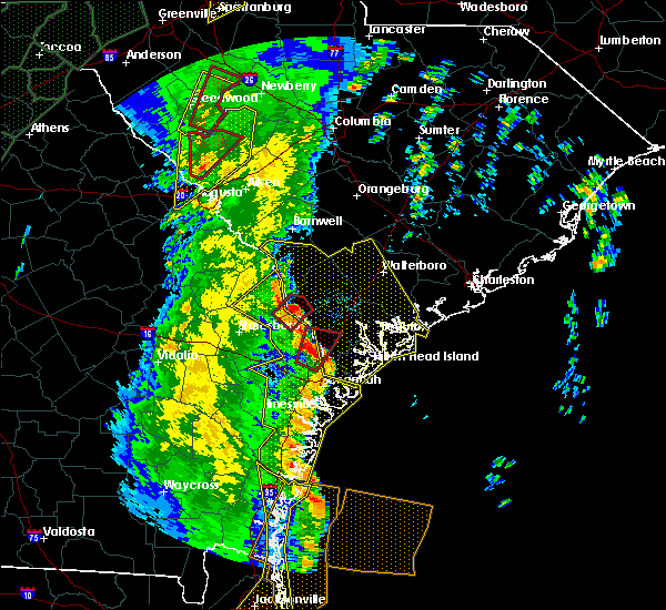 At 1252 pm edt, a severe thunderstorm capable of producing a tornado was located 10 miles north of pooler, moving northeast at 55 mph (radar indicated rotation). Hazards include tornado. Flying debris will be dangerous to those caught without shelter. mobile homes will be damaged or destroyed. damage to roofs, windows, and vehicles will occur. Tree damage is likely. At 1252 pm edt, a severe thunderstorm capable of producing a tornado was located 10 miles north of pooler, moving northeast at 55 mph (radar indicated rotation). Hazards include tornado. Flying debris will be dangerous to those caught without shelter. mobile homes will be damaged or destroyed. damage to roofs, windows, and vehicles will occur. Tree damage is likely.
|
| 4/19/2019 12:51 PM EDT | Power lines down at bluejay and mccal in effingham county GA, 1 miles ESE of Rincon, GA |
| 4/19/2019 12:43 PM EDT |
 At 1243 pm edt, severe thunderstorms were located along a line extending from 8 miles southwest of springfield to near richmond hill to near darien, moving northeast at 45 mph (radar indicated). Hazards include 60 mph wind gusts. Expect damage to trees and powerlines. locations impacted include, savannah, hinesville, pooler, richmond hill, sylvania, springfield, pembroke and darien. this warning includes, i-16 between mile markers 138 and 168. i-516 between mile markers 3 and 9. I-95 in georgia between mile markers 50 and 112. At 1243 pm edt, severe thunderstorms were located along a line extending from 8 miles southwest of springfield to near richmond hill to near darien, moving northeast at 45 mph (radar indicated). Hazards include 60 mph wind gusts. Expect damage to trees and powerlines. locations impacted include, savannah, hinesville, pooler, richmond hill, sylvania, springfield, pembroke and darien. this warning includes, i-16 between mile markers 138 and 168. i-516 between mile markers 3 and 9. I-95 in georgia between mile markers 50 and 112.
|
| 4/19/2019 12:27 PM EDT |
 At 1225 pm edt, severe thunderstorms were located along a line extending from near bay to 10 miles east of hinesville to near dock junction, moving northeast at 45 mph (radar indicated). Hazards include 60 mph wind gusts. Expect damage to trees and powerlines. locations impacted include, savannah, hinesville, statesboro, pooler, richmond hill, sylvania, springfield and pembroke. this warning includes, i-16 between mile markers 119 and 168. i-516 between mile markers 3 and 9. I-95 in georgia between mile markers 50 and 112. At 1225 pm edt, severe thunderstorms were located along a line extending from near bay to 10 miles east of hinesville to near dock junction, moving northeast at 45 mph (radar indicated). Hazards include 60 mph wind gusts. Expect damage to trees and powerlines. locations impacted include, savannah, hinesville, statesboro, pooler, richmond hill, sylvania, springfield and pembroke. this warning includes, i-16 between mile markers 119 and 168. i-516 between mile markers 3 and 9. I-95 in georgia between mile markers 50 and 112.
|
| 4/19/2019 12:09 PM EDT |
 At 1208 pm edt, severe thunderstorms were located along a line extending from 6 miles west of pembroke to near tibet to 12 miles east of nahunta, moving northeast at 45 mph (radar indicated). Hazards include 60 mph wind gusts. expect damage to trees and powerlines At 1208 pm edt, severe thunderstorms were located along a line extending from 6 miles west of pembroke to near tibet to 12 miles east of nahunta, moving northeast at 45 mph (radar indicated). Hazards include 60 mph wind gusts. expect damage to trees and powerlines
|
| 8/14/2018 6:32 PM EDT | Quarter sized hail reported 6.5 miles NNE of Rincon, GA, media relayed report of quarter sized hail on hodgeville road. |
| 6/25/2018 5:21 PM EDT |
 At 520 pm edt, a severe thunderstorm was located 7 miles west of bellinger hill area, moving northeast at 10 mph (radar indicated). Hazards include 60 mph wind gusts and penny size hail. Expect damage to trees and powerlines. locations impacted include, savannah, pooler, i-16/i-95 interchange, bellinger hill area, rincon, garden city, port wentworth and hardeeville. this warning includes, i-16 between mile markers 159 and 168. i-516 between mile markers 3 and 9. i-95 in south carolina between mile markers 2 and 15. I-95 in georgia between mile markers 101 and 112. At 520 pm edt, a severe thunderstorm was located 7 miles west of bellinger hill area, moving northeast at 10 mph (radar indicated). Hazards include 60 mph wind gusts and penny size hail. Expect damage to trees and powerlines. locations impacted include, savannah, pooler, i-16/i-95 interchange, bellinger hill area, rincon, garden city, port wentworth and hardeeville. this warning includes, i-16 between mile markers 159 and 168. i-516 between mile markers 3 and 9. i-95 in south carolina between mile markers 2 and 15. I-95 in georgia between mile markers 101 and 112.
|
| 6/25/2018 4:55 PM EDT |
 At 455 pm edt, a severe thunderstorm was located near pooler, moving northeast at 15 mph (radar indicated). Hazards include 60 mph wind gusts and penny size hail. expect damage to trees and powerlines At 455 pm edt, a severe thunderstorm was located near pooler, moving northeast at 15 mph (radar indicated). Hazards include 60 mph wind gusts and penny size hail. expect damage to trees and powerlines
|
| 6/25/2018 12:48 AM EDT |
 At 1248 am edt, severe thunderstorms were located along a line extending from 13 miles north of edisto beach to 6 miles north of bluffton to 9 miles east of bay, moving southeast at 35 mph (radar indicated). Hazards include 60 mph wind gusts. Expect damage to trees and powerlines. locations impacted include, bluffton, beaufort, port royal, ridgeland, springfield, yemassee, clarendon and jasper. this warning includes, i-95 in south carolina between mile markers 2 and 38. I-95 in georgia between mile markers 109 and 112. At 1248 am edt, severe thunderstorms were located along a line extending from 13 miles north of edisto beach to 6 miles north of bluffton to 9 miles east of bay, moving southeast at 35 mph (radar indicated). Hazards include 60 mph wind gusts. Expect damage to trees and powerlines. locations impacted include, bluffton, beaufort, port royal, ridgeland, springfield, yemassee, clarendon and jasper. this warning includes, i-95 in south carolina between mile markers 2 and 38. I-95 in georgia between mile markers 109 and 112.
|
| 6/25/2018 12:29 AM EDT |
 At 1229 am edt, severe thunderstorms were located along a line extending from 14 miles southeast of walterboro to near ridgeland to 9 miles north of bay, moving southeast at 40 mph (radar indicated). Hazards include 60 mph wind gusts. Expect damage to trees and powerlines. locations impacted include, bluffton, beaufort, port royal, walterboro, ridgeland, springfield, yemassee and clarendon. this warning includes, i-95 in south carolina between mile markers 2 and 64. I-95 in georgia between mile markers 109 and 112. At 1229 am edt, severe thunderstorms were located along a line extending from 14 miles southeast of walterboro to near ridgeland to 9 miles north of bay, moving southeast at 40 mph (radar indicated). Hazards include 60 mph wind gusts. Expect damage to trees and powerlines. locations impacted include, bluffton, beaufort, port royal, walterboro, ridgeland, springfield, yemassee and clarendon. this warning includes, i-95 in south carolina between mile markers 2 and 64. I-95 in georgia between mile markers 109 and 112.
|
| 6/24/2018 11:58 PM EDT |
 At 1158 pm edt, severe thunderstorms were located along a line extending from near walterboro to 16 miles south of lake warren state park to middleground, moving southeast at 35 mph (radar indicated). Hazards include 60 mph wind gusts. expect damage to trees and powerlines At 1158 pm edt, severe thunderstorms were located along a line extending from near walterboro to 16 miles south of lake warren state park to middleground, moving southeast at 35 mph (radar indicated). Hazards include 60 mph wind gusts. expect damage to trees and powerlines
|
| 6/2/2018 5:02 PM EDT |
 At 446 pm edt, severe thunderstorms were located along a line extending from 17 miles west of ridgeland to near springfield, moving east at 40 mph (radar indicated). Hazards include 60 mph wind gusts and quarter size hail. Minor hail damage to vehicles is possible. Expect wind damage to trees and powerlines. At 446 pm edt, severe thunderstorms were located along a line extending from 17 miles west of ridgeland to near springfield, moving east at 40 mph (radar indicated). Hazards include 60 mph wind gusts and quarter size hail. Minor hail damage to vehicles is possible. Expect wind damage to trees and powerlines.
|
| 6/2/2018 5:02 PM EDT |
 At 502 pm edt, severe thunderstorms were located along a line extending from 9 miles west of ridgeland to 7 miles southeast of springfield, moving east at 30 mph (radar indicated). Hazards include 60 mph wind gusts and quarter size hail. Minor hail damage to vehicles is possible. expect wind damage to trees and powerlines. locations impacted include, ridgeland, springfield, jasper, rincon, hardeeville, grahamville, ebenezer and sun city. This warning includes i-95 in south carolina between mile markers 2 and 24. At 502 pm edt, severe thunderstorms were located along a line extending from 9 miles west of ridgeland to 7 miles southeast of springfield, moving east at 30 mph (radar indicated). Hazards include 60 mph wind gusts and quarter size hail. Minor hail damage to vehicles is possible. expect wind damage to trees and powerlines. locations impacted include, ridgeland, springfield, jasper, rincon, hardeeville, grahamville, ebenezer and sun city. This warning includes i-95 in south carolina between mile markers 2 and 24.
|
| 6/2/2018 4:46 PM EDT |
 At 446 pm edt, severe thunderstorms were located along a line extending from 17 miles west of ridgeland to near springfield, moving east at 40 mph (radar indicated). Hazards include 60 mph wind gusts and quarter size hail. Minor hail damage to vehicles is possible. Expect wind damage to trees and powerlines. At 446 pm edt, severe thunderstorms were located along a line extending from 17 miles west of ridgeland to near springfield, moving east at 40 mph (radar indicated). Hazards include 60 mph wind gusts and quarter size hail. Minor hail damage to vehicles is possible. Expect wind damage to trees and powerlines.
|
| 7/20/2017 4:24 PM EDT |
 At 424 pm edt, severe thunderstorms were located along a line extending from near springfield to 14 miles northwest of ridgeland, and are nearly stationary (radar indicated). Hazards include 60 mph wind gusts. Expect damage to trees and powerlines. Locations impacted include, springfield, ebenezer, tillman, tarboro, robertville, stillwell and clyo. At 424 pm edt, severe thunderstorms were located along a line extending from near springfield to 14 miles northwest of ridgeland, and are nearly stationary (radar indicated). Hazards include 60 mph wind gusts. Expect damage to trees and powerlines. Locations impacted include, springfield, ebenezer, tillman, tarboro, robertville, stillwell and clyo.
|
| 7/20/2017 4:24 PM EDT |
 At 401 pm edt, a severe thunderstorm was located 8 miles northeast of springfield, and is nearly stationary (radar indicated). Hazards include 60 mph wind gusts and quarter size hail. Hail damage to vehicles is expected. Expect wind damage to roofs, siding, and trees. At 401 pm edt, a severe thunderstorm was located 8 miles northeast of springfield, and is nearly stationary (radar indicated). Hazards include 60 mph wind gusts and quarter size hail. Hail damage to vehicles is expected. Expect wind damage to roofs, siding, and trees.
|
| 7/20/2017 4:01 PM EDT |
 At 401 pm edt, a severe thunderstorm was located 8 miles northeast of springfield, and is nearly stationary (radar indicated). Hazards include 60 mph wind gusts and quarter size hail. Hail damage to vehicles is expected. Expect wind damage to roofs, siding, and trees. At 401 pm edt, a severe thunderstorm was located 8 miles northeast of springfield, and is nearly stationary (radar indicated). Hazards include 60 mph wind gusts and quarter size hail. Hail damage to vehicles is expected. Expect wind damage to roofs, siding, and trees.
|
| 7/20/2017 3:47 PM EDT |
 At 347 pm edt, a severe thunderstorm was located 10 miles southeast of springfield, moving west at 10 mph (radar indicated). Hazards include 60 mph wind gusts and quarter size hail. Hail damage to vehicles is expected. expect wind damage to roofs, siding, and trees. Locations impacted include, savannah, pooler, rincon, garden city, port wentworth, hardeeville, savannah airport and ebenezer. At 347 pm edt, a severe thunderstorm was located 10 miles southeast of springfield, moving west at 10 mph (radar indicated). Hazards include 60 mph wind gusts and quarter size hail. Hail damage to vehicles is expected. expect wind damage to roofs, siding, and trees. Locations impacted include, savannah, pooler, rincon, garden city, port wentworth, hardeeville, savannah airport and ebenezer.
|
| 7/20/2017 3:33 PM EDT |
 At 333 pm edt, a severe thunderstorm was located 10 miles northwest of bellinger hill area, and is nearly stationary (radar indicated). Hazards include 60 mph wind gusts and quarter size hail. Hail damage to vehicles is expected. Expect wind damage to roofs, siding, and trees. At 333 pm edt, a severe thunderstorm was located 10 miles northwest of bellinger hill area, and is nearly stationary (radar indicated). Hazards include 60 mph wind gusts and quarter size hail. Hail damage to vehicles is expected. Expect wind damage to roofs, siding, and trees.
|
| 7/19/2017 7:45 PM EDT | Local media relayed a report of multiple trees down in the dashers landing subdivision near rincon. report was received via twitte in effingham county GA, 1 miles W of Rincon, GA |
| 5/13/2017 3:15 PM EDT |
 At 315 pm edt, severe thunderstorms were located along a line extending from 10 miles southeast of springfield to near i-16/i-95 interchange, moving northeast at 30 mph (radar indicated). Hazards include 60 mph wind gusts. Expect damage to trees and powerlines. locations impacted include, savannah, pooler, i-16/i-95 interchange, rincon, garden city, port wentworth, hardeeville and bloomingdale. this warning includes, i-16 between mile markers 154 and 168. i-516 between mile markers 3 and 9. i-95 in south carolina between mile markers 2 and 9. I-95 in georgia between mile markers 95 and 112. At 315 pm edt, severe thunderstorms were located along a line extending from 10 miles southeast of springfield to near i-16/i-95 interchange, moving northeast at 30 mph (radar indicated). Hazards include 60 mph wind gusts. Expect damage to trees and powerlines. locations impacted include, savannah, pooler, i-16/i-95 interchange, rincon, garden city, port wentworth, hardeeville and bloomingdale. this warning includes, i-16 between mile markers 154 and 168. i-516 between mile markers 3 and 9. i-95 in south carolina between mile markers 2 and 9. I-95 in georgia between mile markers 95 and 112.
|
| 5/13/2017 2:55 PM EDT |
 At 255 pm edt, severe thunderstorms were located along a line extending from 9 miles northwest of pooler to near richmond hill, moving northeast at 40 mph (radar indicated). Hazards include 60 mph wind gusts. expect damage to trees and powerlines At 255 pm edt, severe thunderstorms were located along a line extending from 9 miles northwest of pooler to near richmond hill, moving northeast at 40 mph (radar indicated). Hazards include 60 mph wind gusts. expect damage to trees and powerlines
|
| 4/18/2017 5:43 PM EDT |
 At 543 pm edt, a severe thunderstorm was located 7 miles southwest of springfield, and is nearly stationary (radar indicated). Hazards include 60 mph wind gusts and quarter size hail. Hail damage to vehicles is expected. expect wind damage to roofs, siding, and trees. Locations impacted include, springfield, guyton, pineora, egypt, marlow, shawnee and kildare. At 543 pm edt, a severe thunderstorm was located 7 miles southwest of springfield, and is nearly stationary (radar indicated). Hazards include 60 mph wind gusts and quarter size hail. Hail damage to vehicles is expected. expect wind damage to roofs, siding, and trees. Locations impacted include, springfield, guyton, pineora, egypt, marlow, shawnee and kildare.
|
| 4/18/2017 5:27 PM EDT |
 At 527 pm edt, a severe thunderstorm was located near springfield, and is nearly stationary (radar indicated). Hazards include 60 mph wind gusts and quarter size hail. Hail damage to vehicles is expected. expect wind damage to roofs, siding, and trees. Locations impacted include, springfield, guyton, pineora, egypt, marlow, shawnee, stillwell and kildare. At 527 pm edt, a severe thunderstorm was located near springfield, and is nearly stationary (radar indicated). Hazards include 60 mph wind gusts and quarter size hail. Hail damage to vehicles is expected. expect wind damage to roofs, siding, and trees. Locations impacted include, springfield, guyton, pineora, egypt, marlow, shawnee, stillwell and kildare.
|
| 4/18/2017 5:05 PM EDT |
 At 505 pm edt, a severe thunderstorm was located over springfield, moving southwest at 10 mph (radar indicated). Hazards include 60 mph wind gusts and quarter size hail. Hail damage to vehicles is expected. Expect wind damage to roofs, siding, and trees. At 505 pm edt, a severe thunderstorm was located over springfield, moving southwest at 10 mph (radar indicated). Hazards include 60 mph wind gusts and quarter size hail. Hail damage to vehicles is expected. Expect wind damage to roofs, siding, and trees.
|
| 4/5/2017 6:41 PM EDT |
 At 640 pm edt, a severe thunderstorm was located near ridgeland, moving northeast at 40 mph (radar indicated). Hazards include 60 mph wind gusts and quarter size hail. Hail damage to vehicles is expected. expect wind damage to roofs, siding, and trees. locations impacted include, ridgeland, springfield, jasper, rincon, port wentworth, hardeeville, guyton and grahamville. A tornado watch remains in effect until 800 pm edt for southeastern georgia, and southeastern south carolina. At 640 pm edt, a severe thunderstorm was located near ridgeland, moving northeast at 40 mph (radar indicated). Hazards include 60 mph wind gusts and quarter size hail. Hail damage to vehicles is expected. expect wind damage to roofs, siding, and trees. locations impacted include, ridgeland, springfield, jasper, rincon, port wentworth, hardeeville, guyton and grahamville. A tornado watch remains in effect until 800 pm edt for southeastern georgia, and southeastern south carolina.
|
| 4/5/2017 6:25 PM EDT |
 At 624 pm edt, a severe thunderstorm was located 11 miles northeast of springfield, moving east at 45 mph (radar indicated. at 610 pm edt a trained spotter reported nickel sized hail north of springfield). Hazards include 60 mph wind gusts and quarter size hail. Hail damage to vehicles is expected. expect wind damage to roofs, siding, and trees. locations impacted include, ridgeland, springfield, jasper, rincon, port wentworth, hardeeville, guyton and grahamville. A tornado watch remains in effect until 800 pm edt for southeastern georgia, and southeastern south carolina. At 624 pm edt, a severe thunderstorm was located 11 miles northeast of springfield, moving east at 45 mph (radar indicated. at 610 pm edt a trained spotter reported nickel sized hail north of springfield). Hazards include 60 mph wind gusts and quarter size hail. Hail damage to vehicles is expected. expect wind damage to roofs, siding, and trees. locations impacted include, ridgeland, springfield, jasper, rincon, port wentworth, hardeeville, guyton and grahamville. A tornado watch remains in effect until 800 pm edt for southeastern georgia, and southeastern south carolina.
|
| 4/5/2017 6:05 PM EDT |
 At 605 pm edt, a severe thunderstorm was located near springfield, moving northeast at 40 mph (radar indicated). Hazards include 60 mph wind gusts and quarter size hail. Hail damage to vehicles is expected. Expect wind damage to roofs, siding, and trees. At 605 pm edt, a severe thunderstorm was located near springfield, moving northeast at 40 mph (radar indicated). Hazards include 60 mph wind gusts and quarter size hail. Hail damage to vehicles is expected. Expect wind damage to roofs, siding, and trees.
|
| 2/9/2017 4:02 AM EST |
 At 401 am est, a severe thunderstorm capable of producing a tornado was located 7 miles southwest of springfield, moving east at 60 mph (radar indicated rotation). Hazards include tornado. Flying debris will be dangerous to those caught without shelter. mobile homes will be damaged or destroyed. damage to roofs, windows, and vehicles will occur. tree damage is likely. Locations impacted include, springfield, rincon, guyton, pineora, ebenezer, marlow and stillwell. At 401 am est, a severe thunderstorm capable of producing a tornado was located 7 miles southwest of springfield, moving east at 60 mph (radar indicated rotation). Hazards include tornado. Flying debris will be dangerous to those caught without shelter. mobile homes will be damaged or destroyed. damage to roofs, windows, and vehicles will occur. tree damage is likely. Locations impacted include, springfield, rincon, guyton, pineora, ebenezer, marlow and stillwell.
|
| 2/9/2017 3:50 AM EST |
 At 350 am est, a severe thunderstorm capable of producing a tornado was located 7 miles north of bay, moving east at 60 mph (radar indicated rotation). Hazards include tornado. Flying debris will be dangerous to those caught without shelter. mobile homes will be damaged or destroyed. damage to roofs, windows, and vehicles will occur. Tree damage is likely. At 350 am est, a severe thunderstorm capable of producing a tornado was located 7 miles north of bay, moving east at 60 mph (radar indicated rotation). Hazards include tornado. Flying debris will be dangerous to those caught without shelter. mobile homes will be damaged or destroyed. damage to roofs, windows, and vehicles will occur. Tree damage is likely.
|
| 1/22/2017 6:35 AM EST |
 At 635 am est, severe thunderstorms were located along a line extending from 10 miles west of springfield to 6 miles northwest of ludowici, moving east at 55 mph (radar indicated). Hazards include 60 mph wind gusts and quarter size hail. Hail damage to vehicles is expected. Expect wind damage to roofs, siding, and trees. At 635 am est, severe thunderstorms were located along a line extending from 10 miles west of springfield to 6 miles northwest of ludowici, moving east at 55 mph (radar indicated). Hazards include 60 mph wind gusts and quarter size hail. Hail damage to vehicles is expected. Expect wind damage to roofs, siding, and trees.
|
| 1/22/2017 5:13 AM EST |
 The tornado warning for liberty, effingham and chatham counties will expire at 515 am est, the storm which prompted the warning has weakened below severe limits, and no longer appears capable of producing a tornado. therefore the warning will be allowed to expire. a tornado watch remains in effect until 1000 am est for southeastern georgia. The tornado warning for liberty, effingham and chatham counties will expire at 515 am est, the storm which prompted the warning has weakened below severe limits, and no longer appears capable of producing a tornado. therefore the warning will be allowed to expire. a tornado watch remains in effect until 1000 am est for southeastern georgia.
|
| 1/22/2017 4:57 AM EST |
 At 456 am est, a severe thunderstorm capable of producing a tornado was located near pooler, moving northeast at 55 mph (radar indicated rotation). Hazards include tornado. Flying debris will be dangerous to those caught without shelter. mobile homes will be damaged or destroyed. damage to roofs, windows, and vehicles will occur. tree damage is likely. Locations impacted include, savannah, pooler, i-16/i-95 interchange, rincon, garden city, port wentworth, bloomingdale and savannah airport. At 456 am est, a severe thunderstorm capable of producing a tornado was located near pooler, moving northeast at 55 mph (radar indicated rotation). Hazards include tornado. Flying debris will be dangerous to those caught without shelter. mobile homes will be damaged or destroyed. damage to roofs, windows, and vehicles will occur. tree damage is likely. Locations impacted include, savannah, pooler, i-16/i-95 interchange, rincon, garden city, port wentworth, bloomingdale and savannah airport.
|
| 1/22/2017 4:40 AM EST |
 At 440 am est, a severe thunderstorm capable of producing a tornado was located 8 miles southeast of pembroke, moving northeast at 55 mph (radar indicated rotation). Hazards include tornado. Flying debris will be dangerous to those caught without shelter. mobile homes will be damaged or destroyed. damage to roofs, windows, and vehicles will occur. Tree damage is likely. At 440 am est, a severe thunderstorm capable of producing a tornado was located 8 miles southeast of pembroke, moving northeast at 55 mph (radar indicated rotation). Hazards include tornado. Flying debris will be dangerous to those caught without shelter. mobile homes will be damaged or destroyed. damage to roofs, windows, and vehicles will occur. Tree damage is likely.
|
| 1/21/2017 3:31 PM EST |
 At 330 pm est, severe thunderstorms were located along a line extending from 14 miles northeast of hampton to near ridgeland to 7 miles east of hinesville, moving east at 65 mph (radar indicated). Hazards include 60 mph wind gusts and penny size hail. Expect damage to roofs, siding, and trees. locations impacted include, hinesville, ridgeland, allendale, springfield, hampton, pembroke, ludowici and yemassee. A tornado watch remains in effect until 700 pm est for southeastern georgia, and southeastern south carolina. At 330 pm est, severe thunderstorms were located along a line extending from 14 miles northeast of hampton to near ridgeland to 7 miles east of hinesville, moving east at 65 mph (radar indicated). Hazards include 60 mph wind gusts and penny size hail. Expect damage to roofs, siding, and trees. locations impacted include, hinesville, ridgeland, allendale, springfield, hampton, pembroke, ludowici and yemassee. A tornado watch remains in effect until 700 pm est for southeastern georgia, and southeastern south carolina.
|
| 1/21/2017 3:06 PM EST |
 At 304 pm est, severe thunderstorms were located along a line extending from 9 miles west of allendale to 12 miles northwest of springfield to 14 miles northwest of ludowici, moving east at 65 mph (radar indicated). Hazards include 60 mph wind gusts and penny size hail. expect damage to roofs, siding, and trees At 304 pm est, severe thunderstorms were located along a line extending from 9 miles west of allendale to 12 miles northwest of springfield to 14 miles northwest of ludowici, moving east at 65 mph (radar indicated). Hazards include 60 mph wind gusts and penny size hail. expect damage to roofs, siding, and trees
|
| 10/7/2016 2:29 PM EDT |
 At 229 pm edt, a severe thunderstorm capable of producing a tornado was located 8 miles northwest of bellinger hill area, moving west at 45 mph (radar indicated rotation). Hazards include tornado. Flying debris will be dangerous to those caught without shelter. mobile homes will be damaged or destroyed. damage to roofs, windows, and vehicles will occur. Tree damage is likely. At 229 pm edt, a severe thunderstorm capable of producing a tornado was located 8 miles northwest of bellinger hill area, moving west at 45 mph (radar indicated rotation). Hazards include tornado. Flying debris will be dangerous to those caught without shelter. mobile homes will be damaged or destroyed. damage to roofs, windows, and vehicles will occur. Tree damage is likely.
|
| 7/20/2016 6:41 PM EDT |
 At 641 pm edt, severe thunderstorms were located along a line extending from 8 miles south of springfield to near bay, moving southwest at 30 mph (radar indicated). Hazards include 60 mph wind gusts. Expect damage to roofs. siding. and trees. Locations impacted include, springfield, bay, rincon, guyton, stilson, marlow, eden and blitchton. At 641 pm edt, severe thunderstorms were located along a line extending from 8 miles south of springfield to near bay, moving southwest at 30 mph (radar indicated). Hazards include 60 mph wind gusts. Expect damage to roofs. siding. and trees. Locations impacted include, springfield, bay, rincon, guyton, stilson, marlow, eden and blitchton.
|
| 7/20/2016 6:24 PM EDT |
 At 624 pm edt, severe thunderstorms were located along a line extending from 12 miles north of pooler to near springfield, moving southwest at 20 mph (radar indicated). Hazards include 60 mph wind gusts and quarter size hail. Hail damage to vehicles is expected. expect wind damage to roofs, siding, and trees. Locations impacted include, pooler, springfield, pembroke, i-16/i-95 interchange, bay, lanier and rincon. At 624 pm edt, severe thunderstorms were located along a line extending from 12 miles north of pooler to near springfield, moving southwest at 20 mph (radar indicated). Hazards include 60 mph wind gusts and quarter size hail. Hail damage to vehicles is expected. expect wind damage to roofs, siding, and trees. Locations impacted include, pooler, springfield, pembroke, i-16/i-95 interchange, bay, lanier and rincon.
|
| 7/20/2016 6:11 PM EDT | Tree down across power lines on millpond road. time estimated based on rada in effingham county GA, 3.3 miles S of Rincon, GA |
| 7/20/2016 6:08 PM EDT | Tree down across power lines on ebenezer road. time estimated based on rada in effingham county GA, 3.4 miles SSE of Rincon, GA |
| 7/20/2016 6:03 PM EDT |
 At 603 pm edt, a severe thunderstorm was located near springfield, moving south at 30 mph (radar indicated). Hazards include 60 mph wind gusts and quarter size hail. Hail damage to vehicles is expected. Expect wind damage to roofs, siding, and trees. At 603 pm edt, a severe thunderstorm was located near springfield, moving south at 30 mph (radar indicated). Hazards include 60 mph wind gusts and quarter size hail. Hail damage to vehicles is expected. Expect wind damage to roofs, siding, and trees.
|
| 7/9/2016 3:26 PM EDT |
 The severe thunderstorm warning for bulloch and effingham counties will expire at 330 pm edt, the storm which prompted the warning has weakened below severe limits, and have exited much of the warned area. therefore the warning will be allowed to expire. however gusty winds, heavy rain, and frequent lightning strikes are still likely with this thunderstorm. The severe thunderstorm warning for bulloch and effingham counties will expire at 330 pm edt, the storm which prompted the warning has weakened below severe limits, and have exited much of the warned area. therefore the warning will be allowed to expire. however gusty winds, heavy rain, and frequent lightning strikes are still likely with this thunderstorm.
|
| 7/9/2016 3:12 PM EDT | Tree reported down near the intersection of rahn station rd at lewis rahn rd. time estimated based on rada in effingham county GA, 3.6 miles SE of Rincon, GA |
| 7/9/2016 3:02 PM EDT |
 At 300 pm edt, a severe thunderstorm was located near springfield, moving east at 10 mph (radar indicated). Hazards include 60 mph wind gusts and quarter size hail. Hail damage to vehicles is expected. expect wind damage to roofs, siding, and trees. Locations impacted include, springfield, rincon, guyton, stilson, stillwell, shawnee, pineora and ebenezer. At 300 pm edt, a severe thunderstorm was located near springfield, moving east at 10 mph (radar indicated). Hazards include 60 mph wind gusts and quarter size hail. Hail damage to vehicles is expected. expect wind damage to roofs, siding, and trees. Locations impacted include, springfield, rincon, guyton, stilson, stillwell, shawnee, pineora and ebenezer.
|
| 7/9/2016 2:36 PM EDT |
 At 235 pm edt, a severe thunderstorm was located 12 miles northwest of springfield, moving east at 10 mph (radar indicated). Hazards include 60 mph wind gusts and quarter size hail. Hail damage to vehicles is expected. Expect wind damage to roofs, siding, and trees. At 235 pm edt, a severe thunderstorm was located 12 miles northwest of springfield, moving east at 10 mph (radar indicated). Hazards include 60 mph wind gusts and quarter size hail. Hail damage to vehicles is expected. Expect wind damage to roofs, siding, and trees.
|
| 7/4/2016 4:31 PM EDT |
 At 431 pm edt, severe thunderstorms were located along a line extending from 7 miles north of springfield to 12 miles north of pooler, moving northeast at 35 mph (radar indicated). Hazards include 60 mph wind gusts. Expect damage to roofs. siding. And trees. At 431 pm edt, severe thunderstorms were located along a line extending from 7 miles north of springfield to 12 miles north of pooler, moving northeast at 35 mph (radar indicated). Hazards include 60 mph wind gusts. Expect damage to roofs. siding. And trees.
|
| 6/29/2016 4:40 PM EDT |
 The severe thunderstorm warning for chatham, effingham, beaufort and jasper counties will expire at 445 pm edt, the storms which prompted the warning have weakened below severe limits, and no longer pose an immediate threat to life or property. therefore the warning will be allowed to expire. however gusty winds are still possible with these thunderstorms. The severe thunderstorm warning for chatham, effingham, beaufort and jasper counties will expire at 445 pm edt, the storms which prompted the warning have weakened below severe limits, and no longer pose an immediate threat to life or property. therefore the warning will be allowed to expire. however gusty winds are still possible with these thunderstorms.
|
| 6/29/2016 4:09 PM EDT |
 At 409 pm edt, severe thunderstorms were located along a line extending from port royal to near bellinger hill area to 6 miles northwest of pooler, moving southeast at 30 mph (radar indicated). Hazards include 60 mph wind gusts. Expect damage to roofs. siding. and trees. Locations impacted include, savannah, hilton head island, pooler, bluffton, beaufort, port royal, bellinger hill area and rincon. At 409 pm edt, severe thunderstorms were located along a line extending from port royal to near bellinger hill area to 6 miles northwest of pooler, moving southeast at 30 mph (radar indicated). Hazards include 60 mph wind gusts. Expect damage to roofs. siding. and trees. Locations impacted include, savannah, hilton head island, pooler, bluffton, beaufort, port royal, bellinger hill area and rincon.
|
| 6/29/2016 4:03 PM EDT |
 At 402 pm edt, severe thunderstorms were located along a line extending from 8 miles north of bluffton to 9 miles southeast of springfield, moving southeast at 25 mph (radar indicated). Hazards include 60 mph wind gusts. Expect damage to roofs. siding. and trees. Locations impacted include, bluffton, beaufort, jasper, rincon, hardeeville, sun city, old house and purysburgh. At 402 pm edt, severe thunderstorms were located along a line extending from 8 miles north of bluffton to 9 miles southeast of springfield, moving southeast at 25 mph (radar indicated). Hazards include 60 mph wind gusts. Expect damage to roofs. siding. and trees. Locations impacted include, bluffton, beaufort, jasper, rincon, hardeeville, sun city, old house and purysburgh.
|
| 6/29/2016 3:54 PM EDT |
 At 353 pm edt, severe thunderstorms were located along a line extending from 7 miles north of bluffton to 7 miles north of pooler, moving southeast at 15 mph (radar indicated). Hazards include 70 mph wind gusts and penny size hail. Expect considerable tree damage. damage is likely to mobile homes, roofs, and outbuildings. Locations impacted include, savannah, hilton head island, pooler, bluffton, beaufort, port royal, bellinger hill area and rincon. At 353 pm edt, severe thunderstorms were located along a line extending from 7 miles north of bluffton to 7 miles north of pooler, moving southeast at 15 mph (radar indicated). Hazards include 70 mph wind gusts and penny size hail. Expect considerable tree damage. damage is likely to mobile homes, roofs, and outbuildings. Locations impacted include, savannah, hilton head island, pooler, bluffton, beaufort, port royal, bellinger hill area and rincon.
|
| 6/29/2016 3:47 PM EDT |
 At 346 pm edt, severe thunderstorms were located along a line extending from 8 miles north of bluffton to 7 miles north of pooler, moving southeast at 25 mph (radar indicated). Hazards include 60 mph wind gusts and penny size hail. Expect damage to roofs. siding. And trees. At 346 pm edt, severe thunderstorms were located along a line extending from 8 miles north of bluffton to 7 miles north of pooler, moving southeast at 25 mph (radar indicated). Hazards include 60 mph wind gusts and penny size hail. Expect damage to roofs. siding. And trees.
|
| 6/29/2016 3:35 PM EDT |
 At 335 pm edt, severe thunderstorms were located along a line extending from near ridgeland to 8 miles southeast of springfield, moving east at 20 mph (radar indicated). Hazards include 60 mph wind gusts and penny size hail. Expect damage to roofs. siding. and trees. Locations impacted include, bluffton, beaufort, ridgeland, springfield, clarendon, jasper, rincon and hardeeville. At 335 pm edt, severe thunderstorms were located along a line extending from near ridgeland to 8 miles southeast of springfield, moving east at 20 mph (radar indicated). Hazards include 60 mph wind gusts and penny size hail. Expect damage to roofs. siding. and trees. Locations impacted include, bluffton, beaufort, ridgeland, springfield, clarendon, jasper, rincon and hardeeville.
|
| 6/29/2016 3:23 PM EDT |
 At 323 pm edt, severe thunderstorms were located along a line extending from near ridgeland to near springfield, moving southeast at 10 mph (radar indicated). Hazards include 60 mph wind gusts. Expect damage to roofs. siding. and trees. Locations impacted include, bluffton, beaufort, ridgeland, springfield, clarendon, jasper, rincon and hardeeville. At 323 pm edt, severe thunderstorms were located along a line extending from near ridgeland to near springfield, moving southeast at 10 mph (radar indicated). Hazards include 60 mph wind gusts. Expect damage to roofs. siding. and trees. Locations impacted include, bluffton, beaufort, ridgeland, springfield, clarendon, jasper, rincon and hardeeville.
|
| 6/29/2016 3:09 PM EDT |
 At 309 pm edt, severe thunderstorms were located along a line extending from near ridgeland to near springfield, moving east at 20 mph (radar indicated). Hazards include 60 mph wind gusts. Expect damage to roofs. siding. And trees. At 309 pm edt, severe thunderstorms were located along a line extending from near ridgeland to near springfield, moving east at 20 mph (radar indicated). Hazards include 60 mph wind gusts. Expect damage to roofs. siding. And trees.
|
| 6/17/2016 6:35 PM EDT |
 At 634 pm edt, severe thunderstorms were located along a line extending from near springfield to 7 miles southwest of lyons, moving southeast at 30 mph (trained weather spotters). Hazards include 60 mph wind gusts and penny size hail. Expect damage to roofs. siding. and trees. Locations impacted include, savannah, pooler, reidsville, claxton, pembroke, i-16/i-95 interchange, lanier and rincon. At 634 pm edt, severe thunderstorms were located along a line extending from near springfield to 7 miles southwest of lyons, moving southeast at 30 mph (trained weather spotters). Hazards include 60 mph wind gusts and penny size hail. Expect damage to roofs. siding. and trees. Locations impacted include, savannah, pooler, reidsville, claxton, pembroke, i-16/i-95 interchange, lanier and rincon.
|
| 6/17/2016 6:13 PM EDT |
 At 613 pm edt, severe thunderstorms were located along a line extending from 12 miles northwest of springfield to near mount vernon, moving southeast at 30 mph (radar indicated). Hazards include 60 mph wind gusts and penny size hail. Expect damage to roofs. siding. And trees. At 613 pm edt, severe thunderstorms were located along a line extending from 12 miles northwest of springfield to near mount vernon, moving southeast at 30 mph (radar indicated). Hazards include 60 mph wind gusts and penny size hail. Expect damage to roofs. siding. And trees.
|
| 6/17/2016 5:47 PM EDT |
 At 547 pm edt, severe thunderstorms were located along a line extending from 9 miles northwest of bellinger hill area to 9 miles southeast of statesboro, moving southeast at 30 mph (radar indicated). Hazards include 60 mph wind gusts and penny size hail. Expect damage to roofs. siding. and trees. Locations impacted include, savannah, pooler, springfield, bay, rincon, garden city, port wentworth and bloomingdale. At 547 pm edt, severe thunderstorms were located along a line extending from 9 miles northwest of bellinger hill area to 9 miles southeast of statesboro, moving southeast at 30 mph (radar indicated). Hazards include 60 mph wind gusts and penny size hail. Expect damage to roofs. siding. and trees. Locations impacted include, savannah, pooler, springfield, bay, rincon, garden city, port wentworth and bloomingdale.
|
| 6/17/2016 5:22 PM EDT |
 At 521 pm edt, severe thunderstorms were located along a line extending from 7 miles northeast of springfield to near middleground, moving southeast at 30 mph (radar indicated). Hazards include 60 mph wind gusts and penny size hail. Expect damage to roofs. siding. And trees. At 521 pm edt, severe thunderstorms were located along a line extending from 7 miles northeast of springfield to near middleground, moving southeast at 30 mph (radar indicated). Hazards include 60 mph wind gusts and penny size hail. Expect damage to roofs. siding. And trees.
|
| 6/14/2016 3:24 PM EDT |
 At 324 pm edt, severe thunderstorms were located along a line extending from 7 miles west of bellinger hill area to 6 miles southwest of richmond hill, moving east at 30 mph (radar indicated). Hazards include 60 mph wind gusts. Expect damage to roofs. siding. and trees. Locations impacted include, savannah, hilton head island, pooler, bluffton, richmond hill, springfield, pembroke and fort pulaski national monument. At 324 pm edt, severe thunderstorms were located along a line extending from 7 miles west of bellinger hill area to 6 miles southwest of richmond hill, moving east at 30 mph (radar indicated). Hazards include 60 mph wind gusts. Expect damage to roofs. siding. and trees. Locations impacted include, savannah, hilton head island, pooler, bluffton, richmond hill, springfield, pembroke and fort pulaski national monument.
|
| 6/14/2016 3:00 PM EDT |
 The national weather service in charleston has issued a * severe thunderstorm warning for portions of. chatham county in southeastern georgia. bulloch county in southeastern georgia. liberty county in southeastern georgia. Bryan county in southeastern georgia. The national weather service in charleston has issued a * severe thunderstorm warning for portions of. chatham county in southeastern georgia. bulloch county in southeastern georgia. liberty county in southeastern georgia. Bryan county in southeastern georgia.
|
| 6/5/2016 5:09 PM EDT |
 At 509 pm edt, a severe thunderstorm was located 7 miles southwest of springfield, moving northeast at 25 mph (radar indicated). Hazards include 60 mph wind gusts. Expect damage to roofs. siding. and trees. Locations impacted include, rincon, port wentworth, bloomingdale, ellabell, meldrim, marlow, eden and blitchton. At 509 pm edt, a severe thunderstorm was located 7 miles southwest of springfield, moving northeast at 25 mph (radar indicated). Hazards include 60 mph wind gusts. Expect damage to roofs. siding. and trees. Locations impacted include, rincon, port wentworth, bloomingdale, ellabell, meldrim, marlow, eden and blitchton.
|
| 6/5/2016 4:54 PM EDT |
 At 454 pm edt, a severe thunderstorm was located 9 miles east of bay, moving northeast at 25 mph (radar indicated). Hazards include 60 mph wind gusts. Hail damage to vehicles is expected. Expect wind damage to roofs, siding, and trees. At 454 pm edt, a severe thunderstorm was located 9 miles east of bay, moving northeast at 25 mph (radar indicated). Hazards include 60 mph wind gusts. Hail damage to vehicles is expected. Expect wind damage to roofs, siding, and trees.
|
| 5/3/2016 7:55 PM EDT |
 At 754 pm edt, a severe thunderstorm was located near bay, moving east at 45 mph (law enforcement). Hazards include 60 mph wind gusts and penny size hail. Expect damage to roofs. siding. And trees. At 754 pm edt, a severe thunderstorm was located near bay, moving east at 45 mph (law enforcement). Hazards include 60 mph wind gusts and penny size hail. Expect damage to roofs. siding. And trees.
|
| 3/26/2016 4:44 PM EDT |
 At 444 pm edt, a severe thunderstorm was located 11 miles southeast of springfield, moving east at 15 mph (radar indicated). Hazards include quarter size hail. damage to vehicles is expected At 444 pm edt, a severe thunderstorm was located 11 miles southeast of springfield, moving east at 15 mph (radar indicated). Hazards include quarter size hail. damage to vehicles is expected
|
| 2/3/2016 7:37 PM EST |
 At 736 pm est, a severe thunderstorm was located 8 miles southwest of springfield, moving northeast at 30 mph (radar indicated). Hazards include 60 mph wind gusts. Expect damage to roofs. siding. and trees. Locations impacted include, springfield, rincon, guyton, marlow, stillwell, pineora and ebenezer. At 736 pm est, a severe thunderstorm was located 8 miles southwest of springfield, moving northeast at 30 mph (radar indicated). Hazards include 60 mph wind gusts. Expect damage to roofs. siding. and trees. Locations impacted include, springfield, rincon, guyton, marlow, stillwell, pineora and ebenezer.
|
| 2/3/2016 7:17 PM EST |
 At 717 pm est, a severe thunderstorm was located over bay, moving northeast at 30 mph (radar indicated). Hazards include 70 mph wind gusts and nickel size hail. Expect considerable tree damage. Damage is likely to mobile homes, roofs, and outbuildings. At 717 pm est, a severe thunderstorm was located over bay, moving northeast at 30 mph (radar indicated). Hazards include 70 mph wind gusts and nickel size hail. Expect considerable tree damage. Damage is likely to mobile homes, roofs, and outbuildings.
|
| 2/3/2016 7:17 PM EST |
 The national weather service in charleston has issued a * severe thunderstorm warning for portions of. bryan county in southeastern georgia. bulloch county in southeastern georgia. effingham county in southeastern georgia. Until 815 pm est. The national weather service in charleston has issued a * severe thunderstorm warning for portions of. bryan county in southeastern georgia. bulloch county in southeastern georgia. effingham county in southeastern georgia. Until 815 pm est.
|
| 2/3/2016 6:23 PM EST |
 A tornado warning remains in effect until 630 pm est for chatham and effingham counties. at 622 pm est. a severe thunderstorm capable of producing a tornado was located over pooler. moving northeast at 35 mph. hazard. tornado. source. Weather spotters reported a funnel cloud. A tornado warning remains in effect until 630 pm est for chatham and effingham counties. at 622 pm est. a severe thunderstorm capable of producing a tornado was located over pooler. moving northeast at 35 mph. hazard. tornado. source. Weather spotters reported a funnel cloud.
|
| 2/3/2016 6:15 PM EST |
 At 614 pm est, a severe thunderstorm capable of producing a tornado was located near pooler, moving northeast at 35 mph (radar indicated rotation). Hazards include tornado. Flying debris will be dangerous to those caught without shelter. mobile homes will be damaged or destroyed. damage to roofs, windows, and vehicles will occur. tree damage is likely. Locations impacted include, savannah, pooler, garden city, port wentworth, bloomingdale, monteith, meldrim and meinhard. At 614 pm est, a severe thunderstorm capable of producing a tornado was located near pooler, moving northeast at 35 mph (radar indicated rotation). Hazards include tornado. Flying debris will be dangerous to those caught without shelter. mobile homes will be damaged or destroyed. damage to roofs, windows, and vehicles will occur. tree damage is likely. Locations impacted include, savannah, pooler, garden city, port wentworth, bloomingdale, monteith, meldrim and meinhard.
|
| 2/3/2016 5:58 PM EST |
 At 558 pm est, a severe thunderstorm capable of producing a tornado was located 10 miles southeast of pembroke, moving northeast at 35 mph (radar indicated rotation). Hazards include tornado. Flying debris will be dangerous to those caught without shelter. mobile homes will be damaged or destroyed. damage to roofs, windows, and vehicles will occur. Tree damage is likely. At 558 pm est, a severe thunderstorm capable of producing a tornado was located 10 miles southeast of pembroke, moving northeast at 35 mph (radar indicated rotation). Hazards include tornado. Flying debris will be dangerous to those caught without shelter. mobile homes will be damaged or destroyed. damage to roofs, windows, and vehicles will occur. Tree damage is likely.
|
| 9/4/2015 5:18 PM EDT |
 At 517 pm edt, severe thunderstorms were located along a line extending from 12 miles northeast of springfield to near ridgeland, moving southwest at 15 mph (radar indicated. at 515 pm...law enforcement report numerous trees down near gillisonville). Hazards include 60 mph wind gusts. Expect damage to roofs. siding and trees. Locations impacted include, ridgeland, springfield, jasper, grahamville, switzerland, ebenezer, tarboro and coosawhatchie. At 517 pm edt, severe thunderstorms were located along a line extending from 12 miles northeast of springfield to near ridgeland, moving southwest at 15 mph (radar indicated. at 515 pm...law enforcement report numerous trees down near gillisonville). Hazards include 60 mph wind gusts. Expect damage to roofs. siding and trees. Locations impacted include, ridgeland, springfield, jasper, grahamville, switzerland, ebenezer, tarboro and coosawhatchie.
|
| 9/4/2015 5:08 PM EDT |
 At 508 pm edt, severe thunderstorms were located along a line extending from 13 miles northeast of springfield to 6 miles northeast of ridgeland, moving southwest at 15 mph (radar indicated). Hazards include 60 mph wind gusts. Expect damage to roofs. Siding and trees. At 508 pm edt, severe thunderstorms were located along a line extending from 13 miles northeast of springfield to 6 miles northeast of ridgeland, moving southwest at 15 mph (radar indicated). Hazards include 60 mph wind gusts. Expect damage to roofs. Siding and trees.
|
| 8/22/2015 5:49 PM EDT |
 At 549 pm edt, severe thunderstorms were located along a line extending from near beaufort to near i-16/i-95 interchange, moving southeast at 40 mph (radar indicated). Hazards include 60 mph wind gusts. Expect damage to roofs. siding and trees. Locations impacted include, savannah, hilton head island, pooler, bluffton, beaufort, port royal, ridgeland and fort pulaski national monument. At 549 pm edt, severe thunderstorms were located along a line extending from near beaufort to near i-16/i-95 interchange, moving southeast at 40 mph (radar indicated). Hazards include 60 mph wind gusts. Expect damage to roofs. siding and trees. Locations impacted include, savannah, hilton head island, pooler, bluffton, beaufort, port royal, ridgeland and fort pulaski national monument.
|
| 8/22/2015 5:25 PM EDT |
 At 525 pm edt, severe thunderstorms were located along a line extending from 7 miles north of beaufort to near springfield, moving southeast at 45 mph (radar indicated). Hazards include 60 mph wind gusts. Expect damage to roofs. Siding and trees. At 525 pm edt, severe thunderstorms were located along a line extending from 7 miles north of beaufort to near springfield, moving southeast at 45 mph (radar indicated). Hazards include 60 mph wind gusts. Expect damage to roofs. Siding and trees.
|
| 7/3/2015 2:18 PM EDT |
 At 218 pm edt, severe thunderstorms were located along a line extending from near yemassee to kildare, moving east at 35 mph (radar indicated). Hazards include 60 mph wind gusts. Expect damage to roofs. siding and trees. locations impacted include, ridgeland, springfield and yemassee. This line of thunderstorms has a history of producing wind damage to trees and power lines. At 218 pm edt, severe thunderstorms were located along a line extending from near yemassee to kildare, moving east at 35 mph (radar indicated). Hazards include 60 mph wind gusts. Expect damage to roofs. siding and trees. locations impacted include, ridgeland, springfield and yemassee. This line of thunderstorms has a history of producing wind damage to trees and power lines.
|
| 7/3/2015 2:01 PM EDT |
 At 201 pm edt, severe thunderstorms were located along a line extending from cummings to near oliver, moving east at 35 mph (radar indicated). Hazards include 60 mph wind gusts. Expect damage to roofs. Siding and trees. At 201 pm edt, severe thunderstorms were located along a line extending from cummings to near oliver, moving east at 35 mph (radar indicated). Hazards include 60 mph wind gusts. Expect damage to roofs. Siding and trees.
|
| 7/2/2015 7:32 PM EDT |
 At 732 pm edt, severe thunderstorms were located along a line extending from near rincon to ridgeville, and are nearly stationary (radar indicated). Hazards include 60 mph wind gusts. Expect damage to roofs. siding and trees. Locations impacted include, savannah, pooler, bluffton, richmond hill, wilmington island, i-16/i-95 interchange, fort pulaski national monument and bellinger hill area. At 732 pm edt, severe thunderstorms were located along a line extending from near rincon to ridgeville, and are nearly stationary (radar indicated). Hazards include 60 mph wind gusts. Expect damage to roofs. siding and trees. Locations impacted include, savannah, pooler, bluffton, richmond hill, wilmington island, i-16/i-95 interchange, fort pulaski national monument and bellinger hill area.
|
| 7/2/2015 7:05 PM EDT |
 At 705 pm edt, severe thunderstorms were located along a line extending from near rincon to ridgeville, moving east at 35 mph (radar indicated). Hazards include 60 mph wind gusts. Expect damage to roofs. siding and trees. Locations impacted include, savannah, pooler, bluffton, richmond hill, darien, wilmington island, i-16/i-95 interchange and fort pulaski national monument. At 705 pm edt, severe thunderstorms were located along a line extending from near rincon to ridgeville, moving east at 35 mph (radar indicated). Hazards include 60 mph wind gusts. Expect damage to roofs. siding and trees. Locations impacted include, savannah, pooler, bluffton, richmond hill, darien, wilmington island, i-16/i-95 interchange and fort pulaski national monument.
|
| 7/2/2015 6:52 PM EDT |
 At 651 pm edt, severe thunderstorms were located along a line extending from pineora to near darien, moving east at 35 mph (radar indicated). Hazards include 60 mph wind gusts. Expect damage to roofs. Siding and trees. At 651 pm edt, severe thunderstorms were located along a line extending from pineora to near darien, moving east at 35 mph (radar indicated). Hazards include 60 mph wind gusts. Expect damage to roofs. Siding and trees.
|
| 7/2/2015 6:44 PM EDT |
 At 642 pm edt, severe thunderstorms were located along a line extending from ashton to scotia to near stilson, moving east at 30 mph (radar indicated). Hazards include 60 mph wind gusts. Expect damage to roofs. siding and trees. Locations impacted include, walterboro, ridgeland, springfield, hampton, yemassee, islandton, varnville, lake warren state park, ashton, kildare, oaky, shawnee and pineland. At 642 pm edt, severe thunderstorms were located along a line extending from ashton to scotia to near stilson, moving east at 30 mph (radar indicated). Hazards include 60 mph wind gusts. Expect damage to roofs. siding and trees. Locations impacted include, walterboro, ridgeland, springfield, hampton, yemassee, islandton, varnville, lake warren state park, ashton, kildare, oaky, shawnee and pineland.
|
| 7/2/2015 6:21 PM EDT |
 At 620 pm edt, severe thunderstorms were located along a line extending from near sycamore to near shirley to near denmark, moving east at 40 mph (radar indicated). Hazards include 60 mph wind gusts and penny size hail. Expect damage to roofs. Siding and trees. At 620 pm edt, severe thunderstorms were located along a line extending from near sycamore to near shirley to near denmark, moving east at 40 mph (radar indicated). Hazards include 60 mph wind gusts and penny size hail. Expect damage to roofs. Siding and trees.
|
| 6/22/2015 6:53 PM EDT |
 At 649 pm edt, a severe thunderstorm was located over port wentworth, or near pooler, moving southeast at 15 mph (trained weather spotter. at 648 pm quarter size hail and wind gusts between 40 to 50 mph was reported on interstate 95). Hazards include 60 mph wind gusts and quarter size hail. Hail damage to vehicles is expected. expect wind damage to roofs, siding and trees. Locations impacted include, savannah, pooler and bluffton. At 649 pm edt, a severe thunderstorm was located over port wentworth, or near pooler, moving southeast at 15 mph (trained weather spotter. at 648 pm quarter size hail and wind gusts between 40 to 50 mph was reported on interstate 95). Hazards include 60 mph wind gusts and quarter size hail. Hail damage to vehicles is expected. expect wind damage to roofs, siding and trees. Locations impacted include, savannah, pooler and bluffton.
|
| 6/22/2015 6:48 PM EDT | Quarter sized hail reported 5.8 miles NW of Rincon, GA, storm spotter from florida traveling southbound on i-95 reports quarter sized hail and estimates 40 to 50 mph winds. |
| 6/22/2015 6:23 PM EDT |
 At 623 pm edt, a severe thunderstorm was located near purysburgh, or 11 miles northeast of pooler, moving southeast at 10 mph (radar indicated). Hazards include 60 mph wind gusts and quarter size hail. Hail damage to vehicles is expected. Expect wind damage to roofs, siding and trees. At 623 pm edt, a severe thunderstorm was located near purysburgh, or 11 miles northeast of pooler, moving southeast at 10 mph (radar indicated). Hazards include 60 mph wind gusts and quarter size hail. Hail damage to vehicles is expected. Expect wind damage to roofs, siding and trees.
|
| 6/17/2015 5:39 PM EDT |
 At 537 pm edt, a severe thunderstorm was located over marlow, or 9 miles southwest of springfield, moving northwest at 10 mph (there have been reports of a tree down and hail as large as golf balls around 4 miles south of guyton, near pineora and marlow). Hazards include 60 mph wind gusts and quarter size hail. Hail damage to vehicles is expected. expect wind damage to roofs, siding and trees. Locations impacted include, bay, marlow, guyton, ivanhoe and olney. At 537 pm edt, a severe thunderstorm was located over marlow, or 9 miles southwest of springfield, moving northwest at 10 mph (there have been reports of a tree down and hail as large as golf balls around 4 miles south of guyton, near pineora and marlow). Hazards include 60 mph wind gusts and quarter size hail. Hail damage to vehicles is expected. expect wind damage to roofs, siding and trees. Locations impacted include, bay, marlow, guyton, ivanhoe and olney.
|
| 6/17/2015 5:27 PM EDT |
 At 527 pm edt, a severe thunderstorm was located over marlow, or 9 miles southwest of springfield, moving northwest at 10 mph (radar indicated). Hazards include 60 mph wind gusts and quarter size hail. Hail damage to vehicles is expected. expect wind damage to roofs, siding and trees. Locations impacted include, bay. At 527 pm edt, a severe thunderstorm was located over marlow, or 9 miles southwest of springfield, moving northwest at 10 mph (radar indicated). Hazards include 60 mph wind gusts and quarter size hail. Hail damage to vehicles is expected. expect wind damage to roofs, siding and trees. Locations impacted include, bay.
|
| 6/17/2015 5:14 PM EDT |
 At 513 pm edt, a severe thunderstorm was located near eden, or 9 miles northwest of pooler, moving northwest at 10 mph (radar indicated). Hazards include 60 mph wind gusts and quarter size hail. Hail damage to vehicles is expected. expect wind damage to roofs, siding and trees. Locations impacted include, bay, marlow, pineora olney, ivanhoe. At 513 pm edt, a severe thunderstorm was located near eden, or 9 miles northwest of pooler, moving northwest at 10 mph (radar indicated). Hazards include 60 mph wind gusts and quarter size hail. Hail damage to vehicles is expected. expect wind damage to roofs, siding and trees. Locations impacted include, bay, marlow, pineora olney, ivanhoe.
|
| 6/17/2015 5:07 PM EDT |
 At 507 pm edt, a severe thunderstorm was located near eden, or 8 miles northwest of pooler, moving northwest at 10 mph (radar indicated). Hazards include 60 mph wind gusts. Expect damage to roofs. Siding and trees. At 507 pm edt, a severe thunderstorm was located near eden, or 8 miles northwest of pooler, moving northwest at 10 mph (radar indicated). Hazards include 60 mph wind gusts. Expect damage to roofs. Siding and trees.
|
| 4/25/2015 9:05 PM EDT | At 903 pm edt, severe thunderstorms were located along a line extending from near port wentworth to hutchinson island to near white bluff, moving east at 75 mph. these are very dangerous storms (radar indicated). Hazards include 80 mph wind gusts. Flying debris will be dangerous to those caught without shelter. mobile homes will be heavily damaged. expect considerable damage to roofs, windows and vehicles. extensive tree damage and power outages are likely. locations impacted include, savannah, hilton head island, pooler, bluffton, beaufort, port royal, richmond hill and ridgeland. 75in. |
| 4/25/2015 9:05 PM EDT | At 903 pm edt, severe thunderstorms were located along a line extending from near port wentworth to hutchinson island to near white bluff, moving east at 75 mph. these are very dangerous storms (radar indicated). Hazards include 80 mph wind gusts. Flying debris will be dangerous to those caught without shelter. mobile homes will be heavily damaged. expect considerable damage to roofs, windows and vehicles. extensive tree damage and power outages are likely. locations impacted include, savannah, hilton head island, pooler, bluffton, beaufort, port royal, richmond hill and ridgeland. 75in. |
| 4/25/2015 8:58 PM EDT | At 857 pm edt, severe thunderstorms were located along a line extending from near hilton head island to 6 miles northwest of richmond hill, moving southeast at 40 mph (radar indicated). Hazards include quarter size hail and 60 mph wind gusts. Hail damage to vehicles is expected. Expect wind damage to roofs, siding and trees. |
| 4/25/2015 8:58 PM EDT | At 857 pm edt, severe thunderstorms were located along a line extending from near hilton head island to 6 miles northwest of richmond hill, moving southeast at 40 mph (radar indicated). Hazards include quarter size hail and 60 mph wind gusts. Hail damage to vehicles is expected. Expect wind damage to roofs, siding and trees. |
| 4/25/2015 8:39 PM EDT | At 838 pm edt, a severe thunderstorm was located near hardeeville, or 7 miles northwest of bellinger hill area, moving east at 30 mph (radar indicated). Hazards include quarter size hail and 60 mph wind gusts. Hail damage to vehicles is expected. expect wind damage to roofs, siding and trees. locations impacted include, savannah, hilton head island, pooler, bluffton, beaufort, port royal, springfield and pembroke. 1. 00in. |
| 4/25/2015 8:39 PM EDT | At 838 pm edt, a severe thunderstorm was located near hardeeville, or 7 miles northwest of bellinger hill area, moving east at 30 mph (radar indicated). Hazards include quarter size hail and 60 mph wind gusts. Hail damage to vehicles is expected. expect wind damage to roofs, siding and trees. locations impacted include, savannah, hilton head island, pooler, bluffton, beaufort, port royal, springfield and pembroke. 1. 00in. |
| 4/25/2015 8:07 PM EDT | At 806 pm edt, a severe thunderstorm was located over monteith, or 7 miles northeast of pooler, moving east at 35 mph (radar indicated). Hazards include quarter size hail and 60 mph wind gusts. Hail damage to vehicles is expected. Expect wind damage to roofs, siding and trees. |
| 4/25/2015 8:07 PM EDT | At 806 pm edt, a severe thunderstorm was located over monteith, or 7 miles northeast of pooler, moving east at 35 mph (radar indicated). Hazards include quarter size hail and 60 mph wind gusts. Hail damage to vehicles is expected. Expect wind damage to roofs, siding and trees. |
| 4/19/2015 4:30 PM EDT | Strong winds split a large tree in tw in effingham county GA, 1 miles ESE of Rincon, GA |
| 4/19/2015 4:21 PM EDT | At 420 pm edt, severe thunderstorms were located along a line extending from near shawnee to near meinhard, moving northeast at 60 mph (radar indicated). Hazards include 60 mph wind gusts. Expect damage to roofs. siding and trees. locations impacted include, springfield. a tornado watch remains in effect until 800 pm edt for southeastern georgia and southeastern south carolina. 75in. |
| 4/19/2015 4:21 PM EDT | At 420 pm edt, severe thunderstorms were located along a line extending from near shawnee to near meinhard, moving northeast at 60 mph (radar indicated). Hazards include 60 mph wind gusts. Expect damage to roofs. siding and trees. locations impacted include, springfield. a tornado watch remains in effect until 800 pm edt for southeastern georgia and southeastern south carolina. 75in. |
| 4/19/2015 4:05 PM EDT | At 404 pm edt, severe thunderstorms were located along a line extending from leefield to ellabell, moving east at 60 mph (radar indicated). Hazards include 60 mph wind gusts. Expect damage to roofs. Siding and trees. |
| 4/19/2015 4:05 PM EDT | At 404 pm edt, severe thunderstorms were located along a line extending from leefield to ellabell, moving east at 60 mph (radar indicated). Hazards include 60 mph wind gusts. Expect damage to roofs. Siding and trees. |
| 10/14/2014 5:13 PM EDT | Effingham 911 call center reported one tree down along mccall roa in effingham county GA, 3.2 miles E of Rincon, GA |
| 9/2/2014 3:20 PM EDT | Two trees were blown down along blue jay road near the blandford road intersection. time was estimated from radar dat in effingham county GA, 2.2 miles ENE of Rincon, GA |
| 5/28/2014 6:03 PM EDT | Quarter sized hail reported 3.6 miles N of Rincon, GA, public reported dime to quarter size hail. |
| 11/1/2013 9:28 PM EDT | One large pine tree blown down on long acre roa in effingham county GA, 5.4 miles S of Rincon, GA |
| 6/10/2013 7:22 PM EDT | Media relayed report of tree down in rinco in effingham county GA, 1 miles ESE of Rincon, GA |
| 8/19/2012 11:29 AM EDT | The effingham county 911 call center relayed a report of a power line down along long bridge roa in effingham county GA, 1 miles ESE of Rincon, GA |
| 7/5/2012 6:04 PM EDT | Thunderstorm winds blew down a power line at the intersection of highway 21 and mccall road. time was estimated from radar dat in effingham county GA, 3 miles N of Rincon, GA |
| 7/1/2012 8:50 PM EDT | At least 4 trees reported down across rinco in effingham county GA, 1 miles ESE of Rincon, GA |
| 3/3/2012 11:04 AM EST | Law enforcement reported 1 tree down in rincon georgi in effingham county GA, 1 miles ESE of Rincon, GA |
| 3/3/2012 11:04 AM EST | Trained spotter reported one tree down and several branches down in yard. time estimated by rada in effingham county GA, 0.6 miles SW of Rincon, GA |
| 3/3/2012 10:53 AM EST | Fire department reported one tree down on a house and two trees snapped in half along shirley driv in effingham county GA, 6.1 miles E of Rincon, GA |
| 9/25/2011 3:02 PM EDT | Golf Ball sized hail reported 1 miles ESE of Rincon, GA |
| 1/1/0001 12:00 AM | Two large tree limbs down on a car. estimates winds of 70 mp in effingham county GA, 1 miles ESE of Rincon, GA |
| 9/25/2011 2:27 PM EDT | Golf Ball sized hail reported 1 miles ESE of Rincon, GA, time estimated by radar |
| 1/1/0001 12:00 AM | Tree down on goshen road. time estimated based on rada in effingham county GA, 3 miles N of Rincon, GA |
| 1/1/0001 12:00 AM | 6 pine tree snapped along palmetto drive southeast of rinco in effingham county GA, 1.8 miles NNW of Rincon, GA |
| 1/1/0001 12:00 AM | Tree on building at methodist campground. time estimated based on rada in effingham county GA, 1.5 miles SE of Rincon, GA |
| 1/1/0001 12:00 AM | Trees down on roadway and on five homes on ebenezer road in the brookstone subdivision. one home suffered moderate damage. time estimated based on rada in effingham county GA, 4 miles S of Rincon, GA |
| 1/1/0001 12:00 AM | Trees down on three homes...small trees uprooted and fences damaged on ebenezer road in the cobbleton subdivision. time estimated based on rada in effingham county GA, 4 miles S of Rincon, GA |
| 1/1/0001 12:00 AM | Damage to roof of ebenezer middle school. damage estimated at 20000 dollars. time estimated based on rada in effingham county GA, 4 miles SSE of Rincon, GA |
| 1/1/0001 12:00 AM | 911 call center reported a tree down on power lines along blanford roa in effingham county GA, 2.2 miles ENE of Rincon, GA |
| 1/1/0001 12:00 AM | Half Dollar sized hail reported 0.6 miles SSE of Rincon, GA |
| 1/1/0001 12:00 AM | Baseball sized hail reported 2.1 miles SSE of Rincon, GA, public reported golf ball to baseball size hail and small limbs off trees. |
| 1/1/0001 12:00 AM | Quarter sized hail reported 1 miles ESE of Rincon, GA, dime to quarter size hail in rincon. |
| 1/1/0001 12:00 AM | Quarter sized hail reported 1 miles ESE of Rincon, GA, trained spotter reported quarter size hail. |
| 1/1/0001 12:00 AM | Golf Ball sized hail reported 0.6 miles SW of Rincon, GA |
| 1/1/0001 12:00 AM | Hen Egg sized hail reported 0.9 miles NNE of Rincon, GA, golf ball to hen egg hail reported by cocorahs observer. |
| 1/1/0001 12:00 AM | Ping Pong Ball sized hail reported 4.2 miles SE of Rincon, GA, public report of ping pong ball size hail for 2 minutes. nnw winds 25 mph. |
| 1/1/0001 12:00 AM | Golf Ball sized hail reported 1 miles ESE of Rincon, GA, quarter to golf ball hail. dented cars. |
| 1/1/0001 12:00 AM | Quarter sized hail reported 1 miles ESE of Rincon, GA |
Hail Maps for Rincon, GA


Connect with Interactive Hail Maps