

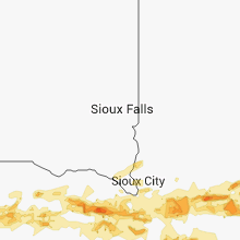
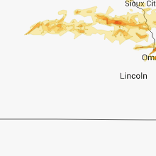
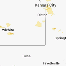
Hail Map for Monday, June 30, 2014

Number of Impacted Households on 6/30/2014
0
Impacted by 1" or Larger Hail
0
Impacted by 1.75" or Larger Hail
0
Impacted by 2.5" or Larger Hail
Square Miles of Populated Area Impacted on 6/30/2014
0
Impacted by 1" or Larger Hail
0
Impacted by 1.75" or Larger Hail
0
Impacted by 2.5" or Larger Hail


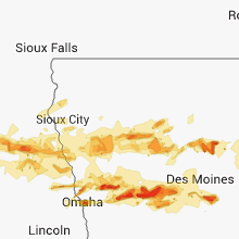


Cities Most Affected by Hail Storms of 6/30/2014
| Hail Size | Demographics of Zip Codes Affected | ||||||
|---|---|---|---|---|---|---|---|
| City | Count | Average | Largest | Pop Density | House Value | Income | Age |
| Rockwell City, IA | 6 | 2.63 | 4.00 | 17 | $59k | $32.3k | 47.8 |
| Fort Dodge, IA | 4 | 2.06 | 2.50 | 173 | $68k | $34.6k | 38.4 |
| Harlan, IA | 3 | 2.33 | 3.00 | 41 | $80k | $38.7k | 44.1 |
| Adair, IA | 2 | 2.13 | 2.50 | 9 | $56k | $32.5k | 42.2 |
| Kirksville, MO | 2 | 1.75 | 1.75 | 94 | $79k | $25.8k | 26.0 |
| Ackworth, IA | 1 | 2.75 | 2.75 | 27 | $98k | $43.6k | 43.6 |
| Walthill, NE | 1 | 1.75 | 1.75 | 9 | $42k | $31.4k | 28.5 |
| Odebolt, IA | 1 | 1.75 | 1.75 | 6 | $45k | $34.1k | 44.7 |
| Pender, NE | 1 | 1.75 | 1.75 | 8 | $69k | $32.5k | 48.8 |
| Campo, CO | 1 | 1.75 | 1.75 | 0 | $22k | $24.6k | 51.3 |
| Nickerson, KS | 1 | 1.75 | 1.75 | 16 | $48k | $33.2k | 40.0 |
| Paton, IA | 1 | 1.75 | 1.75 | 4 | $38k | $36.3k | 45.2 |
| Portsmouth, IA | 1 | 1.75 | 1.75 | 6 | $77k | $36.3k | 47.9 |
| Carroll, NE | 1 | 1.75 | 1.75 | 5 | $56k | $39.5k | 43.9 |
| Ogden, IA | 1 | 1.75 | 1.75 | 15 | $80k | $40.2k | 43.5 |
| Underwood, IA | 1 | 1.75 | 1.75 | 33 | $114k | $53.0k | 38.0 |
| Stratford, IA | 1 | 1.75 | 1.75 | 9 | $63k | $32.9k | 45.4 |
| Walnut, IA | 1 | 1.75 | 1.75 | 6 | $71k | $38.8k | 47.0 |
| Beaver, OK | 1 | 1.75 | 1.75 | 2 | $58k | $38.0k | 41.8 |
Hail and Wind Damage Spotted on 6/30/2014
Filter by Report Type:Hail ReportsWind Reports
States Impacted
Illinois, Nebraska, Iowa, Georgia, Wisconsin, Alabama, Texas, Missouri, Indiana, Michigan, Colorado, Oklahoma, Kansas, OhioIllinois
| Local Time | Report Details |
|---|---|
| 7:00 AM CDT | Taken using davis weather equipment that was mounted on ham radio tower at 40ft above the groun in whiteside county IL, 80.6 miles E of Cedar Rapids, IA |
| 5:10 PM CDT | Approximately 2 to 3 inch diameter tree limbs snappe in winnebago county IL, 45.9 miles SSE of Madison, WI |
| 5:19 PM CDT | 40 mph sustained wind. location route 90 mile marker 18 in winnebago county IL, 57.9 miles SSE of Madison, WI |
| 5:27 PM CDT | Near route 173 and caledonia road. roof shingles ripped of in boone county IL, 63 miles SSE of Madison, WI |
| 5:31 PM CDT | Two trees down on route 93 blocking westbound lane. lots of crop damag in stark county IL, 34.2 miles N of Peoria, IL |
| 5:32 PM CDT | Tree down on a hous in bureau county IL, 44.3 miles N of Peoria, IL |
| 5:37 PM CDT | Estimated 50 to 60 mph winds. 2 to 3 inch diameter tree branches dow in winnebago county IL, 45.9 miles SSE of Madison, WI |
| 5:52 PM CDT | Tree down in town...blocking a lan in bureau county IL, 47.9 miles N of Peoria, IL |
| 6:00 PM CDT | Two large tree branches blown down. time estimate in marshall county IL, 31.2 miles NNE of Peoria, IL |
| 6:05 PM CDT | Tree fell across highway 18. also...considerable crop damage with large areas of corn knocked dow in marshall county IL, 31.7 miles NNE of Peoria, IL |
| 6:20 PM CDT | 4 to 5 inch diameter limb down at devon street and devon c in winnebago county IL, 54.1 miles SSE of Madison, WI |
| 6:42 PM CDT | Large tree limbs/branches down greater than or equal to 2 inche in la salle county IL, 59.6 miles NE of Peoria, IL |
| 6:55 PM CDT | Lawn chair thrown aroun in will county IL, 34.5 miles WSW of Chicago, IL |
| 7:00 PM CDT | Near vermont in dupage county IL, 17.9 miles W of Chicago, IL |
| 7:01 PM CDT | 6 inch diameter tree down. naperville-plainfiled rd and 135th s in will county IL, 34.5 miles WSW of Chicago, IL |
| 7:06 PM CDT | Gusts for a brief time - large trees bending over in forest preserve in dupage county IL, 17.9 miles W of Chicago, IL |
| 7:09 PM CDT | White oaks road and one quarter mile south of the state line. 6 inch diameter tree dow in mchenry county IL, 59.6 miles SE of Madison, WI |
| 7:18 PM CDT | Half mile west central and 159th. small branches and large tree branch down. 4 to 5 inches of water on the street. wind gust 50 to 60 mp in cook county IL, 19.9 miles SSW of Chicago, IL |
| 7:18 PM CDT | Storm damage reported in dupage county IL, 17.9 miles W of Chicago, IL |
| 7:29 PM CDT | Storm damage reported in will county IL, 28.7 miles SW of Chicago, IL |
| 7:30 PM CDT | 12 inch diameter tree branches dow in la salle county IL, 59.9 miles NE of Peoria, IL |
| 7:35 PM CDT | 2 to 3 inch diameter tree limbs dow in cook county IL, 18.9 miles S of Chicago, IL |
| 7:40 PM CDT | Near st. francis and harlem. 4 inch diameter tree snappe in will county IL, 28.6 miles SSW of Chicago, IL |
| 7:42 PM CDT | Metal fence blown dow in will county IL, 28.6 miles SSW of Chicago, IL |
| 8:15 PM CDT | Trees down along with power lines. lightning could have strarted a fir in will county IL, 27.6 miles SSW of Chicago, IL |
| 8:20 PM CDT | Shingles blown off roo in cook county IL, 23.3 miles SSW of Chicago, IL |
| 8:23 PM CDT | Quarter sized hail reported near Grant Park, IL, 44.5 miles S of Chicago, IL, near 6500 and vincent. |
| 8:40 PM CDT | Numerous large trees downed. time estimated per rada in ogle county IL, 73.4 miles S of Madison, WI |
| 8:52 PM CDT | Trees dow in lee county IL, 72.2 miles N of Peoria, IL |
| 8:59 PM CDT | Multiple large trees that are several feet in diameter uprooted. time estimated per rada in lee county IL, 72.2 miles N of Peoria, IL |
| 9:08 PM CDT | Numerous trees down. gusts were measured at 57 mph. also had pea size hai in lee county IL, 72.2 miles N of Peoria, IL |
| 9:10 PM CDT | 2 semi-trucks flipped over on i39. numerous tree branches down in tow in la salle county IL, 64 miles NNE of Peoria, IL |
| 9:12 PM CDT | On e 11th rd - multiple trees uprooted ranging in diamter from 12 to 36 inche in la salle county IL, 54 miles NNE of Peoria, IL |
| 9:17 PM CDT | Damage to at least one building and two mobile homes. numerous trees snapped or uprooted. time estimated per rada in la salle county IL, 69.6 miles WSW of Chicago, IL |
| 9:25 PM CDT | Relayed by nws lincol in mcdonough county IL, 45.9 miles ENE of Kahoka, MO |
| 9:25 PM CDT | Relayed by nws lincol in mcdonough county IL, 45.9 miles ENE of Kahoka, MO |
| 9:31 PM CDT | Large tree downed. time estimated per rada in la salle county IL, 60.5 miles WSW of Chicago, IL |
| 9:32 PM CDT | Four 8 to 10 inch diameter trees blown down. time estimated. from city eo in peoria county IL, 3.5 miles NNW of Peoria, IL |
| 9:32 PM CDT | Tree damage in area. very heavy rai in mcdonough county IL, 52 miles E of Kahoka, MO |
| 9:38 PM CDT | Storm damage reported in kane county IL, 34.8 miles WSW of Chicago, IL |
| 9:38 PM CDT | Relayed by nws lincol in mcdonough county IL, 56.1 miles E of Kahoka, MO |
| 9:41 PM CDT | 5 to 6 inch diamter tree branch blown down. from peoria city eo in tazewell county IL, 7.8 miles E of Peoria, IL |
| 9:48 PM CDT | 200 to 300 trees down in morris... some on houses... which caused some damage. 85 to 90 percent of the city without power. some roads blocked by trees and power line in grundy county IL, 54.4 miles SW of Chicago, IL |
| 9:50 PM CDT | Numerous trees down in tow in grundy county IL, 54.4 miles SW of Chicago, IL |
| 9:50 PM CDT | Lots of trees down in a yard along gun club road. also saw power flashes. wind lasted about 5 minute in grundy county IL, 52.9 miles SW of Chicago, IL |
| 9:52 PM CDT | Storm damage reported in hancock county IL, 31.6 miles E of Kahoka, MO |
| 9:53 PM CDT | Near intersection of us30 and us3 in kendall county IL, 38.2 miles WSW of Chicago, IL |
| 9:55 PM CDT | Storm damage reported in grundy county IL, 51.4 miles SW of Chicago, IL |
| 9:55 PM CDT | Spotter reported power flashes as wel in will county IL, 34.5 miles WSW of Chicago, IL |
| 9:57 PM CDT | Damage to multiple homes. time estimated per rada in will county IL, 34.5 miles WSW of Chicago, IL |
| 9:58 PM CDT | Large metal street light broken at base and leaning on power lines near romeo road and route 53. multiple trees down west of route 53 partially blocking belmont driv in will county IL, 28.6 miles SW of Chicago, IL |
| 9:58 PM CDT | Lots of mature trees...some more than 40 to 50 ft tall...downed and uprooted in the lakewood falls are in will county IL, 32.8 miles WSW of Chicago, IL |
| 9:58 PM CDT | Large tree limbs down and evergreen tree snapped at its base along marquette drive and enterprise driv in will county IL, 27.9 miles WSW of Chicago, IL |
| 10:00 PM CDT | 12 inch diametr tree split at base at ingalls and larki in will county IL, 35.1 miles SW of Chicago, IL |
| 10:00 PM CDT | Debris and tree limbs blocking route 53 near lewis university in romeoville. time of damage estimated from rada in will county IL, 29.9 miles SW of Chicago, IL |
| 10:00 PM CDT | Power lines down across il-53 north of normantown rd. route 53 is close in will county IL, 28.6 miles SW of Chicago, IL |
| 10:03 PM CDT | Storm damage reported in will county IL, 26.4 miles WSW of Chicago, IL |
| 10:04 PM CDT | Storm damage reported in will county IL, 37.3 miles SW of Chicago, IL |
| 10:04 PM CDT | Numerous tree limbs 2 to 6 inches in diameter blown down along larkin between mcdonough and black road in will county IL, 35.1 miles SW of Chicago, IL |
| 10:05 PM CDT | 2 ft diameter tree dow in will county IL, 30.9 miles SW of Chicago, IL |
| 10:05 PM CDT | South of il-113 on will rd - 12-16 inch branches dow in grundy county IL, 52.3 miles SW of Chicago, IL |
| 10:05 PM CDT | Storm damage reported in grundy county IL, 53.8 miles SW of Chicago, IL |
| 10:14 PM CDT | Storm damage reported in will county IL, 28.7 miles SW of Chicago, IL |
| 10:15 PM CDT | Two trees down and numerous tree limbs down near central and 103rd. time estimate in cook county IL, 14.8 miles SSW of Chicago, IL |
| 10:15 PM CDT | Storm damage reported in mcdonough county IL, 49 miles E of Kahoka, MO |
| 10:15 PM CDT | Storm damage reported in mcdonough county IL, 49 miles E of Kahoka, MO |
| 10:17 PM CDT | Storm damage reported in cook county IL, 23.3 miles SSW of Chicago, IL |
| 10:18 PM CDT | Storm damage reported in will county IL, 27.6 miles SSW of Chicago, IL |
| 10:19 PM CDT | Some siding peeled off home in kankakee county IL, 51.6 miles SSW of Chicago, IL |
| 10:20 PM CDT | Large branch downed along with a lot of small branche in cook county IL, 28 miles S of Chicago, IL |
| 10:20 PM CDT | Sustained. at 179th in cook county IL, 23.3 miles SSW of Chicago, IL |
| 10:21 PM CDT | Storm damage reported in cook county IL, 9.4 miles SW of Chicago, IL |
| 10:22 PM CDT | At la grange rd and cermac in cook county IL, 13.3 miles WSW of Chicago, IL |
| 10:23 PM CDT | Storm damage reported in kankakee county IL, 56.1 miles SSW of Chicago, IL |
| 10:23 PM CDT | Numerous large trees downed. time estimated per rada in cook county IL, 26.4 miles SSW of Chicago, IL |
| 10:24 PM CDT | Numerous trees downed. time estimated per rada in cook county IL, 18.1 miles SSW of Chicago, IL |
| 10:24 PM CDT | Also reported very heavy rain of 0.80 inches from 1018 pm to 1025 p in cook county IL, 12.2 miles SW of Chicago, IL |
| 10:24 PM CDT | Several large trees down around the sportmans club. time estimated by rada in kankakee county IL, 54 miles SSW of Chicago, IL |
| 10:27 PM CDT | At first and wester in cook county IL, 28 miles S of Chicago, IL |
| 10:30 PM CDT | Barn destroyed. windows blown out of a house. ten trees with their tops sheared off. time estimate in kankakee county IL, 43.1 miles S of Chicago, IL |
| 10:30 PM CDT | Reports of 12 to 18 inch diameter trees down on power lines and numerious other tree branches down. time estimated by rada in kankakee county IL, 50 miles S of Chicago, IL |
| 10:30 PM CDT | Storm damage reported in cook county IL, 22.4 miles S of Chicago, IL |
| 10:31 PM CDT | Sustained. monee r in will county IL, 30.9 miles S of Chicago, IL |
| 10:32 PM CDT | Storm damage reported in cook county IL, 19.7 miles S of Chicago, IL |
| 10:32 PM CDT | Large tree limb of healthy tree downe in cook county IL, 23.1 miles S of Chicago, IL |
| 10:33 PM CDT | Large tree limbs down. estimated winds of 85 mp in cook county IL, 22.1 miles S of Chicago, IL |
| 10:34 PM CDT | Multiple large trees downed. time estimated per rada in cook county IL, 19.4 miles SSE of Chicago, IL |
| 10:34 PM CDT | 5 to 6 foot diameter tree snapped in two. at jeep house rd il-3 in kendall county IL, 38.2 miles WSW of Chicago, IL |
| 10:35 PM CDT | Large stain glass window of church blown out. large trees uprooted and snapped...including some thrown onto side of church. time estimated per rada in kankakee county IL, 42.4 miles S of Chicago, IL |
| 10:35 PM CDT | House under construction with wall blown out and part of roof tore off. major tree damage in a swath. time estimated per rada in kankakee county IL, 41.7 miles S of Chicago, IL |
| 11:00 PM CDT | Also had 1.44 in. of rainfall with 0.65 in 20 minutes. one large limb dow in cook county IL, 12.9 miles SSW of Chicago, IL |
| 11:05 PM CDT | Semi blown over at i-55 mile marker 12 in logan county IL, 38.7 miles SSE of Peoria, IL |
| 11:46 PM CDT | Storm damage reported in champaign county IL, 38.9 miles N of Mattoon, IL |
Nebraska
| Local Time | Report Details |
|---|---|
| 7:05 AM CDT | Quarter sized hail reported near Page, NE, 11.8 miles E of Oneill, NE, report of quarter size hail at estimated time of 705 am. also reported strong winds of 50 mph and 1.25 inch rainfall from one storm. |
| 7:20 AM CDT | Quarter sized hail reported near Burwell, NE, 36.4 miles SW of Oneill, NE |
| 7:25 AM CDT | Quarter sized hail reported near Burwell, NE, 36.4 miles SW of Oneill, NE |
| 7:30 AM CDT | Half Dollar sized hail reported near Amelia, NE, 34.9 miles SW of Oneill, NE, hail lasted 15 minutes. |
| 8:20 AM CDT | Golf Ball sized hail reported near Carroll, NE, 76.6 miles E of Oneill, NE |
| 8:30 AM CDT | Also quarter size hai in pierce county NE, 58.9 miles ESE of Oneill, NE |
| 8:45 AM CDT | Quarter sized hail reported near Ewing, NE, 22.7 miles SSE of Oneill, NE |
| 8:45 AM CDT | Pivots and powerlines down in knievels corner. time is estimate in holt county NE, 28.7 miles SSE of Oneill, NE |
| 8:45 AM CDT | 4 inch diameter branches were knocked dow in holt county NE, 22.7 miles SSE of Oneill, NE |
| 9:00 AM CDT | Golf Ball sized hail reported near Pender, NE, 70.9 miles NW of Omaha, NE |
| 9:05 AM CDT | Golf Ball sized hail reported near Walthill, NE, 67.6 miles NNW of Omaha, NE |
| 9:41 AM CDT | Quarter sized hail reported near Macy, NE, 62.5 miles NNW of Omaha, NE |
| 10:04 AM CDT | Quarter sized hail reported near Neligh, NE, 38.9 miles SE of Oneill, NE |
| 10:07 AM CDT | Trees dow in wayne county NE, 84.7 miles E of Oneill, NE |
| 10:10 AM CDT | Trees and power lines dow in pierce county NE, 64.1 miles E of Oneill, NE |
| 10:15 AM CDT | Trees and power lines down south through west of carrol in wayne county NE, 74.4 miles E of Oneill, NE |
| 10:15 AM CDT | Quarter sized hail reported near Pender, NE, 70.9 miles NW of Omaha, NE |
| 10:16 AM CDT | 65 mph wind gust downed large tree limb in dixon county NE, 84.6 miles NW of Omaha, NE |
| 10:18 AM CDT | Tree snapped in half as well as multiple large branches dow in dixon county NE, 84.9 miles WSW of Storm Lake, IA |
| 10:25 AM CDT | In wakefiel in wayne county NE, 82.6 miles NW of Omaha, NE |
| 10:33 AM CDT | Trailer home on its side. roof of a house blown off and a firework tent with people inside blown down. unknown if any injuries at this tim in thurston county NE, 70.7 miles WSW of Storm Lake, IA |
| 10:40 AM CDT | 6 inch diameter tree branches downed in dakota county NE, 69.6 miles WSW of Storm Lake, IA |
| 10:45 AM CDT | Two semis flipped ove in thurston county NE, 63.9 miles NNW of Omaha, NE |
| 11:07 AM CDT | Ping Pong Ball sized hail reported near Pierce, NE, 60 miles ESE of Oneill, NE |
Iowa
| Local Time | Report Details |
|---|---|
| 7:50 AM CDT | Quarter sized hail reported near Crescent, IA, 9.3 miles NNE of Omaha, NE |
| 8:06 AM CDT | Golf Ball sized hail reported near Underwood, IA, 15.4 miles NE of Omaha, NE |
| 9:00 AM CDT | Golf Ball sized hail reported near Portsmouth, IA, 34.6 miles NE of Omaha, NE |
| 9:00 AM CDT | Golf Ball sized hail reported near Walnut, IA, 40.4 miles ENE of Omaha, NE |
| 9:14 AM CDT | Half Dollar sized hail reported near Harlan, IA, 41.5 miles NE of Omaha, NE |
| 9:23 AM CDT | Half Dollar sized hail reported near Portsmouth, IA, 36.7 miles NE of Omaha, NE |
| 9:27 AM CDT | Hen Egg sized hail reported near Harlan, IA, 42.3 miles NE of Omaha, NE |
| 9:37 AM CDT | Tea Cup sized hail reported near Harlan, IA, 41.5 miles NE of Omaha, NE |
| 9:38 AM CDT | Hen Egg sized hail reported near Harlan, IA, 42.3 miles NE of Omaha, NE, around 2 inch diameter hail at 1.5 miles east of harlan. |
| 10:03 AM CDT | Tea Cup sized hail reported near Rockwell City, IA, 33.8 miles ESE of Storm Lake, IA |
| 10:05 AM CDT | Quarter sized hail reported near Lohrville, IA, 42.7 miles SE of Storm Lake, IA |
| 10:06 AM CDT | Hen Egg sized hail reported near Rockwell City, IA, 33.8 miles ESE of Storm Lake, IA, spotter ch119 |
| 10:07 AM CDT | Hen Egg sized hail reported near Rockwell City, IA, 33.7 miles ESE of Storm Lake, IA, spotter ch210 |
| 10:10 AM CDT | Tea Cup sized hail reported near Rockwell City, IA, 33.8 miles ESE of Storm Lake, IA, windshields broken in cars in rockwell city. |
| 10:10 AM CDT | Golf Ball sized hail reported near Rockwell City, IA, 33.8 miles ESE of Storm Lake, IA, calhoun co. sheriff |
| 10:11 AM CDT | Grapefruit sized hail reported near Rockwell City, IA, 33.8 miles ESE of Storm Lake, IA, spotter ch119 |
| 10:43 AM CDT | Ping Pong Ball sized hail reported near Fort Dodge, IA, 53 miles E of Storm Lake, IA |
| 10:44 AM CDT | Ping Pong Ball sized hail reported near Fort Dodge, IA, 53.5 miles E of Storm Lake, IA, spotter we118 |
| 10:45 AM CDT | Golf Ball sized hail reported near Fort Dodge, IA, 53 miles E of Storm Lake, IA, golf ball hail in fort dodge. |
| 10:45 AM CDT | Storm damage reported in woodbury county IA, 60.3 miles WSW of Storm Lake, IA |
| 10:46 AM CDT | Quarter sized hail reported near Fort Dodge, IA, 53 miles E of Storm Lake, IA, cedar falls state patrol |
| 10:48 AM CDT | Tennis Ball sized hail reported near Fort Dodge, IA, 53 miles E of Storm Lake, IA, spotter we239 |
| 10:50 AM CDT | Hen Egg sized hail reported near Fort Dodge, IA, 53.4 miles ESE of Storm Lake, IA, who-tv reported. |
| 10:52 AM CDT | Hen Egg sized hail reported near Fort Dodge, IA, 52.5 miles E of Storm Lake, IA, spotter we211 |
| 10:53 AM CDT | Storm damage reported in woodbury county IA, 59.5 miles WSW of Storm Lake, IA |
| 10:58 AM CDT | Storm damage reported in woodbury county IA, 59.5 miles WSW of Storm Lake, IA |
| 11:00 AM CDT | Large tree limbs down with one blocking the road in woodbury county IA, 52.8 miles WSW of Storm Lake, IA |
| 11:05 AM CDT | Also pea size hail at 1115 a in harrison county IA, 39.7 miles N of Omaha, NE |
| 11:10 AM CDT | Branches downed in woodbury county IA, 43.4 miles SW of Storm Lake, IA |
| 11:11 AM CDT | Lots of trees down and 2.00 inches rainfall while spotter was at work elsewher in woodbury county IA, 42 miles WSW of Storm Lake, IA |
| 11:25 AM CDT | Multiple tree-limbs down and winds estimated at 60 to 70 mp in crawford county IA, 44 miles S of Storm Lake, IA |
| 11:30 AM CDT | Quarter sized hail reported near Battle Creek, IA, 31.3 miles SSW of Storm Lake, IA |
| 11:36 AM CDT | Quarter sized hail reported near Grand Junction, IA, 44.3 miles NW of Des Moines, IA |
| 11:41 AM CDT | Ping Pong Ball sized hail reported near Ogden, IA, 38.9 miles NW of Des Moines, IA |
| 11:46 AM CDT | Quarter sized hail reported near Ogden, IA, 39.4 miles NW of Des Moines, IA, bn109 spotter report via web lsr form. |
| 11:47 AM CDT | Golf Ball sized hail reported near Odebolt, IA, 26.2 miles S of Storm Lake, IA, odeboldt fire reported golf ball hail south of town and 60 to 70 mph wind gusts in town. |
| 11:50 AM CDT | We421 in webster county IA, 48.6 miles ESE of Storm Lake, IA |
| 11:50 AM CDT | Spotter we421 in webster county IA, 49.4 miles ESE of Storm Lake, IA |
| 11:52 AM CDT | Golf Ball sized hail reported near Ogden, IA, 46.9 miles NNW of Des Moines, IA |
| 12:00 PM CDT | Half Dollar sized hail reported near Walnut, IA, 40.4 miles ENE of Omaha, NE, half dollar size hail. |
| 12:05 PM CDT | Second hand report of wind damage at littlefield recreation area. time estimated via rada in audubon county IA, 60.4 miles W of Des Moines, IA |
| 12:13 PM CDT | Half Dollar sized hail reported near Stratford, IA, 49.7 miles NNW of Des Moines, IA |
| 12:14 PM CDT | Golf Ball sized hail reported near Paton, IA, 47.5 miles NNW of Des Moines, IA, boone em reports golfball size hail and strong winds in boxholm. tree branches coming down. |
| 12:30 PM CDT | Tennis Ball sized hail reported near Adair, IA, 53.5 miles W of Des Moines, IA, emergency manager reported around 300 homes damaged from large wind driven hail. numerous trees damaged. numerous cars on i80 had their windows broken |
| 12:31 PM CDT | Ping Pong Ball sized hail reported near Adair, IA, 53.5 miles W of Des Moines, IA, also 40 to 50 mph winds in town of adair. |
| 12:34 PM CDT | Golf Ball sized hail reported near Stratford, IA, 47.1 miles NNW of Des Moines, IA |
| 12:41 PM CDT | Golf Ball sized hail reported near Adair, IA, 53 miles W of Des Moines, IA, golf ball on i80 mile marker 77 damage to cars and windows |
| 12:44 PM CDT | 65 to 75 mph estimated gust from the spotternetwork.org in story county IA, 40 miles N of Des Moines, IA |
| 12:45 PM CDT | At least 2 trees... 1 power pole... and widespread large tree limbs down across randal in hamilton county IA, 44.9 miles N of Des Moines, IA |
| 12:45 PM CDT | Report via the lsr web report for in adair county IA, 37.6 miles WSW of Des Moines, IA |
| 12:54 PM CDT | Numerous 40 to 50 feet tall trees down in zearing. large tree branch across highway 69 1 mile south of state road e29. report from em via nwscha in story county IA, 42.6 miles NNE of Des Moines, IA |
| 12:54 PM CDT | Trees snapped off at bases and large limbs across us 69 highway. spotternetwork.org via nwscha in hamilton county IA, 42.8 miles N of Des Moines, IA |
| 1:07 PM CDT | Quarter sized hail reported near Hubbard, IA, 51.8 miles NNE of Des Moines, IA, trained spotter reports dime to quarter sized hail...considerable wind and heavy rain. |
| 1:10 PM CDT | Measured by home weather station. two large ash trees snapped. pine tree snapped. corn and bean crops flattene in hardin county IA, 50.3 miles NNE of Des Moines, IA |
| 1:15 PM CDT | Quarter sized hail reported near Adel, IA, 23.6 miles W of Des Moines, IA |
| 1:16 PM CDT | Medium size tree limb damage in polk county IA, 7.3 miles WNW of Des Moines, IA |
| 1:18 PM CDT | Quarter sized hail reported near New Providence, IA, 52.4 miles NNE of Des Moines, IA, also a large tree across a road at this location due to strong (unknown speed) wind. |
| 1:20 PM CDT | Semi-truck blown over on i-35 at this locatio in warren county IA, 18.6 miles SSW of Des Moines, IA |
| 1:20 PM CDT | Large machine shed down. numerous reports of trees down across northern marshall county including in clemons and albion. time for the liscomb report estimated by radar in marshall county IA, 51.9 miles NE of Des Moines, IA |
| 1:25 PM CDT | Building and house partially destroyed 50th avenue and highway 92... via nwscha in warren county IA, 15.9 miles SSW of Des Moines, IA |
| 1:25 PM CDT | 3195 kirkwood st.... prole... ia... large grain bin destroyed along with two hoop buildings. time est. from radar from nwschat posting from warren co. em in warren county IA, 18.2 miles SSW of Des Moines, IA |
| 1:27 PM CDT | Spotternetwork.org via nwscha in warren county IA, 11.4 miles SW of Des Moines, IA |
| 1:28 PM CDT | 4797 hwy 92... martinsdale... minor damage to house and tree limbs dow in warren county IA, 16.5 miles SSW of Des Moines, IA |
| 1:28 PM CDT | Barn destroyed by win in warren county IA, 15.2 miles SSW of Des Moines, IA |
| 1:30 PM CDT | Storm damage reported in warren county IA, 16.5 miles SSW of Des Moines, IA |
| 1:35 PM CDT | Small trees reported uprooted. ditch flooding around briarcreek housing development in polk county IA, 11.8 miles NW of Des Moines, IA |
| 1:40 PM CDT | Powerlines down on highway 28 just north of martensdale and tree limbs down on house in martensdale. em report via nwscha in warren county IA, 16.5 miles SSW of Des Moines, IA |
| 1:41 PM CDT | Estimated 60 mph wind... heavy rain and small limbs down. indianola fd via micr in warren county IA, 16 miles S of Des Moines, IA |
| 1:41 PM CDT | Quarter sized hail reported near Norwalk, IA, 7 miles SSW of Des Moines, IA, heavy rainfall also occuring at this time causing ponding of water. |
| 1:48 PM CDT | Sheriff deputy estimated at least 70 mph winds and pea size hail at 229th and 260th in grundy county IA, 61.1 miles WNW of Cedar Rapids, IA |
| 1:53 PM CDT | Baseball sized hail reported near Ackworth, IA, 19.2 miles SE of Des Moines, IA, delayed report from em via nwschat. golfball to baseball sized hail. |
| 1:53 PM CDT | All windows on north side of house destroyed. likely wind and hail damage both. time estimated from radar. nwschat report from em in warren county IA, 19.2 miles SE of Des Moines, IA |
| 1:56 PM CDT | Half of roof blown of in tama county IA, 43 miles WNW of Cedar Rapids, IA |
| 2:02 PM CDT | Spotter mn402 also nickel hail in this general location via the phon in marion county IA, 22.6 miles SE of Des Moines, IA |
| 2:10 PM CDT | Kcvm...kcnz... kcfi report via nwschat with time estimated from radar reporting damage in traer...trees over power lines... semi trailer tipped over and damage to houses in tama county IA, 43 miles WNW of Cedar Rapids, IA |
| 2:10 PM CDT | Spotter bh410 via phone. also 1.25 inches of rain from around 2:10 pm to 2:35 p in black hawk county IA, 42.4 miles NW of Cedar Rapids, IA |
| 2:17 PM CDT | Estimated 70 mph winds in and just south of chelsea along with torrential rain. power lines down... a lot of tree damage in chelse in grundy county IA, 59.2 miles SSE of Mason City, IA |
| 2:17 PM CDT | Corn crib destroyed by high winds. delayed report from chelsea f. in tama county IA, 37.6 miles W of Cedar Rapids, IA |
| 2:23 PM CDT | 60-65 mph wind. very heavy rain. power is ou in benton county IA, 31.7 miles W of Cedar Rapids, IA |
| 2:23 PM CDT | Widespread damage in benton county IA, 26.5 miles WNW of Cedar Rapids, IA |
| 2:23 PM CDT | Widespread wind damage across western benton county in benton county IA, 30.8 miles WNW of Cedar Rapids, IA |
| 2:23 PM CDT | Widespread wind damage across western benton county in benton county IA, 30.8 miles WNW of Cedar Rapids, IA |
| 2:23 PM CDT | Time estimated -2 big trees down at 1805 11th ave- one fell on house... one fell on garage in benton county IA, 31.2 miles W of Cedar Rapids, IA |
| 2:25 PM CDT | Black hawk county emergency manager reports tree and crop damage. time estimated by rada in black hawk county IA, 35.1 miles NW of Cedar Rapids, IA |
| 2:30 PM CDT | Limbs downed by high winds in iowa county IA, 22.2 miles WSW of Cedar Rapids, IA |
| 2:30 PM CDT | Estimated 60 to 70 mp in iowa county IA, 24.9 miles SW of Cedar Rapids, IA |
| 2:30 PM CDT | Trees and powerlines down in town. images relayed by kwwl. time estimated from radar in black hawk county IA, 48 miles NNW of Cedar Rapids, IA |
| 2:34 PM CDT | Large tree down on house near 17th ave in buchanan county IA, 36.2 miles NNW of Cedar Rapids, IA |
| 2:35 PM CDT | Kolz g50kts in fayette county IA, 50.1 miles NNW of Cedar Rapids, IA |
| 2:35 PM CDT | Trees and power lines down. corn flat from independence to hazelton. semi jackknifed on 151 about halfway between independence and oelwein. time estimate in buchanan county IA, 35.8 miles NNW of Cedar Rapids, IA |
| 2:36 PM CDT | Time estimated -numerous trees down... no power in independence in buchanan county IA, 35.8 miles NNW of Cedar Rapids, IA |
| 2:36 PM CDT | Time estimated -numerous trees down... no power in independence in buchanan county IA, 35.8 miles NNW of Cedar Rapids, IA |
| 2:37 PM CDT | Also had 1.5 inches of rain in 45 minute in buchanan county IA, 35.7 miles NNW of Cedar Rapids, IA |
| 2:37 PM CDT | Storm damage reported in buchanan county IA, 35.8 miles NNW of Cedar Rapids, IA |
| 2:40 PM CDT | Wind gusts of 50 to 60 mp in fayette county IA, 50.1 miles NNW of Cedar Rapids, IA |
| 2:40 PM CDT | Hoop building gone. major tree damage. neighbor lost steel farm shed which was flattene in iowa county IA, 20.4 miles SW of Cedar Rapids, IA |
| 2:42 PM CDT | *** 2 inj *** time estimated - business building destroyed in linn county IA, 6.7 miles SW of Cedar Rapids, IA |
| 2:43 PM CDT | From aso in linn county IA, 7.1 miles SSW of Cedar Rapids, IA |
| 2:49 PM CDT | Estimated 80 mph or more. high winds for over 5 minutes. still gusts over 60 mph. also heavy rain in linn county IA, 1.9 miles SSE of Cedar Rapids, IA |
| 2:49 PM CDT | Numerous reports wind damage and pea size hail in linn county IA, 0.5 miles SSE of Cedar Rapids, IA |
| 2:50 PM CDT | Time estimated - tree branches damaged vehicle in linn county IA, 1.5 miles NE of Cedar Rapids, IA |
| 2:53 PM CDT | Aprox location 2 e of hwy 13/secrist road- outbuildings damaged roof off a hom in linn county IA, 6.7 miles NE of Cedar Rapids, IA |
| 2:53 PM CDT | Estimated 60 mph gusts at christ community united methodist churc in linn county IA, 5.7 miles NE of Cedar Rapids, IA |
| 2:55 PM CDT | Storm damage reported in linn county IA, 5.7 miles NE of Cedar Rapids, IA |
| 2:55 PM CDT | Two trees down in cedar memorial cemetary. 1st ave blocked. estimated at 70 mph. time estimated at 250 to 255 p in linn county IA, 1.3 miles NW of Cedar Rapids, IA |
| 2:55 PM CDT | Trees uprooted and outbuildings dow in linn county IA, 14.3 miles NE of Cedar Rapids, IA |
| 2:56 PM CDT | 4 to 5 inch diameter trees snappe in johnson county IA, 16.5 miles S of Cedar Rapids, IA |
| 2:57 PM CDT | *** 1 inj *** a tree fell on a person...who was transported to the hospita in johnson county IA, 16.6 miles SSE of Cedar Rapids, IA |
| 3:00 PM CDT | Trees down near lindall mall and the cemetary in cedar rapids. time estimate in linn county IA, 4.9 miles NE of Cedar Rapids, IA |
| 3:00 PM CDT | Trees down and roofs blown off from palo towards toddville. estimated over 80 mph winds. via nawa in linn county IA, 8.7 miles NW of Cedar Rapids, IA |
| 3:00 PM CDT | *** 2 inj *** tree down on a car. 2 people taken to the hospital. trees and power lines down through the count in johnson county IA, 22.9 miles SSE of Cedar Rapids, IA |
| 3:00 PM CDT | 60+ mph wind gusts in clayton county IA, 49.1 miles N of Cedar Rapids, IA |
| 3:03 PM CDT | Storm damage reported in linn county IA, 16.9 miles ENE of Cedar Rapids, IA |
| 3:05 PM CDT | Trees and powerlines down in clayton county IA, 57.3 miles N of Cedar Rapids, IA |
| 3:06 PM CDT | Trees and power lines down in clayton county IA, 47.9 miles NNE of Cedar Rapids, IA |
| 3:06 PM CDT | Numerous trees dow in delaware county IA, 37.1 miles NNE of Cedar Rapids, IA |
| 3:07 PM CDT | Storm damage reported in clayton county IA, 57.3 miles N of Cedar Rapids, IA |
| 3:09 PM CDT | Trees down throughout city of anamosa including large trees.time estimated in jones county IA, 22.3 miles ENE of Cedar Rapids, IA |
| 3:09 PM CDT | Trees down and no power or phone/internet service in jones county IA, 20.3 miles ENE of Cedar Rapids, IA |
| 3:10 PM CDT | Tree limbs down near weber school in johnson county IA, 22.9 miles SSE of Cedar Rapids, IA |
| 3:10 PM CDT | Two foot diameter tree down. estimated 60 to 70 mph gusts or higher. no power. time estimate in jones county IA, 26.4 miles ENE of Cedar Rapids, IA |
| 3:15 PM CDT | Trees and powerlines down in clayton county IA, 62.6 miles NNE of Cedar Rapids, IA |
| 3:16 PM CDT | Northbound toward alburnett large tree branches down in linn county IA, 4.9 miles NNE of Cedar Rapids, IA |
| 3:17 PM CDT | Measured by a spotte in linn county IA, 22.1 miles NE of Cedar Rapids, IA |
| 3:22 PM CDT | Numerous 3 to 15 foot long branches down...two maple trees aprox 20 feet tall snapped off at the bas in linn county IA, 5.7 miles NE of Cedar Rapids, IA |
| 3:26 PM CDT | Storm damage reported in cedar county IA, 31.5 miles ESE of Cedar Rapids, IA |
| 3:27 PM CDT | Numerous trees and power lines down across the city in linn county IA, 1.9 miles SSE of Cedar Rapids, IA |
| 3:29 PM CDT | In robbins a 40 foot oak tree uprooted... many tree branches down. on northside of town numerous trees snapped off about 3 feet above the groun in linn county IA, 7.2 miles N of Cedar Rapids, IA |
| 3:30 PM CDT | About 2 to 3 miles north of baldwin a building fell onto two campers. trees also downed. route 64 east of town remains closed due to flooding. also 50th avenue south of in jackson county IA, 43.4 miles E of Cedar Rapids, IA |
| 3:35 PM CDT | A lot of trees down being cleaned up from garber to osterdock and guttenberg. time estimated from radar when the severe wind gusts moved throug in clayton county IA, 63.4 miles NNE of Cedar Rapids, IA |
| 3:38 PM CDT | Garage and machine shed destroyed. two poles snapped. debris in trees...power lines...and fields. location is along bellevue cascade road just west of highway 6 in jackson county IA, 54.2 miles ENE of Cedar Rapids, IA |
| 3:40 PM CDT | Semi overturned in clinton county IA, 52.2 miles E of Cedar Rapids, IA |
| 3:42 PM CDT | Storm damage reported in jackson county IA, 51.6 miles E of Cedar Rapids, IA |
| 3:42 PM CDT | Storm damage reported in jackson county IA, 51 miles E of Cedar Rapids, IA |
| 3:43 PM CDT | Numerous trees down... no power in independence in buchanan county IA, 35.8 miles NNW of Cedar Rapids, IA |
| 3:45 PM CDT | Estimated 80 to 90 mph based on widespread damage in tow in dubuque county IA, 49.1 miles ENE of Cedar Rapids, IA |
| 3:45 PM CDT | Estimated 80 to 90 mph based on widespread damage in tow in dubuque county IA, 49.1 miles ENE of Cedar Rapids, IA |
| 3:48 PM CDT | Trees down at dubuque county fairgrounds. time estimate in dubuque county IA, 62.1 miles NE of Cedar Rapids, IA |
| 3:48 PM CDT | Estimated 70 to 80 mph. former nws employe in scott county IA, 53.3 miles ESE of Cedar Rapids, IA |
| 3:49 PM CDT | Shed blown over and tree branches down in jackson county IA, 57 miles ENE of Cedar Rapids, IA |
| 3:54 PM CDT | Delayed report from storms which occured earlier -large tree down on house near 17th ave in buchanan county IA, 36.2 miles NNW of Cedar Rapids, IA |
| 4:00 PM CDT | Time estimated. 20 inch diameter tree snappe in scott county IA, 62 miles ESE of Cedar Rapids, IA |
| 4:06 PM CDT | From storms earlier - 2 big trees down at 1805 11th ave- one fell on house... one fell on garage in benton county IA, 31.2 miles W of Cedar Rapids, IA |
| 4:12 PM CDT | Significant crop damage between independence and hazleton in buchanan county IA, 35.8 miles NNW of Cedar Rapids, IA |
| 8:40 PM CDT | Tree limbs and power lines down. time estimated by rada in des moines county IA, 41.4 miles NE of Kahoka, MO |
| 6:00 AM CDT | Wind damage from independence to oelwein yesterday afternoon around 240pm. peak gust here was 52mph but is hindered by trees so estimated winds of over 60mp in buchanan county IA, 47.1 miles NNW of Cedar Rapids, IA |
Georgia
| Local Time | Report Details |
|---|---|
| 1:24 PM EDT | Clayton county 911 reported down power lines on wilson road in clayton county GA, 15.9 miles S of Atlanta, GA |
| 2:14 PM EDT | Trees down in butts county including one on hwy 36 and one on brownlee rd in butts county GA, 39.9 miles SE of Atlanta, GA |
| 4:13 PM EDT | 1 tree down at intersection of avondale cir and hawkinsville rd in bibb county GA, 84.9 miles SSE of Atlanta, GA |
| 4:15 PM EDT | 911 center reports trees down on highway 18 at mile marker 2 in twiggs county GA, 87.8 miles NNW of Douglas, GA |
| 5:45 PM EDT | Public reported several trees down at 1363 sandusky ct in muscogee county GA, 35.4 miles ESE of Auburn, AL |
| 5:54 PM EDT | Several trees reported down throughout the county including at 129 s... mock springs rd... and blue springs rd in pulaski county GA, 56.9 miles NW of Douglas, GA |
Wisconsin
| Local Time | Report Details |
|---|---|
| 3:49 PM CDT | Trees down in grant county WI, 61.9 miles SSE of La Crosse, WI |
| 3:50 PM CDT | 60-70 mph estimated wind gusts. tree branches and limbs flying. some trees down nearb in grant county WI, 60.2 miles SSE of La Crosse, WI |
| 4:00 PM CDT | Storm damage reported in grant county WI, 68.4 miles W of Madison, WI |
| 4:00 PM CDT | Approx. 24 ft x 80 ft pole shed with concrete walls-roof and wooden poles blown 200-300 yards into a field. concrete walls are all that remain. silo and power pole near in iowa county WI, 53.8 miles WSW of Madison, WI |
| 4:11 PM CDT | Storm damage reported in grant county WI, 54.2 miles WSW of Madison, WI |
| 4:20 PM CDT | Barn destroye in lafayette county WI, 41.4 miles SW of Madison, WI |
| 4:34 PM CDT | Electrical poles down in mineral poin in iowa county WI, 42.8 miles WSW of Madison, WI |
| 4:50 PM CDT | Trees down from livingston in grant county to dodgevill in iowa county WI, 38.4 miles WSW of Madison, WI |
| 5:33 PM CDT | Storm damage reported in walworth county WI, 47.6 miles SE of Madison, WI |
| 5:33 PM CDT | Storm damage reported in walworth county WI, 47.6 miles SE of Madison, WI |
| 5:38 PM CDT | 15 inch diameter tree dow in walworth county WI, 50.4 miles ESE of Madison, WI |
| 5:40 PM CDT | 6 inch diameter tree branches dow in walworth county WI, 49.1 miles SE of Madison, WI |
| 5:47 PM CDT | Location is 0.2 mi se of delavan. 12 inch diameter tree down over road. exact location is south 6th and washington s in walworth county WI, 49.1 miles SE of Madison, WI |
| 5:55 PM CDT | 1 power pole blown down in town of concord. time of event estimated from weather radar. report via social medi in jefferson county WI, 40.4 miles E of Madison, WI |
| 5:58 PM CDT | Location is 0.2 miles se of delavan. 18 inch diameter tree dow in walworth county WI, 49.1 miles SE of Madison, WI |
| 6:00 PM CDT | Multiple reports of trees down in the city of waukesha. some roads are blocked by fallen tree in waukesha county WI, 58.2 miles E of Madison, WI |
| 6:03 PM CDT | Location is 1.3 miles north of waukesh in waukesha county WI, 58.1 miles E of Madison, WI |
| 6:05 PM CDT | Major tree damage. large trees and powerlines were downe in waukesha county WI, 59.6 miles E of Madison, WI |
| 6:10 PM CDT | 2 foot diameter tree uprooted and fallen on a vehicle and completely blocking southbound 60th st. exact location is 60th and morga in milwaukee county WI, 71 miles E of Madison, WI |
| 6:20 PM CDT | Wind snapped a large tree in half and came through the roof and ceiling of residence on the north side of college ave. exact location is college ave just west of howell in milwaukee county WI, 74.3 miles E of Madison, WI |
| 6:25 PM CDT | Many trees in roadways. shopko garden center damage in ozaukee county WI, 73.4 miles ENE of Madison, WI |
| 6:25 PM CDT | Wind gust measured at home weather station. trees snapped and uprooted. widespread power outage in ozaukee county WI, 71.9 miles E of Madison, WI |
| 6:25 PM CDT | A couple trees and powerlines dow in kenosha county WI, 49 miles N of Chicago, IL |
| 7:15 PM CDT | Trees and power lines down with widespread power outages. home weather station indicated 72 mph at onset of storm immediately taking multiple trees down and wire in ozaukee county WI, 71.9 miles E of Madison, WI |
Alabama
| Local Time | Report Details |
|---|---|
| 4:30 PM CDT | A few trees were blown dow in randolph county AL, 56.2 miles N of Auburn, AL |
| 4:30 PM CDT | A few trees were blown down in northwest chambers count in chambers county AL, 32.3 miles N of Auburn, AL |
| 5:06 PM CDT | A few trees were blown down in northwest chambers count in chambers county AL, 32.3 miles N of Auburn, AL |
| 5:07 PM CDT | A few trees were blown down along highway 22. one lane of the road was blocke in tallapoosa county AL, 32.2 miles NNW of Auburn, AL |
| 5:14 PM CDT | A few trees were blown down along highway 22. one lane of the road was blocke in tallapoosa county AL, 32.2 miles NNW of Auburn, AL |
| 5:30 PM CDT | A large tree and power lines down near new sit in tallapoosa county AL, 34.5 miles NNW of Auburn, AL |
Texas
| Local Time | Report Details |
|---|---|
| 4:45 PM CDT | Quarter sized hail reported near Coyanosa, TX, 58.8 miles NE of Alpine, TX, reported off fm 1776...4 miles north of us 285 |
| 10:35 PM CDT | Storm damage reported in moore county TX, 46.1 miles NNW of Amarillo, TX |
| 10:53 PM CDT | Quarter sized hail reported near Gruver, TX, 70.5 miles NNE of Amarillo, TX |
| 10:55 PM CDT | Storm damage reported in hansford county TX, 62.3 miles NNE of Amarillo, TX |
| 11:02 PM CDT | Schoolnet sit in hutchinson county TX, 48.1 miles NNE of Amarillo, TX |
| 11:25 PM CDT | Report of house being shook by high thunderstorm winds in fritc in hutchinson county TX, 32.6 miles NNE of Amarillo, TX |
| 11:26 PM CDT | Storm damage reported in lipscomb county TX, 50.6 miles WSW of Woodward, OK |
| 11:46 PM CDT | Via kvii schoolnet in roberts county TX, 72.9 miles ENE of Amarillo, TX |
| 11:47 PM CDT | Via kvii schoolnet in roberts county TX, 79.1 miles ENE of Amarillo, TX |
| 12:00 AM CDT | Powerlines down at 3rd street and elsie avenue. one powerline caused a fir in hemphill county TX, 65.7 miles WSW of Woodward, OK |
| 12:10 AM CDT | Fallen tree blocking highway 33 between county roads 17 and 1 in hemphill county TX, 64.5 miles SW of Woodward, OK |
| 12:11 AM CDT | Storm damage reported in hemphill county TX, 60.7 miles SW of Woodward, OK |
Missouri
| Local Time | Report Details |
|---|---|
| 6:11 PM CDT | Wind gusts estimated 50 to 60 mph. heavy rain. small branches about 1 inch in diameter dow in mercer county MO, 82.8 miles S of Des Moines, IA |
| 6:25 PM CDT | Quarter sized hail reported near Princeton, MO, 82.1 miles S of Des Moines, IA |
| 6:29 PM CDT | Sheet metal and tree damage across road e and hazel road in mercer county MO, 86.4 miles S of Des Moines, IA |
| 6:46 PM CDT | Quarter sized hail reported near Newtown, MO, 84.8 miles S of Des Moines, IA |
| 8:55 PM CDT | Golf Ball sized hail reported near Kirksville, MO, 48.3 miles WSW of Kahoka, MO |
| 8:58 PM CDT | Possible tornado...a couple barns and sheds damaged...several areas of trees and power lines down...damage noted in the small town of alpha in grundy county MO, 88.1 miles NE of Kansas City, MO |
| 8:59 PM CDT | Quarter sized hail reported near Kansas City, MO, 8.8 miles N of Kansas City, MO, quarter-sized hail and 60 mph winds reported by trained spotter near newmark and maplewoods drive. |
| 8:59 PM CDT | Golf Ball sized hail reported near Kirksville, MO, 47.5 miles WSW of Kahoka, MO |
| 9:26 PM CDT | Time estimated. two to four inch diameter tree branches down on elm street on west side of kahok in clark county MO, 0.8 miles NW of Kahoka, MO |
| 9:33 PM CDT | Quarter sized hail reported near Kansas City, MO, 8.8 miles N of Kansas City, MO, quarter-sized hail and 60 mph winds reported by trained spotter near newmark and maplewoods drive. |
| 9:35 PM CDT | Winds estimated at least 60 mp in clark county MO, 0.1 miles SSW of Kahoka, MO |
| 9:35 PM CDT | Large tree down north of tow in clark county MO, 1.3 miles N of Kahoka, MO |
| 9:39 PM CDT | Piece of roof blown off office building. multiple reports of trees blown onto cars in clay county MO, 12.9 miles NE of Kansas City, MO |
| 9:40 PM CDT | Tree damage in south liberty in clay county MO, 13.4 miles NE of Kansas City, MO |
| 11:35 PM CDT | 8-10 inch diameter limb snapped off tree... partially blocking residential stree in boone county MO, 0.3 miles SE of Columbia, MO |
Indiana
| Local Time | Report Details |
|---|---|
| 7:38 PM CDT | Ridge road and columbia. 12 inch diameter light pole is blown down across ridge roa in lake county IN, 24.1 miles SSE of Chicago, IL |
| 7:45 PM CDT | Storm damage reported in lake county IN, 24.7 miles SSE of Chicago, IL |
| 8:04 PM CDT | 6400 block of van buren - tree down on house with power lines affecte in lake county IN, 19.7 miles SSE of Chicago, IL |
| 8:11 PM CDT | At in-49 and porter avenu in porter county IN, 35.5 miles ESE of Chicago, IL |
| 8:11 PM CDT | At calumet and ridge. 7 inch to 8 inch trees down. on ridge - 24 inch diameter tree split in half by straight line wind in lake county IN, 24.1 miles SSE of Chicago, IL |
| 8:20 PM CDT | Storm damage reported in porter county IN, 35.5 miles ESE of Chicago, IL |
| 8:26 PM CDT | Estimated wind gust of 50 to 60 mph in la porte county IN, 49.2 miles ESE of Chicago, IL |
| 8:30 PM CDT | Two foot diameter tree snapped at the base in la porte county IN, 39.7 miles ESE of Chicago, IL |
| 8:35 PM CDT | 1 to 3 inch diameter branches down. near indiana route 13 in porter county IN, 41.1 miles SE of Chicago, IL |
| 8:44 PM CDT | Downed power lines reported in la porte county IN, 60 miles ESE of Chicago, IL |
| 9:50 PM EDT | Half Dollar sized hail reported near New Carlisle, IN, 59.3 miles ESE of Chicago, IL, quarter to nearly half dollar size hail. |
| 9:55 PM EDT | Reports of trees and power lines down on west side of south bend in the edison road are in st. joseph county IN, 72.8 miles E of Chicago, IL |
| 10:36 PM CDT | Numerous large trees downe in lake county IN, 19.7 miles SSE of Chicago, IL |
| 10:38 PM CDT | Storm damage reported in lake county IN, 42.6 miles SSE of Chicago, IL |
| 10:41 PM CDT | Semi blown off of u.s. highway 41. time estimated per rada in lake county IN, 48.8 miles S of Chicago, IL |
| 10:42 PM CDT | Storm damage reported in lake county IN, 42.6 miles SSE of Chicago, IL |
| 10:43 PM CDT | Multiple large trees uprooted. this was the case across the county...including large branches and power lines downed. time estimated per rada in lake county IN, 35 miles SSE of Chicago, IL |
| 10:47 PM CDT | Roof blown off house in small community of shelby. time estimated per rada in lake county IN, 49.8 miles SSE of Chicago, IL |
| 10:47 PM CDT | Multiple large trees downed. time estimated per rada in lake county IN, 30.8 miles SE of Chicago, IL |
| 10:51 PM CDT | Multiple large trees downed. time estimated per rada in porter county IN, 31 miles SE of Chicago, IL |
| 10:52 PM CDT | Trees snapped and uprooted. shingles ripped from roof and damage to siding and downspouts. measured wind speed of 75 mph from weather station before electricity ende in lake county IN, 45.9 miles SSE of Chicago, IL |
| 10:58 PM CDT | Many trees downed across the county. time estimated per rada in porter county IN, 41.1 miles SE of Chicago, IL |
| 11:00 PM CDT | 6 in diamter tree snapped. in-2 and bur in lake county IN, 42.6 miles SSE of Chicago, IL |
| 11:05 PM CDT | Storm damage reported in porter county IN, 41.1 miles SE of Chicago, IL |
| 11:18 PM CDT | Storm damage reported in la porte county IN, 49.2 miles ESE of Chicago, IL |
| 11:22 PM CDT | Numerous trees down onto homes. several roads impassable in la porte county IN, 56.2 miles ESE of Chicago, IL |
| 11:22 PM CDT | Tree down onto home. windows broken on west side of garage. near us 6 and us 3 in la porte county IN, 54.1 miles ESE of Chicago, IL |
| 12:30 AM EDT | Trees down across northern part of the county especially north of winamac in pulaski county IN, 78.4 miles W of Fort Wayne, IN |
| 11:37 PM CDT | Tree damage reported around pine lake in la porte county IN, 50.8 miles ESE of Chicago, IL |
| 12:43 AM EDT | Storm damage reported in st. joseph county IN, 69.5 miles E of Chicago, IL |
| 12:43 AM EDT | Trees blown down along greenlawn near the zo in st. joseph county IN, 72.8 miles E of Chicago, IL |
| 12:45 AM EDT | 3 tree limbs down at home. one landed on car in st. joseph county IN, 72.8 miles E of Chicago, IL |
| 12:47 AM EDT | Reports of multiple trees down as well as power lines throughout the count in marshall county IN, 68.4 miles WNW of Fort Wayne, IN |
| 12:52 AM EDT | Trees down and one power pole partially down in bremen. time estimated from rada in marshall county IN, 60.5 miles WNW of Fort Wayne, IN |
| 12:54 AM EDT | Fire officials reporting trees down in marshall county IN, 53.5 miles W of Fort Wayne, IN |
| 1:00 AM EDT | Between nappanee and wakarusa west of sr 19. 6 to 8 inch diameter limbs and utility lines down. corn crop layed over in elkhart county IN, 57.7 miles NW of Fort Wayne, IN |
| 1:08 AM EDT | Storm damage reported in elkhart county IN, 61.9 miles NW of Fort Wayne, IN |
| 1:09 AM EDT | Storm damage reported in kosciusko county IN, 39.1 miles WNW of Fort Wayne, IN |
| 1:10 AM EDT | Tree down onto hous in elkhart county IN, 51.6 miles NW of Fort Wayne, IN |
| 1:15 AM EDT | Storm damage reported in steuben county IN, 38.6 miles N of Fort Wayne, IN |
| 1:20 AM EDT | Reports of trees and power lines down across the county. large tree onto several trailers in fairlane mobile home par in kosciusko county IN, 39.1 miles WNW of Fort Wayne, IN |
| 1:20 AM EDT | Reports of trees and power lines down in eagles point near grissom air reserve base in miami county IN, 61.6 miles N of Indianapolis, IN |
| 1:21 AM EDT | Storm damage reported in miami county IN, 61.6 miles N of Indianapolis, IN |
| 1:22 AM EDT | Storm damage reported in kosciusko county IN, 37 miles WNW of Fort Wayne, IN |
| 1:23 AM EDT | Storm damage reported in lagrange county IN, 39.4 miles NW of Fort Wayne, IN |
| 1:30 AM EDT | Trees... tree limbs and power lines down throughout the county. power line was down across train tracks near state routes 9 and 1 in whitley county IN, 21.2 miles WNW of Fort Wayne, IN |
| 1:30 AM EDT | Trees and power lines down throughout the county. damage focus in rome cit in noble county IN, 32.7 miles NNW of Fort Wayne, IN |
| 1:52 AM EDT | Numerous reports of trees down including on some homes...as well as power lines. most damage in the angola are in steuben county IN, 38.6 miles N of Fort Wayne, IN |
| 1:52 AM EDT | 75 mph estimated wind gust near northcrest mall. large tree limbs down in allen county IN, 1.6 miles W of Fort Wayne, IN |
| 1:52 AM EDT | Gas station sign and canaopy blown over i 69 and us 224 in huntington county IN, 21.7 miles SW of Fort Wayne, IN |
| 1:55 AM EDT | Trees and debris on us 120 between 300 w and 450 w in steuben county IN, 45.9 miles N of Fort Wayne, IN |
| 1:56 AM EDT | Scattered reports of trees and power lines down in ashle in dekalb county IN, 31.4 miles N of Fort Wayne, IN |
| 1:56 AM EDT | Scattered reports of trees and power lines down in dekalb county IN, 19.1 miles N of Fort Wayne, IN |
| 1:56 AM EDT | 20 plus trees uprooted. four homes in angola have significant damag in steuben county IN, 38.6 miles N of Fort Wayne, IN |
| 2:00 AM EDT | Tree limbs down with estimated 65 mph wind in allen county IN, 3.5 miles NNW of Fort Wayne, IN |
| 2:00 AM EDT | 4 to 5 inch diameter tree limb downed along state route 7 in boone county IN, 29.7 miles WNW of Indianapolis, IN |
| 2:00 AM EDT | Six inch limbs down across sr 37 northeast of i 469 in allen county IN, 6 miles NE of Fort Wayne, IN |
| 2:01 AM EDT | Trees down between bluffton adn kingsland. another tree down blocking road on 500 n east of sr 1 in wells count in wells county IN, 20 miles S of Fort Wayne, IN |
| 2:03 AM EDT | 60-70 mph winds just sse of the high school in hendricks county IN, 19.3 miles W of Indianapolis, IN |
| 2:05 AM EDT | Semi blown off road us 30 near webster roa in allen county IN, 9.7 miles ESE of Fort Wayne, IN |
| 2:15 AM EDT | A building destroyed along us route 36 west of ronald reagan parkway. a few other structures and barns heavily damaged or destroyed across the count in hendricks county IN, 12.3 miles W of Indianapolis, IN |
| 2:17 AM EDT | Power poles down and laying in road on state road 75 south of 500 s between advance and jamestown in boone county IN, 28 miles WNW of Indianapolis, IN |
| 2:24 AM EDT | Storm damage reported in marion county IN, 8.1 miles WSW of Indianapolis, IN |
| 2:25 AM EDT | Several trees and limbs downed near the intersection of kentucky avenue and holt roa in marion county IN, 3.2 miles SW of Indianapolis, IN |
| 2:30 AM EDT | Large 60-70 foot tall tree blown down in alley near 56th street and emerson avenue. the tree knocked power lines out as wel in marion county IN, 7.2 miles N of Indianapolis, IN |
| 2:30 AM EDT | 2 power poles snapped at bas in miami county IN, 61.6 miles N of Indianapolis, IN |
| 3:20 AM EDT | Very large tree down on sr 38. time estimated by rada in wayne county IN, 52.5 miles E of Indianapolis, IN |
| 3:30 AM EDT | Trees down. time estimate in wayne county IN, 56.6 miles NNW of Cincinnati, OH |
| 3:35 AM EDT | Several trees down. time estimate in wayne county IN, 53.2 miles NNW of Cincinnati, OH |
Michigan
| Local Time | Report Details |
|---|---|
| 8:48 PM EDT | 911 call center said that they are receiving reports of trees down along lakeshore drive. time estimated by rada in mason county MI, 73.4 miles NNW of Grand Rapids, MI |
| 9:01 PM EDT | Central dispatch stated that reports have been received of trees down on custer road. time estimated by rada in mason county MI, 63.4 miles SSW of Traverse City, MI |
| 9:06 PM EDT | Power lines have been reported down in the area of branch twp in mason county MI, 60.9 miles SSW of Traverse City, MI |
| 9:19 PM EDT | A few trees have been reported down along with some power lines just south of tow in lake county MI, 60.5 miles S of Traverse City, MI |
| 9:26 PM EDT | Reports of branches down in berrien county MI, 58 miles E of Chicago, IL |
| 9:36 PM EDT | Handful of trees and power lines down. also dime size hail in berrien county MI, 46.5 miles E of Chicago, IL |
| 9:55 PM EDT | Reports of trees down blocking some streets in cass county MI, 72.5 miles SSW of Grand Rapids, MI |
| 10:26 PM EDT | Tree down on a hous in kalamazoo county MI, 48.2 miles S of Grand Rapids, MI |
| 10:30 PM EDT | Spoke to kalamazoo dispatch. they are receiving several reports of tree and power lines down at the time. a house fire was called in possibly due to wires/blown transfo in kalamazoo county MI, 48.2 miles S of Grand Rapids, MI |
| 12:18 AM EDT | Numerous trees down up to 36 inches in diameter across much of berrien count in berrien county MI, 58 miles E of Chicago, IL |
| 12:30 AM EDT | Measured at buoy near cook nuclear plant in lmz043 county MI, 52.6 miles E of Chicago, IL |
| 12:32 AM EDT | Storm damage reported in berrien county MI, 65.8 miles E of Chicago, IL |
| 1:00 AM EDT | Storm damage reported in cass county MI, 66.3 miles S of Grand Rapids, MI |
| 1:10 AM EDT | Spotter reported power surges. neighbors lost power and are currently without powe in kalamazoo county MI, 40.5 miles S of Grand Rapids, MI |
| 1:10 AM EDT | Tree down onto house in st. joseph county MI, 65.7 miles NNW of Fort Wayne, IN |
| 1:19 AM EDT | Storm damage reported in st. joseph county MI, 61.9 miles S of Grand Rapids, MI |
| 1:20 AM EDT | Storm damage reported in kalamazoo county MI, 50.6 miles S of Grand Rapids, MI |
| 1:20 AM EDT | Spotter is reporting extensive tree damage throughout the area. many roads have been blocked due to downed trees around vicksburg and portage areas. winds started aroun in kalamazoo county MI, 58.7 miles S of Grand Rapids, MI |
| 1:22 AM EDT | Spotter witnessed several trees come down along with power flashes in the are in kalamazoo county MI, 58.5 miles S of Grand Rapids, MI |
| 1:25 AM EDT | Storm damage reported in kalamazoo county MI, 58.9 miles S of Grand Rapids, MI |
| 1:30 AM EDT | Wind gusts at least 65 mp in st. joseph county MI, 62.4 miles NNW of Fort Wayne, IN |
| 1:35 AM EDT | Numerous reports of trees and power lines down across northern part of the county in branch county MI, 64.2 miles N of Fort Wayne, IN |
| 1:36 AM EDT | Power line down in branch county MI, 66.6 miles SSE of Grand Rapids, MI |
| 1:47 AM EDT | Additional gust recorded at btl asos in calhoun county MI, 50.1 miles SSE of Grand Rapids, MI |
| 1:48 AM EDT | Half Dollar sized hail reported near Battle Creek, MI, 51.2 miles SSE of Grand Rapids, MI, report received via social media |
| 1:58 AM EDT | Storm damage reported in calhoun county MI, 61.3 miles SE of Grand Rapids, MI |
| 2:00 AM EDT | Large tree limbs and branches downed...greater than 2 inches in diamete in calhoun county MI, 67.9 miles SE of Grand Rapids, MI |
| 2:10 AM EDT | Numerous trees down across northern half of the count in hillsdale county MI, 63.2 miles NNE of Fort Wayne, IN |
| 2:15 AM EDT | Trees down. scattered power outages in hillsdale county MI, 66.4 miles NNE of Fort Wayne, IN |
| 2:20 AM EDT | Trees down in hillsdale county MI, 75.7 miles NNE of Fort Wayne, IN |
| 2:45 AM EDT | Storm damage reported in washtenaw county MI, 52.6 miles SSW of Flint, MI |
| 3:10 AM EDT | Storm damage reported in oakland county MI, 35.4 miles SSE of Flint, MI |
| 3:10 AM EDT | Multiple trees down in oakland county MI, 33 miles SSE of Flint, MI |
| 3:10 AM EDT | Numerous large tree limbs downed in oakland county MI, 29.4 miles S of Flint, MI |
| 3:10 AM EDT | Numerous trees and wires downed in oakland county MI, 34.7 miles SSE of Flint, MI |
| 3:12 AM EDT | 4 ft diameter tree down in oakland county MI, 35.9 miles S of Flint, MI |
| 3:12 AM EDT | Multiple 4 to 6 inch limbs down in oakland county MI, 35.8 miles S of Flint, MI |
| 3:14 AM EDT | Intersection of carpenter and ellsworth rds in washtenaw county MI, 53.3 miles S of Flint, MI |
| 3:14 AM EDT | Also quarter-sized hail in wayne county MI, 40.6 miles SSE of Flint, MI |
| 3:15 AM EDT | Numerous large tree limbs downed in oakland county MI, 30.7 miles SSE of Flint, MI |
| 3:35 AM EDT | Large tree downed on house in oakland county MI, 35.6 miles SE of Flint, MI |
| 3:42 AM EDT | Three large trees down in several subdivisions with one vehicle damaged by fallen tree. time estimated per rada in macomb county MI, 44.7 miles SE of Flint, MI |
| 3:45 AM EDT | Large tree limbs downed blocking road in lapeer county MI, 26.7 miles E of Flint, MI |
| 3:51 AM EDT | Downed wires and transformer at linne and dale allen streets. time estimated per rada in macomb county MI, 51.5 miles SE of Flint, MI |
| 3:53 AM EDT | Downed tree on grange street. time estimated per rada in macomb county MI, 51.4 miles SE of Flint, MI |
| 3:59 AM EDT | Downed tree on rose rd. time estimated per rada in st. clair county MI, 46 miles E of Flint, MI |
| 4:05 AM EDT | Downed wires at 770 hewitt rd. time estimated per rada in st. clair county MI, 53.8 miles E of Flint, MI |
| 4:21 AM EDT | Downed wires near the intersection of st clair hwy and bree rd. time estimated per rada in st. clair county MI, 61.9 miles ESE of Flint, MI |
Colorado
| Local Time | Report Details |
|---|---|
| 6:49 PM MDT | Golf Ball sized hail reported near Campo, CO, 111.3 miles WSW of Garden City, KS, multiple reports of quarter to golf ball sized hail. |
Oklahoma
| Local Time | Report Details |
|---|---|
| 8:00 PM CDT | Storm damage reported in cimarron county OK, 110.1 miles SW of Garden City, KS |
| 8:10 PM CDT | Storm damage reported in cimarron county OK, 108.8 miles NNW of Amarillo, TX |
| 8:15 PM CDT | Storm damage reported in cimarron county OK, 108.8 miles NNW of Amarillo, TX |
| 8:15 PM CDT | Blew trees down and several branches broken off in cimarron county OK, 104.8 miles N of Amarillo, TX |
| 8:20 PM CDT | Storm damage reported in cimarron county OK, 108.8 miles NNW of Amarillo, TX |
| 8:25 PM CDT | Storm damage reported in cimarron county OK, 108.8 miles NNW of Amarillo, TX |
| 9:00 PM CDT | Estimated 60 to 70 mph wind in texas county OK, 89.8 miles SSW of Garden City, KS |
| 9:03 PM CDT | Storm damage reported in texas county OK, 91.8 miles SW of Garden City, KS |
| 9:15 PM CDT | Storm damage reported in texas county OK, 96.9 miles N of Amarillo, TX |
| 9:16 PM CDT | Tree blew down in front of him while driving. power out in goodwell. good well on generator powe in texas county OK, 89.8 miles SSW of Garden City, KS |
| 9:17 PM CDT | Storm damage reported in texas county OK, 94.9 miles SSW of Garden City, KS |
| 9:20 PM CDT | Storm damage reported in texas county OK, 96.9 miles N of Amarillo, TX |
| 9:23 PM CDT | Half Dollar sized hail reported near Hooker, OK, 81 miles SSW of Garden City, KS |
| 9:34 PM CDT | Storm damage reported in texas county OK, 75.9 miles SSW of Garden City, KS |
| 9:40 PM CDT | Storm damage reported in texas county OK, 96.9 miles N of Amarillo, TX |
| 9:42 PM CDT | Roof blown off house and across the stree in texas county OK, 93.9 miles SSW of Garden City, KS |
| 10:00 PM CDT | Storm damage reported in texas county OK, 94.9 miles SSW of Garden City, KS |
| 10:15 PM CDT | Storm damage reported in texas county OK, 96.9 miles N of Amarillo, TX |
| 10:20 PM CDT | Via oklahoma mesonet in texas county OK, 96.9 miles N of Amarillo, TX |
| 10:25 PM CDT | Storm damage reported in texas county OK, 96.9 miles N of Amarillo, TX |
| 10:30 PM CDT | Storm damage reported in texas county OK, 96.9 miles N of Amarillo, TX |
| 10:30 PM CDT | Storm damage reported in beaver county OK, 67.8 miles WNW of Woodward, OK |
| 10:35 PM CDT | Storm damage reported in beaver county OK, 67.8 miles WNW of Woodward, OK |
| 10:40 PM CDT | Several trees down across the county with estimated 80 mph wind in beaver county OK, 67.5 miles WNW of Woodward, OK |
| 10:50 PM CDT | Via oklahoma mesonet in beaver county OK, 49.3 miles WNW of Woodward, OK |
| 10:50 PM CDT | Golf Ball sized hail reported near Beaver, OK, 56.4 miles WNW of Woodward, OK |
| 10:55 PM CDT | Via oklahoma mesonet in beaver county OK, 49.3 miles WNW of Woodward, OK |
| 11:00 PM CDT | Via oklahoma mesonet in beaver county OK, 49.3 miles WNW of Woodward, OK |
| 11:50 PM CDT | Storm damage reported in woods county OK, 43.7 miles NNE of Woodward, OK |
| 12:00 AM CDT | Storm damage reported in woods county OK, 43.7 miles NNE of Woodward, OK |
| 12:25 AM CDT | Storm damage reported in woods county OK, 42.3 miles ENE of Woodward, OK |
| 1:00 AM CDT | Storm damage reported in roger mills county OK, 64 miles SSW of Woodward, OK |
Kansas
| Local Time | Report Details |
|---|---|
| 8:28 PM CDT | Metar keha 010128z pk wnd 52 kt in morton county KS, 86.2 miles SW of Garden City, KS |
| 8:31 PM CDT | Quarter sized hail reported near Ford, KS, 64.1 miles ESE of Garden City, KS |
| 8:31 PM CDT | Quarter sized hail reported near Ford, KS, 63 miles ESE of Garden City, KS |
| 8:37 PM CDT | Quarter sized hail reported near Elkhart, KS, 84.3 miles SW of Garden City, KS |
| 9:15 PM CDT | Quarter sized hail reported near Hugoton, KS, 68.6 miles SSW of Garden City, KS |
| 9:45 PM CDT | Storm damage reported in seward county KS, 53.2 miles S of Garden City, KS |
| 10:35 PM CDT | Golf Ball sized hail reported near Nickerson, KS, 47.6 miles NW of Wichita, KS |
| 10:40 PM CDT | Quarter sized hail reported near Hutchinson, KS, 45.8 miles NW of Wichita, KS, delayed report. |
| 10:50 PM CDT | Numerous trees were downe in comanche county KS, 57.1 miles N of Woodward, OK |
| 11:09 PM CDT | Roof blown off of a building... and a vehicle blown over onto its sid in comanche county KS, 57.1 miles N of Woodward, OK |
| 11:22 PM CDT | Power poles were downed by the win in comanche county KS, 57.1 miles N of Woodward, OK |
Ohio
| Local Time | Report Details |
|---|---|
| 2:18 AM EDT | 70 mph wind gusts in paulding county OH, 20.1 miles ENE of Fort Wayne, IN |
| 2:45 AM EDT | Large tree with rot inside snapped hitting a house and garage on south side in van wert county OH, 32.8 miles SE of Fort Wayne, IN |
| 3:30 AM EDT | Several trees down in darke county OH, 68.8 miles N of Cincinnati, OH |
| 3:45 AM EDT | Tree down in darke county OH, 70.7 miles N of Cincinnati, OH |
| 3:50 AM EDT | Tree down in miami county OH, 62.3 miles N of Cincinnati, OH |
Connect with Interactive Hail Maps