

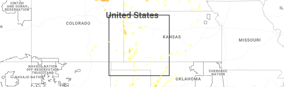
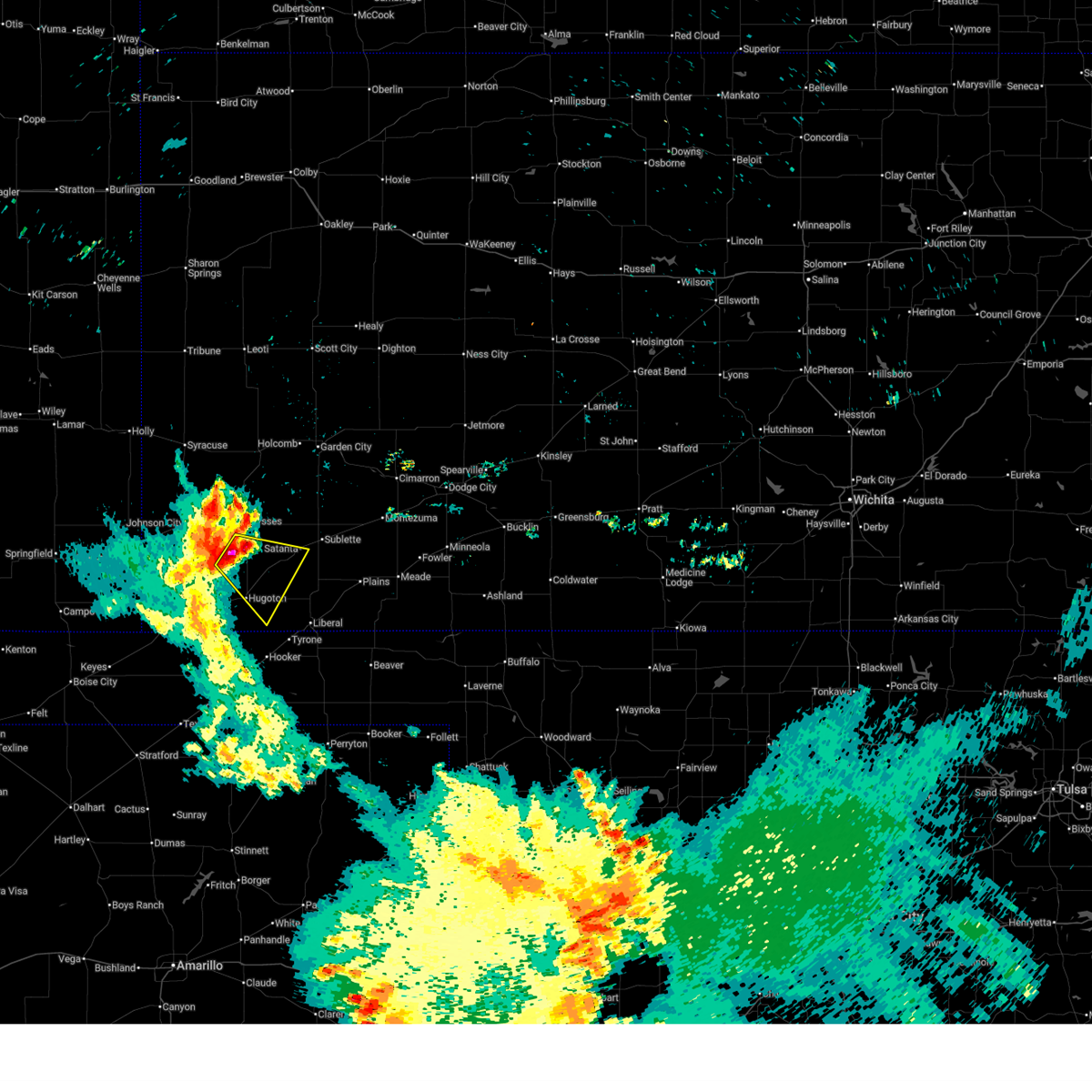
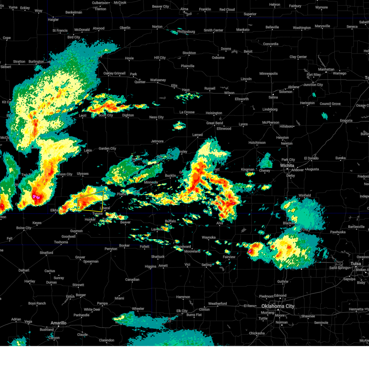
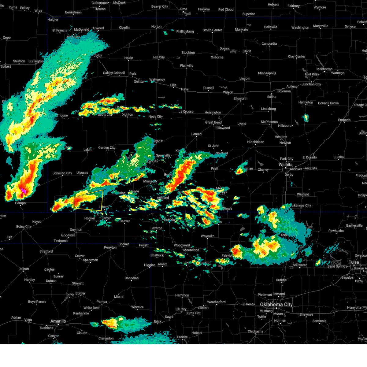
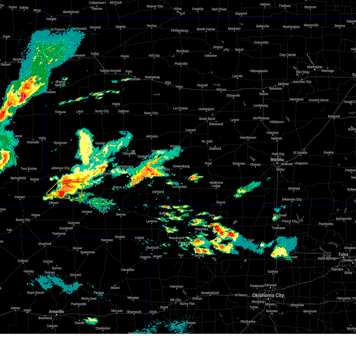
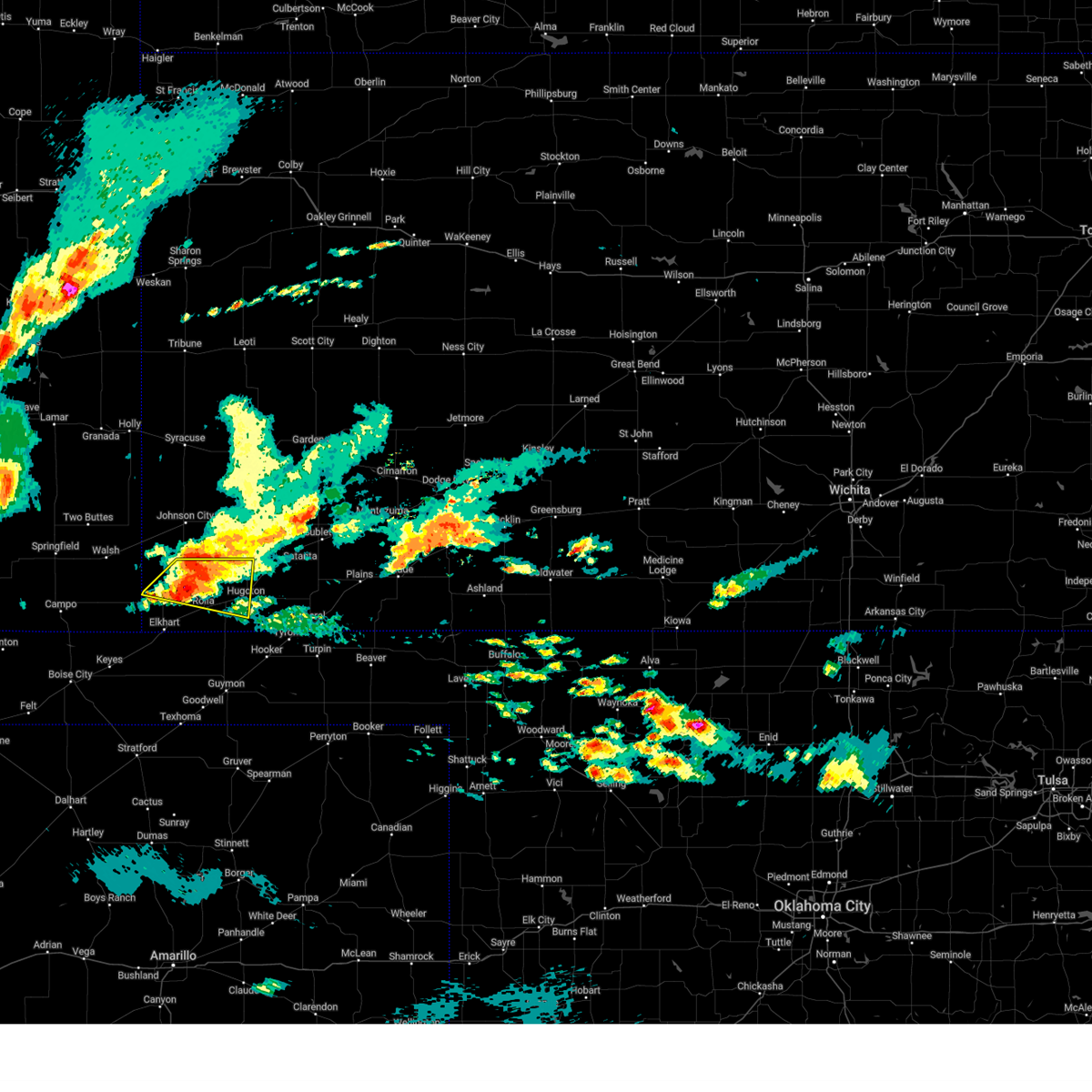
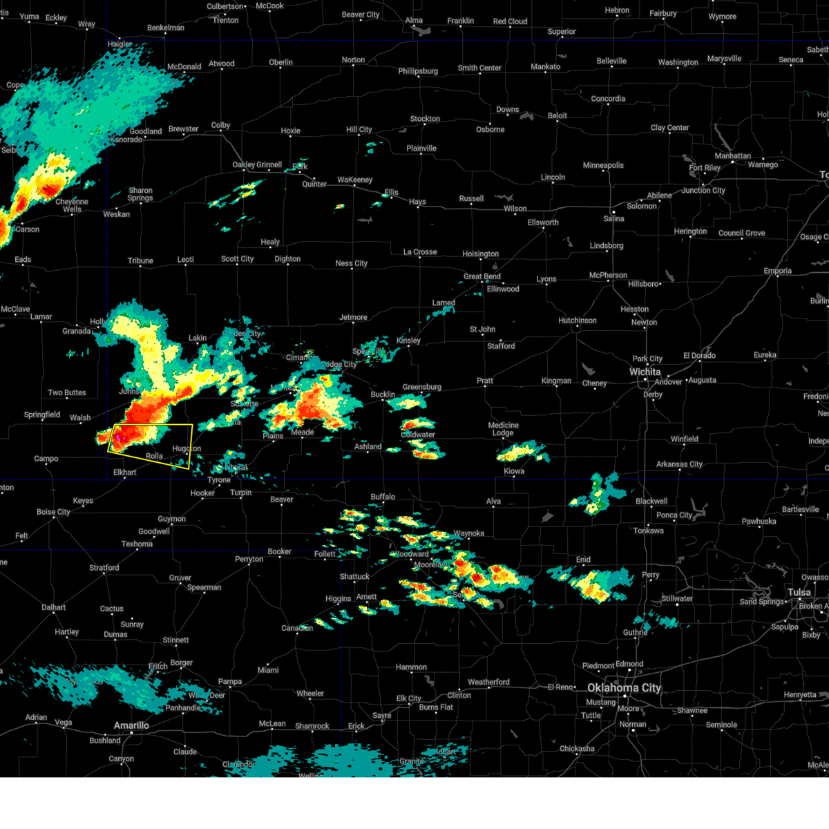
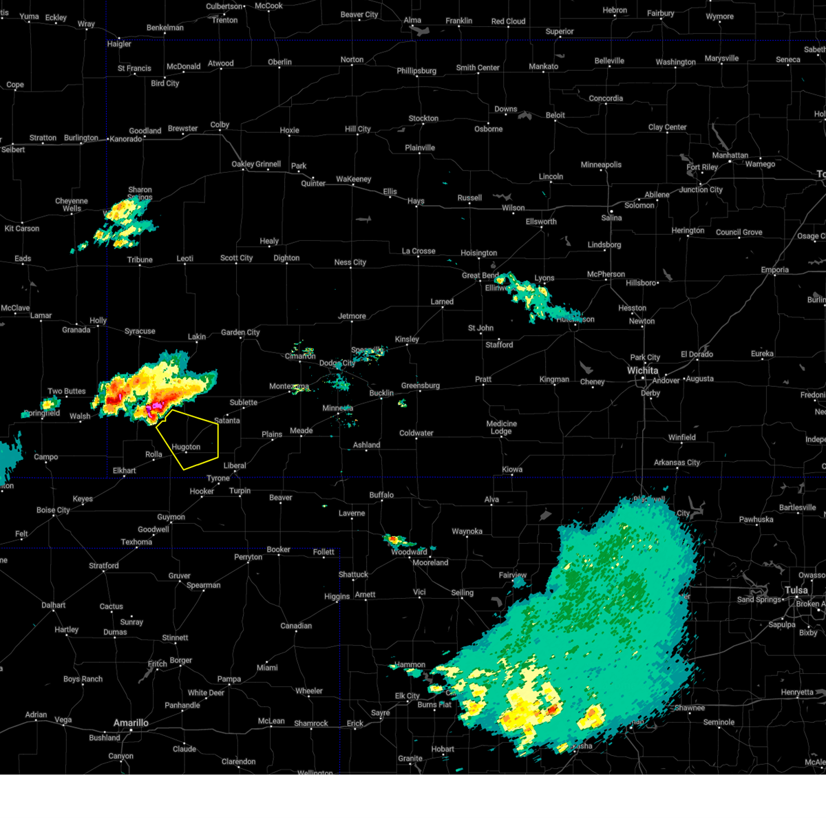
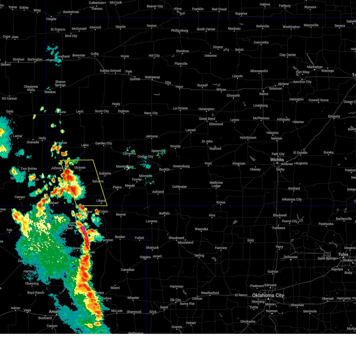
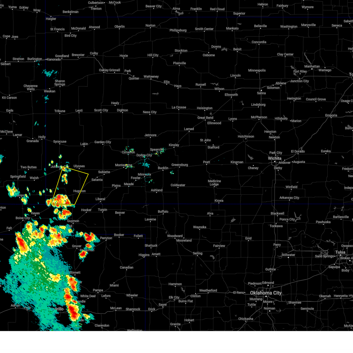
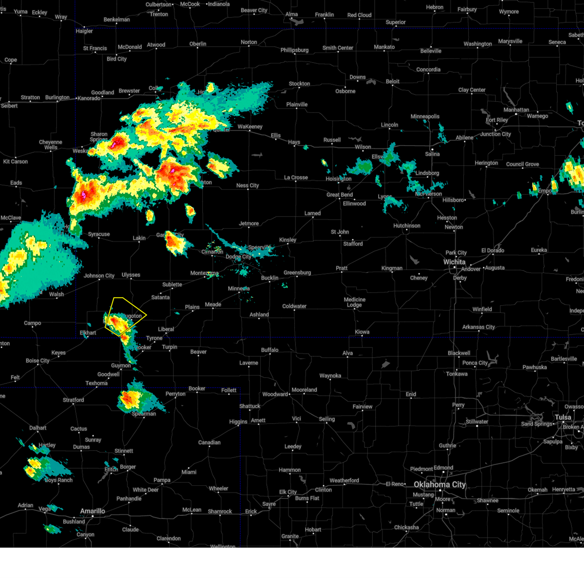
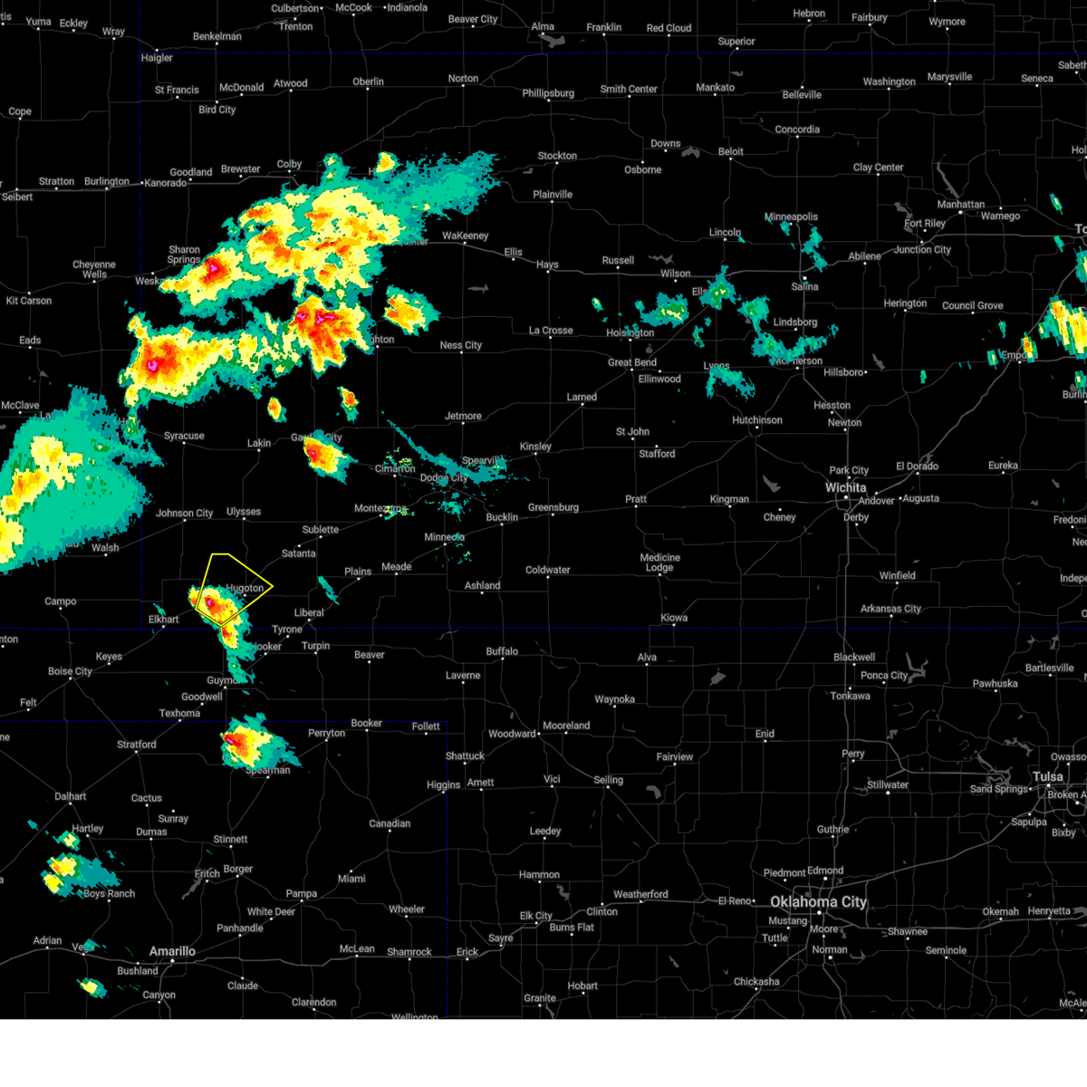
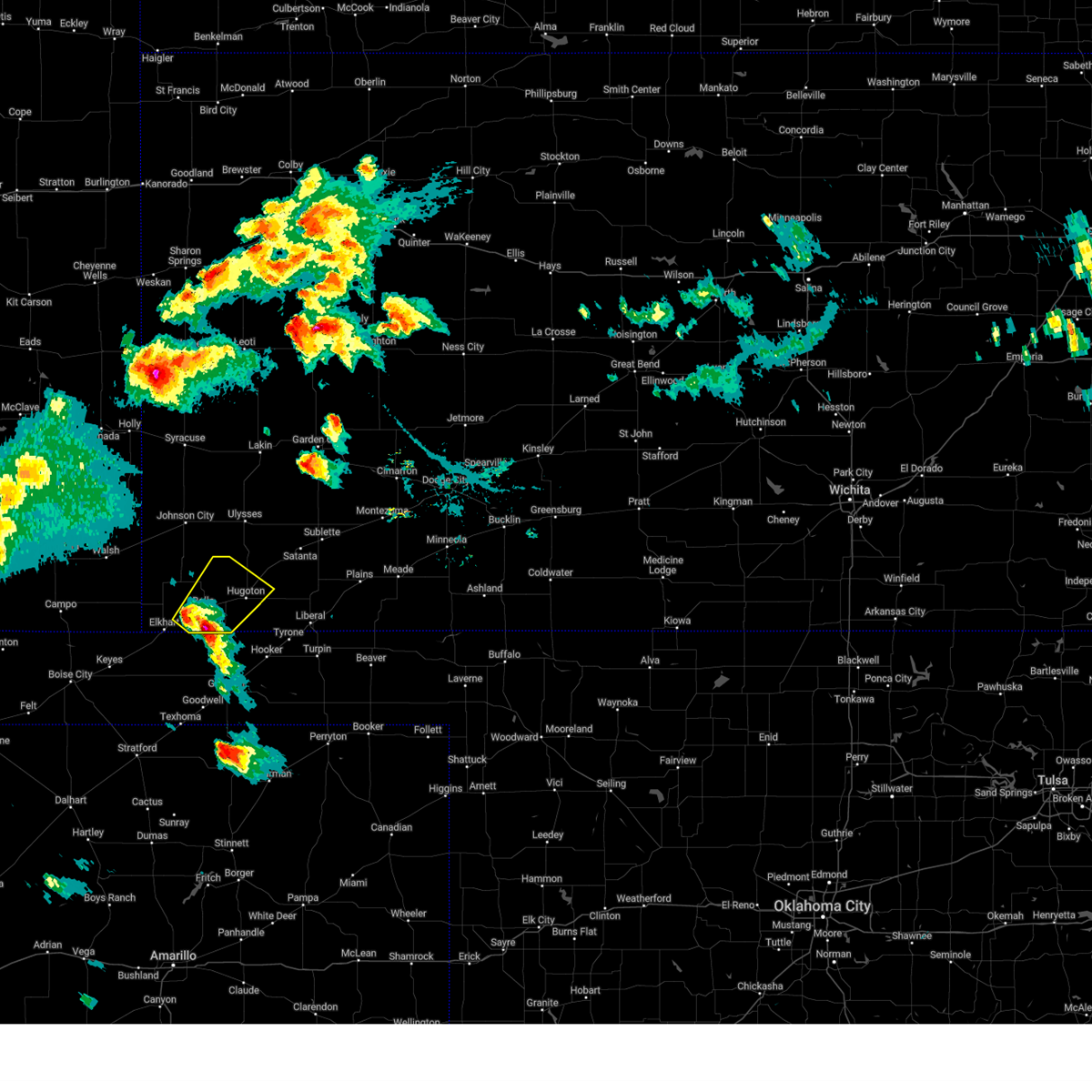
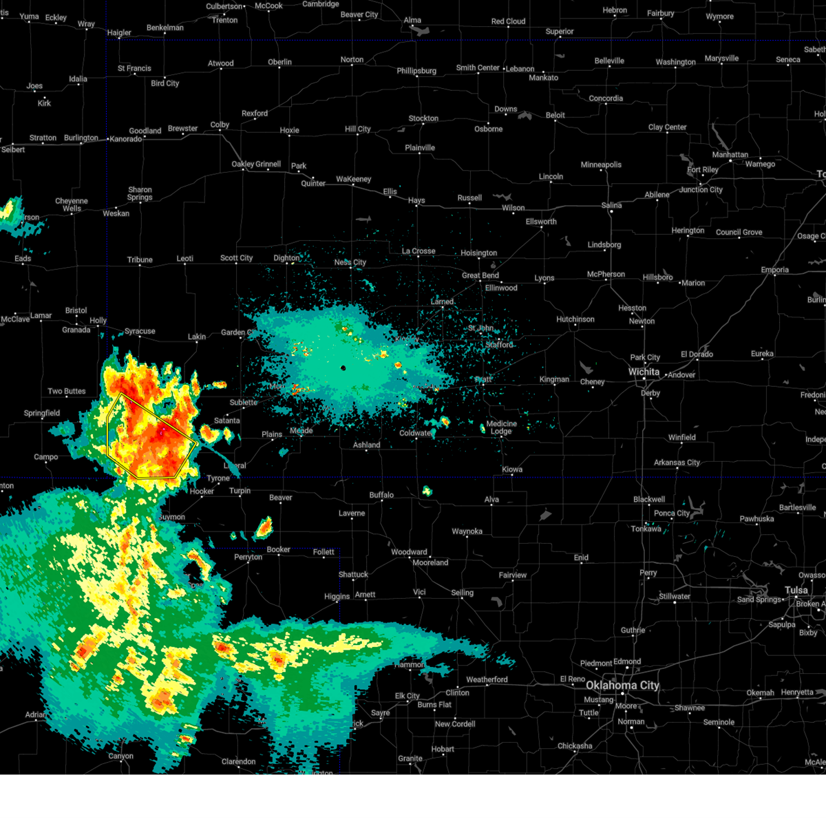
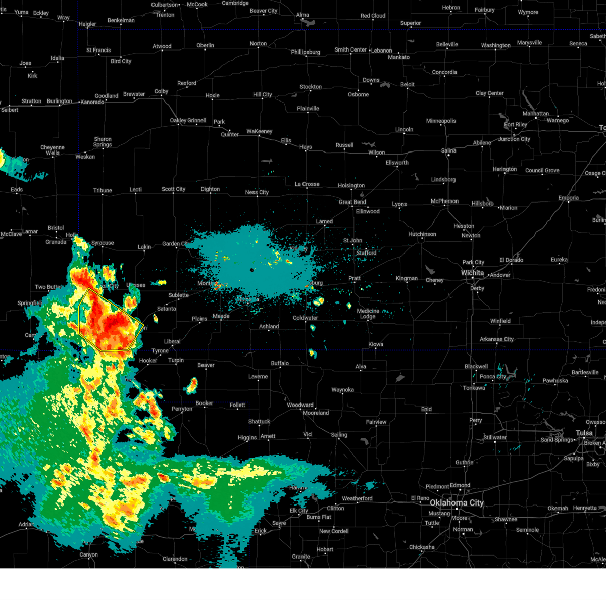
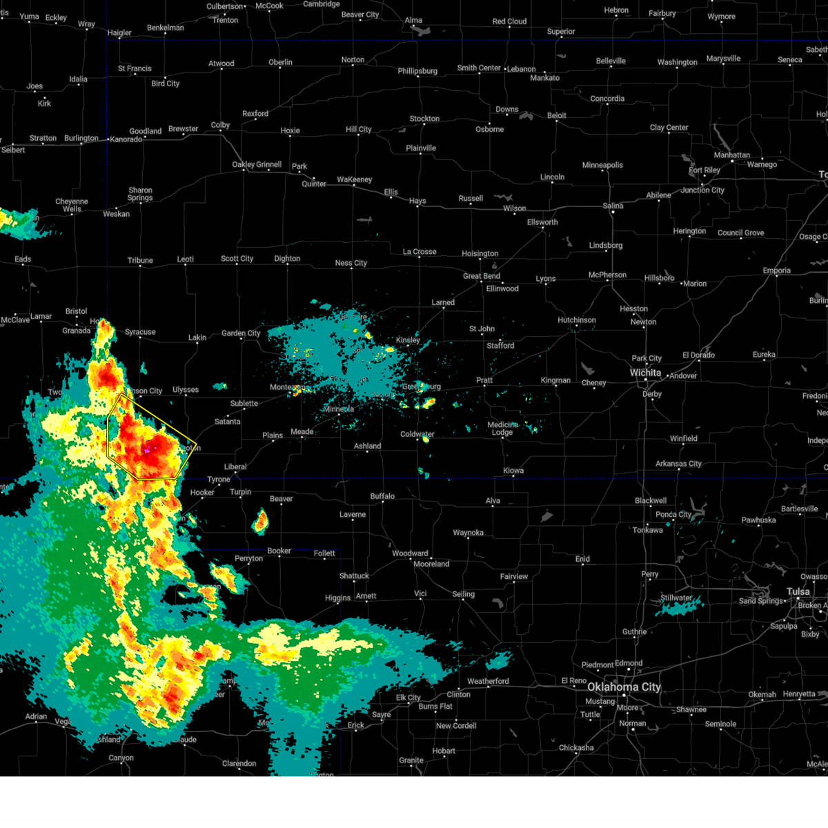
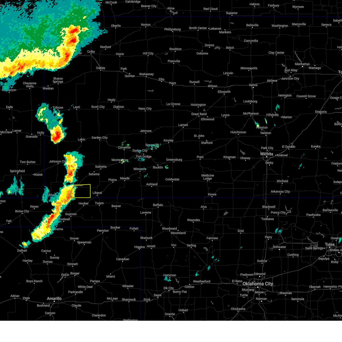
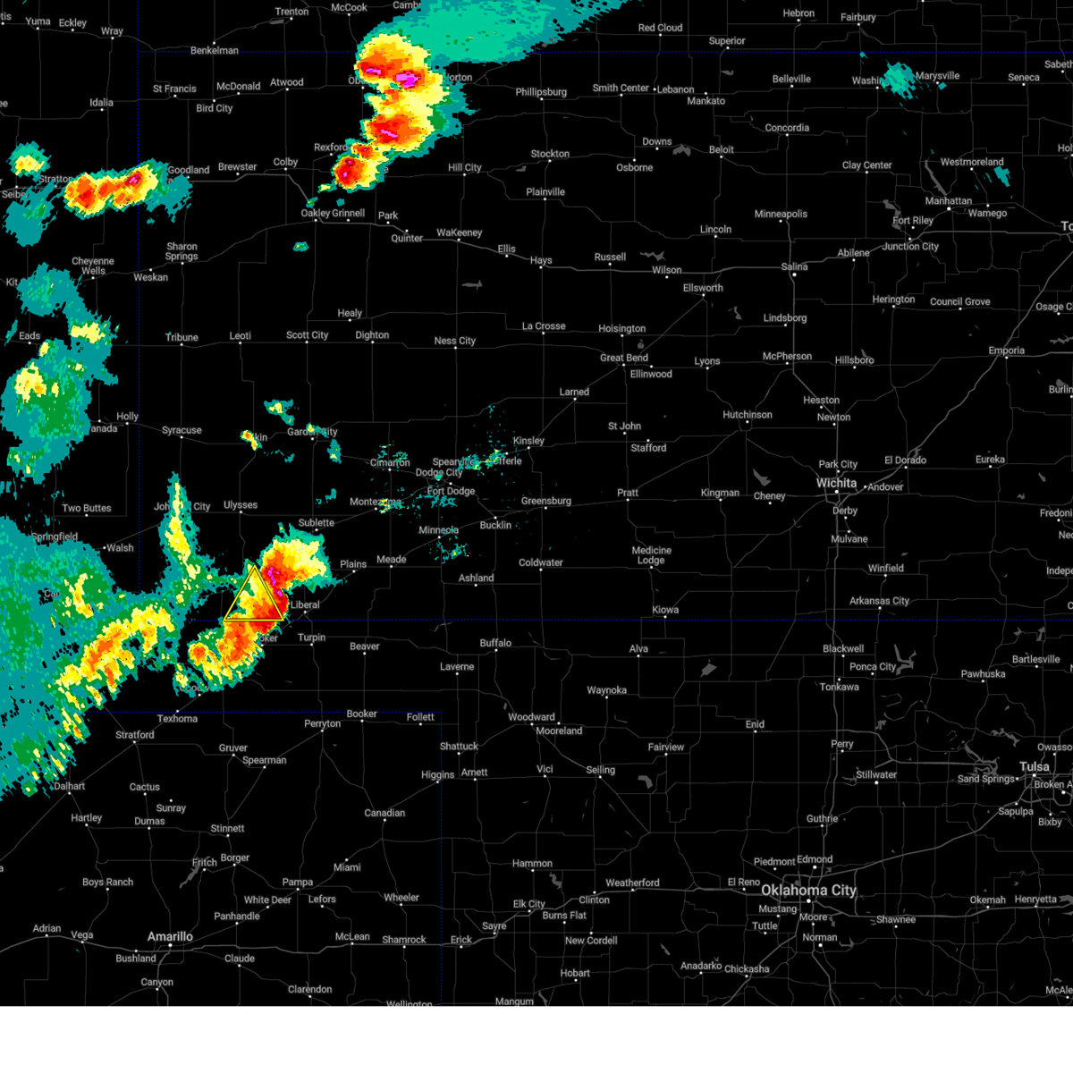
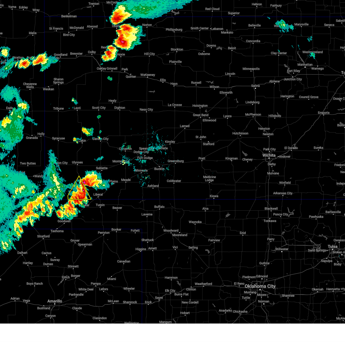
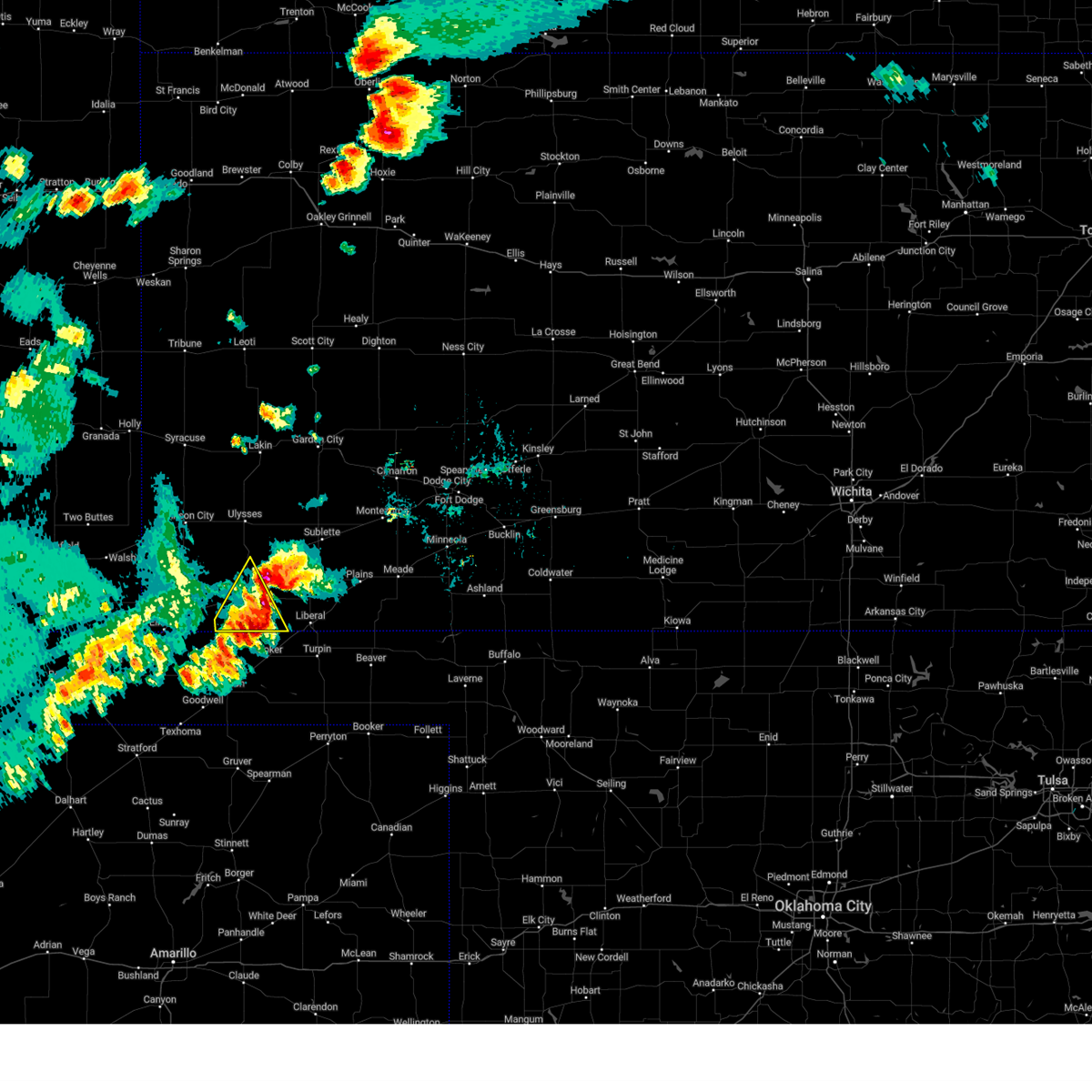
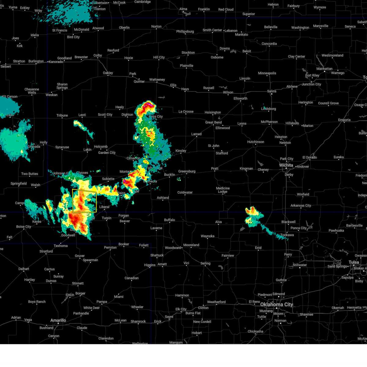
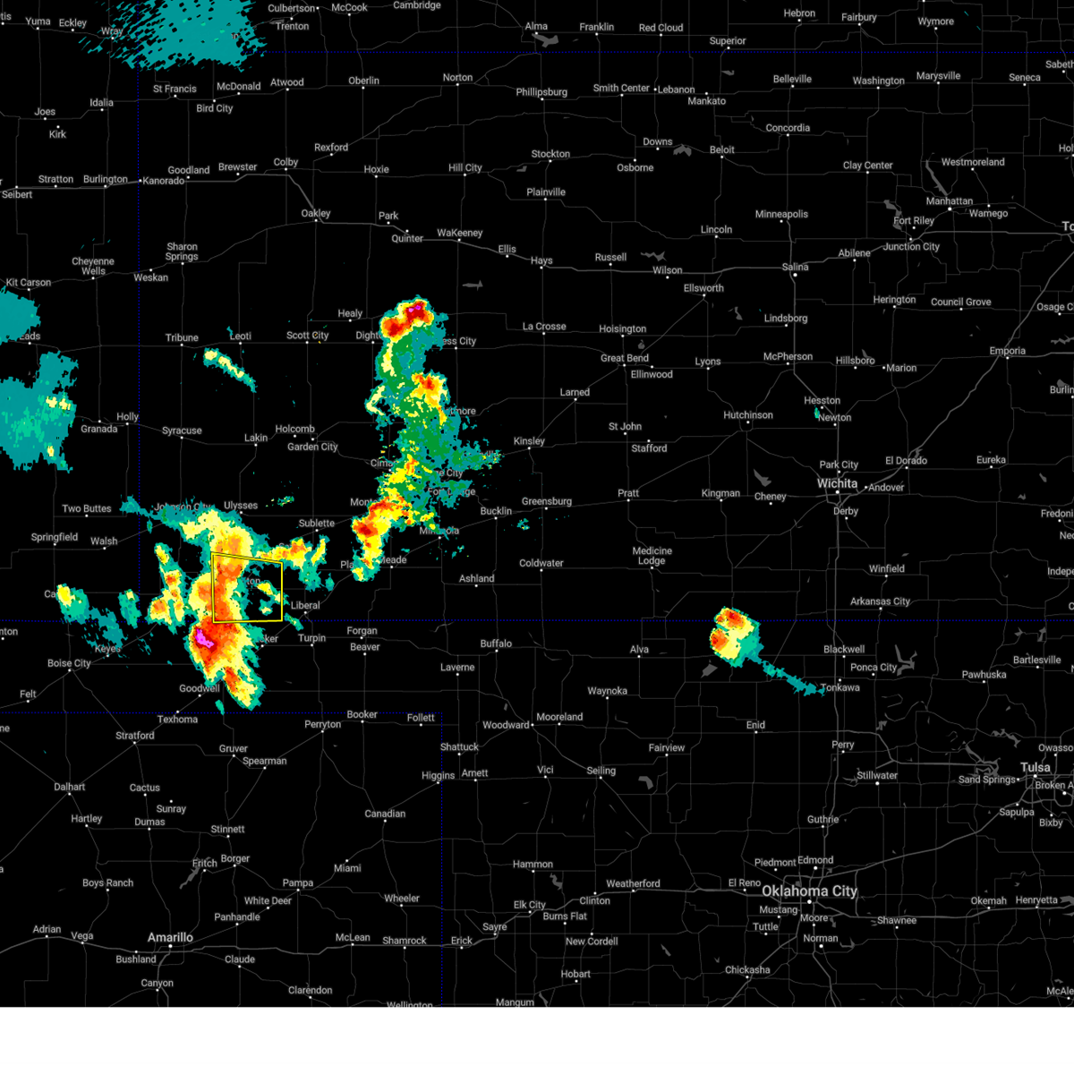
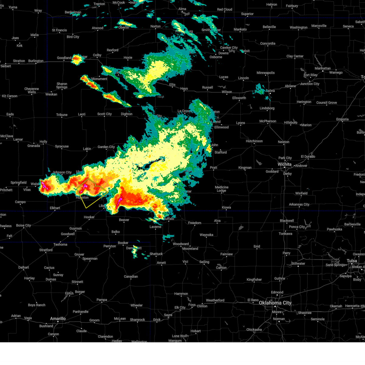
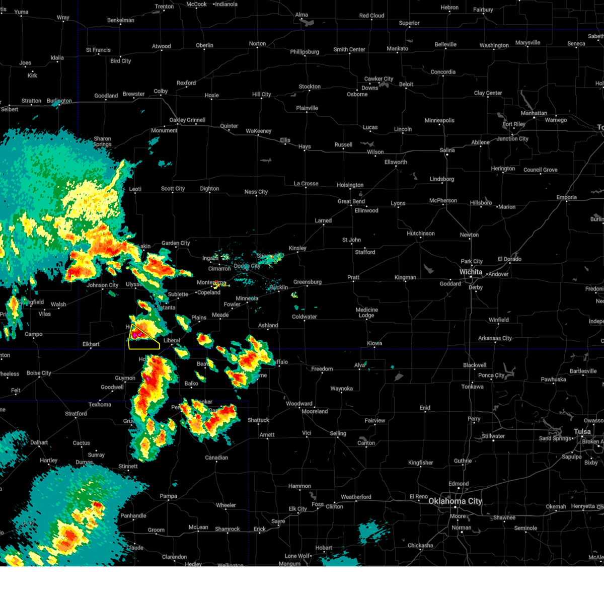
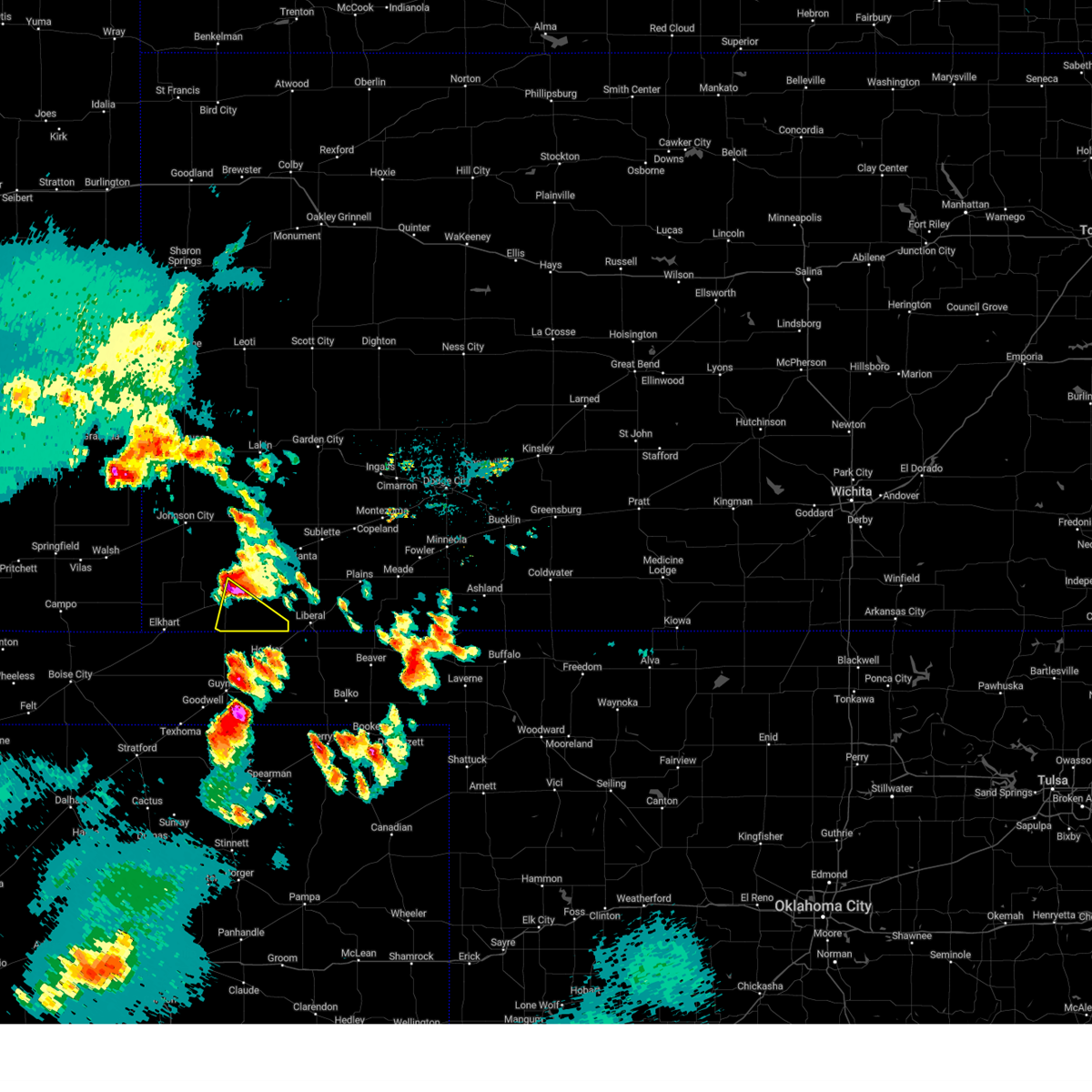
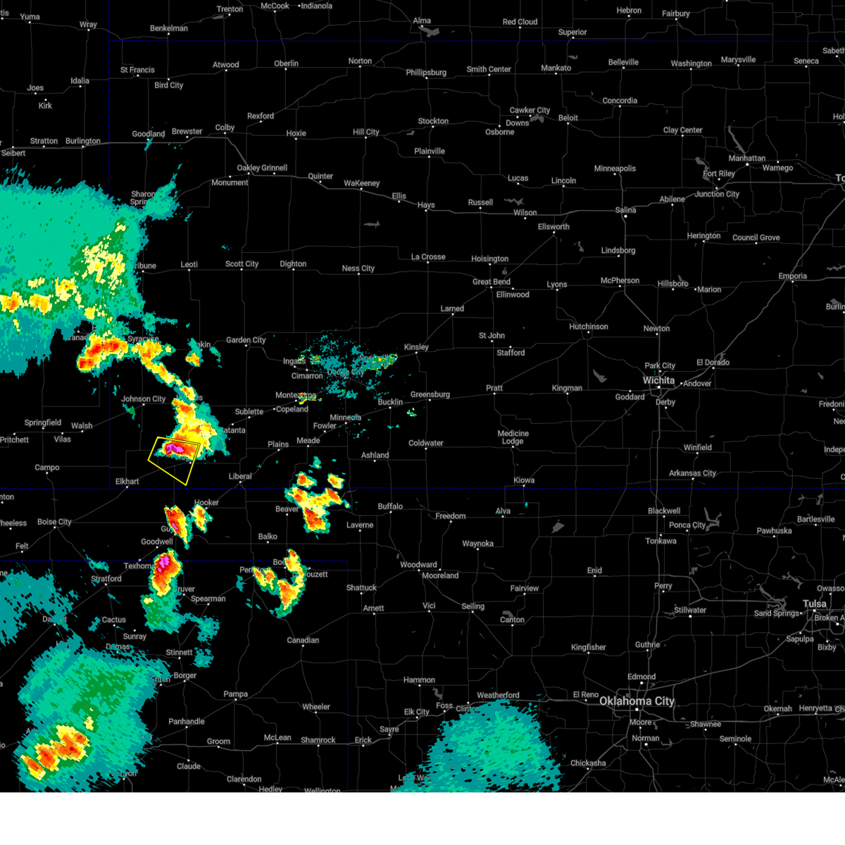
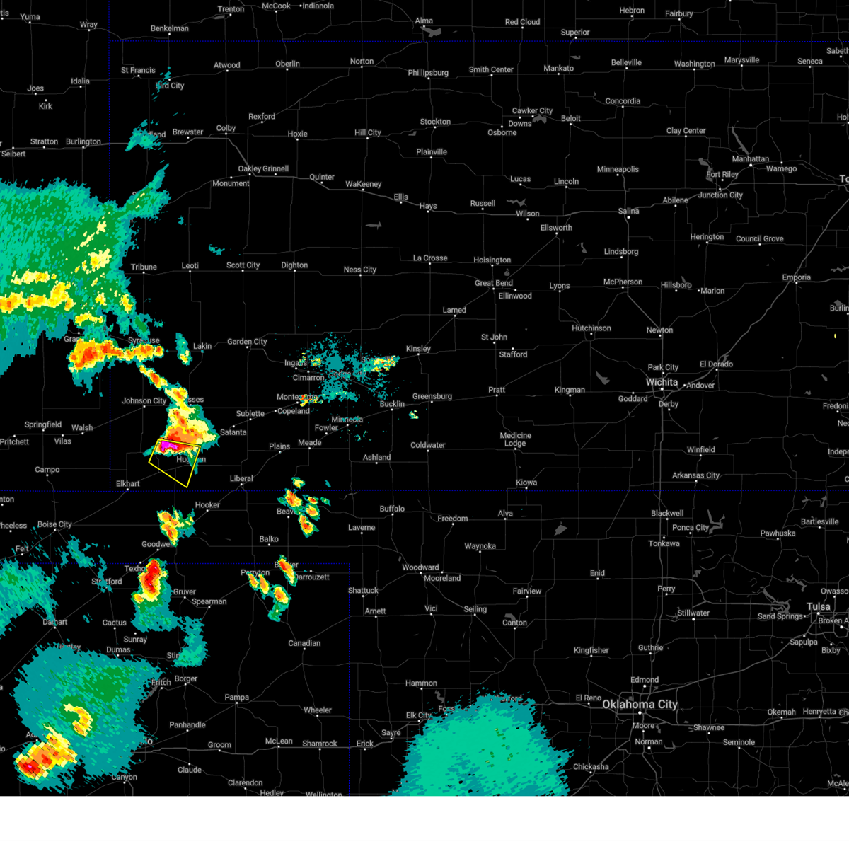
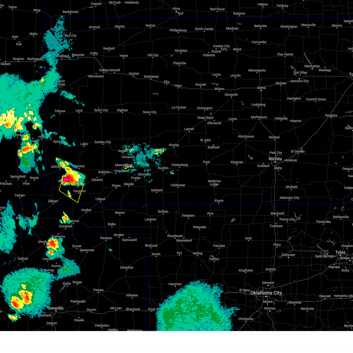
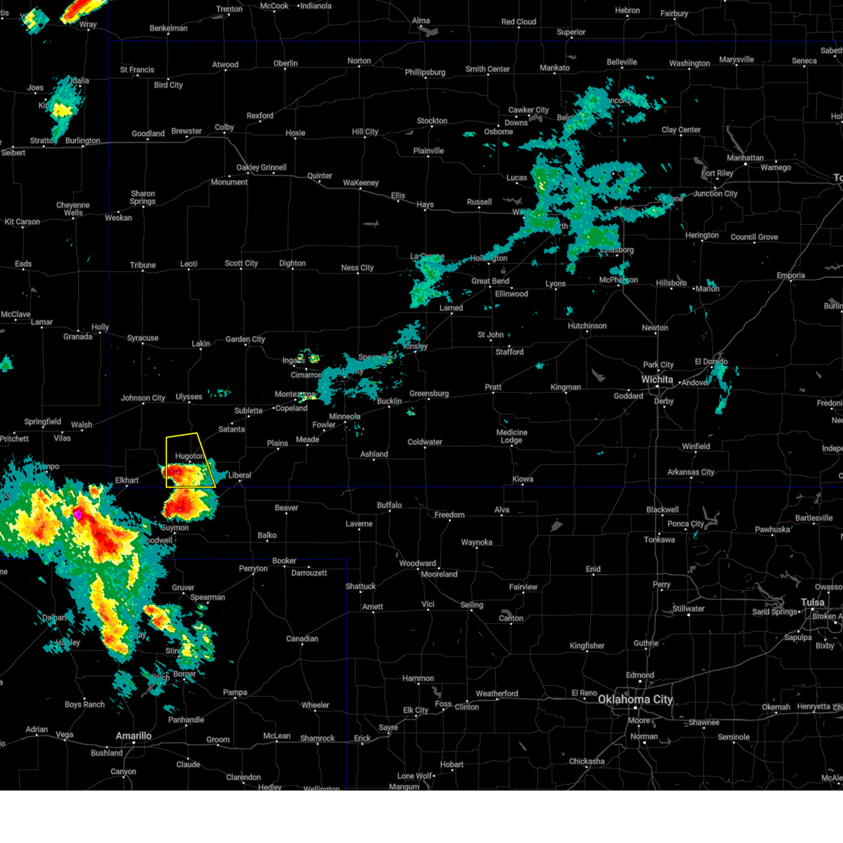
Hail Map for Hugoton, KS
The Hugoton, KS area has had 36 reports of on-the-ground hail by trained spotters, and has been under severe weather warnings 26 times during the past 12 months. Doppler radar has detected hail at or near Hugoton, KS on 64 occasions, including 4 occasions during the past year.
| Name: | Hugoton, KS |
| Where Located: | 60.6 miles SSW of Garden City, KS |
| Map: | Google Map for Hugoton, KS |
| Population: | 3904 |
| Housing Units: | 1560 |
| More Info: | Search Google for Hugoton, KS |
2
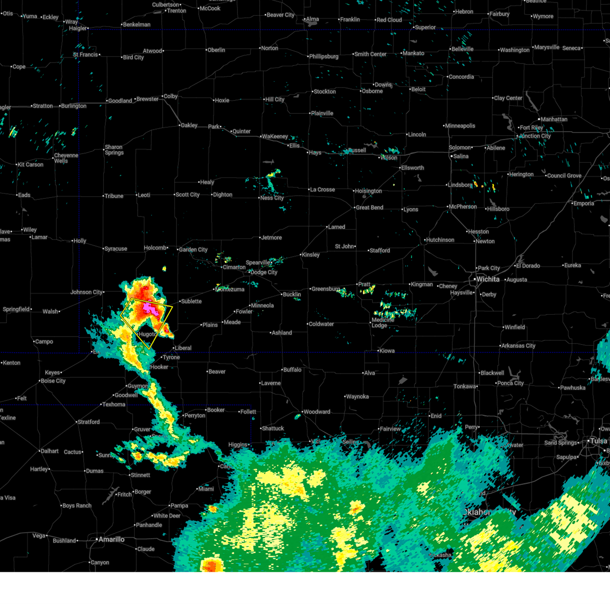
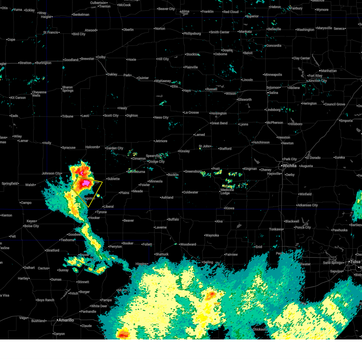
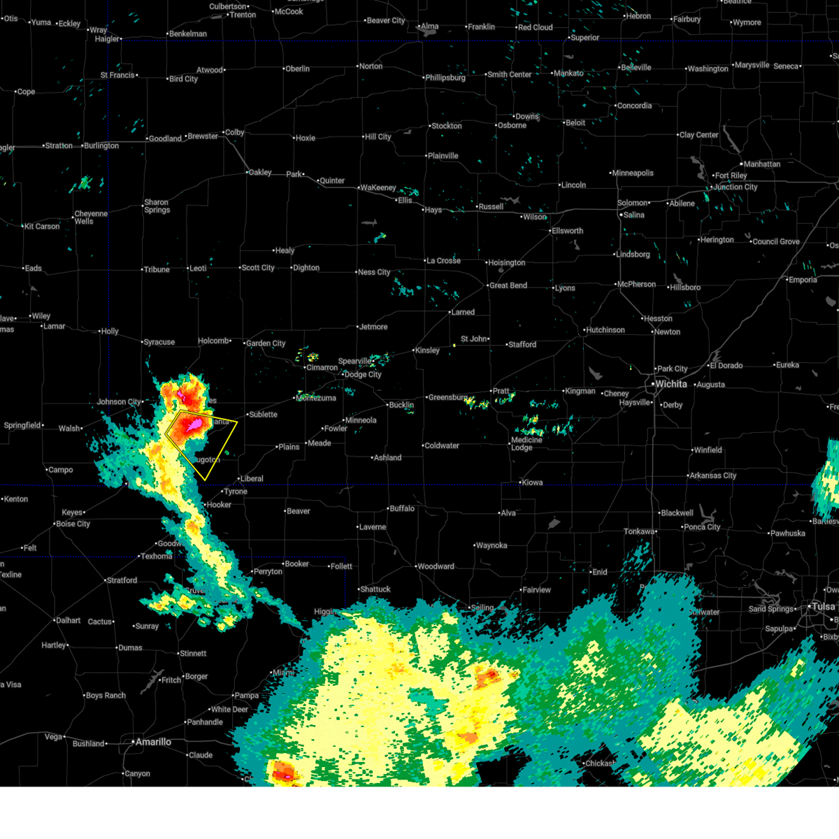
The Top Recent Hail Date for Hugoton, KS is Monday, June 2, 2025 (14th out of 64)
Hail and Wind Damage Spotted near Hugoton, KS
| Date / Time | Report Details |
|---|---|
| 6/15/2025 8:03 AM CDT |
 At 802 am cdt, a severe thunderstorm was located very near cave, moving east at 35 mph (radar indicated). Hazards include 60 mph wind gusts and half dollar size hail. Hail damage to vehicles is expected. expect wind damage to roofs, siding, and trees. Locations impacted include, hugoton, satanta, moscow, and cave. At 802 am cdt, a severe thunderstorm was located very near cave, moving east at 35 mph (radar indicated). Hazards include 60 mph wind gusts and half dollar size hail. Hail damage to vehicles is expected. expect wind damage to roofs, siding, and trees. Locations impacted include, hugoton, satanta, moscow, and cave.
|
| 6/15/2025 7:55 AM CDT |
 At 755 am cdt, a severe thunderstorm was located near moscow, moving east at 25 mph (radar indicated). Hazards include ping pong ball size hail and 60 mph wind gusts. People and animals outdoors will be injured. expect hail damage to roofs, siding, windows, and vehicles. expect wind damage to roofs, siding, and trees. Locations impacted include, hugoton, satanta, moscow, and cave. At 755 am cdt, a severe thunderstorm was located near moscow, moving east at 25 mph (radar indicated). Hazards include ping pong ball size hail and 60 mph wind gusts. People and animals outdoors will be injured. expect hail damage to roofs, siding, windows, and vehicles. expect wind damage to roofs, siding, and trees. Locations impacted include, hugoton, satanta, moscow, and cave.
|
| 6/15/2025 7:50 AM CDT |
 At 750 am cdt, a severe thunderstorm was located near moscow, moving southeast at 25 mph (radar indicated). Hazards include 60 mph wind gusts and quarter size hail. Hail damage to vehicles is expected. expect wind damage to roofs, siding, and trees. Locations impacted include, hugoton, satanta, moscow, and cave. At 750 am cdt, a severe thunderstorm was located near moscow, moving southeast at 25 mph (radar indicated). Hazards include 60 mph wind gusts and quarter size hail. Hail damage to vehicles is expected. expect wind damage to roofs, siding, and trees. Locations impacted include, hugoton, satanta, moscow, and cave.
|
| 6/15/2025 7:34 AM CDT |
 Svrddc the national weather service in dodge city has issued a * severe thunderstorm warning for, northwestern seward county in southwestern kansas, southern grant county in southwestern kansas, northeastern stevens county in southwestern kansas, southwestern haskell county in southwestern kansas, * until 815 am cdt. * at 734 am cdt, a severe thunderstorm was located 12 miles west of moscow, moving southeast at 25 mph (radar indicated). Hazards include 60 mph wind gusts and quarter size hail. Hail damage to vehicles is expected. Expect wind damage to roofs, siding, and trees. Svrddc the national weather service in dodge city has issued a * severe thunderstorm warning for, northwestern seward county in southwestern kansas, southern grant county in southwestern kansas, northeastern stevens county in southwestern kansas, southwestern haskell county in southwestern kansas, * until 815 am cdt. * at 734 am cdt, a severe thunderstorm was located 12 miles west of moscow, moving southeast at 25 mph (radar indicated). Hazards include 60 mph wind gusts and quarter size hail. Hail damage to vehicles is expected. Expect wind damage to roofs, siding, and trees.
|
| 6/5/2025 10:03 PM CDT |
 At 1002 pm cdt, a severe thunderstorm was located near woods, moving east at 25 mph (radar indicated). Hazards include 60 mph wind gusts and quarter size hail. Hail damage to vehicles is expected. expect wind damage to roofs, siding, and trees. Locations impacted include, woods. At 1002 pm cdt, a severe thunderstorm was located near woods, moving east at 25 mph (radar indicated). Hazards include 60 mph wind gusts and quarter size hail. Hail damage to vehicles is expected. expect wind damage to roofs, siding, and trees. Locations impacted include, woods.
|
| 6/5/2025 9:30 PM CDT |
 Svrddc the national weather service in dodge city has issued a * severe thunderstorm warning for, western seward county in southwestern kansas, central stevens county in southwestern kansas, * until 1015 pm cdt. * at 930 pm cdt, a severe thunderstorm was located near feterita, moving east at 25 mph (radar indicated). Hazards include 60 mph wind gusts and quarter size hail. Hail damage to vehicles is expected. expect wind damage to roofs, siding, and trees. this severe thunderstorm will be near, hugoton around 935 pm cdt. Other locations in the path of this severe thunderstorm include woods. Svrddc the national weather service in dodge city has issued a * severe thunderstorm warning for, western seward county in southwestern kansas, central stevens county in southwestern kansas, * until 1015 pm cdt. * at 930 pm cdt, a severe thunderstorm was located near feterita, moving east at 25 mph (radar indicated). Hazards include 60 mph wind gusts and quarter size hail. Hail damage to vehicles is expected. expect wind damage to roofs, siding, and trees. this severe thunderstorm will be near, hugoton around 935 pm cdt. Other locations in the path of this severe thunderstorm include woods.
|
| 6/5/2025 8:36 PM CDT |
 The storm which prompted the warning has weakened below severe limits, and no longer poses an immediate threat to life or property. therefore, the warning will be allowed to expire. however, gusty winds and heavy rain are still possible with this thunderstorm. a tornado watch remains in effect until 900 pm cdt for southwestern kansas. The storm which prompted the warning has weakened below severe limits, and no longer poses an immediate threat to life or property. therefore, the warning will be allowed to expire. however, gusty winds and heavy rain are still possible with this thunderstorm. a tornado watch remains in effect until 900 pm cdt for southwestern kansas.
|
| 6/5/2025 8:22 PM CDT |
 At 822 pm cdt, a severe thunderstorm was located near richfield, moving east at 30 mph (radar indicated). Hazards include 60 mph wind gusts and quarter size hail. Hail damage to vehicles is expected. expect wind damage to roofs, siding, and trees. Locations impacted include, hugoton, rolla, richfield, and feterita. At 822 pm cdt, a severe thunderstorm was located near richfield, moving east at 30 mph (radar indicated). Hazards include 60 mph wind gusts and quarter size hail. Hail damage to vehicles is expected. expect wind damage to roofs, siding, and trees. Locations impacted include, hugoton, rolla, richfield, and feterita.
|
| 6/5/2025 8:07 PM CDT |
 At 806 pm cdt, a severe thunderstorm was located very near richfield, moving east at 25 mph (radar indicated). Hazards include 60 mph wind gusts and half dollar size hail. Hail damage to vehicles is expected. expect wind damage to roofs, siding, and trees. Locations impacted include, hugoton, rolla, richfield, and feterita. At 806 pm cdt, a severe thunderstorm was located very near richfield, moving east at 25 mph (radar indicated). Hazards include 60 mph wind gusts and half dollar size hail. Hail damage to vehicles is expected. expect wind damage to roofs, siding, and trees. Locations impacted include, hugoton, rolla, richfield, and feterita.
|
| 6/5/2025 8:07 PM CDT |
 the severe thunderstorm warning has been cancelled and is no longer in effect the severe thunderstorm warning has been cancelled and is no longer in effect
|
| 6/5/2025 7:55 PM CDT |
 At 755 pm cdt, a severe thunderstorm was located near richfield, moving east at 30 mph (radar indicated). Hazards include golf ball size hail and 60 mph wind gusts. People and animals outdoors will be injured. expect hail damage to roofs, siding, windows, and vehicles. expect wind damage to roofs, siding, and trees. Locations impacted include, ulysses, hugoton, johnson city, rolla, manter, richfield, big bow, and feterita. At 755 pm cdt, a severe thunderstorm was located near richfield, moving east at 30 mph (radar indicated). Hazards include golf ball size hail and 60 mph wind gusts. People and animals outdoors will be injured. expect hail damage to roofs, siding, windows, and vehicles. expect wind damage to roofs, siding, and trees. Locations impacted include, ulysses, hugoton, johnson city, rolla, manter, richfield, big bow, and feterita.
|
| 6/5/2025 7:41 PM CDT | Svrddc the national weather service in dodge city has issued a * severe thunderstorm warning for, northern morton county in southwestern kansas, southwestern grant county in southwestern kansas, western stevens county in southwestern kansas, southern stanton county in southwestern kansas, * until 845 pm cdt. * at 740 pm cdt, a severe thunderstorm was located 9 miles southeast of the saunders elevator, moving east at 30 mph (radar indicated). Hazards include ping pong ball size hail and 60 mph wind gusts. People and animals outdoors will be injured. expect hail damage to roofs, siding, windows, and vehicles. expect wind damage to roofs, siding, and trees. This severe thunderstorm will remain over mainly rural areas of northern morton, southwestern grant, western stevens and southern stanton counties. |
| 6/5/2025 5:55 PM CDT | Quarter sized hail reported 10.4 miles SSW of Hugoton, KS |
| 6/5/2025 4:45 PM CDT |
 Svrddc the national weather service in dodge city has issued a * severe thunderstorm warning for, eastern morton county in southwestern kansas, southwestern grant county in southwestern kansas, stevens county in southwestern kansas, * until 545 pm cdt. * at 444 pm cdt, a severe thunderstorm was located 13 miles south of big bow, moving southeast at 25 mph. this is a destructive storm entering rural northwestern stevens county! (radar indicated). Hazards include 90 mph wind gusts and baseball size hail. You are in a life-threatening situation. flying debris may be deadly to those caught without shelter. mobile homes will be heavily damaged or destroyed. homes and businesses will have substantial roof and window damage. expect extensive tree damage and power outages. This severe thunderstorm will remain over mainly rural areas of eastern morton, southwestern grant and stevens counties. Svrddc the national weather service in dodge city has issued a * severe thunderstorm warning for, eastern morton county in southwestern kansas, southwestern grant county in southwestern kansas, stevens county in southwestern kansas, * until 545 pm cdt. * at 444 pm cdt, a severe thunderstorm was located 13 miles south of big bow, moving southeast at 25 mph. this is a destructive storm entering rural northwestern stevens county! (radar indicated). Hazards include 90 mph wind gusts and baseball size hail. You are in a life-threatening situation. flying debris may be deadly to those caught without shelter. mobile homes will be heavily damaged or destroyed. homes and businesses will have substantial roof and window damage. expect extensive tree damage and power outages. This severe thunderstorm will remain over mainly rural areas of eastern morton, southwestern grant and stevens counties.
|
| 6/2/2025 5:32 PM CDT | At 531 pm cdt, severe thunderstorms were located along a line extending from 8 miles northwest of ulysses to moscow, moving northeast at 20 mph (emergency management. at 530 pm cdt, emergency management reported 70 mph winds 5 miles west of liberal). Hazards include 70 mph wind gusts and nickel size hail. Expect considerable tree damage. damage is likely to mobile homes, roofs, and outbuildings. Locations impacted include, ulysses, moscow, hickok, cave, ryus and satanta. |
| 6/2/2025 4:56 PM CDT |
 Svrddc the national weather service in dodge city has issued a * severe thunderstorm warning for, western seward county in southwestern kansas, grant county in southwestern kansas, stevens county in southwestern kansas, eastern stanton county in southwestern kansas, western haskell county in southwestern kansas, * until 600 pm cdt. * at 456 pm cdt, severe thunderstorms were located along a line extending from near big bow to near hugoton, moving northeast at 20 mph (radar indicated). Hazards include 70 mph wind gusts and nickel size hail. Expect considerable tree damage. damage is likely to mobile homes, roofs, and outbuildings. severe thunderstorms will be near, ulysses around 510 pm cdt. moscow around 515 pm cdt. Other locations in the path of these severe thunderstorms include hickok and cave. Svrddc the national weather service in dodge city has issued a * severe thunderstorm warning for, western seward county in southwestern kansas, grant county in southwestern kansas, stevens county in southwestern kansas, eastern stanton county in southwestern kansas, western haskell county in southwestern kansas, * until 600 pm cdt. * at 456 pm cdt, severe thunderstorms were located along a line extending from near big bow to near hugoton, moving northeast at 20 mph (radar indicated). Hazards include 70 mph wind gusts and nickel size hail. Expect considerable tree damage. damage is likely to mobile homes, roofs, and outbuildings. severe thunderstorms will be near, ulysses around 510 pm cdt. moscow around 515 pm cdt. Other locations in the path of these severe thunderstorms include hickok and cave.
|
| 6/2/2025 4:42 PM CDT | At 440 pm cdt, a severe thunderstorm was located 9 miles east of richfield, moving northeast at 30 mph (radar indicated. at 428 pm cdt, the public reported quarter size hail near rolla). Hazards include 70 mph wind gusts and quarter size hail. Hail damage to vehicles is expected. expect considerable tree damage. wind damage is also likely to mobile homes, roofs, and outbuildings. This severe thunderstorm will remain over mainly rural areas of eastern morton, southern grant, western stevens and southeastern stanton counties. |
| 6/2/2025 4:16 PM CDT |
 Svrddc the national weather service in dodge city has issued a * severe thunderstorm warning for, morton county in southwestern kansas, southern grant county in southwestern kansas, western stevens county in southwestern kansas, southeastern stanton county in southwestern kansas, * until 515 pm cdt. * at 416 pm cdt, a severe thunderstorm was located near wilburton, moving northeast at 30 mph (radar indicated). Hazards include 70 mph wind gusts and quarter size hail. Hail damage to vehicles is expected. expect considerable tree damage. wind damage is also likely to mobile homes, roofs, and outbuildings. This severe thunderstorm will be near, rolla around 420 pm cdt. Svrddc the national weather service in dodge city has issued a * severe thunderstorm warning for, morton county in southwestern kansas, southern grant county in southwestern kansas, western stevens county in southwestern kansas, southeastern stanton county in southwestern kansas, * until 515 pm cdt. * at 416 pm cdt, a severe thunderstorm was located near wilburton, moving northeast at 30 mph (radar indicated). Hazards include 70 mph wind gusts and quarter size hail. Hail damage to vehicles is expected. expect considerable tree damage. wind damage is also likely to mobile homes, roofs, and outbuildings. This severe thunderstorm will be near, rolla around 420 pm cdt.
|
| 5/28/2025 5:55 PM CDT | Quarter sized hail reported 12.9 miles NW of Hugoton, KS |
| 5/28/2025 5:28 PM CDT | Hen Egg sized hail reported 11.1 miles NW of Hugoton, KS, storm chaser reports just above 2 inch hail via caliper via social media. |
| 5/28/2025 5:23 PM CDT | Hen Egg sized hail reported 11.8 miles NW of Hugoton, KS |
| 4/23/2025 5:55 PM CDT |
 the severe thunderstorm warning has been cancelled and is no longer in effect the severe thunderstorm warning has been cancelled and is no longer in effect
|
| 4/23/2025 5:44 PM CDT |
 At 544 pm cdt, a severe thunderstorm was located near feterita, moving northeast at 30 mph (radar indicated). Hazards include quarter size hail. Damage to vehicles is expected. This severe storm will be near, feterita around 550 pm cdt. At 544 pm cdt, a severe thunderstorm was located near feterita, moving northeast at 30 mph (radar indicated). Hazards include quarter size hail. Damage to vehicles is expected. This severe storm will be near, feterita around 550 pm cdt.
|
| 4/23/2025 5:31 PM CDT |
 Svrddc the national weather service in dodge city has issued a * severe thunderstorm warning for, eastern morton county in southwestern kansas, northwestern stevens county in southwestern kansas, * until 615 pm cdt. * at 531 pm cdt, a severe thunderstorm was located near rolla, moving northeast at 30 mph (radar indicated). Hazards include golf ball size hail. People and animals outdoors will be injured. expect damage to roofs, siding, windows, and vehicles. This severe thunderstorm will be near, feterita around 545 pm cdt. Svrddc the national weather service in dodge city has issued a * severe thunderstorm warning for, eastern morton county in southwestern kansas, northwestern stevens county in southwestern kansas, * until 615 pm cdt. * at 531 pm cdt, a severe thunderstorm was located near rolla, moving northeast at 30 mph (radar indicated). Hazards include golf ball size hail. People and animals outdoors will be injured. expect damage to roofs, siding, windows, and vehicles. This severe thunderstorm will be near, feterita around 545 pm cdt.
|
| 8/1/2024 10:06 PM CDT |
 The severe thunderstorm which prompted the warning is weakening below severe limits. therefore, the warning will be allowed to expire at 1015 pm. The severe thunderstorm which prompted the warning is weakening below severe limits. therefore, the warning will be allowed to expire at 1015 pm.
|
| 8/1/2024 9:45 PM CDT |
 At 945 pm cdt, a severe thunderstorm was located 7 miles east of richfield, moving northeast at 20 mph (radar indicated). Hazards include 60 mph wind gusts and quarter size hail. Hail damage to vehicles is expected. expect wind damage to roofs, siding, and trees. This severe thunderstorm will remain over mainly rural areas of morton, western stevens and southwestern stanton counties. At 945 pm cdt, a severe thunderstorm was located 7 miles east of richfield, moving northeast at 20 mph (radar indicated). Hazards include 60 mph wind gusts and quarter size hail. Hail damage to vehicles is expected. expect wind damage to roofs, siding, and trees. This severe thunderstorm will remain over mainly rural areas of morton, western stevens and southwestern stanton counties.
|
| 8/1/2024 9:29 PM CDT |
 Svrddc the national weather service in dodge city has issued a * severe thunderstorm warning for, morton county in southwestern kansas, western stevens county in southwestern kansas, southwestern stanton county in southwestern kansas, * until 1015 pm cdt. * at 929 pm cdt, a severe thunderstorm was located near richfield, moving northeast at 15 mph (radar indicated). Hazards include 60 mph wind gusts and quarter size hail. Hail damage to vehicles is expected. expect wind damage to roofs, siding, and trees. This severe thunderstorm will be near, richfield around 935 pm cdt. Svrddc the national weather service in dodge city has issued a * severe thunderstorm warning for, morton county in southwestern kansas, western stevens county in southwestern kansas, southwestern stanton county in southwestern kansas, * until 1015 pm cdt. * at 929 pm cdt, a severe thunderstorm was located near richfield, moving northeast at 15 mph (radar indicated). Hazards include 60 mph wind gusts and quarter size hail. Hail damage to vehicles is expected. expect wind damage to roofs, siding, and trees. This severe thunderstorm will be near, richfield around 935 pm cdt.
|
| 7/16/2024 9:12 PM CDT |
 The storms which prompted the warning have weakened below severe limits, and no longer pose an immediate threat to life or property. therefore, the warning will be allowed to expire. however, gusty winds are still possible with these thunderstorms. a severe thunderstorm watch remains in effect until 100 am cdt for southwestern kansas. The storms which prompted the warning have weakened below severe limits, and no longer pose an immediate threat to life or property. therefore, the warning will be allowed to expire. however, gusty winds are still possible with these thunderstorms. a severe thunderstorm watch remains in effect until 100 am cdt for southwestern kansas.
|
| 7/16/2024 8:51 PM CDT |
 At 850 pm cdt, severe thunderstorms were located along a line extending from 9 miles northeast of woods to near baker, moving east at 50 mph (radar indicated). Hazards include 60 mph wind gusts. Expect damage to roofs, siding, and trees. these severe storms will be near, liberal around 855 pm cdt. Other locations in the path of these severe thunderstorms include hayne. At 850 pm cdt, severe thunderstorms were located along a line extending from 9 miles northeast of woods to near baker, moving east at 50 mph (radar indicated). Hazards include 60 mph wind gusts. Expect damage to roofs, siding, and trees. these severe storms will be near, liberal around 855 pm cdt. Other locations in the path of these severe thunderstorms include hayne.
|
| 7/16/2024 8:38 PM CDT | Svrddc the national weather service in dodge city has issued a * severe thunderstorm warning for, southern seward county in southwestern kansas, southern stevens county in southwestern kansas, * until 915 pm cdt. * at 837 pm cdt, severe thunderstorms were located along a line extending from 6 miles southeast of moscow to near hooker, moving east at 50 mph (radar indicated). Hazards include two inch hail and 60 mph wind gusts. People and animals outdoors will be injured. expect hail damage to roofs, siding, windows, and vehicles. expect wind damage to roofs, siding, and trees. severe thunderstorms will be near, woods around 840 pm cdt. liberal around 845 pm cdt. Other locations in the path of these severe thunderstorms include hayne. |
| 7/16/2024 8:24 PM CDT | Storm damage reported in stevens county KS, 14.4 miles S of Hugoton, KS |
| 7/3/2024 8:05 PM CDT |
 At 804 pm cdt, severe thunderstorms were located along a line extending from 12 miles northeast of hough to 8 miles south of hugoton, moving southeast at 40 mph (radar indicated). Hazards include 60 mph wind gusts and penny size hail. Expect damage to roofs, siding, and trees. These severe thunderstorms will remain over mainly rural areas of southern stevens county. At 804 pm cdt, severe thunderstorms were located along a line extending from 12 miles northeast of hough to 8 miles south of hugoton, moving southeast at 40 mph (radar indicated). Hazards include 60 mph wind gusts and penny size hail. Expect damage to roofs, siding, and trees. These severe thunderstorms will remain over mainly rural areas of southern stevens county.
|
| 7/3/2024 8:05 PM CDT |
 the severe thunderstorm warning has been cancelled and is no longer in effect the severe thunderstorm warning has been cancelled and is no longer in effect
|
| 7/3/2024 7:34 PM CDT |
 Svrddc the national weather service in dodge city has issued a * severe thunderstorm warning for, eastern morton county in southwestern kansas, stevens county in southwestern kansas, * until 815 pm cdt. * at 733 pm cdt, severe thunderstorms were located along a line extending from 11 miles south of big bow to near wilburton, moving northeast at 45 mph (radar indicated). Hazards include 60 mph wind gusts and penny size hail. Expect damage to roofs, siding, and trees. severe thunderstorms will be near, rolla and feterita around 740 pm cdt. hugoton around 750 pm cdt. Other locations in the path of these severe thunderstorms include moscow. Svrddc the national weather service in dodge city has issued a * severe thunderstorm warning for, eastern morton county in southwestern kansas, stevens county in southwestern kansas, * until 815 pm cdt. * at 733 pm cdt, severe thunderstorms were located along a line extending from 11 miles south of big bow to near wilburton, moving northeast at 45 mph (radar indicated). Hazards include 60 mph wind gusts and penny size hail. Expect damage to roofs, siding, and trees. severe thunderstorms will be near, rolla and feterita around 740 pm cdt. hugoton around 750 pm cdt. Other locations in the path of these severe thunderstorms include moscow.
|
| 6/27/2024 7:58 PM CDT |
 The storms which prompted the warning have weakened below severe limits, and have exited the warned area. therefore, the warning will be allowed to expire. however, gusty winds are still possible with these thunderstorms. a severe thunderstorm watch remains in effect until midnight cdt for southwestern kansas. The storms which prompted the warning have weakened below severe limits, and have exited the warned area. therefore, the warning will be allowed to expire. however, gusty winds are still possible with these thunderstorms. a severe thunderstorm watch remains in effect until midnight cdt for southwestern kansas.
|
| 6/27/2024 7:18 PM CDT |
 Svrddc the national weather service in dodge city has issued a * severe thunderstorm warning for, seward county in southwestern kansas, southeastern morton county in southwestern kansas, southern finney county in southwestern kansas, southeastern grant county in southwestern kansas, northwestern meade county in southwestern kansas, stevens county in southwestern kansas, western gray county in southwestern kansas, haskell county in southwestern kansas, * until 800 pm cdt. * at 717 pm cdt, severe thunderstorms were located along a line extending from 9 miles northwest of sublette to 8 miles southeast of feterita, moving northeast at 25 mph (radar indicated). Hazards include 60 mph wind gusts. Expect damage to roofs, siding, and trees. severe thunderstorms will be near, satanta and cave around 725 pm cdt. Sublette and woods around 735 pm cdt. Svrddc the national weather service in dodge city has issued a * severe thunderstorm warning for, seward county in southwestern kansas, southeastern morton county in southwestern kansas, southern finney county in southwestern kansas, southeastern grant county in southwestern kansas, northwestern meade county in southwestern kansas, stevens county in southwestern kansas, western gray county in southwestern kansas, haskell county in southwestern kansas, * until 800 pm cdt. * at 717 pm cdt, severe thunderstorms were located along a line extending from 9 miles northwest of sublette to 8 miles southeast of feterita, moving northeast at 25 mph (radar indicated). Hazards include 60 mph wind gusts. Expect damage to roofs, siding, and trees. severe thunderstorms will be near, satanta and cave around 725 pm cdt. Sublette and woods around 735 pm cdt.
|
| 6/18/2024 8:33 PM CDT |
 the severe thunderstorm warning has been cancelled and is no longer in effect the severe thunderstorm warning has been cancelled and is no longer in effect
|
| 6/18/2024 8:33 PM CDT |
 At 833 pm cdt, severe thunderstorms were located along a line extending from near fowler to near hooker, moving southeast at 20 mph (radar indicated). Hazards include 60 mph wind gusts and quarter size hail. Hail damage to vehicles is expected. expect wind damage to roofs, siding, and trees. Locations impacted include, liberal, meade and meade state park. At 833 pm cdt, severe thunderstorms were located along a line extending from near fowler to near hooker, moving southeast at 20 mph (radar indicated). Hazards include 60 mph wind gusts and quarter size hail. Hail damage to vehicles is expected. expect wind damage to roofs, siding, and trees. Locations impacted include, liberal, meade and meade state park.
|
| 6/18/2024 7:56 PM CDT |
 Svrddc the national weather service in dodge city has issued a * severe thunderstorm warning for, southwestern ford county in southwestern kansas, seward county in southwestern kansas, southeastern morton county in southwestern kansas, meade county in southwestern kansas, southern stevens county in southwestern kansas, southern gray county in southwestern kansas, northwestern clark county in southwestern kansas, southeastern haskell county in southwestern kansas, * until 845 pm cdt. * at 755 pm cdt, severe thunderstorms were located along a line extending from 9 miles northwest of fowler to 9 miles southeast of feterita, moving southeast at 20 mph (radar indicated). Hazards include 60 mph wind gusts and quarter size hail. Hail damage to vehicles is expected. expect wind damage to roofs, siding, and trees. severe thunderstorms will be near, kismet, missler, and plains around 800 pm cdt. liberal and fowler around 810 pm cdt. Meade and hayne around 815 pm cdt. Svrddc the national weather service in dodge city has issued a * severe thunderstorm warning for, southwestern ford county in southwestern kansas, seward county in southwestern kansas, southeastern morton county in southwestern kansas, meade county in southwestern kansas, southern stevens county in southwestern kansas, southern gray county in southwestern kansas, northwestern clark county in southwestern kansas, southeastern haskell county in southwestern kansas, * until 845 pm cdt. * at 755 pm cdt, severe thunderstorms were located along a line extending from 9 miles northwest of fowler to 9 miles southeast of feterita, moving southeast at 20 mph (radar indicated). Hazards include 60 mph wind gusts and quarter size hail. Hail damage to vehicles is expected. expect wind damage to roofs, siding, and trees. severe thunderstorms will be near, kismet, missler, and plains around 800 pm cdt. liberal and fowler around 810 pm cdt. Meade and hayne around 815 pm cdt.
|
| 6/18/2024 7:21 PM CDT |
 Svrddc the national weather service in dodge city has issued a * severe thunderstorm warning for, seward county in southwestern kansas, meade county in southwestern kansas, southern stevens county in southwestern kansas, southwestern gray county in southwestern kansas, west central clark county in southwestern kansas, southeastern haskell county in southwestern kansas, * until 800 pm cdt. * at 721 pm cdt, severe thunderstorms were located along a line extending from 6 miles northwest of missler to 9 miles south of hugoton, moving southeast at 15 mph (radar indicated). Hazards include 60 mph wind gusts and quarter size hail. Hail damage to vehicles is expected. expect wind damage to roofs, siding, and trees. severe thunderstorms will be near, plains around 725 pm cdt. kismet and missler around 730 pm cdt. liberal around 735 pm cdt. Other locations in the path of these severe thunderstorms include hayne. Svrddc the national weather service in dodge city has issued a * severe thunderstorm warning for, seward county in southwestern kansas, meade county in southwestern kansas, southern stevens county in southwestern kansas, southwestern gray county in southwestern kansas, west central clark county in southwestern kansas, southeastern haskell county in southwestern kansas, * until 800 pm cdt. * at 721 pm cdt, severe thunderstorms were located along a line extending from 6 miles northwest of missler to 9 miles south of hugoton, moving southeast at 15 mph (radar indicated). Hazards include 60 mph wind gusts and quarter size hail. Hail damage to vehicles is expected. expect wind damage to roofs, siding, and trees. severe thunderstorms will be near, plains around 725 pm cdt. kismet and missler around 730 pm cdt. liberal around 735 pm cdt. Other locations in the path of these severe thunderstorms include hayne.
|
| 6/14/2024 7:34 PM CDT |
 Svrddc the national weather service in dodge city has issued a * severe thunderstorm warning for, western seward county in southwestern kansas, eastern morton county in southwestern kansas, grant county in southwestern kansas, stevens county in southwestern kansas, southeastern stanton county in southwestern kansas, southwestern haskell county in southwestern kansas, * until 830 pm cdt. * at 733 pm cdt, severe thunderstorms were located along a line extending from 6 miles southeast of manter to near hough, moving east at 45 mph (radar indicated). Hazards include 70 mph wind gusts and penny size hail. areas of blowing dust will reduce visibility. Expect considerable tree damage. damage is likely to mobile homes, roofs, and outbuildings. severe thunderstorms will be near, rolla and feterita around 740 pm cdt. hugoton around 750 pm cdt. Other locations in the path of these severe thunderstorms include moscow, cave, woods and ryus. Svrddc the national weather service in dodge city has issued a * severe thunderstorm warning for, western seward county in southwestern kansas, eastern morton county in southwestern kansas, grant county in southwestern kansas, stevens county in southwestern kansas, southeastern stanton county in southwestern kansas, southwestern haskell county in southwestern kansas, * until 830 pm cdt. * at 733 pm cdt, severe thunderstorms were located along a line extending from 6 miles southeast of manter to near hough, moving east at 45 mph (radar indicated). Hazards include 70 mph wind gusts and penny size hail. areas of blowing dust will reduce visibility. Expect considerable tree damage. damage is likely to mobile homes, roofs, and outbuildings. severe thunderstorms will be near, rolla and feterita around 740 pm cdt. hugoton around 750 pm cdt. Other locations in the path of these severe thunderstorms include moscow, cave, woods and ryus.
|
| 6/7/2024 6:27 PM CDT |
 At 626 pm cdt, a severe thunderstorm was located near tice, moving northeast at 40 mph (radar indicated). Hazards include 60 mph wind gusts and nickel size hail. Expect damage to roofs, siding, and trees. Locations impacted include, hugoton. At 626 pm cdt, a severe thunderstorm was located near tice, moving northeast at 40 mph (radar indicated). Hazards include 60 mph wind gusts and nickel size hail. Expect damage to roofs, siding, and trees. Locations impacted include, hugoton.
|
| 6/7/2024 6:22 PM CDT | Reports of pivots flipped and a vehicle with a camper hookup flipped ove in stevens county KS, 11.2 miles W of Hugoton, KS |
| 6/7/2024 6:13 PM CDT |
 the severe thunderstorm warning has been cancelled and is no longer in effect the severe thunderstorm warning has been cancelled and is no longer in effect
|
| 6/7/2024 6:13 PM CDT |
 At 612 pm cdt, a severe thunderstorm was located near satanta, moving northeast at 35 mph (radar indicated). Hazards include 60 mph wind gusts and nickel size hail. Expect damage to roofs, siding, and trees. Locations impacted include, hugoton and feterita. At 612 pm cdt, a severe thunderstorm was located near satanta, moving northeast at 35 mph (radar indicated). Hazards include 60 mph wind gusts and nickel size hail. Expect damage to roofs, siding, and trees. Locations impacted include, hugoton and feterita.
|
| 6/7/2024 5:54 PM CDT |
 Svrddc the national weather service in dodge city has issued a * severe thunderstorm warning for, southern morton county in southwestern kansas, stevens county in southwestern kansas, * until 645 pm cdt. * at 553 pm cdt, a severe thunderstorm was located near cave, moving northeast at 35 mph (radar indicated. at 535 pm cdt a 61 mph gust was reported 5 miles wnw of elkhart). Hazards include 60 mph wind gusts and nickel size hail. Expect damage to roofs, siding, and trees. This severe thunderstorm will remain over mainly rural areas of southern morton and stevens counties. Svrddc the national weather service in dodge city has issued a * severe thunderstorm warning for, southern morton county in southwestern kansas, stevens county in southwestern kansas, * until 645 pm cdt. * at 553 pm cdt, a severe thunderstorm was located near cave, moving northeast at 35 mph (radar indicated. at 535 pm cdt a 61 mph gust was reported 5 miles wnw of elkhart). Hazards include 60 mph wind gusts and nickel size hail. Expect damage to roofs, siding, and trees. This severe thunderstorm will remain over mainly rural areas of southern morton and stevens counties.
|
| 6/7/2024 5:46 PM CDT |
 At 545 pm cdt, a severe thunderstorm was located 9 miles south of sublette, moving east at 40 mph (radar indicated. at 525 pm cdt quarter sized hail was reported in hugoton). Hazards include 70 mph wind gusts and ping pong ball size hail. People and animals outdoors will be injured. expect hail damage to roofs, siding, windows, and vehicles. expect considerable tree damage. wind damage is also likely to mobile homes, roofs, and outbuildings. Locations impacted include, hugoton, sublette, satanta, kismet, moscow, cave, and woods. At 545 pm cdt, a severe thunderstorm was located 9 miles south of sublette, moving east at 40 mph (radar indicated. at 525 pm cdt quarter sized hail was reported in hugoton). Hazards include 70 mph wind gusts and ping pong ball size hail. People and animals outdoors will be injured. expect hail damage to roofs, siding, windows, and vehicles. expect considerable tree damage. wind damage is also likely to mobile homes, roofs, and outbuildings. Locations impacted include, hugoton, sublette, satanta, kismet, moscow, cave, and woods.
|
| 6/7/2024 5:24 PM CDT | Quarter sized hail reported 1.5 miles SE of Hugoton, KS |
| 6/7/2024 5:23 PM CDT | Quarter sized hail reported 0.6 miles SE of Hugoton, KS, numerous social media posts of quarter sized hail falling in hugoton. |
| 6/7/2024 5:08 PM CDT |
 Svrddc the national weather service in dodge city has issued a * severe thunderstorm warning for, northern seward county in southwestern kansas, southeastern grant county in southwestern kansas, central stevens county in southwestern kansas, southern haskell county in southwestern kansas, * until 600 pm cdt. * at 508 pm cdt, a severe thunderstorm was located near hugoton, moving east at 50 mph (radar indicated). Hazards include 70 mph wind gusts and ping pong ball size hail. People and animals outdoors will be injured. expect hail damage to roofs, siding, windows, and vehicles. expect considerable tree damage. wind damage is also likely to mobile homes, roofs, and outbuildings. This severe thunderstorm will remain over mainly rural areas of northern seward, southeastern grant, central stevens and southern haskell counties. Svrddc the national weather service in dodge city has issued a * severe thunderstorm warning for, northern seward county in southwestern kansas, southeastern grant county in southwestern kansas, central stevens county in southwestern kansas, southern haskell county in southwestern kansas, * until 600 pm cdt. * at 508 pm cdt, a severe thunderstorm was located near hugoton, moving east at 50 mph (radar indicated). Hazards include 70 mph wind gusts and ping pong ball size hail. People and animals outdoors will be injured. expect hail damage to roofs, siding, windows, and vehicles. expect considerable tree damage. wind damage is also likely to mobile homes, roofs, and outbuildings. This severe thunderstorm will remain over mainly rural areas of northern seward, southeastern grant, central stevens and southern haskell counties.
|
| 6/1/2024 8:14 PM CDT |
 The storms which prompted the warning have weakened below severe limits, and no longer pose an immediate threat to life or property. therefore, the warning will be allowed to expire. however, gusty winds and heavy rain are still possible with these thunderstorms. a severe thunderstorm watch remains in effect until midnight cdt for southwestern kansas. The storms which prompted the warning have weakened below severe limits, and no longer pose an immediate threat to life or property. therefore, the warning will be allowed to expire. however, gusty winds and heavy rain are still possible with these thunderstorms. a severe thunderstorm watch remains in effect until midnight cdt for southwestern kansas.
|
| 6/1/2024 7:58 PM CDT |
 At 758 pm cdt, severe thunderstorms were located along a line extending from 9 miles west of moscow to 10 miles northeast of hough, moving east at 55 mph (radar indicated). Hazards include 60 mph wind gusts. Expect damage to roofs, siding, and trees. Locations impacted include, hugoton, moscow and woods. At 758 pm cdt, severe thunderstorms were located along a line extending from 9 miles west of moscow to 10 miles northeast of hough, moving east at 55 mph (radar indicated). Hazards include 60 mph wind gusts. Expect damage to roofs, siding, and trees. Locations impacted include, hugoton, moscow and woods.
|
| 6/1/2024 7:58 PM CDT |
 the severe thunderstorm warning has been cancelled and is no longer in effect the severe thunderstorm warning has been cancelled and is no longer in effect
|
| 6/1/2024 7:32 PM CDT |
 Svrddc the national weather service in dodge city has issued a * severe thunderstorm warning for, eastern morton county in southwestern kansas, stevens county in southwestern kansas, * until 815 pm cdt. * at 732 pm cdt, severe thunderstorms were located along a line extending from near richfield to near elkhart, moving east-southeast at 30 mph (radar indicated). Hazards include 60 mph wind gusts and quarter size hail. Hail damage to vehicles is expected. expect wind damage to roofs, siding, and trees. severe thunderstorms will be near, wilburton around 735 pm cdt. rolla around 740 pm cdt. Other locations in the path of these severe thunderstorms include feterita. Svrddc the national weather service in dodge city has issued a * severe thunderstorm warning for, eastern morton county in southwestern kansas, stevens county in southwestern kansas, * until 815 pm cdt. * at 732 pm cdt, severe thunderstorms were located along a line extending from near richfield to near elkhart, moving east-southeast at 30 mph (radar indicated). Hazards include 60 mph wind gusts and quarter size hail. Hail damage to vehicles is expected. expect wind damage to roofs, siding, and trees. severe thunderstorms will be near, wilburton around 735 pm cdt. rolla around 740 pm cdt. Other locations in the path of these severe thunderstorms include feterita.
|
| 5/28/2024 7:49 PM CDT |
 At 749 pm cdt/649 pm mdt/, severe thunderstorms were located along a line extending from 9 miles south of kendall to near hickok to 9 miles southwest of woods, moving northeast at 20 mph (radar indicated). Hazards include 60 mph wind gusts and quarter size hail. Hail damage to vehicles is expected. expect wind damage to roofs, siding, and trees. Locations impacted include, moscow. At 749 pm cdt/649 pm mdt/, severe thunderstorms were located along a line extending from 9 miles south of kendall to near hickok to 9 miles southwest of woods, moving northeast at 20 mph (radar indicated). Hazards include 60 mph wind gusts and quarter size hail. Hail damage to vehicles is expected. expect wind damage to roofs, siding, and trees. Locations impacted include, moscow.
|
| 5/28/2024 7:34 PM CDT |
 At 733 pm cdt/633 pm mdt/, severe thunderstorms were located along a line extending from 13 miles north of big bow to near ulysses to 10 miles south of hugoton, moving northeast at 20 mph (radar indicated). Hazards include 60 mph wind gusts and quarter size hail. Hail damage to vehicles is expected. expect wind damage to roofs, siding, and trees. These severe storms will be near, ulysses and moscow around 740 pm cdt. At 733 pm cdt/633 pm mdt/, severe thunderstorms were located along a line extending from 13 miles north of big bow to near ulysses to 10 miles south of hugoton, moving northeast at 20 mph (radar indicated). Hazards include 60 mph wind gusts and quarter size hail. Hail damage to vehicles is expected. expect wind damage to roofs, siding, and trees. These severe storms will be near, ulysses and moscow around 740 pm cdt.
|
| 5/28/2024 7:27 PM CDT |
 At 726 pm cdt/626 pm mdt/, severe thunderstorms were located along a line extending from near coolidge to near ulysses to 11 miles south of hugoton, moving northeast at 20 mph (radar indicated). Hazards include 60 mph wind gusts and quarter size hail. Hail damage to vehicles is expected. expect wind damage to roofs, siding, and trees. these severe storms will be near, ulysses and hugoton around 730 pm cdt. coolidge around 630 pm mdt. Moscow around 740 pm cdt. At 726 pm cdt/626 pm mdt/, severe thunderstorms were located along a line extending from near coolidge to near ulysses to 11 miles south of hugoton, moving northeast at 20 mph (radar indicated). Hazards include 60 mph wind gusts and quarter size hail. Hail damage to vehicles is expected. expect wind damage to roofs, siding, and trees. these severe storms will be near, ulysses and hugoton around 730 pm cdt. coolidge around 630 pm mdt. Moscow around 740 pm cdt.
|
| 5/28/2024 7:23 PM CDT |
 At 723 pm cdt/623 pm mdt/, severe thunderstorms were located along a line extending from near coolidge to near ulysses to 11 miles south of hugoton, moving northeast at 20 mph (radar indicated). Hazards include quarter size hail. Damage to vehicles is expected. these severe storms will be near, ulysses around 730 pm cdt. Other locations in the path of these severe thunderstorms include moscow. At 723 pm cdt/623 pm mdt/, severe thunderstorms were located along a line extending from near coolidge to near ulysses to 11 miles south of hugoton, moving northeast at 20 mph (radar indicated). Hazards include quarter size hail. Damage to vehicles is expected. these severe storms will be near, ulysses around 730 pm cdt. Other locations in the path of these severe thunderstorms include moscow.
|
| 5/28/2024 7:14 PM CDT |
 Svrddc the national weather service in dodge city has issued a * severe thunderstorm warning for, southern hamilton county in southwestern kansas, morton county in southwestern kansas, southwestern kearny county in southwestern kansas, western grant county in southwestern kansas, stevens county in southwestern kansas, stanton county in southwestern kansas, * until 800 pm cdt/700 pm mdt/. * at 714 pm cdt/614 pm mdt/, severe thunderstorms were located along a line extending from near coolidge to near ulysses to 11 miles northwest of hooker, moving northeast at 20 mph (radar indicated). Hazards include quarter size hail. Damage to vehicles is expected. severe thunderstorms will be near, ulysses and hugoton around 720 pm cdt. coolidge around 620 pm mdt. Other locations in the path of these severe thunderstorms include moscow. Svrddc the national weather service in dodge city has issued a * severe thunderstorm warning for, southern hamilton county in southwestern kansas, morton county in southwestern kansas, southwestern kearny county in southwestern kansas, western grant county in southwestern kansas, stevens county in southwestern kansas, stanton county in southwestern kansas, * until 800 pm cdt/700 pm mdt/. * at 714 pm cdt/614 pm mdt/, severe thunderstorms were located along a line extending from near coolidge to near ulysses to 11 miles northwest of hooker, moving northeast at 20 mph (radar indicated). Hazards include quarter size hail. Damage to vehicles is expected. severe thunderstorms will be near, ulysses and hugoton around 720 pm cdt. coolidge around 620 pm mdt. Other locations in the path of these severe thunderstorms include moscow.
|
| 5/19/2024 4:44 PM CDT |
 Svrddc the national weather service in dodge city has issued a * severe thunderstorm warning for, seward county in southwestern kansas, grant county in southwestern kansas, meade county in southwestern kansas, eastern stevens county in southwestern kansas, southern gray county in southwestern kansas, haskell county in southwestern kansas, * until 545 pm cdt. * at 444 pm cdt, severe thunderstorms were located along a line extending from near plymell to 8 miles northwest of hayne, moving northeast at 40 mph (radar indicated). Hazards include 70 mph wind gusts and quarter size hail. Hail damage to vehicles is expected. expect considerable tree damage. wind damage is also likely to mobile homes, roofs, and outbuildings. severe thunderstorms will be near, sublette around 450 pm cdt. tice around 455 pm cdt. kismet around 500 pm cdt. Other locations in the path of these severe thunderstorms include copeland, plains, montezuma, missler and the haggard elev. Svrddc the national weather service in dodge city has issued a * severe thunderstorm warning for, seward county in southwestern kansas, grant county in southwestern kansas, meade county in southwestern kansas, eastern stevens county in southwestern kansas, southern gray county in southwestern kansas, haskell county in southwestern kansas, * until 545 pm cdt. * at 444 pm cdt, severe thunderstorms were located along a line extending from near plymell to 8 miles northwest of hayne, moving northeast at 40 mph (radar indicated). Hazards include 70 mph wind gusts and quarter size hail. Hail damage to vehicles is expected. expect considerable tree damage. wind damage is also likely to mobile homes, roofs, and outbuildings. severe thunderstorms will be near, sublette around 450 pm cdt. tice around 455 pm cdt. kismet around 500 pm cdt. Other locations in the path of these severe thunderstorms include copeland, plains, montezuma, missler and the haggard elev.
|
| 5/19/2024 4:25 PM CDT |
 At 425 pm cdt, severe thunderstorms were located along a line extending from near deerfield to near woods, moving east at 35 mph (radar indicated). Hazards include 70 mph wind gusts and quarter size hail. Hail damage to vehicles is expected. expect considerable tree damage. wind damage is also likely to mobile homes, roofs, and outbuildings. Locations impacted include, liberal, ulysses, hugoton, sublette, satanta, moscow, cave, ryus, hayne, hickok, and woods. At 425 pm cdt, severe thunderstorms were located along a line extending from near deerfield to near woods, moving east at 35 mph (radar indicated). Hazards include 70 mph wind gusts and quarter size hail. Hail damage to vehicles is expected. expect considerable tree damage. wind damage is also likely to mobile homes, roofs, and outbuildings. Locations impacted include, liberal, ulysses, hugoton, sublette, satanta, moscow, cave, ryus, hayne, hickok, and woods.
|
| 5/19/2024 4:25 PM CDT |
 the severe thunderstorm warning has been cancelled and is no longer in effect the severe thunderstorm warning has been cancelled and is no longer in effect
|
| 5/19/2024 4:06 PM CDT |
 At 406 pm cdt, severe thunderstorms were located along a line extending from near lakin to 7 miles southwest of woods, moving east at 35 mph (radar indicated). Hazards include 70 mph wind gusts and quarter size hail. Hail damage to vehicles is expected. expect considerable tree damage. wind damage is also likely to mobile homes, roofs, and outbuildings. Locations impacted include, moscow, cave, woods, hickok, ryus, satanta and sublette. At 406 pm cdt, severe thunderstorms were located along a line extending from near lakin to 7 miles southwest of woods, moving east at 35 mph (radar indicated). Hazards include 70 mph wind gusts and quarter size hail. Hail damage to vehicles is expected. expect considerable tree damage. wind damage is also likely to mobile homes, roofs, and outbuildings. Locations impacted include, moscow, cave, woods, hickok, ryus, satanta and sublette.
|
| 5/19/2024 3:43 PM CDT |
 Svrddc the national weather service in dodge city has issued a * severe thunderstorm warning for, seward county in southwestern kansas, eastern morton county in southwestern kansas, grant county in southwestern kansas, stevens county in southwestern kansas, eastern stanton county in southwestern kansas, haskell county in southwestern kansas, * until 445 pm cdt. * at 343 pm cdt, severe thunderstorms were located along a line extending from 6 miles south of kendall to near feterita, moving east at 35 mph (radar indicated). Hazards include 70 mph wind gusts and penny size hail. Expect considerable tree damage. damage is likely to mobile homes, roofs, and outbuildings. severe thunderstorms will be near, ulysses and hugoton around 350 pm cdt. moscow and hickok around 400 pm cdt. Other locations in the path of these severe thunderstorms include cave, woods, ryus, satanta and sublette. Svrddc the national weather service in dodge city has issued a * severe thunderstorm warning for, seward county in southwestern kansas, eastern morton county in southwestern kansas, grant county in southwestern kansas, stevens county in southwestern kansas, eastern stanton county in southwestern kansas, haskell county in southwestern kansas, * until 445 pm cdt. * at 343 pm cdt, severe thunderstorms were located along a line extending from 6 miles south of kendall to near feterita, moving east at 35 mph (radar indicated). Hazards include 70 mph wind gusts and penny size hail. Expect considerable tree damage. damage is likely to mobile homes, roofs, and outbuildings. severe thunderstorms will be near, ulysses and hugoton around 350 pm cdt. moscow and hickok around 400 pm cdt. Other locations in the path of these severe thunderstorms include cave, woods, ryus, satanta and sublette.
|
| 5/19/2024 3:25 PM CDT |
 At 325 pm cdt/225 pm mdt/, severe thunderstorms were located along a line extending from 12 miles north of johnson city to near wilburton, moving east at 50 mph (radar indicated). Hazards include 70 mph wind gusts and penny size hail. Expect considerable tree damage. damage is likely to mobile homes, roofs, and outbuildings. Locations impacted include, rolla, big bow, feterita, ulysses and hugoton. At 325 pm cdt/225 pm mdt/, severe thunderstorms were located along a line extending from 12 miles north of johnson city to near wilburton, moving east at 50 mph (radar indicated). Hazards include 70 mph wind gusts and penny size hail. Expect considerable tree damage. damage is likely to mobile homes, roofs, and outbuildings. Locations impacted include, rolla, big bow, feterita, ulysses and hugoton.
|
| 5/19/2024 2:52 PM CDT |
 Svrddc the national weather service in dodge city has issued a * severe thunderstorm warning for, southern hamilton county in southwestern kansas, morton county in southwestern kansas, southwestern kearny county in southwestern kansas, grant county in southwestern kansas, stevens county in southwestern kansas, stanton county in southwestern kansas, * until 345 pm cdt/245 pm mdt/. * at 252 pm cdt/152 pm mdt/, severe thunderstorms were located along a line extending from 13 miles northwest of the saunders elevator to 15 miles north of keyes, moving east at 50 mph (radar indicated). Hazards include 70 mph wind gusts and penny size hail. Expect considerable tree damage. damage is likely to mobile homes, roofs, and outbuildings. severe thunderstorms will be near, the saunders elevator around 255 pm cdt. manter around 305 pm cdt. Other locations in the path of these severe thunderstorms include johnson city, richfield, wilburton, rolla and big bow. Svrddc the national weather service in dodge city has issued a * severe thunderstorm warning for, southern hamilton county in southwestern kansas, morton county in southwestern kansas, southwestern kearny county in southwestern kansas, grant county in southwestern kansas, stevens county in southwestern kansas, stanton county in southwestern kansas, * until 345 pm cdt/245 pm mdt/. * at 252 pm cdt/152 pm mdt/, severe thunderstorms were located along a line extending from 13 miles northwest of the saunders elevator to 15 miles north of keyes, moving east at 50 mph (radar indicated). Hazards include 70 mph wind gusts and penny size hail. Expect considerable tree damage. damage is likely to mobile homes, roofs, and outbuildings. severe thunderstorms will be near, the saunders elevator around 255 pm cdt. manter around 305 pm cdt. Other locations in the path of these severe thunderstorms include johnson city, richfield, wilburton, rolla and big bow.
|
| 5/3/2024 8:05 PM CDT |
 At 805 pm cdt, severe thunderstorms were located along a line extending from 10 miles southwest of plymell to near tyrone, moving east at 50 mph (radar indicated). Hazards include 60 mph wind gusts and nickel size hail. Expect damage to roofs, siding, and trees. these severe storms will be near, liberal and satanta around 810 pm cdt. sublette around 815 pm cdt. hayne around 820 pm cdt. Kismet and tice around 825 pm cdt. At 805 pm cdt, severe thunderstorms were located along a line extending from 10 miles southwest of plymell to near tyrone, moving east at 50 mph (radar indicated). Hazards include 60 mph wind gusts and nickel size hail. Expect damage to roofs, siding, and trees. these severe storms will be near, liberal and satanta around 810 pm cdt. sublette around 815 pm cdt. hayne around 820 pm cdt. Kismet and tice around 825 pm cdt.
|
| 5/3/2024 7:53 PM CDT |
 Svrddc the national weather service in dodge city has issued a * severe thunderstorm warning for, seward county in southwestern kansas, grant county in southwestern kansas, stevens county in southwestern kansas, haskell county in southwestern kansas, * until 845 pm cdt. * at 753 pm cdt, severe thunderstorms were located along a line extending from 12 miles south of lakin to 10 miles north of hooker, moving east at 30 mph (radar indicated). Hazards include 60 mph wind gusts and nickel size hail. Expect damage to roofs, siding, and trees. severe thunderstorms will be near, cave, woods, and ryus around 800 pm cdt. liberal and satanta around 805 pm cdt. sublette around 815 pm cdt. hayne around 820 pm cdt. Kismet and tice around 825 pm cdt. Svrddc the national weather service in dodge city has issued a * severe thunderstorm warning for, seward county in southwestern kansas, grant county in southwestern kansas, stevens county in southwestern kansas, haskell county in southwestern kansas, * until 845 pm cdt. * at 753 pm cdt, severe thunderstorms were located along a line extending from 12 miles south of lakin to 10 miles north of hooker, moving east at 30 mph (radar indicated). Hazards include 60 mph wind gusts and nickel size hail. Expect damage to roofs, siding, and trees. severe thunderstorms will be near, cave, woods, and ryus around 800 pm cdt. liberal and satanta around 805 pm cdt. sublette around 815 pm cdt. hayne around 820 pm cdt. Kismet and tice around 825 pm cdt.
|
| 7/20/2023 11:55 PM CDT | Awos station khqg hugoto in stevens county KS, 1.5 miles E of Hugoton, KS |
| 7/8/2023 11:01 PM CDT |
 At 1100 pm cdt, severe thunderstorms were located along a line extending from 7 miles south of plains to 9 miles south of feterita, moving south at 35 mph (radar indicated). Hazards include 60 mph wind gusts and nickel size hail. Expect damage to roofs, siding, and trees. these severe thunderstorms will remain over mainly rural areas of seward, southeastern morton, southwestern meade and stevens counties. hail threat, radar indicated max hail size, 0. 88 in wind threat, radar indicated max wind gust, 60 mph. At 1100 pm cdt, severe thunderstorms were located along a line extending from 7 miles south of plains to 9 miles south of feterita, moving south at 35 mph (radar indicated). Hazards include 60 mph wind gusts and nickel size hail. Expect damage to roofs, siding, and trees. these severe thunderstorms will remain over mainly rural areas of seward, southeastern morton, southwestern meade and stevens counties. hail threat, radar indicated max hail size, 0. 88 in wind threat, radar indicated max wind gust, 60 mph.
|
| 7/8/2023 10:43 PM CDT |
 At 1042 pm cdt, severe thunderstorms were located along a line extending from near plains to near feterita, moving south at 40 mph (radar indicated). Hazards include 60 mph wind gusts and nickel size hail. Expect damage to roofs, siding, and trees. severe thunderstorms will be near, kismet around 1050 pm cdt. hail threat, radar indicated max hail size, 0. 88 in wind threat, radar indicated max wind gust, 60 mph. At 1042 pm cdt, severe thunderstorms were located along a line extending from near plains to near feterita, moving south at 40 mph (radar indicated). Hazards include 60 mph wind gusts and nickel size hail. Expect damage to roofs, siding, and trees. severe thunderstorms will be near, kismet around 1050 pm cdt. hail threat, radar indicated max hail size, 0. 88 in wind threat, radar indicated max wind gust, 60 mph.
|
| 7/7/2023 3:08 AM CDT |
 The severe thunderstorm warning for northwestern seward, southeastern grant and eastern stevens counties will expire at 315 am cdt, the storm which prompted the warning has moved out of the area. therefore, the warning will be allowed to expire. however small hail, gusty winds and heavy rain are still possible with this thunderstorm. a severe thunderstorm watch remains in effect until 600 am cdt for southwestern kansas. The severe thunderstorm warning for northwestern seward, southeastern grant and eastern stevens counties will expire at 315 am cdt, the storm which prompted the warning has moved out of the area. therefore, the warning will be allowed to expire. however small hail, gusty winds and heavy rain are still possible with this thunderstorm. a severe thunderstorm watch remains in effect until 600 am cdt for southwestern kansas.
|
| 7/7/2023 3:01 AM CDT |
 At 300 am cdt, a severe thunderstorm was located very near woods, moving southeast at 35 mph (radar indicated). Hazards include 60 mph wind gusts and quarter size hail. Hail damage to vehicles is expected. expect wind damage to roofs, siding, and trees. this severe thunderstorm will be near, liberal around 320 am cdt. hail threat, radar indicated max hail size, 1. 00 in wind threat, radar indicated max wind gust, 60 mph. At 300 am cdt, a severe thunderstorm was located very near woods, moving southeast at 35 mph (radar indicated). Hazards include 60 mph wind gusts and quarter size hail. Hail damage to vehicles is expected. expect wind damage to roofs, siding, and trees. this severe thunderstorm will be near, liberal around 320 am cdt. hail threat, radar indicated max hail size, 1. 00 in wind threat, radar indicated max wind gust, 60 mph.
|
| 7/7/2023 2:52 AM CDT |
 At 252 am cdt, a severe thunderstorm was located near moscow, moving southeast at 25 mph (radar indicated). Hazards include 60 mph wind gusts and quarter size hail. Hail damage to vehicles is expected. expect wind damage to roofs, siding, and trees. locations impacted include, woods. hail threat, radar indicated max hail size, 1. 00 in wind threat, radar indicated max wind gust, 60 mph. At 252 am cdt, a severe thunderstorm was located near moscow, moving southeast at 25 mph (radar indicated). Hazards include 60 mph wind gusts and quarter size hail. Hail damage to vehicles is expected. expect wind damage to roofs, siding, and trees. locations impacted include, woods. hail threat, radar indicated max hail size, 1. 00 in wind threat, radar indicated max wind gust, 60 mph.
|
| 7/7/2023 2:34 AM CDT | Quarter sized hail reported 13.6 miles S of Hugoton, KS |
| 7/7/2023 2:34 AM CDT |
 At 233 am cdt, a severe thunderstorm was located near moscow, moving southeast at 20 mph (radar indicated). Hazards include two inch hail and 70 mph wind gusts. People and animals outdoors will be injured. expect hail damage to roofs, siding, windows, and vehicles. expect considerable tree damage. wind damage is also likely to mobile homes, roofs, and outbuildings. this severe thunderstorm will be near, moscow around 250 am cdt. other locations in the path of this severe thunderstorm include cave and woods. thunderstorm damage threat, considerable hail threat, radar indicated max hail size, 2. 00 in wind threat, radar indicated max wind gust, 70 mph. At 233 am cdt, a severe thunderstorm was located near moscow, moving southeast at 20 mph (radar indicated). Hazards include two inch hail and 70 mph wind gusts. People and animals outdoors will be injured. expect hail damage to roofs, siding, windows, and vehicles. expect considerable tree damage. wind damage is also likely to mobile homes, roofs, and outbuildings. this severe thunderstorm will be near, moscow around 250 am cdt. other locations in the path of this severe thunderstorm include cave and woods. thunderstorm damage threat, considerable hail threat, radar indicated max hail size, 2. 00 in wind threat, radar indicated max wind gust, 70 mph.
|
| 7/5/2023 11:38 PM CDT | Quarter sized hail reported 8.6 miles WNW of Hugoton, KS |
| 7/5/2023 11:17 PM CDT |
 At 1116 pm cdt, a severe thunderstorm was located near hugoton, moving southeast at 20 mph. this is a destructive storm for southern stevens county (radar indicated). Hazards include baseball size hail and 60 mph wind gusts. People and animals outdoors will be severely injured. expect shattered windows, extensive damage to roofs, siding, and vehicles. locations impacted include, hugoton. thunderstorm damage threat, destructive hail threat, radar indicated max hail size, 2. 75 in wind threat, radar indicated max wind gust, 60 mph. At 1116 pm cdt, a severe thunderstorm was located near hugoton, moving southeast at 20 mph. this is a destructive storm for southern stevens county (radar indicated). Hazards include baseball size hail and 60 mph wind gusts. People and animals outdoors will be severely injured. expect shattered windows, extensive damage to roofs, siding, and vehicles. locations impacted include, hugoton. thunderstorm damage threat, destructive hail threat, radar indicated max hail size, 2. 75 in wind threat, radar indicated max wind gust, 60 mph.
|
| 7/5/2023 10:56 PM CDT |
 At 1055 pm cdt, a severe thunderstorm was located very near hugoton, moving southeast at 30 mph. this is a destructive storm for stevens county (radar indicated). Hazards include three inch hail and 60 mph wind gusts. People and animals outdoors will be severely injured. expect shattered windows, extensive damage to roofs, siding, and vehicles. this severe thunderstorm will remain over mainly rural areas of southern stevens county. thunderstorm damage threat, destructive hail threat, radar indicated max hail size, 3. 00 in wind threat, radar indicated max wind gust, 60 mph. At 1055 pm cdt, a severe thunderstorm was located very near hugoton, moving southeast at 30 mph. this is a destructive storm for stevens county (radar indicated). Hazards include three inch hail and 60 mph wind gusts. People and animals outdoors will be severely injured. expect shattered windows, extensive damage to roofs, siding, and vehicles. this severe thunderstorm will remain over mainly rural areas of southern stevens county. thunderstorm damage threat, destructive hail threat, radar indicated max hail size, 3. 00 in wind threat, radar indicated max wind gust, 60 mph.
|
| 7/5/2023 10:44 PM CDT |
 At 1043 pm cdt, a severe thunderstorm was located near feterita, moving southeast at 20 mph. this is a destructive storm for western stevens county (radar indicated). Hazards include three inch hail and 60 mph wind gusts. People and animals outdoors will be severely injured. expect shattered windows, extensive damage to roofs, siding, and vehicles. locations impacted include, hugoton and feterita. thunderstorm damage threat, destructive hail threat, radar indicated max hail size, 3. 00 in wind threat, radar indicated max wind gust, 60 mph. At 1043 pm cdt, a severe thunderstorm was located near feterita, moving southeast at 20 mph. this is a destructive storm for western stevens county (radar indicated). Hazards include three inch hail and 60 mph wind gusts. People and animals outdoors will be severely injured. expect shattered windows, extensive damage to roofs, siding, and vehicles. locations impacted include, hugoton and feterita. thunderstorm damage threat, destructive hail threat, radar indicated max hail size, 3. 00 in wind threat, radar indicated max wind gust, 60 mph.
|
| 7/5/2023 10:34 PM CDT |
 At 1033 pm cdt, a severe thunderstorm was located 9 miles north of feterita, moving southeast at 20 mph. this is a destructive storm for northeast morton and western stevens counties (radar indicated). Hazards include baseball size hail and 60 mph wind gusts. People and animals outdoors will be severely injured. expect shattered windows, extensive damage to roofs, siding, and vehicles. locations impacted include, hugoton and feterita. thunderstorm damage threat, destructive hail threat, radar indicated max hail size, 2. 75 in wind threat, radar indicated max wind gust, 60 mph. At 1033 pm cdt, a severe thunderstorm was located 9 miles north of feterita, moving southeast at 20 mph. this is a destructive storm for northeast morton and western stevens counties (radar indicated). Hazards include baseball size hail and 60 mph wind gusts. People and animals outdoors will be severely injured. expect shattered windows, extensive damage to roofs, siding, and vehicles. locations impacted include, hugoton and feterita. thunderstorm damage threat, destructive hail threat, radar indicated max hail size, 2. 75 in wind threat, radar indicated max wind gust, 60 mph.
|
| 7/5/2023 10:12 PM CDT |
 At 1009 pm cdt, a severe thunderstorm was located 12 miles northeast of richfield, moving southeast at 25 mph. this is a destructive storm for rural areas of stanton, grant, morton and stevens counties. hugoton and moscow are in the storms path (radar indicated). Hazards include baseball size hail and 60 mph wind gusts. People and animals outdoors will be severely injured. Expect shattered windows, extensive damage to roofs, siding, and vehicles. At 1009 pm cdt, a severe thunderstorm was located 12 miles northeast of richfield, moving southeast at 25 mph. this is a destructive storm for rural areas of stanton, grant, morton and stevens counties. hugoton and moscow are in the storms path (radar indicated). Hazards include baseball size hail and 60 mph wind gusts. People and animals outdoors will be severely injured. Expect shattered windows, extensive damage to roofs, siding, and vehicles.
|
| 6/30/2023 7:18 PM CDT |
 At 717 pm cdt/617 pm mdt/, severe thunderstorms were located along a line extending from 14 miles south of syracuse to 12 miles north of keyes, moving east at 40 mph. blowing dust and low visibility will also be a concern (radar indicated). Hazards include 60 mph wind gusts and nickel size hail. Expect damage to roofs, siding, and trees. locations impacted include, ulysses, hugoton, elkhart, johnson city, rolla, moscow, manter, richfield, the saunders elevator, big bow, feterita, wilburton and hickok. hail threat, radar indicated max hail size, 0. 88 in wind threat, radar indicated max wind gust, 60 mph. At 717 pm cdt/617 pm mdt/, severe thunderstorms were located along a line extending from 14 miles south of syracuse to 12 miles north of keyes, moving east at 40 mph. blowing dust and low visibility will also be a concern (radar indicated). Hazards include 60 mph wind gusts and nickel size hail. Expect damage to roofs, siding, and trees. locations impacted include, ulysses, hugoton, elkhart, johnson city, rolla, moscow, manter, richfield, the saunders elevator, big bow, feterita, wilburton and hickok. hail threat, radar indicated max hail size, 0. 88 in wind threat, radar indicated max wind gust, 60 mph.
|
| 6/30/2023 7:15 PM CDT |
 At 714 pm cdt/614 pm mdt/, severe thunderstorms were located along a line extending from 14 miles north of johnson city to 12 miles north of keyes, moving east at 40 mph (radar indicated). Hazards include 60 mph wind gusts and nickel size hail. expect damage to roofs, siding, and trees At 714 pm cdt/614 pm mdt/, severe thunderstorms were located along a line extending from 14 miles north of johnson city to 12 miles north of keyes, moving east at 40 mph (radar indicated). Hazards include 60 mph wind gusts and nickel size hail. expect damage to roofs, siding, and trees
|
| 6/27/2023 7:20 PM CDT | Storm damage reported in stevens county KS, 10.9 miles NNE of Hugoton, KS |
| 6/27/2023 7:13 PM CDT |
 At 713 pm cdt, a severe thunderstorm was located near hugoton, moving northeast at 50 mph (radar indicated). Hazards include 70 mph wind gusts and quarter size hail. Hail damage to vehicles is expected. expect considerable tree damage. wind damage is also likely to mobile homes, roofs, and outbuildings. this severe thunderstorm will be near, woods around 730 pm cdt. other locations in the path of this severe thunderstorm include moscow, cave, satanta, sublette, tice and copeland. thunderstorm damage threat, considerable hail threat, radar indicated max hail size, 1. 00 in wind threat, radar indicated max wind gust, 70 mph. At 713 pm cdt, a severe thunderstorm was located near hugoton, moving northeast at 50 mph (radar indicated). Hazards include 70 mph wind gusts and quarter size hail. Hail damage to vehicles is expected. expect considerable tree damage. wind damage is also likely to mobile homes, roofs, and outbuildings. this severe thunderstorm will be near, woods around 730 pm cdt. other locations in the path of this severe thunderstorm include moscow, cave, satanta, sublette, tice and copeland. thunderstorm damage threat, considerable hail threat, radar indicated max hail size, 1. 00 in wind threat, radar indicated max wind gust, 70 mph.
|
| 6/27/2023 7:12 PM CDT | Storm damage reported in stevens county KS, 8.6 miles N of Hugoton, KS |
| 6/27/2023 6:22 PM CDT |
 At 622 pm cdt, a severe thunderstorm was located near feterita, moving northeast at 30 mph (radar indicated). Hazards include 60 mph wind gusts and half dollar size hail. Hail damage to vehicles is expected. expect wind damage to roofs, siding, and trees. hail threat, radar indicated max hail size, 1. 25 in wind threat, radar indicated max wind gust, 60 mph. At 622 pm cdt, a severe thunderstorm was located near feterita, moving northeast at 30 mph (radar indicated). Hazards include 60 mph wind gusts and half dollar size hail. Hail damage to vehicles is expected. expect wind damage to roofs, siding, and trees. hail threat, radar indicated max hail size, 1. 25 in wind threat, radar indicated max wind gust, 60 mph.
|
| 6/27/2023 6:04 PM CDT |
 At 602 pm cdt, a severe thunderstorm was located 8 miles south of rolla, moving northeast at 30 mph (radar indicated). Hazards include 60 mph wind gusts and half dollar size hail. Hail damage to vehicles is expected. expect wind damage to roofs, siding, and trees. hail threat, radar indicated max hail size, 1. 25 in wind threat, radar indicated max wind gust, 60 mph. At 602 pm cdt, a severe thunderstorm was located 8 miles south of rolla, moving northeast at 30 mph (radar indicated). Hazards include 60 mph wind gusts and half dollar size hail. Hail damage to vehicles is expected. expect wind damage to roofs, siding, and trees. hail threat, radar indicated max hail size, 1. 25 in wind threat, radar indicated max wind gust, 60 mph.
|
| 6/17/2023 7:01 PM CDT |
 At 701 pm cdt/601 pm mdt/, severe thunderstorms were located along a line extending from 14 miles west of friend to 9 miles southwest of woods, moving east at 30 mph (radar indicated). Hazards include 70 mph wind gusts and quarter size hail. Hail damage to vehicles is expected. expect considerable tree damage. wind damage is also likely to mobile homes, roofs, and outbuildings. Locations impacted include, ulysses, hugoton, lakin, deerfield, moscow, kendall, ryus, cave, hickok, woods, big bow and feterita. At 701 pm cdt/601 pm mdt/, severe thunderstorms were located along a line extending from 14 miles west of friend to 9 miles southwest of woods, moving east at 30 mph (radar indicated). Hazards include 70 mph wind gusts and quarter size hail. Hail damage to vehicles is expected. expect considerable tree damage. wind damage is also likely to mobile homes, roofs, and outbuildings. Locations impacted include, ulysses, hugoton, lakin, deerfield, moscow, kendall, ryus, cave, hickok, woods, big bow and feterita.
|
| 6/17/2023 6:27 PM CDT |
 At 626 pm cdt/526 pm mdt/, severe thunderstorms were located along a line extending from 17 miles southeast of tribune to 6 miles south of rolla, moving east at 40 mph (radar indicated). Hazards include 70 mph wind gusts and quarter size hail. Hail damage to vehicles is expected. expect considerable tree damage. Wind damage is also likely to mobile homes, roofs, and outbuildings. At 626 pm cdt/526 pm mdt/, severe thunderstorms were located along a line extending from 17 miles southeast of tribune to 6 miles south of rolla, moving east at 40 mph (radar indicated). Hazards include 70 mph wind gusts and quarter size hail. Hail damage to vehicles is expected. expect considerable tree damage. Wind damage is also likely to mobile homes, roofs, and outbuildings.
|
| 6/15/2023 4:15 PM CDT | Reported at hugoton airpor in stevens county KS, 1.8 miles ENE of Hugoton, KS |
| 5/30/2023 9:36 PM CDT |
 The severe thunderstorm warning for southeastern hamilton, morton, southern kearny, grant, western stevens and stanton counties will expire at 945 pm cdt/845 pm mdt/, the storms which prompted the warning have weakened below severe limits, and no longer pose an immediate threat to life or property. therefore, the warning will be allowed to expire. however gusty winds and heavy rain are still possible with these thunderstorms. a severe thunderstorm watch remains in effect until 1100 pm cdt/1000 pm mdt/ for southwestern kansas. The severe thunderstorm warning for southeastern hamilton, morton, southern kearny, grant, western stevens and stanton counties will expire at 945 pm cdt/845 pm mdt/, the storms which prompted the warning have weakened below severe limits, and no longer pose an immediate threat to life or property. therefore, the warning will be allowed to expire. however gusty winds and heavy rain are still possible with these thunderstorms. a severe thunderstorm watch remains in effect until 1100 pm cdt/1000 pm mdt/ for southwestern kansas.
|
| 5/30/2023 9:28 PM CDT |
 At 928 pm cdt/828 pm mdt/, severe thunderstorms were located along a line extending from near lakin to 9 miles southwest of hickok to 7 miles south of rolla, moving east at 40 mph (radar indicated). Hazards include 60 mph wind gusts and penny size hail. Expect damage to roofs, siding, and trees. locations impacted include, ulysses, hugoton, lakin, elkhart, syracuse, johnson city, deerfield, rolla, moscow, kendall, richfield, big bow, feterita, wilburton and hickok. hail threat, radar indicated max hail size, 0. 75 in wind threat, radar indicated max wind gust, 60 mph. At 928 pm cdt/828 pm mdt/, severe thunderstorms were located along a line extending from near lakin to 9 miles southwest of hickok to 7 miles south of rolla, moving east at 40 mph (radar indicated). Hazards include 60 mph wind gusts and penny size hail. Expect damage to roofs, siding, and trees. locations impacted include, ulysses, hugoton, lakin, elkhart, syracuse, johnson city, deerfield, rolla, moscow, kendall, richfield, big bow, feterita, wilburton and hickok. hail threat, radar indicated max hail size, 0. 75 in wind threat, radar indicated max wind gust, 60 mph.
|
| 5/30/2023 9:11 PM CDT |
 At 911 pm cdt/811 pm mdt/, severe thunderstorms were located along a line extending from near kendall to 8 miles south of big bow to near elkhart, moving east at 40 mph (radar indicated). Hazards include 60 mph wind gusts and penny size hail. Expect damage to roofs, siding, and trees. locations impacted include, lakin, rolla, hickok and deerfield. hail threat, radar indicated max hail size, 0. 75 in wind threat, radar indicated max wind gust, 60 mph. At 911 pm cdt/811 pm mdt/, severe thunderstorms were located along a line extending from near kendall to 8 miles south of big bow to near elkhart, moving east at 40 mph (radar indicated). Hazards include 60 mph wind gusts and penny size hail. Expect damage to roofs, siding, and trees. locations impacted include, lakin, rolla, hickok and deerfield. hail threat, radar indicated max hail size, 0. 75 in wind threat, radar indicated max wind gust, 60 mph.
|
| 5/30/2023 9:00 PM CDT |
 At 859 pm cdt/759 pm mdt/, severe thunderstorms were located along a line extending from near kendall to 9 miles southwest of big bow to near elkhart, moving east at 40 mph (radar indicated). Hazards include 60 mph wind gusts and quarter size hail. Hail damage to vehicles is expected. expect wind damage to roofs, siding, and trees. severe thunderstorms will be near, kendall around 905 pm cdt. wilburton around 915 pm cdt. other locations in the path of these severe thunderstorms include rolla, lakin, deerfield and moscow. hail threat, radar indicated max hail size, 1. 00 in wind threat, radar indicated max wind gust, 60 mph. At 859 pm cdt/759 pm mdt/, severe thunderstorms were located along a line extending from near kendall to 9 miles southwest of big bow to near elkhart, moving east at 40 mph (radar indicated). Hazards include 60 mph wind gusts and quarter size hail. Hail damage to vehicles is expected. expect wind damage to roofs, siding, and trees. severe thunderstorms will be near, kendall around 905 pm cdt. wilburton around 915 pm cdt. other locations in the path of these severe thunderstorms include rolla, lakin, deerfield and moscow. hail threat, radar indicated max hail size, 1. 00 in wind threat, radar indicated max wind gust, 60 mph.
|
| 5/28/2023 7:24 PM CDT |
 At 723 pm cdt, severe thunderstorms were located along a line extending from near moscow to near hooker, moving east at 35 mph (radar indicated). Hazards include 60 mph wind gusts. Expect damage to roofs, siding, and trees. these severe thunderstorms will remain over mainly rural areas of western seward, southern grant, stevens and southwestern haskell counties. hail threat, radar indicated max hail size, <. 75 in wind threat, radar indicated max wind gust, 60 mph. At 723 pm cdt, severe thunderstorms were located along a line extending from near moscow to near hooker, moving east at 35 mph (radar indicated). Hazards include 60 mph wind gusts. Expect damage to roofs, siding, and trees. these severe thunderstorms will remain over mainly rural areas of western seward, southern grant, stevens and southwestern haskell counties. hail threat, radar indicated max hail size, <. 75 in wind threat, radar indicated max wind gust, 60 mph.
|
| 5/28/2023 7:11 PM CDT |
 At 711 pm cdt, severe thunderstorms were located along a line extending from near moscow to near hooker, moving east at 35 mph (radar indicated). Hazards include 70 mph wind gusts and quarter size hail. Hail damage to vehicles is expected. expect considerable tree damage. wind damage is also likely to mobile homes, roofs, and outbuildings. severe thunderstorms will be near, moscow around 720 pm cdt. cave around 730 pm cdt. thunderstorm damage threat, considerable hail threat, radar indicated max hail size, 1. 00 in wind threat, radar indicated max wind gust, 70 mph. At 711 pm cdt, severe thunderstorms were located along a line extending from near moscow to near hooker, moving east at 35 mph (radar indicated). Hazards include 70 mph wind gusts and quarter size hail. Hail damage to vehicles is expected. expect considerable tree damage. wind damage is also likely to mobile homes, roofs, and outbuildings. severe thunderstorms will be near, moscow around 720 pm cdt. cave around 730 pm cdt. thunderstorm damage threat, considerable hail threat, radar indicated max hail size, 1. 00 in wind threat, radar indicated max wind gust, 70 mph.
|
| 5/28/2023 7:00 PM CDT |
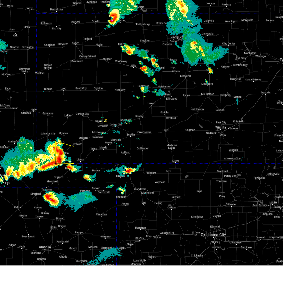 At 659 pm cdt, severe thunderstorms were located along a line extending from 6 miles west of moscow to 8 miles northwest of hooker, moving east at 25 mph (radar indicated). Hazards include 70 mph wind gusts and quarter size hail. Hail damage to vehicles is expected. expect considerable tree damage. wind damage is also likely to mobile homes, roofs, and outbuildings. locations impacted include, hugoton, moscow, woods and feterita. thunderstorm damage threat, considerable hail threat, radar indicated max hail size, 1. 00 in wind threat, radar indicated max wind gust, 70 mph. At 659 pm cdt, severe thunderstorms were located along a line extending from 6 miles west of moscow to 8 miles northwest of hooker, moving east at 25 mph (radar indicated). Hazards include 70 mph wind gusts and quarter size hail. Hail damage to vehicles is expected. expect considerable tree damage. wind damage is also likely to mobile homes, roofs, and outbuildings. locations impacted include, hugoton, moscow, woods and feterita. thunderstorm damage threat, considerable hail threat, radar indicated max hail size, 1. 00 in wind threat, radar indicated max wind gust, 70 mph.
|
| 5/28/2023 6:46 PM CDT |
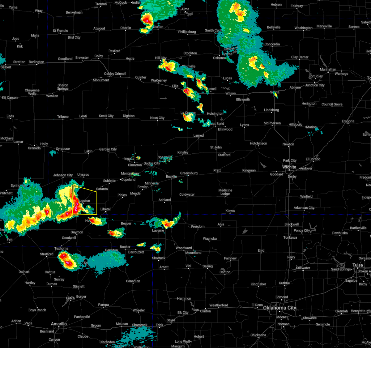 At 646 pm cdt, severe thunderstorms were located along a line extending from 11 miles west of moscow to 8 miles northeast of hough, moving east at 25 mph (radar indicated). Hazards include golf ball size hail and 70 mph wind gusts. People and animals outdoors will be injured. expect hail damage to roofs, siding, windows, and vehicles. expect considerable tree damage. wind damage is also likely to mobile homes, roofs, and outbuildings. locations impacted include, hugoton, moscow, woods and feterita. thunderstorm damage threat, considerable hail threat, radar indicated max hail size, 1. 75 in wind threat, radar indicated max wind gust, 70 mph. At 646 pm cdt, severe thunderstorms were located along a line extending from 11 miles west of moscow to 8 miles northeast of hough, moving east at 25 mph (radar indicated). Hazards include golf ball size hail and 70 mph wind gusts. People and animals outdoors will be injured. expect hail damage to roofs, siding, windows, and vehicles. expect considerable tree damage. wind damage is also likely to mobile homes, roofs, and outbuildings. locations impacted include, hugoton, moscow, woods and feterita. thunderstorm damage threat, considerable hail threat, radar indicated max hail size, 1. 75 in wind threat, radar indicated max wind gust, 70 mph.
|
| 5/28/2023 6:44 PM CDT | Quarter sized hail reported 7.7 miles ENE of Hugoton, KS |
| 5/28/2023 6:44 PM CDT | Storm damage reported in stevens county KS, 7.7 miles ENE of Hugoton, KS |
| 5/28/2023 6:36 PM CDT |
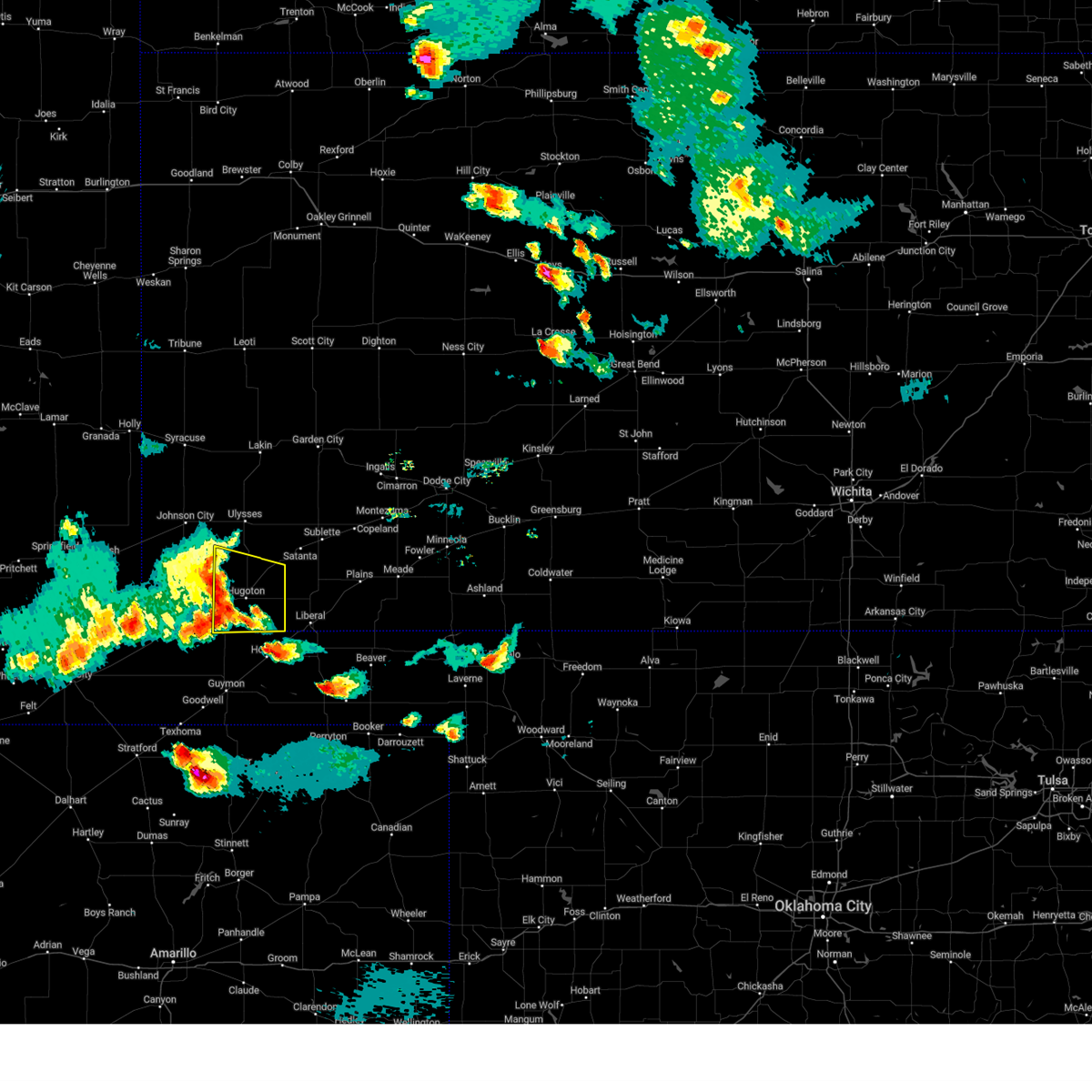 At 635 pm cdt, severe thunderstorms were located along a line extending from 14 miles south of big bow to 6 miles northeast of hough, moving east at 25 mph (radar indicated). Hazards include 70 mph wind gusts and half dollar size hail. Hail damage to vehicles is expected. expect considerable tree damage. Wind damage is also likely to mobile homes, roofs, and outbuildings. At 635 pm cdt, severe thunderstorms were located along a line extending from 14 miles south of big bow to 6 miles northeast of hough, moving east at 25 mph (radar indicated). Hazards include 70 mph wind gusts and half dollar size hail. Hail damage to vehicles is expected. expect considerable tree damage. Wind damage is also likely to mobile homes, roofs, and outbuildings.
|
| 5/22/2023 5:51 PM CDT | Ping Pong Ball sized hail reported 8.7 miles NE of Hugoton, KS |
| 5/22/2023 5:35 PM CDT |
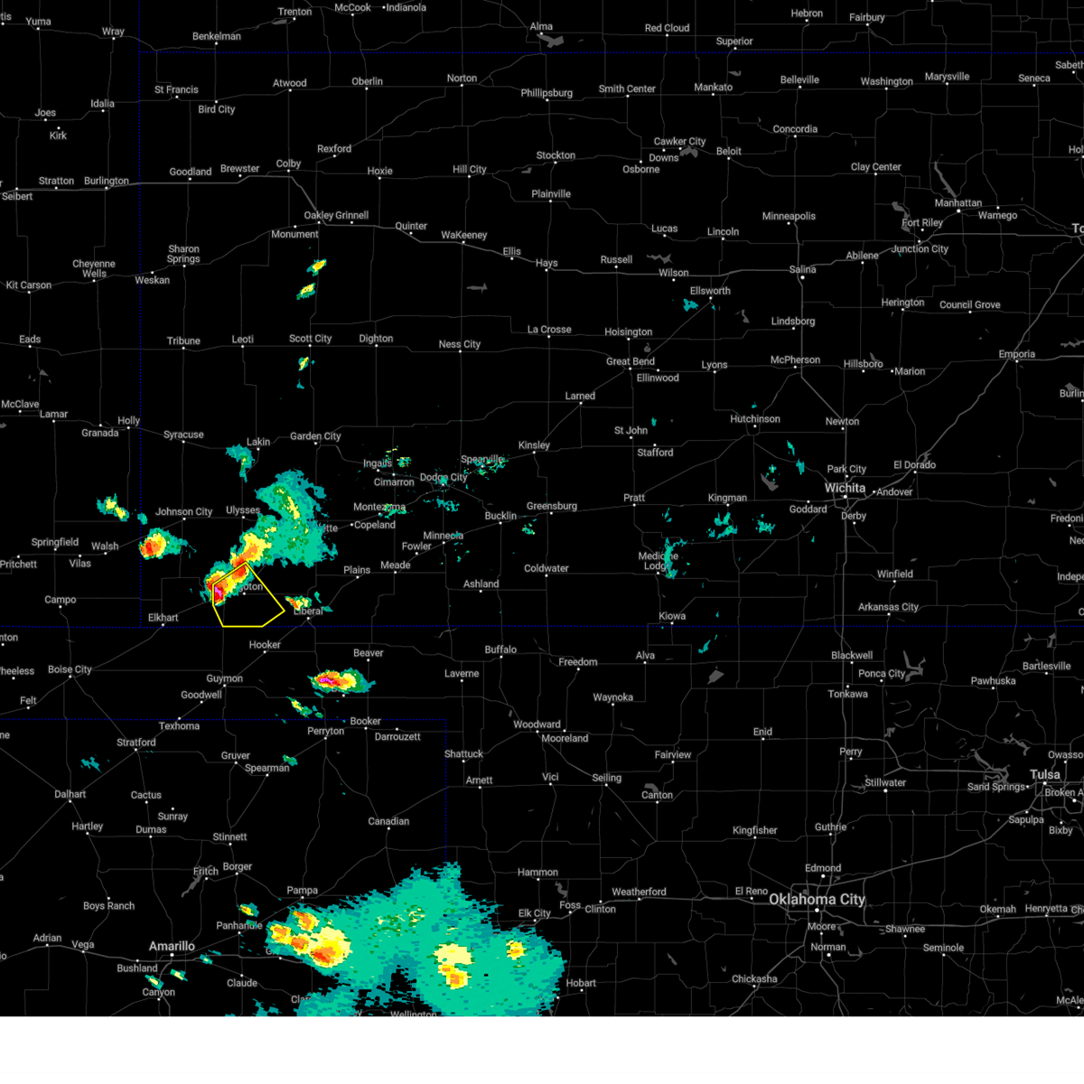 At 534 pm cdt, a severe thunderstorm was located near hugoton, moving southeast at 15 mph (radar indicated). Hazards include 60 mph wind gusts and quarter size hail. Hail damage to vehicles is expected. expect wind damage to roofs, siding, and trees. This severe thunderstorm will be near, hugoton around 550 pm cdt. At 534 pm cdt, a severe thunderstorm was located near hugoton, moving southeast at 15 mph (radar indicated). Hazards include 60 mph wind gusts and quarter size hail. Hail damage to vehicles is expected. expect wind damage to roofs, siding, and trees. This severe thunderstorm will be near, hugoton around 550 pm cdt.
|
| 5/4/2023 7:33 PM CDT |
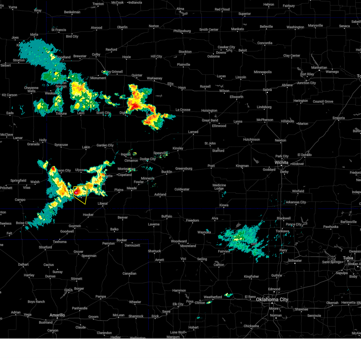 At 731 pm cdt, a severe thunderstorm was located near hugoton, moving southeast at 20 mph. goldf ball size hail was observed 13 miles northwest of hugoton (radar indicated). Hazards include two inch hail and 60 mph wind gusts. People and animals outdoors will be injured. expect hail damage to roofs, siding, windows, and vehicles. expect wind damage to roofs, siding, and trees. locations impacted include, hugoton. thunderstorm damage threat, considerable hail threat, observed max hail size, 2. 00 in wind threat, radar indicated max wind gust, 60 mph. At 731 pm cdt, a severe thunderstorm was located near hugoton, moving southeast at 20 mph. goldf ball size hail was observed 13 miles northwest of hugoton (radar indicated). Hazards include two inch hail and 60 mph wind gusts. People and animals outdoors will be injured. expect hail damage to roofs, siding, windows, and vehicles. expect wind damage to roofs, siding, and trees. locations impacted include, hugoton. thunderstorm damage threat, considerable hail threat, observed max hail size, 2. 00 in wind threat, radar indicated max wind gust, 60 mph.
|
| 5/4/2023 7:16 PM CDT |
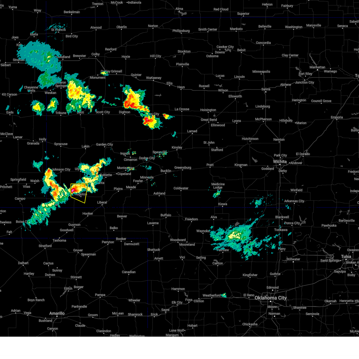 At 715 pm cdt, a severe thunderstorm was located 8 miles north of feterita, moving east at 15 mph (radar indicated). Hazards include ping pong ball size hail and 60 mph wind gusts. People and animals outdoors will be injured. expect hail damage to roofs, siding, windows, and vehicles. expect wind damage to roofs, siding, and trees. locations impacted include, hugoton. hail threat, radar indicated max hail size, 1. 50 in wind threat, radar indicated max wind gust, 60 mph. At 715 pm cdt, a severe thunderstorm was located 8 miles north of feterita, moving east at 15 mph (radar indicated). Hazards include ping pong ball size hail and 60 mph wind gusts. People and animals outdoors will be injured. expect hail damage to roofs, siding, windows, and vehicles. expect wind damage to roofs, siding, and trees. locations impacted include, hugoton. hail threat, radar indicated max hail size, 1. 50 in wind threat, radar indicated max wind gust, 60 mph.
|
| 5/4/2023 7:08 PM CDT | Golf Ball sized hail reported 13.2 miles SE of Hugoton, KS, time estimated from radar. |
| 5/4/2023 7:02 PM CDT |
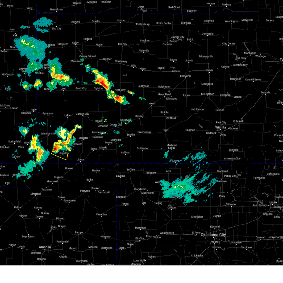 At 701 pm cdt, a severe thunderstorm was located 8 miles north of feterita, moving east at 20 mph (radar indicated). Hazards include ping pong ball size hail and 60 mph wind gusts. People and animals outdoors will be injured. expect hail damage to roofs, siding, windows, and vehicles. expect wind damage to roofs, siding, and trees. this severe thunderstorm will be near, feterita around 715 pm cdt. other locations in the path of this severe thunderstorm include hugoton. hail threat, radar indicated max hail size, 1. 50 in wind threat, radar indicated max wind gust, 60 mph. At 701 pm cdt, a severe thunderstorm was located 8 miles north of feterita, moving east at 20 mph (radar indicated). Hazards include ping pong ball size hail and 60 mph wind gusts. People and animals outdoors will be injured. expect hail damage to roofs, siding, windows, and vehicles. expect wind damage to roofs, siding, and trees. this severe thunderstorm will be near, feterita around 715 pm cdt. other locations in the path of this severe thunderstorm include hugoton. hail threat, radar indicated max hail size, 1. 50 in wind threat, radar indicated max wind gust, 60 mph.
|
| 2/26/2023 4:28 PM CST |
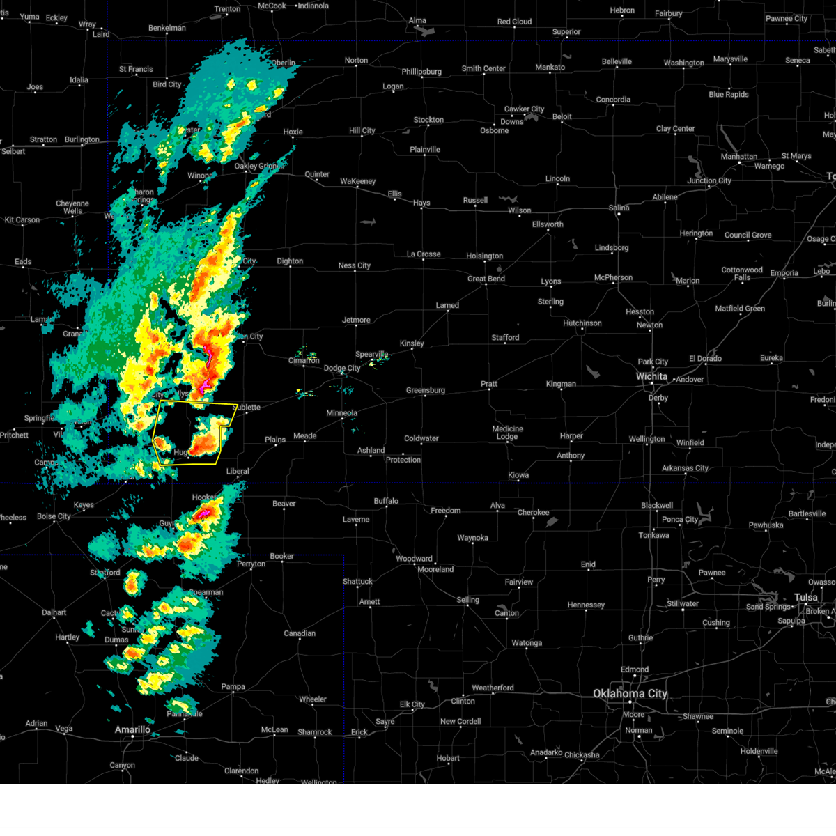 At 428 pm cst, a severe thunderstorm was located near moscow, moving northeast at 60 mph (radar indicated). Hazards include 70 mph wind gusts and nickel size hail. Expect considerable tree damage. damage is likely to mobile homes, roofs, and outbuildings. locations impacted include, cave and ryus. thunderstorm damage threat, considerable hail threat, radar indicated max hail size, 0. 88 in wind threat, radar indicated max wind gust, 70 mph. At 428 pm cst, a severe thunderstorm was located near moscow, moving northeast at 60 mph (radar indicated). Hazards include 70 mph wind gusts and nickel size hail. Expect considerable tree damage. damage is likely to mobile homes, roofs, and outbuildings. locations impacted include, cave and ryus. thunderstorm damage threat, considerable hail threat, radar indicated max hail size, 0. 88 in wind threat, radar indicated max wind gust, 70 mph.
|
| 2/26/2023 4:15 PM CST | Report received through social medi in stevens county KS, 0.6 miles SE of Hugoton, KS |
| 2/26/2023 4:10 PM CST |
 At 409 pm cst, a severe thunderstorm was located near feterita, moving northeast at 60 mph (radar indicated). Hazards include 70 mph wind gusts and nickel size hail. Expect considerable tree damage. damage is likely to mobile homes, roofs, and outbuildings. this severe thunderstorm will be near, hugoton around 420 pm cst. other locations in the path of this severe thunderstorm include moscow, cave and ryus. thunderstorm damage threat, considerable hail threat, radar indicated max hail size, 0. 88 in wind threat, radar indicated max wind gust, 70 mph. At 409 pm cst, a severe thunderstorm was located near feterita, moving northeast at 60 mph (radar indicated). Hazards include 70 mph wind gusts and nickel size hail. Expect considerable tree damage. damage is likely to mobile homes, roofs, and outbuildings. this severe thunderstorm will be near, hugoton around 420 pm cst. other locations in the path of this severe thunderstorm include moscow, cave and ryus. thunderstorm damage threat, considerable hail threat, radar indicated max hail size, 0. 88 in wind threat, radar indicated max wind gust, 70 mph.
|
| 6/7/2022 10:58 PM CDT |
 At 1058 pm cdt, a severe thunderstorm was located near feterita, moving southeast at 20 mph (radar indicated). Hazards include two inch hail and 60 mph wind gusts. People and animals outdoors will be injured. expect hail damage to roofs, siding, windows, and vehicles. expect wind damage to roofs, siding, and trees. this severe thunderstorm will be near, feterita around 1115 pm cdt. thunderstorm damage threat, considerable hail threat, radar indicated max hail size, 2. 00 in wind threat, radar indicated max wind gust, 60 mph. At 1058 pm cdt, a severe thunderstorm was located near feterita, moving southeast at 20 mph (radar indicated). Hazards include two inch hail and 60 mph wind gusts. People and animals outdoors will be injured. expect hail damage to roofs, siding, windows, and vehicles. expect wind damage to roofs, siding, and trees. this severe thunderstorm will be near, feterita around 1115 pm cdt. thunderstorm damage threat, considerable hail threat, radar indicated max hail size, 2. 00 in wind threat, radar indicated max wind gust, 60 mph.
|
| 6/7/2022 12:24 AM CDT |
 At 1224 am cdt, severe thunderstorms were located along a line extending from near cave to 7 miles west of hough, moving southeast at 30 mph (hugoton airport reported a 71 mph wind gust at 1215 am). Hazards include 70 mph wind gusts and nickel size hail. Expect considerable tree damage. damage is likely to mobile homes, roofs, and outbuildings. locations impacted include, woods and liberal. thunderstorm damage threat, considerable hail threat, radar indicated max hail size, 0. 88 in wind threat, radar indicated max wind gust, 70 mph. At 1224 am cdt, severe thunderstorms were located along a line extending from near cave to 7 miles west of hough, moving southeast at 30 mph (hugoton airport reported a 71 mph wind gust at 1215 am). Hazards include 70 mph wind gusts and nickel size hail. Expect considerable tree damage. damage is likely to mobile homes, roofs, and outbuildings. locations impacted include, woods and liberal. thunderstorm damage threat, considerable hail threat, radar indicated max hail size, 0. 88 in wind threat, radar indicated max wind gust, 70 mph.
|
| 6/7/2022 12:15 AM CDT | Awos station khqg hugoto in stevens county KS, 1.5 miles E of Hugoton, KS |
| 6/7/2022 12:09 AM CDT |
 At 1209 am cdt, severe thunderstorms were located along a line extending from cave to 10 miles northeast of eva, moving southeast at 30 mph (radar indicated). Hazards include 60 mph wind gusts and quarter size hail. Hail damage to vehicles is expected. expect wind damage to roofs, siding, and trees. severe thunderstorms will be near, cave around 1215 am cdt. other locations in the path of these severe thunderstorms include woods and liberal. hail threat, radar indicated max hail size, 1. 00 in wind threat, radar indicated max wind gust, 60 mph. At 1209 am cdt, severe thunderstorms were located along a line extending from cave to 10 miles northeast of eva, moving southeast at 30 mph (radar indicated). Hazards include 60 mph wind gusts and quarter size hail. Hail damage to vehicles is expected. expect wind damage to roofs, siding, and trees. severe thunderstorms will be near, cave around 1215 am cdt. other locations in the path of these severe thunderstorms include woods and liberal. hail threat, radar indicated max hail size, 1. 00 in wind threat, radar indicated max wind gust, 60 mph.
|
| 6/7/2022 12:01 AM CDT |
 At 1200 am cdt, severe thunderstorms were located along a line extending from 6 miles northeast of ryus to near rolla, moving southeast at 30 mph (radar indicated). Hazards include 60 mph wind gusts and quarter size hail. Hail damage to vehicles is expected. expect wind damage to roofs, siding, and trees. locations impacted include, hugoton, sublette, satanta, rolla, moscow, wilburton, ryus, cave, hickok and feterita. hail threat, radar indicated max hail size, 1. 00 in wind threat, radar indicated max wind gust, 60 mph. At 1200 am cdt, severe thunderstorms were located along a line extending from 6 miles northeast of ryus to near rolla, moving southeast at 30 mph (radar indicated). Hazards include 60 mph wind gusts and quarter size hail. Hail damage to vehicles is expected. expect wind damage to roofs, siding, and trees. locations impacted include, hugoton, sublette, satanta, rolla, moscow, wilburton, ryus, cave, hickok and feterita. hail threat, radar indicated max hail size, 1. 00 in wind threat, radar indicated max wind gust, 60 mph.
|
| 6/6/2022 11:37 PM CDT |
 At 1137 pm cdt, severe thunderstorms were located along a line extending from 8 miles north of ulysses to 10 miles southwest of richfield, moving southeast at 40 mph (radar indicated). Hazards include 60 mph wind gusts and half dollar size hail. Hail damage to vehicles is expected. expect wind damage to roofs, siding, and trees. locations impacted include, hickok, wilburton, rolla, feterita and sublette. hail threat, radar indicated max hail size, 1. 25 in wind threat, radar indicated max wind gust, 60 mph. At 1137 pm cdt, severe thunderstorms were located along a line extending from 8 miles north of ulysses to 10 miles southwest of richfield, moving southeast at 40 mph (radar indicated). Hazards include 60 mph wind gusts and half dollar size hail. Hail damage to vehicles is expected. expect wind damage to roofs, siding, and trees. locations impacted include, hickok, wilburton, rolla, feterita and sublette. hail threat, radar indicated max hail size, 1. 25 in wind threat, radar indicated max wind gust, 60 mph.
|
| 6/6/2022 11:29 PM CDT |
 At 1128 pm cdt, severe thunderstorms were located along a line extending from 10 miles north of ulysses to 10 miles southeast of stonington, moving east at 40 mph (radar indicated). Hazards include 60 mph wind gusts and penny size hail. Expect damage to roofs, siding, and trees. severe thunderstorms will be near, richfield around 1145 pm cdt. other locations in the path of these severe thunderstorms include hickok, wilburton, rolla, sublette and feterita. hail threat, radar indicated max hail size, 0. 75 in wind threat, radar indicated max wind gust, 60 mph. At 1128 pm cdt, severe thunderstorms were located along a line extending from 10 miles north of ulysses to 10 miles southeast of stonington, moving east at 40 mph (radar indicated). Hazards include 60 mph wind gusts and penny size hail. Expect damage to roofs, siding, and trees. severe thunderstorms will be near, richfield around 1145 pm cdt. other locations in the path of these severe thunderstorms include hickok, wilburton, rolla, sublette and feterita. hail threat, radar indicated max hail size, 0. 75 in wind threat, radar indicated max wind gust, 60 mph.
|
| 6/6/2022 9:27 PM CDT |
 At 926 pm cdt, a severe thunderstorm was located 11 miles northwest of hugoton, moving southeast at 30 mph (public reported quarter hail 15 miles northwest of hugoton at 920 pm). Hazards include quarter size hail. Damage to vehicles is expected. locations impacted include, hugoton, moscow, woods and cave. hail threat, radar indicated max hail size, 1. 00 in wind threat, radar indicated max wind gust, <50 mph. At 926 pm cdt, a severe thunderstorm was located 11 miles northwest of hugoton, moving southeast at 30 mph (public reported quarter hail 15 miles northwest of hugoton at 920 pm). Hazards include quarter size hail. Damage to vehicles is expected. locations impacted include, hugoton, moscow, woods and cave. hail threat, radar indicated max hail size, 1. 00 in wind threat, radar indicated max wind gust, <50 mph.
|
| 6/6/2022 9:20 PM CDT | Quarter sized hail reported 14.9 miles SE of Hugoton, KS, 0.88 to 1.0 in hail. |
| 6/6/2022 9:16 PM CDT |
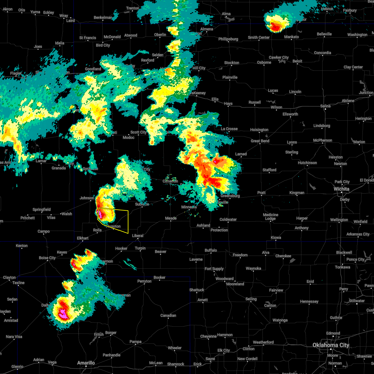 At 916 pm cdt, a severe thunderstorm was located 12 miles south of big bow, moving southeast at 25 mph (radar indicated). Hazards include quarter size hail. damage to vehicles is expected At 916 pm cdt, a severe thunderstorm was located 12 miles south of big bow, moving southeast at 25 mph (radar indicated). Hazards include quarter size hail. damage to vehicles is expected
|
| 5/18/2022 10:01 PM CDT |
 At 1000 pm cdt, severe thunderstorms were located along a line extending from near copeland to near tyrone, moving east at 35 mph (radar indicated). Hazards include 70 mph wind gusts. Expect considerable tree damage. Damage is likely to mobile homes, roofs, and outbuildings. At 1000 pm cdt, severe thunderstorms were located along a line extending from near copeland to near tyrone, moving east at 35 mph (radar indicated). Hazards include 70 mph wind gusts. Expect considerable tree damage. Damage is likely to mobile homes, roofs, and outbuildings.
|
| 5/16/2022 11:41 PM CDT |
 The severe thunderstorm warning for morton, grant, southeastern stanton and stevens counties will expire at 1145 pm cdt, the storm which prompted the warning has weakened below severe limits, and no longer poses an immediate threat to life or property. therefore, the warning will be allowed to expire. however gusty winds are still possible with this thunderstorm. The severe thunderstorm warning for morton, grant, southeastern stanton and stevens counties will expire at 1145 pm cdt, the storm which prompted the warning has weakened below severe limits, and no longer poses an immediate threat to life or property. therefore, the warning will be allowed to expire. however gusty winds are still possible with this thunderstorm.
|
| 5/16/2022 11:22 PM CDT |
 At 1121 pm cdt, a severe thunderstorm was located 11 miles north of feterita, moving east at 30 mph (radar indicated). Hazards include 70 mph wind gusts. Expect considerable tree damage. damage is likely to mobile homes, roofs, and outbuildings. locations impacted include, ulysses, hugoton, rolla, moscow, richfield, wilburton, ryus, cave, hickok, woods, big bow and feterita. thunderstorm damage threat, considerable hail threat, radar indicated max hail size, <. 75 in wind threat, radar indicated max wind gust, 70 mph. At 1121 pm cdt, a severe thunderstorm was located 11 miles north of feterita, moving east at 30 mph (radar indicated). Hazards include 70 mph wind gusts. Expect considerable tree damage. damage is likely to mobile homes, roofs, and outbuildings. locations impacted include, ulysses, hugoton, rolla, moscow, richfield, wilburton, ryus, cave, hickok, woods, big bow and feterita. thunderstorm damage threat, considerable hail threat, radar indicated max hail size, <. 75 in wind threat, radar indicated max wind gust, 70 mph.
|
| 5/16/2022 11:07 PM CDT |
 At 1105 pm cdt, a severe thunderstorm was located 11 miles east of richfield, moving east at 35 mph. this replaces the previous warning for stanton and morton counties (radar indicated). Hazards include 70 mph wind gusts. Expect considerable tree damage. Damage is likely to mobile homes, roofs, and outbuildings. At 1105 pm cdt, a severe thunderstorm was located 11 miles east of richfield, moving east at 35 mph. this replaces the previous warning for stanton and morton counties (radar indicated). Hazards include 70 mph wind gusts. Expect considerable tree damage. Damage is likely to mobile homes, roofs, and outbuildings.
|
| 5/10/2022 9:15 PM CDT | Awos station khqg hugoto in stevens county KS, 1.5 miles E of Hugoton, KS |
| 4/23/2022 1:52 AM CDT |
 At 152 am cdt, severe thunderstorms were located along a line extending from 8 miles northeast of hickok to 11 miles southeast of feterita, moving east at 40 mph (radar indicated). Hazards include 60 mph wind gusts. expect damage to roofs, siding, and trees At 152 am cdt, severe thunderstorms were located along a line extending from 8 miles northeast of hickok to 11 miles southeast of feterita, moving east at 40 mph (radar indicated). Hazards include 60 mph wind gusts. expect damage to roofs, siding, and trees
|
| 4/23/2022 1:39 AM CDT |
 At 139 am cdt, severe thunderstorms were located along a line extending from 9 miles north of deerfield to near rolla, moving east at 35 mph (radar indicated). Hazards include 60 mph wind gusts. Expect damage to roofs, siding, and trees. locations impacted include, garden city, ulysses, hugoton, lakin, holcomb, satanta, deerfield, moscow, ryus, feterita, plymell, cave, hickok and woods. hail threat, radar indicated max hail size, <. 75 in wind threat, radar indicated max wind gust, 60 mph. At 139 am cdt, severe thunderstorms were located along a line extending from 9 miles north of deerfield to near rolla, moving east at 35 mph (radar indicated). Hazards include 60 mph wind gusts. Expect damage to roofs, siding, and trees. locations impacted include, garden city, ulysses, hugoton, lakin, holcomb, satanta, deerfield, moscow, ryus, feterita, plymell, cave, hickok and woods. hail threat, radar indicated max hail size, <. 75 in wind threat, radar indicated max wind gust, 60 mph.
|
| 4/23/2022 1:32 AM CDT |
 At 132 am cdt, severe thunderstorms were located along a line extending from 10 miles northwest of deerfield to near rolla, moving east at 35 mph (radar indicated). Hazards include 60 mph wind gusts. Expect damage to roofs, siding, and trees. locations impacted include, garden city, ulysses, hugoton, lakin, holcomb, satanta, deerfield, rolla, moscow, ryus, big bow, feterita, plymell, wilburton, cave, hickok and woods. hail threat, radar indicated max hail size, <. 75 in wind threat, radar indicated max wind gust, 60 mph. At 132 am cdt, severe thunderstorms were located along a line extending from 10 miles northwest of deerfield to near rolla, moving east at 35 mph (radar indicated). Hazards include 60 mph wind gusts. Expect damage to roofs, siding, and trees. locations impacted include, garden city, ulysses, hugoton, lakin, holcomb, satanta, deerfield, rolla, moscow, ryus, big bow, feterita, plymell, wilburton, cave, hickok and woods. hail threat, radar indicated max hail size, <. 75 in wind threat, radar indicated max wind gust, 60 mph.
|
| 4/23/2022 1:03 AM CDT |
 At 102 am cdt, severe thunderstorms were located along a line extending from 7 miles north of kendall to near elkhart, moving east at 35 mph (radar indicated). Hazards include 60 mph wind gusts and quarter size hail. Hail damage to vehicles is expected. Expect wind damage to roofs, siding, and trees. At 102 am cdt, severe thunderstorms were located along a line extending from 7 miles north of kendall to near elkhart, moving east at 35 mph (radar indicated). Hazards include 60 mph wind gusts and quarter size hail. Hail damage to vehicles is expected. Expect wind damage to roofs, siding, and trees.
|
| 4/22/2022 8:06 PM CDT | Ping Pong Ball sized hail reported 0.6 miles SE of Hugoton, KS, report from mping: ping pong ball (1.50 in.). |
| 4/22/2022 7:53 PM CDT |
 At 753 pm cdt, a severe thunderstorm was located near hugoton, moving northeast at 35 mph (law enforcement reported ping pong sized hail in hugoton at 7:52 pm ). Hazards include ping pong ball size hail and 60 mph wind gusts. People and animals outdoors will be injured. expect hail damage to roofs, siding, windows, and vehicles. expect wind damage to roofs, siding, and trees. locations impacted include, hugoton, satanta, moscow, ryus, cave and hickok. hail threat, radar indicated max hail size, 1. 50 in wind threat, radar indicated max wind gust, 60 mph. At 753 pm cdt, a severe thunderstorm was located near hugoton, moving northeast at 35 mph (law enforcement reported ping pong sized hail in hugoton at 7:52 pm ). Hazards include ping pong ball size hail and 60 mph wind gusts. People and animals outdoors will be injured. expect hail damage to roofs, siding, windows, and vehicles. expect wind damage to roofs, siding, and trees. locations impacted include, hugoton, satanta, moscow, ryus, cave and hickok. hail threat, radar indicated max hail size, 1. 50 in wind threat, radar indicated max wind gust, 60 mph.
|
| 4/22/2022 7:50 PM CDT | Ping Pong Ball sized hail reported 0.6 miles SE of Hugoton, KS |
| 4/22/2022 7:44 PM CDT |
 At 743 pm cdt, a severe thunderstorm was located near hugoton, moving northeast at 45 mph (radar indicated). Hazards include ping pong ball size hail and 60 mph wind gusts. People and animals outdoors will be injured. expect hail damage to roofs, siding, windows, and vehicles. Expect wind damage to roofs, siding, and trees. At 743 pm cdt, a severe thunderstorm was located near hugoton, moving northeast at 45 mph (radar indicated). Hazards include ping pong ball size hail and 60 mph wind gusts. People and animals outdoors will be injured. expect hail damage to roofs, siding, windows, and vehicles. Expect wind damage to roofs, siding, and trees.
|
| 4/22/2022 6:43 PM CDT |
 At 643 pm cdt, a severe thunderstorm was located 8 miles north of feterita, moving northeast at 50 mph. this is a destructive storm for northwest stevens county (radar indicated). Hazards include baseball size hail and 60 mph wind gusts. People and animals outdoors will be severely injured. expect shattered windows, extensive damage to roofs, siding, and vehicles. locations impacted include, hugoton, rolla, moscow, wilburton, feterita and cave. thunderstorm damage threat, destructive hail threat, radar indicated max hail size, 2. 75 in wind threat, radar indicated max wind gust, 60 mph. At 643 pm cdt, a severe thunderstorm was located 8 miles north of feterita, moving northeast at 50 mph. this is a destructive storm for northwest stevens county (radar indicated). Hazards include baseball size hail and 60 mph wind gusts. People and animals outdoors will be severely injured. expect shattered windows, extensive damage to roofs, siding, and vehicles. locations impacted include, hugoton, rolla, moscow, wilburton, feterita and cave. thunderstorm damage threat, destructive hail threat, radar indicated max hail size, 2. 75 in wind threat, radar indicated max wind gust, 60 mph.
|
| 4/22/2022 6:28 PM CDT |
 At 628 pm cdt, a severe thunderstorm was located near feterita, moving northeast at 50 mph (public reported quarter hail in rolla at 6:27 pm). Hazards include two inch hail and 60 mph wind gusts. People and animals outdoors will be injured. expect hail damage to roofs, siding, windows, and vehicles. expect wind damage to roofs, siding, and trees. this severe thunderstorm will remain over mainly rural areas of southeastern morton and northwestern stevens counties. thunderstorm damage threat, considerable hail threat, radar indicated max hail size, 2. 00 in wind threat, radar indicated max wind gust, 60 mph. At 628 pm cdt, a severe thunderstorm was located near feterita, moving northeast at 50 mph (public reported quarter hail in rolla at 6:27 pm). Hazards include two inch hail and 60 mph wind gusts. People and animals outdoors will be injured. expect hail damage to roofs, siding, windows, and vehicles. expect wind damage to roofs, siding, and trees. this severe thunderstorm will remain over mainly rural areas of southeastern morton and northwestern stevens counties. thunderstorm damage threat, considerable hail threat, radar indicated max hail size, 2. 00 in wind threat, radar indicated max wind gust, 60 mph.
|
| 4/22/2022 6:09 PM CDT |
 At 609 pm cdt, a severe thunderstorm was located 8 miles northwest of hough, or 9 miles southeast of wilburton, moving northeast at 50 mph (radar indicated). Hazards include two inch hail and 60 mph wind gusts. People and animals outdoors will be injured. expect hail damage to roofs, siding, windows, and vehicles. expect wind damage to roofs, siding, and trees. this severe thunderstorm will be near, rolla around 620 pm cdt. feterita around 625 pm cdt. hugoton around 630 pm cdt. moscow around 640 pm cdt. cave around 645 pm cdt. thunderstorm damage threat, considerable hail threat, radar indicated max hail size, 2. 00 in wind threat, radar indicated max wind gust, 60 mph. At 609 pm cdt, a severe thunderstorm was located 8 miles northwest of hough, or 9 miles southeast of wilburton, moving northeast at 50 mph (radar indicated). Hazards include two inch hail and 60 mph wind gusts. People and animals outdoors will be injured. expect hail damage to roofs, siding, windows, and vehicles. expect wind damage to roofs, siding, and trees. this severe thunderstorm will be near, rolla around 620 pm cdt. feterita around 625 pm cdt. hugoton around 630 pm cdt. moscow around 640 pm cdt. cave around 645 pm cdt. thunderstorm damage threat, considerable hail threat, radar indicated max hail size, 2. 00 in wind threat, radar indicated max wind gust, 60 mph.
|
| 4/22/2022 5:28 PM CDT |
 At 528 pm cdt, a severe thunderstorm was located near elkhart, moving northeast at 50 mph (radar indicated). Hazards include ping pong ball size hail and 60 mph wind gusts. People and animals outdoors will be injured. expect hail damage to roofs, siding, windows, and vehicles. expect wind damage to roofs, siding, and trees. this severe thunderstorm will be near, wilburton around 540 pm cdt. rolla around 545 pm cdt. other locations in the path of this severe thunderstorm include feterita and hugoton. hail threat, radar indicated max hail size, 1. 50 in wind threat, radar indicated max wind gust, 60 mph. At 528 pm cdt, a severe thunderstorm was located near elkhart, moving northeast at 50 mph (radar indicated). Hazards include ping pong ball size hail and 60 mph wind gusts. People and animals outdoors will be injured. expect hail damage to roofs, siding, windows, and vehicles. expect wind damage to roofs, siding, and trees. this severe thunderstorm will be near, wilburton around 540 pm cdt. rolla around 545 pm cdt. other locations in the path of this severe thunderstorm include feterita and hugoton. hail threat, radar indicated max hail size, 1. 50 in wind threat, radar indicated max wind gust, 60 mph.
|
| 10/12/2021 8:52 PM CDT |
 At 852 pm cdt, severe thunderstorms were located along a line extending from near deerfield to 9 miles northeast of ryus to 8 miles northwest of tyrone, moving northeast at 50 mph (radar indicated). Hazards include 70 mph wind gusts and half dollar size hail. Hail damage to vehicles is expected. expect considerable tree damage. wind damage is also likely to mobile homes, roofs, and outbuildings. these severe storms will be near, holcomb and deerfield around 855 pm cdt. Other locations in the path of these severe thunderstorms include woods, plymell and pierceville. At 852 pm cdt, severe thunderstorms were located along a line extending from near deerfield to 9 miles northeast of ryus to 8 miles northwest of tyrone, moving northeast at 50 mph (radar indicated). Hazards include 70 mph wind gusts and half dollar size hail. Hail damage to vehicles is expected. expect considerable tree damage. wind damage is also likely to mobile homes, roofs, and outbuildings. these severe storms will be near, holcomb and deerfield around 855 pm cdt. Other locations in the path of these severe thunderstorms include woods, plymell and pierceville.
|
| 10/12/2021 8:40 PM CDT | Quarter sized hail reported 2.5 miles NNE of Hugoton, KS |
| 10/12/2021 8:37 PM CDT |
 At 837 pm cdt, severe thunderstorms were located along a line extending from near lakin to near ryus to 9 miles southeast of feterita, moving northeast at 50 mph (radar indicated). Hazards include 70 mph wind gusts and half dollar size hail. Hail damage to vehicles is expected. expect considerable tree damage. wind damage is also likely to mobile homes, roofs, and outbuildings. severe thunderstorms will be near, lakin, ryus and hickok around 840 pm cdt. deerfield around 845 pm cdt. hugoton and holcomb around 850 pm cdt. garden city around 855 pm cdt. Other locations in the path of these severe thunderstorms include moscow, woods, plymell, cave, satanta and pierceville. At 837 pm cdt, severe thunderstorms were located along a line extending from near lakin to near ryus to 9 miles southeast of feterita, moving northeast at 50 mph (radar indicated). Hazards include 70 mph wind gusts and half dollar size hail. Hail damage to vehicles is expected. expect considerable tree damage. wind damage is also likely to mobile homes, roofs, and outbuildings. severe thunderstorms will be near, lakin, ryus and hickok around 840 pm cdt. deerfield around 845 pm cdt. hugoton and holcomb around 850 pm cdt. garden city around 855 pm cdt. Other locations in the path of these severe thunderstorms include moscow, woods, plymell, cave, satanta and pierceville.
|
| 10/12/2021 8:28 PM CDT |
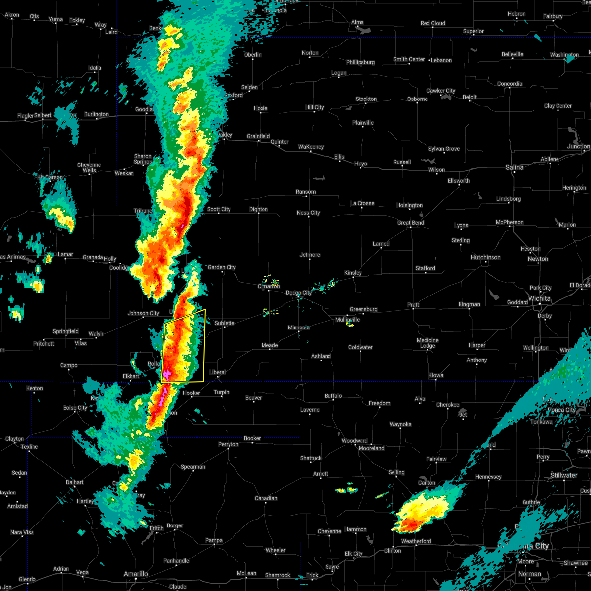 At 827 pm cdt, severe thunderstorms were located along a line extending from near ulysses to near hugoton to 11 miles south of feterita, moving east at 45 mph (radar indicated). Hazards include 70 mph wind gusts and half dollar size hail. Hail damage to vehicles is expected. expect considerable tree damage. wind damage is also likely to mobile homes, roofs, and outbuildings. Locations impacted include, hugoton, moscow, ryus, cave, hickok, woods and feterita. At 827 pm cdt, severe thunderstorms were located along a line extending from near ulysses to near hugoton to 11 miles south of feterita, moving east at 45 mph (radar indicated). Hazards include 70 mph wind gusts and half dollar size hail. Hail damage to vehicles is expected. expect considerable tree damage. wind damage is also likely to mobile homes, roofs, and outbuildings. Locations impacted include, hugoton, moscow, ryus, cave, hickok, woods and feterita.
|
| 10/12/2021 8:18 PM CDT |
 At 818 pm cdt, severe thunderstorms were located along a line extending from 8 miles south of big bow to near feterita to 7 miles north of hough, moving east at 45 mph (radar indicated). Hazards include 70 mph wind gusts and half dollar size hail. Hail damage to vehicles is expected. expect considerable tree damage. wind damage is also likely to mobile homes, roofs, and outbuildings. Locations impacted include, ulysses, hugoton, rolla, moscow, ryus, cave, hickok, woods and feterita. At 818 pm cdt, severe thunderstorms were located along a line extending from 8 miles south of big bow to near feterita to 7 miles north of hough, moving east at 45 mph (radar indicated). Hazards include 70 mph wind gusts and half dollar size hail. Hail damage to vehicles is expected. expect considerable tree damage. wind damage is also likely to mobile homes, roofs, and outbuildings. Locations impacted include, ulysses, hugoton, rolla, moscow, ryus, cave, hickok, woods and feterita.
|
| 10/12/2021 8:02 PM CDT |
 At 802 pm cdt, severe thunderstorms were located along a line extending from 10 miles south of big bow to near hough, moving east at 50 mph (radar indicated). Hazards include 60 mph wind gusts and half dollar size hail. Hail damage to vehicles is expected. Expect wind damage to roofs, siding, and trees. At 802 pm cdt, severe thunderstorms were located along a line extending from 10 miles south of big bow to near hough, moving east at 50 mph (radar indicated). Hazards include 60 mph wind gusts and half dollar size hail. Hail damage to vehicles is expected. Expect wind damage to roofs, siding, and trees.
|
| 9/3/2021 5:51 PM CDT |
 At 551 pm cdt, a severe thunderstorm was located near rolla, moving northeast at 20 mph (radar indicated). Hazards include 60 mph wind gusts and quarter size hail. Hail damage to vehicles is expected. expect wind damage to roofs, siding, and trees. this severe thunderstorm will be near, feterita around 605 pm cdt. other locations in the path of this severe thunderstorm include hugoton. hail threat, radar indicated max hail size, 1. 00 in wind threat, radar indicated max wind gust, 60 mph. At 551 pm cdt, a severe thunderstorm was located near rolla, moving northeast at 20 mph (radar indicated). Hazards include 60 mph wind gusts and quarter size hail. Hail damage to vehicles is expected. expect wind damage to roofs, siding, and trees. this severe thunderstorm will be near, feterita around 605 pm cdt. other locations in the path of this severe thunderstorm include hugoton. hail threat, radar indicated max hail size, 1. 00 in wind threat, radar indicated max wind gust, 60 mph.
|
| 9/3/2021 5:17 PM CDT |
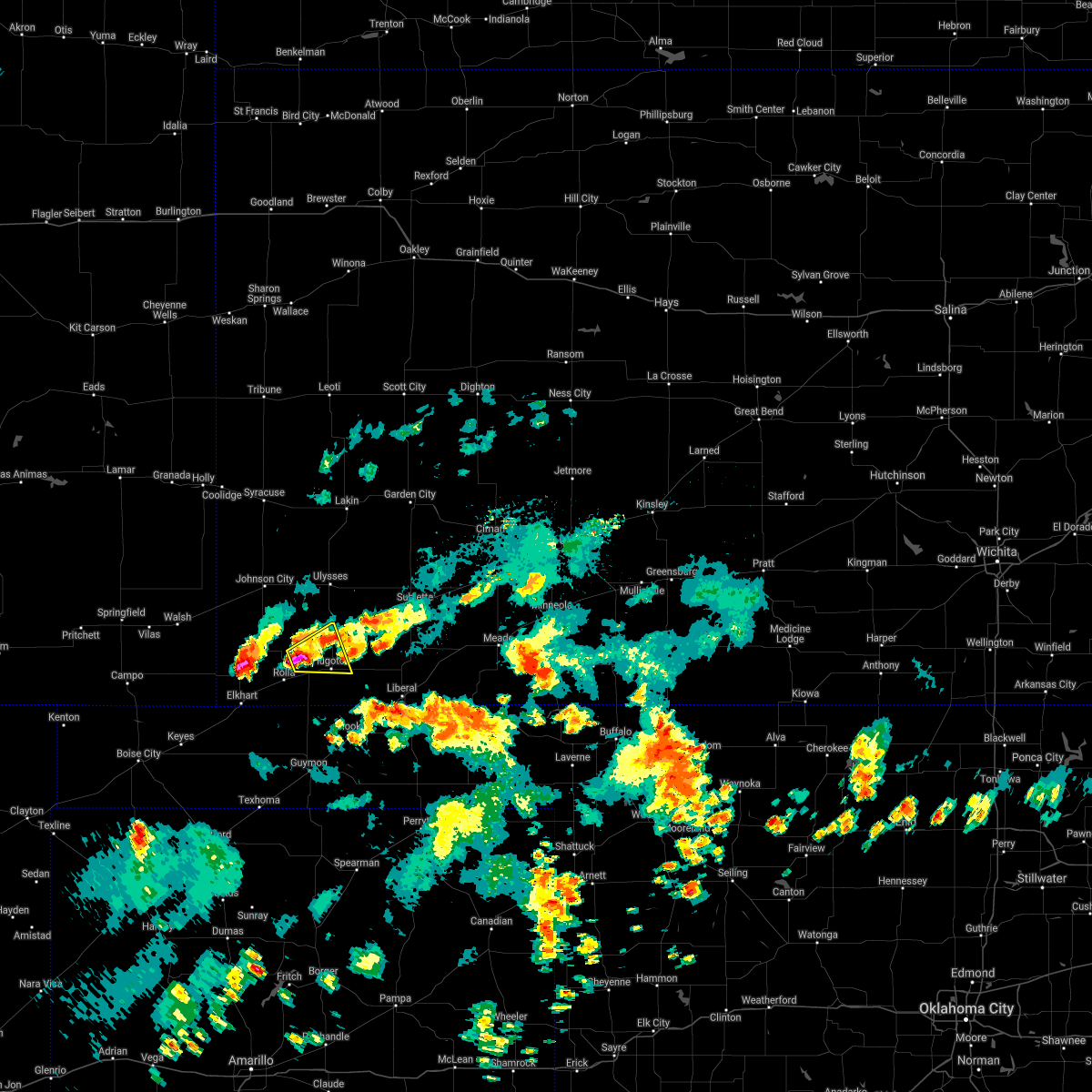 At 517 pm cdt, a severe thunderstorm was located near feterita, moving northeast at 10 mph (radar indicated). Hazards include ping pong ball size hail and 60 mph wind gusts. People and animals outdoors will be injured. expect hail damage to roofs, siding, windows, and vehicles. expect wind damage to roofs, siding, and trees. Locations impacted include, hugoton. At 517 pm cdt, a severe thunderstorm was located near feterita, moving northeast at 10 mph (radar indicated). Hazards include ping pong ball size hail and 60 mph wind gusts. People and animals outdoors will be injured. expect hail damage to roofs, siding, windows, and vehicles. expect wind damage to roofs, siding, and trees. Locations impacted include, hugoton.
|
| 9/3/2021 5:13 PM CDT |
 At 513 pm cdt, a severe thunderstorm was located near feterita, moving northeast at 10 mph (radar indicated). Hazards include 60 mph wind gusts and quarter size hail. Hail damage to vehicles is expected. Expect wind damage to roofs, siding, and trees. At 513 pm cdt, a severe thunderstorm was located near feterita, moving northeast at 10 mph (radar indicated). Hazards include 60 mph wind gusts and quarter size hail. Hail damage to vehicles is expected. Expect wind damage to roofs, siding, and trees.
|
| 8/7/2021 7:01 PM CDT |
 At 701 pm cdt, a severe thunderstorm was located near tyrone, or 9 miles south of woods, moving east at 25 mph (radar indicated). Hazards include 60 mph wind gusts and penny size hail. expect damage to roofs, siding, and trees At 701 pm cdt, a severe thunderstorm was located near tyrone, or 9 miles south of woods, moving east at 25 mph (radar indicated). Hazards include 60 mph wind gusts and penny size hail. expect damage to roofs, siding, and trees
|
| 7/1/2021 12:54 PM CDT |
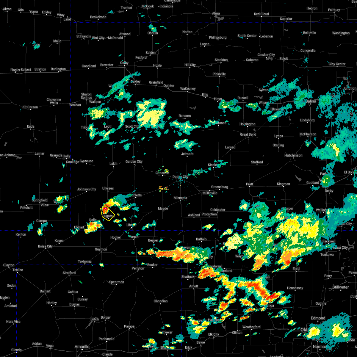 At 1254 pm cdt, a severe thunderstorm was located 8 miles northwest of hugoton, moving southeast at 10 mph (radar indicated). Hazards include ping pong ball size hail and 60 mph wind gusts. People and animals outdoors will be injured. expect hail damage to roofs, siding, windows, and vehicles. expect wind damage to roofs, siding, and trees. Locations impacted include, hugoton. At 1254 pm cdt, a severe thunderstorm was located 8 miles northwest of hugoton, moving southeast at 10 mph (radar indicated). Hazards include ping pong ball size hail and 60 mph wind gusts. People and animals outdoors will be injured. expect hail damage to roofs, siding, windows, and vehicles. expect wind damage to roofs, siding, and trees. Locations impacted include, hugoton.
|
| 7/1/2021 12:40 PM CDT |
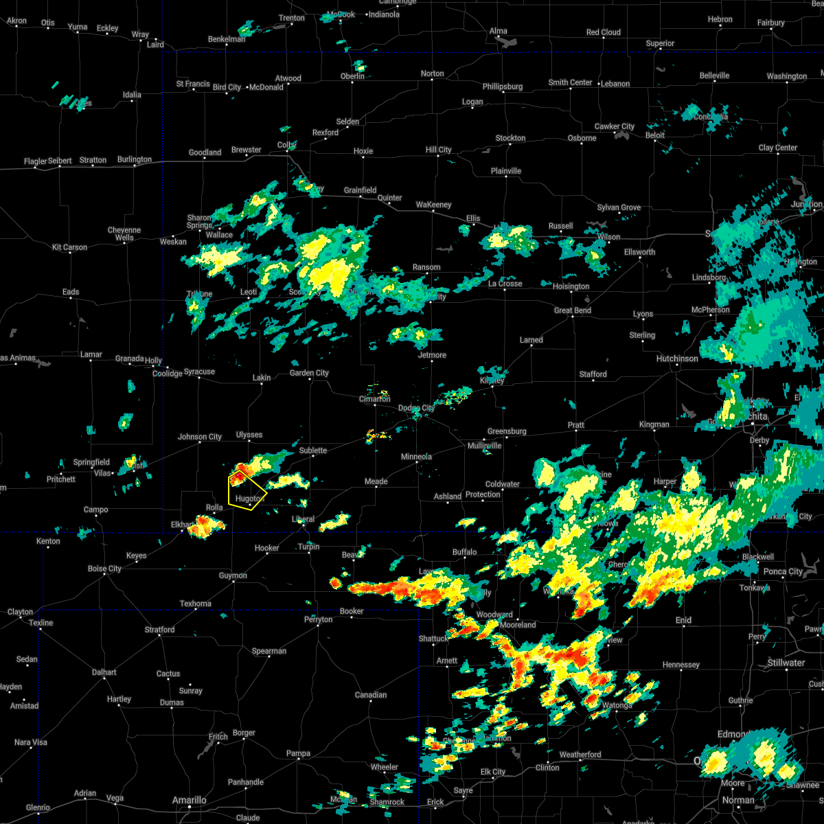 At 1240 pm cdt, a severe thunderstorm was located 11 miles northwest of hugoton, moving southeast at 10 mph (radar indicated). Hazards include quarter size hail. damage to vehicles is expected At 1240 pm cdt, a severe thunderstorm was located 11 miles northwest of hugoton, moving southeast at 10 mph (radar indicated). Hazards include quarter size hail. damage to vehicles is expected
|
| 6/25/2021 6:15 PM CDT | Awos station khqg hugoto in stevens county KS, 1.5 miles E of Hugoton, KS |
| 6/25/2021 5:54 PM CDT |
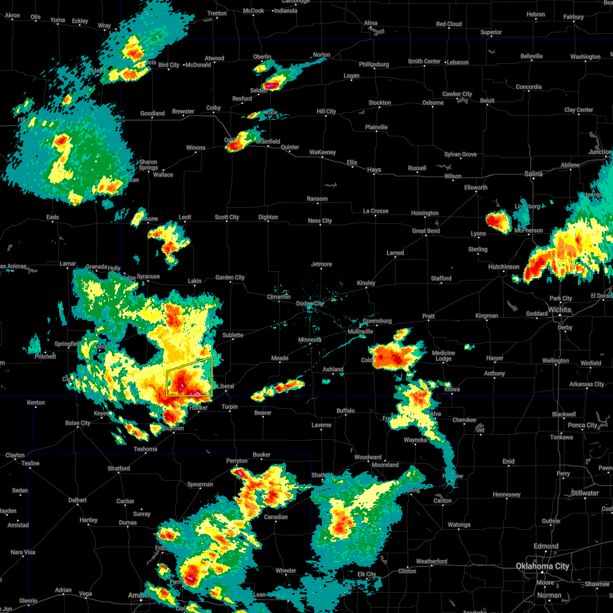 At 552 pm cdt, a severe thunderstorm was located near hugoton, moving east at 30 mph. this is a very dangerous storm (trained weather spotters. at 540 pm cdt baseball size hail was reported 5 miles southeast of rolla). Hazards include baseball size hail and 70 mph wind gusts. People and animals outdoors will be severely injured. expect shattered windows, extensive damage to roofs, siding, and vehicles. Locations impacted include, woods. At 552 pm cdt, a severe thunderstorm was located near hugoton, moving east at 30 mph. this is a very dangerous storm (trained weather spotters. at 540 pm cdt baseball size hail was reported 5 miles southeast of rolla). Hazards include baseball size hail and 70 mph wind gusts. People and animals outdoors will be severely injured. expect shattered windows, extensive damage to roofs, siding, and vehicles. Locations impacted include, woods.
|
| 6/25/2021 5:40 PM CDT | Baseball sized hail reported 13.1 miles ENE of Hugoton, KS, baseball size hail reported... damage to tractor windows in the field. |
| 6/25/2021 5:40 PM CDT |
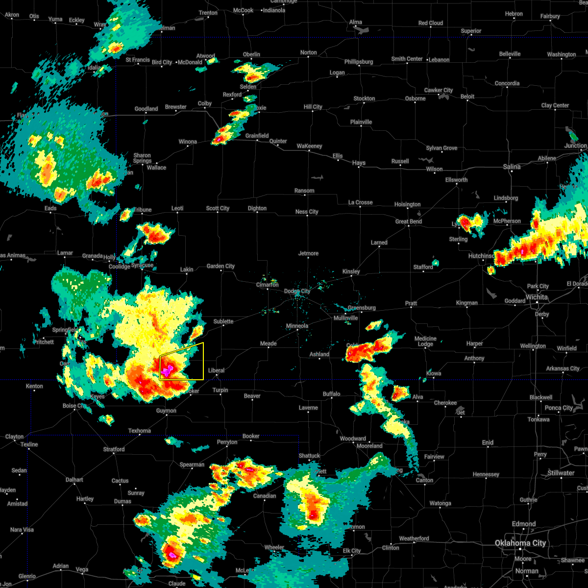 At 540 pm cdt, a severe thunderstorm was located near hugoton, moving east at 20 mph (radar indicated). Hazards include two inch hail and 70 mph wind gusts. People and animals outdoors will be injured. expect hail damage to roofs, siding, windows, and vehicles. expect considerable tree damage. wind damage is also likely to mobile homes, roofs, and outbuildings. this severe thunderstorm will be near, hugoton around 550 pm cdt. Other locations in the path of this severe thunderstorm include woods. At 540 pm cdt, a severe thunderstorm was located near hugoton, moving east at 20 mph (radar indicated). Hazards include two inch hail and 70 mph wind gusts. People and animals outdoors will be injured. expect hail damage to roofs, siding, windows, and vehicles. expect considerable tree damage. wind damage is also likely to mobile homes, roofs, and outbuildings. this severe thunderstorm will be near, hugoton around 550 pm cdt. Other locations in the path of this severe thunderstorm include woods.
|
| 5/15/2021 10:37 PM CDT |
 The severe thunderstorm warning for stevens county will expire at 1045 pm cdt, the storms which prompted the warning have weakened below severe limits, and no longer pose an immediate threat to life or property. therefore, the warning will be allowed to expire. however gusty winds are still possible with these thunderstorms. The severe thunderstorm warning for stevens county will expire at 1045 pm cdt, the storms which prompted the warning have weakened below severe limits, and no longer pose an immediate threat to life or property. therefore, the warning will be allowed to expire. however gusty winds are still possible with these thunderstorms.
|
| 5/15/2021 10:22 PM CDT |
 At 1021 pm cdt, severe thunderstorms were located along a line extending from 11 miles west of moscow to 10 miles north of hooker, moving east at 20 mph (radar indicated). Hazards include 60 mph wind gusts and penny size hail. Expect damage to roofs, siding, and trees. Locations impacted include, hugoton, moscow, woods and cave. At 1021 pm cdt, severe thunderstorms were located along a line extending from 11 miles west of moscow to 10 miles north of hooker, moving east at 20 mph (radar indicated). Hazards include 60 mph wind gusts and penny size hail. Expect damage to roofs, siding, and trees. Locations impacted include, hugoton, moscow, woods and cave.
|
| 5/15/2021 10:07 PM CDT |
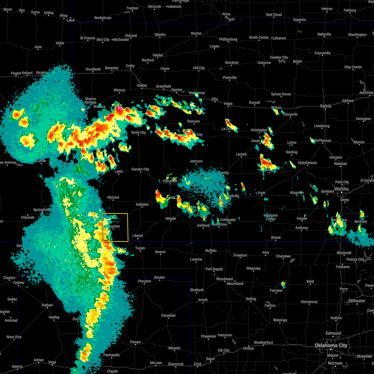 At 1007 pm cdt, severe thunderstorms were located along a line extending from 11 miles east of richfield to 9 miles northeast of hough, moving east at 15 mph (radar indicated). Hazards include 60 mph wind gusts and penny size hail. expect damage to roofs, siding, and trees At 1007 pm cdt, severe thunderstorms were located along a line extending from 11 miles east of richfield to 9 miles northeast of hough, moving east at 15 mph (radar indicated). Hazards include 60 mph wind gusts and penny size hail. expect damage to roofs, siding, and trees
|
| 7/20/2020 10:07 PM CDT |
 The severe thunderstorm warning for morton, hamilton, southwestern kearny, western grant, stanton and northwestern stevens counties will expire at 1015 pm cdt/915 pm mdt/, the storms which prompted the warning have weakened below severe limits, and no longer pose an immediate threat to life or property. therefore, the warning will be allowed to expire. however gusty winds and heavy rain are still possible with these thunderstorms. The severe thunderstorm warning for morton, hamilton, southwestern kearny, western grant, stanton and northwestern stevens counties will expire at 1015 pm cdt/915 pm mdt/, the storms which prompted the warning have weakened below severe limits, and no longer pose an immediate threat to life or property. therefore, the warning will be allowed to expire. however gusty winds and heavy rain are still possible with these thunderstorms.
|
| 7/20/2020 9:44 PM CDT |
 At 943 pm cdt/843 pm mdt/, severe thunderstorms were located along a line extending from 6 miles east of coolidge to near manter to near walsh, moving southeast at 40 mph (radar indicated). Hazards include 60 mph wind gusts and penny size hail. Expect damage to roofs, siding, and trees. Locations impacted include, ulysses, hugoton, lakin, syracuse, johnson city, rolla, manter, kendall, richfield, the saunders elevator, big bow, feterita and wilburton. At 943 pm cdt/843 pm mdt/, severe thunderstorms were located along a line extending from 6 miles east of coolidge to near manter to near walsh, moving southeast at 40 mph (radar indicated). Hazards include 60 mph wind gusts and penny size hail. Expect damage to roofs, siding, and trees. Locations impacted include, ulysses, hugoton, lakin, syracuse, johnson city, rolla, manter, kendall, richfield, the saunders elevator, big bow, feterita and wilburton.
|
| 7/20/2020 9:32 PM CDT |
 At 931 pm cdt/831 pm mdt/, severe thunderstorms were located along a line extending from near coolidge to near manter to near vilas, moving southeast at 40 mph (radar indicated). Hazards include 60 mph wind gusts and penny size hail. expect damage to roofs, siding, and trees At 931 pm cdt/831 pm mdt/, severe thunderstorms were located along a line extending from near coolidge to near manter to near vilas, moving southeast at 40 mph (radar indicated). Hazards include 60 mph wind gusts and penny size hail. expect damage to roofs, siding, and trees
|
| 7/14/2020 11:52 PM CDT |
 The severe thunderstorm warning for northwestern seward, eastern grant, eastern stevens and western haskell counties will expire at midnight cdt, the storms which prompted the warning have moved out of the warned area. therefore, the warning will be allowed to expire. a severe thunderstorm watch remains in effect until 300 am cdt for southwestern kansas. The severe thunderstorm warning for northwestern seward, eastern grant, eastern stevens and western haskell counties will expire at midnight cdt, the storms which prompted the warning have moved out of the warned area. therefore, the warning will be allowed to expire. a severe thunderstorm watch remains in effect until 300 am cdt for southwestern kansas.
|
| 7/14/2020 11:32 PM CDT |
 At 1132 pm cdt, severe thunderstorms were located along a line extending from 9 miles northeast of hickok to 6 miles northwest of tyrone, moving east at 20 mph (radar indicated). Hazards include 60 mph wind gusts and quarter size hail. Hail damage to vehicles is expected. expect wind damage to roofs, siding, and trees. Locations impacted include, hugoton, moscow, woods, ryus, cave and hickok. At 1132 pm cdt, severe thunderstorms were located along a line extending from 9 miles northeast of hickok to 6 miles northwest of tyrone, moving east at 20 mph (radar indicated). Hazards include 60 mph wind gusts and quarter size hail. Hail damage to vehicles is expected. expect wind damage to roofs, siding, and trees. Locations impacted include, hugoton, moscow, woods, ryus, cave and hickok.
|
| 7/14/2020 11:07 PM CDT |
 At 1107 pm cdt, severe thunderstorms were located along a line extending from 8 miles northeast of ulysses to 11 miles northwest of hooker, moving east at 20 mph (radar indicated). Hazards include 60 mph wind gusts and quarter size hail. Hail damage to vehicles is expected. Expect wind damage to roofs, siding, and trees. At 1107 pm cdt, severe thunderstorms were located along a line extending from 8 miles northeast of ulysses to 11 miles northwest of hooker, moving east at 20 mph (radar indicated). Hazards include 60 mph wind gusts and quarter size hail. Hail damage to vehicles is expected. Expect wind damage to roofs, siding, and trees.
|
| 7/14/2020 10:57 PM CDT | Mesonet station svuk1 mosco in stevens county KS, 13.7 miles S of Hugoton, KS |
| 7/13/2020 12:12 AM CDT |
 The severe thunderstorm warning for seward, grant, west central meade, stevens and haskell counties will expire at 1215 am cdt, the severe thunderstorm which prompted the warning has moved out of the warned area. therefore, the warning will be allowed to expire. a severe thunderstorm watch remains in effect until 300 am cdt for southwestern kansas. The severe thunderstorm warning for seward, grant, west central meade, stevens and haskell counties will expire at 1215 am cdt, the severe thunderstorm which prompted the warning has moved out of the warned area. therefore, the warning will be allowed to expire. a severe thunderstorm watch remains in effect until 300 am cdt for southwestern kansas.
|
| 7/12/2020 11:43 PM CDT |
 At 1122 pm cdt, a severe thunderstorm was located 9 miles north of ryus, moving south at 40 mph (radar indicated). Hazards include 70 mph wind gusts and half dollar size hail. Hail damage to vehicles is expected. expect considerable tree damage. Wind damage is also likely to mobile homes, roofs, and outbuildings. At 1122 pm cdt, a severe thunderstorm was located 9 miles north of ryus, moving south at 40 mph (radar indicated). Hazards include 70 mph wind gusts and half dollar size hail. Hail damage to vehicles is expected. expect considerable tree damage. Wind damage is also likely to mobile homes, roofs, and outbuildings.
|
| 7/12/2020 11:23 PM CDT |
 At 1122 pm cdt, a severe thunderstorm was located 9 miles north of ryus, moving south at 40 mph (radar indicated). Hazards include 70 mph wind gusts and half dollar size hail. Hail damage to vehicles is expected. expect considerable tree damage. Wind damage is also likely to mobile homes, roofs, and outbuildings. At 1122 pm cdt, a severe thunderstorm was located 9 miles north of ryus, moving south at 40 mph (radar indicated). Hazards include 70 mph wind gusts and half dollar size hail. Hail damage to vehicles is expected. expect considerable tree damage. Wind damage is also likely to mobile homes, roofs, and outbuildings.
|
| 7/2/2020 6:34 PM CDT | 2 to 3 inch tree limbs were downe in stevens county KS, 6.3 miles SSW of Hugoton, KS |
| 6/4/2020 9:22 PM CDT |
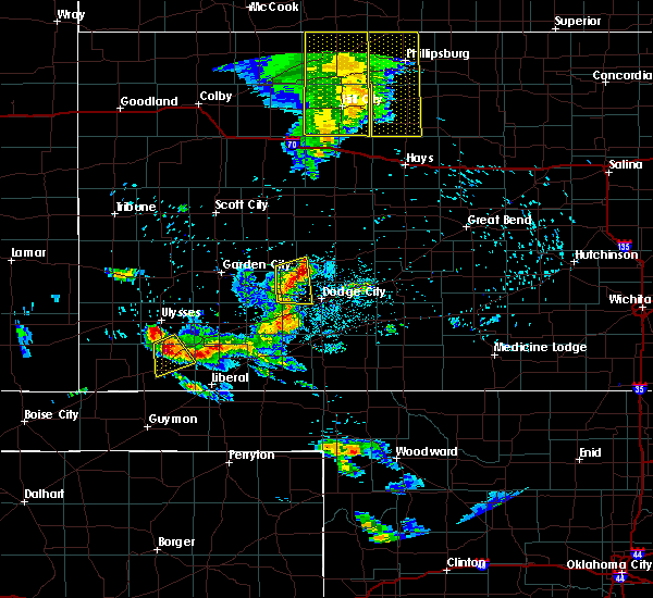 At 921 pm cdt, a severe thunderstorm was located near moscow, moving southeast at 20 mph (radar indicated). Hazards include 60 mph wind gusts and half dollar size hail. Hail damage to vehicles is expected. expect wind damage to roofs, siding, and trees. Locations impacted include, hugoton and moscow. At 921 pm cdt, a severe thunderstorm was located near moscow, moving southeast at 20 mph (radar indicated). Hazards include 60 mph wind gusts and half dollar size hail. Hail damage to vehicles is expected. expect wind damage to roofs, siding, and trees. Locations impacted include, hugoton and moscow.
|
| 6/4/2020 9:08 PM CDT |
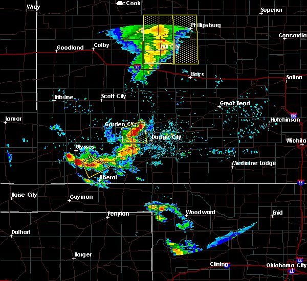 At 908 pm cdt, a severe thunderstorm was located 7 miles west of moscow, moving southeast at 20 mph (radar indicated). Hazards include 60 mph wind gusts and half dollar size hail. Hail damage to vehicles is expected. Expect wind damage to roofs, siding, and trees. At 908 pm cdt, a severe thunderstorm was located 7 miles west of moscow, moving southeast at 20 mph (radar indicated). Hazards include 60 mph wind gusts and half dollar size hail. Hail damage to vehicles is expected. Expect wind damage to roofs, siding, and trees.
|
| 5/24/2020 9:30 PM CDT | Ping Pong Ball sized hail reported 0.6 miles SE of Hugoton, KS |
| 5/24/2020 9:16 PM CDT |
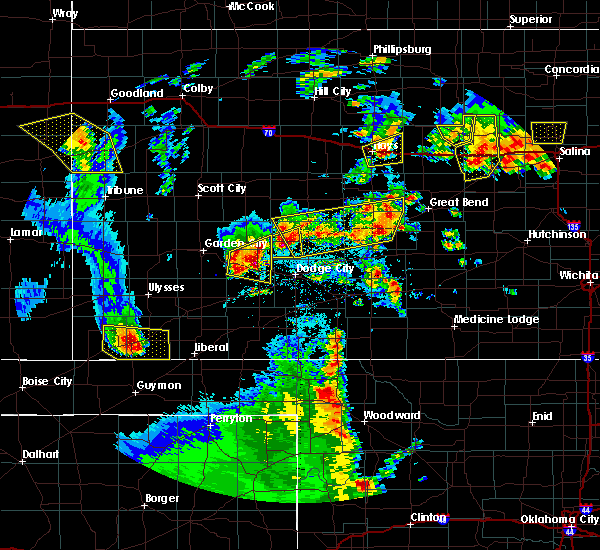 At 915 pm cdt, a severe thunderstorm was located near hugoton, moving east at 35 mph (radar indicated). Hazards include 60 mph wind gusts and half dollar size hail. Hail damage to vehicles is expected. expect wind damage to roofs, siding, and trees. Locations impacted include, hugoton and feterita. At 915 pm cdt, a severe thunderstorm was located near hugoton, moving east at 35 mph (radar indicated). Hazards include 60 mph wind gusts and half dollar size hail. Hail damage to vehicles is expected. expect wind damage to roofs, siding, and trees. Locations impacted include, hugoton and feterita.
|
| 5/24/2020 9:15 PM CDT | Quarter sized hail reported 6.5 miles E of Hugoton, KS |
| 5/24/2020 9:01 PM CDT |
 At 901 pm cdt, a severe thunderstorm was located near feterita, moving east at 40 mph (radar indicated). Hazards include 60 mph wind gusts and quarter size hail. Hail damage to vehicles is expected. expect wind damage to roofs, siding, and trees. Locations impacted include, hugoton, rolla and feterita. At 901 pm cdt, a severe thunderstorm was located near feterita, moving east at 40 mph (radar indicated). Hazards include 60 mph wind gusts and quarter size hail. Hail damage to vehicles is expected. expect wind damage to roofs, siding, and trees. Locations impacted include, hugoton, rolla and feterita.
|
| 5/24/2020 8:40 PM CDT |
 At 840 pm cdt, a severe thunderstorm was located near wilburton, moving east at 40 mph (radar indicated). Hazards include 70 mph wind gusts and ping pong ball size hail. People and animals outdoors will be injured. expect hail damage to roofs, siding, windows, and vehicles. expect considerable tree damage. Wind damage is also likely to mobile homes, roofs, and outbuildings. At 840 pm cdt, a severe thunderstorm was located near wilburton, moving east at 40 mph (radar indicated). Hazards include 70 mph wind gusts and ping pong ball size hail. People and animals outdoors will be injured. expect hail damage to roofs, siding, windows, and vehicles. expect considerable tree damage. Wind damage is also likely to mobile homes, roofs, and outbuildings.
|
| 5/21/2020 10:15 PM CDT |
 At 1015 pm cdt, severe thunderstorms were located along a line extending from 6 miles southwest of ingalls to 6 miles south of tice to near hugoton, moving southeast at 15 mph (radar indicated). Hazards include 60 mph wind gusts and quarter size hail. Hail damage to vehicles is expected. expect wind damage to roofs, siding, and trees. Locations impacted include, liberal, hugoton, sublette, satanta, montezuma, kismet, moscow, copeland, ryus, missler, tice, cave, hayne, woods, the haggard elev and plains. At 1015 pm cdt, severe thunderstorms were located along a line extending from 6 miles southwest of ingalls to 6 miles south of tice to near hugoton, moving southeast at 15 mph (radar indicated). Hazards include 60 mph wind gusts and quarter size hail. Hail damage to vehicles is expected. expect wind damage to roofs, siding, and trees. Locations impacted include, liberal, hugoton, sublette, satanta, montezuma, kismet, moscow, copeland, ryus, missler, tice, cave, hayne, woods, the haggard elev and plains.
|
| 5/21/2020 9:40 PM CDT |
 At 939 pm cdt, severe thunderstorms were located along a line extending from 6 miles southwest of charleston to sublette to near hugoton, moving east at 45 mph (radar indicated). Hazards include golf ball size hail and 70 mph wind gusts. People and animals outdoors will be injured. expect hail damage to roofs, siding, windows, and vehicles. expect considerable tree damage. Wind damage is also likely to mobile homes, roofs, and outbuildings. At 939 pm cdt, severe thunderstorms were located along a line extending from 6 miles southwest of charleston to sublette to near hugoton, moving east at 45 mph (radar indicated). Hazards include golf ball size hail and 70 mph wind gusts. People and animals outdoors will be injured. expect hail damage to roofs, siding, windows, and vehicles. expect considerable tree damage. Wind damage is also likely to mobile homes, roofs, and outbuildings.
|
| 5/21/2020 9:26 PM CDT |
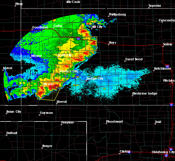 At 925 pm cdt, severe thunderstorms were located along a line extending from near ulysses to near hugoton, moving east at 15 mph. another severe thunderstorm was located 10 miles north northwest of satanta, which was moving northeast at 10 mph (radar indicated). Hazards include two inch hail and 70 mph wind gusts. People and animals outdoors will be injured. expect hail damage to roofs, siding, windows, and vehicles. expect considerable tree damage. wind damage is also likely to mobile homes, roofs, and outbuildings. Locations impacted include, ulysses, hugoton, sublette, satanta, moscow, ryus, cave, hickok and woods. At 925 pm cdt, severe thunderstorms were located along a line extending from near ulysses to near hugoton, moving east at 15 mph. another severe thunderstorm was located 10 miles north northwest of satanta, which was moving northeast at 10 mph (radar indicated). Hazards include two inch hail and 70 mph wind gusts. People and animals outdoors will be injured. expect hail damage to roofs, siding, windows, and vehicles. expect considerable tree damage. wind damage is also likely to mobile homes, roofs, and outbuildings. Locations impacted include, ulysses, hugoton, sublette, satanta, moscow, ryus, cave, hickok and woods.
|
| 5/21/2020 8:53 PM CDT |
 At 851 pm cdt, severe thunderstorms were located along a line extending from 10 miles north of hickok to near feterita, moving east at 20 mph. out ahead of this line, a severe thunderstorm was located 6 miles north of satanta (radar indicated). Hazards include two inch hail with the storm north of satanta. up to 70 mph winds with the main line of storms. People and animals outdoors will be injured. expect hail damage to roofs, siding, windows, and vehicles. expect considerable tree damage. Wind damage is also likely to mobile homes, roofs, and outbuildings. At 851 pm cdt, severe thunderstorms were located along a line extending from 10 miles north of hickok to near feterita, moving east at 20 mph. out ahead of this line, a severe thunderstorm was located 6 miles north of satanta (radar indicated). Hazards include two inch hail with the storm north of satanta. up to 70 mph winds with the main line of storms. People and animals outdoors will be injured. expect hail damage to roofs, siding, windows, and vehicles. expect considerable tree damage. Wind damage is also likely to mobile homes, roofs, and outbuildings.
|
| 3/30/2020 5:08 PM CDT |
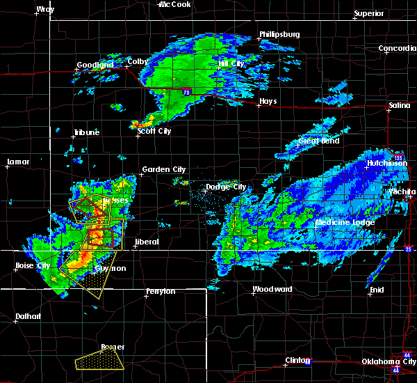 At 507 pm cdt, a severe thunderstorm capable of producing a tornado was located near feterita, moving east at 20 mph (radar indicated rotation). Hazards include tornado and quarter size hail. Flying debris will be dangerous to those caught without shelter. mobile homes will be damaged or destroyed. damage to roofs, windows, and vehicles will occur. tree damage is likely. This dangerous storm will be near, hugoton around 530 pm cdt. At 507 pm cdt, a severe thunderstorm capable of producing a tornado was located near feterita, moving east at 20 mph (radar indicated rotation). Hazards include tornado and quarter size hail. Flying debris will be dangerous to those caught without shelter. mobile homes will be damaged or destroyed. damage to roofs, windows, and vehicles will occur. tree damage is likely. This dangerous storm will be near, hugoton around 530 pm cdt.
|
| 3/30/2020 5:02 PM CDT |
 At 501 pm cdt, a severe thunderstorm capable of producing a tornado was located very near feterita, moving east at 25 mph (radar indicated rotation. the public has reported rotation with this storm). Hazards include tornado and half dollar size hail. Flying debris will be dangerous to those caught without shelter. mobile homes will be damaged or destroyed. damage to roofs, windows, and vehicles will occur. tree damage is likely. This dangerous storm will be near, hugoton around 515 pm cdt. At 501 pm cdt, a severe thunderstorm capable of producing a tornado was located very near feterita, moving east at 25 mph (radar indicated rotation. the public has reported rotation with this storm). Hazards include tornado and half dollar size hail. Flying debris will be dangerous to those caught without shelter. mobile homes will be damaged or destroyed. damage to roofs, windows, and vehicles will occur. tree damage is likely. This dangerous storm will be near, hugoton around 515 pm cdt.
|
| 3/30/2020 4:59 PM CDT |
 At 459 pm cdt, severe thunderstorms were located along a line extending from 7 miles west of moscow to 7 miles northeast of hough, moving east at 25 mph (radar indicated). Hazards include 70 mph wind gusts and quarter size hail. Hail damage to vehicles is expected. expect considerable tree damage. wind damage is also likely to mobile homes, roofs, and outbuildings. Locations impacted include, hugoton, moscow, feterita and cave. At 459 pm cdt, severe thunderstorms were located along a line extending from 7 miles west of moscow to 7 miles northeast of hough, moving east at 25 mph (radar indicated). Hazards include 70 mph wind gusts and quarter size hail. Hail damage to vehicles is expected. expect considerable tree damage. wind damage is also likely to mobile homes, roofs, and outbuildings. Locations impacted include, hugoton, moscow, feterita and cave.
|
| 3/30/2020 4:48 PM CDT |
 At 448 pm cdt, severe thunderstorms were located along a line extending from 11 miles north of hugoton to near hough, moving east at 25 mph (radar indicated). Hazards include 60 mph wind gusts and quarter size hail. Hail damage to vehicles is expected. Expect wind damage to roofs, siding, and trees. At 448 pm cdt, severe thunderstorms were located along a line extending from 11 miles north of hugoton to near hough, moving east at 25 mph (radar indicated). Hazards include 60 mph wind gusts and quarter size hail. Hail damage to vehicles is expected. Expect wind damage to roofs, siding, and trees.
|
| 7/5/2019 7:42 PM CDT |
 The severe thunderstorm warning for southeastern morton and stevens counties will expire at 745 pm cdt, the storm which prompted the warning has weakened below severe limits, and no longer poses an immediate threat to life or property. therefore, the warning will be allowed to expire. however small hail, gusty winds and heavy rain are still possible with this thunderstorm. a severe thunderstorm watch remains in effect until 1000 pm cdt for southwestern kansas. The severe thunderstorm warning for southeastern morton and stevens counties will expire at 745 pm cdt, the storm which prompted the warning has weakened below severe limits, and no longer poses an immediate threat to life or property. therefore, the warning will be allowed to expire. however small hail, gusty winds and heavy rain are still possible with this thunderstorm. a severe thunderstorm watch remains in effect until 1000 pm cdt for southwestern kansas.
|
| 7/5/2019 7:04 PM CDT |
 At 704 pm cdt, a severe thunderstorm was located near rolla, moving south at 10 mph (radar indicated). Hazards include ping pong ball size hail and 60 mph wind gusts. People and animals outdoors will be injured. expect hail damage to roofs, siding, windows, and vehicles. expect wind damage to roofs, siding, and trees. Locations impacted include, hugoton, rolla, wilburton and feterita. At 704 pm cdt, a severe thunderstorm was located near rolla, moving south at 10 mph (radar indicated). Hazards include ping pong ball size hail and 60 mph wind gusts. People and animals outdoors will be injured. expect hail damage to roofs, siding, windows, and vehicles. expect wind damage to roofs, siding, and trees. Locations impacted include, hugoton, rolla, wilburton and feterita.
|
| 7/5/2019 6:44 PM CDT |
 At 644 pm cdt, a severe thunderstorm was located near rolla, moving south at 10 mph (radar indicated). Hazards include golf ball size hail and 60 mph wind gusts. People and animals outdoors will be injured. expect hail damage to roofs, siding, windows, and vehicles. Expect wind damage to roofs, siding, and trees. At 644 pm cdt, a severe thunderstorm was located near rolla, moving south at 10 mph (radar indicated). Hazards include golf ball size hail and 60 mph wind gusts. People and animals outdoors will be injured. expect hail damage to roofs, siding, windows, and vehicles. Expect wind damage to roofs, siding, and trees.
|
| 6/23/2019 12:32 AM CDT |
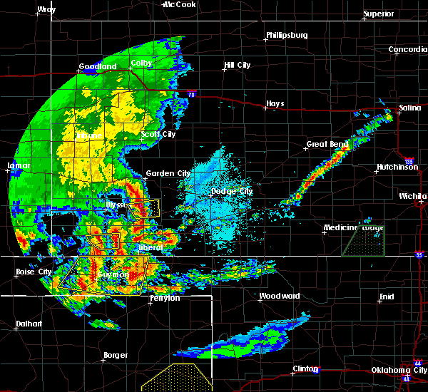 At 1232 am cdt, a severe thunderstorm was located near feterita, moving east at 40 mph (radar indicated). Hazards include 60 mph wind gusts and quarter size hail. Hail damage to vehicles is expected. expect wind damage to roofs, siding, and trees. Locations impacted include, hugoton and feterita. At 1232 am cdt, a severe thunderstorm was located near feterita, moving east at 40 mph (radar indicated). Hazards include 60 mph wind gusts and quarter size hail. Hail damage to vehicles is expected. expect wind damage to roofs, siding, and trees. Locations impacted include, hugoton and feterita.
|
| 6/23/2019 12:25 AM CDT |
 At 1225 am cdt, a severe thunderstorm was located near feterita, moving east at 35 mph (radar indicated). Hazards include golf ball size hail and 70 mph wind gusts. People and animals outdoors will be injured. expect hail damage to roofs, siding, windows, and vehicles. expect considerable tree damage. wind damage is also likely to mobile homes, roofs, and outbuildings. Locations impacted include, hugoton, rolla and feterita. At 1225 am cdt, a severe thunderstorm was located near feterita, moving east at 35 mph (radar indicated). Hazards include golf ball size hail and 70 mph wind gusts. People and animals outdoors will be injured. expect hail damage to roofs, siding, windows, and vehicles. expect considerable tree damage. wind damage is also likely to mobile homes, roofs, and outbuildings. Locations impacted include, hugoton, rolla and feterita.
|
| 6/23/2019 12:15 AM CDT |
 At 1214 am cdt, a severe thunderstorm was located very near rolla, moving east at 40 mph (radar indicated). Hazards include golf ball size hail and 70 mph wind gusts. People and animals outdoors will be injured. expect hail damage to roofs, siding, windows, and vehicles. expect considerable tree damage. Wind damage is also likely to mobile homes, roofs, and outbuildings. At 1214 am cdt, a severe thunderstorm was located very near rolla, moving east at 40 mph (radar indicated). Hazards include golf ball size hail and 70 mph wind gusts. People and animals outdoors will be injured. expect hail damage to roofs, siding, windows, and vehicles. expect considerable tree damage. Wind damage is also likely to mobile homes, roofs, and outbuildings.
|
| 6/14/2019 8:51 PM CDT |
 At 837 pm cdt, a severe thunderstorm was located 11 miles northeast of richfield, moving east at 40 mph (radar indicated). Hazards include 60 mph wind gusts and quarter size hail. Hail damage to vehicles is expected. expect wind damage to roofs, siding, and trees. Locations impacted include, ulysses, hugoton, johnson city, manter, richfield, big bow and feterita. At 837 pm cdt, a severe thunderstorm was located 11 miles northeast of richfield, moving east at 40 mph (radar indicated). Hazards include 60 mph wind gusts and quarter size hail. Hail damage to vehicles is expected. expect wind damage to roofs, siding, and trees. Locations impacted include, ulysses, hugoton, johnson city, manter, richfield, big bow and feterita.
|
| 6/14/2019 8:37 PM CDT |
 At 837 pm cdt, a severe thunderstorm was located 11 miles northeast of richfield, moving east at 40 mph (radar indicated). Hazards include 60 mph wind gusts and quarter size hail. Hail damage to vehicles is expected. expect wind damage to roofs, siding, and trees. Locations impacted include, ulysses, hugoton, johnson city, manter, richfield, big bow and feterita. At 837 pm cdt, a severe thunderstorm was located 11 miles northeast of richfield, moving east at 40 mph (radar indicated). Hazards include 60 mph wind gusts and quarter size hail. Hail damage to vehicles is expected. expect wind damage to roofs, siding, and trees. Locations impacted include, ulysses, hugoton, johnson city, manter, richfield, big bow and feterita.
|
| 6/14/2019 8:15 PM CDT |
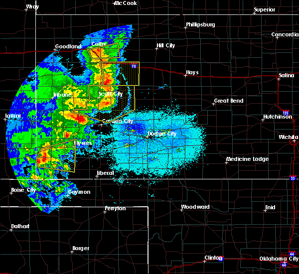 At 814 pm cdt, a severe thunderstorm was located 7 miles northwest of richfield, moving east at 40 mph (radar indicated). Hazards include 60 mph wind gusts and quarter size hail. Hail damage to vehicles is expected. Expect wind damage to roofs, siding, and trees. At 814 pm cdt, a severe thunderstorm was located 7 miles northwest of richfield, moving east at 40 mph (radar indicated). Hazards include 60 mph wind gusts and quarter size hail. Hail damage to vehicles is expected. Expect wind damage to roofs, siding, and trees.
|
| 5/23/2019 10:35 AM CDT | Ping Pong Ball sized hail reported 11.7 miles NNW of Hugoton, KS |
| 5/23/2019 10:26 AM CDT |
 At 1026 am cdt, a severe thunderstorm was located 10 miles southeast of hugoton, moving northeast at 50 mph (radar indicated). Hazards include two inch hail and 60 mph wind gusts. People and animals outdoors will be injured. expect hail damage to roofs, siding, windows, and vehicles. expect wind damage to roofs, siding, and trees. Locations impacted include, hugoton, moscow, woods and cave. At 1026 am cdt, a severe thunderstorm was located 10 miles southeast of hugoton, moving northeast at 50 mph (radar indicated). Hazards include two inch hail and 60 mph wind gusts. People and animals outdoors will be injured. expect hail damage to roofs, siding, windows, and vehicles. expect wind damage to roofs, siding, and trees. Locations impacted include, hugoton, moscow, woods and cave.
|
| 5/23/2019 10:07 AM CDT |
 At 1007 am cdt, a severe thunderstorm was located near hough, or 12 miles north of guymon, moving northeast at 45 mph (radar indicated). Hazards include ping pong ball size hail and 60 mph wind gusts. People and animals outdoors will be injured. expect hail damage to roofs, siding, windows, and vehicles. Expect wind damage to roofs, siding, and trees. At 1007 am cdt, a severe thunderstorm was located near hough, or 12 miles north of guymon, moving northeast at 45 mph (radar indicated). Hazards include ping pong ball size hail and 60 mph wind gusts. People and animals outdoors will be injured. expect hail damage to roofs, siding, windows, and vehicles. Expect wind damage to roofs, siding, and trees.
|
| 5/6/2019 10:56 PM CDT | Quarter sized hail reported 9.9 miles NE of Hugoton, KS |
| 5/6/2019 10:28 PM CDT |
 At 1028 pm cdt, a severe thunderstorm was located near rolla, moving northeast at 35 mph (radar indicated). Hazards include 60 mph wind gusts and quarter size hail. Hail damage to vehicles is expected. Expect wind damage to roofs, siding, and trees. At 1028 pm cdt, a severe thunderstorm was located near rolla, moving northeast at 35 mph (radar indicated). Hazards include 60 mph wind gusts and quarter size hail. Hail damage to vehicles is expected. Expect wind damage to roofs, siding, and trees.
|
| 5/6/2019 10:00 PM CDT | Quarter sized hail reported 0.8 miles WNW of Hugoton, KS |
| 5/6/2019 9:51 PM CDT |
 At 951 pm cdt, a severe thunderstorm was located near feterita, moving northeast at 35 mph (radar indicated). Hazards include golf ball size hail. People and animals outdoors will be injured. Expect damage to roofs, siding, windows, and vehicles. At 951 pm cdt, a severe thunderstorm was located near feterita, moving northeast at 35 mph (radar indicated). Hazards include golf ball size hail. People and animals outdoors will be injured. Expect damage to roofs, siding, windows, and vehicles.
|
| 5/6/2019 8:59 PM CDT |
 At 859 pm cdt, severe thunderstorms were located along a line extending from near cave to 7 miles south of feterita, moving east at 35 mph (radar indicated). Hazards include 60 mph wind gusts and half dollar size hail. Hail damage to vehicles is expected. Expect wind damage to roofs, siding, and trees. At 859 pm cdt, severe thunderstorms were located along a line extending from near cave to 7 miles south of feterita, moving east at 35 mph (radar indicated). Hazards include 60 mph wind gusts and half dollar size hail. Hail damage to vehicles is expected. Expect wind damage to roofs, siding, and trees.
|
| 5/6/2019 8:37 PM CDT |
 At 836 pm cdt/736 pm mdt/, severe thunderstorms were located along a line extending from 6 miles southeast of lakin to 6 miles northwest of cave to near rolla, moving east at 30 mph (radar indicated). Hazards include 60 mph wind gusts and quarter size hail. Hail damage to vehicles is expected. expect wind damage to roofs, siding, and trees. Locations impacted include, ulysses, hugoton, lakin, johnson city, deerfield, rolla, moscow, kendall, richfield, big bow, feterita, wilburton and hickok. At 836 pm cdt/736 pm mdt/, severe thunderstorms were located along a line extending from 6 miles southeast of lakin to 6 miles northwest of cave to near rolla, moving east at 30 mph (radar indicated). Hazards include 60 mph wind gusts and quarter size hail. Hail damage to vehicles is expected. expect wind damage to roofs, siding, and trees. Locations impacted include, ulysses, hugoton, lakin, johnson city, deerfield, rolla, moscow, kendall, richfield, big bow, feterita, wilburton and hickok.
|
| 5/6/2019 8:09 PM CDT |
 The national weather service in dodge city has issued a * severe thunderstorm warning for. morton county in southwestern kansas. southeastern hamilton county in southwestern kansas. southern kearny county in southwestern kansas. Grant county in southwestern kansas. The national weather service in dodge city has issued a * severe thunderstorm warning for. morton county in southwestern kansas. southeastern hamilton county in southwestern kansas. southern kearny county in southwestern kansas. Grant county in southwestern kansas.
|
| 5/5/2019 5:50 PM CDT | Quarter sized hail reported 6.3 miles SSW of Hugoton, KS |
| 5/5/2019 5:45 PM CDT | Quarter sized hail reported 6.3 miles SSW of Hugoton, KS |
| 7/29/2018 11:01 PM CDT |
 At 1100 pm cdt, a severe thunderstorm was located 9 miles south of feterita, moving southeast at 40 mph (radar indicated). Hazards include two inch hail and 70 mph wind gusts. People and animals outdoors will be injured. expect hail damage to roofs, siding, windows, and vehicles. expect considerable tree damage. wind damage is also likely to mobile homes, roofs, and outbuildings. Locations impacted include, hugoton, rolla and feterita. At 1100 pm cdt, a severe thunderstorm was located 9 miles south of feterita, moving southeast at 40 mph (radar indicated). Hazards include two inch hail and 70 mph wind gusts. People and animals outdoors will be injured. expect hail damage to roofs, siding, windows, and vehicles. expect considerable tree damage. wind damage is also likely to mobile homes, roofs, and outbuildings. Locations impacted include, hugoton, rolla and feterita.
|
| 7/29/2018 10:46 PM CDT |
 At 1046 pm cdt, a severe thunderstorm was located 7 miles south of feterita, moving southeast at 55 mph. this is a very dangerous storm (radar indicated). Hazards include 80 mph wind gusts and two inch hail. Flying debris will be dangerous to those caught without shelter. mobile homes will be heavily damaged. expect considerable damage to roofs, windows, and vehicles. extensive tree damage and power outages are likely. Locations impacted include, hugoton, rolla and feterita. At 1046 pm cdt, a severe thunderstorm was located 7 miles south of feterita, moving southeast at 55 mph. this is a very dangerous storm (radar indicated). Hazards include 80 mph wind gusts and two inch hail. Flying debris will be dangerous to those caught without shelter. mobile homes will be heavily damaged. expect considerable damage to roofs, windows, and vehicles. extensive tree damage and power outages are likely. Locations impacted include, hugoton, rolla and feterita.
|
| 7/29/2018 10:38 PM CDT |
 At 1038 pm cdt, a severe thunderstorm was located very near rolla, moving south at 60 mph. this replaces the previous warning for morton and stevens counties. this is a very dangerous storm (radar indicated). Hazards include 80 mph wind gusts and tennis ball size hail. Flying debris will be dangerous to those caught without shelter. mobile homes will be heavily damaged. expect considerable damage to roofs, windows, and vehicles. Extensive tree damage and power outages are likely. At 1038 pm cdt, a severe thunderstorm was located very near rolla, moving south at 60 mph. this replaces the previous warning for morton and stevens counties. this is a very dangerous storm (radar indicated). Hazards include 80 mph wind gusts and tennis ball size hail. Flying debris will be dangerous to those caught without shelter. mobile homes will be heavily damaged. expect considerable damage to roofs, windows, and vehicles. Extensive tree damage and power outages are likely.
|
| 7/29/2018 10:12 PM CDT |
 At 1011 pm cdt, a severe thunderstorm was located 6 miles east of richfield, moving southeast at 55 mph. this is a very dangerous storm (radar indicated). Hazards include 80 mph wind gusts and tennis ball size hail. Flying debris will be dangerous to those caught without shelter. mobile homes will be heavily damaged. expect considerable damage to roofs, windows, and vehicles. extensive tree damage and power outages are likely. Locations impacted include, hugoton, elkhart, johnson city, rolla, manter, richfield, wilburton, big bow, feterita and the saunders elevator. At 1011 pm cdt, a severe thunderstorm was located 6 miles east of richfield, moving southeast at 55 mph. this is a very dangerous storm (radar indicated). Hazards include 80 mph wind gusts and tennis ball size hail. Flying debris will be dangerous to those caught without shelter. mobile homes will be heavily damaged. expect considerable damage to roofs, windows, and vehicles. extensive tree damage and power outages are likely. Locations impacted include, hugoton, elkhart, johnson city, rolla, manter, richfield, wilburton, big bow, feterita and the saunders elevator.
|
| 7/29/2018 9:54 PM CDT |
 At 953 pm cdt/853 pm mdt/, a severe thunderstorm was located 3 miles east of manter, moving southeast at 50 mph. this replaces the previous warning for hamilton and stanton counties. this is a very dangerous storm (radar indicated). Hazards include 80 mph wind gusts and tennis ball size hail. Flying debris will be dangerous to those caught without shelter. mobile homes will be heavily damaged. expect considerable damage to roofs, windows, and vehicles. Extensive tree damage and power outages are likely. At 953 pm cdt/853 pm mdt/, a severe thunderstorm was located 3 miles east of manter, moving southeast at 50 mph. this replaces the previous warning for hamilton and stanton counties. this is a very dangerous storm (radar indicated). Hazards include 80 mph wind gusts and tennis ball size hail. Flying debris will be dangerous to those caught without shelter. mobile homes will be heavily damaged. expect considerable damage to roofs, windows, and vehicles. Extensive tree damage and power outages are likely.
|
| 7/23/2018 12:27 AM CDT |
 At 1227 am cdt, a severe thunderstorm was located 5 miles northwest of rolla, moving east at 25 mph (radar indicated). Hazards include 60 mph wind gusts. expect damage to roofs, siding, and trees At 1227 am cdt, a severe thunderstorm was located 5 miles northwest of rolla, moving east at 25 mph (radar indicated). Hazards include 60 mph wind gusts. expect damage to roofs, siding, and trees
|
| 7/17/2018 6:26 PM CDT |
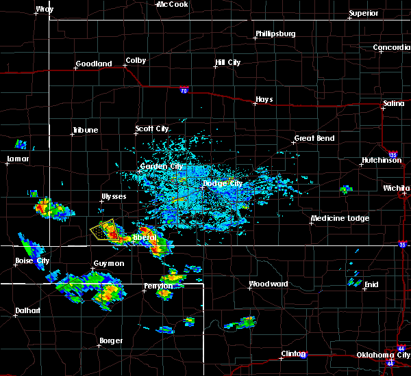 The severe thunderstorm warning for central stevens county will expire at 630 pm cdt, the storm which prompted the warning has weakened below severe limits, and no longer poses an immediate threat to life or property. therefore, the warning will be allowed to expire. however gusty winds and heavy rain are still possible with this thunderstorm. to report severe weather, contact your nearest law enforcement agency. they will relay your report to the national weather service dodge city. The severe thunderstorm warning for central stevens county will expire at 630 pm cdt, the storm which prompted the warning has weakened below severe limits, and no longer poses an immediate threat to life or property. therefore, the warning will be allowed to expire. however gusty winds and heavy rain are still possible with this thunderstorm. to report severe weather, contact your nearest law enforcement agency. they will relay your report to the national weather service dodge city.
|
| 7/17/2018 5:58 PM CDT |
 At 557 pm cdt, a severe thunderstorm was located very near hugoton, moving northeast at 10 mph (radar indicated). Hazards include 60 mph wind gusts and penny size hail. Expect damage to roofs, siding, and trees. Locations impacted include, hugoton and moscow. At 557 pm cdt, a severe thunderstorm was located very near hugoton, moving northeast at 10 mph (radar indicated). Hazards include 60 mph wind gusts and penny size hail. Expect damage to roofs, siding, and trees. Locations impacted include, hugoton and moscow.
|
| 7/17/2018 5:46 PM CDT | Mesonet station khqg... 1 wsw hugoto in stevens county KS, 1.8 miles ENE of Hugoton, KS |
| 7/17/2018 5:44 PM CDT |
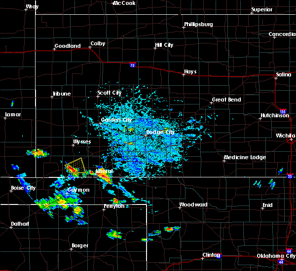 At 544 pm cdt, a severe thunderstorm was located near hugoton, and is nearly stationary (radar indicated). Hazards include 60 mph wind gusts and nickel size hail. expect damage to roofs, siding, and trees At 544 pm cdt, a severe thunderstorm was located near hugoton, and is nearly stationary (radar indicated). Hazards include 60 mph wind gusts and nickel size hail. expect damage to roofs, siding, and trees
|
| 6/24/2018 9:02 PM CDT |
 At 902 pm cdt, severe thunderstorms were located along a line extending from 3 miles southeast of ryus to 6 miles north of hooker, moving east at 45 mph (radar indicated). Hazards include 70 mph wind gusts and penny size hail. Expect considerable tree damage. Damage is likely to mobile homes, roofs, and outbuildings. At 902 pm cdt, severe thunderstorms were located along a line extending from 3 miles southeast of ryus to 6 miles north of hooker, moving east at 45 mph (radar indicated). Hazards include 70 mph wind gusts and penny size hail. Expect considerable tree damage. Damage is likely to mobile homes, roofs, and outbuildings.
|
| 6/19/2018 11:45 PM CDT |
 At 1145 pm cdt, a severe thunderstorm was located 6 miles southeast of hugoton, moving southeast at 50 mph (radar indicated). Hazards include 70 mph wind gusts and penny size hail. Expect considerable tree damage. damage is likely to mobile homes, roofs, and outbuildings. Locations impacted include, liberal, hugoton, meade, kismet, moscow, meade state park, cave, hayne, woods, missler, feterita and plains. At 1145 pm cdt, a severe thunderstorm was located 6 miles southeast of hugoton, moving southeast at 50 mph (radar indicated). Hazards include 70 mph wind gusts and penny size hail. Expect considerable tree damage. damage is likely to mobile homes, roofs, and outbuildings. Locations impacted include, liberal, hugoton, meade, kismet, moscow, meade state park, cave, hayne, woods, missler, feterita and plains.
|
| 6/19/2018 11:32 PM CDT |
 At 1131 pm cdt, severe thunderstorms were located along a line extending from 11 miles south of big bow to 9 miles southwest of meade state park, moving south at 35 mph (radar indicated). Hazards include 70 mph wind gusts and penny size hail. Expect considerable tree damage. damage is likely to mobile homes, roofs, and outbuildings. locations impacted include, liberal, hugoton, meade, sublette, satanta, fowler, kismet, moscow, meade state park, missler, feterita, cave, hayne, woods and plains. At 1113 pm cdt, a 74 mph wind gust was recorded by the automated weather station at the liberal airport. At 1131 pm cdt, severe thunderstorms were located along a line extending from 11 miles south of big bow to 9 miles southwest of meade state park, moving south at 35 mph (radar indicated). Hazards include 70 mph wind gusts and penny size hail. Expect considerable tree damage. damage is likely to mobile homes, roofs, and outbuildings. locations impacted include, liberal, hugoton, meade, sublette, satanta, fowler, kismet, moscow, meade state park, missler, feterita, cave, hayne, woods and plains. At 1113 pm cdt, a 74 mph wind gust was recorded by the automated weather station at the liberal airport.
|
| 6/19/2018 11:00 PM CDT |
 At 1100 pm cdt, severe thunderstorms were located along a line extending from 5 miles south of johnson city to 8 miles north of missler, moving southeast at 50 mph (radar indicated). Hazards include two inch hail and 70 mph wind gusts. People and animals outdoors will be injured. expect hail damage to roofs, siding, windows, and vehicles. expect considerable tree damage. Wind damage is also likely to mobile homes, roofs, and outbuildings. At 1100 pm cdt, severe thunderstorms were located along a line extending from 5 miles south of johnson city to 8 miles north of missler, moving southeast at 50 mph (radar indicated). Hazards include two inch hail and 70 mph wind gusts. People and animals outdoors will be injured. expect hail damage to roofs, siding, windows, and vehicles. expect considerable tree damage. Wind damage is also likely to mobile homes, roofs, and outbuildings.
|
| 6/19/2018 10:40 PM CDT |
 At 1005 pm cdt, severe thunderstorms were located along a line extending from 8 miles southeast of kalvesta to 8 miles northwest of sublette to 3 miles east of the saunders elevator, moving southwest at 65 mph (radar indicated and measured winds by automated weather stations). Hazards include 70 mph wind gusts and penny size hail. Expect considerable tree damage. Damage is likely to mobile homes, roofs, and outbuildings. At 1005 pm cdt, severe thunderstorms were located along a line extending from 8 miles southeast of kalvesta to 8 miles northwest of sublette to 3 miles east of the saunders elevator, moving southwest at 65 mph (radar indicated and measured winds by automated weather stations). Hazards include 70 mph wind gusts and penny size hail. Expect considerable tree damage. Damage is likely to mobile homes, roofs, and outbuildings.
|
| 6/19/2018 10:27 PM CDT |
 At 1026 pm cdt, severe thunderstorms were located along a line extending from 12 miles southwest of plymell to 2 miles southwest of the saunders elevator, moving southeast at 60 mph (radar indicated). Hazards include two inch hail and 70 mph wind gusts. People and animals outdoors will be injured. expect hail damage to roofs, siding, windows, and vehicles. expect considerable tree damage. Wind damage is also likely to mobile homes, roofs, and outbuildings. At 1026 pm cdt, severe thunderstorms were located along a line extending from 12 miles southwest of plymell to 2 miles southwest of the saunders elevator, moving southeast at 60 mph (radar indicated). Hazards include two inch hail and 70 mph wind gusts. People and animals outdoors will be injured. expect hail damage to roofs, siding, windows, and vehicles. expect considerable tree damage. Wind damage is also likely to mobile homes, roofs, and outbuildings.
|
| 6/19/2018 10:18 PM CDT |
 At 1018 pm cdt, severe thunderstorms were located along a line extending from 2 miles south of ryus to 10 miles south of big bow to 4 miles west of the saunders elevator, moving southeast at 40 mph (radar indicated). Hazards include 70 mph wind gusts and quarter size hail. Hail damage to vehicles is expected. expect considerable tree damage. wind damage is also likely to mobile homes, roofs, and outbuildings. Locations impacted include, ulysses, hugoton, elkhart, johnson city, rolla, moscow, manter, richfield, the saunders elevator, big bow, feterita, wilburton and hickok. At 1018 pm cdt, severe thunderstorms were located along a line extending from 2 miles south of ryus to 10 miles south of big bow to 4 miles west of the saunders elevator, moving southeast at 40 mph (radar indicated). Hazards include 70 mph wind gusts and quarter size hail. Hail damage to vehicles is expected. expect considerable tree damage. wind damage is also likely to mobile homes, roofs, and outbuildings. Locations impacted include, ulysses, hugoton, elkhart, johnson city, rolla, moscow, manter, richfield, the saunders elevator, big bow, feterita, wilburton and hickok.
|
| 6/19/2018 10:05 PM CDT |
 At 1005 pm cdt, severe thunderstorms were located along a line extending from 8 miles southeast of kalvesta to 8 miles northwest of sublette to 3 miles east of the saunders elevator, moving southwest at 65 mph (radar indicated and measured winds by automated weather stations). Hazards include 70 mph wind gusts and penny size hail. Expect considerable tree damage. Damage is likely to mobile homes, roofs, and outbuildings. At 1005 pm cdt, severe thunderstorms were located along a line extending from 8 miles southeast of kalvesta to 8 miles northwest of sublette to 3 miles east of the saunders elevator, moving southwest at 65 mph (radar indicated and measured winds by automated weather stations). Hazards include 70 mph wind gusts and penny size hail. Expect considerable tree damage. Damage is likely to mobile homes, roofs, and outbuildings.
|
| 6/19/2018 9:56 PM CDT |
 At 955 pm cdt/855 pm mdt/, the leading edge of severe thunderstorms were located along a line extending from 7 miles south of lakin to 3 miles east of johnson city to 5 miles east of two buttes, moving southeast at 50 mph (radar indicated). Hazards include 70 mph wind gusts and quarter size hail. Hail damage to vehicles is expected. expect considerable tree damage. wind damage is also likely to mobile homes, roofs, and outbuildings. Locations impacted include, ulysses, hugoton, elkhart, johnson city, rolla, moscow, manter, richfield, the saunders elevator, big bow, feterita, wilburton and hickok. At 955 pm cdt/855 pm mdt/, the leading edge of severe thunderstorms were located along a line extending from 7 miles south of lakin to 3 miles east of johnson city to 5 miles east of two buttes, moving southeast at 50 mph (radar indicated). Hazards include 70 mph wind gusts and quarter size hail. Hail damage to vehicles is expected. expect considerable tree damage. wind damage is also likely to mobile homes, roofs, and outbuildings. Locations impacted include, ulysses, hugoton, elkhart, johnson city, rolla, moscow, manter, richfield, the saunders elevator, big bow, feterita, wilburton and hickok.
|
| 6/19/2018 9:28 PM CDT |
 At 928 pm cdt/828 pm mdt/, severe thunderstorms were located along a line extending from 3 miles southwest of kendall to 13 miles northwest of manter to 2 miles northwest of two buttes, moving southeast at 40 mph (radar indicated). Hazards include 70 mph wind gusts and penny size hail. Expect considerable tree damage. Damage is likely to mobile homes, roofs, and outbuildings. At 928 pm cdt/828 pm mdt/, severe thunderstorms were located along a line extending from 3 miles southwest of kendall to 13 miles northwest of manter to 2 miles northwest of two buttes, moving southeast at 40 mph (radar indicated). Hazards include 70 mph wind gusts and penny size hail. Expect considerable tree damage. Damage is likely to mobile homes, roofs, and outbuildings.
|
| 6/19/2018 8:42 PM CDT |
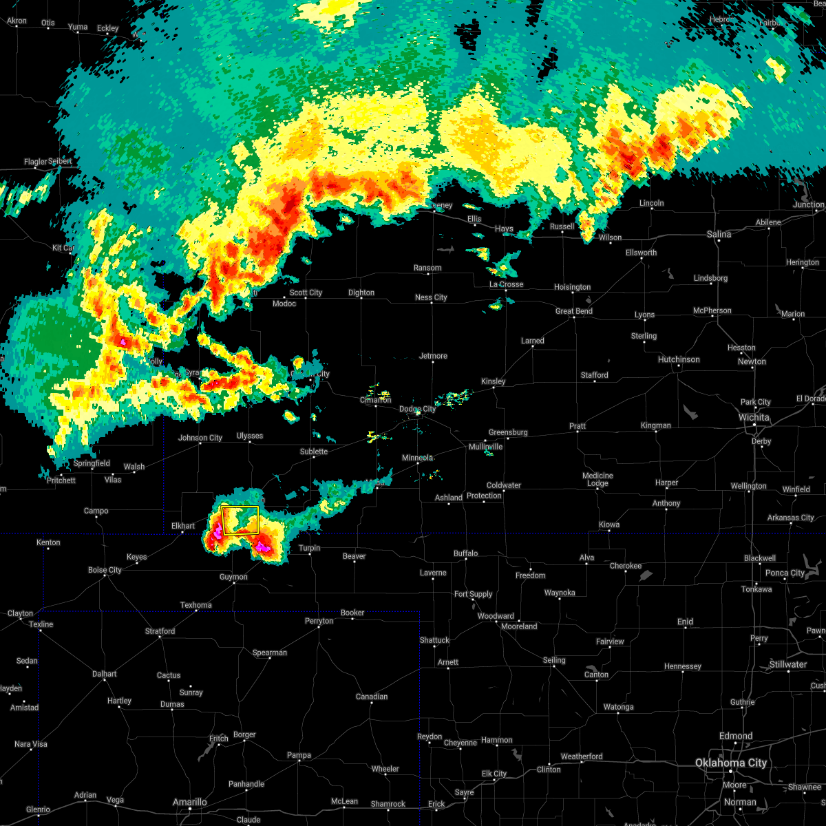 At 842 pm cdt, a severe thunderstorm was located 6 miles southeast of rolla, moving southeast at 10 mph (radar indicated). Hazards include golf ball size hail and 60 mph wind gusts. People and animals outdoors will be injured. expect hail damage to roofs, siding, windows, and vehicles. Expect wind damage to roofs, siding, and trees. At 842 pm cdt, a severe thunderstorm was located 6 miles southeast of rolla, moving southeast at 10 mph (radar indicated). Hazards include golf ball size hail and 60 mph wind gusts. People and animals outdoors will be injured. expect hail damage to roofs, siding, windows, and vehicles. Expect wind damage to roofs, siding, and trees.
|
| 6/6/2018 11:22 PM CDT |
 The severe thunderstorm warning for east central morton and northwestern stevens counties will expire at 1130 pm cdt, the storm which prompted the warning has weakened below severe limits, and no longer poses an immediate threat to life or property. therefore the warning will be allowed to expire. The severe thunderstorm warning for east central morton and northwestern stevens counties will expire at 1130 pm cdt, the storm which prompted the warning has weakened below severe limits, and no longer poses an immediate threat to life or property. therefore the warning will be allowed to expire.
|
| 6/6/2018 11:12 PM CDT | Corrects previous tstm wnd gst report from hugoto in stevens county KS, 0.6 miles SE of Hugoton, KS |
| 6/6/2018 10:52 PM CDT |
 At 1052 pm cdt, a severe thunderstorm was located 6 miles north of feterita, moving east at 20 mph (radar indicated). Hazards include up to golf ball size hail and 60 mph wind gusts. People and animals outdoors will be injured. expect hail damage to roofs, siding, windows, and vehicles. expect wind damage to roofs, siding, and trees. Locations impacted include, hugoton, rolla, richfield and feterita. At 1052 pm cdt, a severe thunderstorm was located 6 miles north of feterita, moving east at 20 mph (radar indicated). Hazards include up to golf ball size hail and 60 mph wind gusts. People and animals outdoors will be injured. expect hail damage to roofs, siding, windows, and vehicles. expect wind damage to roofs, siding, and trees. Locations impacted include, hugoton, rolla, richfield and feterita.
|
| 6/6/2018 10:34 PM CDT |
 At 1034 pm cdt, a severe thunderstorm was located 7 miles north of rolla, moving east at 20 mph (radar indicated). Hazards include up to golf ball size hail and 60 mph wind gusts. People and animals outdoors will be injured. expect hail damage to roofs, siding, windows, and vehicles. Expect wind damage to roofs, siding, and trees. At 1034 pm cdt, a severe thunderstorm was located 7 miles north of rolla, moving east at 20 mph (radar indicated). Hazards include up to golf ball size hail and 60 mph wind gusts. People and animals outdoors will be injured. expect hail damage to roofs, siding, windows, and vehicles. Expect wind damage to roofs, siding, and trees.
|
| 5/30/2018 8:11 PM CDT |
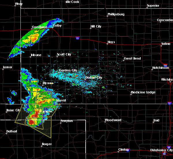 At 810 pm cdt, a severe thunderstorm was located 7 miles south of feterita, moving northeast at 35 mph (radar indicated). Hazards include 60 mph wind gusts, blowing dust and quarter size hail. Hail damage to vehicles is expected. expect wind damage to roofs, siding, and trees. Locations impacted include, hugoton, moscow, woods, feterita and cave. At 810 pm cdt, a severe thunderstorm was located 7 miles south of feterita, moving northeast at 35 mph (radar indicated). Hazards include 60 mph wind gusts, blowing dust and quarter size hail. Hail damage to vehicles is expected. expect wind damage to roofs, siding, and trees. Locations impacted include, hugoton, moscow, woods, feterita and cave.
|
| 5/30/2018 8:01 PM CDT |
 At 800 pm cdt, a severe thunderstorm was located 7 miles south of rolla, moving northeast at 35 mph (radar indicated). Hazards include 60 mph wind gusts, blowing dust and quarter size hail. Hail damage to vehicles is expected. expect wind damage to roofs, siding, and trees. Locations impacted include, hugoton, elkhart, rolla, moscow, wilburton, cave, woods and feterita. At 800 pm cdt, a severe thunderstorm was located 7 miles south of rolla, moving northeast at 35 mph (radar indicated). Hazards include 60 mph wind gusts, blowing dust and quarter size hail. Hail damage to vehicles is expected. expect wind damage to roofs, siding, and trees. Locations impacted include, hugoton, elkhart, rolla, moscow, wilburton, cave, woods and feterita.
|
| 5/30/2018 7:45 PM CDT |
 At 744 pm cdt, a severe thunderstorm was located 8 miles south of wilburton, moving northeast at 35 mph (radar indicated). Hazards include 60 mph wind gusts, blowing dust and quarter size hail. Hail damage to vehicles is expected. Expect wind damage to roofs, siding, and trees. At 744 pm cdt, a severe thunderstorm was located 8 miles south of wilburton, moving northeast at 35 mph (radar indicated). Hazards include 60 mph wind gusts, blowing dust and quarter size hail. Hail damage to vehicles is expected. Expect wind damage to roofs, siding, and trees.
|
| 5/28/2018 8:51 PM CDT |
 The severe thunderstorm warning for seward, southern finney, southeastern grant, stevens and haskell counties will expire at 900 pm cdt, the storm which prompted the warning has weakened below severe limits, and no longer poses an immediate threat to life or property. therefore the warning will be allowed to expire. a severe thunderstorm watch remains in effect until 1000 pm cdt for southwestern kansas. The severe thunderstorm warning for seward, southern finney, southeastern grant, stevens and haskell counties will expire at 900 pm cdt, the storm which prompted the warning has weakened below severe limits, and no longer poses an immediate threat to life or property. therefore the warning will be allowed to expire. a severe thunderstorm watch remains in effect until 1000 pm cdt for southwestern kansas.
|
| 5/28/2018 8:07 PM CDT |
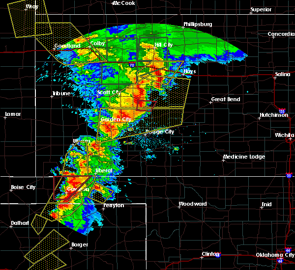 At 807 pm cdt, a severe thunderstorm was located 5 miles southeast of feterita, moving northeast at 45 mph (radar indicated). Hazards include 60 mph wind gusts and half dollar size hail. Hail damage to vehicles is expected. Expect wind damage to roofs, siding, and trees. At 807 pm cdt, a severe thunderstorm was located 5 miles southeast of feterita, moving northeast at 45 mph (radar indicated). Hazards include 60 mph wind gusts and half dollar size hail. Hail damage to vehicles is expected. Expect wind damage to roofs, siding, and trees.
|
| 5/28/2018 7:55 PM CDT |
 At 754 pm cdt, a severe thunderstorm was located 6 miles north of ryus, moving northeast at 35 mph (radar indicated). Hazards include 60 mph wind gusts and quarter size hail. Hail damage to vehicles is expected. expect wind damage to roofs, siding, and trees. Locations impacted include, hugoton, moscow, ryus, cave, hickok, woods and feterita. At 754 pm cdt, a severe thunderstorm was located 6 miles north of ryus, moving northeast at 35 mph (radar indicated). Hazards include 60 mph wind gusts and quarter size hail. Hail damage to vehicles is expected. expect wind damage to roofs, siding, and trees. Locations impacted include, hugoton, moscow, ryus, cave, hickok, woods and feterita.
|
| 5/28/2018 7:35 PM CDT |
 At 735 pm cdt, a severe thunderstorm was located 6 miles west of moscow, moving northeast at 85 mph (radar indicated). Hazards include 60 mph wind gusts and quarter size hail. Hail damage to vehicles is expected. expect wind damage to roofs, siding, and trees. Locations impacted include, ulysses, hugoton, moscow, ryus, cave, hickok, woods and feterita. At 735 pm cdt, a severe thunderstorm was located 6 miles west of moscow, moving northeast at 85 mph (radar indicated). Hazards include 60 mph wind gusts and quarter size hail. Hail damage to vehicles is expected. expect wind damage to roofs, siding, and trees. Locations impacted include, ulysses, hugoton, moscow, ryus, cave, hickok, woods and feterita.
|
| 5/28/2018 7:23 PM CDT |
 At 722 pm cdt, a severe thunderstorm was located 7 miles south of feterita, moving northeast at 45 mph (radar indicated). Hazards include 60 mph wind gusts and quarter size hail. Hail damage to vehicles is expected. Expect wind damage to roofs, siding, and trees. At 722 pm cdt, a severe thunderstorm was located 7 miles south of feterita, moving northeast at 45 mph (radar indicated). Hazards include 60 mph wind gusts and quarter size hail. Hail damage to vehicles is expected. Expect wind damage to roofs, siding, and trees.
|
| 5/28/2018 6:37 PM CDT |
 At 637 pm cdt, a severe thunderstorm was located 13 miles southeast of big bow, moving northeast at 25 mph (radar indicated). Hazards include two inch hail and 60 mph wind gusts. People and animals outdoors will be injured. expect hail damage to roofs, siding, windows, and vehicles. expect wind damage to roofs, siding, and trees. Locations impacted include, ulysses, hugoton, moscow, feterita and hickok. At 637 pm cdt, a severe thunderstorm was located 13 miles southeast of big bow, moving northeast at 25 mph (radar indicated). Hazards include two inch hail and 60 mph wind gusts. People and animals outdoors will be injured. expect hail damage to roofs, siding, windows, and vehicles. expect wind damage to roofs, siding, and trees. Locations impacted include, ulysses, hugoton, moscow, feterita and hickok.
|
| 5/28/2018 6:32 PM CDT | Quarter sized hail reported 12.6 miles SE of Hugoton, KS |
| 5/28/2018 6:31 PM CDT |
 At 631 pm cdt, a severe thunderstorm was located 10 miles west of moscow, moving east at 40 mph (radar indicated). Hazards include 60 mph wind gusts and half dollar size hail. Hail damage to vehicles is expected. Expect wind damage to roofs, siding, and trees. At 631 pm cdt, a severe thunderstorm was located 10 miles west of moscow, moving east at 40 mph (radar indicated). Hazards include 60 mph wind gusts and half dollar size hail. Hail damage to vehicles is expected. Expect wind damage to roofs, siding, and trees.
|
| 5/17/2018 5:49 PM CDT |
 At 548 pm cdt, a severe thunderstorm was located 7 miles north of hough, or 11 miles southeast of rolla, moving northeast at 5 mph (radar indicated). Hazards include golf ball size hail and 60 mph wind gusts. People and animals outdoors will be injured. expect hail damage to roofs, siding, windows, and vehicles. expect wind damage to roofs, siding, and trees. Locations impacted include, hugoton and feterita. At 548 pm cdt, a severe thunderstorm was located 7 miles north of hough, or 11 miles southeast of rolla, moving northeast at 5 mph (radar indicated). Hazards include golf ball size hail and 60 mph wind gusts. People and animals outdoors will be injured. expect hail damage to roofs, siding, windows, and vehicles. expect wind damage to roofs, siding, and trees. Locations impacted include, hugoton and feterita.
|
| 5/17/2018 5:33 PM CDT |
 At 532 pm cdt, a severe thunderstorm was located 6 miles north of hough, or 11 miles southeast of rolla, moving northeast at 20 mph (radar indicated). Hazards include golf ball size hail and 60 mph wind gusts. People and animals outdoors will be injured. expect hail damage to roofs, siding, windows, and vehicles. Expect wind damage to roofs, siding, and trees. At 532 pm cdt, a severe thunderstorm was located 6 miles north of hough, or 11 miles southeast of rolla, moving northeast at 20 mph (radar indicated). Hazards include golf ball size hail and 60 mph wind gusts. People and animals outdoors will be injured. expect hail damage to roofs, siding, windows, and vehicles. Expect wind damage to roofs, siding, and trees.
|
| 4/17/2018 8:04 PM CDT | Recorded at mesonet station svuk in stevens county KS, 12.2 miles S of Hugoton, KS |
| 8/27/2017 7:18 PM CDT |
 At 713 pm cdt, a severe thunderstorm was located 5 miles north of feterita, or 8 miles northwest of hugoton, moving south at 20 mph. this replaces the previous warning for stevens county (radar indicated). Hazards include ping pong ball size hail and 60 mph wind gusts. People and animals outdoors will be injured. expect hail damage to roofs, siding, windows, and vehicles. Expect wind damage to roofs, siding, and trees. At 713 pm cdt, a severe thunderstorm was located 5 miles north of feterita, or 8 miles northwest of hugoton, moving south at 20 mph. this replaces the previous warning for stevens county (radar indicated). Hazards include ping pong ball size hail and 60 mph wind gusts. People and animals outdoors will be injured. expect hail damage to roofs, siding, windows, and vehicles. Expect wind damage to roofs, siding, and trees.
|
| 8/27/2017 7:14 PM CDT |
 At 713 pm cdt, a severe thunderstorm was located 5 miles north of feterita, or 8 miles northwest of hugoton, moving south at 20 mph. this replaces the previous warning for stevens county (radar indicated). Hazards include ping pong ball size hail and 60 mph wind gusts. People and animals outdoors will be injured. expect hail damage to roofs, siding, windows, and vehicles. Expect wind damage to roofs, siding, and trees. At 713 pm cdt, a severe thunderstorm was located 5 miles north of feterita, or 8 miles northwest of hugoton, moving south at 20 mph. this replaces the previous warning for stevens county (radar indicated). Hazards include ping pong ball size hail and 60 mph wind gusts. People and animals outdoors will be injured. expect hail damage to roofs, siding, windows, and vehicles. Expect wind damage to roofs, siding, and trees.
|
| 8/17/2017 11:30 PM CDT | Quarter sized hail reported 0.6 miles SE of Hugoton, KS |
| 8/10/2017 10:25 PM CDT |
 The severe thunderstorm warning for southeastern morton and stevens counties will expire at 1030 pm cdt, the severe thunderstorm which prompted the warning has moved out of the warned area. therefore, the warning will be allowed to expire. however small hail, gusty winds and heavy rain are still possible with this thunderstorm. a severe thunderstorm watch remains in effect until 1100 pm cdt for southwestern kansas. The severe thunderstorm warning for southeastern morton and stevens counties will expire at 1030 pm cdt, the severe thunderstorm which prompted the warning has moved out of the warned area. therefore, the warning will be allowed to expire. however small hail, gusty winds and heavy rain are still possible with this thunderstorm. a severe thunderstorm watch remains in effect until 1100 pm cdt for southwestern kansas.
|
| 8/10/2017 10:09 PM CDT |
 At 1008 pm cdt, a severe thunderstorm was located 7 miles south of feterita, or 12 miles southwest of hugoton, moving southeast at 35 mph (radar indicated. at 950 pm cdt, quarter size hail was reported in rolla). Hazards include ping pong ball size hail and 60 mph wind gusts. People and animals outdoors will be injured. expect hail damage to roofs, siding, windows, and vehicles. expect wind damage to roofs, siding, and trees. Locations impacted include, hugoton, rolla, feterita and woods. At 1008 pm cdt, a severe thunderstorm was located 7 miles south of feterita, or 12 miles southwest of hugoton, moving southeast at 35 mph (radar indicated. at 950 pm cdt, quarter size hail was reported in rolla). Hazards include ping pong ball size hail and 60 mph wind gusts. People and animals outdoors will be injured. expect hail damage to roofs, siding, windows, and vehicles. expect wind damage to roofs, siding, and trees. Locations impacted include, hugoton, rolla, feterita and woods.
|
| 8/10/2017 9:59 PM CDT |
 At 959 pm cdt, a severe thunderstorm was located near rolla, or 14 miles west of hugoton, moving southeast at 35 mph (radar indicated). Hazards include two inch hail and 70 mph wind gusts. People and animals outdoors will be injured. expect hail damage to roofs, siding, windows, and vehicles. expect considerable tree damage. wind damage is also likely to mobile homes, roofs, and outbuildings. Locations impacted include, hugoton, elkhart, rolla, moscow, richfield, feterita, wilburton, cave, woods, point of rocks at cimarron grassland and cimarron grassland recreation area. At 959 pm cdt, a severe thunderstorm was located near rolla, or 14 miles west of hugoton, moving southeast at 35 mph (radar indicated). Hazards include two inch hail and 70 mph wind gusts. People and animals outdoors will be injured. expect hail damage to roofs, siding, windows, and vehicles. expect considerable tree damage. wind damage is also likely to mobile homes, roofs, and outbuildings. Locations impacted include, hugoton, elkhart, rolla, moscow, richfield, feterita, wilburton, cave, woods, point of rocks at cimarron grassland and cimarron grassland recreation area.
|
| 8/10/2017 9:27 PM CDT |
 At 927 pm cdt, a severe thunderstorm was located 7 miles northeast of richfield, or 14 miles south of johnson city, moving southeast at 40 mph. other strong storms were developing around the main severe storm, which could also become severe across the warned area (radar indicated). Hazards include golf ball size hail and 70 mph wind gusts. People and animals outdoors will be injured. expect hail damage to roofs, siding, windows, and vehicles. expect considerable tree damage. Wind damage is also likely to mobile homes, roofs, and outbuildings. At 927 pm cdt, a severe thunderstorm was located 7 miles northeast of richfield, or 14 miles south of johnson city, moving southeast at 40 mph. other strong storms were developing around the main severe storm, which could also become severe across the warned area (radar indicated). Hazards include golf ball size hail and 70 mph wind gusts. People and animals outdoors will be injured. expect hail damage to roofs, siding, windows, and vehicles. expect considerable tree damage. Wind damage is also likely to mobile homes, roofs, and outbuildings.
|
| 8/10/2017 11:51 AM CDT | Two to three inch tree limbs were broken. the time was radar estimate in stevens county KS, 11.8 miles WNW of Hugoton, KS |
| 6/29/2017 9:26 PM CDT | Quarter sized hail reported 12.6 miles SE of Hugoton, KS |
| 6/29/2017 4:47 PM CDT |
 At 947 pm cdt, a severe thunderstorm was located 5 miles northwest of hugoton, moving southeast at 30 mph (radar indicated). Hazards include 60 mph wind gusts and half dollar size hail. Hail damage to vehicles is expected. expect wind damage to roofs, siding, and trees. Locations impacted include, hugoton, moscow, feterita and woods. At 947 pm cdt, a severe thunderstorm was located 5 miles northwest of hugoton, moving southeast at 30 mph (radar indicated). Hazards include 60 mph wind gusts and half dollar size hail. Hail damage to vehicles is expected. expect wind damage to roofs, siding, and trees. Locations impacted include, hugoton, moscow, feterita and woods.
|
| 6/29/2017 4:28 PM CDT |
 At 926 pm cdt, a severe thunderstorm was located 13 miles north of feterita, or 15 miles northwest of hugoton, moving southeast at 30 mph. this is a very dangerous storm (radar indicated. at 910 pm 3 inch hail was reported 12 miles north northeast of richfield). Hazards include three inch hail and 60 mph wind gusts. People and animals outdoors will be severely injured. Expect shattered windows, extensive damage to roofs, siding, and vehicles. At 926 pm cdt, a severe thunderstorm was located 13 miles north of feterita, or 15 miles northwest of hugoton, moving southeast at 30 mph. this is a very dangerous storm (radar indicated. at 910 pm 3 inch hail was reported 12 miles north northeast of richfield). Hazards include three inch hail and 60 mph wind gusts. People and animals outdoors will be severely injured. Expect shattered windows, extensive damage to roofs, siding, and vehicles.
|
| 6/29/2017 4:18 PM CDT |
 At 918 pm cdt, a severe thunderstorm was located 11 miles northeast of richfield, or 17 miles southeast of johnson city, moving southeast at 35 mph (radar indicated). Hazards include tennis ball size hail and 60 mph wind gusts. People and animals outdoors will be injured. expect hail damage to roofs, siding, windows, and vehicles. Expect wind damage to roofs, siding, and trees. At 918 pm cdt, a severe thunderstorm was located 11 miles northeast of richfield, or 17 miles southeast of johnson city, moving southeast at 35 mph (radar indicated). Hazards include tennis ball size hail and 60 mph wind gusts. People and animals outdoors will be injured. expect hail damage to roofs, siding, windows, and vehicles. Expect wind damage to roofs, siding, and trees.
|
| 6/22/2017 6:49 PM CDT |
 At 648 pm cdt, a severe thunderstorm was located 3 miles east of richfield, or 20 miles northeast of elkhart, moving south at 20 mph (radar indicated). Hazards include 60 mph wind gusts and half dollar size hail. Hail damage to vehicles is expected. expect wind damage to roofs, siding, and trees. Locations impacted include, hugoton, elkhart, rolla, richfield, feterita, wilburton, point of rocks at cimarron grassland and cimarron grassland recreation area. At 648 pm cdt, a severe thunderstorm was located 3 miles east of richfield, or 20 miles northeast of elkhart, moving south at 20 mph (radar indicated). Hazards include 60 mph wind gusts and half dollar size hail. Hail damage to vehicles is expected. expect wind damage to roofs, siding, and trees. Locations impacted include, hugoton, elkhart, rolla, richfield, feterita, wilburton, point of rocks at cimarron grassland and cimarron grassland recreation area.
|
| 6/22/2017 6:28 PM CDT |
 At 626 pm cdt, a severe thunderstorm was located 7 miles north of richfield, or 13 miles south of johnson city. another severe thunderstorm was located 10 miles southeast of big bow. both storms were moving south at 20 mph (radar indicated). Hazards include ping pong ball size hail and 60 mph wind gusts. People and animals outdoors will be injured. expect hail damage to roofs, siding, windows, and vehicles. expect wind damage to roofs, siding, and trees. Locations impacted include, ulysses, hugoton, elkhart, rolla, richfield, big bow, feterita, wilburton, point of rocks at cimarron grassland, cimarron grassland recreation area and the milepost elevator. At 626 pm cdt, a severe thunderstorm was located 7 miles north of richfield, or 13 miles south of johnson city. another severe thunderstorm was located 10 miles southeast of big bow. both storms were moving south at 20 mph (radar indicated). Hazards include ping pong ball size hail and 60 mph wind gusts. People and animals outdoors will be injured. expect hail damage to roofs, siding, windows, and vehicles. expect wind damage to roofs, siding, and trees. Locations impacted include, ulysses, hugoton, elkhart, rolla, richfield, big bow, feterita, wilburton, point of rocks at cimarron grassland, cimarron grassland recreation area and the milepost elevator.
|
| 6/22/2017 6:08 PM CDT |
 At 608 pm cdt, a severe thunderstorm was located 4 miles southeast of big bow, or 9 miles southwest of ulysses, moving south at 20 mph (radar indicated). Hazards include 60 mph wind gusts and quarter size hail. Hail damage to vehicles is expected. Expect wind damage to roofs, siding, and trees. At 608 pm cdt, a severe thunderstorm was located 4 miles southeast of big bow, or 9 miles southwest of ulysses, moving south at 20 mph (radar indicated). Hazards include 60 mph wind gusts and quarter size hail. Hail damage to vehicles is expected. Expect wind damage to roofs, siding, and trees.
|
| 6/21/2017 7:20 PM CDT |
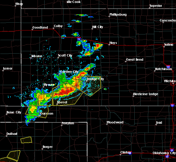 At 720 pm cdt, severe thunderstorms were located along a line extending from 8 miles southeast of satanta to 3 miles west of hugoton, moving southeast at 20 mph (radar indicated). Hazards include 60 mph wind gusts and penny size hail. Expect damage to roofs, siding, and trees. Locations impacted include, hugoton, moscow, feterita, cave and woods. At 720 pm cdt, severe thunderstorms were located along a line extending from 8 miles southeast of satanta to 3 miles west of hugoton, moving southeast at 20 mph (radar indicated). Hazards include 60 mph wind gusts and penny size hail. Expect damage to roofs, siding, and trees. Locations impacted include, hugoton, moscow, feterita, cave and woods.
|
| 6/21/2017 7:15 PM CDT | Awos station hqg... hugoto in stevens county KS, 1.8 miles ENE of Hugoton, KS |
| 6/21/2017 6:58 PM CDT |
 At 658 pm cdt, severe thunderstorms were located along a line extending from 3 miles southwest of satanta to 8 miles north of feterita, moving southeast at 20 mph (radar indicated). Hazards include 60 mph wind gusts and nickel size hail. expect damage to roofs, siding, and trees At 658 pm cdt, severe thunderstorms were located along a line extending from 3 miles southwest of satanta to 8 miles north of feterita, moving southeast at 20 mph (radar indicated). Hazards include 60 mph wind gusts and nickel size hail. expect damage to roofs, siding, and trees
|
| 6/21/2017 6:49 PM CDT |
 At 648 pm cdt, severe thunderstorms were located along a line extending from 10 miles northwest of moscow to 4 miles north of richfield, moving southeast at 25 mph (radar indicated). Hazards include 60 mph wind gusts and nickel size hail. Expect damage to roofs, siding, and trees. Locations impacted include, hugoton, rolla, richfield, feterita, wilburton and cimarron grassland recreation area. At 648 pm cdt, severe thunderstorms were located along a line extending from 10 miles northwest of moscow to 4 miles north of richfield, moving southeast at 25 mph (radar indicated). Hazards include 60 mph wind gusts and nickel size hail. Expect damage to roofs, siding, and trees. Locations impacted include, hugoton, rolla, richfield, feterita, wilburton and cimarron grassland recreation area.
|
| 6/21/2017 6:38 PM CDT |
 At 637 pm cdt, a severe thunderstorm was located 7 miles northeast of richfield, or 14 miles south of johnson city, moving southeast at 10 mph (radar indicated). Hazards include 60 mph wind gusts and quarter size hail. Hail damage to vehicles is expected. expect wind damage to roofs, siding, and trees. Locations impacted include, hugoton, elkhart, rolla, richfield, feterita, wilburton and cimarron grassland recreation area. At 637 pm cdt, a severe thunderstorm was located 7 miles northeast of richfield, or 14 miles south of johnson city, moving southeast at 10 mph (radar indicated). Hazards include 60 mph wind gusts and quarter size hail. Hail damage to vehicles is expected. expect wind damage to roofs, siding, and trees. Locations impacted include, hugoton, elkhart, rolla, richfield, feterita, wilburton and cimarron grassland recreation area.
|
| 6/21/2017 6:08 PM CDT |
 At 607 pm cdt, a severe thunderstorm was located 9 miles north of richfield, or 12 miles south of johnson city, moving southeast at 20 mph. other strong to severe storms were crossing the colorado line from neare saunders to 8 miles northwest of elkhart (radar indicated). Hazards include 60 mph wind gusts and quarter size hail. Hail damage to vehicles is expected. Expect wind damage to roofs, siding, and trees. At 607 pm cdt, a severe thunderstorm was located 9 miles north of richfield, or 12 miles south of johnson city, moving southeast at 20 mph. other strong to severe storms were crossing the colorado line from neare saunders to 8 miles northwest of elkhart (radar indicated). Hazards include 60 mph wind gusts and quarter size hail. Hail damage to vehicles is expected. Expect wind damage to roofs, siding, and trees.
|
| 5/27/2017 8:51 PM CDT |
 At 850 pm cdt, a severe thunderstorm was located 5 miles southwest of woods, or 12 miles west of liberal, moving east at 45 mph (radar indicated). Hazards include 60 mph wind gusts and quarter size hail. Hail damage to vehicles is expected. Expect wind damage to roofs, siding, and trees. At 850 pm cdt, a severe thunderstorm was located 5 miles southwest of woods, or 12 miles west of liberal, moving east at 45 mph (radar indicated). Hazards include 60 mph wind gusts and quarter size hail. Hail damage to vehicles is expected. Expect wind damage to roofs, siding, and trees.
|
| 5/27/2017 8:32 PM CDT |
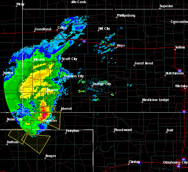 At 831 pm cdt, a severe thunderstorm was located 11 miles northwest of hooker, or 11 miles south of hugoton, moving east at 35 mph (radar indicated). Hazards include 60 mph wind gusts and half dollar size hail. Hail damage to vehicles is expected. expect wind damage to roofs, siding, and trees. Locations impacted include, hugoton and feterita. At 831 pm cdt, a severe thunderstorm was located 11 miles northwest of hooker, or 11 miles south of hugoton, moving east at 35 mph (radar indicated). Hazards include 60 mph wind gusts and half dollar size hail. Hail damage to vehicles is expected. expect wind damage to roofs, siding, and trees. Locations impacted include, hugoton and feterita.
|
| 5/27/2017 8:20 PM CDT | Storm damage reported in stevens county KS, 13 miles NE of Hugoton, KS |
| 5/27/2017 8:08 PM CDT |
 At 806 pm cdt, a severe thunderstorm was located 5 miles southeast of rolla, or 15 miles southwest of hugoton, moving east at 60 mph (radar indicated). Hazards include 60 mph wind gusts and half dollar size hail. Hail damage to vehicles is expected. Expect wind damage to roofs, siding, and trees. At 806 pm cdt, a severe thunderstorm was located 5 miles southeast of rolla, or 15 miles southwest of hugoton, moving east at 60 mph (radar indicated). Hazards include 60 mph wind gusts and half dollar size hail. Hail damage to vehicles is expected. Expect wind damage to roofs, siding, and trees.
|
| 5/15/2017 9:54 PM CDT |
 At 953 pm cdt, a severe thunderstorm was located 5 miles west of tyrone, or 14 miles southwest of liberal, moving northeast at 30 mph (radar indicated). Hazards include 70 mph wind gusts and quarter size hail. Hail damage to vehicles is expected. expect considerable tree damage. wind damage is also likely to mobile homes, roofs, and outbuildings. Locations impacted include, liberal, hugoton, sublette, satanta, moscow, hickok, ryus, cave and woods. At 953 pm cdt, a severe thunderstorm was located 5 miles west of tyrone, or 14 miles southwest of liberal, moving northeast at 30 mph (radar indicated). Hazards include 70 mph wind gusts and quarter size hail. Hail damage to vehicles is expected. expect considerable tree damage. wind damage is also likely to mobile homes, roofs, and outbuildings. Locations impacted include, liberal, hugoton, sublette, satanta, moscow, hickok, ryus, cave and woods.
|
| 5/15/2017 9:40 PM CDT |
 At 939 pm cdt, a severe thunderstorm was located 6 miles west of hooker, or 17 miles northeast of guymon, moving north at 30 mph (radar indicated). Hazards include 70 mph wind gusts and quarter size hail. Hail damage to vehicles is expected. expect considerable tree damage. Wind damage is also likely to mobile homes, roofs, and outbuildings. At 939 pm cdt, a severe thunderstorm was located 6 miles west of hooker, or 17 miles northeast of guymon, moving north at 30 mph (radar indicated). Hazards include 70 mph wind gusts and quarter size hail. Hail damage to vehicles is expected. expect considerable tree damage. Wind damage is also likely to mobile homes, roofs, and outbuildings.
|
| 5/15/2017 7:55 PM CDT | Storm damage reported in stevens county KS, 1.5 miles E of Hugoton, KS |
| 5/15/2017 7:53 PM CDT |
 The severe thunderstorm warning for eastern morton and western stevens counties will expire at 800 pm cdt, the storm which prompted the warning has moved out of the area. therefore the warning will be allowed to expire. a severe thunderstorm watch remains in effect until 1000 pm cdt for southwestern kansas. The severe thunderstorm warning for eastern morton and western stevens counties will expire at 800 pm cdt, the storm which prompted the warning has moved out of the area. therefore the warning will be allowed to expire. a severe thunderstorm watch remains in effect until 1000 pm cdt for southwestern kansas.
|
| 5/15/2017 7:34 PM CDT |
 At 734 pm cdt, a severe thunderstorm was located 3 miles southeast of rolla, or 14 miles southwest of hugoton, moving north at 35 mph (radar indicated). Hazards include up to ping pong ball size hail and 60 mph wind gusts. People and animals outdoors will be injured. expect hail damage to roofs, siding, windows, and vehicles. expect wind damage to roofs, siding, and trees. Locations impacted include, hugoton, rolla and feterita. At 734 pm cdt, a severe thunderstorm was located 3 miles southeast of rolla, or 14 miles southwest of hugoton, moving north at 35 mph (radar indicated). Hazards include up to ping pong ball size hail and 60 mph wind gusts. People and animals outdoors will be injured. expect hail damage to roofs, siding, windows, and vehicles. expect wind damage to roofs, siding, and trees. Locations impacted include, hugoton, rolla and feterita.
|
| 5/15/2017 7:11 PM CDT |
 At 709 pm cdt, a severe thunderstorm was located near hough, or 15 miles northwest of guymon, moving north at 40 mph (radar indicated). Hazards include up to ping pong ball size hail and 60 mph wind gusts. People and animals outdoors will be injured. expect hail damage to roofs, siding, windows, and vehicles. Expect wind damage to roofs, siding, and trees. At 709 pm cdt, a severe thunderstorm was located near hough, or 15 miles northwest of guymon, moving north at 40 mph (radar indicated). Hazards include up to ping pong ball size hail and 60 mph wind gusts. People and animals outdoors will be injured. expect hail damage to roofs, siding, windows, and vehicles. Expect wind damage to roofs, siding, and trees.
|
| 5/14/2017 5:13 PM CDT |
 The national weather service in dodge city has issued a * severe thunderstorm warning for. northwestern seward county in southwestern kansas. southeastern grant county in southwestern kansas. northeastern stevens county in southwestern kansas. Southwestern haskell county in southwestern kansas. The national weather service in dodge city has issued a * severe thunderstorm warning for. northwestern seward county in southwestern kansas. southeastern grant county in southwestern kansas. northeastern stevens county in southwestern kansas. Southwestern haskell county in southwestern kansas.
|
| 5/11/2017 12:11 AM CDT |
 The severe thunderstorm warning for seward and eastern stevens counties will expire at 1215 am cdt. the severe thunderstorm which prompted the warning has weakened. therefore, the warning will be allowed to expire. However small hail and heavy rain are still possible with this thunderstorm. The severe thunderstorm warning for seward and eastern stevens counties will expire at 1215 am cdt. the severe thunderstorm which prompted the warning has weakened. therefore, the warning will be allowed to expire. However small hail and heavy rain are still possible with this thunderstorm.
|
| 5/10/2017 11:56 PM CDT |
 At 1155 pm cdt, a severe thunderstorm was located 4 miles southeast of woods, or 8 miles northwest of liberal, moving northeast at 30 mph (radar indicated). Hazards include 60 mph wind gusts and nickel size hail. Expect damage to roofs, siding, and trees. Locations impacted include, liberal, hugoton, moscow, hayne, woods and arkalon park. At 1155 pm cdt, a severe thunderstorm was located 4 miles southeast of woods, or 8 miles northwest of liberal, moving northeast at 30 mph (radar indicated). Hazards include 60 mph wind gusts and nickel size hail. Expect damage to roofs, siding, and trees. Locations impacted include, liberal, hugoton, moscow, hayne, woods and arkalon park.
|
| 5/10/2017 11:30 PM CDT |
 At 1130 pm cdt, a severe thunderstorm was located 8 miles north of hooker, or 14 miles southeast of hugoton, moving northeast at 25 mph (radar indicated). Hazards include 60 mph wind gusts and quarter size hail. Hail damage to vehicles is expected. Expect wind damage to roofs, siding, and trees. At 1130 pm cdt, a severe thunderstorm was located 8 miles north of hooker, or 14 miles southeast of hugoton, moving northeast at 25 mph (radar indicated). Hazards include 60 mph wind gusts and quarter size hail. Hail damage to vehicles is expected. Expect wind damage to roofs, siding, and trees.
|
| 5/9/2017 11:38 PM CDT |
 The severe thunderstorm warning for western seward, southern kearny, southwestern finney, grant, stevens and western haskell counties will expire at 1145 pm cdt, the storms which prompted the warning have weakened. therefore, the warning will be allowed to expire. a severe thunderstorm watch remains in effect until 200 am cdt for southwestern kansas. The severe thunderstorm warning for western seward, southern kearny, southwestern finney, grant, stevens and western haskell counties will expire at 1145 pm cdt, the storms which prompted the warning have weakened. therefore, the warning will be allowed to expire. a severe thunderstorm watch remains in effect until 200 am cdt for southwestern kansas.
|
| 5/9/2017 11:12 PM CDT |
 At 1111 pm cdt, severe thunderstorms were located along a line extending from 7 miles south of lakin to 6 miles south of woods, moving east at 35 mph (radar indicated). Hazards include 70 mph wind gusts and nickel size hail. Expect considerable tree damage. damage is likely to mobile homes, roofs, and outbuildings. this line of storms has hsd a history of 60 to 70 mph wind gusts. Locations impacted include, ulysses, hugoton, satanta, moscow, hickok, ryus, cave and woods. At 1111 pm cdt, severe thunderstorms were located along a line extending from 7 miles south of lakin to 6 miles south of woods, moving east at 35 mph (radar indicated). Hazards include 70 mph wind gusts and nickel size hail. Expect considerable tree damage. damage is likely to mobile homes, roofs, and outbuildings. this line of storms has hsd a history of 60 to 70 mph wind gusts. Locations impacted include, ulysses, hugoton, satanta, moscow, hickok, ryus, cave and woods.
|
| 5/9/2017 11:00 PM CDT |
 At 1059 pm cdt, severe thunderstorms were located along a line extending from 10 miles southeast of kendall to 9 miles southeast of hugoton, moving east at 35 mph (radar indicated). Hazards include 70 mph wind gusts and nickel10 size hail. wind gusts of 70 mph were reported at ulysses at 10 51 pm. Expect considerable tree damage. Damage is likely to mobile homes, roofs, and outbuildings. At 1059 pm cdt, severe thunderstorms were located along a line extending from 10 miles southeast of kendall to 9 miles southeast of hugoton, moving east at 35 mph (radar indicated). Hazards include 70 mph wind gusts and nickel10 size hail. wind gusts of 70 mph were reported at ulysses at 10 51 pm. Expect considerable tree damage. Damage is likely to mobile homes, roofs, and outbuildings.
|
| 3/23/2017 8:21 PM CDT |
 At 821 pm cdt, severe thunderstorms were located along a line extending from 3 miles northeast of ulysses to near hooker, moving north at 55 mph (radar indicated). Hazards include up to 70 mph wind gusts and up to half dollar size hail. Hail damage to vehicles is expected. expect considerable tree damage. Wind damage is also likely to mobile homes, roofs, and outbuildings. At 821 pm cdt, severe thunderstorms were located along a line extending from 3 miles northeast of ulysses to near hooker, moving north at 55 mph (radar indicated). Hazards include up to 70 mph wind gusts and up to half dollar size hail. Hail damage to vehicles is expected. expect considerable tree damage. Wind damage is also likely to mobile homes, roofs, and outbuildings.
|
| 6/29/2016 4:06 AM CDT |
 At 405 am cdt, severe thunderstorms were located along a line extending from 5 miles northwest of woods to plains, moving southeast at 35 mph (radar indicated). Hazards include 60 mph wind gusts and quarter size hail. Hail damage to vehicles is expected. expect wind damage to roofs, siding and trees. Locations impacted include, liberal, hugoton, kismet, moscow, missler, meade state park, woods, feterita, cave, hayne and plains. At 405 am cdt, severe thunderstorms were located along a line extending from 5 miles northwest of woods to plains, moving southeast at 35 mph (radar indicated). Hazards include 60 mph wind gusts and quarter size hail. Hail damage to vehicles is expected. expect wind damage to roofs, siding and trees. Locations impacted include, liberal, hugoton, kismet, moscow, missler, meade state park, woods, feterita, cave, hayne and plains.
|
| 6/29/2016 3:43 AM CDT |
 At 343 am cdt, severe thunderstorms were located along a line extending from 7 miles northwest of moscow to 9 miles southeast of sublette, moving southeast at 25 mph (radar indicated). Hazards include 60 mph wind gusts and nickel size hail. Expect damage to roofs. Siding and trees. At 343 am cdt, severe thunderstorms were located along a line extending from 7 miles northwest of moscow to 9 miles southeast of sublette, moving southeast at 25 mph (radar indicated). Hazards include 60 mph wind gusts and nickel size hail. Expect damage to roofs. Siding and trees.
|
| 6/29/2016 3:40 AM CDT |
 At 339 am cdt, severe thunderstorms were located along a line extending from 7 miles west of moscow to 8 miles northwest of kismet, moving south at 40 mph (radar indicated). Hazards include 60 mph wind gusts and nickel size hail. Expect damage to roofs. siding and trees. Locations impacted include, liberal, hugoton, kismet, moscow, woods, feterita, cave and hayne. At 339 am cdt, severe thunderstorms were located along a line extending from 7 miles west of moscow to 8 miles northwest of kismet, moving south at 40 mph (radar indicated). Hazards include 60 mph wind gusts and nickel size hail. Expect damage to roofs. siding and trees. Locations impacted include, liberal, hugoton, kismet, moscow, woods, feterita, cave and hayne.
|
| 6/29/2016 3:33 AM CDT |
 At 333 am cdt, severe thunderstorms were located along a line extending from 8 miles west of moscow to 9 miles southeast of sublette, moving south at 40 mph (radar indicated). Hazards include 60 mph wind gusts and nickel size hail. Expect damage to roofs. siding and trees. Locations impacted include, liberal, hugoton, sublette, satanta, kismet, moscow, ryus, woods, feterita, tice, cave and hayne. At 333 am cdt, severe thunderstorms were located along a line extending from 8 miles west of moscow to 9 miles southeast of sublette, moving south at 40 mph (radar indicated). Hazards include 60 mph wind gusts and nickel size hail. Expect damage to roofs. siding and trees. Locations impacted include, liberal, hugoton, sublette, satanta, kismet, moscow, ryus, woods, feterita, tice, cave and hayne.
|
| 6/29/2016 3:19 AM CDT |
 At 319 am cdt, severe thunderstorms were located along a line extending from 6 miles south of ulysses to near sublette, moving south at 35 mph (radar indicated). Hazards include 70 mph wind gusts and nickel size hail. Expect considerable tree damage. damage is likely to mobile homes, roofs and outbuildings. Locations impacted include, liberal, ulysses, hugoton, sublette, satanta, kismet, moscow, ryus, feterita, tice, hickok, woods, cave and hayne. At 319 am cdt, severe thunderstorms were located along a line extending from 6 miles south of ulysses to near sublette, moving south at 35 mph (radar indicated). Hazards include 70 mph wind gusts and nickel size hail. Expect considerable tree damage. damage is likely to mobile homes, roofs and outbuildings. Locations impacted include, liberal, ulysses, hugoton, sublette, satanta, kismet, moscow, ryus, feterita, tice, hickok, woods, cave and hayne.
|
| 6/29/2016 2:54 AM CDT |
 At 253 am cdt, severe thunderstorms were located along a line extending from 6 miles north of ulysses to 9 miles south of plymell, moving south at 40 mph (radar indicated). Hazards include 70 mph wind gusts and nickel size hail. Expect considerable tree damage. Damage is likely to mobile homes, roofs and outbuildings. At 253 am cdt, severe thunderstorms were located along a line extending from 6 miles north of ulysses to 9 miles south of plymell, moving south at 40 mph (radar indicated). Hazards include 70 mph wind gusts and nickel size hail. Expect considerable tree damage. Damage is likely to mobile homes, roofs and outbuildings.
|
| 6/13/2016 7:25 PM CDT |
 At 724 pm cdt, severe thunderstorms were located along a line extending from 8 miles southeast of kendall to 12 miles southeast of hugoton, moving east at 30 mph (radar indicated). Hazards include 60 mph wind gusts and nickel size hail. Expect damage to roofs. siding and trees. Locations impacted include, liberal, ulysses, hugoton, lakin, moscow, ryus, woods, cave and hickok. At 724 pm cdt, severe thunderstorms were located along a line extending from 8 miles southeast of kendall to 12 miles southeast of hugoton, moving east at 30 mph (radar indicated). Hazards include 60 mph wind gusts and nickel size hail. Expect damage to roofs. siding and trees. Locations impacted include, liberal, ulysses, hugoton, lakin, moscow, ryus, woods, cave and hickok.
|
| 6/13/2016 6:51 PM CDT |
 At 649 pm cdt/549 pm mdt/, severe thunderstorms were located along a line extending from 9 miles south of syracuse to 7 miles south of rolla, moving east at 40 mph. this replaces the previous warning for hamilton, stanton, and morton counties (radar indicated). Hazards include 70 mph wind gusts and nickel size hail. Expect considerable tree damage. Damage is likely to mobile homes, roofs and outbuildings. At 649 pm cdt/549 pm mdt/, severe thunderstorms were located along a line extending from 9 miles south of syracuse to 7 miles south of rolla, moving east at 40 mph. this replaces the previous warning for hamilton, stanton, and morton counties (radar indicated). Hazards include 70 mph wind gusts and nickel size hail. Expect considerable tree damage. Damage is likely to mobile homes, roofs and outbuildings.
|
| 5/22/2016 7:42 PM CDT | Quarter sized hail reported 12.3 miles WNW of Hugoton, KS, location estimated by radar |
| 4/15/2016 10:14 PM CDT |
 At 1013 pm cdt, a severe thunderstorm was located 6 miles south of ulysses, moving northeast at 35 mph (radar indicated). Hazards include golf ball size hail and 60 mph wind gusts. People and animals outdoors will be injured. expect hail damage to roofs, siding, windows and vehicles. expect wind damage to roofs, siding and trees. Locations impacted include, ulysses, moscow, ryus, cave and hickok. At 1013 pm cdt, a severe thunderstorm was located 6 miles south of ulysses, moving northeast at 35 mph (radar indicated). Hazards include golf ball size hail and 60 mph wind gusts. People and animals outdoors will be injured. expect hail damage to roofs, siding, windows and vehicles. expect wind damage to roofs, siding and trees. Locations impacted include, ulysses, moscow, ryus, cave and hickok.
|
| 4/15/2016 9:55 PM CDT |
 At 955 pm cdt, a severe thunderstorm was located 13 miles south of big bow, moving northeast at 30 mph (radar indicated). Hazards include 60 mph wind gusts and half dollar size hail. Hail damage to vehicles is expected. Expect wind damage to roofs, siding and trees. At 955 pm cdt, a severe thunderstorm was located 13 miles south of big bow, moving northeast at 30 mph (radar indicated). Hazards include 60 mph wind gusts and half dollar size hail. Hail damage to vehicles is expected. Expect wind damage to roofs, siding and trees.
|
| 4/15/2016 8:31 PM CDT |
 At 830 pm cdt, a tornado producing storm was located 8 miles southeast of elkhart, moving northeast at 35 mph (radar confirmed tornado). Hazards include damaging tornado and ping pong ball size hail. Flying debris will be dangerous to those caught without shelter. mobile homes will be damaged or destroyed. damage to roofs, windows and vehicles will occur. tree damage is likely. this tornadic storm will be near, wilburton around 845 pm cdt. rolla around 855 pm cdt. feterita around 910 pm cdt. Hugoton around 915 pm cdt. At 830 pm cdt, a tornado producing storm was located 8 miles southeast of elkhart, moving northeast at 35 mph (radar confirmed tornado). Hazards include damaging tornado and ping pong ball size hail. Flying debris will be dangerous to those caught without shelter. mobile homes will be damaged or destroyed. damage to roofs, windows and vehicles will occur. tree damage is likely. this tornadic storm will be near, wilburton around 845 pm cdt. rolla around 855 pm cdt. feterita around 910 pm cdt. Hugoton around 915 pm cdt.
|
| 11/16/2015 7:33 PM CST |
 At 732 pm cst, severe thunderstorms were located along a line extending from 3 miles southeast of big bow to 24 miles southwest of liberal, moving northeast at 45 mph (radar indicated). Hazards include 70 mph wind gusts and quarter size hail. Hail damage to vehicles is expected. expect considerable tree damage. Wind damage is also likely to mobile homes, roofs and outbuildings. At 732 pm cst, severe thunderstorms were located along a line extending from 3 miles southeast of big bow to 24 miles southwest of liberal, moving northeast at 45 mph (radar indicated). Hazards include 70 mph wind gusts and quarter size hail. Hail damage to vehicles is expected. expect considerable tree damage. Wind damage is also likely to mobile homes, roofs and outbuildings.
|
| 11/16/2015 3:39 PM CST |
 The tornado warning for northeastern morton and northwestern stevens counties will expire at 345 pm cst, the tornado threat has diminished, therefore the tornado warning has been cancelled. however, large hail and damaging winds remain likely and a severe thunderstorm warning remains in effect for the area. however small hail is still possible with this thunderstorm. a tornado watch remains in effect until 900 pm cst for southwestern kansas. remember, a severe thunderstorm warning still remains in effect for stanton, grant, morton and stevens counties. The tornado warning for northeastern morton and northwestern stevens counties will expire at 345 pm cst, the tornado threat has diminished, therefore the tornado warning has been cancelled. however, large hail and damaging winds remain likely and a severe thunderstorm warning remains in effect for the area. however small hail is still possible with this thunderstorm. a tornado watch remains in effect until 900 pm cst for southwestern kansas. remember, a severe thunderstorm warning still remains in effect for stanton, grant, morton and stevens counties.
|
| 11/16/2015 3:20 PM CST |
 At 320 pm cst, a severe thunderstorm capable of producing a tornado was located 4 miles northwest of rolla, moving northeast at 55 mph (radar indicated rotation). Hazards include tornado and half dollar size hail. Flying debris will be dangerous to those caught without shelter. mobile homes will be damaged or destroyed. damage to roofs, windows and vehicles will occur. tree damage is likely. This tornadic thunderstorm will remain over mainly rural areas of northeastern morton and northwestern stevens counties. At 320 pm cst, a severe thunderstorm capable of producing a tornado was located 4 miles northwest of rolla, moving northeast at 55 mph (radar indicated rotation). Hazards include tornado and half dollar size hail. Flying debris will be dangerous to those caught without shelter. mobile homes will be damaged or destroyed. damage to roofs, windows and vehicles will occur. tree damage is likely. This tornadic thunderstorm will remain over mainly rural areas of northeastern morton and northwestern stevens counties.
|
| 11/16/2015 3:11 PM CST |
 At 310 pm cst, a severe thunderstorm capable of producing a tornado was located very near wilburton, moving northeast at 55 mph (radar indicated rotation). Hazards include tornado and golf ball size hail. Flying debris will be dangerous to those caught without shelter. mobile homes will be damaged or destroyed. damage to roofs, windows and vehicles will occur. tree damage is likely. This dangerous storm will be near, rolla around 320 pm cst. At 310 pm cst, a severe thunderstorm capable of producing a tornado was located very near wilburton, moving northeast at 55 mph (radar indicated rotation). Hazards include tornado and golf ball size hail. Flying debris will be dangerous to those caught without shelter. mobile homes will be damaged or destroyed. damage to roofs, windows and vehicles will occur. tree damage is likely. This dangerous storm will be near, rolla around 320 pm cst.
|
| 11/16/2015 3:04 PM CST |
 At 304 pm cst, a severe thunderstorm was located 3 miles east of elkhart, moving northeast at 55 mph (radar indicated). Hazards include ping pong ball size hail and 60 mph wind gusts. People and animals outdoors will be injured. expect hail damage to roofs, siding, windows and vehicles. expect wind damage to roofs, siding and trees. locations impacted include, hugoton, elkhart, johnson city, rolla, moscow, richfield, feterita and wilburton. A tornado watch remains in effect until 900 pm cst for southwestern kansas. At 304 pm cst, a severe thunderstorm was located 3 miles east of elkhart, moving northeast at 55 mph (radar indicated). Hazards include ping pong ball size hail and 60 mph wind gusts. People and animals outdoors will be injured. expect hail damage to roofs, siding, windows and vehicles. expect wind damage to roofs, siding and trees. locations impacted include, hugoton, elkhart, johnson city, rolla, moscow, richfield, feterita and wilburton. A tornado watch remains in effect until 900 pm cst for southwestern kansas.
|
| 11/16/2015 2:53 PM CST |
 At 252 pm cst, a severe thunderstorm was located 9 miles southwest of elkhart, moving northeast at 55 mph (radar indicated). Hazards include 60 mph wind gusts and half dollar size hail. Hail damage to vehicles is expected. Expect wind damage to roofs, siding and trees. At 252 pm cst, a severe thunderstorm was located 9 miles southwest of elkhart, moving northeast at 55 mph (radar indicated). Hazards include 60 mph wind gusts and half dollar size hail. Hail damage to vehicles is expected. Expect wind damage to roofs, siding and trees.
|
| 8/17/2015 11:26 PM CDT |
 At 1124 pm cdt, severe thunderstorms were located along a line extending from 10 miles north of hickok to 3 miles southwest of satanta to 2 miles southeast of woods to 24 miles southwest of liberal, moving southeast at 40 mph (radar indicated. at 1104 pm a wind gust of 61 mph was reported at the ulyssyes airport). Hazards include up to 70 mph wind gusts and quarter size hail. Wind damage is likely to mobile homes. roofs and outbuildings. Locations impacted include, liberal, ulysses, hugoton, lakin, sublette, satanta, kismet, moscow, ryus, feterita, tice, hickok, woods, cave and hayne. At 1124 pm cdt, severe thunderstorms were located along a line extending from 10 miles north of hickok to 3 miles southwest of satanta to 2 miles southeast of woods to 24 miles southwest of liberal, moving southeast at 40 mph (radar indicated. at 1104 pm a wind gust of 61 mph was reported at the ulyssyes airport). Hazards include up to 70 mph wind gusts and quarter size hail. Wind damage is likely to mobile homes. roofs and outbuildings. Locations impacted include, liberal, ulysses, hugoton, lakin, sublette, satanta, kismet, moscow, ryus, feterita, tice, hickok, woods, cave and hayne.
|
| 8/17/2015 10:56 PM CDT |
 At 1056 pm cdt, severe thunderstorms were located along a line extending from 4 miles southeast of kendall to 2 miles northeast of ulysses to 8 miles west of moscow to 12 miles south of feterita, moving southeast at 40 mph (radar indicated). Hazards include up to 70 mph wind gusts and quarter size hail. Hail damage to vehicles is expected. expect considerable tree damage. Wind damage is also likely to mobile homes, roofs and outbuildings. At 1056 pm cdt, severe thunderstorms were located along a line extending from 4 miles southeast of kendall to 2 miles northeast of ulysses to 8 miles west of moscow to 12 miles south of feterita, moving southeast at 40 mph (radar indicated). Hazards include up to 70 mph wind gusts and quarter size hail. Hail damage to vehicles is expected. expect considerable tree damage. Wind damage is also likely to mobile homes, roofs and outbuildings.
|
| 8/8/2015 8:58 PM CDT | The severe thunderstorm warning for southwestern finney, northern stevens, southeastern kearny, northwestern seward, grant and western haskell counties will expire at 900 pm cdt, the line of storms which prompted the warning have weakened. therefore the warning will be allowed to expire. however gusty winds and heavy rain are still possible with these thunderstorms. |
| 8/8/2015 8:33 PM CDT |
 A severe thunderstorm warning remains in effect until 900 pm cdt for southwestern finney. northern stevens. southeastern kearny. northwestern seward. grant and western haskell counties. at 832 pm cdt. severe thunderstorms were located along a line extending from 5 miles southwest of lakin to 3 miles west of hickok to 8 miles west of moscow. Moving northeast at 45 mph. A severe thunderstorm warning remains in effect until 900 pm cdt for southwestern finney. northern stevens. southeastern kearny. northwestern seward. grant and western haskell counties. at 832 pm cdt. severe thunderstorms were located along a line extending from 5 miles southwest of lakin to 3 miles west of hickok to 8 miles west of moscow. Moving northeast at 45 mph.
|
| 8/8/2015 8:23 PM CDT |
 A severe thunderstorm warning remains in effect until 900 pm cdt for southwestern finney. southeastern stanton. northern stevens. southeastern kearny. northwestern seward. grant and western haskell counties. at 822 pm cdt. Severe thunderstorms were located along a line extending from 11 miles southeast of kendall to 4 miles south of. A severe thunderstorm warning remains in effect until 900 pm cdt for southwestern finney. southeastern stanton. northern stevens. southeastern kearny. northwestern seward. grant and western haskell counties. at 822 pm cdt. Severe thunderstorms were located along a line extending from 11 miles southeast of kendall to 4 miles south of.
|
| 8/8/2015 8:11 PM CDT |
 At 810 pm cdt /710 pm mdt/, severe thunderstorms were located along a line extending from 14 miles south of kendall to 9 miles south of big bow to 4 miles northeast of rolla, moving northeast at 40 mph (radar indicated). Hazards include 60 mph wind gusts and penny size hail. Expect damage to roofs. Siding and trees. At 810 pm cdt /710 pm mdt/, severe thunderstorms were located along a line extending from 14 miles south of kendall to 9 miles south of big bow to 4 miles northeast of rolla, moving northeast at 40 mph (radar indicated). Hazards include 60 mph wind gusts and penny size hail. Expect damage to roofs. Siding and trees.
|
| 7/19/2015 8:46 PM CDT |
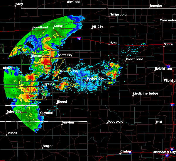 At 846 pm cdt, a severe thunderstorm was located 3 miles east of richfield, moving east at 20 mph (radar indicated). Hazards include 60 mph wind gusts and quarter size hail. Hail damage to vehicles is expected. Expect wind damage to roofs, siding and trees. At 846 pm cdt, a severe thunderstorm was located 3 miles east of richfield, moving east at 20 mph (radar indicated). Hazards include 60 mph wind gusts and quarter size hail. Hail damage to vehicles is expected. Expect wind damage to roofs, siding and trees.
|
| 7/18/2015 9:40 PM CDT |
 At 940 pm cdt, severe thunderstorms were located along a line extending from 13 miles south of feterita to near wilburton, moving east at 30 mph (radar indicated). Hazards include 60 mph wind gusts and penny size hail. Expect damage to roofs. Siding and trees. At 940 pm cdt, severe thunderstorms were located along a line extending from 13 miles south of feterita to near wilburton, moving east at 30 mph (radar indicated). Hazards include 60 mph wind gusts and penny size hail. Expect damage to roofs. Siding and trees.
|
| 7/9/2015 9:36 PM CDT |
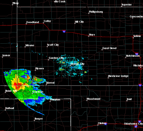 The severe thunderstorm warning for central stevens county will expire at 945 pm cdt, the storm which prompted the warning has weakened below severe limits, and no longer pose an immediate threat to life or property. therefore the warning will be allowed to expire. however small hail and heavy rain are still possible with this thunderstorm. The severe thunderstorm warning for central stevens county will expire at 945 pm cdt, the storm which prompted the warning has weakened below severe limits, and no longer pose an immediate threat to life or property. therefore the warning will be allowed to expire. however small hail and heavy rain are still possible with this thunderstorm.
|
| 7/9/2015 9:20 PM CDT |
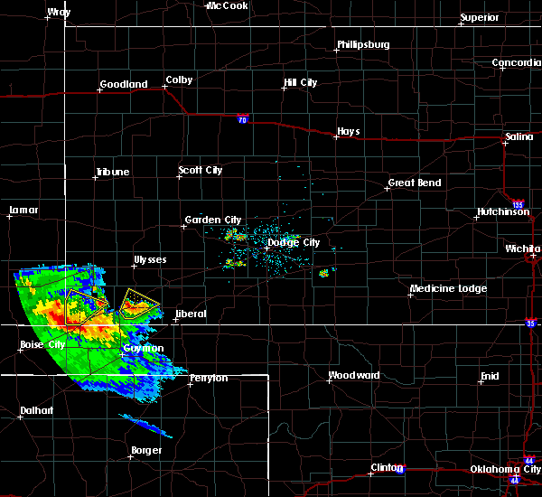 At 916 pm cdt, a severe thunderstorm was located very near hugoton, moving northeast at 20 mph (at 900 pm...the public reported quarter size hail 2 miles east of feterita). Hazards include quarter size hail. Damage to vehicles is expected. Locations impacted include, hugoton and feterita. At 916 pm cdt, a severe thunderstorm was located very near hugoton, moving northeast at 20 mph (at 900 pm...the public reported quarter size hail 2 miles east of feterita). Hazards include quarter size hail. Damage to vehicles is expected. Locations impacted include, hugoton and feterita.
|
| 7/9/2015 9:00 PM CDT | Quarter sized hail reported 6.1 miles ENE of Hugoton, KS |
| 7/9/2015 8:58 PM CDT |
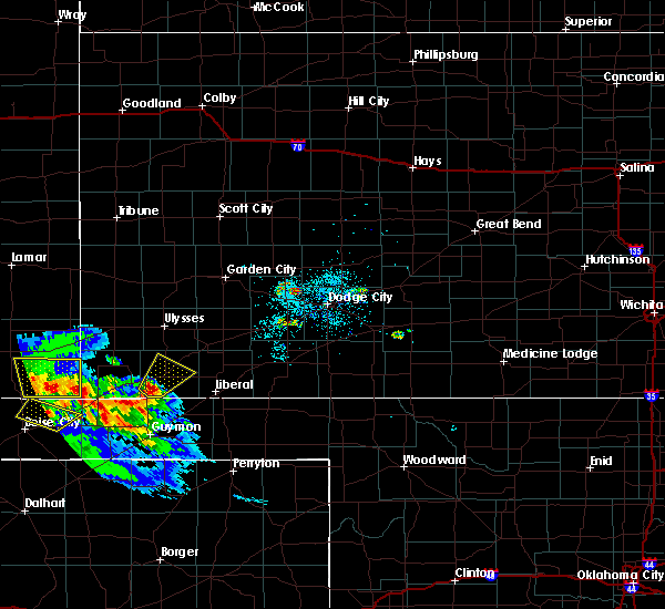 At 857 pm cdt, a severe thunderstorm was located 4 miles southeast of feterita, moving northeast at 20 mph (radar indicated). Hazards include 60 mph wind gusts and half dollar size hail. Hail damage to vehicles is expected. Expect wind damage to roofs, siding and trees. At 857 pm cdt, a severe thunderstorm was located 4 miles southeast of feterita, moving northeast at 20 mph (radar indicated). Hazards include 60 mph wind gusts and half dollar size hail. Hail damage to vehicles is expected. Expect wind damage to roofs, siding and trees.
|
| 6/11/2015 11:54 PM CDT |
 At 1154 pm cdt, a severe thunderstorm was located 4 miles northeast of hugoton, moving east at 40 mph (radar indicated). Hazards include 60 mph wind gusts and quarter size hail. Hail damage to vehicles is expected. Expect wind damage to roofs, siding and trees. At 1154 pm cdt, a severe thunderstorm was located 4 miles northeast of hugoton, moving east at 40 mph (radar indicated). Hazards include 60 mph wind gusts and quarter size hail. Hail damage to vehicles is expected. Expect wind damage to roofs, siding and trees.
|
| 6/11/2015 11:51 PM CDT | Storm damage reported in stevens county KS, 0.6 miles SE of Hugoton, KS |
| 6/11/2015 11:45 PM CDT | Storm damage reported in stevens county KS, 0.6 miles SE of Hugoton, KS |
| 6/11/2015 9:34 PM CDT |
 At 934 pm cdt, a severe thunderstorm was located near feterita, moving northeast at 35 mph (radar indicated). Hazards include golf ball size hail. People and animals outdoors will be injured. Expect damage to roofs, siding, windows and vehicles. At 934 pm cdt, a severe thunderstorm was located near feterita, moving northeast at 35 mph (radar indicated). Hazards include golf ball size hail. People and animals outdoors will be injured. Expect damage to roofs, siding, windows and vehicles.
|
| 5/31/2015 11:10 PM CDT | At 1109 pm cdt, severe thunderstorms were located along a line extending from 12 miles south of big bow to 4 miles west of richfield, moving southeast at 25 mph (radar indicated). Hazards include 60 mph wind gusts and nickel size hail. Expect damage to roofs. siding and trees. Locations impacted include, hugoton, elkhart, rolla, richfield, wilburton and feterita. |
| 5/31/2015 10:41 PM CDT | At 1041 pm cdt, severe thunderstorms were located along a line extending from 4 miles south of johnson city to 6 miles south of the saunders elevator, moving southeast at 25 mph (radar indicated). Hazards include 60 mph wind gusts and quarter size hail. Hail damage to vehicles is expected. Expect wind damage to roofs, siding and trees. |
| 5/24/2015 10:25 PM CDT | At 1025 pm cdt, severe thunderstorms were located along a line extending from 10 miles west of plymell to 3 miles northwest of satanta to 4 miles east of cave to 5 miles west of woods, moving northeast at 35 mph (radar indicated). Hazards include 60 mph wind gusts and up to half dollar size hail. Hail damage to vehicles is expected. Expect wind damage to roofs, siding and trees. |
| 5/24/2015 10:08 PM CDT | At 1008 pm cdt, severe thunderstorms were located along a line extending from 12 miles northeast of ulysses to 5 miles northeast of hugoton, moving east at 15 mph (radar indicated). Hazards include 60 mph wind gusts and up to half dollar size hail. Hail damage to vehicles is expected. expect wind damage to roofs, siding and trees. locations impacted include, ulysses, hugoton, satanta, moscow, ryus, woods, cave and hickok. A tornado watch remains in effect until 100 am cdt for southwestern kansas. |
| 5/24/2015 9:41 PM CDT | At 941 pm cdt, severe thunderstorms were located along a line extending from 10 miles north of ulysses to 4 miles northwest of hugoton, moving east at 15 mph (radar indicated). Hazards include 60 mph wind gusts and up to half dollar size hail. Hail damage to vehicles is expected. Expect wind damage to roofs, siding and trees. |
| 5/24/2015 9:33 PM CDT | At 932 pm cdt, severe thunderstorms were located along a line extending from 5 miles south of ulysses to 7 miles north of feterita, moving east at 25 mph (radar indicated). Hazards include 60 mph wind gusts and quarter size hail. Hail damage to vehicles is expected. Expect wind damage to roofs, siding and trees. |
| 5/16/2015 4:23 PM CDT | The severe thunderstorm warning for grant, northern stevens, northwestern seward and western haskell counties will expire at 430 pm cdt, the storm which prompted the warning has moved out of the area. therefore the warning will be allowed to expire. however gusty winds and heavy rain are still possible with this thunderstorm. a tornado watch remains in effect until 900 pm cdt for southwestern kansas. to report severe weather, contact your nearest law enforcement agency. they will relay your report to the national weather service dodge city. |
| 5/16/2015 4:03 PM CDT | At 403 pm cdt, a severe thunderstorm was located 4 miles southeast of ulysses, moving east at 50 mph (radar indicated). Hazards include 60 mph wind gusts and quarter size hail. Hail damage to vehicles is expected. Expect wind damage to roofs, siding and trees. |
| 8/7/2014 9:05 PM CDT | Storm damage reported in stevens county KS, 11.2 miles NNW of Hugoton, KS |
| 8/7/2014 8:49 PM CDT | Storm damage reported in stevens county KS, 0.6 miles SE of Hugoton, KS |
| 6/30/2014 9:15 PM CDT | Quarter sized hail reported 8.5 miles N of Hugoton, KS |
| 6/22/2014 8:50 PM CDT | Quarter sized hail reported 1.6 miles ESE of Hugoton, KS |
| 5/22/2014 7:49 PM CDT | Quarter sized hail reported 13.8 miles WNW of Hugoton, KS |
| 8/7/2013 6:54 PM CDT | Half Dollar sized hail reported 0.6 miles SE of Hugoton, KS |
| 8/7/2013 6:45 PM CDT | Golf Ball sized hail reported 0.8 miles WNW of Hugoton, KS |
| 6/20/2013 12:01 AM CDT | Storm damage reported in stevens county KS, 0.6 miles SE of Hugoton, KS |
| 6/4/2013 10:30 PM CDT | The dispatcher reported power lines down all over town. winds were estimated at greater than 50 mp in stevens county KS, 0.6 miles SE of Hugoton, KS |
| 6/4/2013 10:06 PM CDT | Hqg 1006 pm 29053g60kt 7sm +tsra sct007 sct04 bkn032 68/57 a02 rh68 wind in stevens county KS, 0.6 miles SE of Hugoton, KS |
| 6/2/2012 8:09 PM CDT | Half Dollar sized hail reported 10.3 miles E of Hugoton, KS |
| 1/1/0001 12:00 AM | Quarter sized hail reported 8.6 miles N of Hugoton, KS |
| 1/1/0001 12:00 AM | Storm damage reported in stevens county KS, 6.3 miles NE of Hugoton, KS |
| 1/1/0001 12:00 AM | Quarter sized hail reported 6.2 miles SE of Hugoton, KS |
Hail Maps for Hugoton, KS
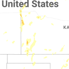


Connect with Interactive Hail Maps